
Modi
Designer, Landscape Designer
Landscape
PORTFOLIO 2017-2024 Collection of Academic and Professional Work Ashna
Urban
and
Architect
Name: Ashna Modi
Education: Bachelor’s of Design (Landscape) Master’s of Urban Design
Personal Mail IDs: modiashna@gmail.com ashnamodi99@gmail.com
University Mail ID ashna.modi@mail.utoronto.ca
Contact: +1 437 970 0480
LinkedIn: Ashna Modi
link: https://www.linkedin.com/in/ashna-modi-aaba59202
Issue: https://issuu.com/ashnamodi
Behance: https://www.behance.net/ashnamodi
PERSONAL INFORMATION
02
CONTENTS HEALTH AND BUILT ENVIRONMENT................................................................04 KEELE STREET IN TRANSITION...........................................................................10 DYNAMIC ASPHALT...............................................................................................14 RESIDENTIAL LANDSCAPE DESIGN..................................................................17 PLANTING DESIGN................................................................................................20 RESEARCH STUDY..................................................................................................21 AUGMENTING URBAN GREENS.........................................................................22 ALDEIA DE GOA.....................................................................................................25 ATLAS.......................................................................................................................26 PASSIVE DESIGN APPROACH ALONG WATERCOURSE................................28 RIVER ILISSOS : UNVEILING URBAN PALIMPSEST .......................................36 03
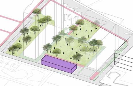
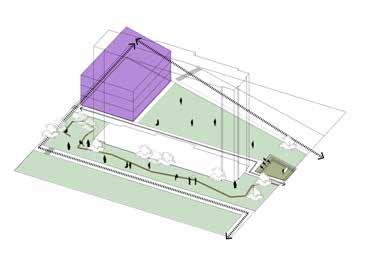
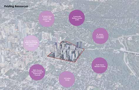
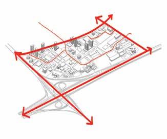
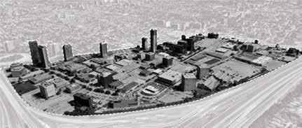
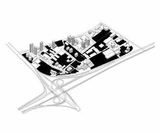
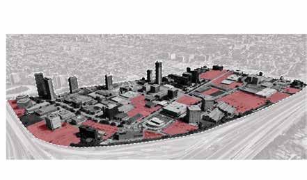
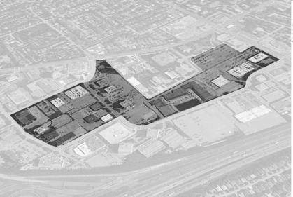
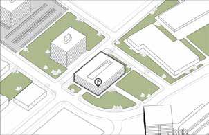
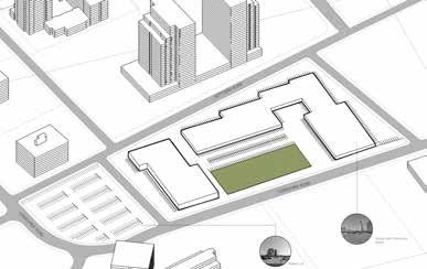
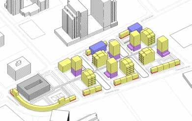
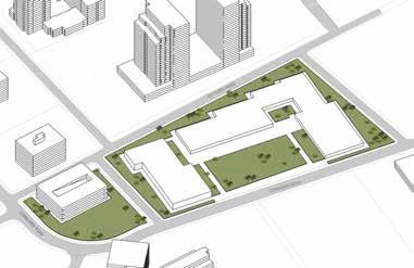
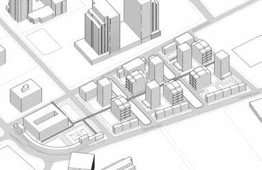
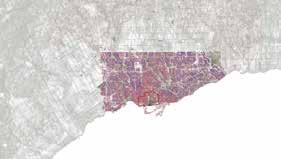
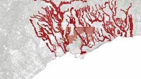
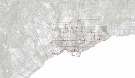
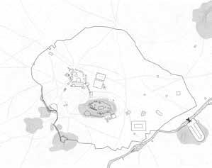
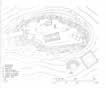
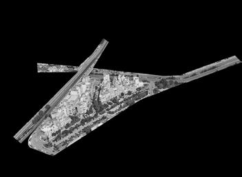
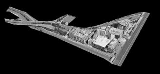
HEALTH AND BUILT ENVIRONMENT
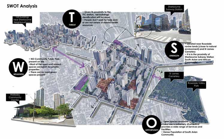
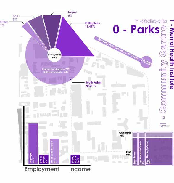
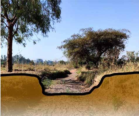
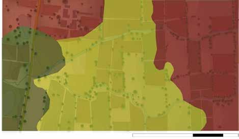
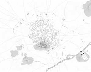
Mental Health and Stress among South Asian Immigrants in Toronto, Canada
Urban interventions in North St James Town helping mental health problems faced by South Asian immigrants in the city of Toronto
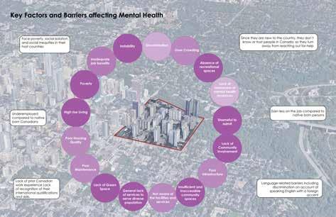
Over 17% of the foreign-born population were recent immigrants from 2016 till the present. Since the 1990s Canada has been accepting over 200,000 immigrants from around the world. In the past few decades, these immigrants have typically migrated from countries in Asia and Africa.
A majority of immigrants to Canada are “economic immigrants” from South Asia, and ethnic minorities are underrepresented in the mental health care system and have been known to underutilize mental health services.
World Health Organization defines mental health as “a state of mental well-being that enables people to cope with the stresses of life, realize their abilities, learn well and work well, and contribute to their community.”
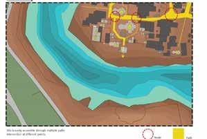
Research Question - What contribution does increased community engagement and collaborative design have on developing public spaces for the mental well-being of South Asian immigrants living in North St James ?
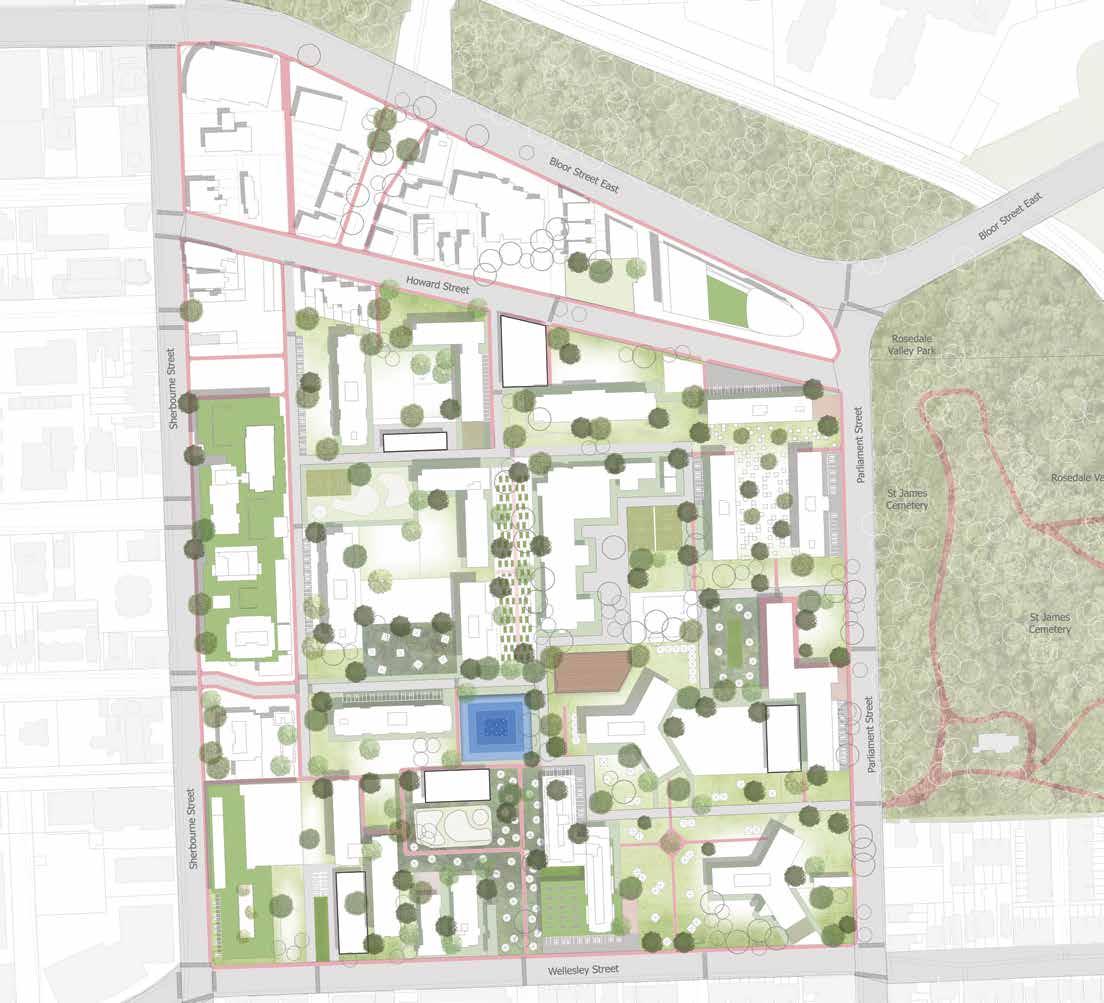

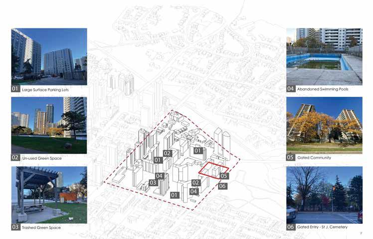
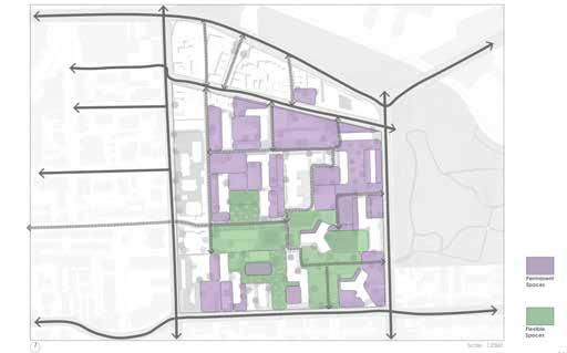
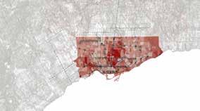
Scale - 1:2500 04
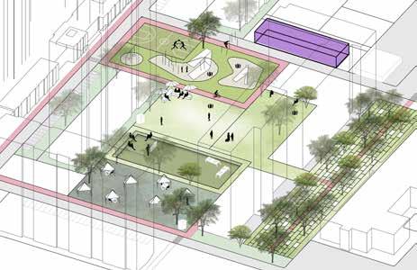
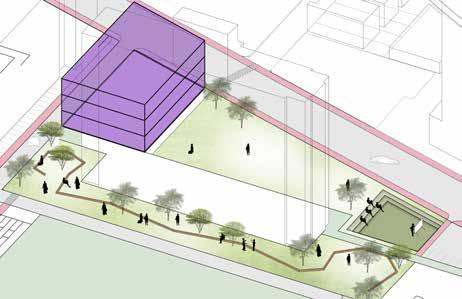
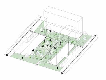
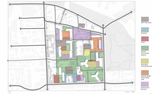
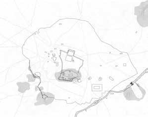
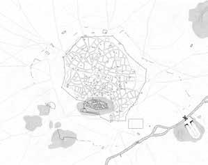
Urban Interventions
Event/Festival Spaces and Shared Community Gardens/ Multipurpose Building
Pet Park/Shared Community Spaces/Parking Lots/Charity Food Building
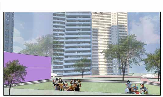
Meditation Space/Pet Park
School Gardens/Kid’s Play Area
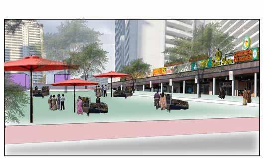
Market and Retail Spaces/ Kid’s Play Area/Outdoor Restaurant Spaces
Employment Workshop Spaces/Educative Training Spaces/Kid’s Play Area
Charity spaces/ Kitchen Gardens/ Roof Gardens on existing Community Centre
05
Employment Services and Facilities/ Employment workshop spaces

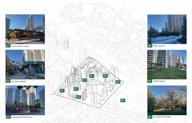
Concept Diagrams and Functions


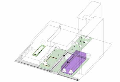


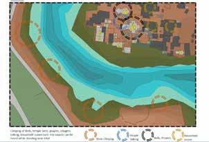
Concept Diagrams and Functions: - The idea for North of St. James Town includes several installations, including art made by the community, clothing donations, drinking water, pet waste supplies, access to all libraries and tools, and a few charitable installations, in addition to offering urban spaces for the community


Kitchen Garden
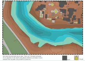
St James Cemetery
Entertainment Spaces Festive/Event Spaces Community Parks Public Plazas Mental Health Stress Relief Stress Relief Park Pet Parks Educative Training Spaces Employment Training Pop-up tents Business Small Business Retail Shops Market Place Food Charity Drive Through Food Bank Kitchen Kitchen Garden Shared Community Spaces Kid’s Play Area Green Roofs Entertainment Spaces Festive/Event Spaces Community Parks Public Plazas Educative Training Spaces Employment Training Workshop/Pop-up tents Employment Services and Facilities Employment Guidance Space Workshop Spaces Multipurpose use buildings Employment Services Mental Health Stress Relief Stress Relief Park Pet Parks Business Small Business Retail Shops Market Place
Rosedale Valley Park
06
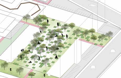
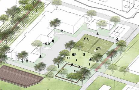
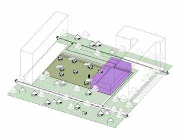
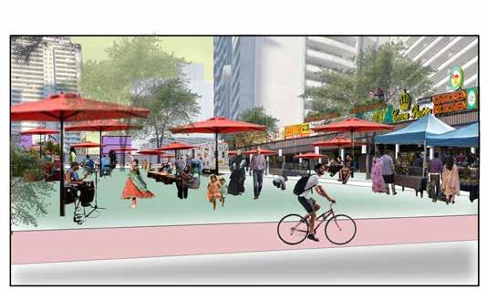
Typical Day
There is less activity on a typical day in the St. James Town neighbourhood close to Wellesley Street. With community shopping for household necessities, it seems to be just another day in the town.
Typical Day
An educational space can double as an outdoor workshop on a typical day for those who wish to learn how to use tools, sew clothes, and perform small-scale house repair tasks on their own. When the community wants to know fundamental daily information, the stakeholders may approach them during a regular day.
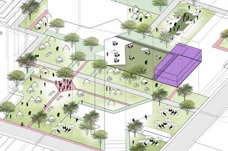
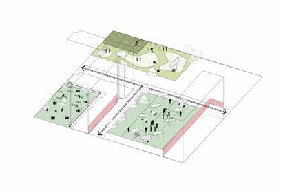
Weekends
In contrast, it seems like there is more activity on weekends in the St. James Town neighbourhood. People may use the open communal area most actively for the weekend small business market. Though it appears to be simply another day in the town, this area might be used flexibly for outdoor eating businesses along with tasks like grocery shopping. As word of mouth is crucial in this situation, it promotes the community to profit from small businesses.
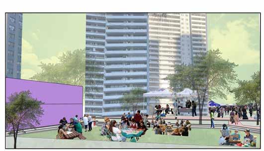
Weekends
On weekends, adults, kids, and senior citizens could all get educational programming in the same location. The community could potentially use this area as a creative activity space. The area behind these stair-step seating could be utilized for festivals or events. The entire area has the potential to provide a flexible program depending on the situation.
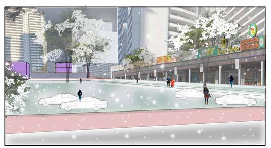
Winter Days
The area might be used for parking for the nearby restaurants and retail stores since winter is the most difficult time for several people and they dislike being outside.
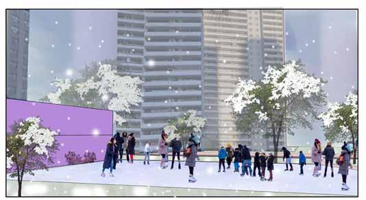
Winter Days
This area near Parliament Street and Wellesley Street may be completely covered in ice, which makes it the ideal place for ice skating lovers. In addition, the outdoor workshop area may be relocated to the multipurpose building next to it, allowing people to continue using it for everyday purposes.
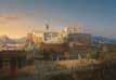
Site Proposed Visuals Market Place 07
Educative Training Space
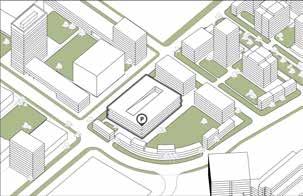
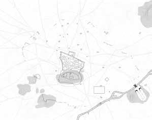
Site Challenges Site Strengths 08
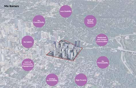
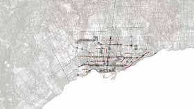
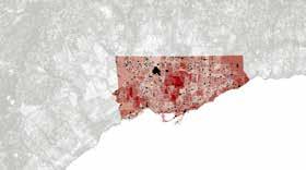
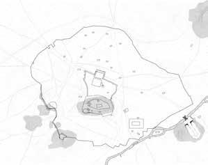
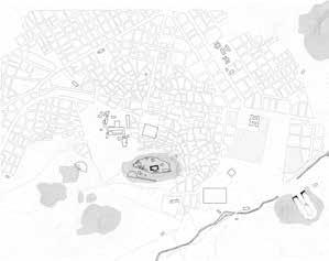
Site Analysis
Demographic Data
Improved Internal and External physical connections, Public Interactive spaces
Employment Opportunity and Awareness Spaces, Increased Resources, Educative Spaces, Spaces for Workshops Community Gathering Spaces, Green spaces
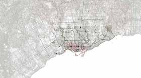
Site Analysis
Urban Design Principles
Zoning Diagram
Flexible/Permanent Spaces 09
Underground/Surface Parkings
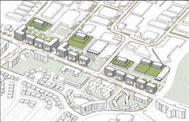
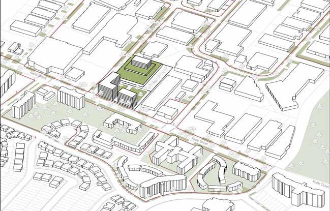
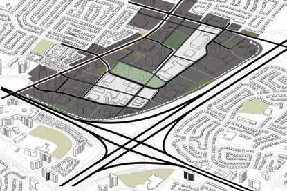
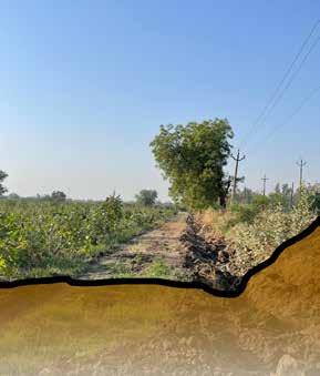
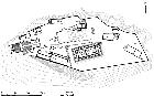
KEELE STREET IN TRANSITION
Preserving Employment Uses in General Employment Areas
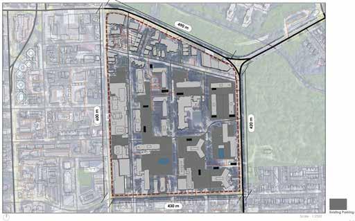
Site Plan
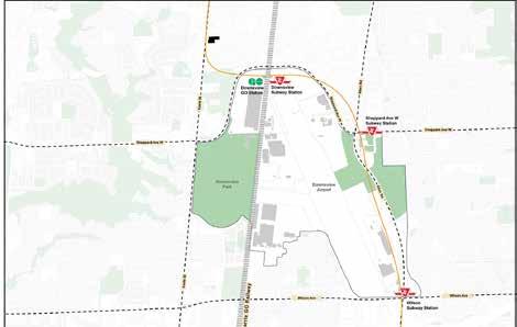
Downsview Airport is now being converted into a mixed use development projects with all the ammenities and facilities along with public parks, which will create a town in itself. This project is going to completely change the quality north york region.
The site, 3711 Keele St is located exactly between the two min subway stations- finch avenue west and downsview. It falls under 20 mins proximity of the site, therefore, there is a potential of introducing new developments for transit oriented communities.
The east side of keele street is highly a place of employment which is not allowing any other activity to take place. The west side of keele street is highly residential. A strong division of the street quality is noticed on the Keele Street.
Keele St already has a diverse quality of uses which includes retail, medical services, religious spaces, storages, car services, restaurants. The missing quality on the keele st is enough common public places and residency which can add more life to the street.
The main idea of this project is to preserve the employment land while providing opportunities for other functions to thrive on.
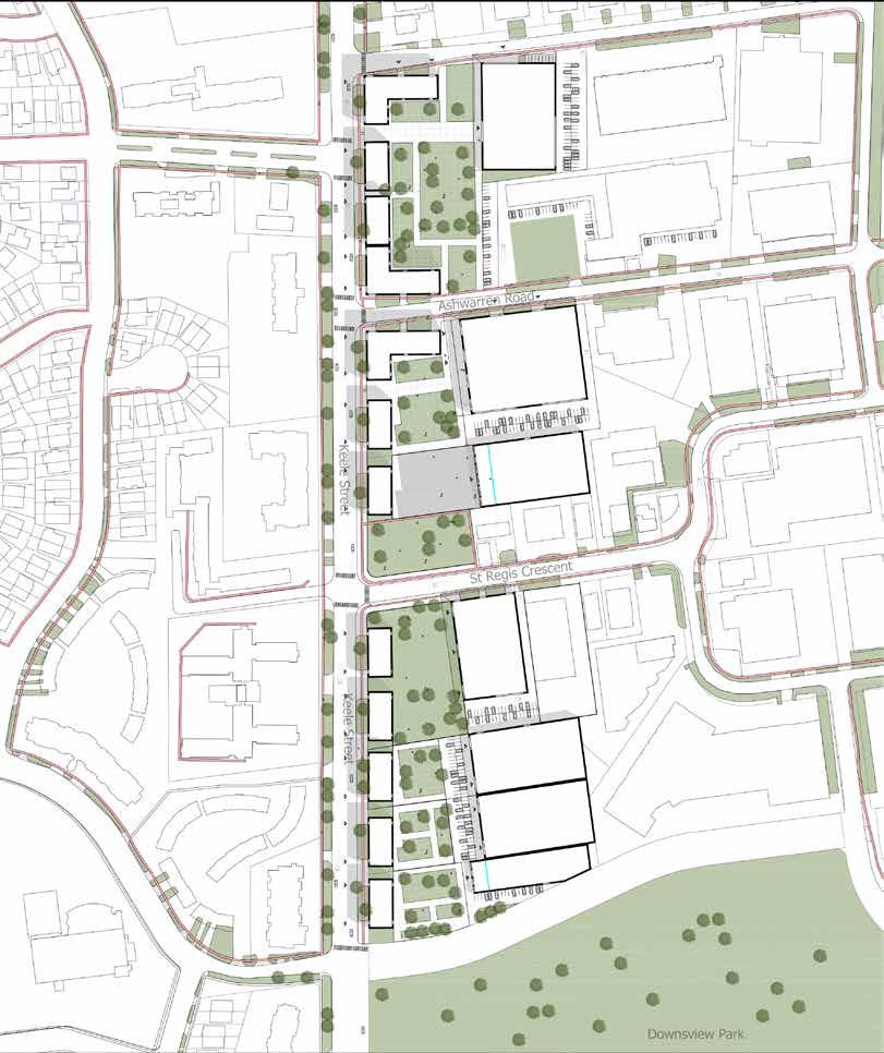

Site
Site Context
Scale - 1:5500 10
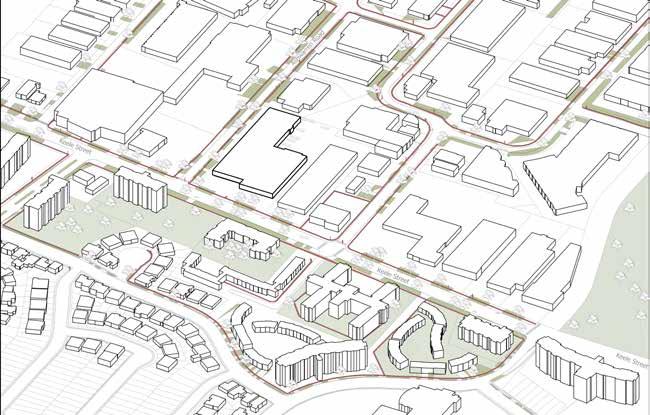
Site Analysis - Detailed
Parcels and Buildings Study
Site Analysis Bus stops Yonge-University Line Transit Map Landuse Map New Developments Neighbourhood Schools, Colleges Employment Restaurants Medical Parks and Natural Heritages Religious Places Industries Employment Lands
Building Frontages Building Outdoors General Employment Lands Core Employment Lands Parking Landscape Loading Deck Parking Spots Large Parcels Medium Parcels Small Parcels Retail Thrift Store Furniture store Appliances Super Market Churches Mosque Religious Places Restaurants Laundry/Dry Cleaning Storage Buildings Car services Walk in Clinic Service Industry Medical
90m 95m 160m 50m 150m 90m 80m 45m 45m 45m 60m 120m 80m 85m 110m 35m 10m 25m Parcel Study Building Study 11
Concept Designs
Existing Site with setback of 4.5 meters
Reflecting the West side of Keele st
Introducing Residential Development
Saving the employment lands in the general employment zone
Adding the missing elements on the east of Keele Street
- Public Space and Commercial buildings
Adding the missing elements on the east of Keele Street
- Public Space and Commercial buildings
Process Diagrams
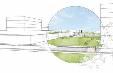
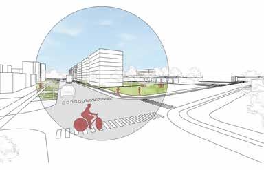
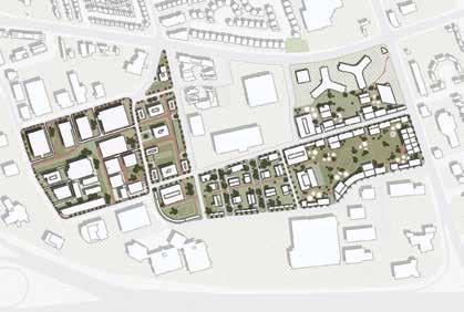
Site Proposal Drawings
Preserving Employment Lands and encouraging interactive spaces
Promoting Green Rooftop construction while providing the necessary housing and public space
Reflecting the West of Keele Street and including places of influence such as daycare and religious building
Existing Site Condition Existing Building on Site 76m 138m Commercial use Employment use Parking Residential Residential Roof Top Public Space
A vision for future Day Care PoW
01 90m 150m 02 90m 150m Residential 03 90m 150m Employment Residential 04 90m 150m Employment Public Space Residential Commercial 05 90m 150m Employment Parking Public Space Service Residential Commercial Intended Residents 12
Existing Site on Keele St Site Proposal
The Existing Sites only have employment areas.
Perspectives of the Site
The Proposed Site includes the existing employment lands, residential housing, commercial buildings, places of worship, day care, parking and public spaces
Existing Condition FSIUtlized Area1.1 49 % ResidentialPublic SpaceWork SpaceRoofttop0 % 49 % 0 % UnitsUnit Type0 None 0 % Proposal FSIUtlized Area3.1 90 % 20 % 30 % 30 % UnitsUnit Type290-310 per Lot Studio/ 1BHK 10 % ResidentialPublic SpaceWork SpaceRoofttop -
13
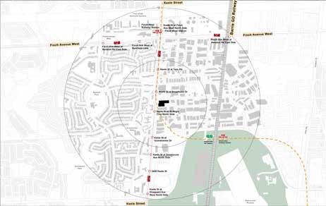
DYNAMIC ASPHALT
Strategic Vision for Converting The Heat Generating Surface Parking Lots
To Solving Housing Crises In Sheppard Avenue East/Consumer Road
Location & Year : Sheppard Ave E, Toronto, ON (2022)
Project : Proposing a strategic vision for converting the heat generating surface parking lots to solving housing crises in shheppard avenue east/ consumer road
Type : Group initiatives that eventually divided into independent projects.
A future mixed-use area is Sheppard Avenue East. There are numerous commercial and institutional buildings on the property, but no residences.
Based on in-depth analysis and research, we identified the site’s primary problem as the largest urban heat island in this area. As a group, we looked around the area and concluded that the area’s urban heat island is primarily caused by vacant parking lots.
Therefore, a number of concepts and strategies were put out as a group to address the urban heat island in this particular site area. These initiatives aim to lessen the heat effect and promote additional visitors besides locals. Additionally, this location will be in high demand for residences due to the rise in housing demand and the proximity of the forthcoming TTC station. Consequently, the design strategy supports developing the number of tall buildings based on regulations and also aids in reducing the impact of the urban heat island.
MUD Studio Instructor Michael Piper Student Names: Fall 2022 Ashna Modi Aditya Bhole Batoul Chahine Mahek Rohra Sheppard Ave. Landscaping on site Plan trees/shrubs, vegetated pergolas SRI Coating Cover surfaces exposed to solar radiation with high SRI coating Solar Panels Shade building roof with solar panels Green Roofing Cover roof with landscaping Basement Parking Provide parking underground to minimize hard paving on site
Initial Concepts to mitigate urban health island effect
Sheppard Avenue East
Parking Lots on Site
Greens spaces on existing site
Landuse
Vacant lots
Main Highways and seconday roads
14
Road Network
Nodes
Secondary
Built vs Green
Consumer
Plan
Landuse
10 min Walkability Radius Site intervention Area
Green and Grey Areas
15
Site Intervention Plan
Site Design Approach
The first phase involves converting the surface parking lots into parking structural buildings. The second step entails the addition of a residential building, the third stage involves the addition of retail stores, and the last stage consists of turning open areas into green, public interacting spaces and converting the parking structure into a building, depending on the neighbourhood’s requirements.
Phase Diagrams
Existing Condition
This diagram represents the current state of the site with multiple parking lots and very limited green space.
This diagram classifies the new infrastructure on the basis of different functions.
Phase 01
Phase 01 includes the existing built area with new parking structure.
The FAR is surrounded by consumer road on it’s major two sides so it is imperative to propose new internal roads for better circulation and easy vehicular as well as public movements.
Phase 02
Phase 02 includes new infrastructure replacing some of the existing buildings and proposed internal one way roads for more vehicular and easy public access.
Green spaces play a vital role in reducing urban heat island and provide bountiful opportunities for public interaction.
Phase 03
Phase 03 includes the high density infrastructure with defined green spaces accessible to public. It also focuses on providing internal roads and curb side greens.
Phase 04 diagram represents the proposed green spaces as well as maximum new developments whilst preserving the existing buildings across the DAZ.
16
RESIDENTIAL LANDSCAPE DESIGN
Landscape Design for a Private Guest House In the City of Udaipur, Rajasthan, India
Location & Year : Udaipur, Rajasthan, India (2020)
Project : Designing Landscape on existing Residential House Type : Group initiatives that eventually divided into independent projects
Client Brief - “I and my wife both are doctors, recently married with limited but quality have time early in the morning till about 8:00 a.m. and post 8 p.m. at night with weekends for us. We have selective friends who visit us during weekends and often spend time as one large family.“
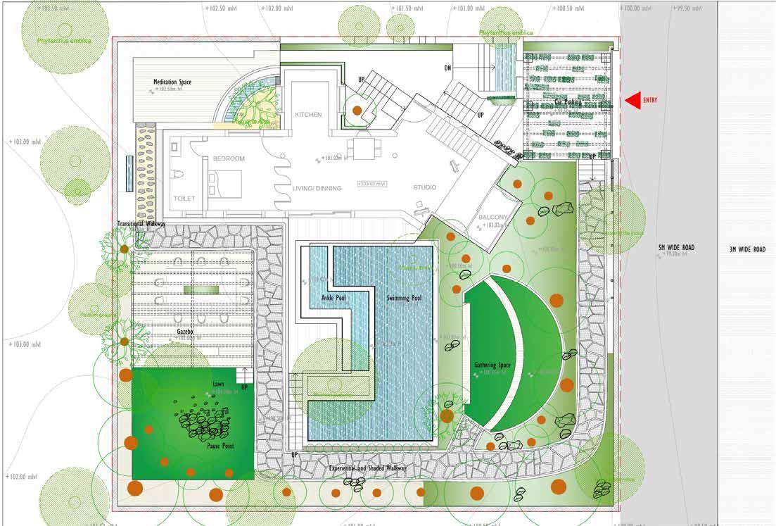
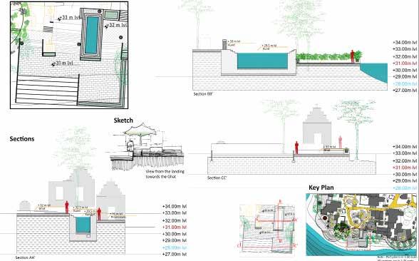
In response to the client’s proposal, the home was planned to include areas for regular physical activity, such as a meditation area with relaxing bamboo water sounds as well as swimming pool, since it was assumed the doctor pair would need a place to exercise or meditate. I also made a few gathering spots for friends to hang out, such as a tiered sitting area and a gazebo. The ground had a slope so that an experienced pathway with gradually shifting levels ran around the whole perimeter of the house. The residence also had a paved car parking space and a few planters to complement Udaipur’s hot and arid plant palette. The residence also included an ankle pool where the husband and wife could relax after a long day at work. Overall, the landscape provided the quality and elegance required for the existing stone house.

N N
Ground Floor Plan of the Residence with proposed Landscape
17
N N
Space brainstorming using a Bubble Diagram
N N
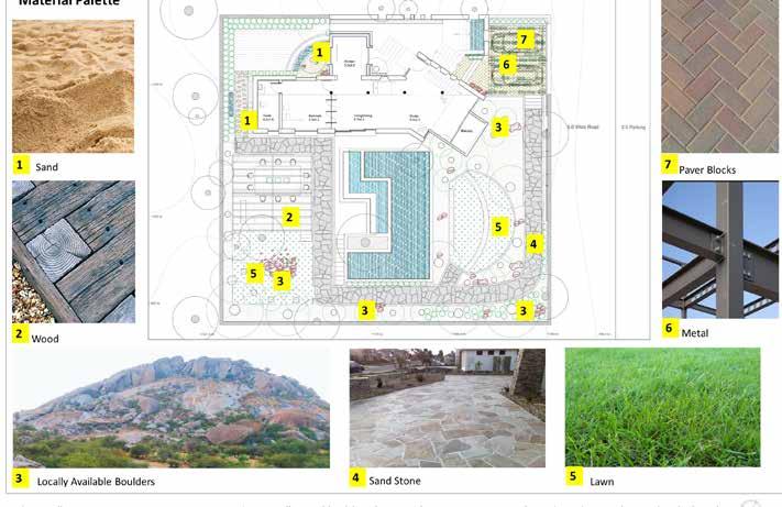
Material Palette inspired by Udaipur’s hot and dry landscape as well as availibility of the materials locally
Concept Diagram
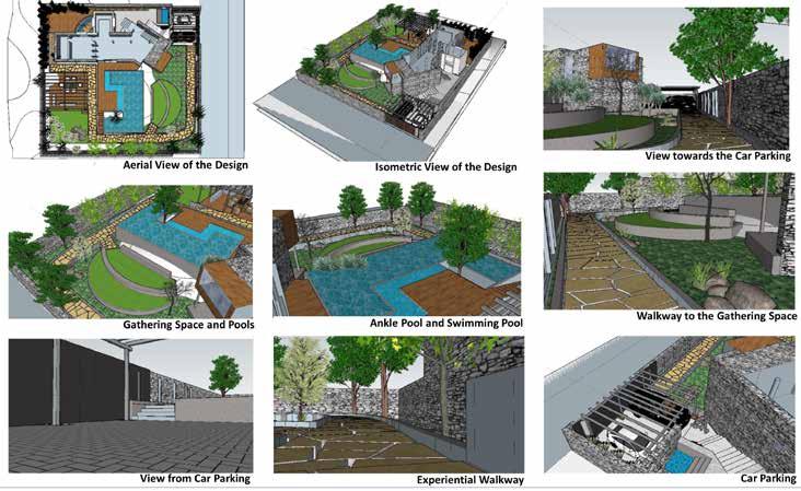
3-D Model of the entire Residential Landscape Design
Material Palette
18
3-D Model
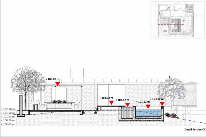
Part Plan, Sections and Detailed Sections
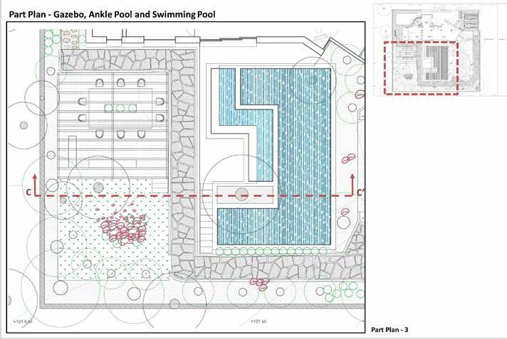
Part of the design includes a gazebo, an interactive pathway, and swimming pools
Part Plan, Sections and Detailed Sections
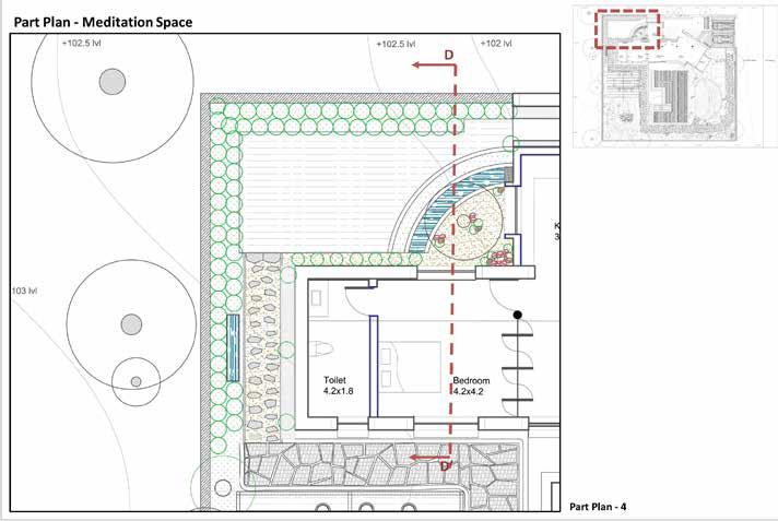
Part Plan of the Meditation Space
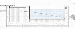
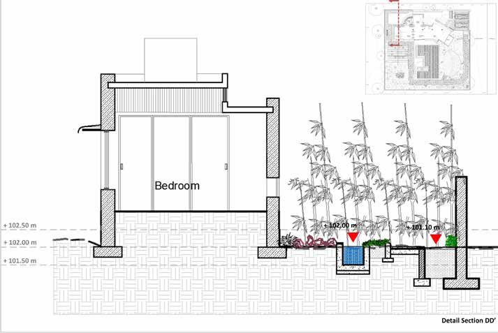 Detailed section cutting through the gazebo, walkway and two pools
Detailed section through the residence and meditation space
Detailed section cutting through the gazebo, walkway and two pools
Detailed section through the residence and meditation space
B Detail A Detail B N N N N N N N N
Detail
A Detail
19
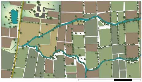
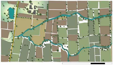
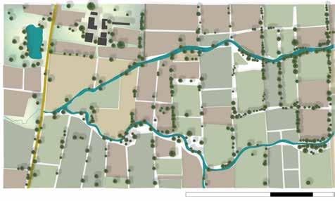
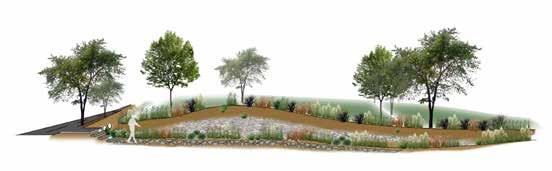
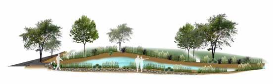
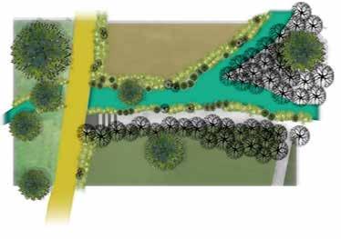
PLANTING DESIGN Zone of Seperation
Location & Year : Bhayli Lake, Vadodara, IN (2019)
Project : Designing a public friendly eco-trail Type : Group initiatives that eventually divided into independent projects
The Bhayli lake created its own ecosystem; scratchy and uneven. Additionally, because of the lake’s steep slope, erosion occured frequently.
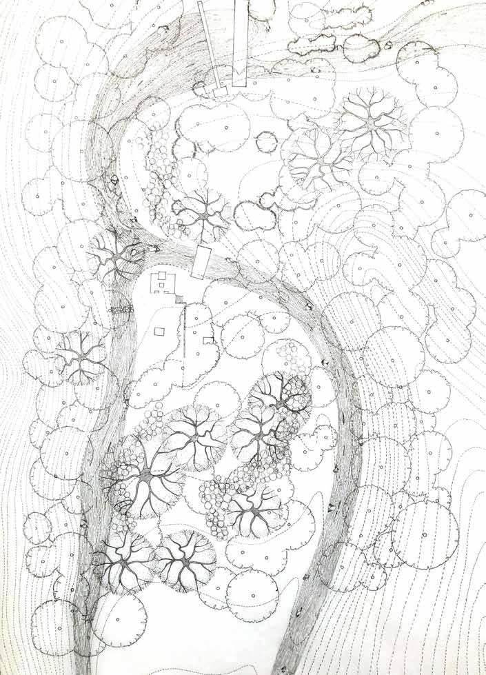
Each of the landscape students initially had to travel to the lake as part of a class project. Then, we all developed site-specific drawings and recorded significant data, including ground and contour levels, tree positions, public usage, and site condition. We endured on the scene for a few days to observe any corresponding changes before selecting each section of the riverbank and beginning our study.
The goal of this course was a to-and-fro process of learning the techniques of planting, designing shrubs, trees, ground covers, and civil work keeping the existing levels in mind creating new levels as per the need on-site as well as drafting them on paper. These are hand-drawn technical drawings that I made as a result of the planting design plan of action, complete with exact ground level and plant sizes and distances between them. (c/c)


Design Objective - My main concept was to build a public ecological route that would have supported both thriving wildlife and an unusual canopy of lovely blooms that would have drawn people’s attention to it. In order for visitors to experience the lake and its innate nature as well as appreciate it while walking on the trail, the area was effectively defined and had a sufficient number of public interactive places. The aim was for guests to enjoy a cup of tea or coffee from the kiosk that would have been built on the site while sitting under a tree and listening to the sound of the trees rustling. The design also contained cascade waterbodies, which filtered the lake’s water and provided a unique walking experience for those who visited. The plant components had visually appealing textures and hues that added to the lake’s character.


 Civil Design Drafting
Design Drafting The Lake Patch’s Overall Planting Design
Ground covers and Grasses Design Drafting Shrub
20
RESEARCH STUDY
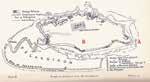
Bathing Kund
Location & Year : Sitamata Forest, Rajasthan, India (2018)
Project : Designing a bathing kund.
Type : Group initiatives that eventually divided into independent projects
The location has numerous holy hot springs, which are not far from Udaipur. Priests visit an ashram close to the river every day to worship and perform rituals, but first, they wash their feet in the water of the river.
All of the students majoring in landscape design were required to remain in the Sitamata Forest for four to five days as part of this research and study program. During this time, we explored the entire sanctuary, took the necessary photos, marked the trees, measured their sizes, measured the diameters of their trunks, measured the ground levels, determined their contours, and then came up with a plan with the precise tree markings and tree species that are depicted on the plan. The entire drawing is the result of collective work that includes night and day precision hand drawing using technical pens. In an effort to fully represent the distinctive characteristics of the land and the trees, we also created a few elevations and sections of the entire site as well as of all the different species of trees in detail with branching systems.
Our task following our trip to Sitamata was to choose a site location from the entire region and complete the individual assessments as detailed below.
Design Objective - The project’s major objective was to create a bathing kund connected to the existing river of the sanctuary for pilgrims to take baths before and after their prayers which are based on its historical and cultural importance.
The bathing pond, or kund, was split into sections for men and women in this design. Either they can take a bath, or they can simply dip and wash their feet. They can either take a bath or just dip and wash their feet. Because this area of the forest is not well known, few people visit it, so the seclusion was preserved. Around 5–6 persons might be accommodated at a time in a Kund.
 Site plan drawn by hand with precise tree positions and ground levels
21
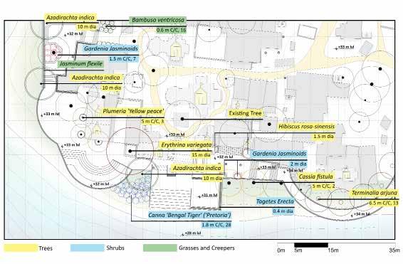
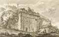
AUGMENTING URBAN GREENS
Reviving Ghats And Recreating Spaces
Location & Year : Vishwamitri River, Vadodara, Gujarat, India (2020)
Project : Augmenting Urban Greens
Type : Group initiatives that eventually divided into independent projects
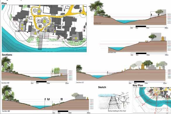
Rendered Site Plan
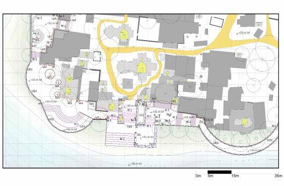
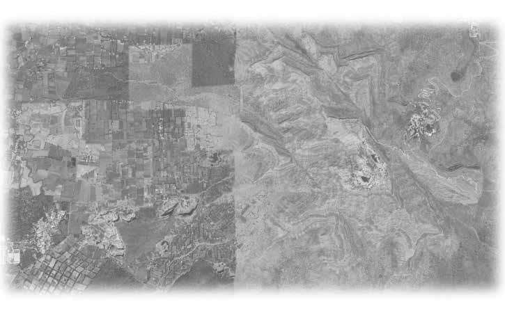
All of the students were required to personally visit the location for this studio exercise in order to collect the necessary data, which included measurements of the site’s contour levels, walkway widths, biodiversity, number of temples, types of people, forms of activity, sound and activity mapping, etc. Each student was required to select a site patch and do a SWOT analysis, which led to individual designs, based on the group study.
As the riverfront was mostly a deserted location with religious significance and crumbling steps to the river, my site was situated close to the major temple of the site. I completely reworked the riverbanks in this design. To restore the significance of the location, I created an appropriate entrance to the bank and temple, established new walkways, created a gathering area and a Kund for religious purposes, and restored the Ghat. Overall, the new strategy was merely a minor architectural adjustment for the historic holy site that integrated with the neighbourhood in the Vadodara District along the Vishwamitri River.
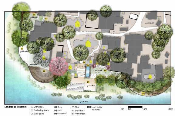
Design Approach Minimun Use of Elements Preservation of the ecosystem Sustainability Natural Experience Environmental Exposure Alternative to City Life Coexistence between humans and nature Recreational Public Space
22
Strength
Ghat and Samadhis
Vegetation and Views
Weakness
Connectivity to Ghat
Garbage dump
Growth of invasive plant species
Opportunity
Wide Open Grounds
Vegetation on the opposite side of the river
Conceptual Diagrams
Threat
Crocodiles and Snakes
Inundation of water
Pollution
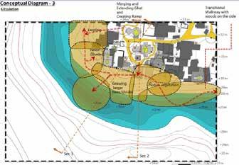
This stage includes gathering spaces and steep steps towards the water from the Ghat without levelling the platforms
Vision Statement -
To develop a passive recreation area that also increases Ghat’s accessibility. Through various settings at various altitudes connected to the river, this design attempts to provide numerous visual and tactile experiences. Together, it creates a different experience from city living, and the local plant species help the area blend in. This design will ultimately assist in the site’s cultural worth being recovered.
Design Development
Water-levels Summer
Winter Site Analysis
Monsoon
Temples on site Activity Mapping Accessibility N N N N SWOT Analysis
Garbage Zones
Design Development Stages
N N 23
Lighting Plan
The site has adequate lighting so that people may visit it after dark, making it more accessible and less deserted.
Hardscape Plan
Planting Plan
The site has adequate lighting so that people may visit it after dark, making it more accessible and less deserted.
The site has adequate lighting so that people may visit it after dark, making it more accessible and less deserted.
N N N 24
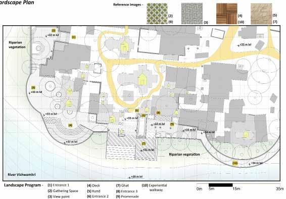
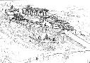
ALDEIA DE GOA
Work During my Professional Period in Roots Designs Studio, Pune, Maharashtra, India
Site Location
Keywords
UNFOLDING SURPRISES FLUID SPACES
ELEMENTAL LANDSCAPE
PUNCTURES ANDNODES
EXPERIENCE INTIMATE SPACES VISUAL CONNECTION IDYLLIC PERSONALISE MATERIAL PALETTE PLANTING PALETTE SCULPTURAL ELEMENTS
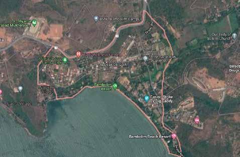
Location & Year : Bambolin, Goa, India (2022)
Project : Designing Landscape on existing Residential House
Type : Residential Landscape Architecture Project
Role : Junior Landscape Architect
The GOAN VILLAS provides a space for luxury, for the people who come to EXPERIENCE it. Each VILLA has its own INDIVIDUALITY and UNIQUNESS, yet bound by similar elements. This slide depicts some basic conceptual stage renders made by me on behalf of roots designs studio.
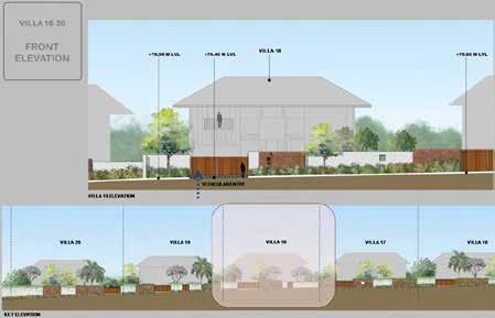
 Font Elevation of one of several Residences
One of many options of elevations of multiple Residences
One of the elevations of the identical Residences
Font Elevation of one of several Residences
One of many options of elevations of multiple Residences
One of the elevations of the identical Residences
the identical Residences
Plan 01 of one of the residences Rendered Residential Plan Option 01 Rendered Residential Plan Option 02
One
of the elevations of
Rendered
25
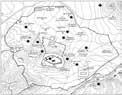
ATLAS
Housing Crisis - A State of the Art Discussion
Location & Year : Toronto,Ontario, Canada
Project : The Atlas
Type : Group Work Catalogue
As a reference for the final studio project, each group’s task in this exercise was to create a catalogue. Our group’s responsibility was to identify and categorize multiple types of housing policies in the GTA and Toronto. We selected four research areas in this catalogue where these policies are currently implemented. With the aid of these four study areas, the other students in the class were able to better comprehend how these policies are applied in those particular regions by witnessing the policies in action.
First, we looked at the GTA map and determined the current environmental and economic circumstances over the whole geographical area. Finally, we examined the Maps using the following policies -
Existing Condition
Policies supporting high density development
Inclusionary zoning
Policies for medium density development
Ravines are a major part of Toronto’s green infrastructure. Along with parks and the entire urban forest, ravines provide many environmental, health and recreational benefits, containing grey infrastructure, such as utilities and sewer lines that ultimately affects residential growth.
Natural Elements
As the city moves towards ‘walkability’ as a major criteria for development it is important to analyze the existing, proposed and ongoing transit in the city as a basis for policy research. In relation to the ‘built’, the property values also rely on the ‘open’.
Infrastructure
Policies for low density development (citizen level)
Demographics
The housing crisis in Toronto has increased demand for affordable housing and rent, leading to policies and guidelines being implemented on public lands. Income levels also influence the quality and type of residential development, with the wealthiest areas being predominantly single-family neighbourhoods with minimal density.
Expanding Housing Options in Neighbourhoods (EHON)
23
Laneway suites Townhouse guidelines
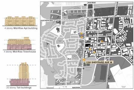
Mid-rise guidelines
Tall building guidelines Transit oriented communities
26
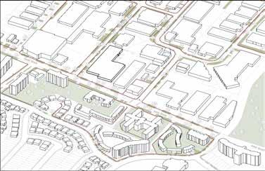
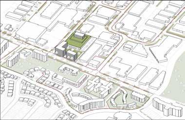
The Study area sits along the upcoming LRT line at Finch west. The area is characterized by the presence of mid-rise guidelines in an MTSA zone, having many single family neighborhoods. Many upcoming projects at the site are for condos and tower development with the backdrop of low density development highlighting the political tension between developers and the government. This displays a typical characteristic of Toronto and
Mixed ethnicity with predominance of English and Punjabi

C A L E DON I A UPLEX Built up areas 27
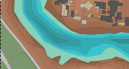
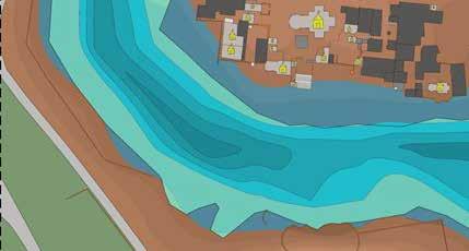
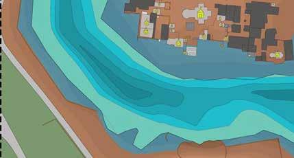
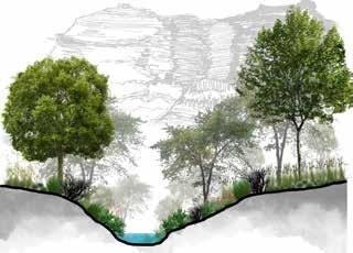
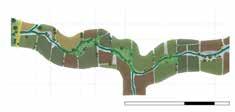
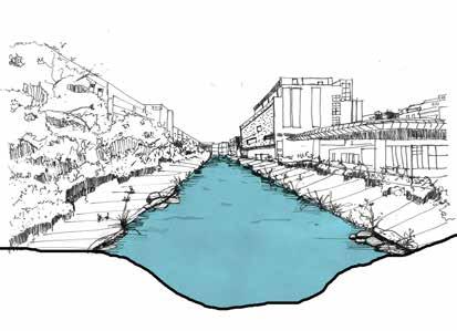
PASSIVE DESIGN APPROACH ALONG WATERCOURSE
A Landscape Model to Enhance Cultural Importance Along Watercourse
A Thesis Submitted To The School Of Environmental Design And Architecture, Navrachana University As Partial Fulfillment Of The Requirement For The Degree Of Bachelor Of Design (Landscape) 2020-2021
Location & Year : Vadodara, Gujarat, IN (2020)
Type : Bachelors Thesis Project
Abstract -
Vishwamitri river is the heart line of Vadodara city in Gujarat State, India. Its unique ecosystem comprises the main river corridor, its associated tributaries, ravines, small streams, creeks, wetlands, oxbow lakes, and artificially created ponds.
Historically, this rich ecosystem has provided natural floodwater control, groundwater recharge, and a habitat for diverse flora and fauna, thus promoting biodiversity and ameliorating adverse climatic conditions. The ecosystem has provided various communities alternative sources of irrigation, water supply, food, recreation, and livelihoods.
However, there is major deterioration of the river on account of rapid urbanization resulting into pollution, encroachment, and neglect. Because of that it has lost its cultural importance too in the process. The river now stays dry most of the time throughout the year so it is very important for source of the river to survive and to thrive in order to keep the river water flowing throughout the season.
The origin of the river is the most important place as it channelizes and forms larger river further hence it cannot be deteriorated. Therefore, this design project is an attempt along a short river stretch that enables the origin of river tributary to thrive and people to connect to it passively. This will eventually enhance the watercourse by bringing back its ecological and cultural significance through passive design approach.
28

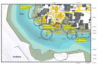
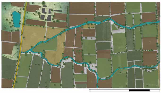
+71 m lvl +69 m lvl +63 m lvl +66 m lvl +61 m lvl +60 m lvl +58 m lvl +61 m lvl +63.30 m lvl +66.30 m lvl +68 m lvl +66 m lvl +71 m lvl +51 m lvl +61 m lvl +56 m lvl Main Road Agricultural Land Agricultural Land Bamboo Plantation Buffer Zone Raised Platform Walkway Buffer Zone +66 m lvl +71 m lvl +51 m lvl +61 m lvl +56 m lvl 0 m 5 m 10 m 20 m 0 m 5 m 10 m 20 m N 29
Study Area
Site Delineation
Water Level
Water level during summers
Water level during winters
Water level during monsoon
+66 m lvl +71 m lvl +51 m lvl +61 m lvl +56 m lvl 5 1 6 3 2 4 7
Pavagadh
Pavagadh Foothills
Sand Mining
Champaner
Vegetation Agricultural land -1 Agricultural land -2 Agricultural land -3 Agricultural land -4 Waterbody Existing Trees Main Road Built Area 0 m 5 m 10 m 20 m
Hills Waterbodies Vegetation Agricultural Land Built Area River Trails Trails Main Road
N
30
The sections show the land profile of the whole trail including the river bed and the change in type of vegetation throughout. Man-made changes have been made partially.
The stream through which Vishwamitri flows has not been hindered but a secondary canal network has been made in order to meet the demands of agricultural lands.
Natural vegetation has not been hindered instead new plantation has been done.


 Main road Land Profile
Location Land Profile
Ricinus communis
Psidium guajava Thorny bushes
Butea monosperma
Tamarindus indica
Calotropis gigantea
Main road Land Profile
Location Land Profile
Ricinus communis
Psidium guajava Thorny bushes
Butea monosperma
Tamarindus indica
Calotropis gigantea
N Site Study 31
Moringa oleifera Ziziphus mauritiana Washingtonia filifera

Strength
- Foothills of Pavagadh
- Part of origin of the River
- Cultural Importance
- Connected to main road
Weakness
- Water doesn’t flow throughout the season
- Surrounded by agricultural land
Opportunity
- Open river bed and open grounds
Threat - Pollution
0 m 5 m 10 m 20 m N 0 m 5 m 10 m 20 m Wind Direction V. Accessibility P. Accessibility N N Wind Sun Physical and Visual Accessibility 0 m 5 m 10 m 20 m Sun Direction +60m +61m +62m +63m +64m +65m +66m +67m +68m +69m +70m +71m +72m +73m +75m +74m +76m +59m +58m Site Analysis 0 m 5 m 10 m 20 m N N N 0 m 5 m 10 m 20 m 0 m 5 m 10 m 20 m Vegetation Main Road Built Agricultural land -1 Agricultural land -2 Agricultural land -3 Agricultural land -4 Waterbody Existing Trees Steep Moderate Flat
Contours Vegetation
Slope
SWOT Analysis 32
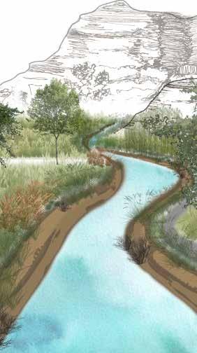
This design aims at creating a self-sustaining ecosystem while having a passive recreational space along 1 km long stretch of a river near the foothills of Pavagadh. One of the tributaries of origin of river Vishwamitri is situated in this region so it holds cultural importance, hence this area can be considered as a source of the river. Eventually, this design process will help the river thrive with its minimal design approach.
Passive Design Space
In this design, the spaces will be made with reduced human intervention where it can be approached visually but not physically. There will be free flow of movement while keeping the vegetation as well the river stream untouched and unhindered. All together this design will enable stream of the river origin to thrive by selfsustained ecosystem and will allow people to experience its cultural importance with minimal design approach.
Designing Stretch of a River
The most unique aspect of the site is that it is located near the foothills of Pavagadh where one of the tributaries of River Vishwamitri originates. So this place holds cultural importance.
This river stays dry most of the time in entire year, so the spaces in this design will enable origin of the river belt to survive. With minimum design intervention and self-sustaining properties, this design will ultimately come together as a passive experiential space along with different physical and visual connections. It will also help the river belt to thrive as native plant species will be introduced to purify the river water.
The origin of the river is the most important place as it channelizes and forms larger river further hence it cannot be deteriorated . Therefore, this design project is an attempt along a short river stretch that enables the origin of river tributary to thrive and people to connect to it passively.
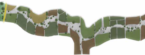
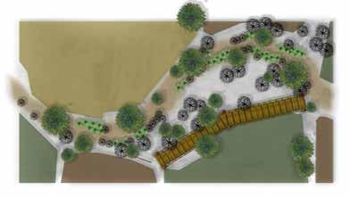
Concept Design
Walkway at a height Levelled (terraced) space Cleaning area Space to perform rituals Source

Design Development
Entrance
Stepping stones and tree plantation
- Space enclosed within bamboo planting
- Open spaces with raised platforms
- Pause points
Buffer Zone Experiential walkway
Planting different species of aquatic plants to filter the river water
Origin Creating a “dwar” like structure by growing bamboos along a part of river stretch
Vision Statement
0 m 5 m 10 m 20 m
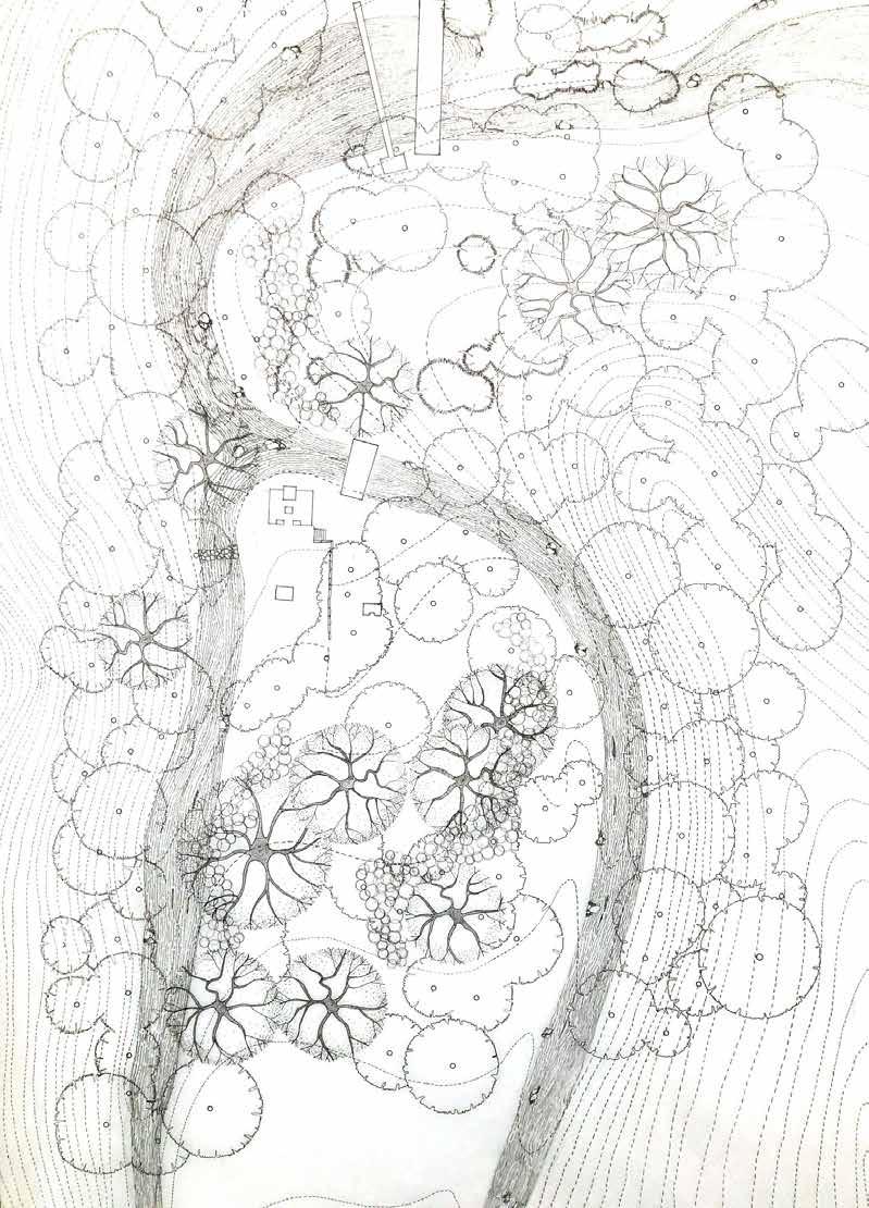
Entrance Walkway
of river
Source
of
river
Walkway Buffer Zone Bridge Entrance
10 m 20 m 0 m 5 m
N N 33
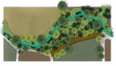
Buffer Zone Study - R. Vishwamitri
Sectional representation of a Riparian Buffer Zone
Stream Aquatic Plants Crop Field Run-off control Undisturbed Vegetation Managed Vegetation
Buffer Zone - Part Plan
Buffer Zone - Sections
Zone 1 (Stream-side zone)
Zone 2 (Middle Zone)
How will a buffer zone work along a stream of R. Vishwamitri
Zone 3 – Consist of perennial grasses and woody vegetation that slow the surface runoff and absorb most contaminants
Zone 2 – Consists of slow growing trees and shrubs that absorbs remaining contaminants from zone 3
Zone 1 – Streamside consist of fast growing, flood tolerant plants and trees that stabilize bank and cool water through shading
Zone 3 (Outer Zone)
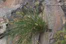
Plant Species for Buffer Zone
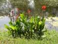


 Canna x generalis (Canna
Pennisetum setaceum (fountain grass)
Cyperus papyrus (Papyrus) Scirpoides holoschoenus (Bulrushes) Pennisetum purpureum (Elephant grass )
Canna x generalis (Canna
Pennisetum setaceum (fountain grass)
Cyperus papyrus (Papyrus) Scirpoides holoschoenus (Bulrushes) Pennisetum purpureum (Elephant grass )
0 m 5 m 10 m 20 m Wet Season Existing Trees Board Walkway Grasses Seasonal Trees N River Trail Existing Trees Board Walkway Dry Season
Ground
Shrubs
0 m 5 m 10 m 20 m Existing Ground Line Existing Ground Line Dry Season Wet Season 0 m 0 m 0 m 0 m 5 m 5 m 5 m 5 m 10 m 10 m 10 m 10 m 20 m 20 m 20 m 20 m N 34
Diagram representing working of a riparian buffer zone
layers
Trees
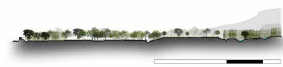
Experiential Walkway
The Vishwamitri River emerges from the hills of Pavagadh and flows through the heart of Vadodara city in Gujarat. It empties into the Gulf of Khambhat. Sage Vishwamitra ,who the river is named after created a moksh-dwar (gateway to heaven) for downtrodden Hindu people at Kayavarohan, a village in the Vadodara district. The river is named after him. The experiential walkway is designed in a way that will make people experience the same journey from the origin of the river. The entrance and the assumed origin of river Vishwamitri follows same language with two pause points and raised platform making the area passively approachable.
Entrance
Steps leading to the walkway with bamboo plantation on both the sides of the stream
Raised platform connected to walkway
Pause Point 2 Pause Point 1
Providing benches for people to take a break while walking towards the origin of the river
Origin
Creating a “dwar” like structure with the help of bamboo plantation along a small part of river stretch
Entrance
Entrance - Part Plan
Entrance - Part Plan
Dry Season 0 m 5 m 10 m 20 m
0 m 5
10
20
m
m
m
Board Walk Board Walk Board Walk N River Trail Existing Trees Main Road Dry Season 0 m 5 m 10 m 20 m River Existing Trees Grasses
Dry Season Wet Season Wet Season 0 m 5 m 10 m 20 m
N N
35
Pause Points
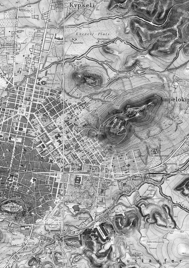
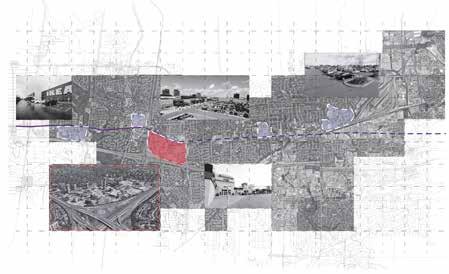
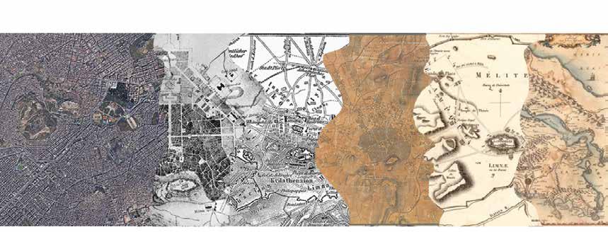
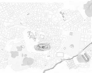
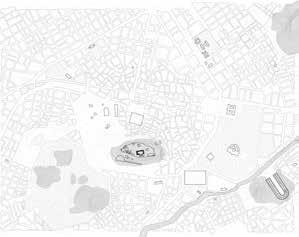
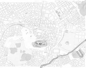
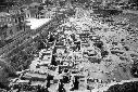
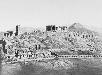
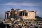
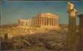
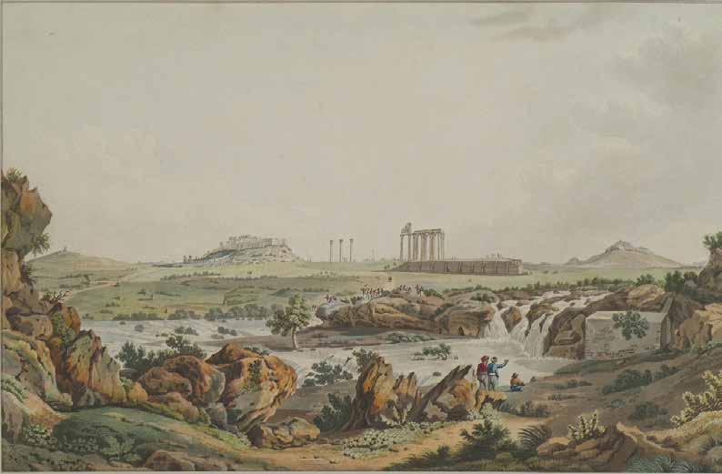
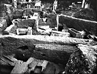
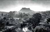
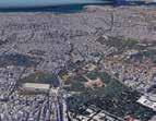
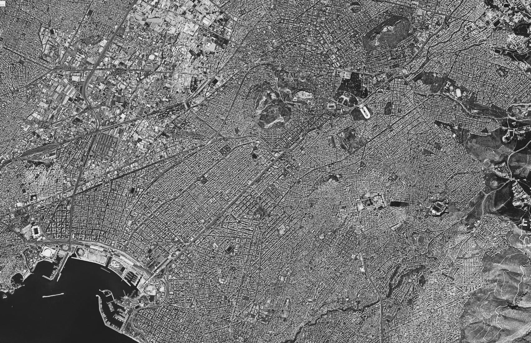
River Ilissos : Unveiling Urban Palimpsest
Exploring layers of Historical Monuments and Urban Landmarks of River Ilissos in the city of Athens
Location & Year : Athens, Greece (2024)
Type : Masters Thesis Project
Abstract -
This thesis is a atlas-like documentation of the historical evolution of the Ilissos River (named after a god), once considered to be a person in the city of Athens, Greece. However, as urban power changed, so did the river. The river, outside the city, became a part of it, and as the city grew, it was integrated into the urban infrastructure, becoming an avenue. The river is prone to catastrophic flooding. By using the image of a palimpsest through the lens of the river, it seeks to reveal these stories in a sequence of detailed illustrations and drawings. It emphasizes two main urban landmarks and historical monuments along the river, covering a total of seven significant landmarks, terminating at the point where the river meets the bay.
Athens’ social and urban structure was formerly shaped by the Ilissos River, which ran alongside the Kifissos and Iridanos. The river was the focal point of the city of Athens and was regarded by every monarch as the city’s sacred river. Throughout its history, it served as waterfalls at a few points, fountains, and streams. However, problems with floods and urbanization forced the Ilissos River to be rerouted and eventually covered, leaving it little to serve as a channel flowing into the Faliro Bay. Although the river is covered, the Athenians are completely aware of its presence. The river is not forgotten. Through a comprehensive atlas-like approach to reestablish a connection with the river’s natural and cultural value and promote a more resilient and sustainable urban environment, it also makes suggestions for potential daylighting the river.
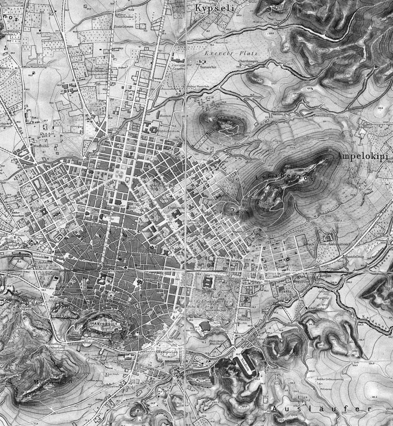
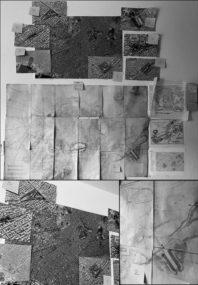
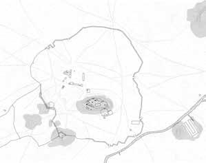
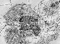
Based on Travlos Maps, 1993 N 36
Source - https://www.geographicus.com/P/AntiqueMap/athens-white-1793
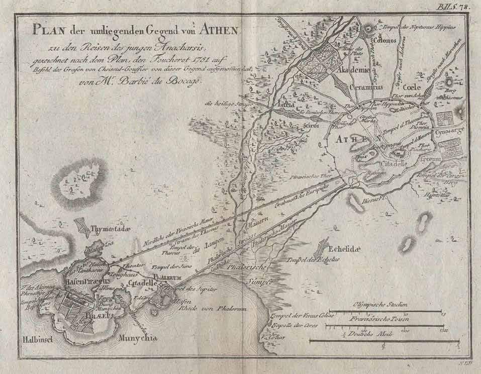
 Kifissos and Ilissos River in Athens City Map from 1781
Athens Map from ancient times to Present Collection of Ancient Maps and Present Google Earth Images
Kifissos and Ilissos River in Athens City Map from 1781
Athens Map from ancient times to Present Collection of Ancient Maps and Present Google Earth Images
37
Drawing by Ashna Modi
Expansion of the City of Athens and Its Relationship with River Ilissos
Moment of river outsde the City Walls


479 B.C. - 338 B.C. - Archaic Time and Classical Period 1205 - 1456 - Byzantine Period 338 B.C. - 86 B.C. - Decline of the Classical Period 1456 - 1687 - Byzantine Period 86 B.C. - 267- Byzantine Period 1687 -1830 - Decline of Byzantine Period 267 - 566 - Byzantine Period 1830 -1850 - Neo-classical Era 566 - 1205 - Byzantine Period 1850 -1870 - Neo-classical Era 1870 -1896 - Modern Era 18960-1930 - Modern Era 1930 - 2005 - Contemporary Era 2005 - Present - Contemporary Era 38
River as part of the City River as underground channel
History of Athens
• The first people

invaders were unable to take Athens. While much of the wall, also called the Pelasgian wall is maintained buried throughout the Acropolis, is still visible close to the Propylaea.
• Athens did not appear to be destroyed, but it did fall until the Mycenaean civilization (and Bronze Age) collapsed in the eastern Mediterranean (1200–1150 BC). Several people from the ruined Mycenaean centres made Athens their home. A dark age followed in which Greece remained from the 12th to the 8th century BC.
• In the 6th century BC, Athens was fortified with a circuit wall by Solon or Peisistratus. The Cyclopean wall, which served as the Mycenaean fortification of the Acropolis, was still in service The Aqueduct of Peisistratus, which carried water from Mount Hymettus to the city, provided water for the first time, and numerous monuments were built atop the Acropolis and Agora.
•
ended injustice to the less fortunate. The Acropolis was proclaimed to be the domain of the Gods by the most potent oracle in ancient Greece, the Oracle of Delphi.
• Peisistratus and his sons started building the enormous temple of Olympian Zeus (Olympieion) to give Athens the majesty of the Ionian cities of Asia Minor. The temple remained unfinished and was eventually finished in 130 AD by the emperor Hadrian.
• When the Persians arrived in Athens, they demolished the Acropolis and all of the sanctuaries. The building effort went ahead despite their pledge, along with that of the other Greeks, to leave the ruins of the shrines destroyed by the Persians as a reminder of the misery caused by the

• On the Acropolis, Pericles started building new monuments, the most significant were the Parthenon The Temple of Hephaestus (Thesseion), the best-preserved ancient Greek temple, the new Bouleuterion (Parliament House), and the Tholos (the dining chamber of the elected Deputies) The Theatre of Dionysus was built on the south slope of the Acropolis and was the first theatre ever built. The southern slope of the hill was reorganized concurrently with the Acropolis building effort and the southwest portion of

• The Acropolis was converted into a place of worship during the ancient era, and all governmental offices and residential areas were relocated to the city around the hill. The surface of the Acropolis was divided into sanctuaries, and cults of gods and heroes were established. Larger stone temples eventually took the place of the earlier, smaller ones, symbolizing the might of Athens as rose to prominence as one of the most potent city-states in the Hellenic world. Athens became Greece's most powerful city-state. The 15th century BC referred to be Pericles' Golden Age because he dominated Athens' political environment during that period. During this period, Athens amassed the largest navy in Greece, traded its goods throughout the Mediterranean, and used the Delian League Treasury to construct the Acropolis.
a Christian temple toward the close of the 5th post-Christian century, when the veneration of the Virgin Mary took the place of that of the Olympian Athena. Despite being abandoned following the incursions of the Erulians, Goths, and Slavs, Athens developed into a significant pilgrimage centre within Byzantine territory.
• The "purification" of the pagan temples was mandated by Christianity at the same time. As a result, every ancient temple was transformed into a church, often destroying the ornate sculptures in the process while making all the necessary interior changes. Throughout that time, numerous new churches were constructed.

• On January 1, 1981, Greece joined the European Union.
• Athens indicated some of the world's worst air pollution and congestion. This presented another new danger to Athens' historic structures since air pollution eroded marble and traffic vibration damaged foundations. For the most part, Athens' inability to secure the 1996 Olympic Games was due to its infrastructure and environmental issues.
• Since 1983, a continuous restoration project has been carried out on the Parthenon and the neighbouring temples.
• The most intensive construction activity appeared after 1960. It was undertaken almost totally by small building enterprises; and was oriented towards the rebuilding of the Town Map. This intensification coincided with the expansion of industrial activity. Urbanization continued to grow and modernist architecture flourished. Skyscrapers dominated by tall, concrete residential buildings started to appear. Although they coexist with earlier architectural styles, these constructions signal a significant departure from them.
• Greece's Acropolis was included to the list of UNESCO World Heritage Sites in 1987.
• Following the Turkish guards' withdrawal from the Acropolis in 1833, Athens was formally declared independent. Plans for reconstruction got underway right away, and Athens was named the Greek capital in 1833, because of it’s sentimental value.
• Athens became the capital with four or five thousand people as the population. And didn’t have any development or a master plan then.
• In the historic centre, neoclassical buildings and broad avenues designed by the city planners of the past combine with more modern development.
• During the Ottoman era, the Parthenon was converted into a mosque and the Acropolis served as the Turkish ruler's administrative centre. The Parthenon had only minor modifications when a minaret was added to enable its conversion to a mosque, and the Erechtheion was repurposed to house the harem The Acropolis and the Agora remained intact since the Ottoman valued the structures and monuments.


1st Period (1458-1640)
The Ottoman families, the military, and the commander lived in several houses that covered the Acropolis'

• After arriving in Athens in 1456, the Ottomans peacefully took over of the city until Duke Acciaiuoli surrendered in 1458 •Sultan Mehmed had great admiration for the Acropolis. The Ottomans treated the city with dignity, in contrast to the Westerners. They neither damaged nor plundered the monuments. 2nd Period (1640-1833)
• A lightning strike in the Propylaea, a storage facility for gunpowder, in 1640 resulted in an explosion. The next gunpowder magazine was Parthenon A cannon shell that dropped within the Parthenon during the Venetian attack, produced a massive explosion. Shortly after, the Turks constructed a smaller mosque in between the Parthenon's ruins; nevertheless, was destroyed in 1844 along with every
Greek and Turkish populations opted to migrate to Greece after they suffered defeat
• Post World War, with a sharp increase in population as a large number of the nation's rural inhabitants relocated there, there was a shift from neo-classical built form to contemporary architecture in Athens.

• During World War II, Athens
by the Germans and endured terrible suffering in the last phases of the war. Hitler's reign over Athens began in April 1941. The Greek Kingdom flag was replaced by the Swastika, which floated atop the Acropolis peak
• The Greek civilian population suffered greatly under the occupation. More than 300,000 individuals perished from starvation in Athens alone. One of the most successful resistance movements in occupied Europe, the Greek Resistance, was founded during this period. The Nazis were forced to evacuate the city as a result of opposition from two major Greek organizations, and Greece reclaimed its independence.
• With that, legal and illegal development, refugee settlements, and public and private developments increased. The urban apartment building became the symbol of Athenian "success", a symbol and an envelope for everyone. • With financial support from the European Union,

With financial support from the
the
and the
Neoclassical

Before 900 B.C. 700 B.C.450 B.C. 431 B.C.86 B.C. 3301458 19411944 18331941 1944-2004 2004present Prehistoric times Archaic Times Decline of Classical Times 499 B.C.479 B.C. Classical Times Byzantine Times 14581821 Ottoman Empire Greek independence Nazi Rule Greek Independence and European Union Tourism Rise and Economic Fall 250 years 150 years 50 years 50 years 150 years 250 years 350 years 300 years 200 years 100 years 25 years 25 years 100 years 200 years 300 years 350 years Fall of Athens Rise of Athens Ashna Modi URD 2014 November 8, 2023 Assignment 3 Palimpsest Urbanism Athens, Greece 250 years 20 years 345 years 259 years 336 years 108 years 3 years 60 years The flat space formed by the embankment the first hundred-staired temple of Athena, upon which the Mycenaean palace erected. The Acropolis and the surrounding area served as this settlement's principal hub. There was a noticeable increase in building activity around 1600 BC. Two fundamental elements of Mycenaean urban design were introduced to Athens: the palace and the walled citadel. In fact, a cyclopean wall protected the Acropolis' rock, and a sizable palace and settlement were constructed within. Around the start of the 12th century, the shift in the population was rapid and apparent. The artisans, manufacturers, and traders dispersed to the islands and other favourable locations, handling their product distribution. Athens' population declines, and the houses clustered in the northeastern ascent are abandoned. The neighbourhood near Acropolis in Athens also became a burial ground for the city of Athens. • For Athens, the Archaic times brought with art and trade, as well as political and social unrest. During this period, three significant events occurred: the Persian Wars, the birth of Democracy, and the tyranny of Peisistratus. • During these ages, the economy of ancient Athens expanded, but the city lost control of the entire Attica and became divided into several kingdoms. After taking back control of Attica in the 7th century, Athens progressively emerged as the nation's centre of culture and the arts. Military generals and nobility controlled the city for a hundred years. Wealth and status were linked, therefore slavery was a commodity and the impoverished had no rights. • All Athenians (except from slaves) were declared equal by law in the eighth century BC, and all inherited titles and privileges were abolished.
Solon, an Athenian poet and legislator, paved the way for democracy and
the Acropolis was occupied by several minor temples and other sanctuaries. The Golden Period, or prolonged prosperity, of Athens didn’t persist. Everything came to an end when the Peloponnesian War (431 BC) broke out and Athens was decisively defeated (404 BC). After that, Athens was ruled by Philip of Macedon and his son Alexander the Great, but continued to be the hub of Greek culture. Demetrius accomplished vital work for the city which revealed that there were 400.000 slaves, 10,000 foreign inhabitants, and 21.000 citizens living in Athens. • Because of the many attacks by different tribes, Athens had to build a new wall around the Acropolis in the year 1000. This wall, known as the "Rizokastro," stood until the Ottoman era The city fell victim to invasions in spite of these defences, which demolished the walls and left the city in ruins. • The Propylaea vanished within the newly constructed structures and were transformed into a mansion for the Frankish ruler. The Parthenon was a Catholic church devoted to Notre Dame, and the Erechtheion served as the guard's headquarters. In the end, two towers were constructed; the largest was destroyed in 1875. 2nd Period (1640-1833) • Thomas Bruce, 7th Earl of Elgin, caused significant damage to the monuments between 1801 and 1812 when he removed more than half of the Parthenon's sculptures, portions of the Erechtheion, and numerous other antiquities to England. Elgin sold his collection in 1816 and continues to reside at the British Museum in London. • Athens was taken over by Greek forces during the Greek War of Independence. Large portions of the remaining Parthenon walls were demolished by the Turks on the Acropolis during that attack extracting the lead clamps holding the stones together and making ammunition. • The Turkish General Kutahi Pasha besieged and bombed the city in 1826–1827, causing severe destruction before he was able to regain it.
was occupied
the Greek government and the city of Athens completed significant infrastructure projects, including the construction of a new metro system and the new Athens Airport. Limiting the usage of automobiles in the city centre another way the city combating air pollution. Consequently, Athens won the right to host the 2004 Olympic Games.
arrived in Athens around the end of the Neolithic Era, sometime between 3500 and 3200 BC and Acropolis Hill gained its first inhabitants. • Because of the favourable position and excellent visibility of the land and sea, this rock served as a military base. Athens flourished and developed into a religious centre devoted to the Olympian Goddess Athena around 1400 BC when it became a Mycenaean city. • The Mycenaean palace that formerly stood atop the Acropolis has little traces remaining. The palace was destroyed in the tenth century BC by an earthquake or fire, as legend has that the Dorian
outbreak of war.
damaged temples were utilized to repurpose architectural elements so that they could be seen from the Agora and serve as a reminder of the war. • The final relocation of the city's centre to what is now known as Agora was made possible in part by the Persian destruction of the city in 480 BC, which also resulted in the transfer of many civic responsibilities to this new location. • There were broken sculptures, inscriptions, the remains of ruined temples, and tons of earth to level the ground all over the south side of the Acropolis. The brand-new Parthenon came to represent the power of Athens With the addition of the new Propylaea, the entrance was completely redone and a new wall was built. The ancient Athena temple ruins, which had survived to serve as a reminder of the Persian battles, were destroyed and replaced by the Erechtheion The Peloponnesian War, however, left the Acropolis' construction unfinished. The Agora and the city of Athens were being rebuilt by the Athenians. Agora served as the hub of Athens' social and political life throughout the Classical Era. There were created fountain houses, shrines, and public buildings. Statues and altars ornamented the space between these structures, which was utilized for banquets and sporting events. Lycurgus, the archon of Athens from 337 BC, fully rebuilt the ancient wooden theatre and replaced it with a stone one. There was just one road that divided the theatre's koilon into two sections: the peripatos, which round the Acropolis. The frontmost seats were 67 marble thrones for the officials, each with a carving depicting their traits. Pnyx was progressively abandoned as a result of the theatre's vast capacity being used for Assembly of the Citizens sessions. Athens experienced numerous ownership changes before gaining some independence at the start of the second century BC. The city kept its reputation and philosophical schools, evolving into the intellectual and cultural hub of continental Greece. The Roman Empire, which occupyed the Western Mediterranean and was advancing east, posed the next danger. • The Thrasyllus Choragic Monument was constructed in 320 BC atop the Acropolis' rock, above the summit of the theatre. The cave and monument were turned into a church during the Christian era and titled "Our Lady in the Cave" in honour of the Mother of God. It was completely intact for over two millennia until the Ottoman general Kütahı blasted and destroyed it in 1827 during his occupation of the Acropolis. • On Tripods Street, numerous other monuments of a similar design were constructed simultaneously. Among these, Lysicrates monument was maintained.
The Byzantine Empire occupied the eastern half of the Roman Empire. Athens continued to be the epicentre of Greek learning and culture. • The exterior wall was restored, and the Agrippa's Odeion's remnants in the Agora were transformed into a massive gymnasium (or palace). • The Parthenon was transformed into
• A little further south, work on the Parthenon, a new temple dedicated to Athena, got underway, while the remains of the ancient Athena Polias temple on the Acropolis were saved. Later on, the
•
In 1875, the large
tower in the
dwelling.
medieval
Propylaea was also destroyed.
•
surface.
This
being
return
Greece as
vice versa.
the Greek population back in Athens,
in Smyrna.
resulted in thousands of Greeks living in Turkey
forced to
to
refugees, and
With most of
chaos erupted in the city.
•
in
city
air pollution. Consequently,
Olympic
•
Greek Parliament. •
the Greek debt crisis rocked the country and continues to impact daily life. • The city currently one of the most visited tourist attractions in Greece and serves as the country's political, economic, and cultural centre. Athens' Acropolis was being swamped by tourists to the extent that experts were recommending steps to stop the steady stream of visitors. • Concern regarding the harm to the ancient site has been expressed by many. To reduce chaos, the ministry has intended to progressively implement a time slot system.
European Union,
Greek government
city of Athens completed significant infrastructure projects, including the construction of a new metro system and the new Athens Airport. Limiting the usage of automobiles
the city centre is another way the
combating
Athens won the right to host the 2004
Games.
building in the town center, including his Royal Palace is now houses the
Since 2009,
39
Representations of River Ilissos
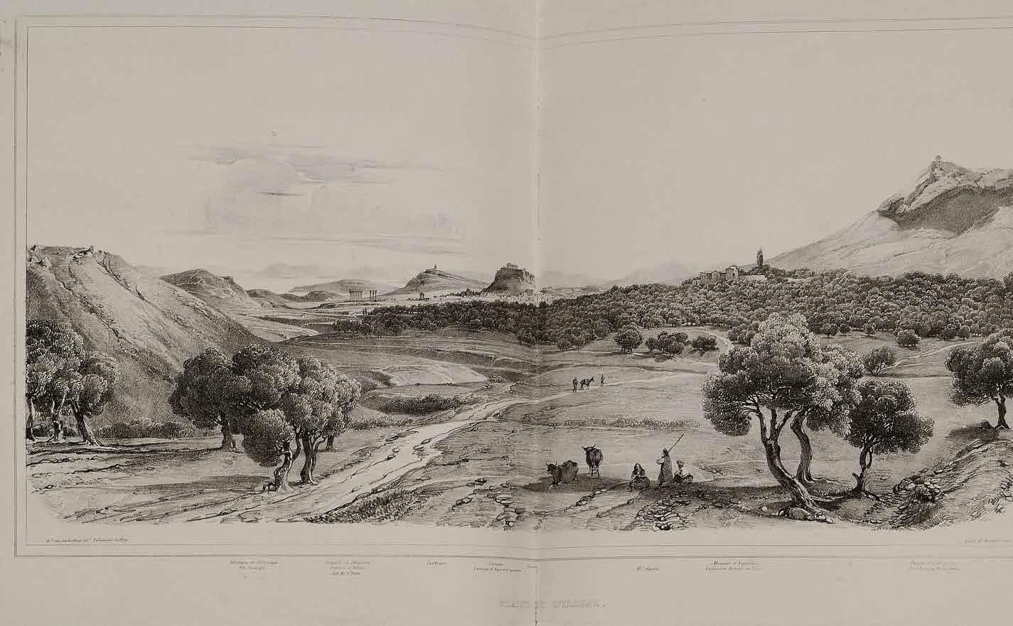
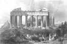
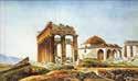
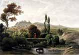
 Based on Travlos Maps, 1993
View of the temple of Olympian Zeus and Ilissos river.
View of the Bridge over Ilissos after 1778
Landscape and crop irrigation with Ilissus river In the background, the Acropolis and the Temple of Olympian Zeus in Athens
Based on Travlos Maps, 1993
View of the temple of Olympian Zeus and Ilissos river.
View of the Bridge over Ilissos after 1778
Landscape and crop irrigation with Ilissus river In the background, the Acropolis and the Temple of Olympian Zeus in Athens
40
1751-1753. Bridge was built by the Byzantine empire It was destroyed by ottoman empire for marble by 1778
RiverIlissosasanentityflowingoutsidethecityRiverIlissosasacultural landscape
RiverIlissosasancientspringsandFountainsEmergenceofseriesofinstitutions andciviccentres
Ilissosasasacredriver
RiverIlissosasimportant partofthecity Expansionofthecity Divergenceoftheriverdueto floodingduringmonssonseason
Coveringoftheriver RiverIlissosaspresentdayavenue


5th Century B.C. 2nd Century A.D. 5th Century A.D. 1830S 1905 1930s Present
01 02 03 04
opposite ends
summers
Temple along the River Ilissos River Ilissos as spring of Kallirrhóē
Burial and other religious services along the river Olympian Zeus Temple, Panathenaic Stadium, Holy Church of Saint Photine were established along the river bank Bridges were constructed to connect
of the river
The
river remained dried during
but flooded during monsoon resulting into divergence of its bed
Covering in streches of the river began, just a small patch near St Fotini Church is visible
River entirely covered with road infrastructure
01 02 03 04 https://www.athenskey.com/ilissos.html https://www.athenskey.com/ilissos.html https://www.athenskey.com/ilissos.html https://www.reddit.com/r/europe/comments/k43uou/some_paintings_photos_and_a_map_of_the_rivers/ https://greektraveltellers.com/blog/the-buried-rivers-of-athens https://www.reddit.com/r/europe/comments/k43uou/some_paintings_photos_and_a_map_of_the_rivers/ Google Earth https://www.ime.gr/chronos/05/en/society/cemeteries.html https://commons.wikimedia.org/wiki/File:English_School_-_View_of_Athens_from_the_Ilissus_(c._1830 ).jpg
41
River considered as a person, an entity was celebrated even when it was outside the city walls
River Ilissos Timeline and its relationship with the City with changing periods
River Ilissos Historical Monuments and Urban Landmarks
River on Historical Monuments and Urban Landmarks.....
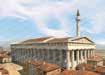
By using the image of the river, this thesis works as an Atlas documentation which seeks to reveal stories in a sequence of detailed illustrations and drawings, providing a comprehensive analysis of two primary landmarks and historical sites along the river with an overview of a total of seven historical monuments and urban landmarks along its bank, lastly flowing into the bay. The two historical monuments and landmarks include the National Museum of Contemporary Art (EMST) and Panathenaic Stadium.
The primary purpose of choosing the seven sites which are all along the banks of the Ilissos River, was to look into the layers of the river and how they have a relationship to the landmarks that are situated on its bank, both above and below ground. This facilitates comprehension of the river’s previously unexplored categories.
The main focal point is River Ilissos here because it has been considered the most important entity since ancient times. Although it flows as a drain into the bay and is covered with modern avenues, the river has not been forgotten by Athenians. They are very well aware of its existence even if it flows underground. The river is one entity but now 10 different municipalities handle 10 different stretches of the river, and it is not doing good to anybody in the context, but if we look at its past, it was considered as a person.
Furthermore, to bring back its value by documenting the river, if daylighting the river at a few stretches is possible, my analysis can support that suggestion as well.
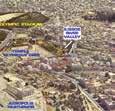
Sites
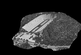
 Panathenaic Stadium and Ardittos Hill
Holy Church of Saint Photine and Bridge of Otto
Playground Pl. KountouriotouKoukaki
The Ilissos River Diversion Point
Panathenaic Stadium and Ardittos Hill
Holy Church of Saint Photine and Bridge of Otto
Playground Pl. KountouriotouKoukaki
The Ilissos River Diversion Point
Órmos
(Faliro
NMCA
Falírou
Bay)
Source - Google Earth
Ilissos Park
42
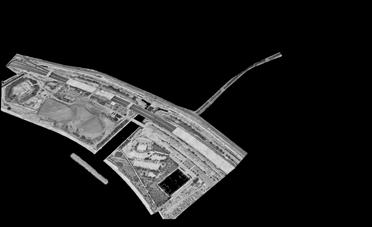
National Museum of Contemprory Art

Εθνικό Μουσείο Σύγχρονης Τέχνης (ΕΜΣΤ) Overlapped Bird-eye view Overlapped Plan River Daylighting Suggestion Timeline Maps Timeline Sections 1893 - Establishment of the Brewery 1940s - FIX Brewery Renovation 1990s - Metro Construction 1910s - FIX Brewery Expansion 1960s - Redesign by Zenatos 2000s - Abandoned 1950s 1940s 1920/30s 1910s 1860s 1900s 2010s 2000s 1990s 1960s 0m 5m 10m 20m 0m 5m 10m 20m 0m 5m 10m 20m 0m 5m 10m 20m 0m 5m 10m 20m 0m 5m 10m 20m 0m 5m 10m 20m 0m 5m 10m 20m 0m 5m 10m 20m 0m 5m 10m 20m Scale 1:1500 Scale 1:1500 43
