River Ilissos : Unveiling Urban Palimpsest
Exploring layers of Historical Monuments and Urban Landmarks of River Ilissos in the city of Athens
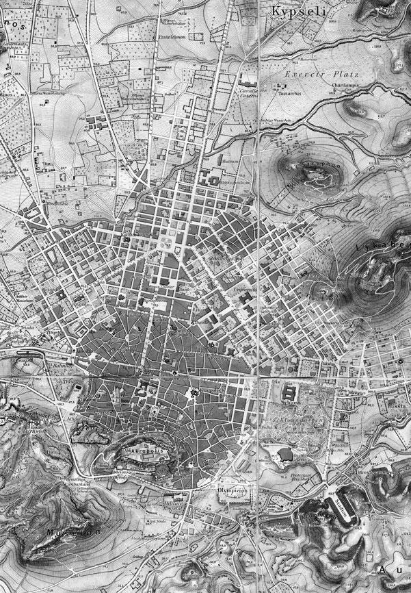
Thesis Project By
Ashna Modi 1009492817 Master of Urban Design (MUD)
Advisor Petros Babasikas
John H. Daniels Faculty of Architecture, Landscape and Design University of Toronto Toronto, ON, CA
April 19, 2024
Abstract
This thesis is a documentation of the historical evolution of the Ilissos River (named after a god), once considered to be a person in the city of Athens, Greece. However, as urban power changed, so did the river. The river, outside the city, became a part of it, and as the city grew, it was integrated into the urban infrastructure, becoming an avenue. The river is prone to catastrophic flooding. By using the image of a palimpsest through the lens of the river, it seeks to reveal these stories in a sequence of detailed illustrations and drawings. It emphasizes two main urban landmarks and historical monuments along the river, covering a total of seven significant landmarks, terminating at the point where the river meets the bay
The term “palimpsest” here embodies the interconnection of past and present, showcasing layers that are already present in urban forms which co-exist with history. Athens, with its rich architectural heritage spanning millennia, serves as an ideal place for this exploration. The city’s naturally occurring river system and wide range of cultural influences on the historical sites demonstrate its dynamic story throughout time, from Byzantine, Ottoman, and contemporary influences to its renowned beginnings.
Athens’ social and urban structure was formerly shaped by the Ilissos River, which ran alongside the Kifissos and Iridanos. The river was the focal point of the city of Athens and was regarded by every monarch as the city’s sacred river. Throughout its history, it served as waterfalls at a few points, fountains, and streams. However, problems with floods and urbanization forced the Ilissos River to be rerouted and eventually covered, leaving it little to serve as a channel flowing into the Faliro Bay.
Although the river is covered, the Athenians are completely aware of its presence. The river is not forgotten. Through a comprehensive atlas-like approach to reestablish a connection with the river’s natural and cultural value and promote a more resilient and sustainable urban environment, it also makes suggestions for potential daylighting the river at those two important stretches.
Attica also known Athens is on Greece’s southern coast and bounded by the Aegean Sea, Steno Keas , Euboic Gulf, Saronic Gulf, Petalioi Gulf and Corinthian Gulf.
It was the most significant Greek city-state culturally and historically. It serves as Greece’s capital and main hub for trade and industry today.
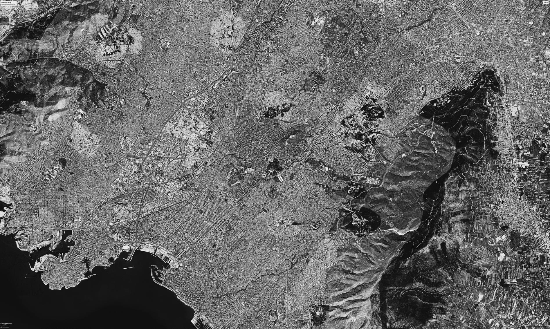

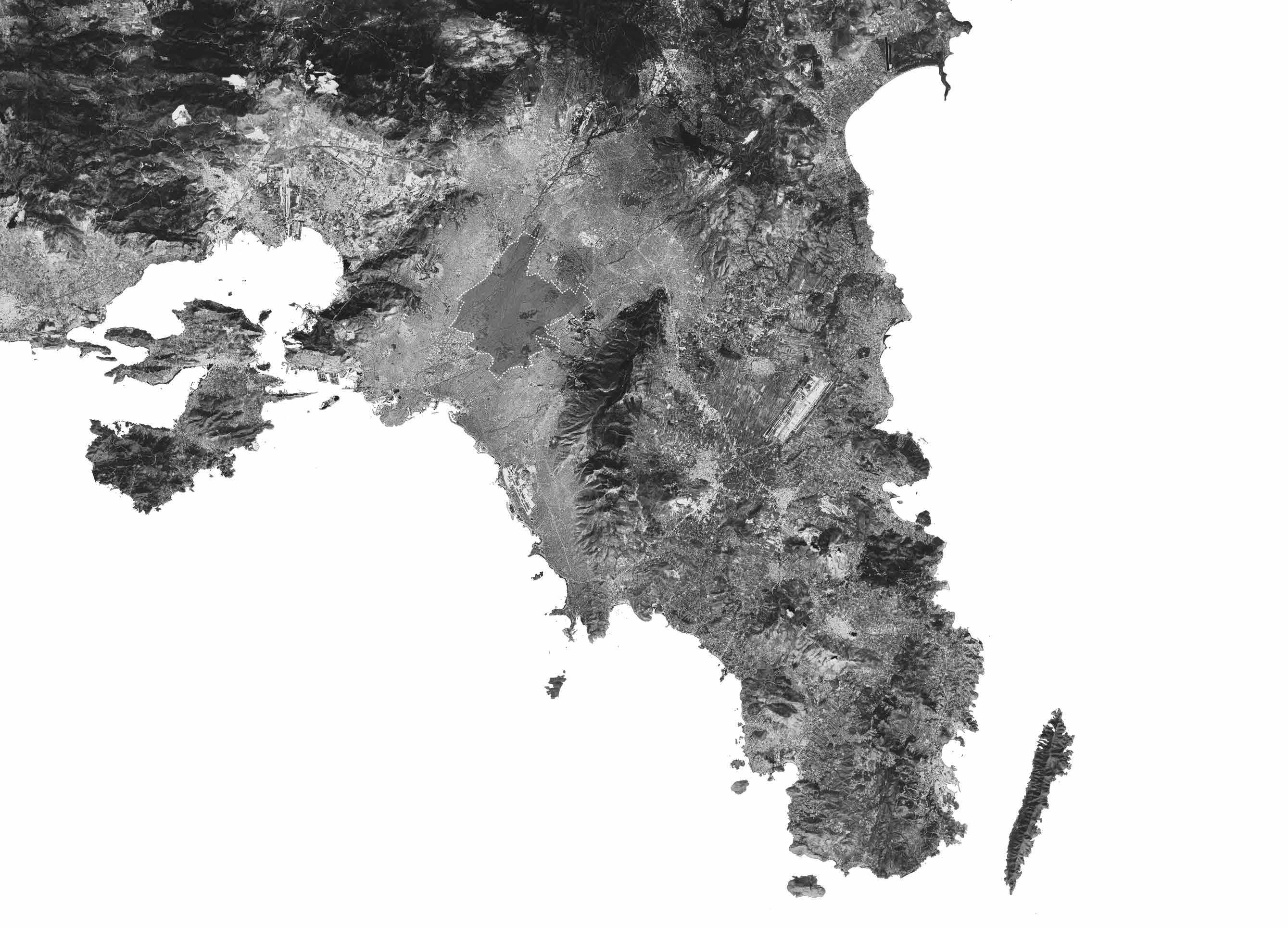 Saronic Gulf
Gulf of Elefsina
Faliro Bay
Steno Keas
Petalioi Gulf
Aegean Sea
Source - Google Earth
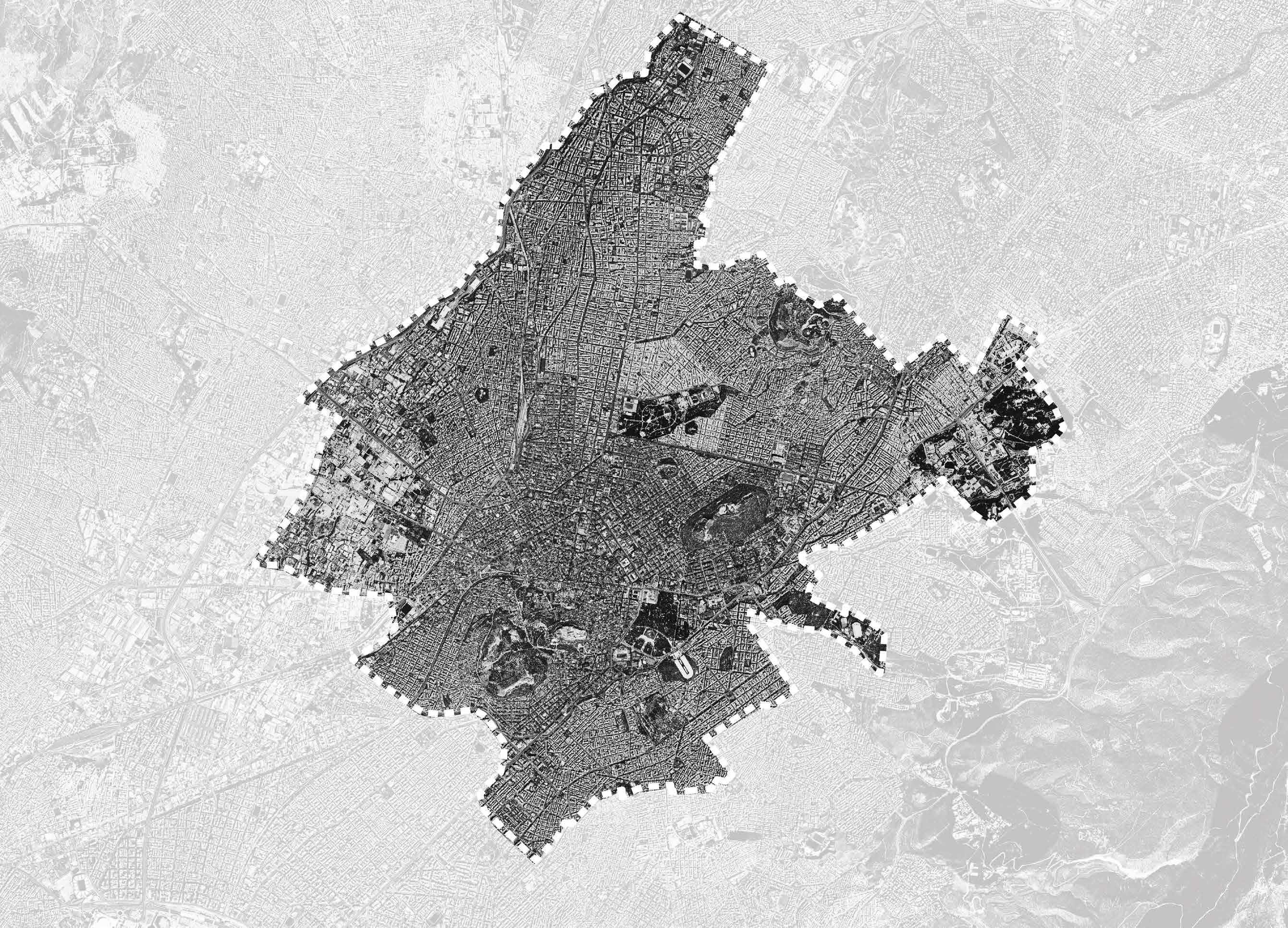
City of Athens, Greece
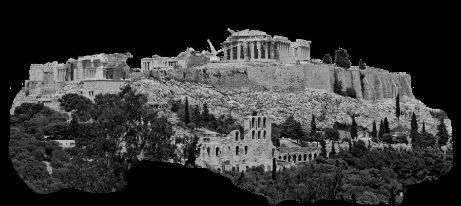
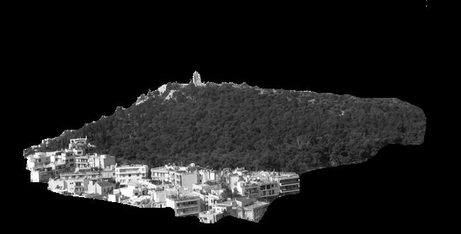

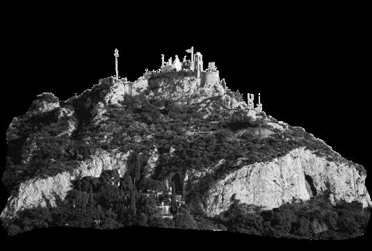
Hills of Athens
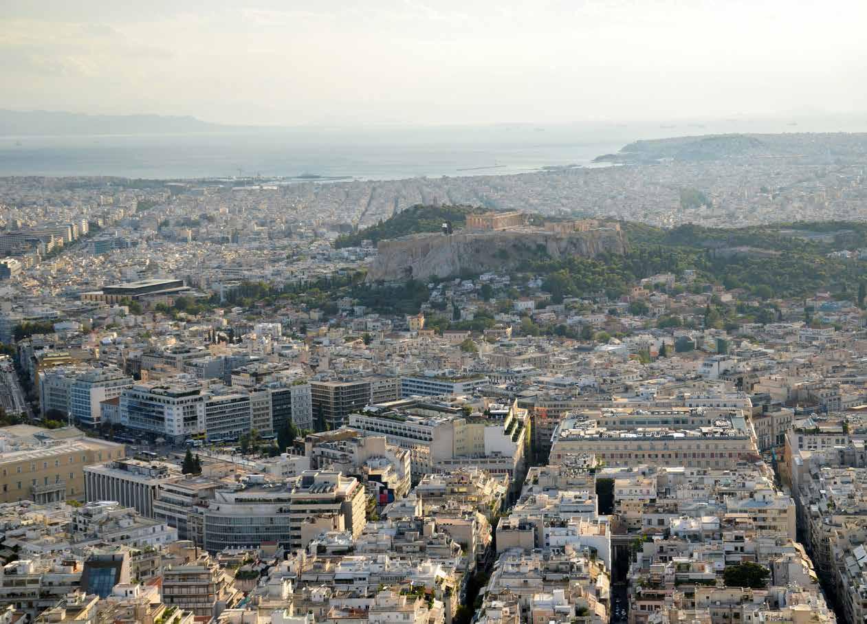
Athens is situated on a peninsula that extends towards the southeast into the Aegean Sea. The Plain of Attica encompasses the city and it’s surrounded by mountains on three sides. The original city is 39 square km in size. The total size of the metropolitan area is approximately 427 square kilometres.
The Acropolis, a flat-topped rock mass, is the centre of the ancient city. The Areopagus is a lower rock located near the Acropolis. Mount Lycabettus (Likavittós) which rises to a height of more than 330 metres northeast of the Acropolis is the tallest. There are several other minor hills located inside and around the present-day city and that is one notable feature of the city of Athens.
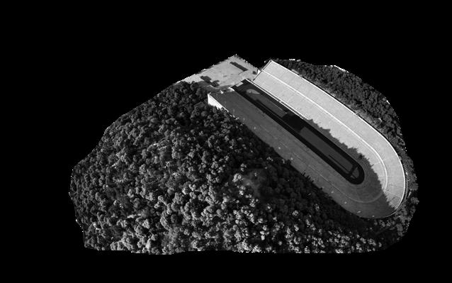
 Lycabettus Hill
Hill of Nymphs
Hill of Muses
Source - Google Earth
Acropolis of Athens
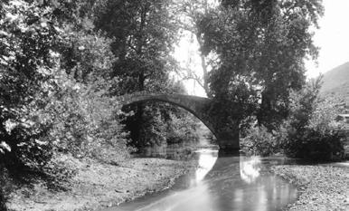
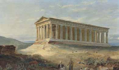
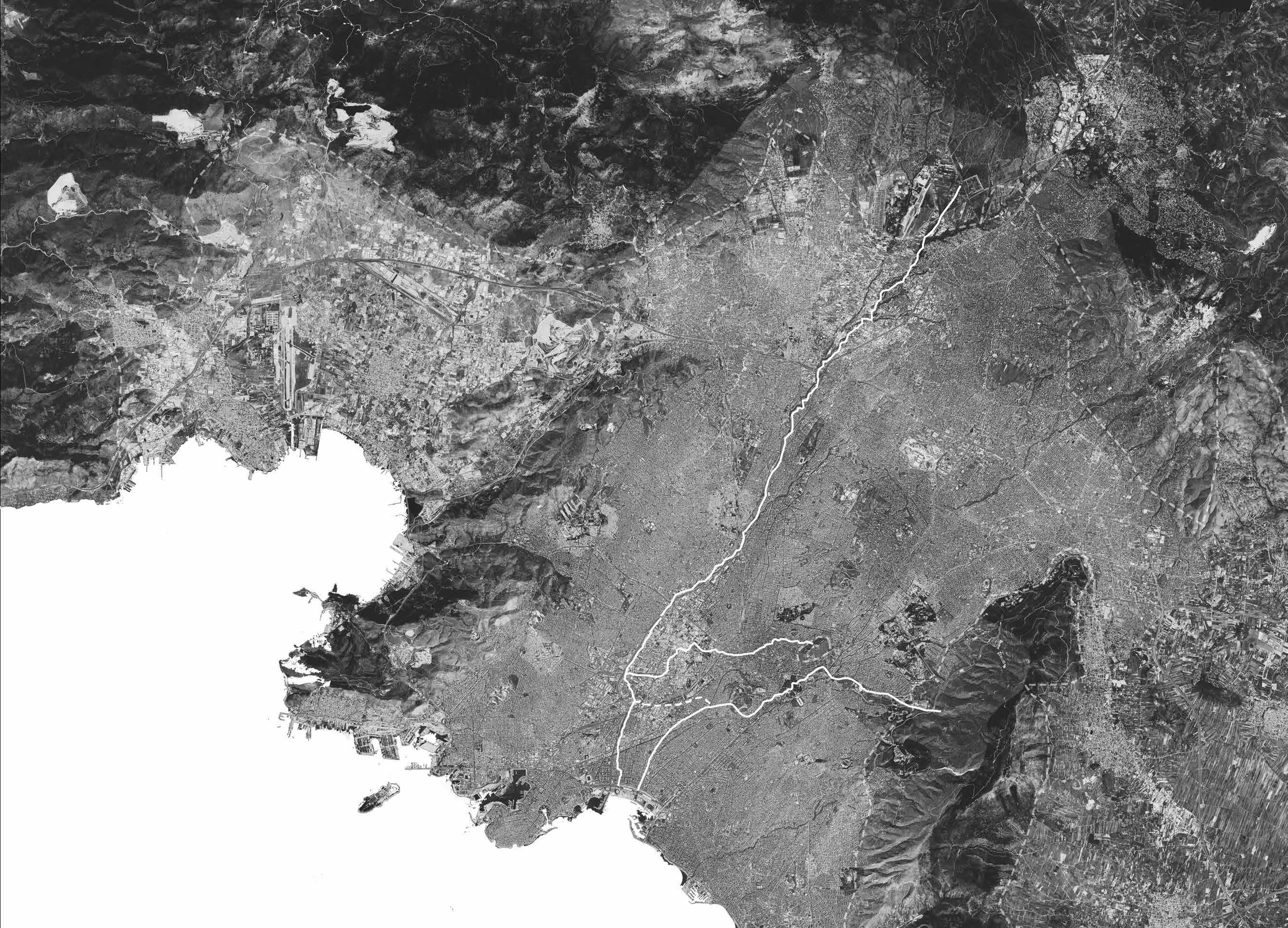
Main Rivers of Athens
 Faliro Bay River Ilissos
River Kifissos
R. Ilissos - 1844
R. Kifissos - 1890
R. Iridanos - 1832
Source - Google Earth Ancient Images Souce - https://greektraveltellers.com/blog/the-buried-rivers-of-athens#:~:text=The%20city’s%20three%20rivers%2C%20Kifissos,right)%20are%20shown%20in%20blue.
River Eridanos
Main
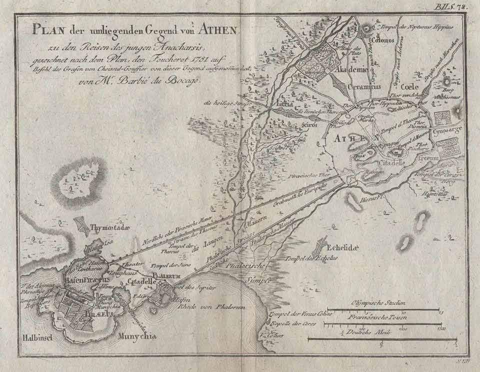 Kifissos and Ilissos River
Source - https://www.geographicus.com/P/AntiqueMap/athens-white-1793
Rivers of Athens
River Illisos
Importance of River Ilissos
River of Attica - The oldest river in the Attica basin, Ilissos (originally Eilissos), was, together with Kifissos, one of the most significant in ancient times. It started from the Hymettos mountains in the northwest and ended at Kifissos. It is close to the centre and it has been channelled for over 3,000 years.
On the right side of the river, near the Ardittos. hill, lies a shrine dedicated to Ilissos, the son of Poseidon and Demeter, after whom the river was named. He was depicted in the corners of the Parthenon’s western pediment alongside the nymph Calliroi.
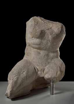
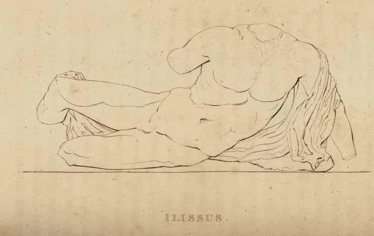
Personification of
Source: https://theacropolismuseum.gr/en/parthenon-west-pediment-ilissos
The oldest river in the Attica basin, Ilissos (originally Eilissos), was, together with Kifissos, one of the most significant in ancient times. lissos River has been a main point of reference in the life of the ancient city and various activities were organised by its banks, ranging from official civic and religious practices to customary walks.
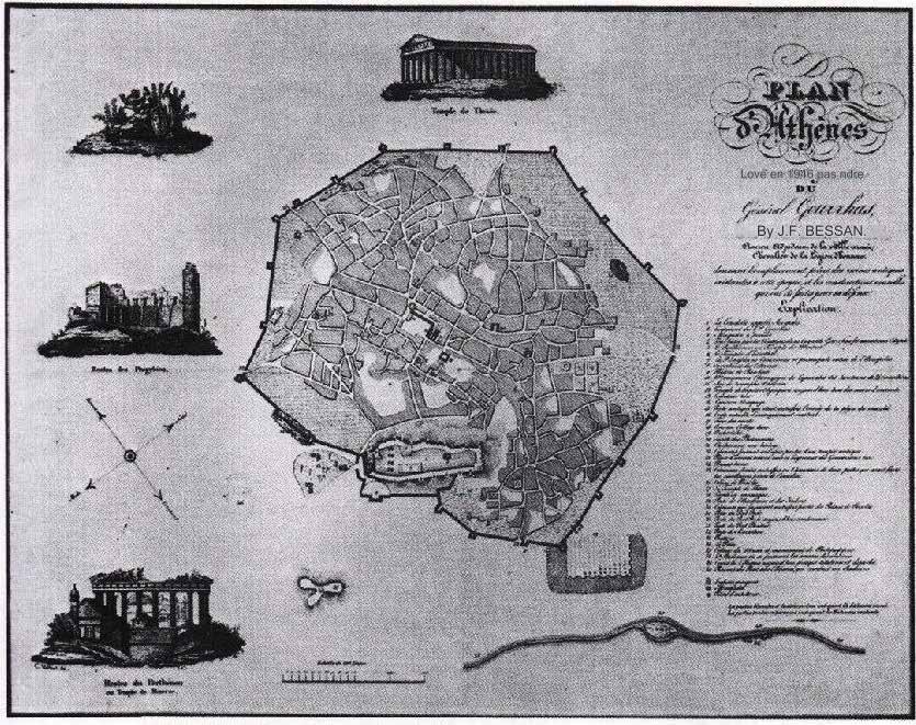
River Ilissos an Important part of the City
Source : https://athensmap360.com/athens-old-map
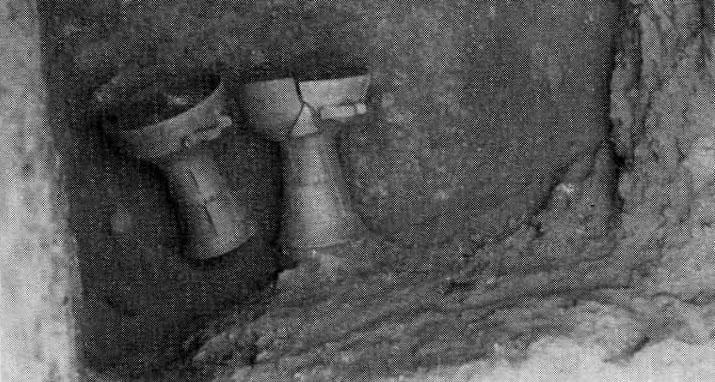
Late Geometric krateriskoi from the burial Source: Alexandri, O., “Οδός Αριστονίκου 4”, ArchDelt 29 (1973-1974), Β ́1, 85. Copyright: Ministry of Culture
Ruins of Ilissos on western pediment of Parthenon
Ilissos
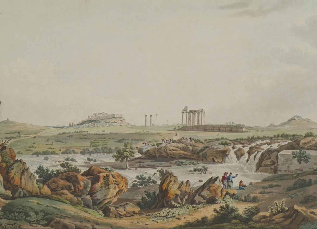
Source - https://eng.travelogues.gr/
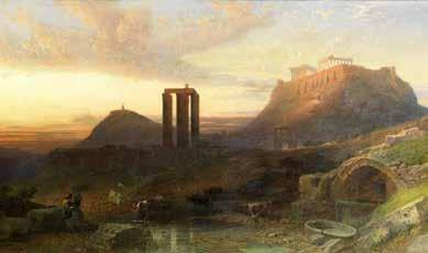
View of the temple of Olympian Zeus and Ilissos river.
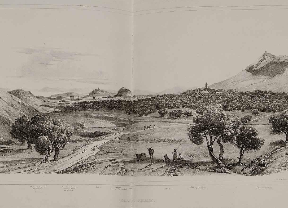
Source - https://eng.travelogues.gr/
Landscape and crop irrigation with Ilissus river . In the background, the Acropolis and the Temple of Olympian Zeus in Athens.
River Illisos as the lens through the city
Athens has seen a substantial transformation over time, much like many other cities. Several levels of urban expansion have affected and changed the river, and this documentation uncovers those layers, paying particular attention to how Ilissos River, the historical monuments and urban landmarks have changed over time, serving as a palimpsest for the development of the city.
The river’s natural ecology has been altered by, flooding, channelizing and other infrastructural interventions. There are architectural ruins and archaeological sites along the banks of the River Ilissos. To determine how these urban landmarks co-exist with history and contribute to the palimpsest character—which symbolizes time, phases of the river and landscape change...
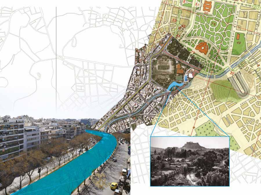
Source - https://greektraveltellers.com/blog/the-buried-rivers-of-athens Buried River
- Phases of the River
Ilissos
River Illisos - Timeline
 River Ilissos outside the city walls
River Ilissos as a part of the City of Athens
Underground life of the River Ilissos
Journey of River Ilissos

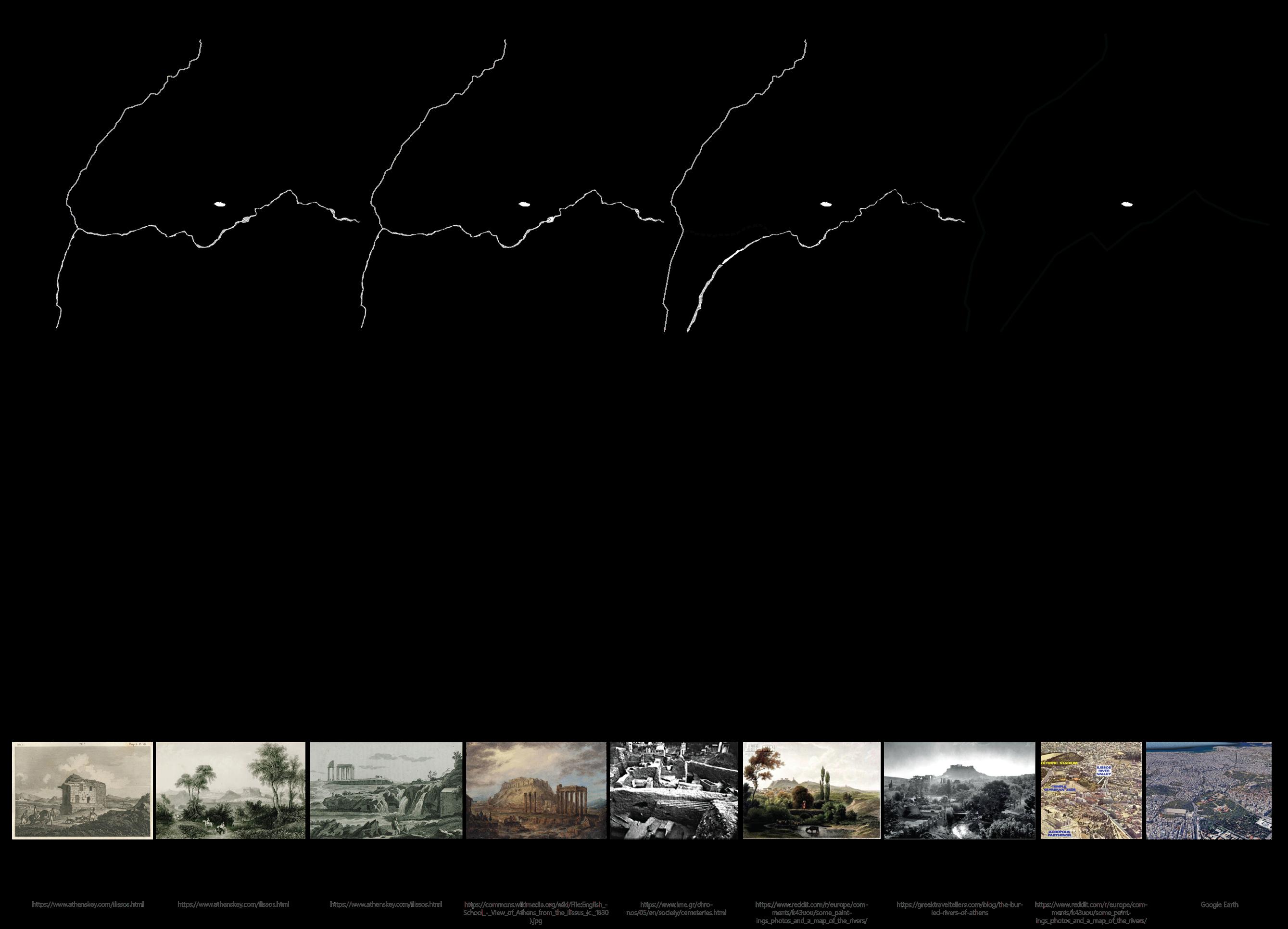
River Illisos outside the City Walls
Archaic Time and Classical Period
River Ilissos used to flow outside of the Ancient Walls of the Ancient City of Athens. It unites all the waters of the northwest base of Hymettos Mountain.
For many years, Themistoclean Wall— which was constructed in 479 B.C.— acted as the city’s principal line of defence. L. M. Ugolini first divided the ancient walls of the Acropolis into three periods according to their masonries.
The first wall, known as “Pelasgic” or “cyclopean,” was made up of big boulders that were packed with smaller stones. It was three metres in length and two metres in width. N. Ceka thought that the acropolis was originally built with crude stone walls between the 7th and 6th century BC, and then it was replaced with trapezoidal and polygonal masonry between the 5th and 4th century BC. Not after 500 BC, but between the eighth and sixth centuries BC, were the initial walls constructed. The wall circuits were a defensive mechanism erected around the ancient temple devoted to Athena Polias.
After Xerxes invaded Greece, the ‘Long Walls’ of Athens were constructed as defences. Following the Persian destruction and looting of Athens, they were constructed as part of the reconstruction effort. The true motivation was discontent with Athens’s dominance over the region. Athens became an “island” when the walls surrounded the city from the mainland and linked Piraeus to Athens.

River Illisos outside the City Walls
Scale 1:5000 Based
1993
on Travlos Maps,
479 B.C. - 338 B.C.
Themistoclean Wall
Diateichisma Wall
Long Walls
Lycabetus Hills
Aridittos Hills
Hill of the Nymphs
RiverIlissos
Acropolis of Athens
338 B.C. - 86B.C.
Decline of the Classical period
Built by the Athenians in the 4th century BC, the “Diateichisma” wall served as a defence against Macedonian invasion. It linked with the earlier Themistoclean Wall and set borders on the Hill of the Nymphs, Pnyx, and the Muses. The wall left portions of the Demos of Melite and Koile undefended, reducing the city’s fortified territory from the west.
River Ilissos remained outside the walls but was a sacred part of the city. The area outside of the city wall was considered a wasteland. However, many inhabitants used the river water for religious purposes.
A stadium was erected during this period which was rectangular for entertainment purposes.

River Illisos outside the City Walls
Scale 1:5000
Based on Travlos Maps, 1993
Themistoclean Wall (Second Layer)
Diateichisma Wall
Long Walls
Lycabetus Hills
Aridittos Hills Hill of the Muses
Hill of the Nymphs RiverIlissos
Acropolis of Athens
Byzantine
Period
The Valerian Wall was constructed around 260 A.D. as a new fortification and in part to follow the layout of earlier walls to defend the city against barbarian invasions.
River Ilissos still was on the edge of the walls and was considered a sacred part of the city. The people used the river water for religious, burial and drinking purposes.
The stadium erected during this period was restructured and given a new form.
A bridge was constructed over the river to access the stadium hence, depicting that the river started to become an important part of people’s lives.

River Illisos outside the City Walls
B.C.
267
Based on Travlos Maps, 1993 86
-
Valerian Wall
Diateichisma Wall
Lycabetus Hills
Aridittos Hills
Hill of the Muses
Hill of the Nymphs
RiverIlissos
Scale 1:5000
Acropolis of Athens
267 - 566
Byzantine Period
The Valerian Wall was constructed around 260 A.D. as a new fortification and in part to follow the layout of earlier walls to defend the city against barbarian invasions.
The considerably smaller Herulian (or Post-Herulian) Wall, was constructed in around 280 AD and surrounded the old city’s heart after the Heruli had captured it in 267 AD.
Athens began to deteriorate in 267 A.D. during the Heruli’s invasion. Only a small portion of the city—the Hadrian Library and the Roman Agora—was protected by a brand-new, microscopic wall. The Agora’s ruins lay outside the wall. There was also no disturbance to the Acropolis. It was refortified with a gate made from the remains of Nikias’ choragic structure, which is now called the Beulé gate.
During the rise of the Roman Empire, many churches started to emerge. One of those was constructed right across the river bank.

River Illisos outside the City Walls
Scale 1:5000
Based on Travlos Maps, 1993
RiverIlissos
Diateichisma Wall
Post Herulian Wall
Lycabetus Hills
Aridittos Hills
Hill of the Muses
Hill of the Nymphs
Valerian Wall
Acropolis of Athens
566 - 1205
Byzantine Period
A fortified precinct known as Rizokastro was built at the base of the Acropolis in the first part of the thirteenth century.
The Sacred Rock was transformed into a mediaeval fortress in the middle of the century when the Acropolis’ defences were strengthened. A strong wall, known as the Proteichisma, was constructed to guard the main entrance, and a tall watchtower was erected on the south side of the Propylaia.
River Ilissos still was on the edge of the walls and was considered a sacred part of the city. The people used the river water for religious, burial and drinking purposes.
The stadium erected was eventually abandoned and the remains could be still from afar.
The Basilica Church was considered important and it was located exactly at the centre of the river stream.

River Illisos outside the City Walls

Based on Travlos Maps, 1993
Diateichisma Wall
Rizokastro Wall
Lycabetus Hills
Aridittos Hills
Hill of the Muses
Hill of the Nymphs RiverIlissos
Valerian Wall
Acropolis of Athens
Scale 1:5000
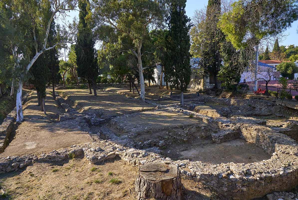
Source - https://commons.wikimedia.org/wiki/File:Remains_of_the_Early_Christian_Basilica_of_Ilissos_on_November_2,_2022.jpg
Remains of the Early Christian Basilica of Ilissos Early Christian Basilica of Ilissos
1205-1456
Fall of Byzantine Time
Most of the part of the Herulian Wall was destroyed during the attacks. Extensive damage occurred during the Ottoman occupation.
Even though the city was damaged immensely, the river remained as it was.

River Illisos outside the City Walls

Based on Travlos Maps, 1993
Rizokastro Wall
Lycabetus Hills
Aridittos Hills
Hill of the Muses
Hill of the Nymphs
RiverIlissos
Acropolis of Athens
Scale 1:5000
1456 - 1687
Ottoman period
The Acropolis was unharmed. The hill’s top had become a castle for the Turkish garrison and the Parthenon was used as a mosque.
Many new mosques started to emerge in the city.
The river remained an important part of the city and the water was now used for agricultural and drinking use. The river bank became an important part of burial services.

River Illisos outside the City Walls

Based on Travlos Maps, 1993
Lycabetus Hills
Aridittos Hills
Hill of the Muses
Hill of the Nymphs
RiverIlissos
Acropolis of Athens
Scale 1:5000
1687 - 1830
Ottoman period and Greek Independence
Ancient monuments were destroyed to provide material for a new wall with which the Ottomans surrounded the city in 1778.
River Ilissos was again outside of the city walls but its value did not degrade.
Various activities near the river’s banks are mentioned by ancient writers. These activities range from social walks and intellectual endeavours in picturesque surroundings, as for Socrates and his pupils, to civic procedures, cults, and even a sanctuary devoted to the river itself by Ardittos Hill.

River Illisos outside the City Walls

XI - 1687 – 1830
Based on Travlos Maps, 1993
Lycabetus Hills
Aridittos Hills
Hill of the Muses
Hill of the Nymphs
RiverIlissos
Wall of Haseki
Acropolis of Athens
Scale 1:5000
1830 - 1850
River Illisos outside the City Walls
Neo-Classical Era
After Greece attained Independence in 1833, many important buildings were restored.
Along with its historical growth and expansion, Athens experienced urbanization following Greece’s independence. In the historic centre, neoclassical buildings and broad avenues designed by the city planners of the past combined with more modern development started to emerge. Many churches were destroyed during this era.
Ilissos River which flowed outside the city, was now a part of the urban growth of the city.


Based on Travlos Maps, 1993
Lycabetus Hills
Aridittos Hills
Hill of the Muses
Hill of the Nymphs
RiverIlissos
Acropolis of Athens
Scale 1:5000
1850 - 1870
Neo-Classical Era
With the increase in the population of the city, the settlements increased and hence, the city started to grow to the north of the Acropolis.
While the traditional agora (bazaar) of the old settlement continued to function as the most active part of the community, in other undeveloped areas the first new buildings began to rise; public buildings (roads and utilities).
Ilissos remained outside the city and the new palaces (today’s Parliament) were situated on the map. This marks the start of the city’s eastward growth or its move towards Ilissos.

River Illisos outside the City Walls

Based on Travlos Maps, 1993
Lycabetus Hills
Aridittos Hills
Hill of the Muses
Hill of the Nymphs
RiverIlissos
Acropolis of Athens
Scale 1:5000
River Illisos as part of the City
River Illisos - As part of the City
Expansion of Athens
In the 1880s, Athens became the capital. It didn’t have any development or a master plan then. Stamatis Kleanthis, Eduard Schaubert and German neoclassical architect Karl Friedrich Schinkel proposed a plan for the expansion of the city in 1831. Leo von Klenze, a Bavarian architect, was sent to Athens in 1834 and during his July–September 1834 visit, a New Plan was developed.

Along with its historical growth and expansion, Athens experienced urbanization following Greece’s independence. In the historic centre, neoclassical buildings and broad avenues designed by the city planners of the past combine with more modern development.
While the traditional agora (bazaar) of the old settlement continued to function as the most active part of the community, in other undeveloped areas the first new buildings began to rise; public buildings (roads and utilities).
The population grew, and new infrastructure, such as tram lines and the first subway line, was introduced. The cityscape retained many neoclassical and eclectic buildings destroying the old churches.
With a sharp increase in population in the 1900s, there was a shift from neo-classical built form to contemporary architecture. With that, legal and illegal development, refugee settlements, and public and private developments increased.
The bed of river Ilissos started to fill with the new developments and avenue infrastructure.
Athens took a while to expand to the whole area that the plans intended for. Its boundaries stayed the same as the previous city for many years before the independence.
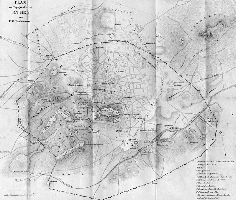
River Ilissos as part of the city within old boundaries Source - https://jenikirbyhistory.getarchive.net/topics/old+maps+of+ancient+athens
Proposal Plan
Source - https://www.athenssocialatlas.gr/en/article/planning-19th-century/
1870 - 1896
The city ultimately merged into the modern metropolis as it grew eastward towards the Ilissos River. The river now flows through the city’s core as a result of the city expanding across it. On the map, a few areas of the river seemed to be covered. The area close to Panathenaic Stadium was completely covered and turned into a road for improved transportation.

River as part of the City
Based
1993
on Travlos Maps,
Lycabetus Hills
Aridittos Hills
Hill of the Muses
Hill of the Nymphs
RiverIlissos
Acropolis of Athens
Scale 1:5000
As the city expanded, so did the demand for roads and infrastructure, which led to the construction of several bridges to connect the east and west of the city. This required building bridges across the Ilissos River.
The result of all this was Ilissos, a river that had previously exclusively flowed outside of the city from ancient times onward. It was gradually beginning to fit within the boundaries of the expanding capital, mainly to the east, and its recurring floods are now not only felt but also disastrous...

River as part of the City
Based on Travlos Maps, 1993 1896- 1930
Lycabetus Hills
Aridittos Hills
Hill of the Muses
Hill of the Nymphs
RiverIlissos
Acropolis of Athens
Scale 1:5000
River Illisos - As part of the City
Flooding of River Ilissos and Its Diversion
In the late 19th and early 20th centuries, on the occasion of the catastrophic floods of Kifissos and Ilissos, among others, the professor and rector of the National Technical University of Athens, studied the possibility of separating the two rivers, i.e. the creation of a new and special bed for the Ilissos to flow into the Faliro bay and this investigation was implemented approximately around 1905. The division commenced at Kallithea’s Evangelistrias Street, around 260 meters before the Harokopou Street bridge and 200 meters before ISAP’s third-floor bridge.
The new riverbed of Ilissos is around 3,200 meters long. From that point on, Ilissos discharges its waters into Faliro Bay, and this new riverbed serves as Kallithea and Moschato’s natural boundary. In this way, Kifissos was relieved in major storms and the risk of flooding in the Estuary was significantly reduced.
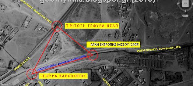
The triangle under study in 1929 https://geomythiki.blogspot.com/2016/06/blog-post_11.html
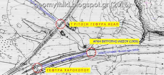
The triangle under study in 1931 https://geomythiki.blogspot.com/2016/06/blog-post_11.html

Source - Google Earth
River Illisos as an underground channel
1930 - Present
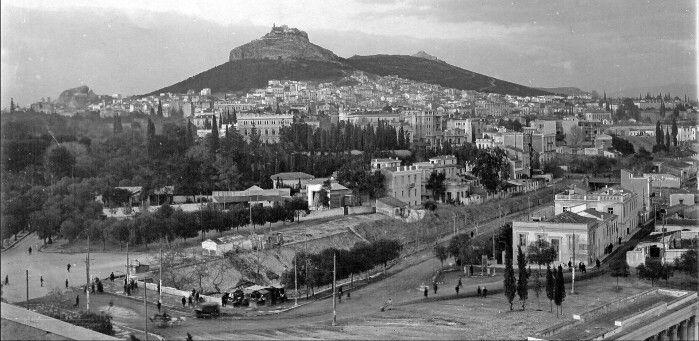
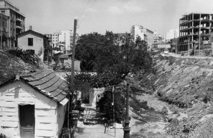
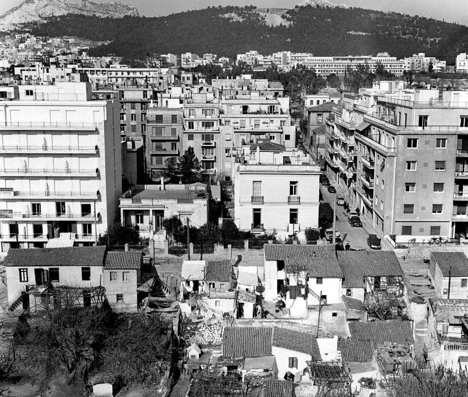
The Coverage of River Ilissos
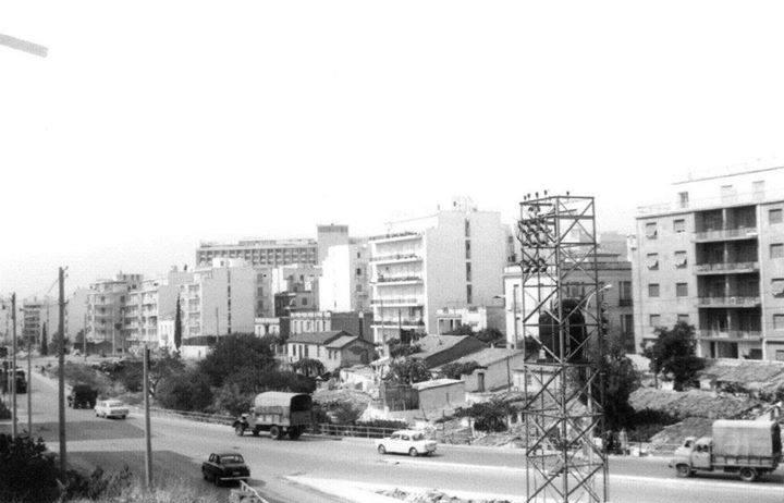
Source - https://www.google.com/imgres?imgurl=https%3A%2F%2Fi.pinimg.com%2F736x%2F1d%2Fdd%2F58%2F1ddd58f5a117f2ff2614624badf353dc.jpg&tbnid=ywbkUOPROr73OM&vet=12ahUKEwjQnMaaxoOFAxXcD2IAHWi4BSUQMygGegQIARA9..i&imgrefurl=https%3A%2F%2Fwww.pinterest.com%2Fpin%2F475763148126039106%2F&docid=pcdiDPhw4oncMM&w=700&h=341&q=ilissos%20syggrou%20fix%201900&ved=2ahUKEwjQnMaaxoOFAxXcD2IAHWi4BSUQMygGegQIARA9 https://kedrostravel.com/en/pos-ton-len-pos-ton-len-ton-potamo/
River as underground channel
1930 - 2005
Rapid expansion in the 1930s resulted in overflow in fields and residential areas due to severe weather and incompetent dam building. The riverbed was eventually replaced with avenues all around the city, removing the river entirely from the daily lives of the Athenians.


Based on Travlos Maps, 1993
Lycabetus Hills
Aridittos Hills
Hill of the Muses
Hill of the Nymphs
Scale 1:5000
River
2005 - Present
Along with converting the riverbeds into avenues, tram lines were built on top of the traces of the river bed removing the river entirely in the city. Only a small patch of the river still could be seen near the Church Agia Fotini


Based on Travlos Maps, 1993
Lycabetus Hills
Aridittos Hills
Hill of the Muses
Hill of the Nymphs
as underground channel
Scale 1:5000
River Illisos - Urban Lanmarks and Historical Monumnets
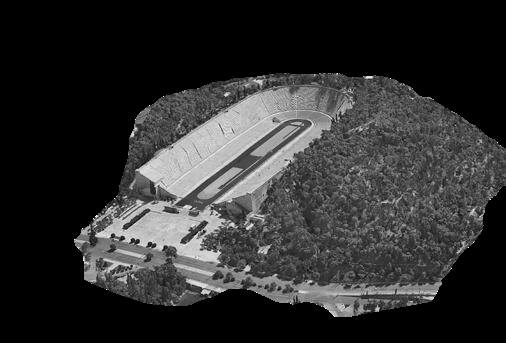
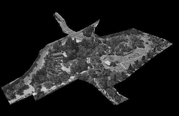
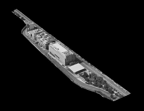
By using the image of the river, this thesis works as an Atlas documentation which seeks to reveal stories in a sequence of detailed illustrations and drawings, providing a comprehensive analysis of two primary landmarks and historical sites along the river with an overview of a total of seven historical monuments and urban landmarks along its bank, lastly flowing into the bay. The two historical monuments and landmarks include the National Museum of Contemporary Art (EMST) and Panathenaic Stadium.
The primary purpose of choosing the seven sites which are all along the banks of the Ilissos River, was to look into the layers of the river and how they have a relationship to the landmarks that are situated on its bank, both above and below ground. This facilitates comprehension of the river’s previously unexplored categories.
The main focal point is River Ilissos here because it has been considered the most important entity since ancient times. Although it flows as a drain into the bay and is covered with modern avenues, the river has not been forgotten by Athenians. They are very well aware of its existence even if it flows underground. The river is one entity but now 10 different municipalities handle 10 different stretches of the river, and it is not doing good to anybody in the context, but if we look at its past, it was considered as a person.
Furthermore, to bring back its value by documenting the river, if daylighting the river at a few stretches is possible, my analysis can support that suggestion as well.
Sites
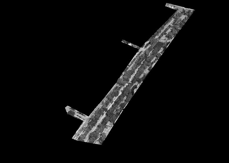
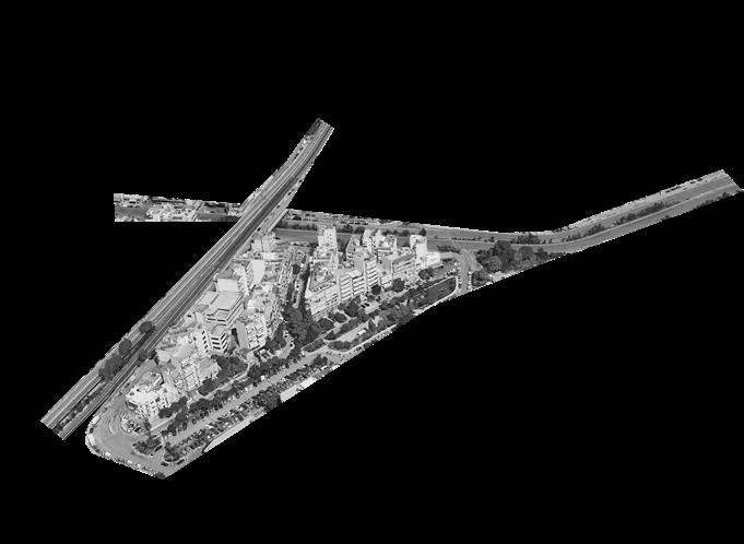
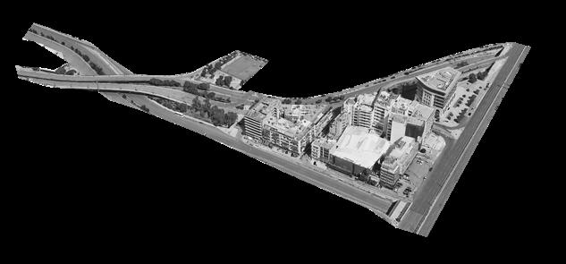

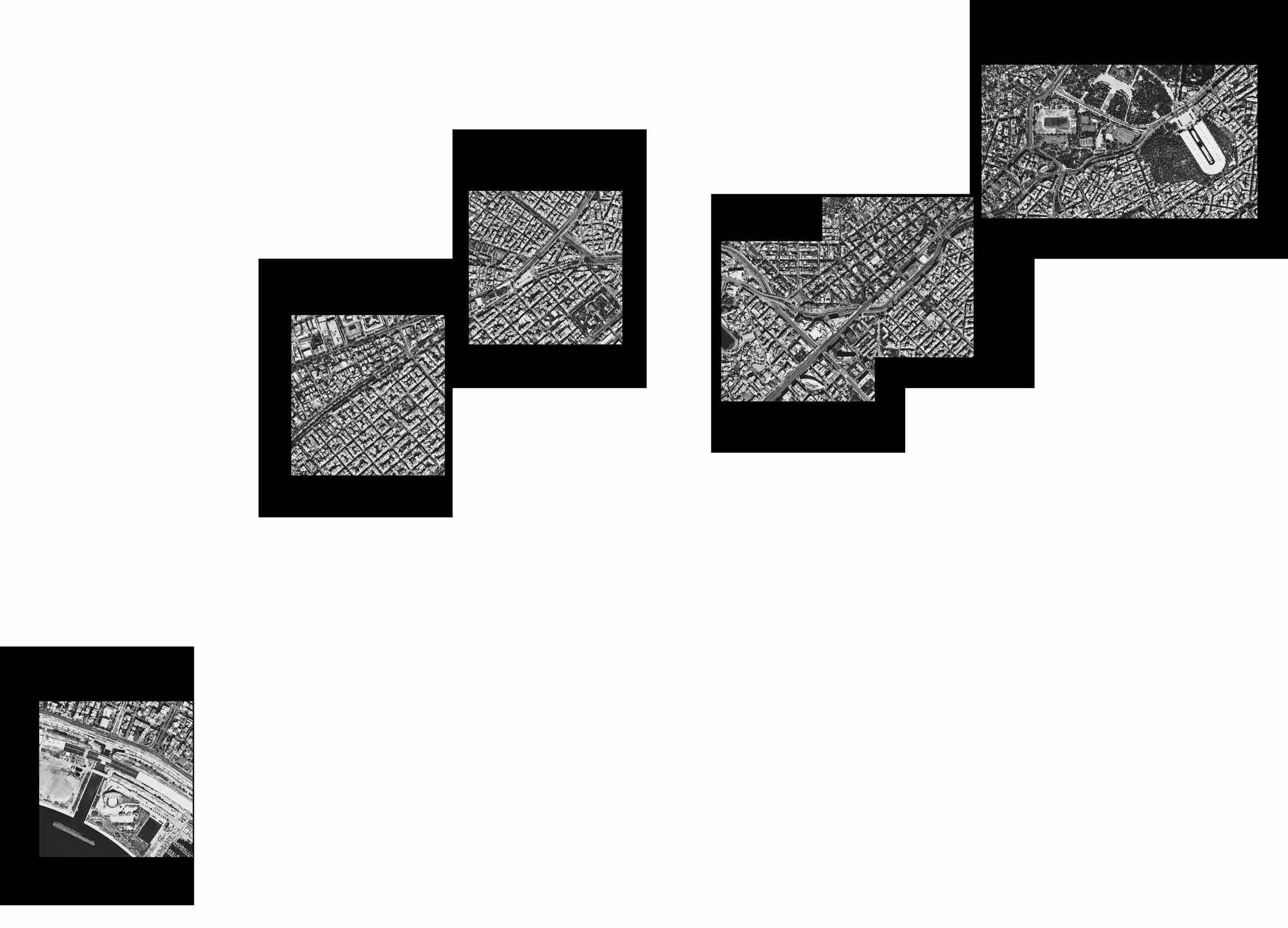
River on Historical Monuments and Urban Landmarks.....
Panathenaic Stadium and Ardittos Hill
Holy Church of Saint Photine and Bridge of Otto
Playground Pl. KountouriotouKoukaki
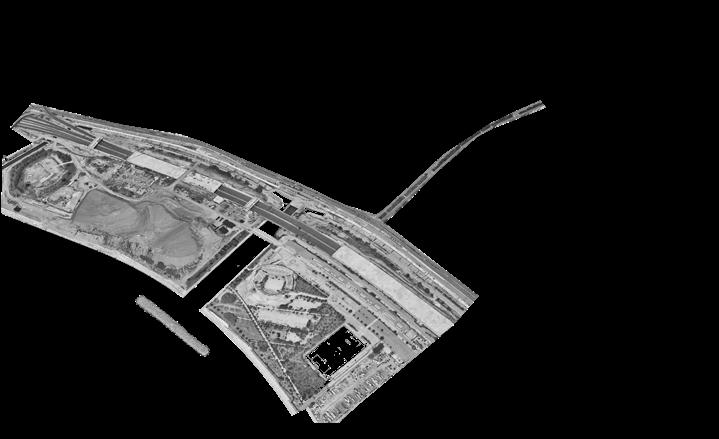
The Ilissos River Diversion Point
NMCA
Órmos Falírou (Faliro Bay)
Source - Google Earth
Ilissos Park
The Diversion Point at
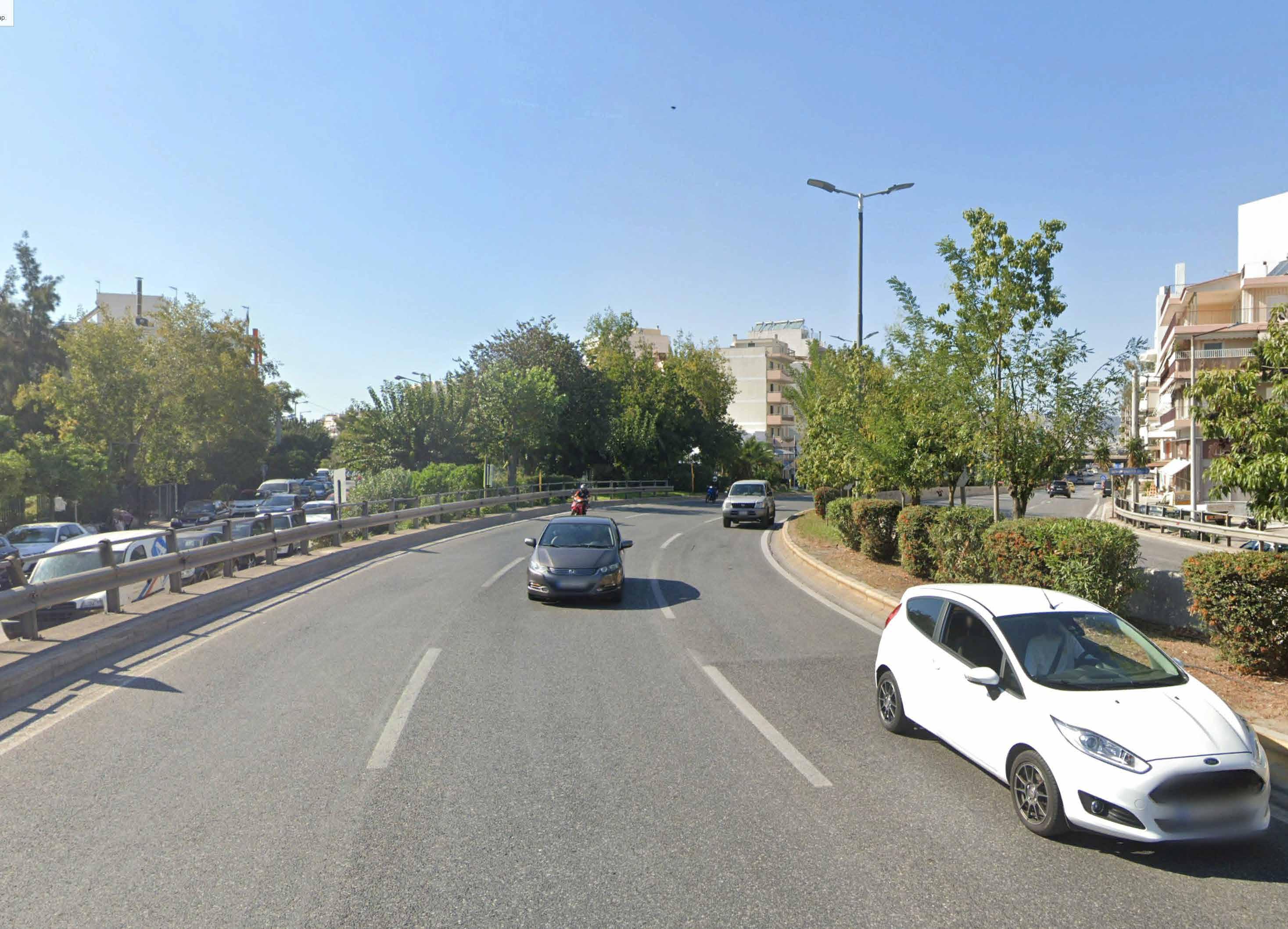
Source - Google Maps River as Avenue
River Ilissos
The Diversion of River Ilissos
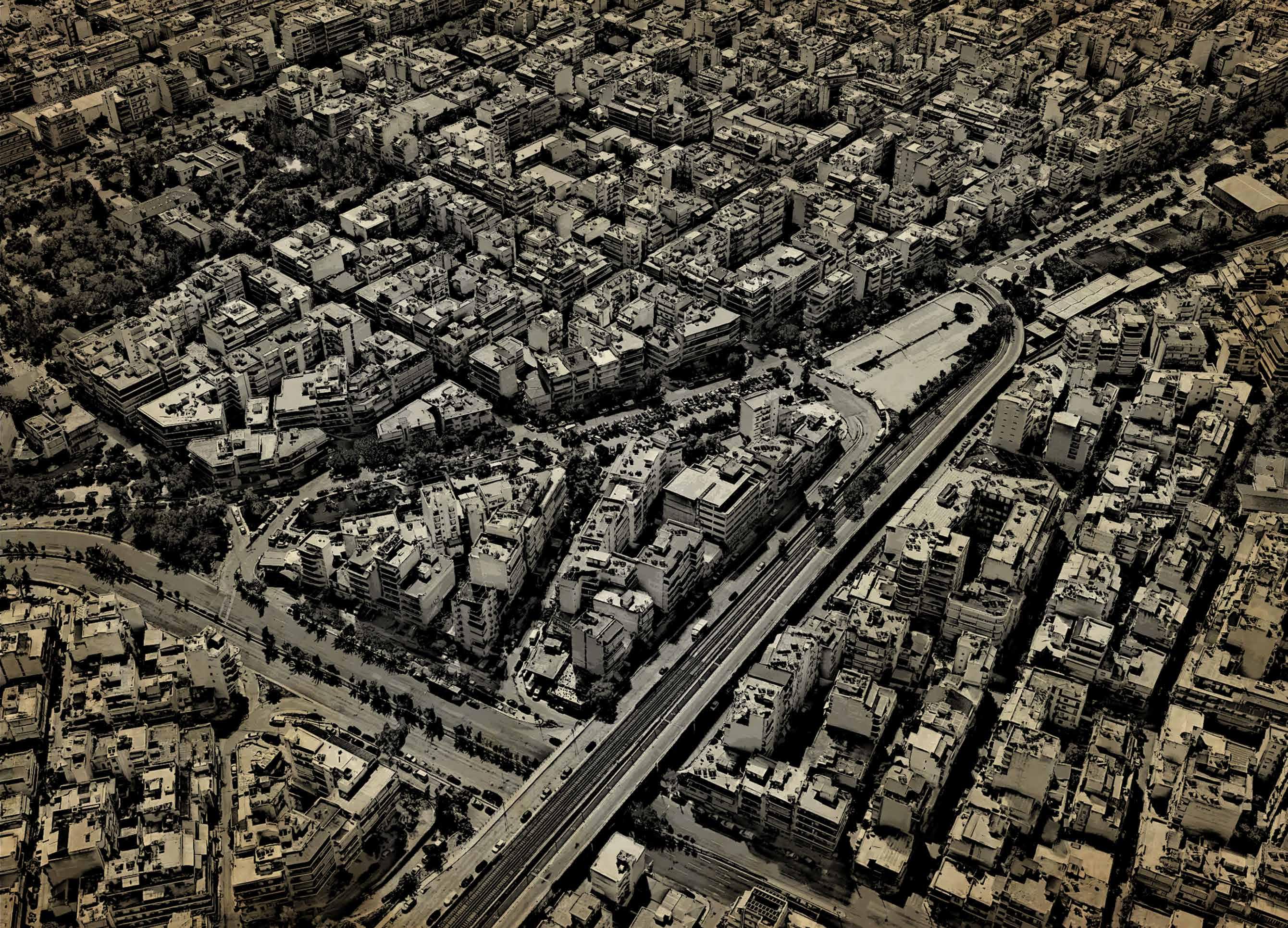
Present day
Source - Google Earth
Source - https://jenikirbyhistory.getarchive.net/media/d361-athenes-et-le-piree-l2-ch8-8039ec
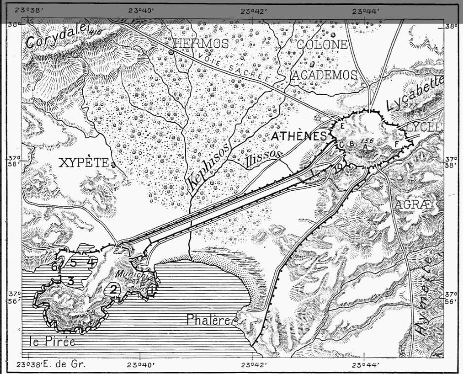
Both
the rivers meeting at a point and then flowing into the “Big Eleon” before 5th Century B.C.
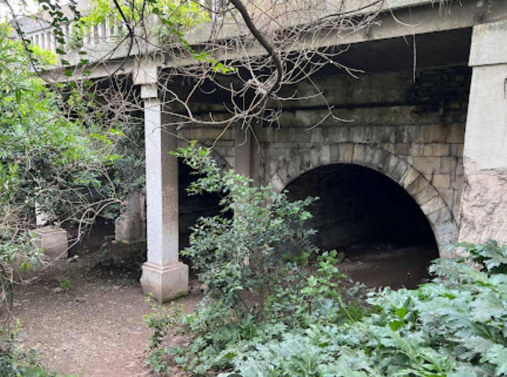
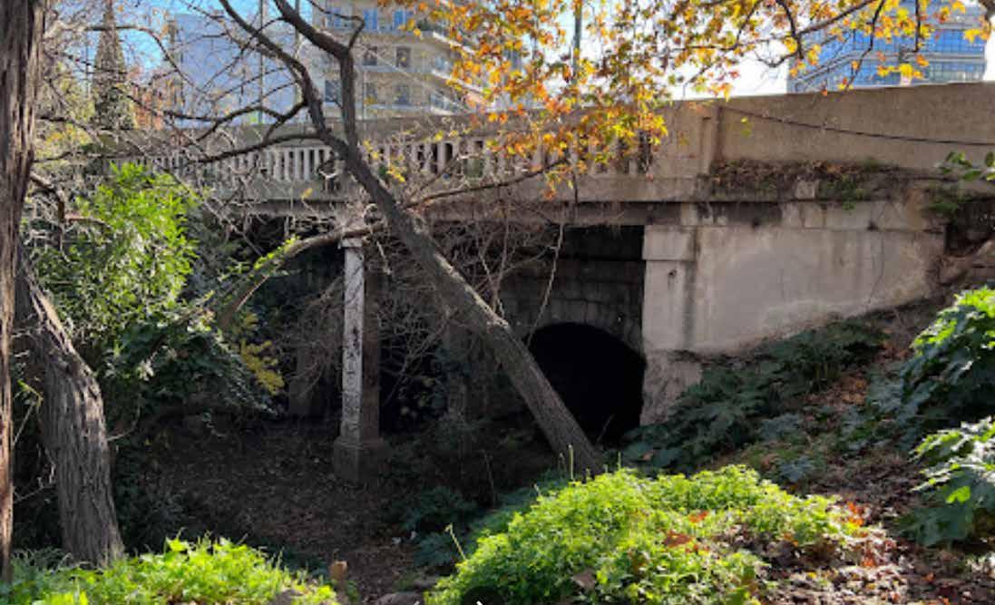
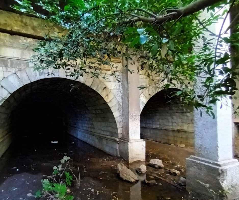

Source - Google Maps
Present day condition of the Bridge
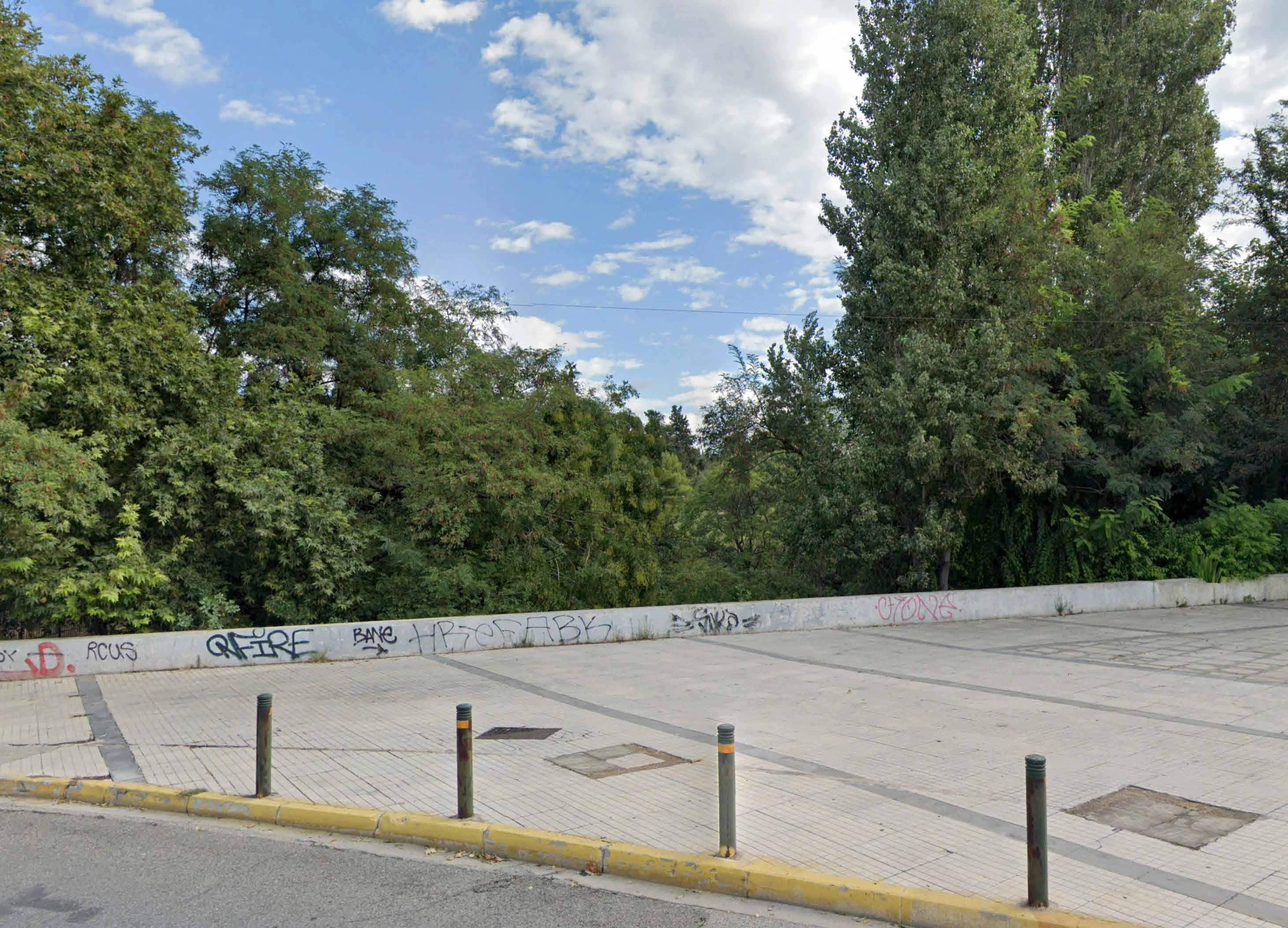
Source - Google Maps
Bridge of Otto
Two layers of Bridge built on top of Bridge Otto
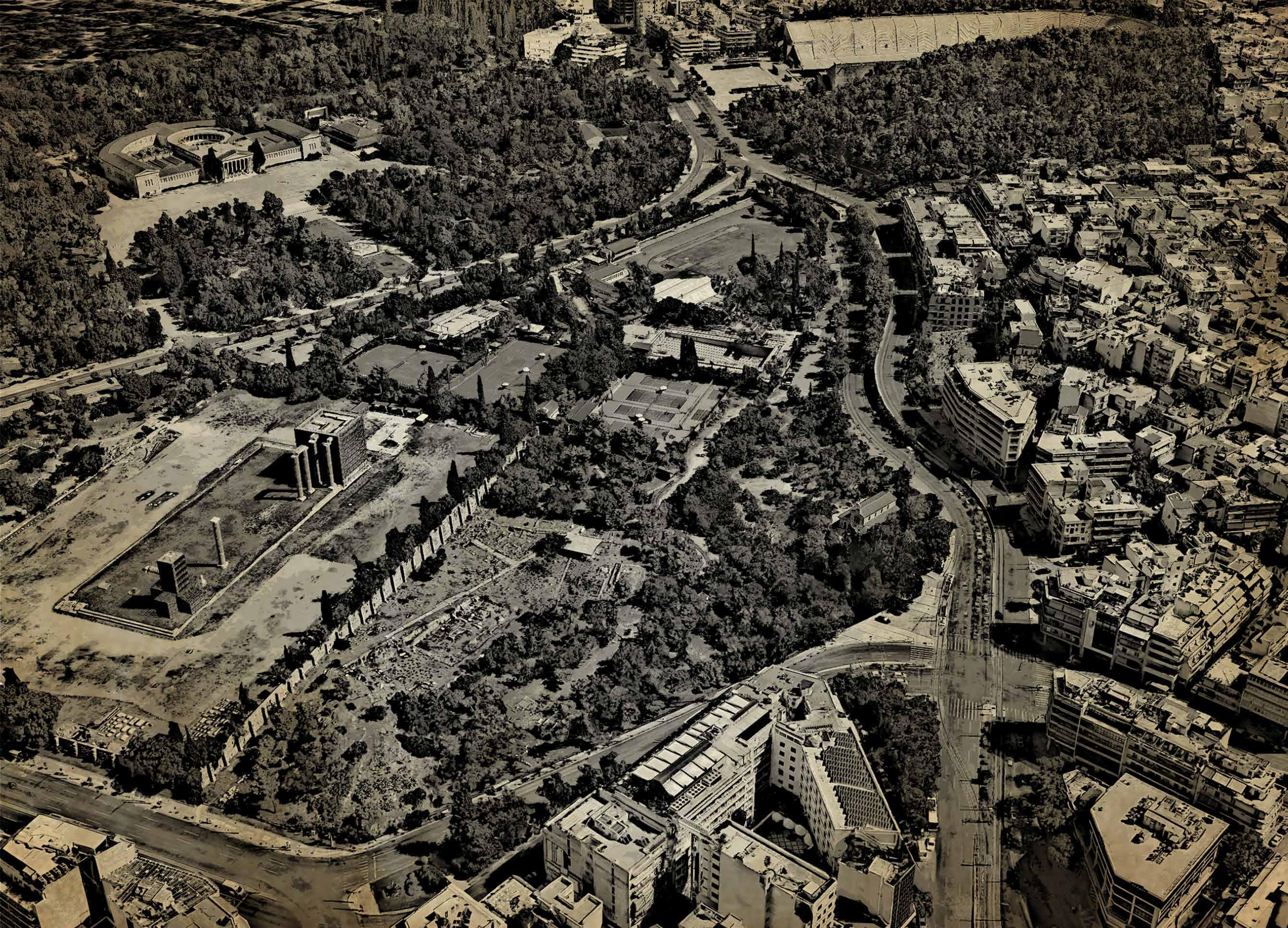
Present day
Source - Google Earth
Holy Church of Saint Photine and Bridge of Otto
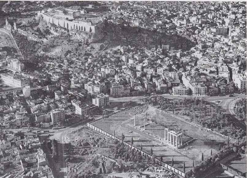 Temple of Zeus and it’s surroundings
Source - Google.com
Holy Church of Saint Photine and Bridge of Otto
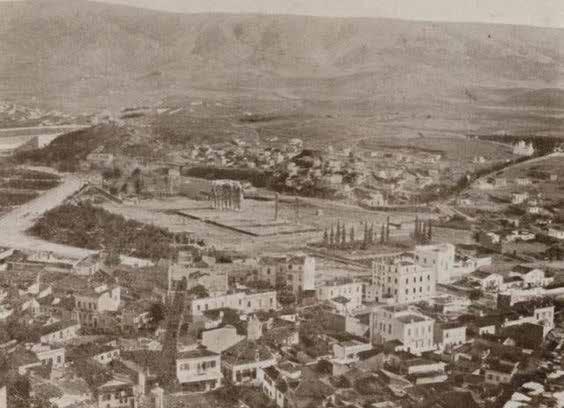 Plaka, the valley of Ilissos, Ardittos hill and Pangrati.
- https://nataliavogeikoff.com/2022/11/20/a-journey-in-the-mediterranean-on-the-eve-of-the-great-war-1914/
Holy Church of Saint Photine and Bridge of Otto
Source
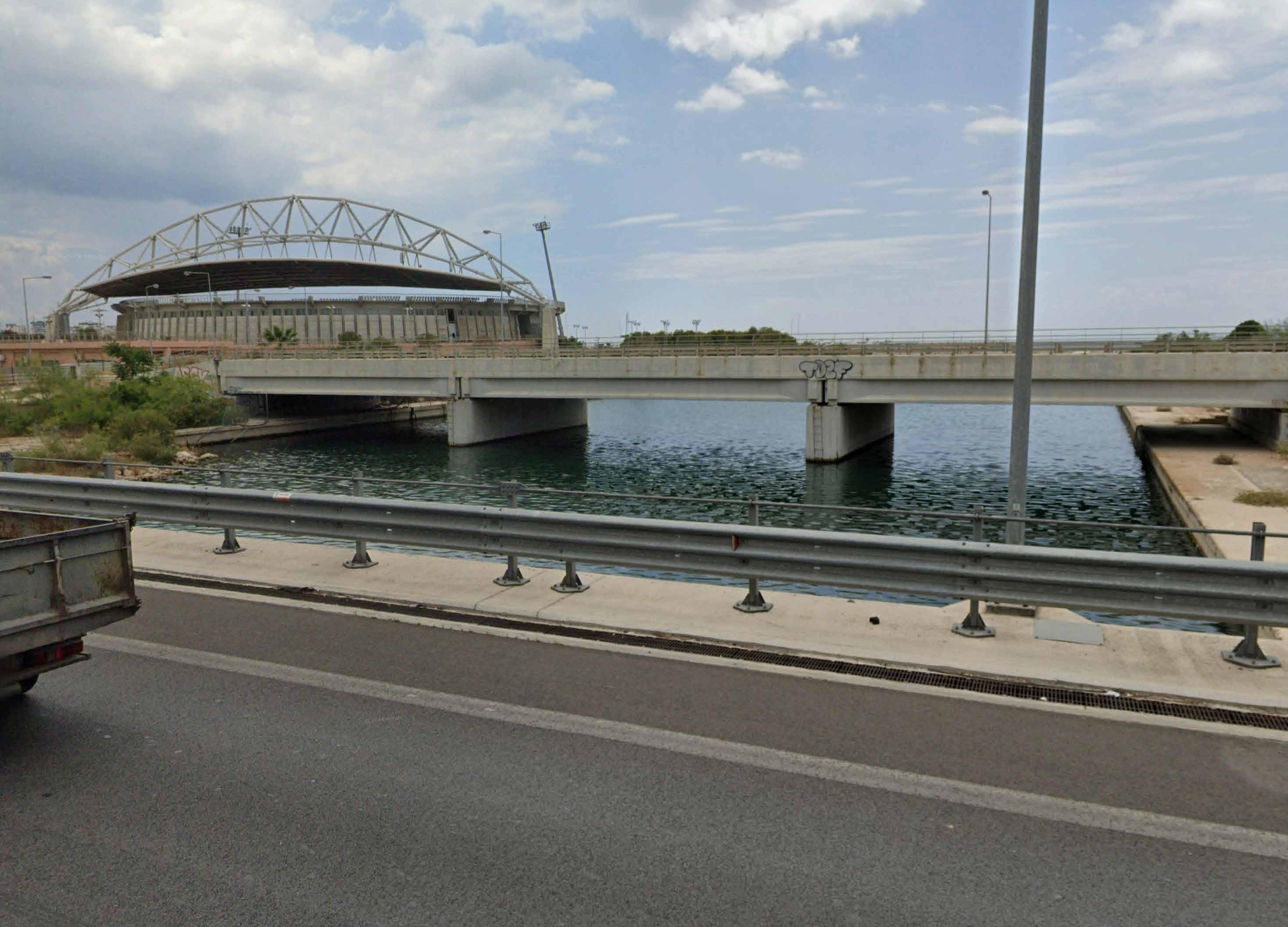
Present Day Faliro Bay
Source - Google Maps
Faliro Bay
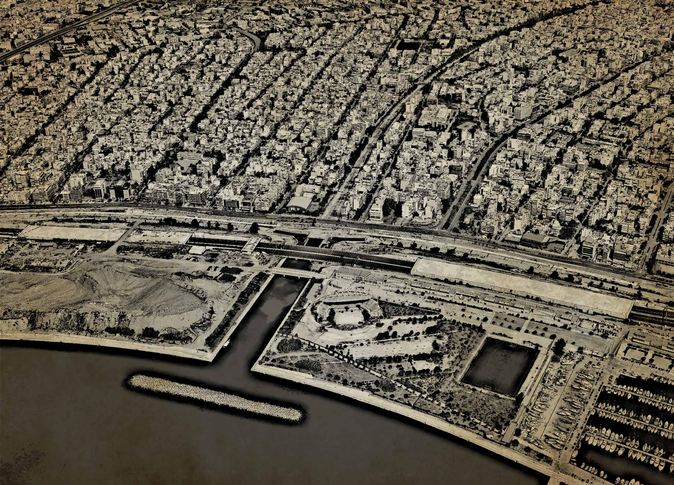 Present day river water discharge point
Source - Google Earth
Faliro Bay
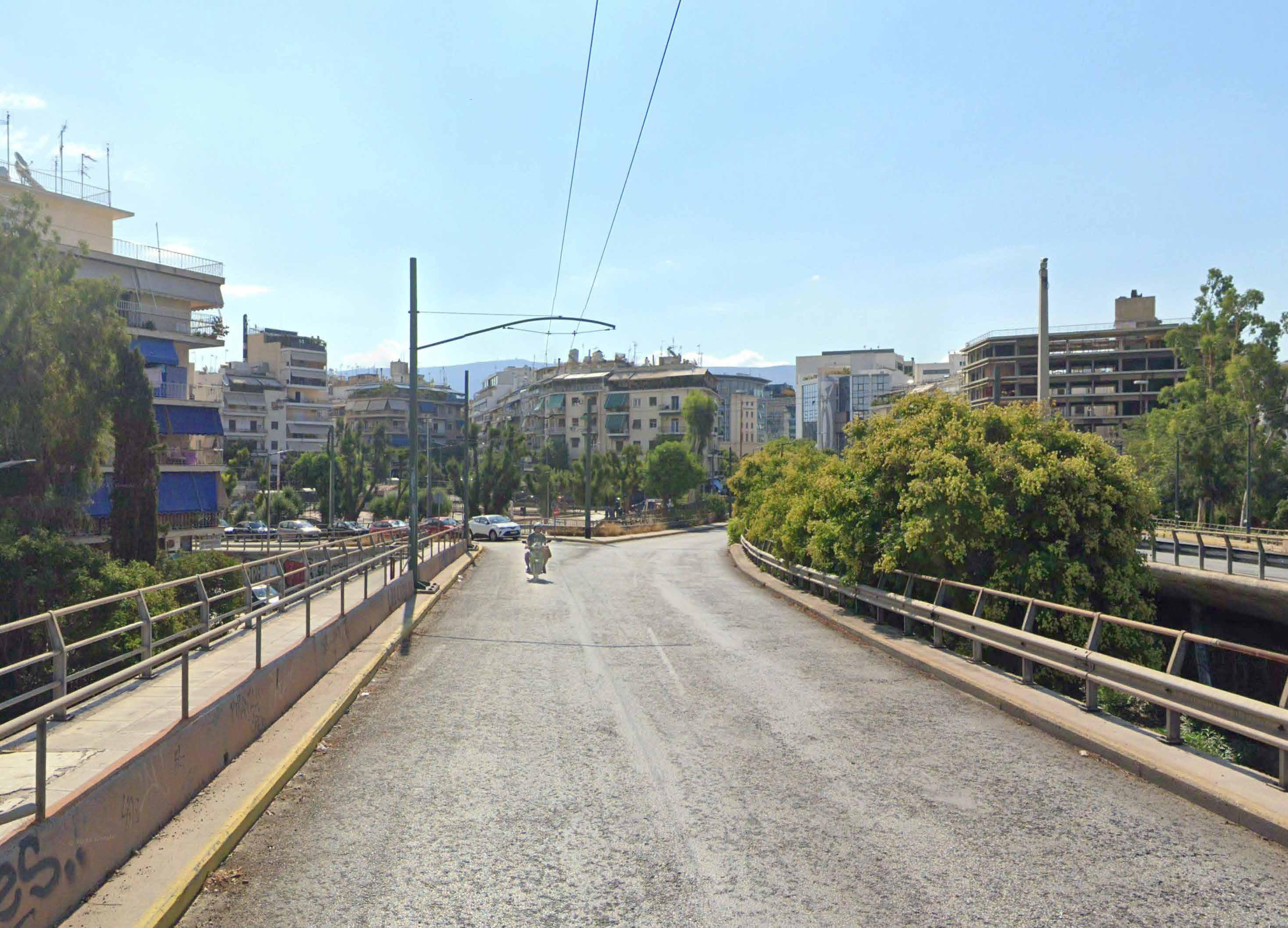
River as Avenue
Source - Google Maps
Playground Pl. Kountouriotou - Koukaki

Present day
Source - Google Earth
Playground Pl. Kountouriotou - Koukaki
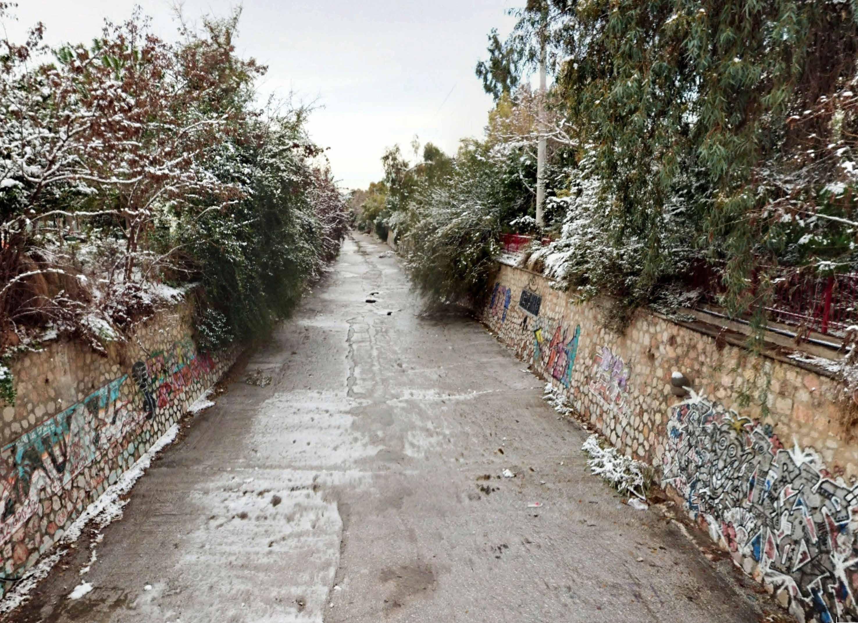 Present day river as a dried channel
Source - Google Maps
Ilissos Park
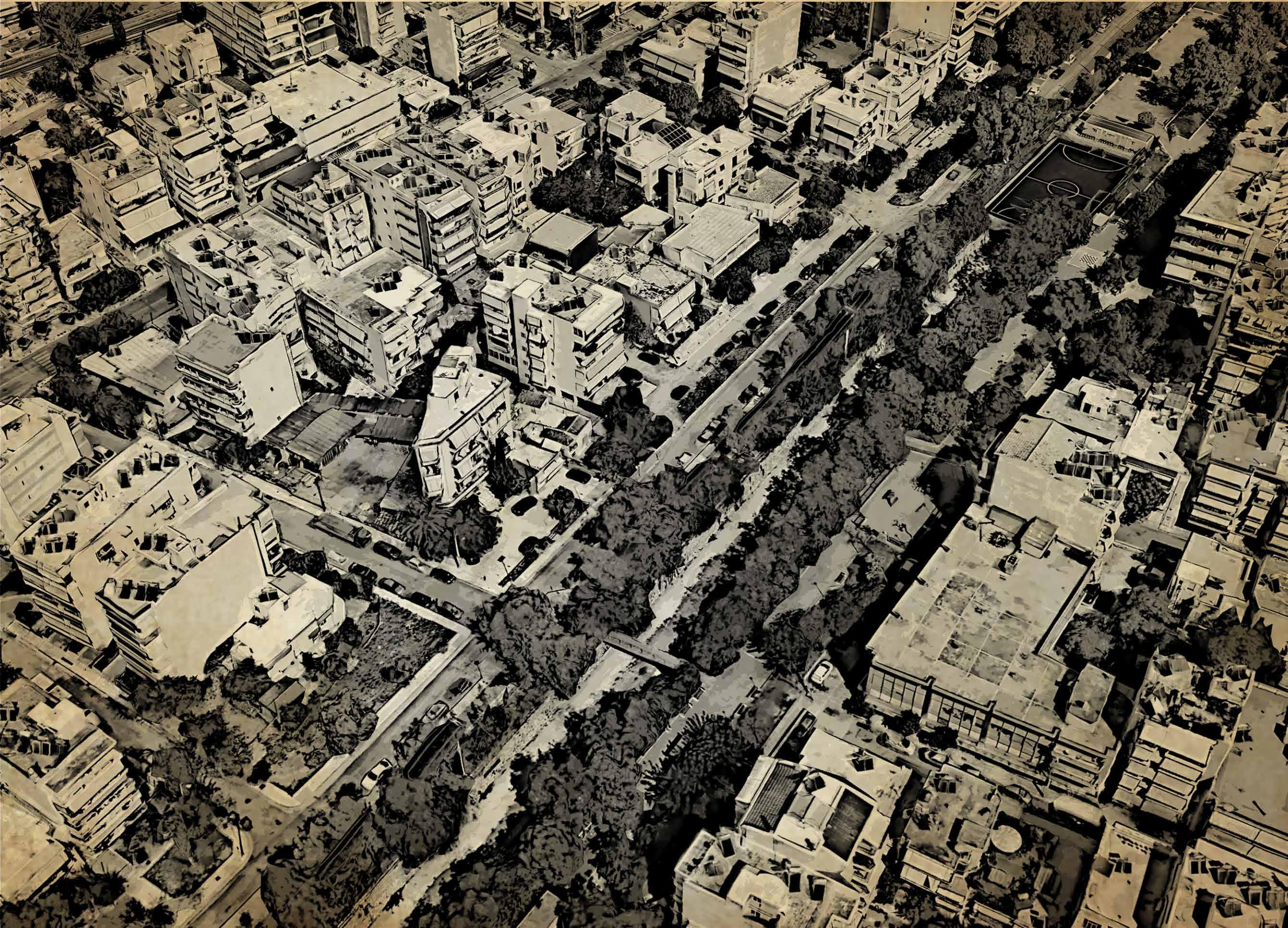 Present day Ilissos Park
Source - Google Earth
Ilissos Park
National Museum of Contemprory Art
Εθνικό Μουσείο Σύγχρονης Τέχνης (ΕΜΣΤ)
National Museum of Contemprory Art
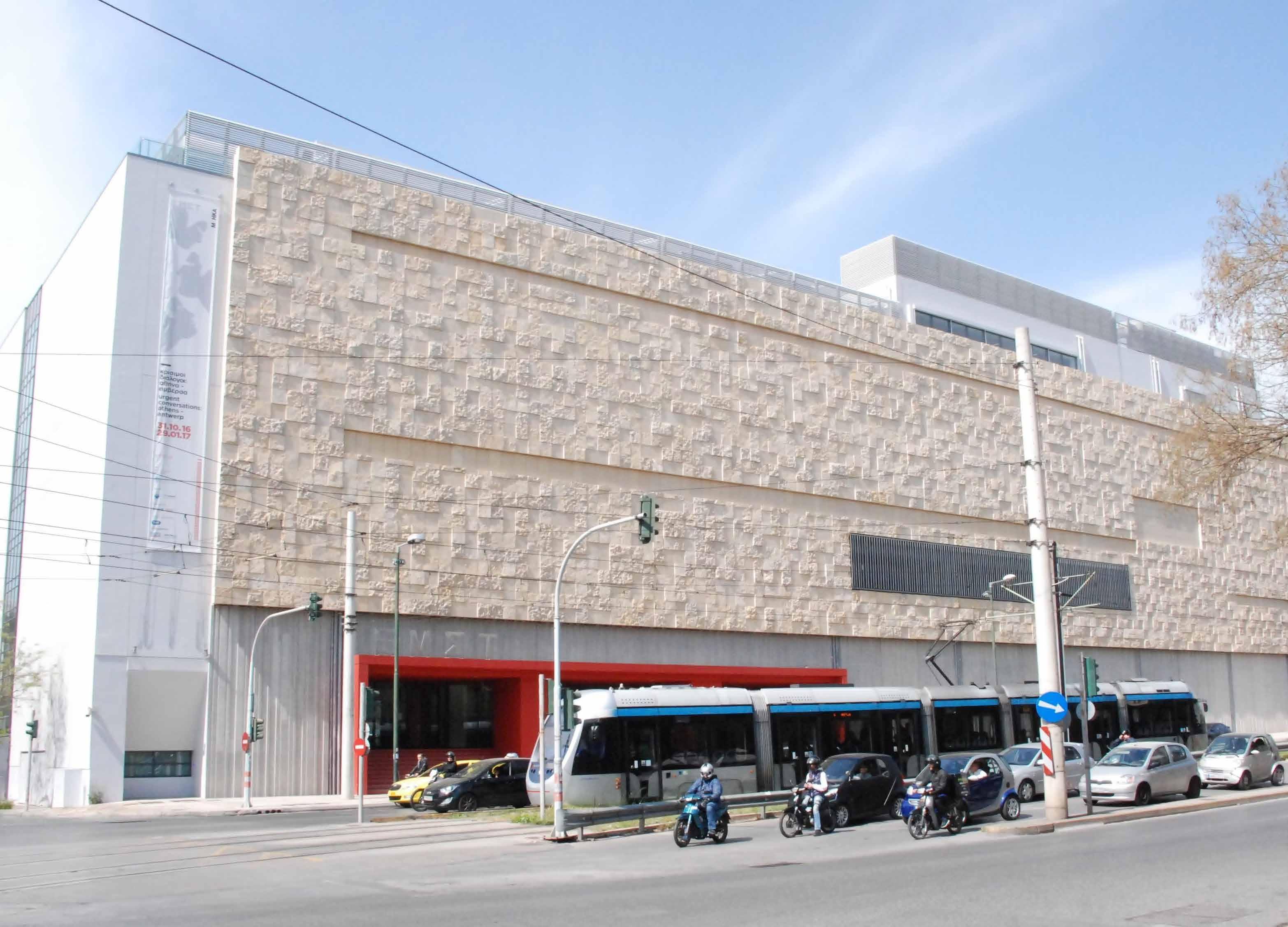
Εθνικό Μουσείο Σύγχρονης Τέχνης (ΕΜΣΤ) Source - https://www.alamy.com/stock-image-athens-greece-september-2017-one-of-the-main-squares-in-athens-the-167969480.html
Present day EMST and the covered river
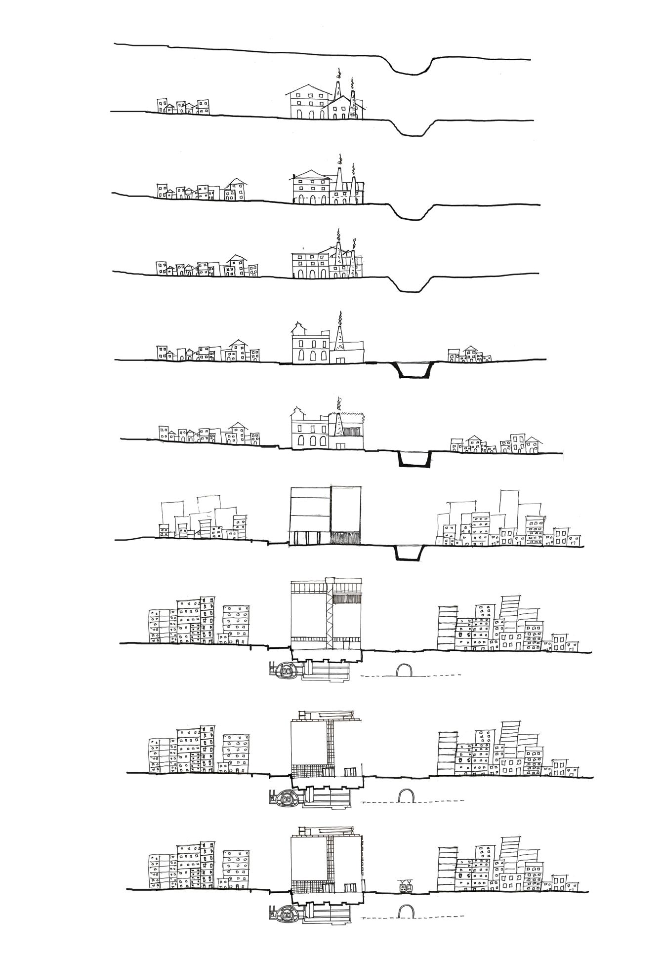
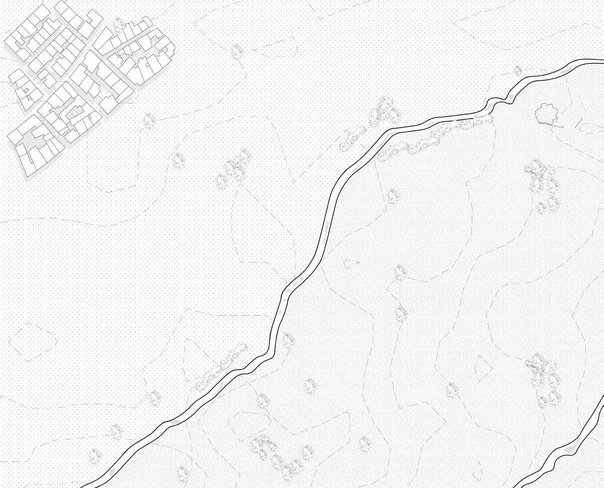

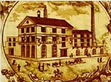
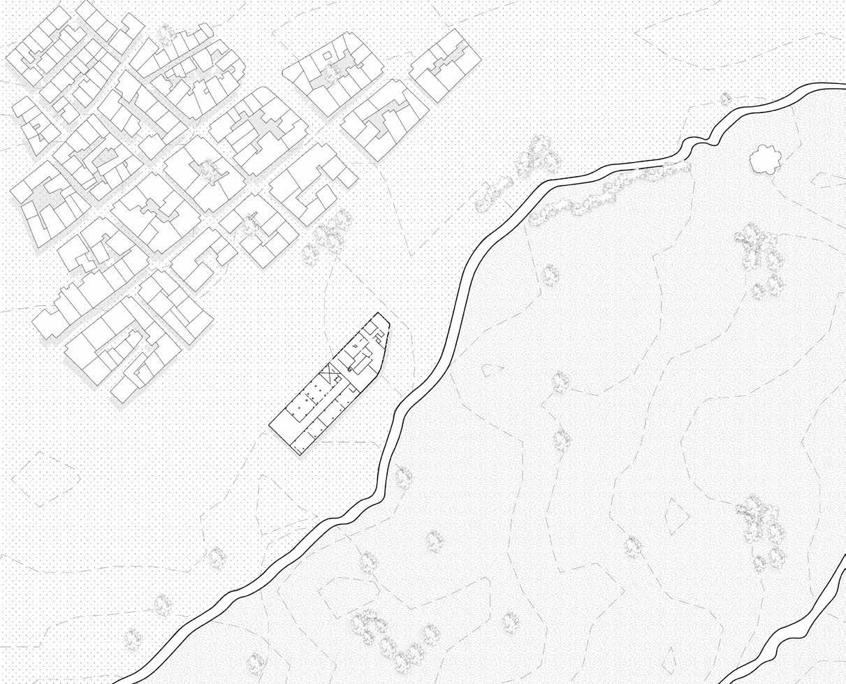
The FIX beer brewery, established in 1863 in Athens, relocated to a south-of-the-Acropolis area 30 years later.
1863 - Factory Establishment
0m 5m 10m 20m
Source - Kontozoglou, K. (2020). Project FIX -Reviving the Future. Potamos.
Scale 1:1500


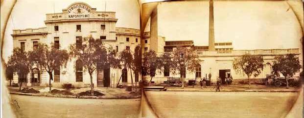
In 1893, the brewery moved to a new location between Syngrou Avenue and Kallirois Avenue, where a new factory was built on the west bank of the Ilissos River. A new building was created keeping the one one intact.
The building was built in 1893 beside Syngrou Avenue, connecting Athens’ city centre to the sea. The company’s growth led to the construction of additional buildings.
1893 - Factory Relocation Source - Kontozoglou, K. (2020). Project FIX -Reviving the Future. Potamos. Scale 1:1500 0m 5m 10m 20m


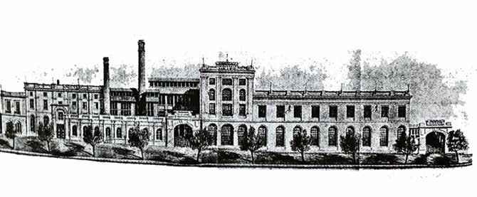
A new factory expansion was established on the Ilissos River’s west bank, transforming FIX into the synonymous beer in Greece, a presence that persisted throughout the region. It was a creation of new building volumes.
1910s - FIX Brewery Expansion
1:1500 0m 5m 10m 20m
Source - Kontozoglou, K. (2020). Project FIX -Reviving the Future. Potamos. Scale

EMST Source - Kontozoglou, K. (2020). Project FIX -Reviving the Future. Potamos.
Brewery during 1900s
1920/30s - FIX Brewery Expansion

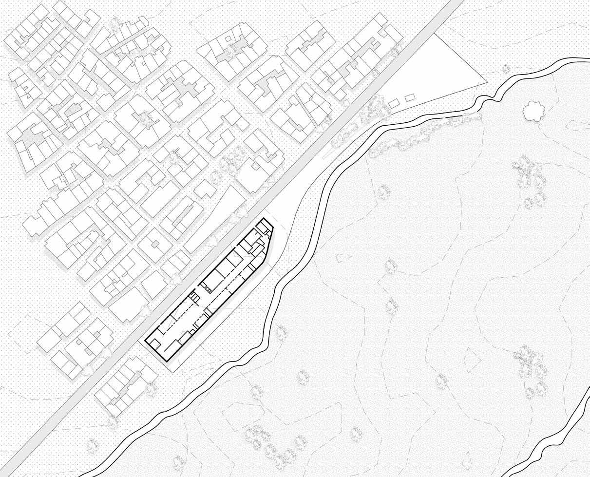

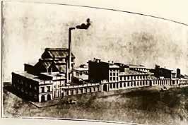
An early modern factory expansion was established on the Ilissos River’s west bank, transforming FIX building into early modernity beer factory. It was a creation of modern building facade removing ornamental elements.
1:1500 0m 5m 10m 20m
Source - Kontozoglou, K. (2020). Project FIX -Reviving the Future. Potamos. Scale

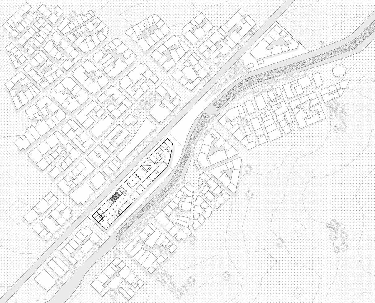


Factory expansion and changes were made only to the interiors. But the surroundings of River Ilissos started to develop located north of the FIX building. Covering of River started in patches. Bridges and avenues were built on top of it. 1940s - FIX Brewery
Renovation
Source - Kontozoglou, K. (2020). Project FIX -Reviving the Future. Potamos.
0m 5m 10m 20m
Scale 1:1500

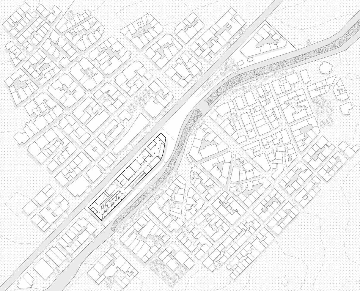

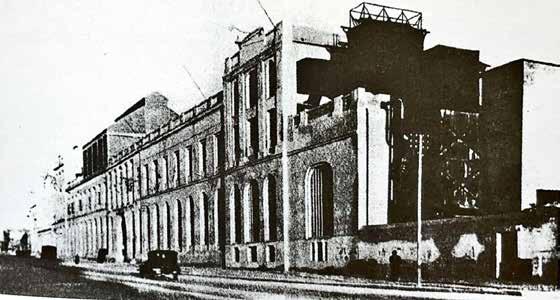
In 1956, a new four-storey building was licensed and the facade facing R. Ilissos was completely renovated. A visitor’s Lounge was added to it.
As the city was expanding, new infrastructure started to built across the river outside the city late city walls.
1950s - Renovation
1:1500 0m 5m 10m 20m
Source - Kontozoglou, K. (2020). Project FIX -Reviving the Future. Potamos. Scale

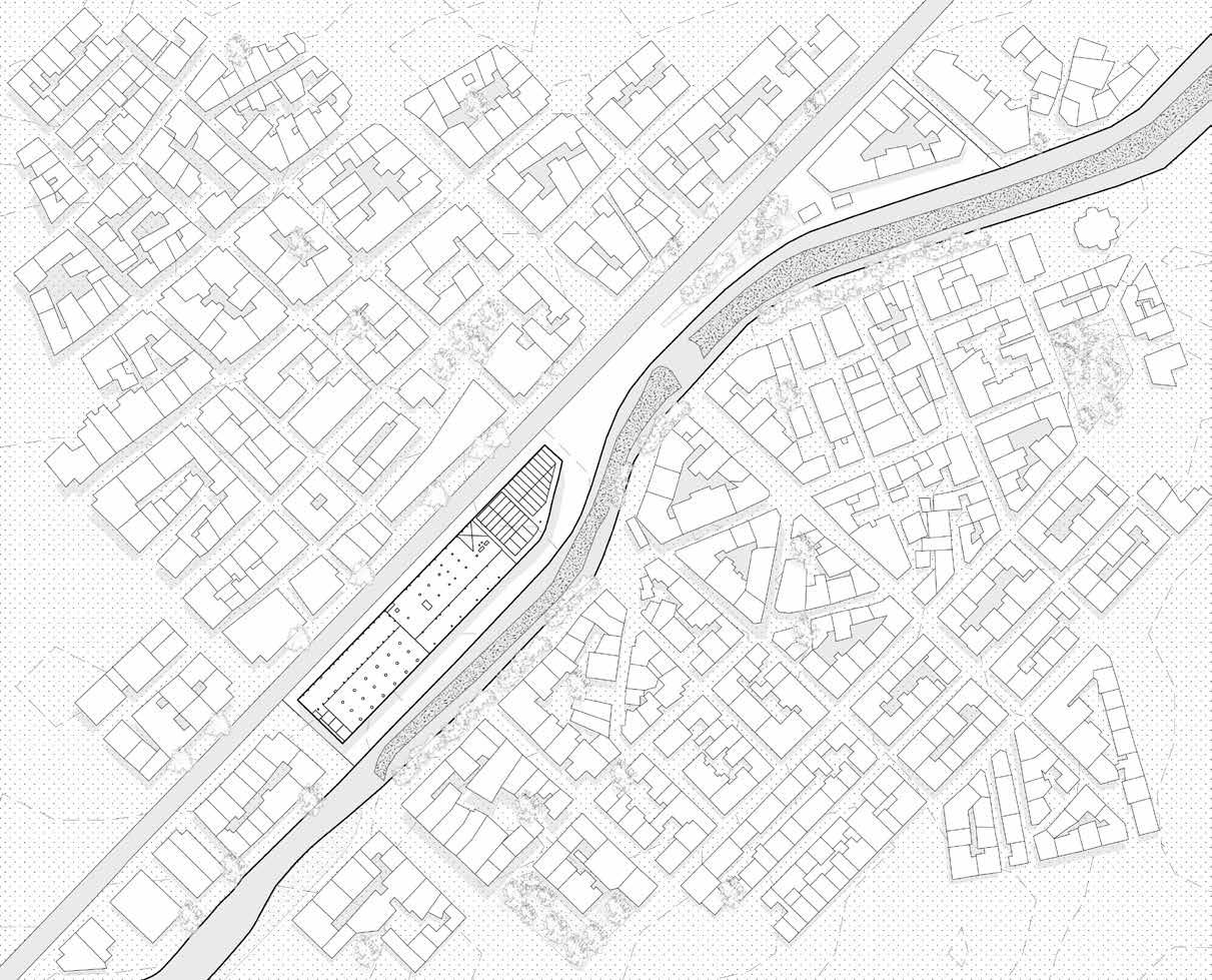

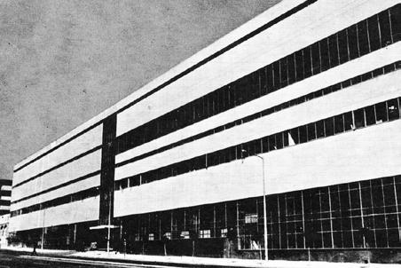
In 1957, the Fix family commissioned Zenetos to modernize the brewery, a milestone in the building’s history. Zenetos, a significant representative of postwar modernism in Greece, collaborated with Margaritis Apostolidis. The new brewery, located on Syggrou Avenue, was a state-of-the-art plant with advanced equipment and design. The ground floor was covered with glass, allowing visitors to observe the beer-making process.
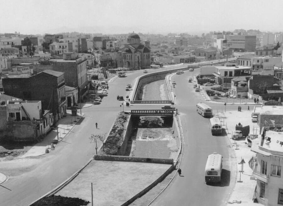
River was somewhat visible during 1960s but most of it was converted into avenue for easy transit.
1960s
by Zenatos
- Redesign
1:1500 0m 5m 10m 20m
Source - Kontozoglou, K. (2020). Project FIX -Reviving
the Future. Potamos. Scale
EMST Source - https://greektraveltellers.com/blog/the-buried-rivers-of-athens
Right when the covering of the river began in streches

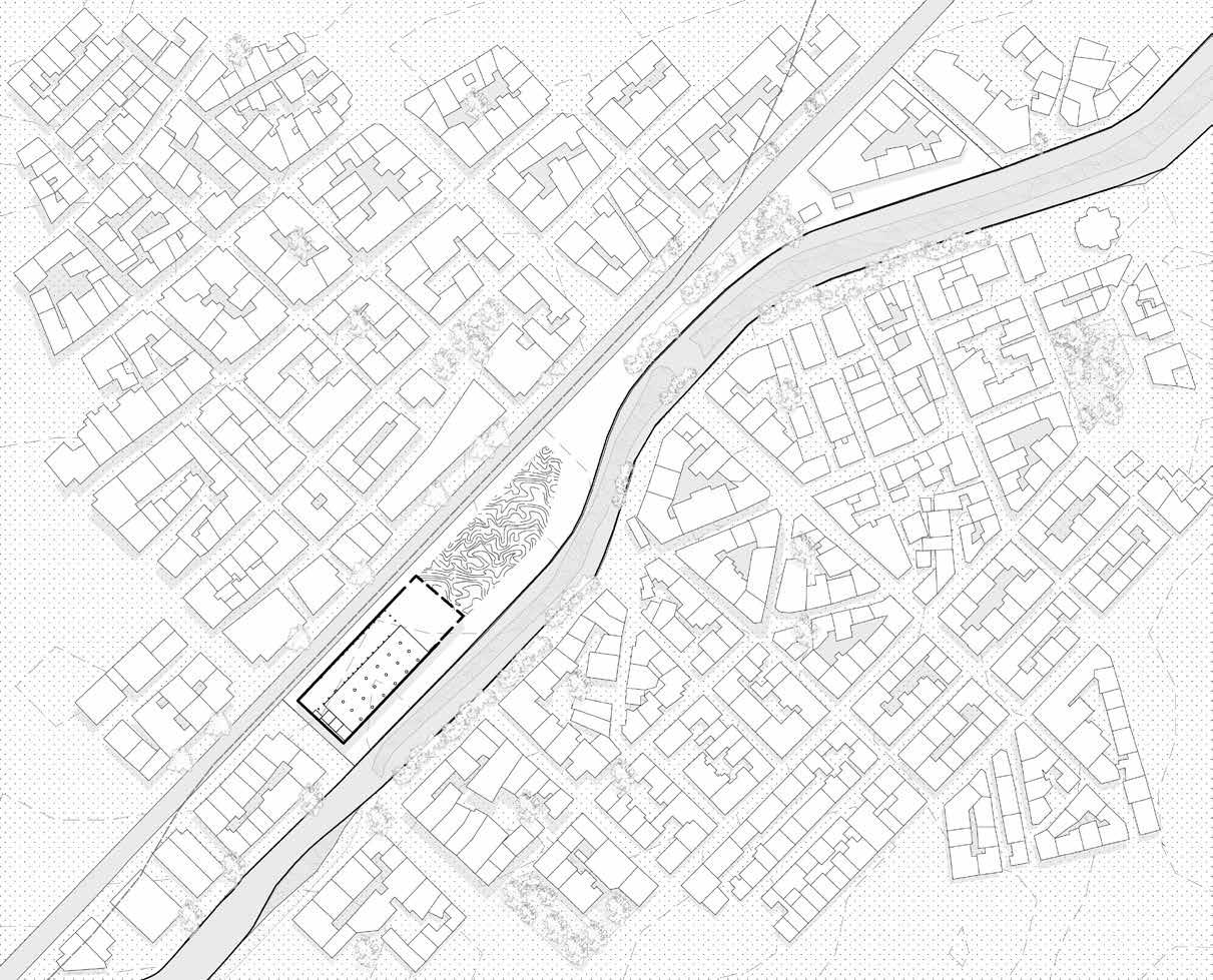

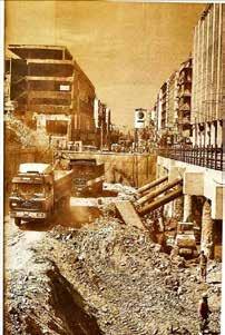
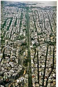
In 1994, the property was transferred from the Greek state to Attiko Metro, a company responsible for the Athenian subway system. The company wanted to locate a subway and transit station on the site. A compulsory expropriation brought the building under Attiko Metro S.A. The northern part was demolished for subway construction, and the adjacent FIX metro station was built and opened in early 2000.
By this time, the river was compelety covered.
1990s - Metro Construction
-
Project FIX -Reviving the Future.
Scale 1:1500 0m 5m 10m 20m
Source
Kontozoglou, K. (2020).
Potamos.
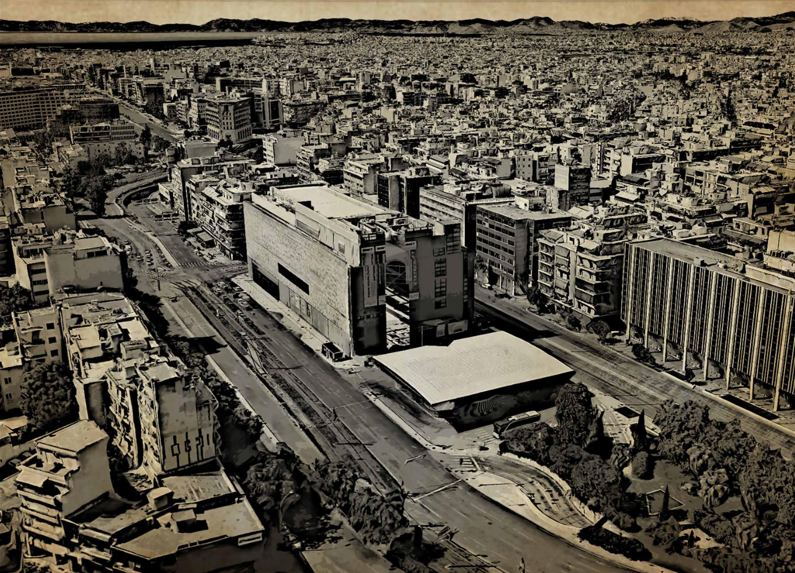
EMST before it turned into a museum in 1990s EMST Source - Google Earth

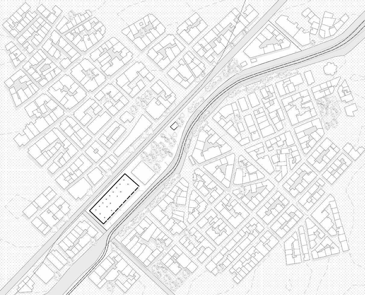

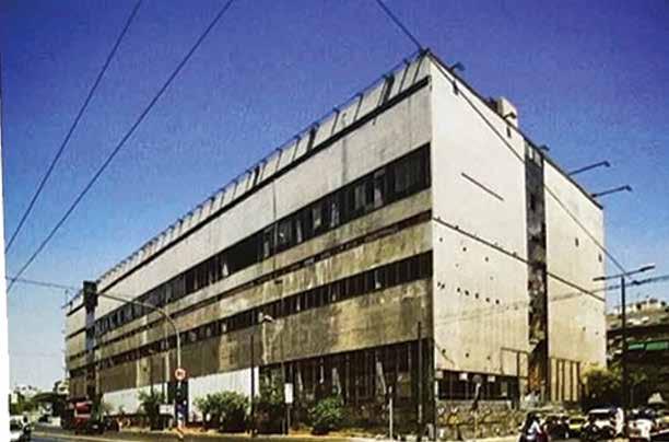
The closure of the FIX beer plant in the 1990s led to the building’s decay and abandonment. In 1995, part of the northern section of the building was demolished.
In 2002, an architectural competition was launched to restore the heritage-listed building and develop a reuse proposal for the National Museum of Contemporary Art. The project was completed in 2002, restoring the north and south façades, and reimagining the south façade.
In 2004, Athens developed tram infrastructure, which returned to Athens, fully modernized, and began operations during the Athens Olympic Games.
2000s - Abandoned
Scale 1:1500 0m 5m 10m 20m
Source - Kontozoglou, K. (2020). Project FIX -Reviving the Future. Potamos.

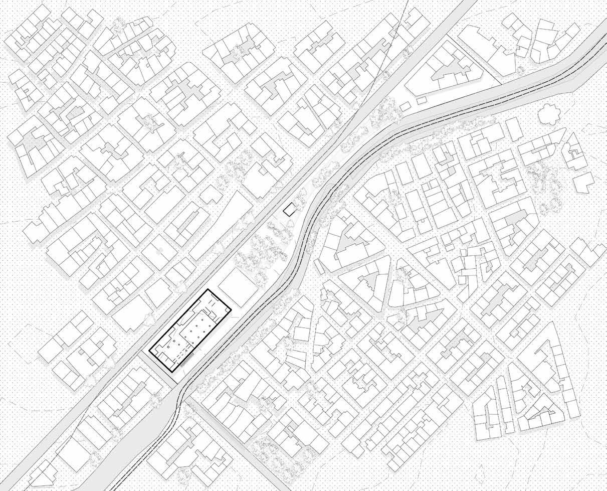

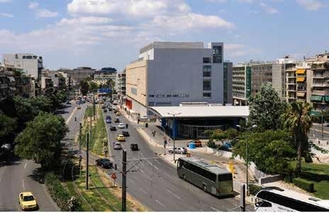
The lower floor of the building was temporarily inhabited by the EMST in 2000, but two years later, the Fix building was declared as the permanent home of the Museum.
The building, once a heritage site, was later repurposed as the EMST The main façade, facing Syngrou Avenue, retains its original materials and organization, while the one facing Kallirois Avenue is covered in stone, reflecting the riverbed’s topography. The architects believe this poetic reminder of the river’s past is evident in the glass wall on the ground floor.
The museum, which was completed in 2014, has largely been closed due to financial and bureaucratic challenges.
2010s - NMCA Scale 1:1500 Source - https://www.kalliopekontozoglou.gr/projects/%CE%B5%CE%B8%CE%BD%C E%B9%CE%BA%CF%8C-%CE%BC%CE%BF%CF%85%CF%83%CE%B5%CE%AF%CE% BF-%CF%83%CF%8D%CE%B3%CF%87%CF%81%CE%BF%CE%BD%CE%B7%CF%82-%CF%84%CE%AD%CF%87%CE%BD%CE%B7%CF%82fix/ 0m 5m 10m 20m
Present day location of NMCA Source - Google Images

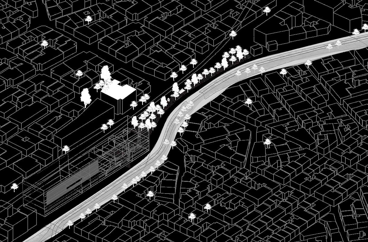
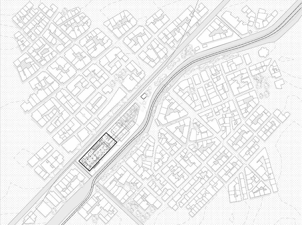

Scale 1:1500 Scale 1:1500 2010s 2000s 1990s 1960s 1950s 1940s 1920/30s 1910s 1860s 1900s
Plan Sections Bird-eye view 0m 5m 10m 20m 0m 5m 10m 20m 0m 5m 10m 20m 0m 5m 10m 20m 0m 5m 10m 20m 0m 5m 10m 20m 0m 5m 10m 20m 0m 5m 10m 20m 0m 5m 10m 20m 0m 5m 10m 20m
Overlapped
National Museum Of Contemporary Art Athens (EMST)
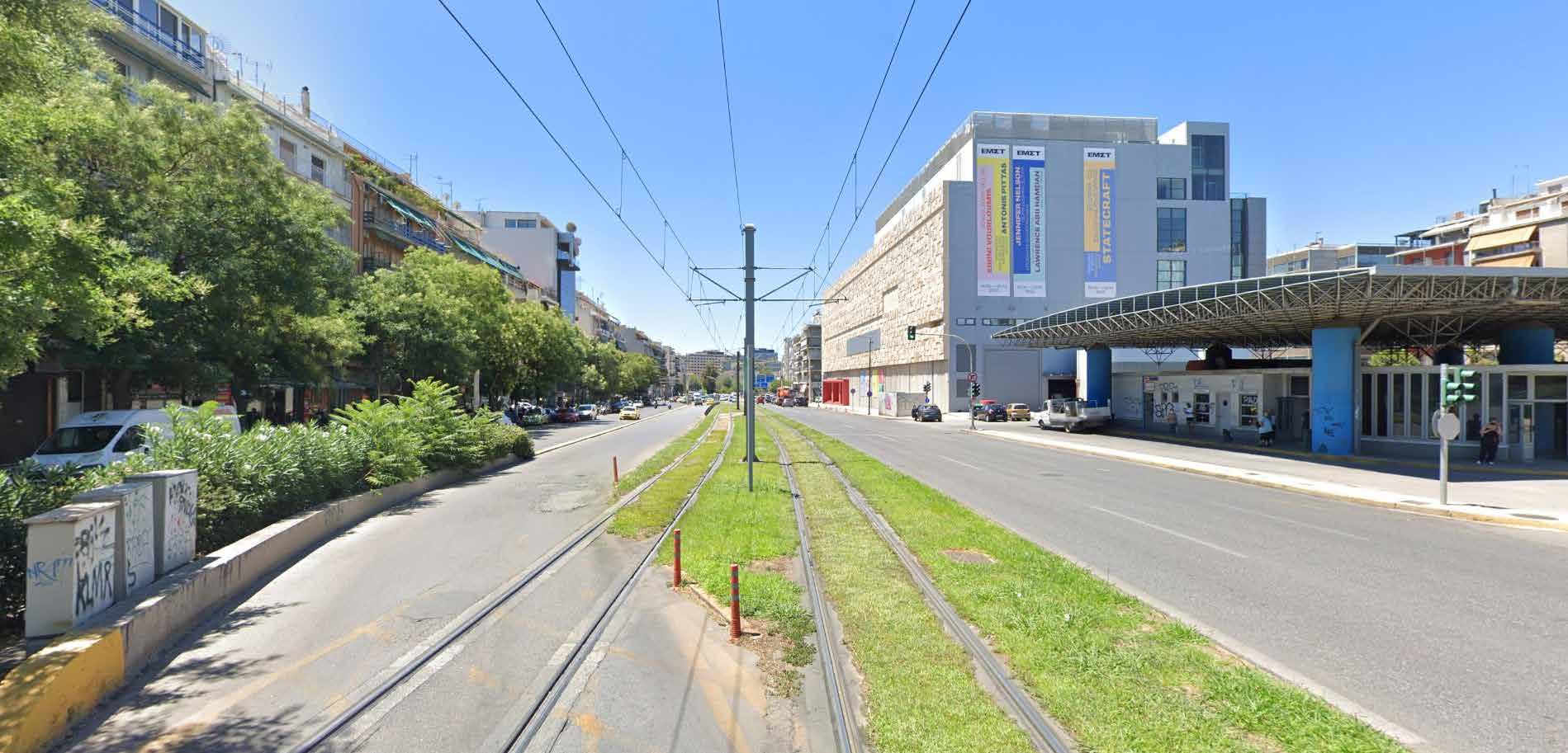

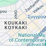
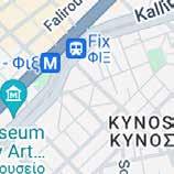
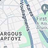
4 2 24 1 07 PM A hens Decen ra zed Admin s rat on of At ca - Goog e Maps h ps /www goog e com maps @37 9634666 23 7264831,3a 60y 230 06h 90 52 da a= 3m6!1e1 3m4 1snWyAoUEO4tPvamhv 6U90Q 2e0 7 16384 8 8192?en ry=t u 1/1 Image capture: Jul 2022 © 2024 Google Google Street View Jul 2022 See more dates Athens, Decentralized Administration of Attica
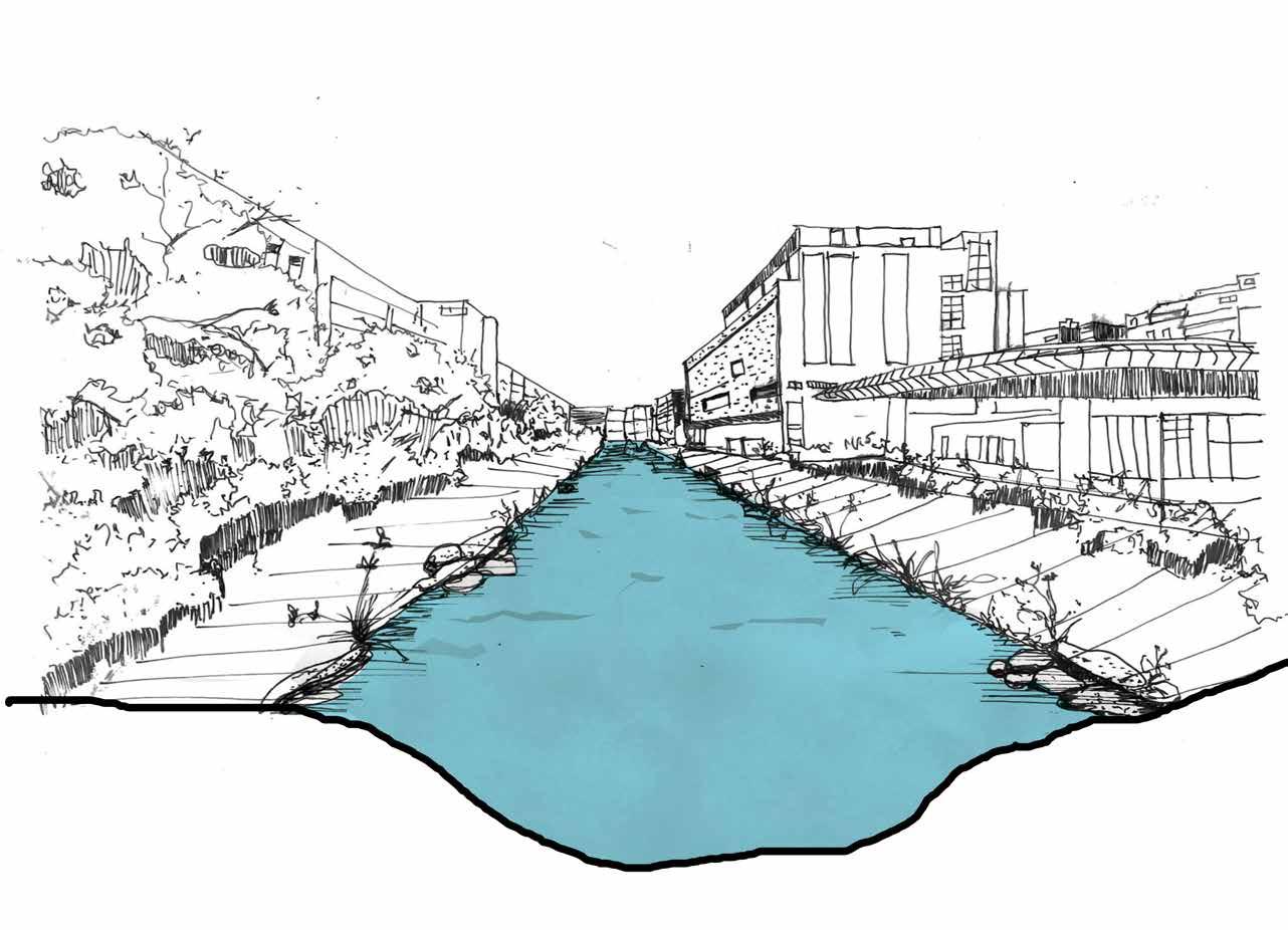
Daylighting River Ilissos Present
Day
Panathenaic Stadium “Kallimarmaro”
and
Ardittos Hill
στάδιον
Λόφος Αρδηττού
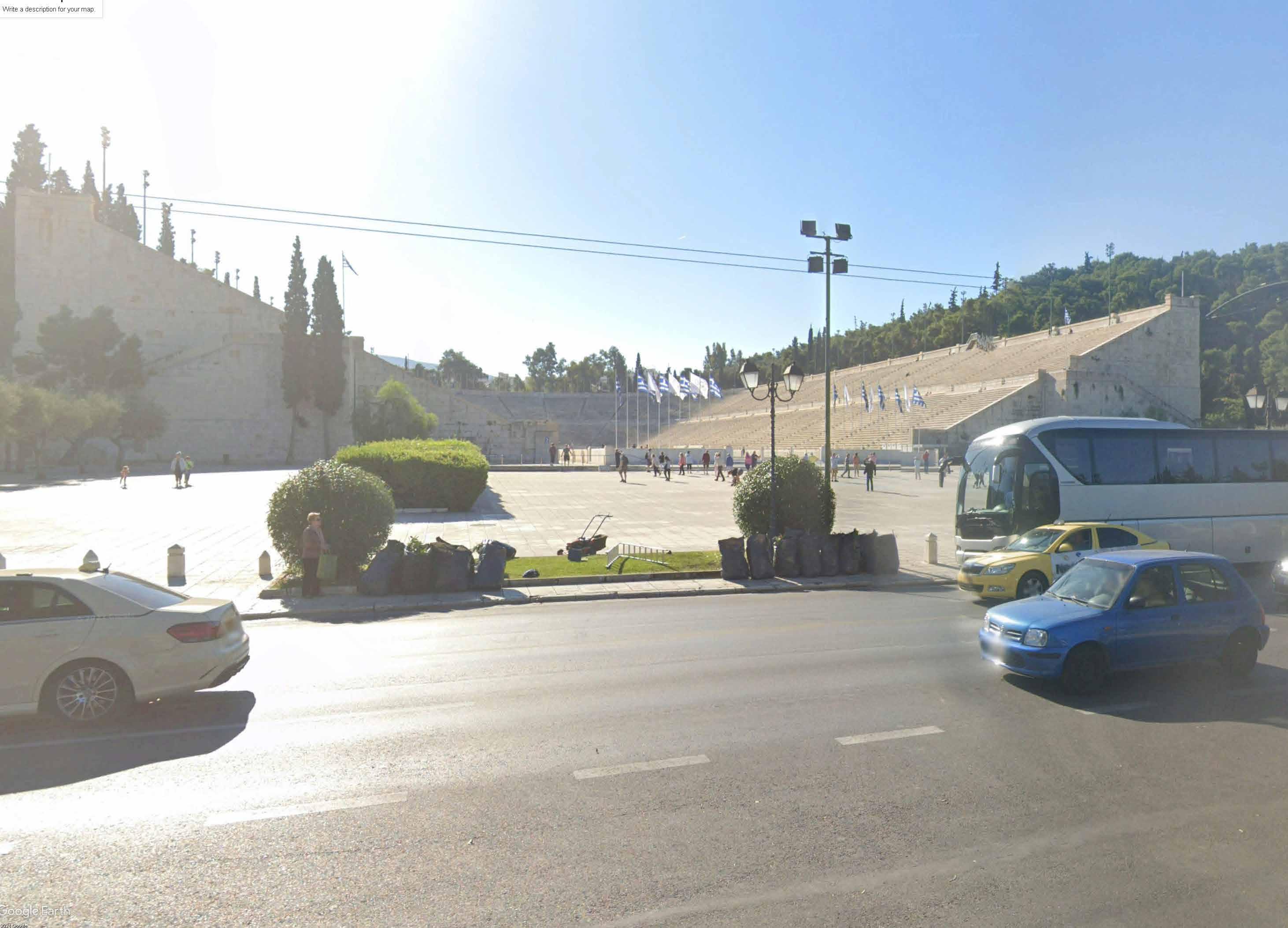
Source - Google Earth Present day river as an Avenue
Panathenaic Stadium and Ardittos Hill
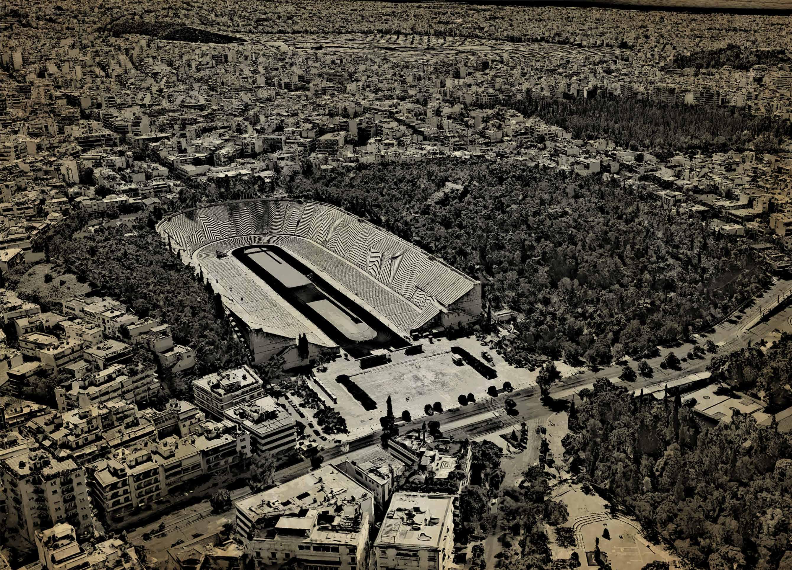
Panathenaic Stadium and Ardittos Hill
Source - Google Earth
Present day Stadium in front of completly covered river Ilissos
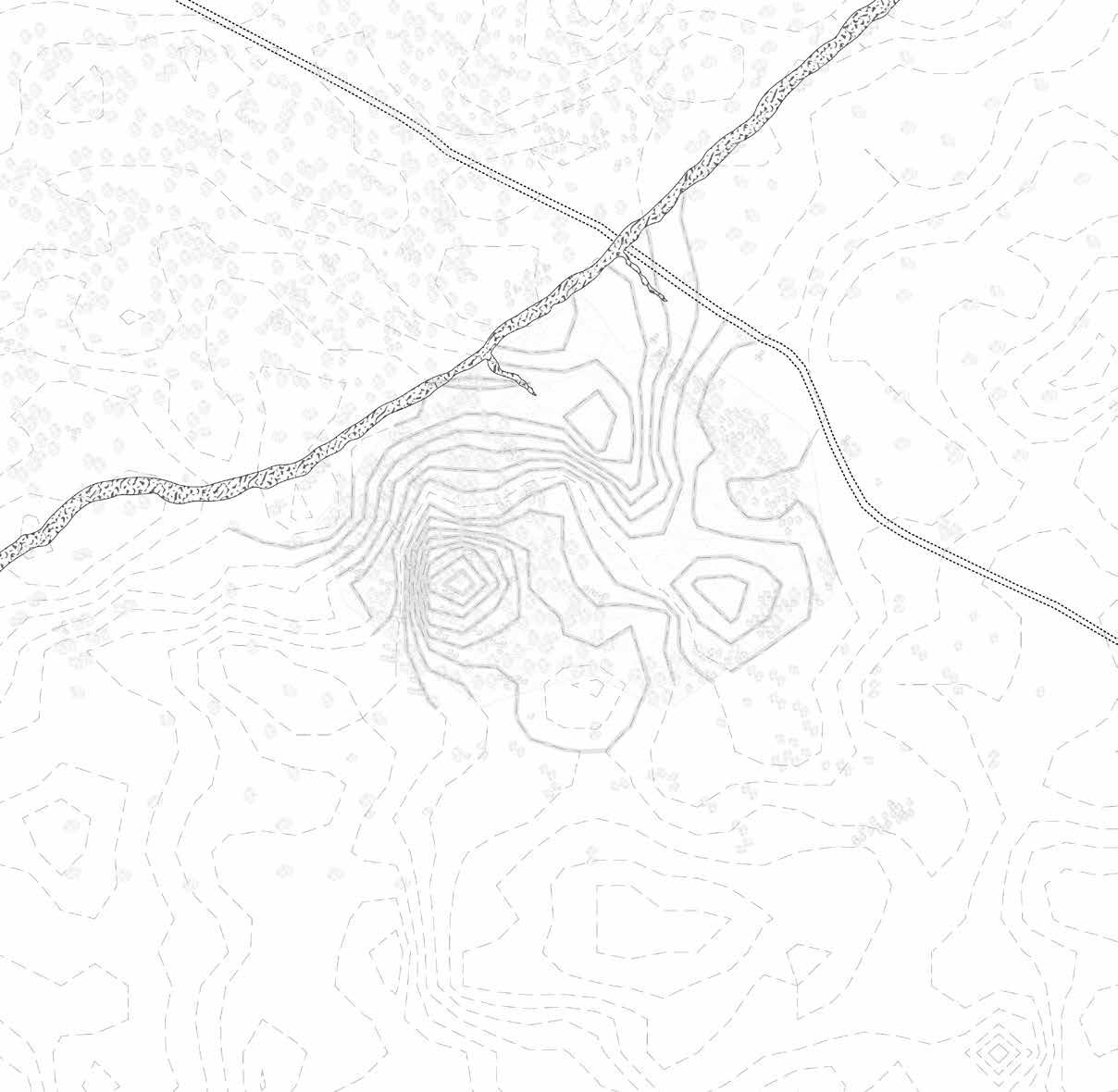

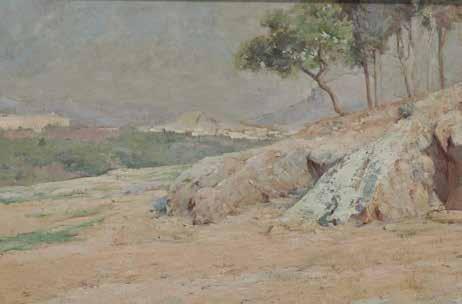
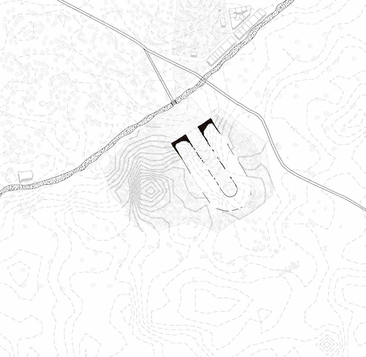
A naturally occurring depression of land that crossed the Ilissos River and lay between the hills of Ardittos and Agra.
479 B.C. - 338 B.C.
1:1500 0m 5m 10m 20m
Source - https://www.nationalgallery.gr/en/artwork/view-from-ardittos-hill/ Scale
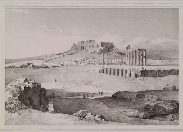 Panathenaic Stadium and Ardittos Hill
Source - https://eng.travelogues.gr/
Athens from the topographic depression of the stadium in 5th Century B.C.
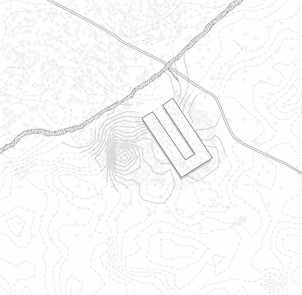

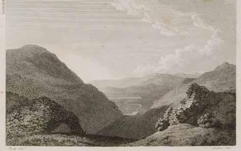
The stadium was first constructed on the site of a racetrack around 330 BC. The Panathenaic Games, an athletic and religious celebration honouring the goddess Athena that takes place every four years, were held there. Romans used to sit on the ravine’s natural slopes because the racetrack lacked official seats at that time.
338 B.C. - 86 B.C.
- https://tr.travelogues.gr/tag.php?view=12033
1:1500 0m 5m 10m 20m
Source
Scale


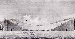
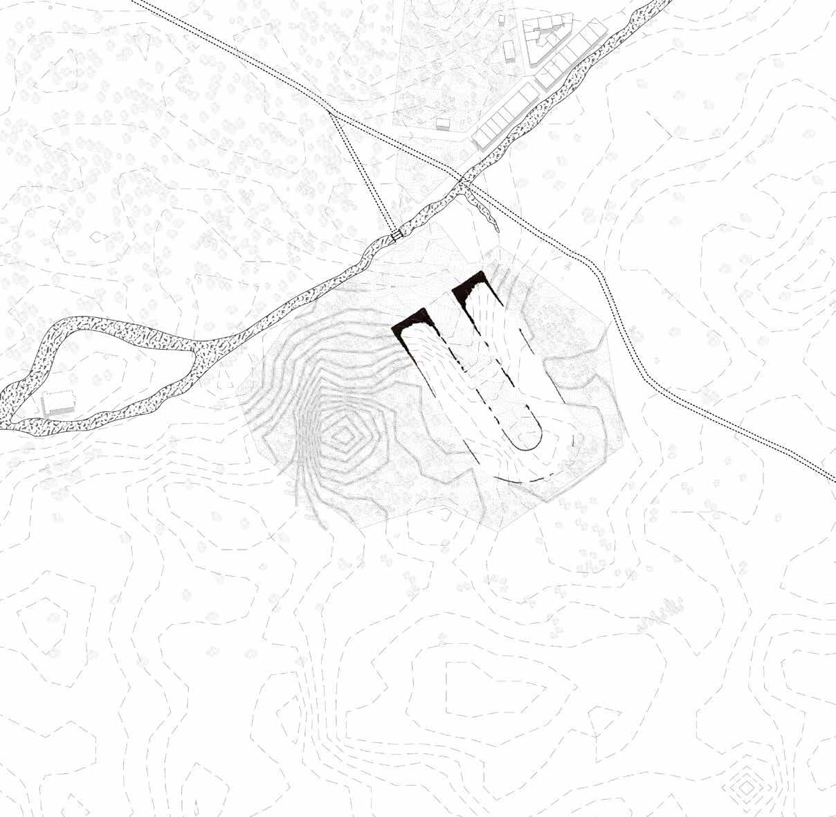
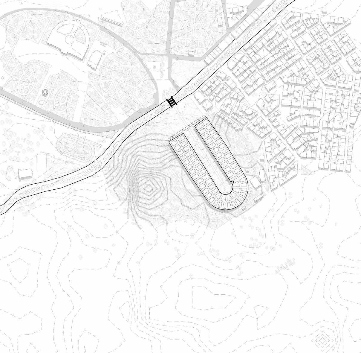
Herodes Atticus was a rich Roman senator of Greek descent who constructed several impressive public structures in Athens around the mid-second century AD. He restored the stadium during this period. It is the only stadium built completely of marble worldwide. Approximately 50,000 people might have been accommodated in the stadium. A new three–arched bridge was constructed over the river Ilissos to reach the stadium.
86 B.C. - 267
- https://metaxourgeio.wordpress.com/2018/10/31/panathinaiko-stadio/ Scale 1:1500 0m 5m 10m 20m
Source
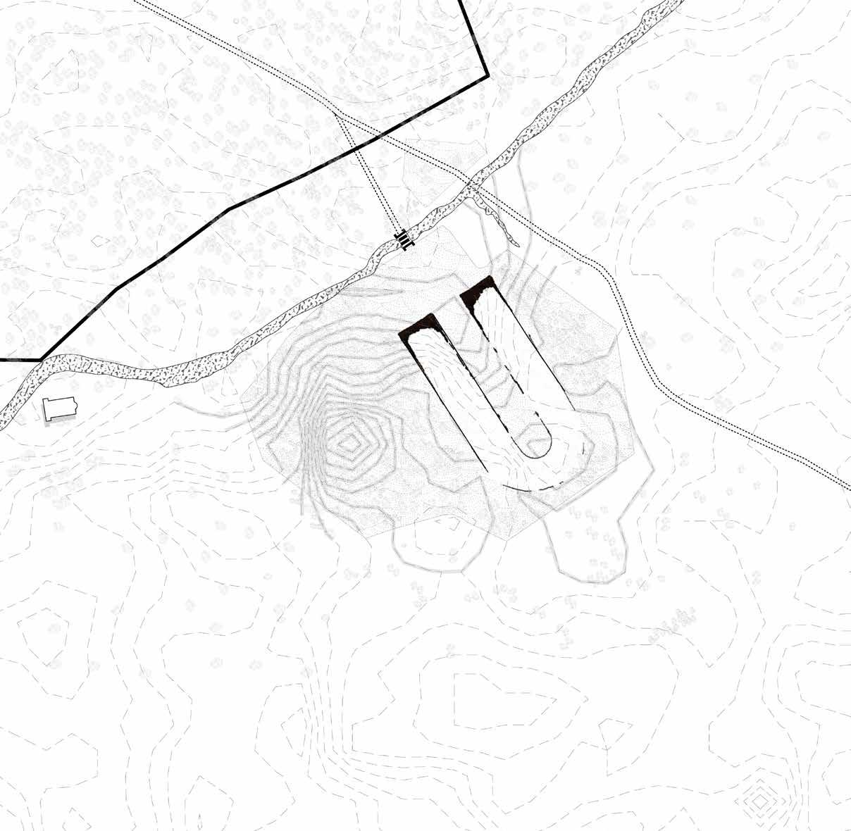

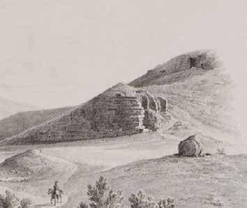
Source -https://ellinondiktyo.blogspot.com/2019/06/blog-post_9.html#google_vignette
The emergence of Christianity in the fourth century led to the prohibition of athletic events and Roman gladiatorial duels, and Panathenaic Stadium was abandoned. After its demise and plundered for its marble, a wheat crop eventually grew over it. A blurred line of the stadium across the river could be still seen.
267 - 566
Scale 1:1500 0m 5m 10m 20m
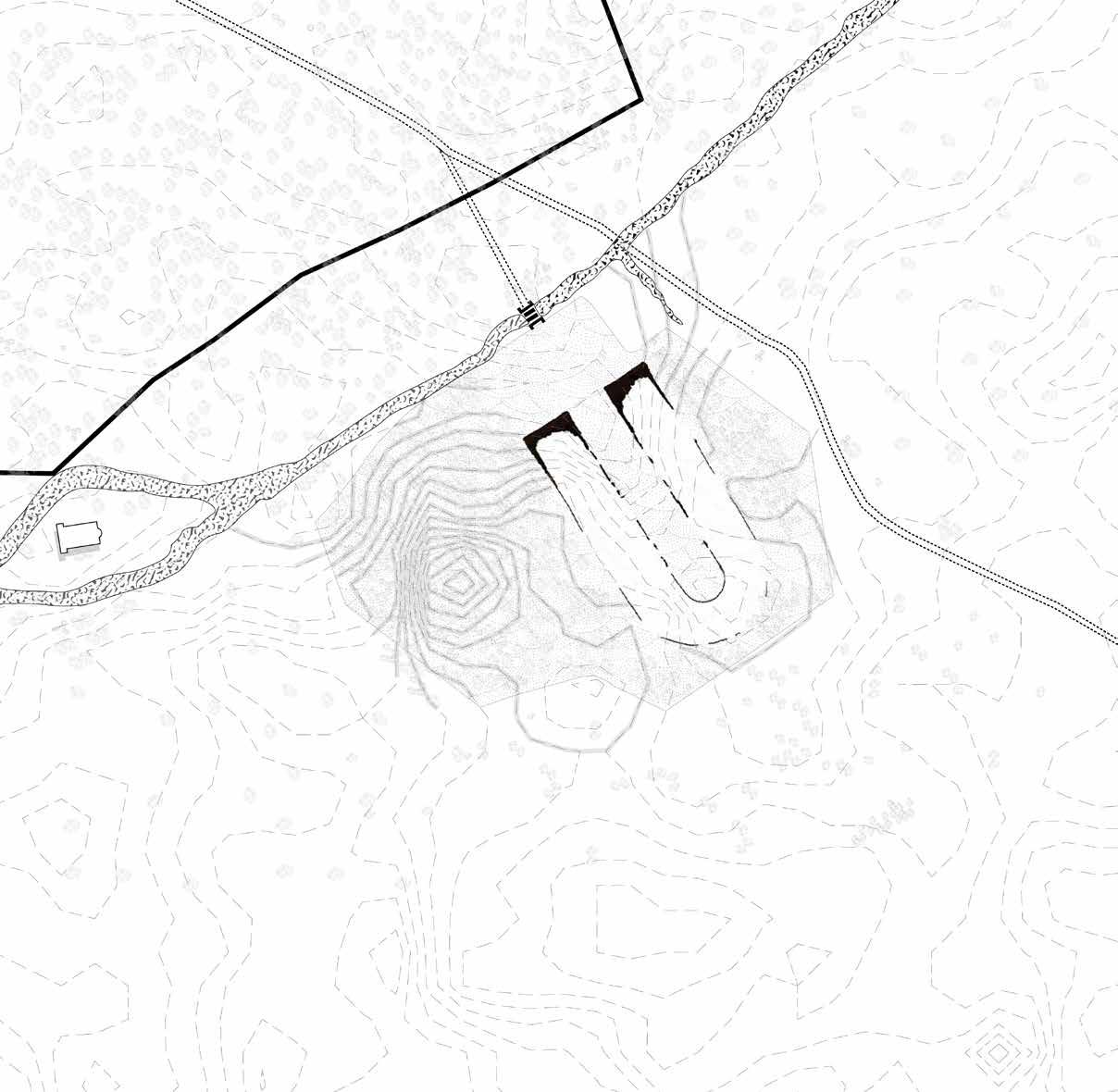


Source -https://ellinondiktyo.blogspot.com/2019/06/blog-post_9.html#google_vignette Scale
The damaged stadium was left exactly as it was at this time. The river continued to flow in front of the topographic depression of the stadium.
566 - 1205
1:1500 0m 5m 10m 20m
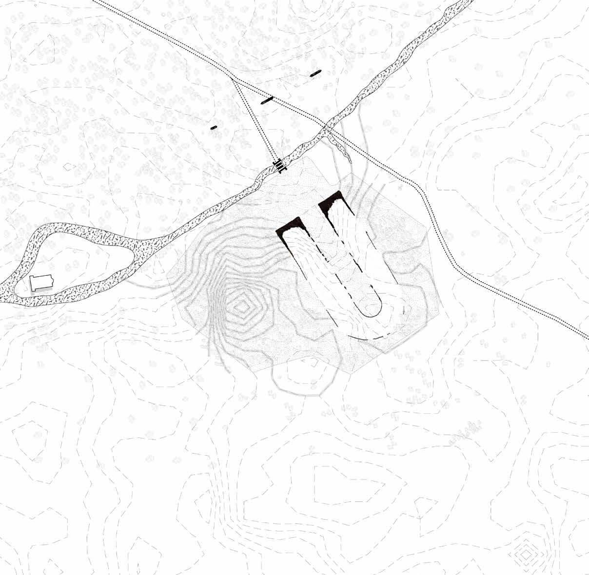


Source -https://ellinondiktyo.blogspot.com/2019/06/blog-post_9.html#google_vignette
No addition or maintenance was done to the stadium, and the river continued to flow as it was.
1205 - 1456
1:1500 0m 5m 10m 20m
Scale
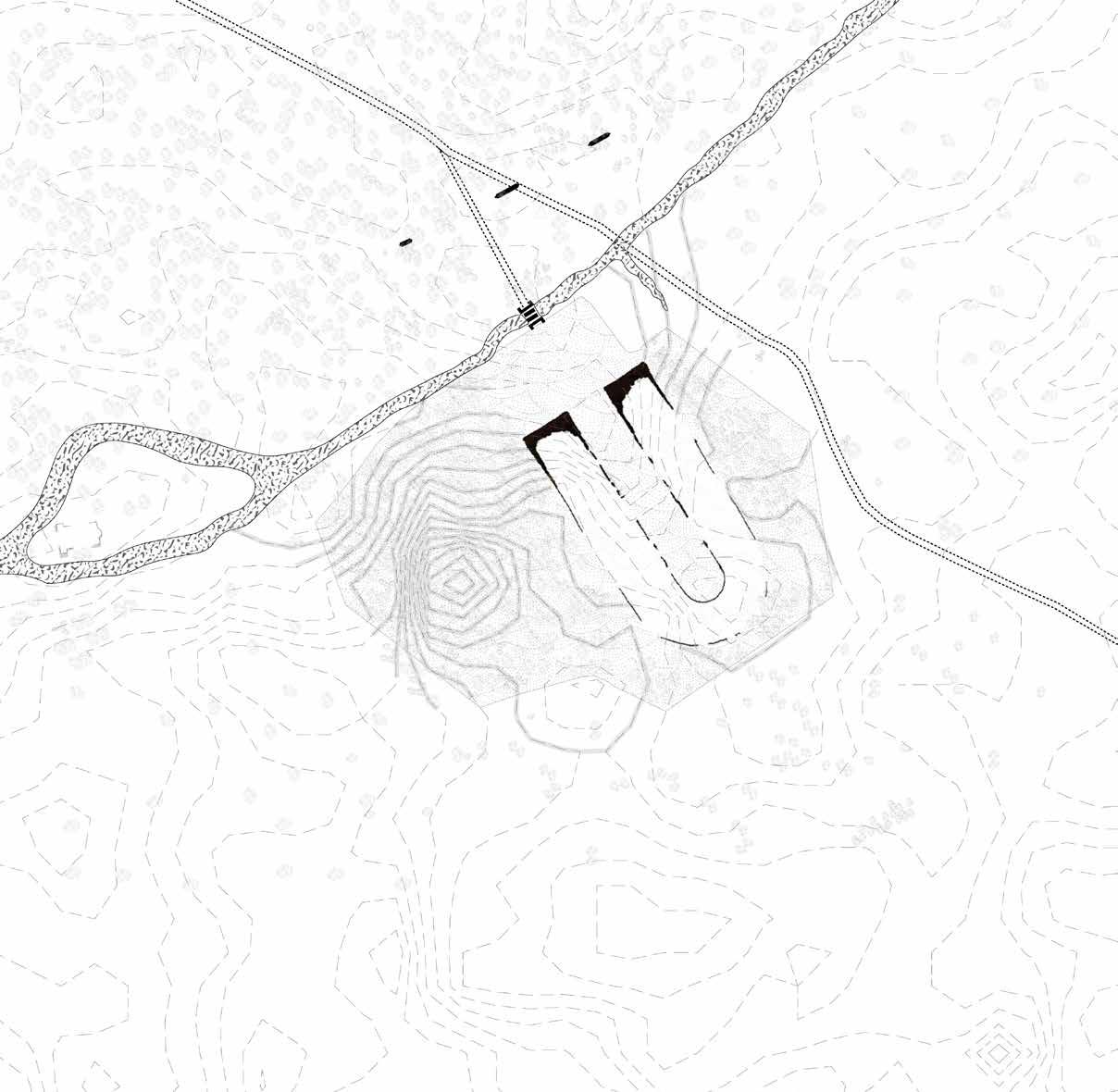


Source -https://ellinondiktyo.blogspot.com/2019/06/blog-post_9.html#google_vignette
A similar situation was of the stadium in this era as well.
1456 - 1687
0m 5m 10m 20m
Scale 1:1500
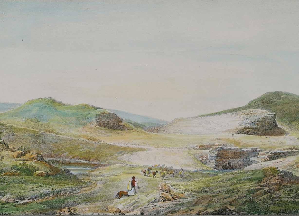 Illustration of an abandoned stadium during Byzantine time period
Source - https://eng.travelogues.gr/
Panathenaic Stadium Bridge
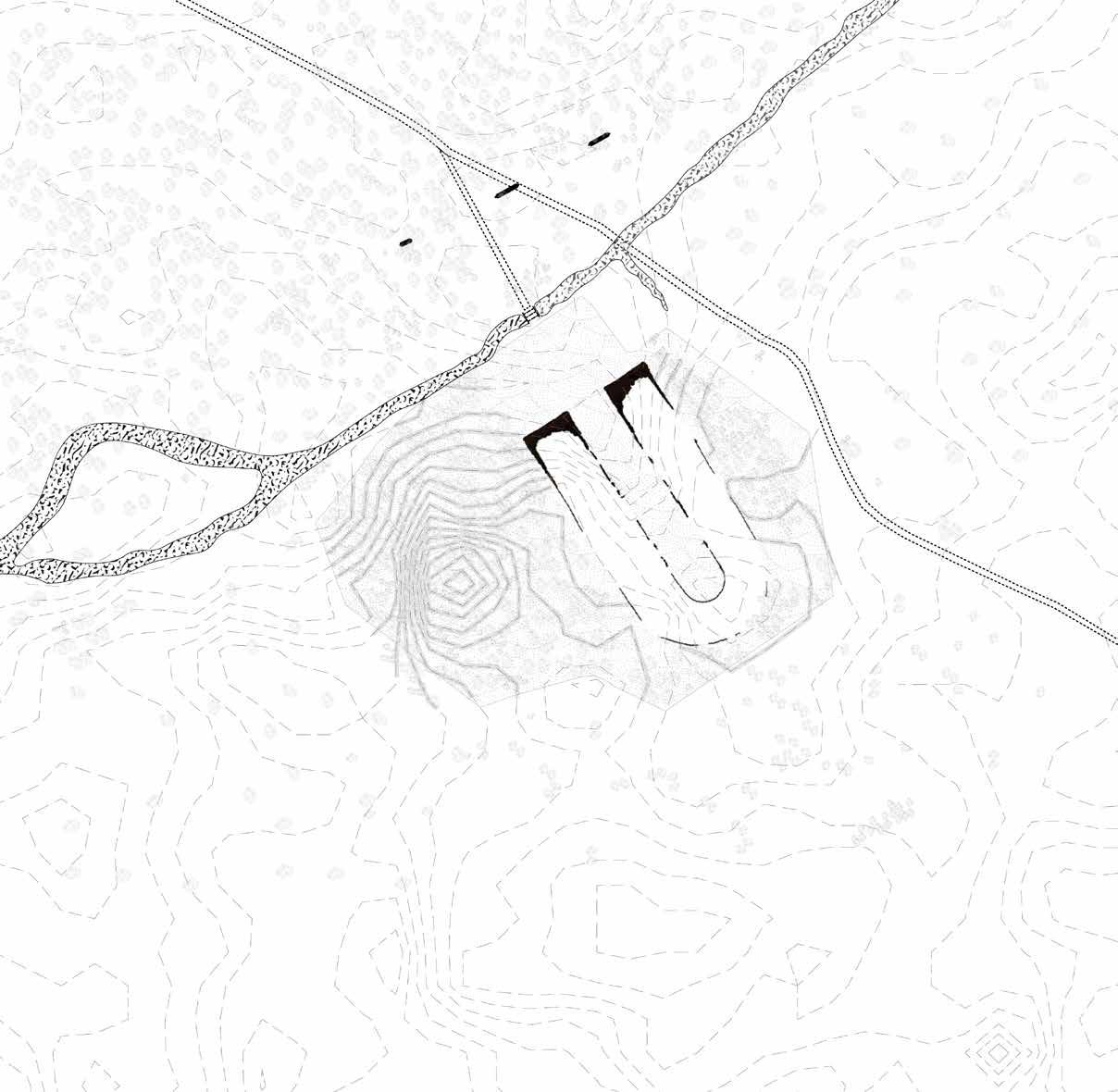

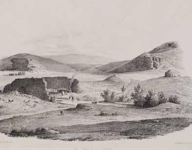
The bridge over river Ilissos which connected the city with the stadium was destroyed by the Ottoman Empire to use the marble in 1778.
Source -https://fogtravel.blog/walking-athens-2from-the-plaka-to-the-temple-of-zeus/ Scale 1:1500
1687
- 1830
0m 5m 10m 20m
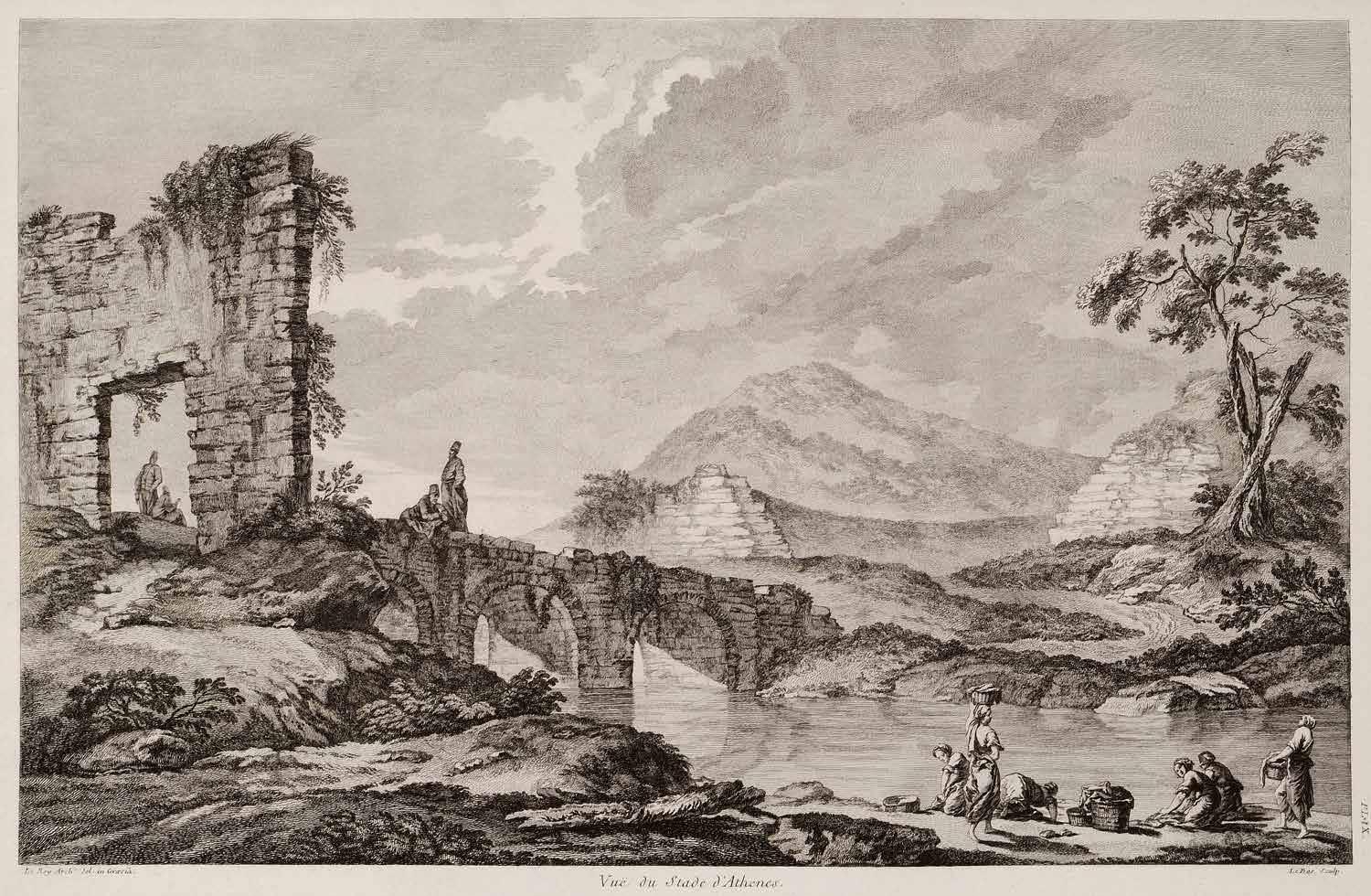
- https://www.royalacademy.org.uk/art-artists/work-of-art/view-of-the-stadium-of-athens
Source
View of the Bridge over Ilissos after 1778
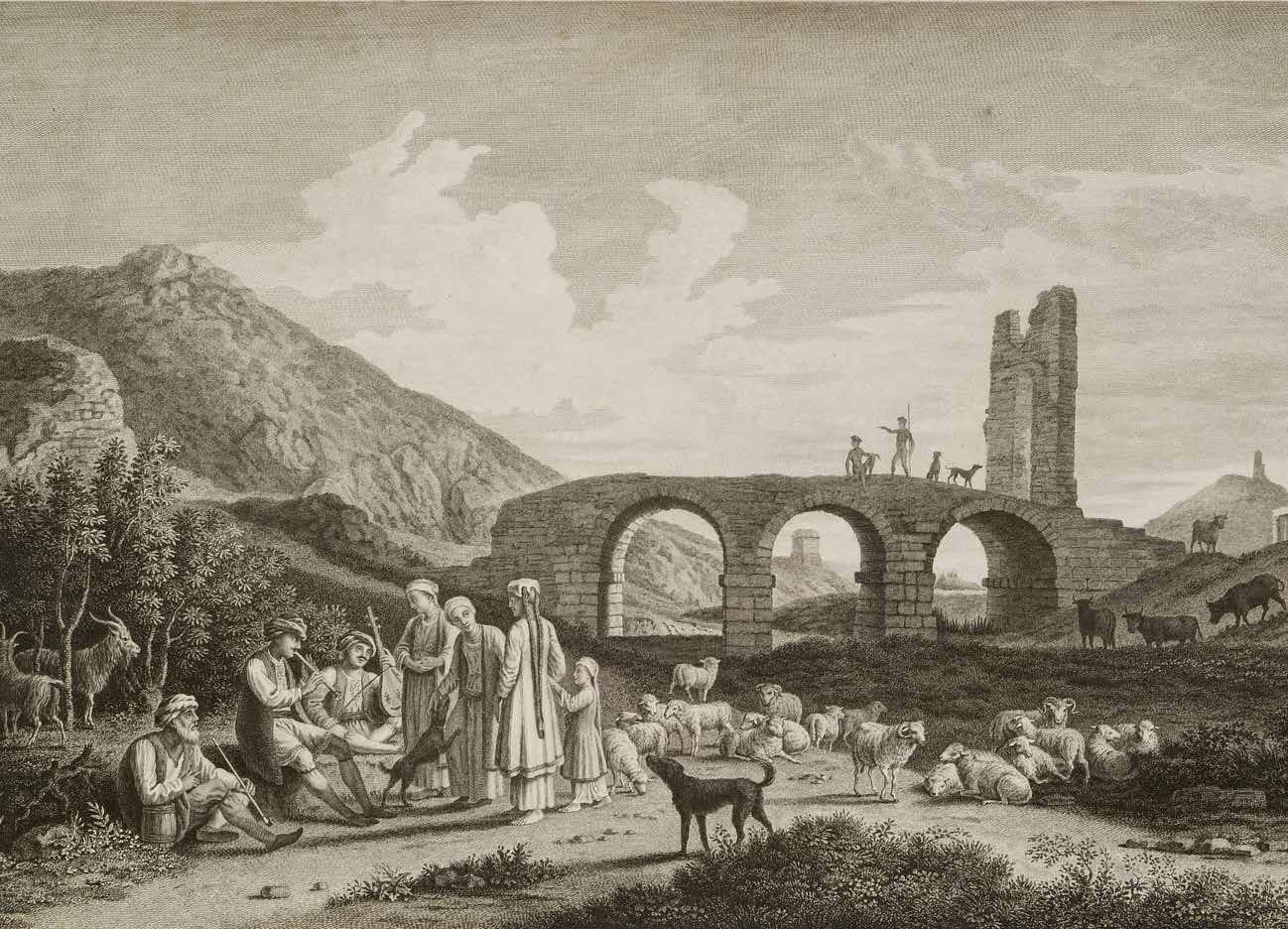 1751-1753. Bridge was built by the Byzantine empire It was destroyed by ottoman empire for marble by 1778
Source - Travlos Images
Bridge over River Ilissos


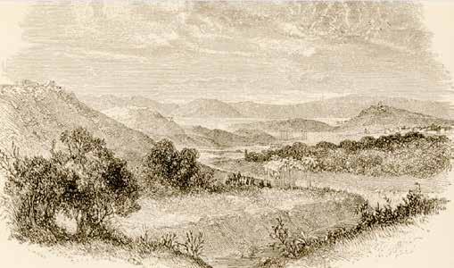
Source - https://picryl.com/media/athens-from-the-valley-of-the-ilissus-wordsworth-christopher-1882-743b8f
After independence in Greece, the river and the stadium became a part of the growing city.
1830
- 1850
1:1500 0m 5m 10m 20m
Scale
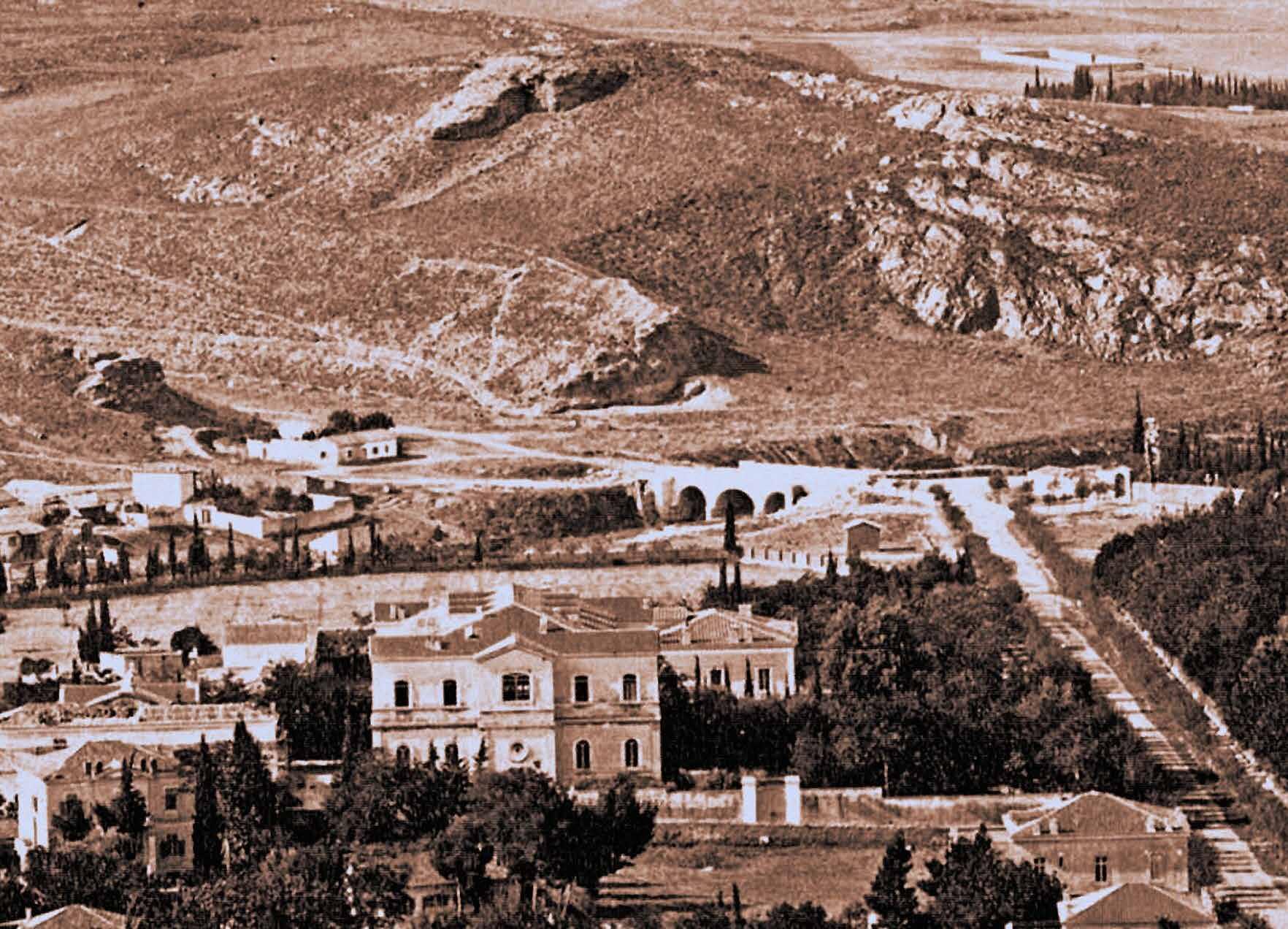
Source - https://www.flickr.com/photos/athens_greece/16314270851/sizes/o/
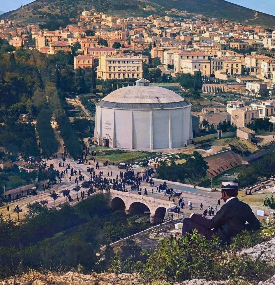
View of the channelled River Ilissos before the 1896 Olympics, showing the reconstruction of the bridge



Source - https://picryl.com/media/athens-from-the-valley-of-the-ilissus-wordsworth-christopher-1882-743b8f Scale
The stadium’s archaeological remains were discovered in the 1830s, and excavations there took place in 1870.
1850
0m 5m 10m 20m
- 1870
1:1500 0m 5m 10m 20m


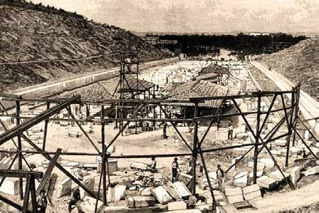
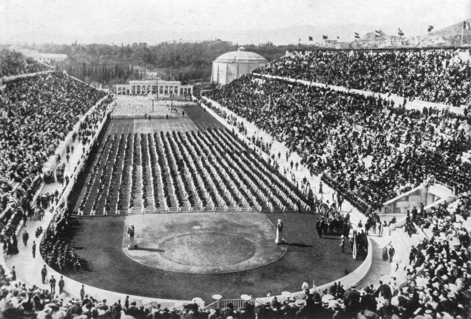
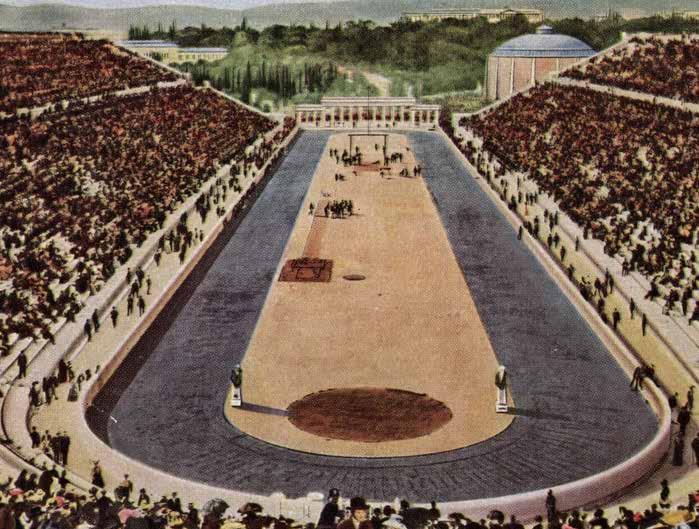
It was there that Greek philanthropist Evangelos Zappas held his endeavours in 1870 and 1875 to bring back the Olympic Games. After it was decided that the modern Olympics would take place in Athens in 1896, the ancient stadium was demolished in 1895 and replaced with a new one.
The river was somewhat covered near the stadium for the Olympic Games Road accessibility.
1870 - 1896 Source - https://whyathens.com/the-panathenaic-stadium/ Scale 1:1500 0m 5m 10m 20m
Panathenaic Stadium and Ardittos Hill
Source - https://greektraveltellers.com/blog/the-buried-rivers-of-athens
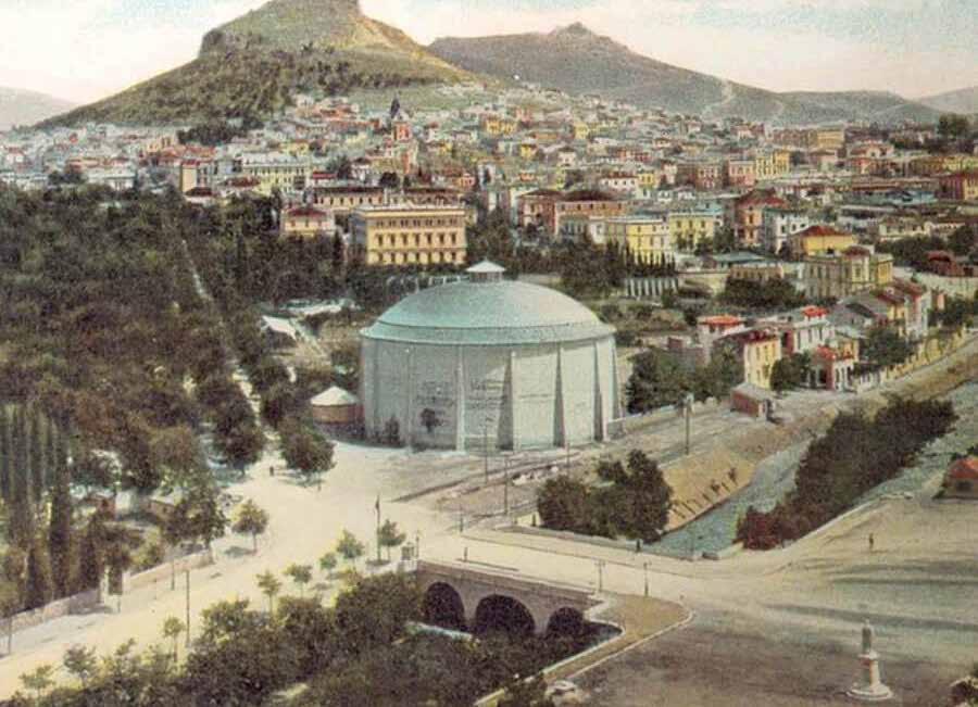
View of the Bridge over Ilissos before the 1896 Olympics, showing the building of the THON panorama and the river’s channelisation

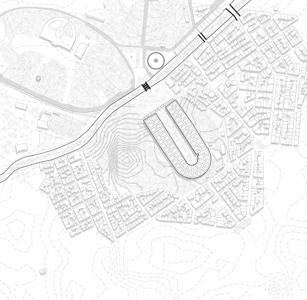

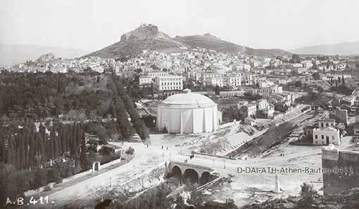
Ilissos River covering started during this time. Multiple bridges over Ilissos were constructed to connect the east and west of the river.
1896 - 1930
1:1500 0m 5m 10m 20m
Source - https://www.taathinaika.gr/i-gefyra-tou-panathinaikou-stadiou-kai-to-adokso-telos-tis/ Scale

Source - https://www.britannica.com/event/Athens-1896-Olympic-Games
1896 Olympics
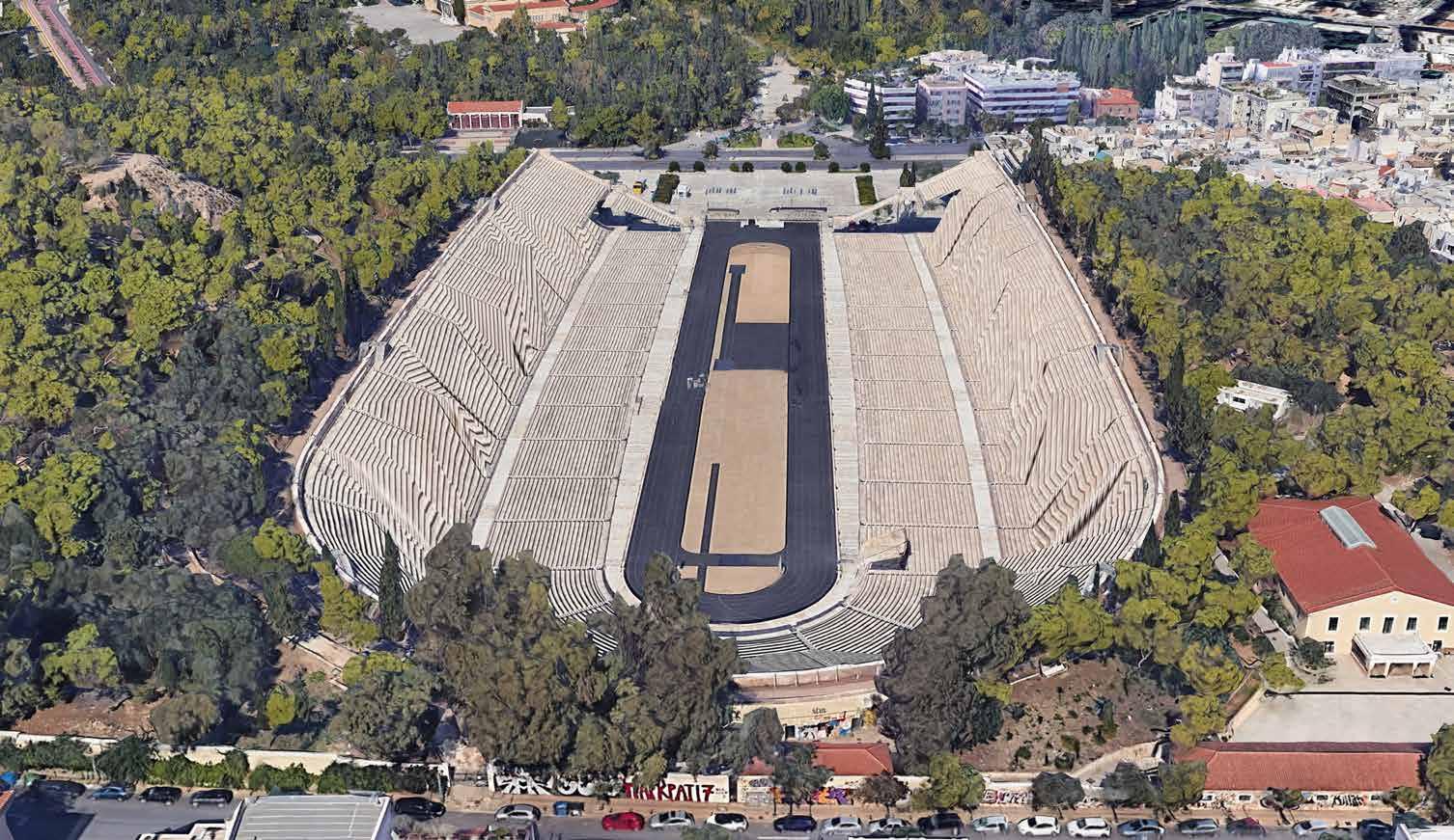
Source - Google Earth
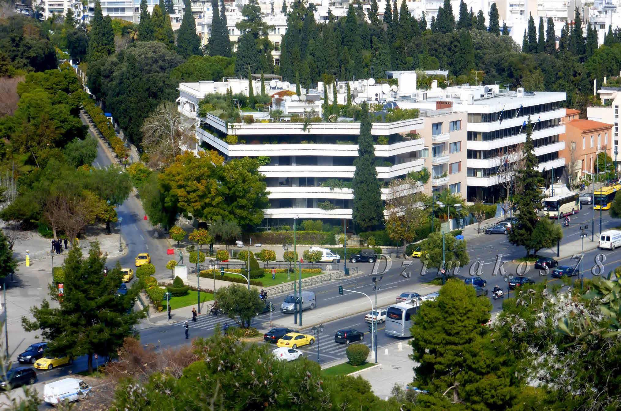
Befor and After Image of the Stadium and the river

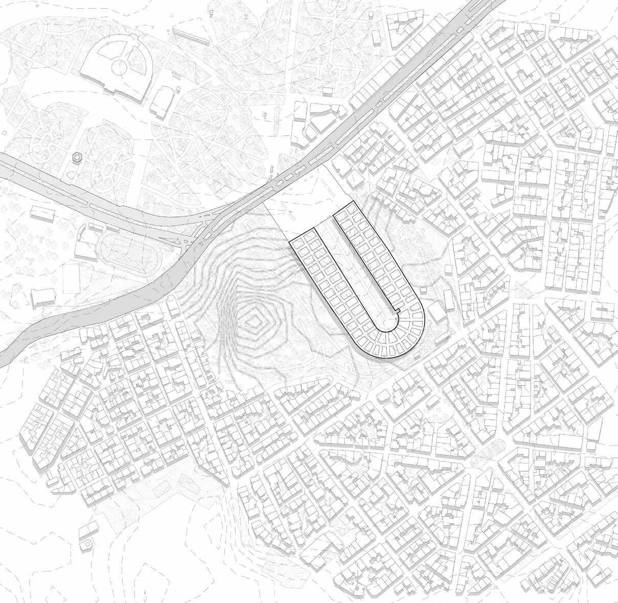


The stadium was upgraded for the 2004 Olympic Games. During this period, the river was channelized entirely near the stadium into the city. It became the site of several events during the 2004 Olympic Games. And it remained a site for regular usage after the Olympics.
1930 - 2005
- https://greeking.me/blog/greek-culture/panathenaic-stadium Scale 1:1500 0m 5m 10m 20m
Source

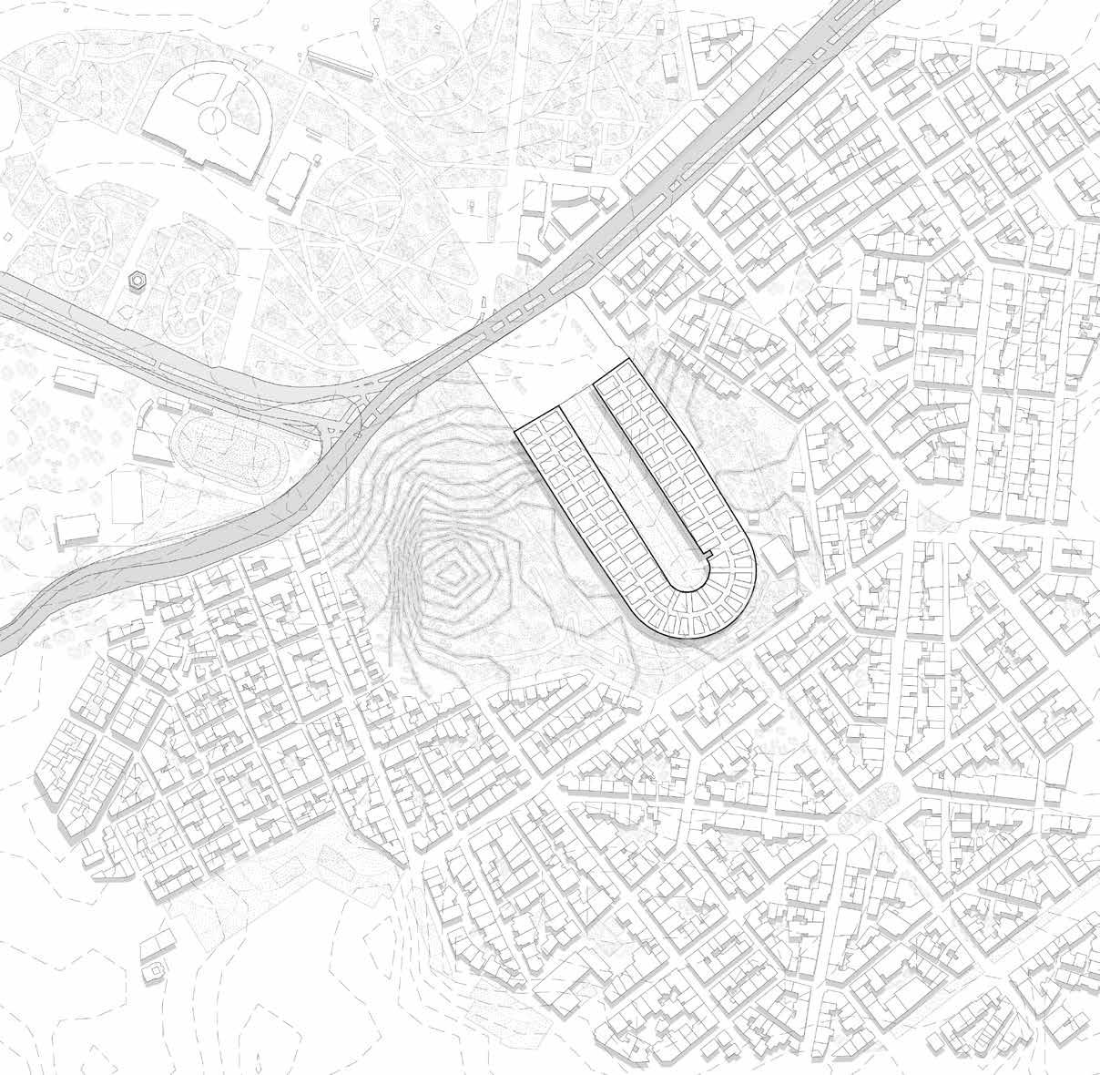


The Panathenaic Stadium is not just a historically significant location but also a venue for contemporary contests. The stadium occasionally serves as a location for certain dance and musical events. The Panathenaic Stadium, which hosts the yearly end of the Athens marathon, is still one of Greece’s most important and well-liked tourist destinations.
River Ilissos went underground completey and now a road runs in front of the stadium as compared to the ancient times when Ilissos used to flow.
2005 - Present Source - Google Earth Scale 1:1500 0m 5m 10m 20m
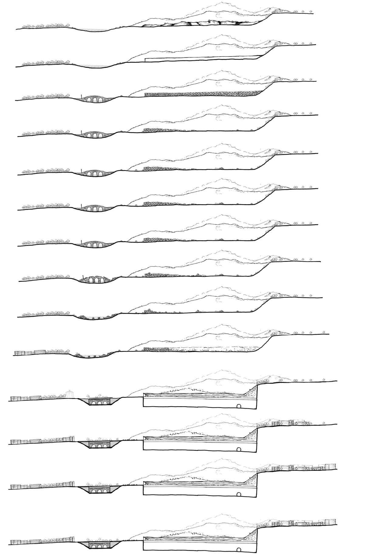
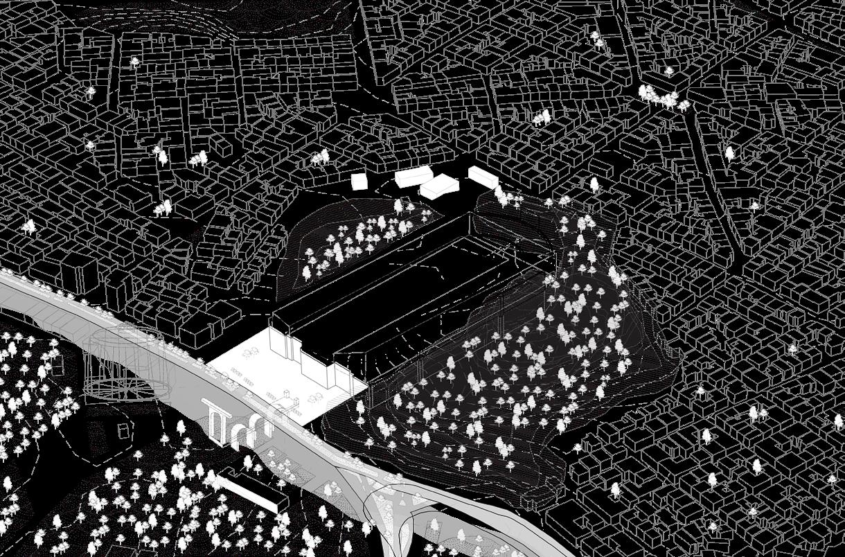
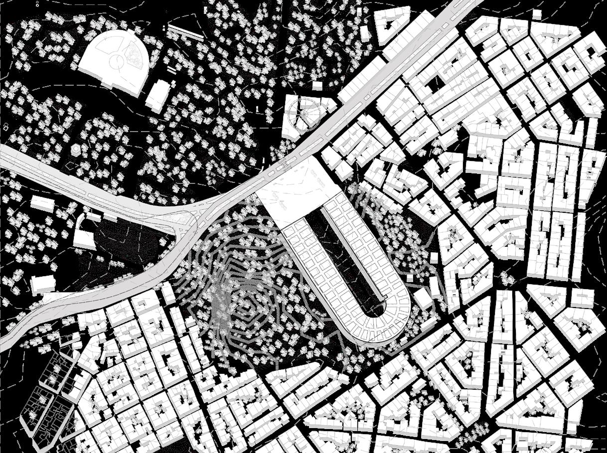

Scale 1:1500 Scale 1:1500 2005 Present 1930 - 2005 1896 - 1930 1687 - 1830 1830 - 1850 1850 - 1870 1870 - 1896 1456 - 1687 267 - 566 1205 - 1456 566 - 1205 86 B.C. - 267 479 B.C. - 338 B.C. 338 B.C. - 86 B.C. Overlapped Plan Sections Bird-eye view 0m 5m 10m 20m 0m 5m 10m 20m 0m 5m 10m 20m 0m 5m 10m 20m 0m 5m 10m 20m 0m 5m 10m 20m 0m 5m 10m 20m 0m 5m 10m 20m 0m 5m 10m 20m 0m 5m 10m 20m
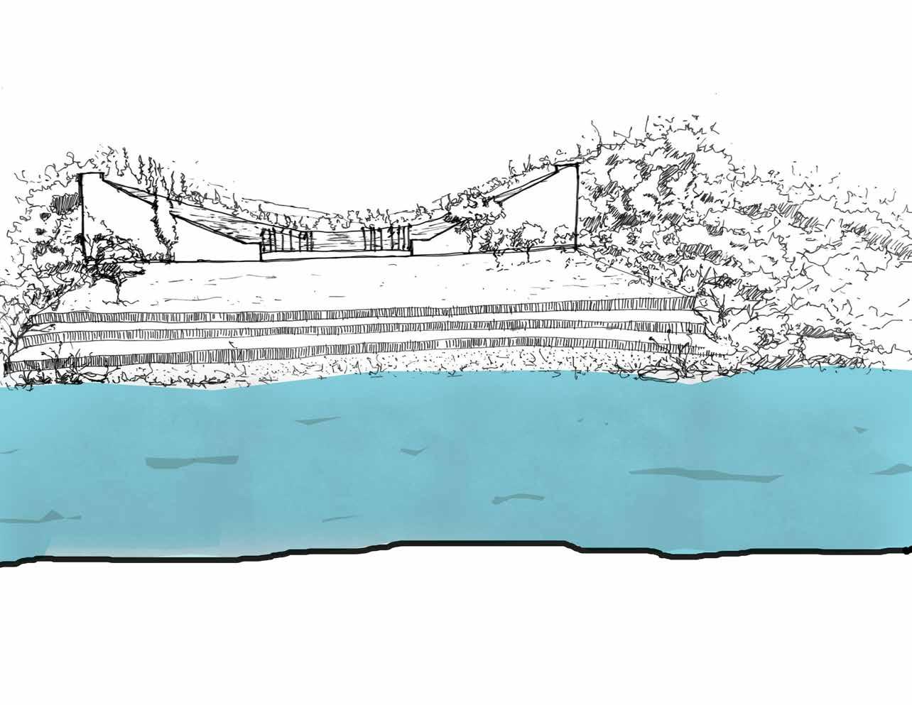
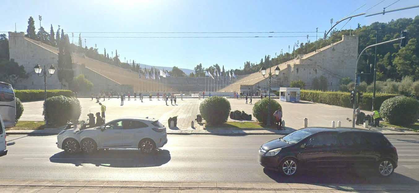 Panathenaic Stadium and Ardittos Hill
Daylighting River Ilissos Present Day
Conclusion
River Ilissos has been physically and culturally invisible and considering the river as a continuous entity what if the daylighting of the river is done in the documented sites of this thesis?
If the daylighting is done, will it be catastrophic?
River Ilissos has experienced significant transformations from its mythological beginnings as the sacred river of Athens, regarded by the ancient Greeks as a heavenly existence, to its current state as a covered channel beneath the avenues. Yet, despite it being hidden from view and remains imprinted in the collective consciousness of Athenians, serving as a constant reminder of the city’s ongoing ties to its natural and urban heritage.
This thesis explored the palimpsest character of Athens by looking through the river’s lens, exposing the layers of urban growth and history that overlapped along its banks. From the Classical Era and ancient walls to neoclassical structures and modern infrastructure, every age has shaped the city that exists today by leaving a mark on the topography along the river.
In addition, research into two historical monuments and urban sites along the river’s path has shed light on the intricate interrelationships between history, urban landscapes, and the environment. These locations act as physical representations of the city’s history, providing windows into many eras and stories woven throughout Athens.
But despite all of the urbanisation and history, the Ilissos River still has challenges with catastrophic floods. The river has become an underground body of water, its link to the city is broken by its conversion into a covered channel. Today, the river is divided into stretches which are handled by different municipalities at multiple locations rather than considering it as one entity like ancient times.
However, there is still hope for revival. This thesis has suggested a vision for the Ilissos’ future by reinterpreting the river as a living thing that is capable of restoration. Reclaiming the Ilissos as a valued asset for the city and its residents is made all the more important by suggestions like daylighting the river at key locations and encouraging resilient urban design.
In conclusion, Athens is capable of developing a new connection with the river that respects its history and welcomes the opportunities of the future by embracing its past and envisioning the future.
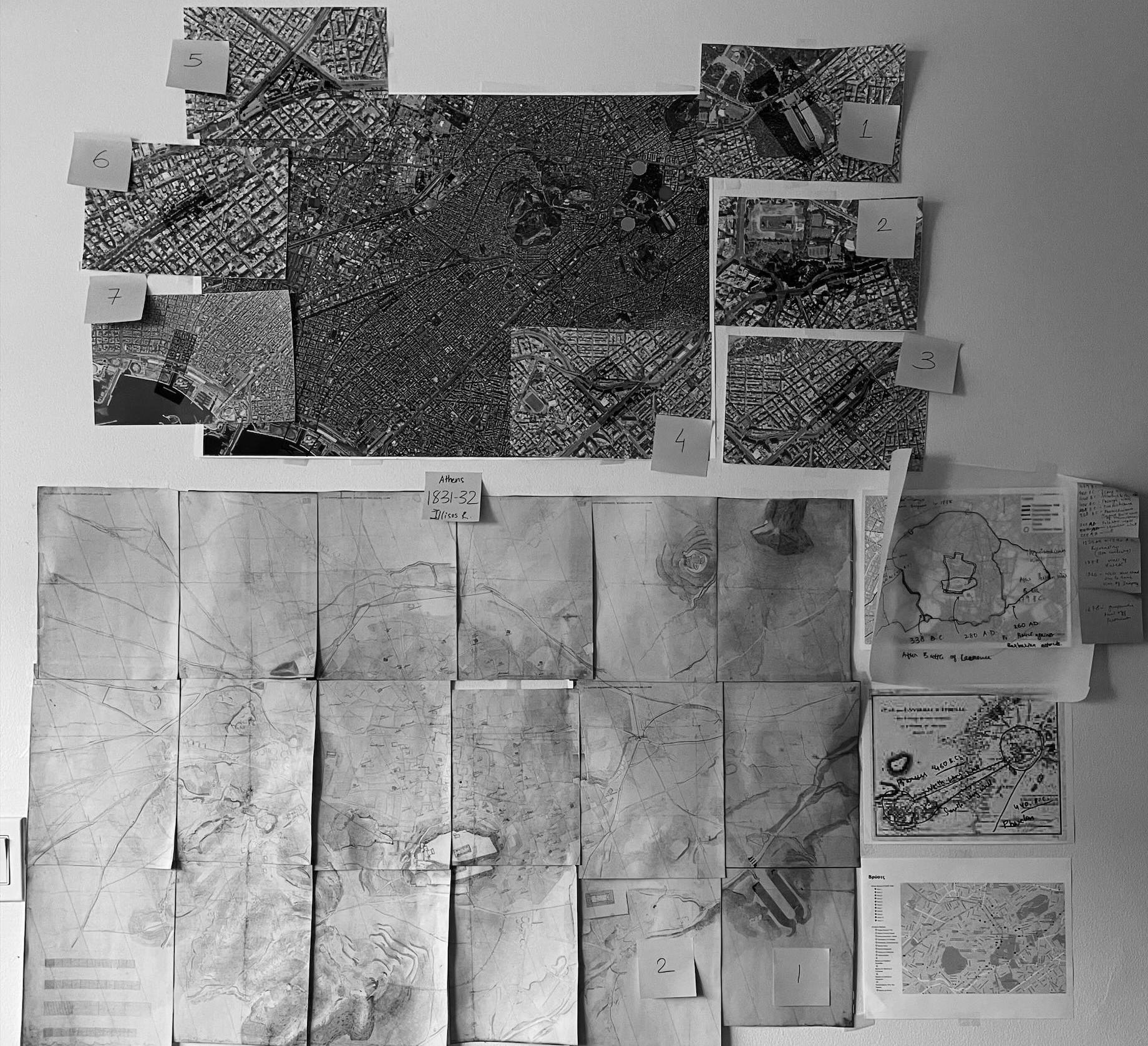
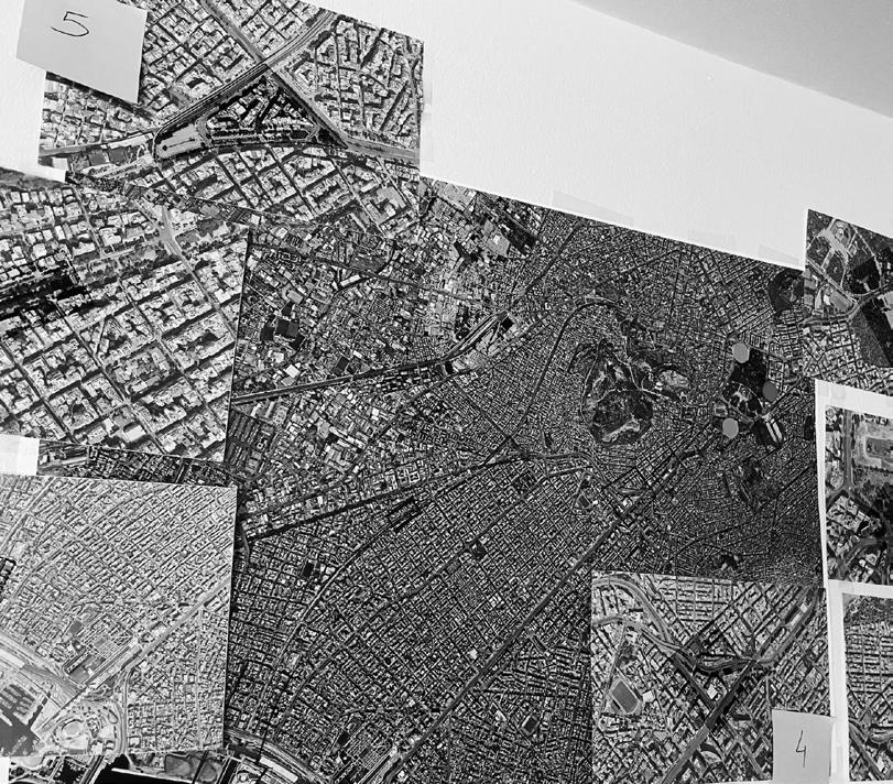
Thank You!
Books and Publications -
Bibliography
Kontozoglou, K. (2020). Project FIX -Reviving the Future. Potamos.
The First Maps of the City of Athens. (n.d.). Attica Street.
Theodoropoulou, D. (2020). Ф1=FIX 120+ YEARS OF ARCHITECTURE TAKIS ZENETOS I MARGARITIS APOSTOLIDIS. Athens: epikentro Publishers.
Filippidis D., Μοντέρνα Αρχιτεκτονική στην Ελλάδα, Μelissa publications, 2001, p.186.
https://www.politeianet.gr/sygrafeas/traulos-ioannis-45800
1. Neils J, Rogers DK, eds. Reception. In: The Cambridge Companion to Ancient Athens. Cambridge Companions to the Ancient World. Cambridge University Press; 2021:419-481.
Travlos Maps, 1993
Other Student Work -
Pappa, A. (2021, June 08). Ilissos and Kifissos rivers – Greece: Influence of human factors on basins’ evolution - A socio hydrological point of view. Technical University in Delft, Netherlands: Athina Pappa.
Thesis (M. Arch.)--Massachusetts Institute of Technology, Dept. of Architecture, 1980. Natsi, I. (2020-2021). Stretching Boundaries - An Approach to Understanding City’s Urban Planning through Architecture as a Story Telling Tool. Milano, Politecnico di Milano - Faculty of Architecture & Urban Planning, Itlay: Ina Natsi.
https://www.behance.net/gallery/24992201/Atticas-landscape-revival-Ilissos-River-
Google Sites-
Google Earth
Google Maps
Google.com
Google Scholar
Youtube Videos and Playlists-
https://www.youtube.com/watch?v=VZ5eCMnavVE&list=PLp0D4c3_b0GV4AQeSXw1cJQhqWEBOZnQV&index=29
https://www.youtube.com/playlist?list=PLp0D4c3_b0GV4AQeSXw1cJQhqWEBOZnQV
https://www.youtube.com/watch?v=2PlNk9vZDI4
https://www.youtube.
Cover Page Image
Travlos Images, 1993
Bibliography
Websites -
https://www.britannica.com/event/Athens-1896-Olympic-Games
https://www.adventurous-travels.com/posts/athens-greece-part-2-new-athens-is-there-anything-else-to-see-besides-theacropolis
https://hydriaproject.info/en/case-studies/the-river-eridanos-of-ancient-athens/setting
https://yao-wu-dglx.squarespace.com/panathenaic-stadium/hkpa82ca93js5hi124vtm46ezbn7ss
https://www.mancodestyle.com/en/aperitivo-sti-venetia-me-ton-ernesto-tsiller-2/
https://www.nationalgallery.gr/en/artwork/view-from-ardittos-hill/
https://neoskosmos.com/en/2021/01/30/life/the-underground-exploring-art-on-the-athens-metro-system/
https://www.emetro.gr/?page_id=4163&lang=en
https://www.emst.gr/en/the-museum/fix-building
https://athensinapoem.com/2014/06/29/urban-frame-no1-the-amputa ted-fix-brewery-and-the-national-museum-ofcontemporary-art-of-athens/
https://archello.com/project/national-museum-of-contemporary-art-competition
https://www.thisisathens.org/arts-entertainment/sightseeing/underground-art-athens
https://exploringgreece.tv/en/athens/time-travel-when-the-tram-was-dragged-by-horses-in-athens/23672/
https://www.uncubemagazine.com/blog/11347329
https://khfi-sos.blogspot.com/2016/07/blog-post_35.html
https://geomythiki.blogspot.com/2016/06/blog-post_11.html
https://kedrostravel.com/en/pos-ton-len-pos-ton-len-ton-potamo/
https://www.bbc.com/news/blogs-news-from-elsewhere-47385140
https://kedrostravel.com/en/pos-ton-len-pos-ton-len-ton-potamo/
https://stock-images.antiqueprints.com/stock/historical-maps.html
https://theacropolismuseum.gr/en/parthenon-west-pediment-ilissos
https://www.behance.net/gallery/24992201/Atticas-landscape-revival-Ilissos-RiverBy Emmanouel Nikolaos and Anastasia Gkoliomyti
https://www.theguardian.com/cities/2019/jun/04/athens-buried-rivers-stream-favoured-by-plato-could-see-light-of-day
https://www.taathinaika.gr/i-gefyra-tou-panathinaikou-stadiou-kai-to-adokso-telos-tis/ https://whyathens.com/the-panathenaic-stadium/
https://picryl.com/media/athens-from-the-valley-of-the-ilissus-wordsworth-christopher-1882-743b8f https://fogtravel.blog/walking-athens-2from-the-plaka-to-the-temple-of-zeus/
https://www.royalacademy.org.uk/art-artists/work-of-art/view-of-the-stadium-of-athens
https://geomythiki.blogspot.com/2018/09/1896-1915.html
Bibliography
Websites -
https://commons.wikimedia.org/wiki/File:Remains_of_the_Early_Christian_Basilica_of_Ilissos_on_November_2,_2022.jpg
https://www.reddit.com/r/europe/comments/k43uou/some_paintings_photos_and_a_map_of_the_rivers/ https://www.flickr.com/photos/athens_greece/46153758602
https://www.greeceathensaegeaninfo.com/h-athens/ancient/ilissos-river-valley.htm https://www.athenskey.com/ilissos.html
https://hydriaproject.info/en/case-studies/tracking-ilissos-river-in-athens/waterworks
https://brewminate.com/thrown-away-like-rubbish-disposal-of-the-dead-in-ancient-greece/ https://www.ime.gr/chronos/05/en/society/cemeteries.html
https://greekcitytimes.com/2024/02/22/the-hills-of-athens-and-their-names/
https://stonenews.eu/panathenaic-stadium-the-house-of-the-first-modern-olympic-games-built-entirely-of-marble/ https://www.mirror.co.uk/sport/other-sports/athletics/first-modern-olympic-games-historic-7701757
https://www.sapiens.org/archaeology/indiana-jones-real-archaeologist/ https://geomythiki.blogspot.com/2018/09/1896-1915.html
https://apotis4stis5.com/vintage/27926-athina-ilisos
https://kids.britannica.com/students/article/Athens/272995#:~:text=Athens%20is%20located%20on%20a,miles%20(39%20 square%20kilometers).
https://greektraveltellers.com/blog/the-buried-rivers-of-athens
https://zogaris.blogspot.com/2015/04/the-ilissos-riverflows.html
https://ancientathens3d.com/medieval-athens/#google_vignette
https://xekinimazografou.wordpress.com/2015/12/19/%CE%B1%CF%80%CF%8C-%CF%80%CE%BF%CF%8D-%CF%80%CE %B5%CF%81%CE%BD%CE%BF%CF%8D%CF%83%CE%B5-%CE%BF-%CE%B9%CE%BB%CE%B9%CF%83%CF%8C%CF%82-%CF%80%CE%BF%CF%84%CE%B1%CE%BC%CF%8C%CF%82/
https://www.uncubemagazine.com/blog/11347329
https://www.emetro.gr/?page_id=8342&lang=en
https://www.alfavita.gr/koinonia/281613_i-athina-apokta-xana-potami-ta-shedia-gia-tin-koiti-toy-ilisoy-kai-tin-pezodromisi
http://lastpoint.gr/potamia-tis-athinas/
https://greektraveltellers.com/blog/the-buried-rivers-of-athens
https://www.theguardian.com/cities/2019/jun/04/athens-buried-rivers-stream-favoured-by-plato-could-see-light-of-day
https://www.plato-dialogues.org/tools/athensim.htm
https://www.itia.ntua.gr/en/getfile/1358/1/documents/2013Ilisos.pdf
https://theacropolismuseum.gr/en/parthenon-west-pediment-ilissos
https://khfi-sos.blogspot.com/2016/07/blog-post_35.html
https://www.itia.ntua.gr/en/getfile/1358/1/documents/2013Ilisos.pdf


 Saronic Gulf
Gulf of Elefsina
Faliro Bay
Steno Keas
Petalioi Gulf
Aegean Sea


 Lycabettus Hill
Hill of Nymphs
Hill of Muses


 Faliro Bay River Ilissos
River Kifissos
R. Ilissos - 1844
R. Kifissos - 1890
R. Iridanos - 1832

 Kifissos and Ilissos River


 River Ilissos outside the city walls
River Ilissos as a part of the City of Athens
Underground life of the River Ilissos
Journey of River Ilissos


 Temple of Zeus and it’s surroundings
 Plaka, the valley of Ilissos, Ardittos hill and Pangrati.

 Present day river water discharge point


 Present day river as a dried channel
 Present day Ilissos Park


 Panathenaic Stadium and Ardittos Hill


 Illustration of an abandoned stadium during Byzantine time period


 1751-1753. Bridge was built by the Byzantine empire It was destroyed by ottoman empire for marble by 1778


 Panathenaic Stadium and Ardittos Hill
Daylighting River Ilissos Present Day


