Master

Includes the Jefferson Park
Plan Adopted October 11, 2022
PLAN STEERING COMMITTEE
Kelly Bivens, principal, DESI Debbie Bryant Vivian Camm Angela Cox Walter Cox Kimberly Dyke-Harsley
Jennie Dyke Robert Flood Chantal Gunn Kay Reid Jerome Jonson Ethel Reeves
Ashley Reynolds-Marshall, YWCA Mary Mayrose, LRHA
Yvonne White Sterling Wilder
CITY COUNCIL
Mary Jane Dolan, Mayor Beau Wright, Vice Mayor Chris Faraldi Jeff Helgeson Randy Nelson Treney Tweedy Sterling Wilder CITY STAFF
CONSULTANTS
Hill Studio
Elgin Cleckley, NOMA, Assistant Professor of Architecture and Design Thinking, UVA School of Architecture
ADDITIONAL SUPPORT
Draper Aden EPR
Ashley Reynolds-Marshall Emily Kubota, Museum Curator
Urban Design Team
Howard Covey Charlotte Lester
Anne Leslie Nygaard Clay Simmons Susannah Smith Reid Wodicka Greg Wormser
Wynter C. Benda, City Manager
Reid Wodicka, Deputy City Manager
Kent White, Director of Community Development
John H. Hughes, IV, Assistant City Manager
Jenny Jones, Director of Parks & Recreation
Marjette Upshur, Director of Office of Economic Development, Tourism, & Museums
Gaynelle Hart, Director of Public Works
Tom Martin, AICP, City Planner Lee Newland, P.E., City Engineer
Taylor Bowen
Jason Burger Christopher Higgins
Shaunta Jefferson Emily Kubota Maggie Mace Alisha Meador Trish Roth Jordan Smith Joe Tucker Robert Whitmore
APPENDICES:
INTRODUCTION ���������������������������������������������������������������������������������������� 4 BACKGROUND & PLAN DEVELOPMENT ���������������������������������������������������������������������������� 5 PROJECT STUDY AREA ��������������������������������������������������������������������������������������������������������� 13 GOVERNANCE & IMPLEMENTATION ���������������������������������������������������������������������������������� 14 VISION & GOALS ������������������������������������������������������������������������������������� 18 NEIGHBORHOOD CONTEXT ��������������������������������������������������������������� 20 NEIGHBORHOOD & PARK HISTORY ����������������������������������������������������������������������������������� 21 NEIGHBORHOOD VOICES ���������������������������������������������������������������������������������������������������� 28 DATA & OBSERVATIONS ������������������������������������������������������������������������������������������������������ 32 MEASURES & TRENDS ���������������������������������������������������������������������������������������������������������� 35 JEFFERSON PARK EVALUATION �������������������������������������������������������������������������������������� 36 STRATEGIES & ACTION STEPS ���������������������������������������������������������� 42 JEFFERSON PARK ����������������������������������������������������������������������������������������������������������������� 45 NEIGHBORHOOD CENTER ��������������������������������������������������������������������������������������������������� 66 STREETS & ACCESS �������������������������������������������������������������������������������������������������������������� 68 MATERIALS STORAGE SITE ������������������������������������������������������������������������������������������������ 79 FUTURE PLANNING EFFORTS ����������������������������������������������������������� 82 NEIGHBORHOOD DISCUSSIONS ��������������������������������������������������������������������������������������� 83 TRANSPORTATION ���������������������������������������������������������������������������������������������������������������� 84 LAND USE & HOUSING ���������������������������������������������������������������������������������������������������������� 93 IMPLEMENTATION MATRIX ��������������������������������������������������������������� 102
A. Neighborhood Snapshot B. December 12, 2019 Workshop Report C. October 24, 2020 Workshop Report D. Materials Storage Site Phase I Environmental Assessment E. Jefferson Park Tennis Courts Phase I Environmental Assessment F. Caroline Street Gateway Options G. Landfill Evaluations (1997, 2015) H. Jefferson Park Gymnasium Building Code Research and Building Details
The Dearington Neighborhood Plan presents a vision primarily for recreational improvements in the Dearington Neighborhood and sets overarching goals and specific strategies to help the neighborhood and the City achieve that vision together. While the focus of the document is on recreational improvements, many of the proposals contained here have broader implications for the success of the Dearington Neighborhood. The City sees that trails are not only used for exercise but as vital transportation connections and the benefits of revitalizing Jefferson Park may spur new development that helps meet the City’s housing needs and increase home values in the neighborhood. Investing in high-quality and desirable public spaces in the Dearington Neighborhood will transform historic inequities into assets that improve the attractiveness of the neighborhood and quality of life for Lynchburg residents.
INTRODUCTION
4 Introduction & Project Background
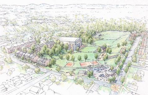
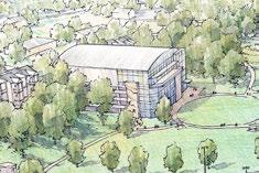
Birdseye rendering of the 20-year vision for Jefferson Park Hill Studio / Peter Giraudeau
BACKGROUND & PLAN DEVELOPMENT
In recent years the City of Lynchburg successfully completed the “Growing Tinbridge Hill” Neighborhood Plan for a nearby neighborhood and began implementing sidewalk improvements using Community Development Block Grant (CDBG) funds. Wanting to continue similar neighborhood engagement and investment in other neighborhoods, Dearington was selected for a variety of reasons. One reason was that in 2016 the City completed a drainage improvement project in Jefferson Park following the exposure of waste due to the erosive forces of stormwater over an earthen-capped historic landfill. Discussions at that time led to a City commitment to return to the neighborhood for further planning and improvements. Also, Dearington is centrally located in the city, hosts the City’s oldest public housing and a beloved elementary school, has aging utility lines due for replacement, and an often forgotten or overlooked history. An opportunity arose in 2019 to fund a neighborhood plan through the CDBG program and other sources and the City decided to pursue this important work.
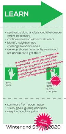
COVID-19 DISRUPTION
This project began as a full neighborhood plan in late 2019 and was intended to cover all aspects of neighborhood planning – housing, transportation, economic development, etc. However, just as staff was preparing for a series of three neighborhood meetings for the Spring of 2020 to address this wide variety of topics, the COVID-19 pandemic set in and the safety of public gatherings suddenly became uncertain. As more information about how COVID-19 spreads became available, staff determined that outdoor public meetings could be held safely but that the neighborhood and stakeholders should be consulted about their comfort levels so to ensure an inclusive process. Due to varying comfort levels with in-person meetings and the technological constraints of digital engagement, staff determined that no meeting would be inclusive enough to justify moving forward with a full neighborhood plan. Instead, staff decided to focus on a major subset of the plan- parks and recreation improvements, still invite the public to engage safely, but shift to proposals on City-owned property, City programming, and City right-of-way.
PURPOSE
The purpose of this plan is to guide City and neighborhood efforts towards achieving a shared vision for the Dearington Neighborhood and Jefferson Park. It should be used by City staff to plan capital improvements and programming over a twenty year period and help the neighborhood advocate for the improvements they would like to see in their neighborhood public spaces.
The final chapter of this document, titled “Future Planning Efforts,” was added to the plan in the fall of 2021 to capture content from an internal staff report that covered typical planning topics not included in the body of this plan due to the COVID-19 disruption. It’s purpose is to document staff’s perspective on these topics and guide future planning efforts on these topics.
5Introduction & Project Background
PROCESS
The process for developing this plan has been largely modeled on New York City’s Neighborhood Planning Playbook, where City staff and department agencies (as opposed to hired consultants) have been tasked with engaging directly with the neighborhood and each other to develop realistic proposals and strategies that meet neighborhood identified challenges and opportunities. The process was modified to match Lynchburg’s organization size, meet Dearington’s unique needs, and accommodate disruptions from the COVID-19 pandemic. As discussed previously, the original neighborhood plan had to be scaled back to a parks and recreation plan, though it has generally followed the same planned process.
Key Groups & Participants

Urban Design Team – City staff from various departments charged with developing the Dearington Neighborhood Plan
Steering Committee – current and former neighborhood residents, key stakeholders from area institutions and organizations
Elgin Cleckley – UVA School of Architecture Professor who led a “design thinking” workshop
Hill Studio – provided graphics and initial gymnasium research
Draper Aden – Office of Economic Development, Tourism, and Museum’s Brownfields consultant, who provided insight and expertise on site reuse
EPR – provided graphic and transportation improvement options for Caroline Street Gateway
Planning phases from New York City’s Neighborhood Planning Playbook
Plan Development Timeline
EARLY 2019 - City assembled the “Urban Design Team” of staff from various departments to develop and guide the Dearington Neighborhood Plan. Staff included:
Urban Design Team Member City Department
Anne Nygaard, Planner II and project lead
Howard Covey, Facilities Supervisor
Community Development
Parks & Recreation
Charlotte Lester, Neighborhood Centers Manager Parks & Recreation
Clay Simmons, Deputy Director of Public Works Public Works Susannah Smith, Construction Coordinator Parks & Recreation
Reid Wodicka, Deputy City Manager City Manager’s Office
Gregory Wormser, Fire Chief Fire Department
SEPTEMBER 2019 – CDBG funding and staff became available to begin work.
SEPTEMBER 26, 2019 – Staff held an initial Steering Committee meeting by inviting known community leaders and stakeholders to a breakfast meeting at the Public Works Training Room, 1600 Memorial Avenue. Around ten individuals, including current and former residents, helped to guide the plan process and answer key questions about who should be involved, how to best communicate with the Dearington Neighborhood, and what needed to be covered by a neighborhood plan.
6 Introduction & Project Background
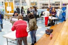
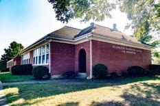
DECEMBER 12, 2019 – An open house style kick-off event was held at Dearington Elementary School for Innovation (DESI) from 4:30-7:30 pm. Event programming consisted of 9 stations to collect feedback on a variety of topics to help staff learn about the Dearington Neighborhood, what is important, and what concerns residents. The stations included various interactive posters to collect feedback visually and spark conversations between facilitators and residents. Attendees could be entered into a raffle for donated Wal-Mart and Food Lion gift cards for participating. Community resources, scattered throughout the school, were available for attendees as well and included: City Rental Inspections Team, American Electric Power (AEP) Energy Efficiency, Greater Lynchburg Transit Company (GLTC), Rideshare Solutions, 2-1-1 Virginia, Community Access Network, Census 2020, Hire Lynchburg, Lynchburg City Schools, and three local pre-k organizations- Head Start, Smart Beginnings, and Humankind.
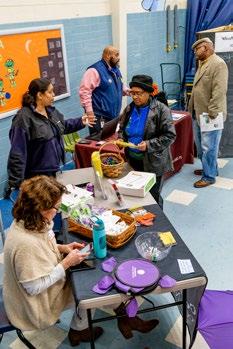
Steering Committee Members that volunteered at the event included Ethel Reeves, Angela Cox, Debbie Bryant, Kimberly Dyke-Harsley, and Dearington Elementary principal, Kelly Bivens.
Attendance was small but the feedback was still valuable. A separate workshop summary document was developed and posted to the website summarizing the feedback received.
Neighborhood Survey
A SurveyMonkey survey was developed with many of the questions from the kick-off meeting on December 12th. It was posted to the Dearington Website and handouts for how to reach it were given out at the Jefferson Park Center and various events. Hard copies were also made available and collected.
JANUARY 30TH, 2020 – Parks & Recreation Department held a ribbon cutting event at the Jefferson Park Neighborhood Center to celebrate the completion of interior renovations and the reopening of the center as a City-run facility. The feedback posters from the kick-off event in December were available for collecting additional input.
SPRING 2020 – A series of three neighborhood meetings were canceled due to the COVID-19 pandemic.
SPRING 2020 – Staff completed data collection and produced a Neighborhood Snapshot report based on the information collected.
APRIL 26, 2020 – The Urban Design Team hosted a virtual Parks & Recreation staff stakeholder meeting to gather input on what their department needed from the parks component of the neighborhood plan and provide valuable insight and knowledge regarding existing conditions, strengths, weaknesses, opportunities, and threats to park facilities in the neighborhood. The group also reviewed community feedback, collected data, and identified key questions to discuss with the neighborhood.
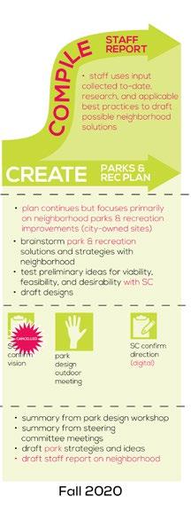
SUMMER 2020 – Due to the pandemic, the Urban Design Team worked behind the scenes to compile applicable best practices and design ideas for Jefferson Park based on community and Parks & Recreation staff feedback.
OCTOBER 8, 2020 – A second virtual meeting with Parks & Recreation staff was held to review ideas and questions to answer with the neighborhood.
7
Introduction
&
Project Background
Input stations for staff to learn about the neighborhood and community resources tables around the DESI cafeteria on December 12, 2019
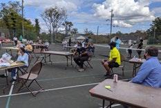
OCTOBER 24, 2020 – The Urban Design Team hosted a physically distant outdoor public meeting on the Jefferson Park tennis courts to discuss recreation improvements in the Dearington Neighborhood. The meeting was well attended with 25-30 participants. UVA School of Architecture professor, Elgin Cleckley, facilitated an engaging discussion and “design thinking” workshop regarding the future of Jefferson Park and Dearington. Participants responded to specific design ideas and prompts to help guide staff in the recommendations.
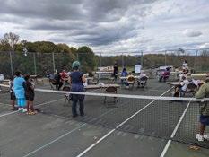
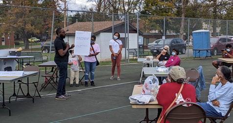
A separate workshop summary document was developed and posted to the website summarizing the feedback received and providing direction for the plan efforts.
8 Introduction & Project Background
Images from October 24th outdoor meeting in Jefferson Park
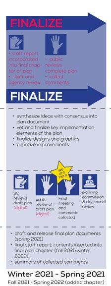
JANUARY 14TH, 2021 – Staff hosted a digital steering committee meeting to review initial proposals and strategies for inclusion in the plan and discuss priorities for implementation. Due to technology constraints and limited turnout, staff also followed up with committee members via phone and email.
SPRING 2021 – Draft Document was released for public review and comment. Through 2021, the Parks & Recreation Department is updating its city-wide master plan. This Dearington Neighborhood Recreation Plan will be incorporated into those efforts.
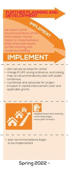
FALL 2021 – Approximately $500,000 of Community Development Block Grant (CDBG) funds became available to begin implementing plan recommendations for Jefferson Park.
WINTER 2022 - Staff applied for and was awarded an additional $240,000 of CDBG funds to augment the previous year’s Jefferson Park application due to inflation and supply chain issues.
SUMMER 2022 - Plan rereleased with added “Future Planning Efforts” chapter. New basketball court, with mural, was completed in Jefferson Park.
AUGUST 11, 2022 - A public meeting was be held at the Jefferson Park Center. Staff presented the plan contents and collected feedback. Dearington Housing Study work was also presented and received feedback.
AUGUST 23, 2022 - An update on the Dearington Neighborhood Plan and LRHA’s Dearington Apartments Master Plan was given to City Council.
SEPTEMBER 14, 2022 - The City Planning Commission voted to recommend approval of this plan to City Council.
OCTOBER 11, 2022 - City Council voted to adopt this plan as part of the City’s Comprehensive Plan.
Next Steps
IMPLEMENTATION- Staff should include projects in the Capital Improvement Program (CIP) and look for funding opportunities.
CONTINUED PLANNING EFFORTS. The City received a $50,000 grant from Virginia Housing to study housing in the Dearington in early 2022. That work will continue through 2022.
Project Background
9Introduction &
Process Diagram

The diagram on these pages was used and revised during the plan efforts to illustrate and create manageable steps towards achieving a plan document and moving into implementation. Text in pink indicates changes that had to be made due to the COVID-19 pandemic, limitations on in person meetings, and technology constraints with digital meetings.
10 Introduction & Project Background
Background
11Introduction & Project
Dearington Basemap
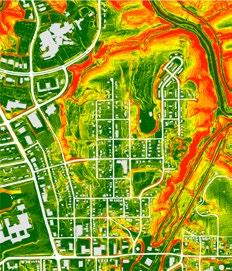
Above: Map of percent slope around the neighborhood. Extreme slopes are shown in red while level areas are dark green.
Right: Project Area Map
12 Introduction & Project Background
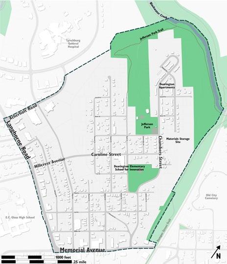
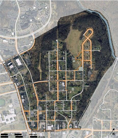
PROJECT STUDY AREA
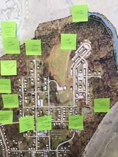
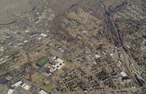
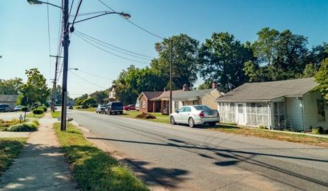
Dearington is one of Lynchburg’s many distinct neighborhoods and is centrally located in the City’s Midtown. While it shares some of the same challenges seen in other neighborhoods, it is also unique in its opportunities, public assets, and historic issues with former landfills. Dearington is bound by Memorial Avenue to the southeast and Langhorne Road to the southwest, Atherholt Road to the northwest, and extremely steep topography elsewhere. Langhorne Road and Memorial Avenue are defined by a variety of small and midsized commercial uses in buildings developed in the mid-to-late 20th century. Current businesses include a few restaurants and convenience stores, printing and sign companies, construction and contractor equipment warehousing, non-profit and healthcare offices, and other professional services. A number of the buildings are also vacant. E.C. Glass High School and Centra Health’s main facility, Lynchburg General Hospital, along with many other businesses also sit at the neighborhood’s edge.
Caroline Street and Chambers Street are the two primary corridors into the Dearington Neighborhood and are how most travel to reach neighborhood destinations. Page Street is a known cut-through to reach Lynchburg General Hospital. A majority of the neighborhood’s streets tend to be narrow, which may help limit traffic and speeds, but also often have sidewalks that start and stop at random intervals, making safe pedestrian travel difficult.
Landmarks include Jefferson Park, Dearington Elementary School for Innovation (DESI), and the Dearington Apartments, Lynchburg’s oldest public housing development. Most of the neighborhood is characterized by single-household dwellings, which sit in contrast to the rowhouse style development of the Dearington Apartments.
An unfortunate feature of the Dearington Neighborhood is the presence of four historic sanitary landfills in the neighborhood, used at various times through the middle part of the 20th
century. The sites have either been repurposed or currently sit vacant (see “Neighborhood & Park History” for more information).
Despite the landfill presence, Dearington has enormous potential. Equipped with valuable public facilities like Jefferson Park and DESI, nearby job opportunities, a well-connected grid of streets, and a close-knit neighborhood that remains close even after residents move away, Dearington is well-poised to be one of Lynchburg’s most livable neighborhoods.
MEMORIALAVENUE
LANGHORNEROAD
Introduction & Project Background
13
Birdseye view of the Dearington Neighborhood and its surroundings
E �C � GLASS HIGH SCHOOL
LYNCHBURG GENERAL HOSPITAL
JEFFERSON PARK
DESI
GOVERNANCE & IMPLEMENTATION
Successful Implementation of this plan will rely on both the City of Lynchburg and the neighborhood working together to achieve this vision. While the City can apply for grant funding and budget for physical improvements in its Capital Improvement Program (CIP), it needs strong support from the neighborhood to set Dearington as a priority among all funding needs and grant efforts.
CITY DEPARTMENTS
Specific City Departments will play key roles in ensuring this plan and the continued work in Dearington is successful:
Parks & Recreation
The Parks & Recreation Department will be expected to take the lead on this plan, particularly the revitalization of Jefferson Park, the development of new park facilities, hosting new programming, and the construction of offstreet trails. Parks & Recreation will continue to be the primary liaison with the community as they have regular contact through the neighborhood center. Many details will still need to receive community support prior to implementation and Parks & Recreation should work to build consensus toward these design improvements.
Community Development
The Department of Community Development will further vet other aspects of a neighborhood plan for the Dearington community and help manage the recommendations contained here.
Community Development will be a partner for Parks & Recreation, continue to coordinate departments and will advocate for progress.
Department staff will assist with plan interpretation and work with Parks & Recreation and other departments to find funding opportunities.
Economic Development, Tourism & Museums
The Office of Economic Development, Tourism, & Museums has supported the current plan efforts through its EPA Brownfields Grants by contracting for site environmental assessments and providing valuable expertise regarding brownfield redevelopment. Continued support in those efforts with subsequent grant opportunities should be welcomed and Economic Development could continue to be a partner, helping to see new life in Dearington’s public assets.
Museums
The Lynchburg Museum System has dedicated and talented staff who can help tell the history and important stories of Dearington and Jefferson Park. The neighborhood wants their history communicated throughout the park and as stories are being told through various signage, site design details, public art, and other interpretive elements, Museums should play an integral role in ensuring the history is both accurate and appropriately conveyed.
Public Works
The Department of Public Works will play a role in safely implementing the on-street trail and transportation improvements to approved standards. They will incorporate needed improvements into their transportation master plan efforts and work with Community Development and Parks & Recreation towards implementation of work within City right-of-way.
Water Resources
The Department of Water Resources will partner on projects to incorporate stormwater quality and quantity improvements and green infrastructure into plan components. Additionally, as the department continues to upgrade its underground infrastructure, by replacing old and undersized pipes, it should coordinate projects with the above-ground recommendations of this plan, leading to overall savings for the City.
14 Introduction & Project Background
City Staff at Neighborhood Meeting on October 24th, 2020
NEIGHBORHOOD ROLE
The Dearington Neighborhood, armed with plans they directly helped develop, should feel empowered to advocate for the plan’s implementation and take an active role in seeing it realized. Current and former residents can do this by:
• Voicing their desires and priorities to City leaders to have improvements funded and ensure continued progress on plan implementation.
• Coming to the table when City staff needs assistance for implementation decisions or for plan changes.
• Advocating for the plan among their neighbors. Some projects may require neighbor participation and support to complete. Residents and property owners may be more likely to participate and work with the City if their own neighbors are supporting the work.
• Organizing a neighborhood plan committee that meets at regular intervals to provide the City with group consensus and feedback. The majority of the participants should be current and former Dearington residents. Neighborhood stakeholder groups should also participate. This group can keep the City informed on changing neighborhood needs and dynamics. Plan steering committee members may be a logical group to form this committee.
COMMUNITY PARTNERS
Lynchburg and Dearington have a number of stakeholders and community partners that can be called upon to help see this plan to fruition. They should be invited to the table to participate as projects move forward and asked to play an active role in areas where they have specific expertise or mutual benefits can be achieved.
LRHA
Lynchburg Redevelopment and Housing Authority (LRHA) through the federal Department of Housing and Urban Development (HUD) owns and operates the Dearington Apartments. LRHA and its residents are major stakeholders in this plan and should be involved in the implementation and further plan development. As opportunities to improve the Dearington Apartments or increase housing supply and access arise, LRHA may play a key role as a partner.
Centra Health
With Lynchburg General Hospital in such close proximity, Centra Health should be a considered a key partner for the neighborhood as there are mutual benefits in working together on improving recreational and transportation options in the area, as well as revitalizing Jefferson Park and providing new housing opportunities. There may also be a vital partnership formed surrounding neighborhood health and employment opportunities.
Arts Organizations
Lynchburg has multiple successful arts organizations that can help implement the public art concepts in this plan. They may be able to help secure grant funding, connect City staff with artists, or partner to provide programming. These organizations include Riverviews Artspace, the Academy Center for the Arts, and Vector Space.
GLTC
Greater Lynchburg Transit Company (GLTC) operates the City’s bus transit system. As onstreet trail and sidewalk improvements are implemented, the City should work with GLTC to also improve bus stops and service.
Lynchburg City Schools / DESI
Dearington Elementary School for Innovation (DESI) is a significant institution in the Dearington neighborhood and an important partner for the City. In 2020 CDBG funding was used at the school playground site to level the kickball field (one of the neighborhood’s historic landfills) and install an outdoor classroom. Previously, the City had also partnered with City Schools on Safe Routes to School grant projects to build sidewalks in the neighborhood and enable more students to walk to school. DESI and City Schools should be involved in plan implementation moving forward and partnerships should continue. The DESI community can help support this plan and this document will support DESI’s continued success.
15Introduction & Project Background
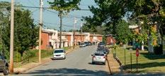
Dearington Apartments
Neighborhood Meeting on October 24th, 2020
FUNDING OPPORTUNITIES
Funding work included in this plan will require a variety of sources as well as staff time to manage the ongoing work. The implementation chapter of the plan pairs the funding sources below with recommended projects. Below are summaries of the funding sources that will be needed to see this plan become a reality.
CIP
Every year the City of Lynchburg must pass an annual operating budget and a Capital Improvement Program (CIP) budget. Operating funds cover ongoing expenses while CIP budget plans multiple year’s worth of one-time, capital expenses. Many of the recommendations contained in this plan will need to be incorporated into the City’s CIP and compete against City-wide needs in order to be funded. Funding is more likely to occur if there is widespread community support, mutual benefits from partner projects and other funding sources sharing costs associated with a project.
CDBG
As an entitlement community, Lynchburg receives funds annually through a Community Development Block Grant (CDBG) that can be used for infrastructure and housing projects and programs. Distribution of those funds, which typically total around $700,000, is considered by the Community Development Advisory Committee (CDAC) and then voted on by Lynchburg City Council. Those funds can be used to implement park and transportation improvements in qualifying areas of the City. Projects implemented using this funding source will need to be sized to the appropriate grant amount and be coordinated with other eligible city projects in different areas of the City as there are often many eligible and valuable projects the City could consider.
Transportation Funding Sources
Planning and construction funding for transportation improvements is available through Commonwealth of Virginia sources. Projects funded through these sources need to compete with other regional projects and meet certain criteria to be eligible. While the funding process has evolved over time, the Safe Routes to School program that helped build sidewalk on Caroline and Stoneridge Streets in Dearington was funded through these state dollars.
16 Introduction & Project Background
Sidewalk on Stoneridge Street built using Safe Routes to School funding
Other Grants
There are many grant opportunities available to help implement work contained in this plan document. Careful consideration needs to be given to them regarding the application processes, grant restrictions, matching funds required, staff time to manage, and the desired outcomes. Below are a few that may be good fits for implementing further work in Dearington.
CHOICE. CHOICE Neighborhoods program through the Department of Housing and Urban Development leverages significant public and private dollars to support locally driven strategies that address struggling neighborhoods with distressed public or HUD-assisted housing through a comprehensive approach to neighborhood transformation. Implementation grant funds could be as much as $30 million dollars for the Dearington neighborhood, of which the locality is required to match 5%. Both planning and implementation grants are available through this program. A planning grant could be used continue neighborhood plan efforts and adequately prepare for an implementation grant. Both grants require significant staff support and a partnership with LRHA.
BROWNFIELDS. Both the Commonwealth of Virginia and the Environmental Protection Agency (EPA) on the federal level offer brownfields redevelopment programs. These programs can be used to assess, plan, safely clean, and sustainably reuse properties in order to put land back into productive use. With assistance from the Office of Economic Development & Tourism, this funding has already been used to perform some site assessments in Dearington. It should continue to be utilized to the extent possible on brownfield sites in the neighborhood.
NEA. The National Endowment for the Arts (NEA) offers a Grants for Arts Project program that provides matching funds between $10,000 and $100,000. This program can help implement some of the public art recommendations that imbue Jefferson Park and the neighborhood with both history and local character.
NPS. African American Civil Rights Grant Program through the National Park Service (NPS) offers both history and preservation funding opportunities. Due to the lack of physical evidence of the Jefferson Park swimming pool, a smaller, history grant is likely more feasible to help provide interpretation of the site. History grants range from $15,000 to $50,000, and no match is required, though it is encouraged.
17Introduction & Project Background
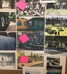
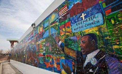
125-foot mural in Atlanta, GA by artist Louis Deisarte Photo: Elgin Cleckley
VISION & GOALS

VISION STATEMENT
The vision statement to the right was written by City staff following the October 24th, 2020 outdoor neighborhood meeting after listening carefully to the neighborhood’s concerns and hopes for the future of park spaces in Dearington. The statement was then affirmed by the steering committee in January 2021. What is described within it is what the City and neighborhood are working together to achieve in this plan. It is the vision for what recreational amenities could be in Dearington.
The Dearington Neighborhood will be home to safe, interconnected, well-designed park spaces that convey neighborhood history, invite neighbors and Lynchburg citizens to gather, and provide high-quality recreation spaces to neighborhood children of all ages. Remnants of past City transgressions will be turned on their head as renewed investment will transform previously neglected spaces into valuable assets. Jefferson Park specifically, the heart of the Dearington neighborhood, will provide opportunities to reflect (remember & learn), to restore (heal & build), and for recreation (play) of all types. This work will culminate in making the Dearington Neighborhood a stronger, healthier, and more meaningful place to live.
18 Vision & Goals
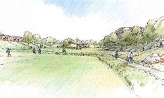
Participants signing in to outdoor meeting on October 24, 2020
GOALS
These seven goals (2 neighborhood goals + 5 Jefferson Park goals) are the specific ways we should reach the vision the neighborhood has for its recreational facilities. Achieving these will be a major step towards making Dearington and Jefferson Park the best they can be.
Neighborhood
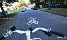
1 � Improve active transportation options (walking, biking, etc) by building trail connections on and off-street to nearby destinations, nearby trails, and well-traveled corridors.
2 � Transform vacant land in the neighborhood with limited development capabilities into recreational assets.
Jefferson Park
3� Remember the history of the place.
4� Make the park a unifying feature for the whole neighborhood, a gathering space for neighbors to come together.
5 � Build upon already popular park uses both in Jefferson Park and elsewhere to create a premier Lynchburg Park.
6� Take advantage of natural topography and views.
7� Increase park use by making it attractive and accessible to everyone. This will require improving routes to the park, into the park, and within the park.
19Vision & Goals
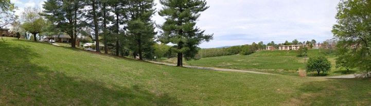
Jefferson Park panorama showing single-family homes on the left and the Dearington Apartments across the park on the right
NEIGHBORHOOD CONTEXT
The following chapter aims to provide context to the recommendations contained in this plan by providing a history of the Dearington neighborhood, outlining the experiences and concerns of neighborhood residents, and by carefully considering data, observations and trends that may invoke change or a stagnancy on the neighborhood. The chapter ends with an evaluation of Jefferson Park, one of the neighborhood's greatest assets and a major focus of this plan.
HISTORY
VOICES
& OBSERVATIONS
& TRENDS
PARK
20 Neighborhood Context • NEIGHBORHOOD
• NEIGHBORHOOD
• DATA
• MEASURES
• JEFFERSON
EVALUATION
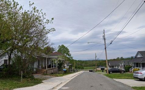
Smyth Street in front of Dearington Elemetnary School for Innovation
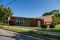
New Dearington Baptist Church
NEIGHBORHOOD & PARK HISTORY
NEIGHBORHOOD DEVELOPMENT
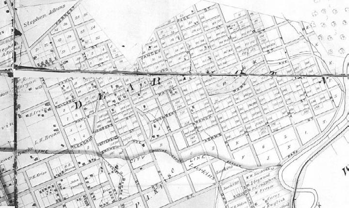
The area which today is known as the Dearington neighborhood was once a part of Campbell County. The first portion (bound by Fifth Street/ Memorial Avenue, Langhorne Road, Third Street, and Meeting House Branch) was annexed by the City of Lynchburg in 1908. In 1926, a second annexation occurred, and Lynchburg took possession of a stretch of land that reached to the Bedford County line. This included the remainder of what is considered Dearington today.
The new neighborhood did not experience the success of other suburbs like Rivermont or West Lynchburg, and it was only sparsely populated by 1891 (see Baist map). In the early 20th century the neighborhood became racially segregated, with white residents predominating in the area closer to Memorial Avenue and south of the valley running in line with Pleasant Street, and black residents settling in the area north of Pleasant Street.
The City of Lynchburg opened its official “crematory” or incinerator for garbage in Dearington as early as 1913. The exact location is unknown: however, it was likely on Memorial Avenue near the present-day City gas pumps (at the corner of Chambers Street). The 1930 City Directory gave the “City Incinerator” address as 1801 Memorial Avenue. The location of the crematory may have inspired the later location of a refuse landfill in Dearington.
Once the majority of Dearington was annexed in 1926, the City built a new school for its newest residents. It may have replaced an earlier Campbell County Rosenwald School. Jim Crow laws and customs were in full effect, and the City’s public school system was strictly segregated by race. The two-room schoolhouse that opened in Dearington in 1927 was designated “colored” and designed to serve the predominately African American neighborhood. City directories gave the school’s address as 1740 Caroline Street (where the present-day Dearington Elementary School is located). The original building still stands, and an addition was made in the mid20th century. In 1994, the community pushed for the school to join the “School for Innovation” Program, and in 1995, the Dearington Elementary School for Innovation began operation.
21Neighborhood Context
The original wing of Dearington Elementary
City lot along Chambers Street where crematory likely once was
Location of City Incinerator
Source: Lynchburg Museum System, Insurance Map
Baist Map, 1891 showing the beginnings of development in the Dearington Neighborhood. Source: LynchburgHistory.com
22 Neighborhood Context
REDLINING
Almost immediately after the neighborhood’s inclusion within the city, the Great Depression hit. By the 1930’s, the federal government was putting programs in place to assist the middle class. The Home Owners Loan Corporation and the Federal Housing Authority stepped in to assist with refinancing mortgages at lower rates for struggling homeowners. However, this practice came with problematic guidelines, set by the federal government, that systemically excluded Black families. Geographically-based lending restrictions, practices now commonly known as “redlining,” were implemented, and banks refused to give loans for houses in predominantly Black neighborhoods. Under redlining, Black men and women were also excluded from purchasing property in White neighborhoods which led to increased segregation within the city.
On a 1937 map created by Home Owners Loan Corporation (on next page), is is clearly visible what areas of Lynchburg were redlined. The appraisers looked at things like the market value of homes, average income, and the availability of mortgages to then rank neighborhoods A, B, C, or D. They also established data on the presence of “Negroes.”

Dearington was given a “C” rating, and it was determined the area was “declining” and should only be given limited funding. It was given this low rating because of its proximity to redlined streets, which indicated the presence of a Black community.
The consequences of the area being given less funding during the Great Depression are still felt today. Dearington’s economic outlook has continued to decline and it is in one of Lynchburg’s lowest income tracts, with poverty reaching nearly 50%. It continues to be a neighborhood made up of mostly families that identify as nonwhite; over 85% identify specifically as AfricanAmerican according to the 2010 census.
23Neighborhood Context
Lynchburg Home Association Map showing original street plan and lot subdivisions for the Dearington Neighborhood
Source: Lynchburg Museum System
Dearington is located near the Fifth Street Business District where numerous Blackowned businesses operated during the days of segregation. Patrons could find billiard saloons, theaters, livery stables, physicians, veterinarians, undertakers, attorneys, plumbers, electricians, barbers, merchants, and lodging facilities on Fifth Street, all operated by Black entrepreneurs. After integration in the 1960’s, many of the businesses either relocated or closed their doors. The area today remains a historic Black neighborhood and is seeing a resurgence in businesses.
One of the most prominent residents of Dearington owned and operated her business on Fifth Street. Dr. Clarissa Wimbush was the first Black female dentist in the Commonwealth of Virginia. She was originally from Bedford County but grew up in Dearington. She attended Virginia Seminary and College (now the Virginia University of Lynchburg) before going on to Howard University in Washington, D.C. In 1926, she opened her dentistry office on Fifth Street and remained there for another 15 years.
An unmarked but notable location within Dearington is the 700 block of Smyth Street. This is the location of Union Cemetery, which was established in the 1920’s for African-Americans after the City Cemetery was closed to general burials. It was commonly known to neighbors as “Johnny Franklin’s Graveyard,” since he was an early promoter of the cemetery and was himself buried there in 1935. Today the site is overgrown and imperceptible to passersby.
The map to the right shows the 1937 home ownership loan map with present day census tracts overlayed in red outlines. Dearington is shown in yellow and labeled as "C6." Areas rated in C and D categories were traditionally considered too risky for lending from traditional sources. Areas marked red are the origin of the term "redlining" and were essentially doomed to continued decline.
BEDFORDAVE
24 Neighborhood Context
LINK RD
WADSWORTH ST LANGHORNELN CARROLL AVE RICHMOND ST COURT ST AC B E LL S T HUDSON ST STA DIUMRD OLD FOREST RD CAMPBELL AVE ALBERTLANKFORD DR MURRELL RD THOMAS RD NODLE S T PAWNEE DR JAMES ST GREENWOOD DR GNOL SWODAEM D R LINKHORNE DR CRANEHILLDR REU S E N S R D POPLAR ST PERRYM O N T A V E IGLOEDR A L LEGHA NY A VE EUCLIDAVE D ST OAKRIDGEBLVD 14TH ST 15TH ST 9TH ST MOORMANS RD MCCAUSLAND ST ROBINS RD OAKLEY AVE SHEFFIELDDR BUCHANAN ST MADISON ST EDGEWOODAVE CLAY STSUSSEXST WYTHE RD RIVERSIDE DR M C C O N V I L L E R D TSEROF OORB K R D WYNDALE DR FENWICK DR EVARG S M I L L RD C O M M E R C E S T GRACEST PARKAVE SANDUSKY DR LANGHORNERD SNILLOH IMLL DR TATE SPRINGSRD WAR A UTUMN RD FEDERAL ST EERB ZEWOOD DR HILLST I N D I A N H I L L RD FORT AVE MAIN ST LANGHORNE RD LAKESIDEDR FORTAVE MEMORIALAVE RIVERMONT AVE 12TH ST Y KEMPER ST CANDL 5TH ST LYNCHBURGEXPY 5THST LAKESIDEDR WARDS OLD FOREST RD CHURCH ST 2.02 2.02 4 4 6 6 5 5 2.03 2.03 9 9 11 11 7 7 8.01 8.01 10 10 3 3 8.02 8.02
PUBLIC HOUSING. Dearington is home to the Lynchburg Redevelopment and Housing Authority’s oldest apartment complex, the Dearington Apartments. The 100-unit complex was known as the “Dearington Hill Public Housing Project for Negroes” when it opened in 1960.
It was typical of Jim Crow-era “urban renewal” projects, which attempted to improve housing conditions for minorities, but had devastating consequences for those communities over the course of decades. Not only did the housing project perpetuate racial segregation and inequality for generations, it also broke up traditional neighborhood support systems and culture.
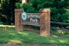
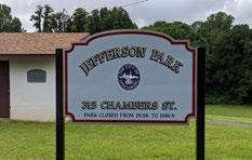
JEFFERSON PARK
Jefferson Park is named after Thomas Randolph Jefferson (1863 or 1864-1940) who donated the land to the City. He had lived in a log cabin on the site, and wished for the Black community to have a park of their own since they were restricted from enjoying other city parks. Jefferson and his wife Minnie adopted two children and later lived at 56 Polk Street in the Tinbridge Hill Neighborhood. Upon his death in 1940, he was buried in White Rock Cemetery.
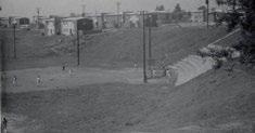
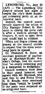
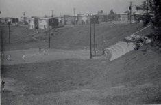
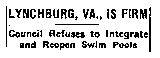
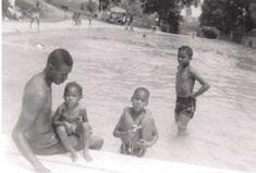
The park was once home to the only pool for African-Americans in Lynchburg. At the time, public spaces were segregated and the Civil Rights movement was making national news. On July 4, 1961, seven African-Americans showed up at the Miller Park pool, which was only for whites. The leader of the group, Olivet C. Thaxton, demanded that he and the six boys accompanying him be admitted. News of the demonstration arrived before they did and the police were already waiting for them. At least one of the activists jumped into the swimming pool and the white swimmers quickly got out of the pool. As a crowd of people gathered, the police struggled to keep the peace.
Rather than integrate, the City decided to close all the public pools. The pools at Miller Park, Riverside Park, and Jefferson Park were all closed that same day in 1961. For several years, the pools were drained and stood empty before eventually being filled in, a decision approved by the city manager. Together, the manager and the police chief were fearful of potential violence if the pools were ever reopened. However, two new pools were later opened at the local segregated high schools, E.C. Glass and Dunbar.
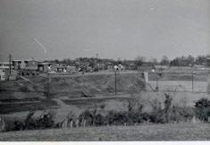
The site of the Jefferson Park pool became known as the “Dearington Sanitary Fill” and was used by the City of Lynchburg as a dump until 1966, adjacent to the newly opened public housing. It was also used by Lynchburg residents to burn their Christmas greens after the holidays. Spectators


and the Lynchburg Fire Department would gather and together would burn trees leftover from Christmas. The landfill was then abandoned until 1976 when the City of Lynchburg’s Parks & Recreation Department opened a community center. Today the park is home to basketball and tennis courts, a multi-purpose field, playground equipment, and walking trails. The space that was once a landfill continues to be largely unused.
25Neighborhood Context
Work on trail connecting to Dearington Apartments
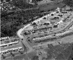
Photo: Lynchburg Museum System
1959 Aerial of Dearington Apartments under construction
Photo: Lynchburg Museum System
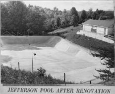
Jefferson Park Pool opened on July 10, 1937 and was enjoyed for almost two and a half decades before being forced to close in 1961.
Photos: Mae Berry
Baseball game in Jefferson Park, 1961
Photo: Lynchburg Museum System
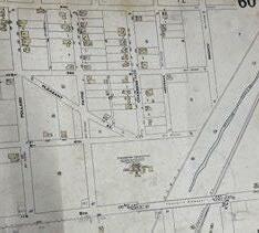
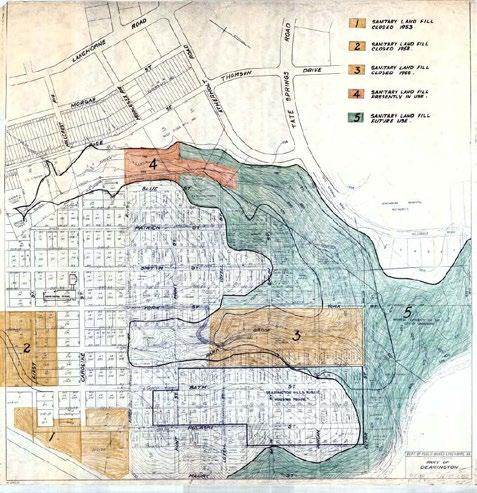
LANDFILLS
There are as many as four known locations of landfills in the Dearington neighborhood. The map on the right may not show the exact boundaries and the area in green is not thought to have ever been used for landfill operations.
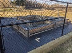
Materials Storage Site / Pulaski Street
Dearington Elementary School Playground


Jefferson Park
Blue Street
26 Neighborhood Context
1)
2)
3)
4)
Published: July 27, 1961 Copyright © The New York Times Limited photos are available of the Jefferson Park Pool. This one from the News & Advance shows it repaired following damage from storms. Personal accounts recall diving platforms at the far end. Photo: News & Advance
Archives
Jefferson Park Swimmers
Photo: Lynchburg Museum System
Jefferson Park, 1961
Photos:
Lynchburg Museum System
Storm Damage to Jefferson Park Pool, 1958 Photo: Lynchburg Parks & Recreation
1949 photo of landfill at the end of Pulaski Street. The site is now known as the Materials Storage Site.
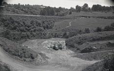
Photo: Lynchburg Museum System
THE NAME ‘DEARINGTON’
Lynchburg Museum staff has not been able to confirm the origin of the name “Dearington” with primary sources. According to the Dearington Elementary School website and The Streets of Lynchburg by Martha Craddock, the neighborhood was named for Confederate Brigadier General and Campbell County resident James Dearing (1840-1865). During the Battle of High Bridge, he was struck by a bullet and died at the Ladies Relief Hospital in Lynchburg. He was later buried at Spring Hill Cemetery. General Dearing was a local hero of sorts, and it would be logical that the development was named to honor him in the late 19th century. Future research into the original owners and developers of the neighborhood land might shed light onto the possible connection with General Dearing.
27Neighborhood Context
Historic map of landfills in the Dearington neighborhood. It is not thought that the area in green was ever used as landfill.
NEIGHBORHOOD VOICES
This section calls out specific thoughts, concerns, and experiences of current and past Dearington residents to illustrate the neighborhood’s point of view and direct these plan efforts to continue what has been successful and address neighborhood issues. This plan focuses on parks and recreation facilities, city properties, and trail and street access. Opinions voiced cover a broad array of experiences and concerns and those that may not be addressed in this document but should be discussed in future neighborhood plan efforts.
DEARINGTON NAMING
While there is no primary source pointing to the origin of the name “Dearington,” on multiple occasions neighborhood residents and stakeholders have raised concerns over the naming of a primarily African-American neighborhood for Confederate Brigadier General, James Dearing. Other neighborhood residents expressed that they feel the name is detached enough and the neighborhood has its own history that has been instilled in the name. At the October 24, 2020 outdoor meeting, many residents spoke directly to the meeting facilitator, a UVA School of Architecture Professor, about the name change. Conversations will continue and the City should carefully consider how the discussion proceeds in order to capture the true desires of the neighborhood.
NEIGHBORHOOD PRIDE
Dearington is a close-knit community with citizens often considering their neighbors as part of their family – and sometimes they literally are. Many people have lived there a long time. Three participants at the kick-off meeting had been there for over 50 years! Current and former residents feel connected to the place because of family, the people they know and love and community amenities like the Dearington playground, Jefferson Park, and Neighborhood Center. Former residents of the Dearington Apartments conveyed the joy and fun they had growing up in the neighborhood and look forward to their annual reunions.
There is a pride and a bond among Dearington residents with the neighborhood’s history and their shared community and experiences.
NEIGHBORHOOD CHANGE
Residents recognized changes that have occurred in their neighborhood over time.
Some expressed an overall change in the atmosphere at the Dearington Apartments. Residents no longer plan to live in those units long term and are looking to “get out” of Dearington.
Others noted that the park and commercial areas used to serve the City and neighborhood better. “Dearington used to have everything and be a destination – that’s what needs to be revitalized.”
Another resident pointed out how many houses had been demolished and the vacant and condemned housing in the neighborhood contributes to safety concerns and negative aesthetics in the neighborhood.
Feedback poster from plan open house and Jefferson Park Neighborhood Center Ribbon Cutting
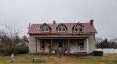
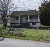
One of the oldest homes in the Dearington neighborhood, along Caroline Street
28 Neighborhood Context
DIRECT CONCERNS
Specific concerns expressed by neighborhood residents included:
TRAFFIC, SIDEWALKS, AND ACCESS: speeding, rolling stops or not stopping at signs, difficulty crossing Langhorne, missing sidewalks in many areas, overgrown sidewalks, narrow streets with speeding traffic, access issues within and around neighborhood.
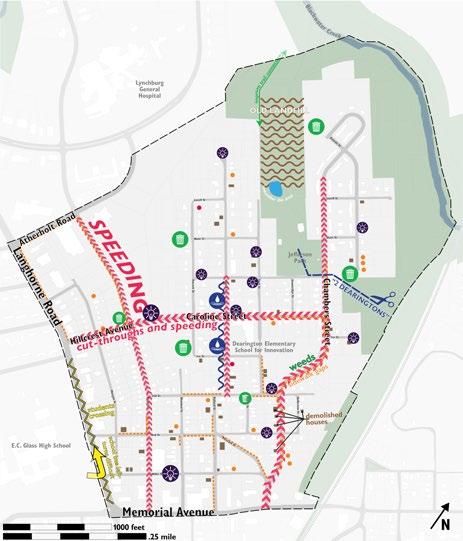
DRAINAGE: Smyth Street residents specifically complained about drainage on their street.
TRASH: Specific areas seem to be dumping grounds and collect large volumes of trash.
LIGHTING: Concerns that the neighborhood is very dark. (City staff later surveyed the neighborhood at night and found that many street lights were out: these have since been replaced)
NEIGHBORHOOD STIGMAS: concerns over the neighborhood feeling divided between the Dearington Apartments and the single-household portion of the neighborhood. They discussed that it really feels like there are “2 Dearingtons.”
OPPORTUNITY: Concerns over the upward mobility of residents and ability to rise out of poverty. A lack of access to job development training and healthy foods.
CRIME: It was expressed that outsiders come in from other neighborhoods to commit crimes in Dearington but that it is mainly not Dearington residents. Many concerns revolved around Sunshine Market and people loitering outside. There is a fear among residents of retaliation if they assist the Lynchburg Police Department and that relationships with the department need improvement.
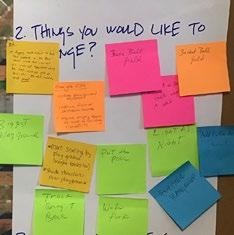
Neighborhood Concerns
29Neighborhood Context
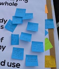
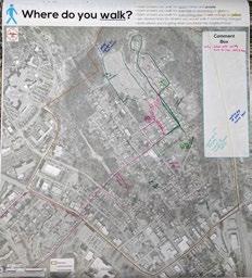
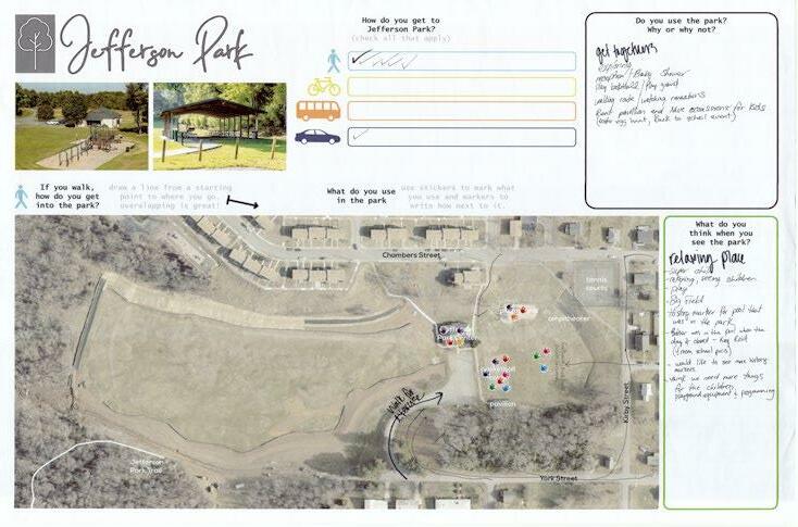
Feedback poster from the plan kick-off meeting on December 12, 2019 and the Jefferson Park Neighborhood Center Ribbon Cutting on January 30, 2020. This was one of many interactive ways to collect feedback and specifically tried to record how people access and use Jefferson Park.
30 Neighborhood Context
JEFFERSON PARK
Regarding Jefferson Park, many residents and community members have emotional attachments and strong feelings about Jefferson Park – both what it had been and how it exists today. It has been a place of great joy for the African American community but also at times feels forgotten. There are strong desires to see the place restored to its former status as a major landmark for the City, but the consensus was that it needs to first be revived to serve the neighborhood as best it can. People like what is there, the size of the park, and the views it provides, but think it has a larger role to serve in communicating local history and fostering community. Specific requests for Jefferson Park included:
• Physically memorialize the pool, the joy it brought, and its closure. Many want the pool restored or other water features built. Others say memorialize it by telling the story and having the park be a place of black joy and community gathering.

• Improve basketball court and existing facilities. Add lighting to the park.
• Provide shade and seating areas at the playground.
• Install more landscaping and add quiet garden areas.
• Improve access into the park.
• Host events and cook-outs. Expose Lynchburg citizens to the history of Jefferson Park.
• Improve trail signage.
• Provide spaces for all ages to enjoy the park.
• Consider new facilities and amenities - a wellness center, gymnasium, fitness equipment, a track or jogging trails.
• Improve the landfill area. Playing fields are desired.
• Give the neighborhood more clarity on the presence of the landfill and gas being released. What has been found and what are the impacts.
2012 Oral History Project
In 2012 the City of Lynchburg conducted an oral history project to record the memories and stories surrounding the Jefferson Park Pool. Both the fond memories and the feelings after its closure were documented in a ten-minute video that has been made publicly available. One participant is recorded saying “The pool was Dearington’s Smile, everyone from all over Lynchburg came to the pool.”
31Neighborhood Context
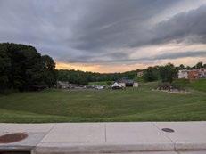
Jefferson Park following Police Listening Sessions, Summer 2020
Board from October 24, 2020 outdoor meeting
DATA & OBSERVATIONS
The “Neighborhood Snapshot” document, available as an appendix to this plan, was prepared following a review of available census and city data to provide an overview of the Dearington neighborhood. This section highlights specific data and observations that play a role in the recommendations contained in this document.
RECREATIONAL AMENITIES
Within Neighborhood
Dearington Elementary School for Innovation (DESI), Jefferson Park, and the Dearington Apartment’s playground provide recreational destinations within the neighborhood.
Outside Neighborhood
Nearby recreational amenities include Miller Park, E.C. Glass High School, and Old City Cemetery. However, these can be hard to reach without vehicular access.
Trails
Trail access include the Jefferson Park earthen trail that ties Jefferson Park to the City’s larger trail network and the Kemper Street paved trail with access a half mile away despite running alongside the Dearington neighborhood.
TRANSPORTATION
Sidewalks
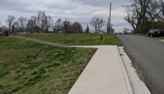
Dearington’s sidewalk infrastructure has severe gaps that limit pedestrian accessibility. There is no route that continuously connects the center part of the neighborhood to either Langhorne Road or Memorial Avenue. GIS data revealed that there are 4.8 miles of sidewalk around the neighborhood, but that there are 5.6 miles of gaps, where there is no sidewalk on either side of the street. In some places topography and narrow right-of-way widths make construction challenging. While Dearington is not alone in experiencing sidewalks that stop and start, the effect is also the same – streets and neighborhoods look unfinished and overlooked.
Bus Stops
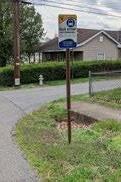
GLTC Route 1 runs in both directions through the middle of the Dearington Neighborhood. It provides a direct connection to Lynchburg General Hospital. Infrastructure at bus stops around the neighborhood varies, much like it does around the City, from having benches and shelters to being as simple as a sign placed in the grass next to the street.
Streets
Street widths and adjacent topography varies. Stormwater drainage often runs in open channels alongside street pavement. On street parking is also common and informally spans street pavement and adjacent yards. These features, common in older neighborhoods, make the installation of better infrastructure for sidewalks and bus stops more difficult and will likely require participation from adjacent property owners to make improvements happen.
32 Neighborhood Context
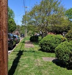
Smyth Street sidewalk gaps. Sidewalks stop and start throughout the neighborhood.
Neighborhood bus stops with accessibility issues
Existing Sidewalks
Access to Nearby Destinations
Destinations close to Dearington include E.C. Glass High School, Lynchburg General Hospital, Miller Park, the Plaza shopping area, and Fifth Street. Memorial Avenue and Langhorne Road sit at the edges of the Dearington Neighborhood and make using active transportation to reach these nearby destinations difficult. Continuous traffic, inhospitable crossings or a lack of crossing opportunities detracts from the walkability of the area despite a relatively connected streetgrid. Langhorne Road and Memorial Avenue are designated as priority corridors for improvements within our VDOT Construction District; however, further study is needed to better understand the issues and opportunities to perform work here. Page Street provides a connection to Lynchburg General Hospital and other commercial and medical services, but is also precarious as the street is narrow, has little or no pedestrian infrastructure, and is often used as a cut-through by vehicles and ambulances.
33Neighborhood Context
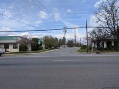
Looking across Langhorne Road from E.C. Glass High School towards 3rd Street
Possibly Stagnant Land
REUSENS
JAMESRIVER
RANDOLPH
RIVERMONT
LYNCHBURG
GARLANDST

LANGHORNE
AEP Project Map
DEARINGTON
34 Neighborhood Context l l l l l l l l l l l l l l l l l l l l l l l l l l l l l l l l l l l l l l l l l l l l l l l l l l l l l l l l l l l l l l l l l l l l l l l l l l l l l l l l l l l l l l l l l l l l l l l l l l l l l l l l l l l l l l l l l l l l l l l l l l l l l l l l l l l l l l l l l l l l l l l l l l l l l l l l l l l l l l l l l l l l l l l l l l l l l l l l l l l l l l l l l l l l l l l l l
RD TRENTS FERRY RD MEMORIALAVE RIVERMONTAVE RIVERRDBOONSBORO RD JAMESRIVER RIVERSIDE PARK HYDRO ST CAROLINEST
COLLEGE
RANDOLPH COLLEGE PARK Proposed structures vary depending on location. Current structure types include steel single-circuit and double-circuit single poles. Average structure height along the TYPICAL STRUCTURES *Exact structure, height and right-of-way requirements may vary
SUBSTATION
SUBSTATION PEAKLAND SWITCH
SUBSTATION
Chambers Street next to the DESI playground is primary route within the Dearington Neighborhood yet lacks adequate infrastructure for active transportation.
MEASURES & TRENDS
This section is intended to highlight what is changing in the neighborhood, what pressures exist, and opportunities for partnerships.
LYNCHBURG GENERAL
As the primary healthcare facility in the region, Lynchburg General has a major presence in the midtown area of the Lynchburg. It is a direct neighbor to Dearington and owns a large amount of nearby land, some within the neighborhood boundaries. As the healthcare industry continues to expand, it is likely that Lynchburg General will do the same. Centra Health should be considered and consulted as a partner in Dearington’s continued evolution as there are mutual benefits to both the organization and the neighborhood. Increasing employment opportunities for neighborhood residents may allow Lynchburg General to have less parking. Improving recreational amenities in Dearington increases the attractiveness for recruiting employees working long shifts. While there may be commercial development pressures in midtown from the healthcare organization, Dearington may experience pressure from employees looking to live closer to where they work. The right balance will need to be struck to welcome new residents while maintaining current residents and neighborhood character.
Page Street connects the neighborhood to the hospital area but lacks infrastructure for active transportation despite cut-through traffic and speeding.

ACTIVE TRANSPORTATION
In recent years, active transportation (that other than riding a private vehicle) is being recognized as increasingly important to a healthy community, particularly in lower-income areas. Active transportation provides public health benefits as well as serves as an affordable means of travel to school, work, or other destinations. This new focus needs to be brought to the Dearington Neighborhood to improve active transportation infrastructure and increase access to area destinations.
OVERHEAD UTILITY WORK
Appalachian Power (AEP) is working on a multiyear project to upgrade six miles of transmission line in Lynchburg, from Dearington to Rivermont. The upgrades reduce the likelihood of power outages and will help accommodate new growth. The project runs from the Dearington substation at Morgan and Third Street, along Page Street and then the length of Caroline Street through the center of the neighborhood. Construction dates have not yet been announced but as this portion runs through the center of the neighborhood, placement of new utility poles needs to ensure sidewalks are not impeded.
WATER INFRASTRUCTURE
Lynchburg’s waterline infrastructure is aging and many of the city’s older areas have water lines 50, 100, or even 150 years old. Some of this dated infrastructure is also undersized for current standards. Lynchburg also continues to combat having a combined sewer system (stormwater + sanitary flow in single pipe systems that sometimes overflow in select locations). In recent years, the City has been successful in partnering waterline projects with above-ground infrastructure improvements. As that work continues into Dearington, joint projects should be considered.
POSSIBLY STAGNANT LAND
A lack of development pressure and ability of properties to experience redevelopment is a trend seen in Dearington, as well as other older areas of Lynchburg. Staff observed that a large amount of land in the Dearington neighborhood is undeveloped and researched ownership of the properties. While not perfect indicators, when combined, a large portion of land in Dearington is either vacant; contains vacant or condemned structures; is vacant and was last sold prior to 1990; contains the name “estate” in ownership records; or is more than three years delinquent on real estate taxes. These categories indicate that there may be unknown property owners due to unsettled estates causing these properties to be stagnant. Present day potential owners and developers have difficulty overcoming these issues and getting clear title to the property in order to put it into use. This is a City and even state-wide issue in older developed areas and options to get these properties into use should be explored. Additionally, properties that underwent past rezoning processes may have proffers attached that limit the property's reuse. The presence of landfills in Dearington also contributes to the supply of stagnant land.
35Neighborhood Context
Existing powerpole placed in sidewalk on Hillcrest Avenue impedes ADA access and detracts from overall walkability.
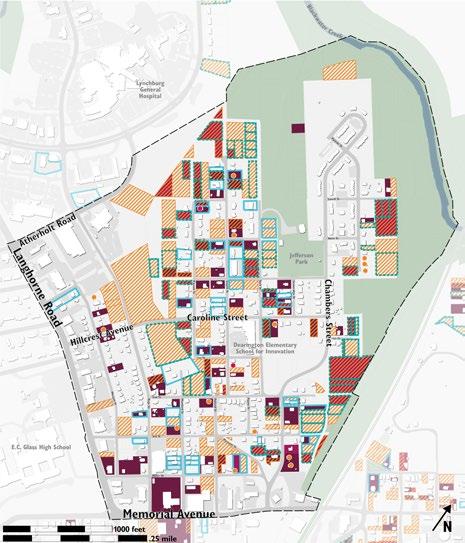
JEFFERSON PARK EVALUATION
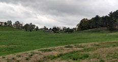
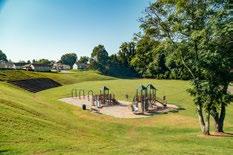
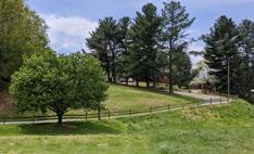
Jefferson Park is a major landmark in the Dearington Neighborhood and a key component of this plan document. It contains approximately thirteen acres of park land at the heart of the Dearington Neighborhood. Its basketball court and pavilion are well used; however, staff heard when talking with the neighborhood that Jefferson Park and its history often felt “forgotten” compared to other City Parks.
SITE DESCRIPTION
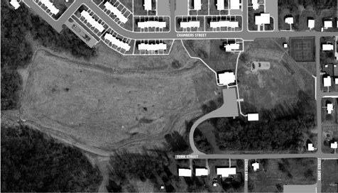
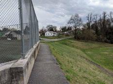
Jefferson Park is primarily bound by Chambers Street, Kirby Street, and York Street, and steep topography to the northwest where an earthen trail ties to the City’s larger trail network. Privately owned land and one single-household dwelling line the park side of the York Street Boundary while Lynchburg Redevelopment and Housing Authority’s (LRHA) Dearington Apartments border the park along Chambers Street. The park is defined by its topography, as the surrounding streets quickly slope down into a “bowl” shape and allow for great views into the park and beyond. The tennis courts and connector trail to the Dearington Apartments provide spectacular views in particular.
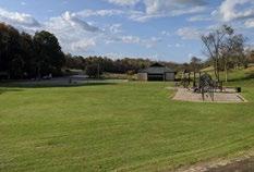
The Jefferson Park Neighborhood Center and the parking lot sit at the center of the park and act as a divider between the portion of the park that was formerly used as a landfill and the more programmed side of the park, where the majority of active recreation takes place.
PARK INVENTORY & ASSESSMENT
The map on the following page identifies key features in Jefferson Park. This section contains an inventory of those features and assesses their current conditions.
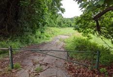
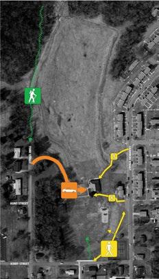
1 JEFFERSON PARK TRAILHEAD.
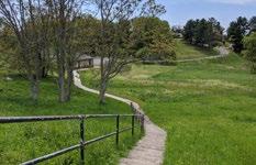
This trailhead ties Dearington and Jefferson Park to the City’s larger trail network via a steep, approximately ¼ mile trail. However, it is not well marked, hidden, and tucked away. Lack of use leads the trail to sometimes be overgrown.
3 FORMER SWIMMING POOL. This site was identified by overlaying aerial photographs from the 1940s and 1950s (where the swimming pool is clearly visible) with present day aerials. Nothing distinguishing remains on this site as it was part of the landfill operations in the 1960s.
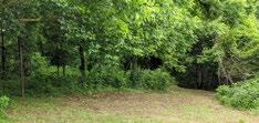
2 LANDFILL. The dashed blue outline on the map shows the approximate area of the park that is thought to have been used for landfill operations following the closure of the City’s swimming pools. It is distinguished from the rest of the park by undulating terrain due to uneven settling and stormwater drainage that has flowed through the site throughout the years. The landfill now has channels along the perimeter to divert run-on stormwater around the site. Both active and abandoned sewer lines remain underground throughout this area.
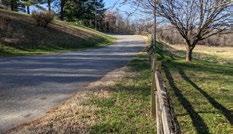
4 ACCESS ROAD/TRAIL. A gravel access road ties the Jefferson Park Trailhead to the dead end of York Street. It is also used by maintenance vehicles to access stormwater and sewer infrastructure.
36 Neighborhood Context
Swimmers at Jefferson Park Pool Photo: Mae Berry
Access at end of York Street
View of former landfill, looking back towards neighborhood center
Jefferson Park Trailhead
5 COMMUNITY GARDEN. One of the City’s newest community garden facilities, it was installed in early 2020.
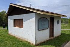
6 JEFFERSON PARK
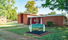
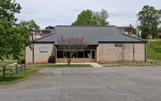
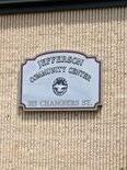
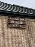
NEIGHBORHOOD CENTER. This beloved community facility was constructed using local and federal dollars in 1976 and over the years has hosted many reunions and after school programs, along with numerous other community services and events. After being managed by the local Boys & Girls Club for a few years, in 2020, the City reopened the facility under their management following interior renovations to upgrade and upfit the facility to current needs. The exterior of the facility remains largely the same and unlike many other neighborhood centers, benefits from being directly adjacent to a relatively large City park. A parking lot, the only dedicated parking in Jefferson Park, abuts the front of facility and physically divides the park into two sections – the more passive, landfill portion to the north and the active, more programmed side of the park to the south.
Jefferson Park Inventory
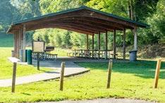
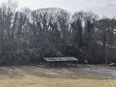
7 PAVILION. This shady picnic shelter is one of the most rented in City. However, staff and neighborhood residents reported concerns regarding visibility and illicit activity when it is not being rented. Sitting against the densely vegetated hillside, the site remains shaded much of the time and is somewhat difficult to monitor.
37Neighborhood Context 8 1 2 3 4 5 6 7 9 10 11 12 13 14 15
Jefferson Park Neighborhood Center Building
New community garden in Jefferson Park
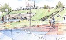
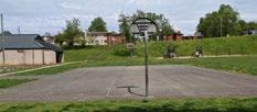
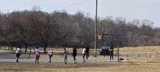
8 BASKETBALL COURT. The court is one of the most used facilities in the park despite an aging playing surface in need of upgrades.
10 PLAYGROUND. The current playground, with two play structures and a swingset was installed in the early-mid 2000s and is likely nearing the end of its lifespan. The area lacks benches for caregivers and could use more shade. The neighborhood has expressed that the equipment is sometimes too hot for use in the summertime.
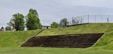
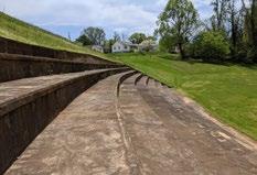
12 AMPHITHEATER. The amphitheater seems to be the oldest structure remaining in the park today as it is visible in aerial photographs from 1941 and appears in City plans in the mid to late 1930s. It is currently accessed from either the multi-purpose field at the bottom or from one set of stairs from the connector trail. The stairs end at the top riser leaving users to navigate the large amphitheater terraces. Despite accessibility problems, the amphitheater is in relatively good condition and provides a nice viewing experience into the park. The hillside surrounding the amphitheater, planted with grass, tends to become overgrown in the summertime making the ampitheather feel like a forgotten component of the park.
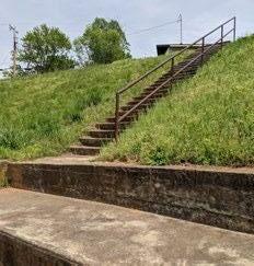
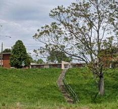
9 STAIRS. Two sets of stairs provide pedestrian access from the Dearington Apartments and Chambers Street down to the neighborhood center.
11 MULTI-PURPOSE FIELD. The field in front of the amphitheater appears to have originally been leveled for use as a baseball diamond. Today, it has no specific use, is in a good, level condition, and is used for a variety of activities.
38 Neighborhood Context
13 FORMER CONCESSIONS BUILDING.
This small cinderblock building is unused and does not contribute to park activities or aesthetics.
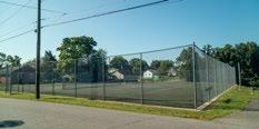
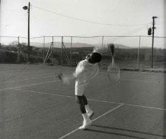
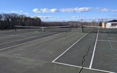
14 TENNIS COURTS. These courts are one of the older features of the park and their establishment in the 1930s in Jefferson Park appears to have been aided by Dr. Robert Walter Johnson, a local African American doctor who helped train Althea Gibson and Arthur Ashe at his home on Pierce Street in Lynchburg. Whirlwind Johnson appears to have filed the petition to City Council to construct these courts. While the courts have been resurfaced numerous times over the years, today they have large cracks and are in disrepair. The location of the courts at the corner of Kirby and Chambers Street, generally negatively impacts the neighborhood as they serve as a divider between the Dearington Apartments and the single-household neighborhood. The tall chain link fence, creates a physical and visual barrier between the two. Additionally, these courts host some of the best views of Jefferson Park and the mountains beyond.
15 CONNECTOR TRAIL. This narrow trail is the only dedicated pedestrian route from the Dearington Apartments to Kirby Street and the rest of the neighborhood. It narrows to less than five feet where it is bound by the tennis courts and the steep hillside down towards the amphitheater.
Neighborhood Context
39
Juan Farrow playing tennis in Jefferson Park, 1968
Photo: Lynchburg Museum System
Jefferson Park Tennis Courts today
View of Jefferson Park Tennis Courts from Chambers Street
MATERIALS & FURNISHINGS
ROADWAYS AND TRAILS. The apartments’ connector trail, the vehicle access road, and the parking lot are all paved with asphalt. Sidewalks to the neighborhood center are concrete. The access road to the Jefferson Park trailhead uses large gravel stones that are somewhat difficult to walk on.

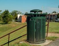
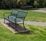
SITE FURNISHINGS. Visitor amenities and furnishings in the park include benches and a water fountain at the tennis courts, trash receptacles, the pavilion and its picnic tables. While more recent additions are dark green, overall the furnishings do not have a consistent style or color and are constructed from a variety of materials.
SIGNAGE. A variety of identifying signs with an array of styles are seen around Jefferson Park and the neighborhood center.
40 Neighborhood Context
TOPOGRAPHY & DRAINAGE
As previously mentioned, the topography of Jefferson Park is a defining feature. The elevation changes about thirty feet from street level down to the multi-purpose field. The three-sided bowl shape of the park allows for great views from tennis courts, connector trail, and the surrounding streets into the park and beyond. However, due to the topography, the area is also a route for both a combination of storm and sanitary infrastructure and stormwater runoff from the streets and surrounding neighborhood. That leads to soggy areas and the drainage concerns on the landfill portion of the site that had to be addressed in the mid 2010s. While not ideal, the excess stormwater flowing through the site may also be an opportunity for the City to address its pollutant removal requirements with landscaping and green infrastructure.
CIRCULATION & ACCESS
The topography makes accessing Jefferson Park difficult. Currently there is no American with Disabilities Act (ADA) accessible route into Jefferson Park. Many residents reported walking down the hillside from Kirby Street to reach the park and the neighborhood center. Other options include two staircases from the Dearington Apartments or walking down the access road where vehicles enter from York Street to reach the parking in the center of the park.
VEGETATION & PLANTINGS
Jefferson Park has areas that are densely vegetated and overgrown as well as areas that are sparsely planted where residents have requested more trees for shade. The York Street edge contains dense trees-some quite mature- and an invasive bamboo forest that keeps the pavilion shaded and secluded. A few mature trees are scattered on the hillside from Kirby and on the hillside behind the neighborhood center. However, the areas around the basketball court, playground, amphitheater, and tennis courts all lack landscaping and shade. Recently a pollinator garden was planted at the front of the neighborhood center as part of an ongoing effort around the City.
41Neighborhood Context
Access Road from York Street
Current Park Circulation requires either driving, navigating steep slopes or stairs.
View of hillside behind pavilion along York Street
STRATEGIES & ACTION STEPS
The following chapter contains the strategies and actions that should be followed by the City to help achieve the vision and goals outlined for Dearington’s recreation facilities. Support from the neighborhood and Lynchburg’s citizens will be essential to help make all contained here a reality. The strategies range from specific proposals for new amenities and facilities to more general goals and ideas that will need more thought and study. Overall they work together to create a neighborhood with valuable public amenities and a street network that supports recreation and access.
42 Strategies & Actions
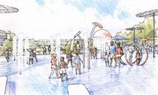
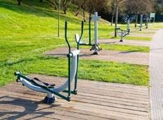
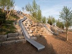
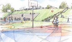
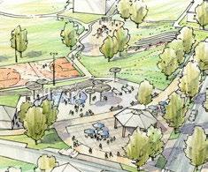
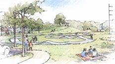
• JEFFERSON PARK • NEIGHBORHOOD CENTER • STREETS & ACCESS • MATERIALS STORAGE SITE basketball court and amphitheater, page 49 gymnasium, page 50 neighborhood patio, pages 51-55 outdoor fitness equipment, page 57playground improvements, page 56 splashpad, pages 53-54


43Strategies & Actions neighborhood
center, page 66-67
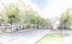
Caroline Street Gateway, pages 72-73
neighborhood
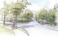
trails & access improvements, pages 68-71
Jefferson Park circulation & access, pages 68-71
Materials
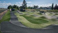
Storage Site and pump track, pages 78-81
Chambers
Street Gateway, pages 74-77
Jefferson
Park pool marking, page 57history & interpretation, page 60
public
art, page 59
environmental design
considerations,
page
61

44 Strategies & Actions - Jefferson Park
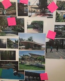
Birdseye rendering of the 20-year vision for Jefferson Park Hill Studio / Peter Giraudeau
JEFFERSON PARK
As the primary park facility in the Dearington Neighborhood today, the revitalization and renewed investment in Jefferson Park is a key component towards achieving the neighborhood’s vision. Jefferson Park was the primary focus of the October 24, 2020 outdoor meeting held on the tennis courts. The neighborhood gave tremendous feedback that was honest and sincere regarding a feeling of Jefferson Park being forgotten over many years, yet what huge potential they see in the park and the role it plays in the neighborhood. A follow-up report from the October 2020 workshop is available as an appendix to this plan.
That feedback culminated in Jefferson Park being the target for the majority of the plan’s goals that will help us achieve this plan’s vision (see Vision & Goals chapter). The neighborhood wants Jefferson Park to be a gem in the City’s park system, first becoming a park that primarily serves the surrounding neighborhood, but as it redevelops is also able to welcome all City residents to enjoy the amenities it has to offer. Revitalization should revolve around creating spaces that meet three major themes that enable new community building in Jefferson Park: reflect (remember & learn), restore (heal & build), and recreation (play of all types).
OVERALL PLAN
The final build-out for Jefferson Park envisions a park that both serves as a neighborhood asset and transforms Jefferson Park into one of Lynchburg’s premiere park facilities. It focuses activity and amenities on the Kirby Street side- areas that are most accessible to the neighborhood- and hopes to create peaceful, passive recreation spaces in the more distant park spaces- where the landfill restricts possible programming and more research is needed before improvements can be made.
REFLECT
(remember & learn),
Elements under the Reflect theme highlight ways to tell and absorb the dynamic history of the site (Dearington Stories) in physical form, strengthening community pride.
Thomas Randolph Jefferson Recognition Pool Location Marking and Capturing Views Historical Markers / Images of the Pool Seating Areas
Chalk Wall
Shade Elements to Simulate Water New Park Welcome / Historical Signage
These three themes were proposed at the October 24, 2020 outdoor meeting in Jefferson Park. Park improvements should work towards creating spaces that encapsulate these three ideas.
RESTORE
(heal & build)
These elements focus on healing (of individuals and groups), and community building. Design ideas in Restore become the “soul” of Jefferson Park, where residents take pride through community celebrations, events, and daily activitiescreating consistent energy in the Park.
Picnic Areas
Annual Celebrations
Passive Trail Use
Educational Garden
Pool Marking Art Community Garden Pavilion Structure / Shade Structures
Amphitheater / Performance Space / Movies in the Park
Strategies & Actions - Jefferson Park
RECREATION
(play of all types)
This theme focuses on enjoyment and amplifying park activities to meet the wishes of the residents. It allows for further meaning and connection in the Park, with new activities increasing overall happiness for all ages.
Splashpad Basketball Courts Gym Facility Fitness Trails Outdoor Game Tables
Playing Fields Hillside Slides/Zip Line
45
loop trail 2 loop trail 1 Kirby Street Trail
PARK CIRCULATION
Accessibility was identified as a major limitation of Jefferson Park. Additionally, there is a neighborhood desire for more exercise trails and a trend in parks and recreation best practices to create more trail loops of all sizes to accommodate varying abilities. The many trail improvements proposed here will help meet those goals.
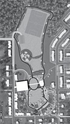
Trail and Access Improvements
KIRBY STREET. The hillside at the intersection of Kirby Street and Stoneridge is probably the most gradual in the entire park, yet still has approximately thirty feet in elevation change. This location would be the best suited for an accessible trail that ramps down from street level into the park. It should join up with a small loop trail that provides access to the neighborhood center.
GRAND STAIRCASE. This staircase directly aligns with the site of the former Jefferson Park Pool. Combining a highly visible marking of the pool site, the overall view into the park at the location with the mountain backdrop, and historical interpretation at street level, will be a dramatic and memorable way to access the park.
LOOP TRAIL 1. This initial loop trail is less than one quarter mile and provides an accessible connection from the Kirby Street trail to the neighborhood center. It is shown to be lined with exercise stations for circuit training.
connector trail
neighborhood center trails trail to materials storage site
grand staircase

The plan adds a number of routes to reach the lower levels of Jefferson Park, shown in yellow. ADA accessibility is still challenging due to topography but Kirby Street trail is a high priority improvement. Additional ADA access is provided through the proposed gymnasium facility from both York Street and parking levels. Once in the park, all paved trails should be constructed to accessibility requirements as well.

Actions
LOOP TRAIL 2. This larger loop trail is approximately one half mile and follows the outer perimeter of what is thought to be the former Jefferson Park landfill. Implementation will require further due diligence and site investigation. It is shown here lined with meadow grasses or wildflowers to separate it from some of the other potential activities. Depending on site evaluation, the exercise stations from Loop Trail 1 could be continued along this trail for a longer course.
46 Strategies &
- Jefferson
Park
proposed park circulation
CONNECTOR TRAIL. In the near term, this existing trail should be given railings and bollard lighting to improve the pedestrian connection from the Dearington Apartments to Kirby Street. In the long term, the plan shows this connector trail being pulled back and routed through a neighborhood plaza. It may even become a significant trail for highlighting prominent African Americans from Lynchburg, similar to a “walk of fame.”
TRAIL TO MATERIALS STORAGE SITE.
This trail connects to another key site discussed in this plan: the Materials Storage Site. This site is also a former landfill, and in fact, may have received far more waste than Jefferson Park. As this site is redeveloped as a recreational amenity, a trail should be routed through existing public right-of-way to create a connection. Additionally, from that site, an earthen trail may connect via steep topography to the Kemper Street Trail. As the trail approaches the plaza site, it is directly aimed at the proposed splashpad “wedge” that directs views out to the former pool site for another dramatic entrance into Jefferson Park.
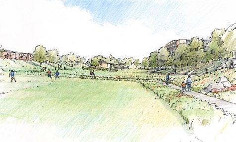

NEIGHBORHOOD CENTER TRAILS. As an area that will likely be a hub of activity, these trails provide a variety of short walking loops that can be used by those with limited abilities and can be an area to focus some of the historical interpretation of Jefferson Park. Trails in this area should retain limited vehicular access to the neighborhood center for loading and unloading as needed.
SIDEWALKS. Stoneridge Street and the trails from the Dearington Apartments are the only routes to Jefferson Park from the surrounding neighborhood. The plan calls for new facilities on Chambers Street, Kirby Street, and York Street to improve walkability to Jefferson Park from the Dearington Neighborhood.

47Strategies & Actions - Jefferson
Park
connector trail solar powered bollard lighting and minimalist railings to preserve views
Loop trail through landfill site looking back towards park improvements. Hill Studio / Peter Giraudeau
Jefferson Park 20 Year Concept Plan


48 Strategies & Actions - Jefferson Park
gymnasium new housing ADA Accessfitness equipment stationsparkingplaying fieldsmeadow grasses andwildflowers permanent pool site markingYork Street extension
pavilion grandstaircasesplashpadamphitheater
hillside
slides basketball courtenvironmental learning area neighborhoodcenter outdoor space
BIG MOVES
Basketball Court


Basketball was identified as the most popular park use today. The plan shows shifting the basketball court over to the location of the amphitheater so that people may watch games and it could become an event space. An additional half court was added to match the facilities at other neighborhood centers and parks. The courts should be lit to prolong evening use, but use full cut-off fixtures to prevent spillover light towards neighboring properties. Being in the amphitheater location, where people will look down on games from the amphitheater and the plaza above, lends itself to possibilities for public art. Installing a mural on the surface of the court will create an iconic space.
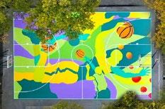
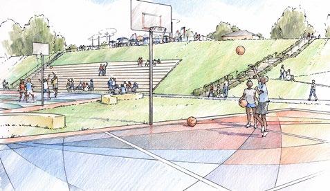
Source: hypebeast.com
Amphitheater
The current amphitheater needs upgrades to improve accessibility for people of all abilities. The stairs need to be extended to the bottom of the hillside, the bottom level could be retrofitted for accessible seating, and an additional ramped access could be provided from the adjacent trail that connects Kirby Street in to the park. A fully accessible amphitheater here would also lend itself towards performances. The groundcover on the hillside surrounding the amphitheater should also be replanted to require less mowing and maintenance as it tends to become overgrown in the summer.
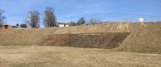
Strategies & Actions - Jefferson Park
49
Hill Studio / Peter Giraudeau
Community members painting mural on basketball court in Springfield, Ohio
Source: Springfield News Sun
Mural painting on basketball court in Brooklyn, NY by artist MADSTEEZ Source: hypebeast.com
Mural painting on basketball court in Brooklyn, NY by artist MADSTEEZ
Gymnasium
The City’s Parks & Recreation Department currently has no dedicated gymnasium space of its own for programming. Instead the department relies on schools and the City Armory building, which comes with a number of limitations. Building upon neighborhood desires for Jefferson Park, this plan shows a multi-use building that could contain approximately 200 parking spaces, classrooms in the spaces fronting the park, a fitness center, and a basketball gymnasium on the top floor. The gymnasium would be multi-functional, with the ability to host basketball games as well as a sport in growing demand across the City: pickleball. The building is set into the hillside along York Street so to blend into the neighborhood at street level and not be an overwhelming presence on neighborhood homes. Its placement across from the neighborhood center helps to frame the views out towards the Jefferson Park pool site. The exterior contains balconies and the potential for rock-climbing programming. As this project moves towards implementation, more information regarding design constraints are available in the appendix.
New gymnasium building with parking, classrooms, fitness center, rock climbing wall and balcony overlooking Jefferson Park. Hill Studio / Peter Giraudeau
Strategies & Actions
Jefferson Park
50
-
Gymnasium building with walkway over to York Street, gym space on top level, programmed space on the front, and parking tucked into the hillside. Hill Studio / Peter Giraudeau
View of the proposed gymnasium building as it blends into the neighborhood on York Street Hill Studio / Peter Giraudeau
“Neighborhood Patio”
The existing tennis courts in Jefferson Park sit on a key corner in the neighborhood – a point of transition between the Dearington Apartments and the rest of the Dearington neighborhood, and the highest point in Jefferson Park – with great views towards the Blue Ridge Mountains. Like most tennis courts, they also have a tall chain link fence surrounding them. This fence creates a visual and physical barrier in the neighborhood at a key location. The courts themselves need maintenance; however, have not been indicated as a strongly desired park use by the neighborhood. Because the potential for this particular location far exceeds the benefits of the tennis courts here, the plan recommends removing the courts and creating a neighborhood plaza that brings both the neighborhood and the Lynchburg community together in an engaging space that restores the joy lost when the pool was closed, remembers the pool and its significance, and provides key community needs. It should be a place to reflect (remember & learn), restore oneself (heal & build), and for recreation (play) all in one engaging space.
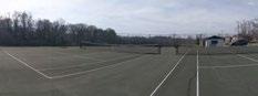
NAMING. The patio could be named for Dr. Walter Johnson as “Whirlwind Johnson Plaza,” as Dr. Johnson was instrumental in establishing the tennis courts here, or honor a broader spectrum of notable African Americans from both Dearington and Lynchburg as “Community Hero Plaza.” Names, accomplishments, quotes, and other remembrances can be incorporated into sidewalk design with plaques and letters embedded into the walkway as a “community walk of fame.”
INTERIM PATIO PLAN. Because the final plan for the neighborhood plaza will require a Capital Improvement Program (CIP) project to realize (grant funds may help) and thus take a significant amount of time to implement, the plan proposes pursuing a low-cost, interim plaza in the meantime to help kickstart park revitalization and repurpose the tennis courts in the near term to better serve the neighborhood. Implementing a plaza with low-cost materials will allow staff to understand how the neighborhood will use the plaza and make changes to the final design as needed.
Interim patio concept shows how the current tennis courts could be transformed into an engaging space using lowcost materials. Eventually the space would be redeveloped with a splashpad and final furnishings. Hill Studio / Peter Giraudeau
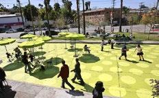
Strategies & Actions - Jefferson Park
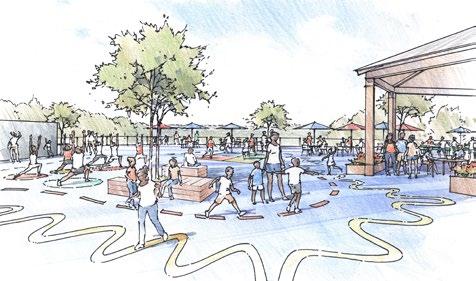
51
Street space converted into an interim plaza using low-cost materials (paint, tables and chairs, basketball hoop) in Los Angeles, CA Source: NACTO
Interim Patio Improvements
• Remove chain link fence, install railings that preserve views into the park.
• Improve connector trail with lighting and railings.
• Resurface the tennis courts to fill in cracks and create an engaging surface. This could be coordinated with the basketball court mural, incorporate a neighborhood history timeline/ path, and provide markings for exercise/play.
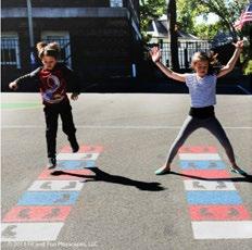
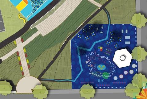
• Provide tables, chairs, shade, and lighting to create a gathering space for neighbors. Moveable chairs have proved vital to many of these interim (and permanent) plazas in other cities as they provide flexibility to users and make the space more dynamic.
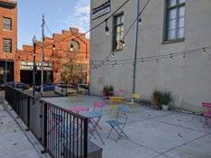
• Activate the space with outdoor games as desired by the neighborhood. They may include outdoor ping pong, chess, foosball, bag toss, etc. A small “library” of the needed equipment could be provided on site.
• Build a new pavilion as part of the permanent plan that improves visibility and access, but also provides lighting, charging stations, and wifi to the plaza.
• Initiate discussions with the neighborhood by providing interactive features like a chalk wall, memory box, etc.
52 Strategies & Actions - Jefferson Park
Pop-up plaza in Downtown Lynchburg
Stencil markings used to active public space and encourage physical fitness Source: fitandfunplayscapes.com adult exercise markings playscape markings neighborhood timeline tables and chairs game tables pavilion 40 8010 KIRBY STREET CHAMBERS STREET
FINAL PATIO PLAN. Due to limitations of the landfill site and the value of the tennis court site being the most accessible area to the surrounding neighborhood and providing views into the park, to the former pool site and beyond, creating this neighborhood plaza may be the most significant component of this plan. The final plaza is proposed to include many of the amenities that the interim plaza has to offer but to use long-term, quality materials that will last and create a significant and permanent public space in Lynchburg.
Splashpad should incorporate a combination of active an passive water elements
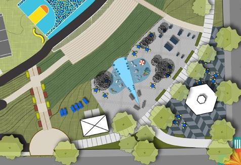
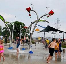
Final Patio Improvements
• Install splashpad with nearby restroom and pump house facility.
• Add additional shade structures as necessary.
• Finish with permanent material treatment, differentiating the pavilion space from the splashpad and game areas..
• Formalize on-street parking with curb extensions
•
Reroute connector trail to the Dearington Apartments through the plaza space and away from the hillside. Incorporate community “walk of fame” elements as desired..
• Provide additional programming as desired by the neighborhood during the interim plaza years.
Strategies & Actions - Jefferson Park
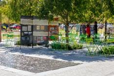
53
pavilion
restroom / pump house
splashpad
seating areas
seating areas
game tables
40 8010
KIRBY STREET
CHAMBERS STREET
SPLASHPAD. The neighborhood has frequently expressed a desire for the Jefferson Park Pool to be restored. Due to limitations of the landfill and the proximity to the Miller Park Pool, a full swimming pool is likely not feasible or realistic in Jefferson Park. Splashpads have however become a popular park use in Lynchburg over the years and may provide an even better alternative as the space can remain an active and engaging space year-round. The plan calls for a splashpad as a key component of the final plaza as a way to both remember Jefferson Park Pool and restore the joy it brought the community.
A portion of the splashpad is shown as “wedge” shaped to frame views out to the site of the Jefferson Park Pool. This area will have a flat surface of steadily flowing water with simple pop jets and benches for people to sit with their feet in the water together. When the more active portion of the splashpad is not engaged, perhaps in the evening hours, this should be a place of reflection.
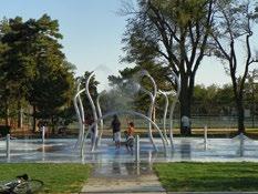
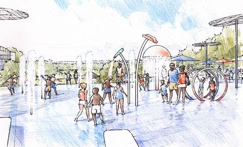
On the outer sides of the “wedge” are more active play elements that work to restore some of the joy lost when the pool closed. The splashpad spray elements should be abstract and organic feeling sculptural elements that help the space remain engaging during cooler weather, October – May. Equipment should not be “climbable” to prevent damage and ongoing maintenance.
RESTROOM/PUMP HOUSE. The plan shows a small outbuilding for restrooms and above ground pump equipment. When this is designed it should provide clear sightlines from the pump equipment to the splashpad. Moving into design, adequate space needs to be preserved both for an underground filter basket and tanks between the splashpad and the pump house. It will also need occasional vehicular access for chemical delivery and maintenance vehicles.
Strategies & Actions - Jefferson Park

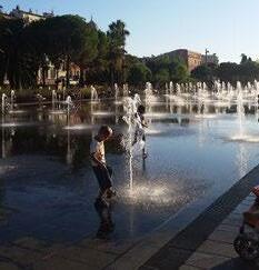
54
Splashpad Design Hill Studio / Peter Giraudeau
Large splashpad with simple “pop jets”
Abstract, sculptural splashpad elements
PARKING. Park space at street level is limited and incorporating a large parking lot for splashpad use would take away valuable space for the plaza. Limiting parking to on-street options will also deter buses and large crowds, helping keep the plaza and the splashpad principally for the neighborhood. If needed, there are larger parking areas available nearby at the Dearington Apartments and the City should pursue an agreement with Lynchburg Redevelopment and Housing Authority (LRHA) for use if needed in the future.
SEATING. Different types of seating should be provided in various areas on the final plaza. Tables and chairs should be focused around the splashpad for families and to provide views down to the basketball court and into the park. Additional tables and chairs, in a shadier “grove” around the pavilion, separate from the splashpad, should provide a quieter area. Hillside lounge chairs or hammocks could be used in the grassy areas to make a relaxing and calm park experience.
SHADE STRUCTURES. The shade structures shown on the plan illustrate a way to create the feeling of being underwater with light refracting on the surface above you. This provides needed shade while also continuing the theme of water on site through all months of the year.
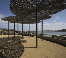
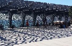
PAVILION. When the gymnasium is built, the current pavilion in Jefferson Park would be removed. The neighborhood patio incorporates a new pavilion in a more prominent, visible and accessible location for the neighborhood. It also provides shelter, full shade and lighting for evening use. The pavilion should be equipped with wifi and charging stations to enable public internet access and provide an important service. It is separated from the splashpad by the connector trail, landscaping, and trees to make it usable for special events and planned gatherings.
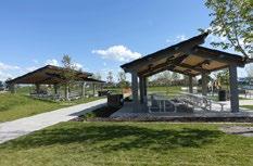
GAME TABLES. Outdoor game tables such as chess, ping pong, foosball, and others should be installed to program the space for play year round. Equipment for these activities could be stored in a small cabinet, similar to the “little free libraries” already around Lynchburg.
OTHER PROGRAMMING. This neighborhood patio could serve as a second community market location or food truck event space. Vendors could line the street via onstreet parking while shoppers use the plaza to access the service windows and displays.
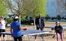
55
Strategies & Actions - Jefferson Park
POPP customizable outdoor ping pong table in Irving, TX Source: popp.world
Shade structure inspirations
Pavilion structure to provide shelter and shade at the plaza space, as well as frame views into the park and beyond. Solar panels could be incorporated into the roof to power charging stations and public wifi.
Actions
Playground
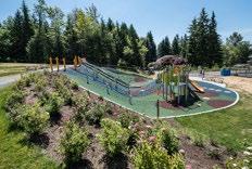
The plan calls for the playground to remain largely where it is today but 1) shift the existing swing set closer to the neighborhood center to provide more distance from the amphitheater and 2) expand the facilities to utilize the natural topography of the site. Hillside slides and climbing equipment could add a new dynamic to the playground. Zip lines are also becoming popular playground facilities. In the near term, trees or shade structures should be added and benches installed to make the area more family friendly.
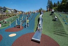
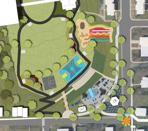
56 Strategies &
- Jefferson Park
Playground equipment using hillside for slides and climbing features Source: habitat-systems.com
5 and 10-year improvements ADA access splashpad shade structures pavilion street muralgame area hillside playground restrooms / pump house
KIRBY STREET
CHAMBERS STREET
Fitness Equipment

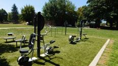
Outdoor fitness equipment was requested on multiple occasions by the neighborhood. The plan shows them as stations along both of the loop trails. A variety of equipment – cardiovascular and strength training equipment, as well as stretching and other wellness equipment- is available for a curated circuit that serves many needs and abilities.
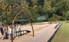
Jefferson Park Pool
The location of the Jefferson Park Pool needs to be physically marked and interpreted at the site where it once existed. The memory of the pool currently relies on oral history by current and past neighborhood residents, the oral history project video from 2012 that captured some of these memories, and a few scattered photos of the pool. The stories of the pool and of Jefferson Park are both those of joy and sorrow and need to be remembered physically on site. Doing so will not only bring a greater sense of meaning to the neighborhood and Jefferson Park users, but also provide an opportunity for the Lynchburg community to learn from its past.
INTERIM MARKING. Due to unknown factors regarding the presence of the landfill in Jefferson Park, more due diligence is needed before a permanent memorial can be planned, designed, and installed. In the near term, the site should be marked using surficial materials, those that remain on the surface of the land. One option may be to use survey whiskers with six-inch nails to tack them to the ground as land artist Stacy Levy did in a 2011 installation that marked the route of an underground stream. Survey whiskers are low cost and “mow-able” so should be a low maintenance option. They also come in a variety of colors and could be used to create an interim, temporary, eye-catching design that celebrates and memorializes the pool’s former
location without disturbing the integrity of the cap material. This could be done as a community event, where attendees are asked to participate in the installation by helping to place the whiskers into the ground in a preset pattern. Given Jefferson Park’s topography, they would be visible from the surrounding streets. A similar effect may be able to be achieved with painted rocks, cloth, or other temporary materials that remain on the surface. Signage at street level could explain the installation.
PERMANENT MARKING. Once adequate due diligence has been performed on the landfill site and the design parameters can be set for what is allowable, safe, and affordable, a permanent marking of the pool site should be pursued. It deserves to be marked in a lasting way that allows interaction with the site, while learning about Lynchburg’s segregated past, the events and poor decisions that led to filling in Lynchburg’s pools and the use of Jefferson Park as a site of waste disposal. This could be done via a design competition or through hiring a single designer to propose options for a memorial. In either scenario, residents should be involved in selecting the design. Depending on budget, the permanent marking could be a significant memorial at the site or as simple as creative landscaping and interpretation. Interpretation projects costing up to $50,000 may be able to be funded through the National Park Service’s African American Civil Rights Grants. The site should be eligible as it was a segregated public facility, closed in 1961, prior to the Civil Rights Act of 1964, which banned racial discrimination in public accommodations.
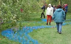
57
Strategies & Actions - Jefferson Park
“Blue Grass” by landscape/environmental artist Stacy Levy
Hiawatha Fitness Zone in Seattle, WA Source: playcreation.com Playground zip line
Environmental Learning Area
The presence of the landfill is a major limitation on Jefferson Park and the ability to use its entire acreage. Specific plant varieties can be used to cleanse soil and, once harvested, be used for biofuels or electricity production. When used on applicable sites, harvesting removes hazardous elements absorbed from the soil into the plant material. There may be an opportunity to use plants to remediate the landfill over the long-term, using ecological restoration techniques. In addition to having Jefferson Park be a place to learn about history and environmental justice, those lessons can be combined with learning about the degraded ecosystem from the landfill and how it could be restored naturally. Lessons relating to stormwater and native plants can be incorporated as well for a holistic understanding of the park’s environment.
Neighborhood CenterOutdoor Space
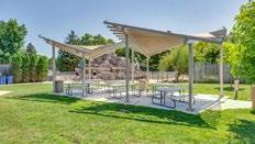
The plan for Jefferson Park illustrates Jefferson Park’s potential to serve a variety of needs and make use of the large amount of available outdoor space. With the removal of the existing pavilion, the predicted popularity of, and the distance to the “neighborhood patio,” the neighborhood center could use outdoor space for programming and gathering directly next to the facility. The plan shows the new community garden remaining in its current location and the construction of a small shade structure and outdoor seating area. This may also be a good place for interpretation of the Jefferson Park Pool site before people begin to walk to it.
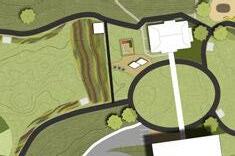
Housing
The plan illustrates the potential for new housing bordering Jefferson Park. Much of this land is privately owned so it is only shown as an idea and will require partners and more study to pursue. Providing rowhouse style housing on adjoining properties would rebalance the stark contrast between the architecture of the Dearington Apartments and the single-household neighborhood, provide needed housing units in a central, accessible area of the City, and provide the City with a return on investment in Jefferson Park. Rowhouse units are an efficient land-use pattern that can be designed to blend surrounding standalone homes by having similar setbacks, heights, and landscaping. Virginia Housing awarded the City a grant to furth study housing in the neighborhood in 2022. That effort will result in a final document that will be incorporated as an addendum to this plan.
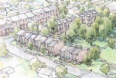
Strategies & Actions - Jefferson Park
Design for new housing to blend with both the Dearington Apartments and the neighborhood. Hill Studio / Peter Giraudeau
58
Potential shade structure shown here in Racine, WI
Neighborhood center outdoor space shown along trail, next to community garden
DETAILS THAT MATTER
This section includes plan recommendations that are smaller in scale, should be incorporated with other improvements discussed elsewhere, included throughout the park, or are more peripheral to the main improvements. These recommendations should be looked at continuously as projects are implemented to see where they can be incorporated.
Neighborhood Culture
Jefferson Park contains a rich and important history for both Dearington and the City of Lynchburg. Yet that history is barely visible when visiting Jefferson Park. A few remnants, such as the amphitheater, exist today and hint that this is quite an old park, but neighborhood stories can and should be recorded and conveyed here in this park for all who visit to understand and learn from. There are a variety of ways through various public art, site interpretation, and interactive elements that this can be accomplished.
Public Art
Public art should be incorporated into the park to create a unique and engaging public space that both remembers the history of the site and celebrates the joy Jefferson Park has brought to the Dearington neighborhood over the years.
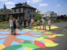
The City should engage an artist from the neighborhood or reach out to local arts organizations, such as Riverviews Artspace, to find an appropriate local artist who can work with the neighborhood in public art designs. It may be wise to hire a facilitator to continue discussions of the themes discussed at the October 24th 2020 meeting (black joy, community heroes) and allow the artist to take inspiration from those discussions to come up with three proposal options from which the community can select. Alternatively, the City could work with Lynchburg City Schools and E.C. Glass students to learn about the Dearington neighborhood and come up with designs.
FUNDING. The National Endowment for the Arts (NEA) has matching grant programs for $10,000 -100,000 available that appear to be well suited to this work. Current Grants for Arts projects are being targeted to projects that “use the arts to unite and heal in response to current events, as well as address any of the following:
• Celebrate America’s creativity and/or cultural heritage.
• Invite a dialogue that fosters a mutual respect for the diverse beliefs and values of all persons and groups.
• Enrich our humanity by broadening our understanding of ourselves as individuals and as a society.”
LAND ART INSTALLATION. As discussed previously, in the near term, the City could take queues from various land art installations to temporarily mark the surface of where Jefferson Park pool once sat. A community event or celebration could bring the neighborhood together to place survey whiskers and create a land art installation visible from many areas of the park. An artist may help design the pattern and coordinate with the murals discussed below.
BASKETBALL COURT MURAL. The near term recommendations to focus on the already active side of the park and relocate the basketball court, revive the amphitheater, and create an interim public plaza on the tennis courts are a perfect opportunity to start imbuing Jefferson Park with public art. A mural on the basketball court would be viewed from above by those sitting in the amphitheater and looking down from the interim plaza and incorporate views to the site of the old swimming pool location.
PATIO SURFACE TREATMENT.
The plaza itself, while an interim step to a final design for a neighborhood gathering space, could also incorporate related mural and interpretation elements.
Strategies & Actions - Jefferson Park
STREET MURAL. The concept plan shows a street mural at the corner of Chambers and Kirby Street. Traffic tends to speed along Chambers Street and a street mural could be done here to calm traffic and alert drivers to the plaza nearby. The design could be tied together with the plaza surface and the basketball court mural.
59
City Repair in Portland, Oregon, has completed over 70 street paintings across the Portland Metro Area. Photo: CityRepair.org
Interpretation
Site interpretation is vital to ensure the history of Jefferson Park is not forgotten to future generations and to ensure accurate and collective learning of the City’s history. Site interpretation can be incorporated in different ways, through traditional signage, public art as discussed previously, embedding artifacts into the site or through interactive features discussed in the next section. The Lynchburg Museums System should be involved in research and implementation to ensure accuracy and appropriate messaging.
SIGNAGE. Traditional interpretive signage has been used in public spaces around Lynchburg already to highlight local history. Photos and text can be woven together in a traditional way to tell the stories of a place. Maximum information is conveyed this way, however, they are easy to overlook or ignore. A combination of signage with other interpretive methods should be incorporated into Jefferson Park.
NEIGHBORHOOD TIMELINE. The interim plaza concept plan shows a zig zagged line along the paths and through the interim plaza space. While not intended as a specific design, this could be a timeline of neighborhood history that marks important points in Dearington’s and Jefferson Park’s development.
Source: zahner.com
PHOTO WALLS. Historic photos of Jefferson Park can be put into “photo walls” or railings. New technology can now create perforated metal for use in site design that displays old photos.
Sample of neighborhood timeline highlighting significant events in Dearington’s development that could be painted on the interim platio.
Interactive Features
At the October 24th 2020 outdoor meeting, attendees responded to examples of interactive installations where the public is invited to engage with a space and express themselves. Chalk walls are one way this is done and various prompts can changed throughout the year. An artist working on public art in the park should think about ways the neighborhood could engage with the space. Ideas and themes gleaned from this engagement over the years the interim plaza is in place should be used to inform the design of the final plaza.
Bronze sculpture embedded into Haymarket Square in Boston illustrates the centuries of use as a public market space.
Source: Harriesheder.com
PLAQUES, EMBEDDED LETTERS, SIDEWALK ART. Incorporating history and remembrance in unexpected ways tends to make the lesson that much more thought provoking or memorable. The neighborhood patio could celebrate heroes from the local community and remember their stories in unique ways by embedding plaques, lettering or art into the plaza surface. Trails and walkways could include quotes about the park and it’s significance in the community. In the 2012 oral history project, a former pool lifeguard, Francis Moorman, called the pool “Dearington’s Smile.”
Embedding that lettering in the sidewalk would enhance the positive memories of the place.

Strategies & Actions - Jefferson Park
Interactive chalk wall allows people to engage with a space and each other Source: Visit Charlottesville
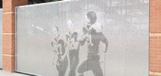
phrases embedded in walkways and public spaces can bring new meaning and experiences.
Source: thespec.com

60
Perforated metal photo wall
Signage
In addition to interpretive signage, park identifying and directional signage should receive a uniform branding and treatment.
Specific signage is needed to:
• Identify the Jefferson Park Trail at the end of York Street in the near term.
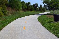
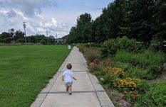
• Provide a park map in the patio area. In the near term, that may incorporate images from this plan of what is to come.
• From street level, note the location of the Jefferson Park Pool and interpret the interim marking that occurs on site.
Materials and Furnishings
While longevity is necessary due to limited budgets, site furnishings should be both high quality and enticing. Brightly colored and flexible furnishings can breathe new life into Jefferson Park and allow park users to interact with a site in different ways.
Environmental ConsiderationsDesign
Climate change has been experienced locally in recent years in the form of heavy rains and storms that cause stream and trail erosion as well as power outages. Lynchburg’s Parks & Recreation Department is committed to improving the City’s parks sustainably by managing stormwater, utilizing solar powered infrastructure, and creating more environmental awareness in our park facilities. Below are recommendations for Jefferson Park specifically to address changing environmental conditions.
Stormwater
Existing topography forces Jefferson Park to serve as a large drainage basin for the Dearington Neighborhood before the water reaches a tributary for Blackwater Creek. The City’s creek system regularly experiences the erosive force of stormwater and has experienced significant damage to trail facilities in recent years. The park will need a stormwater plan to carefully route drainage through new improvements, help combat runoff issues experienced downstream, and plan nontraditional ways to incorporate stormwater infrastructure into park facilities.
BIORETENTIONS. These facilities can be highly efficient in both reducing the quantity of stormwater runoff by slowing water down so that it absorbs into the earth and improving the quality of stormwater by filtering out pollutants before the water reaches our streams. They also provide aesthetic benefits.
Pervious hardscape used on a trail that will allow stormwater to infiltrate into the ground Source: perviouspavement.org
Colorful and flexible seating options
Lower photo: Loop Arc by out-sider
PERMEABLE HARDSCAPES. Permeable asphalt, concrete, and various paving systems allow for new hardscapes to be installed without contributing to stormwater runoff. New trails in particular may be well suited for permeable asphalt and the final plaza design should consider permeable pavers where feasible to help reduce overall impervious area in the park.
Strategies & Actions - Jefferson Park
61
Rain Gardens lining a pathway in Riverfront Park add beauty to the park while also helping treat stormwater runoff from 11 acres of Downtown Lynchburg.
Solar Power
The City’s first solar powered pavilion has been retrofitted in Peaksview Park and as a way to reduce the City’s electricity burden, similar infrastructure can be incorporated elsewhere. This plan calls for the new pavilion at the “neighborhood patio” to include solar power for lighting, charging stations, and publicly available wifi. If connected to the electrical grid, it may be able to offset some of the energy needed to power the splashpad. Solar powered bollard lighting is also proposed along the connector trail from the Dearington Apartments. As the design progresses, other opportunities will arise.
LANDFILL AND LIMITATIONS
A portion of Jefferson Park is a former unregulated landfill that was in operation from approximately 1961 until approximately 1970. Modern standards for closure and post-closure care of landfills went into effect in the early 1990s; however, landfills closed prior to those regulations, like Jefferson Park, were not regulated by those standards. The Jefferson Park landfill appears to have been “closed” with an earthen cover in the early 1970s. This area was evaluated in 1997 and 2015 for potential gas release and waste exposure. Both evaluations found the presence of methane gas and it was determined that waste exists within the park with only a foot of cover in some places.
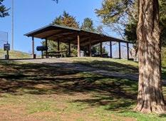
The 2015 evaluation was precipitated by the exposure of waste due to the erosive forces of stormwater through the park. This evaluation led to stormwater mitigation work that routed drainage around the perimeter of the landfill to prevent further erosion within the park and the drainage outfall. Today, the landfill remains relatively unusable for active park space and only contains an access road that connects to the Jefferson Park Trail, an earthen trail that ties into the City’s larger trail network.
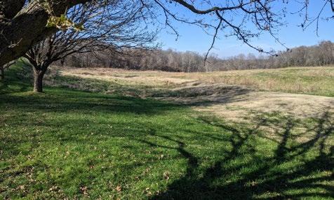
Landscaping
Park landscaping should include the addition of more shade trees as requested by the neighborhood and to provide environmental benefits: cooling effects, stormwater absorption, and air filtration. Their location should avoid blocking views from the “neighborhood patio” towards the Jefferson Park Pool site. The steep hillside around the amphitheater should be replanted with a new low-maintenance groundcover that will not become so overgrown in the summer but still allows people to sit on the hillside if so desired. Other landscaping throughout the park should be drought tolerant and use native species.
Strategies & Actions - Jefferson Park
62
Solar powered pavilion in Peaksview Park in Lynchburg. The solar panel is barely visible on the right hand side of the roof.
View of the Jefferson Park landfill from parking lot in Jefferson Park
Additional Study Required
As the area encompasses over seven acres of available park land, which is centrally located and with an overall moderate grade, the landfill portion of Jefferson Park has great potential as a recreational asset for both Dearington and Lynchburg. Landfills across the United States have been converted into innovative and even beloved park uses. However, in order to achieve that status here, more study is needed. Additional due diligence, including further surface gas monitoring studies and geotechnical/ geophysical exploration, should be conducted prior to any reuse of this historic landfill area. This additional study is required to both inform the community and protect the City’s future investments at this site. Further study will provide options for reuse of the site as well as associated cost estimates.
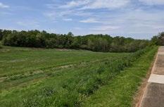
Proposed Concept Plan
SHORT TERM. Work in the vicinity of the landfill is not proposed in the near term to leave time for the necessary additional study and understanding of the area. Should the opportunity arise to begin work, initial work in the area may take the minimally obtrusive approach of only adding fill, and thus further capping the existing waste in the area. A half-mile perimeter trail, a gradual 5% slope across the entire seven acres to make a reasonable playing surface, and a surficial marking of the historic swimming pool location may be possible, dependent on further study.
FINAL VISION. The concept plan more accurately reflects the Dearington community’s desire and the site’s potential as a community asset. It includes construction of trails, more level playing/ball fields, exercise equipment, an environmental learning area, parking, and a permanent memorial to the Jefferson Park Pool. It also recognizes some of the realistic constraints of park facilities on landfill. Those constraints include:
• Landscaping – Tree and shrub survival is uncertain and in the future they may expose waste should they fall. Landscaping should include wildflowers and grasses.
• Structures and Buildings – No buildings with interior spaces can realistically be constructed due to settlement and the presence of methane gas and the risks it poses. Light structural bases may be okay. Structures that require footers or foundations, such as fitness equipment and playgrounds, may be possible but there needs to be further study on the specific conditions.
• Trails – Paved trails are likely more feasible than earthen trails on this surface because of the potential for erosion.
• Recreational fields – Competition quality fields will be difficult to establish due to continued settling. Casual playing fields are likely possible.
• Hardscapes (basketball courts, tennis courts, parking areas, etc) – These uses would likely be safe to establish on site but geotechnical and geophysical evaluations should be done to determine risk of further settlement. A geogrid or soil stabilization may be required to establish these uses.
• Uses that require excavation (i.e. splashpad)
– A splashpad is not proposed for the landfill site because while excavation is possible, it requires disposal of all waste to an approved site, which would drive costs unreasonably high.
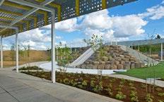
To realize the concept plan, in which the surface of the actual landfill would receive programmed daily use, further studies are required to determine whether the landfill gases are a public health concern and the subsurface conditions are suitable for use as an active park. These studies will define potential limitations to the amount of fill to be placed on site to provide more level fields without causing further settlement; installation of structural features, such as exercise equipment and a memorial to the pool; types of landscaping proposed; and frequency of use of the site.
Strategies & Actions - Jefferson Park
63
View of the Jefferson Park landfill from Dearington Apartments
Cully Park in Portland, OR is a 25 acre park built on top of a former landfill Source: letusbuildcullypark.org
JEFFERSON PARK PHASING
Short Term (5 years)
Capital Improvements:
• Redevelop tennis courts into interim design for neighborhood patio.
• Improve Dearington Apartments connector trail with lighting and railings.
• Improve streets next to neighborhood patio:
• Chambers Street, 40’ ROW (add small amount of ROW from plaza side) – 8’ parking interchanged with street trees and enhanced bus stop, 10’ travel, 10’ travel, 8’ parking interchanged with street trees, 5’ sidewalk.
• Kirby Street, 30’ ROW (Add parking to plaza side mixed with parking)
• Mark Jefferson Park Pool site in a low-cost, low-maintenance, high-visibility way
• Add interpretive signage at street level and within park
• Construct Kirby Street ADA Access trail and the “grand staircase” that frames views and provides a formal access point into the park.
• Move basketball court to amphitheater location. Construct an additional ½ court. Add lighting for performances and basketball.
• Make amphitheater accessible. Improve adjacent hillside groundcover.
• Install outdoor fitness equipment along trails.
• Improve York Street trailhead to Jefferson Park Trail.
• Incorporate public art via a mural on the basketball court, patio artwork, and street mural as deemed feasible.
Research:
• Monitor and collect feedback on interim patio use to help inform final design.
• Perform full feasibility study potential for basketball gymnasium and structured parking into hillside. Acquire properties along York Street for future housing and gymnasium.
• Begin necessary geotechnical and geophysical studies of landfill.
• Find partners and conduct feasibility and planning studies for new housing on park’s edges.
Mid Term (10 years)
Capital Improvements:
• Replace interim patio design with permanent design to include splashpad and pool remembrance fountain. Reroute Dearington Apartments connector trail through the patio.
• Improve playground and install zip line, hillside slides and climbing equipment.
• Build multi-use basketball gymnasium and parking below. Pursue housing on street level as opportunities arise. Remove parking from center of park but retain maintenance vehicle accessibility.
• Use excavated earthen material from gymnasium to help level landfill areas into usable fields
• Provide neighborhood center with outdoor shade canopy and picnic area.
• Improve routes to and from Jefferson Park to create “safe routes to parks” and community walking loops. Improve specific intersections with street murals to slow traffic, signal importance, and connect to park. Construct sidewalk down York Street access road.
• Install permeable asphalt trails on landfill site with meadow grasses and wildflowers. Include more outdoor fitness equipment as determined feasible.
• Work with the community to find a way to permanently mark and remember the Jefferson Park Pool site while maintaining visibility from street level.
Research:
• Continue research on landfill site as necessary.
• As feasibility for additional recreational improvements on landfill site comes into focus, discuss desired uses with neighborhood.
Actions
Park
64 Strategies &
- Jefferson
Long Term (20 years)
Capital Improvements:
• Connect York Street around to Smyth in existing right-of-way to facilitate development and access to landfill site.
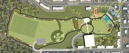
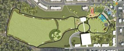
• Create an environmental learning area that teaches about natural land remediation
• Construct usable playing fields and other recreational uses as determined feasible
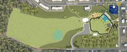
• Provide additional parking as needed
& Actions
Park
65Strategies
- Jefferson
5 YEARS 10 YEARS
20 YEARS
NEIGHBORHOOD CENTER
The Jefferson Park Neighborhood Center was constructed in the mid 1970s and operated continuously in Dearington except for a few years in the mid-2010s when the local Boys & Girls Club rented the facility and provided programming. Many current and former residents have fond memories of the center over the years and appreciate the longevity the Center has had in their lives, serving both them and their children. Reunions and community events have been held here and it clearly has been a place of good memories and support for the neighborhood.
In 2019, the center underwent an interior renovation project funded through Community Development Block Grant (CDBG) funds to revive the space for continued use and adapt it to current needs. Prior to this project, staff held a public meeting at the neighborhood center in April of 2019 to discuss center programming as Department of Parks & Recreation staff would once again operate the facility. A strong group of current and former residents expressed their desires for what the center should be and how it can best serve the neighborhood moving forward. That feedback is represented here.
SERVICES
Neighborhood centers across the City aim to serve all ages and provide valuable programming based on the neighborhood’s needs that connect to three broad areas: work, family, and education. In 2020, Jefferson Park Neighborhood Center was just reopening and reestablishing neighborhood connections following the renovation and its operation by the Boys & Girls Club when the COVID-19 pandemic began, severely limiting the ability of staff to interact with the public. Services continued throughout the year as they were able in a “light touch” model. Summer Lunch & Play and Fall/Winter Learn & Play have helped to keep kids active and provide help with school assignments while following safety guidelines. Fresh produce, school lunches, family food bags, and “care bags” with personal protective equipment (PPE) have been made available to the community through the neighborhood center in coordination with various local partnerships. Moving forward, valuable services such as these will continue and expand in 2021 in support of the efforts of this plan and the neighborhood’s needs.
Classes
Lynchburg’s neighborhood centers already offer a variety of classes that can be expanded or brought to Jefferson Park. The following were specifically desired:
• Employment Training, specifically for Certified Nursing Assistants (CNA), Commercial Drivers Licenses (CDL), and hospitality work. A partnership with neighbor, Centra Health, should be explored to increase employment opportunities.
• Finance, Home Ownership, and Housing Maintenance
• Parenting
• Fitness, Exercise, and Nutrition
• College Exposure for Teens
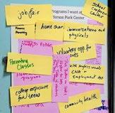
Resource Access
Virginia Career Works’ workforce navigators could host regular office hours at each of the centers to make themselves readily accessible.
School Meetings
Residents expressed that many times parents or students may be intimidated by school meetings. Holding those conferences off-site, at the neighborhood center, can reduce those negative connotations and provide a neutral meeting ground.

Healthcare
Immunizations have been done in centers previously and could be expanded. A regular schedule would help the neighborhood take advantage of these services. Additionally, over the summer, prior to a new school year starting, it would be helpful for students to be able to receive their routine pediatric physicals so that they are eligible for athletic opportunities at City Schools.
66 Strategies & Actions
Feedback on desired center programming at the April 2019 meeting
Jefferson Park Neighborhood Center programming continued during the COVID-19 pandemic
History Archive

During the development of the oral history project “Reflections of Jefferson Park Pool” in 2012, many neighbors provided memories and photos of activity in Jefferson Park. The center should be equipped to receive photos and record memories people have of Jefferson Park. This may require equipment, such as scanners, and a network drive for this repository
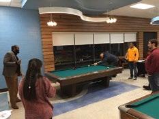
Annual Celebration
In the past, residents have hosted a “Dearington Day” as a reunion for current and former Dearington neighbors. Supporting or continuing this effort will help build relationships with the community and could be a venue for remembering and celebrating the history of Jefferson Park. Until a permanent marking can be decided upon, this would be a time for the community to come together and participate in marking the Jefferson Park Pool site.
Resource & Information Hub
Neighborhood centers are the most accessible city building in some of Lynchburg’s neighborhoods. They already play critical roles in after-school care and enrichment programs, but can also offer additional services from all City Departments, as they are valuable outlets to extend the City’s reach into the community. The center will serve as a resource and information hub, with public access to wifi, a computer lab, and community resources. Given the right resources and support, Jefferson Park Neighborhood Center (and all Centers) could even act as miniature “city halls,” or more accessible extensions of City Hall, by providing access to many of the resources and services without requiring the travel to get Downtown. Ways to work towards this concept are included here but will require interdepartmental coordination and additional planning.
RESOURCE BINDERS. Centers already have binders stocked with many of the commonly requested forms. These should be regularly checked and updated.
COMPUTER LAB. As more and more services move online, the computer labs in the centers will become more and more valuable for connecting citizens with services. Computers there should be preloaded with links to commonly used services.
STAFF TRAINING. Regular training in the services citizens need access to is key to being able to help people navigate these resources and make use of all that is available.
HOURS. Centers are currently staffed by one full-time and one or two part-time employees. This means that the center buildings cannot be open every day during all business hours because the staff needs to run programming and attend off-site meetings. However, consistent operating hours will be important for citizens to be able to make use of the services the centers can offer under the “city hall” model. Additional staff would be able to help expand access.
City Services to Consider Expanding to Neighborhood Centers
• Bill Pay – through computer lab and/or kiosks as technology becomes available
• Citizens First Hotline and Online Chat
• Library Card Application, Book Delivery
• Workforce Navigators, weekly or biweekly hours
67Strategies & Actions
Community members enjoying the renovated Center space
Renovated computer lab
STREETS & ACCESS
Revitalizing Jefferson Park and reinventing other public spaces in the neighborhood will transform Dearington. However, to reach their full potential as neighborhood assets, strong connections to allow Dearington and Lynchburg neighbors to safely and comfortably reach these landmarks are also vital. Improving neighborhood streets and access creates a holistic system that considers how neighbors reach these facilities as much as what they do once they get there. While the recommendations included in this section are in this section of the plan as they increase recreational access and opportunities, there is a second benefit. These improvements also provide safer, more inclusive transportation options for reaching jobs, commercial areas, and services.
OVERALL NETWORK
The network map highlights key streets and new trail connections to create a well-connected transportation system that helps neighborhood residents reach area destinations and park facilities as well as improves safety on known cutthrough streets: Caroline, Page and Chambers.
Loops
Loop trails of all sizes, as short as 1/10 of a mile or as long as several miles, are valuable recreational amenities for accommodating all ages and abilities. The proposals for Jefferson Park include short loops for walking. Longer loops can be developed by including on-street facilities that tie to other off-street trails and new access points.
New and Improved Off-StreetTrails and Access Points
JEFFERSON PARK. Paved trails in a variety of short sizes. Outdoor fitness equipment stations will be available along them.
MATERIALS STORAGE SITE TRAIL (new access point). Restore an earthen trail that once tied the Dearington and Tinbridge Hill neighborhoods together. This trail should connect to the paved Kemper Street Trail.
KEMPER STREET TRAIL SPUR (new access point). Pave an existing access road and provide access through the Public Works Site to Chambers Street. Include parking at the trailhead. (more details in Chambers Street Gateway section)
CENTRA HEALTH TRAILS (new access points). Work with Centra Health to provide earthen trails across City and Centra Health property that connects Dearington to the hospital area. Offer a new access point on Caroline Street through the unopened Blue Street right-of-way.
CREEKSIDE TRAIL. At the bottom of Thompson Drive, a relatively flat gravel trail ties into the Point of Honor Trail. Paving this segment provides a smooth loop for bikers and walkers.
68 Strategies & Actions
Existing Trail Network and Neighborhood Park Amenities. Despite proximity to the Kemper Street Trail, there is no readily available access point.

Proposed Trail Network
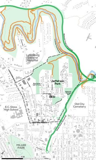
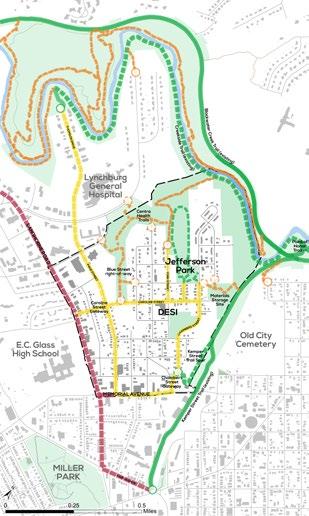
Strategies
Actions
69
&
On-Street Trails
Improved on-street pedestrian and bicycle accommodations can help connect desired trail loops, and improve safety. Depending on the available space, amount of traffic, and neighboring land use, a variety of accommodations can be considered.
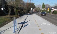

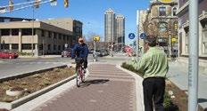
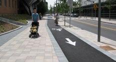
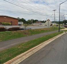
Types
MULTI-USE TRAILS. In areas with lowervolume pedestrian and bicycle traffic and where space is limited, combining both pedestrian and bicycle infrastructure into one facility may be a viable option. An on-street, multi-use trail provides a safe space for active transportation separate from vehicular traffic. People may walk and bicycles may pass them by entering the opposing lane when it is safe to do so. Varying speeds and sight distance for downhill and uphill travel should be considered with the construction of these facilities.
CYCLE TRACKS. These facilities are exclusive bicycle facilities that provide the experience of traveling on a separated path or trail but are provided along streets. Unlike a multi-use trail, space is not shared with pedestrians. They can take a variety of forms by being one or two-way and be at street, sidewalk, or an intermediate level. The key is that they provide a higher level of security than bike lanes by being physically separated from vehicular traffic and parking with vertical barriers like bollards or curbing raising them up.
BIKE LANES. Bike lanes may be the best trail accommodation where existing sidewalks can accommodate pedestrians and pavement width can either be easily expanded or reassigned. This provides separate spaces for bicyclists in each direction, traveling with traffic. Adding buffers provides greater distance between moving traffic or parked cars, increasing cyclist safety, and should be included wherever possible.
SIDEWALKS AND SHARROWS. On neighborhood streets, where narrow pavement width combined with on-street parking helps keep vehicle speeds low, sidewalks for pedestrians and sharrow markings for bicycles may be all that is possible or necessary. While it is typically better to provide separated spaces for pedestrians, bicycles and vehicles, especially when kids use the routes, calling attention to the trail with sharrow or trail markings may be all that is realistic.
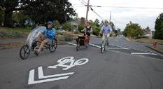
70 Strategies & Actions
Multi-use trail on Odd Fellows Road in Lynchburg
Sharrows on neighborhood streets with speed humps Source: bikeportland.org
Various forms of cycle tracks and multi-use trail facilities
Corridors
PAGE STREET AND CAROLINE STREET.
A multi-use trail could be accommodated within existing pavement on Caroline to Patrick Street and by expanding Page Street.


YORK, CAROLINE, AND STONERIDGE STREETS. In the residential areas, these neighborhood streets should include contiguous sidewalks and sharrow markings on the street pavement.
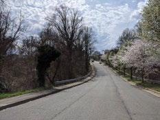
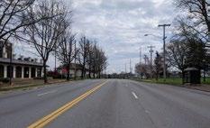
CHAMBERS STREET. Right-of-way will be needed but either cycle tracks with sidewalks or a multi-use trail should be incorporated to separate users from traffic.
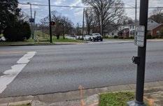
MEMORIAL AVENUE. Traffic volumes should be studied here to determine if the number of vehicular lanes is truly necessary. Either buffered bike lanes or a two-way cycle track could be accommodated by removing a travel lane.
LANGHORNE ROAD AND PARK AVENUE
Langhorne Road has significant traffic volumes that requires it to maintain its current lane configuration. Sidewalks are inconsistent and the street is difficult to travel along or cross when not in a vehicle. Cycle tracks and sidewalks on both sides of the street should be considered to improve access here. Better, more frequent crossings are needed to make the area more hospitable. Due to topography and right-of-way limitations, converting these streets to accommodate all modes of travel will need to be a long-term project and require more study. In the near term, improvements to Page Street may be a better alternative to support multi-modal travel.
WHAT MAKES IT A TRAIL?
Facilities should be considered “trails” when they are either a primary route to a park facility, increasing park access, or are a segment of a recreational “loop.” These facilities should receive special markings that designate them as trails and serve as a wayfinding system that brings awareness to the nearby park property or the loop route. This can be done with a thermoplastic marker on the surface of the trail or sidewalk that uses the Department of Parks & Recreation branding scheme.
Strategies
Actions

71
&
Langhorne Road in front of E.C. Glass High School
Potential surface graphics that use the Parks & Recreation Department logo to mark on and off-street trails and differentiate from other sidewalks and routes.
Caroline Street looking towards Page Street
Existing crossing location at Langhorne and Murrell lacks crosswalk.
CAROLINE STREET
GATEWAY
The intersection of Page Street with Hillcrest and Caroline Streets is a significant gateway for the neighborhood. It sits just inside the neighborhood boundary and is the juncture of streets that connect the heart of the neighborhood to Memorial Avenue, E.C. Glass High School, and Lynchburg General Hospital. Page Street is used as a cut-through to quickly reach the hospital. This key intersection should be improved to provide better transportation infrastructure for non-car users and create a better sense of arrival for the Dearington neighborhood.
TRAIL. Due to limited right-of-way and constraining topography, the concept plan shows a multi-use trail on one side of Caroline Street and Page Streets to provide a safe connection to
Section: North Page Street
North Page Street with multi-use trail
EPR / Caroline Gaenzle
the hospital area. This uses the minimal amount of space to provide separated facilities as only one buffer (the space between the trail and the vehicular travel lanes) is needed. Once past Patrick Street and in the heart of Dearington, facilities will likely need to transition to sidewalks and sharrows due to the need for on-street parking and the presence of narrow streets. To work with the existing pavement width, sharrows, bike lanes, and sidewalks may be more feasible in the short-term for users traveling south of Caroline on Page St. A larger study is needed to show how these accommodations carry users to destinations outside the neighborhood.
SIDEWALKS. Hillcrest Avenue is a primary entrance into the neighborhood and is narrow with inconsistent sidewalks. At a minimum, sidewalks need to be connected to provide a contiguous route to Langhorne Road. Street trees should be included as a buffer between pedestrians and traffic.
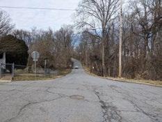
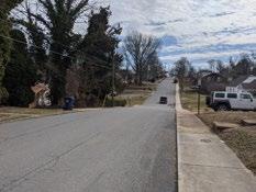
BUS STOPS. Route 1 bus stops here are used regularly by Page Street residents and should be improved to include shelters to facilitate use in all weather.
SIGNAGE AND AESTHETICS. As functional improvements are made to this intersection, landscaping, signage and opportunities to incorporate neighborhood character in street murals or crosswalks should be included.
Page Street south
72 Strategies & Actions 10’ 10’ 10’5’ S i d e w a l k R a i s e d B u e r T r a v e l L a n e T r a v e l L a n e 2’ M u l t i U s e P a t h
CarolineSt P a eg S t Existing Road Width: 21’ H e a d e r C u r b 6” H e a d e r C u r b 6” 38’
Page Street north
Concept showing gateway enhancements, improved bus stops, and on-street, multi-use trail, looking down Caroline Street into the Dearington Neighborhood. Hill Studio / Peter Giraudeau
Caroline Street gateway improvements
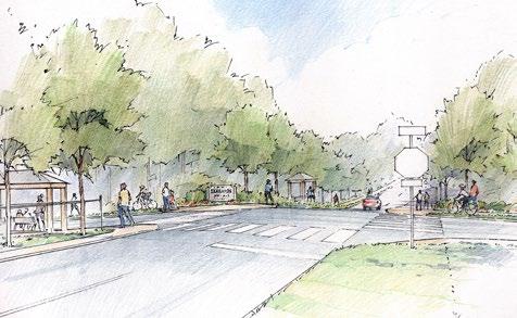
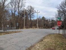
EPR / Caroline Gaenzle
Legend
Caroline Street gateway intersection
Existing Curb
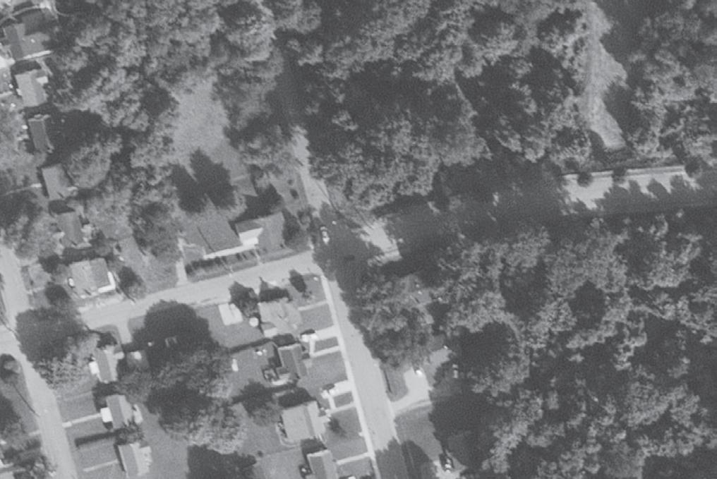
73Strategies & Actions
Sidewalk
Sidew S i dklawe
Street
CHAMBERS STREET
GATEWAY
Chambers Street appears to be the primary way most vehicles enter the Dearington Neighborhood and is the most direct way to reach the Dearington Apartments. It is also a bus route through the neighborhood. As the main gateway into Dearington, it is not particularly welcoming. It feels vacant and forgotten due to empty land, a few of the nearby houses boarded up as part of the City’s Vacant Property Registration Program, and chain link fence with barbed wire lining the right hand side where the only sidewalk is. Overgrowth from the hillside is beginning to cover the sidewalk, making walking unpleasant.
Improving the gateway of the neighborhood will provide valuable transportation connections, generate a positive overall impression of Dearington, and create a sense of arrival for all that Dearington has to offer.
Kemper Street Trail Spur
A moderately sloped gravel access road ties the City’s Public Works facilities at 1621 Memorial Avenue to the Kemper Street Trail in less than two tenths of a mile. Extending this trail up the access road and through the Public Works site would provide Dearington (and 5th Street/ Memorial Avenue) with a paved trail connection, a valuable asset to a neighborhood. Currently those wishing to use the trail would need to travel an extra mile, to the Park Avenue access point, even though the trail passes under the 5th Street Bridge. A new trail access point here would provide an enormous recreational benefit and also an active transportation connection to Downtown. Trail standards that would make this work eligible for grant funding and provide the needed maintenance space require approximately 20’ of width, with 5’ on either side of a 10’ wide trail. Routing this trail spur through the Public Works site would remove a significant portion
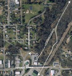
of the already limited space the department uses throughout the year for storage of vehicles, leaf boxes, dumpsters, etc. In order for this trail connection to be constructed, Public Works will need alternate accommodations for these operations. This will mean procuring another piece of property, repurposing property the City already owns, or possibly expanding this site to the north along Chambers Street, though the layout and topography there may not allow adequate space to be recovered.
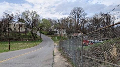
74 Strategies & Actions
Chambers Street Pedestrian Experience
Routing for Kemper Street Trail Spur
Stormwater and CSO Disconnection
Existing topography causes the Public Works Site to receive a significant amount of stormwater runoff from the surrounding streets and neighborhood.
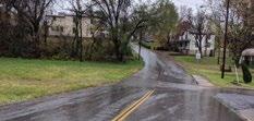
The gravel access road pictured below, which is the proposed trail route, experiences regular erosion issues due to the stormwater flow through this site.
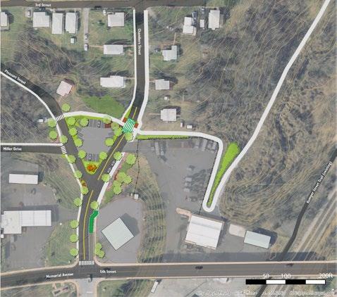
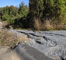
During heavy rains a large volume of stormwater is not captured in the combined sewer system on the west side of Chambers Street and instead flows through the Public Works site towards this access road. This area therefore is an ideal candidate for a select CSO separation and stormwater management project to help meet the City’s MS4 requirements.
The Public Works site appears to be well suited for underground storage of stormwater as that would allow operations on the surface to continue.
Actions
75Strategies &
Stormwater from the Dearington neighborhood runs across Chambers Street and erodes the existing access road
Chambers Street Gateway Concept Plan
paved
trail connection to Kemper Street Trail
underground stormwater storage and treatment chain link fence pulled away from road low maintenance landscaping
street
trees & parking
transition
to on-road bike facilities
narrower
intersections
multi-use
path to Jefferson Park and Dearington Apartments
new
sidewalk
new
sidewalk
new
sidewalk trail parking
bus
shelters and highly visible trail crossing
public
art gateway sign
Actions
Parking Area and Alternatives

The concept plan shows a parking area for trail users; however, if parking is located elsewhere, such as at 91 Chambers Street to avoid needing to cross Chambers Street to reach the trail, the “triangle” could be repurposed as either:
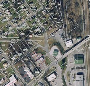
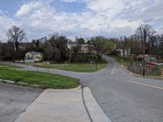
A SMALL PARK FACILITY. Jefferson Park, DESI, and the Materials Storage site may provide Dearington ample park space. However, this location is more accessible to the commercial area and the front portion of the neighborhood. It would also provide an attractive entrance feature for the neighborhood. Specific programming and park needs are yet to be identified for this site.
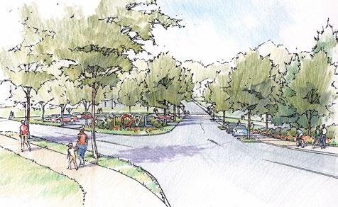
76 Strategies &
Chambers Street Gateway concept illustrating new public art, trail connectiosns, trail parking, sidewalks, and aesthetic improvements. Hill Studio / Peter Giraudeau
Current Chambers Street neighborhood entrance
Street Improvements
The roadway is wide near the City gas pumps at 1601 Memorial Avenue, with 35’ of pavement and 60’ of right-of-way, but narrows to 23’ of pavement and 40’ of right-of-way as drivers move in towards the neighborhood. Lane widths only need to be about 11’ here so there is an opportunity to narrow the space dedicated to vehicles and add bike facilities and/or parking to tie the trail spur to 5th Street.
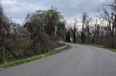
SIDEWALKS. With the addition of the trail connection, neighborhood streets should be improved to include sidewalks and safely connect the neighborhood to the trail. As minimal parking is being provided here, residents should be encouraged to walk or bike to the trail connection, bus shelters, etc.
STREET TREES. Trees along Chambers Street where the width can accommodate them would help mark on-street parking space, provide shade, and buffer the sidewalk to create a more welcoming gateway.
TRAIL CROSSING. The concept plan illustrates that, should the Kemper Street Trail Spur need to cross Chambers Street to reach the parking area, a highly visible trail crossing should be installed. Mid-block crossings are not in line with past VDOT guidance for crosswalks, which strongly encourages crosswalks to only be placed at “controlled” intersections (those with stop signs or lights). New guidance is expected from VDOT in 2021 regarding mid-block crossings and encouraging them to be placed where needed, provided sight distance allows pedestrians to safely cross in the location. This crossing will need to be studied further as plans and guidance evolve.
CHAMBERS STREET MULTI-USE
TRAIL. This on-street trail connection should be made to tie the Kemper Street spur trail to Jefferson Park. It also helps safely connect the neighborhood to both destinations. Chambers Street’s right-of-way width is variable and it will require working with property owners to gain the space needed to make this improvement.
INTERSECTION IMPROVEMENTS.
Both Miller Drive and Pleasant Street seem to have large curb radii that allow cars to speed through the area. Those could be narrowed and stops added as necessary.
Aesthetic Improvements
The existing chain link fence should be pulled away from the existing sidewalk to be minimally visible from the street. Landscaping on the hillside below the City gas pumps should include low maintenance shrubs and groundcovers. Following work to the fence and landscaping, a gateway sign could be added to the Memorial Avenue intersection to identify and announce arrival at the neighborhood. Finally, the plan shows the addition of public art at the corner of Pleasant Street and Chambers Street. This location would be a prominent location to feature public art that ties to neighborhood history and culture and create a landmark for the neighborhood. Survey Work. Parcel lines in this area and as Chambers Street passes the Dearington Elementary playground are not aligned to the City’s right-of-way and the overlap creates confusing addressing. The area should be surveyed and subdivision lines corrected to create clear parcel lines. This is required if the triangle or other City spaces are to be sold for redevelopment.
Partner Projects
Nearby waterlines are over 100 years old and some in the vicinity do not meet current standards for size. When the City’s Water Resources Department’s schedule allows an update to these, work should be coordinated to include the proposed trail work and stormwater management.
77Strategies & Actions
Chambers Street adjacent to the DESI playground where no pedestrian facilities exist.
Strategies & Actions
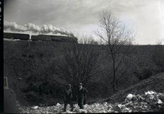
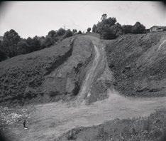
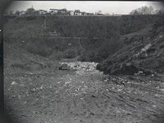
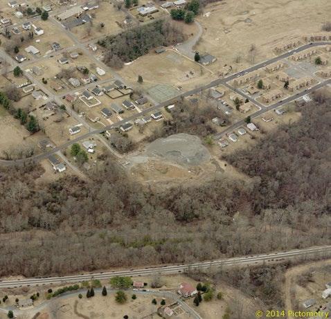
78
Photos taken in March 1949 of the Dearington Sanitary Landfill
Photo: Lynchburg Museums Systems
Birdseye View of Materials Storage Site
MATERIALS STORAGE SITE
The site referred to here as the “materials storage site” lies at the end of Pulaski Street and behind the northeast side of the 200 block of Chambers Street. This site was where the first landfill in the Dearington Neighborhood appears to have been located and, from a series of photographs from 1949, received a large amount of fill, perhaps more than Jefferson Park. This landfill was “closed” in 1953, and in recent decades, the City has used it to store inert materials like soil, gravel, stones, and bricks from various City projects and operations. While not currently a particularly disruptive use, this storage use does not belong embedded in a neighborhood. However, as discussed with the Chambers Street Gateway, the City’s Public Works Department is restricted on real estate and locating sites for their operations is difficult. With the establishment of a better suited location, the reuse of this site as a neighborhood asset should be explored.
ENVIRONMENTAL CONCERNS
The City’s Office of Economic Development used part of its EPA Brownfields Grant in 2020 to perform a Phase 1 Site Evaluation. That assessment determined that there are Recognized Environmental Conditions (RECs) on site. This means that there may be impacts from the site’s prior use, specifically of soil, groundwater, and vapor release, but that more information is needed to determine if they exist and to what extent. The assessment indicates that the fill material does not appear to be that of industrial waste and that no site-specific indications of the potential impacts were observed. That full report is available as an appendix to this document.
As discussed with Jefferson Park, the presence of the landfill does not need to disqualify the reuse of the site for recreational activities, as many fill sites around the United States have safely been repurposed for recreation. However, it does mean adequate due diligence is needed to ensure it is done safely and soundly to protect the public and their investment. Next steps should include a Phase II Environmental Site Assessment, topographic survey, and geotechnical and geophysical studies. These will determine feasibility, requirements, and constraints of the proposed concept plan.
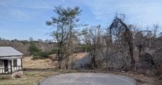
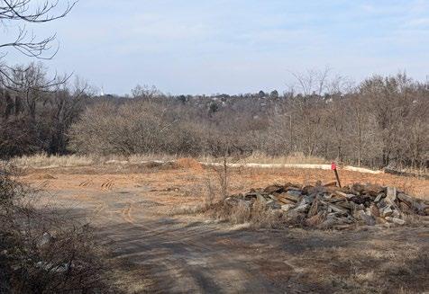
79Strategies & Actions
View of Materials Storage Site from the end of Pulaski Street
View of Materials Storage Site from City access road
CONCEPT PLAN
Due to presence of fill, the site cannot be used for building development but could be transformed into another recreational asset for the neighborhood. The site is more secluded than Jefferson Park so proposed concepts are more specific programmed uses that may be closed at the end of the day for safety and privacy of neighbors.
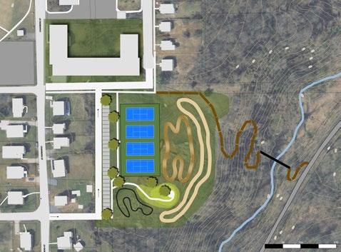
HARD SURFACE RECREATION. The plans for Jefferson Park remove the tennis courts from the corner of Chambers and Kirby Streets in order to better utilize the space as a public plaza. However, if tennis is a desired neighborhood recreational use, it may be possible to establish courts (or another hard surface use) on this site depending on what geophysical and geotechnical evaluations determine the stability and depth of waste on the site to be.
BICYCLE RECREATION AND PUMP TRACKS. Nonstructural uses, such as various types of trails, are the most obviously viable for the site as the underlying conditions are not as critical to their establishment. However, geotechnical and geophysical testing are recommended to establish ‘pavement’ sections; determine potential maintenance requirements, if settlement is expected; and identify the depth to landfill material to inform whether the trails can be constructed (graded) to meet the requirements for each type of track / trail / sidewalk design without exposing historic waste. The plan illustrates that a variety of trails should be considered for the site. Pumps tracks have become increasingly popular in recent years and provide an interesting activity for people to watch, further activating the space.
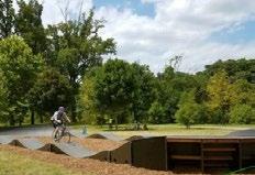
80 Strategies & Actions
earthen
trail connection to Kemper Street Trail
3’ pump track picnic mound long loop
track
BMX loop
track parking
tennis
courts
or other hardscape
recreation
new
street connection
potential redevelopment
Concept plan for Materials Storage Site for various bicycle pump tracks and potential hardscape recreation
Pump track in Roanoke, VA Source: Roanoke Parks & Recreation
TRAIL CONNECTIONS. Memories of Tinbridge Hill residents, an adjacent neighborhood separated from Dearington by the railroad and Kemper Street Trail, report using an earthen trail through the site (despite the landfill presence) to reach the Jefferson Park pool. Establishing a similar trail from Jefferson Park, through existing public right-of-way, could provide a connection to the City’s larger trail network by tying into the paved Kemper Street Trail, and thus connect to Tinbridge Hill once more. A tributary to Blackwater Creek does run parallel to the Kemper Street Trail and will likely require a bridge to make a formal trail connection.
PICNIC MOUND. The site in its current condition already delivers interesting views of the Tinbridge Hill Neighborhood and even of various church steeples along Rivermont Avenue. Adding fill to create a “picnic mound” would enhance those views as well as provide good visibility to the various bicycle tracks. The addition of soil to create the mound would allow trees to be planted for shade. Establishment of hard surfacing or structures like gazebos would require geotechnical borings for the alignment to determine the suitability and strength of the underlying soil and its potential for settlement for the construction of a structure, and geophysical studies / probes to locate depth to the landfill material.
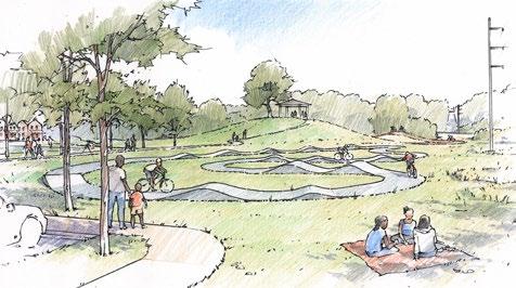
STREET CONNECTIONS, PARKING, AND ADJACENT REDEVELOPMENT. The plan illustrates connecting Pulaski Street back to Kirby and Chambers Streets through existing right-ofway. Topography is challenging here but does not exclude the possibility. The one-way connector loop is to provide parking access on-site while restricting use as a City street. It flows in a loop down the existing access road and then ties into the Kirby Street extension. These new driving surfaces appear to be adjacent to the known fill but should not be constructed without geotechnical borings to determine the suitability of the underlying soil.
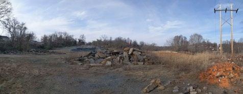
Actions
81Strategies &
Concept for the Materials Storage Site showing various pump tracks, tennis courts, redevelopment of Pulaski Street, and picnic mound for capturing views. Hill Studio / Peter Giraudeau
Materials Storage Site today
FUTURE PLANNING EFFORTS
This chapter was added to the plan in the fall of 2021 to include content from the final “staff report” completed in April 2021. That report covers typical planning topics not originally included in the body of this plan because they require more neighborhood discussions than were able to happen due to the COVID-19 pandemic. Its purpose is to guide future planning efforts in the Dearington neighborhood. Content included in this chapter has not received the same level of public input or vetting but is the result of initial neighborhood input in December 2019 as well as staff research and thought on neighborhood plan topics during the pandemic. The recommendations here should be discussed in a public forum or process and modified as needed prior to implementation.
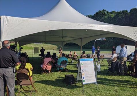
NEIGHBORHOOD DISCUSSIONS
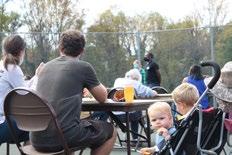
TRANSPORTATION
LAND USE AND HOUSING
Future Planning Efforts
82
•
•
•
October 2020 Outdoor Workshop
Lynchburg Police Department Listening Session in Jefferson Park, July of 2020
NEIGHBORHOOD DISCUSSIONS
Successful neighborhood planning requires open and continuous communication between citizens and public servants. When the development of this document ends, the need for discussions do not. Neighborhood issues are ever evolving and the City needs to continuously confirm its actions and spending with its citizens. Additionally, specific topics outlined below should be marked for further discussion.
LOGISTICS
Future engagement with the neighborhood should be done at times and places accessible to the community. In-person, face-to-face meeting is essential. Technological constraints make meetings either inaccessible or too difficult to fully understand one another. Evening meetings on weeknights can be difficult for families eating dinner and managing children. If weeknights are the only possible time, meals and childcare should be provided. Otherwise, Saturday afternoons appear to be an easier time for neighborhood attendance.
NEIGHBORHOOD NAME
The ‘Dearington’ name itself has come up on multiple occasions during the recreation plan process. It is somewhat widely thought that ‘Dearington’ neighborhood was named for local confederate general James Dearing. Lynchburg Museums staff have been unable to find primary source data linking the naming but have determined it is plausible given his connection to the Lynchburg area. Residents and Lynchburg citizens have expressed concerns over the connection to the name, given that the historic and current racial demographic of the neighborhood is largely Black. Others, however think Dearington has developed an identity of its own over time and the connection is tenuous. As determined by the steering committee and the neighborhood, these conversations are important to continue as the climate around these connections evolves. Facilitators to lead the discussions should be carefully chosen to be the most hospitable to all viewpoints and follow the neighborhood’s collective desires.
PUBLIC ART
Public art appears throughout this document as a way to enliven public space and build community connections. Each installation will be different and should require a degree of “checking in” with the neighborhood before adding a new street mural, sculpture, or other installation.
CRIME
From May to October 2021, there were three fatal or near fatal gunshot incidents in the Dearington neighborhood. All three were during daylight hours, adding to the alarm of such events. Dialogue between neighbors and with the City will help the neighborhood heal and move forward from such violence.
AMBASSADORS PROGRAM
It is becoming a best practice in Neighborhood Planning to consider a stipend for neighbors with continued involvement and commitment to planning efforts. The growing understanding is that a citizen’s time is valuable and scarce just as is a consultant’s time. Their input and thoughts are also no less important to the process; however, their ability to attend meetings may be contingent on financial reimbursement for their time not spent on other daily activities. Planners are coming to realize that purely altruistic attendance to community meetings is a luxury that only people of certain incomes and comfort levels can afford. A program for “neighborhood ambassadors” could be created with job descriptions and expectations set for those providing regular input, working with their neighbors, and receiving the stipend in return.
83Future Planning Efforts
TRANSPORTATION
Transportation recommendations contained in the “Strategies and Actions” chapter relate to recreation and access to recreational facilities. Those actions will also improve transportation for non-recreational activity; however, they do not cover all that can be done to improve streets and transportation in the Dearington Neighborhood. Recommendations in this section will improve access to jobs and services, safety for students and neighbors, and functionality of neighborhood streets as places people don’t just drive, but also park, walk, bike, play, meet neighbors, socialize, wait for the bus, view a neighborhood, and the list goes on.
SMYTH STREET
Smyth Street is a central street within the neighborhood, connecting three major fixtures of the neighborhood-Sunshine Market, Dearington Elementary School for Innovation (DESI), and New Dearington Baptist Church. Members of the neighborhood expressed a number of concerns early in the planning process that design improvements could help solve.
Speeding, Rolling Stops
Neighbors in the area have reported and City staff has observed that vehicles often speed along Smyth Street particularly in front of DESI and only come to rolling stops at 2nd Street, by Sunshine Market. It is a straight, flat street through the neighborhood with no stop signs at cross streets. The traffic volume in this location, however, may not rise to standard levels to warrant stop signs. Alternatively, constricting the space with curb extensions that demarcate on-street parking and adding speed humps should be considered as a means to slow vehicles down, particularly in front of DESI. Additionally, DESI could consider a program to install street murals in the intersections around the school to emphasize pedestrian activity, extend their presence further into the community, and slow vehicles down.

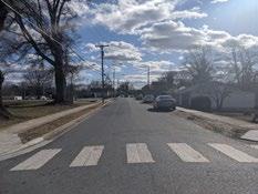
Drainage
In the areas with no curbs, between Caroline and 2nd Street, drainage is a problem in the onstreet parking zones. Dirt has built up over time, stormwater pools and it becomes muddy when it rains. The southwest side of the street remains in the City’s Combined Sewer Overflow (CSO) zone, and could be considered for separation and stormwater improvements. Curb extensions used to slow traffic may also be designed for stormwater retention and filtration. Creating a “green street” such as this in the direct vicinity of an elementary school would be valuable community asset and learning opportunity for DESI students.
Pocket Park
The concept plan illustrates improvements mentioned above, as well as the potential to create a small “pocket park” on the corner of 2nd and Smyth and transform the street space around Sunshine Market. Sunshine Market has been a hub of negative activity, possibly criminal, in the neighborhood in recent years. In the past it was a more positive influence on the community where neighbors held monthly accounts and could access fresh produce. The pocket park land is currently privately owned but would be difficult to build a home on. A small seating area where neighbors are invited to hang out would put more “eyes on the street” and deter negative loitering. Future plan efforts should involve reaching out to the Sunshine Market owners and working with them on improving the area around the store to reestablish its role as a neighborhood asset.
84 Future Planning Efforts
Sunshine Express Market at 2nd and Pollard
Smyth Street near DESI. Curbing shown on left and none on the right, leading to drainage issues in the on-street parking zone.
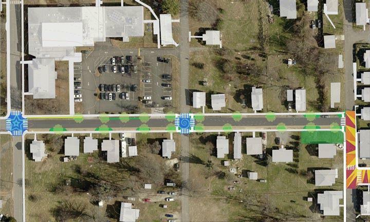
85Future Planning Efforts
DESI street murals existing sidealk curb extensionparking
Sunshine Market street muralpocket park new sidewalk
Dearington Elementary School for Innovation
Sunshine Market
SMYTH STREET
CAROLINE STREET
2ND STREET
Concept for Smyth Street
CLOSING YORK STREET
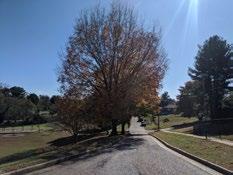
Dearington Elementary School for Innovation (DESI) Administration has asked for the section of York Street between Caroline and 1st Street to be closed to through traffic during the school day or even permanently. Students currently must cross this street to reach the school’s playground and field. Teachers and administration at the school are concerned about student safety and are willing to open and close a gate at the start and end of the school day. The temporary barriers the school currently puts up daily get moved or knocked over frequently. A swing gate would be more substantial and prevent drivers from ignoring the temporary closure. Implementation and funding this improvement will need to be coordinated with Lynchburg City Schools (LCS) and City of Lynchburg Public Works.
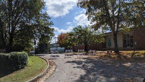
86 Future Planning Efforts
Students at DESI must cross York Street regularly with the school on the right of this photo and playground on the left
Barriers put up by staff at DESI daily are often knocked over or removed during the school day.
PUBLIC TRANSPORTATION
Route 1A and 1B are loop routes travelling in opposite directions that run along Chambers Street, through the Dearington Apartments and along Caroline Street to Page Street. The routes connect to a variety of destinations in the Midtown and Downtown areas.
Route 8 runs along Langhorne Road and connects to the Kemper Street Transfer Center and to Old Forest Road and Lynchpin Industrial Park on Jefferson Ridge Parkway. Using Route 8 is difficult for Dearington residents as any round trip will require crossing Langhorne Road, where there are limited crossing opportunities available.
With these routes, Dearington should be considered to have better than average transit service. However, lengthy headways and minimal infrastructure at transit stops make use of GLTC difficult and rarely a first choice. No grocery store is directly connected other than Walmart, 3.5 miles away, on Old Forest Road via Route 8.
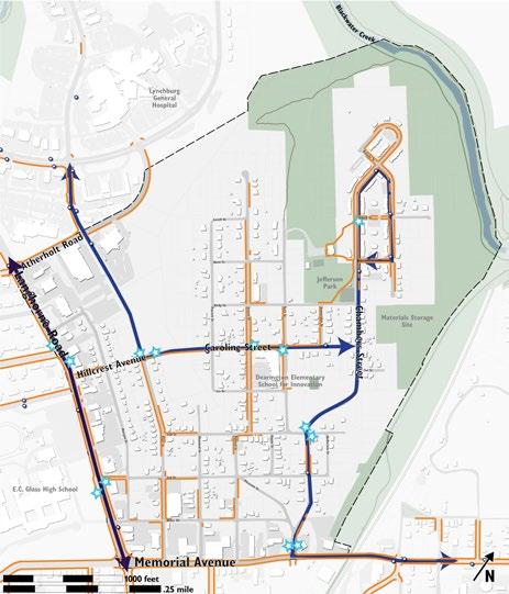
Bus Routes and Stops

87Future Planning Efforts
Bus Stop Infrastructure
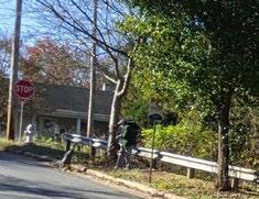
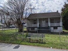
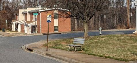
Boarding and alighting data is continuously collected by GLTC, but system ridership has not yet recovered from the COVID-19 pandemic. As things normalize, certain stops in Dearington should be prioritized for enhancements. The map to the right highlights certain bus stops but these should be further prioritized based on collected data, neighborhood input, and cost effectiveness. Federal Transit Administration (FTA) regulations require that whenever any work is done to improve a transportation stop, the stop must be brought into compliance with the Americans with Disability Act (ADA). This also requires that there be a path from a stop to a “logical destination,” often adding significant sidewalk work when improving a stop. Options for relief exist but require a rigorous analysis to prove meeting the rules is infeasible. Many of Lynchburg’s transit stops predate these requirements; GLTC is also required to spread its resources equitably across its system. While necessary, these improvements will end up being costly so targeting stops strategically for the most impact will be crucial.
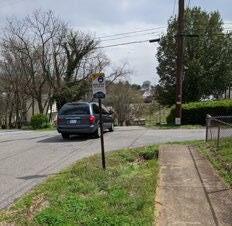
88 Future Planning Efforts
Bus stop at the corner of Pulaski and Chambers Streets in the Dearington Apartments is not ADA accessible and lacks shelter.
Bus stop on Chambers and 3rd Street with significant accessibility issues.
These two stops are a pair at Page and Caroline Streets that should be prioritized for accessibility improvements.
Bus stop on Caroline Street across from DESI is the best equipped in the neighborhood.
Destination Access
Additional analysis should be done to see how much of the City is actually accessible via public transportation within a reasonable amount of time. Having to transfer buses can add significant time to a single trip. On the other hand, access to destinations directly connected via one transit line is valuable. Lynchburg General Hospital is easily accessed from the Dearington neighborhood, albeit with long wait times between buses. Enhancing this connection should be considered as employment opportunities are sought for Dearington residents and workforce housing is considered for Centra Employees.
Alternative Improvements
Access to grocery stores via public transportation may be an issue for Dearington residents. One idea to consider given longer travel times to reach a supermarket may be the provision of freezer or refrigerator bags or units on buses. While this may improve grocery store trips, it should not be considered as a replacement for better headways and more connected service that saves riders their valuable time.
SIDEWALK IMPROVEMENTS
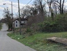
As shown on page 33, sidewalks throughout the neighborhood are often disjointed and stop and start for a variety of reasons. Topography and drainage infrastructure does make installing sidewalks difficult in some places. However, in others, there appears to be no reason the sidewalk was not constructed. Overall, this leads to an unfinished look in the neighborhood and an unreliable walking environment. Hillcrest Avenue/Caroline Street, Page Street, and Chambers Street should be priorities for completing walking routes in the neighborhood as they receive heavier vehicular traffic and lead to destinations in and out of the neighborhood. Further study and neighborhood input is needed to prioritize other walking routes in the neighborhood, but generally as an older neighborhood with existing, if somewhat spotty sidewalk infrastructure, neighborhood streets should be lined with sidewalks and street trees wherever possible.
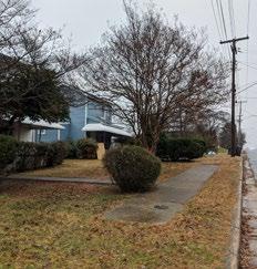
89Future Planning Efforts
Sidewalk on Pollard Street with challenging topography
Sidewalk on Smyth Street in front of one house on a block
90 Future Planning Efforts
Missing sidewalk along Langhorne Road
Westover Boulevard in Lynchburg illustrates a more complete neighborhood street with on-street parking, street trees, and complete sidewalks. Source: Google Streetview
Sidewalk Priorities
*streets in the Dearington Apartments are not marked as they all have continuous sidewalks on both sides of the street.
PRIORITIES
Connecting major destinations, improving safety on busier streets, and availability of alternative routes informed this prioritization. Ease of construction varies widely but was considered. For example, Chambers Street will be difficult to improve but is crucial to safety and accessibility for the neighborhood so it ranked in the highest priority. Smyth Street will be easy to fill in sidewalk gaps but is less important than Chambers Street.
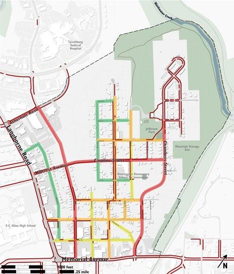
Priorities shown here should be designed per other improvements recommended by this document for multi-use trails, bike lanes, etc.
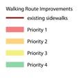
Priority 1
Hillcrest Avenue/Caroline Street Chambers Street Page Street
Priority 2
Smyth Street/Pollard 2nd Street 3rd Street Kirby Street York Street to park entrance
Priority 3 Munford Street Payne Street Miller Drive Morgan Street York Street Pleasant Street
Priority 4 Morgan Street 1st Street Patrick Street Hunt Street Lovell Street Stoneridge Street
91Future Planning Efforts
TRAFFIC CALMING
During this plan process, residents noted that Chambers Street, Caroline Street, Page Street, and Smyth Street all have speeding and dangerous vehicle behaviors. Speed bumps have been requested regularly. Generally, traditional speed bumps are not the best way to calm traffic due to the difficulty emergency and utility vehicles may have navigating them, the increased noise and air pollution they cause, the inconvenience for pedestrians and cyclists, and potential drainage issues they may cause.
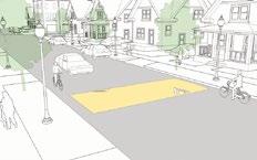
“Traffic calming” is the act of reducing vehicle speeds and/or cut-through volumes through changes to the physical design of a street to increase safety, livability, or other public purposes. Neighborhood streets, with low speed limits (30mph or less), are good candidates for vertical speed controls other than traditional speed bumps. These include speed humps, speed cushions, speed tables, or even raised intersections. Speed humps are shorter and longer than speed bumps and keep traffic around 10-15mph. Speed bumps are best applied in a very specific area, like a parking lot, and keep traffic 2-10mph. When installing any traffic calming, it needs to be considered on a neighborhood level, not a street level, as calming one street may move issues to an adjacent route.
Speed cushions may be appropriate for Page Street, where there is a high volume of ambulance traffic heading to the hospital. Speed cushions are slightly narrower than speed humps and allow vehicles with wider bases (ambulances) to pass unimpeded.
Source: NACTO
Speed tables are longer than speed humps and flat on top. They raise the entire vehicle up to slow it down. They are often combined with curb extensions and crosswalks.
Source: NACTO
Speed humps are shorter and longer than speed bumps and don’t require vehicles to slow quite as much.
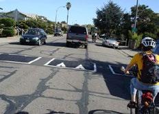
Source: NACTO
The City of Lynchburg has a Neighborhood Traffic Management Program (NTMP), an established process by which a neighborhood can request and be evaluated for traffic calming measures. Streets must meet certain criteria to be considered and achieve a priority status based on predetermined metrics. The process also requires active neighborhood participation and leadership to insure the changes are desired by the neighborhood as a whole. Whether through the NTMP process or a separate effort, Dearington’s streets should be evaluated for whether traffic calming is appropriate and which elements would be most effective.
STREET LIGHTING
Residents have expressed concerns over neighborhood lighting and a feeling of being unsafe in poorly lit areas. During the plan process, staff found a number of overhead streetlights were out and had AEP replace them. Future planning efforts to neighborhood streets should consider whether more lighting is needed, particularly pedestrian lighting on key routes.
92 Future Planning Efforts
LAND USE & HOUSING
This section covers steps needed to ensure the land in Dearington is being put to its highest and best use to the benefit of the both the City and the neighborhood. The City will comply with any requirements for public notice for legal changes, but should also strive for public support. People’s finances and lives are affected by where they live and the shape of their neighborhood. Changes brought on by these recommendations need to be ones the neighborhood wants to see.
SURVEY ADJUSTMENTS
Multiple places in the neighborhood should be looked at for survey line adjustments to more accurately reflect right-of-way and City-owned property. Parcel lines need to be corrected so that what is real estate could be sold for development or accounted for as part of a larger City-owned property.
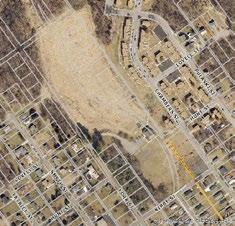
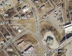
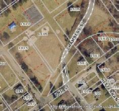
Chambers Street Gateway
The “triangle” at the Chambers Street gateway could potentially be redeveloped as trail parking per this document, or alternatively as either additional neighborhood park space or even private development. However, the parcel lines are extremely inaccurate and it makes the site difficult to work with.
Chambers Street at DESI Properties on Chambers Street, along and encompassing the DESI playground, need to be adjusted so that Schools has one parcel, the street is clearly designated as right-of-way, and any remaining land can be parceled off. Doing so will at a minimum make the land easier to plan, study, and remediate as needed.
Future Planning Efforts
Jefferson Park
Jefferson Park contains a number of parcels that are relics from when the neighborhood was originally platted, before it was a park, and from old plans to make the park system drivable. Consolidating these parcels will simplify the mapping and forestall confusion in future efforts.
93
Chambers Street Gateway
Chambers Street at DESI
Jefferson Park
STAGNANT PARCELS
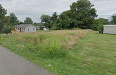
Many parcels in Dearington seem to be “stagnant.” Stagnant parcels are ones that may be in limbo due to a number of factors described below, but mainly are sitting vacant over a long period of time and not being put into use. A map on page 34 shows how widespread this problem could possibly be. It is accepted that some properties that are mapped are not truly stagnant. The map shows parcels under three main categories that may indicate that they may be stagnant: the owner name contains the word “estate,” the land is vacant and has not been sold in over thirty years, and tax delinquency status. Likely, owners of the properties have died and the heirs to the property are unknown or the heirs are not aware they inherited the land. This is a problem not confined to Dearington, but widespread in the City’s older neighborhoods. Facilitating the transition of these properties into the hands of people who will use them is important to keeping Lynchburg’s older neighborhoods vibrant and tax base strong.
DEARINGTON APARTMENTS
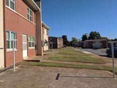
The Dearington Apartments are owned and operated by the Lynchburg Redevelopment & Housing Authority (LRHA). There are one hundred units in the development, all in a rowhouse style format, despite being called “apartments.” The units range from 1 – 4 bedrooms and were solidly built when they were constructed at the end of the 1950s.
In 2020 LRHA conducted a property assessment and determined the units are undersized and in need of upgrades inside and out to meet modern standards and best practices. However due to the substantial construction of the buildings, the structures are difficult to modify. The exterior of the development was designed so that back doors face the public streets and front doors open onto lawns. This leaves the street side, where much of the neighborhood’s activity occurs, with equipment often placed to the side or rear of buildings. Additionally, the exterior of the units are uniform and the landscaping is sterile making the development “look like public housing” and assume the stigmas associated with such. Lastly, the development lacks any accessible units, having been built decades before the Americans with Disabilities Act (ADA) was passed.
233 York Street is owned by an estate, ownership last changed hands before 1926, is vacant, and yet is a very developable property in the middle of the neighborhood. Property taxes have not been paid since 2012.
94 Future Planning Efforts
Interior of Dearington Apartment with boiler beside the kitchen
Courtyard side of Dearington Apartments
Along with the property assessment, LRHA has considered the future of the Dearington Apartments and conducted its own master planning effort for the site in the spring of 2022. With their mission to increase housing opportunities and recently adopted goals to increase the supply and quality of affordable housing in the City of Lynchburg, LRHA has determined the best approach for the Dearington Apartments site is to demolished the existing development and replace them with a combination of new 3-story apartment buildings, 2-story rowhouses and duplexes.
LRHA’s mission is to maximize housing opportunities by being a leader in community redevelopment, by revitalizing neighborhoods, and by promoting economic growth and development through collaborating with organizations and the greater community to achieve clean, comfortable, attractive, affordable housing maintained in a manner that fosters pride and dignity�
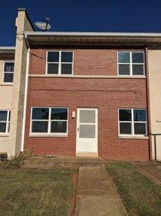

Future Planning Efforts
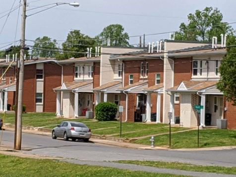
95
Street-side facade of Dearington Apartments where most utilities are located.
Courtyard entrance to unit
Affordable housing development in Buena Vista, Colorado with individual facade treatments and front porches creates a neighborhood feel
Their Conceptual Redevelopment Master Plan incorporates 242 new units, replacing the previous 100, and gradually increases the density deeper into the site. This helps blend the development, with rowhouses and duplexes near the front, with the existing neighborhood. The additional units allow LRHA to offer affordable housing to both existing residents who wish to remain as well as to additional individuals and families of both low and moderate income, transforming Dearington into a “mixed-income” community, which follows national best-practices for affordable housing.
Development of the Master Plan is anticipated to occur in two or three phases that will involve relocation of residents, followed by demolition and new construction. While residents will have to move before demolition and new construction can occur, the goal is to minimize the impacts of the process. Therefore, construction will be organized so that, to the extent possible ,some residents will be able to continue living on the site while construction is underway, and relocate to the new units should they elect to stay at Dearington.
The Plan incorporates two and possibly three-story rowhouses, which incorporate front doors facing the street, and modern design that incorporates references to historic architecture.
Conceptual Redevelopment Master Plan for Dearington Hills Apartments
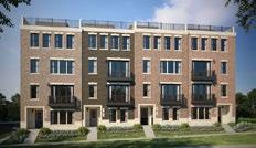
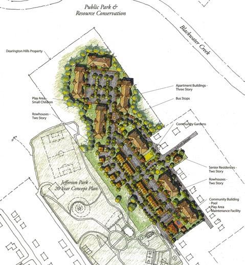
Source: Lynchburg Redevelopment & Housing Authority
Future Planning Efforts
96
The plan uses a “pedestrian-first” design, appropriate for the neighborhood, orients buildings toward the street, keeps parking in the rear, and includes sidewalks with street trees as buffers. Modifications to the City’s street network shown on the plan will need to be reviewed by City Staff and approved by City Council.
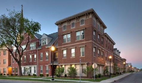
The Plan proposes the construction of a new community building, which is proposed to be located on Chambers Street, at the entrance to the site. This location, across the street from the proposed enhanced entrance to Jefferson Park, will create a new gateway to the site. The community building will have management offices, as well as community spaces for meetings, a computer work room and possibly a fitness center for residents. An outdoor splash pad is also proposed on the site adjacent to the community building. In addition, the Plan illustrates several potential locations for play areas for small children, as well as a site for a community garden and gazebo for outdoor events.
The Conceptual Master Plan was prepared with input from residents of Dearington Hills Apartments and the surrounding community. Two resident meetings and one community meeting were held to present analysis information and Alternative Concept Plans. Participants in both resident and community meetings expressed a preference for the same Alternative Concept, which was subsequently adopted by the LRHA Board of Commissioners as the Conceptual Redevelopment Master Plan.
Planning Efforts
97Future
Liberty Green mixed-income redevelopment in Louisville, Kentucky exemplifies the type of neighborhood character desired for new construction at Dearington Hills Apartments.
NEIGHBORHOOD HOUSING
The Dearington Apartments and Jefferson Park are zoned R-4, the City’s highest density residential district, which allows for large apartment buildings. The majority of the neighborhood is zoned R-3, which permits duplexes by-right, but not rowhouses. Duplexes and rowhouses are similar in their impacts and if anything, rowhouses are generally perceived as higher quality housing. To help soften stigmas associated with the Dearington Apartments, a rowhouse style development, as well as provide more quality affordable units throughout Lynchburg, the City should consider whether rowhouses are appropriate in certain districts where apartments are still not considered suitable. If not appropriate city-wide, overlay districts permitting this style of development should be considered for more traditional neighborhoods where rowhouses would be appropriate.
Rowhouses, not Townhouses
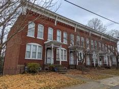
Rowhouses and townhouses differ in Lynchburg. Lynchburg’s zoning ordinance allows townhouses by conditional use permit (CUP) in R-3 districts, but these developments do not reflect good urban design, especially for traditional neighborhoods. Townhouse developments have a requirement for a minimum of 2 acres and while the actual buildings may have charming qualities, they front on parking lots and ignore public streets nearby. These developments lead to pockets of density around the city but do not create cohesive neighborhoods. Functionally they almost exclusively require travel by automobile. Should rowhouses be permitted, they should be designed to front only on public streets. Access should be taken from rear allies to avoid driveways breaking up sidewalks every twenty feet.
R-3 Zoning Changes
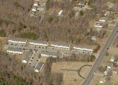
Changes to the zoning ordinance districts will need to be analyzed in order to accommodate the higher density of rowhouses. In some cities, rowhouses lot can be as narrow as sixteen (16’) feet. Lot frontage, coverage and lot size in particular will need to be considered in the R-3 district. Setbacks should match the existing R-3 requirements so to blend into existing neighborhood fabric.
Parkfront Housing
Hill Studio aided the City in applying for a grant to study housing along York and Kirby Streets, lining Jefferson Park. Housing shown on the Jefferson Park Master Plan illustrates the potential for rowhouses or even apartments that take a rowhouse form. Blending this type of housing into the single-family neighborhood may help soften stigmas associated with the Dearington Apartments and provide needed housing stock in a valuable park-front location. The study will involve collecting public input and assessing the overall feasibility of this development.
98 Future Planning Efforts
Many townhouse developments in the City provide density and attractive facades but front on parking lots and provide no interaction with the existing neighborhoods. All travel must be by automobile.
Rowhouses can blend into a neighborhood by maintaining setbacks and scale of single-family housing.
Hill Studio / Peter Giraudeau
Rowhouses on Cabell Street that are appropriately scaled with the neighborhood.
Existing Housing
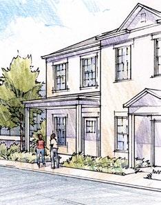
Due to the age of the housing stock (average age is 1950), the elevated presence of young children in the neighborhood, and the concentration of rental properties, there is an increased potential for lead exposure in Dearington. These factors are similar to other older neighborhoods in Lynchburg, and a lead abatement program should be explored as a potential tool to ensure safety and to help encourage revitalization of these neighborhoods.
R-4 along Page Street
Between Page Street and Morgan Street, there is an area of single-family homes zoned R-4. Many of these are rental properties and given their location, directly behind a developed commercial area, are likely not the highest and best use of these properties. It may make sense to encourage parcel consolidation and promote redevelopment of these homes as apartments as a transition from the commercial area fronting Langhorne Road to a lower density single-family and rowhouse neighborhood. The land should not be downzoned, when centrally located, affordable and accessible housing is needed in the City. Properties zoned R-3 along Page Street should be considered for R-4 development as well. Following appropriate public notification and input, the Future Land Use Map should be changed to reflect the appropriateness of higher density development.
B-5 Residential Areas
Between 3rd Street and Memorial Avenue, residential structures are zoned B-5, General Business District, the City’s most intense commercial zone. Being zoned B-5 prevents homeowners from making some improvements to their property. These areas need to be considered for downzoning if the residential use is determined appropriate long-term.
COMMERCIAL AREAS
The commercial areas lining Memorial Avenue and Langhorne Road appear to be plagued with vacancies. Generally, many of the commercial businesses are not neighborhood serving, as well. Following the COVID-19 pandemic, the commercial properties “contribution” to the neighborhood should be assessed. This could be done by assigning a score of 0-3 based on neighborhood employment (employees from the adjoining neighborhood), 0-3 based on % of customers from the adjoining neighborhood, and 0-3 based on the lot/buildings aesthetic contribution to a traditional neighborhood. A data-driven assessment of the commercial area, coupled with public input, may inform regulatory changes to improve these business zones.
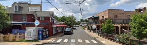
Future Planning Efforts
99
Vacant commercial building on Langhorne Road
Belmont neighborhood in Charlottesville illustrates how commercial uses have historically been embedded in residentail neighborhoods. Source: Google Streetview
Neighborhood friendly facades Hill Studio / Peter Giraudeau
Commercial property along Langhorne Road is primarily zoned B-1, the most neighborhoodfriendly business district, while properties along Memorial Avenue are zoned B-5, the City’s most intense business district. Thought needs to be given on whether the zoning here is working in the best interest of the community.
Sunshine Market and the block of Pollard Street it sits on is also zoned B-1, despite Sunshine being the only commercial operation in the block. This area could be considered for downzoning with the exception of Sunshine Market property or a shift to more neighborhood commercial with the incorporation of mixed use buildings. Enhancing the area around Sunshine Market, to make it an essential, positive fixture in the neighborhood should also be considered.
PROFFER REMOVAL
At least two properties in the Dearington Neighborhood received rezoning approval yet were never built as planned. The existing proffers make reuse difficult and necessitate a rezoning and public process. These hurdles deter development and contribute to the issue of stagnant land.
1900 Caroline Street
This property was rezoned to R-4C for six quadplexes in 1981. Access is difficult to this property and a site plan was proffered. Given it has been forty years since this development was approved, rezoning back to R-3 may help the land be put into use. If R-4 development along Page Street proceeds, allowing this property to be developed as R-4 may be appropriate. The owners should be contacted to discuss the property and participate in the process.
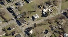
2041 3rd Street
This property was rezoned in 1993 from R-5 to B-1C and is encumbered by a number of proffers that have to do with old site conditions and a building that has since been torn down. The site is currently owned by Centra Health and vacant. It should be considered to be zoned R-4 again to match the rest of the block.
PollardStreet
The entire block of Pollard Street is zoned B-1, despite Sunshine Market being the only commercial use.
1900 Caroline Street is surrounded by R-3
2041 3rd Street is encumbered by proffers and should be considered for R-4.
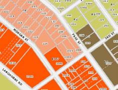
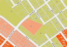
100 Future Planning Efforts
FUTURE LANE USE MAP AMENDMENTS
The Future Land Use Map (FLUM) guides development in the City and informs City leaders when faced with rezoning decisions. The following are recommended by staff for amendment.
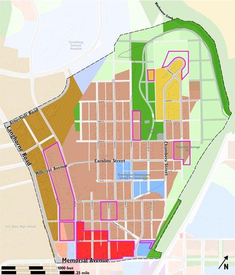
1. Community and Neighborhood Commercial on Memorial should become Mixed Use to promote redevelopment of large lots for affordable and accessible housing and neighborhood serving retail.
2. Between Page and Morgan Streets, Hillcrest and 3rd, change to High Density Residential to match the zoning and promote development of needed housing.
3. Between Page and Morgan Streets, 3rd Street and Miller Drive, change to Mixed Use.
4. Sunshine Market should be designated as Neighborhood Commercial. The rest of the block should become Neighborhood Commercial to match the zoning.
5. Public Works Site at Chambers and Memorial should become Public Park to accomodate a trail connection.
6. York Street properties should become Public Park and High Density Residential
7. Resource Conservation on the Dearington Apartments should be corrected to High Density Residential.
8. High Density Residential on Jefferson Park should become Public Park
9. Materials Storage Site should be designated as Public Park.
Future Land Use Map
101Future Planning Efforts
1 2 3 4 5 6 7 8 9
IMPLEMENTATION MATRIX
Jefferson Park
PROJECT SPECIAL NOTES TIMEFRAME DEPARTMENTS
Basketball Courts
Amphitheater Improvements
Interim Pool Marking
Final Pool Marking
Outdoor Fitness Equipment
Playground Work
COST
estimates from 2020 and 2021, plan to add 3% per year
FUNDING SOURCES
• 1 full, 1 half
• mural on full
• including lighting <5 years Parks & Recreation $75,000 (courts) $10,000 (mural) $100,000 (lights) CDBG PY 2021 and 2022
• stairs, ADA access <5 years Parks & Recreation $50,000 $25,000 (additional) CDBG
• low cost materials <5 years Parks & Recreation $2,500 CDBG
• **depends on approach and level of detail 10 years Parks & Recreation $100,000**
• Phase 1 on Loop Trail 1
CIP, would also be promising grant application
• Phase 2 on Loop Trail 2 5 years Parks & Recreation $100,000 CDBG
• replace existing
• add zip line, hillside slides 5 years Parks & Recreation $200,000
• York Street properties needed
CIP (playground replace ment), CDBG (extras)
Multi-use Gymnasium
• shade, tables and chairs
• patio surface 10 years Parks & Recreation $50,000 CIP, CDBG
• include nearby landscaping 10 years Parks & Recreation $15,000,000 CIP, Grants Neighborhood Center Outdoor Space
Playing Fields
York Street Extension
New Parking Area
Environmental Learning Area
• on landfill 20 years may be an interim step Parks & Recreation $1,200,000 for mini mal fill/grading CIP, Brownfields
• contingent on development potential 20 years Public Works $1,000,000
CIP, Developer Cost, consid er grants
• on landfill, may need geogrid 20 years Parks & Recreation $500,000? CIP, Brownfields
• on landfill, size unkown
• may help “clean” land 20 years Parks & Recreation needs research
Interpretive Signage & Details ongoing, should con tinuously improve Parks & Recreation, sup port from Museums $3,000 ea CDBG PY 2021 & future
Jefferson Park Landfill Study
Landfill Gas Management Study, Design, Implementation
• geotechnical/geophysical study to determine what is feasible on site 10 years
• venting, no active gas extraction included in estimate as likely unneeded ongoing, as deter mined necessary
Parks & Recreation, Eco nomic Development $125,000
Parks & Recreation, Eco nomic Development $100-250,000
Dearington Recreation Plan - Implementation
Brownfields Grants, Operating Budget as feasible
Brownfields Grants, Operating Budget as feasible
102
Jefferson Park - Neighborhood Patio
estimates from 2020 and 2021, plan to add 3% per year
PROJECT SPECIAL NOTES TIMEFRAME LEAD DEPARTMENT COST FUNDING SOURCES
Interim Patio
• remove chain link
Fencing/Railings
• add rail along path and around tennis court drop off <5 years Parks & Recreation $20,000 CDBG PY 2021
Resurfacing <5 years Parks & Recreation $24,000 CDBG PY 2021
Pavilion
• include wifi, charging stations <5 years Parks & Recreation $70,000 CDBG PY 2021
Tables/Chairs <5 years Parks & Recreation $15,000 CDBG PY 2021
Sidewalks
• to tie connector trail to patio <5 years Parks & Recreation $7,000 CDBG PY 2021 Shade Structures 5 years Parks & Recreation $15,000 ea CDBG PY 2021
Lighting
• interim step may be possible 5 years Parks & Recreation $50,000 CDBG PY 2021
• chalk wall 5 years Parks & Recreation $40,000 CDBG PY 2021 Game Tables 5 years Parks & Recreation $20,000 CDBG PY 2021
Interactive Features
Kirby and Chambers Streetscape
Final Patio
• on street parking
• street trees 5 years Public Works $500,000 CIP, CDBG
Splashpad / Pump House / Restroom 10 years Parks & Recreation $1,000,000 CIP
Site work/Surfacing/ Finishing/Landscaping 10 years Parks & Recreation $500,000 CIP
Additional programming/ activies 10 years Parks & Recreation $25,000 CIP, CDBG
Dearington Recreation Plan -
103
Implementation
Trails
estimates from 2020 and 2021, plan to add 3% per year
PROJECT SPECIAL NOTES TIMEFRAME DEPARTMENTS COST FUNDING SOURCES
Jefferson Park
Kirby Street ADA Access
Grand Staircase
Loop Trail 1
Loop Trail 2
Connector Trail
• construct with loop trail 1 <5 years
Parks & Recreation $37,000 CDBG PY 2021
• directs views to pool site 5 years Parks & Recreation $100,000 CDBG
• short loop on south side of neighborhood center <5 years Parks & Recreation $80,000 CDBG PY 2021
• *depends on landfill requirements 10 years Parks & Recreation Economic Development $500,000* CDBG, CIP, Brownfields
• interim step to add lighting & railings <5 years Parks & Recreation $6,000 CDBG PY 2021
• earthen connection to Kemper Street Trail
• requires bridge over stream tributary
• *alternative for cable stayed bridge at grade with Kemper Street
Materials Storage Site Trail
• paved connection to patio 10 years Parks & Recreation
• paved connection through PW site
Kemper Street Trail Spur
Additional site for PW
• cannot be constructed without additional real estate for PW 5 years
Parks & Recreation, Public Works
$150,000 (earthen trail with small bridge) bridge alternative will depend on design $150,000 CIP, CDBG
$150,000 (paving access road) $500,000 (stormwater, etc) CIP, TAP, other grants
• location unkown 5 years Public Works $100,000 CIP
Dearington
104
Recreation Plan - Implementation
Trails (continued)
estimates from 2020 and 2021, plan to add 3% per year
PROJECT SPECIAL NOTES TIMEFRAME DEPARTMENTS COST FUNDING SOURCES
Centra Health Trails to connect neighborhood to hospital area
• use old road base, no bridge needed
• work with Centra on easements 5 years Parks & Recreation $100,000 CIP, CDBG
Creekside Trail paving
Page / Caroline Streets (on-street)
Chambers Street (on-street)
• pave 2 miles of gravel trail from Thompson Drive to Point of Honor Trail to complete loop 10 years Parks & Recreation $1,500,000 CIP, TAP, other grants
• multi-use trail (expand Page St)
• requires ROW 5 years
• acquire right-of-way
• either multi-use trail or sidewalks/bike facility 5 years
Public Works, Community Development, Parks & Recreation $500,000 depends on design CIP, TAP, other grants
Public Works, Community Development, Parks & Recreation $1,000,000 CIP, TAP, other grants
Memorial Avenue (on-street)
Langhorne Road / Park Avenue (on-street)
• needs study - either buffered bike lanes or two-way cycle track with removal of travel lane 10 years
• needs study, see page 71 20 years
Public Works, Community Development, Parks & Recreation needs study
Public Works, Community Development, Parks & Recreation needs study
Dearington
105
Recreation Plan - Implementation
Neighborhood Projects
estimates from 2020 and 2021, plan to add 3% per year
PROJECT SPECIAL NOTES TIMEFRAME DEPARTMENT COST FUNDING SOURCES
Caroline Street Gateway
• see “trails” for multiuse trail projects
• fill gaps on south side and connect to Page Street bus stops
Hillcrest Avenue sidewalk
• finish north side sidewalk 5 years Public Works, Community Development $50,000 (fill gaps) $30,000 (north side) Operating Budget, CDBG
Gateway Signage 5 years Community Development $10,000 CIP
• make ADA accessible
Bus Stop Improvements
• add shelter with sides to select stops 5 years GLTC $20,000 each GLTC, CDBG
• see “trails” for Kemper Street Trail Spur and Chambers Street multi-use trail
Chambers Street Gateway
Chain Link Fence relocation
• coordinate with Water Resoures utility replacements
• landscape hillside as needed <5 years Public Works $15,000 Operating Budget, CDBG
• time with Kemper Street trail spur
• street crossing needs study 10 years Parks & Recreation $500,000 CIP Sidewalk and intersection
Parking area
narrowing
Stormwater storage
• sidewalks as shown on plan 10 years Public Works $500,000 CIP, CDBG
• under Public Works site
• may include separating combined sewer 10 years Public Works, Water Resources $500,000 CIP
Gateway Signage 5 years Community Development $10,000 CIP, CDBG
Dearington
106
Recreation Plan - Implementation
Neighborhood Projects (continued)
estimates from 2020 and 2021, plan to add 3% per year
PROJECT SPECIAL NOTES TIMEFRAME DEPARTMENT COST FUNDING SOURCES
Materials Storage Site
geotechnical/ geophysical study
• see “trails” for connection to Kemper Street Trail
• do in conjunction with Jefferson Park study for $250,000 <5 years Economic Development $125,000 Brownfields Grants
pump tracks 10 years Parks & Recreation Economic Development $50,000 CIP, Brownfields Grants? picnic mound 10 years Parks & Recreation Economic Development $40,000 CIP, Brownfields Grants? site furnishings 10 years Parks & Recreation Economic Development $15,000 CIP, Brownfields Grants? parking area 10 years Parks & Recreation Economic Development $250,000 CIP, Brownfields Grants?
• specific use TBD
hardscape recreation
Kirby/Pulaski Street connection
Miscellaneous
• **depends on study of landfill 10 years Parks & Recreation Economic Development $200,000** CIP, Brownfields Grants?
• would be done with new housing development 10 years Public Works Economic Development $750,000 CIP, Brownfields Grants?, potentially funded with adjacent development
Smyth Street Improvements
• needs public input 10 years Public Works $500,000 CIP, TAP Closing York Street with swing gate 5 years City Schools $10,000 Public Works / LCS
Adjusting Survey Lines
• 3 locations 5 years Community Development, Public Works $60,000 Operating Budget, as feasible
• Rowhouses
• Zoning changes/ corrections
• proper notification will require significant cost
• needs public input 5 years Community Development $50,000 Operating Budget, as feasible Possibly done in-house Street Mural
Zoning Ordinance Changes
• calm traffic at Kirby & Chambers Street 10 years Community Development, Public Works, Parks & Recreation $10,000
Dearington Recreation Plan - Implementation
CDBG, CIP, Grants for Tactical Urbanism
107


