
RIDGE CONNECTOR TREKKING ROUTE PLAN CASHIERS, NC HIGHLANDS, NC CLAYTON, GA
BLUE
PRODUCED FOR:
HIGHLANDS PLATEAU GREENWAY
P. O. BOX 2608, HIGHLANDS, NC 28741
PRODUCED BY:

DESTINATION BY DESIGN
136 FURMAN RD STE 6, BOONE, NC 28607
ACKNOWLEDGMENTS
PROJECT OVERSIGHT COMMITTEE
Jim Chance Highlands Plateau Greenway
Jim Ward ........................................... Highlands Plateau Greenway
Lance Hardin Highlands-Cashiers Land Trust
Andrew Renfro ................................ Highlands-Cashiers Land Trust
Stephen Arbitter ............................. City of Clayton
Bill Horton......................................... Village of Cashiers
Matt Shuler ....................................... Town of Highlands
Brent Martin Bartram Trail Conservancy
Don Reis ............................................ Bartram Trail Conservancy
Chris Tranchina Bartram Trail Conservancy
Grayson Keating ............................. Highland Hiker - Cashiers
Chris Wilkes Highland Hiker - Highlands
Trey McFalls...................................... Shady Creek Expeditions - Clayton
C J Thompson ................................. Rabun Forward - Clayton
Viviana Ruis ..................................... USFS - Nantahala
KEY STAKEHOLDERS
Trudy Crunkleton City Manager - Town of Clayton
Pat Taylor .......................................... Mayor - Highlands
Kelsie Mortenson USFS - Nantahala Ranger District
Barb Ramey...................................... USFS - Chattooga Ranger District
Jess Riddle ........................................ Ecological Consultant
71 35 Table of CONTENTS 49 19 41 09 CHAPTER 1: INTRODUCTION & BACKGROUND 1.1 Background 1.2 Plan Goals 1.3 Planning Process 1.4 Plan Organization CHAPTER 6: IMPLEMENTATION 6.1 General Implementation Recommendations 6.2 Trail Segment Details 6.3 Funding Opportunities CHAPTER 5: RECOMMENDATIONS 5.1 Overview of Planning Section Descriptions & Maps 5.2 Planning Section Descriptions & Maps 5.3 Supporting Infrastructure Recommendations CHAPTER 4: TRAIL CHARACTER & DESIGN GUIDELINES 4.1 Trail Types 4.2 Trail Sustainability 4.3 Signage & Wayfinding CHAPTER 3: COMMUNITY ENGAGEMENT 3.1 Project Oversight Committee 3.2 Community Lectures 3.3 Stakeholder Meeting 3.4 Community Meeting CHAPTER 2: RESEARCH & ANALYSIS 2.1 Study Area Description 2.2 Previous Planning Efforts 2.3 Natural Environment Analysis 2.4 Built Environment Analysis 2.5 Opportunities & Constraints Map and Photo Series
Exh 01: Trail Type Precedent Images ........................... 43 Exh 02: Signage and Wayfinding ................................. 46 Exh 03: Village of Cashiers ............................................ 54 Exh 04: Whiteside Mountain ......................................... 55 Exh 05: Town of Highlands............................................ 58 Exh 06: Glenn Falls ..........................................................59 Exh 07: Chattahoochee National ForestChattooga River Ranger District ................... 62 Exh 08: Rabun Bald .........................................................63 Exh 09: City of Clayton ...................................................66 Exh 10: Connecting USFS Trails ................................... 67 Exh 11: Trekking Routes - Case Studies ..................... 69 Exh 12: Trail Status and Trail Type Totals ................... 74 Exh 13: Trail Segment Details ....................................... 76 Exh 14: Trail Type and Elevation Profile ...................... 78 EXHIBITS APPENDIX
Map 01: Regional Context ............................................. 11 Map 02: Study Area Overview ...................................... 21 Map 03: Opportunities and Constraints - NC ............ 31 Map 04: Opportunities and Constraints - GA ............ 33 Map 05: Route Overview and Planning Sections..............................................................51 Map 06: Route Recommendation - NC1 ..................... 53 Map 07: Route Recommendation - NC2 ..................... 57 Map 08: Route Recommendation - GA1 ..................... 61 Map 09: Route Recommendation - GA2 ..................... 65 Map 10: Existing Blue Ridge Community Connector Trail Segments .............................. 75 A.1: Sustainable Trail Design, Construction, and Maintenance Guidelines ................................. 84
MAPS
1.1 - BACKGROUND
1.2 - PLAN GOALS
1.3 - PLANNING PROCESS
1.4 - PLAN ORGANIZATION
1
INTRODUCTION & BACKGROUND
The Blue Ridge Connector Plan serves as a guide for the development of a trekking route that will connect the mountain communities of Cashiers, Highlands, and Clayton through extensive public lands managed by the US Forest Service.
1.1
BACKGROUND
The Blue Ridge Connector will connect the communities of Cashiers and Highlands, North Carolina to Clayton, Georgia. More than 123,500 acres of National Forest Land and approximately 75 miles of natural surface trail extend between these mountain communities connecting a variety of natural assets.
A SOUTHERN TREKKING ROUTE
The Blue Ridge Connector is proposed as a potential trekking route that provides lodging infrastructure to support overnight trail users. Trekking routes intentionally access developed areas, like towns and villages, to provide facilities with minimal environmental impact. This vision allows visitors with limited equipment and skill sets and of all ages and diverse abilities to experience the beauty of the southern Blue Ridge promoting awareness, advocacy, and stewardship of the area’s natural resources. The temperate climate in this region also allows for year-round adventures.
REGIONAL CONTEXT
The Village of Cashiers, Town of Highlands, and City of Clayton are located in close proximity to each other near the shared boundary corner of North Carolina, Georgia, and South Carolina. This area is approximately two hours from Asheville, Greenville, and Spartanburg. It also lies within approximately three hours of the larger metropolitan areas of Knoxville, Chattanooga, Atlanta, Charlotte, and Columbia. Atlanta and Charlotte serve as the primary airport hubs for visitors to the area. (See Map 01: Regional Context, page right.)
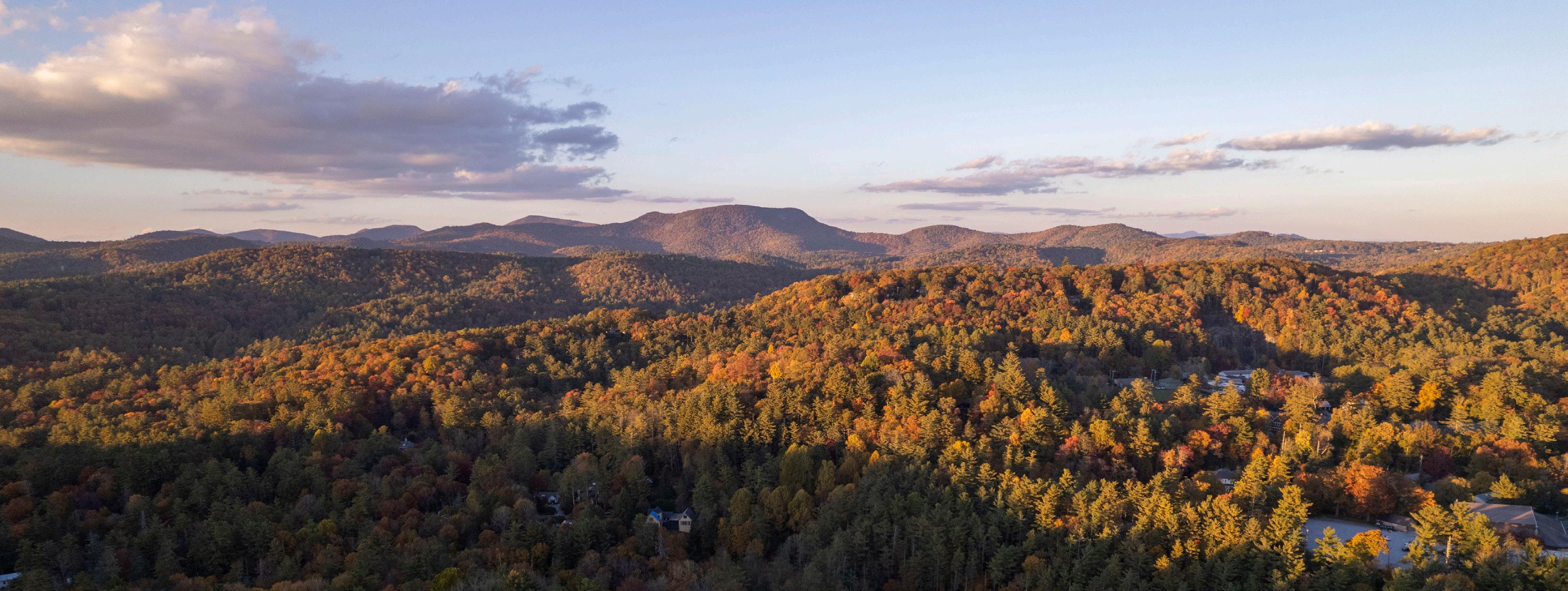
COMMUNITIES NESTLED AMONG A UNIQUE GEOGRAPHY
The three communities take advantage of the surrounding natural assets and serve as tourist destinations in the southern Blue Ridge mountains. Cashiers and Highlands are located on the Highlands
Plateau at elevations of 3,487 and 4,118 feet above sea level respectively. The City of Clayton is found just southwest at the base of the Blue Ridge Escarpment at an elevation of 1,930 feet. The unique geography of the area supports waterfalls, mountainous rock outcrops, and vast forests.
“The Blue Ridge Connector is proposed as a potential trekking route that provides lodging infrastructure to support overnight trail users.”
10 introduction & Background

MAP 01 REGIONAL CONTEXT
1.2 PLAN GOALS
CONNECTIVITY
Identify a specific and feasible trekking route that will connect significant natural and recreational assets including the communities of Cashiers, Highlands, and Clayton.
QUALITY OF LIFE
Enhance quality of life and promote active living for current and future residents and visitors to western North Carolina and northern Georgia.

ECONOMIC DEVELOPMENT
Create a regional recreational asset that will promote entrepreneurship and sustainable economic development through outdoor recreation and tourism.
STEWARDSHIP
Provide stewardship and advocacy for protection of and access to the natural environment.
AWARENESS & FUNDING
Create a compelling vision and engaging visual plan to raise awareness of the Blue Ridge Connector, and ensure project competitiveness among grants and other funding sources.
1.3 PLANNING PROCESS

PHASE 2:
RESEARCH & ANALYSIS
The consultant team conducted a thorough desktop and on-site analysis of the study area and determined feasible trail route options. Information about public lands, existing trails, and local roads was collected and considered in the GIS analysis.
October 2022
October-December 2022

PHASE 1:
DIRECTION SETTING AND PROJECT LAUNCH
The consultant team met with a project oversight committee, which included government officials, nonprofit land trust and trail organizations, and local business owners to discuss previous planning efforts and potential trail routes.
14 introduction & Background

PHASE 3: COMMUNITY ENGAGEMENT
A robust community engagement effort was conducted through a project oversight committee, community lectures, stakeholder meeting, and community meeting.

PHASE 5: FINAL PLAN PREPARATION
The final plan was published for review by stakeholders, community members, elected officials, and the public.
November 2022 - February 2023
December 2022 - March 2023 april - july 2023

PHASE 4: PLAN DEVELOPMENT
The consultant team worked in tandem with local leaders and a route focus group to develop a preferred trail alignment.
15 introduction & Background
1.4 PLAN ORGANIZATION


CHAPTER 1:
INTRODUCTION & BACKGROUND
The first chapter introduces the project background and outlines project goals, planning process, and plan organization.
CHAPTER 2: RESEARCH & ANALYSIS
This chapter provides a comprehensive overview and analysis of the study area. A study area description, list of previous planning efforts, and discussion of the natural and built environments are included in the chapter. The analysis concludes with a map and photographic series that outlines the opportunities and constraints found in the study area.
CHAPTER 3: COMMUNITY ENGAGEMENT
The third chapter summarizes the significant efforts made to engage local community trail leaders to increase awareness of the project and determine the most feasible trail routes based on the preliminary analysis.
16 introduction & Background

CHAPTER 4: TRAIL CHARACTER & DESIGN GUIDELINES
This chapter is dedicated to visually defining the various trail types to be used throughout the trail corridor. Design guidelines are presented that focus on sustainable natural surface trail design, construction, and maintenance.

CHAPTER 5: RECOMMENDATIONS
The fifth chapter breaks the study area into four (4) planning sections. Each planning section includes a written narrative of the preferred trail alignment and a map that supports the recommendation. The chapter also presents lodging location recommendations for the proposed trekking route.
CHAPTER 6: IMPLEMENTATION
The final chapter provides general implementation recommendations and implementation details by planning section. A table of potential funding opportunities is also included.
17 introduction & Background JACKSON COUNTY CASHIERS 107 GA SECTION 2 Rabun Bald Beegum Gap H R d Glen Falls Wilson Gap Stekoa Creek Park Whiteside Mountain Village Green Blackrock Mountain Su s Ro k Satulah Mountain Kelsey Hutchinson Founders Park Chattooga Wild & Scenic River Corridor Overflow Wilderness Study Area
2.1 - STUDY AREA
DESCRIPTION
2.2 - PREVIOUS PLANNING
EFFORTS
2.3 - NATURAL ENVIRONMENT ANALYSIS
2.4 - BUILT ENVIRONMENT ANALYSIS
2.5 - OPPORTUNITIES & CONSTRAINTS MAP AND PHOTO SERIES
2
RESEARCH & ANALYSIS
The analysis begins with a brief description of the study area followed by a review of previous planning efforts. The chapter continues with a discussion of the natural and built environments. This analysis concludes with a map and photographic series that identifies opportunities and constraints within the study area.
2.1 STUDY AREA DESCRIPTION
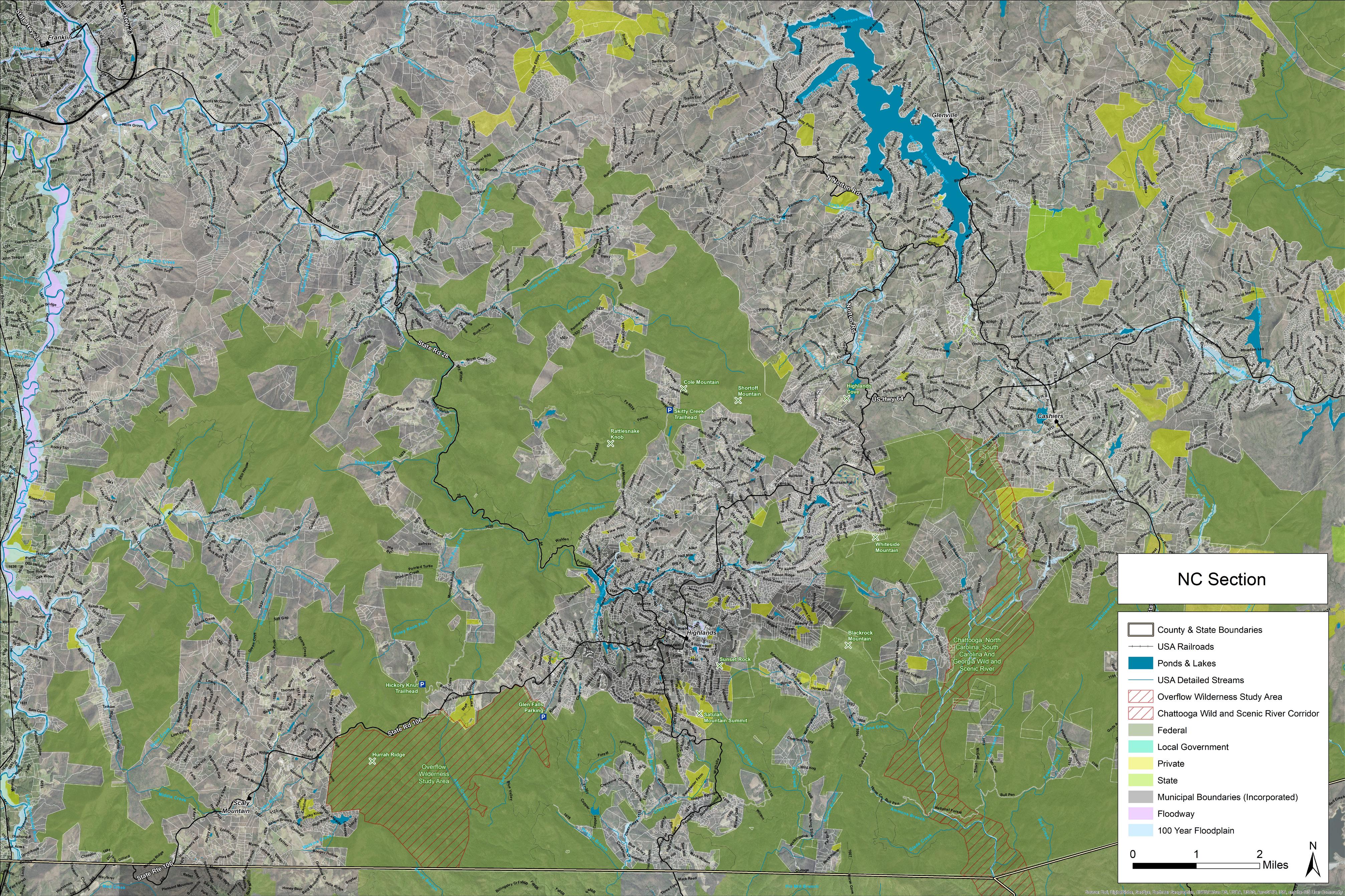
The study area is located in the western North Carolina and northern Georgia mountains within southwest Jackson County and southeast Macon County, North Carolina, and northeast Rabun County, Georgia. Large areas of the Nantahala District of the Nantahala National Forest and Chattooga River District of the Chattahoochee National Forest provide public lands managed for multiple uses including recreation. (See Map 02: Study Area Overview, page right.)
The Village of Cashiers and Town of Highlands are the centers of development within North Carolina and the City of Sky Valley, Towns of Dillard and Mountain City, and City of Clayton, border the study area to the southwest within Georgia.
The northern boundary of the study area runs due west from the Village of Cashiers to US Highway 23/441 to include a large area of US Forest Service lands. US Highway 23/441 stretches north to south through North Carolina and Georgia and creates the western border of the study area connecting Dillard, Mountain City, and Clayton. NC/SC Highway 107 stretches north to south and serves as the eastern boundary of the study area from Cashiers to the NC/SC state line where it follows the border west to the Chattooga River before running south to just east of the community of Pine Mountain, Georgia. Warwoman Road runs east to west connecting Georgia State Route 28 to Clayton and serves as the southern boundary of the study area.
US Highway 64 generally runs east to west in the northeast corner of the study area and provides the primary transportation route between Cashiers and Highlands. NC Highway 106/Georgia State Route 246
is located in the northwestern quarter of the study area and connects Highlands with Dillard. NC Highway/ Georgia State Route 28 heads south from Highlands and intersects with Warwoman Road in Georgia before crossing the Chattooga River and entering South Carolina.
The Chattooga Wild and Scenic River Corridor, Overflow
Wilderness Study Area, and Ellicott Rock Wilderness Area are located on USFS lands within the study area.
20 Research & Analysis

21 Research & Analysis
107
Rabun Bald
Beegum Gap Trailhead
Hurra h Ri dg e
Glen Falls Trailhead
Wilson Gap
Stekoa Creek Park
Whiteside Mountain
Cashiers/ Glenville Recreation Center Blackrock Mountain Sun se t Ro ck Satulah Mountain
Kelsey Hutchinson Founders Park
Chattooga Wild & Scenic River Corridor
Overflow Wilderness Study Area
Warwoman Dell Recreation Area
Blue Valley Overlook
Rich Gap Road
Chattooga River Trail Trailhead
MAP 02 STUDY AREA OVERVIEW
WarwomanRd
2.2 PREVIOUS PLANNING EFFORTS
The consultant team reviewed previous planning efforts that may have implications on the proposed trail route location. This section provides a brief summary of each plan.
JACKSON COUNTY AND THE VILLAGE OF CASHIERS, NC
WALK CASHIERS (2023)
Walk Cashiers proposes a cohesive park and pathway system for the Village to capitalize on the natural assets of the region. It includes recommendations to connect the Southwest Village to Zeb Alley Road and towards Whiteside Mountain and the Nantahala National Forest.

CASHIERS NC: A VISION FOR STAYING RURAL BY DESIGN (2022)
This plan proposes that the rural and small-town character of Cashiers can be preserved through planning, regulation, and proactive steps for implementation. One of the primary recommendations in the plan includes building a robust network of pathways, trails, and sidewalks to facilitate and improve walkability within the village core.

22 Research & Analysis
JACKSON COUNTY WALKS (2021)
The Jackson County Walks Plan provides a framework for the County, residents, NCDOT, developers and other partners to create the vision of a multimodal network and supporting policies to implement it. Plan recommendations for the Village of Cashiers include secondary projects along Zeb Alley Road and connections to the Cashiers Glenville Recreation Center and Frank Allen Road.

CASHIERS GREENWAY RAMBLE MASTER IMPLEMENTATION PLAN (2020)
This plan was developed to envision the future of the Greenway Ramble in Cashiers and serve as a comprehensive implementation plan for the next 15-20 years. A wayfinding guide, implementation plan, and summary of public input are outlined in the plan. Recommendations include a greenway route around Cashiers Lake and future connections to Summit Charter School.
CASHIERS SMALL AREA PLAN (2018)
The Cashiers Small Area Plan guides development in the Village of Cashiers to promote positive growth while maintaining the rich natural environment. Plan goals include capitalizing on and connecting existing trails and improving public access. The plan also calls for the Village of Cashiers to embrace their location in the heart of the Blue Ridge and as a gateway to wilderness and outdoor recreation in the broader region.

JACKSON COUNTY LAND USE PLAN 2040: ACTION PLAN (2017)


A list of action items that address the objectives found in the Jackson County Land Use Plan, identify lead agencies and partners, and define a timeframe for completion are provided within this document. Greenway recommendations focus on implementation of the 2009 County Greenways Master Plan, and they are included under the land use, housing, public health, transportation, education, natural resources, and recreation planning elements.
23 Research & Analysis
RABUN COUNTY AND THE CITY OF CLAYTON, GA
RABUN COUNTY COMPREHENSIVE PLAN: JOINT COMMUNITY AGENDA (2014)
The community agenda is one part of a larger Comprehensive Plan that serves as an independent guidance document. The plan includes the community’s vision for the future and its implementation program for addressing identified issues and opportunities to achieve this vision. The Stekoa Creek Greenway and Tallulah Falls Rail-to-Trail are identified as future projects to assist with open space and parks objectives.

CLAYTON DOWNTOWN MASTER PLAN (2019)
The Clayton Downtown Master Plan presents an approach to downtown development based on existing assets and recommendations to meet current and future community needs. The plan offers ways to strengthen connectivity within Downtown and to the surrounding natural resources. Recommendations include a greenway and pocket parks along Stekoa and Scotts Creeks from Stekoa Park to City Hall.

MACON COUNTY AND THE TOWN OF HIGHLANDS, NC
HIGHLANDS COMMUNITY PLAN (2021)
The Highlands Community Plan is an update to the 2005 Land Use Plan and serves as a guide for policy changes, land use and transportation planning, economic development, housing strategy, and capital improvement planning. Plan policies include support for outdoor recreation and tourism and pedestrian transportation improvements.

MACON COUNTY COMPREHENSIVE TRANSPORTATION PLAN (2021)
NCDOT developed this plan with Macon County, its municipalities and the Southwestern Rural Planning Organization. Pedestrian modes of transportation were evaluated as part of the plan, and sidewalk and greenway development were explored. One recommendation included sidewalk development from the Town of Highlands west along NC Highway 106.

24 Research & Analysis
REGIONAL PLANS
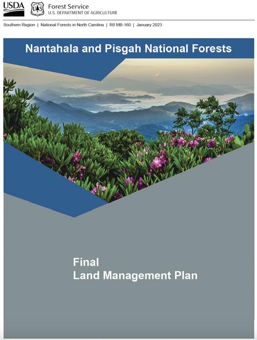
THE NANTAHALA AND PISGAH NATIONAL FORESTS FINAL LAND MANAGEMENT PLAN (2023)
This plan guides future management of the national forests in western North Carolina and prioritizes sustainable recreation in addition to focusing on ecosystem health. The plan recognizes that a quality recreation experience and equitable access to the outdoors is important to local economies, tourism, and community well-being. The revised plan will ensure the forest is using the latest trail design principles and working with others to help in long-term trail maintenance and recreation management planning.
LAND AND RESOURCE MANAGEMENT PLAN CHATTAHOOCHEE-OCONEE NATIONAL FORESTS (2004)
This Forest Plan guides all natural resource management activities and sets management standards for the Chattahoochee-Oconee National Forests in Georgia. Plan goals include providing a variety of high quality, naturebased recreation settings and opportunities. Important plan objectives are prioritizing trails for condition surveys and bi-annually maintaining trails to established standards.
STEKOA CREEK WATERSHED MANAGEMENT PLAN (2015)
The Stekoa Creek Watershed Management Plan provides context and guidance for how the watershed could be managed to restore and protect its water quality. The plan presents development of a greenway along Stekoa and Scott Creeks as one recommendation to assist with public education and outreach about water quality issues.


25 Research & Analysis
2.3 THE NATURAL ENVIRONMENT
Elements of the natural environment are critical for determining points of interest, suitable trail locations and feasibility, and ideal user experiences. This section explores the implications of the study area’s natural environment for establishing the Blue Ridge Connector and includes three (3) parts: 1) Topography; 2) Rivers and Streams; and 3) Public Lands and Special Management Areas.
The study area sits on the boundary of the Highlands Plateau and Blue Ridge Escarpment which includes the Eastern Continental Divide. This unique geography creates a significant elevation range that hosts numerous rivers and streams, waterfalls, rock outcrops, and a large variety of flora and fauna. The study area encompasses more than 123,500 acres of US Forest Service lands including three special management areas. The area has a temperate climate with mild winters and warm summers.
TOPOGRAPHY
The Highlands Plateau, which marks the southern terminus of the higher elevation Appalachians, sits at an elevation of over 4,000 feet above sea level in the northern half of the study area. The Blue Ridge Escarpment divides the area and marks where the mountains drop to the piedmont of northeastern Georgia and upstate South Carolina. Elevations in the study area range from approximately 4,930 feet on Whiteside Mountain to approximately 1,925 feet in Clayton. The topography varies and is composed of rolling mountains and hills and narrow valleys.
RIVERS AND STREAMS
Overflow Creek and the Chattooga River are the two primary tributaries found in the study area.
The headwaters of the Chattooga River are located just southwest of Cashiers. The free-flowing river flows south through the Ellicott Rock Wilderness and out of North Carolina then creates the state line between Georgia and South Carolina. The river continues its southward path eventually draining into Tugaloo Lake near Tallulah Falls.
Overflow Creek begins in the Osage Mountain and Blue Valley Overlook areas just west of Highlands.
The creek flows into the Chattooga River at Three Forks where Holcomb, Overflow, and Big Creeks converge to form the West Fork of the Chattooga River.
PUBLIC LANDS AND SPECIAL MANAGEMENT AREAS
The Chattooga Wild and Scenic River Corridor, Overflow Wilderness Study Area, and Ellicott Rock Wilderness Area are located within the study area.
The Chattooga Wild and Scenic River was designated in 1974 and includes approximately 15,432 acres along its approximately 57 mile length. A half-mile drop in elevation through mountain valleys creates scenic and challenging whitewater rapids and falls.
The 3,200 acre Overflow Wilderness Study Area was designated in 1984 and is located in southeastern Macon County within the Nantahala National Forest. The wilderness study area contains the headwaters of the West Fork of Overflow Creek and ranges from 2,500 feet to 4,000 feet in elevation.
The Ellicott Rock Wilderness Area was designated in 1975 and expanded in 1984. The area spans three National Forests in three different states and includes approximately 8,300 acres.
26 Research & Analysis

2.4 THE BUILT ENVIRONMENT
Opportunities and constraints within the built environment can also affect potential trail routes. Opportunities include community assets that are optimal for trail development and connectivity. Constraints focus on built features that present challenges, but do not necessarily preclude trail development.
This section explores the implications of the study area’s built environment for establishing the Blue Ridge Connector Traill and includes three (3) parts: 1) Land Use; 2) Transportation Routes; and 3) Existing Parks/ Greenway Trail Systems.
LAND USE
A majority of the study area is covered by public forest land managed for multiple uses by the US Forest Service. The Village of Cashiers, Town of Highlands, and Cities of Sky Valley and Clayton are developed communities located along the northern and western periphery of the study area. Scattered rural agricultural use is found along US 23 in Georgia.
Cashiers is an unincorporated village located in southern Jackson County. The Village core serves commercial and public use near the intersection of US 64 and NC 107. Low density residential development surrounds the Village.
The Town of Highlands is located in southeastern Macon County and a small portion of southwestern Jackson County. Downtown Highlands is centered around Main Street (US Highway 64) between North 5th Street and NC 106. Moderate density residential development surrounds the downtown area to the north, west, and south.
The City of Clayton is located in central Rabun County. The City has a downtown business district and commercial corridor along US 23. Moderate density residential use surrounds downtown Clayton.
The City of Sky Valley is located in northern Rabun County along NC Highway 106/Georgia State Route 246 south of the NC/GA state boundary between Highlands and Dillard. The former site of the southernmost ski resort in the United States, Sky Valley Country Club now offers a golf course and other resort amenities to residents and second home owners.
The Towns of Dillard and Mountain City are located along US 23 between the NC/GA state line and Clayton. Land use within and around these Towns is low density residential and agricultural.
TRANSPORTATION ROUTES
Transportation corridors within the study area include US Highways, NC Highways, and GA State Routes. These corridors are typically rural two-lane asphalt roads with a minimal shoulder. US 23 is the widest road within the study area and represents a significant challenge to trail routing.
Numerous paved and gravel narrow residential roads can be found throughout the study area. While these roads are concentrated around Highlands, Cashiers, and Clayton, developments along US 64 and at Sky Valley, Georgia, also exist.
The US Forest Service also manages over 100 miles of gravel and dirt roads throughout the study area. Many of these roads are open yearround or seasonally, and some are gated and closed to motorized use.
28 Research & Analysis
EXISTING PARKS & GREENWAY TRAIL SYSTEMS
The study area includes over 120,000 acres of National Forest land. The three primary communities of Cashiers, Highlands, and Clayton also offer parks and greenway trail systems within their boundaries.
The Nantahala District of the Nantahala National Forest includes approximately 250,000 acres in southwestern North Carolina adjacent to the Chattahoochee National Forest in northern Georgia. The District is home to a number of waterfalls and also hosts four long distance trails including the Appalachian, Bartram, Foothills, and Mountains-to-Sea Trails. The highest falls east of the Rocky Mountains, Whitewater Falls, is located on the eastern border of the District with Pisgah National Forest.
The Chattooga River District of the Chattahoochee National Forest encompasses approximately 261,035 acres in northeastern Georgia adjacent to the Nantahala National Forest in southwestern North Carolina. The District includes Rabun Bald, Chattooga Wild and Scenic River, and the headwaters of the Chattahoochee River.
The Village of Cashiers Greenway Ramble is an existing and planned network of approximately 10 miles of trail centered on the Cashiers Village Green that connects various points of interest throughout the commercial district. The Village Green is a 13.2 acre park in the middle of Cashiers that offers event space and access to public facilities southwest of the Village crossroads.
The Highlands Plateau Greenway is an existing trail network of approximately 10 miles centered on Town owned property protecting Mill Creek between the Highlands Rec Park and Downtown Highlands. The greenway provides natural surface trails and sidewalks that lead to panoramic views and points of interest to the north, south, east, and west. The Highlands Plateau Greenway also passes by Kelsey Hutchinson Founders Park located on Pine Street. This public park offers a green space in the center of Highlands for events and gatherings.
Stekoa Creek Park is a 3.5 acre park located in Clayton. The park sits next to Stekoa Creek and serves as green space planted with native shrubs, trees, and wildflowers. The park also offers a rain garden, nature trail, wildflower garden, community pavilion, and other improvements for public use. The planned Stekoa Creek Greenway will connect the park with downtown Clayton and the planned Scotts Creek Greenway.

2.5 NC - OPPORTUNITIES & CONSTRAINTS
OPPORTUNITIES
The Village of Cashiers
Existing Chattooga River Trail
Existing USFS Trailhead
Whiteside Mountain
Blackrock Mountain Sunset Rock
Satulah Mountain
Downtown Highlands
Existing USFS Trail System
Van Hook Glade Campground
Dry Falls
Existing USFS Trailhead
Glen Falls
USFS #79 - Gravel Road Access to Blue Valley
Existing USFS Trailhead
Existing Bartram Trail
Existing USFS Trailhead
Existing Bartram Trail
CONSTRAINTS
Private Property Parcelization
Chattooga Wild and Scenic River
Corridor
Steep Slopes
Private Parcelization
Private Parcelization
Steep Slopes
US Highway 64
No Existing Trails on USFS Land
Overflow Wilderness Study Area

The trail provides an opportunity to connect to the Village of Cashiers.

Access to views of Whitside Mountain add significant character to the trail experience.

steep slopes around Whiteside Mountain present a challenge to trail development.

30 Research & Analysis
1 2 3 4 5 6 7 8 9 10 11 12 13 14 15 16 17 18 1 2 3 4 5 6 7 8 9
The
1 7 3 4
The heavily travelled US HWY 64 presents an area of elevated risk for a trail crossing.


31 1 2 3 4 5 8 9 10 11 12 13 14 15 16 17 18 6 7 2 4 5 6 7 8 9 3 1 MAP 03 OPPORTUNITIES & CONSTRAINTSNC
2.6 GA - OPPORTUNITIES & CONSTRAINTS
OPPORTUNITIES
Existing Trails and USFS Roads
USFS #7 - Gravel Road Access to Bartram Trail
Existing Beegum Gap Trailhead Access to Rabun Bald USFS #155 - Gravel Road Access to Wilson Gap
Existing Bartram Trail
Existing Bartram Trail
Existing Warwoman Dell Recreation Area
Stekoa Creek Park
Planned Stekoa Creek Greenway
Downtown Clayton, GA
CONSTRAINTS
Ellicott Rock Wilderness
No Existing USFS Trail System
GA State Route 28
Chattooga Wild and Scenic River
Corridor
Warwoman Road
Narrow Paved Roads
Sidewalks Along Rickman St. and Warwoman Rd. Need Improvement Intersection of US 441/Savannah St.

The Warwoman Dell Recreation Area provides an additional trailhead and connector trail opportunity.
The trail provides and opportunity to connect hikers to the businesses in downtown Clayton, GA.


The heavily travelled GA State Route 28 presents an area of elevated risk for a trail crossing.

The intersection of US 441 and Savannah St. presents a challenge to connecting existing USFS trails to the east to Clayton.
32 Research & Analysis
1 2 3 4 5 6 7 8 9 10 11 1 2 3 4 5 6 7 8
8 8 3 11


2 3 4 1 5 6 7 9 10 8 11 1 4 5 3 2 6 7 8 MAP 04 OPPORTUNITIES & CONSTRAINTSGA
3.1 - PROJECT OVERSIGHT COMMITTEE
3.2 - COMMUNITY LECTURES
3.3 - STAKEHOLDER MEETING
3.4 - COMMUNITY MEETING
3
COMMUNITY ENGAGEMENT
In order to raise awareness of the project, share the route analysis, and provide opportunity for public input, significant efforts were made to engage the local community. This chapter summarizes community engagement efforts.
3.1 PROJECT OVERSIGHT COMMITTEE
A Project Oversight Committee (POC) guided the planning process and included representatives from local and federal government, nonprofit land trust and trail organizations, and local business owners. The POC met on October 13, 2022, for the project kick-off and again on February 28, 2023 to review project recommendations.
A small sub-committee composed of representatives from the Highlands Plateau Greenway, Highlands-Cashiers Land Trust, and Highlands community met virtually and in-person to discuss route options throughout the process. The group members’ on the ground experience in the study area proved invaluable as they considered route alternatives.
3.2 COMMUNITY LECTURES
A series of community lectures were organized and facilitated by a local trails advocate to raise awareness of the project and support the planning effort. The lectures covered hut-to-hut trail systems in the United States and trail sustainability.
On November 15th, 2022, at the Center for Life Enrichment in Highlands, expert Sam Demas, adventurer and author, spoke to lecture attendees about hut-to-hut systems across the United States. Ben Dodge, Executive Director of the Tenth Mountain Division Hut Association, shared information about the hut-to-hut system he manages in Colorado.
On February 2nd, 2023, at Tallulah Gorge State Park, recreation ecologist Jeff Marion, Ph.D., presented his research findings from a career that stretches 38 years. Dr. Marion’s lecture focused on best management practices for designing and managing sustainable trails and overnight campsites and facilities.
36 Community Engagement
3.3 STAKEHOLDER MEETING
On February 27, 2023, a special stakeholder meeting limited to land managers and local government representatives was held at the Highlands Recreation Center. Representatives from the US Forest Service, Highlands Cashiers Land Trust, Village of Cashiers, Town of Highlands, and City of Clayton attended to learn more about the project and review the proposed trail route.
KEY TAKEAWAYS
» There is general support for the project concept within the incorporated communities the route passes through.
» Parking capacities within each community should be assessed to explore the feasibility of accommodating additional visitors and users of the Blue Ridge Connector Trail.
» There is some concern that an increase in user traffic along existing trails will decrease overall trail sustainability.
» Additional new trail opportunities should be identified and developed to provide connections to other natural assets and points of interest.
» The USFS will consider the route proposal through their typical review process once the planning effort is completed.

38 Community Engagement
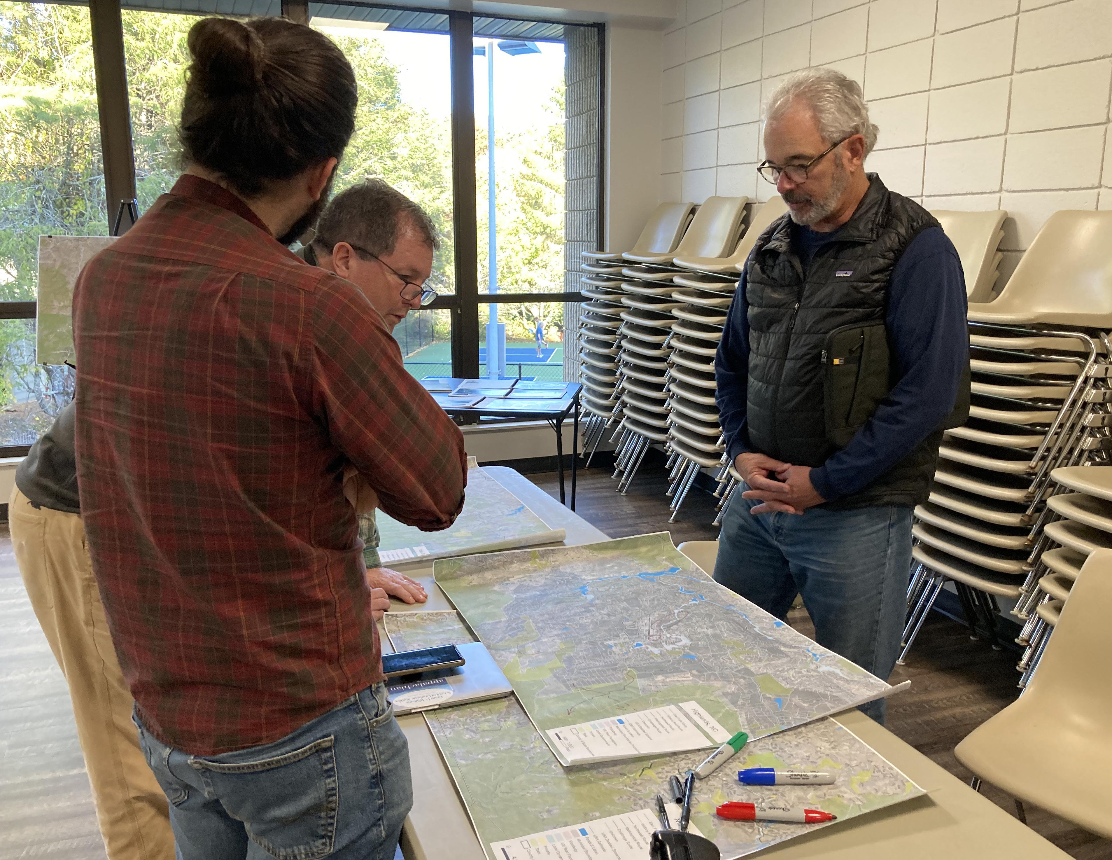
3.4 COMMUNITY MEETING
A drop-in community input session was held at the Highlands Recreation Center on February 28, 2023. Planning section maps with the proposed trail route were on display for public comment and a short presentation explaining the project background, planning process, and recommendations was available for meeting attendees to view. The meeting was attended by approximately 30 community members and stakeholders. A small number of comments were provided to the project consultant via email.
KEY TAKEAWAYS
» There is general public support for the project concept and proposed route.
» Additional connections to other natural assets and points of interest, specifically Whiteside Mountain, should be explored.
» Some Cashiers community members are concerned that the project will negatively contribute to growing traffic problems and limited parking in the Village.

39 Community Engagement
4.1 - TRAIL TYPES
4.2 - SUSTAINABLE TRAIL DESIGN, CONSTRUCTION, & MAINTENANCE
4.3 - LODGING
4.4 - SIGNAGE & WAYFINDING
4
TRAIL CHARACTER & DESIGN GUIDELINES
A diverse natural and built environment exists between Cashiers, Highlands, and Clayton. Specific trail types must be applied throughout the corridor to ensure maximal sustainability, minimal maintenance, and the best user experience. This Chapter defines six trail types and offers general information about signage and wayfinding along the proposed trekking route.
4.1 TRAIL TYPES
Ideally, specific trail types are proposed according to their location in an urban, rural, or undeveloped area, the surrounding environment, and the opportunity to create a meaningful user experience. In an effort to minimize impact and utilize existing infrastructure to the greatest extent, the Blue Ridge Connector is proposed to follow a combination of asphalt greenways, sidewalks, lightly traveled roads, and natural surface trails. The route will incorporate six (6) different trail types along its preferred route.
ASPHALT GREENWAY
A typical asphalt greenway is proposed in local planning documents for Clayton. This trail type will be appropriate as the connector follows the planned Stekoa Creek Greenway.
SIDEWALK
Existing, planned, and proposed sidewalks will be utilized within the boundaries of Cashiers, Highlands, and Clayton.
PAVED ROAD
Short segments of lightly traveled residential paved roads within Cashiers and Highlands and between the Chattahoochee National Forest and Clayton will complete important connections along the route.
GRAVEL ROAD
Open and lightly traveled residential and USFS gravel roads will provide access to trails and points of interest within the National Forests. Some roads may be closed seasonally to vehicular traffic.
DIRT ROAD
Closed and gated USFS dirt roads will be utilized in combination with gravel roads and trails within the National Forests.
NATURAL SURFACE TRAIL
Existing and proposed natural surface trails are an appropriate trail type for segments within the natural environment and in environmentally sensitive areas. All natural surface trail segments should be designed, constructed, and maintained for maximum sustainability. (See Appendix A: Sustainable Trail Design, Construction, and Maintenance, page XX.)
42 Trail Character & Design Guidelines


43 Trail Character & Design Guidelines
The Blue Ridge Connector will incorporate six (6) different trail types along its preferred route. (Photos by others.)
EXH 01 TRAIL TYPES PRECEDENT IMAGES
GRAVEL ROAD
DIRT ROAD
NATURAL SURFACE TRAIL
ASPHALT GREENWAY
SIDEWALK
PAVED ROAD
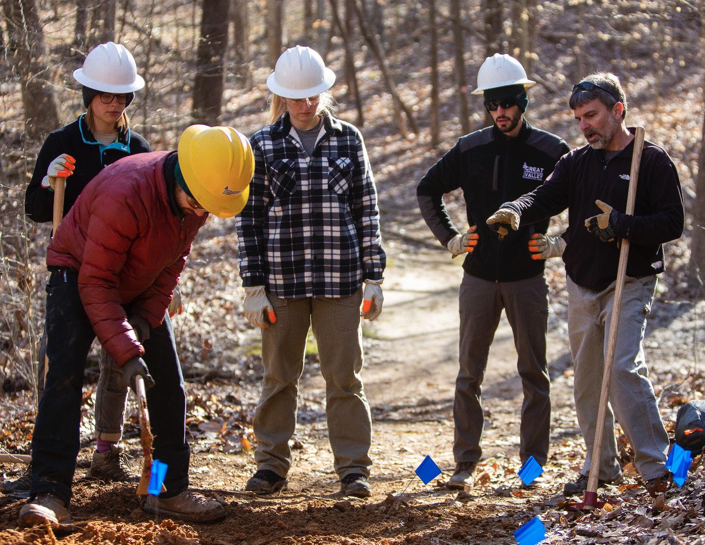
4.2 TRAIL SUSTAINABILITY
Sustainable trails ensure an exceptional user experience while minimizing environmental impact, maintenance, and management needs. While trail sustainability often focuses on impacts to the environment, social, economic, and managerial sustainability should also be considered.
ENVIRONMENT
Natural surface trails must be designed and constructed to minimize environmental impact on the natural systems they pass through. Properly designed trails concentrate impact on durable surfaces, limit the volume and velocity of water on the trail tread, and minimize resource degradation.
SOCIAL
Sustainable trails should meet user needs while reducing user conflict and providing a comfortable setting for residents and visitors. A positive trail experience will support the physical, mental, and social health benefits of active living in the outdoor setting.
ECONOMIC
Trails should provide economic benefits to the local community through the support of local amenities and important services for tourism and recreation. Sustainable trails must also be cost efficient and have sufficient funding to support long-term maintenance and management.
MANAGERIAL
Sustainable trails must be supported and managed through multi-jurisdictional collaboration between government agencies, non-governmental organizations, non-profits, and volunteer groups. Trails should be able to support intended use and user volumes while protecting the environment.
“Trail sustainability includes environmental, social, economic, and managerial considerations.”
44 Trail Character & Design Guidelines
4.3 SIGNAGE & WAYFINDING
The Blue Ridge Connector will pass through communities, National Forest lands, and along existing greenway systems. A specific theme is typically preferred for signage, wayfinding, and trail support facilities found along a regional trail system. The variety of land managers and jurisdictions along the Connector route present a challenge, however, effective trail branding can provide uniformity and recognition throughout the trail corridor. The branding can be included on trail blazes, trailhead kiosks, and online or printed informational material.
EXH 02 SIGNAGE AND WAYFINDING


46 Trail Character & Design Guidelines
A variety of existing signage and wayfinding can be found along portions of the route that use existing trails and greenways.

5.1 - OVERVIEW OF PLANNING SECTION DESCRIPTIONS & MAPS
5.2 - PLANNING SECTION DESCRIPTIONS & MAPS
5.3 - TREKKING ROUTE RECOMMENDATIONS
RECOMMENDATIONS 5
This chapter serves as the heart of the Blue Ridge Connector Trekking Route Plan. The preferred route recommendation focuses on the trail user experience and implementation feasibility. The chapter also includes recommendations on trailhead and lodging opportunities.
5.1 OVERVIEW OF PLANNING SECTION DESCRIPTIONS & MAPS
The approximately 155,467 acre study area from Cashiers to Clayton is divided into four (4) planning sections. The geographic extent of each section includes a beginning and ending terminus that features a key asset or significant connectivity point for the trail. This trekking route plan follows the overall descent of the proposed route and presents the planning sections from Cashiers to Clayton.
NC 1 - Cashiers/Glenville Recreation CenterCashiers -> Kelsey Hutchinson Founders Park - Highlands
NC 2 - Kelsey Hutchinson Founders Park - Highlands -> Hale Ridge Road
GA 1 - Hale Ridge Road -> Wilson Gap
GA 2 - Wilson Gap -> Stekoa Creek Park - Clayton
PLANNING SECTION MAPS
Each planning section is anchored by a map that highlights the proposed trail route, trailhead locations, and lodging opportunities. The route recommendation was developed considering trail types, setting, and points of interest, in addition to implementation feasibility, which encompassed land ownership, existing trail segments, and implementation timeline. The trail alignment is the result of extensive analysis, including environmental feasibility, existing and planned trails, and insights provided by the local government and local trail development leaders.
The proposed trail route is described in detail. Each section also includes a summary of connecting trails, list of trailheads and points of access, and location of lodging opportunities for the trekking route. Connecting trails offer alternative routes to access proposed trail segments. Trailheads and points of access will provide for parking and trail user orientation. Lodging opportunities represent proposed areas for infrastructure to support overnight trail users. Existing trail segments, roads, trailheads, campgrounds, and other support facilities are noted on each map.
QUICK FACTS
Each planning section begins with a “quick facts” exhibit. This information includes the existing and proposed trail distances, estimated planning level costs, trail types, and key points of interest associated with each section. Trail distances were derived from GIS data, and actual field distances will vary. Estimated planning level project costs are noted using the following values:
asphalt greenway at $120/linear foot; concrete sidewalk at $100 linear foot; natural surface trail construction at $8/linear foot; and natural surface trail improvement at $5/linear foot. No project costs were calculated for existing sidewalks, paved, gravel, and dirt roads.
50 Recommendations
36.9 > Existing Trail Miles 7.7 > Proposed Trail Miles 10 > Trailheads $2,457,619 > Approximate Construction and Improvements Cost ROUTE QUICK FACTS
51 Recommendations
SECTION 2
107 GA
Rabun Bald
Beegum Gap Trailhead
Hurra h Ri dg e
Glen Falls Trailhead
Wilson Gap
Stekoa Creek Park
Whiteside Mountain
Cashiers/ Glenville Recreation Center Blackrock Mountain Sun se t Ro ck Satulah Mountain
Kelsey Hutchinson Founders Park
Chattooga Wild & Scenic River Corridor
Overflow Wilderness Study Area
Warwoman Dell Recreation Area
Blue Valley Overlook
Rich Gap Road
Chattooga River Trail Trailhead
WarwomanRd
MAP 05 ROUTE OVERVIEW AND PLANNING SECTIONS
Ellicot Rock Wilderness
PLANNING SECTION - NC1
This planning section stretches approximately 16 miles from the Cashiers/Glenville Recreation Center in Cashiers to Kelsey Hutchinson Founders Park in Highlands. The proposed alignment traverses from Cashiers south of Whiteside Mountain along the Chattooga River then travels along the base of Blackrock Mountain to Horse Cove and Rich Gap Roads. The route climbs to the summit of Satulah Mountain before descending to the Town of Highlands.
PROPOSED TRAIL ROUTE
At the Blue Ridge Connector’s northern terminus an existing sidewalk leaves the Cashiers/Glenville Recreation Center and connects to a planned greenway which leads to Zeb Alley Road. The proposed route follows the road until it narrows to a trail. A new natural surface trail will leave the old roadbed, cross the Chattooga River, and continue south across USFS lands for approximately 1.5 miles to High Knoll Drive. After a short distance, the route turns southwest on Whiteside Cove Road until it reaches the existing Chattooga River Trail Trailhead in approximately 0.9 miles. The proposed Blue Ridge Connector route utilizes the Chattooga River Trail (USFS TR #432) for approximately 3.2 miles before turning west on an old roadbed that connects to USFS #2052. The trail follows USFS #2052 before crossing Whiteside Cove Road and following USFS #2053 to its end. The proposed route and new trail continues southwest of Blackrock Mountain for approximately 2.4 miles to Horse Cove Road. The Blue Ridge Connector turns south and follows along Horse Cove and Rich Gap Roads for approximately 0.6 miles. A new trail approximately 1.9 miles in length is proposed to be constructed on USFS and Highlands-Cashiers Land Trust lands to connect Rich Gap Road with the summit
of Satulah Mountain. The route descends the Highland Plateau Greenway’s Satulah Mountain Trail to its intersection with South Street. The trail continues north along sidewalks on South, Fifth, and Pine Streets to Kelsey Hutchinson Founders Park.
CONNECTING TRAILS
The Green Creek Trail (USFS TR#432B) is a short river access trail located near the northern terminus of the Chattooga River Trail and Whiteside Cove Road trailhead. The Norton Mill Trail (USFS TR#432A) provides a connection between the Chattooga River Trail and Whiteside Cove Road near Granite City. The Chattooga River Trail continues south from USFS #2052 approximately 2 miles to a small trailhead on Bullpen Road at the old iron bridge.
TRAILHEADS AND TRAIL ACCESS
» Cashiers/Glenville Recreation Center
» Chattooga River Trail Trailhead
» Rich Gap Road
» Kelsey Hutchinson Founders Park
LODGING OPPORTUNITIES
» Village of Cashiers
» Intersection of Whiteside Cove Road - USFS #2052/#2053 - Nantahala National Forest
» Town of Highlands
QUICK FACTS
Existing Trail: 11 miles
Proposed Trail: 5 miles
Estimated Cost: $680,117
Trail Type: Asphalt Greenway, Dirt Road, Gravel Road. Paved Road, Natural Surface, Sidewalk
Points of Interest: Whiteside Mountain, Chattooga Wild and Scenic River, Blackrock Mountain, Satulah Mountain
52 Recommendations 107 Rabun Bald Beegum Gap Trailhead Hu ah R dge Glen Falls Trailhead Wilson Gap Stekoa Creek Park Whiteside Mountain Cashiers/ Glenville Recreation Center Blackrock Mountain Sun e Roc Satulah Mountain Kelsey Hutchinson Founders Park Chattooga Wild & Scenic River Corridor Overflow Wilderness Study Area Warwoman Dell Recreation Area Blue Valley Overlook Rich Gap Road Chattooga River Trail Trailhead WarwomanRd SECTION - NC1: VICINITY MAP

53 Nevray Brushy Face Lance aR m sey Russell 3rd orge Bearfoot 1102 Oakmont Randa l Perquin mraM alade 1st Highl a n d T h r eeR oF r r est Owl P eni Pilgrim Ma Woodcrest Hedden Trilium Chelsey Brownell Wing na Senn H g hfield Creek Love l Country R Rd g Catawba Sassy Log Cabin Mung e r Mel Keener Bruner M Kenridg SatulahView M High so t Horse Big Creek Dolly T S L a n c Rocky Hill RedFoxR i gd Quincy Talley Hawks N e s t HelensBarn Carol i n e tain William s grub Pinecre Valentine Strawbe r r y q Woods Berit ds Warren 1551 Neely 1614 11 1 7 Netsi Howel l Rainbow Zermatt Bob Z a hner T histle kysD e Cherokee Big 1569 O Keener C h o c taw Cook b s Spring Hemlock Pipers She by B r koo s e Lucerne J u ip t e r Holt Knob 1550 R a uo rel O y Simon S H enr astain Valley romeMlaPark Myrtle Speed Hill C h im n e S a tu Mirrormont GroveCh urch Skyline CcM1101 a Pine hy Fac e Heather rrap in T r a c T e r r a ip n mingb i r d rest Mirror Lake Riv Pineland Azale J a kc Wilcox y Face unt Lor i Walhal l a h n tain c s View 1141 Slab own Bonnie 1144 Nor on Oak 1558 Clo e Mounta n B Yellow Mounta n Wyanoak Point 1553 Foreman M ane y H l 1549 1613 C l ae r Creek Holt Bushy Face Cobb Cove Wkla R 106 Moorewood B i l l y nibaC Fs 4535 Hicks 1546 Cullasaja 1552 1544 Flat 1 5 3 8 uB c k C 28 1542 Whiteside Mountain Blackrock Mountain Sunset Rock Kelsey Hutchinson Founders Park Satulah Mountain Chattooga Wild & Scenic River Corridor Cashiers/Glenville Recreation Center Chattooga River Trail Trailhead Rich Gap Road Cu lla s aja Rive r Green Creek N o r t o n M i l l C reek B u c k C r e e k C h a t t o o g a R i v e r Cle a r Cre e k Covefield B ra n c h Big C re e k L ittle C re e k F o w le r C re e k C a n e C r e e k Sc ots m an Cre ek HIGHLANDS 64 64 64 401B 4622 4521 4616 2053 2052 4563 JACKSON COUNTY MACON COUNTY CASHIERS 107 MAP 06 ROUTE RECOMMENDATIONNC1
 The Village of Cashiers was established in the early 1800s when homesteaders first arrived in the area. Located at the crossroads of US Highway 64 and NC Highway 107, the Village sits 3,487 feet above sea level. The unique geography and scenery that surround Cashiers support residents and visitors seeking vacation amenities and second homes. Outdoor adventure opportunities include trails leading to waterfalls, streams, large rock outcrops, and scenic views.
EXH 03 VILLAGE OF CASHIERS

EXH 04 WHITESIDE MOUNTAIN
Whiteside Mountain is located on the Eastern Continental Divide between Cashiers and Highlands. This unique natural feature rises to an elevation of 4,930 feet and provides nesting sites for Peregrine Falcons on its exposed rock faces. A two mile long loop and National Recreation Trail allows visitors to climb to its summit and enjoy long range views to the south.
PLANNING SECTION - NC2
This planning section stretches approximately 11.75 miles from Kelsey Hutchinson Founders Park in Highlands to Hale Ridge Road near the North Carolina/Georgia State Line. The proposed alignment stretches west to Glenn Falls and through the Overflow Wilderness Study Area to the Bartram Trail where it turns south to Hale Ridge Road.
PROPOSED TRAIL ROUTE
The trail follows sidewalks from Kelsey Hutchinson Founders Park along Pine Street west to North 4th Street/US Highway 64 and turns southwest to the intersection of Main Street. It continues west on Main Street/US Highway 64 for approximately 0.4 miles to NC Highway 106. The route uses existing sidewalks along NC Highway 106 until they end at Highlands Plaza. The trail will continue to follow a proposed sidewalk parallel to NC Highway 106 from Highlands Plaza to Glenn Falls Road. At Glenn Falls Road the route travels west approximately 1.1 miles to the Glenn Falls Trailhead. Glenn Falls Trail (USFS TR #8) continues west for approximately 1.2 miles to end at East Prong Overflow Road (USFS #79C). The route follows East Prong Overflow Road to its intersection with Blue Valley Road (USFS #79). The proposed Blue Ridge Connector continues west on Blue Valley Road for approximately 3.1 miles to West Fork Trail (USFS TR #444). The trail utilizes the existing West Fork Trail and travels along the West Fork of Overflow Creek to its intersection with the Bartram Trail (USFS TR #164). The route then turns south and ascends to Hurrah Ridge. The trail follows the Bartram Trail south to the intersection with Hale Ridge Road (USFS #7).
CONNECTING TRAILS
The Chinquapin Trail (USFS TR #3) joins the proposed route from NC Highway 106 to the north at the Glenn Falls Trailhead. Hurrah Ridge Trail (USFS TR#4) continues west from the end of Blue Valley Road at its intersection of West Fork Trail. The Bartram Trail continues north from its intersection with the Blue Ridge Connector route at the junction of West Fork and Bartram Trails approximately one mile to a trailhead at Osage Overlook on NC Highway 106.
TRAILHEADS AND TRAIL ACCESS
» Kelsey Hutchinson Founders Park
» Glenn Falls Trailhead
» Blue Valley Overlook
» Hale Ridge Road
LODGING OPPORTUNITIES
» Town of Highlands
» NC/GA State Line - Hale Ridge RoadNantahala and Chattahoochee National Forest
QUICK FACTS
Existing Trail: 10 miles
Proposed Trail: 2 miles
Estimated Cost: $1,006,094
Trail Type: Sidewalk, Gravel Road, Dirt Road, Natural Surface
Points of Interest: Glenn Falls, Overflow Wilderness Study Area, Bartram Trail, Picklesimer Rock House, Blue Valley
56 Recommendations 107 Rabun Bald Beegum Gap Trailhead Hu ah R dge Glen Falls Trailhead Wilson Gap Stekoa Creek Park Whiteside Mountain Cashiers/ Glenville Recreation Center Blackrock Mountain Sun e Roc Satulah Mountain Kelsey Hutchinson Founders Park Chattooga Wild & Scenic River Corridor Overflow Wilderness Study Area Warwoman Dell Recreation Area Blue Valley Overlook Rich Gap Road Chattooga River Trail Trailhead WarwomanRd SECTION - NC2: VICINITY MAP

57 Recommendations 4501 4500 Hale Ridge 1545 R a msey Windy H i l l Brookside D ogwood Pinewood Perquin Aspen Margaret s Th r e e R Sassafras Crowe Me rose F r e d Rankin Trillium Wingina Fs 69 Naiad Bruner Car l Chastain 1547 River's Edge C ypress Rocky Hill Falls Knoll Carriage 15 4 8 Poplar1694 Pinecres Saw M i l l 1551 M o u n ta i n B r ook Aza lea Woods C i nnam no Netsi Shadow Cre e k Lad y Slipper A z alea Mack Reed Three Forks Hickory Hill Hicks Little Bear neP North R a o ul Center Memor a Park Heatherwood Mirror Lake Ashwo River Walk South 1681 PaintedTurtle 1546 Chowan Lor i Sherwood Forest Snyder Mack Wilson W y a n oa k 1553 Fore m na 1549 1609 Holt Leka S e q uoyah Bea r Pen 1 6 0 2 Billingsley Cr Fs86B Cullasaja Franklin 64 dnoP C u l l a s a ja R iver nch Cullas a j a R iv e Clea r Creek E m ory Branch C u l a s a a River 64 64 NORTH CAROLINA GEORGIA Blue Valley Dispersed Camping Kelsey Hutchinson Founders Park Overflow Wilderness Study Area Hurra h Ri dg e Blue Valley Overlook Glen Falls Trailhead Sunset Rock Satulah Mountain 106 ROUTE RECOMMENDATIONNC2 MAP 07

EXH 05
The Town of Highlands was founded by Samuel Truman Kelsey and Clinton Carter Hutchinson at what they considered the future crossroads of commerce. Two lines drawn on a map, one between Chicago and Savannah and the other between Baltimore and New Orleans, crossed at the site of Highlands. Due to its cool climate and scenic beauty, the Town has become a resort community located over 4,000 feet above sea level.
TOWN OF HIGHLANDS

EXH 06 GLENN FALLS
Glenn Falls is a 200’ high multi-tiered waterfall located west of Highlands on the East Fork of Overflow Creek. A moderate to strenuous 0.6 out and back mile hiking trail leads visitors to viewing platforms of the upper and middle falls.
PLANNING SECTION - GA1
This planning section stretches approximately 8.5 miles from Hale Ridge Road near the North Carolina/Georgia State Line to Wilson Gap in the Chattahoochee National Forest. The primary proposed alignment follows the Bartram Trail from Hale Ridge Road along the ridgeline through Beegum Gap and over Rabun Bald before ending at Wilson Gap.
PROPOSED TRAIL ROUTE
The proposed route follows Hale Ridge Road (USFS #7) for a short distance before continuing south on the Bartram Trail (USFS TR #164) for approximately 2.6 miles to Beegum Gap. An access trail beginning from Beegum Gap Trailhead at the terminus of Kelsey Mountain Road joins from the west. The trail ascends to an intersection with Rabun Bald Road (USFS #413) after 0.75 miles and continues to Rabun Bald after another approximately 0.7 miles. The Rabun Bald Trail (USFS TR #211) joins from the east at the summit. The proposed Blue Ridge Connector follows the Bartram Trail approximately 4 miles to its intersection with Walnut Fork Road (USFS #155). Next, the trail travels a short distance before a second intersection with Walnut Fork Road and Darnell Creek Horse Trail (USFS TR #61) at Wilson Gap.
CONNECTING TRAILS
A short approximately 0.2 mile access trail begins at the end of Kelsey Mountain Road and joins the Bartram Trail from the west at Beegum Gap. The Rabun Bald Trail approaches from the east at the summit of Rabun Bald after traveling approximately 2.8 miles from Hale Ridge Road. Darnell Creek Horse Trail joins the Bartram Trail from the west at Wilson Gap.
TRAILHEADS AND TRAIL ACCESS
» Hale Ridge Road
» Beegum Gap Trailhead - Rabun Bald
LODGING OPPORTUNITIES
» NC/GA State Line - Hale Ridge RoadNantahala and Chattahoochee National Forest
» Wilson Gap - Chattahoochee National Forest
Existing Trail: 8.5 miles
Proposed Trail: 0 miles
Estimated Cost: $223,872
Trail Type: Gravel Road, Natural Surface
Points of Interest: Bartram Trail, Eastern Continental Divide, Rabun Bald, Wilson Gap
60 Recommendations 107 Rabun Bald Beegum Gap Trailhead Hu ah R dge Glen Falls Trailhead Wilson Gap Stekoa Creek Park Whiteside Mountain Cashiers/ Glenville Recreation Center Blackrock Mountain Sun e Roc Satulah Mountain Kelsey Hutchinson Founders Park Chattooga Wild & Scenic River Corridor Overflow Wilderness Study Area Warwoman Dell Recreation Area Blue Valley Overlook Rich Gap Road Chattooga River Trail Trailhead WarwomanRd SECTION - GA1: VICINITY MAP
QUICK FACTS

61 Recommendations 4501 4500 NORTH CAROLINA GEORGIA la Belle Winding R i dg e None Aspen Sceni c Dalton HaleRidge R d Sky H ButtonButtons Rescue Bogey Bron c o Winesap Little B e a r Darlington Brasstown Nantahala Creek s i d e View aM shie McClure Mar ins Putter Laquinta HappyHill Leisure Rainy Gap Meado w nVa ley L ga r a n ge B oncon BearPaw Locust L go Haystack rB e ckenridge Lost Valley Survaley C r y s tal Esta oahView Sky High Evergreen uoS t h e rn Breeze Stillwater SquawValley P a r adise Ber Scotland Fairway Valley Joh n S B l a tSra Dills Peek and P eak Apo o Four P o n d s Thund Cedar Cha p e l H ll oF r dMountain Rabun Branch Dam Lake Crush e r nuR Honey Bear 106 1628 Mud C r ee Comm ssioner B r hcna Esth e r Nix Pipetrack Gap Moon Ridge Upp er Scenic 1626 Rabun Bronck Creek Wayfarer Aerie Cub B i g Bear Cobblewood ap p e r Honey Bearmtn Jim Tay or Golden Oak 1625 Dillard Eagle W o o d Valle P easant Mountain Buttermilk Huckleberry Hill S pring T homas Knob Rebel Snyder S u g a r bush Booger Hollow Overlo ko S peeh Sky V a l l e y 1691 Overflow Cr e Driver dlaB Mountain 246 Ponderosa Ridgepole Saddleback Bald Mtn Fs 696 Tahoe py H o l c o m b C re e k M u d C r e e k W a t k i n s C r e e k M e tc a lf C r e e k K ell y C r e e k D a r n e C r e e k H ood s C r e e k S a r a h s C reek Bailey Bra n ch E m ory Branch Rabun Bald Beegum Gap Trailhead Wilson Gap SKY VALLEY 7B 171 171A WalnutFork DarnellCreek HolocombCreek RabunBaldTrail 3ForksTrail BartramTrail RABUN COUNTY DarnellCreekHorseTrail DarnellCreekHorseTrail MAP 08 ROUTE RECOMMENDATIONGA1
CHATTAHOOCHEE NATIONAL FOREST - CHATTOOGA RIVER RANGER DISTRICT

The Chattooga River District of the Chattahoochee National Forest encompasses approximately 261,035 acres, and its topography ranges from the mountains to the piedmont in northern Georgia. The District includes Rabun Bald, Chattooga Wild and Scenic River, and the headwaters of the Chattahoochee River. Visitors can participate in a variety of activities including hiking, mountain biking, horseback riding, fishing, camping, and OHV trail riding.
EXH 07

EXH 08 RABUN BALD
At an elevation of approximately 4,696 feet, Rabun Bald is the second highest peak in Georgia. An observation tower offers 360 degree views from its summit. Rabun Bald can be accessed from the Bartram Trail with an approximately 3.5 mile round trip hike or Rabun Bald Trail with an approximately 5.4 mile round trip hike. Photo by Blue Ridge Bartram Trail Conservancy
PLANNING SECTION - GA2
This planning section stretches approximately 8.1 miles from Wilson Gap to Stekoa Creek Park in Clayton.
The primary proposed alignment continues to follow the Bartram Trail to Courthouse Gap and then follows lightly traveled rural roads to Clayton.
PROPOSED TRAIL ROUTE
The proposed Blue Ridge Connector continues south along the Bartram Trail (USFS TR #164) for approximately 4.9 miles to Courthouse Gap. The route turns west on Courthouse Gap Trail (USFS TR #47) and joins Courthouse Gap Road after a short distance.
The Bartram Trail continues southeast to Warwoman Dell Recreation Area. The trail descends the gravel Courthouse Gap Road to its intersection with Pinnacle Drive and turns south. After approximately 1.2 miles, the proposed route heads west on Warwoman Road for 0.3 miles. At Rickman Street, the trail follows existing sidewalks to the intersection of US Highway 441 and East Savannah Street. After crossing US Highway 441 the proposed route follows the planned Stekoa Creek Greenway north to the Blue Ridge Connector’s southern terminus at Stekoa Creek Park.
CONNECTING TRAILS
The Bartram Trail continues southeast approximately 3.75 miles from Courthouse Gap to a trailhead at Warwoman Dell Recreation Area. The planned Scotts Creek Greenway follows Stekoa and Scotts Creeks west to the proposed City Hall Park in Clayton.
TRAILHEADS AND TRAIL ACCESS
» Warwoman Dell Recreation Area
» Stekoa Creek Park (proposed)
LODGING OPPORTUNITIES
» Wilson Gap - Chattahoochee National Forest
» City of Clayton
Existing Trail: 7.4 miles
Proposed Trail: 0.7 miles
Estimated Cost: $547,536
Trail Type: Natural Surface, Dirt Road, Gravel Road, Paved Road, Sidewalk, Asphalt Greenway
Points of Interest: Bartram Trail, Clayton, Stekoa Creek Greenway and Park
64 Recommendations 107 GA SECTION 2 Rabun Bald Beegum Gap Trailhead Hu ah R dge Glen Falls Trailhead Wilson Gap Stekoa Creek Park Whiteside Mountain Cashiers/ Glenville Recreation Center Blackrock Mountain Sun e Roc Satulah Mountain Kelsey Hutchinson Founders Park Chattooga Wild & Scenic River Corridor Overflow Wilderness Study Area Warwoman Dell Recreation Area Blue Valley Overlook Rich Gap Road Chattooga River Trail Trailhead WarwomanRd SECTION - GA2: VICINITY MAP
QUICK FACTS
65 Recommendations Warwoman Rd Cox Lake Holt Jiminy Jasper adI h o Jiles Inali Den Model A Aretta s Saint Fountain Bynum Freedom Laid Bk McCoy C hief Staghorn Estate Bleckley Earl Marsen Knob Brevard voL eJoy Boulder Charity Bingham Southards Superbowl Lucky Skyline McBurney File North Mint Wall Roosevelt Mill L a r r y M a r k Wilson Dixiel a n d Church Lockerbi e Beck Playhouse Shearwater V ne Hill Vinson Ga es Savannah Hillcrest Jasmine Cumberland Brenda taB t l e Branch Shenandoah Infan ry Humphrey LookoutMtn Hill Haven Stiles Ridge Charlotte Sp o ttedFawn Clayburne F r e dricksburg Camelot Nee s e Maple Henson Super Bow Sawyer sroH eshoe Page Stewart S peedHollow Hunt Walto Hill GeorgeEller L i b r ary D o w n Home EveningShade War Woman Columb u s H o ney Brooks Revolution Oak C r e tnecs Tsula Queen h ec hero Peach Hamby Corinth Dep o t D o g w ood C l f f Speed Main Sc r ugg s Holden 441N Clayburn C a n non Celia G r avley Livery Tuckaway Benn y Mountain Muffin D uggan H i l l HallHeron O'Shields Florida Hei gh t s B a r tram Ale x dna er Hiawassee Erwin W i l l Zoellner oC mfort Barron Pickett Hill Trading Post Clo v re Laurel Casey Jones L i b e r ty Wa ace Ramey HWY 441 ia en y Mtn Holbrooks Crai g Green Hunter Cec l Cannon Orme Monarch P o yl G a p Hemlock L e g e yradn Dusty Paris John M a c n t o sh M c I n t o sh Rose Darling Springs Popl a r nwaF Ridge Ridgeline Shadyside Theodore eloC man He ig hts D o u g Bleckl e y Starlight Brewer Hill Do son Amer cus Shepherd Smith Marsengill Johnson Nelson Avalon Bl a n c eh Place Adventure S t a g e Coach Langston Electric Dave W al Colchest re Sher n Aviator Benny M nt Ginger C r e e k Black B Stornaway Stornoway Saddle Gap Top O Pinnacl e R ya Wilburn Rickman Pinnacle Dr Warwoman GGlass lass yaW John Houck Screamer F a l l ing Creek Mtn M ountai n C i yt Wayah enyaP H i l l Foxfire Hawkey e mirP e Hill Cathey Walnut Mountain Germany Courthouse Gap B lackBearDen Yunai Rock H i l l John Beck Dockins Black Rock Mountain Yo r khou s e 2 aeL f w ood Blacks Creek Valley Chapel Stecoa Cross Wolffork Bl kca R o ck Mtn Finney C r 15 23 441 76 Der ick Manor S teko a C re e k W a r w o m a n C r e e k k Finney Creek Tay lo r C re e k L i t t e T e n n e s s e e R v e r Ric km a n Cr e e k H o o d s Creek S a d d e G a p B r a n c h Tuc kaluge C r e e k R o c k M ountain C r e e k D a r n e ll C r e e k B a c k s C r e e k N o rton C ree k B la c k s B ra n c h R oac h M i l l B ranch N e e d y C reek DarnellCreekHorseTrail DarnellCreekHorseTrail MOUNTAIN CITY CLAYTON Wilson Gap Stekoa Creek Park Warwoman Dell Recreation Area 23 441 RABUN COUNTY 152 B 153 B 153 152A BartramTrail Warwoman Dell Nature Trail Pinnacle Trail CourthouseGapTrail WalnutFork DanGap Bartram Trail MAP 9 ROUTE RECOMMENDATIONGA2

09 CITY OF
The City of Clayton is located at the intersection of five former major Native American trails known as The Dividings. These former trails now serve as primary roads passing through the City. The Tallulah Falls Railroad, established in 1904, brought industrial-scale logging and tourists to the area. The City is known for its vibrant downtown, historical sites, and nearby outdoor recreation opportunities.
EXH
CLAYTON

BARTRAM TRAIL EXH 10
The Bartram Trail is a designated National Recreation Trail that follows the route of naturalist William Bartram, who traveled through the southeast between 1773 and 1777. The hiking trail stretches approximately 114 miles from Russell Bridge on Highway 28 in Georgia to Cheoah Bald along the Appalachian Trail in North Carolina. The trail follows a rectangular yellow blaze as it passes along ridgetops and through river valleys in northeastern Georgia and southwestern North Carolina. Photo by Blue Ridge Bartram Trail Conservancy
5.3
SUPPORTING INFRASTRUCTURE RECOMMENDATIONS
The Blue Ridge Connector is proposed to serve as a trekking route to broaden the potential user group, limit environmental impact, and maximize economic impact. A trekking route provides sufficient supporting infrastructure along the trail to allow users to carry a lignt backpack with limited equipment and supplies. Supporting infrastructure typically includes lodging facilities, transportation, and travel services through a booking agency or managing organization.
LODGING
The proposed route for the Blue Ridge Connector spans a distance of approximately 45-50 miles between Cashiers, Highlands, and Clayton. This represents a week-long trip for the typical trekker with an average distance of 8-10 miles between lodging facilities.
Resorts, inns, and hotels are found in the communities that the trail passes through, and ideally, lodging would only be provided within these areas to limit environmental impact. However, lodging infrastructure is recommended on USFS property where the distance between communities is too great to be comfortably covered by most users in one day.
Lodging facilities on public lands should be located to avoid environmentally sensitive areas and designed to fit-in to the natural setting. These facilities will minimize impact by concentrating activity within the development footprint and prevent the trampling typically associated with primitive camping on public lands.
Facility locations should allow administrative vehicular access for construction, management, and maintenance. Three general sites were identified within
the Nantahala and Chattahoochee National Forests near the intersection of Whiteside Cove Road and USFS #2052/#2053, at the NC/GA state line near Hale Ridge Road, and at Wilson Gap.
Staffed full-service lodging facilities can provide a mixture of accommodation levels and allow a broader user group by limiting backpack weight and the necessity of camping skills. A single large common area with attached kitchen facilities incorporated within the design will allow for group meals and socializing.
Sixteen rustic but comfortable rooms will provide private accommodations for groups and two additional rooms will provide lower cost-shared accommodations for up to four people in each. Toilet and shower facilities should be included.
TRANSPORTATION
A shuttle service for the trekking route would give trail users a variety of trip options and provide access to each community, trailheads, and lodging sites. This service would allow hikers to park in a central location and be shuttled to or picked up at the location of their choice along the route.
The shuttle could also transport luggage for hikers and supplies for lodging facilities depending on direction of travel along the route, provide support for visitors that take an extended amount of time for their trek, and minimize the need for private vehicles along the route minimizing traffic and parking issues.
In order to take advantage of existing parking infrastructure, Stekoa Creek Park in Clayton was identified as a preferable location for trekker parking.
68 Recommendations
EXH 11
TREKKING ROUTES - CASE STUDIES

SAN JUAN HUT SYSTEM
The San Juan Hut System was created in 1987 on the north slope of the Sneffels Range in the Uncompahgre National Forest. Five lodging facilities along the historic Dallas Trail system were constructed connecting Telluride, Ridgway, and Ouray, Colorado. The system provides opportunities for year-round outdoor adventure and accommodates skiers, hikers, and mountain bikers. Photo by others

VERMONT HUTS ASSOCIATION AND THE CATAMOUNT TRAIL
The Vermont Hut Association’s mission is to take individual trail systems in the Green Mountains and unify them by linking a cohesive network of backcountry accommodations including huts, cabins, yurts and lodges to enhance outdoor adventures. The organization manages a variety of lodging options along the Catamount Trail, a north to south winter ski route that stretches the length of Vermont. Photo by others

TOUR DU MONT BLANC
The Tour du Mont Blanc traverses the Swiss, French, and Italian Alps. Overnight accommodations are provided in seven villages and four lodging facilities along the route. The facilities offer “full service” accommodations and provide breakfast and supper. Some facilities offer linen service, but typically trekkers use their own lightweight sleeping bag in combination with a mattress provided by the facilities. Visitors on the Tour du Mont Blanc come from all over the world and often travel to trek at different locations. Photo by others
A trekking route typically refers to a long distance hiking trail with infrastructure to support overnight travelers. Early trekkers walked to inns, monasteries and taverns along the route. Modern day trekkers hike from “hut-to-hut” without carrying overnight necessities during the trip allowing visitors of varying ages and abilities to experience the benefits of a long distance hike in the natural environment. Some ancient trekking routes like the Camino de Santiago, still attract visitors that want to follow the 10th century Christian pilgrimage route and traverse the rural lands of France, Spain, and Portugal.
69 Recommendations
6.1 - GENERAL IMPLEMENTATION RECOMMENDATIONS
6.2 - TRAIL SEGMENT DETAILS
6.3 - FUNDING OPPORTUNITIES
IMPLEMENTATION 6
Implementation of the Blue Ridge Connector trekking route will require a lead organization or agency with capacity and focus. This chapter begins with general implementation recommendations and includes a summary of trail segment details. The chapter concludes with a summary of potential funding opportunities.
6.1 GENERAL IMPLEMENTATION RECOMMENDATIONS
The completion of the planning process that resulted in this trekking route plan represents an important first step in the implementation of the Blue Ridge Connector. A number of subsequent steps need to occur to make this proposed regional trail and trekking route a reality. A lead organization or “project champion” can provide a focused approach to the project.
ROUTE REVIEW AND ASSESSMENT
The proposed route for the Blue Ridge Connector will need to go through a formal review process by the affected land managers including the US Forest Service, Highlands-Cashiers Land Trust, Village of Cashiers, Town of Highlands, and City of Clayton. Governing bodies that represent the local government jurisdictions the trail passes through should show support for the regional trail concept and route by adopting the plan.
Once the proposed route is finalized, land managers and local governments should conduct an assessment of each existing trail segment. Right-of-ways (ROW) along paved and gravel roads maintained by NC and GA DOT should be examined to determine the feasibility to construct sidepaths. Ideally, existing sidewalks along the route should be continuous, wellmaintained, and a minimum of five (5) feet wide with a buffer from travel lanes. Gravel and gated dirt USFS roads should be maintained for vehicular access where allowed and mowed for pedestrian access. Natural surface trail segments should be assessed for longterm sustainability based on alignment analysis with detailed GIS data and fieldwork.
Proposed and planned trail segments should be reassessed for appropriate location. Asphalt greenway and sidewalk trail segments should be engineered for
construction. Natural surface trail segments should be designed and constructed as outlined in this plan. (See Appendix A: Sustainable Trail Design, Construction, and Maintenance, page XX.)
During the route review and assessment process, additional trail opportunities may be identified and developed to provide connections to other natural assets and points of interest specifically including Whiteside Mountain and other local waterfalls, peaks, and rivers.
LODGING OPPORTUNITIES
The Village of Cashiers, Town of Highlands, and City of Clayton offer lodging options that will encourage visitor spending within the communities. However, these options are spaced too far apart for typical trekkers. Facilities on US Forest Services lands will be required to provide the desired experience to trekkers of all ages and abilities.
LODGING SYSTEM MANAGEMENT
The US Forest Service will require a special-use authorization such as a permit, term permit, lease, or easement to incorporate lodging facilities on their lands. A pre-application meeting with USFS staff will include a discussion of the proposal and potential land use conflicts, and guidance on application procedures
and qualifications, probable time frames, fees, bonding requirements, additional coordination with other agencies, environmental reports and field reviews. It is important to note that the impact on the forest will be lessened by concentrating impact within the development footprint of each facility.
Successful lodging system management on public lands will be critical to the success of the Blue Ridge Connector Trekking Route. Lodging opportunities should be managed in a manner that provides a level of accommodation suitable for targeted clientele and typical visitors to the area at fees sufficient to support management and maintenance of the lodging system and trail.
Some local hospitality businesses may have the expertise to manage the system, and the lead organization should reach out to determine if one of those businesses is interested in managing the lodging system. Due to challenges, such as access, limited power, and human and solid waste disposal, presented by the unique location of these facilities, best efficiency should be gained by a common management organization. The chosen organization could function as a concessionaire for the lead organization. This would assure that concerns of stakeholders are addressed, and that a reasonable portion of the fees are directed to stewardship.
72 Implementation
INDUSTRY OUTREACH
The lead organization should conduct outreach to resorts, inns, and hotels that are located along the route and within the communities. It would be beneficial to share general information about trekking with these business owners, and they may consider specifically marketing and offering overnight accommodations to trekkers.
SUPPLEMENTAL SERVICES
Supplementary services such as booking, guiding, and shuttle services will support trekkers and increase operational funding for the managing partner or provide an entrepreneurial opportunity for local outfitters. These services broaden the appeal of trekking to visitors of varying ages and abilities.
Booking services would assist trekkers with planning their trip and securing coordinated transportation arrangements, lodging accommodations, and meal reservations along the route. Guide services would provide a level of comfort to trekkers that aren’t familiar with the area. Transportation services will help alleviate potential parking and traffic issues along the route. A central parking location could be established on public or private lands, and trekkers would be shuttled to trailheads.
BRANDING AND MARKETING
Unique branding for the Blue Ridge Connector will provide uniformity and recognition within the Village of Cashiers, Town of Highlands, City of Clayton, and throughout the area that the trail corridor passes. The branding can be included in online or printed informational material used to market the regional trail and trekking opportunity to residents and visitors. In addition, trail blazes, trailhead kiosks, and other supporting outdoor recreation infrastructure may incorporate this unique branding to help trail users mentally and visually connect the various trailheads and trail segments that collectively create the Blue Ridge Connector.
73 Implementation
6.2 TRAIL SEGMENT DETAILS
Each trail segment has a beginning and ending location, name, trail type, trail status, and length. Trail distances were derived from GIS data, and actual field distances will vary.
Exhibit 13: Trail Status and Trail Type Totals provides tables which list the lengths of existing, planned, and proposed trails and the total length of each trail type found on the Blue Ridge Connector.
Segments of the route composed of existing sidewalks, paved roads, gravel roads, dirt roads, and natural surface trails can be found on Map 14: Existing Blue Ridge Connector Trail Segments, page right.
On the next page, Exhibit 14: Trail Segment Details provides trail segment details and an overall running total of the Blue Ridge Connector route length. It also includes estimated planning level project costs using the following values: asphalt greenway at $120/linear foot; sidewalk at $100 linear foot; natural surface trail construction at $8/ linear foot; and natural surface trail improvement at $5/ linear foot. No project costs were calculated for existing sidewalks, paved, gravel, and dirt roads.
12 TRAIL STATUS AND TRAIL TYPE TOTALS
* Planned trails are included in current planning documents for the Village of Cashiers and City of Clayton.
74 Implementation EXH
TOTAL MILES TRAIL TYPES 1.21 Asphalt Greenway 3.42 Sidewalk 6.58 Gravel Road TOTAL 44.49 27.94 Natural Surface 1.85 Dirt Road 3.49 Paved Road TOTAL MILES TRAIL STATUS 35.59 Existing 1.21 Planned TOTAL 44.49 7.69 Proposed
75 Implementation
107
Rabun Bald
h Ri dg e
Falls Trailhead
Beegum Gap Trailhead
Hurra
Glen
Wilson Gap
Creek Park
Mountain
Glenville Recreation Center
Mountain Sun se t Ro ck Satulah Mountain
Hutchinson Founders Park
Wild & Scenic River Corridor
Wilderness
Wilderness Study Area
Stekoa
Whiteside
Cashiers/
Blackrock
Kelsey
Chattooga
Ellicot Rock
Overflow
Trail Trailhead
MAP 10 EXISTING BLUE RIDGE CONNECTOR TRAIL SEGMENTS
Warwoman
Dell Recreation Area Blue Valley Overlook Rich Gap Road Chattooga River
WarwomanRd
13 TRAIL SEGMENT
PROJECT COST ROUTE LENGTH SEGMENT LENGTH TRAIL STATUS TRAIL TYPE SEGMENT NAME ENDING LOCATION STARTING LOCATION CASHIERS TO HIGHLANDS - PLANNING SECTION NC 1 HIGHLANDS TO CLAYTON - PLANNING SECTION NC 2 0.15 mi 0.15 mi Existing Sidewalk Dan Allen Road Village Green Cashiers/Glenville Recreation Center 16.14 mi 0.05 mi Existing Sidewalk Pine Street N 4th Street Kelsey Hutchinson Founders Park $ 354,816 0.71 mi 0.56 mi Planned Asphalt Greenway (8’) Cashiers Connector Trail Zeb Alley Road Village Green 16.22 mi 0.08 mi Existing Sidewalk US 64/N 4th Street Main Street Pine Street $ 63,360 3.45 mi 1.5 mi Proposed Natural Surface NEW TRAIL High Knoll Dr Chatooga River Ford 16.7 mi 0.13 mi Existing Sidewalk NC Hwy 106 Highlands Plaza US 64/Main Street $ 84,7844 7.74 mi 3.21 mi Existing Natural Surface CRT Chattooga River Trail Connector Chattooga River Trail & Trailhead $ 8,870 7.95 mi 0.21 mi Proposed Natural Surface CRT Connector Road - FS #2052 CRT $ 101,798 11.91 mi 2.41 mi Proposed Natural Surface NEW TRAIL Horse Cove Road* Road USFS #2053 $ 80,256 14.43 mi 1.9 mi Proposed Natural Surface NEW TRAIL Summit of Satulah Mtn Rich Gap Road $ 10,032 14.81 mi 0.38 mi Existing Natural Surface Satulah Mtn Trail End of Road at Satulah Mtn Trailhead Summit of Satulah Mtn 8.8 mi 0.85 mi Existing Gravel Road Road - FS #2052 Whiteside Cove Road CRT Connector 9.5 mi 0.7 mi Existing Gravel Road Road - FS #2053 NEW TRAIL (Horse Cove Trail) Whiteside Cove Road 12.16 mi 0.25 mi Existing Paved Road Horse Cove Road Rich Gap Road NEW TRAIL 12.53 mi 0.37 mi Existing Gravel Road Rich Gap Road NEW TRAIL Horse Cove Road 15.64 mi 0.83 mi Existing Paved Road Satulah Road Old Edwards Circle End of Road at Satulah Mtn Trailhead 15.68 mi 0.04 mi Existing Sidewalk Satulah Road South Street Old Edwards Circle 15.77 mi 0.09 mi Existing Sidewalk South Street South 5th Street Satulah Road 16.04 mi 0.27 mi Existing Sidewalk 5th Street Pine Street South Street $703,877 16.09 mi TOTAL 16.09 mi 16.09 mi 0.05 mi Existing Sidewalk Pine Street Kelsey Hutchinson Founders Park 5th Street 4.53 mi 0.9 mi Existing Paved Road Whiteside Cove Road Chattooga River Trail & Trailhead High Knoll Dr 3.63 mi 0.18 mi Existing Gravel Road High Knoll Dr Whiteside Cove Road Old Grimeshaw Road 1.95 mi 1.24 mi Existing Dirt Road Zeb Alley Road Chattooga River Ford Cashiers Connector Trail 16.57 mi 0.35 mi Existing Sidewalk US 64/Main Street NC Hwy 106 N 4th Street
EXH
DETAILS
PROJECT COST ROUTE LENGTH SEGMENT LENGTH TRAIL STATUS TRAIL TYPE SEGMENT NAME ENDING LOCATION STARTING LOCATION HIGHLANDS TO CLAYTON - PLANNING SECTION NC 2 (CONT’D) 19.47 mi 1.1 mi Existing Gravel Road Glenn Falls Road Glenn Falls Trail (FS #8) NC Hwy 106 $ 411,840 43.84 mi 0.54 mi Existing Sidewalk Rickman Street/Road US Hwy 441 Polly Gap Road $ 32,472 20.7 mi 1.23 mi Existing Natural Surface Glenn Falls Trail (FS #8) East Prong Overflow Road (FS #79C) Glenn Falls Road $ 547,536 44.49 mi 0.65 mi Planned Asphalt Greenway Stekoa Creek Greenway Stekoa Creek Park East Savannah Street/US Hwy 441 24.37 mi 3.06 mi Existing Gravel Road Blue Valley Road (FS #79) West Fork Trail (FS #444) East Prong Overflow Road (FS #79C) $1,006,104 27.85 mi 11.76 mi TOTAL $ 19,800 31.22 mi 0.75 mi Existing Natural Surface Bartram Trail (FS #164) Rabun Bald Road Access Trail from Kelsey Mountain Road $ 12,672 36.36 mi 0.48 mi Existing Natural Surface Bartram Trail (FS #164) Walnut Creek/Fork Road (FS #155) Walnut Creek/Fork Road (FS #155) 43.15 mi 0.15mi Existing Paved Road Warwoman Road Rose Circle Pinnacle Drive 27.88 mi 0.03 mi Existing Gravel Road Bartram Trail (FS #164) Hale Ridge Road (FS#7) Hale Ridge Road (FS#7) $ 68,376 30.47 mi 2.59 mi Existing Natural Surface Bartram Trail (FS #164) Access Trail from Kelsey Mountain Road Hale Ridge Road (FS#7) $ 18,744 31.93 mi 0.71 mi Existing Natural Surface Bartram Trail (FS #164) Rabun Bald Rabun Bald Road $ 104,280 35.88 mi 3.95 mi Existing Natural Surface Bartram Trail (FS #164) Walnut Creek/Fork Road (FS #155) Rabun Bald $ 128,304 41.22 mi 4.86 mi Existing Natural Surface Bartram Trail (FS #164) Courthouse Gap Trail Walnut Creek/Fork Road (FS #155) $ 7,392 41.50 mi 0.28 mi Existing Natural Surface Courthouse Gap Trail (FS #47) Courthouse Gap Road Bartram Trail (FS #164) 41.79 mi 0.29 mi Existing Gravel Road Courthouse Gap Road Pinnacle Drive Old Courthouse Gap Road 43.00 mi 1.21 mi Existing Paved Road Pinnacle Drive Warwoman Road Courthouse Gap Road $ 68,376 27.85 mi 2.59 mi Existing Natural Surface Bartram Trail (FS #164) Hale Ridge Road (FS#7) West Fork Trail (FS #444) $ 23,496 25.26 mi 0.89 mi Existing Natural Surface West Fork Trail (FS #444) Bartram Trail (FS #164) Blue Valley Road (FS #79) $ 881,760 18.37 mi 1.67 mi Proposed Sidewalk NC Hwy 106 Glenn Falls Road Highlands Plaza 21.31 mi 0.61 mi Existing Dirt Road? East Prong Overflow Road (FS #79C) Blue Valley Road (FS #79) Glenn Falls Trail (FS #8) $223,872 36.36 mi TOTAL 8.51 mi HIGHLANDS TO CLAYTON - PLANNING SECTION GA1 $2,481,389 44.49 mi FINAL TOTAL HIGHLANDS TO CLAYTON - PLANNING SECTION GA2 43.30 mi 0.15 mi Existing Paved Road Warwoman Road Polly Gap Road Rose Circle $2,481,389 44.49 mi 8.13 mi TOTAL
Cashiers, NC
4500 ft
Chattooga
Wild and Scenic River
Highlands, NC
Satulah
Mountain
Summit
Overflow Wilderness Study Area
Glenn Falls
3000 ft 5 mi 10 mi 20 mi 15 mi
Cashiers
Glenville RecreationCenter
WhitesideCoveRoad
ChattoogaRiverTrailParking
Chattooga River Trail
ProposedNewTrail
RichGapRoad
ProposedNewTrail
Satulah MountainTrail
Satulah MountainRoad
KelseyHutchinsonPark
GlennFallsRoad
GlennFallsTrail
The Blue Ridge Connector ranges in elevation from 1,871 ft at Stekoa Creek Greenway to 4,696 ft above sea level at Rabun Bald. The trail climbs a total of approximately 9,752 ft and descends 11,298 ft. The profile also notes proposed trail types along the length of the trail and identifies transition locations, points of interest, and associated lengths.
5000 ft 4000 ft 3500 ft 2500 ft
2000 ft
EXH 14 TRAIL TYPE AND ELEVATION
PROFILE
Clayton, GA
Bartram Trail
BeegumGapTrail
CourthouseGapTrailPinnacleDriveWarwomanRoad
StekoaCreek GreenwayandPark
Natural Surface
Gravel Road
Paved Road
Sidewalk
Dirt Road
Asphalt Greenway
25 mi
30 mi
35 mi
40 mi
Rabun Bald Wilson Gap
6.3 FUNDING OPPORTUNITIES
The Blue Ridge Connector represents a feasible environmental, recreation, health, and tourism project for the region. Federal, state, and foundation grants that have an environmental, recreation, and health focus should be targeted for project funding (See Exhibit 16: Grant Funding Opportunities Matrix, page right). Project partners should develop a grant procurement strategy that leverages grants “against each other” and maximizes the value of local matching dollars. Also, efforts should be made to secure private funds from donors with an interest in the project.

80 Implementation
81 Implementation MATCHING FUNDS REQUIRED MAXIMUM AMOUNT FUNDING SOURCE BLUE RIDGE CONNECTOR TREKKING PLAN IMPLICATIONS The Trail Capacity Program Funding 20% $15,000 Trail maintenance backlog on motorized or non-motorized public trails on state, local, and Federal lands The National Forest System Trail Stewardship Partner Funding Program 10% $30,000 Deferred maintenance on National Forest System trails USDA Rural Development Varies Varies Infrastructure, community facilities, streetscape enhancements America the Beautiful Challenge 10% $5,000,000 Large landscape scale and/or cross jurisdictional projects that advance existing conservation plans NC Recreational Trails Program (RTP) 25% $100,000 All types of trails, greenways, and paddle access areas Land and Water Conservation Fund 50% $500,000 Acquisition, development, and renovation of public outdoor recreation areas and facilities Appalachian Regional Commission (ARC) Grants Varies Varies Economic and community development in the ARC region Lowe’s Hometown Grants N/A Varies Community projects that involve making physical improvements Georgia Department of Natural Resources Recreational Trail Program 20% $200,000 Funding for the construction and rehabilitation of trails and directly related trailhead facilities Georgia Department of Transportation 20% $1,000,000 Opportunity for local governments to pursue non-traditional transportation related activities including pedestrian facilities NC Parks and Recreation Trust Fund (PARTF) 50% $500,000 All types of parks, trails, and recreation facilities T-Mobile Hometown Grant N/A $50,000 Community and Public Spaces AARP Community Challenge Grant N/A Varies Help communities become more livable for people of all ages Georgia Outdoor Stewardship Program Grant 25% $3,000,000 Stewardship for state parks, state lands and wildlife management areas; support local parks and trails; and protect critical conservation land of state and regional significance Million Mile Greenway Varies Mini-Grants Micro-grants to young nonprofits at the early stages of planning, promoting and building greenways and trails
A.1 - SUSTAINABLE TRAIL DESIGN, CONSTRUCTION, & MAINTENANCE
GUIDELINES
APPENDIX A
A.1 SUSTAINABLE TRAIL DESIGN, CONSTRUCTION, & MAINTENANCE GUIDELINES
TRAIL DESIGN
Natural surface trails must be designed and constructed to minimize erosion and ongoing maintenance, while providing an exceptional user experience. Any new trail design, construction, and improvement should utilize the five essential elements of sustainable trails as outlined in the International Mountain Bicycling Association’s (IMBA) publication “Trail Solutions”. These elements enhance the environmental sustainability of the trail tread while minimizing required maintenance on trails for all users.
1. The Half Rule
A trail’s grade or steepness shouldn’t exceed half the grade of the hillside or side-slope that the trail traverses. Water will flow down the trail rather than run across it if this design element isn’t utilized.
2. The Ten Percent Average Guideline
An average trail grade of 10% or less is considered sustainable. The length of trail sections that exceed 10% should be minimized.
3. Maximum Sustainable Trail Grade
Maximum grade is the steepest portion of a trail that is more than approximately 10 feet in length. It is critical to determine what the maximum allowable trail grade will be prior to beginning construction. Several factors should be considered when determining the maximum sustainable trail grade including:
• Half Rule
• Soil Types
• Rock
• Annual Rainfall Amount
• Grade Reversals
• Type of Users
• Number of Users
• Difficulty Level
4. Grade Reversals
A grade reversal is a point where an ascending trail changes direction or descends subtly for 10 to 50 linear feet before ascending again. This change in grade allows for water to flow off the trail tread.
5. Out-slope
Out-slope allows water to sheet flow across the trail instead of channeling down its center.
TRAIL CONSTRUCTION AND IMPROVEMENT
In order to maximize sustainability, new trail segments should be constructed using a “full bench cut” in which the entire trail tread is built on solid ground. A “partial bench cut” which is similar to “cut and fill” should only be utilized if a full bench cut is not feasible due to rock outcrops, slabs, or other natural features.
Existing trail segments along the proposed route should be assessed for safety, function, and aesthetics. Trail improvements should focus on surface water control and may include deberming existing trail segments that are less than 10% in grade or steepness and constructing rolling grade dips. Short reroutes may be considered for sections that are not designed sustainably and are experiencing significant resource damage.
84 Appendix
TRAIL MAINTENANCE
Trail maintenance is critical to provide for and sustain the trail users’ experience. In order to keep sustainable trails safe and functional, the land manager should conduct maintenance on a regular and consistent basis. Although the level of maintenance required for trails may vary based on a variety of factors, typical maintenance requirements for sustainably designed and constructed natural surface trails primarily focus on ensuring that the trail corridor is clear and the trail tread is draining water with minimal impact.
Frequency of required maintenance on sustainably designed natural surface trails may depend on terrain, soil types, vegetative cover, slope aspect or direction, rock, rainfall, trail grade or steepness, trail user type, and number of users. During the first year after trail construction, frequent maintenance may be required until freshly exposed soils on the trail tread stabilize. Once stabilization is complete, a more typical maintenance schedule may be followed.
Lodging facilities along the trail route could host conservation crews and volunteers for a week at a time, twice a year, for trail maintenance workdays.
85 Appendix

