Overmountain Victory National Historic Trail Master Plan - Elkin to W. Kerr Scott Reservoir

Page 1


“[THE TRAIL] IS AN OPPORTUNITY TO LITERALLY WALK A PIECE OF HISTORY.”

~ R. G. ABSHER, YADKIN RIVER GREENWAY COUNCIL


Overmountain Victory

National Historic Trail Master Plan L E N>> O W. I R KERR > > MSCOTT O R G ARESERVOIR NTON ELKIN

PRODUCED FOR US National Park Service Yadkin River Greenway Council

Town of Wilkesboro

Yadkin Valley Heritage Corridor

Town of Ronda

Elkin Valley Trails Association

Surry County

Town of Elkin

Wilkes County

Town of Jonesville

Yadkin County

Town of North Wilkesboro

PRODUCED BY

Destination by Design Planning, LLC | 815 West King Street, Suite 2 | Boone, North Carolina 28607 | 828.386.1866 | www.DbDplanning.com


ACKNOWLEDGMENTS NATIONAL PARK SERVICE John Slaughter, Group Superintendent, Southern Campaign of the American Revolution Parks Group

ELKIN VALLEY TRAILS ASSOCIATION Ben Richardson, Group Chief of Planning and Partnerships, Southern Campaign of the American Revolution Parks

YADKIN RIVER GREENWAY COUNCIL

TOWN OF RONDA

Dr. Bill Blackley, Chairman

Rob Libbert, Board Member

Victor Varela, Mayor

Manual Wood, Town Commissioner

Joe Hicks, Vice Chairman

Richard Moore, Board Member

Rheajean Benge, Town Commissioner

Sandra Simmons, Town Commissioner

Joe Mickey, Treasurer

Bob Hillyer, Board Member

Helen Porter, Town Commissioner

Cody Soots, Town Commissioner

Denise Lyon, Secretary

Bill Blackburn, Board Member

Bob Larson, Board Member

Charlie White, President

Bill Clifton, Council Member

Carolyn Frazier-Pardue, Vice President

Darrell Groves, Council Member

Gary Cogdill, Treasurer

Gary Johnson, Council Member

Lestine Hutchens, Mayor

John Holcomb, Town Manager

Susan Buchanan, Secretary

Carl McCann, Council Member

Terry Kennedy, Town Commissioner

Adam McComb, Recreation Director

R.G. Absher, Executive Director

Chuck Smithey, Council Member

J.L. Lowe, Town Commissioner

Keith Johnson, Council Member

Steve Steele, Council Member

Dr. Skip Whitman, Town Commissioner

Levi Shore, Recreation Program Supervisor

Frank Taracido, Council Member

Sam Stroud, Council Member

Cicely McCulloch, Town Commissioner

Freda Matthews, Council Member

David Wiles, Council Member

Bob Norton, Town Commissioner

Graham Wyche, Council Member

Roy Williams, Council Member

Lee Bentley, Council Member

YADKIN VALLEY HERITAGE CORRIDOR Caldwell County Becky Phillips, Secretary Shelley Stevens Surry County Leslie Schlender, Vice Chair Kim Bates Bob Larson Myra Cook Wilkes County Eddie Barnes Linda Cheek, Treasurer Andrew Carlton RG Absher, Asst. Secretary

Ex Officio Members Crystal Keener, N. Wilkesboro Adam McComb, Elkin Kevin Heape, W. Kerr Scott Reservoir Rep. Jodi Tonsic, Wilkesboro TDA Jessica Icenhour Roberts, Mt. Airy Chamber Montie Hamby, Yadkin County Yadkin County TDA Bill Blackley, Surry County Thomas Salley, Wilkes County

TOWN OF JONESVILLE Gene Pardue, Mayor

Tracy Wall, Council Member

Wayne Moore, Mayor Pro-Tem

Judith W. Wolfe, Council Member

Andy Green, Council Member

Scott Buffkin, Town Manager

Anita Darnell, Council Member

TOWN OF NORTH WILKESBORO Robert L. Johnson, Mayor

Bart Hayes, Town Commissioner

Debbie Ferguson, Town Commissioner

Joe Johnston, Town Commissioner

Junior Goforth, Town Commissioner

Larry South, Town Manager

Bert Hall, Town Commissioner

Samuel G. Hinnant, Planning Director

Mike Inscore, Mayor Jimmy Hayes, Mayor Pro Tem Russell F. Ferree, Town Councilman Claude Andrew Soots, Town Councilman

ELKIN TDA Michael Wilson

Leslie Schlender, Economic Development Director

TOWN OF WILKESBORO

Yadkin County David Moxley Bobby Todd, Chairman Lenna Hobson

Joe Walker, Chair

TOWN OF ELKIN

Tom Gwyn

J. Gary Johnson, Town Councilman Ken Noland, Town Manager Andrew Carlton, Planning Director

Christina Walsh, Town Planner

SURRY COUNTY R. F. Golding, Chairman. Board of Commissioners

Van Tucker, Commissioner

Eddie Harris, Vice Chairman, Board of Commissioners

Chris Knopf, County Manager

Larry Phillips, Commissioner

Larry Johnson, Commissioner Daniel H. White, Director of Parks and Recreation

WILKES COUNTY Eddie Settle, Chairman, Board of Commissioners

David Gambill, Commissioner

Greg Minton, Vice Chairman, Board of Commissioners

John Yates, County Manager

Gary D. Blevins, Commissioner

Keith Elmore, Commissioner Edward Barnes, Planning Director

YADKIN COUNTY Kevin Austin, Chairman, Board of Commissioners

Frank Zachary, Commissioner

David Moxley, Vice Chairman, Board of Commissioners

Marion Welborn, Commissioner

Gilbert Hemric, Commissioner

LANDOWNER OUTREACH VIDEO INTERVIEWEES Senator Jim Broyhill

Caroline Noel Beverley, Landowner

Superintendent John Slaughter, National Park Service

R.G. Absher, Executive Director, Yadkin River Greenway Council, & Chair, Overmountain Victory Trail Association

Charlie White, President, Yadkin River Greenway Council


CONTENTS

TABLE OF CONTENTS INTRODUCTION 1

CHAPTER 4: RECOMMENDATIONS

39

Background 2

Planning Sections Overview

40

Plan Goals

3

Trail Sections Recommendations

42

Planning Process

4

Plan Organization

5

CHAPTER 1: EXISTING CONDITIONS, ANALYSIS, AND PRELIMINARY ALIGNMENTS Study Area Description

CHAPTER 5: IMPLEMENTATION

63

Implementation Priorities by Planning Section

64

7

Implementation Priorities by Agency

65

8

Trail Support Spectrum

67

The Natural Environment

10

The Built Environment

14

Map And Photo Series: Preliminary Trail Route Alternatives

19

APPENDIX 69 (A1) Budget

70

(A2) Fact Sheet

71

27

(A3) Landowner Letter

71

Identifying the Landowners

28

(A4) Landowner Interest Survey

72

Landowner Communications

29

(A5) Funding Sources

72

Landowner Workshop

30

Trail Route Re-Evaluation

32

CHAPTER 2: LANDOWNER ENGAGEMENT

CHAPTER 3: TRAIL CHARACTER & DESIGN GUIDELINES

33

Trail Types

34

Signage and Wayfinding

36

Social Media: The New Word of Mouth

38

vii


CONTENTS

LIST OF MAPS

LIST OF EXHIBITS

Map 1: Commemorative Motor Route

2

Exhibit 1: W. Kerr Scott Reservoir

13

Map 2: General Study Area

8

Exhibit 2: Social Media: The New Word of Mouth

38

Exhibit 3: Yadkin Valley Heritage & Trail Center

44

Map 3: Study Area 1 Site Analysis

20

Map 4: Study Area 2 Site Analysis 22

Exhibit 4: Elkin Municipal Park: OVNHT Eastern Terminus 45

Map 5: Study Area 3 Site Analysis

24

Exhibit 5: The Ronda Connection

Map 6: Landowner Map Sample

28

Exhibit 6: Ronda Memorial Park 49

Map 7: Landowner Sentiment

32

Exhibit 7: Roundabout Plantation at Horseshoe Bend 50

Map 8: Planning Sections Overview

40

Exhibit 8: Roaring River Road Bridge 51

Map 9: Planning Section 1

43

Exhibit 9: Blair Island Refuge 56

Map 10: Planning Section 2

47

Exhibit 10: Gateway @ Smoot Park 57

Map 11: Planning Section 3

53

Exhibit 11: Under, Over, and Onward @ Hwy. 421 60

Map 12: Planning Section 4

55

Exhibit 12: New Browns Ford Road Crossing 6 1

Map 13: Planning Section 5

59

Exhibit 13: Planning Section Implementation Matrix

64

Exhibit 14: Agency Implementation Matrix

65

Exhibit 15: Implementation Concentration Areas

66

Exhibit 16: Trail Support Spectrum

67

48

ix


INTRODUCTION

The Overmountain Victory National Historic Trail is 330 miles in length and includes portions of Virginia, Tennessee, North Carolina, and South Carolina. The Trail commemorates the significance of the patriot militia that marched from the Appalachian Mountains and their foothills to defeat the British-led loyalist army at the Battle of Kings Mountain on October 8, 1780.

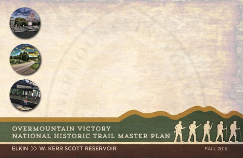
This Trail Master Plan serves as a road map for establishing a section of the Overmountain Victory National Historic Trail (OVNHT) in North Carolina from the Town of Elkin, which serves as the easternmost terminus of the OVNHT, to the W. Kerr Scott Reservoir in Wilkes County.


INTRODUCTION

BACKGROUND

MAP 1: OVNHT COMMEMORATIVE MOTOR ROUTE

YADKIN RIVER GREENWAY COUNCIL: STEADFAST COMMUNITY COMMITMENT

ELKIN

The mission of the Yadkin River Greenway Council (YRGC) is “to enhance quality of life by ensuring the creation of a riverside greenway that connects the major institutions and neighborhoods” throughout the Yadkin River Valley in Wilkes County. For more than two decades, this nonprofit organization has worked alongside Wilkes County, the Town of Wilkesboro, and the Town of North Wilkesboro to successfully develop a greenway network that now includes more than seven miles. The YRGC recognizes the importance of incorporating elements of historical significance within trail development projects; the OVNHT has been a major focus since the organization’s inception, resulting in more than three miles of certified OVNHT.

ELKIN VALLEY TRAILS ASSOCIATION: HEARTBEAT OF A TRAIL TOWN

W. KERR SCOTT RESERVOIR

LENOIR

LAKE JAMES

The Elkin Valley Trails Association (EVTA), a non-profit affiliate of North Carolina Rail Trails Inc., is on a mission to “increase quality of life in the Elkin Valley by building and promoting a network of trails and greenways” with the purpose of providing educational opportunities, preserving the area’s history, promoting wellness, and stimulating the economy. The driving force behind a growing trail network, EVTA is responsible for establishing three miles of new trail throughout Elkin and surrounding areas in only five years. The EVTA continues to secure significant trail easements and additional trail miles are planned for construction in coming years. This organization continues to solidify Elkin's status as a state Trail Town as a series of local and regional trails near completion, including the OVNHT, Mountains-to-Sea Trail, E&A Rail Trail, and Yadkin River Blueway.

YADKIN VALLEY HERITAGE CORRIDOR PARTNERSHIP: PROMOTING THE VIBRANCY OF THE VALLEY In 2005, the Yadkin Valley Heritage Corridor Partnership (YVHC) was established to promote heritage and recreational tourism of the Yadkin River Valley. Serving a key region of the Blue Ridge National Heritage Area, the YVHC is comprised of a coalition of local government and tourism leaders working to leverage the area's rich cultural and recreational opportunities to further economic development in the Yadkin River Valley. Recent successes include

2

THIS PLAN'S STUDY AREA This trail section spans from Elkin to the W. Kerr Scott Reservoir.

THE SISTER PLAN

MORGANTON

the creation of a unified regional branding and wayfinding campaign and associated print collateral to expose tourists to regional assets, such wineries, historic sites, and recreation amenities. In addition to promoting the valley's cultural and natural assets, the YVHC also works to develop new cultural and recreation offerings, including the OVNHT along the Yadkin River.

THE ULTIMATE PARTNERSHIP In 2015, the Yadkin River Greenway Council, in collaboration with EVTA, the Town of Elkin Tourism Development Authority,

This trail plan was developed in the same spirit as two other OVNHT Master Plans completed in summer 2015: Lenoir to Morganton and Morganton to Lake James. The NPS is working to develop similar plans for all areas included within the congressionally designated OVNHT.

YVHC, and the Town of North Wilkesboro, successfully secured grant funds from the National Park Service (NPS) to develop a comprehensive trail master plan for the OVNHT corridor from Elkin to the W. Kerr Scott Reservoir. This project is part of the NPS’ ongoing efforts to develop regional plans to strengthen multijurisdictional partnerships and engage landowners to expand the growing network of certified OVNHT throughout North Carolina, South Carolina, Virginia, and Tennessee. It is expected that any trail developed within the plan study area will be certified by the NPS as part of the Overmountain Victory National Historic Trail.


INTRODUCTION

PLAN GOALS

LANDOWNER OUTREACH WAS A CRITICAL COMPONENT OF THIS PLAN.

1

Specific Trail Routes. Identify a specific and fea-

2

Landowner Outreach. Make a direct appeal to

3

sible trail route within a ½ mile of the known historic Overmountain Trail as determined by NPS;

landowners identified during the analysis phase and record their sentiments for providing a trail easement;

Visual Plan. Create a visual plan that provides

4

Support Other Community Goals. To the extent

5

Social Media. Incorporate modern social media

possible, identify opportunities to leverage the trail to further other community goals, including economic development, historic preservation, public health, and environmental stewardship; and

marketing tools within the trail and signage infrastructure to promote the development of “user generated” marketing content.

renderings and schematics to demonstrate trail character;

3


INTRODUCTION

PLANNING PROCESS The consultant team met with local trail and government leaders to generally discuss environmental constraints and opportunities for trail connectivity.

about the trail project. After receiving comments from landowners, the preliminary trail route was revised accordingly.

4. Plan Development | January – September 2016

Research | October–December 2015 The consultant team conducted a thorough site analysis of the study area and determined feasible trail route options. With the trail routes identified, a landowner contact list was developed.

3. Landowner Outreach |

5.

December 2015

FACT SHEET

The consultant team worked in tandem with local leaders to develop a preferred trail alignment. Renderings and schematics were provided to visually support the trail recommendations. Final Plan Preparation | October 2016

Overmountain Victory

The trail planning process requires an analysis of the Yadkin River National Historic Trail Master Plan corridor between Elkin and W. Kerr Scott Reservoir. The trail is EL K IR IN T RVO O W. best suited in floodplain areas where development generally cannot KERR SCOTT RESE occur and where there are meaningful connections to existing parks, civic buildings, and neighborhoods. After identifying feasible trail route options, there will be a major landowner outreach effort. Without the voluntary commitment from landowners, the trail will either be relocated or not constructed.

www.OVTplan.com

1

Direction Setting and Project Launch | September 2015 The consultant team will meet with local trail and government leaders to generally discuss environmental constraints and opportunities for trail connectivity.

2

Research | October – December 2015 The consultant team will conduct a thorough environmental assessment of the study area and determine feasible trail route options. With the trail routes identified, a landowner contact list will be developed.

3

Landowner Outreach | December 2015 Landowners with property along an identified feasible trail route will be invited to a special meeting to learn more about the trail project. After receiving comments from landowners, the preliminary trail routes will be updated.

4

Plan Development | January – March 2016 The consultant team will document the trail analysis and landowner comments. Recommendations will highlight alternative routes and the project’s overall feasibility for completion. A draft plan will be made available for public comment.

5

Final Plan Preparation | April 2016 The consultant team will publish a final plan that incorporates all public comments.

CONSULTANT CONTACT

A Project Fact Sheet provided interested parties with background information and a project timeline.

•Conduct stakeholder meetings throughout the study area •Re-evaluate trail routes and priorities

NOV. ‘16-FEB. ‘17 PLAN DEVELOPMENT

OCT.-NOV. ‘16 PUBLIC ENGAGEMENT

RESEARCH & ANALYSIS 4

•Map opportunities, constraints, and draft routes

Thanks to support from the National Park Service, regional community organizations, and local governments, this plan will help establish a walking and leisure biking trail that connects the region and celebrates the trail walked by the Overmountain Men who won a major Revolutionary War battle at Kings Mountain in 1780.

Eric Woolridge, AICP, Destination by Design | Eric@dbdplanning.com | 828.386.1866 | www.DbDplanning.com

project timeline

•Conduct extensive site visit of study area

A trail master planning effort is underway to help create a section of the Overmountain Victory National Historic Trail (OVNHT) to connect from Elkin to the W. Kerr Scott Reservoir!

An educational video will be developed to help communicate the historical significance of the OVT, which will be made available online.

The final plan is published for review by the public, elected officials, and stakeholders.

Landowners with property along an identified feasible trail route were invited to a special meeting to learn more

JUNE-SEPT. ‘16

FACT SHEET

BACKGROUND

2.

Direction Setting and Project Launch | September 2015

THE PLANNING PROCESS

1.

•Develop final alternative routes •Identify key focus areas for implementation


INTRODUCTION

RE

HIL

ST

L

H

IG

H

FO

HILL

LA

N

D

PLAN ORGANIZATION PINEW

R

OA

PA RDUE

H

ya d k in

PLA ZA

E NI

ELKIN

N

VE

RONDA

LE ELK IN CH

This chapter is dedicated to visually defining the various trail types to be used throughout theL EASANT H IL L CH TT corridor. Also, design concepts provided for all LItypes of trail user orientation signage, mile 268 LKIN TLE Eare LE LIT EL K RPES markers,T HAhistoric markers, and other trail support facilities. IN MILL C E

T

LLC R ES

CR EE

K

RRIS

MAIN

E

K

O BR AR CE D

N SWA

TH

EL

TRAIL FEATURES R LAKE DA TRAILHEAD C

OF J

ONE

E EK

LANDOWNER SEN YES CR

AMBL BR E

CERTIFIED OVT SECTION

B

NO

WATER CROSSINGS

ROAD CROSSING

LK

C

G RON ST

5

NO RESPO

ER

R

AE

M AR

#

RAYMOND

WA

EXISTING LOCAL TRAIL PROPOSED LOCAL TRAIL

POSITIVE

CONSTRAINT

SPUR TRAIL

EK CRE

AM

H AT

SW

TO WN

B

PREFERRED TRAIL ROUTE VE R RI DG ALTERNATE TRAIL ROUTE E

RI

O# OK MAJOR BRIDGE The fourth chapter breaks the study area into five (5)EEKplanningA sections. Each planning section CR AV JAN N # E MINOR BRIDGE/ CULVERT A 1/4 1/2 1 MI. includes a map that displays 0 a preferred alignment. Each planning section further incorporates S WE the analysis and design elements from the previous chapters along with a host of supporting renderings and design schematics.

T

O

Chapter iv.LEGEND BE

STEEP SLOPES

JONE

CO

IN

ORNE OSB

BETHEL

TRAILS

CH

K YAD

RIDG

RIVER

RIV ER

RONDA MEMORIAL PARK

ATHAM CH

Significant efforts were made to reach out to landowners where the preliminary analysis (results from chapter I) indicate that the trail is most suitable. This chapter outlines the process and results of landowner outreach, including a map series illustrating landowner sentiment.

PINCH POINT

STEEP SLOPES

2

1

H

ODY WO

2

EL

YADKIN COUNTY

D BEN

LANDOWNERS CLOSE TO RIVER

1

268

TORY FAC

Chapter Ii.

R

Recommendations STEEP SLOPES

OAK

RONDA

SPU

A

JURISDICTION

L

BIG

M TTO RBO

T IO N

RIVE

INAL CARD

ISD IC

YADKIN R IV ER

LY

DA JUR

1

JOL

RO N

ELK

Y

OF

TOWN OF ELKIN

E SS

RU

268 MONE

Landowner Engagement

N

SURRY COUNTY

H

L

S HOOT TO W

JA

C NIA

ST I N AU

EDO

K

MAC

C RO

CH MA CEDONIA

AM SH

LOMAX

N

KIN EL

L TT SE

R EE K

D

HI

TO ROLLING PINES DISC GOLF COURSE

CRE EK

ATE

SWA N

PRIV

E

L HA

WILKES COUNTY

HIL

BIG BU

DAMO N

PINNIX

SC

LA N OAK

P

UNRD 36

SWAN CRE EK

L

R

E

OL

HO

This chapter provides a comprehensive overview and analysis of the opportunities and constraints found throughout the study area. The analysis begins with a brief description of the study area followed by a comprehensive discussion of the natural and built environments and their implication for trail suitability, trail design features, permitting, and costs. This chapter concludes with a map and photographic series that highlights a host of preliminary trail route alternatives.

DS

268

R TU CA DE

EW VI A EDW R DS L A KE

RIV ER

BULL INS

EL priva te NC OneMap, NC Center for Geographic Information and Analysis, NC 911 Board W HO

R WA ED

IT

E I DG

LE

ek Cre

HOWE LL SC HOO L HOWE LL SC HOO L

T

HO

HUGHES BRANCH

SC

TN

LL

IT TL EM

WE

L

HO

am

NGS

ARMS TRONG

Be av e rd

S PRI

priva te

re ek

PULCO

LARGE PICNIC SHELTER W/ GRILLS

ER

CREEK

priva te

FN AF

LA KE

LE Y

SECTION 1

HAY NES

GABOO

EK N CRE

HAY NES

E

SWA

RA

TRIS TIN

COO K

ER

OD RT NO HW O

BAG

C

Chapter iii.

N

HAY NES LK

Cre ek

an

OPEN SPACE

RIVER ACCESS

highland park

K

SH

Sw

N

CANOE/ KAYAK STORAGE

E HIKING TRAIL URFAC

pr op os ed

WIL LIAM S

K

HIL LCRE ST

PINE

MAIN

SWAIM

SWAIM

CEME TERY

FRA NCIS PR UITT

RES

MAG NOL IA

SU

COO L P INE COO L P INE

BER LEY

OK RB RO CE DA

NCE

O LINE

S AL UR AT

WALL

E

Ea st

r iv e r

OO D

T

OA KW OO D

LC

HIL

D OO COO L P INE

COO L P INE

GILL EY

WILKES

EL TH BE

EL TH BE

NO RT

C MAS ONI

H UT W ER RIV

SO

YADKIN RIVER

RIV ER RIDGE

Cobb Creek

HIDDE N A CRES

BLE

Y 268 HW KIN

LLS BE

EL M CHA THA

CAR

COVERED PAVILION

Trail Character and Design Guidelines

H CB E L L R SC E

CLINGMA N

SPE

K

MAP LE

MAIN

[ j

Swaim Memorial Park

Y WA

ND

OD

HAY WO OD

SLIC

M

OA KLA

VIL LE

VIN

S

Y

JO NES

HW

E

NW

CL

OL D

CIR

IN

RK

EL

MART

PA

ANG

HA

Y

OA K

AT

HARD

R

CH

JAY

LE

N

N

AI

TO

THU RMAN

GMA

ROA RING

Cre ek Grays

MO

RTIN

SHA FFNE R

IN

OL

RED

TR

MA

EN

blair island

EY

G WO

DO

R

Swan

RE MULTI-US E G

y a w n e e r g

CL

WA

L

VA LL

G

CLIN

We st BETHE

NE

G

IN

å Ronda Clingman Elementary S chool

PICNIC SHELTER W/ GRILL, TYPICAL

PROPOSED BRIDGE

PROPOSED BRIDGE

BEACH

OA KWO OD ACRE S WATE R

OA

JAN

JO

VER

RI KIN YAD

THE O DORE

E

COO K

AVA

E

ILL

SV

TRO Y

RAY MO ND

EL

S

E

DG

IAN

BETH

ID

t ovnh

LOO P

LE

EL

TT

TO

L AK E

BRA MBL

LE

E

OK

S GI LL

RI

E

CI

ER

d tifie cer

j [

Chapter I.

E

PG

CEDA R

RIV

BR

STA DIU M

RO

ED

TB

DR

EK

LIAM

CE

LAK

CRE

ng sti Exi

OLD

OS

DEL

ES

GP RIC

å

RB

MIL SWAN

AN

WIL

SW

MAIN MAIN

Jonesville Elementary School

IP

COB B

W

DA

OK

EE

{ n

SWAIM

RO

O OK

K

MA

E EK

AN

M

A RBR

RN

CR

TR

HIL L

R SP

EL

BO LES

CR

FR

N

BETH

AN

EL

AI

BO

RR

SW

AN

TH

BE

E IDG

BETHE L

T

IS

BR

CED EL

CA

ST ER

IS

C

BETHE L

NGM

Brook Floater

M

ROS E

CANIP

RNE

HALL

an

O DY

CLI

R

VE RI

!

WINS TON

CHURCH

TH MA

Sw

WO

YADKIN

10 11 11

DY

D

IN

ER IN RIV

BO

FO

OO

ON

ek

[ j

Jonesville Greenway Trailhead

JONESVILLE E

CARR

W

N

C

SE

MA

THIRD

7

8

Roanoke Slabshell

re

M

EL

Mineral Springs Park

Chatham Park

[ j

IC

7

j [

GRE GO RY

OM

BE ND

OTT

BIG

ERB

8 9

URN

{ n;

Town of Ronda Town Hall

YADK

CALVARY

IT

NDO

MM

HOO TS

RIV ERS ID E

SU

BLA CKB

RY

RY

TE

9

BRA

ILL

LAK EV IEW

ME

FACTO

A PH

RONDA

CE

[ j

W

10

D TR OL

CEME TERY

12

TS

D

BR

M

OO

RIV

INAL

TO RY

O

YADKIN RIVER

RIVER

OS

6

3

DAR

FA

RY

NW

D

CARD

FAC

East Wilkes High School

HO

AN ST

Existing Conditions, Analysis, and Preliminary Alignments [ j

6

Crater Park

SHAW

10

5

ER

S

TS

å

OA K

LL

ING PR LS IX E RA N N PI

ek

WA DDEL L

S ON

FU

YA

HOO

C re

K ER

Elkin City Hall

ER

oo

YN

THA RP E

HIC

4

{ n

YADKIN KE

G

;

Y SURR

TT

TT

IX

SPRIN

å

Elkin Elementary School

CHER

YADKIN

HENDR

MIN

UI

1

2

RIV

PR

MAIN

SURRY

5 JO LLY

ab

GW

A

26 8 Y W H IN EL K

Y

G

Elkin City Park

Elkin Middle School

IEW

NE MO

IN

j [

å å

Elkin High School

YN GW

4

CH

Branch

Bug PO

R

PL

S

MI LLV

S

A

Hug hes

Big

S

SP

SPUR

TEXA

LAUREN

DO

NI

R

ELK

KE

LA

CE

TS

HO

A

G

UN

3

ES

LE

WIL KE S

K

RING E N SP

AX

RIDG E

MA

O

YO

REEVES

CH

J A RUS SE LL HIDD

LOM

SUMMIT

JAM

E

GRE ENWO OD

OC

East Wilkes Middle School

ELKIN

!

Surry County Muster Site

BRIDGE

MR

S MAP LE S PRING

Start of Study Area

WILES

SHA

W VIE

BEA UTY

KE

å

CH

1 2

#

8

WISCONSIN

EXISTING FARMLAND

HAWTHORNE

RIDG

S LA

MACE DONIA

LF

Y 26

SALMON

GE

T

NC HW

SPUR TO OVNHT

AND

D

FRON

8

26

OO TW

PARTRID

HIL L

AZA

Y

UR

IS

DS AR W ED

HW

SP

HARR

WA LL

E RI DG

MOUNCE

EW

JA MES T BY RD

VI

N

K

LEE

ANT

OA KL WES

L

NORTHWOOD

EY

LL HI

EL

RD WA

LE

ek re

ED

C

TT

WO

P

ER

AP

in

KI

EL

CH

M

NT

TR

Elk

SE

MTN

IN

tle

LE

PINE

LITT

E LK

Lit

SHA DY

TIN

LIT

TLE

S CE

IN ST

AUS

ES MILL

PLEAS

LL

NT

VA

O

RD

M

AU

ED

WA

M

PI

THA RP

CA

CC

OLD MIL ED

MAE CO CKE RHA

E

RIDG

IVY

SURRY

A " & Pleasant Hill Fire Department OA K

BRAGG

R

WILKES

DECATU


INTRODUCTION

6


CHAPTER 1 EXISTING CONDITIONS, ANALYSIS, AND PRELIMINARY ALIGNMENTS

An OVERVIEW AND ANALYSIS OF THE OPPORTUNITIES AND CONSTRAINTS FOUND IN THE STUDY AREA

The analysis begins with a brief description of the study area followed by a comprehensive discussion of the natural and built environments and their implication for trail suitability, trail design features, permitting, and costs. This chapter concludes with a map and photographic series that highlights a host of preliminary trail route alternatives.

IN T H IS C H A PT ER A. Study Area Description B. Natural Environment Analysis C. Human/Built Environment Analysis D. Map and Photo Series: Preliminary Trail Route Alternatives


WILKES COUNTY

STUDY AREA

SURRY COUNTY

CHAPTER 1

21

I AR RO

ELKIN

NG R VE RI

D O R

18

RONDA

ER

268

WILKES COUNTY

R V E R I

I N D K A Y

N. WILKESBORO

421 421

W KERR SCOTT RESERVOIR

WILKESBORO

MAP 2: GENERAL STUDY AREA

IV

RI

YADKIN COUNTY

R

EK CRE

IN G

OR

JONESVILLE

ROARING RIVER

Y RR

O A R

E LB MU

R

1/2

EC MIL

GENERAL STUDY AREA DESCRIPTION: WILKES COUNTY

The Elkin to W. Kerr Scott Reservoir OVNHT study area is one-mile wide and extends approximately 28 miles from the Town of Elkin to an existing certified segment of OVNHT at the W. Kerr Scott Reservoir in Wilkes County. The study area begins at the eastern terminus of the OVNHT in the heart of Elkin located on the south side of NC Scenic Byway 268, adjacent to the Elkin Recreation 115 Center. The trail route follows an existing natural surface section of the OVNHT along the Big Elkin Creek south to the Yadkin River where it then extends west through the Town of Ronda, the Roaring River community, and the Towns of North Wilkesboro and Wilkesboro before reaching its western terminus at the W. Kerr Scott Reservoir. Land uses throughout the Yadkin River corridor are typified by low-lying agricultural and undeveloped lands with very low-density residential uses. An active railroad corridor parallels the Yadkin River at various locations, which supports a Lowes Hardware warehouse and other industrial and commercial farming uses. W. Kerr Scott Reservoir and its section of certified OVNHT serves as the western terminus of the plan study area.

The 28 mile study area begins in the Town of Elkin at the NPS marker, identifying the OVNHT’s overall Eastern Terminus, and ends at the W. Kerr Scott Reservoir in Wilkes County.

8


EXISTING CONDITIONS, ANALYSIS, AND PRELIMINARY ALIGNMENTS

ANALYSIS WORKFLOW ALTERNATE TRAIL ROUTES WERE DETERMINED BASED ON AN ANALYSIS OF THE NATURAL AND BUILT ENVIRONMENTS.

SIT EN M N O R I V EN

T

EN M N O R I V EN

E A N A LY S IS

T 9


CHAPTER 1

THE NATURAL ENVIRONMENT The opportunities and constraints found within the natural environment are critical for determining suitable trail locations and feasibility, ideal user experiences, construction costs, and necessary permits. This section explores the implications of the study area’s natural environment for establishing the Overmountain Victory National Historic Trail from Elkin to the W. Kerr Scott Reservoir and includes five (5) parts: 1) Floodplains; 2) Wetlands and Hydric Soils; 3) Rivers, Streams, and Lakes; 4) Steep Slopes; and 5) Rare Flora and Fauna.

10


EXISTING CONDITIONS, ANALYSIS, AND PRELIMINARY ALIGNMENTS 4

“Much of the floodplain areas along the Yadkin River corridor are ideal for greenway development.” photo by others

FLOODPL AINS

WETLANDS AND HYDRIC SOILS

STREAMS, LAKES, AND PONDS

Floodplain areas provide both an opportunity and constraint for trail development. Since traditional development is often not suitable within floodplain areas, private landowners are often more willing to provide access for public trails within these areas. Also, these scenic areas often attract wildlife, which creates an engaging trail experience. Within the study area, much of the floodplain areas along the Yadkin River corridor are ideal for greenway development where significant sections of the Yadkin River Greenway now exist.

The study area includes several wetland areas as identified on the National Wetland Inventory (NWI). According to NWI, there are likely smaller wetland areas within the study corridor that are not indicated within their inventory that could impact final trail alignments. Hydric soils in combination with wetland plant species and wetland hydrology are considered indicators of a wetland, which require costly permitting if impacted².

The County, State, and Federal government regulate the many water bodies found throughout the study area³. The Yadkin River and its tributaries including the Reddies River, Roaring River, Mulberry Creek, and Big Elkin Creek are some of the most important waterways found within the study area; there are permitting implications for crossing and bridging these water bodies⁴.

Although development is regulated within the floodplain, greenways and trails are allowed and can be permitted. Sound trail engineering techniques are necessary to ensure trails can sustain flooding. To the extent possible, greenway alignments should be avoided within the floodway¹.

2

If wetlands are unavoidable, utilize elevated boardwalk systems. Boardwalks allow for travel over flat, poorly draining soils, standing water, and wetland features and have significantly less impact than other options. A section 404 (Clean Water Act) Permit may be required if the wetland is considered jurisdictional by the USACE. This means that the wetland is not isolated and part of a broader lake or water system. A small boardwalk for a non-isolated wetland with limited fill or dredging may qualify for a programmatic Nationwide Permit. Nationwide Permits are designed to streamline the permitting process for actions with limited disturbances. In addition to permitting, disturbances exceeding a tenth ( 0.1) of an acre would require mitigation which can increase project costs. Impacts under a tenth (0.1) of an acre do not trigger mitigation fees.

Maintain a 50-foot buffer from all waterways, particularly those regulated under the Yadkin River Buffer Rules. The state requires a 50-foot buffer along the shorelines of Catawba River and associated lakes. Streams within the study area are identified by the State of North Carolina as having poor water quality and maintaining or improving an adequate vegetated buffer is crucial to improving the quality. Zone 1 of this buffer includes an undisturbed 30-foot buffer from top of bank in which trails are discouraged. Zone 2 is an additional 20-foot buffer. This zone allows for managed vegetation and trails and greenways. While trails are an allowable use within Zone 2, the NC Division of Water Quality requires a permit (through DWQ or designated local government). The applicant must show that disturbance has been minimized and no other alternatives exist.

3

⁴ Plan for permits related to waterway Impacts. Federal 401/404 Certifications will likely be required in cases where any stream or waterway alterations occur. These alterations would be most likely in conjunction with bridge improvements or addition of structures near waterways. Triggers for the permit include disturbance to the stream bed, banks, damming of the waterway, or placement of material within the waterway (i.e. culverts/ pipes).

Avoid disturbance in the floodway. Avoid placement of structures or disturbance within the floodway. Floodways are regulated locally and by the Federal Emergency Management Agency (FEMA). Fill, structures (walls, kiosks, etc), and impervious services are discouraged. Any structures located within the floodway require a no-impact/no-rise certification through FEMA. These studies can vary on cost but can range from $2,500$15,000 depending on complexity.

1

11


CHAPTER 1

STEEP SLOPES

RARE FLORA AND FAUNA

Much of the study area includes gently rolling topography and thus avoids impacting steep slopes. The most challenging slopes along the Yadkin River are steep areas often found opposite of large floodplains. To the extent possible, the trail should provide for grades under 5 percent. Natural surface trails can vary up to 10 percent slope. Proposed trail alignments may require a wider trail corridor to ensure a more gradual trail grade.

The State Natural Heritage Program provides data identifying the state’s most sensitive environmental areas; these areas are incorporated within the analysis map series at the end of this chapter. Also, rare flora and fauna species can also exist outside of these designated areas, which can alter final trail alignments prior to construction. Species identified by the State Natural Heritage Program within this study area as of April 2016 include:

Coordination with the U.S. Fish and Wildlife Service (USFWS) is an important aspect of the design process. Involving USFWS early on in the process can help avoid potential planning obstacles related to federally protected species. Additionally, permits like Section 401 and 404 (described previously in Wetland and Streams sections) will initiate the review of the State Natural Heritage Program database. If species are found within the project area, State or Federal requirements may dictate avoidance or mitigation.

Mayfly: photo by others

A. Brook Floater (Yadkin & Roaring Rivers) B. Roanoke Slabshell (Yadkin River between Ronda and Roaring River community) C. Mayfly (Yadkin River near Wilkesboro) D. Bank Swallow (Roaring River) E. Lobed Spleenwort (rock outcroppings on Roaring River) F. Carolina Foothills Crayfish (Yadkin River and Fishing Creek)

12


Exhibit 1: W. KERR SCOTT RESERVOIR

EXISTING CONDITIONS, ANALYSIS, AND PRELIMINARY ALIGNMENTS

W. KERR SCOTT RESERVOIR QUICK FACTS W. KERR SCOTT RESERVOIR Constructed: 1962 Miles of Constructed Trail: 40 Miles of Certified OVNHT: 6 Miles of Shoreline: 56

The W. Kerr Scott Reservoir comprises 1,475 acres in western Wilkes County and is managed by the United States Army Corp of Engineers. This public land area provides for six miles of certified Overmountain Victory National Historic Trail and is renowned for its scenic beauty and abundance of recreational offerings, including boating, fishing, hiking, and mountain biking. The Reservoir provides for OVNHT trailheads at both the Visitors Center and Bandits Roost Campground.

13


CHAPTER 1

THE BUILT ENVIRONMENT The opportunities and constraints found within the built and human environment are critical for determining suitable trail locations and feasibility, ideal user experiences, construction costs, and necessary permits. This section highlights five ( 5) built environmental features and their implications for developing the OVNHT from Elkin to the W. Kerr Scott Reservoir, including: 1) Land Use; 2) Existing Trails and Parks; 3) Utilities; 4) Transportation; and 5) Historic Resources.

photo by others

14


EXISTING CONDITIONS, ANALYSIS, AND PRELIMINARY ALIGNMENTS

LAND USE SNAPSHOT

“Well-established trail systems in the Towns of Elkin, North Wilkesboro, and Wilkesboro provide natural anchor points for infill trail development connecting these communities, expanding recreation offerings, and creating new certified sections of the OVNHT.”

The Town of Elkin

Community of Roaring River

The eastern terminus of this plan and the entire OVNHT begins in the Town of Elkin. This historic community is situated along the banks of the Yadkin River and south of Stone Mountain State Park. The Town maintains a close partnership with the Elkin Valley Trails Association, and together, they have made significant strides to establish Elkin as a state-recognized Trail Town. The OVNHT, Mountains-to-Sea Trail, Yadkin River Blueway, and several other local trail systems converge in Elkin. Elkin’s downtown is comprised of a mix of commercial, civic, and residential uses, providing trail users with opportunities for dining, shopping, and entertainment.

Roaring River, an unincorporated rural community, serves as the approximate middle point of the study area. The Roaring River community is characterized by low-density rural development with access to Highway 268. Wide swaths of farm land and an active railroad are located in the floodplain between Highway 268 and the Yadkin River. As the study area extends west toward North Wilkesboro, the landscape is interrupted by a large heavy industrial land holding occupied by the Louisiana-Pacific Corporation and several smaller operations. Large parcels of agricultural land still remain throughout this area, which present an opportunity to construct significant segments of trail with the cooperation of a single property owner.

Town of Ronda Ronda is a small rural town situated between NC Scenic Byway 268 and the Yadkin River. The town core consists of a single block of commercial property that is surrounded by low density single-family homes. Just beyond the town limits are large agricultural tracts and multiple light industrial facilities. The Town of Ronda Memorial park is part of the Yadkin River Paddle Trail and provides an opportunity for OVNHT trail connectivity.

North Wilkesboro & Wilkesboro Geographically separated by the Yadkin River, the Towns of North Wilkesboro and Wilkesboro are historic communities located at the foothills of the Blue Ridge Mountains. Both towns have made significant strides in the past decade to revitalize their distinct downtown cores. Annually, the towns attract tens of thousands of visitors over a single weekend for the famous music festival, MerleFest, and now attract regular weekend visitors with their mix of vibrant local shops, restaurants, farmers markets, and recreational opportunities. Connectivity among the town now exists because of a growing network of trails, including certified sections of the OVNHT. This plan explores ways to further grow this internal trail network and extend its reach east toward the Town of Elkin.

15


CHAPTER 1

EXISTING PARKS AND GREENWAYS

“Elkin, Ronda, North Wilkesboro, and Wilkesboro boast a collection of parks and greenways that are ideal for trail connections.� Yadkin River Greenway The Yadkin River Greenway Council, Wilkesboro, and North Wilkesboro have worked together for more than two decades to successfully develop a more than seven-mile network of greenways along the Yadkin River and its tributaries. More than 3.5 miles are certified as part of the OVNHT.

SOME OF THESE MAJOR ASSETS INCLUDE:

Eastern Terminus and Certified Segments of the OVNHT

Ronda Memorial Park

W. Kerr Scott Reservoir

The Towns of Elkin, North Wilkesboro, Wilkesboro, and the W. Kerr Scott Reservoir have a combined total of more than 13 miles of certified OVNHT. The Town of Elkin serves as the overall eastern terminus for OVNHT.

The Ronda Memorial Park is part of the Yadkin River Paddle Trail and serves as an ideal trail connectivity point. Other park amenities include a walking track, playground, and large barnstyle picnic shelter.

Managed by the US Army Corp. of Engineers, the Reservoir is a regional recreation destination attracting mountain bikers, paddlers, hikers, campers, trail runners, fishermen, and birders. This public land holding provides for six miles of existing OVNHT. The W. Kerr Scott Reservoir serves as the western terminus of the study area and a major trailhead for the OVNHT.

16


EXISTING CONDITIONS, ANALYSIS, AND PRELIMINARY ALIGNMENTS

UTILITIES

The incorporated towns located within the study area maintain water and sewer infrastructure, which in some instances have easements that can be modified to provide for trail development.

TRANSPORTATION

The analysis of the study area includes a review of the North Carolina Department of Transportation (NCDOT) right-of-way (ROW), NCDOT plans, existing bike and pedestrian infrastructure (crosswalks, bike lanes, etc.), railways, and existing greenways. NCDOT’s right-of-way was analyzed to determine where there might be opportunities for developing OVNHT side paths. These areas are shown on the Site Analysis Maps with corresponding opportunities and constraints notes.

The analysis of the study area includes a review of public infrastructure and associated easements; these areas are shown on the Site Analysis Maps with corresponding opportunities and constraints notes.

Yadkin River Greenway Underpass at Highway 268

17


CHAPTER 1

HISTORIC RESOURCES

“THE OVNHT SHOULD LINK, PRESERVE, AND INTERPRET HISTORIC AND CULTURAL SITES ALONG ITS ROUTE.� Historic Sites and Landscape SHPO oversees a large database of historic sites and resources. All resources, including those related to the OVNHT, are included within the subsequent analysis map series. These resources include information from SHPO surveys as well as a large list of sites related to the National Register of Historic Places (which the National Park Service oversees but individual States manage). The most critical sites include those listed on the National Register (NR) or determined eligible (DOE) as they have further protection under Section 106 of the National Historic Preservation Act6. The National Park Service has emphasized that as part of this study and trail development, that historic/ cultural resources should be linked, preserved, and interpreted. Sensitive Cultural Resources and Permitting: Any construction funded or permitted by the federal government will trigger a project review by SHPO of any resources covered under Section 106 (National Historic Preservation Act). These resources could include human remains, burial sites, archeology sites, and historic sites. If it is found that the action of trail construction could potentially adversely affect cultural resources, the SHPO will work with the related Federal Agency to eliminate or minimize the effect.

5

Historic Sites and Permitting: In general, a greenway would have no effect or a complimentary relationship to preservation of these sites, but may require SHPO coordination in circumstances like alterations to historic bridges or whole properties. If federal funds or permitting is required, the SHPO will review this database and analyze for any adverse impacts.

6

The Overmountain Victory National Historic Trail Route and Corridor The Overmountain Victory National Historic Trail route was identified by a National Parks Service research team. The team relied on the 1881 account of the march, which has been amended by local historians, descendants of battle participants, and other sources. As part of this congressionally designated trail, any officially designated portion of the OVNHT must lie within a one-mile corridor (half-mile on either side) of the historic route.

18

Sensitive Cultural Resource Areas Culturally sensitive resource areas have been mapped in the site analysis study based on input from the NC State Historic Preservation Office (SHPO). These areas are shown on the Site Analysis Maps with corresponding opportunities and constraints notes. These sites should be avoided due to the possibility of historic resources that could be destroyed with ground disturbance5.


EXISTING CONDITIONS, ANALYSIS, AND PRELIMINARY ALIGNMENTS ! (

The map and photographic series, which spatially in-

MAP AND PHOTO SERIES: PRELIMINARY TRAIL ROUTE ALTERNATIVES

corporates the natural and built environment analysis, highlights a host of preliminary trail route alternatives. These routes were further refined by local leaders to identify and engage landowners. This information will serve as an ongoing reference guide as alternative routes may need to be developed due to unforeseen barriers.

RE

HI LL

ST

H

IG

H

FO

HILL

LA

N

D

! (

OO D PINEW

WIL LIAM S

OA

K

HIL LCRE ST

PINE

MAIN

SWAIM

SWAIM

CEME TERY

FRA NCIS PR UITT

PLA ZA

H

NIE

PA RDUE

OA KW OO D HILL CR ES T

Cobb Creek

BER LEY

MAG NOL IA

OK RO RB DA CE

RT

D OO W

ER RIV

SU

COO L P INE COO L P INE COO L P INE

COO L P INE

GILL EY

WILKES

EL TH BE

NO

H UT SO

YADKIN RIVER

RIV ER RIDGE EL

COO K

N

HAY NES

EK CRE

RA

Cre ek

priva te

SH

N

ek

C

Cre

an

WE

FN AF

LL

SC

ER

HO

priva te

re ek

ARMS TRONG

PULCO

HOWE LL SC HOO L HOWE LL SC HOO L

am

MO

Sw

BULL INS

OL

SC

HO

Be av e rd

Ea st

N

VE

HIL

L HA

LL priva te NC OneMap, NC Center for Geographic Information and Analysis, NC 911 Board WE HO

DAMO N

L

HAY NES

HO

OL

BETHE

HAY NES

E

SWAN

ER

TRIS TIN

TH BE

M CHA THA

Swa n

JANE

PINNIX

RM FA E AL BE DR

T

MAS ONIC

WIL KE S

8 26 Y HW N EL

KI HIDDE N A CRES

BLE

Y 268 HW CLINGMA N

MASTIN

ELK

M HA AT CH

WHITE PLAINS

IN

LS BEL

MAP LE

RM Y FA ON TH AN

WO BLACKBU RN ON

OL D

60

VINS

Y HW NW

IN MART

RU RR

N RID

S IG HT HE VILL A 60 OL D

PRIV

ATE

CRANBERRY RIDGE

Cr ee k Brier

E

S TA

LE

Y

RY S

RA Y

NS

RANSE STALEY

R

RA

PAR 3 US

HW

Y 42

1

BE

SIO N M IS GE RID EW SH

We st

TO

US HW

Y 421

NC OneMap

OLD 60

PARKS RIDGE

ON RS DE AN LW

OL D

B CLU RIT AN

DO G

GL EN

RE

ROCK QUARR Y

FRANK JOHNS

CO UN

PINE HILL

E OW N RI DG BR

AR CED

CU

S

SHILOH

CH

L OL KN

JAM

ES

HUNTER

OLD 60 REDDI NG

M AS

IS

RR

TWIN HILL

ELMO

LEAF CLOVER

TR YW AL

K

ST RE

HA

MP JO E

HY

MT

N

COUNTRY OAK NORA OAK

Wilkesboro

M &

D STAT ESVI LLE

TWIN OAK

CLI FF

OR

B

PINE BROOK

LL

MAJOR

MAHO GANY

OAKS

D

N

FO

BETHE

LK

CLEARWATER

ANCIENT

KELLY HILL

FOREST

RAMP

Y 16

SEDG EFIEL

US

RU

HW

GE

E DG Y RI KE

WALT

EA

ST

W AY

BREW

ER

CORPORATE AVIATION

RT PO AIR

D W AR D

O

W O

L COLO NIA

PINE HILL

L HIL INT

INS FAIRPLA

FL

E PIN RY CH

ER

VANCE

GREEN HILL SNYDER

N SO HN JO

OR DS W IN

THURMAN

IN FRANKL

CA

ER

FLETCH

SCHOOL

DA

SPARTA

INS CH

RD

COFFEY

FINLEY

WIL LA

RO BO

OL IA MAGN

ES W ILK

ER KEEN

RS EA SP

MAL L

NEEDLES GOLDEN

IN

WA

N

BR NERS

X

NC

D

OR

E

CL

K

CC Wright Elementary S chool

421

AC

R GR OV

OAKWOODS

S

FO

WN

EDGEWOO

ek

PO PLA

OA KWO OD ACRE S

WATE R

RAY MO ND

S

GE RM ANTO

FAIRPLA

RD FO NK

WILLIAMS

LA

AM

ER KL W IN

DANCY

SPARROW

ST LA

RK T PA MO S

RR Y KE

AM E LI A

LOBO

YADK IN

OD MILL

C re

W

Lincoln Height School

b

VIE

THE O DORE

LIA

FROG RIDGE GAR

Cu

KE

GR

GAITHER S O N

S PA R

MI ST

RAVE N

AMER Y

RESERVOIR

GATEWAY

HAYE S OL D

IM -K W ES MCGL E

E

L

N RI DG

BRA MBL

IL

IFFI

L AK E

GE

M

GR

RID

IS

TG AT E

L

ER

H AT M

W ES

R

LINE

A " &

tle

LA

PE

IAR

MONK

FR

E VILL AG

VIR

KITE Y 16

HW NC

NC HWY 16

GI NI AS

CEDAR RIDGE

E

CARO

LA KE

RC

GIL

RIV

THU RMAN

HILL

NCE

SHA FFNE R

PIE

R

CIS

ME

SWAN CRE EK

GRACE

K

SPE

LE

AN

N

L

GS

PINE

Swaim Memorial Park

TO

FR

S PRIN

KITE

HAY WO OD

SLIC

K

EL

LE Y

M ILL

R ES TO A TR K YS ID E

E

OO

TH

BE

BAG

IS

UE & BL

CO UN

[ j

TRO Y

PG

CEDA R

T

IS

OA

N

ch

RTIN

STA DIU M

BR

LAK

ST

WE

M

E EK

Brook Floater

GMA

Br an

MA

E

CR

R

VE RI

!

CLIN

ow

G

SWAIM

GP RIC

AN

N

TH MA

ITE

NS

IN MAIN

OLD

OS

DEL

IL

WH

H CH

ROBIN HILL

EVA

OD

WO

60

RED

R

C

EY

DOG

SW

GMA

SPICER

TIOC

LE

S

K

ND

VA LL

D

REE

OA KLA

EL

VIL LE

ANG

JO NES

NE

EY

Me ad

CLE

S LOO P

E

ILL

SV

JO

GE

MA

BO LES

CLIN

RUTH LINN

KITE

CIR

LIAM ID

UE

S

AN

IP

RIDGECREST

RK

TT

PA

LE

AN LL HO E L

PC

Y

WIL BR

R SP

EK

HARD

N

CRE

OA K

AI

IS

EL

ER

M

E

TH MA D

IP

COB B

CE

DRE

AIL

IDG

HALL

BETH

EE

MAIN MAIN

å

GRE GO RY

BETHE L

CR

{ n

Jonesville Elementary School

RB

MIL SWAN

K

AN

TR

BR

S

BETHE L

SW

TR

HIL L

CHURCH

N

CA

ST ER

OK

JAY

ROS E

WINS TON

NG S PRI IX NN PI

O OK

j [

IL

AP

EW

E RAL

O DY

YADKIN

re

WO

Jonesville Greenway Trailhead

RY

Y

C

OD

an

ELM

Chatham Park

[ j

IC

7

[ j

CHER

A RBR

RR

FO

RO

BR

YN

CED

CARR

WO

N

N

Sw

ek

GW

E

CANIP

RNE

DA

FA

SV

TR

MILLVI

ER

BO

[ j

6

j [

Mineral Springs Park

MIN

BE ND

OM

CALVARY

OTT

BIG

ERB

NDO

MAI

10 11 11

7

8

Roanoke Slabshell

9

URN

HOO TS

BLA CKB

RY

D

9

8

BRA

ILL

FACTO

A PH

ON

[ j

RIV

RIV

NAL

TR

BL

SPARK MOND

60

UNRD 36

&

THUR

RD

C

SE

6

RD

JONESVILLE OR

10

OLD

RIV ER

E

A QU

AS

ANTIOCH CH

HE

THIRD

RED ROA RING

HIT

OL D

OLD

LE

EP

{ n;

3

DA

LB

å Cre ek Grays

W OLD 60

O

SH

TR

60

CREEK

O RY

CK

T

ELL

CARDI

FACT

O

3

k

E

FISHING

PARKS RIDGE

TS

AC

D 60

IT

AN ST

WE

Ronda Clingman Elementary S chool

D

US

MM

OS

AVA

5

RE

OL FO

OO

COO K

2

ALL

NE

NW

D

ELKIN HWY 268

RIVE R

60

SU

1

H

ee

RY

! (

4 OLD 60

FARM

LA

TE

ER IN RIV

PE

Roaring River Elementary School

6

9

D OL

AP

CEME TERY

LAK EV IEW

D

n

7 3

8

YADK

D

ROA RING

4

2

LAUREN

ek

NS

!

YADKIN RIVER

LL

RONDA

CE

ME

S

Elkin City Hall

5

ER

YADKIN RIVER

RIVER

YADKIN KE

LL

Crater Park

SHAW

10

East Wilkes High School

Town of Ronda Town Hall

1 R WA

MILL

8

å

OA K

OT

PLAI

TTON CO

Y 26

Roaring River Fire Department

D 60

WA DDEL L

ON

HO

TE WHI

B

N HW

ABTCO

OL

K ERS

12

L

Cr

HIC

RIV ERS ID E

A " &

IL M

ing

E

CH

R WA

YN

FU

YA

HOO

C re

LU

ELKI

RIV

Carolina Foothills Crayfish

JO LLY

oo

C

MP

60

RIDG

WADDELL

AN IT

IST

YADKIN

4

Y SURR

TT

TT

;

å

Elkin Elementary School

{ n

Elkin Middle School

! (

E

KE

S

Y

ab

T

AN RIT

LA

er

KE

KIN

GW THA RP E

S

2

å å

Elkin High School

MAIN

X HENDRI G SPRIN

1

Broadway Volunteer Fire Department

E AT ST

EDG EWO

WEST

TUR

RIDDLE

E

Lit

IN

PT

EP

IN

UI

S

SURRY

5 PR

Elkin City Park

EY

OVER

E

D

GS

PL

Riv

K

EAGL

WEST

TE TA

ED GE SANDW

AN

R

ing

EE

ON

LL VA

Y

SH

E

R

ANDERS

N

AD

DE

SH

WALNUT

ENUE

BA

IT WH

! Lobed Spleenwort

C

OLD

Y US HW

BE

PY AV

K

421

VE

IL TA

SHOR T

!

ORD

ODS

EW PONDVI

OLD US

ON TT CO

268

H PATC

11

ARRY

12

KIE

D OO

RK

BRINE

CH

ek

QU

YA

AN

W

D

re

OL D

FR

Rolling Pines Disc Golf Course D WO

Y

ST

O

C

HW Y

ER

SANF

North Wilkesboro

M

R MO

EA

PA

HID

O EW

b

C O

RD FAR

[ j

LA

G

Cu

CH

KNO LLW OOD

BIR

KIN

N RI

TEXA

! (

ELKIN

[ j

n

EDGEWOOD

SLEE

D

BA Y

O

RO SE

ER

ELKIN

!

HOLL AN

DU

ED

RAMP

WALK

MP

BA

Mayfly

AR

H

RK

REST

L PA

RA

Y

OLD

1 1

ER

WILKESBORO

DS

RR

Fi sh

R

RK

6T

er Riv

Lincoln Height School

UA

NANC

PA

H

H

n

Q

D

DA

5T

8T

Y EMOR D EN NS W TO

E

VE

R

13

5

Cree k

O

H

10

QUARRY

D

H

AC

R

DE

CE

ID

3R

H

9T

O WO

W

RY

EASTOV

[ j

G

C

Bank Swallow

ROCK

CL

H K OA

LIBERTY

GROVE RIVER RD LIBERTY

Mulbe rry

BY

RY

EU

3RD

7T

8TH 8T

2 5 1/

ARMO

SHEPHE

Rolling Pines Disc Golf Course

BRIDGE

SK

IE YV

BAY

AR

H

H

6T

7T

H Smoot Park

PE

n

S

LIB

E

ES

WO OD

ID

R

T

R

GRE EN

ORAN GE VIL LE

DS

N

RI VE DK IN

O

RO CK KNO LL ERTY LA

LING

O O W G DO PO PLAR

3

Highland Hills Disc Golf Course

!

IEW SKYVW

ek

AL LO NI CO

H

[4 j

SKYVIE

Cre ng Lo

GROVE RIVER RD LIBERTY

4T

STAT ES

N HW

8

ek rry Cre Mulbe

N

ER

GIO

AV

6T

C

Foothills Christian College & S eminary

FAIRVIEW

O

K

NEY

NORTH WILKESBORO

[ j

N

ETTE CHARM

W DO

EE

RIA

K

EA M

CR

R PA

IVY

C

UB

N

UST

L

ASHLEY

O

EATH

FIELDSTONE

IS

IND

HIL

E

ERRY

STON

MP Y

LINEB

INGE

R

LE

H

D

BU

R

SH

4T

C

Carolina Foothills Crayfish

SUNC

O

M O

D

D

Optimist Park

s die

H

IT MM

E

E

! (

RAMP

GI LR

EH

F

[MAIN j

WILKESBORO UNRD 200

K OA

SU

PINE

BEEC

Wilkesboro Elementary School

D

Westwood Park

SID

2 YA

2

E

CALL

IN

n

Cub Creek Park

A " &

STON

William K. Newton Memorial P ark

F

WEST

Wilkesboro Fire Department

FF

[ j O TW

YLAN

AND HIG HL EG E COLL

RAMP KELLY R AM P RAMP

ES W

SK

DO GW OO D HO L LY LA UR EL

Wilkesboro Town Hall

ELKI

LL

Y 26

RU

UN

RN

BO

J

[ j

H NORT MAIN H SO UT

E

Wilkes Community College

MP

RY

S

n

IE W

EW E VI

EE

RA

3

ELK

IN

LL

North Wilkesboro Town Hall

! ( ! (! ( ! ( (! ! ( ( ! (! ( ! ( ! 5j[ ! (

FAW

SK

HILL

BO WEL

RIVER

LINK

T HI

K

H

C

d Re

WE

IEW

SPRUC

KENLEI GH

1

V ST

LE BUS TEMP OL SCHO

LL

TH

11TH

13

D

NE E PI

YN

TH

D

A " &

PINE

STEVENS

ER

E OD

H

F

F

FLIN

L

J

CA

RAMB

n

M

K

G

N

2ND

I TO LL

G

E

N

L

RO

ER

North Wilkesboro Elementary S chool

O

N ER RIL

AA

CAL L

SHAW

KRAM

IT WH

K OA

I

L

S

K

I

F

WHITE

E OD

M L

J

ER

J

WILLOW

PARK

RH

AN

ABSH

13

WES T

SH

SH

North Wilkesboro Fire Department

CHER

42

BRAD

R MA

ON

FIN

MAY

JEFFERSON BOONE

CO X

ELM

DR

CH

W G

AN

DUNC

BR

PILS Y LE

EE

10TH

D

ILD

ETT

I

TE

K BROO K BROO N ES VIA WI LK MO RA

WO O

YV

HACK

LW

K

WALNUT

N

E

6

D

Y

R

26 8

UN

AR KY

HW

IA

W

E MC

CH

HIL

SUNSET

IC

SK

FAIR

ET

N DO

BR

RIV

FIELD TO

AL

DS

SUNSET

COT HRE

BR

M AN

E

LD O

Lowe's Park at Rivers Edge

IAL

STON

GE R

ND

JOHNSON

MP

N

D

RA

MT

DAY

T ES W

NE

8

D

O ST

IR

Y 26

KW OO

COLLEG IATE

O

HW

Y LITTLE BERR

V ER

NC

PA R

L

ES

FRONT Y NC HW

268

NS

ES

EL

8 Family Y 26 YMCA

R

WATER

NC HWY

NE

NN

D N

OR

PE

IA

OO

SB

REYNOL

JOLLY

GE

BR

RW

Wilkes

W CH

TR

MO NT

RR Y

E

GE

ID

ER

BE

N OR

IAL

9

RIVER

US

TR

E

IND

US

NG

N O

BR

[ j

8

IND

R

RA

LB MIL

S

S CH

ELLE

End of Study Area

A

7

D

! ( E RO UG

SO

E GL

IS RT

OO

YMCA

MO URN

YADKIN

SENEC

ITHACA

ES HOLIN

# 11

10

BO OAK

KE STO

MIDDLEBROO K

FO RD

ELW

SU

DIE

CU

KENNEDY

LL CH N HI

RD

NS

UR

E

HA

WINKLER MILL

ZIO

FO

CH

OW

O

L

ek

NS W

SS

BR

LA

ID

IT AVE

NG CO

EY

PARK

N

SUMM

KL OA

O

Y 16

W

CK

US

EA

ON

E

CONGO

M IL

re sC

O

BR

NC HW

LINE HO

NE

AL

TC

N O

S

R

er

Y 16

BUCK

HW

CACTUS

AZ

SE

MILTON

CH

KLE

Mill

STO KES

NC

K

KS OO

D RE

LU

PA D

UN

CH

L

WIN

NO R

UR

BR

D

TS

AARON

WATKINS

NORTHVIEW

BO

ML CH

ME

O WO

RID LAINS FAIRP

SUNSET

SE

BUGLE

ME

E

MYE RS

CRY

GO VER

K

HO

G

TH

K

OA

NG CO

KERR SCOTT RESERVOIR

HO

CO ME

RID

RD

13

EE

C

RRY

WER

BY

r

CR

N

BYRD

Rive

CASTLEBE

ME CO

LE NG

E AT E G BO ON

M

BU

TA

T

DA CONGO

CONGO

L WE JUNIPER

GE

KE

16

IES

ST

Y

H

DD

RHYNE

LA

Lincoln SU Height NC SchoolRES

GE

NO

RE

CT

VIL

E

PRO SPE

IC

AN

RA VE

RAVEN PINE

US HWY 421

SH

MIDLAWN

RD

ERID

R

BO ON

NTE

K TO

WE L

E

CA

MAE

EW N VI

OA

YN

R

ARD

EY

CR

CH

E AS

NG

RH

O

XI

LO

AL ST

UTH

LE

SO

S

FO

PIN

E

EN

E

RE

HW

E

R

KC OO

NC

FIS

R G

AC

ORCH

AVERY

CRICKET IVY

EWS

AB

Y

BR

n West Wilkes Middle School

REST

E ON

ST ANDR

N

TREE

R BU

SUNC

L BOONE

BO

AN

GREENCREST S

AI E TR

MIDDL

BO ON

T KNIGH SQ UIR E MI LL ER

D RG

ON E

NK

ies

BO

LA

Re dd

ROVE

WOO

MO

N

SASSY

CLE

ALE

EE

LS

OA KG

CIR

YD

RN

PADS

NN

TU

GR

IL

SU

L LY HO

R

TH

KIRBY

LE

W DO

O

BOONE

GREEN ACRES MYERS

D OL

RI DG

E

Millers Creek Christian School

RAILWAY

M IL

A ME FO

OO K

REST

AL

E

OW BR

n

DD

EIL

MEAD

A " &

Millers Creek Fire Department

RU

KIT

N MC

KD

E

BYRD

SUNC

A O

BO ON

ANIE

PUMP

QU

VISTA

W O

STEPH

8

CK RO

A " &

Mountain View Fire Department

68

VIL LE

Y2

Y 26

BO

IS PT

k Cree

HW

KNOT

IN

DAM

ELK

ER

PLAR

HW

Ro ck

BEAV

PO

RT

NT

RU

BELL

N

TIN

SO

PO AIR

MO

ELKIN

MORRISFIELD

NORTH WILKESBORO JURISDICTION BEAU

EASTON

ARBOR GROVE

AR

AR M

HN

YAL RO

! (

PJ

JO

PENN

ON INGT

R

WINGS

BAPTIST CH

ar Ro

TAYLO

L

RO

R

EW

SU

RG

U

BR

KSIDE

BO

R

NE

CREE

ER

CH

CAMP

RT

STO

EW

RH IL

EEK

BR

ELI

N W

AR GA

R

E

O ND

INE

CR

PIN

K

R SILVE

EE

ER

ER

BR

CK RO

CR

PO AIR

EW

IN

R

CK RO

SO N

BR WALT

MOUNTA

SP

Branch

Bug

AR

PO

UIT

KEY RIDGE

BELL

JO HN

ARY

CAMP

WOOD WALLACE

MCCR

TR

M

RU

BLUE BIRD

IA

DALE

LA

RING N SP

NE

MO

Hug hes

Big

!

BREW ERS

4

CH

3

S

BRIDGE

CK

MRO

J A RUS SE LL HIDDE

A

JAME

SPUR

SALMON

HAWTHORNE

WILES

W

SHA

VIE

AX

HO

!

GIL L

REEVES

CH

ELK

EA

KE

LOM

RIDG E

DO

NI

OT

G

UN

!

Surry County Muster Site

WISCONSIN

YO

AL

S LA S MAP LE S PRING

SUMMIT MA

CE

#

Y 268

GRE ENWO OD

AZ

NC HW

UR

BEA UTY

SP

ND

D

E

1 2

RIDG

RD LEE

Start of Study Area

HARRIS

RD WA ED

268

OO TW

PARTRIDG

FRON

WA LL

GE RID S

W

MOUNCE

VIE

ELK

WA

JA MES T BY RD

EY

ED

ek re

å East Wilkes Middle School

S

OA KLA

WES

L

L HW

Y

EL

CH

CH

P

NORTHWOOD

LL

HIL

KIN

C

MACE DONIA

LF

M

NT HIL L

ER

AP

in

WO

PLEASA

NT

TR

S CE

Elk

LE

IN

TT

E LK

SE

MTN

TLE

tle

LE

PINE

LITT

LIT

Lit

SHA DY

TIN

ES MILL

VA

NT

RD

MO

IN ST

ED

AU

AUS

THA RP

CA

CC

OLD MIL

PI

WA

RIDGE

ED

OA K M

IVY

SURRY

A " & Pleasant Hill Fire Department

MAE CO CKE RHA

BRAGG

R

WILKES

DECATU

NC OneMap

19


CHAPTER 1

Map 3: Study Area 1 Site Analysis

D W OO SWAIM

FRA NCIS PR UITT

WIL LIAM S HIL LCRE ST

K OA PINE

SWAIM

MAIN

CEME TERY

Cobb Cre ek

BER LEY

MAG NOL IA

OK RO RB DA

H

N IE

PA RDUE

HAY WO OD

Swaim Memorial Park

SPE

K

CE

RT

EA

D OO

RW COO L P INE

SU

COO L P INE COO L P INE

[ j

SLIC

COO L P INE

R T IN

OK

GILL EY

M AI N

R

NCE

R

C AR

TR O Y

O LI N

E

IC E

L AK E

SHA FFN E R

WILKES

D

LE

EL

OO

TO

BE TH

A SM

STA DIU M

RO

E

RIV ER RIDGE

TB

LAK

YADKIN RIVER

EY

GW

DO

NO

H UT

RI VE

SO

BLE

EL

PLA ZA

26 8 Y W H IN EL K

VIN

S

HIDD E N A CRES

Y2 68 HW K IN

S LL

G

G

BE

LE

VA LL

E

A ND

VIL

OA KL

EL

L LE ES

IN

D ELO

ES

SW

C LIN

CR AN

GM

T

EL

FR A

NC

M G IL

AT H A

IS

EL

R IV

ER

R ID

BRA MBL

THE O DORE

GE

OA KWO OD ACRE S

LIA

WATE R

N

CH

COO K

EK

priva te

k

LE Y S PR

an

C

priva te

S

IN G

re ek

HAY NE S

HO

WE

A

LL

N FF

SC

E

R

HO

OL

HOWE LL SC HOO L HOWE LL SC HOO L

KE AN LA

BAG

Sw

HAY NE S

SW AN

SH

Cr ee

N

ARM S TRO

NG

BULL INS

O

SC

HO

L

H IL

LH

AV

EN

EL priva te NC OneMap, NC Center for Geographic Information and Analysis, NC 911 Board W HO

SWAN CRE EK

UN RD 36 G RIV ER

PULCO

PINN IX

ROA RIN

ek s C re

N

E

Ea st

N

E

TH U RM

GM A

Gray

MO

RR A

k C re e

EL

R ED

TO

m

C LI N

Swa n We st

KE

Be av er da

å

N

HAY NES

WA L

JAN

LI

K

CRE

CLINGMA N

EL

AVA

BETH

C

RAY MO ND

BETH

Ronda Clingman Elementary S chool

E

TR IS TIN

TH

BE

EL

IS

TH

M

M

ER

BE

AM AT H CH

IV

K

Brook Floater

R

EE

AN

!

L

DAMO N

M AP LE

E

Y

CL

AN G

ID

N JO

LOO P

ES VI

HW

IR KC

JO N

NW

R PA

BR

R SP

N

OA K

S

OL D

Y

LI AM

M AR TI

R T

OLD

PG CEDA R

ET

PL

COB B

W

EK

SW AIM

BO LES

GP R

W IL

HALL

MA

D

HARD

GE

N

EL

CR E

R ED

LEGEND M IL

SW AN

AN

JAY

ID

AI

BETH

SW

ILE

BR

M

C

OK

RB

K

EE

MAIN MAIN

Jonesville Elementary School

RN

CR

{ n

å

OK

RR

A TR

ROS E

BETHE L

BO

I TR

HIL L

CH UR CH

GRE GO RY

BET HE L

EL

IS

Y

RO

A ED

Jonesville Greenway Trailhead

RY

RO

A RB

CA

ST ER

7

WINS TON

GS

C ED

[ j

R IN

PE

Chatham Park

[ j

TH MA

OD

YADKIN

ek

DY

re

OO

C

W

Sw

an

FO

COO K

20

CANI

E

CAR R

OA

STUDY AREA 1

RN

D

OM

IN

10 11 11

R

BO

RIC

SP

OO

BE N

OT T

N

O

MA

C

SE

D

WO

M

EL

AL

W

BIG

ER B

NDO

N

THIR D

N

7

8

Roanoke Slabshell

9

B UR

HOO TS

{ n;

Town of Ronda Town Hall

IVE IN R

BLA CK

IT

O RY

MM

BR A

L

Y

RIV ERS ID E

K YAD

FACT

H IL

AP

ER

SU

9

8

j [

B FA

JONESVILLE IX

EN

OS

6

RD

Mineral Springs Park

N

TK

W

10

R DT OL

ET

TS

RONDA

Y M

O

[ j

RIVER

SHAW

10

East Wilkes High School

3

DA

YADKI N RIVER

TT

R IV

Y

CEME TER

LAK EV IEW

CE

O

AN ST

N

UI

D

CALVARY

IN AL

TO R

H

12

å

OA K

LL

[ j

6

Crater Park

YADKIN YA T

CARD

FAC WA DDEL L

ON

FU

RY

5

ER

ER

TS

k

RS

KE

4

{ n

M IN

HOO

re e

H IC

Elkin City Hall

PI

oC

YN

;

å

Elkin Elementary School

ER

Y

JO LL

bo

GW

THA RP E

ING

CH ER

IN YADK

SU R

RIX

SPR

R IV

R

2

å å

MAIN

H EN D

IEW

Y

ga

PL

1

N

NE

MO

Bra nc h

Bu A

PO

AS

SURRY

5 PR

Elkin City Park

Y GW

4

CH

[ j

Elkin Middle School

EN

IA

R

ES

Elkin High School

LA U R

ON

GE

NG S SP RI

ED

s Hug he

B ig

S

TE X

JAM

V MILL

J A RUS SE LL

EN HIDD

AX LOM TS

G

SPU

E

KE LA

REEVES

E LK

BRIDG

CK RO

NG

AL

AM

WIL KE S

SH

W

U YO

3

WILES

VIE

BEA UT

Y

KE LEE

GRE ENWO OD

HAWTHORNE

ELKIN

!

Surry County Muster Site

WISCO NSIN

UR

IS

A SL

East Wilkes Middle School

AC

#

26 8

H AR R

SP

WY

AZ

NC H

1 2

IC

Y

MAS O N

HW

IDG E

RID

RD

K

Start of Study Area

SALMO N

PINE

S AR D ED W

WA

ek re

ED

C

å

M

PARTR

HIL L

ND

D OO TW

NT

R ID

MOUNCE

n

EL

G S CH MAP LE S PRIN

RID SU MM IT

IN

SAN T

S WE

L

L

ki

JA MES T BY RD

H IL

El

K IN

8

26

EL

CH

IA CH

P LE A

LA OA K

ER

AP

GE

TR

le

LE

MAC E DON

P

FR O

NT

T EN SC

tt

TT

K IN

L EE

TL

SE

PI NE

N MT LE

LIT

Li

SH A DY

T LIT TIN

ES MI LL

LF

R

HILL

D N LA H IG H O

IN ST

M

AU

ED

D AR

PI

AU S

TH A RP

M

OA K WO O HIL D LC RE ST

WA LL

E

RI DG

M

EW VI EY LL VA

OA K

CA

OL D M IL W ED

MAE CO CKE RHA

CC

IVY

SURRY

A " & Pleasant Hill Fire Department

WO

SP

L

BRAG G

UR

WILKES

DECAT

ANALYSIS O

HIL

ST

D NORTHW OO

SITE HO

RE

GE

STUDY

AREA 1

FO

PR IV

AT E

j [


EEXXI ISSTTI INNGG CCOONNDDI ITTI IOONNSS, , AANNAAL LY YS SI IS S, , AANND D P PR RE EL LI M I MI NI NA AR RY Y A AL LI GI GN NMME EN NT TS S

STUDY AREA AREA 11 OPPORTUNITIES OPPORTUNITIES & & CONSTRAINTS CONSTRAINTS OPPORTUNITIES

CONSTRAINTS

1 Enhance the Eastern Trailhead and connect short

1

2 Surry County Muster Site - Historically significant

2 Market St. Crossing has OVNHT markers, but could

3 Elkin Municipal Park has existing OVNHT

3 Elkin and Jonesville trail systems are divided by Yadkin

distance to existing OVNHT trail.

OVNHT site

4 Existing trailhead and railroad underpass 5 Site of future Yadkin River Heritage and Trail Center 6 Connection to proposed section of NC Mountains-toSea Trail

narrow shoulder

benefit from crosswalk

River with no pedestrian infrastructure to connect

4 Trail close to railroad. 5 Pinch point

7 Connection with Town of Jonesville Greenway system

7 Steep slopes

8 Wide floodplain

8 Steep slopes

9 Wide floodplain

9 Steep slopes

10 Connection to Ronda Memorial Park

10 Pinch point / steep slopes

11 Existing road underneath southern portion of Clingman

11 Clingman Rd. bridge has narrow shoulder

Rd. bridge is large enough to accommodate a trail

1

The Eastern Trailhead of the OVNHT exists at Elkin Municipal Park.

1

6 Tree farm

Any side path along Front St. would be difficult due to the narrow road.

feet meters

7

The OVNHT could connect to the Town of Jonesville Greenway.

Ronda Memorial Park could serve as an OVNHT trailhead.

10 4

12 HWY 268 over Big Bugaboo Creek has narrow shoulder

2

View of W. Main St. crossing. feet meters

3

Existing OVNHT is located through Elkin Municipal Park.

10

4

Opportunity for the OVNHT to interact with the rail line in a creative/safe way.

11 11

View of Clingman Rd. Bridge over the Yadkin River.

20 7

feet meters

21 21

10 3


!

CL TA N RI RU

E

RR

NR

M YF AR ON TH

4 5 HI

OLD 60

FO 60

HNSO N FRANK JO

OL D

L H O LE

i ng

Cr

k ee

EL

LA

S

IS M IL

ANTIO CH CH

L

!

er C ree k RA

NS

E

ST AL

EY

RANSE STAL

RY S

IS EM DG RI EW SH

ROBIN HILL

PARKS RIDGE

RA Y

Bri

ON SI

N

CH

SO

CH

R

ER

TIO

E

ND

AN

L IP

LW A

L IL

KS

M

PAR ND S RM O

E

RD

TR

22

ES KI

D OL

CREEK

AN

STUDY AREA 2 60

FISHI NG

HE

TH U

U & BL

E

DS

D

DW OO

FO R

LA N

FR

SAN

HOL

EP

ITE

N AN C

PARKS RIDGE

SH

IS

WH

H AT M

R ED

Mayfly

IL

TH MA

h Fi s

A QU

EY

R

Carolina Foothills Crayfish

LEGEND

T

SPICER

60

US

60

CRANBERRY RIDGE

D OL

0

0

PAR 3

US

H

4 WY

21

BE

60 OL D

NE

60

UE

LA

6 OL D

N N EY RUTH LI

AP

A LL

OL D

LL

60

BL

D OL

OL D 6

&

IV

M FAR

ROCK QUAR RY

TE

ER

!

ek

RM

W

R

FA

D

N

3 Map 4: Study Area 2 Site Analysis

OLD 60

RE

9

E AL BE

LA VIL

WHITE PLAINS

2

6

ABTCO

4

1

ELKIN HWY 268

DR

TS IG H HE

WO BLACKBU RN

8

YADK IN RIV ER

MAS TIN

GL E N

ORE E LM

TWIN HILL

AN

DO G

KE

WAL T

LEAF CLOVER

IDG

E IDG YR

W ER

BR E

W AY

ST

EA

K

W AR D CO UN TR YW AL

D

!

7 3

CK

A " &

Roaring River Fire Department

n Roaring River Elementary School

O

68

AC

Y2

D

PE

HW

R WA

D

IN

2

R WA

PINE HILL

INS

O

LA EP

E LK

IL M

D OL

IT WH

RT

IVE R ING R

KI

GE

1

ROA R

D

RID

CH

! Lobed Spleenwort

IL L NM

MP

5

12

I ST

L

T TO CO

KE

RIDDLE

W O

B

K

YA

S

r ve

2 68

I TA

SH O

11

RY

AI N

LL WADDE

CORPORATE AVIATION

T

OR

AI RP

N TA RI

LU

EE OL D

AR QU

PL

TE

Ri

R

Y

PT

I WH

g

HW Y

ON TT CO

C

RR

BA

C

r in

ELKIN

K

UA

VE

AN IT

STUDY

T

RU

R

a Ro

H

Y

ES

13

Cre

O

I

C

10

Q U AR R Q

RO

Bank Swallow

ROCK

N

IE W

GRO VE RIVER RD LIBERTY

er r y

RG

U

R

PT

C O

RY

L

LIBERTY

E

R

G

BA

R

AR

NOL TY K LIBE R

R

CH R

DE

Mulb

R

EEK

BY BO

VE

ST

BAPTIST CH R GROVE

CH PAT P KIN PU M

QU

ID

CK RO

DS

RO CK

LA

SKYV

O

AR

2 68

BO

ek

VISTA

W O

RH I LL

C re

Mountain View Fire Department

AR

GA

ARBO

RU

WY

k Ro c

68

R

WINGS

BAY

N

Y2

O TAYL

N OW

INE

E

K

HW

A " &

TVIL L

EL

IN

H LKIN

D AM

T

SU

TI

KN O

VER BEA

LA R

E

AR M

D

RT

ON

E

PO

UM

EASTON

AIR

P PO

NORTH WILKESBORO JURISDICTION BEA

N

MO RRISFIEL

EW

PJ

SO

R

AL OY

BR

CR

ER

LL

N

HN

G TO

IB

E ON ST

JO

NIN

EL

P BE C AM

RT

ANALYSIS PEN

E

SID EEK

ND

BR

CR

PO

PIN ER SILV

LE IN DA

CK RO

R

W RE

ER

K

AIR

TB WAL

E R EW

CR

N

LL

N SO

CK RO

P BE C AM

JO H

AR Y

TA MO UN

EE

SITE WO OD WALLA CE

R MCC

KEY RIDGE

UIT

WER S

TR

BR E

IA M

BLUE BIRD

AREA 2 GI LL

UB

CHAPTER 1

US H

WY 4

21

NC OneMap


EE XX II SS TT II NN GG CC OO NN DD II TT II OO NN SS ,, AANNAALLYYSSI ISS, , AANNDD PPRREELLI IMMI INNAARRYY AAL LI IGGNNMME ENNT TS S

STudY AREA ArEA 2 OPPORTUNITIES OPPOrTuNITIES & cONSTrAINTS STUDY CONSTRAINTS OppOrtunitieS

cOnStrAintS

1

Wide floodplain

1

Pinch point

2

Spur trail to Roaring River Elementary School

2

Steep slopes

3

Connection to Roaring River community commercial node (Snack / restaurant opportunity)

3

Steep slopes

4

4

Steep slopes

Louisiana Pacific could incorporate workplace wellness trails

5

The Old 60 bridge over Brier Creek is too narrow to accommodate trail users.

5

Wilkes county landfill is a large tract within the study area.

6

The Highway 268 bridge over the Yadkin River has a narrow shoulder and would not be able to incorporate trail.

7

3

Any spur trail to the Roaring River community would need to cross an active railroad.

8

Roaring River crossing

9

Louisiana Pacific is a large workplace that may not be able to accommodate a trail.

10

Pinch Point

11

Fishing Creek crossing

12

Pinch Point

13

Pinch Point

Small commercial node at industrial site in roaring river community.

Highway 268 bridge over roaring river. feet meters

the Louisiana-pacific site is a significant landholding within the corridor.

7

the Yadkin Valley railroad is active throughout the roaring river community. feet meters

5 feet meters

10 4

numerous pinch points exist within this study area. feet meters

6

9 4

1

1

200 70

Wide floodplain on either side of Yadkin river. feet meters

10

400 100

4

Old 60 bridge is too narrow to accommodate a trail.

2

A spur trail could connect roaring river elementary School.

20 8

feet meters

10 5

23 23


L O NIA COL

PINE HILL

L HIL INT

FL

AIN S

PI NE

GE

OLD 60

OW NR ID

JAM

ES

HUNTE

R

KN

OL

DA

L

M AS

CU

S

SHILOH

CH

OL D 60 RE RIS

Map 5: Study Area 3 Site Analysis

DDING

GRE EN HILL SNYDER

BR

R DA CE

THURMAN

RY

VANCE

ER

MP JO E HA R

CA

ST RE

HY

MT

N

COUNTRY OAK NORA OAK

M &

E CL

MAJ OR

STAT ES VILL

D IF F

OR

B

PINE BROOK

NT OA KS

US

N

FO

TU

IE LD

CLEARWATER

ANCIE

OR DS W IN

Y 16

CH

D

LI N

AR

FR A N K

FINL E

WI LL

FOREST

N

RAMP

KELLY HILL

SCHO O L

H ER

GO LDEN

FAIRP L

SPARTA

LAIN S FAIRP Y

RO

O L IA MAG N

BO

R NE KEE

FLETC

NEEDLE

S

JO

HN

SO

MAL L

ES

SPARROW

RS EA SP

ER KL

DANCY

W I LK

WILLIAM S

HW

BR S R N ER

SEDG EF

NY

N

R

S

MAHO GA

OR

E

IN

RU

ED GE AN D W

AN

E

LL

TWIN OAK

AC

OAKWOODS

k

E

UE W

ee Cr

AR G ROV

N AV E

ek re

SH

S

EPY

X

PO PL

BE

EST

FO

WALNUT

D

b

b

EDGEWOO

CH

W

Cu

Cu

C

US H

IL L OOD M EDG EW

CC Wright Elementary S chool

Y 4 21

t le

BA Y

D

WN

Lincoln Height School

S

GE R MAN TO

BIR

E ME TT

S LE

O

TE TA

NC

YADK IN

COFFEY

AM GR

K TP AR MO S

RR Y KE

LO B O

IA AM EL

RD FO NK LA

ST LA

S O N S PA R

RAV

PE

IAR

MO NK

FR

G IN

VIR

VIL

T MIS

EN

RY TG AT E

RESERVOIR

Y

R

L it

EW

LE

EG A

n

EDG EWO OD

FAIRVIEW

RO SE

WAL KER MP

R

C H AR

K

O

VI

L VA

Y

FROG RIDGE

BRIN

O VE

R PA

W DO

KE

D

EN

AN LL HO E L IL SV

D

DS

Broadway Volunteer Fire Department

E AT ST

O

Lincoln Height School

LE

T WES

K

R AM P

ST

PA R

RA

CRE

I AL

SU N

TR

EA M

LA

n

EAG

A " &

R SO N

W ES

W IN

AYE S

OL D H

IM -K W ES AME MCG L

GE RID FI N GR IF

TO A TR K YS ID E

42 1

AN D E

CO UN

OL D US

VIEW

ES

K

PO N D

PA R

LA

R

D

Y

EN

D OO

E

NS

W

W TO

ST

AC

RY

R MO

EMO

EA

S

[ j

WILKESBORO

AD

O WO

W Rolling Pines Disc Golf Course

DD HI

O EW

K OA

FA R M

H ER D

AR

[ j

SH

BRIDGE

1 1

VER E A S TO

DU

G

Carolina Foothills Crayfish

D

R

n

W IE

DA

C

SH EP

Rolling Pines Disc Golf Course

Foothills Christian College & S eminary

YV

CE

Smoot Park

[ j

N

DS

SK

ORY AR M

K

EV AN

N GRE E

ORA ESV NGE IL LE

PE

ED

EK

OO GW

O O W G DO PO P LA R

3

Highland Hills Disc Golf Course

r ve

RE

k

ER

R PA

H

Ri

GATEWAY

NC HWY 16

GAITHER

E

L AG

KITE Y 16

HW

NC

HILL

PINE

E

KIT

IAS

CEDAR RIDG E

CE

PI ER

GRA CE

KITE

ee Cr

IV IN R

ID

6T

H

T

CL

D

H

8T

[MAIN j

[4 j

3R

5T

C

STAT

EU

/2

3R D

51

H 7T TH 8T H 8

es

RIDGECRES

H

di

PC

H

6T

H

AP

ng Lo

NORTH WILKESBORO

2

4T

H

D

E

9T

TR

H

E

C

E

2 68

re e k err y C

Br a n ch

N EY

IAL

Me a do w

SID

L ON CO

STUDY

N

2N D

4T

F

D

2

William K. Newton Memorial P ark

WY

Mulb

R

ON GI

E AV

LE

S

LL

H

F

Optimist Park

d Re

US

CH

KNO LL WO O D

[ j

IN H

Y GROVE RIVER RD LIB ERT

K YAD

WILKESBORO UNR D 200

IN

K

FF

EE

PINE

B CU

CR

RY

ASHLEY

N

N

C A LL

RAMP

IVY

FIELDSTON E

O

STO

J

WEST

Cub Creek Park

KI

L

K

5j[

LL

E

B ER

TON

IS

BO

K

TH MAIN TH SO U

HI

GE

MP Y

LINE

HIN

R

HIL

NT

North Wilkesboro Town Hall

Wilkesboro Fire Department

IND

ATH

BU

R

F LI

L

J

E LK

LL

B LIN R AM

n

M

6T

7T

H

TH

C

EL

E

E OD

N

G

D

11T

13

D

IN EP

RH E OD

YN

TH

E

SH

IT WH

SH

K OA H

I

F

F F

O

CA

ER

North Wilkesboro Elementary S chool

H

RAMP

E GILR

M O

P LE US TE M LB OO

SC H

R MA

C AN

H

10T G

A " &

K OA

T

D

MI UM

O

S

CH

WHITE

N

RU

BEE

Westwood Park

NOR

CE

n

R IA

NE

I TO L L

I

I

Wilkesboro Town Hall

D LA N HIG H EG E L L CO

RAMP

KELLY R AM P

[ j

RRY

DO GW OO D HO LL LA Y UR EL

Wilkesboro Elementary School

D

L

FAW

S

MP

LINK

3

E LM

RIVER

HIL

RN

IEW

O TW

W

L BO WE

ES W

IE EV

EE

n

LA N

K

A " &

PINE

TV

CHE

S WE

SPR U

1

RA

Wilkes Community College

Y SK

J

WILLO W

PAR K

HI LL

N SH ER RI LL M L

J

H ER

13

WE ST

WALNUT

SK

UN

ABS

E

KENLEIG H

MP

STEVENS

IE W

N SO PIL Y EE LE W EL FIN

North Wilkesboro Fire Department

OK BR O OK BR O N ES AVIA WILK MO R

42

RA

DR

IT AV

6

D

Y

COLLEGIATE

YV

JEFFERSON BOONE

CO X

W G

A

DUN

SUNSET

N DO

BR

T

KR AM

RO

IE W

E

D

KET

Y MA

SUMM

E NT

H NC

D HIL

AA

CALL

SHAW

SKYV

IDG

E

H AC

K

JOHNSON

L

N

AU

AR KY

EL

HW

BR

W

AL

NN

R

DS FIEL

TO

MC

C

ET

RE COT H

NE

M AN

D EN

D BR A

JOLLY

SU N S

PE

VE RI

STO

GE R

DR

IC T ES W

D

FAIR

ET

TH

D

BR

KW OO

O ST

N

26 8

STUDY AREA 3

PA R

GE

E

IR MT

DAY

E

S RID

LDS R EYN O

G ID

O 68

SK

WO O

T MO N

RRY LIT TLE BE

V ER

WY

Y2

NS

ES

S

O

YMCA

ES

O NT NC H

26 8

HW

N OR

I AL

W

NC OD

8 26 Family

TR

IAR

Wilkes

Y HW

Lowe's Park at Rivers Edge

US

9 BR

T US

L RIA ITHACA

E

IND

R

FR WAT ER

NC HW Y

NC

RR Y

LB MI L

IND

8 E ROUG

IE

NE

H

KE

[ j

RIVER

ER

BE

Y

CA

7

OD

YMCA

CH

KERR SCOTT RESERVOIR

SEN E

N O

OA K

STO

MIDDLEBROOK

N MO UR

YADK IN

BO

BR

RD

10

EL WO

DD

S SO

R BO

GL

IS RT

FO

ESS

R

NG

FO RD

UR

SU

CU

CH

6

NS W

HOL IN

E LLE

RA

NS

KENNEDY

IL L NH

O

H SC

End of Study Area

OW

O

LE

WINKLER MILL

ZIO

BR

WY 1

ES

# 11

BR

LA

K OO

LAIN

PARK

N

DE SI

LD O

k

K

NC H

L IN HO

W

L

K UC

US

EA

ON

13

NG CO

LL MI

ee Cr

BU C

6

S

NE

AL

O

K OA

ER

rs ll e

ES

Y1

C A C TU

AZ

TC

E

H

P FAIR

CH

RE

S

KL

Mi

S TO K

HW

O NG CO

SE

MILTON

CONG

RC

UN

N O

HU

PA D

TS

EL

ML C

N WI

NOR K

BR

OD

E

MYE R S

YS CR

R GO VE

NC

C

ERRY

K

BUG LE

ME

RD

DG

AAR O N

WATKINS

NORTHVIEW

BO

OA

er Riv

K

BU

GL

O EW

i es

EE

N

d Re d

CR CONG O

GE

CASTLEB

ERID

M

RA VE

CONG O

N TA

HO

BY

RI

SUNSET

E AT G

IES

WE JUNIP E R

EH

CO ME

E OM

NE BO O

DA

DD

E AG

OM LC

ET

16

H

RE

I EW

L

RHYNE

CK

A

NV

ST

Y

SH

O NN

MIDLAW N

RAVEN PINE

US HWY 421

SE

PIN

PEC T

VIL

Lincoln SU Height NC SchoolRES

RI

A CH

WE L

HC

L

A ST

Y LE

UT

E

NG

E

PR O S

SO

R

RE

HW

E

AC

N

ER TO W

K OA

NE BO O

Y

LO

CRICKET IVY

KC OO

NC

FIS

R G

EN

I EX

AR D

AVERY

BR

n West Wilkes Middle School

S

RCH

YN

MAE

UR

ST O

RH

C

T AN

B ER

CRE

E ON

TREE

E

N

O AB

S

SU N

IL BO ON E

BO

ST

TR A

L MIDD

SASSY

E

S

HT KNIG SQ UIR E MI L LE R

G AN

R

NE BO O

REW S

IL L

R MO

ON E

ST AND

EN

W DO

TH

ROV

E WO OD

RE

A ME

O

G OA K

RN

AL

ANALYSIS FO

C LE

YG LL HO

R

YD

PADS

LLE

NN

TU

GREENCRE

CIR

MI

RAILWAY

SU

BO

LA

D BYR

ST

E

KIRBY

D OL

HANIE

BYR

AL

BOONE

GREEN ACRE S MYERS

DD

L EI

OOK

n

Millers Creek Christian School

RU

E KIT

N MC

A " &

Millers Creek Fire Department

D OR

CRE

KD

SITE NE BO O

KF

SU N

LEGEND

A O

AREA 3

MEA D OW B R

S TE P

CH

CHAPTER 1

NC OneMap

24

Wilke


EXISTING CONDITIONS, ANALYSIS, AND PRELIMINARY ALIGNMENTS EXISTING CONDITIONS, ANALYSIS, AND PRELIMINARY ALIGNMENTS

STUDY & cONSTrAINTS CONSTRAINTS STudY AREA ArEA 3 3 OPPORTUNITIES OPPOrTuNITIES & OppOrtunitieS 1 Lowes may be a willing landowner 2 Potential underpass at Statesville Road 3 NCDOT Division Office may be able to incorporate trail on large tract of land.

4 Historical OVNHT significance at Smoot Park with

cOnStrAintS 1 Ideal trail alignment narrow between Yadkin River and parking lot

2 Pinch point 3 Main St. alignment would be difficult due to number of curb cuts.

existing trailhead and certified OVNHT Trail

5 Alignment could take advantage of large disc golf courses and their existing trail systems

1

6 Wide floodplain 7 Existing trail at Lowes Park at Rivers edge

1

Birds eye of Lowes site.

feet meters

8 Connection to YMCA

8

View of Wilkes Family YMcA.

11

trailhead at Kerr Scott reservoir Visitor center.

4

Designated OVnHt trail exists in Smoot park.

400 100

9 Wide floodplain 10 Project terminus at Tailwater Access Area 11 Kerr Scott Reservoir Visitor Center has OVNHT exhibit

3

Main St./ Hwy 268 in Wilkesboro. feet meters

10

project terminus at tailwater Access Area

2

railroad underneath Statesville rd. bridge.

3

10

ncDOt Division office adjacent to Yadkin river.

5

25

25


CHAPTER 1

26


CHAPTER 2 LANDOWNER ENGAGEMENT

LANDOWNER OUTREACH AND ENGAGEMENT WAS A KEY COMPONENT OF THE PLANNING PROCESS.

The environmental analysis (Chapter 1) was critical for determining physically feasible areas for trail development. However, significant portions of these routes impact private property and require landowner outreach to fully assess trail feasibility. This chapter highlights the good-faith effort to engage landowners throughout the planning process.

T H E EN GA GEMEN T PROCESS Identifying the Landowners Landowner Communications Landowner Workshop Trail Route Re-evaluation


G

W

O

O

S HT EIG

RY AR

QUARRY

¬ «

135

Y

¬ «

129

¬ «

136

¬ «

128

¬ «

134

¬ «

¬ « 1¬ 42 « 1¬ 54 « 1¬ 43 « 53 « ¬ « 1¬ 1 51 1¬ 52 ¬ « 1¬ « 45 « 1¬ 49 « 1« 46 1¬ 50 1¬ 47 ¬ « «

156

W

155

¬ «

E

¬ «

D

141

157

¬ «

159

¬ «

« ¬ « ¬

¬ «

148

¬ «

160

DS

¬ «

¬ «

144

O

OLD

AP

LA

NE FO U

60

L IL H O LE

D

IAL

O G O O D

¬ «

161

¬ «

162

CH L EL

STEP 1: ¬ « ¬ « ¬ « DETERMINE WHERE ¬ « ¬ « ¬ « ¬ « ¬ « ¬ «THE TRAIL IS FEASIBLE ¬ « ¬ « ¬ « (CHAPTER 1) ¬ «

AL

¬ «

AR

173

172

176

179

RIVER RD LIBERTY GROVE

N

CH

SIO

IO

CH

MIS

AN T

GE RID W SH E

E

HAE KE S

O

LD

60

EAGLE

RID SHE W

K NSIL C OR

WEST CROOKED

BOW

OLD 60

CH S

BRO O

N SIO MIS GE

ON RS DE AN LW

G

CR

EAST

CROO

W KED BO

ING

CR

PERRY

EE K

K CREE

FA FOSTER

GE

RID

H FIS

WN BR O

ARMORY AS CU DA M

S

EY

H

INIA

AL ST

HC

Broadway Volunteer Fire Department

IOC

A " &

T AN

HIN

EEK

Conceptual; Planned Trail

L

FI S

AR CL

Existing Trail Municipal_Boundaries

K

CLA

County Boundary

RK

RO

SES

0

0.25

NTRY

LE

Outreach Parcels

HENRYS COU

IL

OVNHT Corridor (1/2 mi. Buffer) ROBIN HIL

60

FISHING

VIR G

SV

R

ST AT E

E PL

LL CA

E

I TR

N RI DG

DAMASCUS CH

28

D OL

EEK G CR

LA

Pines Course

OOD

FI SHIN

LLS ING HI

BROW

ON

OD S

OLD 60 LAK EVIEW

W

ROLL

OLD US 421

MISSI

S

1

E RIDG

IE

LE

SHEW

NK

US 42

DU

1

OLD

EYW

N

K CREE

N

42

U

1 S 42

WO

CREEK

FISHING

INSO

US

OLD

IL

K

PO NDVIE

R OB

PA R

SV

AND

SPARKS

HERD

A FR

OD

K

ST AT E

RUBY LYNN

O

R PA

N

FISHING

SM O K

TW

LE

D

DS

OR D

IL

K W

N SE

WO O

HOLL

Y OR

SV

AND

F SAN

HOLL

S EA

RY

ST AT E

R PA

EM O

TO

D OL

OK

CEDAR

E

HIDDEN BRO

STEP 2: START A CONVERSATION WITH LANDOWNERS.

IDG

OVER

M AR

RT

D

ST ER EA

CES

PARK

EN

LE

K NS

LAN

K

EASTOV

SR

D

VIL

PAR PA R

ND

GE MISSIO SHEW RID

K PAR

KS OA

R YA

R

TES STA

K H

LA IGH

¬ «

175

EY

IN

Y OR

DA CE

R PA LT

NS RA

LL N VA NSO

178

FARM

SHEP

PARKS RIDGE

TW

M AR

ARMORY

D RY

JOH

EY

OO O ARM

ORY

Y OR

L TA

EW PL M AR

HERD

CE

177

N SHEP GREE

THURMOND

NAN

MA

s se

180

NSTON FIRST WI

¬ «

O SH

RIVER

183

ARM

174

181

YADKIN

185

194

E

182

ES

¬ «

187

189

184

NS RA

¬ « ¬ «

190

¬ «

191

186

¬ «

188

AS

ANTIOCH CH

LO

NI

¬ «

165

¬ «

171

D

OC H

W OG

OO

ANTI

W

COLONIAL

D

CO

OW

ST

OLD 60

N LO

¬ «

170

PO P L

RF E

60

M

CO

163

LD

DE LL

OL D6 0

0 D6 OL

¬ «

158

¬ «

166

¬ «

169

¬ «

139

¬ «

164

¬ «

125

¬ «

137

140

RAMBLING WOODS

ILL

¬ «

131

Y ARR

Fishing Creek

TH

QU

60

VIE

BIR

168 167 BL IN

¬ «

127

¬ «

138 E

FLINT HILL

L

RIDDLE

ELMORE

QU CK RO

VE O R G ER TY R

OLD

L FLI NT HIL

RA M

¬ «

120

130

RY

OW

North Wilkesboro Landfill

T HIL

¬ «

124

OL D

SKYVIEW

Y SK

A " &

DELLAPLAN

BL U

SHO RT

AV EN

132 AR

R OC EW

DH

¬ «

QU

R IV E

HICKORY HOLL

LL

reek

FLIN

CK

D

LI B

RO

HI

LL

EY

N

VI

OO

ROCK

TR Y UN

CO

LIBERTY

LL

SK Y

W

¬ «

NT

CA

I FL

ON IN ELK

68

126

ARR

HI

Y2

Roaring River Fire Department

K QU

E

HW

MAP 6: Landowner Map Sample

LK

WA

RIVER RD LIBERTY GROVE

LL

E

R

PI N

ELK IN

¬ «

ES

R AA

LE

IN ELK

TIE KA

CH CLON

N SID

R

B PEB

DE GRY

EW

DSID

1 16

AV EN

VIL LA H

CLOVER LEAF

CLOVER LEA F

LM

TE

ON

N

RU E IL L

UM

VI

WO O

RD

ABTCO

8

68

E

UN

133

N LA

Y SK

Y2

NORTH WILKESBORO UNRD 265

CH

M

BE A

WARD WOOD HW

SKYVIEW

IN ELK

RIDDLE

L FA GIL STU R

N W O BR IE AR L

South Deep Creek

68

LIBERTY KNO

H RT

K IL

RO

RIDGE TOP

k

268

IN

NO

W

EY

JARVIS ACRES

ELK

WY IN H

HW

VISTA

N EE

L

IN

K EL

Y2

TWIN HILL

RM

KELS

Rock Cree

R PLA

QU

AAR

CAL ON

K EL

S LL

6 Y2

HW

H

O SB

IL

Y2

268

ONTA

A " &

Landowner Database. A mailing database was created that included all property owners within the preliminary trail alignment(s).

N

CALL

Long C

HW

DH

TC PA

WY

COTT

T PO

LM

SO

IN

N VE HA

MO N

TE

RD

K EL

OD

HW

8 Y 26

Mountain View Fire Department

68

IN PK

IN H

STONEY KNOLL

IN ELK

U BEA

ON

A BE

O UM

OO

P

R

M PU

W

M KE

A PL

8

RIDDLE

8

AM

N

O TP

ELK

Y 26

RY

K

HW

AR

EE

CH

UM

HA

QU

CR

RIDDLE FARM

ER D

E

8

V BEA

N PI

A BE

ek

LY RF

BI

KI EL

26

ELKI

ELK IN

LE TVIL

M

Y

68

Y 26

8

O KN

SA

HW

Y2

268

T

AL

IN

HW

IN ELK

Y HW

8

OR

TB

ELK

Feasibility Analysis. Trail alternatives were developed based upon an environmental feasibility analysis.

RIC

AARON

P AIR

ON

K EL

T BIR

C re

TE

RT

SUMMERFIELD

BEAUMONT POPLAR

T BU

PO

UM

IN ELK

MORRISFIELD

MO N

erry

A BE

RD

U BEA

lb Mu

Hunti ng Cr eek

r Scott voir

R AI

IDENTIFY THE LANDOWNERS

ILL

UN

Y 26

HW

8

CK

er iv

CA UD

N

W

S

O

W IN H

IN ELK

HWY 26

RO

R

L

ER

TH OR

E ILK

R BO

9 12

IN RT

s

MILLE

JIM MCCART

RT

ON

MA

die ed

GRAY

IL

CA

N

R

CA UD

JIM

MC

Section 3: Roaring River SO

RT

PINE

ER

HN

PO

ERING

R AI

WHISP

L YA

NS

ELKI N

268 N HWY

HWY 26

WO

JO

RO

Yadk in River

JO H

ELMORE

ON

er Riv

L

Elkin

ng ari Ro

UDIL

EASTON

ELKIN

EY

NS

CHAPTER 2

CHARLIE BROWN

DL

H JO

RT

MILLERS RIDGE

A BR

PJ

N GTO

PO

NIN

R AI

PEN

0.5 Miles E SPE

DW

AY

20 ft. Contour

! F

Trailhead NC OneMap


LANDOWNER ENGAGEMENT VIDEO PRODUCTION

LANDOWNER INVITATION [Date]

[Landowner name address]

Re: Special Trail Planning Meeting for Landowners

LANDOWNER COMMUNICATIONS

Dear [name]: Thanks to grant support from the National Park Service, regional community organizations, and local governments, a public walking and leisure biking trail is being explored that could possibly extend 20 miles to connect the towns of Elkin, Ronda, North Wilkesboro, Wilkesboro, and the W. Kerr Scott Reservoir. If completed, this trail would commemorate the walk made along the Yadkin River by the Overmountain Men who ultimately won a major Revolutionary War battle at Kings Mountain in 1780. An informational video can be found on the web at: www.OVTplan.com. Also, enclosed is a project Fact Sheet that further describes the project. Since August, the planning team has been working to identify a feasible route to construct the trail. As part of this analysis, we are exploring properties along the Yadkin River as a potential location for the trail. Without the voluntary willingness of landowners, the planned trail route will either be relocated or not constructed. We would like to invite you to discuss this project during one of two special landowner meetings: December 8th at 6 pm The Elkin Center 1461 North Bridge Street Elkin, NC 28621 December 10th at 6 pm. Wilkes Heritage Museum 100 East Main Street Wilkesboro, NC 28697 If you plan to attend the meeting, please RSVP via email or phone using the contact information below. Sincerely, Eric Woolridge Consultant Project Manager Destination by Design Planning Phone: 828.386.1866 RSVP Email: clientrelations@DbDplanning.com

WEB PORTAL

Video Production. A custom video, specifically produced for landowners, highlighted the story of the Overmountain Victory National Historic Trail and made an appeal for landowner participation. Web Portal. The project website, OVTplan.com, provides information about the planning process and features the landowner outreach video. Landowner Invitation. Formal letters were sent to all landowners directing them to the website and requesting their attendance at a special meeting.

Destination by Design Planning 815 W. King Street, Boone, NC 28607

29


CHAPTER 2

LANDOWNER WORKSHOP Video Showing. After signing in, the landowner workshop began with a viewing of the custom video. Focus Groups. Various focus groups were set up around the room in which landowners could ask questions about their specific property and the associated trail alignment. Sentiment Card. Before landowners left, they were encouraged to fill out a landowner sentiment card describing their level of interest for providing for the trail. Follow up Contact. DbD staff continued to follow-up with landowners throughout development of the plan document, and met with additional landowners as needed.

30


LANDOWNER ENGAGEMENT

The planning consultant team engaged more than 20 landowners via phone, email, or during the DECEMBER 8TH AND 10TH LANDOWNER WORKSHOPS HELD AT THE ELKIN CENTER and WILKES HERITAGE MUSEUM.

31


CHAPTER 2

TRAIL ROUTE RE-EVALUATION

WILKES COUNTY

21

AR RO

ELKIN

Map 7: Landowner Sentiment

Revise Trail Alignments. “Landowner Sentiment” was helpful in determining the preferred alignment and is included as a component of the final map series (Chapter 4).

SURRY COUNTY

G IN R

VE RI

D O R

18

RONDA

IV

ER

OR

RI

JONESVILLE

ROARING RIVER

YADKIN COUNTY

R

EK CRE

IN G

Y RR

O A R

E LB MU

R

1/2 WILKES CO OPEN SPACE 268

EC MIL

R V E R I I N D K A Y

N. WILKESBORO

LEGEND 421

PREFERRED TRAIL ROUTE

421 ALTERNATE TRAIL ROUTE EXISTING LOCAL TRAIL

W KERR SCOTT RESERVOIR

WILKESBORO

PROPOSED LOCAL TRAIL

LANDOWNER SENTIMENT WILKES CO OPEN SPACE

YES

115

NO POSITIVE NO RESPONSE

0

32

1 MI.

2 MI.

4 MI.

A COMBINATION OF FACTORS INCLUDING THE NATURAL ENVIRONMENT, THE BUILT ENVIRONMENT, AND LANDOWNER SENTIMENT WERE USED TO DETERMINE THE PREFERRED TRAIL ALIGNMENT (CHAPTER 4).


TRAIL CHARACTER AND DESIGN GUIDELINES

CHAPTER 3 TRAIL CHARACTER & DESIGN GUIDELINES

THIS CHAPTER PROVIDES DESIGN DETAILS FOR VARIOUS TRAIL TYPES and SIGNAGE, AND ALSO OFFERS INSIGHTS FOR INCORPORATING SOCIAL MEDIA.

Between Elkin and the W. Kerr Scott Reservoir exist a diverse natural and built environment. Specific trail types must be applied throughout the corridor to ensure minimal maintenance and the best user experience. This Chapter defines four trail types and illustrates their transitions along the preferred trail alignment as fully described in the subsequent chapter. A specific theme is presented for signage, wayfinding, and trail support facilities. Previously completed OVNHT Master Plans recommend the same trail branding to provide uniformity and recognition by users.

IN T H IS C H A PT ER A. Trail Types B. Trail Profile C. Signage and Wayfinding D. Social Media Marketing

33


CHAPTER 3

TRAIL TYPES

F

our trail types are proposed along the preferred alignment. A specific trail type is proposed according to its surrounding environment, location in a rural or urban area, and the opportunity to create a meaningful user experience.

MILE MARKER FENCING TO MARK PRIVATE PROPERTY BOUNDARY

30’ PREFERRED BUFFER TO RIVER TO PROTECT WATER QUALITY

10’ PAVED ASPHALT

3’ NATURAL

8’ PAVED

2’ SHOULDER

3’ SHOULDER

2’ STRIP

10’ NATURAL SURFACE RAIL TRAIL

2’ SHOULDER

20 % SL OP

E

TRAIL LONGITUDINAL SLOPE SHOULD BE NO GREATER THAN 1/2 OF HILLSIDE SLOPE,

GUARD RAIL

TOTAL RAIL BED APPROX. 16’ WIDE

10' paved asphalt

8' paved asphalt & 3' natural surface

e

User Group: Multi-use

User Group: Multi-use

ace of crushed gravel fines

Material: Paved Asphalt

Material: Paved asphalt & natural surface of crushed gravel fines

rface

Preferred Width: 10' Average Construction Cost: $90/ln. ft.

n Cost: $40/ln. ft.

Width: Former Rail ROW

Preferred Easement Width: 50'

Width: Former Rail ROW

Minimum Easement Width: 20'

NATURAL SURFACE

3’ NATURAL

8’ PAVED

2’ SHOULDER

20% SLO

2’ STRIP

dual tread 2’ SHOULDER

typical greenway

PE

TRAIL LONGITUDINAL SLOPE SHOULD BE NO GREATER THAN 1/2 OF HILLSIDE SLOPE,

8’ PAVED ASPHALT

2’-3’ SHOULDER

Preferred Width: 8' paved & 3' natural surface Average Construction Cost: $80/ln. ft. Preferred Easement Width: 50' Minimum Easement Width: 25'

DUAL TREAD

*Note: The 3' natural surface could deviate from the paved trail, requiring a separate trail easement.

8' TO 10' WIDE EXISTING CRUSHED STONE TRAIL IN ELKIN User Group: Multi-use Material: Natural surface of crushed gravel fines Preferred Width: 10' Preferred Easement Width: Former Rail ROW Minimum Easement Width: Former Rail ROW

IN-TOWN SIDEPATH

8' PAVED ASPHALT & 3' NATURAL SURFACE

8' PAVED ASPHALT

User Group: Multi-use

User Group: Multi-use

Material: Paved asphalt & natural surface of crushed gravel fines

Material: Paved asphalt

Preferred Width: 8' paved & 3' natural surface Preferred Easement Width: 50' Minimum Easement Width: 25' *Note: The 3' natural surface could deviate from the paved trail, requiring a separate trail easement.

34

2’-3’ SHOULDER

Preferred Width: 8' Preferred Easement Width: 25' Minimum Easement Width: 25' Note: Trail to be approved in accordance with municipal encroachment agreement.


TRAIL CHARACTER AND DESIGN GUIDELINES

TYPICAL GREENWAY

“The Yadkin River Greenway incorporates approximately 3.5 miles of certified Overmountain Victory National Historic Trail.”

10' PAVED ASPHALT User Group: Multi-use Material: Paved Asphalt Preferred Width: 10' Preferred Easement Width: 50' Minimum Easement Width: 20'

35


CHAPTER 3

SIGNAGE AND WAYFINDING

T

he OVNHT signage family provides for a modern rustic theme and incorporates materials consisting of metal, rock, and concrete. The signage family serves as a template and can be altered and further refined depending on local preferences and specific site needs and opportunities.

36


TRAIL CHARACTER AND DESIGN GUIDELINES

37


CHAPTER 3

SOCIAL MEDIA: THE NEW WORD OF MOUTH

“FIND YOUR PARK” IS THE OFFICIAL CENTENNIAL CAMPAIGN OF THE NATIONAL PARK SERVICE (NPS). THE NPS IS ENCOURAGING NATIONAL PARK ENTHUSIASTS TO USE THE HASHTAG #FINDYOURPARK WHEN POSTING TO SOCIAL MEDIA.

38

#TRAIL2VICTORY

EXHIBIT 2: SOCIAL MEDIA

T

rail users should be encouraged to utilize social media to share their experiences with their friends and “followers”. Special signage along the trail will signal users to consider posting pictures of themselves or their friend groups as they walk or ride bikes along the trail. In addition, special photo opportunities and features should be developed during the final design phase. After all, who better to market this destination-quality trail than the users themselves? Take advantage of social media – the new word of mouth.

The proposed official hashtag for the OVNHT is #trail2victory. The use of this hashtag will allow local tourism leaders to curate local photography and content that can be shared on websites and re-posted through other social media platforms.

#FINDYOURPARK

wilkesboro, nc

“Find your park” is the official centennial campaign of the national park service (NPS). The NPS is encouraging national park enthusiasts to use the hashtag #findyourpark when posting to social media. The OVNHT can help continue this campaign for years to come by encouraging the use of this hashtag at unique locations along the trail.

TRAIL USERS SHOULD BE ENCOURAGED TO UTILIZE SOCIAL MEDIA TO SHARE THEIR EXPERIENCES WITH THEIR FRIENDS AND “FOLLOWERS”.

56 likes beautiful trailhead celebrating the #trail2victory in @goyadkinvalley. #findyourpark #visitwilkesboro


RECOMMENDATIONS

CHAPTER 4 RECOMMENDATIONS

THIS CHAPTER SERVES AS THE HEART OF THE ELKIN TO W. KERR SCOTT RESERVOIR OVNHT MASTER PLAN.

IN T H IS C H A PT ER A. Overview of Planning Section Maps B. Planning Section Descriptions

39


planning sections STUDY AREA SECTIONS

SURRY COUNTY

CHAPTER 4

MAP 8: PLANNING SECTIONS

AR RO

1

21

ELKIN

G IN VE RI R

2

18

RONDA

3 268

4 N. WILKESBORO

WILKES COUN

R V E R I I N D K Y A

5

TY

ER

YADKIN COUN

IV

TY

R

EK CRE

IN G

JONESVILLE

ROARING RIVER

Y RR

O A R

E LB MU

R

421 421

WEST KERR SCOTT RESERVOIR

PLANNING SECTIONS

WILKESBORO

115

The 28 mile study area from Lenoir to Morganton is divided into five (5) planning sections. The geographic extent of each section includes a beginning and ending terminus that features a key asset or significant connectivity point for the trail. Many of the planning sections represent project areas that can be developed independently over time, providing a logical method for implementation as landowner willingness, funding, and other opportunities arise.

The 28 mile study area from Elkin to the W. Kerr Scott Reservoir is divided into five (5) planning sections; this chapter is organized accordingly. 40


LLC R ES

T

R

K

1 2

A

ELKIN

MAIN

B

RIDG

E

ODY WO

RIVER

IC TION

E EK

YES CR

AMBL BR E

B

B

CROSSINGS

CRE EK

FF N

ER

T

SHA

SW

CO

CERTIFIED OVT SECTION

BY THE NUMBERS

G IN

R

VE RI

R

IV

ER

TRAIL MILES

2

3

EK CRE

IN G

JONESVILLE

ROARING RIVER

RRY

O A R

268

4

>>

21

ELKIN

RONDA

R

E LB

28 18 08 09 05 $12,754,320

1

18

MU

Noted trail features include the physical infrastructure and facilities that support the proposed trail. These features are highlighted along the preferred route and provide critical information for developing an estimate of probable cost for each section. These features include trailheads and crossings associated with either a road or water feature. Trailheads will provide for parking and trail user orientation. Road crossings indicate the need to provide for traffic calming measures and appropriate signage for both trail users and motorists. Major bridges indicate a significant stream or river crossing that requires a bridge greater than 20 feet in length. A

Each planning section begins with a “quick facts” exhibit. This information includes the trail distance, trail type (see Chapter 4: Design Guidelines), and key features and assets associated with each section. Also, an Estimate of Probable Cost planning sections VICINITY MAP is noted; see the appendix for further details. AR RO

ELKIN >> W. KERR SCOTT

QUICK FACTS

SURRY COUNTY

ABOUT THE PLANNING SECTION MAPS

LANDOWNER SENTIMENT

AE

1/2

J URISD

WA

1/4

ONES VILLE

NO minor bridge/culvert demonstrates the need to cross a relaCLIN WATER TO POSITIVE N CONSTRAINT SPUR TRAIL tively small stream; at this broad level of planning, it remains RAYMOND NO RESPONSE Each planning section is anchored by a map that EXISTING LOCAL TRAIL ROAD CROSSING uncertain whether a small bridge or culvert is necessary. LK # ER R highlights proposed trail routes,PROPOSED trailLOCAL features, and TRAIL COO #K MAJOR BRIDGE K landowner sentiment. The proposed routes are idenC R EE AVA JAN # E MINOR BRIDGE/ CULVERT AN 1 MI. tified as either preferred, alternate, or spur. These S E W trail alignments are the result of extensive analysis, including environmental feasibility, landowner willingness, and insights provided by local government and local trail development leaders. EL

G RON ST

0

OF J

WILKES COUNTY

VE

TH

M AR

CLINGMAN

PREFERRED TRAIL ROUTE R RI DG ALTERNATE TRAIL ROUTE E

RI

BE

EK CRE

AM

i

TO WN

SWA N

H AT

ATHAM CH

O

PG

TRAIL FEATURES R LAKE DA TRAILHEAD C E

RIV ER IN CH

K YAD

BR AR CE D

LEGEND TRAILS

N SWA

3

JONESVILLE

BETHEL

STEEP SLOPES RONDA MEMORIAL PARK

21

K

D

PINCH POINT

ORNE OSB

BUS

O

BEN

1

268

WILKES COUNTY

BIG

M TTO RBO

AL

RIVE

IN CARD

STEEP SLOPES

YADKIN COUNTY

LY JOL

T IO N

YADKIN R IV ER

GE RID

L ERA S P R I N GS M IN

Y

1

268

R V E R I

N. WILKESBORO

I N D K Y A

5

YADKIN COUNTY

L

LE E

EE

SPU

RRIS

HUGHES BRANCH

EACH PLANNING SECTION IS ANCHORED BY A MAP THAT HIGHLIGHTS PROPOSED TRAIL ROUTES, TRAIL FEATURES, AND LANDOWNER SENTIMENT.

CR

ELK

RECOMMENDATIONS

BUS

21

TION

EL SS RU

MONE

RIS DIC

L

H

H

JA

C NIA

268

TOWN OF ELKIN JURISDIC

SURRY COUNTY

EDO

K

MAC

C RO

CH MA CEDONIA

H IL

268

AM SH

R EE K

NT

HI

LE E T

C

D

Y IV

E

IN

DGE BR I

EL K

L EASA

KIN EL

L TT SE

E

LA N OAK

OVNHT EASTERN TERMINUS OD RT NO HW O

CH

DE

P

LI TT L

GE

CH RS

TLE E LKIN LIT

WA ED

R ID

EW VI A EDW R DS L A KE

DA

IT

S RD

WALL

TION 1

421 421

WEST KERR SCOTT RESERVOIR

WILKESBORO

115

>> TRAILHEADS >>

ROAD CROSSINGS

>>

MAJOR BRIDGES

>>

MINOR BRIDGES/CULVERTS

>>

APPROXIMATE COST

ELKIN RONDA TOTAL LENGTH: 5.15 MI TRAIL TYPE: TYPICAL GREENWAY ESTIMATED COST: $2,003,360.00 POINTS OF INTEREST: OVNHT EASTERN TERMINUS ELKIN MUNICIPAL PARK AND RECREATION CENTER ELKIN MIDDLE & HIGH SCHOOLS ELKIN PUBLIC LIBRARY

41


CHAPTER 4

SURRY COUNTY

SECTION 1 VICINITY MAP

ELKIN

G

IN AR RO

1

21

ER RIV

2

18

RONDA

3

R

IV

ER

JONESVILLE

268

4 I N D K Y A

N. WILKESBORO

R V E R I

WILKES COUN TY

G

ROARING RIVER

EK CRE

IN

5 421

421

WEST KERR SCOTT RESERVOIR

YADKIN COUN TY

O A R

RY ER LB MU

R

WILKESBORO

115

ELKIN RONDA TOTAL LENGTH:

5.2 MILES

TRAIL TYPE:

DUAL TREAD

ESTIMATED COST:

PROPOSED TRAILS

TRAIL FEATURES

From the east, the preferred trail route, which extends approximately 5.2 miles, begins at the existing Eastern Terminus of the OVNHT at Elkin Municipal Park and ends at Clingman Road before reaching the Town of Ronda. The first 1.3 miles of OVNHT, which is also designated as the Mountains-to-Sea Trail (MST), is complete and extends south to the Yadkin River. From the Yadkin River, the complete OVNHT section extends west for approximately half of a mile before terminating at private property. Note, upon reaching the Yadkin River, the MST route turns east toward Pilot Mountain.

This planning section includes two (2) trailheads, two (2) major bridges, and two (2) road crossings.

The proposed OVNHT trail route continues west on the north side of the Yadkin and south of the existing railroad. Due to steep slopes and a railroad “pinch point,” the preferred route requires a bridge crossing to the south side of the Yadkin River. The route then crosses back to the north side to connect to the Town of Ronda and its Memorial Park.

TRAILHEADS The OVNHT eastern terminus at Elkin Municipal Park currently provides for educational signage that highlights this historic muster grounds for the Surry Militia. This location does not currently provide for designated parking or access to the trail. Elkin should explore a redesign of this area along with its future plans to expand parking and further develop recreation facilities associated with Elkin Municipal Park. Another trailhead exists at the intersection of Memorial Drive and West Market Street. Future improvements to this trailhead should include the development of signage and a kiosk in alignment with the OVNHT facility design package (Chapter 3).

An alternate OVNHT route utilizes the proposed MST route, which crosses the Highway 21 bridge that connects to the Town of Jonesville. The route continues west on the south side of the Yadkin River, but requires crossing to the north side to avoid steep embankments along the Yadkin River.

$2,003,360.00

POINTS OF INTEREST:

OVNHT EASTERN TERMINUS

ELKIN MUNICIPAL PARK AND RECREATION CENTER

ELKIN MIDDLE & HIGH SCHOOLS

ELKIN PUBLIC LIBRARY

01

02 PHOTOS: (1) The first section of trail utilizes the existing certified

OVNHT in Elkin Park. (2) Existing Eastern Terminus markers.

42


RECOMMENDATIONS

TN

IT TL EM

N

MAI

B

EL

K

E EK

E

COO #K

#

RAYMOND

ROAD CROSSING MAJOR BRIDGE

B LK

CRE EK

PROPOSED LOCAL TRAIL

#

MINOR BRIDGE/ CULVERT SWA N

EXISTING LOCAL TRAIL

POSITIVE

CONSTRAINT

CLIN TO

N

NO RESPONSE ER

R

ER

SW

B

FF N

T

CERTIFIED OVT SECTION

CROSSINGS

E

IC TION

SHA

AVA JAN

J URISD

NO

AE

CLINGMAN

ONES VILLE

YES CR

AMBL BR E

WA

WES

OF J

LANDOWNER SENTIMENT

WATER

G RON ST

1 MI.

K C R EE

TO WN

PG

TRAIL FEATURES R LAKE DA TRAILHEAD C

SPUR TRAIL

M AR

1/2

AN

O

CO

VE

TH

EK CRE

AM

1/4

O

WILKES COUNTY

E

RIDG

PREFERRED TRAIL ROUTE R RI DG ALTERNATE TRAIL ROUTE E

RI

BE

H AT

0

BR AR D E C

RIVER

RIV ER

N CH

KI YAD

21

JONESVILLE

LEGEND TRAILS

N SWA

3

ORNE OSB

BUS

BETHEL

STEEP SLOPES

RONDA MEMORIAL PARK

268

GE RID

1

MAP 9: PLANNING SECTION 1

T LLC R ES

ELKIN

L ERA S P R I N GS M IN

HUGHES BRANCH

HI

LE ELK IN CH T

L

LE E

CREEK GABOO

K

BIG BU

EE

PINCH POINT

ATHAM CH

STEEP SLOPES

CR

STEEP SLOPES

ODY WO

2

1 2

A

RRIS

D

268

TORY FAC

LANDOWNERS CLOSE TO RIVER

R

YADKIN COUNTY

BEN

T IO N

OAK

RONDA

SPU

H

L

BIG

ISD IC

M TTO RBO

AL

DA JUR

RIVE

IN CARD

RO N

YADKIN R IV ER

LY

JOL

1

BUS

21

Y

OF

ELK

ICTION

E SS

RU

268 MONE

N

SURRY COUNTY

H

L

S HOOT TO W

JA

C NIA

ST I N AU

EDO

K

MAC

L

268

C RO

CH MA CEDONIA

H IL

Y IV

L EASA NT

TOWN OF ELKIN JURISD

R EE K

DGE BR I

C

OVNHT EASTERN TERMINUS

AM SH

LOMAX

N

IN

D OD RT NO HW O

E

ILL

EL K

LA N OAK

KIN EL

L TT SE

T HA RPES M

E

E I DG

P

LI TT L

CH TLE E LKIN LIT

H CB E L L R SC E

RONDA

IT

SR

EW VI A EDW R DS L A KE

ELKIN

RD WA ED

WALL

SECTION 1

268

R TU CA DE

43


CHAPTER 4 CROSSINGS

EXHIBIT 3: YADKIN VALLEY HERITAGE & TRAIL CENTER

This planning section notes one (1) minor creek crossing and one (1) major bridge crossing. The first minor crossing spans Little Elkin Creek near its confluence with the Yadkin River. Major Bridge #1 is located just before a large bend in the Yadkin River where the trail route is constrained by steep topography. There is only one road crossing in this planning section, which is located at West Main Street. This crossing currently provides for OVNHT pavement markings to identify the trail route. The crossing can be further improved with additional and official OVNHT signage to not only highlight the trail, but also to alert motorists of possible trail users.

03

RENDERING BY OTHERS

YADKIN VALLEY HERITAGE & TRAIL CENTER

T PHOTOS: (3) The trail crosses W. Main Street and continues south

toward the Yadkin.

44

he Yadkin Valley Heritage and Trail Center will be located in downtown Elkin. This facility will serve as a trail junction for the Overmountain Victory

National Historic Trail, Mountains-to-Sea State Trail, Yadkin River Heritage Corridor, E&A Rail Trail, Yadkin River Paddle Trail, and Elkin History Walk.


EXHIBIT 4: ELKIN MUNICIPAL PARK: OVNHT EASTERN TERMINUS

RECOMMENDATIONS

ELKIN MUNICIPAL PARK:OVNHT EASTERN TERMINUS EXISTING

T

he Eastern Terminus of the Overmountain Victory National Historic Trail and historic Surry muster site are located adjacent to Elkin Municipal Park. This venue provides an opportunity to highlight the role of the Surry militia in the victory at Kings Mountain by hosting events during the annual re-enactment of the march. This area should be studied further to identify ways to incorporate the OVNHT into the overall site design.

45


CHAPTER 4

SURRY COUNTY

SECTION 2 VICINITY MAP

ELKIN

G

IN AR RO

1

21

ER RIV

2

18

RONDA

R

IV

ER

268

4 N. WILKESBORO

JONESVILLE

ROARING RIVER

I N D K Y A

R V E R I

WILKES COUN TY

G

EK CRE

IN

3

5 421

421

WEST KERR SCOTT RESERVOIR

YADKIN COUN TY

O A R

RY ER LB MU

R

WILKESBORO

115

RONDA ROARING RIVER TOTAL LENGTH:

8.7 MILES

TRAIL TYPE:

PAVED SIDEPATH & DUAL TREAD

ESTIMATED COST: $4,533,360.00 POINTS OF INTEREST:

RONDA MEMORIAL PARK

BE CLEVELAND HOMESITE: ROUND ABOUT

WILKES COUNTY PADDLE ACCESS

PROPOSED TRAILS

TRAILHEADS

For Planning Section #2, the preferred trail route is approximately 8.7 miles in length and extends from the proposed bridge near Clingman Road, through the Town of Ronda, and approximately 1.5 miles 04 beyond Roaring River Road in the community of Roaring River.

Ronda Memorial Park serves as a natural trailhead for the OVNHT. Accessed from Clingman Road, this neighborhood park has a small walking loop, shelter, park- 06 ing, and river access that is designated as part of the Yadkin River Blueway. The OVNHT will connect to the park from the east via the proposed trail underpass of Clingman Road and will continue west into the heart of downtown Ronda.

The preferred route will require a major bridge over the Yadkin River near Clingman Road, extend under the highway, and connect to Ronda Memorial Park (see subsequent exhibits). The OVNHT 05 route then continues north over the railroad, through the heart of downtown Ronda, and extends south back over the railroad before once again paralleling the Yadkin River. The route continues on the north side of the Yadkin River and traverses the “Round About” historic site (see subsequent exhibit) before reaching a steep river bank. The trail will need to bridge the Yadkin River, and from here, will remain most feasible on its south side before reaching North Wilkesboro. An alternate route is explored along the north side of the Yadkin River that would connect to the Wilkes County River Access and more directly to the community of Roaring River. A spur trail into the heart of Roaring River is recommended from either the preferred or alternate route.

TRAIL FEATURES This planning section includes two (2) trailheads, two (2) major bridges, and two (2) major road crossings.

46

Another trailhead is proposed in the community of Roaring River. However, a specific location was not identified within the planning process. An extensive OVNHT outreach effort is required in Roaring River to encourage participation in trail development efforts. A trailhead would provide a much needed parking area within this otherwise rural trail section.

CROSSINGS Major Bridge #2 crosses the Yadkin River near Clingman Road. This major bridge will provide for an OVNHT connection to the Ronda Memorial Park and Town of Ronda downtown. Major Bridge #3 is located on the west side of Horseshoe Bend and the Roundabout Homestead where the trail is constrained by steep slopes. There are two minor road crossings in the Town of Ronda at Second Street and Chatham Street, which both serve a low volume of residential traffic. There are (2) road crossings identified within this section, both have sufficient clearance to go under the bridge crossings. Crossing #2 at Clingman Road is a proposed underpass that connects to Ronda Memorial Park (See Exhibit 6: Ronda Memorial Park). Crossing #3 is an underpass of Roaring River Road on the south side of the Yadkin (Exhibit 8: Roaring River Road Bridge).

PHOTOS: (4) The trail will work its way into the heart of Ronda. (5) Ronda Memorial Park will serve as a trailhead for the Yadkin Blueway and OVNHT. (6) The park offers a pavilion, walking loop, & playground.


RECOMMENDATIONS

IT

E

OO

AN IT

H

G BI

L

H P TIS T C

OF

RO ND AJ UR IS

DIC T

ION

268

IST CH

3

ROARING RIVER

OC PE A C

K

WILKES COUNTY RIVER ACCESS

HOR SESHOE BEND

EA LE

M

NG

B DR

2

R VE RI

P ULCO OLD STATE HWY

ALTERNATE TRAIL ROUTE

IS MILL MATH

EY

1 MI.

LANDOWNER SENTIMENT YES

CERTIFIED OVT SECTION

NO

CONSTRAINT

POSITIVE

NO RESPONSE

EXISTING LOCAL TRAIL

#

ROAD CROSSING

PROPOSED LOCAL TRAIL

#

MAJOR BRIDGE E

#

MINOR BRIDGE/ CULVERT

ST ON EW A LL

R U TH LIN N

1/2

E RE CTRAILHEAD

CROSSINGS

E

1/4

G

YS RA

SPUR TRAIL

BL U

0

TRAIL FEATURES K

WOODROW

EK C RE BR IE R

& ITE WH

N

LEGEND

D

ALL

D

60

PREFERRED TRAIL ROUTE

RE

E

M FAR

OL

ST AT

TRAILS

Y 60 HW

CHATH

NGMAN CLI

OA RI

3

STEEP SLOPES

STEEP SLOPES

4 R

IN DK A Y

ER

“ROUNDABOUT” HISTORIC HOMESTEAD

268

FA R

O ABTC

RIV

2

STEEP SLOPES

P LUM RI DG

WO BLA CK

N BUR

LANDOWNERS CLOSE TO RIVER

AM

SM

R IVE R N I YAD K

N GMA CLIN

R

CREST

ILL NM

IT H

G ID

TO COT

E

RONDA MEMORIAL PARK

268

INDUSTRIAL PARK

TO W N

RONDA

E

EL

BA

BU

B GA

RI D G

WA DD

UB CL

ER

R BO

ARBOR G RO VE

N TA RI RU

RIV

AR

V E BAPT GRO

W

K EE CR

MAP 10: PLANNING SECTION 2

PL

INS

H

A

POPLA R SP RINGS

HO OTS

R RU

RR

HI LL

G RIN ROA

BRINE GA R

A X

M

ROARING RIVER

LO

ITT TRU

RONDA

C HUGHE S BRA N

SECTION 2

G LE BU ABOO CREEK LITT

47


CHAPTER 4

EXHIBIT 5: THE RONDA CONNECTION

FACTORY

RIDG E

268

268 IN A

PREFERRED TRAIL ROUTE

YES

ALTERNATE TRAIL ROUTE

NO

NO RESPONSE TRAIL FEATURES TRAILHEAD

500

D

RONDA MEMORIAL PARK

IVER R IN K D A Y

POSITIVE

EXISTING LOCAL TRAIL

N

RD

RIVERSIDE LANDOWNER SENTIMENT

TRAILS

CO SE

AN GM

LEGEND

N CLI

CHATHAM

M

Y FERR

POST OFFICE

THIRD

250

N KBUR

MA P LE

BLAC

T RES

ER Y

TOWN HALL

0

MI T S UM

LL

LC HIL

ME T

HI TRAP OLD

TS HOO

LAKEVIEW

CE

Y 268 HIGHWA

1000 FT

THE RONDA CONNECTION CHATHAM

ROUND ABOUT HISTORIC HOMESTEAD SITE

48

T

N

he OVNHT strategically meanders through the heart of the Town of Ronda. Town leadership has expressed overwhelming support for the trail, citing this as an opportunity to attract visitors and new small business. In addition, Ronda is located in an otherwise rural area, which is sure to be a place of respite for trail users.


EXHIBIT 6: RONDA MEMORIAL PARK

RECOMMENDATIONS

EXISTING

RONDA MEMORIAL PARK

R

onda Memorial Park provides a unique and fun opportunity to incorporate OVNHT branding and signage into the physical environment. Such design considerations will ensure that the OVNHT becomes a destinationquality trail.

49


EXHIBIT 7: ROUNDABOUT PLANTATION AT HORSHESHOE BEND

CHAPTER 4

ROUNDABOUT PLANTATION AT HORSESHOE BEND EXISTING

Imagery ©2016 Google, Map data ©2016 Google

R

500 ft

oundabout is the historic plantation home of Colonel Benjamin Cleveland; it's located approximately one mile east of Ronda in a fertile plain along the Yadkin River known as "Horseshoe Bend." Colonel Benjamin Cleveland, along with his brother Captain Robert Cleveland, were instrumental leaders of the Surry militia. A dedicated patriot with harsh opinions of loyalists, Colonel Cleveland frequently hanged loyalist enemies from a large oak located on the plantation.

50


EXHIBIT 8: ROARING RIVER ROAD BRIDGE

RECOMMENDATIONS

ROARING RIVER ROAD BRIDGE

EXISTING

T

he Roaring River Road Bridge underpass provides an opportunity for sculpture and art that could highlight the Overmountain Men on horseback.

51


CHAPTER 4

SURRY COUNTY

SECTION 3 VICINITY MAP AR RO

1

PROPOSED TRAILS

This planning section includes one (1) trailhead. The alternative route would require major bridges, but otherwise only a stream crossing is necessary within this section. TRAILHEADS

21

ELKIN

IN G ER

RIV

2

18

RONDA

R

IV

ER

268

4 N. WILKESBORO

JONESVILLE

ROARING RIVER

I N D K Y A

R V E R I

WILKES COUN TY

G

3

EK CRE

IN

5 421

421

WEST KERR SCOTT RESERVOIR

WILKESBORO

115

ROARING RIVER NORTH WILKESBORO TOTAL LENGTH:

6 MILES

TRAIL TYPE:

DUAL TREAD

ESTIMATED COST: $2,574,400.00 POINTS OF INTEREST:

VFW PARK AND CAMPGROUND

YADKIN COUN TY

O A R

RY ER LB MU

R

TRAIL FEATURES

07 The preferred trail route in Section 3 continues west on the south side of the Yadkin for approximately four miles from the Roaring River area before reaching steep terrain. Without receiving permission from private landowners to conduct a field assessment, it’s uncertain whether a five percent grade trail can be maintained through this area. However, the preferred route remains on the south side of the river. The planning section concludes at the VFW campground and park.

A specific trailhead location was not identified for this planning section, but is necessary near the section’s mid-point. A location near the 75 acre island and the VFW Campground should both be further explored for trailhead and parking facilities. CROSSINGS The preferred route will require one (1) minor bridge/culvert noted at Crossing #3 at Fishing Creek near the east area of the planning section. Major bridges would be required if the OVNHT were to make use of the 75-acre island or cross to the Yadkin River’s north side.

Two alternate routes are shown near the planning section midpoint. One alternative utilizes a 75-acre island, but will require an additional bridge. The second trail alternative does not make use of the island, but bridges the trail to the north side and requires traversing the Lowe's Distribution Center. The trail would require the use of the Lowe's shipping container storage area.

09

08

52

PHOTOS: (7) An active industrial campus and (8) the Lowe’s Hardware Distribution Center are located on the north side of the river, leaving the south side as the preferred trail location. (9) The VFW campground is a significant connection point for the trail, providing opportunities for both the trail and the VFW to benefit from one another.


RECOMMENDATIONS

EK

AB TC O

AVEN

RID G

CK Q UARRY RO

E

K CR ROC

PINCH POINT

EEK

3

Y

WILKES COUNTY INDUSTRIAL PARK

STEEP SLOPES

M

RM

RD FA

PA

R K S RI DGE

TRAIL FEATURES TRAILHEAD

YES

ALTERNATE TRAIL ROUTE

CERTIFIED OVT SECTION

NO

CONSTRAINT

POSITIVE

PL

I

ST

RI B R OWN

Y MO R

DG E

ER

A

K

FISHING

0

1/4

1/2

CREEK

LANDOWNER SENTIMENT

PREFERRED TRAIL ROUTE

TR

R PA LL

O LE

LEGEND

SPUR TRAIL

R

H

Y 60 E HW TAT S D

TRAILS

EPHE

IL

L

LOWES DISTRIBUTION

N SH GREE

N E

PINCH POINT

OL

VFW CAMPGROUND & PARK

DELLA PL A

D

CH U C

INDUSTRIAL PARK

ER

KI N

IV R A

TOWN OF NORTH WILKESBORO JURISDICTION

TY

RR Y

FISHING C REE K

O

LIBE R

QU A

H

OD O G WO

R

D

OV E

ES

REEK

NORTH WILKESBORO

N

I

RY C BER M UL

HILL

LD

GR

LA

SK YV

EW

LL NO

VE RI

LIBER TY K

268

AARO N C A LL

AT ES VI

DH

MAP 11: PLANNING SECTION 3

H TC

O

K

IN

P TO

RIDGE

IL TA TON COT

RO C

TWIN HILL

RT

T

T PO ON UM

268

MPKIN PA PU

W OO

D IEL M OR R I SF

R PLA

N

RE

268

OR RP AI

I UD CA

BE A

C

A

L YA

LL

F

M

NORTH WILKESBORO R

NT LI

ON NS H

ROARING RIVER

JO

SECTION 3

PJ

CROSSINGS

EXISTING LOCAL TRAIL

#

ROAD CROSSING

PROPOSED LOCAL TRAIL

#

MAJOR BRIDGE

#

MINOR BRIDGE/ CULVERT

NO RESPONSE

1 MI.

E

53


CHAPTER 4

SURRY COUNTY

SECTION 4 VICINITY MAP AR RO

1

21

ELKIN

IN G ER

RIV

2

18

RONDA

R

IV

ER

4 N. WILKESBORO

JONESVILLE

ROARING RIVER 268

I N D K Y A

R V E R I

WILKES COUN TY

G

EK CRE

IN

5 421

421

WEST KERR SCOTT RESERVOIR

YADKIN COUN TY

O A R

RY ER LB MU

R

3

PROPOSED TRAILS Upon entering North Wilkesboro town limits, the trail transitions from natural surface to a typical greenway, consistent with the Yadkin 10 River Greenway’s existing system. The preferred route in this section extends approximately 4 miles from the VFW campground and park to the intersection of the trail with US 421. Two of those miles take advantage of existing certified sections of the OVNHT constructed by the Yadkin River Greenway Council.

WILKESBORO

115

NORTH WILKESBORO WILKESBORO TOTAL LENGTH:

4.0 MILES

TRAIL TYPE:

TYPICAL GREENWAY

ESTIMATED COST: $2,050,400.00 POINTS OF INTEREST:

SMOOT PARK

MEMORIAL PARK

HIGHLAND PARK DISC GOLF COURSE

ROLLING PINES DISC GOLF COURSE

LOWE’S TRAIL HEAD

ROBERT CLEVELAND HOUSE

TYSON TRAILHEAD

TORY OAK

WELLNESS CENTER TRAIL HEAD

West of the VFW site, the preferred route remains parallel to the Yadkin River and traverses NC Department of Transportation property. NCDOT currently uses the property near the river for materials and equipment storage, however there is adequate space to accommodate a multi-use path if an agreement can be reached with NCDOT officials. The preferred route will then cross under Business 421/Statesville Road and continue less than half a mile before a bridge crossing is necessary to connect to Smoot Park and an existing section of the OVNHT. In between Smoot Park and Memorial Park, a connection to a new Blair Island loop trail is proposed (See Exhibit 9: Blair Island, page 56). For more than a decade Blair Island has been an area of interest for local government and trail leaders; this unique feature presents an opportunity to create a recreation destination accessible only by greenway or the Yadkin River Blueway. Encircled by the loop trail, the ten acre island can provide a location for both family and primitive camp sites, fishing piers, water access for paddlers, an outdoor exhibit space for OVNHT educational interpretation, and more. A spur trail from NCDOT continues adjacent to the river on the south side and connects to Highland Park disc golf course before bridging north to Blair Island, completing a loop connection to the island that utilizes both the north and south banks of the river. The existing path currently terminates at the WRMC Wellness Center. From there, the proposed route crosses the Yadkin to the south and continues for approximately 1.5 miles where this

54

planning section terminates at the US 421 underpass and Moravian Creek crossing.

TRAIL FEATURES This planning section includes six (6) trailheads, four (4) major bridges, and two (2) road crossings. TRAILHEADS The 6 trailheads identified in this section are pre-existing and are located within the mile wide study area. They include: Smoot Park, Memorial Park, Wilkesboro Boulevard, Lowe’s, Tyson, and WRMC Wellness Center trailheads.

11

Smoot Park is a certified trailhead of the OVNHT. Exhibit 10: Gateway @ Smoot Park (pg. 57) demonstrates how this trailhead and others might be enhanced to promote both OVNHT and Yadkin River brand elements., The Town of Wilkesboro is currently working to expand the existing Tyson Trailhead and extend the Yadkin River Greenway to its Main Street (near existing Bridge #8). The Tyson trailhead is immediately adjacent to the historic home of Robert Cleveland, Cap12 tain in the Surry Militia and brother of Colonel Benjamin Cleveland whose statue is located outside the home. The trailhead is also in the vicinity of the legendary Tory Oak from which loyalists were hanged during the revolutionary war. CROSSINGS Within this section are two (2) road crossings, one of which is pre-existing, and four (4) major bridges; one of the bridges is already completed and in use.


RECOMMENDATIONS M

D GE

EM

RI

K

C H

D 60 REDDING

US

D

N

G

DV

R

AMAS C

OL

OAKWOODS

LEGEND TRAILS

TRAILHEAD TRAIL FEATURES

E

SPUR TRAIL

JO

B CREE K

POSITIVE

#

ROAD CROSSING

#

MAJOR BRIDGE

#

MINOR BRIDGE/ CULVERT

AR NO RESPONSE NE G BRI

R

LITT LE C U

CONSTRAINT CROSSINGS

TE

WESTOVER

NO

N

P PROPOSED M LOCAL TRAIL CA

CERTIFIED OVT SECTION

STATESVILLE

EXISTING LOCAL TRAIL

YES

U H

E H ARRIS

ALTERNATE TRAIL ROUTE

CAMP JOE HARRIS

D

PREFERRED TRAIL ROUTE A

N

TRAILS

LANDOWNER SENTIMENT

A

L

TRAIL FEATURES

LL HO

ST H IL

RE EK

W A LN U T

E OV

FF CO

CU BC

IEW

IE W

O

4 21

Y LLE

OAKWO ODS

LAKEV

PO

421

A

LD

US

OLD 60

BUS

DUL

ROLLING PINES DISK GOLF COURSE

V

LL

MAP 12: PLANNING SECTION 4

L

COLONIA

L KE SB OR O

PA R

BROWN

LE

DA

MAGN OLIA

ARMO RY

O

ARMORY

R DA

CE

D N

N

1 MI.

W NS E

E HIDD

1/2

K

1/4

TO

E

OD

0

R PA

HO LL Y

421

CA

N

O

E

GW O

AC

Y OR

ED

R FO

B

CE RU SP

DO

B. CLEVELAND STATUE, R. CLEVELAND HOUSE AND TORY OAK

D

RIDGE

L CO WILKES COMMUNITY COLLEGE

P

IN MA

CUB CREEK PARK AND FUTURE MOUNTAIN BIKING TRAILS

E AT

GI LE

5

I

6

N HL A WILKESBORO HIG

268

BLAIR ISLAND

D

NE

Y OR M

ARM ERD F

SHEPH

OVER EAST

LOWES

268

N GREE

HIGHLAND PARK

DG RI

R LBO WE

SMOOT PARK

O EW

L

4

G

R VE RI

EL M

WOOD BROOK

L A TR N

OD WO

AR

NGE

E

EXISTING

ND LA

H

W

LOWES DISTRIBUTION

R

ORA

NCDOT

MEMORIAL PARK

WILKESBORO BOULEVARD

7

D 3R

K PAR

ND DL A W OO

H IL

H

D

WRMC WELLNESS CENTER

4T

H

421

CE

8

7

5T

H

H

TH

T WES

5

C

BUS

E

IVE

ROVE CH

VFW CAMPGROUND

D

S. JEFFERSON TURNPIKE

ST WE

RID G

IN R DK

H

7T

E

8T

10

9T

R

421

TIS B

YA D

I

6 CUR

ER LIBE RTY G R IV

268

NORTHH G WILKESBORO F

E IV

HAU

ND

REDDIES RIVER

BRICK YARD LD

J

H

SR

ED NT

K

T 13

CH AN BR

L

2N

RE

NE OO

BOST ON

6T

LA OD WO

DD IE

EE LW CE

FINL EY

N. JEFFERSON TURNPIKE COFFEY

N GL E

B

M

HO

C

SB O

M

S EY ER FF O OP

EY

A

ORNE

S

N

CH AN R B

K EE

IE DD RE

O

O OD

CR

M

T KE T HAC

ULBE RY R

IA OL

DO

GN

WILKESBORO

GW

L IA LO N CO

NORTH WILKESBORO

L

HIL

PI NE

YN W G

SECTION 4

NT

FLI

55


CHAPTER 4 The first road crossing of this section (#4) is located at Business 421/Statesville Road. The first road crossing (#4) is a proposed underpass located on NCDOT property and takes advantage of the Business 421/ Statesville Road bridge that crosses the Yadkin River. The second road crossing (#5) is also an underpass, utilizing the existing trail’s passageway beneath Highway 18/Wilkesboro Avenue.

SPUR TO OVNHT EXISTING FARMLAND

IVER R N KI YAD

RE MULTI-US E G

EN

blair island COVERED PAVILION

RIVER ACCESS

N

CANOE/ KAYAK STORAGE

S AL UR T A

E HIKING TRAIL URFAC

OPEN SPACE

Y WA

r iv e r

PICNIC SHELTER W/ GRILL, TYPICAL

ya d k in

PROPOSED BRIDGE

y a w n e e r g

highland park

pr op os ed

Bridge #6 is the first bridge in this planning section and provides a river crossing from NCDOT property to Smoot Park. The second bridge (#7) would complete a connection among two ex13 isting sections of certified OVNHT. Bridge #8 is an existing bridge that connects the greenway on the north side of the river to the Tyson Trailhead and Downtown Wilkesboro. The fourth and final bridge in this section (#9) is proposed at the WRMC Wellness Center where the existing greenway trail ends. The preferred route bridges the Yadkin River to the south side where there are large tracts of agricultural land.

PROPOSED BRIDGE

BEACH

LARGE PICNIC SHELTER W/ GRILLS

Wilkesboro Blair Island

TO ROLLING PINES DISC GOLF COURSE

BLAIR ISLAND REFUGE EXISTING PHOTOS: : (10) An opportunity exists to construct a loop that connects Blair Island to

disc golf courses at Highland Park and Rolling Pines. (11) The Robert Cleveland House and (12) Ben Cleveland Statue is located immediately adjacent to the Tyson Trailhead. (13) An existing gravel service road used by NCDOT to access their storage yards has more than sufficient space to allow the trail to pass beneath Statesville Road.

56

F

or more than a decade Blair Island has been an area of interest for local government and trail leaders; this unique feature presents an opportunity to create a recreation destination accessible only by greenway or the Yadkin River Blueway.

EXHIBIT 9: BLAIR ISLAND REFUGE

nht d ov e i f i ert g c n i st Exi


EXHIBIT 10: SMOOT PARK SIGNAGE

RECOMMENDATIONS

GATEWAY @ SMOOT PARK

EXISTING

S

moot Park is a certified trailhead of the OVNHT; this trailhead and others should be enhanced to display both OVNHT and Yadkin River brand elements.

57


CHAPTER 4

SURRY COUNTY

SECTION 5 VICINITY MAP AR RO

1

21

ELKIN

IN G ER

RIV

2

18

RONDA

R

IV

ER

3 268

4 N. WILKESBORO

JONESVILLE

ROARING RIVER

I N D K Y A

R V E R I

WILKES COUN TY

G

EK CRE

IN

5 421

421

WEST KERR SCOTT RESERVOIR

YADKIN COUN TY

O A R

RY ER LB MU

R

WILKESBORO

115

PROPOSED TRAILS

CROSSINGS

This planning section extends approximately 3.75 miles from US Highway 421 to W. Kerr Scott Reservoir property. Only 1.5 miles within this section require new construction. From Highway 14 421, the route utilizes existing greenway until it reaches a proposed bridge near the YMCA trailhead. On the north side, the proposed route follows the bends of the Yadkin River, crosses New Brown’s Ford Road, and makes a final connection to existing certified OVNHT at the W. Kerr Scott Reservoir.

Proposed within this section are two(2) major bridges, two (2) minor bridges/culverts, and two (2) road crossings.

TRAIL FEATURES WILKESBORO W. KERR SCOTT RESERVOIR TOTAL LENGTH:

3.75 MILES

TRAIL TYPE:

TYPICAL GREENWAY

ESTIMATED COST: $1,592,800.00

58

POINTS OF INTEREST:

MORAVIAN CREEK TRAIL HEAD

WILKES COMMUNITY COLLEGE

ECMD TRAIL HEAD

WILKES FAMILY YMCA

TAILWATER BLUEWAY ACCESS

W. KERR SCOTT RESERVOIR VISITOR CENTER

This planning section includes six (6) trailheads, one (1) major bridge, and two (2) road crossings. TRAILHEADS As in the previous planning section, the trailheads identified in this section are existing and include: Rivers Street, Moravian Creek, ECMD, Wilkes Family YMCA, Tailwater, and the W. Kerr Scott Reser15 voir Visitors Center. Multiple access points provide trail users with several options in this section for parking and entering the trail. The Tailwater parking area is a trailhead for the Yadkin River Blueway. The Visitors Center trailhead currently provides mountain bikers, hikers, and runners with access to six (6) miles of Overmountain Victory Trail, in addition to numerous other recreational water activities at the Reservoir. All trailheads should be improved to incorporate the OVNHT branding and signage family.

The first road crossing (#6) and major bridge (#11) are located where the preferred route meets with US Highway 421, just north of the NC 268 overpass. This is also the location at which Moravian Creek converges with the Yadkin River. The proposed route will pass beneath 421 and immediately cross Moravian Creek to connect to the existing greenway (See Exhibit 11: Under, Over, and Onward, pg. 60). The second bridge (#12) is the final bridge proposed within this plan. The bridge will connect the existing OVNHT greenway to the proposed route near the Wilkes Family YMCA. This final crossing will provide access to agricultural land on the north side of the Yadkin River and avoid road areas and a river pinch point on the south side. The final road crossing (#7) is an at-grade crossing of New Brown’s Ford Road (See Exhibit 12: New Brown’s Ford Crossing, pg. 61v). A final design for this crossing must ensure adequate sight-distance for motorists and trail users as they approach the intersection. The two minor bridges/culverts (#3, #4) in this planning section are existing pedestrian bridges on constructed trail segments.

PHOTOS: (14) The preferred route will cross the river north of the Wilkes Family YMCA, an important connection on the trail. (15) The W. Kerr Scott Reservoir is the western terminus of the study area.


RECOMMENDATIONS TU I RT SB

T ES

WILKESBORO

A

CUR TIS NT CE

RY

ER

AM

K BE

U RO

RR Y

MT

D NR

N

COLL

OOL AND SKYL

TRAILS

L

2

51

WILKES COMMUNITY COLLEGE

W VIE

VIAN C REEK RA

TRAIL FEATURES TRAILHEAD

YES

ALTERNATE TRAIL ROUTE

CERTIFIED OVT SECTION

NO

CONSTRAINT

POSITIVE

SPUR TRAIL RLA KE

CROSSINGS

GER M A

TO

0

1/4

1/2

EXISTING LOCAL TRAIL

#

ROAD CROSSING

PROPOSED LOCAL TRAIL

#

MAJOR BRIDGE

#

MINOR BRIDGE/ CULVERT

N

W

N

LANDOWNER SENTIMENT

PREFERRED TRAIL ROUTE

T I MBE

268

LL Y

LEGEND

IT T

ESBO ILK

N TE MO

L E BE RRY

268

MO

W KERR SCOTT VISITORS CENTER

HO

FOOTHILLS OUTDOOR ADVENTURES

D RWOO BRIA

PINCH POINT

TE IA EG

CEDAR

ER

OW VI E W

RIVER

NR IV

AD

E

WY 26 8

M

CH

W KERR SCOTT RESERVOIR

ITHICA

8 YAD KI

ER RIV

S STEVE N

WILKES FAMILY YMCA

OL DN

HIL

421

RIVERS STREET

GE ROU

5

TAILWATER AT KERR SCOTT

7

ES

S CH

NE M OUR

WOOD BROOK

8

OK ST

EE K CR

I

L IA TR US D N

MORAVIAN CREEK

9

K

IN ES

RS

L

MIL

OL H

CRE E

RD FO

D F ISH AM

R

EL IA

A

NE

N

WB RO WN S

4

DGE

A

ACCESS AT ECMD

LE

BRI

SC H

G

MAP 13: PLANNING SECTION 5

E DG RI

421

LE ZA

W

CU

WINKLER

421 E AT

W

MAGNOLI A

LE HO

CREEK

H ILL C

O NG CO

W KERR SCOTT RESERVOIR

N

NH ZIO

WILKESBORO

CO

K

D BRIC KYARD OL

ER CK

SECTION 5 BU C

GO

NO RESPONSE

1 MI.

59

L


EXHIBIT 11: UNDER, OVER, AND ONWARD @ HWY 421

CHAPTER 4

UNDER, OVER, & ONWARD @ HWY 421 EXISTING

60

T

rail users will pass under US Highway 421 and cross over Moravian Creek to reach an existing section of the OVNHT.


EXHIBIT 12: NEW BROWNS FORD ROAD CROSSING

RECOMMENDATIONS

NEW BROWNS FORD ROAD CROSSING EXISTING

A

final design for the New Browns Ford crossing must ensure adequate sight-distance for motorists and trail users as they approach the OVNHT and road intersection.

61


CHAPTER 4

62


CHAPTER 5 IMPLEMENTATION

TO CONSTRUCT THE OVNHT FROM ELKIN TO THE W. KERR SCOTT RESERVOIR IN WILKES COUNTY WILL BE NO SMALL TASK, BUT WITH TIME, PERSEVERANCE, AND A LITTLE LUCK, THERE IS NO DOUBT THAT A DESTINATION-QUALITY TRAIL IS WITHIN GRASP.

This chapter aims to summarize details regarding each Planning Section and establish responsibilities and priorities for trail implementation.

IN T H IS C H A PT ER A. Implementation by Section and Responsibilities B. Priority Implementation Areas and Responsibilities C. Trail Responsibility Nodes Map D. Trail Support Spectrum


CHAPTER 5

IMPLEMENTATION IMPLEMENTATION PRIORITIES BY PLANNING SECTION The table below provides key implementation information associated with each planning section. Key Challenges include a summary of the most difficult barriers for realizing each trail section. Many of these barriers include costly features or note the need to acquire trail easements from private landowners. Most importantly, this table assigns an Implementing Agency to each planning section.

EXHIBIT 13: PLANNING SECTION IMPLEMENTATION MATRIX Section

Distance

Key Challenges

Estimated Budget

Priority Two

SECTION 1 Elkin to Ronda

3.9

Bridge #1; Bridge to Ronda Memorial Park (#2); Clingman Road Underpass; Securing Landowner Trail Easements

$2,003,360

Elkin Valley Trails Authority, Town of Elkin, Town of Ronda, Yadkin Valley Heritage Corridor, Wilkes County

SECTION 2 Ronda to Roaring River

8.7

Bridge #3 in HorsehoeBend; Roaring River Road Underpass; Securing Landowner Trail Easements;

$4,533,360

Town of Ronda, Yadkin Valley Heritage Corridor, Wilkes County

SECTION 3 Roaring River to North Wilkesboro

6.0

Bridges #4 and #5; Securing Landowner Trail Easements

$2,574,400

Yadkin Valley Heritage Corridor, Wilkes County

$2,050,400

Yadkin River Greenway Council, Town of North Wilkesboro, Town of Wilkesboro

$1,592,800

Yadkin River Greenway Council, Wilkes County

SECTION 4 North Wilkesboro to Wilkesboro

2.0

SECTION 5 Wilkesboro to W. Kerr Scott Reservoir

1.5

ALL SECTIONS TOTAL

22.1

Statesville Road Underpass @ NCDOT; Bridge #7 to Smoot Park; Blair Island Bridges; Bridge #8; Bridge #10 from WRMC Wellness Center; Securing Landowner Trail Easements US 421 Underpass; Moravian Creek Bridge (#11); Bridge #12 near YMCA; New Browns Ford Road Crossing; Securing Landowner Trail Easements

$12,574,320

• Estimated budget shown above pertains only to the completion of the preferred OVNHT route (does not include existing completed sections of greenway).

64


IMPLEMENTATION

IMPLEMENTATION PRIORITIES BY AGENCY Elkin Valley Trails Association, Yadkin Valley Heritage Corridor, the Yadkin River Greenway Council, and each local government entity must work in tandem to successfully realize the complete OVNHT. Trail implementation does not have to occur in a specific, linear order according to each planning section. In fact, the priority areas for implementation are merely suggestions and are in no way intended to hem creativity or necessary work in "lower" priority areas. Trail implementation is an art and requires the acumen to recognize and then seize opportunities, whether related to funding, landowner willingness, or politics. The table below supports a trail development strategy that prioritizes areas located to the east (Elkin to Surry-Wilkes

Line), central (Ronda), and west (North Wilkesboro to W. Kerr Scott Reservoir). The Implementation Concentration Areas map (next page) further illustrates the recommended trail-development focus areas. This strategy promotes working both inward, from the east (Elkin) and west (Wilkesboros), and out from the center (Ronda and Roaring River). Trail nodes currently exist in the Elkin and the Wilkesboros; to construct new OVNHT within the planning section’s core (Ronda and Roaring River) would represent a major achievement and likely spawn greater community interest and propel forward the completion of the OVNHT from Elkin to the W. Kerr Scott Reservoir.

EXHIBIT 14: AGENCY IMPLEMENTATION MATRIX

Implementing Agency Elkin Valley Trails Association & Town of Elkin

Priority One

Priority Two

Section 1: Improvements to Eastern Terminus

Section 1: Complete extension of existing trail to county line

Town of Ronda

Section 2: Ronda Connectivity Loop

Section 1: Bridge to Ronda Memorial Park & Clingman Road Underpass

Yadkin Valley Heritage Corridor

Section 2: Ronda Connectivity Loop

Section 1: Surry County Line to Ronda

Section 5: YMCA to W. Kerr Scott Reservoir Trail

Section 3: Roaring River to North Wilkesboro

Section 4: WRMC Wellness Center to US 421

Section 5: YMCA to W. Kerr Scott Reservoir Trail

Town of North Wilkesboro

Section 4: Bridge #7 across Yadkin

Section 4: WRMC Wellness Center to US 421

Town of Wilkesboro

Section 4: Bridge #7 across Yadkin

Section 4: US 421 underpass & Moravian Creek Bridge

Wilkes County Yadkin River Greenway Council

65


elkin valley trails association

SURRY COUNTY

LEAD AGENCY:

WILKES COUNT Y

CHAPTER 5

21

I AR RO NG

Yadkin River 18 Greenway council

ER

268

R V E I R

N. WILKESBORO

N K I D Y A

LEAD AGENCY:

TOWN OF RONDA AND Yadkin Valley Heritage Corridor

421

W KERR SCOTT RESERVOIR

WILKESBORO

IMPLEMENTATION CONCENTRATION AREAS

T

115

he implementation strategy promotes working both inward, from the east (Elkin) and west (Wilkesboros), and out from the center (Ronda and Roaring River). Trail nodes currently exist in the Elkin and the Wilkesboros; to construct new

66

421

EXHIBIT 15: IMPLEMENTATION CONCENTRATION AREAS

IV

EK CRE

R

ROARING RIVER

YADKIN COUNT Y

D

IE S

RONDA RY ER LB MU

R ED

ELKIN

R VE RI

LEAD AGENCY:

OVNHT within the planning section’s core (Ronda and Roaring River) would represent a major achievement and likely spawn greater community interest and propel forward the completion of the OVNHT from Elkin to the W. Kerr Scott Reservoir.


IMPLEMENTATION

TRAIL SUPPORT SPECTRUM Creating a destination-quality trail system requires a significant commitment from local governments, including staff time, the holding of land and trail easements, and the dedication of local funding. Each local government must evaluate the OVNHT in relationship to other commitments. However, a trail of this magnitude should be recognized as an economic development initiative that will provide a return on investment. Furthermore, each jurisdiction must not merely spend local funds,

but instead must leverage their funds to obtain support from grant-making agencies sympathetic to the creation of trails and the OVNHT. This particular section of the OVNHT enjoys support from many partners. Working together, local trail organizations and governments can have a far greater influence in convincing funding agencies of the merits of the trail, than when acting alone. The “Trail Support Spectrum� illustrates the steps local governments can take to support trail development in their jurisdictions.

5 4 3

EXHIBIT 16: TRAIL SUPPORT SPECTRUM

TRAIL SUPPORT SPECTRUM

2 1 67


CHAPTER 5

68


APPENDIX


APPENDIX

(A1) BUDGET

SECTION 1- Elkin to Ronda

Units (LF)

Unit Cost

Total Cost

Dual Tread Major Bridges (#1) Minor Bridge/ Culvert (#1) Road Crossing: Surface (#1, #2)

20592 1 1 2 Units

$ $ $ $

80.00 275,000.00 45,000.00 18,000.00 Total Section Cost

$ $ $ $

1,647,360.00 275,000.00 45,000.00 36,000.00 $2,003,360.00

Dual Tread Town Street Sidepath Major Bridges (#2, #3) Minor Bridge/ Culvert (#2) Road Crossing: Underpass (#3, #4)

44088 1848 2 1 1 Units

$ $ $ $ $

80.00 90.00 275,000.00 40,000.00 250,000.00 Total Section Cost

$ $ $ $ $

3,527,040.00 166,320.00 550,000.00 40,000.00 250,000.00 $4,533,360.00

Dual Tread Minor Bridge/ Culvert (#3)

31680 1

$ $

80.00 $ 40,000.00 $ Total Section Cost

2,534,400.00 40,000.00 $2,574,400.00

Typical Greenway (10 ft. Paved Asphalt) Major Bridges (#4, #5, #7) Note: #6 is complete Road Crossing: Underpass (#5) Note: #6 is complete

10560 3 1 Units

$90.00 $275000.00 $275000.00 Total Section Cost

$950400.00 $825000.00 $275000.00 $2,050,400.00

Typical Greenway (10 ft. Paved Asphalt) Major Bridges (#8, #9) Road Crossing: Underpass (#7) Road Crossing: Surface (#8)

7920 2 1 1

$90.00 $275000.00 $275000.00 $55000.00 Total Section Cost Total

SECTION 2- Ronda to Roaring River

SECTION 3- Roaring River to North Wilkesboro

SECTION 4- North Wilkesboro to Wilkesboro

SECTION 5- Wilkesboro to W. Kerr Scott Reservoir

Units

Unit Cost

Unit Cost

Unit Cost

Unit Cost

Total Cost

Total Cost

Total Cost

Total Cost

• Does not include land acquisition • Final trail type will depend on specific environmental conditions and whether trail is located within NCDOT ROW or within a private trail easement. • Estimated budget shown above pertains only to the completion of the preferred OVNHT route and associated new bridges and road crossings.

70

$712800.00 $550000.00 $275000.00 $55000.00 $1,592,800.00 $12,754,320.00


APPENDIX

(A2) FACT SHEET

(A3) LANDOWNER LETTER

[Date]

FACT SHEET

[Landowner name address] Re: Special Trail Planning Meeting for Landowners

BACKGROUND

A trail master planning effort is underway to help create a section of the Overmountain Victory National Historic Trail (OVNHT) to connect from Elkin to the W. Kerr Scott Reservoir! Thanks to support from the National Park Service, regional community organizations, and local governments, this plan will help establish a walking and leisure biking trail that connects the region and celebrates the trail walked by the Overmountain Men who won a major Revolutionary War battle at Kings Mountain in 1780.

Overmountain Victory

The trail planning process requires an analysis of the Yadkin River National Historic Trail Master Plan corridor between Elkin and W. Kerr Scott Reservoir. The trail is EL K IR IN T RVO O W. best suited in floodplain areas where development generally cannot KERR SCOTT RESE occur and where there are meaningful connections to existing parks, civic buildings, and neighborhoods. After identifying feasible trail route options, there will be a major landowner outreach effort. Without the voluntary commitment from landowners, the trail will either be relocated or not constructed.

THE PLANNING PROCESS

An educational video will be developed to help communicate the historical significance of the OVT, which will be made available online.

www.OVTplan.com

1

Direction Setting and Project Launch | September 2015 The consultant team will meet with local trail and government leaders to generally discuss environmental constraints and opportunities for trail connectivity.

2

Research | October – December 2015 The consultant team will conduct a thorough environmental assessment of the study area and determine feasible trail route options. With the trail routes identified, a landowner contact list will be developed.

3

Landowner Outreach | December 2015 Landowners with property along an identified feasible trail route will be invited to a special meeting to learn more about the trail project. After receiving comments from landowners, the preliminary trail routes will be updated.

4

5

Plan Development | January – March 2016 The consultant team will document the trail analysis and landowner comments. Recommendations will highlight alternative routes and the project’s overall feasibility for completion. A draft plan will be made available for public comment. Final Plan Preparation | April 2016 The consultant team will publish a final plan that incorporates all public comments.

Dear [name]: Thanks to grant support from the National Park Service, regional community organizations, and local governments, a public walking and leisure biking trail is being explored that could possibly extend 20 miles to connect the towns of Elkin, Ronda, North Wilkesboro, Wilkesboro, and the W. Kerr Scott Reservoir. If completed, this trail would commemorate the walk made along the Yadkin River by the Overmountain Men who ultimately won a major Revolutionary War battle at Kings Mountain in 1780. An informational video can be found on the web at: www.OVTplan.com. Also, enclosed is a project Fact Sheet that further describes the project. Since August, the planning team has been working to identify a feasible route to construct the trail. As part of this analysis, we are exploring properties along the Yadkin River as a potential location for the trail. Without the voluntary willingness of landowners, the planned trail route will either be relocated or not constructed. We would like to invite you to discuss this project during one of two special landowner meetings: December 8th at 6 pm The Elkin Center 1461 North Bridge Street Elkin, NC 28621 December 10th at 6 pm. Wilkes Heritage Museum 100 East Main Street Wilkesboro, NC 28697 If you plan to attend the meeting, please RSVP via email or phone using the contact information below. Sincerely, Eric Woolridge Consultant Project Manager Destination by Design Planning Phone: 828.386.1866 RSVP Email: clientrelations@DbDplanning.com

CONSULTANT CONTACT Eric Woolridge, AICP, Destination by Design | Eric@dbdplanning.com | 828.386.1866 | www.DbDplanning.com

Destination by Design Planning 815 W. King Street, Boone, NC 28607

71


APPENDIX

(A4) L ANDOWNER INTEREST SURVEY

(A5) FUNDING SOURCES

Note: The completed Landowner Interest Surveys were provided to local government leaders.

Partnership Funding Agency

Landowner Interest Survey

_________________________________________________________________________________________ Phone Number ___________________________________________________________________ Email ________________________________________________________________________________

Please share your level of interest for providing for the public trail. (Check below)

o Not interested at this time o Somewhat interested and welcome further discussions o Very interested

72

Matching Funds Required

Deadlines

Construction provided all easements are secure.

N/A (min. $1 million)

$0 (for rural counties)

May (typical)

Clean Water Management Trust Fund (www.cwmff.net)

Land Acquisition: Fee Simple or Easement. Must protect floodplain areas. Greenway trails and other park areas are allowed.

Based on 6/2015 discussion w/ staff, a $750K / multi‐year application would be welcome.

Not specified, but 20% is competitive

February 1st

NC Water Resources (www.ncwater.org)

River access areas or greenways along rivers

N/A

50%

January 1st & June 1st

Recreation Trails Program (ncparks.gov/About/grants/main.php)

All types of trails and greenways

$100,000.00

25%

February 1st

Parks and Recreation Trust Fund (ncparks.gov/About/grants/main.php)

All types of parks, trails, and recreation facilities

$500,000.00

50%

February 1st

People for Bikes Community Grant

Trails and Greenways

$10,000.00

20%

May 24th

NCDOT Transportation Plan For Bike and Pedestrian Projects

Bike and Pedestrian Projectsboth engineering and construction

20% generally

N/A

Name ________________________________________________________________________________

Maximum Amount

TIGER

Address _____________________________________________________________________________

Active Living/ BuiltEnvironment I mplications

N/A (for major projects)


APPENDIX

73


APPENDIX

74


Turn static files into dynamic content formats.

Create a flipbook
Issuu converts static files into: digital portfolios, online yearbooks, online catalogs, digital photo albums and more. Sign up and create your flipbook.