2025 Event Preview


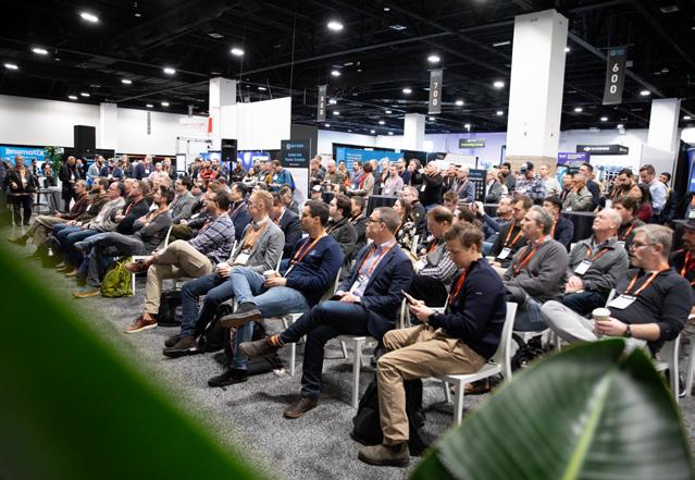
Geo Week brings together geospatial and mapping professionals to explore how data, maps, and advanced technologies drive industry transformation. It’s where experts connect to share insights, discover solutions, and tackle complex challenges. In 2025, we’re expecting over 3,000 industry professionals and 200+ exhibitors, making this the largest geospatial event in North America. The expansive exhibit floor will showcase the latest in reality capture, 3D mapping, surveying, and geospatial technologies, providing a unique opportunity to engage with experts, compare tools, and discover solutions for your evolving needs.
Geo Week offers more than just technology—it's a hub for collaboration and inspiration. Attendees will gain insights from impactful keynotes, including Dallas Fort Worth Airport’s Digital Evolution and the Francis Scott Key Bridge: Rescue, Recovery, and Rebuild case study, both demonstrating how geospatial data can be pivotal for real-world solutions. The all-access conference pass provides expanded value with sessions from Geo Week, ASPRS, and Reality Capture Network (RCN), offering perspectives on emerging technologies, complex infrastructure projects, and digitalization across industries.
The excitement extends beyond the sessions. Explore the Level Up Lounge for career development, discover the next generation of industry talent at the university research poster session, and engage with cutting-edge content at the Exhibit Hall Theater. Don’t miss special moments like Pitch the Press, where exhibitors showcase groundbreaking solutions, and our celebration of World Lidar Day, highlighting lidar’s transformative impact across industries.

Lee Corkhill Group Event Director

Carla Lauter Senior Content Manager


A truly staggering wealth of knowledge and experience packed into a concise and accessible location. An incredible source of valuable information and insights into an explosive market and industry.” - Mike Jones
Hyperion Data Solutions


Monday, February 10, 2025 | 12:00 PM - 1:00 PM

KELLY WATT DFW Airport


ADAN BANDA DFW Airport

TARINI SHUKLA DFW Airport
DFW Airport, the third largest globally, faces rapid growth, major construction, and the need for improved efficiency. This keynote will explore how DFW uses 3D visualization, AI/ML, and event-driven architecture for Utility Management, Terminal Operations, and Emergency Management. Presentations will cover GIS, digital twins, predictive insights, and real-time monitoring. Don’t miss this must-attend keynote, paired with a deep dive session in the Geo Week program.

Tuesday, February 11, 2025 | 9:00 AM - 10:00 AM

RONDA SCHRENK
United States Geospatial Intelligence Foundation (USGIF)

MIKE ASLAKSEN
NOAA’s National Geodetic Survey

JEREMY WASSON Army Geospatial Center (AGC)
In the early morning hours of March 26, 2024 the MV Dali, a 984-foot container ship bound for Sri Lanka, experienced a sudden loss of power while navigating outbound along the Patapsco River from the Port of Baltimore. The ship struck a main truss of the Francis Scott Key Bridge, causing the immediate collapse of approximately half a mile of the bridge structure. The Port of Baltimore, one of the nation’s largest ports, generates over $2.6 billion in annual business revenue and has only one deep-draft channel providing access to its facilities.
This keynote presentation will discuss the heroic rescue and recovery operations through the eyes of the National Oceanic and Atmospheric Administration and the Army Geospatial Center. We’ll explore how numerous teams mobilized quickly, leveraging a vast array of geospatial data inputs and advanced analytics to create a groundbreaking common operating picture. This enabled unparalleled collaboration across federal, state, and local levels to address a disaster of this magnitude.


In addition to two insightful keynote sessions, Geo Week 2025 will feature wall-to-wall, can’t-miss content through three days in a combined conference program with ASPRS and Reality Capture Network.
Attendees will have a chance to hear about some of the amazing ways technology is being used today, and gain insights from industry thought leaders about where technology is moving in the future. Below are just a handful of the exciting sessions at Geo Week.
Monday, February 10, 2025 | 2:00 PM -3:00 PM MT


Explore the transformative potential of 3D innovation in this session focused on Neural Radiance Fields (NeRFs), radiance fields, and splats. NeRFs have emerged as a powerful technology for rendering complex 3D scenes from 2D images, creating photorealistic digital environments with remarkable precision. The session will also cover “splats,” a dynamic approach for optimizing 3D representations, and how they can be applied to enhance real-time rendering and achieve higher efficiency. Join us to unlock the power of NeRFs, radiance fields, and splats for geospatial and AEC applications, and discover how they are reshaping the possibilities in 3D visualization, simulation, and immersive technology.


Tuesday, February 11, 2025 | 2:00 PM – 3:30 PM MT
FEATURING:


Digital twins are reshaping urban and national planning by providing dynamic, real-time representations of physical environments. In this engaging session, we will explore the transformative potential of digital twin technology, featuring two groundbreaking projects: a city-scale initiative in Melbourne and a country-scale public digital twin of Canada, along with a third presentation on a digital twin of Pau, France. This session promises to provide valuable insights into how digital twins are transforming urban and national landscapes, fostering collaboration among stakeholders, and driving smarter, more resilient cities and countries.
Tuesday, February 11, 2025 | 11:00 AM – 12:30 PM MT
FEATURING:


In a world increasingly reliant on spatial data for decisionmaking, the movement toward open data has profound implications for geospatial professionals. Join members of the Open Geospatial Consortium and other thought leaders as they discuss the growing need for open data within the industry. This session will explore the benefits of open data, including enhanced collaboration, innovation, and accessibility, as well as the challenges it poses for data governance, quality standards, and privacy. Attendees will gain insights into best practices for utilizing open data, hear real-world examples of its impact on public and private sector projects, and discover how open data can empower professionals to deliver more effective solutions in mapping, urban planning, architecture, construction, environmental monitoring, and beyond.


Tuesday, February 11, 2025 | 11:00 AM – 12:30 PM MT
FEATURING:


CLICK HERE to view this session


The field of geospatial technology is on the cusp of significant developments that will affect every aspect of the industry. The U.S., for the first time in over forty years, including its territories, is planning to update its official reference and vertical datums. These revisions are being led by the National Geodetic Survey (NGS), which is a part of the National Oceanic and Atmospheric Administration (NOAA), under the National Ocean Service (NOS). NGS’s role is to establish, maintain, and allow public access to the National Spatial Reference System (NSRS), the framework that provides definitions of latitude, longitude, altitude, gravity, and orientation across the United States. As part of their mission to modernize the NSRS, the NGS plans to replace the existing North American Datum (NAD) 83 and vertical datums such as the North American Vertical Datum (NAVD) 88 with new terrestrial reference frames and a novel geopotential datum. In response to the upcoming changes, the ASPRS has created a working group dedicated to addressing this topic and informing the industry about the most effective ways to adapt to the shift toward these new standards. A special panel composed of various industry experts will address the potential hurdles and strategies for this significant update.
Wednesday, February 12, 2025 | 11:00 AM – 11:40 AM MT
FEATURING:

In December 2023, an innovative team of experts and state-ofthe-art technology assembled on Alcatraz Island for a full-scale reality capture project to aid the National Park Service. This initiative sought to document the island comprehensively, both inside and out, from land and air, providing data crucial for assessing the risks of rising sea levels and climate change. Join this session for a firsthand account of the technologies used, the challenges encountered, and the unique experiences of capturing one of the world’s most iconic locations.


Wednesday, February 12, 2025 | 11:00 AM – 12:30 PM MT
FEATURING:


The use of drones has become standard practice in the geospatial field. Come learn from experts on the capabilities of modern UAS sensors, including calibration, advanced processing approaches, new regulations, and real-world applications.
Wednesday, February 12, 2025 | 2:00 PM – 3:30 PM MT


This session features presentations highlighting advancements in the collection, processing, accuracy, and real-world applications of lidar.


HOSTED BY:
Tuesday, February 11, 2025 | 11:00 AM – 12:30 PM MT
FEATURING:

PETER BECKER Esri

MOHAMED MOSTAFA Trimble Applanix

ANDREW LASSITER University of Florida

FRANCOIS SMITH Maxar Intelligence


RAVI SONEJA McKim & Creed
Presentations in this session will show how advanced photogrammetric techniques are applied to imagery acquired with a variety of optical sensors to produce high resolution/ high-accuracy mapping and information products.
CLICK HERE to view this session
Hosted by
The Academic Hub at Geo Week offers a unique opportunity to tap into the wealth of knowledge and expertise fostered at leading universities. Presented and organized by ASPRS, the Academic Hub is where it all comes together, with formal presentations, academic posters, and more!
Research Posters
Research posters will be on display during Geo Week in the Academic Hub, located in the Exhibit Hall. With designated times from 10:00 AM – 10:30 AM on Tuesday February 1 and Wednesday February 12 where you can meet with students and academics to learn about their research.
HOSTED


Tuesday, February 11, 2025 | 11:00 AM – 12:30 PM MT
FEATURING:


Dive into the interconnected world of Reality Capture and Digital Twin technology in this panel discussion. Industry experts will explore how tools like 3D scanning, LiDAR, drone imaging, and real-time data integration are shaping the next generation of Digital Twins across various sectors. We’ll discuss the growing ecosystem surrounding these technologies, including the challenges and opportunities in creating dynamic, data-rich digital replicas of physical environments. Attendees will gain insights into how Digital Twins powered by Reality Capture can improve decision-making, streamline operations, and drive innovation in fields from construction and infrastructure to asset management and smart cities.
Wednesday, February 12, 2025 | 11:00 AM – 12:30 PM MT
FEATURING:


This session will provide insights into innovative approaches and technologies that enhance efficiency, accuracy, and data quality across surveying, construction, and public asset management. From an advanced data fusion strategy that reduces survey costs and field time by over 50% to a case study on managing tolerances between virtual models and realworld field data, each session highlights practical applications and lessons learned in Reality Capture and BIM workflows. The final session showcases a strategic approach to BIM implementation for public sector projects, tackling challenges such as data quality, asset information gaps, and field-to-digital discrepancies. Together, these sessions provide actionable knowledge on using cutting-edge tools and methodologies to optimize project outcomes, improve data accuracy, and support informed decision-making.


FEATURING:
Monday, February 10, 2025 | 4:00 PM – 5:00 PM MT
Discover how Reality Capture technology is revolutionizing land surveying and facility management. These sessions cover advancements in 3D scanning, UAVs, mobile SLAM, and GIS integration, showcasing their role in enhancing accuracy, efficiency, and data-driven decision-making. Attendees will learn how these tools are reshaping workflows and supporting strategic planning across various environments, from foundational surveying techniques to modern facility optimization.
FEATURING:
Wednesday, February 12, 2025 | 2:00 PM - 3:30 PM MT


This series will provide attendees with a comprehensive understanding of the transformative potential of Reality Capture and Digital Twin technology across industries. Participants will learn how integrating Visual Twins with Digital Twins enables precise, data-driven management through AIenhanced analytics, supporting predictive maintenance, space optimization, and resource allocation. Additionally, insights into successful adoption strategies and change management underscore the importance of user engagement and gradual implementation to maximize benefits. With case studies spanning the USAF, Asia-Pacific, and various industries, this series offers a global perspective on the practical applications, challenges, and future potential of Digital Twins, equipping attendees to leverage these technologies for smarter, more efficient operations.

In addition to the exciting happenings across the show floor, the Exhibit Hall Theater is the place to go for even more engaging show content. Open to all badge types, the Exhibit Hall Theater features content showcasing the latest products and solutions, interactive discussions with industry leaders, presentations featuring emerging technologies, workflows, and discussions that will shape the future of the geospatial industry. From unique case studies to discussions about the future of the industry, there’s something for everyone in the Exhibit Hall Theater programming.


The energy and passion that Geo Week inspired were incredible. Seeing the buzz of geospatial professionals coming together was a fantastic experience that I look forward to again in the coming years. This is where you need to come to see the future of geospatial technologies.”
- Madison Moore, SpecTIR


Get hands-on with a dozen workshops and trainings on offer to expand your skillset –purchase any workshop below when you register for Geo Week! If registered, upgrade your badge access by visiting the Registration Resource Center.

Advanced Remote Sensing Data Processing and Deep Learning with PyTorch (Hosted by ASPRS, $195)
Airborne Bathymetric Lidar: Theory and Applications (Hosted by ASPRS, $195)
Best Practices for Acquisition and Processing of Oblique Imagery (Hosted by ASPRS, $195)
Best Practices for Field Survey of Ground Control and Checkpoints (Hosted by ASPRS, $195)
Lidar Mapping in Transportation, Forestry, and Agriculture (Hosted by ASPRS, $195)
Practical Approach to Using the ASPRS Positional Accuracy Standards for Digital Geospatial Data (Hosted by ASPRS, $250)
Preparation for ASPRS Certification (Hosted by ASPRS, $250)
Professional Mapping Using Drones (Hosted by ASPRS, $195)
Transforming Our World with GeoAI (Hosted by ASPRS, $195)
Unlocking the Power of GeoAI with ArcGIS (Hosted by ASPRS, $195)

The New TRB Survey Guide Outreach Workshop

A Practical Guide for High Precision Mapping using Sensor Fusion in Airborne and Land Applications

USGS staff will be stationed in the Level Up Lounge eager to answer any questions about career paths in the geospatial industry and government, and best practices for job applications and hiring.
Need an updated photo for LinkedIn, your website or other business materials? Stop by for a FREE Professional Headshot for the Level Up Lounge has you covered!


FEBRUARY 12, 2025
Use the Level Up Lounge to unwind or set up meetings with new connections from the mobile app.
Kick off Geo Week by joining friends and colleagues for the opening of the Exhibit Hall floor! Check out the latest geospatial and built-world technologies, chat with vendors, and make new connections.
Hosted by
Join us on the show floor at the official Geo Week Networking Happy Hour! Grab a beverage and connect with colleagues while exploring the latest commercial applications of 3D technologies, innovations, and case studies in the built environment, advanced airborne and terrestrial remote sensing solutions, smart products for a full project team, and much more!
HAPPY WORLD LIDAR DAY


geo-week.com