


By Jeff Thoreson

By Jeff Thoreson


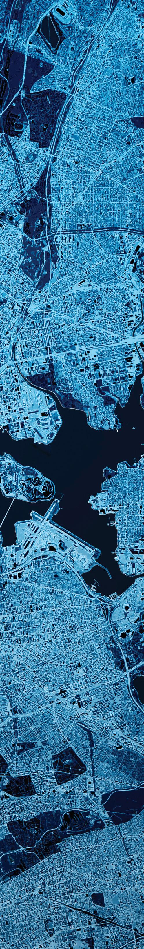
Michael Jones, a North Carolina photographer and drone operator, is challenging the North Carolina Board of Examiners for Engineers and Surveyors cease-and-desist letter demanding he stop his mapping operations. Will the outcome change surveying and cartography?

From GIS to satellite remote sensing and streetlevel imaging, the latest geospatial technologies are behind every
20
The ability to fly anywhere, anytime, and to efficiently and quickly deliver high-accuracy, reliable map products literally with a push of a button may seem like a far-fetched dream. But is it?
24
Hydrographic fields from oceanography, to ocean mapping, to deep sea mining and many others depend on geospatial technologies to help gather and analyze various aspects of the makeup of the oceans. What is less well understood is the process and costs of collecting the data that is subsequently analyzed.
28 30
Foresters have a passion for forest management that is vital to the sustainability of our woodlands. Meet Eli Jensen, a forester at the forefront of transforming this field through the innovative use of lidar.
Do surveyors determine ownership limits? Read Jeff Lucas’ take on this seemingly simple question.

By Jeff Thoreson

IT SEEMS LIKE JUST A SHORT TIME AGO WE WERE TALKING ABOUT HOW UNCREWED AERIAL VEHICLES would change the land surveying and geospatial professions. Oh, wait, it was just a few years ago.
That change will probably never be fully completed—there will always be innovations for UAVs in the profession, at least until the next great innovation comes along and replaces UAVs—but there are still some kinks that need to be ironed out.
Front-and-center among them right now is the question of who is a land surveyor and who has legal authority to make a binding map. It’s a topic that needs to be addressed and is now headed to the U.S. Supreme Court, which will have eventually have the last word.
In our cover story, with the Commercial UAV Expo in Las Vegas this month, contributing writer Juan Plaza delves into the case of Michael Jones, an FAA-licensed UAV pilot who started an aerial mapping business so landowners could view their property. The state board of examiners objected and issued a cease-and-desist notice because he wasn’t licensed. Plaza’s analysis of the proceedings begins on page 12.
Also in the aerial space, Joe Hutton takes a look at the evolving ways we collect highly accurate spatial information from the air, specifically with UAVs. As this gets easier with changing BVLOS regulations and more detailed technology, are we closing in on being able to get super-accurate mapping data with just the push of a button? (p. 20)
This September issue is well-rounded with land-based stories and a hydrography story as well. But for this month we’re focused on aerial information. The xyHt team will be in Las Vegas for the Commercial UAV Expo. Feel free to stop by and say hi.
Publisher Shawn Dewees shawn.dewees@xyht.com
Editor-in-Chief Jeff Thoreson jeff.thoreson@xyht.com
Director of Sales and Business Development Chuck Boteler chuck.boteler@xyht.com
Creative Director Ian Sager ian.sager@xyht.com
Accounting and Classifieds Angie Duman angie.duman@xyht.com
Circulation subscriptions@xyht.com Phone: 301-662-8171
Editor, Located Jeff Salmon jeff.salmon@xyht.com
Editor, Field Notes Eric Gladhill eric.gladhill@xyht.com
Contributing Writers Marc Delgado George Galdorski Joe Hutton Mack Kowalski Jeff Lucas Juan Plaza
© 2024 xyHt magazine. Printed in U.S.A. No material may be reproduced in whole or in part without written permission from the publisher. The publisher assumes no responsibility for unsolicited material, the accuracy of information supplied by manufacturers, or opinions expressed by contributors.
Partners and Affiliates


Compiled by Jeff Salmon

IF THERE’S A STATISTIC THAT I AM PROUD TO BE PART OF it is that of being one of the 20 million people last year who took a train to cross the English Channel via the “Chunnel.” That’s short for the Channel Tunnel, the undersea rail passageway that links England with France. This year marks three decades since it opened in 1994, celebrating not only one of the biggest engineering projects ever built, but also the science of surveying that made it possible.
Plotting more than 50 kilometers (31 miles) of sea that separates the two countries has its logistical and technical challenges, especially when each one’s national geodetic reference systems (GRS) are incompatible. Solving this issue meant that the UK’s Ordnance Survey (OS) and France’s lnstitut Geographique National (IGN) had to devise a new system to be used by engineers from both countries.
For the initial design of the tunnel, the project utilized the Channel
TOPCON POSITIONING SYSTEMS HAS ANNOUNCED THE LATEST ADDITION to its HiPer family of global navigation satellite system (GNSS) receivers. The HiPer CR is a compact and lightweight GNSS receiver designed for centimeterlevel, real-time kinematic (RTK) accuracy for professionals engaged in a wide range of applications in the surveying, construction, engineering, forestry, and mining industries. It joins a portfolio of fuller-featured, high-accuracy receivers,
Tunnel Grid (CTG 86), a GRS based on the previous work of the British in the 1970s. However, fresh survey data from 1987, this time enhanced with GPS satellite technology, resulted in a more accurate grid called Reseau Trans Manche (RTM 87) which was then used for the rest of the tunnel’s construction. As for the tunnel’s 38 kilometers (25 miles) long under-sea section where there is zero GPS signal, surveyors relied on high-precision gyroscopes to make sure that the tunnels bored from both sides would end up aligning at the same point.
And that point has been saved for posterity in iconic photos and videos showing two workers from each side of the tunnel meeting through a burrowed hole, shaking hands and exchanging national flags in celebration. It took them six years to reach that breakthrough. These days, a train journey to cross the Channel would only take 35 minutes.
—Marc Delgado, marc.delgado@xyht.com
including the HiPer HR and VR GNSS receivers.
The HiPer CR provides multi-constellation tracking, including GPS, GLONASS, Galileo, BeiDou, and QZSS. It can be used in a variety of configurations, including as a network RTK rover, in base and rover setups, and integrated hybrid use with a robotic total station.


DRONE OPERATORS ARE INCREASINGLY FACING THE THREAT OF GNSS JAMMING and spoofing technologies wielded by state and non-state actors. Recently, Business Insider reported that the first known instance of GPS jamming impacting transatlantic flights has been recorded. While this incident involved a passenger airliner, any aerial platform, crewed or uncrewed, that employs GNSS navigation is at risk.
The hunt is on for navigation alternatives to mitigate these threats.
Now a Quebec-based One Silicon Chips Photonics (OSCP) has developed an inertial optical system that achieves the accuracy of navigational sensors used in the aerospace industry at a fraction of the cost. And because these chips do not have any moving parts, they are 10 times more accurate than commercial-grade Micro-Electro-Mechanical Systems Inertial Measurement Units (MEMS IMUs) and they enable highly accurate navigation even when GNSS signals are not available.
The technology used to achieve these impressive results is in the company’s name: Silicon Photonics. Although electronics-based devices
MINING HAS LONG BEEN ONE OF THE MOST IMPORTANT INDUSTRIES IN THE WORLD, as well as one of the most labor-intensive and dangerous. Given the importance of mining and the challenges involved in the work, it’s no surprise that the industry has embraced drones and other autonomous systems. The ability to travel deep into dark and dangerous mines to extract resources, collect vast amounts of data, and keep workers safe has made drones a central component of today’s industry.

To gain insights and access important facts and figures about the current state and promising future of drones in this industry, visit the Commercial UAV News website and download “Sector Snapshot: Drones in Mining.” You’ll learn about: The current state of the mining industry, how drones are making mining operations safer and more profitable, current use cases and technological advances, and the future of drones in the mining sector.
have become smaller, faster, and more efficient, miniaturization has reached its limit of heat dissipation in the copper wiring and interconnects. The application of photons instead of electrons and optical fibers instead of copper cabling solves this problem. According to marketsandmarkets.com, "When compared with conventional electronics, silicon photonics provides 90 percent of its efficiency with one-third the power consumption at onetenth of the cost."
Integrated optical motion sensors have important advantages over electrically based units. For example, they are immune to electromagnetic interference (EMI) threats posed by jamming and spoofing. Another is their resistance to aggressive and/or harsh environments. For instance, they can work underwater, making them suitable for marine applications, such as autonomous underwater vehicles (AUVs) and autonomous surface vehicles (ASVs).
RED CAT HOLDINGS, A PROVIDER OF DRONE TECHNOLOGY, is acquiring California-based aerospace company FlightWave Aerospace Systems. FlightWave is known for its vertical take-off and landing (VTOL) drones, sensors, and software solutions. This acquisition will bring FlightWave’s advanced Edge 130 Blue sUAS offering into Red Cat’s range of uncrewed systems used for
intelligence, surveillance, and reconnaissance (ISR).
“The planned acquisition builds on FlightWave’s accomplishments and continues our mission to provide low-cost, rucksack portable drones with diverse capabilities,” said Jeff Thompson, CEO of Red Cat. “The Edge 130 will boost our current Teal drones by providing longer range, better endurance, and additional capabilities, especially for maritime environments.”

WINGTRA HAS INTRODUCED WINGTRACLOUD, AN INNOVATIVE SOFTWARE designed to transform the way users expand their drone programs and operations. WingtraCLOUD promises to simplify data collection and streamline the onboarding of surveyors and pilots, delivering clear business advantages. This new drone data planning and collaboration solution is set to address some of the most significant challenges faced by operators today.
WingtraCLOUD offers a new and user-friendly flight planning experience, plus time-cutting
features like site-based file organization, advanced 3D planning, coordinate system by sites and improved connectivity via cloud syncing.
The WingtraCLOUD experience is rolling out to replace lots of software tools with one environment, providing an intuitive experience that goes beyond mere technical execution. This not only streamlines operations, but also minimizes errors that fragmented workflows tend to introduce.

ALLOWING DRONE PILOTS TO OPERATE THEIR FLYING MACHINES beyond visual line of sight (BVLOS) is projected to benefit several industries, including asset monitoring and logistics. But enabling BVLOS is still restricted in many countries due to safety concerns.
A Danish startup is shooting for the sky to make out-of-sight drone flights possible, this time with help from GNSS technology. Skypuzzler from Copenhagen has developed a module for drones that will use satellite navigation systems, including GPS and Galileo technologies, to achieve sub-meter precision and accuracy in air traffic management. Its integrated Digital Air Traffic Control (iDATC) solution will permit drones to fly beyond the operator’s vision while automatically adjusting the drone’s flight paths in real-time to resolve potential airborne collisions, all without adding any payload equipment.
This June, the innovative technology has gained the nod of the European Space Agency, earning them the CASSINI Challenges Award

and its €100,000 prize ($107k). The company is now working to apply its awardwinning solution in congested air spaces.
Commercial UAV Expo
September 3-5
Las Vegas, NV
Intergeo
September 24-26
Stuttgart, Germany


GoGeomatics Expo 2024
October 28-30
Calgary, Canada
Trimble Dimensions
November 11-13
Las Vegas, NV
Amsterdam Drone Week & Commercial UAV Expo
April 8-10, 2025
Amsterdam, Netherlands
“Skypuzzler values this award as it recognizes that our integrated Digital Air Traffic Control solution for Unmanned Traffic Management systems will revolutionize the future of drone services,” the company wrote in a press release.
—Marc Delgado, marc.delgado@xyht.com
THE TRIMBLE MX90 DELIVERS SUPERIOR GNSS PERFORMANCE in challenging urban and rural environments from the Trimble ProPoint engine. The unit employs state-of-the-art GNSS and inertial technology and is easy to install and simple to operate and features leading-edge image and lidar capabilities and intuitive field software.
THE NEW S55 IS DESIGNED TO HANDLE EVEN THE MOST COMPLEX surveying tasks with ease thanks to its powerful 2.0 GHz processor and Android 12 operating system. The S55 features a 5.5-inch display with a resolution of 1920-by-1080 pixels and a brightness of 500 nits, providing maximum visibility and comfort for the operator. The full keyboard makes data entry quick and easy. It features up to four customizable function keys and a dedicated button for point surveying in the field..
The unit features a 9000 mAh battery allowing up to 18 hours of continuous use and a 13 MP camera for high-resolution imagery.
Operators can use the MX90 to capture, process, extract, and share high-density point clouds and rich, immersive imagery to produce meaningful deliverables. Productivity levels are leveraged via the complete Trimble field-to-finish workflow.
CARIS AUTOCHART AUTOMATES THE GENERATION OF PAPER CHARTS IN PDF and/or TIF formats from S-57 ENC files, significantly reducing or eliminating delays between the release of new S-57 ENC datasets and their corresponding paper charts. It creates each paper chart from a template file, populating it with relevant features from the matching S-57 ENC data.
CARIS AutoChart handles the addition of borders, grids, marginalia information, depth contour labels, textual annotations, and masking as specified in the paper chart template. It also detects labels overlapping key navigation information and includes customizable label placement rules to automatically move labels and avoid conflicts.


DIGITAL DOPPEL-
GANGERS NOWADAYS ARE NOT ONLY LIMITED TO BUILDINGS AND CITIES. Planet Earth is the latest to be numerically cloned, this time with support from one of the most powerful computers in the world.
Destination Earth (or DestinE), will provide digital twins that will show the world undergoing climate change and weather extremes, with data coming from satellite observations of the atmosphere, land, oceans, and sea ice. The European Union-funded project, was launched in Kajaani, Finland, site of the LUMI supercomputing center which will run the digital twin and climate simulations.
LUMI (Large Unified Modern Infrastructure) is the fastest supercomput-
LEICA GEOSYSTEMS HAS INTRODUCED THE LEICA TERRAINMAPPER-3 airborne lidar sensor, featuring new scan pattern configurability to support the widest variety of applications and requirements in a single system.
Building upon Leica Geosystems’ legacy of lidar efficiency, the TerrainMapper-3 provides three scan patterns for superior productivity and to customize the sensor’s performance to specific applications.
er in Europe and the fifth fastest globally. As a petascale supercomputer, it can do quadrillion calculations per second, or equivalent to 1.5 million laptops working together. DestinE needs that much computing muscle to run global simulations of past weather events and multi-decadal climate change projections at 5 kilometer resolution.
“DestinE will provide us with a highly accurate twin of the Earth. It means that we can observe environmental challenges, which can help us predict future scenarios—like we have never done before,” said Margrethe Vestager, executive vice president of the European Commission.
Circle scan patterns enhance 3D modeling of urban areas or steep terrains, while ellipse scan patterns optimize data capture for more traditional mapping applications. Skew ellipse scan patterns improve point density for infrastructures and corridor mapping applications.


Are we headed for a confrontation?
By Juan Plaza
When the first photogrammetry drones appeared in the market around 2013, almost every surveyor who heard about them and did some research was tempted to add photogrammetry to their list of services. Eventually the reality of costs and the entire issue of becoming an aviation company and having to add expensive, specialized software deterred some. Others, however, took the plunge and became full-blown photogrammetry companies.
Originally, the business of generating maps from photographs acquired from an aircraft was a minefield of permits, huge expenses, and barriers of entry that made it an exclusive
club of a few companies worldwide. Nowadays everyone can buy a drone with an acceptable camera and a copy of Pix4D or another photogrammetry software and become a cartographer.
But is every map a legal document? I personally had to endure five years of spherical mathematics to become a geodetic engineer and then had to register my signature in the engineering association to become a legal land surveyor, capable of officializing property boundaries. But is that necessary in the case of every single cartographic product?
This is a debate that is beginning to gain momentum as more and more surveying associations are questioning the validity, or even legality, of certain maps generated by non-surveyors. As a warning to readers, this article is aimed at posing more questions than offering opinions. What we need in this industry is an honest conversation about the legal issues raised by land surveying boards around the country.
The case we want to use as the perfect example of this conundrum is Michael Jones, a North Carolina photographer and drone operator who is fighting a legal battle against the North Carolina Board of Examiners for Engineers and Surveyors (NCBELS) in order to stay in business.
Jones, an FAA-licensed drone operator and photographer, started an aerial-mapping enterprise to offer landowners a bird’s-eye view of their property, useful in situations where a full land survey is unnecessary. However, in 2019, NCBELS issued a cease-and-desist letter to Jones,


demanding he stop his mapping operations or face harsh penalties.
What followed was three years of legal ramblings that climaxed on May 21, 2024, when a three-judge panel of the 4th U.S. Circuit Court of Appeals ruled that North Carolina may ban the creation of aerial maps by everyone except licensed land surveyors. The ruling allegedly strips away Jones’ First Amendment rights, so he and his attorneys with the Institute for Justice (IJ) will ask the U.S. Supreme Court to hear his case, with the goal of restoring Jones’ right to communicate with clients without government interference.
The conclusion of the Fourth Circuit is that Jones is not engaging in speech at all. There is a long history of strong First Amendment protection for images and visual information, nevertheless the court’s decision separated the creation of maps as “conduct,” not speech, “that classically falls under the surveying profession.” The court also argued that because Jones’ speech takes
place on his clients’ property, the government somehow needs less justification to interfere than if his speech took place on public land.
So, the question is what do we do with this conundrum? Who is right and who is wrong? Furthermore, is there a right or wrong answer?
Let us forget or bypass the legal aspects for a moment and concentrate on the professional aspects and the ramifications for our industry. The reason land surveying was regulated in the first place was simply because it had the capacity to alter potential legal boundaries and therefore there was a huge economic impact in case


of error, and we needed accountability in the form of professional acuity.
Professions like medical doctor, structural engineer, or commercial pilot also have huge implications, in this case life or death and therefore all these, and many other professions are licensed and regulated by membership boards that establish rules and codes of conduct. The bar association of every state that regulates the legal profession is a prime example of behavioral monitoring and clear guidelines to ensure leveled application of the law.
The difference with land surveying is that rarely human lives are at stake and the only implication of a wrong measurement is possibly financial, regardless of the amount, it is only money. I believe we all agree that land surveyors conducting legal boundary surveys should be licensed by responsible membership boards in charge of enforcing the laws of the state or local legislature. But outside of that,
is it really necessary to have a license to produce a non-legally binding map?
We might have to go to the extreme of defining which topographic or cartographic products really need a license to be valid, because a blanket nomination of every photographic product taken from an aircraft feels a bit draconian.
Let’s be clear, not every topographic product is a legal document, and most surveyors are keenly aware of the difference. Membership organizations that group and supervise professionals are nothing new, but the ability of these organizations to enforce the law is debatable and based on the willingness of the authorities to enforce it.
For example, On May 5, 2022, Gov. Brian Kemp signed HB 476 creating a new state agency that will be named the Georgia Professional Engineers and Land Surveyors Board. In the bill, the license renewal period for professional engineers, structural engineers, and land surveyors
changed from a biennial renewal to an annual renewal.
It is interesting that the State of Georgia “bundled” structural engineers and land surveyors in one organization, and they are not alone. Many other states, including North Carolina and Texas, have similar approaches. Keep in mind that structural engineers have a professional responsibility that carries the burden of life and death, while land surveyors do not. But by bundling them these states create a blanket that places both professions at the same level.
It is clear that the definition of what constitutes a legal surveying product should be defined either state by state or at the federal level, and should be officialized for all to follow.
Another approach could be the creation of a disclaimer that will be digitally stamped in every cartographic product generated by a non-licensed land surveyor and not intended for legal purposes.
In any event, this is an issue that will haunt our industry for years to come, and we should follow closely the developments in Jones’ case to see how the courts approach this professional dispute. ■
Juan B. Plaza is a drone and general aviation consultant based in Boca Raton, Florida. He specializes in the modern uses for crewed and uncrewed aviation in the areas of mapping, lidar, and precision GNSS. He is also a commercial pilot and frequently flies photogrammetry missions in Cessna Citation jets and Piper Aztec light twin.
Geographic Calculator cloud service is the latest addition to Blue Marble Geographics’ comprehensive suite of powerful coordinate conversion, datum transformation, and format translation tools for geomatics professionals. With access to the largest geodetic parameter database available anywhere, Geographic Calculator Cloud browser-based application has particular strengths in the fields of surveying, geodetics, GIS, or anywhere accurate and reliable positioning capabilities are required. Version 1.0, to be released in the Fall of 2024, will provide core functions of the Geographic Calculator desktop application. Our geodetic database (“Datasource”) is regularly updated and is always current with

the EPSG Geodetic Parameter Dataset. Geographic Calculator also incorporates many of NOAA's National Geodetic Survey tools and expertise, including the NSRS modernization efforts that are currently in progress. We leverage our thirty years of expertise in coordinate system management
software to provide our customers with the most reliable, high-quality tools for processing geodetic data.
Sign in with an active license from any computer from anywhere with an internet connection, and get right to work. Geographic Calculator Cloud is a browser-based-application. You can search the Datasource, and perform coordinate system conversions and transformations on point, tabular (spreadsheet), or vector data without being tied to any one machine. The extensive list of tabular and vector file formats supported is the same as for the desktop application. Grid-based transformations, as well as forward and inverse calculations, are included in the version 1.0 functionality.

The full GeoCalc Datasource and geodetic engine is hosted in the cloud. Data is processed either locally in browser memory or automatically uploaded to one of three classes of virtual machines for cloud processing, depending on file size, and input/ output file types. Input files can be stored locally, on a network drive, or in Azure, AWS, or Google cloud storage.
The browser interface is a redesign of the traditional Geographic Calculator desktop application’s interface. A flexible, two-column layout will logically reconfigure to a single column for improved performance in smaller windows or on smaller devices. The enhanced design adds colorization to help the user navigate the interface.

As the Datasource approaches 10,000 geodetic definitions, Geographic Calculator Cloud provides a live Search page to explore coordinate systems, transformations, or other definitions. Options to search by name, code, or location, and filter by object type are available as well, and WKT or GML definitions can be viewed and copied for use in other applications.
Are you an enterprise with many users? Geographic Calculator Cloud allows many users to sign in from anywhere with an internet connection, with a shared "team" usage allocation, all without the need for IT resources installing and licensing multiple machines. Contact us for information about hosting a custom implementation of the service at sales@bluemarblegeo.com
Explore all the new features available in Geographic Calculator Cloud v1.0 by registering for a 14-day free trial! If you have any questions, please contact us at sales@bluemarblegeo.com

From GIS to satellite remote sensing and street-level imaging, the latest geospatial technologies are behind every successful delivery, down to the very last mile.
By Marc M. Delgado, PhD
In the spring of 1962, Procter and Gamble Company ran a contest based on “Car 54, Where Are You?” a popular TV sitcom at that time. Contestants were asked to help the show’s main characters, Toody and Muldoon, plan their trip to visit 33 cities across the United States. Although the game sounded easy, there was a catch: the duo must take the shortest round-trip route starting from Chicago.
With 54 $1,000 prizes and one $10,000 grand prize at stake, the contest was an instant success. And despite objections that the problem was impossible to crack, entries poured in from the general public as well as members of the academic community. The judges even had to break a tie. Eventually the grand prize went to Robert Karg and Gerald Thompson, researchers at the Carnegie Institute of Technology. The two tapped the institute’s 2,000-pound (910 kg) Bendix G-20 electronic computer to code their proposed algorithm, using as inputs the reported road distances between cities from that year’s Rand McNally Road Atlas. They calculated that the shortest route would take 12,955 miles.
Their $10,000 grand prize may now have been spent, but the article that Karg and Thompson wrote to describe their award-winning solution continues to be cited to this day. That’s because they were one of the first to use an electronic computer to solve the Travelling Salesman Problem (TSP), a classic mathematical enigma that has baffled scientists for almost a century.
First formulated by mathematicians in the 1930s, the TSP proposes to find an efficient solution to the question: “Given a list of cities and the distances between each pair of cities, what is the shortest possible route that visits each city exactly once and returns to the origin city?” The Procter and Gamble contest was clearly a TSP puzzle.
Yet seeking the shortest, or optimal, route between two points is not only a mathematical challenge. Six decades after the contest was won, research advancements in solving the TSP have found applications in fields such as computer science (network optimization), biology (genome sequencing), and geographic information systems, particularly in the field of logistics and last-mile delivery.
Hurdling the final leg of every transaction is one of the biggest challenges in logistics. It is often called the last-mile delivery, or the shipment of parcels from a distribution center to the customer’s doorstep. A successful last-mile delivery is critical to the success of retail operations because it is the final contact with the client. In general, customers are satisfied and
contribute to the ballooning price. Sending hundreds of packages per day to their final destination is surely an expensive logistical challenge, and it will become even more so in the near future as global e-commerce transactions rise.
According to a Bloomberg forecast, online shopping will grow 10 percent annually over the next five years in the U.S. alone, indicating that more and more people will be buying via the Internet and opting for their goods to be delivered at home, mostly located in cities.
Urban dwellers are the most active e-consumers, reports the World Bank, and their shopping habit compounds the last mile problem even more. Cities are densely populated and are often plagued by complicated routes due to unmapped streets, inadvertent road closures and diversions, traffic congestion, and the existence of

remain loyal when goods arrive on time and in perfect condition. However, last-mile deliveries continue to be the Achilles’ heel of the logistics industry. According to industry consulting group Capgemini, last-mile deliveries could take up at least 41 percent of the total shipping expenses in a supply chain. Fuel, wages, and vehicle costs, as well as the variable distances between many clients
non-geocoded customer addresses. Given the geographical nature of these issues, it is no surprise that companies are turning to geospatial technologies for solutions.
Take for example United Parcel Service (UPS), one of the world’s biggest logistics companies, and their ORION system. Short for On-Road Integrated Optimization and Navigation, it is the in-house delivery routing platform
for UPS drivers and is backed by Esri’s GIS technology.
ORION’s layers of GIS maps, which includes topography, road infrastructure, and traffic movements, took a decade to build before it was first released in 2012 in the United States. The routing platform now handles 66,000 delivery and pickup routes, including locations in Canada and Europe. And with its advanced GIS routing algorithms, every UPS driver receives the very best delivery itineraries in order to reach their customers.
“The Esri platform has been critical for us to enable ORION at UPS,” said Juan Perez, chief information and engineering officer at UPS, in a video message during an Esri event in 2017. “ORION is helping us every single day to get every delivery completed on time at the lowest possible cost.”

mapping works, you ignore it because it’s an entirely seamless process.”
The UPS experience shows how building a reliable mapping platform is critical to cut costs in the logistics sector. Yet while transportation networks are difficult to create because of the intricacies of street layouts and the complexity of address systems around the world, doing so within GIS makes the map-building process worthwhile.
This is because computerized mapping systems have the advantage of analyzing large-scale transportation connections and flows compared to paper-based maps. GISbased geospatial functions, for example, allow delivery operators to derive the most optimal delivery routes that follow the least-cost paths along any street network, even with multiple recipient points.
Still, many companies fail to notice the vital role that maps play in sorting out the last-mile problem in logistics.
“It’s easy to take maps for granted when they accurately represent on-the-ground truth,” wrote Khaled Naim in a Forbes article. Naim is the co-founder and CEO of Onfleet, a San Francisco-based delivery software company. The company operates worldwide, offering end-to-end route planning to streamline millions of last-mile deliveries for thousands of businesses. “When
Naim discovered this when they first started creating street maps from the ground up during the early days of Onfleet. He and his co-founders spent almost two years collecting geospatial data around the cities of Abu Dhabi, Amman, Cairo, and Dubai to make their maps useful for online commerce. But they found that they needed to focus their mapping efforts on one important area: last-mile delivery.
“We quickly learned that in last-mile delivery, mapping requires different functionality and benefits,” he wrote.
Users view maps differently, according to Naim. For example, customers check maps to assure them that their ordered goods are arriving at the right location, while delivery drivers use maps for road navigation. And as for logistics managers, maps are there to track the drivers in real-time and improve their operations.
With so many uses of maps in order to complete last-mile deliveries, Naim believes in the importance of investing in good mapping. “At the end of the day, if a map is the backbone of your company, it’s worth splurging for quality,” he noted.
Even if it is the final stretch in logistics, last-mile deliveries would require the
highest quality geospatial data and the latest space technologies. Earth-observation satellites, such as the Landsat and Sentinel constellations, are on top of the list. The imagery that these satellites capture not only shows the earth’s land cover and other geographic features, but they also serve as basemaps which provide the backdrop and geographic context to any mapping endeavor. Imagine viewing a road map without its underlying basemap and it will seem to be just a floating mishmash of lines.
Not all satellite imagery is useful for logistics, however. Images of the earth’s surface captured by the Landsat and Sentinel satellites are only available at the medium-resolution scale, typically between 10 to 30 meters per pixel. Mapping urban roads at the street level, however, requires sharper images, and traditionally they come from pictures taken by aerial photography, or better yet, from very high-resolution satellites.
Several commercial aerospace companies now offer these superior images. Maxar Technologies, a space technology firm based in Colorado, has a repository of high-resolution satellite imagery that can support the creation of road maps. Its imagery database contains 3,000 cities at 30 cm resolution, the perfect level of detail for extracting road vectors as well as other transport information, such as road width
and surface type, as well as the locations of roundabouts and traffic lights. A newer satellite program, the Pléiades Neo, also offers the same sub-meter resolution. Owned and operated by Airbus, it has a swath of 14 km and can thus cover the entirety of a mid-size city in one scene. This means more urban roads can be extracted from satellite images compared to aerial photography.
Another geospatial technology that plays a vital role in improving last-mile logistics is Global Navigation Satellite System (GNSS), which includes GPS, GLONASS, Galileo, and BeiDou. GNSS is now being utilized by logistics operators for fleet management in order to track the location of delivery vehicles and make changes in their routes, if needed.
Satellite navigation devices (or satnavs) inside delivery vehicles are constantly connected to GNSS constellations to give the drivers turn-by-turn routing instructions, allowing them to reach their destinations even when road conditions change. Their delivery routes can also adapt to traffic congestion using real-time data, and alternative directions are presented on the fly.
But GNSS can still be improved, especially in cities where high buildings and narrow streets reduce the accuracy of satellite signals received by delivery vehicles. Europe’s Galileo Program aims to achieve this via EGNOS (European Geostationary Navigation Overlay Service). As a GNSS augmentation system, EGNOS uses a set of geostationary satellites and a network
of ground stations to increase the accuracy of both GPS and Galileo signals, up to 1.5 meters.
Europe is building upon this GNSS milestone to improve the logistics services in the region. The European Space Agency (ESA) announced this year the “KickStarts” program will be granting funds to original projects that will use Europe’s satellite data and space-based technologies in providing last-mile delivery solutions.
While Europeans are busy in space, motorcycle drivers in Southeast Asia are diligently delivering parcels and at the same time helping survey the region’s unmapped corners. Grab, a Singapore-based ride-hailing and food delivery company, has equipped their delivery drivers with helment-mounted action cameras that collect street-level images with their corresponding GPS coordinates. Such imagery is rich with hyperlocal information, including points-of-interest (POIs) and road conditions that are usually not found in mapping platforms like Google Maps, Tomtom, and HERE.
Partnering with their own drivers means that Grab can update its in-house mapping platform and receive real-time feedback on conditions of the road and errors in local addresses. Drivers also receive supplemental payments for their mapping work. The collected street imagery is then processed using Edge AI, a type of artificial intelligence that recognizes, classifies, and describes objects.
“We’ve invested to turn this intelligence into a competitive advantage, allowing us to serve our users and partners with a great experience, at the same time driving efficiency and cost-savings for the business,” said Grab’s co-founder Tan Hooi Ling. With more than 33 million POIs and addresses collected, Grab is now the leading last-mile delivery provider in seven Southeast Asian countries.
Aside from Grab, companies like Nextbillion.ai and UNL are also betting on the growth of hyperlocal mapping to meet the growing demand of e-commerce deliveries. Yet, the success of companies such as Grab and UPS is not just because they are using geospatial technologies to improve their last-mile delivery businesses. It’s also because they created their own mapping platforms in the first place and made sure that they functioned in the real-world.
As Jack Levis, the former UPS senior director who backed the creation of ORION, once said in an interview with Esri: “We didn’t create the concept of the traveling salesman problem. We didn’t create the concept of a map. So conceptually, is that innovative? No. It’s innovative because it worked.” ■
Marc Delgado, PhD, is a GIS specialist who crisscrosses continents teaching GIS in Asia, Europe, South America, and Africa.


BY JOE HUTTON

While mapping using uncrewed aerial vehicles (UAVs or drones) has proven to be a relatively cost-effective method to collect high-accuracy spatial information, there are still a number of bottlenecks that make them tricky to use.
These include the complexities and cost of acquiring, setting up and surveying with a global navigation satellite system (GNSS) base station and ground control points (GCPs); dealing with unreliable differential corrections being sent to the drone; mixed datums between base station coordinates and GCPs; the awkward workflow steps of having to retrieve recorded base station data and process that data with the recorded GNSS data in the drone; having to deal with the increased cost of long base to drone separations for Beyond Visual Line of Sight (BVLOS) mapping; and the list goes on.
Given these challenges, the ability to fly anywhere, anytime, and to efficiently and quickly deliver high-accuracy, reliable map products literally with a push of a button may seem like a farfetched dream.
However, the technology to enable these capabilities is fast emerging. Current advancements are focused on embedding compact direct georeferencing (DG) systems comprised of survey-grade GNSS and inertial hardware that deliver real-time centimeter positioning and highly accurate roll, pitch, and heading measurements using satellite-based GNSS corrections to enable “mapping anywhere” with little or no ground infrastructure. Not only can such DG systems enable mapping to be done with no or at least fewer
GCPs, they enable the integration of camera, lidar and hyperspectral sensors into single mapping payloads with real-time or in-the-field generation of map products.
The combination of these features, with the addition of improved in-field capabilities and licensing, opens the door for smaller, lighter, higher performing solutions and real-time, in-thefield actionable data.
Whether direct or indirect, georeferencing is required to geocode data collected by cameras, lidar, and other sensors to create maps and hence geospatial information. With UAVs, the data can be collected at a higher resolution and more quickly than from


traditional ground collection methods. This sets the expectation for faster, more accurate data generation.
However, if I can fly the drone and capture the data so quickly, why does it take so long to generate the information I am after?
Traditional ground-based surveying has long used a technique for improving positional accuracy called differential GNSS positioning, which is precise to the centimeter level and repeatable. Known in real-time as real-time kinematic GNSS or RTK, corrections are derived by calculating the positional discrepancy between a nearby base station, whose position is known, and the roving GNSS receiver. These corrections are then used to adjust the position of the roving receiver. The base station is set up locally by a user and the corrections are transmitted via a radio link to the rover or provided via IP protocol as a service from various providers who set up their own network of receivers (referred to as a Virtual Reference Station or VRS). Given the success of RTK for
ground-based surveying, it is only natural that this technique be tried for high-accu racy mapping on UAVs.
However, using RTK on UAVs has proven to be tricky and difficult to scale. Setting up a base station and surveying in its coordinates can be complex and time consum ing, especially if moving from site to site. Transmit ting corrections over a radio link to the drone is not always straightforward and can result in intermit tent data or delays that reduce accuracy. Adding to the complexity, many regions are not covered by an existing VRS.
Another fundamental issue is that the accuracy of differential GNSS is contin gent on the distance between the drone and the base station—the closer, the better. With new regulations allowing UAVs

matters even more complex is that each
GNSS technique called post-processed kinematic GNSS or PPK.
With PPK, instead of processing the
data from a base station in real-time, which requires sending the corrections to the drone, the base station data is logged along with the GNSS data in the UAV and post-processed. While this gets rid of the complexity of a real-time radio link and has the advantage of being able to process the data forward and reverse in time for better accuracy, it still has the baseline limitations associated with differential GNSS using base stations.
So, will accurate mapping with UAV ever be truly “push button?” The answer is yes, by incorporating next generation GNSS correction technologies that are evolving to replace traditional differential GNSS and RTK. These technologies involve using multi-frequency, multi-constellation GNSS signals and global reference stations operated 24/7 around the globe to measure, model, and correct the entire GNSS signal chain no matter where you are on or over the surface of the earth. Such a technique is referred to as precise point positioning or PPP.
Advanced PPP solutions such as Trimble® CenterPoint® RTX, have quickly evolved in land-based surveying to become a highly accurate alternative to RTK, and with the latest algorithms and GNSS constellations, have now become ideal for use with UAVs. Convergence times (the time it takes for a PPP solution to achieve full accuracy) are now low enough such that centimeter level accuracy can be obtained on short UAV

flights with as little as a 10-minute duration. And with the ability to obtain the corrections directly from the L-band satellite, it is a perfect technology for BVLOS UAV mapping–all without base stations.
Trimble RTX technology has been integrated for use with UAVs in real-time on DG systems containing small, state-ofthe art GNSS and inertial hardware (e.g., Trimble APX), and in PPK-based solutions (e.g., Applanix POSPac PP-RTX and ApplanixPPK).
The addition of an inertial measurement unit (IMU) enables UAVs to directly measure the position and orientation of an airborne mapping sensor, such as a digital camera or laser scanner. Adding a correction service to the mix makes it easy to collect accurate data quickly for in-field georeferencing and map production.

There’s a great need for cost-effective, quick answers, whether it's progress on a construction site or measuring stockpiles. Many users are asking for the ability to fly higher, fly longer, and get higher accuracy, all in a small compact format,
without base stations–and with faster (real-time) processing capabilities.
In the current environment, customers are waiting too long to use UAV-gathered data in an actionable way. The familiar UAV workflow–set up base stations, develop a plan, fly, download/upload data, go back to the office, post-process, fix datum issues, and generate the map–is not effective for many applications.
With Trimble RTX the time to an answer is dramatically reduced. For example, DroneDeploy, a U.S.-based company focused on reality capture using photogrammetric drones, has integrated the Trimble Applanix post-processed RTX PPK solution directly into their cloudbased mapping solution. Now, instead of dealing with base station set up, survey, and extensive GCPs, users can simply upload their drone imagery into the DroneDeploy cloud, push a button, and receive back a high accuracy map product georeferenced in a consistent datum. The vision to fly and process data all at the push of a button is already here.
On the lidar front, payload integrators such as GeoCue are now using Trimble APX DG systems with RTX in real-time to generate fully georeferenced point clouds that can be transmitted to the ground or loaded into exploitation tools upon landing. Again, without a base station.
How does DG evolve? One of the key advancements in DG has been greater
integration to improve accuracy, efficiency, and ease of use by getting rid of the known pain points. The latest UAV mapping solutions incorporate a compact single board GNSS/inertial navigation system (INS) with next generation IMUs, as well as lidar solutions that can fly higher–and thus require higher accuracy.
In addition, the inertial hardware is increasingly mature (and cost-effective), which allows for better performance in a smaller form factor at a lower price point. This capability makes it possible to assign a geographical location on the earth to a pixel from a camera image or a digital point from a laser, with little or no ground control or any additional measurements referencing the ground. And often overlooked, that single consistent datum offered by Trimble RTX removes the ambiguity associated with RTK and PPK.
In the past, RTX-type solutions have not been accurate enough or practical enough for many potential UAV applications. However, with current advancements, it has reached the level of maturity that operators truly can push a button and get results in the field. A UAV operator can drive to a jobsite, launch the UAV, map the area of concern, and then see and validate high accuracy data while still in the field.
One other area of advancement that will greatly simplify UAV-enabled data gathering is in the way of software licensing. In conventional practice, post-processing is done through a desktop application with desktop licensing. Whether perpetual or term license management, it can be a cumbersome arrangement. In some cases, organizations like Trimble are shifting from desktop licensing to real-time subscriptions directly within the hardware, thus simplifying ongoing access and renewal for customers.
Stay tuned. The UAV-enabled mapping environment is changing rapidly—and very soon you will be able to fly farther (no base stations) with greater accuracy and the addition of real-time intelligence. ■


BY GEORGE GALDORSKI

For years, professionals in a wide range of fields—from oceanography to hydrography to ocean mapping, to deep sea mining and many others—have depended on geospatial technologies to help gather and analyze various aspects of the makeup of the oceans. Advances in this field have been well-documented in the pages of xyHt
What is less well understood is the process and costs of collecting the data that is subsequently analyzed. For decades, this data was acquired by manned vessels. This was adequate for the task, but was also expensive, slow, tedious and underleveraged these multi-mission assets.
Recently, unmanned technologies have advanced to the point that they can be used for these efforts and either supplement or replace manned assets. Several types of unmanned assets can be used to collect data: unmanned air vehicles (UAVs), unmanned surface vehicles (USVs), and unmanned underwater vehicles (UUVs).
Of the three, unmanned surface vehicles are the most viable candidates for this task. They typically have longer dwell times than UAVs. They are more effective than UUVs because the physics of the ocean medium makes it challenging to control UUVs and extract the data they collect. Additionally, many types of USVs can be outfitted with solar panels, significantly increasing their time on station.
While turning over the task of collecting data from manned vessels is an attractive concept, there is always a challenge associated with adapting emerging technologies, and it is one that is quite intuitive: Will the new technology perform as predicted?
What readers of xyHt might not fully understand is why USVs have come to the fore as prime candidates for this endeavor. This
opportunity exists for many reasons: world militaries have conducted a wide range of exercises, experiments, and demonstrations where USVs have been put in operators’ hands.
Unsurprisingly, these thousands of hours of testing have accelerated unmanned surface vehicle development and have resulted in an increasing number of these versatile and affordable USVs being available in the global marketplace. Therefore, the opportunity exists to harness them to do the work previously done only by manned vessels. Here is how we arrived at this serendipitous junction.
Two decades of conflict in Iraq and Afghanistan accelerated the development of UAVs and unmanned ground systems (UGVs). More recently, the Department of the Navy has begun to provide increased support for USVs and UUVs and has established program guidance for many of these systems of importance to the Navy and Marine Corps.
USVs have begun to take center stage and are now on an accelerated development path. Like their air and ground counterparts, these USVs are valued because of their ability to reduce the risk to human life in high threat areas, to deliver persistent surveillance over areas of interest, and to provide options that derive from the inherent advantages of unmanned technologies.
To be clear, the advantages of accelerating the development of unmanned surface vehicles have not been restricted to the United States. The U.S. Navy isn’t the only navy keenly interested in USVs. The past few years may be remembered as a high-water mark for the insertion of USVs into international exercises, ex-
periments, and demonstrations that have spanned the globe.
Over the course of these events, unmanned maritime systems have performed an increasingly ambitious and complex series of missions, giving great confidence to those
nations and navies who see them as an important part of their fleets. The highlights of these events show the keen interest of the navies of many nations in finding new missions for these systems.
International Maritime Exercise (IMX), held under the auspices of U.S. Naval Forces Central Command and Commander
Task Force 59 (CTF-59) in the Arabian Gulf, focused on the integration of crewed and unmanned vessels and included operations with several regional partners.
Navies and coast guards involved in IMX worked to explore the capabilities of unmanned systems such as the Saildrone, the MARTAC MANTAS and Devil Ray, and many other USVs from participating nations. This is the first time this many nations participated in this type of event.


In the run up to International Maritime Exercise, the commander of U.S. Naval Forces Central Command/U.S. 5th Fleet, vice admiral Brad Cooper, noted: “The Navy has been working with manufacturers to test new technologies, including firms such as Saildrone and MARTAC under a contractor-owned, contractor-operated model.”
What is noteworthy about CTF-59 operations in the Arabian Gulf is the fact that IMX was not a “one-off.” Rather, crewed-unmanned integration operations in the Arabian Gulf continue. The U.S. Navy now has 20 USVs in or near the waters of the Arabian Gulf. Indeed, the United States and its allies want to ultimately have a force of 100 unmanned surface vessels patrolling waters from the Red Sea into the Arabian Gulf.
One U.S. USV company, MARTAC, was a primary participant in IMX. Their unmanned surface vehicles, MANTAS and Devil Ray, were mainstays of this exercise. Here is how one defense analyst, writing in Inside the Navy, captured the essence of MARTAC’s participation in this major exercise:

“MARTAC has a strong presence is 5th Fleet operating with Task Force 59, a Middle East-based task force working on the development of unmanned systems…Typical missions for MARTAC include intelligence, surveillance and reconnaissance, port and harbor security, and sensing capabilities, in addition to classified missions.”
In another international exercise focused on missions for unmanned maritime systems, the Australian Defence Force (ADF) hosted Exercise Autonomous Warrior (AW). Nations participating in this Royal Australian Navy-led exercise included Australia, New Zealand, the United Kingdom, and the United States and featured a total of 30 autonomous systems. The USVs that were part of this two-week exercise were the Saildrone, MANTAS, and Devil Ray featured in IMX, the Atlas Elektronik ARCIMS, the Elbit Systems Australia SEAGULL, and the Ocius Bluebottle.
Another event, the bi-annual Rim of the Pacific Exercise (the world’s largest international maritime exercise) was especially noteworthy as the U.S. Navy inserted four unmanned surface vehicles
in this major international exercise. The Rim of the Pacific exercise gave the event’s 26 participating nations an opportunity to see these USVs in action.
One of the important lessons learned regarding the operations of unmanned surface vessels during RIMPAC was what was important to the sailors operating these four USVs.
One official from the Navy’s program office for unmanned maritime systems noted that: “One of the biggest pieces of feedback we’re getting is that they’re [sailors operating these USVs during RIMPAC] talking about payloads, they’re talking about capabilities. They’re not talking about autonomy. They’re not worried that [the USV is] going to ever run into something.”
On the other side of the world, NATO exercises REPMUS and the follow-on Dynamic Messenger, provided an opportunity for NATO nations to evaluate unmanned systems and their ability to coordinate on, above, and under the sea.
Led by Portugal and conducted near the Troia Peninsula, these exercises focused on the integration of 120 autonomous assets into a single network.
Later, the U.S. Navy-led exercise Digital Horizon, a three-week event in the Middle East, focused on employing artificial intelligence and 15 different unmanned systems (12 USVs and three UAVs), many of which were operated in the region for the first time. The exercise, meant to be a continuation of IMX but on a significantly larger scale, was hosted by Task Force 59, and built on the work done during IMX.
Digital Horizon was the largest international unmanned exercise ever held.
Digital Horizon brought together new, emerging unmanned technologies and combined them with data analytics and artificial intelligence to enhance regional maritime security and strengthen deterrence. The exercise featured 17 companies that collectively brought 15 different types of unmanned systems, 10 of which operated with U.S. 5th Fleet for the first time. One of the objectives of Digital Horizon was to use unmanned maritime vehicles to conduct intelligence surveillance and reconnaissance missions, including identifying objects in the water and spotting suspicious behavior.
Looking ahead, world navies are keen to bring both commercial-off-the-shelf (COTS) unmanned surface vehicles, as well as other USVs in various stages of development, to exercises, experiments, and demonstrations. This will enable them to not only demonstrate their own capabilities, but to also learn best practices by observing the operations of unmanned surface vehicles of other nations.
As this occurs, it is highly likely that unmanned surface vehicle manufacturers will develop and field increasingly capable and affordable USVs. This will enable the many professional fields that depend on geospatial technologies to refine and upgrade their processes and procedures. The results will help accelerate improvements in this realm. ■
Capt. George Galdorisi is a career naval aviator and national security professional. His 30-year career culminated in 14 years of consecutive service as executive officer, commanding officer, commodore, and chief of staff. He enjoys writing, especially speculative fiction about the future of warfare. He is the author of 18 books, including four consecutive New York Times bestsellers. His latest book, published by the U.S. Naval Institute, is Algorithms of Armageddon: The Impact of Artificial Intelligence on Future Wars.

College of the Canyons
Land Surveying
26455 Rockwell Canyon Road
Santa Clarita, CA 91355 (661) 362-5096
Email: Regina.Blasberg@canyons.edu
Website: www.canyons.edu/SURV Associate of Science Degree Courses offered ONLINE (Video Conferencing)
New Mexico State University
Geomatics Department 1060 Frenger Mall – Room 130

Contact Angie Duman to place your listing here! angie.duman@xyht.com
Navigation Electronics, Inc.
124 Toledo Drive
Lafayette, LA 70506 (337) 237-1413
Website: www.neigps.com
Georgia Office: (770) 729-8005
Alabama Office: (256) 665-5589
Mississippi Office: (662) 347-1117
Arkansas Office: (870) 273-6333
Florida Office: (850) 228-2070
Seiler Instrument Geospatial Offices in IL, IN, KS, KY, MI, MO, NE, WI 877-330-6303
Email: servicedept@seilerinst.com Website: www.seilergeo.com

Las Cruces, NM 88003
Phone: (575) 646-6748
Email: kwurm@nmsu.edu or elaksher@nmsu.edu
Website: https://et.nmsu.edu/ Fully online program and +2 option. BS Degree
Troy University
Surveying and Geomatics Sciences Program
Geospatial Informatics Department
344 Wallace Hall Troy, AL 36082
Phone: (334) 808-6727
Fax: (334) 670-3796
Email: geospatial@troy.edu
Website: www.troy.edu/geospatial BS Degree, ABET-ASAC accredited www.instagram.com/troygeospatial www.tiktok.com/@troy_geospatial
University of Maine
Surveying Engineering Technology Program 5711 Broadman Hall, Room 119
Orono, ME 04469-5711 (207) 581-2340
Email: um.set@maine.edu
Website: http://www.umaine.edu/set/svt/ Bachelor Degree. abet-taac

Forester Eli Jensen takes an innovative approach to the future of tree surveys
BY MACK KOWALSKI
There are a few sentences that will instantly transport me back to my childhood. Smokey the Bear’s iconic phrase, “Only you can prevent forest fires!” is definitely one of them.
Smokey’s campaign was so effective it had me scolding my father for tossing a cigarette out of the window of his Eddie Bauer edition Ford Bronco, and while this message played a crucial role in teaching youth how to help prevent forest fires, it turns out that the message wasn’t 100 percent accurate. I recently traveled to Flagstaff, Arizona, and spent some time hiking with Eli Jensen, the founder of Ironwood Forestry, LLC. Jensen told me all about the industry and science of forestry management.
Foresters have a passion for proper forest management that is vital for the
health and sustainability of our woodlands. Jensen is one forester who is at the forefront of transforming this field through the innovative use of lidar (light detection and ranging) technology.
To fully appreciate the significance of Jensen’s work, it’s essential to understand the traditional methods of tree surveys. In the conventional approach, a forest is systematically divided into sections using a grid. Then, a statistically representative sample of these sections is selected for detailed examination. This is done due to the time-consuming nature of the surveying process, which involves crews meticulously measuring trees for parameters like diameter, height, species, and
signs of disease or damage.
However, traditional surveys have inherent limitations. The labor-intensive nature of setting up plots and collecting data makes them expensive and time-consuming. Due to time constraints, only a small fraction of the forest can be surveyed, leaving gaps in the data and potentially missing important trends in specific areas.
Furthermore, forests are dynamic ecosystems that constantly change due to growth, death, and disturbances. Traditional surveys may not capture these changes rapidly enough to provide a truly up-to-date picture.
It turns out that it is actually really hard to see the forest for the trees. In the age of

Google Earth, forest management faces an additional challenge: balancing the need for timber sales with the desire to maintain the forest’s natural appearance and health. The U.S. Forest Service has experimented with various approaches, such as logger-selected timber sales, which can result in an unnatural, systematic removal of trees, or “leopard spotting,” where foresters attempt to create a natural look but leave behind a patchy appearance when viewed from above.
Jensen, a forester with a master’s degree from Northern Arizona University, is passionate about finding better ways to manage forests. His solution combines lidar technology with a concept he calls “forest architecture.” By now, most of us are aware of Computer Aided Drafting (CAD) and Building Information Modeling (BIM) when it comes to construction. Architects use BIM to visualize the appearance of a building and provide the plans to create it. Jensen is doing the same thing but with trees.


Lidar, a remote sensing method that uses lasers to measure distances, allows Jensen to collect data for entire sections of a forest in a fraction of the time required by traditional surveys. This is accomplished by strategically placing semi-permanent targets in each section’s corners and then using a GeoSLAM Zeb Horizon handheld lidar device to scan the forest as he walks through it.
The resulting point clouds, or 3D representations of the forest, are then processed in the office, where individual trees can be identified, measured, and even virtually removed. This revolutionary capability allows Jensen and his team to experiment with different tree removal scenarios and visualize the forest’s appearance from above before any physical changes are made. By doing so, they can create forest management plans that not only promote the forest’s health but also maintain its natural aesthetic appeal.
Forest architecture offers several advantages over traditional methods. It enables comprehensive census-level data collection at a fraction of the cost and time, eliminates gaps in data, and provides a real-time view of the forest’s condition. The ability to visualize treatment outcomes and adjust plans accordingly ensures that management decisions align with the desired longterm vision for the forest.
“In the past, we had no idea what the outcome would look like until Google updated its imagery, and many forest restoration projects came out much different than intended, some of that resulting in an unnatural look,” Jensen says. Forest
architecture eliminates this uncertainty and empowers foresters to create truly sustainable and aesthetically pleasing forests.
Jensen envisions that as augmented reality technology matures, it will further streamline the forest management process by allowing foresters to visualize potential changes directly in the field. The combination of lidar, forest architecture, and augmented reality has the potential to transform forestry management, making it more efficient, effective, and responsive to the needs of both the environment and society.
Reality capture has proven to be an invaluable tool for forensically reconstructing past appearances and documenting present conditions. Jensen has flipped that script, bringing a fresh perspective and innovative approach to this technology.
Spending time with him in the forests of Arizona has been a powerful reminder that, all too often, we settle for the way things have always been done. However, his work and vision challenge us to rethink our methodologies and inspire us to break free from the constraints of the status quo.
By pushing boundaries and exploring new possibilities, Jensen is demonstrating that progress is made not by conforming to tradition but by daring to envision and implement change. His contributions serve as a beacon of innovation, encouraging us to continuously seek improvement and embrace the potential for transformation in every aspect of our work and lives. ■
Mack Kowalski has more than 10 years of experience in layout management and laser scanning to provide innovative solutions and services to our clients and partners. His passion to push the boundaries of technology and delivering high-quality results in every project led him to co-found LiDAholics consulting firm.
By Jeffery N. Lucas, JD, PLS, Esq.
Interesting question. The quick and easy answer is, it depends on who you ask. If you randomly ask surveyors this question, my anecdotal evidence from years of traveling and presenting seminars at conferences tells me you have a better than 50 percent chance that the answer will be “No.” If you ask the landowning general public, who know anything about land surveying, you will get a resounding “Yes.” This comes from my experiences with landowners and court cases that I have been in or studied over the last 20 years.
The overwhelming reason boundary disputes go to court is because a surveyor came along and upset the status quo with a new survey, laying out new boundaries in locations where they have never existed.
Once the landowners know the results of the survey, one side wants what the surveyor says they own and the other wants the status quo. Surveyors who do this are under the misguided “belief” that their job is to slavishly layout the deed dimensions from the client’s deed even though contrary to the true established boundaries.
Under the common law of every state, there are only two fundamental principles of surveying property boundaries, and I have not yet found a surveyor who doesn’t know what they are. First, the surveyor is an “original surveyor” laying out new property lines on the ground for the very first time. This is a measurement and math task. The goal is to, as precisely as possible, layout the plan of subdivision.
Second, and more commonly, the surveyor is a “retracement surveyor” finding where the property boundaries have already
been established on the ground. Retracement surveying is an evidentiary exercise, not a measurement task.
Some might say, “Well Jeff, the way I heard it is the retracement surveyor follows in the footsteps of the original surveyor.” That is true. Now tell me, who was the original surveyor you are following? In 90 percent of retracement surveying expeditions that take place today, I would venture to guess the original surveyor is unknown.
If it is a requirement that there must be an original surveyor to follow (however “surveyor” might be defined), then the vast majority of our calling as property surveyors evaporates, and the people are left to the vagaries of the subjective judgment of survey technicians. Then we can finally answer the question once and for all: Surveyors are mere technicians, there is not a shred of professionalism left in them.
No, our calling, our duty, our professional responsibility as mandated by state law all across the fruited plain, is to protect the property rights of the landowning citizenry in the only way we can, and that is at the border of the limits of their property rights. It’s called a “property boundary.” There is no other reason for surveyors to be regulated with a license. If all we can do is measure expertly, that does not require a license. In these technology-expanding times, anybody can be an expert measurer.
What society wants from us and needs from us are the same thing. They want to know what they own and where it exists on the ground. The title documents tell them “what” they own, only the surveyor can show them “where” it exists on the ground. And
the interesting thing is, when retracement theory is correctly applied by the retracing surveyor, that is exactly what they get: A well-reasoned professional opinion which, in the first instance, only the land surveyor is licensed and sanctioned by the state to give.
The land surveying profession has spent way too much time avoiding our true calling and our state-given duty to protect the people’s property at the boarder of those rights. If all we can do is to be slaves to measurements, society no longer needs our services. They can get their measurements from cheaper sources. It is time to strap on our boots, stand up for our calling, and truly define what it means to survey property. Astonishingly, that has yet to be accomplished.
Do land surveyors determine ownership limits? They do, by doing what the common law requires.
The purpose of this column is to encourage your questions on boundary surveying issues that we will address in future installments. As such, you are invited to send your questions to the editor of xyHt.
Jeff Lucas is an attorney and land surveyor in private practice in Birmingham, Alabama. Jeff is an author, columnist, lecturer, seminar presenter, and continuing education provider. He writes a monthly newsletter, The Lucas Letter , dealing with legal issues and the practice of surveying. More information about Jeff and his continuing education courses can be found at www.lucasandcompany.com


