FROM THE PROGRAM DIRECTORS
Ross Mclean, MA (Hons) Programme Director
Francisca Lima, MLA Programme Director
RETHINKING THE URBAN PARK
Chris Rankin
CRITICAL ZONES: THE HIGHLAND BOUNDARY FAULT
Anna Rhodes
ARCHIPELAGO: THE TRIANGLE ISLANDS
Miguel Domingues
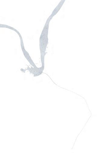
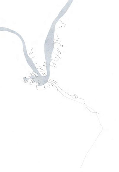
QUIET PLACES I: VATNAJÖKULL GLACIER
Norman Villeroux
ACKNOWLEDGMENTS 2023 ESALA LANDSCAPE ARCHITECTURE 2 8 44 98 162 228 Index 1 ESALA Landscape Architecture | 2023
From the Program Director: 3
MA (HONS) LANDSCAPE ARCHITECTURE

Over the last four years I have had the great pleasure of working with the current graduating cohort and seeing them develop as designers with distinct creative personalities. The MA (Hons) is one of the UK’s leading undergraduate programmes, bringing students from all around the world together into a vibrant studio culture at ECA. Many of the graduating students have significantly contributed to this vibrant studio culture, both through their dedication to studio work, but also through their efforts to foster a community of learning by leading other years through our student society and other collaborative events.
Through their studies at ECA this group has achieved significant awards, including winning national design competitions, finding internships at leading practices, undertaking exchange study periods at other institutions, amongst a range of other achievements. These awards reflect the quality of this graduating group, while many already have found employment beyond graduation or have been accepted into leading post-graduate schools to advance their studies.
In their final year, they undertook a complex project in London, which asked them to consider the role of public space in the 21st century in response to contemporary societal and environmental priorities. The range of strategic ideas in response to this context was varied and highly imaginative, offering many inspiring ideas about how designed space has the potential to enhance the world around us. I am pleased to share some of those ideas in this publication.
Ross Mclean Senior Lecturer and Programme Director, MA (Hons) Landscape Architecture
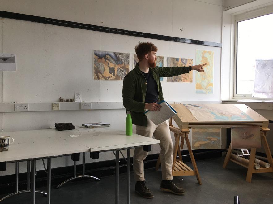
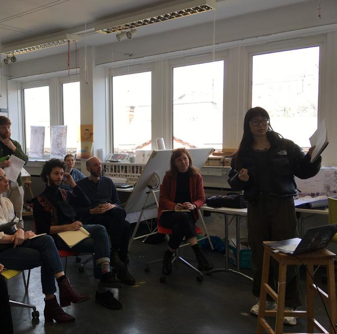
ABOVE: Paul Morsley in tutorial with student. (Photo: Francisca Lima)
From the Program Director:
MASTERS OF LANDSCAPE ARCHITECTURE (MLA)
I am very pleased to celebrate the graduation of our 2023 MLA cohort and the completion of their studies after a year of intense dedication and commitment. In this academic cycle, we celebrated the return of in-person fieldwork across fascinating sites in Scotland, the Azores and Iceland. During these dedicated field trips, our students had the opportunity to acquire first-hand knowledge of their territories through in-person exploration supported by an array of new tools—sometimes developed by the students themselves.
In our MLA programme, the students are encouraged to explore their sites via theoretical lenses and philosophical groundings that support the contextualisation of their work within a broader societal framework. This methodology transforms these design exercises into meaningful transdisciplinary projects.
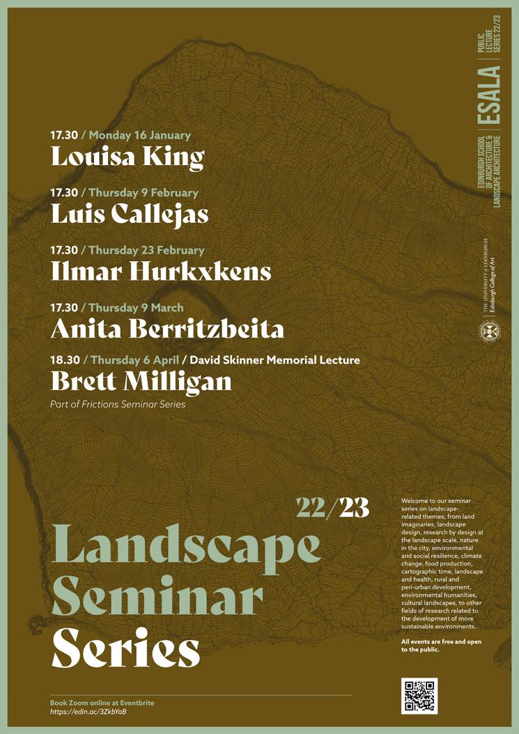
To this end, our Landscape Seminar Series continues to be an important source of inspiration. Students had the opportunity to learn from and engage with distinguished guests, including Louisa King, Luis Callejas, Ilmar Hurkxkens, Anita Berritzbeita and Brett Milligan—the David Skinner Memorial Lecturer. Moreover, the Climate Action Group has continued to enhance programmes across ESALA with opportunities to enrich our knowledge of best environmentally conscious design practices.
The work presented in this catalogue can sometimes be speculative, other times acute place reading exercises or creative projective scenario developments, all of which are in dialogue with existing and future ecological and societal needs. All three units have explored sites within fault lines in the North Atlantic and, in that sense, they share geomorphological phenomena and ecological dynamics in addition
to a unique sense of remoteness. These dynamic processes formed the basis of proposed future scenarios here imagined and presented in a rich diversity of mediums, representational modes, and materials explored as communication tools, and hence, potential drivers for change.
Due to the high number of students in our class, we could not physically show all the projects developed by this cohort, so here is a representative sample. Nevertheless, I would like to congratulate all students for their engagement in the conclusion of this academic period. I also wish that all our 2023 graduates will have a professional life full of learning adventures.
To conclude, I would like to share a word of gratitude to all the MLA teaching teams who worked tirelessly and continuously in support of this 2023 MLA class for the past two years.
Dr. Francisca Lima, PhD FHEA Lecturer and Programme Director Landscape Architecture MLA
5
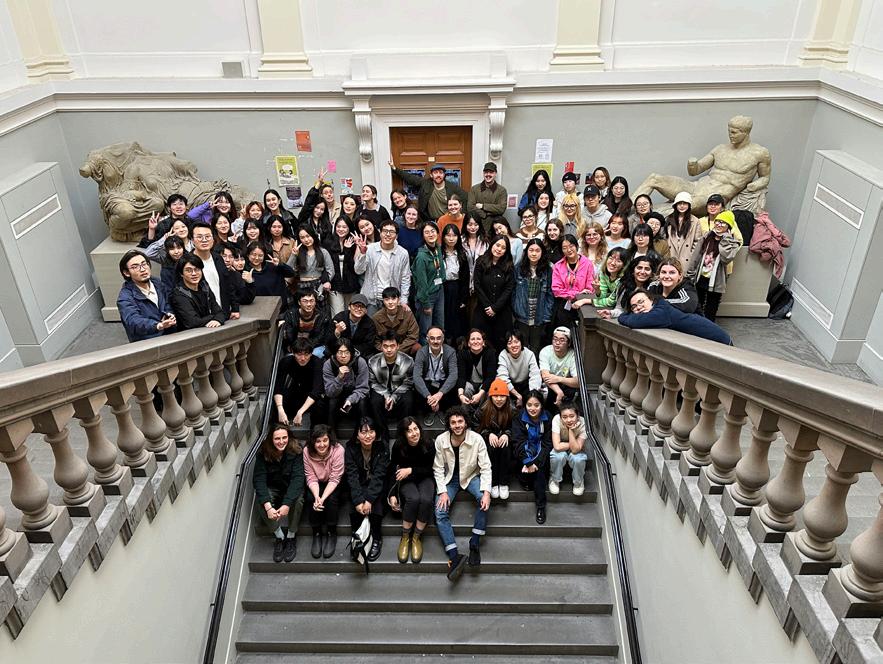
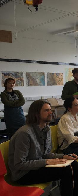
OPPOSITE: The 2023 MLA Cohort. (Photo: Unknown Author) ABOVE: Tom Stephenson (MLA 2023) presenting in-progress work. (Photo: Francisca Lima)
LEFT TO RIGHT, TOP TO BOTTOM:
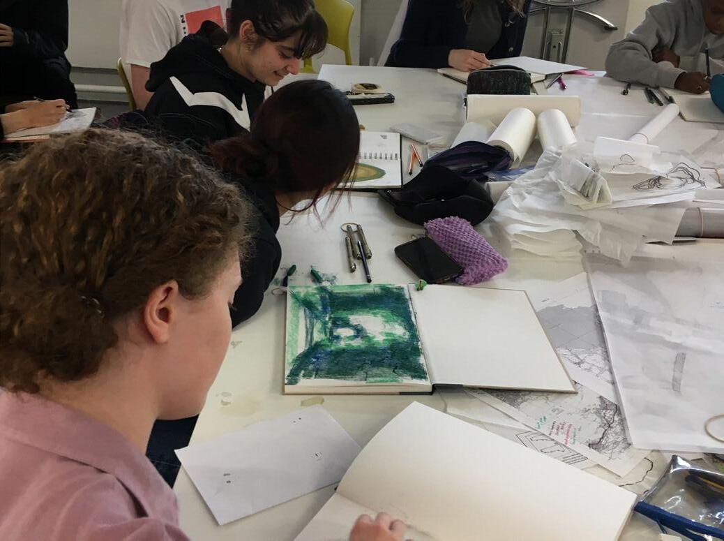
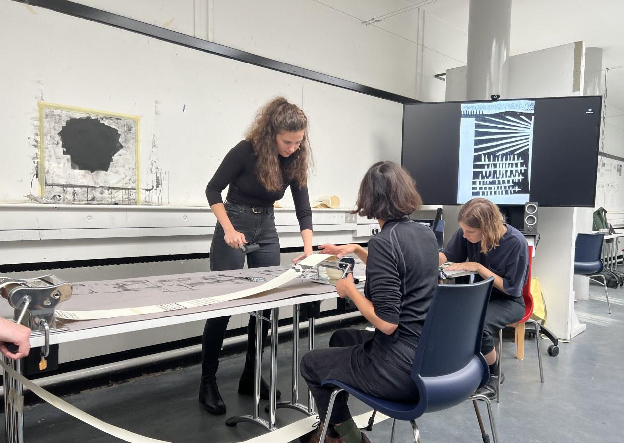
 1) Students explore drawing techniques in studio. (Photo: Francisca Lima)
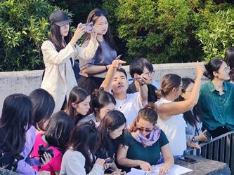
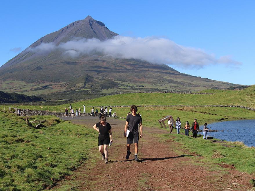
2) MLA students from the Archipelago unit explore the Azores. (Photo: Yaoyu Huang)
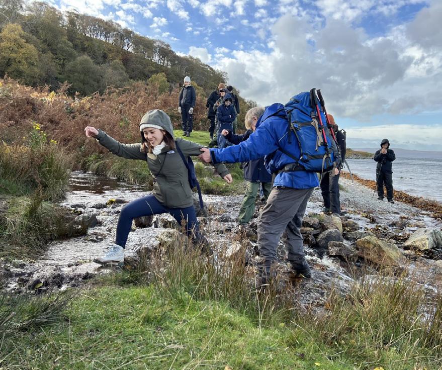
3) Photos from the Critical Zones unit’s trip to Arran. (Photo: Nancy Fuerth)
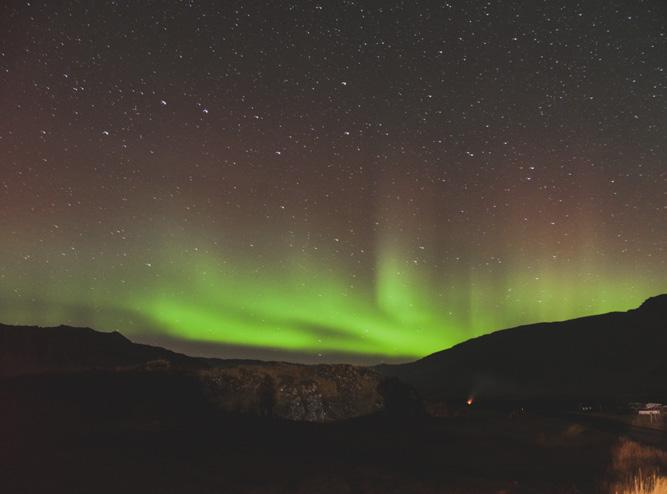
4) The Northern Lights experienced by the Quiet Places unit. (Photo: Tim Gämperle)
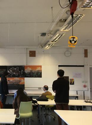
5) Studio discussions in the ECA Hunter Building. (Photo: Francisca Lima)
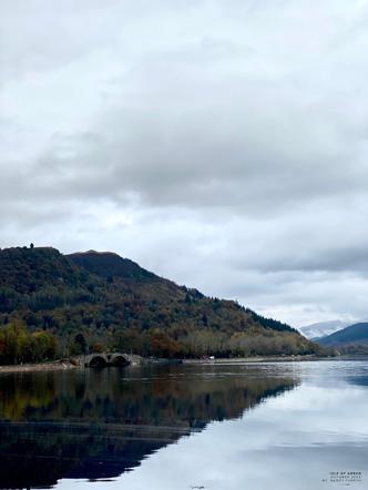
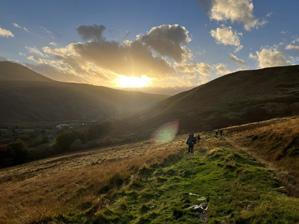
6) Sunset over Arran. (Photo: Anna Rhodes)
7) The Landscape Seminar Series brought leading landscape architects to campus for lectures, discussions, and studio crits.
8) A view from Arran. (Photo: Nancy Fuerth)
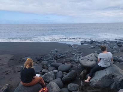
9) Students in the Archipelago unit sketching on a beach in the Azores. (Photo: Yaoyu Huang)
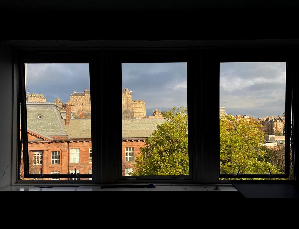
10) Studio reviews overlooking Edinburgh Castle. (Photo: Francisca Lima)
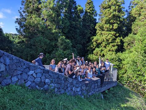
11) Students in the Archipelago unit pose in front of a volcanic stone wall. (Photo: Marta Guerini)
12) Edinburgh Castle and ECA Main Building from the MLA studios in the Hunter Building. (Photo: Tom Sterling)
1) Students explore drawing techniques in studio. (Photo: Francisca Lima)
2) MLA students from the Archipelago unit explore the Azores. (Photo: Yaoyu Huang)
3) Photos from the Critical Zones unit’s trip to Arran. (Photo: Nancy Fuerth)
4) The Northern Lights experienced by the Quiet Places unit. (Photo: Tim Gämperle)
5) Studio discussions in the ECA Hunter Building. (Photo: Francisca Lima)
6) Sunset over Arran. (Photo: Anna Rhodes)
7) The Landscape Seminar Series brought leading landscape architects to campus for lectures, discussions, and studio crits.
8) A view from Arran. (Photo: Nancy Fuerth)
9) Students in the Archipelago unit sketching on a beach in the Azores. (Photo: Yaoyu Huang)
10) Studio reviews overlooking Edinburgh Castle. (Photo: Francisca Lima)
11) Students in the Archipelago unit pose in front of a volcanic stone wall. (Photo: Marta Guerini)
12) Edinburgh Castle and ECA Main Building from the MLA studios in the Hunter Building. (Photo: Tom Sterling)
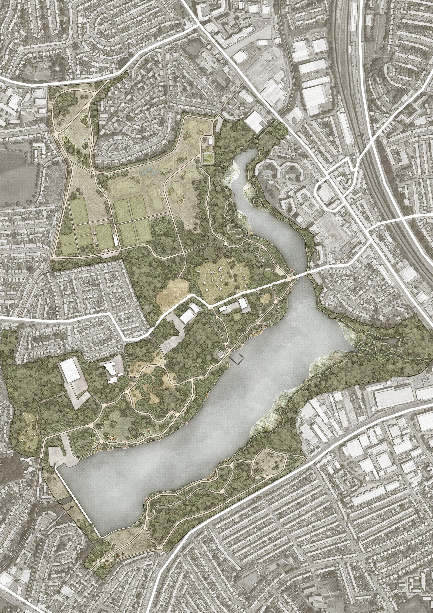
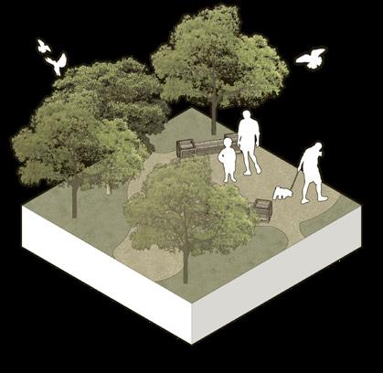
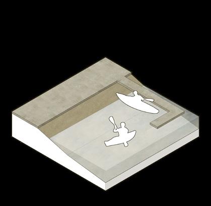
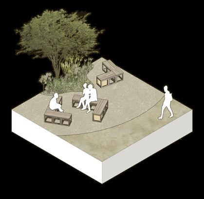
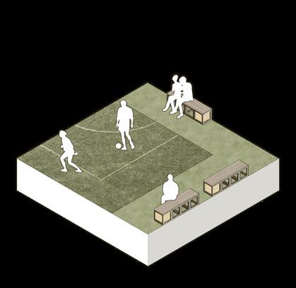
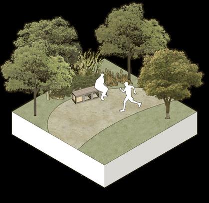
Rethinking the Urban Park
WEST HENDON CASE STUDY
MA (Hons) Landscape Architecture
Chris Rankin
STUDIO BRIEF
Chris Rankin
RAVELSTON GEOPARK
Ben Adams
PEDAL UP
Cayetana Anderson
INCLUSIVE WEST HENDON PARK
Anouk Van Royen
UNDER THE CANOPY
Tara Schwarze-Chintapatla
WEST HENDON URBAN PARK
Fengyu (Mulder) Sun
10 14 20 26 32 38
9
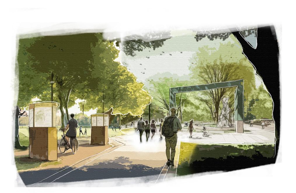
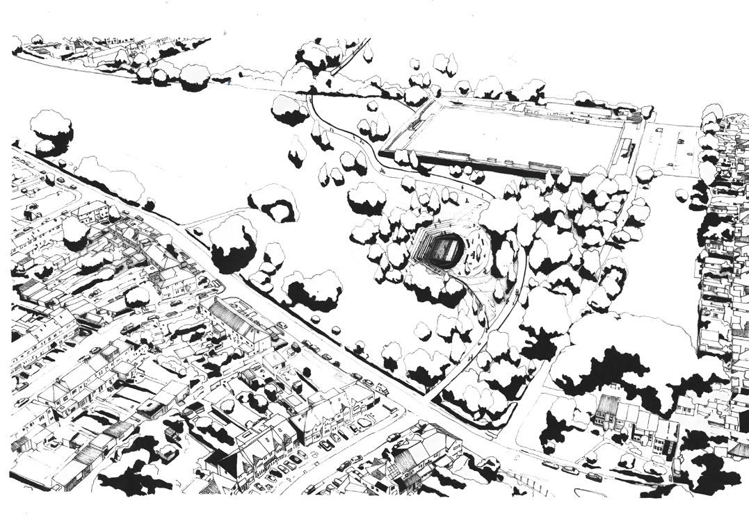
Rethinking the Urban Park | Chris Rankin
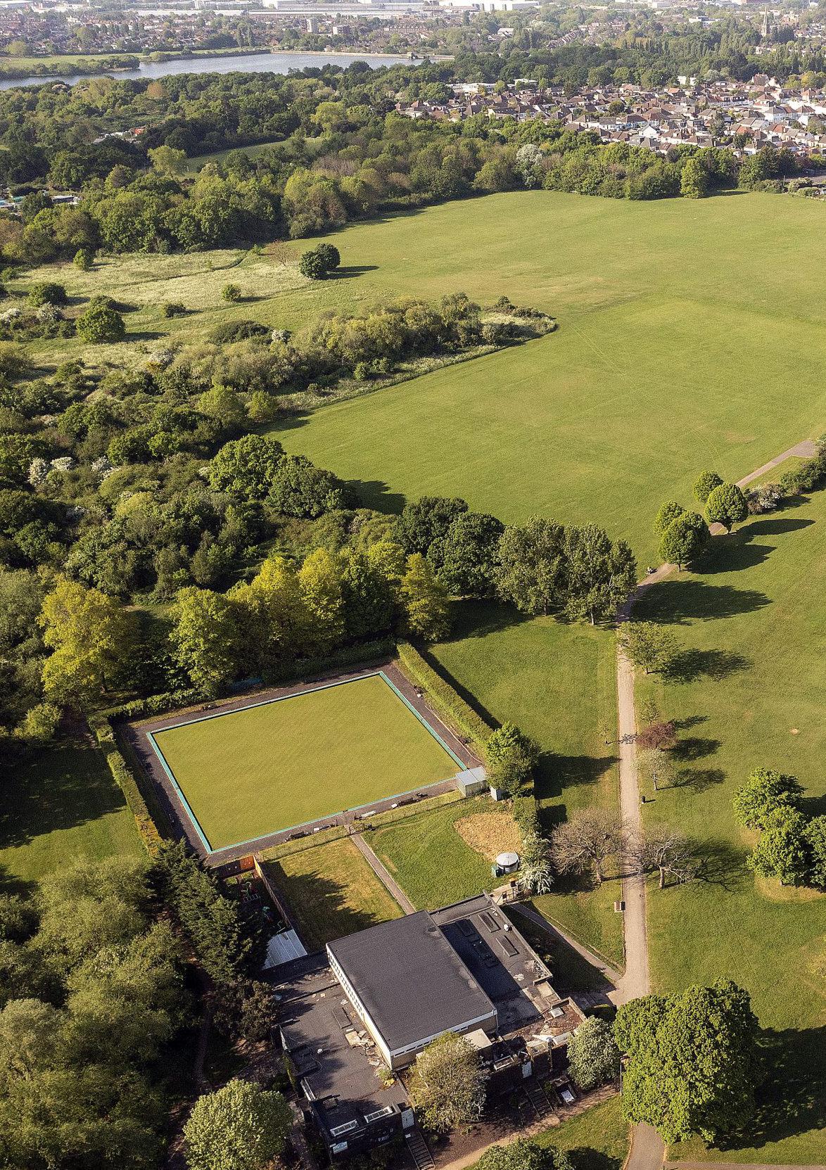
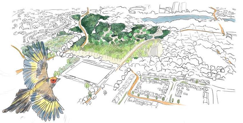
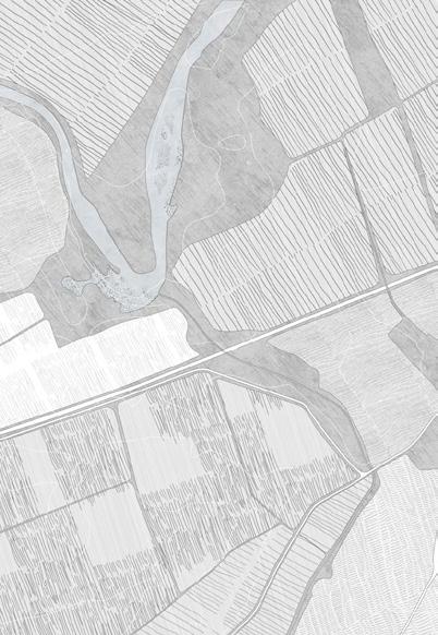
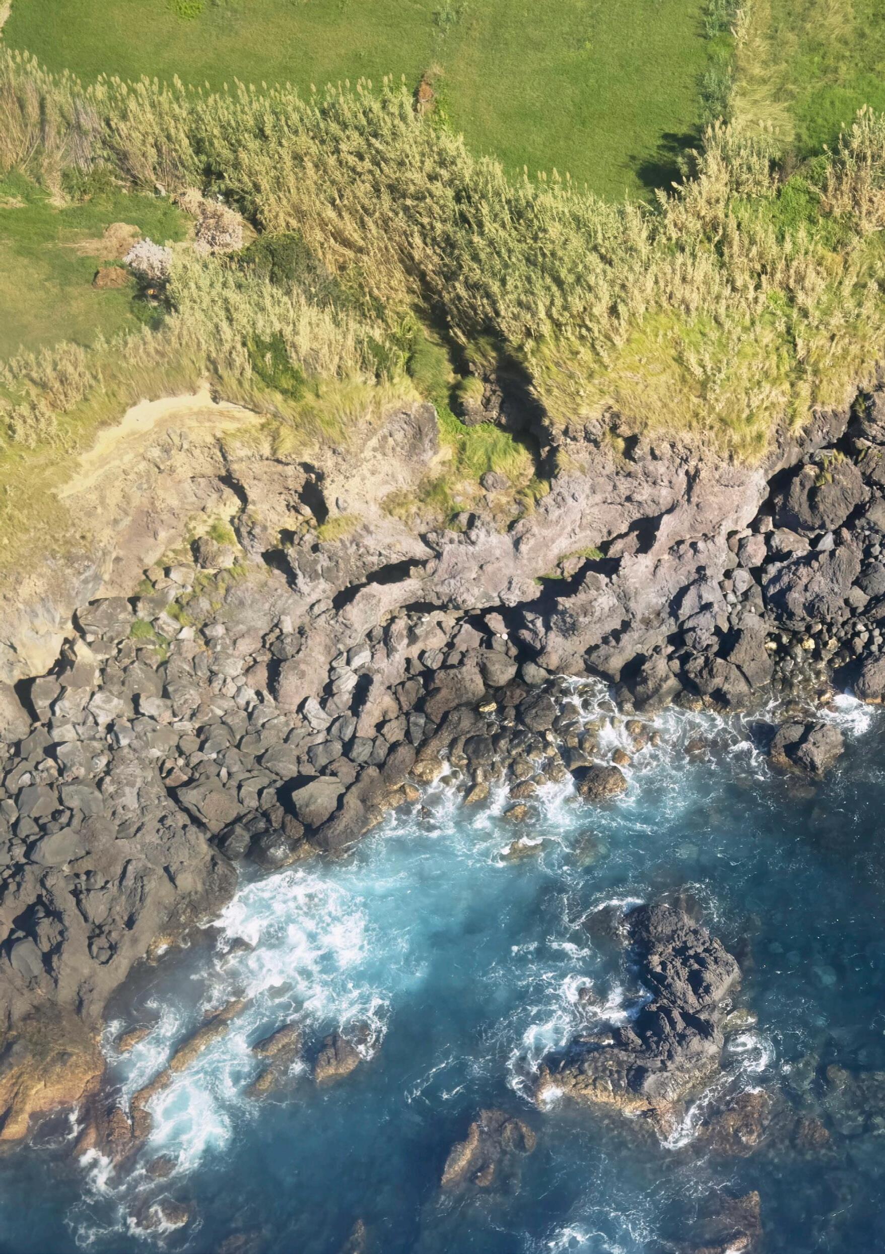
OPPOSITE: An aerial view of the West Hendon site (Photo: Unknown Author)
Rethinking the Urban Park
WEST HENDON CASE STUDY
The Swiss landscape architect Gunter Vogt has stated,
‘To this day creating a contemporary kind of park remains one of the most difficult tasks for our profession.’
The great urban parks of the 19th and 20th century had their roots in a desire to positively affect public health through civic provision of access to open space and fresh air, combined with the promotion of an idealised vision of ‘nature’. The MA4 studio this year asked how the urban park for the 21stC and beyond should be conceptualised and designed in the current context of climate breakdown, health inequalities and biodiversity loss. What role does the park play in society today? How can it remain a vital constituent of the urban landscape and resist pressure of development and gentrification.
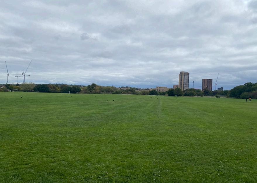
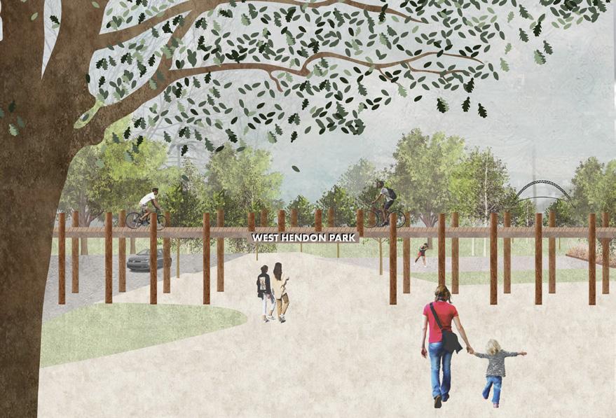
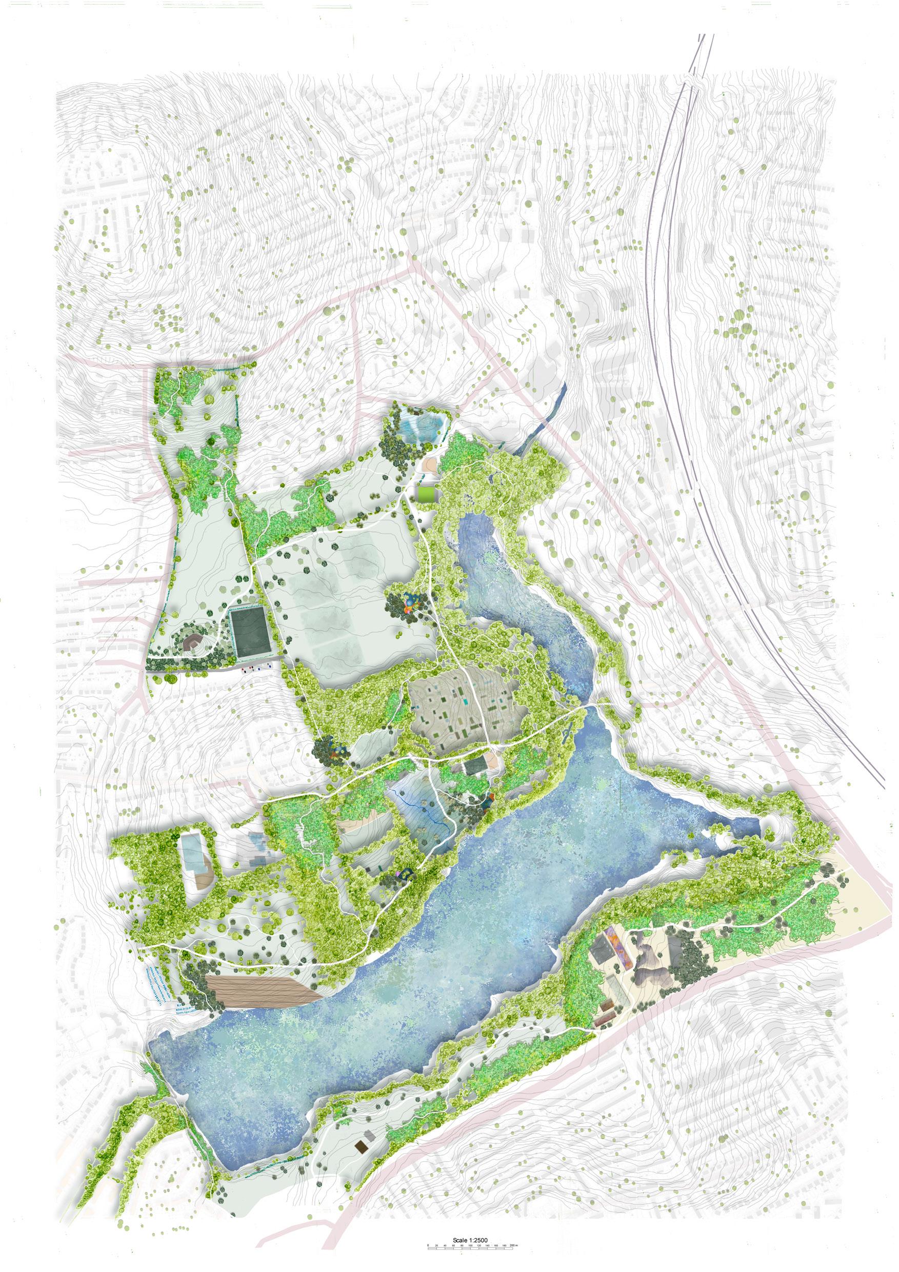
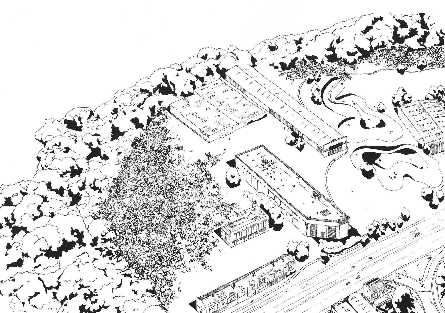
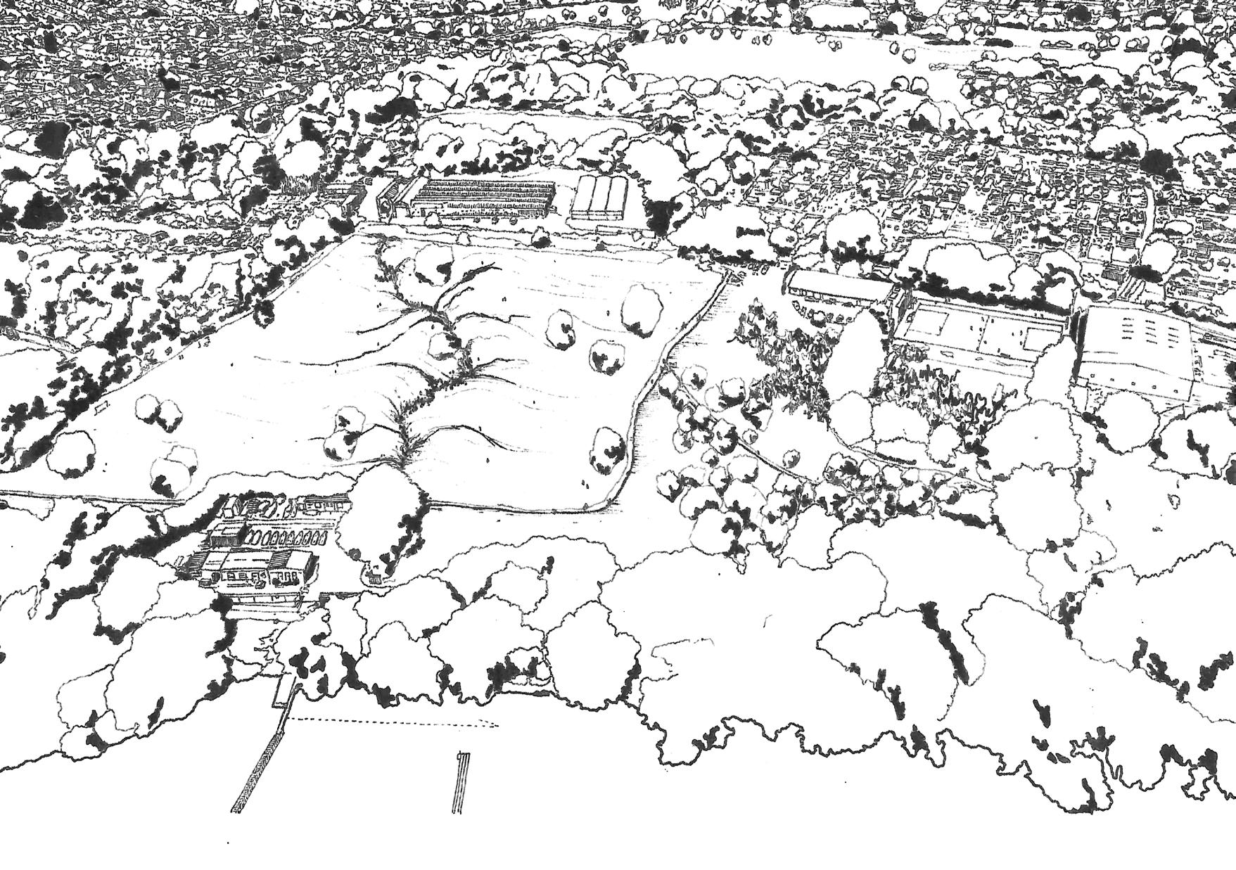
The student work developed in the Edinburgh Urban Parks studio demonstrated the vital role that landscape architects can play in re-imagining both tired and often under used local spaces that nonetheless remain full of potential. In each case the projects sought to positively contribute to climate resilience and the physical and mental health of citizens. The focus for this years MA4 design studios was West Hendon Playing fields and the wider landscape of Barnett in west London. West Hendon Playing Field was selected as it represents both a specific locale, on the edge of a reservoir in an area of London that is undergoing rapid change and gentrification, but also because it represents ‘any park’ an unloved, undervalued and even feared park in the middle of the city.
11
Chris Rankin with Sophie Tombleson, Hazel Mei, and Alison Finch
ABOVE: A photo of the current conditions at West Hendon Playing Fields. (Photo: Chris Rankin)
The early stages of the project involved desk top research, contextual reading and on-site field work. The students initially worked in groups to study how the park related to the geology, hydrology and topography of the landscape and the communities within which it lies, before developing proposals for regeneration. The novella ‘In the Pines’ by Paul Scraton was introduced to each group as a provocation to inform both how the fieldwork might be tackled, and to help frame a potential conceptual direction for each project. “In the Anthropocene, the wilderness is both threatened by society and threatens to wipe out society in return.” Richard Lea.
Further reading included ‘Designing Parks, Berlin’s Park am Gleisdreieck or the Art of Creating Lively Places’ by Leonard Grosch and Constanze A Petrow. This book was used to help frame emerging design approaches into coherent strategies for regeneration and animation.
The work during the first semester moved between the generic and the specific, where students were asked to develop strategic proposals for the regeneration of the park in its west London context, whilst also considering how their proposals could be applied to other parks in different contexts. With ideas deeply rooted in place, the students developed speculative and imaginative proposals during the second semester focussed focussing on site specific detailed design, where consideration of space, materiality, planting and topographic design are essential; exploring how under used spaces could be re-imagined as parks for the future.
The design studio sought to emphasis and reinforce the relationship between conceptual design and technical design rigour. The role and skill of the landscape architect is founded on the ability to be both visionary, helping people imagine what a future landscape will look like; and pragmatic, developing the technical details that underpin the best designed landscapes. The strongest projects in this years MA4 studio show encouraging promise that this group of graduates contain these attributes and I wish them well in their future careers.
OPPOSITE: A photo of the current conditions surrounding West Hendon Playing Fields. (Photo: Chris Rankin)
13
Rethinking the Urban Park | Chris Rnakin
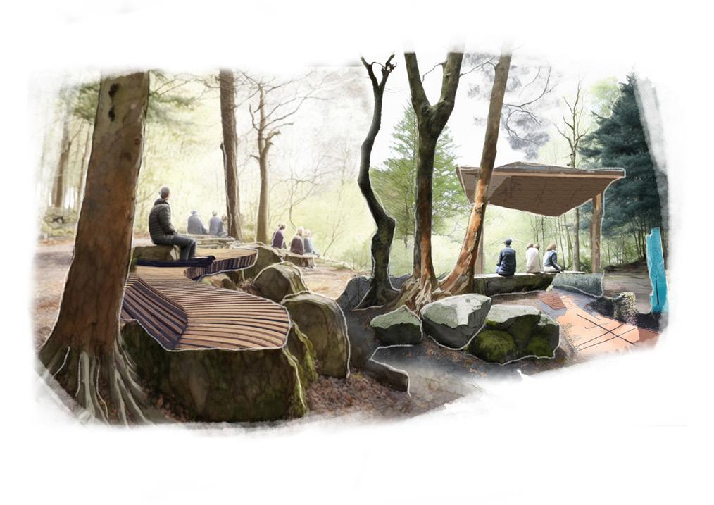
Ravelston Geopark
A RADICAL VISION TO UNITE A TRADITIONAL PARK, FORMER SANDSTONE QUARRY AND URBAN WOODLAND
Ben Adams
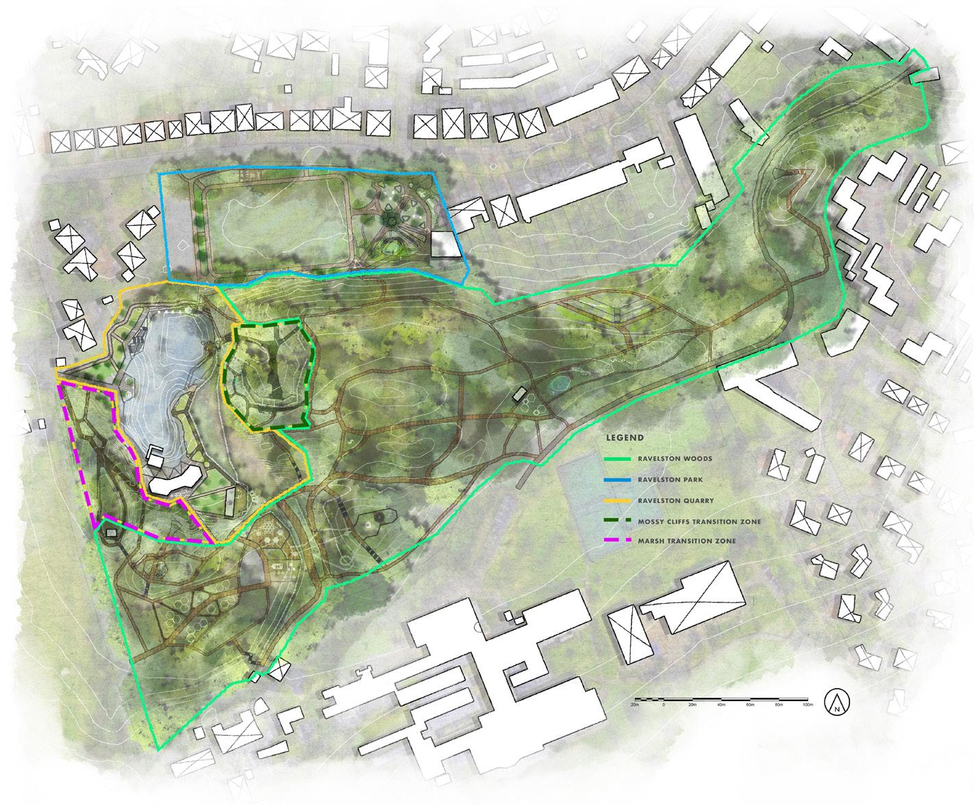
This project presents a hypothetical scenario for Edinburgh’s Ravelston Woods, Park and Quarry in which the three open spaces unite to form a Geopark concept which responds to current issues being faced in the 21st Century.
In reality, the quarry is being developed for housing and the park and woods are, for some time, likely to remain in the status quo as wellliked, albeit somewhat quiet and sleepy components of the suburban Edinburgh neighbourhoods of Blackhall and Craigleith.
However, what Ravelston Geopark project aims to showcase is a testing ground for innovative park designs and principles that shapes what a successful contemporary park is. Thus, the project is intended to be a ‘manual’ for scenarios in which our connection with parks must be reimagined to develop more sustainable and fulfilling lifestyles.
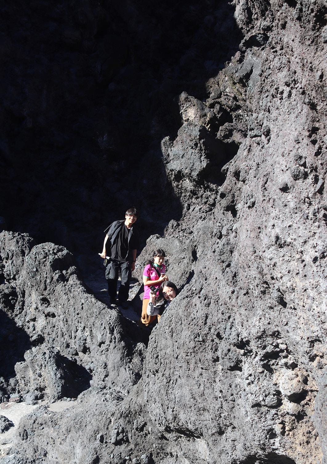
The site’s topography and existing paths were tricky to grasp due to the disorientating nature of the woods. Challenges involved poor accessibility to the quarry, traversing across level changes and through overgrown areas. However, once a fuller picture of the site’s intricacies was formed, getting to know the site closely was a rewarding process.
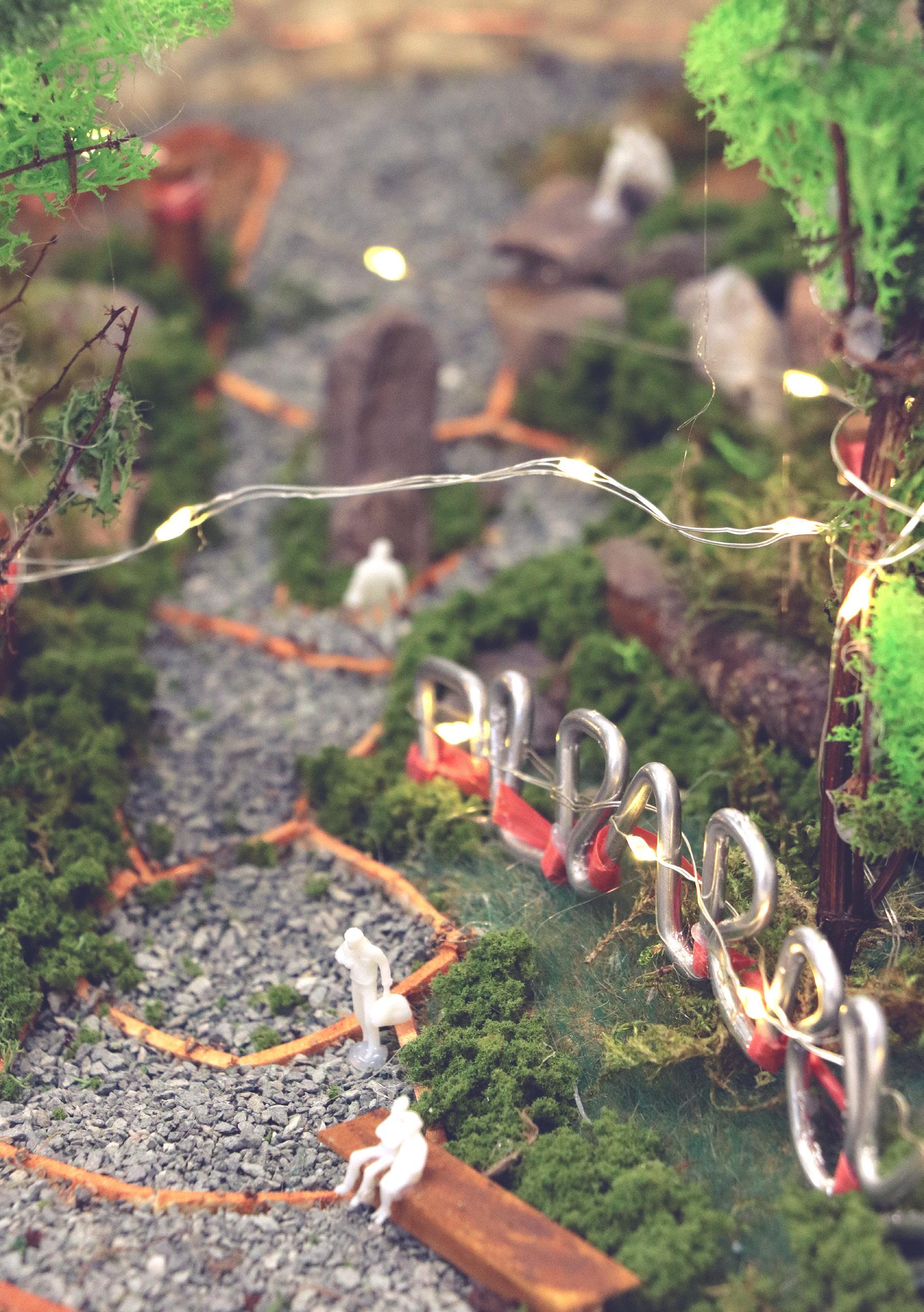
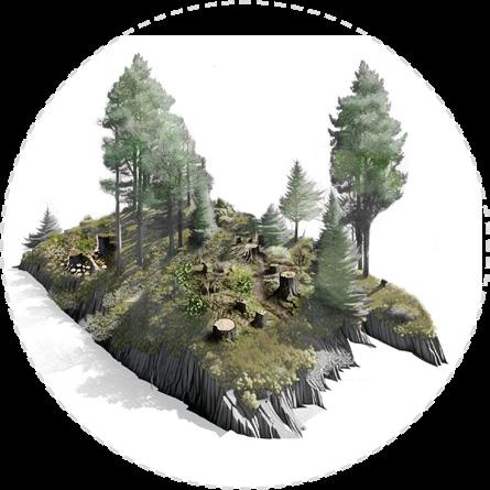
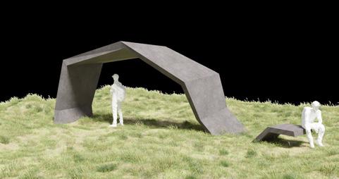
ABOVE: Mossy Cliffs Model. Flagship area of Ravelston Geopark where the woodland transitions to quarry. OPPOSITE: Mossy Cliffs Model. Flagship area of Ravelston Geopark where the woodland transitions to quarry.
15
Rethinking the Urban Park
| Ben Adams
BOTTOM: Explanatory diagrams illustrating (from left to right) the removal of topsoil from an expanded quarry lock trench is transported locally to Ravelston Park where it will be recycled into mounds for social activity; construction of deadwood habitats as part of a woodland management strategy to improve biodiversity and resilience; bush and gorse vegetation clearance along Mossy Cliffs area.
17
the Urban
|
Rethinking
Park
Ben Adams
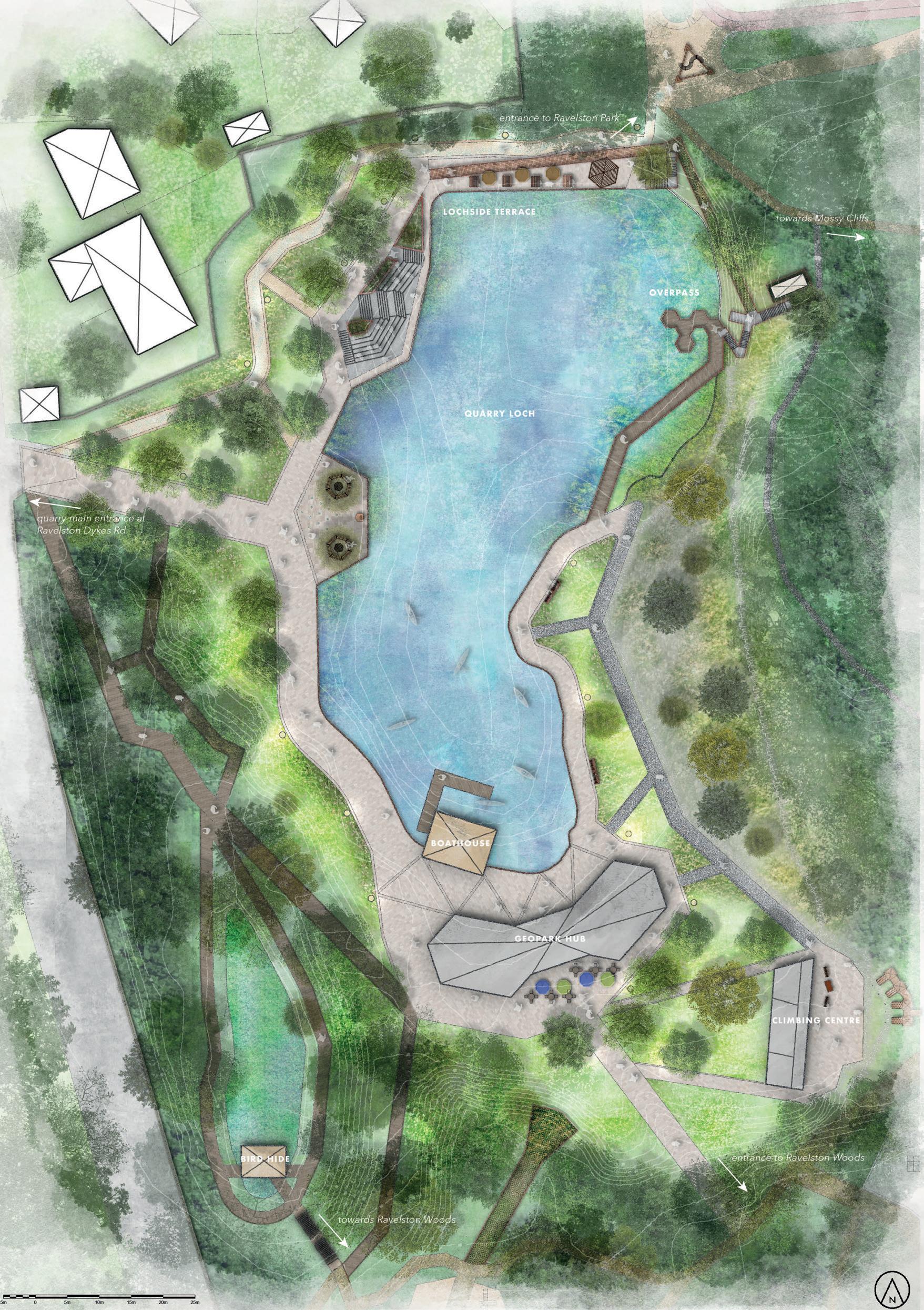
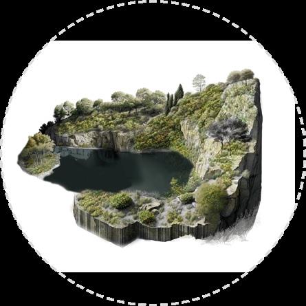
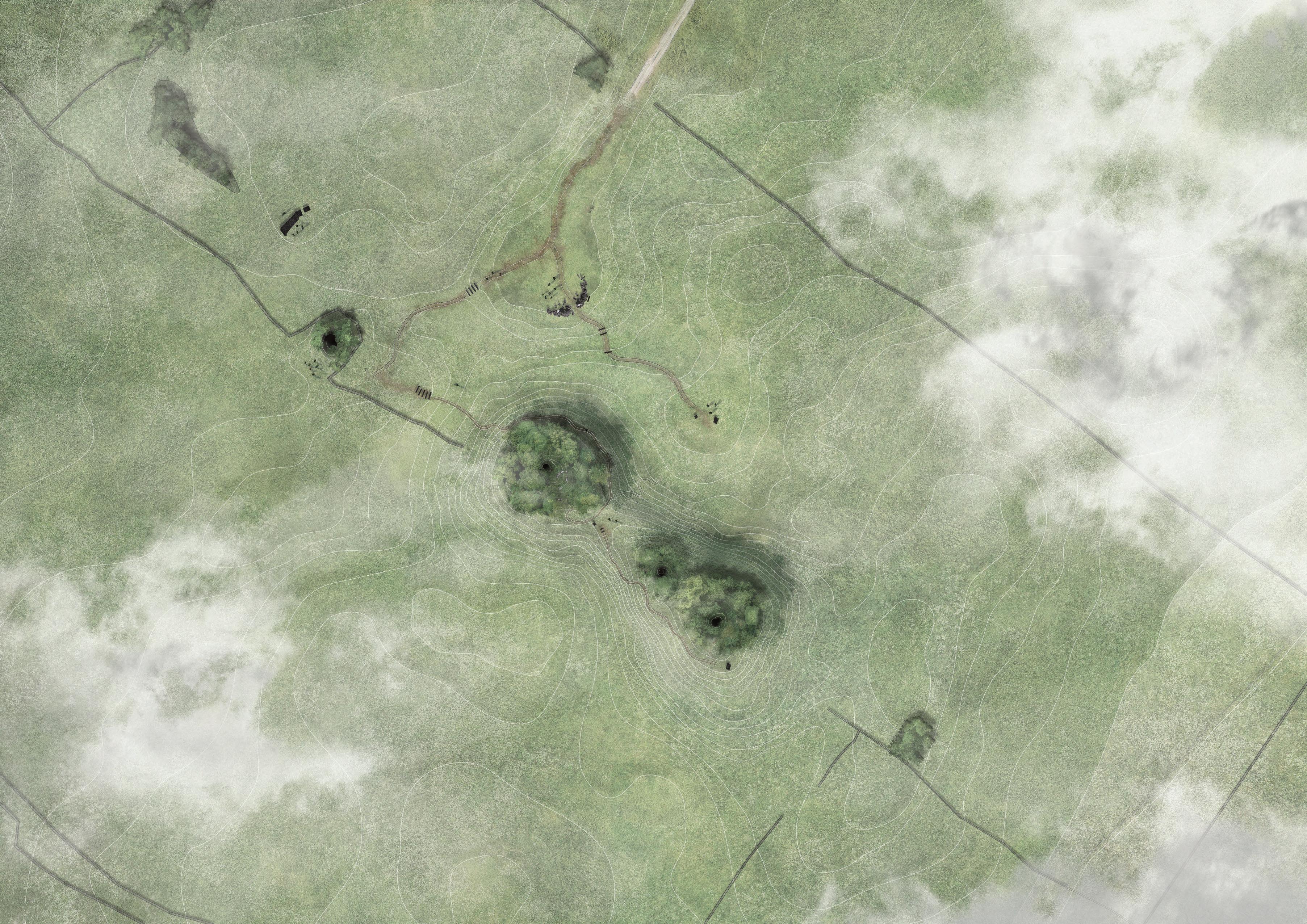
OPPOSITE: Rendered plan of Ravelston Quarry
TOP: Masterplan of Ravelston Geopark showing three distinctive zones –Quarry, Park and Woods – along with two transition zones – Mossy Cliffs, Marsh.
19 Rethinking the Urban
|
Park
Ben Adams
CLOCKWISE FROM TOP LEFT:
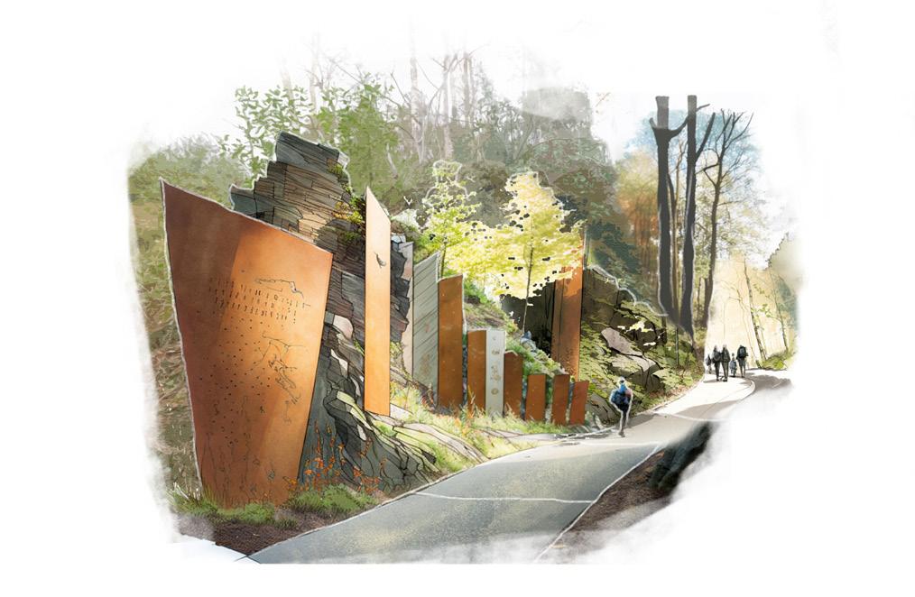
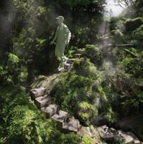
1) RAVELSTON WOODS: Historical inscription trail defining main entrance to from Queensferry Road.
2) RAVELSTON WOODS: Serenity and senses in the sunken woods.
3) RAVELSTON WOODS: Natural seating and pergola overlooking the sunken woods.
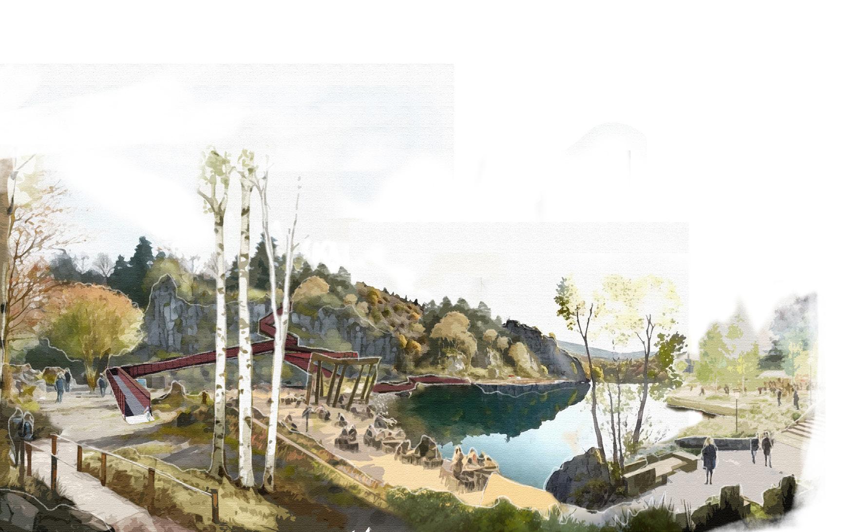
4) RAVELSTON QUARRY: Terraced lochside edge areas for recreation and relaxation.
5) RAVELSTON PARK: Overhead wayfinding feature and rock totem in park plaza.
6) RAVELSTON WOODS: Historical inscription trail defining main entrance to from Queensferry Road.
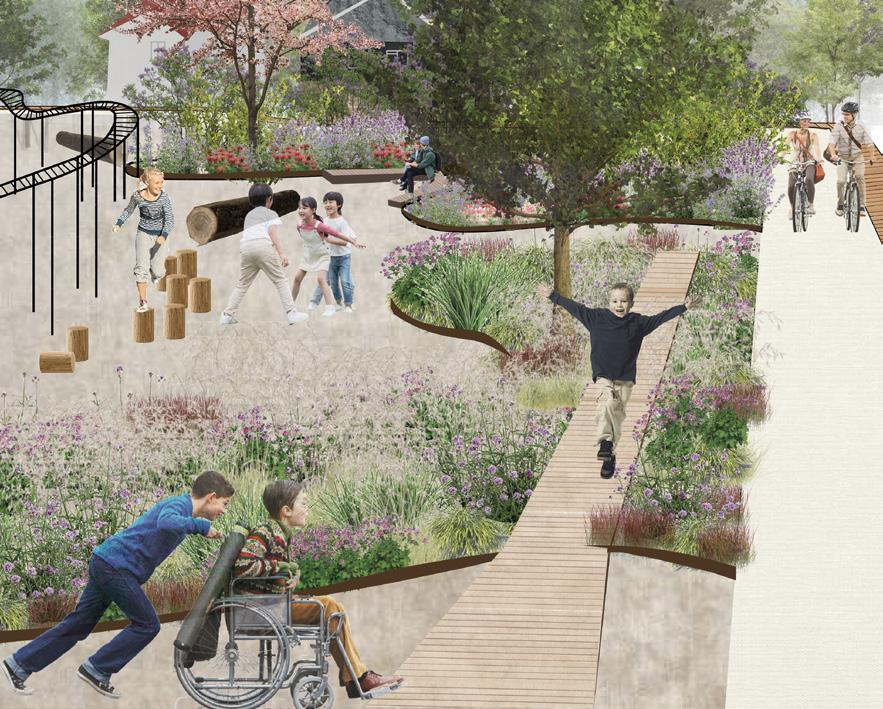
Pedal Up
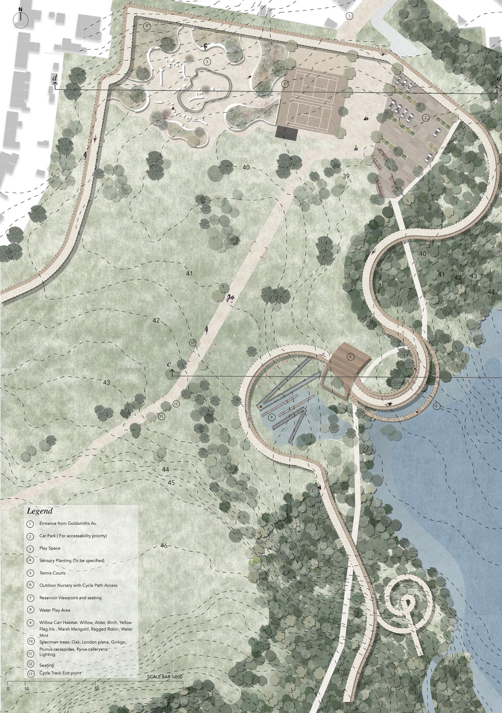
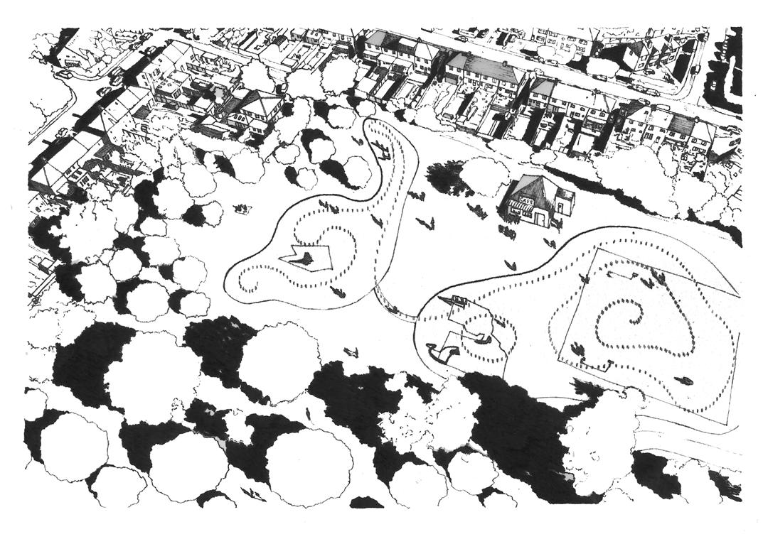
Pedal Up proposes a playful and active transformation to the West Hendon Playing Fields in the London Borough of Barnet by expanding on its existing sporting history and reclaiming surrounding areas of warehouses and woodland to create a cycle track circulating the entire park. The implementation of the cycle track creates a focus on how play can become a tool for regeneration throughout the park creating points of play along and away from the cycle track itself.
The cycle track entails ground-level and tree-top views throughout the site with considerations for different types of tree planting implemented alongside existing Broadleaf and Willow Carr species to create different cycling and walking experiences across the site. Three groups of tree planting have been proposed with different focuses which are: ground interest species, tree top species, and specimen trees. These three groups aim to create contrast with more open areas that contrast the denser woodland spaces.
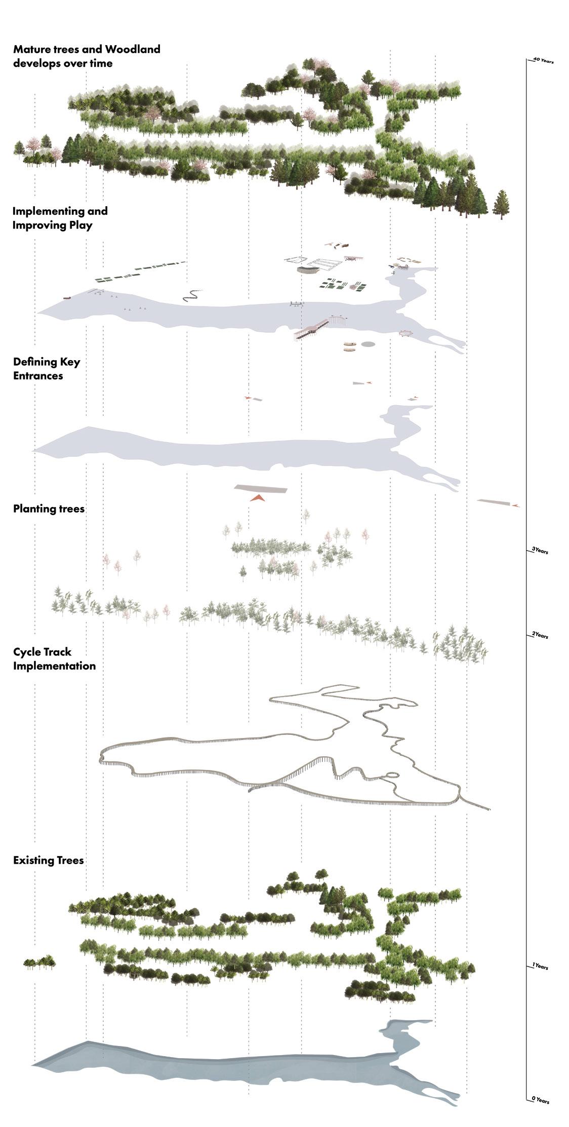
The improved and proposed play points around the track that are accessible for children and adults of all abilities and disabilities have been categorised into physical, sensory, destination, exploratory and pause play spaces. The cycle track, therefore, serves as an initial attraction to the site which can then be explored by travelling along the whole track or through smaller sections. The proposal will develop over a 40-year period with the initial track implementation in year 1 and the tree planting, play development and woodlands sequentially following this stage over the following years.
 Cayetana Anderson
ABOVE: Reservoir Lookout Point. This space is embedded within the cycle track and footpath so it can be accessed by everyone
OPPOSITE: West Hendon Park Plan @ 1:500
Cayetana Anderson
ABOVE: Reservoir Lookout Point. This space is embedded within the cycle track and footpath so it can be accessed by everyone
OPPOSITE: West Hendon Park Plan @ 1:500
21
Rethinking the Urban Park |
Cayetana Anderson
LEFT: Phasing Diagram showing how the site will be implemented over 40 years OPPOSITE: Pedal Up project master plan at 1:500 scale.
23
the
Rethinking
Urban Park | Cayetana Anderson
ABOVE, TOP TO BOTTOM
 1) Sensory Play Planting Area providing a quieter and more accessible play space away from the rest of the park.
2) 1:500 Model of the Northern side of the site showing all three modeled typologies.
3) Entrance Point at Goldsmiths Avenue.
4) Sensory Play area and Plaza showing ‘Play Away’ from the cycle track.
OPPOSITE: Axonometric Diagrams of play intervention points across the site.
1) Sensory Play Planting Area providing a quieter and more accessible play space away from the rest of the park.
2) 1:500 Model of the Northern side of the site showing all three modeled typologies.
3) Entrance Point at Goldsmiths Avenue.
4) Sensory Play area and Plaza showing ‘Play Away’ from the cycle track.
OPPOSITE: Axonometric Diagrams of play intervention points across the site.
25
the
|
Rethinking
Urban Park
Cayetana Anderson
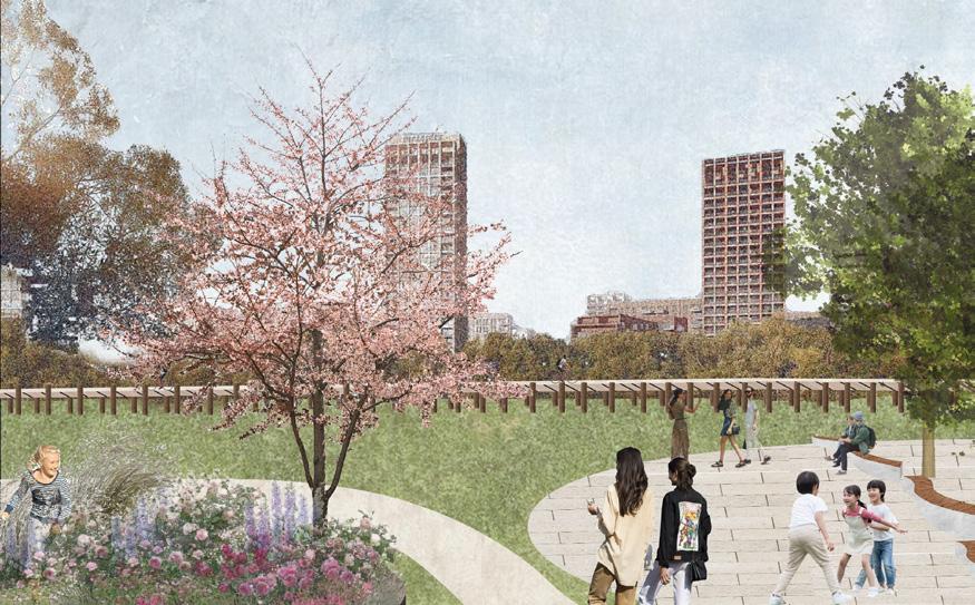
Inclusive West Hendon Park
Anouk Van Royen
The idea for the design of West Hendon Playing Field in London derived from coming across research by landscape architects including Clare Rishbeth and Dr Bridget Snaith, about ethnic inclusivity in UK parks. They found evidence for inequal access to UK parks between varying ethnic groups, not only due to factors such as distance, as even BAME communities living next to certain parks were rarely seen in them. This led to the conclusion that parks are white by design.
Being given the task of designing a 21st century urban park in diverse London, it seemed addressing this disparity was essential to try and consider how people from any community could feel welcome in the park. My design proposal for West Hendon was based on key inclusivity principles for public spaces which inspired a series of structured intervention points. These would each be surrounded by a wooded area and would be connected by paths, along which the species of trees would transition, forming a unique identity and signposting method around spaces.
Certain areas surrounded by a willow border would be left for vegetation to spontaneously expand. They would be accessible by informal paths for those curious to explore them, and aim to challenge automatic perceptions of this type of vegetation being associated with abandonment. The presence of these ‘wild’ spaces would be equally important in achieving inclusivity, for groups who would feel more comfortable and unrestricted in spaces that are unobserved.
OPPOSITE: Park master plan at 1:2500 scale.
ABOVE: Plan of a ‘micro space’: a small intimate-feeling area for people to experience the energy of the park without becoming overwhelmed by busier, more public areas. It contains a fountain, benches, community planting beds and space for creating mosaic patterns as part of the surface.
27 Rethinking the Urban Park | Anouk Van Royen
ABOVE: Site framework map to show the transition of tree species between intervention spaces, as a way to recognise and differentiate the character of each space.
OPPOSITE TOP: Plan of a ‘micro space’: a small intimate-feeling area for people to experience the energy of the park without becoming overwhelmed by busier, more public areas. It contains a fountain, benches, community planting beds and space for creating mosaic patterns as part of the surface.
OPPOSITE BOTTOM: Former area of warehouses, proposed to be transformed into a skate park, areas for spontaneous vegetation and some retained buildings to use as events space such as for gigs.
29 Rethinking the Urban Park | Anouk Van Royen
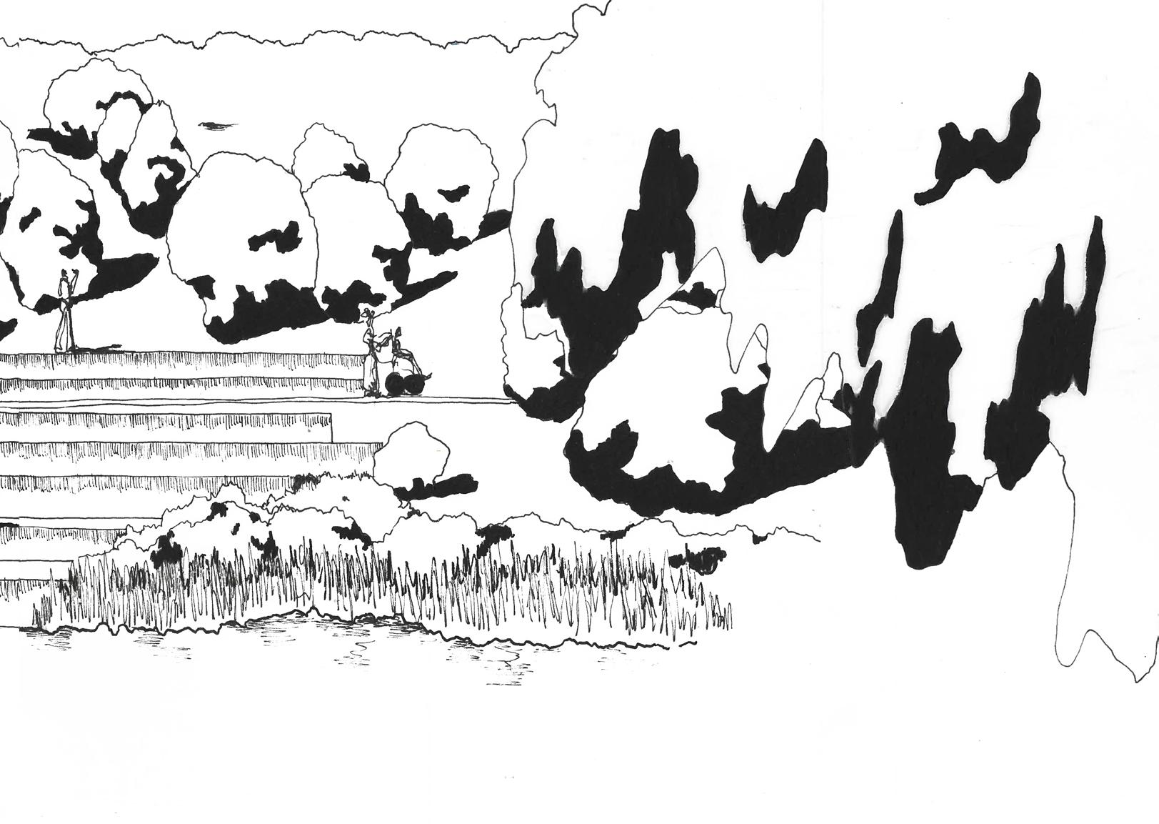
TOP: Terraced area visualization. The teppid area leads down to the reservoir
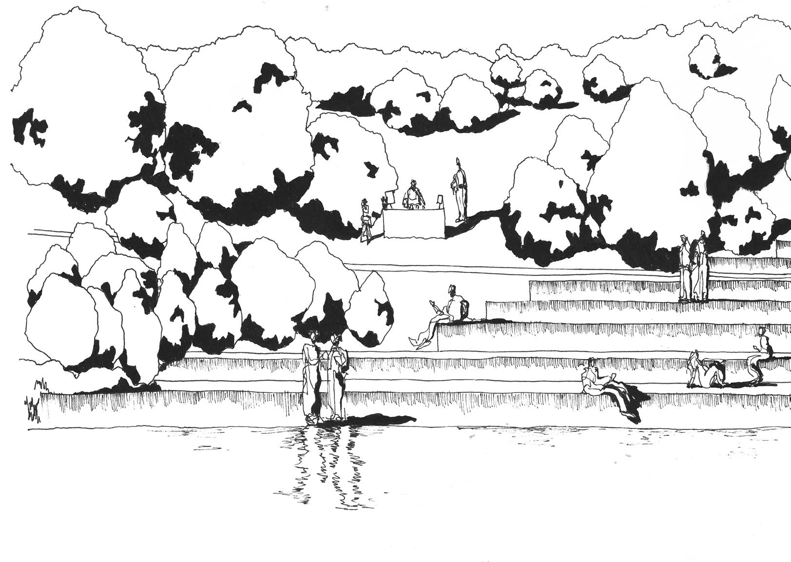
BOTTOM RIGHT: Amphitheatre located near a new park entrance. It is one of the lowest-lying areas on site and will simultaneously function as a SuDS system.
BOTTOM LEFT: Located by one of the park’s entrances, the play fountain aims to draw diverse groups into the park. There will be a new café where parents could sit as their children play.
31 Rethinking the Urban Park | Anouk Van Royen
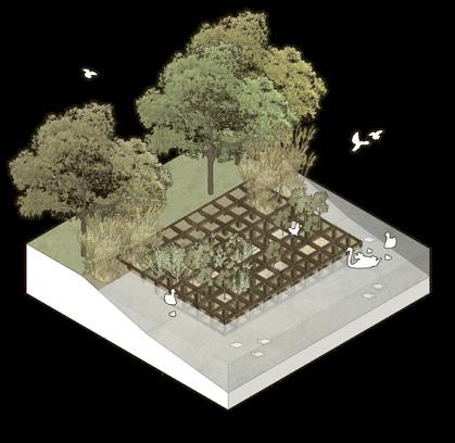
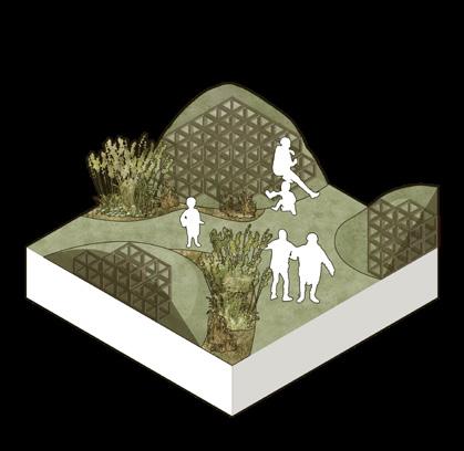
Under the Canopy
USING TREES TO DEFINE ATMOSPHERE
 Tara Schwarze-Chintapatla
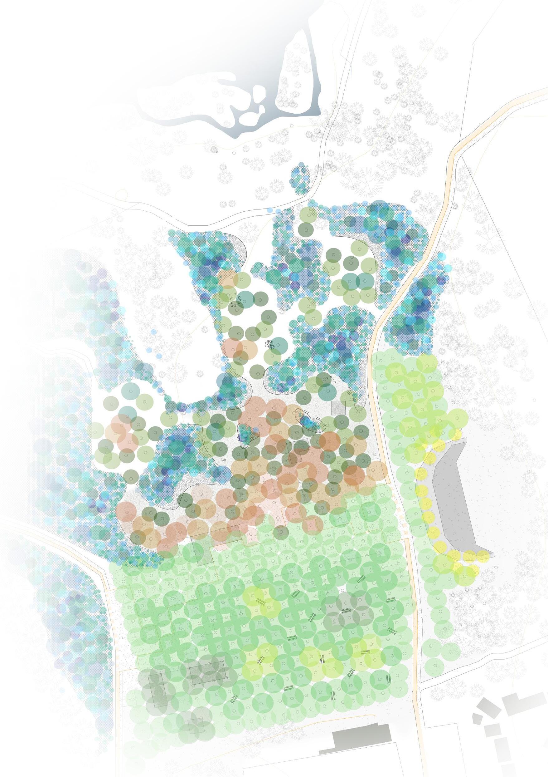
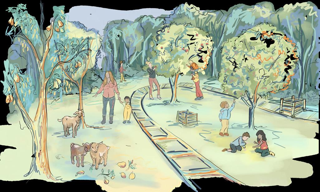
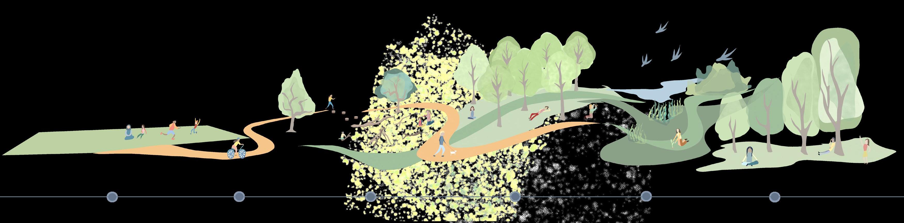
Our parks are vulnerable. Often unchanged over decades, impermeable plazas and monoculture grasslands are experiencing severe droughts, flash floods and a reduction in biodiversity. To ensure the survival of our urban green spaces in the 21st century we need to embrace and adapt these spaces to increase climate resilience and inclusivity for all human and more-than-human users.
Under the Canopy proposes the urban forest as a solution. It uses the design material of trees to reimagine urban social spaces to be under the dappled shade and ecological haven of a tree canopy.
Such changes require community engagement and changes in perception to the ‘untamed aesthetic’ of trees and forests. Under the Canopy achieves this through the phased implementation of community action and graded design zones which introduce the wilder “untamed aesthetic.”
Phased community action and design interventions allow time for an increase in public pro-environmental behaviours before the implementation of the contested design phases such as converting playing fields into social spaces under tree cover or designating their spaces as ecological zones.
Designing with trees to define the atmosphere allows us to create buzzing and energetic social zones whilst furthering ecological harmony. Under the canopy reintroduces more-than-human species as a vital community in our social zones and allows humans to begin taking the role of a keystone species within urban ecosystems.
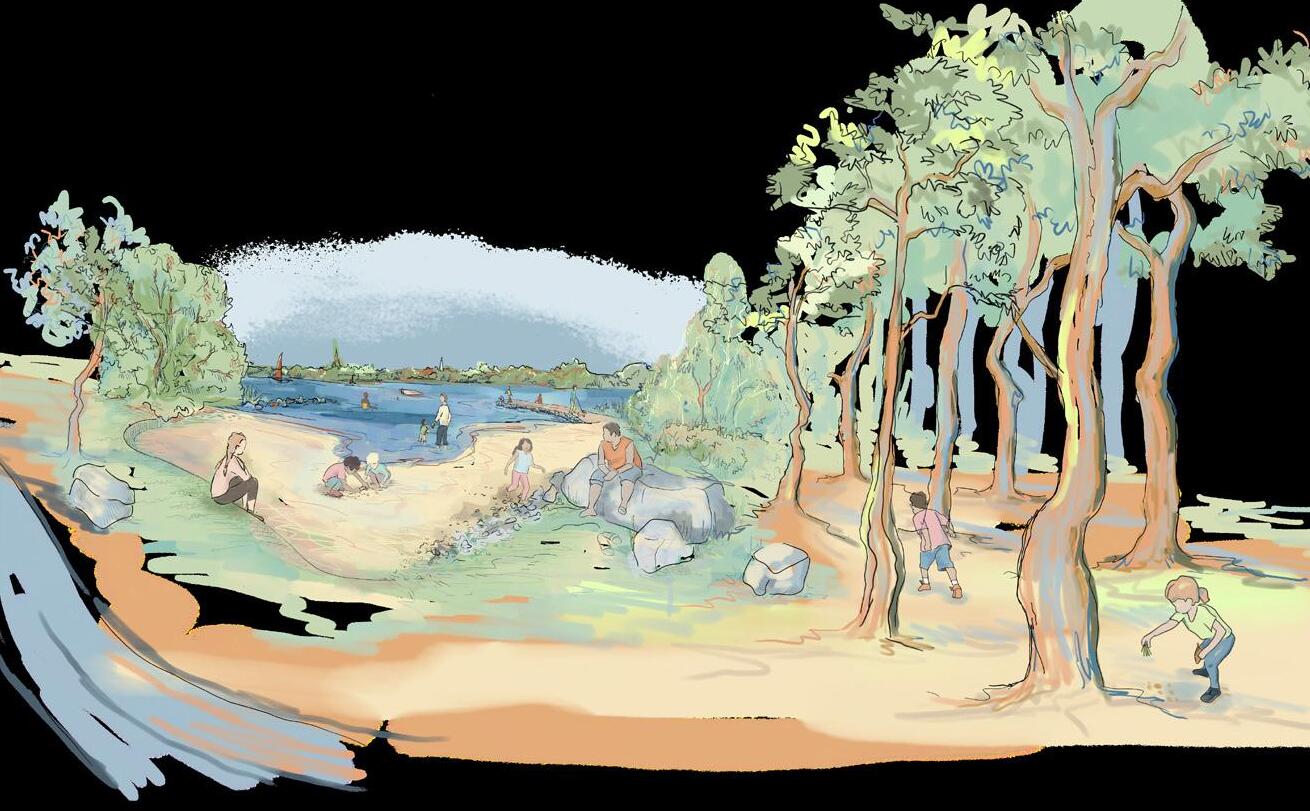
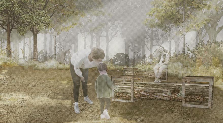
ABOVE: A pine picnic beach is one of several social areas.
OPPOSITE: 1. The Plane Plaza Above the Canopy Planting Plan: Planting is used to convert the grassland playing field to a ecological rich and socially buzzing environment. Different planting styles of Grid planting, naturalistic planting and Miyawaki planting are used to structure the space.
33 Rethinking the Urban Park | Tara Schwarze-Chintapatla
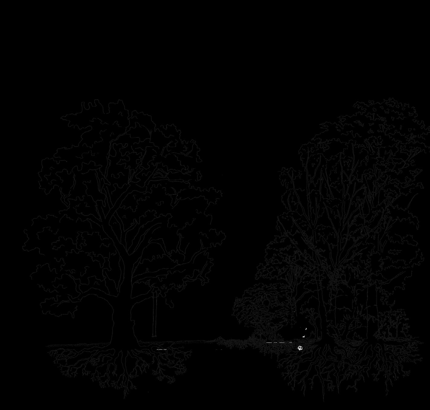


Shrubs and Perennials Sub-trees Trees Canopy trees Prunus spinosa Rosa canina Malus sylvestris Sambucas nigra Crataegus monogyn Sorbus aucuparia Fagus sylvalica Betula pendula Quercus robur Ground 0m 5m 10m 15m 20m 25m 30m -5m Root and mzcorrhizal network
TOP: Miyawaki Planting Layers.
ABOVE: The goat community orchard.
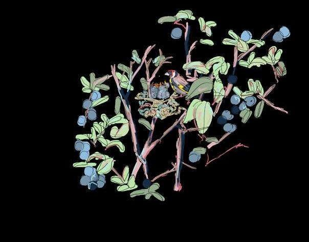
OPPOSITE TOP: Goldfinch diagram.
OPPOSITE BOTTOM: The plane tree plaza.
Naturalistic planting zone allows people to observe birds like the goldfinches and interact with nature.
Down i t swoops ,th rougholdcrooked oaks into dense miyawaki planting .
Highinthe treetops t he goldfnch feeds of the plane tree fruit . .
iM
hu
habitat good
Miyawakiplanting provides a
man free
for nesting
Scale 1:1000 Scale 1:1000 Scale 1:1000 35 Rethinking
Park
Tara Schwarze-Chintapatla
the Urban
|
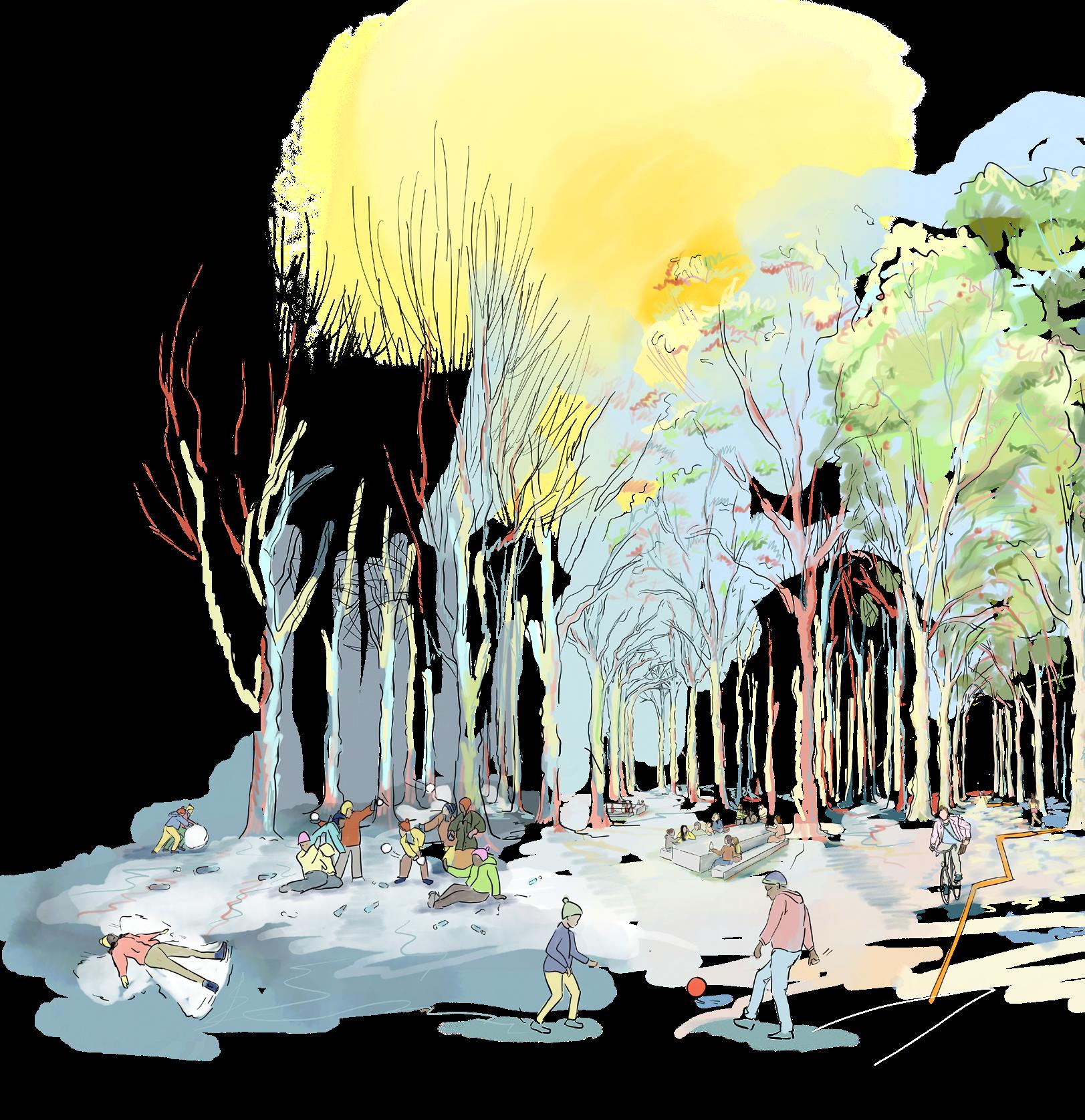
PARK PHASES
Playing fields are used inconsistently and lack climate resilience.
The landscape has remained as maintained grassland for the last ~100 years. The drought and biodiversity crisis is calling for change.
Improved awareness of the park as a local asset through workshops increases use of park. Improved connection between existing hubs through the park makes it easier to exhibit proenvironmental behaviours such as cycling.
Designed forest spaces combined with workshops highlight the forest as a social play space.
 TOP: Miyawaki Planting Layers.
IMPROVED AWARENESS IMPROVED CONNECTION PLAY REIMAGINED
BOTTOM: Design and Community Action Implementation Phases.
EXISTING CONDITIONS
Space is designated to more-than-human species and ecology corridors are strengthened.
Over time vegetation matures and the communities’ acceptance of the urban forest increases. This protects and further expands the urban forest. 100
The park keeps expanding and growing as the acceptance and benefits of the urban forest increase.
Hence the design has no end point.
Over time vegetation matures and the communities’ acceptance of the urban forest increases. This protects and further expands the urban forest.

The park keeps expanding and growing as the acceptance and benefits of the urban forest increase.
Hence the design has no end point.
37 Rethinking the Urban Park | Tara Schwarze-Chintapatla GROWTH PERIOD
100 YEARS
SPACE DISTRIBUTION AND EQUALISATION GROWTH PERIOD
YEARS
West Hendon Urban Park
AND CAPITAL TRAILS
Fengyu (Mulder) Sun
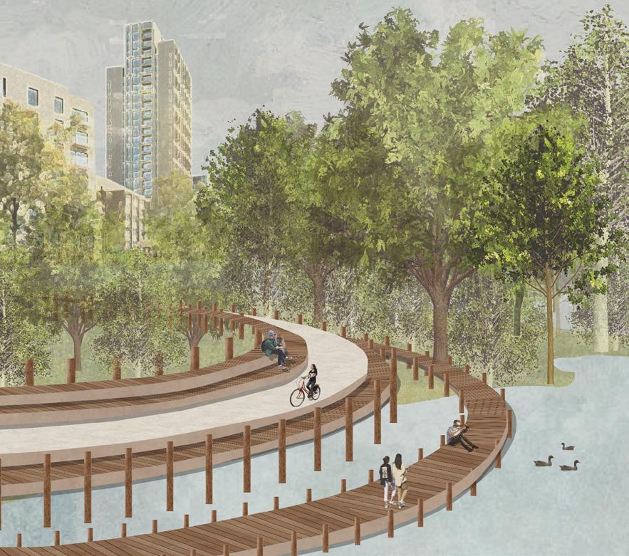
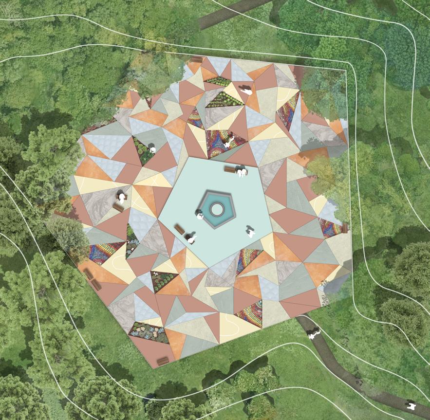
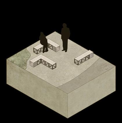
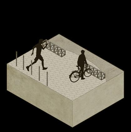
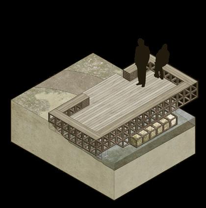
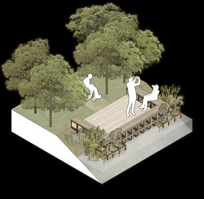
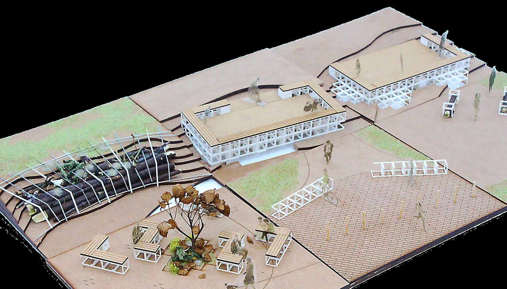
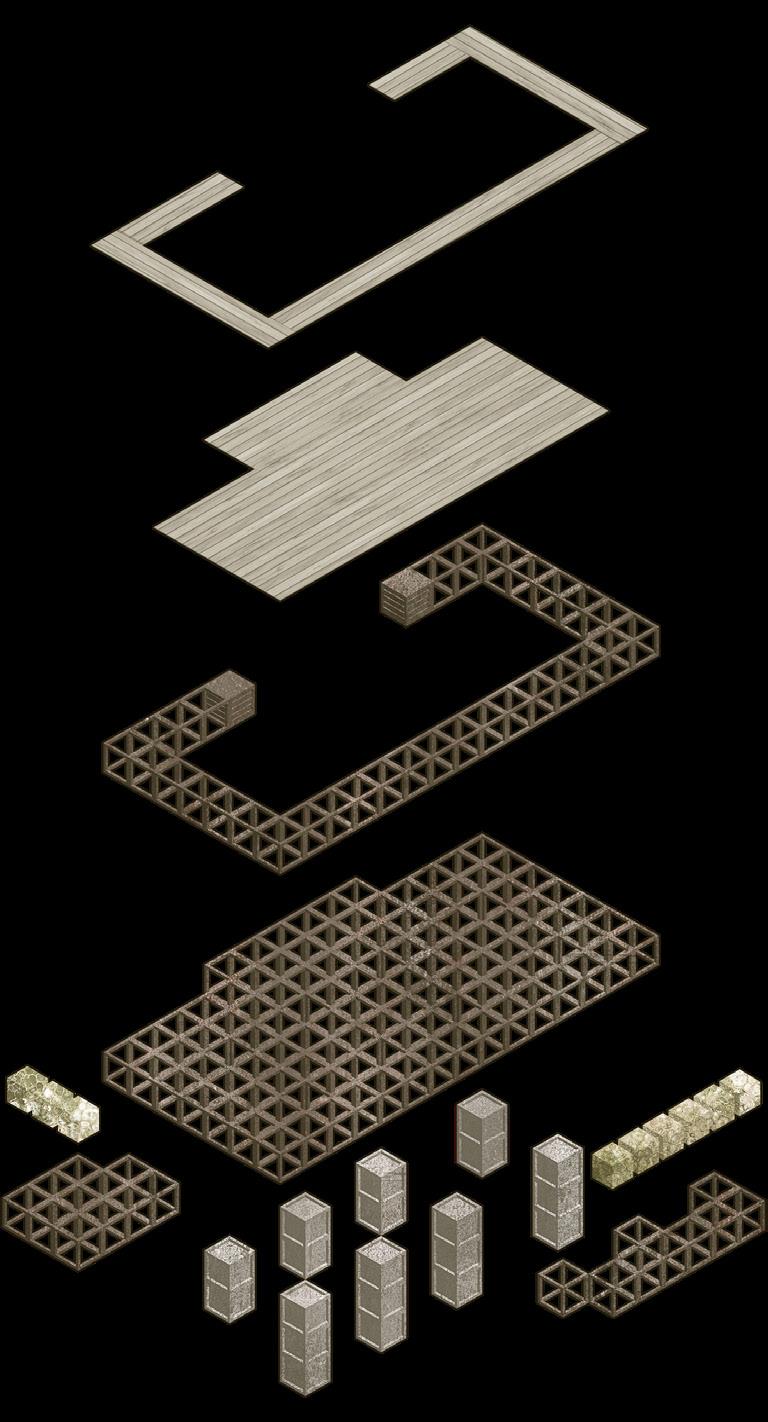
Project West Hendon Urban Park aims to introduce a series of interventions to combine the existing playing fields, sports fields, and open spaces into an adaptive, flexible landscape network. In the design concept, the trajectories of users and environment in spatial and temporal scales are defined as flows, and the design should focus on regulating the flows for better passing ability and sustainability. In order to regulate the flow with immediate and low-cost response, unified and simple structures called universal landscape units are introduced to form configurations that build up the physical interventions such as benches, viewing decks, modular walls, and artificial topography. The universal landscape unit design is inspired by temporary landscape practices, in which furniture is made to be modular and can be re-configurated to adapt to the environment. This not only grants the design the ability to change as the environment fluctuates but also give the community members the opportunity to take part in shaping the landscape to fit the residents’ daily uses.
Other interventions based on planning include route plan according to desire lines and contours, managing the distribution of functional spaces within the park for better orientation, and prioritizing pedestrian travel in and outside the park. In order for the urban nature to sustain itself in the upcoming future of rapid climate change, it is crucial for landscape design to consider flexibility and openness in planning.
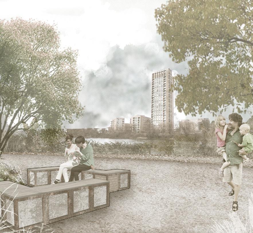 ABOVE: An open space on the waterfront, planned as a rest stop and social space for visitors.
OPPOSITE: West Hendon Park Master Plan with Capital Trails.
ABOVE: An open space on the waterfront, planned as a rest stop and social space for visitors.
OPPOSITE: West Hendon Park Master Plan with Capital Trails.
39 Rethinking the Urban Park | Fengyu (Mulder) Sun
 CANOPY CLEARINGS
GARDEN CAFE AND LEISURE CENTRE
SPORTS FIELD
ULU BENCHES
UNIVERSAL LANDSCAPE UNITS PARK ACTIVITES
ULU FUNGI BENCH
HABITAT SHELTER
BOATING PIER TRAILS
ULU BIKE RACKS
ULU ORGANIC FILLER
HILL + VALLEY PLAY SPACE
SOCIALISATION SPACE
VIEWING DECK
ULU DECK
ULU REINFORCER
CANOPY CLEARINGS
GARDEN CAFE AND LEISURE CENTRE
SPORTS FIELD
ULU BENCHES
UNIVERSAL LANDSCAPE UNITS PARK ACTIVITES
ULU FUNGI BENCH
HABITAT SHELTER
BOATING PIER TRAILS
ULU BIKE RACKS
ULU ORGANIC FILLER
HILL + VALLEY PLAY SPACE
SOCIALISATION SPACE
VIEWING DECK
ULU DECK
ULU REINFORCER
41 Rethinking the Urban Park | Fengyu (Mulder) Sun
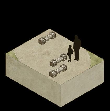
TOP: An exploded image showing the structure of an ULU (Universal Landscape Unit) deck.
BOTTOM: The interventions implemented in the Capital Trails area in scale.
LEFT TOP TO BOTTOM:
1) Fungi benches are placed in the woodland clearings, upon which mushrooms would root and develop on the downed trunk fixed in between two frame ULUs (Universal Landscape Units).
2) Formal trails indicate the main connecting route and trails along the waterfront.
3) Secondary informal trails come through the woods, offering visitor adventurous experience.
4) User flow volume changes over the course of a day between humans and more-than-humans.
OPPOSITE: Plan of Capital Trails.
43 Rethinking the Urban Park | Fengyu (Mulder) Sun
STUDIO BRIEF
Anna Rhodes
MÒINE
Lingqi Ding
EXTINCTION WARNING
Tingting Hu
THE RETURN OF INDIGENOUS SPECIES
Jessica Tsz Wun Ling
TAYPORT
Yuxi Peng
NUCLEAR LEGACIES
Tilly Rigby
CULTIVATING WETNESS
Zhang Wang
CASKS COMMUNITY
Qisen Wen
HIGHLAND BOUNDARY
of
Architecture
Anna Rhodes 46 54 60 66 72 78 86 92
THE
FAULT Master
Landscape
(MLA)
Critical Zones
45 Critical
|
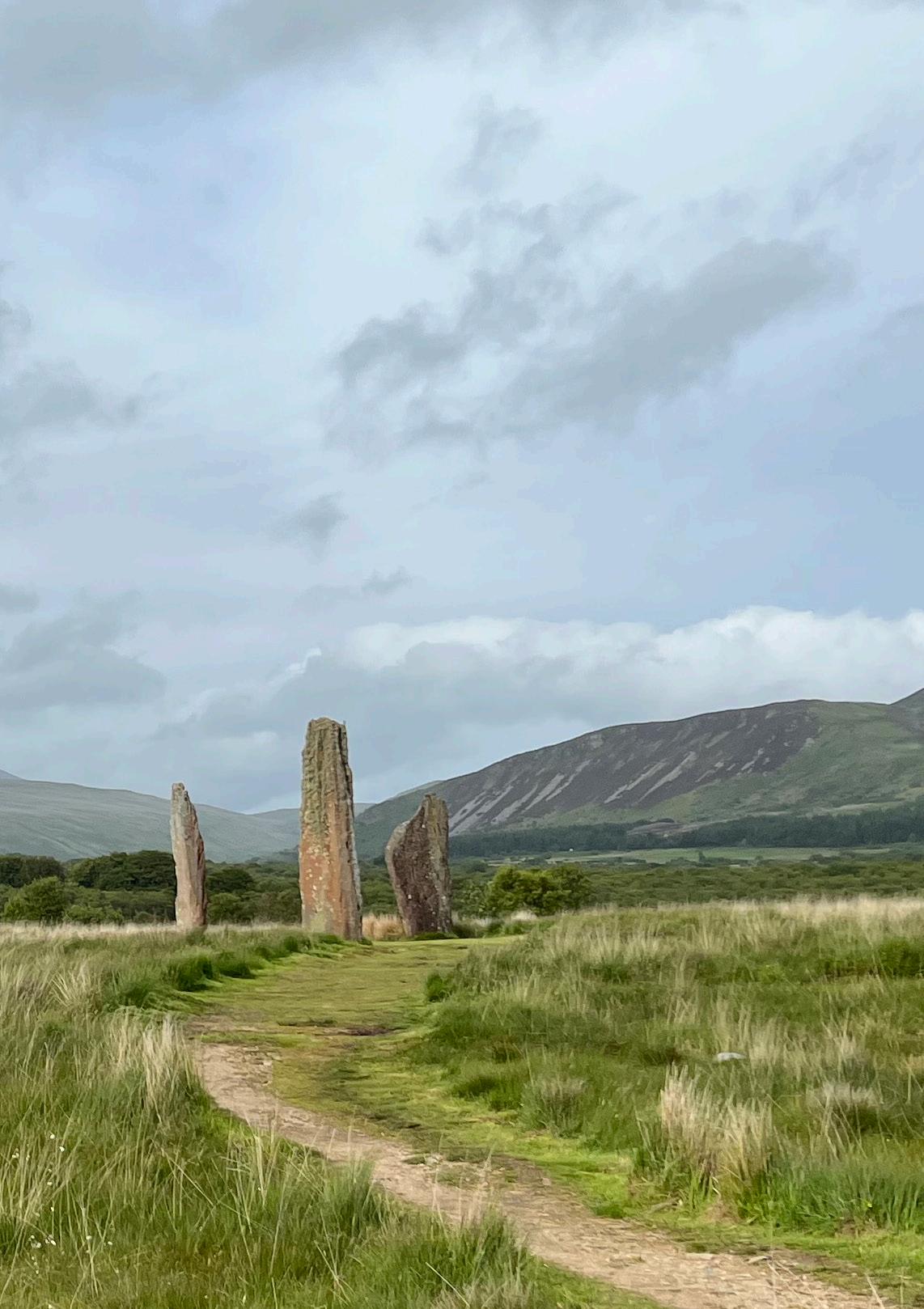
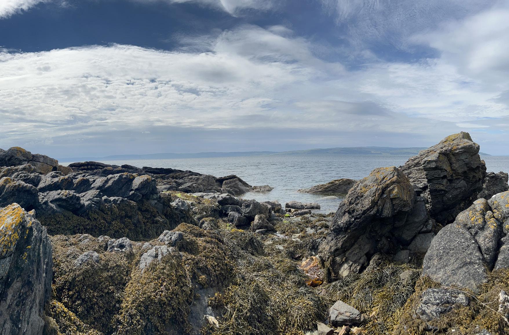
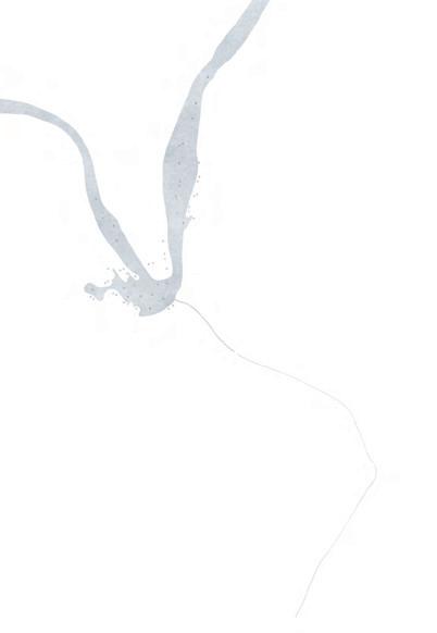
OPPOSITE: A photo of the Machrie Moor Standing Stoneson the Isle of Arran. (Photo: Anna Rhodes)
Zones
Anna Rhodes
Critical Zones
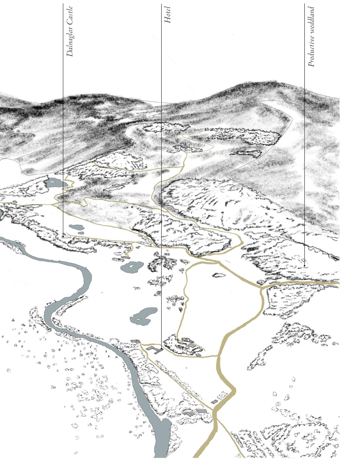
THE HIGHLAND BOUNDARY FAULT
Anna Rhodes with Anna Reid and John Darbyshire
Formation of a Fault:
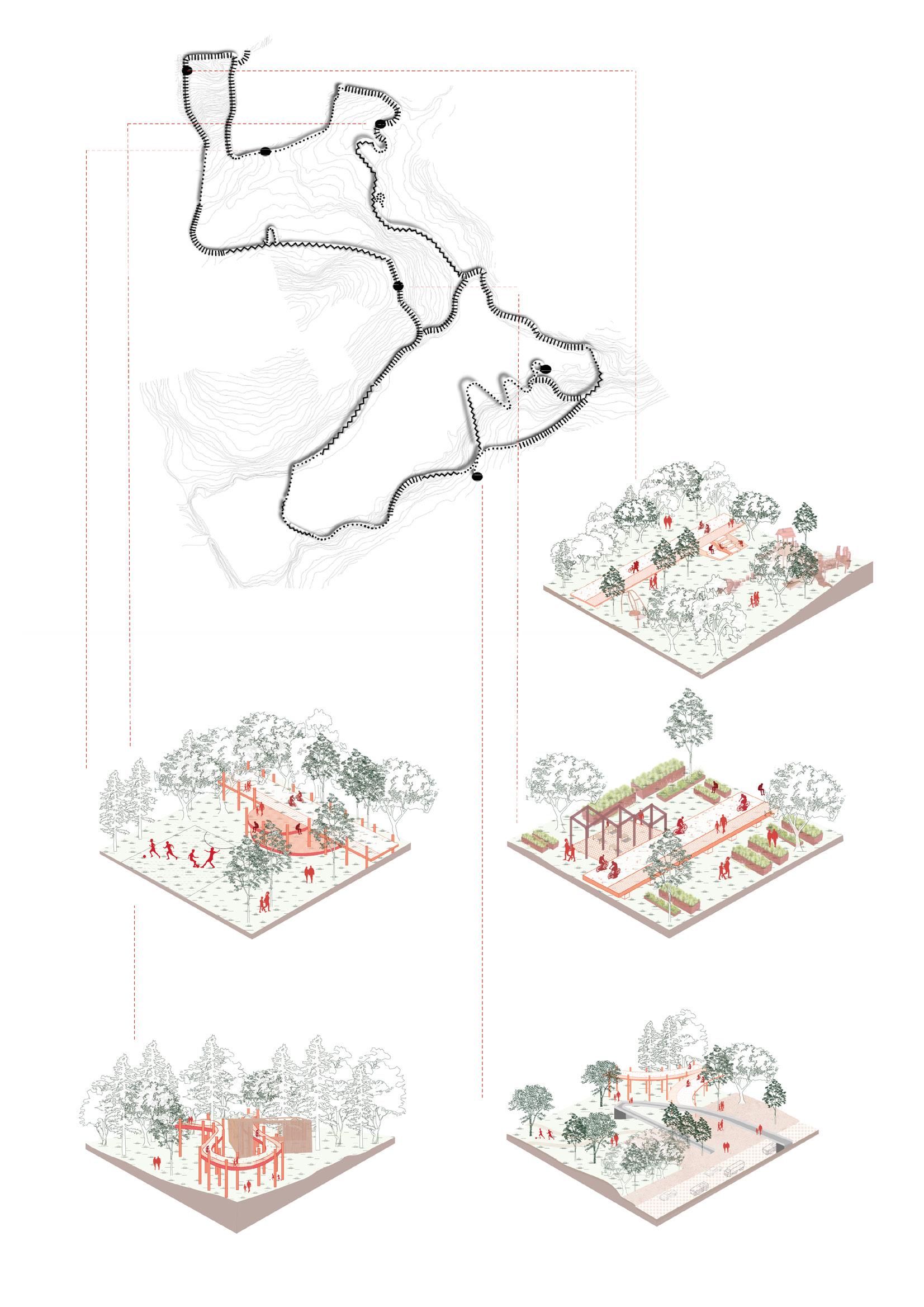
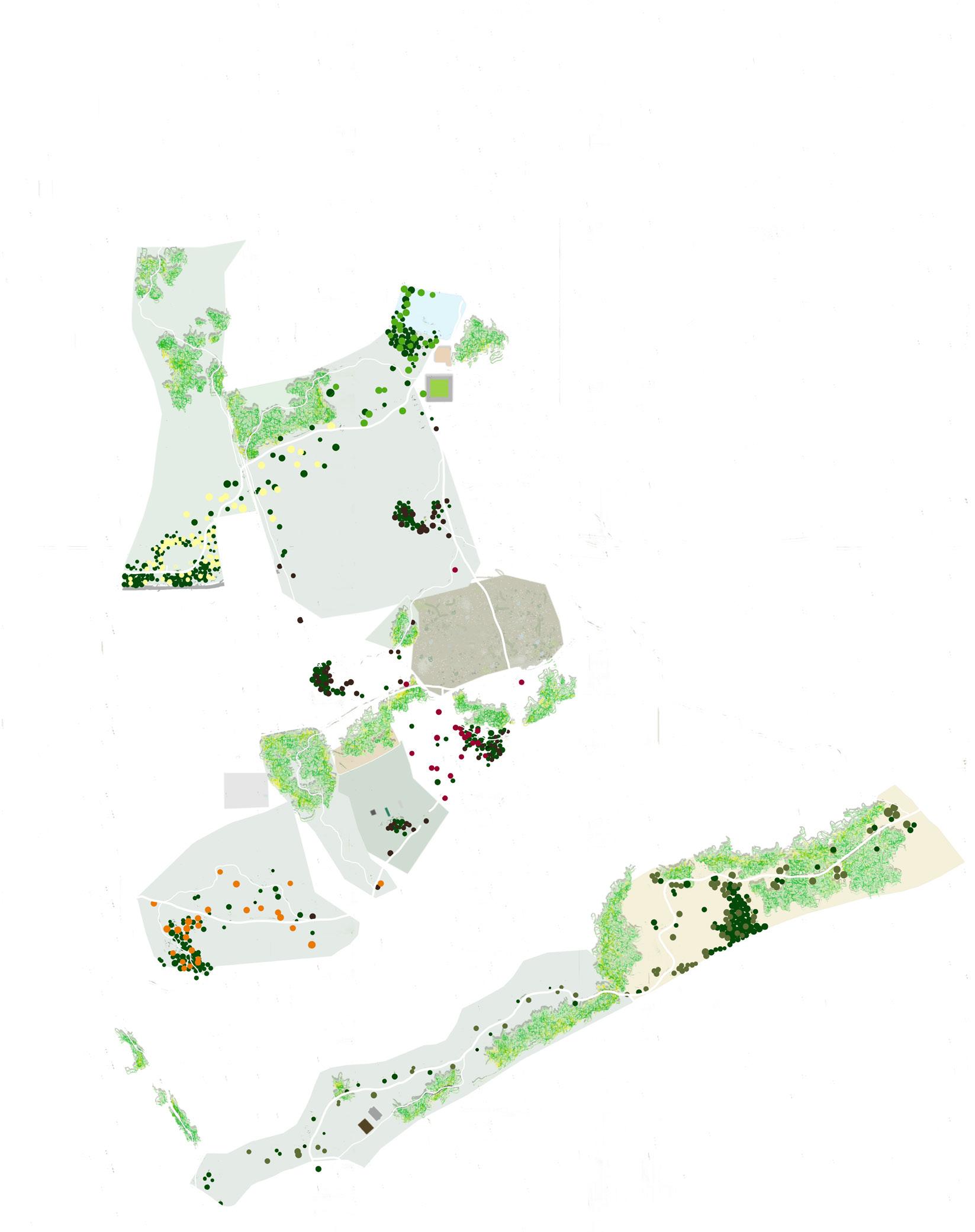
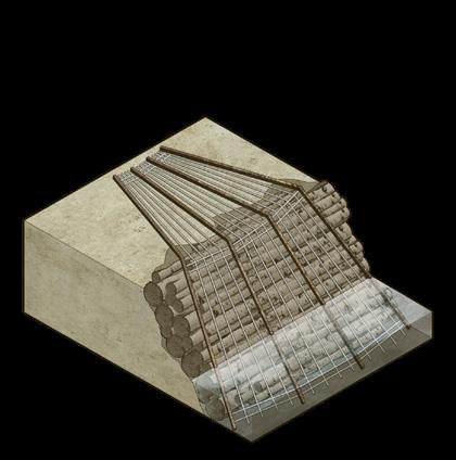
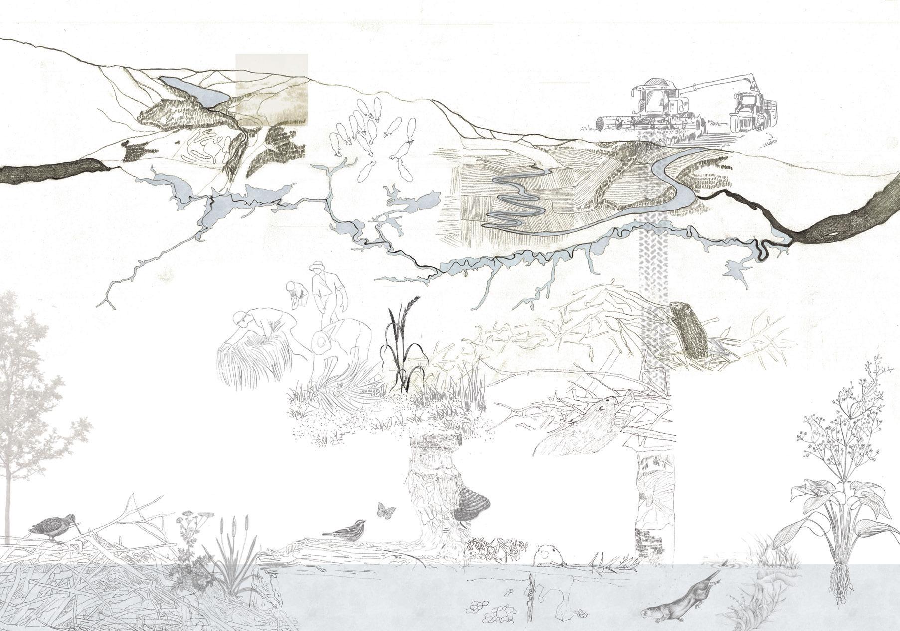
This studio’s journey begins 450-400 million years ago with the formation of a geological fault, which today separates two distinct regions: the Highlands and the Lowlands or more specifically the Grampian/ Southern Highland terrane and the Midland Valley terrane. The Highland Boundary Fault stretches across Scotland from the Isle of Arran on the west coast to Stonehaven on the east coast. Today the line of the fault is mostly concealed below the ground surface, though it is well exposed at two points: Conic Hill, Balmaha and Garron Point just north of Stonehaven.
To appreciate the formation of the Highland Boundary Fault the studio investigated the influence of Scotland’s geomorphic processes from colliding continents, erupting volcanoes, vast moving and melting ice sheets to human settlement and activities. The complex processes involved took place over millions of years.
‘The strata of the Earth is a jumbled museum… In order to read the rocks we must become conscious of geologic time, and of the layers of prehistoric material that is entombed in the Earth’s crust.’
– Robert Smithson
1
47
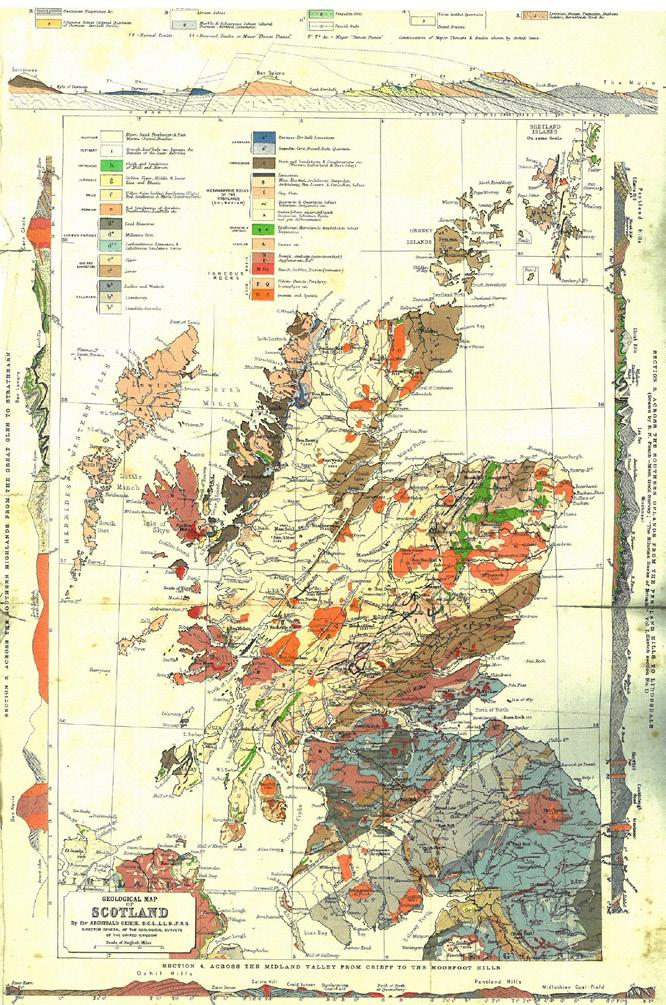
ABOVE: The Edinburgh Geographical Institute. Geological Map of Scotland. (Photo: Christopher Dingwall)
The Highland Boundary Fault zone is a geological tapestry; its geodiversity has had a profound influence on our history, economies, culture and settlement patterns and has determined the life and diversity of more-than-human habitats.
Landscapes that are facing social and environmental pressures located within the Highland Boundary Fault zone inform bold design speculations on how future landscapes can mitigate the problems we are currently facing and are yet to face within the geological era of the Anthropocene and in this time of Climate Emergency.
Critical Zones:
The way we view our planet is being challenged, rather than an outside view of the earth from space, ‘INSIDE’ a lecture performance by the late French social scientist and philosopher Bruno Latour, discusses our position and habitat from inside the ‘critical zone’.2 The ‘critical zone’, is described by Latour, as a thin superficial film of the earth where water, soil, subsoil and the living world interact. It is a tapestry of traces left by the animated beings, and activities of living forms.3
The studio collective made interdimensional readings from within the Highland Boundary Fault zone taking into account social and environmental fractures and points of tension and upheaval, to define their own zones in need of critical attention, care and action. Going beyond simple surfaces to engage deeply with cultural and ecological communities, students worked to represent a complex mesh of beings, materials animate and inanimate and associated processes. The studio adopted Latour’s and his collaborators’ provocation, that working from this perspective is necessary to evolve ourselves to recognise that we are ‘living among the living’.
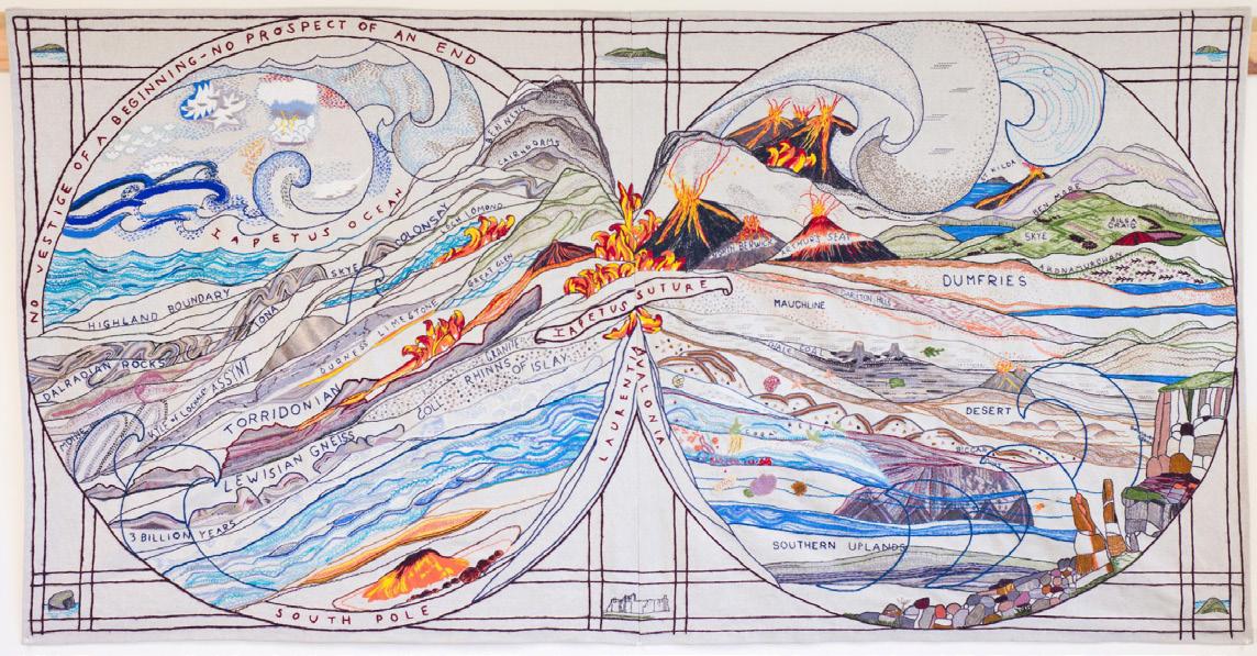
ABOVE: The Great Tapestry of Scotland: The Collision Panel. Stitched by North Berwick Creative Enbroidery Group.
OPPOSITE TOP: EMiLA Performance Drawing. Finding Fault Exercise, materials closeup (Photo: Anna Rhodes, 2022)
OPPOSITE BOTTOM: EMiLA Performance Drawing. Finding Fault Exercise. (Photo: Anna Rhodes, 2022)
49 Critical Zones |
Anna Rhodes
Shifting perspectives to within a tapestry of traces:
‘The more clearly we can focus our attention on the wonders and realities of the universe around us, the less taste we shall have for destruction.’
– Rachel Carson 4
To shift our perspective of the planet we need to build a new relationship with it. A reorientation is necessary to avoid top-down thinking especially when it comes to our relationship with other animated beings that exist alongside us and to matter and processes that will transcend our lifetimes.
The studio took a step away from traditional cartographic practices of mapping to avoid top-down perspectives of understanding the landscape often associated with colonisation, ownership and boundaries. Instead, reflecting critically on proximity, the studio approach was to continuously shift between time spans and scales. At the macro scale, we sought to understand and translate ancient geological processes and their influence on today’s topography, watercourse, ecology networks, human habitation and systems. At the micro-scale, we observed and attempted to capture the habits, interdependencies and processes of micro ecologies. Through this constant recalibration of scales and focus, we set out to understand and test through speculative design the potential for landscapes that support life in the thick present.5
A focused field study of the Isle of Arran as ‘Scotland in Miniature’, a microcosm to the mainland allowed
the Critical Zones studio to engage with its geology, landscape typologies, species and cultural heritage to help inform how to make it possible for interspecies relationships, social and environmental processes and life generally to thrive at the macro scale.
 ABOVE: Lochranza Point geology walk with ‘Critical Zones’ students. (Photo: Anna Rhodes, 2022)
OPPOSITE: Lochranza desert on the Isle of Aran. (Photo: Anna Rhodes, 2022)
ABOVE: Lochranza Point geology walk with ‘Critical Zones’ students. (Photo: Anna Rhodes, 2022)
OPPOSITE: Lochranza desert on the Isle of Aran. (Photo: Anna Rhodes, 2022)
51 Critical Zones | Anna Rhodes
ABOVE: Hutton’s uncomformity on the Isle of Aran. (Photo: Anna Rhodes, 2022)
CITATIONS:
1 Smithson, R. (1968) Extracts from A Sedimentation of the Mind Earth Projects in Lange-Berndt, P. ed. Documents of Contemporary Art: Materiality. London: Whitechapel Gallery, p152
2 SOC Société d’Objets Cartographiques (2018) Available: http://s-o-c.fr/index.php/2018/02/20/inside-2/
3 Ibid.
4 Carson, R. (2000). Silent Spring, London: Penguin Classics
5 Haraway, D. (2016) Staying with the Trouble: Making Kin in the Chthulucene. Durham, North Carolina: Duke University Press.
53
Critical Zones | Anna Rhodes
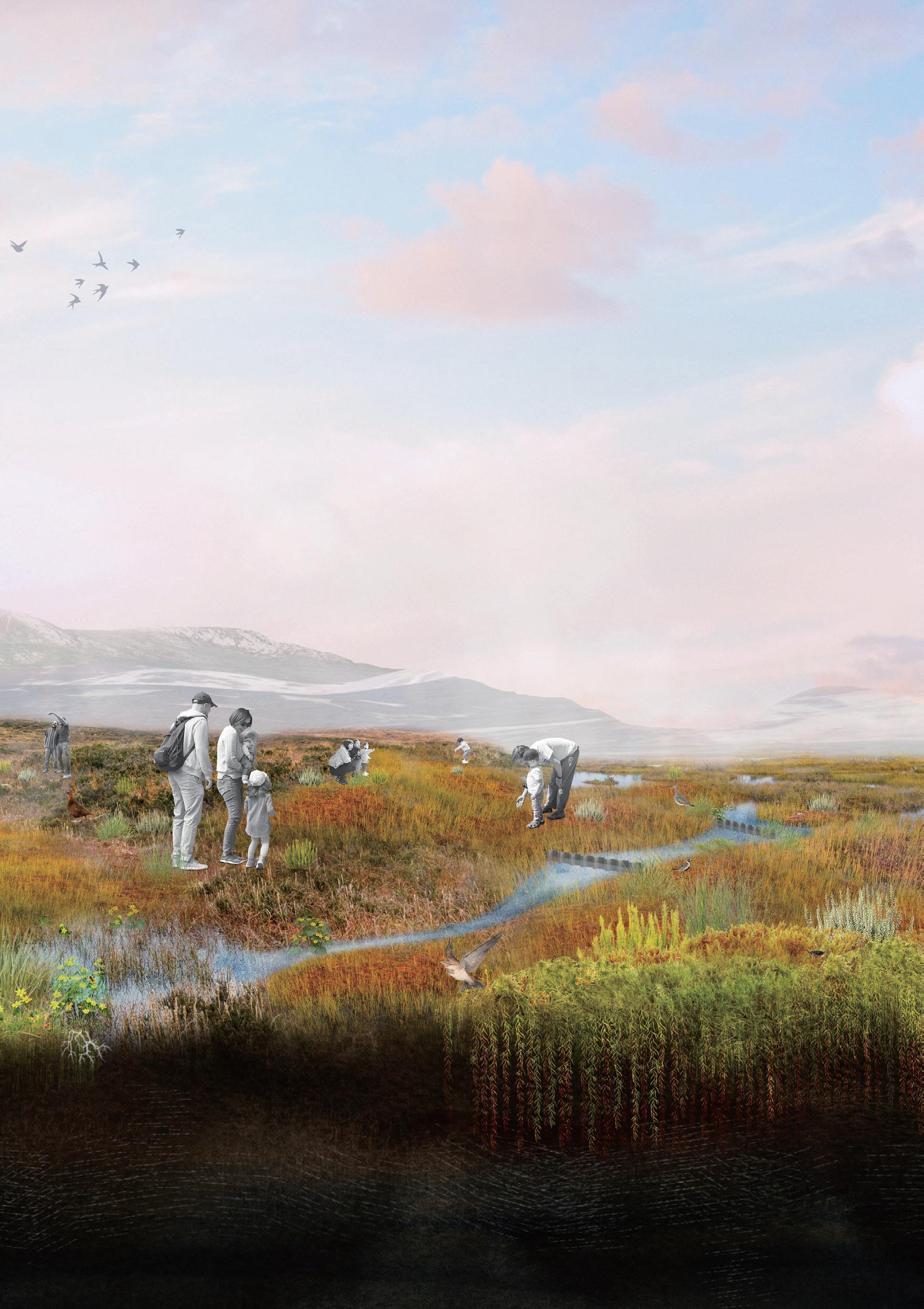
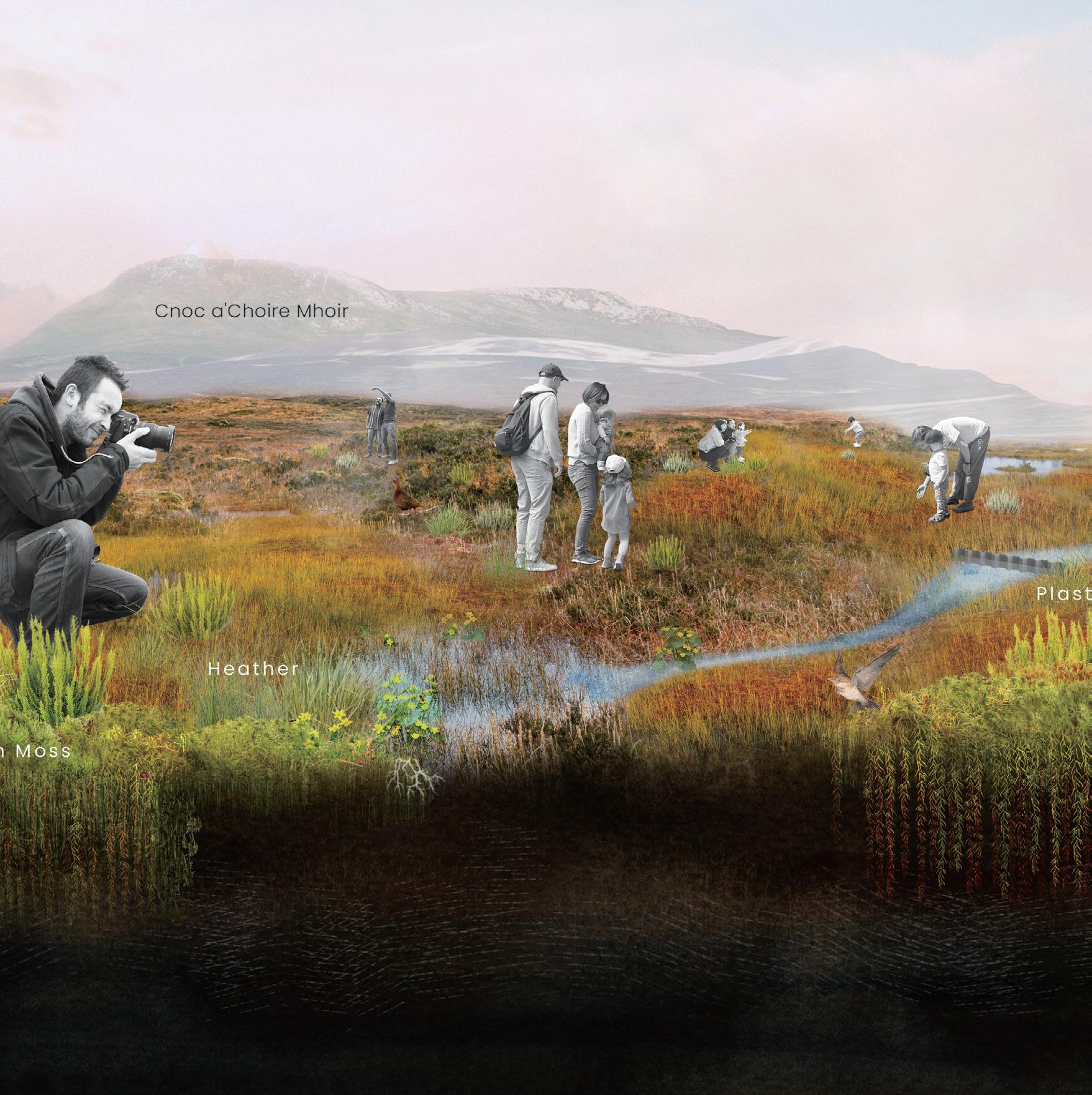
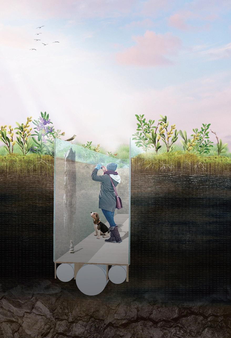
Mòine:
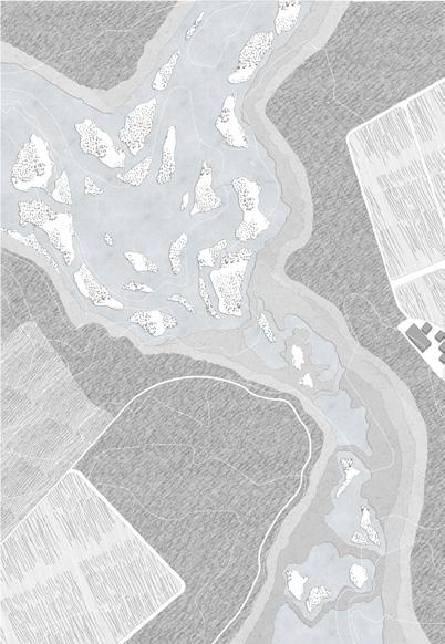
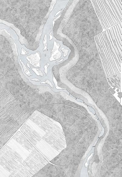
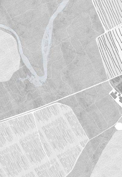
PEATLAND RESTORATION ON MACHRIE MOOR
Peatlands preserve both tangible and intangible cultural heritage as a dynamic and fragile landscape. However, for thousands of years, peatlands have been modified by humans for different reasons to the point of degradation, going from being a carbon sink to a carbon source.
This project explores the Machrie moor, a blanket bog located on the west coast of the Isle of Arran, which is a famous archaeological site for its 5,000-year-old stone circles, standing stones, and cairns. It both keeps physical cultural remains and past Gaelic stories in the peat however eroded for the farming, grazing and peat-cutting.
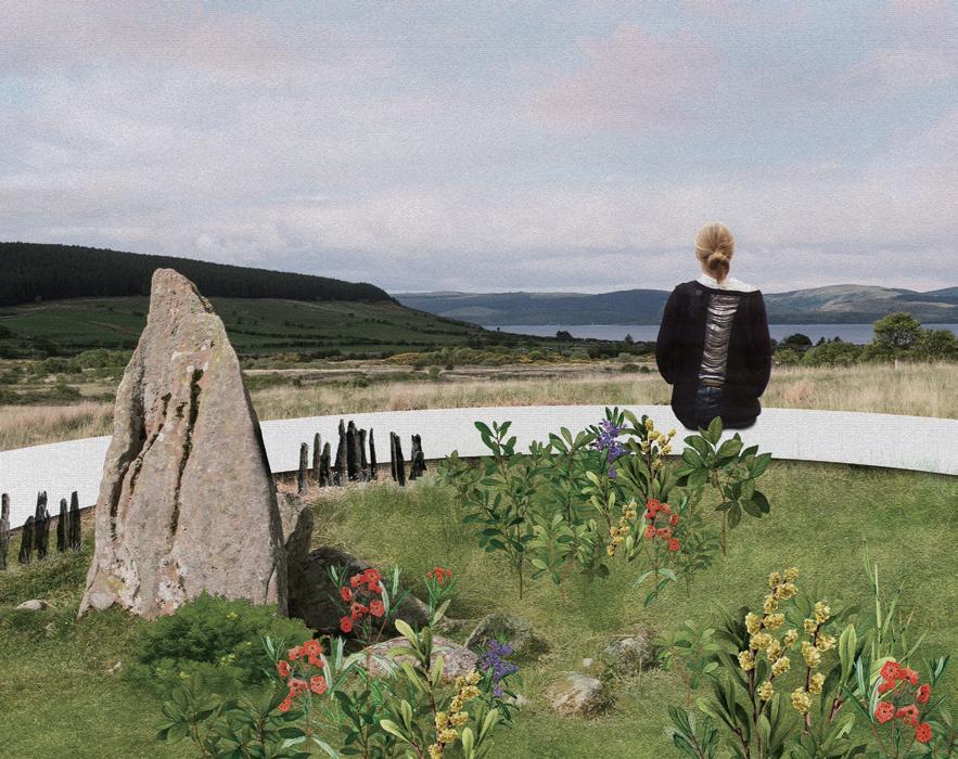
My project aims to reconstruct longterm human-peatland interactions and intervene in the peatland growth process. In doing so, it will influence people’s perceptions of the peatlands and their future management through policy while encouraging the peatlands’ natural expansion in the face of future land use conflict and the climate emergency.
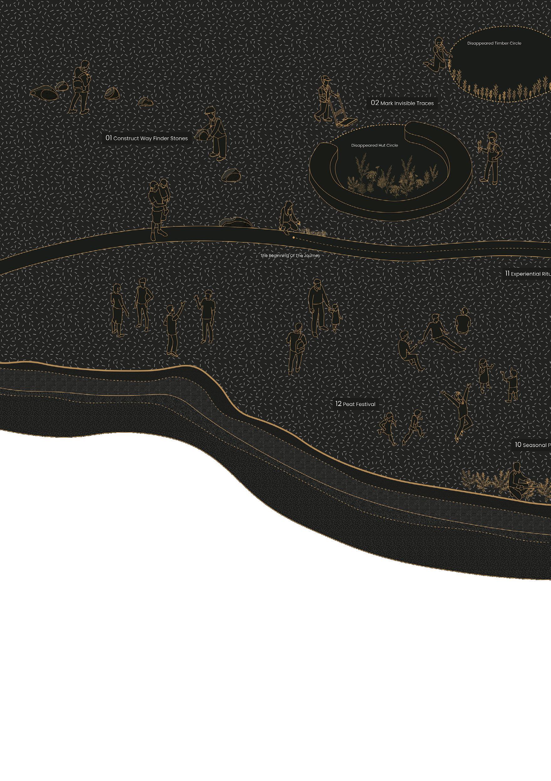
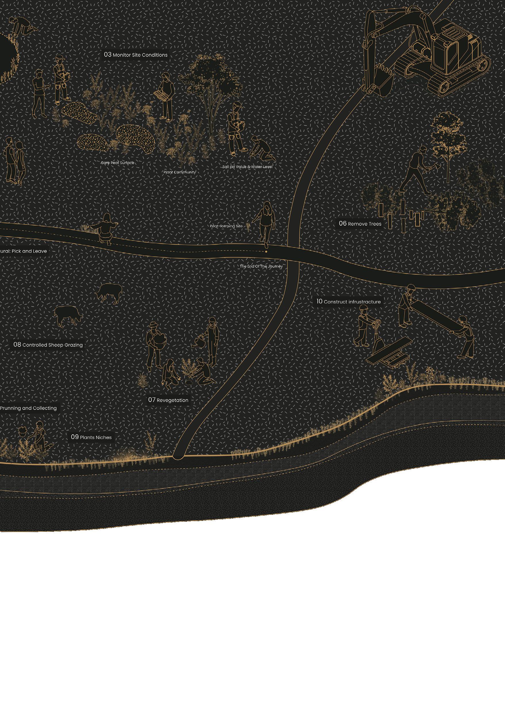
After exploring the unique ecological, historical and cultural role of Machrie Moor, there are three measures: recall, restore and rethink. Recall is about revealing history and culture. Restore is based on community collaboration to conserve degraded peatlands, and to promote self-regulation of peatlands through more-than-human beings. For the Rethink part, I conceive three scenarios of use: experiential, seasonal and peat festival. Through these three strategies, the project will build new intersections between people and peatlands and promote a more sustainable future.
Lingqi Ding
ABOVE: Marking invisible traces with white concrete to recall the disappeared hut circles.
OPPOSITE: A future scenario with a healthy peatland.
55 Critical Zones | Lingqi Ding
 ABOVE: A diagram illustrating the three key strategies.
BELOW: A section illustrating community-based restoration strategies.
ABOVE: A diagram illustrating the three key strategies.
BELOW: A section illustrating community-based restoration strategies.
57 Critical Zones | Lingqi Ding
59 Critical Zones | Lingqi Ding
CLOCKWISE FROM TOP LEFT:
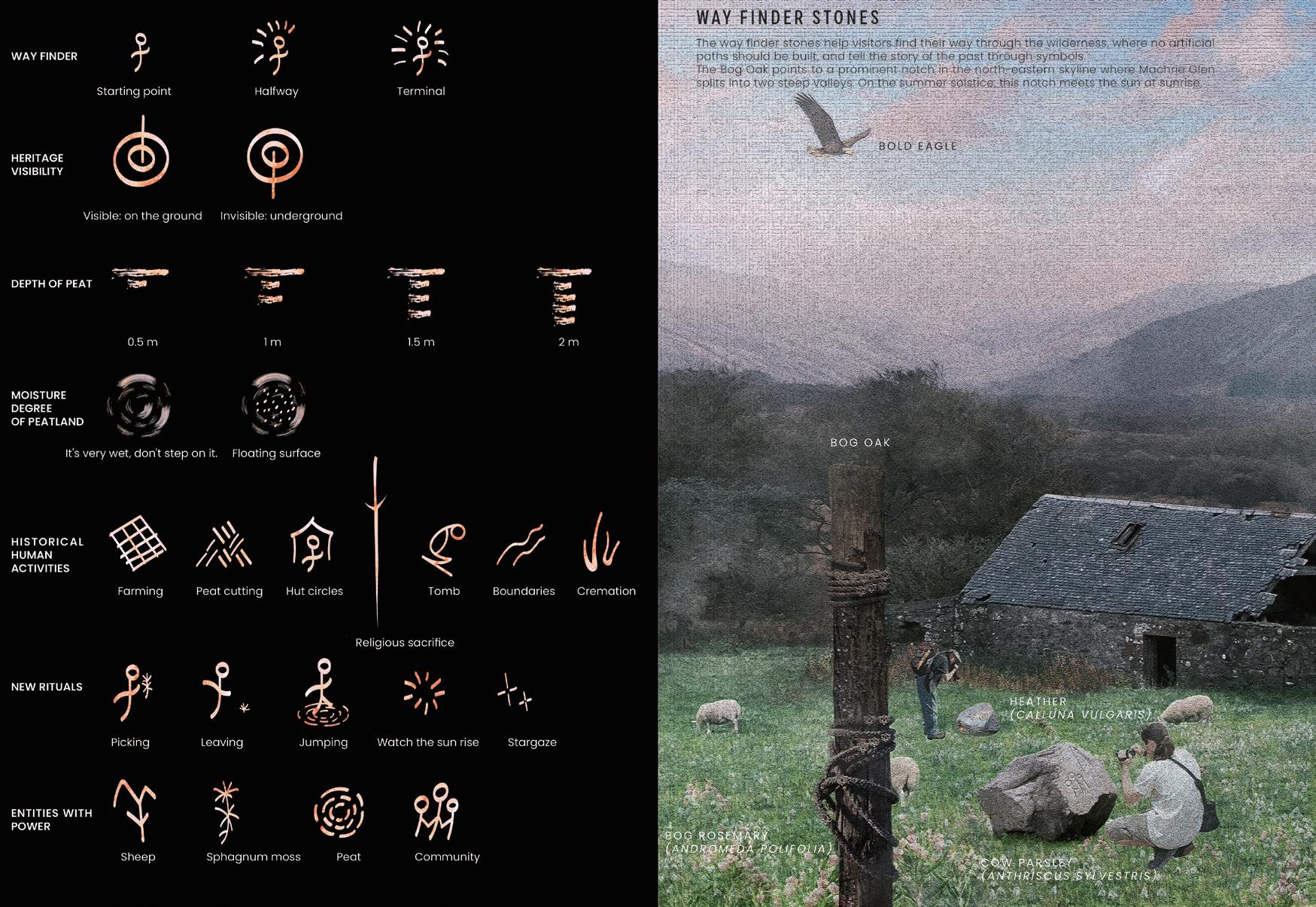
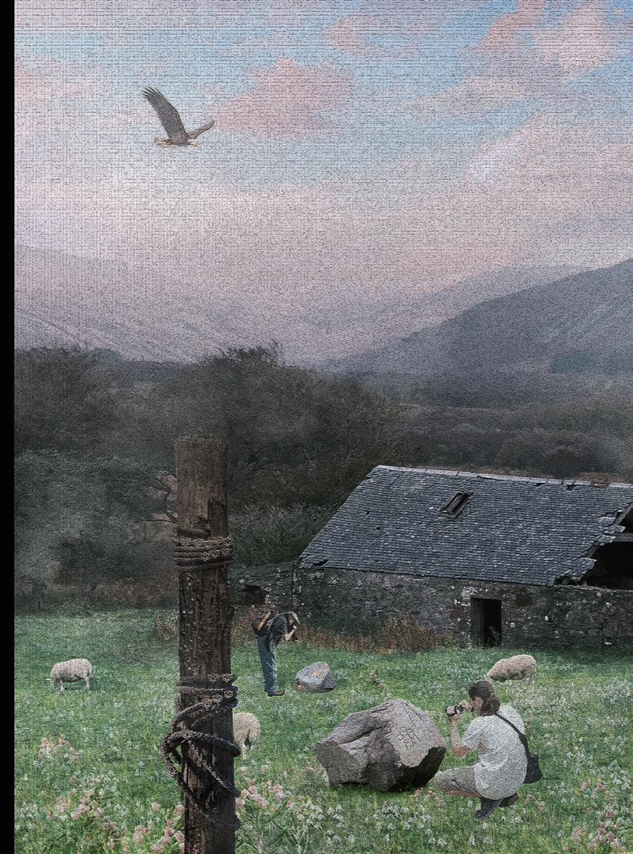
1) Wayfinder stones to link lost space and tell historical stories.
2) A rendering of wayfinder stones.
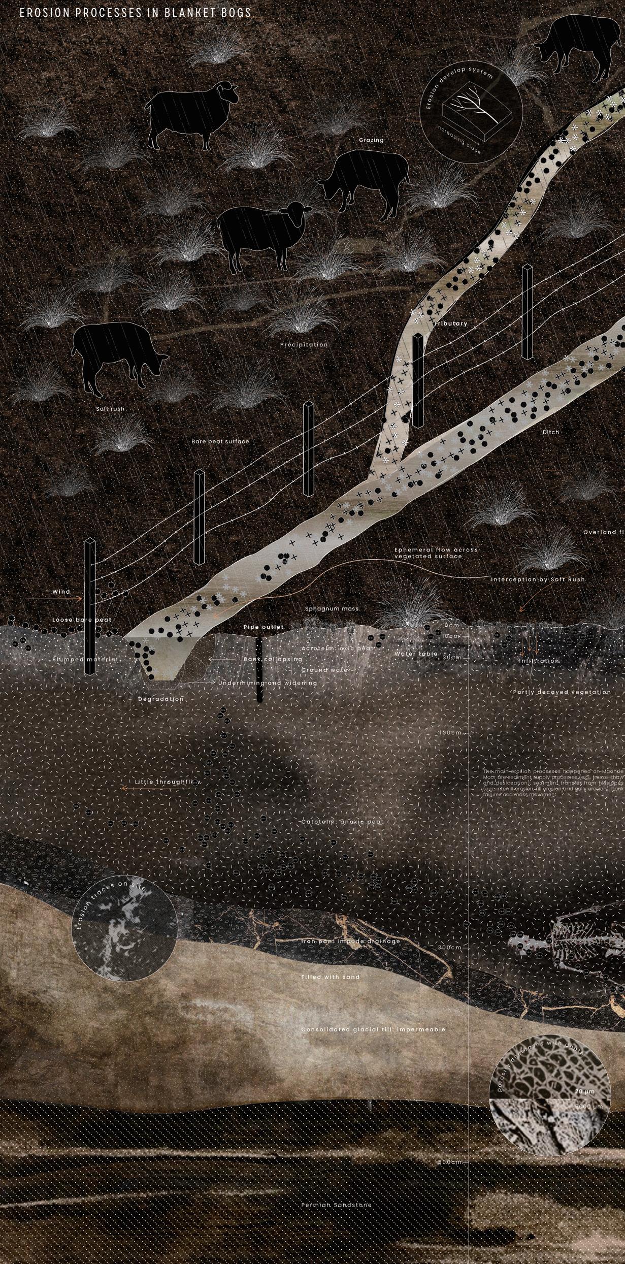
3) A section showing the erosion processes that shape the peatlands on Machrie Moor.
4) A temporary experiential installation constructed of timber.
5) A sunken gully as an experiential installation.
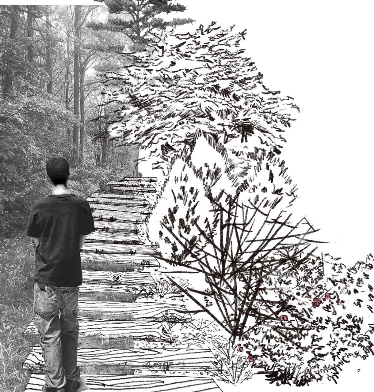
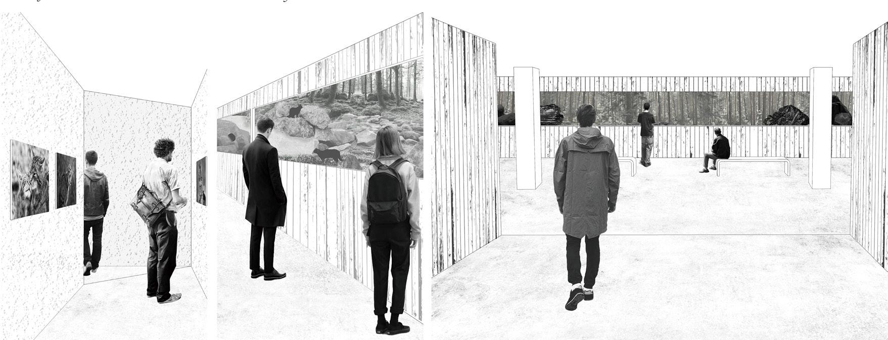
Extinction Warning
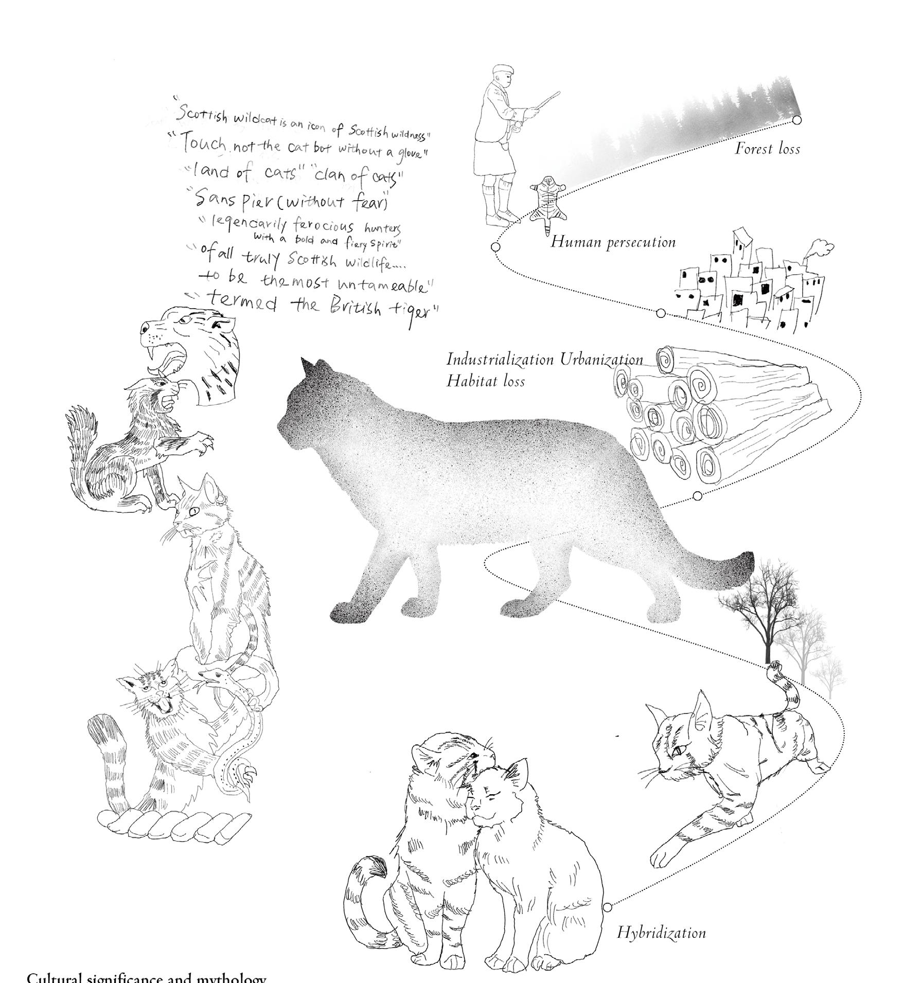
Tingting Hu
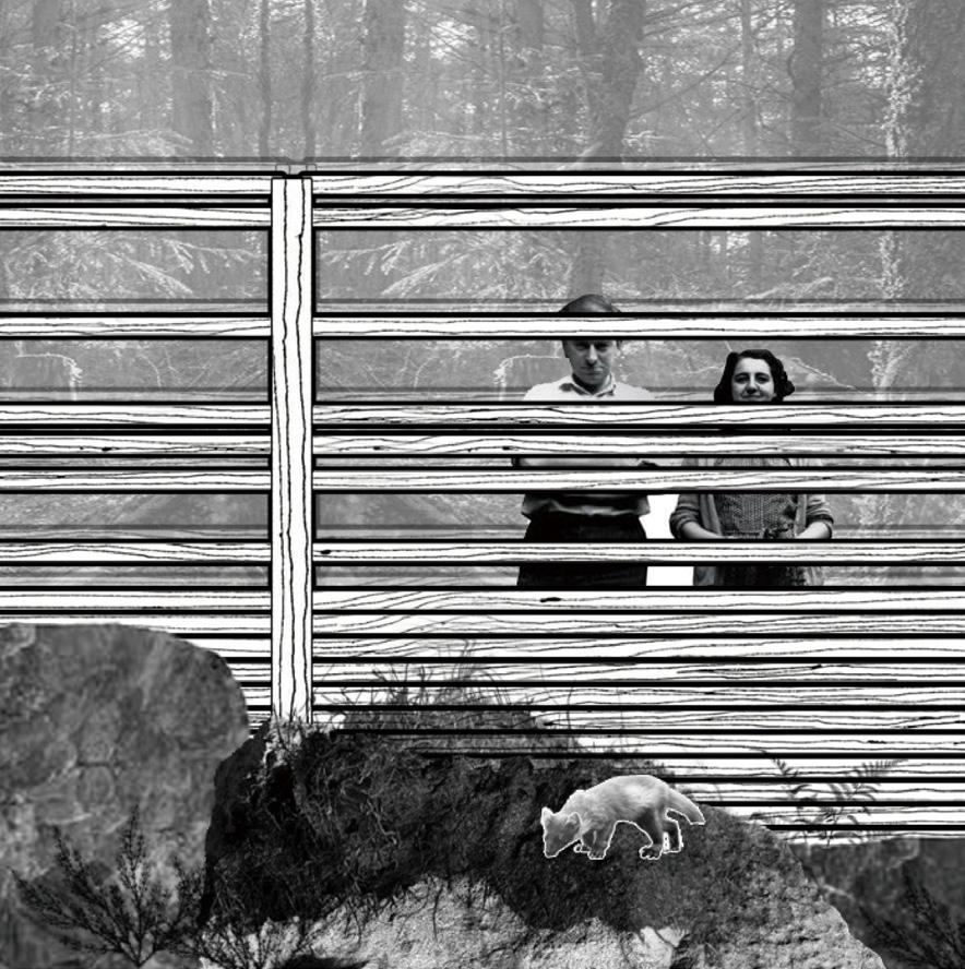
A report produced by the Scottish Wildcat (Felis silvestiris) Society concludes that there may only be about 40 wildcats left in the wild in Scotland today.1 which means an icon that symbolizes the wilderness in Scotland may well disappear from its shores. As a “ghost species”, due to various human activities, wildcats have functionally become extinct. Losing wildcats is not only a loss for Scotland but also a blow to the Scottish spirit, as “Scotland without any wild wildcats just wouldn’t be Scotland.”2
This design aims to take the extinction of wildcats as a powerful warning and bring them back to the Highlands from a more nonanthropocentric perspective. Wildcats use a wide range of habitat types in Scotland, which overlap with many other wildlife species, so saving wildcats can also bring opportunities for more species to thrive. This design delves deeply into the habitats and ecosystems that support their lives, connects wildcat culture with this land, and explores the ability of more-than-human factors to shape the landscape, all to bring wildcats back to Scotland!
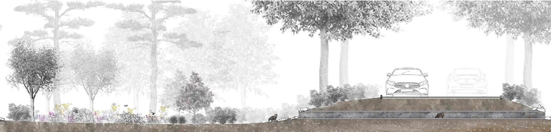
ABOVE: Coexistence boundaries-hidden walkway. A walkway that allows humans to hide in the animal world.
OPPOSITE: History of wildcats: Showcasing the history of the wildcat, how it became a cultural symbol and how it became close to extinction.
CITATIONS:
1 The Guardian, “Why the Scottish Wildcat Is Staring Extinction in the Face,” (Guardian News and Media, September 15, 2012), accessed May 3, 2023, https:// www.theguardian.com/environment/2012/sep/16/scottishwildcat-extinction.
2 National Geographic, “Amidst Hybridisation and Habitat Disruption, the ‘Highland Tiger’ Is Clinging on by a Claw.,” September 7, 2020, accessed May 3, 2023, https://www. nationalgeographic.co.uk/animals/2020/09/amidsthybridisation-and-habitat-disruption-the-highland-tiger-isclinging-on-by-a.
61 Critical Zones | Tingting Hu
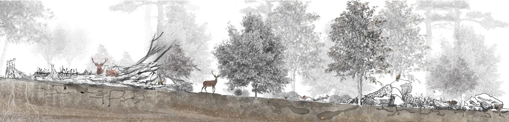
 RIGHT: Existing conditions diagram demonstrating the current conditions of the site.
BELOW: A section showing a wildlife multi-species haven after the revival of the woodland.
RIGHT: Existing conditions diagram demonstrating the current conditions of the site.
BELOW: A section showing a wildlife multi-species haven after the revival of the woodland.
63 Critical Zones | Tingting Hu
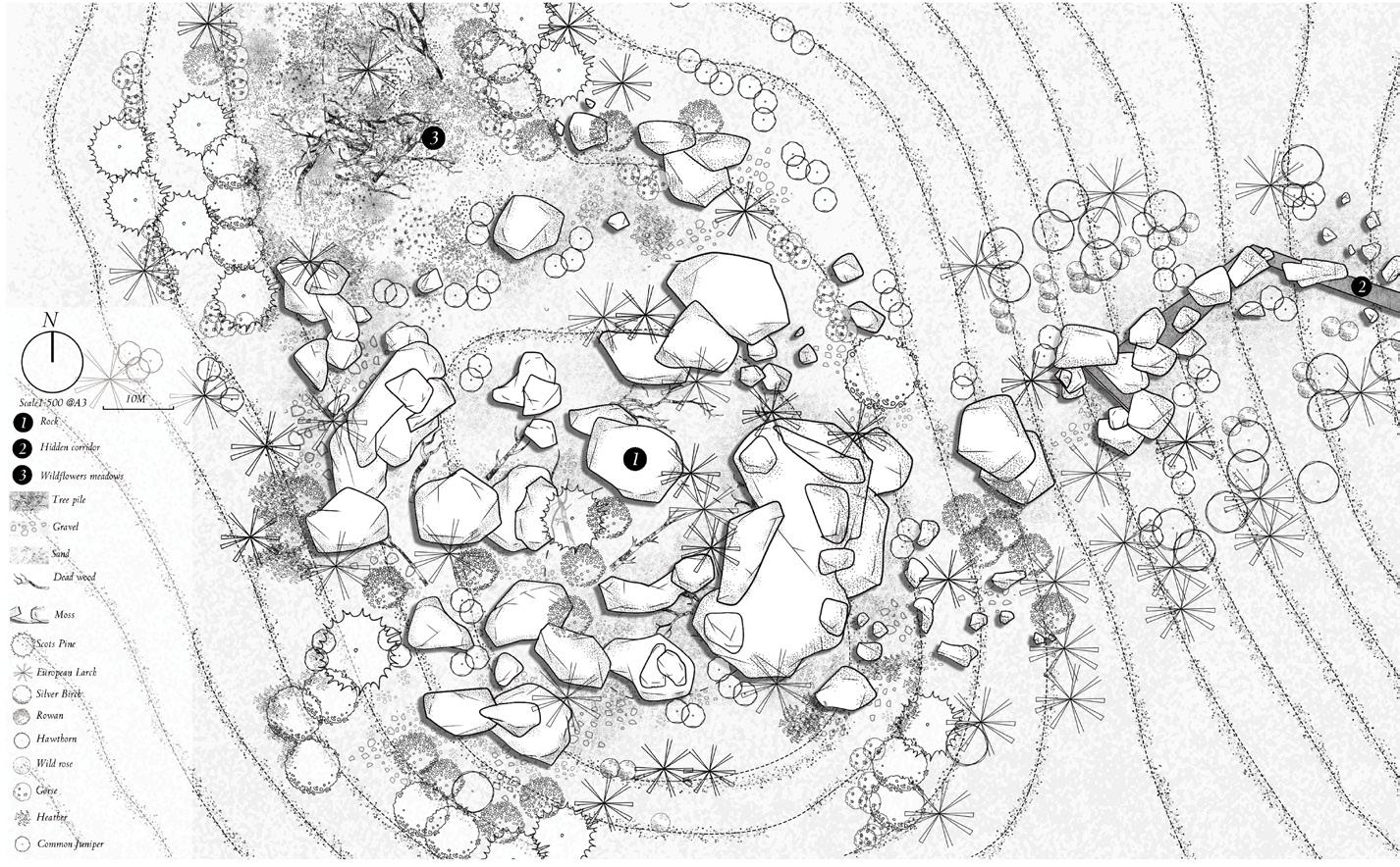
RIGHT/BELOW: Coexistence boundaries-hidden walkway: Limiting human access to wildcat spaces with plant barriers
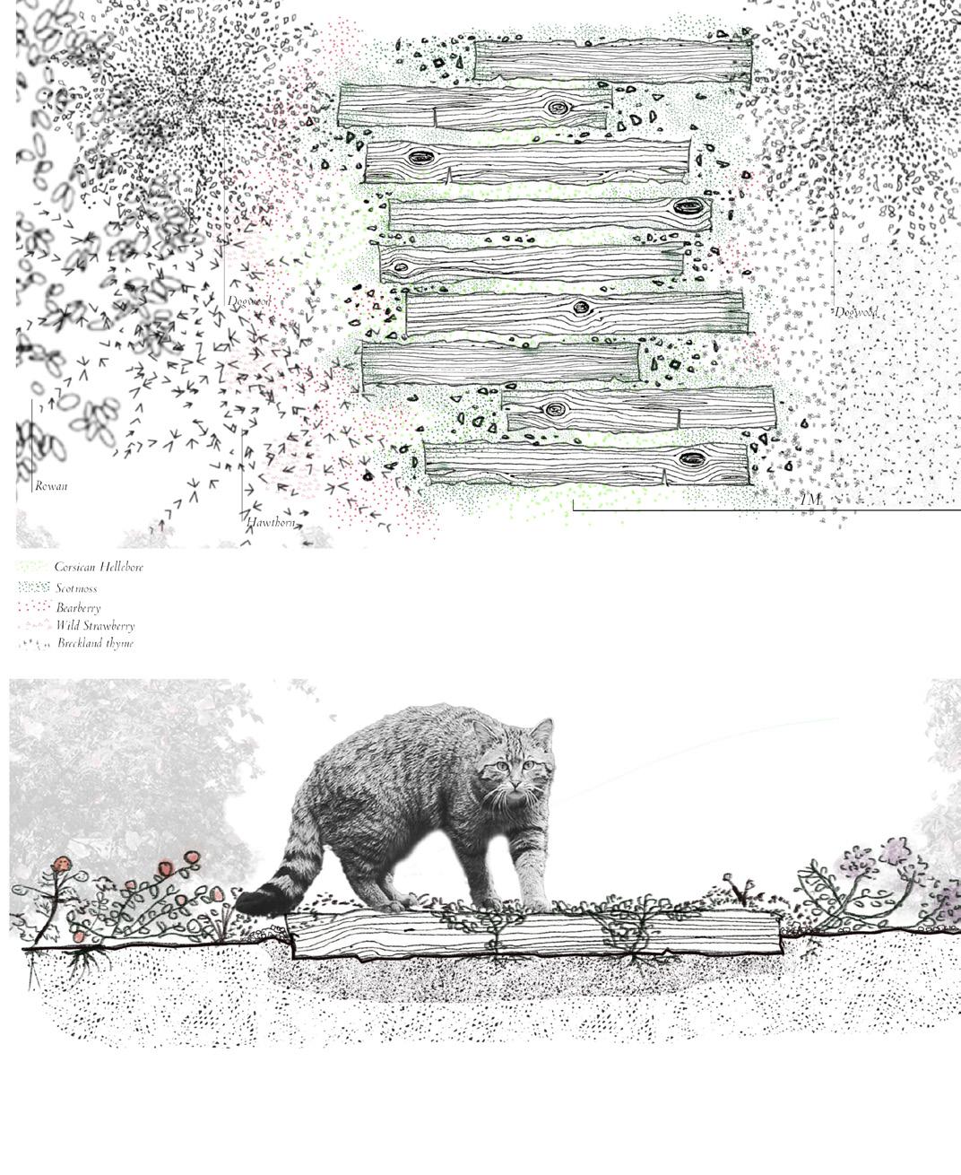
OPPOSITE TOP: Rock garden: Where wildcats rest and breed.
OPPOSITE MIDDLE: Hidden corridor: The only corridor that humans can enter into the wildcat space.
OPPOSITE BOTTOM: An interior view of a hidden corridor:
65 Critical Zones | Tingting Hu
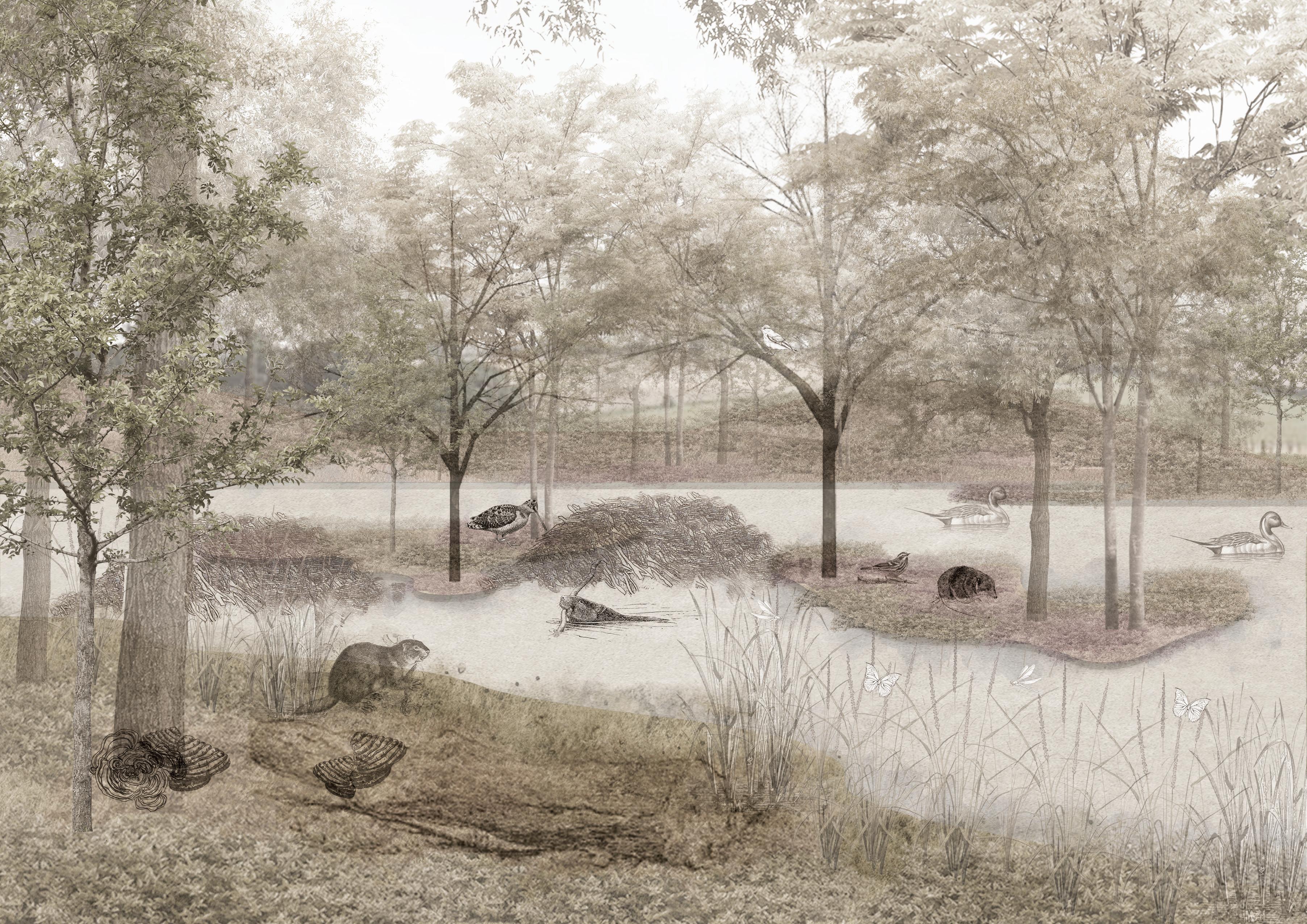
The Return of Indigenous Species
Jessica Tsz Wun Ling
In light of global climate change, flooding incidents are expected to increase and notably in countries including the United Kingdom (Roger et.al, 2022). With reference to The Flood and Coastal Erosion Risk Management Research and Development Programme published in 2021, the estimated economic loss due to flooding between November 2019 and March 2020 was estimated to be about £333 million countrywide.
Regarding carbon emissions, the Scottish Government’s greenhouse gas inventory indicated that agriculture took up approximately 22% of Scotland’s total greenhouse gas emissions in 2019, while the land use, land use change, and forestry (LULUCF) sector, including grazing, accounted for around 9%. The main sources of carbon emissions from agriculture in Scotland are namely enteric fermentation, manure management, and synthetic fertilisers. According to the historical Ordnance Survey Map (1842-1952) from the National Library of Scotland, the agricultural industry along River Earn Catchment has settled since the 1700s, affecting the soil, landscape appearance and native habitat.
There are voices demanding to bring the extinct species, the Eurasian beaver, back to the country to control flooding, enhance water quality and restore native habitats. In Edinburgh, public support for their re-introduction was evident when a license for the release of European beavers in Knapdale was refused, and people marched in protest (Coles, 2012). This research proposes a collaborative model between humans and beavers, with a view to explore opportunities and threats of flooding in the River Earn Catchment.
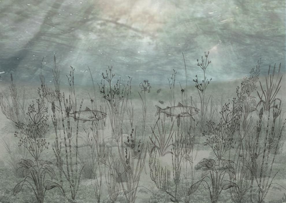 ABOVE: Drawing underwater from a beaver perspective after 150 years of wetland growth.
OPPOSITE: Drawing the transformation of wetland from a human perspective after 150 years.
ABOVE: Drawing underwater from a beaver perspective after 150 years of wetland growth.
OPPOSITE: Drawing the transformation of wetland from a human perspective after 150 years.
67 Critical Zones | Jessica Tsz Wun
Ling
The migration of beavers and community development


Woodcok Heracleum sphondylium Typha latifolia Warbler Butterfly Barley Fomitopsis pinicola Otter Alisma plantago-aquatica Loch Earn Crieff Chapelbank and Forteviot Tay Estuary Barley Grassland N/A Wheat Legend Scale 1:25000 The prediction of wetland development in River Earn Water Flow Indivdual Group Legend Scale 1:25000 Barley Grassland N/A Wheat Legend Scale 1:25000 The prediction of wetland development in River Earn Water Flow Indivdual Group Legend Scale 1:25000
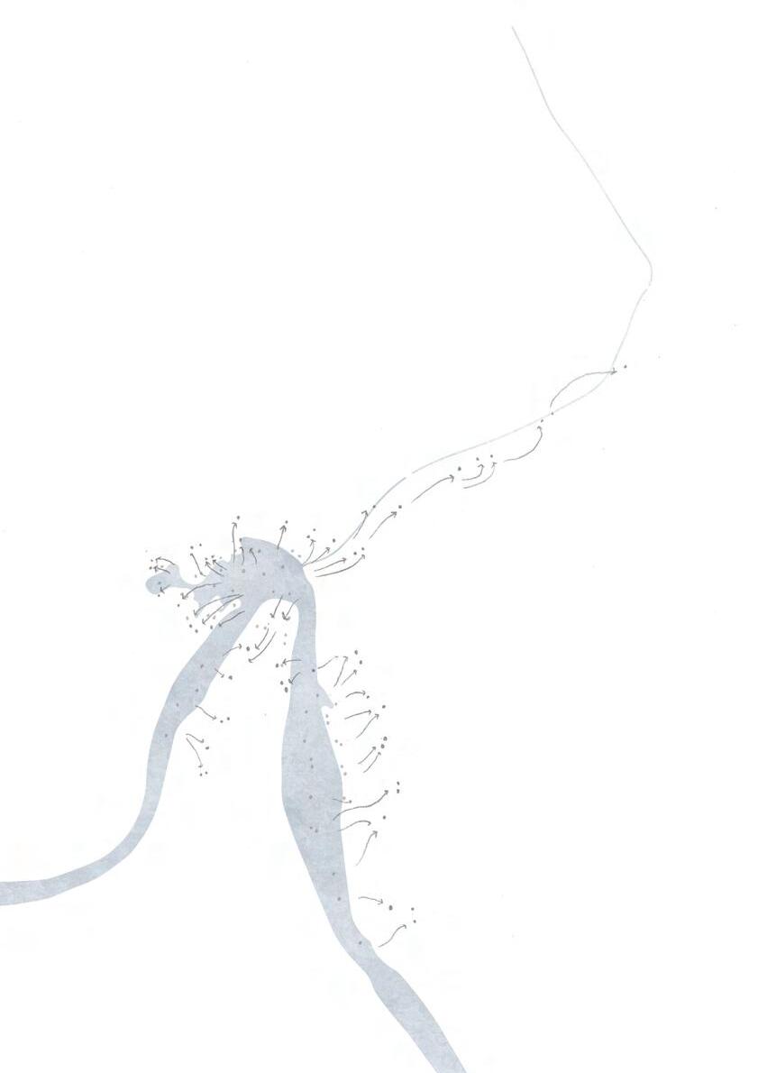
OPPOSITE TOP: Plan view of beaver immigration.
OPPOSITE MIDDLE: Plan view of wetland development.
OPPOSITE BOTTOM: The introduction and project approach of the River Earn Catchment (Existing).
RIGHT: The development of the beaver dam transformation.
69 Critical Zones | Jessica Tsz Wun Ling
Beavers’ activities bring positive effects to their environment. By gnawing on stems, they ‘coppice’ trees like willow, hazel, rowan and aspen, which subsequently regrow from felled stems or cuttings. The process provides homes for a variety of insects and birds. Indeed, wetlands, where beavers inhabit, are valuable to many other species too. The creation of wetlands and ponds across river streams accommodate a myriad of aquatic and semi-aquatic species including fishes, amphibians, waterfowl, and other aquatic animals, as well as the plantation that supports herbivorous species.
As agriculture is the dominant land use in the lower catchment, creating a edge can provide an opportunity to strike a balance between economic and Rather than defining territories between species with physical barriers, the help to soften the critical zone between them.
 Butterfly
Dragonfly
Water shrews
Spotted Flycatcher Trametes versicolor
Juncus bufonius agg
Potamogeton crispus
Butterfly
Dragonfly
Water shrews
Spotted Flycatcher Trametes versicolor
Juncus bufonius agg
Potamogeton crispus
green corridor along the river and ecological development. the use of thick vegetation can
The local communities are encouraged to plant trees and woodlands to build up their environmental stewardship, as it helps mitigate climate change’s effects by absorbing carbon dioxide and providing shelters for wildlife.
Apart from restoring native woodlands, ecologists, landscape architects and farmers plays a vital part in monitoring and governing the health of woodlands and wetland habitats to ensure wildlife populations persist in socially legitimate ways under tolerable risk levels.
71 Critical Zones | Jessica Tsz Wun Ling
Fomitopsis pinicola
Tayport
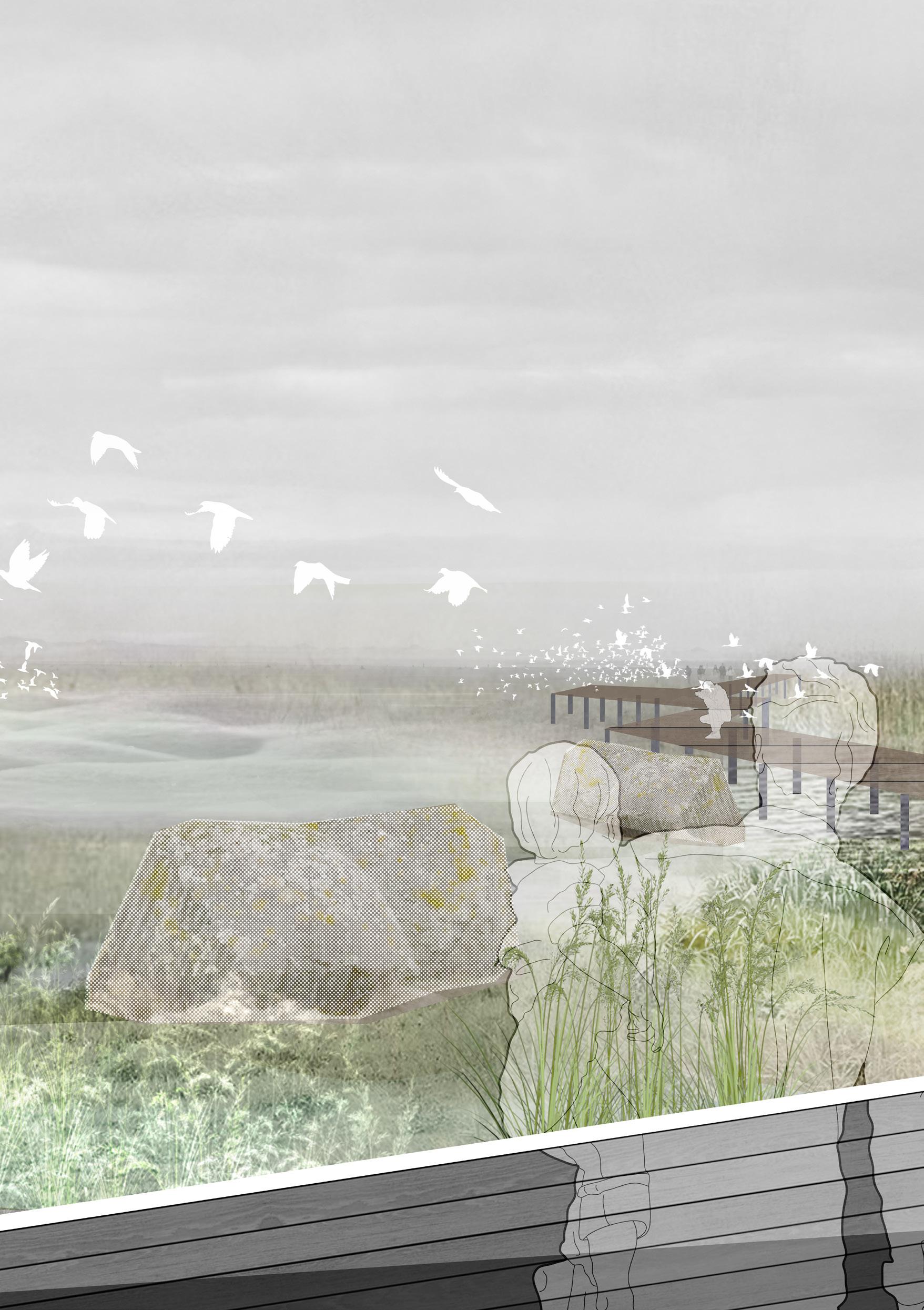
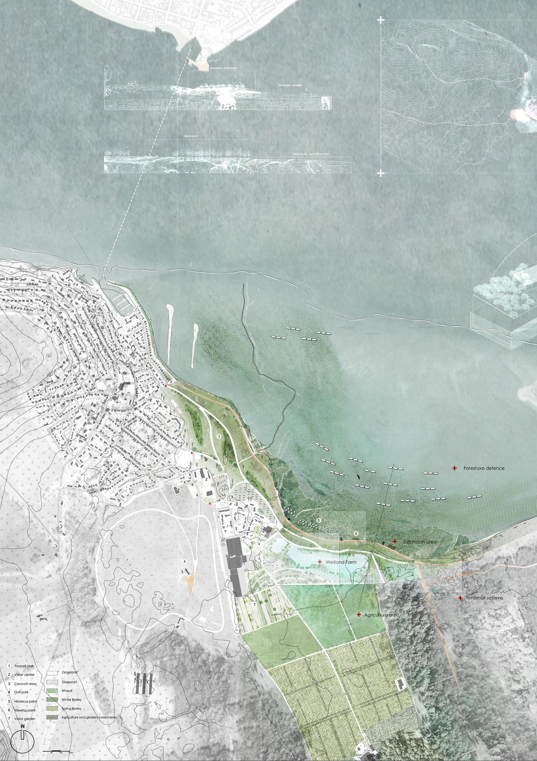
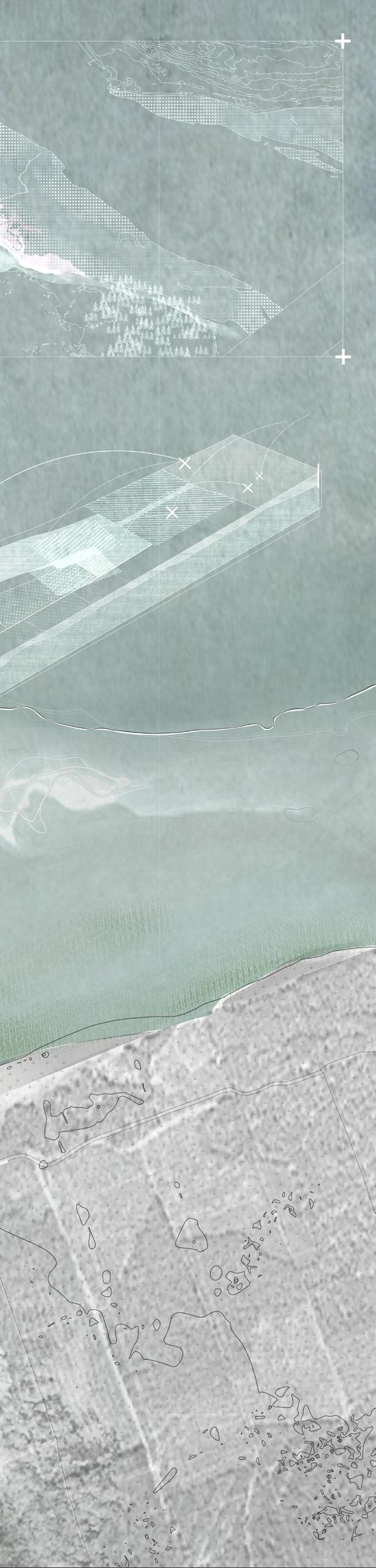
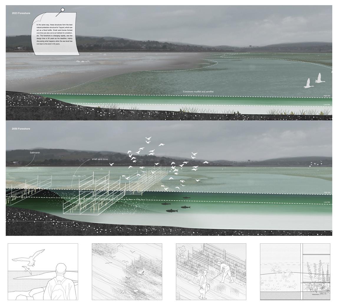
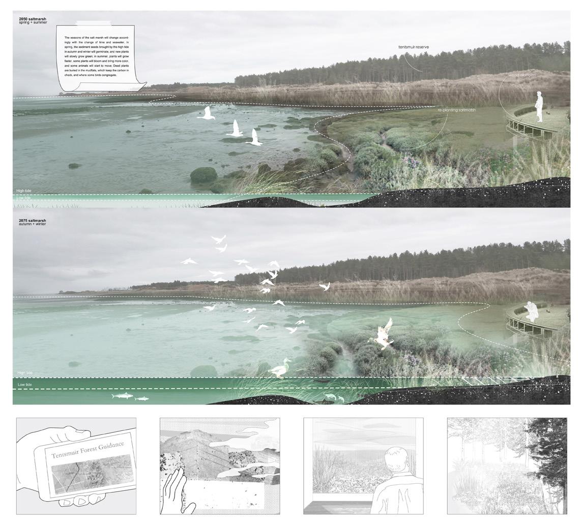
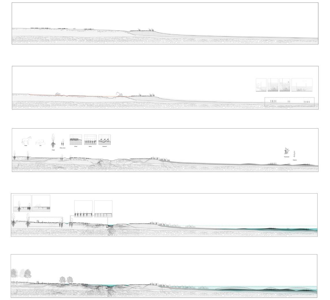
THE SYMBIOTIC SHORE
Yuxi Peng
The project aims to use water as a link between the human, social, and natural environments in the surrounding area of Tayport. Water, society, and ecology are the three main factors in designing the site. The foreshore, boundary, and backshore are all designed in response to changes in sea level rise, flooding, and biodiversity. The flood changes in the first 50 years occurred on the foreshore, and the damage caused by the flood was mitigated by working with the subsidence. As the sea level rose, the wetland farms began to play a role after 50 years to control surface runoff and flood risks, and the naturalized wetlands were fully mature. It takes time, and the plant growth of the first ten years makes it possible for the wetland to mature. Among them, the boundary of the salt marsh is a small scalehuman scale, and the mode of experiential landscape allows people to strengthen their feelings about the natural changes of seawater, so that people can understand natural changes and respect nature. The mesoscale productive landscape (farmland) brings more possibilities for changes in the production structure to the people in the Tayport area.
 ABOVE: A rendered salt marsh node. OPPOSITE: A rendering of the foreshore.
73 Critical Zones | Yuxi Peng
ABOVE: A change matrix of overall coastal change.
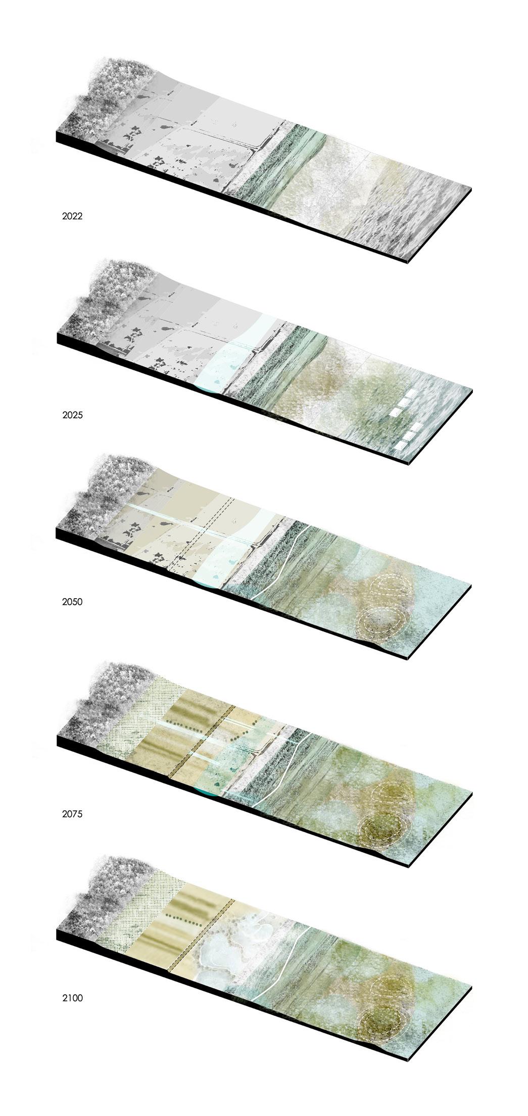
OPPOSITE: Dynamic change plan
75 Critical Zones | Yuxi Peng

77 Critical Zones | Yuxi Peng
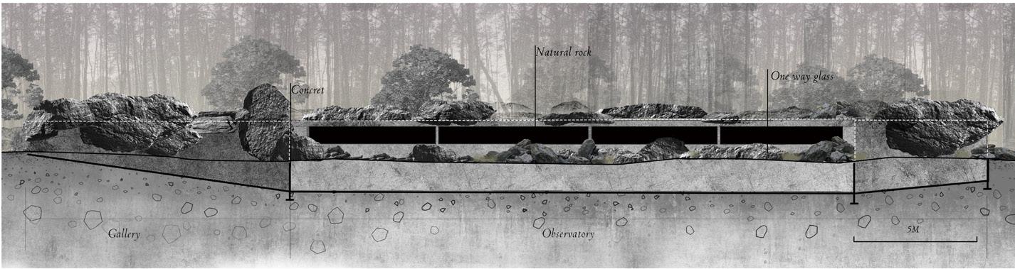
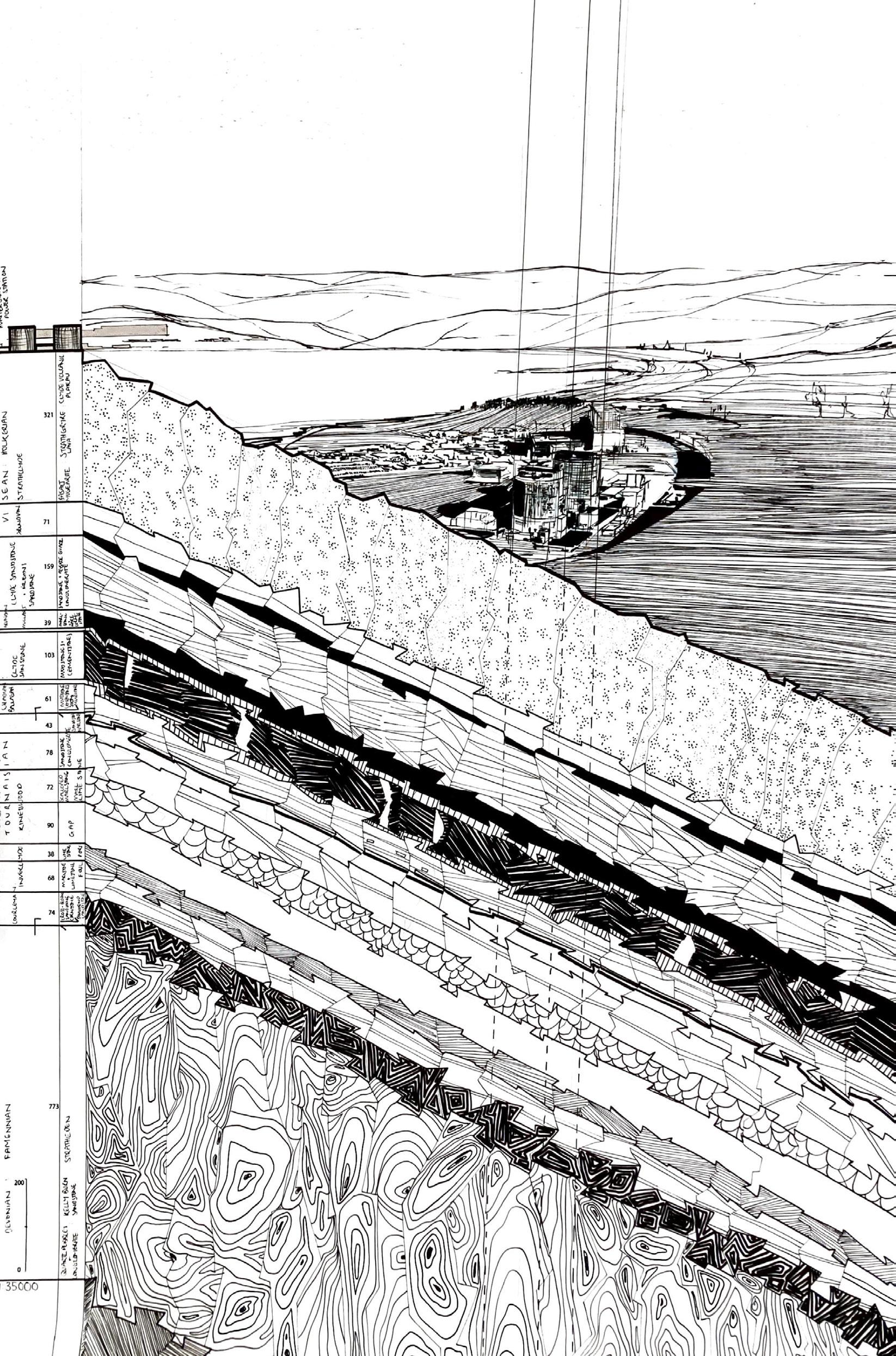
Nuclear Legacies
EXPLORING HUMAN TRACES IN THE CRITICAL ZONE
 Tilly Rigby
Humans in Scotland and across the UK are increasingly being called to acknowledge ourselves as true critical zone actants, and participators in the Earth’s deep time cycle. We have, and continue to co-evolve alongside our fellow earthly inhabitants, and are part of sprawling “creaturely entanglements” that have led to where we are now.1 Yet, human societies are ever-more detached from the expanses of their own technological agency, insofar as to erase it from public geographic imagination.2 An informed forgetting is part of concerning colonial, extractivist, and resourcist land-related cultures which characterise the Global North.
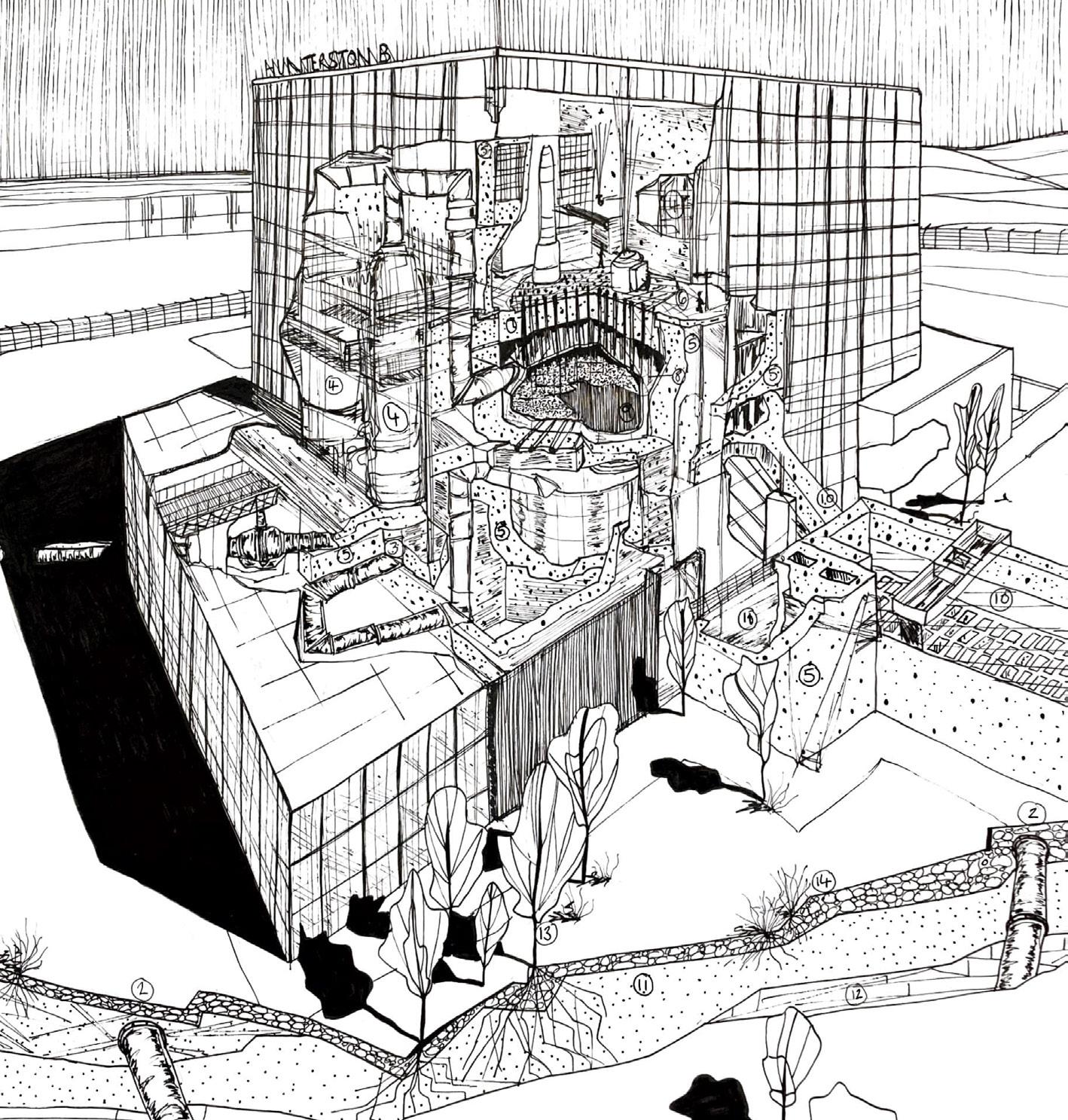
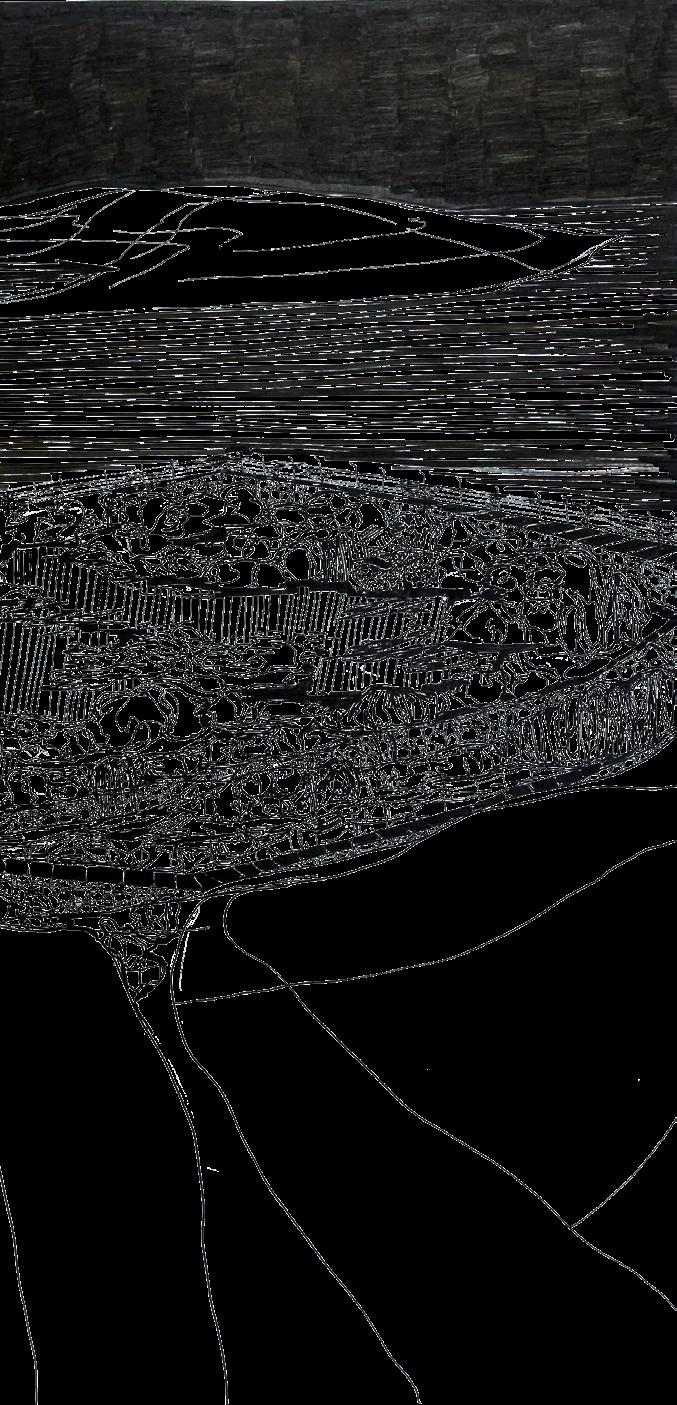
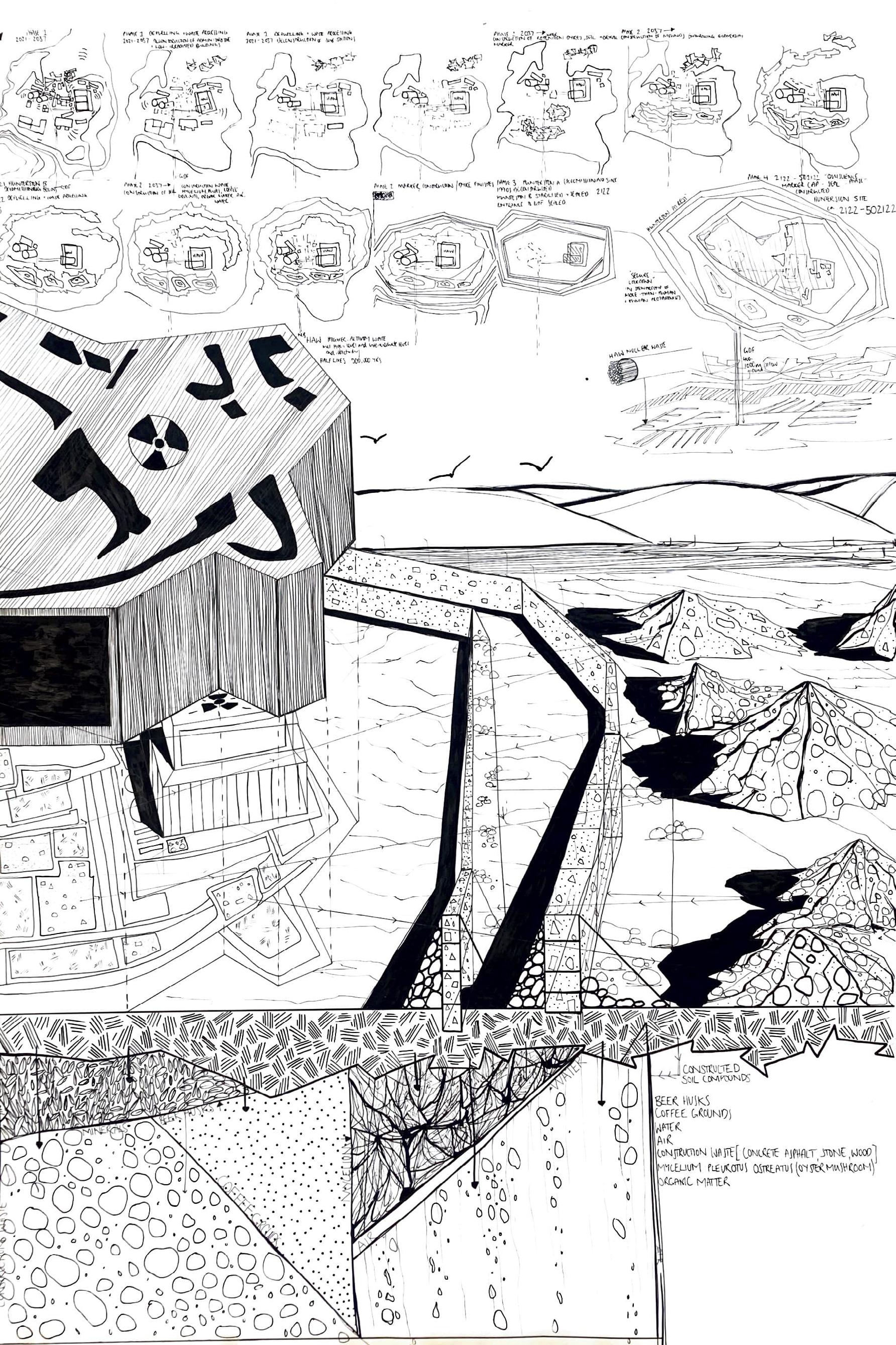
Nuclear Legacies (NL) brings into perspective the vast scales of uranium extraction, processing, and nuclear waste disposal within our society. It comes as nuclear power stations have progressively forced us to consider ethically the longevity of our wastes, and the seriousness of what we impose on our shared environment. Looking at Hunterston Nuclear Power Station in Ayrshire, we can reckon with decommissioning processes and the complexities of nuclear waste disposal with no existing permanent or long-term solution. NL contextualises a view which favours disposing of highly radioactive spent nuclear fuel in a geological disposal facility (GDF). Human-led nuclear legacies are preserved in a spatial system that communicates both confession and warning of the site’s radioactivity. Spent nuclear fuel is buried 1km in the Earth’s surface, underneath the existing station. The future is embodied through human and more-than-human protagonists, as is its condition against global environmental change in relation to nuclear half-lives. NL is a critical, provocative and artistic response to what we leave behind.
ABOVE: The legacies of human nuclear cycles are embedded within materiality, and confession is connected to our past, present, and future selves.
OPPOSITE: Hunterston is imagined as a space comprising GDF and surface-level groundworks in a system of radioactive “marker”.
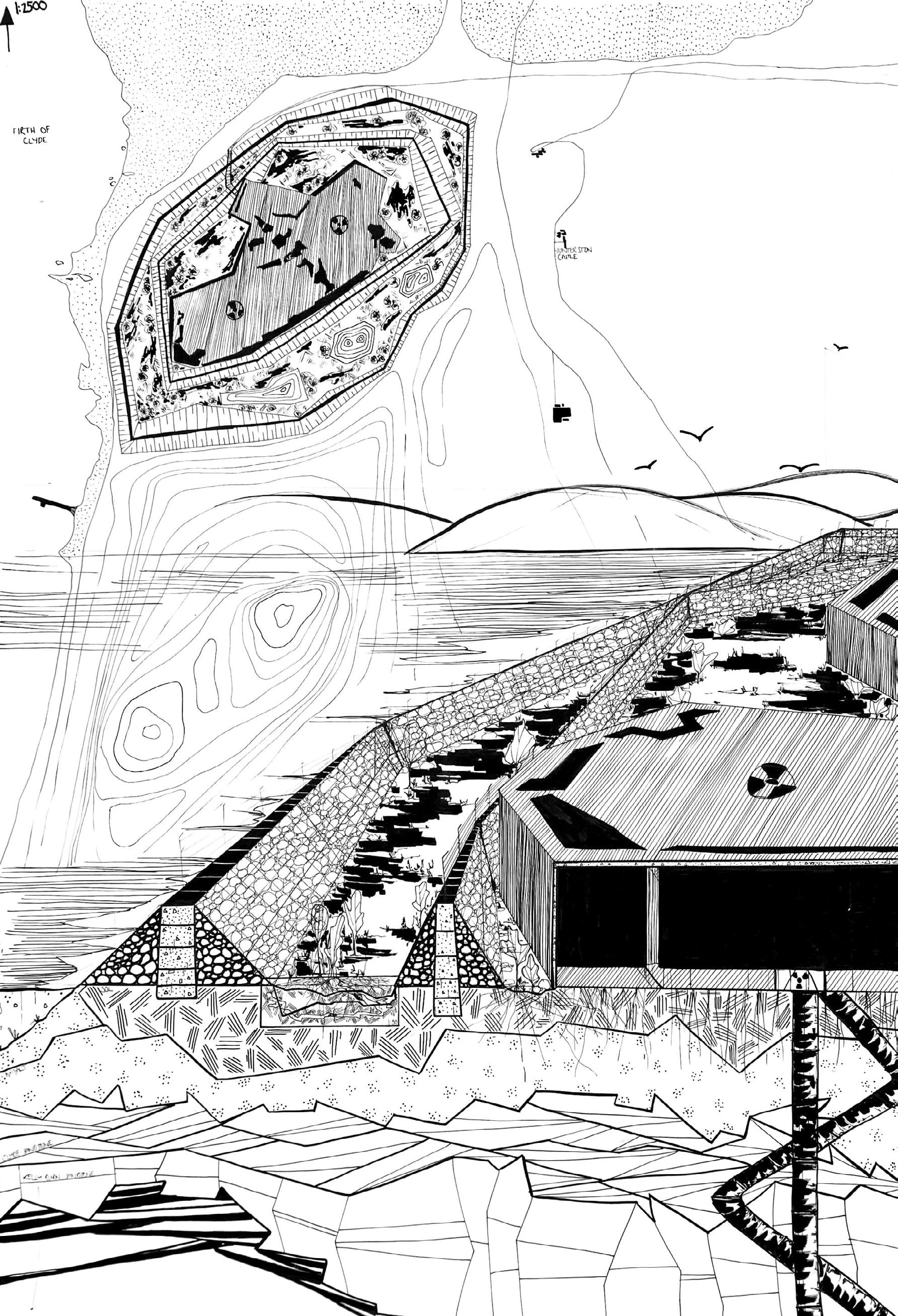
79
ABOVE: “Chthulucene” Hunterston is considered as part of the time of “becoming-with” and of multispecies.3
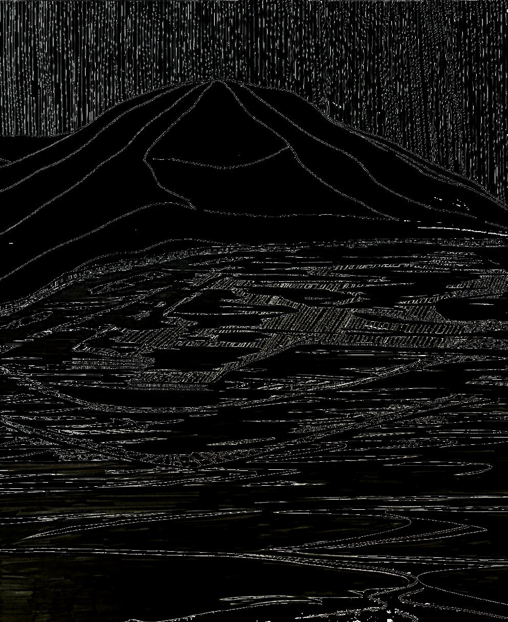
OPPOSITE: Hunterston Nuclear Power Station related to its surrounding geology and environmental conditions which make up the Earth’s critical zone.
81 Critical Zones | Tilly Rigby
ABOVE: Like the safestore structure encasing Chernobyl, the possibility of nuclear disaster at Hunterston is imagined in relation to its geographic position.
RIGHT: With Great Cumbrae in the background, the marker is encased by more-than-human species.
OPPOSITE: Hunterston’s progression against global sea-level rise and nuclear half-lives, with a mean global rate of 1.3-1.6m per century.
83 Critical Zones | Tilly Rigby
OPPOSITE: Hunterston is imagined as a space comprising GDF and surface-level groundworks in a system of radioactive “marker”.
ABOVE, LEFT TO RIGHT:
1) Sparrow Nesting. A bird’s eye view imagining House Sparrows as future inhabitants.
2) Moles, moles, moles. Sectional embodiment of the other undergound engineers, tunnellers, and constructors living in the everydayness of our toxic legacy.
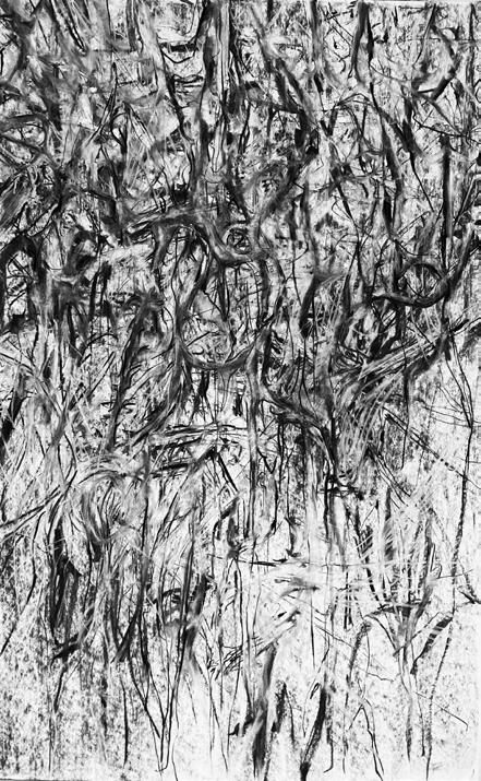
3) Mycelial Network. Expanses of Pleurotus ostreatus connectivity and worldmaking describes their role in the succession of ecological conditions at Hunterston.
CITATIONS:
1 Franklin Ginn, Michelle Bastian, David Farrier, Jeremy Kidwell, “Introduction: Unexpected Encounters with Deep Time”, Environmental Humanities 10:1 (May 2018) 214.
2 Rania Ghosn and El Hadi Jazairy, DESIGN EARTH, Geostories: Another Architecture for the Environment (3rd eds.) (New York, Barcelona: Actar Publishers, 2022), 12.
3 Donna Haraway, “Anthropocene, Capitalocene, Plantationocene, `Chthulucene: Making Kin”, Environmental Humanities 6 (2015) pp. 159-165.
85 Critical Zones | Tilly Rigby
Cultivating Wetness
REWETTING THE POW WATER
Zhang Wang
Pow Water Is a branch in the middle reaches of the River Earn River basin. This lowland was once a flood marsh, in the 13th century, an artificial ditch—Pow Water was excavated here to drain the marsh. Since then, human activities (including grazing and agriculture, deforestation) have begun to colonize and expand in this tributary basin, reducing groundwater levels and biodiversity, and destroying natural habitats. Nowadays, the Pow Water basin has been completely occupied by intensive agriculture, and agricultural production has seriously affected the health of water and soil, and seasonal flooding has become an increasingly serious issue. How to alleviate the existing environmental problems and cope with the future environmental challenges? What will be the future of agriculture? Are we living in a change of paradigm in our rural areas? This project does not aim to answer all these questions, but to learn about new alternatives, and explores creative ways of imagining the future.
The project name is ‘Cultivating Wetness’—a process of increasing the groundwater table, maintaining carbon storage, and creating important habitats. The project site is focused on the area of the basin most affected by floods and with the most agricultural land coverage, the design challenges the existing land use of the site, it illustrates a possible temporal alternative, in the changeable climate crisis on the basis of temporal external drive, through periodically adjust the land use of the floodplain (from wet grassland to paludiculture), thinking the possibility of the future green transition of rural economy and the possibility of creation of diversified habitat and nontraditional rural landscape.
 ABOVE: Detail perspective of Paludiculture Commons 1.
OPPOSITE: Detail perspective of Paludiculture Commons 2.
ABOVE: Detail perspective of Paludiculture Commons 1.
OPPOSITE: Detail perspective of Paludiculture Commons 2.
87 Critical Zones | Zhang Wang
ABOVE: Dynamic System - Landuse & Strategies timeline.
BOTTOM LEFT: Embracing Wetness -Section & landuse in 2083.
BOTTOM RIGHT: Cultivating Wetness - Section & landuse in 2123.
89 Critical Zones | Zhang Wang
ABOVE: Detail Plan of Junction Wet Woodland.
BELOW: Propagating Wetness - Master Plan (2123).
91 Critical Zones | Zhang Wang
ABOVE: Detail Plan of Paludiculture Common.
BELOW: Visualization of entrance of Junction Wet Woodland.
Casks Community
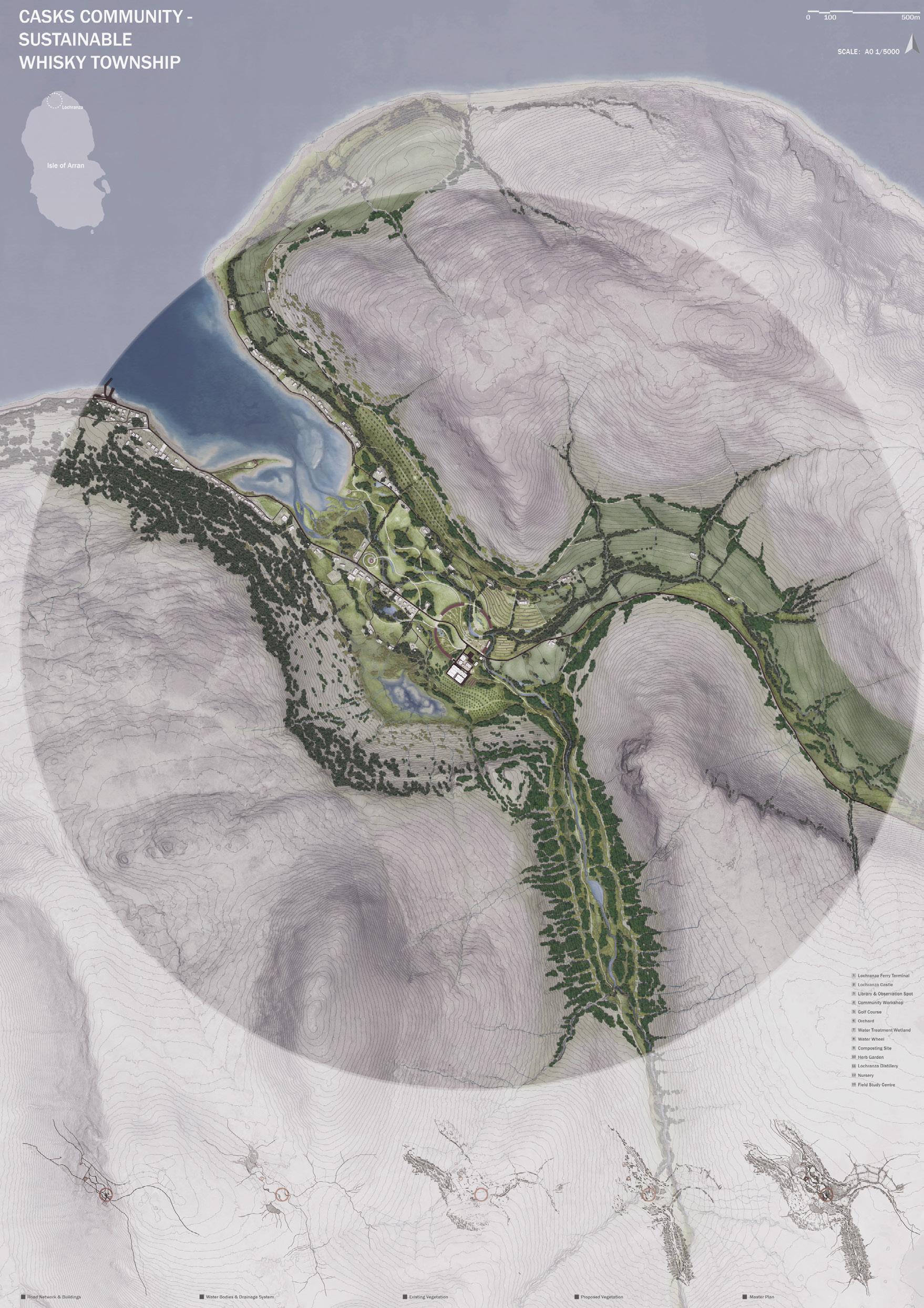
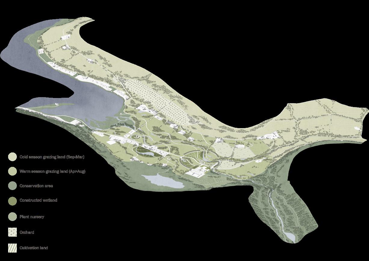
SUSTAINABLE WHISKY TOWNSHIP
Qisen Wen
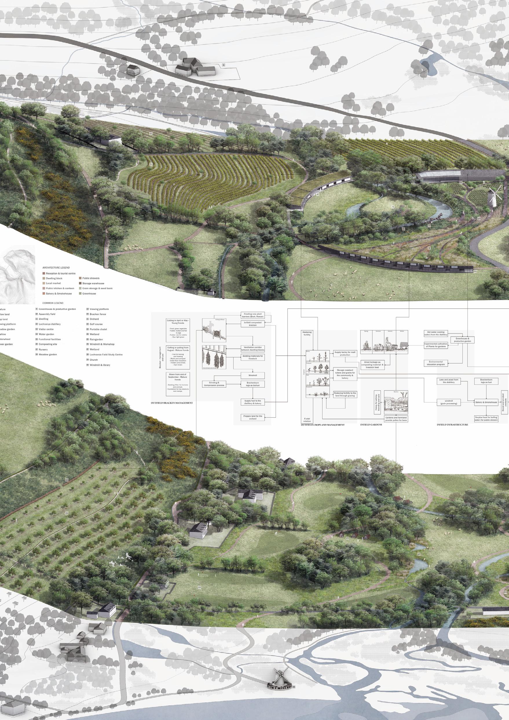
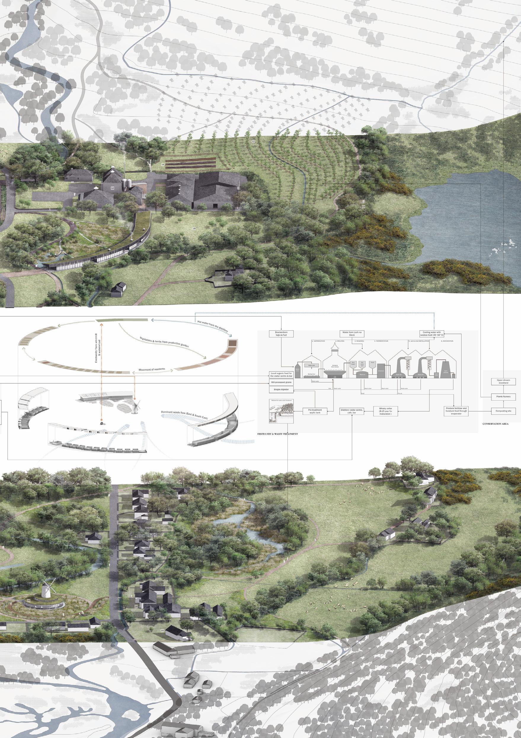
Scotch whisky is also known as Uisge Beatha in Gaelic, which means the water of life, a term that embodies an ancient understanding of the workings of nature that whisky is produced from the interaction between living and nonliving elements in the landscape and contains the many features that make up life.
Whisky has played an important role in Scottish history, influencing livelihoods and shaping the landscape. Nowadays, whisky-making has become a significant part of the Scottish manufacturing and tourism industry.
Climate change, environmental degradation, and the impact of human activities have irreversibly changed our planet. In the quest for sustainable development, the whisky industry is now facing the need for transformation.
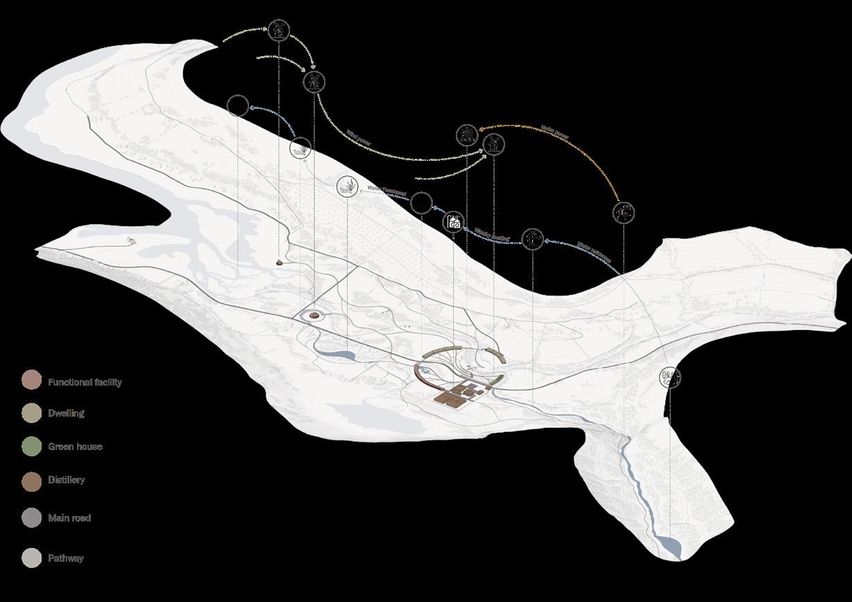
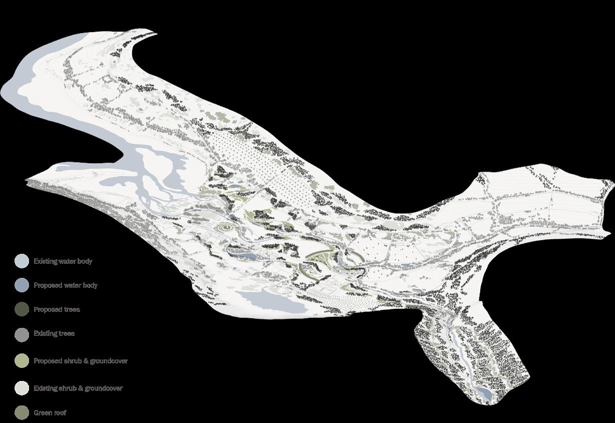
Whisky Township is a new model of rural livelihood focused on the relationship between whiskymaking, community life and the conservation of the environment. The distillery and the town will explore new sustainable relationships regarding energy, resources, and waste management.
My design will draw on the practical experience of traditional townships in terms of land use and resource management and combine these with contemporary landscape architecture concepts.
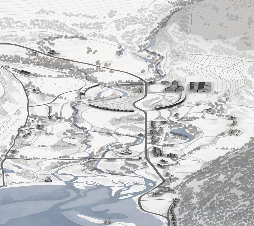 ABOVE: A birds-eye view of the Whisky Township. OPPOSITE: A 1:5000 plan of the Whisky Township.
93 Critical Zones | Qisen Wen
The design of the whisky township has proposed a low ecological footprint lifestyle based on the introduction of public facilities and systematic resources, energy, and waste management. Productive commons and alternative waste treatment facilities will help the community to reduce its dependence on external resources and achieve self-sufficiency in key supplies. A dynamic land management plan will help maintain the landscape’s productivity while protecting natural resources.
This new Whisky Township will provide a more sustainable rural lifestyle while offering a greener tourist experience for those seeking this symbol of Scotland- the Uisge Beatha.
ABOVE: Dynamic golf course rewilding and recovery.
OPPOSITE: Land use, land use structures, and land use infrastructure.
95 Critical Zones | Qisen Wen
97 Critical Zones | Qisen Wen
THE TRIANGLE ISLANDS
Master of Landscape Architecture (MLA) Miguel Domingues
STUDIO BRIEF
Miguel Domingues
HIDDEN WORLDS
Tibor Babic
CHASING THE FOG, CATCHING THE WATER
Shimeng Dai
SEISMIC MEMORY, FUTURE ARCHAEOLOGY
Julie Næss Karlsen
ECO-AGRO FAJÃ
Yihang Li
CORAL CONSERVATION
Fangfei Liu
AZORES RECALIBRATION
Sid Lu
DYNAMIC MONUMENT
Yanning Mu
LAVA LOOP
Jinjin Wu
ECO-SQUARE
Dawei Zhang
100 106 112 120 126 132 138 144 150 156
99
|
Archipelago:
Archipelago
Miguel Domingues
OPPOSITE: The rugged features that characterize much of the Azorean coastline. (Photo: Mingxuan Lu)
Archipelago
THE TRIANGLE ISLANDS
Miguel Domingues with Hazel Mei and Marta Guerini
The Islands – Myths and Legends
Island territories are historically places of bewilderment and mystery, enthusiasm and fear, promises and disenchantment, and in a certain way they condensate all the complexity of Human endeavour. These fragments of Earth’s core that emerge from the watery layer of our planet’s oceans and seas still draw upon us all those contradictory feelings. From Literature through Art, humanity has consistently put Islands in the centre of its confrontation with natural elements and the forces of nature. This apparent contradiction hits its highest peak in volcanic islands, such as the Azores, while being a safe haven for humans travelling the rough high seas, they are also these constantly menacing entities ready to start trembling at any moment, revealing in the strongest manner their explosive nature.
From the tropical desert island of Daniel Defoe’s Robinson Crusoe to the fictional islands in William Shakespeare’s “The Tempest” and Thomas More’s “Utopia” to the volcanic setting of Rossellini’s “Stromboli” and the idyllic island in Michelangelo Antonioni’s “Red Desert”, islands have been central to narratives of all kinds and populate our imaginary. In sixteenth century Europe the Atlantic islands were the stepping stones into what was believed to be the “New World” and since antiquity fed numerous myths and legends surrounding lost continents and places like Atlantis or Thule. Fifteenth-century Italy saw a new genre in cartography publication with Benedetto Bordone’s Isolario where the promise of showing all the islands in the world represented an anxious way of affirming the world’s domination by old European kingdoms.
101
ABOVE: Students from the Archipelago studio group explore Pico. (Photo:Francisca Lima)
The Azores – Atlantic Islands
This design studio proposes to address the challenges faced by the ultraperipheral region of the Azores Archipelago and through the lens of Landscape Architecture find ways to improve the resilience of this fragmented territory helping it to cope with an array of complex problems, from the impacts of climate change to economic and social deprivation or a growing pressure from the tourism sector.
This Archipelago, situated in the middle of the Atlantic Ocean in the Macaronesian bioregion, is composed of 9 islands divided in three groups, the oriental group (S. Miguel and S. Maria), the central group (Faial, Pico, Terceira and Graciosa) and the occidental group (Flores and Corvo).
The biogeographical region of Macaronesia is known to contain several biodiversity hotspots which are home to over 5,300 endemic species. The term Macaronesia was first used in 1830 by the English geologist and botanist Philip Barker-Webb to refer to a biogeographical area comprising the archipelagos of the Azores, Madeira, the Canary Islands, and Cape Verde in accordance with the richness and uniqueness of their botanical resources and specific climate.
 ABOVE: Rugged coastal features characteristic of much of the Azores. (Photo: Mingxuan Lu)
OPPOSITE: Mount Pico stratovolcano looms over the island landscape. (Photo: Mingxuan Lu)
ABOVE: Rugged coastal features characteristic of much of the Azores. (Photo: Mingxuan Lu)
OPPOSITE: Mount Pico stratovolcano looms over the island landscape. (Photo: Mingxuan Lu)
103
Archipelago | Miguel Domingues
A Telluric Landscape
One of the Azores inherent conditions derive from its position in a very particular point of the Earth’s crust. Set precisely in the crossing of the three main tectonic plates of the Atlantic (Eurasian, North American and African plates) between 36º55’ and 39º 43’N in latitude and 24º46’ and 31º16’W in longitude it’s the only place where these three plaques touch each other creating a unique tectonic dynamic. Being a relatively young archipelago, the youngest in the Macaronesia region, its formation dates from 8 million years ago with the youngest island (Pico) having only 250 000 years. Its volcanic origin is intrinsically linked to the continuous formation of the Atlantic Ocean. Oceanic islands, as opposed to continental islands, are ”originary, essential islands: sometimes they are formed by corals, they offer us a veritable organism, sometimes they surge up from under the sea, they bring to the open air a movement from the lower depths; some emerge slowly, others disappear and come back, they can’t be annexed” as expressed by Gilles Deleuze in its 1950’s text “Causes and Reasons of Desert Islands”. This set of circumstances explains the geomorphology of the islands where old volcanic cones and “caldeiras” are the result of a landscape in transformation where water and erosion shape the volcanic landforms: water and earth in a continuous battle through time with moments of particular intensity played by eruptions and earthquakes or smaller volcanic phenomena such as fumaroles or hot water springs.
The “Triangle Islands”
In the central group islands (Graciosa, Terceira, São Jorge, Faial and Pico) three of them have particular strong bonds: the so called “Triangle Islands”. The proximity between them (Faial, Pico and São Jorge) facilitated strong economic and cultural ties throughout the centuries especially after the 19th century when the whaling industry reached its peak and the wine production in Pico flourished. Faial and its main harbour Horta became an important centre for economic and cultural activity and replaced Angra, in Terceira island, as the pivotal point of the central group. This condition was reinforced during the XXth century when Horta received the submarine cables that connected North America and Europe and became a stopover for the transatlantic flights connecting the two continents by hydroplane. Dominating the landscape of the three islands stands the Pico Mountain, the highest peak in the archipelago that exercises its magnetism from almost every location.
105 Archipelago | Miguel Domingues
OPPOSITE: Rugged volcanic rock on São Jorge. (Photo: Francisca Lima)
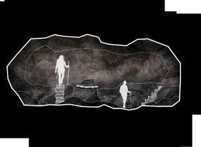
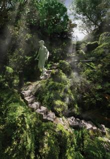
Hidden Worlds
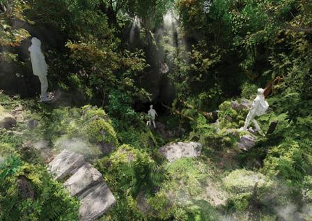
Tibor Babic
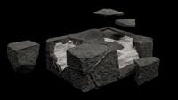
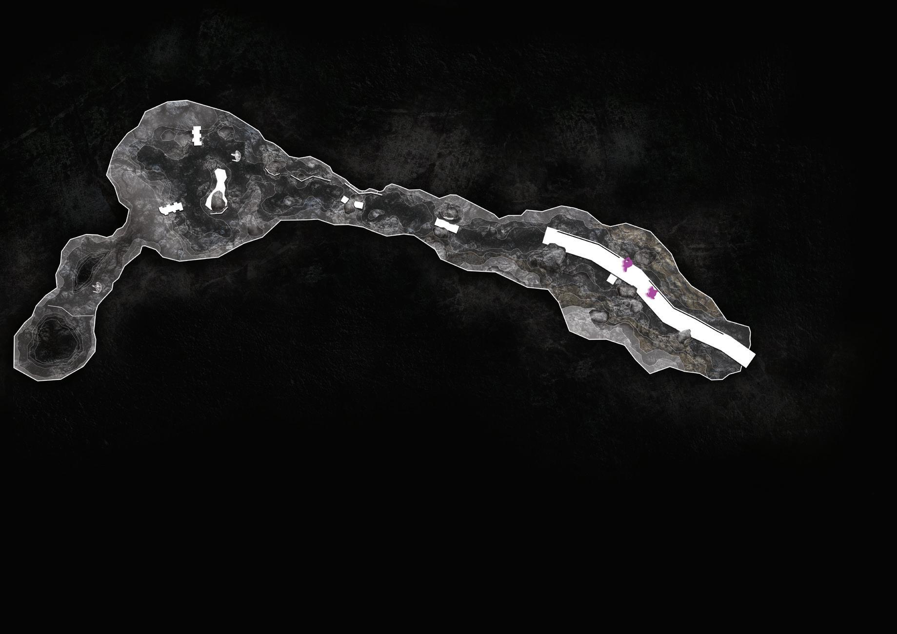
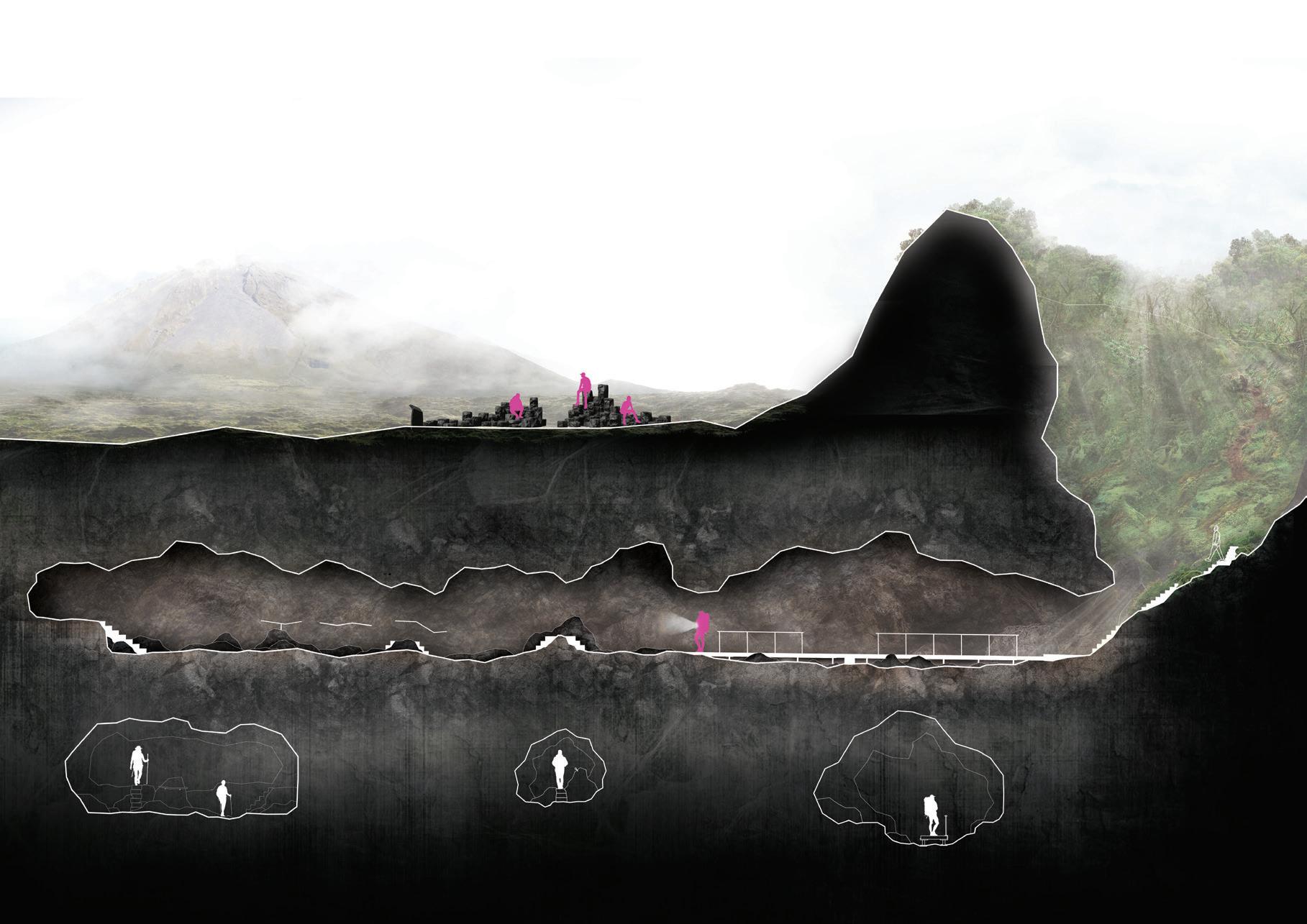
This work centres around the volcanic lava tube known as ‘Furna de Frei Matias’, located on the island of Pico in the Azores archipelago. The design proposal explores the intimate relationships between three very different landscapes: the barren pastureland, the densely vegetated inner crater, and the mysterious lava tube at the base of the crater. These three unique and drastically contrasting landscapes all occur across an extremely small spatial scale and represent a microcosm of Pico in its different states of existence throughout history: The volcanic origins of the island, the endemic vegetation and forests, and finally, the human alteration of the landscape following the arrival of the first settlers.
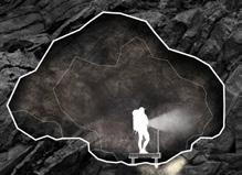
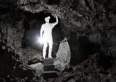
The design proposal is rooted in the idea of creating a sensory experience that immerses visitors in the unique landscapes held within these volcanos while evoking deeper contemplation about the deeper natural systems at work. Attention is given to each of these three landscapes, firstly proposing a series of basalt structures which will provide points of interest for visitors to engage whilst providing functional and aesthetic value. Secondly, the proposal tackles improving accessibility into the lava tube by creating a network of steps, strategically placed inside of the crater to aid in traversing the delicate and uneven terrain. Finally, a combination of paths, steps and handrails throughout the lava tube provides a guided experience through the cave, directing visitors to points of interest while facilitating free exploration.
Hidden Worlds is a project that seeks to re-connect people with the ancient environments that shaped the world we live in by bringing people into close contact with Pico’s endemic vegetation and volcanic geoheritage. It is grounded in the idea of creating a harmonious dialogue between the manmade and the natural, weaving a subtle network of basalt structures through the landscape to guide visitors on a journey of discovery and connection.
OPPOSITE: A 1:200
ABOVE: A perspective visual of the approach to the mounds, focusing on the landing zone where the basalt column seating will be. The image also shows the basalt monolith in the background and people climbing up to enter the mounds.
section image showing the positions of the three outside basalt structures.
SECTION 1:200 @A2
seating and an and locals.. techniques, artisan work in its design will be shared architect.
MONOLITH
1:2000
from basalt mixed concrete which rolling landscape, encouraging The sharp geometric shapes grassland and serve to invite visitors volcanos from another angle and scan

Carefully crafted basalt columns provide seating and an opportunity for play and leisure for tourists and locals..
Mixing modern and traditional construction techniques, these columns will honour azorean artistry and artisan work by involving skilled members of the community in its design and construction. The design is flexible and will be shared between the local artists and the landscape architect.
A towering structure cast from basalt mixed concrete which stands out against the smooth rolling landscape, encouraging visitors to take a closer look. The sharp geometric shapes contrast the homogenous grassland and serve to invite visitors who can experience the volcanos from another angle and scan
3.LAVA TUBE SCULPTURE
An abstract interpretation of the Furna de Frei Matias lava tube cast from dark basalt mixed concrete. The structure functions as both a shelter, and a small seating place for queit reflection. Visitors can explore the sculpture in any way they please, eventually to find a QR code with information about it’s design and the wider landscape.
Carefully crafted basalt columns provide seating and an opportunity for play and leisure for tourists and locals.. Mixing modern and traditional construction techniques, these columns will honour azorean artistry and artisan work by involving skilled members of the community in its design and construction. The design is flexible and will be shared between the local artists and the landscape architect.
Carefully crafted basalt columns provide seating and an opportunity for play and leisure for tourists and locals..
Mixing modern and traditional construction techniques, these columns will honour azorean artistry and artisan work by involving skilled members of the community in its design and construction. The design is flexible and will be shared between the local artists and the landscape architect.
An abstract interpretation of the Furna de Frei Matias lava tube cast from dark basalt mixed concrete. The structure functions as both a shelter, and a small seating place for queit reflection. Visitors can explore the sculpture in any way they please, eventually to find a QR code with information about it’s design and the wider landscape.
An abstract interpretation tube cast from dark functions as both a for queit reflection. any way they please, information about it’s
 1.
2.
3.
1. BASALT MONOLITH
2. BASALT COLUMN SEATING
3.LAVA TUBE
1.
2.
1:200 @A2
2. BASALT COLUMN SEATING
3.LAVA TUBE SCULPTURE
1.
2.
3.
1.
2.
3.
1. BASALT MONOLITH
2. BASALT COLUMN SEATING
3.LAVA TUBE
1.
2.
1:200 @A2
2. BASALT COLUMN SEATING
3.LAVA TUBE SCULPTURE
1.
2.
3.
107 Archipelago | Tibor Babic
2. BASALT COLUMN SEATING
10m 0 20m 50m 100m
CAVE
SECTION 1:100 @A2
5
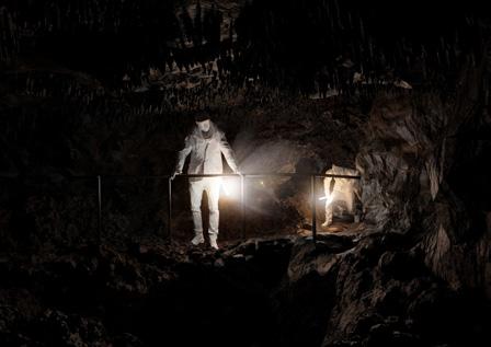
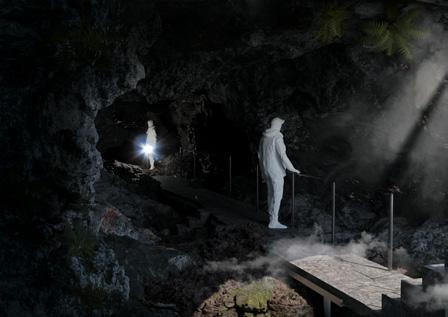
Carefully placed steel handrails offer guidance and stability through this deepr section of the cave, positioned to offer a route by which visitors will experience an intended aspect of the cave, but my no means must follow.
1 4
CAVE INTERVENTIONS 1:2000 1m 2m 5m 10m 20m 50m 2


1:10 @ A3 1:100 CAVE PLAN
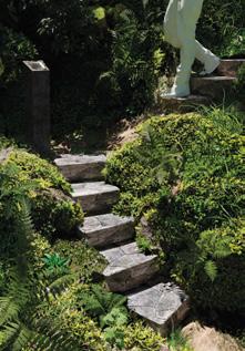
BASALT STEPS
Concrete cast in-situ with remnant basalt slabs cut accordingly, allow steps to be shaped according to the surrounding rocks.
Basalt steps,placed at key points of difficult terrain allow for a more secure descent into the mound, preventing soil compaction and injury
CONSTRUCTION
Reinforced concrete core Hand laid remnant slabs of basalt Concrete slab cast around cave rocks and basalt slabs cut accordingly Steel rail support structure
3 A basalt pathway, raised from the cave floor, eases visitors into the cave system across difficult terrain. A minimalist design with a one sided segmented handrail provides a simple and unrestrictive platform.
3
Basalt stairs bridge difficult terrain while elevating visitors into closer contact with ceiling geology such as magma stalactites. 2
Visitors arrive at the basalt column seating, where their journey into the volcanic cones begins.
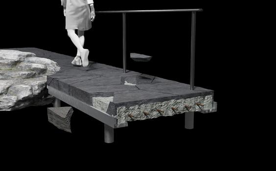
PATH
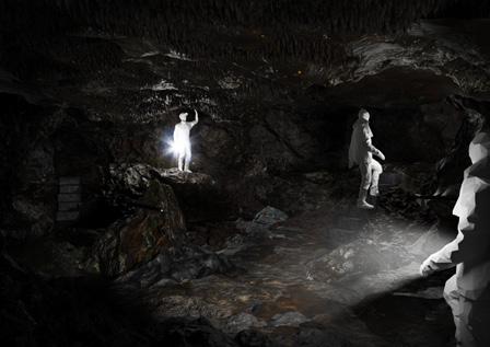
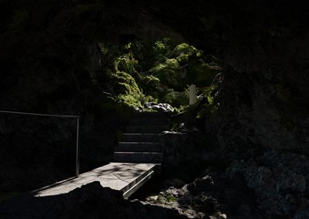
The third section of the journey takes visitors down into a lava tube cave, which is currently difficult to both find and access. The design elements in the cave aim to improve accessibility and enhance user experience through carefully placed steps, paths, and railings which integrate with the environment and guide visitors through the unique landscapes.
@A2
The raised pathway allows easy traversal across the uneven terrain inside the lava tube while minimising any intrusive construction.
A galvanised steel frame holds the reinforced cast concrete slab upon which re-purposed basalt slabs will be cut and laid on. This allows the path to “envelop” any protruding cave rocks, giving it’s sharp geometric aesthetic, a softer, more organic feel.
OPPOSITE: A section and plan of the lava tube design interventions. A key drawing that summarizes the elements proposed.


TOP: A 1:50 plan of the proposed stair network down through the crater leading to the cave.
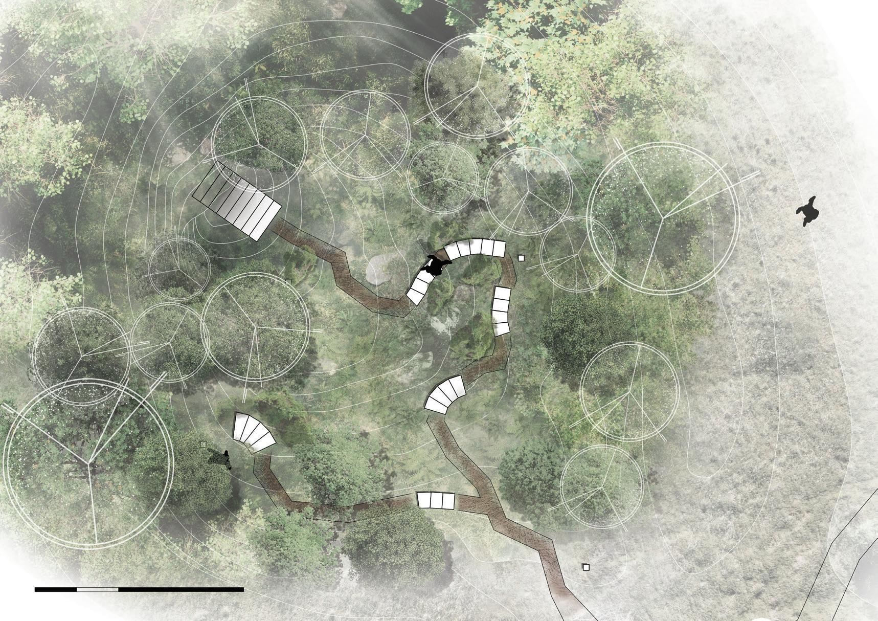
ABOVE: A series of renders that describe the experience of circulating from the ground above through the crate into the cave below.
1:2000 1m 0 2m 5m 111 Archipelago | Tibor Babic
Chasing the Fog, Catching the Water
Shimeng Dai
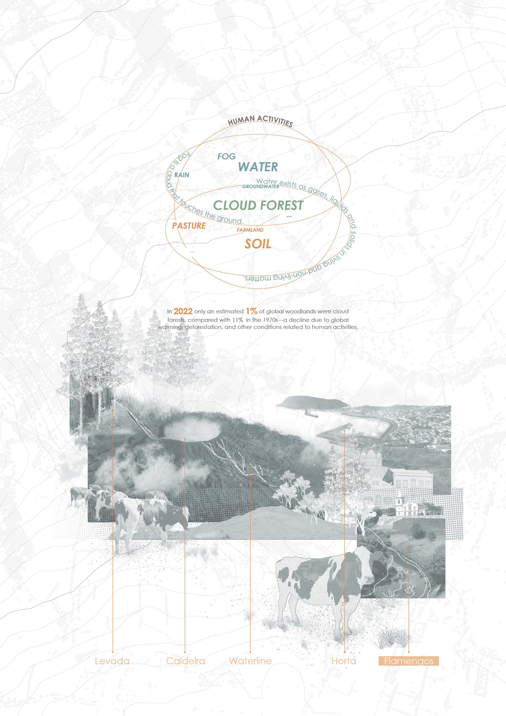
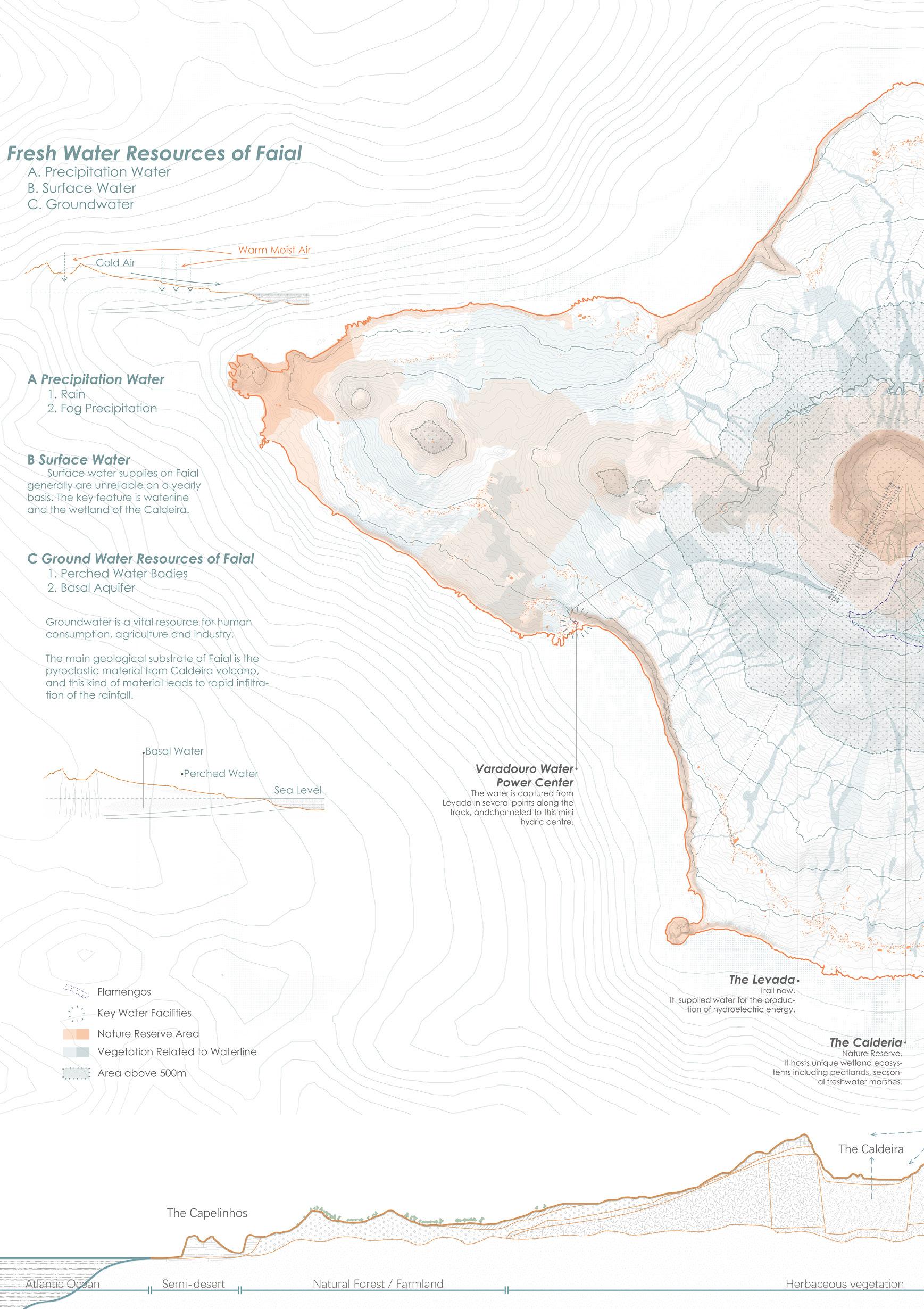
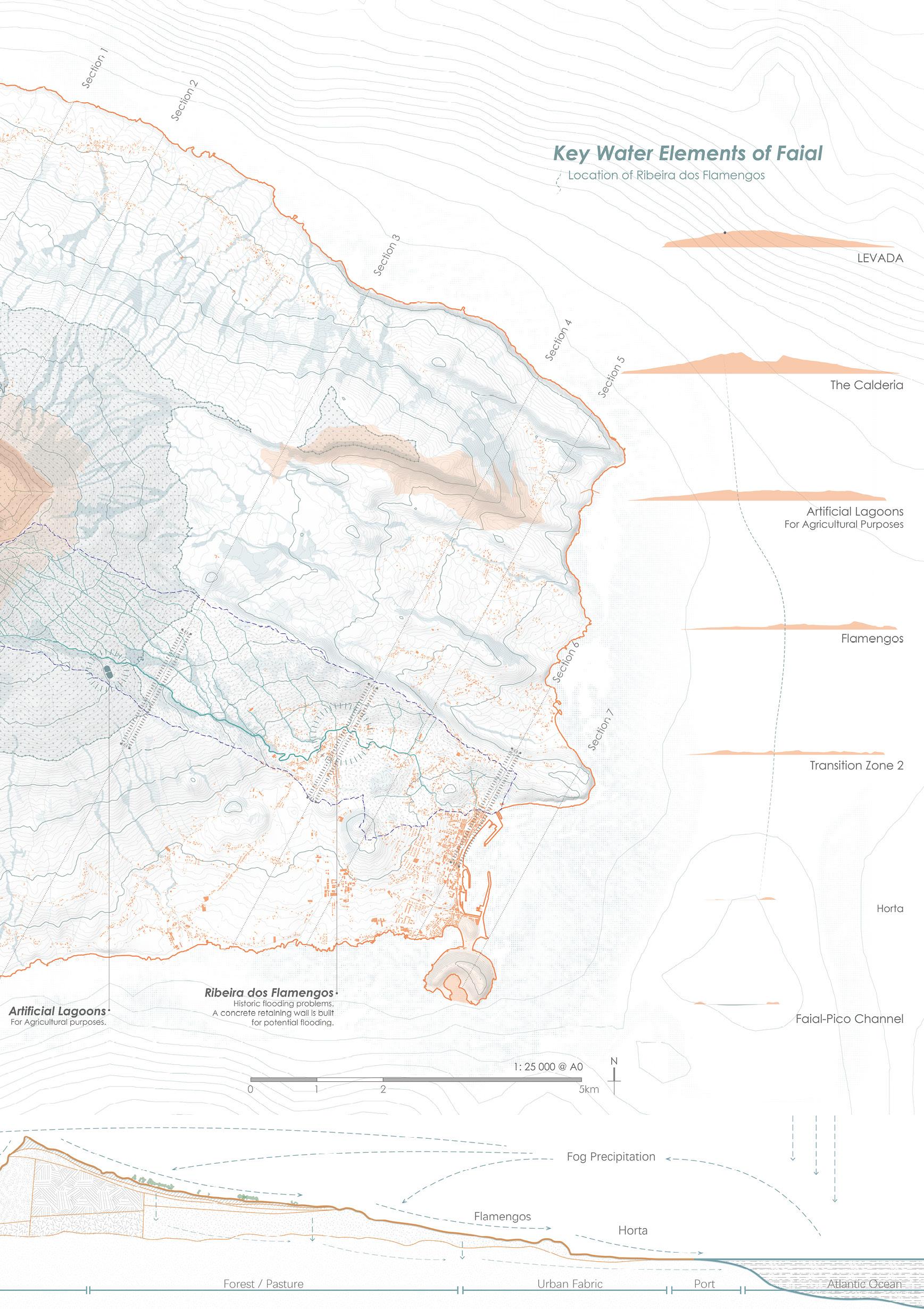
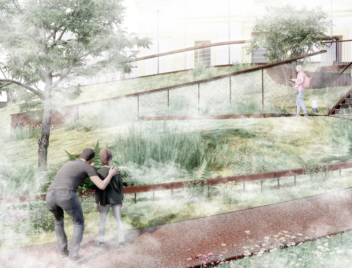
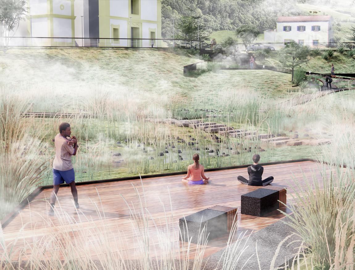
The moisture in the air condenses into fog, creating a cool and humid environment in the Azores Archipelago. This environment gives rise to a unique habitat known as the “cloud forest.” However, since the 14th century, human colonization of the pristine natural landscape has resulted in extensive deforestation, with dense pastures replacing the forest. In the context of global climate change, there has been an increase in extreme weather events, and grazing activities have further reduced soil permeability, making downstream areas unable to cope with the resulting floods. The project “Chasing the Fog, Catching the Water” shifts the focus away from a human-centric perspective and positions the cloud forest as the active agent in the landscape.
The overall strategy and design approach follows the patterns and processes of nature. Against the backdrop of the Anthropocene, the project explored non-linear landscape interventions brought about by the overlapping cycles of geological movements, ocean currents, meteorological activities, natural succession, and human colonization.
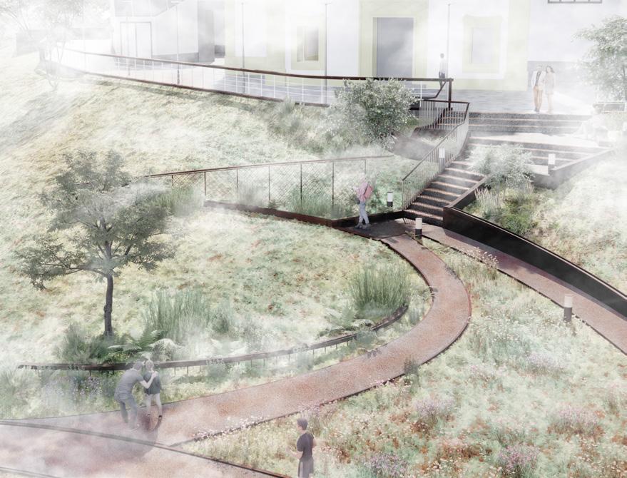
The cloud forest acts as a mediator for the moisture in the air and soil, playing a crucial role in the island’s water cycle. By introducing fog catcher devices to collect fog precipitation, the project aims to provide a fresh water supply for both the cultivation of the cloud forest and the daily lives of local residents. Additionally, the restoration of the cloud forest is carried out in three stages based on altitude, enhancing the soil’s water retention capacity and intercepting upstream rainwater while restoring the non-human habitat. The design site for this project is the Flamengos Parish Center in the downstream area, expecting to offer a resilient channel for water flow and a safe recreational space for the local community. The landscape installations for fog makers and catchers also serve an educational purpose.
ABOVE: Bird view of Fog Garden. OPPOSITE: Collage of water features.
113 Archipelago | Shimeng Dai
115
ABOVE: Sectional perspective of flood resilient park.
BELOW: Site Plan 1:300
OPPOSITE: Strategy Plan 1:2000.
117 Archipelago | Shimeng Dai
ABOVE: Fog catcher and maker
BELOW: Sectional perspective of overall strategies.
ABOVE: Meditation deck.
BELOW: Sectional perspective of overall strategies.
119 Archipelago | Shimeng Dai
Seismic Memory, Future Archaeology
POST-DISASTER ABANDONMENT AND REMEMBRANCE
Julie Næss Karlsen
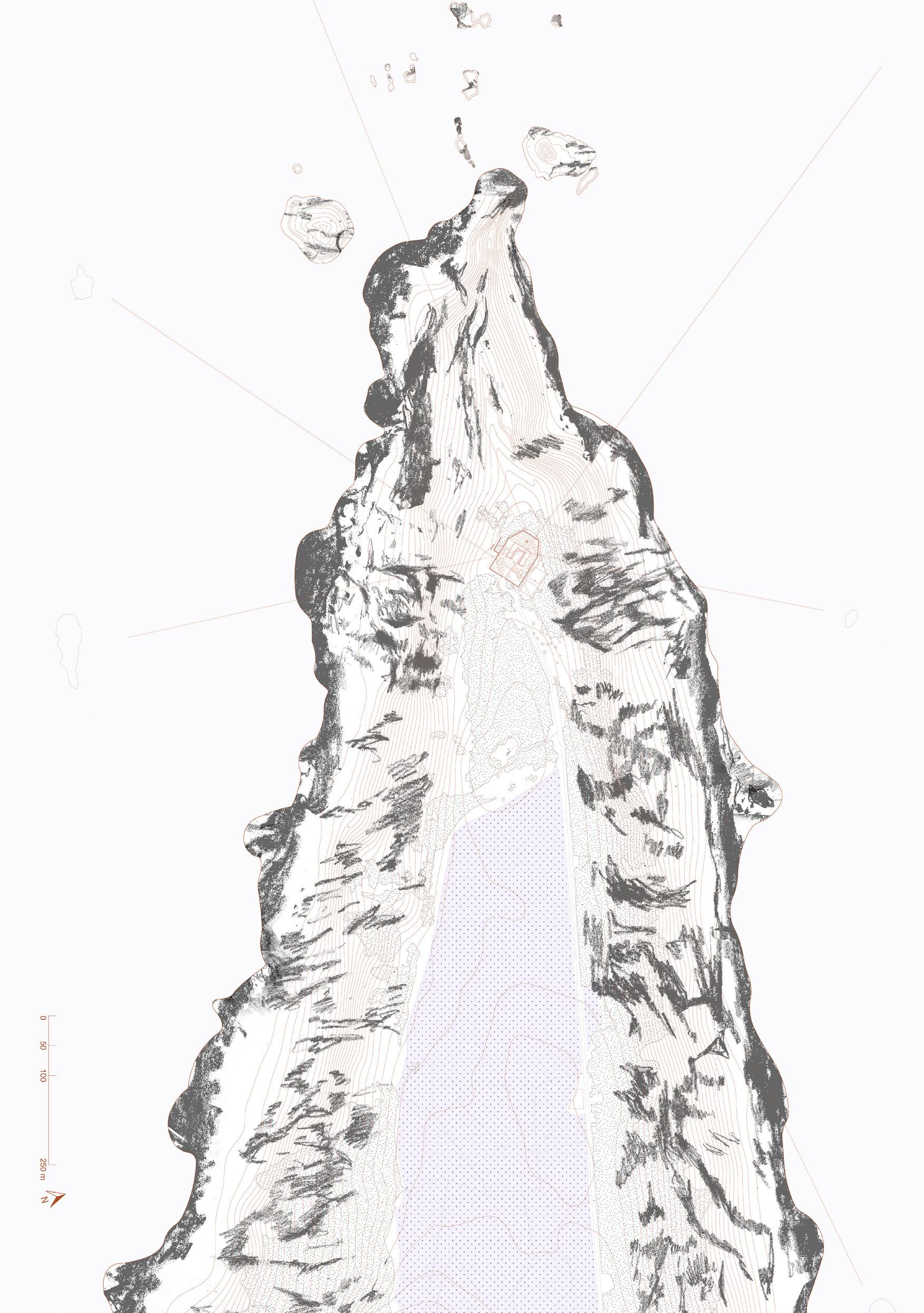
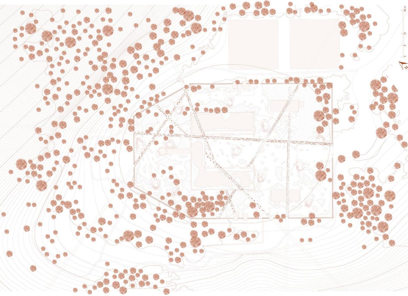
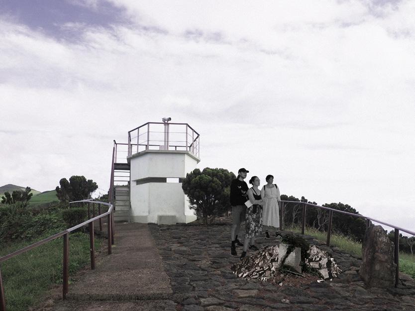
Seismic Memory, Future Archaeology looks at layers of human presence, human withdrawal, and geological processes around the earthquake-damaged and abandoned, yet functional lighthouse at Ponta dos Rosais on São Jorge in the Azores archipelago.
The work is based on fieldwork and appreciation of the lighthouse as a postdisaster landmark and a valuable ecosystem. A procession is framed through the landscape as one approaches the lighthouse, amplifying its significance as a landmark while highlighting its seismic vulnerability. The perimeter wall of the lighthouse becomes the boundary of the main project site and is left to break up along future fault line movements. To counter the angular monumentality of the lighthouse structures, material lines are imposed in the landscape, creating new sight lines. The lines mirror but distort the materiality of the place, being made out of site-specific plants, pyroclastic gravel, and broken-down concrete. Consequently, the project is an experiment in full material circularity and hyper-local, low-carbon interventions.
The lines cut through the buildings, challenging their monumentality, encouraging vegetation to enter and accelerating the entropy of the deteriorating structures. Orienting one’s gaze first to the seismic ground and then towards the horizon, the site will serve as a viewpoint to reflect on the specificity of location and as an anti-monumental site for seismic remembrance. It is a project designed to disintegrate and become a site of future archaeology, revealing meaningful layers in the landscape and the careful balance between human presence and abandonment.
ABOVE: Pico visual. The lines emphasise the views towards the surrounding islands, and the contrast between the seismic ground and the Atlantic horizon.
OPPOSITE: 1:2500 plan. The site plan, drawn at 1:2500, situated the site at tip of the eroding cliffs and pasture of São Jorge.
121 Archipelago | Julie Næss Karlsen
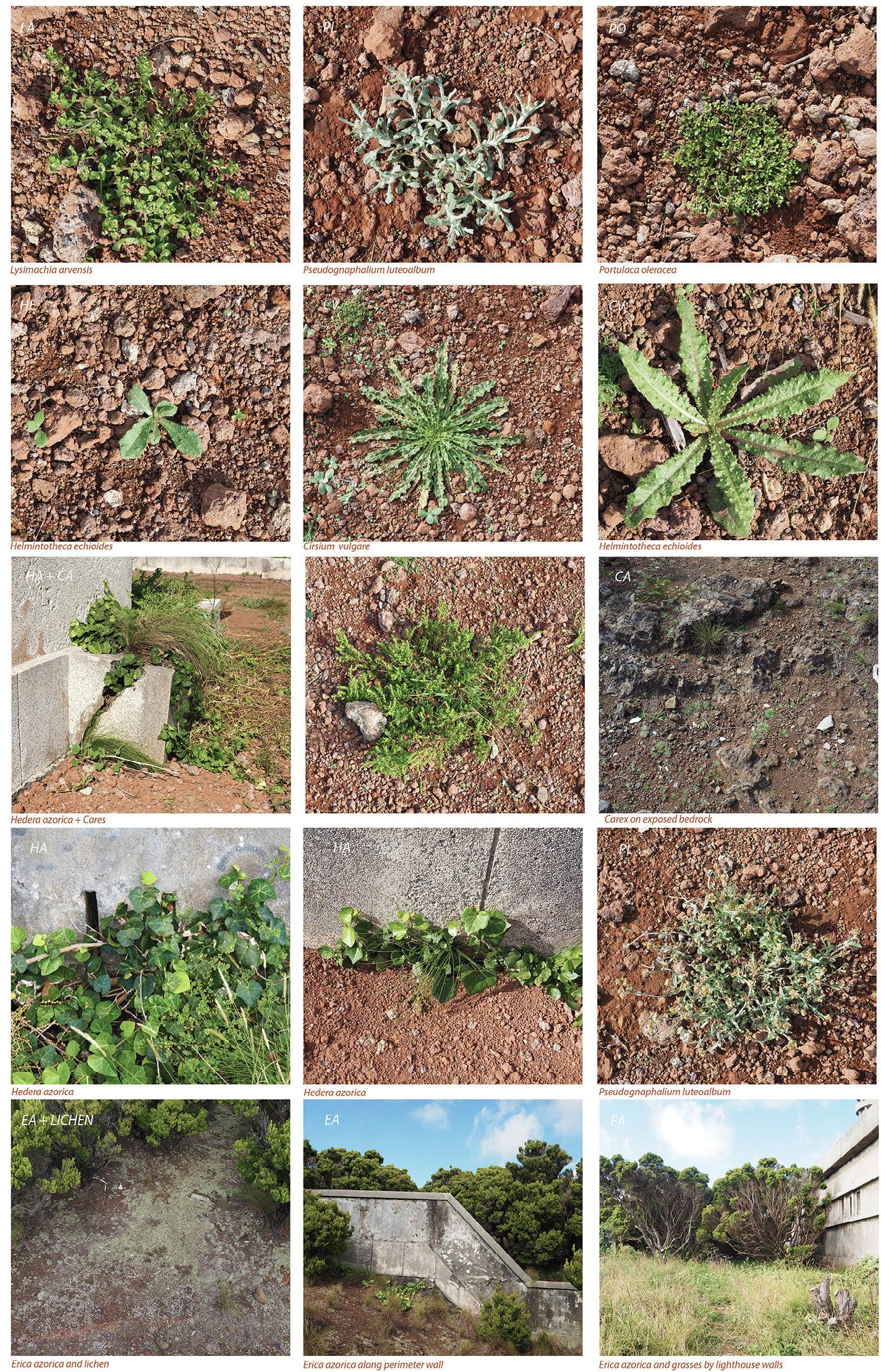
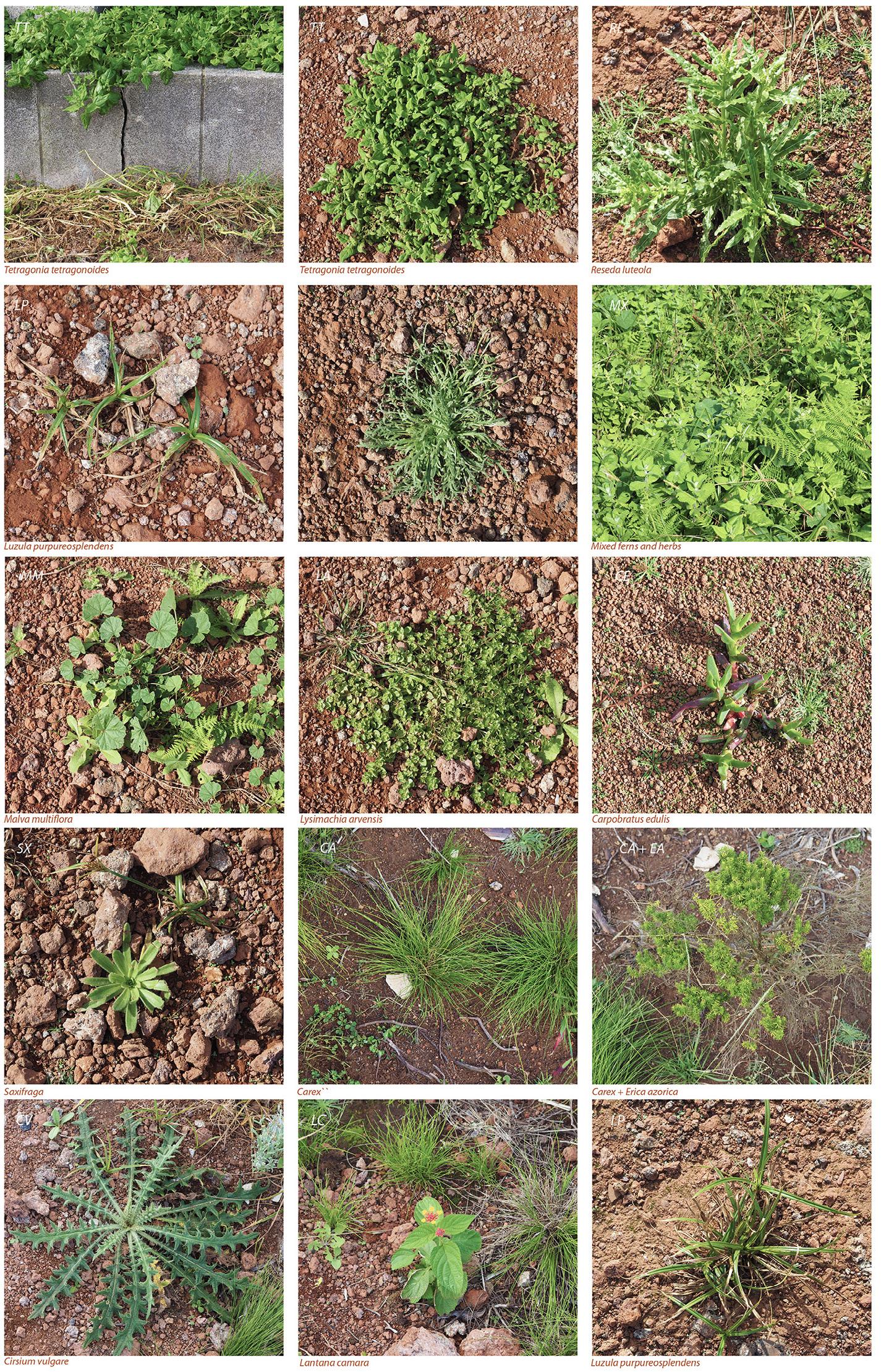 ABOVE: Botany. Fieldwork photos of plants on site, showing a mix of endemic, ruderal and coastal plants
123 Archipelago |
Julie Næss Karlsen
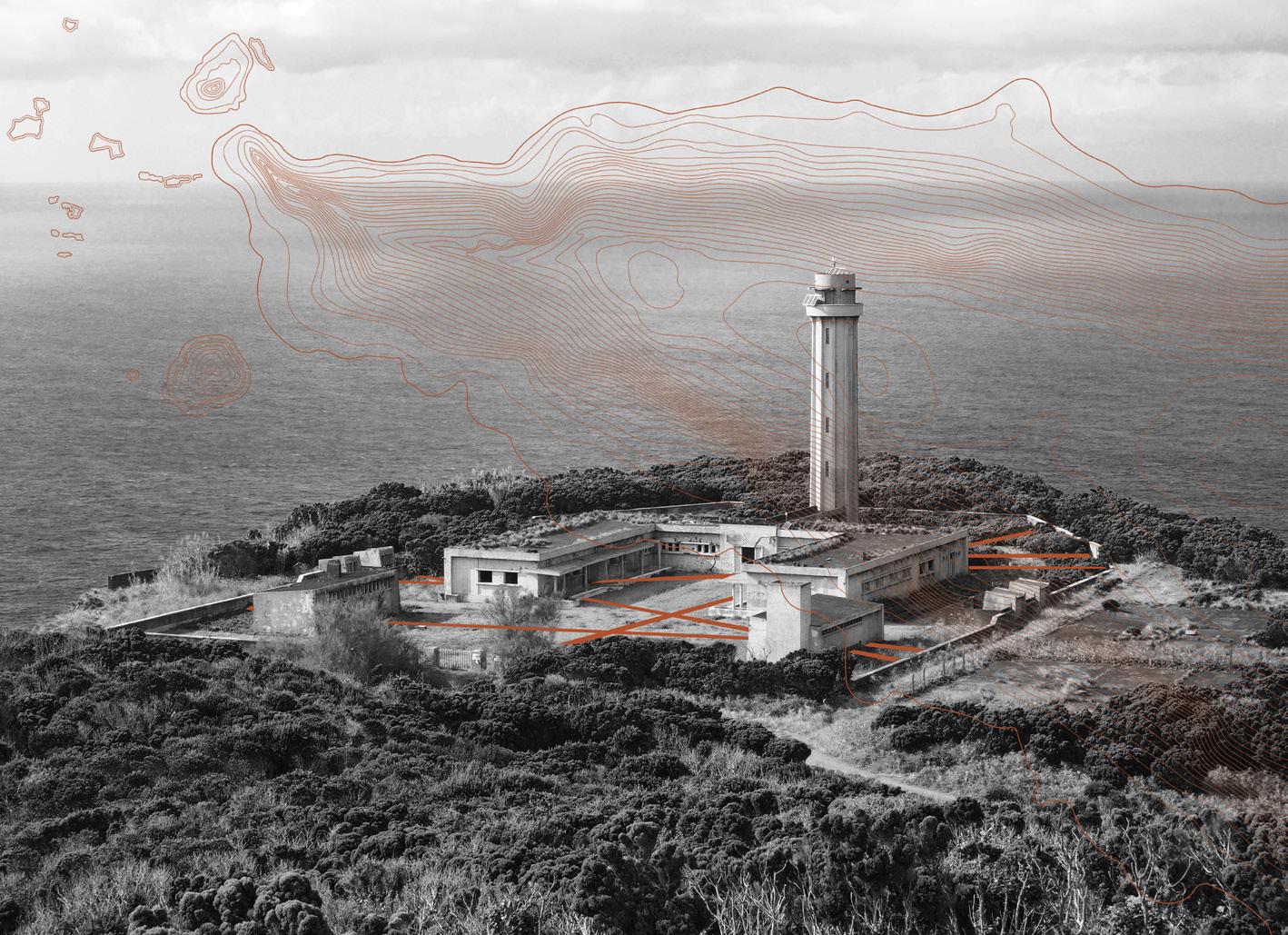
OPPOSITE TOP: The project imposes lines in the landscape of the lighthouse at the northwestern eroding cliffs of São Jorge.
OPPOSITE BOTTOM: Proposed plan, drawn at 1:200, showing lines cut through the landscape and structures, and debris scattered around the lighthouse site.
LEFT: Vigia visual. A procession is framed in the landscape towards the lighthouse. The former whaling tower gives a full view of the project site.
BELOW: Materiality. The project is based on full material circularity, as all materials used in interventions are sourced from the site.
125 Archipelago | Julie Næss Karlsen
Eco-Agro Fajã
ENVISIONING SUSTAINABLE AGRO-ECOSYSTEMS FOR COFFEE PLANTATION COMMUNITIES
 Yihang Li
The site is located on São Jorge Island, a flat coastal Fajãs community formed by volcanic activity and erosion. It has become a famous coffee-producing area due to its warm and humid microclimate and fertile volcanic soil.
However, the ecological problem here is serious. Coffee plantations use a lot of pesticides and chemical fertilizers, resulting in eutrophication of soil and water resources. Large tracts of coffee plantations and other agricultural lands fragment the surrounding natural habitat, impacting biodiversity. The island relies heavily on coffee plantations for agriculture and tourism. But there is no proper public space in the venue for people to gather and experience local coffee. The terrain in the north here is steep and the rainfall is heavy, resulting in serious soil erosion.
My overall concept is based on agroforestry under the coffee-banana intercropping model. My overall concept is based on the coffee-banana intercropping model, with ecosystem services guiding the design direction, envisioning sustainable agro-ecosystems for coffee plantation communities.
I propose three strategies. First, establish ECOLOGICAL GOVERNANCE NETWORK to reduce the impact of agriculture on natural areas through buffer zones, wetland systems, river erosion control, water purification systems, and ecotones. Second, strengthen society engagement, and establish a public relations activity area on existing vacant land, including a hard square, a plantation experience area, and a water purification experience wetland park. In this way, tourists’ sense of participation and understanding of the new plantation development model can be enhanced. Third, implement banana and coffee intercropping agroforestry system. Moreover, by relying on the existing plant fences, different plant combinations are used to enhance its ecological diversity, so as to extend the ecology of the surrounding habitat to the plantation, making the habitat ecosystem a whole.
ABOVE: Coffee plantation plan. OPPOSITE: Proposal master plan.
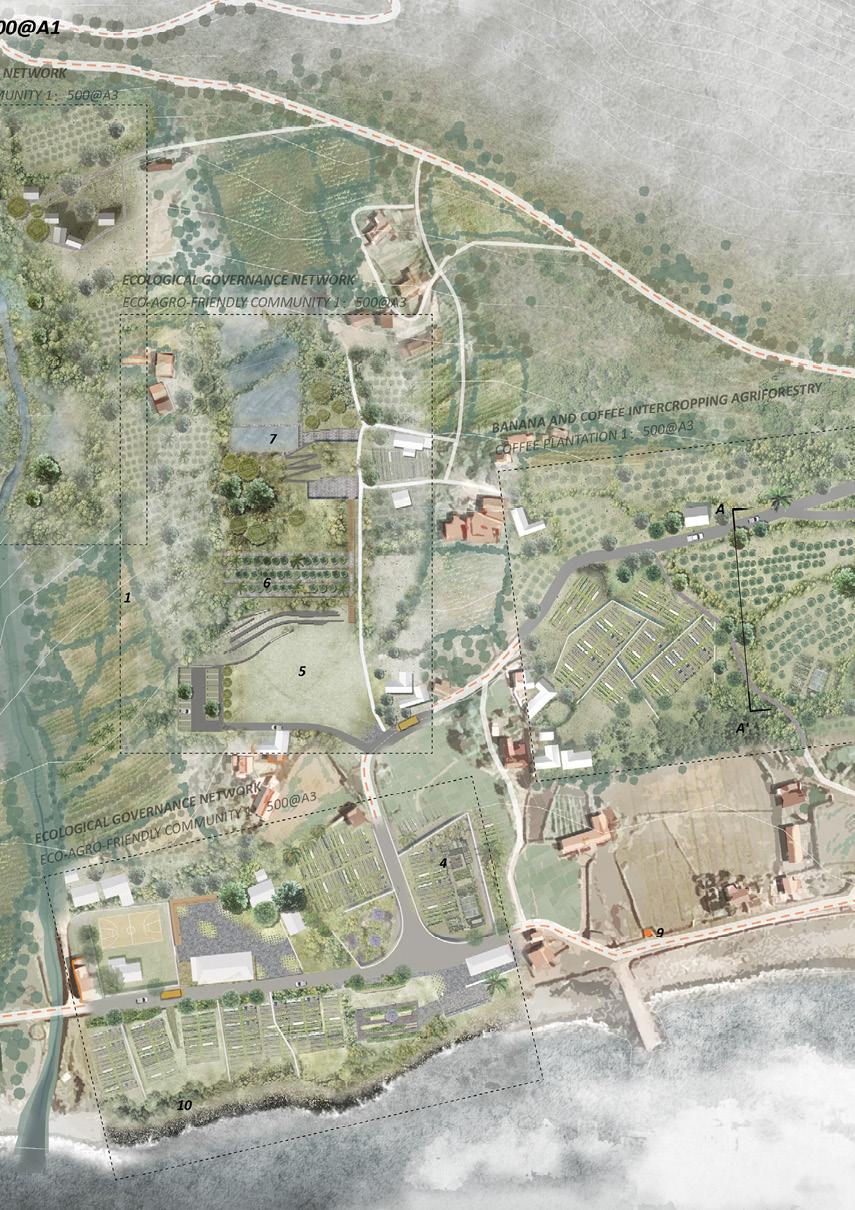
127 Archipelago | Yihang Li
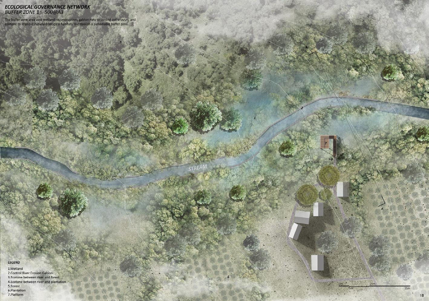
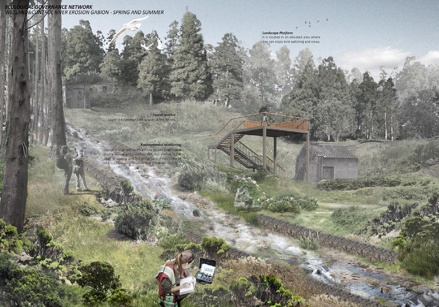 ABOVE: Buffer zone plan. BELOW: Buffer zone rendering in spring and summer.
ABOVE: Plan of eco agro community.
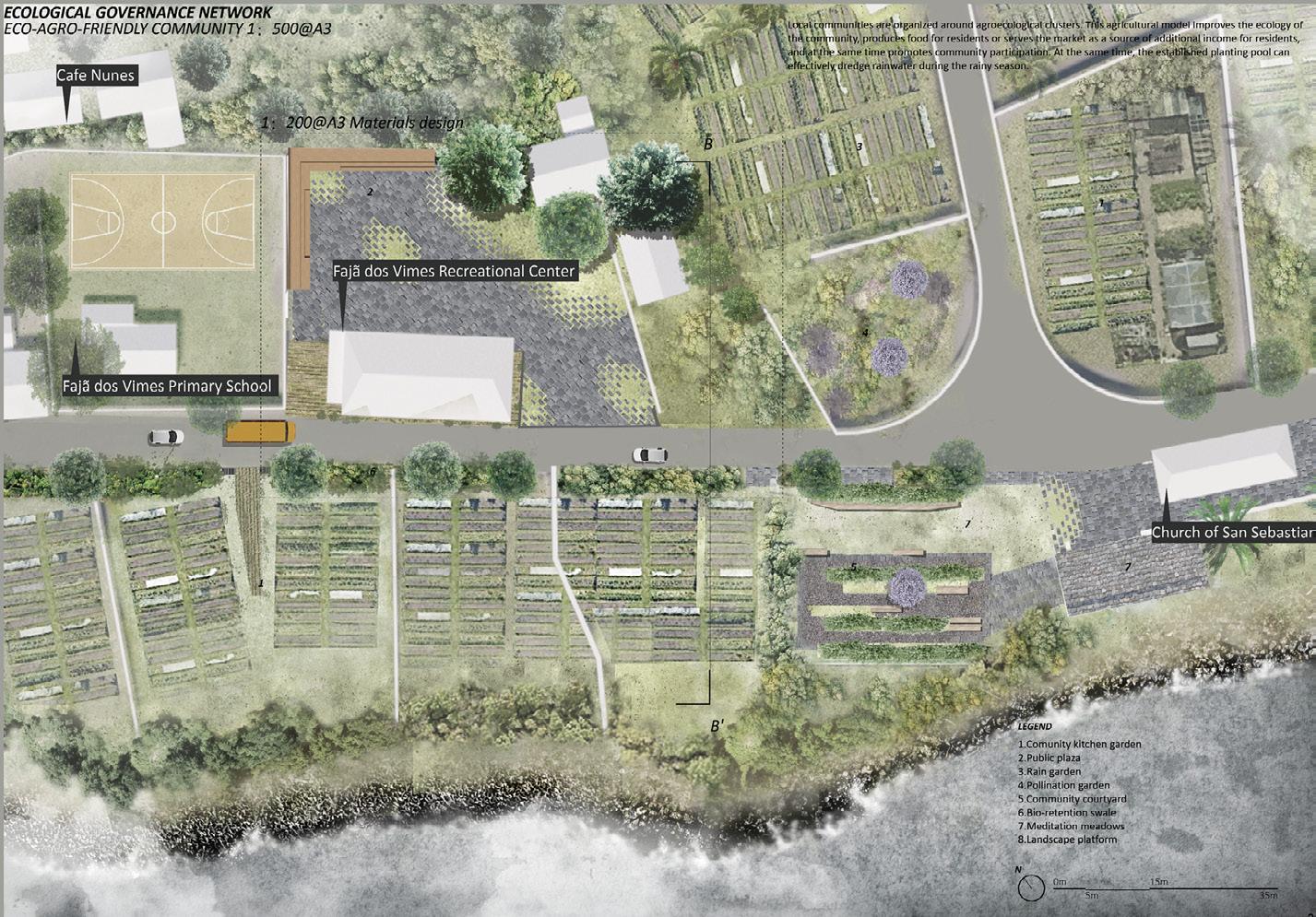
BELOW: Buffer zone rendering during winter rainy season.
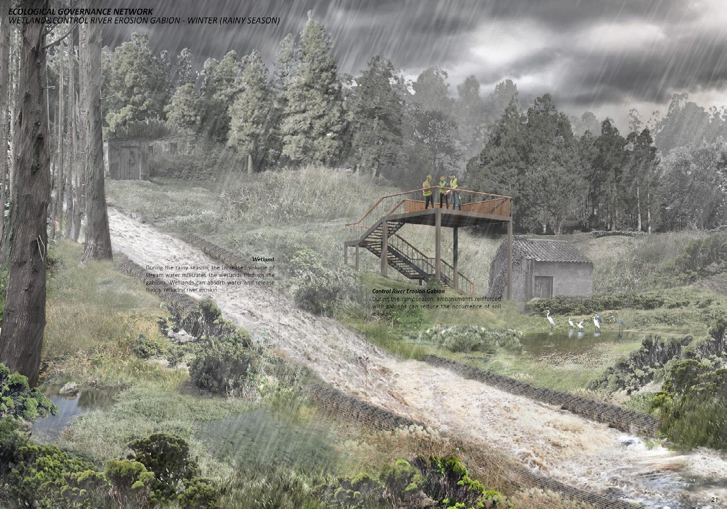
129
Archipelago | Yihang Li
ABOVE: Detail plan of society engagement.
BELOW: Purification pond section.
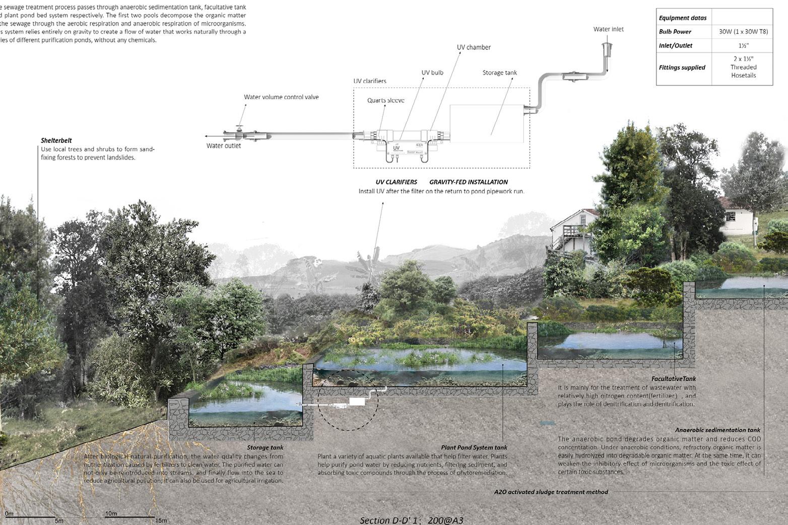
OPPOSITE TOP: Coffee plantation aerial view.
OPPOSITE BOTTOM: Detail of windbreak and ecological purification flora fence.
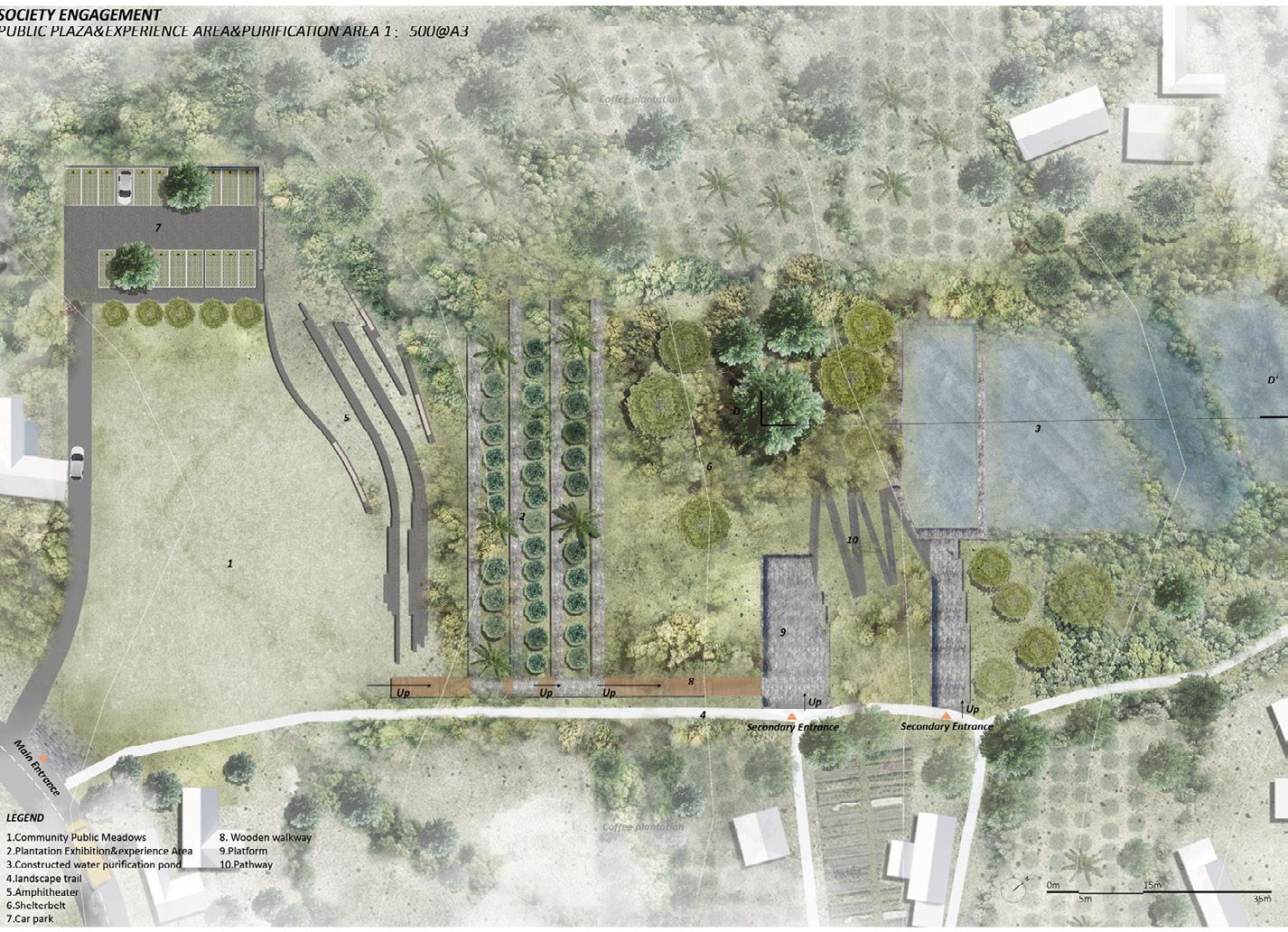
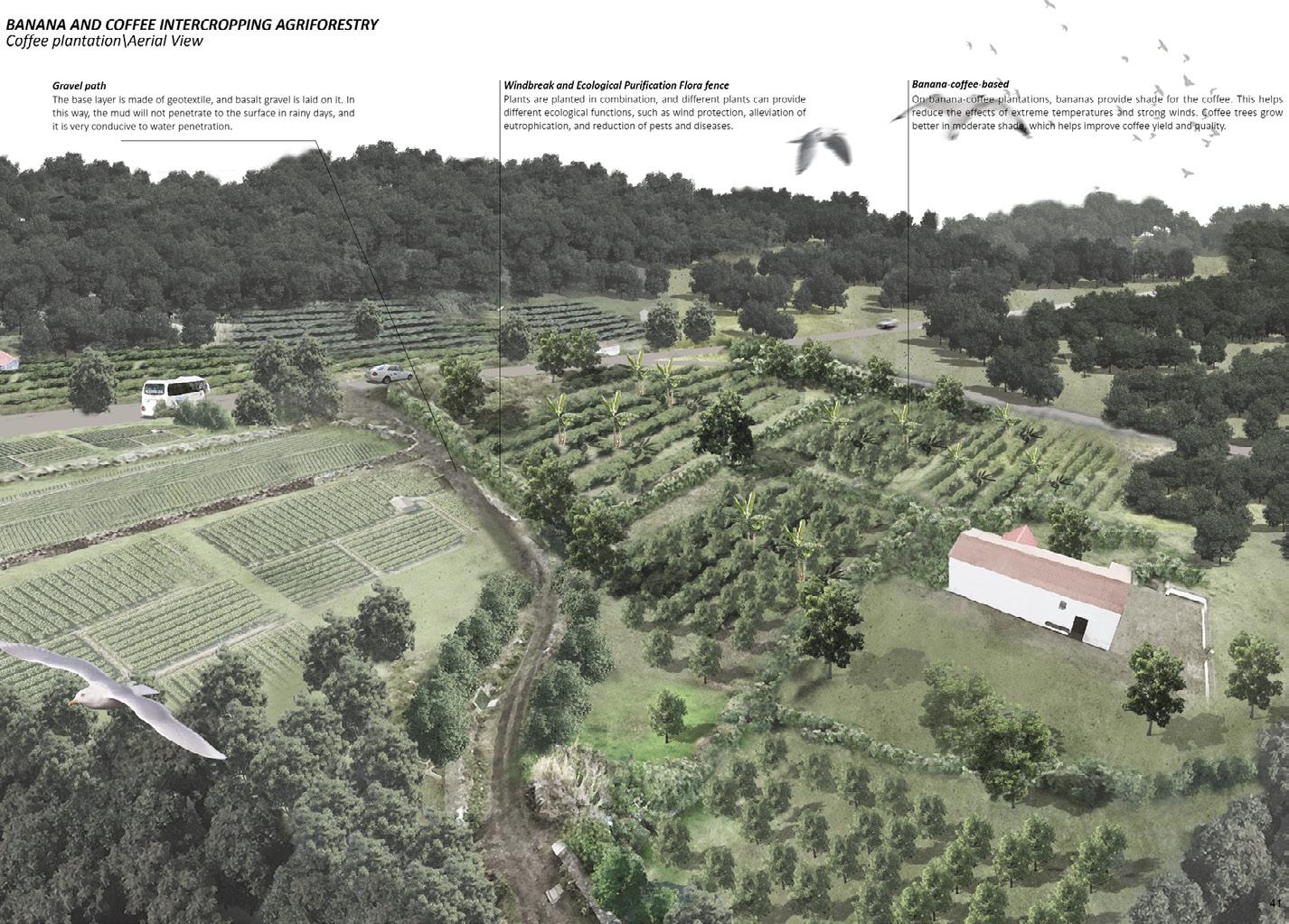
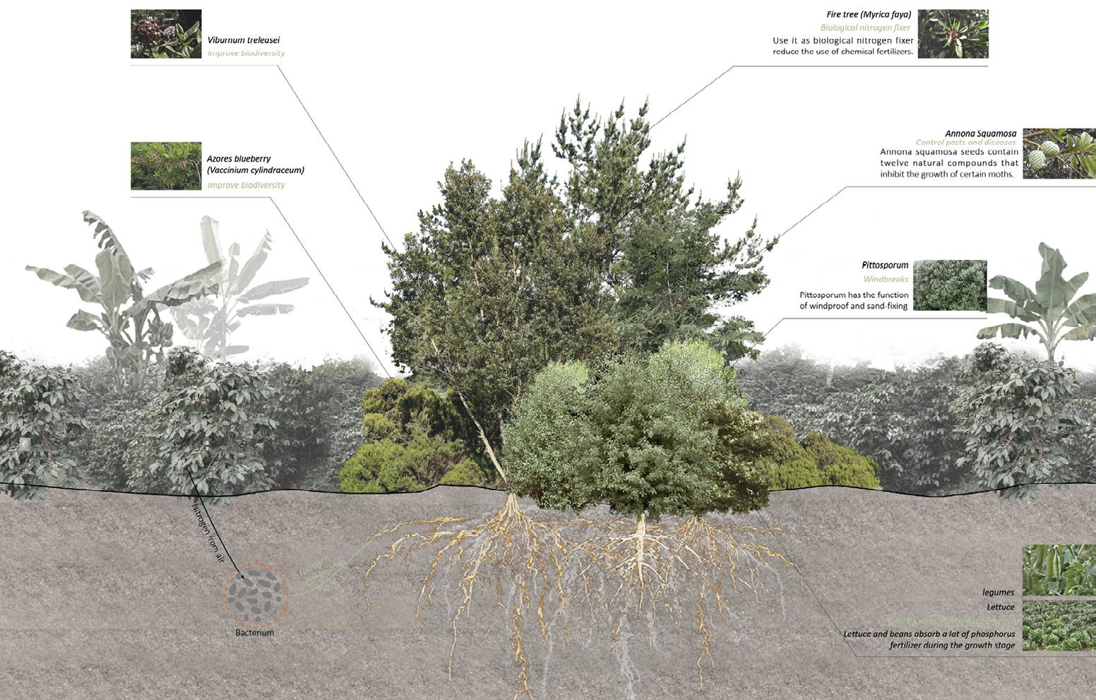
131 Archipelago | Yihang Li
Coral Conservation
Fangfei Liu
Cold-water coral is an important and rare species with high social and ecological value. Rough underwater terrain, massive sea mountains, and island slopes make the Azores an important habitat for cold-water coral. However, human activities like marine litter, fishing activity and seawater pollution are threatening their survival. To address these issues, I have developed a series of strategies to reduce the damage caused by these activities. However, relying solely on external forces is not enough to achieve long-term protection for cold-water coral. Therefore, a coral conservation educational park is planned in Horta City on Faial Island.
The park purifies surface runoff and septic tank sewage, advocates for fishermen to send accidentally caught coral here for exhibition, and hosts collective activities related to agriculture and gardening to help people take responsible actions towards the environment. The Seabin device, which automatically collects marine litter, deposits the trash collected into the park. Visitors use this litter to create handicrafts. The park also includes an ocean coral nursery and a land coral nursery to help rebuild coral reefs. It serves as a landmark for the Azores archipelago and showcases their commitment to preserving and protecting the environment, while also contributing to the tourism industry. By enhancing people’s understanding of cold-water coral and building emotional connections with them, we can raise people’s awareness of coral conservation and get them to take the initiative to restrain their behaviour, thus achieving long-term conservation of cold-water corals in the Azores.
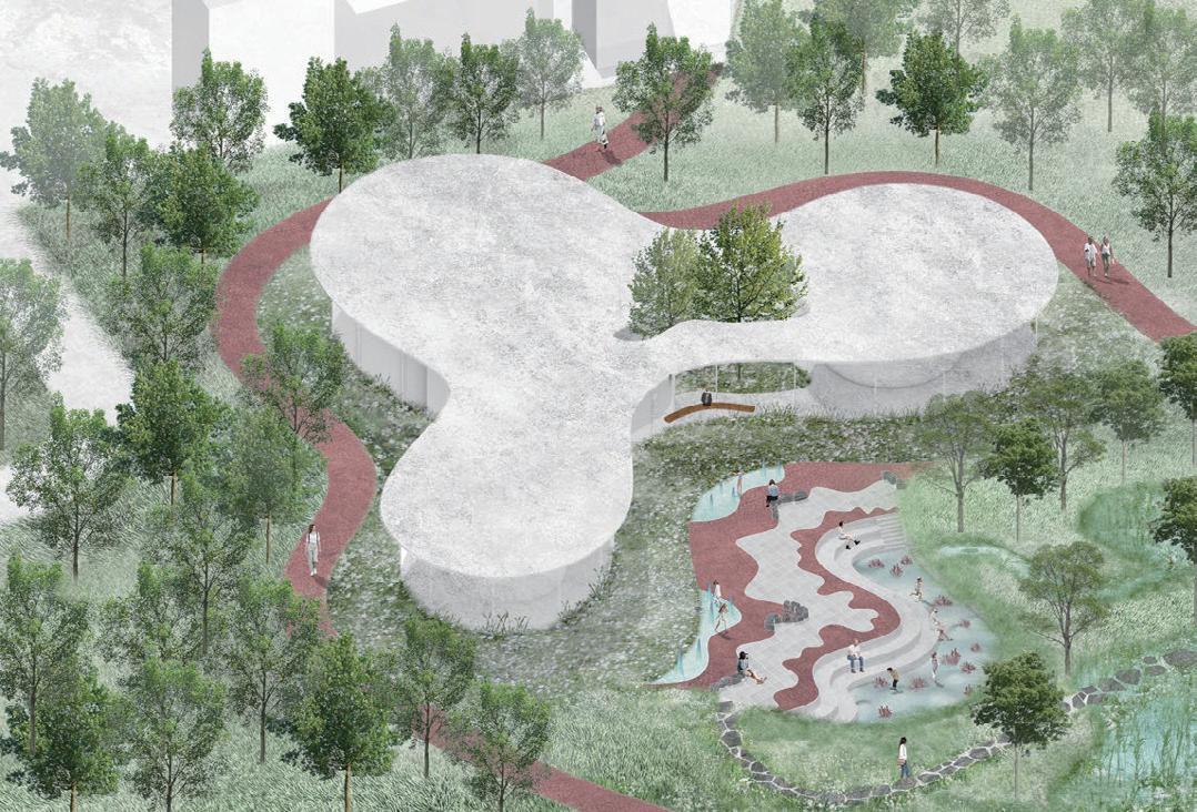
EDUCATIONAL PARK
ABOVE: Axonometric view of land coral nursery. OPPOSITE: Perspective of the park.
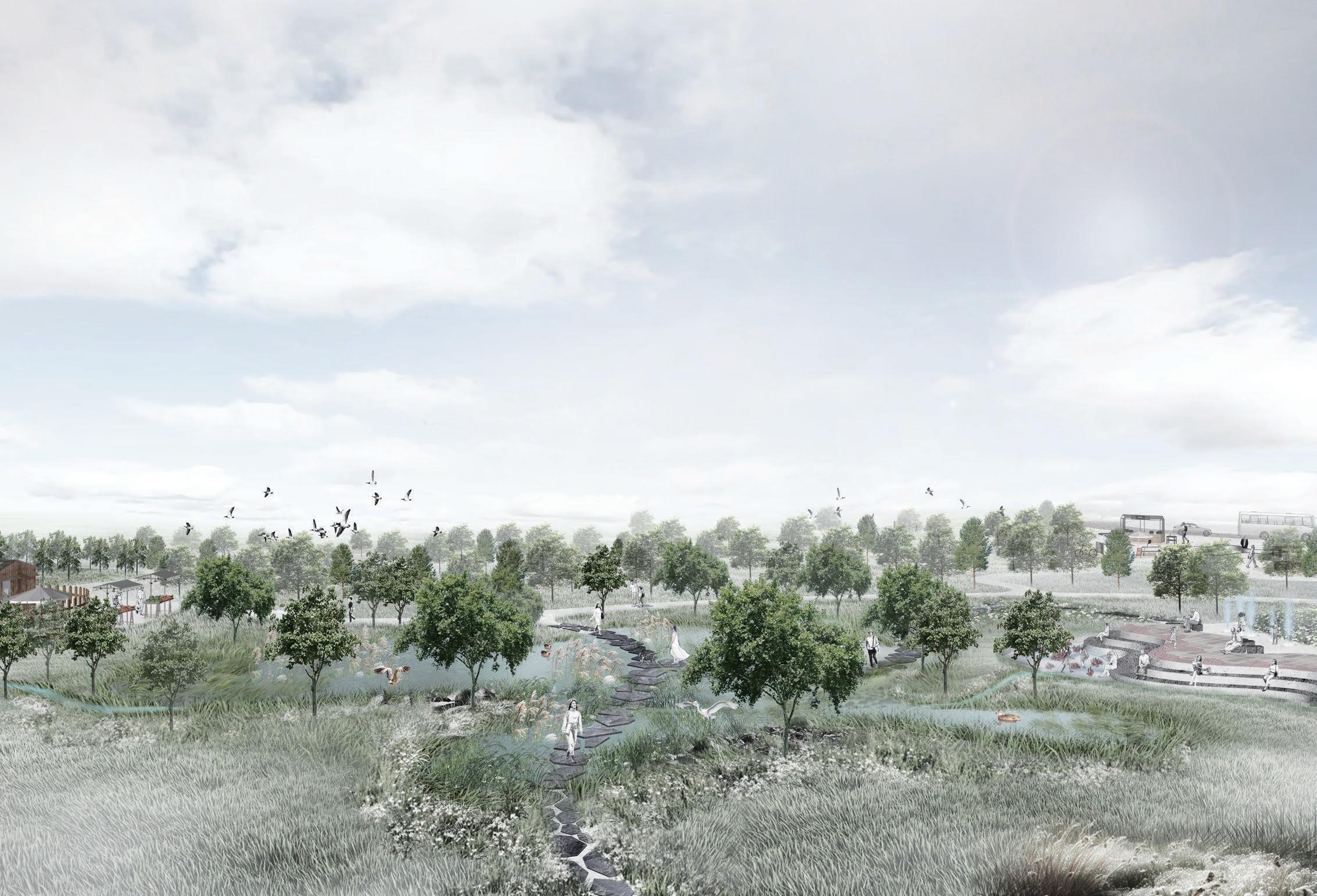
133 Archipelago | Fangfei Liu
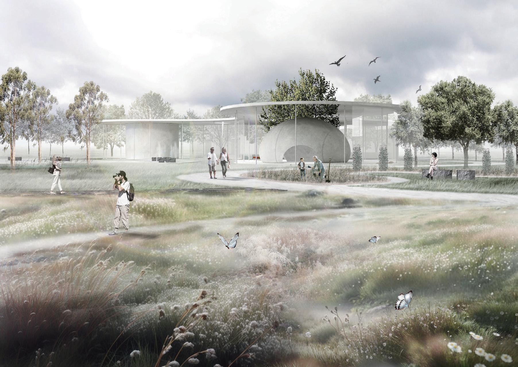
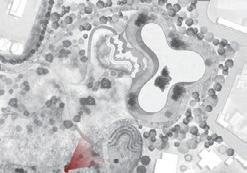
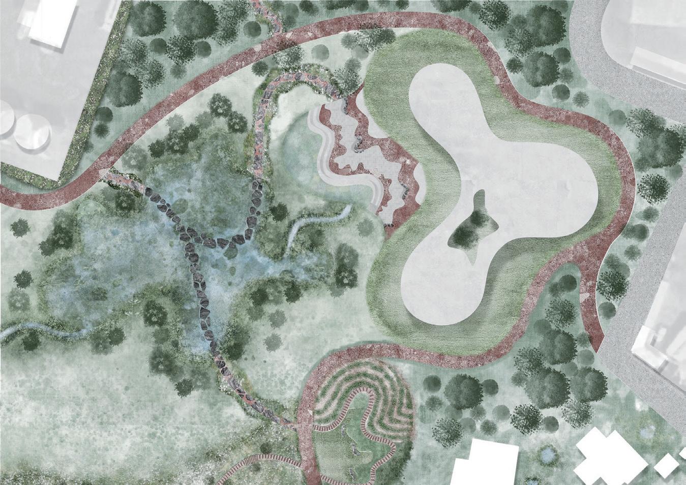
Masterplan 0 10 20m N 1 1 Wetland 2 2 Coral Interactive area 3 3 Fountain 4 4 Land coral nursery 5 5 Crop planting activity area 6 6 Edible plant garden 7 7 Species-rich grasslands 8 9 8 9 Communal wetland Woodland Legend
TOP: Perspective of land coral nursery.
BOTTOM: Detailed design of land coral nursery.
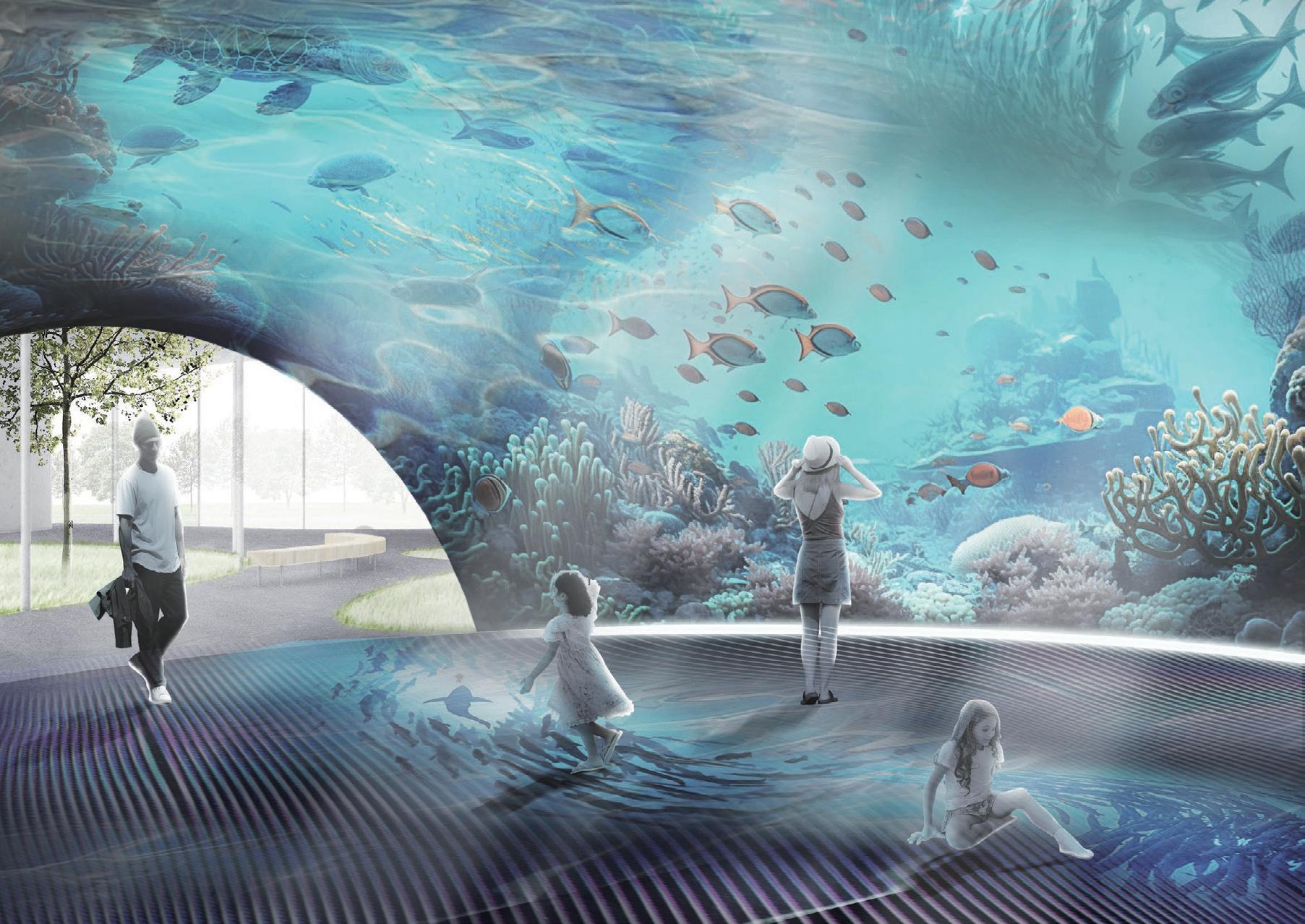
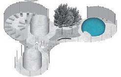
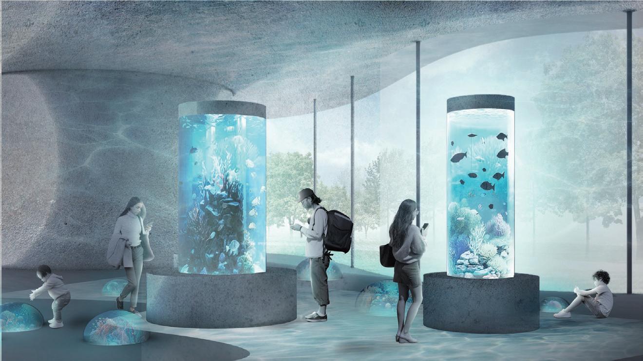
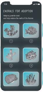
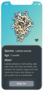
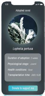
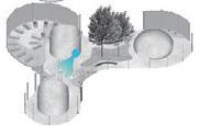
Browse Coral Species Adopt a coral Funding for coral Coral adoption area Visitors adopt young corals here via a mobile app and regularly donate money for their corals 135 Archipelago | Fangfei Liu TOP:
Rendering of coral interactive experience area. BOTTOM: Rendering of coral adoption area.
TOP: Park masterplan.
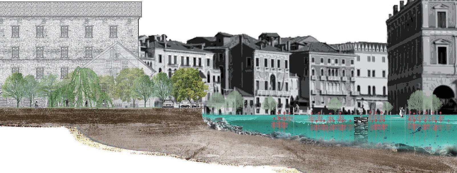
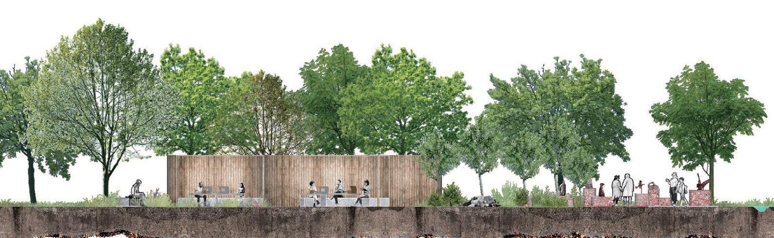

BELOW: Section of ocean coral nursery.
BOTTOM: Section of marine litter workshop.
N 0 10 50 100m 1 2 3 4 5 6 7 8 8 8 9 10 11 13 12 14 14 14 14 Legend 1 Outdoor coral exhibition 2 Marine litter workshop 3 Campsite 4 Community grove 5 Orchard 6 Herbaceous garden 7 Terraces 8 Wetlands 9 Land coral nursery 10 Dining and leisure area 11 Parking lot 12 13 14 Ocean coral nursery Walk trail Woodland Masterplan Workshop
litter storage Exhibition of works Bioswale Marine litter workshop Ocean coral nursery with floating PVC coral tree C-C' section 0.2m sea level steel walkway Basalt stone block walkway 1.8m sea level steel walkway Low tide level:0.2m High tide level:1.8m Coral art installation Ocean coral nursery & Coral art installation Travel route & Sections Travel route 1 2 Coral art installation 2 Ocean coral nursery 1
Marine
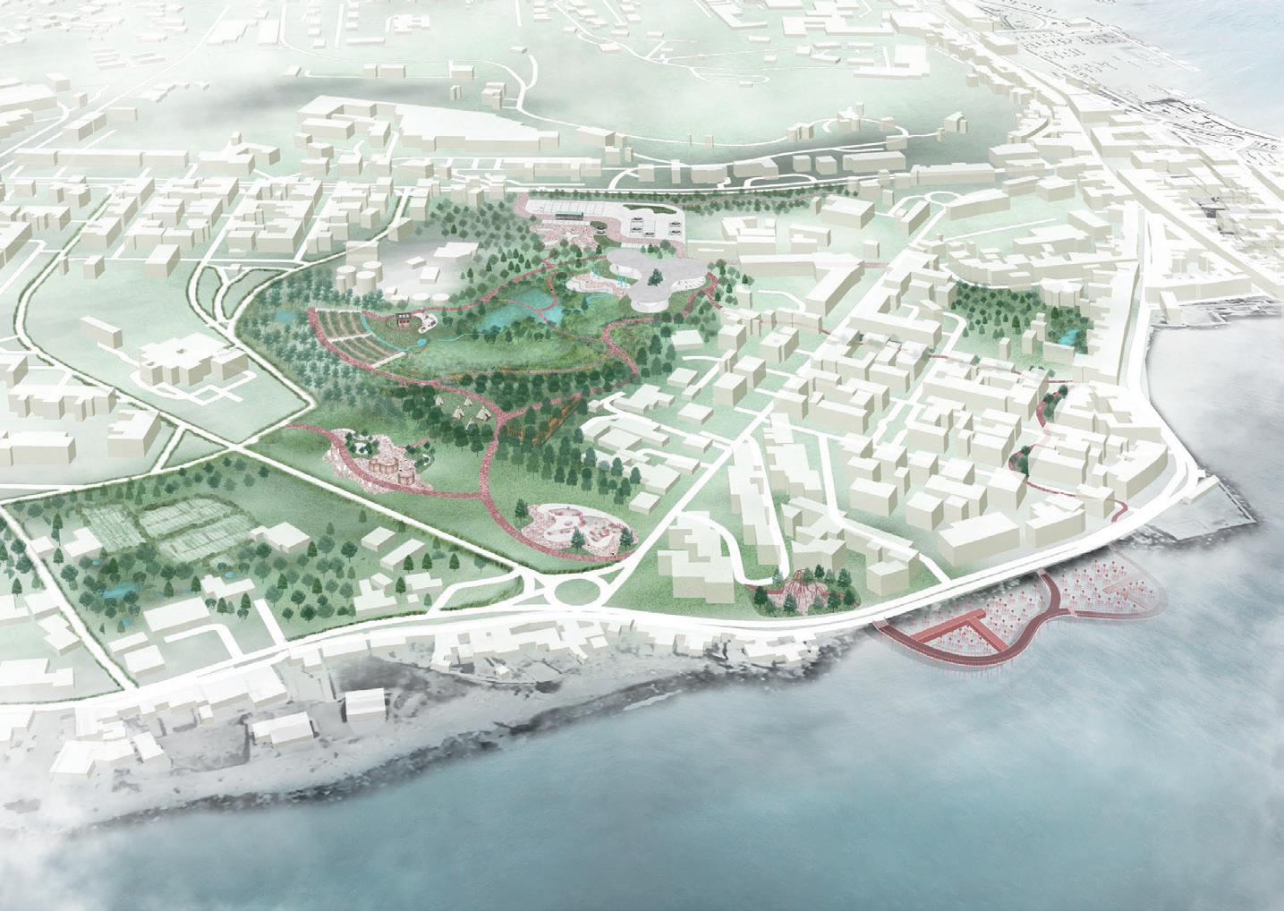
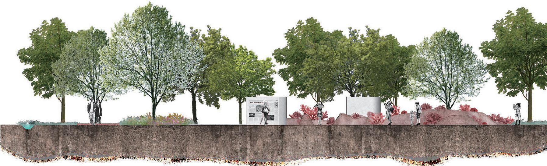
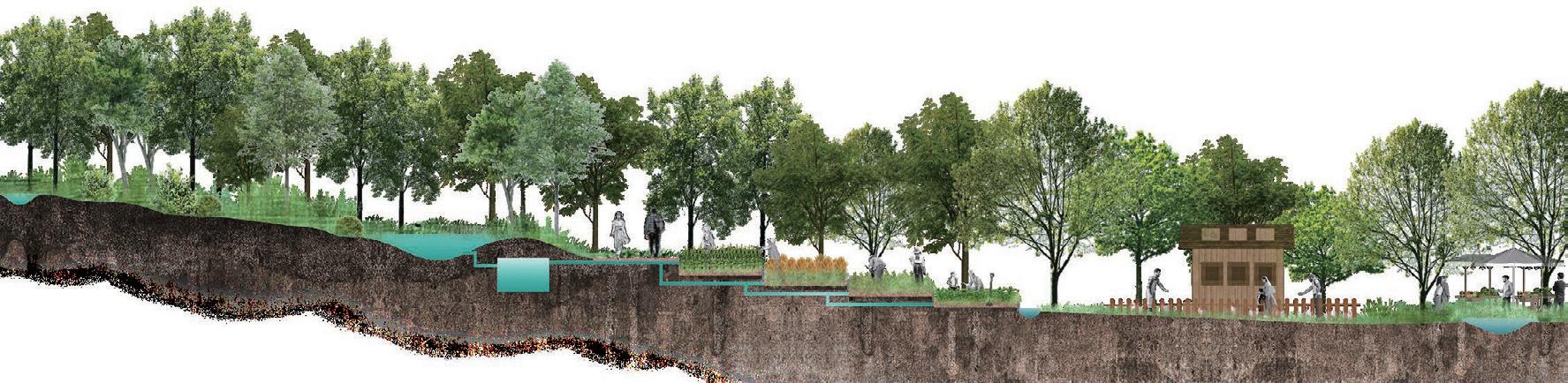
Aerial view Open-air coral exhibition Community grove Marine litter workshop Terraced farm Bioswale Retention pond Coral art installation Ocean coral nursery Walk trail Wetland Wetland Wetland Land coral nursery Parking lot Dining & leisure area Herbaceous garden Coral exhibition Coral Information Board Bioswale Open-air coral exhibition Terraces Bioswale Retention pond Poultry housing Agricultural products market Terraced farm 6 G G' 1 2 3 4 5 6 Travel route Terraced farm 137 Archipelago | Fangfei Liu
Park masterplan aerial view .
Section of terraced farm.
air coral exhibition.
TOP:
BELOW:
BOTTOM: Section of open
Azores Recalibration
Determining humanity’s position in relation to nature is a challenging and complex task. With our impact on the environment continually increasing, some individuals believe that we possess the ability to govern nature. However, separating humanity and nature serves only to absolve us of responsibility for the current climate crisis, which is predominantly driven by human activities and poses significant risks to Earth’s ecosystems. While human societies have historically intervened in the natural environment to meet various needs, such endeavours have often resulted in unfavourable consequences for the environment.
Nevertheless, humans are not the only species capable of modifying nature. For instance, beavers construct dams using branches that not only provide them with secure shelter but also actively contribute to dredging and channelling the river. This prompts the question of whether these creatures, which have a positive impact on the natural environment, could offer new insights to humans on how to coexist with nature.
The focus of this experimental project is to restore the ocean energy cycle, shift away from a human-centred perspective, explore the marine environment from the viewpoint of landscape architects, and build a collaborative system rooted in local social networks. This collaborative system includes a new way of fish farming and a re-imagined marina from a more-than-human perspective. The main objective is to attain a balance between economic growth and sustainable utilization of marine resources in the Azores, while also creating innovative ideas for sustainable landscape design.
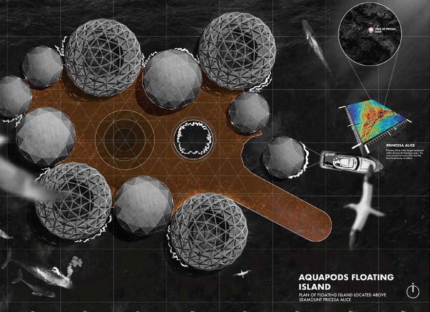
Sid Lu
ABOVE: Aquapods floating island plan.
OPPOSITE: Location of aquapods floating islands and reconstructed marina.
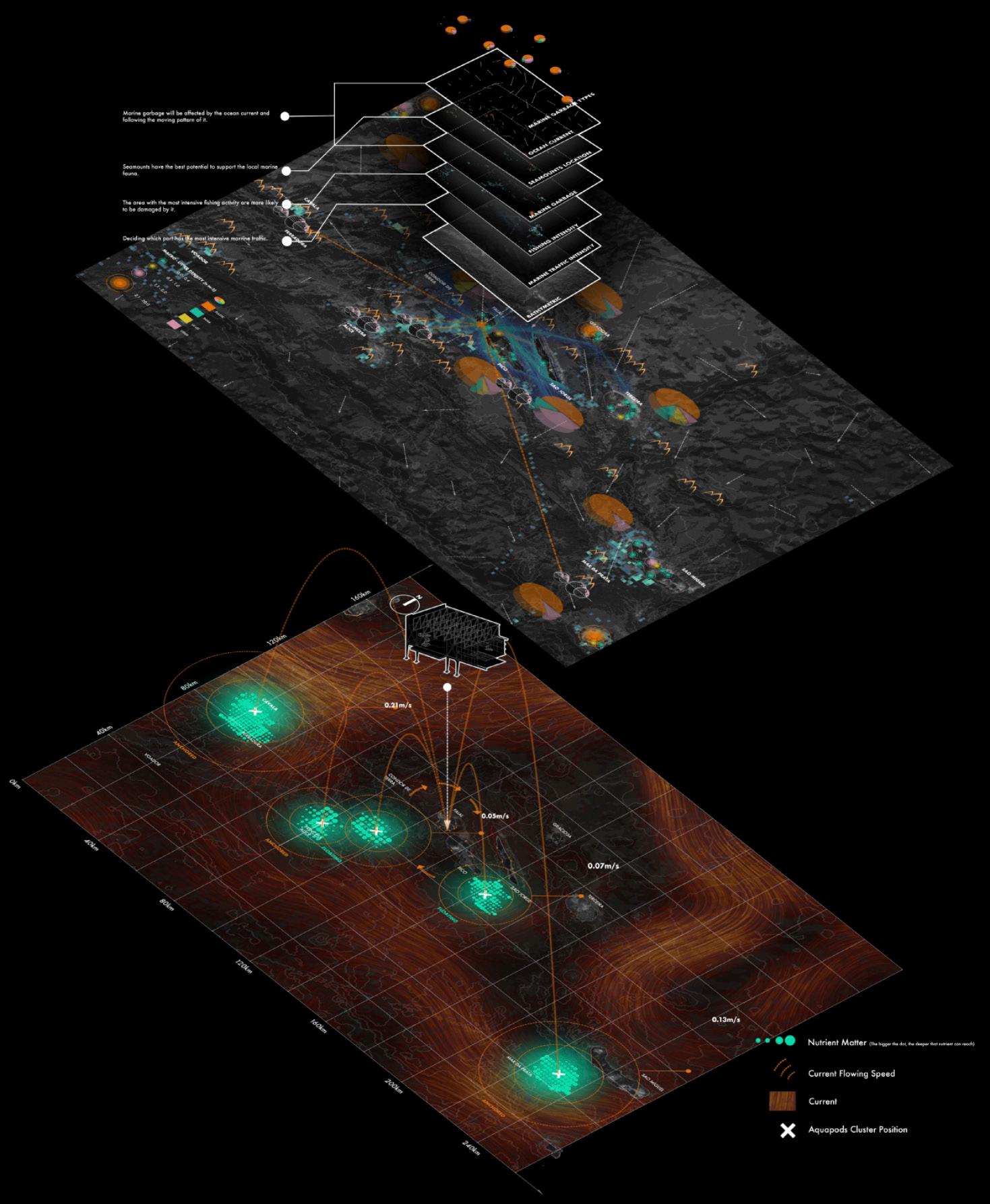
139 Archipelago | Sid Lu
1) Structural isometric drawing of reconstructed marina.
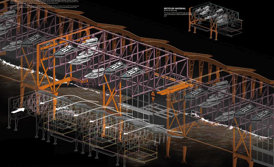
2) Reconstructed marina cross section.
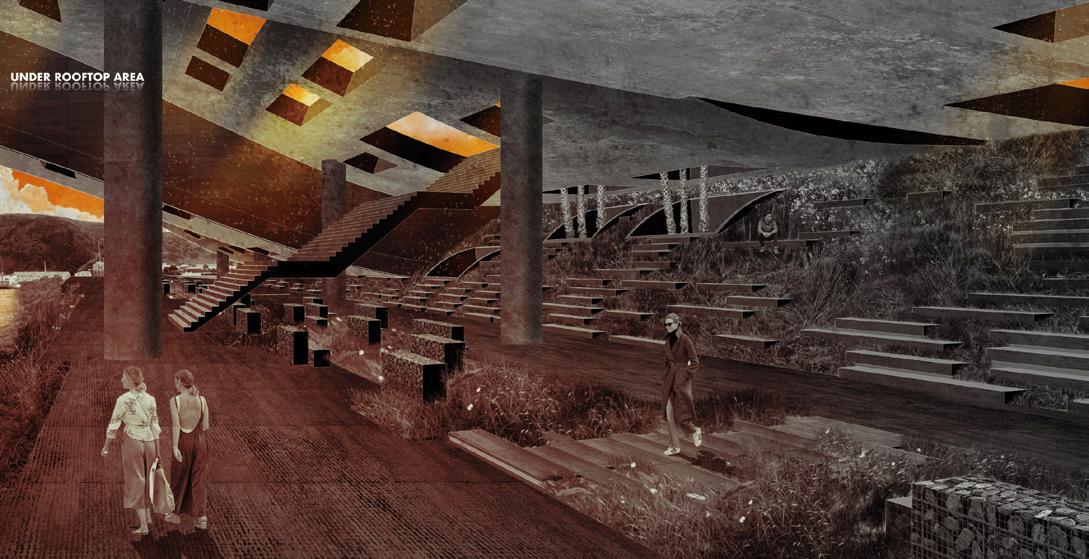
3) Marina rendering.
4) Marina rendering.
RIGHT:
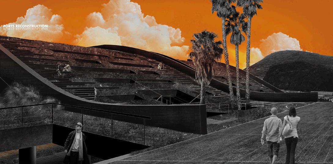 LEFT, TOP TO BOTTOM:
Bird’s eye view of reconstructed marina and aquadpod deployment.
LEFT, TOP TO BOTTOM:
Bird’s eye view of reconstructed marina and aquadpod deployment.
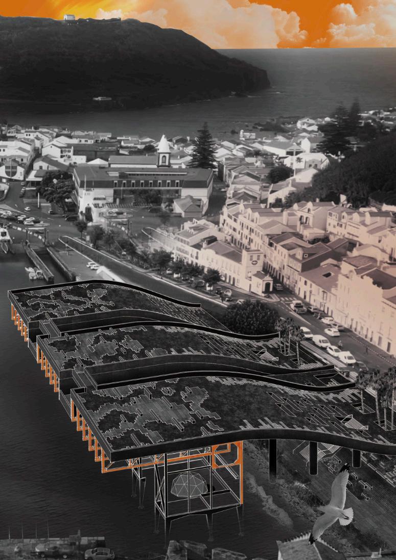
141 Archipelago | Sid Lu
ABOVE: Rendering of aquapods floating island.
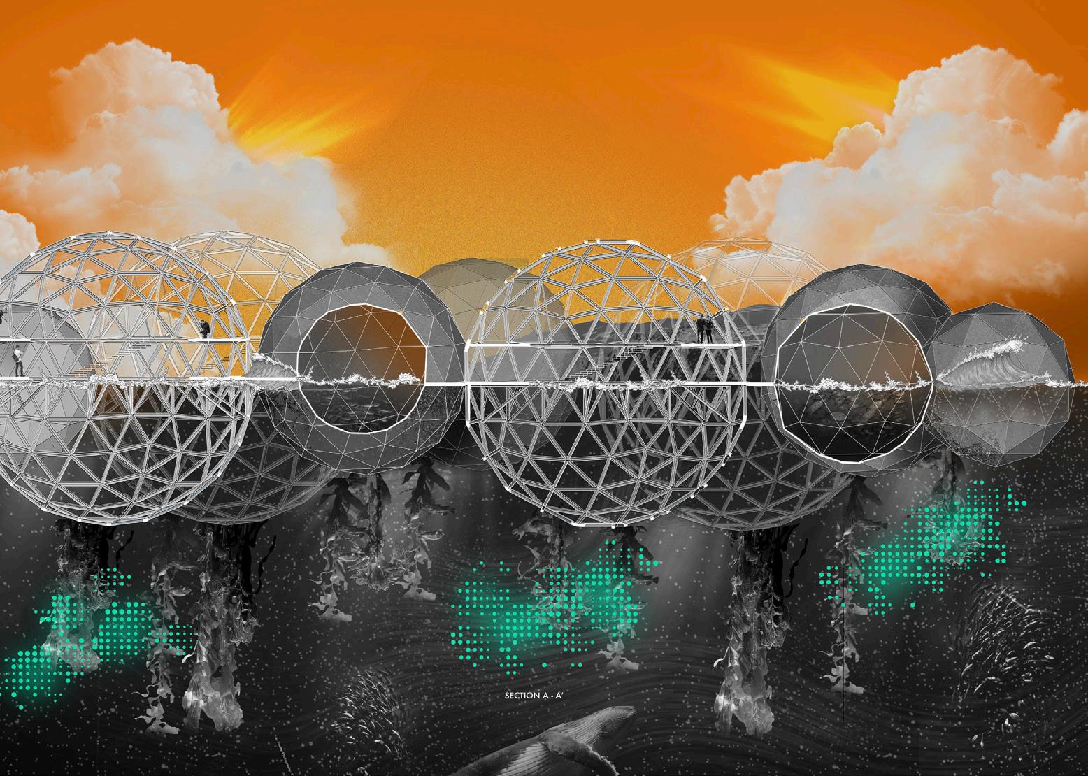
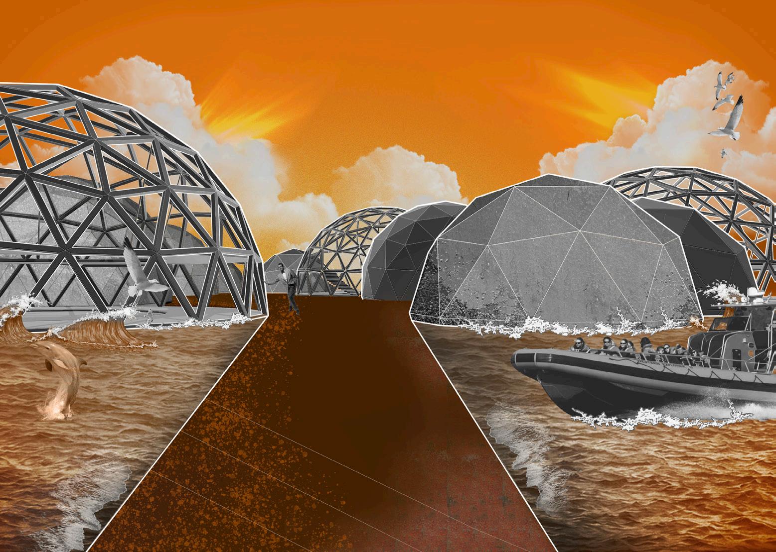
OPPOSITE: Modules attached to aquapods and associated activities.
BELOW: Aquapods floating island section.
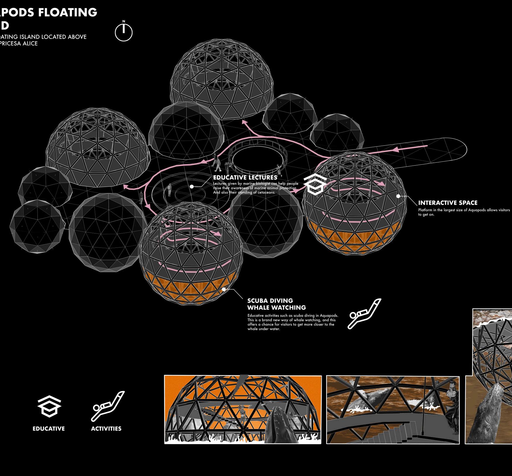
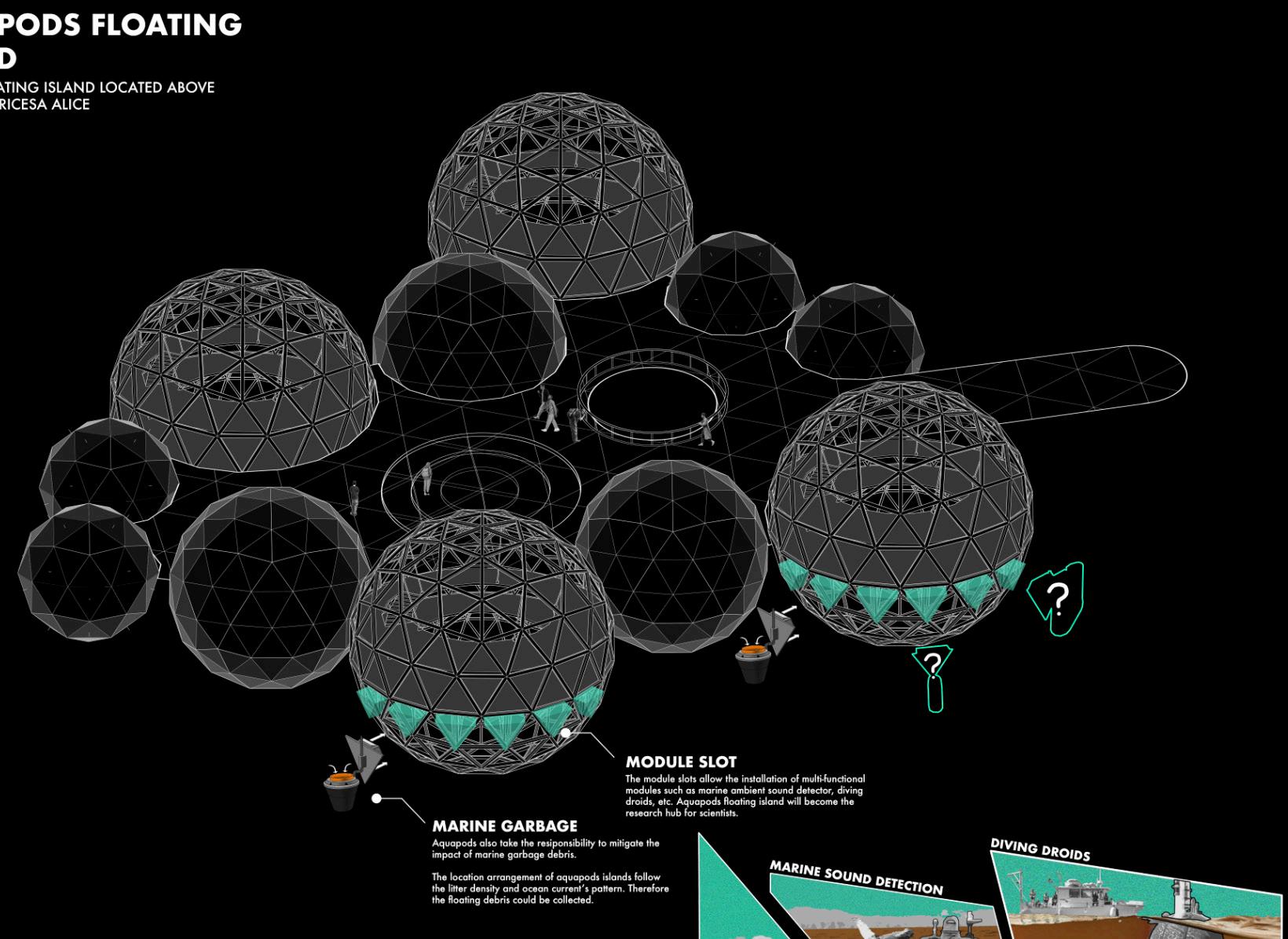
143 Archipelago | Sid Lu
Dynamic Monument
RESPONDING TO THE GREAT CYCLE
Yanning Mu
The Azores archipelago is a young land. Here, the land is in a natural cycle of creation and destruction: new lands are created by volcanic activity and disappear under the wash of the sea; existing landscapes are destroyed by volcanic activity, and new ecosystems and human communities quickly emerge on them. Here, the dynamic is a very distinguishing feature. But the true essence of the Azorean landscape is the relationship of human beings living with this ever-changing world. The settlers of the Azores have always lived in this unique landscape and have not only been influenced by it but have also been involved in the process of establishing the ecosystem from the moment the new land was formed.
I am proposing a responsive park sequence in Capelinhos, the most recent eruption zone, a central area of natural forces, which is predicted to disappear by 2118 due to coastal erosion and climate change. The landscape sequence will extend the space for human activity into this currently protected area, linking the lives of the locals to this land of radical change, and using the park’s hardscape and plant elements as instruments of response to the ‘cycle of creation and destruction’, exploring how they respond to it over more than a hundred-year period. People move horizontally in the Link system and Crater gardens and vertically underground in the Vent Towers, exploring the inner connection with nature. In the future, when everything else fades into the waves, the ruins of the towers will become ecological hotspots like basaltic islands, and the life of the plants that originally grew in the garden will continue elsewhere...
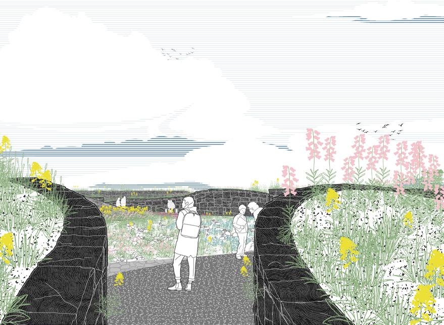
ABOVE: Perspective of garden path.
OPPOSITE: Strategy & analysis of the link system.
145 Archipelago | Yanning Mu
BELOW: Strategy & analysis of the link system.
OPPOSITE: Strategy & analysis of the link system.

147 Archipelago | Yanning Mu
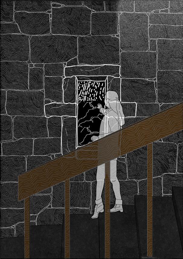
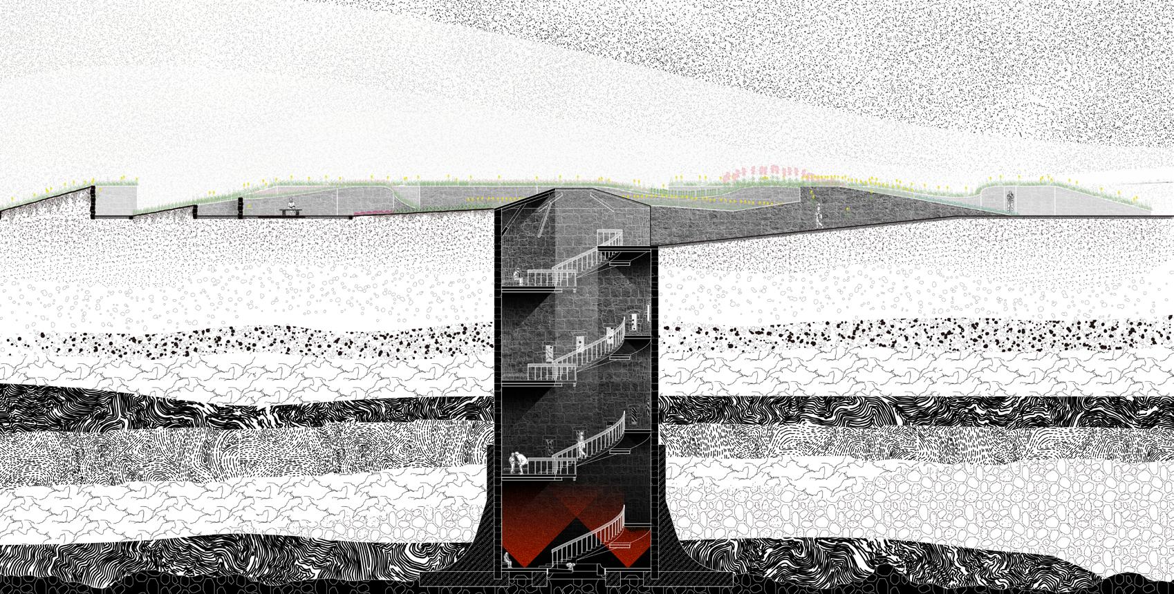 TOP LEFT: Perspective- spiral staircase and the peek window in the vent tower.
TOP MIDDLE: Perspective- the bottom floor of the vent tower.
TOP RIGHT: Future eco system - details of the three main communities.
BOTTOM LEFT: Section of post-volcanic park (crater garden & vent tower).
BOTTOM RIGHT: 2068-2118 vent tower’s change process.
TOP LEFT: Perspective- spiral staircase and the peek window in the vent tower.
TOP MIDDLE: Perspective- the bottom floor of the vent tower.
TOP RIGHT: Future eco system - details of the three main communities.
BOTTOM LEFT: Section of post-volcanic park (crater garden & vent tower).
BOTTOM RIGHT: 2068-2118 vent tower’s change process.
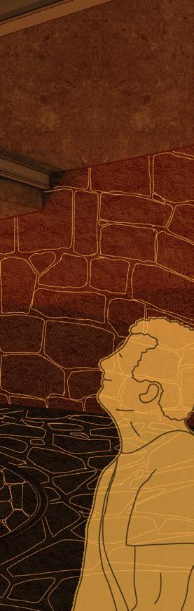
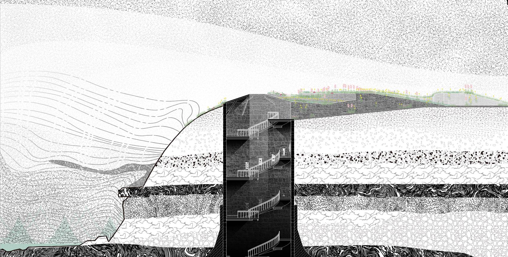
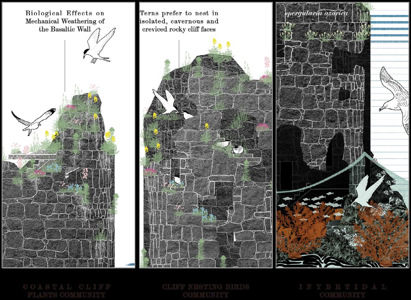
149 Archipelago | Yanning Mu
Lava Loop
Jinjin Wu
The project Lava Loop is located on São Jorge Island. After years of confrontation and compromise between human and nature, the people of São Jorge Island have reached a harmonious balance with nature. But seismic activity over the past year could trigger catastrophic volcanic events that could upset the balance between ecosystems and social systems.
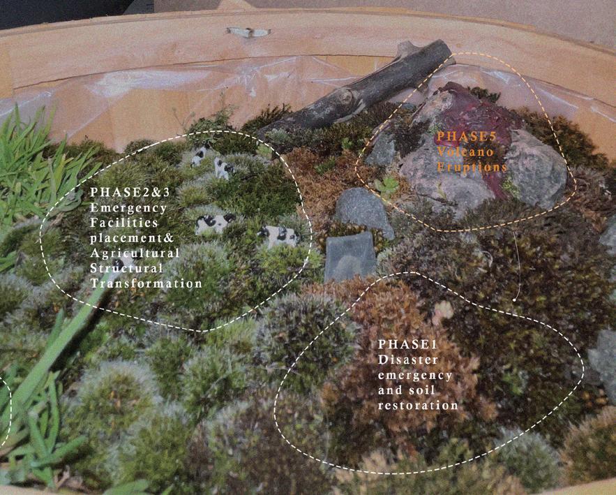
São Jorge Island has three basic contradictions: volcanic eruptions, which the authorities take very seriously; excessive soil pollution caused by extensive livestock husbandry; and the response of the local population to monoculture varieties. Based on these three contradictions, the concept of LAVA LOOP emerged. Taking the geological cycle as a cycle, LAVA LOOP is divided into five different stages to strengthen the connection between humans and nature on the premise of ensuring people’s life safety. This project assumes that the last volcanic eruption is phase 5, and the lengthy natural restoration is phase 1, which is the current situation of the site. The design of LAVA LOOP focuses on phases 2, 3 and 4.
Phase 2 is the highest priority emergency installation: adding emergency ports at appropriate sites. To ensure the lives of residents immediately find escape routes and the nearest shelter in the event of an eruption.
ABOVE: Complete lava loop model scheme. OPPOSITE: Proposal area planning diagram.
Phase 3: Adjusts the agricultural production structure, build community vegetable plots to meet the daily life of residents, and changes a small number of pastures around the community into agricultural and animal husbandry rotation mode. Seasonal crop rotation is adopted to produce agricultural and sideline products, and the original farm production mode is changed to crop rotation. Phase 4: Natural restoration mode establishes protected crater areas, restores of parts of the pastures to old-growth forests by gradually digging out invasive species, restores old-growth forests, and restores higher-elevation farms to more manageable forest grazing modes. This provides higher economic and ecological value.
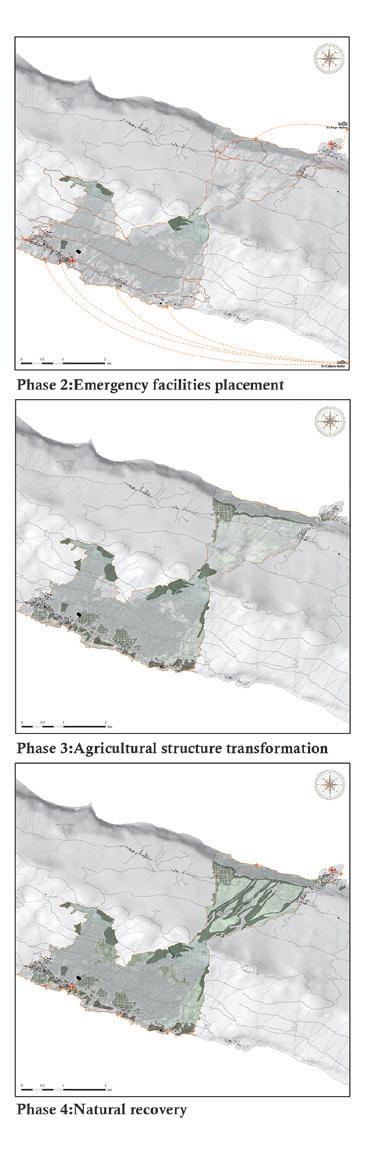
This is the main strategy for the whole cycle. Four representative sites were selected for further elaboration to address the different phase strategies.
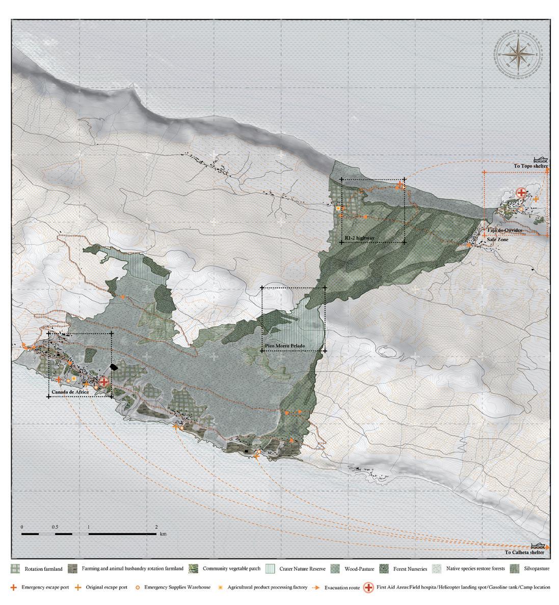
151
Archipelago |
Jinjin Wu
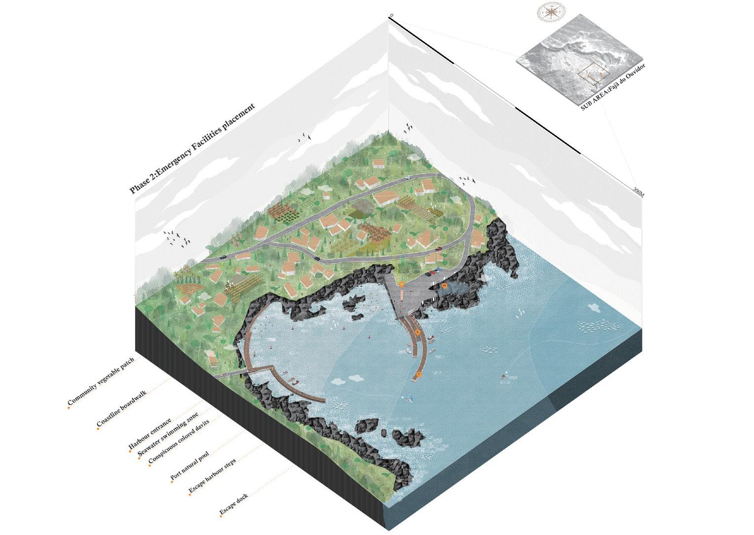
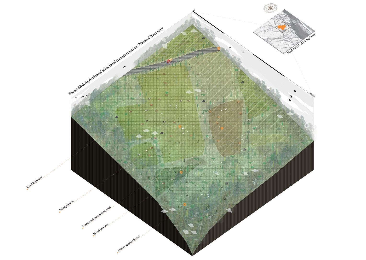
TOP: Phase 2 implementation planning. BOTTOM: Phase 3 and 4 implementation planning.
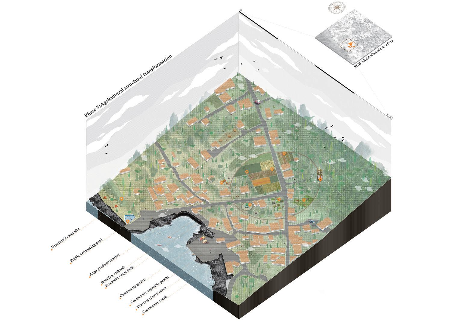
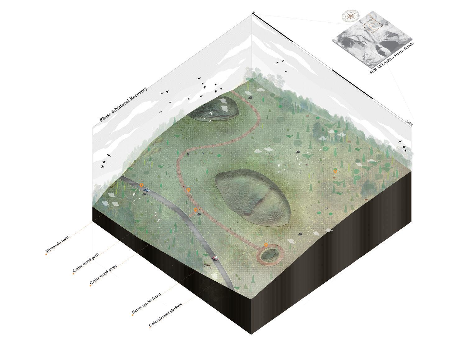
153 Archipelago | Jinjin Wu
TOP: Phase 3 implementation planning. BOTTOM: Phase 4 implementation planning.
TOP: Phase Phase 3 and 4 agricultural strategy.
 OPPOSITE: Phase 4 nature reserve perspective.
155 Archipelago | Jinjin Wu
Eco-Square
NEW NATURE BEHIND THE STONE WALL
Dawei Zhang
Pico is a small island in Portugal, located in the middle of the Atlantic Ocean in the archipelago of the Azores, which is famous for its unique culture, natural beauty and wines. Of particular note are the vineyards of Pico Island, which are considered to be among the most beautiful and exceptional in the world.
The history of Pico Island’s vineyards dates back to the 15th century, when people found that the rocky soils and warm, humid climate of Pico Island made traditional tree-shaped vineyards unsuitable for growing, and invented a special method of planting, in which a conical niche of black basalt stones, called ‘currais’, are piled up next to each vine. ‘Currais’ protect the grapes from the sea breeze and at the same time conserve water and promote the growth of the plants. This method of cultivation is classified as an intangible cultural heritage of humanity.
Today, however, the vineyards of the Pico islands are facing problems. Due to the harsh natural conditions of the island, fresh water is very scarce. In the past, the vineyards on Pico Island relied on rain-fed ingestion of groundwater, but due to climate change and drought, water resources in the vineyards have become more scarce. On the other hand, the extensive planting of vineyards has caused considerable damage to the natural environment, as the deforestation of large areas of native forest has led to a reduction in biodiversity and a decline in the health of the soil.
On this basis, I have therefore developed an ecological concept - Eco-Square - a model of planting that will effectively improve the problems faced by the vineyards of Pico, effectively address the lack of water resources and improve the soil and environmental health of the Pico islands. It is an ecological approach that uses nature to improve it, thus ensuring the sustainability of the vineyards and minimizing conflicts between man and nature.
ABOVE: Physical model of a root system.
OPPOSITE: Physical model of Pico vineyards.
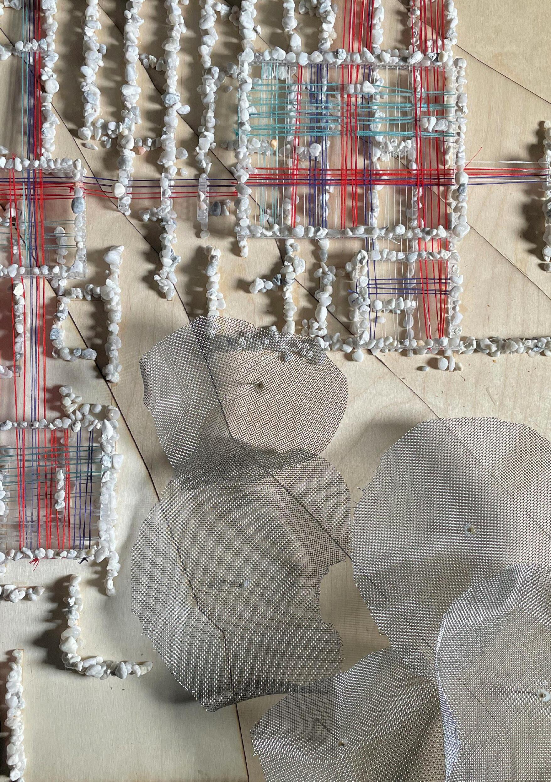
157 Archipelago | Dawei Zhang
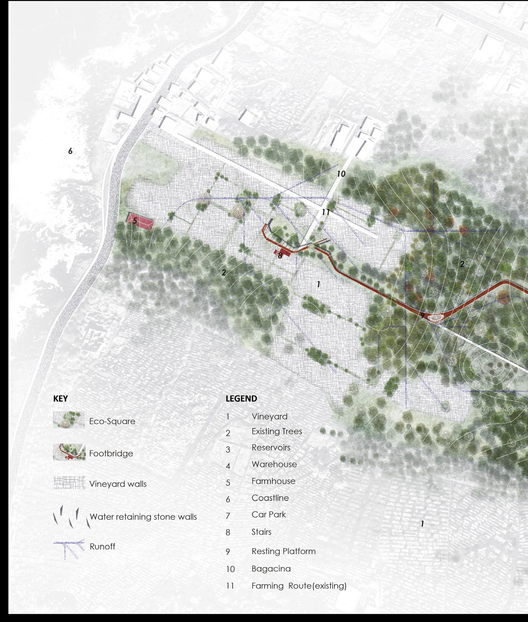
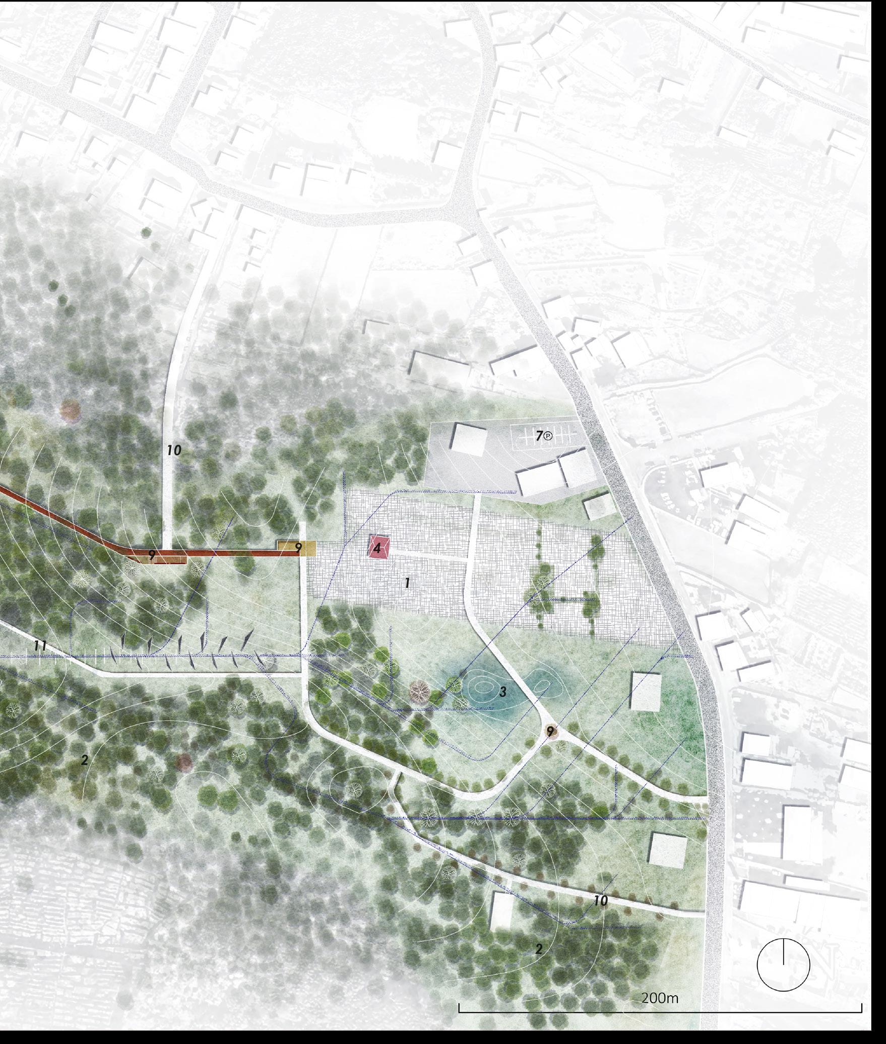
159 Archipelago | Dawei Zhang
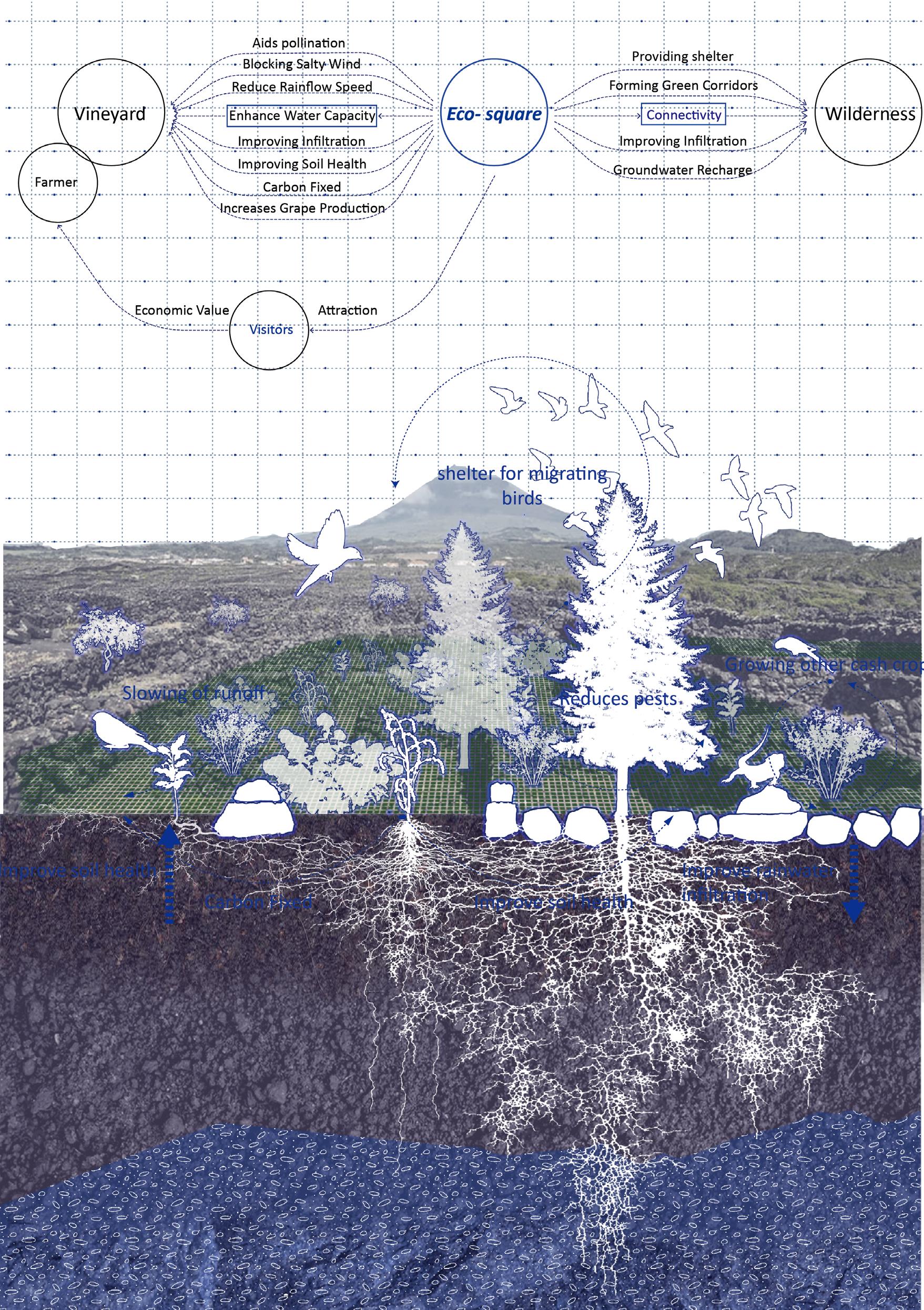
OPPOSITE: Hybridity vineyard system.
TOP: Future vision of water retaining stones walls.
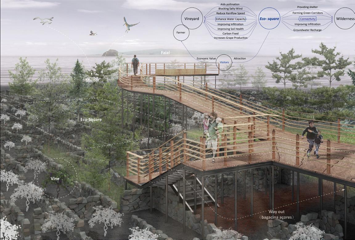
MIDDLE: Future vision of eco-sqaure.
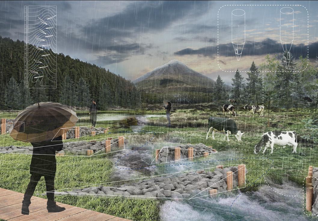
BOTTOM: Future vision of ecological reservoir.
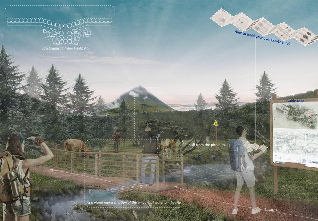
161 Archipelago | Dawei Zhang

Quiet Places I:
VATNAJÖKULL GLACIER
Master of Landscape Architecture (MLA)
Norman Villeroux
STUDIO BRIEF
Norman Villeroux
THE KVÍÁR PROJECT
Sofia Anthopoulou
THROUGH THE GLACIAL FORELAND
Kechen Cao
A NOMENCLATURE OF GLACIAL MEMORIES
Lucca Clark
SKAFTÁRDALUR
Dhriti Lamba
THE JOURNEY TO WITNESS THE DEATH OF A GIANT
Yuheng Lin
LIGHTHOUSE INCISIONS
Abigail MacPhee
FUTURE ARCHIVES 2225
Eloïse Mercer
PASSING RESERVE
Tom Stephenson
GLACIER REBIRTH
Tiantian Zheng
164 170 176 182 188 194 200 206 214 222
163 Quiet Places I |
OPPOSITE: Reykjavík, Iceland - This image was taken during a windstorm. The dramatic side of the waves and the very dark water contrasts with the beauty of the sunbeam which crosses the clouds to land and illuminate the dwelling at the edge of the water. (Photo: Tim Gämperle)
Norman Villeroux
Quite Places 1:
VATNAJÖKULL GLACIER
Norman Villeroux with Nikolaos Kourampas and Barbara Prezelj
Synoposis:
Earth is currently experiencing unprecedented change. As carbon dioxide levels rise due to human activity, a series of chain reactions cause an intensification of climactic evednts, disturbing the fragile balance which sculpts life as we know it. Our attention to climate change is mostly directed towards its impact on human societies and landscapes, leaving faraway places and barely inhabited landscapes in obscurity. These faraway places are what Donna Haraway calls Quiet Places, fragile landscapes sitting on the extreme periphery of our imagination but playing a central role in the changing of our climate.
The Quiet Places I: Vatnajökull
Glacier studio is centered on the specificity of the Vatnajökull
Glacier in Iceland as a Quiet Place, engaging with the qualities that define it, such as inaccessibility, extreme conditions, and incredible dynamic processes, as well as imagining a speculative future for a disappearing landscape. The studio acts as an experimental research expedition into the Vatnajökull, in an attempt to uncover the importance of these Quiet Places, and how they might be tied into multi-scalar earthly systems.
165
ABOVE: Vagnsstadir, Iceland - From the hostel where there is no light pollution, the stars are sharp with the beginning of an aurora borealis in the image. (Photo: Tim Gämperle)
Quiet Places

Responses to climate intensification often take place in the most inhabited parts of the world, where humans are attempting to respond to the challenges posed by Global Warming. In effect, our attention to climate change is mostly directed towards its impact on human societies and landscapes, leaving faraway places and barely inhabited landscapes in obscurity. These faraway places are what Donna Harraway calls Quiet Places, fragile landscapes sitting on the extreme periphery of our attention and imagination but playing a central role in the times of climate change. As such, it is the aim of this studio to focus on the complexity and specificity of these Quiet Places, through the careful use of thorough analysis, extensive experimentation, multi-scalar dynamic thinking and design fiction/speculation.
The Vatnajökull Glacier - Iceland
Glaciers are uninhabited, fragile, often inaccessible, entangled in multiscalar planetary systems, as well as featuring in many narratives, myths stories from around the world, making them perfect exemplifications of Quiet Places. Their ability to have fluidly navigated cultural as well as scientific attention throughout the globe largely contradicts their accessibility and presence.
The Vatnajökull Glacier is Iceland’s biggest glacier – its heart of ice. This ice cap covers about 8% of Iceland’s total landmass and is located in one of Europe’s largest National Park – the Vatnajökull National Park. The Glacier is a living entity. Indeed, it grows, shrinks, surges, and moves. Since the 19th century, the glacier has been steadily retreating, with an acceleration in the past 30 to 40 years due to global warming. As such, the Vatnajökull glacier is used as an indicator of climate change, helping us understand the impact of climactic change on glaciers around the world. The next 300 years will see the Vatnajökull’s speedy disappearance, leaving in its absence an alpine landscape dotted with lakes, craters, and u-shaped valleys. Fundamentally, the Vatnajökull glacier is an ephemeral landscape entity, slowly sculpting its environment, doomed to disappear under the pressure of a changing climate.
ABOVE: Svínafellsjökull, Iceland. This image shows the beauty of the ice of the glacier from a top view. It could be natural stone (Photo: Tim Gämperle) OPPOSITE: Svínafellsjökull, Iceland. A panorama of the tongue of the glacier. (Photo: Tim Gämperle)
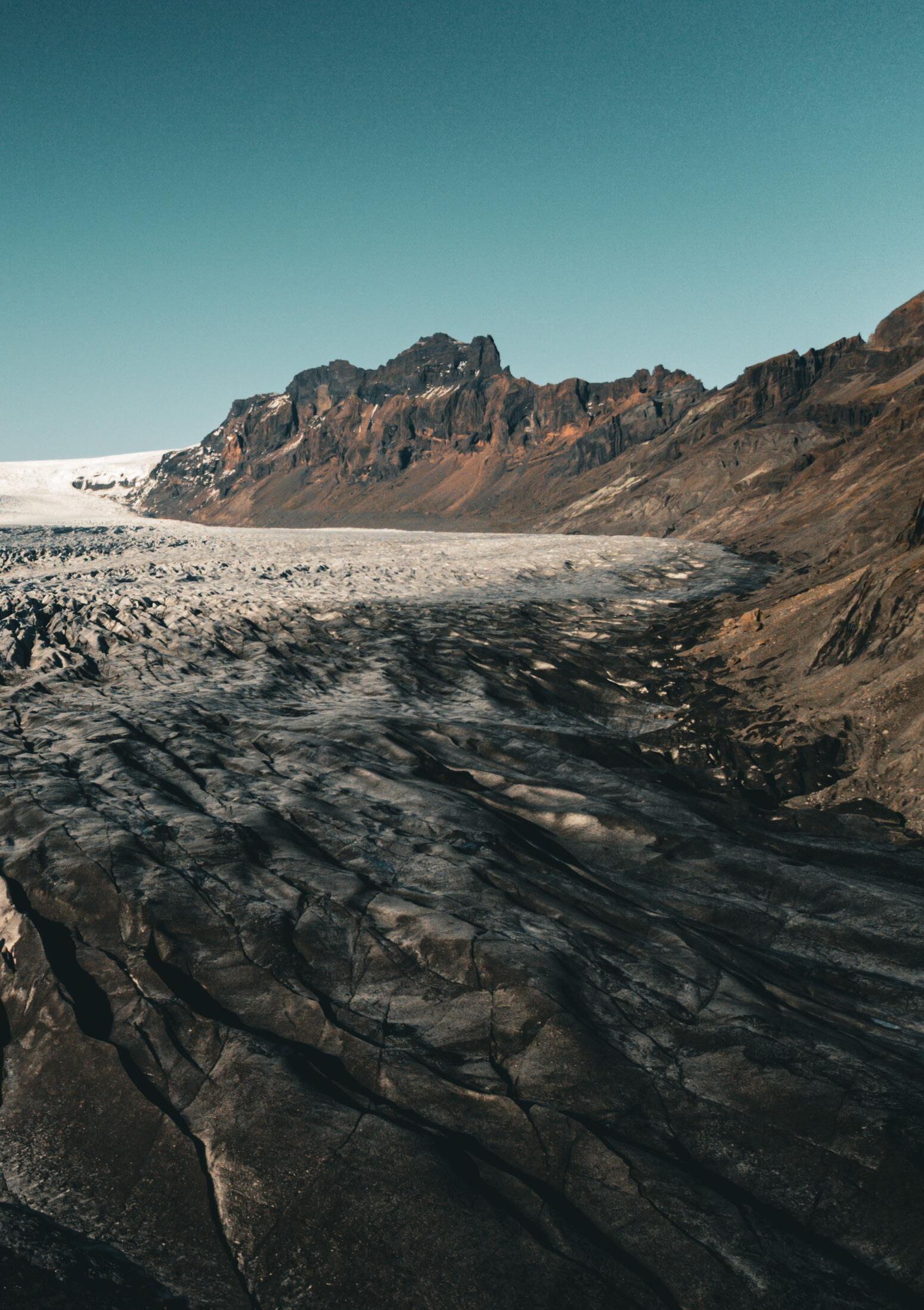
167 Quiet Places I |
Norman Villeroux
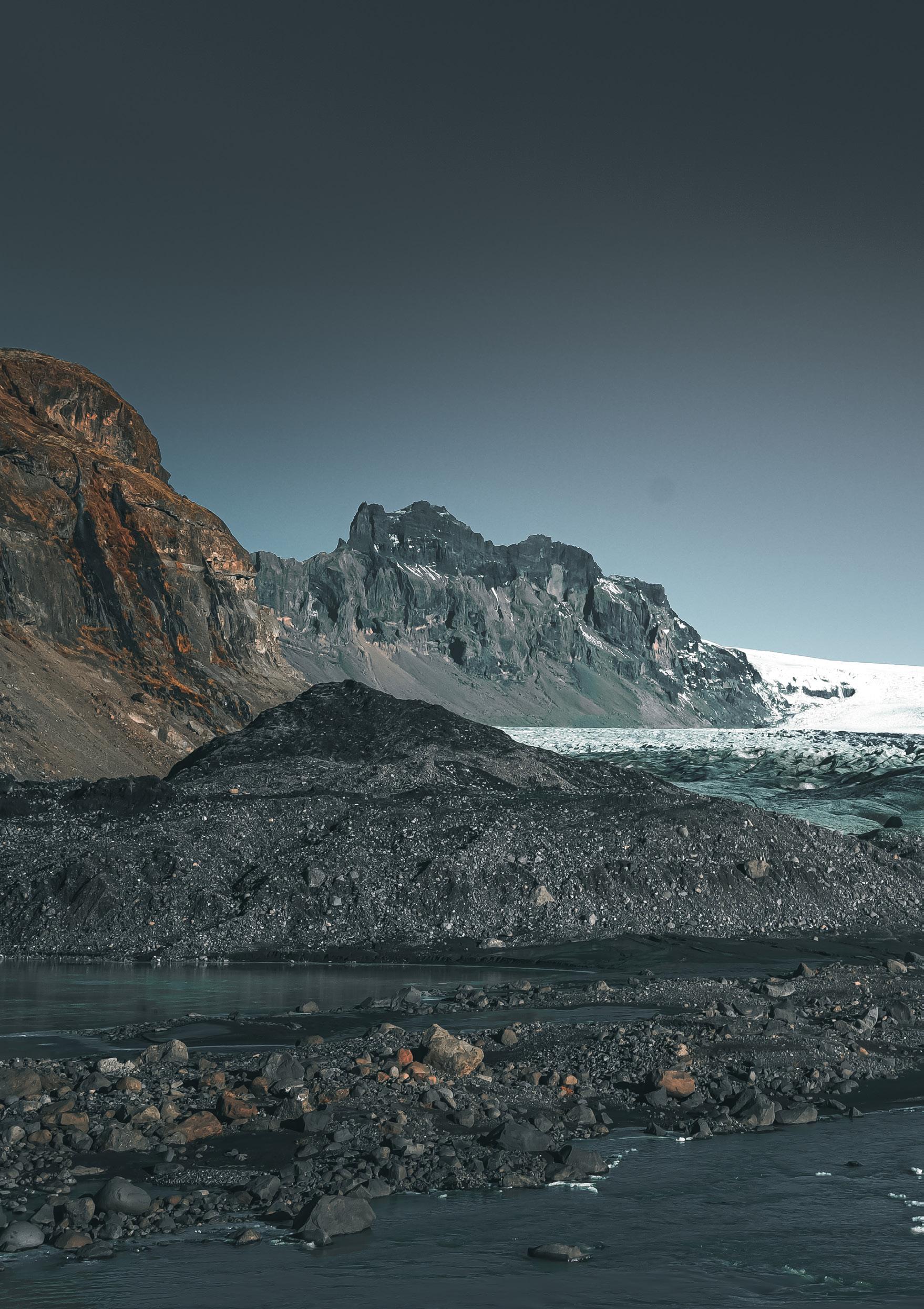
Expedition and Landscape Laboratory
The studio takes the form of an experimental and speculative expedition into the unknown, in an attempt to uncover the importance of these Quiet Places. Historically, expeditions have usually been grounded in imperialist and colonialist motives, often disguised as scientific explorations. As such, expeditions are often entangled in a discourse of domination and appropriation (much like cartography). Students were invited to deconstruct underpinning colonial motives in the notion of expeditions, by building an expedition narrative which attempts to respond to the challenges and questions posed by the Anthropocene.
In their Expedition, the speculative crew of experts were required to put together a Landscape Laboratory, where they could gather, monitor, and process their findings. Laboratories are usually self-contained spaces, scientific fortresses dissociated from the rest of their surrounding environment, giving scientists the ability to conduct experiments and tests in safe environments. Landscape laboratories are the opposite of that, radically redefining the role of laboratories. Landscape laboratories are thoroughly anchored within their surrounding environment, engaging with it and reflecting/revealing some of its processes. They are catered to the landscape they sit in, responding to materiality, topography, climate, and other landscape characteristics.
As such, the studio resulted in the conception of unique landscape architectural proposals engaging with the complexity of such dynamic and inaccessible landscapes, through the careful use of thorough analysis, extensive experimentation, multi-scalar dynamic thinking, scientific equipment and instruments and design fiction/speculation.
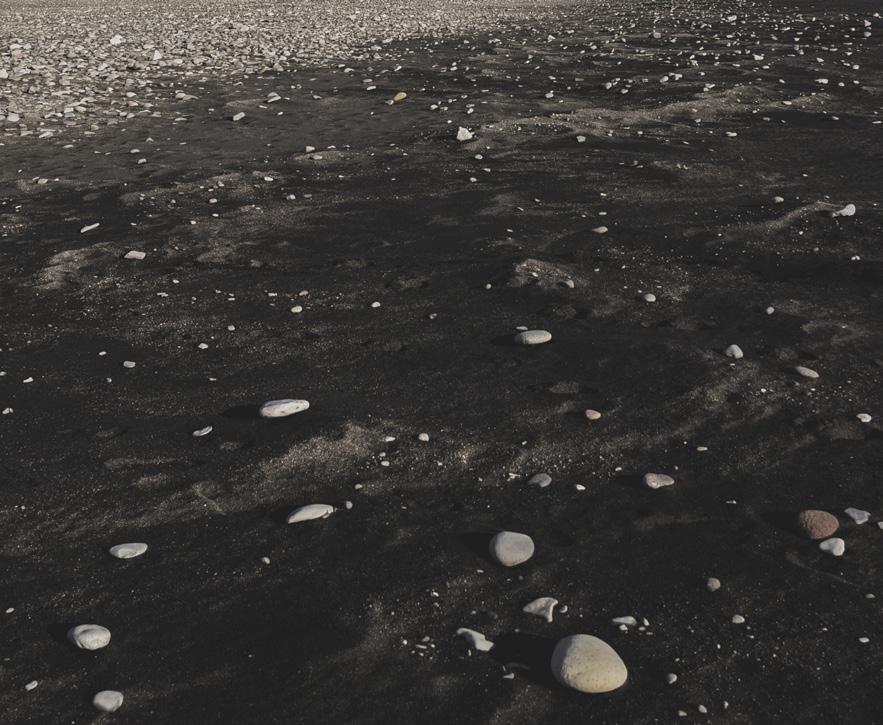
169 Quiet Places I | Norman Villeroux
OPPOSITE: Skaftafellsjökull - In the foreground the moraines deposited by the glacier. In the background the top of the Vatnajökull glacier and the mountains (Photo: Tim Gämperle)
ABOVE: Diamond beach, near the Jökulsárlón. The name Diamond beach comes from the ice chunks scattered on the sand coming from the Jökulsárlón. (Photo: Tim Gämperle)
The Kvíár Project
 Sofia Anthopoulou
The Kvíár Project revolves around the processes unfolding at Kvíárjökull glacier. This glacier continuously shapes new layers of topography, and we, as parts of these layers, now turn our attention to the density of existence and intersections of life in the thickness of geological time. By identifying stages of instability and complex ecological and social systems, we recognise the interconnectedness of the glacier, geomorphology, sediments, humans, and the more-than-human entities. This expanded notion of agency calls us to co-create a landscape figure—a spatial, experimental intervention gently woven into the landscape by these relationships. Through this figure, we are reminded of our social and ecological accountability in the choreography of politics of climate change. My proposal is to establish a guerrilla playground for more-thanhumans, a space for reflection and experimentation. This playground transcends the boundaries of Kvíárjökull, connecting to other places in Iceland and potentially expanding across the globe. It creates spaces for movement, not just physically but also as a metaphorical act of “performing” in unconventional grounds. We become active participants, shaping our understanding of the world. In close collaboration with the local community, my aim is to empower and inspire them to take ownership of their environment. Kvíárjökull can become a beacon of hope, a place where social and environmental narratives and potentials for transformation can flourish. Embracing uncertainty and unpredictability becomes paramount, allowing us to emerge and recreate responsive landscapes. We recognise the glacier, sediments, geology, water, and the more-than-human and human experiences as responsive landscapes—constantly evolving and adapting to changing circumstances, bridging micro and macro scales, and connecting the site to Iceland and potentially the global scale.
OPPOSITE
OPPOSITE MIDDLE:
OPPOSITE BOTTOM:
ABOVE: Gesture: The experimental structures are taking form; platforms, workshops for the social lives of humans along with the established more-than-humans.
TOP: Ecological Happening: Elevated gardens created by the accumulation of sediments; platforms for dialogue and reflection.
Moraine Continuum: Moraine continuums interacting with the sediments brought by the glacier and the movements of moraines, humans and more-than-humans.
collective playground: Reclaiming industrial ruins from South-east coast of Iceland to create habitats and gatherings for humans and more-than-humans.
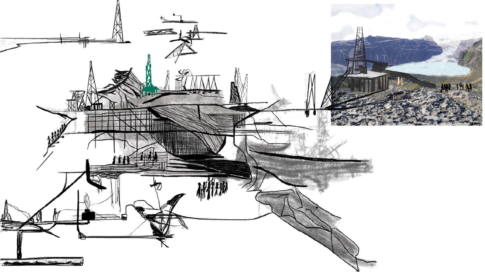
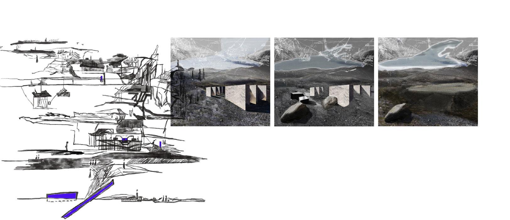
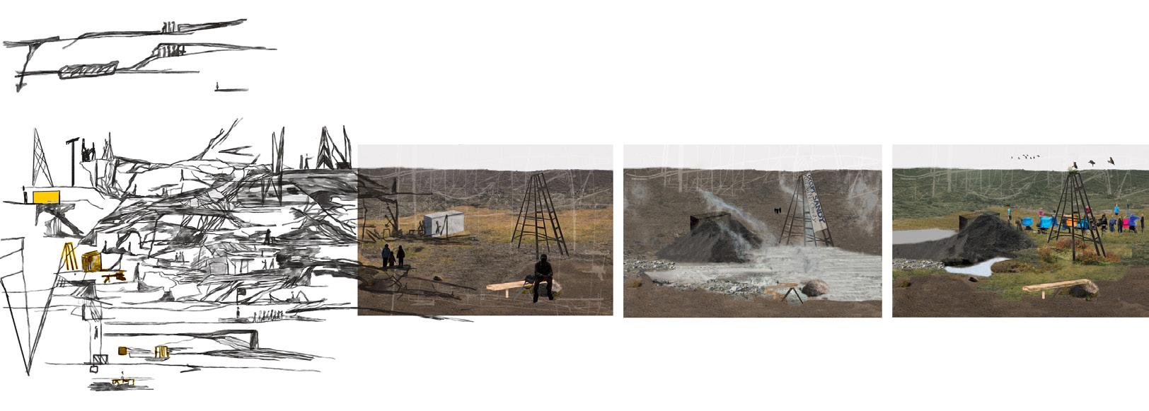
171 Quiet Places I | Sofia Anthopoulou
Field of Action
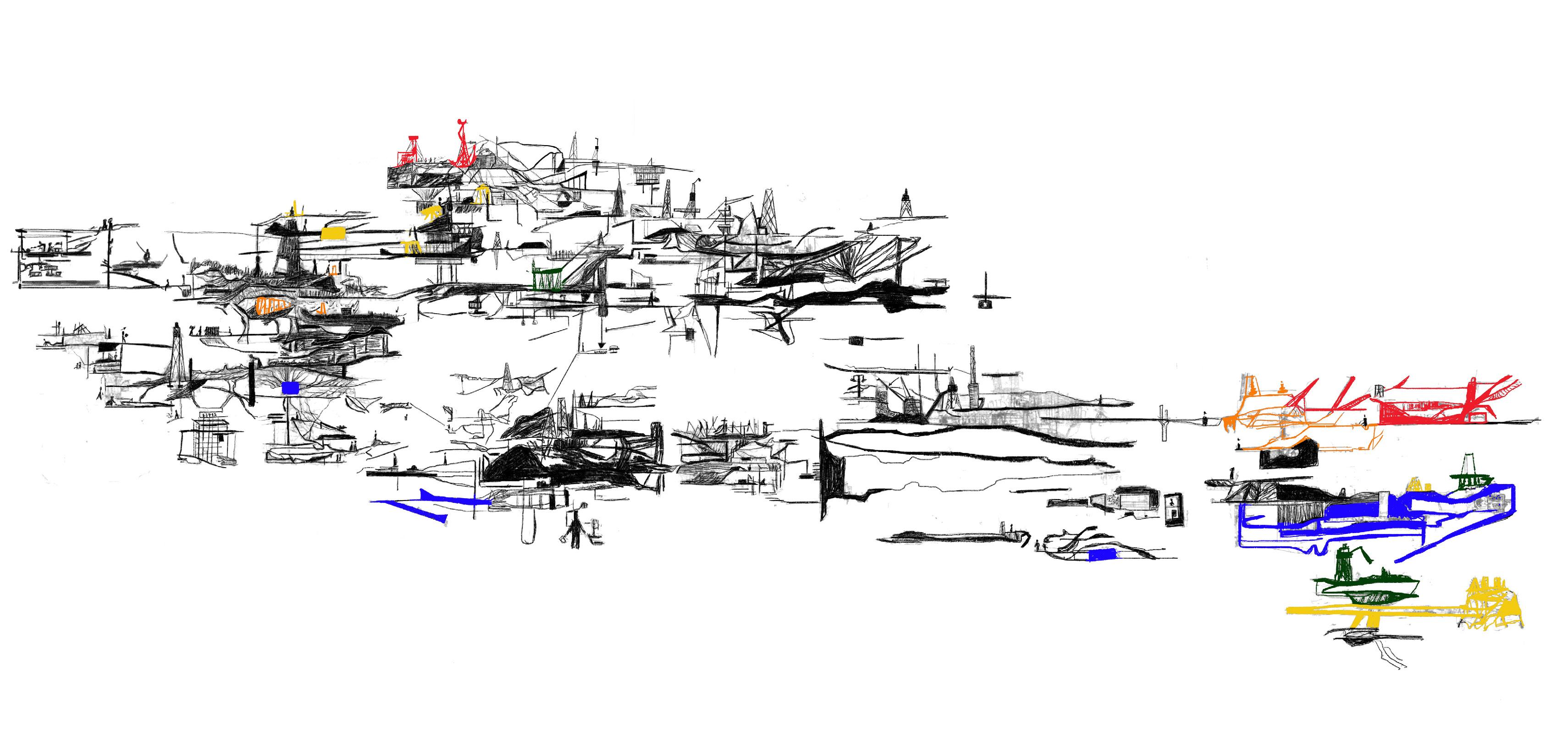
Create through proximity, distance, intimacy, ruptures, explosions, silences, a spontaneous, internal coherence. Diversity and collaboration are the basic demands an opening to the social space of the glacier, humans and more-than humans.
Challenging the materiality of power-lines in order to challenge the production of power for the big industry plans of Iceland
The experts’ research directions develop a collaboration at the level of communities that live, work and socialise in Iceland but expands to those interested to perform, experiment and understand Kviarjokull glacier as the agent of performance and change. The collaborations between the community bodies of Iceland are not only an expressed political proposal, it is also a social and cultural need.
Co-productions of projects actions, opening the projects events that go outside of the space of Kvíárjökull
This opening emphasizes tribution of every event hapenning around Iceland strengthening of social especially in the current
32
Kvíár . . . . .
2023
EXPLOITATION
Event
NATURAL RESOURCES, HUMANS
2030 DETONATION
Event
EXPLOSION OF DAM
2060
DRIFTING
Event
DRIFTWOOD SUPPLY COLLAPSE
2090 EXHAUSTION
Event
HARVESTING OF GEO-THERMAL ENERGY
2120
FISHING
Event OCCUPATION OF SEA
heavy industry, tourism; affecting the landscape. aluminium smelters, fragile moss, water shortage violation of human rights construction of dams
Eco-activists, farmers and communities, blow up the Kárahnjúkar Hydropower Plant’s Dam following the example of the Laxa farmers, year 1970
Anthropogenic sea- ice loss & reduction of sea-ice extent, is icreasing the open-water distance between Yenisei estuary and Iceland in a way that no driftwood will likely reach the Icelandic coast as early as 2060 CE. The economic importance of driftwood; several farmers operate small sawmills and make important incomes from driftwood.
Geothermal power plants in operation in Iceland; Hellisheiði, Nesjavellir, Reykjanes, Svartsengi, Krafla and Theistareykir.; ground deformation in relation to geothermal utilisation have been undertaken at Krafla volcano in North Iceland; ground displacement, seismic activity
The collective body of experts decide to claim a new kind of discourse and a new way of creating. With occupations, mobilisations, forms of direct communication set the conditions for the creation of a playground for more-than- humans, aknowledging the agency of the elements that create the Kviar project. The playground records the action of the elements, attempting to highlight the dynamics of the time and bring on the surface the need to claim this space as a space for more- than- humans and humans coexistence.
overfishing, illegal fishing and the combined effects of ocean-based activities and climate change on resources and ecosystems projects and joint projects and the limits Kvíárjökull glacier. emphasizes the conevent that is Iceland to the cohesion, current situation.
Moraine continuum Moss ca tcher Wandering on the traces of habitation of, Kvíárjökull glacier defending the area as a common space, that concerns diverse communities, that concern new social ways of life.
Collective playground Ecological happening The gesture
173 Quiet Places I | Sofia Anthopoulou
Kvíár....., from Öræfajökull volcano to Kvíárjökull glacier
T he retreat of Vatnajökull glacier and its close connection to Öræfajökull volcano’s activity is leading to recurrent jökulhlaups and accumulation of materials, sediments. Ad a result morphological structures and patterns recognised at each scale, from the macro- to micro-, are created known as moraines
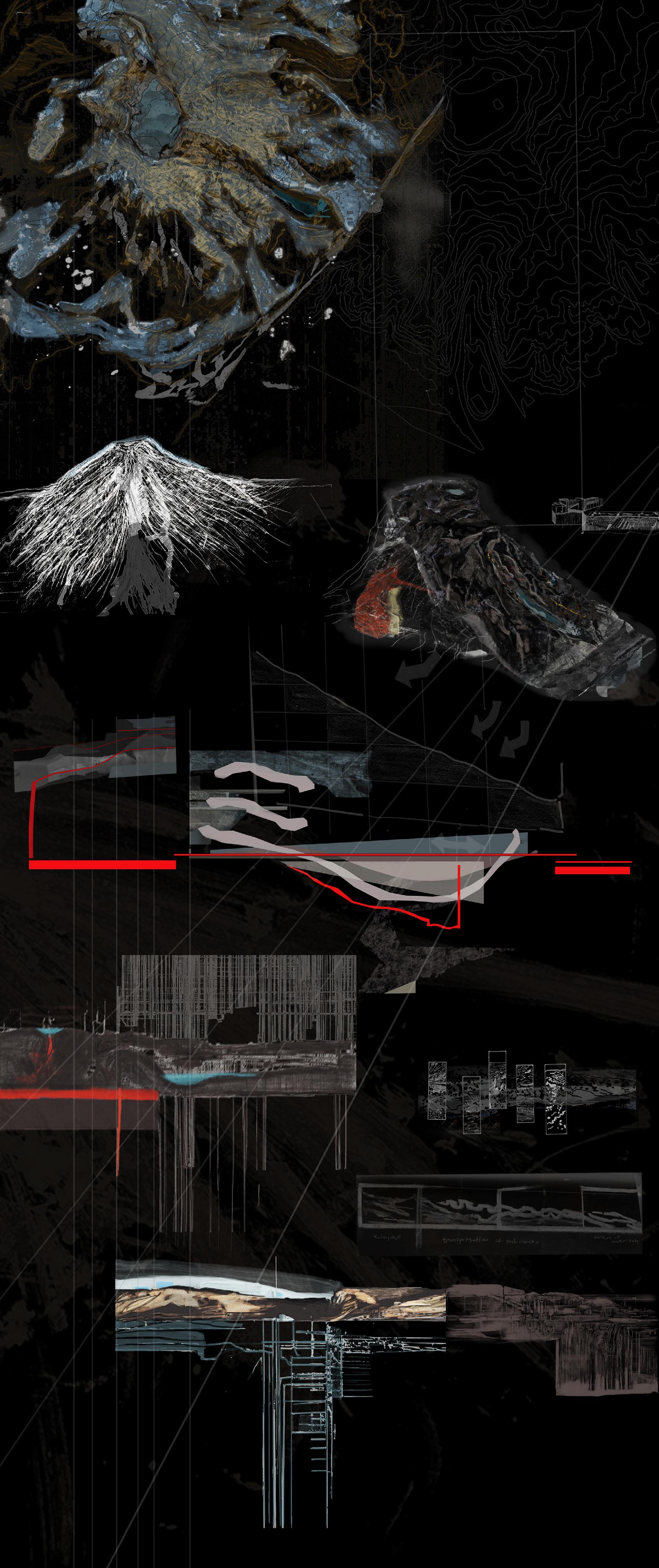
5 km jökulhlaups;
T
volcano Öræfajökull caldera Kvíárjökull glacier Sediments Lake Kvíár; revealed Lake Kvíár Lake Kvíár Lake Kvíár Kvíármýrarkambur moraine Kambur moraine Öræfi caldera N N [Magmatic chambers] The formation of a Accumulation of sediments Increasing volume of water Climate forging Changes of the level & volume of the Kvíárjökull glacier & speculative future stratigrapahy Atmospheric effects on glacier
Deglaciation erosion from ice; altering the size and shape of the formations erosion from ice Footprints & traces of glacier Events of movement, Ice and water dynamics as a force of landscape metamorphosis. erosion from ice; altering the size and shape of the formations
Kvíár jökull
“glacial leap” glacial outburst floods
he Ö ræfajökull volcano and the Vatnajökull glacier are interwoven through dynamic processes and their close interraction Öræfa jökull volcano Öræfa jökull
Identifying transects outside of Kvíárjökull glacier that represent point the urgency of interventions
bedrock topography
Kvíárjökull glacier
Speculated
of
Kvíárjökull is a temperate outlet glacier occupying a deep incision in the southern margin of the Öræfi stratovolcano
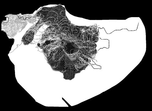
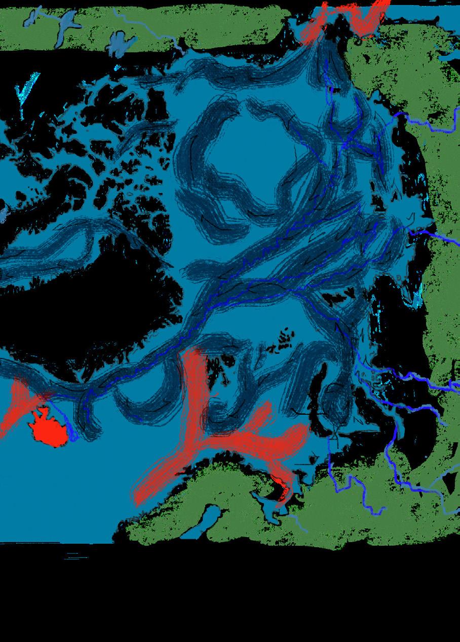
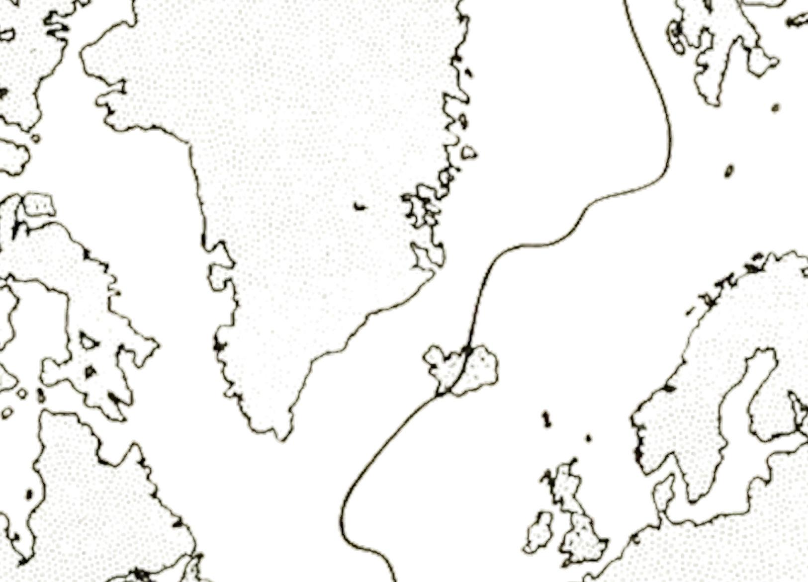
Following the movement of the glacier as it retreats we encounter its traces on the landscape as a it carves and shapes it. We introduce the value of minutes until the complete deglaciation of Vatnajökull in an attempt to understand these processes as documented choreographies.
Melting Point
2023 2030 Vatnajökull glacier Iceland Mid-Atlantic Ridge 2060 2090 2210 Ö MATERIAL; DRIFTWOOD REACHING NORTHERN COAST OF ICELAND Laxa Dam explotion Fishing Kárahnjúkar Hydropower Plant’s Dam Geothermal fields Alluminium smelters Alluminium smelters SKEIÐARÁRSANDUR; MATERIAL CORTEN STEEL FROM SHIPWRECKS K v í á r . . . . . S p e c u l a t e d t S edimentation processes and characteristics of pre- and post-glacial contacted landscapes. Kvíár jökull (glacier) Öræfa jökull caldera
PRESENT TIME PRESENT TIME +9,467,085.6 min 2040 +19,986,069.6 min 2060 +30,505,053.6 min 2080 +41,024,037.6 min 2100 +41,024,037.6 min +51,543,021.6 min 2120 +62,062,005.6 min 2140 +72,580,989.6 min 2160 +72,580,989.6 min glaciovolcanic contact point [Thickness of glacial time} +72,580,989.6 min +83,099,973.6 min 2180 +93,618,957.6 min 2200 Eruption jökulhlaups; configuration of sediments and water/ inverted stratigraphy- releaving the instance formation of lateral moraines; debris-rich ice formations Lake Kvíár; revealed [Glacial retreat timeline] [Crust of Earth] [Magma] [Thickness of glacial time}
Kvíármýrarkambur moraine molded by the interplay of ice, water, and time thawing process; an essence of transformation the ice binding rocks and sediments will gradually give way, altering their structure and stability. erosion from ice; altering the size and shape of the formations The sedimentation of social worlds Geological formations as a result of intense accumulation of sediments The formation of a new geomorphology in relation to the glacier and its movements shifting landscape ice begins to melt; water is flowing through the soil; thawing moraines; a sentinel of change
Kambsmýrarkambur moraine
Moraines formed by the glacier;s movement; a choreography of time and geology Rocks and sediments speed and direction of the glacier’s movement; affecting the formations of moraines network of rivers, ridges, and ecosystems changes; effects throughout the entire ecosystem 175 Quiet Places I | Sofia Anthopoulou
Through The Glacial Foreland
POST-GLACIAL LANDSCAPE PARK DESIGN
Kechen Cao
The design aims to establish a post-glacial landscape park in Skeiðarársandur to protect human and more than human from potential glacial outburst flood, developing ecological value of the region and creating a memorial landscape along the floodplain for future cultural development.
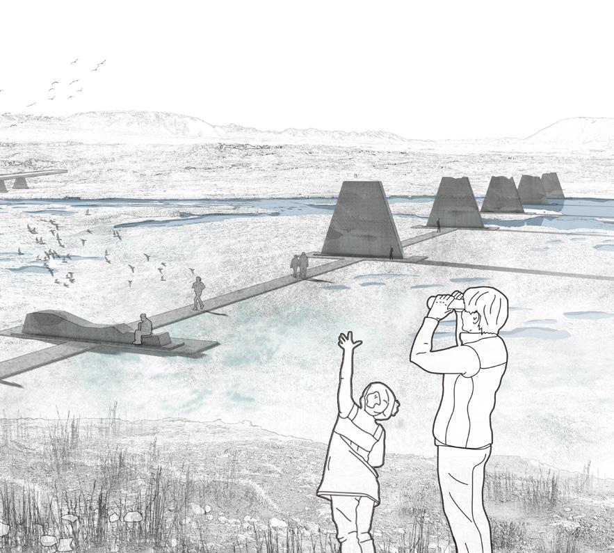
Not only the glacial landscape is vanishing, but also the natural disaster, glacial outburst flood, will disappear. The site is located in the junction between Gígjukvísl river and highway. The site could be understood as the only connection between human and nature along this barren floodplain.
The design firstly creates an emergency design proposal dealing with the possible glacial outburst flood for human and more-than human in the “place of protection”. The design proposes several shelters using the materials from the remains of destroyed road. Also, it provides a safe space for flood observatory. The hiking trials are reorganised along the journey with several shelters. High terrain close to the river used to protect the bridge, while it is now preserving the ecological haven.
The post-glacial landscape park focuses on not only alleviating the side-effects of the disastrous glacial flood, but also the culture aspect. Several monuments and cultural elements, which together compose the place of memory, will be built based on the existing site condition. It is predictable that the site will face erosion and other challenges. The future destroyed bridge will be transformed to flood monuments. Other cultural interventions will be conducted in response to the challenges facing the Anthropocene.
OPPOSITE:
ABOVE: The “Stone Gerðið” monument.
The “Columnar Sanctuary” monument.
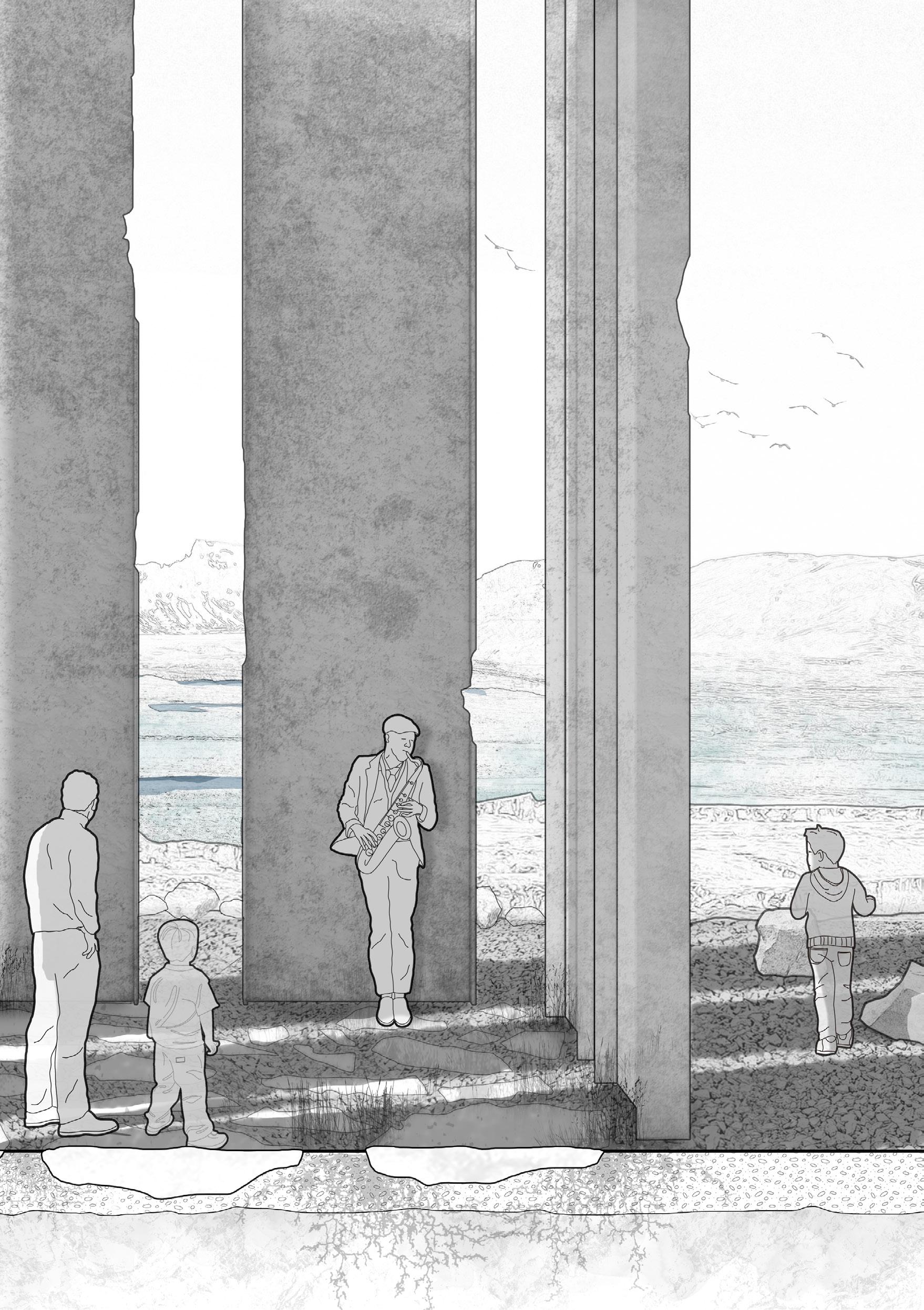
177 Quiet Places I | Kechen Cao
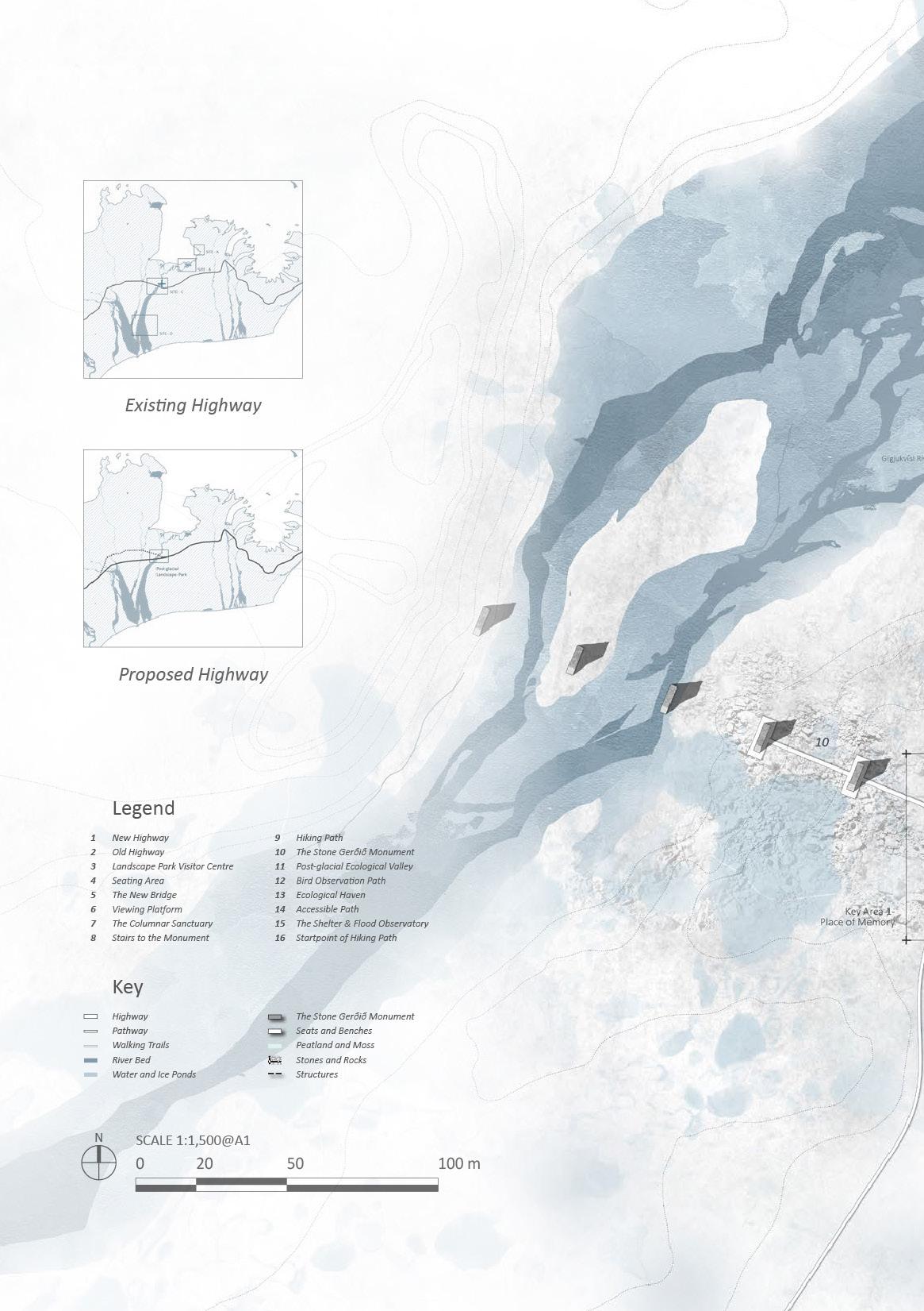
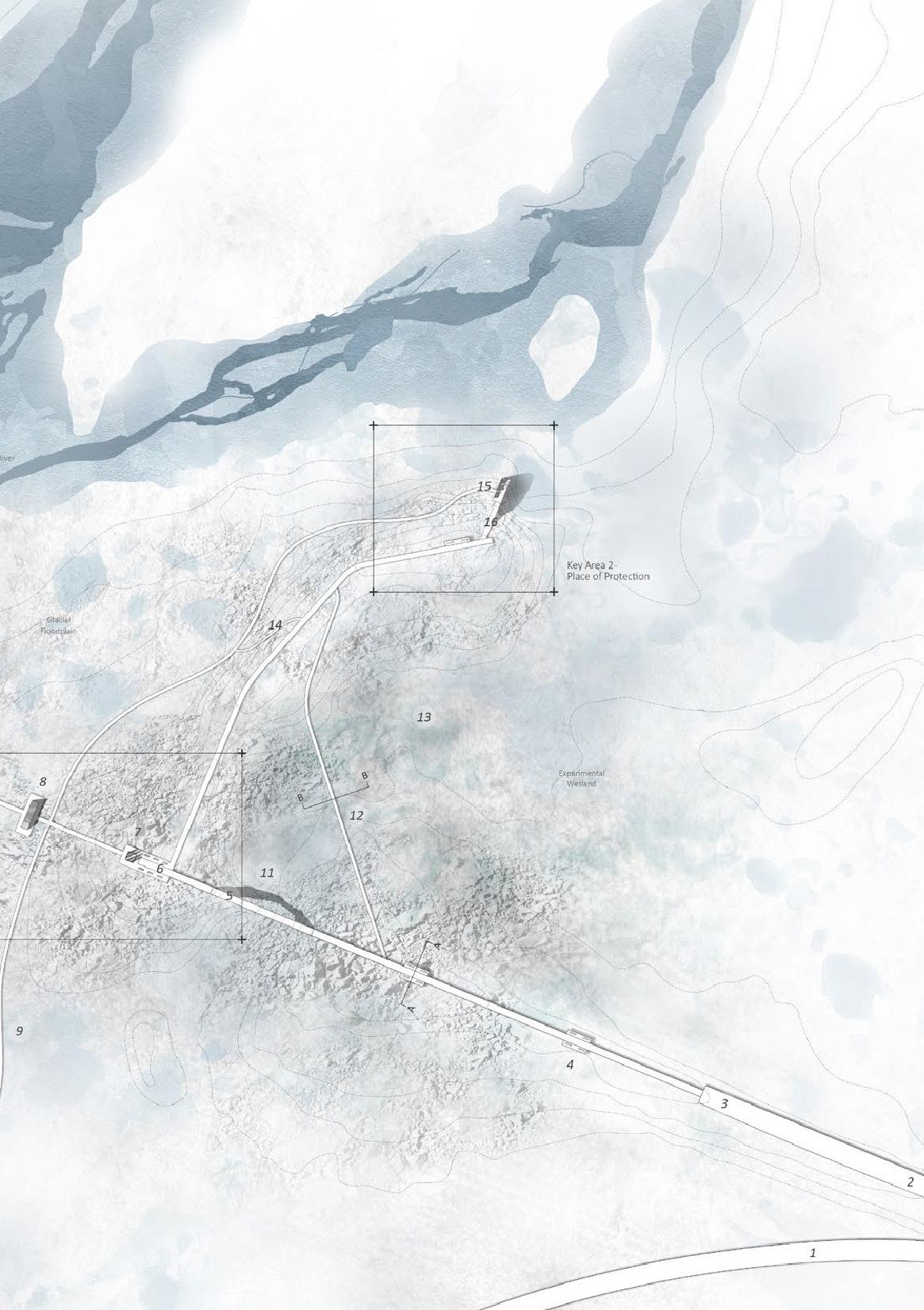
179 Quiet Places I | Kechen Cao
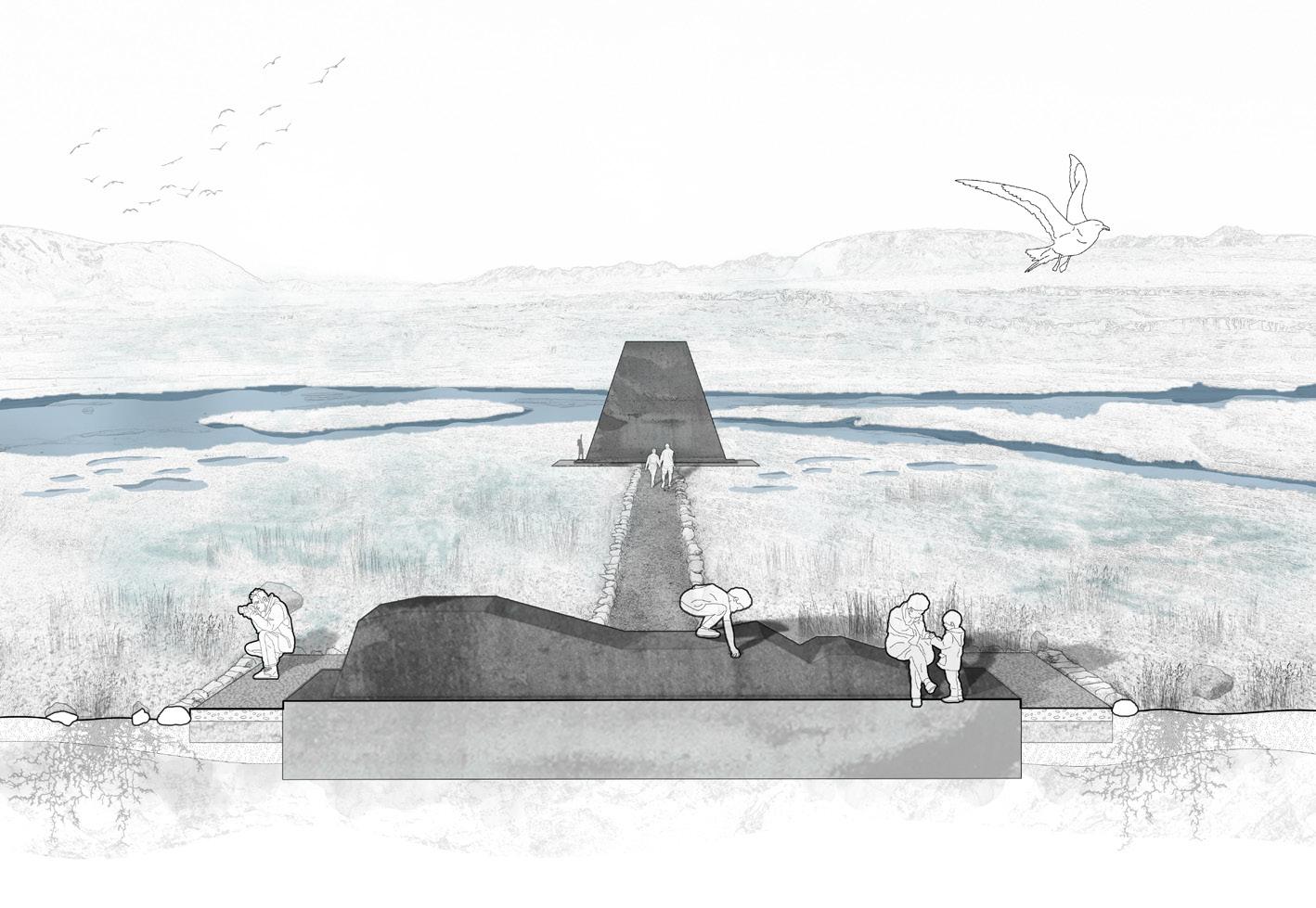
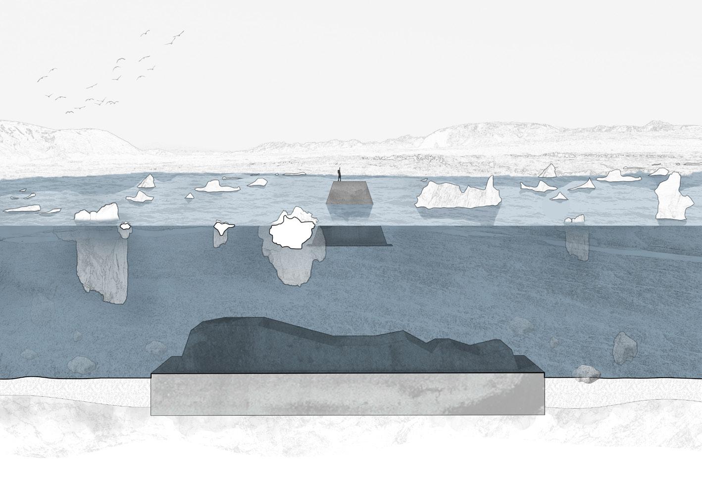 ABOVE: The “Stone Gerðið” monument.
BELOW: The “Stone Gerðið” monument during the flood
ABOVE: The “Stone Gerðið” monument.
BELOW: The “Stone Gerðið” monument during the flood
ABOVE: The construction of the pathway. BELOW: The new pathway.
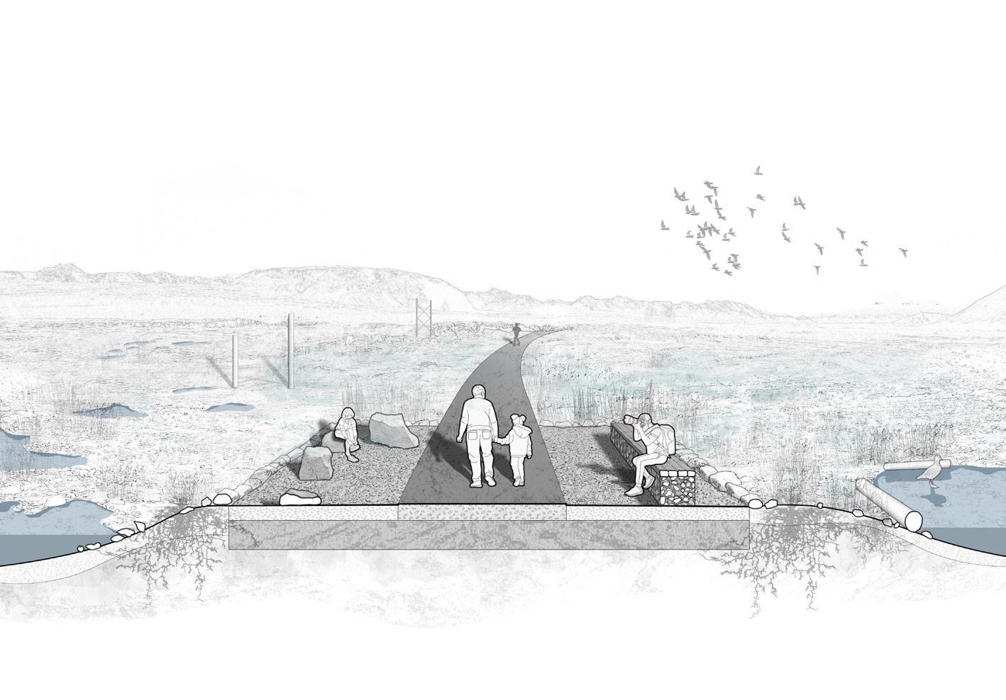
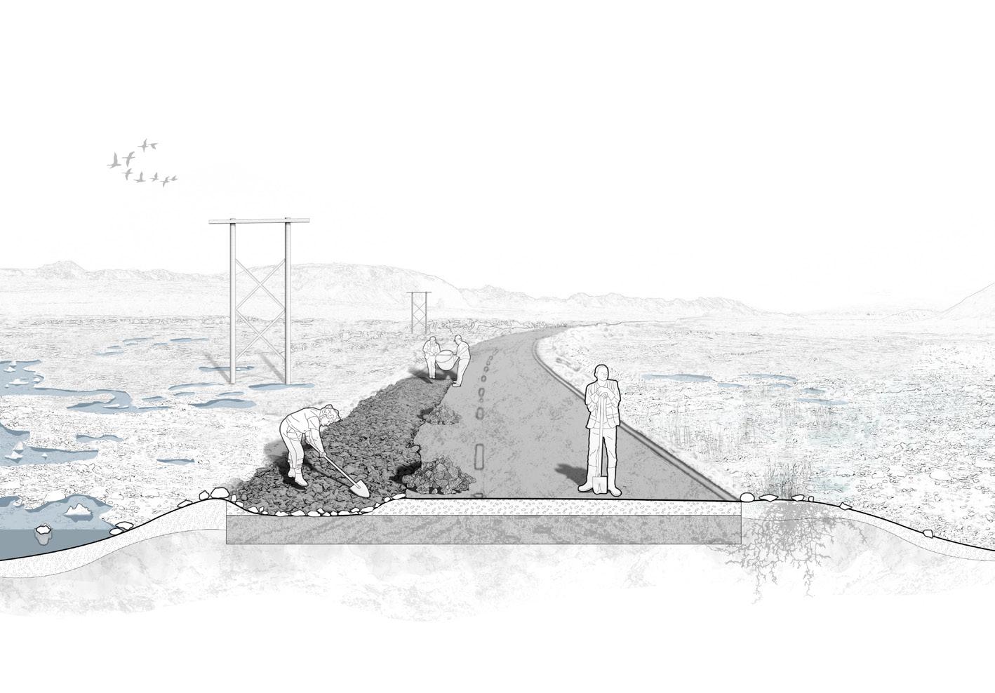
181 Quiet Places I | Kechen Cao
A Nomenclature of Glacial Memories
Lucca Clark
My project investigates the quiet places and dynamic systems of the Vatnajökull ice cap, in Iceland, through the creation of a physical nomenclature ‘garden’, as a new method of understanding the landscape. The nomenclature focuses its exploration on the journey sediment takes from the nunatak, down a glacier to the proglacial plains, studying the key encountered glacial processes and resultant landforms, which I respectively term ‘actions’ and ‘memories’.
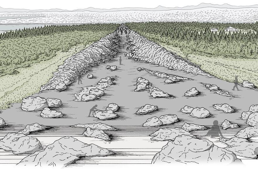
The Nomenclature of Glacial Memories aims to provide an in depth understanding of how Iceland’s landscapes are shaped by glaciers, whilst also acting as a predetermined memorial to the future extinction of these critical landscapes.
The uncovering of the glacial actions and memories takes place across the Breiðamerkurjökull, outlet glacier, through particle tracing field analysis. The detailed findings are subsequently translated into a physical nomenclature design, in Reykjavík. The abstract glacial memories are formed through a performative spectacle of manipulating a large iceberg fragment down the site transect. The subsequent marks left in the landscape will be enhanced through thoughtful design interventions, creating an active garden for visitors to walk through, embodying the sediment’s journey as they do so.
Through this physical nomenclature, visitors will gain a greater understanding of the glacial landscape, hopefully inspiring respect, remembrance and a desire to take mitigative action for the loss of such incredible landscapes.
ABOVE: A view down the site.
OPPOSITE: Section elevation showing the Ablation Moraines memory of the nomenclature. Hummocky mounds of till and small erratics are supported by terraced platforms of rock, with light vegetation cover of pro-glacial plain species.
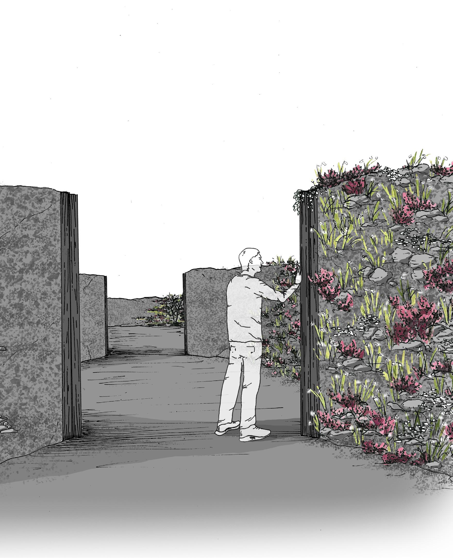
183
TOP: Scores of the Glacial Actions Performance (left) and the Glacial Memories Design (right). These are abstract representations of the design plan, showing how the initial iceberg performance creates marks in the landscape, which are then enhanced through thoughtful design interventions, some of which detailed in the following drawings:
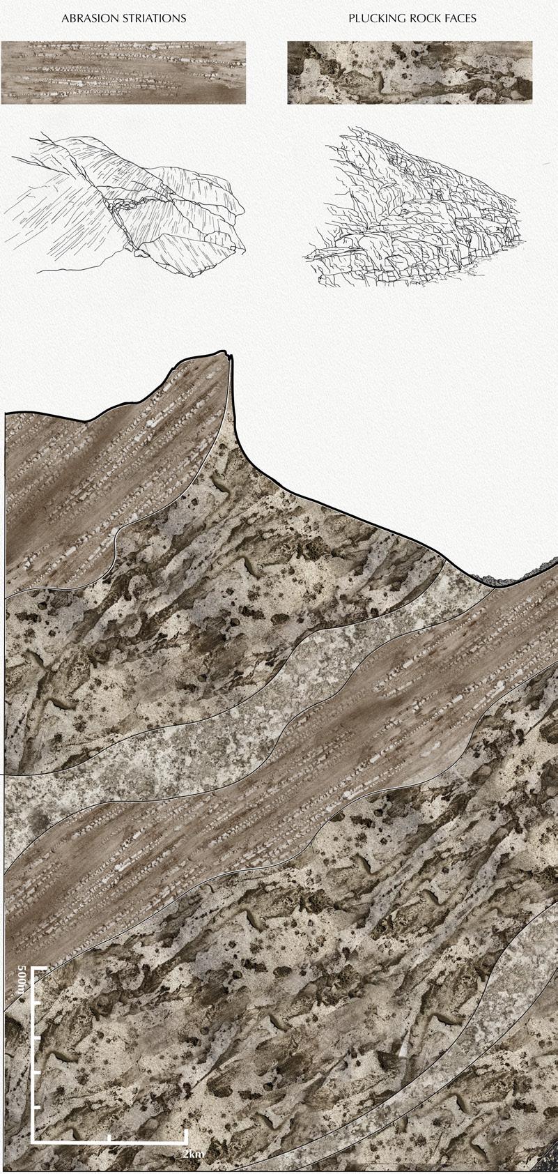
RIGHT: Section down the Breiðamerkurjökull outlet glacier, my field site, in the year 2300, conceptually representing how the extinction of the glacier has left a landscape covered in physical memories of the glacier’s active past. The marks denoting the memories are created through a mark making exercise where I embodied the glacial actions through Icelandic sediments, my hands and water to abstractly recreate the memories. A drawing of each key memory is included against these marks.
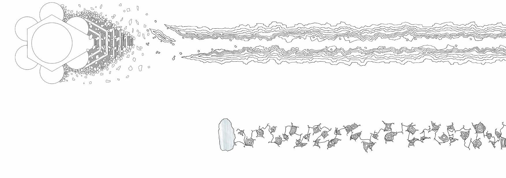
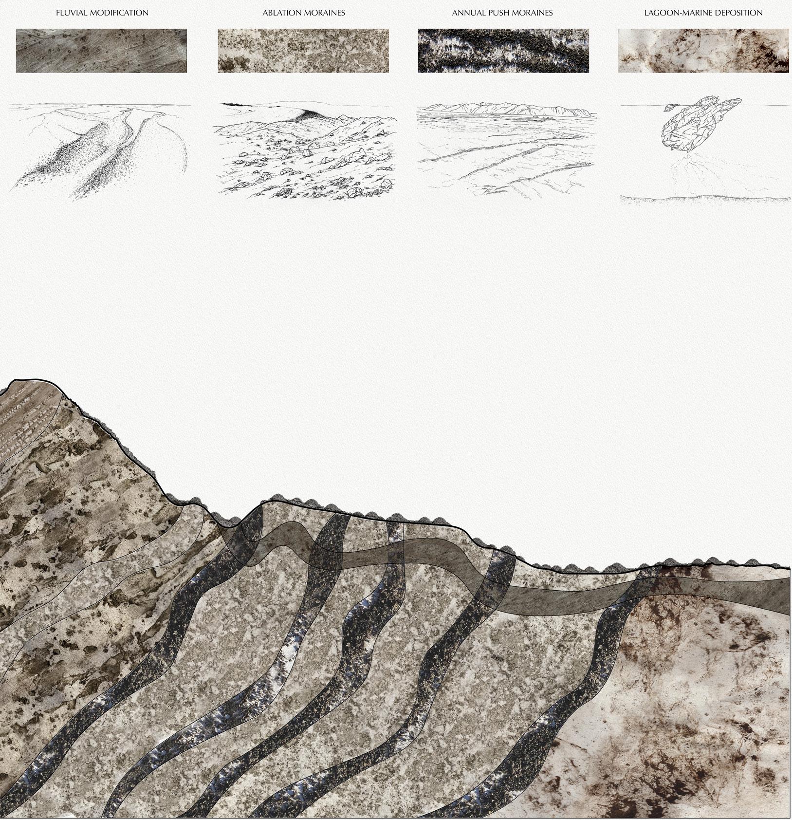
185 Quiet Places I | Lucca Clark
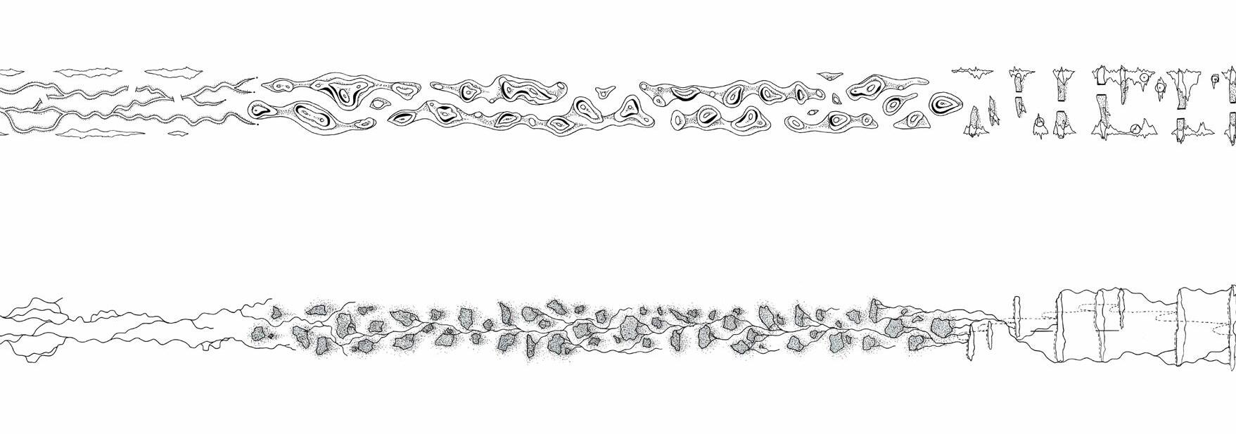
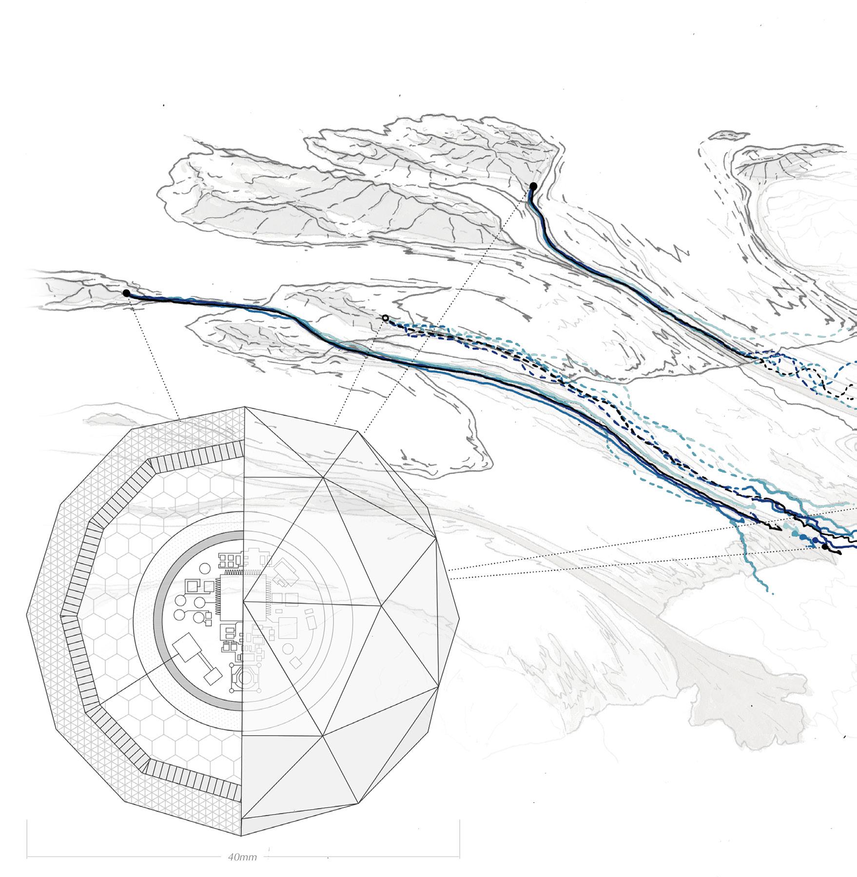
the Glacial Actions Performance (left) and the
TOP: Scores
Memories Design (right). These are abstract representations of the design plan, showing how the initial iceberg performance creates marks in the landscape, which are then enhanced through thoughtful design interventions.
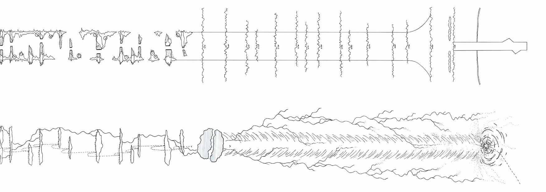
LEFT: Perspective map of the Breiðamerkurjökull, showing the sediment tracing methodology. The practical understanding of the glacial actions and memories is undertaken through a proxy particle instrument that traces sediment erosion, transportation and deposition within the glacial system. On site experts will coordinate and collect data from this methodology, including myself, who will collate the information into a field guide, that informs the physical nomenclature design.
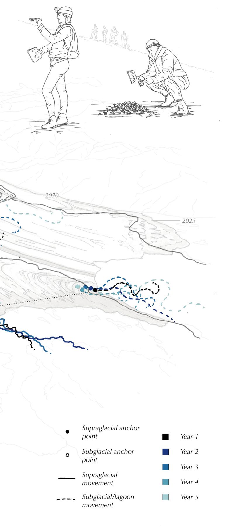
187 Quiet Places I | Lucca Clark
of
Glacial
Skaftárdalur
SETTLING IN THE LAND OF FLOWING SEDIMENTS
Dhriti Lamba
The project is an engagement of the constantly shifting waters of the Skaftá river with the surrounding landscapes that are evolving due to the natural processes of the river and effects of climate change on the Vatnajökull glacier.
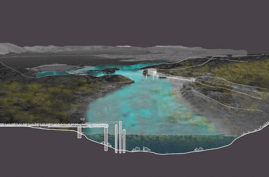
Iceland, a country on the southern edge of the Arctic Circle, is largely covered by glacial ice and remote farms. At first glance, it seems to be beautiful and untouched—but this does not hold true. These places are impacted by the capitalists and their anthropogenic activities. This can be seen in the faraway and uninhabited riverland territory of Skaftá River in the central highlands of Iceland.
The project follows an exploration of the complex hydrological, political and social systems through an understanding of the indigenous philosophies of the Icelandic farmers to design a matrix of micro-habitats for humans and nonhumans. These micro-habitats are part of the Ská-vatn community on the banks of the outwash plains of Skaftá river, in the highlands of Skaftárdalur.
The design proposal for Ská-vatn community is a speculation on the landscape future of the river’s changing wet and dry timeframes for 200 years. It is divided into landscape interventions (neighbourhoods) and a proposed community lifestyle practised in these neighbourhoods using simple and uncomplicated techniques that bind the river and community together. This community can be seen as a form of political engagement, or a social movement. It is a way of ‘slow activism’ against the proposed damming the Skaftá river water for hydroelectricity production. Additionally, the proposal advocates the importance and fragility of the waters of River Skaftá in everyday living. It is a development and adoption of a situated lifestyle where the humans, nonhumans and natural elements come together in a symbiotic relationship.
ABOVE: Field of action of Kvíár project
OPPOSITE: Section analysis: Geomorphology and thickness of time enmeshed on the landscape from Öræfajökull volcano to Kvíárjökull glacier.
Ice caves (formed by underground movement of water)
Vatnajökull glacier
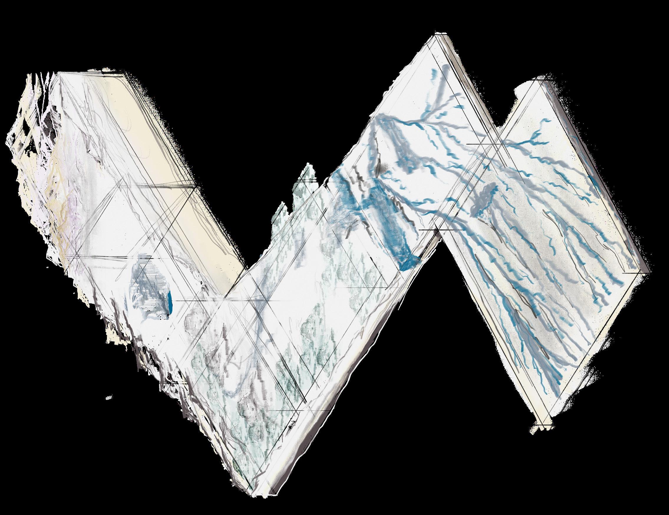
Maximum thickness 1 km
Geothermal melting, geothermal fluids
Strong sulfur smell
Skaftákatlar- Skaftá cauldron and its subglacial lake, source of jökulhlaups
Jökulhlaups occur every 1 to 5 years with volumes of 0.05 to 0.4 km3 and maximum discharge rates of 50m3/s to 3000m3/s
Skaftájökull outlet glacier
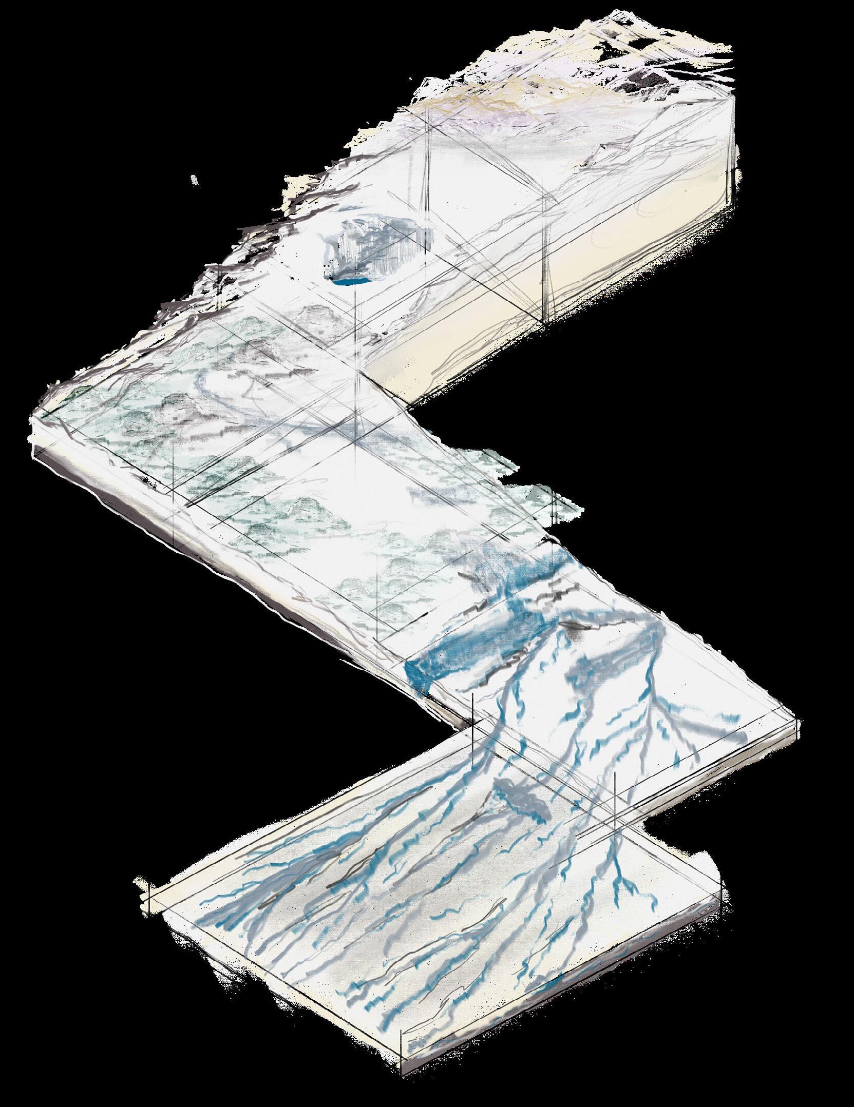

Approx. 40 outburst floods from below these cauldrons since 1955
Voluminous and long, 115km in length
Terminal lakes
Average flow is about 122 m3/sec
Braided channels
Outwash plain/ Sandur
Towards Fögrufjöll mountains
Tributaries of the Skaftá merge to the north of the palagonite Mt. Tröllhamar and flow southwest along the eastern borders of the Fögrufjöll mountains
189 Quiet Places I |
Dhriti Lamba
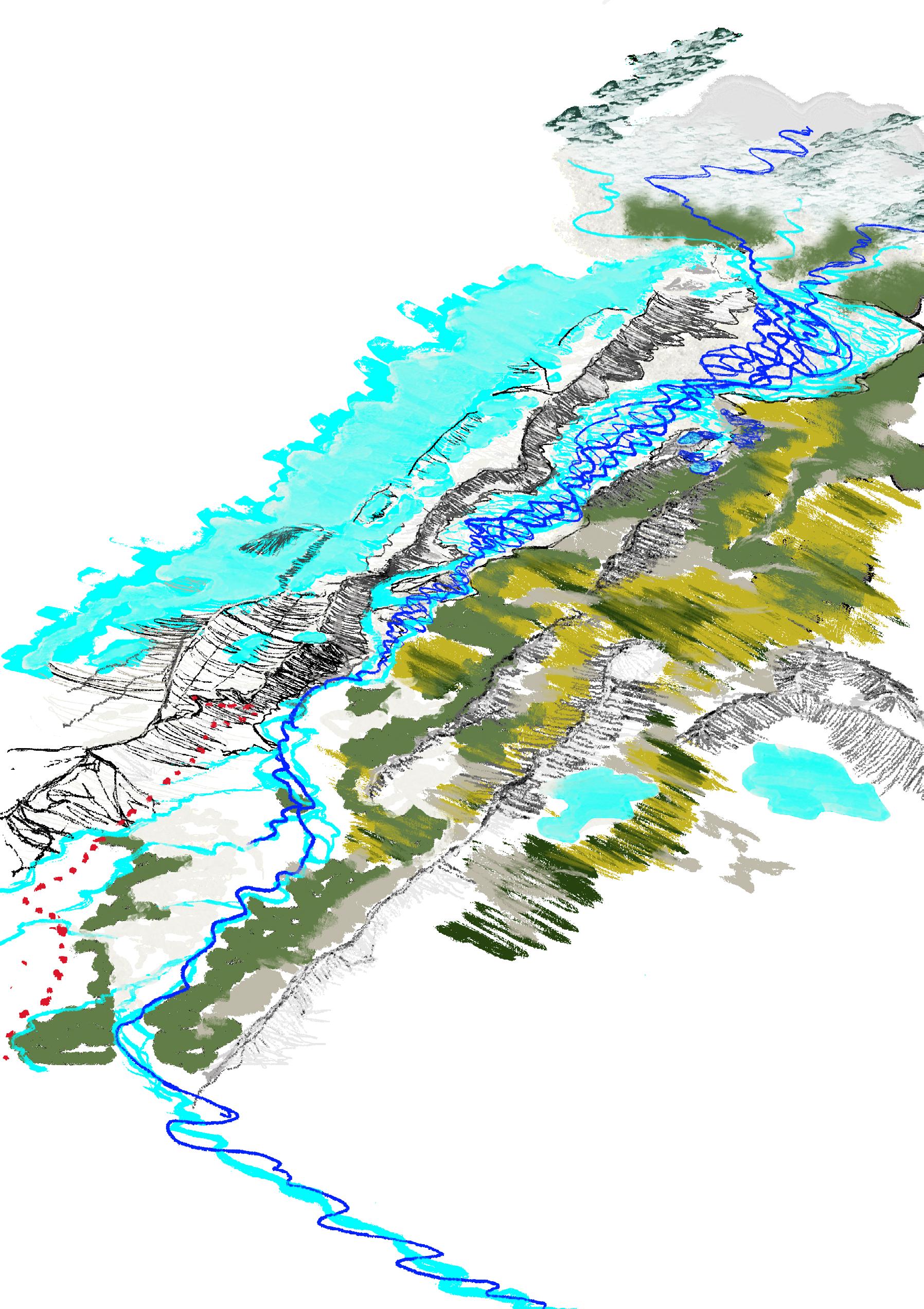

 Fögrufjöll Mountains
Stakafell
Hálsar
Langaskar
Stórasker
Kambavatn
Kambar crators
Skaftá River
Skaftá River
2023 (Present)
2223 (200 years)
Grass meadows Moss
Lambavatn
Langisjór lake
Existing pathway
Fögrufjöll Mountains
Stakafell
Hálsar
Langaskar
Stórasker
Kambavatn
Kambar crators
Skaftá River
Skaftá River
2023 (Present)
2223 (200 years)
Grass meadows Moss
Lambavatn
Langisjór lake
Existing pathway
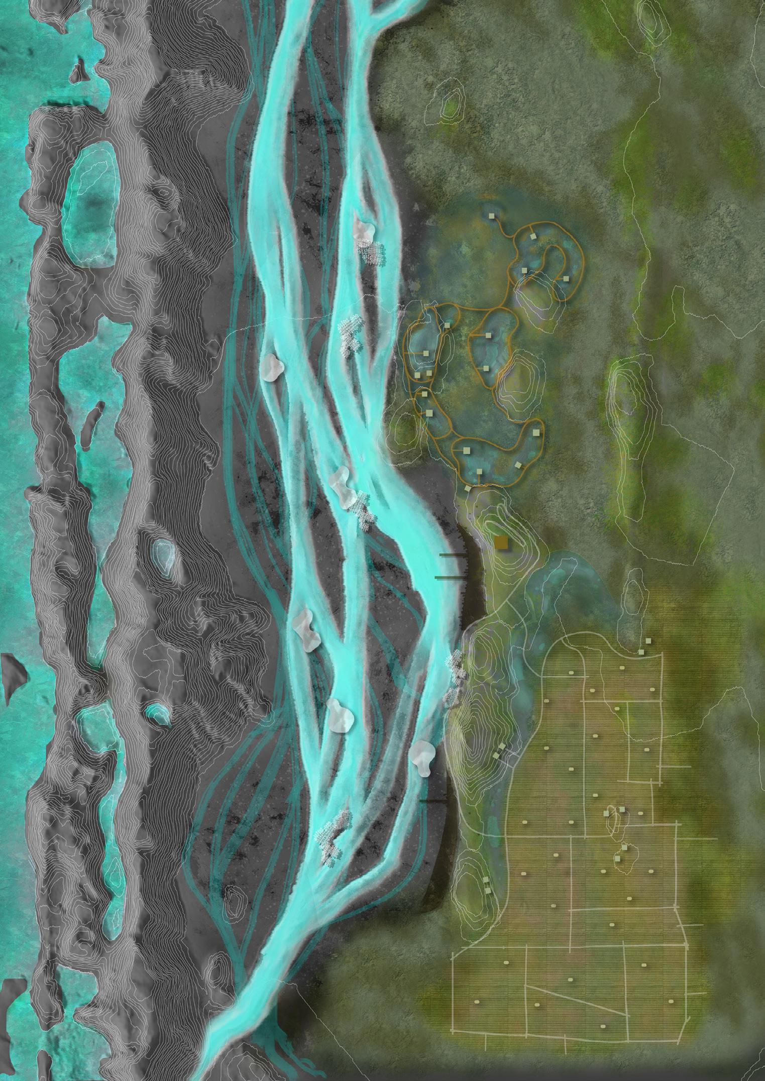

 ABOVE: Choreographies of elements and identities unfolded in the playground of Kvíárjökull glacier. OPPOSITE: Field of action of Kvíár project.
Skaftá dunes
Hálsar
Langasker
Towards Skaftájökull
Towards Kirkjubæjarklaustur
ABOVE: Choreographies of elements and identities unfolded in the playground of Kvíárjökull glacier. OPPOSITE: Field of action of Kvíár project.
Skaftá dunes
Hálsar
Langasker
Towards Skaftájökull
Towards Kirkjubæjarklaustur
FÖGRUFJÖLL MOUNTAINS LANGISJOR LAKE
Stakafell
Hálsar Lake observatories
Stakafell grasslands
Laki nests 191 Quiet Places I |
Ská-vatn
Dhriti Lamba
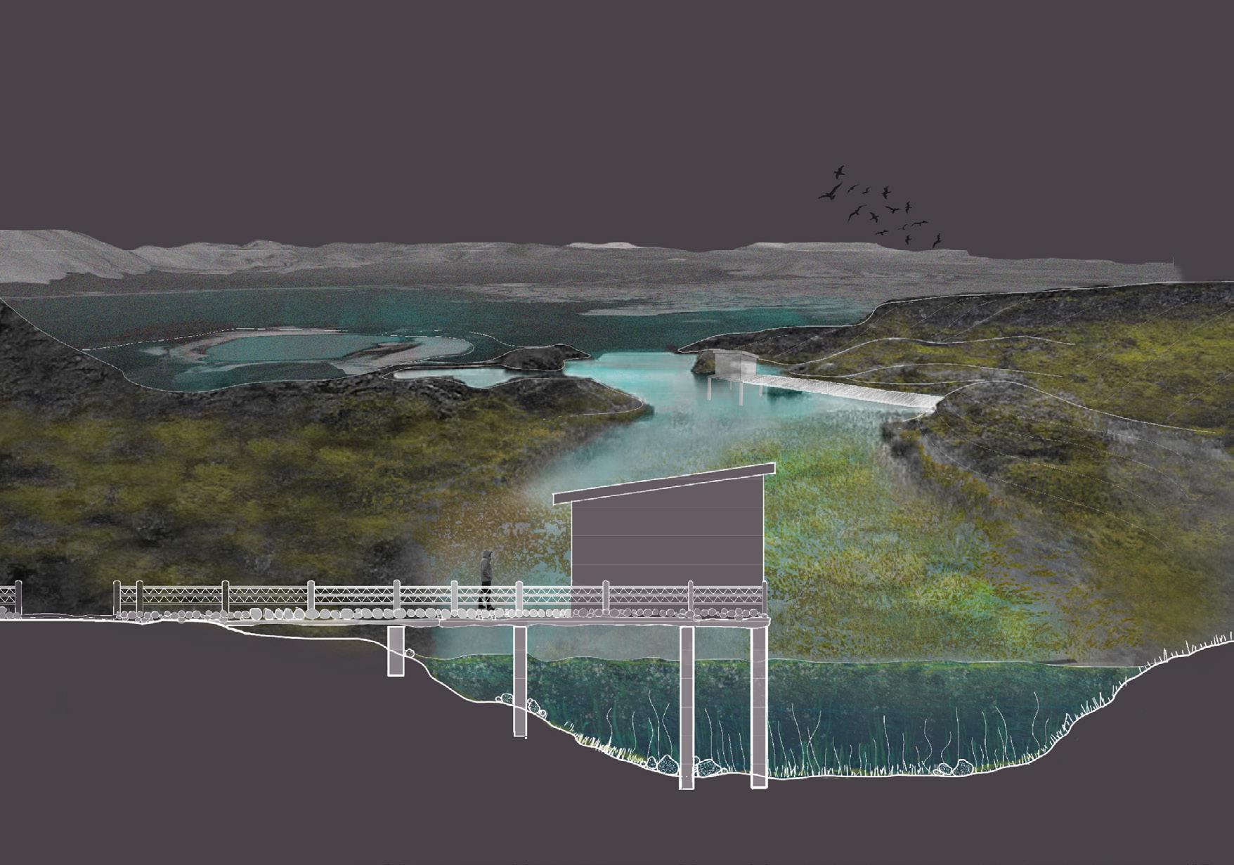
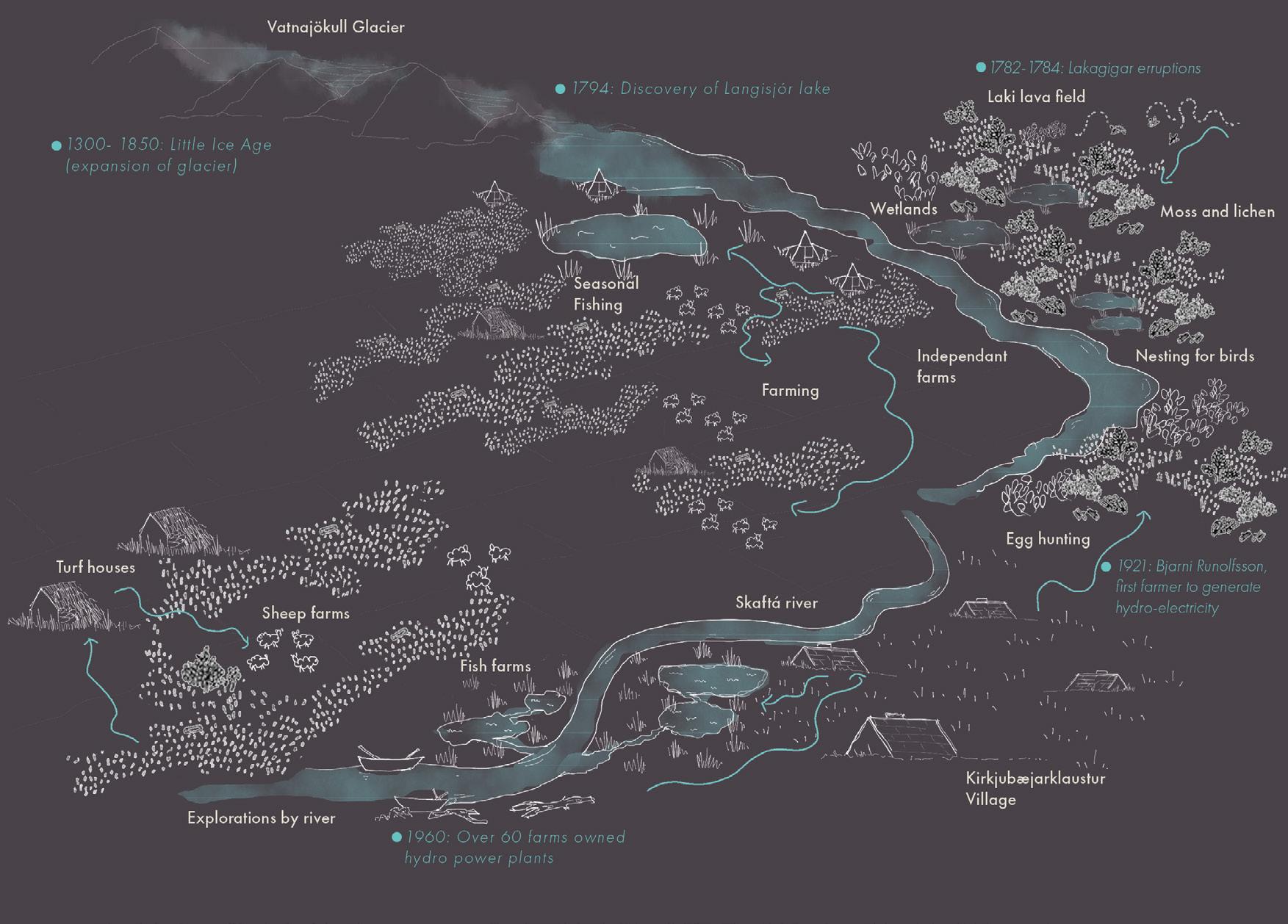
ABOVE: Conceptual models of the guerrilla playground expanding the notion of playground.
BELOW: Transect and dynamic systems: Capturing temporalities and events from Öræfajökull volcano to Kvíárjökull glacier.
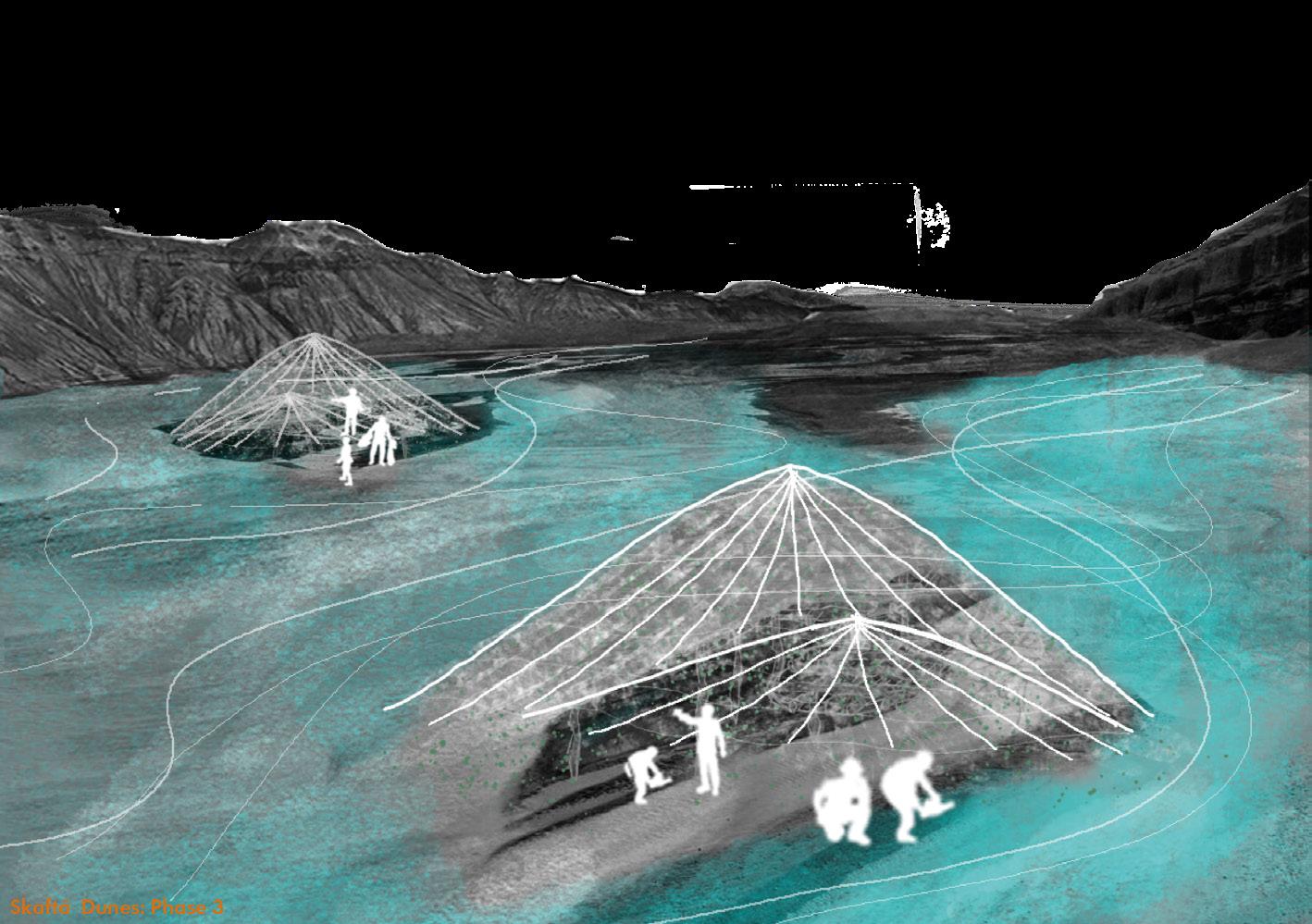
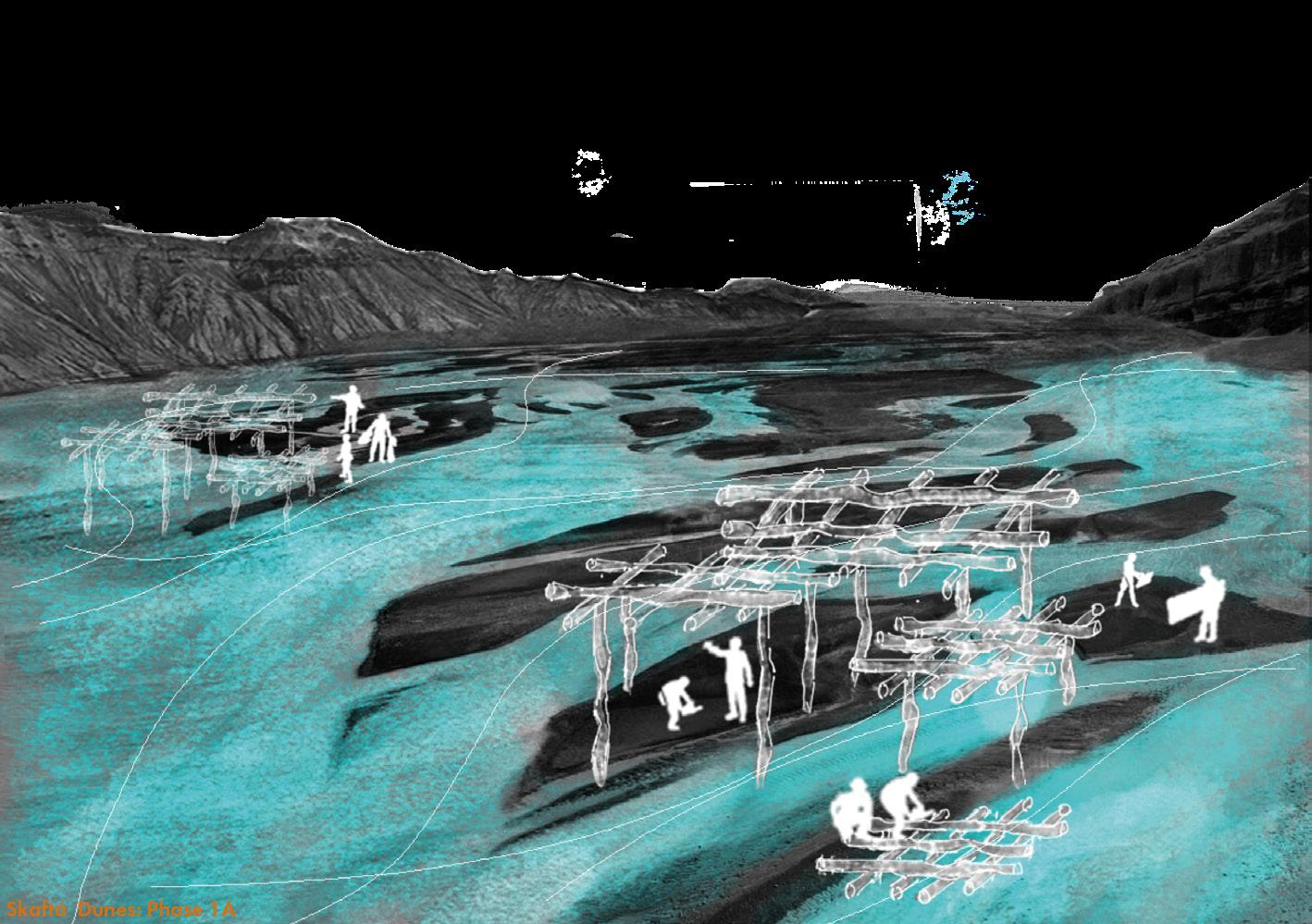
193 Quiet Places I | Dhriti Lamba
The Journey to Witness the Death of a Giant
CHRONICLING LANDSCAPE IN SKAFTAFELLSJÖKULL
Yuheng Lin
With the onset of the Anthropocene, humans intensified their encroachment on the natural world, breaching planetary boundaries and triggering a worldwide climate change. Iceland’s valuable glaciers are rapidly disappearing due to climate change, possibly serving as a warning from nature. Despite the rapid loss of glaciers, it appears that there’s little humans can do to halt this trend. Perhaps the only thing we can do is to record the glaciers’ final traces, acknowledge the brutality of their demise, and keep their tragic history in our memories.
This project aims to create a kind of chronicle landscape with the method of landscape, which follows the process of the glacier’s demise, records and amplifies the last history of the glacier with a series of different patterns(Recording Process & Remembering Process), and creates a journey to witness the death of the natural giant.
A basic recording pattern, with two huge rocky guidance walls and a series of small stone walls as the marks of the glacier ice line, like creating the annual rings of the glacier. This pattern will be established every few years, following the glacier’s retreat process to higher altitudes. The walls are made of Icelandic basalt, imitate the structure of cairns, as a set of giant cairns guide the crowds to the Skaftafellsjökull glacier. Moreover, a series of patterns with different functions and characteristics will be built to create diverse spaces and sightseeing experiences. At the end of the glacier, there will be structures even larger than the basic pattern, called the glacier grave, which will witness the final demise of the glacier.
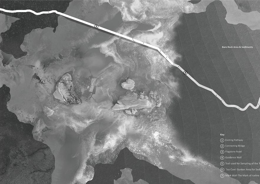
Hopefully, after witnessing the chronicle of glacial death, humans will reflect and take action to create a better future with nature.
ABOVE: The start of the project: 2030 masterplan. OPPOSITE: Dynamic glacier system.
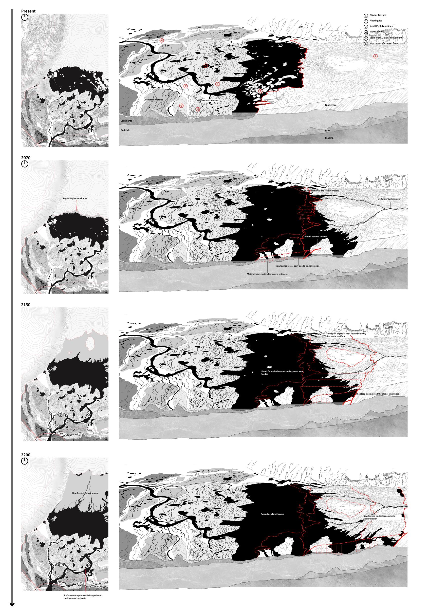
195 Quiet Places I | Yuheng Lin
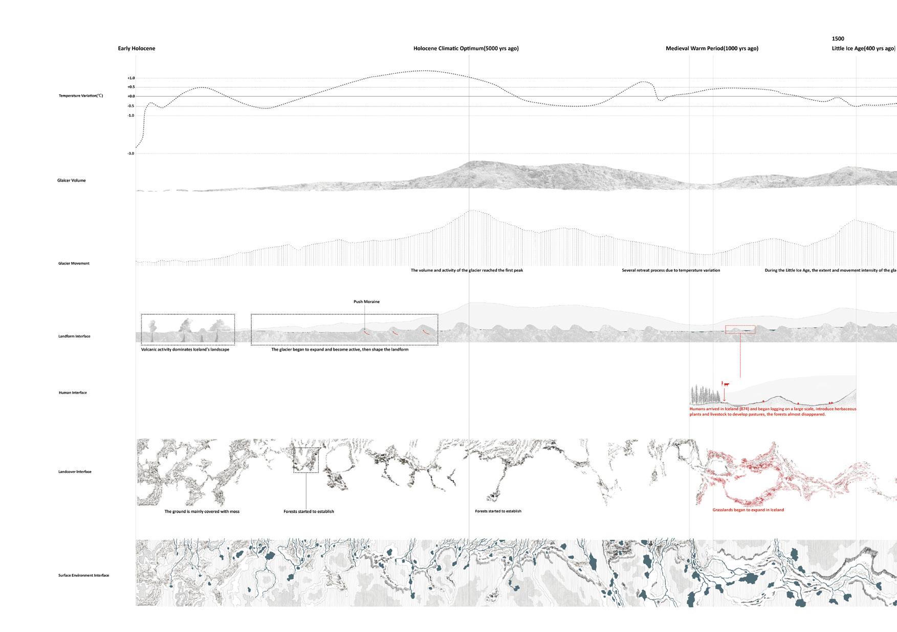
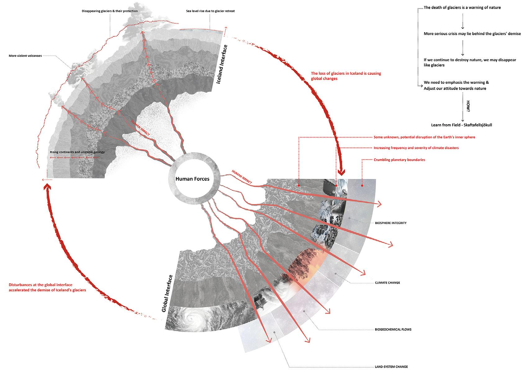
ABOVE: Chronicling the shifting forces that have shaped Iceland’s landscape in the Holocene. In the early Holocene epoch, Iceland experienced frequent volcanic activity, which gave rise to significant geological movements that became the predominant forces shaping the surface landscape of Iceland.
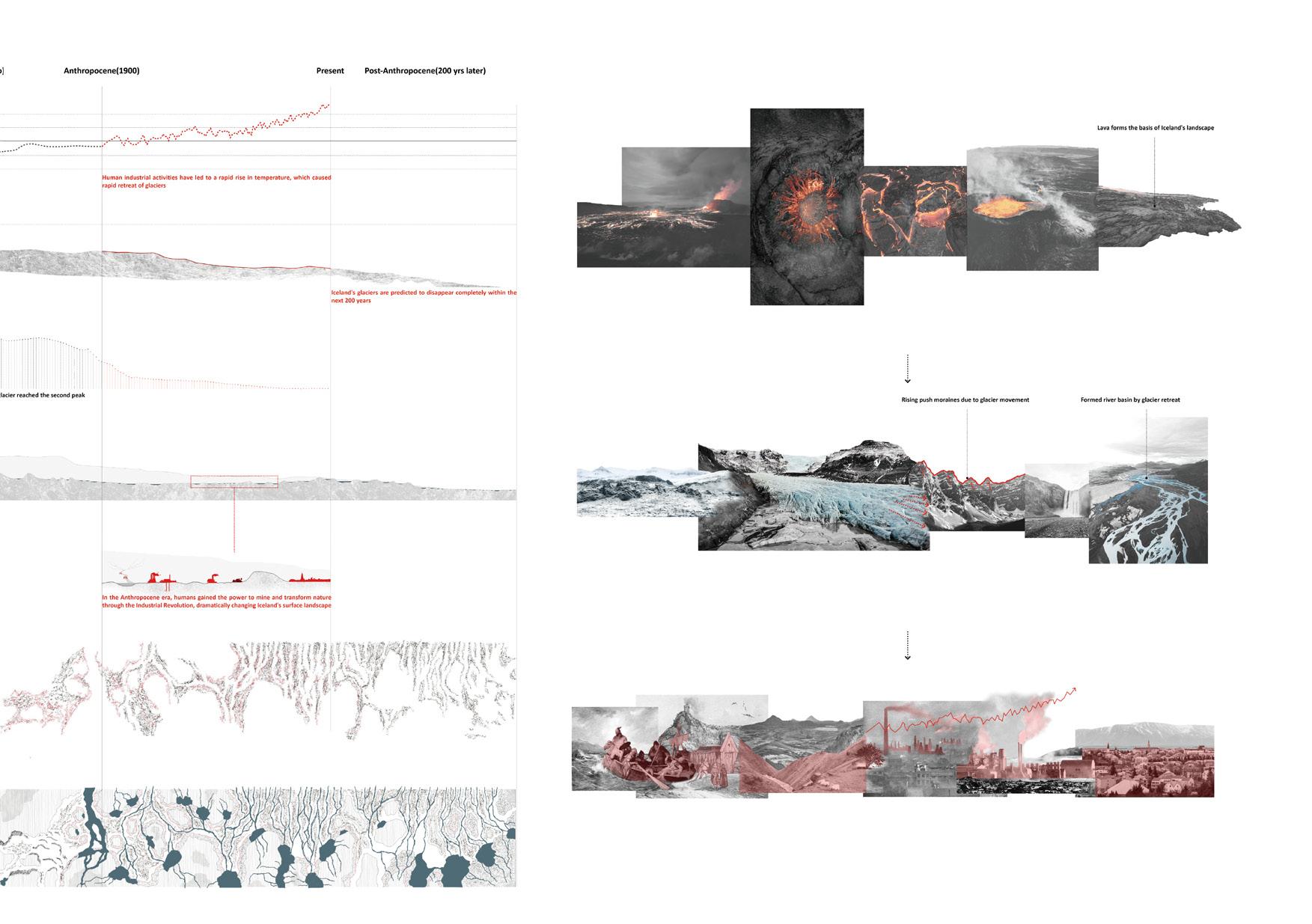
The formation of glaciers in Iceland is largely influenced by fluctuations in temperature and precipitation. Over time, as glaciers continued to grow in size and coverage area, they gradually emerged as the primary force shaping Iceland’s landscape. This glacial activity gave rise to the distinctive terrain of moraines, while the meltwater from the glaciers contributed to the formation of wetlands and river systems, thereby enriching Iceland’s landscape.
Upon arrival in Iceland, the Vikings initiated a largescale deforestation campaign, which involved the introduction of livestock and herbaceous plants and resulted in the disappearance of Iceland’s surface forests. As a result, native alpine plants were displaced by pastures used for animal husbandry. In the Anthropocene era, the industrial revolution empowered human beings with the ability to alter nature and become the primary force responsible for landscape changes in Iceland.
It seems that humans have become the master of nature and gained the power to dominate nature.
OPPOSITE: What does ‘the power’ bring us?
According to Richardson, humans have already crossed several planetary boundaries (climate change, biogeochemical flows, land system change, biosphere integrity), which can be significantly dangerous and possibly result in unexpected situations. Humans still know very little about the inner interface of the Earth, and our actions across the planetary boundary may have caused some kind of unknown interface disturbance, which may result in a more serious globalscale disaster.
197 Quiet Places I | Yuheng Lin
ABOVE: The Path to the New World.
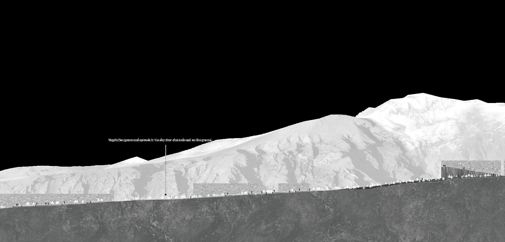
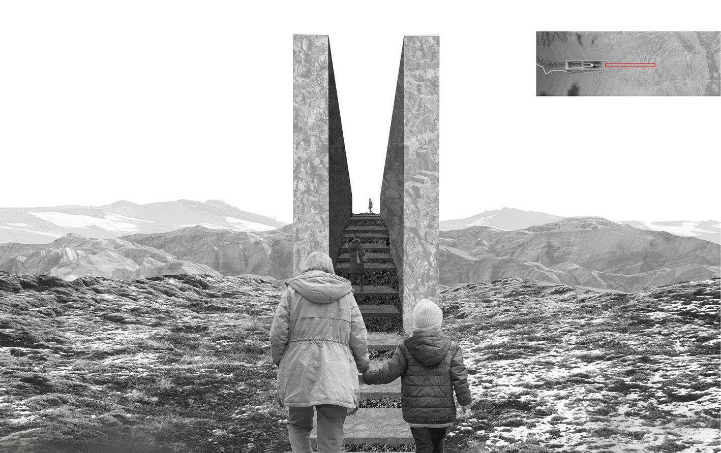
OPPOSITE: The trace of the history .
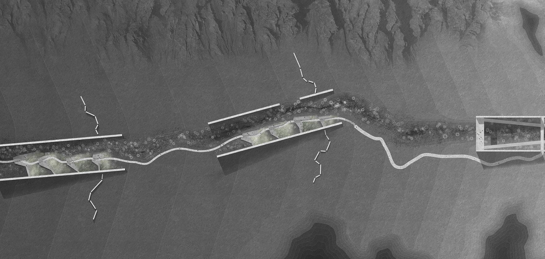
BELOW: 17 2300+ section.
BOTTOM: 2300+ masterplan.
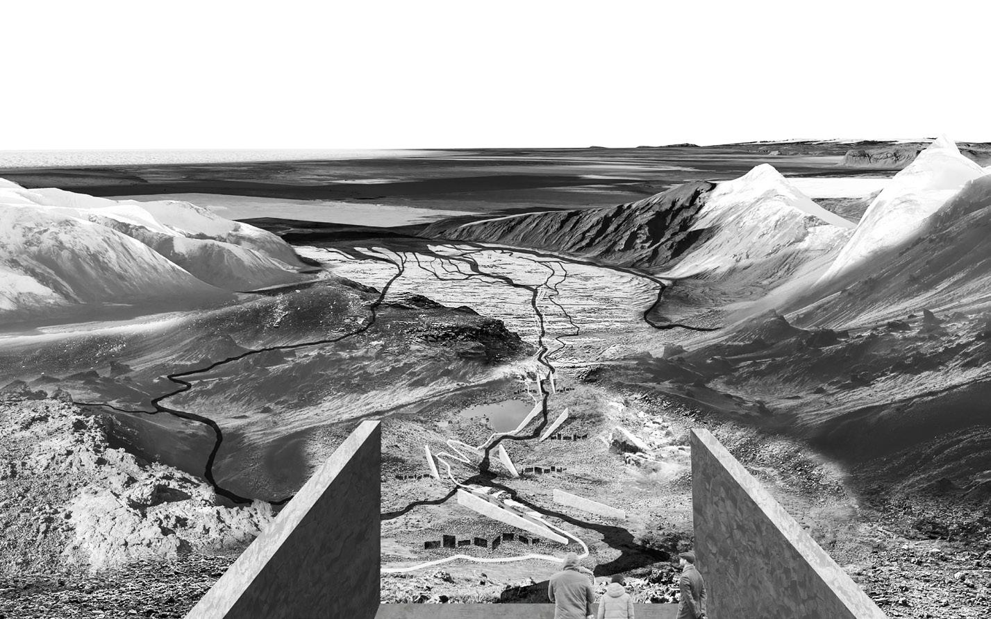
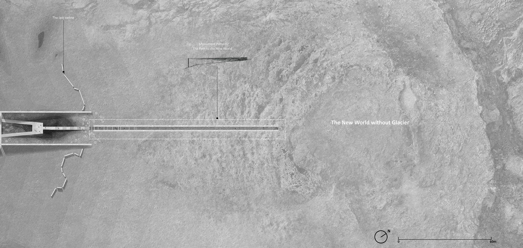
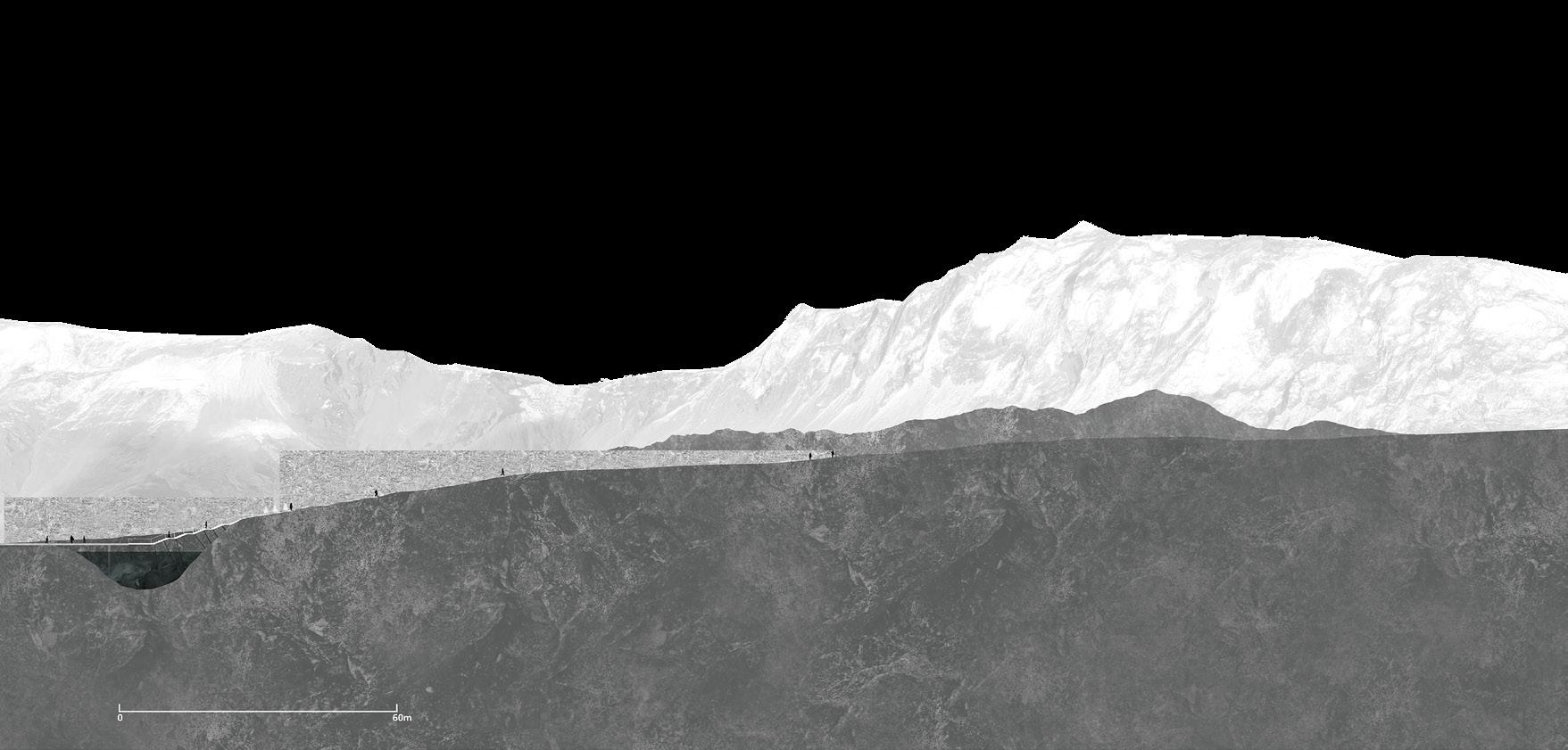
199 Quiet Places I | Yuheng Lin
Lighthouse Incisions
Abigail MacPhee
‘Lighthouse Incisions’ began with a simple intention: to explore the Icelandic landscape, its culture, and its people, with a particular focus on kelp cultivation and pastoralism using a few select lighthouses as areas of investigation. However, as I delved deeper into this world, I uncovered a hidden side of Icelandíc identity—its past and present material and industrial practices. And so, I found myself tumbling down a rabbit hole of discovery, exploring the deep currents of labour and matter that have shaped Icelandíc history and may impact its future.
The project started with an interest in bridging aquatic and terrestrial stewardship practices and using lighthouses as areas of investigation, symbolizing areas that bridge these boundaries between land and sea and Icelandic resiliency. After scouring the coast, I chose five lighthouses as landscape acupuncture points and areas of investigation, they became my satellite sites, representative of specific Icelandíc dynamic processes: Reyjkanesviti, Dyrholaey, Flotningur, Hjalteyri, and Myeoyri. These sites served as gateways to unravel the intricate forces that shape Iceland’s remarkable terrain, from tectonic activities to the aluminium smelting industry. The project’s primary objective was to anchor these dynamic processes in the Vattarnes peninsula, a deliberate choice to address the detrimental impacts caused by the aluminium smelter activity. This raised an important research question: Can we integrate aquatic and terrestrial stewardship practices while creating an actively remediating landscape that serves as a material mosaic? Furthermore, can this transformed landscape offer profound insights into Iceland’s socio-ecological practices, providing a reflective and critical lens?
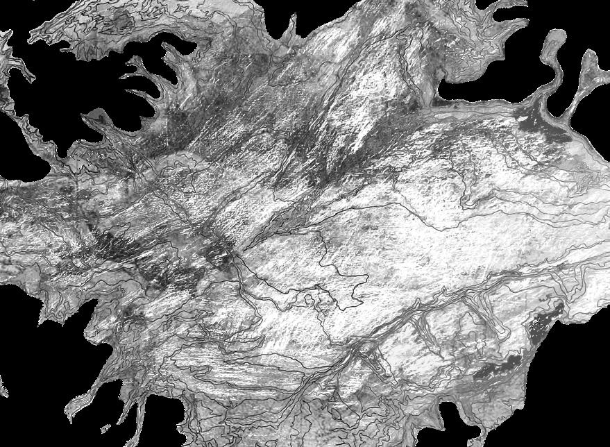 ABOVE: Centering the bathymetry and lighthouses in shaping Iceland’s landscape.
OPPOSITE: Material mosaic of Icelandic identity: Satellite lighthouses embodied in design interventions that illuminate dynamic systems at Vattarnes, balancing cultivation and remediation in response to the socioecological crisis.
ABOVE: Centering the bathymetry and lighthouses in shaping Iceland’s landscape.
OPPOSITE: Material mosaic of Icelandic identity: Satellite lighthouses embodied in design interventions that illuminate dynamic systems at Vattarnes, balancing cultivation and remediation in response to the socioecological crisis.
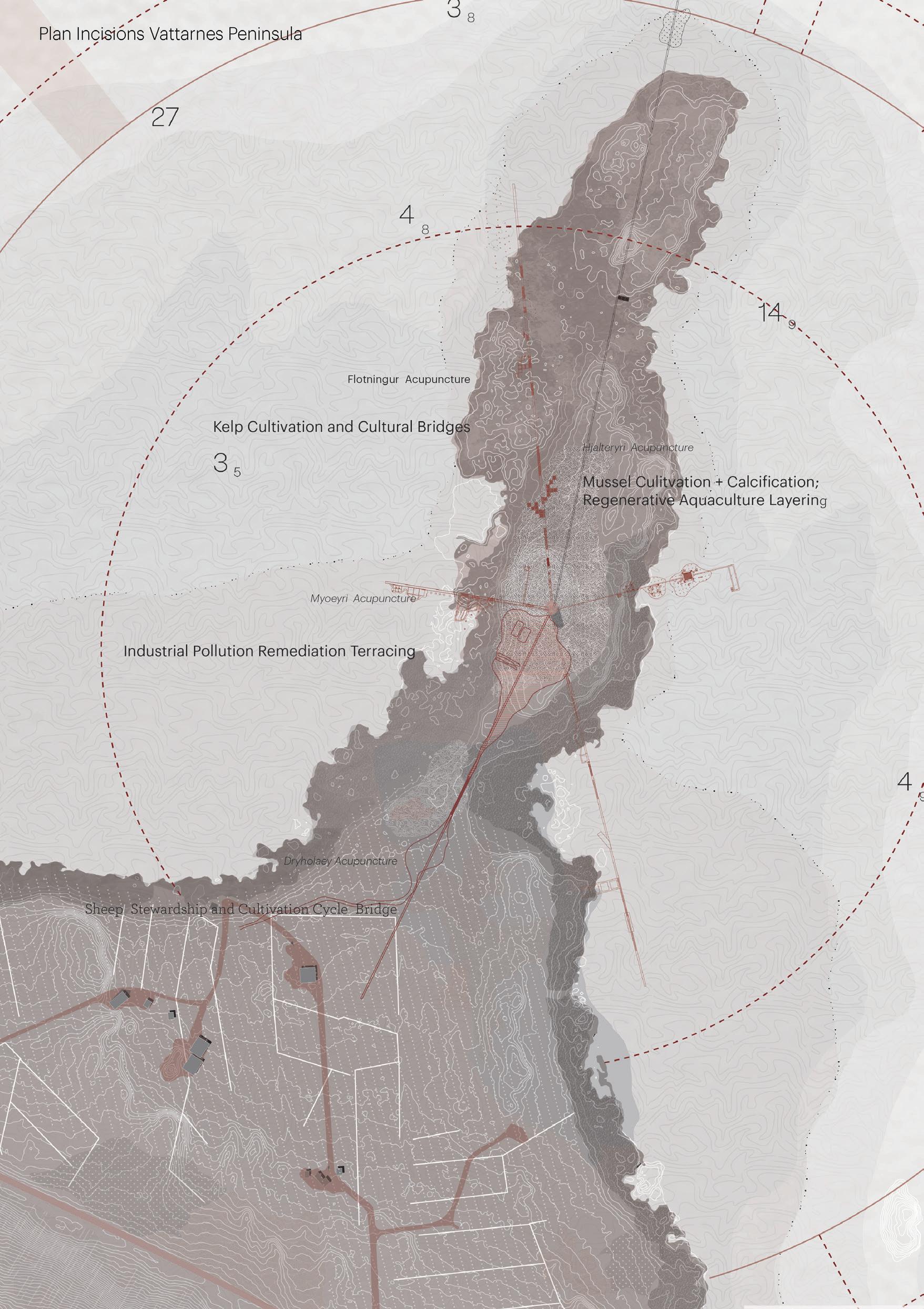
201 Quiet Places I | Abigail MacPhee
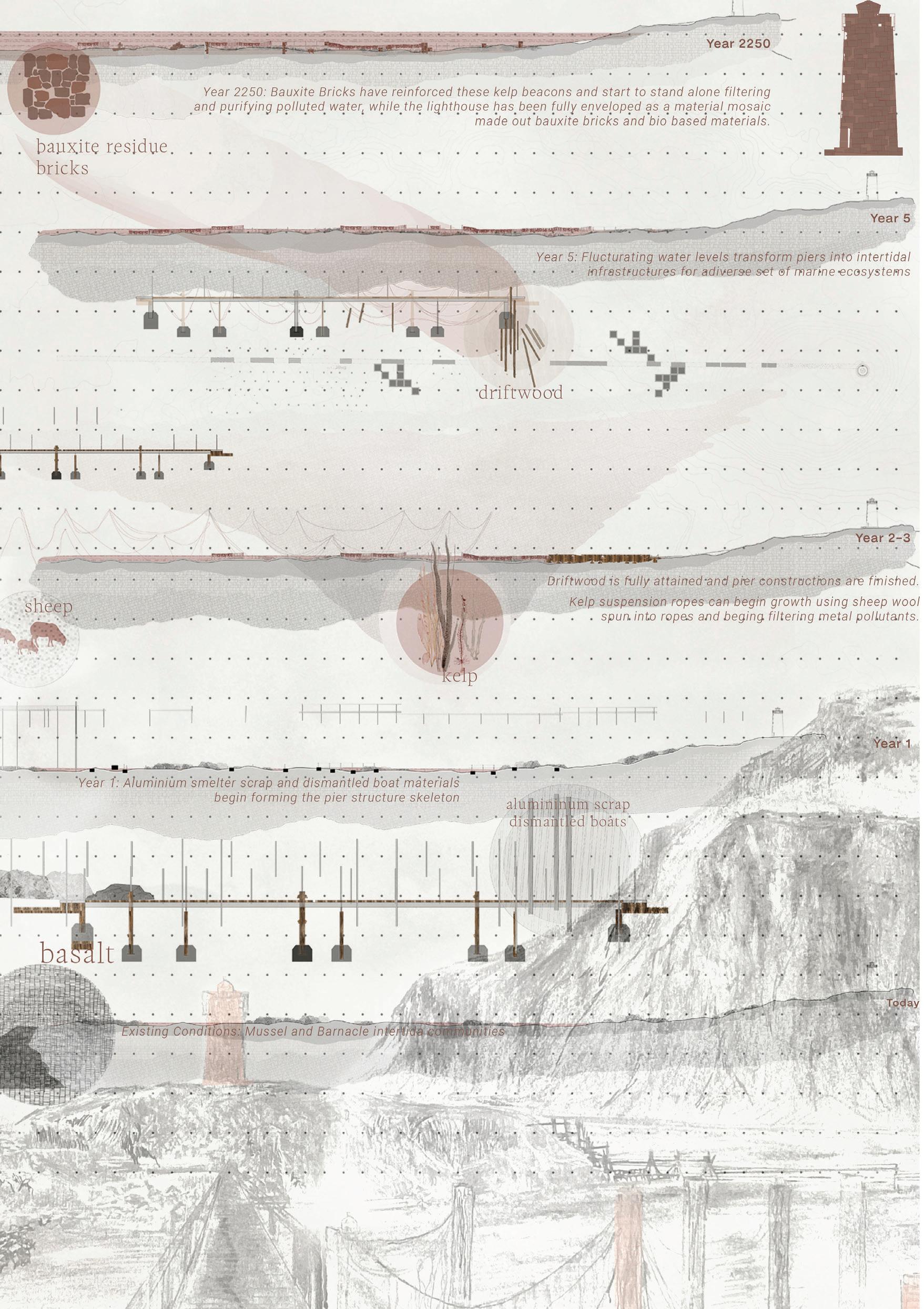
TOP: Hyalteyri Ray: Cultivating sustainable mussel growth and marine gardening - honoring tradition and fostering ecological interactions.
Utilizing steel and driftwood, platforms inspired by the Hyalteyri lighthouse and fish drying racks facilitate mussel cultivation, fish drying, and serve as piers for fishing boats, gradually reinforced with bauxite bricks. These multi-purpose structures enhance marine biodiversity, acting as experiential elements and fostering the transformation of natural fish paddocks/reefs.
ABOVE: Myoeyri Ray: Kelp terrace beds as purifiers of heavy metal pollutants, enhanced by bauxite bricks for filtration and remediation. As the terraces and piers adapt to rising sea levels, they integrate into the marine ecology, perpetuating water remediation, while bauxite brick beacons stand as reminders of past industrial activities and their ecological impact.
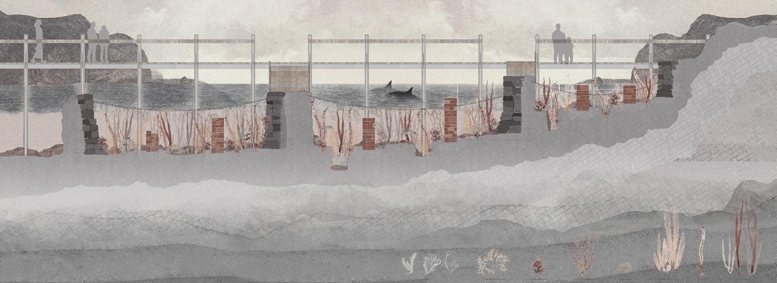
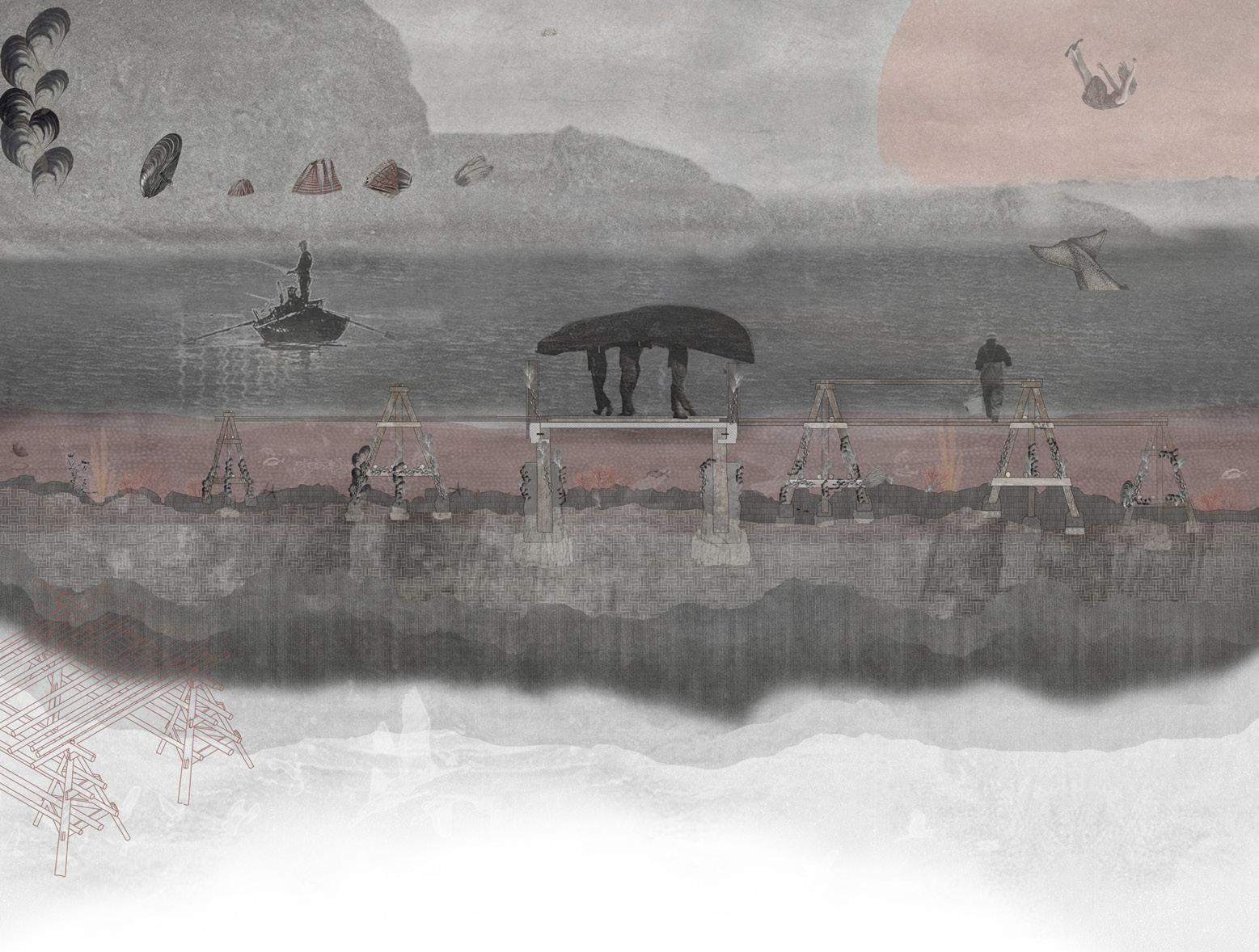
OPPOSITE: Materials-Driven interventions: keepers, cultivation, and transformation in challenging Iceland’s Capitalocene identity.
Basalt, aluminum scrap, and natural resources form the basis of interventions, with designated keepers managing and sculpting materials gathered from the site, smelter plant, and port. Ongoing research explores bauxite residue bricks as “beacons,” enveloping the interventions over time, culminating in the transformation of the lighthouse into a prominent purifying structure, symbolizing our continued impact.
203 Quiet Places I | Abigail MacPhee
TOP: Guided by lighthouse lights, design incisions capture spatial and subterranean characteristics at Vattarnes Peninsula.
ABOVE: Concept diagrams of Vattarnes Peninsula: converging elements at the anchor site at Vattarnes Peninsula. Uniting Icelandic identity and industrial flows. Elemental connections: Satellite lighthouses on Vattarnestangi Peninsula - Reflecting Iceland’s ecological, social, and industrial interplay.
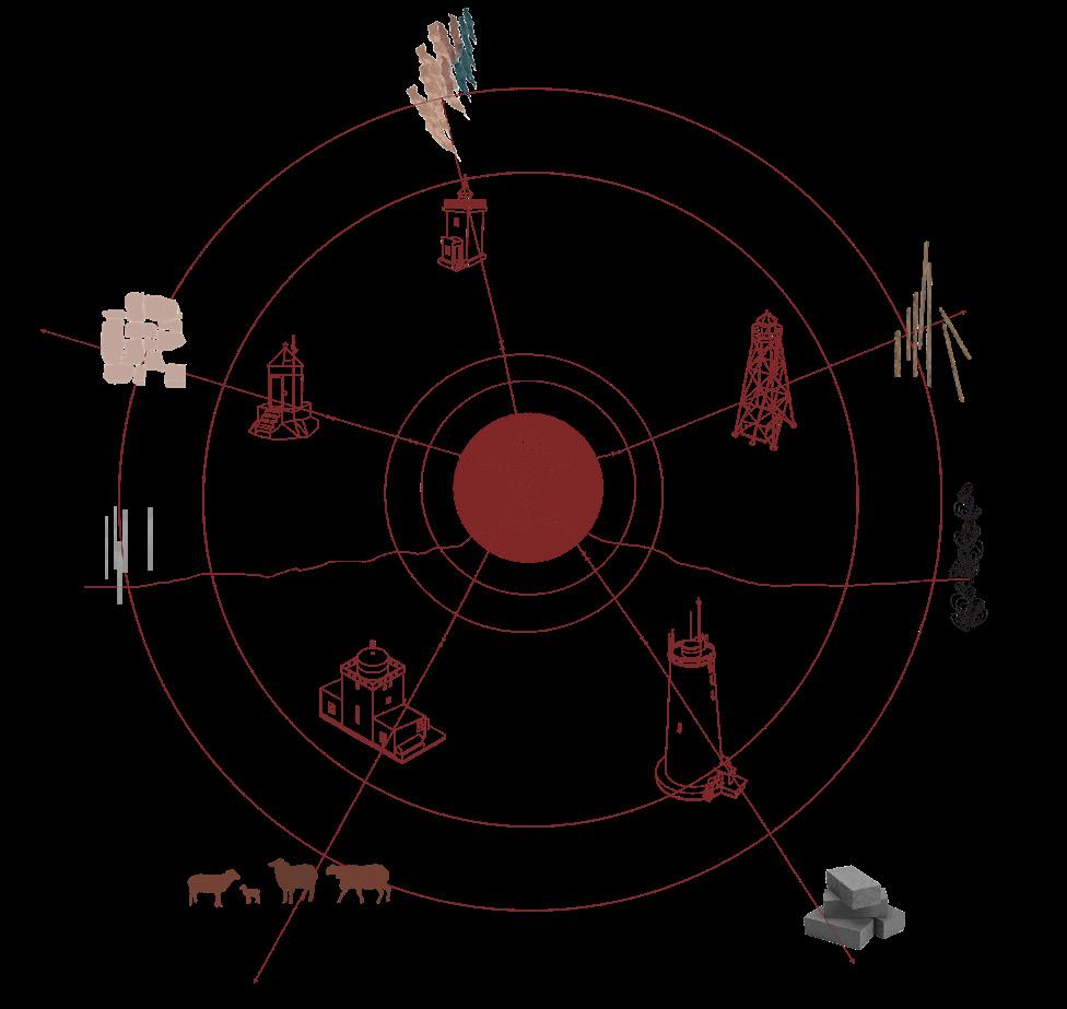
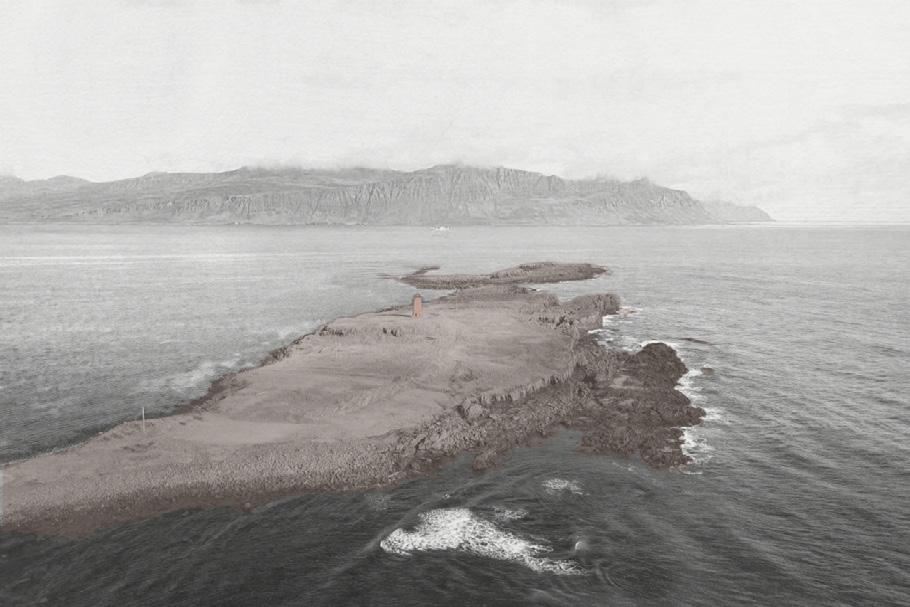
OPPOSITE: Dynamic system analysis sections illuminating Iceland’s dynamic landscapes: Lighthouses as anchors of environmental and social systems.
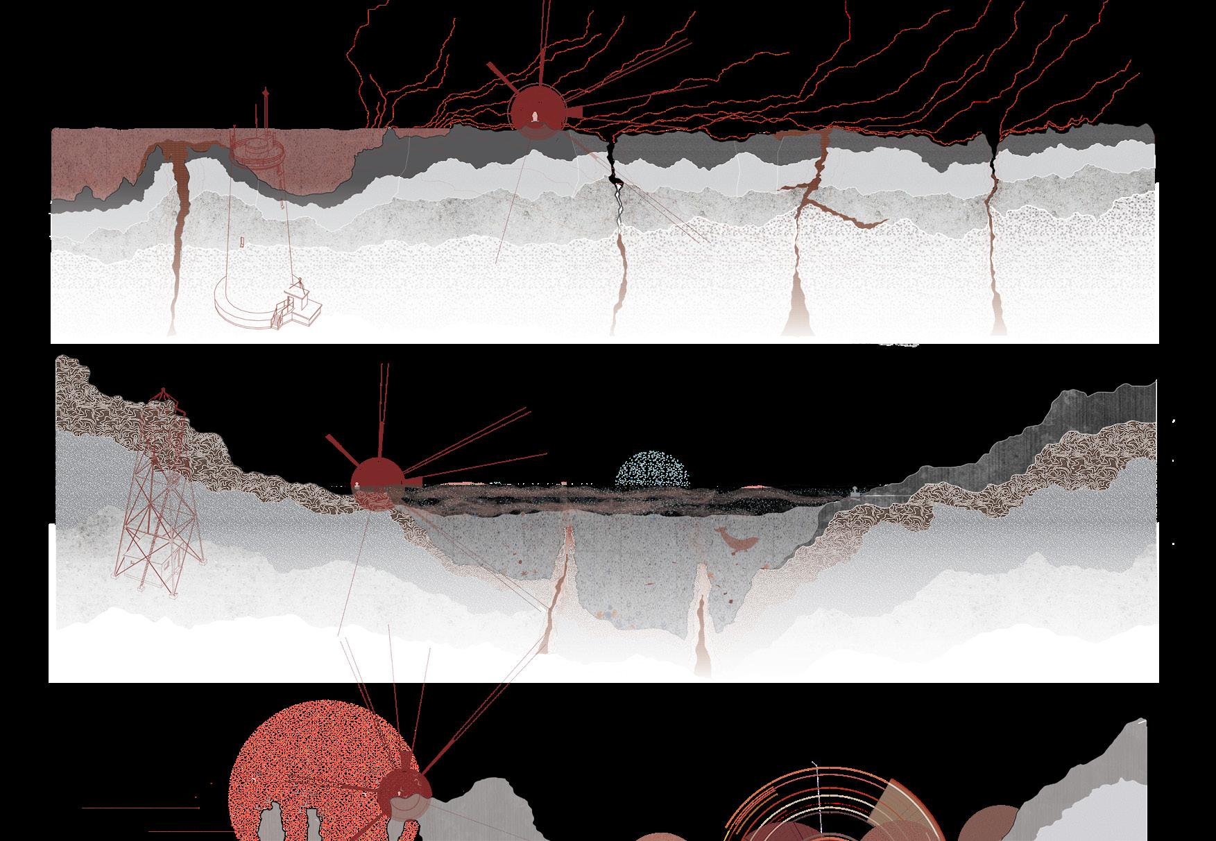
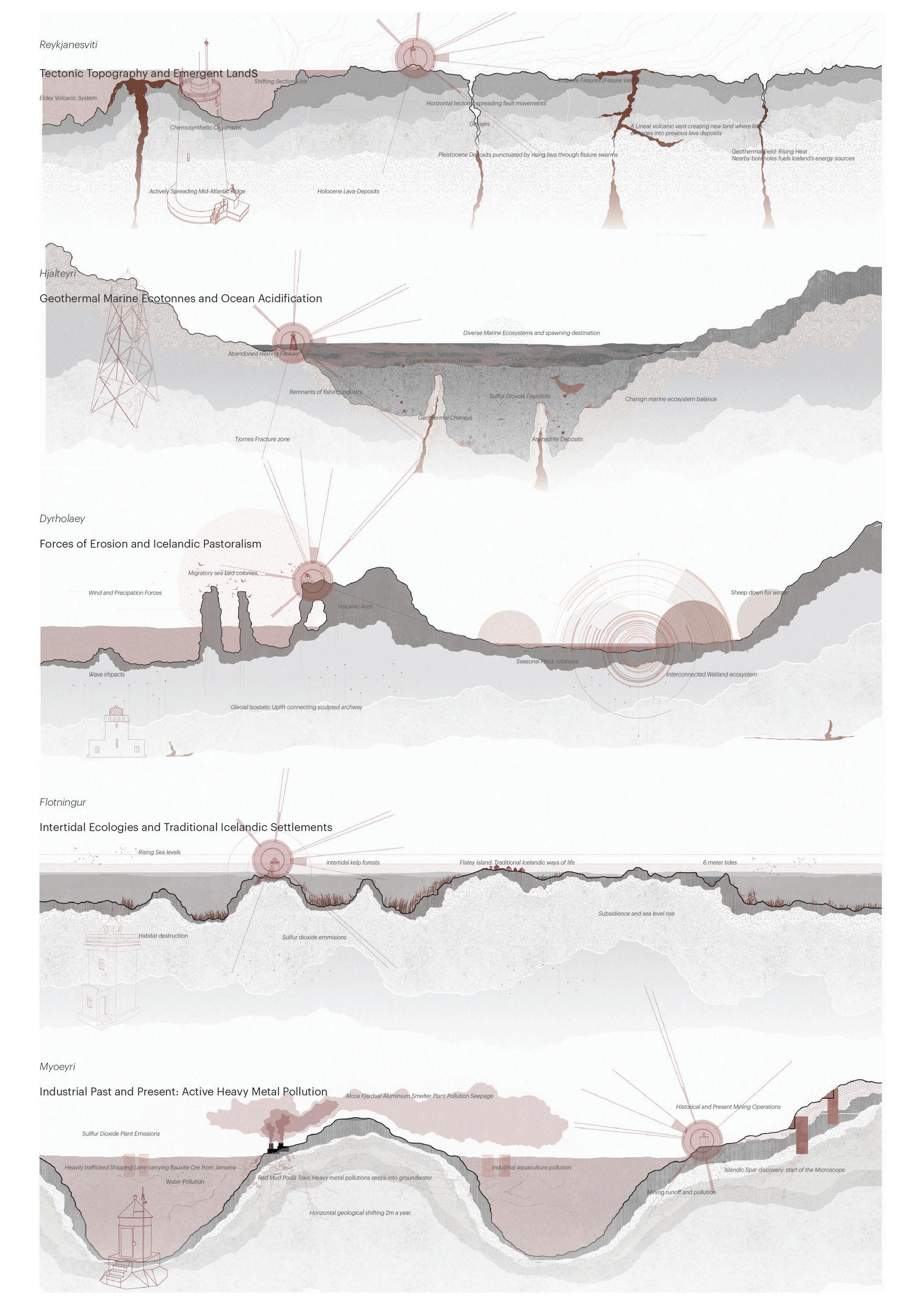
205 Quiet Places I | Abigail MacPhee
Future Archives 2225
THE VATNAJÖKULL BOTANICAL PARKS LANDSCAPES OF MEMORY, RUIN, AND RESILIENCE Eloïse Mercer

‘Future Archives 2225’ proposes the future transformation of the Vatnajökull Glacier – in concert with glacial melt and atmospheric change – into a large-scale Botanical Park comprised of countless ‘archive gardens’. Each site responds uniquely to the notion of archiving, whether through active preservation of its present conditions, through responding to glacial memories, recording landscape change over time, or the implementation of future conditions. The project details the conceptual interventions across three sites in particular, each of which represents a highly atmospherically unique and ecologically valuable landscape, and each of which is under threat from the powerful landscape forces at play as a consequence of large-scale, exponential glacial melt. The man-made reservoir and former wetland landscape of the Sauðárdalur Valley; the birch forests of Skaftafell and the surrounding Skeiðarársandur outwash plain; and the microbial ecologies and hydrology of the Grímsvötn geothermal subglacial caldera.
Whilst the interventions for each site respond individually to contrasting ideas of the archive, they are equally united by a regime of disturbances designed to encourage and sustain life – and landscapes – for future generations to come. United still by a wider conceptual framework, a sense of materiality and, most essentially, a universal manifesto of ecological preservation and resilience during increasingly uncertain climatic futures. In accordance with a landscape defined by contrasts – the land of ice and fire - The Future Archive for the Vatnajökull Botanical Parks is defined by moments of both stasis and dynamism, by narratives of both loss and hope, destruction and life. Far more than a landscape of memory or memorialisation, the Archive recognises a great need to preserve the significant cultural histories bound up in the transient ice of the glacier, to transform them into something solid and tangible. It is a landscape of futurality, for the creation of futures that have a future.
ABOVE: Lathyrus japonicus / page excerpt from ‘Ecologies of the Past / Ecologies of the future - Ancient Icelandic Birchwood’ ecological archive
OPPOSITE: ‘Human Futures’ / Visualisation of the Artists Residence program among the evolving ruins of the Sauðárdalur.
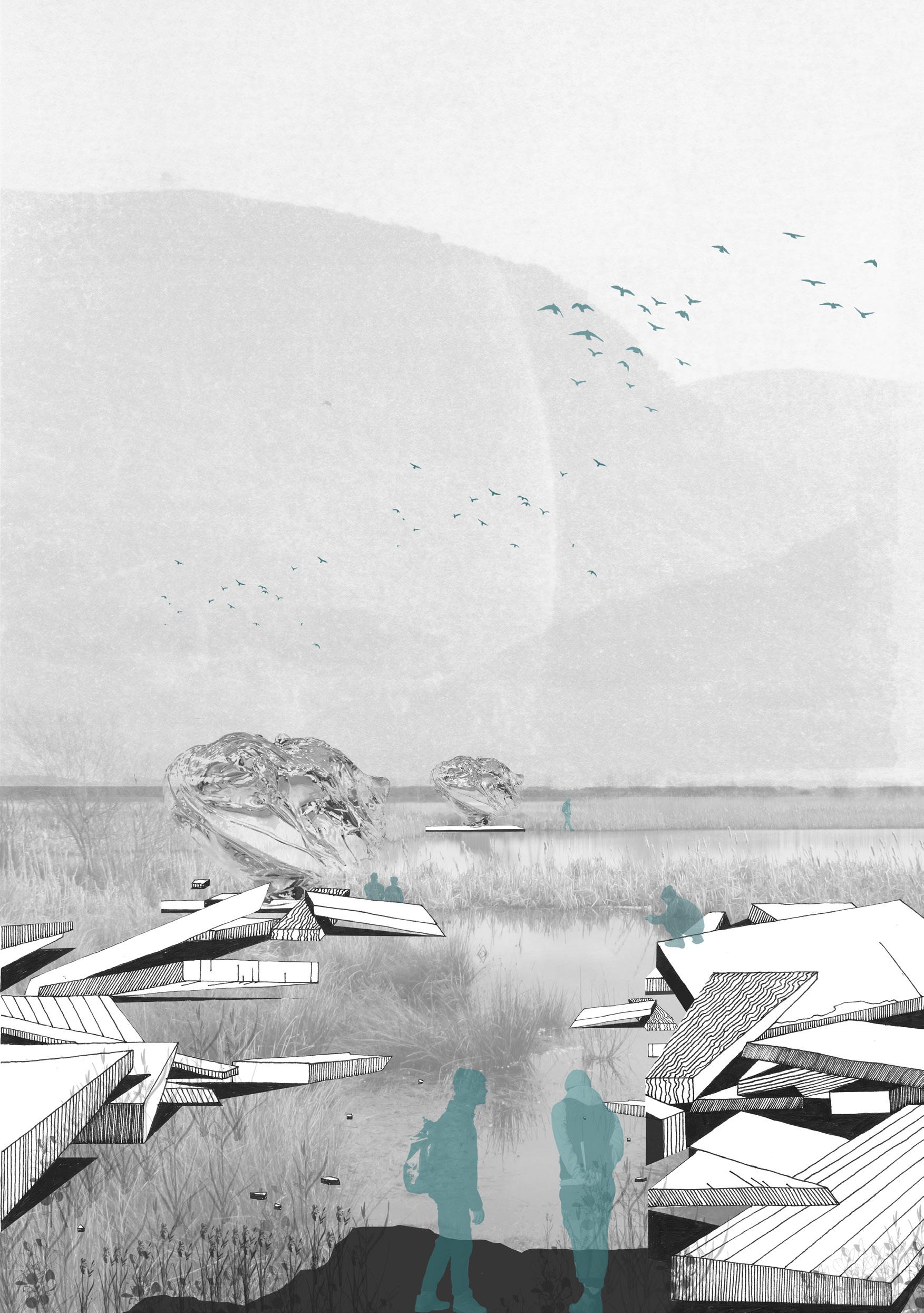
207 Quiet Places I | Eloïse Mercer

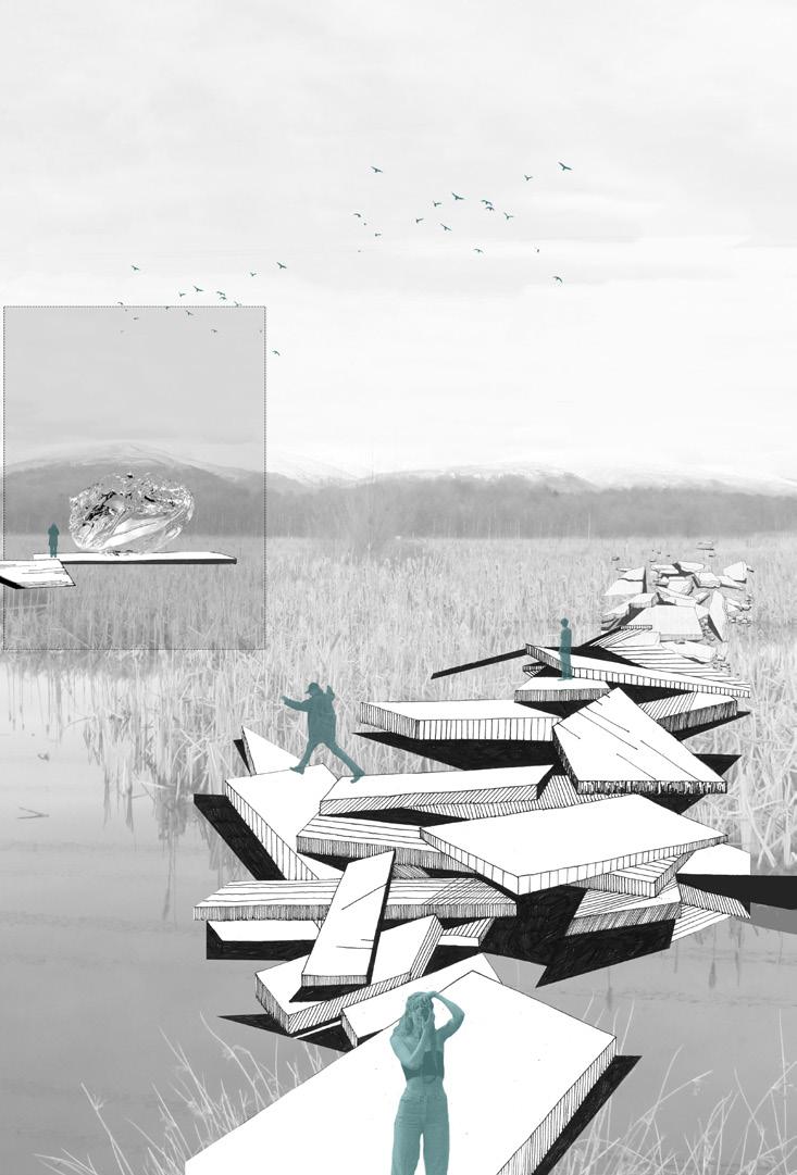 ABOVE: ‘Human Futures’ / Visualisation of the experiential dimension of the monumental Sauðárdalur walkway
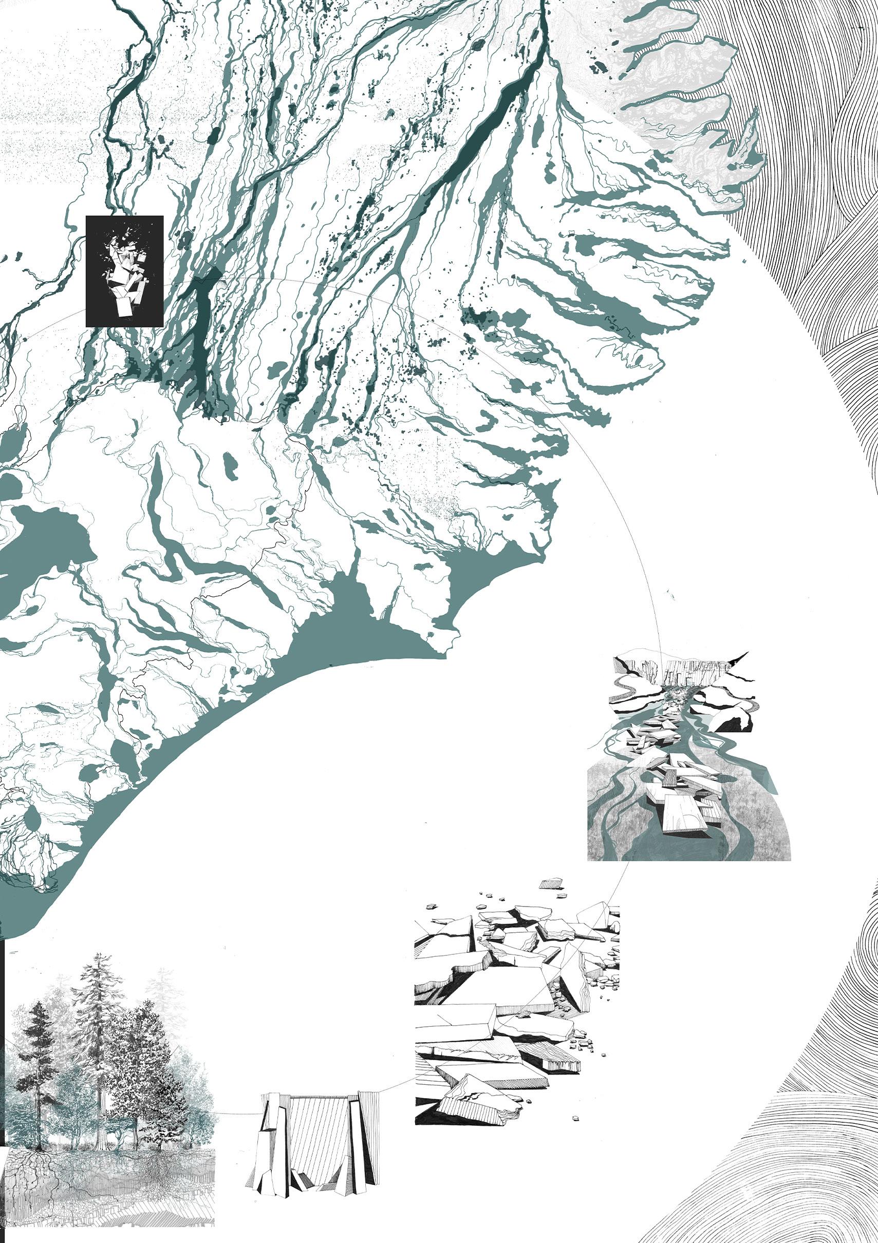
Quiet Places I | Eloïse Mercer 209
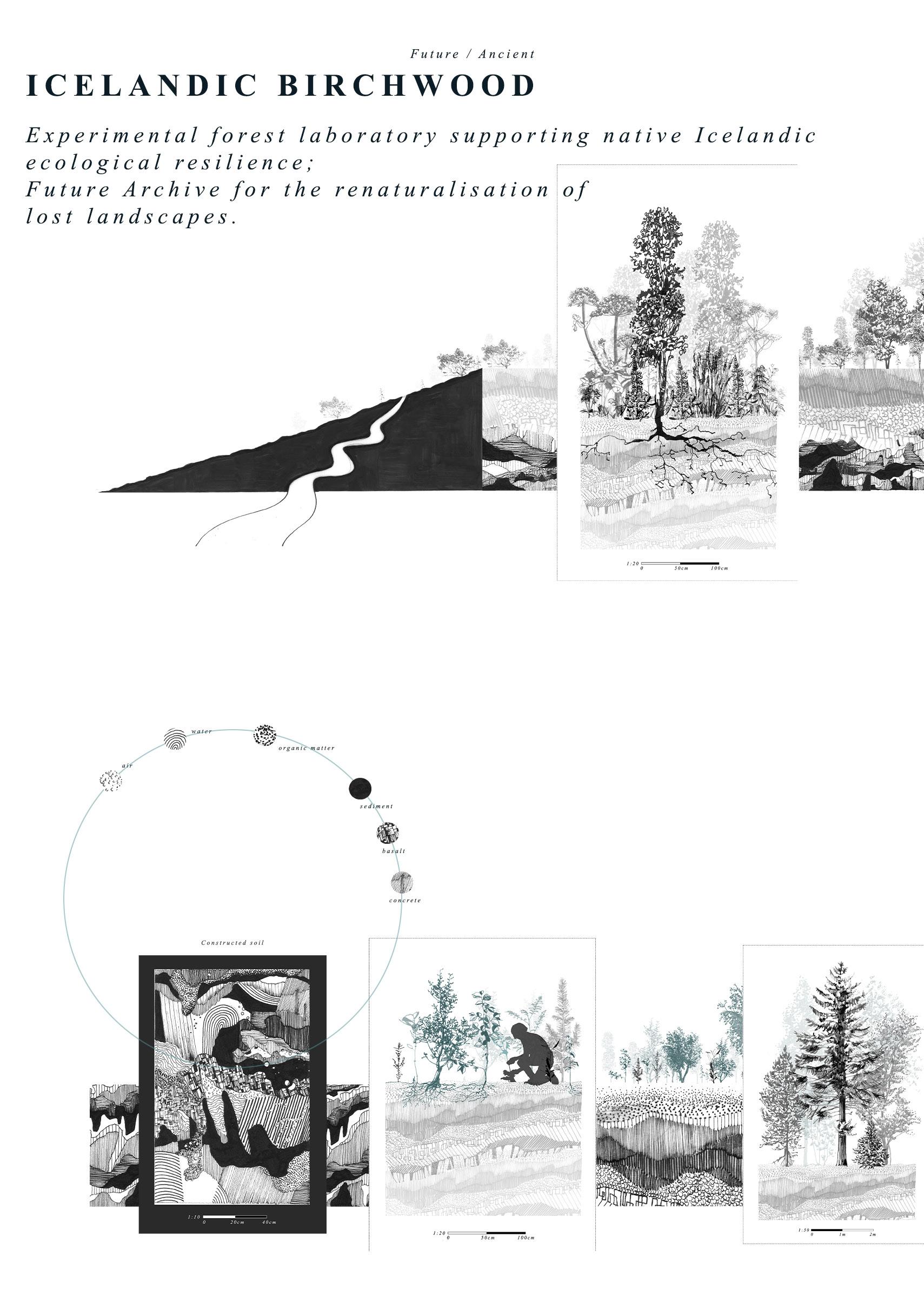
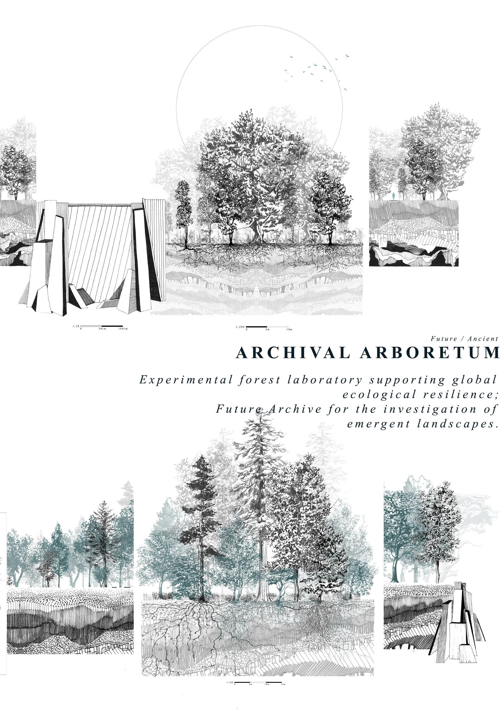
211
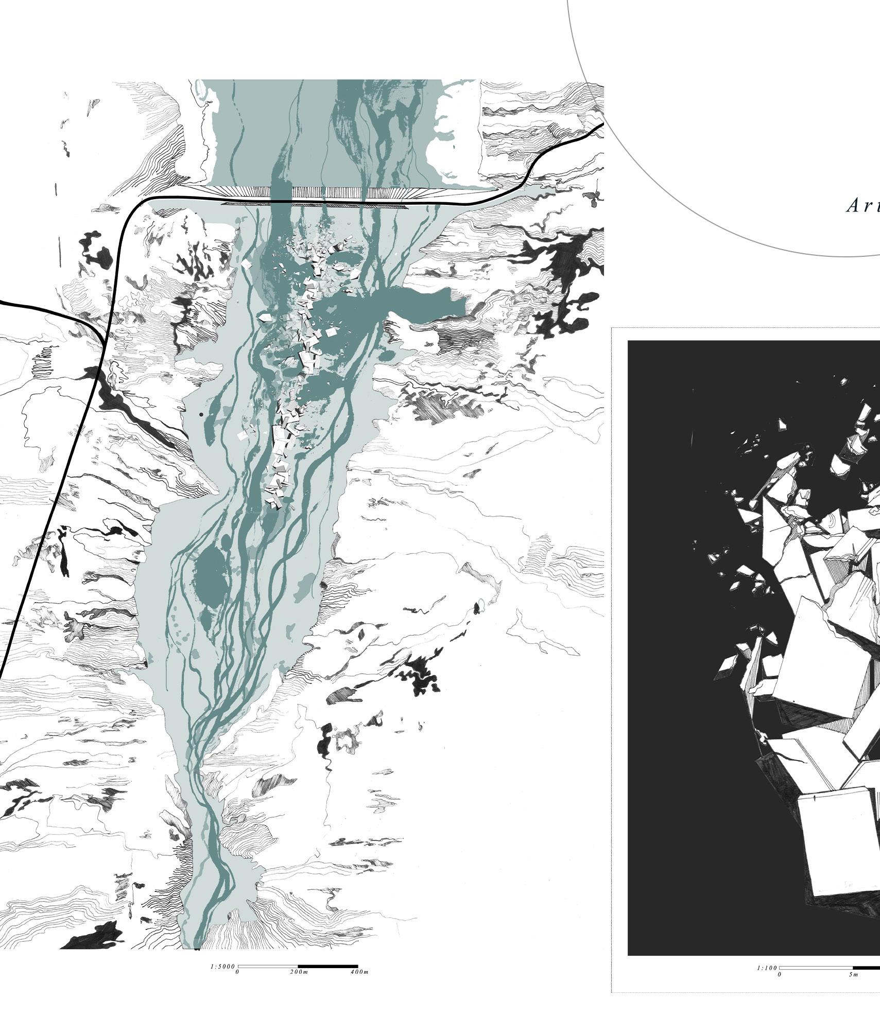
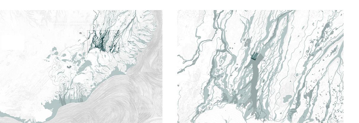
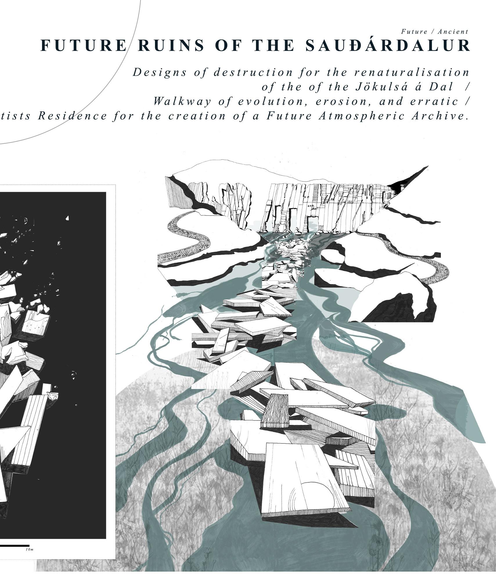
213 Quiet Places I | Eloïse Mercer
Passing Reserve
Tom Stephenson
The melting of the Vatnajoküll Ice cap and the rate in which outlet glaciers are retreating around Iceland provides a stark comprehension of global warming and the challenges that humans and more than humans are faced with in highly volatile landscapes.
We are now living in a new geological epoch, the Anthropocene, in which human beings are becoming the dominant force in altering the planet with little consideration of the consequences of their actions.
A complacency in the mindset of resource as a commodity, taking from the landscape at an unsustainable rate, has resulted in a downward trajectory of ecological instability.
Passing Reserve introduces a design fiction based around a future (2100) scenario in which the Jökulhaups; glacial outburst floods, happen more frequently as the Hoffellsjökull glacier becomes increasingly unstable. The Jökulhaups become an event of mass glacio-fluvial sedimentation, a Passing Reserve which can be used as a resource of post-glacial resilience.
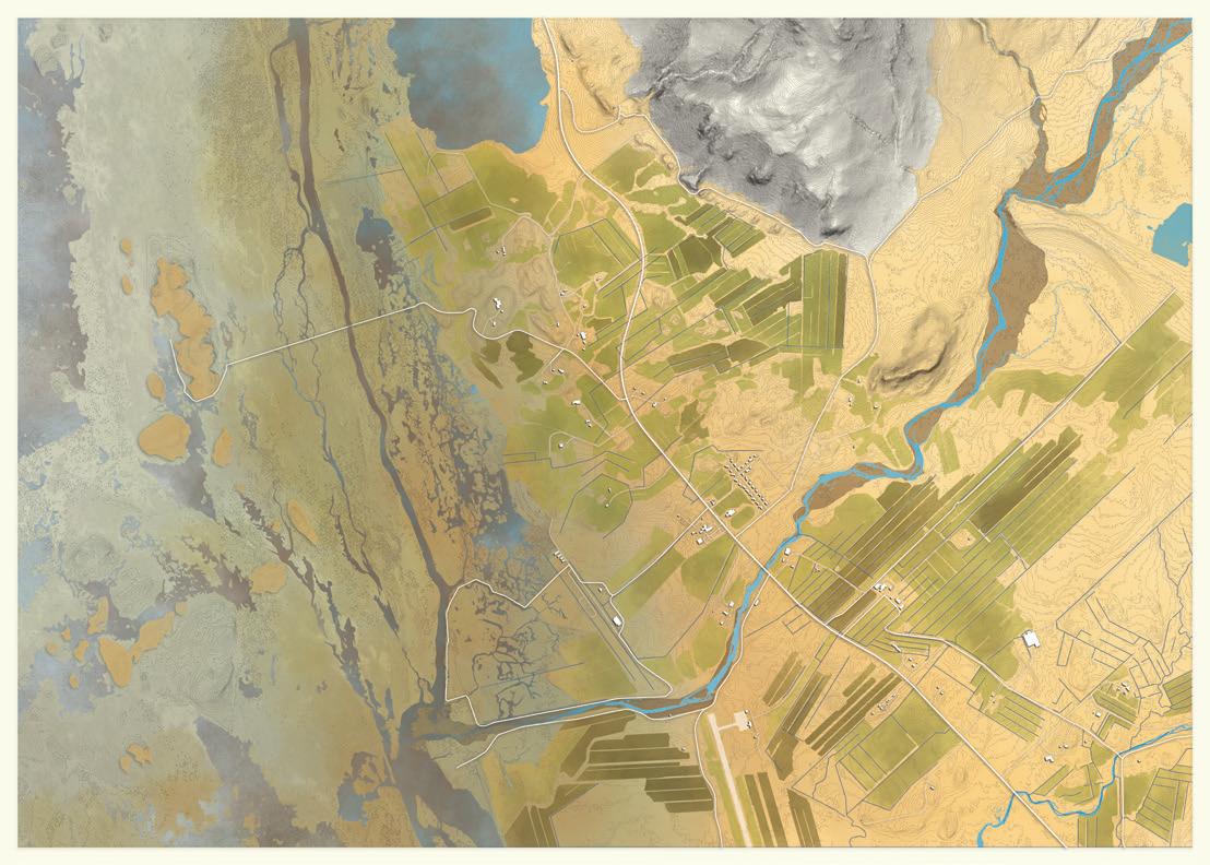
679000.000 679000.000 685000.000 685000.000 431000.000 427000.000
ABOVE: Wetland vs Agricultural Land. One of four sites of tension articulated in dysnamic sediment drawings.
OPPOSITE: A site plan outlining the area of Investigation In South East Iceland and denoting four sites of tension and intervention.
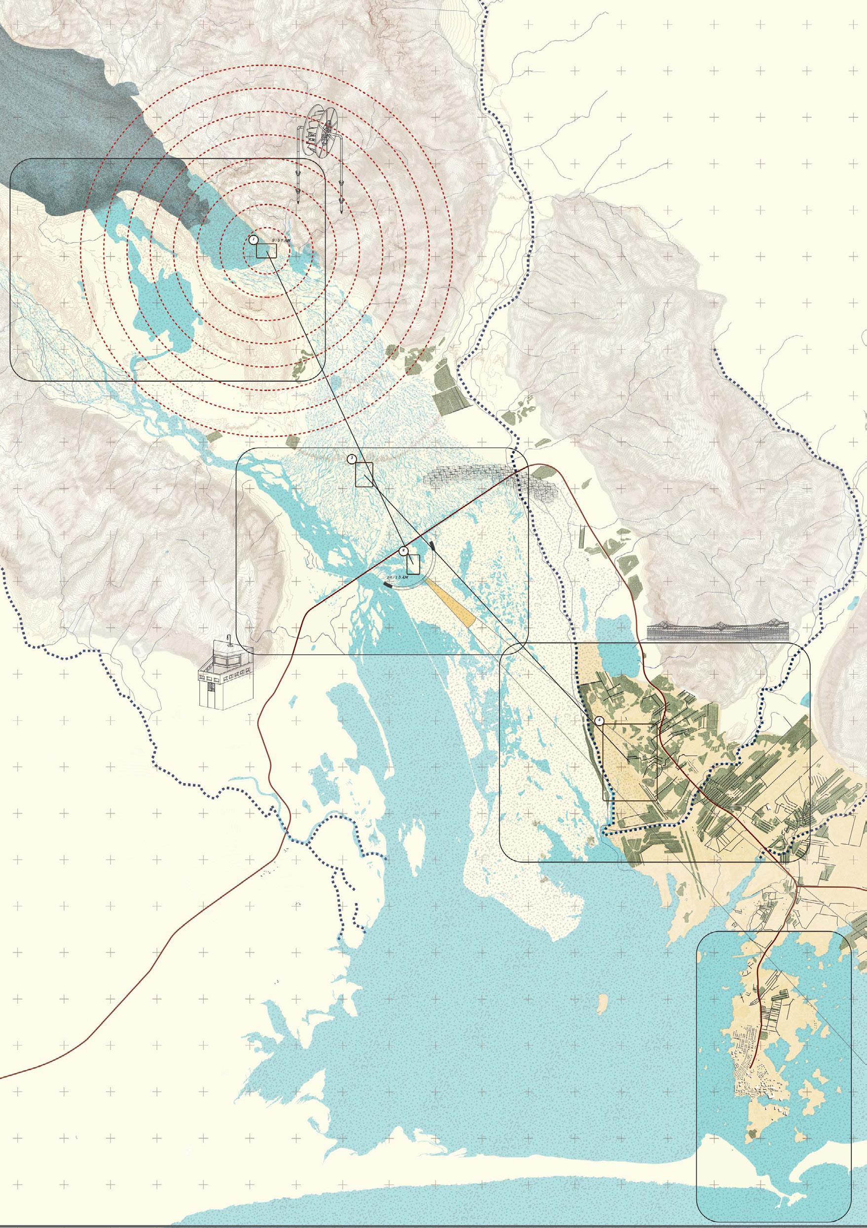
215 Quiet Places I |
Tom Stephenson

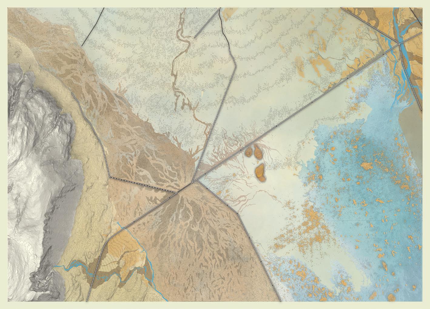
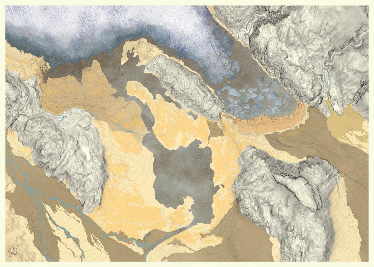
673000.000 673000.000 678000.000 678000.000 432000.000 435000.000 435000.000 432000.000 0 200 500 1000 668000.000 668000.000 674000.000 674000.000 442000.000 438000.000 442000.000 438000.000 0 200 600 217 Quiet Places I | Tom Stephenson
TOP: Glacial Outwash Plain with Roads and Culvert Interference
Inlet
ABOVE: Wetland vs Agricultural Land. Hoffelsjökull Glacial Snout.
OPPOSITE:
The Höfn Tidal
440250.000
440000.000
ABOVE: Detection garden plan. Each designed garden has a separate purpose, activated by the Jökulhaups, their location is shown on the field drawing.
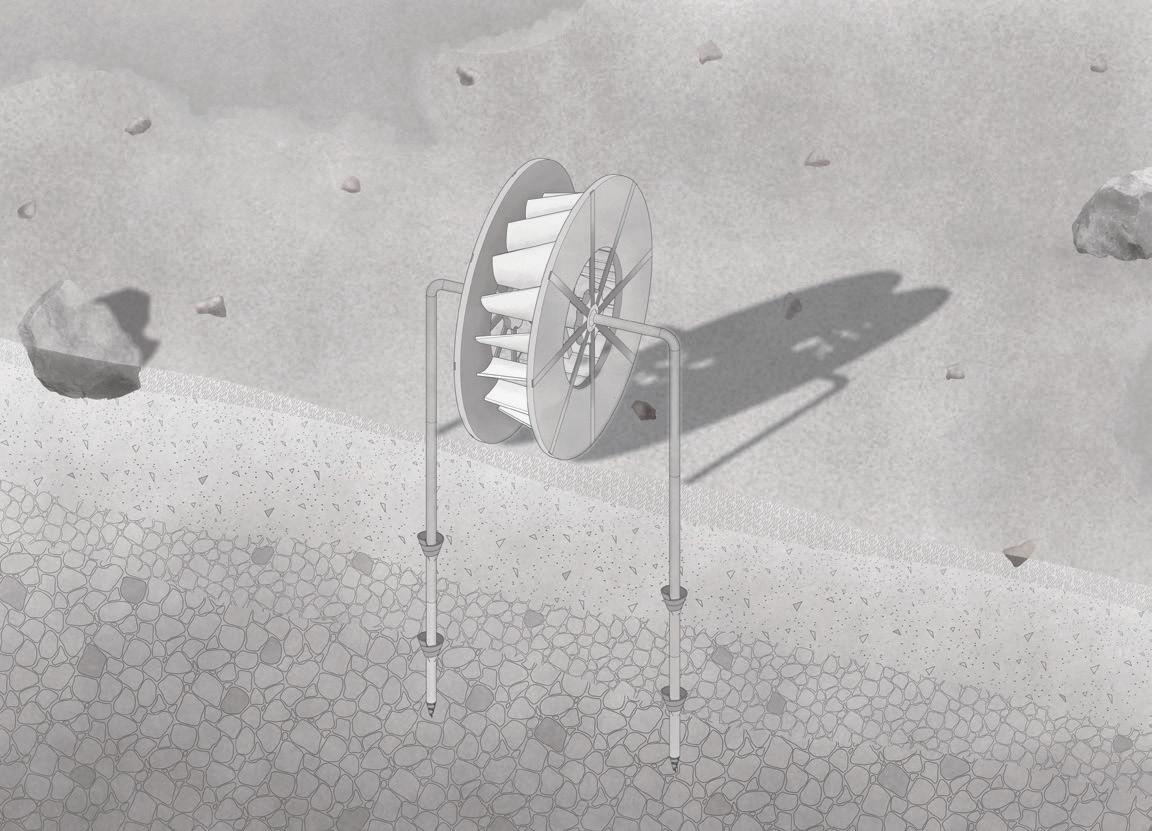
BELOW: Detection meter axonometric.
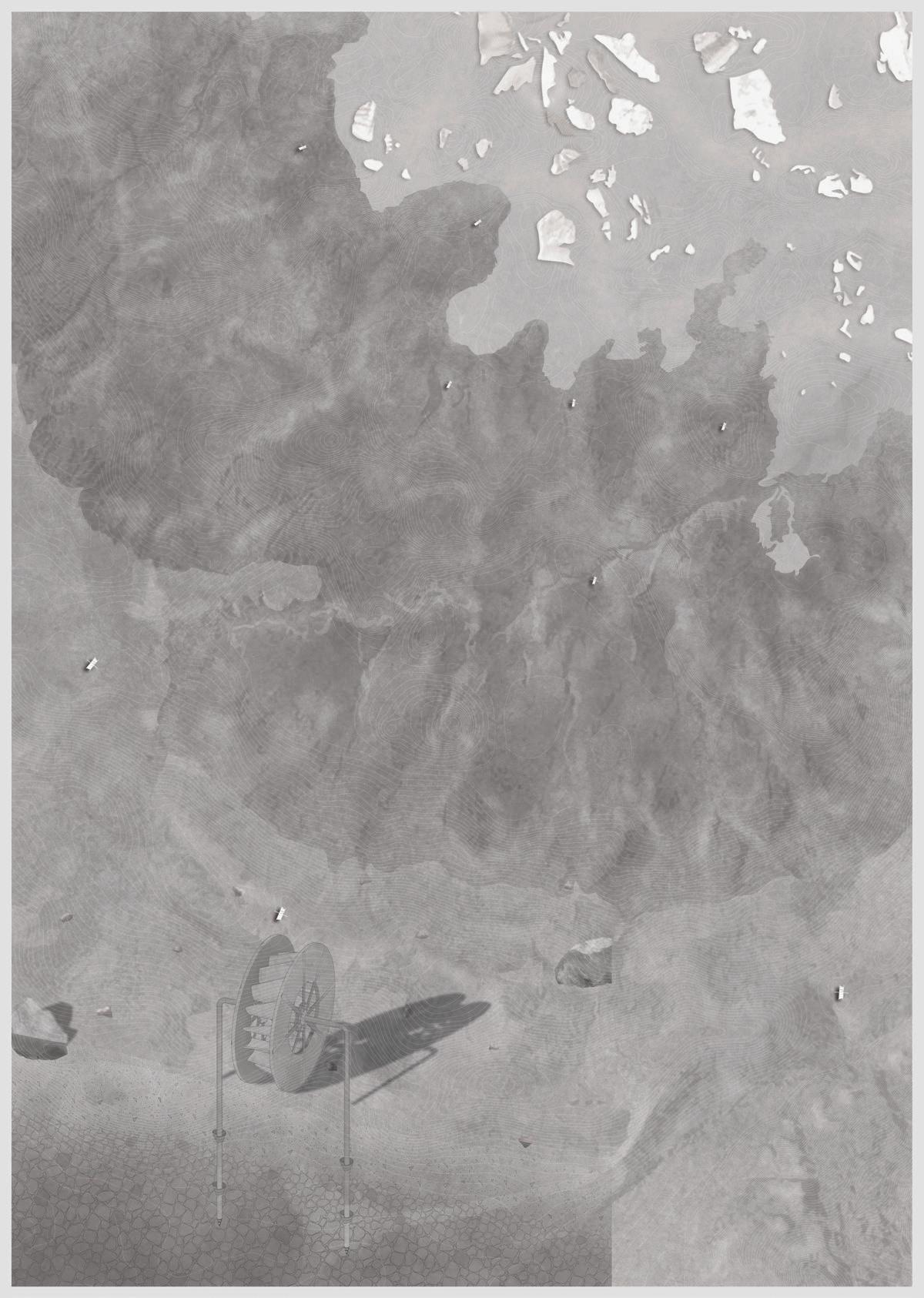
673500.000 673500.000
ABOVE: Signal garden plan.
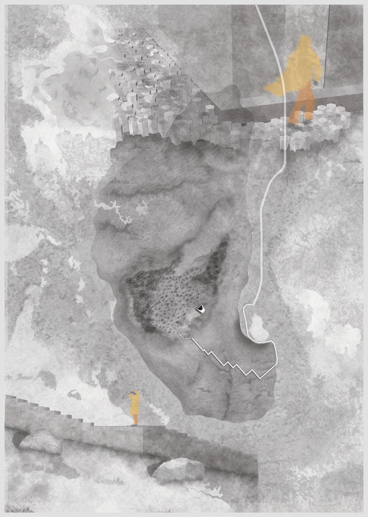
BELOW: Signal garden perspectives.
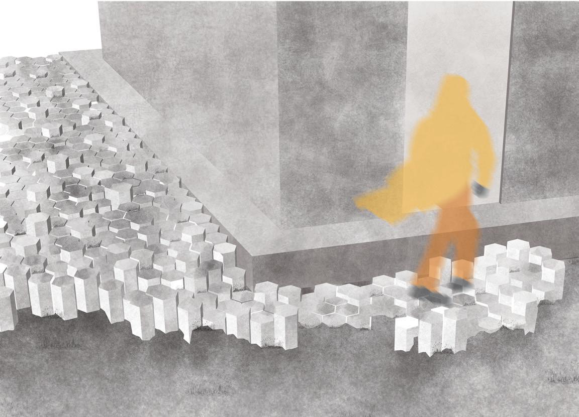
433550.000 433550.000 433200.000 433200.000 676400.000 676650.000 Quiet Places I |
Tom Stephenson
219
ABOVE: Sediment garden plan.
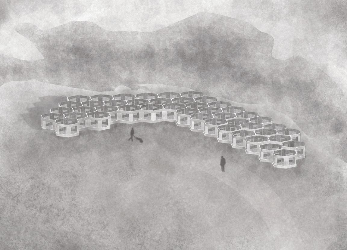
BELOW: Sediment garden perspective.
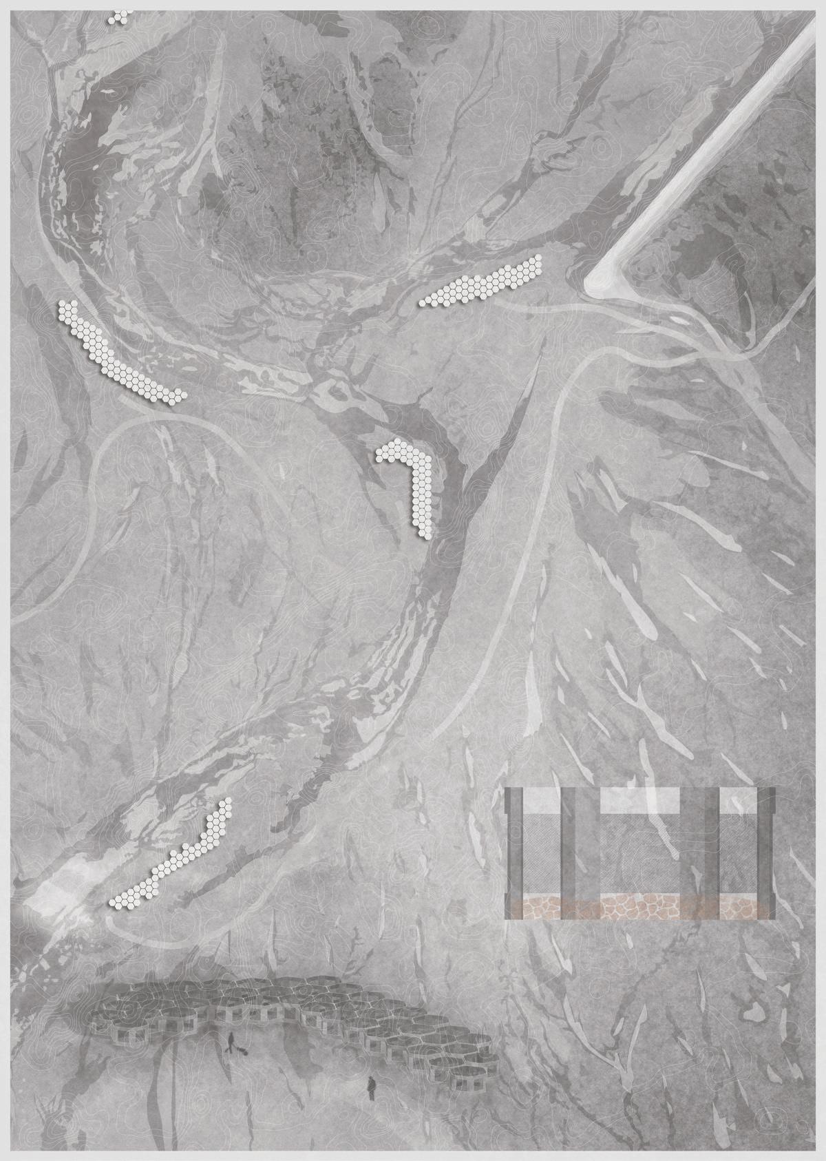
435050.000 435050.000 675300.000 675600.000
ABOVE: Deposition garden plan. Using sediment to create mounding section.
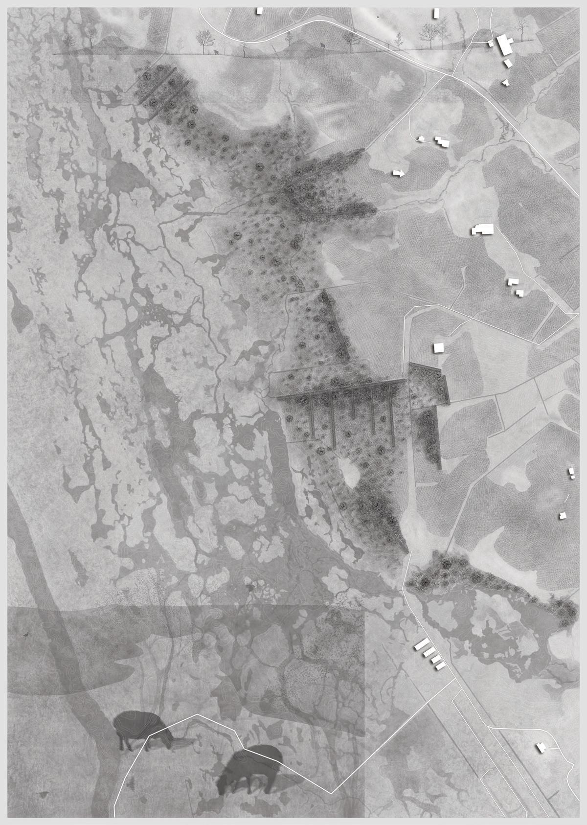
BELOW: Deposition garden and mounding section perspective.
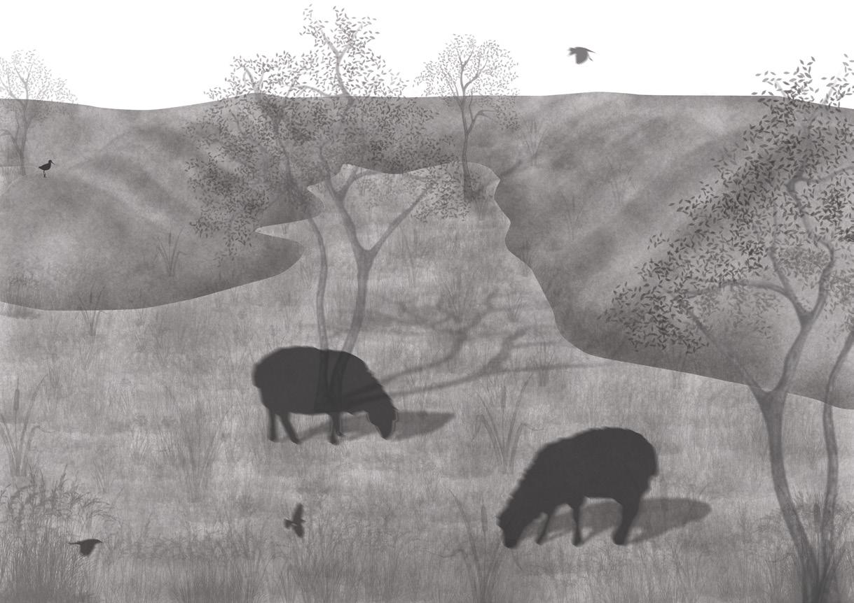
680400.000 681500.000 427400.000 427400.000 221
I
Quiet Places
| Tom Stephenson
Glacier Rebirth
Tiantian Zheng
This project is based on a 10,000-year speculative landscape succession of the foreland site in Iceland, which is facing melting glaciers, in the conceptual context of the acceleration of the next ice age due to global warming in the Anthropocene.
The project site was chosen in the Kalfafellsstadur Canyon because it is relatively closest to the period of ecological succession following the loss of glaciers. The project’s speculation is based on the landscape hypothesis “New Ice Age”, and it is speculated that global warming will melt the glaciers at the two poles and block the warm currents in the northern and southern hemispheres, thereby promoting the arrival of the Ice Age. The project will face the current unscrupulous global warming and the future “re-glaciated” stage for the future construction of a human settlement refuge & human gene storage station & ice age seeding plan under the glacier, and trigger people’s influence on the future world structure of the site.
After constructing the speculative succession under the deep time span from the present to the coming ice age, the project proposes a symbiotic defensive landscape of man and nature, and the functional zoning within the project based on the topography and advantages of different regions. The project speculates on the order of human existence in the new century, including productivity, energy acquisition, ecological self-circulation and global political status.
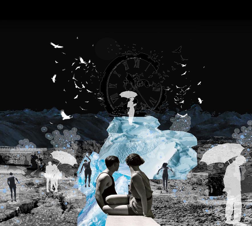 ABOVE: People facing melting glaciers now and those escaping them in the future.
OPPOSITE: The project chooses the Kalfafellsstadur canyon and constitutes it through the interaction of riversediment-topography, dividing into 4 plots to refine.
ABOVE: People facing melting glaciers now and those escaping them in the future.
OPPOSITE: The project chooses the Kalfafellsstadur canyon and constitutes it through the interaction of riversediment-topography, dividing into 4 plots to refine.
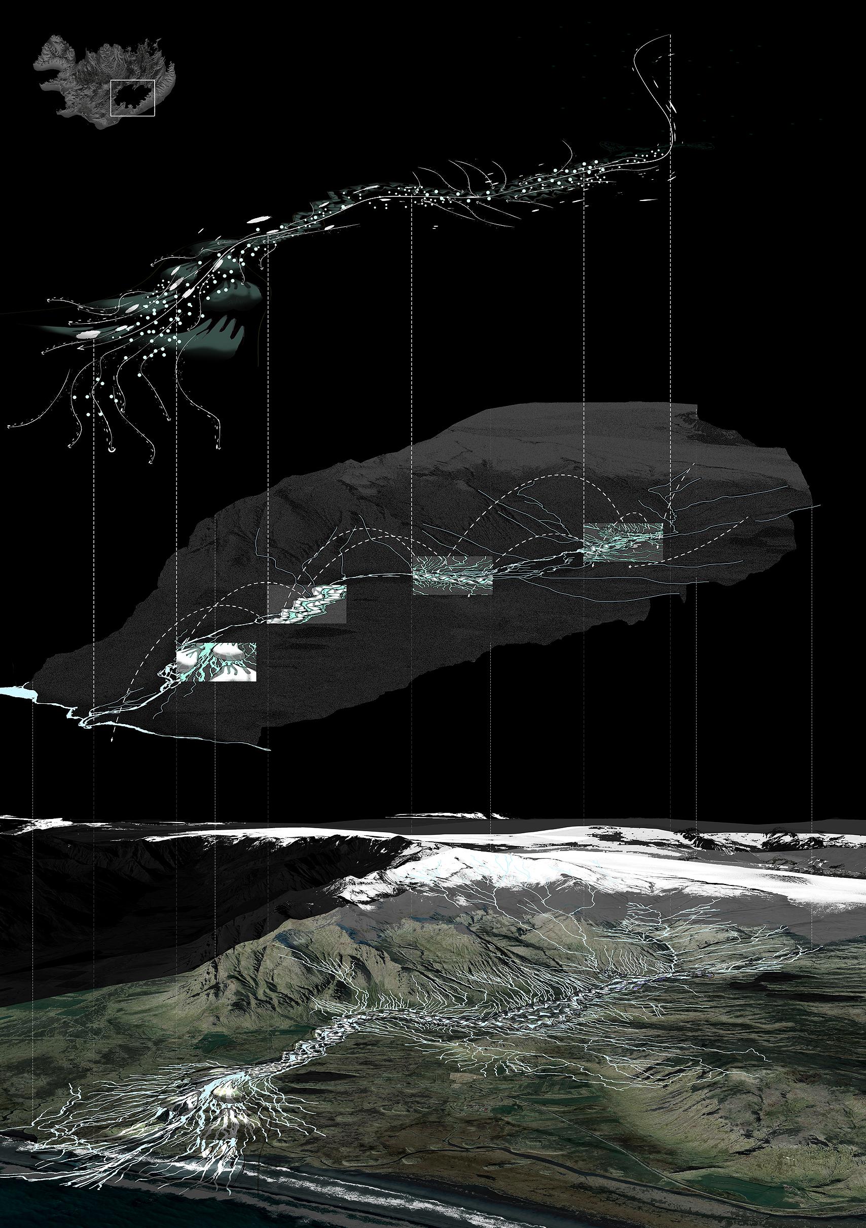
223 Quiet Places I | Tiantian Zheng
TOP: The project takes the foreland connected by main roads in Iceland and its surroundings as the design site and studies the symbiotic system caused by human glaciers in the site according to the visual age of glacier melting.
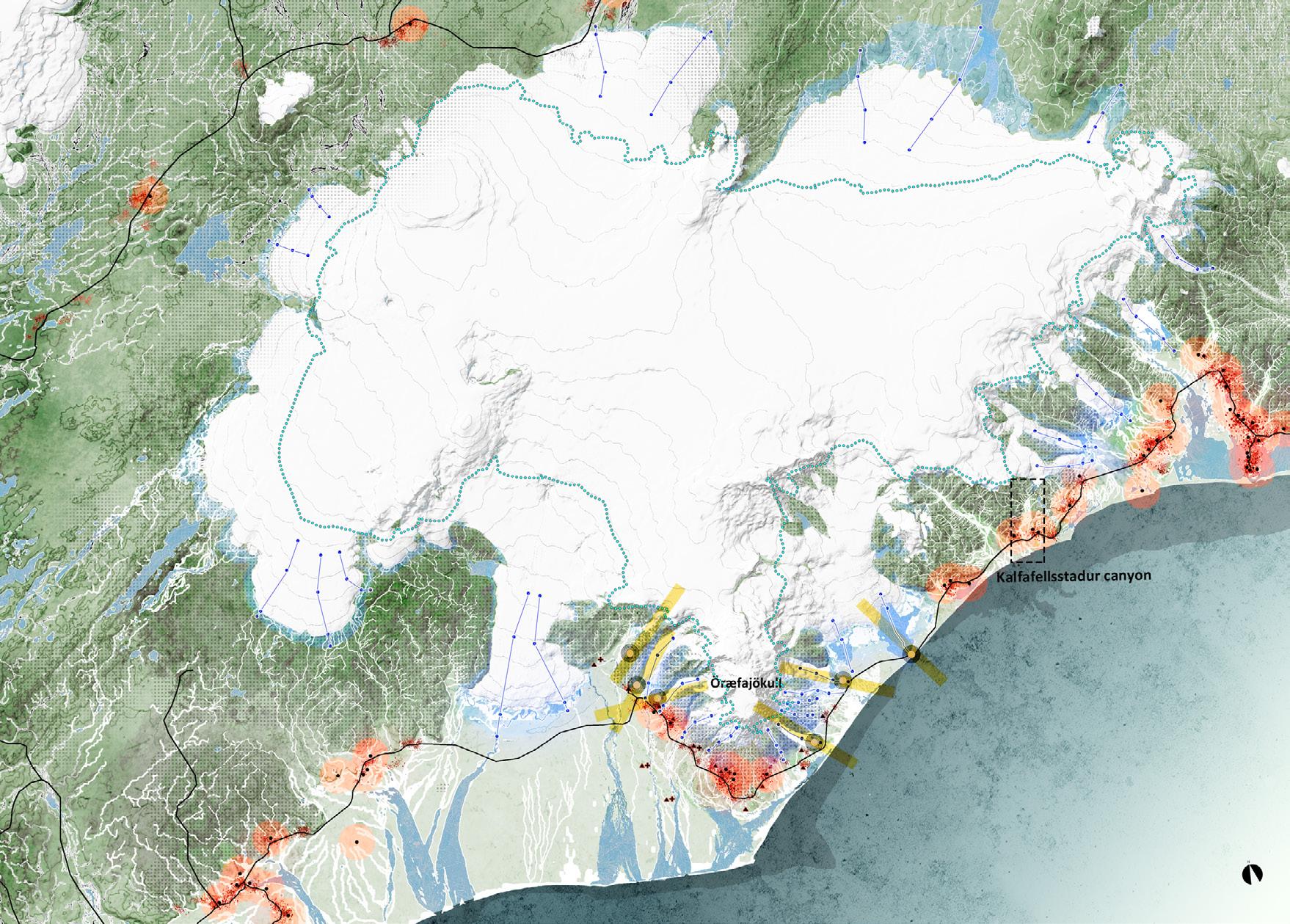
RIGHT: The project focuses on three dynamic systems, namely, the continuously melting water system produced by glaciers, the ecological green space system that constantly survives the fittest on volcanic rocks, and the expansion and trade-off of human communities.
OPPOSITE: Bird’s eye view and laboratory renderings.
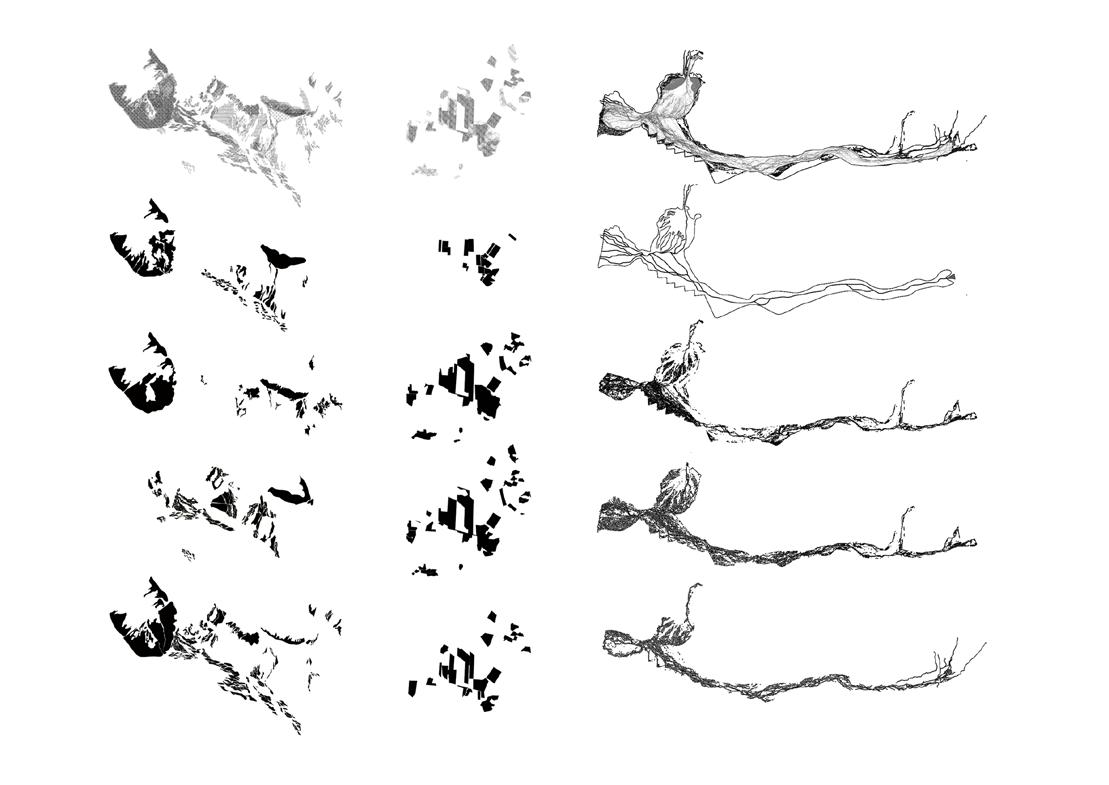
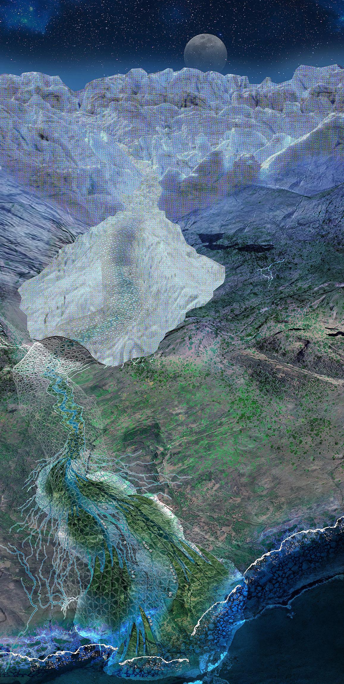
225 Quiet Places I | Tiantian Zheng
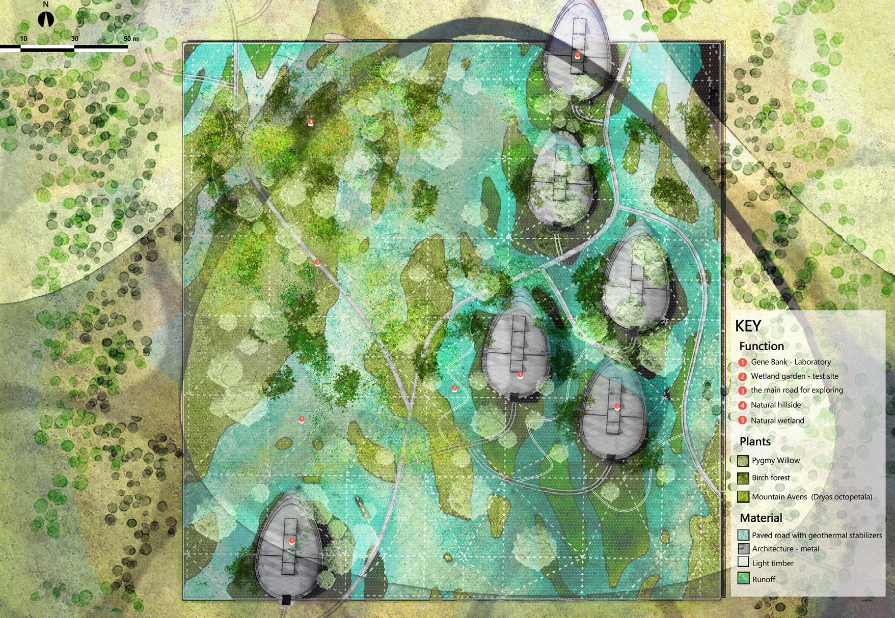
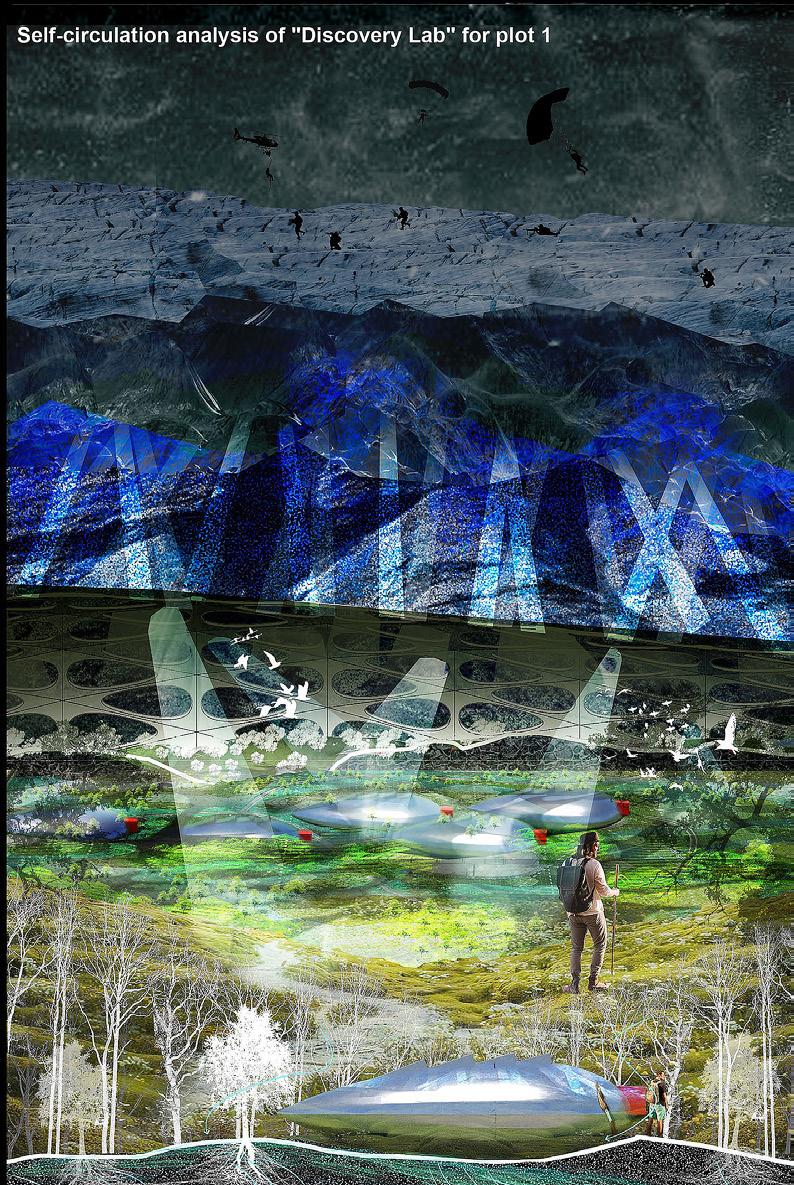 ABOVE: People facing melting glaciers now and those escaping them in the future.
RIGHT: Project masterplan.
OPPOSITE: The project chooses the Kalfafellsstadur canyon and constitutes it through the interaction of river-sedimenttopography, dividing into 4 plots to refine.
ABOVE: People facing melting glaciers now and those escaping them in the future.
RIGHT: Project masterplan.
OPPOSITE: The project chooses the Kalfafellsstadur canyon and constitutes it through the interaction of river-sedimenttopography, dividing into 4 plots to refine.
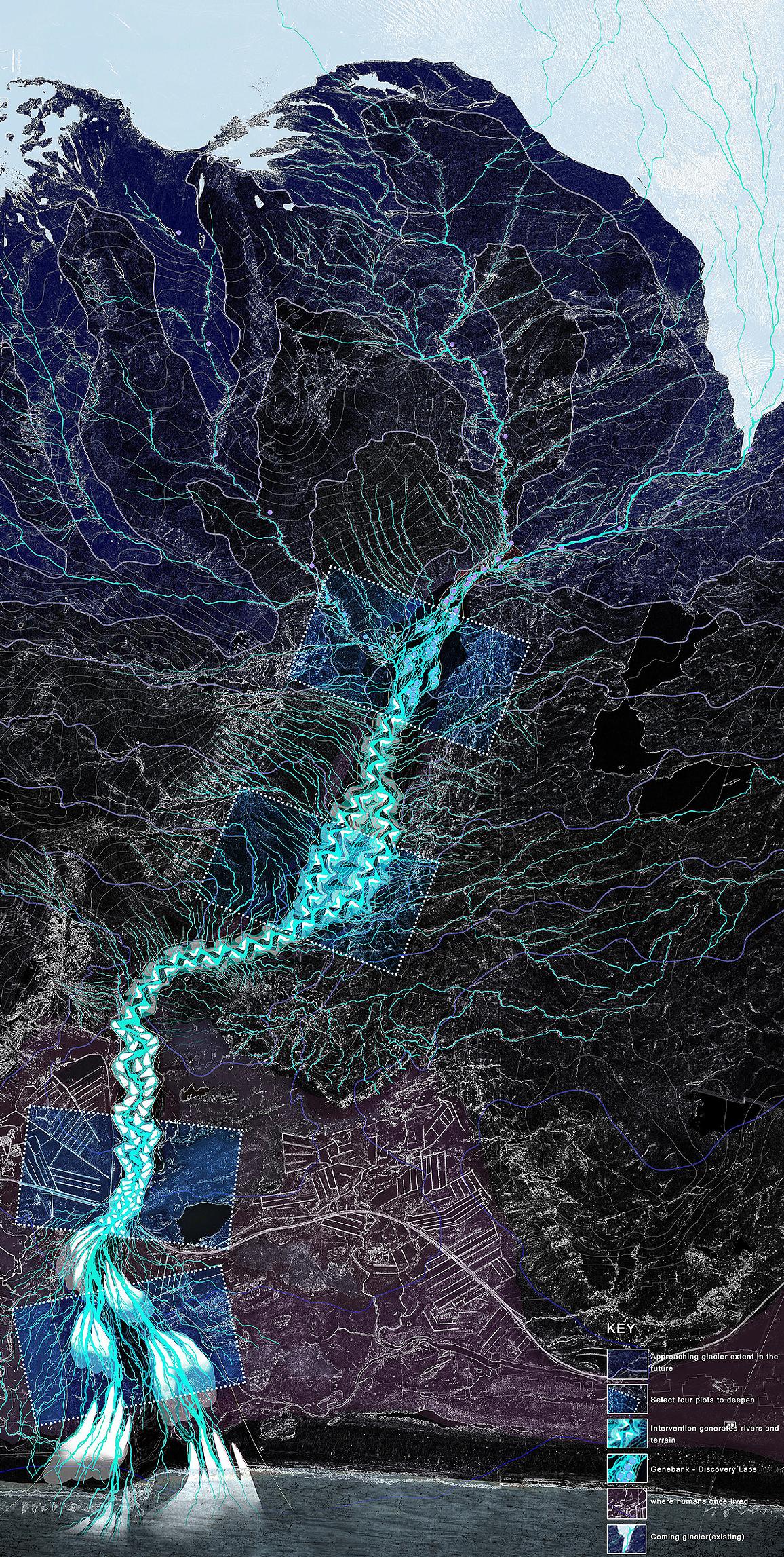
227 Quiet Places I | Tiantian Zheng
Acknowledgements
PROGRAM DIRECTORS
Ross Mclean, Senior Lecturer and Programme Director MA (Hons) Landscape Architecture
Dr. Francisca Lima, PhD FHE, Lecturer and Programme Director Landscape Architecture MLA
RETHINKING THE URBAN PARK
Chris Rankin with Sophie Tombleson, Hazel Mei and Alison Finch
CRITICAL ZONES: THE HIGHLAND BOUNDARY FAULT
Anna Rhodes with Anna Reid and John Darbyshire
ARCHIPELAGO: THE TRIANGLE ISLANDS
Miguel Domingues with Hazel Mei, Marta Guerini, Chris Gray and Cláudia Ávila Gomes
QUIET PLACES I: VATNAJÖKULL GLACIER
Norman Villeroux with Nikolaos Kourampas and Barbara Prezelj
With special lectures by:
Helgi Björnsson, Research Professor, Institute of Earth Sciences, University of Iceland
Þórhallsdóttir Þóra Ellen, Professor, University of Iceland
ECOLOGISTS
John Darbyshire
Ross Wilkie
GEOMORPHOLOGIST
Nikolaos Kourampas
Finally, A special thank you to all the ECA support staff.
Catalogue design and graphics by Tom Sterling.
Printed by J Thomson Colour Printers Ltd.
Cover image by Tom Sterling.
ESALA Landscape Architecture Catalogue 2023 | MLA + MA (Hons)
www.eca.ed.ac.uk/edinburgh-school-architecture-and-landscape-architecture-esala
ISBN 978-1-912669-54-7
2023 ESALA LANDSCAPE ARCHITECTURE CATALOGUE
229