BID4001
PLANNING STUDIO VII: DEVELOPMENT APPRAISAL 2020/2021 (SEMESTER 1)
Prepared for:
Associate Professor Dr. Melasutra Md Dali Dr. Peter Aning Tedong
Mr. Afzal Bin Azhari
LECTURERS
FACULTY OF BUILT ENVIRONMENT
UNIVERSITY OF MALAYA 50603 KUALA LUMPUR
Prepared by:
Ahmad Fariz Al Hazmi 17171848/1
DEPARTMENT OF URBAN AND REGIONAL PLANNING
FACULTY OF BUILT ENVIRONMENT
UNIVERSITY OF MALAYA 50603 KUALA LUMPUR
Submission Date
21st January 2021

Ahmad Fariz Al Hazmi 17171848/1
INTRODUCTION
5.0 REMEDIAL CONCEPTUALIZATION
2.0 CASE STUDY OVERVIEW:
DATUK KERAMAT
3.0 SUMMARY: APPRAISAL & AUDIT
4.0 ISSUES AND PROBLEMS
6.0 ALTERNATIVE DEVELOPMENT CONCEPTS
Alternative Concept 1 : Chromatic
Kampung
Alternative Concept 2: Low Carbon Urban Kampung
Alternative Concept 3 : Kampung Kami Datuk Keramat
Concept Evaluation
Justification
7.0 REMEDIAL PROPOSAL: KAMPUNKAMI
KERAMAT
CONCLUSION
KG.
4 2.1 Site Background 5 2.2 Development Evolution 6 2.3 Demographic Profile 7 2.4 Accessibility 7 2.5 Surrounding Development 8 1.0
1 1.1 Introduction 2 1.2 Aim and Objectives 2 1.3 Scope of Study 3 1.4 Methodology 3 CONTENTS
9 3.1 Overview: Hybrid Assessment Tool 10 3.2 Physical Study 11 3.3 Demographic and Social Study 18 3.4 Transportation and Traffic Study 19 3.5 Environmental Study 20 3.6 Heritage and Cultural Study 22 3.7 Market Study 23 3.8 Hybrid Assessment Matrix 24
28 4.1 Main Issues 29 4.2 IP1 Mobility Issue 29 4.3 IP2 Social and Safety Issue 30 4.4 IP3 Environmental Issue 31 4.5 Lack of Identity and Image Quality 31
32 5.1 Defining Everyday Urban Kampung ism 34 5.2 Underlying Principles 35 5.3 International Benchmarking 37 5.4 Remedial Strategies 43
46 6.1
Urban
47 6.2
50 6.3
53 6.4
&
56
DATUK
58 7.1 Remedial Framework 60 7.2 Project 1: Community Connector Street 61 7.3 Project 2: Children Friendly Streetscape 73 7.4 Project 3: Active Green Corridor 79 7.5 Project 4: Sustainable Design 85 7.6 Remedial Evaluation Analysis 91 7.7 Remedial Proposal Assessment 93 8.0
101
LIST OF FIGURES
Figure 2.1 : Key Plan
Figure 2.2 : Location Plan
Figure 2.3 : Site Plan
Figure 2.4 : Demographic Profile (2010)
Figure 2.5 : Accessibility
Figure 2.6 : Surrounding Development
Figure 3.1 : Hybrid Assessment Tool Designation
Figure 3.2 : 7 Hybrid Dimensions
Figure 3.3 : Current Land Use
Figure 3.4 : Landmark and Node
Figure 3.5 : Unclear Edges
Figure 3.6 : Housing Types
Figure 3.7 : Housing Condition
Figure 3.8 : Formal and Informal Commercial
Figure 3.9 : Water Supply
Figure 3.10 : Telecommunication
Figure 3.11 : Institution and Public Facilities
Figure 3.12 : Catchment Area Open Space and Recreation
Figure 3.13 : Road Networks
Figure 3.14 : Public Transit Distribution
Figure 3.15 : Pedestrian Networks
Figure 3.16 : Increasing Rainfall Amount
Figure 3.17 : Topography Plan
Figure 3.18 : Original Design of IRDA house
Figure 3.19 : Songkok Art
Figure 3.20 : Resale Analysis
Figure 4.1 : Traffic congestion
Figure 4.2 : Low Walkability
Figure 4.3 : Flood Occurrence
Figure 4.4 : Lack of Identity and Image Quality
Figure 5.1 : Kampung Sunter Jaya Location
Figure 5.2 : Urban Farming in Kampung Sunter Jaya
Figure 5.3 : Placemaking By Community
Figure 5.4 : Children Friendly Street
Figure 5.5 : Narrow alleys
Figure 5.6 : Kampung Placemaking
Figure 5.7 : Kampung Cleaning
Figure 5.8 : Kampung Pelangi Before
Figure 5.9 : Kampung Pelangi After
Figure 5.10 : Pasar Bunga Kalisari
Figure 5.11 : Thematic Urban Kampung Regeneration
Figure 5.12 : Mural by the local
Figure 5.13 : Sungmisan Urban Village
Figure 5.14 : Sungmisan village community gathering
Figure 5.15 : Village School
Figure 5.16 : Community Cafe
Figure 5.17 : Sungmisan Village
Figure 5.18 : Community Garden in village school
Figure 6.1 : Public Plaza
Figure 6.2 : Colorful Kampung
Figure 6.3 : Placemaking
Figure 6.4 : Shared Street and Curbless street
Figure 6.5 : People Street
Figure 6.6 : Blue Corridor
Figure 6.7 : Solar Farm
Figure 6.8 : Green Network
Figure 6.9 : Community Connector street
Figure 6.10 : Active Green Corridor
Figure 6.11 : Children Friendly
Figure 6.12 : Sustainable Design
Figure 7.1 : Project 1 Component
Figure 7.2 : Streetscape Improvement
Figure 7.3 : Bicycle storage
Figure 7.4 : Streetscape Improvement
Figure 7.5 : Mix use activity
Figure 7.6 : Community Library
Figure 7.7 : Mix use activity
Figure 7.8 : Mix use activity
Figure 7.9 : Community Hangout Point
Figure 7.10 : Community Hangout Point
Figure 7.11 : Pasar Keramat Regeneration
Figure 7.12 : Hang Tuah History
Figure 7.13 : Pasar Keramat Regeneration
Figure 7.14 : Urban Design Improvement
Figure 7.15 : Kampung Morten
Figure 7.16 : Urban Design Improvement
Figure 7.17 : Children Friendly Streetscape
Figure 7.18 : Kg. Sunter Jaya Placemaking
Figure 7.19 : Alley Placemaking
Figure 7.20 : Alley Placemaking
Figure 7.21 : Placemaking
Figure 7.22 : Safe School Zone and Intersections
Figure 7.23 : Safe School Zone and Intersections
Figure 7.24 : Active Green Corridor
Figure 7.25 : Everyday Park and Weekend Park
Figure 7.26 : Weekend park
Figure 7.27 : Everyday Park and Weekend Park
Figure 7.28 : Urban Gardening
Figure 7.29 : Urban Gardening
Figure 7.30 : WSUD and rainwater harvesting
Figure 7.31 : House rainwater harvesting
Figure 7.32 : WSUD raingarden
Figure 7.33 : House rainwater harvesting
Figure 7.34 : Community Solar Farm
Figure 7.35 : Solar farm
Figure 7.36 : Community Solar Farm
LIST OF CHARTS
Chart 3.1 : Perception
Chart 3.2 : Population Projection
Chart 3.3 : Water Quality Index
Chart 3.4 : Importance of Pasar Keramat
Chart 3.5 : Median Sale Price
Chart 3.6 : Average Sale Price
LIST OF TABLES
Table 3.1 : Hybrid Assessment Scoring
Table 3.2 : Classification of Commercial
Table 3.3 : Commercial Guideline Compliance
Table 3.4 : Types of Community Facilities
Table 3.5 : Open Space Guideline Compliance
Table 3.6 : Air Quality Index
Table 3.7 : AQI Level
Table 3.8 : Market Study
Table 3.9 : Hybrid Indicator Assessment Matrix
Table 6.1 : Concept Evaluation
Table 6.2 : SWOT Analysis
Table 7.1 : Remedial SWOT Analysis
Table 7.2 : Remedial Proposal Assessment
Table 7.3 : Remedial Proposal Assessment Matrix
LIST OF PLANS
Plan 1 : Alternative Concept 1
Plan 2 : Alternative Concept 2
Plan 3 : Alternative Concept 3
Plan 4 : Master Plan
1.O

INTRODUCTION
1
1.1 Introduction
The planning remedialreport for Kampung Datuk Keramat is an outcome from the previousdevelopment appraisalandaudit report of Kg. Datuk Keramat. Prior tothe preparation of this planning remedial report, key issues and problems are identifiedin the development appraisalandaudit report. Therefore, this report discusses the appropriate development concept plan for Kg. Datuk Keramat by formulating strategies, projects, and programs to mitigate and minimize specific issues and problems.
This introduction chaptercomprises of the aimand objectivesof the report, the scope of study, and the methodology which to be elaborated in the following sections.
1.2 Aim and Objectives
To produce a planning remedial proposal for Kampung Datuk Keramat.Aim
Objectives:
1 2 3
To identify the most applicable development concept plan for the case study area in regards with the key issues and problems.
To develop strategies, projects and programs for the remedial proposal.
To assess the remedial proposal with the designated hybrid indicator assessment tool.


1.0 INTRODUCTION Planning and Remedial Report: KampungKami Datuk Keramat 2
Source Google Image
1.3 Scope of Study
The planning remedialreport seeks to enhance the existing condition and performance of Kampung Datuk Keramat as an urban traditional village with the main basis of the findings discussed in the previousdevelopment appraisal andaudit report in terms of physical, social, transportation and traffic, environmental, heritage and market aspects. Furthermore, this report covers on the selection of the overall theme and principles,benchmarking analysis, development of strategies and concepts, hence, to produce a remedial proposal compromising of projects and programsderived from the strategies, and lastlyis the remedial assessment.
1.4 Methodology
Overall Theme Planning Principles
Benchmarking
Planning Strategies Planning Concepts
Remedial Proposal
Remedial Assessment
Inception Report Development Appraisal and Audit Report
Planning Remedial Report 1 2 3
Preliminary study Data Collection Appraisal and audit Identification of issues and problems
Selection of overall theme and principles Benchmarking analysis & strategy development Identification of alternative concept
The planning remedialreport is prepared at stage 3 of the overall process. It is started with the selection ofoverall theme and principles,benchmarking analysis and strategy development, identification of alternative concept, formulation of remedial frameworks which includes the proposedproject, program and/or measures and lastly the remedial proposal is to be analyzed using SWOT andassessed with the Hybrid indicator assessment as formulated in stage 2.
Formulation of remedial frameworks
Remedial SWOT Analysis & Assessment
1.0 INTRODUCTION Planning and Remedial Report: KampungKami Datuk Keramat 3
2.O CASE STUDY OVERVIEW: KG. DATUK KERAMAT


z
4
Figure
Figure

2.1 Site Background

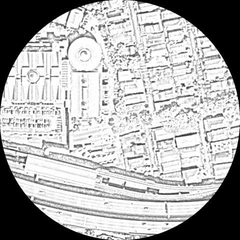
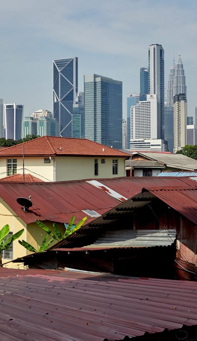
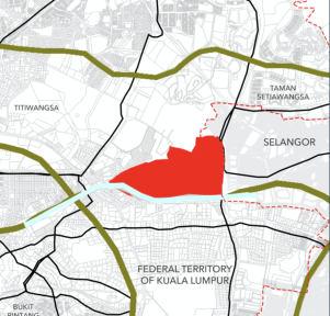
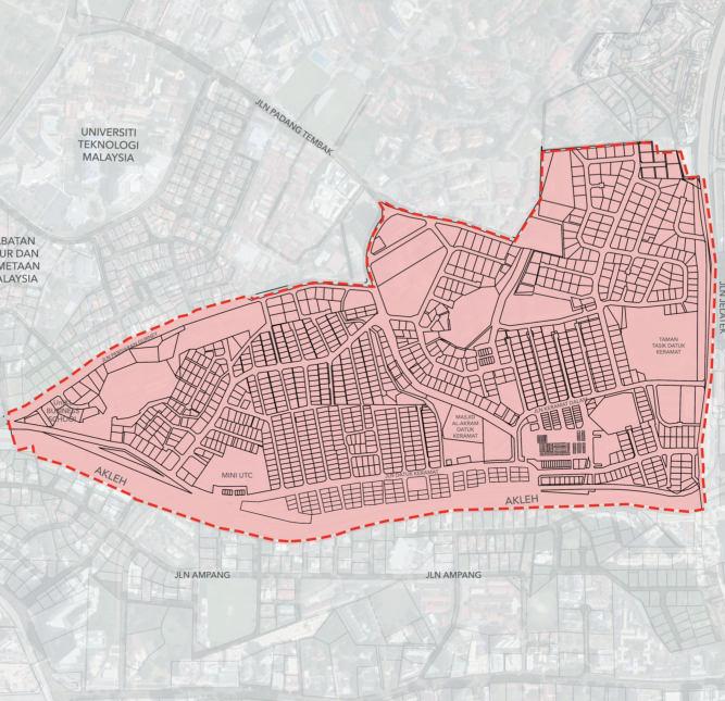
Kampung Datuk Keramat of 275 acres, is a large zone in the Titiwangsa constituency, falling within the boundary of the Federal Territory of Kuala Lumpur, Malaysia. It islocated at the northeast of downtown Kuala Lumpur and share the boundary with the district of Ampang in Selangor tothe east. The Klang River runsroughly from northeast tothe west andactsas a natural divider of Keramat and Ampang. Lastly, Kg. Datuk Keramat islocated under the jurisdiction of Kuala Lumpur City Hall (DBKL).
Behind The Name
Kg. Datuk Keramat has traditionally been a Malay majority area. However, this area was formerly known as Kampung Tangga Cina. There are two versions of the name of this Kampung Tangga Cina, Formerly, this area is a tin mine. Many Chinese livein the area by working as miners and from there comes the name Kampung Tangga Cina. The presence of a `sacred 'grave in the settlement caused the residents to start calling the area as Kampung Datuk Keramat. Many do not know thatthe name Kampung Datuk Keramat was taken in conjunction with the presence of a sacred grave there. The location of the grave islocated next tothe Pasar Keramat. Various superstitious practices are practiced there because they believe itis sacred. Regardless of race, everyone comes to ask for wishes and no less worship. That is whywhen people ask where to go, their answer is to go to Kg. Datuk Keramat. Thus, this name sticks until it is called Kampung Datuk Keramat. But the ownerof the tomb still cannot be identified until today.

2.0 CASE STUDY OVERVIEW: KG. DATUK KERAMAT Planning and Remedial Report: KampungKami Datuk Keramat 5
2.1: KeyP lan Figure 2.2: Location Plan
2.3: Site Plan
N.T.S
2.2 Development Evolution
1857-1940
(Early Settlement)


The earliest settlement in Kg. Datuk Keramat may have existed as early as 1857 as a tin mining area in the Selango as a village area of multiple Malay ethnic such as Jawa, Bawean, Bugis, Minangkabau etc. The socio-economic activities of the villagers at that time were more towards subsistence farmingsuch as growing vegetables, sweet potatoes, sweet potatoes, and so on.
1955-1957
(MRL Announcement)
In 1957, Kampung Datuk Keramat was announcedas Malay Reserve Land area under the Enactment 3(1) (F.M.S Cap. 142). This village was situated in both Mukim Setapak and Ampang. In this year, the area was 170 acres, and has about 639 housing units which includes 317 squatter houses, and 200 housing units builtby the Housing Trust.

1960-1970 (Rapid Squatters)
This village settlement had rapidly developed as squatter’s areaand became oneof the main squatters’ area in Kuala Lumpur. There were different squatter areas based, among the villages were:
• Kg. Kinabalu
• Kg. Dato’ Keramat
• Kg. Bumiputera
• Kg. Berembang
• Kg. Keramat Hujung
• Kg. Bukit Keramat
• Kg. Kilat
N.T.S

2004-2020 (Modern Day)
Kg. Datuk Keramat
Landed Residential Development


High Rise Residential Development Other Development Open Space Cemetery
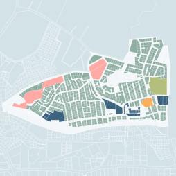
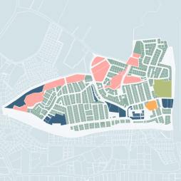
Kg. Datuk Kermaat has experienced rapid development as itslocationin the capital city, Kuala Lumpur, and it has expanded into Taman Keramat. Kampung Datuk Keramat is now a mixed development area with great accessibilityand variety of amenitiesand public facilities provision. The area nowhas 3 high riseresidential properties; however, this development is said to slowly change the landscape of the area.
2.0 CASE STUDY OVERVIEW: KG. DATUK KERAMAT Planning and Remedial Report: KampungKami Datuk Keramat 6
N.T.SAnnounced as Malay Reserved Land (MRL)
N.T.S
Figure
The demographicprofile as shown in Figure 2.4 is data in 2010, thetotal population is nearly six thousands people in Kampung Datuk Keramat. In which, the proportion of male and female group is almost equal where female population is 50.3% meanwhile for the malegroup is 49.7%. Furthermore, as for the populationby race, Malay groupmakes up the highest proportion of the population with 3,970 people, meanwhile the Chinese group is the lowest proportion in the population.
2.4 Accessibility


Figure


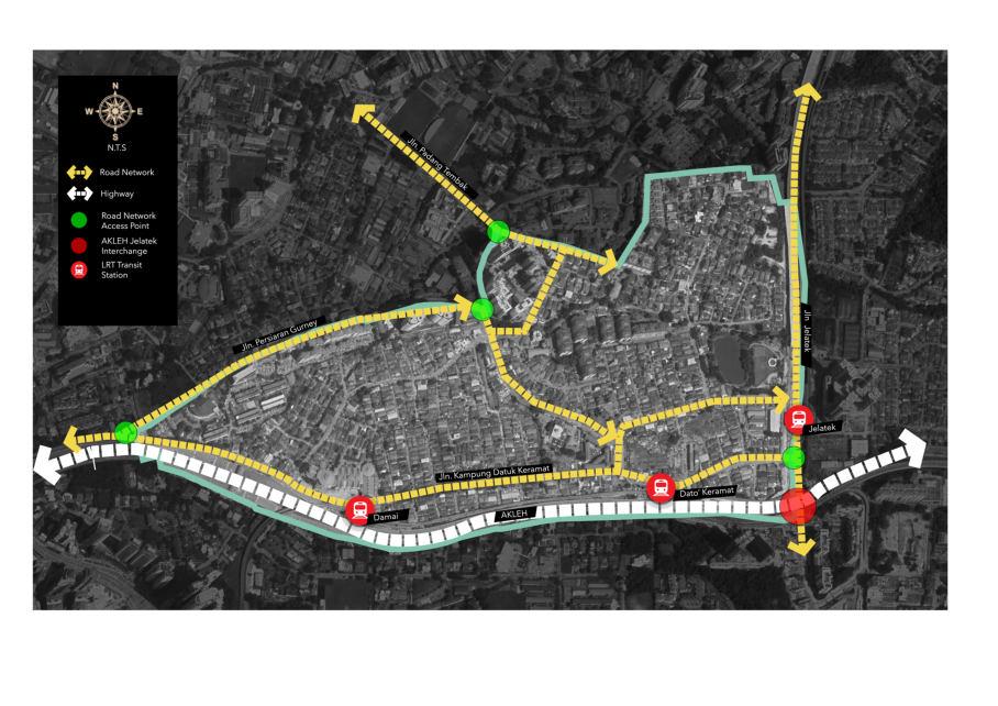
Kg. Datuk Keramat is strategically located on the northeastern of downtown Kuala Lumpur, the area is served with great accessibility in term of road connection and public transit. The Ampang-Kuala Lumpur Elevated Highway and JalanJelatek provides connectivity to Ampang and Kuala Lumpur citycenter. Kg. Datuk Keramat is also well served with public transit,there are 3 accessible Kelana Jaya line LRT transit stations (Dato’ Keramat, Damai station, and Jelatek station) as well as with 5 publicbuses of different routes.

2.0 CASE STUDY OVERVIEW: KG. DATUK KERAMAT Planning and Remedial Report: KampungKami Datuk Keramat 7 Total Population 5,967 2.3 Demographic Profile Male 2,969 (49.7%) Female 2,998 (50.3%) Foreigners 1,672 Other Bumiputera 33 Chinese 1 Malay 3,970 Others 244 Indian 47 By Gender By Race
2.5: Accessibility Source: Development Appraisal & Audit Report
2.4: Demographic Profile (2010) Source: Development Appraisal & Audit Report
Kampung Datuk Keramat is closed proximity with the existing well developed and matured neighbourhood such as Condominuim One Jelatek, Seri Maya Condominium and Pangsapuri Berembang Indah. Another nearby development is Petronas TwinTower that is within approximately 2-kilometer radius.
Kampung Datuk Keramat is also nearby to several government offices such as Jabatan Ukur dan Pemetaan Malaysia and Angkatan Pertahanan Awam Malaysia. There arealso several hospitalsnearby the study area such as Hospital Kuala Lumpur and HSC medical Centre.
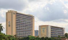
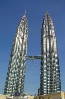

This indicates that Kampung Datuk Keramat is an infill neighborhood surrounded by other developments which may give advantages tothe study area.

2.0 CASE STUDY OVERVIEW: KG. DATUK KERAMAT Planning and Remedial Report: KampungKami Datuk Keramat 8 N.T.S JUPEM 1. Berembang Indah Apartment 2. Condominium one jelatek 3. Seri maya condominium 4. Condominium Kg. Warisan 5. JUPEM 6. Angkatan Pertahanan Awam Malaysia KLCC 7. HSC Medical Centre 8.National Heart Institute 9. Jabatan Rekod dan Pencen 10. Gleaneagles Kuala Lumpur 11.KLCC 2.5 Surrounding Development Figure 2.6: Surrounding Development Source: Development Appraisal & Audit Report
APPRAISAL AND

3.O SUMMARY:
AUDIT 9
Overview: Hybrid Assessment Tool

Derived from the Development Appraisal and Audit Report, a new custom hybrid assessment tool is produced to suit the unique condition of the study area, Kg. Datuk Keramat, asan urban traditional village locatedin the middle of urbanized area of Klang Valley. There are 5 different assessment selected for the designation of this hybrid assessment tool in which MURNInet rating system are used as the foundation of the overall structure and scoringsystem (Figure 3.1).
There are 7 dimensionsproduced which reflect various important aspects of an urban traditional village shown in Figure 3.2.
ASSESSMENT
Figure 3.1:

Development
PROSPEROUS

LAND
ACCESSIBLE
ACCESSIBILITY

3.2:
ENVIRONMENTAL


Hybrid
Development Appraisal

SCALE DESCRIPTION

3.0 SUMMARY: APPRAISAL AND AUDIT Planning and Remedial Report: KampungKami Datuk Keramat 10 3.1
MURNInet LEED-ND Livability Index DBKL Traditional Village Assessment Vista Hamilton Urban Design Assessment HYBRID
TOOL
Hybrid Assessment Tool Designation Source:
Appraisal and Audit Report 1 2 3 4 5 6 7 HERITAGE IDENTITY AND URBAN DESIGN OPTIMAL
USE
COMMUNITY COMMERCIAL
UNIVERSALLY
INSTITUTIONS AND PUBLIC FACILITIES EFFICIENT INFRASTRUCTURE & TRANSPORTATION SUSTAINABLE
QUALITY 7 D I M E N S I O N S
80% 100% Sustainable 50% 79% Moderate sustainability 0% 49% Low sustainability Figure
7
Dimensions Source:
and Audit Report Table 3.1: Hybrid Assessment Scoring Source: Development Appraisal & Audit Report
3.2 Physical Study
3.2.1 LAND USE
Kg. Datuk Keramat has existed since the early 20th century. The area has experienced rapid development, hence, itis now considered as a matured neighborhood wherein the residential development alone makes up half of thetotal land use area,as shown in Figure 3.3. Meanwhile, industry and infrastructure have the least proportion of thetotal land use area. In addition, the area also seems to have minimal area of vacant lots. The commercial development and public facilities are mostly concentrated at the center or around the pasar keramat area. The summary of each land use category to be elaborated in the chapter 3.

Housing and Settlement 54.64%
Road Network 21.76%
Water Bodies 7.67%

Public Facilities 5.72%
Open Space and Recreation 4.36%
Commercial 2.16%
Transportation 1.86%
Vacant Land 0.79%
Infrastructures 0.54%
Industries 0.49%
N.T.S
3.0 SUMMARY: APPRAISAL AND AUDIT Planning and Remedial Report: KampungKami Datuk Keramat 11
Figure 3.3: Current Land Use Source: Development Appraisal & Audit Report
3.2.2 URBAN DESIGN
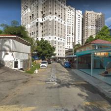
Based on the assessment that has been made, the urban design quality is not too strong in Kg. Datuk Keramat. It does not achieveall the criteria, especially the accessibility to a place. The pedestrian walkway and road users will not experience a good design of the place because of a fewfactors such as the narrowness of the road whichwill endanger the user,unconnected walkway and others. However, in the study area, there are mixed commercial activities that can fulfil people’s needs.

N.T.S

Landmark
Node Path
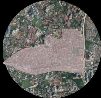
There is no clear edges or boundaries that separate Kg. Datuk Keramat and Selangor state.
In, Kg. Datuk Keramat, there are few districts that can be obviously visible which are commercial activities such asat Pasar Keramat area,and mixed retail business. For the residential, there arearea of the bungalow houses, village and terrace house, and new development of housing. As Kg. Datuk Keramat, Kuala Lumpur located next to Setiawangsa , JalanJelatek is the boundary that separates thesetwo area.
3.0 SUMMARY: APPRAISAL AND AUDIT Planning and Remedial Report: KampungKami Datuk Keramat
Figure 3.4: Landmark and Node Source: Development Appraisal & Audit Report
Figure 3.5: Unclear Edges Source: Development Appraisal & Audit Report
12
HOUSING
A. Housing Types


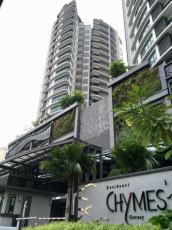
Kampung Datuk Keramat is an urban traditional village in Kuala Lumpur with 275 acresand 53.36% of residential. The development of housing in Datuk Keramat consists of the mixture of high rise and landed type of housing. The high rise housing consist of flat, condominium andapartment. Meanwhile for the landed housing, it consist of singlestorey detach house, 2 and 3 storey detached house andalso informal houses.
RISE HOUSING
HOUSING

Housing Condition


The condition of most of the house in Kampung Datuk Keramat is good except for a number of informal houses. This is presumablydue tothe design, structure and materials choice. For example, almostall of the detached houses are in a good condition because it can be seen that the design looks modern with the material used are mostly bricks which shows thatthe age of the building are relatively low compared tothat of the informal houses.

3.0 SUMMARY: APPRAISAL AND AUDIT Planning and Remedial Report: KampungKami Datuk Keramat TOTAL 10 HIGH
Condominium 4 Apartment 4 Flat 2 LANDED
TOTAL 1165 Single Storey Detach House 351 2 Storey Detach House 457 3 Storey Detach House 25 4 Storey Detach House 1 Informal House 319 Long House 2 Squatters 10 Landed House 3.2.3
Chymes Residences Kuala Lumpur Squatters Figure 3.6: Housing Types Source: Development Appraisal & Audit Report Zone A Zone B 336 30 9 388 184 24 Good Moderate Bad B.
Figure 3.7: Housing Condition Source: Development Appraisal & Audit Report 13
3.2.4 COMMERCIAL
A. Types of Commercial
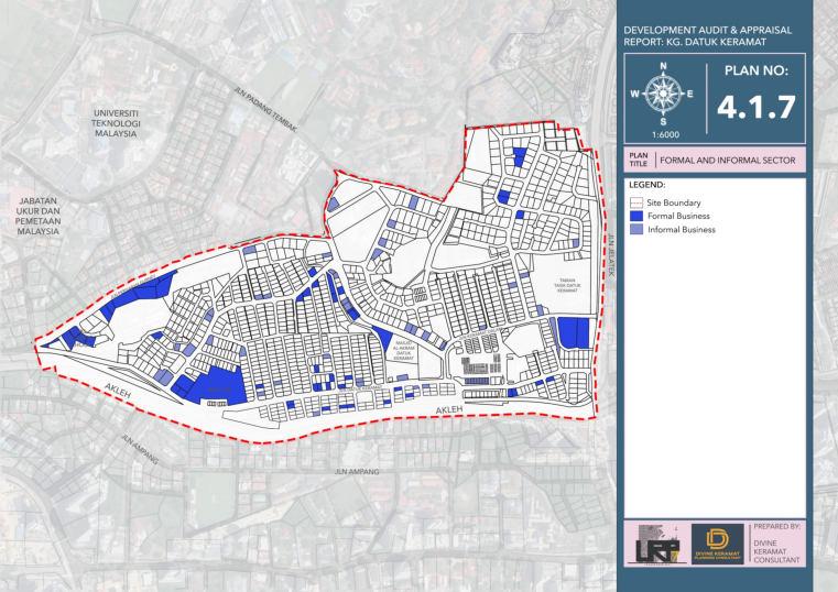
The commercial activities in Kg. Datuk Keramat can be classified into 12 types where mostly are carried out at residential areas. In which the most commoncommercial activities identified is Retail Business. In addition Pasar Lama Datuk Keramat is the main commercial attraction in the study area.
B. Formal and Informal Commercial
The existing commercial activities in Kampung Datuk Keramat can be categorized into two economic sector of which are formal business with 55% and informal business with 45 of thetotal businesses.
Formal Businesses
Table
Classification of Commercial


CLASSIFICATION PERCENTAGE
Retail Business 54.34%
Personal & Household Services 15.23%
Food Centre 1.45%
Market 0.72%
Business Services & Professional 1.45%

Private Education 6.53%
Private Health Service 0.72%


Gas Stations 0.72%
Residential Buildings & Commercial Accommodation
2.90%
Figure 3.8: Formal and Informal Commercial
Source: Development Appraisal & Audit Report
Businesses
C. Guideline Compliance


Table 3.3: Commercial Guideline Compliance
TYPES OF COMMERCIAL LOCATION COMPLIANCY
Terrace Shop/ Shop Office/ Strata Shop Beside Al Akram Mosque
Detached and Semi Detached Shop Tree Steak House and Ayam
Gepuk Pak Gembus (Semi D)
Net Auto Sdn. Bhd. (Detached)
Boarding Home 1.45%
Vehicle Service 13.77%


Sport Centre 0.72%
Source: Development Appraisal and Audit Report
Business Complex
Gas stations
Market
Private University
UTC Keramat
Petron Jalan Datuk Keramat
Pasar Lama Datuk Keramat
UniKL Business School
Source: Development Appraisal and Audit Report
3.0 SUMMARY: APPRAISAL AND AUDIT Planning and Remedial Report: KampungKami Datuk Keramat
Informal
45% 55%
3.2:
14
3.2.5 INFRASTRUCTURE AND UTILITIES
Based on the assessment for infrastructure and utilities, overall performance is adequateand efficient service for the residents. However, it will be up tothe customer to use it wisely for instance the water supply. This is due to decrease the water demand as Malaysia’s water demandbecome increasing because of excessive using by customers. For the others infrastructure such as waste management, sewerage, and telecommunication network, allachieve higher results. This indicates that Kg. Datuk Keramat receive a well infrastructure services.
A. Water Supply
Water treated for Kg, Datuk Keramat is supplied by Bukit Nanas Water Treatment Plant. Kg. Datuk Keramat requires 1.97 million litres of water supply perday.
Water supply disruption case

Reasons:
1. Pipe Leakage
2019 4 Cases
2020 7 Cases
2. Water supply polluted
3. Water rationing
C. Waste Management
The method used for solid waste disposal of the whole city of Kuala Lumpur including Kg. Datuk Keramat is through sanitary landfilllocatedin Bukit Tagar, Selangor . Each house in Kg. Datuk Keramat has beenprovided 120L rubbish binby Alam Flora Sdn. Bhd . The provision of rubbish bin can help the residents tothrow away their household waste andalso can ease the collecting waste services by the contractor.
D. Telecommunication
Based on the Figure 3.10 Yes telecommunication company provides the highest 4G network services in Kuala Lumpur. What can be analyse here is Kuala Lumpur almost covered by 4G network.
Broadband coverage area: 91.8%
UNIFI MAXIS CELCOM
U MOBILE YES
Unifi Maxis Celcom DiGi U Mobile YES
Figure .3.9: Water Supply
Source: Development Appraisal & Audit Report
B. Electric Supply
The range of maximum demandbased on thetype of houses in Kg. Datuk Keramat need to be supplied as much 6,053 kW. Based on the desktop study, Kg. Datuk Keramat do nothave an issue regarding inadequate electric supply.
Figure 3.10: Telecommunication
Source: Development Appraisal & Audit Report
E. SewerageSystem
Kg. Datuk Keramat is served by Bunus Regional Sewage Treatment Plant. It islocated at the north-west of the site. Based on the desktop research, all the houses are receiving the sewage treatment systemservices.
3.0 SUMMARY: APPRAISAL AND AUDIT Planning and Remedial Report: KampungKami Datuk Keramat
90.7% 92.8% 92.9% 90.2% 85.7% 97.9%
DIGI
15
3.2.6 INSTITUTIONS AND PUBLIC FACILITIES


There are a total of 6 components for public facilities identified in Kg. Datuk Keramat; Religious Facilities, Recreational & Sport Facilities, Safety and Security Educational Facilities, Cemetery and Community Facilities.


However, Kg. Datuk Keramat islacking of certain types of facilities such as hospital, clinics, fire station, public library and secondaryschools. Thus, itisimportant to ensure the residents can have a full access to all ranges of services and facilities without having to depend on surrounding neighbourhoods. In addition, the accessibility tothe public facilities in Kg. Datuk Keramat definitely has to be improved by adapting a universal design such as having tactile paving equipped on the pedestrian walkways so that it can serve all kind of community with diverse abilities to ensure that no one isleft behind and inclusivityis present in the neighbourhood.
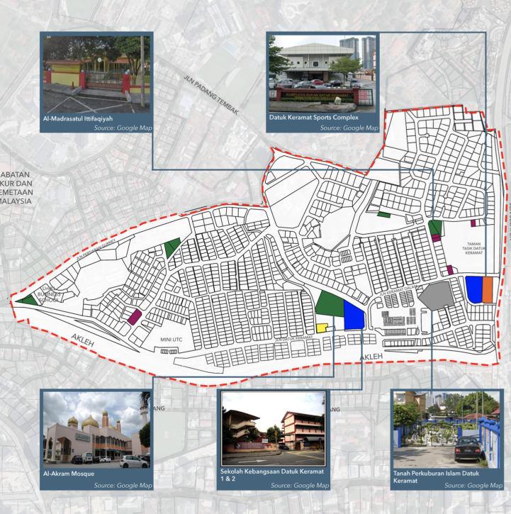
Table 3.4:
CATEGORY
Religious

Sport

Community
Safety

Cemetery
Figure
N.T.S

3.0 SUMMARY: APPRAISAL AND AUDIT Planning and Remedial Report: KampungKami Datuk Keramat 16
3.11: Institution and Public Facilities Source: Development Appraisal and Audit Report
TYPETOTAL
Facilities Masjid 1 Surau 4 Educational Facilities Primary School 2
FacilitiesSport Complex 1
Facilities Community Centre 3
and Security Facilities Police Station 1
Kubur Datuk Keramat 1
Types of Community Facilities Source: Development Appraisal and Audit Report
3.2.7 OPEN SPACE AND RECREATION
In Kampung Datuk Keramat there are 3 types ofopen spaces and recreation neighborhood park,playground and play lot as shown in the figure X.X below. There areapproximately only 3.84% of thetotal land use equals to 10.55 acres outof 275 acre. Table X.X below is the guideline assessment for open space and recreation in the site study area.
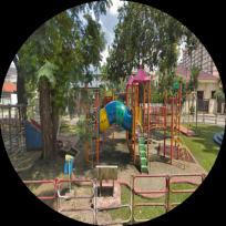
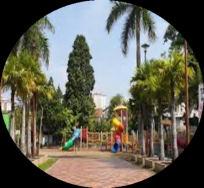
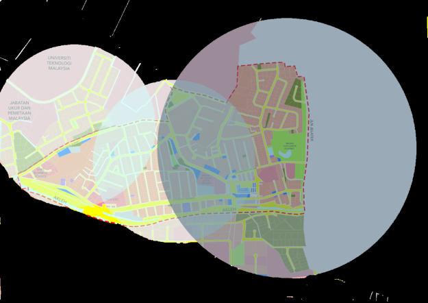
Table 3.5: Open Space Guideline Compliance
ELEMENT
Neighborhood Park
PLANNING STANDARD AND GUIDELINE: EXISTING CONDITION COMPLIANCE

5 acre
3,000 12,000 people
Playground

Play Lot
1.5 acre
1000 3000 people
0.5 acre
300 1000 people
10.50 acre
1 neighborhood park in the site study area.
0.36 acre
1 playground area in the site study area
0.15 acre
1 play lot area nearby to the site study area (within 500 m walking distance)
Comply with guidelines
Not comply with guidelines
Not comply with guidelines
• Playground
Active open space
0.36 acre
• Playlot
Active open space
0.15 acre
Source: Development Appraisal and Audit Report
Neighborhood Park
Active and Passive open space
10.50 acre
meter radius
meter radius
Study Area
Figure 3.12: Catchment Area Open Space and Recreation
Development Appraisal and Audit Report
3.0 SUMMARY: APPRAISAL AND AUDIT Planning and Remedial Report: KampungKami Datuk Keramat
•
•
•
•
•
•
•
•
•
•
•
•
•
•
•
•
•
•
•
N.T.S 800
500
Site
Source:
17
Demographic and Social Study
A. Community Perception
The study is carried out to understand public perception on living environment in Kampung Datuk Keramat, where there are total of 30 respondents. There are 4 categories of perception. Firstly, half of the respondents disagree thatthe provided facilities andamenities isinadequate. Similarly, half of the respondents believe that the study area is only safe during the daylight. As for liveability, the respondents were askedaboutanyavailable community activities in the study area, but more than half of the respondents stated thatthere is no community activities carried out. Lastly, for walkability, only small amount of the respondents who choose to walk for daily commuting. (Chart 3.1)
B. PopulationProjection
The populationprojection is calculated from year 2010 to 2040 by using the average annual growth rate from the Kuala Lumpur Structure Plan 2020. The population will continuously increase from 5,967 in 2010 to 10,806 in 2040 which indicates a total additions of 4,839 people. The survival rate and fertility rate areassumed constant in this method. (Chart 3.2)
3.1: Perception
Development Appraisal
both daylight
safe both
Report
and night
Population Projection
transportation
3.0 SUMMARY: APPRAISAL AND AUDIT Planning and Remedial Report: KampungKami Datuk Keramat 18 3.3
53.3 0% 46.7 0% Facilities and Amenities No Yes 50% 43.30% 6.70% Safety Safe during daylight only Safe during
and night time Does not
daylight
time 36.7 0% 63.3 0% Liveability Yes No 73.3 0% 13.30 % 6.70 % 6.70 % Walkability Own vehicles Public
E-hailing/taxi Walking Chart
Source:
and Audit
0 2000 4000 6000 8000 10000 12000 2010202020302040 5,967 7,273 8,864 10,806 Chart 3.2:
Source: Development Appraisal and Audit Report
3.4 Transportation and Traffic Study
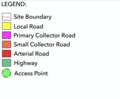
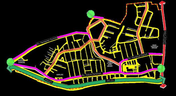
Kg. Datuk Keramat asan urban traditional village in Kuala Lumpur, is well served with road network (Figure 3.13) and public transit connectivity. The study area stillshows the characteristic of a village which the roads tend to be too narrow andare not in compliance with the current standard guideline. Therefore, traffic congestions are common to occur especially at Pasar Keramat intersections because of the commercial activitiesandat Bukit Keramat intersections due tothe highdensitydevelopment, this is evenexacerbated by the presence ofon street parking.
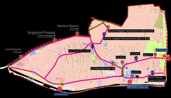
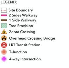
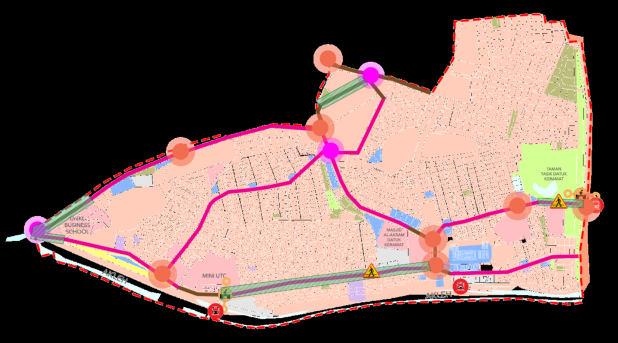
Moreover, the study area isintegrated with the public transportation system of Kuala Lumpur, where there are 3 LRT Kelana Jaya line stations accessible from study areaas well as the variety of bus services (Figure 3.14). However, even thoughthe major roads arealready provided with pedestrian walkway, but the lack of crosswalks at the intersections create a discontinuity of walkway in the study area (Figure 3.15). The absence of cycling facilities in the study area shows thatthe lifestyle of this transport mode is not common among the residents.
Lastly, the identifed of both on street and off street parkingprovision indicates thatthe study area shows less contribution in the efforts of reducing private vehicle dependency to lower the carbon emission for a more sustainable city.
N.T.S
Source: Development Appraisal and Audit Report
N.T.S
Figure 3.14: Public Transit Distribution

Source: Development Appraisal and Audit Report
N.T.S


Figure 3.15: Pedestrian Networks
Source: Development Appraisal and Audit Report
3.0 SUMMARY: APPRAISAL AND AUDIT Planning and Remedial Report: KampungKami Datuk Keramat 19
3.5 Environmental Study
A. ClimaticChange
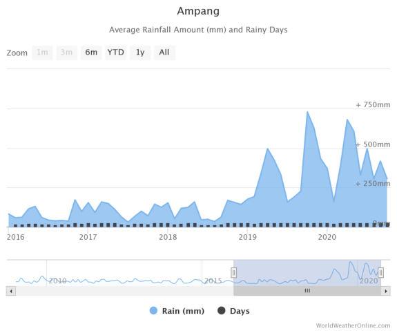
The climatechange has resulted in the increment of rainfall intensity. The phenomenon starts with the rising temperature of the surrounding, heats up the sea and increasing the rate of condensation, hence, increasing the amount of rainfall. This increasing amount of rainfall is said to be the main caused of flashfloods occurrence in the study area.
B. Topography
The highest topographythat isidentified ranges from73m at the eastern north of Kampung Datuk Keramat tothe lowest at 33m. Meanwhile, the available water body in the study area is the Klang river on the south and a lake of TamanTasik Datuk Keramat on the east.

Highest Topographic Point
N.T.S

Lowest Topographic Point
Figure 3.16:
Source:
Figure
Source:
73m 33m
3.0 SUMMARY: APPRAISAL AND AUDIT Planning and Remedial Report: KampungKami Datuk Keramat
Increasing Rainfall Amount
Development Appraisal and Audit Report
3.17: Topography Plan
Development Appraisal and Audit Report 20
C. Environmental Quality
Water Quality Index
water quality in Kg Datuk Keramat
under class
and mildly polluted.
slightly
b. Air Quality Index
3.6 shows the number of days that records the data on the air quality index for Kampung Datuk Keramat for 2018 until 2020. From thetable it can be observed that most days in 2018 and 2020 recorded good to moderate air quality index reading for most days. For 2019, the air quality index readingranges from good to very unhealthy. However, majority of days for the year still recorded good to moderate air quality index reading.
3.0 SUMMARY: APPRAISAL AND AUDIT Planning and Remedial Report: KampungKami Datuk Keramat 56 53 64 61 66 63 65 78 71 72 73 0 10 20 30 40 50 60 70 80 90 2004 2005 2006 2007 2008 2009 2010 2011 2012 2013 2014 Water Quality Index for Sungai Klang YEAR AIR QUALITY INDEX (WQI) DAYS 2018 0 25 26 25 50 201 50 75 128 75 100 6 100 125 0 125 150 0 2019 0 25 150 25 50 1 50 75 140 75 100 25 100 125 2 125 150 5 150 175 7 175 200 1 2020 0 25 43 25 50 251 50 75 3 75 100 0 100 125 0 125 150 0 AQI LEVEL NUMERICAL VALUE Good 0 to 50 Moderate 51 to 100 Unhealthy 101 to 200 Very Unhealthy 201 to 300 Hazardous > 301
a.
The
is classified
2 and 3 which are
polluted
The water quality index are evaluated based on six parameters which are: Biological Oxygen Demand, Chemical oxygen demand, Ammoniacal Nitrogen, Dissolved Oxygen, pH concentration and Total suspendedsolid.
Table
Chart 3.3: Water Quality Index Source: Development Appraisal and Audit Report Table 3.6: Air Quality Index Source: Development Appraisal and Audit Report Table 3.7: AQI Level 21
3.6 Heritage and Cultural Study
A. Malay Reserve Land Status
Latest information obtained by DBKL during their detailed review on Kuala Lumpur Structure Plan 2040 is Kg. Datuk Keramat hasnever been under the category of Malay Reserved Land. Although according to previous study it was announcedas MRL in 1955 (Ani Ahmad, 2000). Thus, Malay reserve land status of Kg, Datuk Keramat is uncertain.
B. Heritage Building: Residential
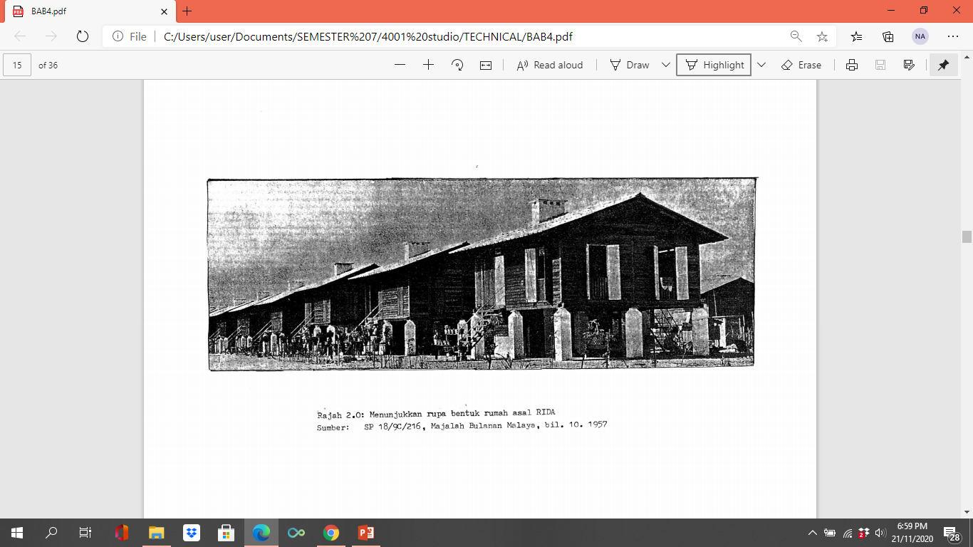
Kg Datuk Keramat has established a residential area called 'RIDA' builtby the Lembaga Kemajuan dan Perusahaan Kampung (now MARA) to develop the economy of the Malays. This house was first occupied in December 1957. After 43 years, there have been some changes that have occurred tothe original structure of the house.Based on the Figure x.x , itis a reflection of the original design of the ‘RIDA’ housing. It is a village and has been organized in an order. That is why Kg. Datuk Keramat today is a well-organized condition compared to other village areas.
C. Cultural Identity
Pasar Keramat was the main market in Kuala Lumpur in the past and still receives many visitors today. For most of residents who stays in Kg. Datuk Keramat, Pasar Keramat is the most historical place for them in the area. Chart 3.4 shows majority of the respondents (83.30%) consider Pasar Keramat is important for the locals. This is because they can easily get foods, fishes, groceries and many other things at the nearest of their houses.
Chart 3.4: Importance of Pasar Keramat
Source: Development Appraisal and Audit Report
Kedai Songkok which islocatedin Mini UTC Keramat is a shop that still keeps heritage craft alive. The maker, Bachtiar Mustafa, 82 decided totake up thetrade after he learnt to make the songkok during the 1980s in Kg. Baru. Before the shop was in Mini UTC Keramat, Bachtiar opened his first Kedai Songkok in Pasar Keramat. He opened the shop for more than 40 years in Kuala Lumpur.


3.0 SUMMARY: APPRAISAL AND AUDIT Planning and Remedial Report: KampungKami Datuk Keramat 83.30% 13.30% 6.30% Yes Maybe No
Figure 3.18: Original Design of IRDA house in Kg. Datuk Keramat Source: Development Appraisal and Audit Report
Figure 3.19: Songkok Art Source: Development Appraisal and Audit Report
22
Market Study
The median sale price for residential property in Kampung Datuk Keramat is at RM382 PSF or RM584,859 per units (Chart 3.5). In addition, the average sale price is relatively lower thanthe state average sale price (Chart 3.6). Furthermore, there is a variety of property types in Kg. Datuk Keramat with the different range of residential property Market sale price. In terms of landed property, zone B of the study area has relatively higher sale price compared to landed residential property at zone A. (Table 3.8) Lastly, asan older neighborhood and an urban traditional village, Kg. Datuk Keramat has a comparatively lower sale price of the landed residential property compare to other neighborhoods. This can be proved throughthe declining of sale price in the resale analysis, which even both landed and stratified property show a declination of sale price (Figure 3.20).
PROPERTYPROPERTY


RM210 (PSF)
Median Sale In Keramat
RM584,859/unit RM382 (PSF) RM700,000/unit RM484 (PSF)
Average Sale Price Psf
Detached House
3.0 SUMMARY: APPRAISAL AND AUDIT Planning and Remedial Report: KampungKami Datuk Keramat 23 3.7
MEDIAN 75%25%
RM450,000/unit
317 415 0 100 200 300 400 500 Area Average State Average
-6%/year
-23.28%/year Condominium
TYPE MEDIAN PRICE PSF (RM) MEDIAN PRICE PER UNIT (RM) Zone A Detached House, Semi detached House, and Terrace House 179 680,000 Zone B Detached House 248 1,500,000 Gurney Heights Condominium /Apartment 394 428,500 Villa Pawana 361 515,000 Chymes @ Gurney 659 545,000 The Haute 604604,718 Table 3.8: Market Study Source: Development Appraisal and Audit Report Chart 3.5: Median Sale Price Source: Development Appraisal and Audit Report Chart 3.6: Average Sale Price Source: Development Appraisal and Audit Report Figure 3.20: Resale Analysis Source: Development Appraisal and Audit Report
3.8 Hybrid Indicator Assessment Matrix
Hybrid
HYBRID DIMENSION 1: HERITAGE IDENTITY AND URBAN DESIGN
THEME INDICATORS SCORE
HU1 –Traditional Village Criteria HU1 P1 Land Use Activity 1/3
HU1 P2 Malay Reserve Land 0/3
HU1 P3 Traditional House Architecture 1/3
HU1 P4 Visual Quality and Attraction 2/3
HU2 Cultural Identity and Urban Design Quality
HU2 P1 Cultural Identity and Sense of Place 1/3
HU2 P2 Access To Place 0/3
HU2 P3 Lifestyle 3/3
TOTAL 8/21
PERCENTAGE 38.1% Low Quality
HBYRID DIMENSION 2: OPTIMAL LAND USE
THEME INDICATORS SCORE
LU1 –Land Use Change
LU2 – Urbanization Development
Non Development Areas
Rate of Urbanization 3/3
Public Open Space Provision 1/3
LU3 –Land Use Pattern
TOTAL 9/12
PERCENTAGE
Moderate Optimality
3.0 SUMMARY: APPRAISAL AND AUDIT Planning and Remedial Report: KampungKami Datuk Keramat 24
LU1 P1 Percentage of Change to
3/3
LU2 P1
LU2 P2
LU3 P1 Mixed Use 2/3
75%
Continue… Table 3.9:
Indicator Assessment Matrix
KT1
HYBRID DIMENSION 3: PROSPEROUS COMMUNITY THEME INDICATORS SCORE
TOTAL
PERCENTAGE
HYBRID DIMENSION 4: COMMERCIAL ACCESSIBILITY
Community
THEME INDICATORS SCORE
CT1
TOTAL
PERCENTAGE
HYBRID DIMENSION 5: UNIVERSALLY ACCESSIBLE INSTITUTIONS AND PUBLIC FACILITIES
THEME INDICATORS SCORE
PF1 Healthy Communities
PF2
Public
PF2
PF2
PF3 Public Park Development
PF3-P2
School Location
Design
Park
TOTAL
PERCENTAGE
Accessible
3.0 SUMMARY: APPRAISAL AND AUDIT Planning and Remedial Report: KampungKami Datuk Keramat 25
– Proximity to Commercial CT1 P1 Proximity From Residential Areas To Commercial Areas 3/3 CT2 –Social Engagement CT2 P1 Provision of Cultural and Art Centre Within Proximity of The Area 2/3
5/6
83.33% Commercial
– Housing Affordability (state target) KT1 P1 Provision of Affordable Housing (total supply) 3/3 KT1 P2 Affordable and Diverse Housing 2/2
5/5
100% Prosperous
PF1 P1 Public and Recreational Facilities 3/3
–
Facilities Location and Design PF2 P1 Transit Oriented Locations 3/3
P2
and Access 3/3
P3 Universal
0/3
PF3 P1 Parks and Recreation 3/3
Public
Maintenance 2/3
14/18
77.7% Moderate Universal Accessibility Continue…
HYBRID DIMENSION 6: EFFICIENT INFRASTRUCTURE AND TRANSPORTATION
THEME INDICATORS SCORE
IT1 - Utility Efficiency
IT1 P1 The Volume of Daily Domestic Water Usage per Capita 1/3
IT1 P2 Decreasing in Disruption of Water Supply Case 1/3
IT1 P3 Decreasing in Disruption of Electric Supply Case 3/3
IT1 P4 Broadband Coverage Rate 3/3
IT2 –Waste Management System IT2 P1 Recycling Activities and Services 2/3
IT3 –Sewerage System IT3 P1 The Percentage of Residential Gets Sewerage Service 3/3
IT4 –Linkage, Transportation and Transit IT4 P1 Location and Linkage 3/3
IT4 P2 Number of Integrated Public Transit 2/3
IT4 P3 Public Transit Stops 1/3
IT4 P4 OKU Accessible Transit Stops 0/3
IT5 P6 Cycling Facilities 0/3
IT4 P6 Neighborhood Walkability 1/3
IT4 P7 Safe Streets 3/3
IT4 P8 Reduce Parking Demand 0/3
TOTAL 23/42
PERCENTAGE 54.76% Moderate Efficiency
3.0 SUMMARY: APPRAISAL AND AUDIT Planning and Remedial Report: KampungKami Datuk Keramat 26
Continue…
HYBRID DIMENSION
ENVIRONMENTAL QUALITY
Development Appraisal and Audit Report
The overall score indicates a total of 73 scores outof 116, which is equivalent to 63%. This obtained score indicates the sustainabilitystatus of Kg. Datuk Keramat at moderate level.
The assessment shows that Kg. Datuk Keramat obtains the lowest score in Dimension 1 that is 38.1%, in which the study area has a low quality of heritage identity and urban design. The study area does nothave a strong and distinctive identity, the characteristic as a traditional village may not be clearly visible due tothe lack of traditional architectural village houses.
Therefore, in order to obtain the higher sustainability status, the development of urban traditional village of Kg. Datuk Keramat must take into consideration its identity and enhance the social cohesion of the community.
3.0 SUMMARY: APPRAISAL AND AUDIT Planning and Remedial Report: KampungKami Datuk Keramat 27
7: SUSTAINABLE
THEME INDICATORS SCORE ST1 –Environmental Quality ST1 P1 River Quality Status 2/3 ST1 P2 Air Quality Status 3/3 ST2 –Risk Management IT2 P1 Numbers of Initiative Implemented and Managed on Disaster Risk 2/3 ST3 – Environmental Management ST3 P1 Ecosystem and Open Space 2/3 TOTAL 9/12 PERCENTAGE 75% Moderate Quality 63% MODERATE SUSTAINABILITY 73/116 TOTAL SCORE
Source:
4.O
SUMMARY: KEY ISSUES & PROBLEMS


28
4.1 Main Issues
Based on the previous analysis on appraisalandaudit report, there are several main issuesidentifiedin Kampung Datuk Keramat; mobility issue, social and safety issue, environmental issue and the issue of identity and image quality. These main issues has resulted in further impacts. Each of these issues will bepresented in the abbreviation of “IP” as summarized in the next following sections. The knowledge of the existing issues will help in justifyinng the need of the remedial planning for Kg. Datuk Keramat.
IP1 – M1 : Traffic Congestion
4.2 IP1 - Mobility Issue
Traffic congestion in Pasar Keramat Area

IP1 MOBILITY ISSUE
IP1 – M2 : Low Walkability
IP2 – S1 : Lack of Public Space for Social Engagement
IP2 – S2 : Mismatch of Land Use
IP2 –SOCIAL & SAFETY ISSUE
IP2 – S3 : Lack of Guideline for Informal Houses
IP2 – S4 : Inadequate Provision And Non inclusive Design Of Public Facilities
IP3 – E1 : Flash Flood
IP3 ENVIRONMENTAL ISSUE
IP3 E2 : Disruption of Water Supply
IP4 - LACK OF IDENTITY AND IMAGE QUALITY
Figure 4.1: Traffic congestion
Source: Google Traffic
IP1–M1: Traffic Congestion
In Kg. Datuk Keramat, traffic congestioncommonly occurs at the intersections of Pasar areaand Bukit Keramat area. The traffic congestion occurs due tothe busier commercial activities, the smaller road width and on-street parking as well as higher densities. This traffic congestion does not only create the discomforts tothe neighborhoods, but it also contributes tothe more carbon emissions.
No provision of crosswalk in intersections
IP1–M2: Low Walkability
The low walkability identifiedis due to several factors;
• No enough provision of crosswalk facilities at the intersections;

• Illegal parking and commercial activities on the pedestrian walkway, it creates discontinuity and discomforts for the pedestrians;
Figure 4.2: Low Walkability
Source: Google Map
• Non inclusive design of walkway, on consideration of the OKU groups and this will lead to the inequity.
4.0 SUMMARY: KEY ISSUES & PROBLEMS Planning and Remedial Report: KampungKami Datuk Keramat 29
4.3 IP2 –Social and Safety Issue
IP2–S1: Lack of Public Space for Social Engagement
The land use in Kg. Datuk Keramat seems to focus on the residential areaand only 4.36% of the areaare open spaces. The open spaces provision is not even following the DBKL guidelines which are 10% of the total developments area. Furthermore, based on the conducted survey, the majority of respondents are on the average level of satisfactions for the provisions ofopen space and recreations area.
IP2–S2: Mismatch of Land Use
A traditional village should provide adequate open spaces and recreations area to promote the social engagement of the residents.
IP2–S3: Lack of Guideline for Informal Houses
Many of the informal houses are builtby the ownerof the landitself based on their preference of type of house and affordability. Most of the informal houses were built not complying tothe guidelines stated in Uniform BuildingBy Law and planning guideline due tothe limitation of reinforcement as the landis a private land. The legal title has become the barrier for the local authority totake legal action or fined the house owner.
Many of the houses built neglected the guidelines for setback which could put the lives of the residents at stake if accidents happen in their housing area.
IP2–S4: Inadequate Provision And Non-inclusive Design Of Public Facilities
There are some mismatch of land use between official data andactual condition on the site. For instance, the residents of the study use their residential area for commercial activity.
This mixed use aspect can be a potentialbut without a properplanning this issues can lead to many other problems. Such as traffic congestions, improper waste management and floods.
Kg. Datuk Keramat lacks certain type of public facilities such as hospital, clinics fire station,secondaryschool and public library. Even thoughthese facilities can be found in the other neighborhood surrounding Kg. Datuk Keramat, but there are possibilities thatthe facilities in the surrounding neighbourhood isin full capacity and cannotcater the needs of population in Kg. Datuk Keramat.
Besides, the accessibility of most of the public facilities in Kg. Datuk Keramat are clearly designed with no consideration of the disable community. This might prove to be an obstacle to DBKLvision which isinclusivity.
4.0 SUMMARY: KEY ISSUES & PROBLEMS Planning and Remedial Report: KampungKami Datuk Keramat 30
4.4 IP3 – Environmental Issue
IP3–E1: FlashFlood
The cause of flashfloods occurrence in Kg. Datuk Keramat:
• To be related with the development of the highways located to the southern part of the study area.
• Clogged drainage and outdated drainage system in the study area.
The issueis alreadyacknowledged by the local authorityand a pump house project has beendeveloped at the affectedareas. However, the latest flashfloods incident once again strike on 17th November 2022.
IP3–E2: Disruption of Water Supply
Flood occurrence under the development of highways.

Figure 4.3: Flood Occurrence
Source: New Straits Times
4.5 IP4 - Lack Of Identity And Image Quality
There are several factors contributing tothe issue on lack of identity and image quality.
• High population density in the study area, traditional village area is considered denser when the population is more than 300 people in 1 km sq.

• Uncertainty of Malay Reserve Land status, although the landis owned by Malays, the land status in Kg Datuk Keramat is uncertain when DBKL found out thatthe Malay Reserve Land status is actually not declared yet.
• No preservation oforiginal architectural design of the Malay traditional houses in Kg. Datuk Keramat
• No preservation of Pasar Keramat views from the street level. Pasar Keramat as the landmarkis not too visible as peoplepass throughthe street.

• Less social engagement opportunity. The residents are lesslikely to engage as itlacks ofoutdoor spaces.
Water interruption oftenoccurred almost every month started from July in the year 2020. Most of the factor that causing the interruptionsis because of the pollution in raw water such as the river followed bypipe leakage.Based on the conducted survey, the respondents agree that polluted water supply always occur in Kg. Datuk Keramat.
This issue will further havenegative impact on the health of the residents.
4.0 SUMMARY: KEY ISSUES & PROBLEMS Planning and Remedial Report: KampungKami Datuk Keramat 31
No View Preservation of Pasar Keramat
Figure 4.4: Lack of Identity and Image Quality
Source: Google Map
CONCEPTUALIZATION


5.O REMEDIAL
32
EVERYDAY URBAN KAMPUNG-ISM
• A concept to define the meaning of urban spaces to everyday life in the urban kampung.

• It mainly concerns with specific activities of the daily life of the urban kampung community.
• A concept where the improvement of public spaces is a result of bursting kampung community life.
33
5.1 Defining Everyday Urban Kampung-ism
Derived from the approach of everyday urbanism, Everyday Urban Kampung-ismis a concept that emphasizes the meanings of kampung's everyday lifein everyday spaces. Everyday spaces are the physical realm for an everyday public activity that exists between different other realms; home, institutions, commercial, and workplace. In another word, everyday space is the connective tissuethat bindsdaily lives together. Therefore, Everyday Urban Kampung ism focuses on building everyday spaces to celebrate the richness and vitality of urban kampung daily activity.
Other than everyday spaces, everyday urban kampung-ism also focuses on everyday time which acknowledges the multiple ways in which everyday lifeis highly structured by time. This includes the natural time; night and day, the season, the religious time; Friday prayer, or Tarawih prayerduring Ramadhan, and schedules of modern life; working day, the weekend, vacation, and holidays.
Furthermore, the idea of urban kampung is where a kampung lifestyle, which is based on the community togetherness and high degree of sense of place, is stillstanding out and revived in the phenomenon of rapid urban development. Therefore, the quality of daily life experience is the key aspect in defining urban kampung.
Finally, the kampung community is the key point in the Everyday Urban Kampung-ism, a development of urban kampung must be communitybased,bottom up, democratic, and with a high degree of social equity and publicparticipation. Therefore, Everyday Urban Kampung ism must be able to domesticate the urban kampung spaces for the local community through the refamiliarization of the everyday spaces and urban kampung environment to make it more like home and a softer place that is more inhabitable. Hence, it can enhance the sense of togetherness between the community, as well as the sense of placebetween the communities and their Kampung, thus,the rich urban kampung lifestyle will continue tothrive and flourish.
PRINCIPLES
COLLECTIVE LIFESTYLE & PUBLICNESS
GREEN COMMUNITY & ACTIVE MOBILITY
SUSTAINABLE ENVIRONMENT
CULTURAL IDENTITY & SENSE OF PLACE
Planning and Remedial Report: KampungKami Datuk Keramat 5.0 Remedial Conceptualization 34
5.2 Underlying Principles
Collective Lifestyle & Publicness

A strong relationship within the community differentiates the Kampung community from the community. This relationshiprefers tothe collective which means the Kampung communities share motivated to work togetherto achieve a common goal strong interaction can develop towards meaningful lasting neighborship and build trust between community. Therefore, to revive this collective kampung lifestyle, the principle of publicness isimportant to the quality of kampung spaces can be a means interaction and enhance social cohesion.


Green Community & Active Mobility

Similarly, the green community in this context refers tothe community works togetherto increase the quality of their kampung environment as well as to help in mitigating the impacts of climatechange thatthreatensthe urban kampung that is alreadyat risk tothe impacts of the worsening urban climate environment.Besides, active mobility of the kampung community includes walking and cycling, isimportant to minimize the carbon footprints in the urban kampung. This mode of mobility shall be practicedby the local community in their daily life activities or at least totravel around the neighborhood.

Planning and Remedial Report: KampungKami Datuk Keramat 5.0 Remedial Conceptualization 35
Sustainable Environment

To create a more livable urban kampung environment, the development of the urban kampung must highly take into account environmental sustainability. To become an urban kampung that is environmentally sustainable, the provision of moregreen areas must beput at the utmost priority in terms of development. This principle is also correlated with the principle of the green community. Wherein, by creating a more environmentally sustainable urban kampung, will increase the awareness of the community as well as it will motivate the local community to move towards a greener living.

Cultural Identity and Sense of Place


The sense of togetherness is significant in the kampung community, therefore,the common interest that can unite the community is their cultural identity. Cultural identity of thetraditional urban kampung can be tangible such as public market or intangible such as festival,food, etc. This is important for the people’s sense of self and how they relate to othersor the sense of belonging towards each other. Additionally, the sense of place is as significant, itis the relationship between the urban kampung physical environments with the local people. If the locals appreciate their places, they cancomfortably livein their places.

Planning and Remedial Report: KampungKami Datuk Keramat 5.0 Remedial Conceptualization 36
5.3 International Benchmarking
5.3.1 KAMPUNG SUNTER JAYA,JAKARTA, INDONESIA
Kampung Sunter Jaya (RW 01), is an urban kampung in Tanjung Priok district, North Jakarta, Indonesia. The urban kampung is approximately 15.6 hectares area with a total population around 13,000 people or 3,000 households.
Kampung Sunter Jaya (RW 01) has been awardedas a National ProKlim (Program Kampung Iklim / Climate Kampung Program) and becomes a role model to be implementedin 31 other urban kampungs in South Jakarta (Wartakota, 2019).


Behind the successfulstory of Kampung Sunter Jaya, the urban kampung is well known for have the citizens who were enthusiastic and willing to actively run the program together. The active mobility and public transportation arealso the primarypreference of the locals for their mode of transportation.
The urban kampungs islocated just adjacent tothe Sunter lake on the north which is known to bedirty, unsafe, and uncomfortable. The successstorystarted in 2008, where the head of RW 01 (Village Citizen Association 01) with the local community started the greenmovement to make the urban kampung become a comfortable place to livein One of the program that is still conducted until nowadays is the urban farming where the community grow plantation either forfood or medicine in front of their own houses. Hence, Kampung Sunter Jaya became a pilot area for National Climate Village program.
Planning and Remedial Report: KampungKami Datuk Keramat 5.0 Remedial Conceptualization 37
Figure 5.1: Kampung Sunter Jaya Location Source: ITDP
Figure 5.2: Urban Farming in Kampung Sunter Jaya Source: Liputan6.com
Thereafter, the urban kampung community started to see the potential of their neighborhood to become a tourism destination in Jakarta. The water feature of the Sunter Lake is anadded point for Kampung Sunter Jaya as a tourism object. Therefore, the local community, with their own initiative, they always ensure the cleanliness of their kampung, and even they enthusiastically started to decorate their own kampung to become more attractive for visitors.
Nowadays, the unique elements of this urban kampung is the walls of the kampung houses are decorated with mural and/or hydroponics plantation. Therefore, throughthis placemaking for urban kampung, the alleyand small narrow roads in Kampung sunter Jaya has became more children friendly, comfortable and more interesting. In which this alsoallows the children to play outside safely. Other thanthat,the local community also initiated to do the catfishcultivation; hence, the visitors will have the opportunity totastethe catfish steak made by the local womenwhile accompanied by Betawis traditional beverage called Bir Pletok (A Mixture of spices) and enjoy the interactions between the residents, thus, it became the localidentityin terms of culinary.


Therefore, the successstory of Kampung Sunter Jaya proves thatthe participation of the community and their strongsense of togetherness are kampung


Planning and Remedial Report: KampungKami Datuk Keramat 5.0 Remedial Conceptualization
38
Figure
5.7:
Kampung Cleaning
Source: Liputan6.com
Figure
5.5: Narrow alleys Source: Liputan6.com
Figure
5.6: Kampung Placemaking Source: ITDP
Figure
5.4: Children
Friendly
Street Source: ITDP
Figure
5.3:
Placemaking By
Community Source: ITDP
5.3.2 KAMPUNG PELANGI, SEMARANG, INDONESIA
Kampung Pelangi or Rainbow Village, is an urban village settlementsituated in the capitalcity of Central Java’s province, Semarang, in Indonesia. Semarang is a developing metropolitan urban area which becomes the fifth largest city in Indonesia, the city is divided into 16 subdistricts and 117 urban villages in which Kampung Pelangi is oneof them.
Prior tothe name of “Kampung Pelangi”, the original name of the urban kampung was “Kampung Gunung Brintik”. The urban kampung that is situated along the bank river was a dirty and disorganized slum area with various issuesin terms of the social, accessibilityand other issues.


Initially, the government of Semarang city was solely renovating the Pasar Bunga Kalisari (Kalisari Flower Market) that is just situated across the urban kampung. However, the government noticed thatthe image of slum area of the urban kampung as a background of the Pasar Bunga is unfavorable, although the Pasar Bunga is beatifiedbut the background of the slum area gives disadvantages. Therefore, the government realized the potential of the urban kampung regeneration through thethematic concept, where the Pasar Bunga gives an identity of “colorful” concept. Thus, in 2017, the first step to regenerate the urban kampungs is bypainting the houses with a selection of colorful rainbow colors. In the process of regenerating the urban kampung, there are also other improvement such as the drainage and infrastructures. Therefore, this urban kampung regeneration with the concept of rainbow village will be able to enhance the prosperity of the residents and to be a tourism destination.

Planning and Remedial Report: KampungKami Datuk Keramat 39
Figure 5.8: Kampung Pelangi Before Source: IDN Times
Figure 5.9: Kampung Pelangi After Source: IDN Times
Figure 5.10: Pasar Bunga Kalisari Source: Google
Kampung Pelangi is oneof the successful project and become the role model of the government’s program to improve the all urban kampungs in Semarang that is called as “thematic kampung program”. TheThematic Kampung program aims to promote Gotong Royong (Mutual Cooperation) as the backbone of sustainable development of urban kampung in which the community is expected to be the activeactors of urban poverty alleviation programs in Semarang. Therefore, this program required coordination acrossagencies on social, cultural, economic and infrastructure aspects. The main idea of this Thematic Kampung program is to showcase the identity or meaning of its community by highlighting its social, economic and cultural potential. Therefore, thetheme determination is based on the cultural identity and potential of urban kampung community.
The regeneration of urban kampung Pelangi is conducted throughthe community empowerment and environmental improvement,in which throughoutthe process, the community getsmore knowledge on the characteristic of their urban kampung identity and potential and they can realize the potentialproblems that encounters within their area such as the poordwelling. Thus, the citizens of Kampung Pelangi initiated to paint their own wallswith the partnership with a painting businesses.
Therefore, this Kampung Pelangi is a good practice of how the culture becomes the backbone of sustainable development and urban kampung regeneration. By optimally benefit the cultural identity andactivity of the urban kampung community, it provides an opportunity to improve the overall sustainability and prosperity of the urban kampung.
The philosophy of thematic kampung program is based on “gotong-royong” culture of collaboration: the government provides a stimulus in the form of concept and financing, and then the community takes over.


Planning and Remedial Report: KampungKami Datuk Keramat 5.0 Remedial Conceptualization 40
Figure 5.11: Thematic Urban Kampung Regeneration Source: Culture 21
Figure 5.12: Mural by the local Source: Culture 21
5.3.3SUNGMISAN URBAN VILLAGE, SEOUL, SOUTH KOREA
Sungmisan urban village (Seongmisan Maeul) is a small neighborhood in the northwest Seoul of about 700families. Seoul has experienced the impacts rapid urbanization and redevelopment process where switching apartments every two or three years has became thetrend and lifestyle of the Seoul people, hence, the city islackingin terms of sense of belongingbetween the neighborhood’s community. However, this is not the case for Sungmisan residents who tryto restore what Seoul city has lost which is the harmonized community.
The successstory of Sungmisan urban village started in 1994 when a group of young dual income families whowere unsatisfied with the education system bothpublic and private sector as well as were disappointed with the materialistic and individualisticlifestyle of the society. Hence, they decided join and launched the “Woori ChildcareCenter” which is the first childcareco ops for the neighborhood families. Since then,the community has been creating their own social infrastructures which makes the urban village a safe environment for children. The social infrastructures focuses to provide services for daily life such as cooperativecare for children and elderly, village schools, communitycafes and libraries, etc. The people even initiated various cultural activities that means to give a sense of shared history throughthe provision of community theatre, radio channels, festivals andart projects.
Therefore, the local community of Sungmisan urban village has developed their own neighborhood with the concept that emphasizes on the communities need on sharedspaces,shared rituals and supports to build social networks. In turn, the communitycreates their ownopportunities to lead the lives as their wish.

The strong relationship of the community has created an urban village that is socially and environmentally neighborhood. The community even became more empowered after the key event when the residents came together and created a ”Save Sungmisan Campaign” to strongly reject the proposeddevelopment of a proposed water distribution system at the nearby forest of Mt. Sungmi. Therefore, with the established socialsustainability of Sungmisan village community, they have successfullysaved the forest environment of Mt. Sungmi.

Planning and Remedial Report: KampungKami Datuk Keramat 5.0 Remedial Conceptualization 41
Figure 5.13: Sungmisan Urban Village Source: Google
Figure 5.14: Sungmisan village community gathering Source: Shareable.net
Other thanthat,the community also has a more democratic way of decision making in shaping their own neighborhood In the decision making process, the community reaches a shared consensus rather than relying on the majority vote rule. Although this takestimes,this isimportant to build a better solidarity and trust in the Sungmisan community. Moreover, this approach is also used to negotiates with the local authority to shape the place they livein.
More importantly, the Sungmisan community has created the physical spaces that can adapt tothe constantchanging needs and possibilities. The people canconstantly redefine and change the built environment uses for other purposes as they wish. Such as the street can become festival spaces, cafes for public meeting and the hill for community garden. The moveable theatre also has a multipurpose cultural functions. Thus, they definepublic spaces as places where peoplebuild shared histories of collaborative activities.
Nowadays, the successstory of Sungmisan urban village has inspired the government to implement community driven approach for development ofother urban villages and created the Village Community Movement (VCM) and the Seoul Community Support Center (SCSC) which aim to involve the local people to solve common problems using a system of interaction and interrelation for social life.
Finally, the Sungmisan urban village is a good practice to prove that an urban village where community is able to share the needs of everyday life can enhance the solidarity in solving common problems together and create a mutual beneficial networks.


Planning and Remedial Report: KampungKami Datuk Keramat 5.0 Remedial Conceptualization
42
Figure 5.16: Community Cafe Source: iCoop
Figure 5.17 Sungmisan Village Source: labgov.city
Figure 5.18: Community Garden in village school Source: Newcityzens.com
Figure 5.15: Village School Source: iCoop
5.4 Remedial Strategies


Six strategies is formulated based on the four principles of Everyday Urban Kampung ism. These strategies are important to be used as a direction in the conceptualization of alternatives remedial plans and the overall remedial frameworks whichwill be discussed in the next following chapters. Therefore, the sixstrategies are to be elaborated as follows.
PRINCIPLES STRATEGIES
Collective
Lifestyle & Publicness Green Community & Active Mobility
Sustainable Environment Cultural Identity & Sense of Place
Redefine kampung spaces to enhance social cohesion
Enhance sustainable kampung mobility
Adaptation of climate sensitive design
Encourage green lifestyle
Undertake urban design measures to increase imageability
Encourage mix-use activity and local & traditional business activity
Remedial
Planning and Remedial Report: KampungKami Datuk Keramat 5.0
Conceptualization 43
Redefine kampung spaces to enhance social cohesion
As a traditional urban kampung, Kg. Datuk Keramat islackingin terms of the spaces’ publicness for social cohesion of the community. The lack of vacant land and dense development limits the provision ofopen and public spaces. This strategy is to maximize the use of available space to enhance the social cohesion.
Enhance sustainable kampung mobility


Adaptation of climate sensitive design


Kg. Datuk Keramat has a low quality of walkability andabsence of cycling facilities. Active mobility is also not the preferred mode of mobility by the residents. This strategy is to ensure the optimal quality of active mobility that isinclusive, safe and comfortable which can interest and encourage the residents to walk or cycle totravel around Kg. Datuk Keramat and it also create a healthier lifestyle.
Climate change is a global issue that also negatively impacts to Kg. Datuk Keramat. The increasing rainfall intensity causes flooding and the exposure of solar radiation due tothe lack of tree coverage threatensthe health of the residents. Thus, this strategy is to create an urban kampung that is sustainable and responsive to climate change.
Planning and Remedial Report: KampungKami Datuk Keramat 5.0 Remedial Conceptualization 44
Encourage green lifestyle


Undertake urban design measures to increase imageability


To reach the state of sustainable urban kampung, green lifestyle shall be encouraged and practicedby the residents in their daily lifestyle.A sustainable urban kampung requires the participation from everyone which also includes community.A community that is aware of sustainability will make a sustainable urban kampung a reality
One of the vital issuein Kg. Datuk Keramat as a traditional urban kampung is the lack of cultural identity and imageability. Traditional urban kampung must bedistinctive than its surrounding of urban areas. This strategy is significant to enhance the imageability of the urban kampung, as well as the sense of place among the community at once.
Encourage mix-use activity and local & traditional business activity Kg. Datuk Keramat as a traditional urban kampung should be vibrant and emphasizes the daily kampung activity. Mix use activity shall be implemented to allow a variety of activities which represent the richness of the kampung life. This strategy is also to support local and traditional business activity to show the pride of the urban kampung community.
Planning and Remedial Report: KampungKami Datuk Keramat 5.0 Remedial Conceptualization 45
ALTERNATIVE DEVELOPMENT CONCEPTS


6.O
46
6.1 Alternative Concept 1: Chromatic Urban Kampung
The chromatic Urban Kampung concept aims to inject a new image and identity of Kampung Datuk Keramat asan traditional urban kampung. The word chromatic is defined as colorful and vibrant, thereby,to become a chromatic kampung, placemakingplays the most significant role in this concept. Many projects of this concept requires the implementation of placemaking. The urban kampung is to be regenerated throughthe implementation of thematic colorful painting for each buildings especially the residential houses. The method of placemaking is also used to improve the quality of the streets andalleysas well as in creating the fun street. The central node is pedestrianized intended for human activities, whilst the imageabilityis also improved by regenerating the Pasar Keramat and providing gateways. Shared and curbless street is introduced asanalternative tothe conventional traffic system. Finally, because of the unique and vibrant image, this concept turn Kg. Datuk Keramat to become anew tourism destination for locals, hence it will boost the local economy of urban kampung.
Strategies:
S1 –Redefine Kampung spaces to enhance social cohesion
S2 –Enhance sustainable kampung mobility
S5 Undertake urban design measures to increase imageability
S6 –Encourage mix-use activity and local & traditional business activity
Issue catered :
IP1 M1 : Traffic Congestion
IP1
M2 : Low Walkability
FLAGSHIP PROJECTS
1. PEDESTRIANIZATION OF CENTRAL NODE
• Create a paseo which provides public open space solely for pedestrian and cyclist

• Regenerate Pasar Keramat and preserved the visibility from the street level
• Alfresco dining around the center
• Create a Keramat Walk which integrates Pasar Keramat to the cemetery KuburKeramat
• Convert Parking spaces into public spaces

• Mix-used activities
Strategies:
S1 Redefine Kampung spaces to enhance social cohesion
S2 Enhance sustainable kampung mobility
S5 Undertake urban design measures to increase imageability
IP2
S1 : Lack of Public Space for Social Engagement
IP4 : Lack Of Identity And Image Quality
Figure 6.1: Public Plaza

Source: Google
S6 Encourage mix-use activity and local & traditional business activity
To mitigate:
IP1
M2 : Low Walkability
S1 : Lack of Public Space for Social Engagement
IP2
IP4 : Lack Of Identity And Image Quality
Planning and Remedial Report: KampungKami Datuk Keramat 6.0 Alternative Development Concepts 47
–
–
–
–
Figure 6.2: Colorful Kampung
Source: Google
2. THEMATIC REGENERATION
• Give a new identity to Kg. Datuk Keramat
• Re paint the buildings in Kg. Datuk Keramat with a certain theme
• Make Kg. Datuk Keramata to become a local tourism destination
• Placemaking the entire urban kampung

Strategies:
S5 Undertake urban design measures to increase imageability
To mitigate:
IP4 : Lack Of Identity And Image Quality
Figure 6.3: Placemaking
Source: Google
3. FUN STREET & ALLEY PLACEMAKING
• To create a public space along the street which allow variety of activities
• Parallel playground along the street and alleys

• Placemaking to enhance the elements of colorfulness


• Improve walkway and provide cycling facilities
Strategies
S1 Redefine Kampung spaces to enhance social cohesion
To mitigate:
M2 : Low Walkability
Figure 6.4: Shared Street and Curbless street
Source: Google
4. SHARED & CURBLESS STREET
• Introduce shared street to reduce congestion and to provide a safe intersection for pedestrian and cyclist


• Curbless street for a more pedestrian friendly streetscape
IP2
: Lack of Public Space for Social Engagement
IP2
S4 : Inadequate Provision And Non inclusive Design Of Public Facilities
Strategies:
S1 Redefine Kampung spaces to enhance social cohesion
S2 Enhance sustainable kampung mobility
To mitigate:
IP1
M2 : Low Walkability
M1 : Traffic Congestion
Planning and Remedial Report: KampungKami Datuk Keramat 6.0 Alternative Development Concepts 48
IP1 –
S1
–
–
IP1 –

6.2 Alternative Concept 2: Low Carbon Urban Kampung
The Low Carbon Urban Kampung is a greener movement that isintended to reduce the carbon footprint of Kampung Datuk Keramat. This concept will give a moremodern image of the urban kampung. The concept implements a more enhanced features. The concept will turnthe street into a more people oriented where the lane for driveway islimited. This people oriented street will also come with blue and green infrastructures. Some parking area is converted into a water infiltration areas with rain garden, as well into pocketpark, these 2 features is to complement the blue and green corridors. The greeningmethod is also implemented tothe alleysand back lanes, and solar farm is also proposed for sustainable community energy, thesetwo projects are to encourage a greener lifestyle of the local community.
Strategies:
S1 –Redefine Kampung spaces to enhance social cohesion
S2 –Enhance Sustainable Kampung Mobility\
S3 Adaptation of Climate Sensitive Design
S4 –Encourage Green Lifestyle
S5 Undertake Urban Design Measures to Increase Imageability
S6 –Encourage mix-use activity and local & traditional business activity
Issue catered :
IP1 – M2 : Low Walkability
IP2 – S1 : Lack of Public Space for Social Engagement
IP2 S4: Inadequate Provision and Non-inclusive Design of Public Facilities
IP3 – E1 : Flash Flood
IP3 – E2 : Disruption of Water Supply
IP4 : Lack Of Identity And Image Quality
FLAGSHIP PROJECTS
1. PEOPLE ORIENTED STREET
• The street is redesigned to provide more spaces for pedestrian, human activities, landscaping, and cycling lane by reducing the width of the driveway


• Regenerate Pasar Keramat and preserved the visibility from the street level
• Alfresco dining around the center
• Create a Keramat Walk which integrates Pasar Keramat to the cemetery KuburKeramat
• Mix used activities
Strategies:
S1 Redefine Kampung spaces to enhance social cohesion
S2 Enhance Sustainable Kampung Mobility
S5 Undertake Urban Design Measures to Increase Imageability
S6 Encourage mix use activity and local & traditional business activity
To mitigate:
IP1 M2 : Low Walkability

IP2 – S3 : Lack of Public Space for Social Engagement
IP2 – S4: Inadequate Provision and Non inclusive Design of Public Facilities
IP4 : Lack Of Identity And Image Quality
Planning and Remedial Report: KampungKami Datuk Keramat 6.0 Alternative Development Concepts 50
Figure 6.5: People Street Source: Google
Figure
2. BLUE CORRIDOR
• Adapting Sustainable Urban


conventional road drainage system
Figure
3. COMMUNITY ENERGY

• Build a community solar farm at the north vacant land for a more sustainable urban kampung energy

water infiltration area
Strategies
S3
Design
parking area
rain garden

To mitigate
Climate
Figure
Strategies:
S1 Redefine Kampung spaces to enhance social cohesion
S3 Adaptation of Climate Sensitive Design
To mitigate:
IP2 S1 : Lack of Public Space for Social Engagement
4. GREEN NETWORK AND ALLEY
•
a green network to be
with the blue corridor
the tree coverage
street
parking area
parks
park
vacant land
back lanes and
Lack Of Identity And Image Quality
IP4
Strategies:
S1 Redefine Kampung spaces to enhance social cohesion
S3 Adaptation of Climate Sensitive Design
S4 Encourage Green Lifestyle
To mitigate:
IP1 M2 : Low Walkability
IP2
: Lack of Public Space for Social Engagement
Planning and Remedial Report: KampungKami Datuk Keramat 6.0 Alternative Development Concepts 51
:
Drainage System as an alternative to the
• Convert
into a
or
to restore rainwater
Adaptation of
Sensitive
: IP3 – E1 : Flash Flood IP3 – E2 : Disruption of Water Supply
6.6: Blue Corridor Source: Google
6.8: Green Network Source: Google
6.7: Solar Farm Source: Google
Create
integrated
• Increase
along the
• Convert
into pocket
• Utilize available
for pocket
• Greening the
alleys
– S3

6.3 Alternative Concept 3: KampungKami Datuk Keramat
The concept of KampungKami Datuk Keramat intends to reconnect the social and cultural meanings with the urban kampung spaces. The name KampungKami means “Our Kampung” which it focuses to make people aware of their identity asan urban kampung community. Therefore, this concept aims to refamiliarize the urban kampung spaces with the community throughthe optimal use of public spaces for everyday kampung lifestyle. The community connector street is provided with community hangout point to enhance the opportunity for community engagement. The street andalleysare turned into a more children friendly where the childrencan play outdoor, hence the urban kampung area will look more vibrant with more activities. More importantly, this concept alsoaligns with sustainability where it has active green corridor and sustainable design to be implemented.
Strategies :
S1 –Redefine Kampung spaces to enhance social cohesion
S2 –Enhance Sustainable Kampung Mobility
S3 Adaptation of Climate Sensitive Design
S4 –Encourage Green Lifestyle S5 Undertake Urban Design Measures to Increase Imageability S6 –Encourage mix-use activity and local & traditional business activity
Issue catered :
IP1
IP1
M1 : Traffic congestion
M2 : Low Walkability
IP2 S1 : Lack of Public Space for Social Engagement

FLAGSHIP PROJECTS
1. COMMUNITY CONNECTOR STREET
• Provide community hangout point (also for neighborhood watch)
The use of permeable pavement for a more pedestrian friendly street
Timely traffic management to accommodate daily activities
Selection of traditional design for street furniture and Regenerate Pasar Keramat and preserved the visibility from the street

Alfresco dining around the center
Create a Keramat Walk
Mix used activities
Strategies:
S1 Redefine Kampung spaces to enhance social cohesion
S2 Enhance Sustainable Kampung Mobility
S5 Undertake Urban Design Measures to Increase Imageability
S6 Encourage mix-use activity and local & traditional business activity
IP2
S4: Inadequate Provision and Non-inclusive Design of Public Facilities

IP3
E1 : Flash Flood
IP3 E2 : Disruption of water supply
IP4 : Lack Of Identity And Image Quality
Figure 6.9: Community Connector street
Source: Google
To mitigate:
IP1
M1 : Traffic congestion
M2 : Low Walkability
S1 : Lack of Public Space for Social Engagement
S4: Inadequate Provision and Non inclusive Design of Public Facilities
IP4 : Lack Of Identity And Image Quality
Planning and Remedial Report: KampungKami Datuk Keramat 6.0 Alternative Development Concepts 53
•
•
•
•
•
•
–
IP1 –
IP2
IP2 –
–
–
–
–
Figure 6.10: Active Green Corridor
Google
2. ACTIVE GREEN CORRIDOR
• Provide community garden along the street


• Convert parking areas into open space
Encourage the urban farming for each households (front house planting)
• Urban farming at Taman Tasik
Convert School yard for weekend park
Strategies
S1 Redefine Kampung spaces to enhance social cohesion
Encourage green lifestyle
To mitigate:
S1 : Lack of public space for social engagement
Figure 6.11: Children Friendly
Google
3. CHILDREN FRIENDLY STREETSCAPE

• Alley Placemaking which can attract the children to play outdoor

Safe intersections
Limited on street parking
Strategies
S1 Redefine Kampung spaces to enhance social cohesion
S2 Enhance sustainable Kampung mobility
S5 Undertake Urban Design measures to increase imageability
To mitigate:
M2 : Low Walkability
S2: Lack of Public Space for Social Engagement
4. SUSTAINABLE DESIGN
• Adaptation of Water Sensitive Urban Design to the road drainage system

• Rainwater harvesting Build a community solar farm for sustainable energy

Increase the coverage of tree areas
Strategies
S3 Adaptation of Climate Sensitive Design
To mitigate:
Lack of Public space for social engagement
IP3
E1
Flash flood
Disruption of water supply
Figure 6.12: Sustainable Design
Google
Planning and Remedial Report: KampungKami Datuk Keramat 6.0 Alternative Development Concepts 54
•
•
IP2 –
IP2 –
•
•
S4
IP2 –
Source:
Source:
Source:
•
IP2 – S1 :
–
:
IP3 E2 :

Concept Evaluation & Justification
ISSUES AND PROBLEMS
Planning and Remedial Report: KampungKami Datuk Keramat 6.0 Alternative Development Concepts 56 6.4
After identifying thethree potential of alternative concepts of remedial planning for Kampung Datuk Keramat, thethree concepts are to be evaluated by identifying the fulfillment of each concept align with the strategies and the issues that each concept will mitigate as well as throughthe SWOT analysis of each concepts. CONCEPT 1: CHROMATIC URBAN KAMPUNG CONCEPT 2: LOW CARBON URBAN KAMPUNG CONCEPT 3: KAMPUNGKAMI DATUK KERAMAT STRATEGIES S1 Redefine Kampung spaces to enhance social cohesion. ✓ ✓ ✓ S2 Enhance Sustainable Kampung Mobility ✓ ✓ ✓ S3 Adaptation of Climate Sensitive Design ✓ ✓ S4 Encourage Green Lifestyle ✓ ✓ S5 Undertake Urban Design Measures to Increase Imageability ✓ ✓ ✓ S6 Encourage mix use activity and local & traditional business activity ✓ ✓ ✓ TOTAL 4/6 6/6 6/6
IP1 M1 : Traffic Congestion ✓ ✓ IP1 M2 : Low Walkability ✓ ✓ ✓ IP2 S1 : Lack of Public Space for Social Engagement ✓ ✓ ✓ IP2 – S2 : Mismatch of Land Use IP2 – S3 : Lack of Guideline for Informal Houses IP2 S4 : Inadequate Provision and Non inclusive Design of Public Facilities ✓ ✓ IP3 E1 : Flash Flood ✓ ✓ IP3 E2 : Disruption of Water Supply ✓ ✓ IP4 : Lack of Identity and Image Quality ✓ ✓ ✓ TOTAL 4/9 6/9 7/9 Table 6.1: Concept Evaluation
SWOT
CONCEPT 1: CHROMATIC URBAN KAMPUNG
CONCEPT 2: LOW CARBON URBAN KAMPUNG
CONCEPT 3: KAMPUNGKAMI DATUK KERAMAT
• Stronger Kampung community collectivity
STRENTGHS
• Noticeable distinct image of the urban kampung.
• Giving a new identity results in a loss of original one
• The most environmentally sustainable concept
• Recreate the kampung atmosphere
• The concepts that responds to the daily activity of the urban kampung
WEAKNESSES
• Introduction of shared street model will be hard for residents to adapt
• Pedestrianization of central node will cause traffic inconvenience
• Reducing the width of the drive lane will worsen traffic congestion because the demand for car in Kuala Lumpur in general is still high
• Sustainable energy require higher capital cost
• Less visual distinctive features
• Sustainable energy require higher capital cost
OPPORTUNITIES
• The thematic and colorful image of the kampung has the potential to become a new local tourist destination which will boost the local economy
THREATS
• Too many visitors will disturb the comfort of the locals , worsen the traffic congestion, and further loss of originality
• Healthier urban kampung environment
• Revive the kampung community lifestyle
• Enhance the sense of togetherness
• Socially and environmentally more sustainable
• The program will fail if the community is not willing to contribute to the utilization of solar energy
• High dependency on community participation . If the program fails to encourage the community, there will be no obvious outcome
Selected Concept:
KAMPUNGKAMI
DATUK KERAMAT
After evaluating thethree concepts troughthe identification of strategies fulfillment and issue mitigated for each concepts. The evaluation indicates that concept 2 and concept 3 aligns with all the strategies, however, in terms of the issue mitigation, concept 3 mitigatesmore issues thanthe concept 2. Moreover, through SWOT analysis, concept 1 lacksin terms of sustainability principle, even the main project of this concept is to inject a new image to Kampung Datuk Keramat which it can threatenthe originalityof the traditional urban kampung. Moreover, concept 2 primarily focus on the greening of the environment where it does not emphasizesenough in reviving the kampung lifestyle. Therefore, concept 3; KampungKami Datuk Keramat is selected as itis more applicable to be implementedin Kg. Datuk Keramat as a traditional urban village. Lastly, the concept of KampungKami Datuk Keramat will reach the state of sustainability through the revival of Kampung lifestyle that is collective, green and vibrant.
Planning and Remedial Report: KampungKami Datuk Keramat 6.0 Alternative Development Concepts 57
Table 6.2: SWOT Analysis


7.O REMEDIAL PROPOSAL: KAMPUNGKAMI DATUK KERAMAT 58
KAMPUNGKAMI DATUK KERAMAT
The main idea of the concept “KampungKami Datuk Keramat” is to re familiarize Kampung Datuk Keramat as a traditional urban kampung, in which, it seeks to remind the people of Kampung Datuk Keramat about their identity and pride as well as their responsibility to continuously conserve the livability and sustainability of their urban kampung.

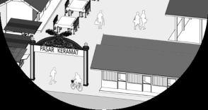
The name of this concept itself simply means “Our Kampung, Datuk Keramat”. Therefore, this concept highly emphasizes on the relationship building of the urban kampung community through various projects and program which consequently they can enhance the overall built environment quality and environmental quality of their urban kampung neighborhood.
Vision: Reconnecting cultural and social meanings of kampung community with their traditional urban kampung neighborhood.
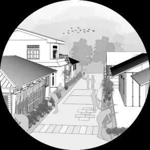
Mission:
• To enhance the quality of everyday life through the regeneration of public realms
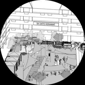


• To integrate kampung lifestyle with sustainability
•
To strengthen the cultural identity and sense of place
59
7.1 Remedial Framework
MISSIONS:
STRATEGIES:
S1 Redefine
Kampung spaces to enhance social cohesion
MIS1 –
To enhance the quality of everyday life through the regeneration of public realms
MIS2 –
To integrate kampung lifestyle with sustainability
MIS3 –
To strengthen the cultural identity and sense of place
S2 Enhance Sustainable Kampung Mobility
S3 Adaptation of Climate Sensitive Design
S4 –Encourage Green Lifestyle
S5 Undertake Urban Design Measures to Increase Imageability
S6 –Encourage mixuse activity and local & traditional business activity
FLAGSHIP PROJECTS:
P1 – Community Connector Street
• P1-A1: Streetscape Improvement
• P1-A2: Mix-use Activity
• P1-A3: Community Hangout Point
• P1-A4: Pasar Keramat Regeneration and Create Keramat Walk
• P1-A5: Urban Design Improvement
P2 Children Friendly Streetscape
• P2-B1: Alley Placemaking
• P2-B2: Safe School Zone & Safe intersections
P3 – Active Green Corridor
• P3-C1: Everyday Park and Weekend Park
• P3-C2: Urban Gardening
P4 –Sustainable Design
• P4-D1: Implement Water Sensitive Urban Design and Rainwater harvesting
• P4-D2: Community Solar Farm
Remedial Proposal: KampungKami
ISSUES::
IP1 – M1 : Traffic congestion
IP1 M2 : Low Walkability
IP2 – S1 : Lack of Public Space for Social Engagement
IP2 S4: Inadequate Provision and Non inclusive Design of Public Facilities
IP3 E1 : Flash Flood
IP3 – E2 : Disruption of water supply
IP4 : Lack Of Identity And Image Quality
Planning and Remedial Report: KampungKami Datuk Keramat 7.0
Datuk Keramat 60
Community Connector Street

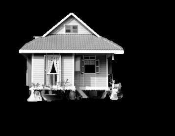

The communityconnector street project seeks toturn the car oriented street into people oriented street which it gives the utmost priority on the people. Therefore, the street in this project is considered as everyday spaces that are flexible andadaptable which can be used by the community for variety of daily activities. One of the distinctive characteristic of an urban kampung is the vibrant lifestyle and interaction of the people in everyday spaces, thus, by this project will provide more spaces for the residents or community to engage, interact, and build a stronger sense of togetherness. Therefore, the components of this project varies which are the improvement of the streetscape, create a mix used activity, create a community hangout point as a social infrastructure, regeneration of Pasar Keramat and urban design improvement to strengthen thetangible identity of the urban kampung, as well as the creation of Keramat walk to showcase the historical value of Kampung Datuk Keramat as a traditional urban kampung.


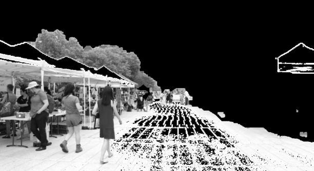
Planning and Remedial Report: KampungKami Datuk Keramat 7.0 Remedial Proposal: KampungKami Datuk Keramat 61
7.2 Project 1:

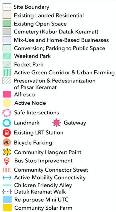


Planning and Remedial Report: KampungKami Datuk Keramat 7.0 Remedial Proposal: KampungKami Datuk Keramat 62 P1 P1-A4: Pasar Keramat Regeneration and Create Keramat Walk P1-A5: Urban Design Improvement PROJECT COMPONENTS N.T.S Figure 7.1: Project 1 Component
7.2.1 P1-A1: STREETSCAPE IMPROVEMENT
The improvement of the streetscape is vital to the overall project of communityconnector street. This project component aims to change the street from the car oriented into pedestrian oriented as well as to redefine the street as a publicplace that provides more opportunity for social activity. Therefore, this component includes the widening of pedestrian walkway by limiting the on street parking,provide exclusive cycling lane and bicycle storage, improvelandscaping, adding inclusive design elements, and change the road pavement with more permeable materials which are flood resilience.
Benefits: Supports sustainable active mobility, more pedestrian friendly, enhance thethermal comforts, a more flexible andadaptable street which responds to urban kampung lifestyle.
Program:
• Cycling Programs:
• Jom! Cycle to School
This program is to encourage the parents to let their preliminary student kids to cycle to school in Kg. Datuk Keramat
• Cycle to Jannah
This program is to encourage the residents who wish to perform Jama’ah maghrib prayers to cycle to the Masjid.
• Community PlantingProgram
This program is to invite the residents to contribute tothe landscapeimprovement along the streets in Kg. Datuk Program.
Strategies:
Redefine kampung spaces to enhance social cohesion
N.T.S

Public Bicycle Storage
Pedestrian and Cycling Network
Cycling storage is provided at public facilities, open spaces and LRT stations.

This is to promote cycling as the preference for mode of mobility among the residents


S1 Enhance sustainable kampung mobility
S2
Issues catered:
IP1 – M1 Traffic congestion


IP1 M2 Low Walkability
IP2 – S1 Lack of Public Space for Social Engagement
IP2 – S4 Inadequate Provision and Non inclusive Design of Public Facilities

IP3 E1 Flash Flood
Stakeholders:
• Local Authority
• Residents
Planning and Remedial Report: KampungKami Datuk Keramat 7.0 Remedial Proposal: KampungKami Datuk Keramat 63
Figure 7.2: Streetscape Improvement Figure 7.3: Bicycle storage Source: Google


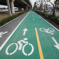



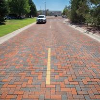
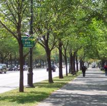
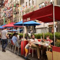
Planning and Remedial Report: KampungKami Datuk Keramat 1 2 3 4 5 6 1 2 ways colored pavement cycling lane 2 Tactile paving for inclusive design 3 Cut ramp for inclusive design 4 Permeable pavement for walkways to increase water infiltration and mitigate flood 5 Permeable pavement for roadways to minimize flood and to become a more pedestrian friendly and flexible for other uses or activities 6 Landscape improvement Masjid Kampong Datok Keramat Before 7 Alfresco street dining 7 Figure 7.4: Streetscape Improvement
7.2.2 P1-A2: MIX-USE ACTIVITY
Mix use activity is significant to ensure the vibrancy of the urban kampung lifestyle as the identity of the urban kampung. The mix use component encourages the resident who wish to start businesses to open home based commercial business such as F&B and retail shop. More importantly, this component also encourage the residents to support thetraditional goods product commercial such as songkok, etc.
Benefits: By allowing home based commercial activities, the residents will have more option for daily needs shopping at short distance, thus it enhances the walkability. The mix use component also takes place at the street level where the street is a public space that can be used for other activities which responds tothe everyday activities. Thus, it also comes with thetimely based traffic management that can reduce thetraffic congestion.
Program:
• Traffic Management:
• Morning
• Afternoon
• Night
• Occasional Program
• Car free day every Sunday morning
• Friday prayer bazaar
• Ramadhan bazaar
• Muslim Community Gathering at the mosque
Strategies:
N.T.S

Figure 7.5: Mix use activity
Mix-use activities
Alfresco dining
Re purpose of Mini UTC for public facilities:
Mini-UTC For: Community library Community healthcare
Figure 7.6: Community Library

Source: Google
Redefine kampung spaces to enhance social cohesion S1 Enhance sustainable kampung mobility
S2
S6 Encourage mix use activity and local & traditional business activity
Issues catered:
IP1 – M1 Traffic congestion
IP1 M2 Low Walkability
IP2 – S1 Lack of Public Space for Social Engagement
IP2 S4 Inadequate Provision and Non inclusive Design of Public Facilities
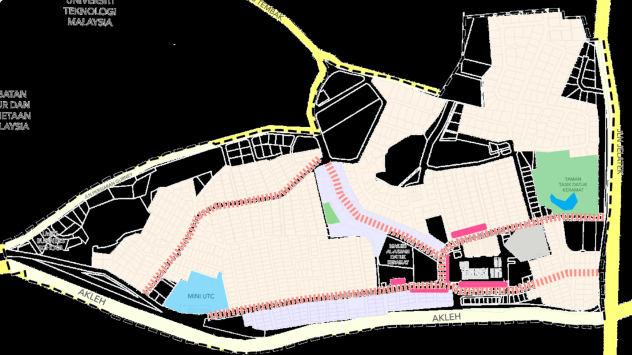
IP4 Lack Of Identity And Image Quality
Stakeholders:
• Local Authority
• Residents
• Street vendors Benchmark:
• Sungmisan Urban Village, South Korea
KampungKami Datuk Keramat
Planning and Remedial Report: KampungKami Datuk Keramat 7.0 Remedial Proposal:
65
A. Timely Based Mix-Use Activities
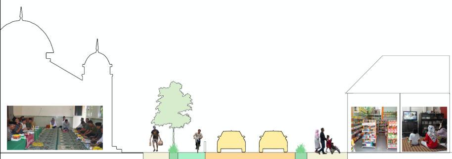

a. MorningMarket
In the morning before the morning urban commute andaround Fajr prayer (before 8 AM), one lane of the driveway of the street around Pasar Keramat can be used for morning market where the residents (after jamaah prayer for Fajr) can shop for fresh grocery products as well as for breakfast.
b. Afternoon Time
One of the worst traffic congestion time in Kg. Datuk Keramat is at 12 in the afternoon lunch time. Therefore, thetraffic operations for such normal hours is managed for 2 lanes driveways with no any street activities to avoid the worsen congestions of thetraffic.
c. Night-time
Meanwhile, at night, the community connector street can be used for street commercial activitiesand/or extend the alfresco dining (on the walkway) on to one lane of the driveways. Hence, more people can enjoy the vibrant night activities of the urban kampung area. The closure of one lane for this activity shall be after 8 PM in the evening, this is also to avoid traffic congestions.
Mosque Fajr Activities
Alfresco dining area and walkway Morning Market

Community gathering at the mosque
The kampung house can be used for home based F&B businesses
The kampung house can also based retail
Night street dining
Planning and Remedial Report: KampungKami Datuk Keramat 7.0 Remedial Proposal: KampungKami Datuk Keramat 66
Figure 7.7: Mix use activity
A. Occasional Mix-use Activities
a. Friday Prayer Bazaar and Ramadhan bazaar
Friday bazaar and Ramadhan bazaar is common to find in Malaysia. The communityconnector street will enhance the experience of the bazaar by creating a more comfortable and pedestrian friendly streetscape. In this program, one lane of the driveway is to be closed for bazaar spaces.

b. Car Free Days
in every Sunday morning, car free day program is held to promote a healthy lifestyle of the residents of Kg. Datuk Keramat. This program requires the totaltemporal closure of some roadways around the central node of Kg. Datuk Keramat. Therefore, the community will have the full ability to use the outdoor streetspaces for various type of activities such as public groupgymnastics, Zumba, sport, playing zone for the kids, etc. Other thanthat,there also will be a bazaar along the street and the walkwayswhich consist of variety of commercial uses. In addition, the public space of Masjid area (to be elaborated in project 3) can be used for commercial activitiesas well such as thrift bazaar, foods and beverages, and others.
Friday prayer or Tarawih prayer Bazaar
Encourage traditional product businesses such as the well known Kedai songkok in Kg. Datuk Keramat
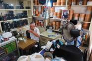
Bazaar in masjid public space area
Car free days activities on the roadways Bazaar
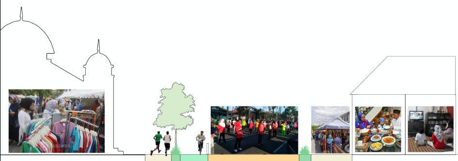
Planning and Remedial Report: KampungKami Datuk Keramat 7.0 Remedial Proposal: KampungKami Datuk Keramat 67
Resident’s house
Figure 7.8: Mix use activity
7.2.3 P1-A3: COMMUNITY HANGOUT POINT
The community hangout point is a social infrastructure to beprovided at some of the alleys entrance (Lorong) in Kg. Datuk Keramat. The infrastructure provided is a small gazebo which the structure reflects the Malay identity of thetraditional urban kampung, hence, it will also enhance the imageability of the urban kampung. This social infrastructureis to be located on the walkways that are identified as wide enough, hence, the size of the gazebo varies depending on the space availability (Figure 7.9, shows the illustration).
Benefits: This community hangout pointprovides more spaces for the interactions between the residents. Other thanthat,this component also serves for community watch program which can increase the sense of togetherness and belongingbetween the residents as well as enhance the safety of the urban kampung.
Program:
• Neighborhood Watch
The neighborhood watch program is to remind the residents as a community that they also have the responsibility to keep their neighborhood safe. Thus, it requires the community participation and coordination with the policedepartment.

N.T.S

Figure 7.9: Community Hangout Point
Strategies:
S1
Redefine kampung spaces to enhance social cohesion
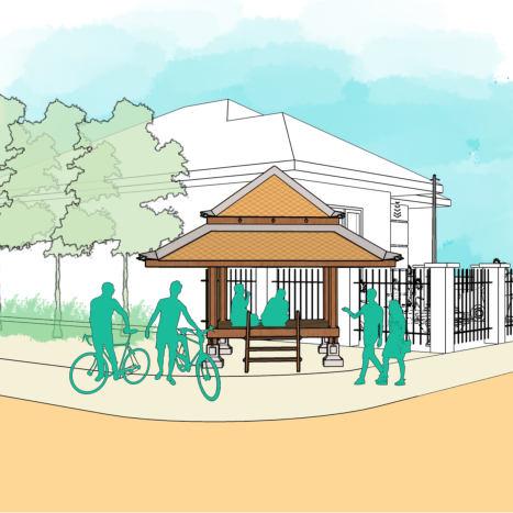
S5
Undertake urban design measures to increase imageability
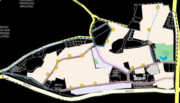
Issues catered:
IP2 – S1 Lack of Public Space for Social Engagement
IP4 Lack Of Identity And Image Quality
Stakeholders:
• Local Authority
• Residents
• Police department
Community Hangout point
Figure 7.10: Community Hangout Point
Planning and Remedial Report: KampungKami Datuk Keramat 7.0 Remedial Proposal: KampungKami Datuk Keramat
68
7.2.4 P1-A4: PASAR KERAMAT REGENERATION AND CREATE KERAMAT WALK
A. Pasar Keramat Regeneration
Pasar Keramat is the core landmark and identity of Kampung Datuk Keramat. However, the currentcondition of the Pasar Keramat is poor, not visually pleasing and the appearance is not easily noticeable. Hence, this component aims to regenerate the Pasar Keramat through pedestrianization,placemaking, create a gateway at the entrance and re build with a more traditional look of architectural design.
Benefits: Enhance the aesthetic value, reduce congestions and enhance the functionality that cancreate more spaces for commercial activitiesand public interactions.
B. Keramat Walk
Keramat walk is a historical trail which tells the legend and history of Kampung Datuk Keramat. The Keramat walkwill start from the entrance of the Pasar Keramat, therein, it will make a connection between Pasar Keramat and KuburKeramat. However, the direction signage is also provided at the LRT Dato’ Keramat for the visitors. The infrastructure provided will be an information board which contains texts, interactive illustrations andalso QR code for online versions. This will increase the historical identity value of Kg. Datuk Keramat.
Strategies:
S1

Redefine kampung spaces to enhance social cohesion
S5
Undertake urban design measures to increase imageability
Issues catered:
IP1 – M1 Traffic congestion
IP1 – M2 Low Walkability

IP2 – S1 Lack of Public Space for Social Engagement
IP4 Lack Of Identity And Image Quality
Stakeholders:
KUBUR KERAMAT
• Local Authority
code for online version

PASAR KERAMAT
LRT DATO KERAMAT
Example in Makam Hang Tuah, Malacca
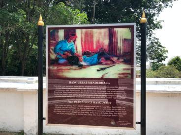
Pasar Keramat Regeneration
Keramat WalkN.T.S
Planning and Remedial Report: KampungKami Datuk Keramat 7.0 Remedial Proposal: KampungKami Datuk Keramat 69
QR
Figure 7.11:: Pasar Keramat Regeneration Figure 7.12: Hang Tuah History
Full pedestrian area through placemaking, this is also to reduce the traffic congestion in the area of Pasar Keramat.

Regenerate the architecture of Pasar Keramat which can represent the Malay culture.
Create a gateway to enhance the visibility and preserve the view of Pasar Keramat
Google
Example of Pasar gateway at Pasar Klewer, Surakarta, Indonesia
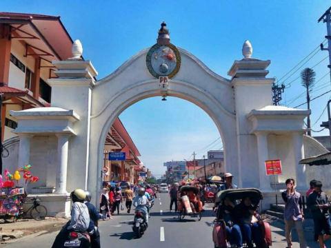
Example of architectural design for Pasar Keramat that reflects the cultural identity of a Malay traditional village

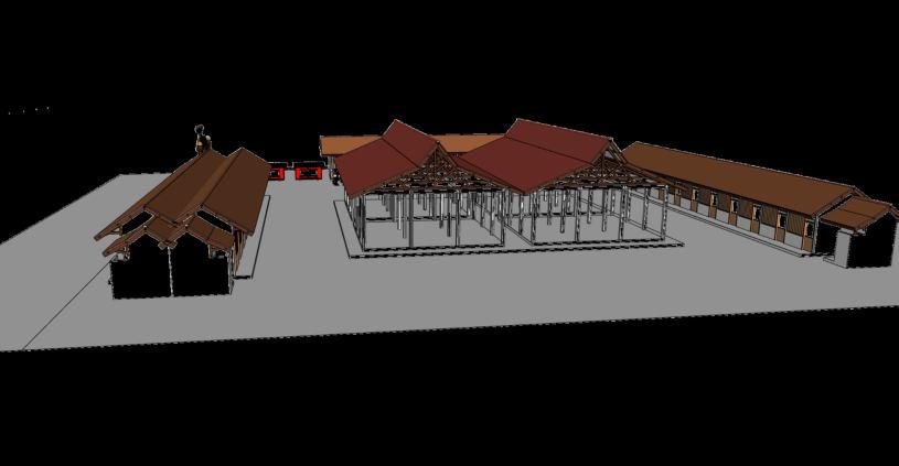
70
Before Figure 7.13: Pasar Keramat Regeneration Source:
Improving to enhance Keramat. Although, of However, urban enhance urban can urban and
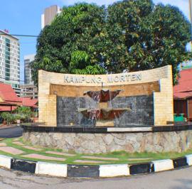
This component includes:
• Create three gateways at the site entrance points with traditional design that reflects the cultural identity.
• Create a landmark at the designated location
• Use thetraditional elements for the design of street furniture such as street lighting.
• Add traditional elements tothe existing bus stops as well as improving the bus stop facilities
Landmark Bus stop improvement Gateways
Undertake urban design measures to increase imageability
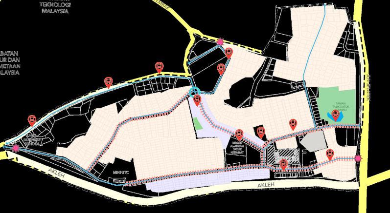
Issues catered:
Lack Of Identity And Image Quality
Stakeholders: Local Authority
Example of landmark in Kampung Morten, Malacca
Figure 7.15: Kampung Morten Source: Google
Figure 7.14: Urban Design Improvement


Planning and Remedial Report: KampungKami Datuk Keramat 7.0 Remedial Proposal: KampungKami Datuk Keramat 71 7.2.5 P1
Create gateways to each of the entrance points to Kg. Datuk Keramat, which can reflect the Malay traditional village.
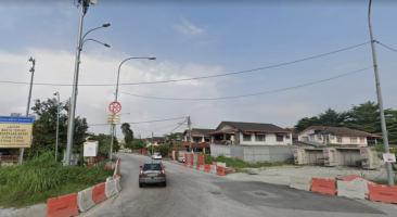
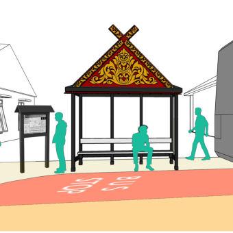


Add traditional elements to the design of all the bus stops. improve the facilities, provide information board which contains the bus information and schedule as well as brief story of Kg. Datuk Keramat and the map of Kg. Datuk Keramat
Example of traditional bus stop design in Malacca

Before
Add traditional elements to the design of the street furniture such as street lighting.
Example of Putrajaya.

Planning and Remedial Report: KampungKami Datuk Keramat 7.0 Remedial Proposal:
KampungKami Datuk Keramat
72
Jalan Datuk Keramat
Figure 7.16: Urban Design Improvement
Project 2: Children Friendly Streetscape



The children friendly streetscape project aims to create everyday spaces in Kg Datuk Keramat that is friendlyfor the children age group. The safety of the children is to beprioritized in the planning of Kampung Datuk Keramat.A neighborhood that is safe for children, itis also safe for other age groups of the population, hence, children friendly streetscape means a everyone friendly streetscape. Other thanthat,this project also recognized the children as individuals who love to engage more with others throughthe fun playing activities. Therefore, this project also emphasizes on bringing the children back to play on the street. In doing so, the street activities (especially on the alleys) will be richer and more vibrant which evenenhance the kampung lifestyle of the neighborhood Therefore, to achieve those,this project comprises of two (2) components which are the alley placemaking to make everyday spaces more interesting for the children, and a safe zone and safe intersections to minimize the road crashes in the urban kampung area.

Planning and Remedial Report: KampungKami Datuk Keramat 7.0 Remedial Proposal: KampungKami Datuk Keramat 73
7.3
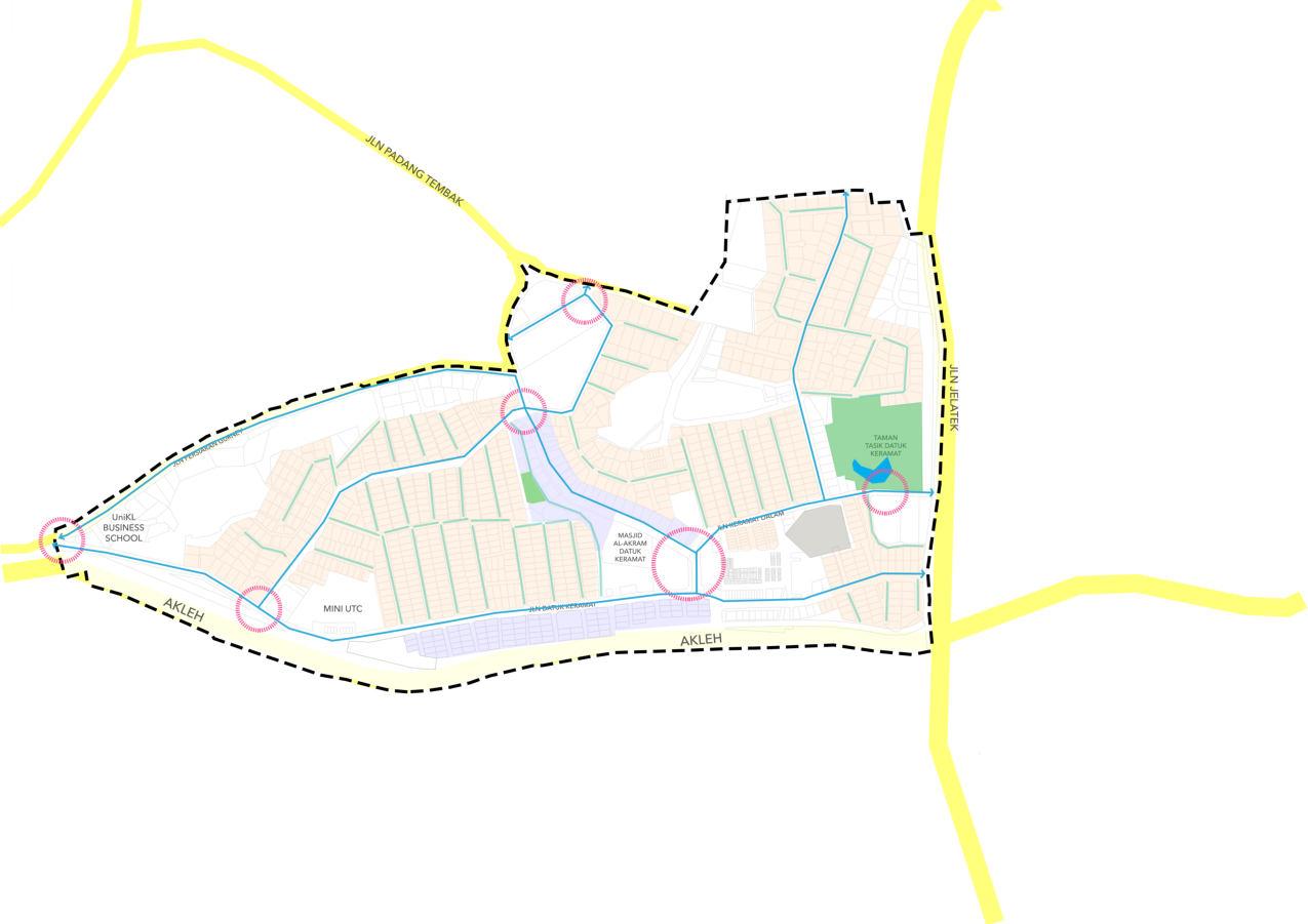


Planning and Remedial Report: KampungKami Datuk Keramat 7.0 Remedial Proposal: KampungKami Datuk Keramat 74 N.T.S P2-B2: Safe School Zone & Safe intersections Figure 7.17: Children Friendly Streetscape
7.3.1 P2-B1: ALLEY PLACEMAKING
The vibrant life on the street is the important indicator to differ the life of an urban kampung with the life of modern residential urban area. Therefore, this project component seeks to bringback the kids to play at alleys of their houses throughthe implementation of placemaking. The component includes the creation playground markinggames and utilization permeablepavement that is more pedestrian friendly (compared to conventional asphalt),
Benefits: The placemaking of alleys in urban kampung area will givemore opportunities for the children as well as the other age groups to engage with their neighbors. This will create the image of vibrant urban kampung lifestyle

PlacemakingProgram
placemaking and community program, the community will have to engage and create a togetherness in improving their competition
Strategies:
Redefine kampung spaces to enhance social cohesion
S1 Enhance sustainable kampung mobilityS2
S5
Undertake urban design measures to increase imageability
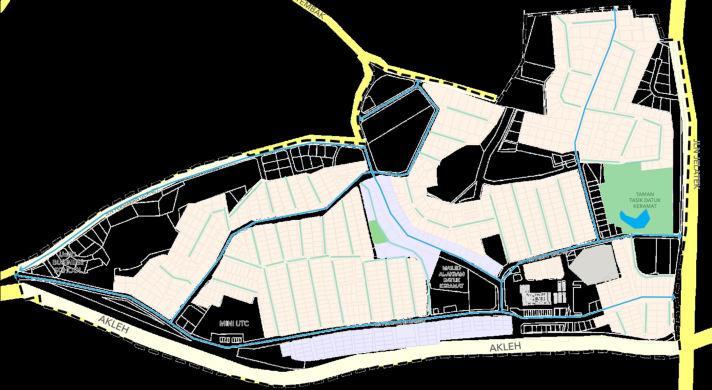
Issues catered:
IP1 M2 Low Walkability
IP2 – S1 Lack of Public Space for Social Engagement
IP4 Lack Of Identity And Image Quality
Stakeholders:
Children
Friendly Alley
N.T.S

• Local Authority
• Residents
• Paint and coating companies
Benchmark:
• Kampung Sunter Jaya, Indonesia
• Kampung Pelangi, Indonesia
Community Participation in placemaking program
Figure 7.18: Kg. Sunter Jaya Placemaking

Source: ITDP
Figure 7.19: Alley Placemaking
Planning and Remedial Report: KampungKami Datuk Keramat 7.0 Remedial Proposal: KampungKami Datuk Keramat 75
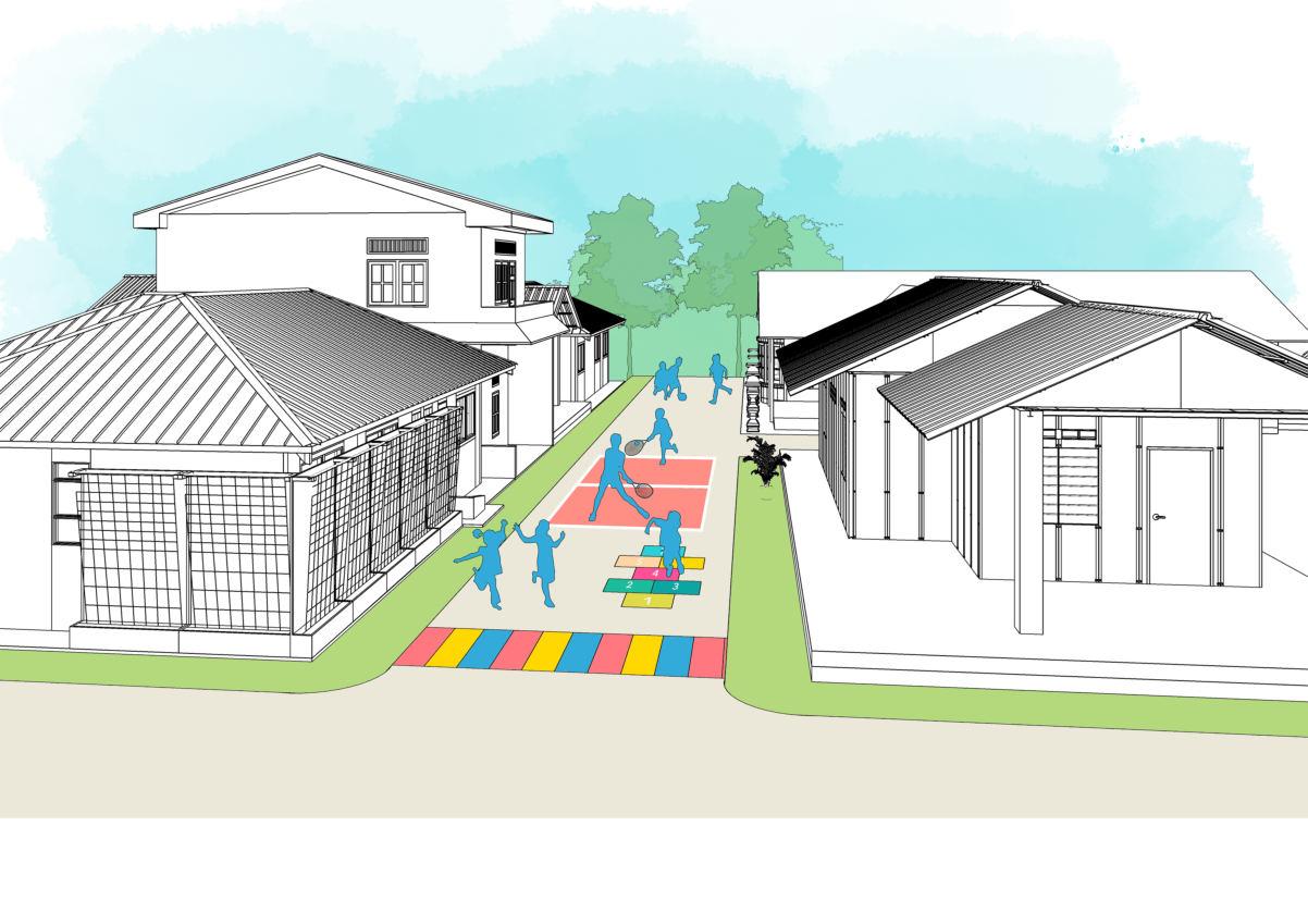


Planning and Remedial Report: KampungKami Datuk Keramat 7.0 Remedial Proposal: KampungKami Datuk Keramat 76 2 Permeable pavement for all alleys to increase water infiltration and mitigate flood 2 1 1 Playground marking games, where the children can play outdoor safely with their friends Before Figure 7.20: Alley Placemaking
P2-B2: SAFE SCHOOL ZONE & SAFE INTERSECTIONS
This project component aims to create a children friendly school zone and intersections throughthe implementation of placemaking. The school zone in Kampung Datuk Keramat should be a safe environment for the children or students to be around. Therefore, the street road marking with school areaand the creation of creative pedestrian intersections are implemented to warn the more carefully andaware of the surroundings walkways around the school area is to be enhanced playful walkway for a vibrant activityas well the wall fence of the schools complement quality of the streetscape
Benefits:a safeschool zone and safe intersections the level of walkability in Kg. Datuk Keramat attractive street public space which can enhance of the urban kampung.
Program:
• Community Placemaking
Safe School Zone road marking
Playful walkway placemaking Mural artwork painting Creative intersection painting
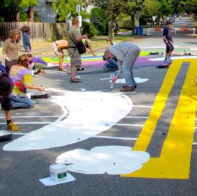
Strategies:
S1
Redefine kampung spaces to enhance social cohesion
S2
Enhance sustainable kampung mobility
S5
Undertake urban design measures to increase imageability

Issues catered:
IP1 M2 Low Walkability
IP2 – S1 Lack of Public Space for Social Engagement
IP4 Lack Of Identity And Image Quality
Stakeholders:
Safe School Zone & Safe Intersections
N.T.S

Community Participation in placemaking program
Figure 7.21: Placemaking

Source: Google
Figure 7.22: Safe School Zone and Intersections
• Local Authority
• Residents
• Paint and coating companies
• School students
• Street artists Benchmark:
• Kampung Sunter Jaya, Indonesia
• Kampung Pelangi, Indonesia
Planning and Remedial Report: KampungKami Datuk Keramat 7.0 Remedial Proposal: KampungKami Datuk Keramat 77
artwork on the school’s wall fence which

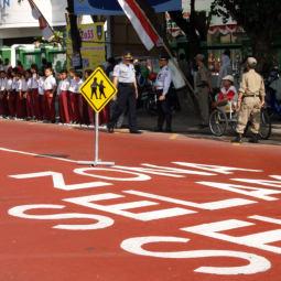
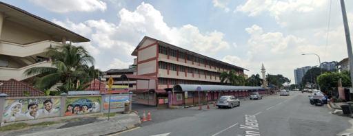
showcase the traditional culture
Umbrella to protect pedestrian (users) against rain or harmful sunlight at the intersections. (Example
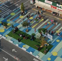
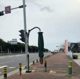

Jeju island, S.

Planning and Remedial Report: KampungKami Datuk Keramat 7.0 Remedial Proposal: KampungKami Datuk Keramat 78 Patio
in
Korea) Mural
can
1 Safe school zone which implements road color marking to slow vehicle’s speed. (Example in Indonesia) 1 2 Playful Pedestrian Walkway 2 3 3 Creative and safe pedestrian crossing 4 4 5 5 Before SK DATO KERAMAT Figure 7.23: Safe School Zone and Intersections
7.4 Project 3: Active Green Corridor


The active green corridor project aims to create more green spaces and elements in the urban kampung that is not only visually pleasingbut also inviting for healthier community activities. Hence, this project also seeks to integrate the vibrant and traditional kampung lifestyle with green lifestyle whichwill help to create a much healthier environment. Other than that,this project also encourages the residents to produce their own local foods whichwill make the community to become more self sustain. Furthermore, in the process they will also have better engagement throughthe variety of green activities. Therefore, this project has 2 components which are the creation of everyday space by turning vacant land and parking area into public spaces as well as the creation of weekend spaces in the school yard facilities, and lastly,itis the provision of urban street gardening and urban farmingfacilitiesfor the local food production activities.


Planning and Remedial Report: KampungKami Datuk Keramat 7.0 Remedial Proposal: KampungKami Datuk Keramat 79
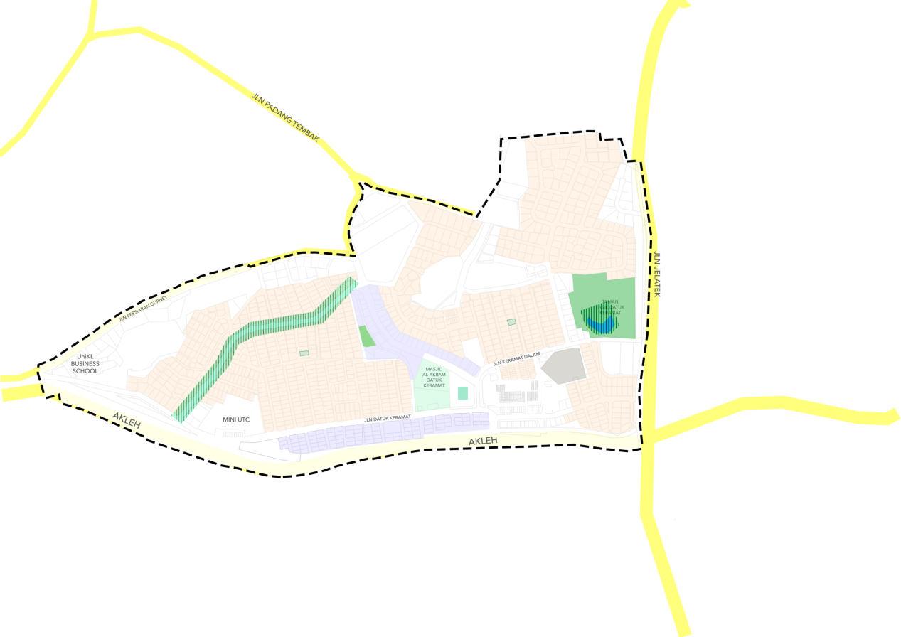


Planning and Remedial Report: KampungKami Datuk Keramat 7.0 Remedial Proposal: KampungKami Datuk Keramat 80 PROJECT COMPONENTS N.T.S P3-C1: Public Park and Weekend Park Figure 7.24: Active Green Corridor
7.4.1 P3-C1: EVERYDAY PARK AND WEEKEND PARK
A. Everyday Park
The provision of everyday park as a component of active green corridor project seeks to create green areas of publicpark which has the flexibility in use, and it can accommodate variety of human activities by also making it more creative and interesting. Thus, everyday park is proposed on available vacant land as well as on a surface parking area (Masjid Dato Keramat and the adjacent commercial area) hence it requires conversion and limit the number of parking lots.
B. Weekend Park
Similarly, weekend park also serves the main function as the everyday park to complement the overall project of active green corridor. However, the name of “Weekend” itself means; this park is onlyopen for publicduring the weekend only because this proposedpark is the use of the school’s yard and parking area (requires conversion and limitation) for publicpark during the weekend. Therefore, it can provide more spaces such as during the car free dayprogram (as elaborated in project P1-A2: Mix use Activity).
Benefits: The provision of everyday park and weekend park will enhance the active mobility by creating a more interesting destination which can attracts people to come. The unique features of the park will give anaesthetic image tothe urban kampung. Nevertheless, it provides more public space for community engagement.
Everyday park
N.T.S

Parking space for everyday park
Weekend Park
School ground and park are open for community during the weekend which allow more spaces for community activities in the urban kampung
Strategies:
Redefine kampung spaces to enhance social cohesion S1
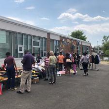
Enhance sustainable kampung mobilityS2
S5
Undertake urban design measures to increase imageability
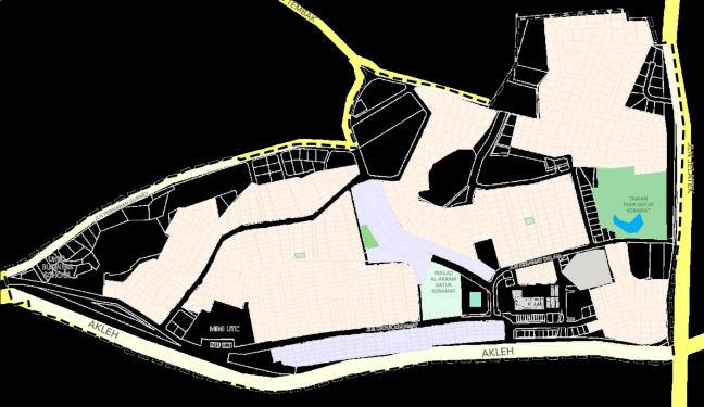
Issues catered:
IP1
– M2 Low Walkability
IP2 – S1 Lack of Public Space for Social Engagement
IP4 Lack Of Identity And Image Quality
Stakeholders:
• Local Authority
• Residents
Figure 7.26: Weekend park
Source: Google
Figure 7.25: Everyday Park
Park
Planning and Remedial Report: KampungKami Datuk Keramat 7.0 Remedial Proposal: KampungKami Datuk Keramat 81
and Weekend
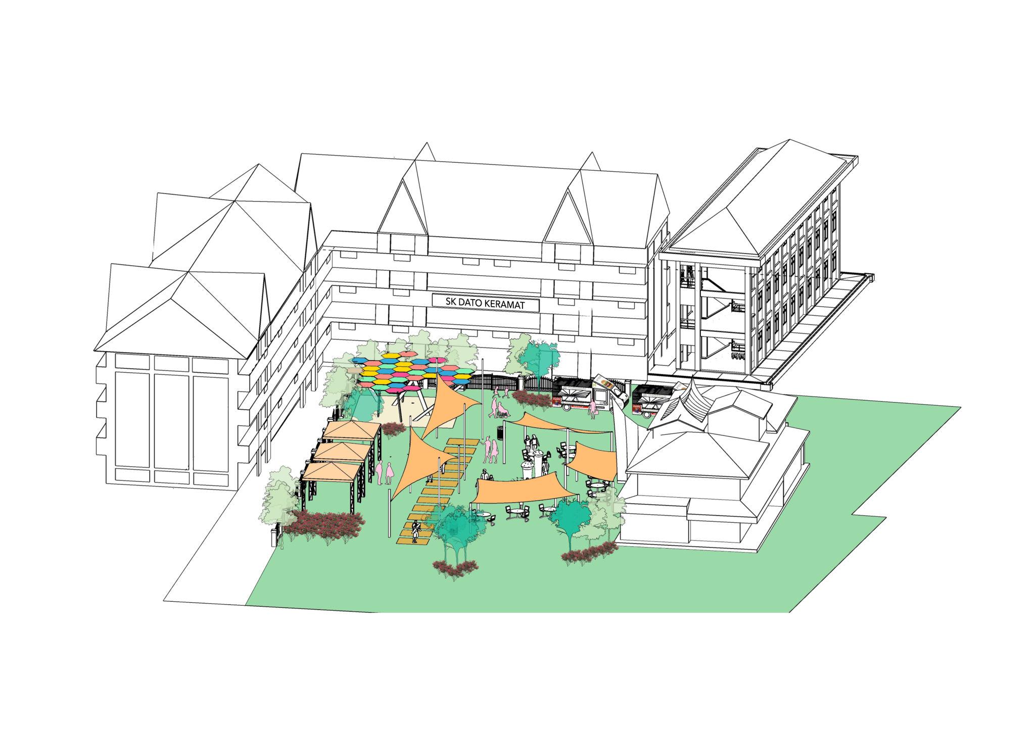
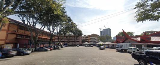


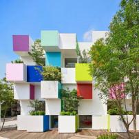
Interesting features1 Variety of activities2 1 2 2 2 Green features3 3 3 Before Figure 7.27: Everyday Park and Weekend Park
7.4.2 P3-C2: URBAN GARDENING
The urban gardening project component aims to create a resilient and healthy environment of Kampung Datuk Keramat throughthe urban gardening as well as relationship building. There are 3 categories of urban gardening in this component:

1. Urban farmingfor local food production at TamanTasik Datuk Keramat
2. Urban gardening corridor along Jalan Keramat
3. Alley gardening for all landed residential area
Benefits: This project component will encourage a greener lifestyle of the community, hence, consequently, it will make a more self sustain neighborhood and strong relationship between the residents.
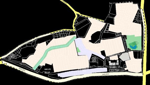
Program:
• Weekend Farming Program
This program is to invite all the residents to participate in the shared urban farming which cancreate a more self sustain community by having their own local food production
• Lorong Greening Program
This program is to invite all the resident to landscape and/or back
• Community
This program contribute along the
Active Green Corridor
Strategies:
S1
Redefine kampung spaces to enhance social cohesion
S4 Encourage green lifestyle
Issues catered:
IP2 – S1 Lack of Public Space for Social Engagement
Stakeholders:
• Local Authority
• Residents
Benchmark:
• Kampung Sunter jaya, Indonesia
N.T.S

1 2
Taman Tasik Datuk Keramat Urban Farming
1 2
Jalan Keramat Street Gardening
Planning and Remedial Report: KampungKami Datuk Keramat 7.0 Remedial Proposal: KampungKami Datuk Keramat 83
Figure 7.28: Urban Gardening
greening
example of Kampung Sunter Jaya, Indonesia
Urban farming at Taman Tasik Datuk Keramat which optimize the advantage of the water feature
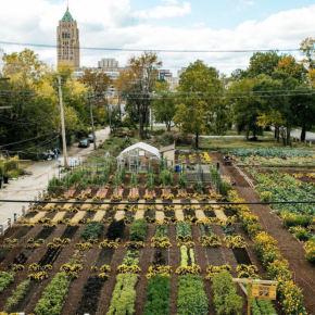
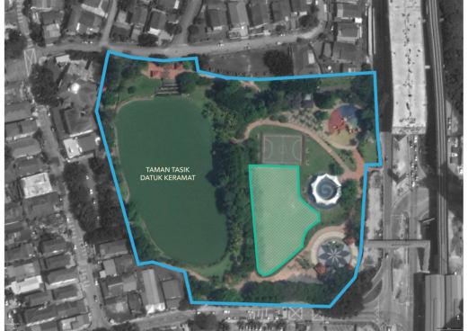
gardening along Jalan Keramat to even enhance the vibrancy of street activities
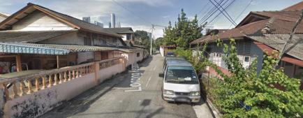

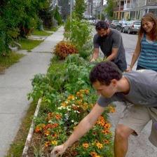
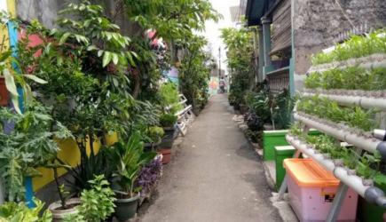
An example of Burlington, USA

Planning and Remedial Report: KampungKami Datuk Keramat 84
1 Street
2 1 2 Lorong
program, An
3 3 Before Figure 7.29: Urban Gardening
7.5 Project 4: Sustainable Design

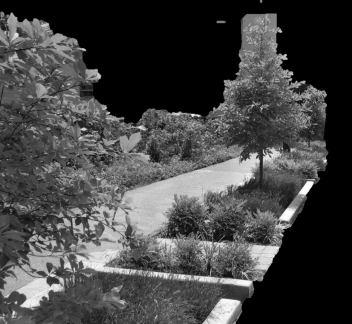
The sustainable designproject aims to create an urban kampung that is responsive tothe global issue of climatechange as well as the local environmental issue such as the flood. This project will also help to enhance the overall environmental quality of Kampung Datuk Keramat. Therefore, there area two (2) components of this project, which are the implementation of water sensitive urban design elements to minimize the flood occurrence and itsimpacts, as well as the establishment of community solar farm to create a self sustain urban kampung community. More importantly,in the n process of implementing thetwo components, the participatory of the urban kampung residents is highly requires, and consequently, the residents can establish a stronger community relationship as well as the sense of togetherness.
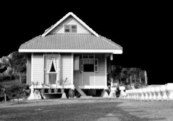
Planning and Remedial Report: KampungKami Datuk Keramat 7.0 Remedial Proposal: KampungKami Datuk Keramat 85
7.5.1 P4-D1: IMPLEMENT WATER SENSITIVE URBAN DESIGN AND RAINWATER HARVESTING
Strategies:
The phenomenon of flashflood has posed a significant threattothe sustainability of Kg, Datuk Keramat. The poor and outdated drainage and irrigation system in urban kampung isidentified to be the main factor to the flashflood occurrence and disruption of water supply. The increasing rainfall due tothe climatechange exacerbated this issue. Therefore, the conventional drainage system is considered not sustainable and shall not be reliable. Therefore, the approach of water sensitive urban design (WSUD) is to be implementedin the urban kampung asan alternative option for the road drainage system. Other thanthat, rainwater harvesting is encouraged to be implemented by each families of landed houses in Kg. Datuk Keramat for a more sustainable living of the community.
Benefits: The green infrastructure of WSUD will enhance the water infiltrationin Kg, Datuk Keramat to minimize the flood occurrence. Moreover, the implementation of water sensitive urban design aims to re create the natural water cycle in urban area, by integrating with the rainwater harvesting system, it will create a sustainable water cycle by taking advantage of the rainwater and re using the wastewater for other uses.
Program:
• Home Rainwater Harvesting Program
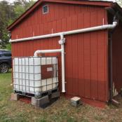
This program is to encourage all the households of landed houses in Kg. Datuk Keramat to install rainwater harvesting system in their own houses.
S1
Redefine kampung spaces to enhance social cohesion
S3 Adaptation of climate sensitive design
S4 Encourage green lifestyle
N.T.S

Figure 7.30: WSUD and rainwater harvesting
The elements of water sensitive urban design is mainly provided along the main road drainage system
:Rainwater harvesting location
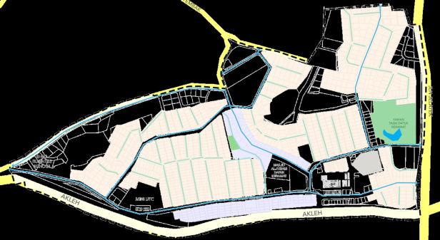
Each of the landed houses in Kg. Datuk Keramat
Figure 7.31: House rainwater harvesting
Source: Google
IP3 E1 Flash Flood
IP3 – E2 Disruption of water supply
Issues catered: Stakeholders:
• Local Authority
• Residents
Planning and Remedial Report: KampungKami Datuk Keramat 7.0 Remedial Proposal: KampungKami Datuk Keramat
86
How rain garden works:
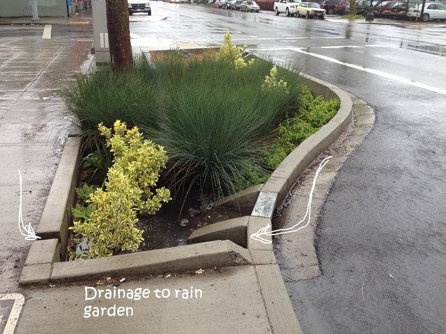
7.32:
Google
Water sensitive urban design element to bee implemented along the road drainage system:
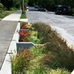
Rain garden to contain and infiltrate rainwater
Rill to channel the rainwater (alternative for the conventional drainage channel system
Rain Garden Rill
House rainwater harvesting:
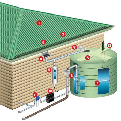

Rainwater on the surface
Gutter protection screening to keep large debris from entering the gutters
Gutter to collect rainwater
Rain head allows a bit of self cleaning filtration options
First flush diverter to prevent contaminated rainwater from entering the tank
Tank screen to keep mosquitoes and pests out
Rainwater tanks
Insect proof flap valve (Same as tank screen)
Auto fill system to always keep a minimum amount of water in the tank
Pump system to distribute the rainwater to irrigation system
Irrigation filter to catch any large debris
level indicator to monitor the usafge from the tank
Figure 7.33:
Google
rainwater harvesting
Planning and Remedial Report: KampungKami Datuk Keramat 7.0 Remedial Proposal: KampungKami Datuk Keramat 87
•
•
1.
2.
3.
4.
5.
6.
7.
8.
9.
10.
11.
12.Water
Figure
WSUD raingarden Source:
House
Source:
7.5.2 P4-D2: COMMUNITY SOLAR FARM
As an urban kampung locatedin the urbanized area of Kuala Lumpur, the development of the urban kampung should be align with the goals of sustainability. This project component aims toturnthe urban kampung community in Kg. Datuk Keramat into a more sustainable lifestyle of the community. Therefore, the community solar farm is to beproposed at the designated area of the vacant land which is on the highest topographical levelin the site area. This community solar farm provides a more sustainable option for the urban kampung energy, in which the implementation of this project requires full participation of all the residents in Kg. Datuk Keramat.
Benefits: The community solar farm does not only have benefits in terms of energy sustainability, but this program that requires the resident's participation will also provide more opportunities for community engagement. Hence, this program will empower the community of Kg. Datuk Keramat.
Program:
• Community Solar Farming Program

Creating a committee to manage the program and to ensure the equal participation of all residents in the implementation of sustainablesolar energy in their urban kampung of Datuk Keramat.
Strategies:
S1
Redefine kampung spaces to enhance social cohesion
S3 Adaptation of climate sensitive design
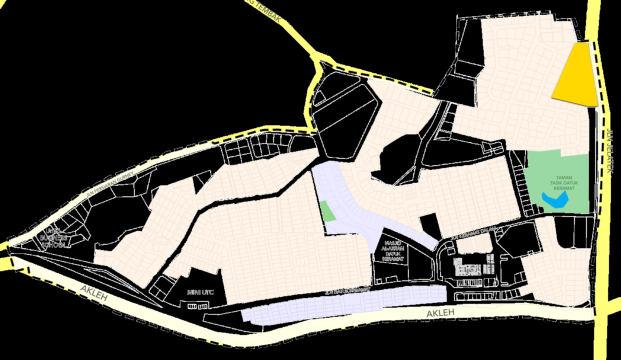
S4 Encourage green lifestyle
Issues catered:
IP2 S1 Lack of Public Space for Social Engagement
Stakeholders:
• Local Authority
• Residents
Community Solar Farm
N.T.S

Figure
Google
Planning and Remedial Report: KampungKami Datuk Keramat 7.0 Remedial Proposal: KampungKami Datuk Keramat 88
Figure 7.34: Community Solar Farm
7.35: Solar farm Source:
The selected area is located on a vacant land at the highest topographical level point in the area of Kg. Datuk Keramat
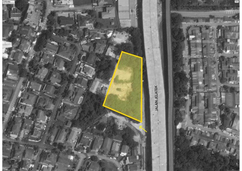
Example of South Carolina Community

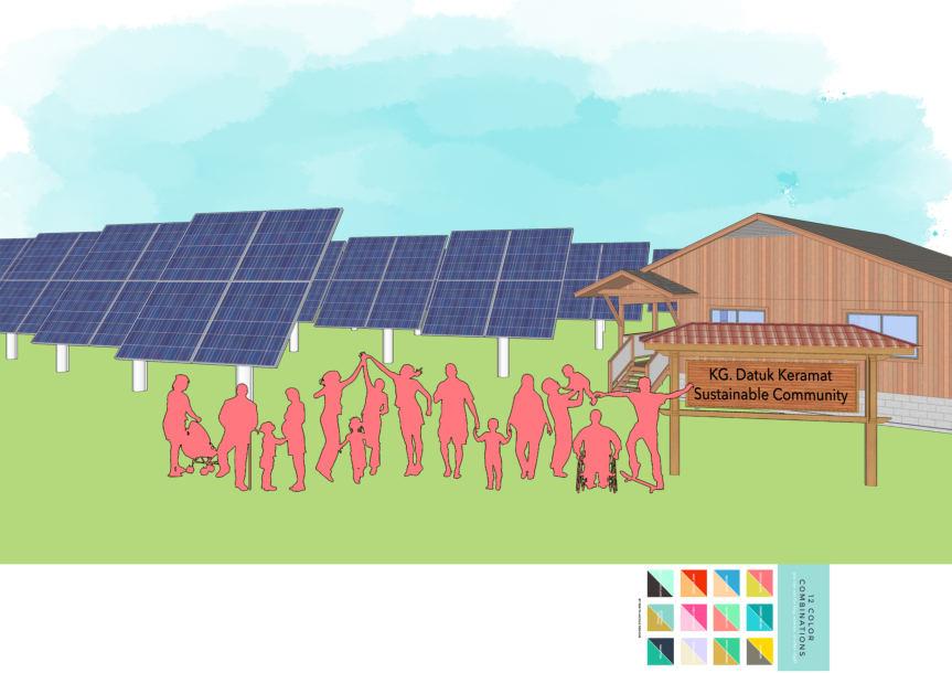
Planning and Remedial Report: KampungKami Datuk Keramat 7.0 Remedial Proposal: KampungKami Datuk Keramat 89
Figure 7.36: Community Solar Farm
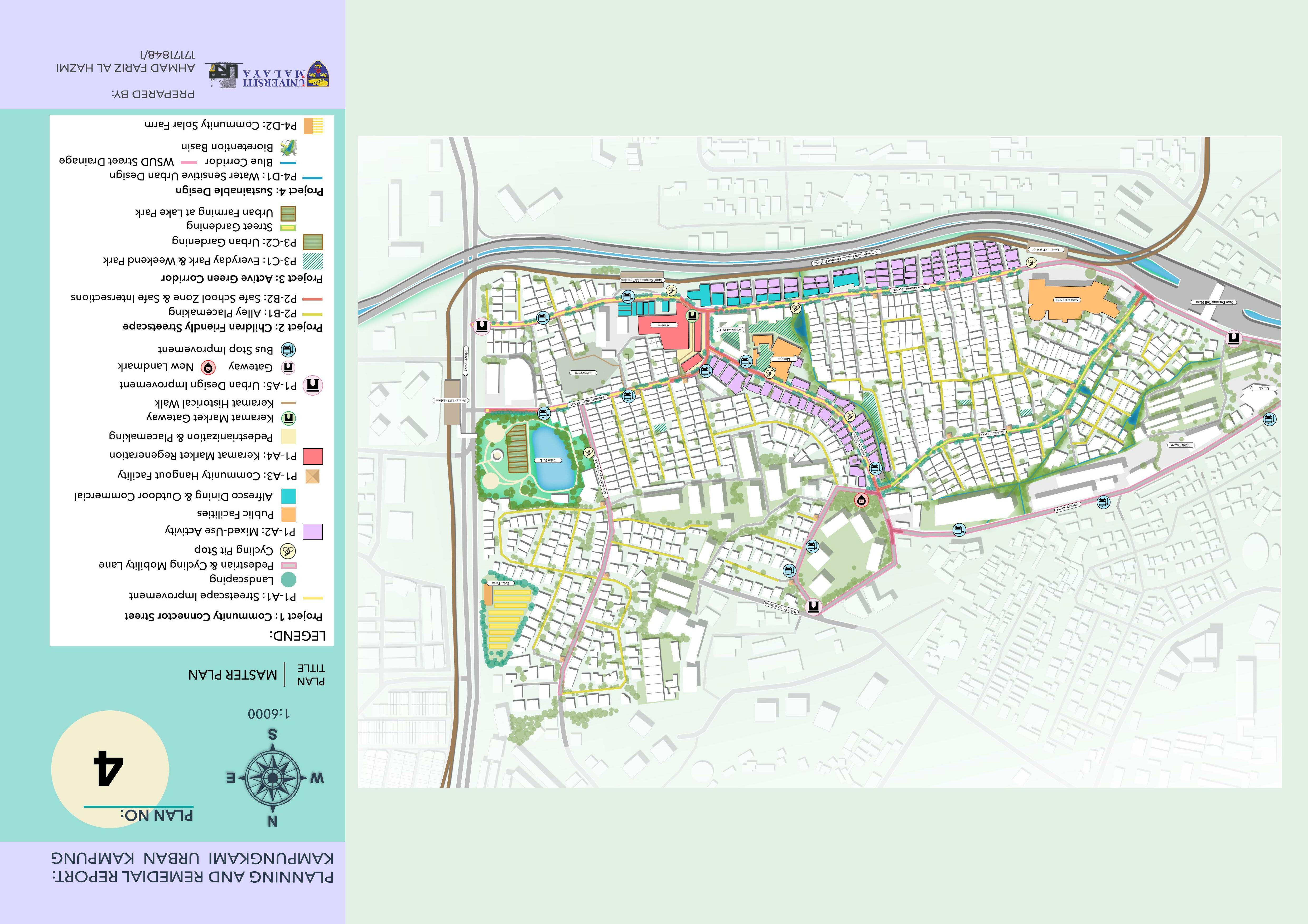
7.6 Remedial Evaluation Analysis
SWOT ANALYSIS
SWOT Project 1: Community Connector Street
• Improve the overall streetscape to be more flexible and adaptable for the rich activities of urban kampung community lifestyle
Project 2: Children Friendly Streetscape
• Create an urban kampung that highly prioritize on the safety of the children
Project 3: Active Green Corridor Project 4: Sustainable Design
STRENGTHS
• Tangible distinctive features of a traditional urban kampung through the urban design improvement
• Inclusive and comfortable outdoor environment
• Children friendly neighborhood means it is also safe for other age groups
• Create a more vibrant and interesting landscape
• Create an urban kampung community that practice green lifestyle
• Fully optimize the available spaces for green areas and for more uses
• Self resilient community
• A sustainable energy
• Reduce pollution and mitigate flood
• High environmental quality
• Create an Urban kampung community that contribute to combat climate change
WEAKNESSES
• Due to the narrow width of the road, the street design improvement might differ according to the actual condition of the current streetscape
• The changing trend to the digital videogames among the children, outdoor playing games might not significantly interest many children.
• The difficulty in the conversion process of the parking areas into public park which requires legal requirement
• Solar energy requires high capital cost for implementation
• The location of the proposed solar farm is at the edge of the site area and only accessible from Jalan Jelatek, hence it restricts the accessibility
OPPORTUNITIES
• The community relationship building will empower and inspire them to further enhance the overall quality of their urban kampung area
• Distinctive identity will enhance the sense of place
• Community pride
THREATS
• The Children activities on the street/outdoor will create a livelier urban kampung atmosphere
• The provision of more green public areas will improve the environmental quality as well as the social cohesion
• Kampung Datuk Keramat that is free from flood occurrence
• High reliability on community participation, if the community is not willing to play their role, the project will not show meaningful impacts.
Planning and Remedial Report: KampungKami Datuk Keramat 7.0 Remedial Proposal: KampungKami Datuk Keramat 91
Table 7.1: Remedial SWOT Analysis 7.6.1
7.6.2 LOGICAL FRAMEWORK MATRIX
INPUTS/PROJECTS:
P1 Community Connector Street
P1-A1: Streetscape Improvement
P1-A2: Mix use Activity
P1-A3: Community Hangout Point
P1-A4: Pasar Keramat
Regeneration and Create Keramat Walk
P1-A5: Urban Design Improvement
P2 – Children Friendly Streetscape
`
P2-B1: Alley Placemaking
OUTPUTS:
People oriented street
Timely based everyday spaces
Strong image of Pasar Keramat
Urban design elements that reflects the cultural identity
Variety of activities
OUTCOMES: IMPACTS:
Flexible, adaptable and interesting everyday spaces Walkable and inclusive streetscape and public spaces
Vibrant urban kampung
Increased imageability and sense of place
`
P2-B2: Safe School Zone & Safe intersections
P3 – Active Green Corridor
Interesting and unique everyday spaces
Safe pedestrian walkways
More green and public areas
Distinctive urban design
Strong community engagement
Revived urban kampung lifestyle Established Sustainable and green lifestyle community Established collective community
`
P3-C1: Everyday Park & Weekend Park
`
P3-C2: Urban Gardening
P4 Sustainable Design
Local food production
Increase surface permeability and rainwater infiltration
Safe everyday spaces
Green environment and flood resilience
Established healthy community
Created a sustainable environment
P4-D1: Implement Water Sensitive Urban Design and Rainwater harvesting
Water re cycling
Self sustain urban kampung
`
`
P4-D2: Community Solar Farm
Sustainable energy of the community
Proposal: KampungKami Datuk Keramat
Planning and Remedial Report: KampungKami Datuk Keramat 7.0 Remedial
92
7.7 Remedial Proposal Assessment
Table 7.2: Remedial Proposal Assessment
HYBRID DIMENSION 1: HERITAGE IDENTITY AND URBAN DESIGN THEME INDICATORS SCORE
HU1 –Traditional Village Criteria HU1 P1 Land Use Activity
1/3
HU1 P2 Malay Reserve Land 0/3
HU1 P3 Traditional House Architecture 1/3
HU1-P4 Visual Quality and Attraction Criteria:
o Availability of river or water body elements
o Public square or open space for leisure activities for the village community
o Views of the streets or small alleys that presents the image of the village
o The scenery and atmosphere of the village is still strong and not affected by planned development
✓ ✓ ✓ ✓ ✓
o The surrounding scenery (outside the village) becomes the landscape background for the village which includes natural elements or unique human constructions.
Scoring:
2/3 3/3
• P1-Community Connector Street
• P2-Children friendly streetscape
✓
o 5 achieved criteria = 3 score
o 3-4 achieved criteria = 2 scores
o 1-2 achieved criteria = 1score
Continue…
Planning and Remedial Report: KampungKami Datuk Keramat 7.0 Remedial Proposal: KampungKami Datuk Keramat 93
HYBRID DIMENSION 1: HERITAGE IDENTITY AND URBAN DESIGN
THEME INDICATORS SCORE
HU2 – Cultural Identity and Urban Design Quality
HU2-P1 Cultural Identity and Sense of Place
Criteria (One score for each):
o Development should respond to special character precincts
o Corners and special sites should provide landmarks to improve the distinctiveness of the neighbourhood
o Artworks and local activities which reflects local identity and cultures are encouraged
3 scores maximum
HU2-P2 Access To Place
Criteria (1 score for each):
o Pedestrian circulation should be safe and accessible to all ages and abilities
o Integration of vehicles and pedestrians should be carefully considered with priority given to pedestrians.
✓ ✓ ✓ ✓ ✓ ✓
o Pedestrian activity and quality pedestrian amenity should predominate at street level.
3 scores maximum
1/3 3/3
• P1-Community Connector Street
0/3 3/3
• P1-Community Connector Street
• P2-Children Friendly streetscape
HU2 P3 Lifestyle 3/3
TOTAL 8/21
Quality
Quality
Planning and Remedial Report: KampungKami Datuk Keramat 7.0 Remedial Proposal: KampungKami Datuk Keramat 94
14/21 PERCENTAGE 38.1% Low
66.66% Moderate
Continue…
HBYRID DIMENSION 2: OPTIMAL LAND USE
THEME INDICATORS
PERCENTAGE
HYBRID DIMENSION 3: PROSPEROUS COMMUNITY
THEME INDICATORS
PERCENTAGE
Land
Planning and Remedial Report: KampungKami Datuk Keramat 7.0 Remedial Proposal: KampungKami Datuk Keramat 95
SCORE LU1 –Land Use Change LU1 P1 Percentage of Change to Non Development Areas 3/3 LU2 – Urbanization Development LU2 P1 Rate of Urbanization 3/3 LU2 P2 Public Open Space Provision 1/3 LU3 –Land Use PatternLU3-P1 Mixed Use o More than 11 uses = 3 scores o 7 to 10 uses =2 scores o 4 to 6 uses = 1score 2/3 3/3 • P1-Community Connector Street TOTAL 9/12 10/12
75% Moderate Optimality 83/33% Optimal
Use ✓
SCORE KT1 – Housing Affordability (state target) KT1 P1 Provision of Affordable Housing (total supply) 3/3 KT1 P2 Affordable and Diverse Housing 2/2 TOTAL 5/5
100% Prosperous Community Continue…
HYBRID DIMENSION 4: COMMERCIAL ACCESSIBILITY
THEME INDICATORS SCORE
CT1 – Proximity to Commercial
CT2 –Social Engagement
CT1 P1 Proximity From Residential Areas To Commercial Areas 3/3
CT2 P1 Provision of Cultural and Art Centre Within Proximity of The Area 2/3
TOTAL 5/6
PERCENTAGE 83.33% Commercial Accessible
HYBRID DIMENSION 5: UNIVERSALLY ACCESSIBLE INSTITUTIONS AND PUBLIC FACILITIES
THEME INDICATORS SCORE
PF1 – Healthy Communities
PF2 – Public Facilities Location and Design
PF1 P1 Public and Recreational Facilities 3/3
PF2 P1 Transit Oriented Locations 3/3
PF2 P2 School Location and Access 3/3
PF2-P3 Universal Design
For non-residential area, universal accessibility for people of diverse abilities along 100% of public rights-of-way = 3 score
0/3 3/3
• P1-Community Connector Street
PF3 Public Park Development
PF3 P1 Parks and Recreation 3/3
PF3 P2 Public Park Maintenance 2/3
TOTAL 14/18 17/18
PERCENTAGE
77.7% Moderate Universal Accessibility 94.44% Universally Accessible
Planning and Remedial Report: KampungKami Datuk Keramat 7.0 Remedial Proposal: KampungKami Datuk Keramat 96
Continue…
HYBRID DIMENSION 6: EFFICIENT INFRASTRUCTURE AND TRANSPORTATION
THEME INDICATORS SCORE
IT1 - Utility Efficiency
IT1 P1 The Volume of Daily Domestic Water Usage per Capita 1/3
IT1 P2 Decreasing in Disruption of Water Supply Case 1/3
IT1 P3 Decreasing in Disruption of Electric Supply Case 3/3
IT1 P4 Broadband Coverage Rate 3/3
IT2 –Waste Management System IT2 P1 Recycling Activities and Services 2/3
IT3 –Sewerage System
IT3 P1 The Percentage of Residential Gets Sewerage Service 3/3
IT4 –Linkage, Transportation and Transit IT4 P1 Location and Linkage 3/3
IT4 P2 Number of Integrated Public Transit 2/3
IT4-P3 Public Transit Stops
All existing transit stop is (1 score for each):
o Walking distance from any land uses within the neighborhood.
o Provided with shelters, benches, lighting and information displays
o Provided with well-publicized vehicle sharing facilities on site or within 500 m
3 scores maximum
IT4-P4 OKU-Accessible Transit Stops
Percentage of the total transit stops that are OKU accessible within the neighborhood:
o ≥30% = 1 score
o 31%-70% = 2 scores
o 71% -100% = 3 scores
✓ ✓ ✓
1/3 2/3
• P1 A5: Urban Design Improvement
0/3 3/3
KampungKami
Keramat
Planning and Remedial Report: KampungKami Datuk Keramat 7.0 Remedial Proposal:
Datuk
97
Continue…
HYBRID DIMENSION 6: EFFICIENT INFRASTRUCTURE AND TRANSPORTATION
THEME INDICATORS SCORE
IT5-P6 Cycling Facilities
The neighborhood is provided with (if criteria 1 is complied, pick both or any of the following 2 criteria, 1 score for each):
o Cycling provision around the neighbourhood
o Cycling network connects to more than 10 diverse land uses
o Provides secure and covered bicycle storage (10% of nonresidential and 30% of residential)
3 scores maximum
IT4-P6 Neighborhood Walkability
Criteria:
o Sidewalks along 90% of street length (both side of the street)
o Mixed use and non residential buildings close to the sidewalk
o Lines 60% of sidewalk with non invasive trees
o Provides noon time shade along at least 40% of sidewalks
Scoring:
o 4 achieved criteria = 3 score
o 2-3 achieved criteria= 2 score
o 1 achieved criteria = 1 score
0/3 3/3
• P1-Community Connector Street
1/3 2/3
• P1-Community Connector Street
Planning and Remedial Report: KampungKami Datuk Keramat 7.0 Remedial Proposal: KampungKami Datuk Keramat 98
✓ ✓ ✓ ✓ ✓ ✓ ✓ Continue…
HYBRID DIMENSION 6: EFFICIENT INFRASTRUCTURE AND TRANSPORTATION
THEME INDICATORS
score
greater than 20% of built area)
total surface parking area
any
along
parking
the side or rear of buildings
bicycle storage for building occupants, bicycle parking
visitors, and spaces for carpool or shared vehicles.
Everyday Park and
HYBRID DIMENSION 7: SUSTAINABLE ENVIRONMENTAL QUALITY
Planning and Remedial Report: KampungKami Datuk Keramat 7.0 Remedial Proposal: KampungKami Datuk Keramat 99
SCORE IT4 P7 Safe Streets 3/3 IT4-P8 Reduce Parking Demand Criteria (1
for each): o Minimizes
(no
o Locates
off-street
at
(not
the sidewalks) o Provides
for
3 scores maximum 0/3 3/3 • P1-Community Connector Street • P3 C1:
Weekend Park TOTAL 23/42 31/42 PERCENTAGE 54.76% Moderate Efficiency 73.8% Moderate Efficiency ✓ ✓ ✓
THEME INDICATORS SCORE ST1 –Environmental Quality ST1 P1 River Quality Status 2/3 ST1 P2 Air Quality Status 3/3 ST2 –Risk Management IT2 P1 Numbers of Initiative Implemented and Managed on Disaster Risk 2/3 ST3 Environmental Management ST3 P1 Ecosystem and Open Space 2/3 TOTAL 9/12 PERCENTAGE 75% Moderate Quality
DIMENSION SCORE PERCENTAGE
TOTAL SCORE
1. Heritage Identity And Urban Design 8/21 14/21
38.1% (Low Quality) 66.66% Moderate Quality
63%
MODERATE SUSTAINABILITY
2. Optimal Land Use 9/12 10/12
75% (Moderate Optimality) 83.33% Optimal Land Use
3. Prosperous Community 5/5 100% (Prosperous Community)
4. Commercial Accessibility 5/6 83.33% (Commercial Accessible)
5. Universally Accessible Institutions And Public Facilities
14/18 17/18
77.7% (Moderate Universal Accessibility) 94.44% Universally Accessible
TOTAL SCORE
91/116
MODERATE SUSTAINABILITY
6. Efficient Infrastructure & Transportation 23/42 31/42
54.76% (Moderate Efficiency) 73.8% Moderate Efficiency
7. Sustainable Environmental Quality 9/12 75% (Moderate Quality)
TOTAL 73/116 91/116 63% 78%
The remedial proposal is assessed based on the seven (7) dimensional categories in the Hybrid assessment tool. The overall score for the assessment indicates thatthe remedial proposal will increase the sustainability index of Kg. Datuk Keramat by 15% at moderate level. Although this score falls under the same index, but there somesignificant improvementsin terms of each dimensional scoring. Refer to Table 7.3, the remedial proposal can enhance the index of dimension 1 on heritage identity and urban design from low quality at 38.1% to 66.6% or at moderate level. this indicates thatthe remedial proposal can successfully increase the imageability of Kampung Datuk Keramat. Furthermore, other improvement of the dimensional indexis the dimension 2 from moderate optimality to optimal land use, dimension 5 from moderate universal accessibility to universally accessible of public facilities, and lastlyis the increment by 19% for dimension 7 on efficient infrastructure and transportation at the same index of moderate efficiency.
Planning and Remedial Report: KampungKami Datuk Keramat 7.0 Remedial Proposal: KampungKami Datuk Keramat 100
73/116
78%
Table 7.3: Remedial Proposal Assessment Matrix
8.O CONCLUSION

In conclusion, this planning and remedialreport has successfully achievedall thethree objectives as mentioned in chapter 1. This reporthas suggested three concept plansbased on the principle of Everyday Urban Kampung ism, which are the chromatic urban kampung concept, low carbon urban kampung concept, and KampungKami Datuk Keramat, hence, after thethorough analysis, the concept of KampungKami Datuk Keramat is selected as it fullyfulfills with all the required strategies and mitigatedmore issues. Other thanthat,the concept is also the most applicableas it highly considers the importance of public spaces and everyday spaces to revive the kampung lifestyle as the identity of the community of Kampung Datuk Keramat.
Furthermore, the concept of KampungKami Datuk Keramat aims to reconnect the cultural and social meanings of kampung community with theirtraditional urban kampung neighborhood. Therefore, there are 4 flagship projects which has its own importance to achieve the vision. The communityconnector project seeks to create a people oriented street as a part of everyday spaces for more variety of activities. The children friendly streetscape project aims to create a safe urban kampung environment that is vibrant of activities. The active green corridor project mainly seeks to create a healthier environment and integrate the kampung lifestyle with the green lifestyle. Lastly, the sustainable designproject is significant to create a more sustainable community and urban kampung neighborhood.
Finally, the proposed remedial plan is to be assessed with the hybrid indicator assessment tool, in which the result indicates thatthe remedial plan will be able to mainly enhance the quality of heritage identity and urban design of Kampung Datuk Keramat from low quality to moderate quality status index. In terms of the overall score, the assessment shows thatthe sustainabilitystatus index will be the same at moderate level, however, there is significant increment of thetotal percentage which is from 63% to 78%. Nevertheless, the proposed remedial plan will be able to revive the cultural identity of Kampung Datuk Kerama as a traditional urban kampung.
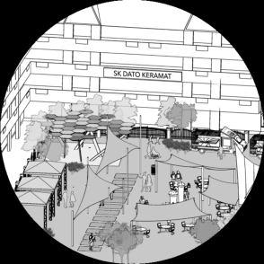
101
REFERENCES
Indonesia, I. (2018, October 19). Home. Retrieved January 04, 2021, from http://www.itdp indonesia.org/kampungkotabersama/rw01sunterjaya
Hamonangan, J. (2019, January 27). Kampung Proklim Sunter Jaya akan Diadopsi di Seluruh Kelurahan di Jakut. Retrieved January 04, 2021, from https://wartakota.tribunnews.com/2019/01/27/kampung proklim sunter jaya akan diadopsi di seluruh kelurahan di jakut
Liputan6.com. (2019, February 07). FOTO: Melihat Suasana Kampung Proklim Sunter Jaya. Retrieved January 04, 2021, from https://www.liputan6.com/news/read/3889828/foto melihat suasana kampung proklim sunter jaya?page=2
Jakarta's Urban Villages are Organic TOD Best Practices. (2019, September 09). Retrieved January 04, 2021, from https://www.itdp.org/2019/04/18/jakartas urban villages tod best-practices/
Adipradana, I. (n.d.). Thematic Kampung and " gotong royong " culture as the backbone of sustainable development. Retrieved January 06, 2021, from http://obs.agenda21culture.net/en/good practices/thematic-kampung and gotong royong culture backbone-sustainable development
Collective Life. (n.d.). Retrieved January 06, 2021, from https://idealsociety.squarespace.com/community
Cherry, K. (n.d.). Understanding Collectivist Cultures. Retrieved January 06, 2021, from https://www.verywellmind.com/what are collectivistic cultures 2794962
Lazzarini, L. (2016). The Everyday (in) Urbanism: What's New on the Spot.
Kelbaugh, D. (2000). Three Paradigms: New Urbanism, Everyday Urbanism, Post Urbanism An Excerpt From The Essential COMMON PLACE.BULLETIN OF SCIENCE, TECHNOLOGY & SOCIETY. doi:https://journals.sagepub.com/doi/pdf/10.1177/027046760002 000406
Crawford, M., Speaks, M., & Mehrotra, R. (2005).Everyday urbanism: Margaret Crawford vs. Michael Speaks. Ann Arbor: Univ. of Michigan.
자동등록방지를위해보안절차를거치고있습니다
(n.d.). Retrieved
06, 2021, from http://icoop.coop/?faq=story-korean social-economy-24 sungmisan village story village not map_201709
Sharing and cooperative practices for local sustainable development: The urban village communities in Seoul. The case of the Sungmisan Village. (2017, August 24). Retrieved January 06, 2021, from https://labgov.city/theurbanmedialab/sharing and cooperative-practices-for local sustainable development the urban village communities in seoul the case of the sungmisan village/
Gangnam Style To SungmisanStyle: South Korea's urban villages. (n.d.). Retrieved January 06, 2021, from http://www.sociallife.co/blog/post/Gangnam Style To Sungmisan Style/
The urban village of Sungmisan. (n.d.). Retrieved January 06, 2021, from http://www.newcityzens.com/en/266/the urban village of sungmisan
Maxwell-Gaines, C. (2020, July 27). Rainwater Harvesting 101: Your How-To Collect Rainwater Guide. Retrieved January 11, 2021, from https://www.watercache.com/education/rainwater harvesting 101
102
.
January
THANK YOU
