pam phl ets
KOWLOON CITY DISTRICT
19/02/21 PROJECT 2 READING THE CITY ALAN TANG
History Major Time line 004 Background Basic Statistic of Kowloon City District 008 Type Layers Of buildings In the city 016 035 Index 2 PROJECT 2 READING THE CITY /ALAN TANG

CONTENT 003 3 PROJECT 2 READING THE CITY /ALAN TANG
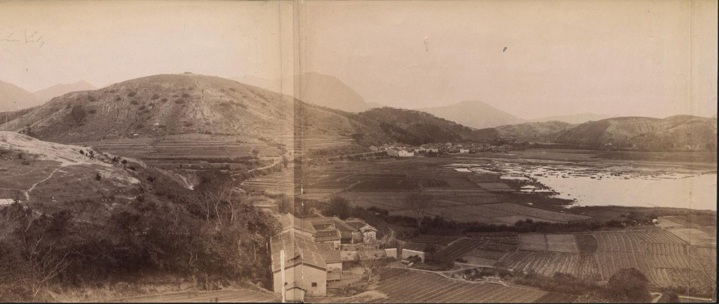
History 1958
Time line
Before the 1920s, Kowloon City was basically a society of fishermen, farmers and quarry mining.
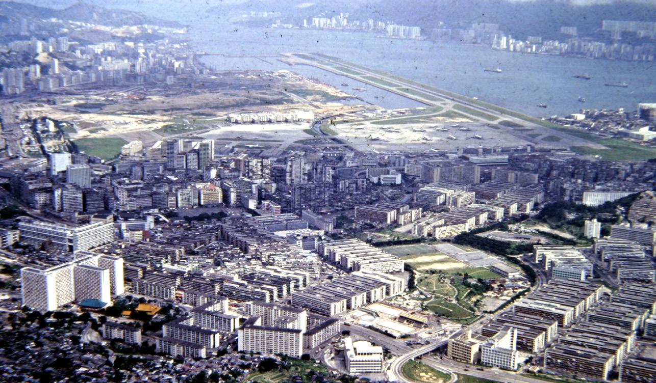
In 1958, the government completed the reclamation project in Kowloon Bay, moved the Kai Tak Airport to the south, and built the San Po Kong Industrial Zone and Prince Edward Road East at the original location.
1920
4 PROJECT 2 READING THE CITY /ALAN TANG
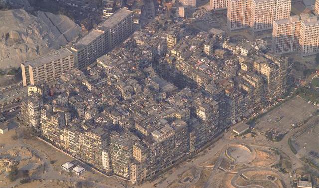
Later in 1993, all residents were removed from Kowloon Castle and all the buildings were demolished. The surrounding area including the site of the building turned into a ‘Kowloon Wall City Park’.
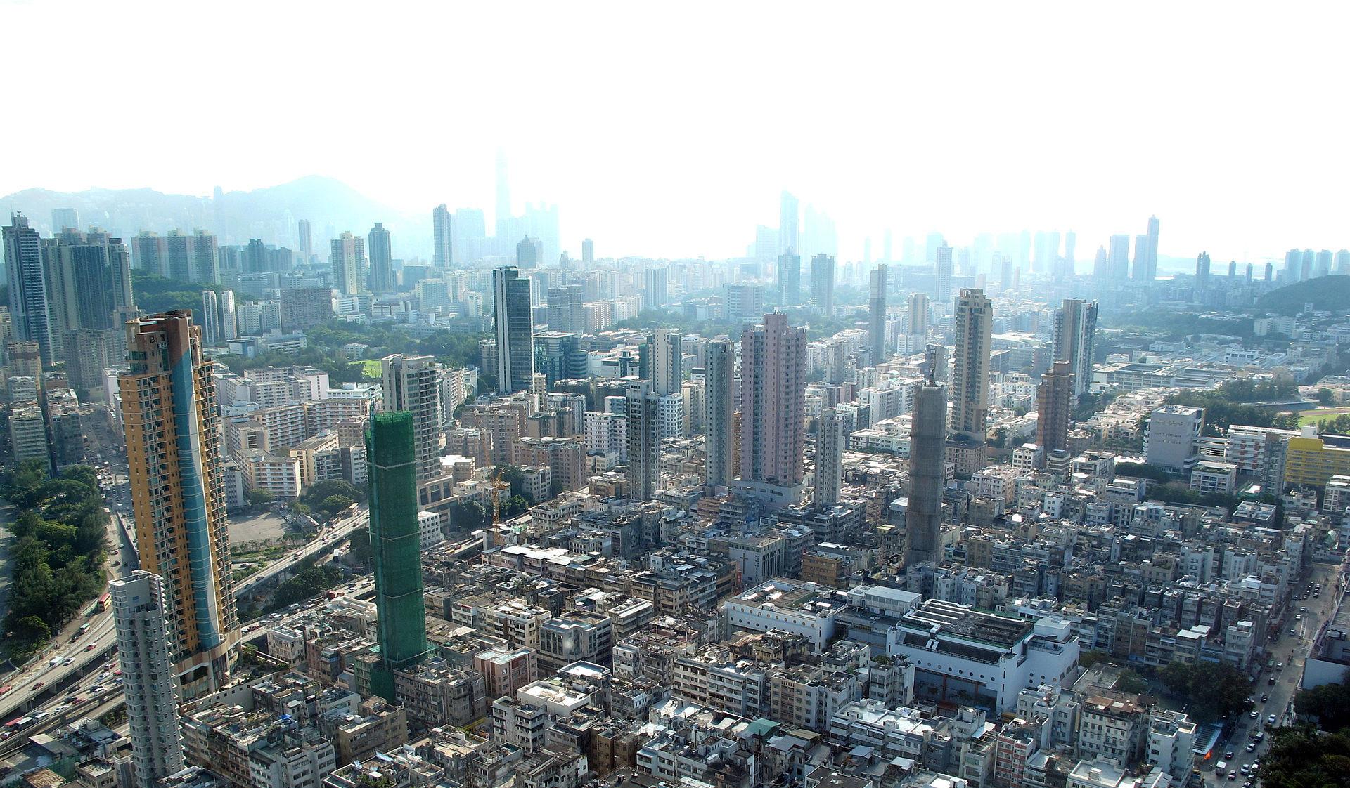
In more recent years, rapid urban renewal from government has taken place and new residential complexes have replaced old tong laus.
1993 2010
5 PROJECT 2 READING THE CITY /ALAN TANG
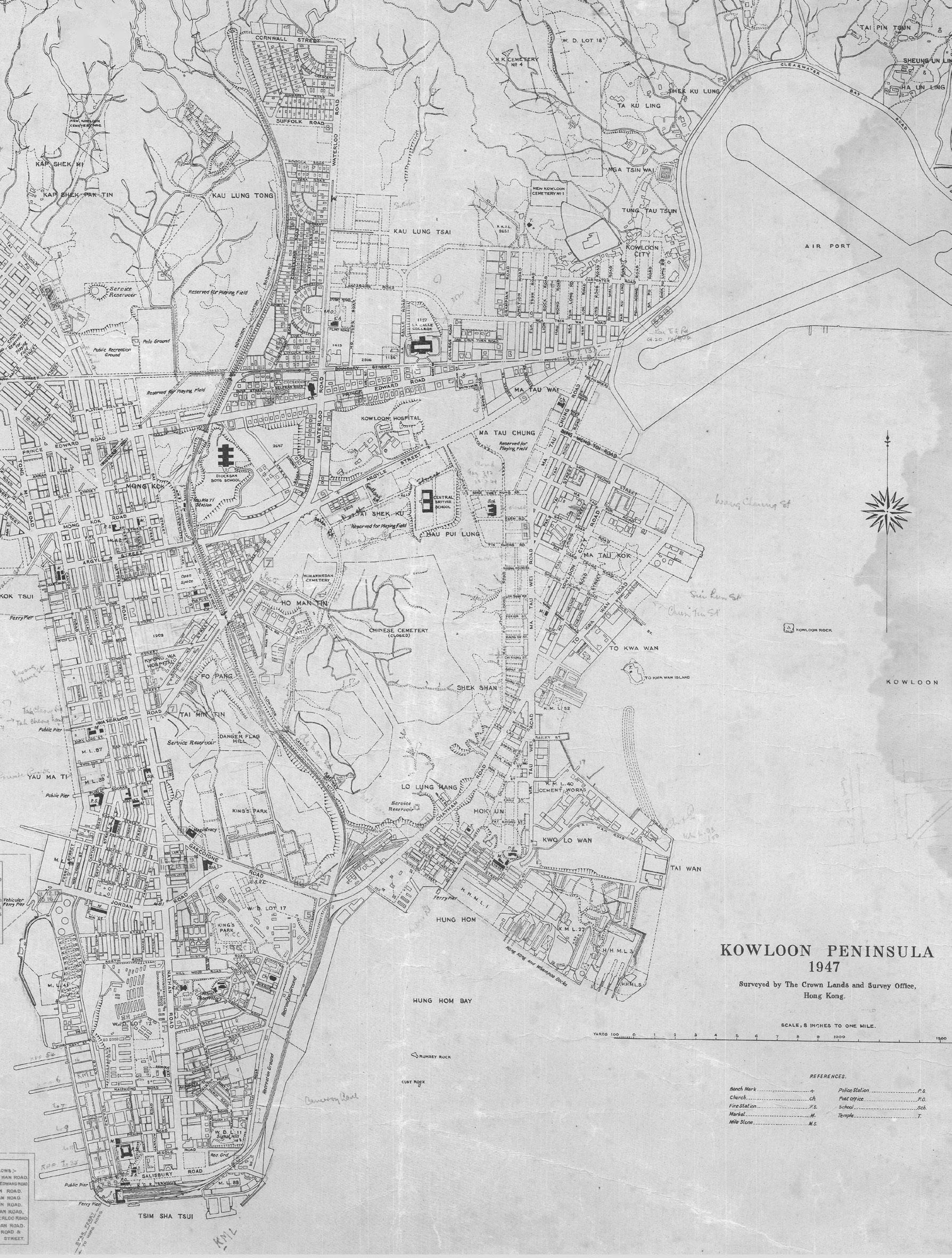
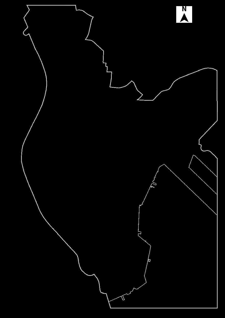
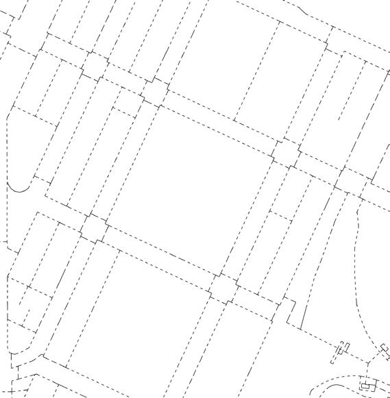
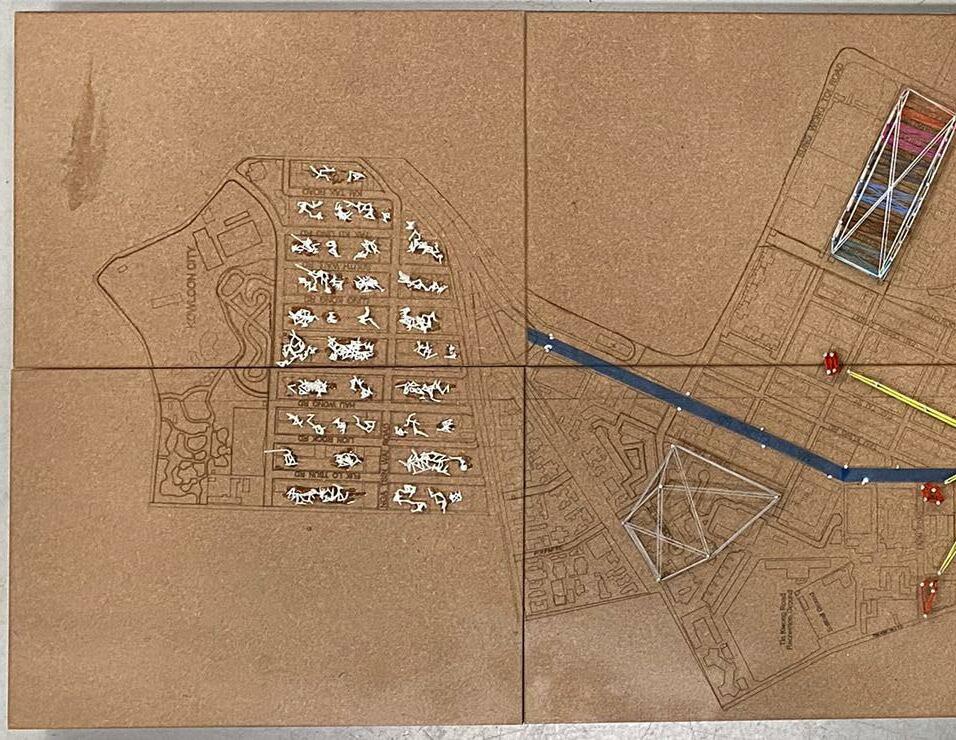
HISTORICAL MAP
Extracting borders from historical map in 1947 by street blocks/ building orientations, also taking the moutain side and coastline as hints correspondingly.
6 PROJECT 2 READING THE CITY /ALAN TANG
LAND RECLAMATION TIMELINE
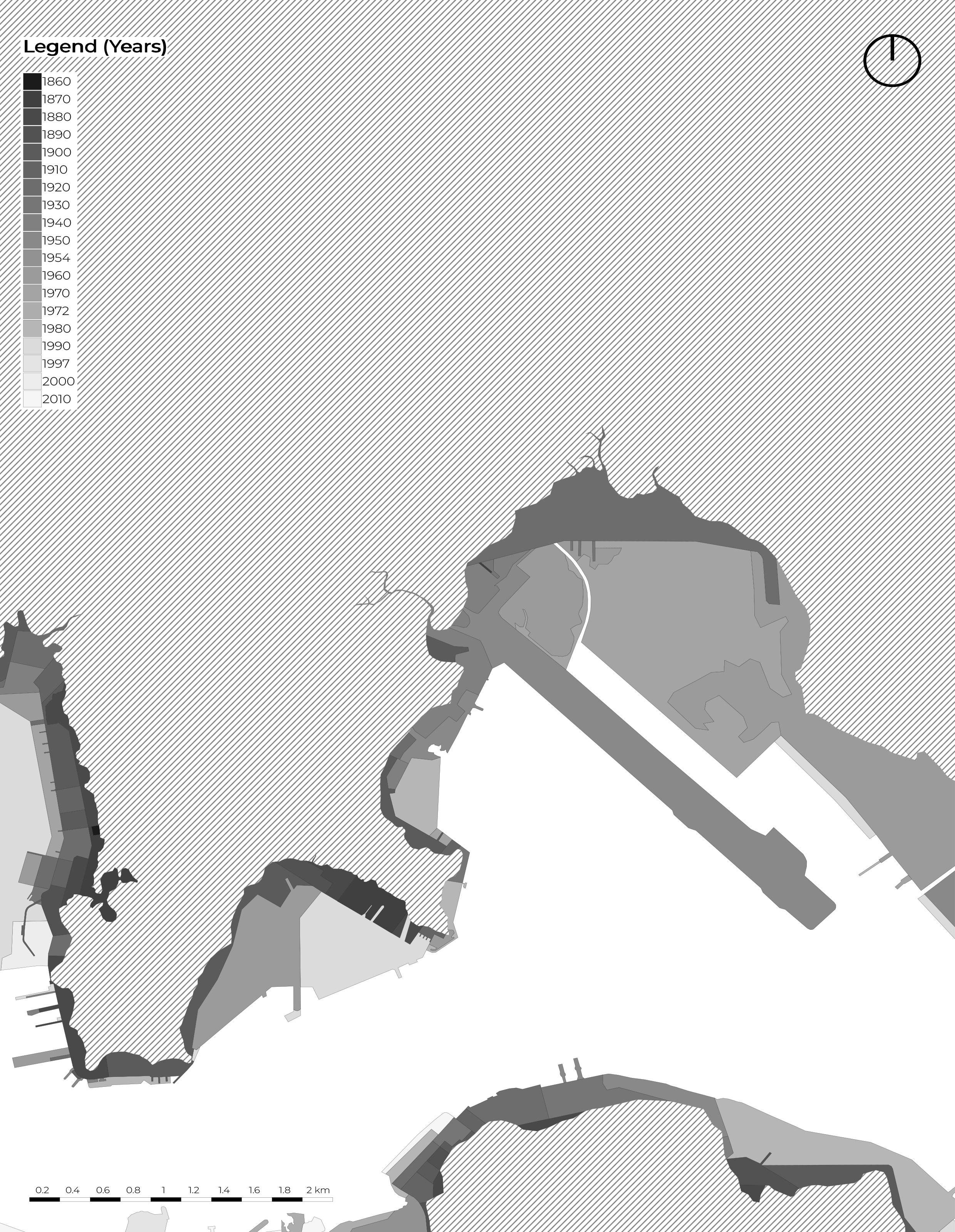
RECLAMATION
The peninsula has been significantly expanded through land reclamation from the sea, over several phases. In the south and west, most of the reclamation was carried out before 1904. Reclamation in several other small areas along the main Tsim Sha Tsui waterfront was completed by 1982. Since 1994, parts of the Hung Hom Bay were reclaimed and by 2019, it had been completely extinguished. The West Kowloon Reclamation was formed as part of the Airport Core Programme and largely completed by 1995.
7 PROJECT 2 READING THE CITY /ALAN TANG
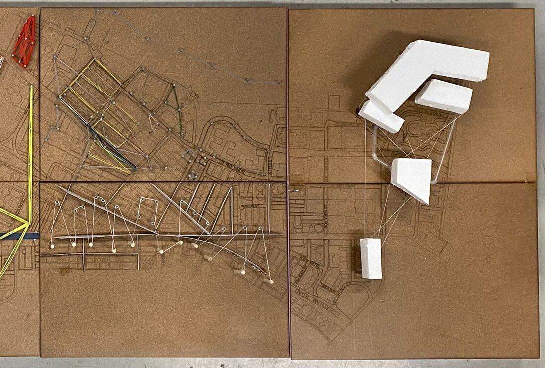
Figure Ground
From the extracted borders in 1947 historical map, the logic of gridlines has kept and eventually expanded within the future developments and reclaimed land.
0.2 0.4 0.6 0.8 1.2 1.4 1.6 1.8 km
8 PROJECT 2 READING THE CITY /ALAN TANG
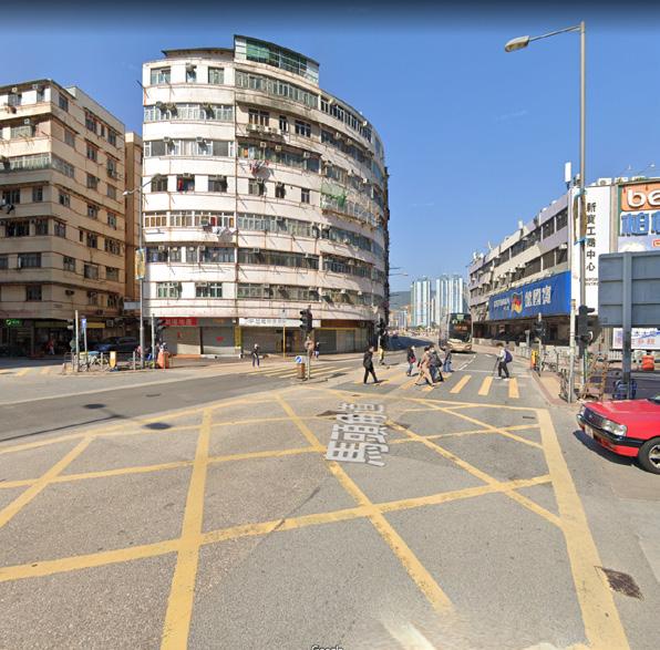
TRAFFIC
When the motorways collide, they often generate a traffic knot that affect the nearby pedestrian accessibility, which means that footbridge or a complicated crossing are needed when passing by.
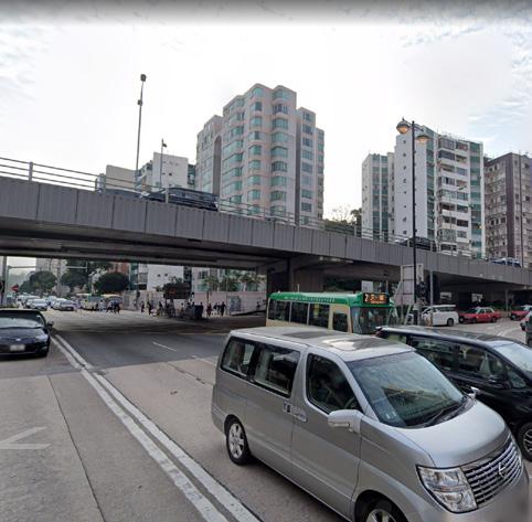
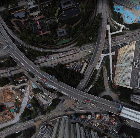
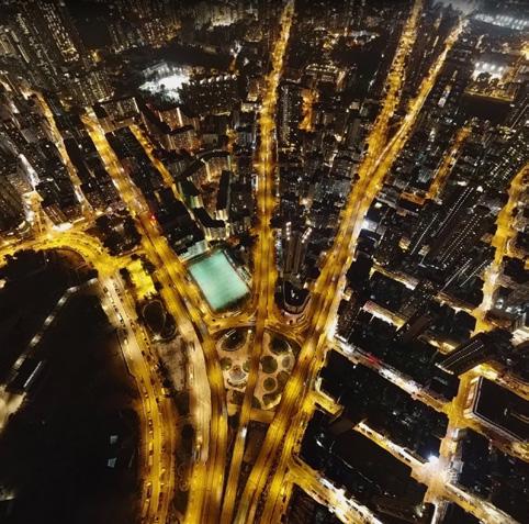
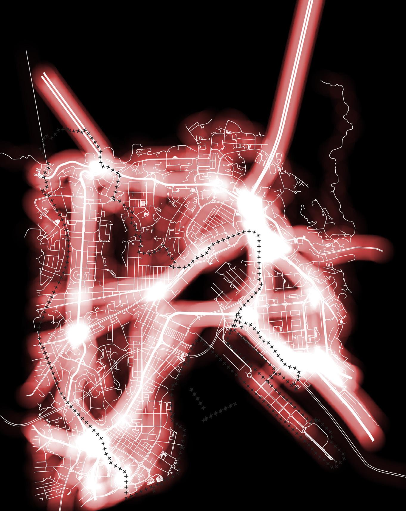
Main Traffic Density
Hong Chong Rd
Princess Margaret Road Rd
Lung Cheung Rd
Argyle Street
LOW HIGH
Kung Tung Bypass
9 PROJECT 2 READING THE CITY /ALAN TANG
Leisure Activities 0 4 0 6 0 8 2 4 Landuse Landuse P k Sports Ground Footba l F e d Racetrack Sw mm ng Pool k Landuse Park Sports Ground / Football Field Racetrack Swimming Pool 10 PROJECT 2 READING THE CITY /ALAN TANG
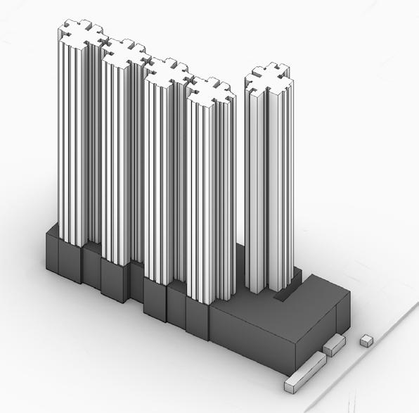
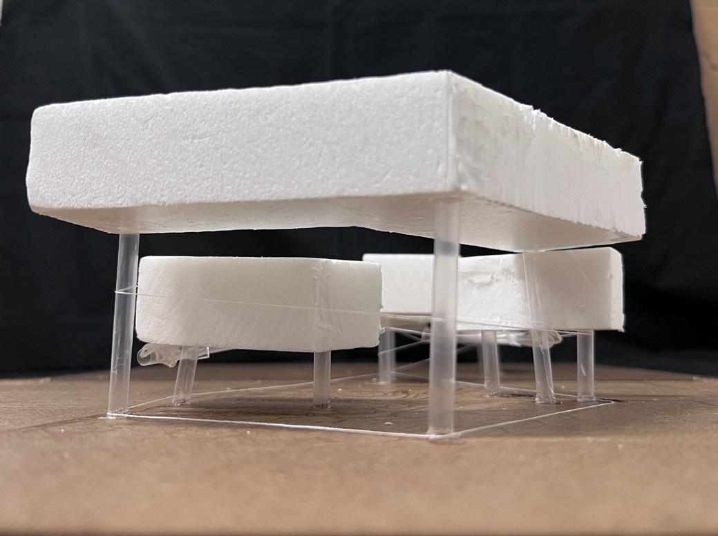
Podium Level
0 4 0 6 0 8 2 4 pod um evel k podium level
11 PROJECT 2 READING THE CITY /ALAN TANG
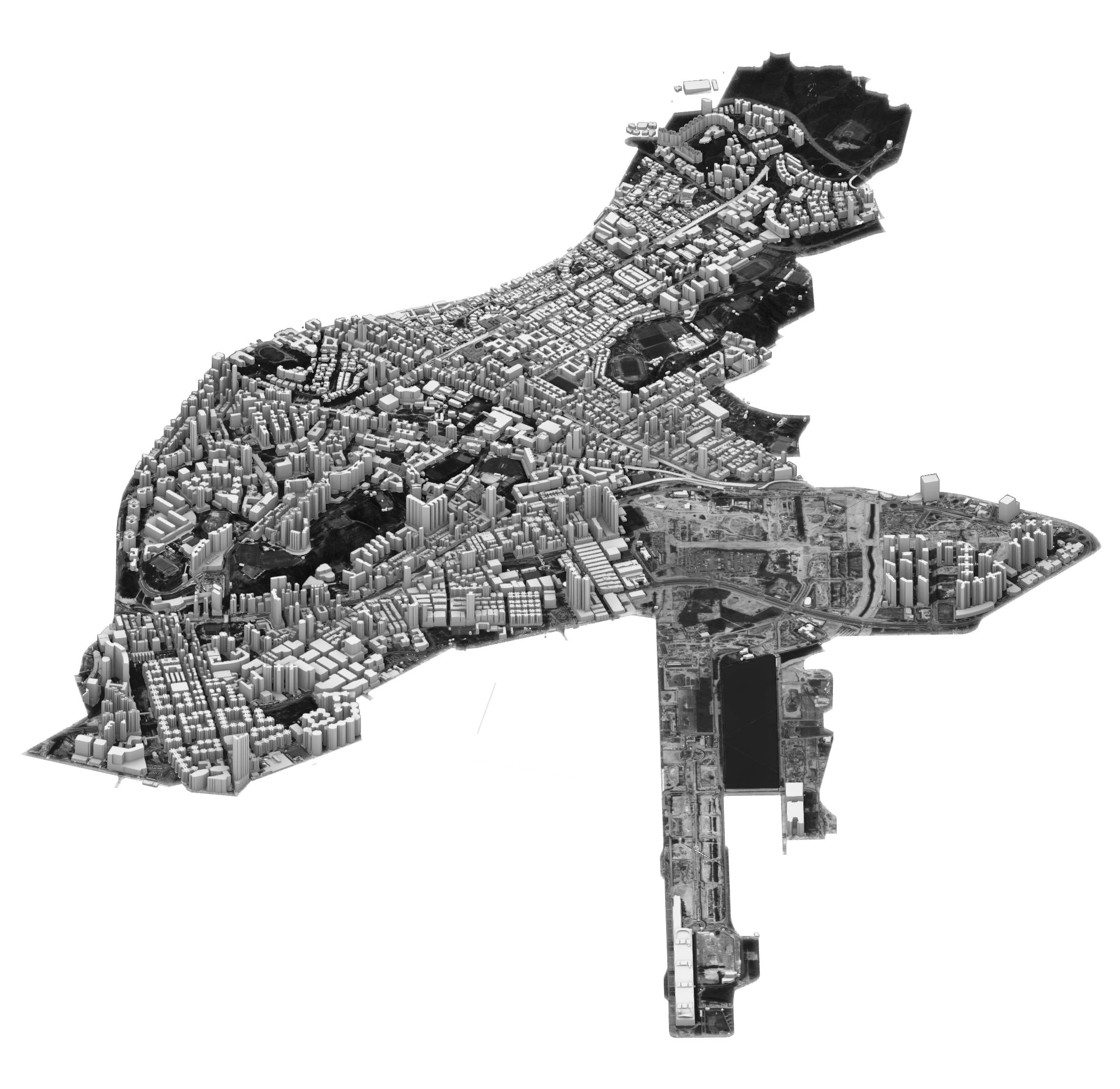
LOWRISE (6 STORIES OR BELOW)
MIDRISE (12-27 STORIES)
HIGHRISE (28-45 STORIES)
SKYCRAPPER (46 STORIES OR HIGHER)
Low se Lowr Low-M dr e Low-M d seH gh-M dr seH gh se H
12 PROJECT 2 READING THE CITY /ALAN TANG
LOWRISE (6 STORIES OR BELOW) HIGHRISE (28-45 STORIES) SKYCRAPPER (46 STORIES OR HIGHER) Lowrise (<40m) Low-Midrise (40m-90m) High-Midrise (90m-150m) Highrise (>150m) 4000 3000 0 1000 2000 5000 Building Count (unit) Building Height in Kownloon City District Building Type MIDRISE (12-27 STORIES) 5000 4000 3000 2000 1000 0 13 PROJECT 2 READING THE CITY /ALAN TANG


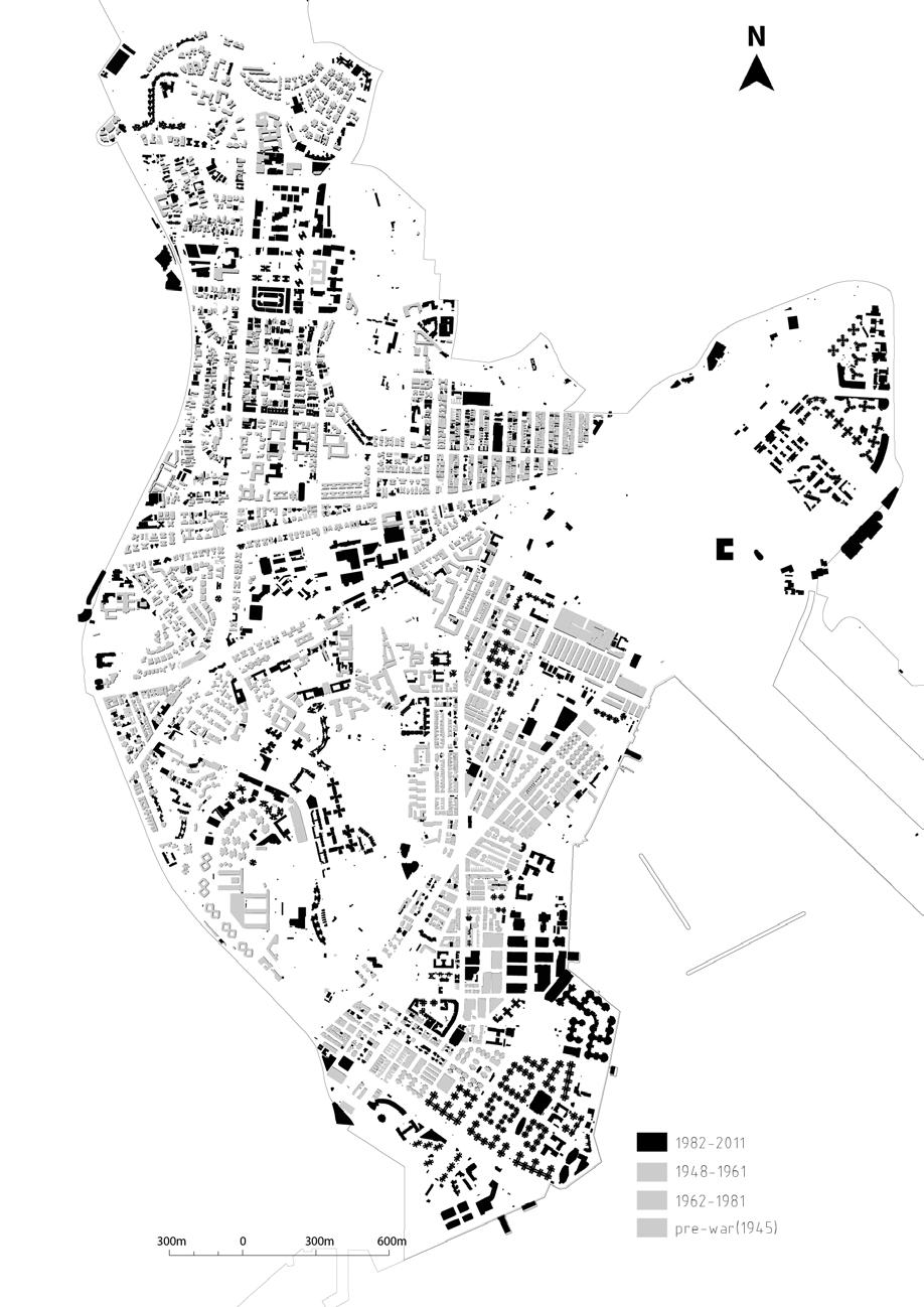
PRE-WARS (BEFORE 1945) BUILT YEAR (1948-1961) BUILT YEAR (1962-1981) BUILT YEAR (TILL-2011) 14 PROJECT 2 READING THE CITY /ALAN TANG
Overview
Kowloon City District are full of various resisdential buildings, with scattered factories and comercial building
15 PROJECT 2 READING THE CITY /ALAN TANG
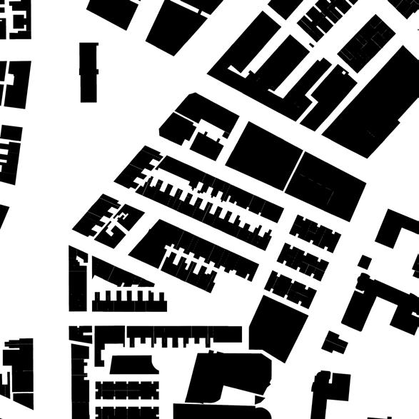
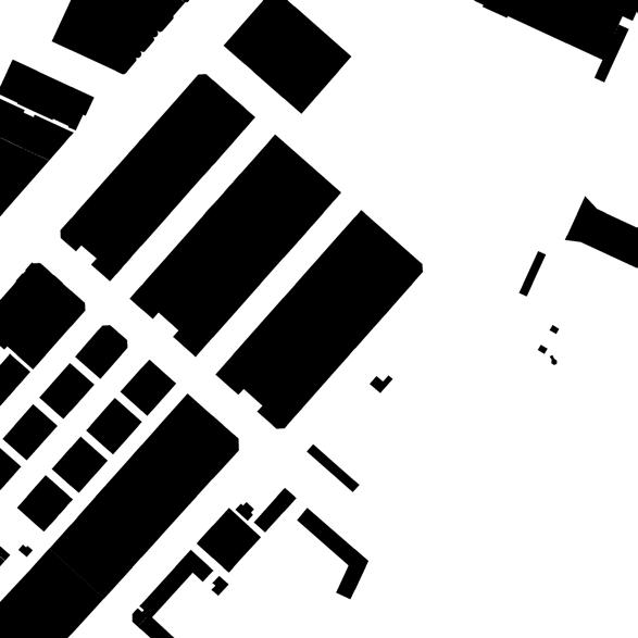
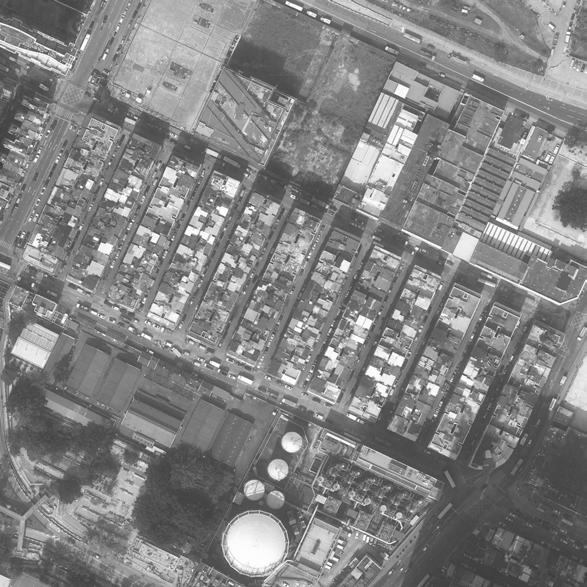
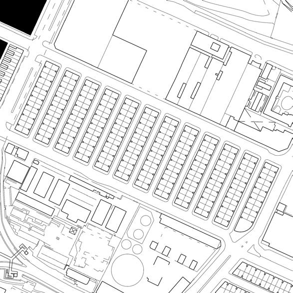
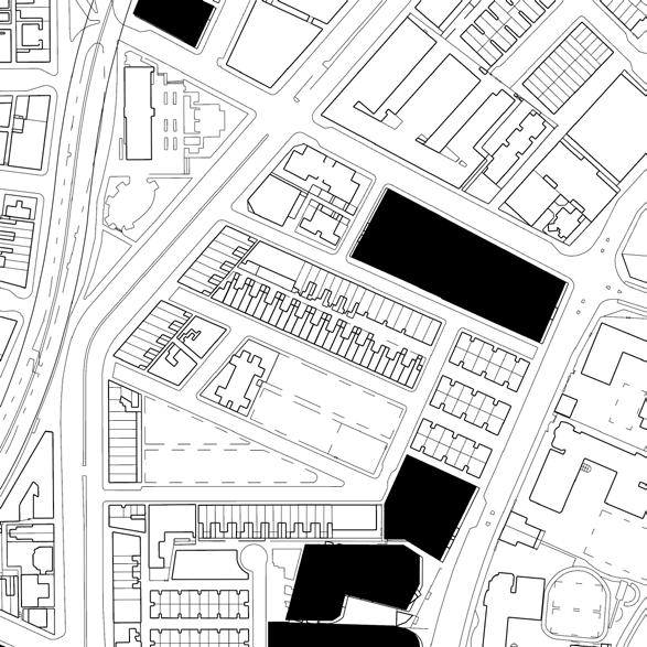
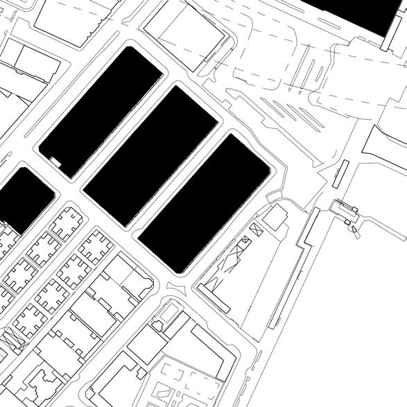
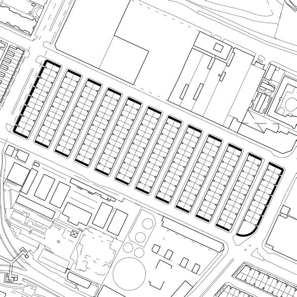
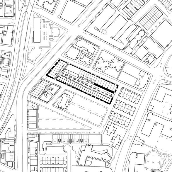
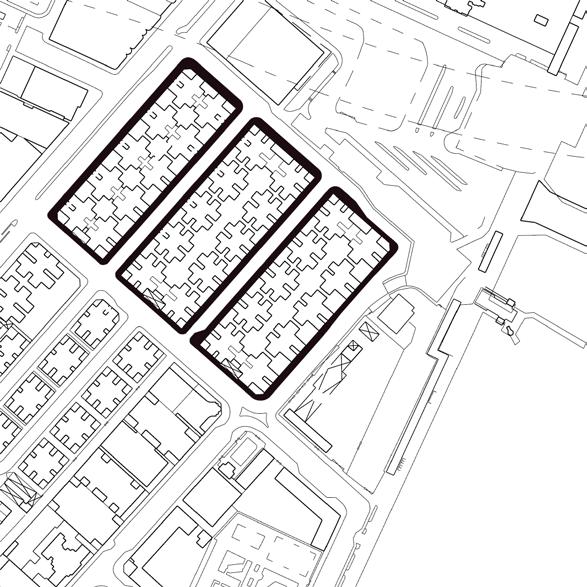
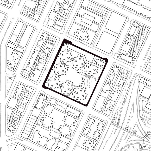
Figure Ground Main Traffic line
1
2
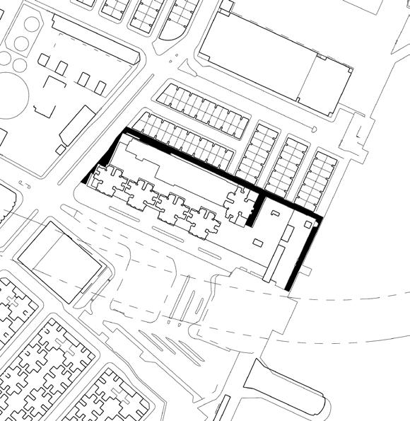
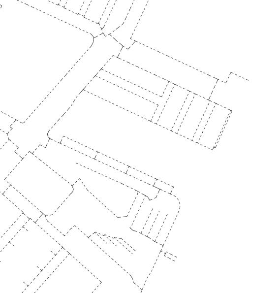
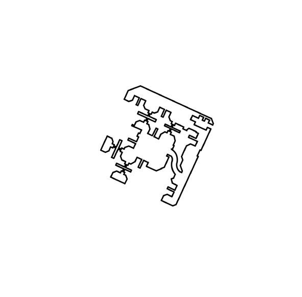
Type
Type
3
Podium No No Yes Cantilived Facing main street Facing main street Not 16 PROJECT 2 READING THE CITY /ALAN TANG
Type
Type
Massing
Pedestrian Path
Street Island/s
Frame line
Array of compact doublesided rows

Frontside Accessible
Array of compact singlesided rows
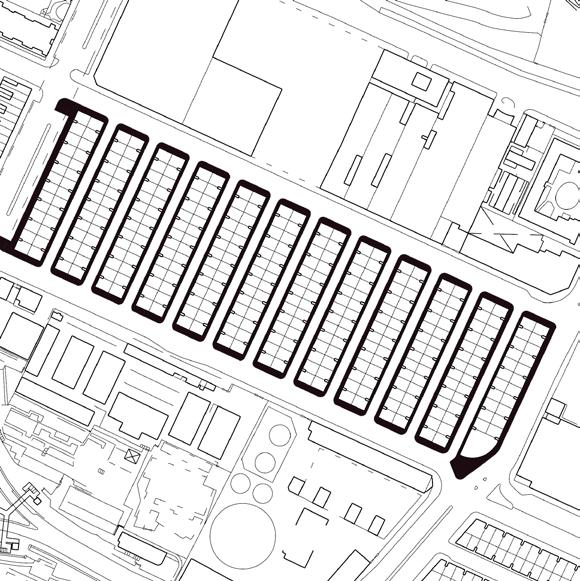

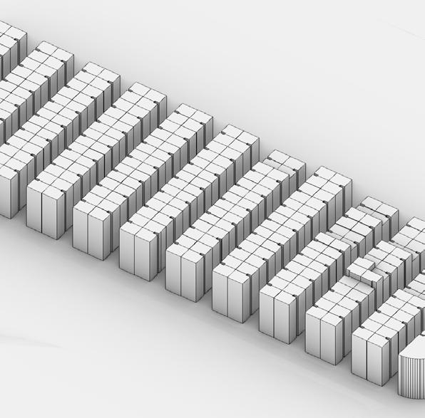
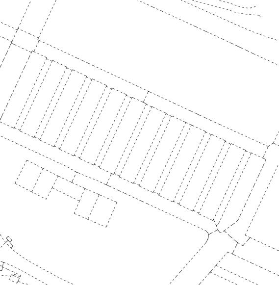
Bothsides Accessible
Double row with seperation
Defined by outer borderline of Court
17 PROJECT 2 READING THE CITY /ALAN TANG
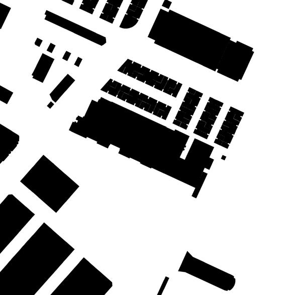
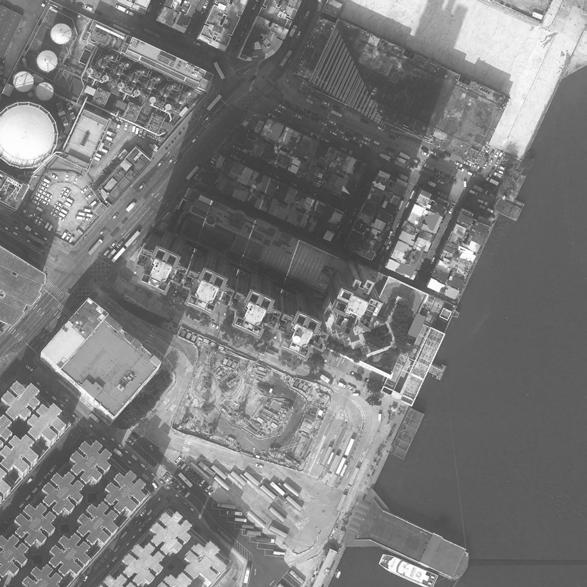
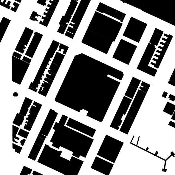
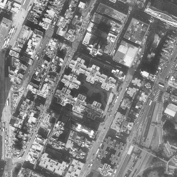
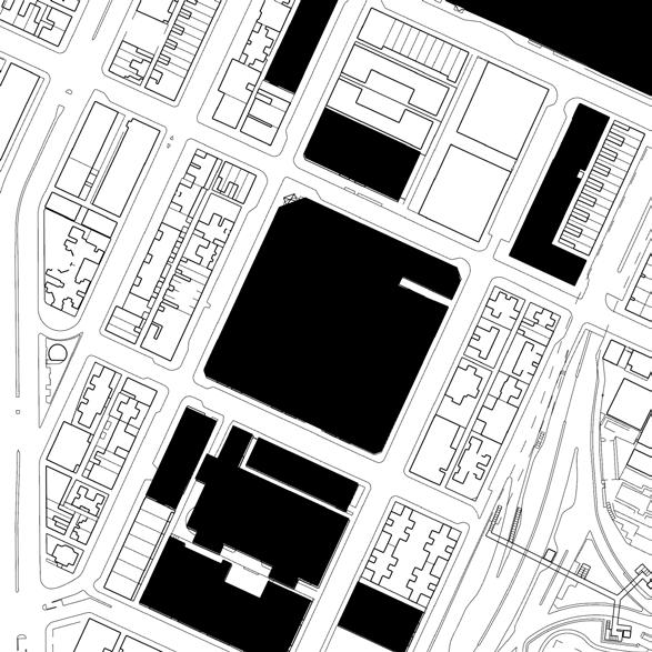
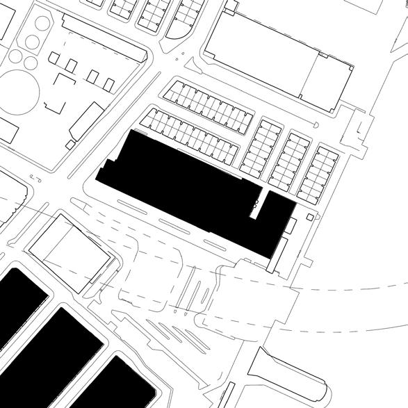
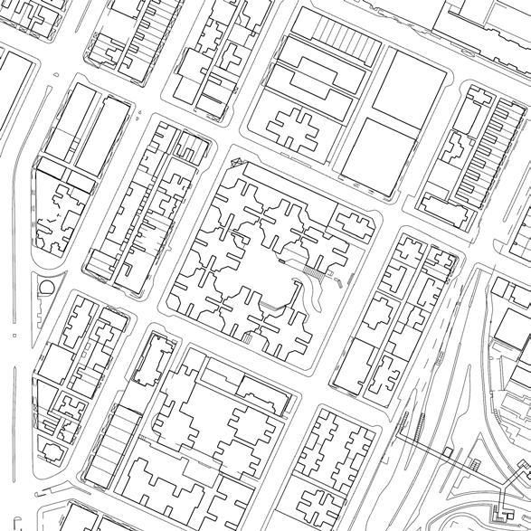
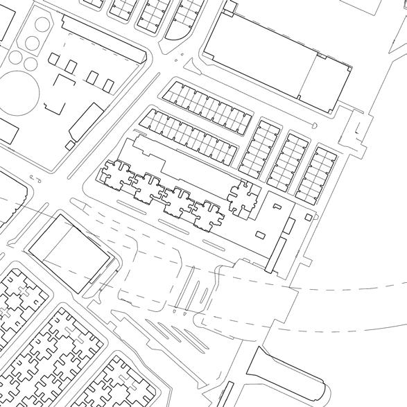
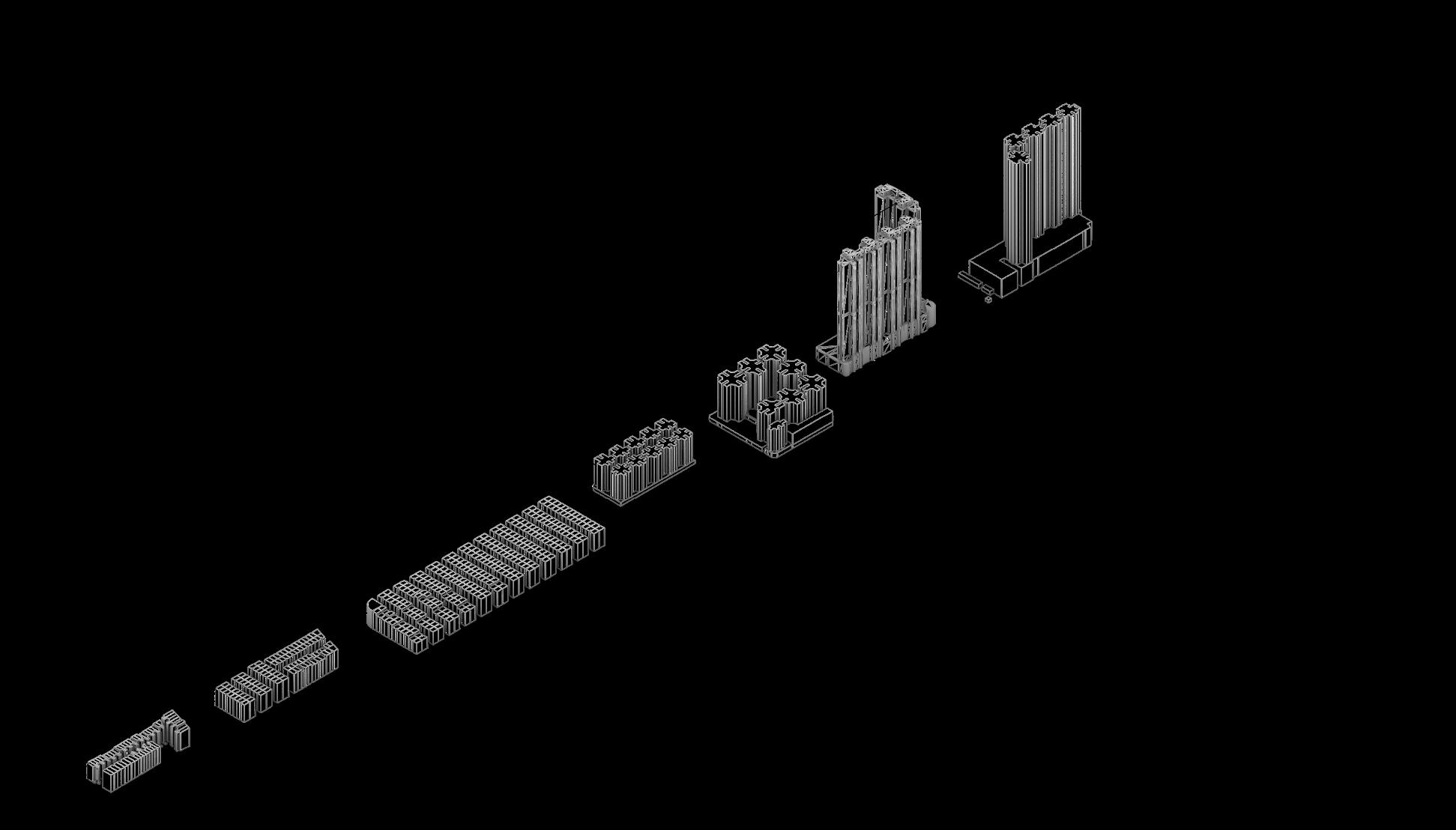
Figure Ground Main Traffic line Type 4 Type 5 Type Podium Yes No Cantilived Not Facing main street 18 PROJECT 2 READING THE CITY /ALAN TANG
Massing
Pedestrian Path
Street Island/s
Frame line
Towers Allocated arround the podium

Frontside Accessible
Single row
Bothsides Accessible
19 PROJECT 2 READING THE CITY /ALAN TANG
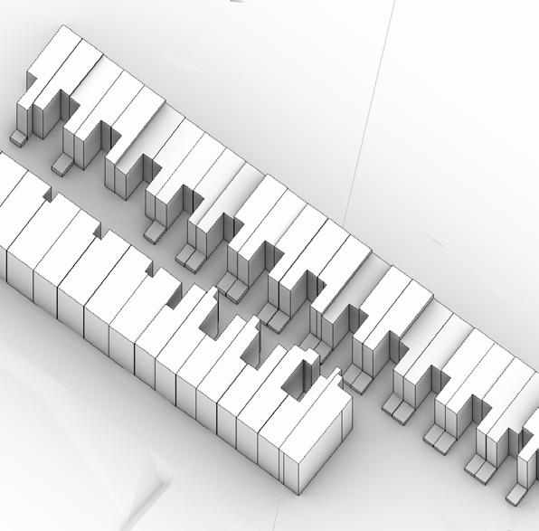
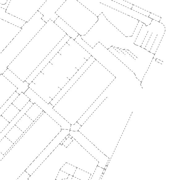
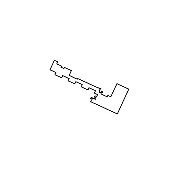
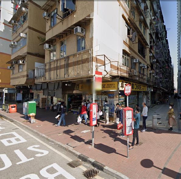
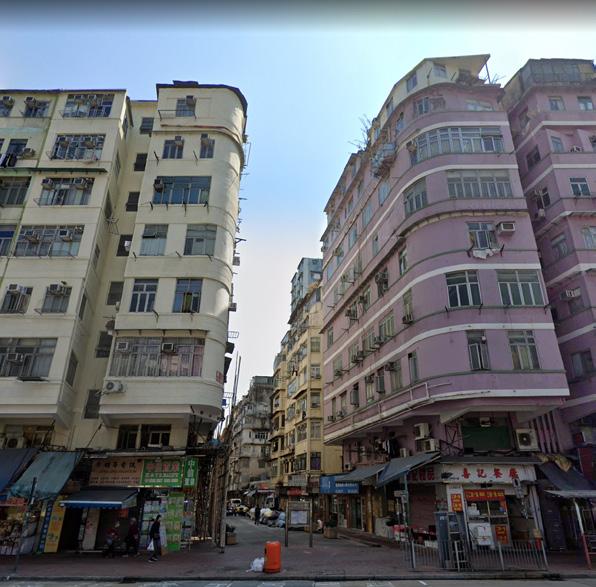
tenement
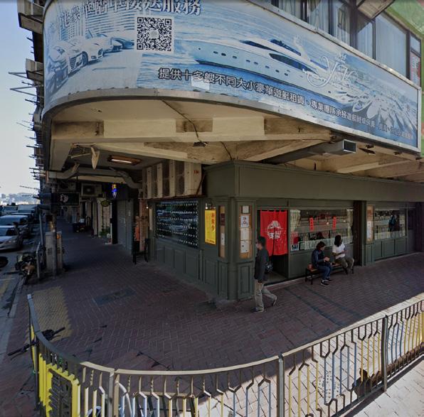
Respecting the grid shape of street blocks, tenement building often have the same orientation or even similar shape

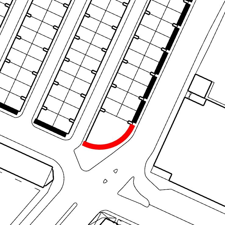
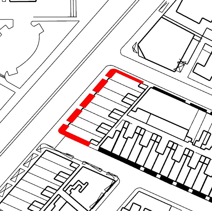
 Type 1 Corner
Type 1 Angled
Type 2
Type 1 Corner
Type 1 Angled
Type 2
20 PROJECT 2 READING THE CITY /ALAN TANG
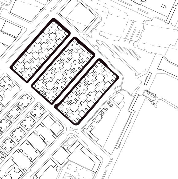
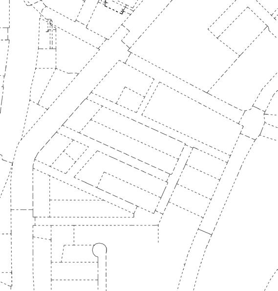
in between
Jagged line
Dark, chaotic hiddened back allay, fewer balcony
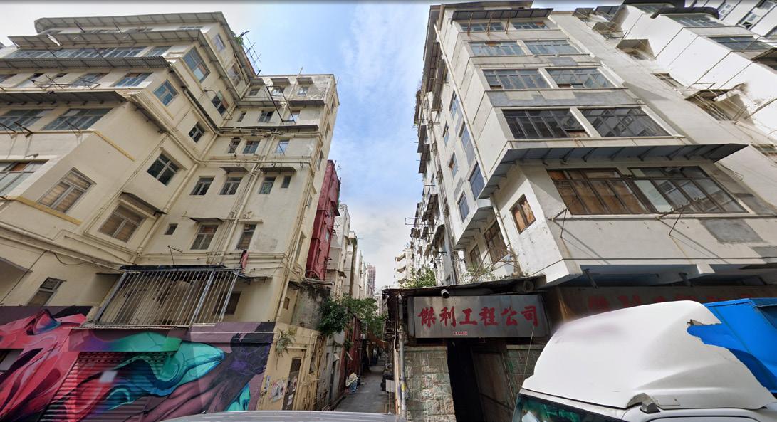
Bright,smoother and cleaner cantilived out facade surface closer to the street and be a part of streetscape
As Tenement don’t have podium resisdent would easily get int
back allay back allay
21 PROJECT 2 READING THE CITY /ALAN TANG
Level of layers
The land near coastline is obviously a major developed zone, extend from Tsim Sha Tsui to Kai Tat, with a lot of parks, beautiful walkways and resisdential buildings, they just like a skin Surrounding the Old City.
0 4 0 6 0 8 2 4 pod um evel
Landuse Landuse P k Sports Ground Footba l F e d Racetrack Sw mm ng Pool
layers 22 PROJECT 2 READING THE CITY /ALAN TANG
Podiums
Podiums restricted pedestrian path, and also keeping residents away from the community, especially for the type with podium mall.
Hiding the community from the towers.
The Podiums are actually drilling holes in the city, which slowly remove the orginal indentity of surroundings.

23 PROJECT 2 READING THE CITY /ALAN TANG
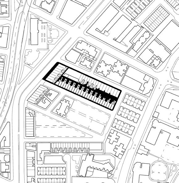
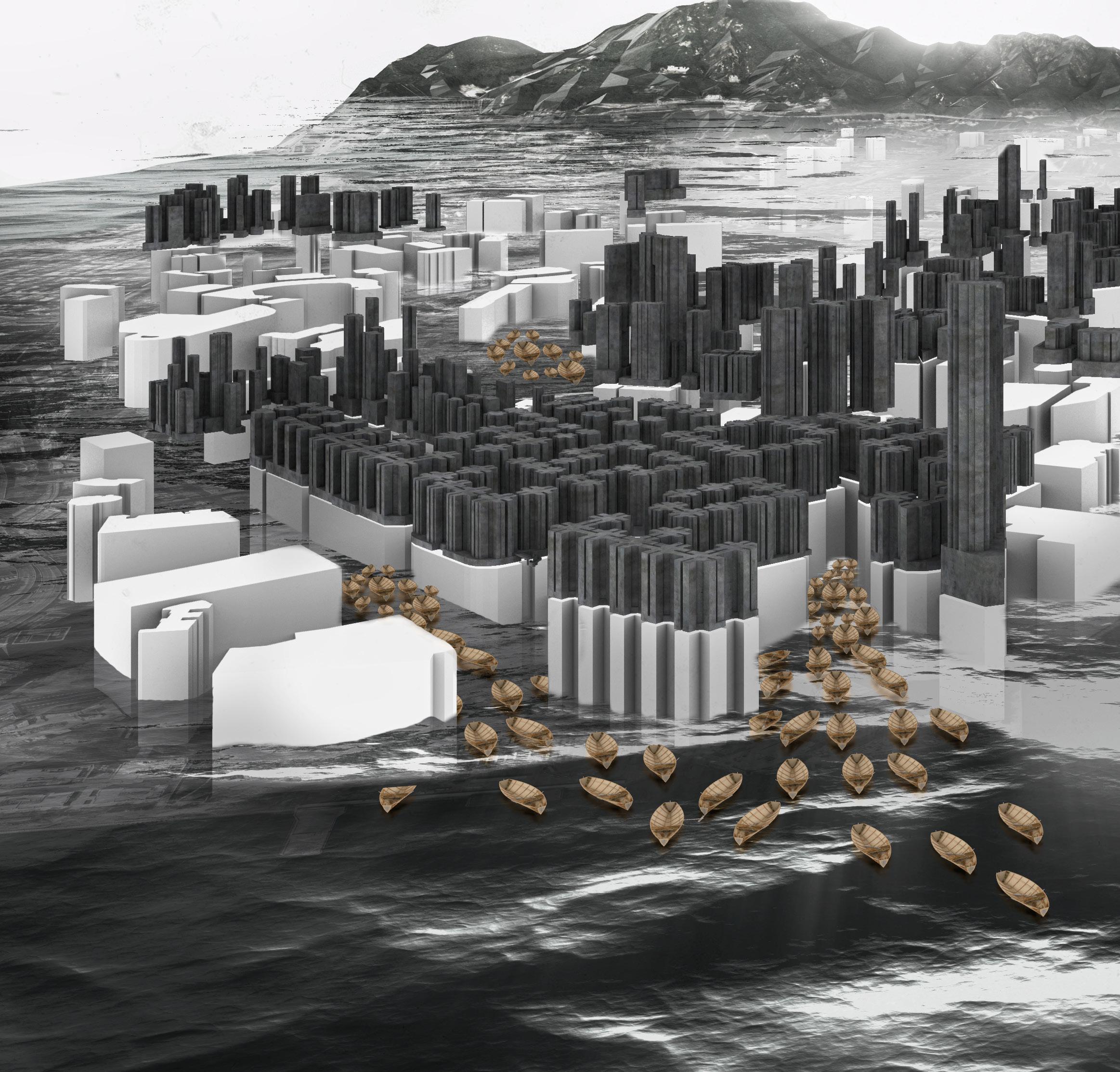
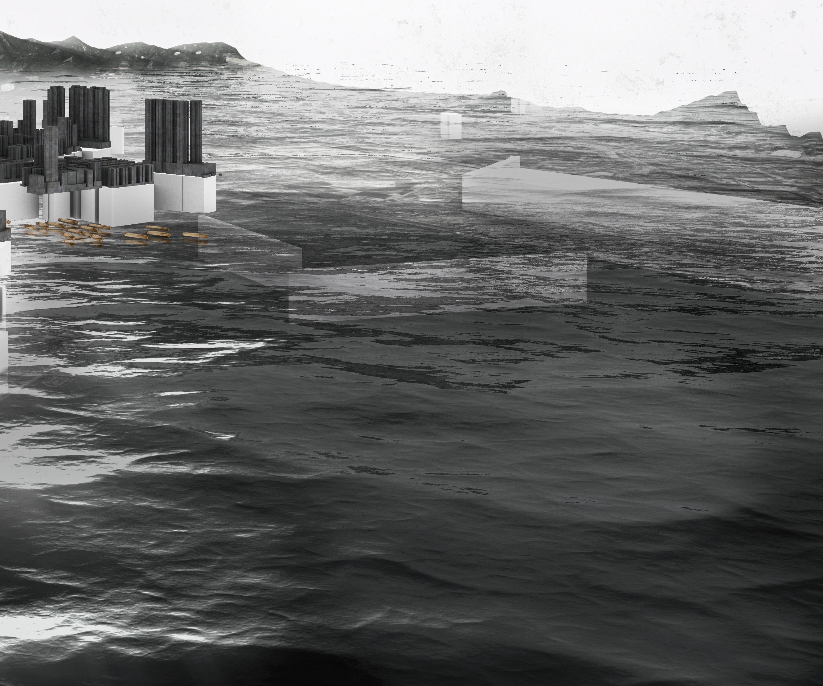
Abstract
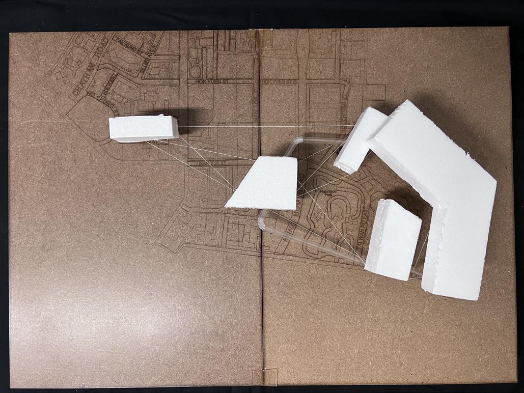
An archipelago is a group of islands set in an ocean that divide them. Each island is a part of the whole composition and works together.
Undergoing a series of reconstructions of old street blocks, the community of Kowloon City District reforms. There are also new residential complexes scattered around the city. With such huge ‘obstacles’, the pedestrian’s habits are redefined.
The podiums level worked as islands and the pedestrian level as the sea. Although the facilities are bigger and connected physically, but seems the communities are further fragmented an defined with new layers.
PROJECT 2 READING THE CITY /ALAN TANG
PROJECT 2 READING THE CITY /ALAN TANG
The Collective Model
An archipelago is a group of islands set in an ocean that divide them. Each island is a part of the whole composition and works together.
Undergoing a series of reconstructions of old street blocks, the community of Kowloon City District reforms. There are also new residential complexes scattered around the city. With such huge ‘obstacles’, the pedestrian’s habits are redefined.
The podiums level worked as islands and the pedestrian level as the sea. Although the facilities are bigger and connected physically, but seems the communities are further fragmented an defined with new layers.
PROJECT 2 READING THE CITY /ALAN TANG
PROJECT 2 READING THE CITY /ALAN TANG


