Community based Climate Action Plan
A case of Bhopal
The Community based climate action plan (C-CAP) was compiled by Integrated Design (INDÉ) as part of the Humanitarian Innovation fund- Elrha for the project titled “Community-based Climate Action Plan in Urban Poor Settlements of Bhopal”. The study was undertaken in collaboration with Mahila Housing SEWA Trust (MHT) for three settlements in Bhopal city. The C-CAP outlines the approach that was taken as part of the study and the solutions that were derived with the community. We acknowledge the support of Elhra and its partner organisation SEEDS, India (Sustainable Environment and Ecological Development Society) in carrying out the project.
The information presented in this handbook is based on secondary research as well as information and insights gathered from selected urban poor settlements in Bhopal as a part of the above-mentioned study. More details about climate change and its impacts on the urban poor can be found in “A Handbook on Climate Change : Deconstructing Climate Change and Heat Stress for the Urban poor”.
More details of the author can be found at
Integrated Design: https://www.integrateddesign.org/ Mahila Housing SEWA Trust: https://www.mahilahousingtrust.org/


The icons used in this book have been sourced from the Noun Project https://thenounproject. com/ and modified, as necessary.

Community based Climate Action Plan: A case of Bhopal Published in 2022
This work is licensed under the Creative Commons Attribution-NonCommercial 4.0 International License. To view a copy of this license, visit http://creativecommons.org/licenses/by-nc-sa/4.0/
You are free to use, share and make derivative works of this publication only for non-commercial purpose under the condition that you appropriately attribute it , and that you distribute it only under a license identical to this one.


Community based Climate Action Plan
A case of Bhopal
TABLE OF CONTENTS 7 10 10 14 20 23 28 68 86 106 110 1. Introduction 2. About C-CAP 3. The Approach 4. Structure of this Book 5. Co-production Process 6. About Bhopal 7. C-CAP - Nehru Colony 8. C-CAP - Bagsewaniya 9. C-CAP - Indranagar 10. Dissemination of C-CAP and Way forward 11. References
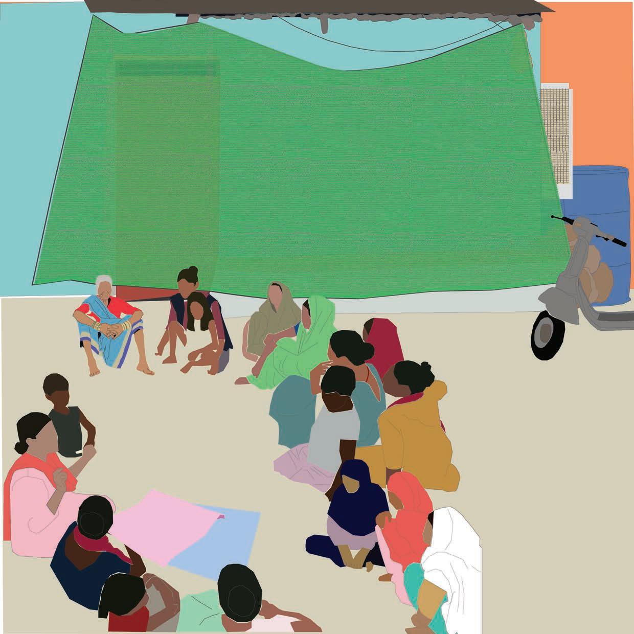
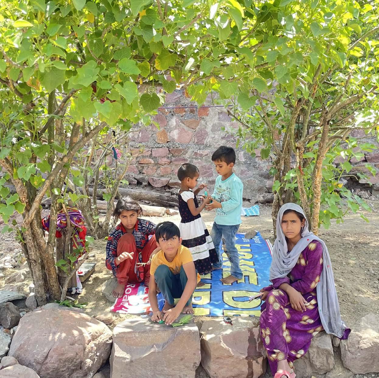
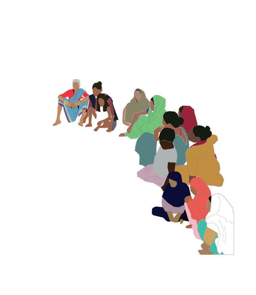
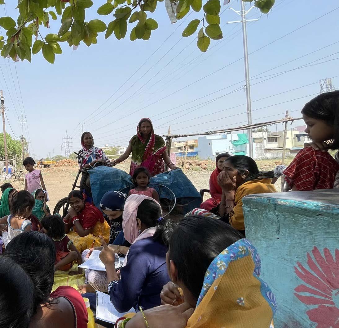
In discussion with the community elders
6 Community based Climate
Plan (C-CAP)
Action
INTRODUCTION
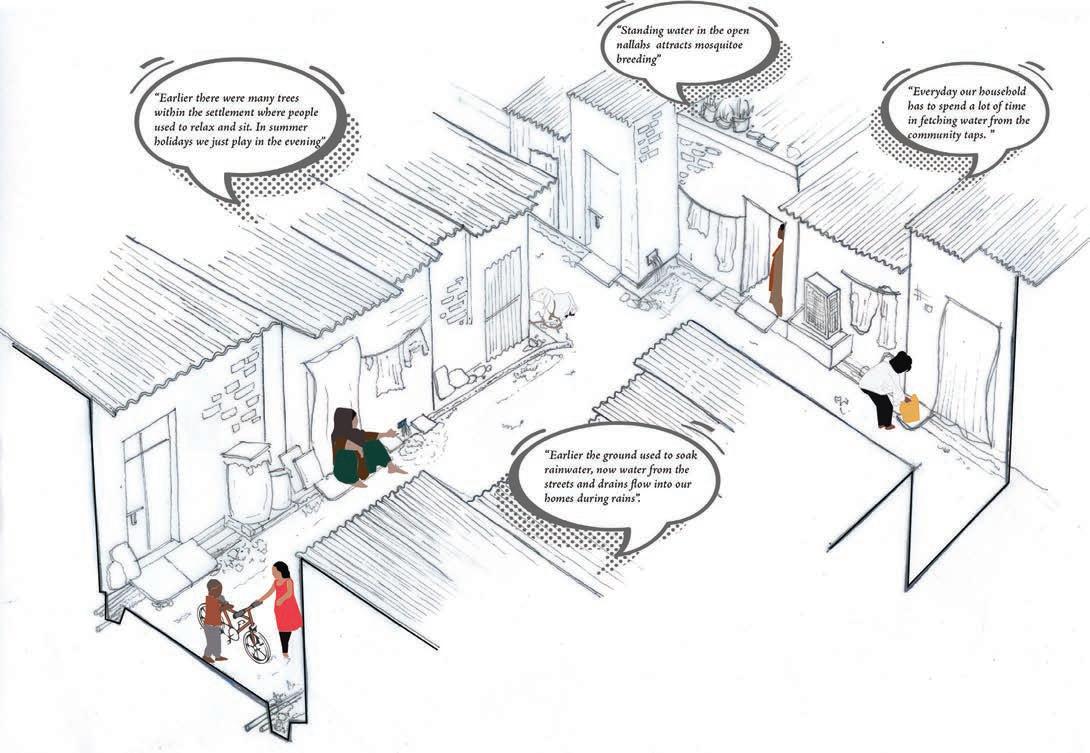
Climate change is rapid, and intensifying. Evidence from across the globe points to how cities are at the forefront of climate change impacts, the effects of which are disproportionately experienced by the urban poor (Burzyński et al., 2019; Dodman et al., 2019). Multiple factors, like geographical context and socio- economic capacities, determine the vulnerability to climate change impacts (Lynn et al., 2011).
The current action research is an attempt to support the most vulnerable in urban areas to not just adapt and respond to climate change, but also improve their overall quality of life. The action research anchors on the understanding that communities have intimate and pragmatic knowledge to make effective decisions about their future (Ball, 2016). Thus, their active engagement is critical to ensure the much needed social, cultural, and practical consideration while developing solutions for their environment. In the context of climate change this community knowledge often translates as coping strategies devised to face climate change impacts like heat stress and flooding amongst others. An understanding of these coping strategies then emerges critical to design meaningful socio-technical solutions that resonate with the community and at the same time aid in better adaption and eventually mitigation.
Taking the case of selected urban poor settlements in Bhopal, this document demonstrates the process of developing a ‘Community based climate action plan’ (hereafter C-CAP). It demonstrates the complementarity of experiential knowledge (from the community including priorities, needs, knowledge, and capacities) and scientific knowledge (from climate data and technical experts) in the co-production of contextually suited adaptive solutions.
By laying down a co-creation process that bridges and reinforces scientific and experiential streams of knowledge, and by foregrounding the need for ground up efforts to be recognised in formal planning mechanisms, this document attempts to address critical lacunae in realising inclusive and just climate resilience.
7 Community
Climate
Plan (C-CAP)
based
Action
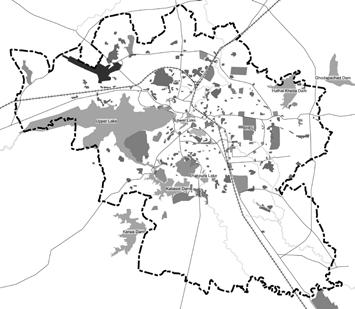
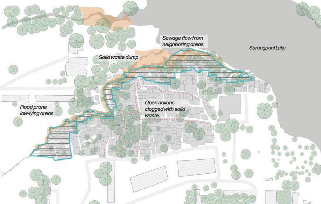
Location of the settlements that are part of the study
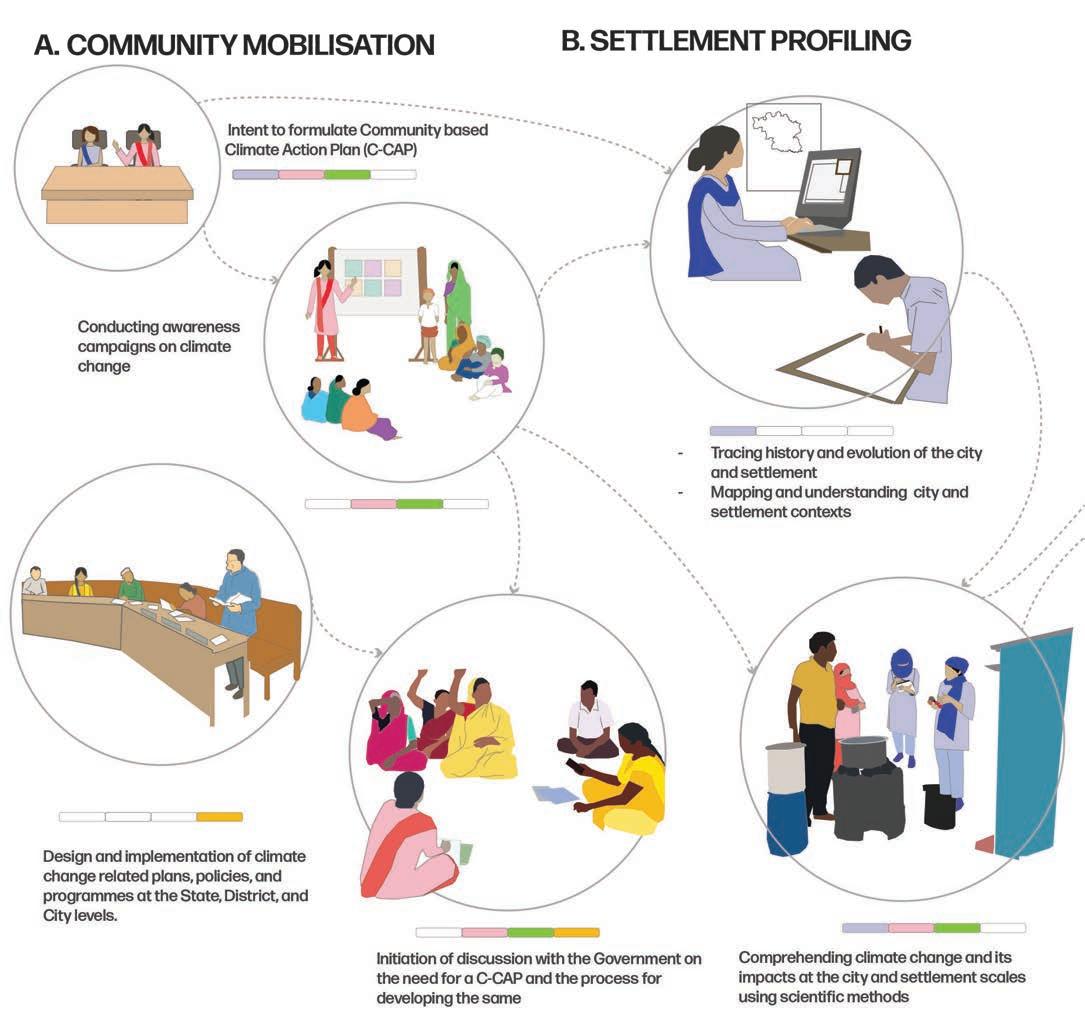
The action research focused on three settlements in the city of Bhopal. The three settlements are representative of varying socio-spatial contexts.

1. Nehru Colony, located in an industrial area adjacent to a small lake
2. Indranagar, located in a commercial area close to the largest lake in the city, the Bada Talab/Upper lake
3. Bagsewaniya, located in a commercial area close to a nallah (open drain)
8 Community based Climate Action Plan (C-CAP)
1 3 2
The study anchors on the premise that a ground-up understanding of the city, especially the urban poor settlements that are more or less invisible is a critical starting point to evolving grounded potential adaptation and mitigation efforts. Against this premise, the research acknowledges the following two limitations: First, community-based climate action plans in themselves are not sufficient to adapt to the changing climate. There is always a need for external support, resources, and efforts to reduce or remove the underlying hazards- many of which are beyond the scope and power of a community-based plan (Dodman & Mitlin, 2013). Further, for adaptation (and eventually mitigation) to be effective, coherent planning is required at a range of scales- from national to (hyper) local. While the C-CAP is illustrative of hyper-local efforts, a truly hyper-local effort would be centred around defined neighbourhoods (wards) that are inclusive of, yet much more than an urban poor settlement.
Second, the study accepts the limitation of community centred efforts in evolving a futuristic plan. Their socio-economic precarity limits them from looking beyond short-term goals into more futuristic or community centric ones. This is where technical assistance, which is timely and appropriate, can play a transformative role. Technical assistance can aid communities in chalking out a plan that is cognisant of not just their individual realm, but even community and environmental ones as well. Technical assistance can also increase the chance of successful implementation and sustainability of efforts by balancing scientific and technical knowledge with local communities’ knowledge of what would work in their specific context (Foster-Fishman et al., 2001). In the production of the C-CAP, technical assistance has been two-fold. One, in empowering the community to think beyond short term goals by increasing their awareness around climate change, help them in collating their issues and challenges in the context of climate change, and developing an action plan to respond to these challenges. Second, technical expertise was plugged in to develop passive, but technically robust solutions based on scientific data and knowledge. More importantly, these were developed considering the action plan developed by the community as the foundation.
Finally, the C-CAP foregrounds the need for ‘visibilising’ these communities in formal planning frameworks and linking community-neighbourhood- city planning efforts in the context of climate change. It reiterates that potential pathways for dovetailing community led climate action plans into the larger climate planning frameworks- in effect visibilising/ formalising the local adaptation efforts- need to be co-created.
9
Climate
Plan (C-CAP)
Community based
Action
ABOUT
THE
C-CAP
This document presents the C-CAPs for all the three selected settlements in Bhopal. The Plans include both programmatic as well as design solutions that contribute to not just climate resilience but better quality of life for the selected communities.
Programmatic interventions include workshops (with city and government stakeholders) and campaigns (to trigger behavioural change amongst communities). These need to be carried out not just during the C-CAP preparation period, but even beyond. The importance of these interventions is two-fold: first, to help the community own and sustain the solutions; and second, to demonstrate potential pathways to integrate the C-CAP and its development process with city level climate action planning. In effect, the proposed programmes and solutions are mutually constitutive for effective impact.
It is to be noted that the solutions put forth are demonstrative prototypes for each of the two scales, which can be replicated after necessary contextualisation.
The design solutions proposed in this report demonstrate two intervention scales- neighbourhood scale and city-settlement scale. The C-CAP for Nehru colony demonstrates the former: solutions at the settlement scale, where benefits would primarily be accrued by the settlement. In contrast, the the solutions demonstrated for Bagsewaniya and Indranagar, are mainly at the settlement-city (interface). Many climate-change impacts within the informal settlements depend on city-wide infrastructure. The proposed solutions for both these settlements provision not just the settlements, but also the neighbourhood in which these are located- necessitating effective collaboration between city and settlement stakeholders. The long-term objective is to integrate the settlement with the rest of the city.
THE APPROACH
The project anchors on a collaborative planning approach involving four key stakeholders:
1. the community, that grapples with the harsh experiences of climate change while aspiring for an improved quality of life
This document – the Community Based Climate Action Plan or C-CAP is a co-produced outcome of this collaborative approach.
2. the NGO/CBO, which engages with and empowers the community to adapt and work towards an improved quality of life
3. the technical partner, which works with the NGO/ CBO and the community to craft contextually suited solutions that respond to their needs, aspirations, issues, and challenges
4. the government, which has the mandate and the power to formalise/institutionalise these solutions.
10 Community based Climate Action Plan (C-CAP)
Co-production partners and their roles
The Community The NGO/CBO
The Community is the stakeholder most impacted by climate change and is the owner and end user of the C-CAP. While ‘the community’ in consideration here is the entire population of informal settlement, the C-CAP development process involves community leaders/representativeswho will be the voice of the entire community.
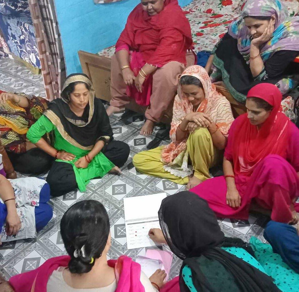
The NGO/CBO is responsible for mobilising and engaging the community in the C-CAP development process. Their role is critical in nudging, and in some cases driving the community in elucidating not just their priorities and needs, but their knowledge and capacities as well. This is facilitated through participatory tools like oral histories, focus group discussions, social mapping, visual tools etc. for awareness generation and eliciting experiential knowledge from within the community. Gujarat Mahila Housing Sewa Trust (MHT) has been engaging with the communities for over a decade.
12 Community based Climate Action Plan (C-CAP)
The Technical Partner

The Technical Partner guides the overall C-CAP development process. Premised on the knowledge and experiences of the community, the technical partner design interventions for furthering adaptation. They support and guide the NGO in driving the community engagement. The technical partner engaged here was Integrated Design (INDÉ), a planning and design practice engaged in curating sustainable human and natural habitats.
The Government
The Government includes the local elected representative (ward councillor) as well as the city and state level officials.
13 Community based Climate Action Plan (C-CAP)
STRUCTURE OF THE BOOK
The following section of this report (Section 5) begins by giving a brief overview of Bhopal city in the context of a changing climate and its impact on urban informality. This understanding lays the context for delving deeper into the three selected study areas. Sections 6, 7, 8 describe the CCAP for Nehru colony, Bagsewaniya, and Indranagar. The process followed in the preparation of the C-CAP is broadly divided into six phases.
A. Community mobilisation
B. Settlement profiling
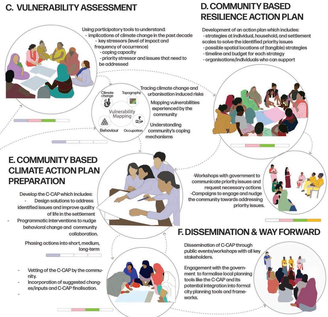
C. Vulnerability assessment
D. Community’s roadmap to resilience
D. Community based resilience action planning
E. Community based climate action plan preparation
F. Dissemination and way forward
The activities carried out in each of these phases and the interlinkages between these are illustrated in the process diagram (See the Page 20) and is briefly described below. The diagram also illustrates the primary stakeholder(s) involved in each of these activities
Community Mobilisation
The process started with the NGO/CBO mobilising the community towards the need to prepare a C-CAP. This was initiated through awareness sessions on climate change.
Settlement Profiling
In parallel, the technical partner profiled the settlement w.r.t the city level socio, economic, ecological, and spatial contexts. As a part of profiling, settlement level spatial maps were developed using QGIS and data from google earth imagery.
14 Community based Climate Action Plan (C-CAP)
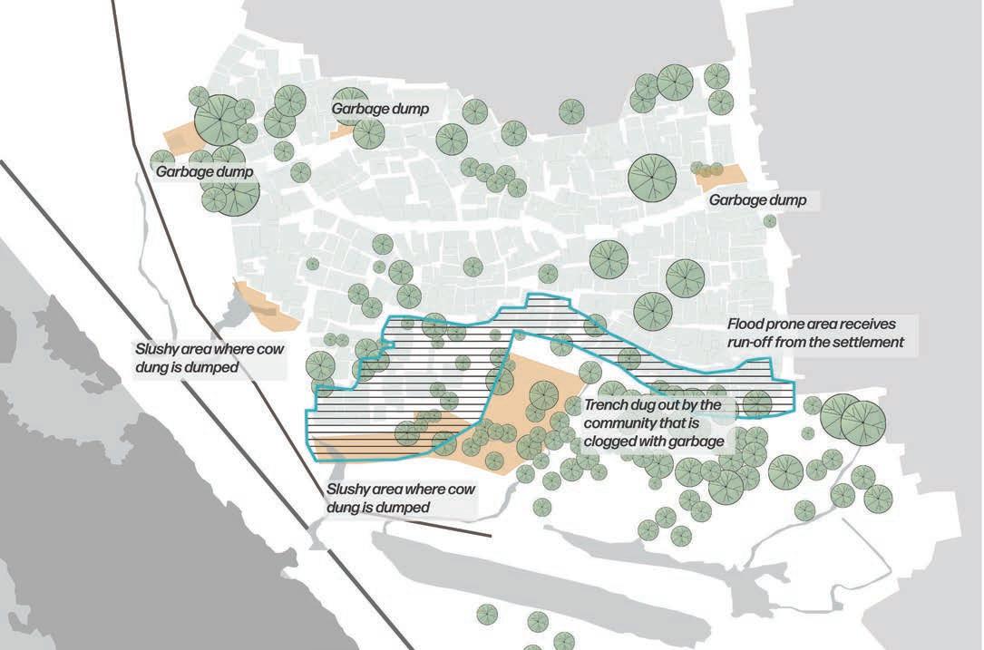
Ground truthing and refinement of these maps were carried out during site visits. The exercise captured key elements in the built and unbuilt fabric including:
• area wise material and height of built structures
• location of services like drains, community toilets, water taps, etc.
• vegetation cover and open spaces
• general topography
• any other features of interest like garbage dumps, water bodies, religious structures, etc.
Vulnerability Assessment

Understanding climate induced challenges faced by the urban poor communities requires a framing of the everyday experiences against scientific information and knowledge around changing climates. Combining these two becomes critical for developing successful climate change adaptation solutions at the community level.
Community based Vulnerability Assessment
As a first step towards this, the communities were encouraged to frame their experiences around changing climate and its manifestations. Awareness around climate change and its causes plays a key role here. Growing research indicates that acknowledging and compre hending the existing coping strategies used by informal settlements is critical to develop ing contextually suited adaptation strategies and to generate community ownership and commitment to these (Jabeen, Johnson, & Allen, 2010). In line with this understanding, existing coping strategies adopted by the community to respond to the vulnerabilities were discussed and explored.
CBVAT or Community based Vulnerability Assessment Toolkit, developed by MHT was used as the engagement tool in this phase. This is a participatory learning tool us ing a set of 6 exercises designed to build a community’s understanding about climate risks and adaptation strategies. A series of charts and tables are provided to communi ty members, guiding them to identify the stressor against which the community
15 Community based Climate Action Plan (C-CAP)
is most vulnerable. The CBVAT process helped the community in discussing the livelihoods and daily activities that are most affected due to these impacts and to assess the root cause of the vulnerability and their adaptive capacity. These discussions helped the community to rank the key issues/stresses that they face.
Vulnerability assessment through scientific data
While the experiential information and data from the community is highly valuable for understanding and addressing their challenges and issues, substantiating, and evidencing these with technical/scientific information is critical.
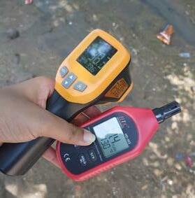
Climatic data collection
Data on the climatic parameters like ambient temperature and relative humidity were collected for around 25 to 30 locations across the settlements. Apart from these parameters, surface temperature, material, and colour were also measured for different types of surfaces in the settlements (like streets, wall, roof, soil, etc.).
Heat stress modelling
Using the climatic data, measured data from the field and settlement maps, temperature models were developed for the settlement using the simulation software ENVIS-met. The modelling exercise helped in illustrating how different built and unbuilt elements contributed to heat stress in different areas within the settlement.
The software was also used to demonstrate how the proposed interventions could contribute to reducing heat stress in different areas in the settlement.
16 Community based Climate Action Plan (C-CAP)
Community’s roadmap to resilience
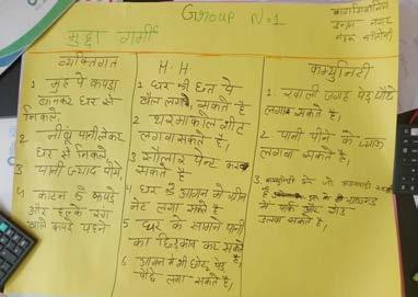
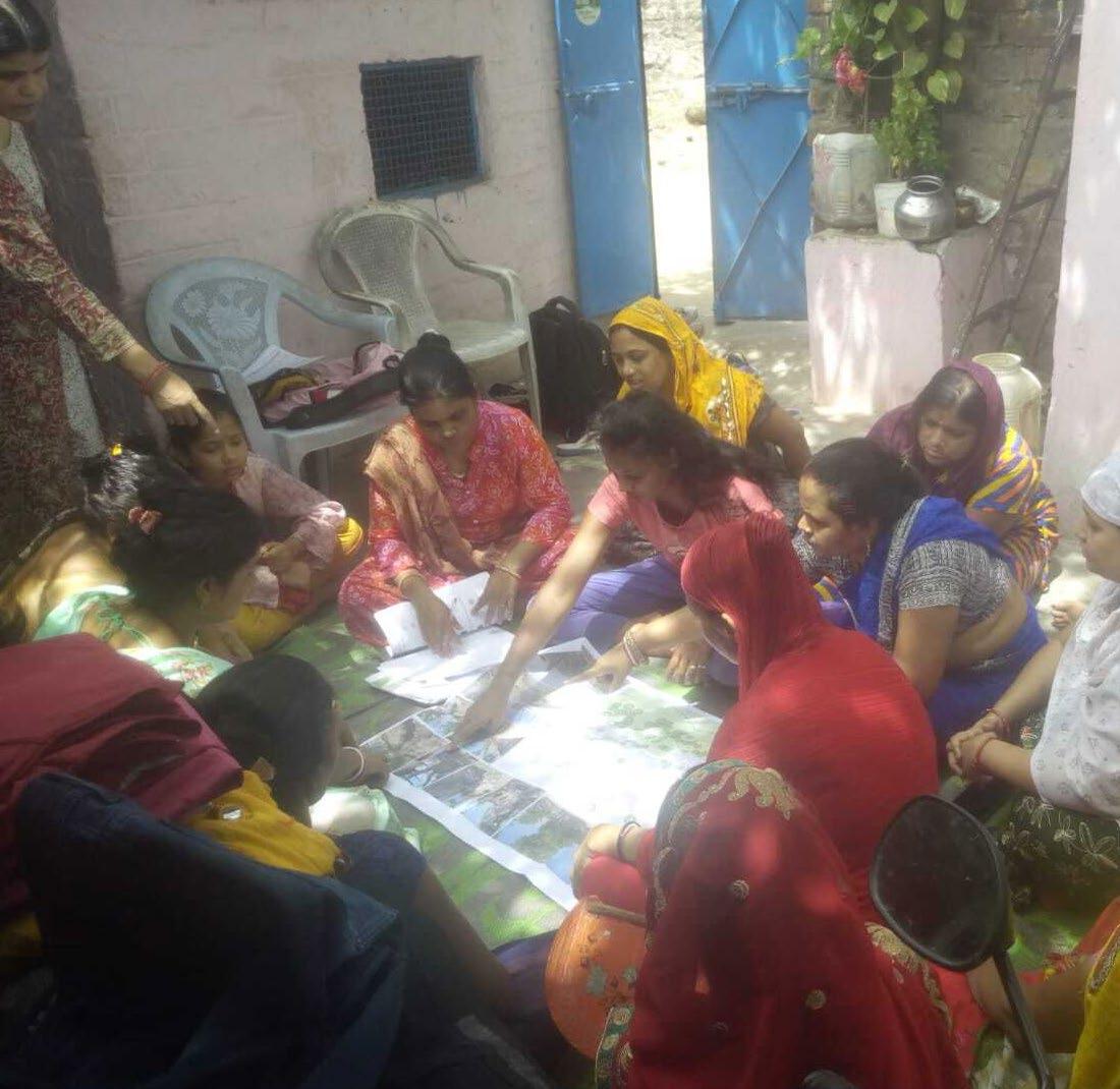
Following the vulnerability assessment carried out by the community (through the CBVAT), the community came together to chalk out an action plan for addressing the identified key stressors. This process called the CBRAP or Community Based Resilience Action Planning, developed by MHT, guided the community to develop the action plan which classified measures at three scales - individual, household and settlement level. Each measure/action included the time required for the same, the daily/weekly/monthly goals, required funding and organizations/agencies who can support the communities in implementing these action plans.
A social mapping exercise was also carried out as a part of the CBRAP process, where spatial maps (prepared during settlement profiling) were used by community women to spatially locate issues and potential sites for interventions. These provided entry points to design solutions drawing from the community’s insights, needs, and aspirations.
Community based Climate Action Plan (C-CAP) Preparation
The technical partner assessed the solutions and action plan worked out by the community and refined and strengthened the same based on contextual understanding and technical knowledge.
The preceding steps helped in understanding community vulnerabilities- both experiential as well as what emerged from scientific assessments. Further, the action plan developed by the community provided critical entry points to target adaptation through design. Taking cue from these insights, the C-CAP, entailing design solutions as well as necessary programmatic interventions, was chalked out for each settlement.
CBVAT and CBRAP are tools developed by MHT; any similar set of engagement tools can be used in the C-CAP development process.
17
based Climate
Plan (C-CAP)
Community
Action
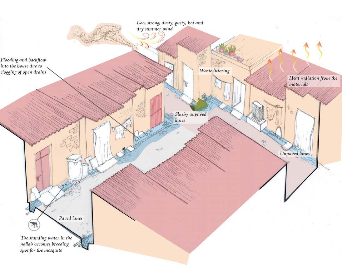
Enhanced vulnerability to urban floods (due to where they live) and increased heat stress (due to their inability to control the temperature of where they live and work) necessitated cost-effective and sustainable adaptive solutions which can provide potential co-benefits. The design solutions thus weave natural features, existing built fabric, and community processes to enhance resilience and reduce vulnerability of the community and natural systems (they depend on) to climate change. The solutions focus on restoring and rehabilitating urban ecosystems that could lead to multiple benefits for the communities- like reduction of heat stress, flooding, pollution, and at the same time provide co-benefits like food and income security. The design stages include :
• Identifying a network of community spaces
• Zoning of identified network
• Existing situation assessment for each zone
• Designing solutions
The C-CAP also includes programmatic interventions which need sustained efforts (to be initiated simultaneously) much beyond the C-CAP preparation and implementation period. These include workshops with government stakeholders, campaigns to trigger behavioural change amongst communities, community level collaboration, etc. The proposed solutions and programmatic interventions are then phased into short (1-2 years), medium (2-5 years), and long term (>5 years) indicating the expected time required to implement the solution
Once prepared the C-CAP is discussed and vetted by the community before it is finalised.
C-CAP Dissemination and way forward
The C-CAP (inclusive of the process) is disseminated through public workshops involving all key stakeholder. Engagement with government stakeholders is carried out throughout the C-CAP development process to ensure uptake and potential integration into formal city planning tools and frameworks.
18 Community based Climate Action Plan (C-CAP)
19 Community based Climate Action Plan (C-CAP)
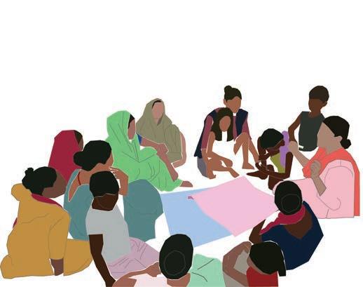
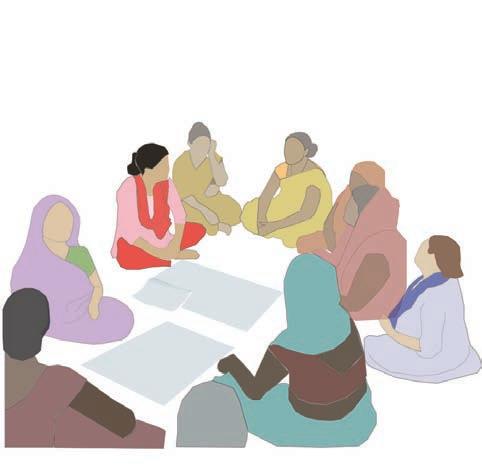
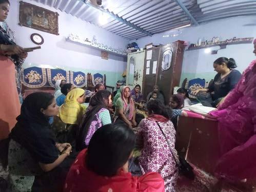
Amidst community engagement
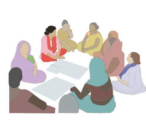
CO-PRODUCTION PROCESS
20 Community based Climate Action Plan (C-CAP)
The full image is available on Page 112 of this document.
21 Community based Climate Action Plan (C-CAP)
ABOUT BHOPAL
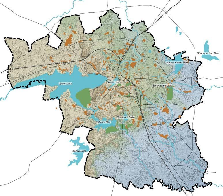
Bhopal, the capital city of Madhya Pradesh is the second most populous city in the state with a population of 19 lakhs (as per census 2011). The city is nestled in a hilly terrain with the Malwa plateau to the north and the Vindhyan/Vindhyachal mountain range to the south. The hillocks to the southwest and northwest form a continuous belt from Singarcholi up to Vindhyachal range. There are a total of 18 reservoirs in the city. The total area under water bodies (54.95 Sq. Km) which includes lakes, rivers and streams constitutes approximately 5% of the Bhopal planning area). Bhojtal commonly known as Upper Lake is the major water body of city.
23 Community based Climate Action Plan (C-CAP)
Municipal Corporation of Bhopal’s logo
The Changing Climate of Bhopal
The city of Bhopal has a sub-tropical hot summer, dry winter, and a well distributed rainfall (the southwest monsoon) between June-September. The Bhopal Climate Change and Environment Action Plan (CCEAP), Government of Madhya Pradesh notes the changing climate evidenced by higher temperatures, intense rainfall, and an increase in extreme events like floods, droughts, and heat waves.
The report states that the temperature across Bhopal starts increasing from February and peaks in May with the daily maximum temperature peaking to 420C. However, since the 1990s, the maximum temperature is showing a significant increase during April and May. The number of days experiencing extreme heat conditions (above 430C) rose significantly (Shukla, 2022) from 10 days in April 2021 to 28 days in April 2022 (Akanksha & Chanchal, 2022). The maximum temperature for Bhopal (45.30C) was recorded in May 2018. In May 2022 the city witnessed a maximum of 45.10C (TNN, 2022). The mean percentage of warm days have increased by 10% between 1986 to 2005.
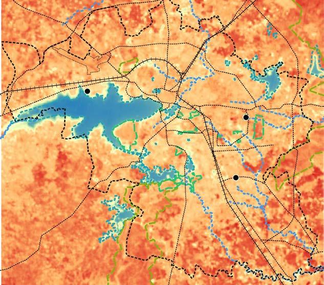
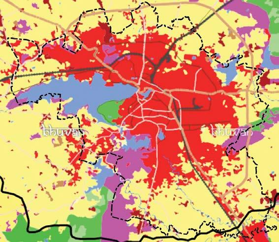
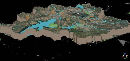
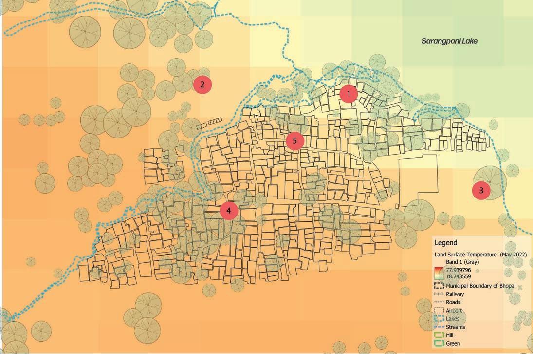
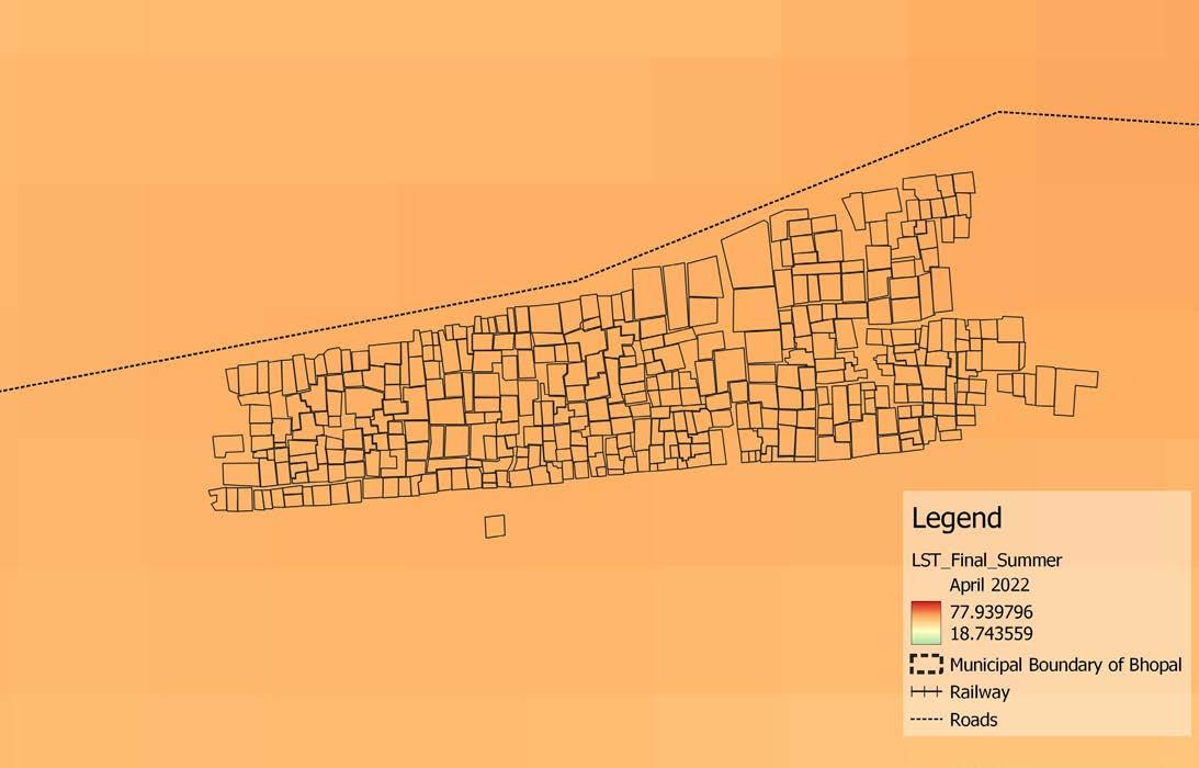
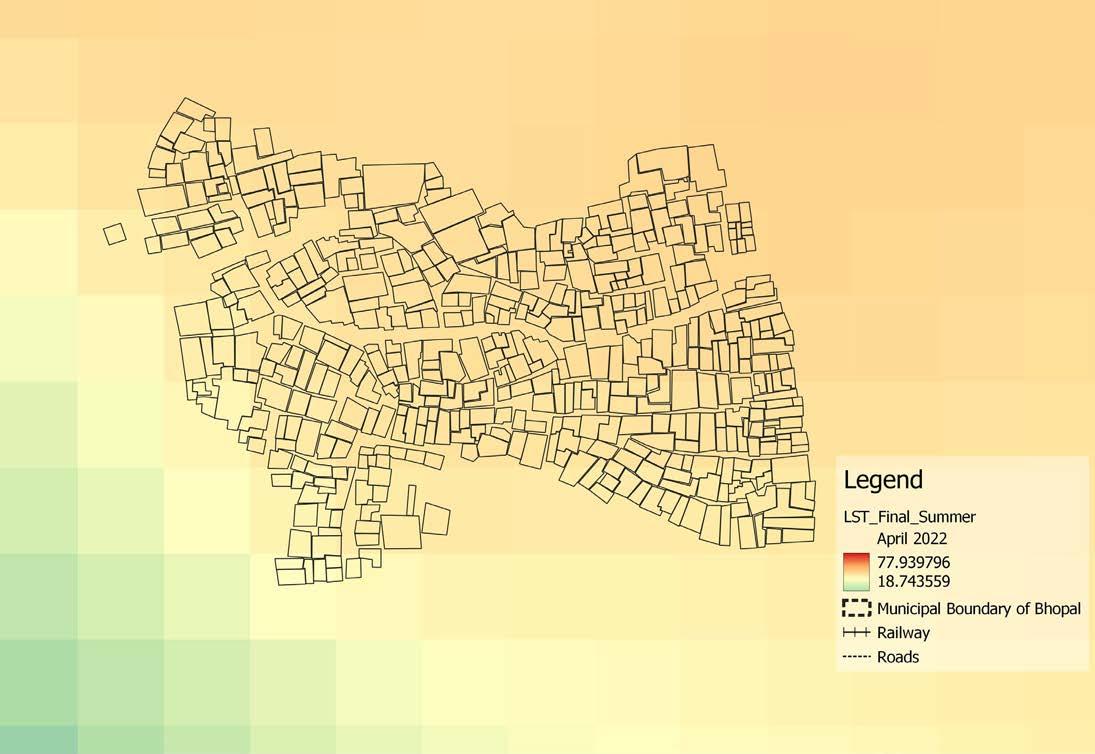
The following image compares the Land Surface Temperature (LST) map of Bhopal city on 29th April 2022 with the Land Use Land Cover (LULC) map. LST is the temperature of the top surface of the earth which is in direct contact with the measuring instrument. Research indicates that LST is highly dependent on natural and anthropogenic factors that can be understood through the LULC map of an area (Solanky et al., 2018). As can be seen from the two maps, lakes, and green cover in the city play an important role in reducing the LST. However, even within the built area of the city, the LST will depend on the type of development. For example, the temperature is relatively higher near the location of settlement 2. This is attributed to the industrial area of BHEL (Bharat Heavy Electricals Limited).
The CCEAP also points to variations in the rainfall pattern for Bhopal (district) as well. The analysis carried out in the report shows that this variation is especially high in the number of rainy days in July and August (analysis carried out for the period 1951- 2018). Variations are leading to intermittent and intensifying spells of droughts as well as rainfall events, the most recent evidence being the heavy rainfall (16.5 cm over 24 hours) in August 2022 that led to floods across various parts of the city with the low-lying areas being the most affected (Staff Reporter, 2022).
24 Community based Climate Action Plan (C-CAP)
Indranagar
Nehru Colony
Land Surface Temperature of Bhopal (April 29th, 2022) (Landsat, 8)
Indranagar
Nehru Colony
Bagsewaniya Bagsewaniya
Land cover map of Bhopal and hinterland (Bhuvan, 2016)
25 Community
Plan (C-CAP)
based Climate Action
Climate change and urban informality
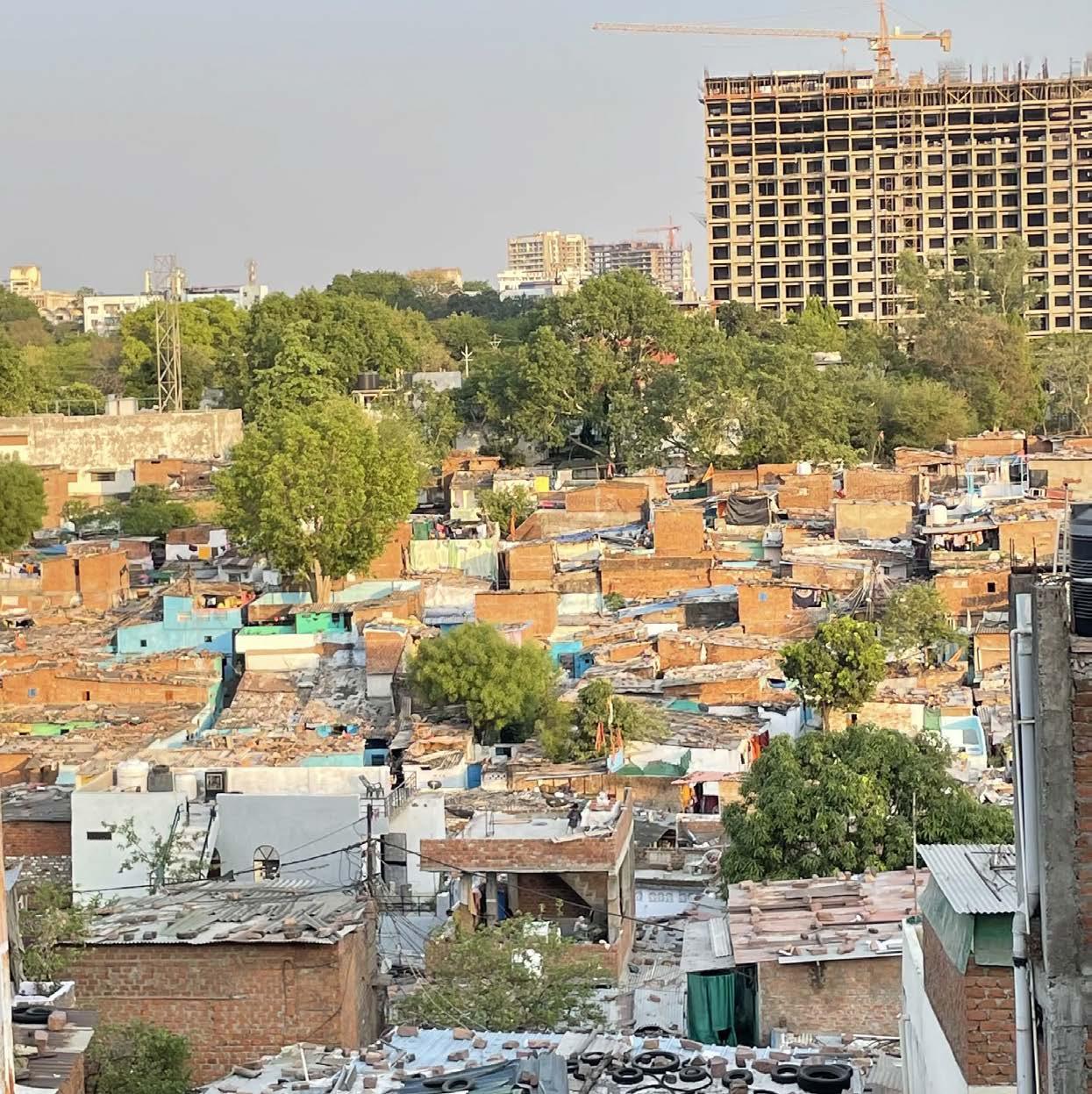
Rapid urbanisation, in low- and middle-income countries including India, is often accompanied by a rapid growth in informal settlements (IPCC, 2014). These settlements are often situated on lands which are highly vulnerable to the impacts of extreme climatic events. The implications on the lives and livelihoods of the urban poor due to these vulnerable spatial locations are immense. Low incomes, inadequate housing, and limited voice in governance further exacerbates their vulnerability to climate risks (Sverdlik et al., 2019).
This spatial pattern of informality can be seen in the case of Bhopal as well. As per the Bhopal Development Plan 2031, 27% of the total population of the city resides in slums. As per the ‘Sustainable City Strategy – Bhopal, 2022’ prepared by the Bhopal Municipal Corporation (BMC), informal settlements have grown exponentially across the city in the past 20 years. As per this report, there are 388 informal settlements in the city, which are home to 36% of the city’s households, located on just 8% of the total city area. A study carried out by the Department Civil Engineering in Rajiv Gandhi Proudyogiki Mahavidyalaya Bhopal in 2015 reveals that that 35% of the total slum population in Bhopal is in the new Bhopal Area on land that mostly belongs to the government. Around 33% of the slum population lives in the Old Bhopal Area, and the remaining slum population is sparsely
26 Community based Climate Action Plan (C-CAP)
Water marks on the houses on the low lying zone of Upper Lake’s catchment’s area
Spatialisation of informality in the city of Bhopal (USGS)
distributed at the city fringes and outgrowths.
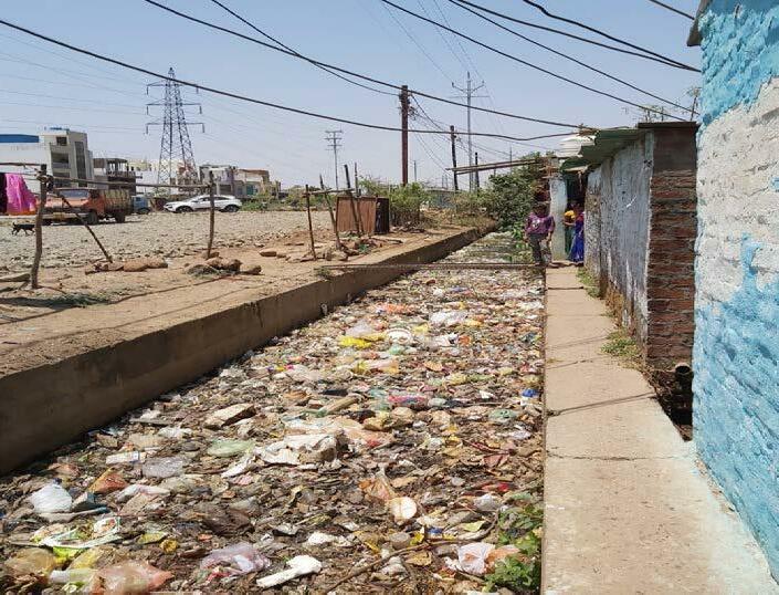
As per the assessment carried out in the ‘Sustainable City Strategy – Bhopal, 2022’, 23% of the total slums in the city (90 slums) are located on eco-sensitive areas. The adjacent map shows the location of informal settlements in Bhopal mostly along water bodies/ streams nallahs and green areas. A few are located along major road and rail networks. This proximity to water bodies increases the vulnerability of urban poor settlements to floods and water borne diseases. In 2020, as many as 150 slums in the city were swept away in floods caused by heavy rainfall (Staff Reporter, 2022) . Many low-lying areas were also severely impacted during the deluge in August 2022 (Singh, 2022).
27 Community based Climate Action Plan (C-CAP)
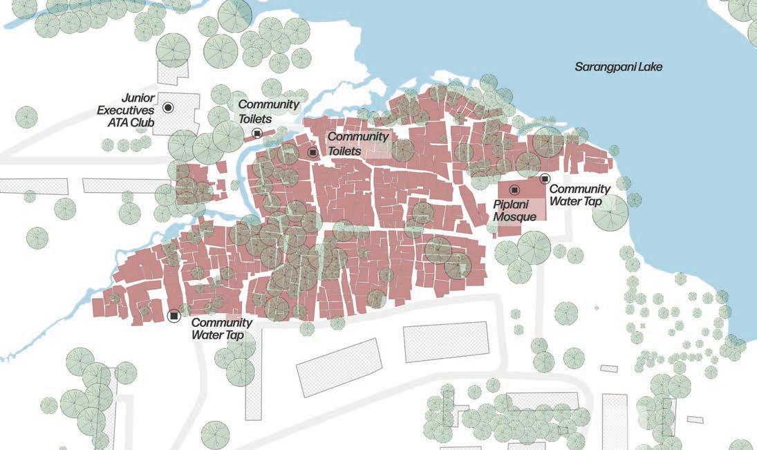
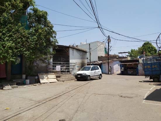
Population : 2,000 Households : 600 Area : 5.42 Acres Age : Around 60 years Location : Piplani, BHEL Town (Bharat Heavy Electricals Limited) Status: Notified NEHRU COLONY
Settlement Profiling
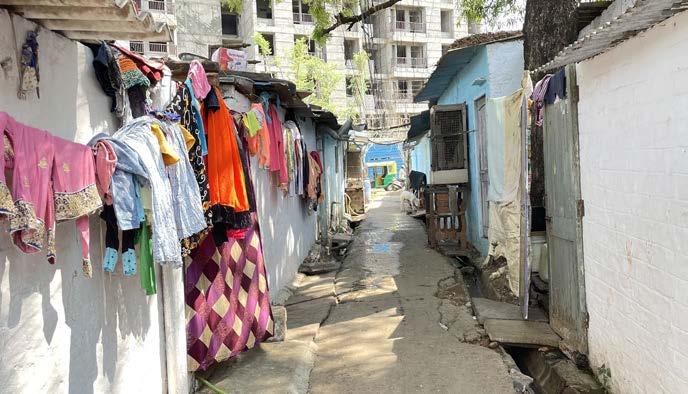
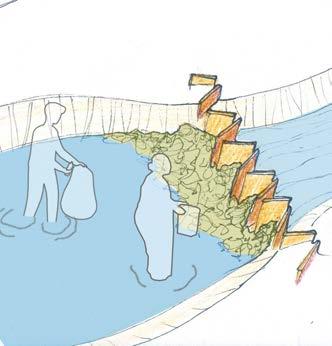
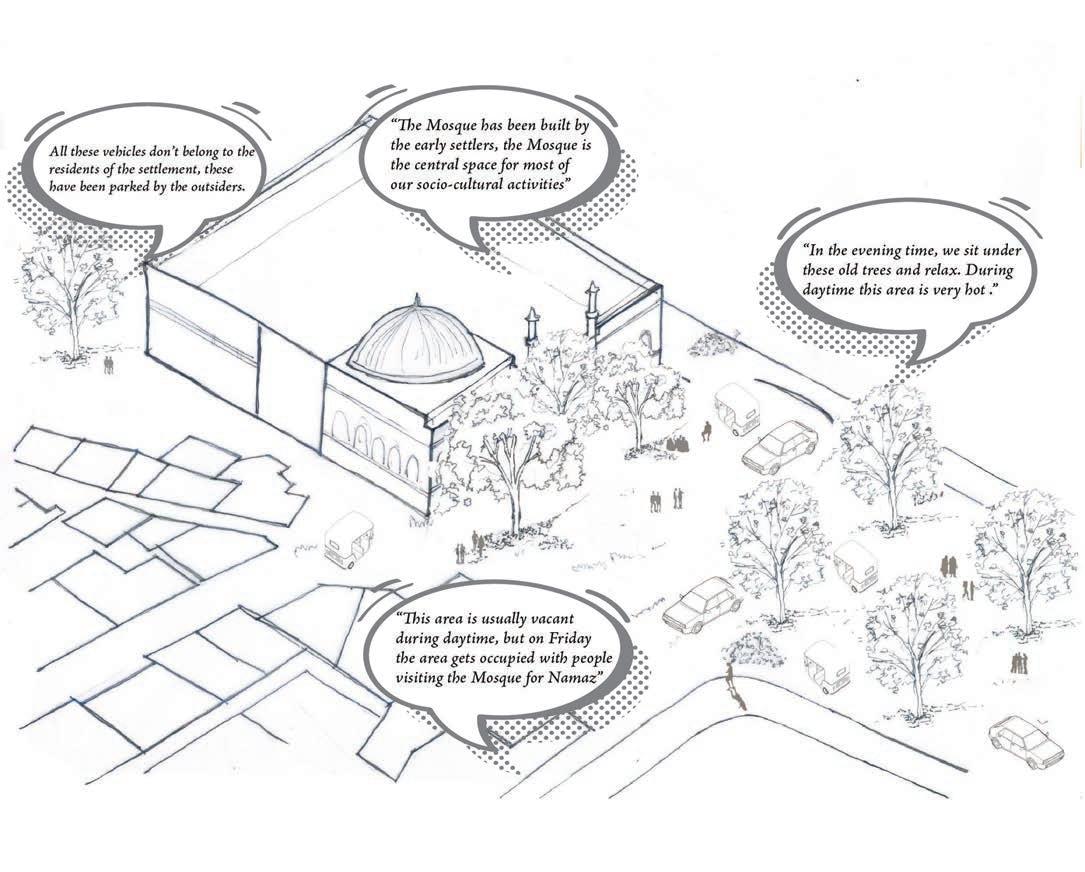
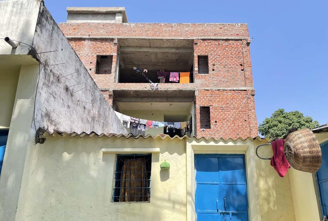
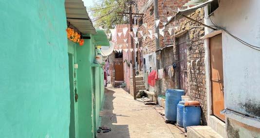
Nehru Colony is located on the southwest edge of Sarangpani Lake (ward 63, zone 15). The settlement started with the squatting of 3 to 4 households (in the area where the Piplani Masjid is presently located) and expanded over the years. The settlement is predominantly occupied by the Muslim community with a few Hindu families having recently moved in. The Piplani Masjid, constructed by the community is located on the eastern periphery of the settlement. The settlement has a few large trees (located in proximity and within the settlement) such as Jungli Jalebi, Ber, Guava, Neem, Mungi Falli, Wild Babool. The lake edge is covered with thick shrubs.

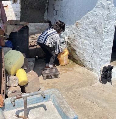
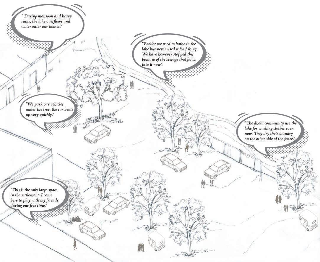
The residents of Nehru colony are majorly engaged in daily wage labour – construction work, vending, painting, and cycle repair shops. A small proportion of working women are engaged in domestic work in the neighbouring residential areas. A Dhobi community resides close to the settlement and uses the Sarangpani lake and its surrounding for their livelihood activities.
The community has always relied on borewells (installed by the Corporation) for water. The water is accessed through community taps; the first one of which was located inside the Masjid. The community reported on poor water quality and resultant health issues such as greying of hair and skin problems. Additionally. the community relies on water cans from the nearby Kacchi Market in Piplani. Fights over water access is a common issue in the settlement, given that the water supply is restricted to a few hours in the morning. Most houses have individual toilets connected to a soak pit, mostly located outside their houses. There are also community toilets largely shared by women. These are located
30 Community based Climate Action Plan (C-CAP)
Settlement map
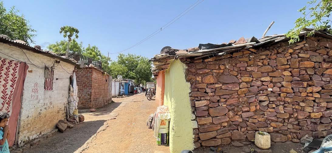
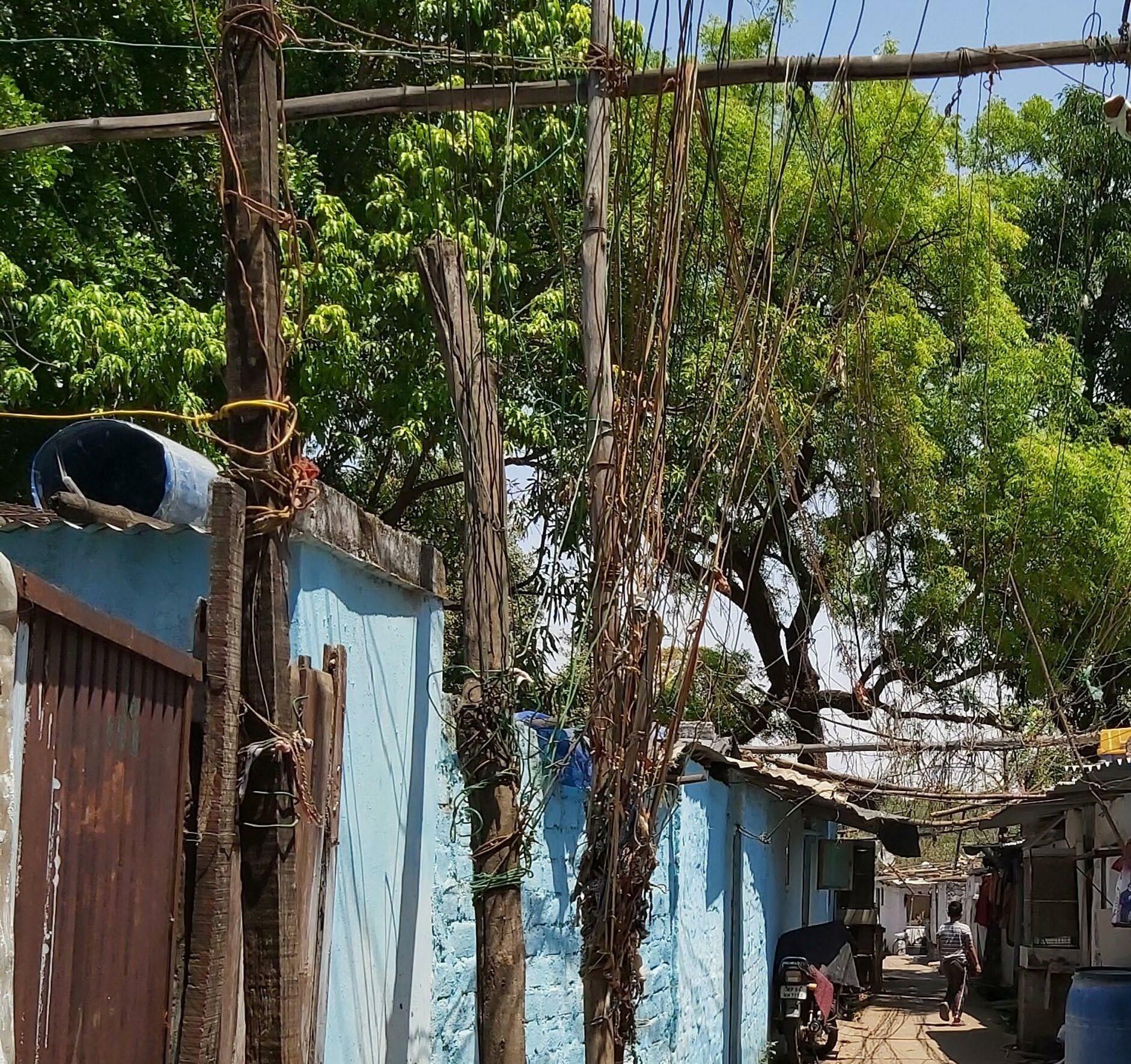
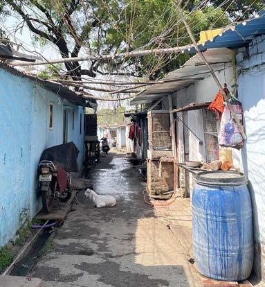
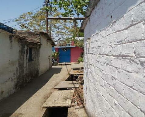
on the north-wester periphery along a nalla. Drainage is a major concern as the settlement is only partially serviced with storm water drains. Internal lanes (old areas) are mostly concretised with drains on either or both sides. Lanes towards the periphery (new areas) are mostly kutcha. These lanes are haphazardly layered with Dambar sheets (bitumen sheets used as a water proofing material) sourced from nearby construction sites by the community residing along these lanes. Being waterproof, Dambar helps in keeping these kutcha lanes non-slushy. Housing in the older areas of the settlement is made of brick walls with tin or asbestos sheets (occasionally lined with cloth) as roof. The newer structures located on the periphery use tin/asbestos/dambar sheets for both roofs and walls. Owing to its location on the BHEL land, the settlement does not have legal electricity connections.
Left: Community has collectively contributed to concretise the drains
Right: Community taps in the settlements
“As we occupy BHEL land, we don’t receive municipal services. One community tap is shared between 17-18 households. Drainage is a major issue in the settlement, only few lane are serviced with nallah system”
Focus Group discussion (April 27th 2022)
31 Community based Climate Action Plan (C-CAP)
Stream along the settlement
Vulnerability Assessment
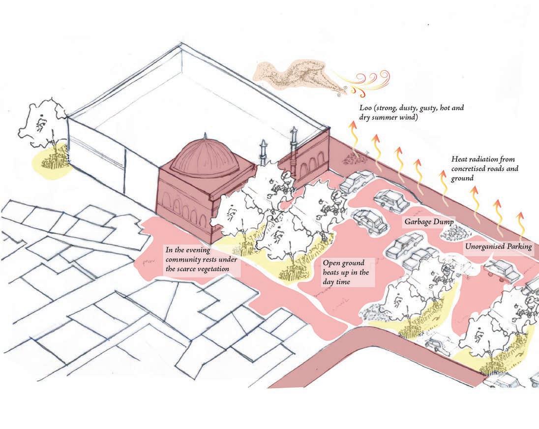
Heat stress, unsanitary conditions and vector propagation were the main issues that emerged from the CBVAT exercise.
Heat related stress was reported to have an impact on livelihood and health of the community.

Heat Stress Water Logging
Absence of proper drainage system has aggravated the issue around water logging
Vector Nuisance

Inadequate sanitation and polluted lake has increased incidences of vector related issues.

32 Community based Climate Action Plan (C-CAP)
I II III Vulnerability map (based on community’s lived experiences)
Community based Vulnerability Assessment
Open drains aren’t cleaned by the authorities, these get clogged due to the solid waste mismanagement that mediate backflows in the monsoon season and mosquito breeding.
All the nallahs flow into the stream that merge into the Sarangpani Lake
“Water logging and vector borne diseases were reported to be experienced on an average by 100 households at Nehru Colony. ”
33 Community based Climate Action Plan (C-CAP)
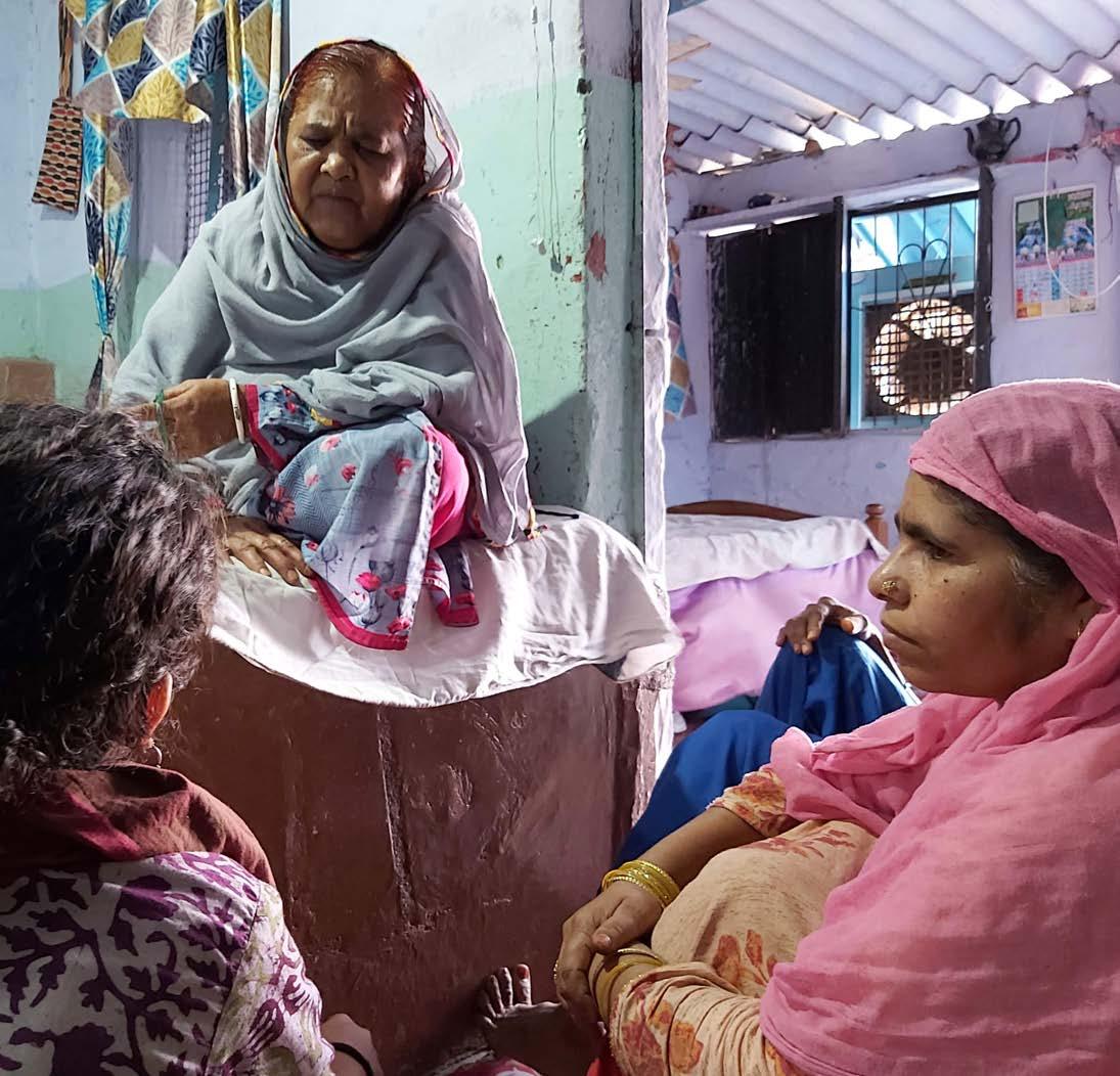
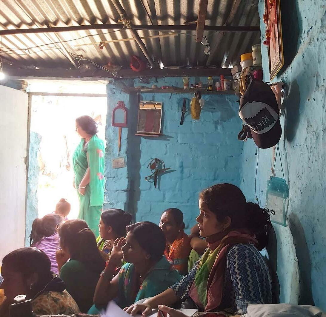
Focus group discussion with CAG members
Vulnerability Scientific Assessment
Bhopal City Average - 410C
Average Temperature - 410C
Average Temperature - 440C
Average Temperature - 490C
#
Refer to temperature profile on the adjacent page
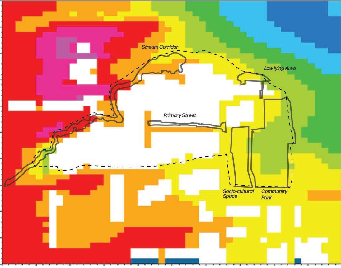
Land surface temperature of the settlement (April 29th, 2022 - LANDSAT 8 )
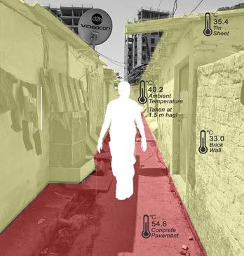
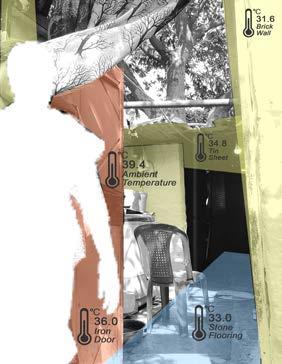
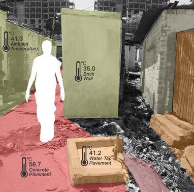
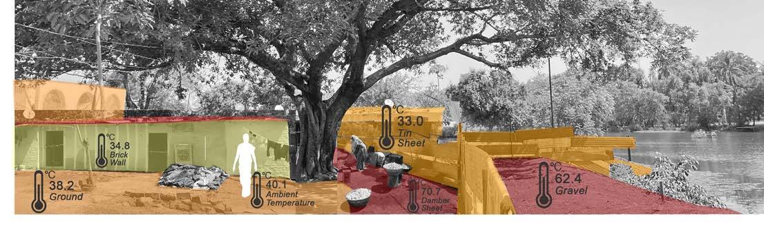
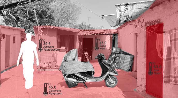
The experiential information from the communities was gathered through focus group discussions, free flowing community/individual interviews, and CBVAT. Heat stress, unsanitary conditions and vector propagation were the main issues that emerged from these discussions.
The temperature measurements were taken at different spaces in the settlement and correspond to varied surfaces. The ambient temperature measurements were taken under the shade, or in the middle of the room.
Heat was sighted to be an emerging issue for the community, in the past 10-15 years, heat stress has been experienced more frequently.
34 Community based Climate
Plan (C-CAP)
Action
Legend
Less than 32 Temperature Profile (0C) 32-36 36-40 More than 60 40-60
Ambient and surface temperatures were measured for different areas in the settlement during peak summer afternoon (1100 - 1400 hrs ). These are illustrated in the temperature profiles in the above images.
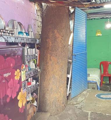
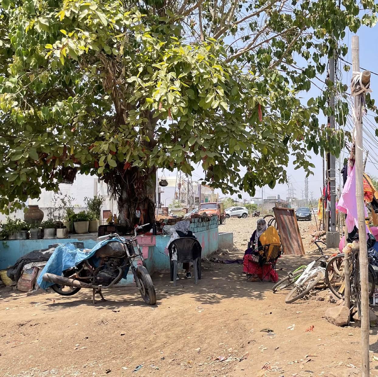
“A lot of vegetation has been cleared in the area. During summer, the community members relax under the tree shade in the common areas. Some of the houses have also made an effort to retain the trees and have constructed their homes around them”.
Focus Group discussion (April 27th 2022)
35 Community based Climate Action Plan (C-CAP)
1 3 4 5
2
Coping Mechanisms
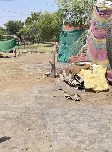
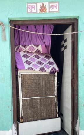
In Nehru colony, some of the strategies used by the community are illustrated in the photographs below. To combat heat stress, use of desert coolers is widespread. Other efforts include keeping planters on rooftops, building hutments around existing trees, using old cardboards and green sheets as vertical shades, etc. Houses along unpaved lanes use dambar/bitumen sheets (water proofing sheets used in construction) to cover these lanes. This helps avoid the unpaved lanes to become slushy and unusable during rains or from water leakage from pipes.
36 Community based Climate
Plan (C-CAP)
Action
Dambar (bitumen) sheets used to waterproof areas outside homes
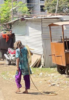
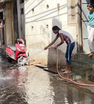
Hose pipes as a means of last mile water accessibility
Dessert Coolers used to address summer heat Houses conciously built around the canopy
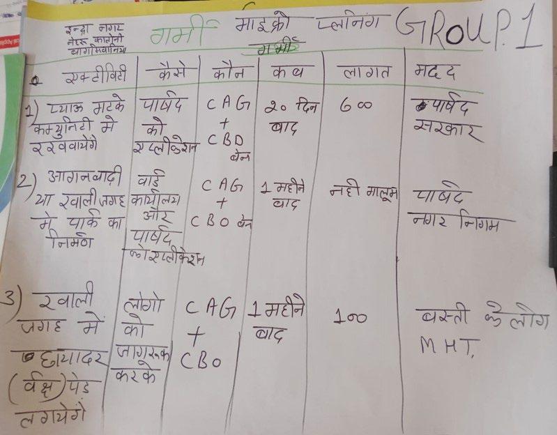
Community’s roadmap to resilience
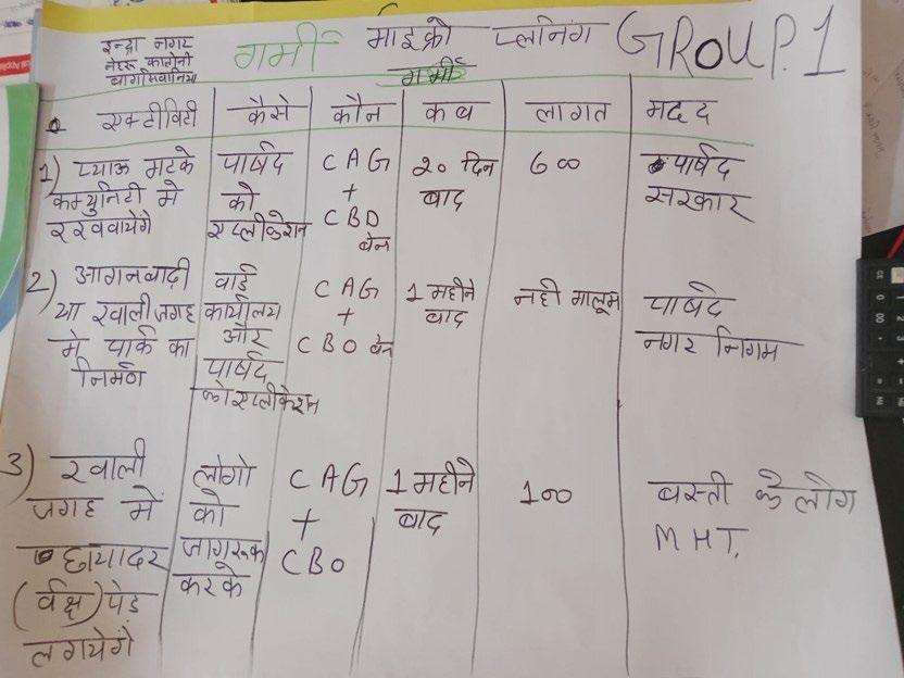
Given the prioritisation of heat stress by the Nehru Colony residents, a plan to combat heat on priority was worked out during the CBRAP process. Similar plans were arrived at for addressing vector borne diseases, and water logging. During the CBRAP process the community used maps to spatially locate issues and identify potential sites for interventions. These plans, along with insights on needs, and aspirations served as a potential entry point to design short- and medium-term solutions.
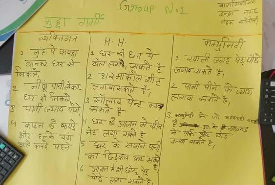

The micro plan includes:
1. Activity to be undertaken, 2. The key stakeholder involved, 3. Time frame for the activity and
4. Financial support required for its implementation
37 Community based Climate Action Plan (C-CAP)
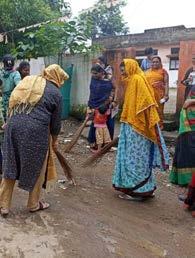
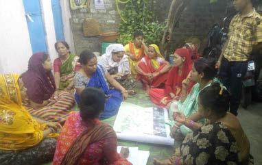
Focus group discussions to re-visit the identified vulnerabilities and collaboratively work on the solutions
Priority areas of engagement highlighted by the community
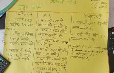
Micro plan that emerged from the community for the three settlements
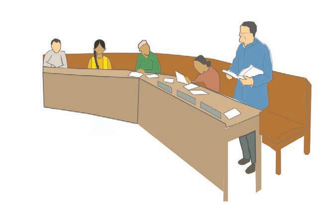
Community – Government Interface
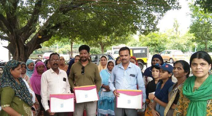
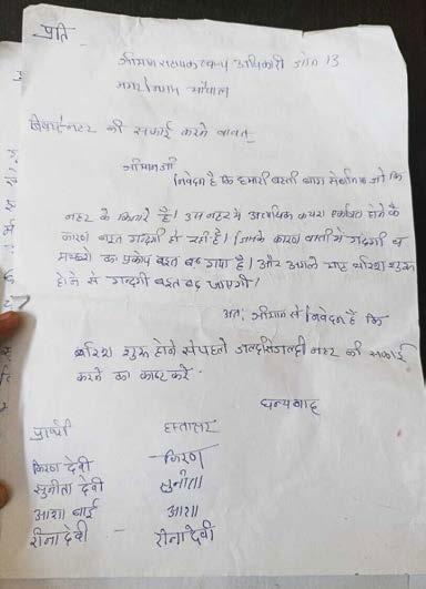
As an initial step towards operationalising the action plans, a multi-stakeholder workshop was organised with the support of MHT, where the community voiced the emerging challenges (from the CBVAT process), the solutions they identified and the support they sought from the municipality to implement the solutions. Conversations included, challenges of sanitation and solid waste management, irregular garbage collection and the need for effective fumigation in the area
“If the waste generated from the settlement is re-used and re-cycled, it may help us to generate income. BMC commits to provide nala cleaning service but if we find plastic or other solid waste in the open drains, we will not remove it. It is responsibility of the community to segregate waste and give it to garbage collection van on proper timings”
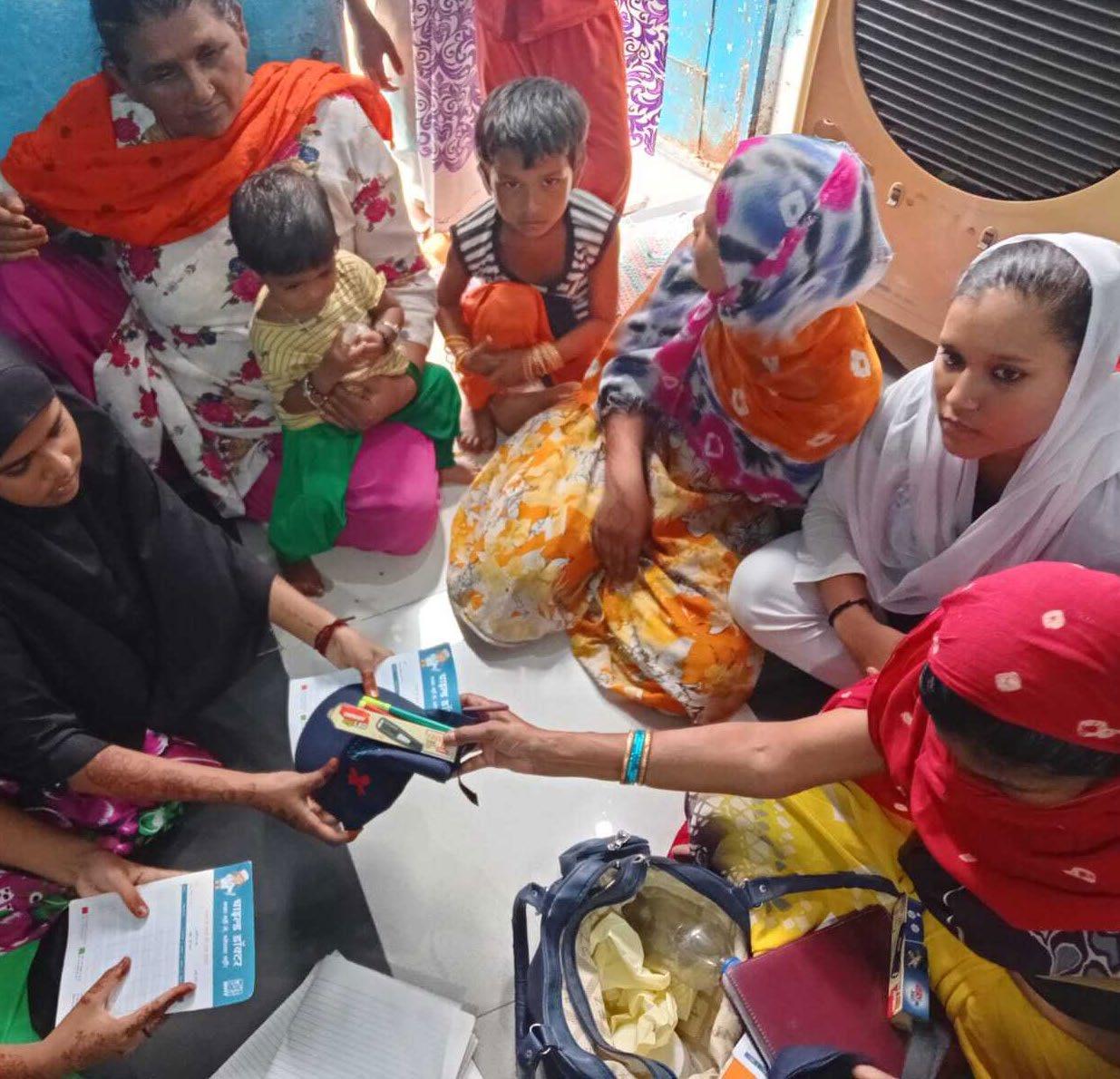
Services such as regular garbage collection and fumigation were promised by the officials. The community was also nudged to make some changes in the behavioural practices pertaining around sanitation in the settlement. Towards this end, an Information and Educational Campaign (IEC) was conducted by MHT. In addition, a ‘vector drive’ has also been initiated by MHT at Nehru Colony for prevention and control of vector borne diseases in the community. The drive involves direct surveillance by “Child Doctors”- an initiative in which children are trained to conduct larval survey at the household level. This helps in identifying households which need to address this issue and are informed and
38 Community based Climate Action Plan (C-CAP)
Child Doctor examining water storage utensils
supported by community actions groups .
Solid waste management workshop conducted at the settlement on July 27th, 2022
- Mr. Vinod Sharma (Health Officer)
39 Community based Climate Action Plan (C-CAP)
Children conducting vector drive in one of the household at Nehru Colony
Adaptation through Design
Design stages
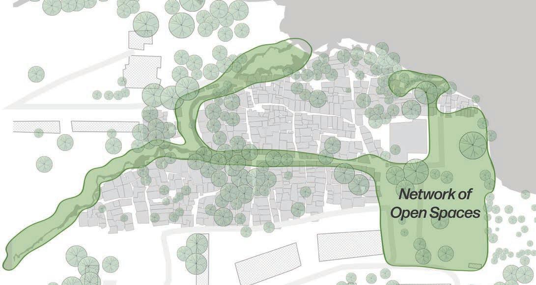
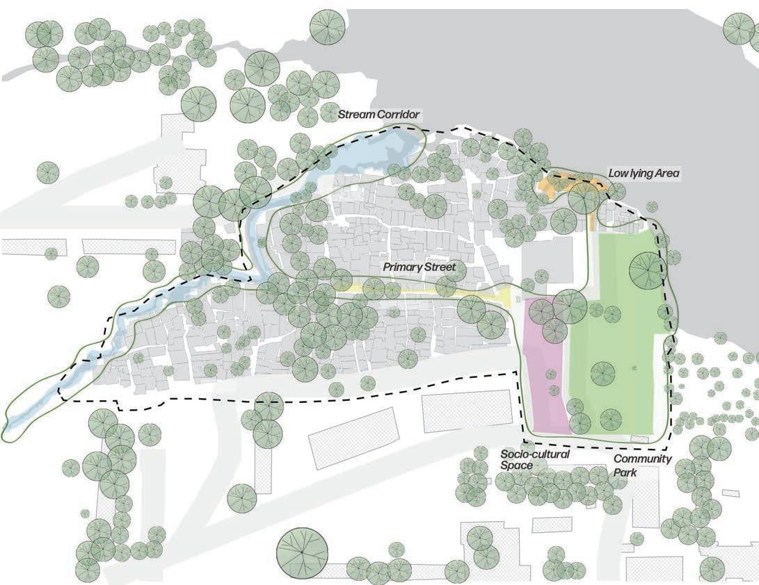
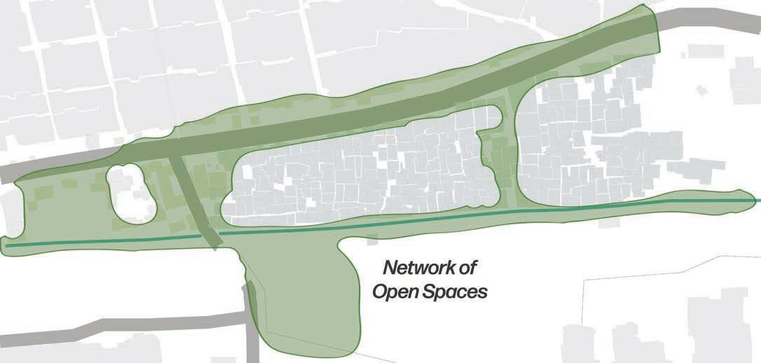
1. Identifying a network of community spaces: Based on the preceding analysis, a network of community/open spaces was identified in Nehru colony. The network was chosen to ensure that design solutions along this network would benefit the community at large and not just a spatial segment in the settlement.
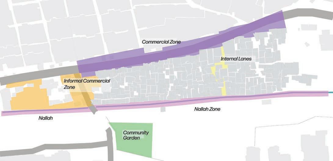
2. Zoning of identified network: The identified network was then categorised into various zones based on spatial characteristics. These include
• Stream corridor zone: This zone includes the nallah/stream flowing along the western edge of the settlement towards the Sarangpani lake. The stream is currently clogged with solid waste (from the settlement and from upstream areas), limiting the stream flow, deteriorating the surface and ground water quality, and leading to vector propagation.
Network of open spaces in the settlement
40 Community based Climate Action Plan (C-CAP)
• Primary street zone: This zone (connected to the stream corridor on the western edge) includes a cardinal street in the settlement. This is widest street in the settlement and has minimal vegetative cover.
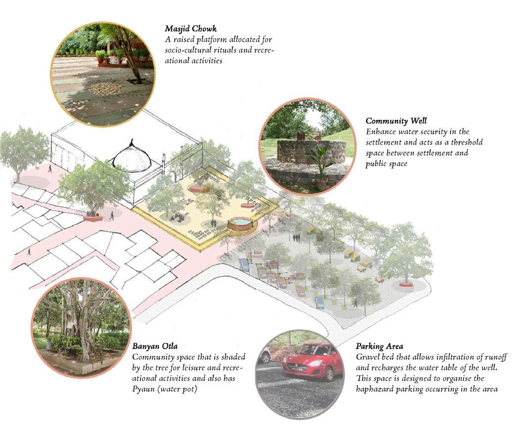
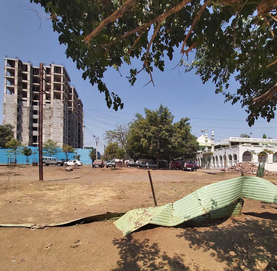
• Socio-cultural zone: The area in front of the Piplani masjid has been designated as the socio-cultural zone. The settlement is connected to this zone through the primary street. The area is currently used for haphazard parking.
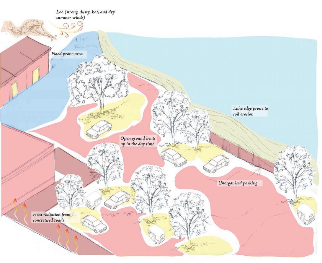
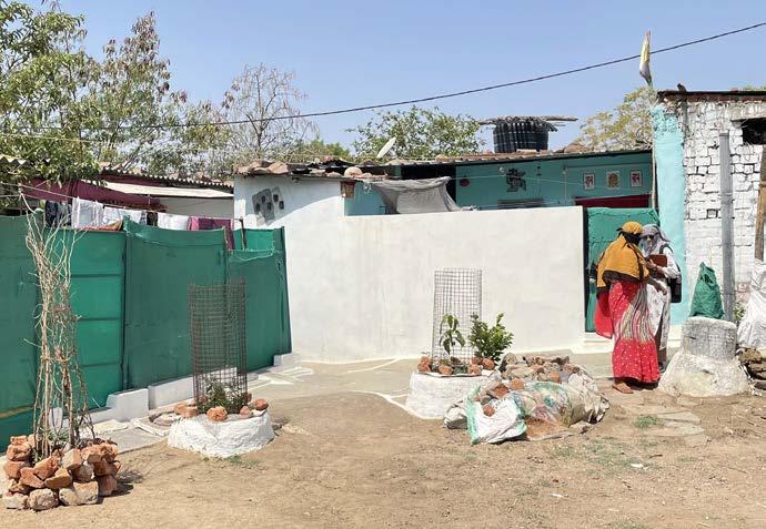
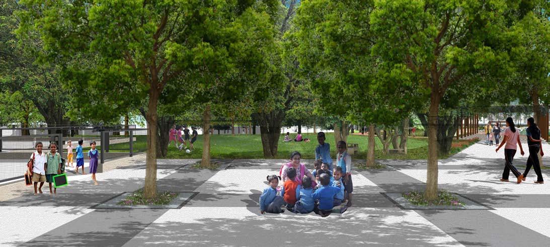
• Community Park zone: This zone is an extension of the socio-cultural zone and is separated from it by an existing concrete road. It is currently used for haphazard parking, and other livelihood related activities. The area is also bordered by the Sarangpani lake on the east.
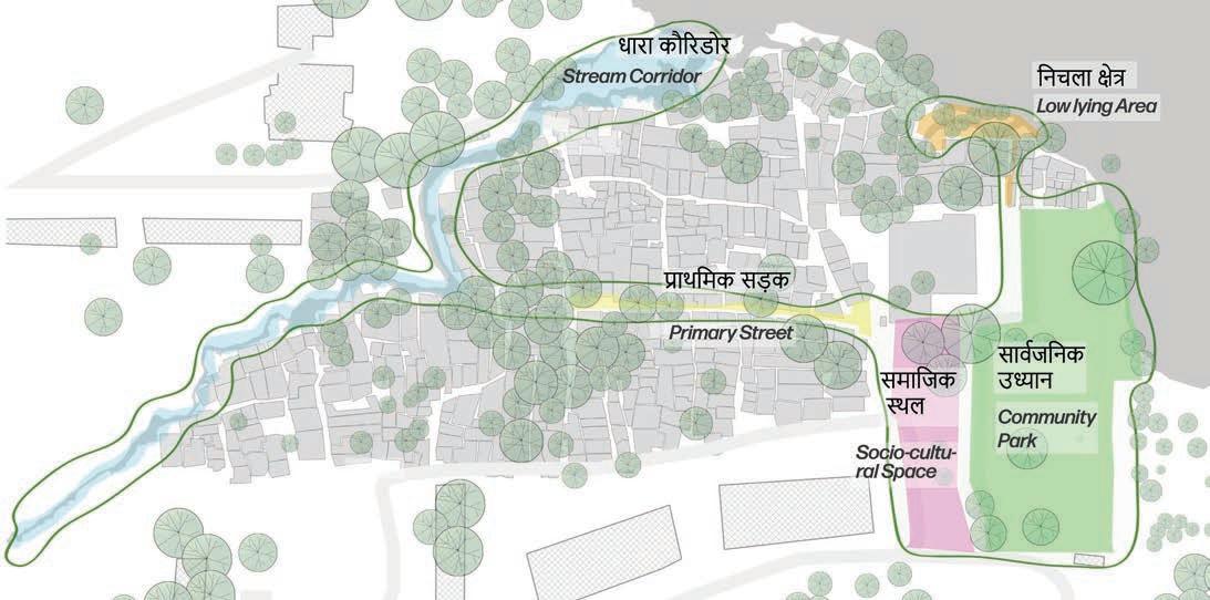
• Low lying zone: The area north of the Masjid, prone to flooding is included in this zone.
3. Existing situation assessment: This including key features and issues pertinent to each zone, are collated, and illustrated graphically.
4. Designing solutions: Enhanced vulnerability necessitates cost-effective and sustainable adaptive solutions which can provide potential co-benefits.
Categorisation and zoning of identified spaces
41
Plan (C-CAP)
Community based Climate Action
Existing Scenario Street Zone
Present condition of streets in the settlement
42 Community based Climate Action Plan (C-CAP)
Issues Street Zone
Issues and vulnerabilities experienced in the settlement streets
Legend
Temperature Profile (0C) 32-36 36-40 More than 60 40-60
Less than 32
43 Community based Climate Action Plan (C-CAP)
Adaptive Solutions Street Zone
Heat stress, open clogged drains, vector propagation, and slushy unpaved lanes are some of the key issues that are addressed through the design interventions in this zone.
44 Community based Climate Action Plan (C-CAP)
Proposed design and policy strategies for settlement streets
View of Nukkad within the settlement fabric
Timber Frame
Durability: Medium Implementation: Easy Availability: Low Cost: High
Bamboo Frame
Durability: High Implementation: Easy Availability: High Cost: Low
Steel Frame Implementation: Moderate Durability: High Availability: High Cost: High
Material alternatives for Shading Trellis
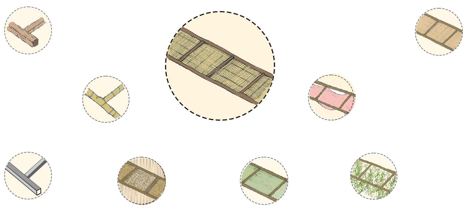
Component B: Frame
Component B: Infill
Coir/Khuskhus Infill
Implementation: Difficult Durability: High Availability: High Cost: Moderate
Bamboo Mat Infill
Durability: High Implementation: Moderate Availability: High Cost: Moderate Saree Infill Implementation: Easy Durability: Low Availability: High Cost: Low
Shade Net Infill
Implementation: Easy
Durability: Low Availability: High Cost: Low
Climbers Infill
Implementation: Easy Durability: High Availability: High Cost: Very Low
45 Community based Climate Action Plan (C-CAP)
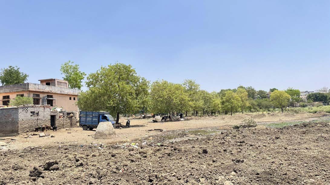
Existing Scenario Stream Corridor
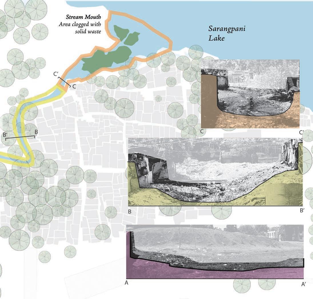
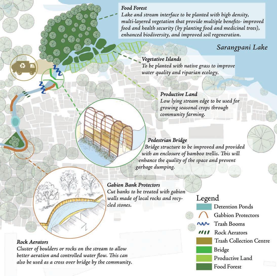
Given the variation in stream characteristics, issues, and potentials, the stream stretch along the settlement is divided into three critical segments- the upstream, the nallah, and the stream mouth.
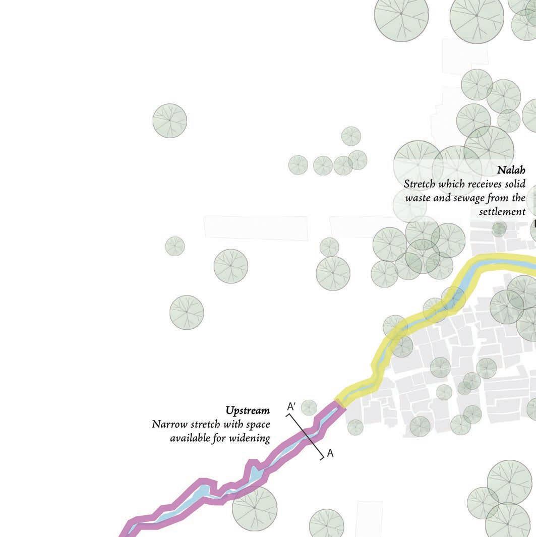
Existing stream conditions
46 Community based Climate Action Plan (C-CAP)
The full image is available on Page 113 of this document.
47 Community based Climate Action Plan (C-CAP)
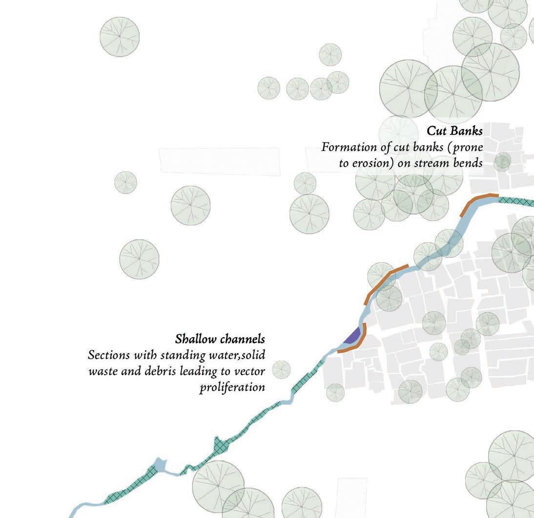
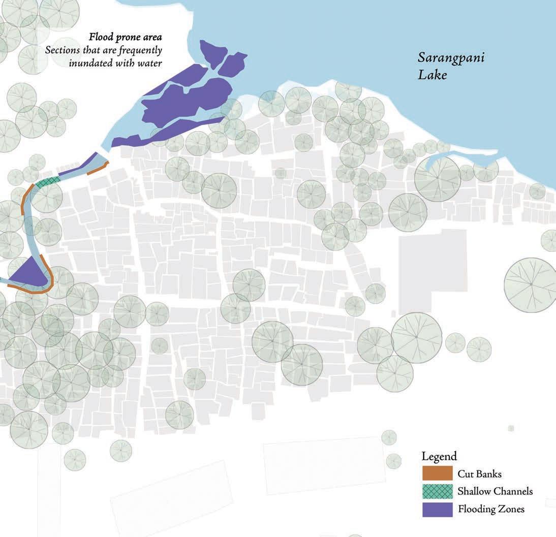
Issues Stream Corridor
The primary focus will be on rejuvenating the stream and reviving the lake wetland while complementing existing drainage infrastructure, reduce surface water run-off, increase ground water recharge, all of which can greatly reduce the intensity of flooding events.
48 Community based Climate Action Plan (C-CAP)
Issues along the Stream Corridor
The full image is available on Page 114 of this document.
49 Community based Climate Action Plan (C-CAP)
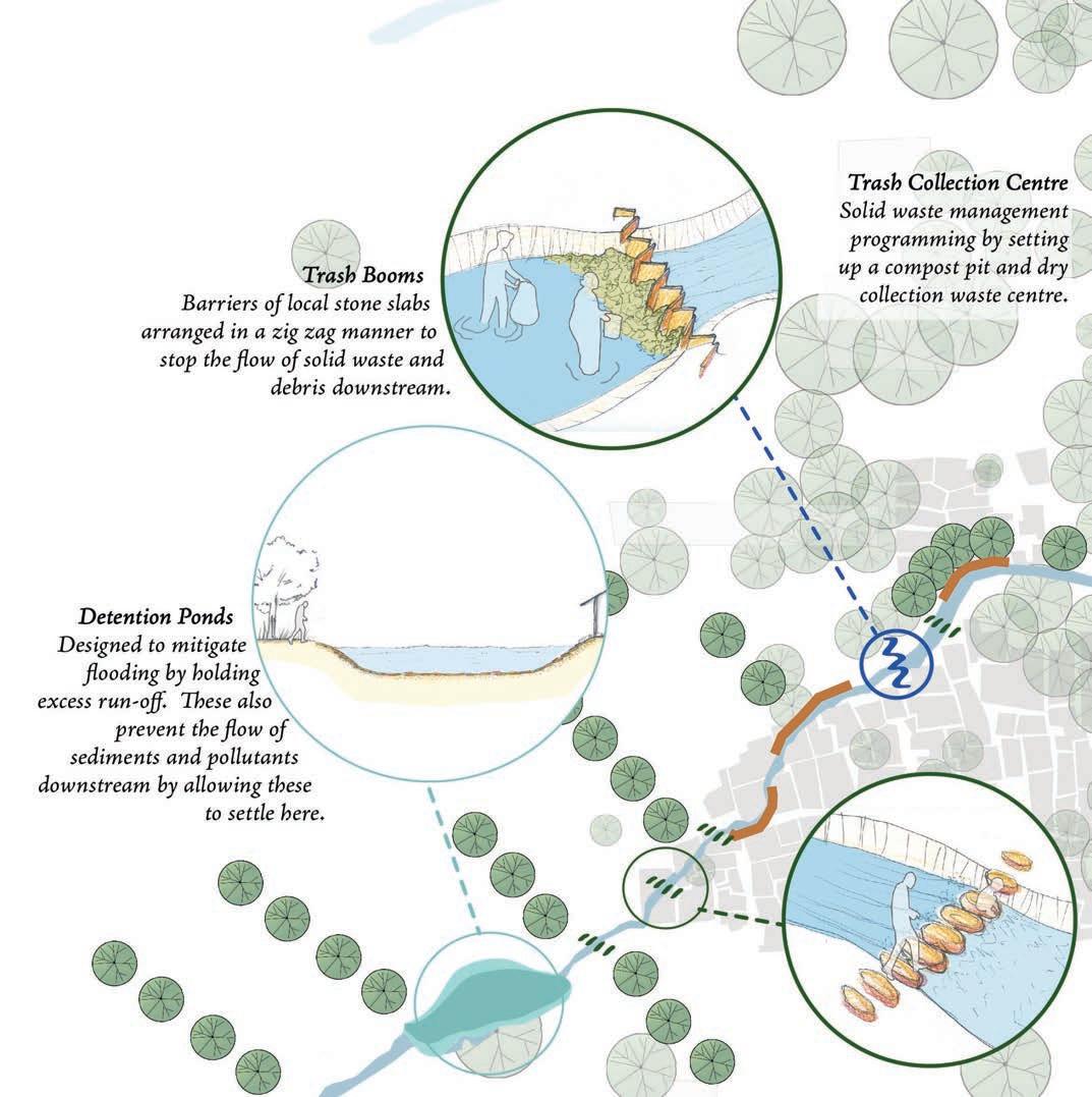
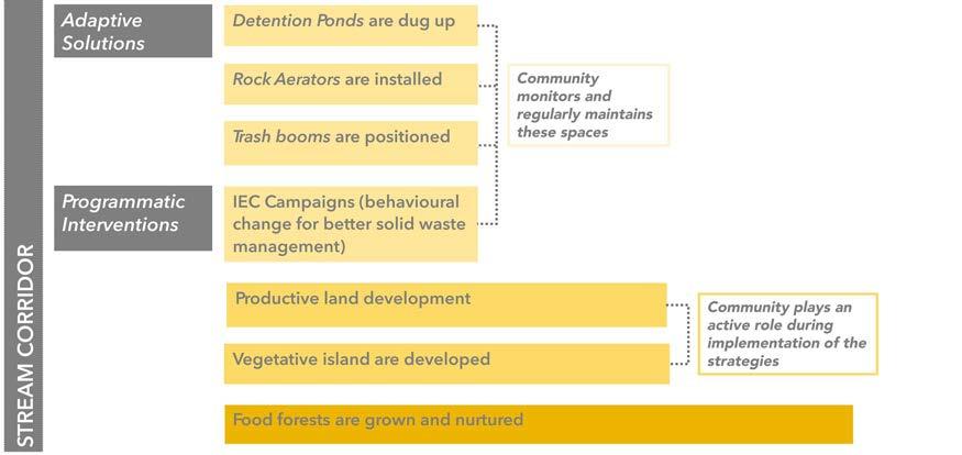
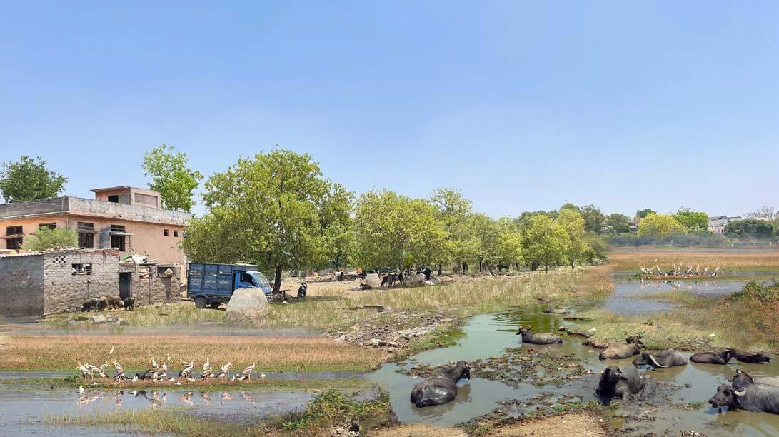
Solutions Stream Corridor
The solutions are designed to play a role in trapping contaminants and pollutants and reduce the pollution of groundwater as well. Food forests and community agriculture is also proposed to ensure food and income security for community members.
50 Community based Climate Action Plan (C-CAP)
Proposed solutions for the Stream Corridor
The full image is available on Page 115 of this document.
51 Community based Climate Action Plan (C-CAP)
Stream Corridor
Alternative Materials
Kota Stone
Implementation: Easy Durability: High Availability: High Cost: Low
Trash Booms
Role of the Community :
To clear the waste collected along the trash boom Waste segrgation at households and no littering by the residents
Katni Stone Implementation: Easy Durability: High Availability: High Cost: High


Granite/ Local Stone Implementation: Easy Durability: High Availability: High Cost: Low

Detention Ponds
Role of the Community :
To regularly de-silt and clean these wetlands
52 Community based Climate Action Plan (C-CAP)
Weld Mesh with Aggregrates
Implementation: Moderate Durability: High Availability: High Cost: Low
Role of the Community :
To clear the waste which gets stuck in the mesh
Weld Mesh Implementation: Moderate Durability: High Availability: High Cost: Low

Katni Stone

Implementation: Easy Durability: High Availability: High Cost: Low
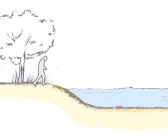
Rock Aerators

Granite/ Local Stone

Implementation: Easy Durability: High Availability: High Cost: Low
Role of the Community :
To clear the waste or siltation that occurs between the boulders

53 Community based Climate Action Plan (C-CAP)
Gabion Bank Protectors
Existing Scenario Socio-cultural Zone
Current space utilisation near the Mosque
54 Community based Climate Action Plan (C-CAP)
Issues Socio-cultural Zone
Issues and challenges in the Socio-cultural zone
Legend
Temperature Profile (0C) 32-36 36-40 More than 60 40-60
Less than 32
55 Community based Climate Action Plan (C-CAP)
Adaptive Solutions Socio-cultural Zone
Kota Stone
Durability: High Availability: High Cost: Low Implementation: Easy
Katni Stone


Durability: High Availability: High Cost: Low Implementation: Easy
Gravel Bed


Durability: High Availability: High Cost: Low Implementation: Easy
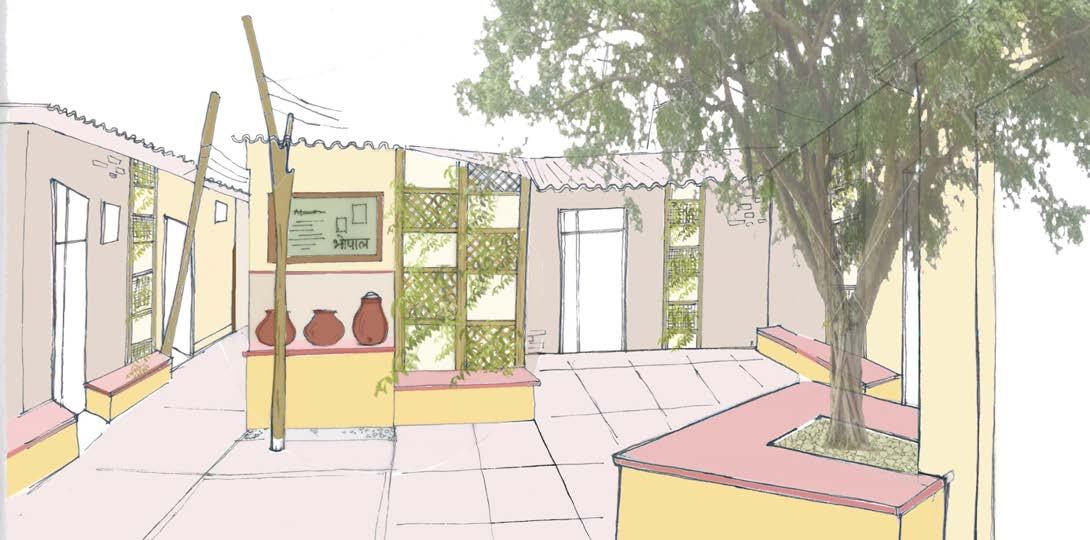
Two key designed areas are proposed in the socio-cultural zone- the masjid chowk and the organised parking area. The proposed elements in each of these areas are illustrated below.
Flaky Aggregrate Bed
Durability: High Availability: High Cost: Low Implementation: Easy
Proposed design strategies for the area infront of the Mosque, along with alternatives for material.
56 Community based Climate Action Plan (C-CAP)
View of the area in the afternoon from the lake
57 Community based Climate Action Plan (C-CAP)
Community Park zone
Existing Scenario
Current space utilisation near the Sarangpani Lake
58 Community based Climate
(C-CAP)
Action Plan
Community Park zone
Issues
Legend
Issues expereinced in this zone
59 Community based Climate
Plan (C-CAP)
Action
Less than 32 Temperature Profile (0C) 32-36 36-40 More than 60 40-60
Adaptive Solutions Community Park zone
These would play a role in combating heat stress and flood vulnerability in addition to providing food and income security.
Proposed design strategies for the area abutting the lake designated as garden space by the community, along with material alternatives.
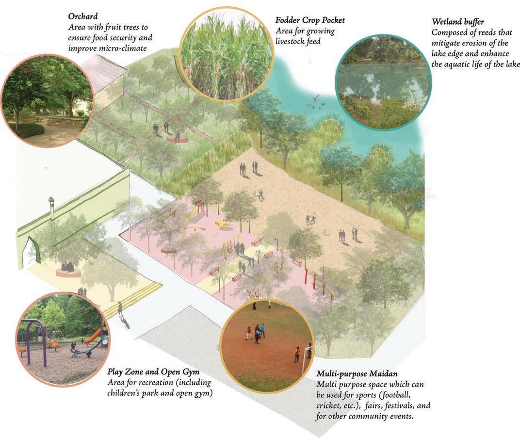
60 Community based Climate Action Plan (C-CAP)
Potential co-benefits could include improved scenery and recreation opportunities which can lead to a multitude of physical well-being, and mental health benefits. Urban greens also have a direct role in climate mitigation by sequestering carbon.
61 Community based
Action Plan (C-CAP)
Climate
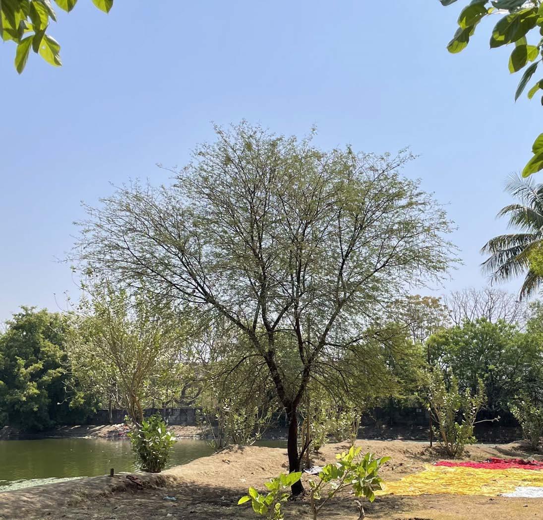
The lake side used by the washermen (dhobi) community
Heat Stress Modelling
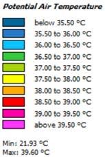
Categorisation and zoning of identified spaces
Using measured data from the field, climatic data of Bhopal, and settlement maps, a temperature model was developed for the settlement using the simulation software ENVI-met, 3-dimensional microclimate simulation software. The modelling exercise helped in illustrating how different built and unbuilt elements contributed to heat stress in different areas within the settlement. The software was also used to demonstrate how the proposed interventions could contribute to reducing heat stress in different areas in the settlement.
62 Community based Climate Action Plan (C-CAP)
Base Case
Measured air temperature (10 -11 am ) - 38 - 40°C. Certain points 43.4 °C was measured, this might be due to some local conditions
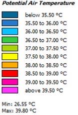
Base case scenario for Nehru Colony
The software however has a few limitations. Firstly, the minimum grid size in the software is 3mX3m. Hence narrow streets of the settlement, all of which are less than 3m wide could not be captured in the simulation. Secondly, the in-built tree species are not native to India. Hence, those species with characteristics closest to Indian species were selected for the modelling exercise. Thirdly, the software cannot simulate a polluted water body.
Based on the temperature data collected, the climatic data of Bhopal, and the above limitations, a base case (existing) scenario was simulated for the settlement. This is illustrated above.
63 Community based Climate Action Plan (C-CAP)
Scenario 1
In this scenario, the passive unbuilt design strategies presented in the previous section, including cleaning the stream, shading the primary street, redeveloping the space in front of the Mosque, and providing a Community Park, were integrated into the base case. The model shows that the proposed interventions could contribute to reducing the temperature in the settlement by an average of 1°C.
Reduction of about 1°C
64 Community based Climate Action Plan (C-CAP)
Optimised scenario integrating unbuilt design strategies discussed in the earlier section
Reduction by 1.5°C Scenario 2
In this scenario, the passive unbuilt design strategies were accompanied by a built strategy of converting all roofs in the settlement to cool roofs. The model shows that unbuilt and built design strategies when applied together could reduce the temperature in the settlement by an average of 1.5°C. Despite the limitations of ENVI-met, the model evidences the potential that built and unbuilt strategies have for combatting the heat vulnerability faced by the community.
* All the roofs in the settlement are considered as cool roofs.
65 Community based Climate Action Plan (C-CAP)
Optimised scenario integrating unbuilt and built (cool roofs*) strategies
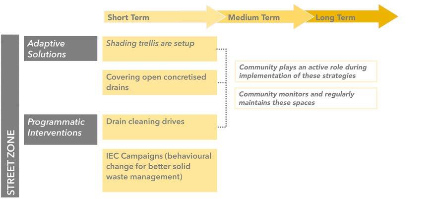
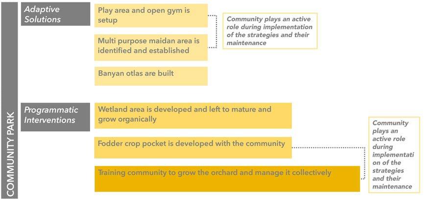
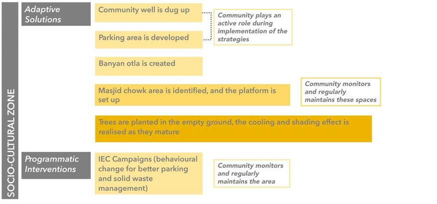
Phasing
The following tables categorise the proposed solutions and programmatic interventions into short (1-2 years), medium (2-5 years), and long term (>5 years). The phases indicate the expected time required to implement the solution.
66 Community based Climate Action Plan (C-CAP)
The activities that need community’s active role and participation have also been highlighted. These encompass their contribution for both the elements and their engagement after the process has been completed.
67 Community based Climate Action Plan (C-CAP)
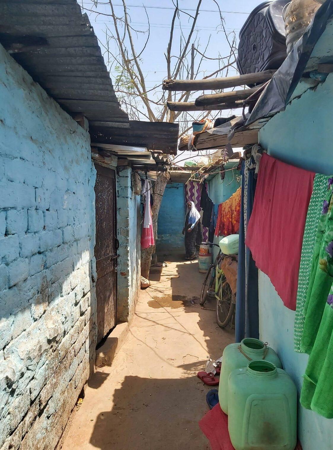
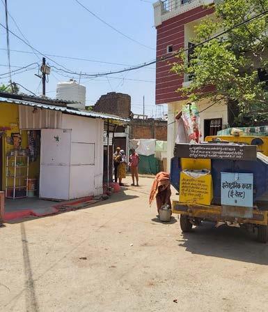
Population: 1,115 Households: 450 Area : 2.91 Acres Age : 40 years Location: Off Bagsewania Main Road, Main Market, Bagh Sewaniya Status: Notified BAGSEWANIYA
Settlement Profiling
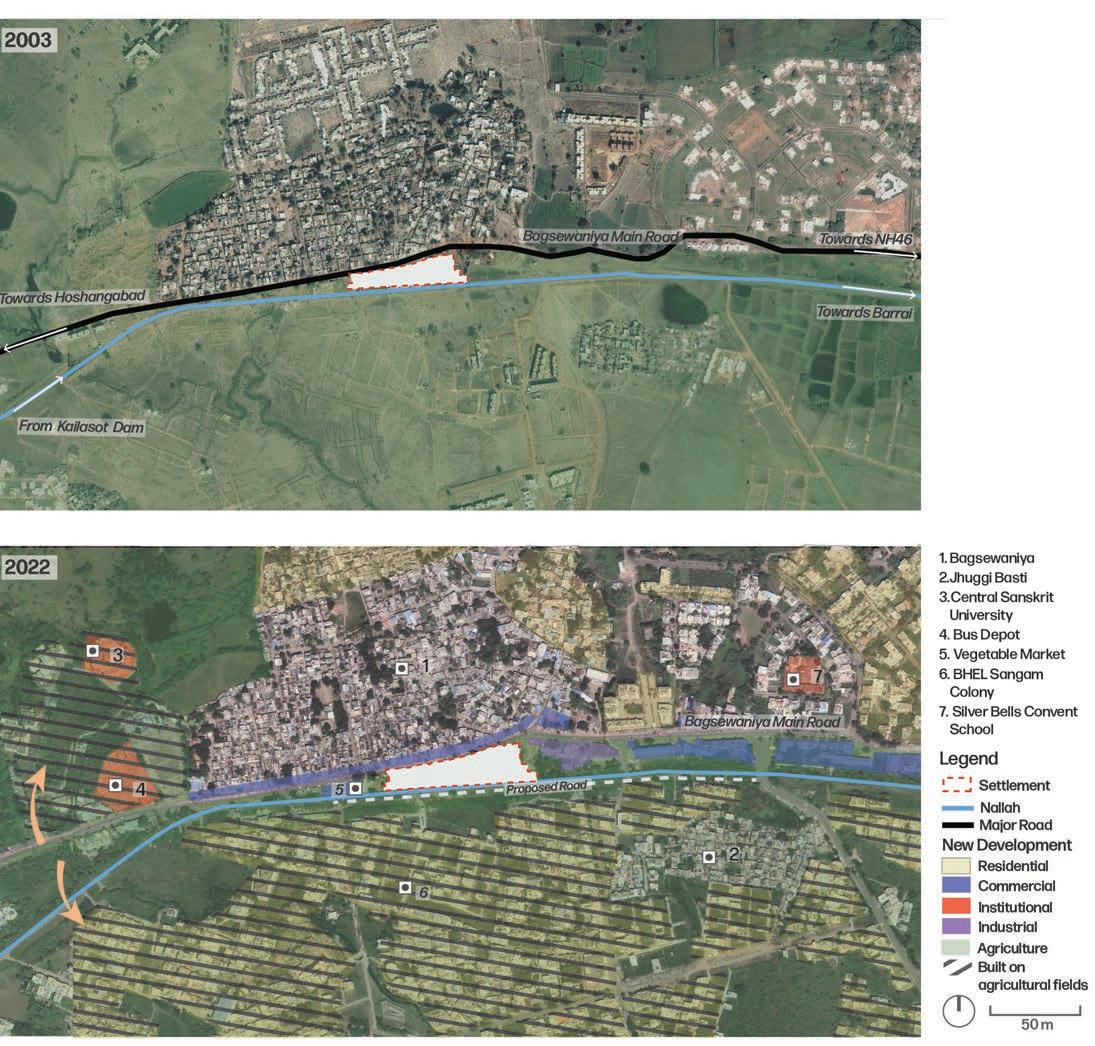
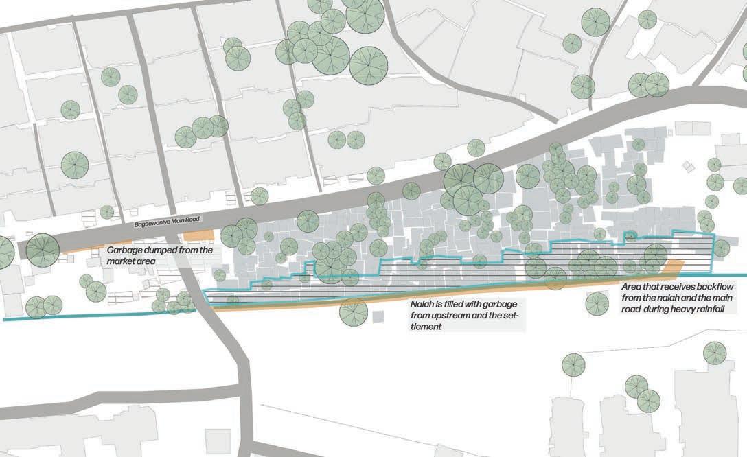
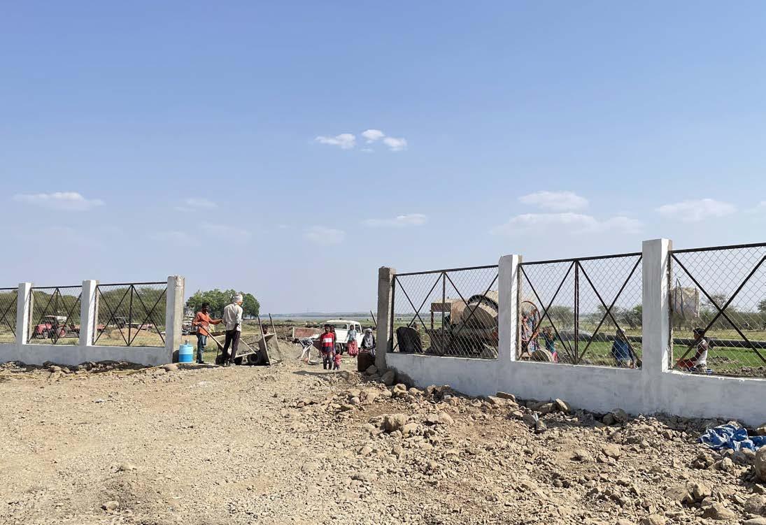
Bagsewaniya is located on the southern area of the city (ward 53, zone 13), around a km east of the Hoshangabad main road. The settlement is near the Bagsewaniya main market area, and was a squatter of 8-10 hutments near a nallah (channel with impervious embankment) nearly 50 years ago. The settlement is sandwiched between the Bagsewaniya main road and the nallah/ stream (originating from the Kaliasot dam and flowing eastwards towards agricultural fields; the nallah is however no longer used for irrigation). There is a large open space on the southern side of the settlement that was earlier covered with Neem, Peepal, Babool and Banyan trees. These have been cleared for the construction of a new road (which will run parallel to the Bagsewaniya main road connecting the Hoshangabad road to the west and 80 feet CPA road to the east).
70
Community based Climate Action Plan (C-CAP)
Bagsewaniya and neighbouring area: Change in spatial urban fabric (2003-2022) Source: Google Earth
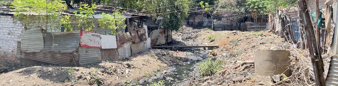
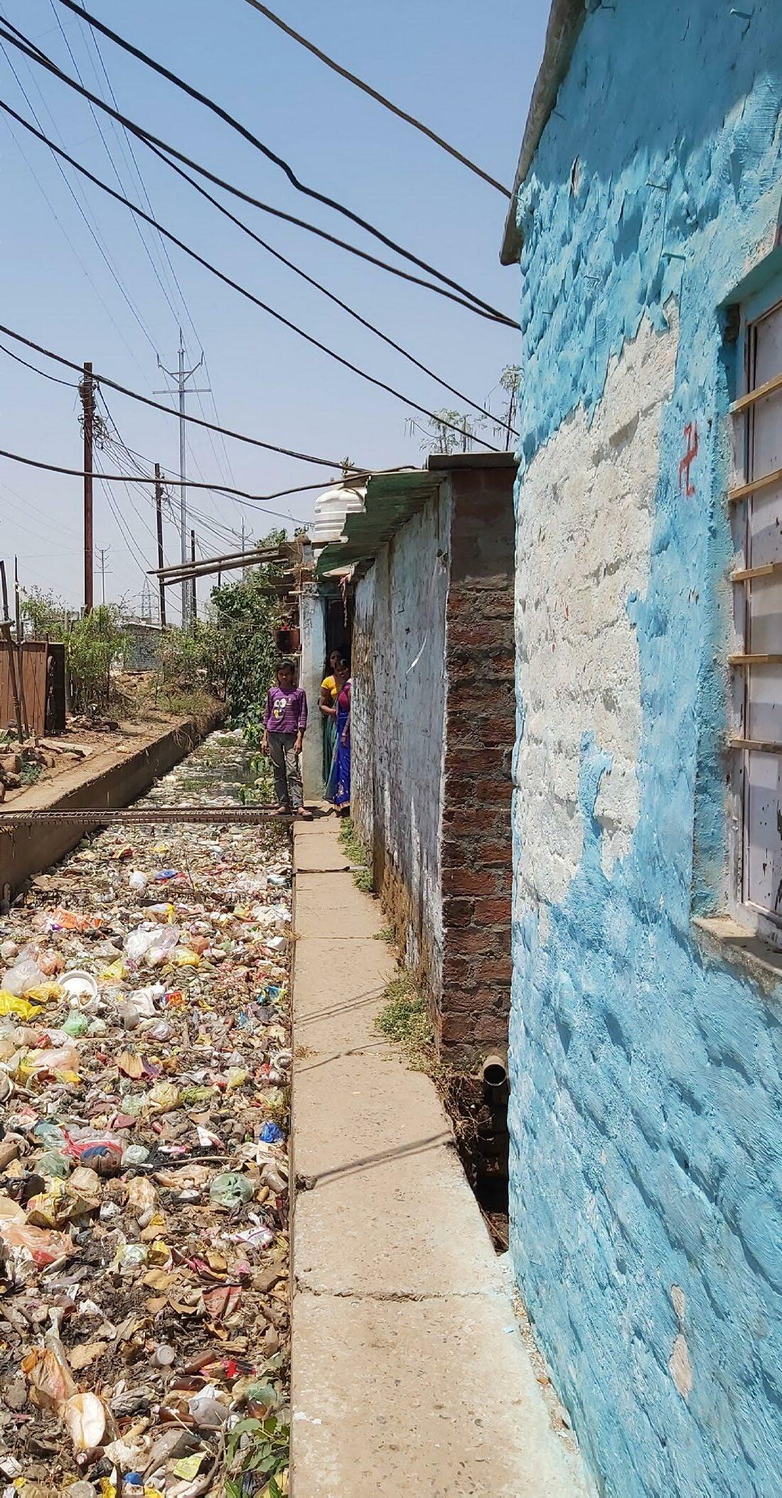
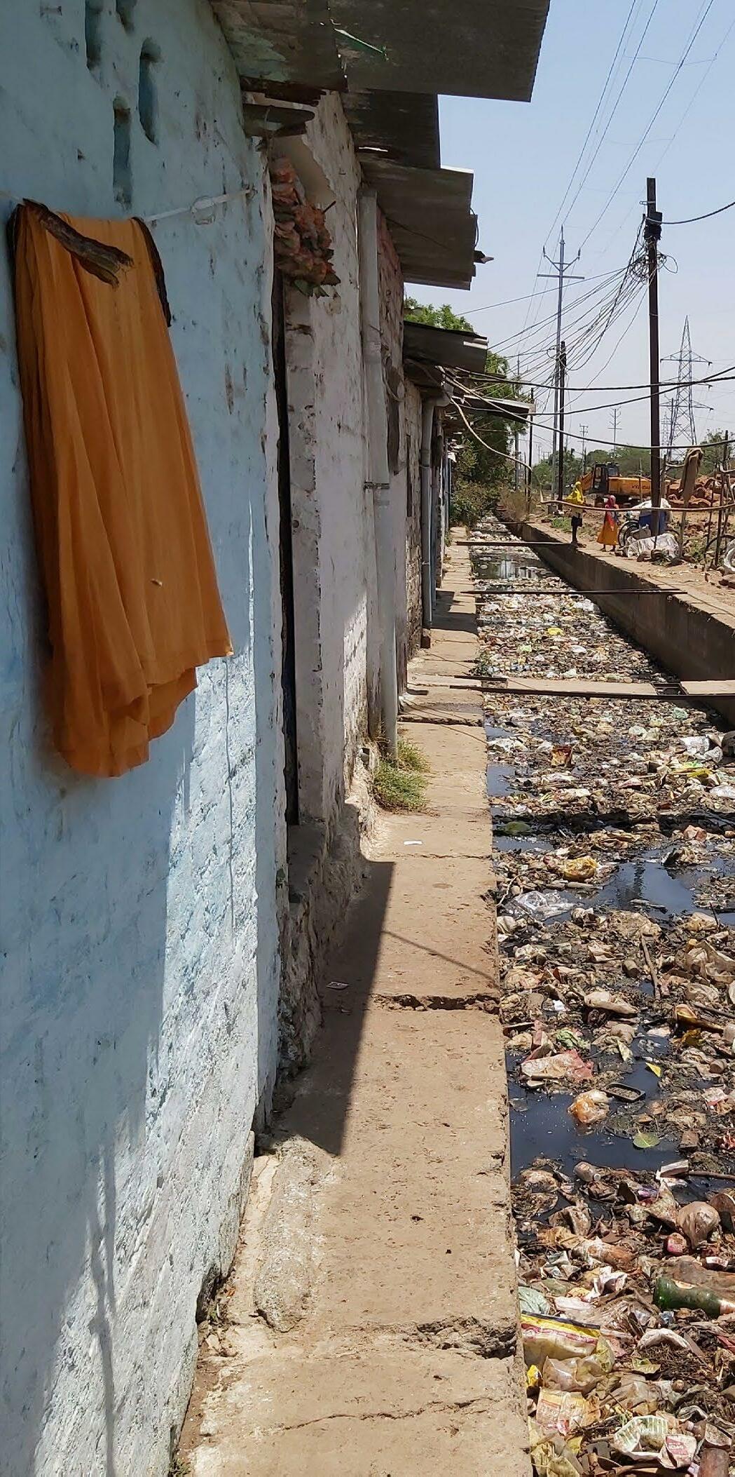
The area surrounding the settlement was largely agricultural up until 2013. It has now transformed into a residential area with commercial development along the Bagsewaniya main road. This transition is visible in the 2003 and 2022 satellite imageries of the area. Most of the residents are engaged as daily wage labourers. Women in the settlement work as tailors and domestic workers. The settlement received household level piped water connections from the Municipal Corporation in 2012. The extreme water scarcity they faced nearly 10 years ago (during which they had to entirely rely on water tankers) prompted the community (supported by MHT) to approach the Corporation for a permanent solution. All households have access to individual toilets with soak pits. While solid waste collection vehicles from the Corporation come to the Bagsewaniya main road, solid waste from the community is largely disposed in the adjacent nallah.
Most of the houses in the settlement are kutcha or semi- pucca. Bricks, sheets, and mud are used as walls, whereas roofs are typically made of asbestos, tarpaulin, and corrugate sheets.
71 Community based Climate Action Plan (C-CAP)
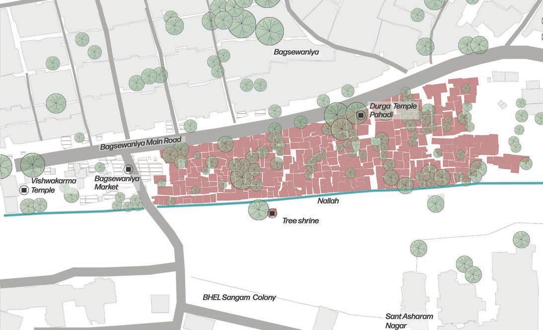
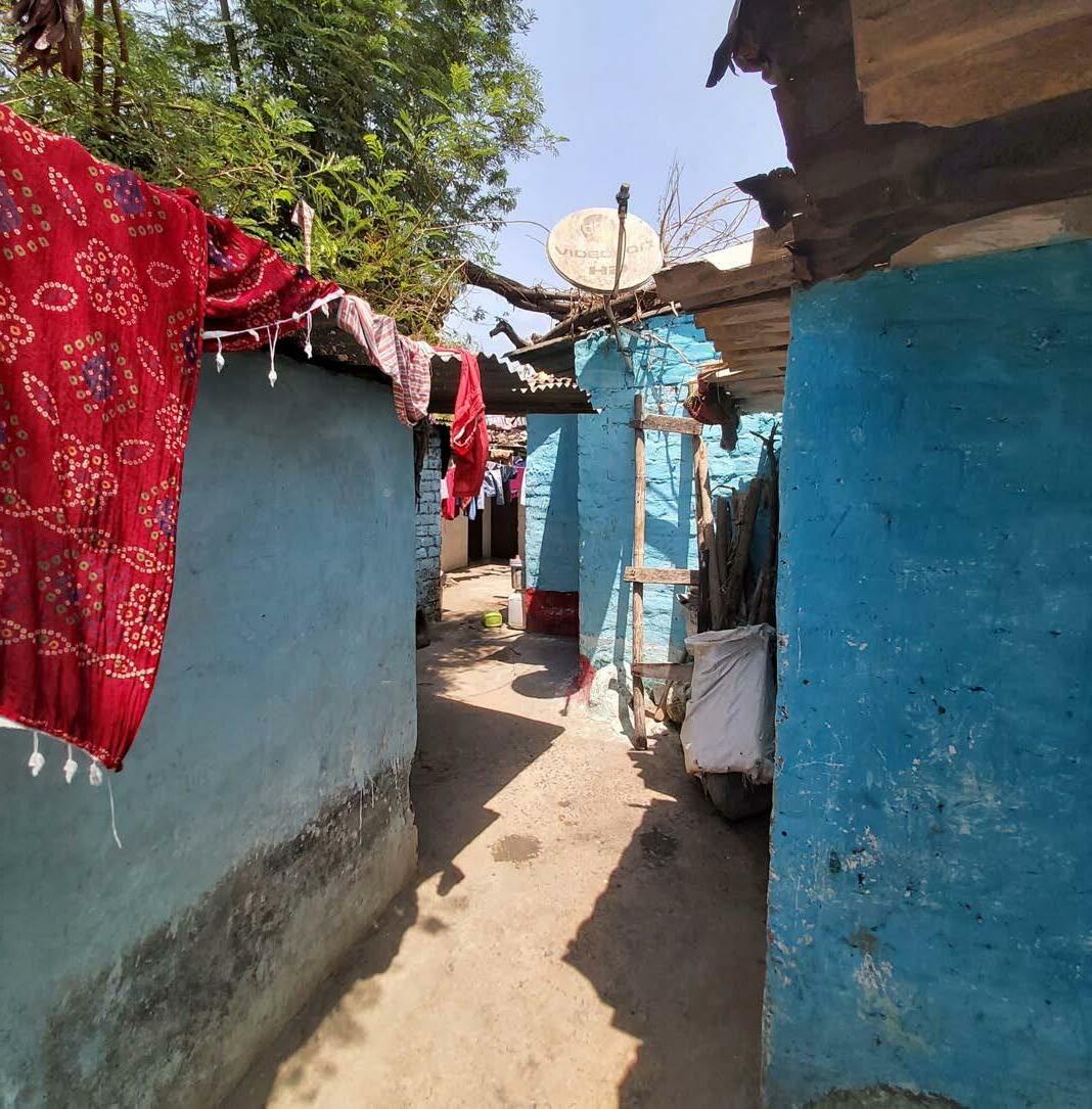
Bagsewaniya and neighbouring area: Settlement map
Top: Green pockets in the inner lanes of the settlement
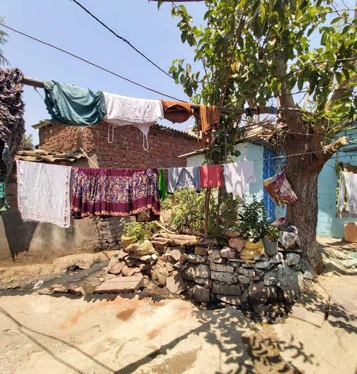

Left: An inner lane in the settlement
Focus Group discussion (April 26th 2022)
72 Community based Climate Action Plan (C-CAP)
“We can be evicted anytime from this land. This land doesn’t belong to us.”
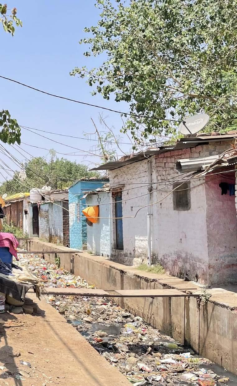
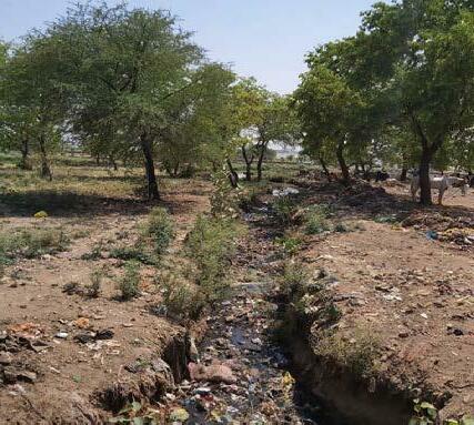
The polluted nallah forms the edge of the settlement
73 Community based Climate Action Plan (C-CAP)
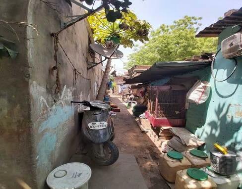
Inner lanes of the settlement
Vulnerability Assessment
Unsanitary condition was the most important stress that emerged by the CBVAT followed by vector propagation and heat stress.
Waste mismanagement and solid waste disposal in the nallah
The sanitation issues has increased incidence of vector related diseases and health issues
Heat stress due to scanty vegetation and particle pollution from the traffic on main road. Sanitation
74 Community based Climate Action Plan (C-CAP)
I II III
map (based on community’s lived experiences)
Vector Nuisance Heat Stress
Vulnerability
Community based Vulnerability Assessment
“Community from the settlement throw the waste into the nallah. The stagnation of the water in the nallah has led to increase in the number of mosquitoes in the area”.
“The summer is warmer since the past two-three years, previously never used cooler in month of March and April”.
“Most of us sitting here are daily wage labourers wherein we majorly work in the afternoon time. Recently it has become very difficult to work in this heat”. ”
75 Community based Climate Action Plan (C-CAP)
Focus group discussion with the community
Vulnerability Scientific Assessment
Bhopal City Average - 410C
Average Temperature - 50.30C
The community reported hotter summers since the last three years; the loss of vegetation within and adjacent to the settlement were cited as main reasons for this. The comparison of the satellite imageries of 2003 and 2022 substantiates this loss of vegetation. As per the Bhopal Development Plan 2031, the area is designated as a residential zone where redevelopment and regeneration of existing urban areas will be incentivised. New development (like the Central Sanskrit University and Bagsewaniya bus deport) have come on drains and attendant spaces, in effect fragmenting the natural ecology of the area.
76 Community based Climate Action Plan (C-CAP)
Land surface temperature (LST)of the settlement (April 29th, 2022 - LANDSAT 8 )
77 Community based Climate Action Plan (C-CAP)
Clogged nallah bordering the settlement
Coping Mechanisms
In Bagsewaniya, some of the coping strategies used by the community are illustrated in the photographs below. Use of desert coolers is widespread in the settlement usually between the hot months of March to June annually. Reportedly, electricity bills surge nearly three times in these months. Other coping mechanisms include use of green sheets as vertical shades, sleeping outside during summer months, etc. Houses along unpaved lanes use broken tiles/ debris to cover these lanes. This was a strategy used to avoid the unpaved lanes to become slushy and unusable during rains or water leakage from pipes.

78 Community based Climate Action Plan (C-CAP)
Widespread use of Dessert coolers
Shade nets for protection against loo (hot and dusty winds in the summer)
Tiles laid on the slushy lanes
Covered nallahs to prevent waste disposal
Community’s roadmap to resilience
The community with MHT’s assistance developed the priority areas of engagement for their settlement based on the vulerability assessment conducted earlier. This process was collectively done by CAG members belonging to Nehru Colony, Indra Nagar and Bag Sewaniya. These are steps that community agreed to work towards and were classified into measures that can be taken at three scales - individual, household and settlement level.
Since the main stress in Bagsewaniya was unsanitary condition, the community collectively worked out a plan to combat this issue on priority. Similar steps were carried out for vector nuisance and heat stress as well.
79 Community based Climate Action Plan (C-CAP)
Priority areas of engagement highlighted by the community
Micro plan prepared by the community
Written appliction to Health and Environment Department
Adaptation through Design
The design solutions proposed for Bagsewaniya focus on the interface spaces between the city and settlement and weaves natural features, existing built fabric, proposed city level developments, and community and neighbourhood processes through planning and design. The solutions address resilience and reducing vulnerability of the community as well as the larger neighbourhood.
Design stages
1. Identifying a network of community spaces: Based on the preceding analysis, a network of community spaces was identified at the settlement- city interface
2. Zoning of identified network: The identified network is categorised into various zones based on spatial characteristics. These include:
Network of open spaces
80 Community based Climate Action Plan (C-CAP)
• Streetscape/ Commercial zone: This zone includes the northern edge of the tlement. The houses along this edge also double up as commercial spaces opening onto the Bagsewaniya main road.
• Internal lane: This zone (connecting the nallah in the south and commercial zone in the south) includes a cardinal street in the settlement.
• Informal Bazaar/ commercial zone: The western edge of the settlement is designated as an informal commercial zone. Currently the space is used as an informal/temporary commercial space during the day.
• Nallah zone: This zone includes the linear Built storm water drain bordering Bagsewaniya on the south and flowing eastward from Kaliasot dam. While a natural stream, this was concretised in 2015.
• Community garden: The area towards the south of the settlement (within the existing open area) is identified to be developed as a community garden.
3. Existing situation assessment: The existing scenario, including key features and issues pertinent to each zone, are collated, and illustrated below.
4. Designing solutions: The solutions are designed to address the key challenges in the zone along with providing a variety of co-benefits. The following pages demonstrate proposed solutions for each of the identified 5 zones in Bagsewaniya.
Categorisation of the spaces identified
81
Plan (C-CAP)
Community based Climate Action
Solutions
Commercial Zone
The market presently opens up into the carriageway which is a concern for the community. The street needs to be developed considering the character of Indian markets that majorly supports pedestrian movement.
• Assigned spaces for the vendors to station their carts or shops.
• Pedestrianising the space with designated barrier free and shaded and safe walking paths
• Small sit outs under trees can be introduced wherein the customers can rest.
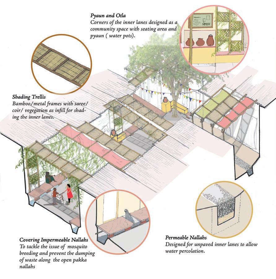
• Street furniture including seating, signages, benches, waste bins, water pots/pyaun to be part of this streetscape.
Informal - commercial Zone
The informal vendors have gathered into the maidan space haphazardly. The space is unmanaged and need some organisation with urban amenities that improve the experience of the space and also assist in keeping the space sanitised and clean.
82 Community based Climate Action Plan (C-CAP)
Proposed Commercial space makeover encouraging pedestrian friendly markets
• Organised shaded vending spaces
• Street furniture including seating, signages, benches, waste bins, water pots/pyaun
Internal Lanes
Existing Proposed
Existing and proposed view of the internal lane in the settlement
The internal lanes are the most active spaces that function as a public and private space for the community. These streets are bustling with activities during most part of the day and have varied character across the settlement. Since these spaces are highly active, they come crucial for programming the network of open spaces. These connect other spaces within the settlement, keeping this aspect in mind following intervention have been strategised for the settlement:
• Shading trellis for combating heat stress. These can be used as horizontal and vertical heat barriers.
• Sit outs under tree that can be used by the community for recreation and other cultural purpose.
• Permeable nallahs on unpaved roads using passive technique of sub surface drains.
83 Community based Climate Action Plan (C-CAP)
Nallah zone (along settlement and upstream stretch)
Existing Proposed
The state of the drain is a result of the community’s unhygienic practices of waste disposal. The waste in the drain has led to other issues of vector related nuisance and flooding instances for the houses abutting the drain. Following interventions are sought to improve the condition of the drain and its immediate surrounding. These have been worked out based on the conversations with the community and are subject to improvement in behavioural changes made by the community.
• Dense buffer of tall trees to shield the settlement from the Southern- harsh sun and upcoming road development.
• Trash barriers nets installed within the concrete nallah at multiple intervals.
• Dry and wet waste collection bins installed at multiple locations.
84 Community based Climate Action Plan (C-CAP)
Existing and proposed view of the nallah abutting the settlement
Community Garden
View of the proposed Community Garden created for the neighbourhood (Bagsewaniya) area.
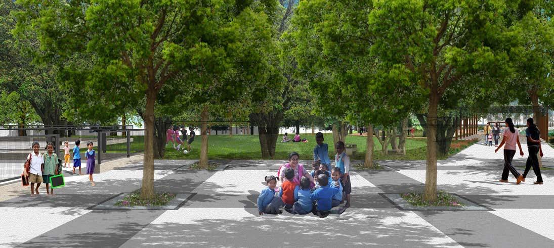
The community at the present has no access to Parks or Garden at the settlement or in their imemdiate neighboirhood. Based on the discussion with the community a space was identified to develop a Community Park for the settlement and the neighbourhood.
• Area to be developed as a neighbourhood garden accessible to the community. The location can be finalised based on deliberation with the Garden Department of the Municipal Corporation.
• Multiple landscape thematics like nutrition garden, medical garden, open gyms, outdoor learning environment, etc will be developed with focus on community well-being.
The above solutions need to be supported by programmatic interventions like workshops with government stakeholders, campaigns to trigger behavioural change amongst communities, community level collaboration, etc. These would however need to be sustained over a long period to ensure systemic change within the community.
85 Community based Climate Action Plan (C-CAP)
• Multiple pedestrian cross over bridges connecting the settlement to the other side of the nallah
Population: 1,250 Households: 550 Area : 7.9 Acres Age : 50 years Location: Behind Sant Hirdaram Nagar, Mochipura, Bairagarh Status: Notified INDRANAGAR
Settlement Profiling
Located near the Upper Lake/Bada Talab towards the west of the city (ward 4, zone 1), the settlement came up nearly 50 years ago with the squatting of 10 -12 households. Following the Bhopal gas tragedy in 1984, 25-30 households from Barkhedi area in Bhopal moved in. After the riots of 1992, the settlement further experienced in migration of Hindu community from the old parts of Bhopal. Abutting Indira Nagar is the Harijan basti , Mocchipura, Rajendra Nagar and Sanjay Nagar also came up at this time.
The closest main road is the Bairagarh main road located half a kilometer to the north of the settlement. The commercial area located near this main road developed around 10-12 years ago and has densified over the years. The Bairagarh
Source: Google Earth
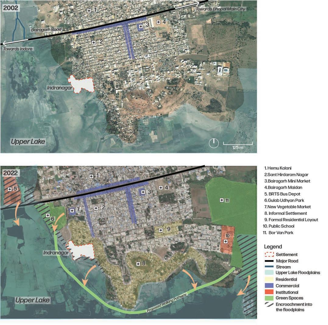
88 Community based
(C-CAP)
Climate Action Plan
Indranagar and neighbouring area: Change in spatial urban fabric (2003-2022)
vegetable market, located north of the settlement came up in 2017. The Gulab Udhyan Park is located north-west of the settlement, just opposite the vegetable market. Currently, as a part of AMRUT scheme, the Corporation has initiated the beautification and extension of the park . The park pathway, proposed as a part of the extension will run along the lake edge from Gulab Udhyan till Bor Van Park located around 2 km east of the settlement. A fence wall has been erected separating the settlement from the lake edge. The area, especially along the lake edge, was initially covered by thick vegetation. Urbanisation and attendant densification over the years have reduced the vegetative cover within the settlement and along its periphery. The lake edge towards the south of the settlement is currently covered by large trees such as
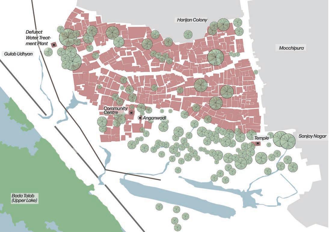
89 Community based Climate Action Plan (C-CAP)
Indranagar and neighbouring area: Settlement map
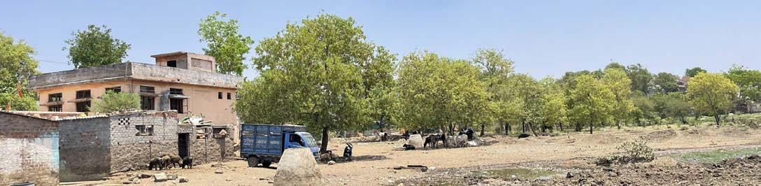
Neem, Banyan, Sheesham, Peepal and smaller shrubs such as Babool. The area is largely used for cattle grazing. A comparison between the 2003 and 2022 satellite imageries of the area illustrates the transformation of the settlement and the surrounding area.
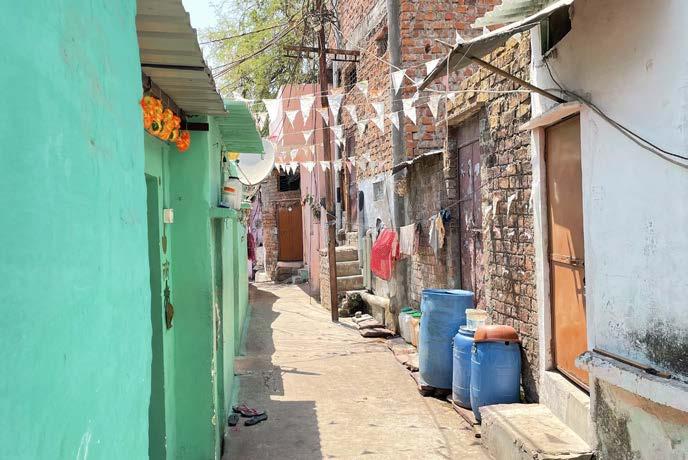
The houses in the community have transitioned from tin roofs and walls (during the initial years of squatting) to brick walls and concrete roofs. The settlement was electrified by the Corporation in 2010, and streetlights have been set up in the area more recently. Since 2008-09, the settlement has been receiving piped water supply from the Corporation on alternate days for 1 – 2 hours. The pressure
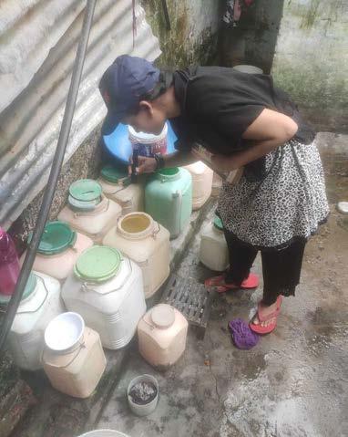
Left: Water cans stored outside the houses
Right: Municipal Solid waste collection vehicle
“Being an illegal settlement, we don’t receive municipal services. One community tap is shared between 17-18 households. Drainage is a major issue in the settlement, only few lane are serviced with nallah system”
Focus Group discussion (April 27th 2022)
90 Community based Climate Action Plan (C-CAP)
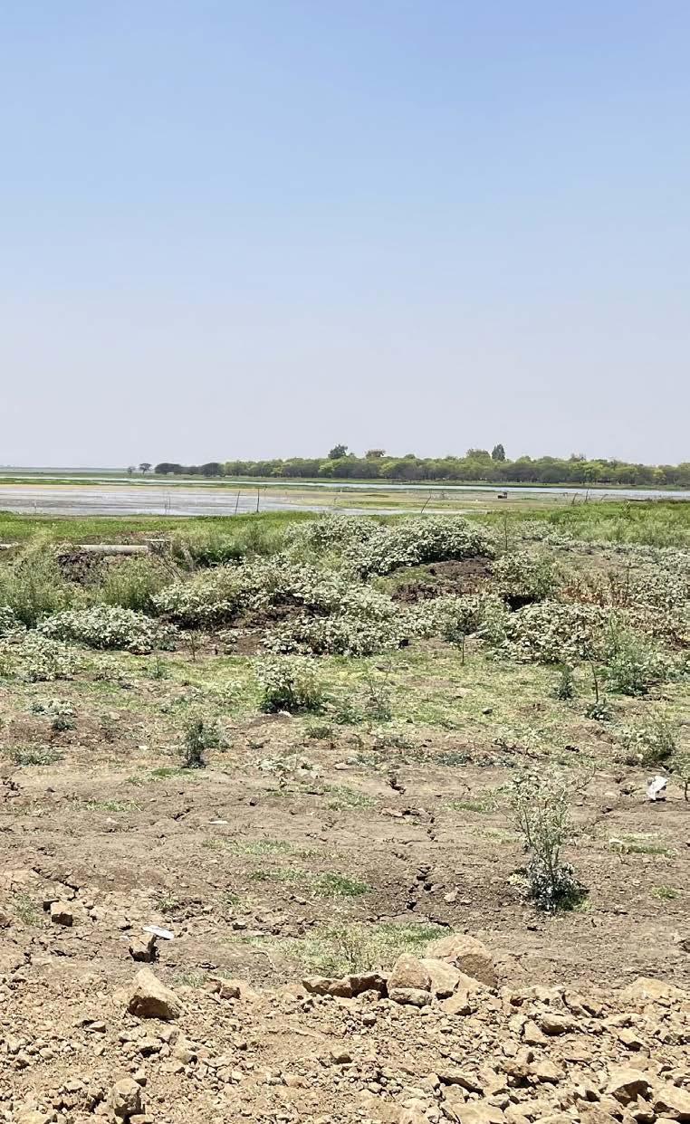
Low lying land that forms the floodplain of the Bada Talab (Upper Lake).
of the water is lower in the summer months and some houses have installed motors to pump the water to individual elevated tanks. The water is usually boiled before consumption.
Most of the houses have individual toilets with soak pits. Some parts of the settlement also have sewer lines. The internal lanes have concrete storm water drains which was developed in 2010 by the Corporation. Though solid waste is collected daily from the settlement by the Corporation, the lake edge (towards the south) is used for dumping garbage by the dwellers. For commuting to other parts of the city, the residents mainly rely on city buses halting near Kali Temple on the Bairagarh main road. The BRTS also used to service the area since 2012, however this service has been discontinued since COVID. The settlement has an Anganwadi and a community hall.
91 Community based Climate Action Plan (C-CAP)
Vertical expansion of the settlement
Vulnerability Assessment

Heat stress was the most important issue that emerged from the CBVAT followed by vector propagation and flooding.
Heat related stress was sighted as the major problem faced by most of the residents in the settlement.

The sanitation issues has increased incidence of vector related diseases and health issues.
Open disposal of solid waste and the surface run off is leading to frequent flooding instances. Heat
92 Community based Climate Action Plan (C-CAP)
I II III Vulnerability map (based on community’s lived experiences) Community based Vulnerability Assessment
Stress Vector Nuisance Flooding
“Community from the settlement throw the waste into the nallah. The stagnation of the water in the nallah has led to increase in the number of mosquitoes in the area”. “The summer is warmer since the past two-three years, we used not use cooler in month of March and April”.
“Most of us sitting here are daily wage workers, we majorly work in the afternoon time, it has become very difficult to work in this heat”.
93 Community based Climate Action Plan (C-CAP)
Focus group discussion on vulnerbaility assessment
”
Vulnerability Scientific Assessment
Bhopal City Average - 410C
Average Temperature - 380C Average Temperature - 440C Average Temperature - 470C
surface temperature (LST) of the settlement (April 29th, 2022 - LANDSAT 8)
The dumping of solid waste inside the storm water drains is one of the prime reasons which is leading to vector issues in the area. As per the community, the loss of vegetative cover along the lake edge has increased the heat within the settlement. Construction of new houses within the settlement has also led to loss of vegetation in the internal settlement areas. This transition is visible in LST map above.
The settlement is generally not affected by flooding incidents; however, in 2006 heavy rains had led to the inundation near the lake edge affecting around 10-12 houses for a few hours. The lake dried up almost completely in the following year, following which the Government decided to deepen and dredge the lake
94 Community based Climate Action Plan (C-CAP)
Land
Construction of new boundary wall at the edge of the settlement to combat future flooding situations.
As per the Bhopal Development Plan 2031, a buffer of 50m is proposed as a “No Construction Zone (NCZ)” along the side of the upper lake lying within the Municipal Corporation boundary (starting from the entrance of Van Vihar National Park to the edge of the municipal jurisdiction near the Bairagarh village). The area beyond the green buffer is designated as a residential zone where only limited mixed use development is allowed considering the existing development. While new development in the area (of the Gulab Udhyan till Bor Van Park) is primarily to maintain the buffer, this would essentially disconnect the settlement from the lake and the attendant spaces that are currently uses for cattle grazing.
95 Community based Climate Action Plan (C-CAP)
Coping Mechanims
Dessert cooler in use at 11 am to address the heat
Some of the strategies used by the community to combat stresses are illustrated in the photographs below. Apart from the use of desert coolers that is rampant in Indira Nagar too, households’ resort to the use of green sheets as vertical shades on doors and windows, sprinkle water on the ground/concretised lanes, etc. The community has also discontinued some of the coping measures like sleeping outside during night. Common spaces for with trees were also used earlier by the settlers for socializing. This was attributed to current lack of space and issues of security.
The community also use ‘cool roofs’ promoted by MHT. As a part of the cool roof intervention, solar paint is applied on the roofs which can bring down the internal temperature by a few degrees. Thermocol roofs was alternatively used by the residents to bring down the heat. More importantly trees are seen as the most effective solution to combat heat stress; plantation efforts in open spaces available (like in front of the Anganwadi and community hall) are taken up.
The community collect and burn neem leaves at a household level to prevent vector menace. MHT had also initiated the Aqua + water disinfectant programme in the settlement, wherein the community was trained to gauge the contamination level of the water and were given instruments/materials that cleaned the water to large extent.
First to the right : Community residents have dug up a trench to allow the drainage from the settlement to flow into the Upper Lake
Second to the right : Water being sprayed on the ground in the evening to bring down heat and dust
96 Community based Climate Action Plan (C-CAP)
Community’s roadmap to resilience
The community with MHT’s assistance developed the priority areas of engagement for their settlement based on the vulerability assessment conducted earlier. This process was collectively done by CAG members belonging to Nehru Colony, Indra Nagar and Bag Sewaniya. These are steps that community agreed to work towards and were classified into measures that can be taken at three scales - individual, household and settlement level.

Since the main stress in Indranagar was heat stress, the community collectively worked out a plan to combat this issue on priority. Similar steps were carried out for other stresses as well.
97 Community based Climate Action Plan (C-CAP)
Priority areas of engagement by community
Micro plan that emerged from the community
Community sensitisation activities
Community discussing the collective climate action plan they can lead
The design solutions proposed for Indranagar focus on these interface spaces at the city-settlement interface and weaves natural features, existing built fabric, and community processes through planning and design to enhance resilience and reduce vulnerability of the community to climate change impacts.
Adaptation through Design Design Stages
1. Identifying a network of community spaces: Based on the preceding analysis, a network of community spaces was identified at the settlement- city interface.
2. Zoning of identified network: The identified network was then categorised into various zones based on spatial characteristics. These include:
Network of open spaces

98 Community based Climate Action Plan (C-CAP)
• Community Chowk : These are spaces where the internal lanes intersect, and community usually gathers for socio-cultural activities.
• Aanganwadi Area : The immediate space abutting the Anganwaadi and Community Hall where collective festival celebrations are held.
• Internal Lane : There is one major street that includes the cardinal street in the settlement and connects the two chowks.
• Wetland Zone: The area falling in between the settlement fabric and the Upper lake’s floodplain area.
• Community Park: The area identified just beside the Anganwadi Area where the community wanted a park for the settlement.
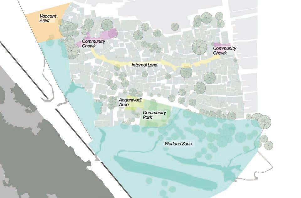
3. Existing situation assessment: The existing scenario, including key features and issues pertinent to each zone, are collated, and illustrated below.
4. Designing solutions: Following the assessment, strategies pertinent to each of the five zones have been proposed to address the key challenges along with providing a variety of co-benefits. The following pages demonstrate solutions for each of the zones.
Categorisation of the spaces
99
Plan (C-CAP)
Community based Climate Action
Solutions
Community Chowks
Existing Proposed
The existing and proposed view of the Community chowk within the settlement.
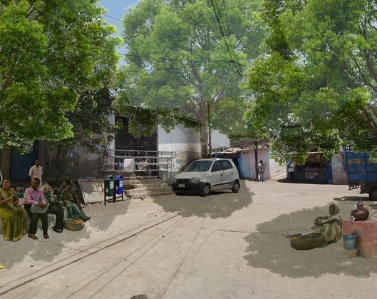
The chowk is generally used as a parking space for the neighbourhood for most part of the day.
• Large trees with seating platform to increase shaded community space
• Street furniture including seating, signages, benches, waste bins, water pots/pyaun
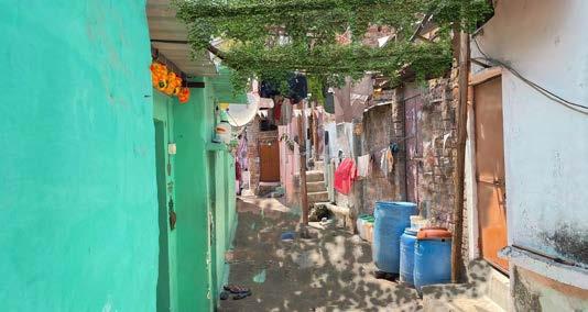
Internal Lane
Existing Proposed
The existing and proposed view of a typical internal lane of the settlment.
100 Community based Climate Action Plan (C-CAP)
The internal lanes are the most active spaces that function as a public and private space for the community. These streets are bustling with activities during most part of the day and have varied character across the settlement. Since these spaces are highly active, they come crucial for programming the network of open spaces. These connect other spaces within the settlement, keeping this aspect in mind following intervention have been strategised for the settlement:
• Trellis to shade the lanes from the sunlight
• Seating platforms on junctions where the community can sit out in the evening
• Dustbins and pyauns located at regular intervals - serviced for and by the community.
Aanganwadi Area
Existing Proposed
The existing and proposed view of the Angawadi and Community Hall space within the settlement.
The community desired to develop the vacant space within the compounded area of their Anganwadi and Community Hall. This space is presently utilised for various socio-cultural programmes and to celebrate festivities collectively.
• Planting medicinal plants and trees
• Large trees with seating platform to increase shaded community space
• Children’s play area and outdoor learning space near existing Anganwadi
101
Plan (C-CAP)
Community based Climate Action
Wetland Zone
Existing
This space is the continuum of the Upper Lake’s floodplain that was primarily used by the cattle for grazing and for the community to interact with the lake for household activities (bathing, washing and other). Currently the space is used for dumping waste - cow dung and other household level waste produced within the neighbourhood. Following design suggestions have been formulated based on these attributes and community’s inputs:
• Designating the zone as a buffer that nurtures the character of the Upper Lake and the area is designated for nurtuting the biodiversity and existing social linkages (cattle and fishing).
• A network of wetlands is designed in the area and integrated to the Upper Lake’s larger floodplain.
• The solid waste in the dugout drains in the area is made trash free and should allow water retention and percolation. The cow dung that is dumped in the area is directed for composting on one end of the area.
102 Community based Climate Action Plan (C-CAP)
The existing view of the area bordering the Bada Talab (Upper Lake).
• The hard edges of the area (wall) can be replaced with bio fences or other alternative elements
Proposed
Community Park
The residents of the settlement don’t have ease of access to any garden or parks in the neighbourhood. For the children and community this is a concern as they are not sure whether the gardens proposed in the area will be accessible to the community. Based on these aspects, an area for the Community Park was identified and following elements were included in the design:
• Area to be developed as a neighbourhood garden accessible to the community.
103 Community based Climate Action Plan (C-CAP)
The proposed view of the area adjoining the settlement and the Bada Talab (Upper Lake) as a network of wetland spaces.
• Multiple landscape thematics like nutrition garden, medical garden, open gyms, outdoor learning environment, etc will be developed with focus on community well-being.
• Community garden can be introduced wherein the community can collectively grow some useful species
View of the Proposed Community Garden created for the neighbourhood (Bairagarh) area.
The above solutions require a programmatic support that aims towards awareness of both governments and communities (through workshops) , behaviorial change amongst communities (through targeted campaigns), capacity enhancement to collaborate and co-produce, amongst others. These would need to be sustained over a long period to ensure systemic change within the community.
104 Community based Climate Action Plan (C-CAP)
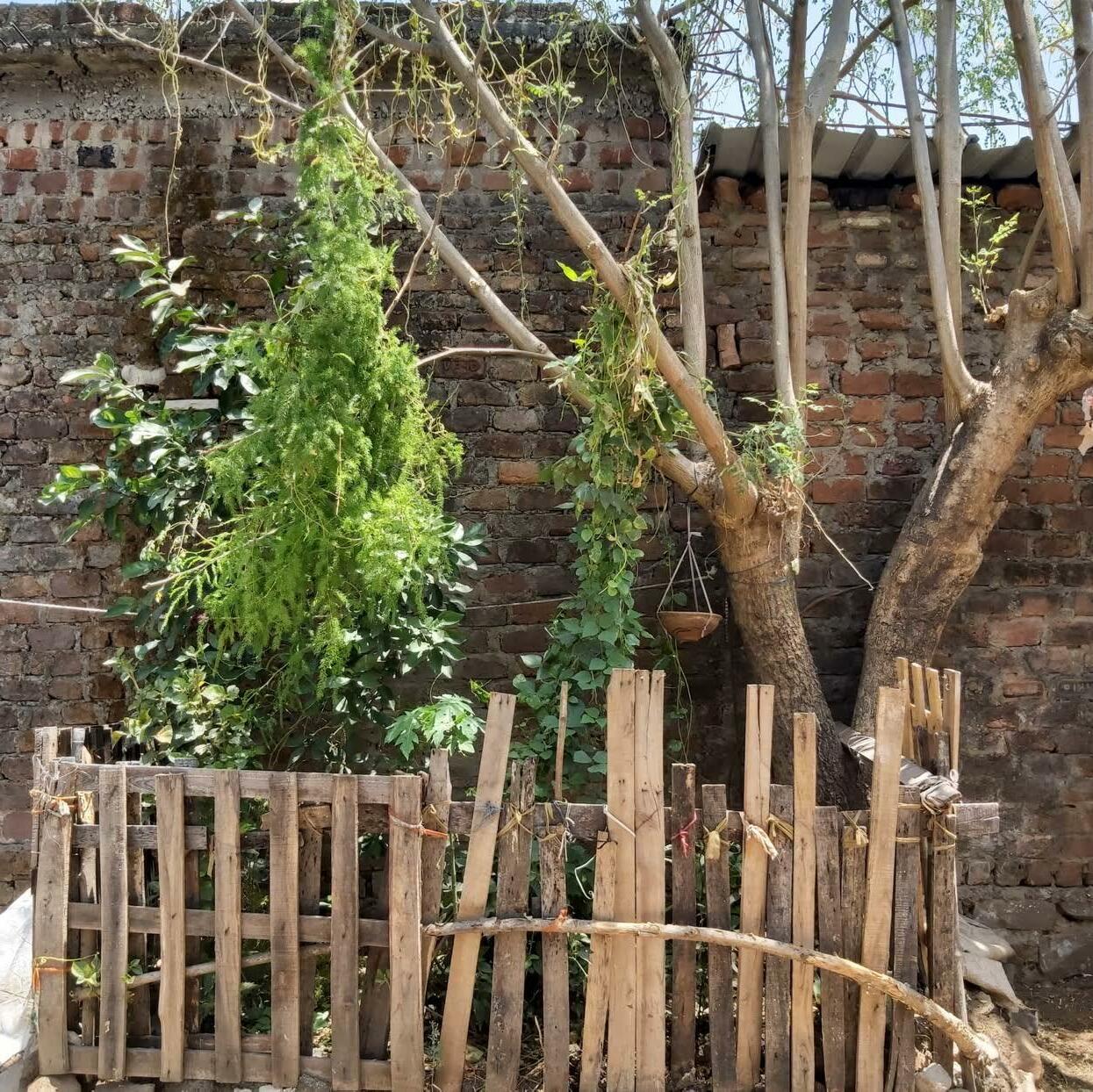
DISSEMINATION AND WAY FORWARD
Dissemination strategies are critical to build support and scale. Towards this end, a public event was organised including all key stakeholders of the project namely,
• Community members from the three pilot settlements
• Government stakeholders at the city and state levels including Municipal Corporation (garden and health department) and EPCO (Environmental Planning & Coordination Organisation)
• Elected representatives (ward councillors)
• Agency supporting the government stakeholders in preparing city level climate action plans and tools (World Resources Institute, WRI )
• NGO working with the communities (MHT)
• Technical partner (INDÉ)
In bringing these stakeholders on a common platform, the event foregrounded community perspectives, explored avenues for implementing the C-CAPs, and initiated a discourse on the need for local level climate action tools (like the C-CAP) and its integration with city level efforts.
An important learning that emerged from the study was that many climate-change impacts within informal settlements are highly dependent on city-wide infrastructure (e.g., flood management is related to city-wide drainage infrastructure and land use management), making the settlement-city-region links especially important. While the recent international discourse on climate change has driven regional level actions, these are mostly at the national, state and city scales, premised on climate change modelling, focusing primarily on mitigation. The local scale of enquiry is largely missing (sometimes ignored even if mandated) in the formal system of Climate Action Planning (and planning in general) in India. The efforts at the national, state and city scales miss out understanding how vulnerable communities, who are the most affected, respond to climate change impacts. Varied dimensions of marginality (social, political, economic, and spatial – each perpetuating the other) further disconnects these communities from formal climate action plans and frameworks.
106 Community based Climate Action Plan (C-CAP)
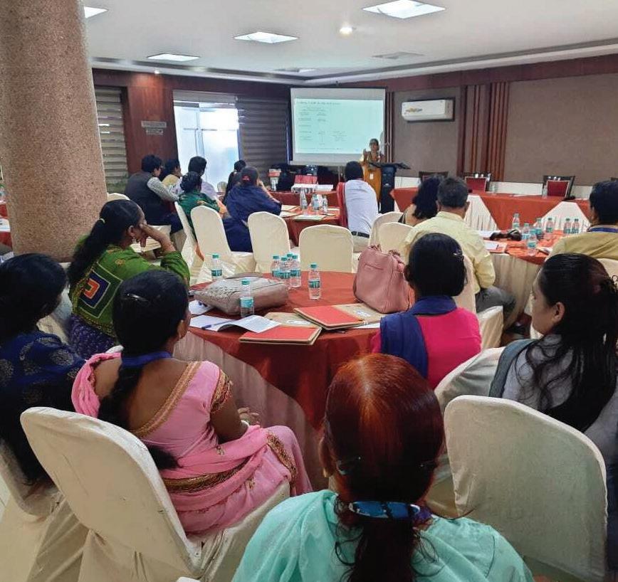
107 Community based
Plan (C-CAP)
Climate Action
The public event where the Climate Action Plan was disseminated to the community members, the public officials, and other concerned stakeholders.
The state government of MP has been at the forefront of planning for climate action. Figure on the right illustrates the various initiatives, plans and programmes undertaken at the state, district, and city levels (with a specific focus on Bhopal) in this direction. The linkages, both existing and missing, between these scales are also mapped (‘missing’ in purview of the need for horizontal and vertical integration between these plans/initiatives). These planning and programmatic efforts, while necessary and appreciable, are not effectively engaging with the complexities on the ground, especially of those who are facing the harshest climate change impacts- the urban poor. While many of these (like the State Action Plan for Climate Change, SAPCC V 2.0 and District Climate Change and Environment Action Plan, CCEAP) acknowledge that the poor communities are the most impacted and mention the need for community engagement and community led efforts, pathways to engage with and plan for these sections remain vague and unclear. While AMRUT 2.0 provides a policy hook in provisioning the local scale enquiry (through pilot Local Area Plans that feed into the city Master Plan in select cities) these are yet to be operationalised.
What stands out from the mapping exercise are the missing linkages between climate action efforts and that of development planning for the city. These linkages become especially critical considering the legal backing that a development plan of a city enjoy (since it is prepared under the ambit of the M.P. Nagar Tatha Gram Nivesh Adhiniyam, 1973). Hence, the findings, recommendations, and pathways identified in plans like City Climate Action Plan (by EPCO) and the more recent City Sustainable Strategy (by the Municipal Corporation) need to feed into the Development Plan to ensure accountability of proposed actions. This can ensure the much-needed horizontal integration between the various city level initiatives.
However, linkages between city level initiatives alone are not enough for impact on the ground. The need for the Development Plan to be detailed out at the sub city levels in the form of Local Area Plans (at the ward or zonal scales) especially through a participatory approach can alone ensure successful and efficient impact. These Local Area Plans in turn need to capture insights from diverse and innovative initiatives (beyond the formal ambit) that strive to understand and respond to the ground realities. The local area plans could thus become a conduit to channelise these informal initiatives into formal frameworks.
108
Community based Climate Action Plan (C-CAP)
To conclude, there is much work to do in furthering the agenda of inclusive climate action. As cities and communities are progressively facing the intensifying impacts of climate change, developing new planning frameworks that build on a decentralised, democratic, and bottom-up approach anchored in and emanating from the socio-cultural and economic realities on the ground is an important place to start. Madhya Pradesh’s existing initiatives on climate action provides fertile ground to develop and demonstrate such a framework that can bridge the current mismatch between planning efforts and reality.
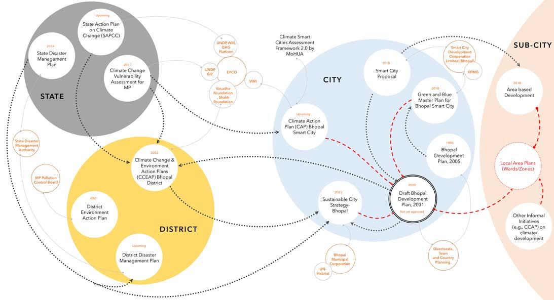
109 Community based Climate Action Plan (C-CAP)
Mapping governance landscape around Climate action instruments at Bhopal.
REFERENCES
• Akanksha, & Chanchal, A. (2022). Summer like no other : A Report on the Heatwave crisis in Ten Indian Cities. Greenpeace India Society.
• Ball, T. (2016, May 26). Libby Porter on unlearning planning practice |. Assemble Papers. https://assemblepapers. com.au/2016/05/26/cultural-ecologies-unlearning-planning-practice/
• Burzyński, M., Deuster, C., Docquier, F., & de Melo, J. (2019). Climate Change, Inequality, and Human Migration (SSRN Scholarly Paper No. 3464525). Social Science Research Network. https://papers.ssrn.com/abstract=3464525
• Dodman, D., Archer, D., & Satterthwaite, D. (2019). Editorial: Responding to climate change in contexts of urban poverty and informality. Environment and Urbanization, 31(1), 3–12. https://doi.org/10.1177/0956247819830004
• Dodman, D., & Mitlin, D. (2013). CHALLENGES FOR COMMUNITY-BASED ADAPTATION: DISCOVERING THE POTENTIAL FOR TRANSFORMATION. Journal of International Development, 25(5), 640–659. https://doi.org/10.1002/jid.1772
• Foster-Fishman, P. G., Berkowitz, S. L., Lounsbury, D. W., Jacobson, S., & Allen, N. A. (2001). Building collaborative capacity in community coalitions: A review and integrative framework. American Journal of Community Psychology, 29(2), 241–261. https://doi.org/10.1023/A:1010378613583
• IP CC. (2014). Fifth Assessment Report. https://www.ipcc.ch/assessment-report/ar5/
• Jabeen, H., Johnson, C., & Allen, A. (2010). Built-in resilience: Learning from grassroots coping strategies for climate variability. Environment and Urbanization, 22(2), 415–431. https://doi.org/10.1177/0956247810379937
• Lynn, K., MacKendrick, K., & Donoghue, E. M. (2011). Social vulnerability and climate change: Synthesis of literature (PNW-GTR-838; p. PNW-GTR-838). U.S. Department of Agriculture, Forest Service, Pacific Northwest Research Station. https://doi.org/10.2737/PNW-GTR-838
• Solanky, V., Singh, S., & Katiyar, S. (2018). Land Surface Temperature Estimation Using Remote Sensing Data (pp. 343–351). https://doi.org/10.1007/978-981-10-5801-1_24
• Sverdlik, A., Mitlin, D., & Dodman, D. (2019). Realising the Multiple Benefits of Climate Resilience and Inclusive Development in Informal Settlements. International Institute for Environment and Development (IIED). https://reliefweb.int/sites/reliefweb.int/files/resources/C40-Climate-Resilience-Inclusive-Housing.pdf
• Shukla, R. (2022, June 10). 10 cities saw harsher heatwave in 2022 compared to last year. Retrieved from Deccan Herald: https://www.deccanherald.com/national/10-cities-saw-harsher-heatwave-in-2022-compared-to-lastyear-1117028.html
110 Community based Climate Action Plan (C-CAP)
• Singh, A. (2022, August 22). Rain fury brings life to a halt in several parts of MP, including state capital Bhopal. Retrieved from The Indian Express: https://www.newindianexpress.com/nation/2022/aug/22/rain-fury-brings-life-toa-halt-in-several-parts-of-mp-including-state-capital-bhopal-2490271.html
• Staff Reporter. (2022, July 25). Bhopal: Dams’ sluice gates remain open for second consecutive day as rain lashes district. Retrieved from The free press journal: https://www.freepressjournal.in/bhopal/bhopal-dams-sluice-gates-remainopen-for-second-consecutive-day-as-rain-lashes-district
• Staff Reporter. (2022, August 22). Bhopal: Flood of misery, 16.5-CM rain brings city to knees; flooded roads, uprooted trees, water logging and power outage. Retrieved from The free press journal : https://www.freepressjournal. in/bhopal/bhopal-flood-of-misery-165-cm-rain-brings-city-to-knees-flooded-roads-uprooted-trees-water-logging-andpower-outage
• TNN. (2022, May 14). Bhopal roasts at 45 degree Celsius, hottest day in 3 years. Retrieved from The Time sof India: https://timesofindia.indiatimes.com/city/bhopal/bhopal-roasts-at-45oc-hottest-day-in-3-years/articleshow/91551923.cms
111
Plan (C-CAP)
Community based Climate Action
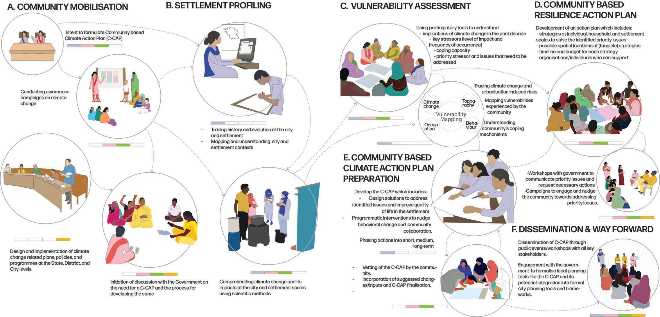
CO-PRODUCTION PROCESS 112
Existing Scenario Stream Corridor
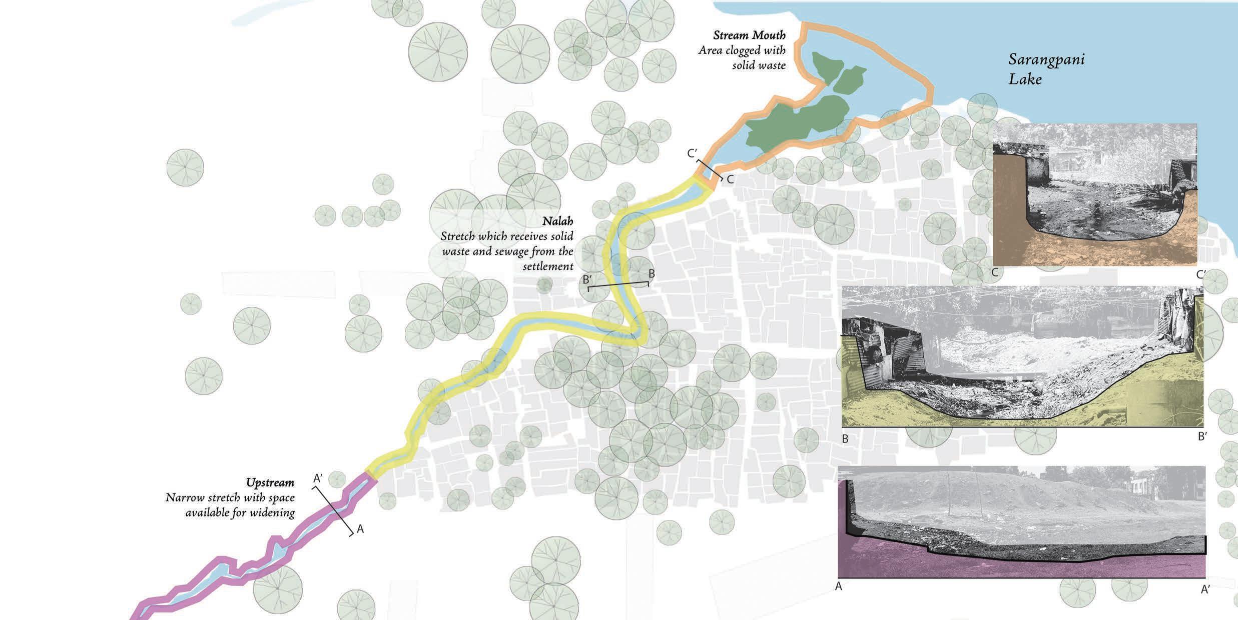
113
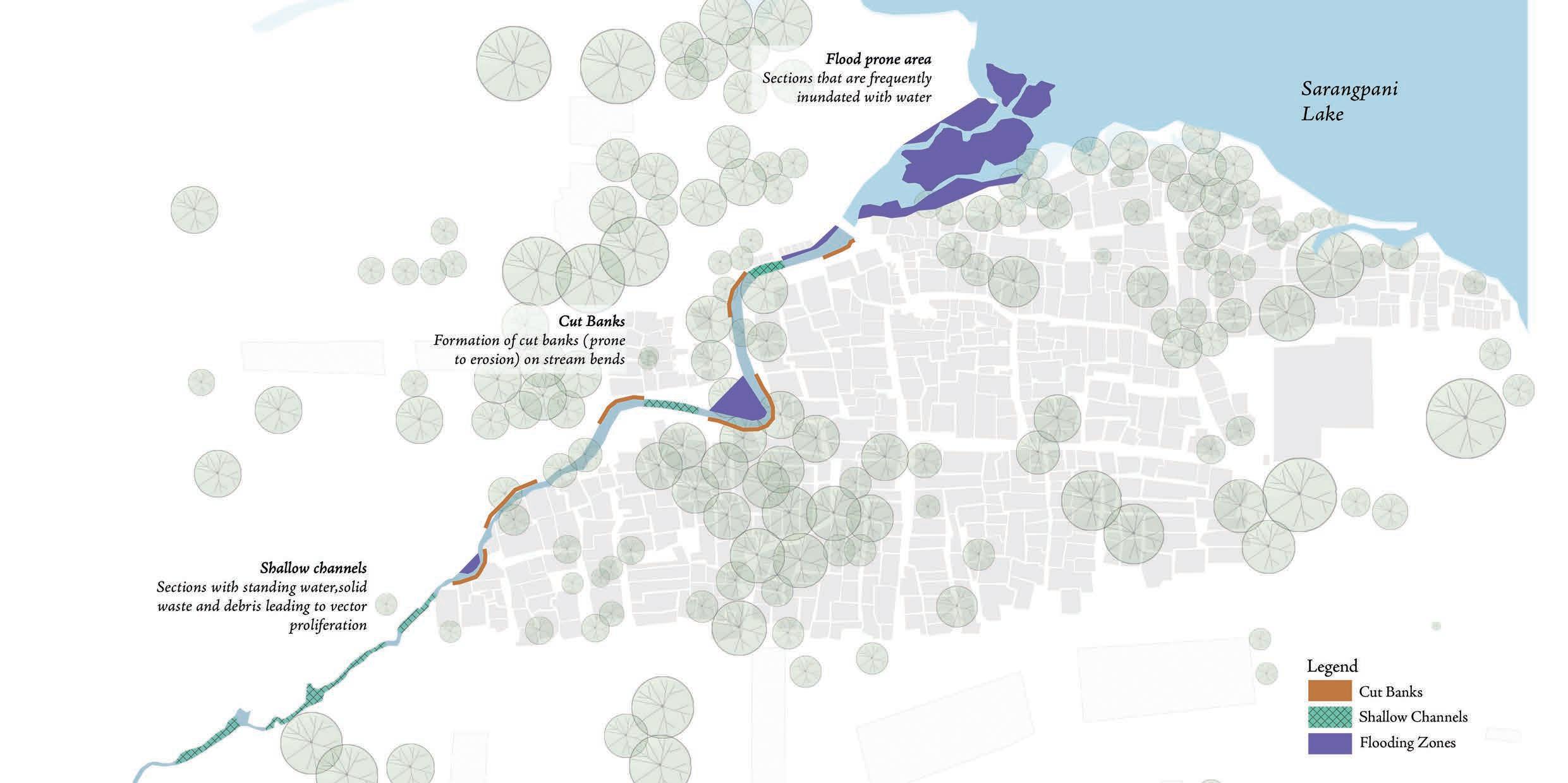
114 Issues Stream Corridor
Adaptive Solutions Stream Corridor
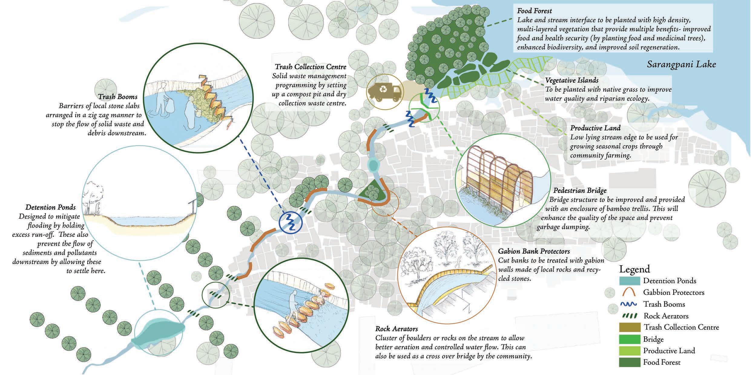
115