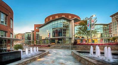
Johnson City is medium sized city with a population estimate of just over 65,000 residents located in the northeastern corner of Tennessee. Johnson City is the 9th largest city in Tennessee, the largest city in Washington County, and is the principal city in the Johnson City Metropolitan Statistical Area (MSA). The Johnson City MSA is a component within the Johnson City-Kingsport-Bristol, TN-VA Combined Statistical Area (CSA) which is frequently referred to as the Tri-Cities area. The overall Tri-Cities region is the fifth largest population center within the State of Tennessee.
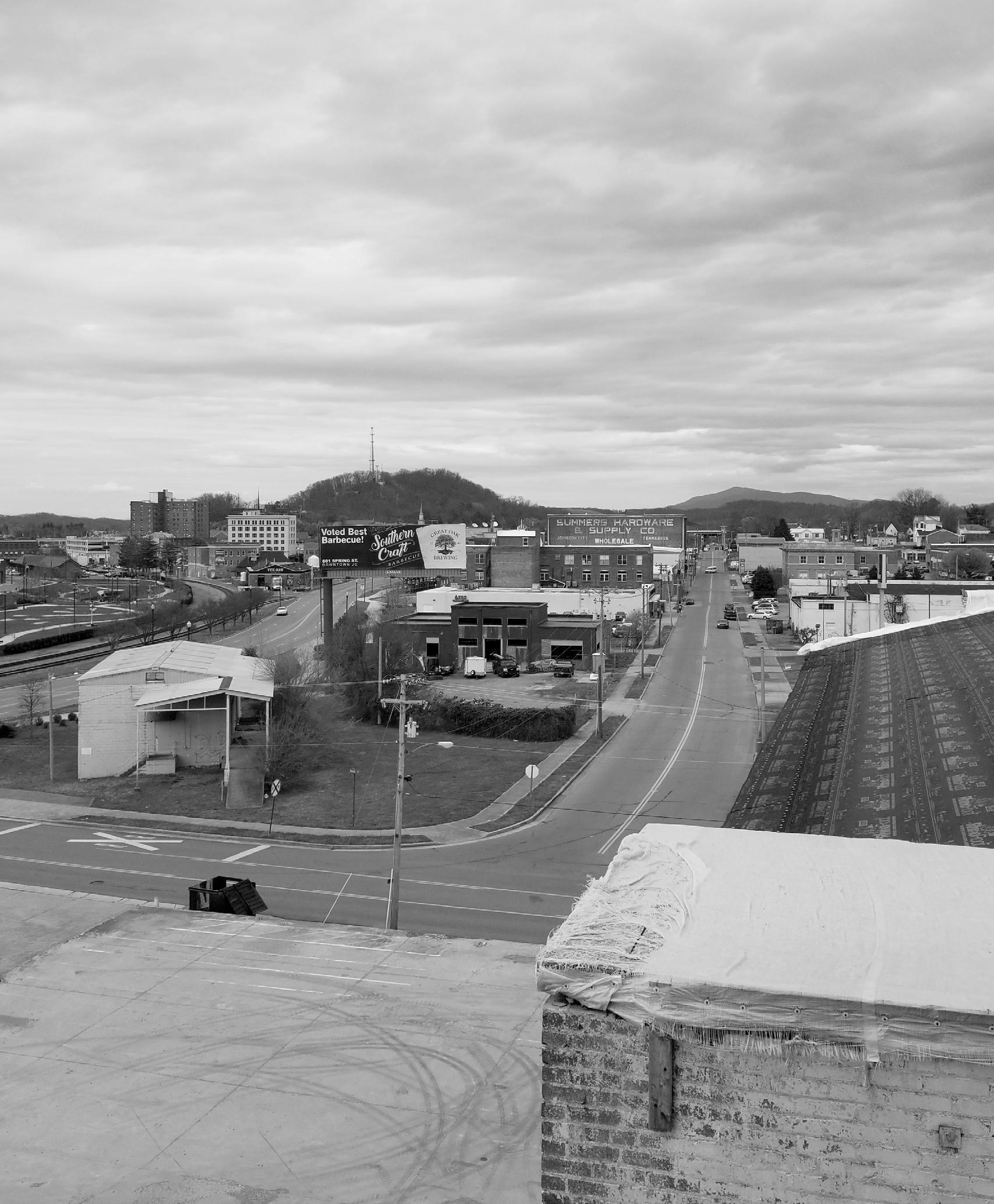
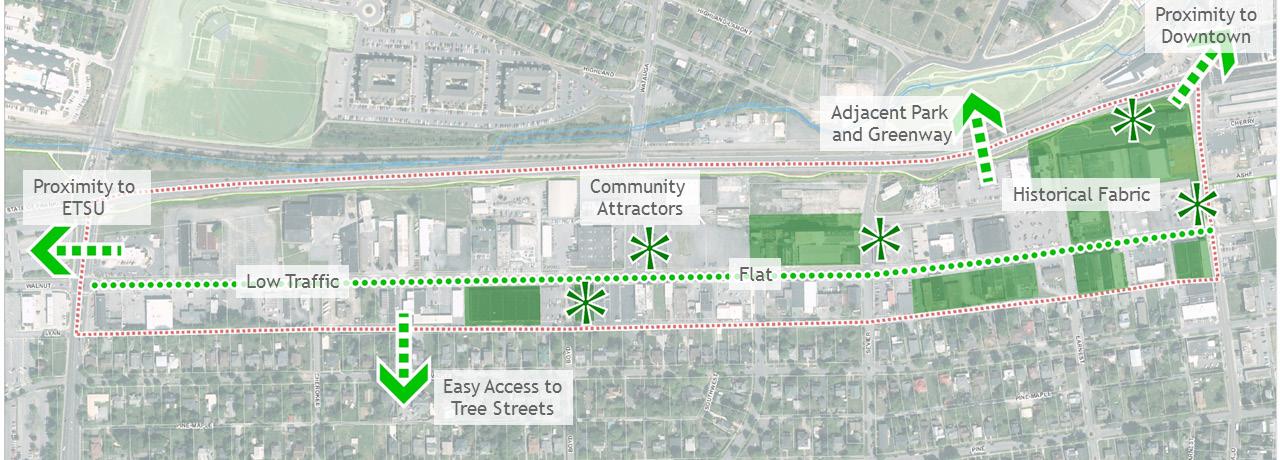
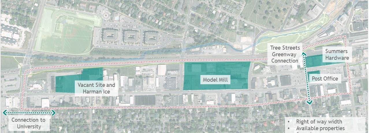
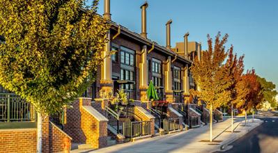
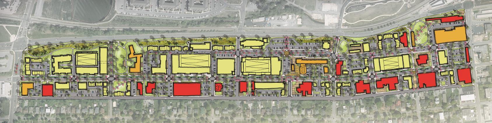
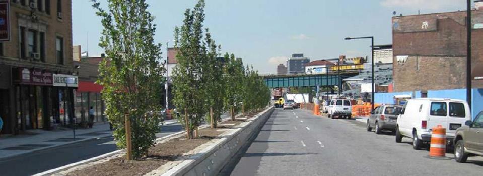
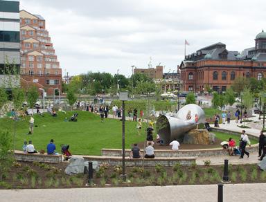
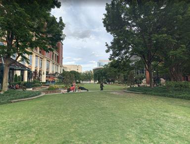
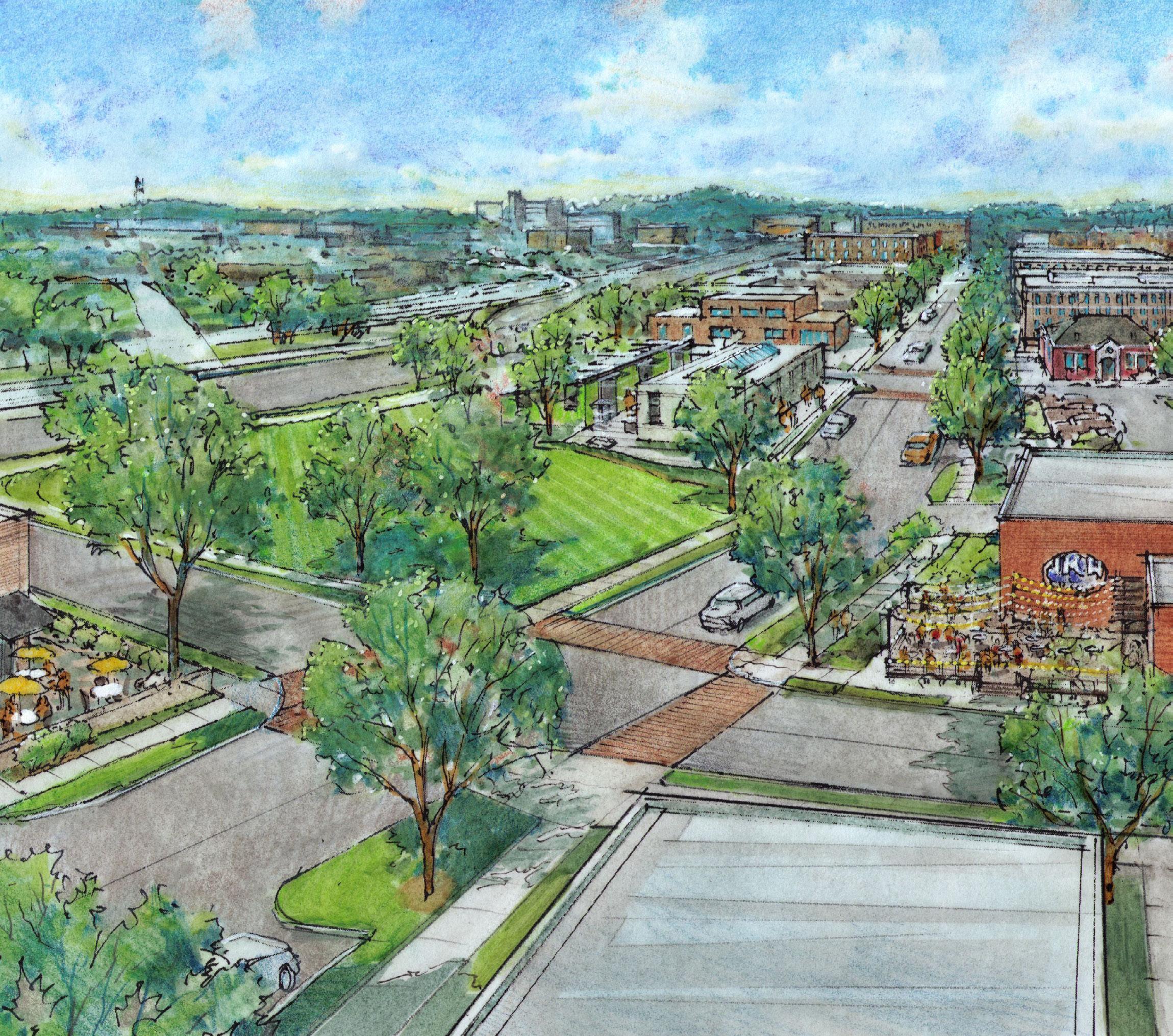
The West Walnut Corridor is an area of importance for the future of Johnson City. The corridor, which serves as a connector between East Tennessee State University (ETSU) and Downtown, has a tremendous amount of potential for redevelopment and has seen an uptick in real estate activity over the last five years. The redevelopment of several properties around Founder’s Park have created a renewed interest in development creeping across State of Franklin into the area while the recent acquisition and renovations to Model Mill may provide the catalyst to start development from within.
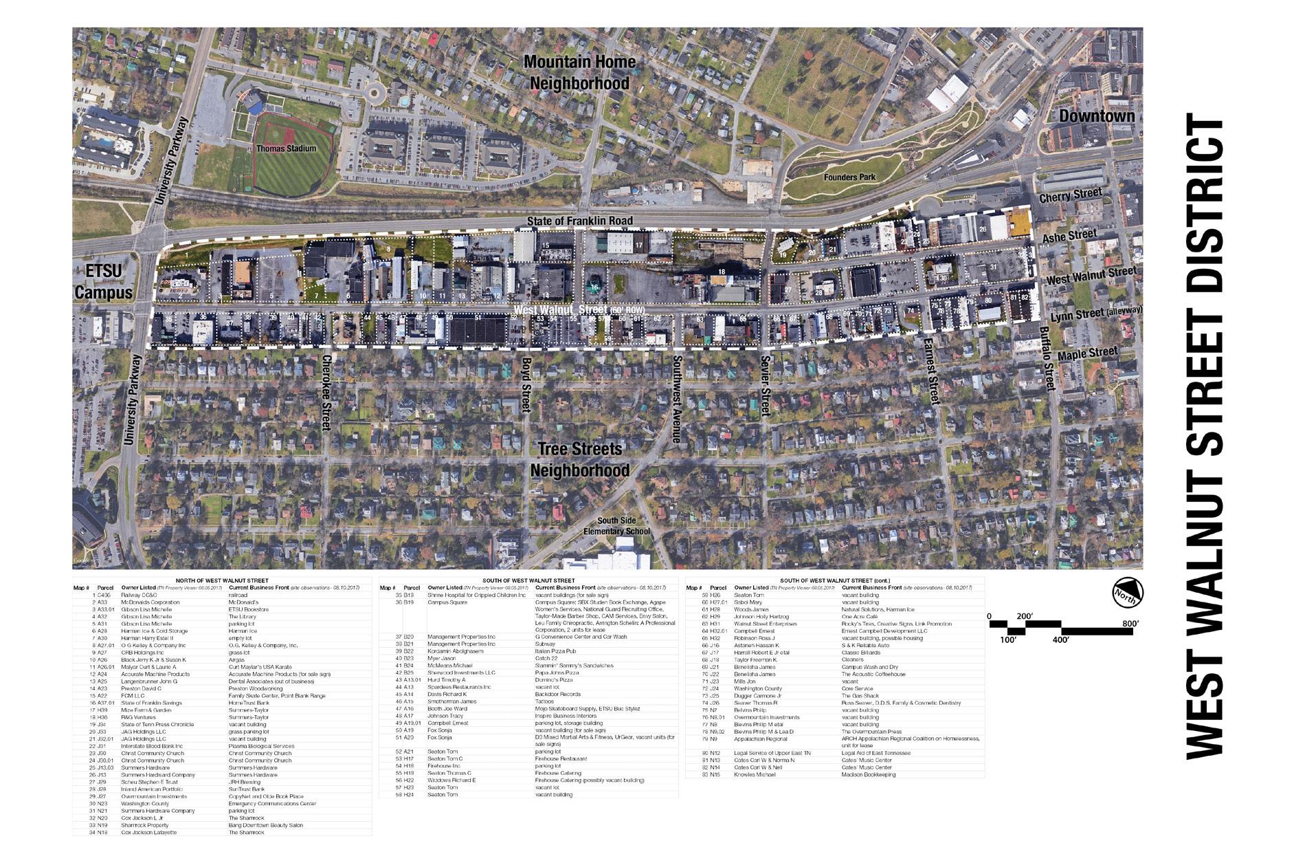
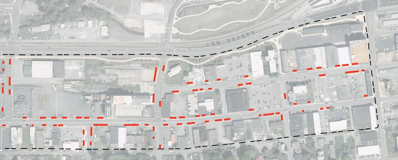
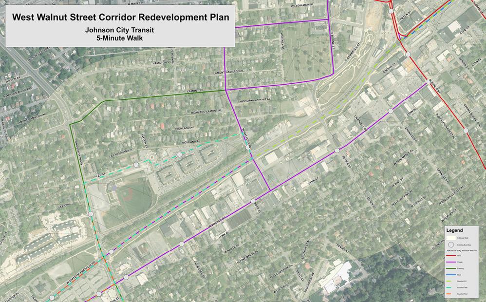
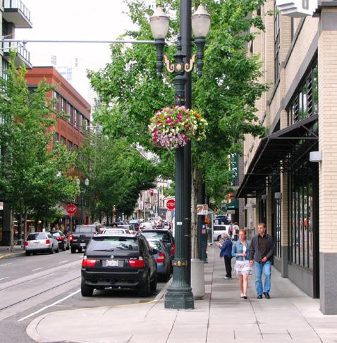
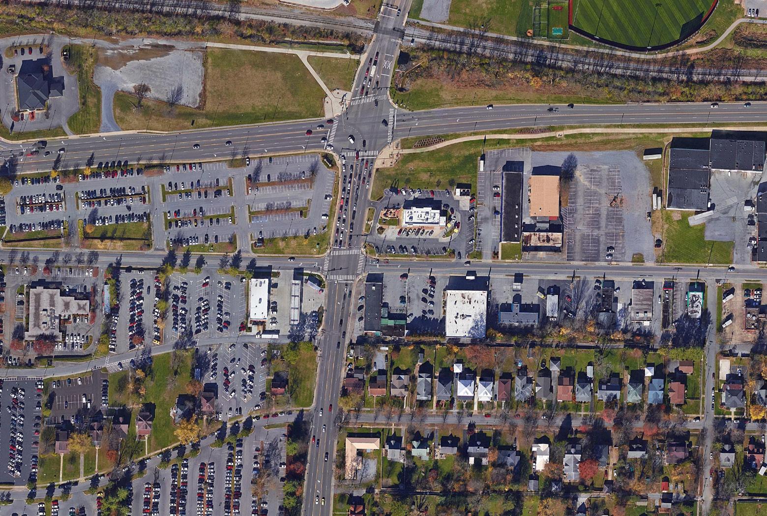
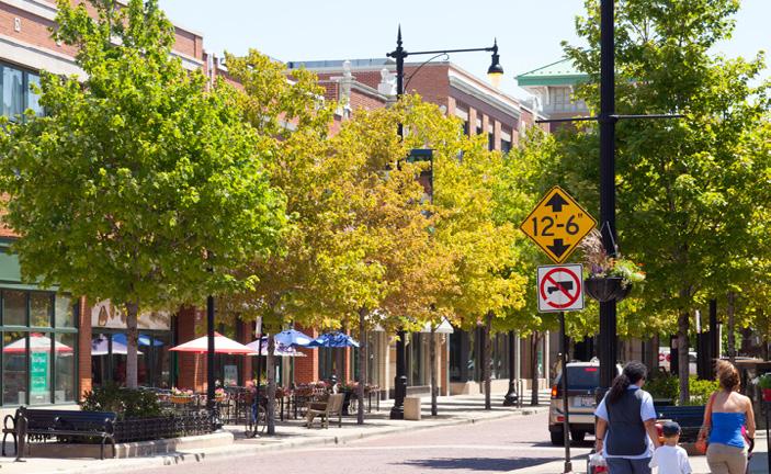
The area studied within this report is bound by State of Franklin to the north, Buffalo Street to the east, University Parkway to the west, and by Lynn Street to the south. West Walnut Street serves as the study area’s primary focus and is paralleled to the north by Ashe Street and intersected by Cherokee Street, Boyd Street, Watauga Avenue, Southwest Avenue, Sevier Street, and Earnest Street. With the exception of West Walnut Street, Sevier Avenue is the only street that enters and exits the study area.
With unparalleled access and proximity to Downtown Johnson City, two of region’s largest employers (ETSU and Mountain Home VA Hospital) and one of the city’s most established neighborhoods (Tree Streets), the West Walnut Study Area is prime for redevelopment. The timing of this streetscape master plan and corridor study is perfect to set this area on the right course for the next twenty to thrity years.
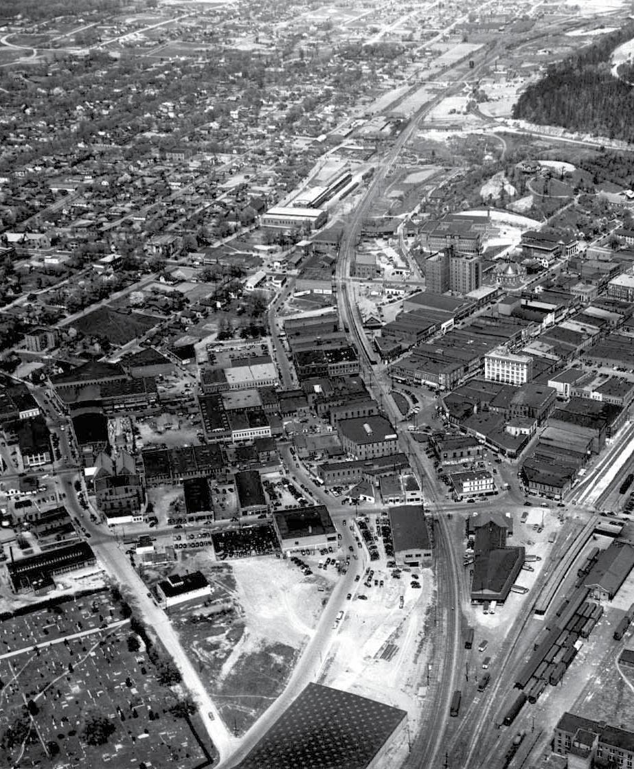
Johnson City was founded in 1856 as a railroad depot by Henry Johnson. This little railroad depot quickly grew into a major rail hub for the southeastern United States due to three major rail lines passing directly through the middle of downtown.
The City was officially incorporated in 1869 and grew exponentially up until the early 1890’s due to the boom in railroad and mining industries. In 1903 the 450-acre Mountain Home VA campus was completed just west of downtown and followed across the street by the East Tennessee State Normal School (now East Tennessee State University- ETSU) in 1911.
The City now functions as an economic center for the surrounding area and state. Many major American companies are headquartered in Johnson City, providing the City with a diverse and growing economy. The largest portions of this economy are made up by ETSU and the vast medical and medical technology community.
CORRIDOR BACKGROUND
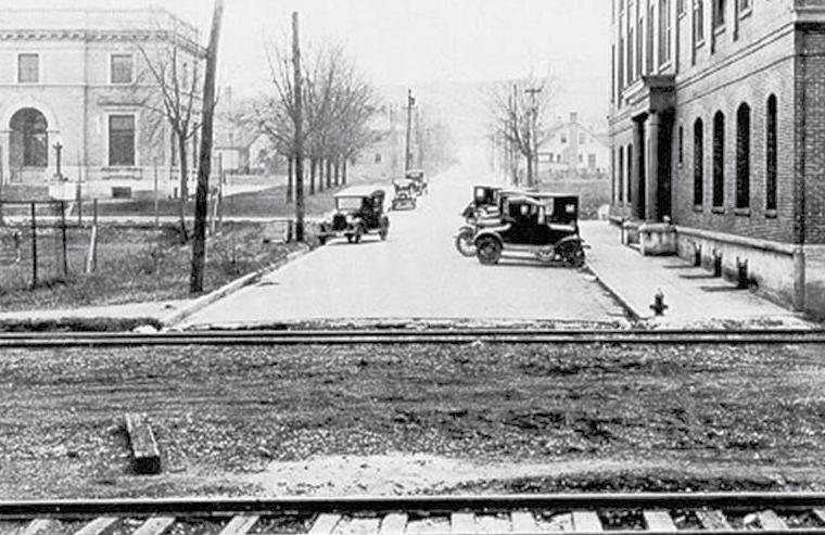
Like most of Johnson City, the history of the West Walnut Street Study Area is intricately tied to the railroad and its history. A vision of a railroad connecting Cincinnati, Ohio to Charleston, South Carolina established in the early 1800’s was brought to fruition in the early 1900’s by George L. Carter. This completion led to a tremendous growth boom in the early 1900’s in which several of the study area’s most prominent historic properties were built:
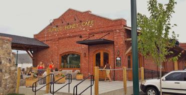
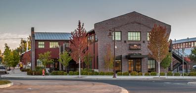
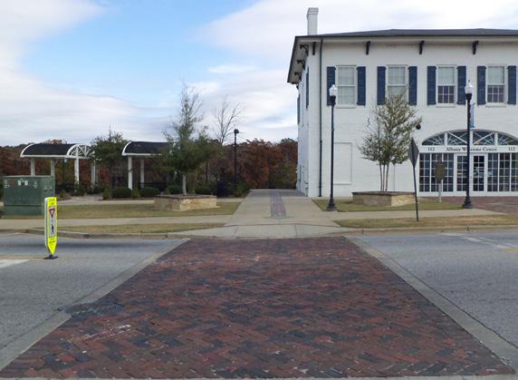
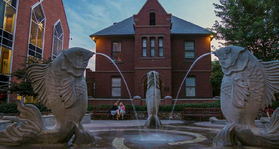
» Clinchfield Train Depot: Standing at the entrance to Downtown is the Clinchfield Railroad Depot which was constructed in 1909. This railroad depot housed Johnson City’s third railroad and helped to kick off a time of great growth within the city. The depot was renovated in the 2000’s and is home to Tupelo Honey and Fleet Feet. [1]
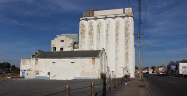
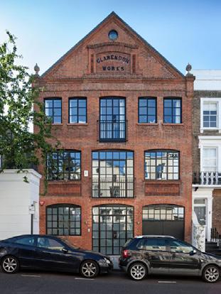
» Model Mill: Also In 1909, West Walnut’s largest and most visible feature, Model Mill, was constructed and opened by George L. Carter. Johnson City’s Red Band Flour Company produced flour, meal, and feed, and operated independently until 1933 when it was purchased by General Mills Inc. The structure was constructed almost entirely of brick and reinforced concrete, while predominately avoiding materials that could weather or were flammable. General Mills operated the Model Mill facility until the closing of operations in Johnson City in 2003. In 2016, while vacant, a fire ravaged the upper levels of the mill. [2]
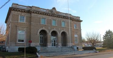
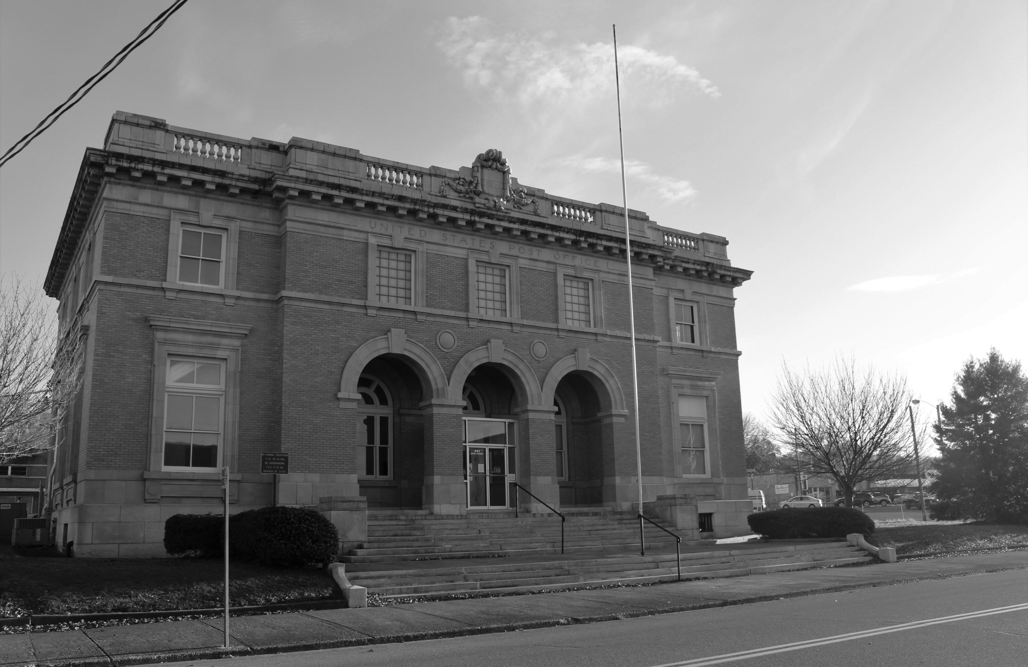
» United States Post Office: Construction was started on the Renaissance Period, Beaux Arts Style post office in 1909 on land donated by George L. Carter. This post office was Johnson City’s first federal building and it continued operation until the post office relocated in 1938. The building’s exterior has remained period specific through renovations and was used as both the county court house and the county’s 911 and emergency communications center. [3]
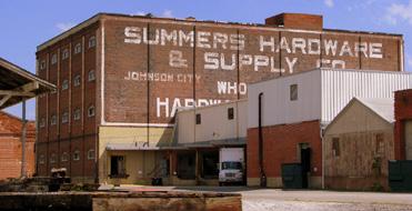
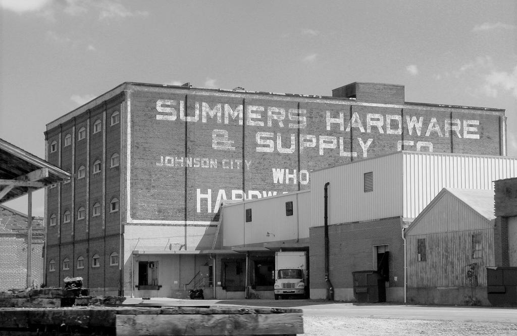
» Summer’s Hardware: Standing at the Corner of Buffalo and Ashe Street sits one of Johnson City’s longest running businesses, Summer’s Hardware. The large warehouse portion of the business was constructed in 1910 to house the rapidly growing hardware business. This dominant structure supplied (and still supplies) a tremendous amount of hardware supplies to the area. Over the course of the following 100 years Summer’s Hardware has expanded from Buffalo Street. [4]
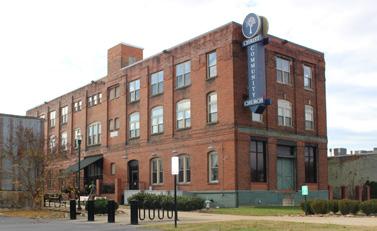
» 400 Ashe Street: The three-story brick building at 400 Ashe Street was originally constructed in 1910 backing onto and loading directly from the railroad line running just south of where State of Franklin sits today. Originally built for industrial and office uses, this building has seen many uses in its hundred-year history including everything from a bar/music venue to its use today as a community church. [5]
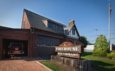
» The Walnut Street Fire Hall: Built right at the start of the Great Depression, in 1930, the Walnut Street Fire Hall (Station #2) served two areas. It served both the West Walnut Street Study Areas (which was rapidly becoming a major industrial sector for the city) and the affluent “Tree Streets” neighborhood to the south. The fire hall was purchased in 1980 and opened as the very successful Firehouse Restaurant in 1981. [6]
Johnson City, particularly the West Walnut Corridor, saw another industrial and commercial boom in early 1940’s during the recovery from the Great Depression and the onset of World War II. This growth led to Walnut Street almost entirely becoming industrial and commercial without retaining much of the residences that dotted portions of the corridor.
With the construction of State of Franklin in the mid-80’s, West Walnut Street saw a decrease in vehicular traffic and general importance as a connector between ETSU and Downtown Johnson City. This reduction in use and overall visibility led to slowed growth/development within the study area. This reduction in vehicular use has not all been detrimental as it has helped make the corridor a more bike-friendly route in contrast to many comparable streets.
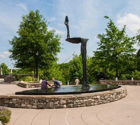
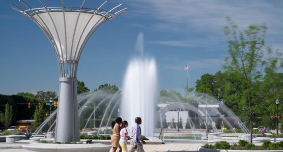
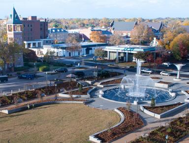
Just as in the past, The West Walnut Street Corridor has an important role to play in the future of the area. Recent investments by the City at the Farmer’s Market, Founder’s Park, and other portions of Downtown, coupled with numerous private investments in and around the study area, have helped to drive interest to the corridor. The outcome of development along the corridor can help the City grow by attracting more residents and businesses to the area.
PUBLIC ENGAGEMENT
+ Task Force
+ Community Meetings
+ Community Survey
+ Stakeholder Interviews
+ Public Open House
+ Public Commenting Period
WEST WALNUT TASK FORCE
The idea of changes to the West Walnut Corridor started primarily from local business owners and community members calling for change. In December of 2016 the Johnson City Planning Department worked with community members to form a ten member Task Force that was comprised of business owners and community members alike to begin working to implement changes through zoning and policy for the study area. During the corridor redevelopment planning process the West Walnut Task Force met to discuss progress on:
» December 04, 2017
» February 19, 2018
» March 19, 2018
These meetings were helpful in determining the direction of the scope and design of the West Walnut Corridor Redevelopment Plan while adding an extra layer of feedback to the conditions seen daily within the study area.
COMMUNITY MEETINGS
FEBRUARY 8, 2017
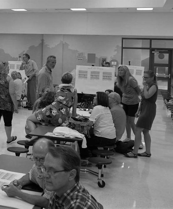
One of the first actions undertaken by the Task Force was to schedule a public community meeting. The goal of the Public Forum was to determine the general feel of the community towards Walnut Street. Over 100 residents and property owners were in attendance and gave guidance on a variety of directed questions and table exercises.
At the Public Forum, questions were asked to determine the overall streetscape design, general form of structures within the study area, and the types of uses that should be encouraged or avoided. Community members overwhelmingly preferred a more urban setting for Walnut Street with buildings pulled closer to the street than typical suburban development patterns, and with parking separating the structure from the streetside.
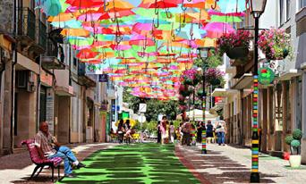
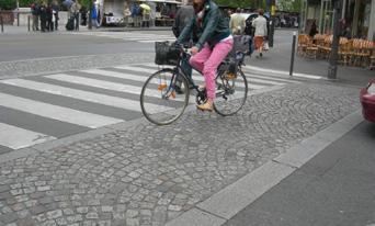
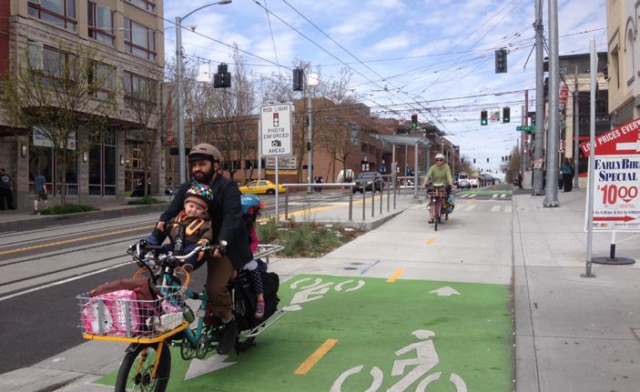
In addition, community members desired for West Walnut Street to become a more pedestrian and bicyclist-friendly street. Images picked typically included wide sidewalks with street trees and bike lanes. Bike lanes that were separated from traffic by a vertical divider were preferred more than typical painted lines or sharrows.
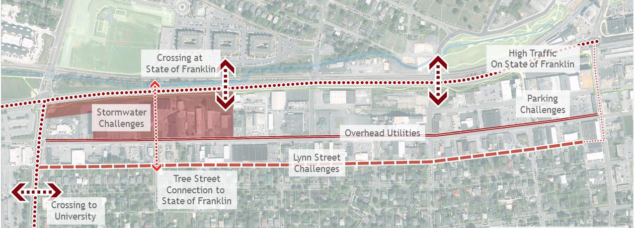
In an additional exercise, the attendees also discussed the existing conditions of West Walnut that help attract businesses to the corridor (assets) and the challenges or weaknesses that prevent redevelopment along the corridor. This exercise was supplemented by asking community members to list the types of businesses and uses they would like to see encouraged and discouraged in the study area.
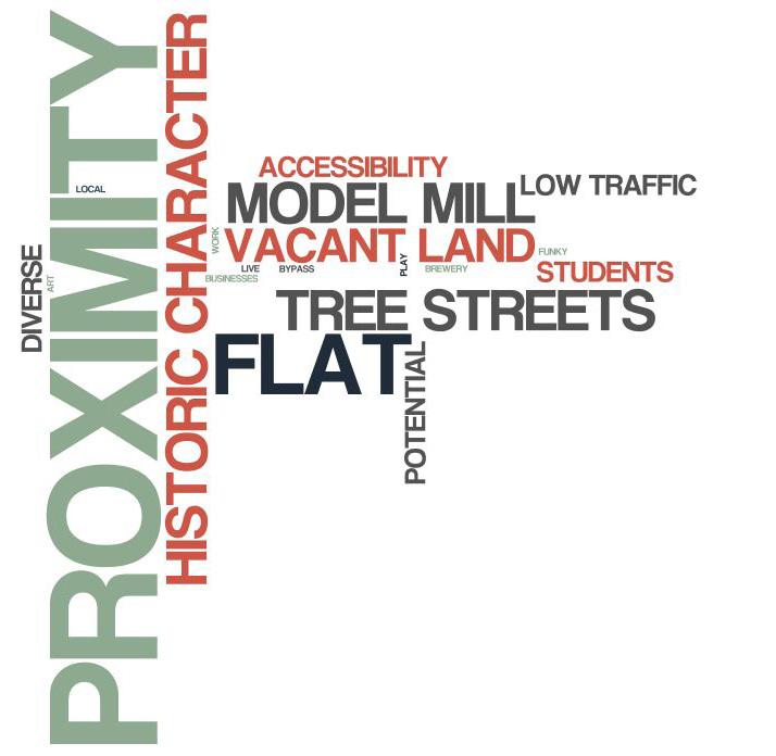
In your opinion, what are the corridor’s biggest ASSETS?
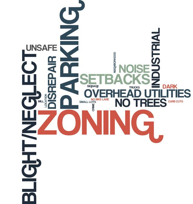
In your opinion, what are the corridor’s biggest CHALLENGES/WEAKNESSES?
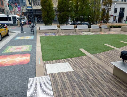
Photo Credit: Zach Vance Johnson City Press
The City Planning Staff and Task Force worked together to respond to community feedback received from the community meeting and online survey. A second community meeting was held in August of 2017 to discuss potential streetscape scenarios and language and conditions for the West Walnut Overlay document.
The primary purpose of this meeting was to discuss the overall design of the street. Community members preferred approaches that focused on the pedestrian and bicyclist. Ideas of integrating a bike lane separate or divided from vehicular traffic were preferred over traditional on-street lanes with no vertical separation. Concerns over the visibility of bike lanes and the separation of bikes from pedestrians were voiced regarding the streetscape design.
Another topic of discussion was the provision of public parking, its location on the corridor, and what role the city should play in providing it. Many community members liked the idea of the city providing lots that can be shared and utilized using a “fee-in-lieu” structure. This would allow businesses a break on parking requirements by paying a proportional fee to utilize public lots. On-street parking was discussed but was preferred in key locations with parking only on one side of the street. Overall parking was seen as a concern that had to be addressed during the development of the corridor.
Community members also liked the provision of green space and street trees but cautioned on the reduction of visibility and the location of the trees. Attendees also felt strongly that a median with trees was not the right approach to establishing more greenspace along the corridor.
COMMUNITY SURVEY
To increase the amount of responses, the City Planning Staff released an online survey built from the questions presented at the February 8, 2017 community meeting that was taken by over 1,000 additional community members. The key takeaways from the community survey were:
» An urban development form is much preferred
» West Walnut is envisioned as becoming a pedestrian and bicyclist friendly street
» Community members desire businesses that are more local scaled and oriented
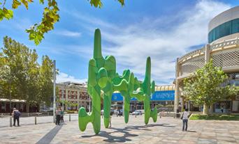
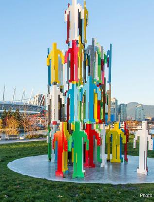
» Public arts and integration of the arts are desired for the future of the corridor
» Big box retail stores, industrial uses, vehicular sales, and medical facilities are not desired uses
» The blight/rundown appearance, vacant buildings, and lack of parking are challenges that hinder development along the corridor
» Proximity to downtown, ETSU, and the adjacent communities are key assets for West Walnut
» The potential for redevelopment along the corridor is strong due to exisiting small businesses, the Model Mill redevelopment, and the historic character
STAKEHOLDER INTERVIEWS
DECEMBER 4&5, 2017
The consultant team kicked off their involvement with several visits to the study area and several in-person interviews and sessions called Stakeholder Interviews. These stakeholder interviews included:
» City Staff Members
» Elected Officials
» West Walnut Task Force
» Property Owners
» Business Owners
» Local Residents
The biggest takeaway from these interviews and sessions was that community members, elected officials, and city staff members were on the same page and formed a consensus for what they wanted to see for this corridor. Some of the higher-level takeaways from these meetings were:
» This project is needed and the timing is excellent
» Whatever is done needs to compliment the detail and quality of redevelopment that is occurring downtown
» Lack of parking, or the perception thereof, is a barrier to the development of the corridor
» Pedestrian, bicycle, and vehicular accessibility to and from University Parkway and/or State of Franklin are barriers that need to be addressed
Photo Credit: Zach Vance Johnson City Press
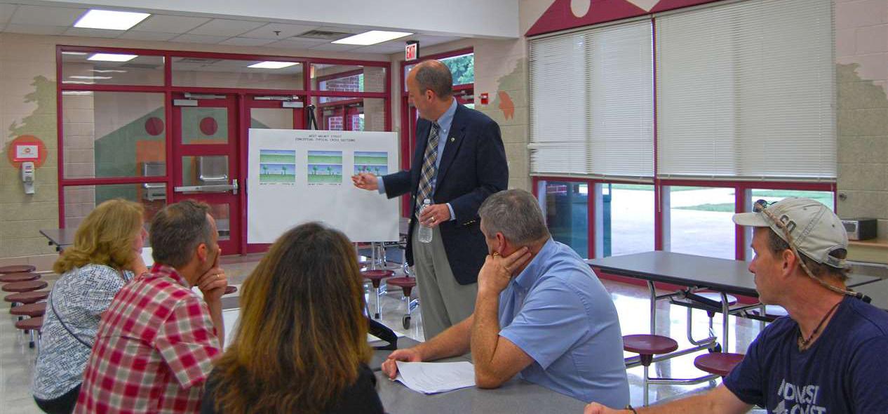
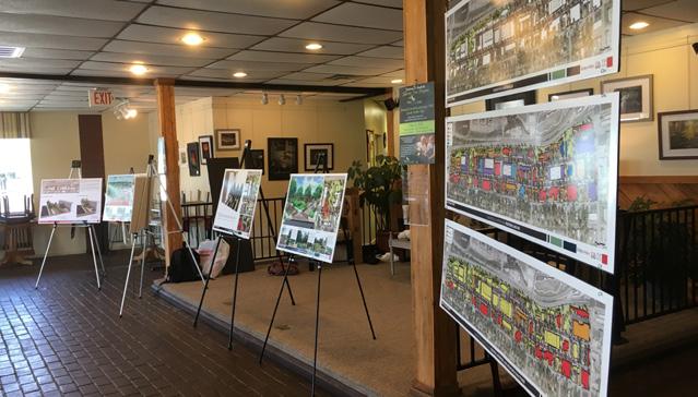
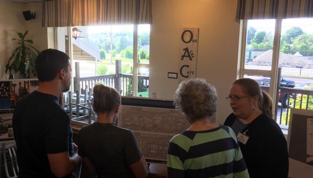
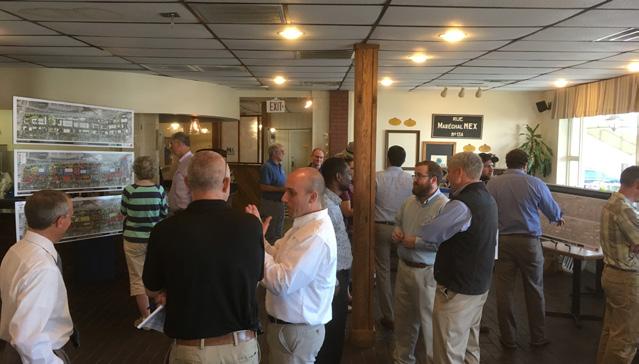
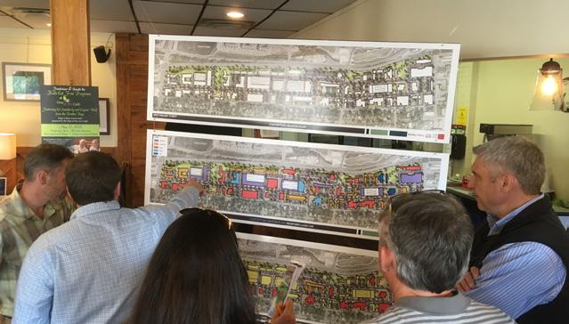
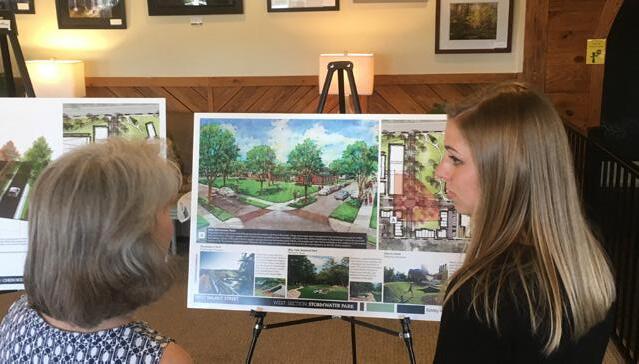
The project team for West Walnut Corridor Study hosted an open house meeting to gather input on the plan thus far and determine the final direction for the streetscape design for West Walnut Street. In total, the project team engaged with 70+ attendees at the open house. This meeting presented a series of conceptual designs, plans, and other illustrative graphics broken into six sections:
» Background: Identified issues and concerns addressed by stakeholders and community members through the engagement process that help to shape the direction for the conceptual master plan.
» Conceptual Master Plan: Presented a conceptual approach to what the corridor could look like if suggested streetscape and other planning elements were implemented.
» West Section: Illustrated the extension of Cherokee Street to State of Franklin, and the provision of a park created to address major stormwater concerns in the portion of the corridor.
» Central Section: Focused on the linear stormwater section and relocated utility lines along State of Franklin and the creation of a “Gateway Park between Ashe Street and State of Franklin.” This section also laid out the proposed street section for Ashe Street.
» East Section: Created a “Civic Center” for the corridor around the former Post Office site by proposing a new greenspace and creating a visual connection between the corridor and downtown. This section also focused on creating a strong pedestrian connection between the Tree Streets and Downtown.
» Transportation: Compared the proposed options for the West Walnut Street Streetscape, identified potential solutions dealing with access management/parking, and started to outline the aesthetic look and feel of the corridor.
Community members at the open house preferred Option 2 (Bikes) at a ratio of 3:1. The three biggest takeaways from this selection were:
» Connection between ETSU and Downtown
» Provides an attraction not yet seen in Johnson City
» Two lanes of parking may not be needed
Community members who selected Option 1 (Traditional Main Street) felt it provided a more parking friendly scenario that would be more appealing to the majority of users. The consultant team did not hear or receive any counter argument to not providing either of the scenarios at the open house.
PUBLIC COMMENTING PERIOD
MAY-JUNE 2018
To allow for more public commenting and choice on the individual scenarios, the boards from the public open house were placed on the City’s website. The consultant team and City Planning Staff received several written comments and statements at the open house and during two weeks for open public commenting on the plan via online comments, email, and phone calls. The following list is a general summary of the comments received:
» Plan, Cost, Timeline and Process: Majority of the comments and questions from the community revolved around questions of how the City will fund the plan, what the construction process and timeline will be.
» Relocation/Removal of Existing Businesses: A tremendous amount of conversation was directed around the removal/relocation of existing businesses along the corridor.
» The Intersection of University Parkway and West Walnut Street: Many community members want to see changes at this intersection.
» Connections (pedestrian and bicycle) throughout the City: Many community members advocated for more connections to places outside of the study area that would make the City a safer place to walk and/or bike.
» Greenspace along the Corridor: The team heard a lot of conversation on the amount of greenspace provided within the Conceptual Master Plan, from community members who appreciated the amount provided to those who think it is too much.
» Transition into the Tree Streets between Commercial and Residential: As with previous public engagement the relationship between the Tree Streets and West Walnut Street is extremely paramount to the community.
» Changes on Property Values/Home Prices: The community expressed some interest on the impact this plan will have on the property values within and around the study area.
City Staff and the consultant team gave explanations and answered any questions related to the corridor master plan.
JULY 13-JULY 26, 2018
One the draft version of the Corridor Redevelopment Plan was complete, the City’s planning staff and consultant team opened the plan up for additional input prior to presentation at City Planning Commission and plan adoption. This period allowed for property owners, adjacent residents, and corridor users to see how their input was crafted into the creation of the Corridor Redevelopment Plan and provide any feedback or concerns they may have.
EXISTING CONDITIONS
+ Land Use and Form
- Overview
- Zoning
+ Transportation Analysis
- Existing Level of Service
- Crash Data
- Parking Assessment
- Curb Cuts
- Multimodal Transportation Options
+ Utilities
- Stormwater
- Water, Power, Gas
+ Environmental
+ Market Study
+ SWOT Analysis
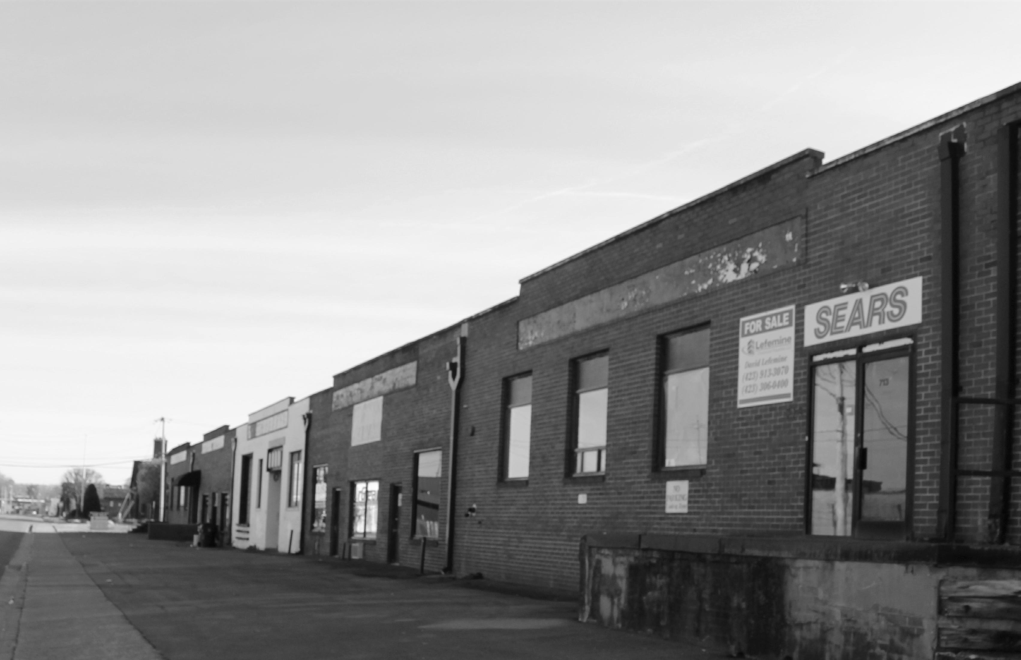
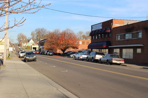
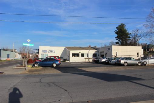
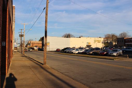
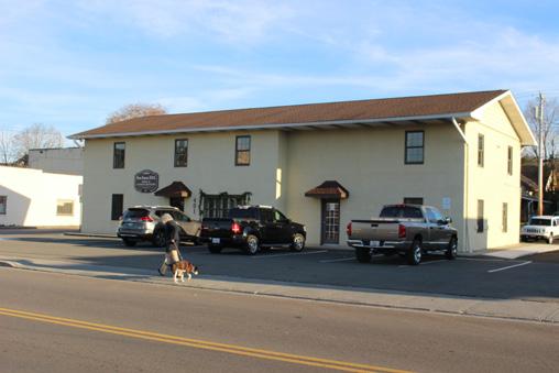
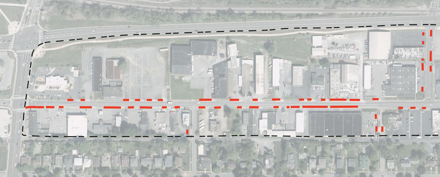
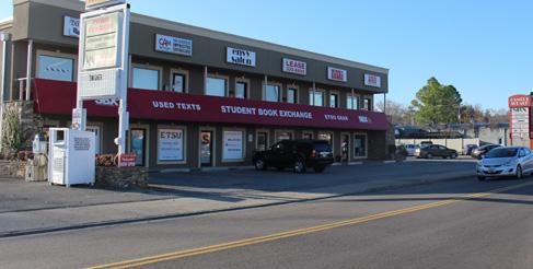
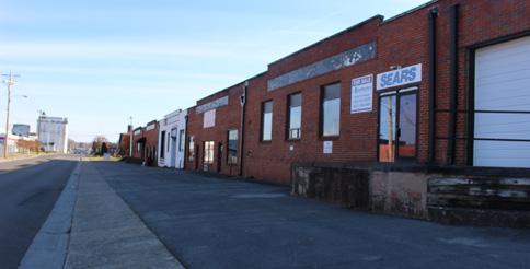
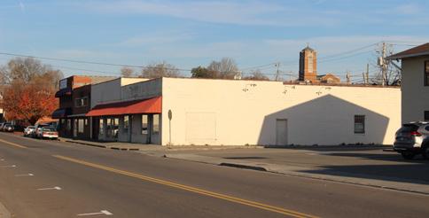
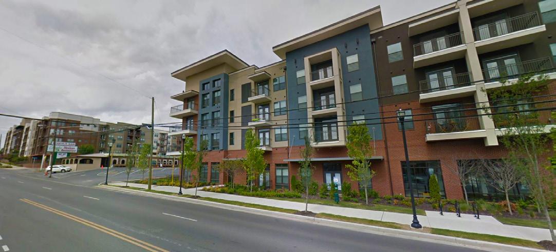
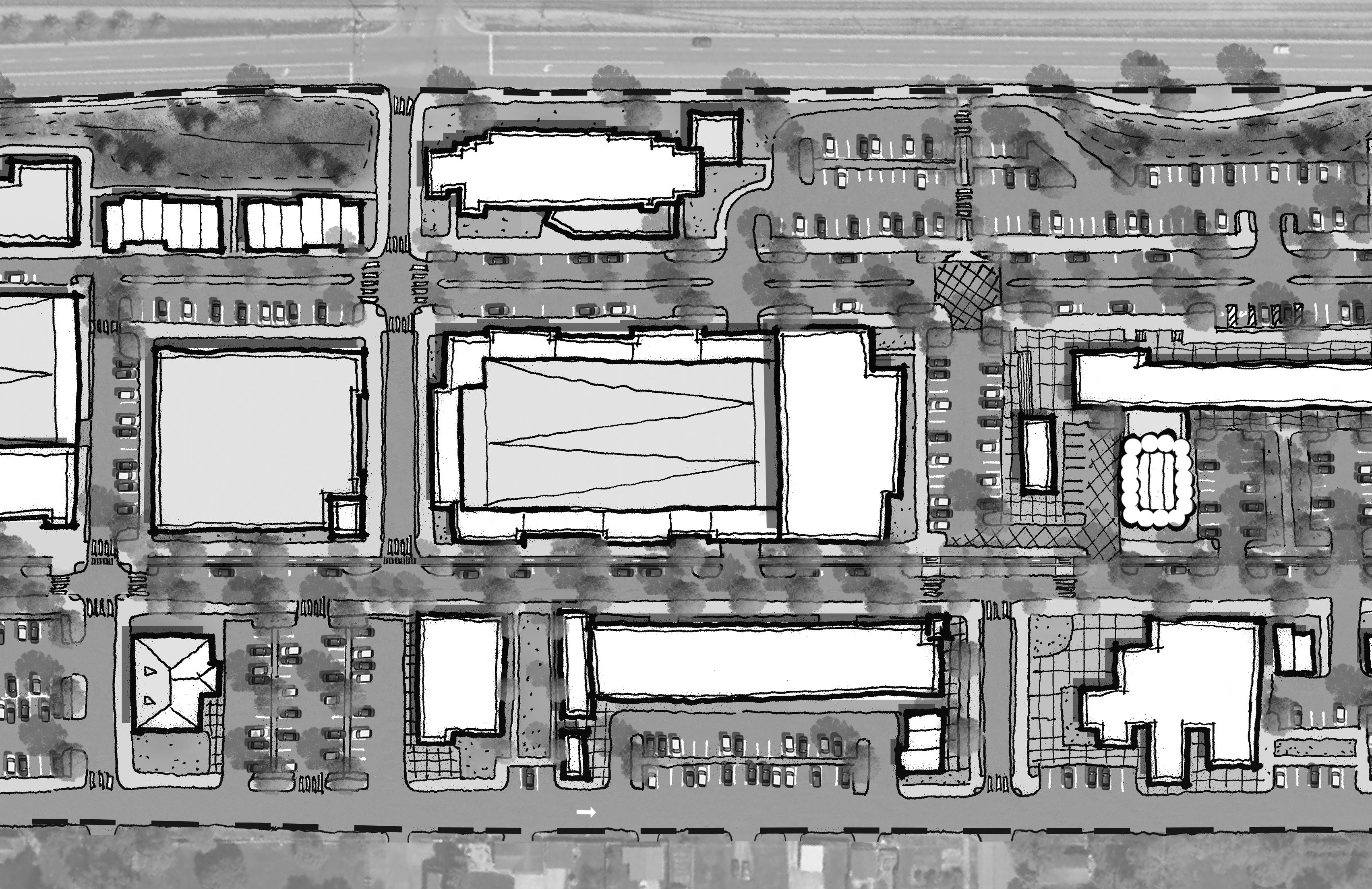
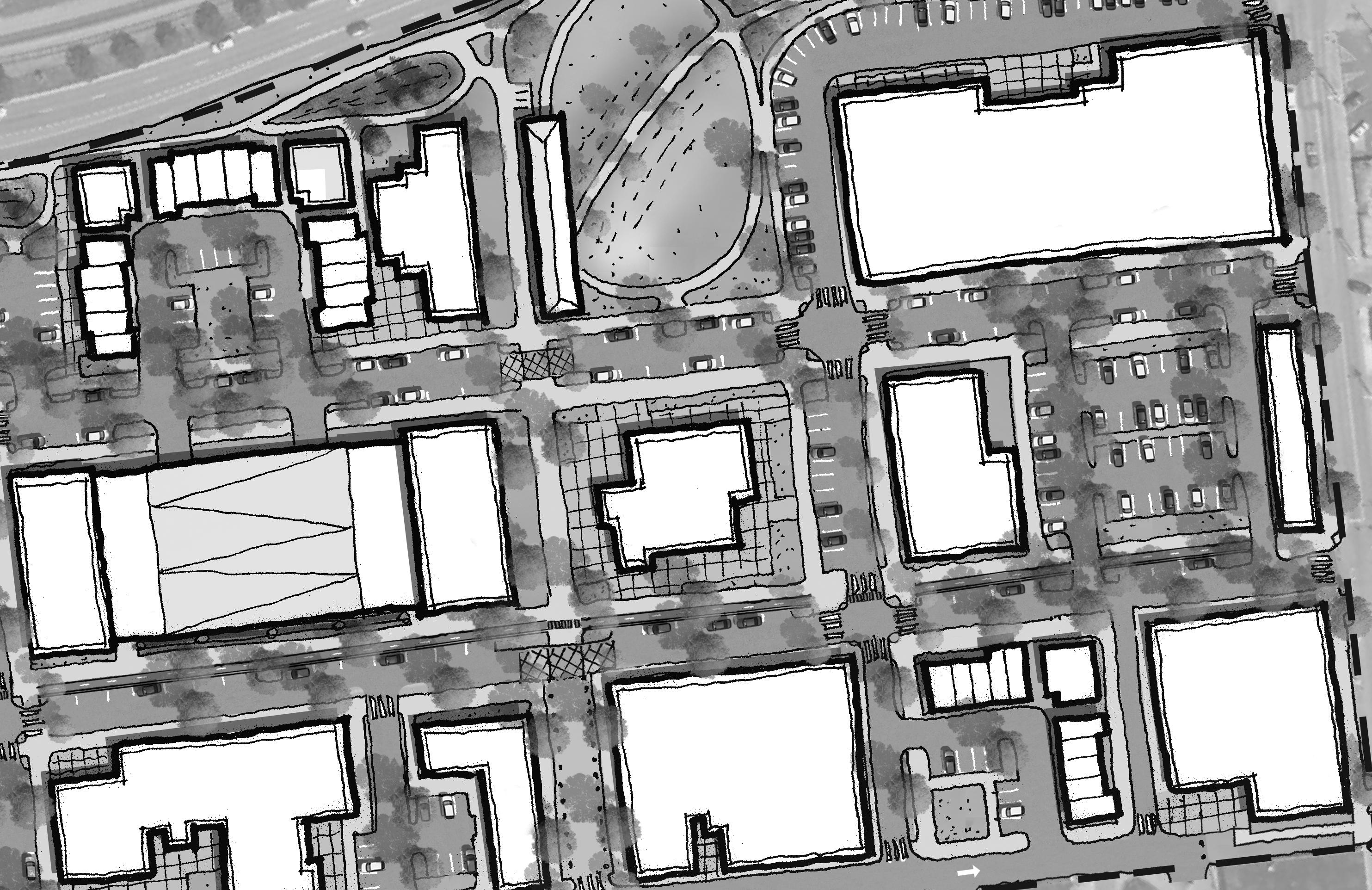
The West Walnut Corridor Study Area focuses on a section of West Walnut Street just short of a mile in length running from University Parkway to Buffalo Street. Today the study area is predominately made up of general commercial, industrial, and other low intensity uses spread out along its entire length.
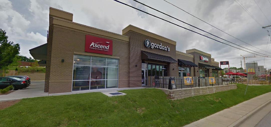
Uses along the main corridor generally vary depending on their location in relation to Downtown or ETSU. West Walnut Street is bookended on either side by both general commercial uses such as retail shops and quickserve restaurants, as well as, small scale offices and direct services. Uses transition to larger industrial spaces and more vacant properties nearer to the center of the corridor. Most properties on the corridor are one-story to two- stories without a mixture of uses on site.
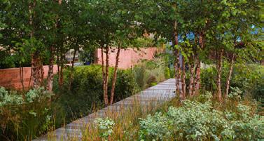
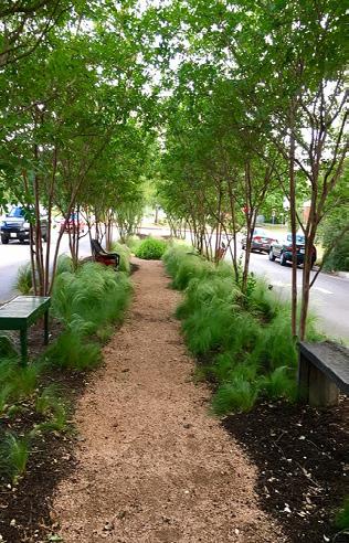
As is the case with most industrial and commercial zones, the study area is predominantly composed of impervious surfaces with minimal open space. The only publicly accessible open space is a small pedestrian path running in the former Earnest Street right-of-way and the State of Franklin Shared Use Path.
Most properties on the western and central portions of the corridor have some form of on-site parking. This parking is usually located to the front and sides of the primary structure. The properties closer to downtown have less on-site parking and either share parking or utilize on-street spaces.
Four of Johnson City’s most recognizable historic structures: Summer’s Hardware, Model Mill, Former US Post Office, and the Train Depot all sit within the study area. This along with the fact the corridor is bound by the City’s central business district (Downtown), its largest activity generator (ETSU), one of its oldest and most active neighborhoods (Tree Streets), and the main thoroughfare (State of Franklin) the study area is seen by many as being underutilized.
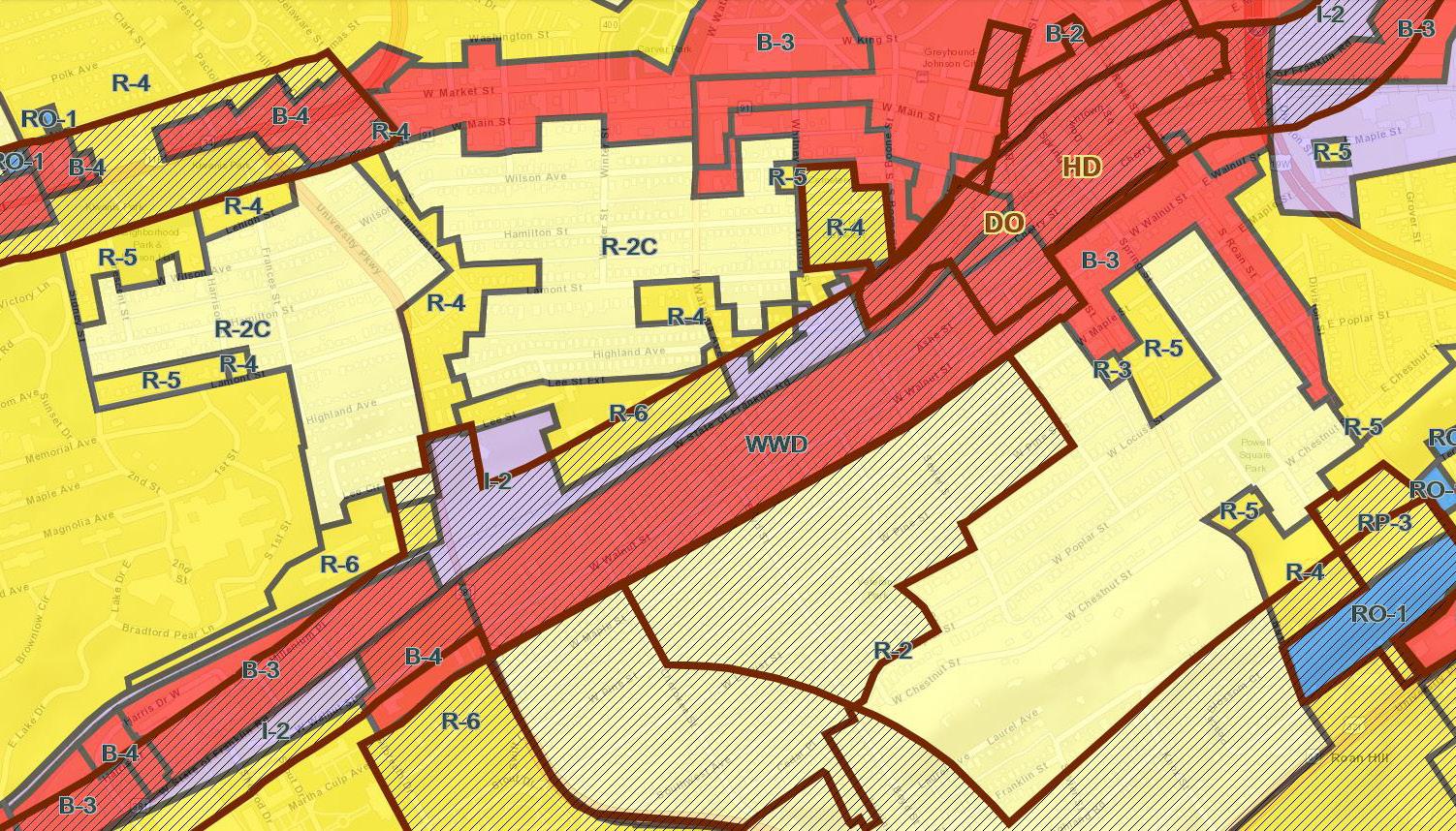
ZONING
With that sentiment in mind the city finished a rezoning effort in 2017 that effectively rezoned all properties within the study area (except the Historic Depot site at the intersection of Buffalo Street and State of Franklin) into one linear zoning category called the West Walnut District. This zoning change removed four existing zoning districts and created a very light form-based zoning district.
This zoning district effectively expanded the available uses for the area while creating a set of desired architectural standards. This district’s zoning was created to ensure the current zoning allowed the types of uses and businesses suggested by community members in numerous rounds of community meetings. This base zoning works as an underlay to the District Overlay (DO) and a Historic Overlay that runs from Buffalo Street to Earnest Street.
The West Walnut Street Zoning District was created to establish the follow as base zoning standards:
» Uses: Expanded uses within the code to allow for a mixture of uses.
» Height: There is no established height restriction for properties on the north portion of West Walnut Street, properties on the south portion are limited to two stories.
» Glazing: Buildings must have 50-70% glass (transparent) along ground floor.
» Setback: Properties have a 15’ Build-To line that pulls redeveloping properties closer to the street.
» Screening: Parking lots and back of house items must be aggressively screened from the right of way.
» Facades: Building facades are restricted by the City’s Design Overlay and required to be 75% brick of stone.
» Active Uses: Properties with exterior music and activities are to provide those functions away from the rear of the properties abutting Lynn Street.
To the south the district is surrounded by properties with residential zoning within the Tree Streets neighborhood. These properties have a base zoning of R-2 and are within a historic overlay that works to preserve the historic character of the neighborhood. North of the study area, State of Franklin is fronted by industrial zoning that transitions to two different residential intensities. Properties to east and west are predominately zoned for commercial and business uses.
In addition to the base zoning, properties in close proximity to State of Franklin or University Parkway fall into overlay districts that run along the corridors.
ZONING INTENT:
The intent of the West Walnut Street District (zoning abbreviation: WWD) is to promote a compact urban corridor with a mixture of commercial, office, and residential uses that promotes bicycling and pedestrian mobility and supports the University, the Downtown, and surrounding residential areas.
EXISTING ZONING MAP
TRANSPORTATION ANALYSIS
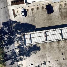
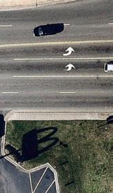
The study area is comprised of several differing roadway cross sections. The western and northern edges are made up of University Parkway and State of Franklin, which are both four lane sections. Most streets within the study area include only two travel lanes. With the exception of Watuga Street, all north/south streets contain on street parking.
West Walnut Street is made up of three different sections within the study area. While these sections vary with what components are provided, within the curb to curb dimension, they maintain the same 60’ Right of Way (ROW) throughout the study area. Running eastbound from University Parkway to Boyd Street, West Walnut is found in a traditional two-lane section. This section shifts at Boyd Street and adds a center turn lane until past Sevier Street where it loses the turn lane and adds on-street parking the remainder of the corridor.
Level of service for West Walnut Street predominately ranges between Levels A and B during the two weekday peak hours.
The study area roads with lower service scores (Levels C to E) all intersect with State of Franklin and have lower scores mostly due to the signal priority given to State of Franklin.
While most accidents that have been mapped around the study area have occured along University Parkway (within an 1/8 of a mile from the intersection with State of Franklin), a few intersections within and around the corridor have seen multiple incidents over the past three years.
» State of Franklin at Watuga Ave
» West Walnut St at Sevier St
» West Walnut St at Earnest St
» Ashe St at Sevier St
» Ashe at Earnest
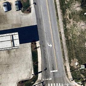
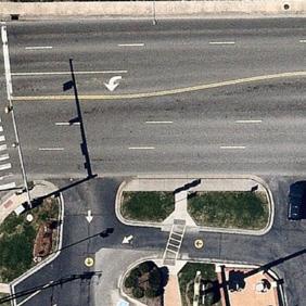
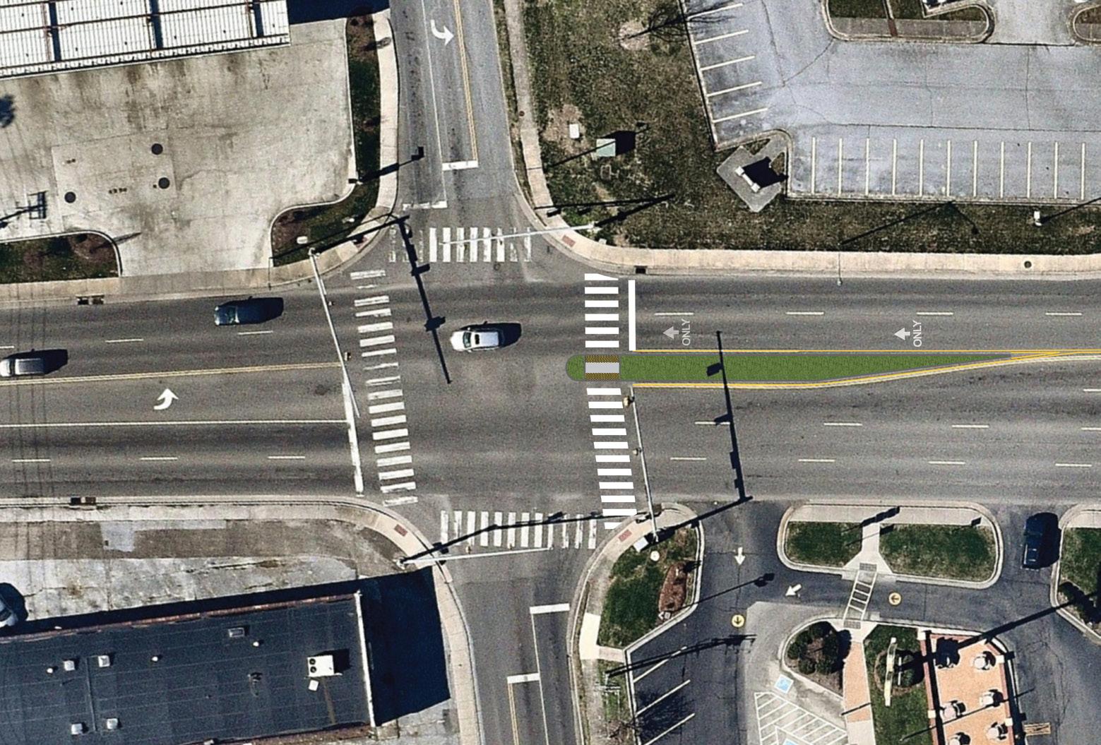
UNIVERSITY PARKWAY AT WEST WALNUT STREET
The intersection at University Parkway and West Walnut Street was the most discussed safety concern at public meetings and stakeholder interviews alike. The concerns voiced the most were:
» Dangerous southbound, left turn from University Parkway - on to West Walnut Street - in to the McDonald’s Driveway
» Traffic queue into intersection from State of Franklin
» Lack of refuge for pedestrians crossing University Parkway
After reviewing the crash data the biggest conflict appears to be the southbound left turn onto West Walnut from University Parkway. This is often caused by a lack of viability from the vehicles turning onto West Walnut towards the cars heading north along University Parkway that are visibly screened by vehicles in the northbound queue.
There are two ways Johnson City can respond to the concern at the intersection of University Parkway at West Walnut Street –reactively or proactively. This intersection can be monitored and analyzed until the trends produce results that warrant a response (redesign) from the City. On the other hand, the City, the business owners, and the residents have discussed this intersections and concerns for a long period of time stating the issues they have observed. With the anticipated increase in bicycle and pedestrian raffic along the West Walnut Corridor and its connection from Downtown to ETSU, it is recommended that the City proactively respond to the current crash and congestion trends at this intersections in order to prevent more serious crashes and worse delay.
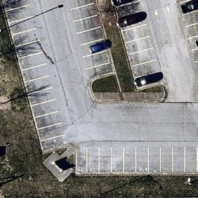
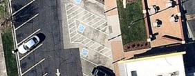
A parking study was completed by Johnson City’s Planning Staff on March 18, 2016. This study focused on parking use from 8:00 am to 12:00 am.
The study found that there were a total of 48 on-street spaces and 1,238 off-street spaces. Of those 48 spaces on-street spaces, on average 16 spaces (33%) were utilized every hour with the peak usage of 28 occupied spaces (58%). On average, 280 of the 1,238 off-street spaces were occupied (25%) and at the peak hour of 12:00 pm 407 spaces were in use (42%).
Excluding those properties that are currently vacant, the average occupancy at the peak hour for each business was 56 percent.
This data does not correlate with the concerns on lack of parking from the community. These two data points together suggest that the issue facing the corridor isn’t parking volume but rather parking location and public accessibility to it. Through observation, there is sufficient parking infrastructure along the corridor and the actual issue is availability of it to existing structures/businesses with insufficient parking on site.
Approaches to parking strategies can be found in the Transportation section of this report.
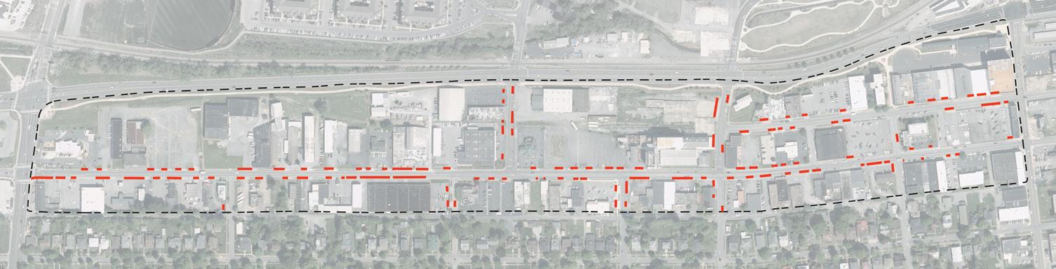
One of the biggest challenges to providing a great streetscape is the location and proximity of curb cuts. Curb Cuts (sometimes called driveway cuts) are breaks in the continuous street curb that allow for access via vehicle. The more cuts within the street edge the less space is available for continuous bike lanes, sidewalks, and on-street parking opportunities. Additionally, an excessive amount of curb cuts increase opportunities for pedestrian and vehicular conflicts that could potentially result in crashes and injuries.
Currently the study area has curb cuts for almost every individual property along the frontage and often the rear. In order for any streetscape plan to occur properties along the primary streets are going to have to agree to reduce curb cuts and begin to share access points.
WEST OF WATUAGA STREET
EAST OF WATUAGA STREET
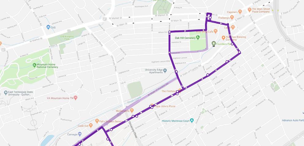
Johnson City Transit or JCT has one existing transit route that runs through the corridor. All other transit routes run adjacent to the study area on either University Parkway, Buffalo Street, or State of Franklin.
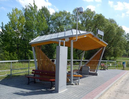
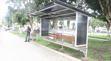
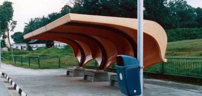
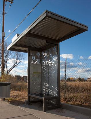
JCT’s purple route runs through the entire length of the study area along West Walnut Street every 45 minutes. This line provides the ability to get directly from the University to Downtown while interacting with the 9 stops along West Walnut Street. Today the signage placement for these stops vary in relationship to the sidewalk. Some signage is placed outside of the ROW within parking lots while other signs are adajacent to the street. Most stops only provide a sign with minimal to no seating or shelter.
UTILITIES
STORMWATER
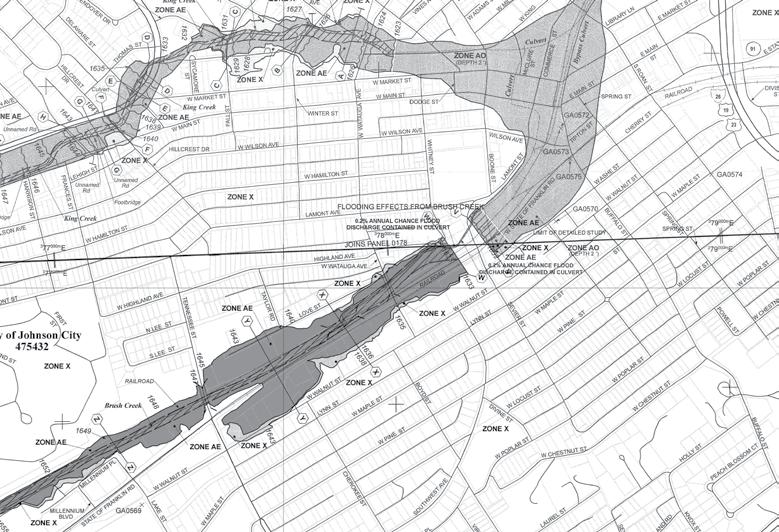
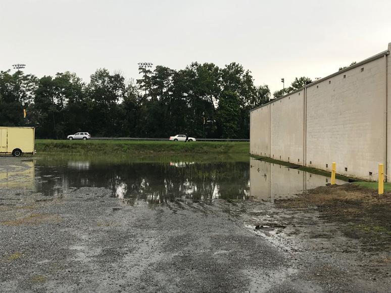
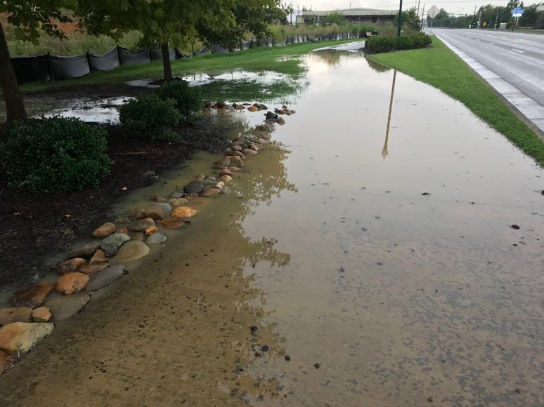
The study area contains a stormwater system that is undersized and aging. Stormwater runoff from the study area and upstream drainage area flows generally towards State of Franklin Road. To reach Brush Creek, it is conveyed under State of Franklin Road via culverts with flap gates on the downstream end at the creek. When the creek’s water level reaches a certain height the pressure of the water in the creek on the flap gate stops its being opened. While this prevents backflow from the creek, stormwater in the study area similarly does not flow into Brush Creek through these culverts in larger storm events. This condition is worsened by the fact that:
» Water sheet flows from the Tree Streets downhill into the study area.
» Portions of the study area are within a designated FEMA Floodplain/Floodway.
» Some properties along State of Franklin sit considerably lower than the sidewalk level.
» Culverts from State of Franklin and University Parkway spread water into the northeastern portion of the study area.
» The study area is predominately made up of impervious surfaces.
During the community engagement process a tremendous amount o community members expressed open concerns about the lack of stormwater mitigation. This condition is significantly worse on the northwestern side of the study area where low lying property has significant issues with ponding during storm.
This condition will have to be resolved during the development of the corridor .
FEMA FLOOD MAP
UTILITIES
ENVIRONMENTAL
WATER SOIL CONTAMINATION GROUNDWATER
The water system serving West Walnut is an aging system built between 1910 and 1940s. Despite its age the system has held up well and exceeded its life expectancy. Lines include 6” and 16” sections which Johnson City Department of Water and Sewer (DWS) has considered for replacement/upsizing pending development of the corridor. Due to the age of the sytem replacement would include fire hydrants, service lines, and meters.
There is 10,700 linear feet of water main within the study area and approximately 90 individual service connections that will require restoring with water main replacement.
Several 6” lines tee off and service the Tree Streets and the 16” line feeds the Carter Hill Water Tank in the Tree Streets.
SEWER
The sewer system ranges in construction from early 1900s to 1940s and the majority of the system consists of 6” and 8” clay pipes. There is approximately 5,800 linear feet of sewer main within the study area. Localized capacity could be a concern depending on the development intensity of the corridor. Available capacity could be a concern if corridor becomes highdensity residential/commercial.
This sewer system collects flow from ETSU and Tree Streets then discharges to interceptor located along State of Franklin. Slopes of collection lines within corridor are very flat, which is critical to sewer capacity.
POWER
The corridor has overhead lines on both West Walnut Street and Lynn Street. Location of existing main transmission/distribution lines is overhead in Lynn Street. These lines will be very expensive and timeconsuming to relocate. They feed majority of the corridor and connect it to other areas.
BrightRidge will relocate transmission and distribution lines only, which will cost approximately $1,000,000.00.
Property owners or the City of Johnson City will have
to cover the relocation of all primary and secondary service lines to each parcel or customer. This cost will be unknown until a plan for the location of each parcel and its use are known or theorized. Location of property lines will be the primary factor in determining cost.
Since underground service will require an approximately 5.5’ deep x 4’ wide vault running the length of the corridor. Proposed underground facilities will encumber a large portion of the cross section if located within the right-of-way.
Power for traffic signals and other lights will have to be located within corridor. Each cross street will require and 8’ diameter octagonal vault at the street corner to connect with underground vault for access and connection to distribution and service lines at the cross street.
GAS
Existing gas distribution lines are located along the length of Lynn Street and in smaller segments throughout the corridor. Existing location is fixed, limiting opportunity to relocate service. This will require service lines to come down cross streets, access parcels individually from road frontage, and have meters at the buildings fronts.
Soil and groundwater contamination has previously been identified on/below a few properties within the study area. Based on the nature of the impacts, it can be assumed the contamination could migrate off these properties to adjacent nearby properties. In addition, other historic property uses identified throughout the corridor have the potential to impact onsite and offsite properties.
As development occurs, additional Phase I ESAs/ Phase II ESAs/Brownfield Agreements may be warranted as specific properties are identified for redevelopment based on the individual property/ properties historical use or adjacent/nearby properties historical uses or currently known or suspected contamination.
If contaminated material is identified within a parcel(s), and excavation of this material is warranted, it may be possible to manage it onsite under certain circumstances and if suitable space is available. In some cases, the Brownfield Agreement Soil Management Plan may specify that contaminated material can remain onsite under a two foot cover (cap) of clean soil. Asphalt or concrete (for example, in a parking lot or greenway) can also act as a cap in some instances.
Based on current information from S&ME’s drilling and groundwater assessments, the depth to refusal (assumed bedrock) along the Walnut Street Corridor primarily on the city block bounded by West Watauga, Sevier Street, State of Franklin and West Walnut Street ranges from seven feet to greater than 20 feet below ground surface. Groundwater along this section of the corridor ranged from five feet below ground surface near the corner of West Watauga and State of Franklin to 16 feet below ground surface near the corner of Sevier Street and West Walnut Street. Typically the groundwater was observed just above the top of the refusal (bedrock) surface; however, the groundwater in this area also fluctuates seasonally.
VAPOR INTRUSION
Vapor intrusion (VI) concerns beneath new or existing build structures are addressed in the Brownfield Agreement and the Soil Management Plan. Residential or hotel use may be allowed, but the standards for addressing VI are more stringent for residential structures. Vapor intrusion through elevator shafts, subslab migration and subsurface conduits would be addressed by a vapor mitigation system designed by a professional engineer.
To better understand the market conditions, forces, and trends in Johnson City and the surrounding area a market study and gap analysis was performed. This study extended beyond the borders of Johnson City and into the greater Tri-Cities Area within a 15 minute drive time of Johnson City. This analysis included a review of demographic and employment trends including residential, industrial, retail, and office real estate demand models. Demographic and income data for Johnson City and the Trade Area is found below:
The corridor lies in a very active real estate development market. In these type of markets a gap analysis is a useful tool in determining supply and demand of an area by showing the dollars being spent outside of the target area on an annual basis. When the demand is greater than the supply there is an opportunity for more investment in the target area.
A gap analysis was studied to determine the demand generated by the population within a five minute drive of West Walnut Street. This gap analysis shows the demand for general retail, light industrial, and food-service businesses is met throughout the corridor. The study shows that there is clearly more supply than market demand. Unfortunately this market reality is not entirely in line with the desires of the community as discovered throughout the public engagement phase. This means that something special will have to happen in order to drive the consumer market to West Walnut Street.
Residential density is the key to drive additional uses along the corridor. This is illustrated by multiple data points showing retail demands being be in check throughout the corridor and new construction office products is softening in urban areas. With these considerations in mind uses along the corridor will more than likely stay in line with the following timeline:
Residential:
Forecasted population growth will drive short-term demand for housing. Housing that provides access to jobs and services is a key to the area’s future.
Office:
Office development should be adaptable for changing employee/ employer preferences. Most opportunities for new office space will be driven by available properties with superior access and visibility.
Retail:
Retail opportunities will follow new rooftops and jobs. High visibility locations with access to commuters across all modes of transportation will strengthen the case for new retail.
SUSCEPTIBILITY TO CHANGE
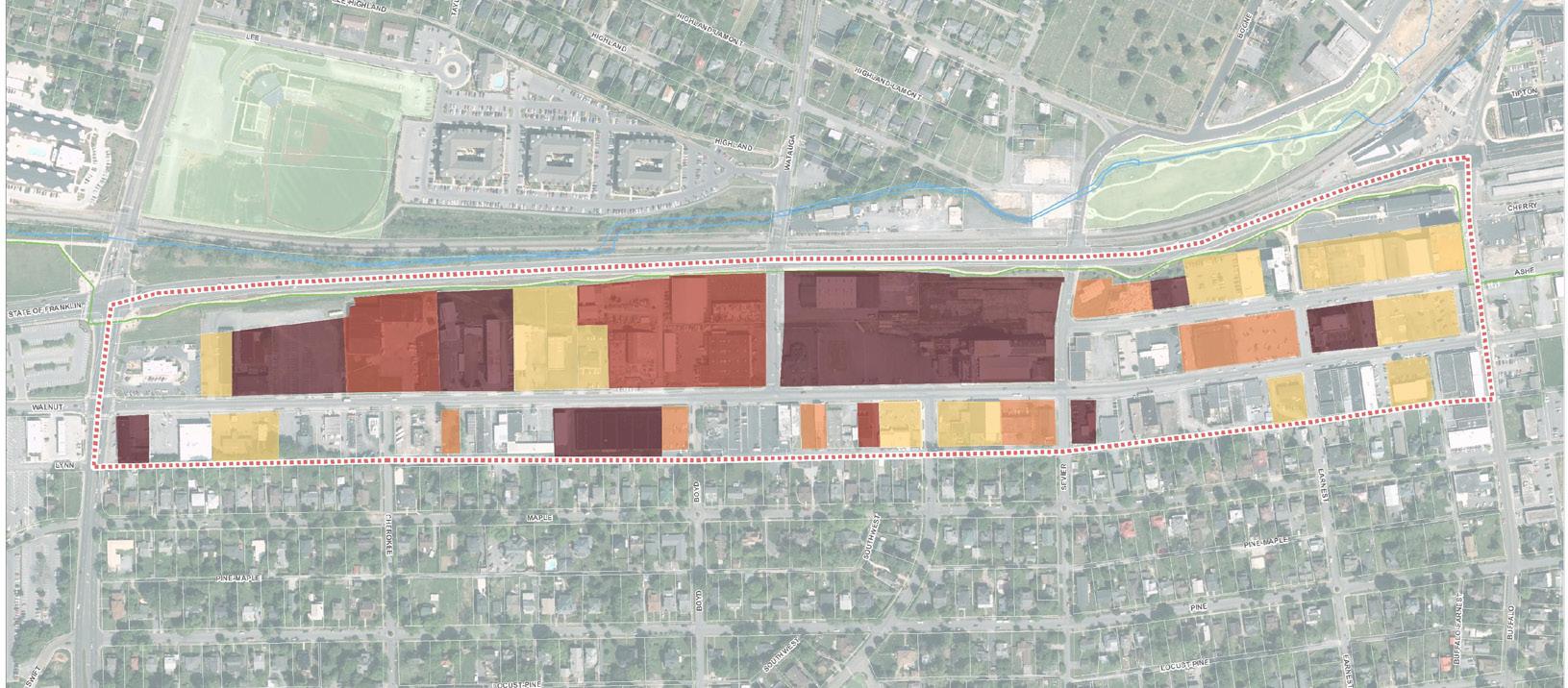
To help understand the real estate activity occurring along the corridor a susceptibility to change analysis was preformed for properties with in the study area. The goal of a susceptibility to change study is to illustrate which properties are currently, have, or will shortly experience real estate pressure.
This study was created using anecdotal evidence from stakeholder conversations, real estate development trends both in Johnson City and peer cities, the studied market conditions, and numerous rounds of public engagement. This study does not prescribe change or suggest which properties should change.
The susceptibility to change study was broken into the following four categories:
» Active Activity: These properties currently have activity occurring on them. This activity can range to being open talked about, listed for sale, in the design phase, or under construction
» Open to Consideration: Properties labeled open to consideration have most often expressed an interest or ability to relocate depending
Susceptibility to Change
» Under Utilized: Vacant properties or properties who currently are not actively using the site to the maximum ability are considered under utilized
» Future Development Pressure: Properties that have site conditions desirable for development but have not been publicly discussed are considered as properties with future development pressure
Properties not listed will likely still see varying degrees of development pressure as the corridor and Johnson City continue to grow.
SWOT ANALYSIS
OVERVIEW
A SWOT analysis was completed gathering input from the initial discovery phase and public engagement. The SWOT analysis reviewed the following:
» Strengths: Details that set apart the study area
» Weaknesses: Elements that should be improved
» Opportunities: Factors that should be leveraged
» Threats: Conditions that could prevent growth
STRENGTHS
WEAKNESSES
OPPORTUNITIES
THREATS
Threats that could hinder or slow down the redevelopment of the West Walnut Corridor were identified as larger regionally-based concerns:
» Large Swaths of Singular Uses: The corridor could become lucrative for one use and thus discourage a true mixed-use district.
» Conventional Student Housing: Demand for student housing could possibly outweigh other uses and turn large chunks of the corridor into student oriented developments.
» Land Value Prices out Development: Land prices (both in actual cost and perception) could rise to the point of pricing out developers to the suburbs.
» Market Demand/Reality vs. Community Expectations: What the community expects may not match the actual market realities in place.
» Development Occurs Elsewhere: Development could occur somewhere else within Johnson City or the region and bypass West Walnut all together.
» Industrial Uses Staying Put/Entrenched in Place: Industrial property owners could choose to not sell and stay in place, preventing continuity in development.
CORRIDOR MASTER PLAN
+ Corridor Master Plan
- Overview
- West Walnut Street Design
- Streetscape Elements
-Form-Based Zoning
- Corridor Master Plan
- Land Use and Form
- Stormwater Feature
- West Section
~ Stormwater Park
~ Cherokee Street Section
- Central Section
~ Gateway Park
~ Ashe Street Section
- East Section
~ Civic Park
~ Cherry Street Extension
~ Earnest Street Pedestrian/Woonerf
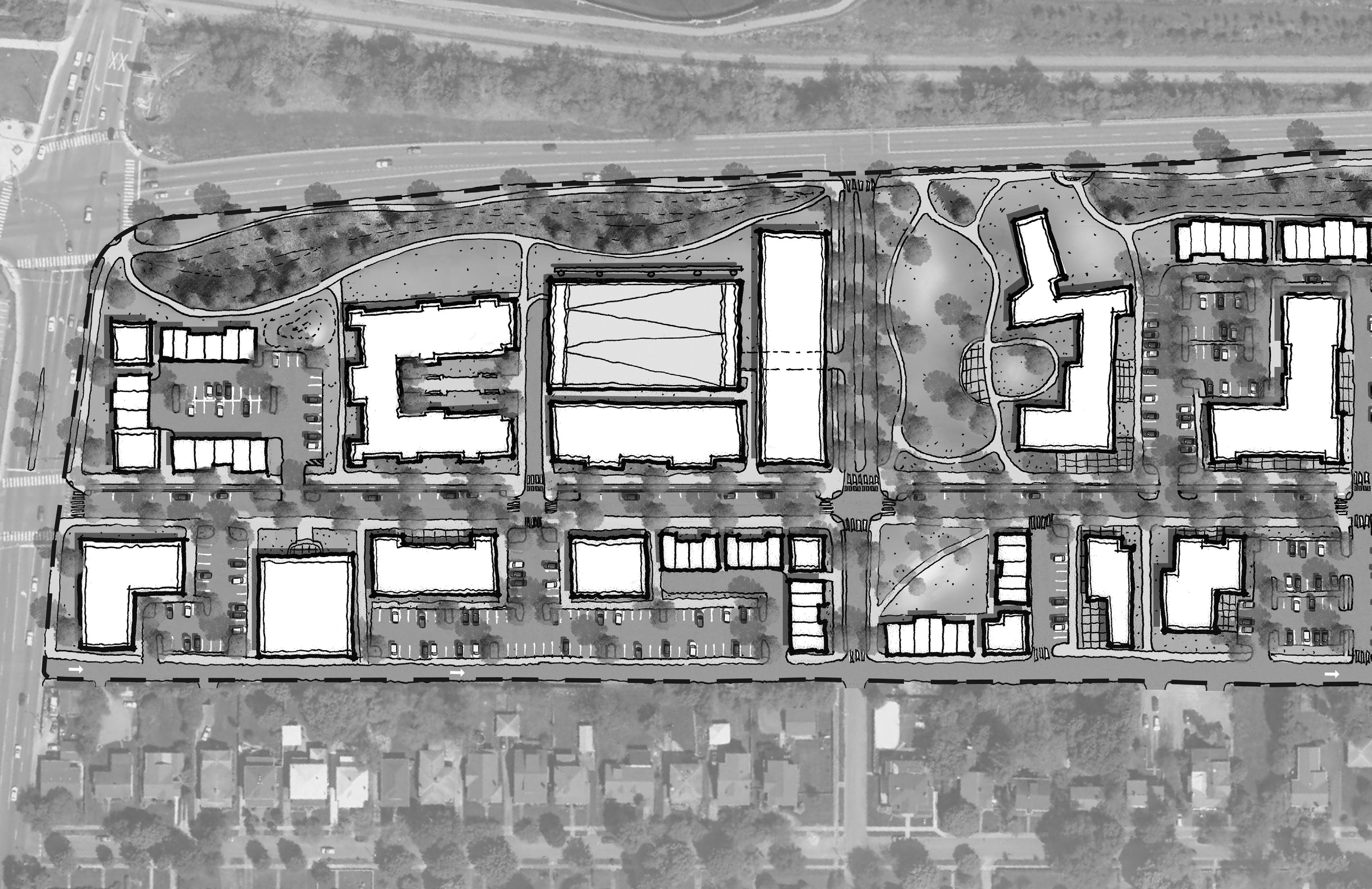
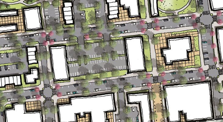
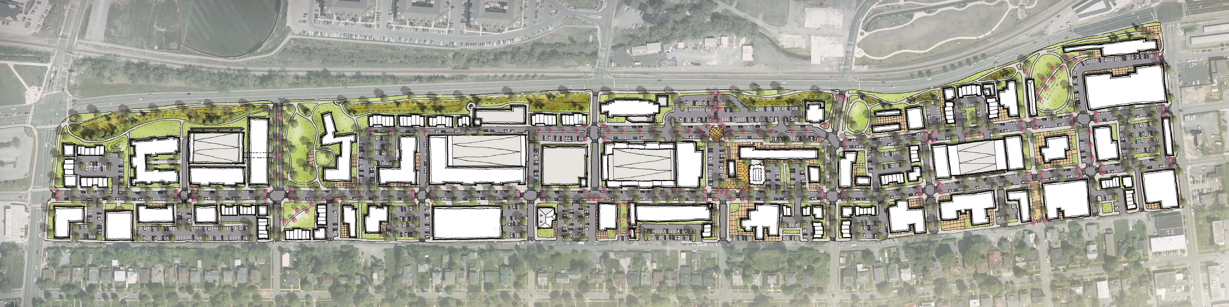
CORRIDOR MASTER PLAN
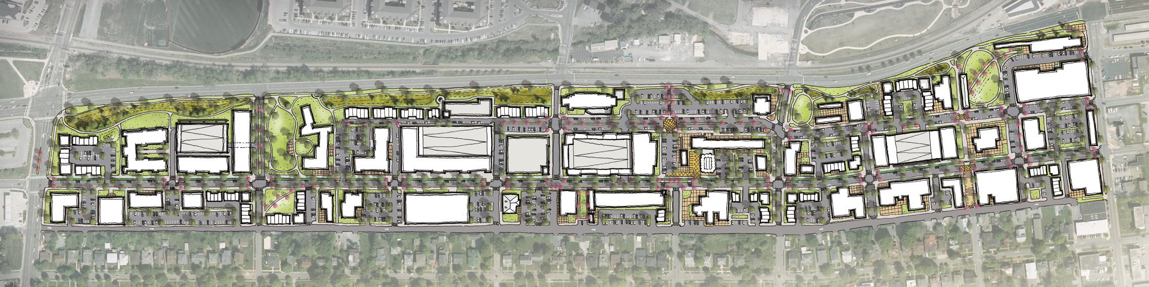
The West Walnut Corridor Master Plan was created by utilizing the numerous rounds of community input and layers of background research. The goal of the master plan is to address the existing conditions outlined as concerns that can present safety hazards or deter development along the corridor. Large, corridor-wide concerns were outlined through the discovery phases of the planning process and are generally summarized as follows:
» Access to and from the corridor
» Stormwater management
» Utilities running along the corridor
» Transition to the Tree Streets
» Parking shortages in specific locations
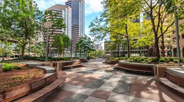
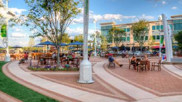
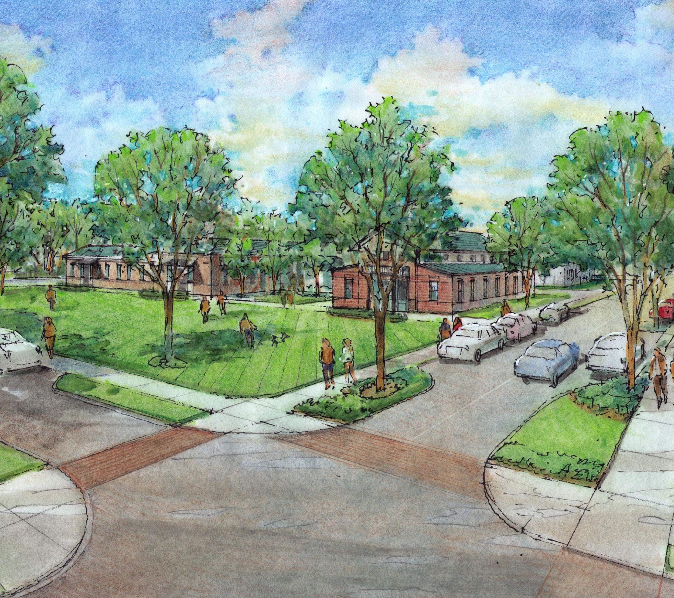
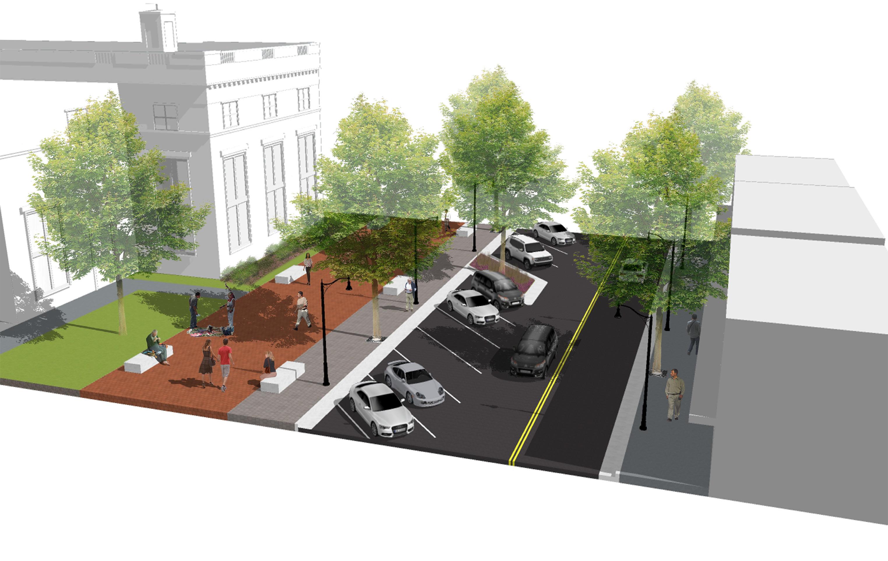
Most proposed elements within the master plan concept focus on addressing one or more of these major conditions within the study area. An effective master plan that begins to provide solutions for these concerns will create a positive foundation for redevelopment and continued investment along the corridor. The West Walnut Corridor Master Plan looks at transitioning West Walnut Street and the other streets within the study area to a more urban pattern of development that encourages alternative modes of transportation. This form follows recommendations made by the community by encouraging new structures to pull closer to the street and focus more on the pedestrian realm in a pattern consistent with the historic properties found along the corridor and within Downtown Johnson City.
» Access: The plan for the study area includes several changes to how the corridor is accessed. The plan calls for restricted access from University Parkway onto West Walnut Street, removing the southbound left turn lane onto the corridor. This turning movement was identified as causing the most incidents at the intersection and was one of the most voiced complaints by stakeholders in regard to the corridor’s existing infrastructure. To accommodate the reduction in access from this intersection and to provide another connection point into the corridor, the plan shows extending Cherokee Street northbound to intersect with State of Franklin. This intersection would provide a signalized intersection that would help disperse the traffic within the study area. In addition to creating new infrastructure that helps mitigate existing traffic concerns, the
planning team was also charged by the community with addressing Lynn Street. Today Lynn Street functions as an alley and no properties within the study area have their primary frontage onto it. Due to severe changes in topography, the constrained right-of-way dimensions, and existing utility lines, there is not much that can be physically changed with Lynn Street to have it function as an improved street. The planning team felt the most suitable approach to Lynn Street is to make it a one-way alley running eastward. This would prevent conflicts with traffic flow in the pinch points along Lynn Street that drop as low as 12’ wide, and allow the street to direct traffic parallel to Maple Street in the opposite direction.
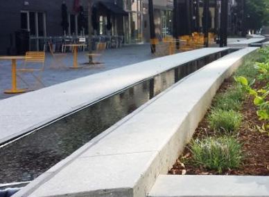
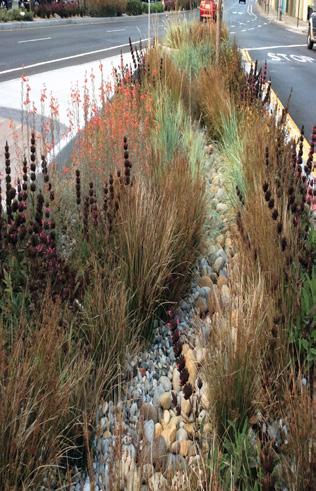
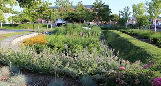
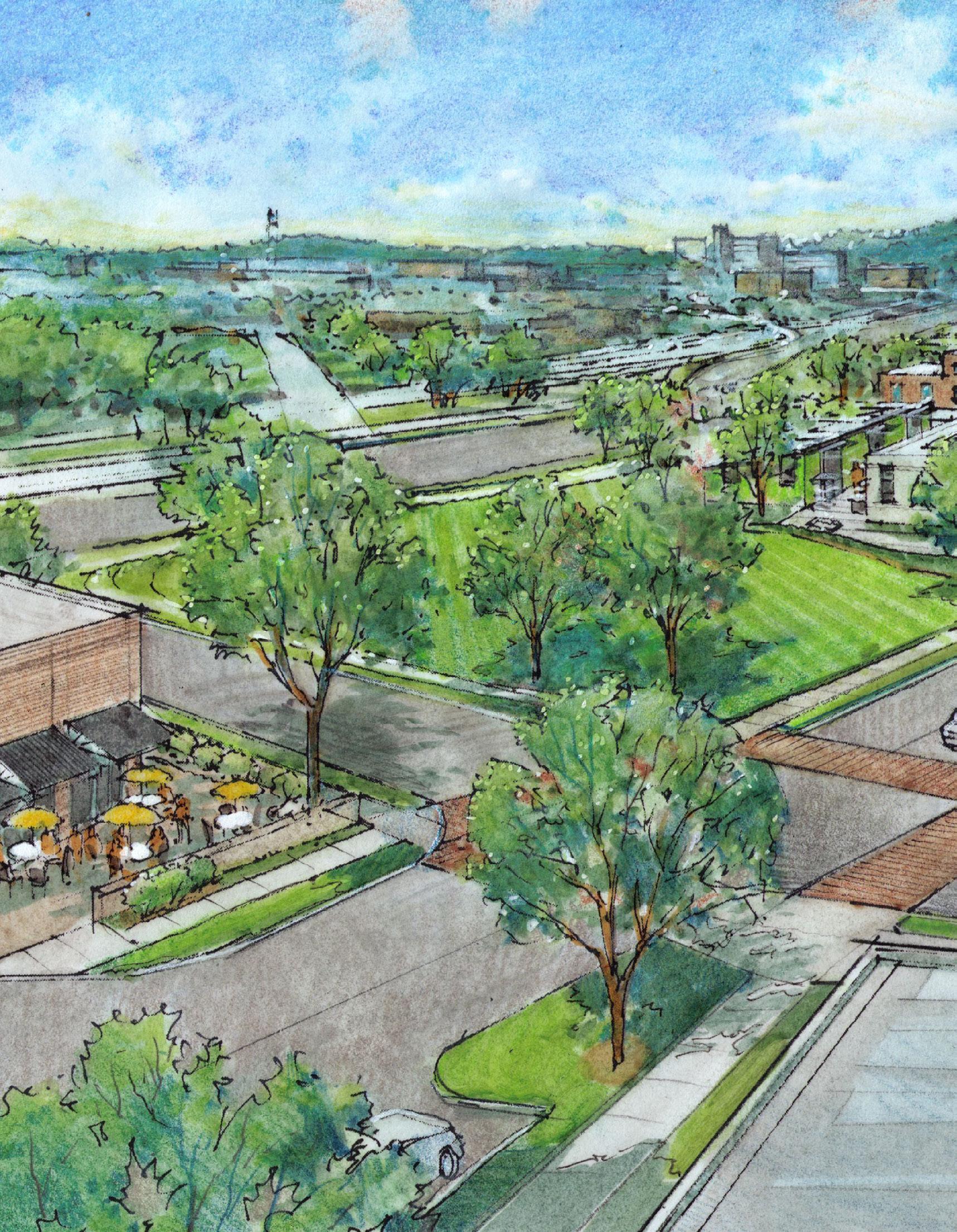
» Stormwater: The biggest concern expressed through the discovery phase of the master plan process was the impact of storm events on the corridor. Very large portions of the northwestern part of the study area flood during relatively common storm events. Improvements to the drainage system within the study area and connections to Brush Creek will help alleviate stormwater issues in the area. Additionally, a primary focus of the West Walnut Corridor Master Plan is stormwater detention and mitigation. This is accomplished through a new stormwater park on the western end of West Walnut Street and a linear system running parallel to State of Franklin Road.
In addition to the areas exclusively programmed for storm water mitigation, the master plan includes many green space areas that would help with reducing the impervious ratio within the overall study area.
» Utilities: Overhead power lines along West Walnut Street are a physical and aesthetic barrier for development along the corridor. The West Walnut Corridor Master Plan relocates the overhead utilities serving the northern West Walnut properties underground to an easement located along State of Franklin to make the corridor more accessible and safer for pedestrians while becoming more appealing for redevelopment. The overhead utility lines serving the properties on the southern front of West Walnut were left in the Lynn Street right of
way. These lines constrain development on the southern side of West Walnut, which in turn forces properties to put their building massing closer to Walnut Street and further away from the homes in the Tree Streeets.
In addition to electric utilities, the corridor master plan calls for an upgrade to aging water and sewer systems running along and under West Walnut Street.
» Transition: A constant conversation piece through all phases of public engagement was how to provide a transition from the commercial and mixed-use opportunities of West Walnut Street to the historic single-family homes in the Tree Streets. The master plan shows less intense development along the southern edge of West Walnut. This lesser development density is somewhat controlled through the size and scale of the lots and on site conditions, however the desires of the community warrant the City adding additional standards to enhance the existing West Walnut Street Zoning District. These additional standards will strengthen the existing zoning district and bring it more in line with a formal form-based code district. This will provide stronger guidance on form, design, and placement with redevelopment of properties along the corridor.
Providing additional zoning standards that either supplement or replace the existing West Walnut District are needed to ensure this side of the street still has enough entitlements to redevelop without negatively impacting the homes along Maple Street within the Tree Streets neighborhood.
» Parking: Several community members expressed grievances with parking at peak times (lunch and after work) on the eastern section of the corridor. Some businesses on that end of corridor do not have on-site parking and rely on on-street spaces that may be occupied or located too far from the business. This section of the corridor is also starting to see increased parking activity at night and during festivals due to the short walk to downtown. In addition, stakeholders stressed that a few larger properties along the corridor have not redeveloped due to a lack in on-site parking or other options within close proximity to their location.
Due to these constraints, the master plan suggests that public surface parking lots be constructed in key locations along the corridor to help with future redevelopment. These surface lots could be publicly or privately owned and utilized to reserve land for parking structures in the future.
To aid with the scale and length of the study area, the Corridor Master Plan is divided into geographic sections. These sections are useful for addressing site specfic concerns that have an increased impact on a particular area within the study area.
West Section
» Location: University Parkway to Boyd Street
» Primary Concerns: Stormwater, University Parkway Intersection, Cherokee Street, Lynn Street Topography
Central Section
» Location: Boyd Street to Campbell Street
» Primary Concerns: Model Mill, Stormwater, Gateway into Corridor, Transition to Tree Streets East Section
» Location: Campbell Street to Buffalo Street
» Primary Concerns: Parking, Connection to Downtown, Connection to the Tree Streets
WEST WALNUT STREET
The primary focus of the corridor master plan is how to reallocate the West Walnut Street right-of-way (ROW). Today the corridor has a consistent ROW of 60’ that is divided into two or three lane sections. The existing curb to curb distance, as illustrated by the existing conditions research, is higher than needed for the traffic levels generated along West Walnut Street both today and in the future.
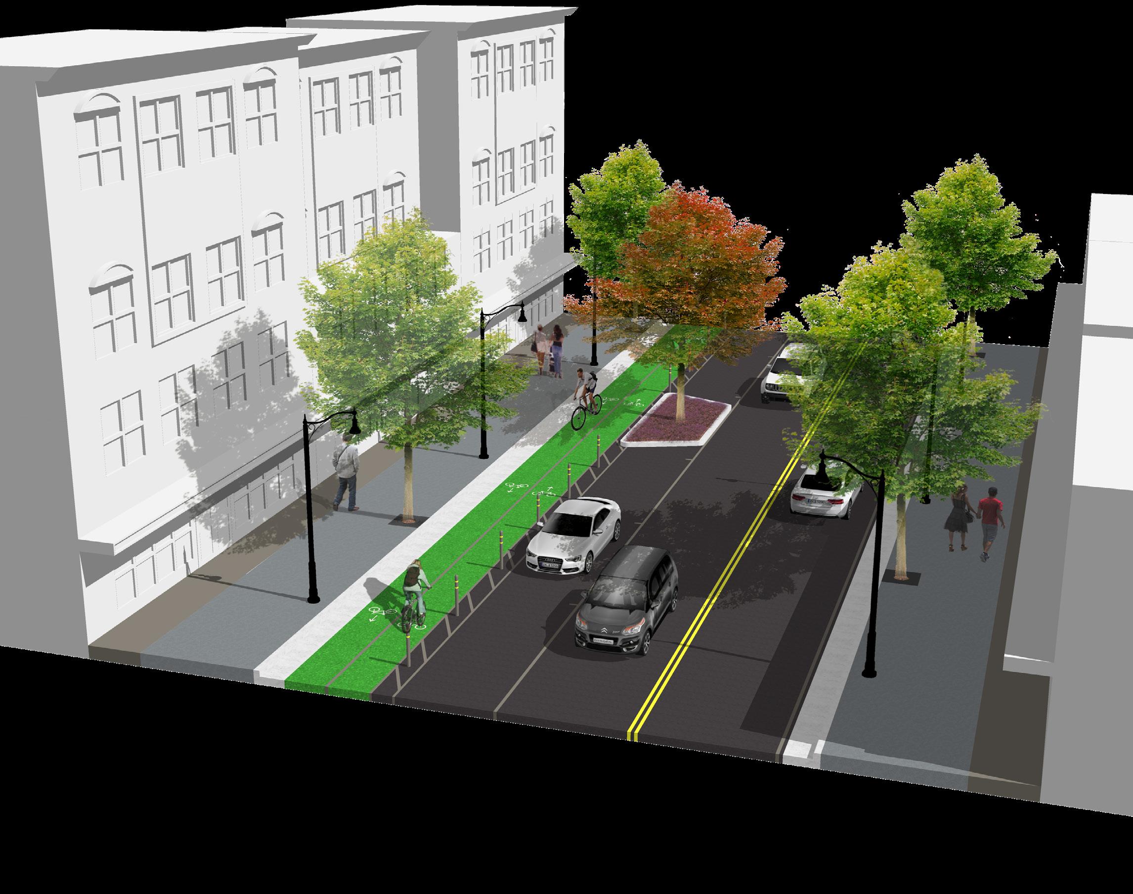
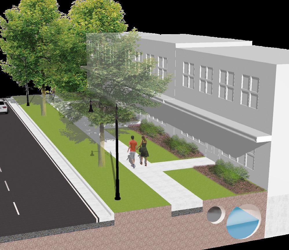
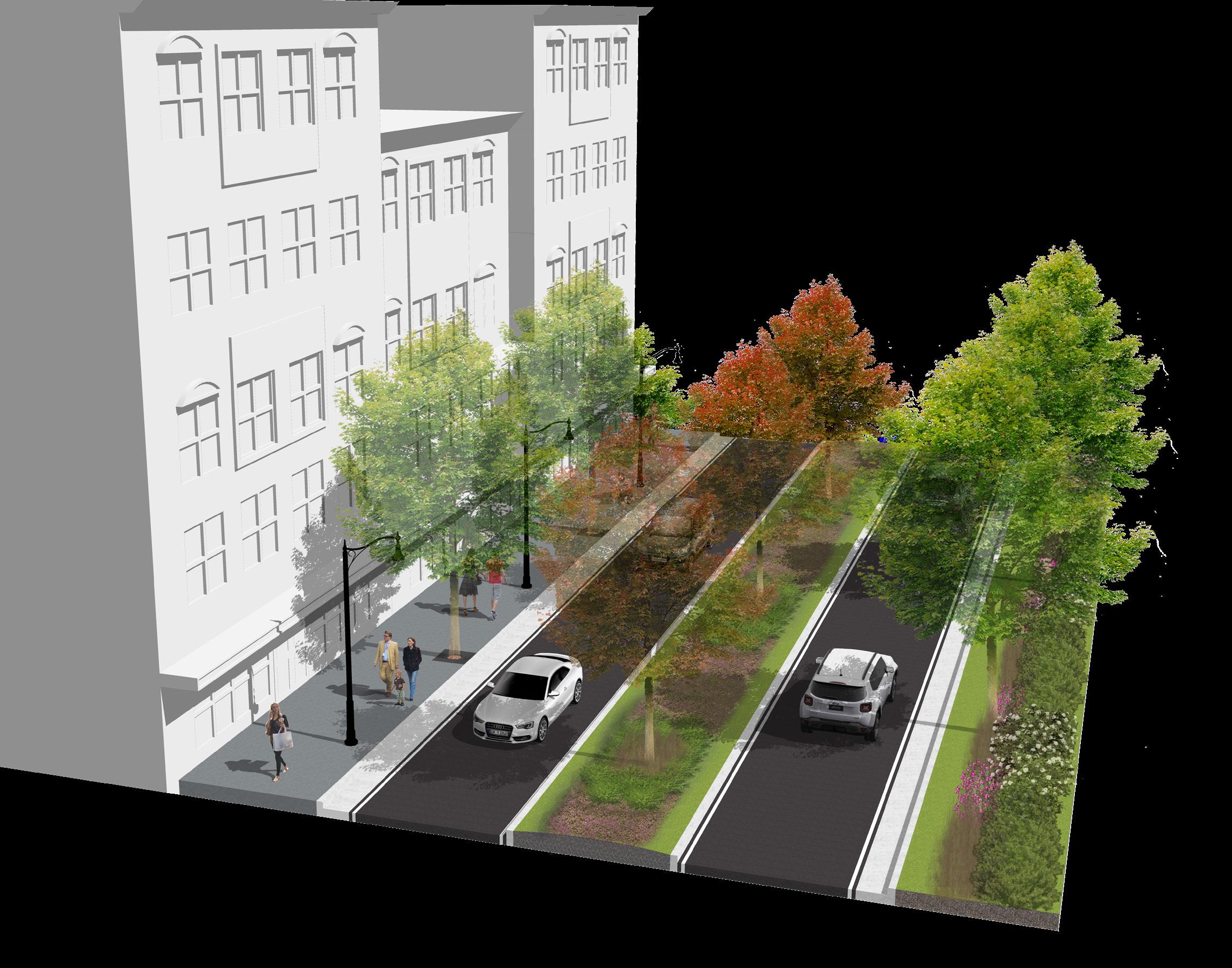
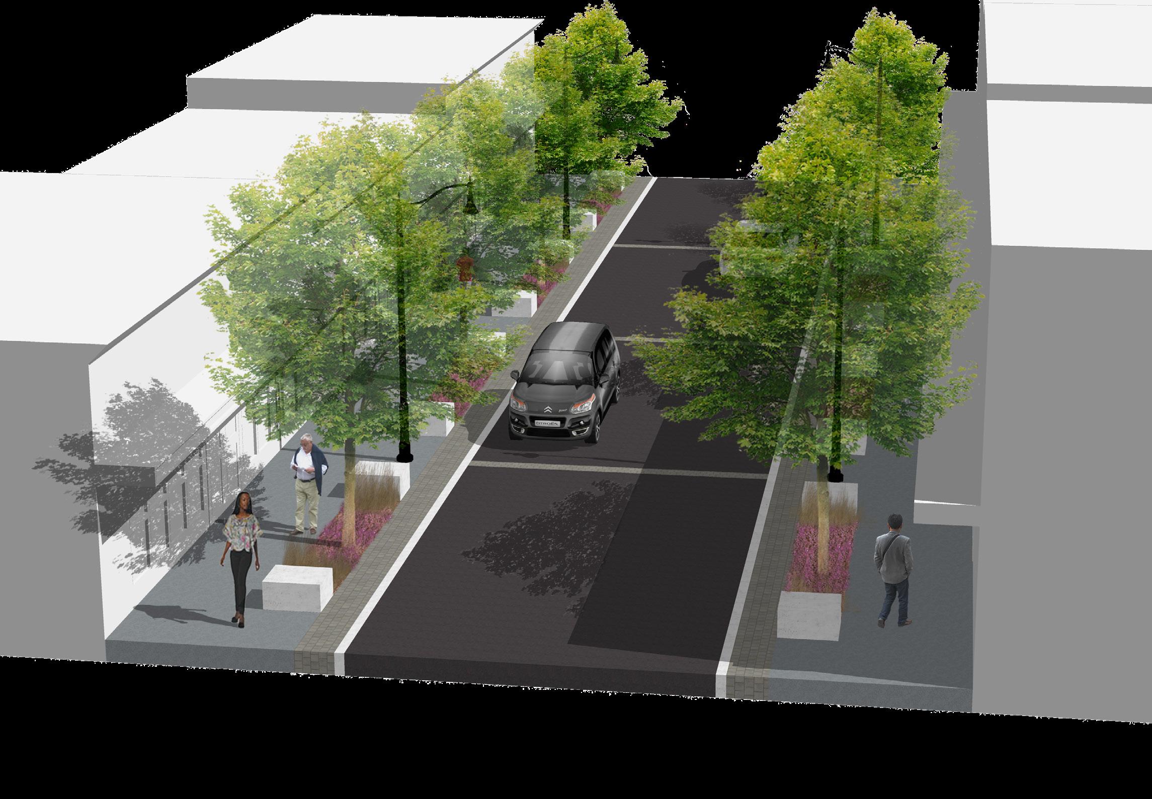
From the multiple rounds of community engagement the community expressed a desire to see a street that prioritized the pedestrian while becoming a safe route for the many bicyclists utilizing it. There was an overwhelming sentiment that West Walnut Street could undergo a reduction in the width of vehicular travel lanes and forcing a reallocation of the ROW to create an environment that supports active transportation. The primary requests from the community included dedicated bike lanes, wider sidewalks, street trees, and on-street parking.
While the scale and placement of the proposed elements cannot vary much within the plan, the form and design can be changed slightly to accommodate for the City’s goals and desires. This is particularly true with the 8’ wide two-way bike lane. The bike lane was provided at street level to make it easier to use for bicyclists by accommodating for intersection crossings, however, if desired, the bike lanes could be found at sidewalk level. This would require relocating the curb between the bike lane and the on-street parking but would accommodate for some “bleed over” space between the northern sidewalk and bike lanes. In addition, the buffer provided between the bicycle lanes and on-street parking could be adapted at design to provide more green space or to have a slightly different look and feel, but needs to include some form of vertical element within the design.
The on-street parking and bicycle lanes were provided on the northern side of West Walnut as an attractor that could lead to increased development. This portion of the corridor features larger parcels that are not immediately adjacent to the neighborhood and will help to better connect ETSU and Downtown through the corridor. This location could shift to the southern side of the street if it is better suited in the design/development phases of the project.
The inclusion of frontage zones is helpful for ensuring sidewalks are sufficiently wide enough for increased pedestrian traffic. These frontage zones can be established and enforced through a form-based code or zoning overlay district and designed to be adaptable to the use of the redeveloping property.
This type of environment/ form is attractive to young professionals which Johnson City can benefit from attracting as residents. In addition there is an excellent opportunity to retain ETSU students by creating a network of vibrant, safe, and walkable streets.
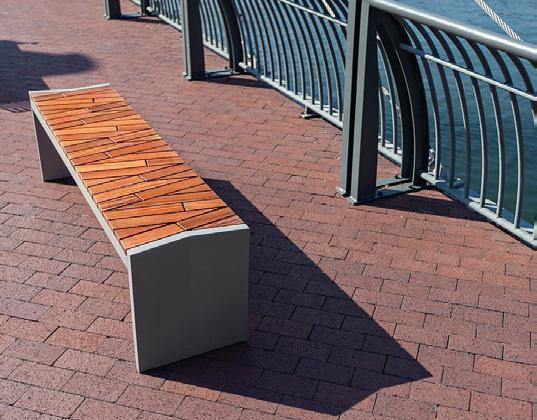
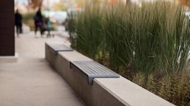
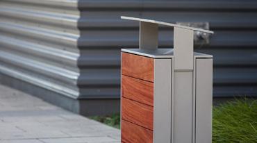
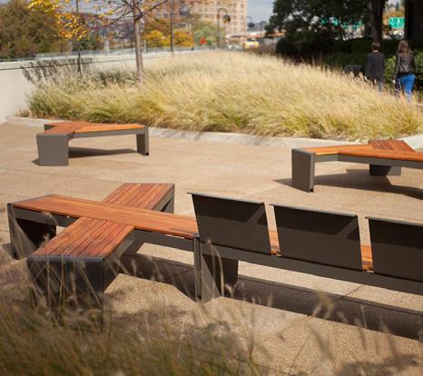
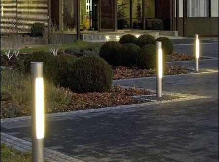
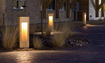
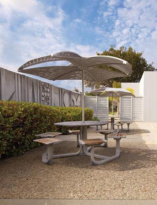
STREETSCAPE ELEMENTS
KIT OF PARTS
The kit of parts shows how the streetscape plan comes together physically. These elements work together to form a cohesive vision and approach for the design of the study area.
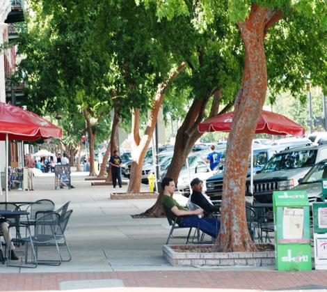
This visual palette of materials was generated from numerous interviews, meetings, and surveys with community members, property owners, and city officials. The common theme of these meetings established that most users want West Walnut Street to be a corridor that embraces local art and creativity as long as it finds a way to mimic the level of historical renovations occurring around the study area today.
» Architecture: The architectural design of properties within the study area should blend with preserved historic structures n the surrounding areas. Structures should be predominately brick with large percentages of glass.
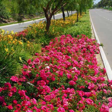
» Landscape: The corridor should feature a strong mixture of local plants that will thrive in Johnson City’s climate. Water tolerate and
ARCHITECTURE
suitable wetlands plants should be utilized in the stormwater areas to aid in the storage and treating of stormwater:
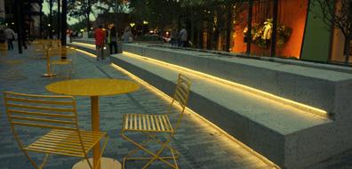
» Street Elements: Streetscape furniture and furnishings should effectively blend between the more traditional architectural design and the desire for public art.
» Hardscape: Seating elements, fountains and other hardscape elements should be more traditional in design.
» Art: A mixture of temporary and permanent art fixtures created by local and regional artists should be found along West Walnut
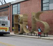
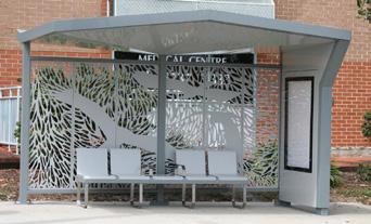
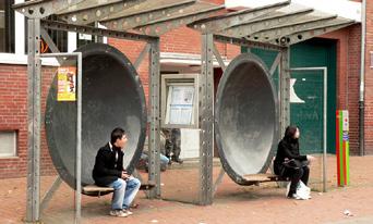
» Bus Stops Bus stops with shelters should be provided in an artistic and unique manner.
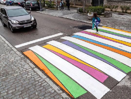
» Crossings: Crosswalks and at grade crossings should contain architectural elements that differentiate them from this water
STREET ELEMENTS
STREET
ART
CROSSINGS
FORM-BASED ZONING
Today properties within the study area already exist in a zoning district with some light form-based standards. While these standards help to ensure quality development occurs along the corridor The study area would benefit from additional standards guiding redevelopment. These standards can be implemented through multiple approaches but are often accomplished easiest through the creation of a form-based code district.
FORM-BASED CODE:
The Form-Based Code Institute defines a formbased code as a land development regulation that fosters predictable built results and a high-quality public realm by using physical form (rather than separation of uses) as the organizing principle for the code. A form-based code is a regulation, not a mere guideline, adopted into city, town, or county law. A form-based code offers a powerful alternative to conventional zoning regulation.
Creating a form-based code for the West Walnut District allows redevelopment to occur to standards created just for the study area. A form-based code covering the entire district would allow the City to accomplish many of the goals of this corridor master plan.
In addition to the Use, Height, Glazing, Setback, Screening, and Facade Material standards established form the 2017 rezoning a form-based code for the West Walnut district could effectively establish standards for:
» Subdistricts: Breaking the corridor into subdistricts that would allow for bulk standards and entitlements to be more context sensitive/driven
» Access Management: Consolidating and requiring shared access points along the corridor would allow the corridor to become more
friendly to bicyclists and pedestrians
» Minimum Lot Coverage: Setting a minimum lot coverage standard prioritizes the structure on the lot instead of the parking area
» Ground Floor Uses: Creating active ground floor frontages that help to establish a vibrant mixeduse district
» Facade Width: Requiring a set percentage of the lot’s build-to line to be lined with structure and not parking
» Parking Location: Locating parking to the rear or sides of structures and not along priority corridors.
» Architectural Standards: Designing context sensitives architectural standards that blend with the corridor and the surrounding districts
» Bicycle Infrastructure: Establishing locations for needed bicycle infrastructure will encourage the use of this corridor for alternative transportation
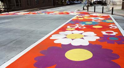
» Public Art: Encouraging the provision of public art will lead to a vibrant corridor that invites visitors in to interact with the streetscape.
» Bonus Provisions: Providing additional entitlements (density, parking reductions, etc) for the provision of certain public benefit items helps to incentive the redevelopment of the corridor
Creating a form-based code district that establishes these standards and tweaks some of the existing standards will allow for the most significant protection and guidance for the redeveloping corridor.
Since form-based code districts require extra levels of review it is recommended that the city establish a “Design Review Committee” (DRC) comprised of local design professionals, residents, and property owners to help with project review, guidance, and to approve modifications to the form-based code.
While a form-based code seems new and complicated, it is believed to be the best way to accomplish all the goals and approaches laid out in this corridor master plan. Form-based codes are used effectively throughout the country from municipalities big to small and are often easier for the community to understand then conventional zoning ordinances.
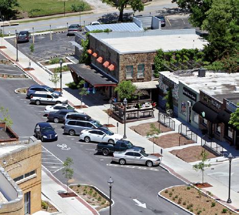
CASE STUDY: BERRY HILL COMMUNITY DEVELOPMENT CODE
Adopted in 2009, the Berry Hill Community Development Code was designed to guide future development within the City that achieved a vibrant community with a mix of uses. The purpose of the code was to provide the regulatory framework that achieved that vision for the City of Berry Hill. The code was not intended to change the character of the community, but provide a planning and regulatory framework to support and enhance growth and development as it occurs.
Today the code provides the flexibility for a mix of uses consistent with the City’s current development pattern while establishing a consistent set of development standards.
The redevelopment of Franklin Pike (also known as 8th Avenue) under the Berry Hill Community Development Code is easily seen. Images like the one above show how the transition has occurred from traditional single story, autooriented sites to a more urban, walkable form.
a newer, single-story
development that addresses the street and provides parking to the side and rear.
The Berry Hill Code has also proven to be successful at not preventing smaller scale commercial uses as well. The image above shows
commercial
» Orient Structures to the Street or Open Space:
The corridor master plan pulls properties closer to the street and locates parking to the rear as requested by community members. This urban form helps to make the corridor and entire study area more pedestrian friendly. Where feasible properties along State of Franklin were shown to front the linear stormwater feature.
One major advantage of this style of development is the creation of a buffer between active commercial uses on West Walnut Street and the residential properties in the Tree Streets.
» Locate Public Parking Along the Corridor:
Parking is a concern on the eastern end of the corridor today and will be more of a concern for the entire corridor with redevelopment.
The Corridor Master Plan creates centralized parking areas that can be initially provided as surface parking and reconfigured to a structure with continued development of the corridor. These lots and decks are seen as being provided and funded via private/public partnerships, feein-lieu agreements, and other strategies.
» Establish More Greenspaces: Pubic, accessible greenspaces were added to aid in the best management of stormwater, break up heat island effects, and to make the corridor a better place to live, work and visit. The programmed green spaces added throughout the planning process serve different purposes and are provided on different scales.
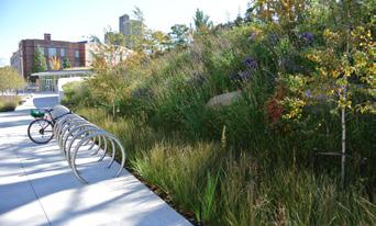
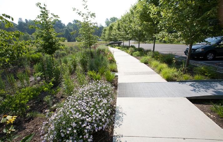
In addition, street trees and wider landscaping tree wells and/or landscape strips were included along the frontage of each street within the West Walnut Corridor Study Area.
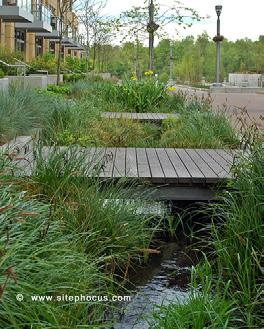
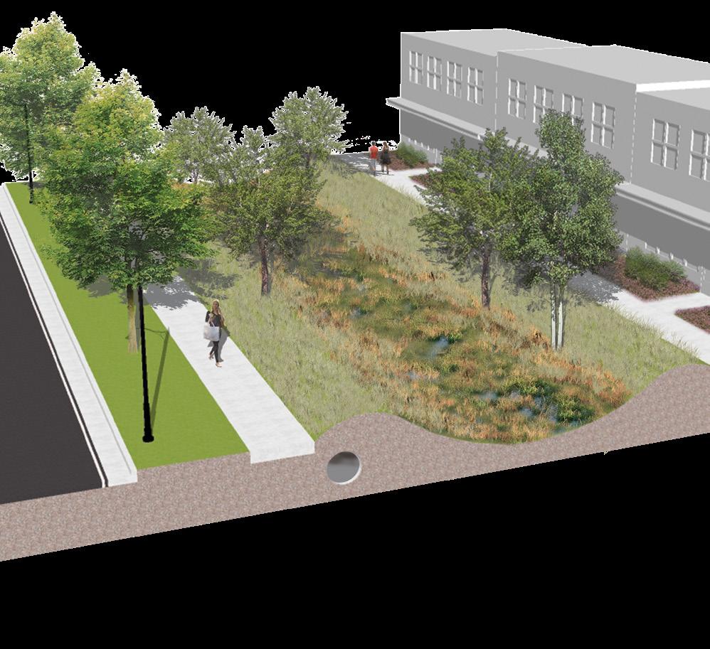
» Create a Stormwater Solution: The Corridor Master Plan creates a linear stormwater basin along the State of Franklin frontage. This allows the western properties to direct their stormwater and provides an area to capture the unmitigated runoff from the Tree Streets down into the study area. (See Page 45)
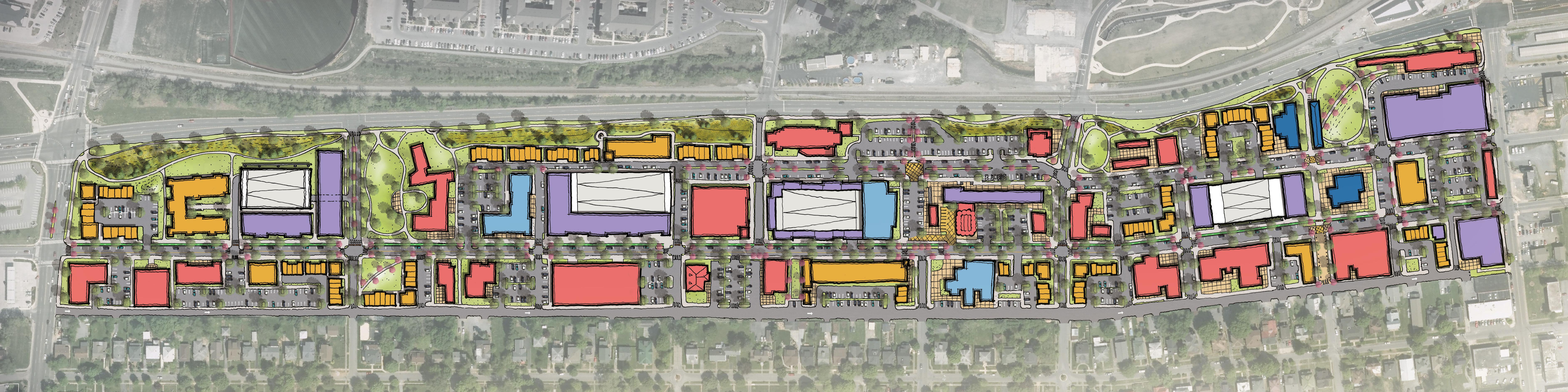
LAND USE AND FORM
The West Walnut Street Land Use/Urban Design Plan illustrates the desired form and projected make up of uses within the study area. By its nature this is not a prescriptive plan and is not intended to dictate where, when, or how certain properties develop. Property development on the corridor is dictated by private property owners desire to redevelop their properties. The plan strives to show how Johnson City could strike a balance between the community’s desires and what the market can actually provide per the GAP, market, and susceptibility to change studies preformed by the City and consultants.
The purpose of the physical plan graphic is to illustrate the form that development should follow within the study area. This urban form and design establishes the following primary goals for the corridor:
» Provide a Mixture of Uses: The community desires West Walnut to become a mixed-use corridor providing opportunities to live, worship, work, play, and shop. The below Land Use Plan works to blend the communities desires for mixed-use, in combination with what the market is projected to bear and existing site constraints.
By nature of existing use and construction most of the preserved structures within the plan would remain or convert to a commercial use. Outside of those structures, a majority of the new development within the study area is envisioned to be residential heavy, whether conventional residential structures or in a mixed-use configuration.
STORMWATER FEATURE
Creating a major stormwater feature that starts to combat the corridor’s biggest issue is a primary goal within the West Walnut Corridor Master Plan.
Utilizing already low-lying, harder to develop land, the linear stormwater feature works to capture surface water running through the study area, treat it efficiently, and discharge it under State of Franklin and the railroad into Brush Creek, utilizing existing pipes underneath the in-place infrastructure. A significant portion of the proposed stormwater feature is located in FEMA floodzones and floodways today which would allow this approach to have an immediate impact on the corridor.
» Preservation of Historic Structures: Buildings with historic significance in use, style, and/or form to the corridor were illustrated as they exist today or slightly modified within the master plan. These are structures that blend with the vision and design of the corridor regardless of use, as some of them will more than likely change in use during the life of the plan.
These facilities would treat the water from storm events in large, linear bioswales planted with native water tolerant shrubs, trees, and ornamental grasses. Implementing a planted bio-swale allows the space to be an attractor or feature along State of Franklin, simular to Founder’s Park, rather than simple infrastructure. Where the corridor is constrained, stormwater can routed to an adjacent bio-swale or downstream via pipes to Brush Creek. Model Mill and other large development sites may need to utilize the constrained section to channel runoff through their site and out of the study area.
This regional approach to stormwater management is beneficial to the city as it provides an opportunity to fix larger stormwater issues across the study area and adjacent communities. In addition this approach frees up space on developable land to encourage better utilization of sites by private developers and land owners.
CONSTRAINED SECTION
- West Section Detail ~Overview
~ Stormwater Park
~ Cherokee Street Section
WEST SECTION
» Area Use and Purpose: The west section of the West Walnut Corridor Master Plan is planned to be the transition piece from ETSU into the corridor. Businesses that encourage walking into the corridor from ETSU are desired on this end of the corridor.
Desired uses in this area are envisioned to be oriented towards serving the University. This section of the corridor is well-suited for General Commercial and Residential, either in stand alone buildings or a mixed-use product. Office uses (independent of the University) could be seen in this section closer to Boyd Street.
» Infrastructure: The corridor sees major changes by restricting the southbound left turn from University on West Walnut Street.
To accommodate for this loss of traffic capacity and to make connectivity better, the Master Plan calls for the extension of Cherokee Street northward to State of Franklin.
This section of the corridor benefits the most by converting Lynn Street to one-way eastbound. Properties with frontage on both Lynn and Walnut Streets should provide access from Lynn Street where feasible, accounting for the existing
elevation/grade and right-of-way widths of Lynn Street. In addition, developing properties should consolidate access points with their neighbors through access easements. By accessing from Lynn Street and sharing access points, properties began to create a safer street pattern for cyclists and pedestrians with less curb cuts and more visibility.
» Open Space: Addressing the stormwater constraints in the western section of the study area led to the creation of two large stormwater amenities. This portion of the corridor is home
to the largest section of the linear stormwater feature, as well as, a new stormwater park created to lessen the impacts from storms on the corridor, while providing an educational space for the community. These spaces, in conjunction with possible private open spaces, will help set the transition into the corridor from ETSU.
» Form and Design: New development in this section of the corridor should be built on the street or onto or fronting a green space with parking to the rear of the primary structure.
WEST WALNUT STREET
STATE OF FRANKLIN
LYNN STREET
CHEROKEE STREET EXTENSION
FROM WEST WALNUT TO STATE OF FRANKLIN
Expanding Cherokee Street to from West Walnut to State of Franklin will help to alleviate traffic volume on University Parkway. This signalized intersection will provide a new connection point for West Walnut users and residents of the Tree Streets to access the study area and navigate in and around Johnson City.
Cherokee Street is a three-lane local street with center median and turn lanes. Properties abutting the western streetside will be encouraged to build up to the back of the large urban sidewalk. The eastern side of the street includes the new stormwater park and is envisioned as being heavily landscaped to create an appropriate transition between the street and median.
Currently situated on privately owned land, this project (and the new stormwater park) would require a property acquisition by the City or some form of private/public partnership.
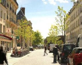
COMPARABLE EXAMPLES
50’ Right of Way
STORMWATER PARK
AT CHEROKEE EXTENSION AND WEST WALNUT
To provide relief from storm related flooding along the western portion of the study area, a large stormwater park is proposed in the northeastern quadrant of the new intersection.
This park, coupled with a linear system paralleling State of Franklin will help to slow down runoff prior to discharging it across State of Franklin and downstream. Similar to Founder’s Park in design and use, this new stormwater park will be a focal point and vista that is walkable to the residents in the western portion of the Tree Streets Neighborhood. This park will also create an attractive edge and front for the redevelopment of the O.G. Kelley property. With this park sitting considerably lower than the elevation of State of Franklin, it will provide excellent views and visibility into the study area.
While the park’s primary goal is stormwater mitigation and storage, it will also serve as an educational tool to help teach about green infrastructure. The park is envisioned as providing natural playscapes, sustainable structures, and a large open space to accommodate for active uses.
Currently situated on the same privately owned land as the proposed Cherokee Street Extension, this project would require a property acquisition by the City or some form of private/public partnership, but it could be acquired in combination with the extension of Cherokee Street.
CASE STUDY: PIERCE’S PARK- BALTIMORE, MARYLAND
Pierce’s Park is an educational park that focuses on stormwater mitigation located in the heart of Baltimore, Maryland. The park incorporates sustainable elements used for both play and art.
- Central Section Detail ~ Overview ~ Ashe Street Section
CENTRAL SECTION
CENTRAL SECTION DETAIL
» Area Use and Purpose: The central section of the corridor is anchored by the Model Mill property which is currently being redeveloped as a mixed-use site. With signalized intersections along State of Franklin at Watagua Avenue and Sevier Street, this section of the corridor works best housing a considerable amount of the study area’s commercial uses.
To supplement commercial and office uses around the middle of the study area, residential should be prioritized where possible. Dense residential projects in a stacked flats configuration should be avoided unless provided
in a mixed-use product due to community desires and environmental concerns.
» Infrastructure: To help with current redevelopment of the Model Mill site and with potential redevelopment to the west, Ashe Street is extended from Sevier Street to Boyd Street. This street extension will allow for vehicular access to occur along Ashe Street rather than West Walnut or State of Franklin.
The central section of the study area provides the best access along the corridor
to Lynn Street. Where feasible, parking lots and drive aisles should connect and access from Lynn Street to lessen the impact of curb cuts on West Walnut Street.
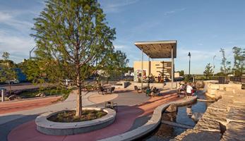
» Open Space: The entry into the study area at Sevier and State of Franklin becomes much more important with the redeveloped mill site serving as a catalyst for the area. To bring interest into the area, a small scale gateway park is shown at this intersection. This park will serve as a connector to Founder’s Park, as well as, a way to showcase local art at a key intersection.
» Form and Design: As with the western section, new development in this section of the corridor should be built on the street with parking to the rear or onto or fronting a green space. Properties that have two frontages should prioritize the West Walnut Street or State of Franklin street frontages primarily.
WEST WALNUT STREET
ASHE STREET
ASHE STREET EXPANSION SEVIER
CAMPBELL
STATE OF FRANKLIN PARKWAY
LYNN STREET
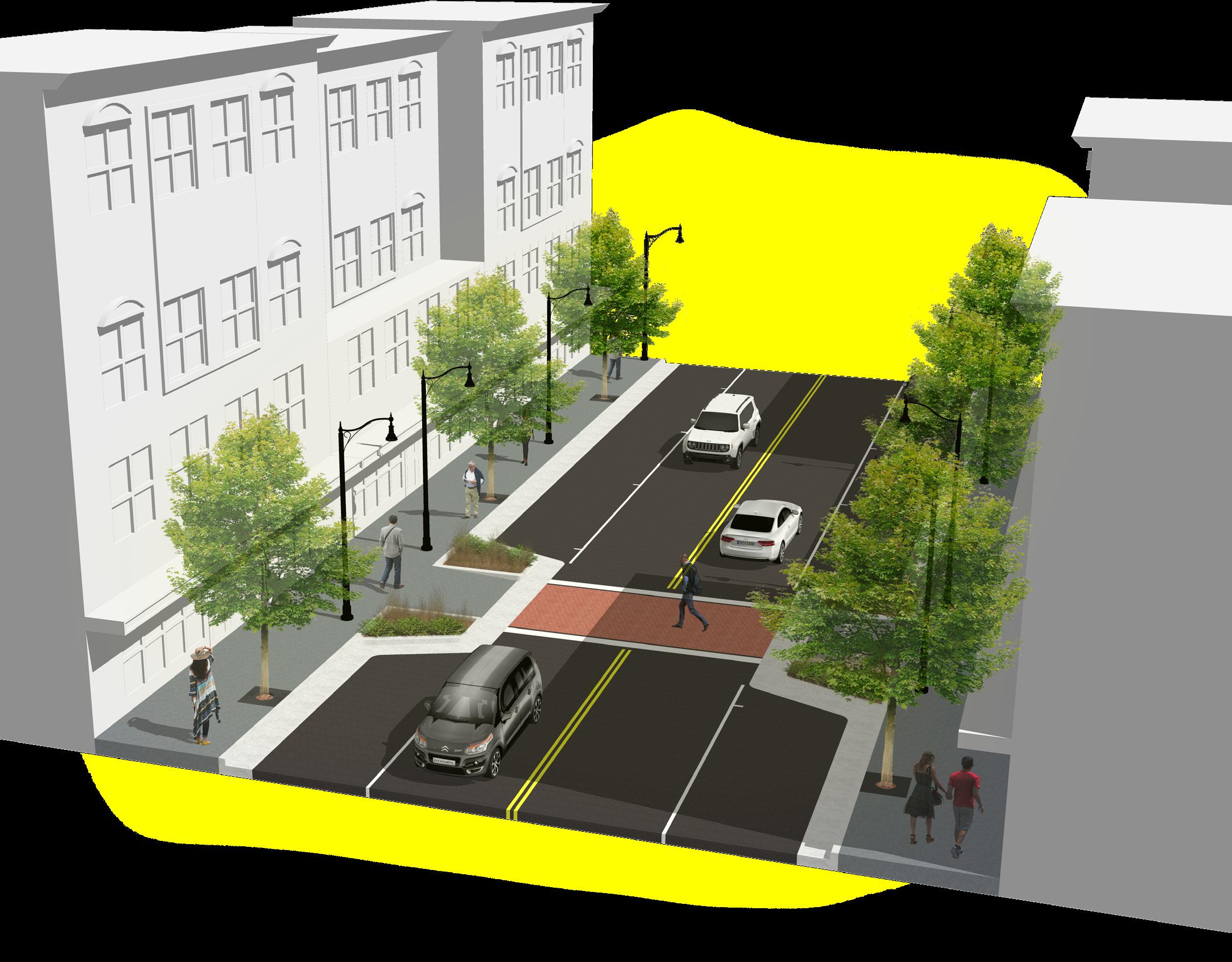
Ashe Street runs parallel to West Walnut Street connecting the entrances to the corridor at Sevier Street and Buffalo Street to one another. The one quarter mile street provides an opportunity for increased pedestrian amenities and the provision of on-street parking. Ashe Street’s lower traffic counts and proximity to civic spaces, trails, and parks provide the ability for mid-block pedestrian crossings and more shared street feel with in the study area.
No right-of-way dedication is envisioned to accommodate the streetscape. Businesses are encouraged to build to the back of sidewalk or to provide and additional frontage zone for street activation.
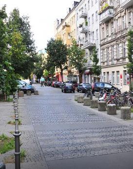
COMPARABLE EXAMPLES
60’ Right of Way
GATEWAY PARK
SEVIER AND ASHE
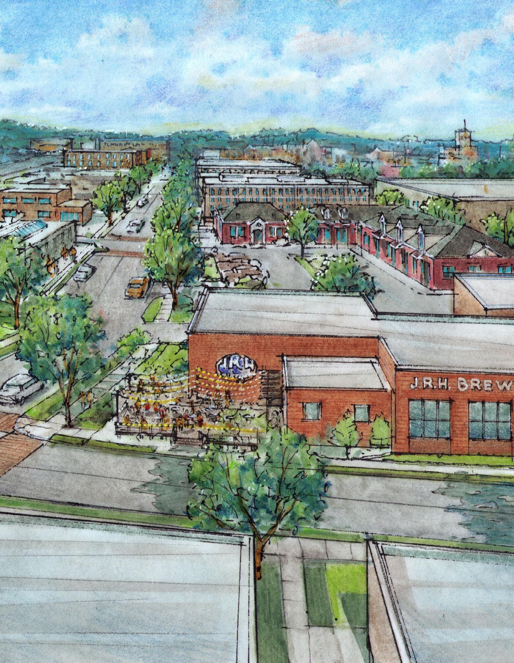
To help make one of the primary entries into the study area more attractive and to compliment the active uses at JRH Brewing and Model Mill, the conceptual master plan calls for a small park at the corner of State of Franklin, Sevier Street and Ashe Street. This park is seen as a place for users of the brewery, the mill, and other sites to gather together while also serving as a reprieve for any users of the path along State of Franklin.
In coordination with the Gateway Park, a small business incubator is envisioned to offer support and physical space to help small businesses scale sustainably. This space is envisioned adjacent to the new Gateway Park on Ashe Street and could serve as a useful tool in helping businesses in the arts community grow and succeed in Johnson City.
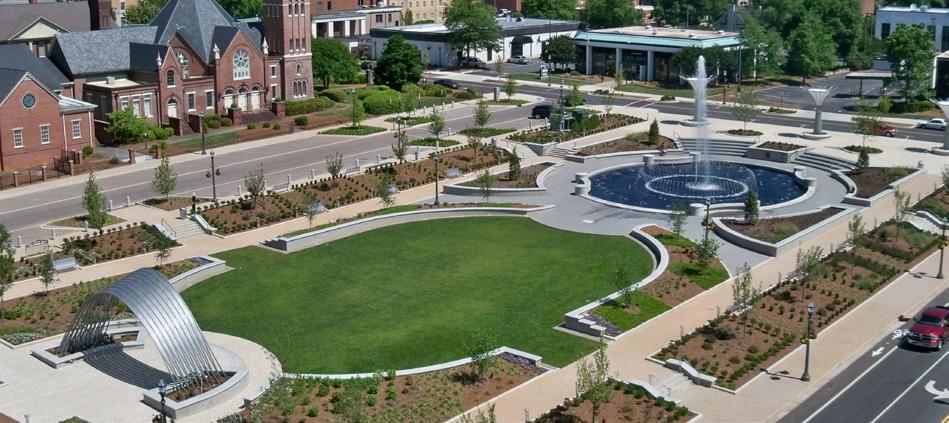
The Green is a small linear park in Charlotte several cultural centers and museums. It includes an open green space with several small plazas and gathering spaces along the edges and serves as a gateway into downtown.
CASE STUDY: THE GREEN CHARLOTTE, NORTH CAROLINA
- East Section Detail
~ Overview
~ Cherry Street Extension
~ Earnest Street Woonerf
~ Civic Use Park
EAST SECTION
EAST SECTION DETAIL
» Area Use and Purpose: The eastern section of the study area is and will continue to see growth pressure from the redevelopment intensity happening on the southwestern edge of downtown. This portion of the study area is expected to act as an continuation of the use and form of downtown Johnson City.
OF FRANKLIN
Uses on this section of the corridor should blend with the mixture of uses found downtown. The former US Post Office on Ashe Street serves as the “heart” of this section and should be utilized as a building open to the public, preferably in a civic capacity.
» Infrastructure: Improvements to the infrastructure in this area occur both in relation to State of Franklin and the Tree Streets. The corridor master plan calls for closing Earnest Street from Ashe Street to West Walnut Street in order to establish a solid pedestrian connection to the Tree Streets for State of Franklin. This closure also warrants creating a high quality shared street to the edge of the study area.
To account for the lost street connection, the plan calls for reopening Union Street, formerly on the eastern side of the Post Office
site, and extending it to meet a realigned Cherry Street. This realignment allows for the removal of the existing turnaround/cul-desac at the end of Cherry Street which is not a visually appealing entrance for the study area.
» Open Space: To coordinate with the proposed civic use and connections of this end of the corridor, a new civic green space or lawn was introduced. This space is aligned with the former post office site and creates a visual axis between Founder’s Park and the interior of the study area.
» Form and Design: Preserving existing structures and matching the existing urban development pattern is incredibly important in the eastern section of the study area, While some businesses and uses may change or relocate, preserving some of the historic character is important to the community.
Where properties do redevelop, buildings should be pulled closer to the street to match the existing character of the corridor.
WEST WALNUT STREET
LYNN STREET
ASHE STREET
CHERRY STREET
CAMPBELL STREET
CHERRY STREET SECTION/EXTENSION
Extending Cherry Street to connect to the stub at Union Street will improve the traffic flow on the eastern portion of the study area. This extension is seen as a low speed street with on-street reverse angled spaces that help serve the proposed park and new civic uses. This extension and connection to West Walnut Street allows for the closure of Earnest Street between West Walnut Street and Ashe Street.
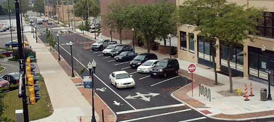
Utilizing reverse angle on-street parking requires users to pull past the space and back into it at an angle. While this seems counter-intuitive, reverse angle parking reduces the likelihood of angle crashes since the vehicles are not reversing into the main roadway.
COMPARABLE EXAMPLES
65’ Right of Way
EARNEST STREET WOONERF
The pedestrian path connecting Ashe Street to State of Franklin creates a great transition into the study area. With the increased focus on the US Post Office site, it is believed that this path should extend across Ashe Street to West Walnut Street, closing Earnest Street’s connection to Ashe Street. This closing is further justified with opening the connection from Cherry Street to West Walnut Street.
While the pedestrian connection to the Tree Streets is incredibly important, it does not provide enough justification to close Earnest north of Lynn Street or Maple Street. To protect the pedestrians on this short stretch and to create a high-quality entrance to the district, a shared street, or Woonerf, is proposed. This street will include traffic calming measures that protect pedestrians while forcing the driver to be more in-tune with their surroundings. While this improvement is short, it will create a large visual impact and set the tone for vehicles entering an area with increased pedestrian activity.
COMPARABLE EXAMPLES
CIVIC PARK
AT CHERRY AND ASHE
Creating a new civic park in the eastern portion of the study area helps to drive interest both visually and economically to the historic US Post Office that is currently seeking a new active use. This greenspace would serve as new programmed park space for the city. The location of this park sets up nicely to become an iconic greenspace anchored by historic buildings. The park space would help draw people into the study area by allowing a visual axis to be established between the post office property, Founder’s Park, and Downtown Johnson City. Creating this civic space would require the removal of a portion of the warehouses at Summer’s Hardware, allowing for the expansion of Cherry Street.
This park in Rock Hill, SC was built into their street grid as a new civic space. With an axis containing a large central fountain, oval lawn, and a band shell/art piece this style of park would fit perfectly in this section of the plan.
CASE STUDY: FOUNTAIN PARK- ROCK HILL, SOUTH CAROLINA
TRANSPORTATION
+ University Parkway at Walnut Street
+ Access Management and Parking
- Curb Cuts
- Lynn Street
- Shared/Public Parking
UNIVERSITY PARKWAY AT WALNUT STREET
To accommodate the numerous anecdotal and studied traffic conditions at the intersection of University Parkway and West Walnut Street, a two-step approach is proposed for the intersection. In Phase 1 a grass raised median is proposed to restrict the southbound left-turn movement on University Parkway.
The proposed median will help prevent traffic queuing into State of Franklin and provide a refuge for pedestrians crossing University Parkway. This change will still allow full access to the corridor for other movements but will restrict the movement that has caused the most collisions over time. In addition, this median will prohibit southbound left turns into driveways mid-block along University Parkway. As the corridor redevelops, this median will help with potential queuing and will provide a visible and safe spot for crossings.
As shown the proposed median does not physically restrict the southbound left-hand turn on to West Walnut street and will need to be accompanied with additional striping and signage to discourage this turn onto the corridor. This is due to ETSU does not have finalized plans for their proposed parking structure in the northwestern quadrant of this intersection. Until the impact this development will have on traffic can be analyzed the median and turn restriction could be done temporarily or as part of a temporary PILOT project.
As discussed earlier, with the restriction of the left-turn lane, the Cherokee Street Extension is proposed to connect Walnut Street to State of Franklin which will support the developments on the west portion of the Walnut Street Corridor that could be affected by the median.
PHASE 2: LIMITED ACCESS
Once plans for the ETSU parking garage can be fully analyzed to determine the garage’s impact on the area’s traffic patterns a more holistic approach to access management and traffic patterns is preferred.
The most comprehensive way to fix traffic concerns in this area is to address the proximity of the traffic signals where West Walnut Street and State of Franklin intersect University Parkway. While the signal at West Walnut will likely still be needed for pedestrians, bicyclists, and buses, the frequency to which it stalls University Parkway can be reduced significantly with the removal of left-hand and through traffic movements on to West Walnut Street.
In the following scenario, the grass median is extended across the intersection while still allowing for pedestrian, bicycle, and bus movement across the intersection. This intersection change also allows for the extension of one northbound left-hard turn southward along University Parkway past the West Walnut Intersection. This approach will significantly help delays occurring due to short queuing distance along University Parkway between West Walnut Street and State of Franklin.
The reduction in access to ETSU’s campus at West Walnut Street will increase trips into and off of the campus from Maple Street. This increased access will likely warrant the installation of a traffic signal at Maple Street and University Parkway. This signal is far enough away from State of Franklin to not cause queuing issues and is useful for pedestrian traffic as well, as it will allow for safe pedestrian access from the Tree Streets to ETSU and the University School. In relation to these changes it is likely that ETSU and the City should work together to plan a mid-block northbound connection between Maple Street and the proposed parking structure.
ACCESS MANAGEMENT AND PARKING
CURB CUTS
Creating a strategy for reducing and consolidating curb cuts along the West Walnut Street Corridor is of paramount importance in creating an effective environment for alternative transportation. This challenge will require the use of several different approaches and a strong amount of public/private partnership.
The most commonly used approach to reducing curb cuts is requiring the use of shared access between adjacent property owners. This is traditionally provided through the provision and requirement of cross access easements and joint access easements established within zoning regulations or a form-based code. While this approach is effective for new development, it does not have much to any impact on properties who do not have changes in operation during the study timeline.
Some cities have begun to utilize some more aggressive additional approaches, such as, incentivization for removing existing curb cuts or accessing from a side street, to charging a fee associated with curb cut usage/ volume.
For West Walnut, the solution is best resolved by a combination of implementing new codes and standards as well as the improvement of restricting factors off site. The combination of approaches that are accomplished through this master plan include:
» Creating a Bike and Pedestrian Friendly Corridor
» Creation of a Form-Based Code
» Reduction in Required Parking
» Extension of Dead-end Side Streets (Ashe, Cherokee, and Cherry)
» Providing Strategic Public Parking Areas
» Improving Portions of Lynn Street
While redevelopment will occur at the timing and pace of current property owners, implementing these approaches will allow the master plan to establish a safer urban street for all modes of transportation that utilize it. The map below shows how these approaches can work together to significantly reduce the number of curb cuts along the corridor, in comparison to the amount of breaks and entrances along the street today.
PUBLIC PARKING PROVISION: LYNN STREET
Providing public parking in key locations is one solution to multiple issues on the corridor. The master plan calls for the City to purchase property or enter into a public/private agreement to provide public parking via paved surface lots. This becomes form of “land banking” that allows the City to provide an immediate need in parking provision, while reserving the ability to convert these surface lots into structured parking at a later date, if warranted or desired . This step helps the City in multiple fronts including but not limited to:
» Offering reduced parking requirements to adjacent properties
» More property for civic events
» Generates revenue and returns
» Illustrates the City’s investment in the corridor
» Larger parcels are held and utilized until the market is ready for increased development
» Incentivizes the consolidation of curb cuts
» Provides some control over how development occurs on the corridor
Phase 1
Converting Lynn Street to one-way and utilizing it for access to the rear of properties that front West Walnut Street will help to reduce or prevent new curb cuts. Converting Lynn to one-way traffic will eliminate some of the large vehicular conflicts that apply at narrow pinch points on the street today and will help deal with the inconsistencies plaguing the back street. In effect, the street section becomes more in line with a traditional alley than that of a street and would accommodate property owners utilizing it for head-in parking if designed correctly.
Access from Lynn Street to the rear of properties should be utilized where feasible due to topography, street width, and site conditions. While acceptable as a primary entrance to parking in some cases, the master plan envisions Lynn Street to work with shared access easements.
Surface Parking at Boyd and West Walnut Surface Parking at Campbell and West Walnut
Phase 2 Structured Parking at Boyd and West
ACTION PLAN
+ Conclusion + Action Plan
CONCLUSION ACTION PLAN
In conclusion West Walnut Street has the potential to become one of Johnson City’s best and most complete street. Development interest within the area is already picking up due to the corridor’s prime location and will likely accelerate if the City uses this plan to address the five major concerns and issues along the corridor.
» Access to and from the corridor
» Stormwater management
» Utilities running along the corridor
» Transition to the Tree Streets
» Parking shortages in specific locations
Overall, this master plan is relatively ambitious yet achievable and will provide solutions for the outlined concerns. When finalized it will create a positive foundation for continued investment along the corridor. By undertaking this plan the City will be creating a welcoming complete street that will link Downtown, the Tree Streets, and ETSU in a safe and attractive environment for all users.
When complete the form and function of West Walnut Street will an urban street completee with vibrant businesses, wide sidewalks, protrected bike lanes, and street trees all while still maintaining a design, look, and feel unique to Johnson City.
The action plan outlines the proposed investments needed to accomplish overall vision established within the master plan. The actions are labeled and prioritized based on overall importance to the corridor.