JANUARY 2025
City of Arroyo Grande

JANUARY 2025
City of Arroyo Grande
Caren Ray Russom, Mayor
Kate Secrest, Mayor Pro Tem, District 1
Aileen Loe, Councilmember, District 2
Jamie Maravigilia, Councilmember, District 3
Jim Guthrie, Councilmember, District 4
Bruce Berlin
Catherine Sackrison
Jamie Maraviglia
Kevin Buchanan
Virginia Roof
Brian Pedrotti, Director of Community Development
Andrew Perez, Planning Manager
Shayna Gropen, Assistant Planner
Shannon Sweeney, City Engineer

This project was funded by Caltrans.
Joe Punsalan, Principal
Jacob Leon, Senior Associate
Marina Varano, Senior Planner
Morgen Ruby, Senior Planner
Mariella Delfino, Designer
Central Coast Transportation Consulting
Joe Fernandez, Principal
Michelle Matson, Senior Transportation Engineer
Aileen Nygaard, City of Pismo Beach Planning
Bailey Barton, Caltrans District 5
Craig Angello, Five Cities Fire
Jeff Chambers, South County Chambers of Commerce
Kyle Bell, City of Grover Beach Planning
Mary Gardner, SLO Regional Transit Agency
Pat Dempsey, Arroyo Grande Resident
Rick Ellison, Bike SLO County
Stephen Hanamaikai, San Luis Obispo Council of Governments
The Active Transportation Plan (ATP) is a first-of-its-kind planning document for the City of Arroyo Grande. It presents a tremendous opportunity to outline a roadmap for transforming our city into a pedestrian, rolling, and bicycle-friendly environment, connecting our homes, schools, businesses, and public spaces with safe and convenient routes.
We recognize that a truly inclusive transportation system must serve everyone – regardless of age, ability, race, income, or background. As we look to the future, this ATP is a key step in achieving this vision to improve the health of our citizens, reduce environmental impacts associated with vehicle use, reduce traffic congestion, improve safety, and create more vibrant and equitable communities by increasing mobility options for all people. The ATP builds off many elements that make the City of Arroyo Grande a desirable place for many residents and businesses, as well as an exciting destination for visitors.
Together we can build a future where the City of Arroyo Grande is a leader in active transportation choices for our communities.
Thank you for being part of this exciting journey!
Brian Pedrotti
Brian Pedrotti, Director of Community Development
The City of Arroyo Grande (City) developed the Arroyo Grande Active Transportation Plan (ATP) to promote walking, riding a bicycle, using a mobility aid device, and taking public transit as safe, viable, and enjoyable means of transportation within the city and to neighboring communities. The City will use the ATP to pursue and secure grant funding; develop new programs; and implement Capital Improvement Projects to advance active transportation throughout Arroyo Grande.
1. Identify gaps and barriers, both perceived and actual, in the existing active transportation network.
2. Engage with the community to gather local knowledge on existing challenges and opportunities.
3. Analyze the existing infrastructure around activity centers such as parks, schools, and commercial areas to explore potential solutions.
4. Develop a list of prioritized projects that improve the active transportation facilities along key corridors.
5. Create programmatic recommendations that promote walking, rolling, and bicycling as viable transportation modes.
6. Provide the City with a clear framework for implementation that can be used to pursue future grant and funding opportunities.
The ATP was developed through a comprehensive 18-month planning process that included an in-depth review of local and regional planning documents; a data-driven analysis of existing conditions; extensive engagement with community members, stakeholders, and City staff; and the development of recommendations that address active transportation gaps and needs.

Review relevant local and regional policies and evaluate the existing conditions of Arroyo Grande’s pedestrian and bicycle infrastructure.
Engage community members and key stakeholders in the planning process through a variety of activities and events.
Develop recommendations for infrastructure projects and programs that will respond to community needs and advance active transportation.

Present the ATP to the Planning Commission and then the City Council for adoption.
The ATP contains a summary of existing planning efforts; an analysis of the existing transportation system; an assessment of key active transportation needs; input from the community; an overview of active transportation facilities; recommendations for improvement; and more. The ATP is organized into an executive summary, five chapters, and an appendix, all of which are described below.
The Executive Summary provides an overview of the document, identifies key issues and themes within Arroyo Grande’s transportation system, and summarizes the ATP’s recommendations.
Chapter 1 provides an overview of active transportation trends, benefits, primary guidance, applicable legislation, and relevant local and regional planning documents. This foundational chapter introduces the purpose of the ATP and sets the stage for the rest of the document.
Chapter 2 documents and analyzes the existing conditions of Arroyo Grande’s transportation system. The chapter includes geospatial analyses of several relevant datasets, such as land use, activity centers, existing active transportation infrastructure, public transit, activity centers, collision history, and more. Chapter 2 findings were used in combination with community input to identify key active transportation gaps, needs, and priorities.
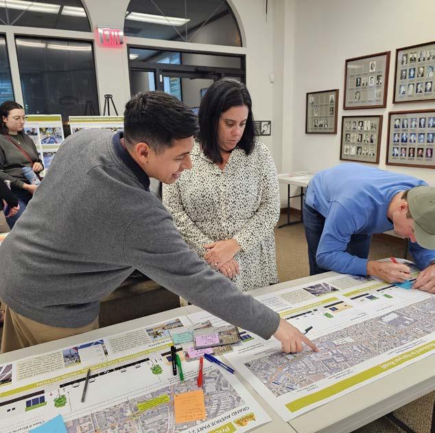
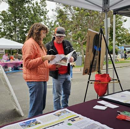
Chapter 3 summarizes the information gathered from the community engagement process. The chapter includes key takeaways from public input collected through community surveys, five stakeholder meetings, three pop-up events, and two community workshops. The chapter identifies key issues and priorities of the community and stakeholders, which were used to develop recommendations.
Chapter 4 provides an overview of potential active transportation infrastructure facilities that can be implemented in Arroyo Grande. This chapter serves as a toolkit of solutions to make it safer, easier, and more enjoyable to walk, ride a bicycle, and use a mobility aid device in Arroyo Grande. Many of the active transportation “tools” described in Chapter 4 are included as recommended infrastructure improvements in Chapter 5.
Chapter 5 proposes physical improvement projects and programmatic recommendations to facilitate and encourage active transportation in Arroyo Grande. Project recommendations include a future bicycle network, pedestrian and ADA enhancements, Safe Routes to School (SRTS) improvements, and conceptual designs for three priority projects.
The Appendix contains descriptions of primary guidance and applicable legislation (Appendix A), the complete results of community engagement efforts (Appendix B), guidance from Caltrans (Appendix C), high-level planning drawings for the ATP’s three priority projects (Appendix D), and potential funding sources for ATP implementation (Appendix E).
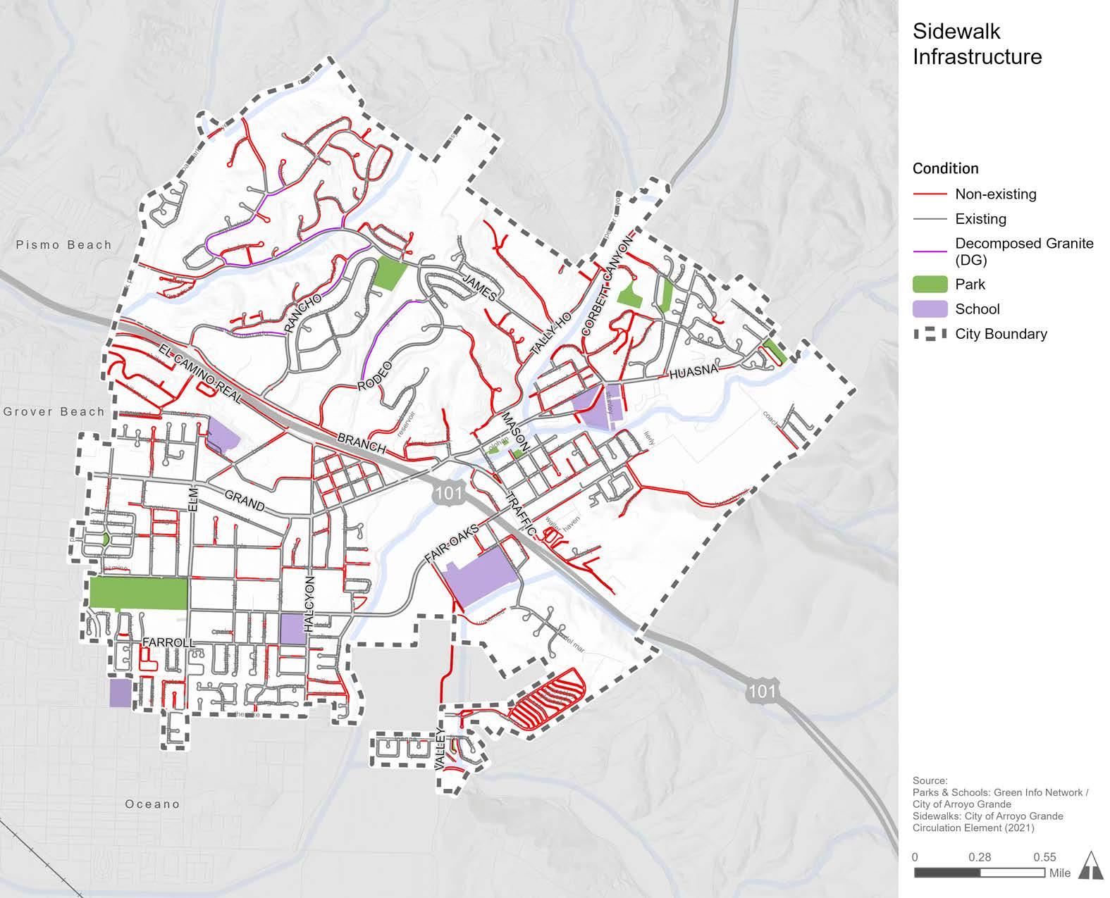
Sidewalks are the foundation of pedestrian infrastructure. However, Arroyo Grande lacks a complete sidewalk network. Figure E-1 displays the existing sidewalk infrastructure in Arroyo Grande. Figure E-1 shows that many streets in Arroyo Grande lack sidewalks, which forces pedestrians and mobility aid device users to walk or roll alongside vehicular traffic in the street or avoid these routes altogether.
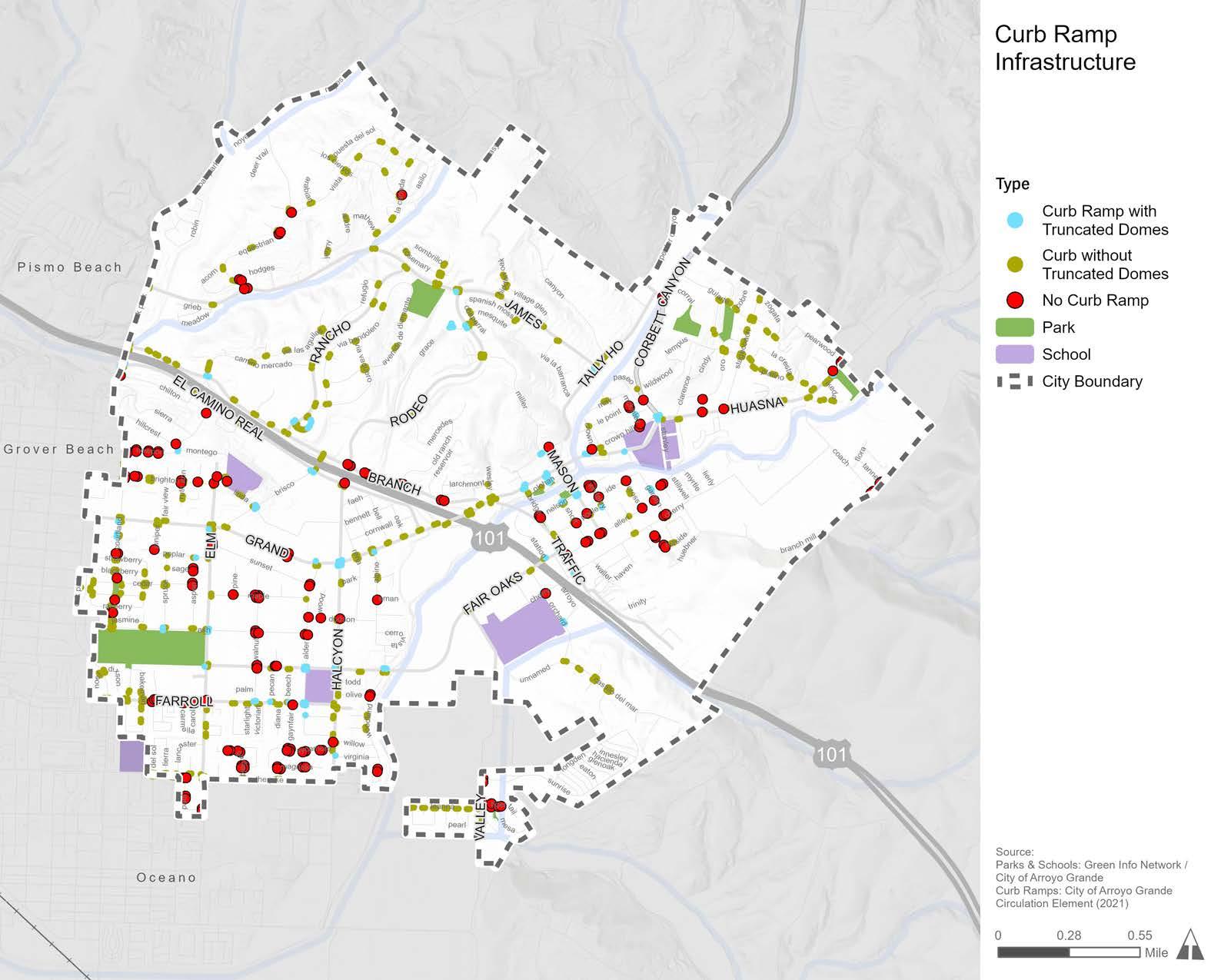
A curb ramp is a short ramp that cuts through or is built up to a curb to facilitate access between a sidewalk and a roadway for people using wheelchairs, walkers, strollers, skateboards, scooters, mobility devices, or health-related mobility limitations. Americans with Disabilities Act (ADA) standards require that new curb ramps include detectable warnings to alert pedestrians with vision impairments of an upcoming hazard, such as passing traffic. Detectable warnings consist of a series of small domes, also known as truncated domes, that contrast in color with the surrounding sidewalk or street. Curb ramps with truncated domes are essential infrastructure that allow people to safely access their desired destination.
Figure E-2 shows a current inventory of curb ramps with and without truncated domes, as well as pedestrian crossings that are missing curb ramps altogether. Collecting an inventory of missing curb ramps is the first step to identifying and prioritizing curb ramp installation projects that will make Arroyo Grande more accessible for people with disabilities. In recent years, the City has made strides to install new curb ramps in priority areas, such as near Harloe Elementary and Ocean View Elementary schools, as well as others.
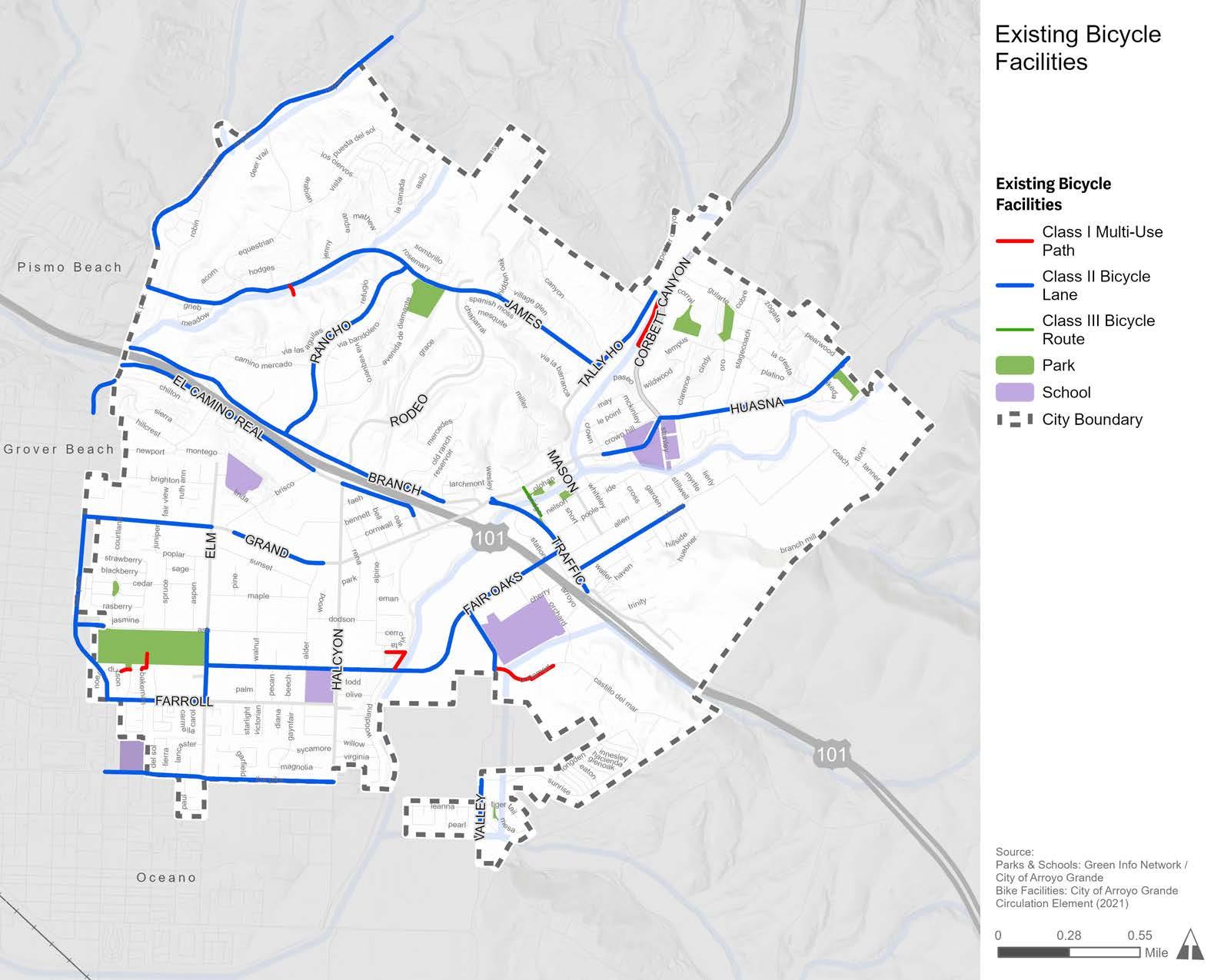
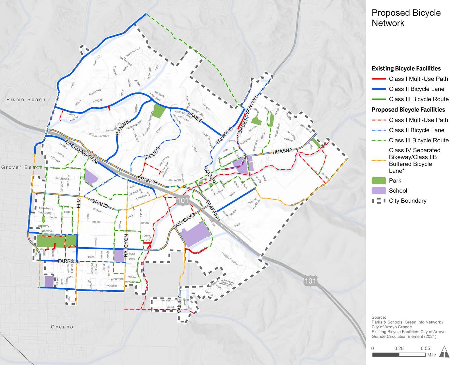
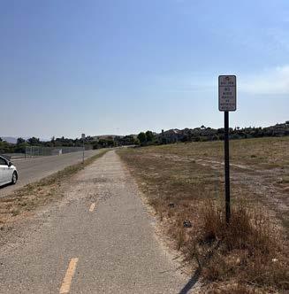
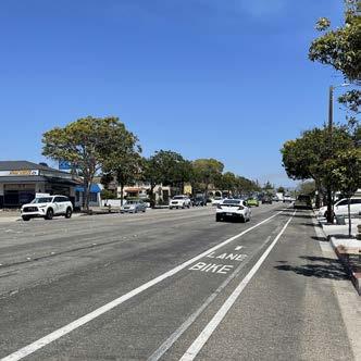
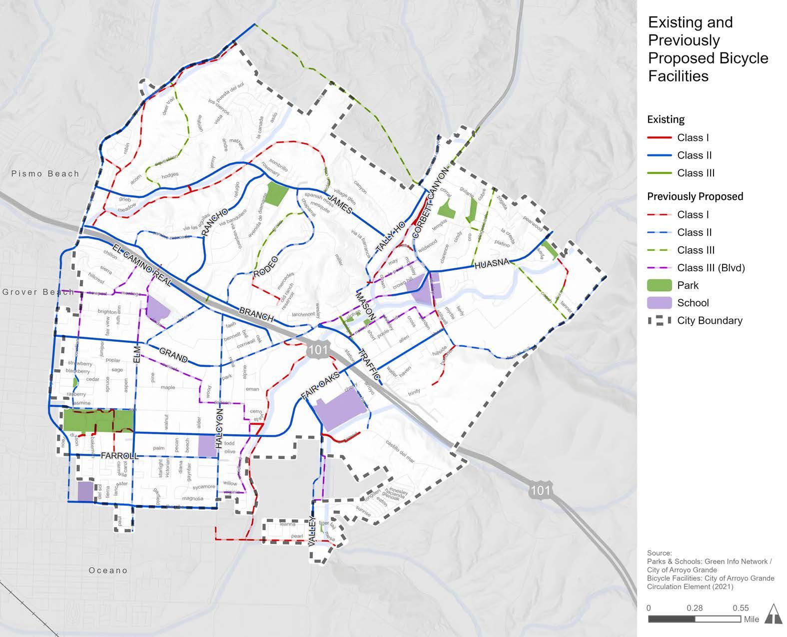
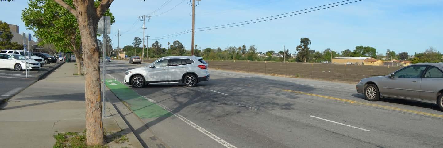
There are 15.5 miles of existing bicycle facilities in Arroyo Grande (Figure E-3). Arroyo Grande’s existing network of bicycle facilities mostly consists of Class II bicycle lanes, with short segments of Class I multi-use paths and Class III bicycle routes. The existing bicycle facility network was analyzed for safety and connectivity within Arroyo Grande and to neighboring jurisdictions. Gaps currently exist along key corridors, including Oak Park Boulevard, East Grand Avenue, Elm Street, Farroll Avenue, and West Branch Street. Additionally, there are opportunities for greater levels of separation and protection between vehicles and bicyclists along existing bicycle facilities on East Grand Avenue, Fair Oaks Avenue, Huasna Road, West Branch Street, Valley Road, and more. The ATP aims to strengthen and expand Arroyo Grande’s existing bicycle network by recommending new and improved bicycle facilities.
Class I Multi-Use Paths: 0.8 miles
Class II Bicycle Lanes: 14.6 miles Class III Bicycle Routes: 0.1 miles
Bicycle and pedestrian collision data were obtained from the Transportation Injury Mapping System (TIMS) managed by SafeTec to provide Statewide Integrated Traffic Records System (SWITRS) collision data. This dataset captures reported bicycle-vehicle, pedestrian-vehicle, and bicycle-pedestrian collisions that resulted in injury or property damage in Arroyo Grande in the 11-year period of 2012 through 2022. Collision density and location data are displayed in Figure E-4.
During these 11 years, there were a total of 45 pedestrian-related collisions and 50 bicycle-related collisions, which resulted in 94 injuries and three fatalities. The bulk of both collision types resulted in visible injury (47 percent) or complaint of pain (35 percent), with 18 percent resulting in severe injury or death. It is important to note that collisions involving bicyclists and pedestrians are known to be underreported, and therefore such collisions are likely under-represented in this analysis. Collision history was used to develop and prioritize pedestrian and bicycle recommendations proposed by this ATP.
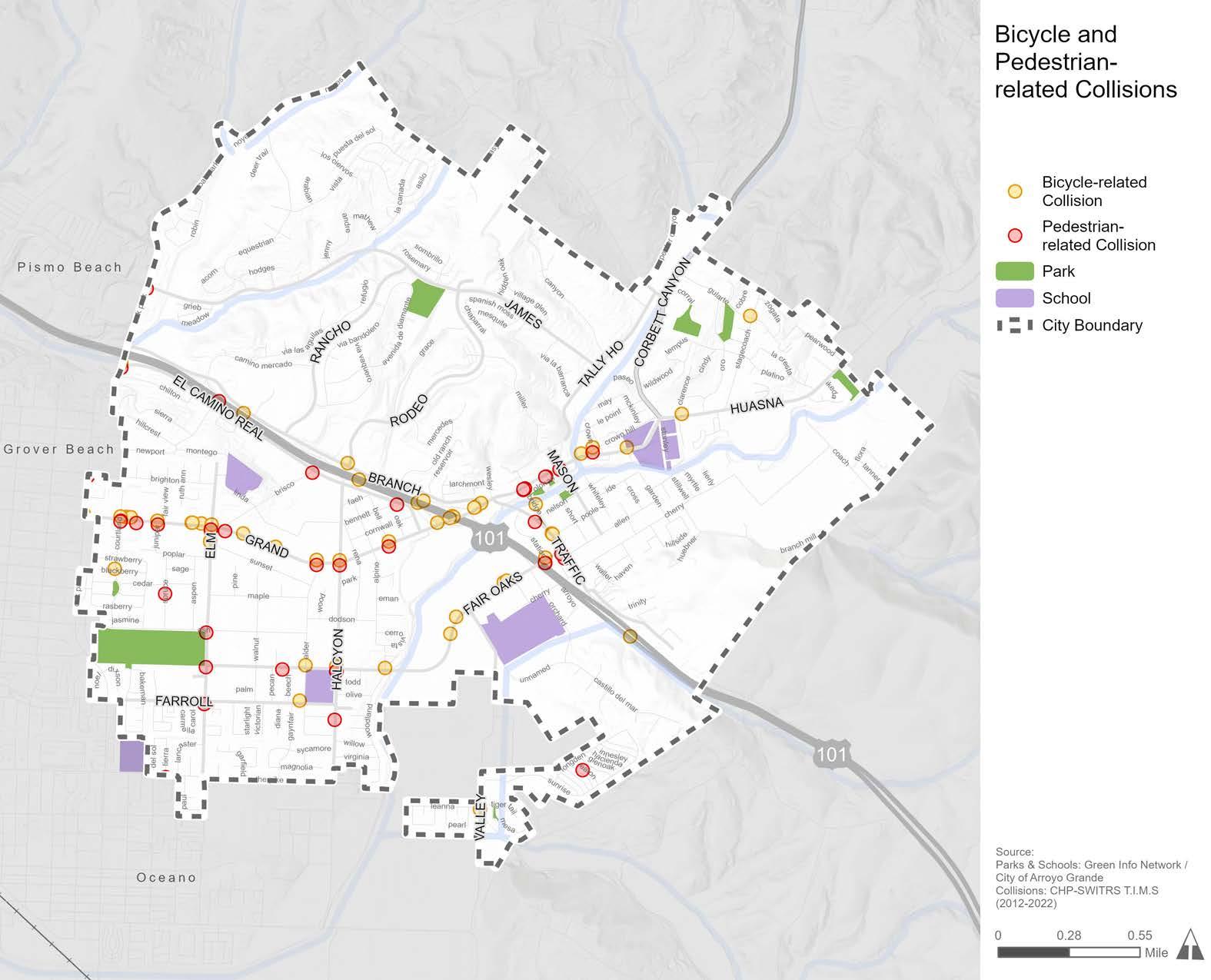
e-4: Bicycle and Pedestrian-Related Collisions (2012-2022)
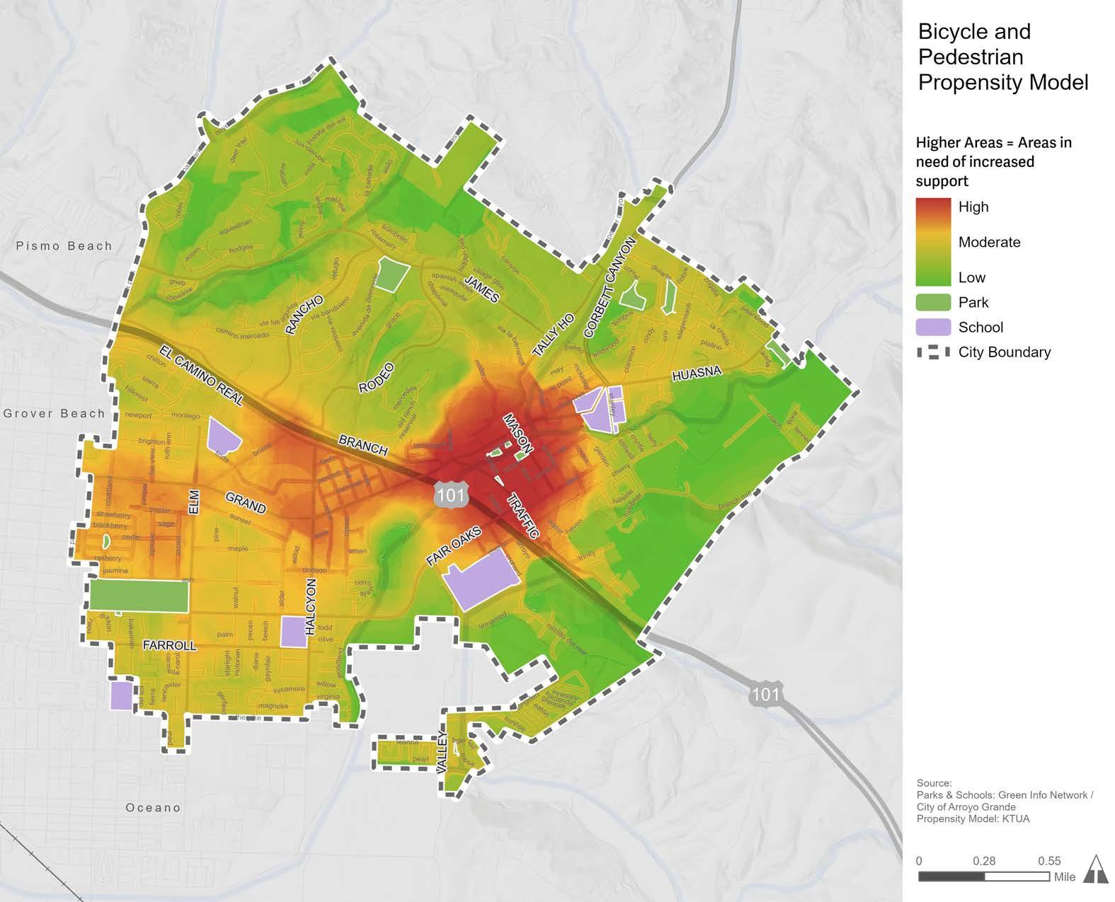
To help identify priority areas for active transportation infrastructure, a Geographic Information System (GIS)-based model called a Bicycle-Pedestrian Propensity Model (BPPM) was created to reveal relationships between several key factors, including activity centers, demographic data, and physical infrastructure. A BPPM was developed to establish where bicyclists and pedestrians are most likely to be, both currently and if improvements were to be made. The BPPM is comprised of three submodels:
Attractor Model: Attractors are activity centers known to attract bicyclists and pedestrians, such as schools, public transit stops, and shopping centers.
Generator Model: Generators estimate potential pedestrian and bicyclist volumes based on how many people live and work within an area. Demographic data used to model generators include population density, employment density, primary mode of transportation to work, and vehicle ownership.

Barrier Model: Barriers are features likely to discourage or detract people from bicycling or walking. These are generally physical limitations, such as areas with missing sidewalks, high vehicle volumes and speeds, and high numbers of bicycle or pedestrian-related collisions.
These three sub-models were combined to create the composite BPPM, displayed in Figure E-5, to demonstrate areas in greatest need of active transportation infrastructure. The BPPM shows the highest likely bicycle and pedestrian use near mixed-use and commercial areas, especially around the Village, East Grand Avenue, Halcyon Road, West Branch Street, and Traffic Way. However, bicycle and pedestrian propensity is not only concentrated on the major roadways, it also permeates into local streets that people tend to use frequently. When comparing community input with the BPPM, there was a correlation between commonly mentioned corridors and high-propensity areas for bicycling and walking.
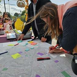
Engaging Arroyo Grande community members in the planning process was essential to the development of the ATP. Community engagement methods were designed to be open, transparent, and accessible to Arroyo Grande residents, stakeholders, and visitors.
The primary methods used to engage Arroyo Grande community members were:
» Community Survey
» Five (5) Stakeholder Meetings
» Three (3) Pop-up Events
» Two (2) Community Workshops
» One (1) City Council Study Session
» Project Website
» Social Media
Key takeaways from community feedback include:
» Across all community engagement methods, it was evident that Arroyo Grande residents, visitors, and stakeholders see the value of safe and efficient active transportation facilities.
» Community engagement participants frequently expressed the desire for complete sidewalks, a connected system of bicycle facilities, and safe walking and bicycling routes to schools, parks, the Village, the Library, and commercial corridors, such as East Grand Avenue.
» Corridors mentioned most by community engagement participants were: East Grand Avenue, West Branch Street, East Branch Street, Halcyon Road, Fair Oaks Avenue, and Oak Park Boulevard.
The ATP proposes new and improved bicycle, pedestrian, and ADA facilities to make it safer, easier, and more comfortable to use active transportation throughout Arroyo Grande. The ATP also contains programmatic recommendations and funding resources to support, encourage, and celebrate active transportation. Recommendations, which can be found in greater detail in Chapter 5, can be used by the City to secure and allocate future funding to create a safe and interconnected network of bicycle and pedestrian infrastructure.
Information gathered throughout the planning process, including through community and stakeholder input, field observations, existing conditions analyses, previous planning, and Capital Improvement Projects (CIPs), was used to develop a future bicycle network. The ATP proposes 33 miles of new bicycle facilities to expand and upgrade Arroyo Grande’s existing bicycle network.
The bicycle facilities proposed in Table E-1 and Figure E-6 are intended to facilitate a future where Arroyo Grande has an interconnected bicycle network. These recommendations are meant to serve as a guide to help the City pursue and allocate funds as they become available through various sources.
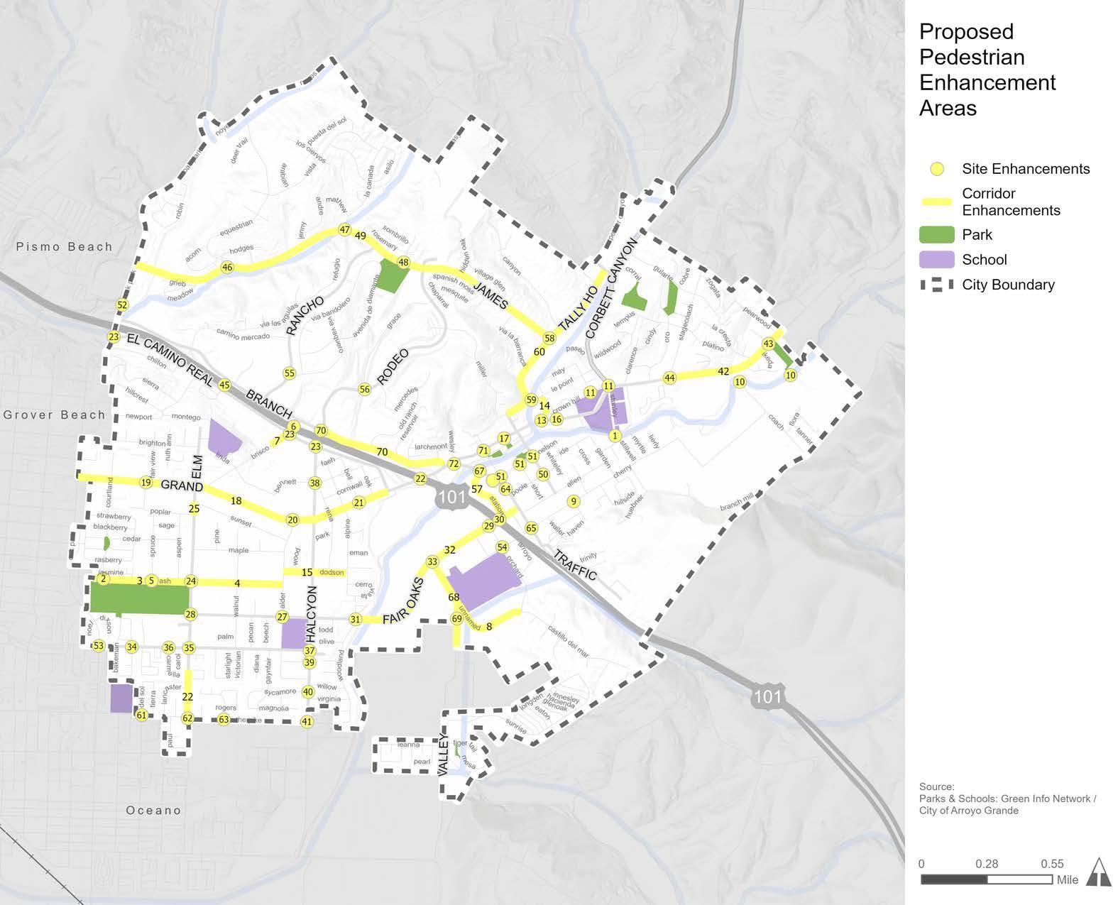
Through a process similar to the one used to develop the proposed bicycle network, the ATP identifies over 60 opportunities for improved pedestrian facilities, including both site-specific and corridor-wide enhancements. Recommendations for pedestrian enhancements are displayed in Figure E-7 and include a range of proposed amenities, such as new sidewalks, mid-block crossings, curb extensions, and traffic calming treatments. The proposed pedestrian recommendations were developed to enhance safety, comfort, and walkability to schools, parks, and commercial destinations. A list of proposed pedestrian enhancements corresponding to the numbers in Figure E-7 is provided in Table 5-3 in Chapter 5.
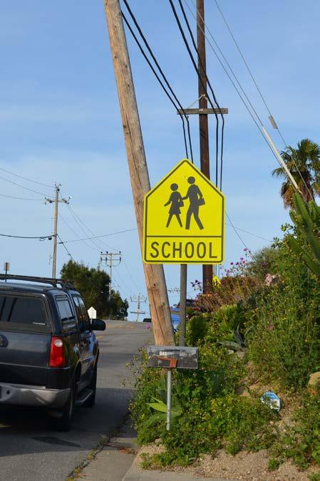
Making it safe for students and their families to walk, ride a bicycle, or use a mobility aid device to get to school is a top priority for the City. The ATP evaluated the pedestrian and bicycle facilities surrounding Arroyo Grande’s four public schools: Harloe Elementary School, Ocean View Elementary School, Paulding Middle School, and Arroyo Grande High School. Recommendations were also developed to improve the route from Arroyo Grande to Fairgrove Elementary School in Grover Beach. To support and encourage walking and bicycling to school, the ATP proposes several Safe Routes to School (SRTS) improvements for the areas surrounding schools. The proposed improvements include bicycle, pedestrian, ADA, and traffic calming recommendations, such as high-visibility crosswalks, LED stop signs, curb extensions, speed feedback signs, pedestrian crossing signals, bicycle facilities, etc.
*Determination of whether a Class IV or Class IIB bicycle facility is installed will be based on considerations for cost, maintenance, and availability of adequate right-of-way to install the improvements.
*Determination of whether a Class IV or Class IIB bicycle facility is installed will be based on considerations for cost, maintenance, and availability of adequate right-of-way to install the improvements.
The City developed planning-level conceptual drawings for three priority projects to streamline future funding pursuits and project implementation. The three corridors shown in Table E-2 and Figure E-8 were selected for several reasons, including their role in providing connections to schools, parks, and commercial destinations; their need for safety improvements; their importance to the community; and more. Conceptual drawings include proposed bicycle facilities, pedestrian and ADA enhancements, and traffic calming measures to facilitate safe and comfortable active transportation along key corridors. An overview of each priority corridor is provided in Chapter 5 and the planning-level conceptual drawings are provided in Appendix D.

The Arroyo Grande Active Transportation Plan (ATP) was developed to provide the City of Arroyo Grande (City) a guidebook for making Arroyo Grande a safe and comfortable place to walk, roll, and ride. The ATP includes an inventory of existing bicycle and pedestrian infrastructure, identifies key gaps and safety needs, and proposes recommendations for improvement. The recommendations in this ATP - both physical and programmatic - are meant to improve active transportation infrastructure; promote walking, rolling, and bicycling in Arroyo Grande; and create viable travel options to support the existing and future population.
The ATP uses the latest design standards and guidelines by the State of California (State), technical experts, and peer communities to ensure that all recommendations are feasible and eligible for grants. The ATP includes short-, mid-, and long-term projects that can be implemented once funds are made available. The City will use the ATP to guide the study, design, and implementation of active transportation projects in Arroyo Grande to improve sustainable mobility options throughout the community and to neighboring cities.
The ATP will guide the development of active transportation projects and programs that will support safe and efficient walking, rolling, and bicycling in Arroyo Grande.
The ATP addresses the following goals:
1. Identify gaps and barriers, both perceived and actual, in the existing active transportation network.
2. Engage with the community to gather local knowledge on existing challenges and opportunities.
3. Analyze the existing infrastructure around activity centers such as parks, schools, employment, and commercial centers to explore potential solutions.
4. Develop a list of prioritized projects that improve the active transportation facilities along key corridors.
5. Create programmatic recommendations that promote walking, rolling, and bicycling as viable transportation modes.
6. Provide the City with a clear framework for implementation that can be used to pursue future grant and funding opportunities.
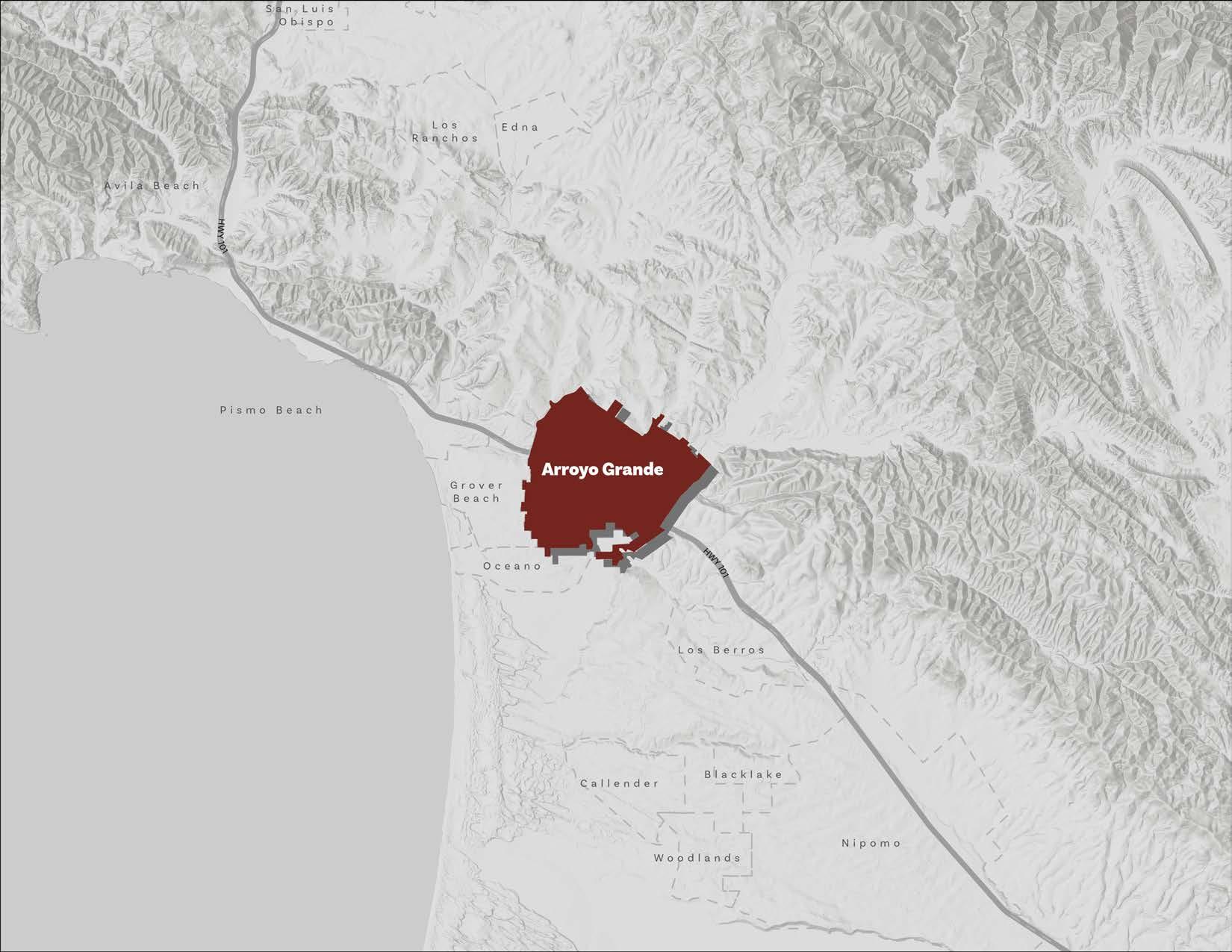
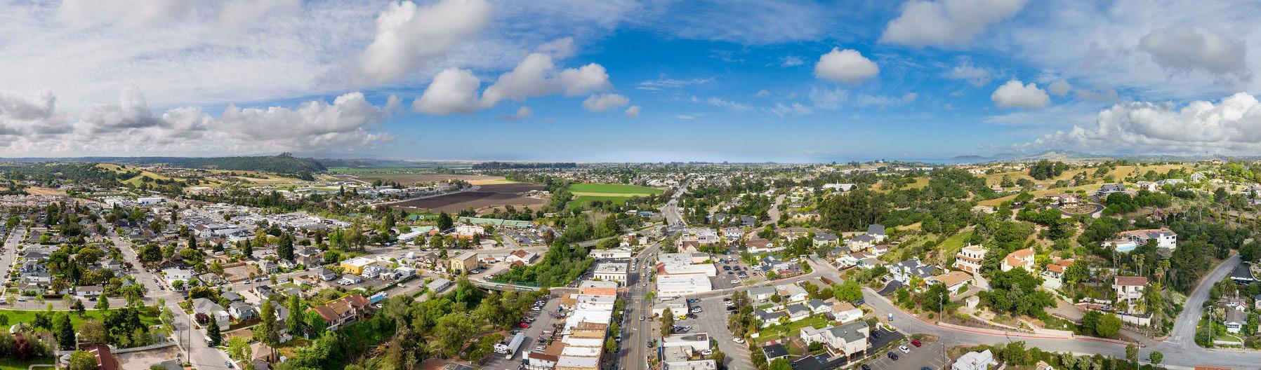
Arroyo Grande is a 5.5-squaremile incorporated community located within the “Five Cities” area of San Luis Obispo county, California. Arroyo Grande lies about 200 miles south of the San Francisco Bay Area and 150 miles north of Los Angeles. Regionally, Arroyo Grande is approximately 10 miles south of the city of San Luis Obispo and conveniently located along the U.S. Highway 101 (U.S. 101) coastal corridor.
Arroyo Grande is bordered by the city of Pismo Beach to the northwest, the city of Grover Beach to the west, the unincorporated town of Oceano to the south, and unincorporated rural and suburban land to the east. U.S. 101, which bisects Arroyo Grande, is the primary State highway that provides regional access and connects the city with other parts of San Luis Obispo county and California. State Route 227 (SR-227) also provides more localized access to/from the city, connecting Arroyo Grande with the city of San Luis Obispo and surrounding communities.
Trends in active transportation planning and design have evolved significantly over the last decade. Communities across the country and throughout California have seen the growth of both conventional and contemporary active transportation infrastructure. Local leaders, community members, and advocates are showing ongoing interest in ensuring that active transportation and new mobility facilities are not only included but prioritized in their built environment. The State continues to show its commitment to this movement through its Active Transportation Program, which draws from federal and state funds to provide roughly $320 million annually for bicycle and pedestrian projects across California.1 Since the program was launched in 2013, over 800 active transportation projects across California have been funded.2 Similarly, the United States Congress authorized the Active Transportation Infrastructure Investment Program as part of the Infrastructure Investment and Jobs Act, securing $45 million in funding to kick-start the program in 2023, with more funding to come in 2024.3
The benefits of active transportation are far-reaching and multi-faceted. Access to active transportation facilities has long been proven to improve mental and physical health, as well as serve as a focal point of community pride and recreation activities. The benefits associated with effective active transportation facilities and programming can be demonstrated through nationwide activity numbers. For example, the Rails to Trails Conservancy, a national trail advocacy organization, reported in 2020 that “more Americans are walking, biking and using trails in 2020 than ever before—bike sales have boomed and trail use is up 60% over the same period in 2019.” In 2022, the Rails to Trails Conservancy reported that these trends are holding steady as data shows “trail use in 2022 is 45% higher than in 2019, demonstrating enduring demand for trails across the country.”4 Similarly, StreetLight Data reported that bicycle activity in the United States has increased substantially in 2020 and 2021, and held steady in 2022 with overall growth since 2019 at 37%.”5 Contrastingly, StreetLight Data reported that walking activity in the United States declined by 36% between 2019-2022, likely due to remote work and empty downtowns drawing fewer pedestrians.6 It is critical to continue investing in active transportation safety, infrastructure, and programming to bring walking activity up and continue to accelerate interest in hiking and bicycling.
Encouraging more active transportation requires the provision of safe, protected, and connected facilities, as well as programs and events to boost awareness and interest. In 2023, the Rails to Trails Conservancy released poll results that revealed that improved connectivity and increased active transportation infrastructure would help people walk and bike more.7 The poll found that the top five factors to increase behavior are: (1) more destinations within a 10-to-20-minute walking distance; (2) friends and family to join them; (3) trails and greenways separated and protected from traffic; (4) more sidewalks; and (5) more protected bike lanes.8 The Rails to Trails Conservancy also found that nearly one-third of people say that interconnected trail networks would make it easier to walk or bike to their destination instead of driving.9
Trends related to the type of infrastructure being built and advocated for have also shown a growing preference for facilities that enhance pedestrian and bicyclist safety, particularly bicycle lanes that are physically separated from motor vehicle traffic. Class 1 multi-use paths and Class 4 separated bikeways are being highlighted as the types of facilities that most encourage people to bicycle more to reach their local destinations. Pedestrian infrastructure such as enhanced crossings with rectangular rapid flashing beacons (RRFB) or pedestrian hybrid beacons (PHB) are being installed at higher rates since studies have shown increased safety for pedestrians.
In the last several years, electric bicycles (e-bicycles) - both personal and shared - have swept the nation. The increasing prevalence of e-bicycles and e-scooters has welcomed an influx of new active transportation users by providing people with disabilities, seniors, and others with viable mobility options for reaching destinations near and far. People across the country now use personal and shared e-bicycles and e-scooters to get to work and school, run errands, and access community services, leisure activities, and recreational opportunities. The National Association of City Transportation Officials (NACTO) reported that shared e-bicycle and e-scooter trips in the United States and Canada have grown by 40 percent since 2018 and have increased 35-fold from 2010.10 In 2021 and 2022, there were 112 and 113 million shared e-bicycle and e-scooter trips in the United States, respectively. Along the same lines, e-bicycle sales in the United States increased by over 145 percent between 2019 and 2020.11 NACTO also emphasizes the reality that more people ride when cities build high-quality, protected bicycle lanes. As alternative modes of transportation become increasingly popular, it is important to design active transportation infrastructure, amenities, policies, and enforcement mechanisms to facilitate the safe use of shared-use facilities for both motorized and non-motorized users.
As shown by the trends in active transportation, investing in a network of bicycle and pedestrian facilities will bring a variety of environmental, health, and social benefits to Arroyo Grande community members.
Vehicle-generated air pollution contains harmful emissions such as carbon dioxide, carbon monoxide, methane, nitrous oxide, and volatile organic compounds. These pollutants and irritants can cause asthma, bronchitis, pneumonia, decreased resistance to respiratory infections. and other health impacts. Increasing access to active transportation and other related clean mobility choices will decrease dependency on car-generated trips, contribute to the reduction of vehicle emissions, and, ultimately, improve air quality.12
Beyond the environmental and community-wide health benefits associated with active transportation, increased access to and opportunity for physical activity offers the potential for substantial health benefits on an individual level. Regular exercise also reduces the risk of high blood pressure, heart attacks, and strokes. Exercise has also been shown to improve mental health by relieving symptoms of depression, anxiety, and stress. Trails, in particular, have been shown to improve quality of life, promote health and well-being, and foster a sense of community and belonging.13
The development of pedestrian and bicycle facilities that are physically separated from vehicular traffic will not only encourage more people to walk or bicycle to their destinations but will also significantly reduce the potential for collisions with vehicles. Data from the U.S. Department of Transportation’s National Highway Traffic Safety Administration shows that fatalities and injuries to pedestrians and bicyclists in traffic collisions are on the rise. In 2021, 7,388 pedestrians and 966 bicyclists were killed in traffic crashes (a 12.5 and 1.9 percent increase from 2020, respectively).14 Pedestrian and bicycle fatalities are unacceptable and demand aggressive improvements to active transportation facilities and programming to eliminate these unnecessary tragedies. Cities across the U.S. are implementing policy and infrastructure changes to curb the rise in collisions involving pedestrians and bicyclists.15 Off-street and protected bicycle and pedestrian facilities are among the current best practices for providing safe active transportation infrastructure and are overwhelmingly preferred by ac-
tive transportation users.16 Additionally, several major U.S. cities, such as Washington D.C., San Francisco, Los Angeles, Seattle, and Denver, have proposed or passed laws that ban right turns on red lights in areas with high pedestrian volumes or citywide.17 The City will continue to monitor emerging safety trends and consider implementing best practices, where appropriate.
Developing an equitable and accessible transportation system starts with recognizing the reality that systemic inequality has left many communities, especially low-income and communities of color, with inequitable access to open space, employment opportunities, healthy food options, and other critical needs. Prioritizing active transportation projects in disadvantaged and underserved communities helps to provide people with additional transportation options and to increase access to important services, resources, and opportunities. The Project for Public Spaces reported in 2021 that health equity and access are major themes across mobility planning. This is evident in the State’s Active Transportation Program, which has allocated over 85 percent of funds in every funding cycle toward projects that will benefit disadvantaged communities throughout California.18
In addition to locating active transportation projects in communities with the greatest need for them, it is also important to design new facilities to be inclusive and accessible for everyone. Increasingly, trails and paths across the United States are incorporating inclusive design features, such as ADA-accessible trails, sensory trails, shareduse trails, trails for children, and trails designed for those with cognitive disabilities.19 This is especially important because people with disabilities rely on active transportation and public transit to a greater degree than those without disabilities.20 Other features, such as educational and wayfinding signage, welcoming public art, and inclusive marketing materials can help trail users feel safe, prepared, and welcome. Providing a variety of safe, affordable, accessible, and equitable transportation options is essential to community health, well-being, and vitality.
According to the United States Environmental Protection Agency (EPA), the transportation sector accounted for the largest portion of greenhouse gas (GHG) emissions (29 percent) in the United States in 2021.21 Light-duty vehicles (i.e., sports utility vehicles, passenger cars, minivans, and light-duty trucks) account for 58 percent of transportation-related GHG emissions and medium-and-heavy-duty trucks account for 23 percent.22 With roughly 81 percent of transportation-related GHG emissions in the U.S. attributed to personal and single-occupancy vehicles, reducing the number of vehicle miles traveled in cars is imperative to mitigating climate change and can be accomplished, in part, by making active transportation a viable travel option. Additionally, the construction of new bikeways or pedestrian infrastructure will also provide opportunities to design and introduce green infrastructure into the public realm. The EPA acknowledges the many benefits of green infrastructure, including treating stormwater at its source, reducing flooding, adding street trees, improving air quality, creating new habitats, and improving community pride. Examples of active transportation facilities that integrate green infrastructure include bicycle lanes protected by stormwater planter boxes and curb extensions designed with vegetated bioswales, both of which provide safety benefits while retaining and filtering stormwater runoff.
Active transportation design guidance has traditionally come from the California Department of Transportation (Caltrans) and the California Manual on Uniform Traffic Control Devices (CA MUTCD). However, cities are increasingly turning to national organizations for guidance on best practices. Leading national organizations include the National Association of City Transportation Officials (NACTO), the American Association of State Highway and Transportation Officials (AASHTO), and the Federal Highway Administration (FHWA).
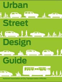
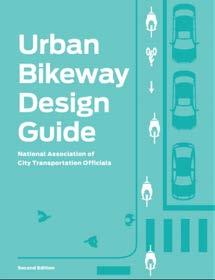
Fortunately for California cities, there is increased flexibility in design guidance offered by both Caltrans and the FHWA. In 2014, Caltrans officially endorsed the NACTO Urban Street Design Guide and Urban Bikeway Design Guide as valuable toolkits for designing and constructing safe and attractive local streets. California cities may also apply for experimental designation from the FHWA for projects not in conformance with the CA MUTCD, which allows cities to endorse innovative projects that are outside of conformance standards prescribed by the CA MUTCD. The guidance documents used to inform this ATP are listed below and described in detail in Appendix A.
Since 2014, the CA MUTCD has been updated eight times, most recently in January 2024. The standards set by CA MUTCD provide guidance to balance safety and convenience for everyone, including drivers, pedestrians, and bicyclists. Multimodal policies for safer crossings, work zones, and intersections are integrated into the CA MUTCD, with improvements including:
» Crosswalks Enhancements Policy
» Temporary Traffic Control Plans
» Work Zone and Higher Fines Signs and Plaques
» Traffic Control for School Areas
Additionally, NACTO guidance was analyzed to ensure flexibility and innovation in the design and operations of streets and highways in California. Much of the guidance provided in the CA MUTCD is consistent with the NACTO Urban Bikeway Design Guide.
In addition to the CA MUTCD, the following guidance documents were also used to guide the development of this ATP.
» AASHTO Guides for Pedestrian and Bikeway Facilities
» Caltrans Highway Design Manual, Chapter 1000: Bicycle Transportation Design
» FHWA Bikeway Selection Guide
» FHWA Separated Bike Lane Planning and Design Guide
» Massachusetts Department of Transportation Separated Bike Lane Planning & Design Guide
» NACTO Transit Street Design Guide
» NACTO Urban Bikeway & Street Design Guides
» NACTO Urban Street Stormwater Guide
Active transportation in California is supported by legislation at the federal, state, and local levels. Legislation to advance active transportation is driven by a variety of factors, including safety; GHG emissions reduction; community health and well-being; equity and environmental justice; and more. The following section lists applicable federal and state policies that influence active transportation planning, decision-making, and funding. Descriptions for each piece of legislation can be found in Appendix A.
» Interim Approval for Optional Use of an Intersection Bicycle Box (IA-18)
» Infrastructure Investment and Jobs Act
» AB-32 California Global Warming Solutions Act
» AB-43 Traffic Safety
» AB-98 Planning and Zoning: Logistics Use: Truck Routes
» AB-285 Forecast Impacts of Emerging Technologies
» AB-361 Vehicles: Photographs of Bicycle Lane Parking Violations
» AB-390 Pedestrian Crossing Signals
» AB-413 Vehicles: Stopping, Standing, and Parking
» AB-712 Tenancy: Personal Micromobility Devices
» AB-773 Street Closures and Designations
» AB-902 Traffic Violations and Diversion Programs
» AB-1096 Electric Bicycles as Vehicles
» AB-1193 Bikeways
» AB-1266 Bicycle Guidance Signs Through an Intersection
» AB-1358 Complete Streets Act
» AB-1371 Passing Distance/Three Feet for Safety Act
» AB-1774 E-Bike Modification
» AB-1909 Vehicles: Bicycle Omnibus Bill
» AB-1778 E-Bike Pilot Age Restrictions
» AB-2086 Transportation Accountability Act
» AB-2147 Pedestrians
» AB-2669 Banning Bridge Tolls for People Walking and Biking
» AB-2863 Green Building Standards: Bicycle Parking
» SB-1 Transportation Funding
» SB-375 Redesigning Communities to Reduce Greenhouse Gases
» SB-400 Clean Cars 4 All Program
» SB-672 Traffic-Actuated Signals: Motorcycles and Bicycles
» SB-689 Bike Lanes in Coastal Areas
» SB-743 CEQA Reform
» SB-760 Transportation Funding: Active Transportation: Complete Streets
» SB-922 California Environmental Quality Act Exemption: Transportation-related Projects
» SB-932 General Plans: Circulation Element: Bicycle and Pedestrian Plans and Traffic Calming Plans
» SB-960 Complete Streets Bill
» SB-1000 Planning for Healthy Communities Act
» SB-1216 Limits on Class III Bikeways
» SB-1271 E-Bike Battery Safety Standards
» California Active Transportation Program
» California Transportation Plan 2050
» Caltrans’ Deputy Directive 64-R2
» CEQA for Bicycle and Pedestrian Plans
» Design Information Bulletin 89-02
» Executive Order N-19-19
The ATP incorporates regional and local planning efforts directly related to active transportation. These efforts range from long-range regional planning to street-specific plans. The following information summarizes the planning documents evaluated as part of the ATP development.
The Arroyo Grande General Plan, adopted in 2001, is a comprehensive citywide plan that guides future growth while preserving quality of life. The General Plan is comprised of eight elements: (1) Agriculture, Conservation, and Open Space, (2) Circulation, (3) Economic Development, (4) Housing, (5) Land Use, (6) Noise, (7) Parks and Recreation, and (8) Safety. The Circulation and Parks and Recreation elements, in particular, are most relevant to this ATP.
*Note: The City is currently undergoing a comprehensive General Plan update process. While the General Plan has not been released or adopted, relevant findings from the General Plan community engagement process were reviewed and integrated into the ATP.
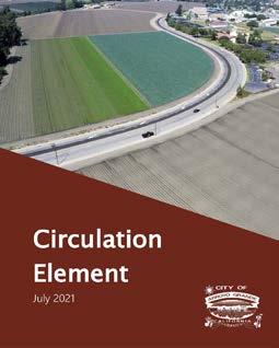
Arroyo Grande General Plan: Circulation Element (2021)
The Circulation Element of the General Plan, updated in 2021, seeks to provide safe and easy travel within and through the city for pedestrians, bicyclists, and motor vehicles. The Circulation Element’s vision is for Arroyo Grande to become “a community that embraces mobility through the use of all transportation modes.”
One goal of the Circulation Element is to seamlessly connect Arroyo Grande and adjacent communities via a safe and convenient bicycle and pedestrian network for recreational and commuter use, while also improving air quality by reducing vehicular trips. Initial steps to achieve this goal involve completing the following Circulation Element policies:
» Update the City’s Bicycle & Trails Master Plan in the form of an Active Transportation Plan, to incorporate pedestrian travel, in accordance with State guidelines and industry best practices.
» Expand the City’s Bicycle & Trails Master Plan into a citywide Active Transportation Plan including pedestrian mode improvement plan and policies.
This ATP updates and expands upon the City’s existing Bicycle & Trails Master Plan to include pedestrian travel and up-to-date best practices
for active transportation. By developing this document in alignment with the Circulation Element, the ATP is able to incorporate recommendations that are consistent with City policies and visions.
Arroyo Grande General Plan: Parks and Recreation Element (2001)
The Parks and Recreation Element of the General Plan, adopted in 2001, guides the long-term planning and provision of parks and recreation facilities in Arroyo Grande. The Parks and Recreation Element contains an objective for the City to establish a network of recreational trails, bicycle lanes, and bikeways for residents and visitors to the Arroyo Grande Valley. This objective includes policies that prioritize the development of trails that provide connections to schools and recreation facilities, a regional recreational trail along Arroyo Grande Creek, and safe crossings for any trails crossing major streets.
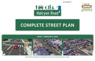
The City adopted the Halcyon Road Complete Streets Plan in 2023 to improve mobility and accessibility throughout the 1.7-mile Halcyon Road corridor, a major urban arterial in Arroyo Grande. The plan proposes concepts for an improved transportation corridor that facilitates safe mobility and accessibility for all users, including pedestrians, bicyclists, transit vehicles, trucks, and motorists. The plan proposes multimodal transportation enhancements, such as infilling sidewalk gaps, installing buffered and separated bicycle lanes, and implementing a road diet. Additionally, the plan proposes two alternative improvements at Halcyon Road and Fair Oaks Avenue: an upgraded traffic signal with enhanced bicycle facilities or a roundabout. The plan concludes that a single-lane roundabout will significantly enhance safety and improve multimodal connectivity.
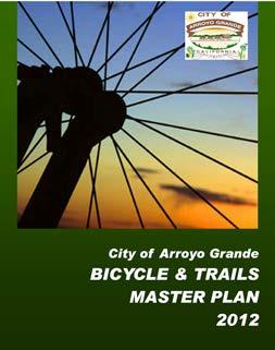
The City’s Bicycle & Trails Master Plan was adopted in 2012 to improve and encourage bicycle and off-street pedestrian transportation within Arroyo Grande by achieving the following goals:
» Goal 1: Safe, Convenient Bicycle and Pedestrian Access
» Goal 2: A “Bicycle Friendly Community”
» Goal 3: Maximize Bicycle and Pedestrian Improvement Funding Opportunities
» Goal 4: Demonstrate City Commitment to Bicycle and Pedestrian Improvement
The plan proposed a bicycle and trail system and recommended the following ten priority improvement projects:
1. East Branch Street from Paulding Middle School to Le Point Terrace Road (Class II Bicycle Lane)
2. East Branch Street from Traffic Way to Le Point Terrace Road (Class III Bicycle Boulevard)
3. West Branch Street from Traffic Way to El Camino Real (Class III Bicycle Route)
4. Fair Oaks Avenue from Traffic Way to Orchard Avenue (Class III Bicycle Route)
5. Fair Oaks Avenue from Orchard Avenue to Elm Street (Class III Bicycle Route - Class II Bicycle Lane)
6. North Oak Park Boulevard from the City Limit to SLO County Line (Class II Bicycle Lanes)
7. Tally Ho from Printz Road to East Branch Street (Class III Bicycle Route and Bicycle Boulevard)
8. Roundabout - East Branch Street, Husana Road, and Corbett Canyon Road (Roundabout and Class II Bicycle Lane)
9. Valley Road from High School to City Limits (Class II Bicycle Lane)
10. Wayfinding Sign System (Expanded throughout community)
To date, projects #1, #4, #5, and #9 are complete. Projects #2, #3, #6, #7, #8, and #10 are not complete and were integrated into the recommendations presented in Chapter 5 of this ATP.
The City’s Municipal Code contains regulations relevant to the ATP, including, but not limited to improvements to circulation, transportation, and trail facilities; street tree requirements; street and sidewalk obstructions; building setbacks; and the use of bicycle and wheeled toys. ATP recommendations consider and are consistent with the City’s Municipal Code.
In 2024, the City adopted its five-year Capital Improvement Program (CIP) to address infrastructure maintenance and improvements throughout Arroyo Grande between Fiscal Year (FY) 2024/25 to 2028/29. The CIP is divided into six major project types – miscellaneous, parks, streets, drainage, sewer, and water. The CIP is funded through a variety of sources including significant grants and transfers from other funds. Table 1-1 displays relevant streets projects slated to occur between FY 2024/25 to 2028/29.
Table 1-1: Relevant Capital Improvement Program Projects (FY 2024/25 to 2028/29)
Fair Oaks Avenue Active
Transportation Improvements (Valley Road to Traffic Way)
Halcyon Road Complete Streets
Bridge Street Bridge Habitat Mitigation
Arroyo Grande Creek Stabilization
Pavement Management Program
Construct improvements on this corridor with better pedestrian and bicycle facilities, traffic calming, and improved access and circulation at the intersection of US 101 southbound ramps and Orchard Avenue. $350,000
The project consists of Complete Streets improvements along 1.7 Miles of Halcyon Road from US 101 to The Pike. The project narrows vehicle driving lanes, adds buffered bike lanes with green conflict striping, fills in sidewalk gaps, adds two-staged crossings with stop control at key intersections, and installs a new signal or roundabout at Fair Oaks Avenue.
$7,866,000
Post-construction environmental mitigation and monitoring for the Bridge Street Bridge Rehabilitation project. $97,256
Geotechnical engineering investigation to determine the stability of the slopes, and to recommend remediation for potential slope failures. $340,000
The City annually performs pavement maintenance on public streets. Streets are selected based on pavement condition, location, and the type of maintenance application. $10,346,624
Sidewalk Repairs and Improvements Biennial funding is allocated towards sidewalk improvements and repairs throughout the City. $1,063,000
Traffic Way Bridge Replacement
Wayfinding
Design and construction to replace the three-lane bridge constructed in 1932 over Arroyo Grande Creek. $13,822,938
Install wayfinding signage in the Village.
$60,000
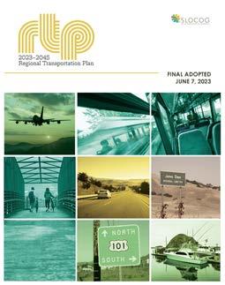
Every four years, the San Luis Obispo Council of Governments (SLOCOG) is required to prepare and adopt a Regional Transportation Plan (RTP). The RTP is the region’s blueprint for a transportation system that enhances quality of life and meets the mobility needs of the region’s residents and visitors, now and in the future. Through policies, programs, strategies, and investments in strategic transportation improvements, the RTP envisions a fully integrated, intermodal transportation system that facilitates the safe and efficient movement of people, goods, and information within and throughout the region. To achieve this vision, the 2023 RTP outlines transportation system investments, financing, and policy recommendations through the year 2045.
The RTP promotes a sustainable, multimodal transportation system that reduces the amount of time people spend on the road, reduces greenhouse gas emissions, and attracts funding for San Luis Obispo county communities. Issues addressed by the RTP include efficiency, equity, accessibility, reliability, sustainability, health, safety, and choice.
Input from the public, stakeholders, and SLOCOG staff led to the generation of seven overarching goals for the RTP:
1. Maintain and improve the efficiency of the existing transportation system.
2. Improve intermodal mobility and accessibility for all people.
3. Support a vibrant, resilient economy.
4. Improve public safety and security.
5. Foster livable and healthy communities and promote equity.
6. Project and enhance the environment.
7. Practice financial stewardship.
Over the course of the RTP’s 23-year planning horizon (2023-2045), SLOCOG forecasts approximately $3.1 billion to be available for transportation expenditures through federal, state, and local programs. Of the $3.1 billion budget, an estimated $184 million will be allocated towards active transportation projects, such as regional bikeway corridors, Safe Routes to School, bikeways, complete streets, and safety and livability improvements.
The RTP also listed several funded and constrained active transportation projects in Arroyo Grande (Table 1-2). Constrained projects are likely to be implemented before 2046 with reasonably expected funding from federal, state, and local funding sources. Table 1-3 displays additional unfunded and unconstrained projects identified in the RTP. Unconstrained projects are outside of the RTP’s planning horizon and cannot reasonably be delivered before 2046.
Table 1-2: SLOCOG Funded and Planned Active Transportation Projects in Arroyo Grande PROJECT
Halcyon Road Complete Streets Improvements
Construct Class II/IV bicycle lanes and pedestrian crossing improvements on Halcyon Road between E. Grand and Highway 1
E. Grand Avenue Midblock Crosswalk Install rapid flashing beacon and upgrade crosswalk
Farroll Road and S. Halcyon Road Crosswalk and ADA improvements
Elm Street Improvements: Ash Street to Grand Avenue (Phase 1) Restripe for road diet improvements
Elm Street Improvements: Farroll Avenue to city limits (Phase 2) Restripe for road diet improvements
Huasna Road: Safe Routes to School Improvements Infill sidewalks and Class II/IV bicycle lanes between E. Branch Street and city limits
Arroyo Grande Creek Trail (Phase 2) City of Arroyo Grande, including the Village
Fully funded through construction in December 2022
Short (before 2029)
Short (before 2029)
Mid (before 2036)
Mid (before 2036)
Mid (before 2036)
Long (before 2046)
Note: All SLOCOG projects listed in Table 1-2 on Halcyon Road will be addressed through the Halcyon Road Complete Streets Project. The remaining projects in Table 1-2 were integrated into the recommendations presented in Chapter 5 of this ATP.

Table 1-3: SLOCOG Unconstrained and Unfunded Active Transportation Projects in Arroyo Grande
Strother Park/Bicycle Pedestrian Improvements
Corbett Canyon Road Bicycle Lanes: Huasana Road to city limits
E. Grand Avenue and E. Branch Street Bicycle Improvement
Safe Streets Bicycle/Pedestrian Improvements at Schools
Bicycle/pedestrian crossing over Arroyo Grande Creek
Install Class II bicycle lanes
Unconstrained (after 2045)
Unconstrained (after 2045)
Install bicycle lanes, sharrows, and bicycle-related signage on streets connecting residential uses to commercial areas, parks, public facilities, and schools Unconstrained (after 2045)
Improve pedestrian and bicycle safety between five area schools by developing safer pedestrian crossings and intersections as well as installing bicycle lanes Unconstrained (after 2045)
Meadow Creek Bridge Repair pedestrian bridge Short (before 2029)
Arroyo Grande Creek Bridge Reinforce the swinging pedestrian bridge Short (before 2029)
W. Branch Street Safe Routes to School Improvements
Construct sidewalk infill between E. Grand Avenue and Rodeo Drive Unconstrained (after 2045)
Scenic Creekside Walkway (Phase 4) Extend existing creekside trail to Kiwanis Park Unconstrained (after 2045)
South County Regional Center
Creekwalk: Rodeo Drive to W. Branch Street Extend trail
Scenic Creekside Shared Use Path
Tally Ho Road Multimodal Improvements
Unconstrained (after 2045)
Construct shared use path west of U.S. 101 between E. Grand Avenue and Fair Oaks Avenue Unconstrained (after 2045)
Construct class II/IV bicycle lanes and pedestrian enhancements between Printz Road and N. Mason Street Short (before 2029)
S. Halcyon Road at Sandalwood Crosswalk and ADA improvements Short (before 2029)
Paulding Middle School Bicycle/ Pedestrian Improvements (Phase 1) Multi-use pathway along E. Branch Street from Garden Street to Stanley Avenue Long (before 2046)
Ocean View Elementary Safe Routes to School Improvements Sidewalk infill on S. Elm Street from Poplar Street to Sunset Drive Short (before 2029)
Paulding Middle School Bicycle/ Pedestrian Improvements (Phase 2)
Bicycle/pedestrian crossing over Arroyo Grande Creek to provide a critical link between residential neighborhoods and school Long (before 2046)
Note: All SLOCOG projects listed in Table 1-3 were integrated into the recommendations presented in Chapter 5 of this ATP except for the Meadow Creek Bridge and Arroyo Grande Creek Bridge projects. The Meadow Creek Bridge and Arroyo Grande Creek Bridge projects were omitted because they are already complete.
The SLOCOG Regional Active Transportation Plan (RATP) (2021) is a compilation of active transportation corridor planning studies and technical reports for the San Luis Obispo county region and its seven cities, Arroyo Grande, Atascadero, Grover Beach, Morro Bay, Paso Robles, Pismo Beach, and San Luis Obispo. The objective of the RATP is to create healthy and appealing alternatives to driving for the region’s residents and visitors.
SLOCOG’s goals for regional active transportation are safety, connectivity, livability, accessibility to transit, coordination and collaboration with local agencies, and focus on disadvantaged communities. Prioritized initiatives to meet these goals include:
» Toward Zero Deaths: Eliminating fatalities and serious injuries caused by traffic crashes.
» Regional Bike & Hike Tourism: Enhancing the attractiveness of bicycle tourism and pedestrian facilities in the region to boost local economies.
» Safe Routes to School: Promoting projects that enhance the safety and convenience of walking and bicycling to school while reducing traffic congestion and pollution around school zones.
» Transit & Rail Connectivity: Providing safe active transportation connections to rail and transit to help facilitate first/last mile mobility without a vehicle.
» Significant Regional Corridors: Coordinating with jurisdictions in the region to prioritize the connection of significant routes and corridors for a robust active transportation network
» Complete Streets: Promoting complete street projects that provide safe spaces and access for users of all ages, abilities, and transportation modes.
» Bicycle Wayfinding & Signage Development: Developing a consistent bicycle wayfinding signage program to improve the visibility of routes and the overall network.
» Data Collection & Analysis: Tracking and measuring progress to inform the process of evaluating, prioritizing, and developing projects.
For Arroyo Grande, SLOCOG approved funding for sidewalk gap closures at Harloe Elementary School through its Safe Routes to School Capital Improvement Program. SLOCOG also recognizes the Arroyo Grande Creek Trail as an Active Route of Regional Significance due to its potential to provide pedestrian and bicycle access from the Oceano Dunes through the center of the Arroyo Grande Village, and potentially even Lopez Lake. Currently, the Class I multi-use path through this corridor is still in the long-range planning stages. However, Class II bicycle lanes are planned along the corridor. The Complete Streets network in/near this corridor has the potential to be improved greatly. In the short term, Complete Streets are planned along Halcyon Road from The Pike to El Camino Real, and Class II bicycle lanes are planned along the remainder of Grand Avenue and Branch Street in the midterm.
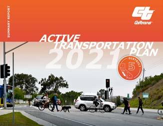
The Caltrans District 5 Active Transportation Plan (2021) identifies challenges and potential solutions for walking and bicycling on and across the State Highway System. Caltrans collaborated with partners from local and regional agencies, community organizations, and advocacy groups to develop and implement the Plan. The Plan’s main output is a prioritized list and map of location-based needs that Caltrans staff and regional and agency partners will use to address high-priority needs along and across Caltrans roadways. Needs identified in the Plan will inform future investments by Caltrans and local partners. Identified needs in Arroyo Grande include, but are not limited to bicycle and pedestrian improvements along State Route 227 and at the Oak Park Boulevard overcrossing.
1 Metropolitan Transportation Commission. (2023). Active Transportation Program. https://mtc.ca.gov/funding/investment-strategies-commitments/ climate-protection/active-transportation-program
2 Metropolitan Transportation Commission. (2023). Active Transportation Program. https://mtc.ca.gov/funding/investment-strategies-commitments/ climate-protection/active-transportation-program
3 Rails to Trails Conservancy. (2023). Connecting America’s Active Transportation System. https://www.railstotrails.org/media/1344243/caats_factsheet_12323.pdf
4 Rails to Trails Conservancy. (2022). New Rails-to-Trails Conservancy Data Shows Strong Demand for Places to Walk, Bike and Be Active Outside. https://www.railstotrails.org/resource-library/resources/new-rails-to-trails-conservancy-data-shows-strong-demand-for-places-to-walk-bike-andbe-active-outside/#:~:text=Nationwide%2C%20RTC’s%20trail%20counters%20showed,for%20trails%20across%20the%20country
5 StreetLight Data. (2023). Walking in America: Metro & Statewide Pedestrian & Mode Share Trends.
6 StreetLight Data. (2023). Bike Boom or Bust?: Metro & Statewide U.S. Bicyle Activity Trends.
7 Rails to Trails Conservancy. (2023). New Data Illustrates Importance of Connected Trail Infrastructure to the Nation. https://www.railstotrails.org/ resource-library/resources/connected-trail-infrastructure/
8 Rails to Trails Conservancy. (2023). New Data Illustrates Importance of Connected Trail Infrastructure to the Nation. https://www.railstotrails.org/ resource-library/resources/connected-trail-infrastructure/
9 Rails to Trails Conservancy. (2023). New Data Illustrates Importance of Connected Trail Infrastructure to the Nation. https://www.railstotrails.org/ resource-library/resources/connected-trail-infrastructure/
10 NACTO. (2022). Shared Micromobility in the U.S. and Canada: 2022. https://nacto.org/wp-content/uploads/2023/11/NACTO_sharedmicromobilitysnapshot_correctedNov3-2023-1.pdf
11 Glusac, E. (2021). Farther, Faster and No Sweat: Bike-Sharing and the E-Bike Boom. The New York Times. https://www.nytimes.com/2021/03/02/ travel/ebikes-bike-sharing-us.html
12 U.S. Center for Disease Control and Prevention. (2023). CDC Transportation Recommendations: Promote Active Transportation. https://www.cdc. gov/transportation/Improve-air-quality.html
13 American Trails. (2020). Why Trails? https://www.americantrails.org/why-trails
14 U.S. Department of Transportation. (2023). Traffic Safety Facts - Pedestrians. https://crashstats.nhtsa.dot.gov/Api/Public/ViewPublication/813458; U.S. Department of Transportation. (2023). Traffic Safety Facts - Bicyclists and Other Cyclists.
15 U.S. cities consider banning “right on red” laws amid rise in pedestrian deaths. (2023, November 5). CBS News. https://www.cbsnews.com/news/ pedestrian-deaths-right-on-red-ban/
16 The League of American Cyclists. (2022). Benchmarking Bike Networks. https://bikeleague.org/sites/default/files/Benchmarking-Bike-Networks-Report-final.pdf
17 Meyersohn, N. (2024, January 20). Why do we have right-on-red, and is it time to get rid of it? ABC7 Los Angeles. https://abc7.com/red-light-righton-traffic-turn/14343661/; U.S. cities consider banning “right on red” laws amid rise in pedestrian deaths. (2023, November 5). CBS News. https:// www.cbsnews.com/news/pedestrian-deaths-right-on-red-ban/; Zipper, D. (2023, June 14). It’s time to ban ‘right-on-red’. Fast Company. https:// www.fastcompany.com/90908929/its-time-for-a-nationwide-ban-of-right-on-red
18 California Transportation Commission. (n.d.). Active Transportation Program. https://catc.ca.gov/programs/active-transportation-program
19 American Trails. (2020). Why Trails? https://www.americantrails.org/why-trails
20 Rails to Trails Conservancy. (2019). Active Transportation Transforms America. https://www.railstotrails.org/media/847675/activetransport_2019-report_finalreduced.pdf
21 United States Environmental Protection Agency. (2023). Fast Facts on Transportation Greenhouse Gas Emissions. https://www.epa.gov/greenvehicles/fast-facts-transportation-greenhouse-gas-emissions
22 United States Environmental Protection Agency. (2023). Fast Facts on Transportation Greenhouse Gas Emissions. https://www.epa.gov/greenvehicles/fast-facts-transportation-greenhouse-gas-emissions
Understanding the existing demographics, land use, roadway conditions, previously planned projects, and other foundational information about Arroyo Grande is essential to planning for the future. Each dataset in this chapter provides valuable information that contributes to a comprehensive understanding of Arroyo Grande’s current pedestrian and bicycle network and how to improve it through the addition of new and improved facilities and programs.
The findings of this analysis, combined with the input from a comprehensive community engagement process, were used to develop a set of projects and programs to facilitate safe, comfortable, and enjoyable modes of active transportation throughout Arroyo Grande. The recommended projects are presented in Chapter 5.
A demographic profile was completed using the most current data available from the 2022 U.S. Census Bureau American Community Survey (ACS) 5-Year Estimates. Arroyo Grande has a total population of 18,435 residents and 8,016 housing units within its 5.5-square-mile city boundary, resulting in a population density of 3,352 people per square mile.
Key demographics and comparisons with San Luis Obispo county and California statistics:
» Race & Ethnicity: The racial make-up in Arroyo Grande is 78.3 percent white, 3.6 percent Asian, 0.5 percent Black, 0.6 percent American Indian, 0.1 percent Native Hawaiian, 2.4 percent some other race, and 14.5 percent two or more races. Approximately 16.1 percent of the population is Hispanic or Latino.
» Age: The median age of Arroyo Grande (45.3) is slightly higher than county and state averages (40.0 and 37.3, respectively).
» Approximately 24.3 percent of Arroyo Grande residents are 65 or older, which is higher than 21.1 percent countywide and 14.9 percent statewide.
» Roughly 19.6 percent of Arroyo Grande residents are under age 18, which is in between the county and state percentages of 17.4 and 22.3 percent, respectively.
» Income & Poverty: Arroyo Grande’s median household income of $99,143 is higher than the average of $90,158 for San Luis Obispo county and $91,905 for California. Additionally, the reported percentage of people in poverty in Arroyo Grande (6.0 percent) is roughly half that of San Luis Obispo county (12.6 percent) and California (12.1 percent).
» Vehicle Availability: The majority of Arroyo Grande households have access to one or more vehicles, with roughly 0.9 percent reporting lacking access to a vehicle.
Source: U.S. Census Bureau. (2022). American Community Survey, ACS 5-Year
Transportation mode share is used to identify commuting patterns within a community. The ATP is particularly interested in supporting and encouraging the following mode shares as viable alternatives to driving in single-occupancy vehicles:
» Walking Mode Share: The walking mode share measures the percentage of workers aged 16 years and over who commute to work by foot. Walking mode share patterns are connected to the relative proximity of housing to employment centers. Walking mode share reflects how well infrastructure and land-use patterns support travel to work by foot.
» Bicycling Mode Share: Similar to the walking mode share, bicycling mode share measures the percentage of resident workers aged 16 years and over who commute to work by bicycle.
» Public Transit Mode Share: Public transit mode share measures the percentage of workers aged 16 years and over who commute to work by transit. This mode share reflects how well first-mile-lastmile infrastructure (facilities that support safe and easy travel to and from transit stops), transit routes, and land-use patterns support travel to work by transit.
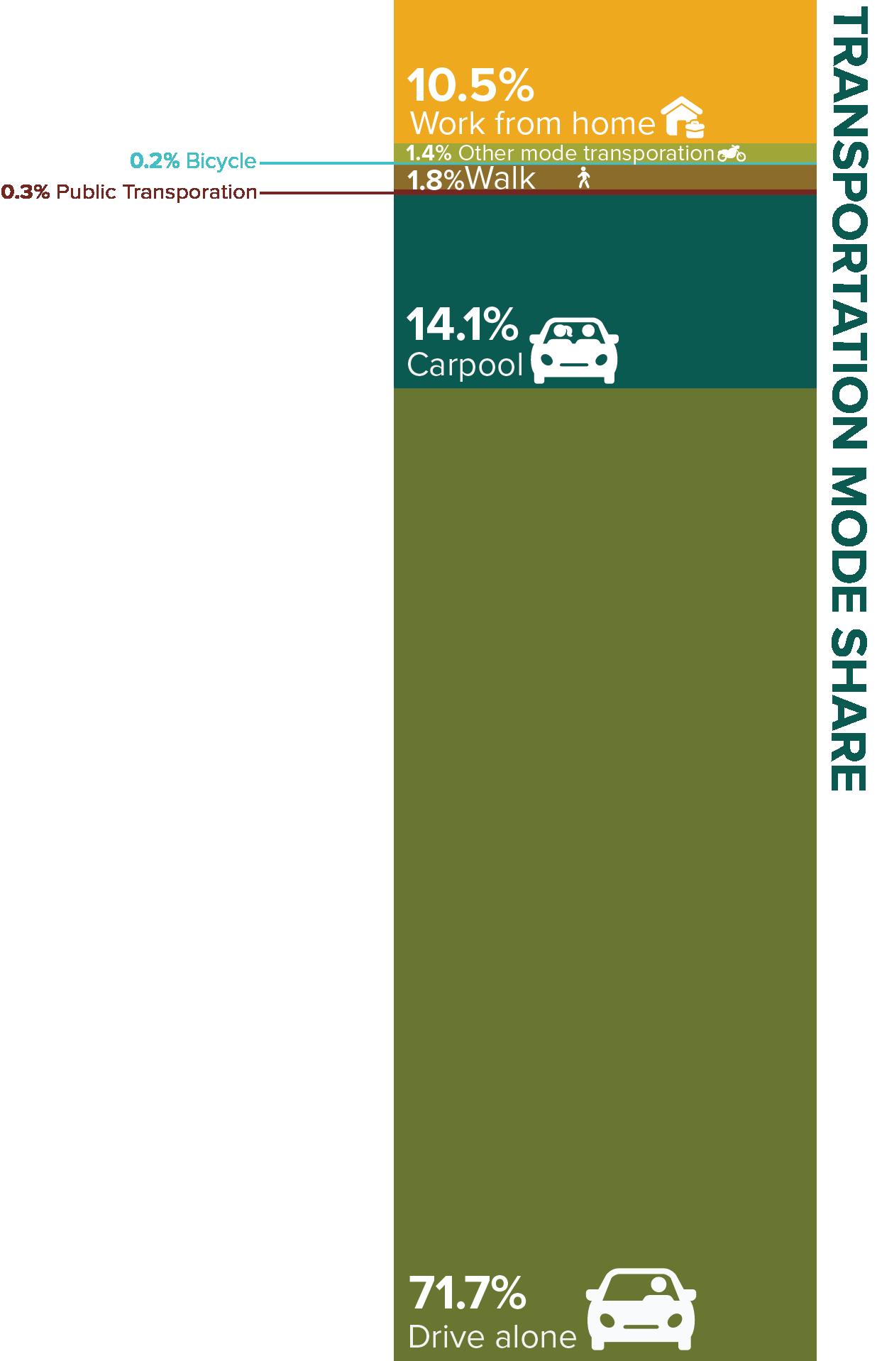
According to the 2022 ACS 5-Year Estimates from the U.S. Census Bureau, approximately 7,675 Arroyo Grande residents commute to work by driving, walking, bicycling, taking public transit, or other means. Additionally, roughly 900 residents work from home. Currently, the majority of Arroyo Grande residents (71.7 percent) rely on personal vehicles to travel to and from work. This mode is followed in prevalence by carpooling (14.1 percent), working from home (10.5 percent), walking (1.8 percent), taxicab/motorcycle/other (1.4 percent), public transportation (0.3 percent), and bicycling (0.2 percent). Improving active transportation facilities along routes to key destinations and public transit stops has the potential to shift transportation mode preferences away from single-occupancy vehicles and towards walking, bicycling, and public transit.
Source: U.S. Census Bureau. (2022). American Community Survey, ACS 5-Year Estimates Subject Table S0801.
The 2022 ACS 5-Year Estimates from the U.S. Census Bureau were used to evaluate travel time to work for Arroyo Grande commuters. The average time it takes Arroyo Grande commuters to get to work (across all travel modes) is estimated at 21.6 minutes. Approximately 31 percent of commuters have a commute time greater than 25 minutes, indicating a moderate amount of non-localized employment. However, a large majority of Arroyo Grande commuters, about 69 percent, spend less than 25 minutes commuting. In particular, roughly 20.8 percent of commuters spend less than 10 minutes traveling to work. With a fifth of commuters getting to work in less than 10 minutes, the City has a promising opportunity to help short-distance commuters opt for walking, bicycling, or public transit instead of driving.
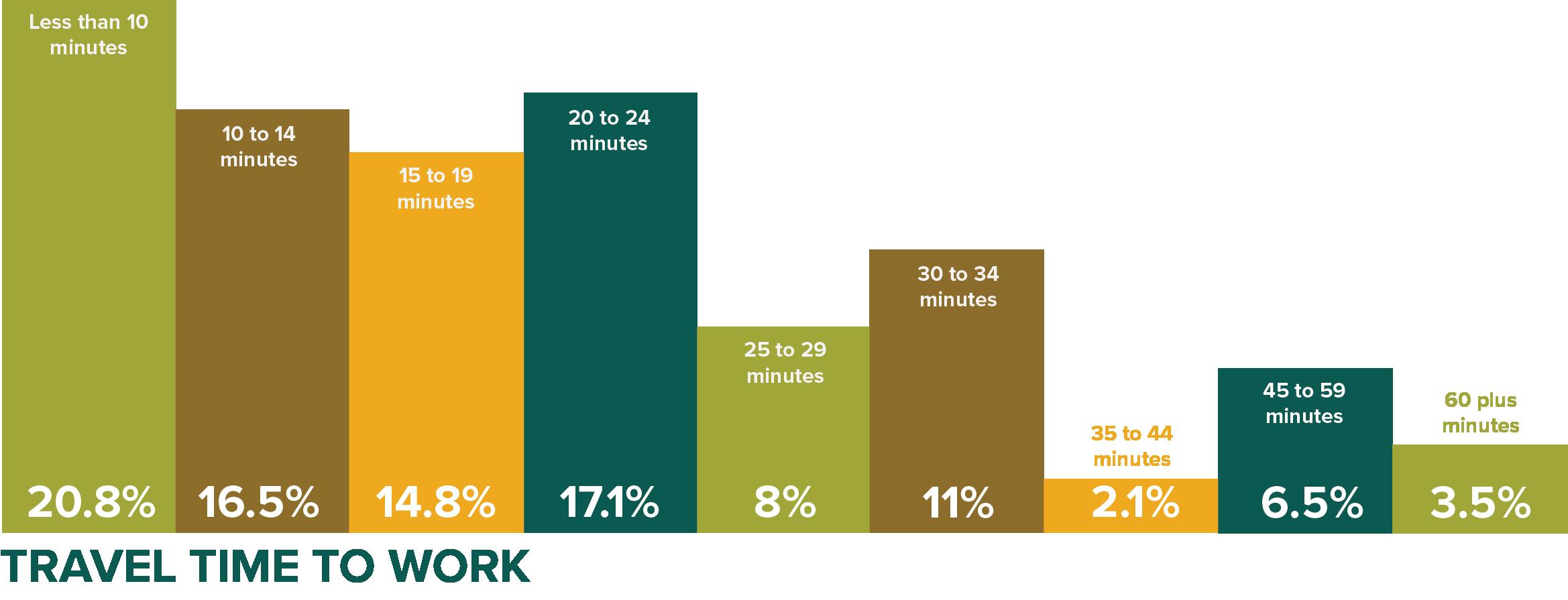
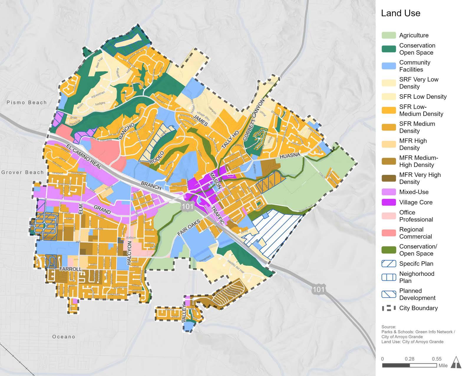
Figure 2-1 displays existing land use patterns in Arroyo Grande. Arroyo Grande is dominated by residential land uses primarily in the form of very low to medium-density single-family housing with some pockets of high to very high-density multi-family housing. Interspersed with residential housing are community facilities, such as parks and schools. Mixed-use and commercial corridors are primarily concentrated near Highway 101, along East Grand Avenue, and in the Village Core. Agricultural lands and open spaces lie adjacent to residential areas in the northwestern, northeastern, and southeastern parts of Arroyo Grande, giving the city its scenic character.
To be eligible for State funding, a city’s bicycle and pedestrian plan must address connections between specific activity-center types. Activity centers are essential destinations within a community, including schools, parks, major employers, office buildings, industrial sites, government sites, retail centers, hospitals, and tourist attractions. Identifying these activity centers, and their distribution in a community, is essential to creating useful bicycle and pedestrian networks. Figure 2-2 shows activity centers in Arroyo Grande, such as City Hall, the Library, the Police Department, Arroyo Grande Community Hospital, and the Village, as well as schools, parks, and shopping areas. The active transportation projects proposed in Chapter 5 are intentionally located along key corridors that will connect people to major destinations.
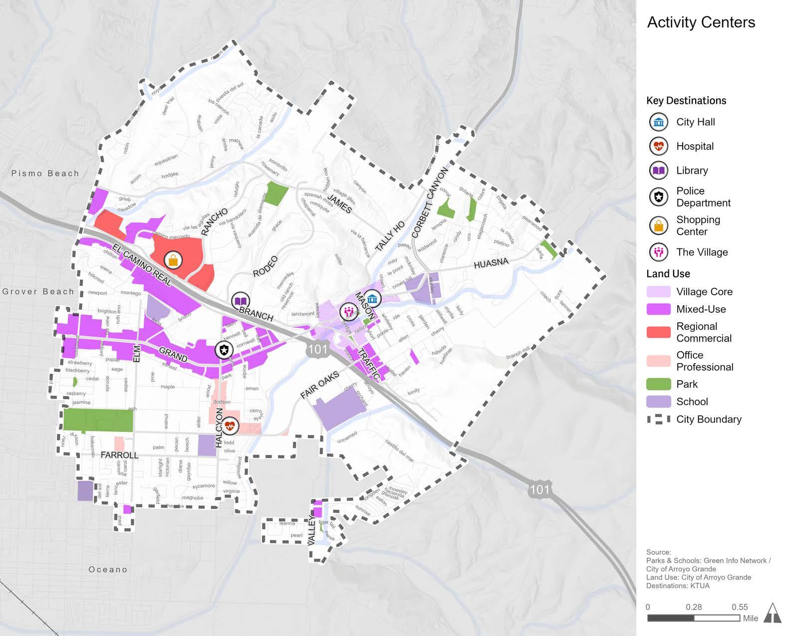
Figure 2-3 depicts Arroyo Grande streets based on the following street classifications from the General Plan Circulation Element: 4-lane (Primary) arterial, 2-lane arterial, collector, local collector, and local street. U.S. 101 and CA SR-227 provide regional access to Arroyo Grande. Arterials (4-lane and 2-lane), which provide local access to major destinations throughout Arroyo Grande, include:
» Branch Street
» Corbett Canyon Road
» East Grand Avenue
» El Camino Real
» Elm Street
» Fair Oaks Avenue
» Halcyon Road
» Huasna Road
» Traffic Way
» Valley Road
The remaining collector and local streets provide access to residential housing, schools, parks, and other destinations. Knowing that the arterial roadways provide access to essential local destinations highlights the need for active transportation facilities that support safe and comfortable non-motorized travel along these car-oriented corridors.
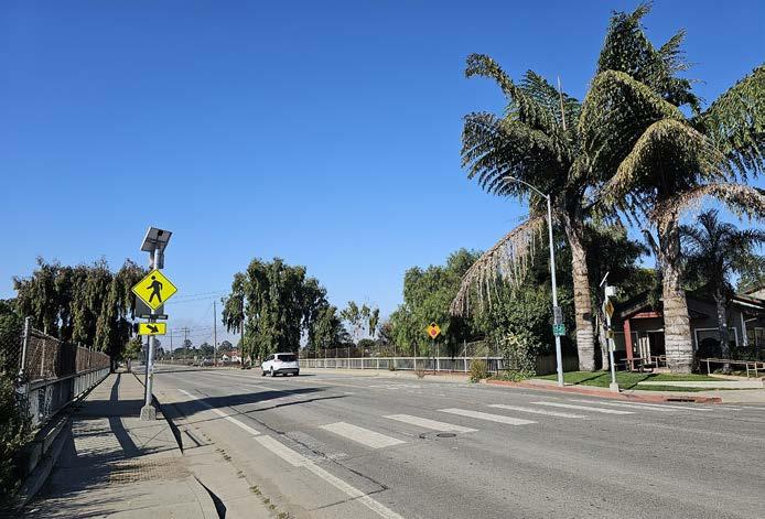
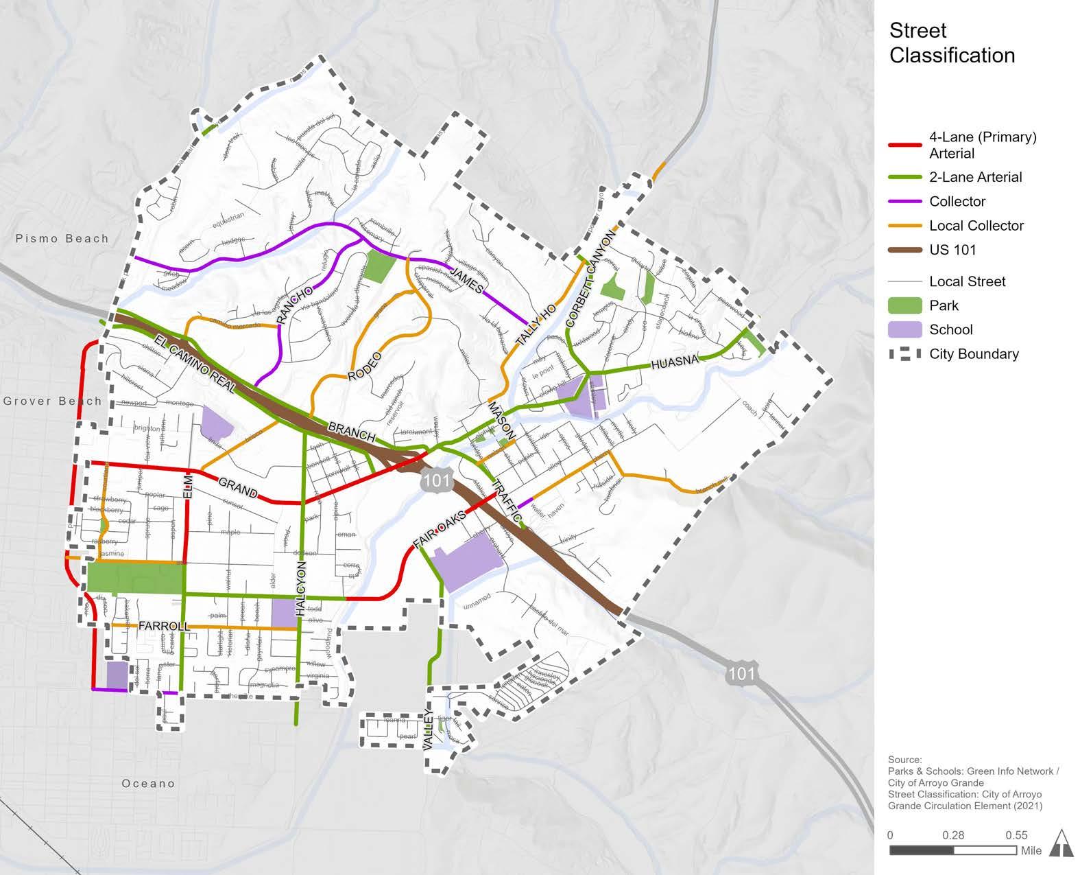
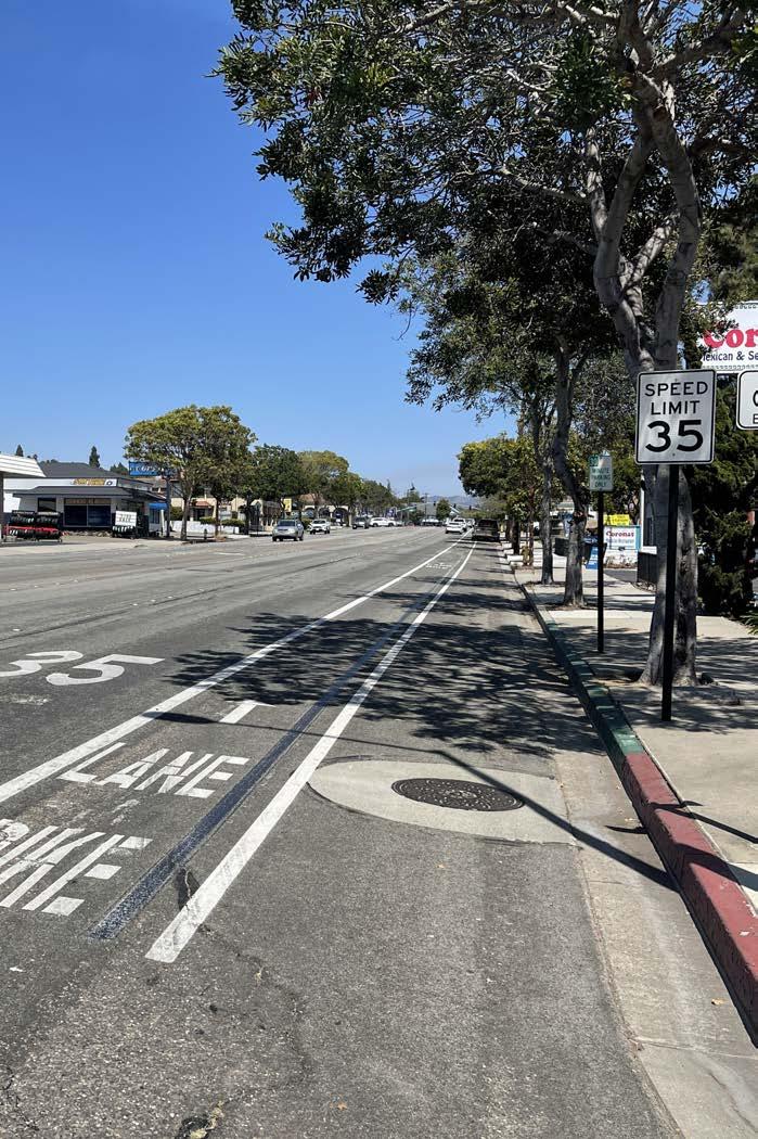
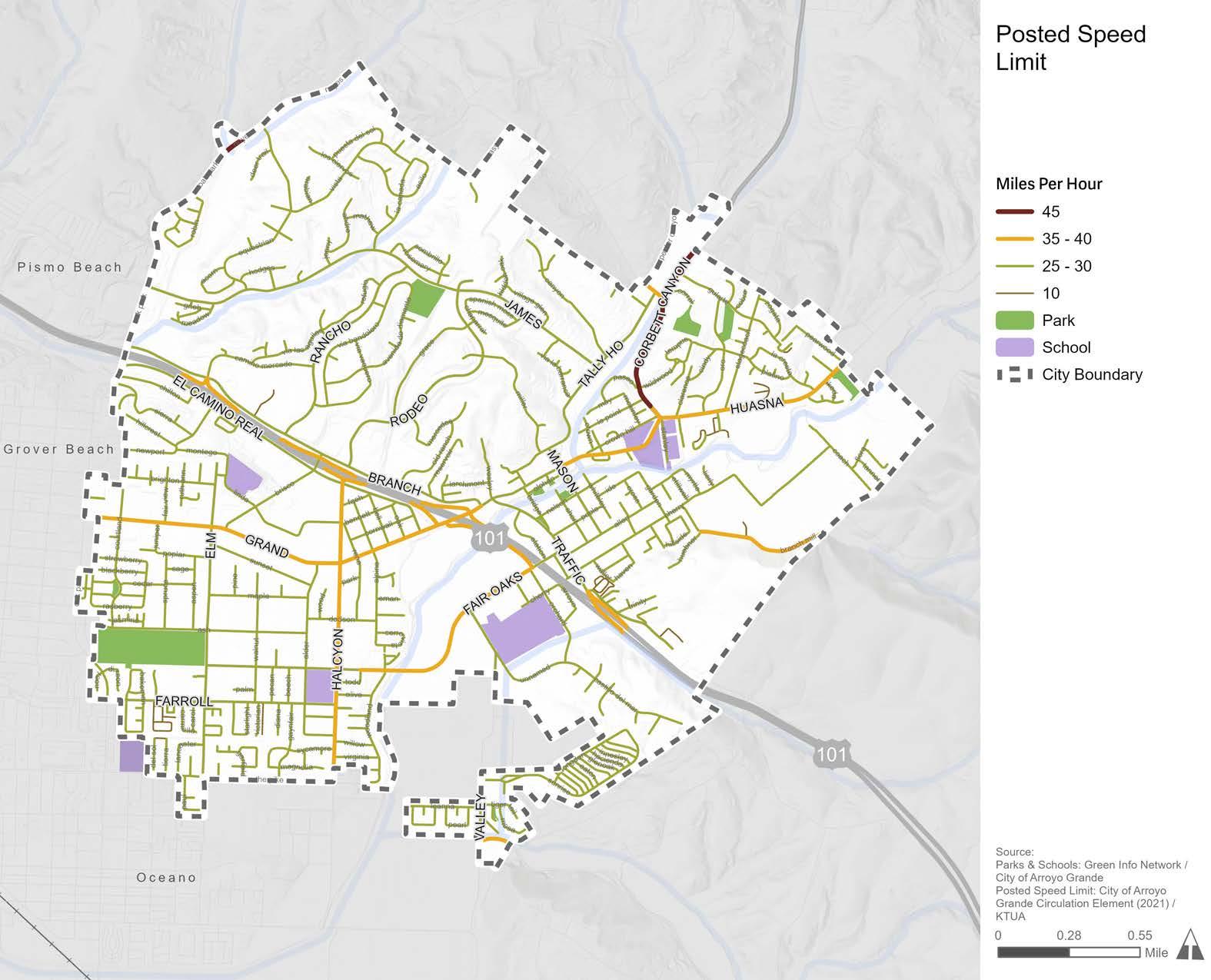
Figure 2-4 displays the posted speed limits throughout Arroyo Grande’s road network. Arroyo Grande’s high-volume corridors include:
» Branch Street
» Brisco Road
» Corbett Canyon Road
» East Grand Avenue
» El Camino Real
» Elm Street
» Fair Oaks Avenue
» Halcyon Road
» Huasna Road
» Traffic Way
The posted speed limit for these corridors varies between 25 and 45 miles per hour (mph). None of the surface streets within Arroyo Grande have posted speeds of 50 mph or above. Most of Arroyo Grande’s minor streets have a posted speed limit of 30 mph, which make them viable for potential ATP recommendations. Posted speed limits along principal and minor arterials will play an important role in the development of enhanced recommendations appropriate for these larger streets.
Sidewalks and curb ramps are the foundation of pedestrian infrastructure, yet Arroyo Grande does not have a complete sidewalk network. Figure 2-5 shows that many streets in Arroyo Grande are missing sidewalks, which forces pedestrians to walk alongside vehicular traffic in the street or avoid walking altogether.
While many areas are missing sidewalks, some areas have a more critical need than others, such as near schools, parks, and other key destinations. For example, it is especially important for streets approaching or adjacent to schools and parks to have complete sidewalks due to the prevalence of children using those roads to reach their destination. Figure 2-5 shows that all four of the schools in Arroyo Grande are in proximity to streets with missing sidewalks, indicating a pressing need for sidewalk installation to support safe access for children and their families. Figure 2-5 is a useful tool that can be used alongside pedestrian collision data and community feedback to identify potential sidewalk installation projects.
A curb ramp is a short ramp that facilitates access between a sidewalk and a roadway for people using wheelchairs, walkers, strollers, skateboards, scooters, mobility devices, or are otherwise limited in their mobility. Americans with Disabilities Act (ADA) standards require that newly constructed curb ramps include detectable warnings to alert pedestrians with vision impairments of an upcoming hazard, such as passing traffic. Detectable warnings consist of a series of small domes, also known as truncated domes, that contrast in color with the surrounding sidewalk or street. Curb ramps with truncated domes allow people to safely access their desired destination. Figure 2-6 shows the distribution of curb ramps with and without truncated domes, as well as pedestrian crossings that are missing curb ramps altogether.
The ADA requires state and local governments to provide curb ramps at pedestrian crossings and at public transportation stops where walkways intersect with a curb. The ADA also requires state and local governments to install curb ramps on any newly constructed or altered streets, roads, highways, and pedestrian walkways (aside from circumstances excepted by Title 28 Part 35 of the Code of Federal Regulations). Streets, sidewalks, roads, and highways that were built before the ADA went into effect may be missing curb ramps, as evidenced by the red circles in Figure 2-6. Collecting an inventory of missing curb ramps is the first step to identifying and prioritizing curb ramp installation projects that will make Arroyo Grande more accessible for people with disabilities. In recent years, the City has made strides to install new curb ramps in priority areas, such as near Harloe Elementary and Ocean View Elementary schools, as well as others.
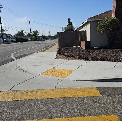
Figure 2-7 displays existing and previously proposed bicycle facilities in Arroyo Grande.
Currently, there are 15.5 miles of existing bikeways, including:
» 0.8 miles of Class I multi-use paths
» 14.6 miles of Class II bicycle lanes
» 0.1 miles of Class III bicycle routes
The General Plan Circulation Element (2021) proposes 30.5 miles of additional bikeways, including:
» 8.1 miles of Class I multi-use paths
» 12.3 miles of Class II bicycle lanes (with option to upgrade to Class IV separated bikeways on arterials)
» 4.8 miles of Class III bicycle routes
» 5.4 miles of Class III bicycle routes upgraded to bicycle boulevards
The previously proposed bicycle facilities documented in the General Plan Circulation Element (2021), Arroyo Grande Bicycle and Trails Master Plan (2012), SLOCOG Regional Transportation Plan (2023), and SLOCOG Regional Active Transportation Plan (2021) provided a foundation for the bicycle network proposed by this ATP in Chapter 5.
A two-way facility physically separated from motor vehicles and used by pedestrians, bicyclists, and other non-motorized users.
A one-way facility that provides an exclusive travel lane for bicyclists on the roadway. These are not physically separated from motor vehicles.
A roadway that is shared by bicyclists and motor vehicles through the placement of signage and/or pavement markings.
A one or two-way facility that provides an exclusive travel lane for bicyclists on the roadway with physical protection from traffic.
*Class III bicycle routes can be upgraded to “bicycle boulevards” by adding traffic calming measures (e.g., traffic diverters, street trees, green infrastructure, etc.).
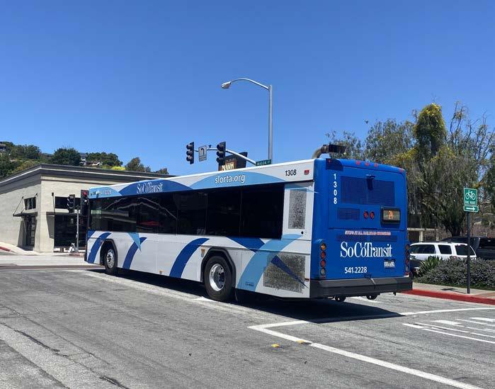
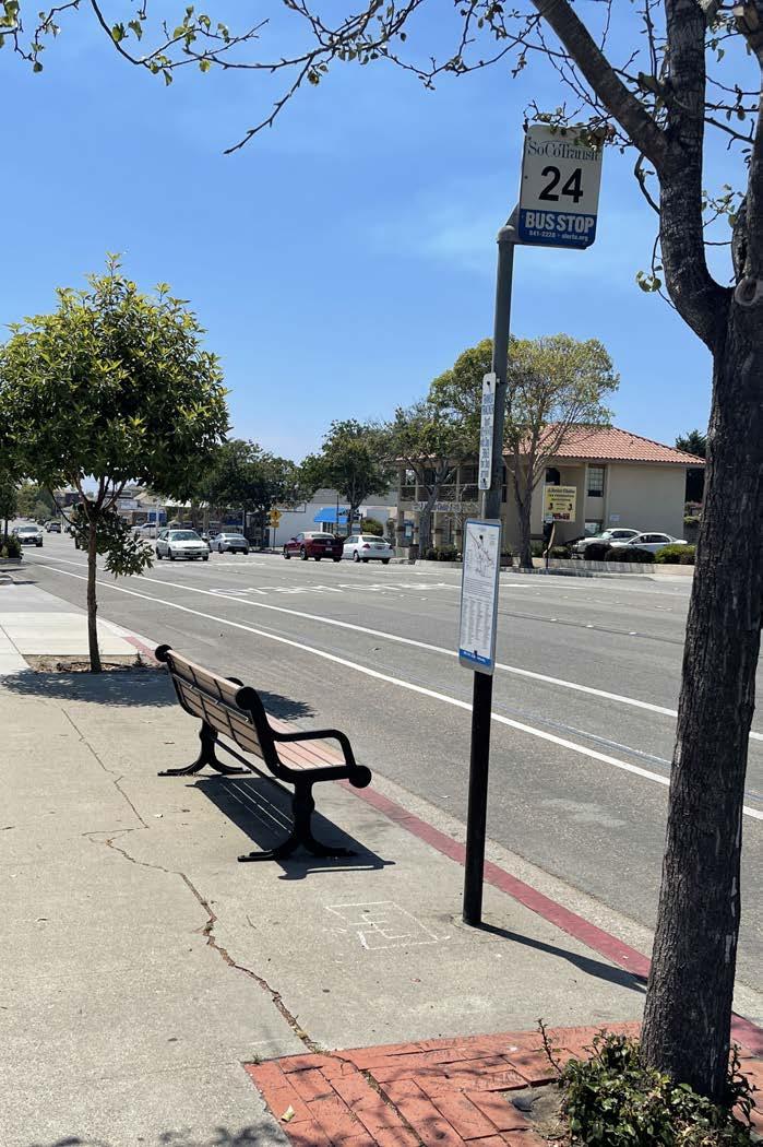
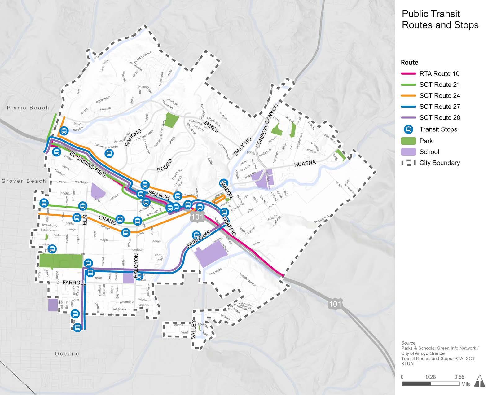
Currently, just 0.3 percent of commuters in Arroyo Grande use public transit as their primary mode of transportation to work. Public transit in Arroyo Grande is provided by South County Transit (SoCo Transit), a branch of the San Luis Obispo Regional Transit Authority (SLO RTA). There are five fixed bus routes (Routes 10, 21, 24, 27, and 28) that provide service in Arroyo Grande, as shown in Figure 2-8. The Avila-Pismo Trolley (not shown in Figure 2-8) connects to SoCo Transit Routes at the Pismo Premium Outlets. All SoCo Transit Routes make stops at the Town Center/Walmart and Ramona Gardens Park, and Routes 21 and 24 make stops at the Pismo Premium Outlets. Amenities at each bus stop vary by location and may include benches, trash receptacles, and bus shelters. Improving active transportation facilities along bus routes can help address the first-last mile problem (i.e., the distance between a bus stop and the final destination) that often deters people from taking public transportation.
Bicycle and pedestrian collision data were obtained from the Transportation Injury Mapping System (TIMS) managed by SafeTec to provide Statewide Integrated Traffic Records System (SWITRS) collision data. This dataset captures reported bicycle-vehicle, pedestrian-vehicle, and bicycle-pedestrian collisions that resulted in injury or property damage in Arroyo Grande in the 11-year period of 2012 through 2022. Collision density and location data are displayed in Figure 2-9.
During these 11 years, there were a total of 45 pedestrian-related collisions and 50 bicycle-related collisions, which resulted in 94 injuries and three fatalities. The bulk of both collision types resulted in visible injury (47 percent) or complaint of pain (35 percent), with 18 percent resulting in severe injury or death. It is important to note that collisions involving bicyclists and pedestrians are known to be underreported, and therefore such collisions are likely under-represented in this analysis. Additionally, collisions on off-street paths are not reported in the dataset.
Between 2012 and 2022, there were 45 pedestrian-related collisions in Arroyo Grande, which resulted in 46 injuries and two fatalities. Most pedestrian-related collisions were caused by a driver failing to yield to the pedestrian right-of-way (62 percent) and a pedestrian failing to yield to the vehicle right-of-way (18 percent). A variety of driver, bicyclist, and pedestrian violations caused the remainder of the collisions. Of all pedestrian-related collisions, approximately 69 percent were categorized as the fault of drivers, 20 percent as the fault of pedestrians, and 11 percent were unclear or not listed.
Between 2012 and 2022, there were 50 bicycle-related collisions in Arroyo Grande, which resulted in 50 injuries and one fatality. Most bicycle-related collisions were caused by the bicyclist being on the wrong side of the road (20 percent), improper turning (16 percent), or some other hazardous violation (18 percent). A variety of driver, bicyclist, and pedestrian violations caused the remainder of the collisions.
2-9: Bicycle and Pedestrian-Related Collisions
The Bicycle Level of Traffic Stress (LTS) analysis is a Geographic Information Systems (GIS)-based tool used to quantify a bicyclist’s perception of comfort given specific roadway conditions, such as traffic volume, speed, and proximity to vehicles. These conditions can either increase or decrease a bicyclist’s level of stress while traveling along a roadway. Because different bicyclists have different tolerances for stress, the LTS method identifies four levels of stress, with level one (LTS 1) being the least stressful or most comfortable, and level four (LTS 4) being the most stressful. These LTS classifications help to acknowledge the variety in characteristics and infrastructure preferences of different bicyclists.
Almost all people, including children, feel comfortable riding on LTS 1 streets and trails
Most adults are comfortable riding on LTS 2 streets, where there are dedicated bicycle facilities
LTS 3 streets are tolerable for experienced adults who prefer separate bicycle facilities, but are confident riding with traffic
Only the most skilled adult bicylists will tolerate LTS 4 streets, where they share space with vehicles on higher speed roadways
The LTS analysis was applied to Arroyo Grande’s entire street network, as shown in Figure 2-10. Of all of the bicycle facilities in Arroyo Grande, the only one to show a low level of traffic stress (LTS 1) is a very short segment of Nelson Street. Five streets have portions with moderate levels of traffic stress (LTS 2): East Cherry Avenue, Elm Street, Courtland Street, Rodeo Drive, and Mason Street. However, much more common are streets with high and very high levels of stress (LTS 3 and 4). All main corridors in Arroyo Grande have very high levels of traffic stress (LTS 4), meaning that only the most confident, experienced, and capable bicyclists are willing to ride on these streets.
With the majority of roadways in Arroyo Grande ranking LTS 3 and LTS 4, less confident and experienced bicyclists are not likely to feel safe or comfortable riding a bicycle as a means of transportation to their desired destination. Bicycle facility planning should use a wide variety of options, from shared roadways to separated facilities, to accommodate as many user types as possible and to provide a comfortable and safe experience for the greatest number of bicyclists.
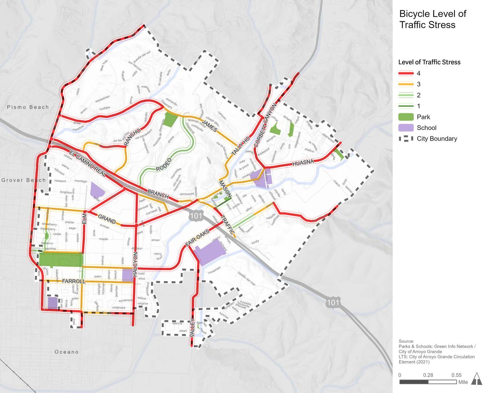
To help identify priority areas for active transportation infrastructure, a GIS-based model called a Bicycle-Pedestrian Propensity Model (BPPM) was created to reveal relationships between several key factors, including activity centers, demographic data, and physical infrastructure. A BPPM was developed to establish where bicyclists and pedestrians are most likely to be, both currently and if improvements were to be made.
The BPPM is comprised of three submodels:
Attractors are activity centers known to attract bicyclists and pedestrians, such as schools, parks, public transit stops, and shopping centers.
Generators estimate potential pedestrian and bicyclist volumes based on how many people live and work within an area. Demographic data used include population density, employment density, primary mode of transportation to work, and vehicle ownership.
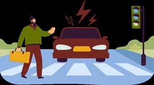
Barriers are features likely to discourage or detract people from bicycling or walking. These are generally physical limitations, such as areas with missing sidewalks, high vehicle volumes and speeds, and high numbers of bicycle or pedestrian-related collisions.
These three sub-models were combined to create the composite BPPM, displayed in Figure 2-11, to demonstrate areas in greatest need of active transportation infrastructure. The BPPM shows the highest likely bicycle and pedestrian use near mixed-use and commercial areas, especially around the Village, East Grande Avenue, Halcyon Road, West Branch Street, and Traffic Way. However, bicycle and pedestrian propensity is not only concentrated on the major roadways, it also permeates into local streets that people tend to use frequently. When comparing community input with the BPPM, there was a correlation between commonly mentioned corridors and high-propensity areas for bicycling and walking. The BPPM was used to develop general recommendations and to help select the priority projects proposed in Chapter 5.
Knowing popular active transportation routes that community members take within Arroyo Grande can help the City identify corridors in which improvements would have the greatest impact on those already using them. Figure 2-12 displays the most commonly used routes by people walking, rolling, and riding a bicycle based on data from Replica, an independent company used widely by planning professionals, including Caltrans, to analyze near real-time, high-quality data sources to understand mobility, land use, people, and economic activity patterns. Bicycle and pedestrian data from Replica is based on a vast array of datasets that use observed data from phones, vehicles, consumer spending transactions, survey data, counts, and more.
While the routes displayed in Figure 2-12 are already popular, most are LTS 3 and LTS 4 (Figure 2-10), indicating that they are tolerable for experienced adult bicyclists, rather than comfortable for all ages and abilities. Providing safer active transportation facilities along these popular corridors would improve conditions for those who already use them while enabling new users of all ages and abilities to try walking, rolling, or riding to reach their destination. The routes displayed in Figure 2-12 are consistent with the areas of moderate to high propensity displayed in Figure 2-11, further supporting the need for high-quality active transportation facilities near mixed-use and commercial areas, as well as schools and parks.
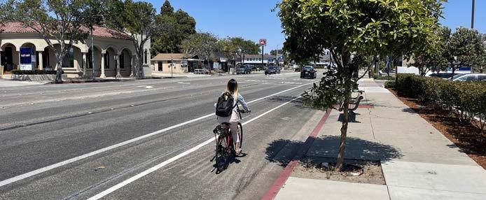
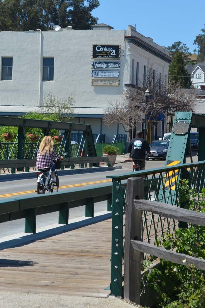
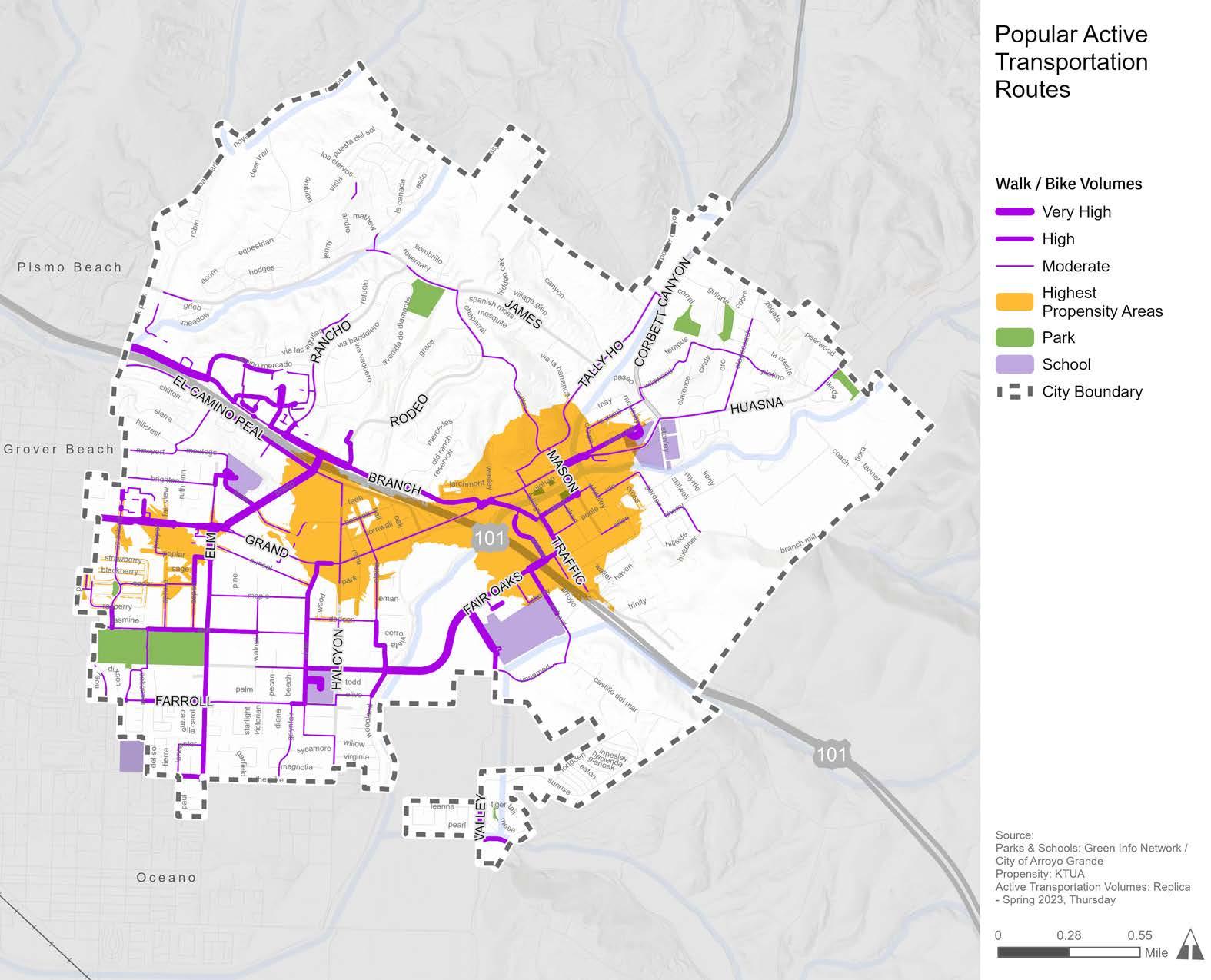
Understanding the geographic distribution of various social, economic, health, and environmental risks and burdens is essential to identifying the areas in greatest need of infrastructure improvements and supportive resources. Transportation, in particular, is a key component of healthy and equitable communities. For example, communities with safe and affordable multi-modal transportation options have expanded access to employment and education opportunities, healthy food sources, recreational spaces, and more. The provision of viable non-vehicular transportation options, such as public transit and bicycle and pedestrian facilities, enables people without access to a vehicle to reach their desired destination with relative ease. At the same time, improving the safety of problematic transportation corridors in underserved communities through traffic calming and other safety measures is another important way to improve comfort and quality of life.
Prioritizing the allocation of resources in underserved areas is an important step towards improving equity and quality of life for all community members, regardless of socioeconomic status. For this assessment, three sources of data were analyzed: the Transportation Equity Index, CalEnviroScreen 4.0, and the California Healthy Places Index. Analyzing health and equity patterns in Arroyo Grande is critical in leveraging funds from not only the Caltrans ATP grant but also other funding sources aimed at supporting equitable communities.
In 2024, Caltrans launched the spatial screening tool, Transportation Equity Index (EQI), to identify transportation-based priority populations at the Census block level and operationalize Caltrans’ commitment to equity. Transportation-based priority populations are communities that are most burdened by the transportation system and receive the fewest benefits. The EQI integrates transportation and socioeconomic indicators into three “screens” to identify transportation-based priority populations.
A census block will meet the threshold of a transportation-based priority population if the Demographic Overlay, Traffic Exposure Screen, and Access to Destinations criteria are all met:
» Demographic Overlay: Communities with low-income and/or tribal land status. If either of the low-income household or Tribal Land criteria are met, the block is screened for inclusion for further analysis with the transportation-specific indicators (traffic exposure and access to destinations indicators).
» Traffic Exposure: Communities with low-income and/or tribal land status that are the most burdened through high exposure to traffic and crashes. Exposure to traffic is measured by proximity, volume, and vehicle type for all interstates, highways, principal arterials, and minor arterials in the state. Exposure to crashes is measured through a statewide crash exposure calculation.
» Access to Destinations: Communities with low-income and/or tribal land status that have the greatest gaps in multimodal access to destinations. Access to destinations is measured by three unique indicators designed to evaluate gaps in transit, bicycle, and pedestrian access to work and non-work destinations.
Because the EQI is a novel tool, the practical applications of the EQI are still being tested. For example, the EQI is currently being piloted for use in the Caltrans System Investment Strategy (CSIS). Other program-specific use cases for the EQI are also under development. However, generally, the EQI was developed to identify transportation-based priority populations for applicable funding programs, to support planning- and project-level analysis, and to identify opportunities to advance equitable outcomes during project planning, development, and design. For these reasons, the EQI was used as one of three tools to evaluate health and equity in Arroyo Grande.
Figure 2-13 displays the results of the EQI for Arroyo Grande. While Arroyo Grande has census blocks that meet the Demographic Overlay and Access to Destinations criteria, it does not have any census blocks that meet the criteria of all three EQI screens. Therefore, Arroyo Grande does not have any transportation-based priority populations. However, the census blocks that meet two of the three criteria, as shown in Figure 2-13, demonstrate areas that experience more
transportation-related burdens than the rest of Arroyo Grande even if they are not considered a transportation-based priority population.
CalEnviroScreen 4.0 is a mapping tool from CalEPA and the California Office of Environmental Health Hazard Assessment (OEHHA) that identifies areas most affected by an accumulation of environmental pollution, health burdens, and social stressors. CalEnviroScreen provides a score based on the cumulative impacts experienced by a particular community, with higher scores experiencing greater burdens and lower scores experiencing lower burdens. These scores are used to identify and prioritize communities that are most burdened by environmental injustices.
Figure 2-14 displays the range of CalEnviroscreen scores across the three census tracts in Arroyo Grande. All three census tracts in Arroyo Grande have low scores, indicating that, on the whole, the city does not experience significant exposure to pollution or other environmental hazards relative to other census tracts in California. While all three census tracts have very low CalEnviroScreen scores, the census tract on the southwestern part of Arroyo Grande has a slightly higher score, indicating that the area experiences more exposure to pollution than other areas in Arroyo Grande.
The California Healthy Places Index (HPI) is a peer-reviewed data mapping platform created by the Public Health Alliance of Southern California. The HPI maps data for social indicators that impact health, such as education, job opportunities, access to clean air and water, and more. Similar to CalEnvioScreen 4.0, HPI is a useful tool to help identify health inequities affecting neighborhoods across California. Overall, Arroyo Grande has an HPI score of 79.6, meaning that the city has healthier conditions than 79.6 percent of other cities in California. HPI scores can also be broken down into census tracts to better understand health patterns within a city and how they compare to other census tracts across California.
Figure 2-15 displays the HPI scores for different census tracts in Arrroyo Grande, with lower percentile areas (light green) experiencing less healthy conditions than higher percentile areas (dark green). While all of Arroyo Grande ranks highly in comparison to other cities in California, there is a drop in HPI scores on the south side of U.S. 101 with the two census tracts south of U.S. 101 ranking 10 to 20 percentile points lower than the census tract north of U.S. 101. The difference in HPI scores is due to a combination of differences in social, health, and environmental factors, including tree canopy, automobile access, homeownership, and poverty level. Additionally, the proportion of Hispanic/Latino community members south of U.S. 101 is roughly double that of the population north of U.S. 101, which reflects ethnic disparities in community health outcomes. The HPI scores help to demonstrate which areas would benefit most from infrastructure and programs aimed at improving community health and safety, access to opportunities, and quality of life.
Based on the State’s definition of disadvantaged communities under Senate Bill 535, no San Luis Obispo County census tracts are designated as disadvantaged communities. For this reason, SLOCOG created a regional definition of disadvantaged communities to help distribute funds more equitably across the region. SLOCOG defines regional disadvantaged communities as disproportionately burdened areas that are economically distressed and/or historically underrepresented as a part of the local government process.
SLOCOG’s Disadvantaged Communities Assessment is based on the following variables: racial minority, ethnic minority, disability status, household income, free or reduced-price meals, educational attainment, renter affordability, housing ownership affordability, older adults, youth, households with no vehicle available, and households with no computing device available. As shown in Figure 2-16, several areas in Arroyo Grande are designated as disadvantaged communities by SLOCOG. Figure 2-16 helped guide the prioritization of projects recommended in Chapter 5.
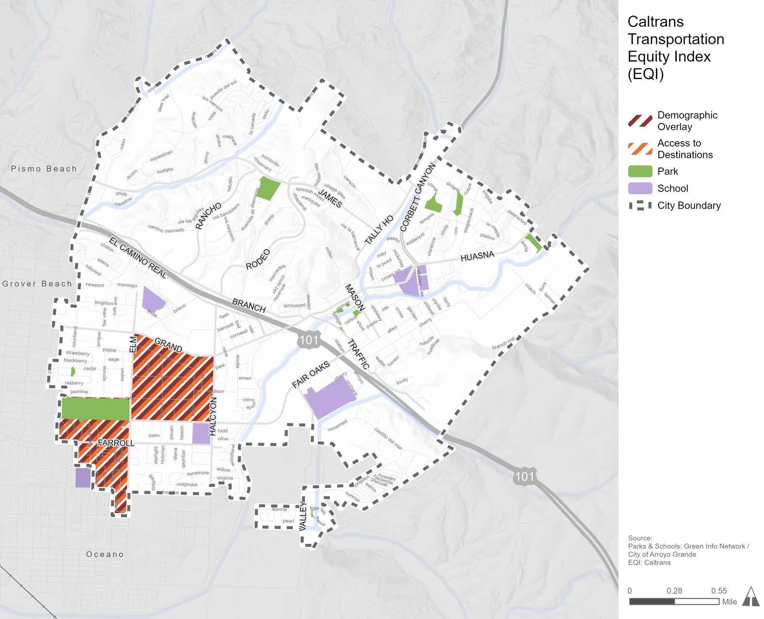
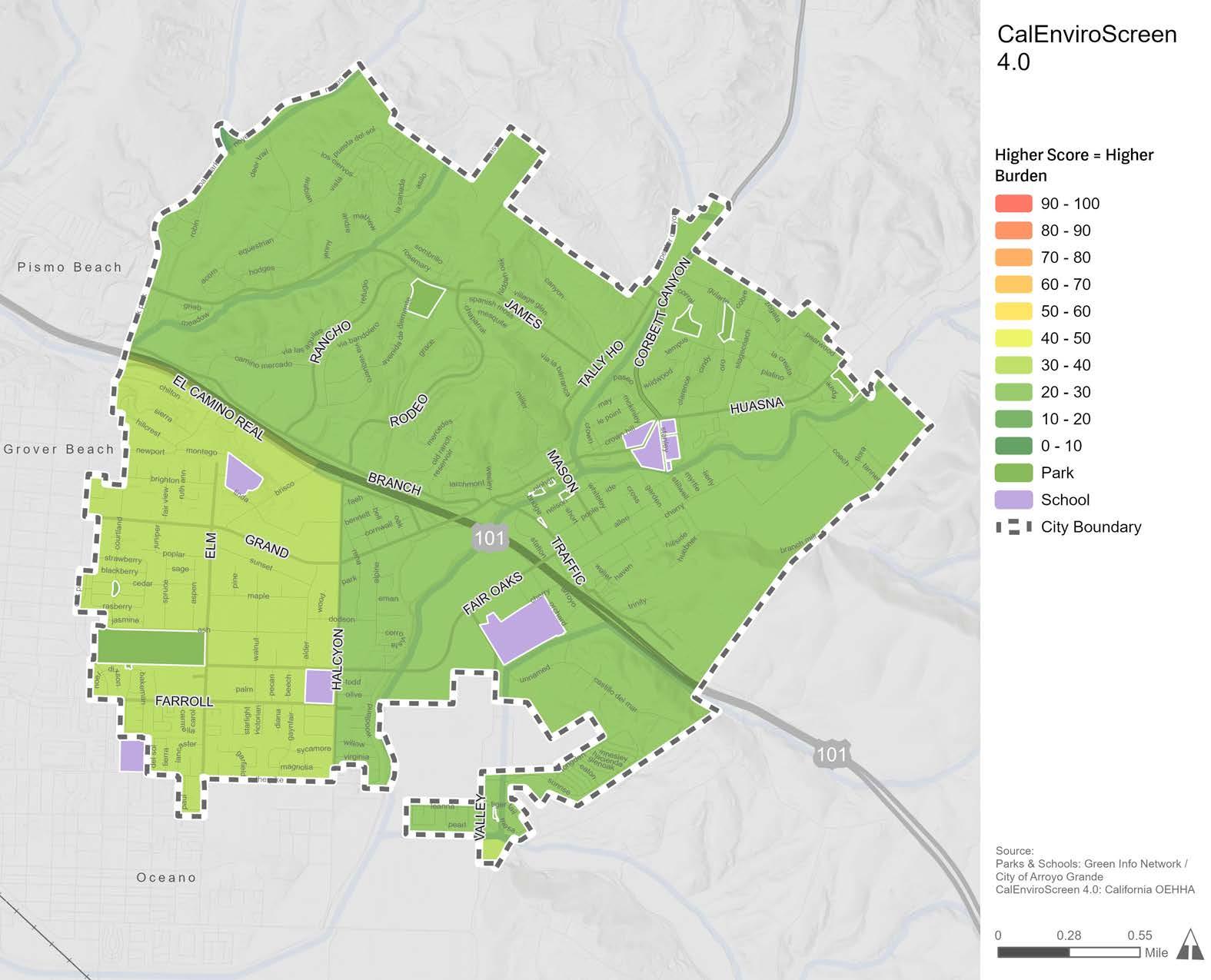
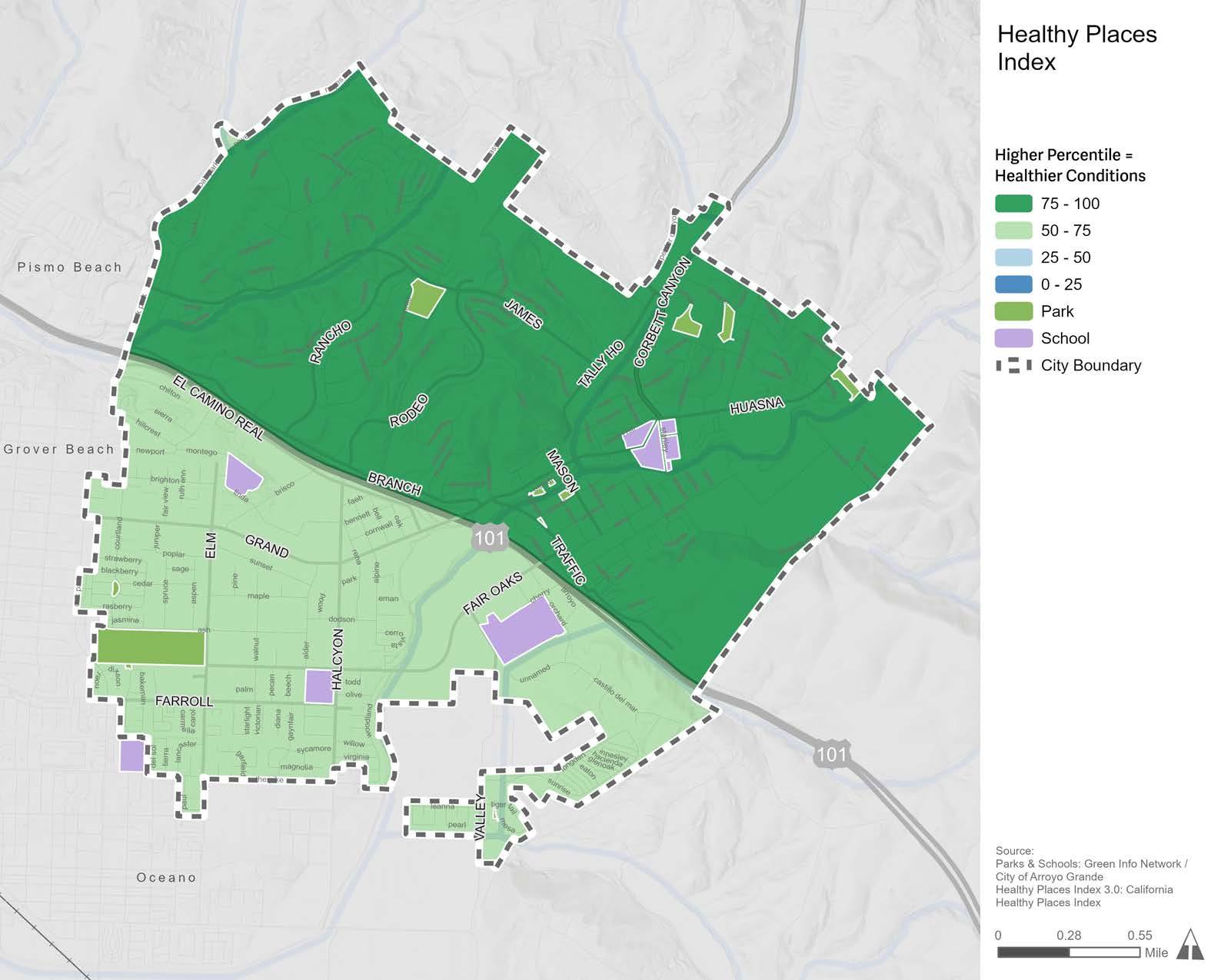
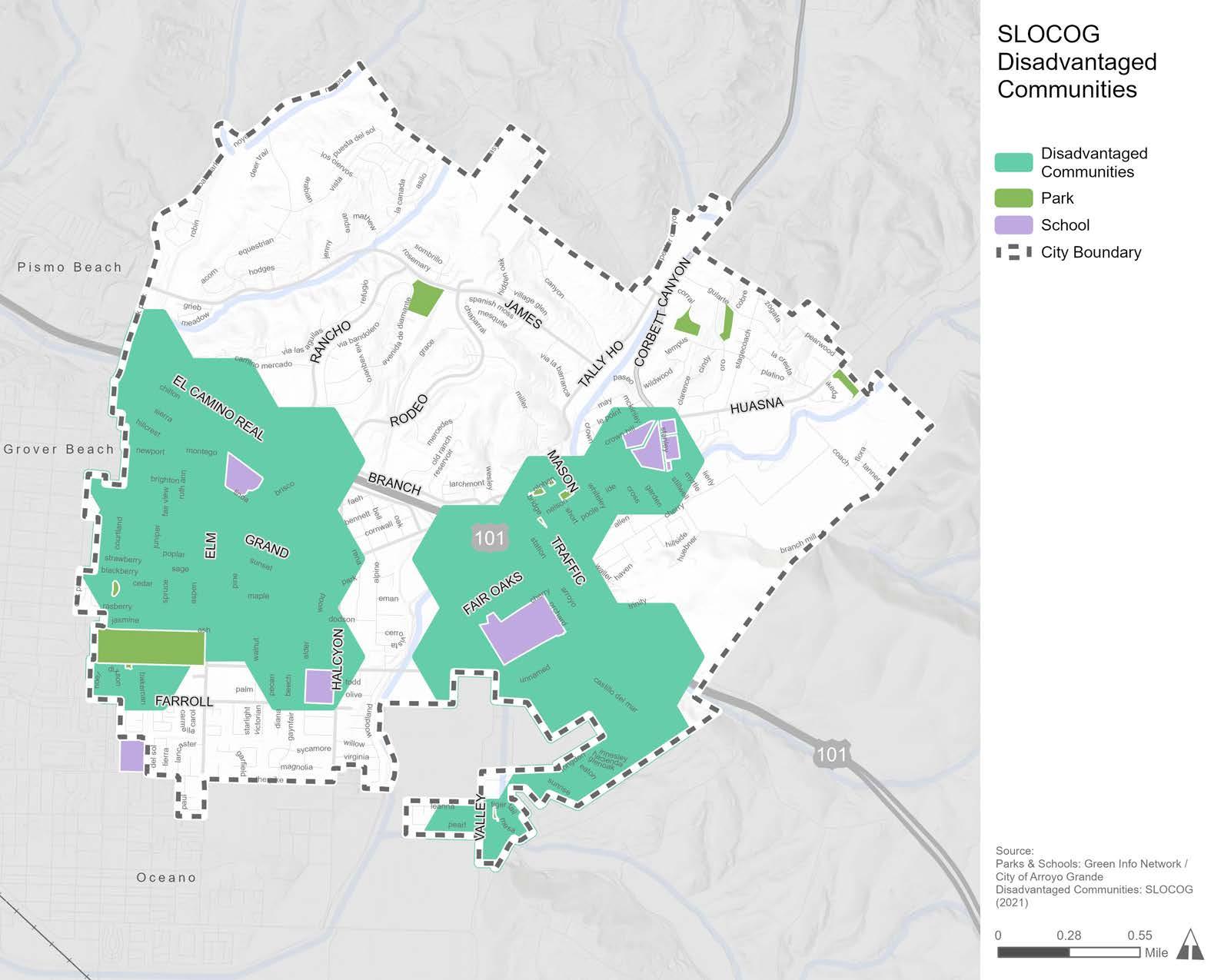
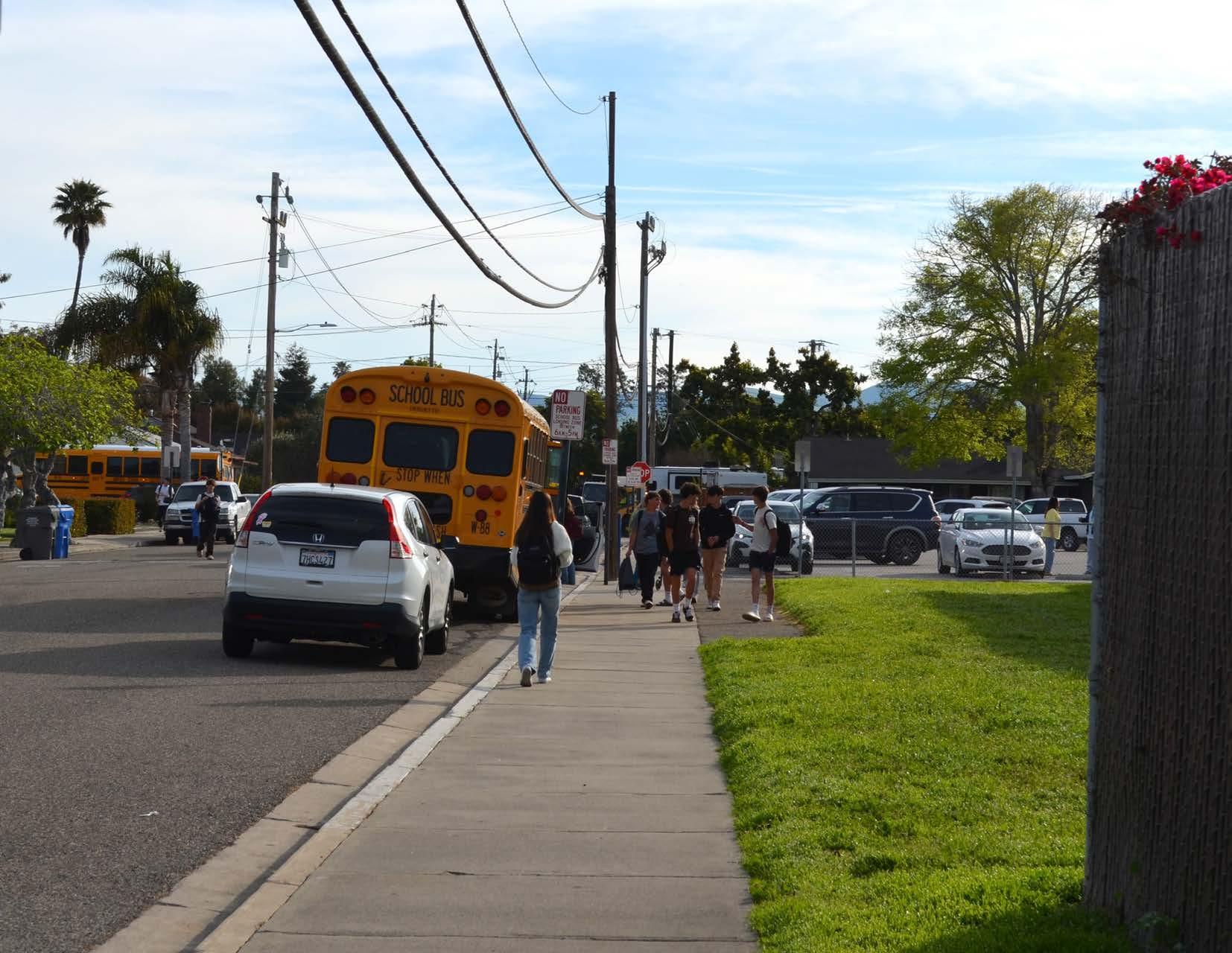
Providing safe routes to schools can enable students and their families to walk, roll, or ride a bicycle to school instead of driving. Safe Routes to School (SRTS) is a movement that promotes walking and bicycling to school through a combination of infrastructure improvements, educational campaigns, encouragement programs, and enforcement. Active transportation and traffic calming infrastructure near schools, in combination with education and encouragement programs, can lead to more students getting to school by foot or bicycle, which in turn reduces traffic congestion and air pollution near schools and promotes active lifestyle habits for students and their families. This section includes information on the current conditions at each Arroyo Grande school, which was used in combination with community input to develop the SRTS recommendations in Chapter 5.
Arroyo Grande contains four schools in the Lucia Mar Unified School District: Harloe Elementary School, Ocean View Elementary School, Paulding Middle School, and Arroyo Grande High School. As displayed in Figure 2-17, a substantial portion of residential neighborhoods and parks are within walking distance of Arroyo Grande schools, which helps to inform the geographic extent of where SRTS infrastructure improvements should be considered and recommended. For added emphasis, Figure 2-18 displays the areas within bicycling distance to Arroyo Grande schools and shows that nearly the entire city is within a five to ten-minute bicycle ride to a school. Given that a substantial amount of the community lives within walking or bicycling distance of a school, the provision of safety programs and infrastructure improvements that would help youth and their families opt for active transportation has the potential to make a large impact on Arroyo Grande mobility patterns.
Additionally, Fairgrove Elementary School is located just outside of the southwestern city limit and is attended by children living in Arroyo Grande. While not included in the subsequent analysis, Fairgrove Elementary was considered when developing project recommendations.
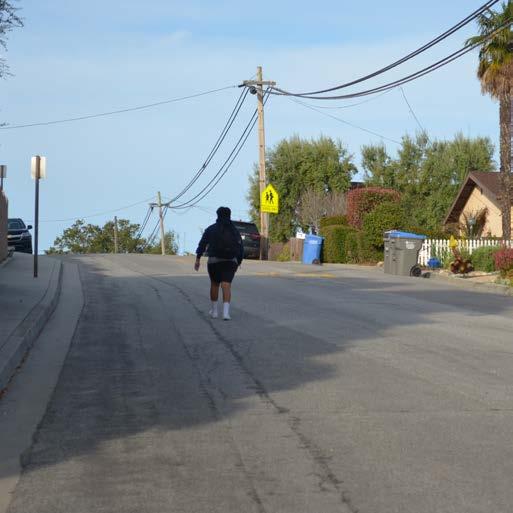
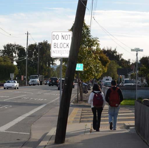
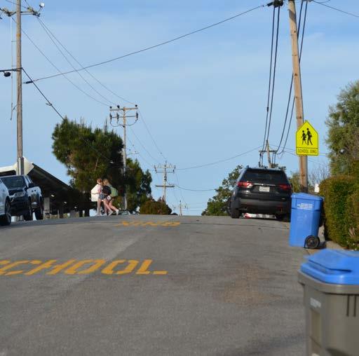
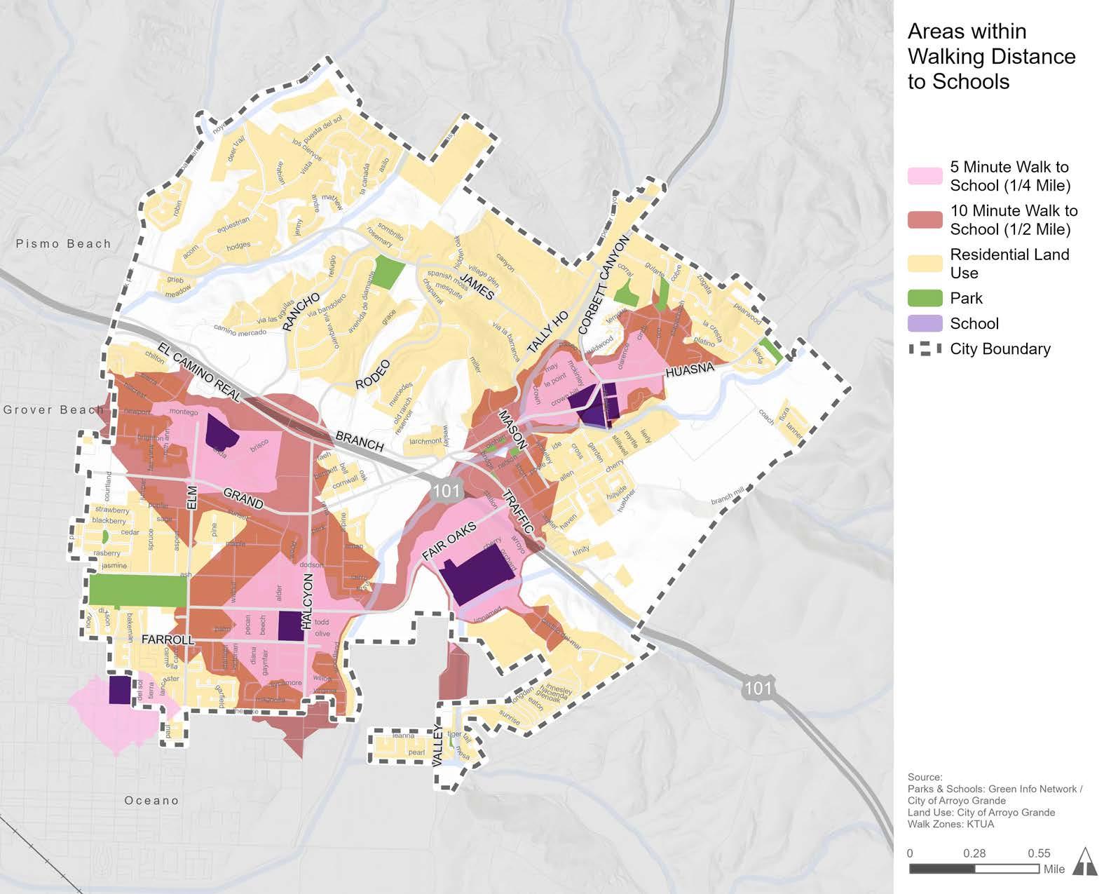
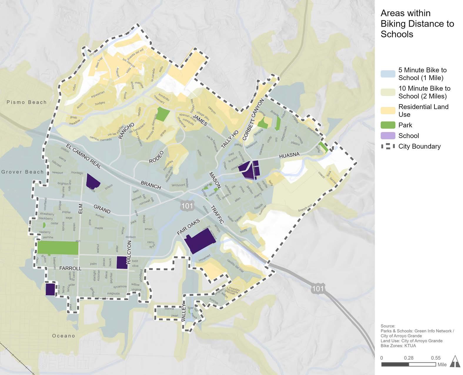
All students who live within walking or bicycling distance should have the opportunity to walk or ride a bicycle to school without fear or threat of collision. Unfortunately, in Arroyo Grande, both perceived and real safety threats to pedestrians and bicyclists exist in the areas surrounding each school. As previously displayed in Figure 2-10, the bicycle levels of traffic stress near Arroyo Grande schools are LTS 3 and 4, meaning that the roads leading to schools are only suitable for experienced and enthusiastic bicyclists. Additionally, some pedestrian and bicyclist-related collisions have occurred within a half-mile radius of Arroyo Grande schools between 2012 to 2022 (Table 2-1). Altogether, there were 29 pedestrian and 34 bicycle collisions over the 11-year period, which resulted in 17 complaints of pain, 44 injuries, and one fatality. The highest number of collisions occurred near Ocean View Elementary, while the lowest number of collisions occurred near Arroyo Grande High.
Source: Transportation Injury Mapping System
In the 2022–23 school year, California became the first state to implement a statewide Universal Meals Program for all school children. All students attending public school districts, county offices of education, and charter schools are eligible for breakfast and lunch at no charge, regardless of their eligibility for free and reduced-price meals. While all children are now eligible for free meals, the Free and Reduced Price Meal (FRPM) Eligibility dataset provided by the California Department of Education is still useful for measuring student poverty levels within schools. FRPM data uses specified family size and income standards to identify and distribute additional resources to students experiencing poverty.
Table 2-2 shows the percentage of students eligible for the FRPM program at each school in Arroyo Grande. Schools with greater percentages of students eligible for the FRPM program, such as Harloe Elementary School, should be prioritized for programs and projects aimed at improving safe and easy access to school as a way to uplift underserved communities.
Table 2-2: Percent of Students Eligible for the Free and Reduced-Price Meals Program at Each School
Source: California Department of Education
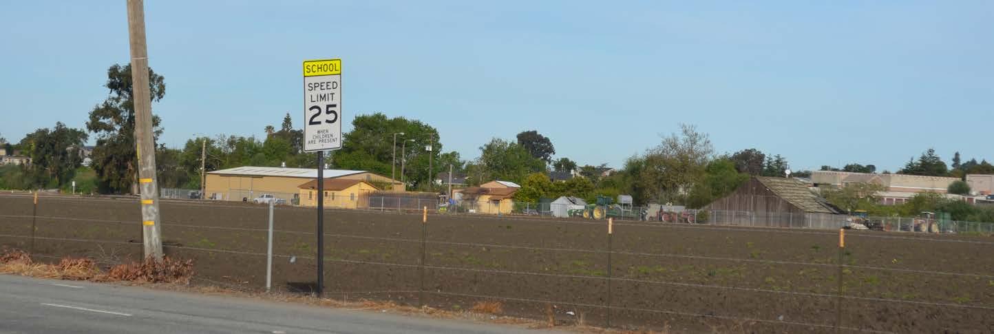
Figure 2-19 through Figure 2-22 display popular active transportation routes, existing bicycle and pedestrian facilities, and historic collisions within a five-minute walk zone (quarter-mile) around all four schools in Arroyo Grande. By zooming into the five-minute walk zone, safety issues and missing facilities in high-priority areas become easier to recognize. The missing facilities and opportunity areas identified within the five-minute walk zones were used alongside community input to develop the SRTS recommendations in Chapter 5.
Harloe Elementary School is located in the southern part of Arroyo Grande. Between 2012 and 2022, there were seven pedestrian collisions and eight bicycle collisions within a halfmile radius of Harloe Elementary School. Figure 2-19 shows that bicycle facilities are minimal, 19 curb ramps are missing, and several sidewalks are incomplete within the five-minute walk zone, including along the popular active transportation routes.
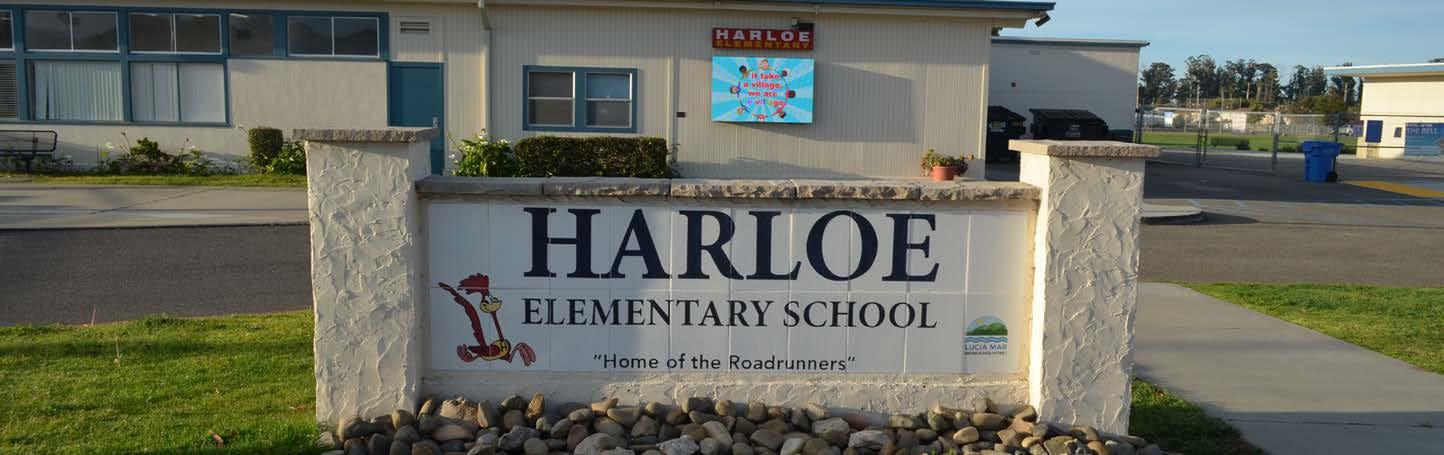
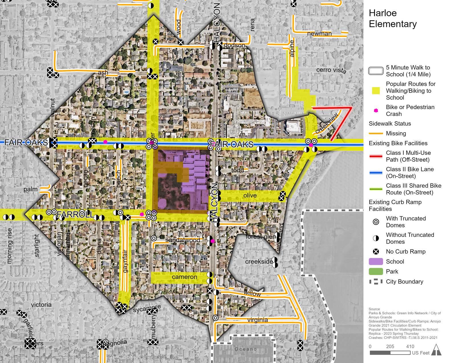
Ocean View Elementary School is located in the central-western part of Arroyo Grande. Between 2012 and 2022, there were nine pedestrian collisions and 17 bicycle collisions within a half-mile radius of Ocean View Elementary School. Figure 2-20 shows that, much like Harloe Elementary School, bicycle facilities are extremely limited, seven curb ramps are missing, and several sidewalks are incomplete within the five-minute walk zone and along common active transportation routes.
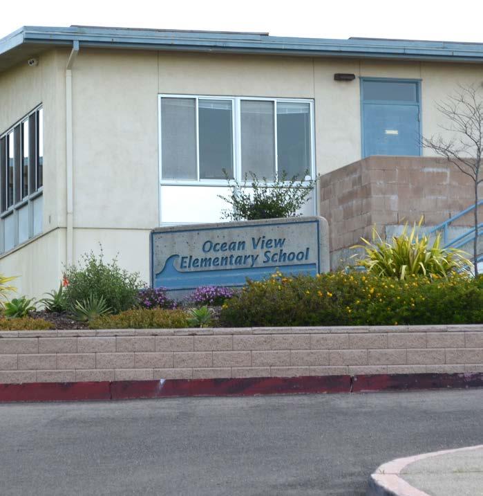
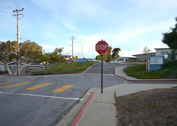
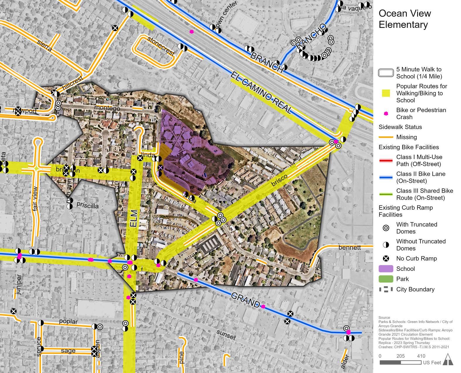
Paulding Middle School is located in the northeastern part of Arroyo Grande. Between 2012 to 2022, there were 12 pedestrian collisions and five bicycle collisions within a halfmile radius of Paulding Middle School. The most striking feature is that nearly all streets within the five-minute walk zone have incomplete sidewalks on one or both sides of the street (Figure 2-21). Additionally, there are nine missing curb ramps within the five-minute walk zone. Both findings indicate a major need to improve pedestrian facilities around Paulding Middle School.
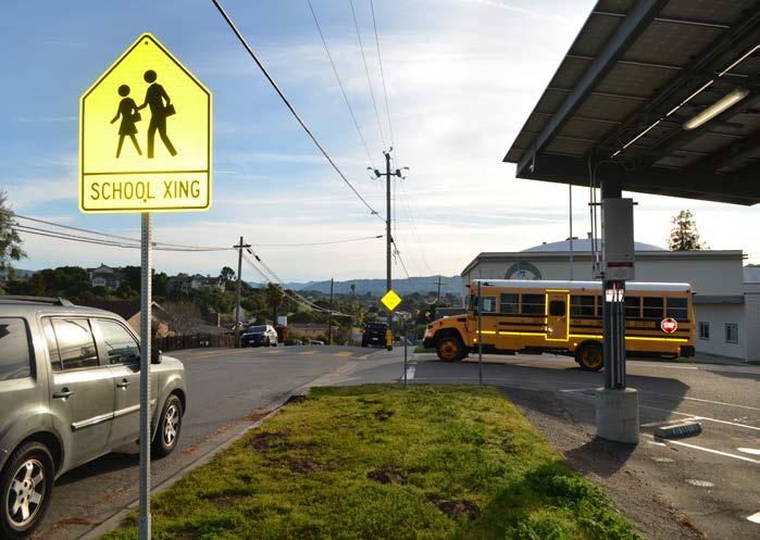
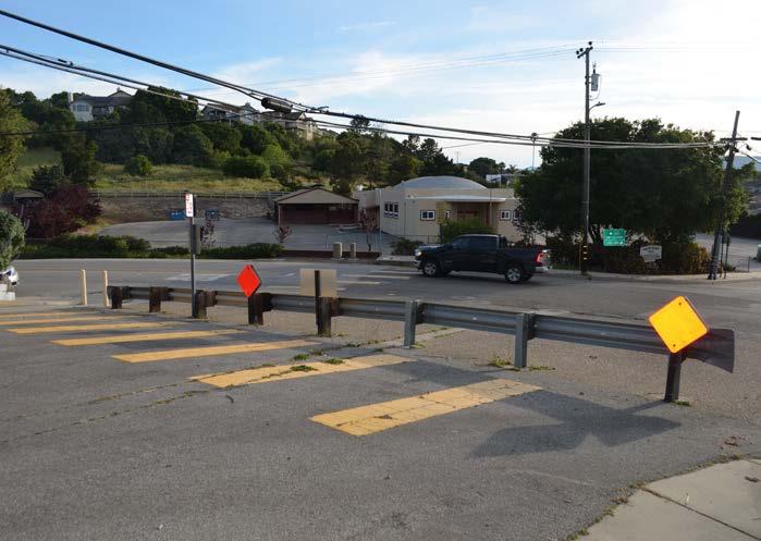
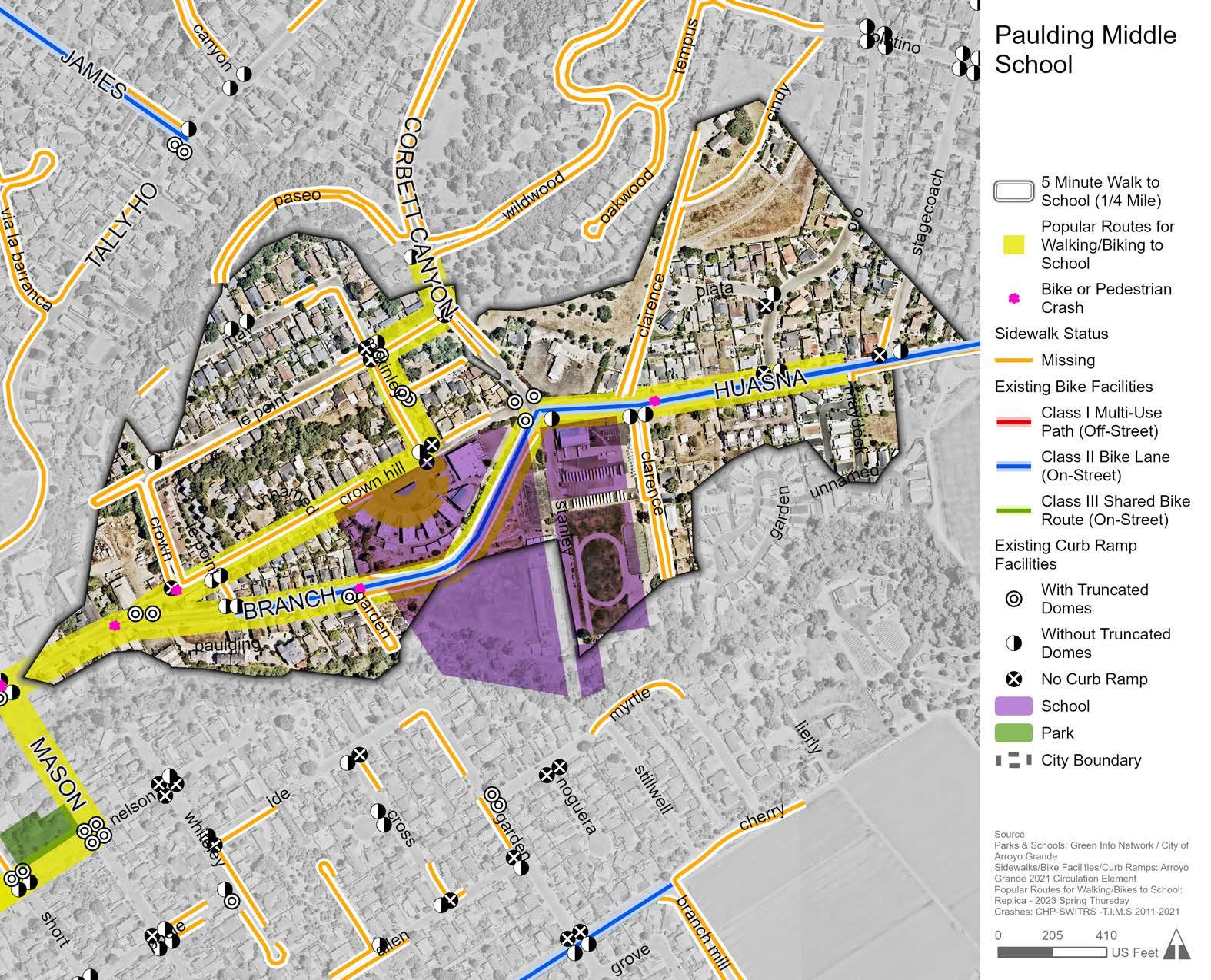
Arroyo Grande High School is located in the central-eastern part of Arroyo Grande. Between 2012 to 2022, there was one pedestrian collision and four bicycle collisions within a halfmile radius of Arroyo Grande High School. Figure 2-22 shows that while many streets within the five-minute walk zone have incomplete sidewalks, all minor arterials within the five-minute walk zone have Class I or Class II bicycle facilities, indicating a strong bicycle network.
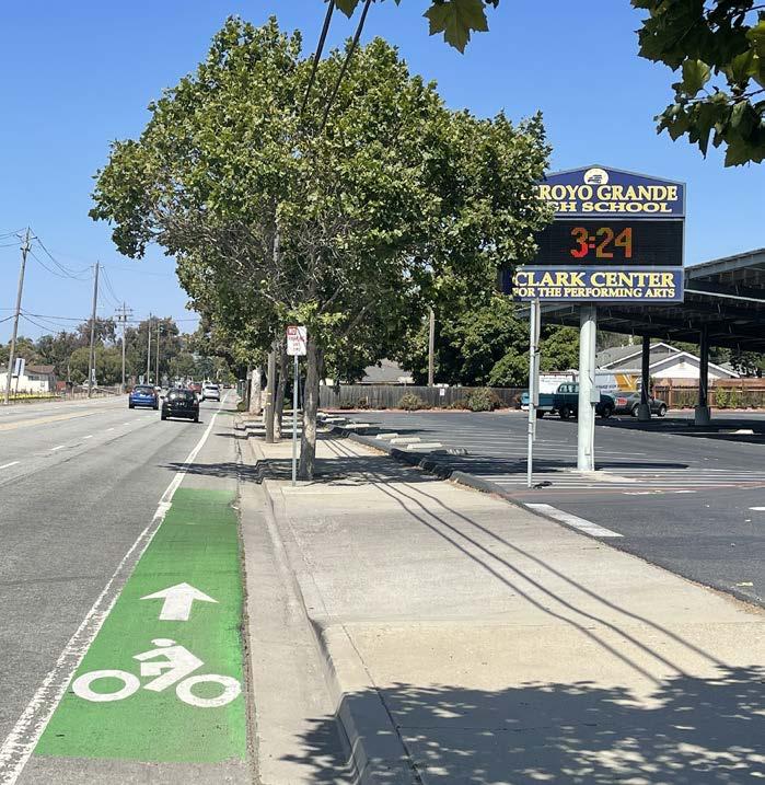
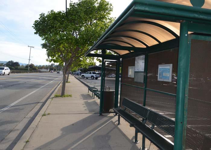
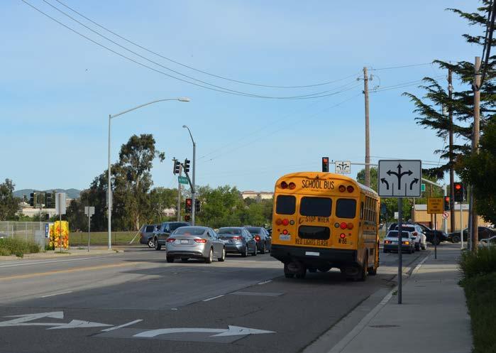
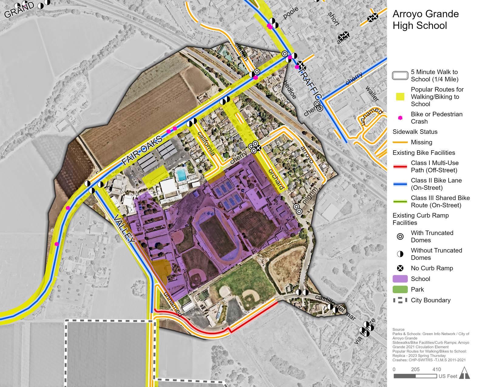
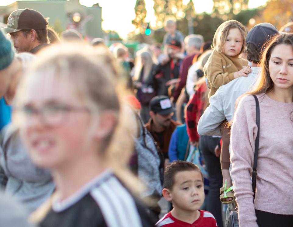
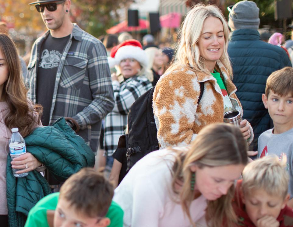
Hearing the lived experiences of people who regularly use Arroyo Grande’s transportation network was essential to identifying the areas in greatest need of new and improved active transportation infrastructure. Comprehensive community engagement was conducted throughout the various phases of the project to facilitate a collaborative planning process and to gather meaningful input from residents, stakeholders, and City staff.
The primary methods used to engage Arroyo Grande community members were:
» Community Survey
» Two (2) Community Workshops
» Three (3) Pop-up Events
» Five (5) Stakeholder Meetings
» One (1) City Council Study Session
» Project Website
» Social Media
This chapter provides a summary of the key findings from feedback gathered throughout the community engagement process. These findings were used to develop the recommendations presented in Chapter 5. The complete results of all community engagement efforts are in Appendix B.
Several tools were used to inform the community about the ATP and to engage community members in the planning process. Tools included social media posts, a project website, and distinct project branding. All engagement materials were provided in both English and Spanish.
Distinct branding was developed for the ATP to promote project familiarity and distinguish the project as a new planning effort. A unique project logo and color palette was used for all outreach materials and presentations.
A project website was created to provide information about the project, share project announcements, and gather community feedback. The website included an interactive online comment map that enabled community members to add location-specific comments about Arroyo Grande’s transportation network.
Social media was used throughout the development of the ATP to share information and invite community members to participate in a collaborative planning process. Social media posts were made to publicize the ATP, promote events and feedback opportunities, and share project updates.
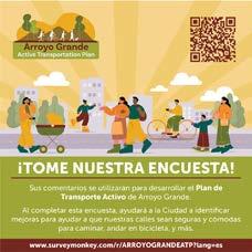
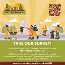
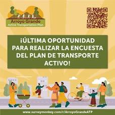

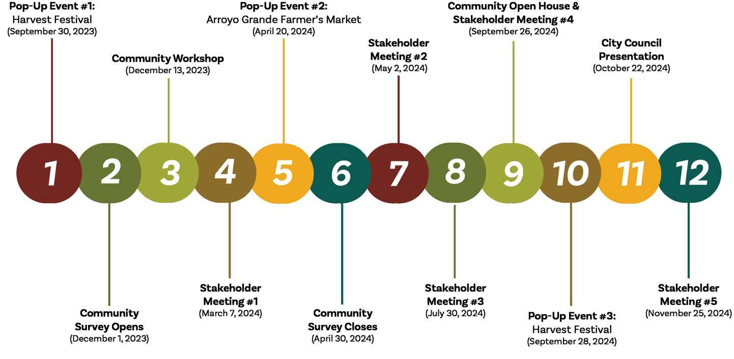
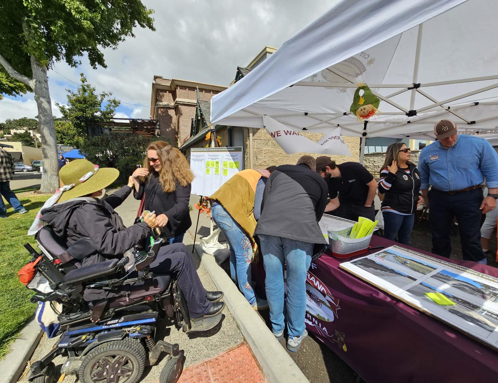
A pop-up booth was held on September 30th, 2023 at the annual Harvest Festival in the Village. The booth had several informational and interactive poster boards that invited community members to provide input on Arroyo Grande’s transportation network. Input collected at this event helped the planning team gain an initial understanding of community priorities and key problematic corridors in need of better active transportation infrastructure. Several location-specific comments related to traffic calming and bicycle, pedestrian, and driving concerns were made for a range of streets in Arroyo Grande with Huasna Road, East Branch Street, and the streets near Arroyo Grande High School receiving the most comments.
A pop-up booth was held on April 20th, 2024 at the Arroyo Grande Farmers Market in the Village. The booth had exhibits that shared findings from the existing conditions analysis and invited community members to provide input on mobility needs throughout Arroyo Grande. On a citywide map, participants noted specific areas in need of active transportation improvements, such as traffic calming, bicycle facilities, sidewalks, and street maintenance. While comments were placed on several streets, East Grand Avenue, Fair Oaks Avenue, and Huasna Road received the most comments. The planning team used participant input to identify problem areas and develop community-driven solutions.
A pop-up booth was held on September 28th, 2024 at the annual Harvest Festival to collect community feedback on draft ATP recommendations. Over 120 people stopped by the booth, resulting in 40 written comments either showing support of draft recommendations or identifying areas in need of improvement. Participants expressed the need for better enforcement for vehicles and objects obstructing sidewalks; improved maintenance of sidewalks and curb ramps; enhanced crossings and traffic calming measures; and more bicycle facilities. This feedback was incorporated into the draft recommendations.
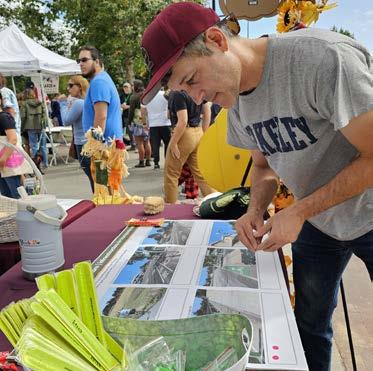
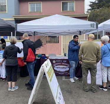
A community workshop was held on December 13th, 2023 at the City Council Chambers. The workshop consisted of an overview presentation to introduce the project and an open discussion before inviting participants to provide input at various exhibits. Interactive exhibits were designed to educate participants on the existing conditions of Arroyo Grande’s transportation system and to solicit feedback on the current strengths, needs, and opportunities for making the community a safer and easier place to walk and ride a bicycle.
Participants were invited to add location-specific comments to citywide maps; vote on a variety of bicycle and pedestrian infrastructure facilities; and share any other ideas or concerns related to active transportation. The active transportation facilities that received the most votes from participants were Class IV separated bikeways, signage and lighting, traffic calming circles, enhanced crossings, and bus shelters. Several location-specific comments related to traffic calming and bicycle, pedestrian, and driving concerns were made for a range of streets in Arroyo Grande. The streets that received the most location-specific comments were Huasna Road, Fair Oaks Avenue, East Branch Street, Corbett Canyon Road, Traffic Way, and James Way.
A community workshop was held on September 26th, 2024 at the City Council Chambers to give the public an opportunity to provide input on draft recommendations, including the draft bicycle network, pedestrian improvements, SRTS projects, and priority corridors. Participants shared ideas for improving proposed bicycle recommendations along Brisco Road, Fair Oaks Avenue, and Traffic Way and noted the need for more pedestrian improvements, such as enhanced crosswalks, traffic calming measures, LED stop signs, and sidewalk infill at various locations. Participants also identified opportunities for additional active transportation facilities along the three priority corridors: East Grand Avenue, Elm Street, and Fair Oaks Avenue. Input collected at the workshop was used to inform the draft recommendations.
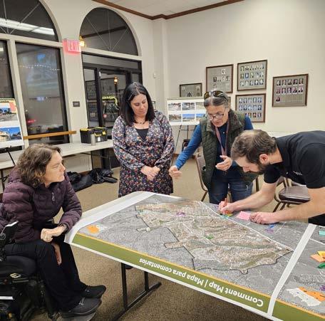
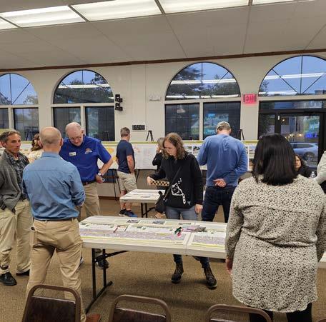
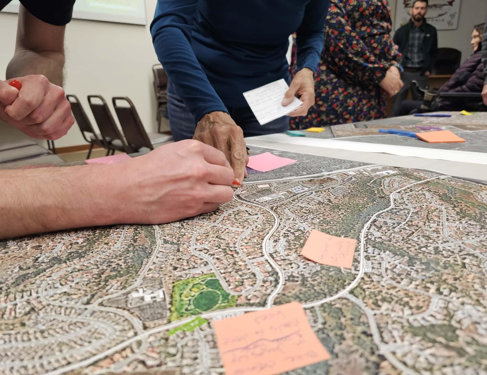
A community survey was used to understand needs, concerns, and priorities for active transportation in Arroyo Grande. The 15-question survey was open to the public for five months from December 2023 to April 2024. The survey was available in English and Spanish and provided as hard copies at in-person events and online on the ATP project website. The survey was promoted on social media and at community events. At the end of the survey window, 101 surveys were collected. A summary of the survey results is included in this chapter. Complete survey results can be found in Appendix B.
The survey results provided a useful source of community input on active transportation patterns and the need for improvements. Generally, survey respondents were interested in walking and bicycling in Arroyo Grande, but expressed serious concern regarding safety. Survey respondents stressed the need for continuous sidewalks and contiguous, protected bicycle paths, particularly along routes leading to key community destinations, such as schools, the Library, the Village, and the hospital. Respondents also expressed the importance of high-visibility crosswalks and traffic calming measures to promote pedestrian and bicyclist safety.
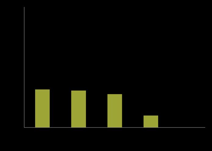
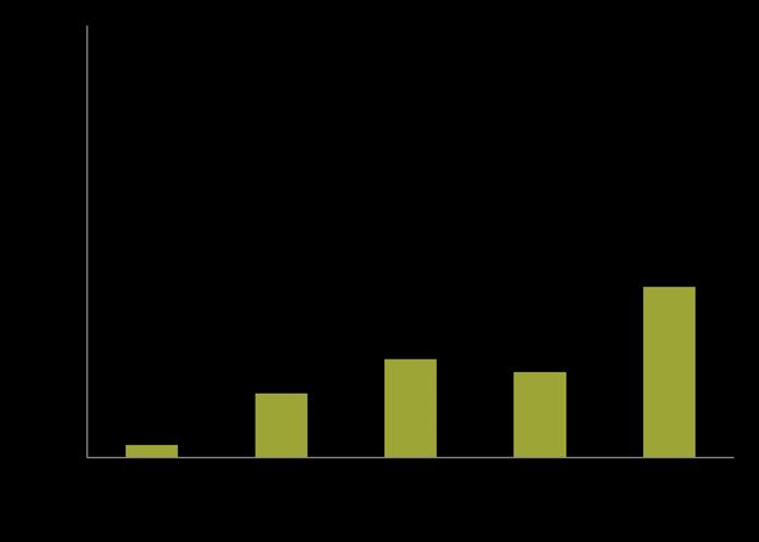
Figure 3-3: What are your reasons for using active transportation? (Select all that apply)
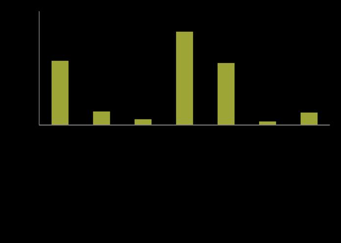
Figure 3-4: Where would you like to see better walking and bicycling routes to? (Select all that apply)
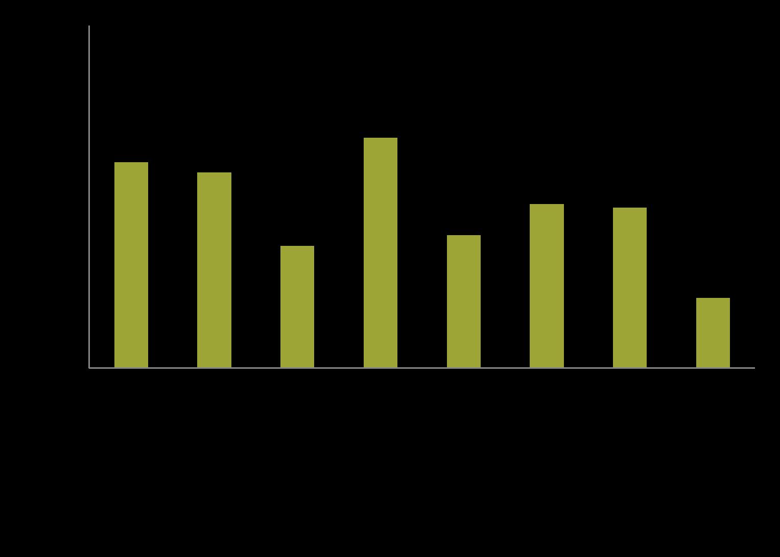
Figure 3-5: What would make it easier for you to walk or roll (wheelchair, skateboard, etc.) more in your community? (Select all that apply)
Figure 3-6: What would make it easier for you to bike more in your community? (Select all that apply)
The most common answers to the survey question, “Do you avoid certain streets to walk or bike on?,” were the following streets (in order of prevalence):
Additionally, many survey respondents expressed the need for safer bicycle and pedestrian routes around Harloe Elementary School, Arroyo Grande High School, and the Library. The streets and destinations shared by survey respondents are consistent with the findings of the analyses of the existing conditions in Chapter 2.
I used to walk from the Village to the library, however, the lack of sidewalks makes it more difficult as I get older.
We visit the region several times a year. We always travel by bike once we’re there. We’ve opted to spend more time and money in the cities that have focused on improving bike infrastructure. Because of that, we’ve spent much more time and money in SLO rather than in AG. AG would be more attractive if the streets were safer for bikes.
It would be wonderful to encourage more bike/walking. Currently, the lack of pathways/ protection makes the whole thing very unattractive for most people.
Areas around schools MUST be prioritized for the sake of parents and kids walking and encouraging active transportation. Our kids need to know that they can walk in our community and get around without a car.
I was the student hit by a car outside of AGHS on December 4th. Despite being extremely cautious (staying in the bike lanes, wearing a helmet, etc.). I was still sent to the ER from the impact, and the injuries will make for lifelong dentist appointments, scarring, and medical bills. I strongly believe in the need for protected bike lanes in school zones. There are many, many children just like me who are vulnerable to lifelong injuries if the issue is not addressed.
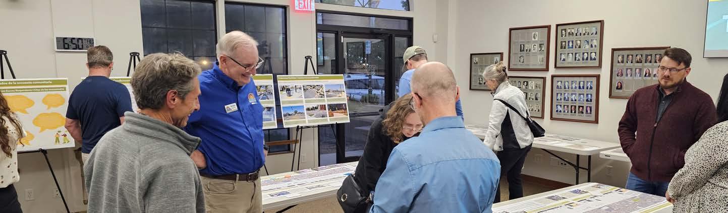
Five stakeholder meetings were held throughout the course of the ATP planning process. Stakeholders included representatives from local organizations, governmental agencies, schools, and businesses, as well as City staff and individual community members. Each meeting is summarized below. Complete minutes for all stakeholder meetings are in Appendix B.
Participating organizations included:
» Bike SLO County
» Caltrans, District 5
» City of Arroyo Grande, Planning Department
» City of Grover Beach, Planning Department
» City of Pismo Beach, Planning Department
» Five Cities Fire Authority
» San Luis Obispo Council of Governments (SLOCOG)
» San Luis Obispo Regional Transit Authority (RTA)
» South County Chambers of Commerce
The first stakeholder meeting was held virtually via Zoom on March 7th, 2024. The meeting consisted of stakeholder introductions; an informational presentation to introduce the ATP and report on progress to date; and an open discussion to understand the major concerns and goals of the stakeholders. The open discussion involved resource and idea sharing, as well as establishing an initial set of desired outcomes for the ATP. Most notably, stakeholders expressed their desire for the ATP to result in the following outcomes:
» Providing safe routes to key destinations such as schools and parks.
» Slowing down vehicular traffic along commercial corridors.
» Considering ways to support the use of active transportation for tourists and visitors.
» Prioritizing project recommendations to help the City allocate resources to the highest priority projects first.
» Supporting increased priority for separated bicycle lanes.
» Increasing the availability of bicycle racks, particularly in front of businesses.
The second stakeholder meeting was held virtually via Zoom on May 2nd, 2024. The meeting consisted of a community engagement update, a review of existing active transportation infrastructure around schools, and an open discussion on prioritization criteria used to rank recommended bikeway projects. Stakeholders reviewed potential criteria (e.g., schools, parks, transit, collisions, population density, etc.) and discussed how criteria should be weighted based on Arroyo Grande’s demographics and needs. In particular, stakeholders shared that the following criteria are important and should be weighted higher during the prioritization process:
» Proximity to transit stops and routes
» Child population density
» Senior population density
Additionally, stakeholders asked questions about the project and recommended additional resources for the planning team to use when developing recommendations, such as the SLOCOG Disadvantaged Communities geodatabase.
The third stakeholder meeting was held virtually via Zoom on July 30th, 2024. At this meeting, stakeholders reviewed and provided feedback on the draft bicycle facility recommendations, including the proposed citywide network of Class I multi-use paths, Class II bicycle lanes, Class III bicycle routes, and Class IV separated bikeways. Stakeholders also received an update on the prioritization criteria and had a second opportunity to share input. Stakeholder questions and input were used to modify and improve the draft bikeway network before sharing it with the community at large at the final community events in late September 2024.
In lieu of a standard stakeholder meeting, stakeholders were invited to participate in Community Workshop #2 on September 26th, 2024. This meeting gave stakeholders an opportunity to meet each other in person and interact with members of the public. Stakeholders participated in the workshop by listening to the presentation and providing input on draft recommendations. Stakeholder input was used to modify draft recommendations and finalize the draft ATP.
The final stakeholder meeting was held virtually via Zoom on November 25th, 2024. Stakeholders were asked to review the draft ATP before the meeting and bring their feedback for group discussion. At the meeting, stakeholders shared input and asked questions about the ATP. Stakeholder feedback, including suggestions for expanding the educational programs and referencing existing regional programs, was integrated into the draft ATP.
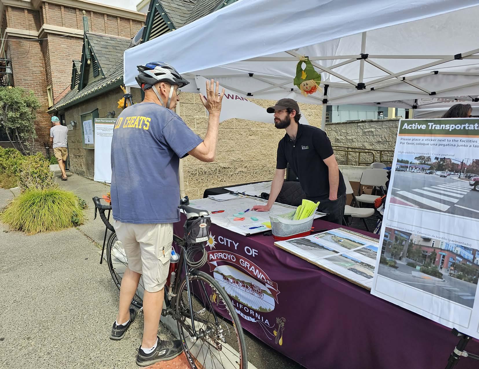
The planning team presented an ATP progress report at the City Council meeting on October 22nd, 2024. The purpose of the presentation was to provide the City Council and members of the public with an overview of the ATP, including the project objectives, planning process, data analysis findings, community engagement efforts, and draft recommendations. The planning team received one public comment regarding Class IV separated bikeways, as well as questions and comments from City Council members. City Councilmember comments were related to adopting the ATP and adding it to the Capital Improvement Program; including The Pike in the ATP; emphasizing the importance of safe commuting for students at Arroyo Grande High School; and taking a further look at East Grand Avenue safety.
Concurrent with the development of this ATP, the City is also updating its General Plan. Several community engagement opportunities were held as part of the General Plan update process, including a survey, workshops, social media campaigns, and more. Throughout these engagement efforts, active transportation came up as a top priority for community members. The information below is from the document titled Community Engagement Summary Report: City of Arroyo Grande General Plan Update prepared by Mintier Harnish for the City.
“In the future, Arroyo Grande will… be easier to get around without a car.” - Vision statement from a General Plan outreach participant
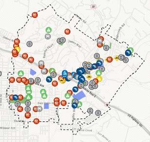
To enable community members to participate in the planning process from their own homes, an online comment map was hosted on the project website. The online comment map invited community members to share location-specific input by dropping a pin and leaving a comment related to pedestrian, bicyclist, ADA, driving, and other transportation-related issues. The issues that received the most comments were bicyclist concerns and the locations that received the most comments were West Branch Street, East Grand Avenue, Huasna Road, Traffic Way, El Camino Real, and Elm Street.
Several engagement participants identified a lack of safe pedestrian and bicycle infrastructure as a major problem in the community. Some participants expressed their desire for enhanced active transportation infrastructure along school routes, advocating for features like dedicated bike lanes and crosswalks equipped with flashing light beacons to encourage reduced traffic speed near educational institutions.
Participants also identified the lack of bicycle routes to Paulding Middle School and the absence of sidewalks along routes to Ocean View Elementary as areas for improvements. Specific suggestions for bicycle infrastructure improvements were made for Corbett Canyon Road, East Branch Street through the Village, and Tally Ho Road. Pedestrian infrastructure improvements were also recommended, with a focus on East Branch Street, the Village, and walking paths. Additional suggestions included improving signage along the Grace Lane Trail.
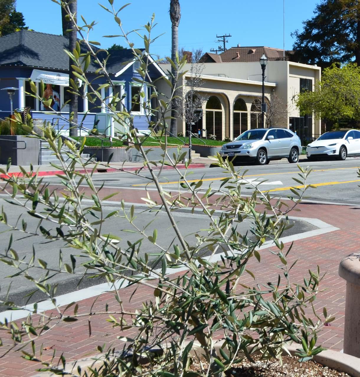
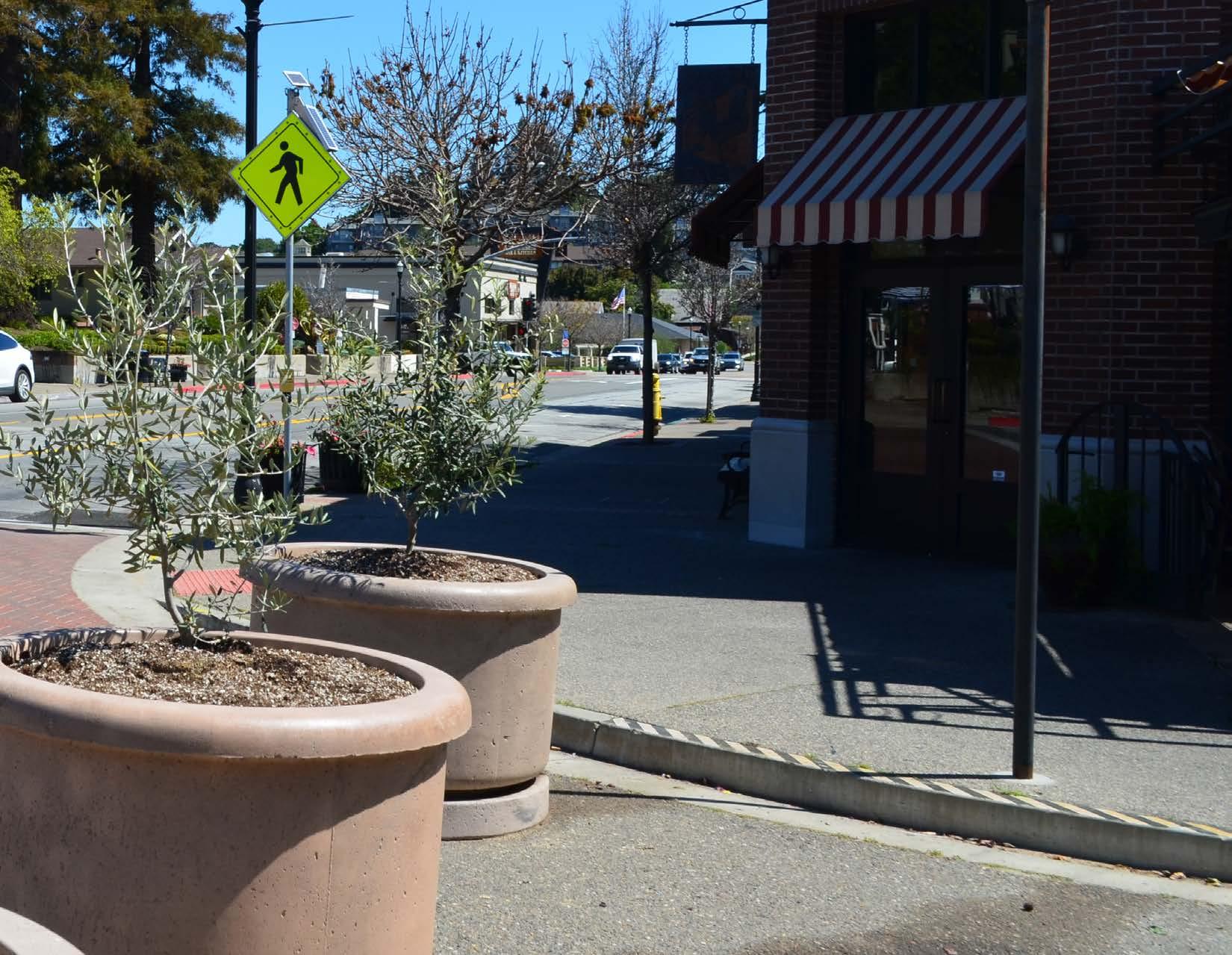
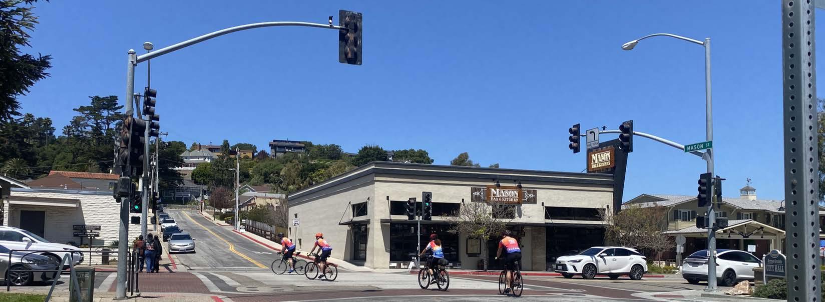
Providing pedestrian and bicycle infrastructure that promotes safer and less stressful circulation is a major focus across the nation. For example, a significant transformation in the state of practice for bicycle travel has occurred over the last decade. Much of this may be attributed to bicycling’s changing role in the overall transportation system. No longer viewed as an “alternative” mode, bicycling is increasingly considered a conventional transportation mode that should be actively promoted as a means of achieving environmental, social, and economic goals. While connectivity and convenience remain essential bicycle travel quality indicators, recent research indicates that increased acceptance and adoption of daily bicycling will require the provision of “low-stress” bicycle routes, which are typically understood to be those that provide bicyclists with separation from high-volume and high-speed vehicular traffic.
Similarly, pedestrian improvements are essential components of an inclusive active transportation plan because they help to serve populations who cannot or do not want to drive or ride a bicycle. People are more likely to rely on walking or rolling (with a wheelchair or mobility aid) for recreation or their daily mobility needs when the road network feels safe, comfortable, and designed for pedestrians. Newer innovations like all-way pedestrian crossings (also known as pedestrian scrambles), modified signal timing, and flashing beacons are making pedestrians more visible and creating safer streets for all.
This chapter provides an overview of both conventional and innovative forms of active transportation infrastructure to inform the recommendations proposed in Chapter 5. This “toolkit” also includes treatments for traffic calming, public transit enhancements, green street improvements, placemaking, and new mobility because they enhance the safety, comfort, and convenience of people walking, rolling, and bicycling. This toolkit can serve as a reference and starting point for the City in developing and implementing active transportation improvement projects across Arroyo Grande. Many of the active transportation facilities described in this chapter are integrated into the site-specific recommendations provided in Chapter 5.
There are four conventional bikeway types recognized by Caltrans. Details of their design, associated wayfinding, and pavement markings can be found in the CA MUTCD and CA Highway Design Manual.
Class I multi-use paths are physically separated from motor vehicle travel routes, with exclusive rights-of-way for non-motorized users like bicyclists and pedestrians. They require physical buffers to ensure the safety and comfort of the path user.
Class II bicycle lanes are one-way facilities that carry bicycle traffic in the same direction as the adjacent motor vehicle traffic. They are typically located along the right side of the street (although they can be on the left side) and are between the adjacent travel lane and the curb, road edge, or parking lane. They are not physically separated from motor vehicle traffic.
Class III bicycle routes are suggested bicycle corridors marked by signs designating a preferred street between destinations. They are recommended where traffic volumes and roadway speeds are low (35 mph or less).
Class IV separated sikeways, sometimes called cycle tracks, are onstreet bicycle facilities with a physical separation between the bikeway and vehicle travel lanes. Physical protection measures can include raised curbs, parkway strips, reflective bollards, or parked vehicles. Separated bikeways can be either one-way or two-way, depending on the street network, available right-of-way, and adjacent land use.
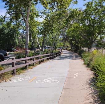
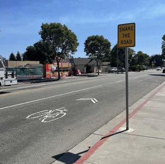
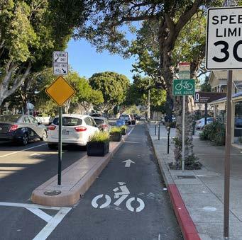
While conventional bicycle facility types can be found throughout the United States, there has been a distinct shift towards incorporating enhanced bicycle treatments that provide additional protection and visibility. These enhancements are low-cost, easy to install, and provide additional awareness about the likely presence of bicyclists. In many instances, the installation of these bicycle route enhancements can be coordinated as part of street resurfacing projects. For example, the use of green markings has also become a simple and effective way to communicate the likely presence of bicyclists and to denote potential conflict zones between bicyclists and vehicles.
An advisory bike lane is a preferred space for bicyclists and motorists to operate on narrow streets that would otherwise be a shared roadway. Roads with advisory bike lanes accommodate low to moderate volumes of two-way motor vehicle traffic and provide a safer space for bicyclists with little or no widening of the paved roadway surface. Due to their reduced cross-section requirements, advisory bike lanes have the potential to open up more roadways to accommodate comfortable bicycle travel.
Bicycle boulevards provide a convenient, low-stress bicycling environment for people of all ages and abilities. They are installed on streets with low vehicular volumes and speeds and often parallel higher volume, higher speed arterials. Bicycle boulevard treatments use a combination of signs, pavement markings, traffic diverters, and traffic calming measures that help to discourage through trips by motor vehicle drivers and create safe, convenient bicycle crossings of busy arterial streets. They are similar to Class III bicycle routes but tend to include more traffic calming and diversion infrastructure.
Bicycle detection is used at intersections with traffic signals to alert the signal controller that a bicycle crossing event has been requested. Bicycle detection can occur either through the use of push buttons or by automated means and is marked by standard pavement symbols.
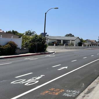
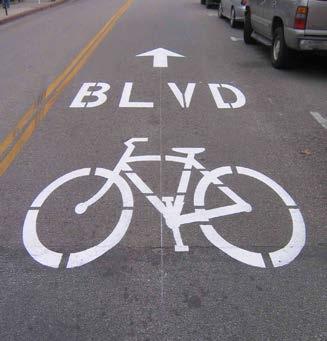
Bicycle signals include all types of traffic signals directed at bicyclists. These can include typical green/yellow/red signals with signage explaining the signal controls, or special bikeway icons displayed within the signage lights themselves. Nearside bicycle signals may incorporate a “countdown to green” display, as well as a “countdown to red.”
A bike box is a designated area at the head of a traffic lane at a signalized intersection that provides bicyclists with a safe and visible way to wait ahead of queuing traffic during the red signal phase. This positioning helps encourage bicyclists traveling straight through not to wait against the curb for the signal change.
Buffered bicycle lanes provide additional space between the bicycle lane and traffic lane, parking lane, or both, to provide a more protected and comfortable space for bicyclists than a conventional bicycle lane. The buffering also encourages bicyclists to avoid riding too close to parked vehicles, keeping them out of the “door zone” where there is the potential danger of drivers or passengers suddenly opening doors into the bicyclists’ path.
Colored pavement increases the visibility of bicycle routes, identifies potential areas of conflict or transition, and reinforces bicyclist priority in these areas. Colored pavement can be used as a corridor treatment, along the length of a bicycle lane, or within a protected bikeway. Additionally, it can be used as a spot treatment, such as crossing markings at particularly complex intersections where the bicycle path may be unclear. Consistent application of color across a bikeway corridor is important to promote clear understanding for all roadway users.


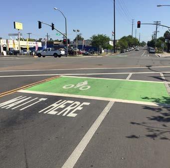

Green-colored striping can be used to highlight conflict areas between bicyclists and vehicles, such as where bicycle lanes merge across motor vehicle turn lanes or driveways.
Protected intersections maintain the integrity (low-stress experience) of their adjoining separated bicycle lanes by fully separating bicyclists from motor vehicles at intersections. Features of these protected intersections include two-stage crossings supported by an advanced queuing space, protective concrete corner islands, special signal phasing, and special bicycle-cross markings (parallel with crosswalks).
Shared lane markings, also known as sharrows, are commonly used where parking is allowed adjacent to the travel lane. It is now common practice to center them within the typical vehicular travel route in the rightmost travel lane to ensure adequate separation between bicyclists and parked vehicles.
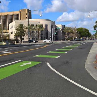
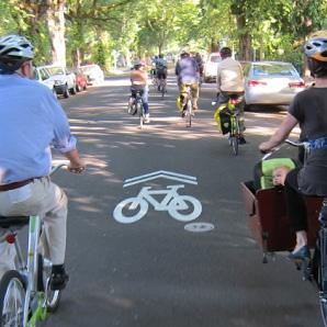
Signage and wayfinding on all streets and bicycle routes are intended to identify routes to both bicyclists and drivers, provide destination information, and inform all users of changes in roadway conditions.
Two-stage left-turn queue boxes can provide a more comfortable leftturn crossing for many bicyclists because they entail two low-stress crossings, rather than one potentially high-stress one. They also provide a degree of separation from vehicular traffic, because they do not require merging with vehicle traffic to make left turns. Bicyclists wanting to make a left turn can continue into the intersection when they have a green light and pull into the green queue box. Bicyclists then turn 90 degrees to face their intended direction and wait for the green light of a new signal phase to continue through.
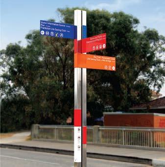
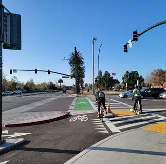
Pedestrian treatments can help to reduce pedestrian crossing distances, increase pedestrian visibility, and reduce unpredictable crossings between intersections to enhance pedestrian comfort and safety.
Curb extensions, also called bulb-outs or neck-downs, extend the curb line outward into the travelway to increase pedestrian visibility, reduce the pedestrian crossing distance, and reduce the effective street width. They must not interfere with bicycle lanes or separated bikeways. If both treatments are needed, additional design features, such as ramps or half-sized curb extensions, should be considered.
Daylighting refers to the removal of parked cars next to crosswalks to allow people walking, bicycling, and driving to see each other better. Daylighting can be used as a tool to improve visibility and safety at intersections, particularly on highways and arterials. The 2023 MUTCD allows, for the first time, “daylighting” of intersections using only paint and flex posts.
Enhanced crosswalk markings with perpendicular striping, in addition to parallel stripes, can be installed at existing or proposed crosswalk locations. Their bold pattern is designed to both guide pedestrians and to alert drivers of a crossing location.
A Leading Pedestrian Interval (LPI) is a signal timing technique that typically gives pedestrians a three to seven-second head start when entering a crosswalk with a corresponding green signal in the same direction of travel. LPIs enhance the visibility of pedestrians in the intersection and reinforce their right-of-way ahead of turning vehicles, especially in locations with a history of conflict. Generally, this leads to a greater likelihood of vehicles yielding. Depending on intersection volume and safety history, an otherwise legal right-turn-on-red might be explicitly prohibited during the LPI phase.
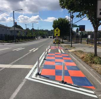
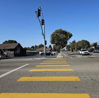
Pedestrian-scale lighting provides many practical and safety benefits, such as illuminating the path and making crossing pedestrians and bicyclists more visible to drivers. Lighting can also be designed to be fun, artistic, and interactive to enhance user experience.
Mid-block crossings provide convenient locations for pedestrians and bicyclists to cross thoroughfares in areas with infrequent intersection crossings or where the nearest intersection creates substantial out-of-direction travel. Mid-block crossings should be paired with additional traffic-control devices, such as traditional pedestrian signals, pedestrian hybrid beacons, rectangular rapid flashing beacons, LED-enhanced flashing signs, and/or refuge islands.
Adjusting the timing, phasing, and actuation needed to cross high-volume and wide streets decreases waiting times and provides additional safety and comfort for pedestrians and bicyclists.
Pedestrian scrambles, also known as all-way pedestrian phases, stop vehicular traffic flow simultaneously in all directions to allow pedestrians to cross the intersection in any direction. These are used at intersections with particularly heavy pedestrian crossing levels. Unless cycle lengths can be kept under 90 seconds, LPIs are generally preferred over pedestrian scrambles.
Refuge islands provide pedestrians and bicyclists a relatively safe place within an intersection and midblock crossing to pause and observe before crossing the next lane of traffic.
Designated senior zones can be enhanced with street signage, increased crossing times at traffic signals, benches, bus stops with shelters, and pedestrian lighting.
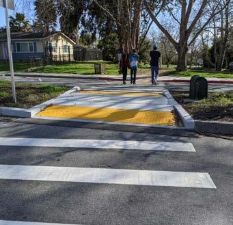
Traffic calming involves changes in street alignment, installation of barriers, and other physical measures to reduce traffic speeds and/or motor vehicle traffic volumes. Traffic calming is used to alter driver behavior and to improve street safety, livability, and other public purposes. Other techniques consist of operational measures, such as police enforcement and speed displays.
Traditional pedestrian signals with countdown timers remain the gold standard for high-quality pedestrian crossings, although some cases warrant new signal technologies. Pedestrian Hybrid Beacons (PHBs) and Rectangular Rapid Flashing Beacons (RRFBs) are special signals used to warn traffic at unsignalized locations and assist pedestrians crossing a street via a marked crosswalk.
PHBs include a “red phase” that requires vehicles to come to a full stop while RRFBs are yield stops. Either of these devices should be installed at locations that have pedestrian desire lines connecting people to popular destinations, such as schools, parks, and retail.
Research has shown that PHBs tend to have a 90 percent motorist compliance rate versus RRFBs, which tend to have an 80 percent motorist compliance rate. Traditional pedestrian signals with countdown timers at signalized intersections tend to have a near 100 percent compliance rate.
Signals and warning devices should be paired with additional pedestrian improvements, where appropriate, such as curb extensions, enhanced crosswalk markings, lighting, median refuge islands, corresponding signage, and advance yield markings to mitigate multiple threat crashes on multi-lane roadways.
Chicanes are a series of narrowings or curb extensions that alternate from one side of the street to the other forming an S-shaped path. Chicanes reduce drivers’ speeds by causing them to shift their horizontal path of travel.
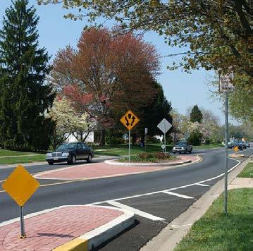
Hardened centerlines are small rubber barriers next to crosswalks that require people driving to make slower and more square left-hand turns. This small change has been shown to significantly slow down vehicle speeds at crosswalks and improve safety for people in the crosswalk.
Light-up stop signs are eye-catching stop signs that use flashing LEDs to encourage motor vehicle drivers to properly stop for pedestrians and bicyclists.
Neckdowns narrow a street by extending the sidewalk or widening the landscape area to give the perception that speeds should be reduced.
One-way couplets are a pair of parallel one-way streets with motor vehicle traffic traveling in opposing directions. Couplets are often used in high-volume areas to manage and increase the capacity of travel.
Edge friction is a combination of vertical elements, such as on-street parking, bicycle lanes, chicanes, site furnishings, street trees, and shrubs, that reduce the perceived street width, which has been shown to reduce motor vehicle speeds.
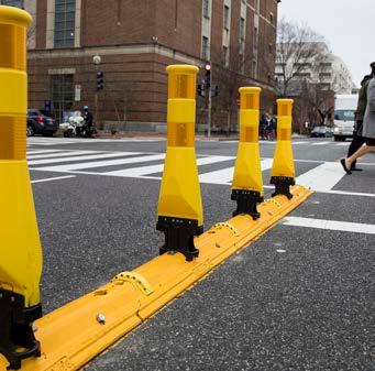
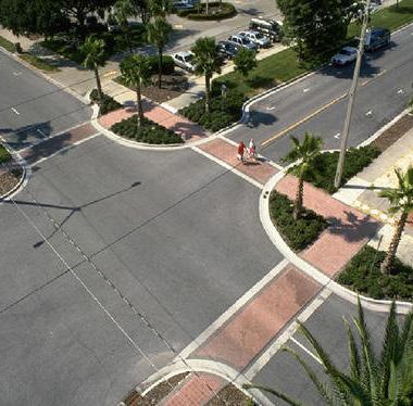
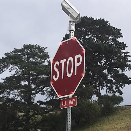
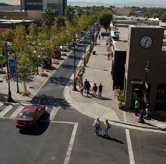
Reflective borders on signal heads improve the visibility of signal heads with a backplate and are made even more conspicuous by framing them with a yellow retroreflective border. These are more visible in both daytime and nighttime conditions.
Roundabouts are circular intersections with yield control at their entry that allows a driver to proceed at controlled speeds in a counter-clockwise direction around a central island. Roundabouts are designed to maximize motorized and non-motorized traffic through their innovative design which includes reconfigured sidewalks, bikeway bypasses, high-visibility crosswalks, pedestrian flashing beacons, and other traffic measures. Roundabouts can be implemented on most streets but may require additional right-of-way.
Traffic circles are small-scale traffic calming measures commonly applied at uncontrolled intersections on low-volume, local residential streets. They lower traffic speeds on each approach and typically avoid or reduce right-of-way conflicts because the overall footprint is smaller compared to roundabouts. Traffic circles may be installed using simple markings or raised islands but are best accompanied by drought-tolerant landscaping or other attractive vertical elements.
Speed displays measure the speed of approaching vehicles by radar and inform drivers of their speeds using an LED display. Speed displays contribute to increased traffic safety because they are particularly effective in getting drivers traveling ten or more miles per hour over the speed limit to reduce their speed.
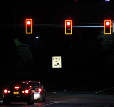
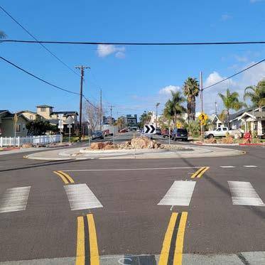
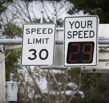
Speed tables are flat-topped road humps, often constructed with textured surfacing on the flat section. Speed tables and raised crosswalks help to reduce vehicle speeds and enhance pedestrian safety.
Speed cushions are a form of vertical traffic calming with wheel cutouts that allow emergency vehicles to easily pass. Speed cushions help to reduce vehicle speeds and enhance pedestrian safety.
School pick-up/drop-off zones are designated areas typically managed by schools where school buses and parent and guardian motor vehicles can drop off and pick up children.
Truck aprons allow large vehicles, such as trucks, buses, and recreational vehicles, to turn without striking fixed objects or people walking, rolling, or bicycling. They are located between the road surface and the sidewalk, or inner circle of a roundabout. The pavement is raised slightly to encourage light vehicles to stay on the main road surface.
A traffic diverter is a roadway design feature placed in a roadway to prohibit vehicular traffic from entering into or exiting from the street.
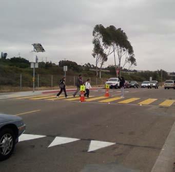
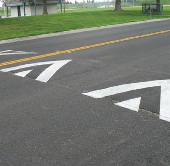
Public transit rider satisfaction and interest can be enhanced through the provision of safe, convenient, and fast service. By making public transit easy to access, comfortable to use, and efficient, transit providers can improve public perception of transit and encourage increased use.
Bus Rapid Transit (BRT) is a high-quality bus-based transit system that delivers fast and efficient service through the use of bus-only lanes, busways, traffic signal priority, off-board fare collection, elevated platforms, and enhanced stations. BRT offers more reliable and faster public transit service than regular buses because it is designed to avoid typical delays, such as waiting in traffic or waiting for a line of riders to pay their fare.
A floating bus island is located between travel lanes and bicycle lanes where transit passengers board and alight transit vehicles. Pedestrians cross the bike lane when traveling to or from the platform where the bus stop is located. This eliminates conflict between bicyclists traveling in bike lanes and transit vehicles that must pull curbside to load and unload passengers.
Microtransit refers to a publicly provided on-demand rideshare service that offers the flexibility of a ride-hailing service like Uber or Lyft, but at affordable rates. Microtransit programs typically provide rides for short local trips with small shuttles within designated service zones, offering safe and convenient travel for quick trips. On top of already affordable rates, it is common for microtransit programs to offer reduced rates to seniors, people with disabilities, and/or Medicare recipients.
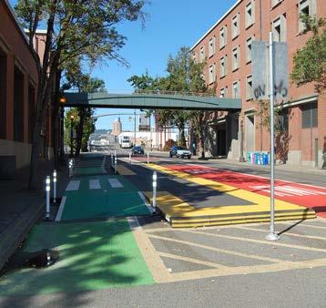
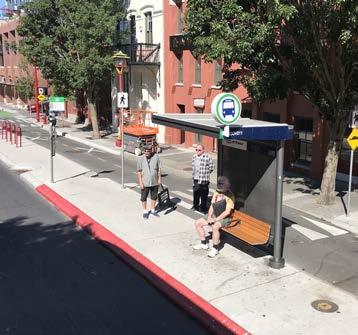
Mobility hubs offer an integrated suite of mobility options that serve a critical function in the regional transportation system as the origin, destination, or transfer point for a significant share of transit trips. They allow for a combination of transportation options to gather in one space to encourage people to use non-motorized forms of travel with ease. Mobility hubs are typically located along a bicycle facility and a transit stop and are paired with multimodal elements, such as bikeshare, scootershare, bicycle lockers, battery charging for e-bicycles, wayfinding signage, ridesharing pickup/dropoff zones, and pedestrian amenities, such as curb extensions, street furniture, and lighting.
Real-time bus information allows riders to predict their journey and manage their time more effectively. This increases the convenience of transit for riders by providing an accurate, updated location of their bus.
Transit stop amenities help to increase the comfort and safety of public transit users. Transit stop amenities can include posted route schedules, trash receptacles, lighting, sheltered waiting areas that provide protection from rain and sun, real-time arrival updates, Wi-Fi connectivity, and more. The provision of these amenities improves rider satisfaction and may encourage increased transit use.
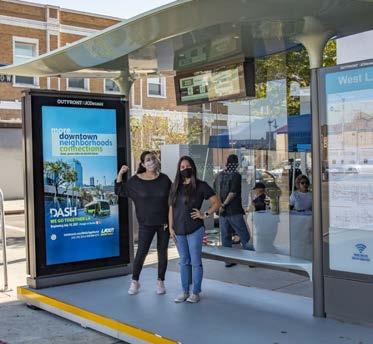
Green street improvements incorporate tried and true stormwater management practices into transportation infrastructure to reduce stormwater runoff, prevent flooding, improve water quality, provide habitat for local flora and fauna, and create an enjoyable streetscape. These improvements can be installed alongside sidewalks, roadways, parking lots, medians, and more to create a more sustainable and resilient mobility system. The green street improvements listed below are from the U.S. Environmental Protection Agency’s Green Streets Handbook.
Bioswales, also known as bioretention swales or vegetated swales, are surface depressions that use bioretention soil media and vegetation to facilitate stormwater infiltration, retention, sedimentation, and pollution removal. Bioswales serve as stormwater conveyance treatment devices and are typically located along public rights-of-way, parking lots, sidewalks, road medians, and road shoulders to capture water flow from nearby impervious surfaces.
Infiltration trenches are excavated linear areas filled with layers of stone and sand wrapped in geotextile fabric. These trenches are covered with stone, gabion, sand, or grass with surface inlets. Stormwater is stored in the stone reservoir and slowly infiltrates through the bottom and sides of the trench. Infiltration trenches are ideal for linear spaces, such as along a roadway, parking lot, or median.
Permeable pavements allow stormwater runoff to infiltrate through void space into the ground below or another stormwater management system instead of becoming surface runoff. Types of permeable pavement include porous asphalt, porous recycled surface products, pervious concrete, and pavers arranged with void spaces. Permeable pavement can be used instead of impervious materials on parking lots, parking lanes, driveways, sidewalks, walking paths, bicycle lanes, parkways, road shoulders, and low-traffic roads.
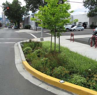
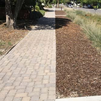
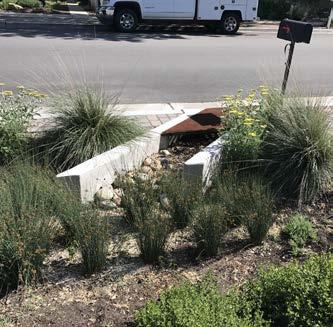
Stormwater curb extensions, or stormwater bump outs, combine two street improvements - traffic calming and stormwater filtration - to produce multiple streetscape benefits. This strategy involves filling the area behind the curb with a bioretention soil media and vegetation similar to a bioretention cell or bioswale. Stormwater curb extensions can be located at intersections, midblock crossings, neighborhood or collector streets, or any length of a roadway.
Stormwater planters are narrow, flat-bottomed landscaped areas designed to receive stormwater runoff from surrounding impervious surfaces, such as rooftop areas, sidewalks, and roadways. Stormwater planters are typically rectangular with vertical walls and are best suited for urban areas with limited space or areas with steep slopes.
Stormwater tree systems, such as tree pits or tree trenches, contain a tree or shrub planted in a bioretention soil mix and a gravel reservoir designed to capture stormwater. Stormwater tree systems are typically located along sidewalks, medians, and parking lots and receive stormwater runoff through a curb cut, catch basin, or stormwater inlet.
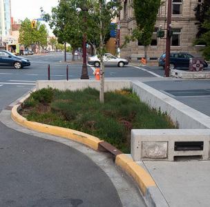
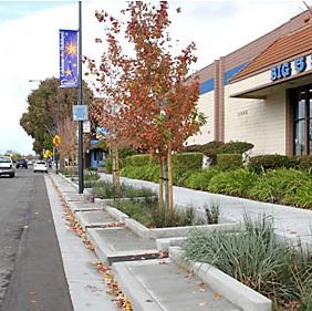
Street trees along roadways provide numerous benefits, such as shade, cooler temperatures, better air quality, on-street edge friction, and streetscape enhancement - all of which improve the overall pedestrian experience.
Subsurface infiltration and detention systems capture, temporarily store, and slowly release stormwater to reduce peak runoff discharge. Subsurface infiltration systems use an infiltrative chamber system made of concrete or plastic with perforated pipes, galleys, and chambers to store large amounts of runoff and slowly let it infiltrate into the ground. Subsurface detention systems temporarily store runoff before releasing it to a conveyance system downstream. These systems are most suitable for parking lots, sidewalks, and roadways.
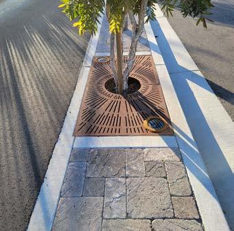
The inclusion of placemaking urban elements, such as parklets, encourages walking and provides usable space for all ages. In many cities, these elements have helped transform urban villages and downtowns into walkable destinations. Coordination with local Arroyo Grande businesses and organizations, such as the great examples currently found in the Village, may provide collaborative design and funding opportunities between the City, its businesses, residents, and visitors.
Parklets are conversions of one or two parking spaces for outdoor seating, dining, and other amenities. Parklets can be used to activate and improve the aesthetics of a streetscape.
Displaying community art is a great way to showcase the history, culture, and pride of an area and create a sense of place for residents and visitors alike. Community art can include murals, sculptures, artistic paths and benches, and more.
Special intersection paving and crosswalk art provide unique opportunities to highlight crossings or key civic or commercial locations at intersections while breaking the visual monotony of asphalt. Intersection paving treatments and crosswalk art can integrate context-sensitive colors, textures, and scoring patterns.
Paving treatments and crosswalk art do not define a crosswalk and should not be seen as a safety measure. Standard transverse or longitudinal high-visibility crosswalk markings are still required.
Transit shelters, bicycle racks, seating, drinking fountains, and pedestrian-scale lighting are important amenities for the functionality, design, and vitality of the urban environment. They show that the street is a safe and comfortable place to be.
New mobility refers to evolving and emerging forms of clean and/or shared forms of transportation, which can include micromobility, ride-hailing, carpools, and automated and connected vehicles. These forms of transportation can provide alternatives to gas-powered, single-occupancy cars and help reduce air pollution and GHG emissions. Clean mobility and shared options also help address transportation equity by providing affordable transportation choices for lower-income households and those who are unable to drive or own a car.
Docked bikeshare is a shared transport service in which bicycles or e-bicycles are made available for shared use to individuals on a shortterm basis for a price or for free. Docked bikeshare systems allow people to borrow a bicycle from a “dock” or station and return it to another dock belonging to the same system. Docked bikeshare systems often include electric-assist bicycles that provide extra comfort for users.
Scootershare programs are popular forms of shared transportation services that involve the rental of electric motorized scooters for short trips. These programs involve the use of a mobile application to look for, rent, pay, and park the rented scooter. Scootershare programs provide a high degree of flexibility for the individual user and can be an effective method for closing mobility gaps. Short trips to visit family members and access to schools, parks, commercial areas, and transit stops are all possible with a scootershare program.
An electric carsharing service could be established by purchasing a fleet of electric cars. These cars could be rented by residents to address their transportation needs, such as commuting to work, running errands, or getting to medical appointments. The City would have its own EV charging infrastructure which could be combined with other electric mobility options, such as electric shuttles and electric vanpool/ carpool services.
Electric shuttles can help address gaps within a community by supplementing the existing transit network or by creating new transit routes where they currently don’t exist. Depending on the make and model, electric-powered shuttles can be used to offer transit services within a specified radius.
As electric vehicles (EVs) become more common, the need for publicly accessible EV charging stations will increase, especially for those who cannot install an EV charger at their home. Cities can help facilitate an equitable transition to EVs by installing publicly accessible EV charging stations at City-owned parking lots and structures. Not only can public EV charging stations support community members, but they can also attract new visitors into town.
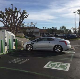
Chapter 5 proposes new and improved bicycle, pedestrian, ADA, and SRTS facilities to improve the safety, comfort, and convenience of active transportation throughout Arroyo Grande. The chapter includes an overview of how projects were developed, assessed for feasibility, and prioritized. The chapter contains maps and tables that provide key project information, such as type, location, and extent. To build momentum for future implementation, the ATP provides conceptual drawings for three priority projects. This chapter also contains programmatic recommendations and funding resources to support, encourage, and celebrate active transportation.
The recommendations proposed in this chapter are meant to serve as a guide to help the City pursue and allocate funds as they become available through various sources. While the recommendations listed in this chapter are comprehensive, the City remains open to receiving and addressing additional community needs on an ongoing basis. Other active transportation projects and programs will be considered as new issues and opportunities arise. The City can update the ATP regularly to ensure the document is appropriately responding to community priorities.
Balancing the needs of all travel modes within the confines of existing roadway widths can be challenging in cases where there is not enough space for all roadway users to travel safely. Throughout ATP implementation, the City is encouraged to consider shifting away from car-centric priorities and move towards a future that prioritizes active transportation facilities, especially around schools, parks, and other major destinations.
The ATP proposes 33 miles of new bicycle facilities to expand and upgrade Arroyo Grande’s existing bicycle network. Developing the proposed bicycle network included a review of previous planning documents, including the 2021 Arroyo Grande General Plan Circulation Element, 2023 SLOCOG Regional Transportation Plan, 2021 SLOCOG Regional Active Transportation Plan, and Capital Improvement Projects, as well as findings of the existing conditions analysis and input collected from community members and stakeholders. Through this approach, ‘streets of importance’ were identified as candidates for bicycle facilities. Each street of importance was reviewed with the following considerations: existing pedestrian amenities and bicycle facilities; network gaps; connectivity to schools, parks, activity centers, and other destinations; community and stakeholder input; and existing road width, lane striping, and on-street parking.
This process resulted in an ambitious, yet feasible proposed bicycle network for Arroyo Grande. If implemented, the proposed bicycle network shown in Figure 5-1 will provide community members with bicycle connectivity to all of Arroyo Grande’s major activity centers, offering residents viable options for bicycling to popular destinations.
Class IV: Separated Bikeway/Class IIB Buffered Bicycle Lane*
*Determination of whether a Class IV or Class IIB bicycle facility is installed will be based on considerations for cost, maintenance, and availability of adequate right-of-way to install the improvements.
The City will need to coordinate with a Caltrans project development team for all proposed projects within the Caltrans right-of-way, including along the Fair Oaks Avenue overcrossing, East Grand Avenue overcrossing, Brisco Road undercrossing, and Oak Park Boulevard overcrossing. Any proposed improvements on the State Highway System are conceptual and will require a safety, operational, and/or warrant analysis prior to any Caltrans approval.
*Determination of whether a Class IV or Class IIB bicycle facility is installed will be based on considerations for cost, maintenance, and availability of adequate right-of-way to install the improvements.
A prioritization analysis was conducted to rank proposed bicycle facilities in terms of need and importance. City staff and the Stakeholder Working Group developed and refined the criteria. The City will use the results of the prioritization analysis to direct resources toward the highest-need and highest-impact projects. The prioritization analysis ranked projects based on the following criteria (listed in order of weight):
» Schools: How many schools are along the project corridor?
» Parks: How many parks are along the project corridor?
» Households w/ No Vehicle (HNV): How many households with no vehicles are within the project area?
» Gap Closure: Does the project close a gap in the existing bicycle network?
» Commercial Land Use: How many mixed-use, commercial, and office, land uses are along the project corridor?
» Collision History: How many bicycle and pedestrian-related collisions occurred along the project corridor between 2012 and 2022?
» Transit Stops: How many bus stops are along the project corridor?
» Regional Network Connectivity: Does this project close a gap in connection to an adjacent community?
» Public Input: How many public comments were received for the project corridor?
» Increased Separation from Motor Vehicles: Is the project a Class I multi-use path or a Class IV separated bikeway?
» Population Density: How many people live in the project area?
» Child Density: How many children under 16 years old live in the project area?
» Senior Density: How many people age 65 or older live in the project area?
» Walk to Work: How many people walk to work in the project area?
» Bike to Work: How many people ride a bicycle to work in the project area?
» Transit to Work: How many people take transit to work in the project area?
» Disadvantaged Communities: What percentage of the project falls within a SLOCOG-defined Disadvantaged Community?
» Median Income: What percentage of the project falls within a census tract that has a median household income of less than $73,524/year (80% of statewide median from 2018-2022 ACS)?
» Identified in a Previous Project: Has this project been identified in another project (i.e., Arroyo Grande General Plan, SLOCOG RTP, etc.)?
Table 5-2 displays proposed bicycle projects ranked in order of priority. For instances where the prioritization analysis resulted in ties between bicycle projects, the planning team broke ties based on site context, community need, and professional expertise. The City will use this list to direct the pursuit and allocation of funding sources towards projects in order of priority. Additionally, the City used the prioritization analysis results to help select the three corridors to develop conceptual designs.
While the ranking process provides prioritization through objective data analysis and qualitative community engagement, the City has the right to select the projects that move forward for conceptual design and even implementation based on capital improvement funding, grant opportunities and programs, and projects that can take advantage of bicycle lane striping such as street repaving or incoming development projects.
The ATP proposes pedestrian enhancements to improve the safety, comfort, and walkability of corridors leading to key activity centers, such as schools, parks, the Village, and commercial destinations. Pedestrian recommendations were developed based on the 2021 Arroyo Grande General Plan Circulation Element, 2023 SLOCOG Regional Transportation Plan, the ATP’s existing conditions analysis (presented in Chapter 2), community input (presented in Chapter 3), and professional evaluation. The planning team first reviewed previously proposed pedestrian facilities from the 2021 Arroyo Grande General Plan Circulation Element and 2023 SLOCOG Regional Transportation Plan to assess, modify, and update pedestrian enhancements, where needed. Then, the planning team developed additional recommendations based on the findings of the ATP’s existing conditions analysis and community engagement efforts.
The locations of proposed pedestrian enhancements, such as new or upgraded crossings, curb extensions, sidewalk infill, and traffic calming measures, are displayed in Figure 5-2. Figure 5-2 highlights where enhancements are proposed along corridors, intersections, and midblock locations throughout Arroyo Grande. While pedestrian enhancements may be needed in other areas of Arroyo Grande, the ATP focuses on improving pedestrian facilities on streets along and connecting to schools, parks, and commercial areas. To review the specific pedestrian enhancements at each location, see Table 5-3.
The pedestrian enhancements shown in Figure 5-2 and Table 5-3 are not ranked in order of priority. The City will consider proximity to schools, parks, and commercial destinations; cost and available funding; planned and required maintenance; and safety needs when implementing projects.
In addition to pedestrian enhancements at specific locations, the following overarching recommendations should be considered citywide:
» Install curb ramps, preferably directional curb ramps when feasible, where missing (as identified in Figure 2-6) with curbs leading to schools, parks, public buildings, and commercial destinations prioritized.
» Retrofit existing curb ramps without detectable warnings (identified in Figure 2-6) to have truncated domes, focusing on high-priority areas, such as near schools, parks, and along commercial corridors.
» Ensure all new sidewalks are outfitted with curb ramps with detectable warnings to facilitate safe crossings and alert pedestrians with vision impairments of an upcoming hazard, such as passing traffic.
» Infill sidewalk gaps identified in Figure 2-5 adjacent to schools, parks, and commercial corridors, as funding becomes available.
» Install high-visibility crosswalk markings at crosswalks adjacent to schools, parks, and commercial corridors.
» Install Leading Pedestrian Intervals (LPIs) and Accessible Pedestrian Signals at every signalized intersection adjacent to schools, parks, and commercial corridors.
» After evaluating need, consider installing wayfinding signage and traffic calming measures (e.g., LED speed feedback signs) along gateway corridors, such as Corbett Canyon Road, Elm Street, Grand Avenue, Halcyon Road, Huasna Road, and Oak Park Boulevard. As the City implements improvement projects along these corridors, wayfinding signage and traffic calming measures will be integrated where appropriate.
The City will need to coordinate with a Caltrans project development team for all proposed projects within the Caltrans right-of-way, including along the Fair Oaks Avenue overcrossing, East Grand Avenue overcrossing, Brisco Road undercrossing, and Oak Park Boulevard overcrossing. Any proposed improvements on the State Highway System are conceptual and will require a safety, operational, and/or warrant analysis prior to any Caltrans approval.
1 Arroyo Grande Creek Stanley Avenue
2 Ash Street Courtland Street
Install a pedestrian bridge.
Consider improvements for safe pedestrian crossing.
3 Ash Street Oak Park Boulevard to Elm Street Implement traffic calming measures.
4 Ash Street Elm Street to Alder Street Infill sidewalk gaps.
5 Ash Street Spruce Street
6 Brisco Road U.S. 101 undercrossing
Consider improvements for safe pedestrian crossing.
Consider conducting a new traffic study to improve multi-modal safety at Brisco Road undercrossing.
7 Brisco Road Southwest of El Camino Real Infill sidewalk gaps.
8 Castillo del Mar Place Valley Boulevard to Orchard Infill sidewalk gaps.
9 Cherry Avenue Leedham Place
10 Coach Road or Flora Road Arroyo Grande Creek
11 Corbett Canyon Road Huasna Road
12 Crown Hill McKinley Street
13 Crown Hill E. Branch Street
Consider improvements for safe pedestrian crossing.
Consider installing a bicycle/pedestrian crossing at either Coach Road or Flora Road. A future study is needed to determine feasibility.
Conduct a traffic study at this intersection to determine if a roundabout or other traffic control device is warranted. Install LED stop signs and traffic calming measures in the interim.
Consider improvements for safe pedestrian crossing.
Consider improvements for safe pedestrian crossing.
14 Crown Terrace Le Pointe Street to Crown Hill Street Implement traffic calming measures.
15 Dodson Way Alder Street to Alpine Street Infill sidewalk gaps.
16 East Branch Street Le Point Terrace
17 East Branch Street Short Street
18 East Grand Avenue Oak Park Boulevard to El Camino Real
19 East Grand Avenue Juniper Street
20 East Grand Avenue Alder Street
21 East Grand Avenue Bell Street
Install pedestrian improvements.
Install an east-west high-visibility crosswalk.
Consider upgrading the existing RRFB to have head-level flashing beacons.
Implement traffic signal and timing improvements consistent with the City’s Systemic Safety Analysis Report (SSAR).
Consider pedestrian crossing improvements to enhance visibility, safety, and comfort.
Consider pedestrian crossing improvements to enhance visibility, safety, and comfort.
Consider a new pedestrian crossing and other improvements at Bell Street consistent with SSAR.
22 East Grand Avenue U.S. 101 overcrossing
23 El Camino Real Oak Park Boulevard to Halcyon Road
24 Elm Street Ash Street
In partnership with Caltrans, conduct a traffic study at the U.S. 101 overcrossing to determine if a road diet or other multi-modal improvements are warranted to improve bicyclist and pedestrian safety.
Upgrade to pedestrian countdown timers and video detection to identify bicycles at traffic signals and intersections.
Install curb extensions.
25 Elm Street Poplar Street to Sunset Drive Infill sidewalk gaps.
26 Elm Street Pacific Pointe Way to The Pike Infill sidewalk gaps.
27 Fair Oaks Avenue Alder Street
28 Fair Oaks Avenue Elm Street
29 Fair Oaks Avenue Orchard Street
30 Fair Oaks Avenue Orchard Street to Traffic Way
31 Fair Oaks Avenue Woodland Drive
Consider intersection improvements, such as curb extensions and/or crosswalk art.
Install high-visibility crosswalks at the north leg of the intersection and brighten the crosswalk markings on the east leg.
Enhance crossing safety by adding curb extensions and LED stop signs. Depending on sidewalk infill, crossing enhancements at the U.S. 101 SB exit, and future land development, consider installing a N/S crossing. The crossing type will be dependent on future development and associated pedestrian/bicycle volumes.
Conduct a traffic study along Fair Oaks Avenue between Orchard Street and Traffic Way to explore options for improving bicycle and pedestrian safety.
Consider improvements for safe pedestrian crossing.
32 Fair Oaks Avenue Woodland Drive to Station Way Infill sidewalk gaps.
33 Fair Oaks Avenue Valley Boulevard Install curb extensions.
34 Farroll Avenue Bakeman Lane (eastern intersection) Consider improvements for safe pedestrian crossing.
35 Farroll Avenue Elm Street
36 Farroll Avenue Carmella Drive
37 Farroll Road Halcyon Road
Install curb extensions and high-visibility crosswalks. Ensure consistency with the Halcyon Complete Streets Project.
Consider improvements for safe pedestrian crossing.
Conduct crosswalk and ADA improvements.
Consider improvements for safe pedestrian crossing.
38 Halcyon Road Bennett Avenue Infill sidewalk gaps and consider improvements for safe pedestrian crossing.
39 Halcyon Road Sandalwood Conduct crosswalk and ADA improvements.
40 Halcyon Road Sycamore Drive
41 Halcyon Road The Pike
Consider improvements for safe pedestrian crossing.
Install a high-visibility east-west crossing.
42 Huasna Road Maydock Street to eastern City limit Infill sidewalk gaps from Branch Street to east City limits.
43 Huasna Road Rosewood Lane
44 Huasna Road Stagecoach Road
45 U.S. 101 Near Town Center Drive (north); Stonecrest Drive (south)
46 James Way Equestrian Way
47 James Way La Canada Street
48 James Way Salida Del Sol
49 James Way Oak Park Road to Tally Ho Road
50 Mason Street Poole Street
51 Nelson Street Bridge Street; Short Street; Mason Street
52 Oak Park Boulevard Branch Street
53 Oak Park Boulevard Farroll Avenue
54 Orchard Street Cherry Avenue
55 Rancho Parkway Via Vaquero
56 Rodeo Drive Grace Lane
Consider installing curb extensions and other improvements for safe pedestrian crossing.
Install a pedestrian refuge island and/or curb extensions. Opportunity to make intersection more perpendicular to improve visibility and safety.
Install a pedestrian bridge. Coordination will be needed between jurisdictions for implementation.
Consider improvements for safe pedestrian crossing.
Consider improvements for safe pedestrian crossing.
Consider improvements for safe pedestrian crossing.
Infill sidewalk gaps where missing and implement traffic calming measures near parks, trailheads, and proposed crossings.
Consider improvements for safe pedestrian crossing.
Install a high-visibility crosswalk.
Consider improvements for safe pedestrian crossing.
Implement a protected intersection and high-visibility crosswalks.
Install high-visibility crosswalks at all intersection legs.
Consider improvements for safe pedestrian crossing.
Consider improvements for safe pedestrian crossing.
57 Station Way Fair Oaks Avenue to Traffic Way Infill sidewalk gaps.
58 Tally Ho Road James Way
59 Tally Ho Road Le Pointe Avenue
60 Tally Ho Road Printz Road to Mason Street
61 The Pike Del Sol Street
62 The Pike Elm Street
63 The Pike Garfield Place
64 Traffic Way Bridge Street
Install high-visibility crosswalks at all intersection legs.
Install a pedestrian bridge.
Infill sidewalk gaps on the south side of the street and consider installing improvements where sidewalk gaps occur on one side to allow safe pedestrian crossing.
Consider improvements for safe pedestrian crossing. Opportunity to upgrade to a raised crossing to slow traffic.
Opportunity to redesign intersection to improve safety and comfort. Redesign may include removal of right-turn slip lane and the addition of signage, green striping, and high-visibility crosswalks.
Consider improvements for safe pedestrian crossing.
Relocate the bus stop to Station Way or Bridge Street to allow ADA access.
65 Traffic Way Cherry Avenue
66 Traffic Way Nelson Street
67 Traffic Way Station Way
Consider installing an enhanced pedestrian crossing, such as an RRFB, PHB, and/or pedestrian refuge island. Conduct a traffic study to determine the best treatment.
Consider upgrading crossing by installing an RRFB or creating a new signalized intersection. Add curb extension if space allows. Conduct a traffic study to determine the best treatment.
Remove the free right turn. Opportunity to make intersection more perpendicular to improve visibility and safety.
68 Valley Road Fair Oaks Avenue to southern City limit Infill sidewalk gaps.
Conduct a traffic study to determine the best treatment.
69 Valley Road Castillo Del Mar
Conduct a traffic study at this intersection to determine if a roundabout or other traffic control device is warranted.
70 West Branch Street East Grand Avenue to Rodeo Drive Infill sidewalk gaps on the north side.
Rodeo Drive
71 West Branch Street Bridge Street/Nevada Street
72 West Branch Street Traffic Way
Conduct a traffic study to determine the best treatment.
Add curb extensions to the existing crossing and consider upgrading the existing RRFB to have head-level flashing beacons. Ensure RRFB is consistent with improvements at Short Street.
Opportunity to make intersection more perpendicular to improve visibility and safety where the free-right turn onto southbound Traffic Way exists to reduce the distance pedestrians need to cross. Placemaking opportunity for an interim creative crosswalk with painted art.
Tighten the eastbound free right turn by expanding the corner island width to create more of a pedestrian refuge space. Add rubber humps on the north edge of the crossing to further enhance protection.
Conduct a traffic study at this intersection to determine if a roundabout or other traffic control device is warranted.
Consider adding a crosswalk at the 4th leg of the intersection.
Install curb extensions at the north corners of the intersection.
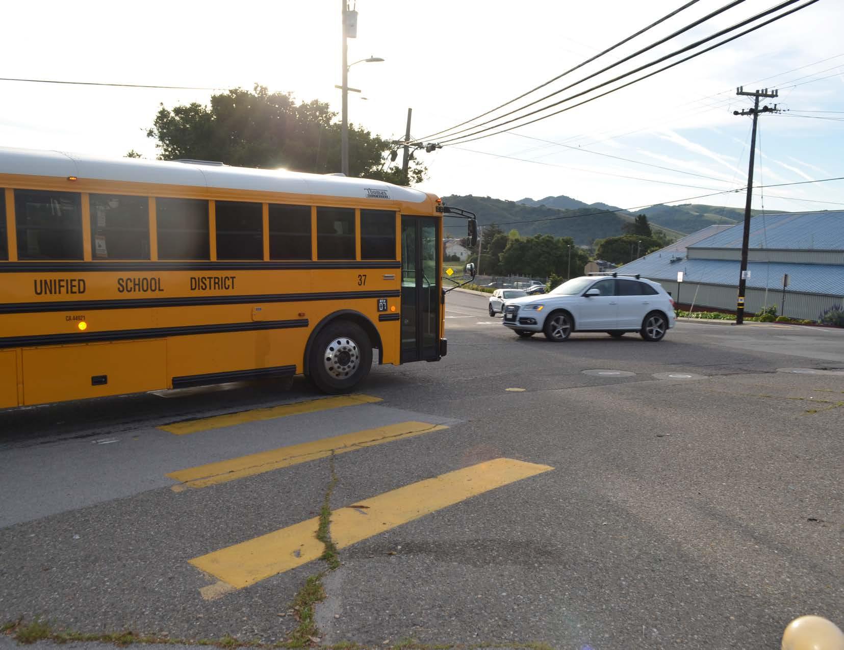
Throughout the community engagement process, participants frequently expressed the need for safe walking and bicycling routes to schools in Arroyo Grande. Making it safe for students and their families to walk, ride a bicycle, or use a mobility aid device to get to school is a top priority for the City. To support and encourage active transportation to schools, the ATP proposes several bicycle, pedestrian, ADA, and traffic calming recommendations for the areas surrounding the following schools:
» Harloe Elementary School
» Ocean View Elementary School
» Fairgrove Elementary School
» Paulding Middle School
» Arroyo Grande High School
The City can use these recommendations to pursue funding and implement SRTS projects at Arroyo Grande schools.
Harloe Elementary School is located in the southern part of Arroyo Grande. Between 2012 and 2022, there were seven pedestrian collisions and eight bicycle collisions within a half-mile radius of Harloe Elementary. Figure 5-3 displays SRTS recommendations for the fiveminute (quarter-mile) walk zone around Harloe Elementary School, which include Class III bicycle routes, Class II bicycle lanes, and Class IV separated bikeways/Class IIB buffered bicycle lanes* on the streets leading to the school. Figure 5-3 also shows recommendations for installing curb ramps and high-visibility crosswalk markings where missing and retrofitting existing curb ramps to have truncated domes. The City may consider additional improvements, such as curb extensions and/or crosswalk art at Fair Oaks Avenue and Alder Street.
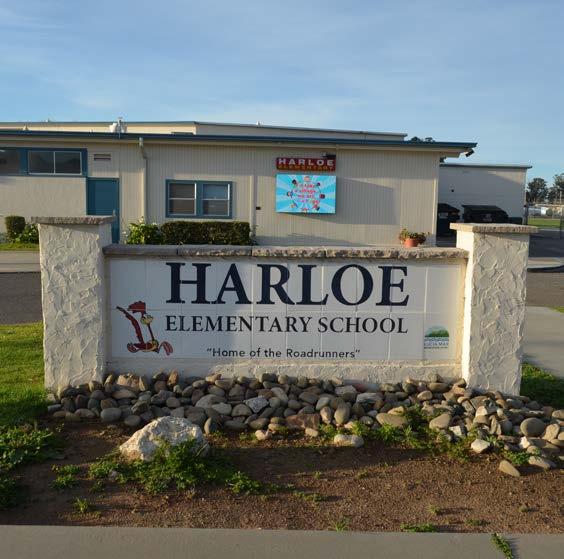
*Determination of whether a Class IV or Class IIB bicycle facility is installed will be based on considerations for cost, maintenance, and availability of adequate right-of-way to install the improvements.
GRADE LEVELS: K-6
NUMBER OF STUDENTS: 581
STUDENTS QUALIFYING FOR FREE OR REDUCED MEALS: 52.5%
BICYCLE AND PEDESTRIANRELATED COLLISIONS (2012-2022): 15
Sources: National Center for Education Statistics. (2023). Search for Public Schools.; California Department of Education. (2023). 2022-23 California Longitudinal Pupil Achievement Data System (CALPADS) Fall 1; Transportation Injury Mapping System. Safe Routes to School Crash Data. (2012-2022)
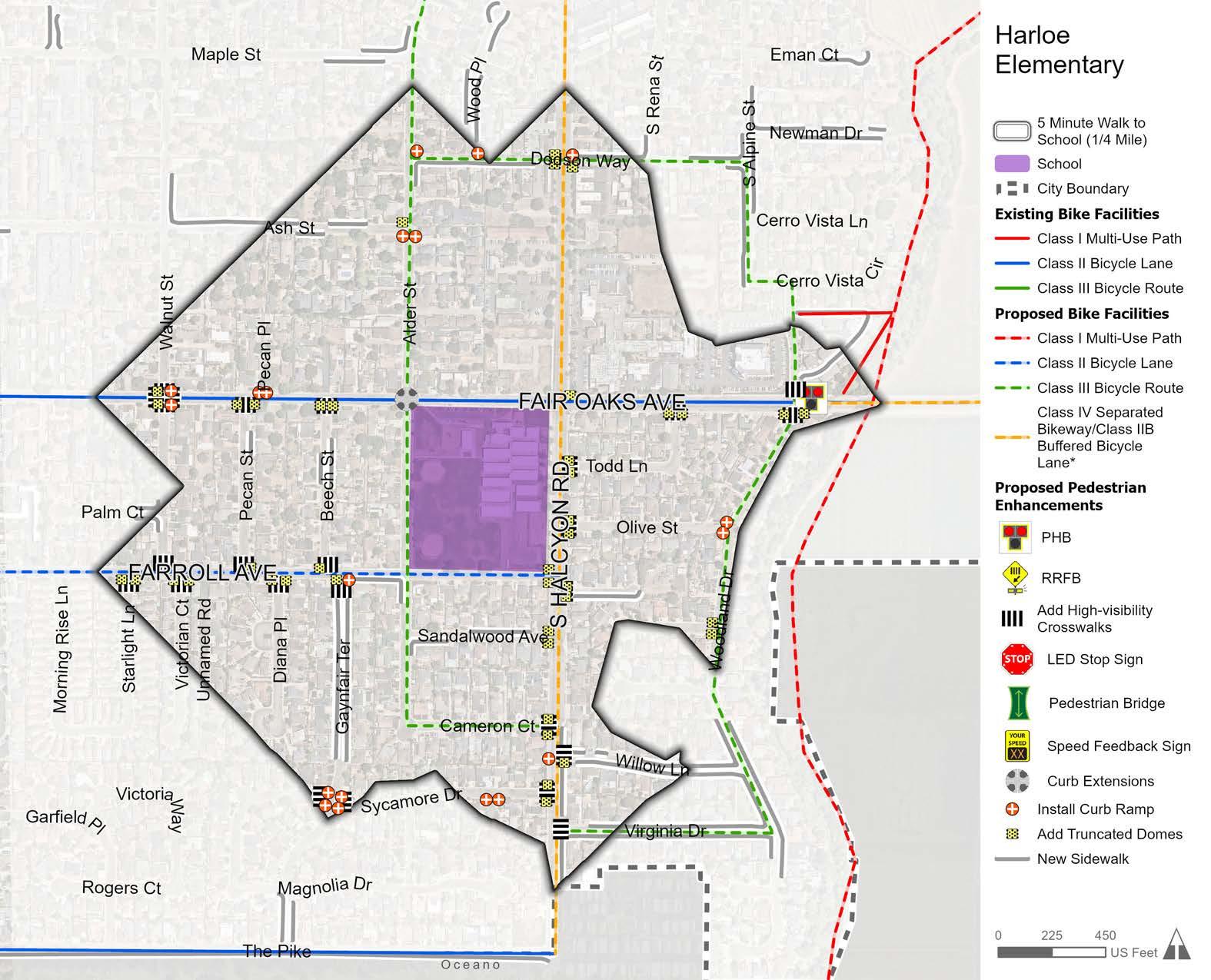
Ocean View Elementary School is located in the central-western part of Arroyo Grande. Between 2012 and 2022, there were nine pedestrian collisions and 17 bicycle collisions within a half-mile radius of Ocean View Elementary. Figure 5-4 displays SRTS recommendations for the five-minute (quarter-mile) walk zone around Ocean View Elementary School, which include Class III bicycle routes, Class II bicycle lanes, and Class IV separated bikeways/Class IIB buffered bicycle lanes* on the streets leading to the school. Figure 5-4 also shows recommendations for installing sidewalks, curb ramps, and high-visibility crosswalk markings where missing; retrofitting existing curb ramps to have truncated domes; and installing new LED stop signs. Additionally, the Brisco Road/U.S. 101 undercrossing has been identified as a barrier for safe walking and bicycling to school. Due to the complexity of this undercrossing, a future traffic study is recommended to determine appropriate solutions.
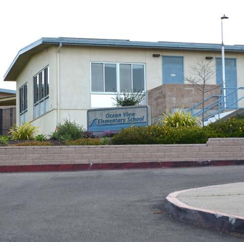
*Determination of whether a Class IV or Class IIB bicycle facility is installed will be based on considerations for cost, maintenance, and availability of adequate right-of-way to install the improvements.
GRADE LEVELS:
NUMBER OF STUDENTS: 525
STUDENTS QUALIFYING FOR FREE OR REDUCED MEALS: 33.3%
BICYCLE AND PEDESTRIANRELATED COLLISIONS (2012-2022): 26
Sources: National Center for Education Statistics. (2023). Search for Public Schools.; California Department of Education. (2023). 2022-23 California Longitudinal Pupil Achievement Data System (CALPADS) Fall 1; Transportation Injury Mapping System. Safe Routes to School Crash Data. (2012-2022)

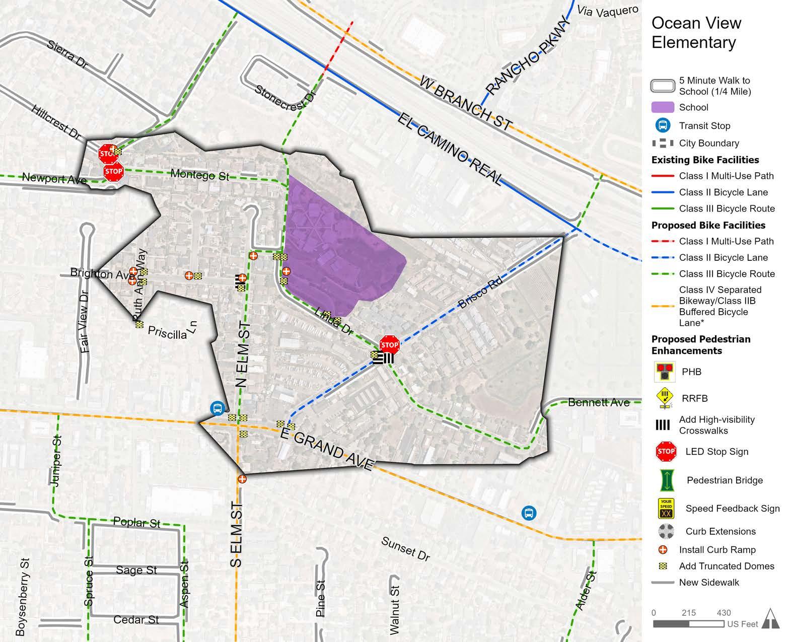
Fairgrove Elementary School is located just outside the western city limit, however, a significant number of students reside in Arroyo Grande. Between 2012 and 2022, there were five pedestrian collisions and 12 bicycle collisions within a half-mile radius of Fairgrove Elementary. Though the school is outside city limits, part of the route students take to get there is in Arroyo Grande. As a result, SRTS recommendations were developed to improve the route for students traveling from Arroyo Grande to Fairgrove Elementary. Figure 5-5 displays SRTS recommendations for the five-minute (quarter-mile) walk zone around Fairgrove Elementary School, which include installing improvements for safe pedestrian crossing, such as high-visibility crosswalk markings, an LED stop sign, and an RRFB, if warranted.
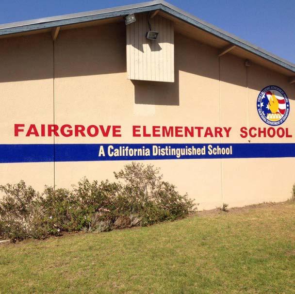
GRADE LEVELS:
NUMBER OF STUDENTS: 386
STUDENTS QUALIFYING FOR FREE OR REDUCED MEALS:
62.7%
BICYCLE AND PEDESTRIANRELATED COLLISIONS (2012-2022): 17
Sources: National Center for Education Statistics. (2023). Search for Public Schools.; California Department of Education. (2023). 2022-23 California Longitudinal Pupil Achievement Data System (CALPADS) Fall 1; Transportation Injury Mapping System. Safe Routes to School Crash Data. (2012-2022)
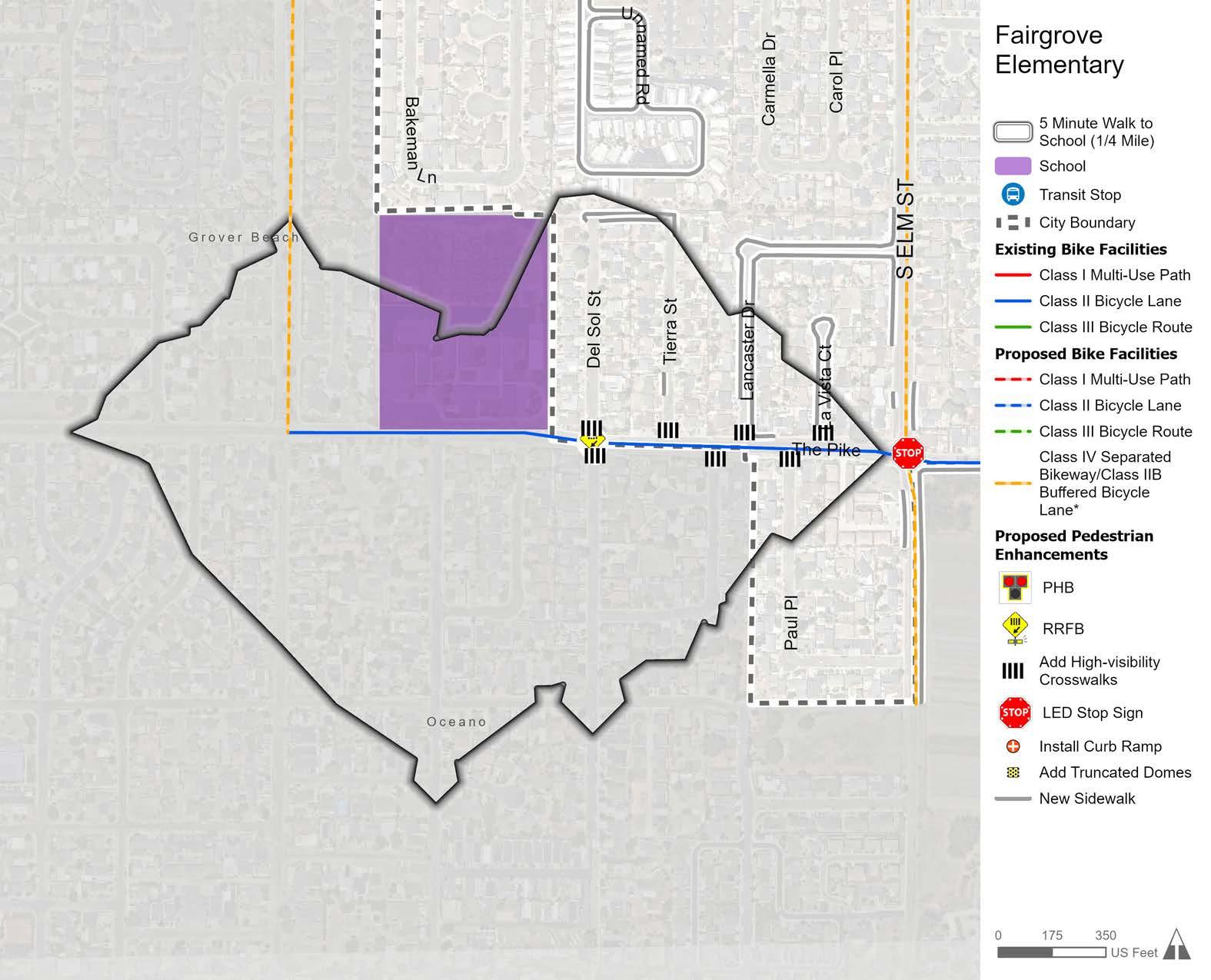
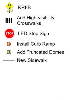
Paulding Middle School is located in the northeastern part of Arroyo Grande. Between 2012 to 2022, there were 12 pedestrian collisions and five bicycle collisions within a half-mile radius of Paulding Middle. Figure 5-6 displays SRTS recommendations for the five-minute (quartermile) walk zone around Paulding Middle School, including Class III bicycle routes, Class II bicycle lanes, Class IV separated bikeways/ Class IIB buffered bicycle lanes*, and Class I multi-use paths. Figure 5-6 also shows recommendations for installing curb ramps and highvisibility crosswalk markings where missing; retrofitting existing curb ramps to have truncated domes; installing an LED stop sign and speed feedback sign; and considering improvements for safe pedestrian crossing, such as an RRFB and PHB, if warranted. Additionally, a future traffic study is recommended to explore options for improving multimodal safety at the Huasna Road/Corbett Canyon Road intersection.
*Determination of whether a Class IV or Class IIB bicycle facility is installed will be based on considerations for cost, maintenance, and availability of adequate right-of-way to install the improvements.
GRADE LEVELS:
7-8
NUMBER OF STUDENTS:
536
STUDENTS QUALIFYING FOR FREE OR REDUCED MEALS: 46.6%
BICYCLE AND PEDESTRIANRELATED COLLISIONS (2012-2022): 17
Sources: National Center for Education Statistics. (2023). Search for Public Schools.; California Department of Education. (2023). 2022-23 California Longitudinal Pupil Achievement Data System (CALPADS) Fall 1; Transportation Injury Mapping System. Safe Routes to School Crash Data. (2012-2022)
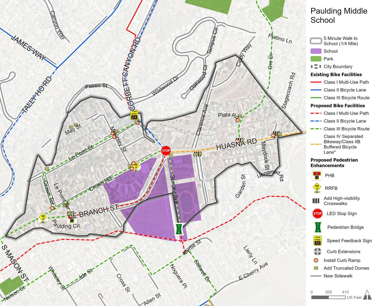
Arroyo Grande High School is located in the central-eastern part of Arroyo Grande. Between 2012 to 2022, there was one pedestrian collision and four bicycle collisions within a half-mile radius of Arroyo Grande High. Figure 5-7 displays SRTS recommendations for the fiveminute (quarter-mile) walk zone around Arroyo Grande High School, including Class III bicycle routes, Class IV separated bikeways/Class IIB buffered bicycle lanes*, and Class I multi-use paths. Figure 5-7 also shows recommendations for installing curb ramps and high-visibility crosswalk markings where missing; retrofitting existing curb ramps to have truncated domes; and installing a new LED stop sign and speed feedback sign. Additionally, a traffic study is recommended to explore options for improving multi-modal safety between Orchard Street and Traffic Way.
In addition to the infrastructure recommendations shown in Figure 5-7, bicycle and pedestrian infrastructure improvements are needed along Valley Road leading to Arroyo Grande High School from outside of the southern city limit. While outside of city limits, some students travel from the Arroyo Grande Mesa to Arroyo Grande High School and lack safe active transportation facilities. As a result, this ATP recommends that the City:
» Explore opportunities to partner with the County to improve bicycle and pedestrian infrastructure for people traveling to Arroyo Grande High School from outside of the southern city limit.
» Explore opportunities to partner with the County to reconfigure the existing S-curve along Valley Road to reduce vehicular speeding and improve safety and visibility for bicyclists. In the interim, advocate for the implementation of traffic calming measures.
*Determination of whether a Class IV or Class IIB bicycle facility is installed will be based on considerations for cost, maintenance, and availability of adequate right-of-way to install the improvements.
GRADE LEVELS: 9-12
NUMBER OF STUDENTS:
1,991
STUDENTS QUALIFYING FOR FREE OR REDUCED MEALS:
47.5% BICYCLE AND PEDESTRIANRELATED COLLISIONS (2012-2022): 5
Sources: National Center for Education Statistics. (2023). Search for Public Schools.; California Department of Education. (2023). 2022-23 California Longitudinal Pupil Achievement Data System (CALPADS) Fall 1; Transportation Injury Mapping System. Safe Routes to School Crash Data. (2012-2022)
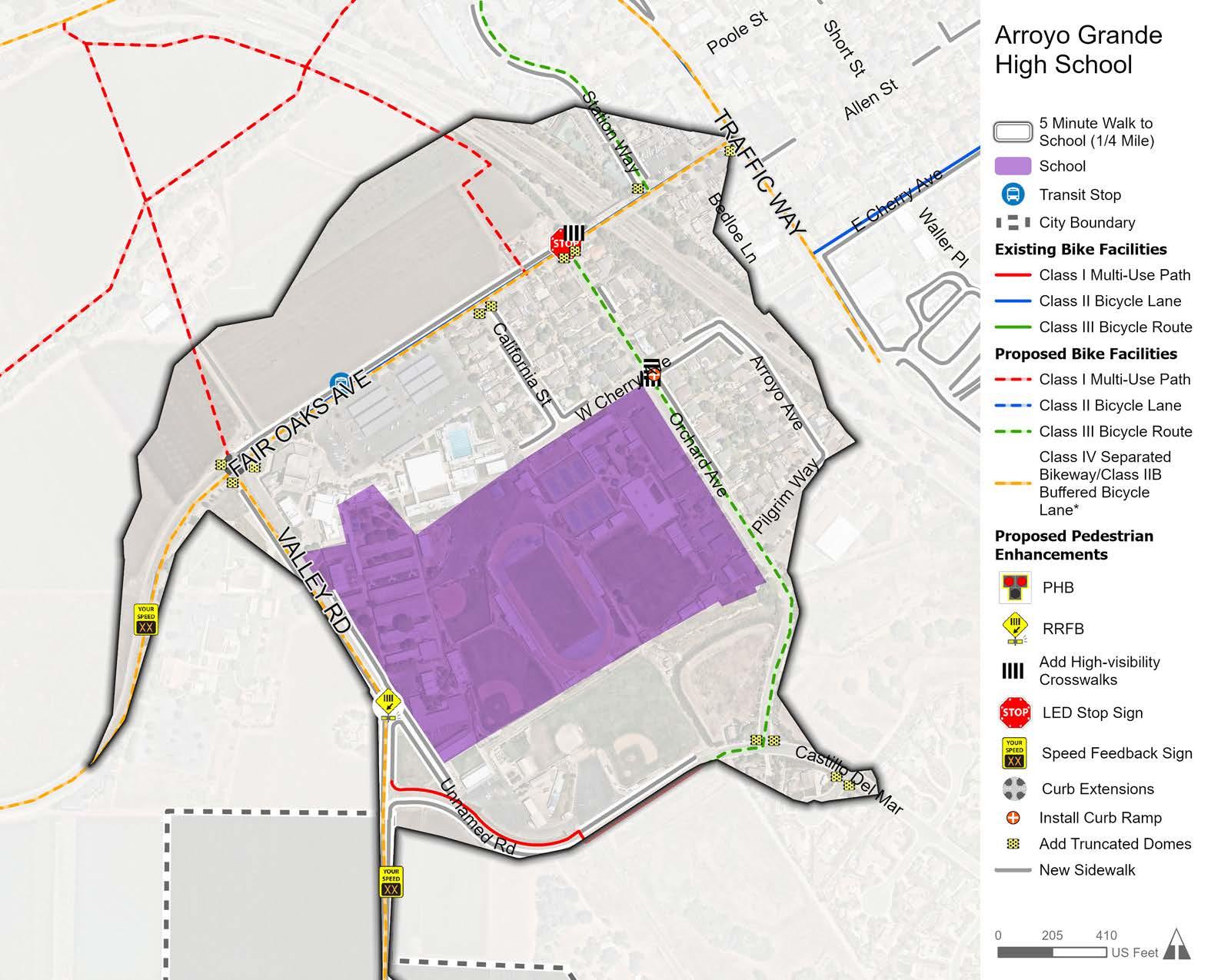

In addition to the proposed bicycle, pedestrian, ADA, and SRTS improvements, there are several key areas in need of future traffic studies due to their importance and complexity. The following intersections (shown in Figure 5-8) will require individual traffic studies to identify solutions that will facilitate safe multi-modal transportation:
» Brisco Road/U.S. 101 Undercrossing: Partner with Caltrans to identify options for improving bicycle and pedestrian safety.
» Coach Road or Flora Road Connection: Evaluate the feasibility of installing a publicly accessible bicycle/pedestrian route with a crossing over Arroyo Grande Creek on Coach Road or Flora Road.
» Corbett Canyon Road/Huasna Road: Determine if a roundabout or other traffic control device is warranted.
» East Cherry Path to Village: Explore opportunities to establish a publicly accessible bicycle/pedestrian route to connect the Branch Mill neighborhood to the Village.
» East Grand Avenue/U.S. 101 Overcrossing: Partner with Caltrans to determine if a road diet or other multi-modal improvements are warranted.
» Fair Oaks Avenue/U.S. 101 Overcrossing/Traffic Way: Partner with Caltrans to identify options for improving bicycle and pedestrian safety.
» Le Point Street to Larchmont Drive Bicycle Path: Explore opportunities to create a publicly accessible bicycle route to connect Le Point Street to Larchmont Drive.
» West Branch Street/Traffic Way Intersection: Determine if a roundabout or other traffic control device is warranted.
NOTE: FUTURE COORDINATION WITH CALTRANS IS NEEDED
The City will need to collaborate with a Caltrans project development team for all proposed traffic studies within the Caltrans right-of-way, including the Fair Oaks Avenue overcrossing, East Grand Avenue overcrossing, and Brisco Road undercrossing.
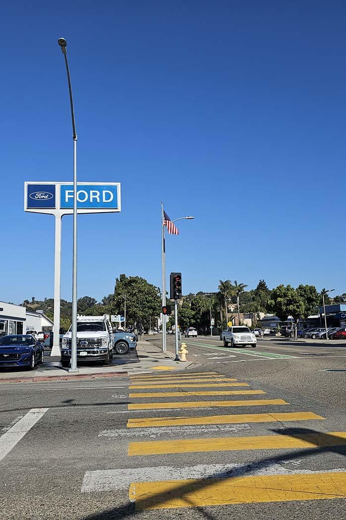
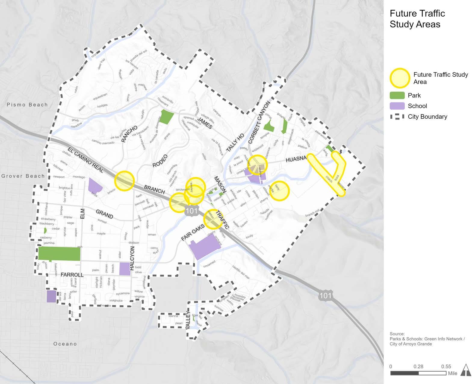
Three planning-level conceptual drawings were developed for priority projects to streamline future funding pursuits and project implementation. The three corridors shown in Figure 5-9 and Table 5-4 were selected for several reasons, including their role in providing connections to schools, parks, and commercial destinations; their need for safety improvements; their importance to the community; and more. Conceptual drawings include proposed bicycle facilities, pedestrian and ADA enhancements, and traffic calming measures to facilitate safe and comfortable active transportation along key corridors. The following section summarizes the infrastructure recommendations proposed for three priority projects. The planning-level conceptual drawings are provided in Appendix D.
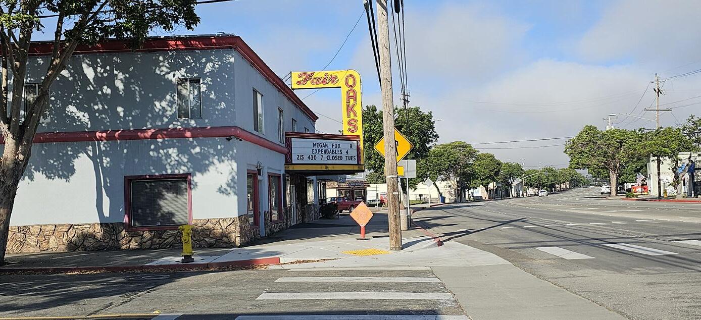
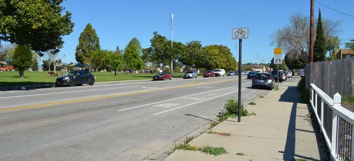
NOTE: FUTURE COORDINATION WITH CALTRANS IS NEEDED
The City will need to collaborate with a Caltrans project development team for all proposed projects within the Caltrans rightof-way, including along the Fair Oaks Avenue overcrossing and East Grand Avenue overcrossing. Any proposed improvements on the State Highway System are conceptual and will require a safety, operational, and/or warrant analysis prior to any Caltrans approval.
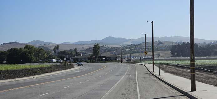
Proposed Bicycle Facilities:
» Class IV separated bikeways/Class IIB buffered bicycle lanes are recommended throughout the corridor.* In areas where Class IV separated bikeways cannot be accommodated, such as along driveways, Class IIB buffered bicycle lanes are recommended.
» Green conflict striping is proposed across intersections to alert drivers that bicyclists may be crossing and encourage slower vehicular speeds during merge conditions.
0 SCHOOLS
0 PARKS
» Where missing:
» Install high-visibility crosswalks
» Retrofit existing curb ramps without detectable warnings to have truncated domes
9 PEDESTRIAN COLLISIONS
21 BICYCLIST COLLISIONS
East Grand Avenue is a 4-lane arterial that runs east to west with a posted speed limit of 35 mph. East Grand Avenue passes over U.S. 101, connects Arroyo Grande to Grover Beach, and contains a variety of retail, restaurant, office, service, and entertainment uses. The corridor has ten bus stops, two vehicle travel lanes per direction, a center turn lane, and is controlled by five signalized intersections. Onstreet parallel parking is permitted intermittently throughout the corridors with parking prohibited in many areas. Class II bicycle lanes exist along portions of the corridor with gaps near Brisco Road and east of Halcyon Road. Nine pedestrian and 21 bicyclist collisions were reported on the corridor between 2012 and 2022.
» Install new curb ramps with truncated domes
» Implement traffic signal and timing improvements consistent with the City’s Systemic Safety Analysis Report (SSAR).
» Consider pedestrian crossing improvements to enhance visibility, safety, and comfort at Juniper Street and Alder Street.
» Consider a new pedestrian crossing and other improvements at Bell Street consistent with SSAR.
» Consider implementing a protected intersection at the East Grand Avenue/Elm Street intersection.
» Conduct a traffic study to determine the feasibility of implementing a road diet to create a bicycle-and-pedestrian-friendly commercial corridor.
» Partner with Caltrans to conduct a traffic study at the U.S. 101 overcrossing to determine if a road diet and/or other multi-modal improvements are warranted to improve bicyclist and pedestrian safety.
*Determination of whether a Class IV or Class IIB bicycle facility is installed will be based on considerations for cost, maintenance, and availability of adequate right-of-way to install the improvements.
» Consider removing or restricting street parking in some segments (where necessary and not heavily utilized) to accommodate bicycle facilities. See Appendix D for proposed removal.
» Consider collaborating with SLO RTA to move bus stops where additional curb space is available. See Appendix D for proposed relocation.
» Explore bicycle and pedestrian improvements for streets parallel to Grande Avenue as alternative corridors for active transportation.
» New curb cuts for driveways along East Grand Avenue should not be installed where vehicular access is provided from side streets or existing driveways. Where possible, driveways should be eliminated and replaced by City standard curb, gutter, and sidewalk.
Notes:
» The Circulation Element identified East Grand Avenue from Oak Park Boulevard to El Camino Real as a future Streetscape Project and study area.
» The Circulation Element identified the East Grand Avenue/El Camino Real intersection as a location for a new traffic signal or roundabout.
East Grand Avenue (Oak Park Boulevard to Elm Street)
Consider removing street parking to accommodate bicycle facilities. See Appendix D.
Consider removing right turn lane to accommodate bicycle facilities.
Existing Bicycle Facility
Class I Multi-use Path
Class II Bicycle Lane
Class III Bicycle Route
Class I Multi-use Path
Class II Bicycle Lane
Class III Bicycle Route
Class IV Separated Bikeway/
Class IIB Buffered Bicycle Lane*
Consider restricting northbound left turn and replacing with a pedestrian refuge island.
Consider pedestrian crossing improvements to enhance visibility, safety, and comfort.
Modify traffic signal and timing (reflective backplates, push buttons, leading pedestrian intervals, clearance values, etc.).
Consider protected intersection at Elm Street. Widening and median reconstruction required.
Install Curb Ramp
Install Truncated Domes
Install High-Visibility Crosswalk
Infill Sidewalk Gap Install Curb Extensions Install PHB or RRFB Install LED Stop Sign Install Speed Feedback Sign

Traffic Study Needed
Consider removing right turn lane to accommodate bicycle facilities.

Consider pedestrian crossing improvements to enhance visibility, safety, and comfort.
Modify traffic signal and timing (reflective backplates, push buttons, clearance values, etc.).
Consider pedestrian crossing and improvements at Bell Street consistent with SSAR.
In coordination with the El Camino Real intersection improvements, restrict left turns from Rena Street to Oak Street with median to accomodate Class IIB buffered bicycle lanes or Class IV separated bikeways. Alternatively, consider road diet from Rena Street to Oak Street.
Existing Bicycle Facility
Class I Multi-use Path
Class II Bicycle Lane
Class III Bicycle Route
Proposed Bicycle Facility
Class I Multi-use Path
Class II Bicycle Lane
Class III Bicycle Route
Class IV Separated Bikeway/ Class IIB Buffered Bicycle Lane*
Construct signal or roundabout at East Grand Avenue/El Camino Real consistent with Circulation Element.
Proposed Pedestrian and ADA Enhancement
Install Curb Ramp
Install Truncated Domes
Install High-Visibility Crosswalk Infill Sidewalk Gap Install Curb Extensions Install PHB or RRFB Install LED Stop Sign Install Speed Feedback Sign
Consider removing eastbound right turn lane to accommodate bicycle facilities.
Linda Drive Branch Street 1.05 miles
1 SCHOOL
2 PARKS
4 PEDESTRIAN COLLISIONS
EXISTING CONDITIONS:
3 BICYCLIST COLLISIONS
Elm Street runs north to south with posted speed limits between 25 and 35 mph. The corridor is classified as a local street (north of E. Grand Avenue), a 4-lane arterial (from E. Grand Avenue to Ash Street), and a 2-lane arterial (from Ash Street to the city limit). Land uses along Elm Street include single and multi-family residential, mixed-use, and community facilities. Key destinations along this corridor include Soto Park, Elm Street Dog Park, and Ocean View Elementary School. Elm Street ranges from one or two vehicle lanes per direction with a center turn lane provided between Ash Street and Farroll Avenue. Elm Street is controlled by one signalized intersection and four stop-controlled intersections. On-street parallel parking is permitted along most of the corridor. The corridor has Class IIB buffered bicycle lanes from Ash Street to Farroll Avenue and six bus stops. Four pedestrian and three bicyclist collisions were reported on this segment between 2012 and 2022.
RECOMMENDATIONS:
Proposed Bicycle Facilities:
» A Class III bicycle route is recommended between Linda Drive and East Grand Avenue. Class IIB buffered bicycle lanes are recommended from East Grand Avenue to Ash Street and from Farroll Avenue to the southern city limit.
» Green conflict striping is proposed across intersections to alert drivers that bicyclists may be crossing and encourage slower vehicular speeds during merge conditions.
Proposed Pedestrian Facilities:
» Where missing:
» Install high-visibility crosswalks
» Retrofit existing curb ramps without detectable warnings to have truncated domes.
» Install new curb ramps with truncated domes
» Infill sidewalk gaps near Sunset Drive and Lancaster Drive.
» Install curb extensions where Elm Street intersects with Ash Street and Farroll Avenue.
» Consider redesigning Elm Street/The Pike intersection to improve safety and comfort. Redesign may include removal of right-turn slip lane and the addition of signage, green striping, and high-visibility crosswalks.
» Implement traffic signal and timing improvements consistent with the City’s SSAR at the Elm Street/East Grand Avenue intersection.
» Consider a protected intersection at the East Grand Avenue/Elm Street intersection.
Elm Street (Linda Drive to Poplar Street)
Modify traffic signal and timing (reflective backplates, push buttons, leading pedestrian intervals, clearance values, etc.).
Elm Street (Poplar Street to Fair Oaks Avenue) ELM ST.
Consider protected intersection at Elm Street. Widening and median reconstruction required.
ELM ST.
Consider a road diet from Grand Avenue to Ash Street to increase space for bicycle and pedestrian facilities while maintaining on-street parking.
Consider a road diet from Grand Avenue to Ash Street to increase space for bicycle and pedestrian facilities while maintaining on-street parking.
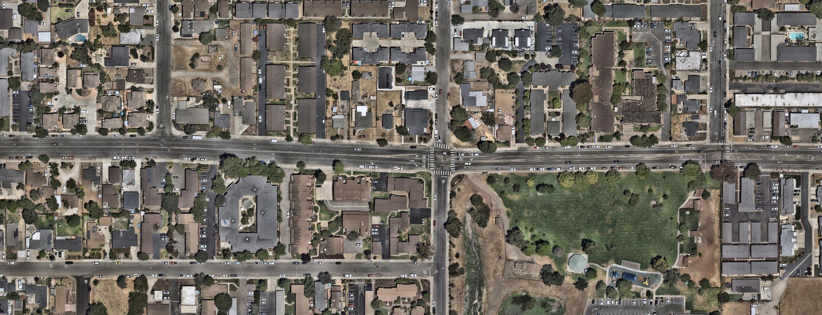
Existing Bicycle Facility
Class I Multi-use Path
Class II Bicycle Lane
Class III Bicycle Route
ELM ST.
Proposed Bicycle Facility
Class I Multi-use Path
Class II Bicycle Lane
Class III Bicycle Route
Class IV Separated Bikeway/
Class IIB Buffered Bicycle Lane*
Proposed Pedestrian and ADA Enhancement
Install Curb Ramp
Install Truncated Domes
Install High-Visibility Crosswalk
Infill Sidewalk Gap
Install Curb Extensions
Install PHB or RRFB
Install LED Stop Sign
Install Speed Feedback Sign
Other Traffic Study Needed
Elm Street (Fair Oaks Avenue to The Pike)
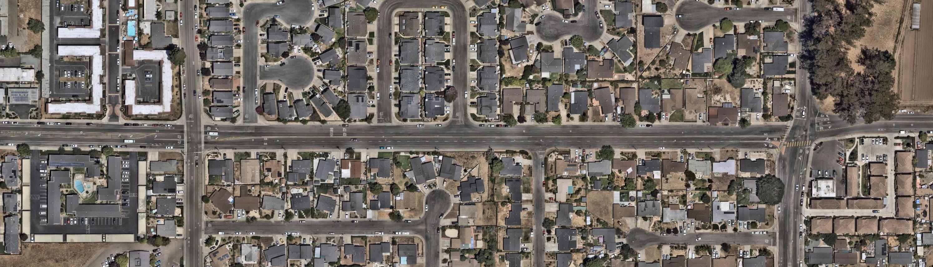
Elm Street (The Pike to City Limit)
Consider a road diet from Farroll Avenue to The Pike increase space for bicycle and pedestrian facilities while maintaining onstreet parking.
ST.
Existing Bicycle Facility
Class I Multi-use Path
Class II Bicycle Lane
Class III Bicycle Route
Proposed Bicycle Facility
Class I Multi-use Path
Class II Bicycle Lane
Class III Bicycle Route
Class IV Separated Bikeway/
Class IIB Buffered Bicycle Lane*
Opportunity to redesign intersection to improve safety and comfort. Redesign may include removal of right-turn slip lane and the addition of signage, green striping, and high-visibility crosswalks.
Proposed Pedestrian and ADA Enhancement
Install Curb Ramp
Install Truncated Domes
Install High-Visibility Crosswalk
Infill Sidewalk Gap Install Curb Extensions Install PHB or RRFB Install LED Stop Sign Install Speed Feedback Sign Other Traffic Study Needed
2 SCHOOLS
RECOMMENDATIONS:
Proposed Bicycle Facilities:
» Class IV separated bikeways/Class IIB buffered bicycle lanes are recommended from Woodland Drive to Traffic Way.* In areas where Class IV separated bikeways cannot be accommodated, such as along driveways, Class IIB buffered bicycle lanes are recommended.
» Green conflict striping is proposed across intersections to alert drivers that bicyclists may be crossing and encourage slower vehicular speeds during merge conditions.
3 PEDESTRIAN COLLISIONS
2 PARKS 8 BICYCLIST COLLISIONS
Fair Oaks Avenue runs east to west with posted speed limits between 30 and 40 mph. The corridor is classified as a 2-lane arterial (from Elm Street to Woodland Drive) and a 4-lane arterial (from Woodland Drive to Traffic Way). Land uses along Fair Oaks Avenue include single and multi-family residential, professional offices, agriculture, mixeduse, and community facilities. Key destinations on this corridor include Soto Park, Elm Street Dog Park, Harloe Elementary School, Arroyo Grande High School, and the Arroyo Grande Community Hospital. Fair Oaks Avenue ranges from one or two vehicle lanes per direction with a center turn lane provided between Halcyon Road and Woodland Drive. The corridor is controlled by four signalized intersections and four stop-controlled intersections. On-street parallel parking is permitted intermittently throughout the corridor. Fair Oaks Avenue contains four bus stops and Class II bicycle lanes. Three pedestrian and eight bicyclist collisions were reported between 2012 and 2022.
Proposed Pedestrian Facilities:
» Where missing:
» Install high-visibility crosswalks.
» Retrofit existing curb ramps without detectable warnings to have truncated domes.
» Install new curb ramps with truncated domes.
» Infill sidewalk gaps between Woodland Drive and Station Way.
» Consider installing a safe pedestrian crossing at Woodland Drive.
» Install curb extensions at Valley Road and consider a roundabout or protected intersection.
» Install curb extensions and LED stop signs at Orchard Street.
» Install a speed feedback sign to alert drivers heading eastbound toward Arroyo Grande High School.
Other Recommendations:
» Conduct a traffic study between Valley Road and Traffic Way to explore options for improving bicycle and pedestrian safety.
Notes:
» A roundabout will be installed at Halcyon Road as part of the Halcyon Complete Streets Project.
» The Circulation Element identified Fair Oaks Avenue (from Woodland Drive and Traffic Way) as a future Complete Streets Project.
» Active transportation improvements may change pending future development plans, road modifications, intersection improvements at Fair Oaks Avenue and SB U.S. 101 off-ramp, and/or traffic studies.
*Determination of whether a Class IV or Class IIB bicycle facility is installed will be based on considerations for cost, maintenance, and availability of adequate right-ofway to install the improvements.
Fair Oaks Avenue (Elm Street to Alder Street)
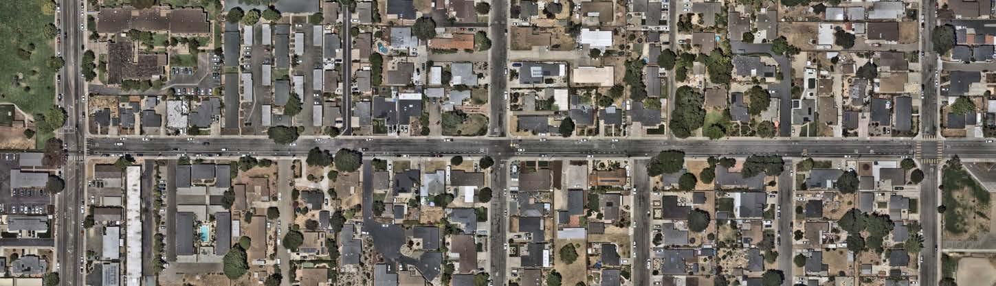
Fair Oaks Avenue (Alder Street to Arroyo Grande Creek)
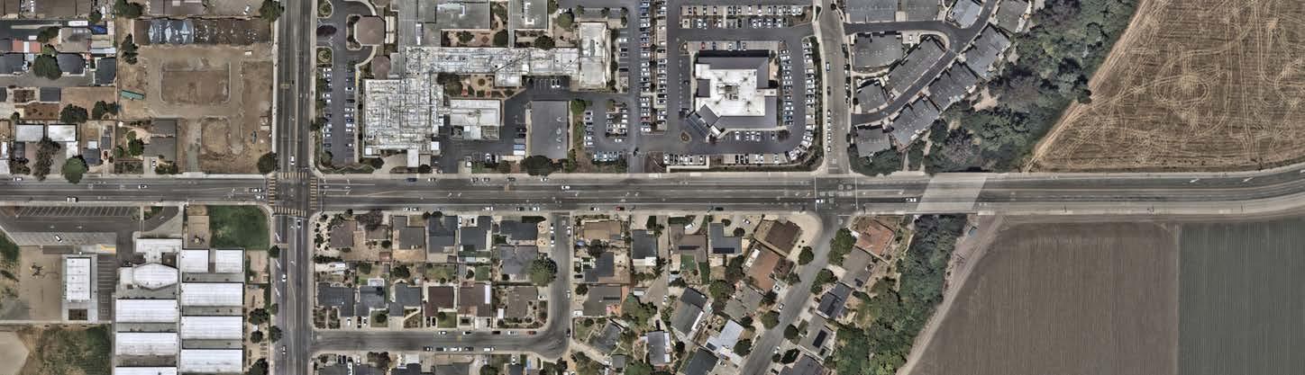
Existing Bicycle Facility
Class I Multi-use Path
Class II Bicycle Lane
Class III Bicycle Route
Proposed Bicycle Facility
Class I Multi-use Path
Class II Bicycle Lane
Class III Bicycle Route
Class IV Separated Bikeway/
Class IIB Buffered Bicycle Lane*
FAIR OAKS AVE.

Proposed Pedestrian and ADA Enhancement
Install Curb Ramp
Install Truncated Domes
Install High-Visibility Crosswalk
Infill Sidewalk Gap
Install Curb Extensions
Install PHB or RRFB
Install LED Stop Sign
Install Speed Feedback Sign Other Traffic Study Needed
Planned Roundabout (Halcyon Complete Streets Project)
Consider a road diet from Woodland Drive to Valley Road to increase space for bicycle and pedestrian facilities while maintaining on-street parking.

Fair Oaks Avenue (Valley Road to Traffic Way)
Future development along Fair Oaks Avenue should integrate active transportation facilities, including safe bicycle and pedestrian connections to Arroyo Grande High School.
Note: The City is exploring intersection improvements at the entrance of the school parking lot.
Existing Bicycle Facility
Class I Multi-use Path
Class II Bicycle Lane
Class III Bicycle Route
Proposed Bicycle Facility
Class I Multi-use Path
Class II Bicycle Lane
Class III Bicycle Route
Class IV Separated Bikeway/
Class IIB Buffered Bicycle Lane*
Consider a protected intersection or a roundabout.
Coordinate improvements along Fair Oaks Avenue with any future modifications to the U.S. 101 off-ramp.
CHERRY AVE.
Proposed Pedestrian and ADA Enhancement
Install Curb Ramp
Install Truncated Domes
Install High-Visibility Crosswalk
Infill Sidewalk Gap
Install Curb Extensions
Install PHB or RRFB
Install LED Stop Sign
Install Speed Feedback Sign
Other
Traffic Study Needed
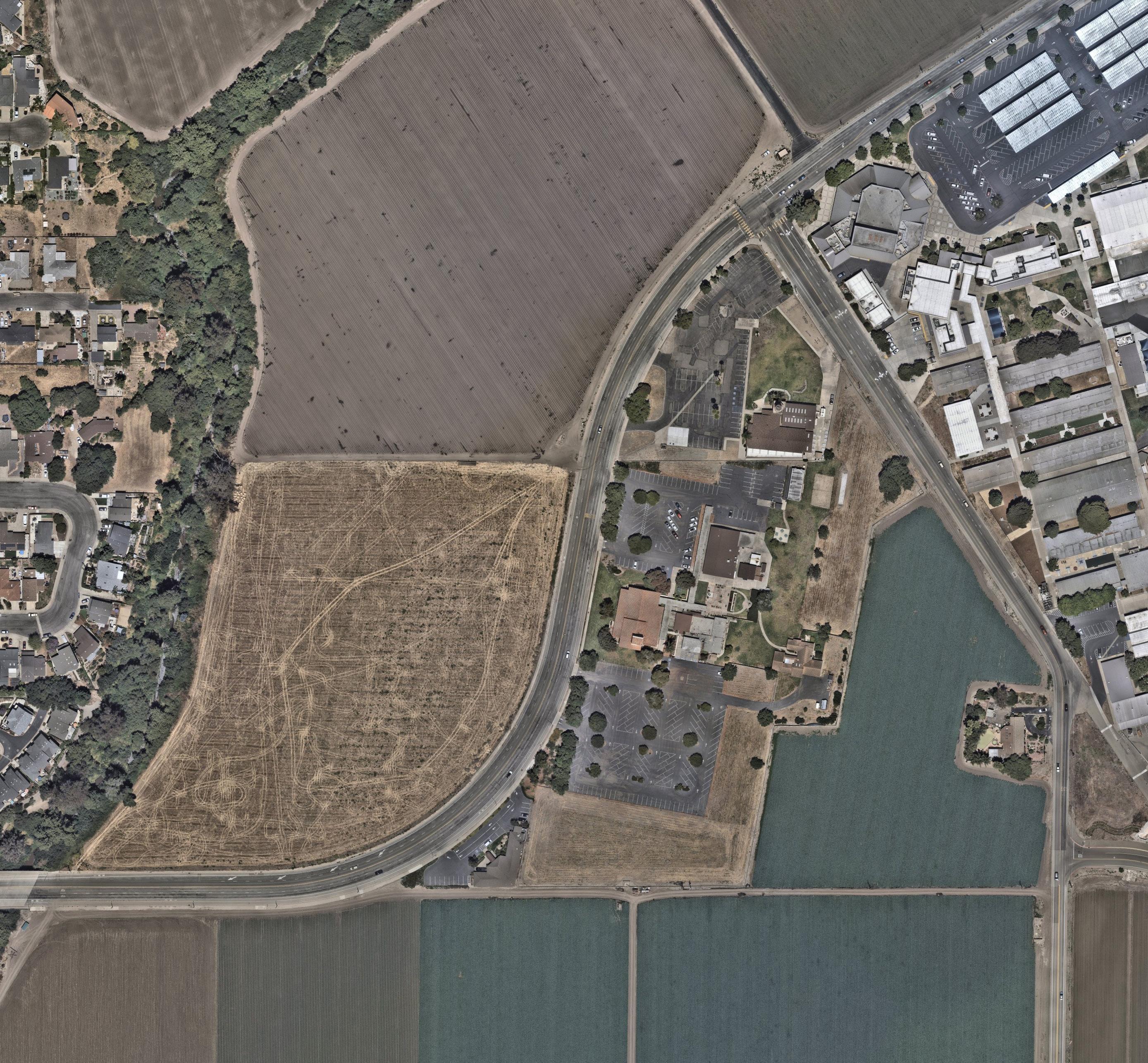
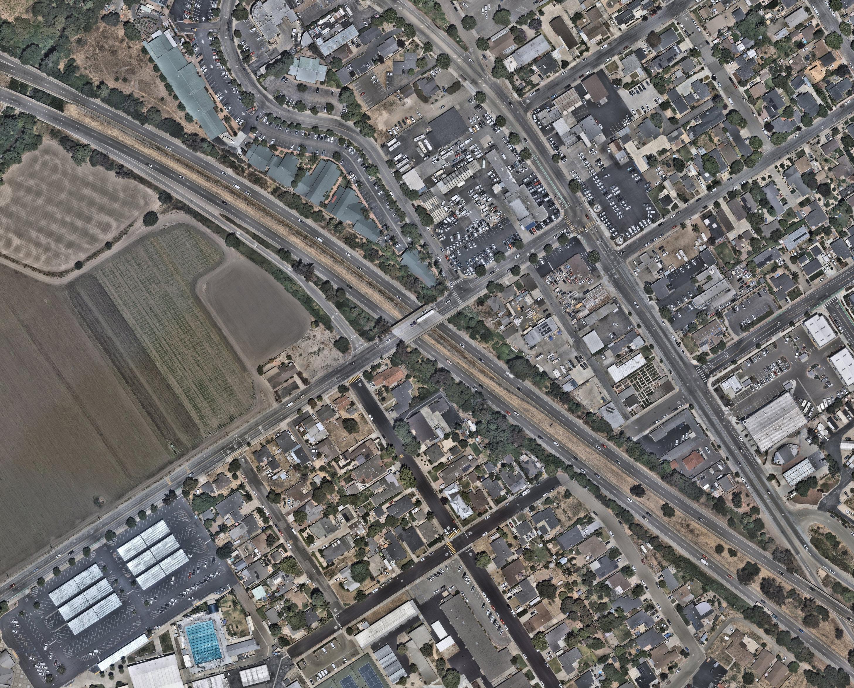
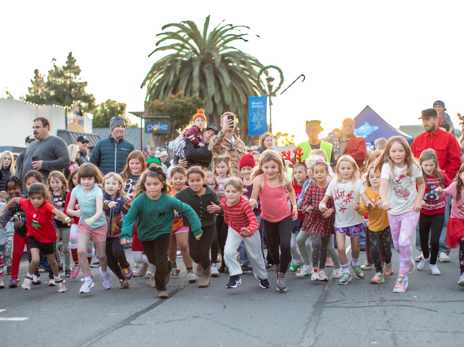
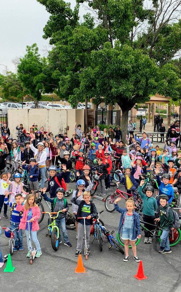
While infrastructure projects represent the most visible and perhaps most tangible evidence of a walkable and bikeable city, they are brought to life by programs and events that encourage people to use them. The proposed infrastructure improvements outlined at the beginning of this chapter provide the foundation for a safe and convenient active transportation system. However, encouraging proper and widespread use of these facilities requires extra efforts in the way of programs, design elements, education, and more. Bicycle and pedestrian infrastructure projects are increasingly paired with encouragement and education programs to generate community excitement and promote walking and bicycling as attractive travel options.
The following programs are organized as a menu of recommendations for the City to consider throughout the implementation of this ATP. The programmatic recommendations are organized by the “Six E’s” of transportation planning developed by the Safe Routes Partnership: Encouragement, Education, Equity, Enforcement, Engineering, and Evaluation.
Creating a walkable and bikeable Arroyo Grande will require an all-hands-on-deck approach that leverages partnerships with local organizations, agencies, and businesses, such as:
» Arroyo Grande Police Department
» Bike SLO County
» Caltrans, District 5
» City of Grover Beach
» City of Pismo Beach
» County of San Luis Obispo
» Lucia Mar School District
» SLOCOG
» SLO RTA
» SoCo Transit
» South County Chamber of Commerce ...and more!
Vehicle usage can be decreased in part by actively encouraging residents and visitors to walk, ride a bicycle, and take transit for a variety of trips and purposes. Encouragement is all about making walking, bicycling, and transit more fun, healthy, and easy to do. To achieve this, the City, along with local partners, can organize activities and events that promote active transportation.
Participate in National Bike Month by hosting a community activity, such as a Bike Breakfast, Bike to Work Day, Bike Fridays, etc. During May, cities across the country organize events and campaigns to educate people about bicycling and to encourage them to ride a bicycle more to their destinations.
Host guided walks, hikes, and bicycle rides to encourage trail, pedestrian, and bicycle facility usage in a safe and welcoming setting (e.g., Bike SLO County’s ‘Kidical Mass’ event). Events can be promoted as tours to local destinations, such as parks, trailheads, or the Village. Events should include helpful tips about road safety and trail use and can be geared towards certain age groups (e.g., family-friendly, seniors, etc.) or skill levels.
Hold a winter evening family-friendly walk and bike ride where participants use battery lights and/or bike lights to be more visible.
Host family-friendly themed walks where participants have the opportunity to explore key locations including historical buildings, parks, murals, and businesses.
Host food-focused bike ride events where participants get together to enjoy food and patron local businesses while cruising through the city’s streets. These events are an innovative way to bridge bike riding with community building.
Continue to host free five-kilometer running and walking events, such as the Turkey Trot Fun Run. These events are an excellent way to encourage people to explore their city on foot. Post-race refreshments and healthy snacks can be provided to participants.
Host an Open Streets Event by temporarily closing a street to motorists and opening it for active transportation. Open Streets Events allow for the reclamation of public space for community gathering, play, and movement. Open Streets Events encourages physical activity, increases local business, and has a positive social impact on the community. These events can include live music, public art installations, outdoor games, food vendors, exercise classes, bicycle repair stations, etc.
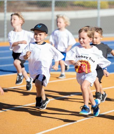
Partner with the Lucia Mar Unified School District and SLOCOG/ Rideshare to promote a ‘Walk to School Day’ and a ‘Bike to School Day’ that gives students and families the opportunity to socialize, start the day off with enthusiasm, and build connections with other members of the community. Fairgrove Elementary and Harloe Elementary both participated in 2024.
Encourage local schools to create a ‘Bike Bus’ to facilitate fun and safe bicycling to school. Bike buses are led by a “bus driver”—an adult on a bike— who guides a slowly moving group of bicyclists along a predefined route to school. Kids and their families can join the group as they pass by on their way to school.
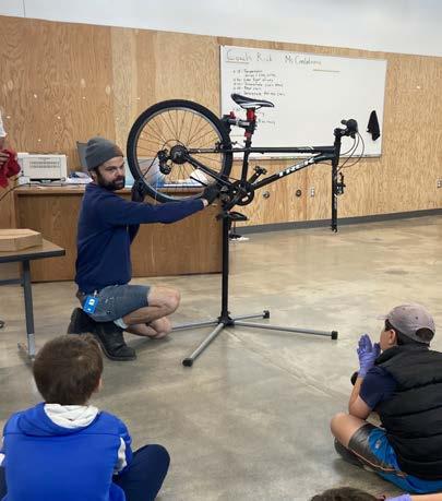
Develop a public-facing map of bicycle facilities and trails to help community members plan active transportation routes throughout the city.
Continue to run interactive campaigns and challenges to encourage walking, bicycling, and public transit in Arroyo Grande.
Encourage local businesses, such as coffee shops, restaurants, stores, and hotels, to become bike-friendly businesses to encourage people to ride and support the local economy. Bike-friendly elements include but are not limited to bicycle parking or storage, bicycle maps or information, bicycle repair or fix-it stations, and air pumps. Incentivize local businesses to provide discounts to patrons who arrive at their business by walking or bicycling.
Coordinate with SLO RTA and SoCo Transit to Improve FirstLast Mile Mobility
Coordinate with SLO RTA and SoCo Transit to improve active transportation facilities along bus routes to help address the first-last mile problem (i.e., the distance between a bus stop and the final destination) that often deters people from taking public transit. Examples of improvements include installing safe and comfortable bicycle facilities connecting bus stops to common destinations and other improvements to the built environment, such as landscaping, pedestrian-scale lighting, shade trees, and access to parks and recreation amenities. Where feasible, improve bus stop conditions such as adding bus shelters, lighting, and seating.
Pedestrian and bicyclist safety can be improved through public education campaigns and workshops. These education campaigns can help teach motorists, pedestrians, and bicyclists how to share the road safely. Educational programs can be incorporated into regularly scheduled programs, such as the City’s Recreation Services programs, hosted as stand-alone events, or held as a multi-part series. The City is encouraged to partner with local agencies and organizations, such as Bike SLO County and SLOCOG, on public education programs.
Explore areas to install educational signage (temporary or permanent) to inform motorists of pedestrian and bicycling safety. Such messaging should encourage drivers to be more cognizant when sharing the road with bicyclists.
Conduct an ongoing pedestrian and bicycle safety education campaign to increase community-wide awareness and knowledge of how to safely share the road with users of different transportation modes. A campaign may include tabling at community events, hosting educational workshops, posting educational messaging on social media, installing informational signage, and more.
Provide family-friendly interactive training and infrastructure tours to increase the confidence of pedestrians and bicyclists. Participants can receive free helmets and bike lights and are taught about the bicycle rules of the road, and how to be visible and predictable when riding.
Collaborate with Bike SLO County to host workshops that teach habits, skills, and tips for walking, hiking, and bicycling safely and comfortably. Workshops can cover lessons on street signs and infrastructure; rules and responsibilities of the road; “on-bike” maneuvers; and more. Giveaways, such as free helmets, bicycle lights, or reflective gear, should be provided to support safe walking and bicycling.
Collaborate with Bike SLO County to host bicycle maintenance and ride workshops to teach riders how to fix and ride a bicycle as well as how to navigate the rules of the road. Workshops can be geared toward youth and/or adults. These workshops can offer giveaway items, such as a bicycle, helmet, lights, or repair tools.
Encourage the Lucia Mar School District to collaborate with Bike SLO County to provide on-bike education programs for fourth and fifth grade students during physical education and to host safety assemblies that teach students foundational safety information, including the rules of the road and how to safely walk and ride a bicycle.
Collaborate with Bike SLO County to host an obstacle course to teach pedestrians and bicyclists how to identify different street signs and how to use street infrastructure to increase safety. Youth and children navigate the obstacle course to win free helmets and lights.
The ATP seeks to address and remove barriers to the safe and easy use of pedestrian, bicycle, and public transit facilities for recreation and transportation. Projects should be prioritized in the areas with the greatest need for multi-modal transportation solutions or recreational resources. In addition to constructing projects in underserved areas, it is important to integrate universal and accessible design features into new projects, to the greatest extent possible. Efforts to advance equitable access to high-quality, well-maintained, and enjoyable pedestrian, bicycle, and public transit facilities are essential to a successful multi-modal transportation system.
Recognize the importance of addressing the barriers that prevent trips from being safe, especially for the youth, elderly, disabled, and lower-income populations who cannot afford, operate, or choose to forgo vehicle ownership.
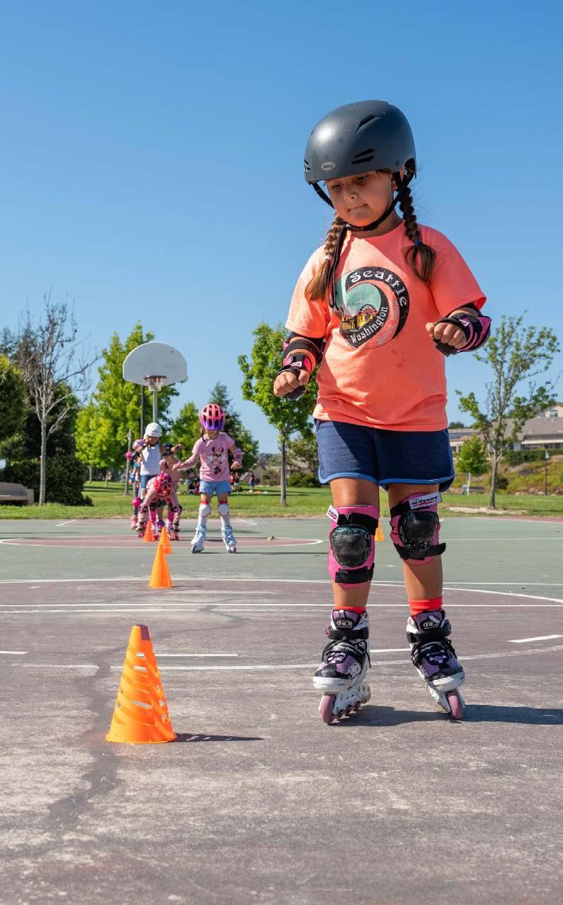
Implement improvements in areas that are disproportionately affected by health and safety burdens, acknowledging that policies and designs that improve conditions for vulnerable groups can benefit everyone in the community.
Continue to engage community members throughout ATP implementation and monitoring.
Secure funding to distribute free equipment to support safe and easy walking, hiking, and bicycling in Arroyo Grande. Equipment can include free bicycles, helmets, lights, first aid kits, etc.
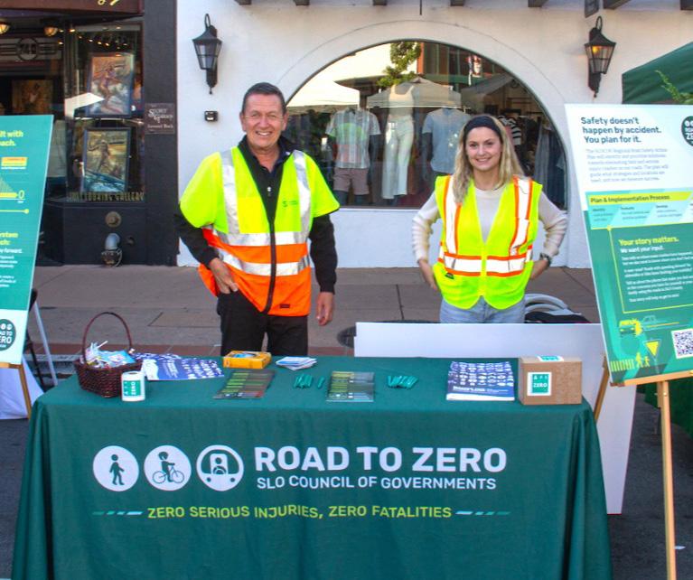
Pedestrian and bicycle-related collisions are often a result of road user error, such as a vehicle, pedestrian, or bicycle failing to follow the rules of the road. While education is an essential first step towards improving collective understanding and awareness of how to properly share the road and interact with new active transportation infrastructure, enforcement can help reinforce the importance of pedestrian and bicycle safety. City staff can collaborate with the Police Department to ensure officers receive training on pedestrian and bicycle issues and solutions, as well as best practices for enforcement.
Collaborate with Law Enforcement to Promote Pedestrian and Bicycle Safety
Partner with law enforcement to promote pedestrian and bicycle safety. Collaboration may include targeted enforcement to educate drivers, bicyclists, and pedestrians about applicable traffic laws and the need to share the road. This effort may include developing a brochure or tip card explaining each road user’s rights and responsibilities and selecting a designated law enforcement liaison to address pedestrian and bicycle safety issues and concerns.
Educate motorists on how to share the road with non-motorists and new bicycle and pedestrian or traffic calming infrastructure.
Place speed feedback trailers at specific locations where pedestrians and bicyclists are frequently present. Speed feedback trailers help to reduce speeding by warning motorists of their current speed and instructing them to slow down if they are going above the speed limit.
Establish a communication process that encourages students and parents to notify the school and law enforcement of the occurrence of a crash or near-miss during school commute trips involving auto, bus, pedestrian, or bicycle transportation.
A variety of engineering tools can be used to make sure that the roadways in Arroyo Grande are designed to keep bicyclists and pedestrians safe at all times while maintaining efficient travel throughout the city. Some of these tools include street design techniques that are meant to reduce traffic congestion, decrease vehicular speeds, and enhance pedestrian and bicycle safety and comfort. Some examples of engineering and traffic enhancements that provide a safer environment for pedestrians and bicyclists include:
» Traffic control signs
» Curb and high visibility pavement markings
» Signal timing
» Parking controls
» Traffic safety monitoring
Design and install quick-build active transportation infrastructure using temporary materials to test a new facility type in the community. Quick-build projects can be used to educate residents about potential bicycle, pedestrian, and traffic calming facilities and collect community input before construction. Quick-build projects may include but are not limited to curb extensions, sidewalks, midblock crossings, Class IV separated bikeways, and parklets. For example, the City may choose to pilot Class IV separated bikeways along East Grand Avenue as a quick-build project before investing in more permanent construction.
Many grant programs provide funding specifically for quick-build demonstration projects, such as the Road to Zero Community Traffic Safety Grant Program, the Clean Mobility Options Grant Program, and the Community Spark Grant Program. The City is encouraged to pursue and leverage grant funding opportunities for quick-build projects in Arroyo Grande.
Regular evaluation is necessary to monitor, maintain, and improve active transportation facilities in Arroyo Grande. Additionally, sharing and addressing evaluation findings with the public can help promote transparency and accountability for the City. The following examples include ways the City can evaluate programs and infrastructure.
Consider creating an Active Transportation Advisory Committee to provide oversight for the ongoing implementation of this ATP and planning and promoting active transportation. Many municipalities have developed similar advisory committees to address issues and opportunities related to walking, bicycling, and transit. This group can support City staff collaboration with residents and community partners to address issues and monitor ATP implementation.
Conduct regular bicyclist and pedestrian counts throughout Arroyo Grande to determine baseline mode share and subsequent changes in travel behavior as the ATP is implemented. Conducting counts would allow the City to understand active transportation trends throughout Arroyo Grande and identify where walking and bicycling are most frequent. In particular, conducting counts before and after constructing active transportation projects is essential to monitoring the impact of new improvements on travel patterns and behaviors. Additionally, bicycle and pedestrian counts should be collected as part of any existing traffic counts. Data from counts can be used to prioritize and justify projects when funding is solicited and received. Results should be regularly recorded for inclusion in a bicycle and pedestrian report card.
Encourage the Police Department to collect, track, and report collision data. Traffic collisions involving bicyclists and pedestrians should be regularly reviewed and analyzed to develop plans to reduce their frequency and severity. Any such plans should include Police Department involvement and should be monitored to determine their effectiveness.
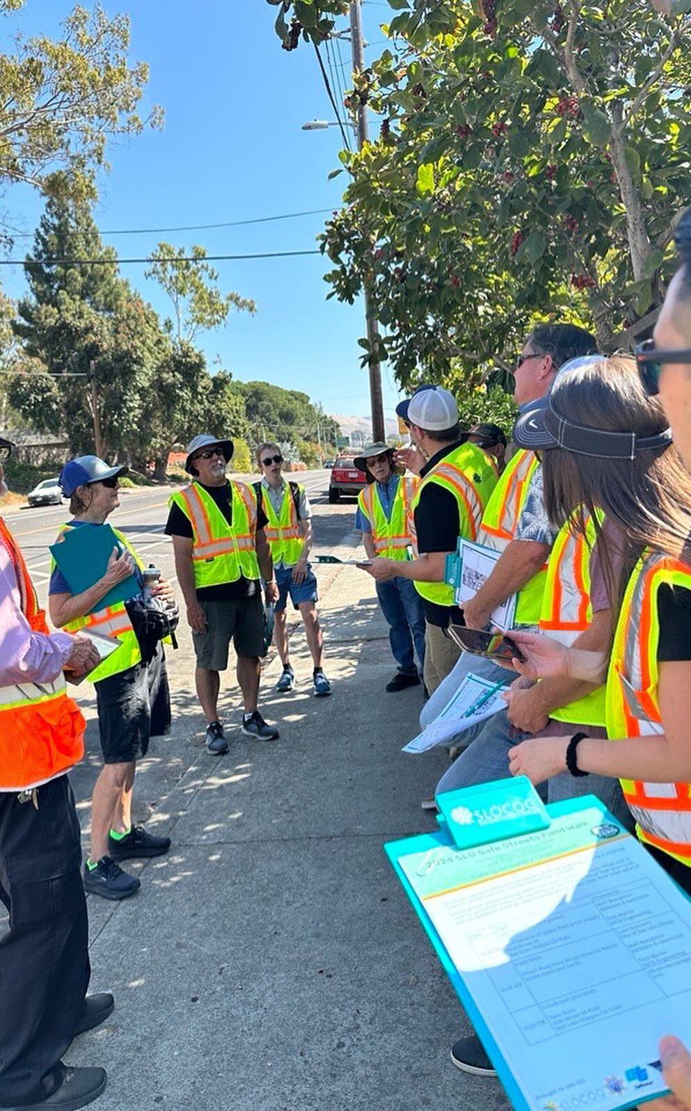
Develop a bicycle and pedestrian report card to measure the success of the ATP implementation. The report card could be used to identify the magnitude of accomplishments in the previous year and general trends. The report card could include, but not be limited to, keeping track of system completion, travel by bicycle or on foot (counts), number of collisions, etc.
Enable community members to provide input on active transportation satisfaction in the City’s community priorities survey. Every two years, the City launches a community priorities survey, inviting residents, businesses, and stakeholders to share their input on the City’s upcoming two-year budget. Active transportation can be included to help the City better understand the importance of active transportation to the community and allocate resources accordingly.
Include ATP implementation in the City’s annual CIP progress report and annual update to the Planning Commission and City Council. This annual report presents an opportunity to identify proposed projects from the ATP and report on construction progress.
Develop a working partnership with the Lucia Mar Unified School District to evaluate bicycle and pedestrian safety around and leading to Arroyo Grande schools. Forming a strong relationship with the Lucia Mar Unified School District can help to identify and address major SRTS needs and facilitate ongoing improvements.
Conduct regular monitoring of pedestrian and bicycle facility conditions to identify areas in need of maintenance, litter removal, beautification, or improvement. Address safety concerns and issues along pedestrian and bicycle facilities promptly to maintain a safe and enjoyable active transportation experience for community members.
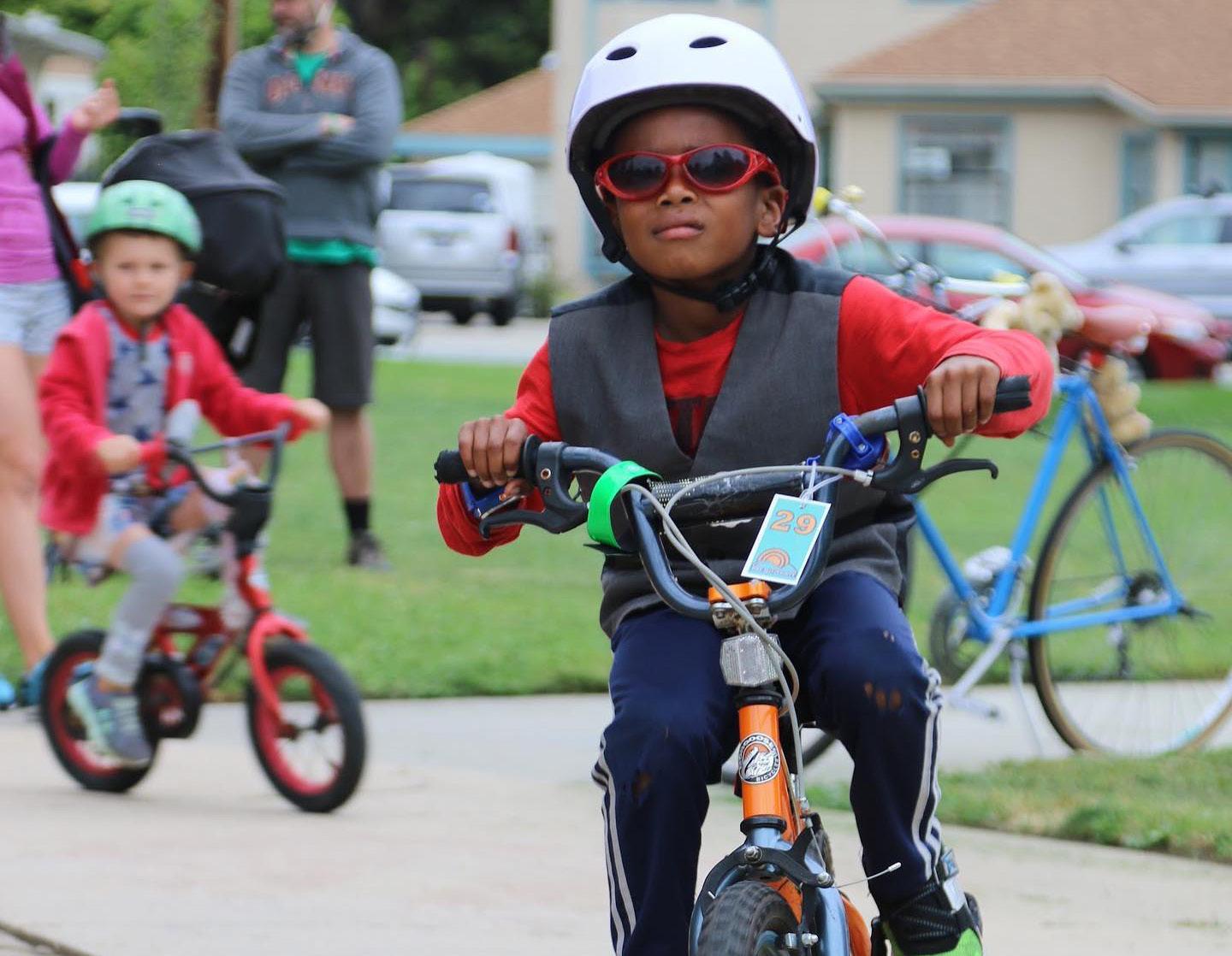
The American Association of State Highway and Transportation Officials (AASHTO) bicycle and pedestrian design guides are important national resources for planning, designing, and operating bicycle and pedestrian facilities. In particular, the Guide for the Development of Bicycle Facilities is especially useful for bike path design outside of a typical road right of way. The NACTO Urban Bikeway Design Guide and the Institute of Transportation Engineers (ITE) Designing Urban Walkable Thoroughfares Guide build upon the flexibilities provided in the AASHTO guides, which can help communities plan and design safe and convenient facilities for pedestrians and cyclists.
FHWA supports the use of these resources to further develop non-motorized transportation networks, particularly in urban areas. Moreover, in August of 2013, the FHWA issued a memo on Bicycle and Pedestrian Facility Design Flexibility issuing their support for taking a flexible approach to bicycle and pedestrian facility design. Moving away from standards and towards flexibility in design using the designer’s judgment is an important step towards contextual design, implementing the appropriate facility based on location and context.
In 2014, the California Department of Transportation (Caltrans) updated the California Manual on Uniform Traffic Control Devices (CA MUTCD) to provide uniform standards and specifications for all official traffic control devices in California. Since 2014, the CA MUTCD has been updated eight times, most recently in December 2023. The purpose of the CA MUTCD is to improve safety and mobility for all travelers by
setting minimum standards and providing guidance intended to balance safety and convenience for everyone in traffic, including drivers, pedestrians, and bicyclists.
The CA MUTCD contains the basic principles that govern the design and use of traffic control devices to promote highway safety and efficiency through the orderly movement of all road users on streets, highways, bikeways, and private roads open to public travel. Multimodal policies for safer crossings, work zones, and intersections are integrated into the CA MUTCD, with improvements including:
» Crosswalks Enhancements Policy
» Temporary Traffic Control Plans
» Work Zone and Higher Fines Signs and Plaques
» Traffic Control for School Areas
Additionally, NACTO guidance was analyzed to ensure flexibility and innovation in the design and operations of streets and highways in California. Much of the guidance provided in the CA MUTCD is consistent with the NACTO Urban Bikeway Design Guide.
Chapter 1000 of the Caltrans Highway Design Manual serves as the official design standard for bikeways in California. This chapter defines a “bikeway” as a facility that is provided primarily for bicycle travel and recognizes its importance in improving bicycling safety and convenience. Chapter 1000 intends to help accommodate motor vehicle and bicycle traffic on the roadway system, or as a complement to the road system to meet the needs of bicyclists. This chapter classifies bikeway facilities into five different types that include:
» Shared Roadway (No Bikeway Designation)
» Class I Bikeway (Bike Path)
» Class II Bikeway (Bike Lane)
» Class III Bikeway (Bike Route)
» Class IV Bikeways (Separated Bikeways)
However, Chapter 1000 states that these designations should not be construed as a hierarchy of bikeways since each bikeway type has its appropriate application. Additionally, Chapter 1000 only provides design guidance for Class I bike paths, Class III bike routes, and trails.
The Federal Highway Administration (FHWA) Separated Bike Lane Planning and Design Guide (2015) is the most recent national bike lane design guide and for many, the primary national resource for planning and designing bicycle facilities. It captures the state of practice of bicycle facility design within the street right of way. It provides a menu of design options covering typical one and two-way cycle tracks and provides detailed intersection design information covering topics such as turning movement operations, signalization, signage, and onroad markings.
The FHWA Bikeway Selection Guide (2019) is an important complement to the FHWA Separated Bike Lane Planning and Design Guide. It has a focus on designing for all ages and abilities. It gives the designer additional tools such as matrices, flow charts, and graphs that facilitate the design of the appropriate bikeway based both on roadway characteristics and the intended type of bicyclist.
The Massachusetts Department of Transportation (MassDOT) Separated Bike Lane Planning & Design Guide (2015) draws on research and best practices from the United States and around the world to cover topics not covered in other manuals, such as protected intersections and cycle tracks within roundabouts. Although it is a state guide and not a national guide, the up-to-date information and the easy-to-read graphics make it an important reference guide for bicycle planners and designers.
As transit gains a more prominent role in cities, more people are using buses, streetcars, and light rail than ever before. As a result, street design is shifting to give transit the space it deserves. The National Association of City Transportation Officials (NACTO) Transit Street Design Guide (2016) provides design guidance for the development of transit facilities on streets, as well as for prioritizing transit, improving its service quality, and supporting other related goals.
The majority of design elements included in this guide are consistent with MUTCD standards, including signage, markings, and signal elements that have received interim approval. These guidelines were developed using other design guidance as a basis, along with city case studies, best practices, research and evaluation of existing designs, and professional consensus.
The NACTO Urban Bikeway Design Guide (2012) and Urban Street Design Guide (2013) represent the industry standard for innovative bicycle and streetscape facilities and treatments in the United States. In 2014, Caltrans officially endorsed the NACTO Urban Street Design Guide and Urban Bikeway Design Guide as valuable toolkits for designing and constructing safe, attractive local streets. At the time, Caltrans was only the third State Department of Transportation to officially endorse the guides. It is also important to note that virtually all of the Urban Bikeway Design Guide design treatments (with two exceptions) are permitted under the Federal MUTCD.
The NACTO Urban Street Stormwater Guide (2017) provides guidelines on how to create streets that are resilient to climate impacts and also provide quality public spaces with social and economic benefits. This guide focuses on green infrastructure within urban streets, including the design and engineering of stormwater management practices that support and improve mobility. It also intends to reduce the impacts of stormwater runoff and human activity on natural ecological processes.
One of the main goals of this guide is to encourage interdepartmental partnerships around sustainable infrastructure, which includes communicating the benefits of such projects. However, this guide does not address stormwater management strategies on private property, nor does it address drainage and infiltration around controlled-access highways.
Several pieces of legislation support increased bicycling and walking in the State of California. Much of the legislation addresses greenhouse gas (GHG) reduction and employs bicycling and walking as a means to achieve reduction targets. Other legislation highlights the intrinsic worth of bicycling and walking and treats the safe and convenient accommodation of bicyclists and walkers as a matter of equity. The most relevant legislation concerning bicycle and pedestrian policy, planning, infrastructure, and programs are described in the following sections.
Interim Approval for Optional Use of an Intersection Bicycle Box (IA-18)
Intersection bicycle boxes are designated areas at signalized intersections that provide bicyclists with a space in which to wait in front of stopped motor vehicles during the red signal phase so that they are more visible to motorists. Since they are still considered experimental traffic control devices, the FHWA issued an Interim Approval to allow the provisional use of intersection bicycle boxes in October 2016. This Interim Approval does not create a new mandate compelling the use of intersection bicycle boxes but will allow agencies to install intersection bicycle boxes, pending official rulemaking revising the MUTCD, to facilitate more efficient operations at intersections. Interim Approval of a provisional device typically results in its inclusion in a future Notice of Proposed Amendments to revise the MUTCD. However, this Interim Approval does not guarantee the adoption of the provisional device, either in whole or in part, in any future rulemaking that revises the MUTCD.
In November 2021, Congress passed a new transportation bill, the Infrastructure Investment and Jobs Act of 2021, also known as the Bipartisan Infrastructure Law. The law targets a wide variety of infrastructure investments aimed at reducing GHG emissions from the nation’s transportation network and increasing the resilience of transportation infrastructure to extreme weather and climate impacts. Among other things, the law allocates $1.4 billion for the Transportation Alternatives Program in FY 2022, which will support pedestrian and bicycle infrastructure, recreational trails, safe routes to school, and more. Additionally, the law provides $1 billion in FY 2022 for the new Safe Streets and Roads for All program, which will provide funding directly to local and tribal governments to make streets safer with a particular focus on those walking, biking, and rolling.
AB-32 requires California to reduce its GHG emissions to 1990 levels by 2020. AB-32 also directs the California Air Resources Board (CARB) to develop specific early actions to reduce greenhouse gases while also preparing a scoping plan to identify how best to reach the 2020 limit.
AB-43 allows local jurisdictions to lower speed limits to make streets safer for people who walk and ride a bicycle. In particular, AB-43 gives local authorities more options for reducing speeding along high-injury streets and commercial districts.
AB-98 establishes specific standards for truck routes and requires a county or city, by January 1, 2028, except as provided, to update its circulation element, as prescribed, including identifying and establishing specific travel routes for the transport of goods, materials, or freight for storage, transfer, or redistribution to safely accommodate additional truck traffic and avoid residential areas and concentrations of sensitive receptors, including schools, parks, and homes.
AB-285 requires the California Transportation Plan (CTP), produced by Caltrans, to address how it will help meet state GHG emission and clean air goals. Starting in 2025, the CTP will have to forecast the potential impacts of future transportation technologies on infrastructure, access, and the overall transportation system. It will also be required to consider environmental justice in its planning for transportation and freight movement.
AB-361 allows local jurisdictions to install forward-facing parking control devices on city-owned parking enforcement vehicles and take photographs of parking violations in bicycle lanes. AB-361 enables local jurisdictions to review parking violations and issue citations to the registered owner of a vehicle within 15 calendar days.
AB-390 authorizes a pedestrian facing a flashing “DON’T WALK” or “WAIT” or approved “Upraised hand” symbol with a “countdown” signal to proceed, so long as the pedestrian completes the crossing before the display of the steady “DON’T WALK OR WALK” or “WAIT” or approved “Upraised Hand” symbol.
AB-413, also known as the Daylighting to Save Lives Bill, changes the California Vehicle Code to prohibit the stopping, standing, or parking of a vehicle within 20 feet of the vehicle approach side of any unmarked or marked crosswalk or 15 feet of any crosswalk where a curb extension is present. AB-413 will improve visibility for vehicles approaching crosswalks by giving them more time to see and yield to a person approaching an intersection. Prior to January 1, 2025, AB-413 jurisdictions may only issue a warning for a violation unless the violation occurs in an area marked using paint or a sign.
AB-712 prohibits landlords from prohibiting a tenant from owning personal micromobility devices or from storing and recharging up to one personal micromobility device in their dwelling unit for each person occupying the unit.
AB-773 authorizes local authorities to adopt a rule or regulation to implement a slow streets program, which may include closures to vehicular traffic or through vehicular traffic of neighborhood local streets with connections to citywide bicycle networks, destinations that are within walking distance, or green space.
AB-902 allows any person of any age who commits an infraction not involving a motor vehicle to participate in a diversion program sanctioned by local law enforcement. The bill eliminates the requirement that such a program charge no fee, as well as other technical changes.
Prior law provided that a local authority may not allow a person who has committed a traffic violation under the Vehicle Code to participate in a driver awareness or education program as an alternative to the imposition of those penalties and procedures unless the program is a diversion program for a minor who commits an infraction not involving a motor vehicle and for which no fee is charged.
AB-1096 defines an “electric bicycle” as a bicycle with fully operable pedals and an electric motor of fewer than 750 watts and creates three classes of electric bicycles. AB-1096 prohibits the operation of the most powerful Class 3 electric bicycles on specified paths, lanes, or trails unless that operation is authorized by a local ordinance. AB1096 also authorizes a local authority or governing body to prohibit, by ordinance, the operation of Class 1 or Class 2 electric bicycles on specified paths or trails. Prior law defined a “motorized bicycle” as a device that has fully operative pedals for propulsion by human power and has an electric motor that meets specified requirements.
AB-1193 amends various code sections, all relating to bikeways in general, specifically by recognizing a fourth class of bicycle facility, cycle tracks. However, another component of AB-1193 may be even more significant to future bikeway development.
Prior law required Caltrans, in cooperation with county and city governments, to establish minimum safety design criteria for the planning and construction of bikeways, and requires the department to establish uniform specifications and symbols regarding bicycle travel and traffic-related matters. Prior law also required all city, county, regional, and other local agencies responsible for the development or operation of bikeways or roadways to utilize all of those minimum safety design criteria and uniform specifications and symbols.
AB-1193 revises these provisions to require Caltrans to establish minimum safety design criteria for each type of bikeway and also authorizes local agencies to utilize different minimum safety criteria if adopted by resolution at a public meeting.
AB-1266 aims to make it safer for bicycle riding in California at busy intersections. The bill requires Caltrans to develop standards for lane striping, pavement markings, and appropriate regulatory signs that allow bicyclists to go straight from a right or left turn lane and to safely cross outside of the high-traffic lanes.
AB-1358 requires the legislative body of a city or county, upon revision of the Circulation Element of their General Plan, to identify how the jurisdiction will provide for the routine accommodation of all users of the roadway including drivers, pedestrians, cyclists, individuals with disabilities, seniors, and public transit users. The bill also directs the California Governor’s Office of Planning and Research (OPR) to amend guidelines for General Plan Circulation Element development so that the building and operation of local transportation facilities safely and conveniently accommodate everyone, regardless of their travel mode.
AB-1371, widely referred to as the “Three Foot Passing Law,” requires drivers to provide at least three feet of clearance when passing bicyclists. If traffic or roadway conditions prevent drivers from giving bicyclists three feet of clearance, they must “slow to a speed that is reasonable and prudent” and wait until they reach a point where passing can occur without endangering the bicyclists. Violations are punishable by a $35 base fine, but drivers who collide with bicyclists and injure them in violation of the law are subject to a $220 fine.
AB-1774 prohibits the sale of electric bicycle modification devices that enable the electric motor to exceed 750 watts. This effectively ensures that electric bicyclists are complying with the maximum electric bicycle speed limit of twenty-eight miles per hour under Class 3, the fastest classification of electric bicycles.
AB-1778 regulates the use of Class 2 electric bicycles by setting the minimum age to operate a Class 2 electric bicycle to sixteen and requiring all Class 2 electric bicycle riders to wear a helmet. Riders under sixteen years of age are still legally allowed to ride Class I electric bicycles.
AB-1909 included four changes to the California Vehicle Code aimed at improving the rights of bicyclists to safely access public bikeways and streets. AB-1909 (1) requires vehicles to change lanes when passing someone on a bike if a lane is available; (2) allows Class 3 electric bicycles on a bicycle path or trail, bikeway, bicycle lane, equestrian trail, or hiking or recreational trail unless specifically prohibited by a local jurisdiction; (3) allows bicyclists to cross an intersection during a pedestrian walk signal; and (4) prohibits a jurisdiction from requiring bicycles operated within its jurisdiction to be licensed. Together, these four changes will make it easier and safer to ride a bicycle in California.
AB-2086 brings transparency to Caltrans spending by requiring the California Transportation Plan to contain a financial element that summarizes the full cost of plan implementation. To further increase transparency and accountability, information on how annual project investments advance the California Transportation Plan must be added to the existing public online dashboard on or before January 1, 2027.
AB-2147 prohibits a police officer from stopping a pedestrian for specified traffic infractions, such as jaywalking, unless the street crossing is truly dangerous. AB-2147 legalizes safe street crossings and eliminates an arbitrary traffic enforcement practice that disproportionately targeted people of color.
AB-2669 allows pedestrians, bicyclists, or people using personal micromobility devices to cross existing toll bridges in California without paying a fee.
AB-2863 requires the Department of Housing and Community Development, upon the next triennial update of the California Green Building Standards Code that occurs on or after January 1, 2023, to research and develop mandatory building standards for short-term and long-term bicycle parking in multifamily residential buildings, hotels, and motels.
SB-1 creates the Road Maintenance and Rehabilitation Program to address deferred maintenance on the state highway system and the local street and road system. A total of $5.4 billion will be invested annually over the next decade, which will address a backlog of repairs and upgrades. Additionally, cleaner and more sustainable travel networks will be ensured for the future, including upgrades to local roads, and transit agencies, and an expansion of the state’s growing network of pedestrians and bicycle routes.
SB-375 seeks to reduce vehicle miles traveled (VMT) through land use and planning incentives. Key provisions require the larger regional transportation planning agencies to develop more sophisticated transportation planning models and to use them to create “preferred growth scenarios” in their regional plans that reduce greenhouse gas emissions. The bill also provides incentives for local governments to incorporate these preferred growth scenarios into the transportation elements of their general land use plans.
SB-400 expands the eligible modes of transportation for which the Clean Cars 4 All (CC4A) program “mobility option” may include bike sharing and electric bikes. CC4A aims to reduce car emissions by increasing the turnover of existing vehicles and replacing them with newer, cleaner, and more efficient vehicles. Reducing emissions from existing vehicles is a component of California’s State Implementation Plan for meeting air quality standards and also supports efforts to meet the state’s 2030 climate change goals.
SB-672 indefinitely extends the requirement to install traffic-actuated signals to detect lawful bicycle or motorcycle traffic on the roadway. By indefinitely extending requirements regarding traffic-actuated signals applicable to local governments, SB-672 imposes a state-mandated local program. Existing law requires the state to reimburse local agencies and school districts for certain costs mandated by the state.
When local governments want to add dedicated transit lanes, pedestrian walkways, or bicycle lanes to coastal areas, Local Coastal Programs are required documents that must be approved by the California Coastal Commission. SB-689 limits the ability of the Coastal Commission to block the development of new bikeways on existing roads in coastal areas by making it easier to amend Local Coastal Programs.
SB-743 changed the method of traffic analysis required through the California Environmental Quality Act (CEQA) for publicly and privately initiated projects. Before SB-743, transportation impacts were analyzed by quantifying traffic congestion as measured by the level of service (LOS), which resulted in mitigation measures to reduce traffic, such as building new roads or travel lanes, widening existing roads, adding turn lanes, and installing traffic control devices. Now, under SB-743, transportation impacts are assessed by quantifying how much and how far people drive, using a measure called Vehicle Miles Traveled (VMT). By measuring transportation impacts by VMT, mitigation measures can include opportunities to improve non-vehicular travel options, such as installing bicycle and pedestrian facilities, improving public transit access, and more.
portation-related
SB-922 extends until 2030 statutory exemptions to the California Environmental Quality Act for sustainable transportation projects, including improvements for walking, biking, public transit efficiency and wayfinding; rail stations; zero-emission transit refueling facilities; and carpooling.
SB-932 requires cities and counties, upon any substantive revision of a general plan circulation element, to develop bicycle plans, pedestrian plans, and traffic calming plans based on the policies and goals in the circulation element. SB-932 also requires cities and counties to begin implementation of a plan within two years of adoption; regularly review implementation progress; and consider revising the circulation element if the goals of the bicycle, pedestrian, or traffic calming plans will not be met within 25 years of circulation element adoption.
SB-960 requires Caltrans to set targets for active transportation and public transit improvements in State Highway Operation and Protection Program (SHOPP) projects, such as building bikeways, sidewalks,
bus boarding islands, and more. SB-960 mandates that Caltrans consider the needs of people walking, biking, and taking transit when repairing state roadways.
Under SB 1000, cities and counties are required to adopt an Environmental Justice Element or integrate environmental just-related policies, objectives, and goals throughout other elements of their General Plan. The bill also includes a process for communities to become meaningfully involved in the decision-making processes that govern land use planning in their neighborhoods.
SB-1216 prohibits the creation of Class III Bikeways on roads with a posted speed limit greater than thirty miles per hour, except at or near an intersection for the purpose of connecting a Class I, Class II, or Class IV bikeway through the intersection. This new law will also limit the use of State funding to create Class III bikeways on high-speed corridors.
Beginning on January 1, 2026, SB-1271 requires all electric bicycles sold in California to have their batteries tested and certified for safety standards. SB-1271 also clarifies rules for the advertisement and sale of electric bicycles.
The California Active Transportation Program, created in 2013, consolidates existing federal and state transportation programs, including the Transportation Alternatives Program (TAP), Bicycle Transportation Account (BTA), and State Safe Routes to School (SRTS), into a single program with a focus to make California a national leader in active transportation. SB-1 stipulates that $100 million of revenues from the Road Maintenance and Rehabilitation Account will be available annually to the program. An additional $122.5 million in State and Federal funding is allocated to the program each year.
Program funding is distributed as follows: 50 percent to the State for a statewide competitive program; 40 percent to Metropolitan Planning
Organizations in urban areas with populations greater than 200,000; and 10 percent to small urban and rural regions with populations of 200,000 or less. Additionally, State-designated Disadvtangaged Communities (DACs) are guaranteed a minimum of 25 percent of the entire program’s funding. Elibile projects include infrastructure projects (capital improvement projects), non-infrastructure projects (education, encouragement, and enforcement activities, combination projects (infrastructure and non-infrastructure), and communitywide planning projects in DACs.
The California Transportation Plan 2050 (CTP) is a long-range plan completed in 2021 to provide a common framework for transportation decisions and investments throughout the state. It aims to meet the growing needs of California residents as it relates to travel accessibility, emissions, and economic impacts.
Deputy Directive 64-R2 is a policy statement affecting Caltrans mobility planning and projects requiring the agency to:
“…provide for the needs of travelers of all ages and abilities in all planning, programming, design, construction, operations, and maintenance activities and products on the State highway system. Caltrans views all transportation improvements as opportunities to improve safety, access. and mobility for all travelers in California and recognizes bicycle, pedestrian, and transit modes as integral elements of the transportation system.”
The directive goes on to mention the environmental, health, and economic benefits of more Complete Streets.
Based on Public Resources Code Section 15262 (Feasibility and Planning Studies) guidance, planning documents such as this ATP are exempt from CEQA analysis since they are planning and conceptual recommendations:
“A project involving only feasibility or planning studies for possible future actions which the agency, board, or commission has not ap-
proved, adopted, or funded does not require the preparation of an EIR or Negative Declaration but does require consideration of environmental factors.”
As individual recommendations move forward toward further design and implementation, the City will then need to determine if there are environmental impacts that may warrant an EIR.
The purpose of Design Information Bulletin (DIB) 89-02 is to provide design criteria and guidance on best practices related to separated bikeways to establish uniform guidance that will facilitate consistent user expectations. DIB 89-02 allows designers to exercise sound judgment when applying it while being consistent with the Caltrans Highway Design Manual and the CA MUTCD. DIB 89-02 is written to allow for flexibility in applying design criteria, taking into consideration the context of the project’s location, enabling designers to tailor the design and maximize safety and comfort.
Best practices from cities, states, and countries currently operating separated bikeways were used to formulate DIB 89-02. This DIB will be updated as necessary based on lessons learned from engineers and practitioners as they gain more experience with the use of separated bikeways. The Federal Highway Administration (FHWA) publication Separated Bike Lane Planning and Design Guide (FHWA Guide) should be used to design separated bikeways. Where DIB 89-02 is inconsistent with the FHWA Guide, DIB 89-02 should govern.
California Governor Gavin Newsom signed Executive Order N-19-19 on September 20, 2019, to require the State to continue efforts to reduce GHG emissions and mitigate climate change impacts while building a sustainable economy. The California State Transportation Agency is directed to leverage strategies toward lowering vehicle miles traveled by supporting active modes of transportation such as biking and walking that also benefit public health.
The community engagement results provided in Appendix B include public comments from community members as written. Public comments are provided for reference and do not represent the views of the City.
POP-UP #1: HARVEST FESTIVAL 2023
Date: September 30, 2023 Location: Village of Arroyo Grande
General Comments
» Keep downtown chicken [rooster] friendly
Citywide Map
Table a-1: Pop-Up Event #1: Citywide Map Activity Comments
Ash Street and S. Elm Street
Missing sidewalk and curb
Bennett Avenue and S. Halcyon Road High visibility crosswalk
Christmas Tree Island Park
Crosswalk with lights; dangerous
East Branch Street Dangerous, people drive fast
East Branch Street - Crown Terrace Area Sidewalk improvements
Middle school no sidewalk around
East Branch Street - Huasana Rd Intersection
Blindspot
Dedicated right turn?
Farroll Avenue HS traffic
Maple Street (S. Elm Street and Alder Street) Missing sidewalk and curb
S. Elm Street (near Poplar Street intersection) No curb, gutter, sidewalk
South Mason Street and Poole Street 4-way stop? Dangerous
The Village Road narrows. Pedestrian danger
Build sidewalk
Unnamed Road - Leading to Arroyo High School
Who owns this?
Turn around parking?
Build sidewalk
Valley Road - Leading to Arroyo High School
High speed
Missing Sidewalk
Pedestrian Concern
Traffic Calming
Traffic Calming
Pedestrian Concern
Missing Sidewalk
Driving Concern
Driving Concern
Driving Concern
Missing Sidewalk
Missing Curb Ramp
Traffic Calming
Traffic Calming
Missing Sidewalk
Other
Driving Concern
Missing Sidewalk
Traffic Calming
Date: April 20, 2024 Location: Village of Arroyo Grande
General Comments
» Add charging stations for cars, scooters, e-bikes, etc.
Citywide Map
Table a-2: Pop-Up Event #2: Citywide Map Activity Comments
Ash Street & Soto Park General maintenance with sidewalk issues
Brisco Road
Corbett Canyon
Crown Terrace
Fair Oaks Avenue
Citywide Comment
Smarter/better traffic light coordination to move traffic
Road gets torn up on Corbett Canyon Road due to poor drainage issues in wet years. Needs asphalt maintenance.
Speeding and no sidewalks on Crown Terrace. Need traffic calming.
No lighting on Crown Terrace. Would be nice to have.
Fair Oaks bike lanes are tight and near barbed wire
Fair Oaks side streets near high school have missing sidewalks
Add safe walking/biking to Fair Oaks Avenue
Add charging stations for cars, scooters, e-bikes, etc.
Grand Avenue Bike Lane from Elm to the Village
Driveways and high speeds on Grand Avenue make biking uncomfortable
Grand Avenue
Huasna Road
Sunrise Terrace
The Village
Valley Road
Goal: Ride all the way to the beach along Grand Avenue
People speed too much along Grand Avenue. Need traffic calming
Reduce two signals to one signal going onto the freeway on Grand Avenue to avoid confusion and reduce speeds
Pedestrian Concern
Driving Concern
Other
Traffic Calming
Traffic Calming
Bicyclist Concern
Missing Sidewalk
Pedestrian Concern
Other
Bicyclist Concern
Bicyclist Concern
Bicyclist Concern
Traffic Calming
Driving Concern
Crossing bridge is awkward. Is there a way to go around school to make walking to Village Pedestrian Concern
Missing curb ramp on Rosewood and Huasna
Add RRFB to crossing on Rosewood and Huasna
Missing Curb Ramp
Pedestrian Concern
Sunrise Terrace - Verizon wants to put in a cell tower and disguise it as a water tower Other
Add safe walking/biking to the Village
Keep the Village lower traffic/pedestrian friendly
Add safe walking/biking to Valley Road
Pedestrian Concern
Pedestrian Concern
Pedestrian Concern
Date: September 28, 2028 Location: Village of Arroyo Grande
Draft Priority Corridors
Table a-3: Pop-Up Event #3: Draft Priority Corridor Comments
Table a-4: Pop-Up Event #3: Draft Bicycle Recommendations Comments LOCATION
Grand Avenue City to consider maintenance for any Class 4s. Add language about pilot projects first.
Fair Oaks Avenue I support the proposed crossing at Fair Oaks Avenue and Woodland.
Draft Bicycle Recommendations
Branch Mill Road
Brisco Road
Pave Branch Mill road! It is dangerous for bicyclists.
Add a 'Keep Clear' sign at Brisco underpass so cars don't block the intersection.
El Camino Real El Camino Real is very high stress from Brisco Road east. Can we divert bicyclists to another route?
Super! Bike Lanes!
Clear fully painted, visible bike lanes would keep us all safe!
Citywide Comment
Paint maintenance for lanes on road with reflective paint.
Materials imply Class IV is superior solution when it may not yet be determined. Buffered Class II could have more benefits.
Great ideas! We want the separated bikeway!
Grand Avenue
Yes, please to Class IV on Grand Avenue all the way from the Village to Oak Park would be amazing!!!
Oak Park Road Oak Park Road speeding is a concern.
Traffic Way Two-way bike lane from Traffic Way to Fair Oaks
Valley Road
We need safer routes to Arroyo Grande High School, especially from the Mesa. Many kids walk and bike to AGHS from outside of southern city limits, but have no safe way to get there. We have been asking the City to make AGHS safer for bicyclists and pedestrians for years, but haven't seen any action from the City.
W. Branch Street This Class IV [on W. Branch Street] would be so welcome!!!
Bicyclist Concern
Pedestrian Concern
Bicyclist Concern
Bicyclist Concern
Bicyclist Concern
Bicyclist Concern
Bicyclist Concern
Driving Concern
Bicyclist Concern
Bicyclist Concern
Bicyclist Concern
Bicyclist Concern
Bicyclist Concern
Bicyclist Concern
Bicyclist Concern
Draft Pedestrian Recommendations
Table a-5: Pop-Up Event #3: Draft Pedestrian Recommendations Comments
Brisco Road Wider under-crossing needed at Brisco Road.
Pedestrian Concern
Corbett Canyon Road Traffic calming is needed on Corbett Canyon Road. Traffic Calming
Dangerous intersection [at Woodland and Fair Oaks] - needs STOP signs.
Fair Oaks Avenue
Citywide Comment
Stop sign on Fair Oaks Avenue and Orchard needs LED lights. Many students cross here and need better visibility!
Hausna Road
Pedestrian Concern
Pedestrian Concern
Sidewalks need to be constructed - top priority. Missing Sidewalk
Signage blocking sidewalks - City policy should be enforced. Signage in front of City Hall Enforcement
Would be great to have a citywide map of bike lanes, trails, and paths for the public to use. Other
Steel/diamond clad plates where there are drainage channels - the edges are lifted and create trip hazards. Maintenance
South County Sanitation leaves trash bins randomly on sidewalks, blocking pedestrians. Enforcement
Retaining wall holding dirt - weep holes dump algae/moss and makes it slippery and unsafe. Maintenance
Huasna Road at Ralph Beck - West side, handicap ramp - water and dirt collects and causes issues for curb ramps and truncated domes. People in neighborhood have wheelchairs. Maintenance
Traffic calming is needed along Huasna Road
James Way
Traffic Calming
Trucks block sidewalks and force people and students into the street - needs enforcement. Enforcement
Missing sidewalks on James Way.
Traffic calming is needed on James Way.
Missing Sidewalk
Traffic Calming
Nelson Street Make higher visibility and enforcement stop at Nelson Street and Mason Street. Pedestrian Concern
Paulding Middle School
Paulding Middle School needs pedestrian improvements. Pedestrian Concern
I support the recommendations along Paulding Middle School as a walk/bike to school initiative. Pedestrian Concern
Printz Road Fix bike/ped bridge at Printz and Corbett Canyon Road. Maintenance
Tally Ho Road
The Village
Traffic Way
W. Branch Street
Tally Ho - 6' wall needs to be enforced. Enforcement
Trucks block pedestrian visibility. Enforcement
Sidewalks in the Village are often obstructed by outdoor dining. It is a safety/access issue. Enforcement
The sidewalk in front of Gina's Restaurant is constantly blocked and used by loading/unloading. Enforcement
Add crosswalk at 4th leg of Traffic Way and Branch intersection so pedestrians don't have to walk all around to cross the road.
Would like sidewalks and potholes fixed on W. Branch.
Pedestrian Concern
Missing Sidewalk
COMMUNITY WORKSHOP #1: EXISTING CONDITIONS & NEEDS
Date: December 13, 2023 Location: Arroyo Grande City Council Chambers
General Comments
» Work with the sanitation district to allow trash cans on the street instead of on the sidewalk
» Traffic signal push button that cyclists can push from
Are there specific intersections or streets that you are concerned with?
» Huasna/227 is an ideal location for a roundabout
Voting Activity: Place a sticker next to the active transportation facilities you would like to see throughout Arroyo Grande
Table a-6: Workshop #1: Voting Activity Results
Table a-7: Workshop #1: Citywide Map Activity Comments
Ash Street (near park)
Corbett Canyon Road
On-street parking along Ash St. can cause visibility issues for cycling
Why only bike lanes northbound and not southbound?
Corbett Canyon Road and Printz Road Bridge gets hit a lot
E. Branch Street (near Paulding Middle School)
E. Branch Street and Huasna Road
Safer pedestrian facilities are needed along E. Branch St. near Paulding Middle School
Stop signs with solar lights
Blinking beacon light?
Roundabout opportunity?
E. Branch Street and Short Street Branch St. versus Short St. side of the crosswalk. Pedestrian protection.
E. Cherry Avenue
Elm Street and Farroll Avenue
Fair Oaks Avenue bridge
Bicyclist Concern
Bicyclist Concern
Driving Concern
Pedestrian Concern
Traffic Calming
Traffic Calming
Traffic Calming
Pedestrian Concern
Look at new improvements along E. Cherry Avenue between Traffic Way and Leedham Place. Seem to be working Other
Parking blocks sight distance
Striping Fair Oaks Avenue bridge east
Fair Oaks Avenue and Elm Street Stop sign compliance
Fair Oaks and Tahiti Street
James Way
James Way and Oak Park Road
Huasna Road (between Paulding Middle School and city limits)
Dangerous and clogged at beginning and ending of school day or when big events happen. Lots of bikes - protected bike lanes needed!
Varying speed signs on James Way
Bike detector on James Way and Oak Park needs to detect bikes
Traffic calming needed along Huasna Rd. between Paulding Middle School and city limits. People drive too fast here!
How to slow them before middle school going west and by residential areas going east.
Speeding ongoing. Has the City considered speed reduction?
"No parking bike lane" but resident and parking are dangerous for cars driving fast by bikes.
Mobile home park with seniors. Any way to add ways to slow down drivers?
Bridge to connect Coach Rd. to Huasna Rd.
Curb is consistently dangerous at the corner of Strother Park
Unfinished sidewalk (Betterment Grant) near Strother Park
Traffic calming needed along Huasna Rd.
Trees to short for canopy (4 ft) and bushes constantly grow over sidewalk
Rancho Parkway (near shopping centers) Left turn hatch doesn’t
Traffic Way and Station Way
Right turn onto traffic yield instead of stop? Ded. lane exists. Tree obstruction. No view. Unsafe. Left turn looking right.
Traffic Way and Nelson Street Dangerous crosswalk!
Driving Concern
Other
Driving Concern
Bicyclist Concern
Traffic Calming
Bicyclist Concern
Traffic Calming
Traffic Calming
Bicyclist Concern
Traffic Calming
Other
Pedestrian Concern
Missing Sidewalk
Traffic Calming
Pedestrian Concern
Other
Driving Concern
Pedestrian Concern
Date: September 26, 2024 Location: Arroyo Grande City Council Chambers
General Comments
Table a-8: Workshop #2: General Comments
Citywide Comment Have P.D. enforce bikes and cars 4 sale without us calling it in Other
If you had a roundabout at Huasna how would the students cross?
Huasna Road
Round about 227/Huasna
No roundabout at Huasna/227
Paulding Middle School I walk the track at Paulding.
Traffic Way Traffic Way boxes weird intersection
Draft Priority Corridors
Table a-9: Workshop #2: Draft Priority Corridor Comments
PRIORITY CORRIDOR: ELM
Ash Street Opportunity for a roundabout.
Between Linda Drive and Grand Avenue Narrow road to 10 feet to slow traffic.
Fair Oaks Avenue Consider raised crosswalk.
General This [Class IV separated bike lanes] is great!
Traffic Calming
Traffic Calming
Traffic Calming
Other
Other
Traffic Calming
Traffic Calming
Pedestrian Concern
Bicyclist Concern
Off of corridorBrisco Road Need safe route to Ocean View Elementary from other side of freeway at Brisco Hardware and Cemetery. Other
PRIORITY CORRIDOR: FAIR OAKS AVENUE
Alder Street Please consider intersection improvements at Alder and Fair Oaks Avenue.
Elm Street to Woodland This [Fair Oaks between Elm Street and Woodland] is in the door zone of the street parking here. Consider a parking protected bike lane configuration. Not safe for kids.
General This [Class IV separated bike lanes] is great! Consider extending to Halcyon.
Orchard Street Consider curb extensions to reduce crossing distance.
Pedestrian Concern
Bicyclist Concern
Bicyclist Concern
Bicyclist Concern
Alpine Street Wider sidewalks. See Fruitland on a Friday night. Most vibrant part of town next to 40 mph traffic.
Alpine Street - El Camino Real More crosswalks here.
General Road diet!
General Grand Avenue redesign should be #1 priority for the City. Potentially huge positive transformation for ATP and Grand Avenue businesses. The corridor is unusable right now.
General Prohibit new driveways
Halcyon Road
Please consider bike and ped improvements at this skewed intersection. Maybe curb extensions?
Pedestrian islands? Painted intersections?
Hwy 101 Overpass Very dangerous for peds and bikes.
Mid-block crossing W. bound visibility of crosswalks
Rena Street Please remove turn lanes!
Draft Bicycle Recommendations
Table a-10: Workshop #2: Draft Bicycle Recommendations Comments
Brisco Road
Fair Oaks Avenue
Oak Park Boulevard
Traffic Way
Class III is not bike infrastructure. This is high speed to a school.
This [Fair Oaks between Elm Street and Woodland] is a door zone bike lane. Almost unusable. Needs more space between lane and parking. Or no parking. Or reconfiguration.
Hill! High Priority! [bike lane disappears when bicyclists are biking uphill at much slower speeds than vehicles]
Potential bike safety detour to direct bicyclists to crossing at Fair Oaks and Traffic Way instead of at Nelson and Traffic Way.
Valley Road S-curve on Valley should be straightened to avoid dangerous curve.
Water Tank Easement Can we have a trail through to the Camp AG? There is the water tank easement.
Bicycle Project Prioritization
Table a-11: Workshop #2: Bicycle Project Prioritization Comments
Arroyo Grande Creek
15,16 Arroyo Grande High School Path
12 should be lower than anything connecting to a school or Soto (13, 19, 27).
Lower. Adding more stop signs in the neighborhood would help this.
These should be higher priority than the creek trail.
Pedestrian Concern
Pedestrian Concern
Other
Traffic Calming
Pedestrian Concern
Pedestrian Concern
Pedestrian Concern
Pedestrian Concern
Other
Bicyclist Concern
Bicyclist Concern
Bicyclist Concern
Bicyclist Concern
Bicyclist Concern
Bicyclist Concern
Draft Pedestrian Recommendations
Table a-12: Workshop #2: Draft Pedestrian Recommendations Comments
LOCATION
Brisco Road
Safer route to school is needed for Ocean View kids along Brisco Road. No sidewalk for kids to walk on at Brisco Hardware. Missing Sidewalk
When they do student walk day [at Ocean View ES] they walk along here [Brisco Road] and there are no sidewalks and not safe at all. Missing Sidewalk
Safe route to school for Ocean View Elementary School.
Other
E. Branch Street E. Branch needs another crosswalk between Traffic and Bridge. People cross all along that section. Pedestrian Concern
Fair Oaks Avenue Please consider improvements at this intersection [Halcyon and Fair Oaks] for peds and bikes. Pedestrian Concern Grand Avenue W. Grand Avenue [in Grover Beach] is trying to be pedestrian-friendly already.
Huasna Road
Light-up stop sign at Corbett Canyon and Huasna
Other
Pedestrian Concern
Traffic calming efforts on Huasna Road Traffic Calming
Nelson Street Intersection of Mason & Nelson - enhanced pedestrian crossing
Strother Park Crosswalk Strother Park
Pedestrian Concern
Pedestrian Concern Traffic Way
Consider improvements at this intersection [Traffic Way and Fair Oaks] for bikes and ped. On the way to school. Pedestrian Concern
Pave sidewalk between B of A and AG Library to support the upcoming Library renovation. Missing Sidewalk
Path from the Village to the Library is really needed.
W. Branch Street
Pedestrian Concern
Please pave the sidewalk along W. Branch between B of A and the AG Library to support the upcoming Library renovation. Missing Sidewalk
Table a-13: Workshop #2: Draft SRTS Recommendations Comments
Fair Oaks Avenue Bus stops need improvements here. Bus Concern
General This area needs to be expanded in order to provide a safe route for most students.
Brisco Road Underpass is dangerous for bikes.
Brisco Road Need sidewalk to school. This would either be on cemetery side or Brisco.
Brisco Road Class III is not bike infrastructure.
Brisco Road This is high speed to a school.
Other
Bicyclist Concern
Missing Sidewalk
Bicyclist Concern
Bicyclist Concern
Huasna Road Speeding issues Traffic Calming
Huasna Road Huasna Road at Clarence - Portuguese Hall events block the street.
General I don't think students will be riding their bike to Paulding.
General Students will and do ride their bikes to/from Paulding. The area needs to be expanded. Students cross the 101 overpass everyday. The Jr. High has more students coming from father away.
General Roundabout
Other
Bicyclist Concern
Other
Other
Figure a-1: Survey Question 1: How would you best describe your relationship with Arroyo Grande? (Select all that apply)
Other (Please specify):
» Own property
» I am in Arroyo Grande virtually every day
» I am looking for a business opportunity in town
» I volunteer here.
» Live in Grover Beach
» Live in Grover Beach
» Work in Grover Beach
» Live in Pismo but shop in AG
» County Public Works
» Transportation planning and funding (SLOCOG regional planner)
» I live in a neighboring city and shop and dine in AG often
» I live in SLO and am in AG often.
» I grew up here and visit often
» I visit often
» Visitor
» Visit Central Coast 6-10 times a year
» My parents live there
Figure a-2: Survey Question 2: Which age group are you in? (Select one)
Figure a-3: Survey Question 3: What form(s) of active transportation do you mainly use? (Select all that apply)
Figure a-4: Survey Question 4: How often do you walk in Arroyo Grande?
Other (Please specify): » Car
Driving
Drive/Car » Electric Bike » ebike » Running
Run
» Use a stroller for children » Walk with service dog
a-5: Survey Question 5: I walk in Arroyo Grande for (Check all that apply):
» In the village
» Walk to village shops and restaurants daily
» Meeting up with friends at restaurant or coffee shop
» Work
» Work/field visits
Figure a-6: Survey Question 6: How often do you bike in Arroyo Grande?
Other (Please specify):
» Kids commute via bike
» Dog walk, starting to do beach soon with friend
» Dining at restaurants, going to Miners
» Dining, shopping.
» Dining out. Going to the library.
» Events
» Shopping and dining
» Shopping
» Shopping in Village
» Taking kids to school
» Dropping kids off to school
» My sons take the public bus and walk around the village after school
» Village farmers market
Figure a-7: Survey Question 7: I bike in Arroyo Grande for (Check all that apply):
Figure a-8: Survey Question 8: What are your reasons for using active transportation? (Select all that apply)
Other (Please specify):
» Fun
» To see friends or attend meetings
» Dining, shopping.
» Social
Other (Please specify):
» Easier at times to walk than drive, especially on the weekends.
» Walk the dog
» I need to start
» Support Active Transportation
» It’s much better than being in a car.
» Trying to maintain mobility
» To avoid traffic congestion in the Village.
» To take less cars off the road.
» I would use it more if it were safer to ride down 227 from our house to AG - I also don’t let my kids ride to town either because 227 is not great for biking or walking and there are no other roads to town.
» Usually for social events
» It’s safer for others on the road. It’s more enjoyable. It doesn’t require finding a parking space.
Figure a-9: Survey Question 9: What time of day do you use active transportation? (Select all that apply)
Figure a-10: Survey Question 10: Where would you like to see better walking and bicycling routes to? (Select all that apply)
Other (Please specify):
» Branch Ave. from Bank of America up to Rancho Parkway
» Creeks or other natural resources
» Especially Grover Beach
» From BOA to the AG library
» From St. Patrick’s school to the A.G. library.
» Going to the AG Library
» Goldenwest Pl arroyo grande cul de sac
» Grand Ave/Branch st from Oak Park to the Village; from the Library to both directions (to the underpass and to Branch st.)
» Grand Avenue and other roads with speed limit over 25 mph
» Library
» Library
» To the library! No sidewalks either direction
» The Arroyo Grande Library!
» The Village to the AG Library
» More cross walks from oak park to east of 101 on grand ave there was a repaving project years ago and it seems like it wasn’t finished lack of crosswalks
» Neighborhoods without sidewalks.
» Right in my own older neighborhood
» The hill on Halcyon up to the Mesa (by Poco Locos and JJ’s Market
» There needs to be a sidewalk on West Branch Street from the Bank of America to Rodeo drive. Walking to the library can be treacherous, especially by the Woman’s Club.
» We would love to be able to bike more around town and to pismo and oceano
Figure a-11: Survey Question 11: What would make it easier for you to walk or roll more in your community? (Select all that apply)
» Sidewalk to the AG Library
» Aprons on every corner
» Paved sidewalk on W. Branch Steet going to the library.
» Good pavement, and wide, clean shoulders that cars do not use
» Stop signs in village at short/nelson and short/poole
» Need continuos sidewalk from neighborhood to school and library, these are basic needs
» Faster transit
» Making the bike lane easier to see and more posted
» Continuous sidewalk segments and undamaged sidewalks
» fewer obstructions like mail boxes or vehicles sticking out in the sidewalk.
Other (Please specify):
» Flat sidewalks! The constant hills and valleys to create driveways makes the sidewalks extremely unfriendly for rolling.
» Stop signs
» Moving all obstacles: mailboxes, utility support lines, fire hydrants, etc. out of the middle of the sidewalks. Or build the sidewalks out around these pathway blockers.
» Sidewalk repair from tree root disruption
» Infilling sidewalks, sidewalk repair, removing unnecessary signposts which create an obstruction
» Handicapped accessible corner sidewalks
» Protected bike lanes
» protected bike lanes so bikes aren’t in walking areas
» Slower speeds of cars and more visible crosswalks
Figure a-12: Survey Question 12: What would make it easier for you to bike more in your community? (Select all that apply)
Other (Please specify):
» More and better bike lanes
» Continuous bike paths- especially over 101 freeway bridge and in the village
» Your bike facilites are poor at best!!
» Studies have found that more people will bike if they have separated or protected bike ways.
» Protected bike lanes. Paint alone is not enough. Traffic calming road designs.
» Continuous bike paths over the freeway bridges
» N/A - I can’t bike
» roads can be really narrow and people suck are sharing the road
» Info whether bus bike rack is full. Faster and more frequent bus routes. Paths that avoid hills. Connecting paths through neighbor-
hoods that stay on side streets without turns every 500 ft.
» More safety infrastructure
» Protected bike lanes (striping should not be in the same category)
» Consistency of bike lanes
» bike parking facilities at Regional public transit stops
SurVeY QueSTiON 13: Do you avoid certain streets to walk or bike on? If yes, please list locations and reasons why you avoid these locations (ex. “Main Street due to lack of sidewalks”).
» 227 and branch - too much traffic and no protected walking/biking space
» 3243 Daisy Ln
» 4th Street in Grover Beach
» S. Oak Park Blvd & Farol Rd, Grover Beach
» 13th Street, Grover Beach
» S Oak Park & Mentone, Grover Beach
» All the canyon roads, Prinz, Noyes, hwy. 227 due to lack of delineated paths and the danger from traffic. It’s sad, because these are such beautiful walking areas.
» Any street with heavy traffic that doesn’t have a well-defined, obstacle-free bike lane, especially if there is poor lighting or signage.
» Apart from the Village, Grand is mostly unpleasant to walk on. Also, some/most of the commercial areas are close to each other but walking between them feels unsafe.
» at night can only go where there is lights either walking or driving
» avoid all streets with narrow lanes and larger exposure of bikes to moving vehicles
» Avoid biking on Grand Ave, Carpenter Canyon, Halcyon Road due to high speeds and lack of or frequently dropped bike lanes
» Biking in the village is more scary than driving in LA
» Branch St heading towards Huasna; road 227, Lopez Lake Dr., Prince Rd.
» Branch St. and Rodeo Dr.
» Branch Street through the village. Mason Street.
» Brisco to branch to library, sidewalk is not continuous. From Alder to Grand, missing continuos sidewalk on the northbound.
» Bristol underpass and El Camino Real
» Crossing 101 to get to the Village on a bicycle is a harrowing experience. Grand ave. in general doesn’t have enough room for bikes on sidewalk or in a bike lane.
» Crossing grand due to lack of crosswalks please look at grand from oak park to east of 101 and count the amount of crosswalks
» Crown terrace in village no side way very dangerous
» Crown hill sideways overgrown with scrubs
» Branch St instead of those park let’s make the sidewalks wider
» Danger zone for walking: Ash Street between Elm and Walnut. You have to walk in the street because of all the sidewalk obstacles. Oh, but that’s too dangerous because the 25 mph speed limit is not enforced. Help, help, please help this wonderful older neighborhood.
» I don’t ride bikes at all in AG. I’ve already been hit by a car once in my life, with permanent, life-changing injuries. So long as the speed limit is not enforced, it is not safe.
» East Branch street between Crown Hill Street and Huasna Road next to Paulding School due to lack of sidewalks.
» East Branch street from Garden Street to Huasna Road. Also, Corbett Canyon Road from Huasna to Tally Ho Road
» East branch/grand over freeway; to the library
» East side of Elm, south of Sunset - infill sidewalk
» West side of Elm north of the Pike - infill sidewalk
» Multiple areas where sidewalk is damaged or lifted
» Fair oaks ave by the high school - bike lanes are abysmal. Police presence is disappointingly minimal for an area full of reckless drivers and speeding.
» Fair oaks because of high school traffic, also Corbett canyon for active transportation due to danger of vehicles
» Going around crown hill from Huasna to the village due to lack of sidewalks. Also from Clarence Ave to Strother park because lack of a safe crosswalk. I would love to see a safe way to get from the
bus barn to tally ho along Corbett canyon road, there is a stretch on street without sidewalks where cars go fast.
» Grand Ave because of lack of continuous bike lanes and speed of traffic
» Grand Ave from Oak Park to the Village. Too dangerous to bike. We have to go down to Fair Oaks, then take Traffic Way/Bridge St to get to and from the Village by bike.
» Grand ave, Halcyon, Oak park due to the excessive speed of cars and uncontrolled right and left turns. I have had a number of near misses crossing Grand ave on foot at night it is wide and well lit car’s turning left just don’t see you
» Grand Ave, too dangerous
» Grand ave. Traffic noise
» Grand Ave. is a mess. High speeds, no bike infrastructure.
» Grand Ave. No protection. Traffic moves too fast.
» W. Branch. No protection. Traffic moves too fast
» E. Branch. No dedicated space. Traffic is impatient and makes dangerous passes.
» Brisco to Ocean View Elemetary. No lane. Traffic is impatient and makes dangerous passes.
» Fair Oaks near Harloe. The bike lane is in the door zone for all parked cars.
» Fair Oaks near AGHS. Traffic moves too fast, is typically distracted.
» Grand Ave. Traffic is too fast and close to the sidewalk and bike lanes
» Grand Avenue - too noisy and cars move too quickly.
» Grand Avenue. Valley Road.
» Grand Avenue and Halcyon Road because there are sections without a bike lane and parking is next to bike lane so risk of someone opening their car door into a cyclist’s path.
» Grand street has no to minimal bike lane from the village
» Grande Avenue and Branch - Too Dangerous
» Grand-too busy, too many traffic lights, no protected bike lane. Branch Mill-too rough
» Halcyon - high car traffic
» Halcyon and highway 1 up to the Mesa
» Halcyon due to heavy traffic
» Hwy 1 to get from the mesa to anything off the mesa, or even just to JJs. no sidewalk and no side stripe area to do anything safely. many of us live diretly off hwy1 and no choice but to drive everywhere ...even just a short distance to JJs market.
» Hwy. 1 from Oceano to A.G.
» I do not bike Grand Avenue because it is dangerous. no bike lanes
» I’m typically a thru-rider and use Branch St. to travel to Pismo or Grover, but volumes are pretty high and there isn’t much separation from vehicles. I avoid Grand and El Camino Real for the same reasons, even though they’re more direct links to certain places I bike.
» Most of the city south of 101. Village could be much better but the slower traffic there helps a little bit.
» Mostly avoid the streets where there is no sidewalks.
» No
» No
» No
» No, but it can feel unsafe
» Oak Park between Grand & James Way. Through the Village. Grand crossing 101. East on Grand crossing Elm
» The Bisco underpass is horrible for bikes. The light to go left from the bottom of St Pats to under the freeway does not turn for bikes. We use this route to bike to Ocean View school with our kids and it is a dangerous spot.
» The crosswalk on Huasna to Strother Park. Tally Ho to Corbett Canyon Bridge. It would be nice if walking paths were extended and connected throughout the east side of Arroyo Grande. For example, sidewalks or walking paths should continue further east on Huasna and along Corbett Canyon and Carpenter Canyon to at least Royal Oaks Place.
» The turn between fair oaks ave and valley road where MY FRIEND GOT HIT BY A CAR because the cars in that area at the end of a school day aren’t very safe
» Traffic Way due to heavy traffic volume.
» W Branch/E Grand due to dangerous intersections. Corbett Canyon due to high speeds and no bike lane
» Walking- Halcyon because it needs more protected crosswalks. Biking- Grand because of the lack of protected bike lane
» West Branch Street in front of the Woman’s Club is rocky and full of ruts. I use the bike path.
» West Branch, due to lack of sidewalks
» Where no sidewalks
» Yes - West Branch street has no sidewalks from the village to Briscoe Road. The bike paths disappear when you go over the 101. Need more crosswalks on Grand.
» Yes, Fair Oaks Avenue near the high school because of how fast people drive and the lack of paint on the street to see the bike lanes. People are also not very good and seeing where they are going so there have been many close calls.
» Yes, numerous streets around Harloe Elementary because the sidewalks are incomplete. Also hard to cross Fairoaks and Halcyon without feeling like you will be killed by a car.
» Yes, right outside of AGHS I will walk my bike across streets due to traffic congestion and lack of protected bike lanes. Additionally, outside of Harloe, I’ll walk my bike across streets to avoid crossing into main traffic. This is all when school first gets out, thus why it’s so busy.
» Yes. Elm Street does not have continuous sidewalks. Riding a bike on Grand is risky.
SurVeY QueSTiON 14: Is there anything else you would like to add?
» 101 is a major barrier for active transporation. Separated mult-use paths are much needed across bridges and along frontage roads to permit safe movement and access for bikes and peds.
» A designated or protected path from Huasna to the path at Shell beach would be AMAZING.
» Active transportation infrastructure is most effective when combined with efforts to slow down vehicle traffic. Bicycle Lanes should
be located adjacent to the sidewalk, rather then between parking spaces and vehicle lanes.
» AG could be the ultimate 15 minute city if there was better infrastructure. We have a lot of good retail along with many local businesses. Citizens should not have to use a car to get everywhere to run errands, or take their kids to soccer practice.
» AG is VERY inconsistent in striping and maintaining their bike lanes. Lanes start and stop all over the city. Seems to be a very low priority. A complete evaluation of all roads with a speed limit over 25 is needed.
» AG may want to consider adopting a Vision Zero goal through the AT plan.
» AG needs to step it up.
» Alternate routes like bike/ walk paths would be really helpful leading to schools. I bike with my son from Courtland and Grand all the way to Trivium (near AG high school). We pass Harloe on the way. Most of the commute is without any sort of bike lane protection. There are no bike lanes or walking paths that lead to Elm St Park. AG high school has no protected pedestrian/bike paths. It would be wonderful to encourage more bike/walking. Currently the lack of pathways/protection makes the whole thing very unattractive for most people.
» Areas around schools MUST be prioritized for the sake of parents and kids walking and encouraging active transportation. Our kids need to know that they can walk in our community and get around without a car.
» Bike lane protection or separation is important.
» Connecting important places in the city (schools, grocery stores) through a fully connected and protected network should be the main priority of a ATP. See SLO’s approach to their ATP.
» Frequently dropped bike lanes are sometimes worse than none at all due to frequent merging. Even if I am capable of biking in high stress roads as Enthused and Confident, it still shouldn’t be so stressful.
» From St Patrick school to library, sidewalk must be added. There are students that walk to the library weekly.
» I am concerned with our terrible roads, my kids are constantly getting hurt Stagecoach road and Plomo court in particular. Kids can’t play basketball or skate without badly hurting their knees
» I can’t bike, but better/more and continuous bike paths would be nice.
» I think it’s great to accommodate bikers but not to the detriment of drivers
» I used to walk from the Village to the library, however the lack of sidewalks makes it more difficult as I get older
» I would like to see a sidewalk along Branch Street between the Village and the Library and up to the Brisco Exchange.
» I would love to see safe bike lanes near schools.
» In the Village, pedestrians can cross at Nevada Street but there are no longer blinking lights on the street. Drivers are not looking at the blinking poles on the sidewalk. I have seen several near misses. The blinking lights need to be placed visibly.
» Lighted crosswalks would be appreciated in the areas mentioned
» More biking and walking paths would draw more tourists which I don’t like but then the city could stop raising our tax rates to live here and then we could build a new preschool and get young families to move here instead of retirees from the Valley
» More traffic circles and lower speed limits on hwy 1 on the mesa where there is a lot of housing directly off the street
» I was the student hit by a car outside of AGHS on December 4th. Despite being extremely cautious (staying in the bike lanes, wearing a helmet, etc.) I was still sent to the ER from the impact, and the injuries will make for lifelong dentist appointments, scarring, and medical bills. I strongly believe in the need for protected bike lanes in school zones. There are many, many children just like me who are vulnerable to lifelong injuries if the issue is not addressed.
» Organize more biking events through Parks & Rec, encourage community members to start biking clubs and support them through access to resources and assistance. Switch parking to the newer style: lane/parked car/bicycle lane/sidewalk
» Our street in particular is where we would like the cul de sac to have handicapped accessible sidewalks at beginning of street so that strollers are able to go over and seniors and families even bikes. We are having to walk to nearest home in beginning of street to be able to use their driveway to get our strollers off the sidewalk or elders use it to get off and continue walking. Sometimes if cars are parked out side of driveway it makes it hard for us and incoming traffic into street to see each other. This has become a high safety concern around the street
» Please add more continuous sidewalks, bike paths and crosswalks
» Please add paved sidewalk on W. Branch Street from Bank of America to the library.
» Please look at the amount of crosswalks on grand from oak park to east of the 101 on grand
» Separated bike lanes
» Sidewalks could use repair along huasna road across from the bus barn, lots of tree roots lifting up sidewalks.
» Sidewalks to the library
» Stop or protected crosswalk at Dodson and Halcyon
» Thank you for asking!
» Thank you for looking into this.
» Thanks for working on this!
» that MY FRIEND WAS HIT BY A CAR when she was on her bike, so just please make stuff safer
» there needs to be more trails And the city needs to put side walks in crown terrace and they need to clean up the over brown of plants onto the sidewalks
» There seems to be too much focus on the village and not enough to promote walking/biking west of the 101
» Too many traffic signals are not bike aware
» We are in desperate need of continuous sidewalks. Try walking along Oak Park from Grande to Branch st and count how many times you need to cross the street due to sidewalks ending.
» We need a sidewalk between the village and the library.
» We visit the region several times a year. We always travel by bike once we’re there. We’ve opted to spend more time and money in the cities that have focused on improving bike infrastructure. Because of that we’ve spent much more time and money in SLO rather than in AG. AG would be more attractive if the streets were safer for bikes.
» What bothers me the most is Halcyon Drive on way to hospital from either end. It is a total mess. Never lived before in a town where hospital streets were not given priority!!! if sick on way to ER someone could definitely have an accident.
» Would love to see some options of the free bikes or ebikes to travel around the areas of the 5 cities.
» Yes! My neighborhood is a wonderful mix of single family homes, apartments, condos, and flag lots. However, it is a very short block with high density, for which the city has made no effort to address or mitigate the street and parking problems. The number of people using street parking instead of their own garages, carports, and driveways causes safety issues for people trying to enter traffic, as their vision of oncoming traffic, bicycles, walkers, skateboarders, etc. is blocked. There’s no where to put out your trash cans each week. Mail delivery is blocked by cars parked in front of mailboxes. I’ve asked the city to provide me with information about the density of my neighborhood, so I could start an informed discussion with the city about the problems. The information was never provided.
» Yes, a sign for pedistians to look both ways before crossing on Branch and Nevada. People cross the streets without looking and they jay walk all areas of Branch.
STAKEHOLDER MEETING #1
Date: March 7, 2024 Location: Virtual via Zoom
Attendees:
» Planning Team: Staff from City of Arroyo Grande, KTUA, and CCTC
» Stakeholders: Bike SLO County, Caltrans - District 5, City of Grover Beach - Planning Department, City of Pismo Beach - Planning Department, Five Cities Fire Authority, San Luis Obispo Council of Governments (SLOCOG), San Luis Obispo Regional Transit Authority (RTA), South County Chambers of Commerce, and a local resident of Arroyo Grande.
Minutes
Introductions
The group introduced themselves, the organizations they represent, and their connection to Arroyo Grande.
Project Overview
KTUA provided an introductory presentation that provided an overview of stakeholder roles, the ATP, and progress to date.
Discussion Notes
KTUA facilitated an open discussion related to active transportation concerns and opportunities, as well as desired outcomes of the ATP. Comments from the discussion are provided below.
» SLOCOG asked if the City has a Vision Zero plan or goal and a second question about what types of infrastructure investments could support a Vision Zero goal.
» The City responded there is no existing Vision Zero policy but that could be a recommendation as a result of the ATP.
» SLOCOG received an ATP grant to do a regional Vision Zero plan and mentioned that the outcome of the ATP will likely align
with Vision Zero efforts and can support the case for additional funding sources.
» A local resident suggested that all signalized intersections be checked for bike sensitivity (implement bike signals or signal timing) on a regular basis.
» RTA is interested in learning about what transit improvements are desired in Arroyo Grande that RTA can support.
» The City responded that it received feedback on transit and route improvements for first-mile-last-mile treatments.
» Bike SLO County shared numerous opportunities and resources.
» SLOCOG funds Bike SLO County for bicycle education programming, which includes upcoming programs at Harloe Elementary. Bike SLO County offered to get feedback from 4th and 5th graders, many of whom have never ridden a bicycle, at upcoming programs at Harloe Elementary and asked if the project team is using Strava Metro data.
» Bike SLO County listed high-stress areas, such as James Way and Halcyon.
» Bike SLO County suggested the consideration of the agricultural access road from Fair Oaks to Highway 1 to become a class I multi-use path as a safe route to school connection.
» South County Chambers of Commerce mentioned that hospitality employees and visitors often use transit and other nonmotorized forms of transportation.
» City of Pismo Beach asked about looking into existing conditions and maintenance on Oak Park Road. There is an opportunity for collaboration between the City of Pismo Beach and the City of Arroyo Grande on road improvements to Oak Park Road.
» Caltrans D5 mentioned the importance of bicycle lanes and offered to respond to data requests and answer any project or grant-related questions.
» SLOCOG shared the desire for the ATP to result in safe routes to key destinations such as schools and parks.
» South County Chambers of Commerce mentioned that tourism is a big component to factor in to ensure that visitors feel comfortable walking, renting a bicycle, and taking the bus from their hotel to their destination.
» Bike SLO County would like to see recommended projects listed in order of priority to help the City allocate resources and funding to high-need projects.
» City of Grover Beach would like to see the slowing down of vehicle traffic along commercial corridors and the provision of increased priority for separated bicycle lanes.
» A local resident would like to see bicycle safety be a higher priority in Arroyo Grande and would like there to be more bicycle racks available to the public, particularly in front of businesses.
Date: May 2, 2024 Location: Virtual via Zoom
Attendees:
» Planning Team: Staff from City of Arroyo Grande, KTUA, and CCTC
» Stakeholders: Bike SLO County, Caltrans - District 5, City of Grover Beach - Planning Department, City of Pismo Beach - Planning Department, Five Cities Fire Authority, San Luis Obispo Regional Transit Authority (RTA), South County Chambers of Commerce, and a local resident of Arroyo Grande.
Minutes
KTUA presented a community engagement update, an overview of active transportation infrastructure around Arroyo Grande schools, and an introduction to project prioritization criteria.
KTUA facilitated open discussion related to active transportation infrastructure around schools, as well as the prioritization criteria used to rank recommended bikeway projects. Comments from the discussion are provided below.
» Bike SLO County asked how funding is captured in the ATP and if it will align with previous planning efforts, such as the Halcyon Complete Streets Plan, rather than starting from scratch.
» KTUA responded the team will review the HCSP to align efforts and perhaps add things missing.
» RTA asked how prioritization differs from each school and if each school will have a list of prioritized projects.
» KTUA responded that each school has different priorities, demographics, land use, and road characteristics that can affect the outcomes. This will be a collaboration with the City.
» Bike SLO County asked the team to address deficient striping throughout the City, especially around schools.
» KTUA noted this and will discuss it with the planning team.
» City of Grover Beach asked if the ATP will look at routes to Fairgrove Elementary because it is located in Grover Beach but may have youth traveling from Arroyo Grande.
» The City responded that this is a great comment and that the team will talk internally.
» Bike SLO County commented on the prioritization criteria and how it is interesting that Households with No Vehicles (HNV) and Collisions are weighted the highest. Bike SLO County asked if it is possible to have the police department provide enforcement statistics for speeding, running stop signs, etc.
» The City responded that infrastructure may not be the reason for collisions (rather causes could be DUIs or reckless driving) and requested to lower it.
» City of Grover Beach shared that they would like to see the weight for Transit stops/routes increased from 0.25 to 0.50 to help promote ridership..
» The City agreed with the City of Grover Beach as there is a strong transit network, but people need to access transit safely.
» RTA mentioned that South County Transit is currently the health-
iest transit system in SLO County and has recovered the best post-covid.
» Bike SLO County also agreed with weighing transit higher.
» The City would like to see child density weighting increased to 0.5 because children cannot drive.
» Bike SLO County asked about the scoring rubric and if there is a fixed number that the criteria should add up to or does changing the weights affect the ratio. Bike SLO County also asked if the criteria can be re-ranked from highest to lowest and shared with the stakeholder group.
» RTA said senior density is ranked too low as there is a large senior population and recommended increasing it to 0.5.
» South County Chambers of Commerce agreed as the population is only growing.
» City of Grover Beach shared that there is a more localized, regional DAC map for SLO County that could be added as a prioritization criterion. to this table.
» KTUA responded that we typically focus on statewide tools and we’d love to review the tool.
» South County Chambers of Commerce said Arroyo Grande is working on updating their General Plan and Development code and believes that East Grand Avenue is a significant part. South County Chambers of Commerce asked if that been considered as well.
» KTUA answered that yes, East Grand Avenue will be a big part of the ATP.
» A local resident asked if the position of the pedestrian crossing buttons was part of the ATP because the magnetic sensor usually doesn’t sense bicycles, which forces bicyclists to get off of their bikes.
» KTUA mentioned this is slightly out of the scope of this ATP, but it can be a recommendation in the report.
» City of Grover Beach shared additional regional resources, including the SLOCOG Housing and Access Plan and the 2050 Regional Growth Plan.
Date: July 30, 2024 Location: Virtual via Zoom
Attendees:
» Planning Team: Staff from City of Arroyo Grande, KTUA, and CCTC
» Stakeholders: Bike SLO County, Caltrans - District 5, City of Grover Beach - Planning Department, City of Pismo Beach - Planning Department, Five Cities Fire Authority, San Luis Obispo Council of Governments (SLOCOG), San Luis Obispo Regional Transit Authority (RTA), and South County Chambers of Commerce.
KTUA provided an overview of project progress and recently completed outreach events.
KTUA presented the draft bikeway network, including an overview of the methodology and considerations that went into developing bikeway recommendations. Stakeholders were invited to ask questions and provide feedback.
» SLOCOG asked about regional continuity and used Oak Park as an example. KTUA responded that Grover added Class IIB and it made sense to continue it. The proposed Class IV segments on Oak Park can be substituted with a Class IIB as an interim treatment.
» SLOCOG also asked if traffic volumes were considered. KTUA responded they were considered and reviewed while bikeways were being recommended.
» RTA asked about any community push back on the bicycle network. KTUA expressed that so far, there has been support for bicycle facilities and mentioned the next outreach event will be held on September 27th where the team will share bikeway recommendations and solicit feedback.
» South County Chamber of Commerce asked about the existing number of bicycle facilities. KTUA said there are 15.5 miles of existing bicycle facilities and the draft bikeway network proposes 33 miles of new bicycle facilities, for a total of 49 miles.
» Bike SLO County mentioned that according to City Ratings, Arroyo Grande ranks below the state and national averages and suggesting including this in the narrative. Bike SLO County also expressed the enhanced mileage of bikeways is promising.
» Bike SLO County also mentioned that they feel the recent repaving of Branch through the Village increases stress by pushing cyclists towards cars.
» City of Grover Beach suggested adding icons for places people might enjoy on a bike such as where to grab ice cream as a fun, easy-to-understand revision for the public.
» SLOCOG mentioned that Branch Mill is a low volume, narrow road and is surprised that it is receiving a Class IV. KTUA responded this would require some regrading or road work to accommodate. SLOCOG appreciated this route as a regional, scenic bikeway.
» CCTC noted that Branch Mill is not in County plans.
» SLOCOG asked if the SLOCOG Identified Projects layer came from the Regional Transportation Plan, specifically noting the Branch Mill project. KTUA responded yes and that Branch Mill is labeled as “Unconstrained Projects.”
» City of Grover Beach asked if pedestrian amenities are considered as part of this. KTUA responded that this will primarily come from the Safe Routes to Schools plan.
» SLOCOG suggested looking at lower cost amenities implementable at a wider scale such as Lead Pedestrian Intervals (LPIs). KTUA confirmed the team plans to do this alongside quick-build solutions.
» Bike SLO County asked if the team can share the slide deck and the bikeway mileage statistics. KTUA confirmed this as an action item.
» SLOCOG suggested splitting the SLOCOG Identified Corridors layers by “Constrained” and “Unconstrained” projects to be clear.
» Bike SLO County asked what type of feedback is needed from stakeholders and asked for a list of roads with treatments. KTUA mentioned anything from a section of a corridor to sticky notes on a PDF, or notes in excel format.
Date: September 26, 2024
Location: Arroyo Grande City Council Chambers
Attendees: Bike SLO County, Caltrans - District 5, City of Grover Beach, and local resident member.
In lieu of a standard stakeholder meeting, stakeholders were invited to participate in Community Workshop #2. Stakeholder input was collected along with input from members of the public and can be found under Community Workshop #2.
Date: November 25, 2024
Location: Virtual via Zoom
Attendees:
» Planning Team: Staff from City of Arroyo Grande, KTUA, and CCTC
» Stakeholders: Bike SLO County, Five Cities Fire Authority, and South County Chambers of Commerce.
KTUA thanked the stakeholders for their continued participation and consideration for the Arroyo Grande ATP.
Project Recap
» KTUA summarized the extensive community engagement conducted throughout the project and from the latest Fall events at the Harvest Festival and final workshop.
» KTUA walked through the organization of the draft ATP. KTUA highlighted the three projects that received planning-level design recommendations and the Safe Routes to Schools cut sheets.
» South County Chambers of Commerce thanked the group and said they learned a lot. They were part of this process for Grover Beach which is paired with a class from Cal Poly SLO. South County Chambers of Commerce plans to attend the Planning Commission meeting for the ATP.
» Bike SLO County mentioned the while quick turnaround made it difficult to finish the review at the time requested, that the ATP is very impressive, and they like how community and stakeholder feedback was incorporated showing that the team listened. Bike SLO County shared that the priorities are outstanding, and the plan is very comprehensive. Bike SLO County also shared constructive feedback and general comments for the team listed below.
» A cost scale (such as under 1 million dollars or between 1-5 million dollars) may help the City identify where to place priorities with limited funding.
» They did not see raised crosswalks pinpointed, however, it was in the toolkit, and is okay with this.
» There is debate about the effectiveness of Class IIIs and recent literature calls for roadways 20-25mph or less so they recommend more clearly defining this.
» They appreciate the collaboration with Bike SLO County.
» They would like to see recommendations about quick-builds or the use of bollards as an interim step to implementation.
» The tone of the ATP should emphasize the shared responsibility and involvement from all roadway users. It’s not taking the vehicle world and making it safer for bikes, it’s that we’re all in this together. This is a document for the future so they recommend being bold and not writing as a vehicle-first community.
» KTUA mentioned there’s a placeholder in the beginning for a message from the Planning Director and this could be a great place to set the tone. Bike SLO County agreed.
» Other recommendations include replicating the San Balto bike bus for the ‘Education & Encouragement’ for schools and driver Education safety, specifically for young drivers.
» Page 177 – They like the ATP promotes Walk to School Days partnering with Lucia Mar and recommends the Rideshare SRTS program by SLOCOG which promotes walk and bike to school days. The website shows Harloe ES and Fairgrove ES already partake.
» Under the ‘Open Street Events’ section, they recommend adding ‘Kidical Mass’ bike rides.
» Oceanview, Harloe, and Fairgrove ES have had the Bike SLO County on-bike program over the last five years.
Table a-14: Online Map Comments
Andre Drive Sidewalk has buckled up at 145 Andre Dr. A/G
Arroyo Grande Creek
Arroyo Grande High School
Missing Sidewalk
A formal way to cross the creek in this area would allow kids near the village, Stagecoach, and Tanner areas reach each other. Other
The idea for a bridge here is still a good idea. In general, AG could leverage cut throughs for bike/ped between developments better.
A pedestrian walkway to school in this area instead of
Ash Street Bike lane exists in Grover, ends in AG
Bakeman Lane There's a trail here useful for avoiding Elm and Oak Park
Dangerous. People drive fast
Corbett Canyon Road
It would be nice to connect the Tally Ho bike lanes to Gularte with a short off-road path
Roundabout opportunity?
Dodson Way All along Dodson
Add safe walking/biking to the Village
E. Branch Street
E. Cherry Avenue
Bikes are allowed on this trail, but you didn't create a curb ramp to access it, and you put up a sign saying "NO BIKING ON SIDEWALK" directly in front of it.
Safe Routes still an issue here despite bike lane addition
These parking spots at the steepest part of the hill are maddening for bike riders, even experienced ones.
This section uses a concrete apron instead of an inside bike lane stripe because of different water collection area, and the result is that these trucks don't park close enough to the curb.
No comment.
Can you combine through/right or through/left (and change signal operation) to fit a bike lane (and widen the existing bike lane)?
It's important for bike access in this area to get better so people can reach the Park&Ride safely
El Camino Real
The are some places where the thermoplastic lasts. This seems like just paint because it has faded so many times, even on the side without buses.
This bike lane ending is improperly signed to the right of a right turn lane with no protection or merge warning. You should have enough ROW to create a protected corner instead of a long "sandwich" bike lane.
This building was built in 2015 but the bike lane was not added on the whole frontage.
Other
Other
Bicyclist Concern
Other
Traffic Calming needed
Bicyclist Concern
Traffic Calming needed
Missing Sidewalk
Pedestrian Concern
Other
Bicyclist Concern
Bicyclist Concern
Bicyclist Concern
Missing Curb Ramp / ADA truncated domes
Bicyclist Concern
Bus concern
Other
Bicyclist Concern
Bicyclist Concern
Elm Street
Fair Oaks Avenue
Fair View Drive
Farroll Avenue
Parking blocks sight distance
The lack of bike lane in this segment is silly, and useless given the single travel lanes north and south of this segment.
This section was repaved in the 2012 paving project but bike lanes were not provided. Need to make sure all opportunities are used.
No comment.
No comment.
Let bikes-only use this sidewalk instead of blocking it with gates
Sidewalk incomplete. In vicinity of elementary school
Bike lanes should still be able to fit up to here. Further down consider 1 side parking to allow lower traffic stress for kids going to Harloe while still meeting parking needs.
There are sections of Farroll near apartments where the parking is needed, but there are other sections without any homes fronting the street where the parking is not used at all, contributing to speeding. Consider making adjustments to reduce speeding and improve comfort and safety.
Garden Street No comment.
Narrow sidewalks with no buffer between the traffic and pedestrians
Taking a bus from central AG to SLO involves taking the local bus to Pismo instead of transferring here. Part of that has to do with the lack of crosswalk and bus stop here. That could be improved.
There are many of these right turn lanes that could be continuous bike lanes. Cars are supposed to merge into bike lanes anyways but it at least gives a clue to drivers to look.
Other
Bicyclist Concern
Bicyclist Concern
Missing Sidewalk
ADA Concern
Bicyclist Concern
Missing Sidewalk
Bicyclist Concern
Bicyclist Concern
Missing Sidewalk
Pedestrian Concern
Bus concern
Other
Grand Avenue
No bike lane despite all the red curbing just for these 3-4 parking spaces?
No bike lanes on any 101 crossing (in both directions)
This is signed as a bike route but has what looks like a bike lane, which causes confusion. Also there are signs that say "Bike Route Ends" which don't really make sense.
This shopping center is an example of a miss on bike parking. What bike parking exists is often just 1 per building, so people are still locking to the Starbucks railing instead of the bike rack.
No comment.
Halcyon Road
Haven Court
Huasna Road
No comment.
These driveway types are really nice for people in wheelchairs. If runoff concerns could be addressed, the driveway could be extended into the street where people can't park anyways so the sidewalk is flat and the driveway isn't too sharp for drivers.
Blinking beacon light?
High vehicle speed, wide street, nearby park
Need to install flashing beacons and traffic calming measures such as bulbouts
Sidewalk missing
Stop signs with solar lights
No comment.
Bicyclist Concern
Bicyclist Concern
Bicyclist Concern
Bicyclist Concern
Missing Curb Ramp / ADA truncated domes
Missing Sidewalk
Other
Traffic Calming needed
Pedestrian Concern
Pedestrian Concern
Missing Sidewalk
Traffic Calming needed
Pedestrian Concern
James Way
Linda Drive
Nelson Street
Oak Park Boulevard
Oak Park Plaza
1) Trail Access comment type doesn't work right, 2) Trails don't have curb ramps to easily access
Add curb ramp
Consider moving the barriers around to allow bikes to go both ways here, to avoid Grand
No ADA path to access this crosswalk
Probably the scariest place for bikes. Uphill, no lights so very fast traffic, no bike lanes
Transition from Bike Lane to Bike Route (Bikes May Use Full Lane) is not well defined
No curb ramp to use this perfectly good bridge
No comment.
Other Is this a bike ped path or fire only?
Platino Lane
Printz Road
Short Street
Station Way
If this section of path to Platino became public then the path on Corbet Canyon could be even shorter.
Would be nice to route through for bikes to Printz
Convert to pedestrian only
Even if this location doesn't meet warrants for a crosswalk, the stop line locations and corner radii contribute to confusion about where pedestrians are supposed to be and where people are supposed to yield.
No ADA ramp, if coming from south, must exist into parking aisle and wheelchair through rest of complex
No comment.
Strother Park Strother Park
Tally Ho Road
Similar, no access ramp or turn lane to access the trail, so the only alternative is using the driveway way up the street and riding backwards on the sidewalk.
The Pike High speed traffic and small bike lanes
Bus stop not ADA accessible
High travel speeds and very wide area to cross
Just a note, you have a lot of "Bike Lane Ends" signs that are not actually true, such as here.
Traffic Way
Lack of ADA path into commercial area except by using wheelchair in the street
This crosswalk and push button misses quite a few ADA features
Traffic way bridge replacement project as currently proposed makes no significant improvement to bike LTS. Consider adjustments to lower LTS such as shared use path, raised bikeway, or otherwise.
Vernon Street There is no safe way to travel by wheelchair from the Village to the Woman's Center
Via Bandolero Add curb ramp
Other
Other
Other
ADA Concern
Bicyclist Concern
Bicyclist Concern
Bicyclist Concern
Missing Curb Ramp /
ADA truncated domes
Other
Other
Bicyclist Concern
Pedestrian Concern
Pedestrian Concern
ADA Concern
Missing Sidewalk
Common destination
Other
Bicyclist Concern
Bus concern
Pedestrian Concern
Other
ADA Concern
ADA Concern
Bicyclist Concern
ADA Concern
Other
W. Branch Street
W. Branch Street
W. Branch Street
Waller Place
Woodland Drive
Bike lane ends on significant uphill grade without signage or sharrows
Bus stop and curb ramp
Bus stop not ADA
Can you fit an uphill bike lane? Downhill is usually OK
Drive lane is 24', bike lane is 4'. This speaks to outdated engineering design guidelines that defaults to maximum car lane width and minimum bike lane width. It should be the other way around.
Even if the storm drain grate is designed correctly, the concrete seam is an issue, and the asphalt and concrete are usually at different angles also.
Missing sidewalk adjacent to non-ADA bus stop
The city standard design includes these concrete aprons which stick out into the bike lane. When the asphalt-concrete joint wears out over time, this becomes a problem
The uphill bike lane isn't wide enough for how steep the hill is, to account for bike rocking.
Another example of the concrete apron / asphalt seam cracking. The thermoplastic also cracks at any seam.
Mailboxes not ADA accessible
This fire access gate is not accessible to bikes with trailers or trikes.
Woodland would be a decent bike route if not for crossings at Grand and Fair Oaks.
Bicyclist Concern
ADA Concern
Bus concern
Bicyclist Concern
Bicyclist Concern
Bicyclist Concern
Missing Sidewalk
Bicyclist Concern
Bicyclist Concern
Bicyclist Concern
Other
Bicyclist Concern
Bicyclist Concern
Transportation-related input collected during the community engagement process for the Arroyo Grande General Plan Update is summarized below. The information below is from the document titled Community Engagement Summary Report: City of Arroyo Grande General Plan Update prepared by Mintier Harnish for the City of Arroyo Grande. The full report can be found at: https://planarroyogrande.com/
Several participants identified a lack of safe pedestrian and bicycle infrastructure as a major problem in the community. The lack of sidewalks in certain areas make it dangerous for pedestrians, discouraging people from walking. Some participants expressed their desire for enhanced active transportation infrastructure along school routes, advocating for features like dedicated bike lanes and crosswalks equipped with flashing light beacons to encourage reduced traffic speed near educational institutions.
Additionally, some individuals expressed the view that Arroyo Grande lacks sufficient bike lanes throughout the city. Specific areas identified for active transportation improvements include the Brisco underpass and W. Branch Street. The community also identified the lack of bike routes to Paulding Middle School and the absence of sidewalks along routes to Ocean View Elementary as areas for improvements.
Some respondents identified the shortage of parking in the central part of town and challenges with parking enforcement as an issue in Arroyo Grande. Multiple respondents commented on the general lack of parking throughout the city, especially in the Village, including handicap spaces. A few respondents commented on issues with illegal parking, specifically on El Camino Real between Faeh Avenue and Bennett Avenue, where motor homes, trailers, and cars park for extended periods of time.
The most commonly reported issue in Arroyo Grande is traffic and congestion. Some of the comments in this category included references to active transportation infrastructure including sidewalks and bike lanes; however, vehicular traffic and roadway infrastructure was the primary concern among these respondents. Many of the comments in this category reported on traffic issues observed citywide, while others reported specific roads or intersections that have daily congestion, such as the Fair Oaks Avenue exit off Highway 101, and Highway 101 near the El Camino Real exit. Respondents also noted congestion at the Cabrillo Highway and South Halcyon Road intersection, and although it is located outside of city limits, serves as a main point of vehicular entry from the south. The most reported location for frequent high-volume traffic is the Brisco Road and West Branch Street exit off of Highway 101. There were also numerous comments reporting roadway safety issues and reckless driving. Branch Street running through the Village was frequently cited for safety issues due to high vehicle speeds and the presence of trucks traveling through an area with a high concentration of pedestrians.
Respondents expressed a desire for enhanced active transportation infrastructure in Arroyo Grande. They believe that improving bicycle infrastructure could alleviate traffic congestion and enhance safety, particularly on school routes. Specific suggestions for bicycle infrastructure improvements were made for Corbett Canyon Road, Branch Street through the Village, and Tally Ho Road. Pedestrian infrastructure improvements were also recommended, with a focus on East Branch Street, the Village, and walking paths. Additional suggestions included improving signage along the Grace Lane Trail.
Respondents in Arroyo Grande highlighted the need for enhanced parking infrastructure and design. Suggestions included the construction of a sizable parking garage in the Village, with a specific mention
of the parcel near Klondike Pizza. Additionally, two comments advocated for replacing street parking with parklets and enhancing pedestrian infrastructure. To address the potential loss of on-street parking, there was a suggestion to expand the existing parking lots behind businesses along West Branch Street. Another participant emphasized the importance of maintaining free parking and improving directional signage for existing parking lots.
Many participants suggested opportunities for improved traffic and roadway infrastructure, especially for citywide roadway improvements, traffic reduction, and improved street safety. Several comments discussed Brisco Road between West Branch Street and El Camino Real. There were also comments discussing opportunities to bypass West Branch Street and reduce traffic through the Village. Additional comments included the need for improved signage at the Huasna Road and Corbett Canyon Road intersection and improvements to the Bridge Street and Branch Street intersection.
“In the future, Arroyo Grande will… be easier to get around without a car.”
Community members in Arroyo Grande share a vision for the city’s transportation system, emphasizing both active transportation and general roadway improvements. They aspire to transform the city into a more bicycle and pedestrian-friendly community, reducing dependence on cars. This vision includes crucial enhancements to pedestrian and bicycle infrastructure such as bike lanes, sidewalks, and trails, promoting a healthier and sustainable urban lifestyle. Simultaneously, the community envisions safe, efficient, and well-maintained roadways. This involves addressing issues like potholes, and improving freeway interchanges, high-volume intersections, and traffic signals to alleviate congestion and enhance safety for all road users.
Residents appreciate the city’s walkable nature, recognizing it as one of its most commendable features. This quality not only fosters a dynamic and active community but also contributes to the overall appeal of Arroyo Grande. The emphasis on walkability signifies a commitment to creating an environment where residents can easily navigate on foot, fostering a sense of connection, vibrancy, and community engagement.
The ATP was funded by Caltrans and administered by Caltrans District 5. Caltrans District 5 staff reviewed the ATP and provided the following guidance for the City to reference during the ATP implementation:
» Any proposed improvements on the State Highway System, including ramp intersections and overcrossings/undercrossings, are conceptual and will require a safety, operational, and/or warrant analysis prior to any Caltrans approval.
» All active transportation network(s) that cross or tie into State facilities (interchanges, ramps intersections, freeways, or highways) need to be consistent with Caltrans Director Policy DP-36 (Safe System Approach) and DP-37 (Active Transportation).
» The Cities of Arroyo Grande, Grover Beach, and Pismo Beach should coordinate when planning, designing, and implementing active transportation infrastructure to eliminate gaps in active transportation networks and ensure facilities in the three cities eventually connect to serve both tourists and residents.
» Any pedestrian hybrid beacon planned will need to be warranted per CA-MUTCD Chapter 4F.
» Recommendations regarding parking around/adjacent to crosswalk facilities must be consistent with AB 413.
» Bike detections must be provided in the bike lane design when the lane approaches any signalized intersection per California Manual on Uniform Traffic Control Devices (MUTCD) Section 4D.105.
» Typical bike lane design shall be in accordance with Highway Design Manual (HDM) Section 403.6.
» Contact Caltrans Traffic Safety for any questions about bike green pavement markings, striping, and signing.
» Off-tracking of design vehicle must be checked with the bike lane to ensure the vehicle off-tracking does not overlap the bicycle path. All design vehicle checks shall be in accordance with HDM Topic 404.
» Per the California Vehicle Code (CVC) a bicycle is a non-motorized vehicle and must obey all Streets and Highway Codes, California Vehicles Codes, and share the road with other road users in a safe and considerate manner like any other vehicles on the road. Bicyclists have the same rights and responsibilities as other drivers. Also see CA DMV Driver Handbook, Bicycles section.
» California Vehicle Codes pertaining to the operations of nonelectric bicycles and electric bicycles include: DIVISION 1. WORDS AND PHRASES DEFINED [100 - 681] (Division 1 enacted by Stats. 1959, Ch. 3.) Section 312.5. Electric Bike Defined VEH ARTICLE 4. Operation of Bicycles [21200 - 21214] (Article 4 added by Stats. 1963, Ch. 479) Section 21201., Section 21206., and Section 21207.5.
» For any existing intersection that has a higher than Statewide average pedestrian or bicyclist crash rate, an innovative and safer intersection control type (ISOAP process would be required if the intersection is a State-owned intersection) should be considered to improve the safety performance and mobility of these intersections.
» If a roundabout is desired and becomes the preferred intersection control type on the State-owned intersection, all roundabout design standards shall follow HDM 405.10 and NCHRP 672.
» If a lane reduction is desired on a State-owned roadway, all lane width designs shall be in accordance with HDM Index 301.1.
» If a turning lane width reduction is desired at a State-owned roadway section or intersection, lane width reduction design should be in accordance with HDM Section 405.2 & 405.3.
» Any reduction in an existing two-way left turn lane (TWLTL) shall be in accordance with HDM 405.2(4). The minimum width shall not be less than 12 feet per HDM Index 301.1.
» Physical traffic calming measures should factor in Truck (Medium & Heavy Duty) Mobility (Turning, Width, & Height), especially along corridors that have higher truck traffic, to avoid inhibiting the flow of traffic (i.e., motorized vehicles, bicyclists, pedestrians, etc.) if they were to get stuck.
Pages 228 through 247 contain planning-level conceptual drawings and cost estimates for the ATP’s three priority projects (Table A-15). The contceptual drawings can be used by the City to apply for and secure grant funding. All improvements shown in the conceptual drawings are subject to further evaluation. The conceptual drawings should not be viewed as the ultimate solution, but are indicative of how active transportation principles can be implemented to create safer streets for bicyclists and pedestrians. As the City begins the construction design process, the conceptual drawings presented in this ATP may be modified based on considerations for cost, maintenance, safety, feasibility, and availability of adequate right-of-way to install the improvements.
Additionally, the City will need to coordinate with a Caltrans project development team for all proposed projects within the Caltrans right-of-way, including along the Fair Oaks Avenue overcrossing and East Grand Avenue overcrossing. Any proposed improvements on the State Highway System are conceptual and will require a safety, operational, and/or warrant analysis prior to any Caltrans approval.
Table a-15: Priority Projects
Tables A-16 through A-18 provide planning-level cost estimates for the three conceptual drawings. Unit costs are based on expected labor and material costs plus percent markups for the following: mobilization (5 percent), traffic control (8 percent), design (10 percent), contingency (30 percent), and inflation to 2030 (3 to 4 percent per year). Costs are based on similar projects from agencies across the region and State. These costs are to be used for planning purposes only and are subject to further evaluation.
Note: Cost estimates are provided from Oak Park Boulevard to El Camino Real because a traffic study is needed east of El Camino Real.
Table a-17: Cost Estimate: Elm Street (Linda Drive to Paul Place)
Concrete or Pavement Construction (low cost options use pavement markings)
$2,005,164.00 UM=Unit of Measure, EA=Each, SF=Square Feet, LF=Linear Feet, LS=Lump Sum
Table a-18: Cost Estimate: Fair Oaks Avenue (Elm Street to Valley Road)
of Measure, EA=Each, SF=Square Feet, LF=Linear Feet, LS=Lump Sum
Note: Cost estimates are provided from Elm Street to Valley Road because a traffic study is needed east of Valley Road.
Page intentionally left blank.
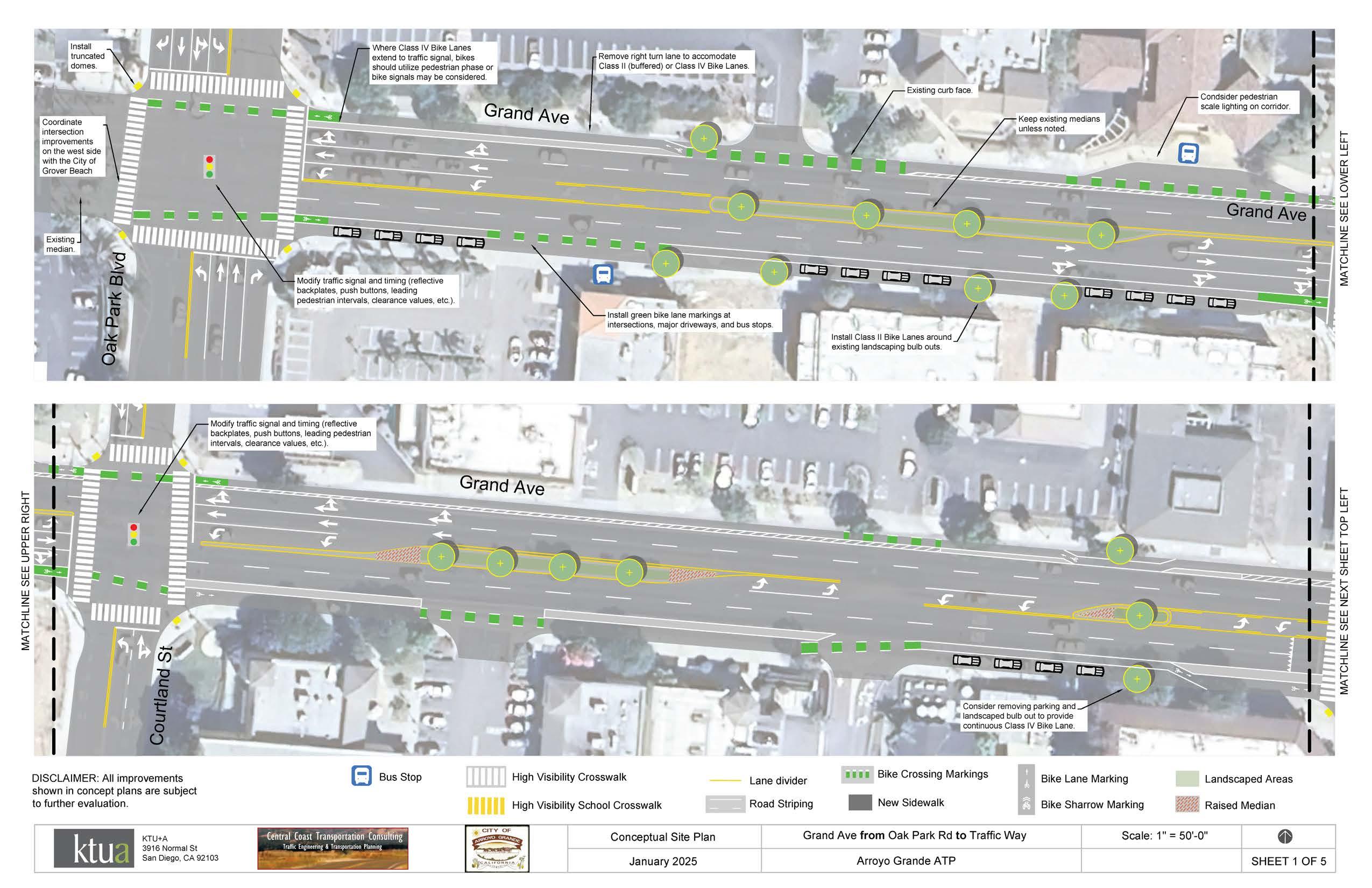
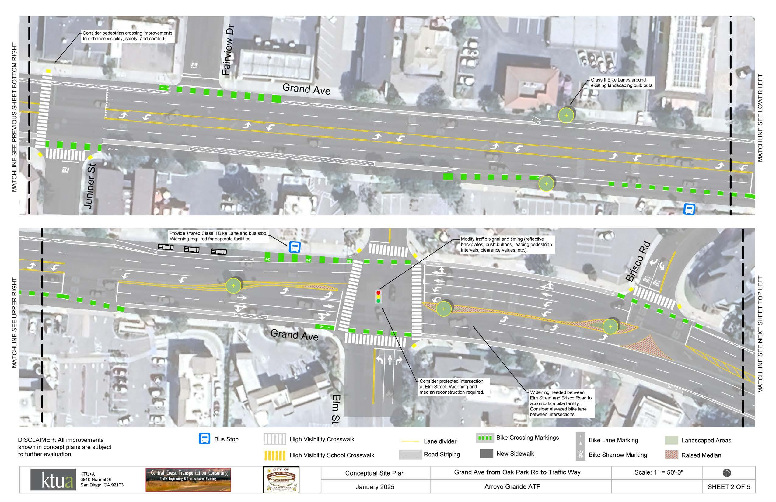
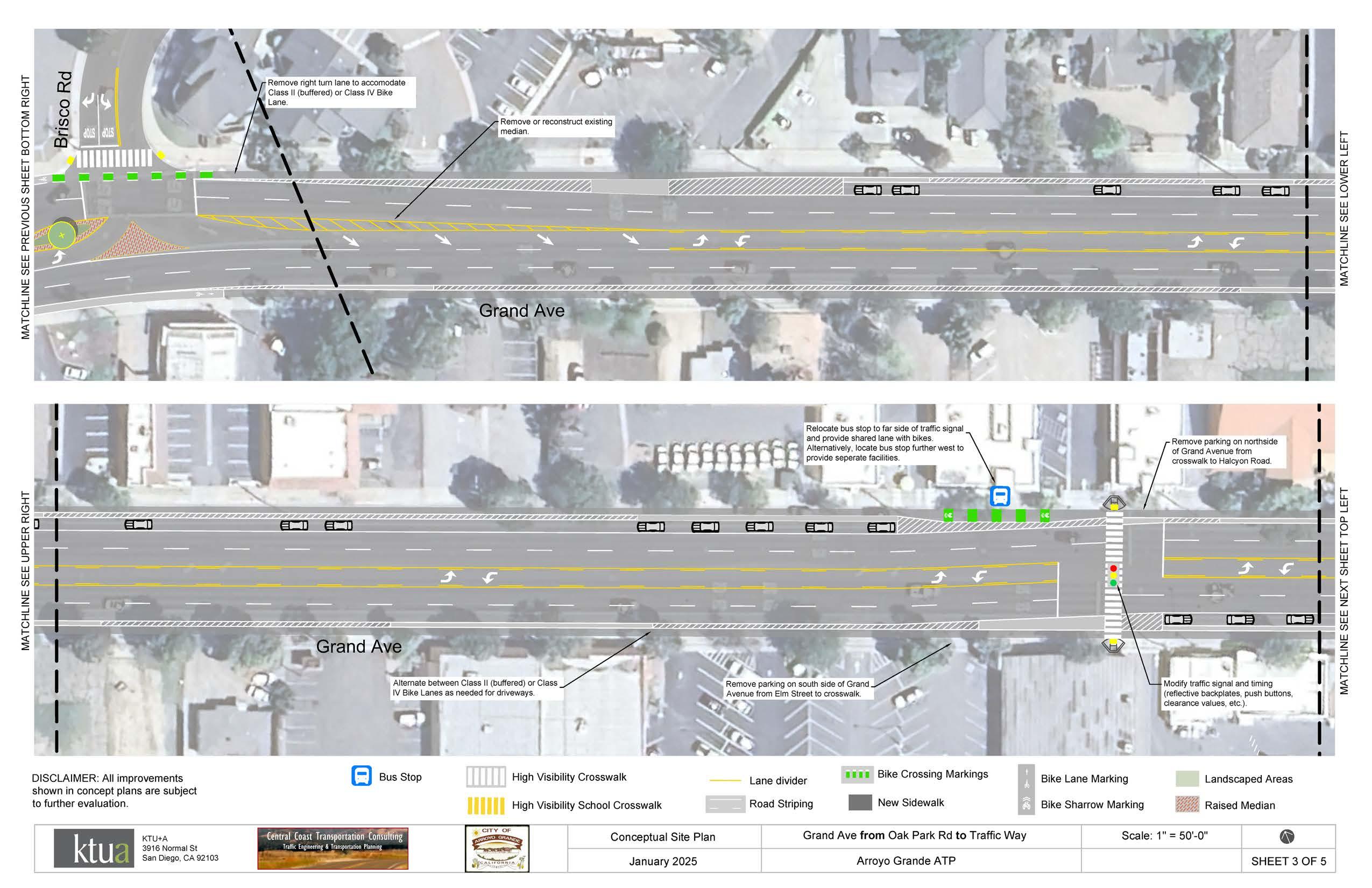
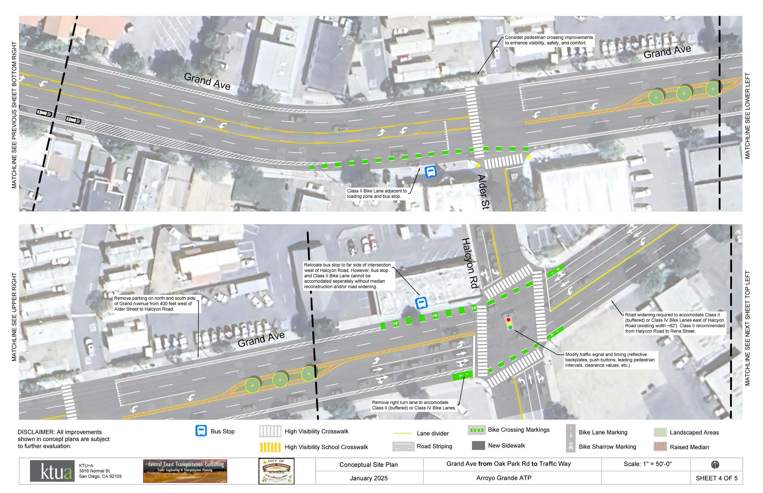
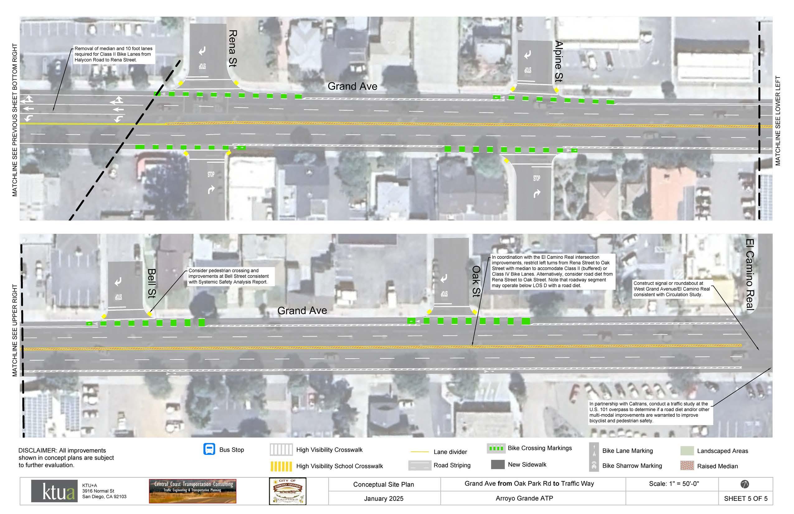
Modify traffic signal and timing (i.e., reflective backplates, push buttons, leading pedestrian intervals, clearance values, etc.).
Consider protected intersection at Elm Street. Widening and median reconstruction required.
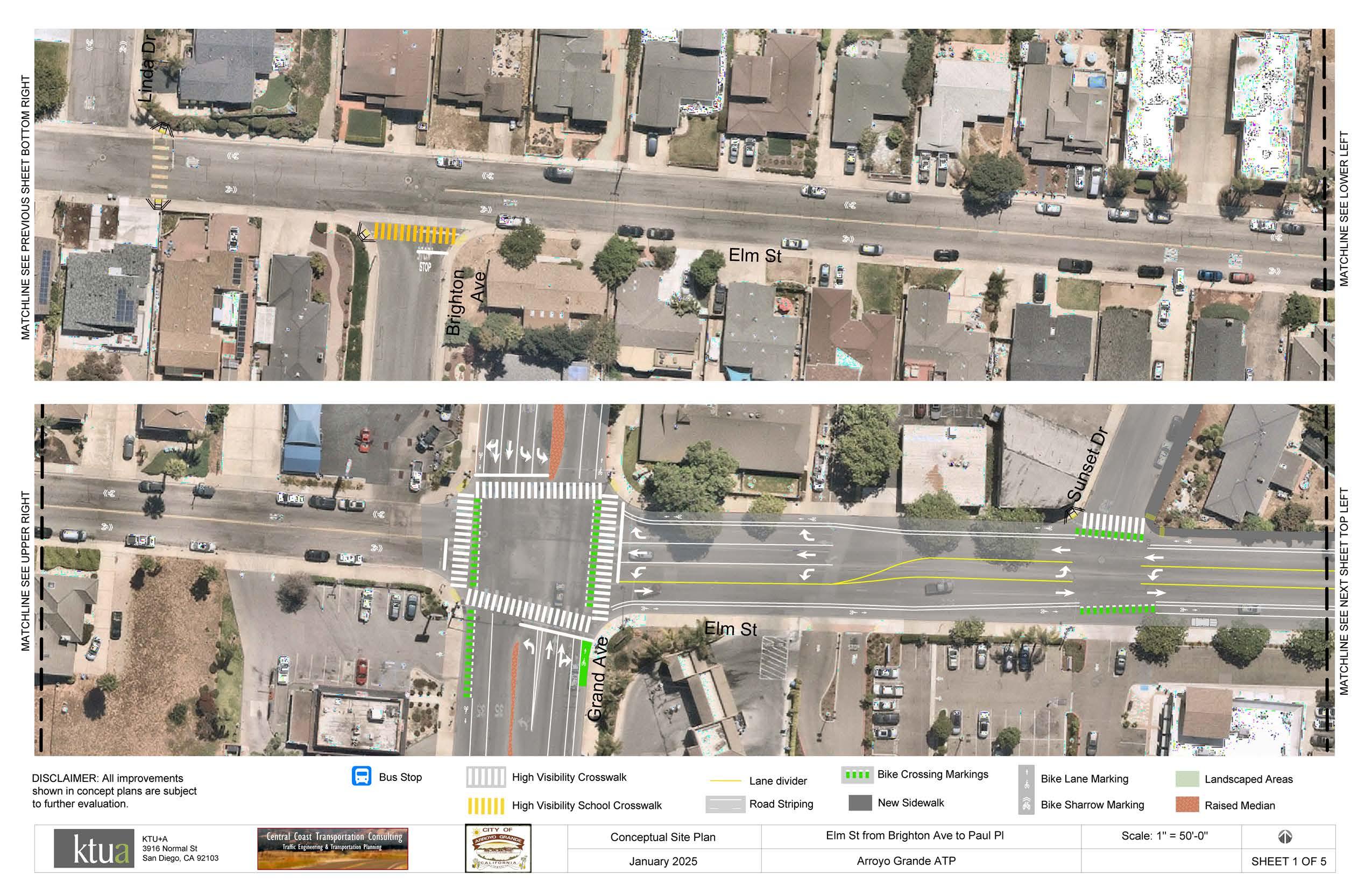
Proposed Class IIB buffered bicycle lanes. Green striping and high-visibility crosswalks to be added at major intersections.
Consider a road diet from Grand Avenue to Ash Street to increase space for bicycle and pedestrian facilities while maintaining on-street parking.
Consider a road diet from Grand Avenue to Ash Street to increase space for bicycle and pedestrian facilities while maintaining on-street parking.
Consider a road diet from Grand Avenue to Ash Street to increase space for bicycle and pedestrian facilities while maintaining on-street parking.
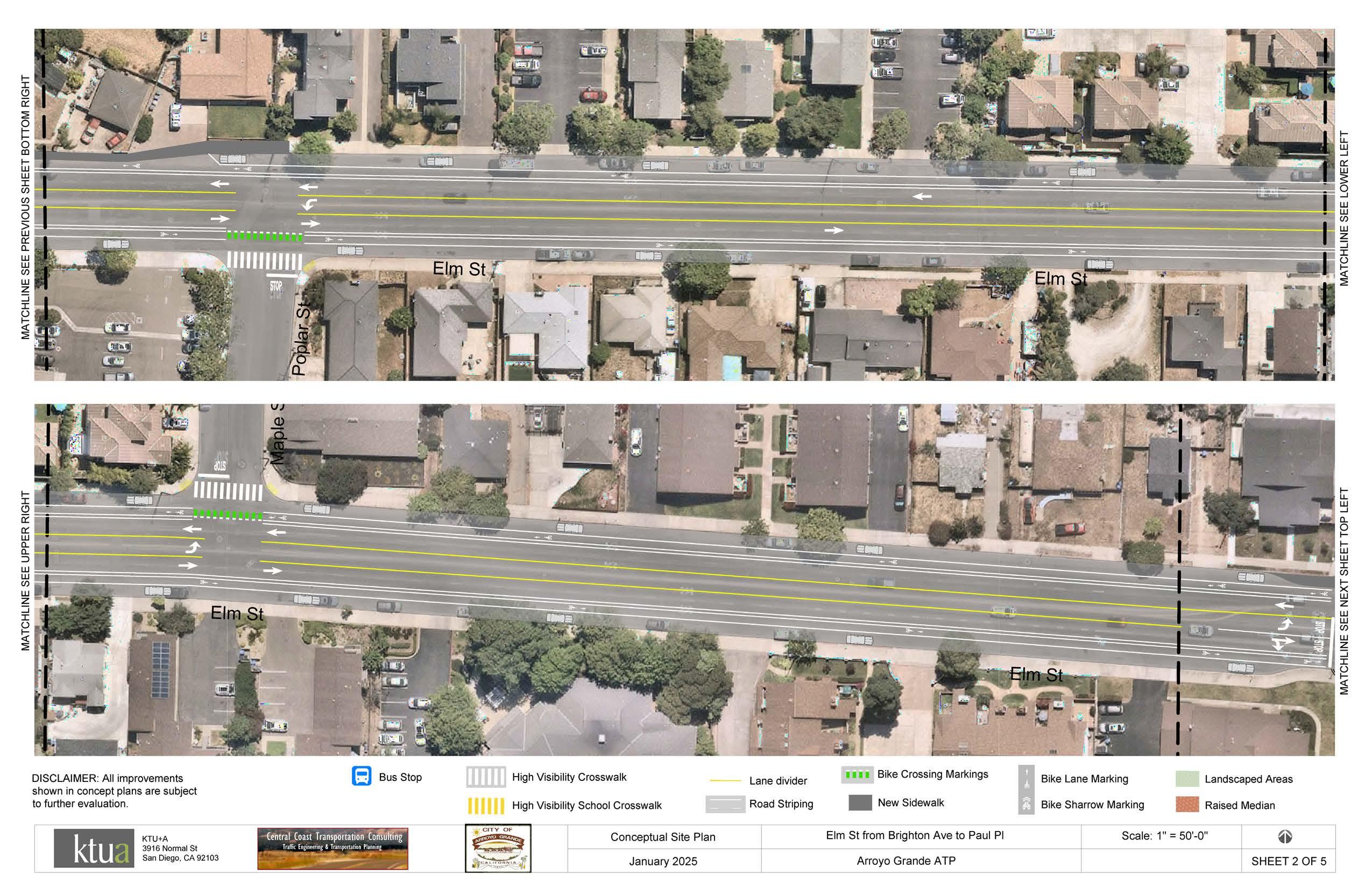
at major intersections.
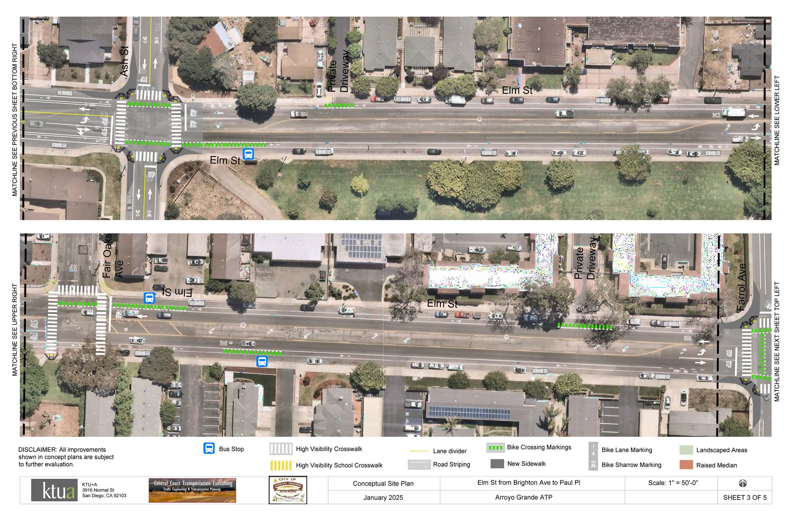
Proposed curb extensions, high-visibility crosswalks, green striping, and wayfinding signage.

Consider a road diet from Farroll Avenue to The Pike to increase space for bicycle and pedestrian facilities while maintaining on-street parking.
Proposed Class IIB buffered bicycle lanes. Green striping and high-visibility crosswalks to be added at major intersections.
Proposed Class IIB buffered bicycle lanes. Green striping and high-visibility crosswalks to be added at major intersections.
Consider a road diet from Farroll Avenue to The Pike to increase space for bicycle and pedestrian facilities while maintaining on-street parking.
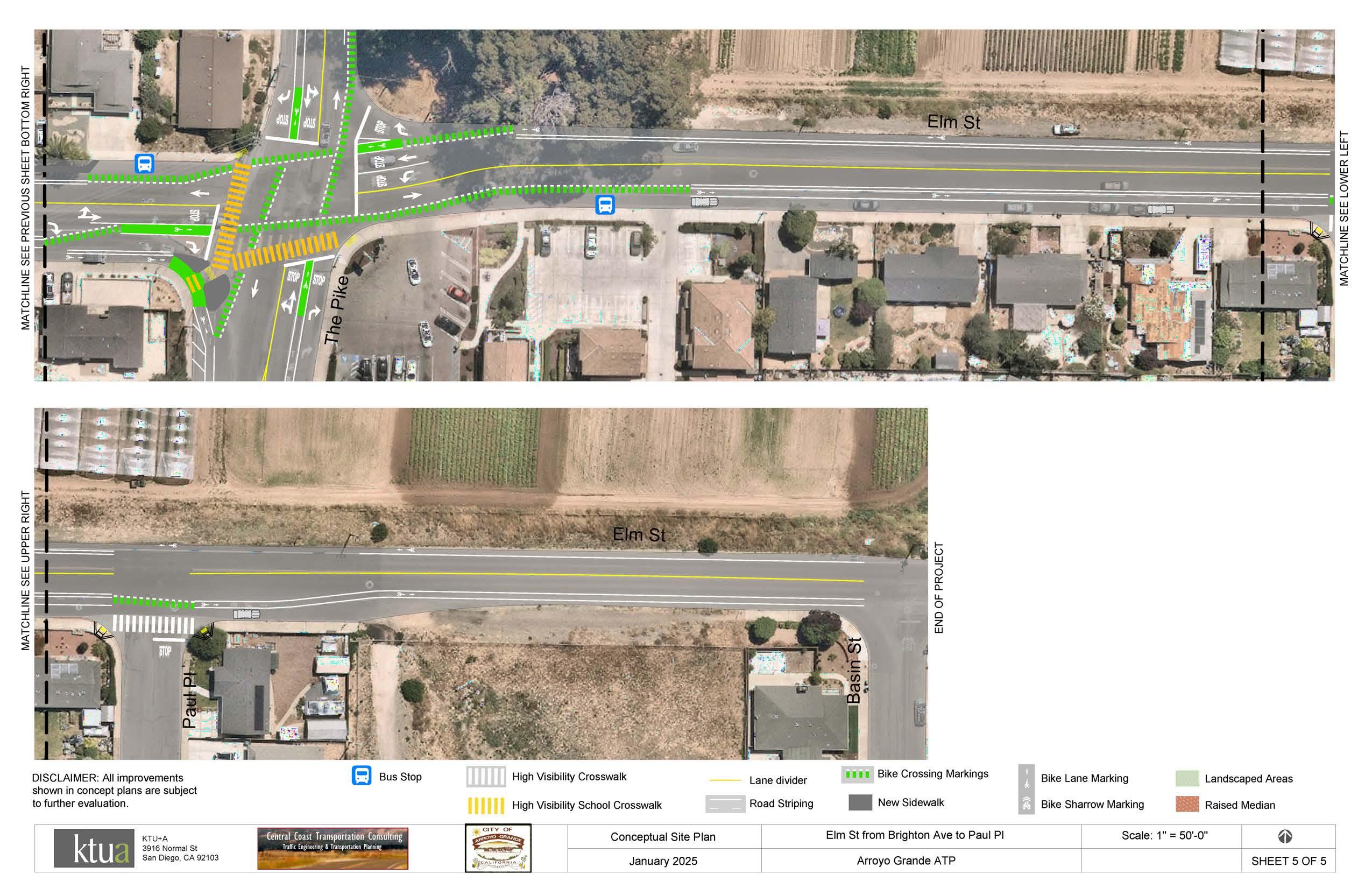
Proposed high-visibility crosswalks, green striping, wayfinding signage, and missing curb ramps.
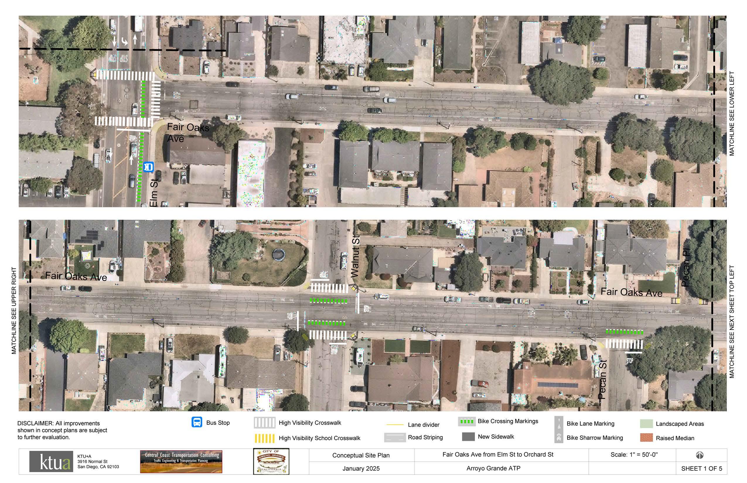
Proposed high-visibility crosswalks, green striping, and curb ramps at intersections.
A roundabout will be installed at Halcyon Road as part of the Halcyon Complete Streets Project.
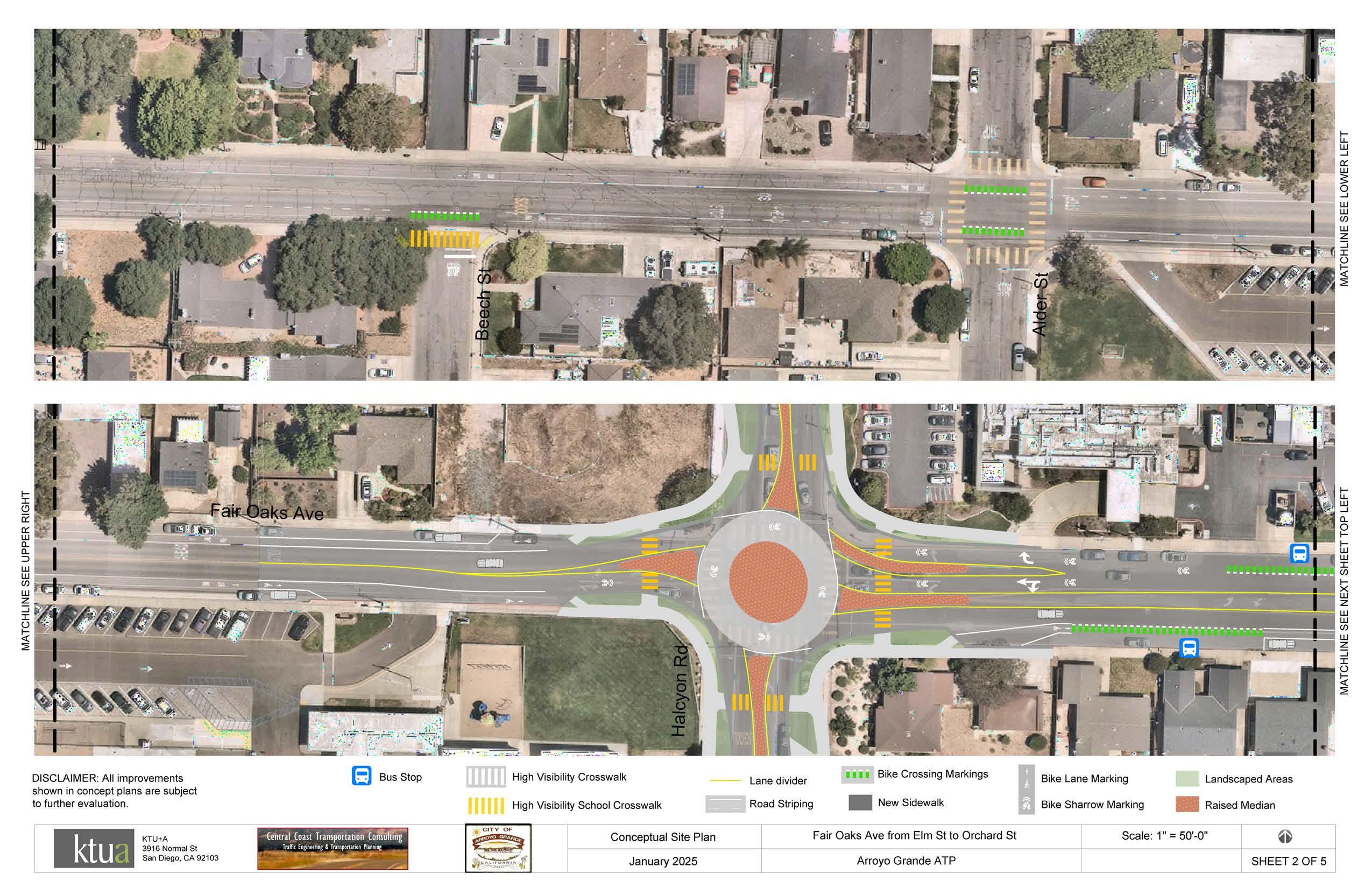
City to coordinate with SLO RTA to relocate existing transit stop to accommodate proposed roundabout.
Proposed high-visibility crosswalks, green striping, and curb ramps at intersections.
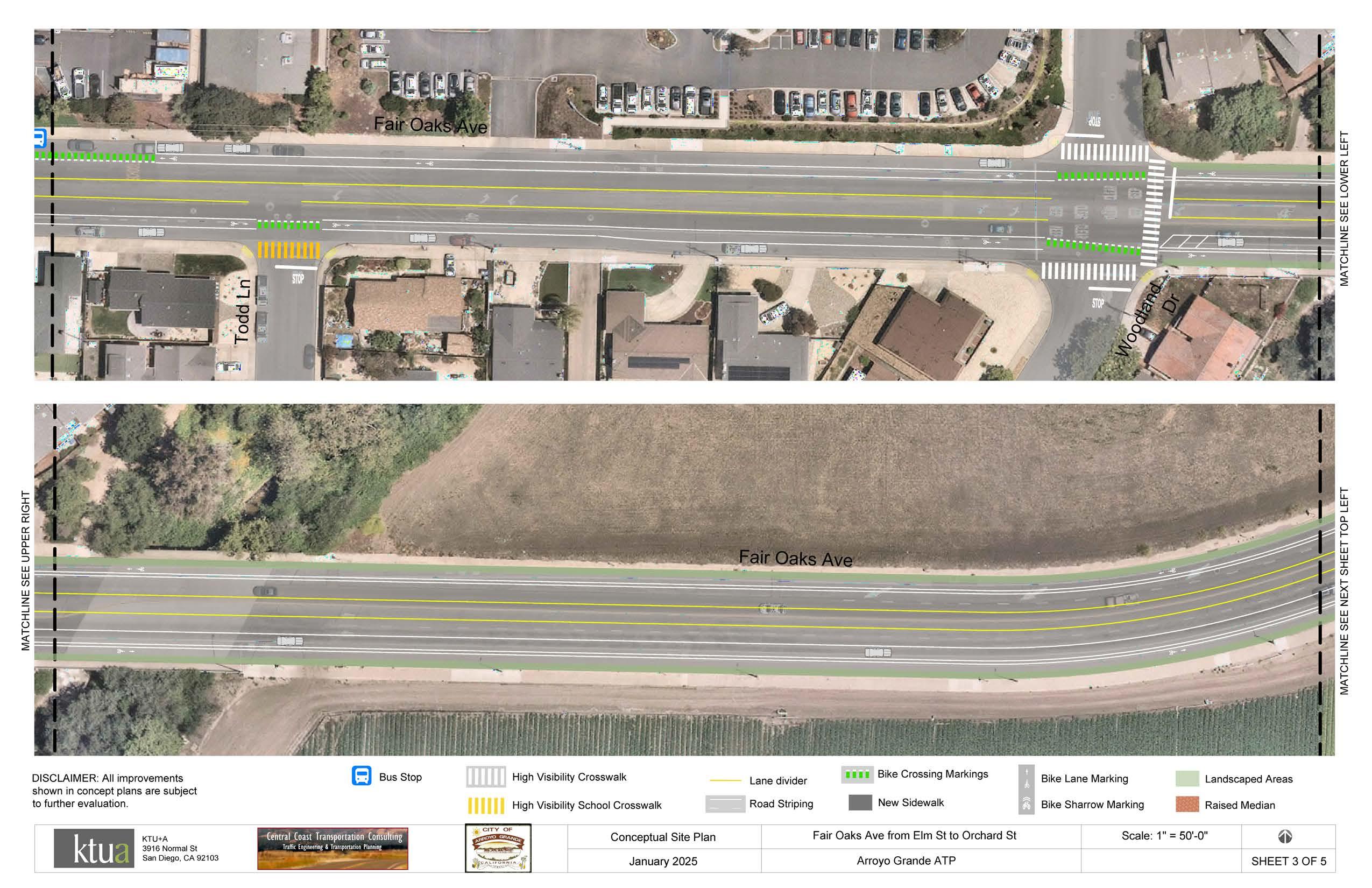
Proposed Class IIB buffered bicycle lanes or Class IV separated bikeways. Green striping to be added at major intersections and transit stops.
Consider a road diet from Woodland Drive to Valley Road to increase space for bicycle, pedestrian, and urban greening facilities while maintaining on-street parking on south/east side of Fair Oaks Avenue.
Consider installing improvements for safe pedestrian crossing at Woodland Drive.
Consider a road diet from Woodland Drive to Valley Road to increase space for bicycle, pedestrian, and urban greening facilities while maintaining on-street parking on south/east side
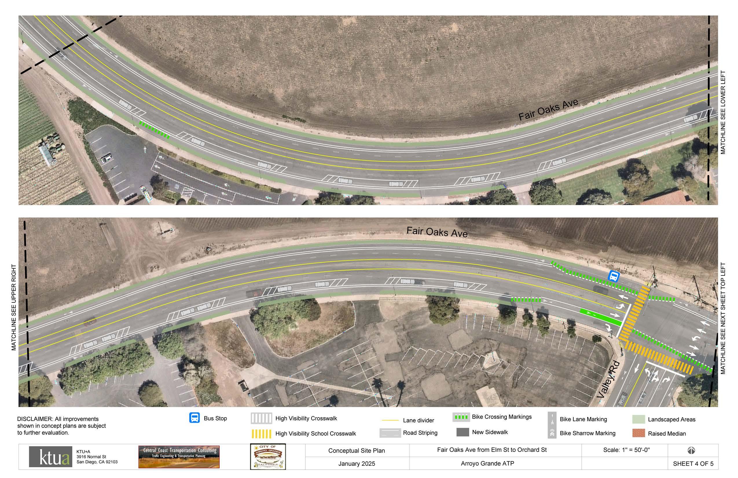
Install a speed feedback sign to alert drivers heading eastbound toward Arroyo Grande High School.
Consider a road diet from Woodland Drive to Valley Road to increase space for bicycle, pedestrian, and urban greening facilities while maintaining on-street parking on south/east side of Fair Oaks Avenue.
and
Consider a protected intersection or a roundabout.
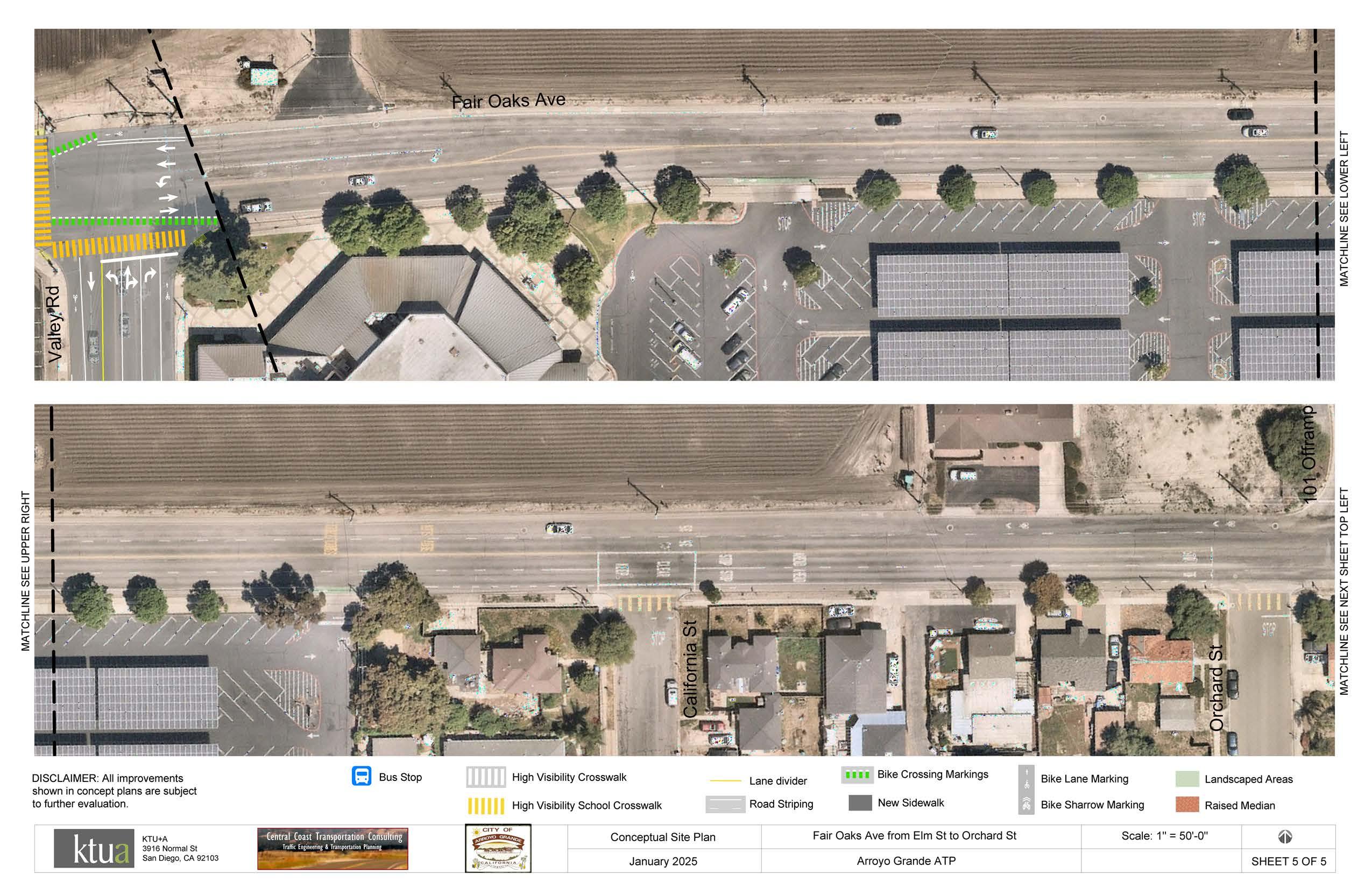
Page intentionally left blank.
Each year, federal, state, and local government agencies invest millions of dollars in active transportation projects nationwide. Table A-19 contains an extensive list of potential federal, state, and local funding opportunities that may be used for a wide range of active transportation projects. Funding sources for active transportation projects vary in purpose and scope, but are intended to help the City plan, design, maintain, and implement ATP projects and programming. The City is encouraged to use Table A-19 to identify and pursue grant funding to implement this ATP. However, it is important to note that all funding sources are subject to change and further research will be necessary to apply for grant funding as not all funding sources apply to the recommended projects.
Table a-19: Potential Funding Sources
FUNDING PROGRAM FUNDING SOURCE
Congestion
Mitigation and Air Quality Improvement Program
Highway Safety Improvement Program
Federal Highway Administration
The Congestion Mitigation and Air Quality Improvement Program provides funding to State and local governments for transportation projects and programs to help meet the requirements of the Clean Air Act. The program supports surface transportation projects and other efforts that contribute to air quality improvement and congestion relief.
Federal Highway Administration / Caltrans
The Highway Safety Improvement Program funds work on any public road or publicly owned bicycle or pedestrian pathway or trail, or on tribal lands for general use of tribal members, that improves the safety for its users.
Annual X X
• Travel Demand Management to promote clean commutes
• Public Education and Outreach
• Bicycle amenities and facilities, such as Class I, II, III, & IV bike lanes
* INF - Infrastructure PLN - Planning and Design PGM - Programming
Two year cycle X
• Install hybrid pedestrian signals at trail crossings
• Install RRFBs at locations adjacent to parks, trails, and schools
• Improve pedestrian and bicycle safety at locations with uncontrolled crossings
Rebuilding American Infrastructure with Sustainability and Equity Discretionary Grant Program
U.S.
Department of Transportation
The Rebuilding America Infrastructure with Sustainability and Equity (RAISE) Discretionary Grant Program funds projects for planning or constructing surface transportation infrastructure projects that will improve safety; environmental sustainability; quality of life; mobility and community connectivity; economic competitiveness and opportunity including tourism; state of good repair; partnership and collaboration; and innovation.
Annual X X
Reconnecting Communities and Neighborhoods Grant Program
U.S.
Department of Transportation
The Reconnecting Communities and Neighborhoods Program provides grant opportunities to redress the legacy of harm from transportation infrastructure including: constructionrelated displacement, environmental degradation, limited access to goods and services, degraded public health due to air and noise pollution, limited opportunities for physical activity, and hampered economic vitality of the surrounding community.
Annual (through 2026) X X
• Trail and active transportation construction projects
• Planning and engineering work for bicycle, pedestrian, and trail planning
Safe Streets and Road for All
U.S.
Department of Transportation
The Safe Streets and Road for All program funds regional, local, and Tribal initiatives through grants to prevent roadway deaths and serious injuries. The program offers two grant types: Implementation Grants and Planning and Demonstration Grants.
Annual X X X
• Study for the removal, retrofit or mitigation of a highway or transportation facility that acts as a barrier to community connectivity
• Replacement or mitigation of a transportation barrier with a linear park and trail
• Eligible Implementation Grant projects include developing bikeway networks, safety treatments, creating safe routes to school and public transit services, installing pedestrian safety enhancements, closing network gaps, running an education campaign, and more.
• Eligible Planning and Demonstration Grants fund the development or supplementation of a comprehensive safety action plan.
* INF - Infrastructure PLN - Planning and Design PGM - Programming
Transportation Alternatives
Federal Highway Administration
The Transportation Alternatives SetAside from the Surface Transportation Block Grant Program provides funding for a variety of generally smaller-scale transportation projects.
Annual X X
• Pedestrian and bicycle facilities
• Construction of turnouts, overlooks, and viewing areas
• Community improvements such as historic preservation and vegetation management
• Environmental mitigation related to stormwater and habitat connectivity
• Recreational trails
• Safe Routes to School projects
• Vulnerable road user safety assessments
Urban and Community Forestry Program
U.S. Forest Service
The Urban and Community Forestry Program delivers nature-based solutions to ensure a resilient and equitable tree canopy in cities, towns, and suburbs where more than 84 percent of Americans live. 40 percent of the program’s investments are delivered through established and new partnerships working to support disadvantaged communities experiencing low tree canopy and environmental justice issues.
Varies X X
• Urban tree planting projects
• Urban forest planning and management and related activities (particularly in disadvantaged communities)
Active Transportation Program Caltrans
The Active Transportation Program provides funding to increase use of active modes of transportation by achieving the following goals: increase the proportion of trips accomplished by biking and walking, increase safety and mobility for non-motorized users, advance active transportation efforts to achieve greenhouse gas reduction goals, enhance public health, ensure that disadvantaged communities fully share in the benefits of the program, and provide projects that benefit various types of active transportation users. Annual X X X
• Safe Routes to School Plan
• Active Transportation Plan development
• Trail construction
• Bicycle and pedestrian facilities
Affordable Housing and Sustainable Communities Program
Strategic Growth Council and Department of Housing and Community Development
The Affordable Housing and Sustainable Communities Program funds land use, housing, transportation, and land preservation projects to support infill and compact development that reduce greenhouse gas emissions.
Annual X X
Clean Mobility Options Pilot Program
California Air Resources Board
The Clean Mobility Options Pilot Program provides funding for zero emissions shared mobility projects (i.e., car sharing, bike sharing, and on-demand sharing) in disadvantaged and low-income communities, including some tribal and affordable housing communities.
Unknown X X
• Class I, II, III, & IV bike lanes
• Active transportation projects to encourage connectivity to transit networks
• Bikeways and sidewalks to affordable housing and transit center
• Install dedicated bicycle facilities
• Pedestrian facilities such as bulb-outs
• Bikeshare programs
• “Quick build” right-of-way safety improvements for bicycles and scooters
Coastal Conservancy Grants
Habitat Conservation Fund Program
State of California Coastal Conservancy
The Coastal Conservancy funds a wide variety of projects along the California coast, San Francisco Bay, and in coastal watersheds to increase availability of beaches, parks and trails for the public, protect and restore natural lands and wildlife habitat, preserve working lands, and increase community resilience to the impacts of climate change.
Ongoing
Land and Water Conservation Fund
California Department of Parks and Recreation
The Habitat Conservation Fund provides funding to cities, counties, and districts to protect fish, wildlife, and native plant resources; to acquire or develop wildlife corridors and trails; and to provide for nature interpretation programs and other programs which bring urban residents into park and wildlife areas.
California Department of Parks and Recreation/ National Park Service
The Land and Water Conservation Fund provides funding for the acquisition OR development of land to conserve irreplaceable lands and to create new outdoor recreation opportunities for the health and wellness of Californians.
* INF - Infrastructure PLN - Planning and Design PGM - Programming
Annual X
• Provide coastal experiences for communities who face barriers to coastal access
• Accessibility projects that reduce barriers to coastal access for people with disabilities
• Build regional trails
• Enhance coastal recreational amenities, such as restrooms, parking, picnic areas, interpretive centers, shade structures, etc.
• Build new trails
• Rehabilitate existing trails
• Install interpretive trail elements
• Install seating or lighting along trails
• Develop educational or interpretive activities or trips
• Land acquisition for a new park, an existing park expansion, a wildlife corridor with public viewing and outdoor recreational use, and/or a recreational/active transportation corridor
• Development of recreation features and amenities for outdoor recreation
Local Partnership Program California Transportation Commission
The Local Partnership Program provides funding to counties, cities, districts, and regional transportation agencies in which voters have approved fees or taxes dedicated solely to transportation improvements or that have imposed fees, including uniform developer fees, dedicated solely to transportation improvements. Funding is intended to improve aging Infrastructure, road conditions, active transportation, transit and rail, health and safety benefits.
X X
• Close sidewalk gap, install Class
II bike lanes and cycle track, curb extensions, pedestrian enhancements, improvements to lighting and signage
• Construct 4 single-lane and 1 multilane roundabouts, and improvements to street, pedestrian and bicycle facilities
• Expressway pedestrian overcrossing
Local Streets and Roads Program California Transportation Commission
Office of Traffic Safety Grant Program CA Office of Traffic Safety
The Local Streets and Roads Program provides funds to cities and counties for basic road maintenance, rehabilitation, and critical safety projects on the local streets and roads system. Annual X X
The Office of Traffic Safety Grant Program provides annual funds to prevent serious injury and death resulting from motor vehicle crashes so that all roadway users arrive at their destination safely. Funds can be used for bicycle and pedestrian safety. Annual X X
• Implement enhanced crosswalk signing and striping
• Create safety separation between motorists, bicyclists and pedestrians
• Design and construction of school access and safety improvements to six schools
• Safety education and encouragement
• Campaigns to promote safety
• SRTS safety programs * INF - Infrastructure PLN - Planning and Design PGM - Programming
Outdoor Equity Grants Programs
California Department of Parks and Recreation
The Outdoor Equity Grants Program (OEP) provides funding to improve the health and wellness of Californians through new educational and recreational activities, service learning, career pathways, and leadership opportunities that strengthen a connection to the natural world. The OEP funds the creation, operation, and transportation costs of outdoor programs in underserved communities. Outdoor programs should include activities in the community AND natural area trips. OEP will not fund capital projects.
Annual X
Activities in the community can include:
• Environmental education activities
• Educational nature discovery walks
• Preparation for natural area trips
Natural area trips can include traveling to a regional, state, national park, tribal land, river or lake, beach, forest, mountain, or desert area for day or overnight trips within California.
Outdoor Recreation Legacy Partnership Program
National Park Service (NPS)/ California Department of Parks and Recreation
The Outdoor Recreation Legacy Partnership Program is a federal National Park Service grant program administered by the California Department of Parks and Recreation. ORLP focuses on communities with little to no access to publicly available, close-by, outdoor recreation opportunities in urban areas. ORLP funds the acquisition or development of new parks/outdoor spaces, or substantial renovations to parks/outdoor spaces in economically disadvantaged cities or towns of at least 30,000 people.
Annual X X
• Land acquisition for outdoor recreation
• Development of recreation features and amenities for outdoor recreation
Recreational Trails Program
U.S.
Department of Transportation
Federal Highway Administration /California Department of Parks and Recreation
State Highway Operations and Protection Program
State Transportation Improvement Program
California Transportation Commission
The Recreational Trails Program (RTP) is a federal U.S. Department of Transportation grant program administered by the California Department of Parks and Recreation. The RTP provides funding to develop and maintain recreational trails and trailrelated facilities for both non-motorized and motorized recreational trail uses.
The State Highway Operations and Protection Program funds repairs and preservation, emergency repairs, safety improvements, and some highway operational improvements on the State Highway System.
California Transportation Commission
Statewide Park Development and Community Revitalization Program California Department of Parks and Recreation
The State Transportation Improvement Program provides funding for state highway improvements, intercity rail, and regional highway and transit improvements.
The Statewide Park Program provides funding to create new parks and recreation opportunities in critically underserved communities across California. Project selection is based on several criteria, including needbased criteria, such as critical lack of park space, significant poverty, community challenges, and more. A project must involve either development or a combination of acquisition AND development to create a new park, expand an existing park, or renovate an existing park.
* INF - Infrastructure PLN - Planning and Design PGM - Programming
year cycle X X
• Land acquisition
• Development/rehabilitation of trails, trailheads, and trail amenities
• Construction of new trails
• Maintenance of existing trails (motorized projects only)
• Upgrade sidewalks to ADA compliance
• Reconstruct damaged pavement
• Add bike lanes to updated corridors
• Upgrade pedestrian push buttons, refresh striping, and improve pedestrian and bicycle access
• Bike/ped Overcrossing and Access Improvements and bicycle and pedestrian bridge
• Class I, II, III, & IV bike lanes
• Shared-use paths
• Complete Streets improvements
• Land acquisition
• Rehabilitation of existing or development of new recreation features, such as, an aquatic center, athletic fields, amphitheater, community gardens, dog parks, open space, trails, skate parks, public art, picnic areas, etc.
Sustainable Communities Planning Grants
Caltrans
Sustainable Transportation Equity Project
California Air Resources Board
Sustainable Communities Planning Grants encourages local and regional planning that advances state goals and practices cited in the Regional Transportation Plan Guidelines adopted by the California Transportation Commission.
The Sustainable Transportation Equity Project funds a variety of clean transportation and supporting projects, such as public transit and shared mobility services, active transportation infrastructure, land use planning and housing policy, workforce development, and clean transportation planning and education. Funded projects work together within low-income and disadvantaged communities to increase transportation equity.
Annual X
Sustainable Transportation Planning Grant Program
Caltrans
Annual X X
• Safe Routes to School Plan
• Active Transportation Plan
• Bike/ped Trail/Path Feasibility Study
• Complete Streets Plan
• Sustainable Communities Plan
• Transit-Oriented Development Plan
• First/Last Mile Connectivity Plan
• New bike routes (Class I, Class II, or Class IV) and supporting infrastructure
• Publicly-accessible bike parking, storage, and repair infrastructure (e.g., bike racks, bike lockers, bike repair kiosks)
• New walkways that improve mobility/access/safety of pedestrians (nonmotorized users)
• Street crossing enhancements, including accessible pedestrian signals
• Plan development
Transformative Climate Communities Program
Strategic Growth Council and Department of Conservation
The Sustainable Transportation Planning Grant Program was created to support the Caltrans Mission: Provide a safe and reliable transportation network that serves all people and respects the environment. Grant programs include Sustainable Communities Grants, Climate Adaptation Planning Grants, and Strategic Partnership Grants.
The Transformative Climate Communities Program funds community-led development and infrastructure projects that achieve major environmental, health, and economic benefits in California’s most disadvantaged communities.
Annual X
Annual X X X
• Safe Routes to School Plan
• Active Transportation Plan
• Bike/ped Trail/Path Feasibility Study
• Complete Streets Plan
• Sustainable Communities Plan
• Transit-Oriented Development Plan
• First/Last Mile Connectivity Plan
• Bike share program
• Creating and considering active transportation corridors for better nonmotorized connections
• Shared-use paths
• Urban greening for pedestrian facilities * INF - Infrastructure PLN - Planning and Design PGM - Programming
Transit and Intercity Rail Capital Program Caltrans
The Transit and Intercity Rail Capital Program provides grants from the Greenhouse Gas Reduction Fund to fund transformative capital improvements that will modernize California’s intercity, commuter, and urban rail systems, and bus and ferry transit systems, to significantly reduce emissions of greenhouse gases, vehicle miles traveled, and congestion.
Annual X
Urban Greening Program California Natural Resources Agency
The Urban Greening Program supports the development of green infrastructure projects that reduce GHG emissions and provide multiple benefits. Must include at least one of the following: sequester and store carbon by planting trees; reduce building energy use by strategically planting trees to shade buildings; or reduce commute vehicle miles traveled by constructing bicycle paths, bicycle lanes or pedestrian facilities that provide safe routes for travel between residences, workplaces, commercial centers, and schools.
Annual X X
• Pedestrian and bike trail
• First/last mile connections via bike lanes and separated paths
• Bike share programs
• Bike parking facilities
• Plan development
Wildlife Conservation Board Grants Wildlife Conservation Board
The Wildlife Conservation Board provides funding for fish and wildlife habitat acquisition, conservation, and restoration, as well as development of compatible public access facilities. Project benefits should include one or more of the following: protected biodiversity, increased climate resilience, enhanced public access, conserved/ enhanced working landscapes, conserved/enhanced water-related projects, and/or support of the State Wildlife Action Plan.
* INF - Infrastructure PLN - Planning and Design PGM - Programming
Ongoing X X
• Non-motorized urban trails that provide safe routes for both recreation and travel between residences, workplaces, commercial centers, and schools
• Projects that expand or improve the usability of existing active transportation routes (e.g., walking or bicycle paths) or create new active transportation routes that are publicly accessible by walking
• Complete Green Streets
• Open-space corridors or trail linkages
• Publicly accessible hunting, fishing, wildlife viewing, and other wildlifedependent recreational opportunities
• Climate adaptation and resilience projects
• Habitat restoration
Community Betterments Grant Program SLOCOG
SLOCOG provides grant funding for smaller-scale community level infrastructure improvements that support sustainable transportation goals set by SLOCOG and its member agencies.
Asphalt Art Initiative Bloomberg Philanthropies
Community Change Grants America Walks
The Asphalt Art Initiative grant program is designed to fund visual art on roadways, pedestrian spaces, and public infrastructure.
The Community Change Grants program supports the growing network of advocates, organizations, and agencies working to advance walkability. Grants are awarded to innovative and inclusive programs and projects that create change and opportunity for walking and movement at the community level.
Annual X X
• Projects that encourage, enhance, and improve facilities for pedestrians, bicyclists, and motorists.
• Transportation enhancement activities such as pedestrian and bicycle facilities and wayfinding
• Painted curb extensions, pedestrian plazas, and crosswalks.
• Public space activations
• Traffic safety improvements
Annual X X
Community Spark Grant Program League of American Bicyclists
Energize the Environment Grant Program Quadratec
The Community Spark Grant program supports the growing number of local grassroots changemakers and organizations nationwide working to improve their communities through better bicycling with $2,000 mini-grants.
Quadratec offers small one-time grants for projects that promote environmental connection, responsibility, and/or stewardship.
Annual X
• Trail or walking path development
• Guided or self-guided walking, hiking, or cycling tours
• Design and installation of public art
* INF - Infrastructure PLN - Planning and Design PGM - Programming
Annual X
• Community event or class (one time or series)
• Giveaways for bike equipment
• Temporary demonstration project
• End-of-trip facilities such as bike racks, bike parking, bike repair stations and bike storage
• Bike audit/count
• Trail building or restoration projects
• Park beautification events
• Environmental education projects
• Youth educational engagement events
Outdoor Access Initiative Yamaha
Yamaha provides funding to non-profit or tax exempt groups (clubs & associations), public riding areas (local, state and federal), outdoor enthusiast associations and land conservation organizations, and communities with an interest in protecting, improving, expanding and/or maintaining access for safe, responsible and sustainable use by motorized offroad vehicles.
Quarterly X
PeopleForBikes
Community Grant Program PeopleForBikes
Placemaking Grant Program
Rails to Trails Grant Program
National Association of Realtors
The PeopleForBikes Community Grant Program supports bicycle infrastructure projects and targeted initiatives that make it easier and safer for people of all ages and abilities to ride.
Placemaking means many things to different people, but the National Association of Realtors (NAR) looks as placemaking as a way to make communities better places to live by transforming unused and underused sites and “eyesores” into welcoming destinations accessible to everyone in a community.
Annual X
Rails to Trails
Rails to Trails provides funding to organizations and local agencies that are working to develop and connect equitable trail network.
Annual X X
• Trail development
• Trail signage
• Trail mapping/map production
• wildlife and habitat management
• Establishing public access to land for outdoor recreation (including motorized recreation)
• Bike paths, lanes, trails and bridges
• Mountain bike facilities
• Bike parks and pump tracks
• BMX facilities
• End-of-trip facilities such as bike
racks, bike parking, bike repair stations and bike storage
* INF - Infrastructure PLN - Planning and Design PGM - Programming
Annual X X
• Amenities (street furniture, paint, signage, materials, landscaping, murals, etc.)
• Site preparation
• Artist fees
• Rail-trail
• Greenway
• Multi-use trail
• Shared-use path
Riding for Focus Grant Program Outride
The Riding for Focus grant promotes cycling as an outlet for students to improve their cognitive, physical, and socio-emotional well-being. Schools are provided with everything they need to get their 6th-8th grade students riding, including bikes, helmets, curriculum, teacher training, and an opportunity to attend our annual instructor training event at a Specialized bikes office.
Annual X
Road to Zero Community Traffic Safety Grant Program
National Safety Council / U.S.
Department of Transportation
National Highway Traffic Safety Administration (NHTSA)
The Road to Zero Community Traffic Safety Grant Program is focused on supporting innovative and promising approaches for implementing evidencebased countermeasures, supporting a Safe System approach, and performing necessary research to address traffic fatalities and serious injuries, and disparities in mobility safety and access.
Smart Growth Grant Program National Association of Realtors
Smart Growth Grants support state and local REALTOR® Associations’ efforts to advance programs, policies and initiatives aligned with one or more of the 10 Smart Growth Principles.
Annual X
• Bikes and helmets
• Student curriculum
• Teacher training
Annually X
• Community outreach tools/ campaigns
• Driver education curriculum
• Guide for quick-build countermeasures
• Demonstration projects for traffic calming
• E-bike education and safety training
• Data analysis and reporting
• Community planning and visioning charrettes
• Studies and assessments
• Walkability workshops or audits
• Comprehensive plan and zoning analysis
• Transportation policy
• Marketing materials