parks, recreation + greenways
Clayton Municipal Park / Clayton, NC
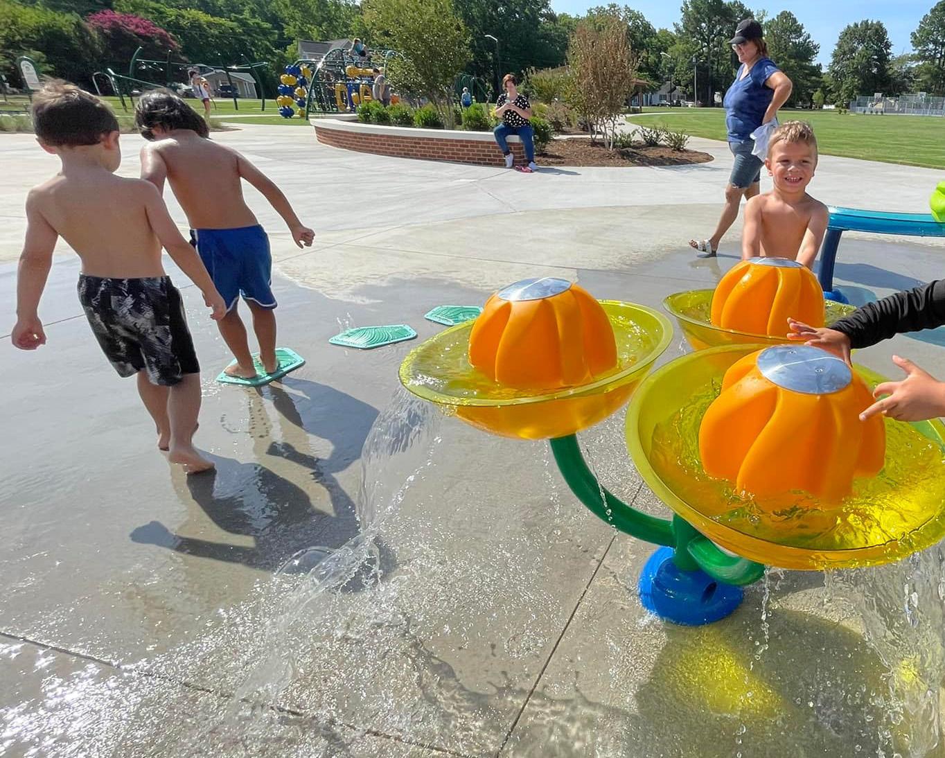
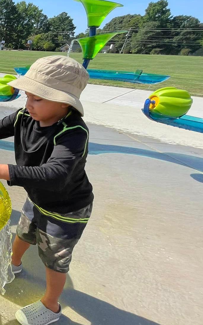
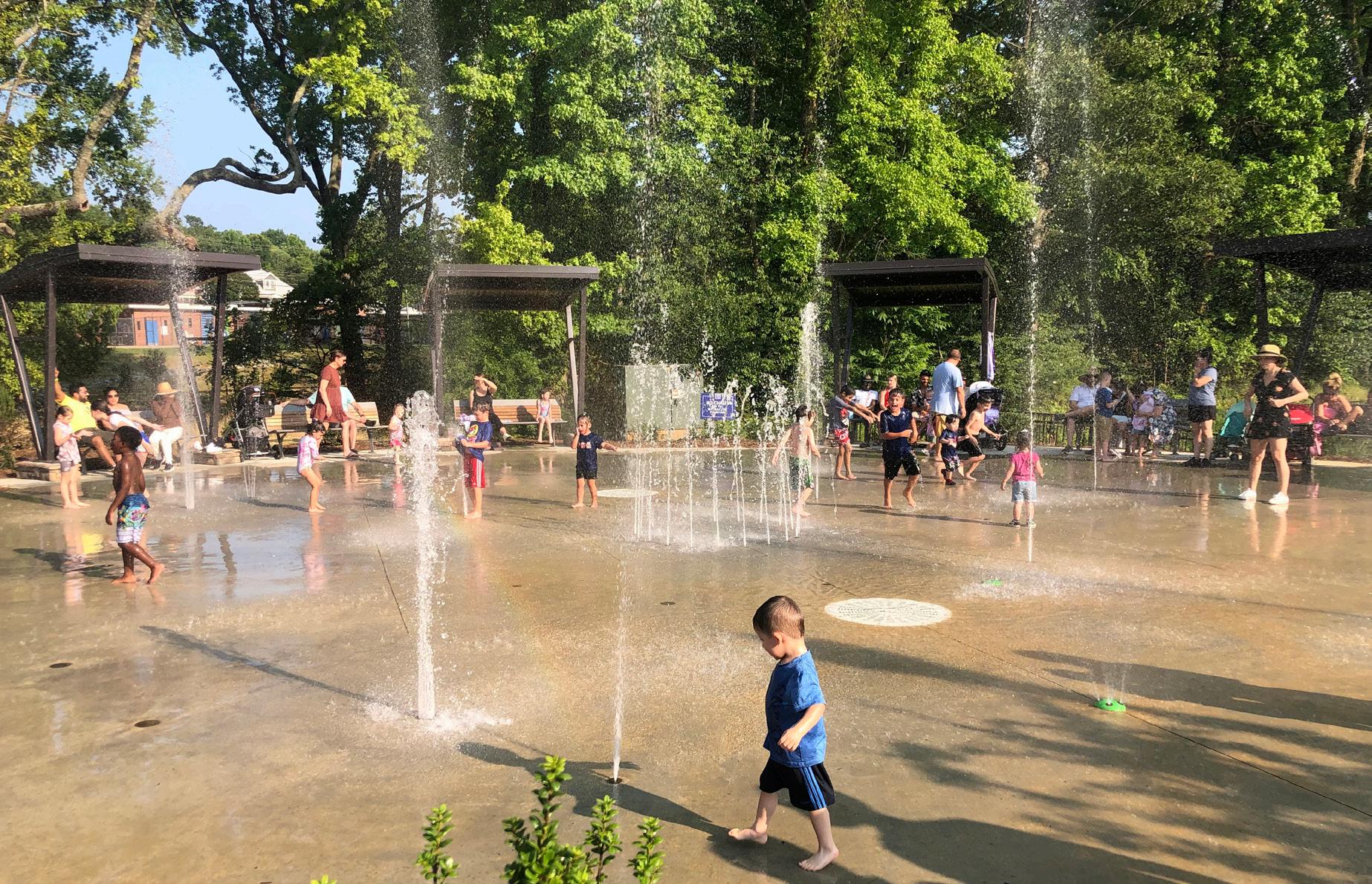
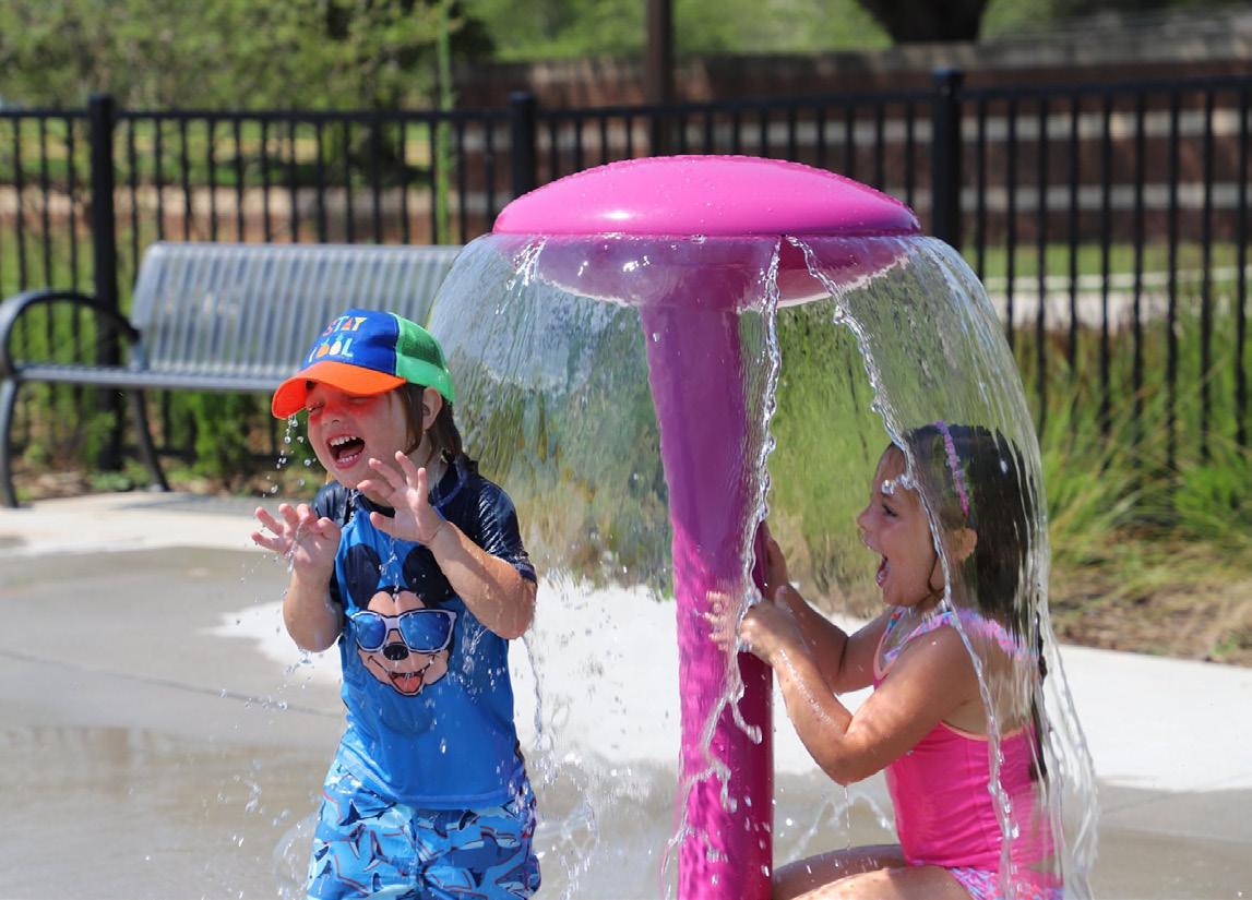
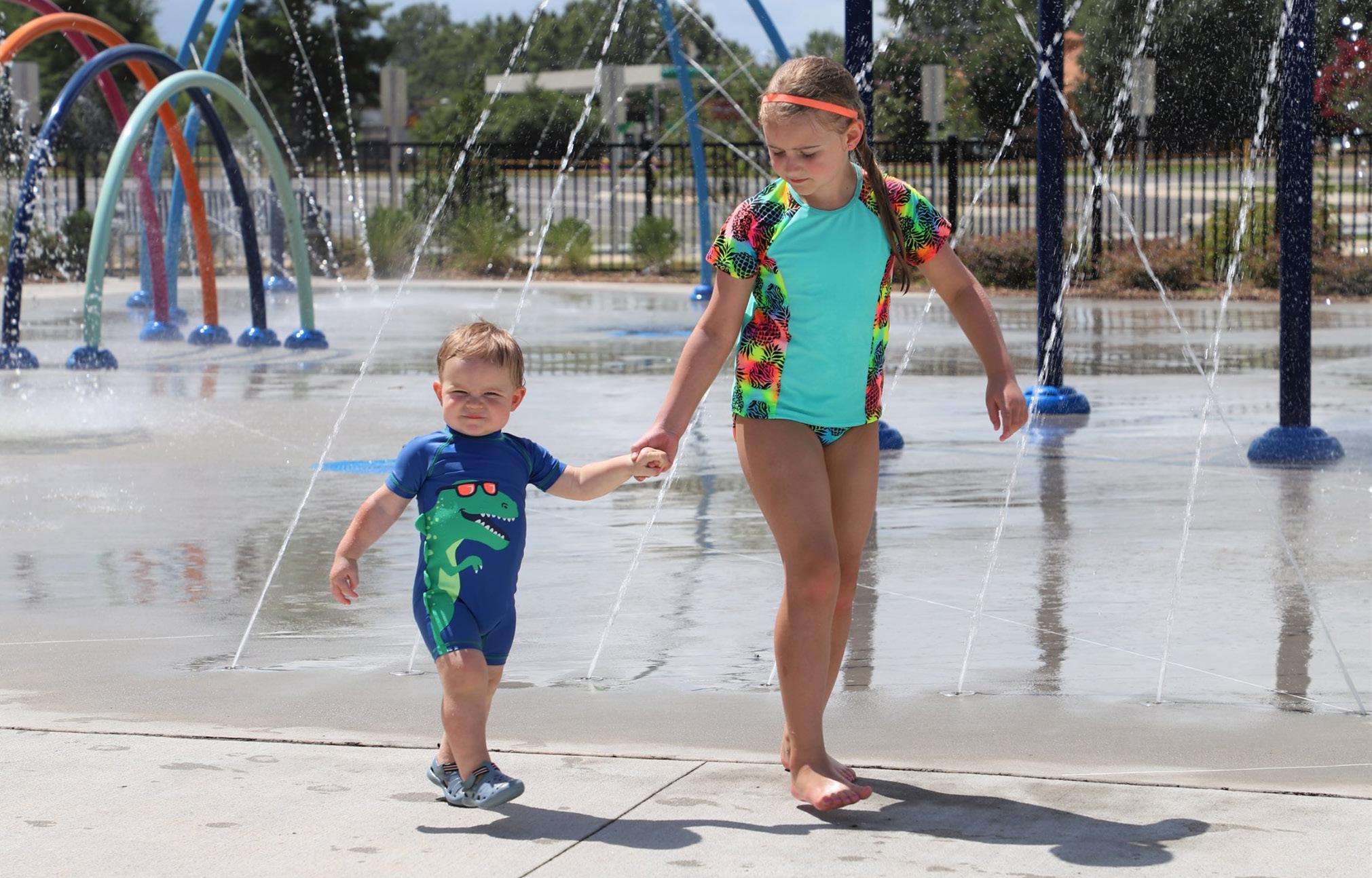
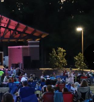
Located within walking distance to Clayton’s downtown, Municipal Park is the Town’s central park. The park features a central green and amphitheater for events; splash pad; and playground. The park hosts annual events such as the Fourth of July fireworks and concerts, bringing people together for joy and celebration.
OUR SERVICES TO ACHIEVE YOUR VISION
The services we offer at McAdams are comprehensive and unique. We provide a full array of services which can be utilized on a project as the project, client and consulting team requires. Our capabilities include:
› Civil Engineering
› Stormwater
› Stream + Wetland Design
› Landscape Architecture
› Land Planning
› Urban Planning + Design
› Transportation Planning + Design
› Surveying
› Subsurface Utility Engineering
› Construction Administration
› Funding + Grant Assistance
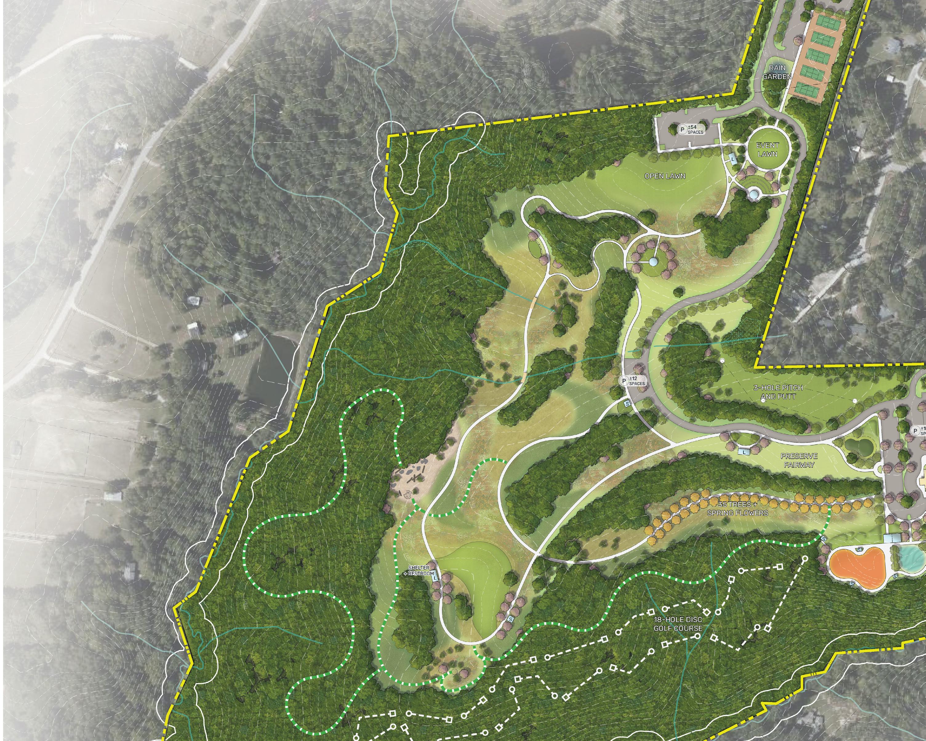
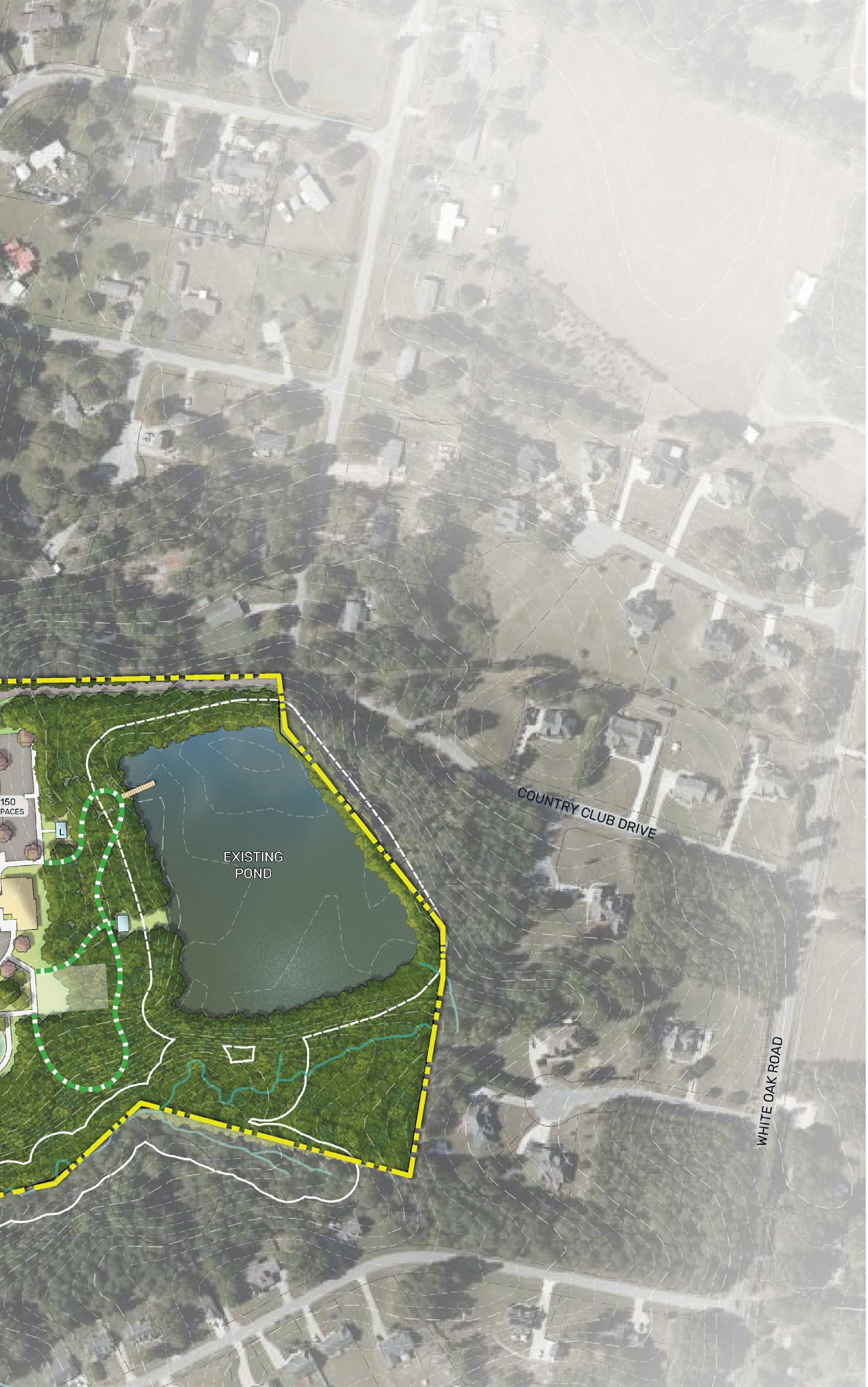
Meadowbrook Park, Master Plan / Garner, NC
Meadowbrook Country Club and Golf Course, a historically African American golf course, is transitioning into a public park. Listed on the National Register of Historic Places, and recognized as one of the first Golf Club Associations in the State of North Carolina to allow African Americans to become active club members, the park creates a distinct civic space that illuminates the park’s historic significance. Key moments within the park celebrate milestones in the club’s evolution while offering fresh recreation opportunities to the Town.
Our capabilities include:
› System-wide Parks + Recreation Master Planning

› Grant Writing + Funding Assistance


› Site Analysis, Suitability + Feasibility Studies
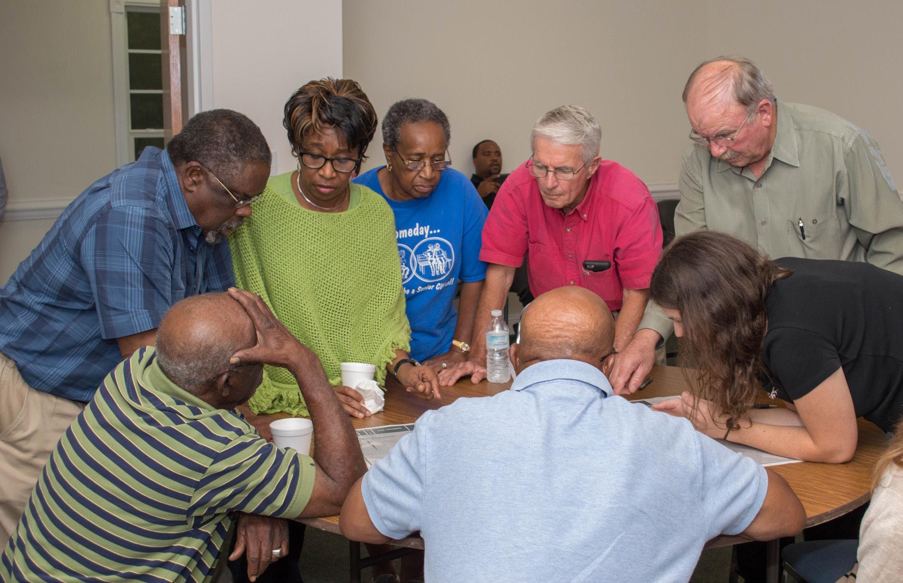
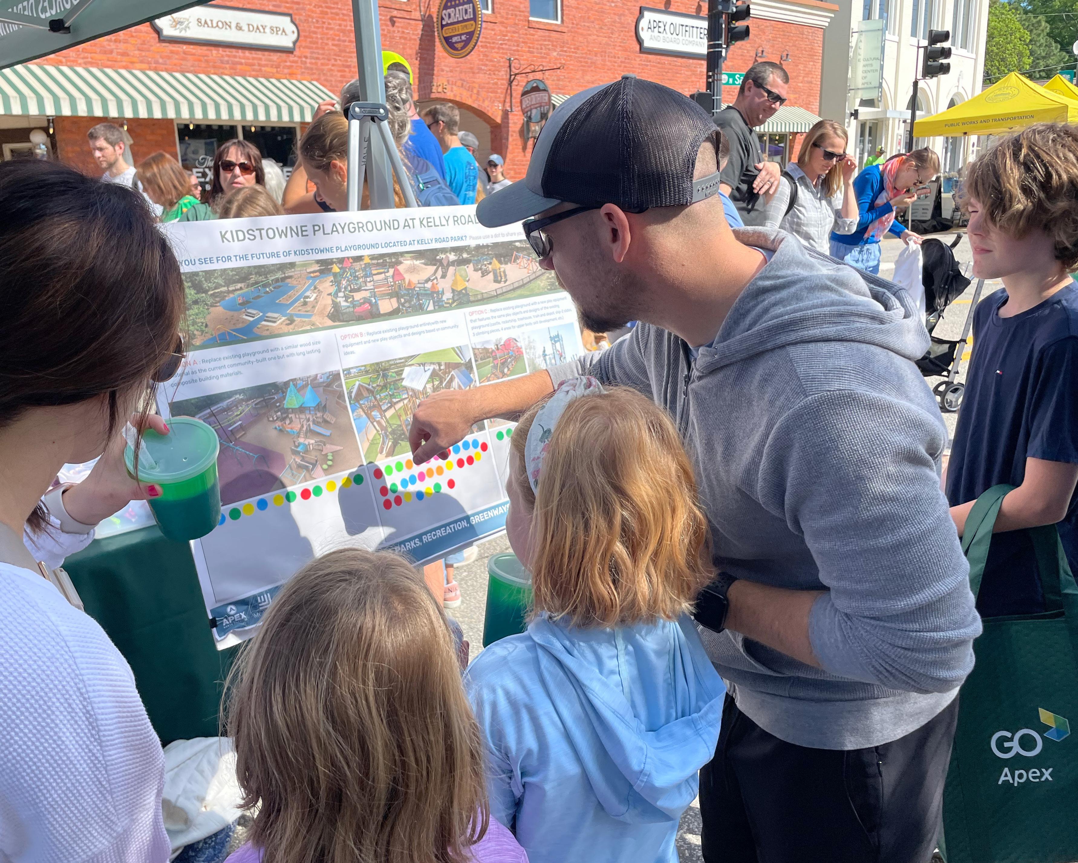
› Public Input + Consensus Building

› Park Visioning + Programming
› Park Master Planning
› Integrated Stormwater Design + Green Stormwater Infrastructure
› Park Design + Engineering / Construction Drawings / Permitting
› Bid Assistance Construction Administration + Coordination
› Splash Pads + Aquatics Design
› Sports Complex Design + Engineering
› Visualization + Animation
› Diversity, Equity, Inclusion + Access (DEIA) Assessments
› GIS + Data Analysis
› Public Art Planning
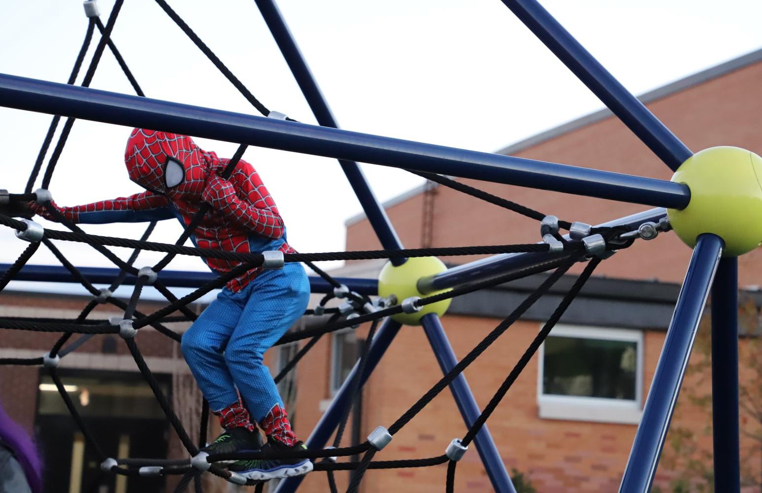
PARKS
+
RECREATION CONNECTING THE COMMUNITY
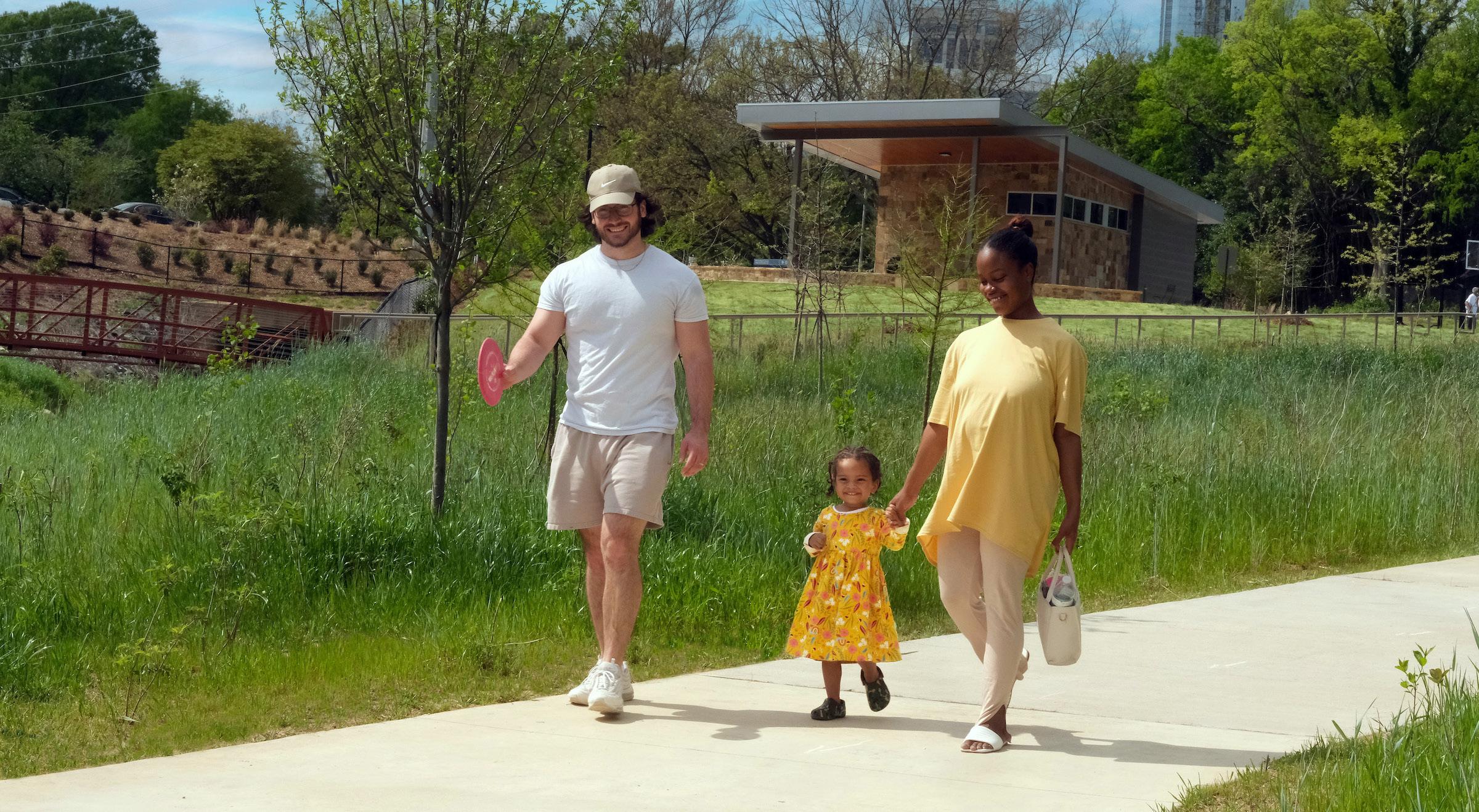
The parks and recreation projects we deliver result in positive community change. We approach park planning and design with the belief that parks are for all and should serve multiple benefits:
HEALTH
CONNECTING THE COMMUNITY
ENVIRONMENTAL
GREEN SPACES
JOY + HAPPINESS
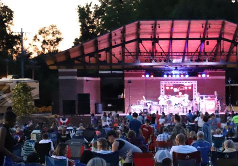
Liberty Park, Phase II Improvements / Mooresville, NC
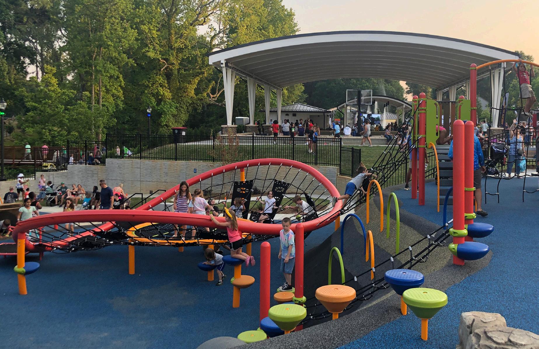
Phase II of Liberty Park, is an integral part of the Town of Mooresville’s downtown core, creates a place for the entire community to celebrate the Town’s 150th anniversary. The goal of the project was to provide first class amenities for citizens adjacent to an already popular amphitheater venue. New amenities include a spray ground, tri-level playground, covered basketball court, covered swings, new restroom, and parking. This project also included restore of an existing creek and adjacent vegetation back to a more natural state, that is free of invasive species, as well as a trail network that connects the park to the Carolina thread trail and across the stream to the existing recreation center and pool. These connections will help to make an already bustling park open to all, via a network of accessible paved trails and pedestrian bridges. This state-of-the-art park offers park activities and programming for the entire community.
Park, Recreation, Greenways + Open Space / Apex, NC
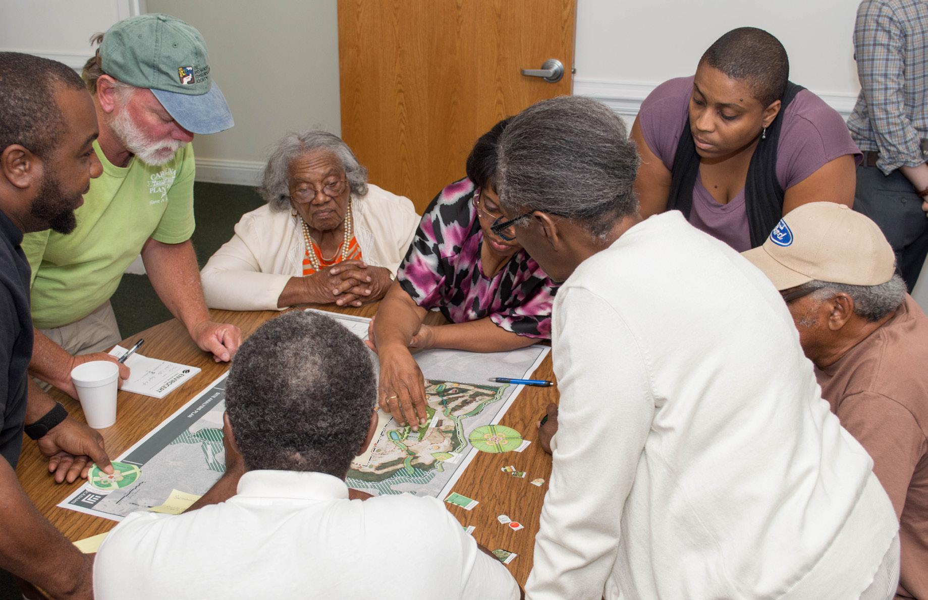
The Town of Apex has commissioned McAdams to update the 2013 Parks, Recreation, Greenways and Open Space Master Plan for their growing community and present strategies for executing the plan over a ten-year planning horizon from 2021-2031. The Town wants to achieve their vision of a 21st Century parks and recreation system. McAdams team will identify core community values through extensive community engagement process to develop recommendations supported by existing conditions evaluation; visioning sessions with stakeholders and focus groups; development of level of service; and benchmarking. Town-wide connectivity and greenway trail development is an important focus of the development, along with feasibility studies for priority corridors and conceptual master plans for three park properties.
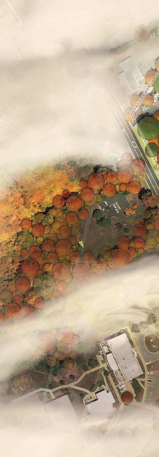
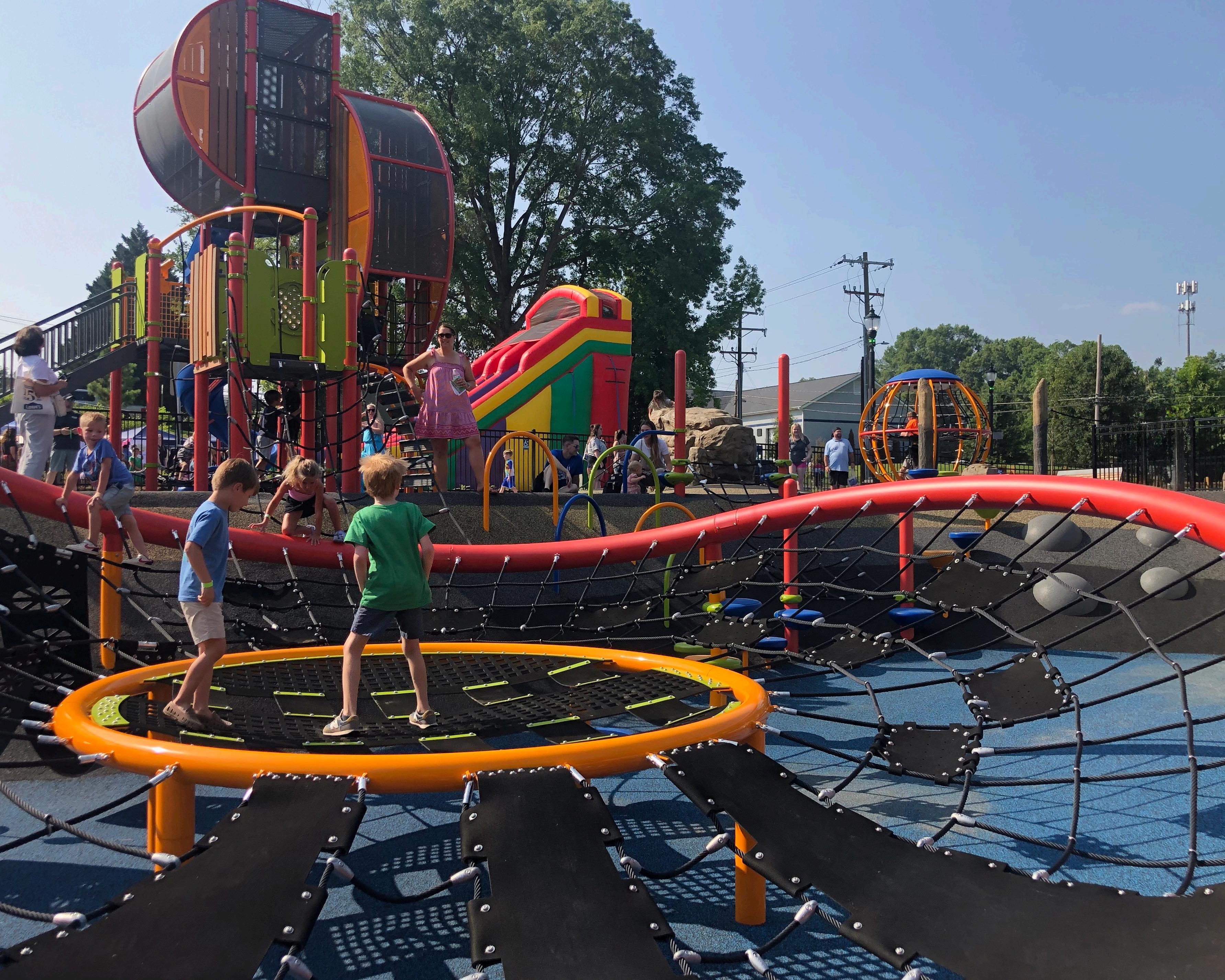
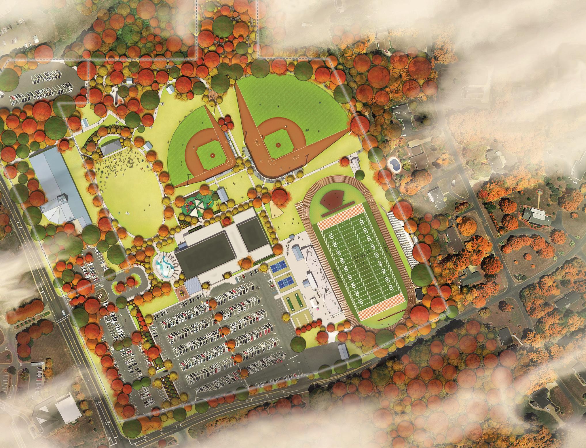
Davie County Community Park / Mocksville, NC
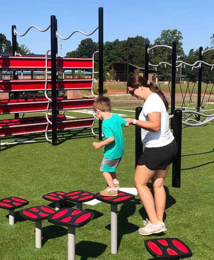
Undertaking their first park project, Davie County Parks and Recreation commissioned McAdams to assist with the development of a park master plan that repurposes the former high school campus, granted from the school board to the County in 2017. The McAdams team evaluated the existing conditions of the site and buildings; engaged the community to solicit input regarding the desired program elements; evaluated the local / regional market for recreation opportunities; created a master plan for improvements and recommendations for programming; and developed a cost analysis and operations proforma for the proposed improvements. Adopted in 2017, the master plan served as the foundation for the McAdams team to prepare construction documents for the project. Completed in the summer of 2022, the park provides a wide variety of offerings including a large splash pad, concert amphitheater, playground and challenge / fitness course, stadium level artificial turf multipurpose field, softball field, activity meadow, lawn games, as well as renovated recreation center.
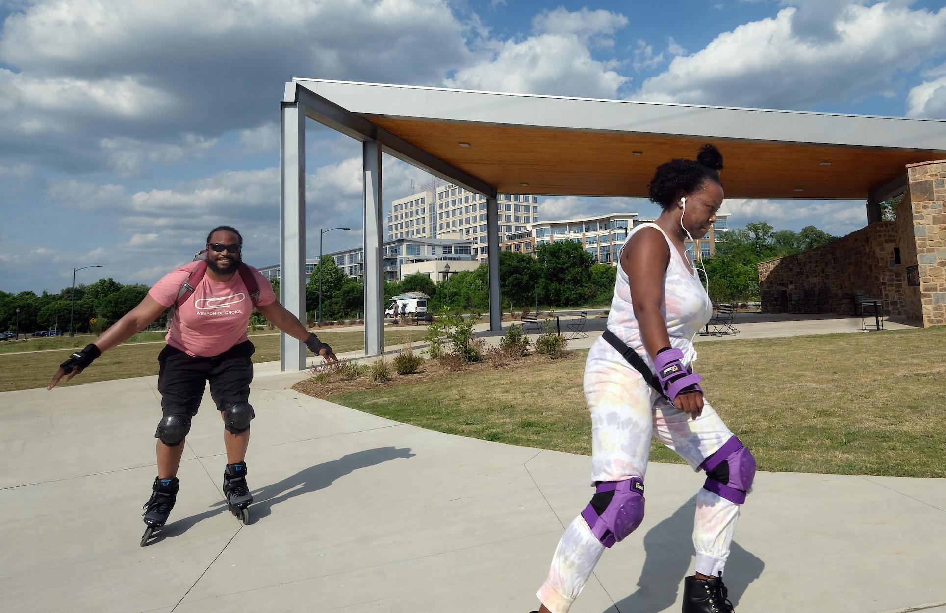
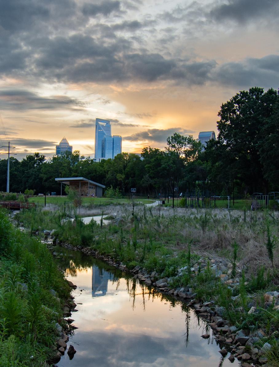
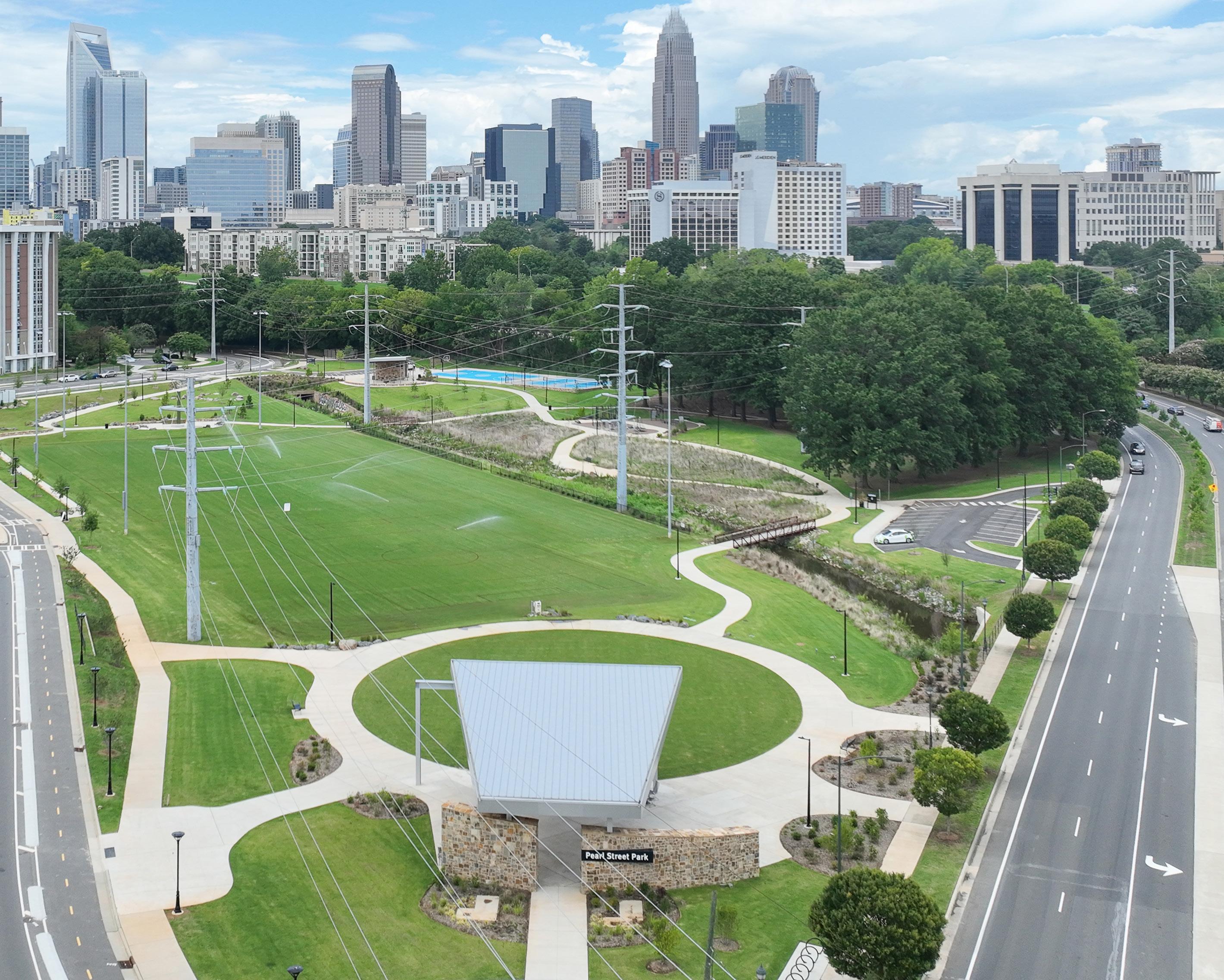
Pearl Street Park Renovation / Charlotte, NC
Located in the Dilworth district just south of uptown Charlotte, Pearl Street Park is known as the first African American public park built in the City. Today, the park finds itself surrounded by redevelopment projects, all catalyzed by the Little Sugar Creek Greenway. As redevelopment continues to encroach on the historic park, the McAdams team was commissioned to provide master planning, construction documents and construction phase services to re-activate the park. The park’s redesign included planning for flooding and resiliency, stream restoration, native plantings, interpretive art and storytelling graphics, reconfigured multipurpose fields, sports courts, urban plaza areas, comfort station / building, iconic gateway pavilion, inclusive playground and walking paths.
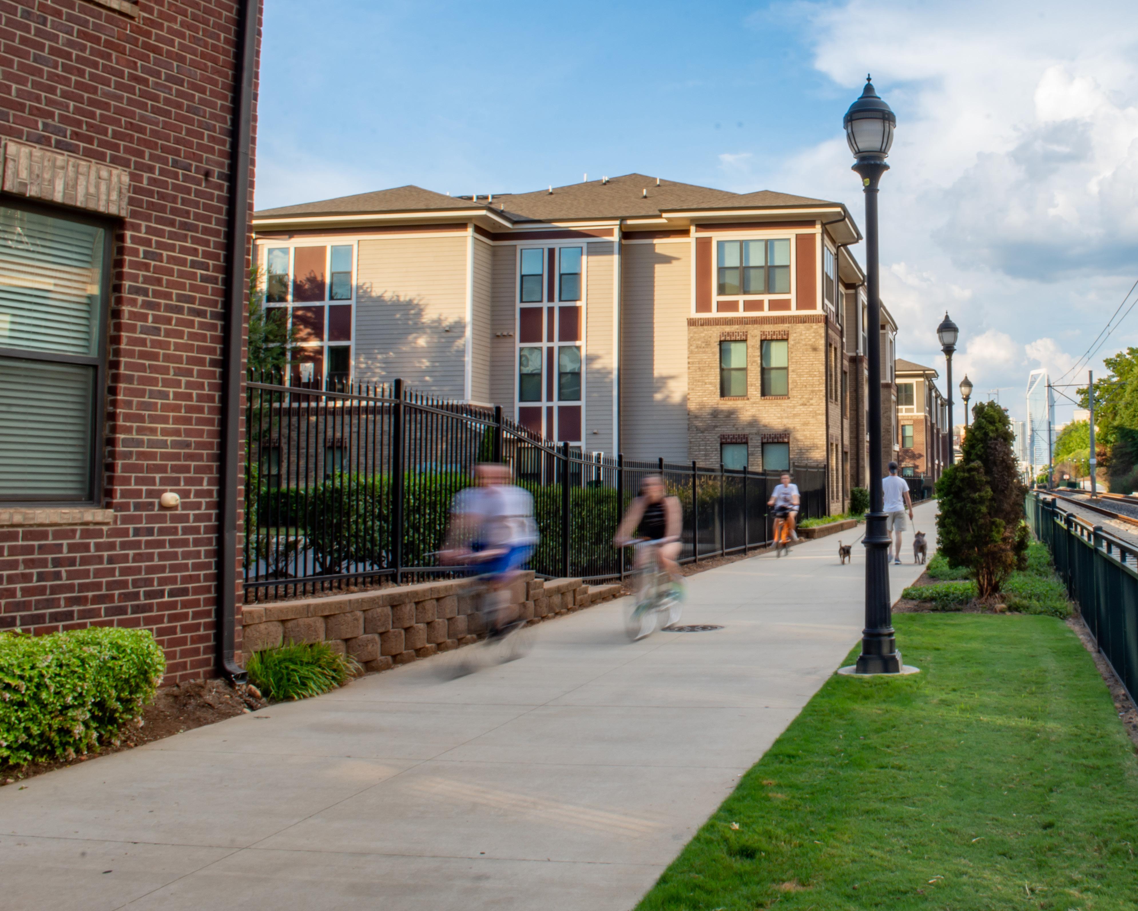
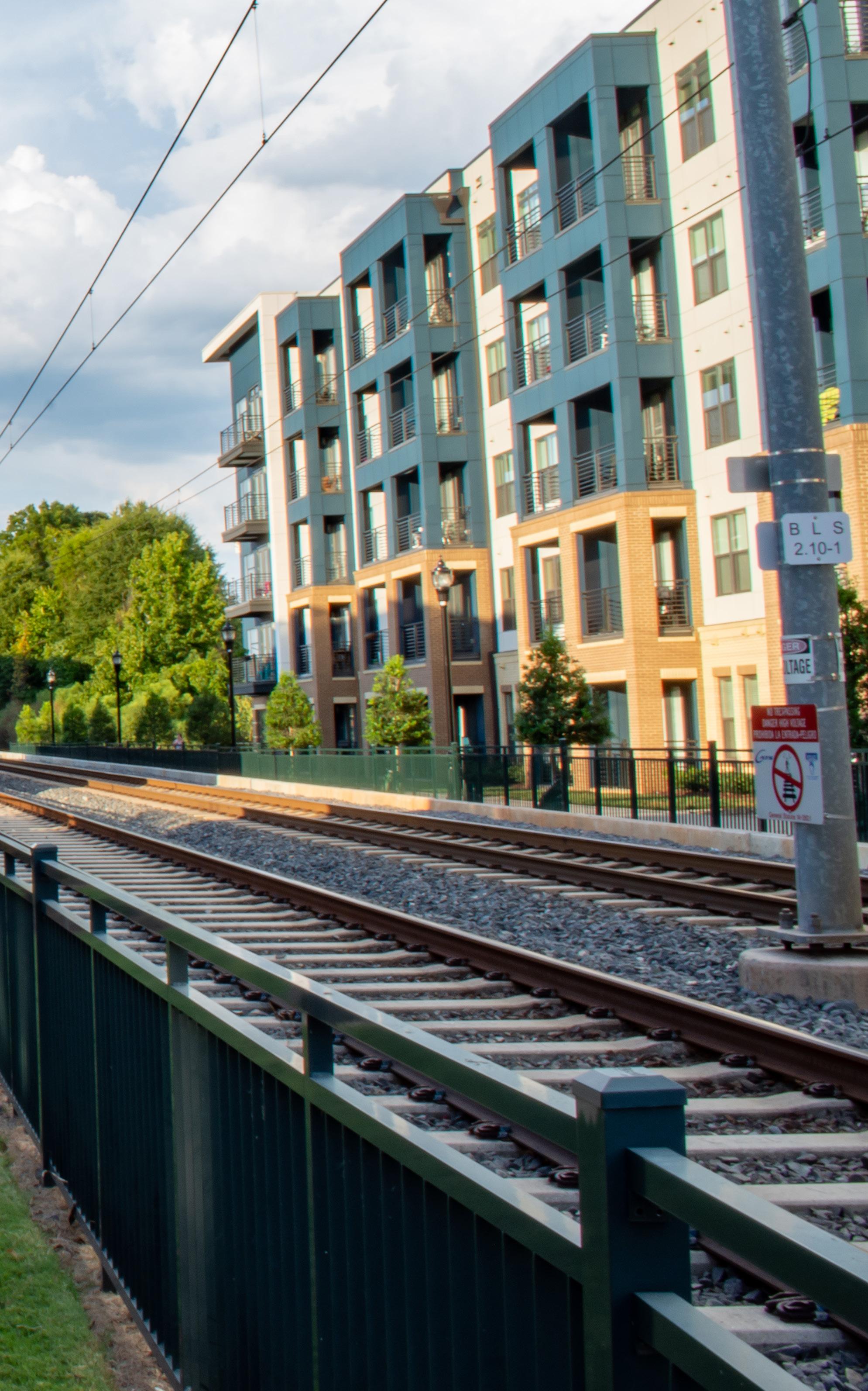
Junction 1504 + Charlotte Rail Trail Connection / Charlotte, NC
Located near Uptown and South End neighborhoods, Junction 1504 is an 11-acre site with 250 units positioned within steps of the City’s abundant green spaces, light rail lines and major employment centers. The design included 1,500 linear feet of the Charlotte Rail Trail, which forms its eastern boundary. McAdams executed design for the inclusion of the greenway and worked closely with the City of Charlotte to achieve a seamless addition to the Charlotte Rail Trail. This section of trail includes decorative lighting, landscaped borders and ornamental fencing to create a buffer with the rail line for greenway users and residents.
GREENWAY SERVICES
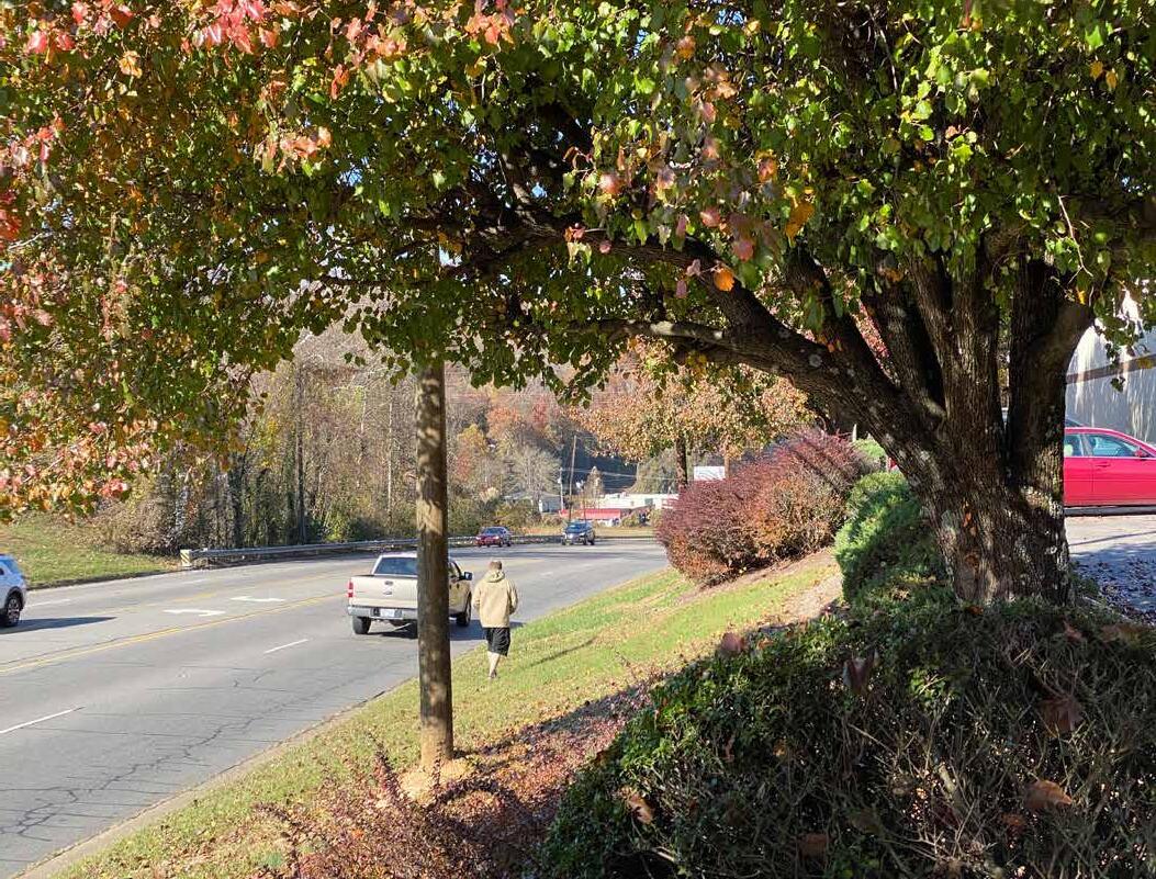
We know that greenways are not just a roadway for pedestrians and cyclists, and that streams are not just obstacles to be crossed. Material choices, viewsheds, tree cover, acknowledgment of history, places to rest and welcoming access points all matter when moving at the pace of a pedestrian or cyclist. Our dedicated greenways team of planners, engineers and landscape architects have planned and designed hundreds of miles of greenways for users of all ages and abilities. We are strong advocates for increased funding for greenways; have “written the book” on greenway feasibility studies for the North Carolina Department of Transportation (NCDOT); and are at the cutting edge of innovations in greenway design, materials and construction methods. We understand the power greenways have in helping communities reach their goals, including: increasing quality of life for residents; attracting visitors and strengthening local economies; and providing access to cultural and natural resources. McAdams strives to provide context-sensitive and cost-effective solutions to create meaningful user experiences. Typical services include:
› Pedestrian + Bicycle Master Planning
› Feasibility Studies
› Community + Stakeholder Engagement
› Greenway Design + Permitting
› Trailhead Design
› Hydraulic Modeling + Design
› Green Stormwater Infrastructure
› NCDOT Coordination
› Grant Writing + Funding Assistance
› Easement Acquisition Support


CastlewoodTrail M a u r a d r e r T r a i l M a rket Tr ail l i a r T e g a l l i V District Trai l E q u e s t r i a n Tr a i l CityTrail MarketTrail LAKESIDE DR D V L B L L I H R A R B ROSEDALEST HILLSIDEDR GARRETT DR NORTHWOOD DR TWIN COVES DR BA R NETT B L V D D V L B D O O W E L T S A C TIMBERLINE DR DR EXCALIBUR R D E R O M H T A R T S SILVERTHORNETRL FAIRFIELD LN ORCHIDHILLLN L R T N A T R A T MARKETPLACELN BROOKSCT PILOTKNOLLCAMPRD BURNE TT CO NNE C TO R R D J HIGHLANDSHORESBLVD V I L L A G E P K W Y Doubl e Oak Fl ow e r Moun d Coppe r Ca n y o n Fl ow e r Moun d McAuliffe Elementary School Heritage Elementary School DKH Academy McAuliffe Elementary School Briarhill Middle School Middle School Plan provided by Toole Design
Trail Network Recommendations
Trails System Master Plan Update / Highland Village, TX


Highland Village Parks and Recreation Department serves nearly 17,000 residents and is responsible for owning and operating 325 acres of parkland; 19 parks; 5,500 square feet of indoor recreation space; 10 miles of greenway trails; and 39 athletic fields and courts. As an attractive, lakeside city, Highland Village is growing, yet finding themselves challenged without vacant land for the expansion of parkland. In conjunction with the Parks, Recreation and Open Space Master Plan Update, McAdams also provided a Trail System Master Plan Update and developed on-street bicycle network recommendations. The proposed recommendations connect desired locations (schools, parks, business districts, employment centers etc.) with trails; sidewalks; bike lanes and bicycle boulevards to provide a complete active transportation system as well as complement Highland Village’s land use, zoning, transportation and utility expansion plans.
h c n a R e e r t e l b u o D m e t s y S l i a r T k r a P C o p p e r a s T r a i l H V R d S i d e w a l k Victoria Trail C i t y Tr a i l City Trai l Fir e D e p t TIMBERCRESTLN WHITTIER ST M E RRIM AN D R N L R E Y E M L L E S CLEARWATER DR S REMINGTON DR W DOUBLETREE DR T S S G N I R P S N E E R G CLEARWATER DR N R E MI NG T ON DR E L AKEV IS T A W LAKELANDDR V ILLAGE E S TATE S D R D E SIR EE L N WILLOW CREEK ESTATES DR R D A N I D E M R D E E R T N I A R LAKECREEKDR D V L B L L A V U D MALIBUDR V ILL A PA R K D R OAKST GAYLE LN HO RSES HOE DR BRAZOS BLVD H G H L A N D V L L A GE R D USTIN RD I3 5 E
Surrounding Cities Streams Lakes City Limits Sidewalks Bike Lanes Schools Existing Parks Private Trails Nature Trails Public Trails Railway Proposed Trails Proposed Buffered Bike Lanes Proposed Bike Blvds L e wi s vill e Intersection Upgrades Shoreline Trails 0 0.5 0.25 Miles N DKH Academy Highland Village Elementary School
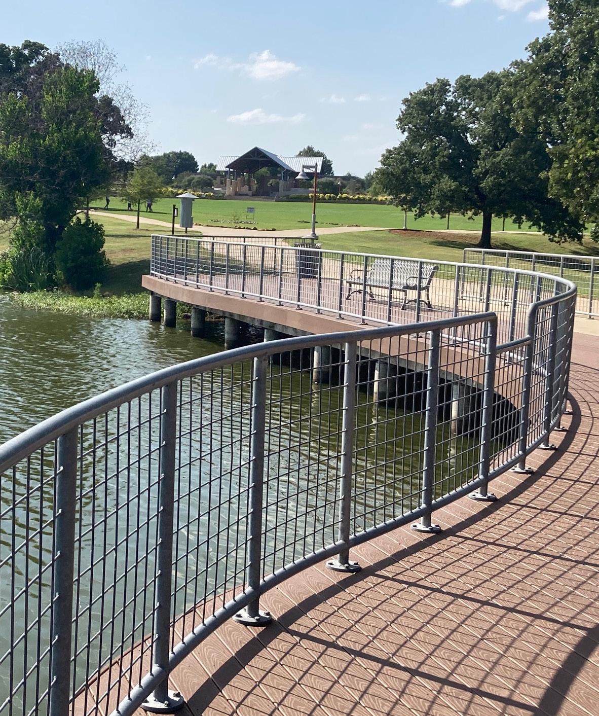
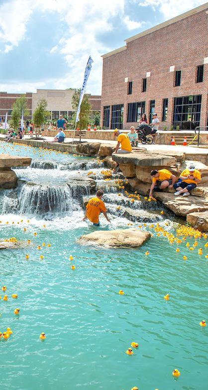
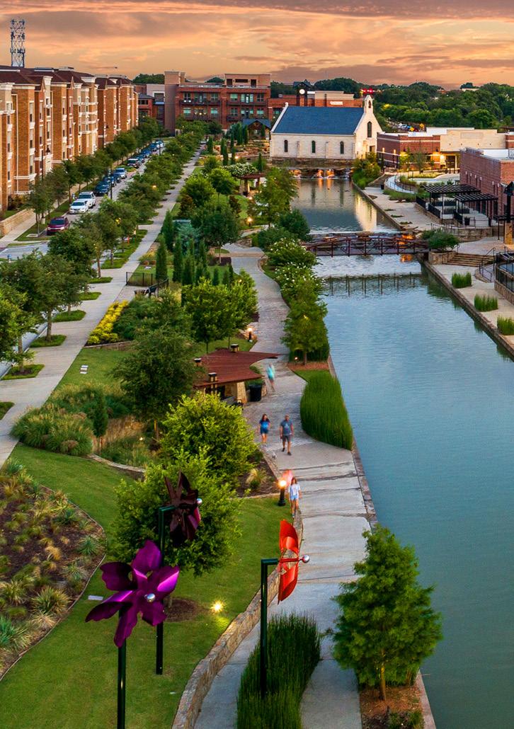
The River Walk at Central Park / Flower Mound, TX
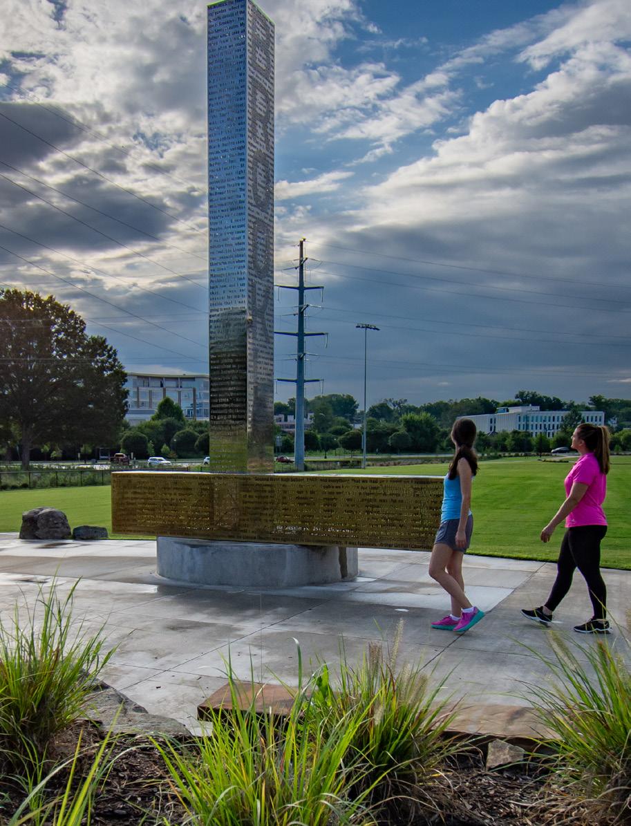
The River Walk at Central Park in Flower Mound, Texas is a 150-acre mixed-use development surrounding a core civic space defined by nearly a mile-long, man-made water feature anchored with a public green space and clock tower. This project involved over 20 public meetings to navigate plan approvals and garner community support. The premier public gathering area is called Clock Tower Plaza, which is elevated above the river walk, and Island Chapel on a rock outcropping. The plaza is activated by a covered pavilion and seating, a linear arbor and numerous seating opportunities. The clock tower serves a focal point for the entire development and rises about the north / south and east / west axis of the entire development. The system of trails and sidewalks was designed to tie all the various uses together for both pedestrians and cyclists and ultimately terminate at the Clock Tower Plaza. McAdams also spearheaded the design and implementation of a $350,000 public art project.


CITY OF MARION NORTH MAIN STREET SIDEPATH FEASIBILITY STUDY
NCDOT, Paved Trail Feasibility Study Content Standards + Grant Program Support / Statewide, NC
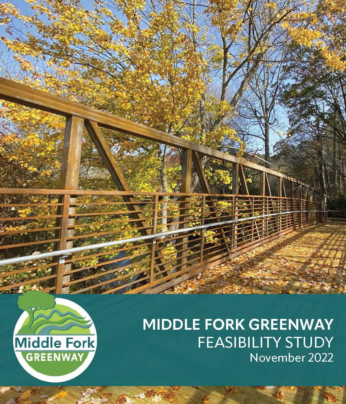
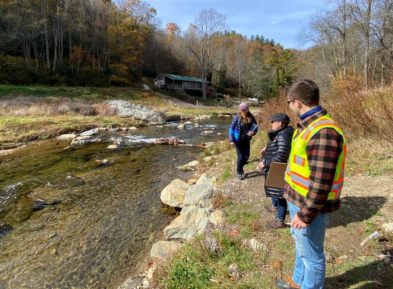
Feasibility studies bridge the gap between conceptual planning and programming of projects and take a comprehensive approach to identify possible route alternatives of multimodal corridors. McAdams developed standard content standards for NCDOT-funded bicycle and pedestrian corridor feasibility studies to evaluate technical feasibility of a project from design, permitting, constructability and implementation perspectives. The content standards are structured to produce well-conceived projects with cost estimates and demonstrated community support that will effectively compete for funding. McAdams also prepared two feasibility study pilot projects utilizing the content standards: Middle Fork Greenway in Watauga County and North Main Street Side Path in Marion. Our team then worked collaboratively with Integrated Mobility Division staff to develop and support a grant program for paved trail feasibility studies in communities across North Carolina. These efforts included creating project eligibility requirements, a program overview, frequently asked questions, scoping checklists and supporting the program’s first call for projects.
83 EVALUATION + RECOMMENDATIONS ALTERNATIVE A SECTION 3 Existing Greenway Proposed Bridge River / Stream / Lake Appalachian State Univ. Park / Managed Lands Municipality County Other Alternatives Studied Alternative A Parcel Line 4’ Contours LEGEND Potential Connection Trails 0 mi 700 ft 350 ft N 321 321 AhoRd Mack Hampton Rd AstorCookRd S t anleyDr C of f e yRidge D r
DexterD r
JenniferLn
Sh ore D r nRd MiddleFork NewRiver MiddleFo Potential Trailhead Faithbridge United Methodist Church
HighviewDr Hampton GladeRd
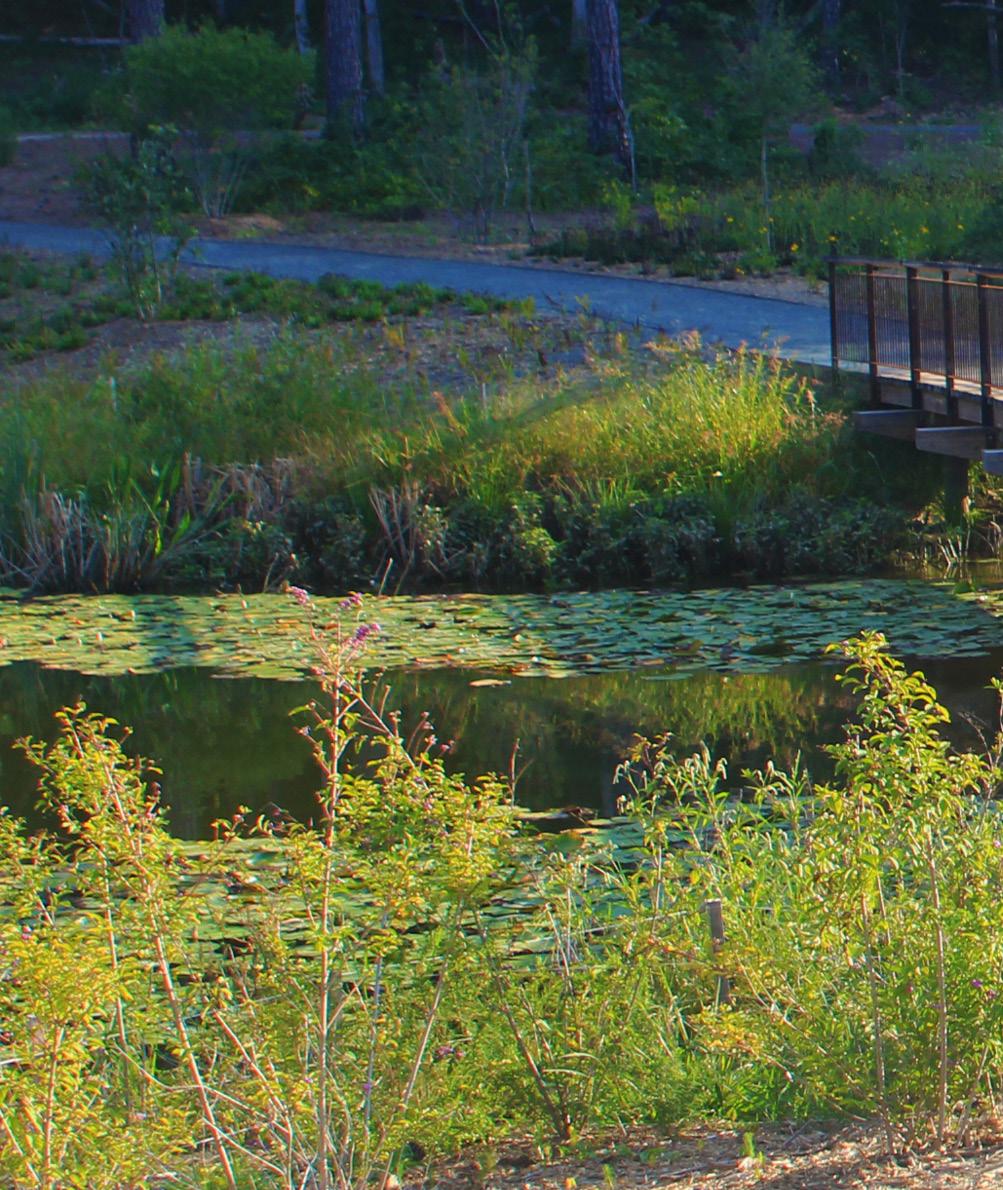
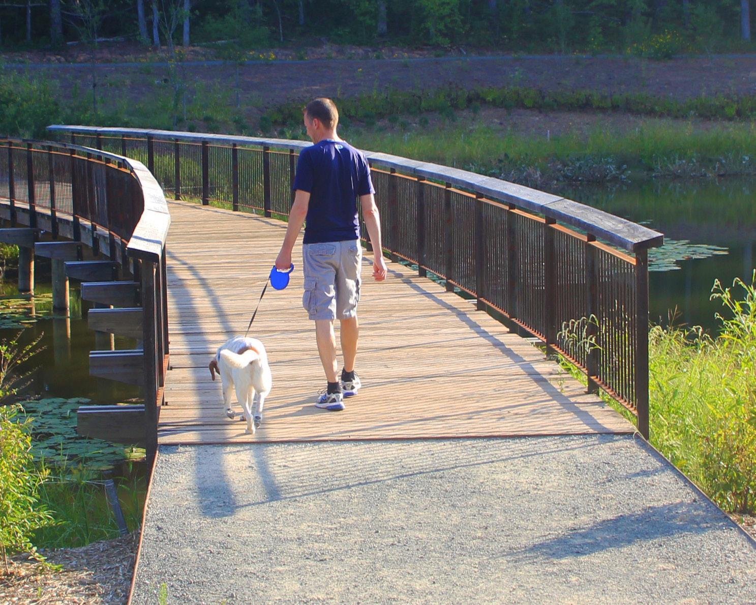
Duke University, Water Harvesting Pond + Trails / Durham, NC
McAdams was retained by Duke University to design a water reclamation pond to provide water for Chiller Plant #2 on Duke’s campus. The pond provides approximately 100 million gallons of water per year for use at the plant. The pond is impounded by a Class C (high hazard) dam, permitted through the State of North Carolina’s Dam Safety Program. McAdams navigated the permitting process with various entities to bring the project to reality. McAdams’ design also included restoration of approximately 3,400 linear feet as mitigation for stream impacts due to the construction of the pond on a jurisdictional stream. Construction of the restored stream segment has been completed, tying into the university’s extensive SWAMP system of restored stream sections.
Interested in learning more? Visit our website www.mcadamsco.com or contact us at info@mcadamsco.com Pearl Street Park / Charlotte, NC
