

TDD PROPOSED BOUNDARY Hammond, IN Public Gallery For Community Feedback Want to learn more about our process? Visit our website at www.in.gov/rda or www.nwiTDD.com 1 | PROJECT ORIENTATION & (Start here!) Welcome to the Public Gallery for the Transit Development District (TDD) Process for Northwest Indiana!
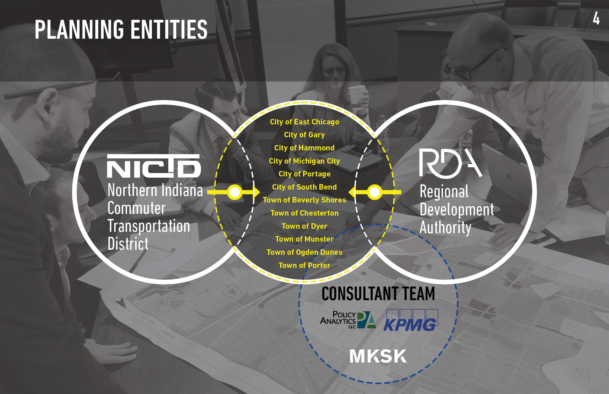
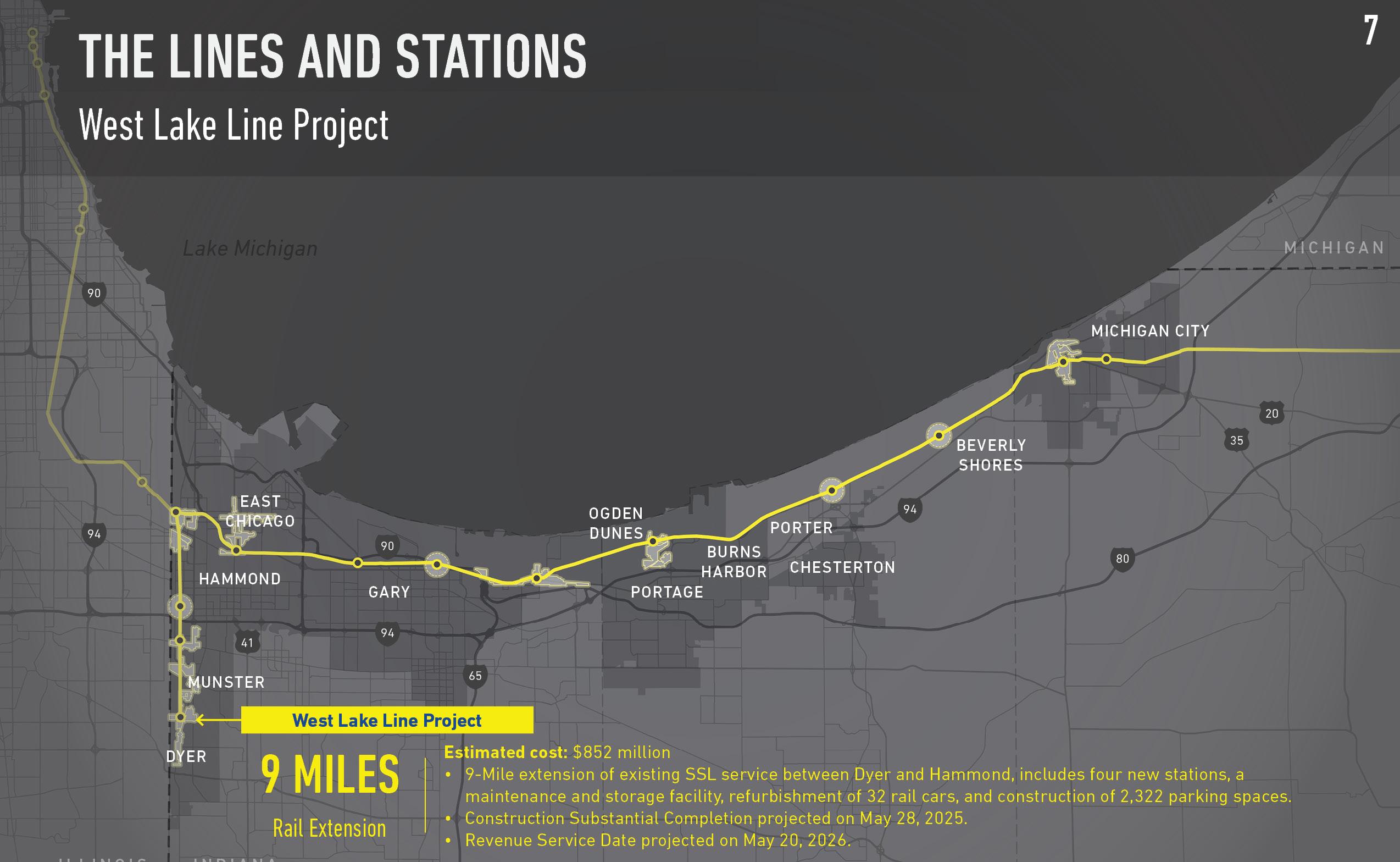
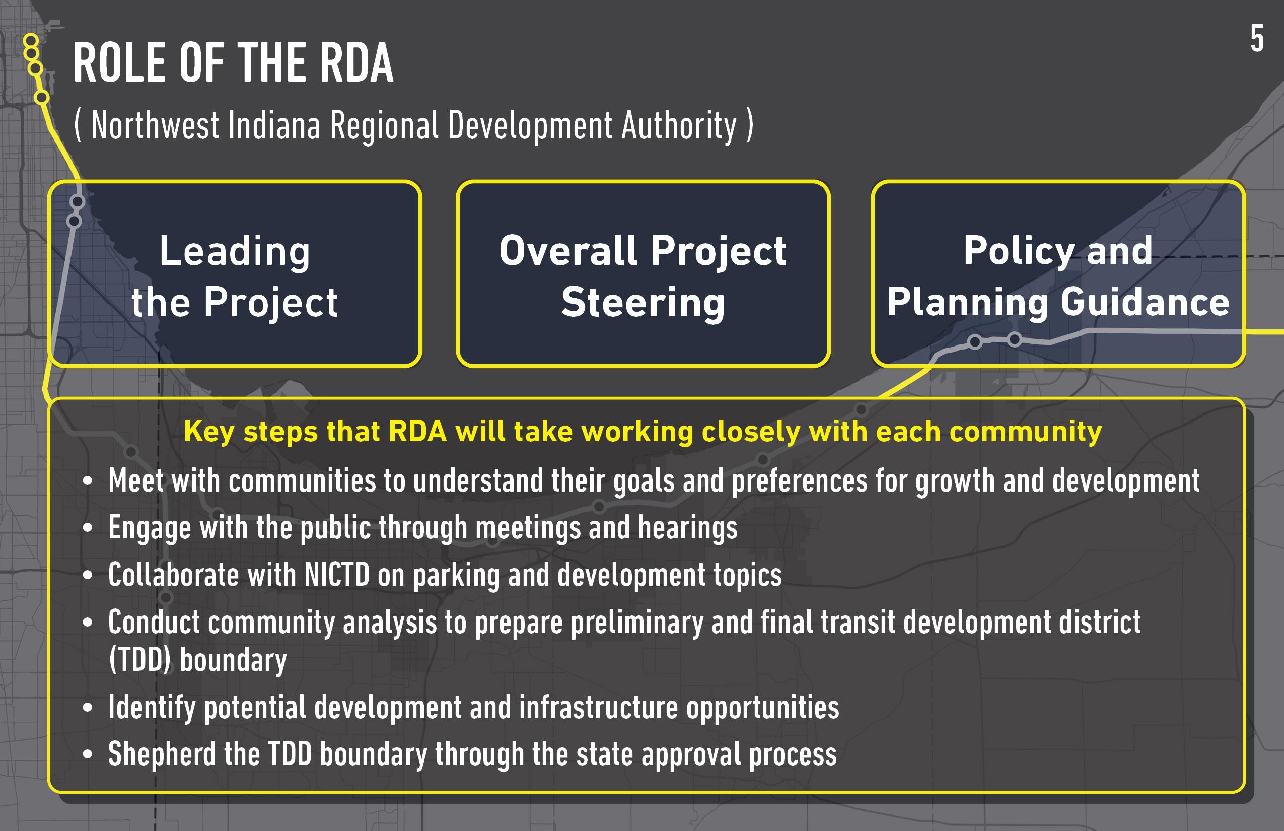
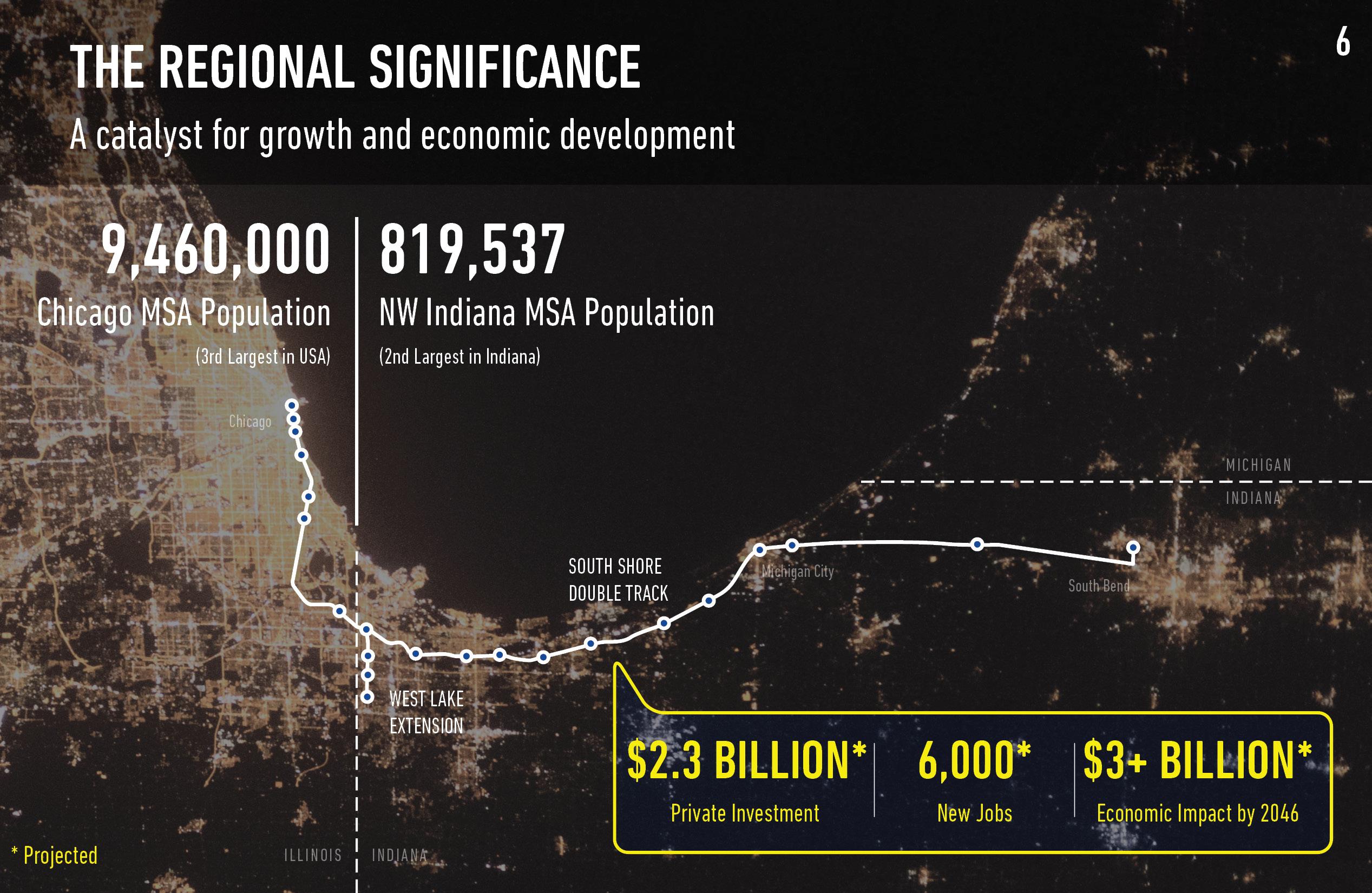
you will find the latest information about our project, our progress, and how to share your comments and ideas. PROJECT IMPACT: A GAME-CHANGER FOR NORTHWEST INDIANA COMMUNITIES A multi-disciplinary team is led by the Regional Development Authority (RDA) to work alongside Northwest Indiana Communities. The South Shore Double Track Project and West Lake Corridor Project include 25 Miles of rail extension or new second track. The Regional Development Authority (RDA) is leading this effort, offering policy and planning guidance to Northwest Indiana communities. WE ARE HERE! The project’s economic impact to Northwest Indiana will be a catalyst for growth and economic development. Our Project Gallery includes the following materials: 1 Project Orientation 2 What is a TDD and How Does it Work? 3 TDD Boundary Process & Criteria 4 Community Understanding 5 How We Developed the Boundary 6 South Hammond Station DRAFT Boundary 7 What Can Community Growth Look Like? LET’S GET STARTED! PLEASE REVIEW OUR MATERIALS IN THE ORDER SHOWN HERE HAVE QUESTIONS? CONTACT DAVID WELLMAN, COMMUNICATIONS MANAGER/RDA E: DWELLMAN@RDA.IN.GOV P: (219) 644-3506
Here,
WHAT IS A TDD AND HOW DOES IT WORK?
What is a Transit Development District (TDD)?
The main focus is on promoting Transit-Oriented Development.
Transit development districts provide economic tools and strategies to support local communities to implement high-quality transit-oriented development.
The goal is to create a boundary calibrated specifically for each community based on analysis, areas of opportunity and the goals and visions of the community.
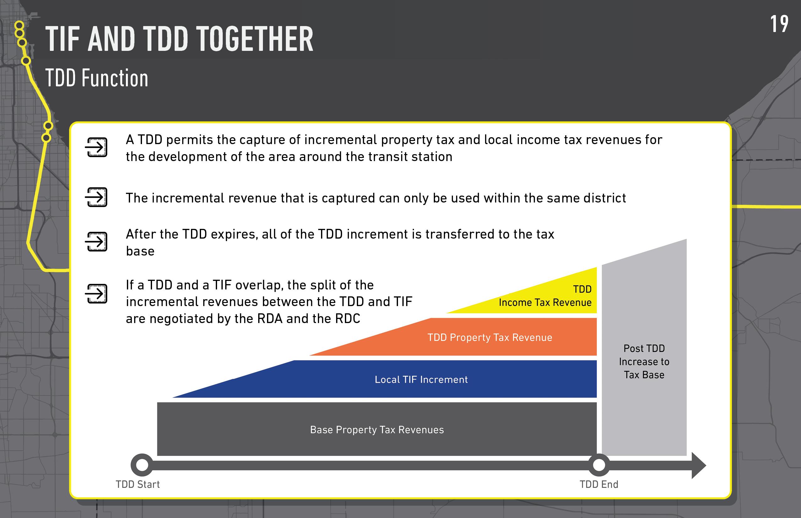
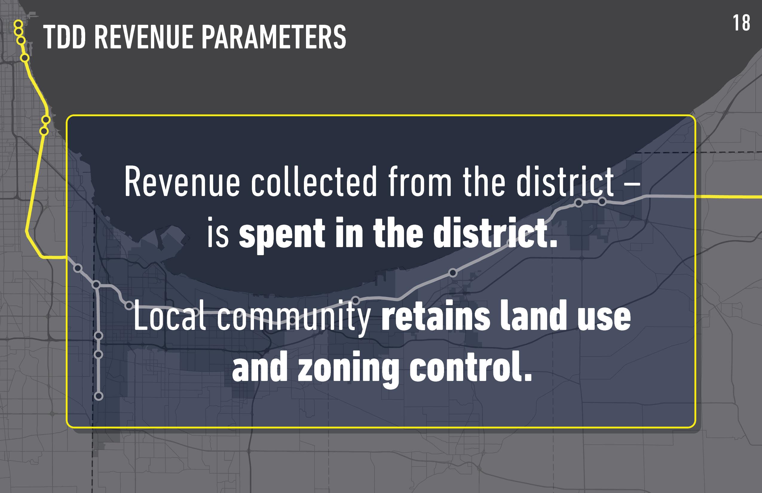
Transit development districts capture the incremental growth in local and property tax revenue, for use in public investment related to the station area.
After consultation with local communities, two public hearings must be held before the RDA approves the TDD boundaries for review and approval by the State Budget Committee.

TDD BOUNDARY BASICS
Want to learn more about our process? Visit our website at www.in.gov/rda or www.nwiTDD.com TDD PROPOSED BOUNDARY Hammond, IN Public Gallery For Community Feedback 2 |
This isn't just a boundary.
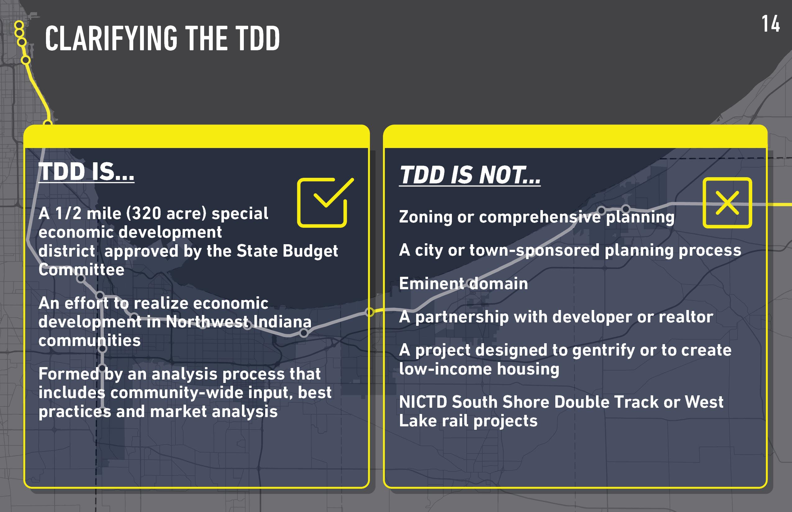
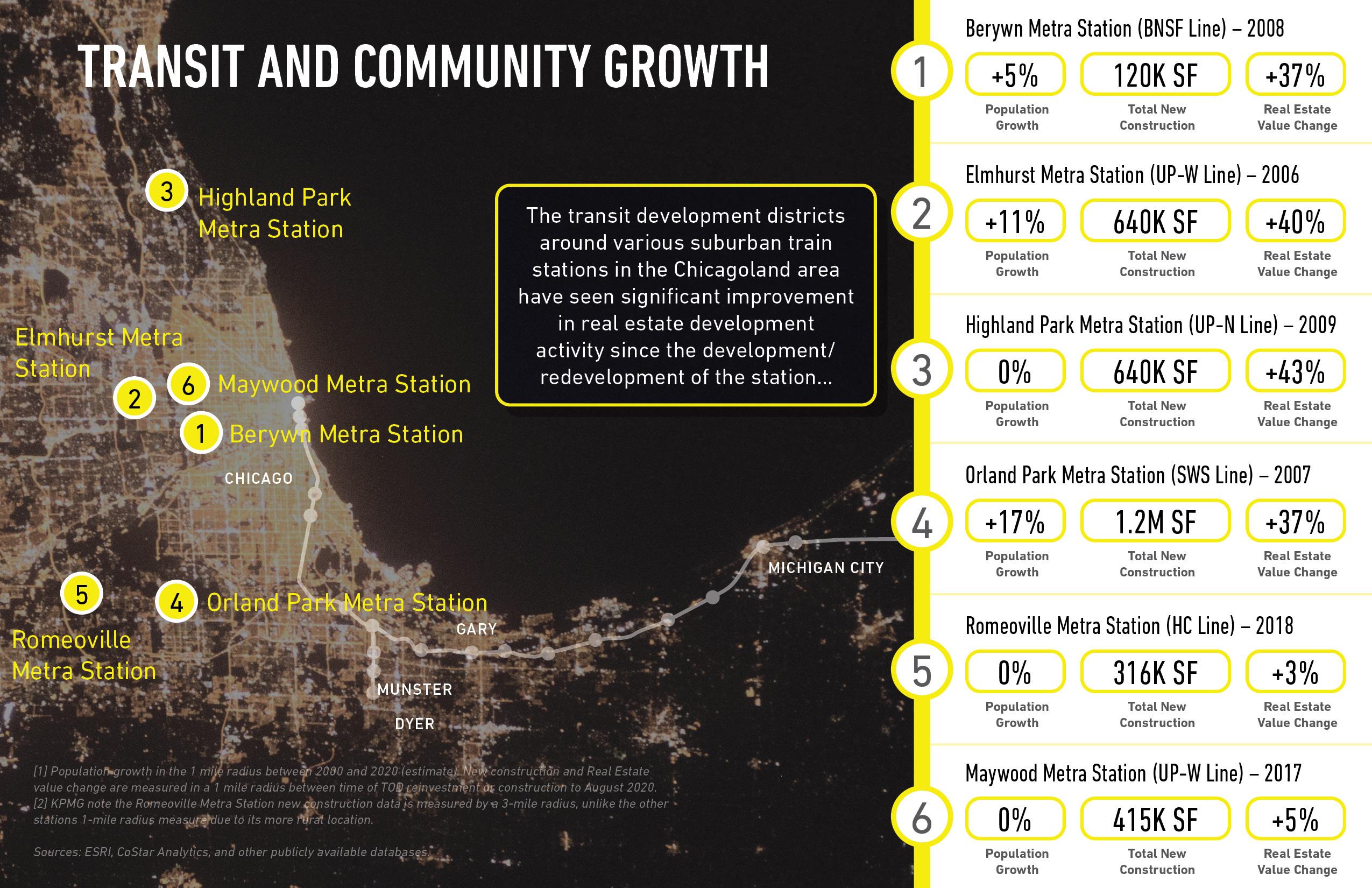
A TDD is a special economic development district not a rezoning or eminent domain tool. TDD’s are continguous boundaries drawn around station areas, and must be no more than 0.5 square miles (320 Acres) in area. Across the Chicagoland region, TDDs have led to significant population growth, construction, and increases in property market value. What is a TIF? Tax increment financing districts divert property tax revenue increases in a defined area to fund economic development projects or public improvement projects in the community. What is a TDD? Transit development districts capture the incremental growth in local property and income tax revenue, for use in public investment related to the station area.
It complements the economic growth path of communities.
Transit Development Districts includes site analysis, community input, best practices, and market analysis.
The TDD boundary process is comprised of four major steps:

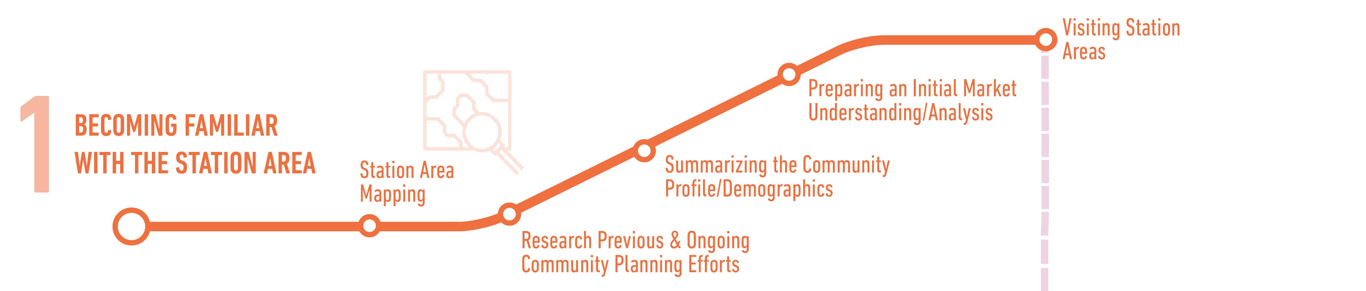
1 Becoming Familiar with the Station Area - research of previous and current planning and development efforts, demographic analysis, initial market understanding, and station area visits.
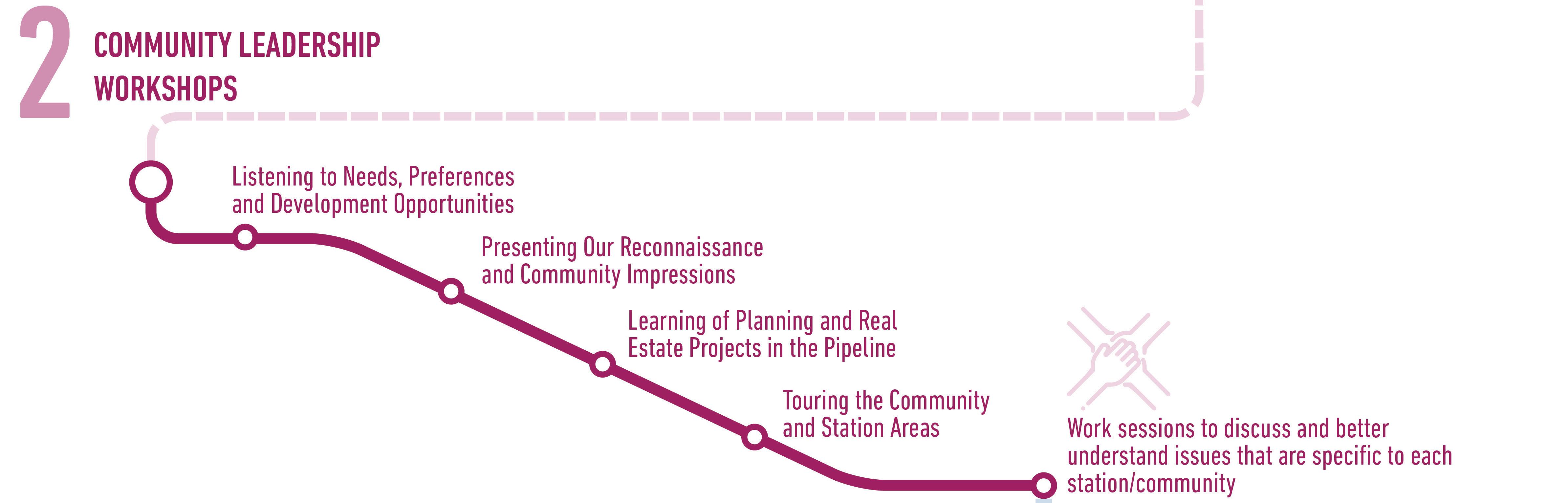
2 Community Leadership Workshops - listening to needs, preferences, and development opportunities; discussing impressions and findings, learning of projects in the pipeline, touring the communities, and collaborative work sessions.
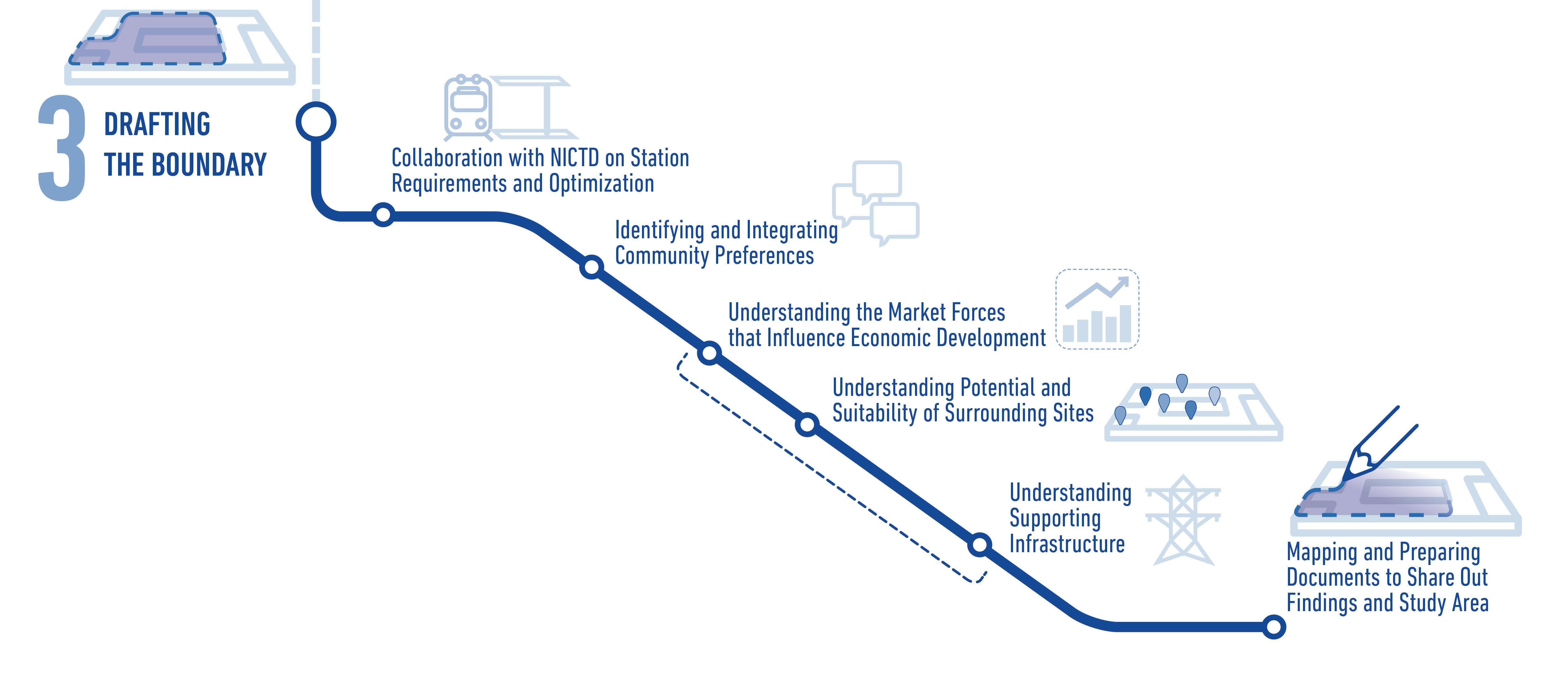
3 Drafting the Boundary - collaboration with NICTD on station requirements and optimization, integrating community preferences, understanding market forces for economic development, understanding suitability of surrounding sites, understanding supporting infrastructure, and preparing information to report out findings.
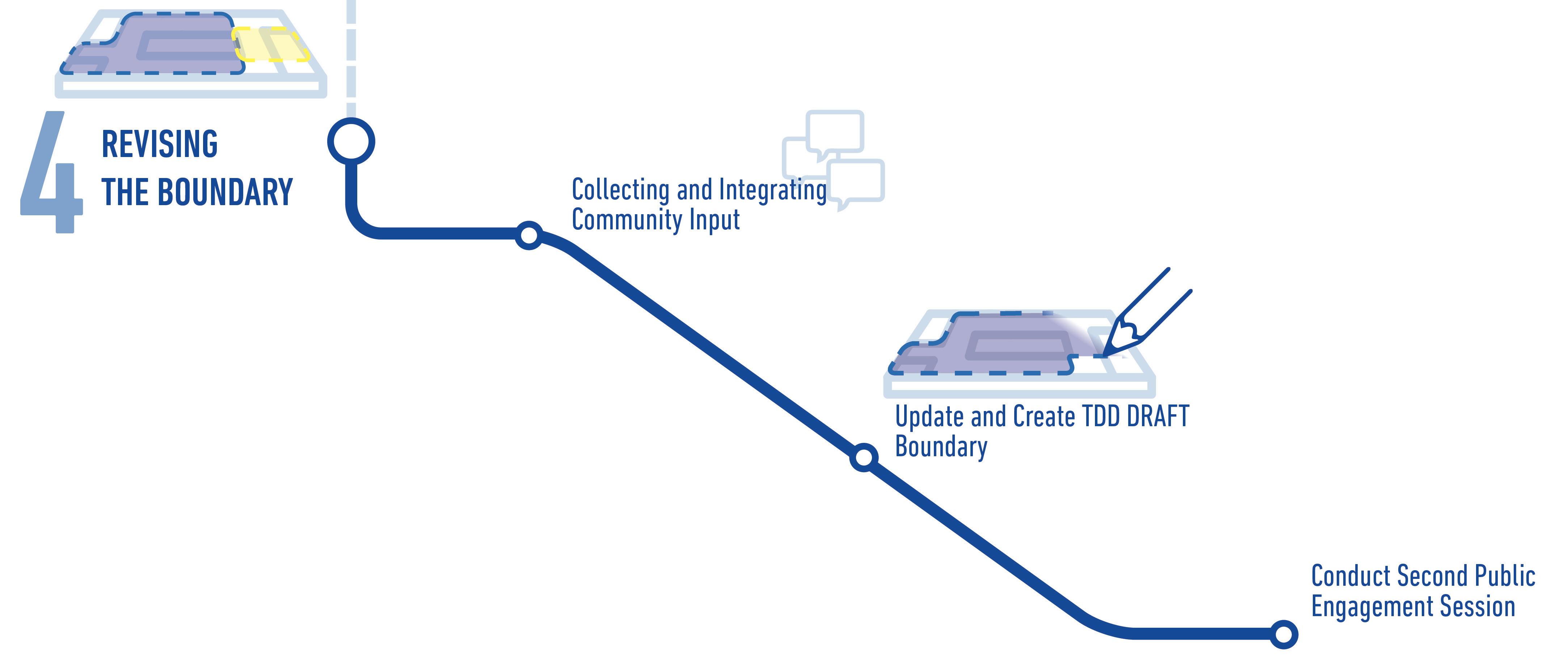
4 Revising the Boundary - integrating community input, update and create draft TDD boundary, conduct second public engagement session.
TDD BOUNDARY PROCESS
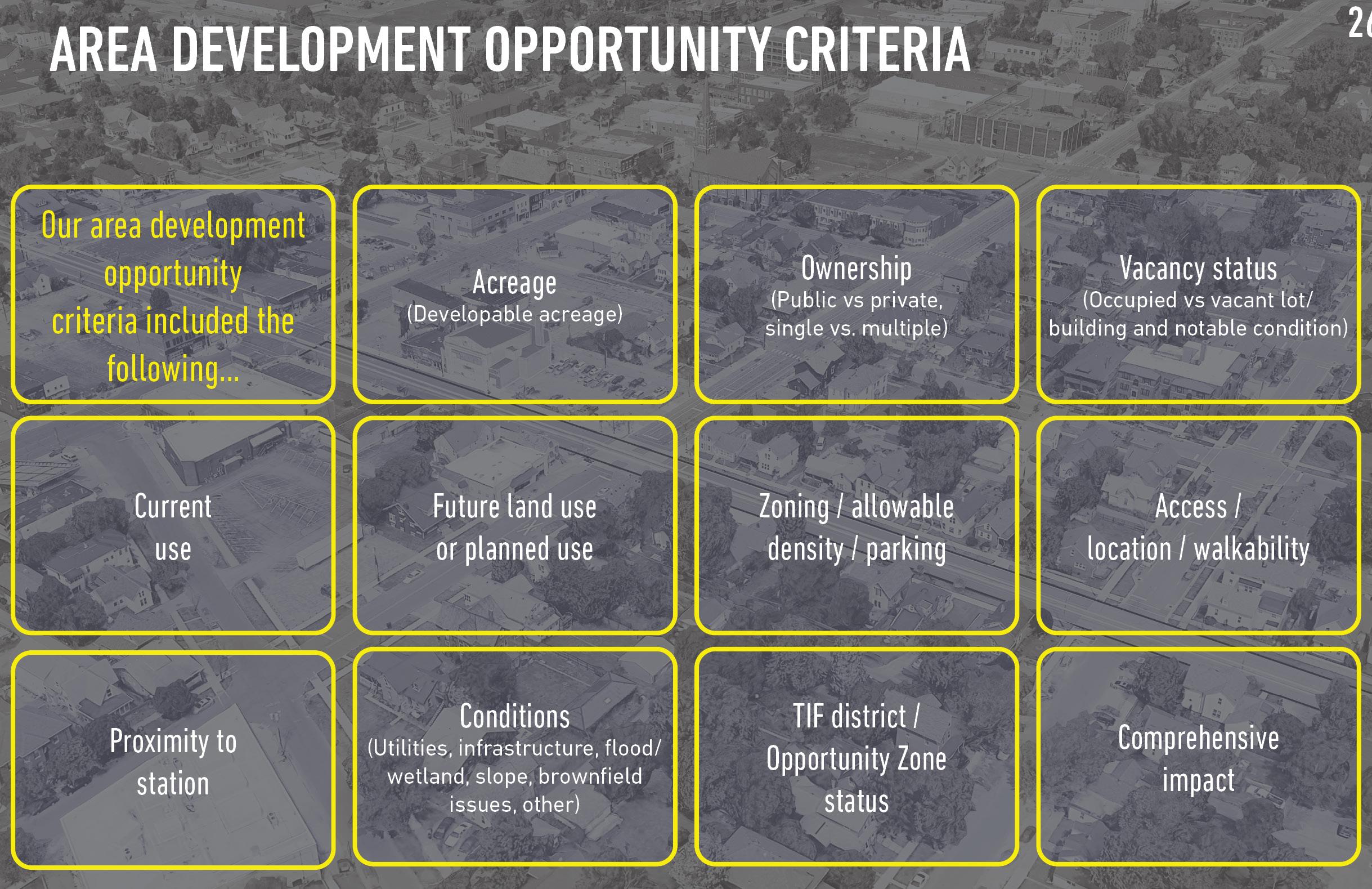
BOUNDARY CRITERIA
Want to learn more about our process? Visit our website at www.in.gov/rda or www.nwiTDD.com
TDD PROPOSED BOUNDARY Hammond, IN Public Gallery For Community Feedback 3 | TDD BOUNDARY
PROCESS & CRITERIA
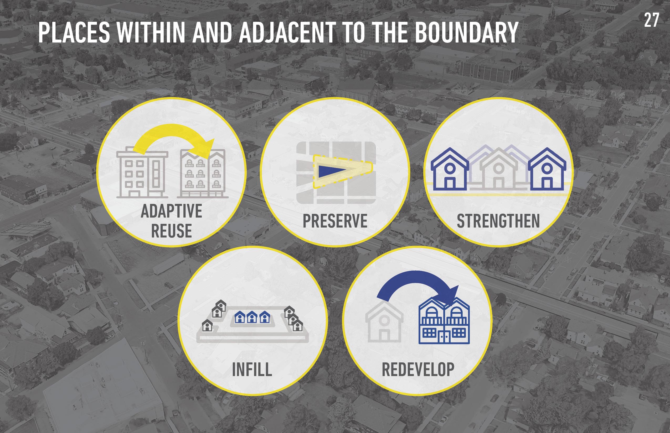
The four steps of the boundary process include research and analysis, collaborative work sessions, and community engagement. Quantitative data, qualitative data, and site selection influenced the TDD boundary. Several site characteristics were considered together to determine development opportunity and site selection. Property is impacted within and near the boundary in various ways, from strengthening its market conditions to preserving or redeveloping.
The process and criteria of defining a TDD boundary analyzed quantitative data, qualitative data, and site conditions.
What we’ve learned about Hammond DEMOGRAPHICS CONNECTIVITY
Community Economic Development Goals:
1 Supporting momentum tied to Downtown TOD and Revitalization
2 Walkable and trail-oriented development within walkshed of TDD boundary linked to Downtown TOD
3 Commercial focused development along major corridors
4 Protection of existing single-family neighborhoods

5 Activation of sites that could redevelop over time
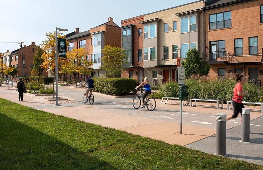
We’ve looked at trail-oriented development opportunities surrounding the South Hammond Station.
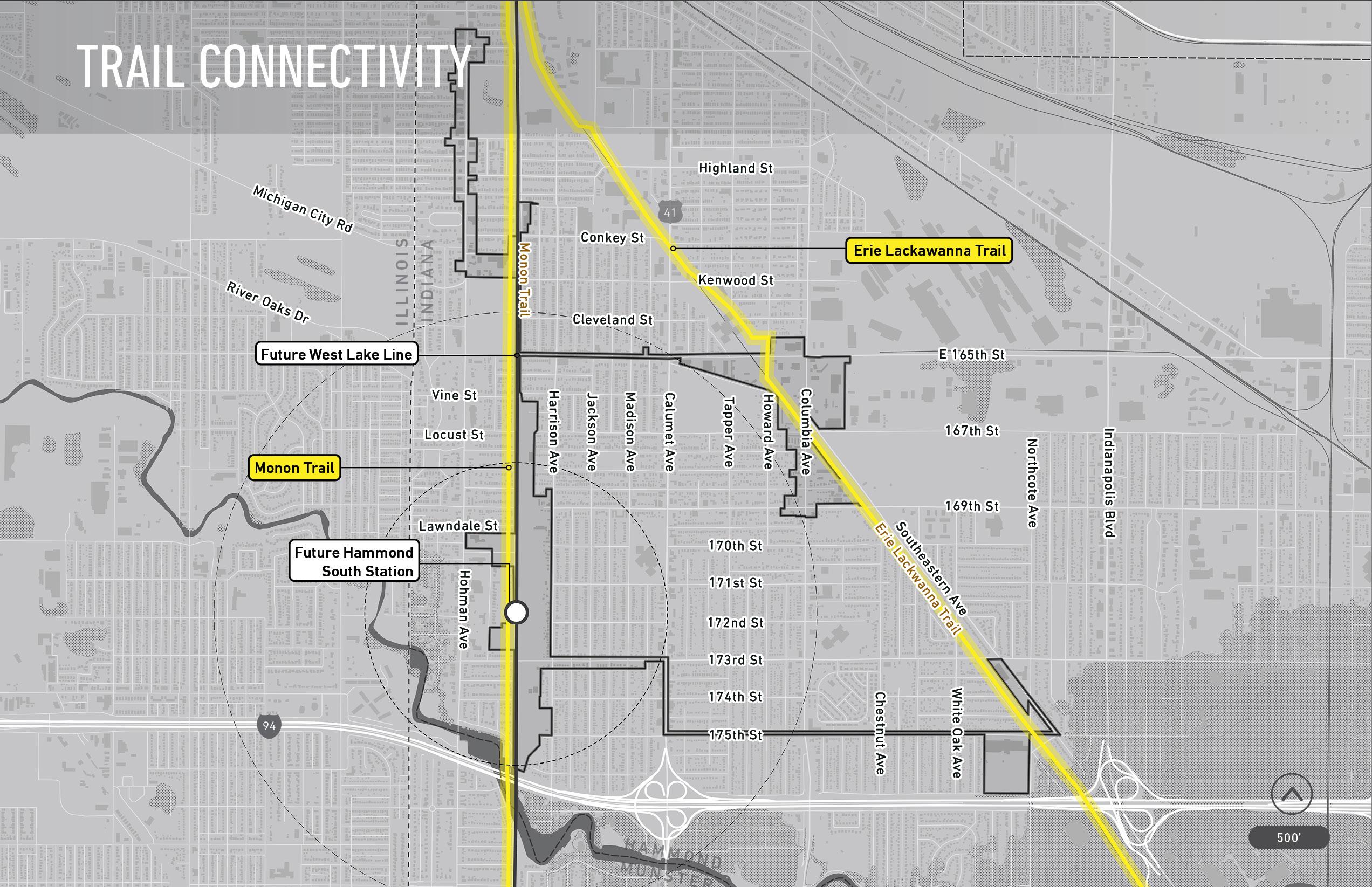
Trail-oriented development takes advantage of and leverages infrastructure that supports active ways of getting around in urban areas. In addition to transitoriented development opportunities, the South Hammond Station area has opportunities for trail-oriented development with the presence of two regional trails: the Monon Trail and the Erie-Lackawanna Trail.
Want to learn more about our process? Visit our website at www.in.gov/rda or www.nwiTDD.com
TDD PROPOSED BOUNDARY Hammond, IN Public Gallery For Community Feedback 4 | COMMUNITY
UNDERSTANDING
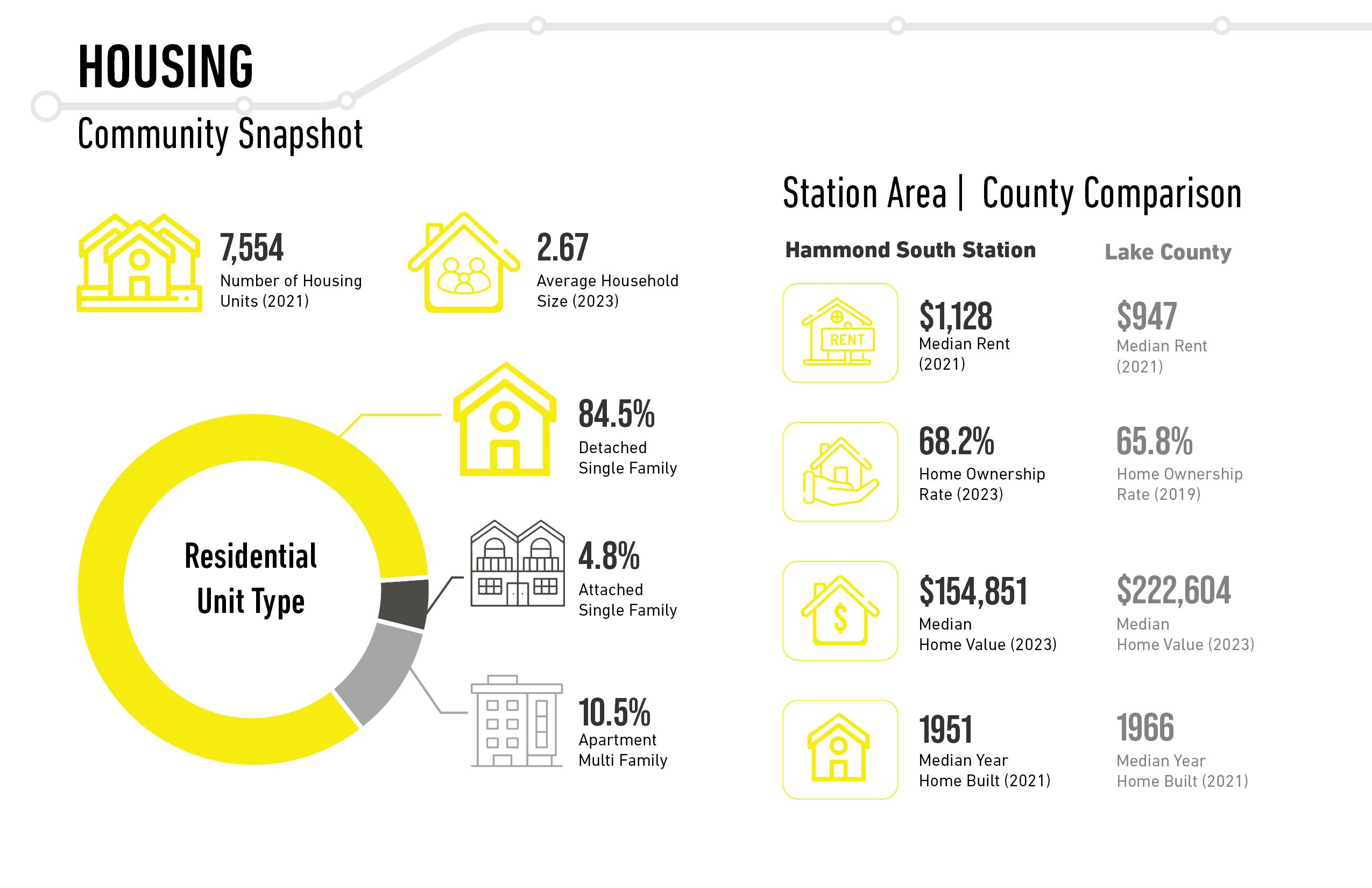
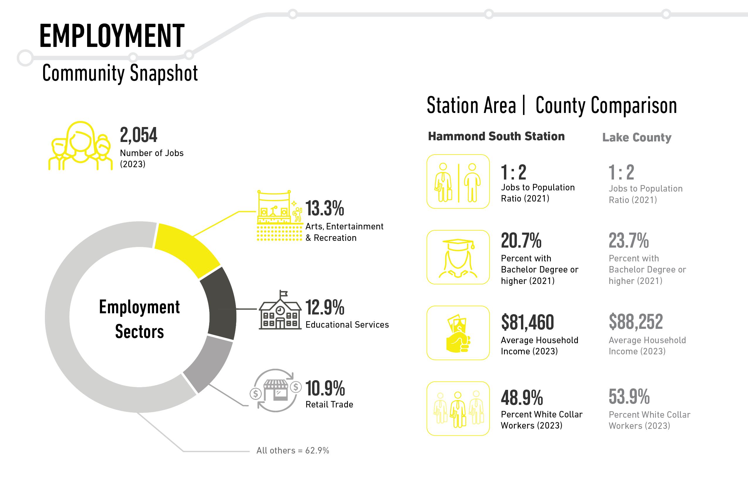
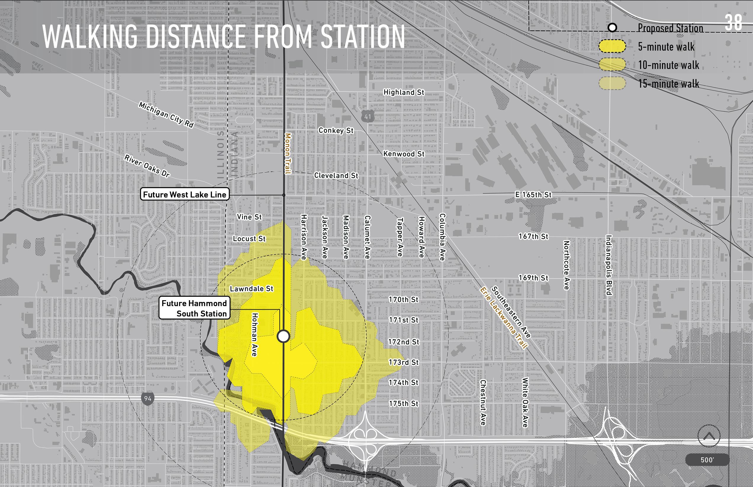
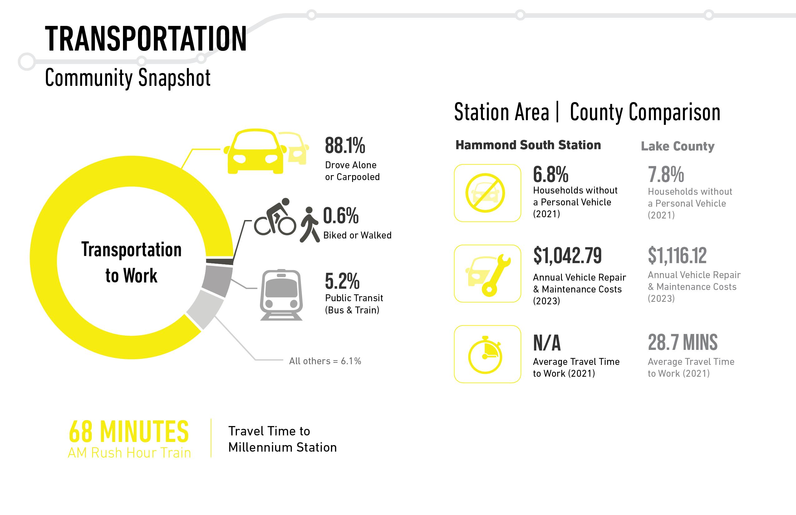
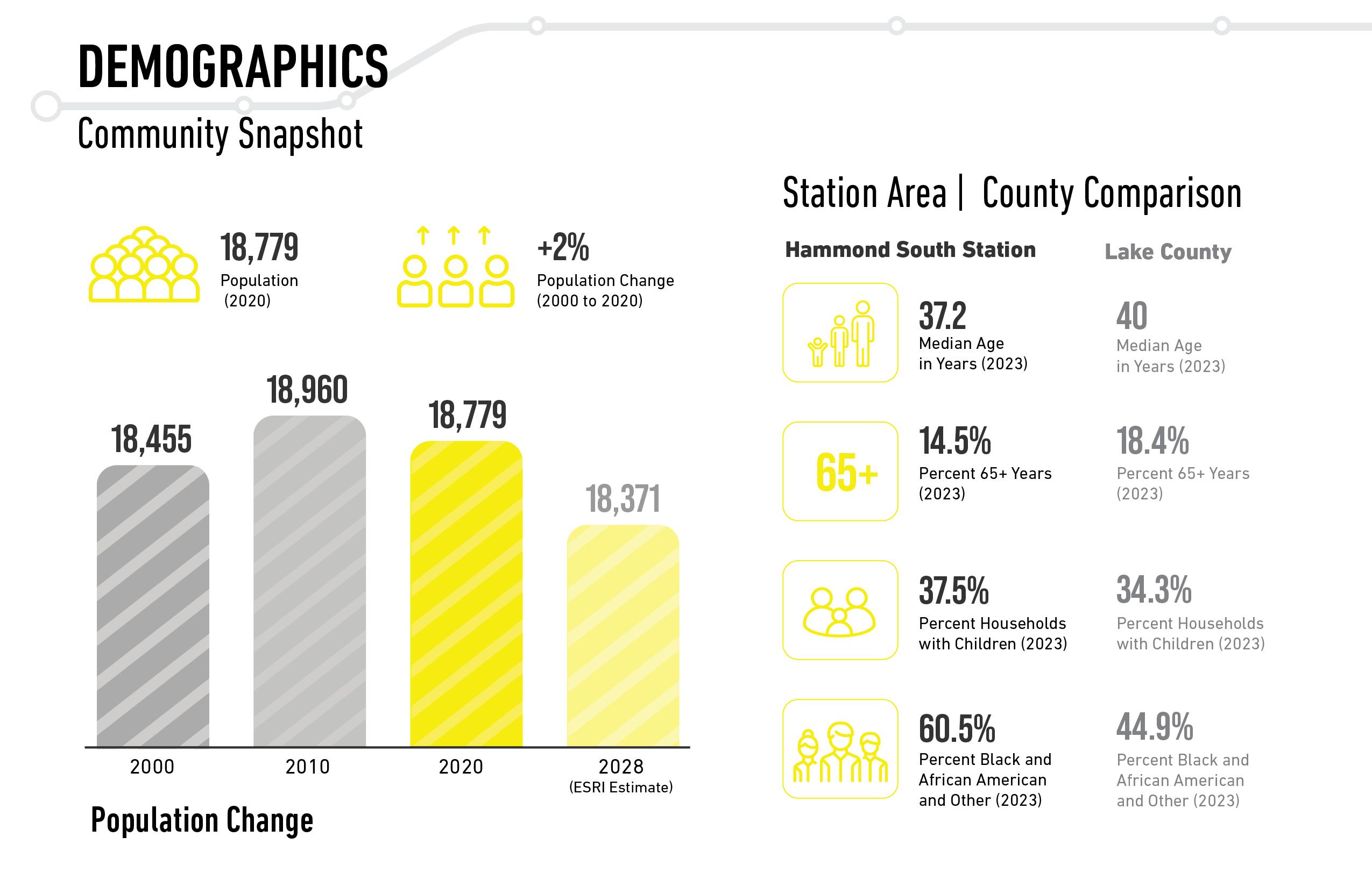
The community snapshot of demographic information included population change, age, and race traits. The community snapshot for transportation information included ways of traveling to work, vehicle ownership, and time spent traveling to work. The community snapshot of housing information included household characteristics, residential unit types and housing market traits. These walksheds illustrate the areas within five-, ten-, and fifteen-minute walking time from the station area. This map shows the Monon Trail & Erie Lackawanna Trail, two multi-use paths connecting Hammond to the region. The community snapshot of employment information included top employment sectors, education, and household income.
Information pulled from the latest Census for the area of the proposed TDD boundary
NICTD STATION PLANNING
Step-By-Step Analysis:
The step-by-step analysis to the right helped inform the boundary shown below and in the following exhibit:
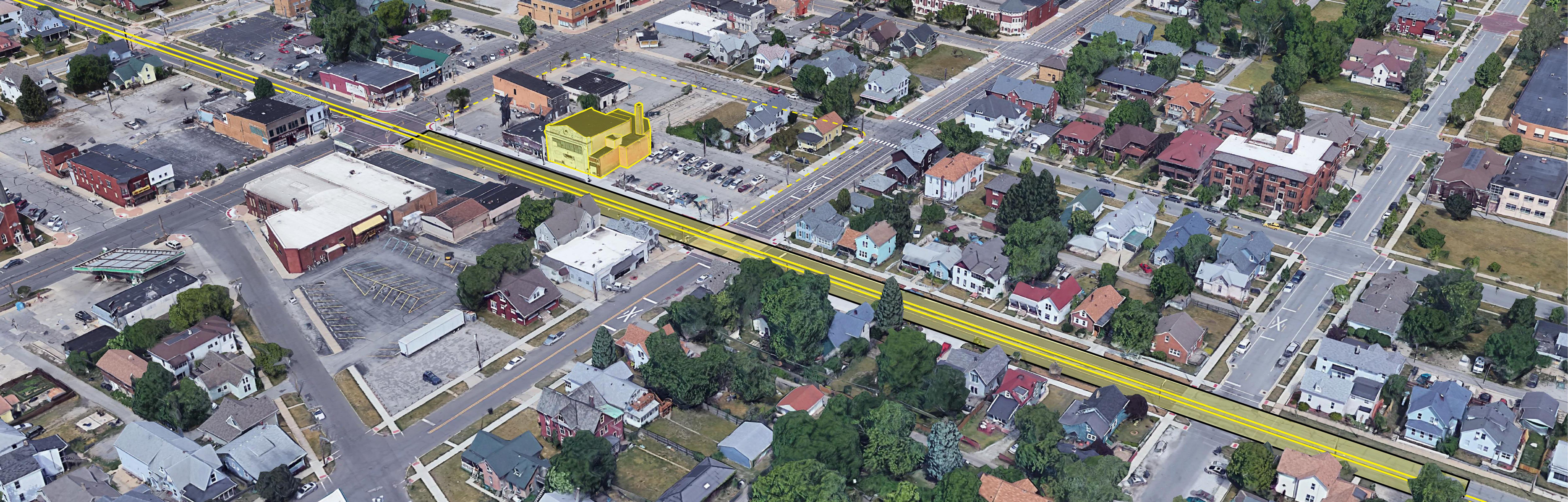
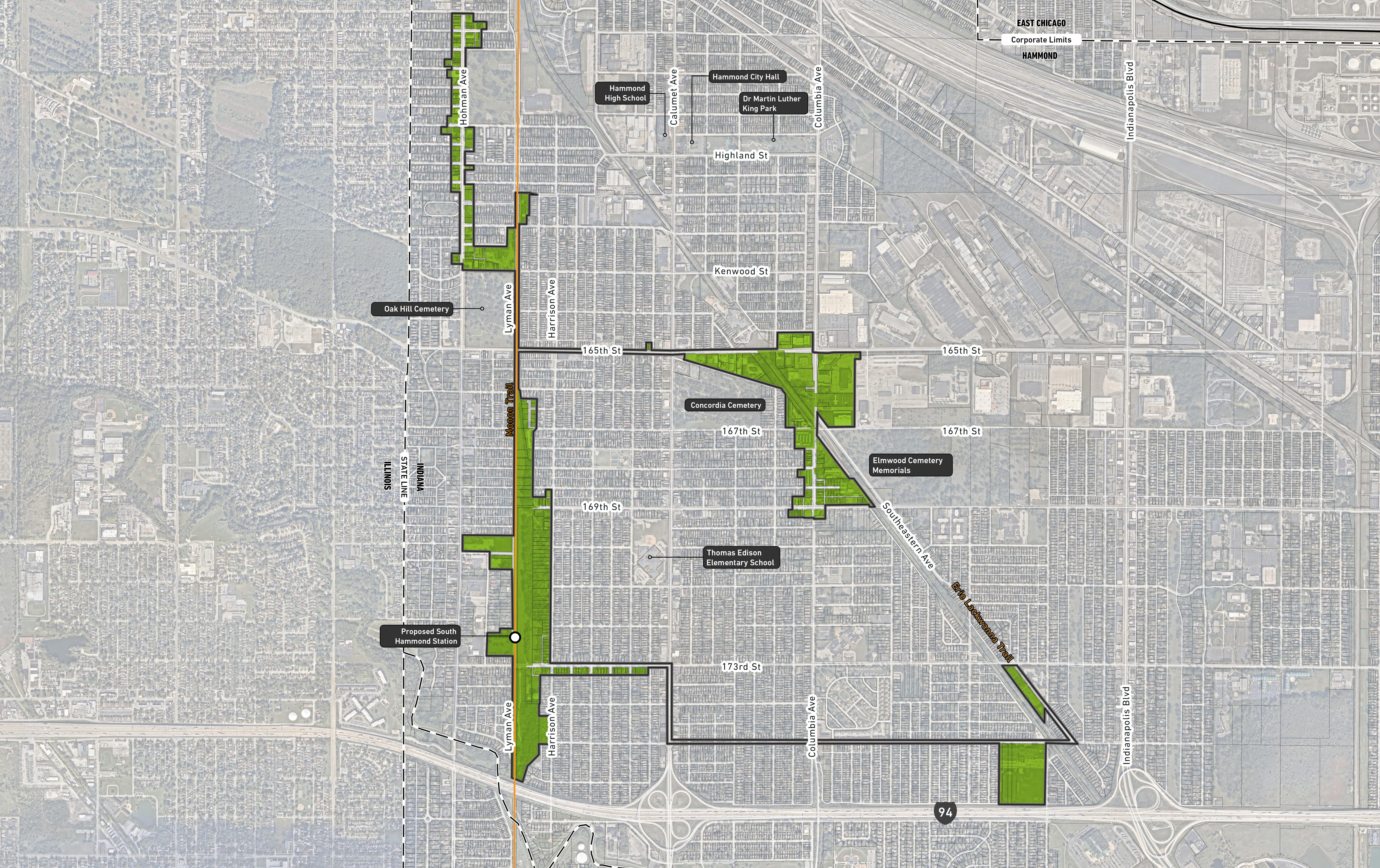
Want to learn more about our process? Visit our website at www.in.gov/rda or www.nwiTDD.com TDD PROPOSED BOUNDARY Hammond, IN Public Gallery For Community Feedback 5 | HOW WE DEVELOPED THE BOUNDARY A PLANNED SPACES Surface Parking • 593 standard and 12 ADA spaces • Opening Year Surface Parking • 980 standard and 20 ADA spaces • Horizon Year
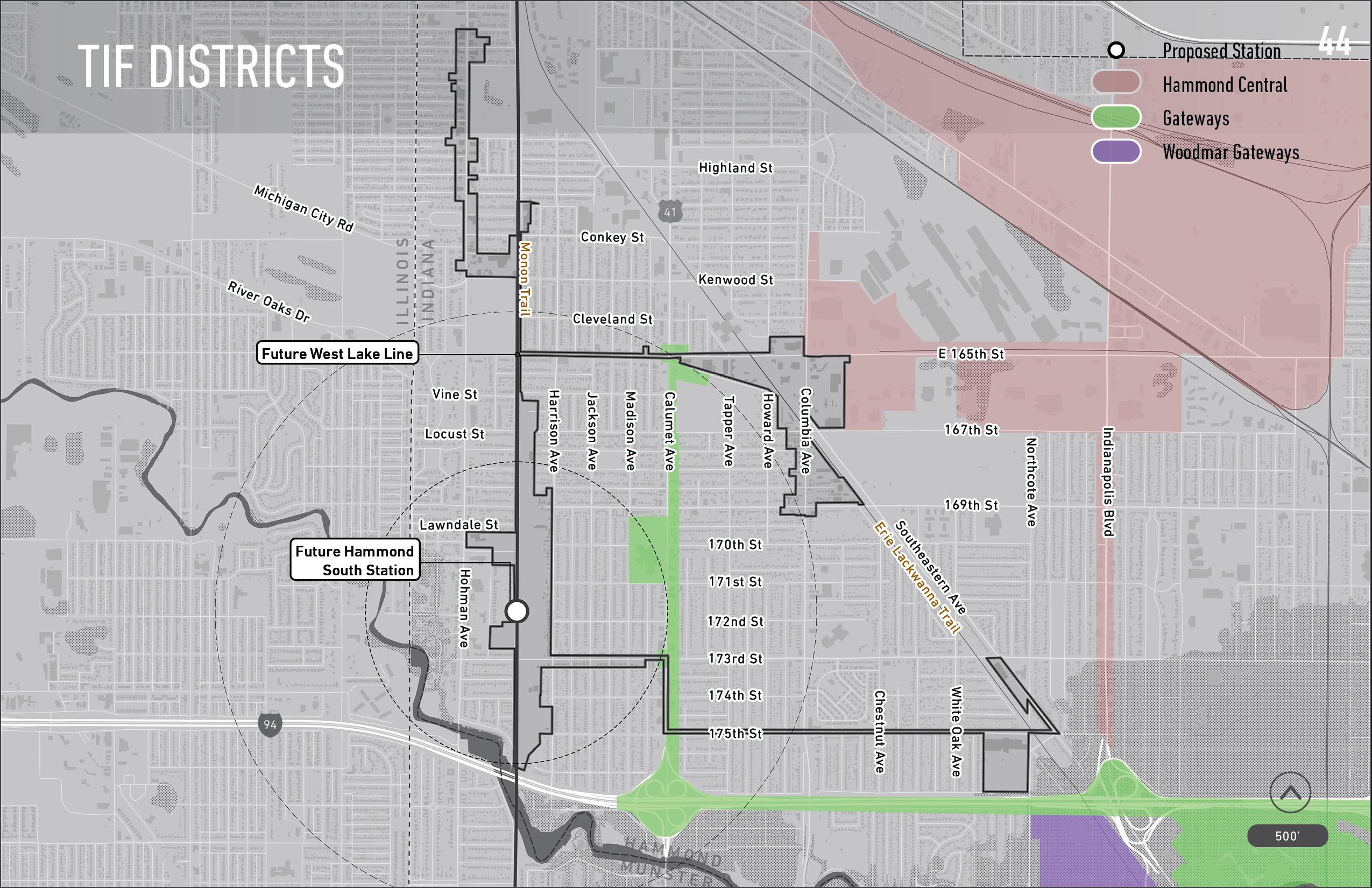
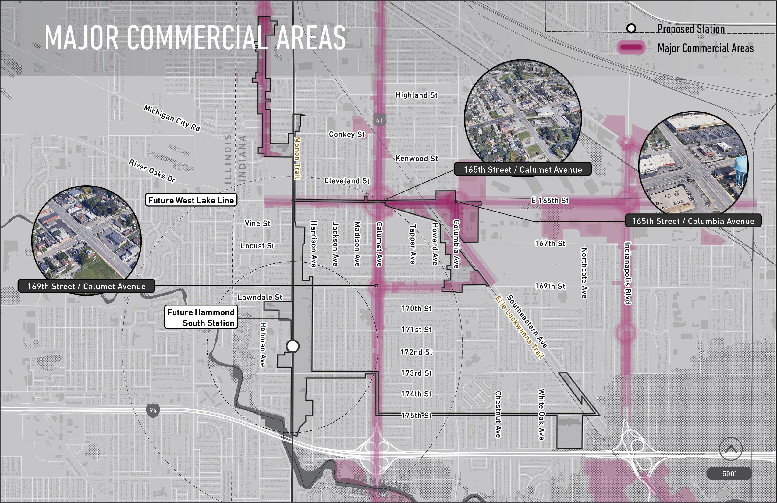
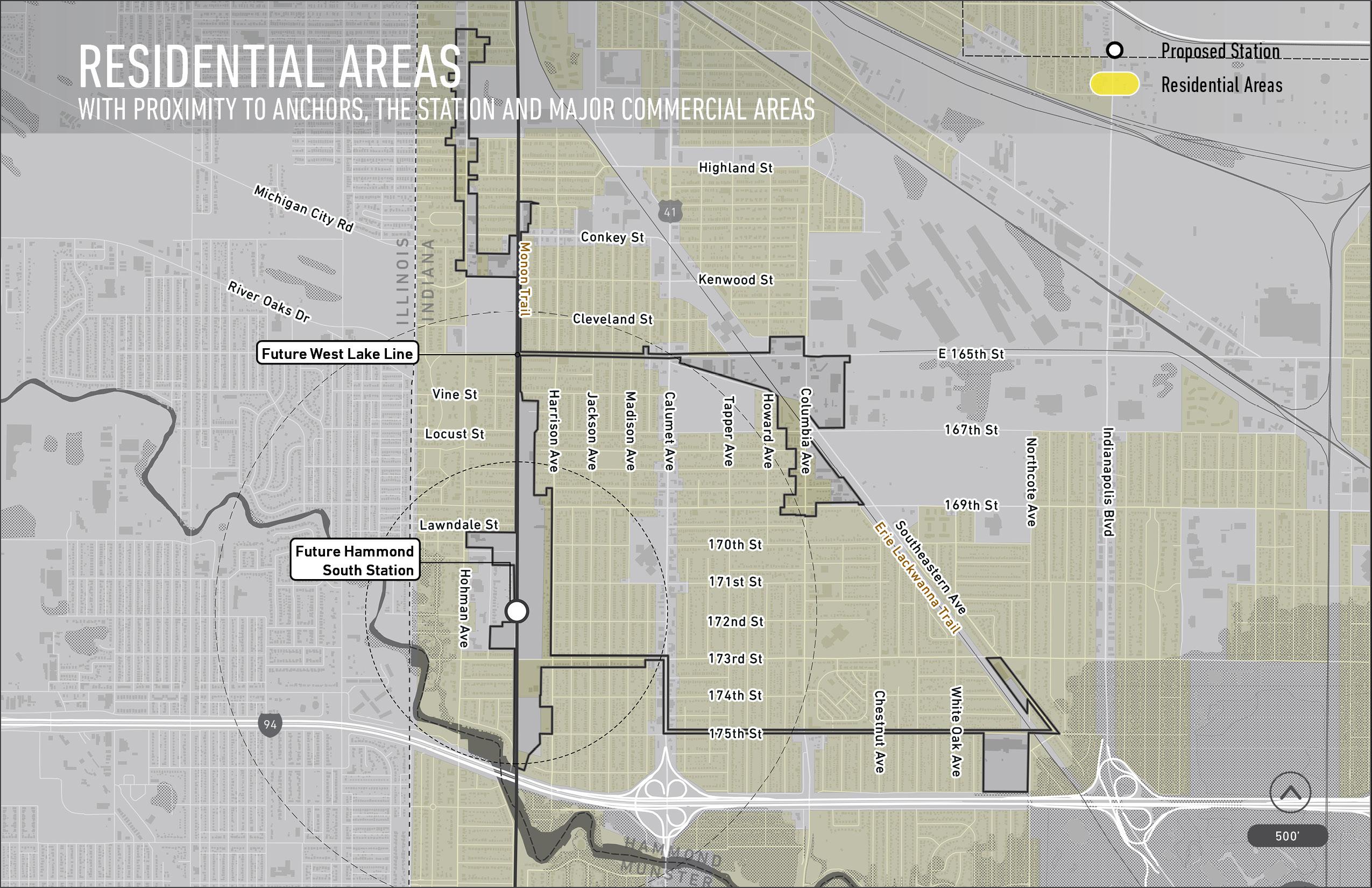
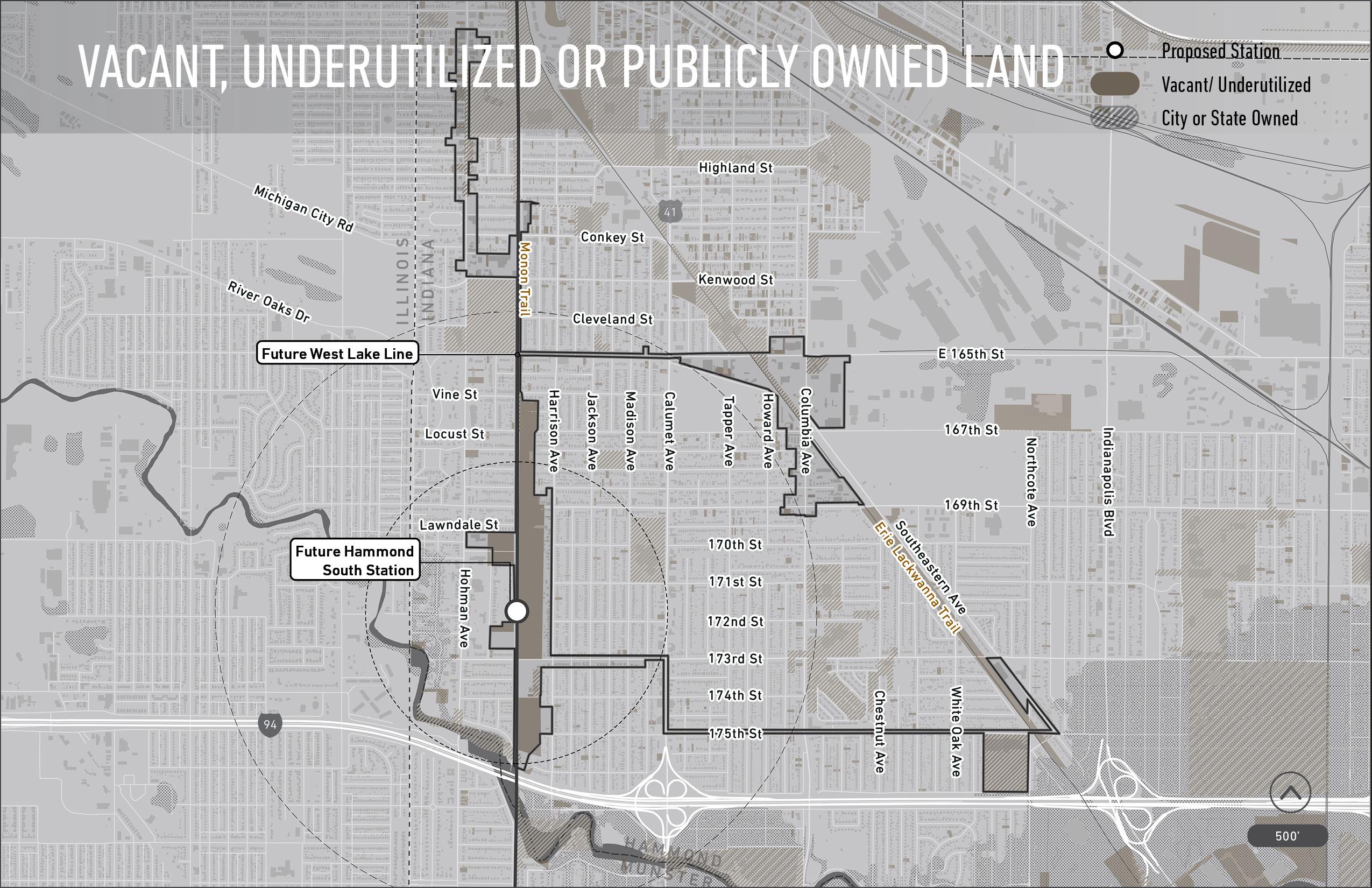
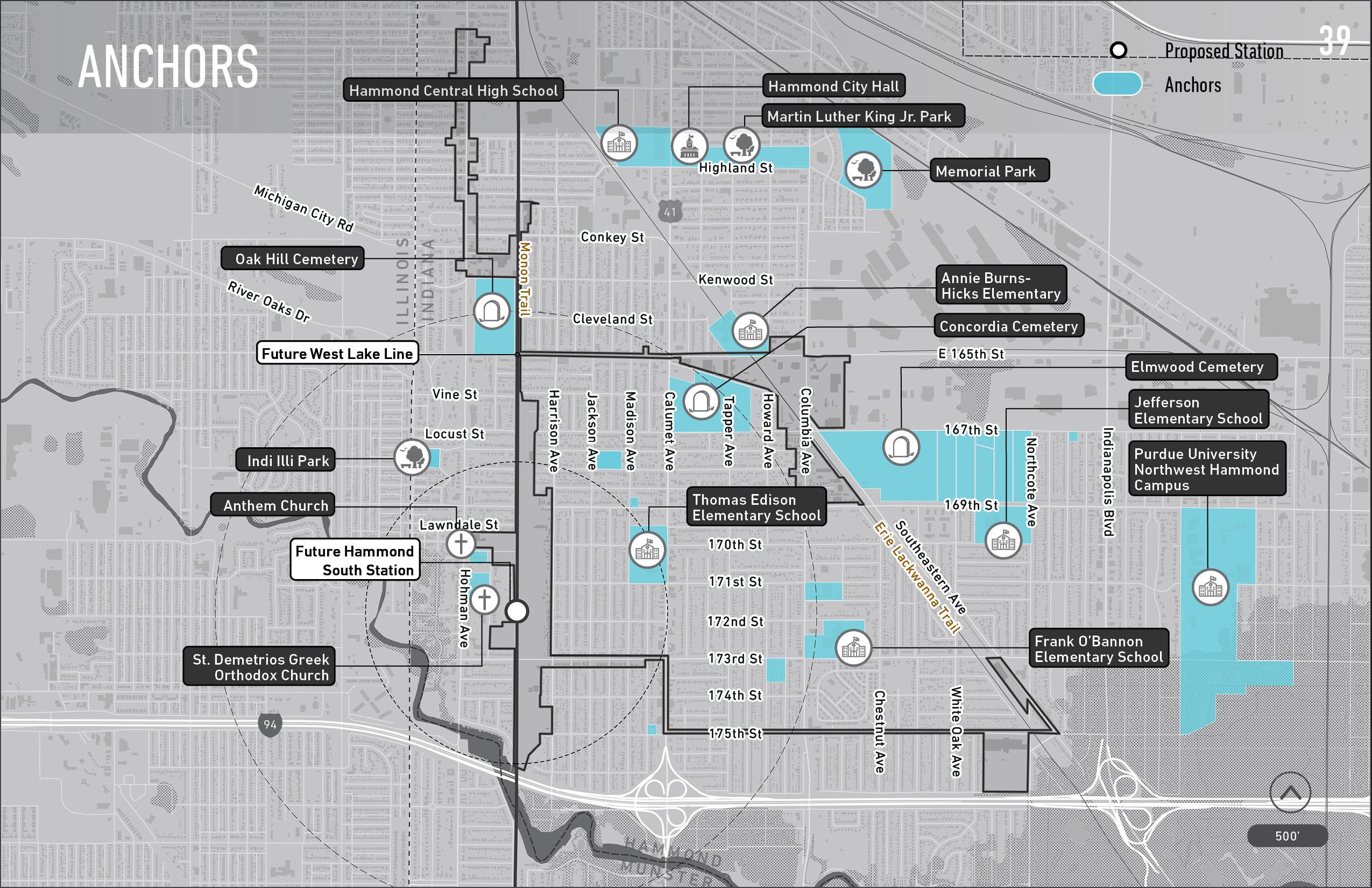
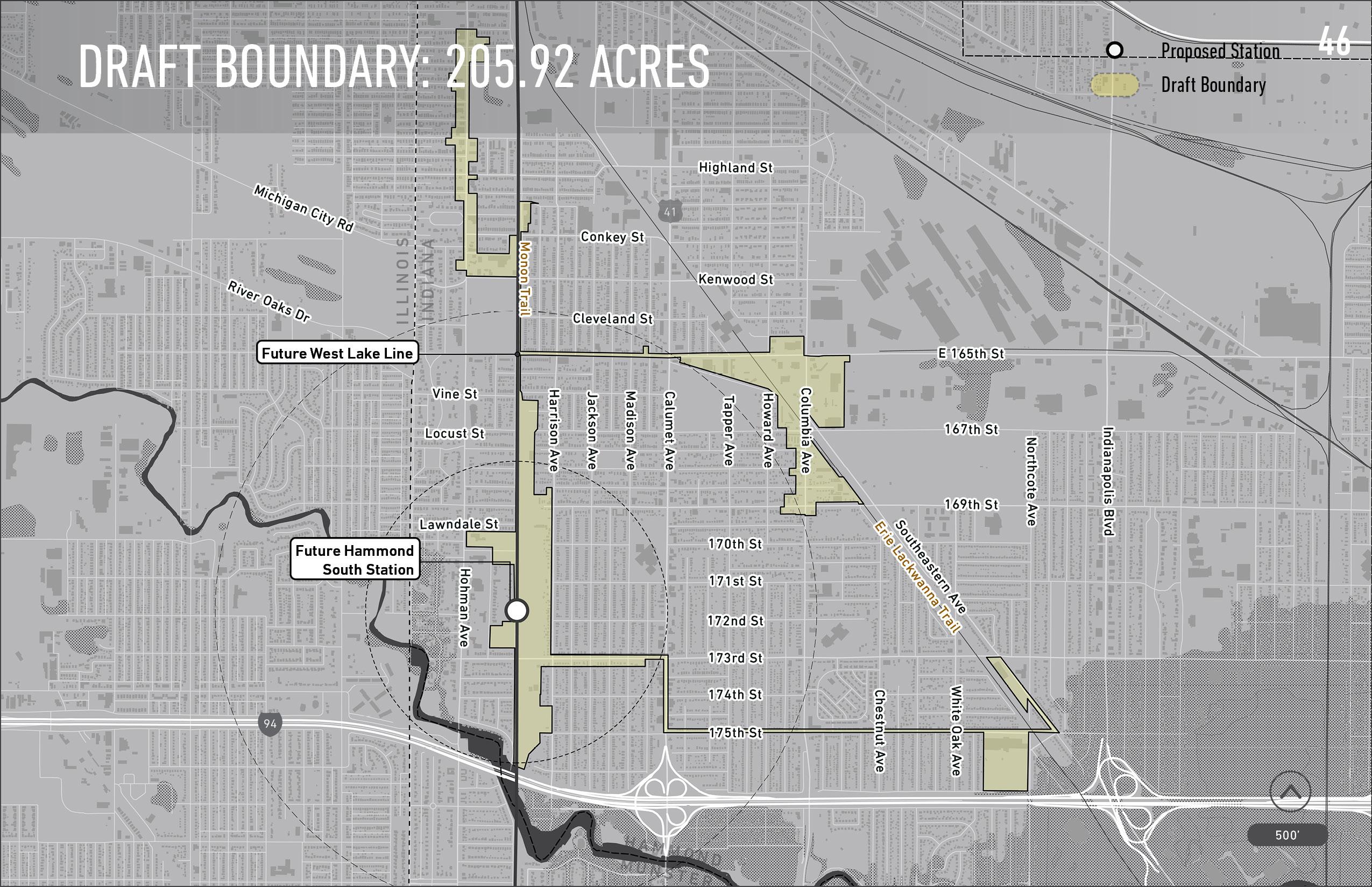
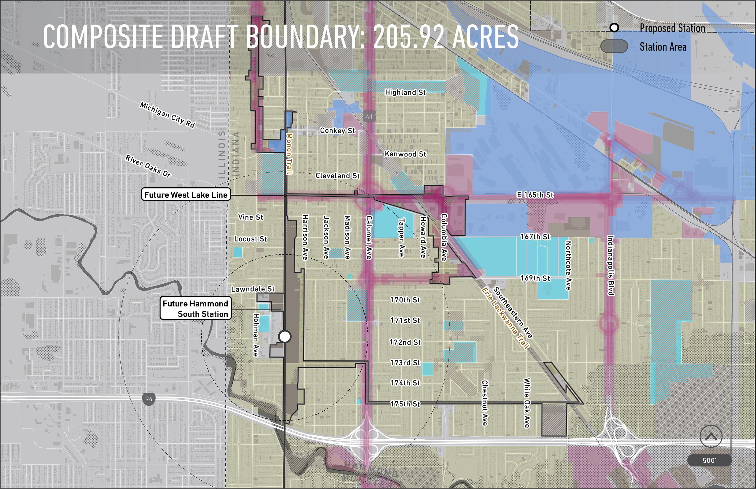
BOUNDARY PROCESS: A STEP-BY-STEP GLANCE AT HOW WE RAN OUR ANALYSIS STEP 1 Look at the existing nodes of activitythe anchors in the area that have an outsized effect on their surroundings. STEP 4 Look at the existing vacant, underutilized, or publicly-owned land these sites present prime opportunity for redevelopment STEP 3 Look at the highlighted residential areas - these areas are near anchors, the station, and major commercial areas STEP 2 Look at the existing major commercial areas - these corridors and areas are destinations that generate economic activity STEP 5 Existing TIF District and Opportunity Zone boundaries overlap with the draft boundary STEP 6 Look at the Station Area Boundary highlighted in yellow - this highlights the 205.92 acre draft boundary.
TDD
NOTE: Existing TIF Districts Excluded From Boundary
TDD DRAFT SOUTH HAMMOND BOUNDARY: 205.92 ACRES
Want to learn more about our process? Visit our website at www.in.gov/rda or www.nwiTDD.com TDD PROPOSED BOUNDARY Hammond, IN Public Gallery For Community Feedback 6 | OUR DRAFT BOUNDARY (We need your feedback!)
300
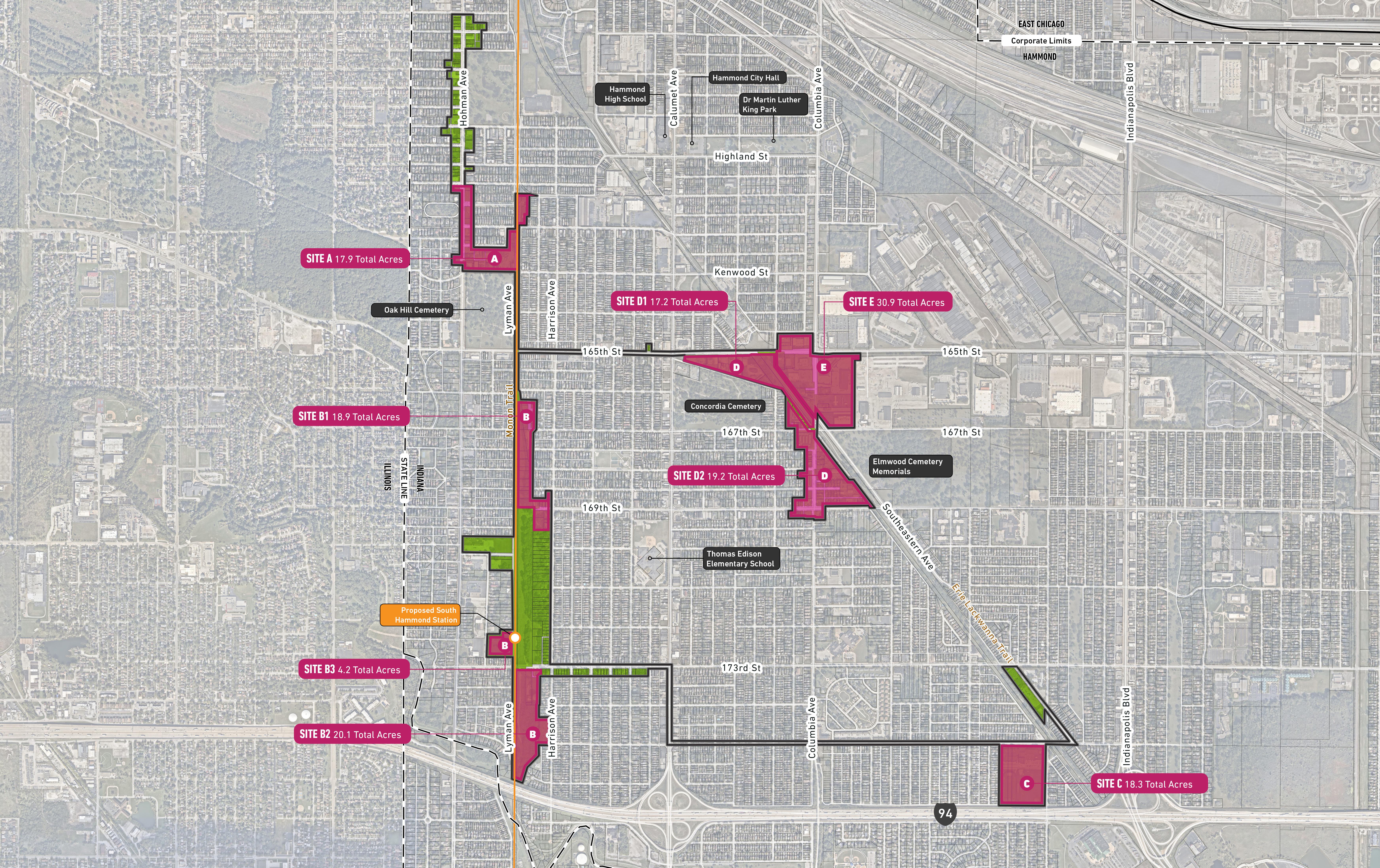
TDD PROPOSED BOUNDARY Hammond, IN Public Gallery For Community Feedback Want to learn more about our process? Visit our website at www.in.gov/rda or www.nwiTDD.com 6 | OUR DRAFT BOUNDARY (We need your feedback!) 300 TDD DRAFT SOUTH HAMMOND BOUNDARY: 205.92 ACRES
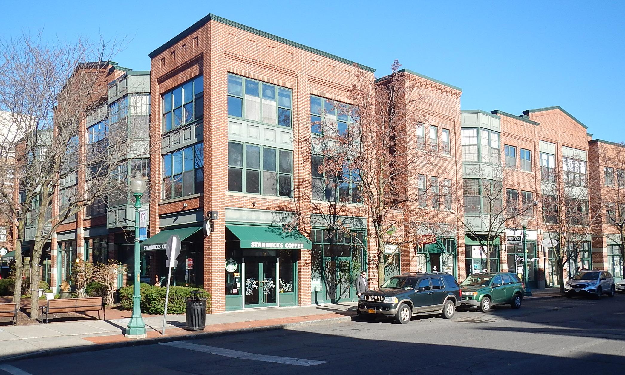

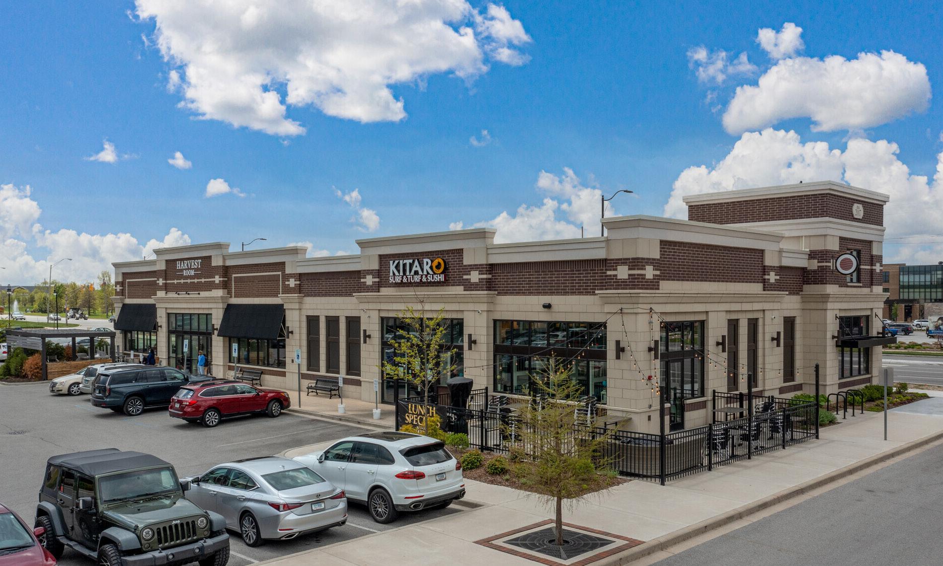
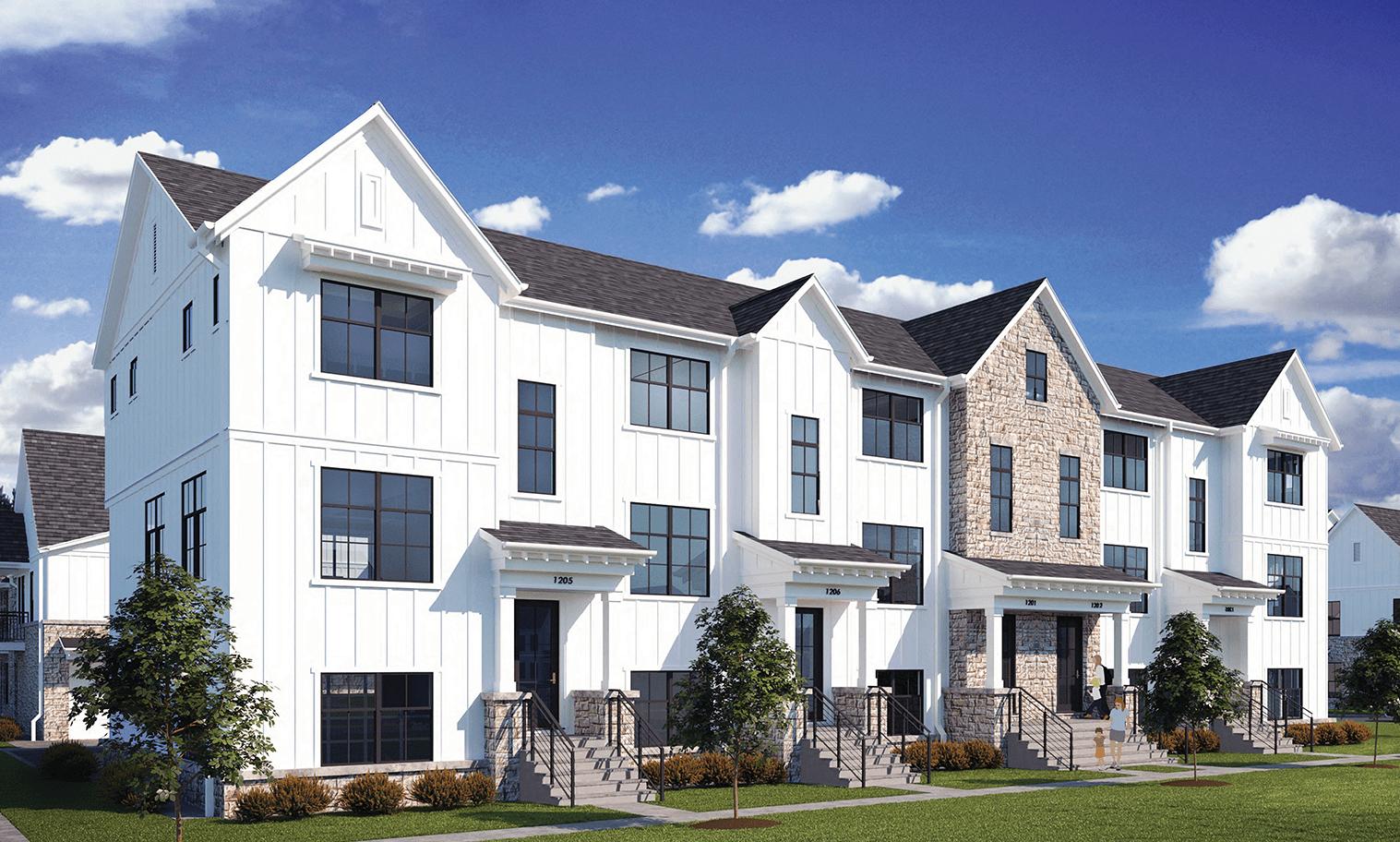
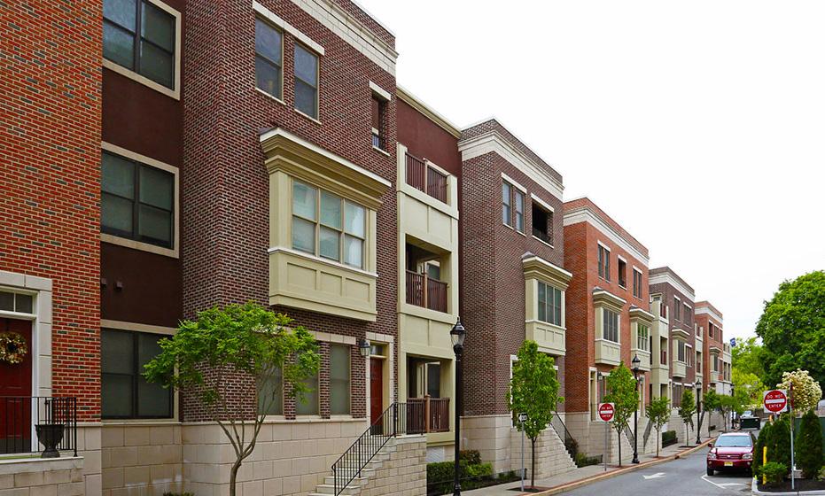
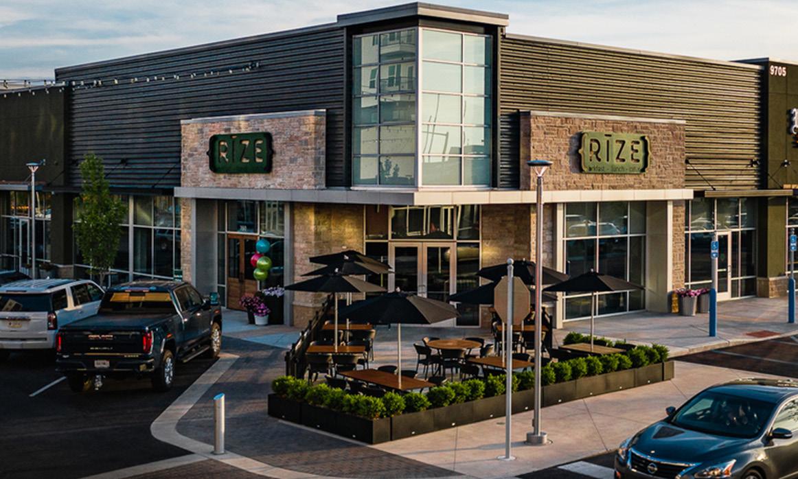
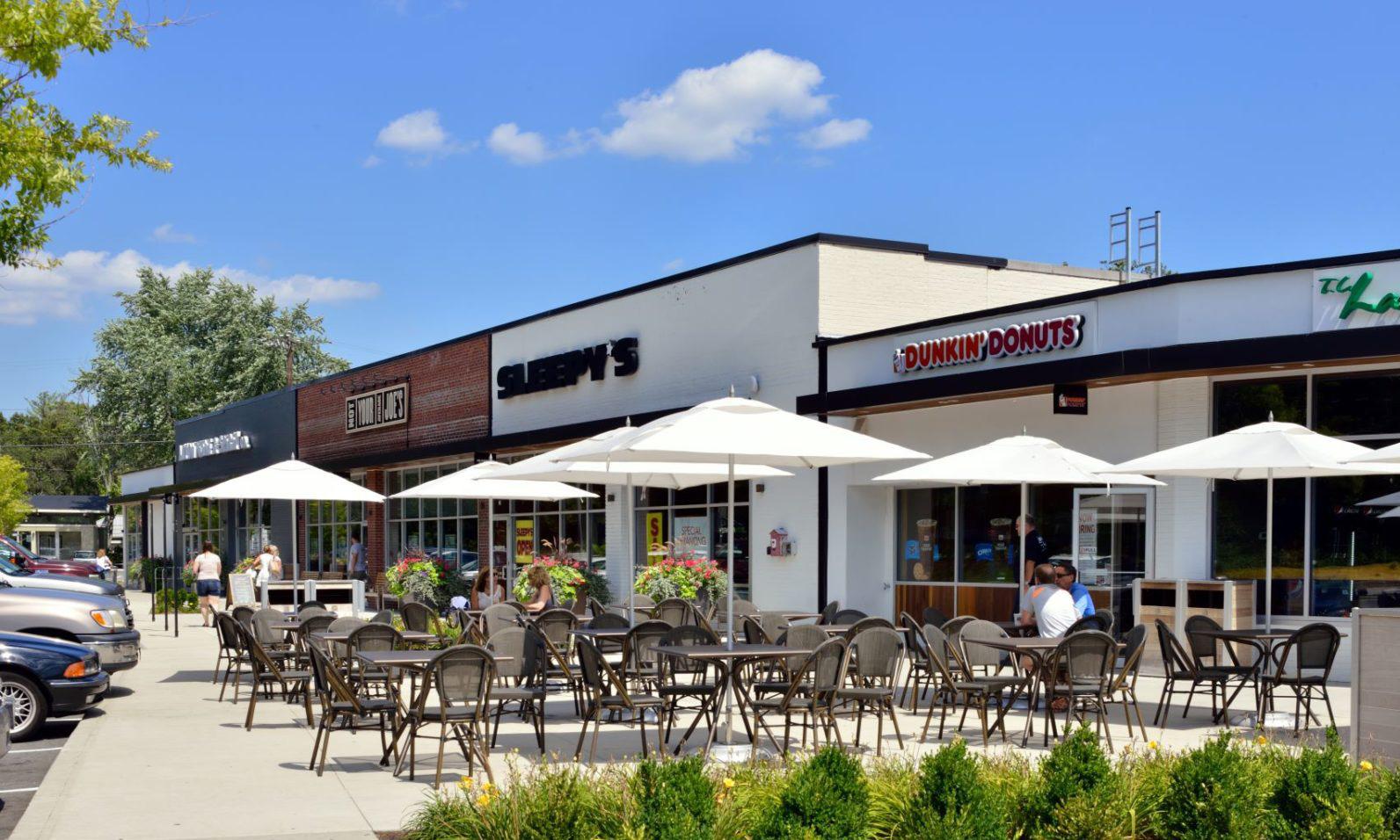
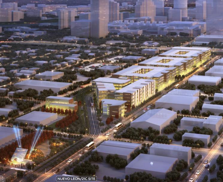
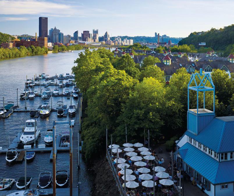
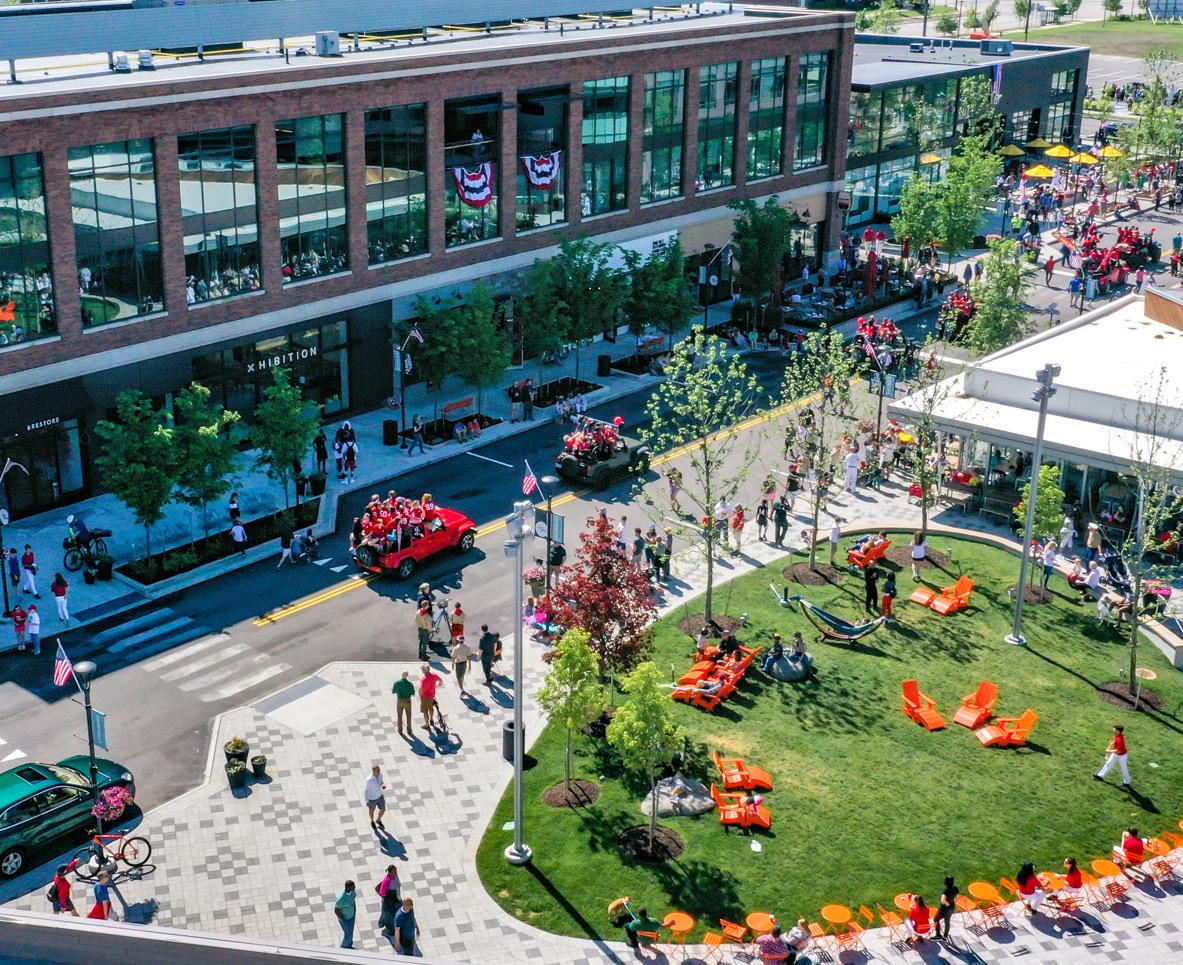
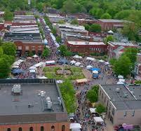
TDD PROPOSED BOUNDARY Hammond, IN Public Gallery For Community Feedback Want to learn more about our process? Visit our website at www.in.gov/rda or www.nwiTDD.com 7 | WHAT CAN COMMUNITY GROWTH LOOK LIKE?
