JANUARY
2019


2019
Tina Brode-Boyes, KNA Executive Director
Jeffrey Vujevich, President
Kemp Boyd, Vice President
Todd Ederer
Charles Hahlen
Jacob Ley
Ed Michalec
Noelle Beck
John Buntin Jr.
Todd Ederer
Randy Fairfax
Charles Hahlen
John January
Lillian Jolly
Jacob Ley
Karen Lile
Ed Michalec
Angela Miller
Lori Prentice
Julie Ann Sweet-Buntin
Beth Vild
Jeffrey Vujevich
Jan Williams
James Hardy, Assistant to the Mayor and Chief of Staff
Jason Segedy, Planning Director
Helen Tomic, Planning Manager
Kurt Mulhauser, Planner
Dylan Garritano, Planner
Tom Veldman, Planner
Deanna Cool, Planner
Michelle DiFiore, PE, PMP Environmental Manager
Julie Pryseski, Economic Development
Jon Malish, City Arborist
Michael Lupica, Traffic Engineering
PLANNING TEAM
MKSK
KM Date Community Planning, LLC
SPECIAL THANKS
Huntington Akron Foundation
The Knight Foundation
The City of Akron has recognized the need to invest in planning and community development to accelerate public and private reinvestment and to attract residents back to its core neighborhoods. At the same time, Kenmore Neighborhood Alliance (KNA) has been hard at work engaging residents, business owners and community stakeholders in district marketing, tactical urbanism and placemaking efforts. To maximize both the City’s and KNA’s efforts, the Huntington Akron Foundation funded the creation of this Kenmore Neighborhood Vision Plan to create a shared vision for the future of Kenmore. This financial support enabled a holistic planning process. Over the past eight months, a team of planners from MKSK and KM Date Community Planning have worked together with the Kenmore Neighborhood Alliance and the City’s Office of Integrated Development on a neighborhood planning effort that aims to achieve the following five goals:
1. Create a culture of cross-sector collaborative planning that develops a stronger working relationship between the city, residents, leaders, community groups, businesses and property owners.
2. Initiate a shared vision for development in Kenmore that elevates the image of the neighborhood.
3. Make Kenmore a more walkable, bikeable, livable neighborhood.
4. Provide a platform for economic development and attract neighborhoodfriendly businesses and jobs to Kenmore.
5. Create a blueprint for both immediate and long-term improvements.
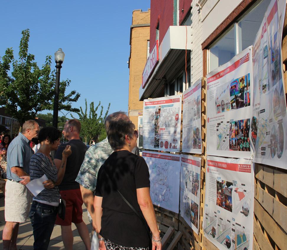
The neighborhood planning process was guided by a community-based Steering Committee, with input from more than three dozen stakeholders, public feedback from three community events, and multiple online surveys. These robust community discussions helped to shape this strategic look at the state of Kenmore and directly informed the recommendations for enhancements and improvements.
The Kenmore Neighborhood Plan’s recommendations are divided into two primary sections. One looks comprehensively at the entire neighborhood, with recommendations for
improvements for roads, parks and open spaces, pedestrian connections, bike infrastructure and reuse of vacant buildings and lots. The second focuses in on Kenmore Boulevard, with recommendations that will enable this burgeoning business district to once again become the economic heart of the community. Recognizing that a healthy, vibrant Kenmore Boulevard will be the key to revitalizing the neighborhood, the plan identifies the quick wins, needed investments, community connections and leveraged opportunities that are needed for success.
With the planning complete, attention now turns to implementation. While this will require additional diligence, patience and commitment, this plan has identified the collaborators, partners and community leaders that will work together to create sustained and transformative change for Kenmore.
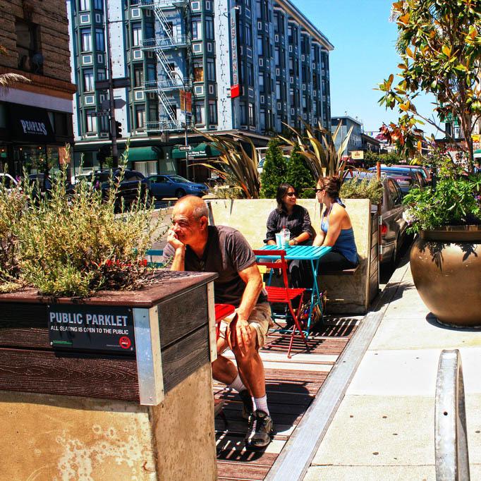
THE BOULEVARD
The Kenmore Neighborhood Plan builds on existing and ongoing efforts by the City of Akron, Kenmore Neighborhood Alliance, and many other community partners. Throughout the planning process, neighborhood leaders and the planning team have worked with the City of Akron Department of Planning and Urban Development to ensure a common vision that aligns with the neighborhood’s wants and needs. To accomplish this, the planning team engaged the community using a variety of methods, including stakeholder interviews, public engagement at neighborhood events, and online surveys. This process also builds on previous grassroots efforts and community engagement, starting in the Summer of 2017 with Better Block, aimed at establishing better planning practices in Kenmore and leading to positive change and reinvestment in the neighborhood.
Outreach methods:
• Better Block
• Stakeholder Interviews
• Jane’s Walk
• Busk Until Dusk
• Boulevard Bikes & Brews
• Online Engagement
• Neighborhood Survey
• Great Streets Survey
+ Neighborhood Tour
+ Existing Conditions Analysis and Plan Review
+ Steering Committee Meeting
+ Stakeholder Interviews (April 16th and 17th)
Community Activity #1: Jane’s Walk + Gathering Session (May 4)
+ Conceptual Plans and Draft Strategy Development
+ Idea testing with Core Team and Steering Committee
Community Activity #2:
Highlighting Components of the plan (August 3)
+ Draft final plan with recommendations, implementation steps and action items
+ Support final Steering Committee and Community meetings
Community Activity #3: Plan “Hand-Off” (September 22)
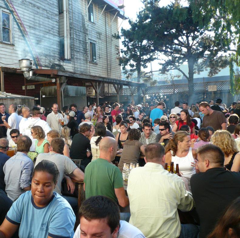
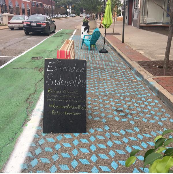
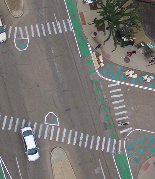
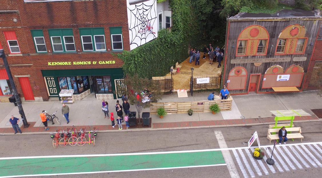
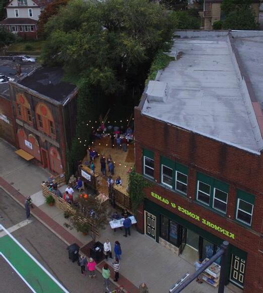
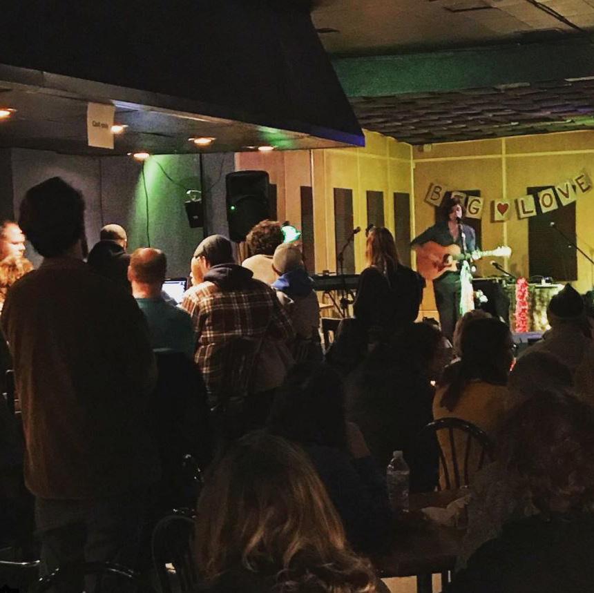
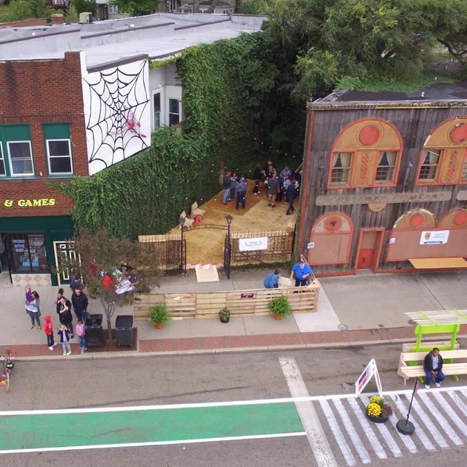
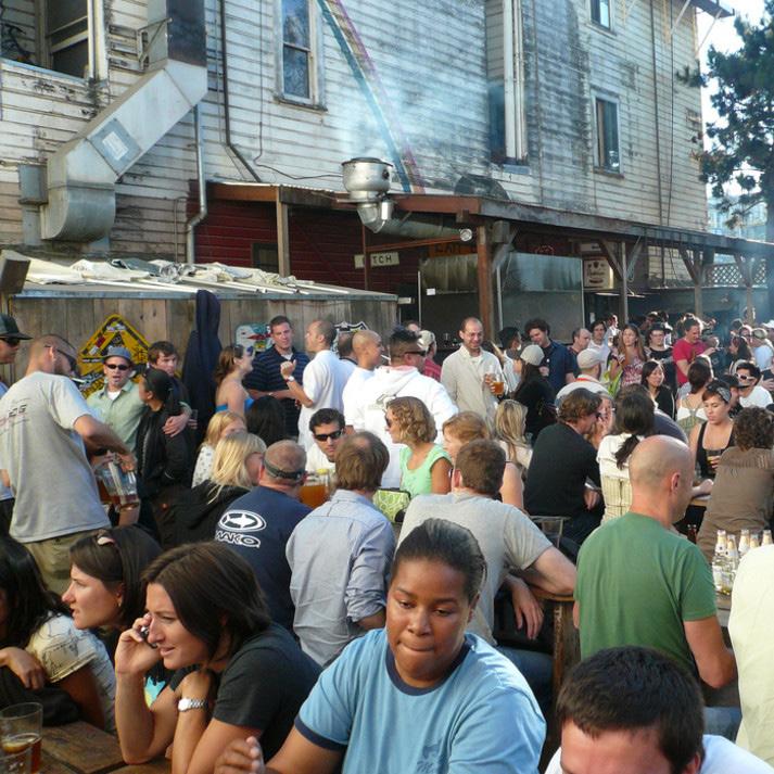
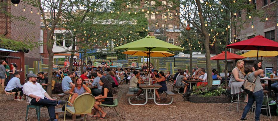
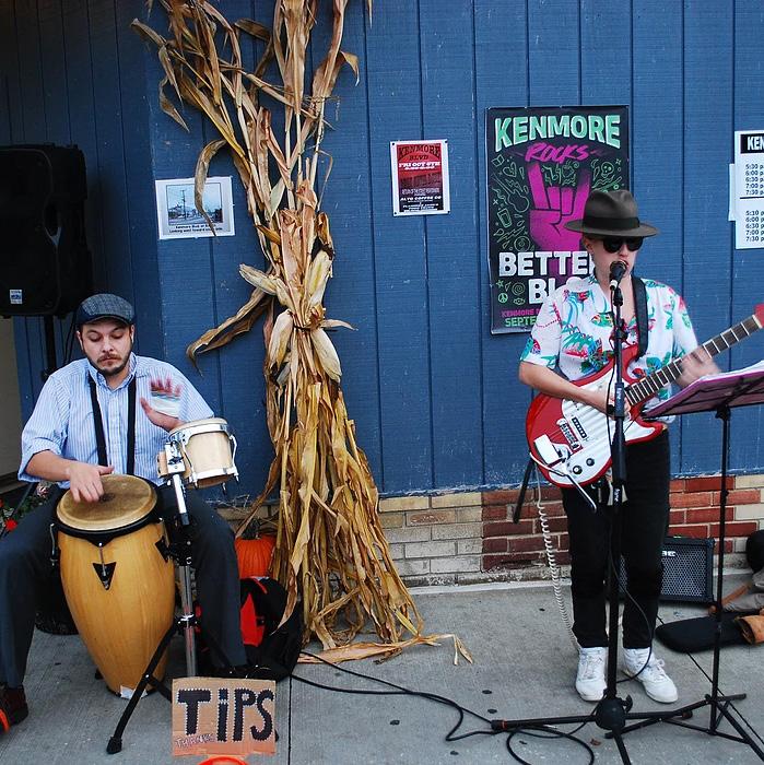
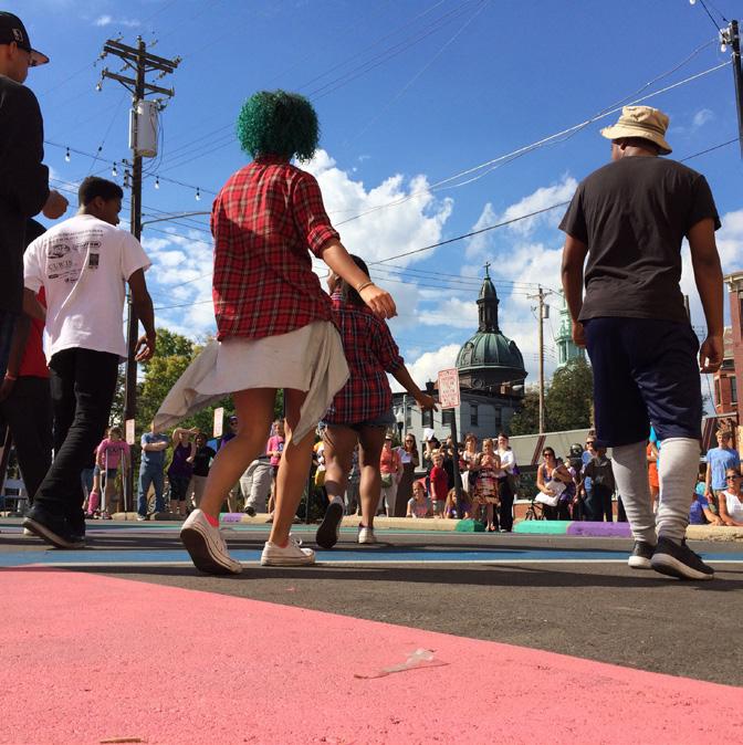
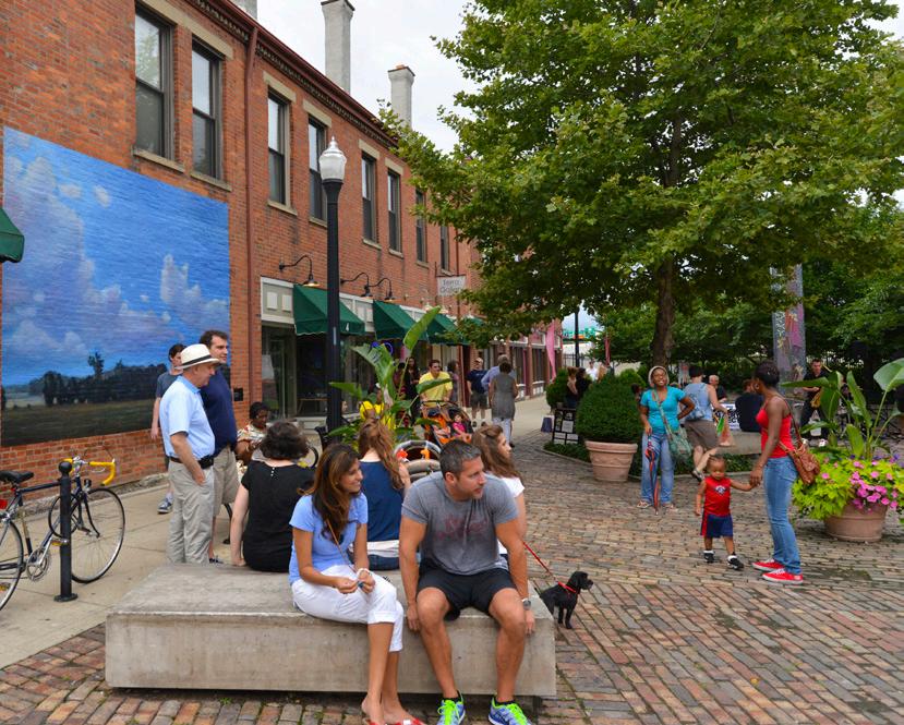
In 2017, Kenmore Neighborhood Alliance, the Knight Foundation, and the City of Akron embarked on a project to help reinvigorate and activate the neighborhood and to inspire residents and business owners. The project, known as Better Block, addressed both sides of Kenmore Boulevard between 16th Street and 13th Street. The area was chosen due to a number of factors: its potential for partnerships with local businesses, lack of street level parking lots (a huge benefit to the continuity of the block), vacant buildings that could be used to house pop-ups, an empty lot that could be converted into public space, and the two bus stops located on Kenmore Boulevard. Project leaders gathered community input to gauge the issues within this area and the types of improvements community members wanted. This led to a focus on increased safety, reduced motor traffic speeds, and economic development.
Over the course of two days, more than 3,000 people participated in the Better Block activities. Although temporary, Better Block has inspired more permanent improvements to the neighborhood. This Neighborhood Plan seeks to build on that momentum and create a blueprint for short- and long-term neighborhood development.

At the beginning of this planning process the planning team convened a series of stakeholder interviews. Groups included the City of Akron, property owners, civic groups, First Glance volunteers and students, business owners, and music and art professionals. Stakeholders and steering committee members communicated that the Neighborhood Plan should capitalize on the increasingly positive momentum in Kenmore. Throughout discussions, consistent themes emerged regarding the issues and topics the Neighborhood Plan must address, including:
There was overwhelming support of the Better Block idea testing and results. People wanted to see slower traffic, bike infrastructure, and street activation (community events) permanently implemented in Kenmore. Stakeholders also wanted to see the boulevard become a destination and focus on business recruitment to add a coffee shop and restaurants since today eating and drinking options are limited.
Despite a very positive perception that the community is turning around, there is still stigma to overcome. While some new residents are moving in, most are long-term residents. Newcomers chose the neighborhood mostly because it is affordable. On the other hand, it can be difficult for property owners to make a return on investment due to the neighborhood’s affordability.
Given its location in between interstate and railroad infrastructure, many recognized a need to address connectivity issues. Visibility could be improved by enhancing gateways to the community/boulevard. Walkability and bikeability within the community, to surrounding neighborhoods, and to the MetroParks system needs to be enhanced.
Overall, participants agreed that there is a disinvestment in the public realm and community assets. There is a lack of lighting, seating, safety, wayfinding, etc. along many neighborhood streets, especially Kenmore Blvd.
There is some level of concern with parking even though there is on-street parking available along the boulevard and additional parking is provided in public lots off the boulevard’s parallel alleys that run behind the businesses. Alleys were pointed to as an asset that needs to be taken advantage of.
Wayfinding and signage are important to inform visitors and residents how to navigate getting to the neighborhood and between destinations.
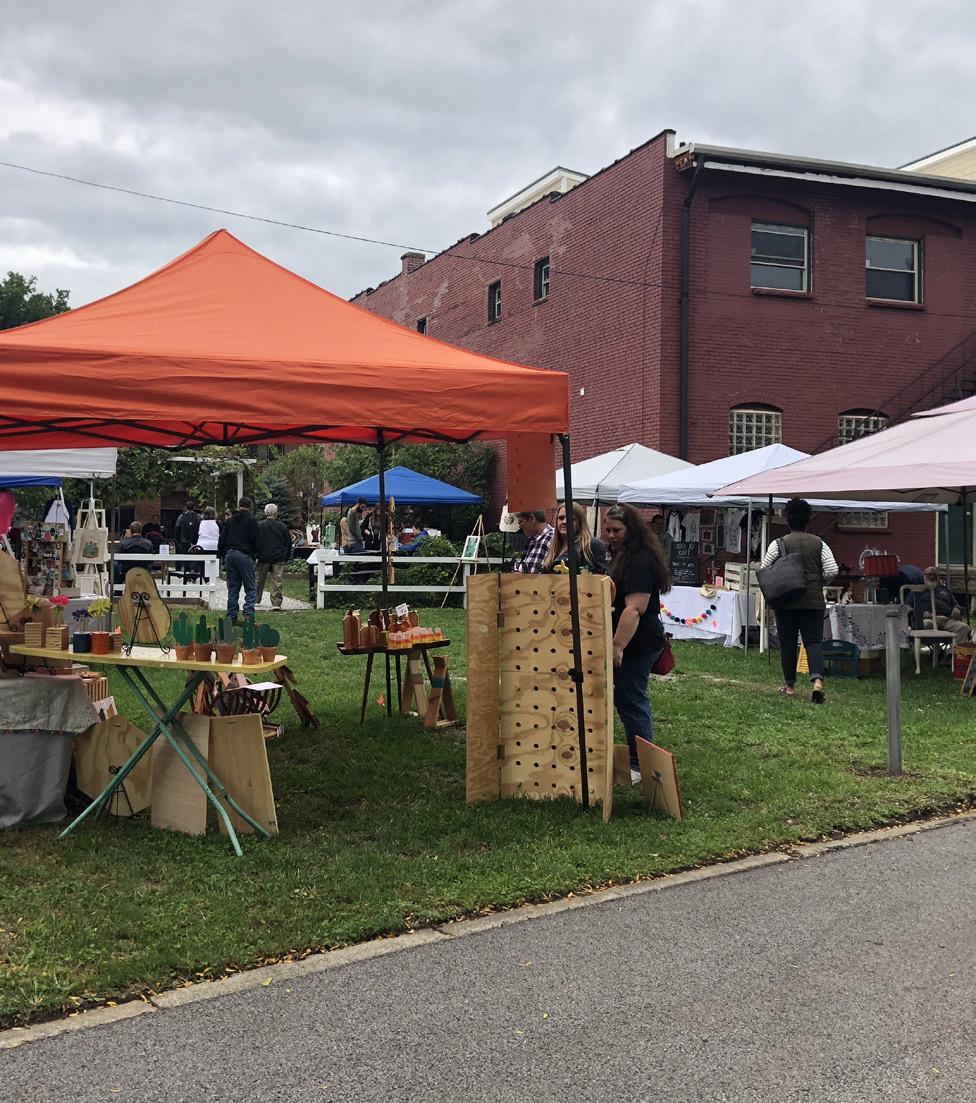
Activities and events surfaced as the primary way to bring the community together, promote community interaction, and strengthen the neighborhood identity. There is already a yearly calendar of community events that should be promoted and expanded.
Participants acknowledge that existing parks either don’t offer enough or are not well maintained. School properties are often used as playgrounds. In that sense, there is a need to broaden outdoor options that are inexpensive and will bring the different demographics together and keep the youth engaged.
Despite all the good work the Kenmore Neighborhood Alliance has been doing, the perception of safety is currently an issue in the community. There is not a lot of foot traffic or police presence along the boulevard. Participants reported minor incidents that can be an impediment for visitors.
Property owners brought up how beneficial a historic designation, and therefore access to historic tax credits, could be for building maintenance and renovation.
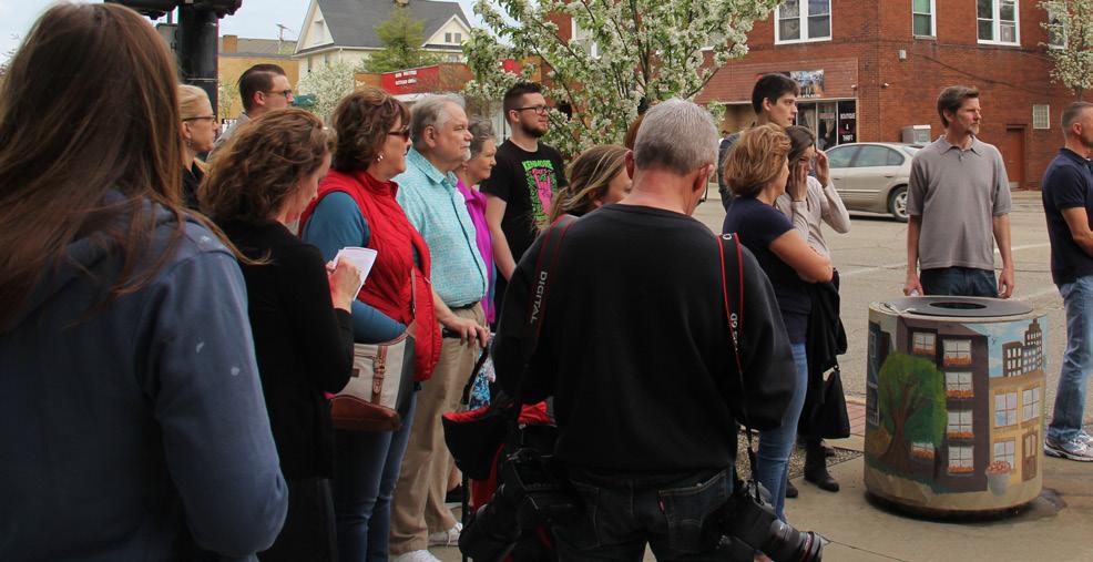
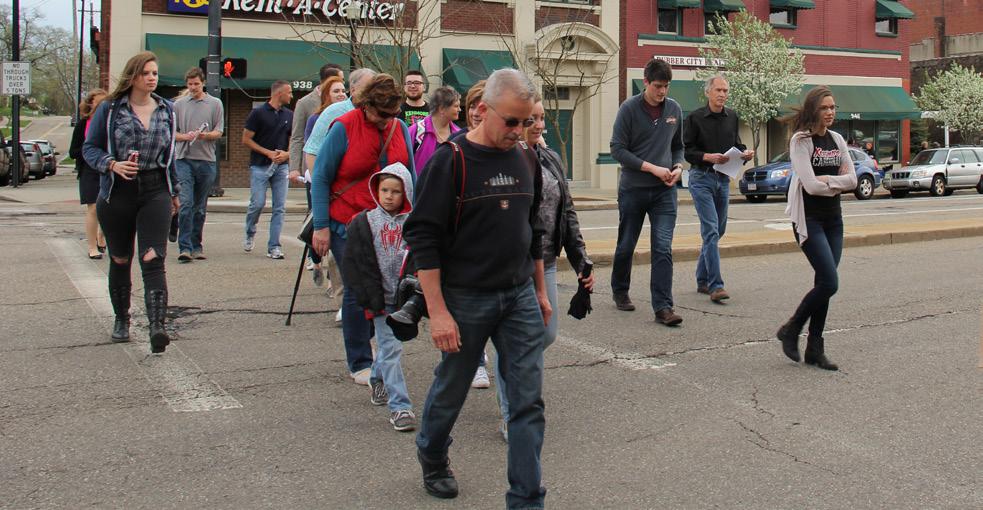
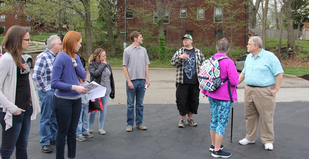
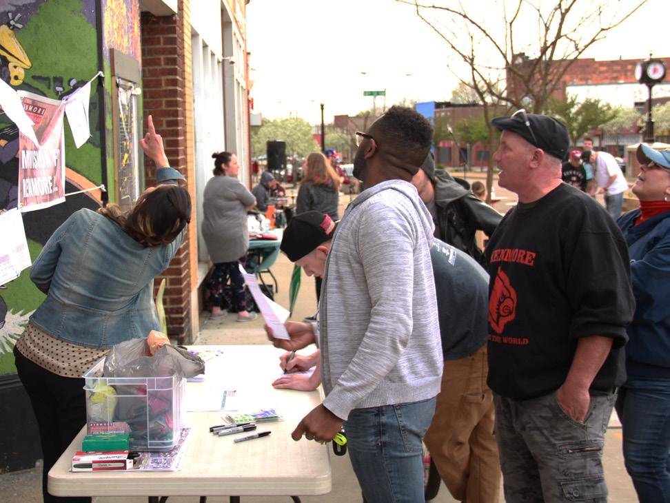
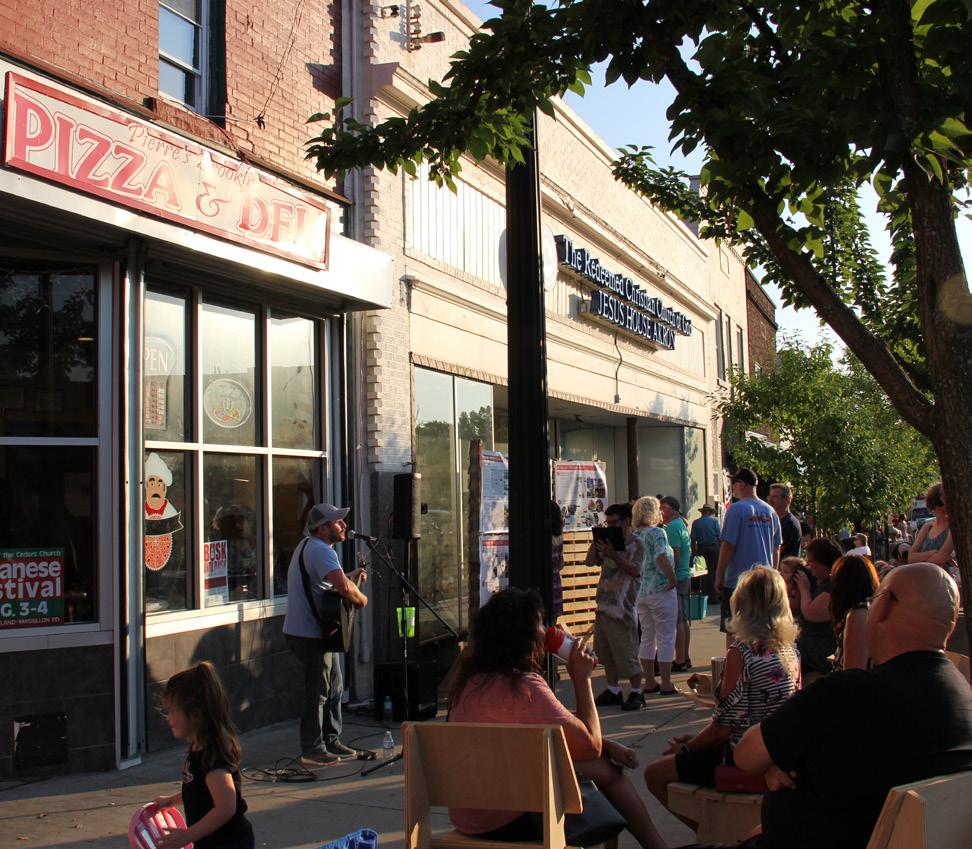
On Friday, May 4th, prior to the first public event at Busk Until Dusk, the planning team hosted a Jane’s Walk. This citizen-led walking tour allowed residents to provide a personal take on the local culture, social history, and issues faced by the community. Between 5:30 p.m. and 6:30 p.m., approximately 30 community members walked Kenmore Boulevard between 13th and 15th St., pointing out challenges and opportunities along the way. Since this was a walking exercise, a lot of the feedback from participants focused on pedestrian and streetscape improvements, such as improving street furnishings, adding more wayfinding, and enhancing building façades.
“Improve parking lot wayfinding, access, lighting, safety”
“Activate place... Farmer’s market?”
“Street lights are too far apart”
“Plaza is not inviting or pedestrian friendly”
“Threshold identity signage. Let people know they have reached the Boulevard”
“Activate back of buildings”
“NEEDMORETODOSOTHISISNOLONGERAPASSTHRUDISTRICT”
“Improve business signage”
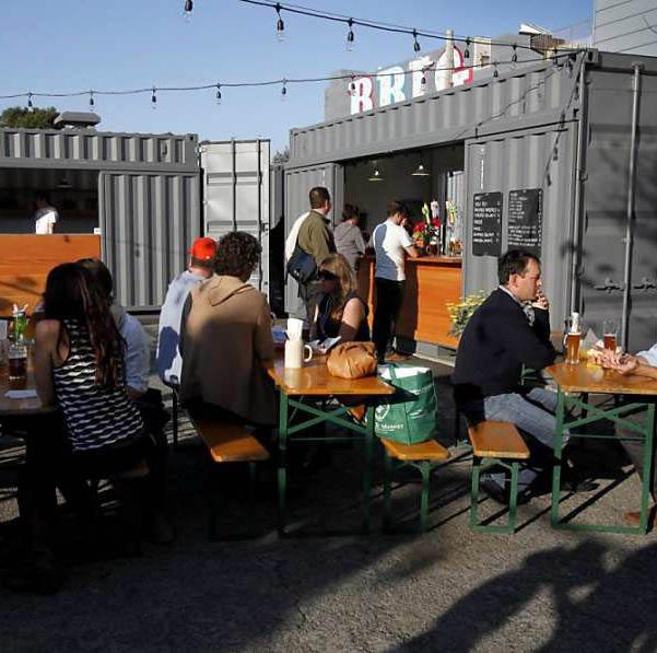
“Implement beer garden”
“Better street trees”
“Add outdoor dining”
“Improve bus stop”
“SLOW
“Encourage First Glance to engage the street”
“Activate bump out space with furnishings/ outdoor dining, etc”
“Keep the Boulevard authentic”
“Improve parking lot wayfinding, access, lighting, safety”
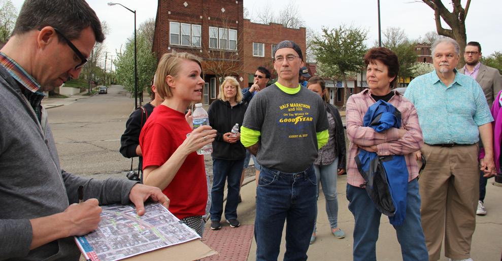
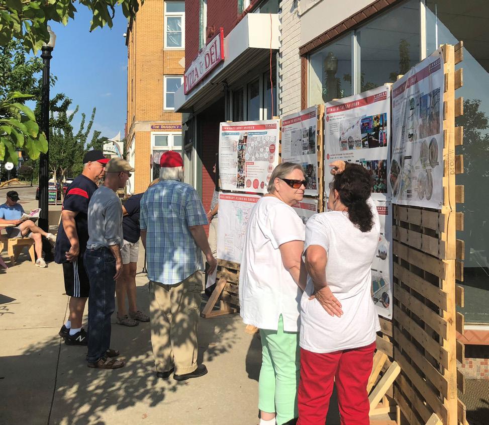
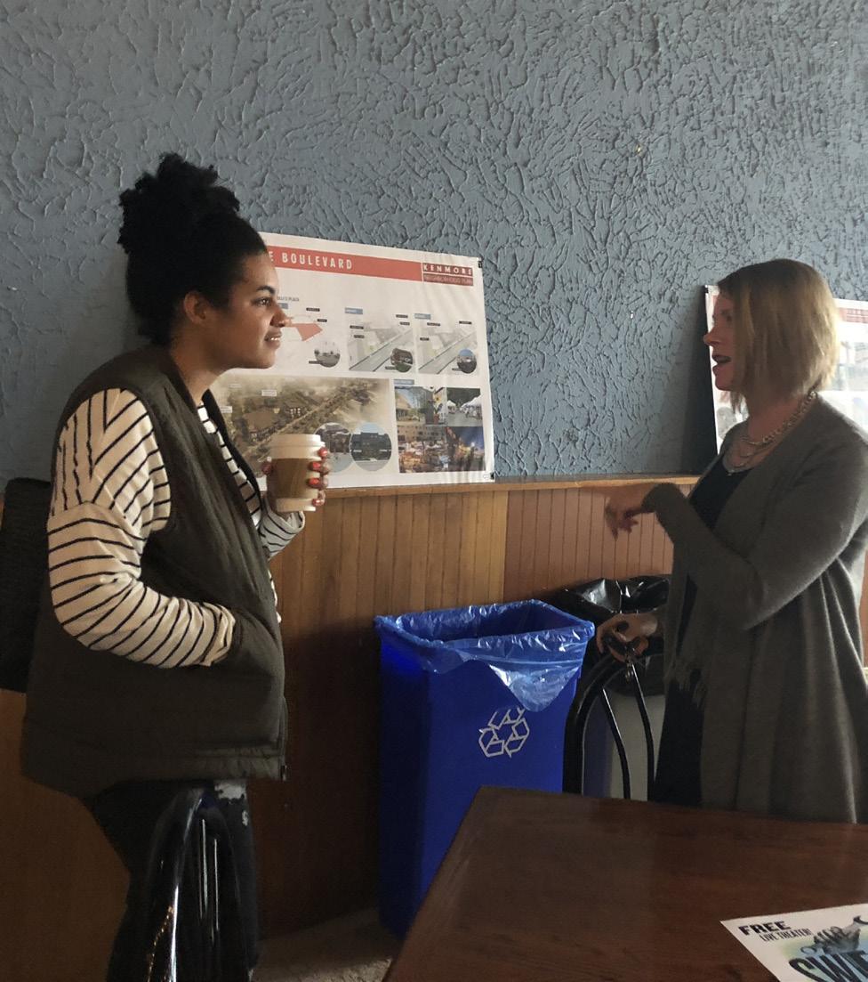
The planning team gathered community input at the well-attended Busk Until Dusk events on May 4th and August 3rd. The first event included interactive mapping exercises, a vision exercise, and several survey questions. More than 100 people participated in the planning exercises.
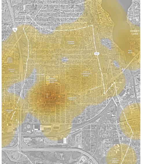
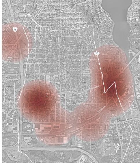
The planning exercises included dot mapping activities. Participants were asked to identify places where they visit and avoid. Kenmore Boulevard between 11th Street and 17th Street was the identified as the most visited place in the neighborhood, followed by the Summit Lake/ Towpath area. There were not many places in the neighborhood that participants avoid, with the exception of the corner of Kenmore and 17th Street and the Manchester Bypass area.
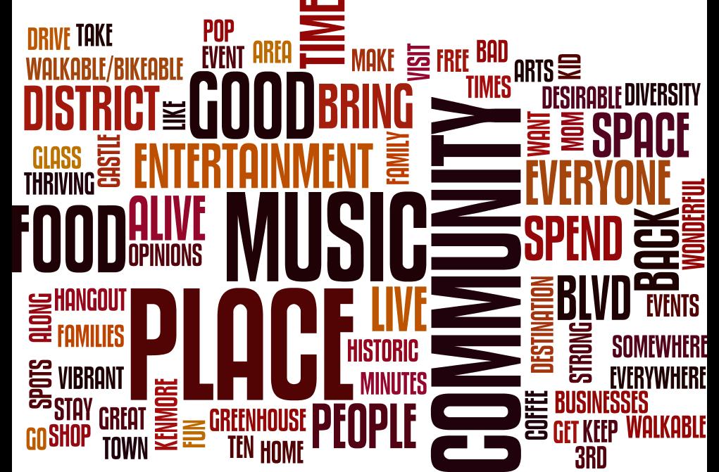
Participants were also asked to share their vision for Kenmore, which revealed the following themes:
• Become a place of choice. Build on the neighborhood’s people and sense of community. Become a diverse, walkable, family friendly place.
• Become a destination. The neighborhood needs an identity to strengthen its vibrancy. Offer a combination of arts, entertainment, and businesses that will draw residents, visitors, and workers to spend time.
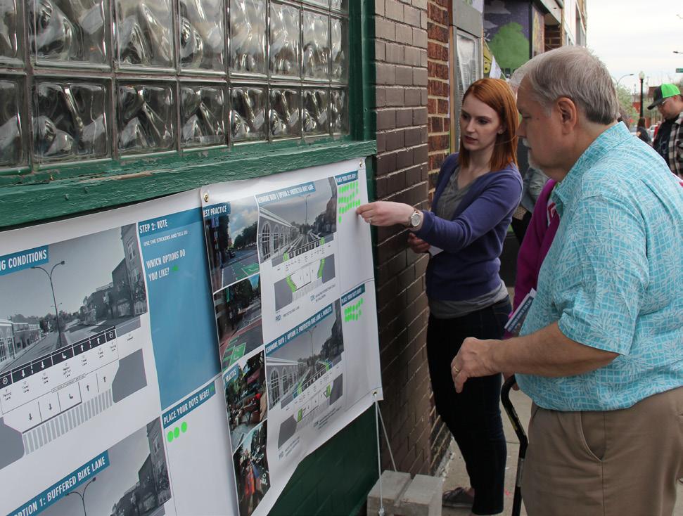
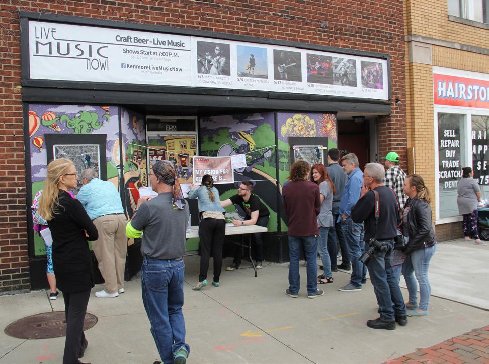
The second event on August 3rd featured draft planning concepts and three questions to gauge the community’s thoughts on the concepts. More than 50 people participated in the planning exercises at the second event.
About 80% of participants at the second community event agreed that the draft concepts presented would encourage them to spend more time on Kenmore Boulevard. About 65% of participants agreed that the draft concepts would encourage them to use active transportation between neighborhood destinations.
While participants were broadly in favor of the concepts presented, they also provided their thoughts on additional opportunities that the plan should consider, which are summarized in the following themes:
• Additional commercial/retail and more neighborhood amenities
• Improved connectivity, mobility, and wayfinding
• Preserve Kenmore’s character and add more placemaking elements
• Improved safety and visibility
ENCOURAGE YOU TO BIKE OR WALK BETWEEN
ARE THERE OTHER OPPORTUNITIES OR IMPROVEMENTS THAT THIS PLAN SHOULD CONSIDER?
Additional commercial/retail and more neighborhood amenities
Improved connectivity, mobility, and wayfinding
Preserve Kenmore character and add more placemaking elements
safety and visibility
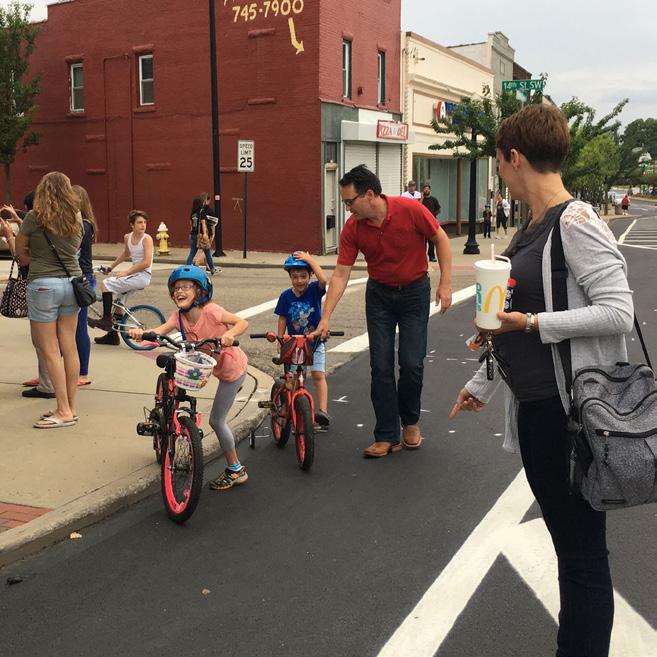
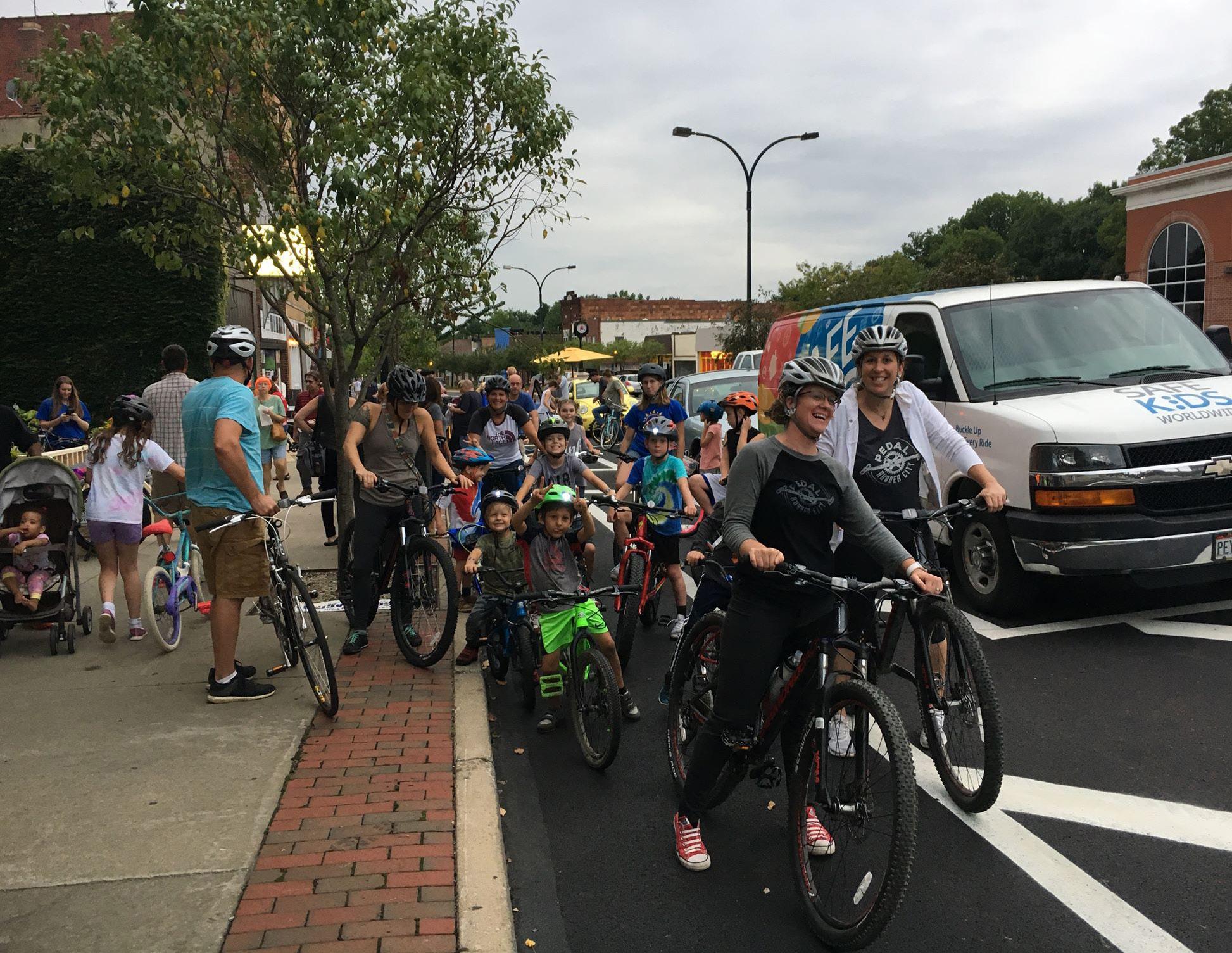
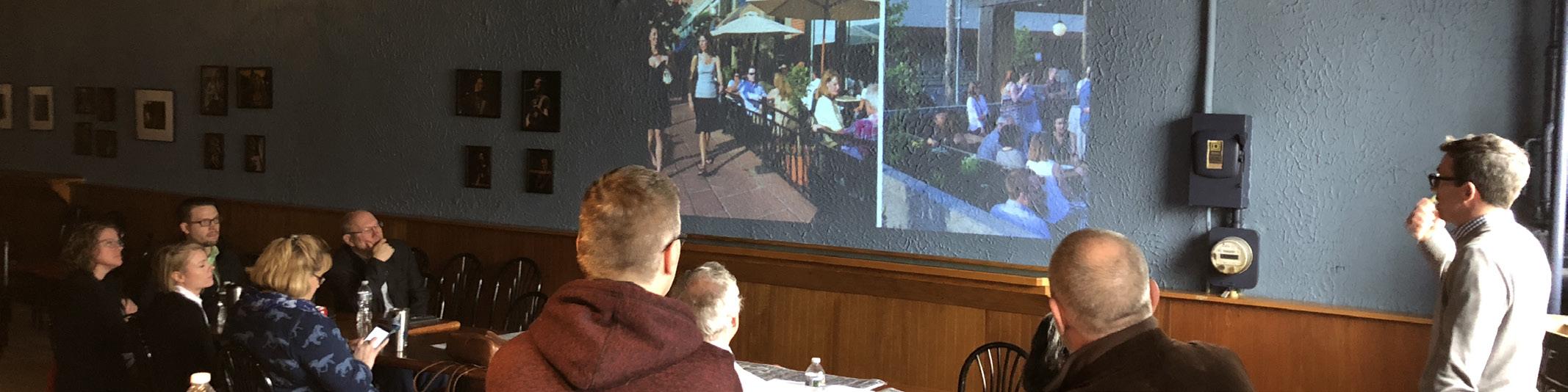
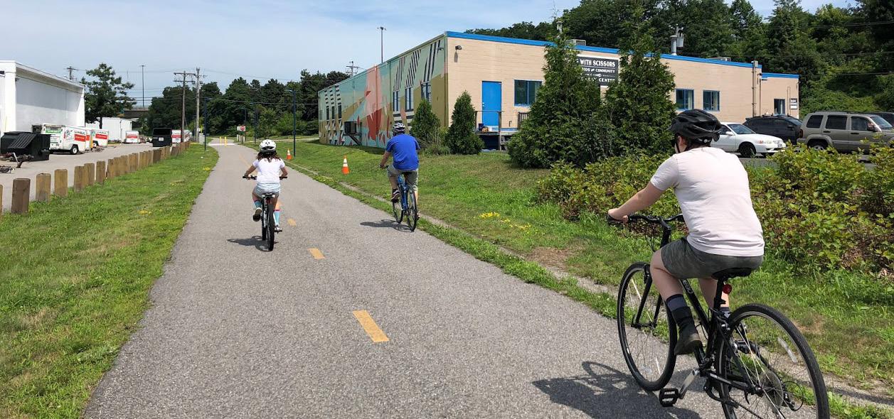
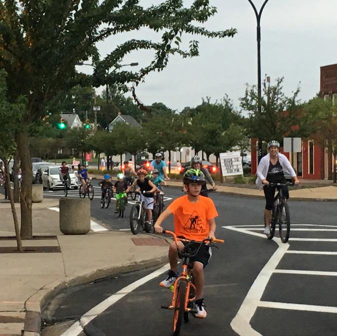
On September 22, the planning team unveiled the Kenmore Neighborhood Plan to the community at an open house held during the Boulevard Bikes + Brews event. The event included local food, drinks, and vendors and participants were encouraged to ride their bike to the event on the resurfaced Kenmore Boulevard or take advantage of the bike share to test out the new protected bike lane. Overall, the response from the community regarding the Kenmore Neighborhood Plan was positive.
In order to reach as many Kenmore community members as possible, the planning team made all meeting materials available to the public through a project website hosted by Kenmore Neighborhood Alliance at betterkenmore.org. There, web users could find relevant information about the planning process and how they could get involved. After each of the two community events, an online survey was promoted on the project website to gather the feedback of people who did not or could not attend the community events. Combined, 82 respondents filled out the online surveys.
The City of Akron Department of Planning and Urban Development collected a total of 63 survey responses from the community to determine planning priorities around Kenmore. The survey questions were designed to understand what community members want to see in Kenmore and what the neighborhood currently delivers. These responses are directly tied to the recommendations in Section 3: Neighborhood Framework and Section 4: Reimagine the Boulevard. The following are key takeaways from the survey:
• Over half of respondents are dissatisfied with the appearance of the neighborhood and the majority of respondents had mixed feelings or were dissatisfied with the appearance of commercial buildings, specifically
• 70% of respondents are dissatisfied or strongly dissatisfied with the current level of crime in the neighborhood
• About 86% of respondents would like to see more food options in the neighborhood and on Kenmore Boulevard; most respondents agreed that they would utilize those food options
• 68% of respondents would also like to see increased retail options in the neighborhood and on Kenmore Boulevard; 89% of respondents agreed that they would utilize those increased options
• 38% of respondents want to see more bike lanes in Kenmore and 48% of respondents said they would utilize protected bike lanes if implemented in the neighborhood
• Additionally, about two-thirds of respondents would utilize connections to the Towpath Trail
• Almost 60% of respondents said they would utilize a footpath/trail around Summit Lake and 68% said they would utilize a trail around Lake Nesmith
• The current aspects of Kenmore that respondents were most satisfied with are: the quality of parks in the neighborhood, with about 17% of respondents satisfied; and the current distribution of commercial and residential land uses throughout the neighborhood, with about 19% of respondents satisfied
These findings suggest that neighborhood and City leaders should work to leverage and improve existing neighborhood assets and incentivize new development to improve the quality of life for current residents.
Presently, how satisfied or dissatisfied are you with the
The number of retail businesses
The overall appearance of the neighborhood
The overall appearance of commercial buildings
The overall quality of parks in the neighborhood
The overall level of crime in the neighborhood
Availability of well-paying, diverse job opportunities
Distribution of commercial & residential uses throughout the neighborhood
If improved, developed, or otherwise changed, would you be more likely or less likely to visit or utilize the following items within Kenmore?
Protected Bike Lanes
Connection Points to the Towpath
Footpath/Trail Around Summit Lake
Footpath/Trail Around Lake Nesmith
Improved Amphitheater or Playground at Chestnut Ridge
Increased Retail Opportunities on Kenmore Blvd.
Increased Restaurants and Food Stores on Kenmore Blvd.
Coffee Shop on Kenmore Blvd.
To fully understand the Kenmore neighborhood, the planning team completed existing conditions, data, and opportunity analyses. This included a document review, a neighborhood tour, demographics, retail market analysis, and asset identification. These findings, presented in the following section, form a solid analytical foundation for the planning framework and recommendations.
• Plan Review
• Study Area
• Community Assets
• Neighborhood Demographics
• Kenmore Boulevard
• Retail Market Analysis
The planning team reviewed current and past policies, plans, and initiatives to the right to inform this neighborhood plan. The planning team also reviewed other relevant sources of information, such as the Akron Zoning Code, the Form-based Code Urban Overlay Area, articles about Kenmore from Strong Towns, the Akron Connects report, and information about the creation of historic districts in Akron.
2001
Kenmore Long Range Plan, Poggemeyer Design Group, Danter Company
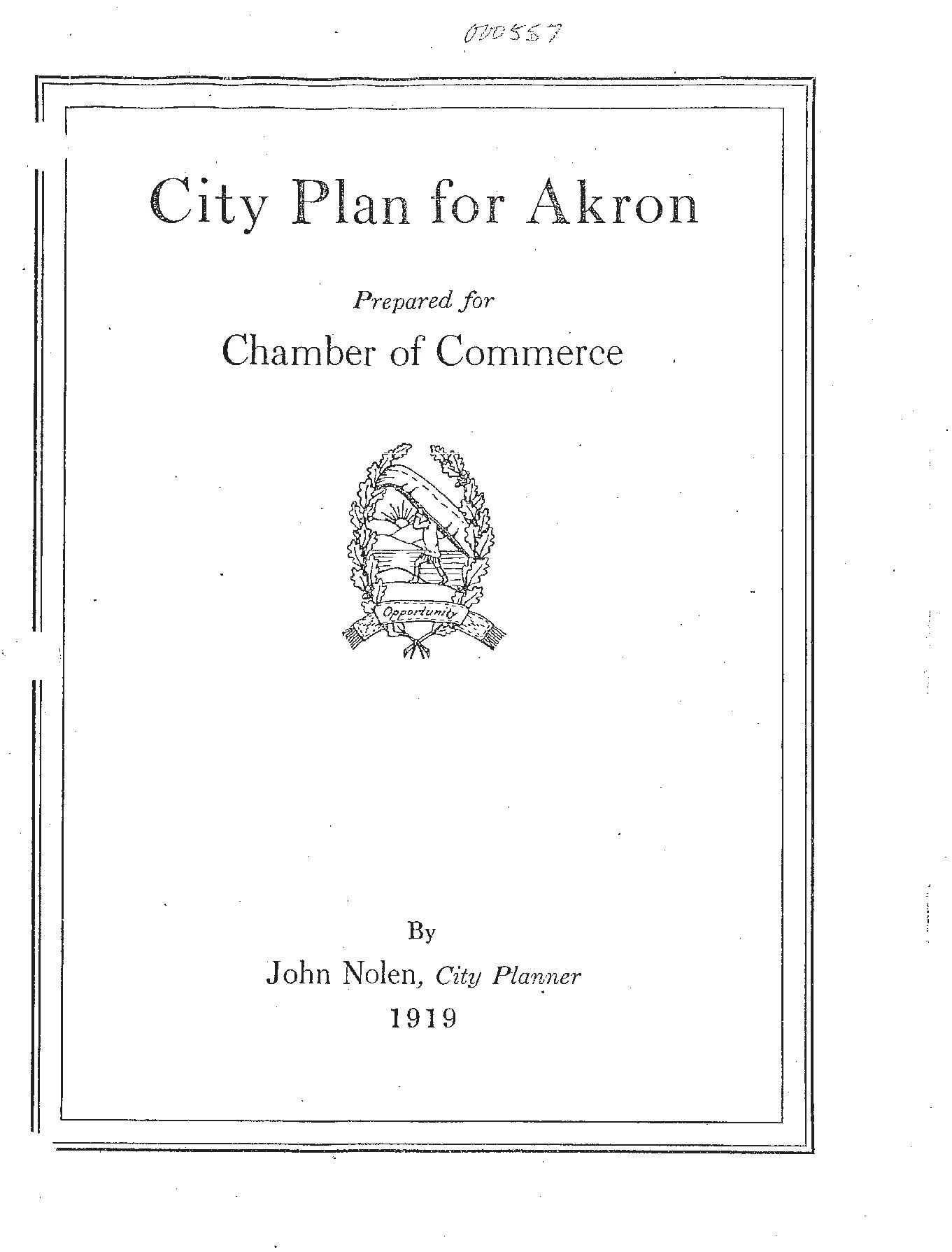
1919
City Plan for Akron, John Nolan for the Akron Chamber of Commerce 2001
Kenmore II Development Area Renewal Plan 2016 Bike Plan, AMATS
2017

Build in Akron, Opportunities for Residential Reinvestment in Akron’s Neighborhoods, Greater Ohio Policy Center with DiSalvo Development Advisors


Great Streets Program
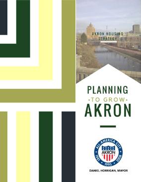
Planning to Grow, City of Akron

Market Value Analysis, The Reinvestment Fund 2018
Akron Connects Bicycle Network Strategy, Copenhagenize

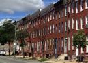


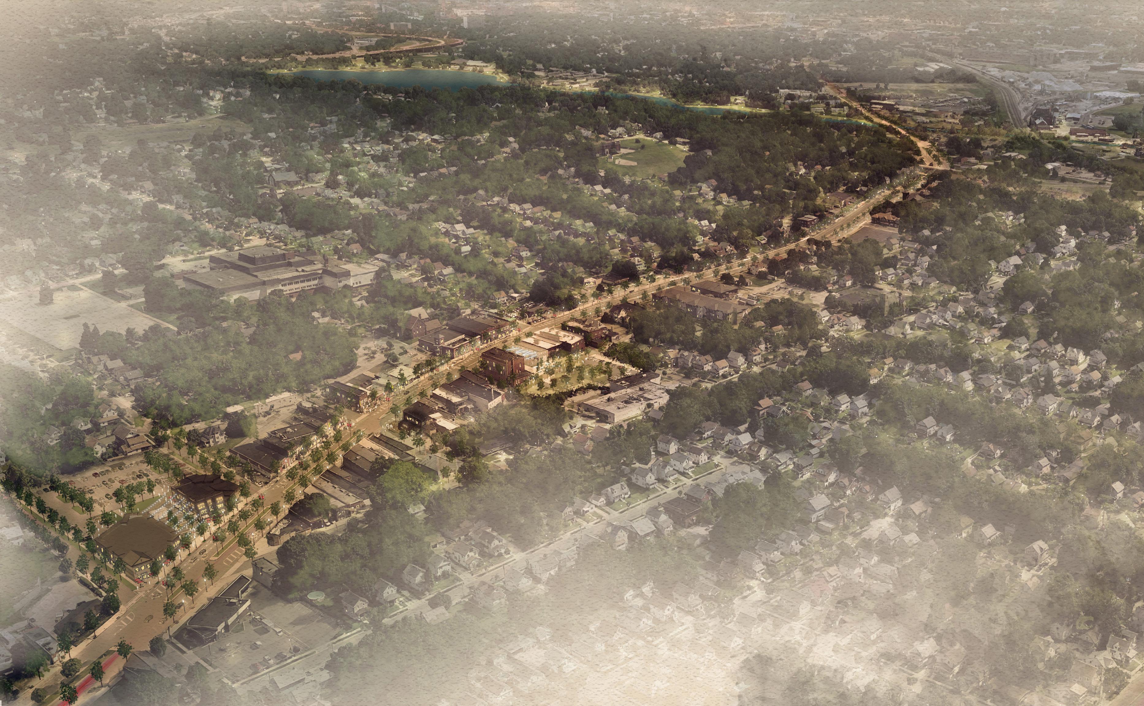
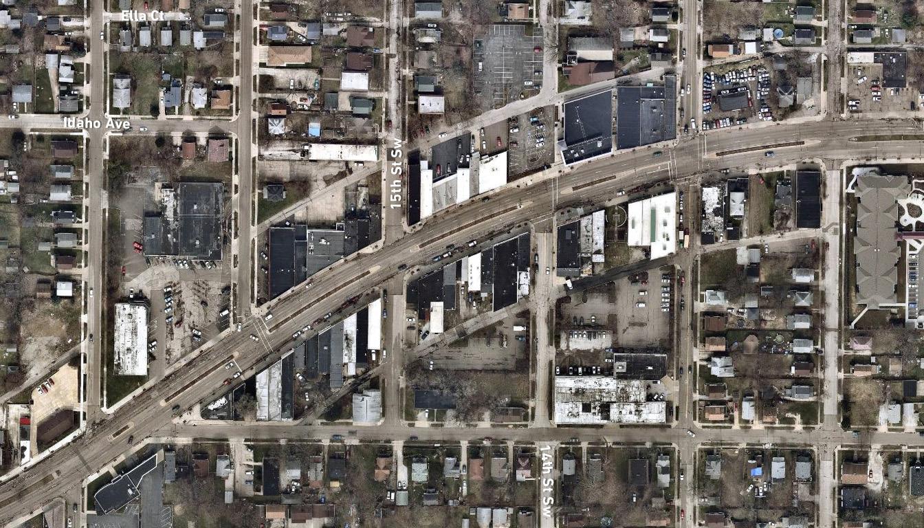
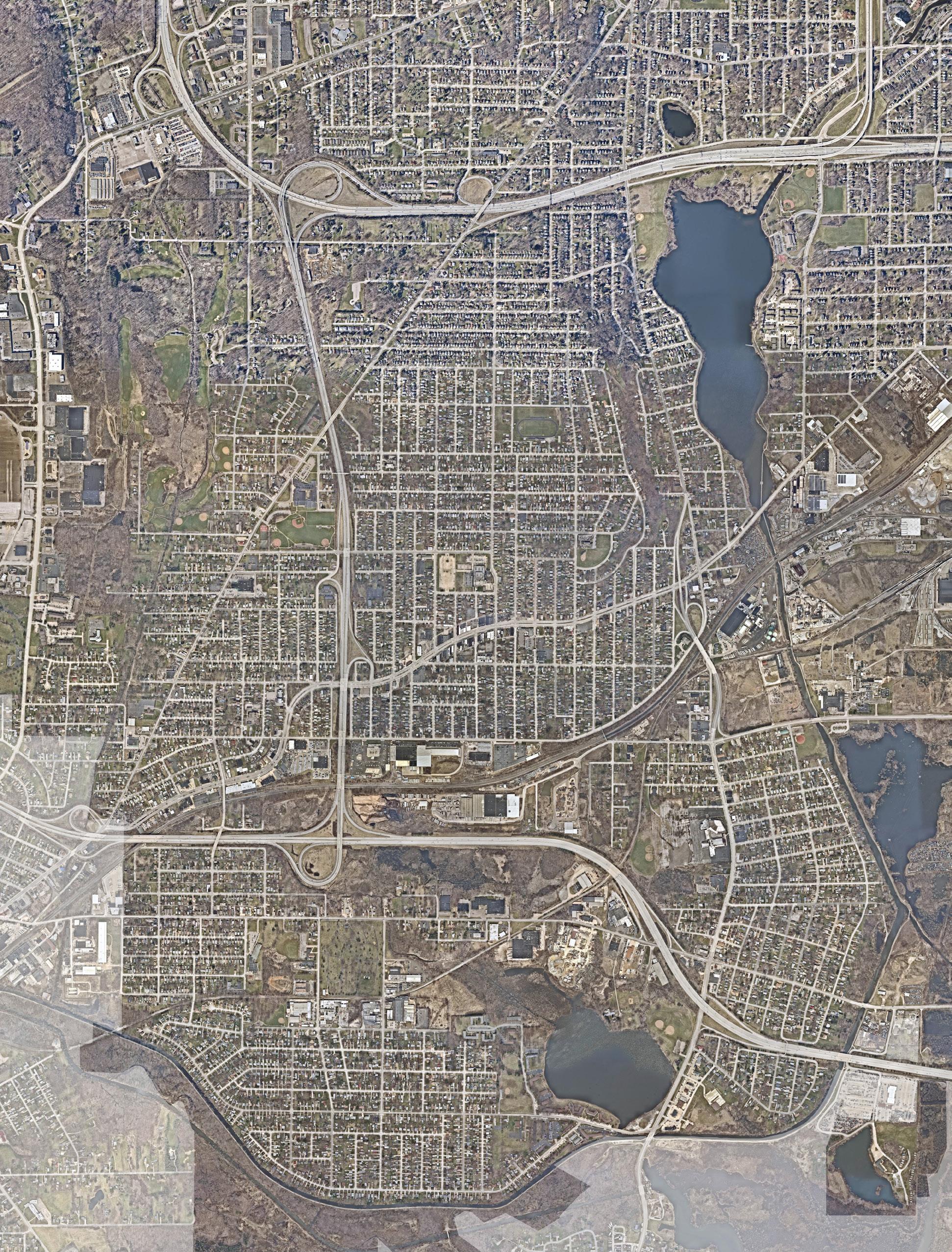
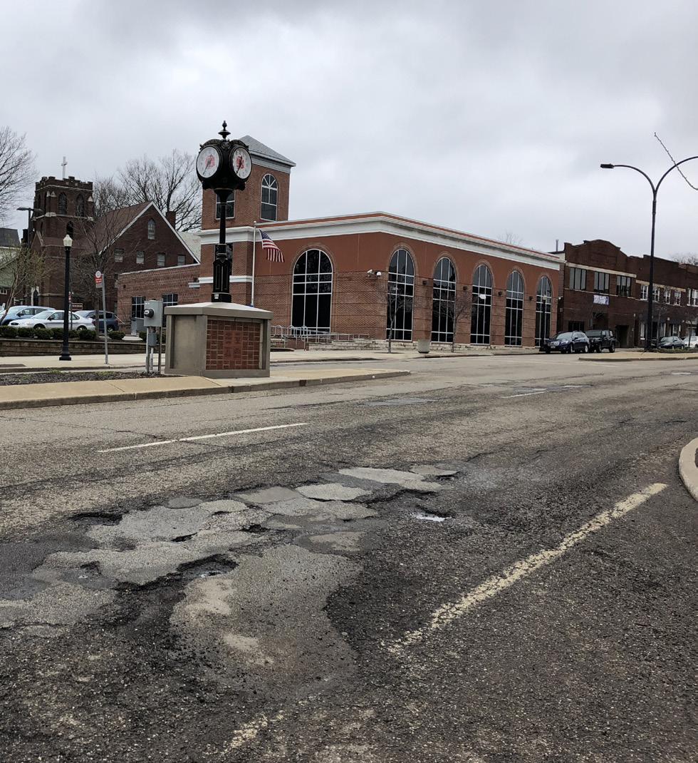
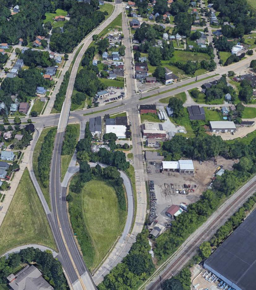
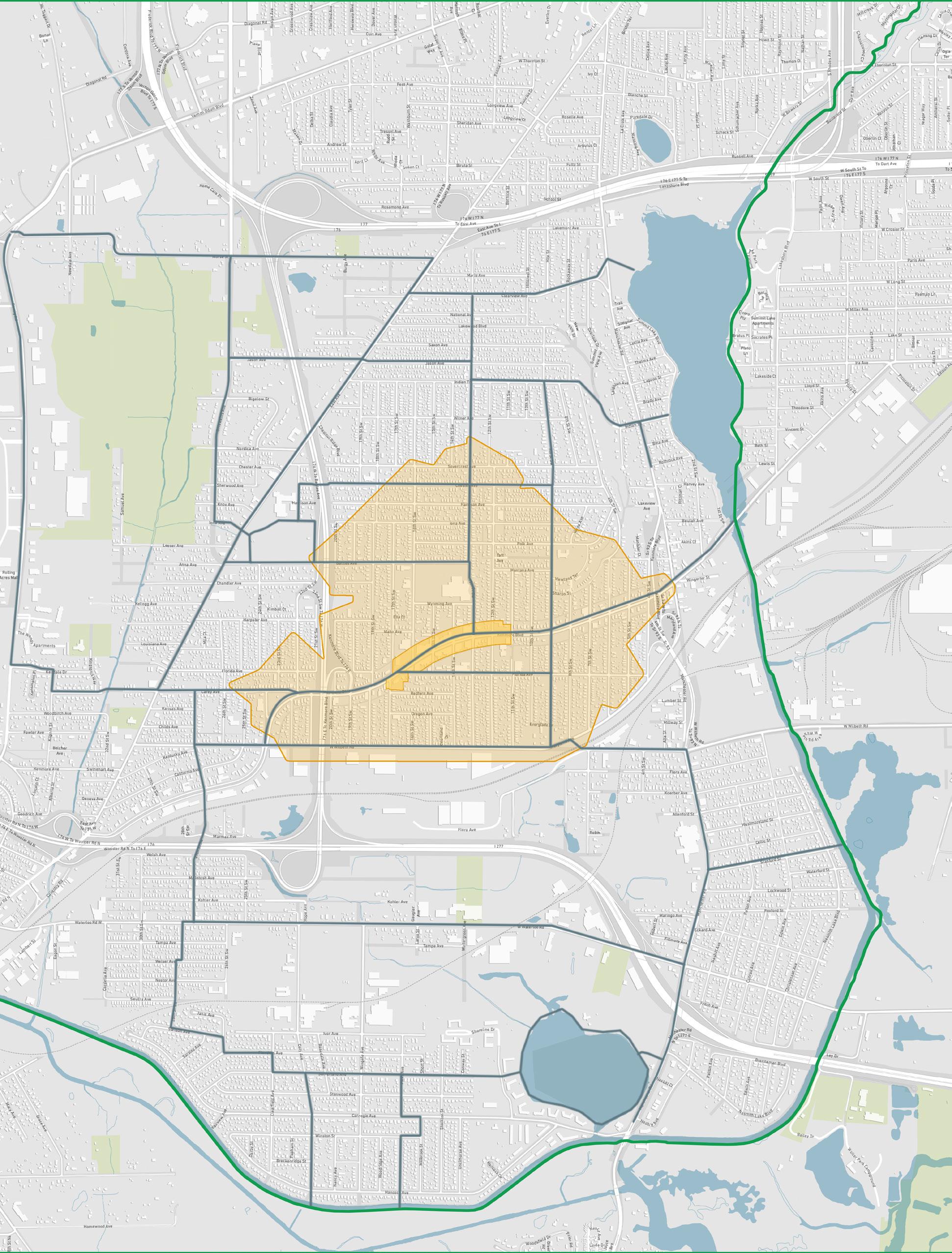
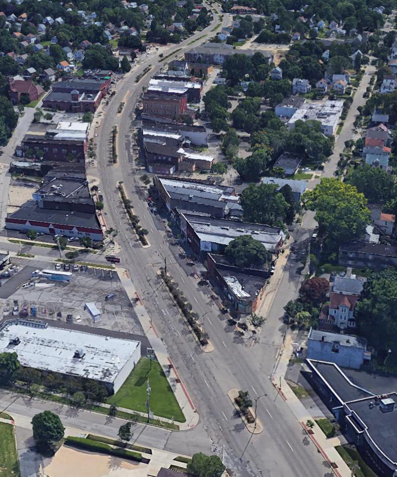
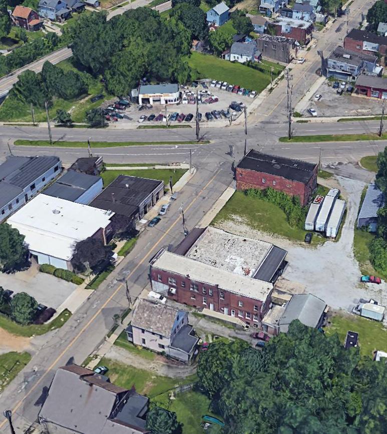
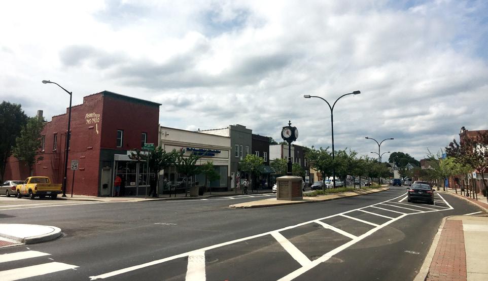
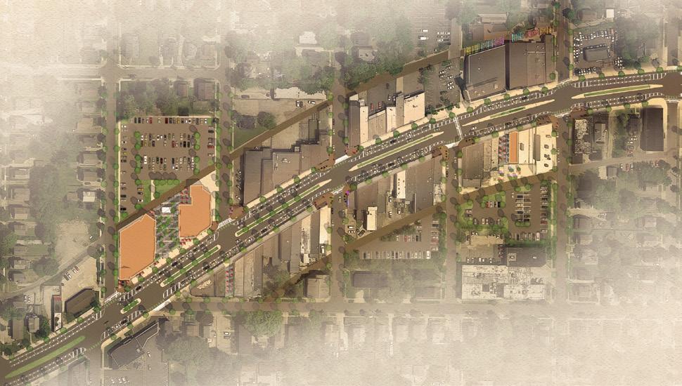
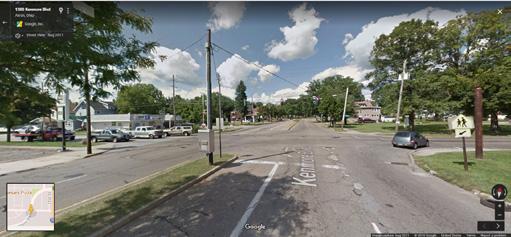
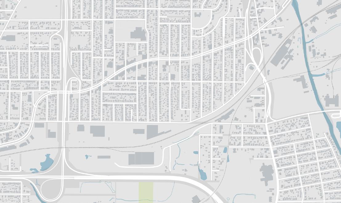
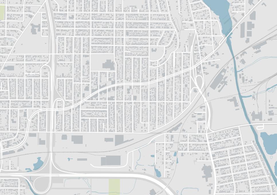
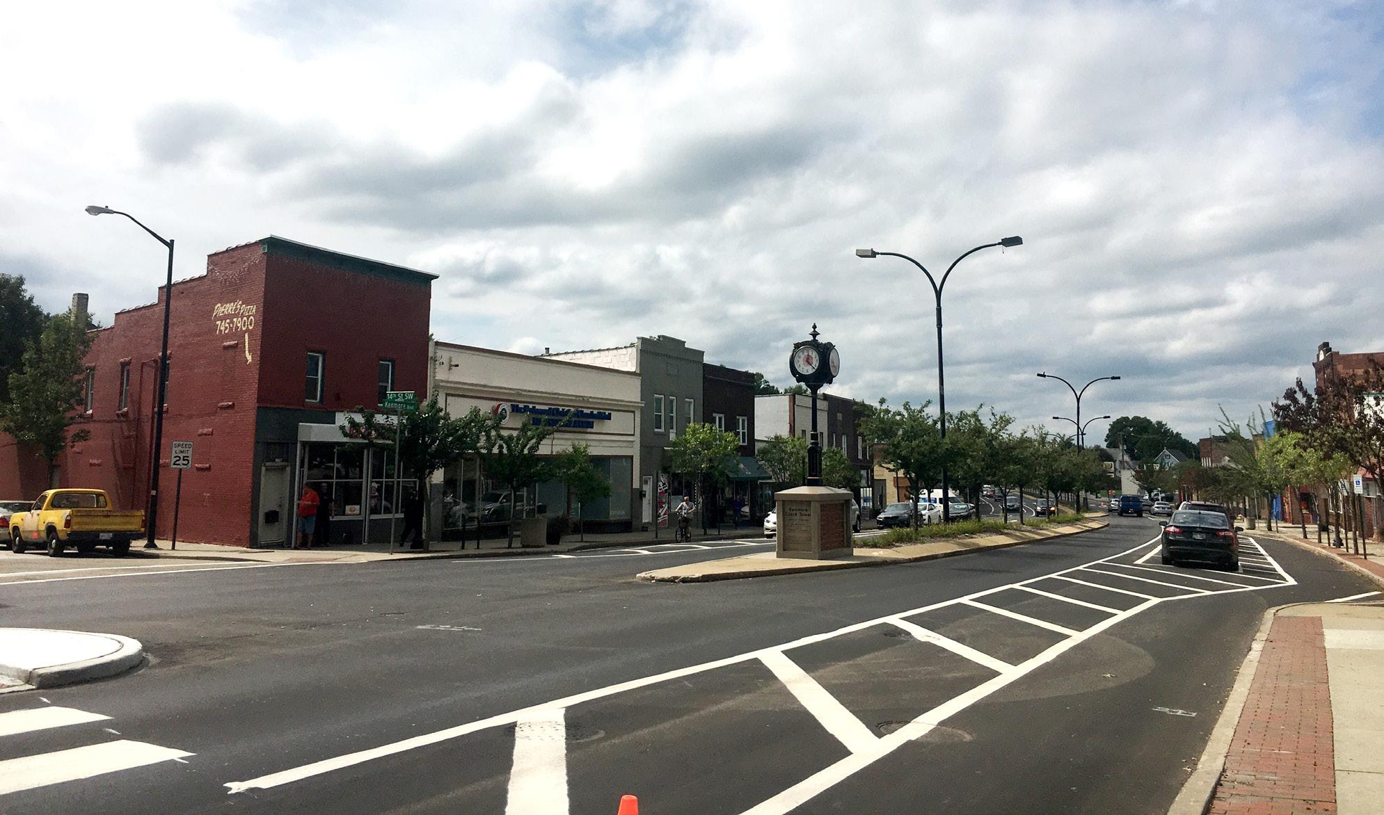
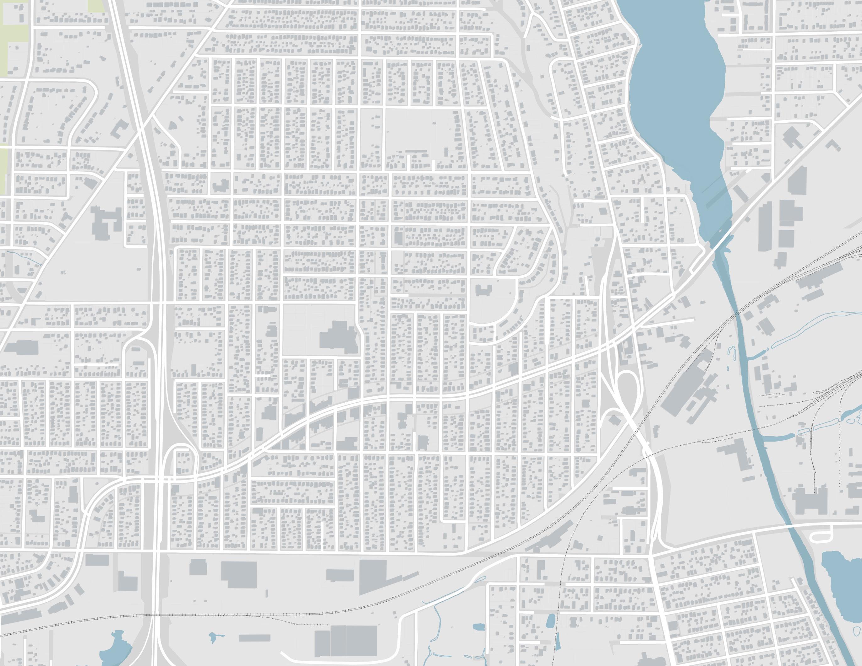
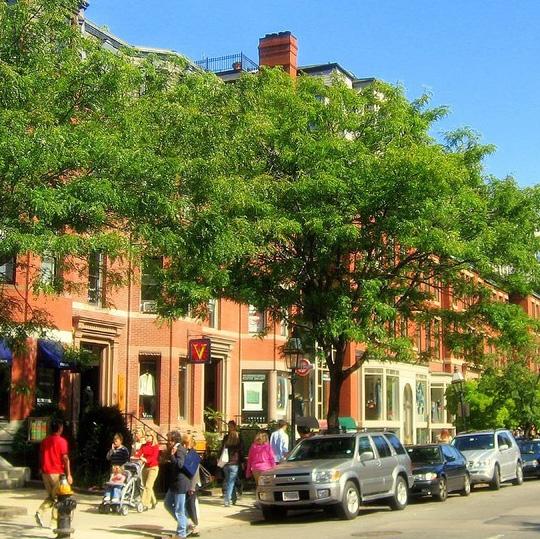
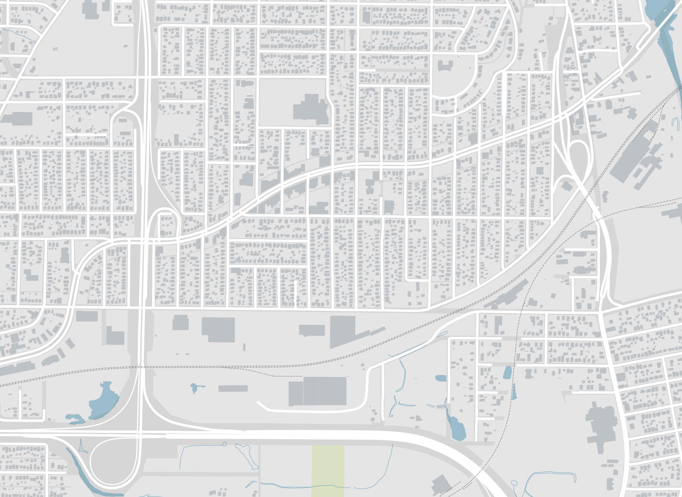
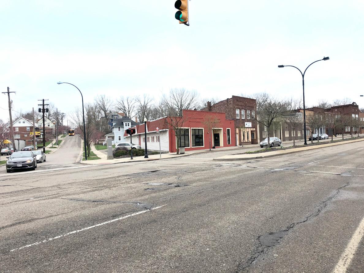
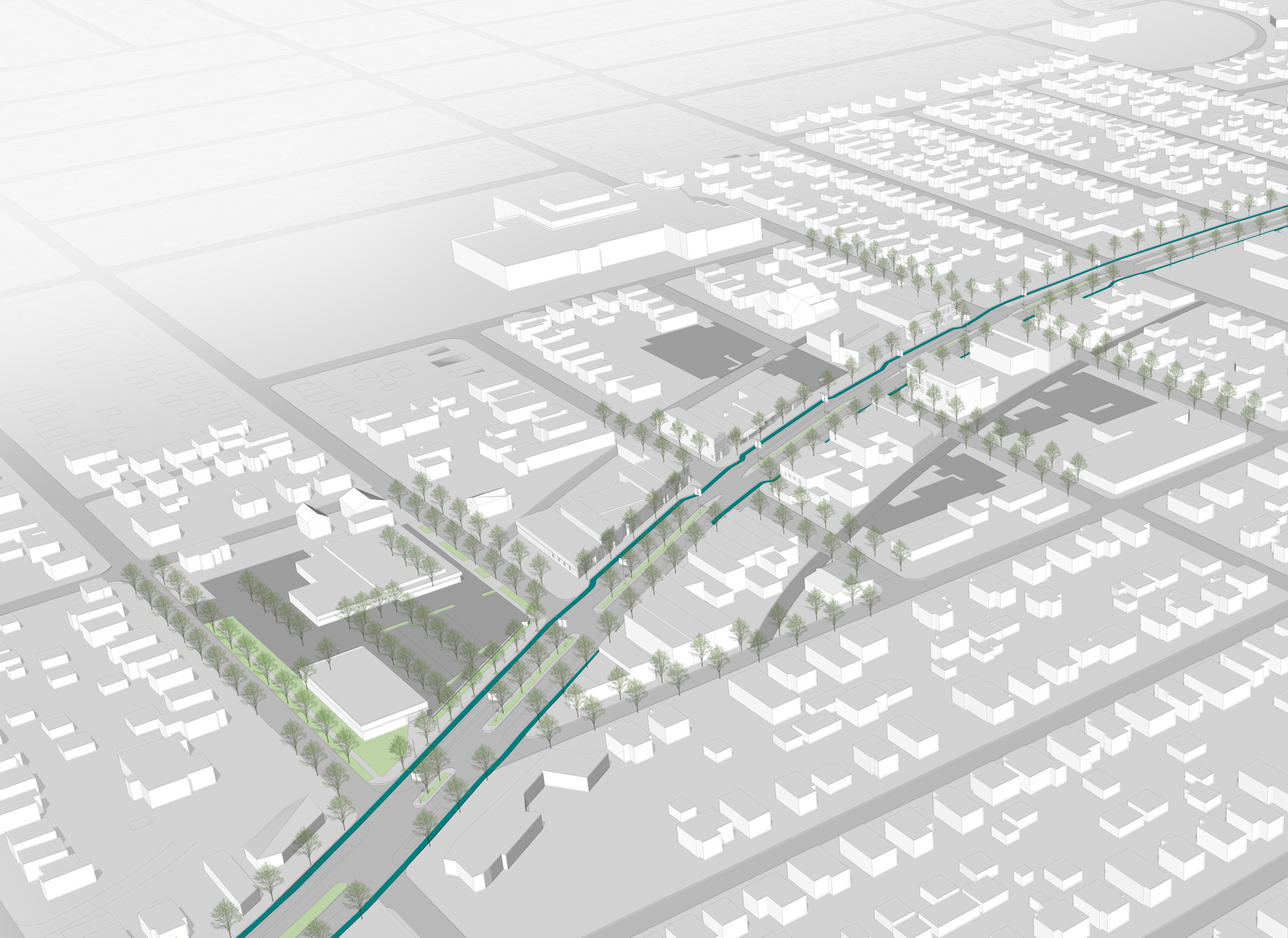
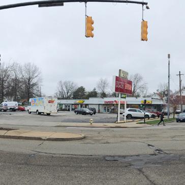
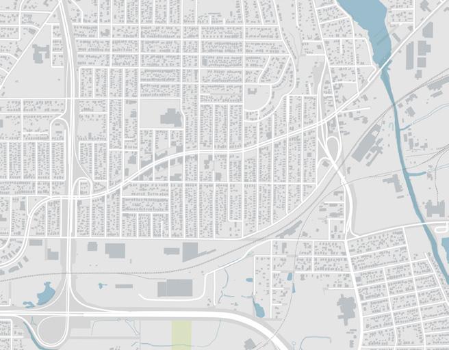
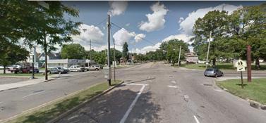
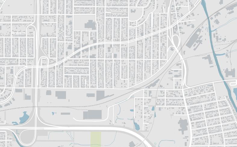
Located southwest of Downtown Akron, Kenmore is a neighborhood of about 17,926 people (2018 estimate). Kenmore is adjacent to the Summit Lake and Firestone Park neighborhoods to the east, Lane-Miller and West Akron to the north, and Barberton to the southwest. Kenmore is bisected by I-277 and US Route 224 from east to west and by I-76 from north to south. Kenmore Boulevard is a major east-west corridor in the neighborhood and the blocks along the boulevard between 10th Street and 24th Street serve as the core of Kenmore. This is the primary focus area of this Neighborhood Plan and it is the main retail district in the neighborhood, featuring many small businesses that occupy historic buildings.
Kenmore is composed of many residential neighborhood blocks of medium-density singlefamily housing, totaling 8,648 housing units. Community assets can be found throughout the neighborhood, with many concentrated on, or near, Kenmore Boulevard.
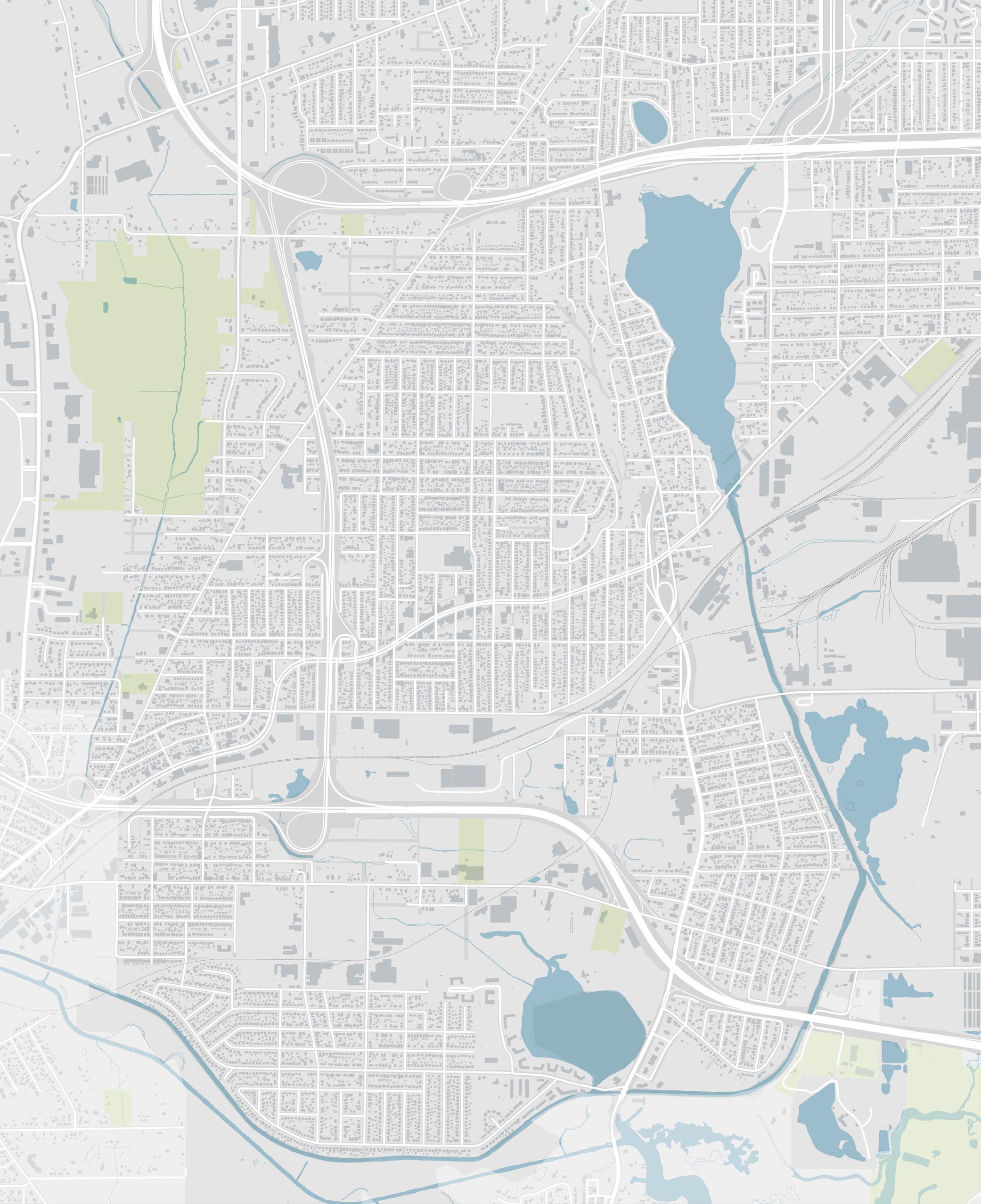
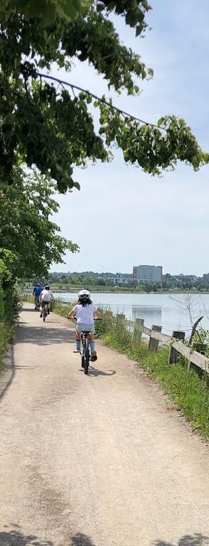
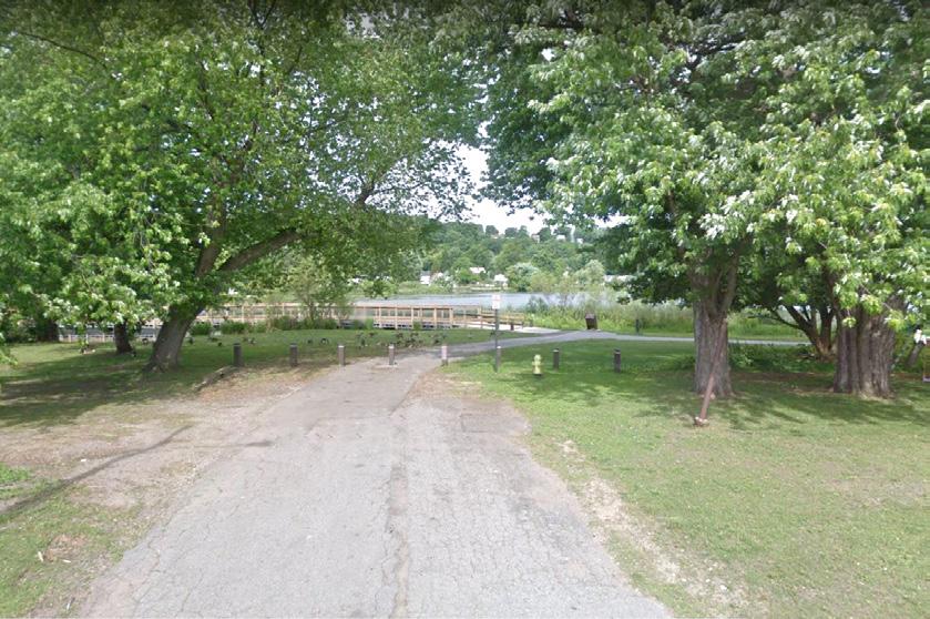
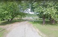
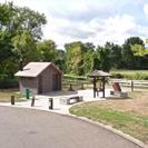
Some of the existing open space assets include Shadyside Park, Prentiss Park, Lakewood Cemetery, and Lake Nesmith Park. The Towpath Trail, which runs along the southern and eastern borders of the neighborhood connects to the nearby Summit Lake and Barberton. Multiple trail heads are located along the Towpath Trail and a Kenmore Connector is planned to connect the neighborhood with the regional trail system.
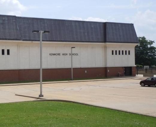
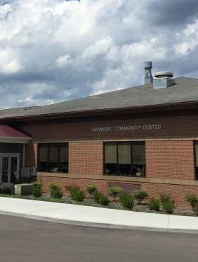
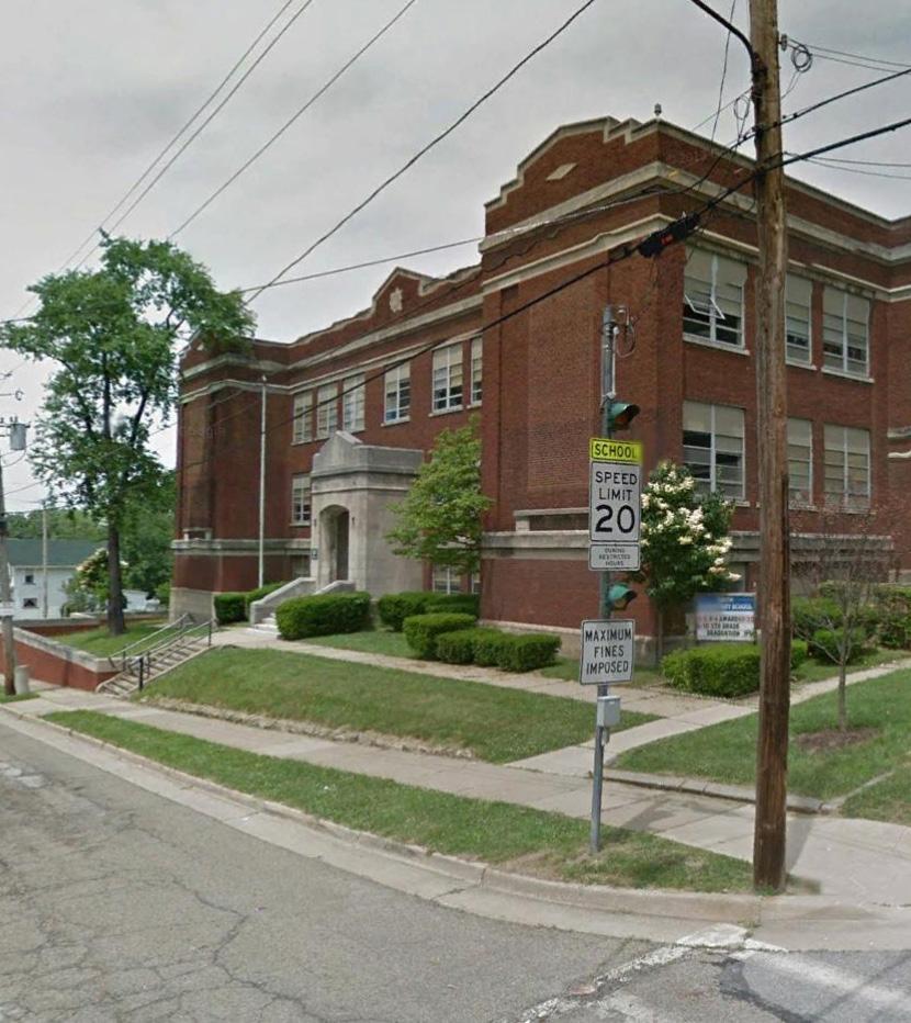
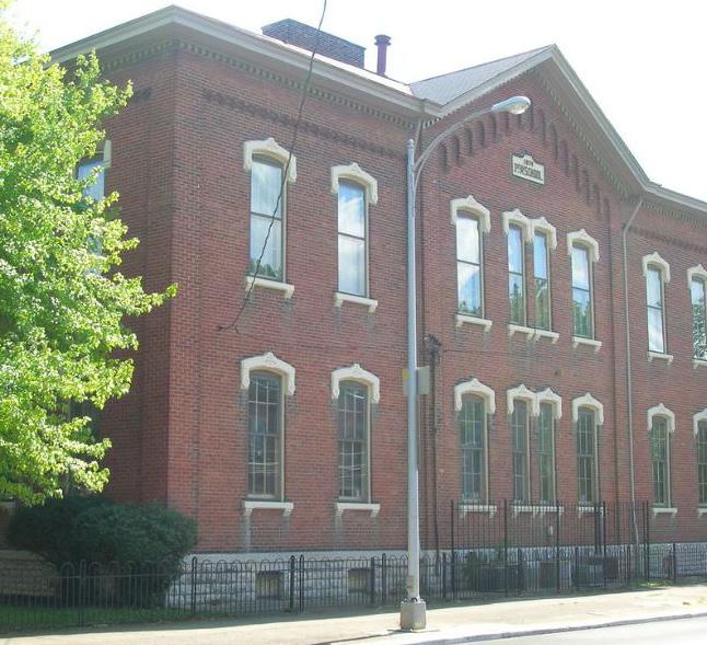
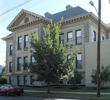
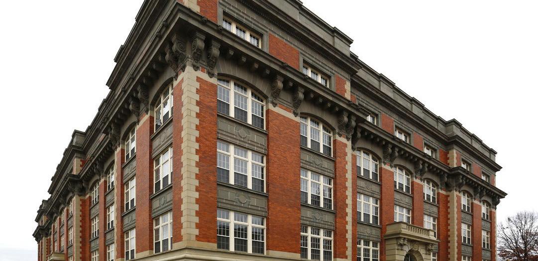
Existing amenities are also important to the neighborhood and include the new Kenmore branch of the Akron-Summit County Public Library, the Kenmore Community Center, and First Glance youth center. Several schools and school buildings are also located in the neighborhood: Innes Middle School, Colonial Prep Academy, Rimer Elementary, Pfeiffer Elementary, Sam Salem Elementary, Kenmore-Garfield High School (which has been slated for relocation), and the vacant Smith Elementary School building. Multiple places of worship are also dispersed throughout the neighborhood.
Most of the existing retail assets are the small and local businesses found along Kenmore Boulevard within the core focus area.
DEMOGRAPHICS
POPULATION
HOUSING UNITS
546,800 198,750 17,926
248,224
MEDIAN AGE
MEDIAN HOUSEHOLD INCOME
OWNERSHIP RATE
MEDIAN HOME VALUE
Source: Business Analyst Online, ESRI, 2018
Kenmore’s population has decreased almost 10% since 2000... 9.6% 10%
...and households in Kenmore have decreased by 9.6% since 2000, resulting in a higher vacancy rate compared to 2000
Homeownership in Kenmore is slightly higher than Akron, but less than Summit County
Median household income in Kenmore is equal to that of Akron, but about $16k less than Summit County
Only 22% of Kenmore’s population has a college degree, which is 9% less than Akron and 19% less than Summit County
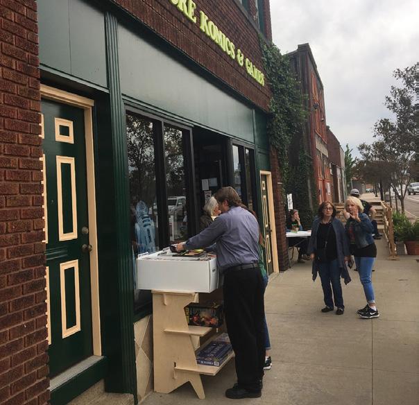
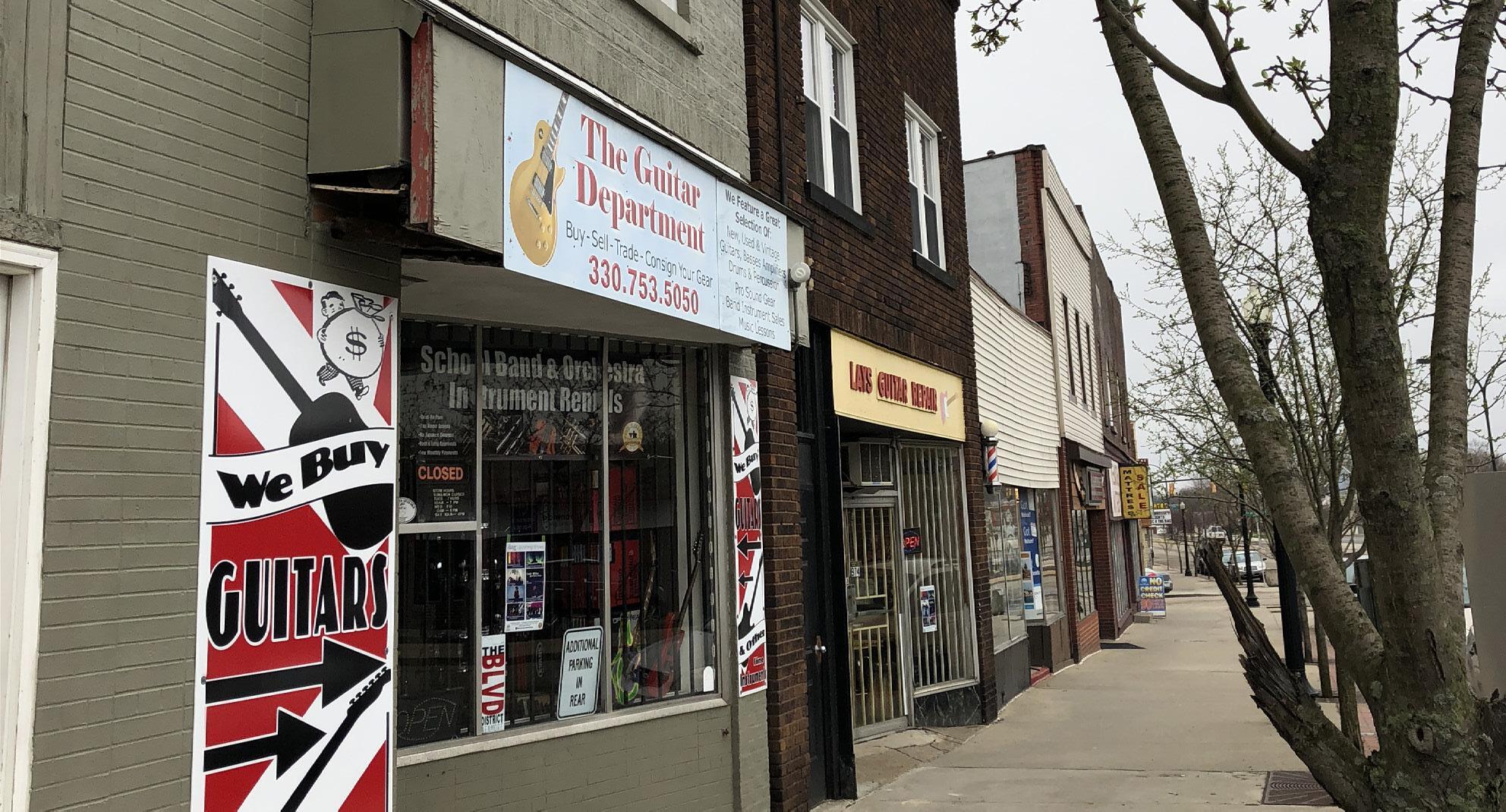
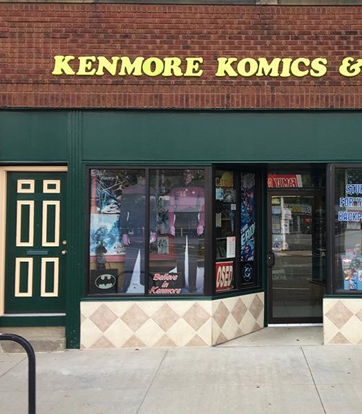
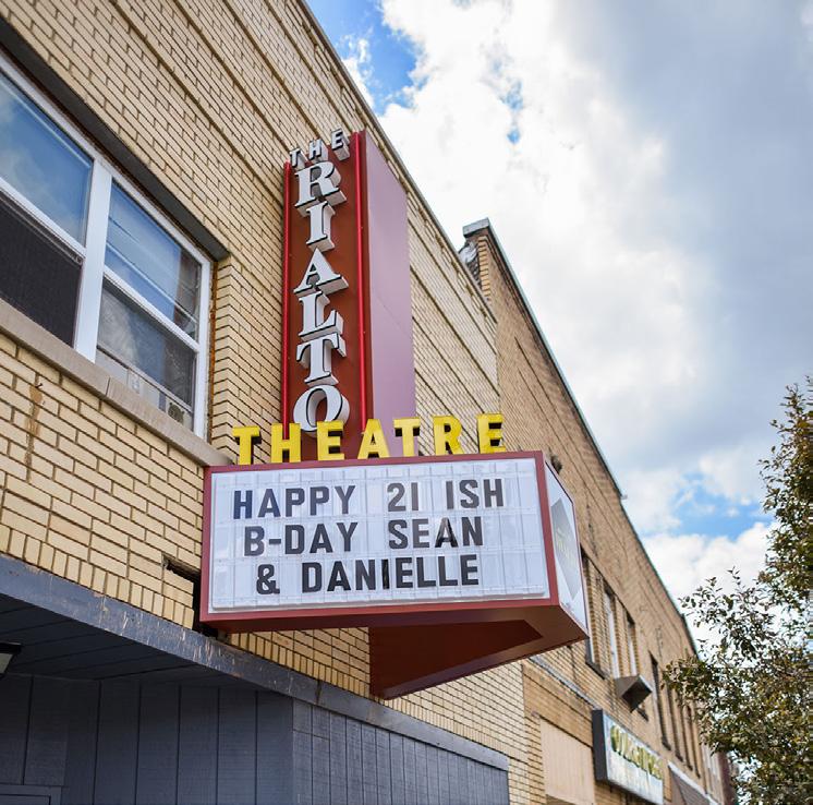
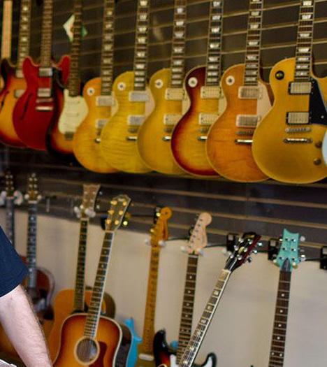
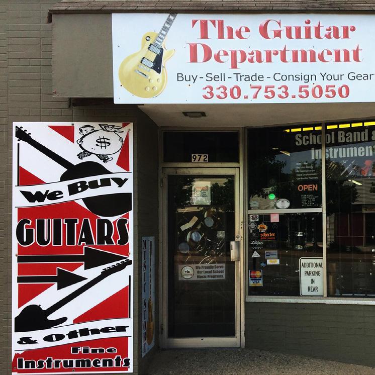
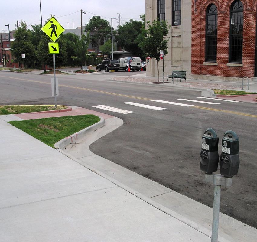
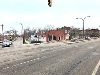
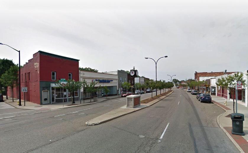
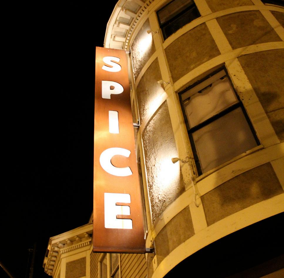
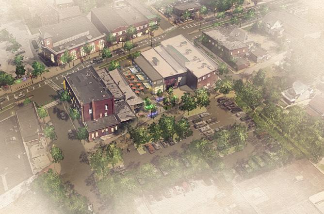
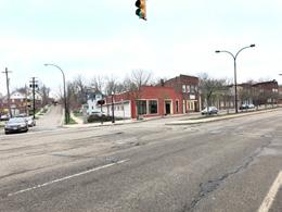
The core focus area of Kenmore Boulevard between 12th Street and 17th Street and the immediate blocks, contains many of the community’s key retail assets. Several of the local businesses on the boulevard are musicrelated and include The Guitar Department, Lay’s Guitar Shop, Live Music Now!, and the Rialto Theater. These assets and complementary programming like Busk Until Dusk contribute to the identity of Kenmore as a regional music destination. Kenmore is also known as a hub for hobby-based shopping with businesses like Kenmore Komics & Games, Magic City Sports Cards, and E&S Train & Hobby Shop.
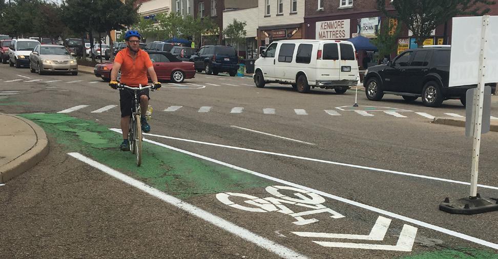
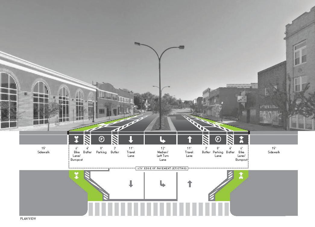
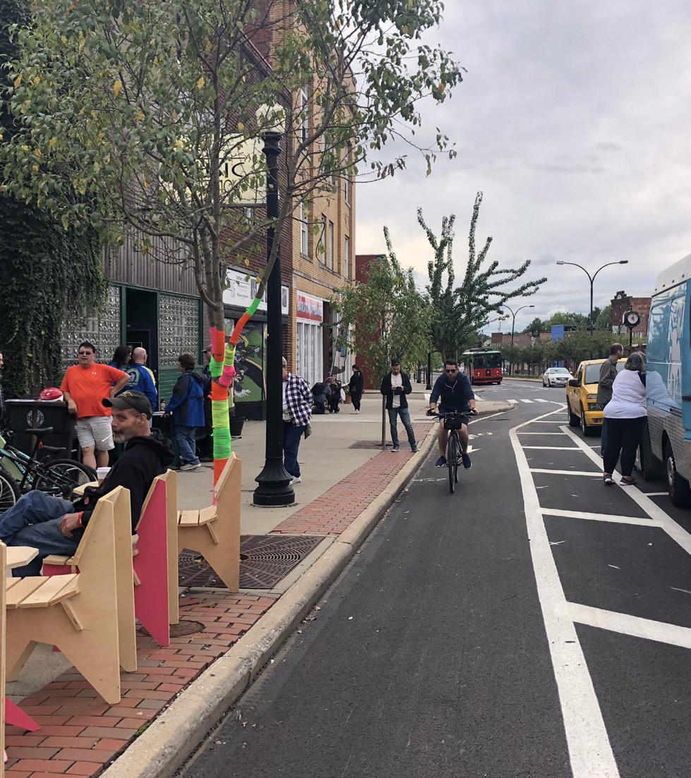
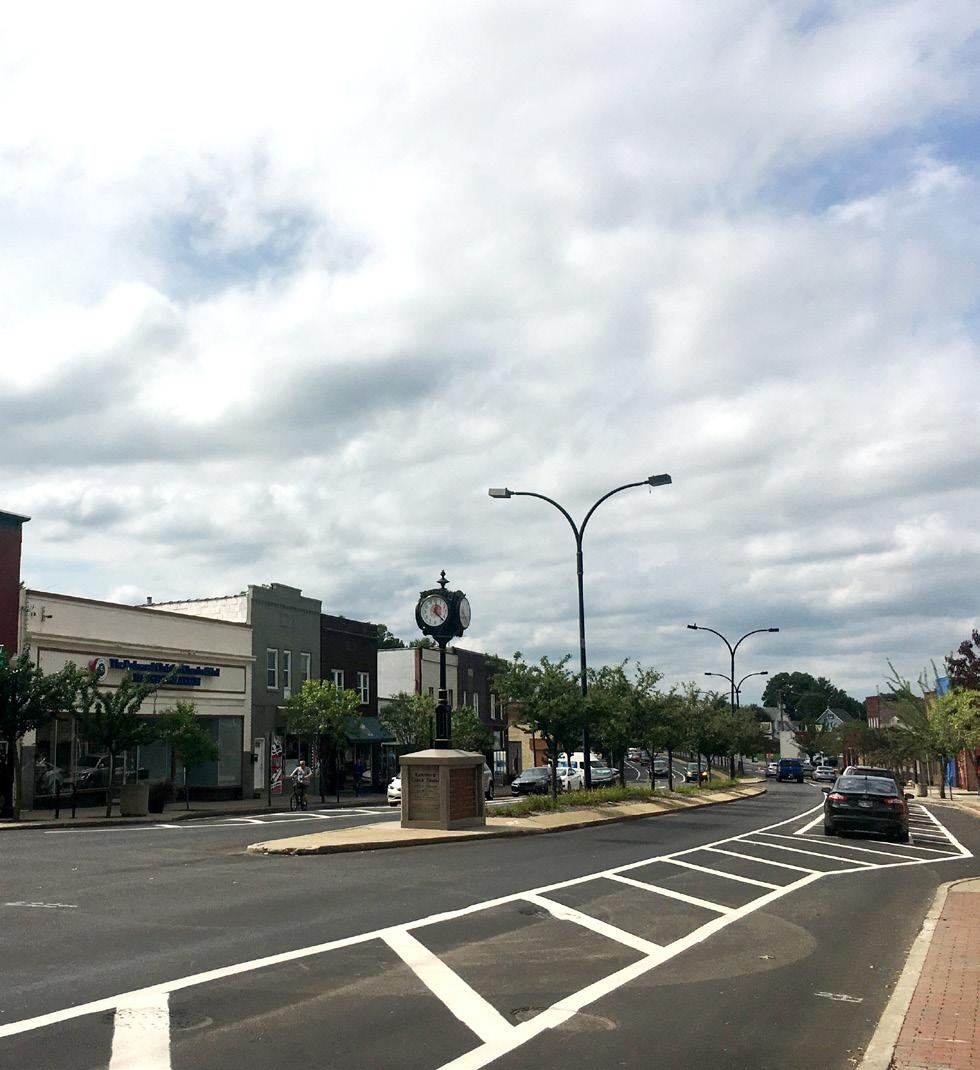
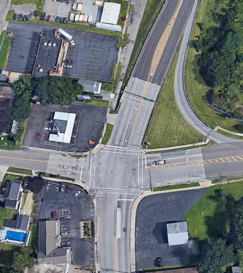
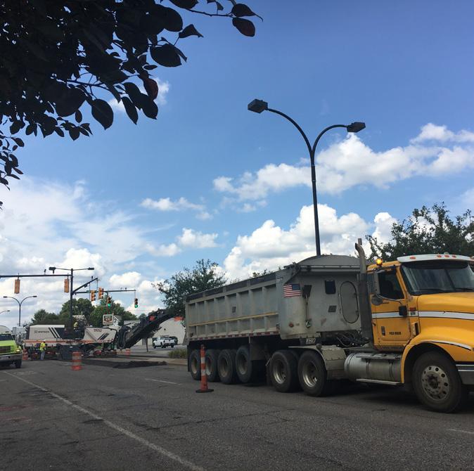
In the past, this part of Kenmore Boulevard was challenging for vehicular, bicycle, and pedestrian traffic due to the poor road conditions, vehicular speeds, and lack of pedestrian or bike amenities. Kenmore Boulevard has an annual average daily traffic (AADT) of about 10,000 vehicles. Parking is ample along the boulevard, with 62 on-street and 177 off-street parking spaces between 12th Street and 17th Street. Since the kick-off of the Neighborhood Plan, Kenmore Boulevard has undergone a road resurfacing and reconfiguration project to better meet the needs of the community and create a safer boulevard for all users. This reconfiguration includes the addition of on-street bike lanes buffered by parked cars and bollards and reduction from four vehicular travel lanes to two. The City has continued to monitor speeds and have found that speeds have decreased since these changes have been implemented.
To better understand the retail market conditions and opportunities on Kenmore Boulevard, KM Date Community Planning conducted a retail market analysis coincident with the neighborhood planning effort. The findings of this analysis helped to shape planning recommendation for improvements to Kenmore Boulevard, especially as it relates to public realm enhancements that would improve the retail environment along the corridor.
The study area for the retail market analysis is defined as the Kenmore Boulevard Primary Local Market Area (PLMA). This market area was initially found through gravity competitor analysis and confirmed against neighborhood perception of actual use boundaries. This boundary roughly fits a 5-minute drive time from the boulevard’s center at 1017 Kenmore Boulevard. About 21,000 people living in 8,600 households live within the PLMA boundary, with a total present annual buying power of $392 million. Additionally, there are up to 90,000 workers within a ten-minute drive time of the boulevard. An analysis of existing neighborhood merchants found that 86% of their walk-in customers came to the boulevard from outside the PLMA and from across Northeast Ohio and the lower Great Lakes region.
Currently, Kenmore Boulevard has multiple retail and community anchors, including a new branch of the Akron-Summit County Library, First Glance youth center, and Cozzoli Plaza. Two primary existing retail clusters exist on the boulevard:
local music cluster and hobby/entertainment cluster. The former includes musical instrument sales and repair, lessons, recording studios, and evening performance venues, while the latter includes cards, comics, games, trains, and models.
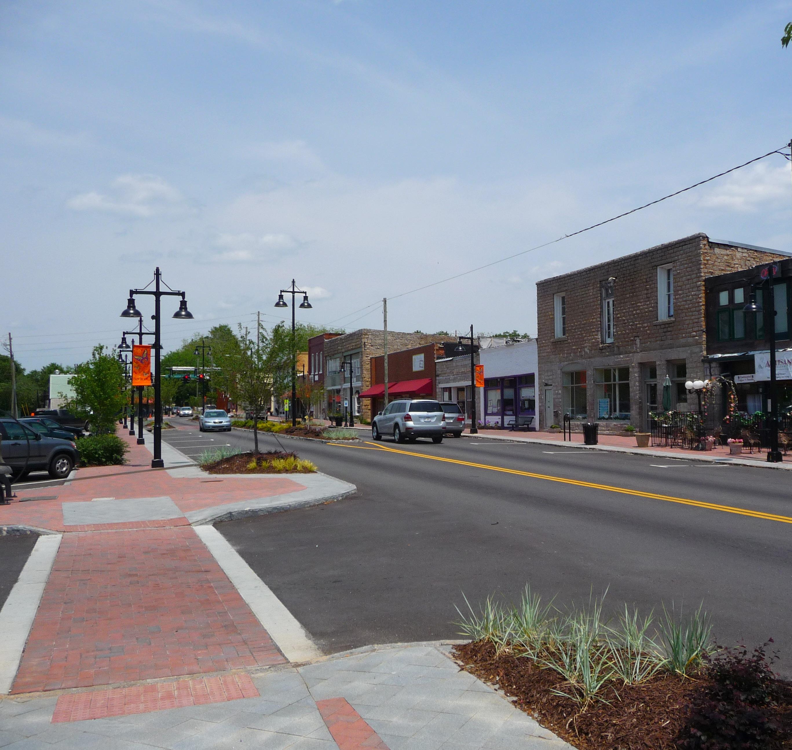
Kenmore Boulevard features a traditional main street building line, which is largely intact within the five-block core of the neighborhood. The buildings are mostly two- and three-story buildings with historic character that exhibit quality commercial construction. The buildings have well defined plinths with transparent storefront windows and traditional high ceilings. This five-block core has 159,000 first-floor square feet of retail space, with 17% vacancy.
A retail demand analysis was conducted for dining, local retail goods, and consumer services.
Retail analysis key findings:
• There is net demand for 7 full-service restaurants (occupying about 23,000 square feet) within the neighborhood PLMA
• Additional categories of net demand in the PLMA include clothing and shoes, general merchandise, home furnishings, other retail, health/beauty, and sporting goods
• Categories of net oversupply include most consumer services, gas stations/convenience, grocery, and computer/electronics/phone
• Toy/craft/hobby and musical instruments are also technically in oversupply, but are unique given their existing substantial regional draw
These findings point to Kenmore being wellpositioned to meet the demand for full-service restaurants as well as to draw an expanding crowd of music and hobby enthusiasts.
90,000 WORKERS WITHIN A 10-MINUTE DRIVE TIME AREA
17% RETAIL VACANCY IN THE 5-BLOCK KENMORE CORE
7 NEW FULL-SERVICE RESTAURANTS THAT KENMORE CAN SUPPORT
86% WALK-IN CUSTOMERS FROM OUTSIDE NEIGHBORHOOD
STRENGTHS & OPPORTUNITIES
• Excellent freeway connections
• Excellent parking availability within Kenmore’s core
• Proximity to downtown Akron
• Strong existing retail base with regional and interstate draw
• Good quality architecture and character, street frontage continuity
• Existing anchors: Cozzoli’s, Library, First Glance, Community Center that play a key role as magnets, attracting patrons to Kenmore Boulevard
• Existing music and hobby/entertainment clusters
• Strong neighborhood identity and resident/ expatriot loyalty
• General lack of chains and predatory businesses
• Storefront vacancies
• Fast driving speed on Kenmore Boulevard
• Perception of lack of safety
• Need for signage/wayfinding from freeways
• Need for upgrade of street environment, including façades, street lighting, seating
• Lack of “third places” and dining
• Need for intensive upgrades to a few buildings
• Need for upgrades to rear parking area, including lighting and signage
• Lack of connectivity of anchors to each other and to the street
Through the hundreds of public comments and ideas gained during the stakeholder and community input process and from the existing conditions and market analysis, the planning team has developed a thorough understanding of the opportunities present in the Kenmore neighborhood.
This section examines five neighborhood-wide issues and areas of needed focus.
• Road Improvements: Roadway design along a number of corridors encourages drivers to exceed speed limits and is incompatible with neighborhood revitalization.
• Parks and Open Spaces: Many park spaces are outdated and lack amenities to increase neighborhood usage.
• Pedestrian Connections: Many parts of the neighborhood are cut off from each other and access to Kenmore Boulevard, the Towpath and Summit Lake could be improved.
• On-Street Bike Network: Residents showed a desire for increased non-motorized access to neighborhood amenities and a need for bicycle infrastructure.
• Adaptive Reuse and Improved Assets: There is a need to leverage and improve existing neighborhood assets and improve the quality of life for current residents—from the addition of housing, retail and restaurants.
Each issue is explored in greater detail on the following pages, with place-specific recommendations to be studied and implemented with the community over the next 10 years.
ROAD IMPROVEMENTS
PARKS AND OPEN SPACES
PEDESTRIAN CONNECTIONS
POTENTIAL ON-STREET BIKE NETWORK
ADAPTIVE REUSE & IMPROVED ASSETS
The feedback received from the public highlighted the need for more pedestrian friendly streets throughout the neighborhood. This includes traffic calming and adequate street trees, lighting and furnishings. This diagram identifies the location where the following road improvements are proposed:
Explore Manchester Rd. bypass removal
Investigate potential for traffic calming at Carnegie Ave. and Manchester Rd., Waterloo Rd. near Conrad Ave. and Edwin Ave., along Manchester Rd. near Stanford St. 1 2
When maintenance is required for existing streets, they should be evaluated for traffic calming and/or restriping to meet the demands of existing traffic. In many instances, the streets are now striped to provide more lanes than are necessary for automobile traffic. This tends to increase speeds and reduce the attractiveness of the street. Traffic calming reduces the lanes of the street used for automobile traffic freeing up more space for bike lanes, shared center turn lanes, etc. Boulevards can also be considered for wider streets.
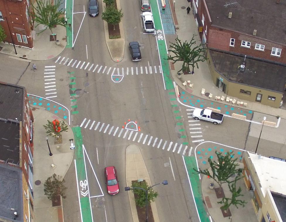
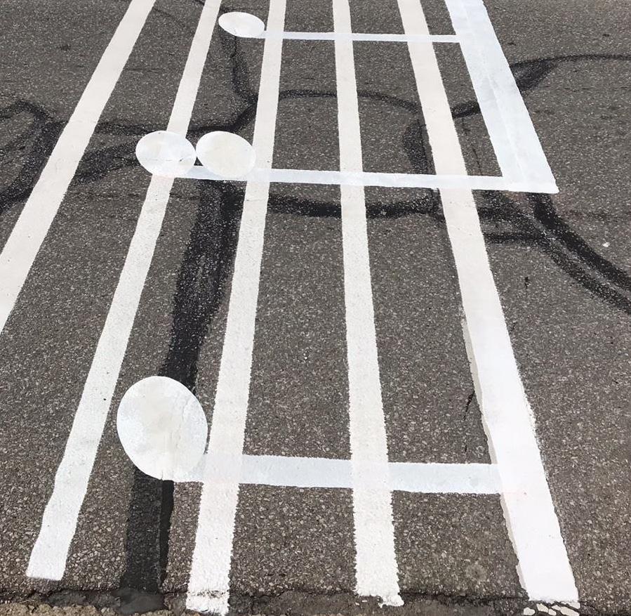
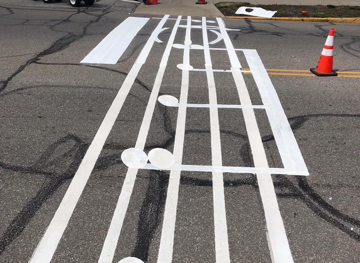
Crosswalk treatment and bumpouts also contribute to a more pedestrian friendly environment. The crosswalk treatment makes drivers aware and prioritize the pedestrian whereas the bumpouts helps to reduce the distance between the two sides of the road.
In specific areas, the existing street layout restricts easy access in getting around. Improved signage would help and, in some instances, new streets or realigning streets should be considered.
Landscaped bumpouts to help slow traffic
Landscaped median to help slow traffic
Bumpouts on either side of crosswalk to create shorter crossing distance
Clearly marked striping for crosswalk
Clear signage for crosswalk to alert vehicles
The following recommendations intend to strengthen the park and open space system in Akron that directly affects the Kenmore neighborhood. Such improvements vary in scope and scale and will contribute not only to residents daily leisure activities but to connect with the larger network:
Sound barrier for Chestnut Ridge Park
Chestnut Ridge Akron Park Challenge Winner
Summit Lake Vision Plan
Potential to work with MetroParks to create park/trail at City Nursery Increase
There are 161 parks covering over 3,800 acres within Akron’s corporation limits and can be classified into 9 categories. They include citywide facilities, community parks, community learning centers, neighborhood parks, ballfield sites, playgrounds, open space, natural/ unmaintained areas, and linear parks and greenways. Approximately 350 acres of park land is located within the Kenmore neighborhood boundary area.
Incorporation of public art
Connected bike trail
Trail signage and wayfinding
Pedestrian crossings
Right size amphitheater stage that serves different scale of events
Ample informal seating
Amphitheater seating
Large shade trees
Adequate electrical services to support events and lighting needs
To overcome the barriers to pedestrian connections observed by community members through this process the following improvements are proposed:
Improve pedestrian crossings near Summit Lake on Manchester Rd.
Pedestrian loop path near Summit Lake Blvd. and Lagoon Ave.
Explore the possibility of a stairway directly from 27th St. bridge down to Blvd.
Evaluate possibility of footbridge: to Towpath at Corey, at Pike Ave., and at Stanford St.
Improve pedestrian footbridge at Maryland Ave. and Wilbeth Rd.
Explore foot/bike path near Indian Trail and Summit View Ave.
The Kenmore neighborhood continues to be one of the most walkable districts in the City of Akron. Historically, the town center was a short streetcar ride from downtown Akron. Dense development was built adjacent to Kenmore Boulevard and the neighborhood today is perfectly situated to support pedestrian and other non-motorized transportation. In order to continue to make Kenmore an attractive place for pedestrians, the following recommendations will help to support the neighborhood.
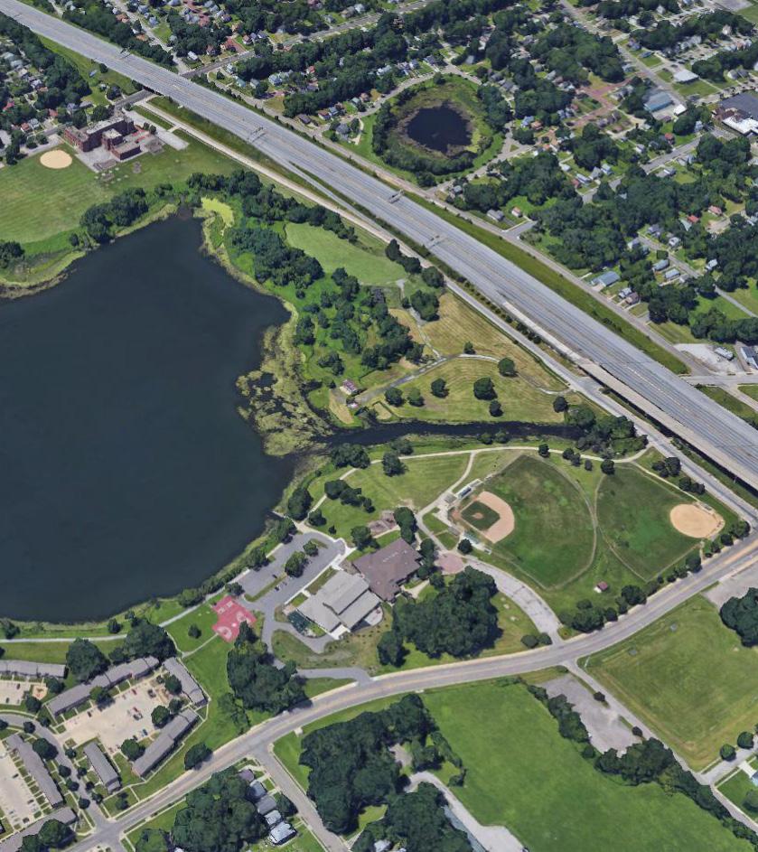
In a joint effort by the Akron Civic Commons, Summit Metro Parks, and the City of Akron, a loop trail around Summit Lake is planned to be tested in 2019. The loop trail would connect the west side of Summit Lake to the east side as well as the Towpath Trail. With additional connections from the Kenmore neighborhood, pedestrian crosswalks at key intersections along Manchester Road are critical for pedestrian safety.
Another potential connection point is along Indian Trail. Currently, there are two separated segments of this street; the upper portion is in the Kenmore Heights area and the lower portion is along the Manchester Road Corridor near Summit Lake. Utilization of the paper street that connects both segments of Indian Trail would create a valuable connection between the neighborhood and Summit Lake that does not currently exist in a form that is accessible to all users.
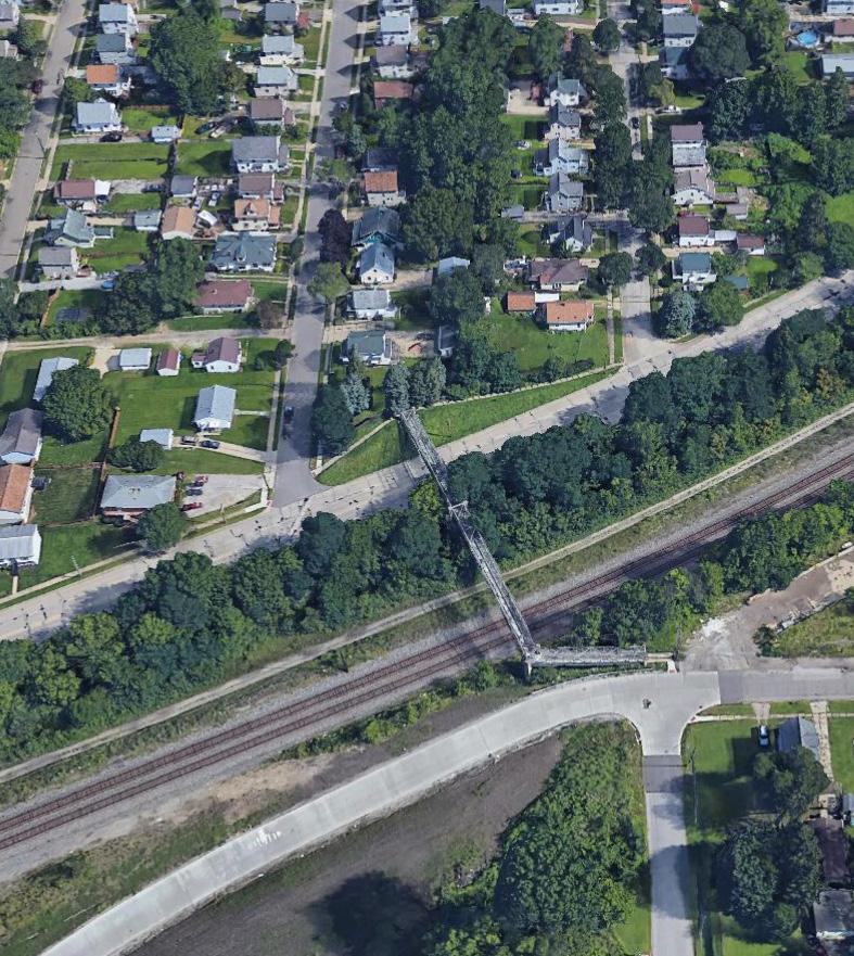
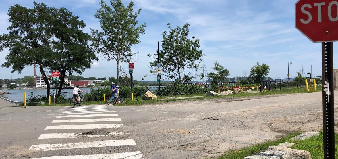
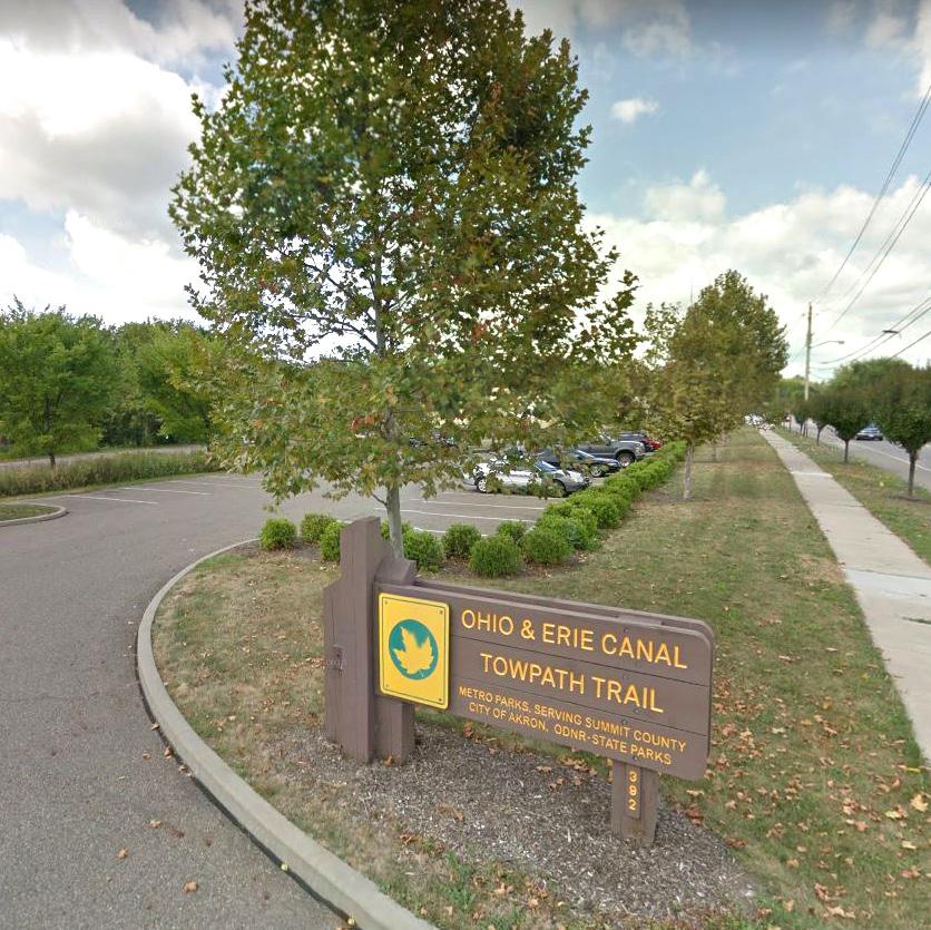
The Ohio and Erie Canal Towpath Trail is recognized as an important asset for nonmotorized transportation as well as for general recreational purposes. However, neighborhood access to the trail is limited to three trailheads (Summit Lake, Wilbeth Road, and Manchester Road), with future access via the protected bike lanes along Kenmore Boulevard. Despite being across the canal from the trail, residents must travel as far as one mile, in some places, to access the trail. There are several potential locations for access bridges over the canal. Potential locations include footbridges at Corey Avenue, Pike avenue, and Sanford Street. By improving the ease of access to the Towpath Trail, the neighborhood is better situated for connections outside of Kenmore.
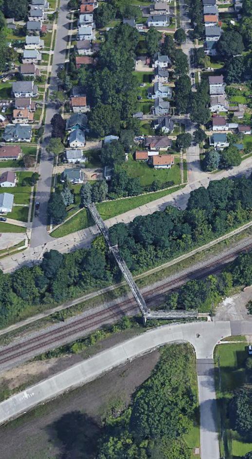
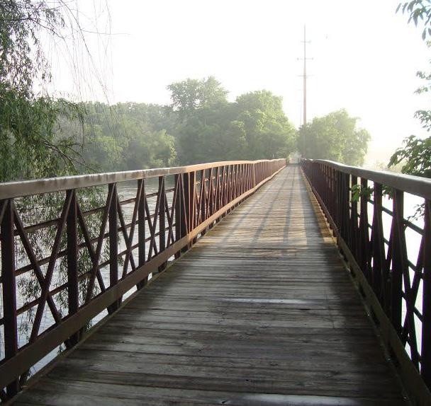
In addition to connecting Kenmore’s pedestrian network with the Towpath Trail, the neighborhood can be better connected to itself. Two key connection points within the neighborhood are the Wilbeth Road Connector Bridge and the 27th Street SW Bridge. The bridge at Wilbeth Road connects the Boulevard District to the Manchester Road Corridor and is currently in less than optimal condition. The bridge itself is unattractive and appears to be underutilized. The bridge at 27th Street SW connects the residents of the Hancock/Carnegie District to the Boulevard District, but completely bypasses Kenmore Boulevard below the bridge. The recommendation to connect the boulevard to the bridge would offer pedestrians the ability to directly access Kenmore Boulevard without having to traverse a roundabout detour.
Pedestrian and bike connection
Accessible entrance to bridge crossing
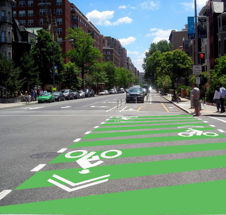
Bike infrastructure was among the number one issue to be addressed from all the engagement input. Creating a neighborhood bike network foster healthy habits and contribute to the vitality of pedestrian friendly streets. The bike network is conceptual at this time and should follow an all ages and abilities approach, in accordance with the Akron Connects Bike Network Strategy. The following recommendations begin to form a neighborhood wide network:
Protected bike lanes along Kenmore
Neighborhood feedback from the Kenmore Better Block, surveys, and various events all have helped to provide direction for the newly striped bike lane along Kenmore Boulevard. This has reconfigured Kenmore Boulevard from four lanes (two eastbound and two westbound) to one lane in each direction with a protected bike lane from 20th Street to 2nd Street.
In addition to calming traffic, this change has provided additional mobility options along Kenmore Boulevard. This new connection links the neighborhood to other parts of the City of Akron and the greater region through the Ohio and Erie Canal Towpath Trail. For example, this linkage gives residents another way to travel the approximately four miles from Kenmore to downtown Akron. Improved bicycle connections between the neighborhood and a large employment and activity center like downtown is essential to the vitality and livability of Kenmore.
The Kenmore Boulevard bike lane will serve as the spine to a potential neighborhood network of bicycle infrastructure. Radiating outward from the boulevard, there are plenty of quiet neighborhood streets that are viable options to connect residents to the protected bike lanes. The conceptual neighborhood bicycle network would be laid out in a typical grid fashion and would offer connection points every few blocks.
Proper signage will be necessary to encourage use of this network while also keeping motorists aware that they may encounter cyclists in the street. In addition to creating safe bicycle access to the boulevard and other employment areas, users of the bicycle networks will be able to access local parks, schools, places of worship, and other community assets.
During the engagement process residents were vocal about improving quality of life. The following recommendations will contribute to the livability in Kenmore neighborhood:
Explore potential housing opportunities at Mud Run
Improve center of street parking safety at Kenmore Blvd. south of Wilbeth Rd.
Former Young’s Restaurant site beautification
Improve commercial area at Kenmore Blvd. and Manchester Rd.
Explore adaptive reuse at Smith school site
Continue adaptive reuse discussions relating to the proposed Kenmore Garfield High School relocation

Kenmore lacks large tracts of developable space. This makes the re-use of underutilized space and adaptive reuse of vacant or underutilized buildings a priority. Existing assets, such as the shared parking areas along Kenmore Boulevard, should be well striped, signed and lit to provide accessibility and a safe-feeling environment. Vacant lots, such as the former Young’s Restaurant site at Lake Nesmith Park should be beautified as part of trail and park improvements.
There is also the potential to consider the adaptive reuse of decommissioned school sites such as Smith School. There are good examples from other communities of reusing these buildings as market rate, affordable senior housing, and office space. In addition to the Smith School, these reuse options should be reviewed as discussions continue about the future of the Kenmore-Garfield High School building, given its planned relocation.
Well striped median angled parking on Kenmore Blvd. south of Wilbeth Rd.
Gateway sign
Pedestrian lighting
First School Ave., Columbus, Oh. Reused as office space.
Michigan Ave. School, Columbus, Oh. Reused as affordable senior housing.
Former School for Creative and Performing Arts, Cincinnati, Oh. Reused as market rate lofts.
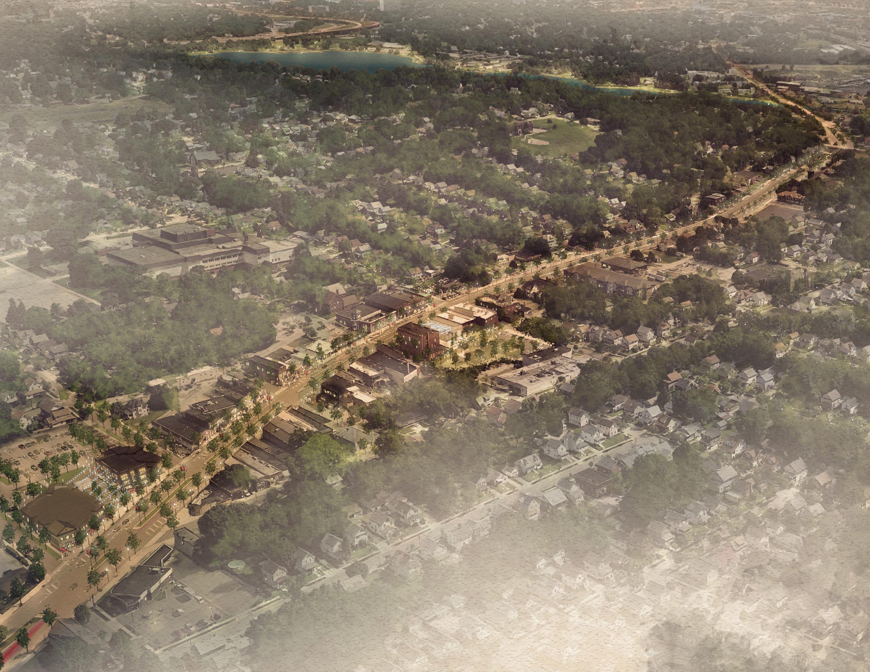
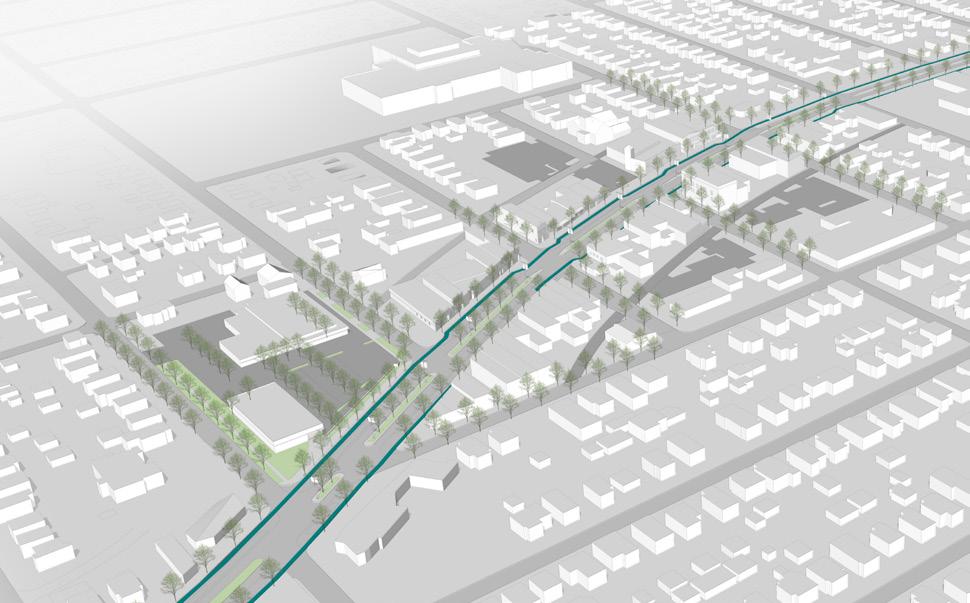
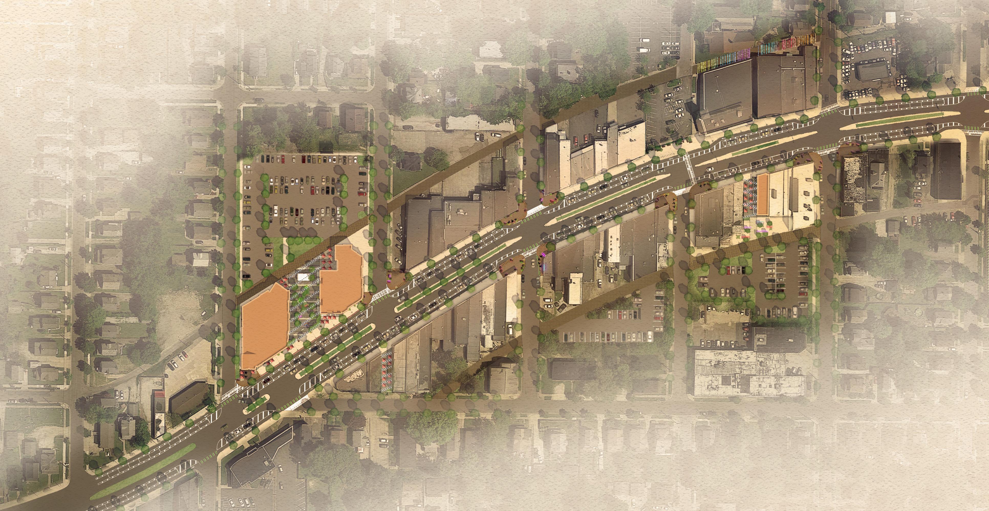
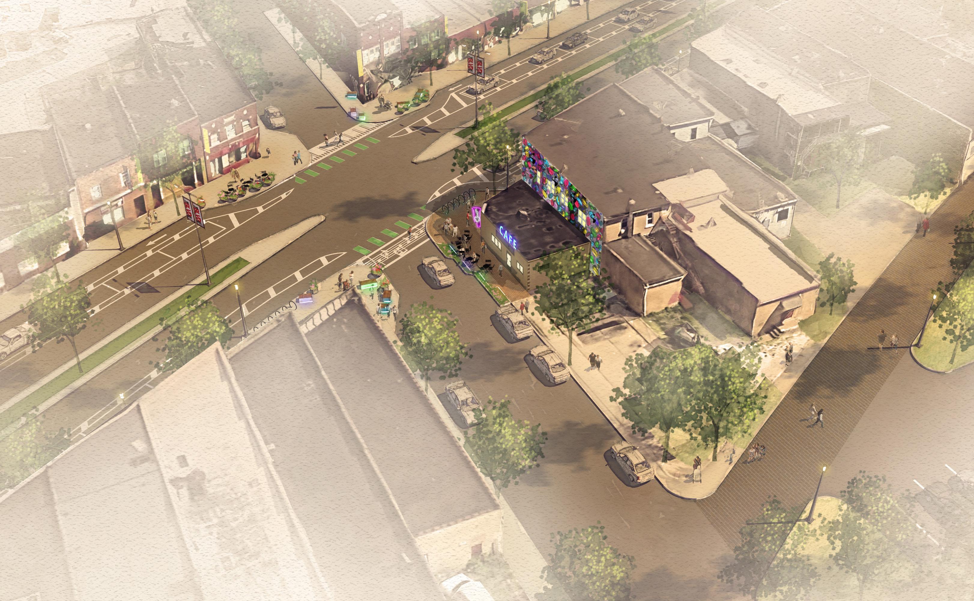
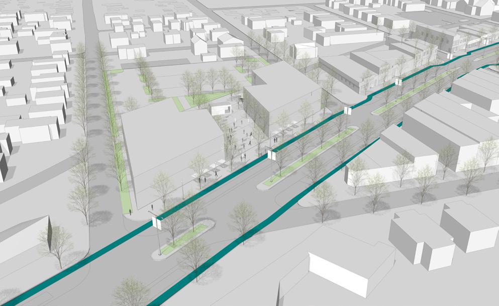
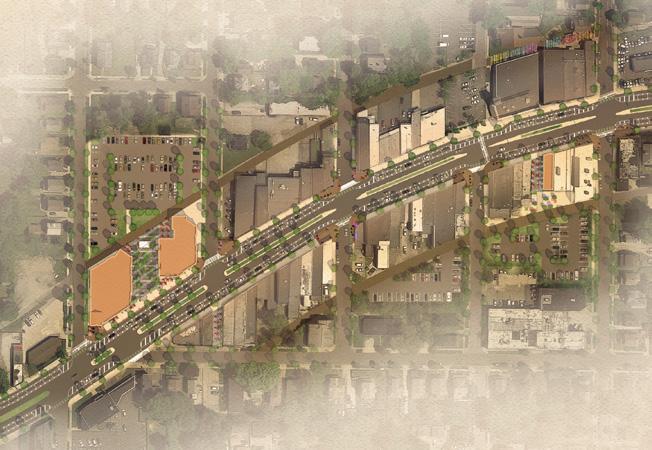
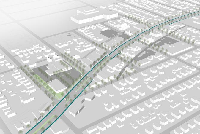
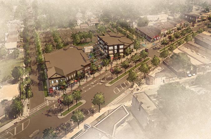
In addition to neighborhood-wide improvements, this plan focuses on Kenmore Boulevard as it is the heart of the neighborhood. Improvements specifically address the core of the business district between 12th and 17th St. By improving the boulevard, the most visible part of Kenmore, confidence will be restored allowing for this new community energy to radiate back into the neighborhood.
The community discussions and market investigations led the planning team to create eight planning principles. Each planning principle builds on the opportunities identified to leverage the community assets into greater possibilities.
While these recommendations will need to be phased in over time, the eventual goal is to infill and reuse the existing structures on Kenmore Boulevard to bring it back to vitality that it once had.
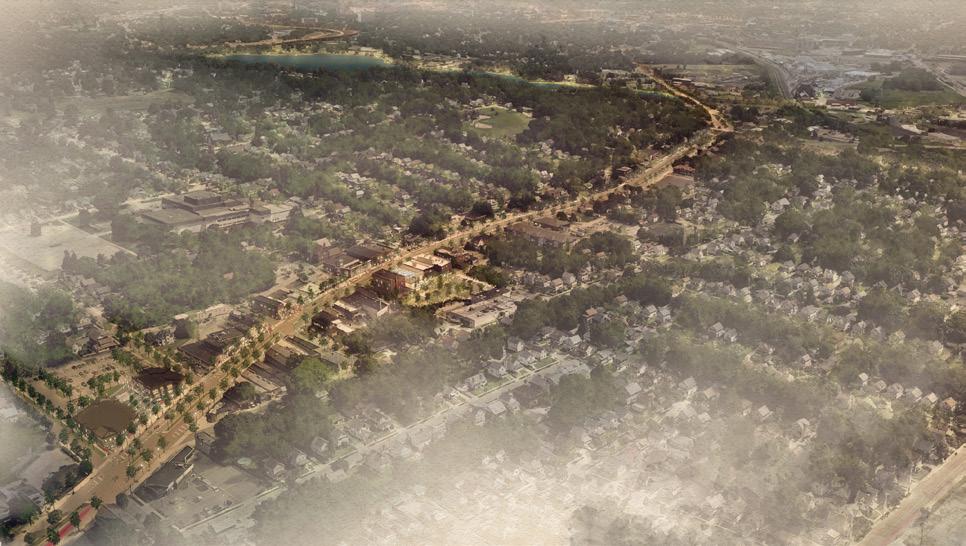
The recent reconfiguration of Kenmore Boulevard to reduce travel lanes and accommodate bicycle lanes and on-street parking is the first step in transforming the corridor into a neighborhood and regional destination. Reducing vehicle speeds, enabling safer pedestrian crossings and connecting the neighborhood to the Towpath Trail will allow Kenmore Boulevard to become a “to” district as opposed to a “through” district.
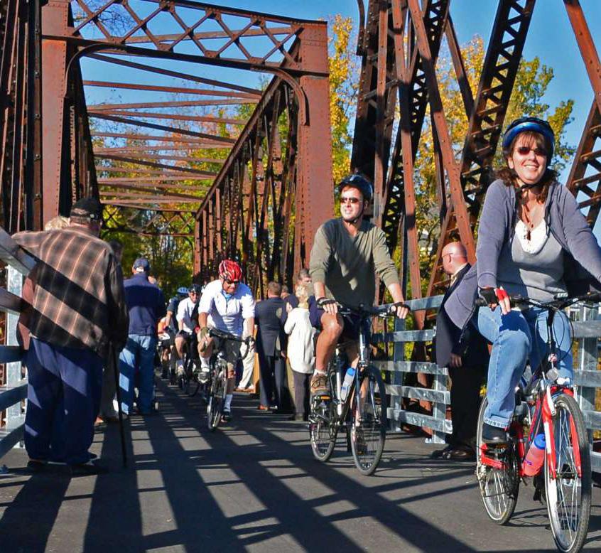
Building on the 2017 Better Block effort that tested a similar roadway reconfiguration with the neighborhood, the City of Akron has implemented this traffic calming improvement that will better connect the neighborhood to the business district. The extension of the bike lanes to the Towpath Trail will provide neighborhood access to Summit Lake and the regional trail system. It will also allow the more than 2.5 million users that ride the Towpath Trail annually to access Kenmore Boulevard and visit local businesses and attractions.
As of October 2018, most of these improvements have been completed, contributing to the early implementation of this neighborhood plan and providing momentum for the further revitalization of Kenmore Boulevard. The next most critical step will be to create an obvious Towpath connection by Spring 2019.
• Implement ideas from Better Block event
• Resurface Kenmore Boulevard
• Reconfigure the boulevard to safely accommodate all modes of transportation, onstreet parking, and pedestrian crossings
• Add protected bike lanes
• Connect to Lakeshore Boulevard/Summit Lake area
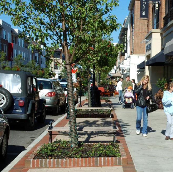
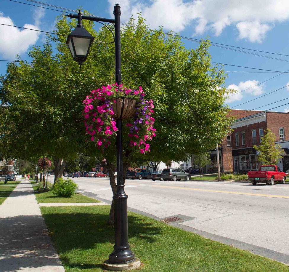
While the traffic calming efforts are largely complete on Kenmore Boulevard as of this fall, more needs to be done to pedestrianize this corridor and to truly make it a place where the neighborhood gathers. The streetscape today is devoid of pedestrian comforts that encourage people to spend time and money in the core of the neighborhood. Improving street trees and pedestrian scale lighting, adding furnishings and providing spaces to gather, and curating authentic and artistic amenities will enable the success of existing businesses and attract new ones.
Trees and landscaping in business districts have been shown to have positive effects on consumer behavior. Across multiple studies, consumers are more likely to stay longer, visit more often and spend more money in business districts that feature high quality streetscapes. While Kenmore Boulevard has street trees today, they are not providing the benefits of shade to the pedestrian environment. The species of trees currently on the boulevard are also low-canopy, often blocking storefronts.
New street trees that have a high canopy will not only provide needed shade and comfort for pedestrians, but they will also allow for better visibility of storefronts and signage. New trees should be selected for and planted along the boulevard, with special care taken to ensure they are planted in the quality soils with ample volume to improve longevity and health. They will also need to be properly limbed and maintained to ensure they become high canopy trees.
Additional pedestrian scale streetlights will improve the feeling of safety and comfort along Kenmore Boulevard. While some pedestrian scale lighting exists along the corridor today, it is primarily located at the street corners. Strategic placement of more lights in between street corners should be considered to increase lighting levels throughout the corridor. Other opportunities could also exist along Kenmore Boulevard to add catenary lights or other artistic lighting to activate public spaces or outdoor dining areas.
ARTISTIC CROSSWALKS

PUBLIC ART
PEDESTRIAN LIGHTING
ADD FURNISHINGS AT BUMPOUTS
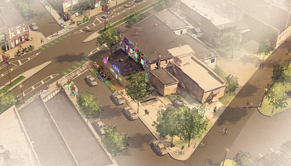
Today along Kenmore Boulevard there is ample space for street furnishings such as benches, bike racks and trash cans. Some bike racks and trash cans exist, but there is no seating along the entire corridor. Since no permanent amenities exist today, temporary benches, tables, chairs and bike racks are brought out for special community events. There is an opportunity along Kenmore Boulevard, especially at the bump-outs where there is already more space, to add these furnishings. Doing so will send a message that visiting and spending time on Kenmore Boulevard is not just a “special event” but is an “everyday event”. This will further humanize the streetscape and encourage more community activity on a daily basis.
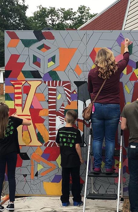
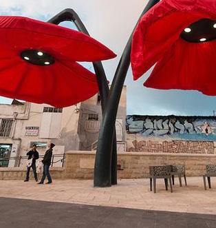
The identity of Kenmore Boulevard could also be enhanced by the inclusion of locally curated public art. This would not only serve to brand the boulevard as a distinct place, but it would also add to the authenticity of Kenmore. Opportunities could include specialty lighting, artistic crosswalk designs, murals, or sculpture.
• Enhance the pedestrian environment on Kenmore Boulevard
• Improve street trees
• Improve pedestrian-scale lighting
• Add places to sit, gather, and interact
• Add local art that celebrates the community
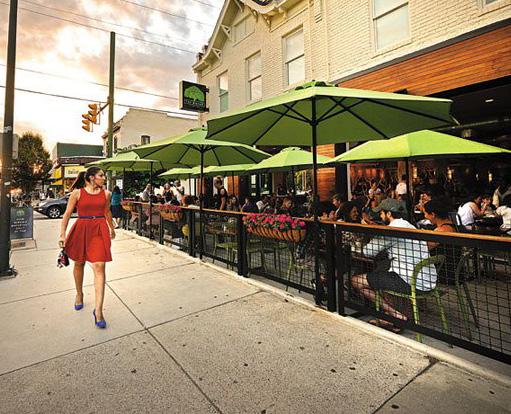
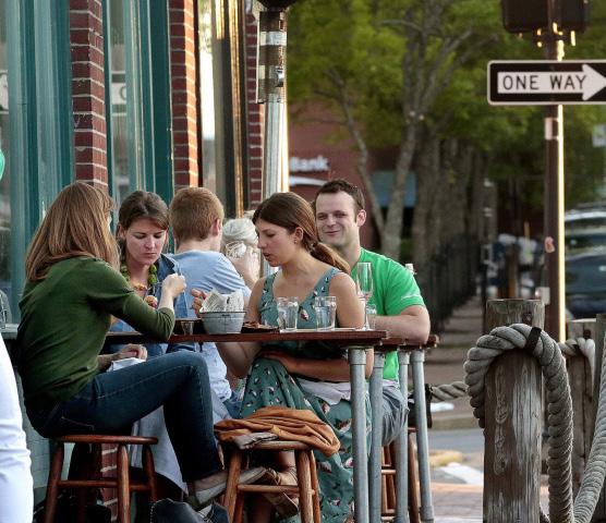
The changes that have already occurred on Kenmore Boulevard, along with streetscape improvements that will improve the pedestrian experience, will directly support existing businesses and attract news ones to fill vacant storefronts. While there are unique and destination businesses along Kenmore Boulevard, the community is looking for additional offerings, from coffee shops to sitdown restaurants. To expand the audience for Kenmore Boulevard, there need to be more places to go before or after a show at the Rialto Theatre or stores to visit while you are waiting for your guitar to be fixed at Lay’s Guitar Shop.
To further enable the reuse of underutilized buildings along Kenmore Boulevard, space should be added for outdoor dining and display areas. Where it is possible, additional curb bumpout spaces should be added at intersecting streets to enable adjacent buildings to have additional space to activate both storefronts and sidewalk space. Such spaces have already been tested out as part of community events and have been popular with residents and visitors alike.
Signage could also be improved to enhance the visibility of existing and new storefronts.
Most of the storefront signage today are wall or window signs. Encouraging projecting signs that are creative and interesting will not only better identify businesses, but will also make the boulevard more visually attractive. Façade improvement funds are available that may be able to be used for these types of improvements.
• Encourage storefront signage that activates building façades
• Support the re-use of existing storefronts by adding space for outdoor dining
• Provide space for storefronts to spill out onto the sidewalk
BUMPOUT WITH SEATING
Access is multifaceted and related to the quality of mobility, perception of safety, nearby land uses or activities, and the physical built environment of a place. To create better access to destinations along Kenmore Boulevard, it will be key to improve pedestrian connections between the alleys and parking areas and alleviate concerns and negative perceptions of safety.
The alleys and parking lots should be enhanced with better lighting, landscaping and pavement materials to make them feel as though they are an extension of the boulevard. Connections between the parking areas and the boulevard should also be improved by creating new and enhancing existing connections to Kenmore Boulevard where there is space between buildings. Streetscape improvements planned for Kenmore Boulevard should also turn the corner to provide the same level of quality to the side streets to make them a comfortable pedestrian experience. This, along with better parking signage, will help to make the parking areas and on-street parking on side streets more usable and accessible for visitors to the district.
• Stripe parking spaces along Kenmore Boulevard and at north-south streets
• Improve the visibility, safety, and usability of existing parking lots
• Create activity that wraps around blocks and improve the streetscape to connect parking to the boulevard
• Enhance alleys as shared streets and extension of building activities
IMPROVE CONNECTIONS
LIVE MUSIC NOW!
INFILL BUILDING
PARKING

ENHANCE ALLEY
OUTDOOR DINING
Place branding is a powerful tool to tell a community’s story, stimulate economic development, and create community pride and identity. Place branding is about discovering what makes a place unique and then sharing that story with residents, businesses, and visitors in interesting ways. Often, place branding manifests in signage and environmental graphics, both of which contribute to a unified brand for a community.
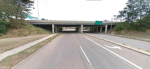
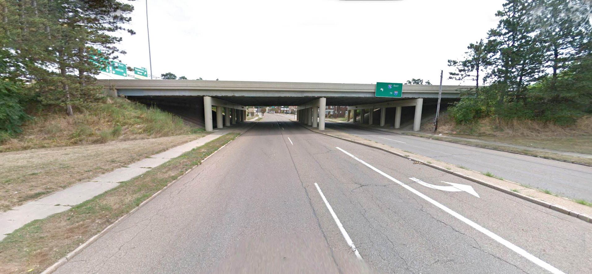
Along Kenmore Boulevard there are several locations that would be well-suited for different types and scales of environmental graphics. Neighborhood gateways are major points of entry into Kenmore, like at the I-76 overpass on Kenmore Boulevard and the intersection of Kenmore Boulevard and the Manchester Bypass. The addition of murals and large signage would be most appropriate in these locations.
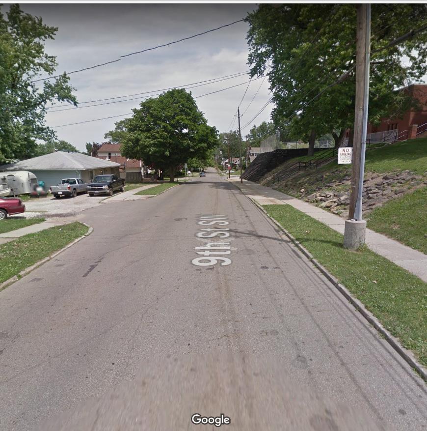
District thresholds are the points along Kenmore Boulevard that signify the start or termination of the Boulevard District, like at the intersection of Kenmore Boulevard and Wilbeth Road and the intersection of Kenmore Boulevard and 9th Street. Here, large public art works could be installed that relate to the neighborhood’s identity. These thresholds could also help direct vehicular traffic towards the core of the Boulevard District through vehicular wayfinding signage.
Within the core of Kenmore Boulevard, at the intersections of 6th Street and 13th Street, pedestrian-scale signage and graphics would be most appropriate. The addition of artistic crosswalks, pedestrian wayfinding signage, parking identification, and branded banners would contribute to Kenmore’s distinctive identity and create a more interesting pedestrian environment.
Some topics to consider when branding Kenmore include the appropriate symbolism that represents the entire boulevard experience in both the short- and long-term; the mediums through which the identity will be shared; the creation of an identity for the Boulevard District alone or the whole neighborhood; and how to get people from Summit Lake Park and the Towpath Trail to Kenmore Boulevard.
• Create a Kenmore Boulevard Identity Package
• Celebrate Kenmore and create an authentic identity that brands the neighborhood
• Improve wayfinding to and within the district for residents and visitors, including and particularly at the Towpath Trail

The Kenmore Neighborhood Alliance and other community partners are already doing a wonderful job with the existing programs and events that take place throughout the neighborhood and on the boulevard. As this neighborhood plan is implemented, it will be important to expand upon existing programming to introduce residents and visitors to the improved spaces along the boulevard and to energize the neighborhood.
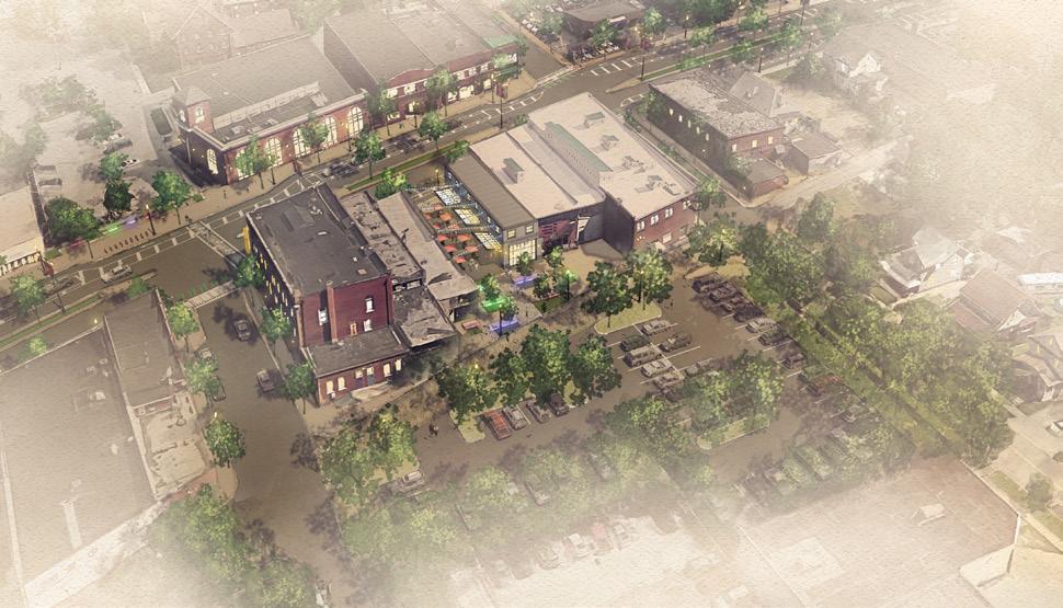
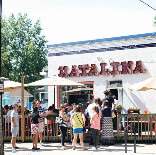
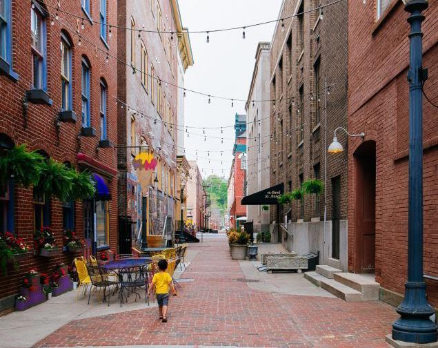
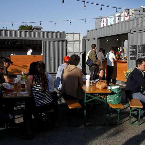
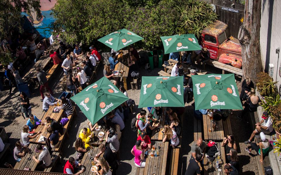
Currently underutilized or vacant spaces can be transformed into active temporary or permanent places, like a beer garden, pop up shop, pop up park, food truck pod, and outdoor dining or seating areas. These not only provide needed infill along the boulevard but create spaces that are suitable for a variety of community gathering and programming purposes.
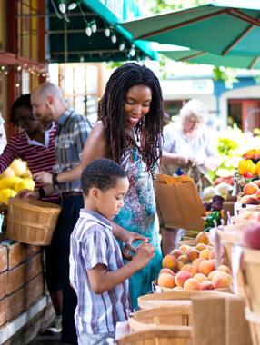
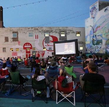
Consistent weekly events like farmers markets draw a large, diverse crowd to the neighborhood. Cozzoli’s Plaza is a good location, at least temporarily, for a market because it is large enough to accommodate vendors and the market would, in turn, activate the space. Other regular events, like movie nights, can be held in surface parking lots.
Now that there is a bike lane connection on Kenmore Boulevard to the Towpath Trail, there should be organized rides to highlight the new amenity. Planned seasonally, these rides would help route cyclists to Kenmore Boulevard and offer residents the opportunity to explore the regional trail system.
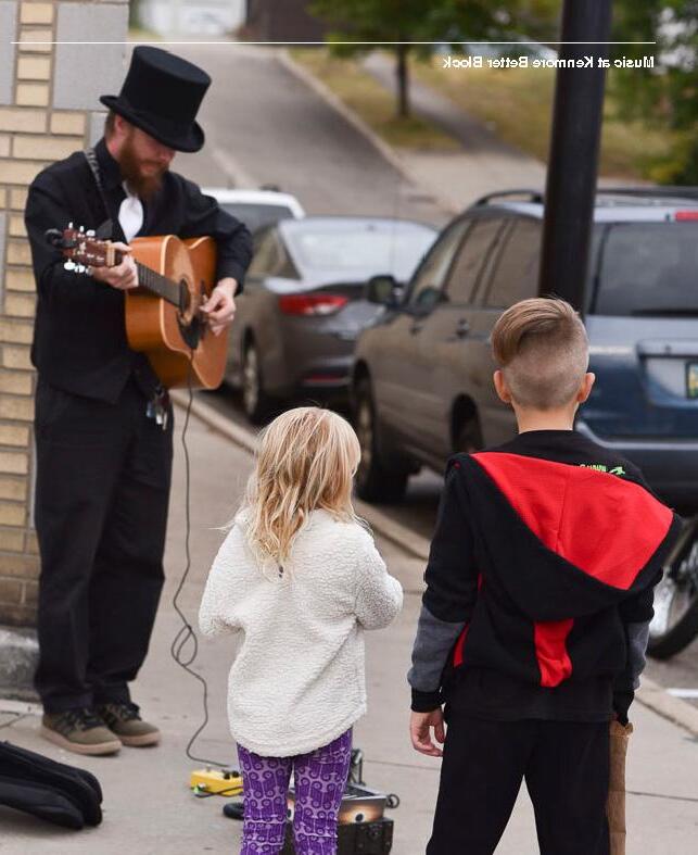
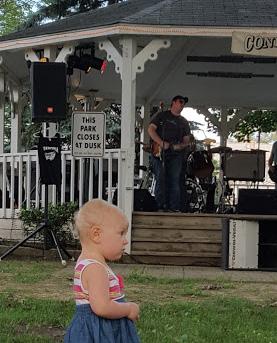
Kenmore has a strong history as an influential music district and the incorporation of music performances in different spaces throughout the district would help to further this identity. For example, local musicians can perform in the beer garden, outdoor dining and seating areas, and on the sidewalks along the boulevard.
• Integrate local music as often as possible
• Build on existing programming to energize the neighborhood
• Find new spaces and opportunities for programming, such as farmer’s markets and other events that occur on a regular basis


FARMER’S MARKET
LOCAL MUSIC (ALONG THE BOULEVARD)
MOVIE NIGHT
OUTDOOR SEATING
DINING
FOOD TRUCK POD
Unlike other neighborhoods in Akron, Kenmore Boulevard has retained much of its original building stock and urban form. The pedestrian scale pattern of two to three story buildings built to the street with ground floor storefronts and office or residential above is largely intact in the core of the business district between 12th and 17th St. At the edges of the district are more auto-oriented uses with buildings that are set back from the street with parking in front. This is where the walkable urban fabric starts to erode and where many community stakeholders pointed to opportunities to bring back a more pedestrian oriented building pattern.
To ensure that new development in neighborhood business districts matches the traditional urban form, the Kenmore Neighborhood Alliance worked with the City of Akron to create an Urban Overlay Area for Kenmore Boulevard between 12th and 17th streets. This puts in place use, parking, setbacks and building design requirements that will ensure a high level of walkability by promoting, preserving, and enhancing the urban character of Kenmore Boulevard.
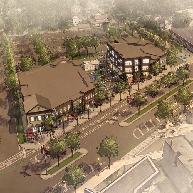
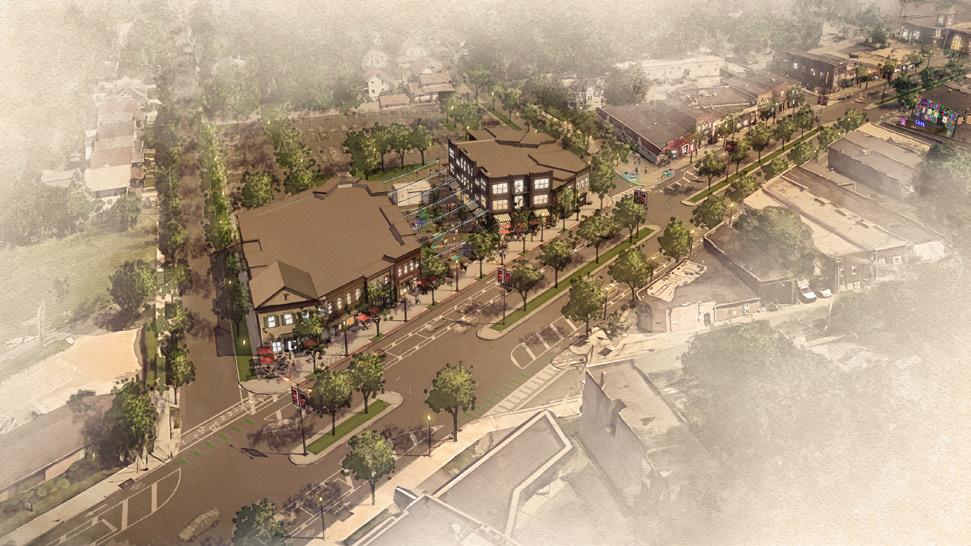
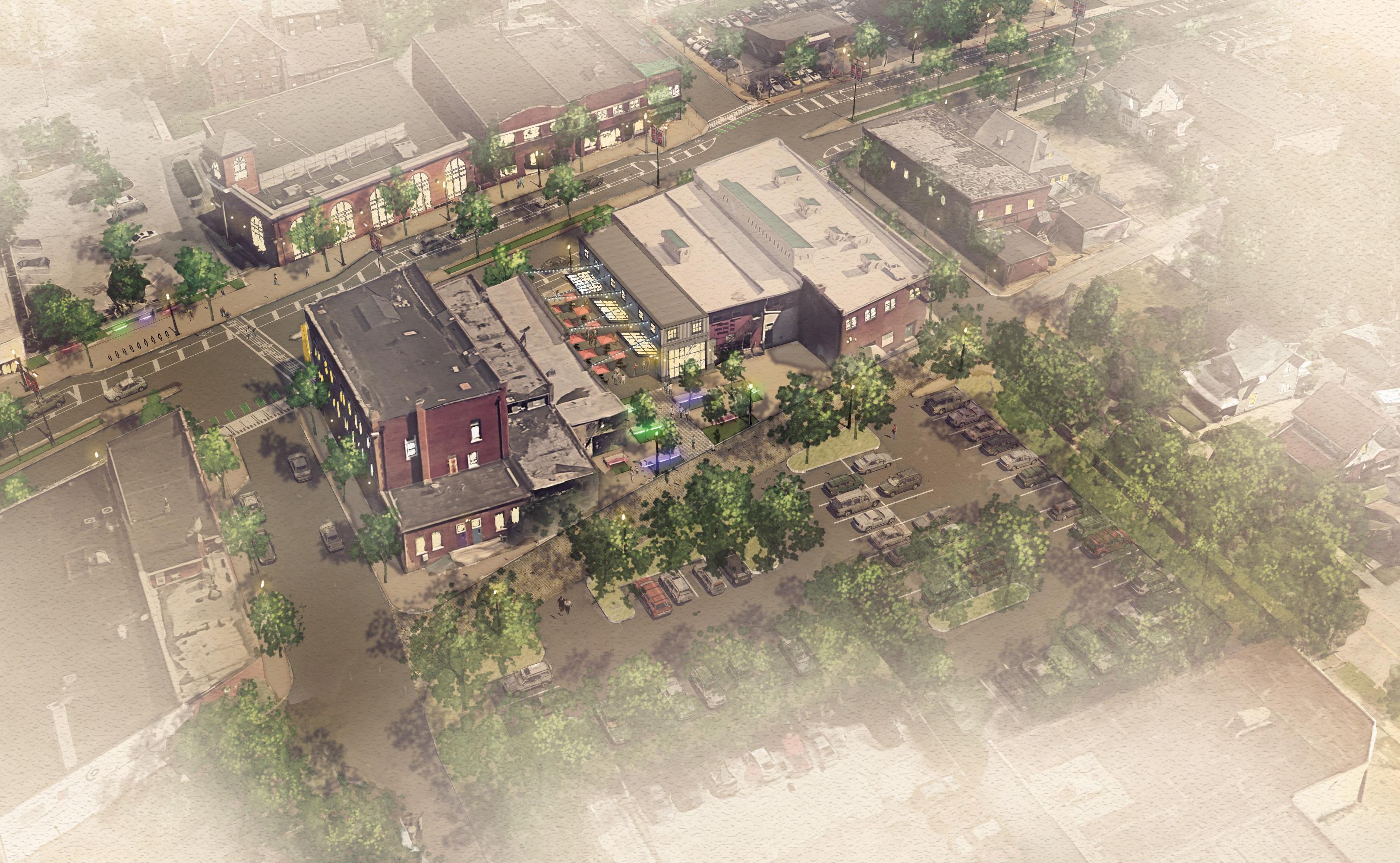
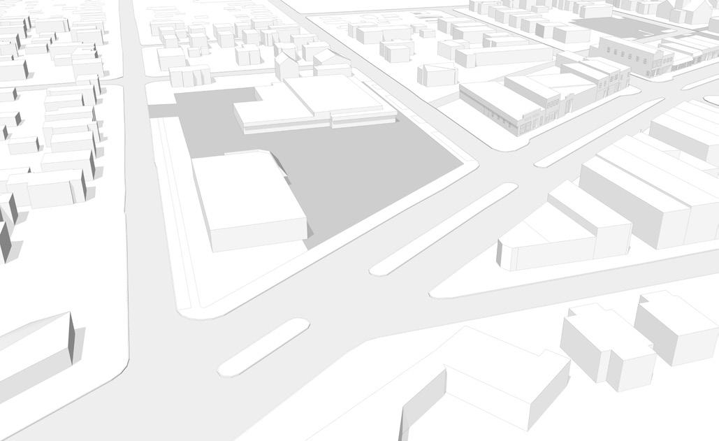
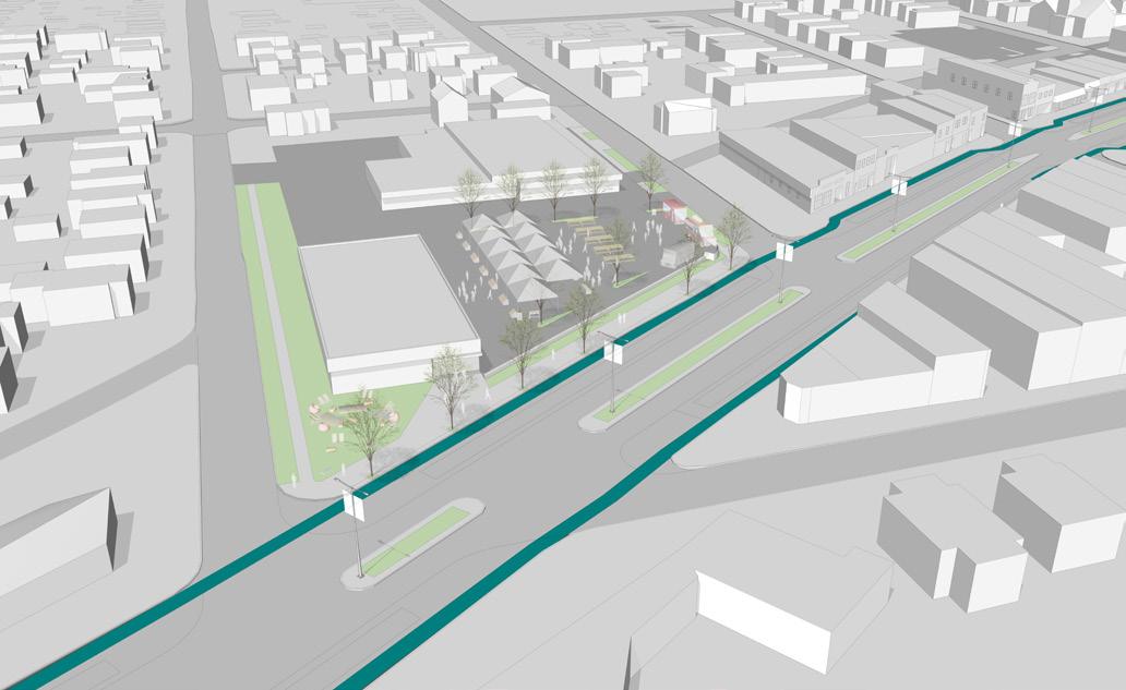
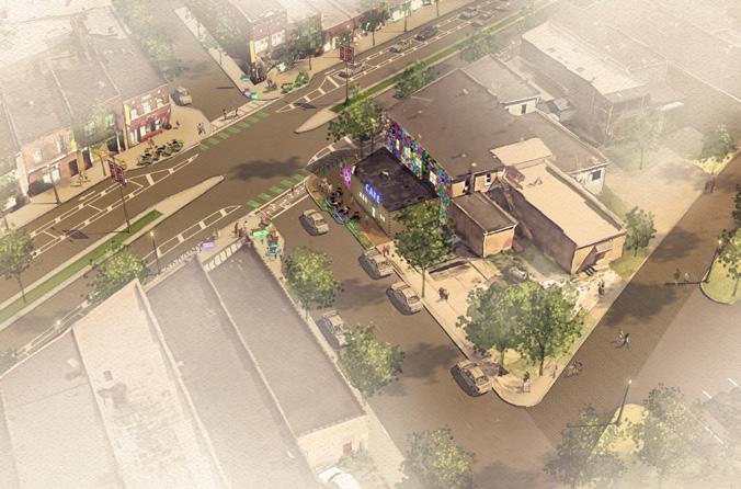
One such opportunity to re-establish the neighborhood scale and traditional urban form along Kenmore Boulevard exists at Cozzoli’s Plaza. Building and site layout here is suburban in nature, with buildings set back from the street with entrances organized around a large surface parking lot instead of being oriented to Kenmore Boulevard. While many of the existing businesses
are serving a need in the neighborhood, there are ways to incrementally enhance this plaza to help it contribute to the boulevard. For example, by simply closing the curb cuts along Kenmore Boulevard, a better pedestrian edge could be created and the parking lot could be screened while not making it more difficult to access the plaza. The parking lot could also play host to a farmer’s market or other community event to broaden the plaza’s appeal to the neighborhood. As market dynamics mature, it is possible that over time it might be possible to redevelop the site entirely, returning two to three story mixed use buildings to the street edge and restoring the alley block pattern to access rear loaded parking as is done elsewhere along Kenmore Boulevard. These improvements would transform this portion of Kenmore Boulevard.
• Enhance existing plaza by removing unnecessary curb-cuts, orienting building to the street, and screening parking to create a pedestrian edge.
• Allow for temporary activation events to utilize parking lot and draw the community to this part of the boulevard.
• Explore opportunities for new development that responds to the needs of Kenmore and its historic architectural character.
• Over time, phase in these improvements as the market matures.

PARKING
IMPROVE CONNECTIONS
POTENTIAL MIXEDUSE BUILDINGS
PEDESTRIAN CONNECTION

OUTDOOR SEATING/ PERFORMANCE AREA
This is an exciting time for Kenmore Boulevard as bike network improvements have been installed during this neighborhood planning process. With protected bike lanes now present on Kenmore Boulevard that will connect all the way to the Towpath Trail at Lakeshore Boulevard at Lewis Street, there will soon be direct and obvious access to the neighborhood from this popular regional asset. At the same time the neighborhood plan has been underway, Summit County MetroParks has been conducting a planning exercise for the future of Summit Lake. Additional trailhead and bike connections are possible on the west side of the lake that could result in another access point on 2nd Street, enabling riders to not have to cross the overpass to get to the Towpath Trail.
Other opportunities include implementing the proposed Kenmore Loop that would build on the bike infrastructure in place along Kenmore Boulevard to link up to the existing Towpath trailhead on Wilbeth Road, providing another connection for Kenmore to the regional trail network. Within the neighborhood itself, the proposed Kenmore Bike and Pedestrian Network will use low-stress streets to interconnect schools, churches, parks and other destinations. Taken together, these improvements will make the neighborhood, Kenmore Boulevard and the Towpath Trail more interconnected.
• Establish Kenmore Connector
• Install signage and wayfinding to connect neighborhood to Towpath trail
• Implement the “Kenmore Loop” as a first phase of an overall neighborhood bike network that connects major destinations.
PRENTISS PARK KENMOREGARFIELD HIGH SCHOOL
COMMUNITY CENTER
SHADYSIDE PARK
Proposed Kenmore Loop
Proposed Kenmore Bike/ Pedestrian network
Towpath Trail
To guide implementation of the Kenmore Neighborhood Plan, the planning team has taken each strategic recommendation and matched it with a corresponding partner, funding source and timeframe.
There are three main categories:
• Reimagine the Boulevard: Recommendations and action steps that focus on improvements for the core of the business district.
• Neighborhood Framework: Strategic recommendations for neighborhood-wide improvements
• Retail Market Study: Recommendations for improving the attractiveness of Kenmore Boulevard to businesses
This set of matrices will be used by the community to establish priorities, guide next steps and build coalitions to complete improvements, leverage incentives and programs, and create supportive policies. It is important to note that this plan has a mix of short-term wins and long-term objectives. Some solutions can be implemented today, and others may not be achievable until five or 10 years from now. Flexibility will also be key, as needs may change over time and other opportunities may arise that enable a project or improvement to move faster than previously expected. Taken together, this set of implementation tools will enable the neighborhood, community leaders, the City of Akron, and funding partners to work together to create sustainable and transformative change for the Kenmore neighborhood.
Implementation efforts are already underway, with the in-progress improvements to Kenmore Blvd. and several grant opportunities being advanced by KNA. The following early action items represent current priorities that will kickstart implementation and start turning this plan into reality.
1
Complete the full implementation of the Kenmore Boulevard traffic calming and bike infrastructure project, including all pavement and intersections markings and bollards.
2 Become a Main Street Affiliate and set in motion the four points approach of economic vitality, design, promotion and organization.
3 Develop signage standards to take advantage of Knight Foundation façade improvement grant.
4 Manage signage grant program.
5 Develop Boulevard District Brand and install banners on light poles.
6
Develop plan for improved street trees, pedestrian scale lighting, and permanent streetscape furnishings.
7 Acquire property and develop it in keeping with community desires and retail opportunities identified in this plan.
Great Streets is a City of Akron program that was launched within 10 targeted neighborhood business districts. The program seeks to empower, connect, and develop Akron neighborhood business district corridors through community engagement and targeted resources.
Kenmore Boulevard was one of the 10 identified business districts. City resources available to eligible business districts are aimed at promoting the pedestrian experienced and assistance to business owners to improve their properties:
• Façade improvement grants
• Creation of a revolving loan fund for small businesses
• Community development corporation support funds
• Street trees
AKRON PARKS CHALLENGE GRANT –
CHESTNUT RIDGE PARK
The Akron Parks Challenge is a partnership between the City of Akron, the Akron Parks Collaborative, the Akron Civic Commons and the Knight Foundation. The goal is to engage neighborhoods in improvements to their public spaces to increase use and neighborhood vitality.
The Ohio and Erie Canalway Coalition received a $5 million grant through the Reimagine the Civic Commons program to bring people together throughout Akron to share in and reimagine their civic space. Akron Civic Commons is a partnership between the JPB Foundation, the Knight Foundation, the Kresge Foundation and the Rockefeller Foundation.
Designation of historic districts will focus attention on these areas that were, and still are, vital to the city. Designation of Kenmore Blvd. with the National Register of Historic Places will allow historic tax credits to be used to assist in revitalization.
Summit Lake is one of the areas in the City chosen to receive attention through the Reimagine Civic Commons funding. Summit County MetroParks is spearheading this effort through investments and programming in the area.
In 2017, the City of Akron initiated residential tax abatements for all new residential construction and significant renovations / improvements to residential properties located within corporation limits. The length of the abatement is 15 years from the date of the improvement(s) to the property.
The City of Akron programs public improvements through the annual Capital Planning budget.
Implement ideas from Better Block event
Resurface Kenmore Boulevard
Reconfigure the boulevard to safely accommodate all modes of transportation, on-street parking, and pedestrian crossings
Add protected bike lanes
Connect to Lakeshore Boulevard/Summit Lake area
Enhance the pedestrian environment on Kenmore Boulevard
Improve street trees
KNA, City of Akron
KNA, City of Akron
KNA, City of Akron
KNA, City of Akron
KNA, City of Akron, Knight Foundation, Akron Civic Commons
KNA, Knight Foundation, City of Akron
KNA, City of Akron, Akron Waterways Renewed
Improve pedestrian-scale lighting KNA, City of Akron
Add places to sit, gather, and interact
Add local art that celebrates the community
KNA, Knight Foundation, City of Akron
KNA, Knight Foundation, PEG’S Foundation
STRATEGIC & RELATED RECOMMENDATIONS PARTNERS/FUNDING SOURCES
3 Activate the Boulevard
Encourage storefront signage that activates building façades KNA, City of Akron Great Streets, Knight Foundation
Support the re-use of existing storefronts by adding space for outdoor dining KNA, City of Akron, property and business owners
Provide space for storefronts to spill out onto the sidewalk KNA, City of Akron, property and business owners
4 Access the Boulevard
Stripe parking spaces on north-south streets City of Akron
Improve the visibility, safety, and usability of existing parking lots KNA, City of Akron
Create activity that wraps around blocks and improve streetscape to connect parking to the boulevard KNA, City of Akron, property and business owners
Enhance alleys as shared streets and extension of building activities KNA, City of Akron Great Streets

5 Brand the Boulevard
Create a Kenmore Boulevard Identity Package
KNA, City of Akron Economic Development, Akron-Summit CVB, Design 4 Good
Celebrate Kenmore and create an authentic brand for the neighborhood KNA, Design 4 Good
Improve wayfinding to and within the district for residents and visitors, including and particularly at the Towpath Trail KNA, City of Akron
6 Continue to Program the Boulevard
Integrate local music as often as possible KNA, business and property owners
Build on existing programming to energize the neighborhood
KNA, Kenmore Branch Library, Kenmore Community Center, Kenmore Chamber of Commerce, Kenmore Community Council, business and property owners
Find new spaces and opportunities for programming, such as farmer’s markets and other events that occur on a regular basis KNA, business and property owners

STRATEGIC & RELATED RECOMMENDATIONS PARTNERS/FUNDING SOURCES
7 Infill the Boulevard
Enhance existing plaza by removing unnecessary curb-cuts, orienting building to the street, and screening parking to create a pedestrian edge
Allow for temporary activation events to utilize parking lot and draw the community to this part of the boulevard
Explore opportunities for new development that responds to the needs of Kenmore and its historic architectural character
Over time, phase in these improvements as the market matures
8 Connect the Boulevard
Property owner, City of Akron
KNA, Property owner
KNA, Property owner, City of Akron
Property owner
Establish Kenmore Connector Akron Civic Commons
Install signage and wayfinding to connect neighborhood to Towpath trail
KNA, City of Akron, Ohio and Erie Canalway Coalition, Reimagining the Civic Commons
Implement the “Kenmore Loop” as a first phase of an overall neighborhood bike network that connects major destinations KNA, City of Akron
STRATEGIC & RELATED RECOMMENDATIONS
PARTNERS/FUNDING SOURCES
Explore Manchester Rd. bypass removal City CIP Budget, OPWC
Investigate potential for traffic calming at Carnegie Ave. and Manchester Rd., Waterloo Rd. near Conrad Ave. and Edwin Ave., along Manchester Rd. near Stanford St. City CIP Budget
Potential to work with MetroParks to create park/trail at City Nursery City of Akron, MetroParks
Increase intergenerational active, passive, and aquatic recreational opportunities at Lake Nesmith Park City of Akron
3
STRATEGIC & RELATED RECOMMENDATIONS
Improve pedestrian crossings near Summit Lake on Manchester Rd. City CIP Budget, Civic Commons
Pedestrian loop path near Summit Lake Blvd. and Lagoon Ave. City CIP Budget, Civic Commons
Explore possibility of stairway directly from 27th St. bridge down to Blvd. City CIP Budget
Evaluate possibility of footbridge to Towpath at Corey Ave., Pike Ave., and at Stanford St. City CIP Budget
Improve pedestrian footbridge at Maryland Ave. and Wilbeth Rd. City CIP Budget
Explore foot/bike path near Indian Trail and Summit View Ave. City CIP Budget
4 On-Street Bike Network
Protected bike lanes along Kenmore Blvd. City CIP Budget
Conceptual Kenmore bike/pedestrian network City CIP Budget
STRATEGIC & RELATED RECOMMENDATIONS
Explore potential housing opportunities at Mud Run
PARTNERS/FUNDING SOURCES
Private Developers, KNA, City of Akron
Improve center of street parking safety at Kenmore Blvd. south of Wilbeth Rd. City of Akron
Former Young’s Restaurant site beautification City of Akron
Improve commercial area at Kenmore Blvd. and Manchester Rd. City of Akron, Private Developers
Explore adaptive reuse at Smith School site KNA, City of Akron Public Services
Continue adaptive reuse discussions relating to the proposed Kenmore Garfield High School relocation KNA, City of Akron Public Services
STRATEGIC & RELATED RECOMMENDATIONS
Refine Kenmore’s brand and expand social media marketing
Address marketing to residents who don’t use social media
Capitalize on anchors through collaboration, marketing, programming
Support housing – work with City and partners to enhance housing quality and reduce vacancy, while maintaining affordable options
Improve signage and wayfinding from the freeway exits to Kenmore
Collaborate with merchants on marketing
KNA, Interns (CSU, UofA)
KNA, Akron-Summit County Library, First Glance, churches, Financial Empowerment Center, Community Center
KNA, First Glance, Akron-Summit County Library, Cozzoli Plaza ownership/merchants, Community Center
KNA, City of Akron, funders, developers, builders, Financial Empowerment Center, nonprofits
KNA, City of Akron, ODOT
KNA, merchants
Improve recreation and trail connections and signage, to towpath trail and downtown KNA, City of Akron
Reach out to local employers to seek and encourage collaboration and worker patronage of businesses
Work with City and partners to improve street environment overall
Improve lighting, signage, quality of rear parking
Improve quality of place at anchors: Cozzoli’s Plaza, Library, First Glance (connectivity, seating, design, landscape, street presence, etc)
KNA, local employers, Kenmore Chamber of Commerce
KNA, City of Akron, merchants, Kenmore Chamber of Commerce
KNA, City of Akron, merchants
KNA, City of Akron, First Glance, Akron-Summit County Library, Cozzoli Plaza ownership/merchants, Community Center
STRATEGIC & RELATED RECOMMENDATIONS
Recruit dining and coffee shops to serve regional and local customers; Kenmore has the potential to be a dining magnet for southwest Akron
Continue to provide Pop-Up and informal storefronts/programming to diversify activity
Encourage merchants to align and extend business hours to provide reliable critical mass at peak times
KNA, Akron Food Works, Summit Food Coalition, City of Akron Economic Development, commercial realtors, merchants, property owners, Summit County area business associations
KNA, local artists, merchants, residents, businesses in Kenmore and Akron, Bounce Innovation Hub
KNA, local merchants, Kenmore Chamber of Commerce
Continue to recruit additional evening venues
Recruit arts/support businesses to complement music industry
Recruit additional hobby/entertainment businesses to complement existing cluster
Recruit youth and family serving businesses
KNA, City of Akron Economic Development, commercial realtors, merchants, property owners, local residents, music groups and venues in Akron and around the region, Society of NEO Brewers
KNA, City of Akron Economic Development, commercial realtors, merchants, property owners, local residents, music and art groups and venues in Akron and around the region, ArtsNow
KNA, City of Akron Economic Development, commercial realtors, merchants, property owners, local residents, art and hobby groups and businesses in Akron and around the region
KNA, City of Akron Economic Development, commercial realtors, merchants, property owners, anchors, residents, family oriented businesses and groups in Akron and around the region
STRATEGIC & RELATED RECOMMENDATIONS
Support collaboration among businesses for marketing/programming/customer referrals KNA, local businesses
Work with partners to establish capacity for liquor licenses in Kenmore restaurants
Support expansion and retention of existing anchor businesses
Provide networking opportunities for residents, businesses, artists
Encourage marketing and business development through City, local banks, Small Business Administration, others
Reach out to local employers to seek and encourage collaboration
Work with partners to establish a process for “vetting” potential businesses to match storeready businesses to available spaces, and to help them develop the business strength and capital necessary to succeed in a bricks-and-mortar environment
Investigate ways to provide “transitional” space and opportunities for new/starter businesses not yet ready for bricks and mortar
KNA, merchants, City of Akron, State of Ohio Liquor Control Board
KNA, Cozzoli's Plaza owner, local merchants
KNA, local merchants, anchors, residents, artists, musicians, etc., Kenmore Chamber of Commerce
KNA, City of Akron, Small Business Administration, Financial Empowerment Center, nonprofits, SCORE Akron
KNA, local employers and businesses
KNA, local merchants and businesses, Small Business Administration, Financial Empowerment Center, funders
KNA, local merchants, property owners, commercial businesses in Akron and surrounding region