
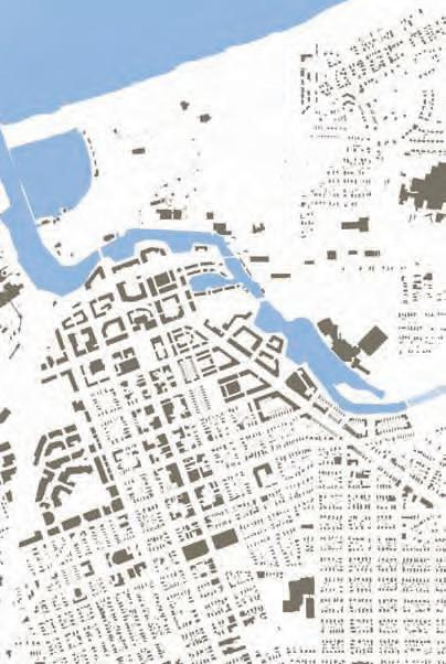
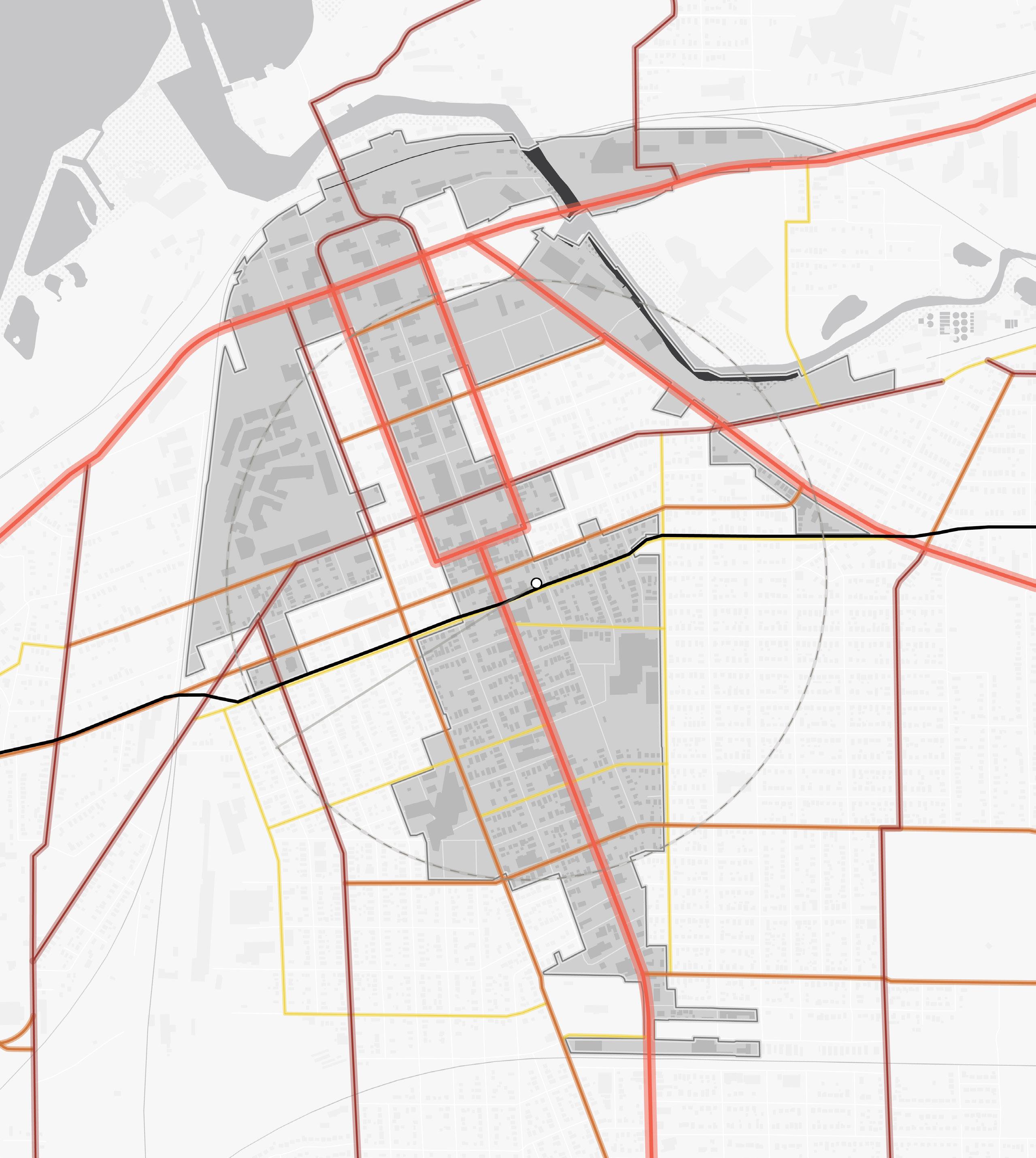
INDIANA INDIANA MICHIGAN ILLINOIS 94 94 80 65 Lake Michigan Hammond Gateway East Chicago Gary Metro Center Miller Portage/ Ogden Dunes 11th Street South Bend Dune Park Beverly Shores Ridge Road Main Street Michigan City 2023 NORTHWEST INDIANA TDD TOD Strategic Implementation Plan
Acknowledgments
This project was completed with Federal Transit Administration TOD Pilot Planning Funds applied for and with a grant match from the Northwest Indiana Regional Development Authority and the Northern Indiana Commuter Transit District.
Throughout this process, the team worked closely with the City of Michigan City to identify and collaboratively advance planning for the community to be proactive about future TOD.
Project Leadership
Northwest Indiana Regional Development Authority


Sherri Ziller, President and CEO
Northern Indiana Commuter Transit District
Michael Noland, President
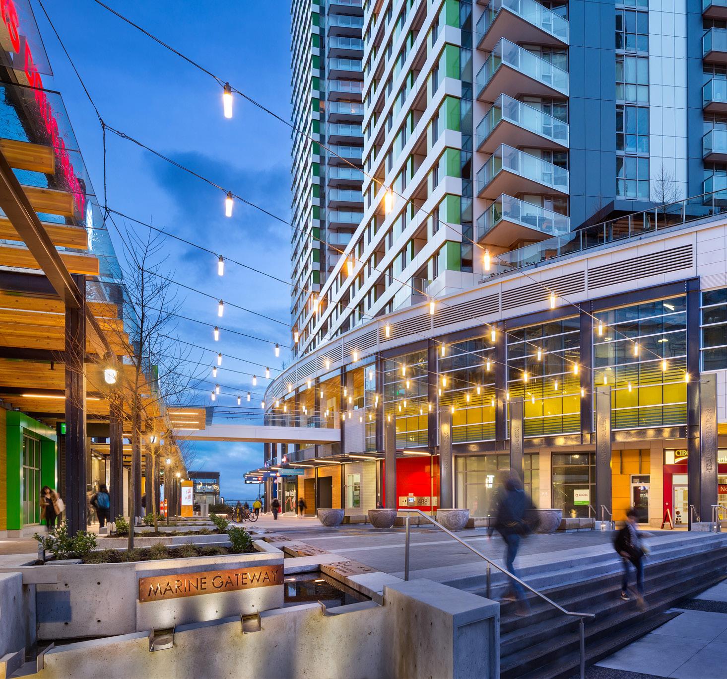
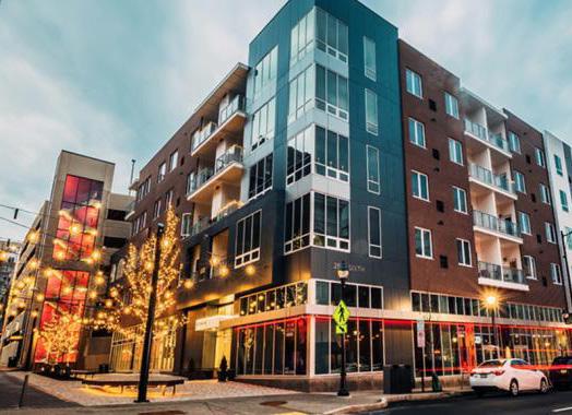
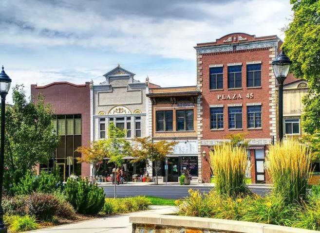
i Michigan City • 11th Street Station
ii Northwest Indiana TDD • TOD Strategic Implementation Plan Table of Contents 01 02 03 Introduction TOD Strategy Appendix Introduction 1 Transit-Oriented Development 3 Northwest Indiana TOD Strategy 5 Overview 12 Land Use Planning 23 Development Planning 31 Infrastructure 49 Zoning 71 Implementation 77
01
Introduction 01
Overview
The Northwest Indiana Regional Development Authority (Northwest Indiana RDA) and Northern Indiana Commuter Transit District (NICTD) collaborated in 2020 to pursue a Federal Transit Administration Pilot Grant to provide planning assistance to Northwest Indiana communities impacted by the modernization and double tracking of the NICTD South Shore Line and the construction of the NICTD West Lake Line. With support from the State of Indiana and Northwest Indiana cities and towns, the two organizations successfully obtained this grant and, through a competitive RFP process, selected MKSK as the lead planning consultant to prepare this Northwest Indiana Transit-Oriented Development Strategic Implementation Plan. MKSK brought a team of experts to supplement their planning expertise including: Shrewsberry Associates, focused on Civil, Utility, and Transportation Engineering; Metric Environmental, focused on Environmental Conditions and Brownfields; and Town Planning and Urban Design Collaborative (TPUDC), focused on Zoning.
Project Background
Prior to this planning process, the Northwest Indiana RDA was authorized by the Indiana State Legislature to create economic development boundaries, called Transit Development Districts (TDDs), which function similarly to a Tax-Increment Financing District, with the purpose of enabling Transit-Oriented Development (TOD) in Northwest Indiana. TOD in Northwest Indiana will leverage these rail capital investments to provide the opportunity for additional economic development as part of the TDDs established under HEA 1144-2017. As part of this legislation, the RDA is tasked with “incentivizing, guiding and promoting economic development around the stations along the South Shore commuter line and future West Lake Corridor line.” These boundaries are no more than 320 acres (1/2 square mile) in area; capture the incremental growth in local income and property tax revenue for
use in public investment related to the station area; and are calibrated specifically for each community based on analysis, areas of opportunity, and the goals and visions of the community. The first group of eight TDDs was established in September of 2022.
This planning process harnessed the momentum generated by the capital improvements to the NICTD commuter rail system and the creation of TDDs. The team, in close collaboration with the RDA and NICTD, then commenced a process focused on how each community impacted with the rail projects and TDDs can be proactive in attracting economic development in accordance with its own growth path. This planning process commenced in September 2021 and was finalized in March 2023.
The communities along the NICTD South Shore and West Lake Lines are diverse and unique. The history, people, natural environment, and built character of each community differentiates it from another; those qualities create an unmistakable identity. In each city and town, there is a deep pride and a sense of individual spirit. Because of this, it is of the highest importance that the growth of these communities be carefully considered against what makes them special today and what their aspirations may be for tomorrow.
The planning process is built upon a deep knowledge of work and a close collaborative relationship with local cities and towns and the RDA’s long-standing commitment to supporting capital investments and economic development in Northwest Indiana. This process also built upon work completed as part of the West Lake Transit-Oriented Development Plan for Hammond, Munster, and Dyer in 2017, completed by the Northwest Indiana Regional Plan Commission (NIRPC), and recent plans completed by local cities and towns.
2 Northwest Indiana TDD • TOD Strategic Implementation Plan
01 Introduction
Transit-Oriented Development
Transit-Oriented Development Primer
Transit-Oriented Development will look different in each Northwest Indiana community, tied to each community’s individual growth path.
The Federal Transit Administration defines Transit-Oriented Development (TOD) as a dense, walkable, mixed-use area centered around or located near a transit station. This concentration of development fosters a vibrant, connected community because of increased access to jobs, amenities, businesses, and housing. TOD also emphasizes non-motorized infrastructure with less reliance on automobiles, resulting in improved safety, congestion mitigation, environmental resiliency, and better quality of life for all.
Benefits of TOD:
• Provides transportation choices and reduces dependence on driving
• Reduces vehicular travel times, congestion, and emissions
• Encourages more walkable cities and towns
• Reduces land consumption for development
• Reduces parking and increases the opportunity for higher/better uses of land
• Provides residents with choices to live, work, and play in the same area
• Expands equitable access to jobs and housing
• Links urban and suburban areas to people and jobs
• Increases housing choices by including a variety of housing types (such as homes on smaller lots, condominiums, townhomes, apartments, etc.)
• Fosters lively community nodes with co-located mix of uses (including all housing types, retail/ shops, restaurants, office, institutional, and commercial)
• Stimulates the revitalization of economically challenged areas
• Increases the potential for community growth and economic activity, stimulates the local economy
• Results in higher state and local tax revenues from increased development opportunity and activity
• Increases a community’s resiliency through a more dynamic mix of uses that makes it less subject to economic volatility
Equitable Transit-Oriented Development
Furthermore, TOD brings equity to the conversation. Equitable Transit-Oriented Development (ETOD) is an important and emerging lens through which economic, environmental, and social sustainability is at the forefront. ETOD focuses on representing the community in decision-making to realize communityfocused benefits. ETOD has the potential to uplift historically disadvantaged communities by providing tailored planning support. Planning grounded in equity should produce policies and programs that improve transit access to economic and social opportunities such as workforce housing, jobs, education, healthy food, recreation, and healthcare, particularly in underserved areas.
Information through this process will help communities plan proactively for development; attract the private market to invest based on assets and opportunities; and apply for funding through local, state, federal, and philanthropic sources. Cities and towns can easily advance planning recommendations produced as part of this process into adopted plans and ordinances that support community building and economic development pursuant to their growth path.
Why is TOD Important for Northwest Indiana?
The historical investment in the NICTD South Shore and West Lake Lines, paired with the ability for TDDs to catalyze development in Northwest Indiana, will be transformative in the communities along the lines. This is a once-in-a-generation opportunity to build upon the public investments (including the $646 million in the Double Track and $852 million in the West Lake capital improvements) to attract economic development to the region through TOD tethered to the country’s third-largest city, Chicago.
Introduction 3
TOD will boost the economy of Northwest Indiana and offer new, healthier lifestyle choices for residents of the region’s cities and towns. The modernization of the NICTD commuter rail line will allow for enhanced rail competition with vehicular commuters into the Chicago Loop, bringing the rail commute time equal to, if not faster than, vehicular drive times, and much cheaper than driving and parking in Chicago.
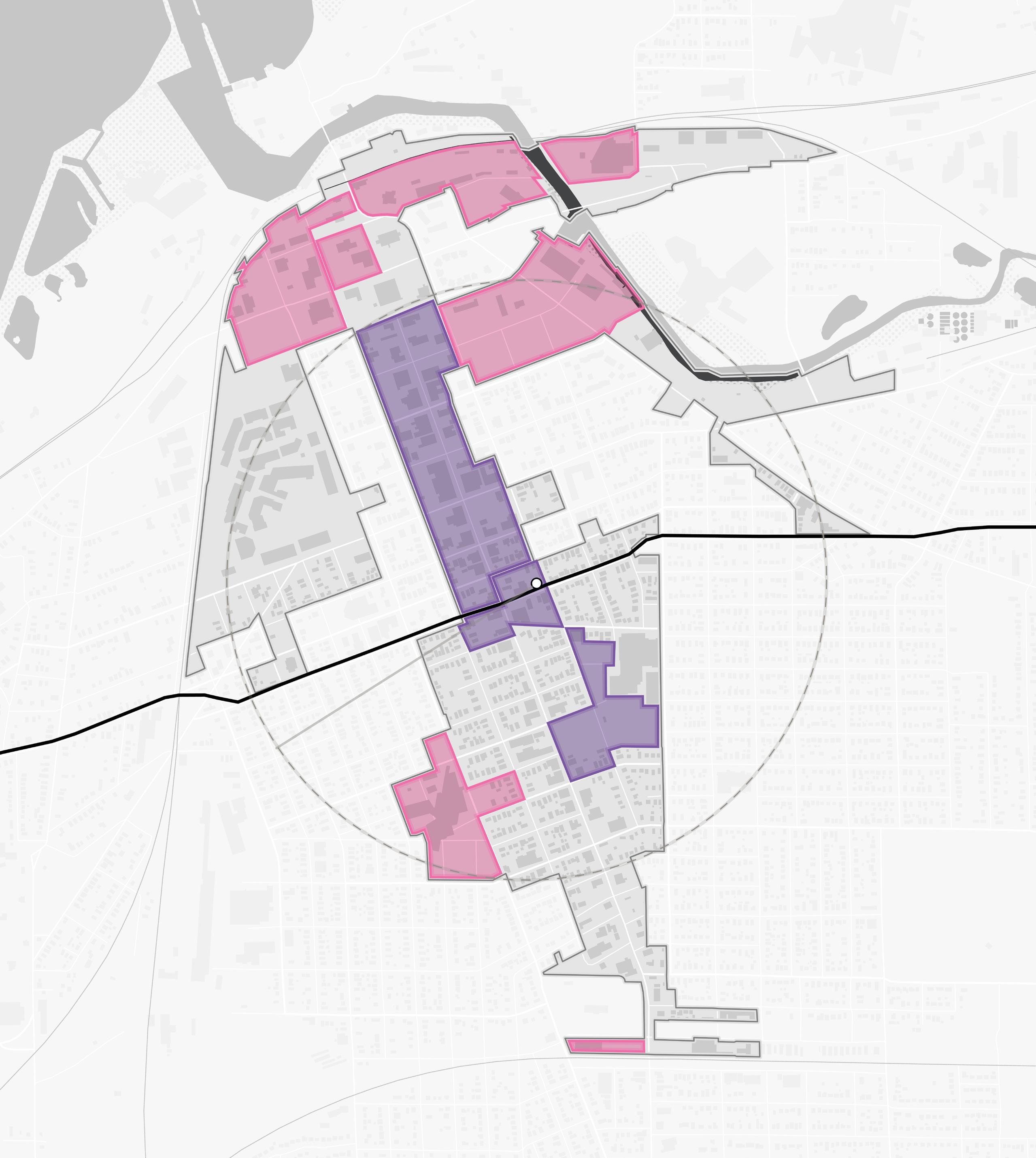
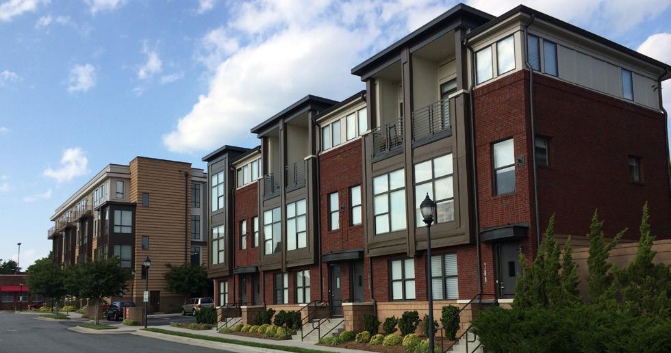
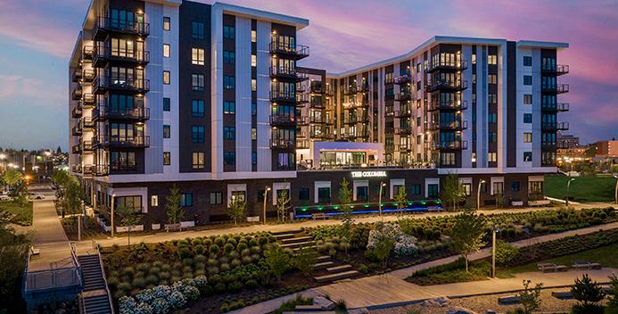
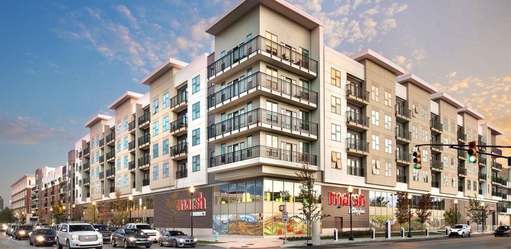
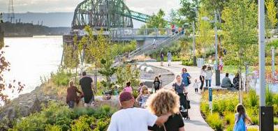
The RDA’s Comprehensive Strategic Plan estimates $2.7 billion in projected TOD investments in Northwest Indiana due to these rail projects. Many communities are receiving upgraded stations as part of the rail capital improvements. New stations are being constructed in Hammond, Miller (Gary), Michigan City, and Munster; existing stations are being upgraded in Portage/Ogden Dunes and Dune Park. Due to these improvements, TOD projects are already occurring in Michigan City and Hammond, with others to follow. This type of investment has also been happening in the Chicagoland suburbs for decades.
Orland Park Metra Station - SWS Line (2007)
+17% 1.2M +37%
Square Feet of New Construction
Elmhurst Metra Station - UP-W Line (2006)
+11% 640k +40%
Square Feet of New Construction
Highland Park Metra Station - UP-N Line (2009)
0% 640k +43%
Square Feet of New Construction
Romeoville Metra Station - HC Line (2018) 0% 316k +3%
Square Feet of New Construction
Example metrics illustrating the levels and types of investment and impacts occurring in TOD areas in Chicagoland suburbs.
$2.7 Billion in Projected TOD Investments Due to Rail Projects
4 Northwest Indiana TDD • TOD Strategic Implementation Plan 2022 Billions $0.0 $1.0 $2.0 $3.0 2023 2024 2025 2026 2027 2028 2029 2030 2031 2032 2033 2034 2035 2036 2037 2038 2039 2040 2041 South Bend East Chicago Michigan City Munster Dyer Gary Miller Hammond South Gary Metro Hammond Gateway Portage Ogden Dunes Munster Ridge Road
Population Growth Population Growth Population Growth Population Growth Change in Real Estate Value Change in Real Estate Value Change in Real Estate Value Change in Real Estate Value
Northwest Indiana TOD Strategy
Planning Process
This process commenced by bringing the same level of planning assistance to each community impacted by the NICTD South Shore and West Lake Lines, focusing on communities with a TDD boundary in place or with significant economic development opportunities tied to the station area. To accomplish this, a three-step process planning process was employed. This process began with work sessions with each city or town to understand the level of interest and goals for TOD in each community in alignment with their individual growth path.
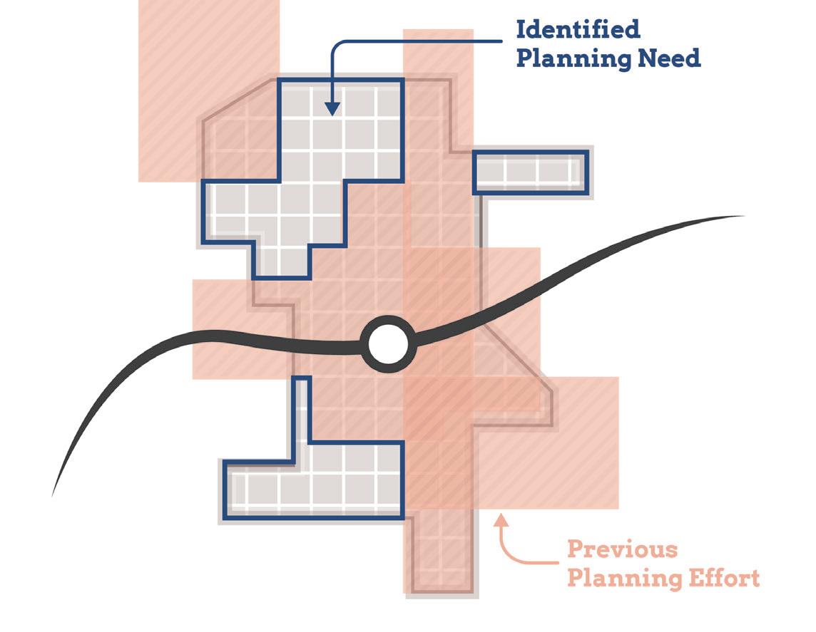
Through the previous TDD boundary process, the consultant team understood that various factors, such as local political and staff changes, potential catalytic private development, and ongoing planning or infrastructure projects, would impact project work and schedules on a community-by-community basis. To account for these variables, we employed a schedule that begins with a first step of identifying planning needs for each station area.
Based on planning needs and community readiness, we proposed to group station areas to accommodate varying situations and stagger planning activities.
Generally, each community process took approximately 12 months. All of this work was completed between October 2021 and March 2023. During this time, Northwest Indiana RDA and the consultant team met directly with local staff, stakeholders, elected and appointed officials, and the public to solicit feedback and direction for each TOD-focused plan. As a result, individualized community plans have been developed for each study area with supporting appendix materials from technical sub-consultants.
Step 1
Present Previous Findings, Confirm Direction & Establish Priorities
Timeframe: 6-8 weeks
Step 2
Conduct In-Depth Analysis, Advance Development/ Infrastructure Planning & Evaluate Regulating Resources
Timeframe: varies
Step 3
Conduct Individualized Planning Activities & Provide Recommendations and Documentation
Timeframe: varies
CONCURRENT: Public Engagement, Client, Local Officials & Team Meetings
Planning Process Introduction 5
West Lake Line & South Shore Double Track Projects
West Lake Line Project
9 MILES South Shore Line Double Track Project
25 MILES
16 MILES
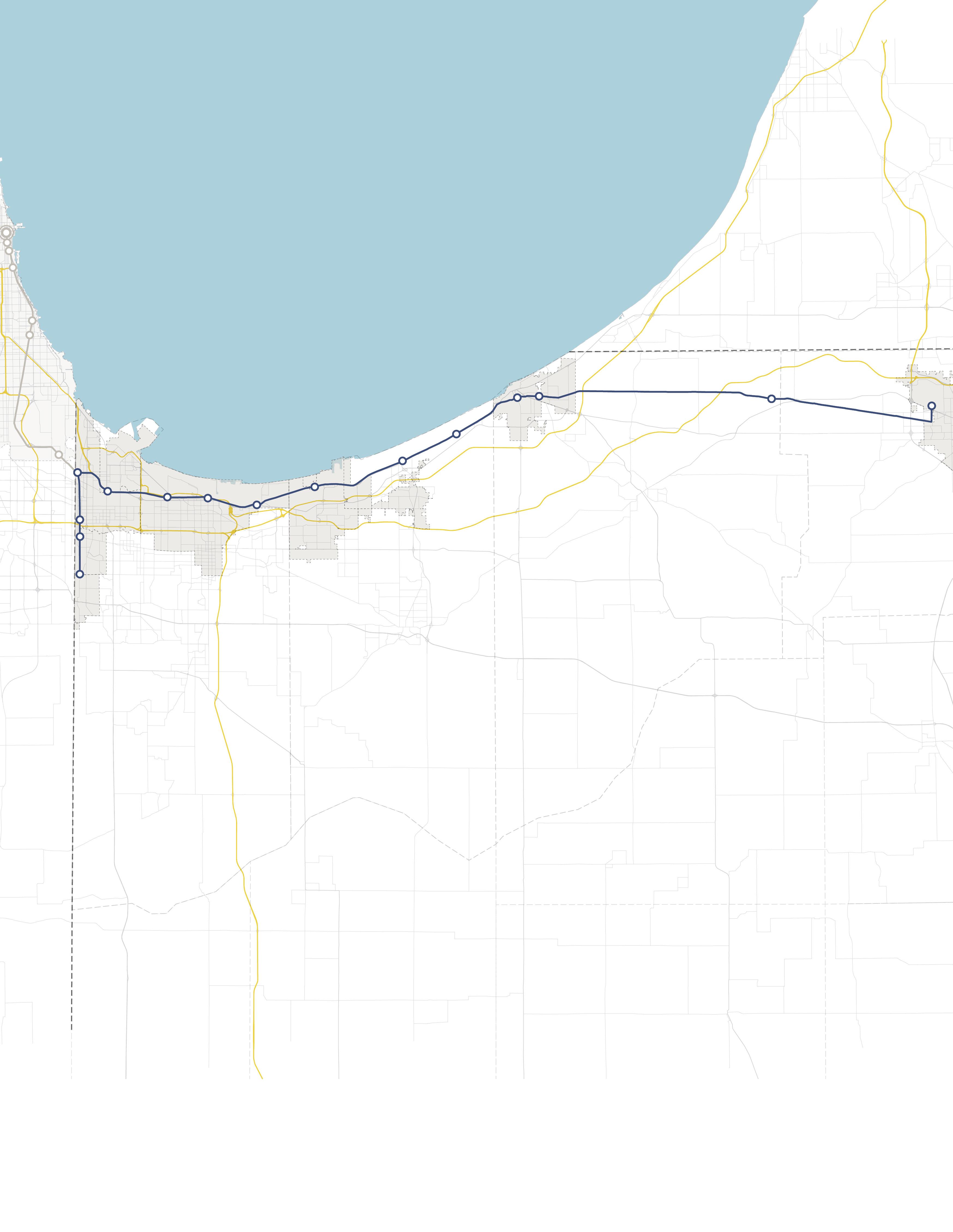
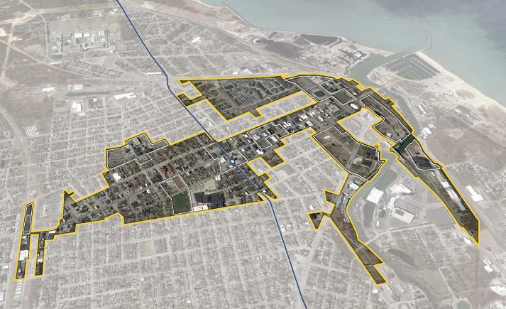
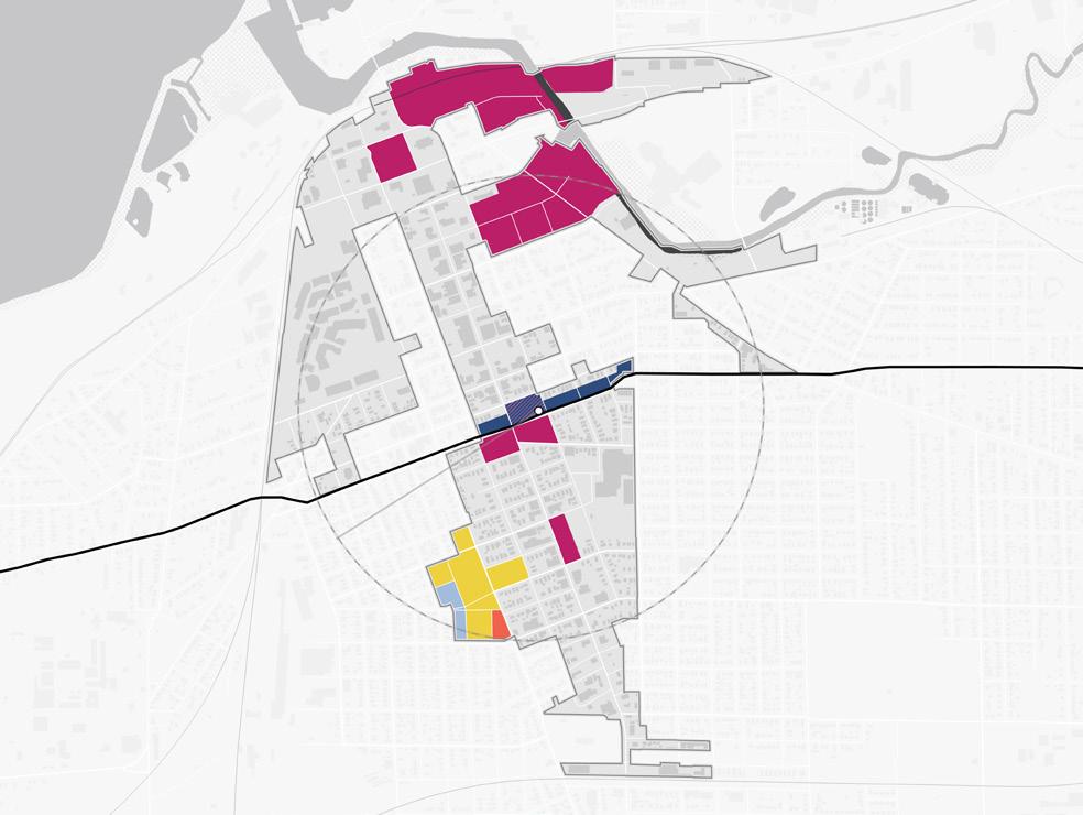
Communities Studied
The project focused primarily on communities with an established TDD boundary or with a TOD study area. However, high-level assessments were also conducted for communities with stations along the South Shore Line who are eligible for future TDD boundaries. Several stations along the lines were not studied at the request of local leadership in consultation with the Northwest Indiana RDA and NICTD.
South Shore Line
• East Chicago (TDD Boundary)
• Metro Center, Gary (TOD Study Area)
• Miller, Gary (TDD Boundary)
• Portage/Ogden Dunes (Two-Community TDD Boundary)
• Dune Park (High-Level Study)
• Beverly Shores (High-Level Study)
• Michigan City (TDD Boundary)
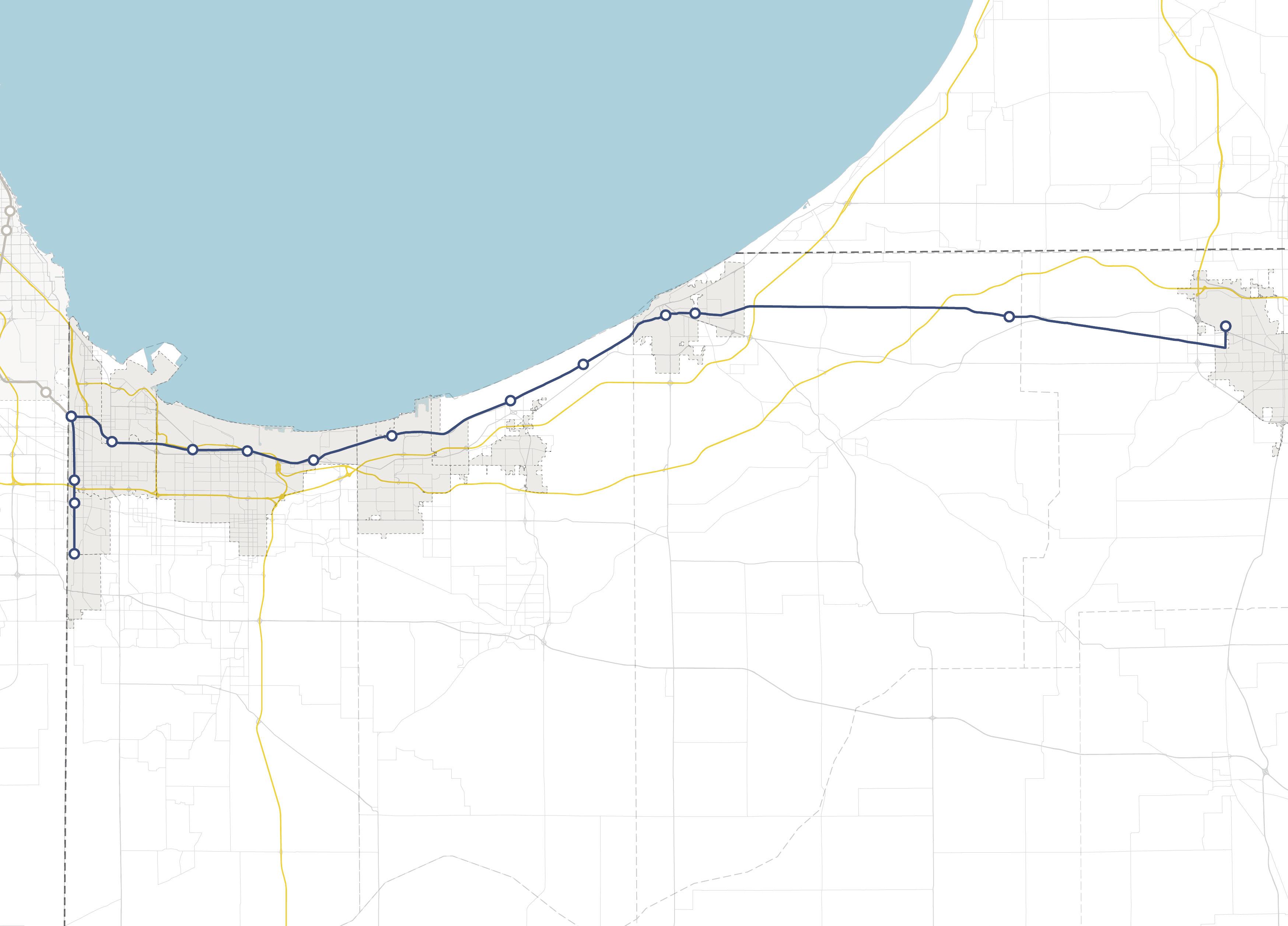
• South Bend (High-Level Study)
West Lake Line
• Hammond Gateway/Downtown, Hammond (TDD Boundary)
• Ridge Road, Munster (TDD Boundary)
• Main Street, Munster & Dyer (Two-Community TDD Boundary)
NORTH INDIANA INDIANA MICHIGAN ILLINOIS 94 94 80 65 Lake Michigan Lake County Porter County LaPorte County St. Joseph County GARY PORTAGE BURNS HARBOR PORTER CHESTERTON MICHIGAN CITY EAST CHICAGO HAMMOND MUNSTER DYER SOUTH BEND Hammond Gateway East Chicago Gary Metro Center Miller Portage/ Ogden Dunes 11th Street South Bend Dune Park Beverly Shores Ridge Road Main Street 6 Northwest Indiana TDD • TOD Strategic Implementation Plan
Rail Extension
Project Area New Second Track
Scope of Work
To further develop an individualized approach for each community, work plans were created, incorporating specific information desired by the FTA to be included in the planning process and other planning processes at the request of the communities, if any. The Scope of Work Breakdown on the following pages detail the work plan and planning activities in this process.
The following task list organized the work plans:
• Individualized engagement approach
• TOD readiness evaluation
• Previous planning gaps and opportunities
• TOD types and community priorities
• Potential areas of impact (TOD areas and other areas of anticipated significant change)
• Future land use projections (5-, 10- , 20-year time horizons)
• Development feasibility testing and potential community impacts
• Development character renderings
• Thoroughfare typology assignments
• Conceptual corridor designs
• Brownfield assessments
• Infrastructure assessments
• Zoning code/ordinance analysis and recommendations
• Order of magnitude infrastructure and corridor cost estimates
• Additional tasks as requested by individual communities, which may consist of corridor/ connectivity planning, neighborhood/subarea planning, additional engagement activities, additional site concept designs and/or renderings, development pitch kits, open space and trail planning, case study research, additional conceptual street design, capacity building, action planning, and one-year follow-up summaries
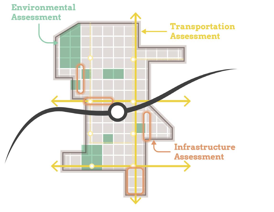
Scope Items
Planning Needs and Gaps Analysis
Land Use & Zoning Review and Recommendations
Environmental Assessment and Recommendations
Transportation Assessment and Recommendations
Infrastructure Assessment and Recommendations
Development Testing
Capital Improvements Plan
On-Going Efforts
Coordination with NICTD
Stakeholder and Public Engagement
Introduction 7
Planning Needs and Gaps Analysis
• Confirm framework plan direction by correlating objectives from previously completed plans with the community’s current future vision
• Identify gaps and opportunities not addressed in local planning based on previously completed plans
• Determine and prioritize planning needs for future development and recommendations
Land Use & Zoning Review and Recommendations
• Record and analyze current land use and zoning ordinances
• Identify potential changes in land use and zoning ordinances to achieve desired future development
• Coordinate zoning with planning concepts and planned land uses
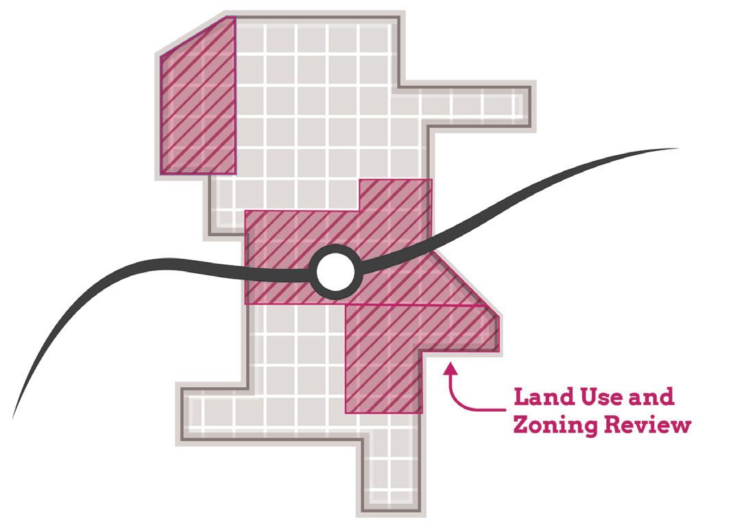
• Draft zoning code revisions and/or design guidelines to promote future TOD
• Draft regulating plan/zoning map
• RDA consultants will take zoning through process for adoption by local entities
Environmental Assessment and Recommendations
• Limited assessment of sites with potential or known environmental/brownfield concerns
Transportation Assessment and Recommendations
• Corridor and connectivity planning that improves access and walkability to the station area
Infrastructure Assessment and Recommendations
• Evaluating stormwater, utility, road, and pedestrian facilities at site and district scales
Scope of Work Breakdown
8 Northwest Indiana TDD • TOD Strategic Implementation Plan
Development Testing
• Identify up to eight priority development sites per station area (each “site” up to 10 acres)
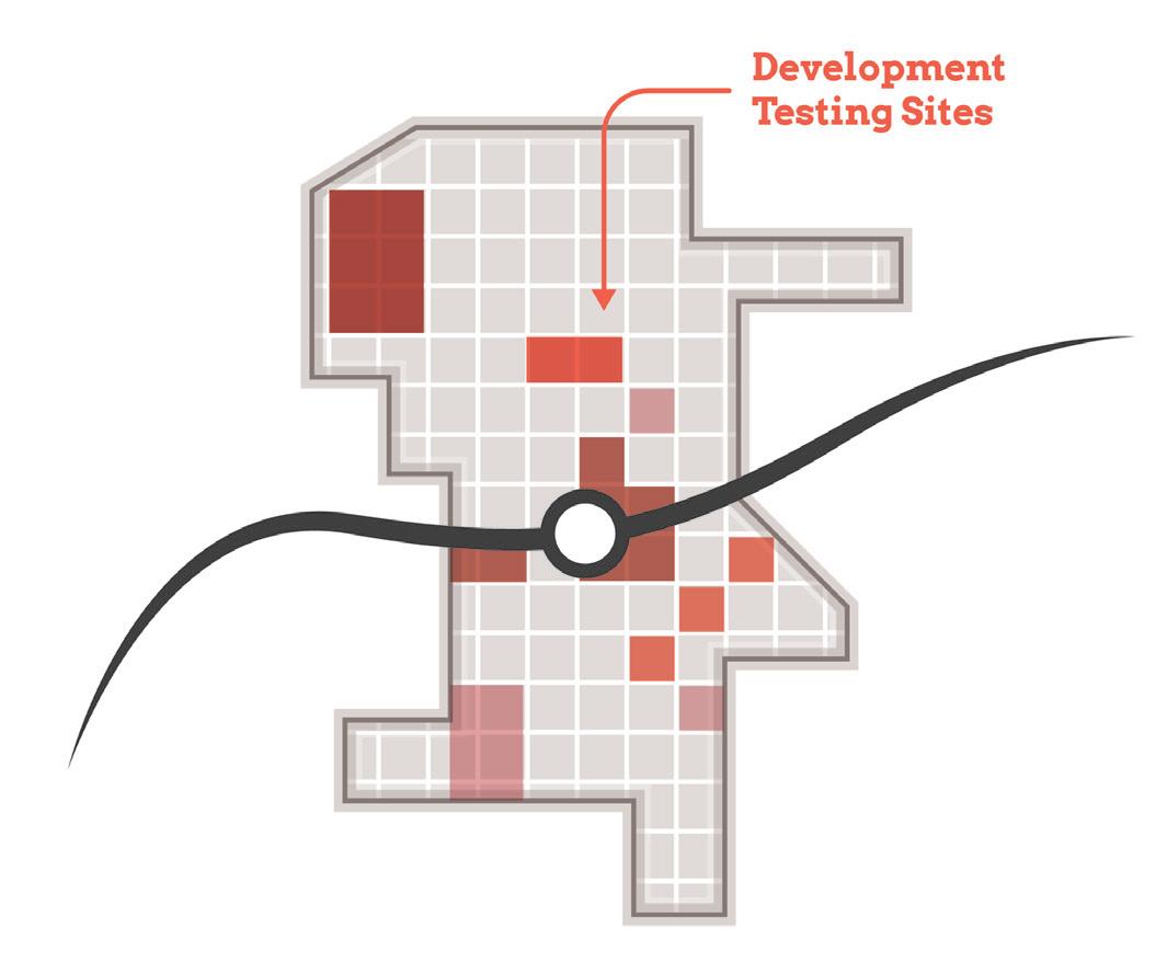
• Test development scenarios for priority sites
• Assess potential site uses based on land use projections and market understanding
• Develop conceptual site plans and three dimensional massing illustrations showing potential infill and redevelopment
Capital Improvements Plan
• Order of magnitude cost estimates for infrastructure improvements and projects to effectuate development (with close collaboration with local units)
Scope of Work Breakdown
Introduction 9
TOD Readiness
At the onset of the process, the team acknowledged that each community differed in its potential for TOD as a result of existing policies and infrastructure in place that are necessary to enable TOD, referred to as TOD readiness. To diagnose each community’s TOD readiness, a matrix was developed to evaluate factors of TOD readiness and was completed in collaboration with local officials. In addition, NICTD completed TOD assessments, which were consulted as these evaluations were completed.
TOD Readiness Criteria
• NICTD Station currently operational or under construction
• TDD Boundary is adopted or the community is eligible for a TDD Boundary
• Adopted policy documents that address or plan for TOD (i.e. comprehensive plan, neighborhood plan)
• Adopted zoning ordinances (or overlays) that address or plan for TOD
• Existing walkable grid as part of a downtown or mixed-use neighborhood that connects or can connect to the station
• Currently operational/planned trail or multi-modal infrastructure
• Existing urban amenities that are walkable and/ or within 1/2 mile of the station (i.e. restaurants, grocery, drug stores, office, parks/plazas)
• Existing dense and quality housing stock (more than eight dwelling units/acre), including rowhouses/townhomes, apartments, condos, and ADUs
• Vacant developable sites within TDD Boundary
• Local unit has demonstrated additional initiatives to support TOD
• Current infrastructure has the capacity to support additional development or TOD
Anticipated Results
At the conclusion of this process, control of local land use and zoning remains with the cities and towns. This process aims to provide proactive guidance and recommendations that the local units can use to advance their planning processes, resulting in updated comprehensive plans, area plans, and zoning ordinances complete with locally-controlled public input. In addition, components of this study are designed in a highly-graphic format to inform development discussions, potential RFP’s, and grant applications. The following sections reflect recommendations particular to each TOD study area with key considerations, immediate next steps (next year), short-term recommendations (next five years), and long-term recommendations (beyond five years).
Each community-specific section will function as a standalone plan that is meant to be pulled out of the overall regional plan and referenced by officials of local cities and towns, public members, and the development community. This information is supplemented by more technical information in the respective appendices.
10 Northwest Indiana TDD • TOD Strategic Implementation Plan
01
02
02 TOD Strategy
Michigan City 11th Street Overview
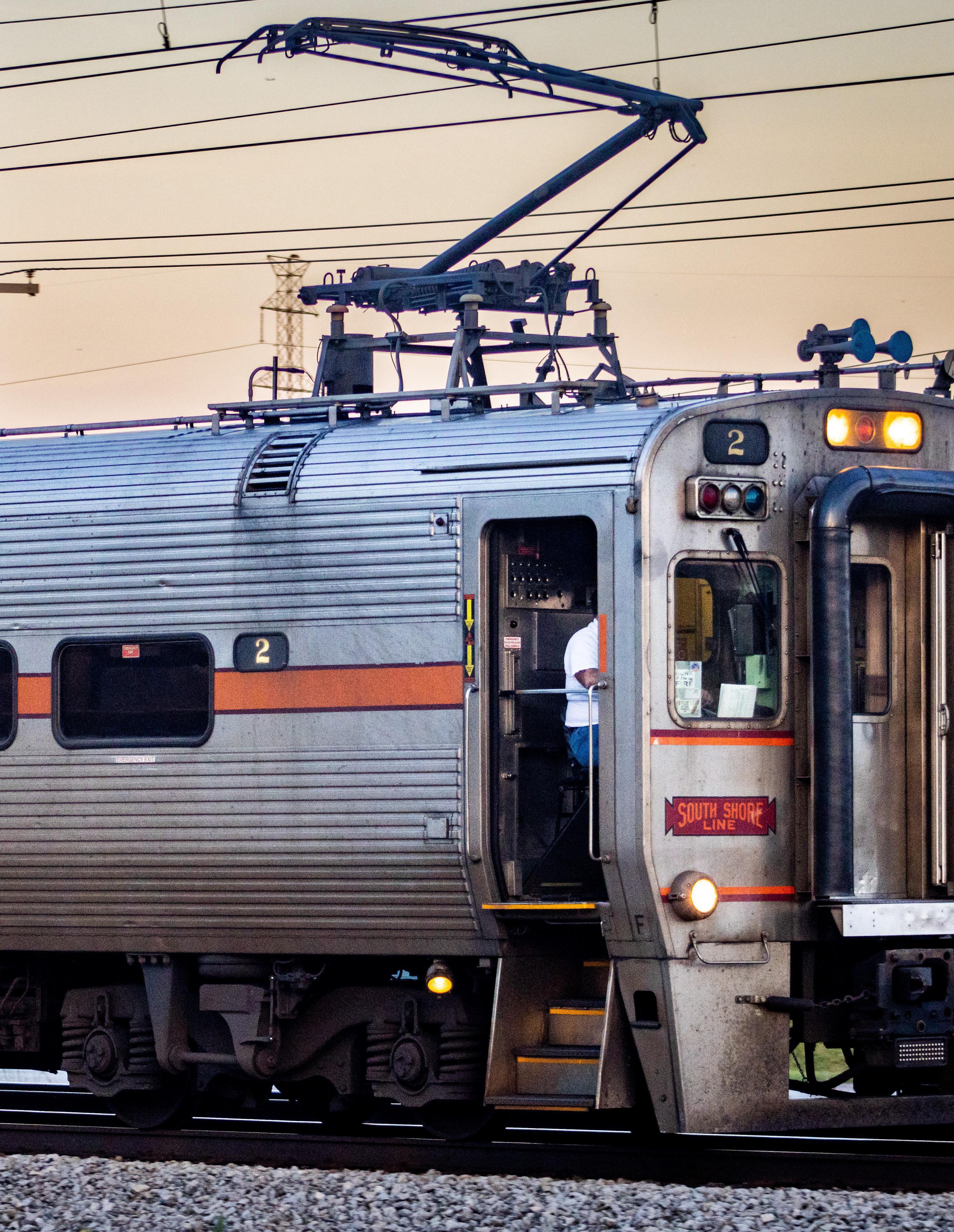
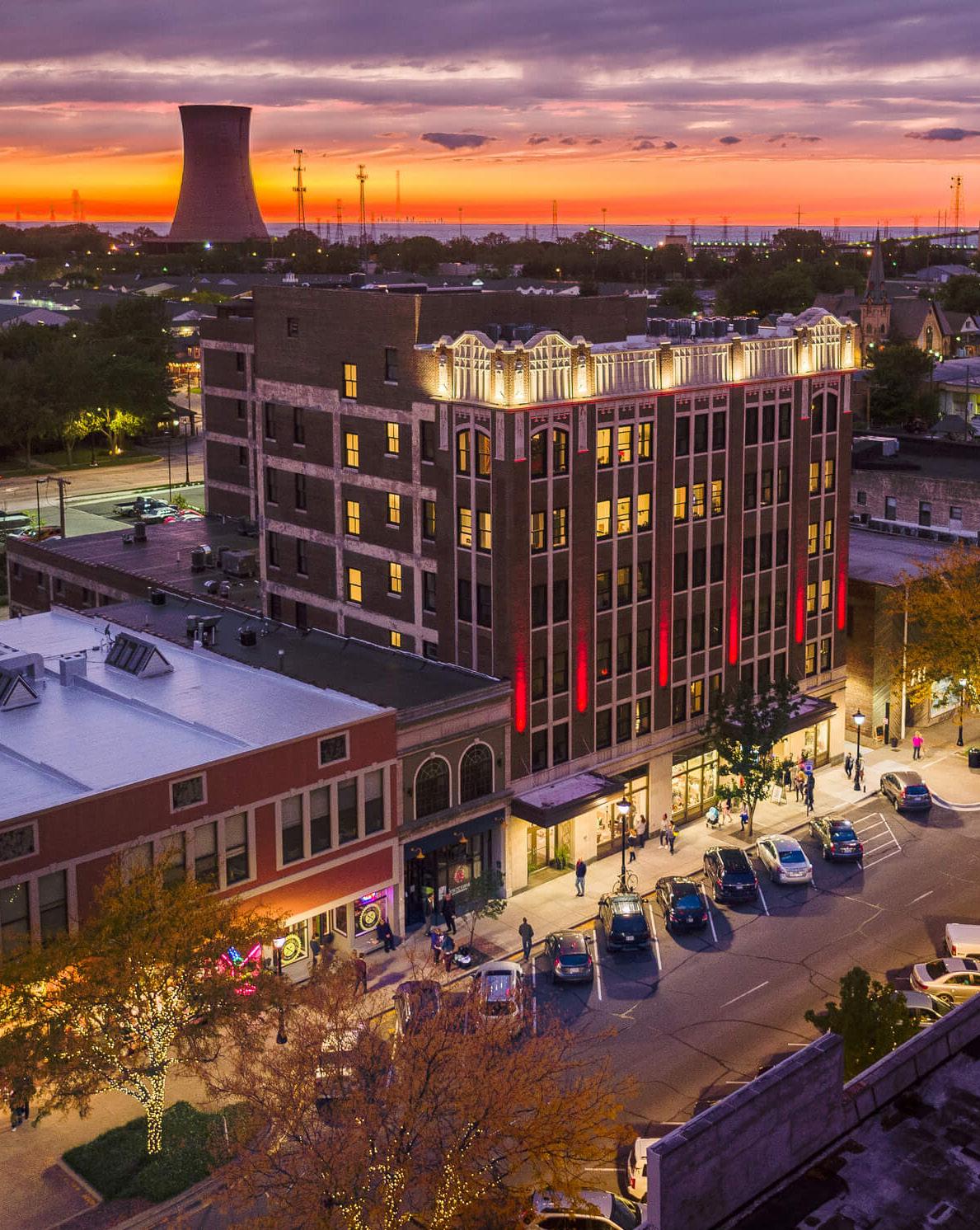
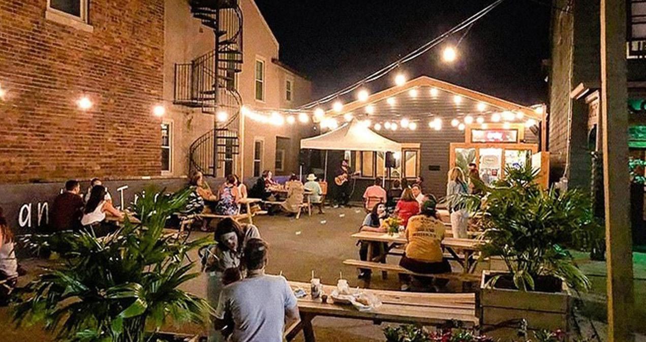
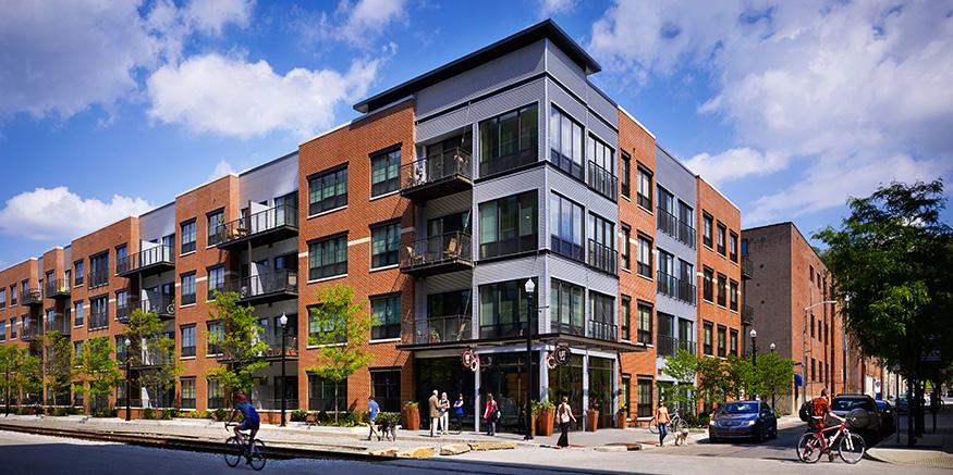
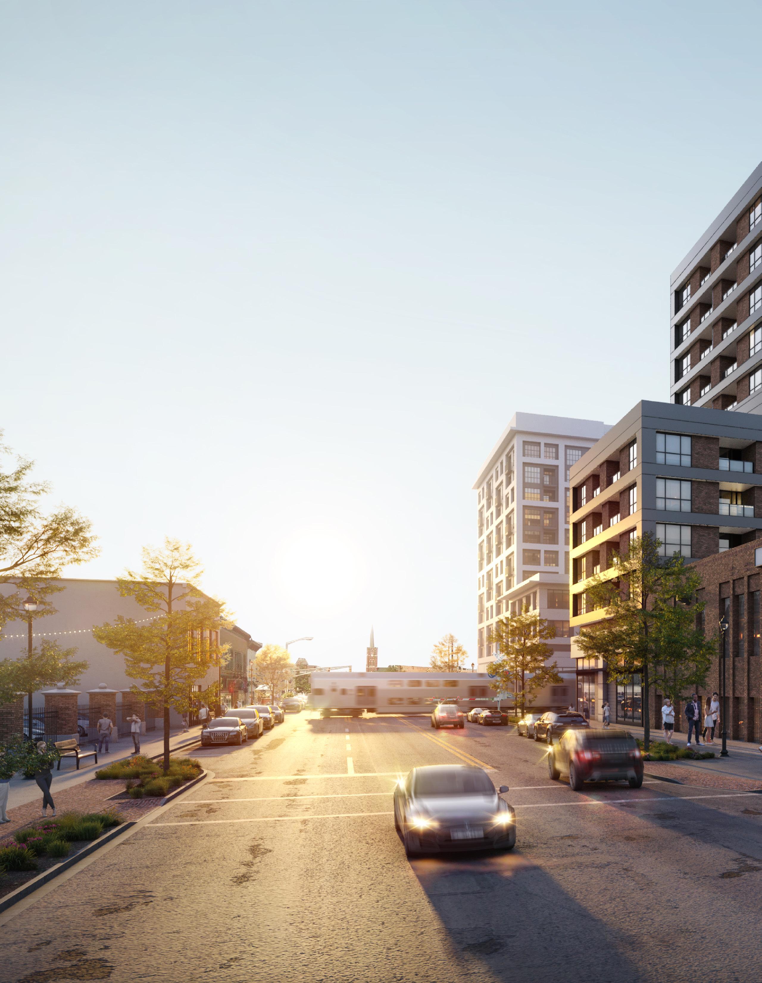
The upgraded 11th Street Station is a true mixeduse TOD project with integration of the station with an existing historic building façade, structured and surface parking, and joint development in partnership with a private developer in Downtown Michigan City. The City has been proactive in preparing for TOD and has envisioned development throughout its downtown that leverage both the Northern Indiana Commuter Transportation District (NICTD) South Shore Line and destinations such as Lake Michigan, Washington Park and Beach, and the marina. Significant public infrastructure investment and active support of the project sends a positive message to the development community. Michigan City has also been preparing for TOD for some time with the 2011 zoning ordinance – which includes a form-based code within a one quarter-mile radius of the 11th Street Station and a zoning overlay for Franklin Street – the 2020 11th Street Master Plan, 2018 Momentum Plan, and the 2007 North End Plan. This TOD area is primed for additional development opportunities in aligned with the City's economic growth path.
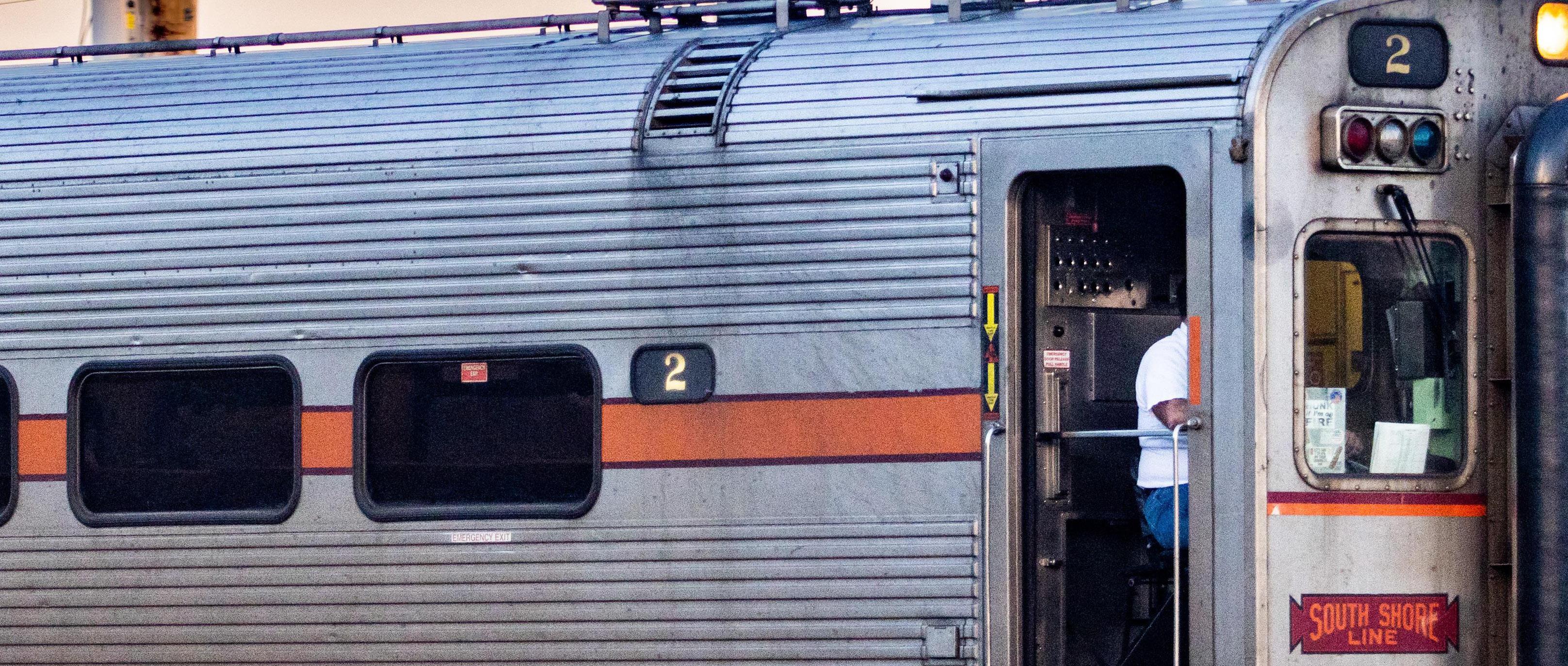
Michigan City and NICTD are also jointly improving the 11th Street streetscape as part of the rail project. Significant road and rail infrastructure investments will improve this area's development potential and increase demand for various land uses. The area's walkability and anticipated increased ridership will strengthen existing small businesses and attract new employers and residents, which in turn will further increase ridership and investment in this area. This plan focuses on preparing the City of Michigan City by using these materials and recommendations to update its plans and ordinances and to advance its pursuit of TOD. Once operational, the NICTD station in Michigan City will benefit from enhanced commute times to Chicago with an estimated time of 67 minutes to the Chicago Loop.
12 Northwest Indiana TDD • TOD Strategic Implementation Plan 02
TOD Readiness
Michigan City understands the potential for TOD around its station and how this is just one component of the City’s comprehensive economic development strategy focused around revitalizing its downtown and lakefront. Michigan City is seen as a leader in the region for its proactive and aggressive pursuit and implementation of TOD in its downtown area. The City has also collaborated closely with NICTD to leverage transit investments along with City dollars in order to improve 11th Street and upgrade a parking garage into a mixed-use project using the FTA joint development process. Once completed, this project will demonstrate the ability of TOD to occur in Indiana from Michigan City westward to the state line. The City fully supports TOD and this document serves as a roadmap for implementation by providing land use, development, zoning, and infrastructure focused investments to allow for the City to achieve TOD from a technical perspective.
Evaluation Criteria
NICTD Station currently operational or under construction
TDD Boundary is adopted or the community is eligible for a TDD Boundary
Adopted zoning ordinances (or overlays) that address or plan for TOD
Adopted policy documents that address or plan for TOD (i.e. comprehensive plan, neighborhood plan)
Existing walkable grid as part of a downtown or mixed-use neighborhood that connects or can connect to the station
Currently operational/planned trail or multi-modal infrastructure
Existing urban amenities that are walkable/within 1/2 mile of the station (i.e. restaurants, grocery, drug stores, office, parks/plazas)
Existing dense and quality housing stock (more than 8 dwelling units/acre), including rowhouses/ townhomes, apartments, condos, and ADUs
Vacant developable sites within TDD Boundary
Local unit has demonstrated additional initiatives to support TOD
Current infrastructure has the capacity to support additional development/TOD
Michigan City • 11th Street Station 13
Community Priorities
Community priorities were developed by working closely with City officials to confirm economic development goals, identify key sites of interest, understand recent and ongoing municipal and development projects. These priorities form a future vision for the TDD boundary area specific to Michigan City, which include the following:
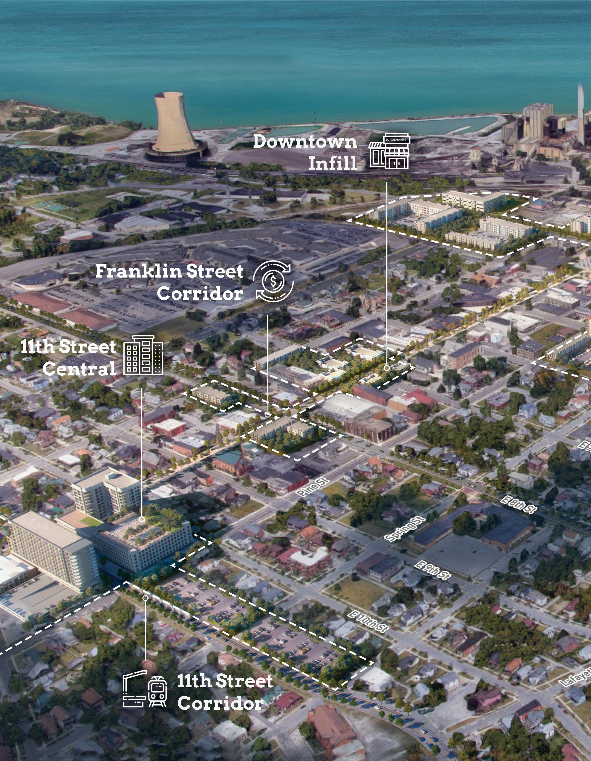
• Mixed-use transit-oriented development around the 11th Street Station along with realignment of the South Shore Line rail along 11th Street
• Investments in the Franklin Street commercial corridor to continue revitalization of downtown
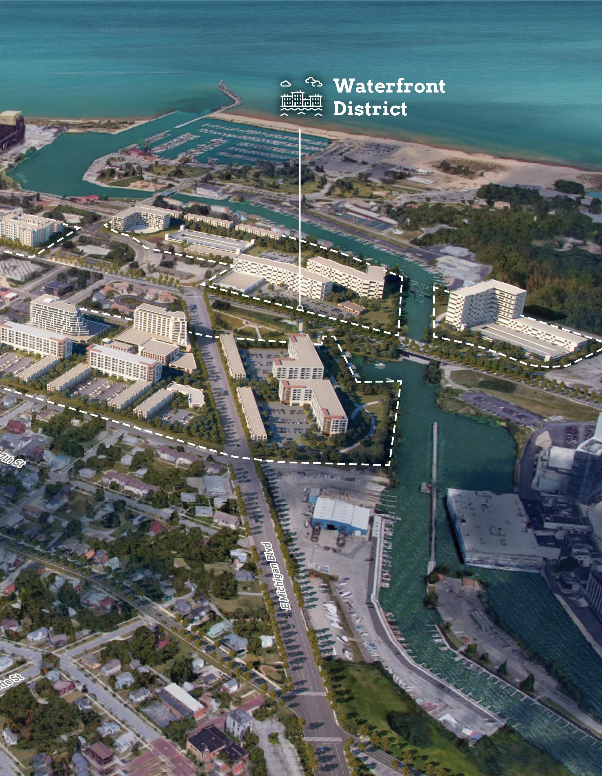
• Waterfront destination development of underutilized sites between Michigan Boulevard and Trail Creek that includes medium- to high-density mixed-use development and public riverfront amenities
• Infill development throughout the city to complement and strengthen the existing urban fabric
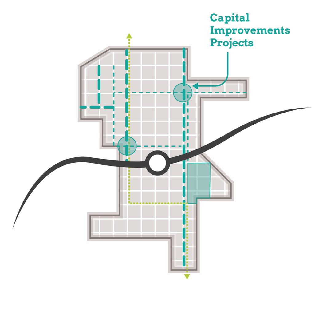
Big Moves
"Big Moves” are defined as enabling steps to signal to the market that conditions are right for transit-oriented development to occur. The City of Michigan City aims to prioritize mixed-use TOD around the 11th Street Station (coinciding with the realignment of 11th Street and the South Shore Line), investment in the Franklin Street commercial corridor, and development of underutilized sites near Trail Creek to establish a waterfront district.
Northwest Indiana TDD • TOD Strategic Implementation Plan
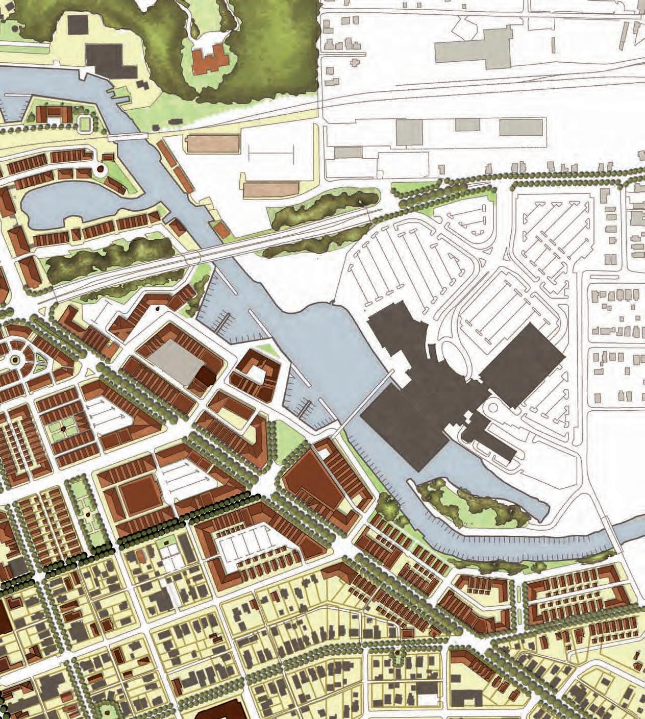
The corridor where 11th Street aligns with the South Shore Line is being redesigned to improve traffic flow and commuter rail operations in this section of Michigan City. 11th Street is also receiving a new streetscape design, and vehicular circulation to and from 11th Street is changing at some locations.
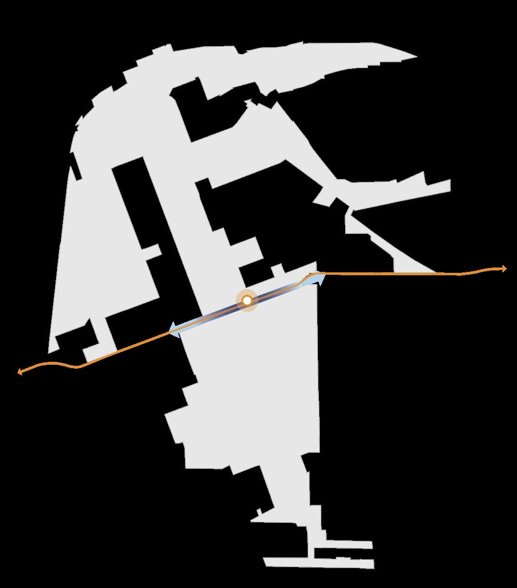
Medium-density mixed-use redevelopment of several blocks surrounding the 11th Street Station would create an enhanced and amenitized transit hub for downtown Michigan City. Increased activity around the station can catalyze development south of 11th Street and enhance overall downtown revitalization.
Michigan City • 11th Street Station 15
Downtown
11th Street Corridor
Revitalization
Big Moves MichiganBlvd MichiganBlvd Franklin St 11thSt MichiganBlvd MichiganBlvd Franklin St 11thSt
NORTH
South Shore Line South Shore Line
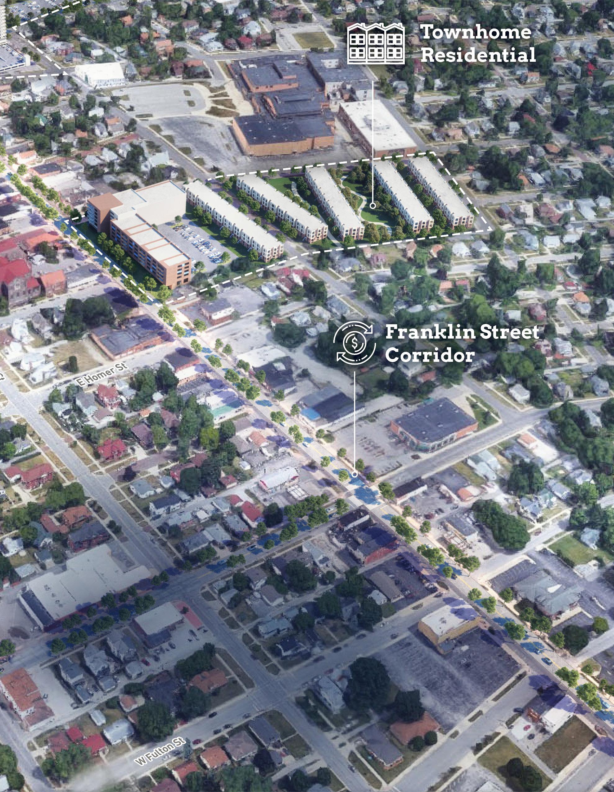
Franklin Street Corridor Waterfront District
Improvements to Franklin Street including a two-way conversion from 8th Street north to 4th Street will enhance the existing commercial corridor and create an opportunity for a new gateway into the station area anchored by high-quality development. In addition, streetscape improvements recommended in this plan could continue further south towards Ames Field in order to create significant opportunity for revitalization and redevelopment along Franklin Street by the private market.
Further north towards Trail Creek, higher density waterfront district development of underutilized areas could complement existing revitalization efforts downtown.
NORTH 16 Northwest Indiana TDD • TOD Strategic Implementation Plan
Big Moves MichiganBlvd MichiganBlvd Franklin St 11thSt MichiganBlvd MichiganBlvd Franklin St 11thSt
South Shore Line South Shore Line
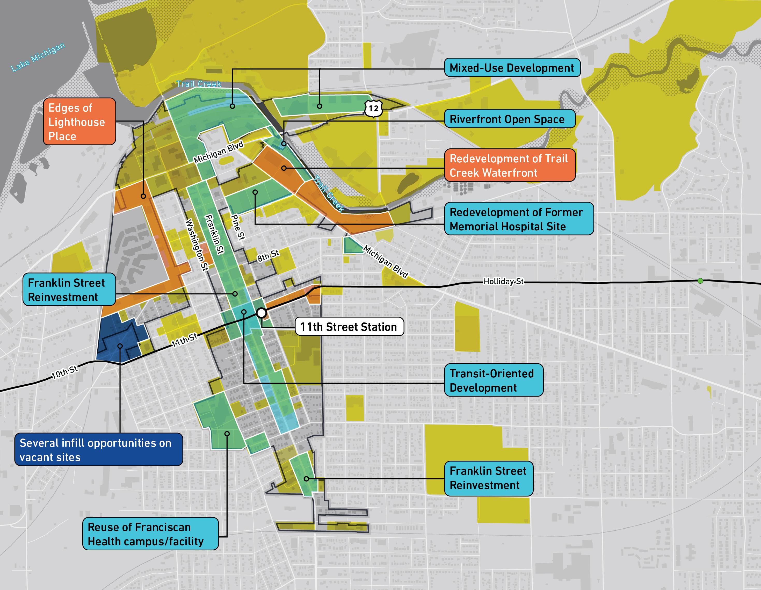
TOD Opportunity
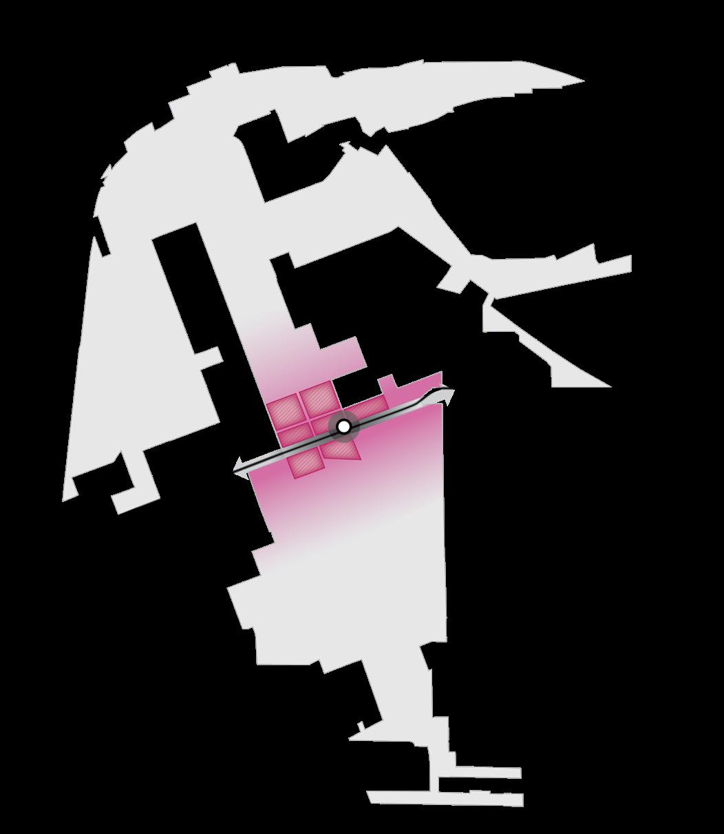
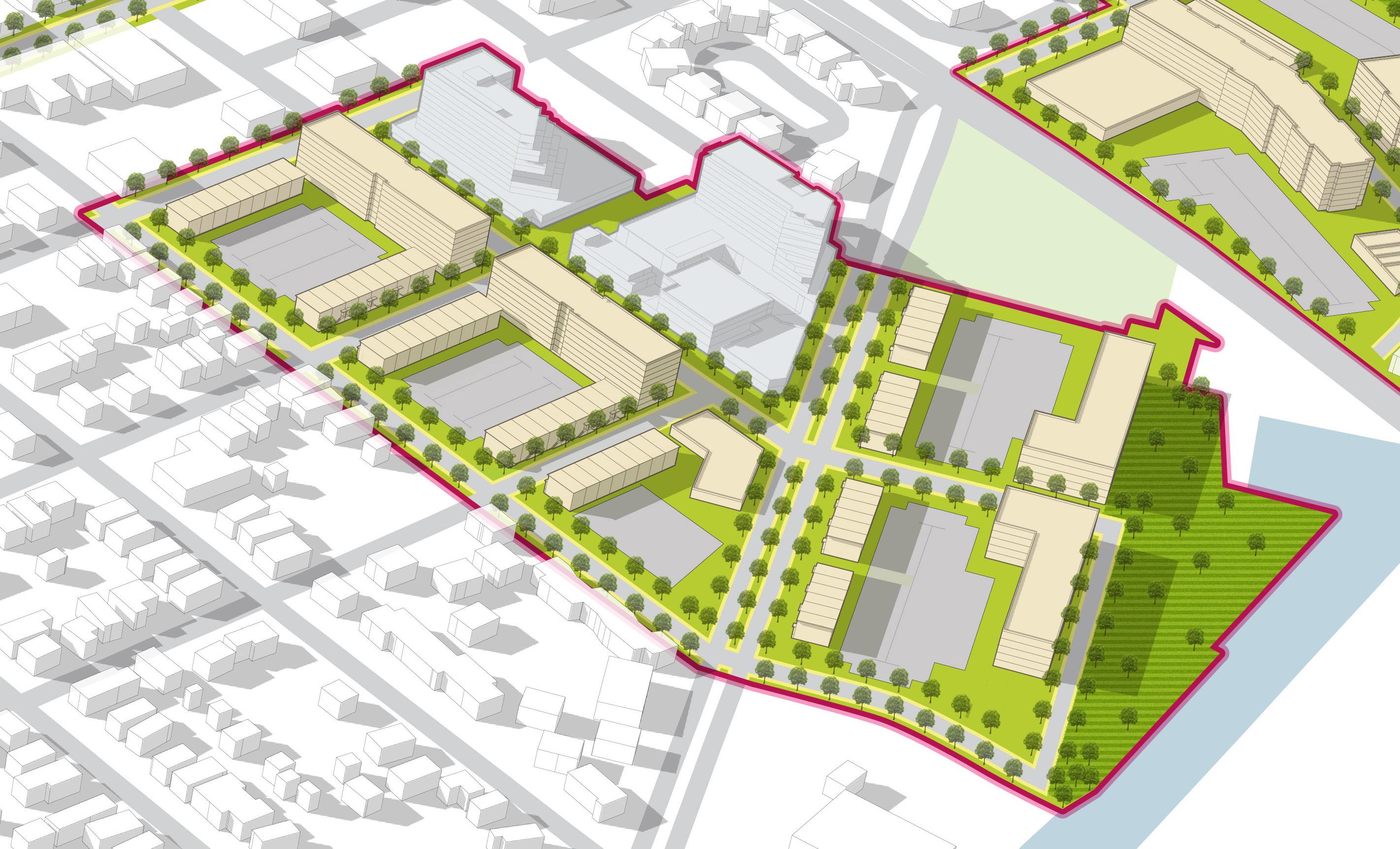
An overall TOD Opportunity vision was developed with the City of Michigan City outlining the development and investment potential within the TDD boundary area. Opportunity sites were identified as Areas of Impact within each TDD boundary that have the greatest development potential. Characteristics such as cleared sites, underutilized land or surface parking lots, buildings suitable for adaptive reuse, or consolidated or municipal land ownership were important factors determining certain sites’ development potential.
While Michigan City possesses a significant amount of development potential in its downtown area, much of these opportunities – particularly those near Trail Creek – are outside of the walkable half-mile area of the station. Michigan City's prime TOD opportunity exists in the blocks immediately surrounding the station and context-sensitive infill along Franklin Street.
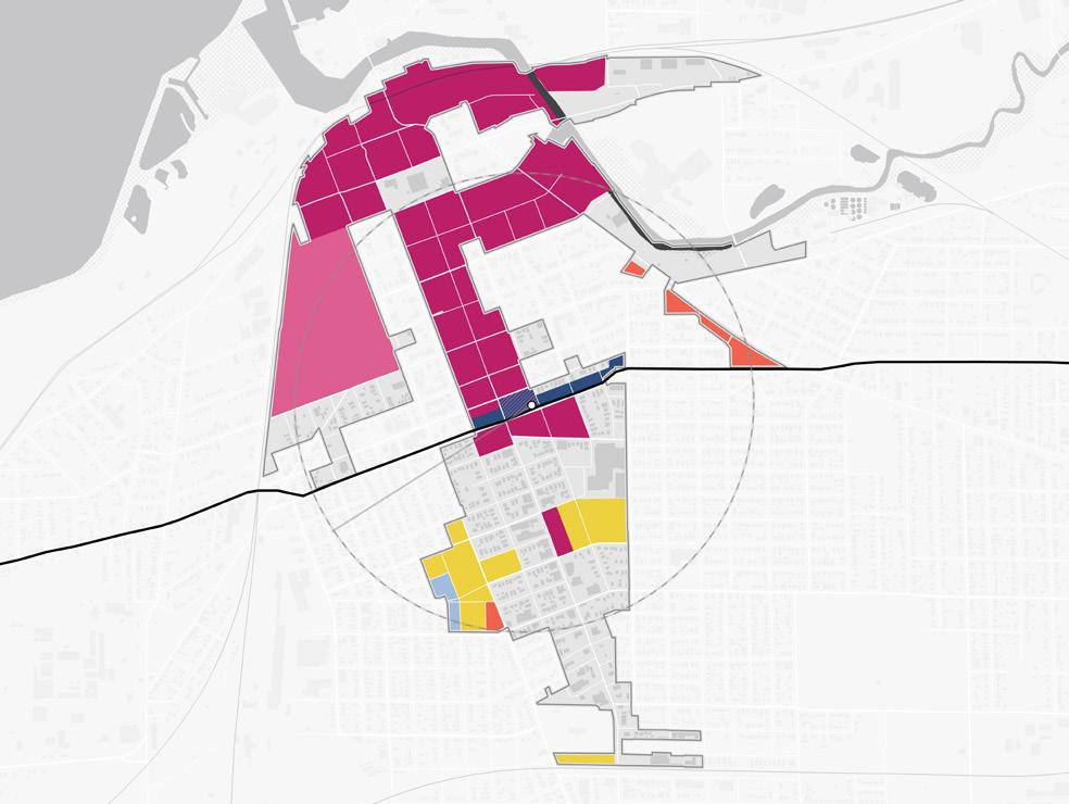
Areas of Impact
Areas of Impact were established to distinguish between major (re)development areas, both TOD and non-TOD, and areas to be maintained, preserved, and enhanced. These designations begin to direct development activity and other targeted investments based on proximity and relationship to the station area.
For purposes of this study, individual sites may have been grouped to demonstrate synergy among sites for development potential.
TOD Opportunity Sites
These areas are prime sites for transit-oriented development due to their proximity and connectivity to the station area. Development of these sites should be dense and urban in form, promote walkability and multi-modal access, and emphasize a quality public realm and sense of place. Access to the station area is crucial in these areas. Development should be mixed-use, integrating a variety of active ground-floor commercial uses and upper-floor uses within a building and integrating a variety of uses in a collection of buildings on a site.
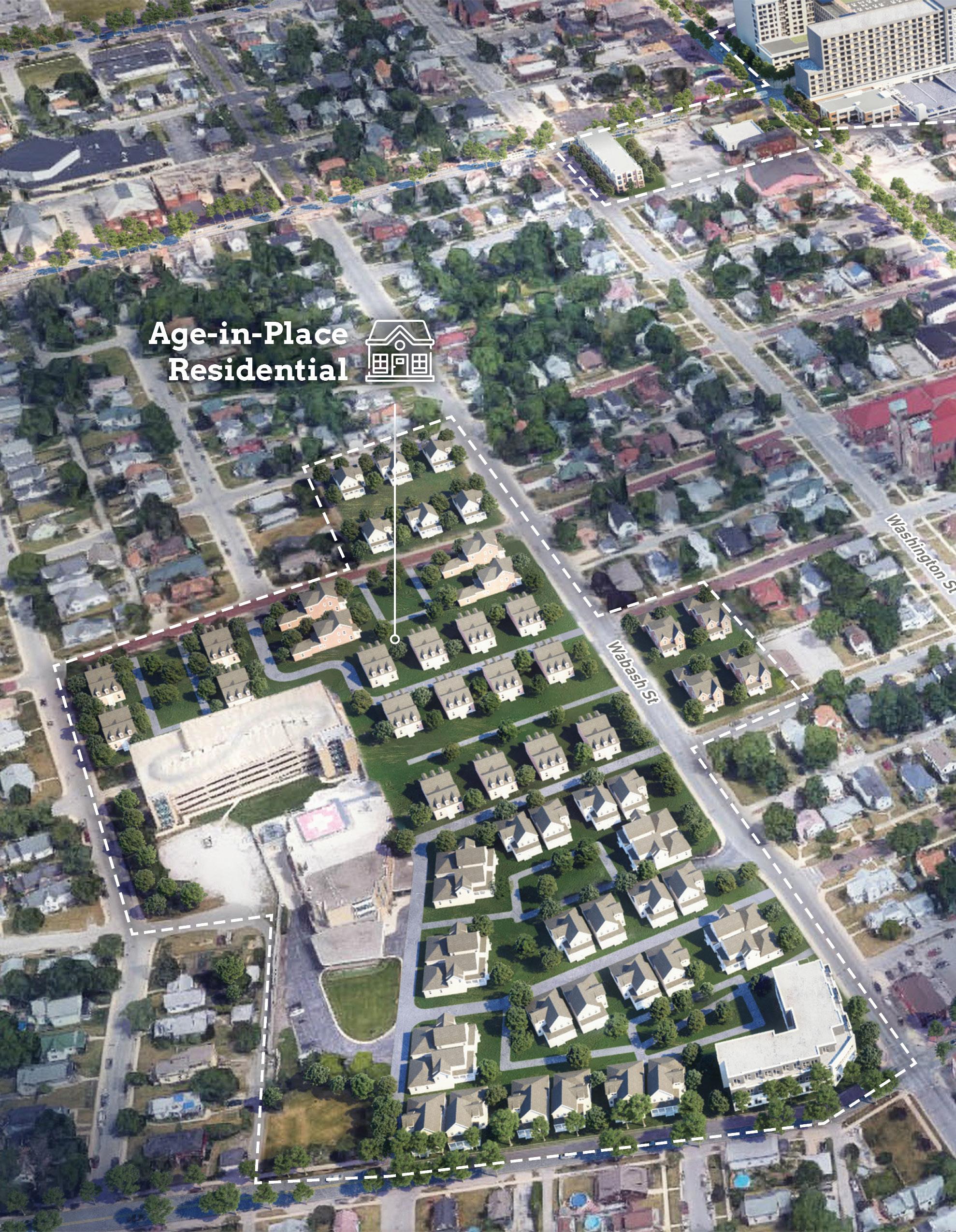
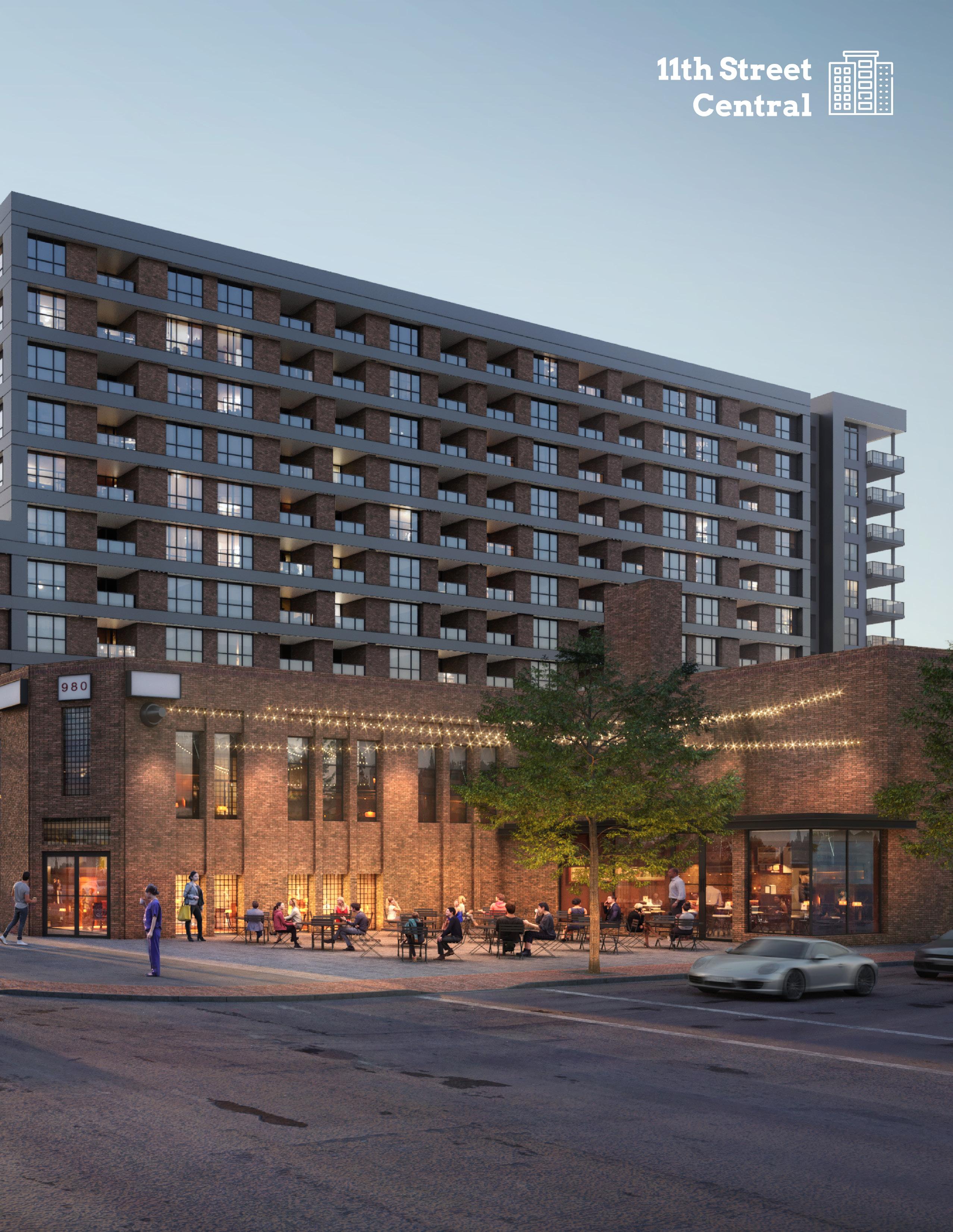
Site A (11th Street Central)
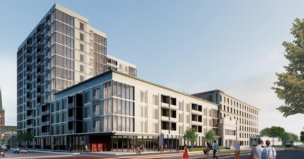
Site A consists of the blocks immediately surrounding the 11th Street Station, already being prepared for the new station and mixed-use development. This site is 5.2 acres in size with the cleared vacant land, underutilized parking lots, and some small-scale existing structures. Existing structures include single-family homes, an auto repair, the Moose Lodge, five commercial buildings, some of which have potential for rehabilitation and adaptive reuse. New station development north of the tracks, on property owned by the City of Michigan City and NICTD, is designed as a new station facility reusing the existing historic façade, an attached parking garage, and a 12-story mixed-use building. Station-adjacent opportunities on this site will have a significant impact by encouraging increased activity around the new South Shore Station and redesigned 11th Street and filling in gaps with appropriately-scaled development.
Site B
Site B encompasses the Franklin Street corridor between 4th Street and 11th Street, totaling 27.2 acres in area. This site includes the strong urban fabric of the Uptown Arts District, consisting of many historic commercial and mixed-use buildings, and this fabric should be preserved and complemented in future development. Small, scattered sites along Franklin Street create the opportunity for context-sensitive infill development including commercial, small-scale mixed-use buildings, and a mix of housing types.
Site G
Site G focuses on underutilized land surrounding the Elston Center/YMCA along Pine Street and Franklin Street. The 13.6 acres consists of surface parking, a sports field, tennis courts, and vacant undeveloped land. The majority of this site is property owned by Michigan City Area Schools. Existing structures include some single-family homes along and near West Homer Avenue and two commercial buildings, as well as the historic Michigan City Paper Box Company building at Pine Street and Detroit Street, which should be preserved and adaptively reused. This site is accessible via Franklin Street, Pine Street, Lafayette Street, Detroit Street, and West Homer Avenue. The Elston Center/YMCA facility already serves many community needs in Michigan City, and development around this property could better integrate these sites into the fabric of the city.
Michigan City • 11th Street Station 17
Areas of Impact
TOD
Opportunity
18 Northwest Indiana TDD • TOD Strategic Implementation Plan NORTH 11thSt 10thSt 8thSt Barker Ave Greenwood Ave 5thSt MichiganBlvd MichiganBlvd Franklin St Franklin St Pine St Washington St 1/2Mile TrailCreek Lake Michigan South Shore Line 11th Street Station 12 YMCA and Elston Center Lighthouse Place Premium Outlets Blue Chip Casino NIPSCO
Ames Field City Hall Shoreline Brewery & Restaurant Washington Park Site G 13.6 Total Acres Site B 27.2 Total Acres Site A 5.2 Total Acres Site E1 15.1 Total Acres Site E2 5.8 Total Acres Site C 2.8 Total Acres Site F 16.6 Total Acres Site H 16.2 Total Acres Site I 2.1 Total Acres Site D 22.6 Total Acres B A G C F H I D E1 E2
St. Anthony’s (Franciscan Health)
TOD opportunities include blocks directly adjacent to the upgraded 11th Street Station, along Franklin Street, and throughout downtown. TOD at the station is envisioned as dense, mixed-use development being led by the current development project at the station. Underutilized properties near the Elston Center could be developed as neighborhood sensitive infill with frontage along Franklin Street. As it has been considered in the past, reuse and/or partial redevelopment of the former St. Anthony's Hospital site presents another opportunity for neighborhoodscale infill. Sites along Trail Creek also have the potential for high-impact development that can activate the riverfront downtown and support TOD. Site
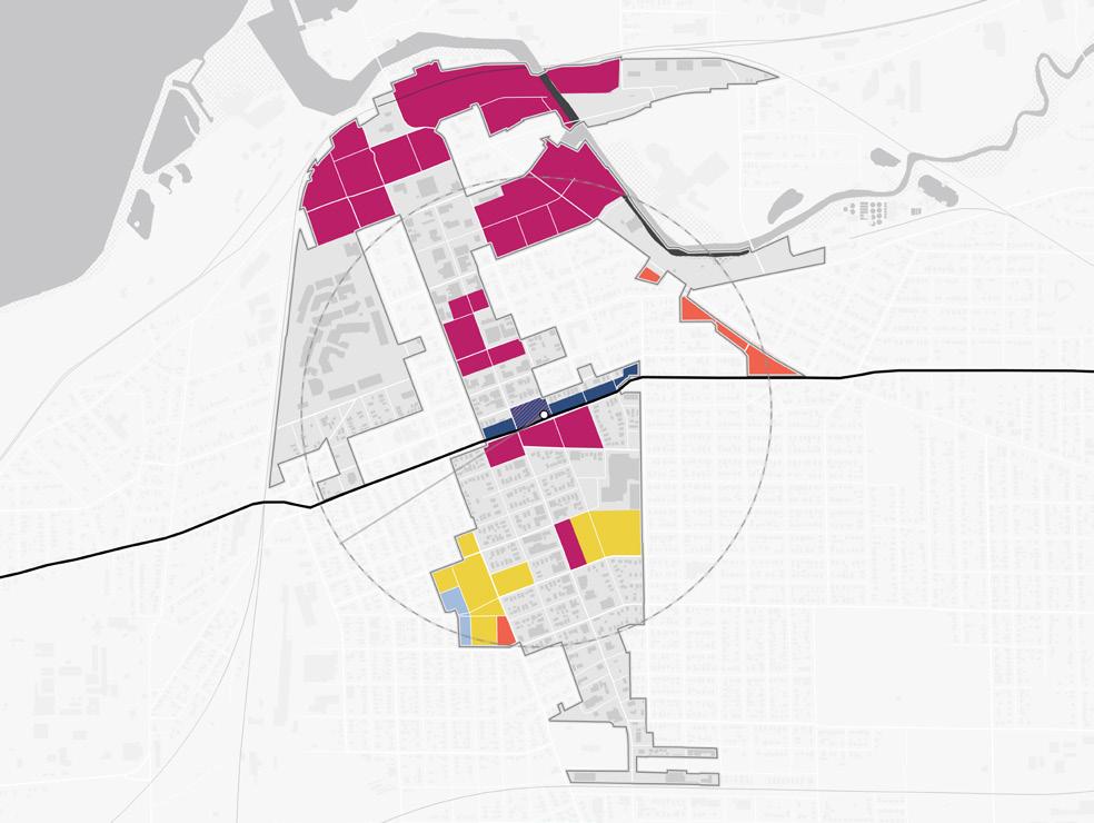
Area of Significant Change
Areas of Significant Change (Non-TOD)
These areas have been identified for their potential for redevelopment and a major change in use and/ or form. These areas are outside the walkable area surrounding the station – therefore not TOD – but high-quality development of these sites is possible and will significantly impact the community. These areas may be identified for several reasons: they have been included in development planning in this plan but are not proximate to the station; they may have development planning efforts ongoing outside of this plan; or there may be a high potential for future development in the long-term that has not been studied yet. Development of these sites may require changes in land use, updates to zoning designation and/or regulations, infrastructure upgrades, or environmental review.
Site C
This site is the location of a mixed-use and hotel destination called “You Are Beautiful” currently being implemented on former City and newspaper properties. Once completed, this project will be an eight-story hotel and multi-family project with 180 rooms and 150 residential units. This site will be garage parked.
Site D
Site D focuses on the former Memorial Hospital site at 5th Street and Pine Street and critical waterfront property along Michigan Boulevard. Totaling 22.6 acres, this site is the largest development opportunity site in the TDD boundary. The former Memorial Hospital site is nearly 8 acres of cleared land owned by the City. The City also owns the majority of the site on the east side of East Michigan Boulevard, except for the industrial property along Trail Creek. Charles R. Wescott Park, owned by the City, is also on this site at the corner of East Michigan Boulevard and West Michigan Boulevard/US 12. This portion of the site, which has been studied previously for development, presents a tremendous opportunity for Michigan City to activate its waterfront and complement existing marina activity. The block north of East 5th Street is a mostly cleared vacant site with two structures: the offices of the Michigan City Economic Development Corporation and a church. Because much of this site is cleared land and under City ownership, Site D is one of the sites that is most ready for development.
Site E1
Site E1 is a 15.1-acre site of mostly cleared vacant land, under private and City ownership. One private owner owns the majority of the vacant land of this site. Site E1 is located along the major corridor of West Michigan Boulevard/US 12. Internal to the site, access is available via Spring Street and East 2nd Street, which terminates at Trail Creek. Structures on this site include a historic warehouse building (currently occupied by other uses) and a few occupied commercial buildings. This large site presents another pivotal waterfront development opportunity to reactivate this part of the city.
Site E2
Site E2 is 5.8 acres of industrial land on the east bank of Trail Creek. The site is two parcels, owned by a single private owner, that have recently been cleared of structures. The site is accessible from US 12 via Easy Street/2nd Street, which terminates at the riverfront. Center Street connects this site to the residential areas north of the railroad tracks. This site has advantageous views and access to the river, and future development could potentially complement the Blue Chip Casino directly to the south of US 12.
Site F
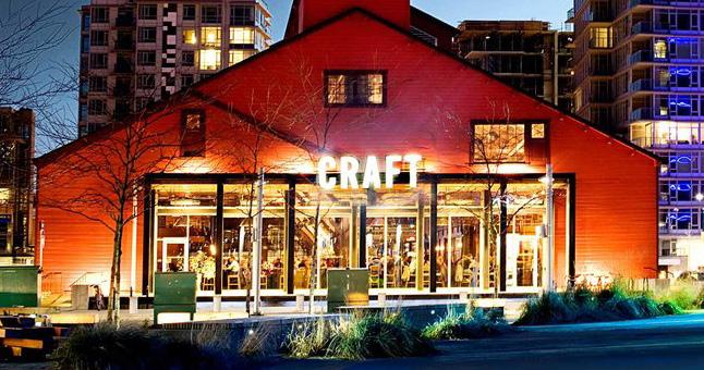
This site is 12 acres and includes several vacant sites scattered between existing businesses. This site is adjacent to several destinations and assets such as: the Lubeznik Center of the Arts, the public library, the County Courthouse, and Lighthouse Place Premium Outlets. Developable parcels in this site mainly consist of underutilized surface parking areas, including an overflow lot for the outlet mall. Existing structures on this site include commercial businesses and restaurants, storage warehouses, the Amtrak station, and the post office building. Most of the adjacent vacant parcels have been aggregated under private ownership by a few property owners. Redevelopment of this site has the potential to create new significant frontage along West Michigan Boulevard and bring a higher use to these underdeveloped properties.
Site H
The former St. Anthony’s Hospital building and associated properties totals 16.2 acres. The hospital building has been partially demolished following plans by Franciscan Health to repurpose the facility and enable redevelopment of the remainder of the site. The parking garage structure also remains on the site. Properties adjacent to the campus and West Ripley Avenue on Wabash Street that were formerly surface parking serving the hospital are
Michigan City • 11th Street Station 19
cleared for redevelopment. The conversion of this hospital property has created a large amount a cleared, readily-developable land and the potential to reintegrate the land into the surrounding neighborhood fabric.
Site G
Site G focuses on underutilized land surrounding the Elston Center/YMCA along Pine Street and Franklin Street. The 13.6 acres consists of surface parking, a sports field, tennis courts, and vacant undeveloped land. The majority of this site is property owned by Michigan City Area Schools. Existing structures include some single-family homes along and near West Homer Avenue and two commercial buildings, as well as the historic Michigan City Paper Box Company building at Pine Street and Detroit Street, which should be preserved and adaptively reused. This site is accessible via Franklin Street, Pine Street, Lafayette Street, Detroit Street, and West Homer Avenue. The Elston Center/YMCA facility already serves many community needs in Michigan City, and development around this property could better integrate these sites into the fabric of the city.
Site I
Site I is a smaller site of 2.1 acres along Franklin Street and adjacent to Ames Field. This site is currently used as the facilities building for Michigan City Area Schools, and it includes one structure and a surface parking lot. The site is bordered by Franklin Street, West Arthur Street/Pytynia Parkway, Wabash Street, and railroad tracks to the south. Redevelopment of this site could bring a higher use to the site and create frontage along Franklin Street.
Areas to Maintain and Invest
All other areas within the TDD boundary not identified for future development investment opportunities should be targeted for enhancement and preservation efforts that protect the existing character and build upon the strengths or existing assets. These areas may look like stable and established neighborhoods or active commercial nodes. Opportunities for small infill development or rehabilitation of structures may be present in these areas but should occur with a focus on compatibility with the surrounding context and land uses.
TOD Types
Transit-Oriented Development (TOD) Types are not prescriptive of future land use or zoning but instead describe the vision for creating a vibrant, ecosystem with walkability, transit access, and a diverse range of businesses, destinations, and housing. These descriptions have an overarching intent statement and describe typical uses and goals for how development or redevelopment could occur in each of these areas. Short statements are paired with character imagery from other similar places to help visualize these places.
Future TOD in Michigan City is envisioned as Downtown TOD with areas further from the station as Village TOD. The following descriptions explain the key considerations of each of the TOD Types.
20 Northwest Indiana TDD • TOD Strategic Implementation Plan
Downtown TOD
Downtown areas with denser, compact blocks that are highly-walkable and connected, containing a mix of uses serving the entire community
TOD Types
Typical Land Uses
Mixed-Use (vertically and horizontally integrated); Retail/Offices/Services; Attached Housing; Flex Office/Employment; Medical Offices/Services; Government/Public Facilities; Cultural/Civic; Hospitality; Entertainment; Larger Multi-Family Housing; Structured Parking
Secondary Land Uses
Parks/Plazas; Large Parks/Natural Space; Religious, Education, and Assembly Facilities; Surface Parking
Parking
On-street parking with limited off-street parking; shared public parking lots and parking structures with short- and long-term bike parking; structured parking should be lined or fronted by mixed-use buildings with active ground floor uses
Transportation
Interconnected street grid with wide sidewalks, bike facilities, and multiple and frequent bus/ transit connections; robust system of alleys
Typical Building Heights/ Density
Medium- to high-density with a minimum of 10 dwelling units per acre, typically 30+ units per acre; 3 stories minimum; anticipated average height of 5+ stories
Infill / Redevelopment
Infill should continue the existing visual pattern, rhythm or orientation of surrounding context along the street while adding appropriate height and density. Historically significant or contributing buildings should preserved or adaptively reused when possible.
Other Considerations Development should be supportive of pedestrian activity.
Compact, walkable areas with scaled mixed-use buildings that engage and support an active public realm serving the entire community
TOD Types
Typical Land Uses
Multi-Family Housing; Supportive Housing; Attached Housing; Retail/Offices/Services; Flex Office/Employment; Medical Offices/Services; Government/Public Facilities; Hospitality; Entertainment; Mixed-Use (vertically and horizontally integrated); Surface and Structured
Secondary Land Uses
Pocket Parks/Plazas; Greenways/Trails; Recreation Facilities; Cultural/Civic; Religious, Education, and Assembly Facilities; Floodplain/ Floodway; Preservation/Conservation Area
Parking
On-street parking with limited clustered off-street parking; shared public parking lots and structures with short- and long-term bike parking
Transportation
Typical Building Heights/ Density
Interconnected street grid with wide sidewalks, bike facilities, and frequent bus/transit connections
Infill / Redevelopment
Medium density of 10-25 dwelling units per acre; 2 stories minimum; anticipated average height of 3-4+ stories
Infill should continue the existing visual pattern, rhythm or orientation of surrounding context along the street while adding appropriate height and density. Historically significant or contributing buildings should preserved or adaptively reused when possible.
Other Considerations
Any redevelopment should occur in a sustainable manner that minimizes impacts on natural areas, incorporates proper stormwater management, and mitigates potential hazards to air or water quality.
Northwest Indiana TDD
Village TOD
Land Use Planning
Documentation and Analysis
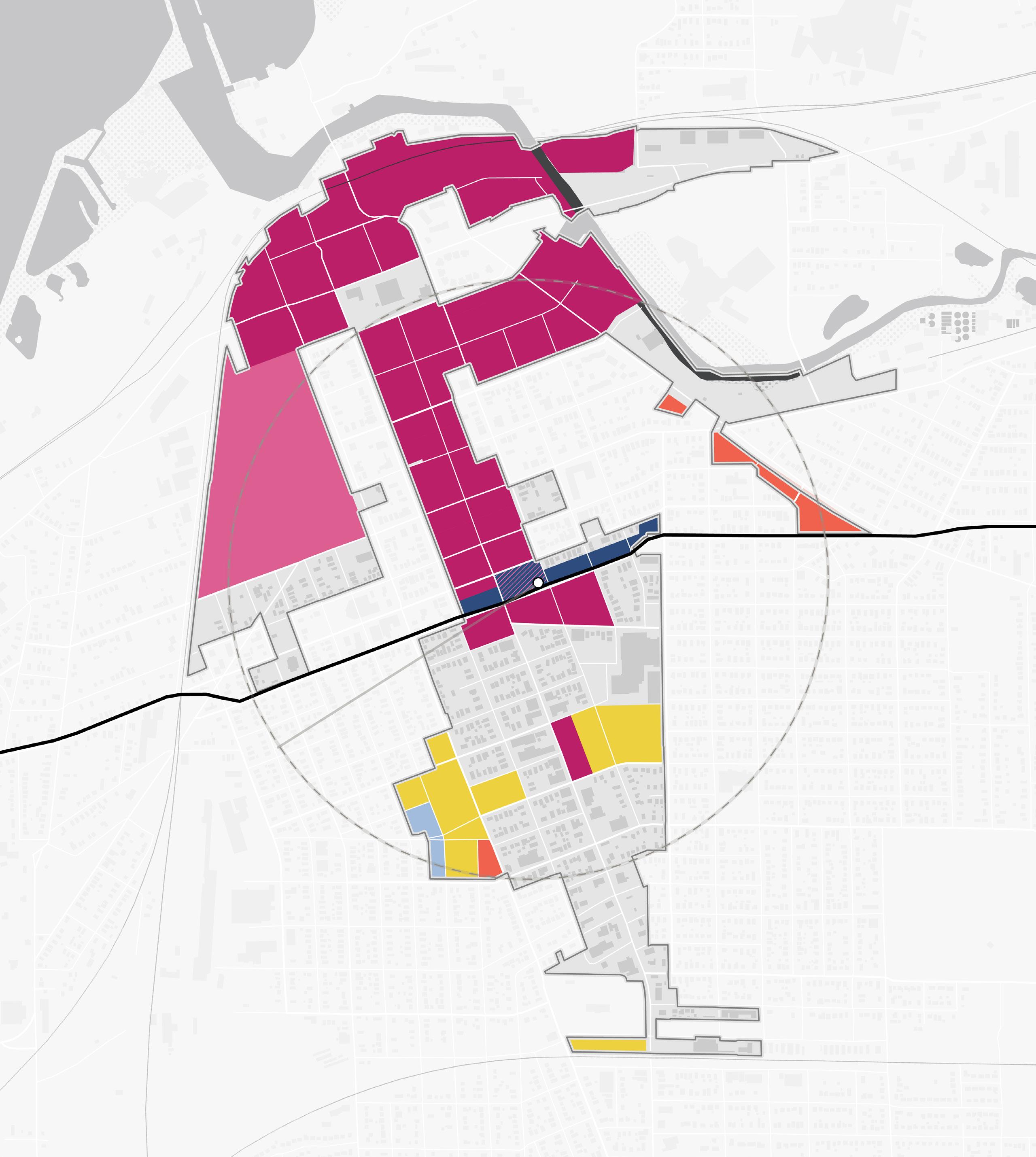
Previous Planning
Relevant recommendation from the City’s 2018 Momentum 2040 Comprehensive Plan, 2020 Double Track Betterment Options Report, 2014 Lake Michigan Gateway Implementation Strategy, and the 2007 North End Plan were integrated into this planning work.
Gaps and Opportunities
Compact, mixed-use transit-oriented development around the 11th Street Station Area has been a constant focus of past land use planning in Michigan city. In addition, the rail realignment of the South Shore Line along 11th Street has been considered for its impact on block patterns, circulation, and
development opportunities. Trail Creek is also an important natural feature for the City that has been considered for riverfront open space and mixed-use development to fully take advantage of this asset including destination development, boardwalks and greenways, and river access. The Franklin Street corridor continues to be a major focal point for downtown with consideration for reinvestment and infill development. Lighthouse Place Premium Outlets and Blue Chip Casino are other major destinations that have been included in some previous planning. The former Memorial Hospital site at 6th Street and Pine Street has been studied several times for redevelopment, and the St. Anthony’s Hospital (Franciscan Health) further south has been considered for reuse. Some additional small-scale infill and residential development opportunities may exist within existing residential areas.
Sites Studied
Areas with Similar Future Uses in 2+ Plans
Areas with Varied Future Uses in 2+ Plans
Opportunity Sites Not Previously Studied in Detail
Michigan City • 11th Street Station 23 NORTH
Gaps and Opportunities Analysis of previous plans affecting the TDD boundary
Momentum 2040 Comprehensive Plan (2018)
Recommendations include improving 11th Street and pedestrian amenities connected to the 11th Street Station. This plan also embraces the potential for TOD at the 11th Street Station as a catalyst for growth and revitalization downtown.
Relevant recommendations from this plan include:
• Adaptive reuse of the Franciscan Health Michigan City North Campus facility (St. Anthony's hospital) and site
• Enhance pedestrian crossings and address sidewalk deficiencies around the station area to ensure safe and efficient mobility along 11th Street. Improved crossings and signage near Marquette High School are needed to ensure student safety.
• A TOD study for the station area and its surroundings
Double Track Betterment Options Report (2020)
The Double Track Betterment Options Report informed improvements in collaboration between the City and NICTD along this corridor and major intersections. This plan is currently being implemented as part of the NICTD Double Track Project.
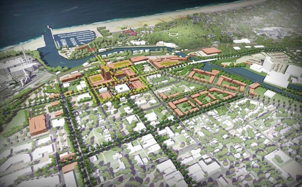
Lake Michigan Gateway Implementation Strategy (2014)
This plan emphasized the potential for downtown to become part of a lakefront destination strategy with year-round activities for visitors and residents of the community. This strategy included branding for Michigan City centered around the lakefront, developing supportive destination uses around the public library, and infill development around Blue Chip Casino and Lighthouse Place Premium Outlets. This also included enhancing the Uptown Arts District and converting Franklin Street to two-way traffic.
24 Northwest Indiana TDD • TOD Strategic Implementation Plan
Imagery from the 2018 Momentum 2040 Comp. Plan
Imagery from the 2014 Gateway Implementation Strategy
attention property city development in independently here. public two plans, best City. Creek. developed streets to end Hill new always side ensure promote wants competes where and provided in and building waterfront. capacity surrounded charrette overwhelm Trail 900

North End Plan (2007)
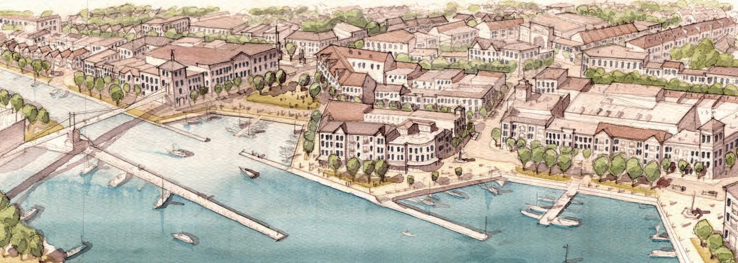
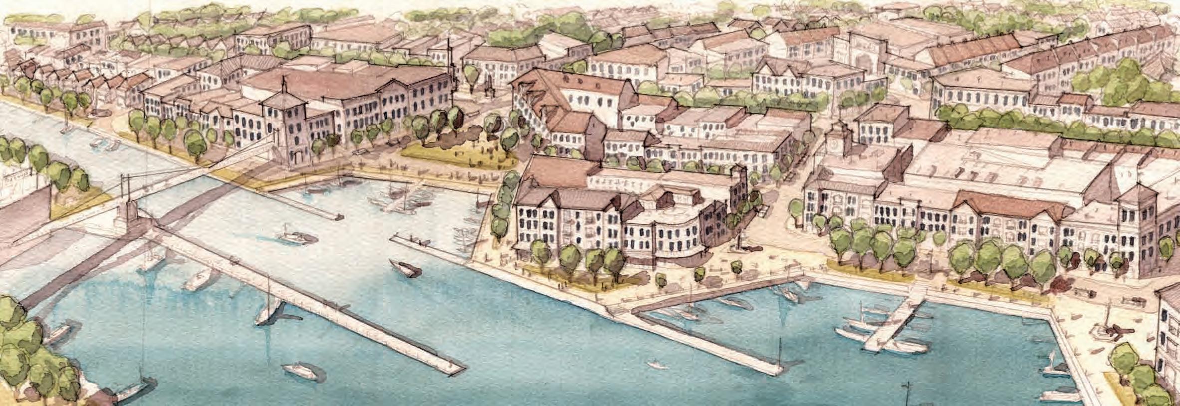
Michigan City • 11th Street Station 25
1 2 3 4 5 5 Key 1 | Theater 2 | Reserved 3 | Blue Chip 4 | Public 5 | Parking 6 | Michigan 7 | Box retailer 4 6 7 1 3 4 6 1
Illustrative 3D Imagery of the Trail Creek Promenade
Illustrative Plan Graphic of the Trail Creek Promenade Area
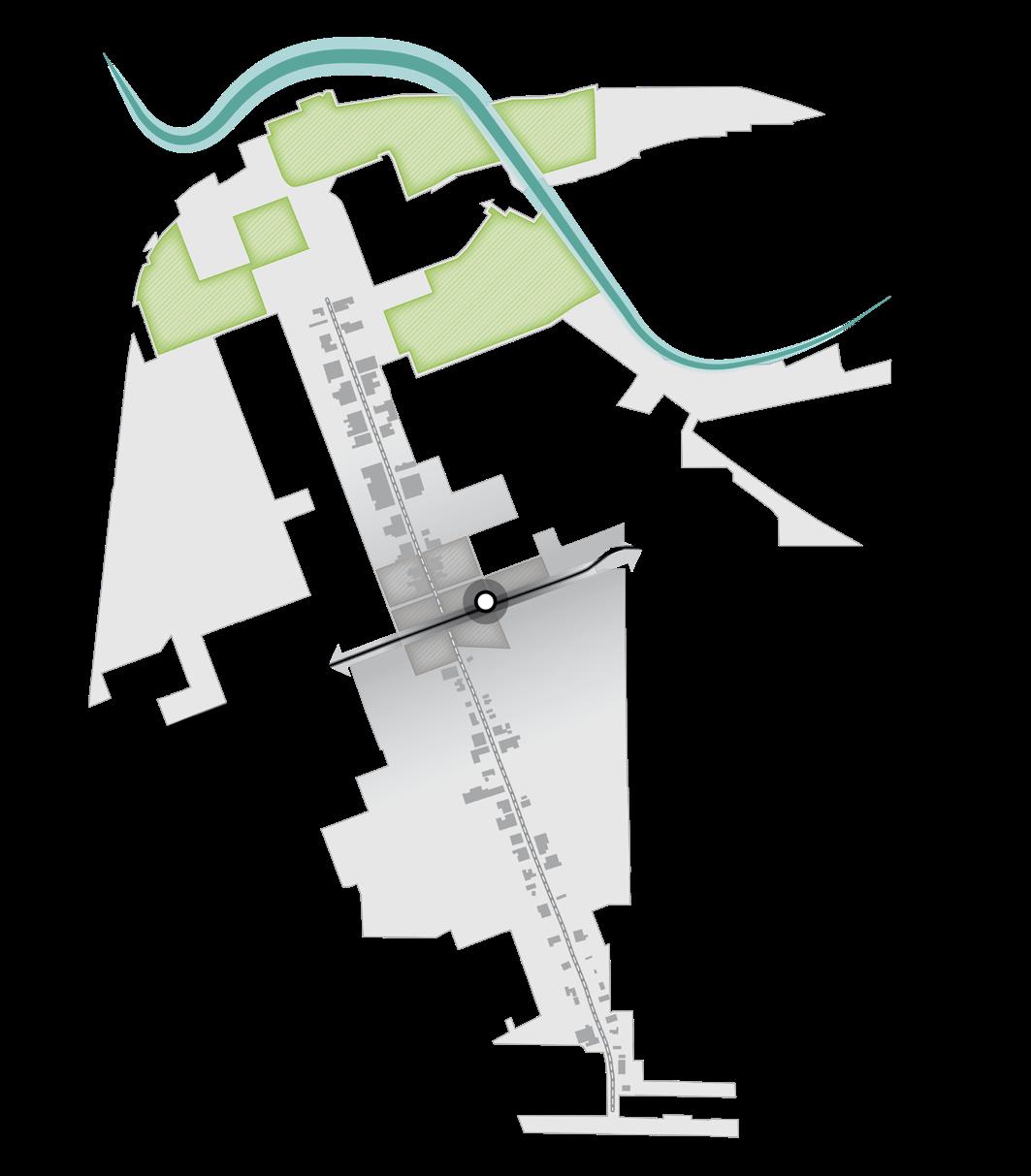
Existing Land Use
Existing land uses in Michigan City are largely represented by commercial uses along Franklin Street and the area north of 5th Street. Public or institutional uses are also present along Michigan Boulevard with City Hall/the library, the YMCA/Elston Center, and St. Anthony’s Hospital. The Franklin Street corridor is surrounding by residential neighborhoods including a mix of single-family and multi-family residential uses. A large portion of the lakefront is currently occupied by NIPSCO, an industrial use, but east of Trail Creek is the community asset of Washington Park.
Single-family Residential Multi-Family Residential Commercial Public Utility and ROW Park District Industrial Vacant Residential Vacant Commercial Vacant Industrial 26 Northwest Indiana TDD • TOD Strategic Implementation Plan YMCA
Lighthouse Place Premium Outlets Blue Chip Casino NIPSCO St. Anthony’s (Franciscan Health) Ames Field City Hall Shoreline Brewery & Restaurant 11thSt 10thSt 8thSt Barker Ave Greenwood Ave 5thSt MichiganBlvd MichiganBlvd Franklin St Franklin St Pine St Washington St 1/2Mile TrailCreek South Shore Line 11th Street Station 12 NORTH
and
Elston
Center
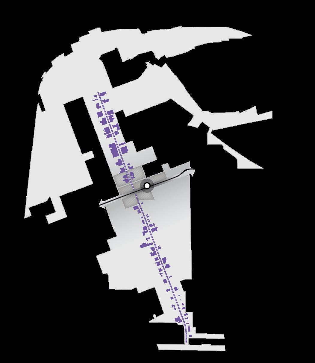
Future Land Use
The approach to future land use planning in this plan focuses on areas that are anticipated to change. Future land use is shown in general categories of land use to guide future land use and development decisions while allowing for flexibility in densities and building types. These land use descriptions also illustrate a general character and scale of the built environment recommended as most appropriate.
Other areas within the TDD boundaries that are not anticipated to change are not included in future land use planning. More detailed projections over 5-, 10-, and 20-year time horizons are mapped out for specific development sites included in this plan to represent a phased approach to development and land use.
Immediately surrounding the 11th Street Station and rail corridor, Mixed-Use Joint Development is planned that combines mixed-use with rail commuter parking. Additional areas along 11th Street corridor will be Station Area use as additional commuter surface parking. Future land uses along the Franklin Street corridor from 11th Street to 4th Street and key waterfront sites are envisioned as Mixed-Use Core, which will create higher density mixed-use development. Further south, Mixed Residential uses are planned on underutilized sites within existing residential areas. Infill opportunities along Michigan Boulevard exist as future Neighborhood Commercial. A portion of the St. Anthony’s Hospital will remain in medical-related operations as Employment/Office uses, while other portions may transition to Mixed Residential. Over time, there is potential for the Lighthouse Place Premium Outlets to redevelop as Mixed-Use Neighborhood.
Station Area
The Station Area use applies to the immediate land surrounding the NICTD Rail Station. This area includes the station platform, transit centers or amenities, parking lots or structures for transit riders, and maintenance yards. In the long term, some station areas may have the ability for Mixed-Use Joint Development to occur.
Mixed-Use Core
Mixed-Use Core land uses consist of high-density mixed-use areas, such as downtowns, are characterized by compact block patterns and tall mixed-use buildings. Businesses, services, and institutions serve the immediate residential population and the entire community. Buildings are oriented to the sidewalk, with attractive and active ground floor uses that support and encourage pedestrian activity. Plazas, pocket parks, sidewalks, or activated alleys should serve as public spaces for residents, employees, and visitors.
Mixed-Use Neighborhood
Mixed-Use Neighborhood land uses are medium-scale mixed-use areas that are often called town or village centers. They typically have compact development emphasizing connectivity and walkability with an accommodating public realm and storefronts that engage the street/pedestrians. The development pattern should be of appropriate scale in relation to the street and may include vertically integrated uses and horizontally integrated uses. Plazas, pocket parks, sidewalks, or activated alleys should serve as public spaces for residents, employees, and visitors. This typology provides retail and services to surrounding neighborhoods in a pedestrian-friendly environment, making it possible to accomplish several errands in a single trip.
Mixed Residential
Mixed Residential areas are primarily residential in uses of varying densities and housing types and can be adjacent to complementary commercial or public uses that support residential life. Housing types can range from single-family homes to townhomes and duplexes to multi-family buildings. Streets should be well-connected and be designed with sidewalks or paths and street trees. These areas can be served by neighborhood-scale parks and/or communityscale parks or recreation amenities that are easily accessible by residents, and residential developments can include small open spaces serving residents immediately adjacent to the building. Residential areas may be supported by a variety of nearby neighborhood-serving businesses.
Michigan City • 11th Street Station 27
Neighborhood Commercial
Contains primarily single-story commercial, retail, and service businesses that are either in freestanding buildings or small, integrated centers. Development patterns tend to be more auto-oriented than mixed-use districts and are characterized by large parking areas, usually in front of or to the side of buildings, that may or may not be shared by adjacent uses. Along a corridor, there is typically a lack of adequate pedestrian facilities, bike facilities, and green space.
Employment/Office
Employment/Office uses are areas that are dedicated to commercial office spaces, light industrial, and flex spaces, typically as standalone campus-like or office park-like development or destination. This use exists for a specific purpose or serves a particular population and is a major trip generator for a single site (i.e. business parks, flex manufacturing, etc.) Concentrated employment areas may be supported by a variety of nearby businesses targeted toward serving the daytime population.
Mixed-Use Joint Development Potential
Some Station Areas in these communities have the potential to redevelop over time and transform from surface parking lots into mixed-use joint development. This type of development would add vibrancy to the Station Area with a mix of uses, added residential units, and active groundfloor commercial spaces, while also continuing to provide parking for commuters through structured parking. This joint development should be considered and executed through collaboration among local units, NICTD, and developers. If federalized NICTD property is included, development will need to adhere to the FTA's Joint Development process.
28 Northwest Indiana TDD • TOD Strategic Implementation Plan
Station Area Mixed-Use Core Mixed-Use Neighborhood Mixed Residential Neighborhood Commercial Employment/Office Mixed-Use Joint Development Potential
Michigan City • 11th Street Station 29 NORTH 11thSt 10thSt 8thSt Barker Ave Greenwood Ave 5thSt MichiganBlvd MichiganBlvd Franklin St Franklin St Pine St Washington St 1/2Mile TrailCreek South Shore Line 11th Street Station 12
Future Land Use
YMCA and Elston Center
Blue Chip Casino NIPSCO
Ames Field City Hall
Lighthouse Place Premium Outlets
St. Anthony’s (Franciscan Health)
Shoreline
Brewery & Restaurant
30 Northwest Indiana TDD • TOD Strategic Implementation Plan
This page is intentionally blank.
Development Planning
Development Concepts
Within this TOD study area, two distinct strategies informed development opportunities that were tested more thoroughly. The primary strategy employed was to focus on sites with catalytic development potential that could spur investment by the private market in the short term. A secondary strategy was employed for long-term opportunities for which development potential is anticipated to increase with continued public and private investments as well as enabling infrastructure improvements. Specific development concepts were envisioned and analyzed by a range of development impacts that define an arc of development that supports Michigan City’s economic development path.
Nine development opportunities were studied in this planning process and selected to illustrate the potential of TOD in more detail with scenario planning and renderings.
Michigan City • 11th Street Station 31 NORTH South Shore Line
Site A Site G Site H Site I Site B Sites C & F Site D Site E1 Site E2
FranklinSt 11thSt EMichigan Blvd
Site A
Development Character
• Site A is the area most impacted by the 11th Street Station and 11th Street Central mixed-use development
• This area has the potential of becoming a dense, Mixed-Use Node TOD that begins to transform this southern part of the downtown core and catalyze investment and revitalization further north and south on Franklin Street
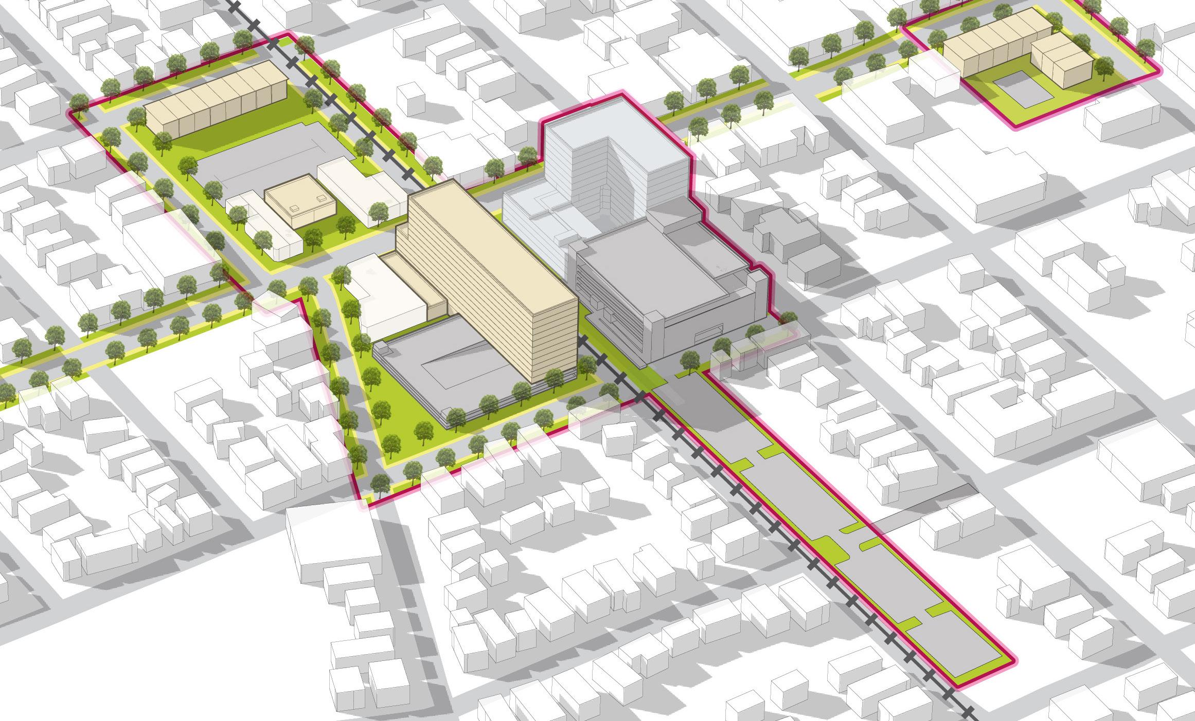
• This is also a place where additional density is envisioned with another significant development anchoring the southern corner of 11th Street and Franklin Street
• This diagram depicts two-story townhome buildings, commercial buildings between one and two stories, and mixed-use buildings at a range of 10-12 stories
32 Northwest Indiana TDD • TOD Strategic Implementation Plan
NORTH
11th Street Central Development
11thSt FranklinSt PineSt
Michigan City Paper Box Co
Former Moose Lodge
Development Program 5.2 Acres Commercial 18,100 SF Mixed-Use 190 Residential Units 11,500 SF Commercial Townhomes 8 Units
Site B
Development Character
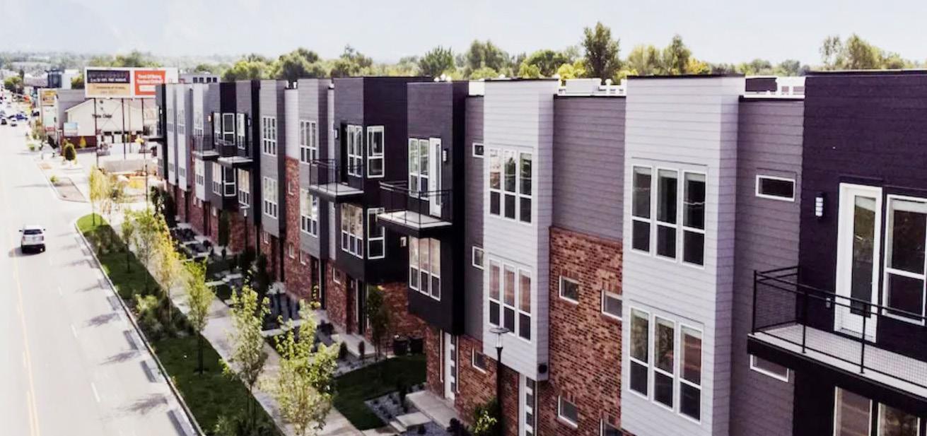
• Site B is in the core of the downtown as part of an infill development strategy paired with historic preservation and revitalization of existing mixed-use buildings
• Infill development should be designed sensitively to the existing character and scale of Franklin Street and adjoining neighborhood streets. New development should be compatible in both scale and architectural style to existing structures.
• This area would further benefit from the recommended Franklin Street two-way conversion and streetscape improvements. This area is highly walkable to the 11th Street Station and other downtown amenities.
• Townhomes on intersecting streets should be considered to begin the transition from the commercial Franklin Street into residential neighborhoods beyond
• This diagram depicts two-story townhome buildings, one-story commercial buildings, and three-story multi-family residential buildings
NORTH Michigan City • 11th Street Station 33
FranklinSt
8thSt
Development Program 6.5 Acres Commercial 18,100 SF Townhomes 24 Units Multi-Family Residential 52 Units
PineSt 7thSt
WashingtonSt
St. Paul Lutheran School
FLUID Coffee Roasters
Site D
Development Character
• Site D is outside of the targeted TOD area but within a walkable distance to the station
• This development places multi-family residential uses fronting Trail Creek to embrace the waterfront as an amenity
• Development of this site is a strategic move to re-envision the former Memorial Hospital site as dense downtown infill
• Higher density proposed within this site is concentrated as frontage along 5th Street, with townhomes stepping down in density to blend within the existing neighborhood context
• This site includes third party development plans for high-density mixed-use blocks north of proposed development
• Land along Trail Creek would offer low impact amenities to enjoy the waterfront, such as walking paths, benches, and picnic areas
• This diagram depicts two-story townhome buildings, one-story commercial buildings, and multi-family residential buildings at a range from five to eight (5-8) stories
NORTH 34 Northwest Indiana TDD • TOD Strategic Implementation Plan
Figure 1
6thSt
4thSt 5thSt
Figure 2
Michigan Blvd
Charles R. Westcott Park
Trail Creek Marina
Future Trail Creek Promenade
Trail Creek
Development Program 22.6 Acres Commercial 14,000 SF Townhomes 74 Units Multi-Family Residential 580 Units
Development Character
• Site E1 is outside of the targeted TOD area but within a walkable distance to the station
• This development keeps existing commercial buildings in tact, while increasing the density on this site with mixed-use buildings
• Townhomes to the north complement the existing waterfront residential adjacent to this site
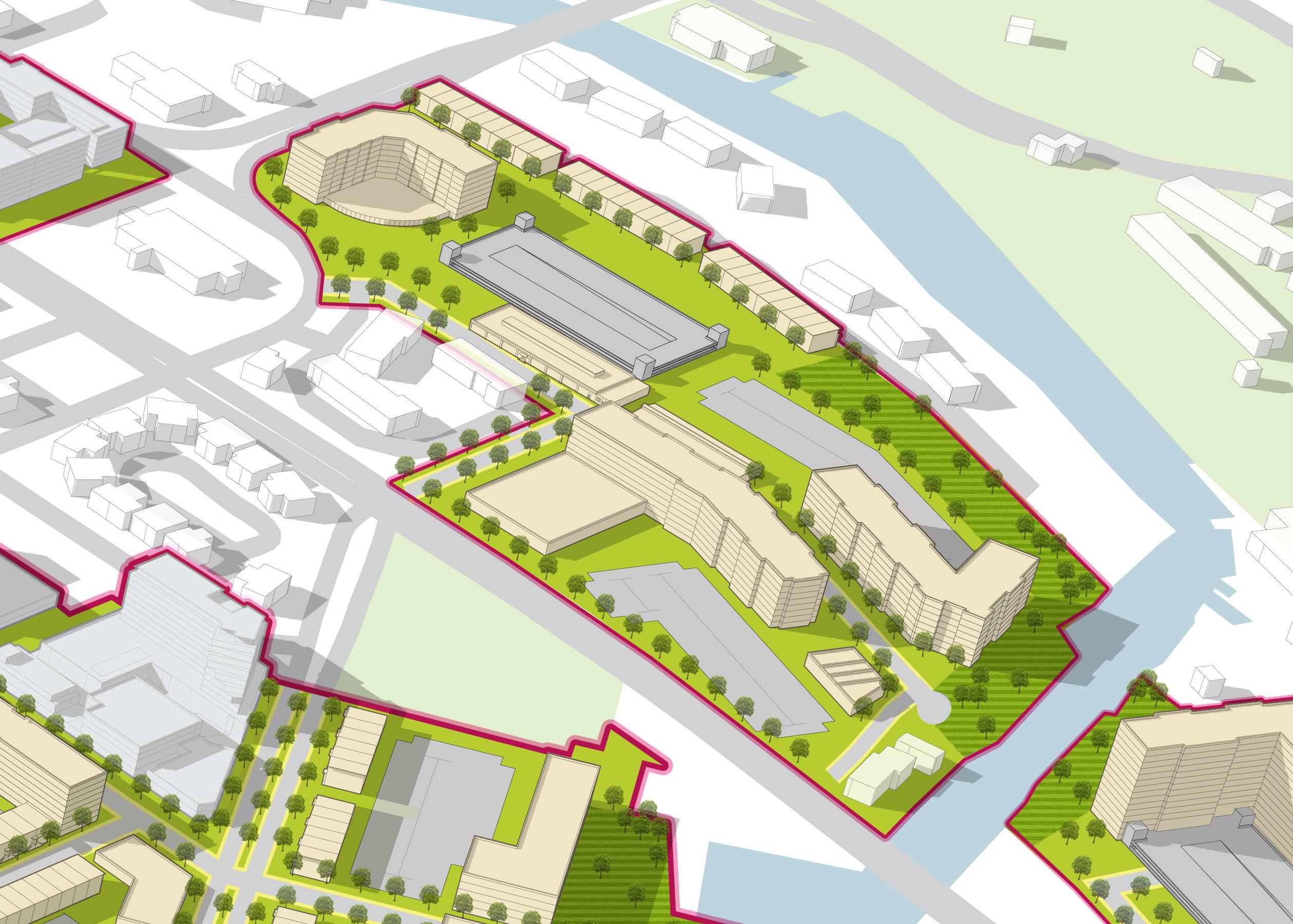
• Surface lots are supplemented by a one-story parking structure in order to meet parking demands associated with an increase in residents and commercial users
• Multi-story buildings take advantage of the views along the water, aligning with the City's strategy to activate the Trail Creek waterfront
• Land along Trail Creek would offer low impact amenities to enjoy the waterfront, such as walking paths, benches, and picnic areas
• This diagram depicts two-story townhome buildings, one-story commercial buildings, and multi-family residential buildings at approximately eight stories
Michigan City • 11th Street Station 35
MichiganBlvd
PineSt
City Hall
Congress Park
TrailCreek
Future Trail Creek Promenade
Site E2
Trail Creek
WMichiganBlvd
Development Character
• Site E2 is outside of the targeted TOD area and near Blue Chip Casino
• Development proposed is a residential tower that offers an unobstructed view of Trail Creek and Lake Michigan and provides attached structured parking
• Land along Trail Creek would offer low impact amenities to enjoy the waterfront, such as walking paths, benches, and picnic areas
• This diagram depicts the multi-family residential building at 15 stories
36 Northwest Indiana TDD • TOD Strategic Implementation Plan E2ndSt CenterSt NORTH
Development Program 5.8 Acres Multi-Family Residential 257 Units
WabashSt WashingtonSt
Development Character
• This area is already experiencing significant investment with the We Are Beautiful development and will likely increase in value as the NIPSCO Powerplant is decommissioned in coming years
• Proposed development includes mixed-use frontage on Michigan Boulevard and multi-family residential within walking distance to downtown and Lake Michigan
• Townhome development steps down in density from Michigan Boulevard to blend with the existing neighborhood
• This diagram depicts two-story townhome buildings, a five-story hotel, and multi-family residential buildings between five and six stories
NORTH Michigan City • 11th Street Station 37
MichiganBlvd
Development Program 19.4 Acres Hotel 150 Keys Townhomes 12 Units Multi-Family Residential 717 Units
Shoreline Brewery & Restaurant Future Waterfront Development
Michigan City Public Library
You Are Beautiful Development
Sites C & F
Development Character
• Site G is owned by Michigan City Area Schools and St. Stanislaus Catholic Church and presents an opportunity to develop on parking lots, tennis courts, and practice fields near the station
• This site would increase the residential population within walking distance to the station by creating frontage along Franklin Street with a multi-family residential building and adding townhomes to the east that fit in with the scale and character of adjacent residential streets
• This development is recommended to be done in a sensitive way to allow for school and YMCA functions to continue at the Elston Center
• This diagram depicts two-story townhome buildings and a five-story multi-family residential building
NORTH
FranklinSt
LafayetteSt
PineSt
Homer St
RipleySt
Development Program 13.6 Acres Townhomes 62 Units Multi-Family Residential 147 Units 38 Northwest Indiana TDD • TOD Strategic Implementation Plan
La Porte County Family YMCA
Site G
Development Character
• Site H is envisioned as infill housing around the former St. Anthony's Hospital (Franciscan Health) with an emphasis on providing single-family attached, townhome, and senior housing development to supplement healthcare facilities envisioned to remain on the site
• Development patterns and infrastructure seek to support a walkable neighborhood suitable for age-in-place housing
• This style of residential development is able to blend into its surrounding neighborhood context
• This diagram depicts one-story single-family residential buildings, two-story duplexes, and a three-story mixed-use building
NORTH Michigan City • 11th Street Station 39
WabashSt
RipleySt
Charles St W Barker Ave
Development Program 16.2 Acres Single-family Residential 26 Units Duplex 40 Units Mixed-Use 20 Residential Units 8,000 SF Commercial Franciscan Health
Site H
Development Character
• Property adjacent to Ames Field could allow for a multi-family development to front Franklin Street and Pytynia Parkway
• This development could potentially share parking with adjacent Ames Field lots if needed
• This diagram depicts a four-story multi-family residential building

FranklinSt
WabashSt
Pytynia Pkwy
40 Northwest Indiana TDD • TOD Strategic Implementation Plan Development Program 2.1 Acres Multi-Family Residential 94 Units Site I
Ames Field
Arc of Development
At this level of study, it is difficult to assign exact timeframes to development, but this plan demonstrates a range of development and illustrates a potential arc of development over time that could be possible with the right set of incentives and conditions supported by the market.
To understand the full range of potential of these sites, high-level capacity tests were conducted using various densities and types of development possible for each community. Estimations of several metrics of community impacts, including population changes, jobs created, and generated vehicle trips, were calculated based on future potential development. These impacts were informed by market analysis conducted by KPMG and Policy Analytics. ownership status, local guidance and interest, and quantitative and qualitative planning analysis.
The arc of development for each community was defined collectively for selected development opportunities within the TDD boundary that projects future development potential over 5-, 10-, and 20-year time horizons. Quantitative and qualitative factors such as local/public property control, developer engagement or interest, site conditions, current regulations or future regulatory changes, among others were considered in determining the arc of development over time. This study is confident, however, that investments outlined herein can change the outlook and perception of this area and thus induce the private development market over time.
Projected Land Use & Development: 5-Year Horizon
Projected Land Use & Development: 10-Year Horizon
Projected Land Use & Development: 20-Year Horizon
Station Area
Mixed-Use Core
Mixed-Use Neighborhood
Mixed Residential Neighborhood Commercial
Employment/Office
Mixed-Use Joint Development Potential
South Shore Line Franklin St MichiganBlvd 11thSt South Shore Line Franklin St MichiganBlvd 11thSt South Shore Line Franklin St
11thSt Michigan City • 11th Street Station 41
MichiganBlvd
Impact Projections
* Vehicle trips generated include projected commuters in 2022 and in 2040 at full build out
** Source: NICTD
42 Northwest Indiana TDD • TOD Strategic Implementation Plan Land Use Total Development in Acres 45.80 - 78.71 Acres Total Development in Sq. Ft. 1,995,900 - 3,428,800 SF Retail Development 77,600 - 116,000 SF Hotel Development 84,400 - 281,500 SF Office Development ± 102,500 SF Multi-Family Residential Development 1,731,400 - 2,928,800 SF Residential Housing Units Total Housing Units 1,640 - 2,450 Rental Units 1,575 - 2,250 Owner-Occupied Units 65 - 200 Projected Impacts Residential Population Increase 3,480 - 5,048 Households with School-Aged Children 636 - 923 Employees 230 - 448 Vehicle Trips Generated* 14,340 - 21,280 (2022)** 14,730 - 21,665 (2040)**
Michigan City • 11th Street Station 43
44 Northwest Indiana TDD • TOD Strategic Implementation Plan
Michigan City • 11th Street Station 45
46 Northwest Indiana TDD • TOD Strategic Implementation Plan
Michigan City • 11th Street Station 47
48 Northwest Indiana TDD • TOD Strategic Implementation Plan
Infrastructure
Documentation and Analysis
Functional Classifications
Determined by INDOT, functional classifications were documented and used in analysis to understand the hierarchy of corridors in each community. These classifications also helped inform street design and public realm character typologies.
Michigan City is served by a highly-connected grid of streets. Several Principal Arterials create more regional connections, including Michigan Boulevard (US 12) along the lakefront, Michigan Boulevard, the two-way portion of Franklin Street (south of 9th), and the one-way pairing of Washington Street and Pine Street north of 9th Street. Minor Arterials such as 2nd Street, Franklin Street crossing Trail Creek, portions of 8th Street, and Chicago Street form connections between Principal Arterials. Major and Minor Collectors connect to residential areas between major corridors.
As a result of the rail realignment as part of the NICTD Double Track, traffic patterns along and around 11th Street will be changing, including the closure of some streets at 11th Street. Pine Street, among other local streets, will be closing at its intersection with 11th Street and will be designed to only serve access to the parking garage and parking lot on 11th Street. These closures are anticipated to impact traffic patterns, particularly in the form of potential increases in traffic volume of remaining through streets across 11th Street.
Michigan City • 11th Street Station 49
NORTH 50 Northwest Indiana TDD • TOD Strategic Implementation Plan Functional Classifications Principal Arterial Minor Arterial Major Collector Minor Collector 5thSt TrailCreek Lake Michigan South Shore Line Blue Chip Casino NIPSCO City Hall Shoreline Brewery & Restaurant Washington Park 1/2Mile E St 6th St YMCA and Elston Center Lighthouse Place Premium Outlets St. Anthony’s (Franciscan Health) Ames Field 12 Franklin St Pine St Washington St EMichiganBlvd W Michigan Blvd MichiganBlvd 11thSt WRipleySt HomerSt Garfield St Lafayette St Kennedy St 8thSt 10th St Wabash St Barker Ave Greenwood Ave 4th St 2nd St 8th St ChicagoSt Ohio St Poplar St Willard Ave Wabash St 11th Street Station
Thoroughfare Typologies
Thoroughfare Typologies were developed to analyze existing corridor conditions and create aspirational goals for future street design and streetscape. Typologies focused on important corridor segments within and connecting to the TDD boundary to guide the design and character of roadways, sidewalks, and amenities within the public right-of-way. These typologies depict typical elements of corridors, including the number of travel lanes, landscaping, lighting, bicycle infrastructure, and sidewalks and paths.
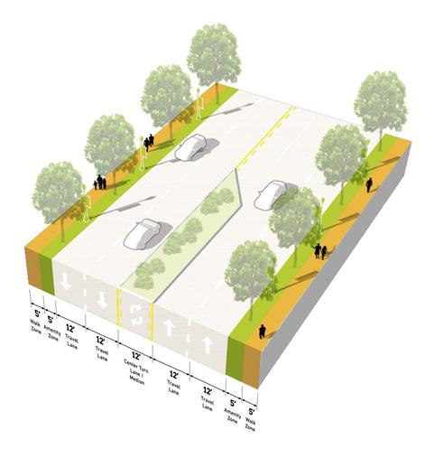
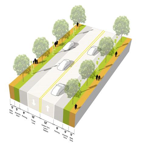
Franklin Street and 11th Street are designated as TOD Priority Thoroughfares as they are and continue to be major activity corridors for downtown and the station. With the rail realignment project, 11th Street will receive a redesign and streetscape enhancements. TOD Connectors, including 2nd Street, Pine Street, Washington Street, and portions of Franklin Street and 11th Street, promote connectivity to the station area throughout downtown. Other important connections made by Key Vehicular Routes, such as Michigan Boulevard, 8th Street, Chicago Street, Wabash Street, Barker Avenue, and Greenwood Avenue, carry traffic between downtown and the surrounding residential neighborhoods.
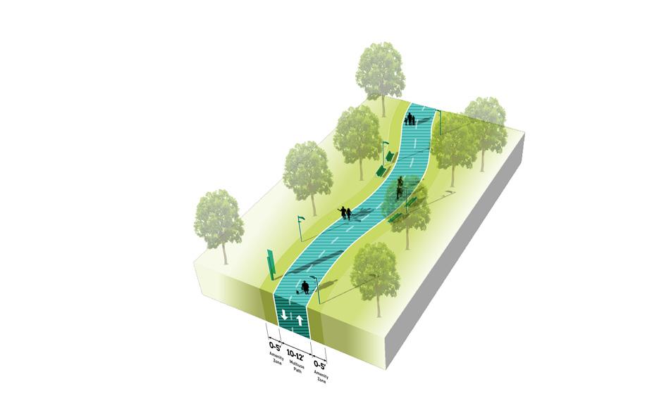
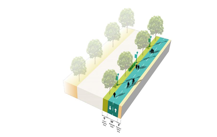
The TDD boundary is proximate to recreational trails, the Calumet Trail and the Trail Creek Greenway, but these two trail facilities do not formally connect. Enhanced pedestrian, bike, and/ or trail facilities should be considered along East and West Michigan Boulevard to connect these two systems. Pedestrian connectivity enhancements should occur along Franklin Street, Pine Street, Washington Street, and 8th Street to promote walkability to and from the station and throughout downtown.
Pine Street and Washington Street have better actual or planned capacity for on-street bike lanes. This is where typical “trail” activity is recommended. Franklin Street, which functions as more of a storefront shopping experience to the north and eventually dead-ends at the library, seems less suited to accommodate a dedicated trail.
Key Pedestrian Route TOD Priority Thoroughfare
Connector Key Vehicular Route Trail/Greenway Michigan City • 11th Street Station 51
TOD
TOD Priority Corridor TOD Connector Key Vehicular Route Existing Trail/Greenway Key Pedestrian Route NORTH Calumet Trail Trail Creek Greenway Thoroughfare Typologies YMCA and Elston Center Lighthouse Place Premium Outlets Blue Chip Casino NIPSCO St. Anthony’s (Franciscan Health) Ames Field City Hall Shoreline Brewery & Restaurant Washington Park 10thSt 8thSt 5thSt Franklin St 1/2Mile TrailCreek Lake Michigan South Shore Line 12 Franklin St Franklin St Pine St Washington St EMichiganBlvd WMichiganBlvd MichiganBlvd Wabash St 11thSt 8thSt Barker Ave Greenwood Ave 2nd St 11th Street Station 52 Northwest Indiana TDD • TOD Strategic Implementation Plan
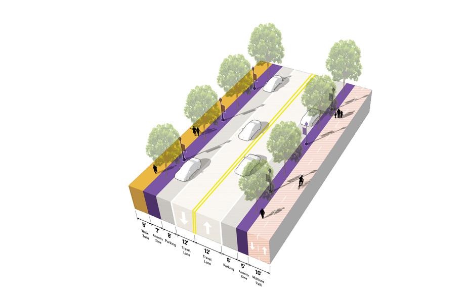
TOD Priority
Thoroughfare
Designed as a Complete Street, accommodating all modes of transportation with high-quality facilities, amenities, and public realm
TOD Priority Thoroughfares support the highest intensity of activity, at local and regional scales. The function of these corridors is primarily to provide multi-modal access to the Station Area and to generate street-level activity for a mix of uses. These corridors will likely carry a high volume of traffic, but at lower vehicle speeds to also accommodate safe, highly-walkable conditions for pedestrians and bicyclists. An attractive, high-quality public realm provides abundant amenities for pedestrians and bicyclists, creating a safe and comfortable environment and establishing an identity/ sense of place. Buildings are typically oriented toward the sidewalk with active ground floor uses. Sidewalks should be wide enough to accommodate a clear walking path along with amenities such as street trees, planters, landscaping, outdoor dining, and gathering areas. Transit is also highly accessible along TOD Priority Thoroughfares, and transit stops should be enhanced and designed as part of the public realm. Parking is typically provided on-street, and access to development blocks or off-street parking should not occur directly from the corridor.
11th Street Station
Number of Lanes/ Target Speed
Non-motorized Facilities
Bus/transit Facilities
Parking
Access Management
Public Realm Design/Amenities
2-4 lanes / 25-35 mph
Dedicated facilities (dedicated/separated bike lanes, sharrows, multi-use paths) wide sidewalks; frequent crossings that are well-designed and enhanced for safety and access, including mid-block crossings where necessary
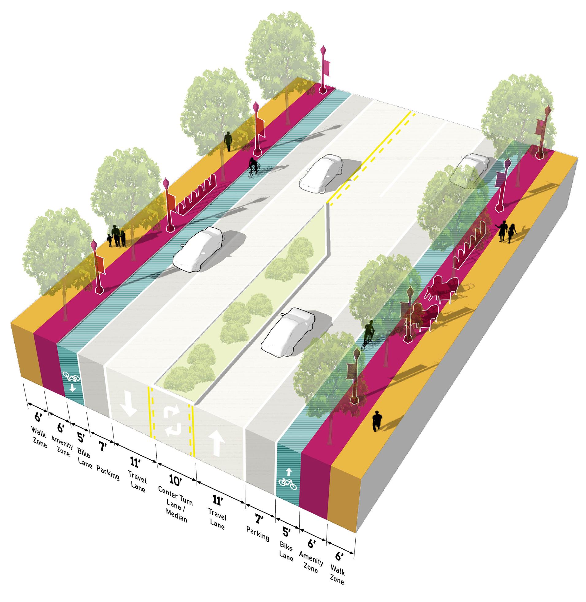
Well-served by bus/transit; enhanced transit stops including shelters and other amenities; Station Area as a hub for transit facilities; bus pull-off or drop-off zones encouraged
On-street parking; any off-street parking, either structured garages or surface lots, should be to the rear of buildings, interior to blocks, and/or properly screened and well-designed with landscaping
Very limited to no driveways in the TOD Station Area; shared parking among buildings and uses is highly encouraged to reduce the number of driveways; driveways, if present, should be adequately spaced and offset to prevent conflicts; consolidation of existing driveways should be studied
High quality and active public realm design with abundant amenities for pedestrians and bicyclists; design should be reflective of the community character and identity; sidewalks should provide adequate clear space for pedestrian circulation
54 Northwest Indiana TDD • TOD Strategic Implementation Plan
TOD Priority Thoroughfare
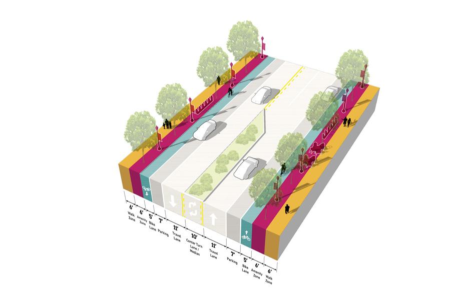
TOD Connector
Multi-modal street that balances modes of transportation to connect to other major facilities, with high-quality public realm and frequent amenities
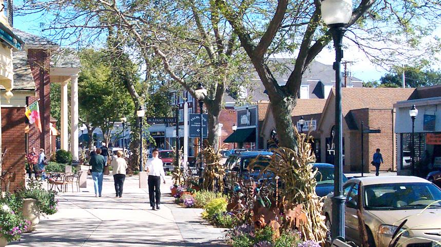
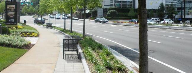
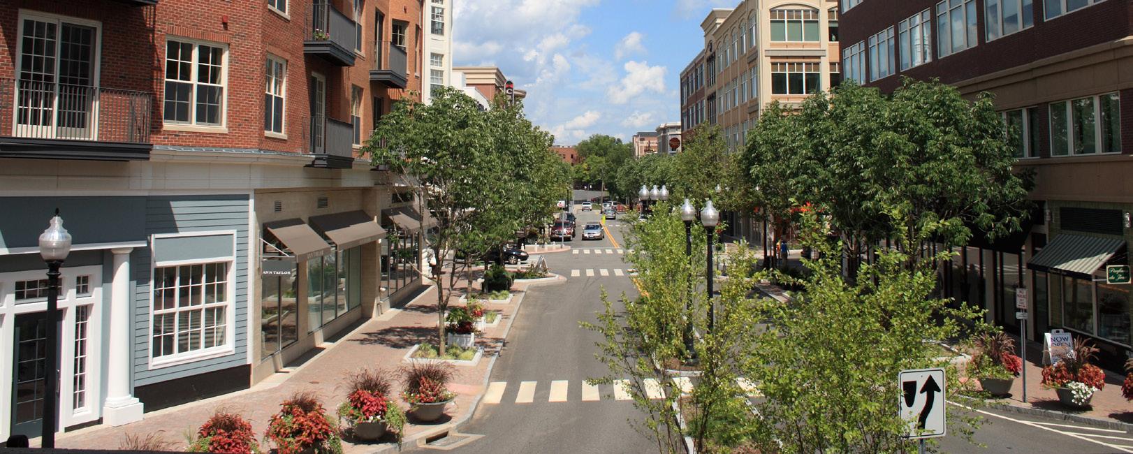
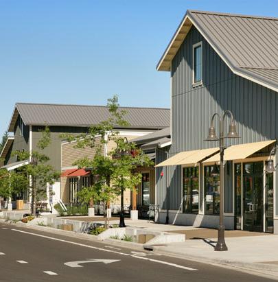
TOD Connector Thoroughfares may vary more in density of development and intensity of uses, depending on the context. These corridors serve to provide access to TOD Priority Corridors, transit-oriented development and the Station Area for the broader community and connect to other key destinations. TOD Connectors are multi-modal in design with lower vehicular speeds, connected pedestrian and bicycle networks, and transit stops. Bicycle infrastructure may vary from dedicated facilities to shared streets, depending on available right-of-way. A high-quality public realm should continue along these corridors, but may be less intense or frequent in amenities depending on right-of-way and context. Buildings are typically oriented toward the sidewalk with active ground floor uses, but setbacks may increase with a decrease in density. Driveways, both residential and commercial, may be present along the corridor, but infrequent; access management should ensure safe entry/exit along the corridor. Parking is typically provided on-street, and access to development blocks or off-street parking should not occur directly from the corridor.
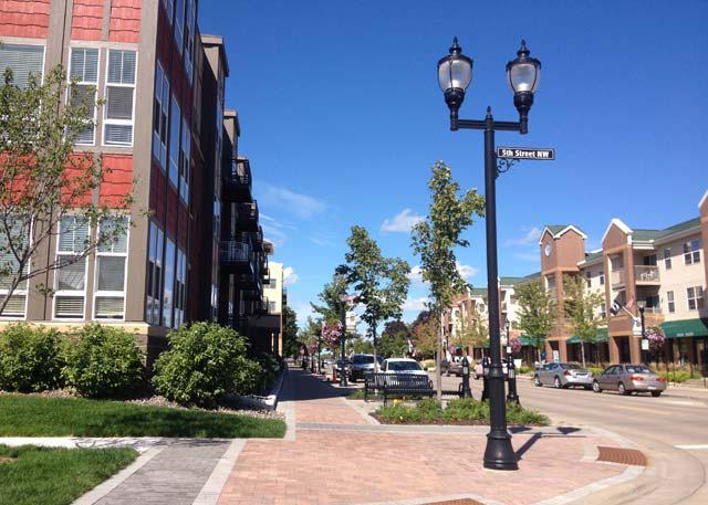
Number of Lanes/ Target Speed
Non-motorized Facilities
Bus/transit Facilities
Parking
Access Management
Public Realm Design/Amenities
2-4 lanes / 25-35 mph
Connecting gaps of existing facilities (dedicated/separated bike lanes, sharrows, multi-use paths, sidewalks, well-designed and enhanced crossings); enhancing existing facilities to improve safety and accessibility
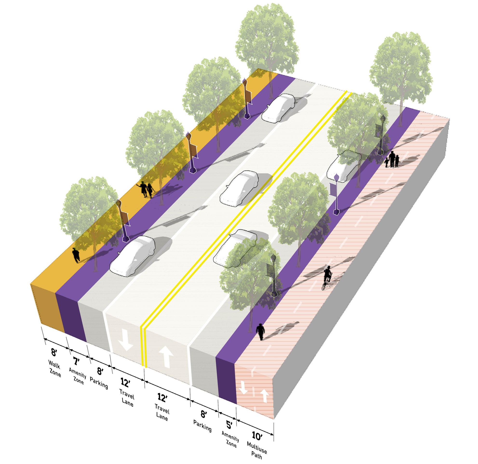
Well-served by bus/transit; enhanced transit stops including shelters and other amenities; bus pull-off or drop-off zones encouraged
On-street parking; any off-street parking, either structured garages or surface lots, should be to the rear of buildings, interior to blocks, and/or properly screened and well-designed with landscaping
Limited driveways along corridor; shared parking among buildings and uses is highly encouraged to reduce the number of driveways; driveways, if present, should be adequately spaced and offset to prevent conflicts; consolidation of existing driveways should be studied
High quality and active public realm design with many amenities for pedestrians and bicyclists; design should be reflective of the community character and identity; sidewalks should provide adequate clear space for pedestrian circulation
56 Northwest Indiana TDD • TOD Strategic Implementation Plan
TOD Connector
Key Vehicular Route
Primarily functions for vehicular travel but ensures adequate access and safety for all other modes along the corridor, connects to other facilities in the community
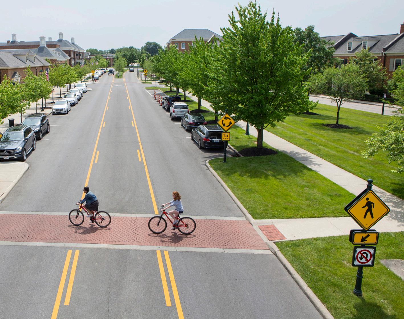
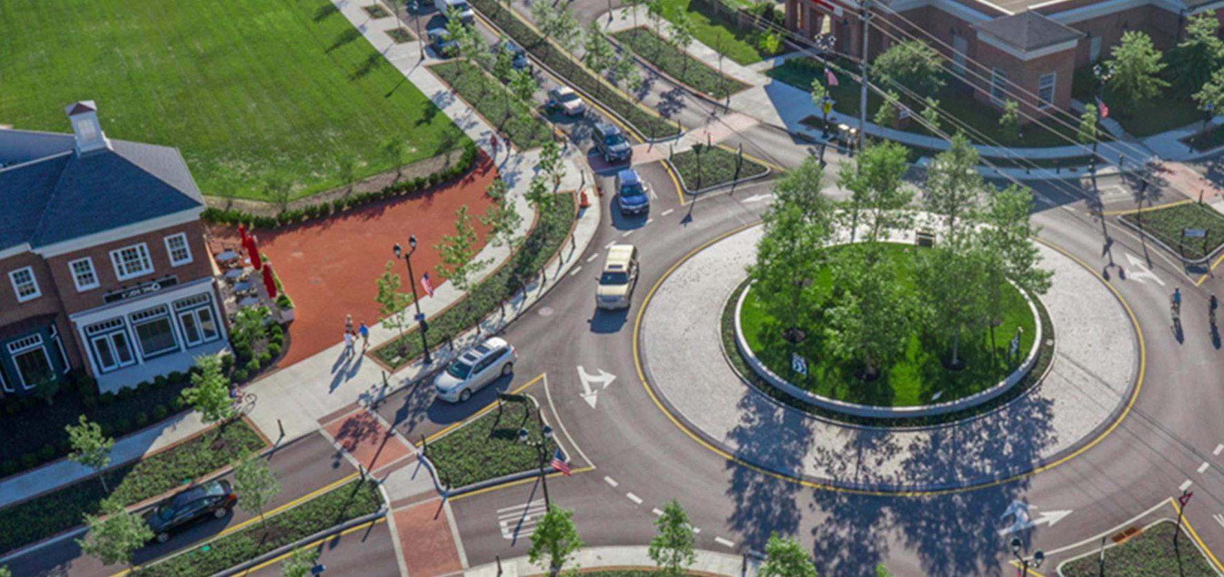
Key Vehicular Routes serve areas of moderate density and transition areas to more residential or neighborhood scale areas of the community. These corridors are more auto-oriented, linking residents to major community destinations, services, and amenities, but should still contribute to the network of safe and comfortable pedestrian and bicycle facilities. Transit service may be less frequent on these thoroughfares, but should still be accessible to important transit routes. Vehicular speeds are low along these thoroughfares, and the public realm may be less formal in design, especially in residential areas. However, quality design should still contribute to a sense of place along these corridors. On-street parking may exist in denser areas, and residential and commercial driveways are more frequent along Key Vehicular Routes, especially in more suburban-style development areas. New development should establish a high level of public realm and prevent or mitigate any vehicular conflicts through access management interventions. Parking is typically provided on-street, and access to development blocks or off-street parking should not occur directly from the thoroughfare.
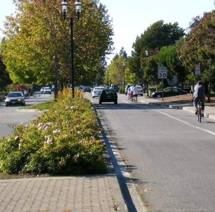
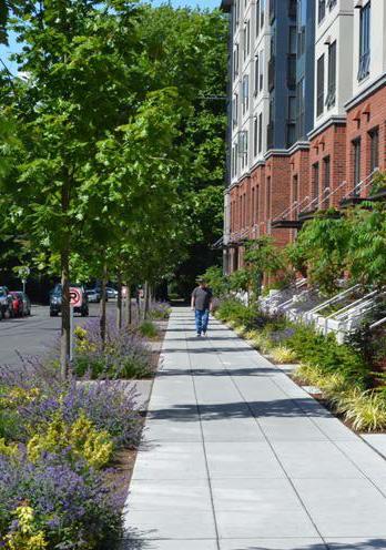
Number of Lanes/Target Speed 2 lanes / 20-25 mph
Non-motorized Facilities
Connecting gaps of existing facilities and access to enhanced facilities (sharrows, multi-use paths, sidewalks, well-designed and enhanced crossings); focus on balancing of modes
Bus/transit Facilities
Some bus/transit facilities, less frequent but enhanced transit stops; stops should be located at key destinations
Parking
On-street parking; any off-street parking, either structured garages or surface lots, should be to the rear of buildings, interior to blocks, and/or properly screened and well-designed with landscaping (if visible from corridor)
Access Management
Public realm design with basic amenities for pedestrians and bicyclists; design should be reflective of the community character and identity; sidewalks should provide adequate clear space for pedestrian circulation
Public Realm
Design/ Amenities
High quality and active public realm design with many amenities for pedestrians and bicyclists; design should be reflective of the community character and identity; sidewalks should provide adequate clear space for pedestrian circulation
58 Northwest Indiana TDD • TOD Strategic Implementation Plan
Key
Route
Vehicular
Key Pedestrian Route
Functions primarily for pedestrians, typically as a highly-designed pathway or as a trail or greenway, and may also accommodate bicyclists
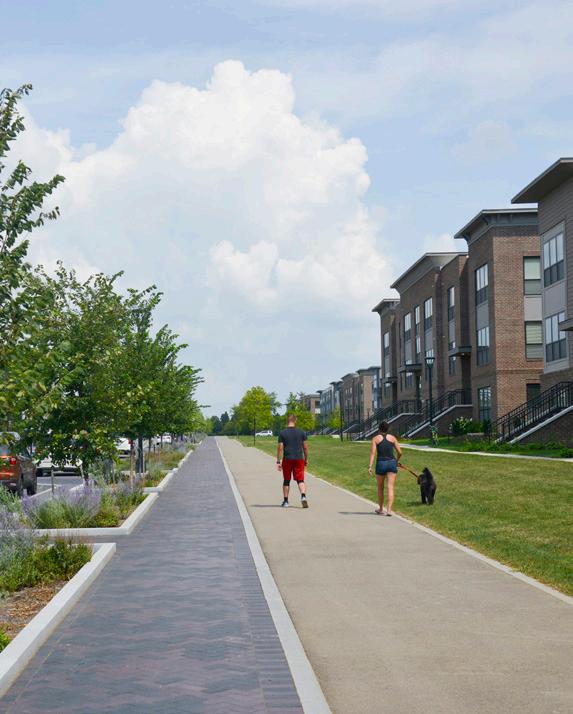

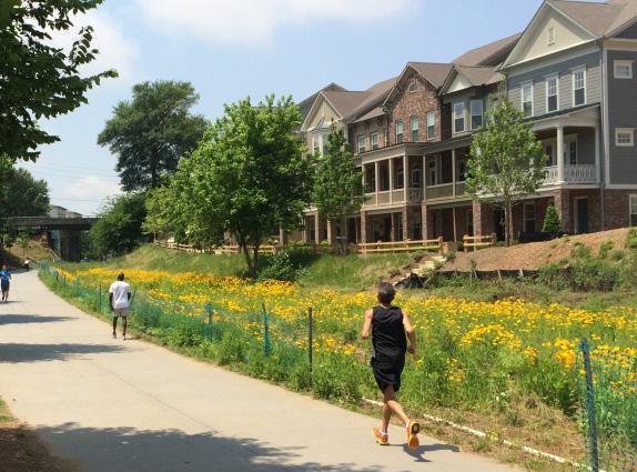
Key Pedestrian Routes primarily serve pedestrians to connect to key destinations, transit access, and the Station Area. These routes may exist alongside vehicular corridors or they may exist in the form of a pedestrian pathway or trail. In the case of a trail, bicycles may also be accommodated. Amenities and landscaping should be designed at pedestrian-scale and either contribute to the surrounding character or to particular brand if part of a larger trail network. Wayfinding and signage is particularly important to highlight access points and destinations across the community. New Key Pedestrian Routes should be planned to avoid vehicular conflicts such as driveways, and these conflicts should be reduced to the extent possible along existing Key Pedestrian Routes.
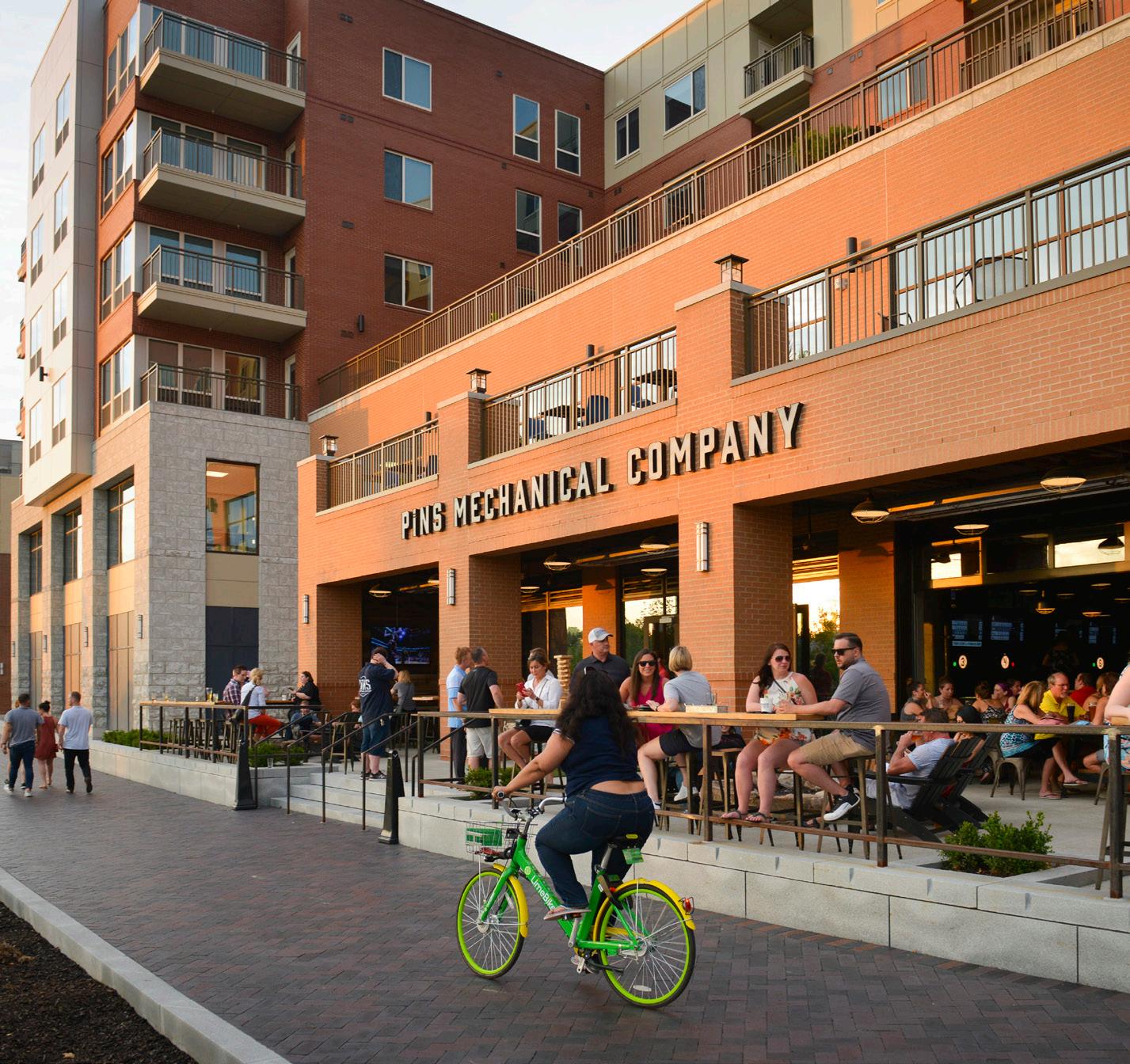

Number of Lanes/Target Speed N/A or Varies
Non-motorized Facilities
Completing gaps of existing facilities and access to enhanced facilities (sidewalks, multi-use paths, and well-design and enhanced crossings where intersecting with roadways); may exist along roadways or as a separated facilities like a path or trail
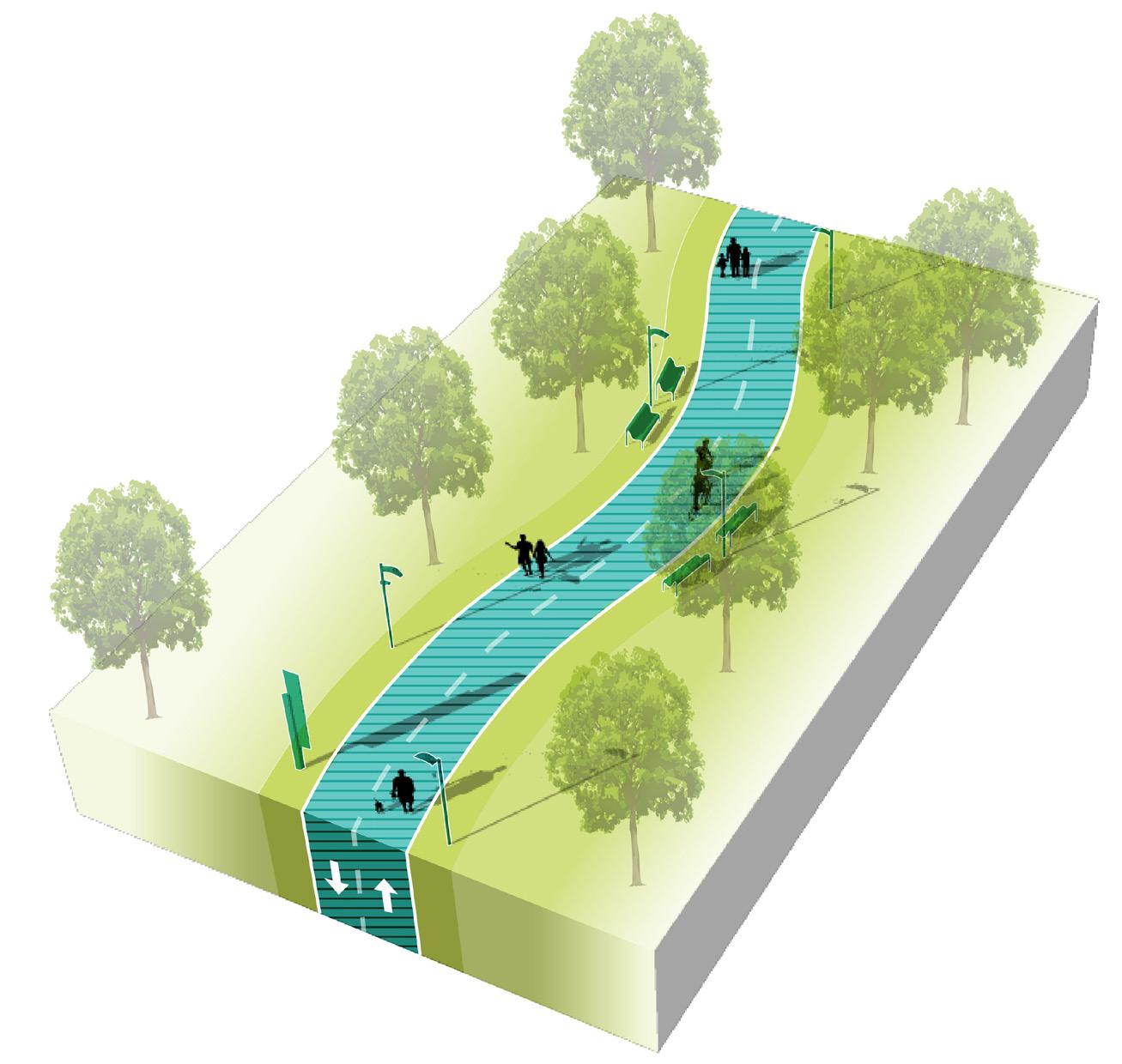
Bus/transit Facilities
Some bus/transit facilities, less frequent but enhanced transit stops; stops should be well-connected by a complete network of pedestrian facilities
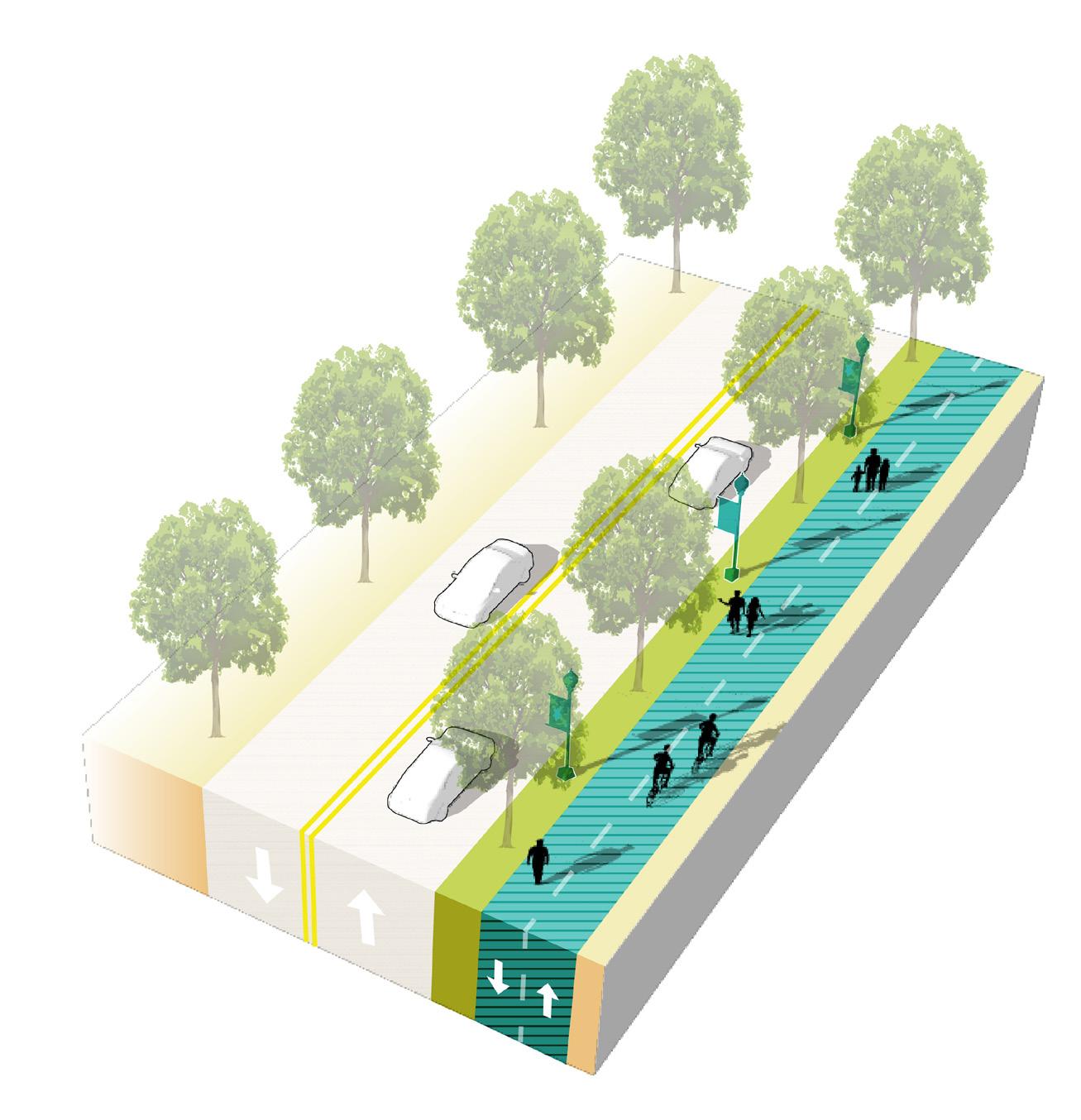
Parking
Parking areas, on-street or off-street, should be located near trailheads. Pedestrian routes may connect parking areas to other destinations in the community.
Access Management
Limited driveways intersecting with pedestrian routes to reduce conflicts with vehicle entries/exits and maximize pedestrian safety. New pedestrian routes should be planned along corridors with minimal driveway conflicts, or access management interventions may be implemented.
Public Realm Design/ Amenities
Amenities along pedestrian routes should be tailored to pedestrians (or bicyclists if a multi-use path or trail); design should be reflective of the community character and identity;local or regional trails may be designed with individual branding
60 Northwest Indiana TDD • TOD Strategic Implementation Plan
Key
Route
Pedestrian
Thoroughfare & Streetscape Design
The principal pursuit of this corridor study is the extension of the main street type experience of northern Franklin Street all the way from 4th Street to 11th Street at the enhanced station area. Franklin Street is currently two-way traffic south of 9th Street. From 9th Street north, this road is one-way northbound. This configuration was created as part of a pedestrian mall that since has been removed from the area. Due to the rail project creating a dead end with several roads at 11th Street, Washington Street will remain as the principal two-way thoroughfare through downtown. This condition further emphasizes the need to convert Franklin Street to a two-way street. In addition, two-way streets in downtown areas allow for better vehicular circulation, business accessibility and in general promote economic development.
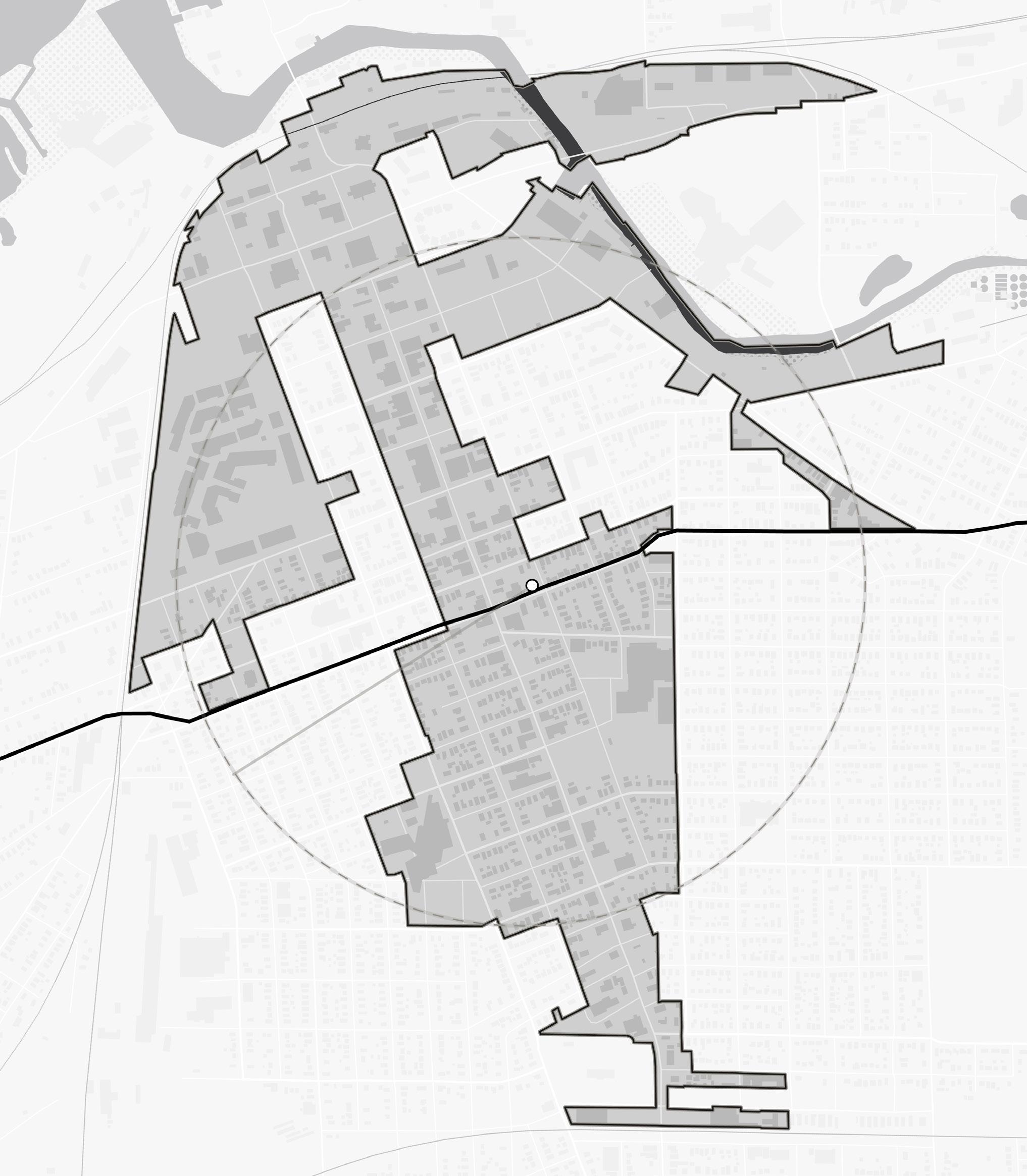
Michigan City • 11th Street Station 61 GreenSt Detroit St HomerSt AnnSt 11thSt 10thSt 8thSt BarkerAve 5thSt 6thSt 7thSt MichiganBlvd Franklin St Pine St Pine St Washington St TrailCreek South Shore Line 11th Street Station NORTH 9th Street to 11th Street 9th Street Intersection 4th Street to 9th Street 11th Street to Barker Avenue
North of 9th Street: Two-Way Conversion
Phase 1: Restriping
The first phase suggests a two-way conversion achieved by restriping Franklin Street from 4th Street to 9th Street. This conversion can be formalized with a second phase curb reconfiguration later.
Existing on-street parking is angled, and a two-way conversion would require restriping of parking spaces on the west side as a first phase. Preliminary analysis of a two-way conversion and re-striped parking shows a reduction of 19 parking spaces across these five blocks of Franklin Street. Each of the three blocks between 5th Street and 8th Street currently has one more accessible parking space than what code requires. If the City would prefer to convert these spaces and their access aisles to standard parking spaces, three additional spaces could be gained back, one per block. This would reduce the number of lost spaces to 16.
This preliminary two-way conversation analysis illustrates that the total number of angled on-street parking spaces on this segment Franklin Street could be reduced from 87 spaces to 68 spaces.
Existing: 10 spaces
Re-striped: 8 spaces
Existing: 7 spaces
Re-striped: 6 spaces
Existing: 8 spaces
Re-striped: 6 spaces
Existing: 9 spaces
Re-striped: 7 spaces
Existing: 10 spaces
Re-striped: 8 spaces
Existing: 9 spaces
Re-striped: 7 spaces
Existing: 9 spaces
Re-striped: 7 spaces
Existing: 10 spaces
Re-striped: 8 spaces
8thSt
Existing: 8 spaces
Re-striped: 6 spaces
Existing: 7 spaces
Re-striped: 5 spaces
62 Northwest Indiana TDD • TOD Strategic Implementation Plan NORTH Franklin St
5thSt
Franklin St
6thSt 7thSt
North of 9th: Two-Way Conversion
Phase 2
The second phase formalizes the reconfiguration of parking spaces in the first phase restriping. Curbs are reoriented to align with the new parking layout and extended at intersections, which create additional space for plantings and amenities such as wayfinding, seating, and bike racks. Enhanced crosswalks and material choices will increase visibility for crossings and create a visually pleasing public realm.
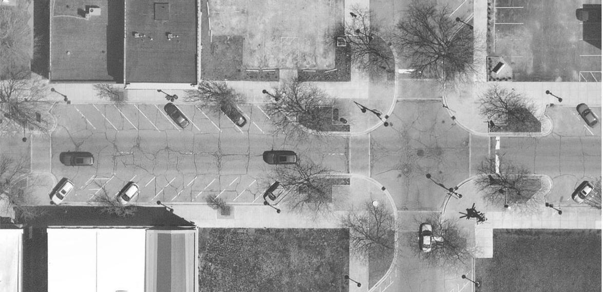
One of the greatest needs across the Franklin Street corridor is healthier trees that improve the pedestrian environment at the back of curb. A survey of the corridor from 4th Street to Barker Avenue shows most trees are suffering, dead, or recently replaced with new saplings. Subgrade improvements to allow for healthier trees is probably one of the best improvements the City could make to enhance the character of this downtown district.
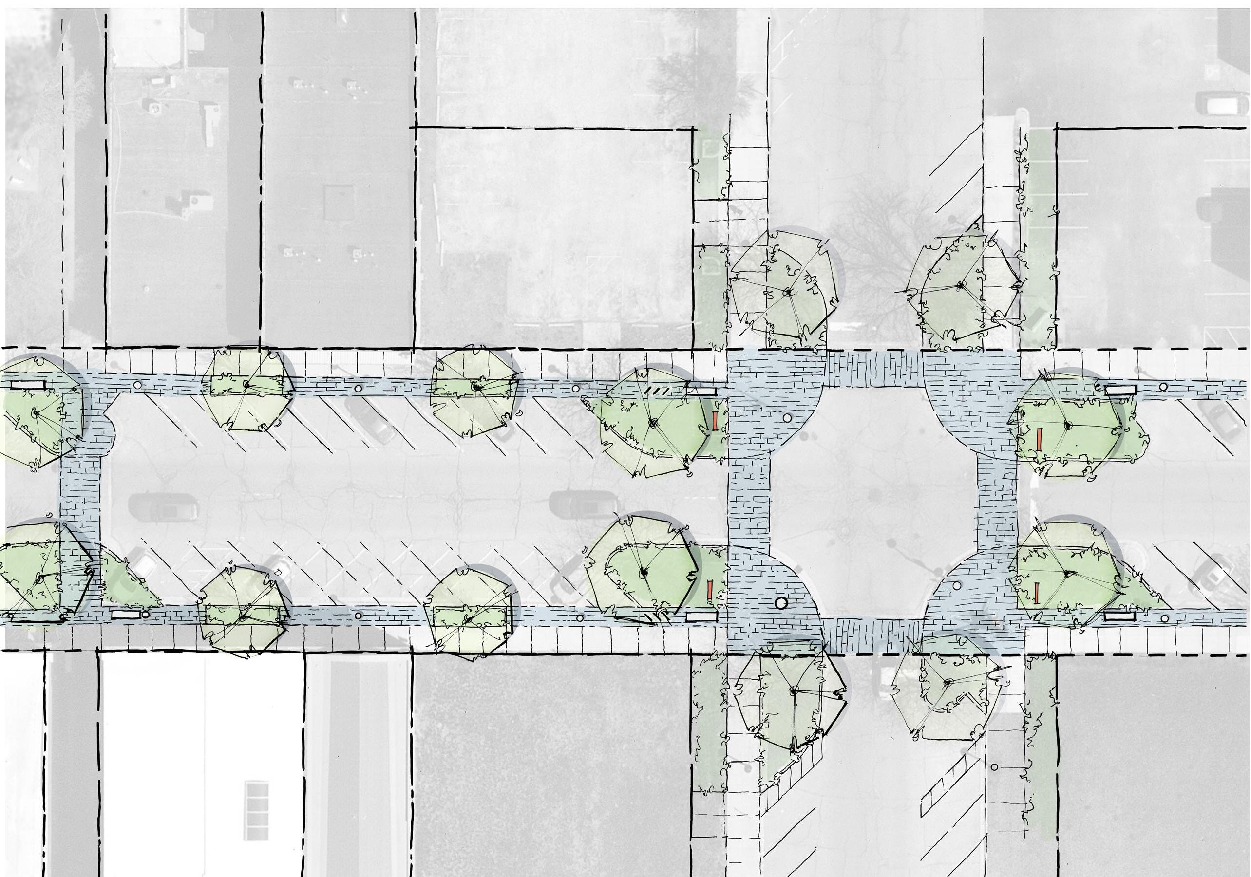
Existing Buildings Parking Parking Vacant Lot Vacant Lot Existing Building 7th St 7th St Walk Franklin Street 82’ ROW NORTH Existing Conditions Conceptual Sketch of Franklin Street Two-Way Conversion (Phase 2) North of 9th Street Michigan City • 11th Street Station 63 Walk
82’ ROW Proposed Development Proposed Development Existing Buildings Existing Buildings Proposed Development Proposed Development 7th Street 7th Street Walk Walk 7’ Walk 5’ Amenity Zone 7’ Walk 5’ Amenity Zone Reoriented Angled Parking Existing Lighting Existing Lighting Existing Lighting Existing Lighting 4’ Plantings/Street Trees 4’ Plantings/Street Trees Seating & Bike Rack Seating Existing Midblock Crossing Arts District Wayfinding Brick Crosswalks Franklin Street Consider Subgrade Soil System Consider Subgrade Soil System
9th Street Intersection
Phase 1 & 2: Centerline Resolution at 9th Street Intersection
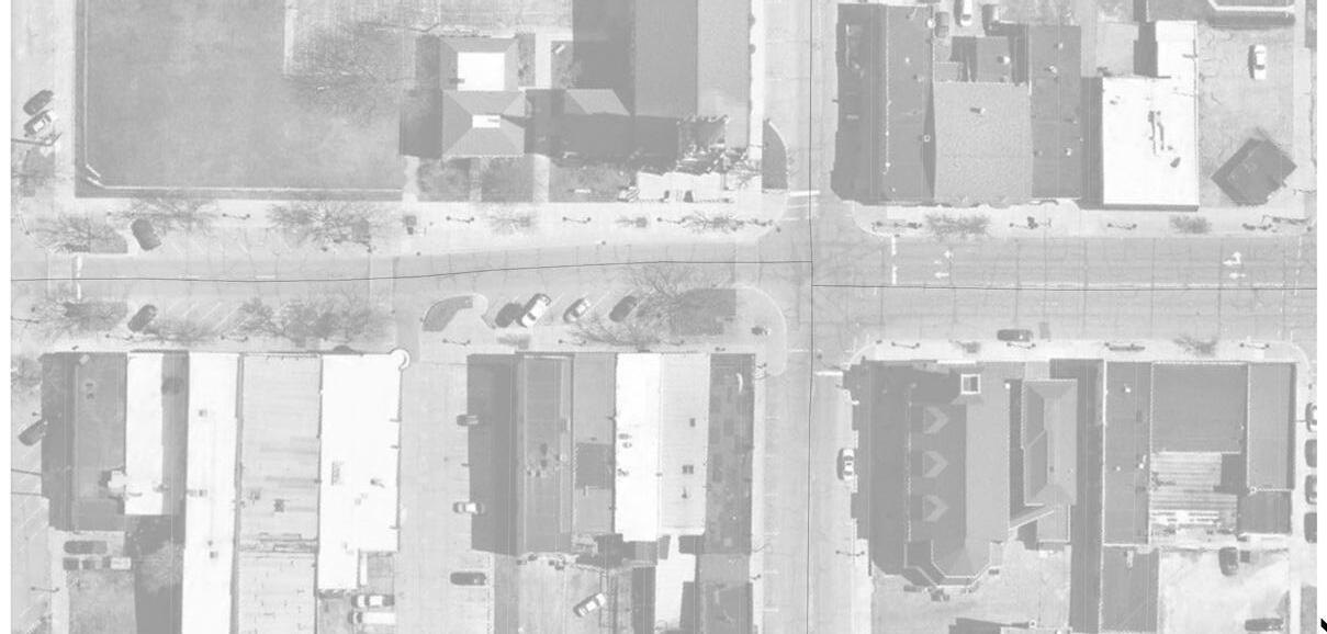
Today, 9th Street is the dividing line between one-way Franklin Street to the north and two-way Franklin Street to the south. As part of the vision to convert northern Franklin Street to two-way vehicular traffic, this intersection must be revised to realign the centerlines of the roadway on either side of the 9th Street intersection. Once the centerline north of 9th Street resolves, there will be room to add angled parking to the eastern part of the street to match the condition on the west and on the rest of the Franklin Street corridor from 4th to 9th Streets. The angled parking, condensed sidewalks, and lack of turn lanes north of 9th Street are typical of this commercial, slow speed portion of the corridor.
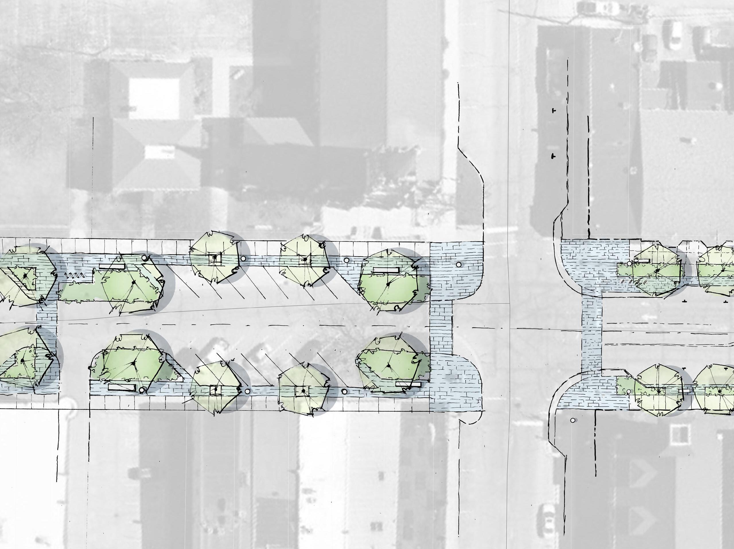
NORTH
Sketch of Franklin Street and 9th Street Intersection 64 Northwest Indiana TDD • TOD Strategic Implementation Plan
Existing Conditions Conceptual
10’-12’ Shared Frontage Walk
7’ Walk
7’ Walk
4’ Planting Area/ Street Trees
4’ Planting Area/ Street Trees
6’ Planting Area/Street Trees
Development 9th St 9th St Centerline offset Existing Centerline offset Franklin Street 9th Street 9th Street Franklin Street 82’
ROW
82’ ROW
Parking shifts west and pedestrian space is reduced New continuous centerline Existing Lighting Existing Lighting Seating
Parking added to the east side to match the rest of the corridor
7’
Walk
4’ Plantings/ Street Trees
Brick Crosswalks
9th Street to 11th Street
Lane Reduction: Alternative #1
This is the critical and prime focus of this study. These two mini blocks are the crucial link between the new station and the core of downtown commerce and activity, and eventually, the waterfront. Like the southern segment, it is prime for a conversion to a three-lane street. Alternative #1 prioritizes a slower-paced, seamless pedestrian realm with comfortable space for stepping out of parked vehicles, larger shade plantings, and a shared 12’ frontage zone, combining primary pedestrian circulation with leisure space for commercial uses (such as outdoor dining). This concept is more commercial, similar to the character of Franklin Street north of 9th Street.
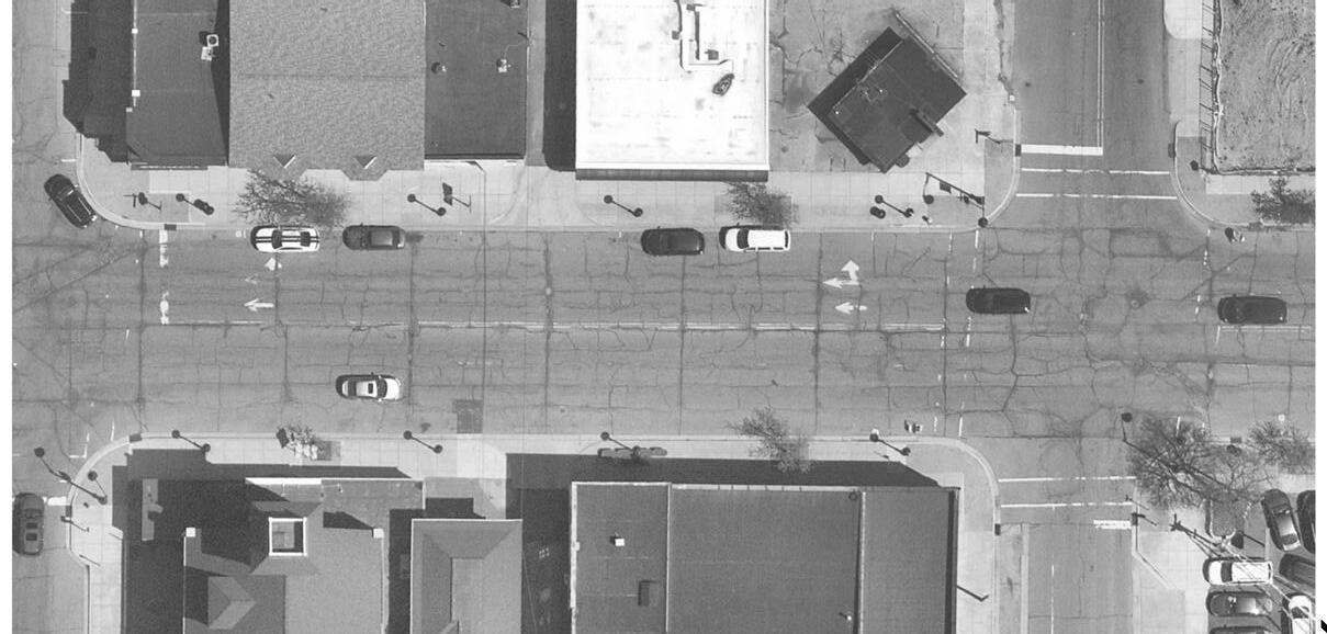
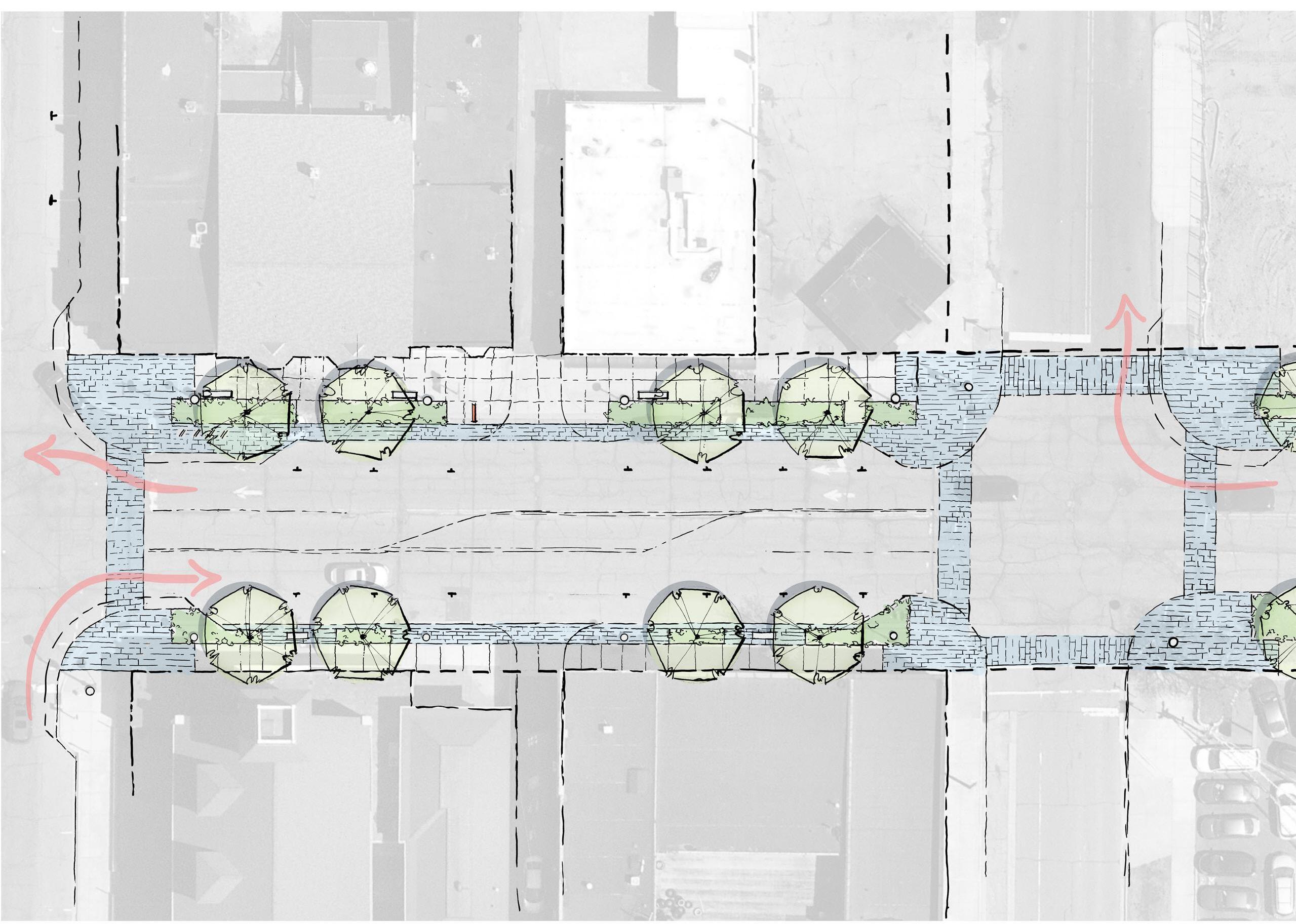
NORTH
Conceptual Sketch of Franklin Street from 9th Street to 11th Street, Alternative #1 Michigan City • 11th Street Station 65
Existing Conditions
Partially Vacant Building Uptown Center Existing Building Vacant Building Partially Vacant Building End 3-Lane Roadway Franklin Street 10th St Alley Alley 9th St 82’ ROW 10th Street Alignment Adjusts Through Intersection Franklin Street Alley Alley 10’-12’ Shared Frontage Walk Seating On-Street Parking 7’ Walk Decorative Unloading Edge Decorative Unloading Edge 4’ Planting Area/Street Trees Ornamental Crosswalks Bus Route 10th Street 6’ Planting/Street Trees Relocate Arts District Wayfinding On-Street Parking The Uptown Center Existing Development Vacant Buildings Mostly Vacant Buildings Consider Subgrade Soil System Consider Subgrade Soil System 82’ ROW Existing Lighting Existing Lighting Existing Lighting Existing Lighting
9th Street to 11th Street
Lane Reduction: Alternative #2
Alternative #2 of the east side of Franklin Street from 9th Street to 11th Street has a shared frontage sidewalk and 8-foot-wide clear trail. The east side of Franklin Street from 9th Street to 11th Street. This definition creates an expanded pedestrian area in order to handle larger volumes of transit-users moving to and from the station.
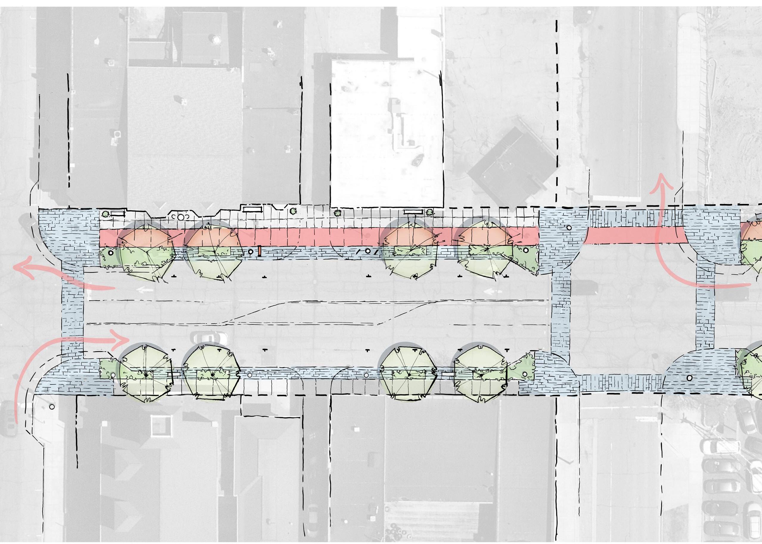
NORTH Partially Vacant Building Uptown Center Existing Building Vacant Building Partially Vacant Building End 3-Lane Roadway Franklin Street 10th St Alley Alley 9th St 82’ ROW Existing Conditions 66 Northwest Indiana TDD • TOD Strategic Implementation Plan 10th Street Alignment Adjusts Through Intersection Franklin Street Alley Alley 6-8’
Seating along Buildings On-Street Parking Seating 7’ Walk 6’ Decorative Amenity Edge Decorative Unloading Edge 4’ Planting Area/Street Trees Ornamental Crosswalks Bus Route 10th Street 8’ Clear Trail Relocate Lighting Relocate Arts District Wayfinding 4’ Planting Area The Uptown Center Existing Development Vacant Buildings Mostly Vacant Buildings 82’ ROW Consider Subgrade Soil System Consider Subgrade Soil System Existing Lighting Existing Lighting Existing Lighting
Conceptual Sketch of Franklin Street from 9th Street to 11th Street, Alternative #2
Shared Frontage Walk
11th Street to Barker Avenue
This section on Franklin is a prime target for a reduction to a three-lane roadway with a center turn lane. The existing four lanes may be underutilized; however a further study of traffic volumes should be conducted to accurately determine the number of lanes needed, particularly at intersections. The option shown here could easily have a dedicated right-turn lane added at intersections to help keep traffic moving.
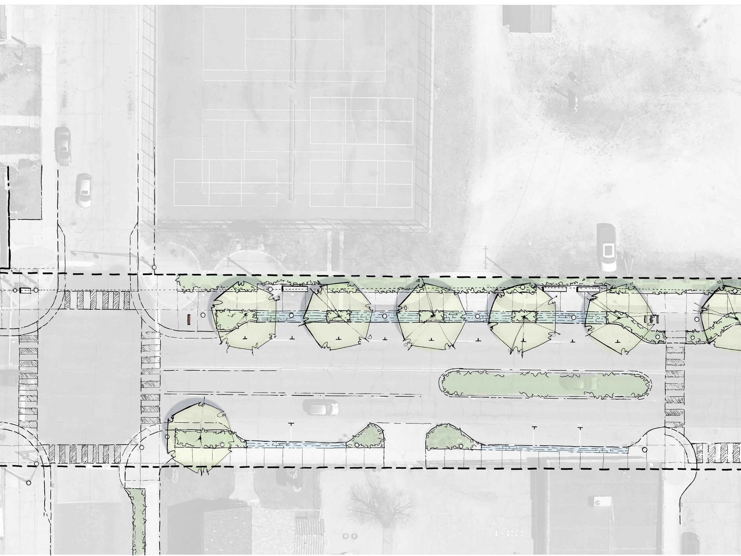
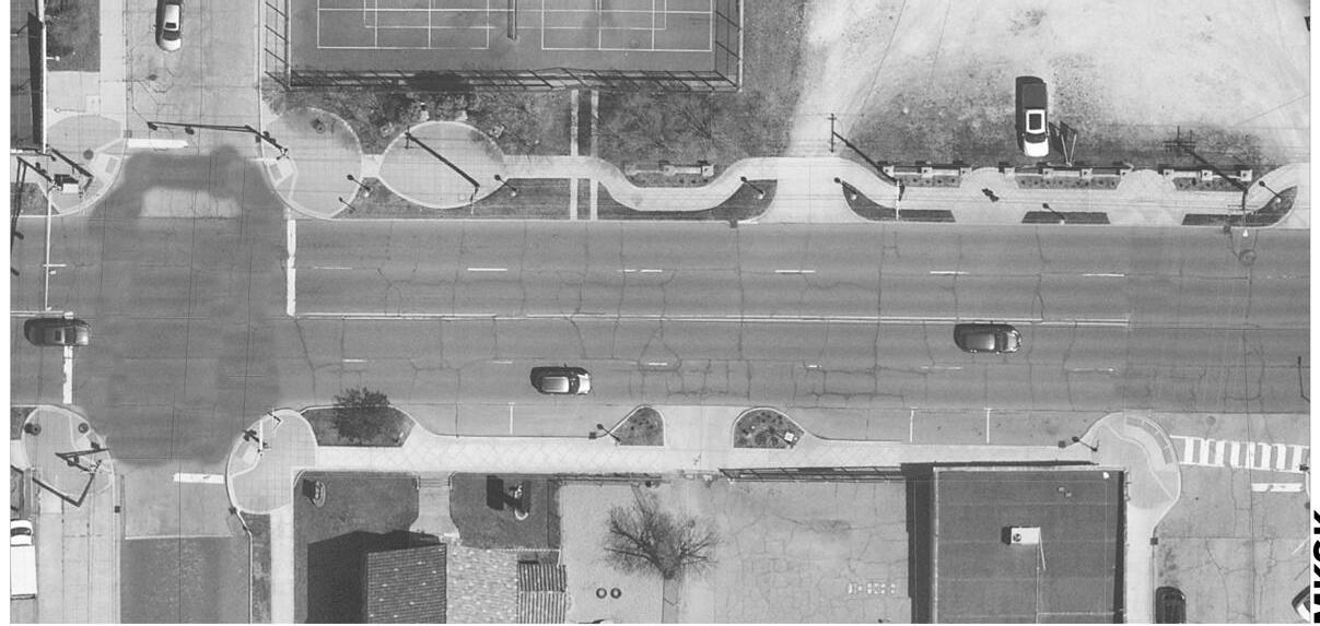
St. Stanislaus Ann St E Ripley St Franklin Street St. Stanislaus Existing Conditions Existing Building Existing Park 82’ ROW NORTH Conceptual Sketch of Franklin Street from 11th Street to Barker Avenue Michigan City • 11th Street Station 67 Existing Development 82’ ROW Proposed Development Turn Lane Ann St 7’ Planting and Utility Zone Crosswalk Signs/Signals Bike Racks 8’ Walk Planting Area On-Street Parking Relocate Lighting 8’ Walk 10’ x 5’ Tree Planting Zones Seating Planted Median Where Appropriate Wayfinding 3’ Curb Aprons Where Needed E Ripley St Franklin Street Existing Lighting Existing Crossing Existing Lighting Consider Subgrade Soil System Consider Subgrade Soil System
Lane Reduction
Engineering and NICTD Coordination
Throughout this process, the team collaborated closely with NICTD and the City of Michigan City to understand infrastructure improvements being made as part of the rail realignment, including the 11th Street streetscape and 11th Street Central development projects. In addition, the team reviewed existing utility infrastructure and determined that existing infrastructure downtown is sufficient to support TOD. Most of the team's efforts were spent on understanding possibilities to transform Franklin Street throughout this area.
Double Track Project Betterment Options (2020)
The Michigan City Redevelopment Commission engaged in this effort to outline recommendations for design improvements for the 11th Street corridor and associated intersections that will be impacted by NICTD's Double Track Project. This includes cul-de-sac roadway closures along 10th and 1th Streets as well as landscaping and streetscape improvements along 11th Street and the area surrounding the station. This report also devised a parking strategy.
The City is working closely with NICTD on the implementation of the Double Track Project as it effects 10th Street, 11th Street, overall circulation and road closures, and associated streetscape design.
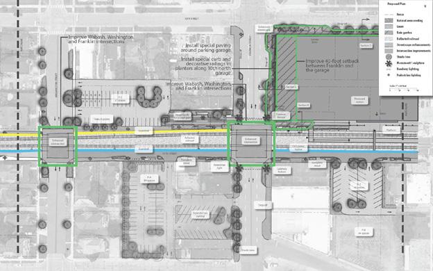
68 Northwest Indiana TDD • TOD Strategic Implementation Plan
Imagery from the 2020 Double Track Project Betterment Options Report
70 Northwest Indiana TDD • TOD Strategic Implementation Plan
This page is intentionally blank.
Zoning Coding Objectives
The team worked with the City of Michigan City staff to staff to identify coding objectives, review the current code for the ability to achieve TOD, and prepare draft code language that the City could review and adopt following this planning process. The team recorded current zoning within the TDD boundary and relevant recommendations from previous plans. The City's current zoning code requires an update to prepare the community for TOD. The team has prepared an evaluation of the current code and a new coding template. Due to the detail and length of the coding template, detailed zoning recommendations are in the Appendix.
Existing Zoning Districts
The table below lists the existing Zoning Districts within the boundary of the TDD area, along with their description.
District Description
CBD1 Downtown
Intended to maintain and enhance the pedestrian-oriented, mixed-use downtown in which a variety of retail, commercial, office, civic and residential uses are permitted; requirements are designed to maintain lively social environment and economically viable downtowns through synergy of a wide variety of uses in a traditional downtown environment; further intended to support healthier and more sustainable communities through community centers that are pedestrian- and transit-friendly, reduce sprawl and provide an alternative to the segregation of land uses that causes increased vehicle travel and traffic congestion; regulations control building height and placement to ensure appropriate scale along streetscapes & frame a well-defined public realm comprised of human-scale streets and public spaces, all of which contribute to creating a safe, comfortable downtown environment.
B2 General Commercial Serves a larger population than is served by a B1 district (neighborhood commercial); generally characterized by an integrated cluster of establishments serviced by a common parking area and generating a large volume of vehicular and pedestrian traffic; intent is to encourage concentration of regional business areas to the mutual advantage of both the consumers and merchants and thereby to promote the best use of land at certain strategic locations & avoid encouraging marginal strip business development along major streets; special attention must be given to site layout, building design, vehicular and pedestrian circulation and coordination of site features between adjoining sites.
OS (or “01”) Office Service
Intended to accommodate uses such as offices for professional and business services, planned office developments, medical centers, as well as appropriately located ancillary services and uses; further intended to provide buffer or zone of transition between residential and commercial districts & between residential districts and major streets.
M2 Heavy Industrial
To permit heavier industrial uses that are primarily of a manufacturing, assembling, and fabricating character, and are large-scale or specialized industrial operations more likely to produce external physical effects impacting to some degree surrounding districts; further designed to be located in areas where heavy industrial uses can most efficiently utilize major roadways, utilities and other infrastructure while minimizing any incompatible aspects with neighboring districts.
Michigan City • 11th Street Station 71
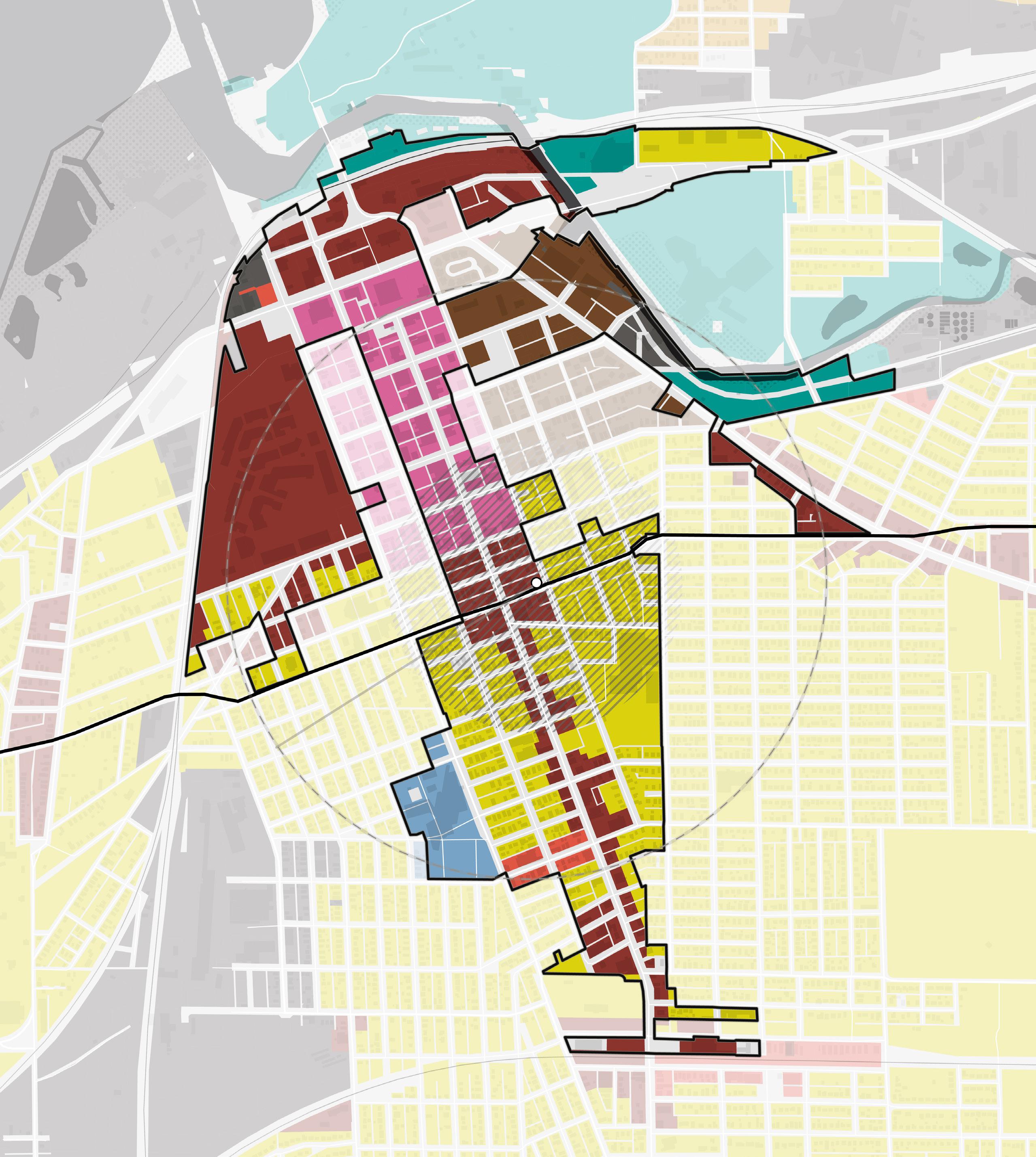
72 Northwest Indiana TDD • TOD Strategic Implementation Plan R1A R1C R1D R1E R2A R3A R3B CBD1 B1 B3 OS MD M1 M2 TOD Overlay NORTH 11thSt 10thSt 8thSt Barker Ave Greenwood Ave 5thSt MichiganBlvd MichiganBlvd Franklin St Franklin St Pine St Washington St 1/2Mile TrailCreek Lake Michigan 12 R1D R1D R1D OS B3 MD B1 B1 CBD1 R3B M2 R1D R1D R1D B3 B3 MD R1D B3 M2 B3 B3 B3 South Shore Line Existing Zoning Districts 11th Street Station
District Description
MD Marina District
Applied to the waterfront areas, including Washington Park and Marina, as well as redevelopment along the Trail Creek; intended to facilitate a transformative change to Michigan City’s downtown and waterfront area; intended to provide for mixture of uses ranging from boating and recreation to tourism-related businesses; moderate density residential uses are also permitted to provide range of housing opportunities, stimulate mixed-use environments and support redevelopment of the City’s North End; also intended to maintain visual and physical access to waterfront, which provides recreational opportunities, enhances economic development of the downtown and helps define a strong sense of place for the City.
R1D Single-family Residential
Includes urban neighborhoods w/ small lots; will include single-family and two family dwellings; certain other institutional, social, and recreational uses are also included, such as schools, child care, and recreational uses; intent is to maintain and enhance traditional, walkable, pedestrian-oriented neighborhoods and to provide for urban infill development that is of a form and character consistent w/ established historic neighborhoods; only intended for incorporated areas of cities where all necessary utilities and community services are available to serve a higher density population.
R3B High-Rise Multiple Family Residential
To allow development of higher density apartment style multiple family development as well as townhouse development; intended for infill development in cities only and not intended for unincorporated areas of the county; certain other institutional, social, and recreational uses are also permitted, such as schools, child care, and recreational uses; intent is to maintain and enhance traditional, walkable, pedestrian-oriented neighborhoods and to provide for urban infill development that is of a form and character consistent with established historic character of the community.
A2 Agriculture (La Porte County)
Primarily for agricultural uses, but also allows for limited non-farm rural residential development; intent is to protect agricultural areas form encroachment of residential and commercial sprawl by limiting the amount of residential development.
Michigan City • 11th Street Station 73
The table below is a continuation of the table on page 54, listing the existing Zoning Districts within the boundary of the TDD area, along with their description.
Existing Zoning Metrics
Some of the primary metrics that were taken into account in the analysis are provided in the table.
Michigan City North End Form-Based Overlay District (FBOD)
The intent of the Michigan City North End Form-Based Overlay District is to implement the North End Plan by creating a mixed-use, pedestrian-oriented, and transit-oriented district. The FBOD is separated into three districts, Urban Neighborhood, General Urban, and Urban Center with additional requirements for Transit-Oriented Development (TOD) within a 1/4 mile of a Northern Indiana Commuter Transportation South Shore Line station and any lots that front on a street with a Michigan City Transit route. The TOD area includes areas outside of the FBOD boundaries. The TOD area requirements exempt all uses from the parking requirements of the zoning, except for residential which shall provide one space per dwelling unit. The FBOD also includes building types with design requirements.
74 Northwest Indiana TDD • TOD Strategic Implementation Plan District Height (max) Lot Coverage Min. Lot Area Min. Lot Width Min. Front Setback CBD1 Downtown N/A N/A none none N/A B2 General Commercial N/A N/A 15,000 sq ft 100 ft N/A OS (or “01”) Office Service N/A N/A 15,000 sq ft 100 ft N/A M2 Heavy Industrial 60 ft 65% 80,000 sq ft 100 ft 40 ft MD Marina District none 65% 20,000 sq ft 100 ft 25 ft R1D Single-family Residential 35 ft or 2.5 stories 45% 5,000 sq ft 50 ft 20 ft R3B High-Rise Multiple Family Residential Townhouses 45 ft 65% 80 ft 15 ft Multi-Family 120 ft 55% 25 ft A2 Agriculture (La Porte County) 1 acre 200 ft 60 ft FBOD Form-Based Overlay District Urban Neighborhood 45 ft and 3.5 stories 65% building, 85% impermeable surface 3,120 sq ft 35 ft 15 ft min, 25 ft max General Urban 120 ft and 11 stories 65% building, 90% impermeable surface No min 35 ft 5 ft min, 25 ft max Urban Center 2 stories min, no max No max No min No min 5 ft max
Codes and Recommendations
Having a Form-Based Overlay District with TOD requirements is a good starting point for meeting the TOD principles. Since the FBOD is modifying most of the base standards it would make it clearer to have it as a separate district, rather than as an overlay. The TOD requirement areas being both inside and outside the FBOD boundary can cause confusion since the requirements are written within the FBOD Article in the Zoning. We recommend adopting the calibrated template and regulating plan as the zoning for the area in place of the existing Form-Based Overlay District with TOD requirements. The Existing Michigan City TOD Zoning and Form-Based Overlay Districts dimension requirements and recommended setbacks were utilized in the calibration of the zoning metrics. Since the City has already established metrics aligned with its TOD Vision, the frontage and lot buildout, height minimum, and setbacks influenced the metrics in the calibrated template .
TOD Principles Evaluation Recommendation
Waterfront
The Marina District zoning is intended to facilitate change in the Downtown and Waterfront area to create a place along the waterfront. It allows for a mix of uses and is intended to maintain a visual and physical connection to the water.
The Marina District is a good starting point for creating a sense of place and connection to the waterfront for both residents and visitors. The lot area, lot width and front setback requirements are larger than we would recommend in order to facilitate change into a mixed-use area.
Infill Development
The CBD1, MD, and Form-Based Overlay District start to support the type of infill that would support TOD. The B2 District requirements support more vehicular traffic uses.
The Form-Based Overlay District standards should be expanded further down Franklin Street to create the type of place that is envisioned for that area.
Adaptive Land Use
The zoning currently doesn’t encourage or discourage adaptive land use.
The zoning should take into account how to encourage adaptive reuse of older structures in Downtown.
Parking
The TOD requirements include reduced parking requirements.
The reduced parking requirements should be expanded to a larger area. Maximum parking requirements should be considered.
Michigan City • 11th Street Station 75
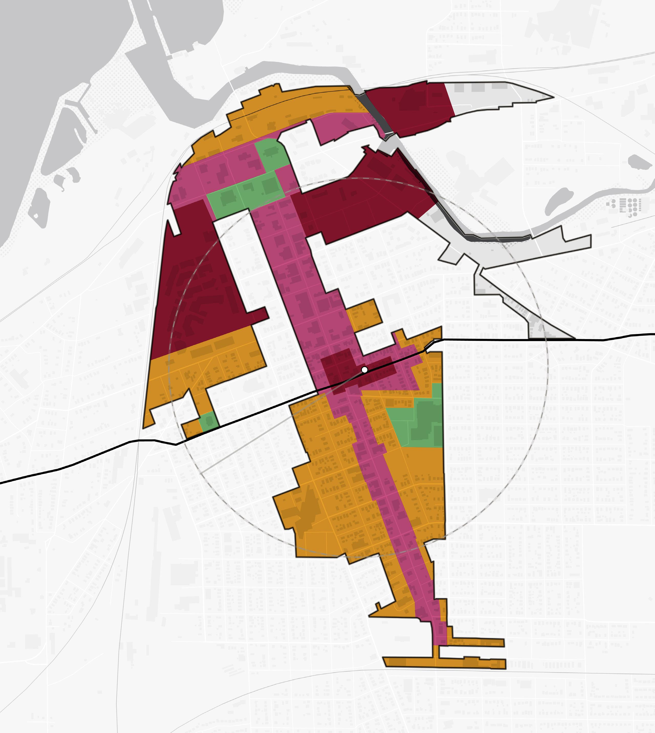
76 Northwest Indiana TDD • TOD Strategic Implementation Plan NORTH YMCA
Lighthouse Place Premium Outlets Blue Chip Casino NIPSCO St. Anthony’s
Ames Field City Hall Shoreline Brewery & Restaurant Washington Park 11thSt 10thSt 8thSt Barker Ave Greenwood Ave 5thSt MichiganBlvd MichiganBlvd Franklin St Franklin St Pine St Washington St 1/2Mile TrailCreek 12 CD-4 CD-4 CD-4 CD-5 CD-4 CD-6 CD-6 CD-6 CV CV CV CD-6 CD-5 11th Street Station South Shore Line
CV Lake Michigan
and Elston Center
(Franciscan Health)
Proposed Zoning Districts CD-6 CD-5 CD-4
Implementation
Implementation Strategies
While planning efforts are inherently long-range in scope, there is a benefit to identifying early projects — catalyst projects — that are necessary to improve market conditions and spark changes. This is where a development plan becomes more tangible with near-term goals that can be brought into sharper focus for the community and achieved relatively quickly to create momentum into the future.
Critical components of an implementable development plan include site capacity, economic viability, and political support. The implementation strategy summarizes project recommendations contained within this plan and an explanation of associated infrastructure project costs that can be used to develop a capital projects plan that supports TOD. This process is aimed at providing implementable steps and technical resources for the community to advance and adopt in preparation for TOD in accordance with its growth path.
Implementation strategies are outlined in three timeframes and are defined below: Immediate Next Steps, Short-Term Strategies, and Long-Term Strategies.
Immediate Next Steps
Actions to take quickly to get recommendations set up for implementation
Short-Term Strategies
Tasks and projects that can be executed in a 1-5 year timeframe
Long-Term Strategies
Tasks and projects that require additional work to execute and can be completed in 5 or more years
Enabling Actions
• Host an educational session “road show” with the Northwest Indiana RDA inviting elected and appointed officials and residents to discuss the impacts of land use decisions within the TDD boundary and the potential impacts of TOD on population, employment, and economic growth
• Meet with City staff and Michigan City Economic Development Corporation staff to review TOD zoning recommendations. Develop a responsibility matrix.
• Collaborate with the RDA to understand how projects could be funded through TDD increment dollars as revenue begins to flow into the TDD fund in 2024
• Use recommendations and illustrations within this plan funding requests/applications for NIRPC, READI, Next Level Trails, and other state, federal, and philanthropic grant opportunities
Recommendations
Land Use & Zoning
Immediate Next Steps
• Create a working group comprised of City staff and Plan Commission members to review the recommendations contained within the Michigan City TOD Implementation Strategy. Evaluate the potential of adopting this plan as an area plan to guide land use and development in this area as part of the City’s Comprehensive Plan.
• Review the zoning recommendations and calibrated zoning template included in this plan. Bring this draft information to the working group to further evaluate the next steps of updating the City’s Zoning Ordinance.
Short-Term Strategies
• Begin the process of updating the Comprehensive Plan, incorporating the Michigan City TOD Implementation Strategy by reference. Conduct a public process to vet the recommendations and make desired changes. Adopt land use recommendations in this plan as an update to the City’s Comprehensive Plan Maps.
Michigan City • 11th Street Station 77
• Begin the necessary legal review process and make updates to the City’s Zoning Ordinance to incorporate the calibrated code template as an overlay or rezoned districts. Conduct a public process to vet the recommendations and make desired changes. Adopt new code language and regulating plan into the Zoning Ordinance.
Long-Term Strategies
• Begin development using updated land use and zoning to help elevate the development quality and improve the experience for petitioners seeking to do projects in the city
(Re)development
Immediate Next Steps
• Create a working group comprised of City staff, Michigan City Economic Development Corporation staff and Redevelopment Commission members to review the Michigan City TOD Implementation Strategy and to educate members on how the TDD can help enable the City’s desire for TOD
• Reach out to developers who participated in the RDA TDD Industry Day to showcase opportunity sites. Understand the development community’s willingness to partner with the City as a developer in the overall TOD strategy.
• Reach out to property owners on identified opportunity sites to understand their willingness to participate in a TOD revitalization strategy and redevelopment
• Meet with NICTD and the owners of the Moose Lodge to discuss a development strategy on the site across the street from the 11th Street Central project
• Meet with Michigan City Area Schools and St. Stanislaus Church to discuss a development strategy on properties owned by those entities along Franklin Street immediately south of the station.
• Meet with Franciscan Health to discuss a development strategy on their properties along Wabash Street that may complement their plans for their facility
• Use the development concepts and renderings included in this TOD strategy to hold conversations about the development vision north of the station near Trail Creek
Short-Term Strategies
• Explore the potential to acquire and assemble properties for development, either through the TDD, existing TIF, a potential future development corporation or 501(c)(6), or in collaboration with a market-rate or tax credit developer
• Use the Arc of Development study to advance conversations with the community and other major stakeholders about the potential for revitalization tied to TOD, including population growth, job creation, and economic development through TDD revenue
• Promote sustainable design through adaptive re-use or the use of local, durable and/or recycled building materials, permeable pavement, electric charging stations and solar panels, shared parking strategies, and native plant species
Long-Term Strategies
• Leverage ongoing infrastructure investments and joint development at the 11th Street Station to build upon a TOD strategy that is focused on supporting downtown and revitalizing neighborhoods with access to transit
• Develop a mixed-income neighborhood with a variety of residential products, prices, and amenities that will serve the needs of a dynamic, growing TOD district
• Evaluate the potential redevelopment of Lighthouse Place Premium Outlets and the NIPSCO powerplant as a future phase(s) of downtown revitalization
• Reference the brownfield assessment completed as part of this process as a resource as individual properties are redeveloped over time
Thoroughfare Improvements
Immediate Next Steps
• Publicize the City's and NICTD's recent investments in key thoroughfares of 11th Street and Franklin Street to indicate that the stage is set for economic development in along both corridors
• Support the phased two-way conversion and streetscape enhancements of Franklin Street north of 9th Street
78 Northwest Indiana TDD • TOD Strategic Implementation Plan
Short-Term Strategies
• Conduct a sidewalk and trail conditions assessment to determine where improvements are needed to connect people from nearby areas to the 11th Street Station
• Continue implementing phased improvements on Franklin Street
• Use the corridor concepts included in this plan as the starting point for a corridor and land use strategy south on Franklin Street to Coolspring Avenue
Long-Term Strategies
• Coordinate with INDOT to develop a plan improve connections from Franklin Street to the lakefront north of 4th Street. This may include reconfiguring or converting the one-way Pine and Washington Streets that merge into Franklin Street north of 2nd Street where Franklin Street crosses Trail Creek.
• Create a corridor and land use plan for the area south of 11th Street. This area has incongruent land uses and access management issues and has not seen investment like the northern portion of downtown has recently
Capital Improvements
Short-Term Strategies
• Promote the use of TDD dollars to fund enabling infrastructure required for development such as stormwater infrastructure, required utility upgrades, parking and road improvements, and potential property acquisition
• Amend the City’s Capital Project Plan to include road and infrastructure costs needed to improve walkability to the station from development sites and neighborhoods, enhance key gateways, and enable development on opportunity sites
Long-Term Strategies
• Prioritize investments in infrastructure to enable desired land uses within the TDD boundary that may require utility or transportation upgrades. Locate future utility improvements strategically to preserve the developability of large sites.
Transportation & Mobility
Short-Term Strategies
• Conduct a sidewalk and greenway conditions assessment to determine where improvements are needed to connect to the 11th Street Station
• Evaluate the potential for local and regional bus access to the station areas connecting riders to the NICTD South Shore Line
• Support first- and last-mile connections between the station such as upgraded sidewalks, ADA ramps, and bike/scooter share programs
Community Building & Identity
Immediate Next Steps
• Invest in temporary and permanent gateway signage to create a sense of place. Highlight local businesses, support district wayfinding, and tell the stories of local entrepreneurs and business owners with a changeable environmental graphics system on high-volume pedestrian corridors.
• Employ a Equitable Development Toolkit to model impactful and inclusive growth on catalytic sites. Prioritize support for projects which:
› Convene enhanced outreach to minority and non-English speaking populations within the community
› Incorporate bilingual wayfinding signage throughout the district
› Support mixed-income and workforcefocused development
› Establish a framework for preventing displacement
› Create pathways to community wealth-building
› Invest in the public realm and promote the development of an authentic identity
› Support the growth of a thriving minorityowned business community and startups
Michigan City • 11th Street Station 79
Capital Improvements Plan
Capital project planning is integrated into preparing plans/conducing planning activities and advancing development planning at priority sites. Required upgrades to utilities, streets, and public realm improvements were studied as part of this project, necessary to support transit-oriented development within the TDDs. As these needs were identified, capital improvement plans were created and tailored to each station area. These charts include an estimated cost range for conceptual designs to guide decision-making, funding allocation, and eventual implementation.
Franklin Street Improvements Cost Estimate (Phases 1 & 2)
80 Northwest Indiana TDD • TOD Strategic Implementation Plan
Phase 1 (4th Street - 9th Street) Calculated Cost Estimated Cost Range Total Costs (Phase 1) $72,000 $64,800 - $79,200 Phase 2 Calculated Cost Estimated Cost Range 4th St. to 5th St. Corridor and 5th St. Intersection $1,205,000 $1,084,500 - $1,325,500 5th St. to 6th St. Corridor and 6th St. Intersection $1,230, 900 $1,107,800 - $1,354,000 6th St. to 7th St. Corridor and 7th St. Intersection $1,190,600 $1,071,500 - $1,309,600 7th St. to 8th St. Corridor and 8th St. Intersection $1,215,200 $1,093,700 - $1,336,700 8th St. to 9th St. Corridor and 9th St. Intersection $1,246,400 $1,121,800 - $1,371,100 9th St. to 10th St. Corridor and 10th St. Intersection $712,000 $640,800 - $783,100 10th St. to 11th St. Corridor $511,700 $460,500 - $562,900 11th St. to Green/Detroit St. and Green/Detroit St. Intersection $564,200 $507,800 - $620,600 Green/Detroit St. to Warren St. and Warren St. Intersection $583,300 $524,900 - $641,600 Warren St. to William St. and William St. Intersection $605,700 $545,200 - $666,300 William St. to Ripley St. and Ripley St. Intersection $588,000 $530,000 - $646,800 Ripley St. to Ann St. and Ann St. Intersection $1,011,600 $910,400 - $1,112,800 Ann St. to Horner St. and Horner St. Intersection $594, 700 $535,200 - $654,200 Homer St. to Charles St. and Charles St. Intersection $582,000 $523,800 - $640,200 Charles St. to Barker St. Corridor $576,500 $518,800 - $634,100 Total Costs (Phase 2) $12,417,600 $11,175,800 - $13,659,400 Total Costs (Phases 1 & 2) $12,489,600 $11,240,600 - $13,738,600
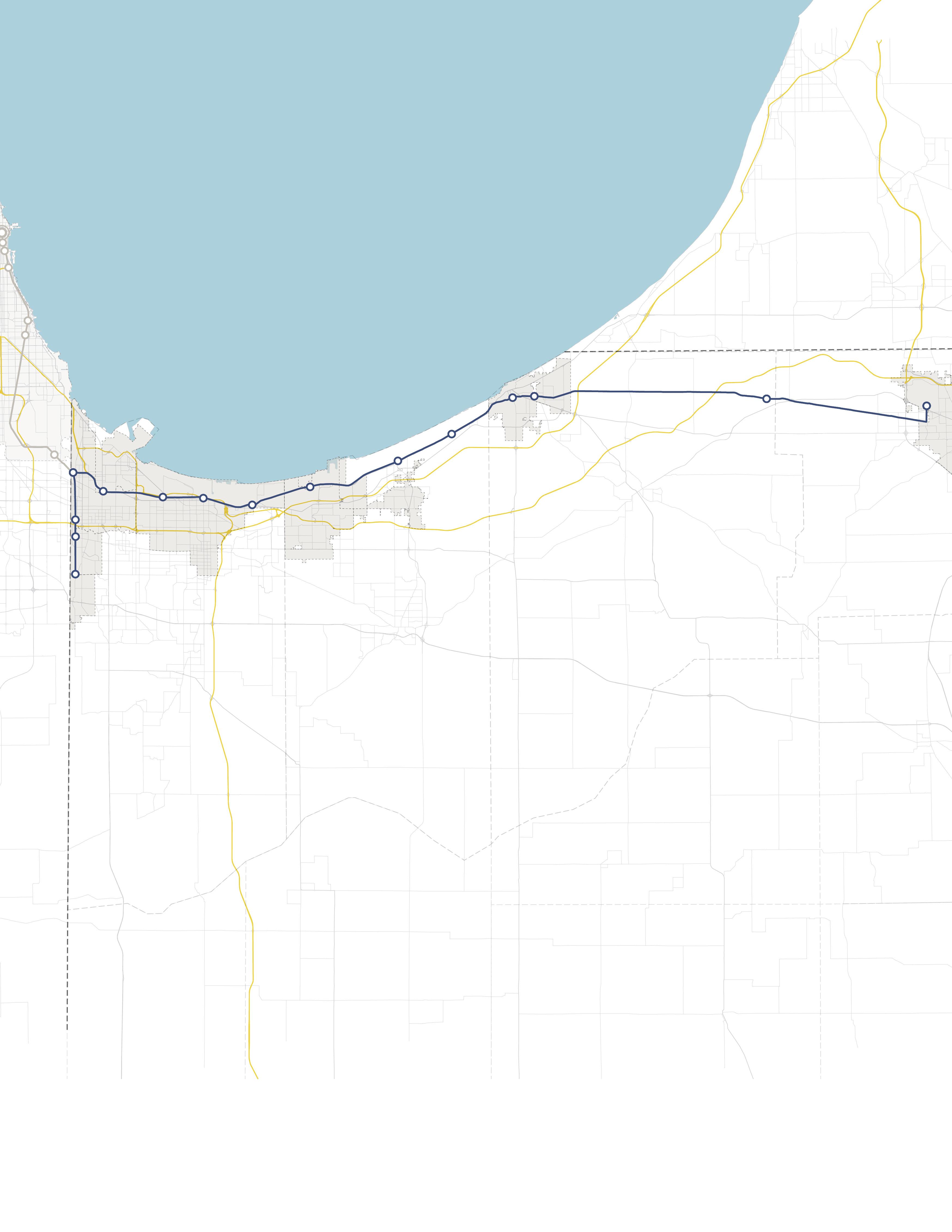

INDIANA INDIANA MICHIGAN ILLINOIS 94 94 80 65 Lake Michigan Hammond Gateway East Chicago Gary Metro Center Miller Portage/ Ogden Dunes 11th Street South Bend Dune Park Beverly Shores Ridge Road Main Street
