Landscapes of Necessity
Urban Landscapes A Community-Based Design Studio in Yelahanka, Bangalore, India 2019
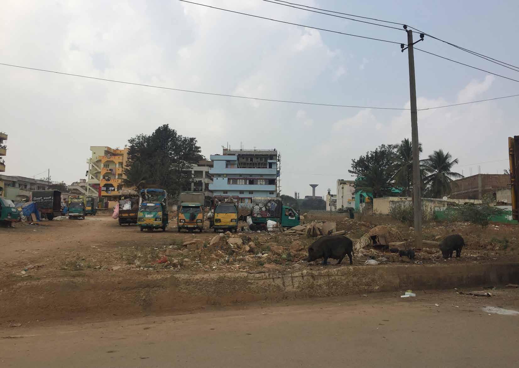
Productive
Re-envisioning
Master of Landscape Architecture Programme
Department of Architecture
School of Design and Environment
National University of Singapore 4 Architecture Drive Singapore 117566
Tel: +65 65163452 www.arch.nus.sg
Editor
Jessica Ann Diehl akijac@nus.edu.sg
ISBN 978-981-14-1878-5
© Individual Contributors, 2019
As a studio product, which is not censored, this publication may contain mistakes or deficiencies. Editor and contributors do not warrant or assume any legal responsibility for the publication’s contents. All opinions expressed in the book are of the contributors and do not necessarily reflect those of the National University of Singapore.
Studio Tutor
Jessica A. Diehl
Studio Team
Vinamra Agarwal
Bao Lixia
Chen Beifei
Dong Yitong
Jiang Jiahang
Eingeel Jafar Khan
Li Ziheng
Toh Zi Gui
Shanika Tuinder
Yu Xi
Radha Waykool
Disrupted and disconnected urban ecosystems (water, agriculture, flora and fauna) resulting from rapid urbanization have detrimental impacts on the health and wellbeing of urban citizens; particularly disadvantaged social groups. This studio developed an appreciation for design skills in landscape architecture within the city-scale context of Bangalore, one of the most rapidly urbanizing cities in India. Greater Bangalore is the administrative, cultural, commercial, industrial, and knowledge capital of the state of Karnataka. It is currently the fifth largest metropolis in India with a population of about 7 million, with a population density that increased from 10,732 to 13,392 persons per sq. km between 2001 and 2011. Rapid urbanization pushes urban infrastructure to its limits and often causes increased social inequity, but there is also increasing pressure on rural landscapes to supply the city with resources and food. This studio focused on designing productive urban landscapes—multifunctional landscapes that grow food in the city.
Bangalore is increasingly food insecure. Despite the history as a “Garden City”, few crops are grown within the urban boundary— most are grown in the surrounding hinterlands of Karnataka or imported from long distances. Historically, Karnataka has been a productive agricultural state, but changing climate patterns are

causing longer and more severe drought conditions. Students will design food producing landscapes in north Bangalore. The key issues are: food accessibility and quality; associated environmental issues (e.g. water quality, waste recycling, environmental pollution); consumption patterns and food culture; participatory design and landscape stewardship.
The site selected for the design intervention was a typical, unplanned formal settlement in Yelahanka district. A residential and mixed-use neighborhood, Yelahanka supports a diverse population in terms of income, education, and religion. The physical environment lacks adequate waste treatment, is severly water-scarce but is in the process of upgrading to a piped water system, and has little tree cover. Students travelled to the site 26 January to 4 February 2019 to conduct fieldwork.
Through a community-engaged process, new design strategies were developed that integrate productive landscapes into the built, ecological and social urban systems with the aim of envisioning better work, live, and play environments. The students considered interdisciplinary requirements from planning guidelines, architecture design, engineering limitations; and developed an understanding of existing natural land and urban systems. Through the project site, they faced complex urban design issues in order to derive innovative design solutions using principles of ecology and sustainability.
Preliminary research
Data collection
Field booklet
introduction
timeline
Productive Landscapes: “the growing ofplantsand the raisingofanimals within andaround cities; it includesproducingfood for personaland/orcommercial consumption.”
The Resource CentresonUrban Agriculture& Food Security(RUAF)
1 Introduction Week 3 Site visits Week 4-7 Issue & vision Week 8 Mid review Week 9-13 Design development Week 14 Final review
01 | Blue-Green Infrastructure
02 | Food landscapes
03 | Site measurement & tools
04 | Community participation
Workshop Team building Onsite measurement
mapping Community survey Sharing session Lecture 05 | BGI in Bangalore Lecture 06 | Urban farming in Bangalore Jakkur Lake Walk IIS Campus forest walk Organic Terrace Garden Tour Site modelling Data analysis & Mapping Techniques & Case studies Project narrative Visioning Workshop SWOT Analysis Innovation & systems research Individual Consultation Peer
Week
Lecture
Lecture
Lecture
Lecture
Community-Engagement
Onsite
Review
46 therapeutic gardens | jiang jiahang 50 empowering the women of yelakanka | shanika tuinder 54 edible schoolyard | yu xi 58 productive landscapes for women’s empowerment | bao lixia 62 energy recycling system | chen beifei 66 intergenerational center for learning | vinamra agarwal 70 food travels | zi gui 74 re-weave: cultural revival | eingeel jafar khan 78 continuous productive urban landscape | dong yitong 82 informal textile industry | li ziheng 86 interlake | radha wayakool 04 Introduction 06 Studio Team 12 Site Context 13 Historic Timeline 14 Landuse & Planning 20 Structure & Infrastructure 22 Economics & Social Demography 24 Culture & Community 28 Greenspace & Biodiversity 34 Water & Ecology 40 Community Survey & Results 42 Synthesis & Visioning Workshop 43 Glimpses of the Site 45 Proposals 91 Credits Table of Contents
The most impressive part for me was the innocent smiles form kids in Yelahanka, which affected me deeply and swept away any negative impression about India. They affectionately called me “Sister”, asked my name, and invited me to play with them by the lake··· ··· all these things will become treasured memories forever. Wherever you are in the world, even if you don’t speak the language, a smile is always the most powerful way to communicate.
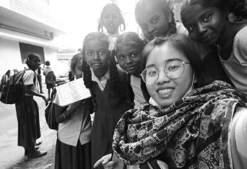 ------ Bao Lixia
The most interesting thing I met in Yelahanka was to communicate with the local people through translation. Although I could not understand their conversation directly, I could guess the answer from their expressions and emotions. I was impressed by the friendliness and simplicity of the local people.
------ Chen Beifei
My experience of Yelahanka was very positive. It is a community with many layers that we were lucky enough to uncover through site exploration. The community members were also extremely open and welcoming throughout the process which made the whole investigation very enjoyable.
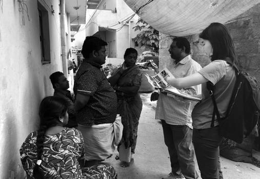 -------- Shanika
6
STUDIO
TEAM
Yelahanka is a culturally orientated community. The people are cheerful and always willing to help. Now I have a better outlook of the community through the survey held in the town, and it helped me to understand social issues to design better for the community.

The experience in Yelahanka was wonderful, and I became very interested in the local production model. The textile industry, as a pillar industry in the region, has exerted a great negative impact on the environment. However, due to historical reasons, such industry cannot be directly removed, and it is very interesting to find a balance between the protection and development.

7
------ Li Ziheng
------ Vinamra
This trip to India will affect my future design thinking, and the biggest influence of Yelahanka on me is to let me know another way of life in this world. Different areas should have different landscape design forms with more local characteristics. For landscape architects, how to discover local features and create unique landscapes is a big challenge.
 ------ Dong Yitong
India is a country with beautiful culture and ancient civilization. You will never know where her charm is without getting close to it. Yelahanka is the beginning of my understanding of India. From the colorful houses, the exquisite patterns drawn on the doorway because of religion, the flowers in front of every window, and the smiles on people’s faces can we see the beauty of the city.
Our trip to Yelahanka has been an interesting and inspiring experience. I am grateful for the hospitality of the people, who went all the way to help us with our work and made us feel at home. I will also miss the impromptu chai breaks we had while walking around Yelahanka.
 ------ Zi Gui

8
------ Yu Xi
Visiting Bangalore, one of the metro cities in my home country India, with my classmates for our studio project brought a revelation to me. Understanding the complexity of the Indian culture and our dependency on the ecological system for economic reasons was an exciting experience. Interacting with the community made me fathom the rooted bonds humans have built by interweaving culture and ecosystems and how are they are diminishing with time, with barriers created by us. In this process of learning, I realized how as designers we could be instrumental in creating solutions to integrate culture and ecosystem.

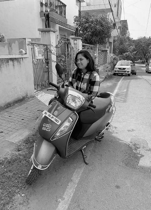

Yelahanka, with its web of relationships that bind its physical land, culture and community, gave me an in-depth understanding of the human tenacity to shape the landscape, whether it is rightly or wrongly done. My interactions with the community brought to light their deep association with various layers of their cultural ecosystem and the subsequent loss of it. I gained knowledge of how as designers we need to remember to design with the people and not for the people, integrating solutions with their lifestyle and embedded habits.
I have never thought I would go to Yelahanka before. This was a wonderful journey, from the bright colored houses, special religious culture, and the smiles on people’s faces, I can feel the charm of the city. And I’m also thinking about the regional and uniqueness in landscape, for landscape architects, this is a challenge.
9
------ Radha
------ Eingeel
------ Jiang Jiahang


10
analysis


12
Site context
Bangalore
Bangalore Yelahanka
HISTORY OF URBANIZATION BANGALORE


Kempe Gowda I founded Bangalore by building a fort with 4 gates and Pettah, the old centre of commerce. Tanks provide water and social gathering spaces.
The fort and Pettah is surrounded by agriculture and green spaces. There is a distinct separation between green space and urban space.
The British cantonment, which is the new centre of administration and commerce, was set up east of the fort after Tippu Sultan’s defeat and colonisation. Cubbon Park was built as a buffer space between the new and old centres.
The buffer zone is 1.5km wide. Other notable colonial developments include the general bazaar, parade square and batteries.
Decentralised new settlements such as Malleswaram are planned. Also note the existence of Hebbal as a small rural settlement, and Hebbal tank which provides water.
New planned settlements provide new homes for the rapidly growing population. India gains independence from Britain in 1941. Rapid urbanisation begins as the Scientific Policy Statement establishes technology as a major driver for economic growth in 1956.
More small rural settlements appear. Better linkage between rural and urban areas with new roads

In the 1970s, urban areas start to encroach rural areas. Farmers are faced with competing landuse and urban pollution problems.
The IT boom results in new settlements such as Electronics City.
2003 map showing where IT industries are concentrated. Smaller IT industry clusters are observed in other urban areas, not just in the CBD area.
The Indian economy transforms to become more market-oriented. The agglomeration of IT industries becomes the unofficial new CBD.
General urbanisation pattern: rapid expansion regardless of direction, but mostly concentrated along major roads which converge to the centre.
Urban sprawl has led to loss of vegetation and water bodies across Bangalore. Afforestation movements from groundup were organised to counter the rapid loss of green cover.
13 bangalore
Urban development reaches Hebbal and Yelahanka.
historic timeline
Rapid loss of vegetation until 2019.

14
500m
District Scale
landuse & planning Yelahanka


15 Site Scale Immediate Context Yelahanka


16 Revised Masterplan 2015 2.01m²/ p in 2003 Green Space Per Inhabitant Agricultural Area & Residential Area Green Space Sensitive Area Created by: Dong Yitong landuse & planning Bangalore


17 1000m
1000m
Source: Bangalore Development Authority
2031 2011 (Existing)
Source: Bangalore Development Authority
Yelahanka
Social ------------------------------------------------------------------------------------ PERCEIVED ----------------------------------------------
A single space can be interpreted in three ways:
CONCEIVED - Planned, formal spaces
PERCEIVED - Observed, informal spaces


LIVED - Social, Intangible spaces

Informal town gathering space


Truck parking and cow resting area


18
Perceived, conceived & lived spaces Interactions Neglected Space Underconstructed Carpark
Informal connection between two planned roads
Fenced private land
Overgrown weeds, unplanned greenery
Neglected space appropriated by cow Private land used for car parking
Industrial field occupied by informal homes & structures
Old rest stop underused, and used by bike as sheltered parking
LIVED
landuse & planning
Yelahanka


19 Storage Space Religious Cow Shed Informal Industries Private Land Commercial Industrial Public Space -----------------------------------------------CONCEIVED ------------------
Gathering space under holy tree
Worker’s chat and rest space in between work
Private land used for commercial storage
------------------------------------------------------------------------------------ PERCEIVED ---------------------------------------------LIVED
Private cow shed, leftover space for construction debris
Structure & Infrastructure


Bangalore


20
Bangalore Road Map
Created by: Jiang Jiahang
Created by: Chen Beifei
Created by Yang Xiaowen & Tang Mengjiao
Created by Yang Xiaowen & Tang Mengjiao
Waste Management in Bangalore
Created by Jiang Jiahang & Manasi Prabhudesai
Building Map Permeability of surface


21 Yelahanka
Management in Yelahanka
Management in Yelahanka Schools with Walking Distance Clinincs and Hospitals
Density Map
Waste
Water
Building
Created by: Yu Xi
Created by: Jiang Jiahang
Created by: Jiang Jiahang& Chen Beifei
Created by: Bao Lixia
Created by: Chen Beifei
Social Demography & Economics
Social Demography
Demography in Bangalore
Population density in Bangalore 2001 2011


Rate of crime against woman
Male and Female work participation rates in 2001 and 2011 (Bengaluru North and Bengaluru)
Population growth between 2001 to 2011
Male and female literacy rates in 2001 and 2011 (Bengaluru North and Bengaluru)
22 0 2000000 4000000 6000000 8000000 10000000 12000000 14000000 16000000 18000000 20000000 194019601980200020202040 Population 0 0.01 0.02 0.03 0.04 0.05 0.06 0.07
Growth Rate (%) Bangalore 2001 2011 Population 65.37 96.22 Actual Population 6,537,124 9,621,551 Male 3,426,599 5,022,661 Female 3,110,525 4,598,890 Population Growth 35.09% 47.18% Area Sq. Km 2,196 2,196 Density/km2 2,985 4,381 Proportion to Karnataka Population 12.37% 15.75% Sex Ratio (Per 1000) 908 916 Child Sex Ratio (0-6 Age) 943 944 Average Literacy 82.96 87.67 Male Literacy 87.92 91.01 Female Literacy 77.48 84.01 Total Child Population (0-6 Age) 772,5401,052,837 Male Population (0-6 Age) 397,648 541,656 Female Population (0-6 Age) 374,892 511,181 Literates 4,782,565 7,512,276 Male Literates 2,663,055 4,078,041 Female Literates 2,119,510 3,434,235 Child Proportion (0-6 Age) 11.82% 10.94% Boys Proportion (0-6 Age) 11.60% 10.78% Girls Proportion (0-6 Age) 12.05% 11.12%
194019601980200020202040
68.70% 69.30% 27.10% 28% 66.00% 69.50% 22% 27.70% 20.00% 30.00% 40.00% 50.00% 60.00% 70.00% 80.00% 90.00% 100.00% Bengaluru north Male (Yelahanka) Bengaluru Male Bengaluru Female Bengaluru
Female (Yelahanka) 2001 2011 86.40% 86.80% 72.40% 74% 87.90% 84.50% 73% 71.30% 0.00% 5.00% 0.00% 5.00% 0.00% 5.00% 0.00% Bengaluru north Male
Bengaluru Female Bengaluru Male Bengaluru north Female (Yelahanka) 2001 2011 29.80% 31.30% 33.10% 41.40% 43.50% 18.10% 18.90% 22.50% 27.40% 30.70% 0.00% 5.00% 10.00% 15.00% 20.00% 25.00% 30.00% 35.00% 40.00% 45.00% 50.00%
Bangalore India
north
(Yelahanka)
20102011201220132014
Created by:
Yitong Created by: Dong Yitong Created by: Bao Lixia 1980 1960
Dong
Karnataka Bangalore
Contributes to 20% of the garment production taking place in the country
USD 1.56 billion Valued
35% of the country’s raw silk production takes place in Karnataka

11% of the country’s total wool production

India’s Textile market size (US$ billion)

Employee 18%
Labor Work 14%
168 private training centres and 144 skill development centres International brands like Tommy Hilfiger, Allen Solly, Nike, Adidas, etc. treat the city as their sourcing hub
The city has around 386,00 manufacturing units in the textile industry that are engaged at the unorganized and the organized level More than 4,32,00 people are engaged in sericulture in city and its surrounding, who provides the silk.
Textile&Clothing
35%
Farmer 5%
Retailing 28%
Data From Questionaires

23 India Textile Industry
Occupation in Yelahanka
Economics
by: Li Ziheng
Created
culture & community
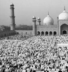
Religious festivals in India

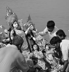
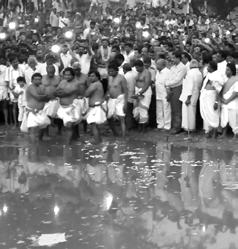
Hindu festivals
Makar Sankranti
Customs: Bath, fly kites, feast, burnfire, dance / Landscape space: rivers and lakes, open space
Karaga festival
Customs: Water, Dance, Music Landscape space: waterfronts
Christian festivals
Vara Mahalakshmi
Customs: ceremony Landscape space: indoor space
Muslim festivals
Vijayadashami
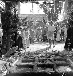
Customs: carry clay statues into water, burn / Landscape space: river or ocean front
Ganesh Chaturthi
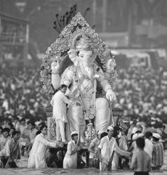
Customs: worship clay status in water, feast / Landscape space: rivers and lakes
Good Friday
Customs: fasting, carry the cross Landscape space: open space
Mawlid an-Nab
Customs: ceremony Landscape space: open space
Eid al-Fitr
Customs: fasting Landscape space: open space
Groundnut Festival
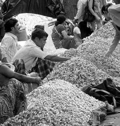
Customs: celebrates the first groundnut crop Landscape space: open space
All Souls Day
Customs: prayer for the dead Landscape space: restricted space
Eid al-Adha
Customs: ceremony Landscape space: open space
Sources: https://www.holidify.com/pages/festivals-in-bangalore-483.html and https://en.wikipedia.org/wiki/Islamic_holidays
Harvest festivals
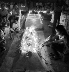
Customs: light candles, pray beside the graves / Landscape space: restricted space
Easter Christmas
Customs: light candles, pray, share sweets / Landscape space: open space
Calendar of religious festivals in Bangalore

Customs: feature feasting Landscape space: open space
Hindu
JunMay
OctNov AguJulSep
Dec ReligionsFestivalsAprMarFebJan
Makar Sankranti
Karaga festival
Ganesh Chaturthi
Vara Mahalakshmi
Vijayadashami
Groundnut Festival
Mawlid an-Nab

Muslim
Eid al-Fitr
Eid al-Adha
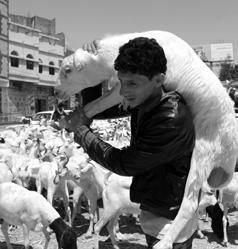
Good Friday
Easter
Christian
Harvest festivals
All Souls Day
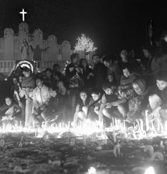
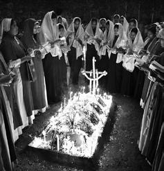
Christmas
Source: http://www.indyatour.com/india/festivals/major-christian-festivals-in-india

24
People and their Activities according to Time
A


Temple Spend at least one-hour doing religion-related stuff every day
Home
Market and


doorway
5:00 a.m. 8:00 a.m11:00 a.m. 3:00 p.m. 6:00 p.m. 8:00 p.m. 10:00 p.m.

They prepare breakfast, take their children to school, do cleaning, or take water between 6:00a.m.-7:00a.m. Then they go home to do prey and have breakfast usually between 7:30-8:00 a.m.


Between 8:0011:00 a.m., they do housework (cleaning,washing······)


Then they have lunch and may have a while to have a rest between 11:00 a.m.-3:00 p.m.. Some of them sewing at home for extra income.
They may stop by the market on the way of picking up their children and go to collecte water after 3:00 p.m. Mothers need to take care of children and prepare dinner between 4:00-6:00 p.m.


They pray at home or go to the temple before dinner at 6:30-8:30 p.m.

25 5:00 a.m.6:00 a.m.7:00 a.m. 8:00 a.m. 9:00 a.m.10:00 a.m.11:00 a.m.12:00 p.m.1:00 p.m.2:00 p.m.3:00 p.m. 6:00 p.m. 5:00 p.m. 4:00 p.m. 8:00 p.m. 9:00 p.m. 7:00 p.m. 10:00 p.m. Adult Male Adult female Children Waste collection Housewify working at home Drawing rangoli pattern Go to school Get off school Do worship Go to market Gather and talking Work Gather and talking Gather and talking Water taking Water taking Walk by the lake Reading <hanuman chalisa and bhagvat gita> Go to market Do worship Do worship at outdoor 'temple'
Housewives usually get up at 5:30-6:00 a.m.
Stop at least four times every week
More than 80% of the time is spent at home Water collection spot
Every household spends more than one hour every day collecting or waiting for water for the household without a well or sunken. Women have the main responsibility to collect water.
Housewife's Day
Between 7:30-9:00 p.m., they have dinner and may wait for their husband go back home. Go to bed around 10:00 p.m. after cleaning the house.
yelahanka
The proportion of housewives:73%
culture & community
Yelahanka
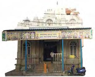
Weaving Ecosystem


Coloring raw silk
Semi-dried raw silk ready for reeling
Weaving colored silk threads into saree

Drying and Reeling of colored silk threads
Making punchcards for saree design
26
Raw silk supplied from Devanahalli
Religious Ecosystem
Barber shop Outdoor Temple
Flower garland vendor Tea shop and gathering space beneath a tree
Shop selling miscellaneous stuff involved with prayer rituals
Banana leaves & coconut vendor
Vegetable farms
Agricultural Ecosystem
Flower Farms
Coconut
Mango Paddy Fields
Herbs
Banana
Religious household plants
Weaving Ecosystem
Temple Ecosystem
Agricultural Ecosystem
Saree Weaving informal industry
Outdoor temples
Religious buildings
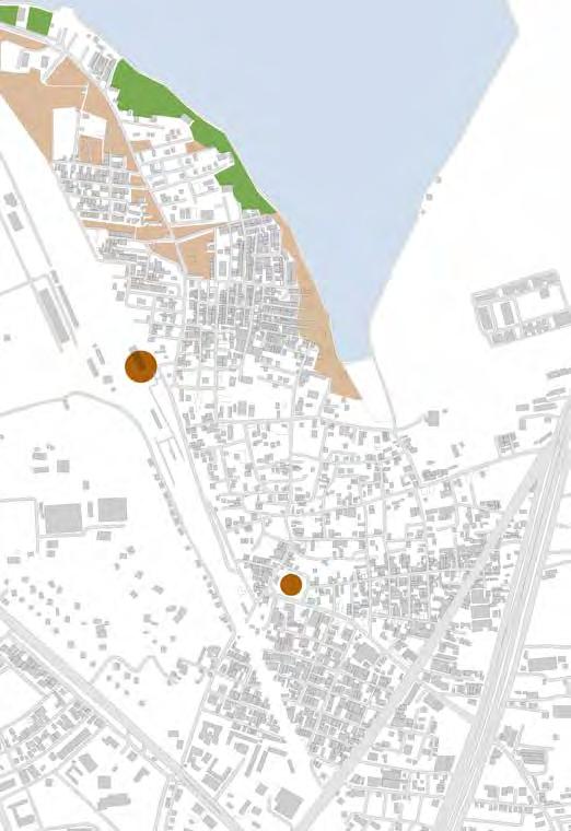
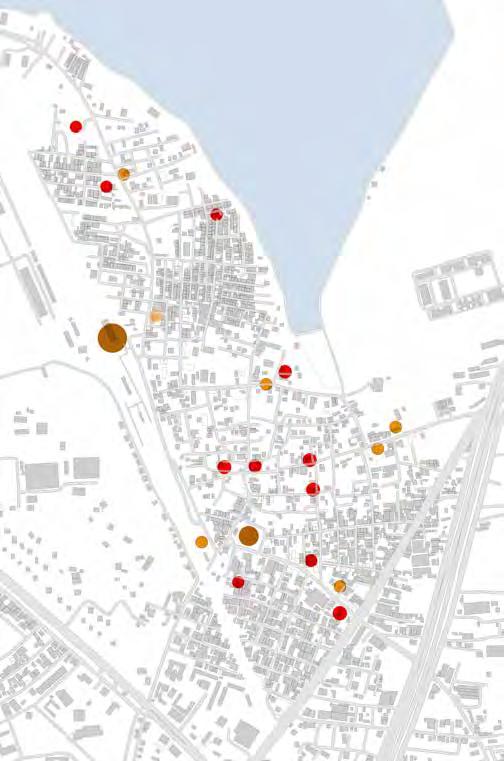

Agriculture Land
Empty Land
27
Created by: Eingeel Jafar Khan Yelahanka
Railway station
Railway station
Railway station
Bus Stop
Bus Stop
Bus Stop
Green & Biodiversity
bangalore
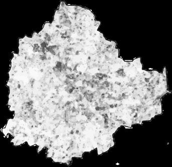
Vegetation Map
Vegetation Density
Flora Hotspots
1. National University Nagabhavi, Ward 128
This plot is planted with 414 medicinal plants consisting of 173 species of trees, 82 shrubs, 92 herbs and 42 climbers.
2. Bangalore Palace, Ward 35
Bangalore palace ground has rich and varied vegetative growth in many pockets.
3. Lalbagh, Ward 143
Botanical Garden. There are 1854 species of 673 genera and 890 cultivars of plants. There are many heritage trees here.
4. Cubbon Park, Ward 111
The park has 6,000 plants belonging to 68 genera and 96 species.
https://www.thenewsminute.com/article/five-research-charts-show-how-bengalurugradually-becoming-unliveable-city-36278
Forest Ratio: Urban Bangalore
http://wgbis.ces.iisc.ernet.in/energy/water/paper/Green_Space_in_Bengaluru/ results.html
Forst Ratio: Bangalore Rural and Ramnagar District
Urban Forest Areas
Anekal (1%) Bangalore (16%)
https://www.karnataka.gov.in/empri/Pages/State-ofEnvironment-Report-Bangalore-2008-EMPRI-2009-09. pdf?fbclid=IwAR0reslhmWnfbkjRKpAY7P8Arp1qAac7IOj_eEC_ rtnU5IkRCcDVRkYMqZU
FOREST STATISTICS
The total number of trees in Bangalore is
14,78,412
Kaggalipura (59%)
K.R Puram (12%)
Yelahanka (12%)
Bangalore has an average vegetation density of 14%
5. Kalkere, Ward 26
This plot is a rare collection of Ficus species including 40 species of shrubs and climbers. There are also 17 nitrogen fixing tree species.
6. Doresanipalya, Ward 187
Eleven bamboo species brought from Arunachal Pradesh were planted in April 1991
The geographic area of Bangalore Urban district is 217,410 ha, out of which the forest area is 4,198 ha.
The geographic area of Bangalore Rural and Ramanagar districts is 5,85,431 ha, out of which the forest constitutes 1,01,117 ha.
Forest area comprises mainly scrub and grasslands with miscellaneous species. Eucalyptus and Acacia auriculiformes are found over most of the area.
https://www.karnataka.gov.in/empri/Pages/State-of-Environment-Report-Bangalore-2008-EMPRI-2009-09.pdf?fbclid=IwAR0reslhmWnfbkjRKpAY7P8Arp1qAac7IOj_eEC_rtnU5IkRCcDVRkYMqZU
The green cover for a healthy city is 30%
The recommended number of trees per person living in the city is
1.15
http://wgbis.ces.iisc.ernet.in/biodiversity/ pubs/ETR/ETR75/summary.html
Created by: Shanika Tuinder
28
Vegetation Non Vegetation 0 1.5 3 4.5 6 0.75 Kilometers Legend Polygons VegDensity 0.002300 - 0.082200 0.082201 - 0.163100 0.163101 - 0.260300 0.260301 - 0.402200 0.402201 - 1.495500 Legend Polygons VegDensity 0.002300 - 0.082200 0.082201 - 0.163100 0.163101 - 0.260300 0.260301 - 0.402200 0.402201 - 1.495500
Vegetation Density In Wards 20km 20km
20km
1.
2.
3.
4.
5.
Other 83% Forest 17% Kaggalipura 59% Bangalore 16% Yelahanka 12% K.R. Puram 12% Anekal 1% Urban Area 98% Forest 2% Forest (2%) Forest (17%) Other (83%) Other (98%)
6.
The urban centre, New Town in Yelahanka is much more developed than its surrounding area. There is better infrastructure and more wealth. The vegetation in this area is much more dense. There are many large trees that form a canopy over the main streets and more green spaces.
The main landscape typology in old Yelahanka is Medium Density. The vegetation is very sparse. Limited to a few trees lining the streets in an otherwise concrete jungle. There are very few green spaces and people do not have gardens.
The industrial area and slum area are the grey space in this image. They are seperated by a green belt but have no vegetation themselves. The industrial area is completely built up and very polluted. The slum area is very small and densely packed, there is no space for vegetation.


The edge condition of Yelahanka lake varies from East to West. East there is little vegetation due to the built development. On the West there is agricultural land which has much more greenery. Planting has been done around the lake in an attempt to improve this condition.
The rural residential area of Yelahanka has a much higher green density. This is not only due to the agricultural plantations of ragi, beans etc. There are also more trees between the houses and the agricultural land. Concrete and green space are inversely proportional.
The agricultural area of Yelahanka has the highest density of trees and the most green space. The area is not inhabited, reflected through the lack of concrete space. The high level of flora attracts wild species. Here, snakes and peacocks can be observed.
29 Landscape Transect
Urban Centre Medium Density Industry + Slum
Yelahanka Lake Rural Residential Agricultural Area
yelahanka
Created by: Shanika Tuinder
Used for antibacterial, antifungal, antiviral, antioxidant etc. Yes
Used to treat asthma, diabetes, diarrhea, epilepsy, gastric etc. No
Bark, leaves, stems and unripe fruit- antibiotic, used in Ayuvedic medicine.Yes
An ingredient in traditional Ayuvedic medicine and remedies. Yes
Used as a anthelmintic, antifungal, antidiabetic, contraceptive, and sedative. No
Used as an antioxidant, anti-inflammatory and for its anti-cancer properties Yes
No No
20 TropicalNative Seed, leaf, fruit pulp and skin have high phenolic content and antioxidants. Yes
Tropical Exotic Used for asthma, bronchitis, plaque and gingivitis, head lice, toe nail fungus. No
TropicalExotic Indian almond leaves have traditionally been used for stomach problems. No
TropicalExotic Used as anti-diabetic, antioxidant and hypocholesterolemic. Yes
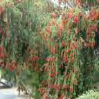
13 Melaleuca citrina Red Crimson3x2
SubtropicalExotic No. No
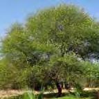
14 Vachellia nilotica Babul 20

16 Millettia pinnata Ganuga 20
TropicalNative Used to treat diarrhea and inflammation No

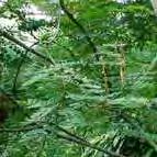
TropicalNative The bark, gum, leaves and pods are used in various traditional medicines. No 15 Adenanthera pavonina Red Lucky Seed25

TropicalNative Used as antiseptic, also prevents pests. No
17
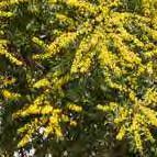
Cassia fistula Golden Rain tree15
19 Aegle marmelos Bael 12
20 Trachelospermum jasminoides Jasmine Vine 5
TropicalNative Flower oil: Hair growth treat Scabies, Eczema, Ringworms and Inflammation.No
TropicalNative In Ayurveda it is known as a "disease killer". The fruit pulp is a purgative. No 18 Tectona grandis Teak tree 40
TropicalNative Fruit helps in curing diseases like diarrhoea and cholera. Yes



Tropical Native Jasmine has been used for liver disease, abdominal pain and diarrhea. No
Created by: Shanika Tuinder
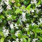
30 Flora Species List yelahanka 1. 11. 2.
3.
4.
5.
6.
8.
SampleScientific Name Common NameSize (hxw) mHabitatNative/ ExoticMedicinal Edible Fruit 1 Cocos nucifera Coconut tree30x10TropicalNative
2 Ficus religiosa Peepal
3 Mangifera indica Mango
TropicalNative
4 Punica granatum Pomegranate8 SubtropicalNative
5 Azadirachta indica Neem tree 20x20SubtropicalNative
6 Artocarpus heterophyllus Jackfruit tree 30x15TropicalNative
7 Musa Banana plant3 TropicalNative
8 Grevillea robusta Silver Oak 40x15SubtropicalExotic
9 Tamarindus
10 Eucalyptus
Eucalyptus
12.
13.
14.
15.
16. 7. 17.
18. 9. 19. 10. 20.
tree30x20TropicalNative
tree30x4
Used as an anti-oxidant, anti-inflammatory, antimicrobial, anti-cancer. Yes
indica Tamarind tree
regnans
tree50x10
11
Prunus dulcis Badam tree10
12
Manilkara zapota Sapota tree20
Green & Biodiversity
Flora Map
KEY
Fauna Map
YELAHANKA FLORA MAP
Mango Silver Oak
Eucalyptus
Coconut
Peepal


Neem
Tamarind
Jackfruit
Banana
Sapota
Jasmine
Banga
Bael Fig
Ganuga
Pomegranate
Gusgusea
Dhupadarmama
Badam
Golden Rain
Red Bottlebrush
Religious Peepal

Religious Trees


KEY
KEY
Mango
Silver Oak
Eucalyptus
Coconut
Banyan
Neem
Tamarind
Jack fruit
Banana
Sapota
Jasmine
Banga tree
Unknown Fig
Ganuga Tree
Pomegranate
Gusgusea
Dhupadarmama

Badam
Golden Shower
Common species
Banyan Religious Red bottlebrush


YELAHANKA FAUNA MAP
Dog Cow
Goat Chicken
Cat Sheep
Turkey Rat Pig
Peacock
Biodiversity Hotspots
The vegetation in Yelahanka is very sparse. The vegetation is mostly characterised by trees instead of shrubs and groundcover. Trees are dotted down the sides of streets. In the fringes of Yelahanka there are small pockets of wild vegetation in un-concreted areas. The little vegetation that there is in Yelahanka is a mixture of native and exotic species. Many of the trees observed on site can be used for medicinal purposes or harvested for their fruit. The Peepal tree is considered as the most sacred tree among the Hindus . For this reason many of the worship sites in Yelahanka were built around a Peepal tree, or a Peepal tree was planted.
KEY
KEY
Snake
Hawk
Dog Cow Goat
Dog Cow Goat

Chicken Cat


Sheep
Turkey Rat Pig
Chicken Cat Sheep Turkey Rat Pig
KEY
Peacock
Snake Hawk
Peacock Snake Hawk
Lake Margin Planting Open Space Vegetation Normal Trees Religious Trees

In Yelahanka there are many animals around but practically all fauna is domestic not wild. Cows and goats are all owned by someone and milked morning and night. During the day they are allowed to roam free in the streets so they can eat. Chickens, turkey, and sheep are raised in the same way until they reach a certain weight and are sold for their meat. These animals all roam the streets and tend to congregate around dumping grounds to eat the rubbish. The wild animals observed such as snakes, peacocks, and hawks were found in the rural agricultural area of the outer site where there are less people and more vegetation.

There are a number of important biological areas within Yelahanka that need to be protected in the design process. These spots include the new lakeside planting, existing patches of wild vegetation, public open lots, the small amount of trees that already exist in Yelahanka. and the religious trees. It is important that these areas are maintained for envionmental, sentimental, recreational, and religious purposes.
Created by: Shanika Tuinder
31
YELAHANKA FAUNA MAP
1.
2.
4.
5.
2.
3.
4. 5.
1. 2. 3.
4. 5.
1. 2. 3.
2.
5.
4. 5.
3.
800m 800m 800m
yelahanka
Green & Biodiversity
YeLahanka
Patch Matrix
The site is a small fragment as a patch which forms the urban matrix. It exists in close proximity to green spaces like surrounding agriculture land, whose main crops are coconut and ragi, and many vacant lands, with low levels of qualities. On a larger scale, a few important green spaces come into the picture: agriculture land accounts for the largest area, around which vacant land is scattered. There is a clear distinction in development between the old and new urban areas. The red dotted line in the figure divides it into two parts: the relatively welldeveloped area to the west, and undeveloped area to the east. The Yelahanka site is part of the east area. Parks are all located in the west area, with natural ways linked with each other, and vacant land with no functions is relatively less.


Hydrology
Parks Agriculture Land
Vacant Land BBNP
Functional Land Owned By Government
Functional Land Owned By Individual Natural Ways
Boundary
Green Space Typology
21 types of green spaces are selected strategically based on the amount of density of the green spaces in Yelahanka. The green spaces represent a range of landscape typologies. The green spaces in the north of the site are large and continuous, while the green spaces in the south of the site are small and fragmented, separated by buildings and streets. Green spaces in the south are mainly residential spaces owned by the individual and commercial and reginal spaces owned by government. Most of the spaces have funtions, while spaces in the north are mainly non-functional places, apart from farmland.
Central BBNP (Roadside)
Local BBNP (Roadside)
Temple courtyard
Local BBNP (Lakeside)
Residential + Open Space
Residential + Commercial Graveyard + School + BBNP
Temple Yard + BBNP Vacant Land
Vacant Land (Lakeside)
Farmland + Livestock Farmland + Residential Vacant Land + Slam Vacant Land (Roadside)
Roadside Belt Residential
Residential + Street Trees
Residential Garden Roadside
Commercial Reginal By The Railway
250m 250m
Created by: Chai Tianqi

Green Vacant land Assessment 1 Central BBMP 2 Local BBMP 3 Temple Courtyard 4 Local BBMP Lakeside 5 Residential+ Open space 6 Residential+ Commercial 7 Graveyard+ School 8 Temple Yard 9 Vacant Land 10 Vacant Land (Lakeside) 11 Farmland+ Livestock 12 Farmland + residential 13 Vacant land+ Slum Productivity Wildlife Spaciousness Groundcover Canopy Density Disturbance Accesibility Recreation
Created by: Chai Tianqi
water & ecology
bangalore
Story of Lakes in Bangalore
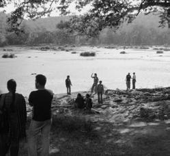


Manmmade water tanks for Socio-Economic Purpose
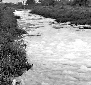
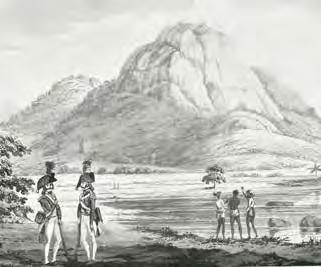
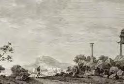
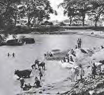
A cascading water system is interlinked to conserve as much as water possible for communities. High bunds to store water became the system for Bangalore and made it a city of lakes. Character of lakes changed with time and operation
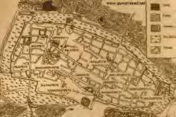
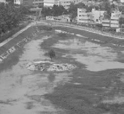

Source:: https://scroll.in/article/855516/history-shows-that-it-was-nature-that-helped-bangalore-grow-and-now-the-city-is-destroying-it http://muscicapa.blogspot.com/2014/04/a-not-so-great-hedge.html https://issuu.com/biometrust/docs/bangalore_lakes_-_biome_dec_2016
34
Created by: Radha Wayakool
Bangalore city map, circa 1924 from "Murray's 1924 Handbook" with the pete and Cantonment areas clearly visible
The Bound Hedge of the Cusba of Bangalore (1800)
1600 1700 1800 1900 2000 2019
Kempe Gowda
Sultanate of Bijapur Mughal Hyder Ali and Tipu Sultan
British East India Republic of India
bangalore
Watershed for Bangalore
Bantkondanahalli Lake Amanikere, Singanayakanahall
Yelahanka Doddakere Kattigenahalli Lake Gramadakere, Allalasandra
Jakkur Lake Amruthahalli Lake
Evolution of city with lakes
Kacharakanahalli Lake
Yellamallappa Chetty Lake Series
Yellamallappa Chetty lake series
Name of the Lake - Area (ha)
1 .Bantkondanahalli Lake- 42
2 .Amanikere, Singanayakanahall - 178
3. Yelahanka Doddakere - 135.68
4 .Kattigenahalli Lake - 2.5
5 .Kogilu Lake - 180
6 .Gramadakere, Allalasandra - 16.84
7 .Jakkur Lake- 50
8 .Amruthahalli Lake -9.35
9 .Rachenahalli Lake- 60
10 .Kodigehalli Lake- 21
11 .Chikkamaranahalli Lake -10
12 .Kacharakanahalli Lake -22.57
13 .Kalkere Lake -75
14 .Ramapura Lake -5
15 .Basavanapura Lake -56.6
16 .Seegehalli Lake -5
17 .Yellamallappa Chetty Lake -110
Source: BENGALURU WATER SUPPLY AND SEWERAGE PROJECT (PHASE 3) : Final Report http://wgbis.ces.iisc.ernet.in/energy/paper/saket_biofuel/ https://www.newslaundry.com/uploads/2017/10/7-1.jpg
Created by: Radha Wayakool
35
Koramangala
Vhriswawati Valley
Valley
750990
Challaghata Valley
YR :1792 YR :1888 YR : 2015
Hebbal
Rachenahalli Lake Kodigehalli Lake Chikkamaranahalli Lake
Ramapura
Farms/ Paddy Fields/ Settlements Built/ Underconstruction Cascading Lake System Topography before Lake Series Seegehalli Lake Past Present
Lake Basavanapura Lake
water & ecology
yelahanka
NGT-National Green Tribunal, India no construction rules: a lake buffer zone of 75m and 50m for primary, 35m for secondary, and 25m for tertiary stormwater drain.
Present: BBMP’s 30M Buffer for Lake
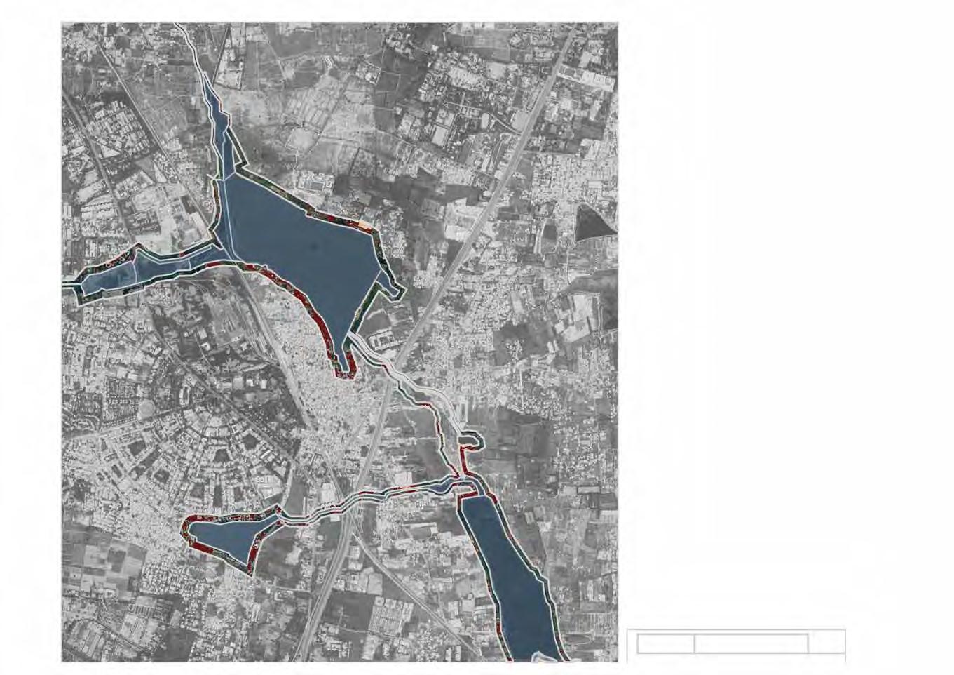

Source http://timesofindia.indiatimes.com/articleshow/67411279.cms?utm_source=contentofinterest&utm_medium=text&utm_campaign=cppst
Encroachment
Required by NGT: Min 75M Buffer for Lake
36
Created by: Radha Wayakool
Yelahanka Lake
Jakkur Lake
Jakkur Lake
Allalasandra Lake
Allalasandra Lake
Yelahanka Lake
1500m 500m 0m
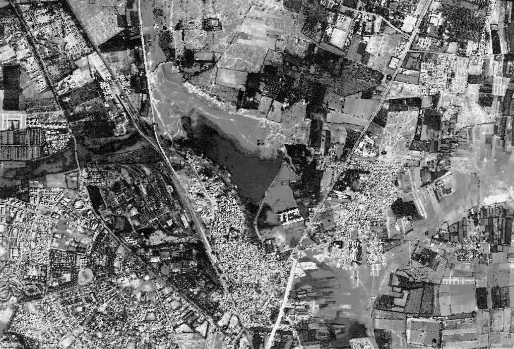




37 Farms Farms Farms Farms Farms
Paddy Fields
Paddy Fields
Paddy Fields
Fruit
Fruit
Fruit Orchards Fruit Orchards Forest Farms Created by: Radha Wayakool After Lake Development Proposal Degraded Lake Side 2004 150 Acres 2012 234 Acres 2018 335.27 Acres After Lake Development Completion Sorghum Coconut Mulberries Guava Grapes Mango Corn Sapota Marigold Ragi Rice 859 MM 335.27 Acres Depth 4.5 M Avg. Average annual rainfall Primary rainy season: June – September (South-West Monsoon) Secondary rainy season: November – December (North-East Monsoon) Scale of Lake: Approx. 6km Periphery yelahanka Timeline Memory Trace Details of the Lake
did the local
to
Paddy Fields
Orchards
Orchards
What
people used
grow?
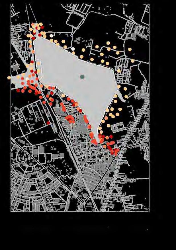


38 Water Quality Pollution Source Lake Development Legend Legend Types of Soil Legend One Entry Only 890 μs / pH 8.0 980 μs / pH 8.0 Extreme Developed 800 μs / pH 6.0 High Underdevelopment Medium Undeveloped Access Point Low Negligible 860 μs / pH 6.5 Future Entry Point Dhobi Ghat International School Existing Informal Entry to the lakeside 6km Perimeter Pathway Length Red gravelly loam soils Lateritic soils Saline and sodic in patches Non-saline Created by: Radha Wayakool yelahanka water & ecology
Opinions

Aspiration


39 The lack of open scape for leisure ac vi es Water issues Tra ffi c issus Pollu on Waste issue Green availability Drainage issus Job opportuni es Health issues Mosquito Housing problem Organic food availability Cow food availability Security 41% 37% 9% 5% 5% 3% Recreation Lake Temple Surrounding Local Park No time Cinema 53% 27% 10% 5% 5% Routine Housework Shopping Temple School Lake 71% 17% 12% Access to Lake No Entry Morning Evening Waste Management Temple is a social nodePartners for Activities Better Education Community Farms Pollution Traffic Memories Restriction Farming Revival of traditions Morning : 5am to 9am Evening : 4am to 7pm
life More Recreational Space
Unmanaged
of
farmer Trees and Greens Community Work Opportunities Created by: Radha Wayakool yelahanka Issues
being a
about the lake and water in Yelahanka Residents of Yelahanka Old town
community survey
Through formal surveys and informal conversations, we gathered local information from 68 Yelahanka residents. One-quarter were small business owners, one-qarter were housewives, and one-quarter were laborers. Half were female, half were under 40 years of age, and many (n=59) were Hindu.
SITE SURVEY_ YELAHANKA (RESIDENTS)
1. What is the source of your food? (Tick Multiple)*
i. Self-Grow ii. Grocery Store
iii. Roving Carts iv. Mandis
v. Other_______________
2. Do you have a garden and what do you grow there? (If Yes,then)*
i. Vegetable________________ ii. Fruits________________
iii. Crops___________________ iv. Others_______________
3. Where do you go for recreation? (Mark in Map)*
4. Where do you go for your daily routine? (Tick Multiple)*
i. Work ii. Market
iii. Shopping iv. Worship
v. School vi. Others________________
5. In your opinion which of these is a priority concern about waste in the area? (Tick one)*
i. Littering of waste ii. Effect on human health


iii. Effect on environment iv. Others________________
6. How does you treat your household waste? ___________________________________________________________________________________________
7. What would you like to have in your community? (Tick Multiple)*
i. Home Garden ii. Community Garden for socializing
iii. Collective farming iv. Individual market farms
v. Food forests vi. Others____________
Reason:______________________________________________________________________________________
8. What do you think is the most important issue in this community?
9. How has the place changed over time? How was it used to be? ___________________________________________________________________________________________
Time Date
40
Religion:__________
Gender:________ iv. Age:_______________
i. Occupation:______________ ii.
ii.
Yelahanka’s Community Vision Gender
The results of the community survey indicate that the key issues that the community in Yelahanka want to be addressed included: water availability, lack of open parks and green spaces, waste management, traffic problems, and lack of children’s play areas. Other issues of lower priority were: pollution, drainage, work opportunities, organic food shortage, mosquitoes, lack of vegetation, and poor infrastructure.
41
community survey results
Source of Food in Yelahanka Employment garden type preference Housewives (25%) Market (55%) Grocery Store (30%) Roving Cart (12%) Self Grown (3%) Individual Farms (34%) Social Community Gardens (25%) Food Forest (4%) Home Garden (25%) Collective Farming (12%) Other (75%) Male (50%) Female (50%) Water Availability (18%) Lack of Parks/ Open Spaces (14%) Waste Management (13%) Drainage (4%) Traffic Problems (12%) No Children’s Play Area (15%) Work Opportunities (2%) Availability of Organic Food (4%) Poor Infrastructure (5%) Lack of Vegetation (5%) Mosquitoes (2%) Pollution (6%)
Created by: Shanika Tuinder
synthesis
visioning workshop
A visioning workshop was held in the studio to better understand the context of Yelahanka. Each student took part in this activity and shared ideas on the board. Later, everyone voted for the most important issues and strengths in Yelahanka. Some of the important strengths, weaknesses, opportunities and threats are listed below to better understand the context.


Internal EXternal
Strengths
• People are willing to participate in agricultural activities
• Lakeside ecology and habitat for plant and animal species
• Lake front development
• Surrounding land near the lake is fertile
• Existing connection between people and religion
Weaknesses
• Less availability of water for daily use
• Usage of the lake (limited access)
• Lack of urban greening
• Lack of public open recreational spaces and children’s play spaces
Scanned by CamScanner
Opportunities
• Government land as potential development site
• Channelizing lake water for productive landscape
• Rooftops could be utilized to grow fruits and vegetables
• Potential for re-using organic waste and greywater
Threats
• Urban encroachment of the open spaces
• Water and soil pollution: low water quality, leading to soil pollution
• No government support
• Young people moving out to pursue better job opportunities
Scanned by CamScanner
42
Environmental condition


Dwelling diversity
Cultural diversity
43
of the site...
glimpses
Vancant Lots
Typical Street Pollution
Water Scarcity


44
Proposals
Therapeutic gardens as part of regional hospital to improve human well-being in Bangalore peri-urban areas
Human health is one of the most important issues in Bangalore. It is mainly caused by unhealthy diets and living habits, pollution, food safety, and other environmental issues. As Yelahanka is periurban, health services are worse than the city center, and the health issues are more serious. The environment around hospitals and clinics is very poor, which is bad for the rehabilitation of patients. Despite evidence that exposure to greenery is beneficial to persons’ mental and physical health, the existing green spaces all have low quality. I want to create a therapeutic garden, combining medical therapy with horticultural therapy. It will provide patients with a healing environment, while providing residents with a high-quality green open space. In the future, therapeutic gardens can be part of regional hospitals in Bangalore peri-urban areas, improving human health and well-being.
Individual Site Analysis

Therapeutic Garden Design Principals


Site Hospital & clinic

Commercial buildings Residential buildings Temple School
The selected site is an empty land opposite the largest hospital (General Hospital) in Yelahanka Old Town. Other hospitals and clinics distribute densely in the area that will provide a nearby healing garden for the patients
GARDEN STRUCTURES
PLANTING
Concept Plan - Functions

46
Jiang Jiahang
Restorative Zone Activity Zone Connection Zone Main Psth
LAYOUT Soft Boundary Garden Entrance Mature Trees Circulation Path Wheelchair Accessibility Sensory Attributes Zone Amenities Local Cultural Memory Visibility Shade Plant labels
A therapeutic garden is defined as the use of prescribed nature-related activities to aid recovery. Study findings have shown benefits such as the reduction of chronic pain and lessening of stress.
Identify different users’ age groups and the extent of their illnesses to better design for their needs:
Concept Plan


Reduce stress and encourage a sense of well-being for long-term health care patients
DIGESTIVE & DIARRHEAL DISEASES DISABLED & INJURED PATIENTS
Make residents have awareness of food safety, and learn to grow organic food by themselves
CHRONIC SENSORY GARDEN OUTDOOR CLASSROOM FOR EDUCATION

MEDICINAL GARDEN
EDIBLE GARDEN
INTERGENERATIONAL SOCIAL SPACE WASTE COMPOST
SENSORY GARDEN RECREATIONAL FACILITIES FOR KIDS
WHEELCHAIR-FRIENDLY
RAISED BEDS FOR PLANTING & TOUCHING
REHABILITATION EXERCISE SPACE

RECREATIONAL FACILITIES FOR KIDS
Auxiliary patients rehabilitation and promote equal use, making therapy seem like a respite Provide

CHILDREN’S HEALTH
Existing Trees
Soft Boundary
Garden Entrance
Secondary Pathway
Sensory Attributes
Paving Connection
47
Tool Box
Jiang Jiahang
a vibrant activity space for sick children, and also use it as an educational space.
Jiang Jiahang
Master Plan
1 Restorative sensory garden
2 Rehabilitation exercise space
3 Small plaza

4 Edile garden
5 Shared tables for tasting
6 Waste compost display & education
7 Active sensory garden for kids
8 Water tank
9 Outdoor classroom
10 intergenerational social space
11 Crossing

12 Medicinal garden

13 toilet
14 rainwater catchment (roof)
15 Rain garden
Planting Design
48

49
Jiang Jiahang
Irrigation & Soil
Zone 2 - Active Sensory Garden for Kids
Zone 1 - Restorative Sensory Garden
Zone 3 - Edible Garden
Empowering the WOMEN OF YELAHANKA
This project is about reflecting the vibrancy and personality of the community in Yelahanka. Site investigation revealed that although many people in the community are happy, there are issues that need to be resolved. This project aimed to address some of the issues brought to light by providing work and socializing opportunities for women, open space, greenery, a produce market, and children’s play areas. The final design intertwines agriculture back into the city and provides opportunities for people in the community to socialize, buy organic food, play, and enjoy the natural environment. The long term vision is that this intervention will spark the creation of more productive landscapes that will eventually weave agriculture back into the urban fabric of India’s cities.

Community
“If

Places of Congregation Biodiversity + Agriculture Water SCALE @ A3 1: 30000 Site Yelahanka Lake Open Space Vegetation Religious Trees Site Lake Schools Ind Hindu Temple Out Hindu Temple Church Shri SumathiNatha Jain Temple Mosque Site Bore Well Agricultural Well Water Tank Past Water Wells Religious/ Cultural Activities Storm-water Drain Slope Water Availability (18%) Lack of Parks/ Open Spaces (14%) Waste Management (13%) Drainage (4%) Traffic Problems (12%) No Children’s Play Area (15%) Work Opportunities (2%) Availability of Organic Food (4%) Poor Infrastructure (5%) Lack of Vegetation (5%) Pollution (6%) Womens Current Contribution to India’s Agriculture
Opportunity Female (32%) Male (68%) Increase of Of yields per household Increase in India’s annual Agricultural Output
Shanika Tuinder
The
30% 2 - 4%
and new
women farmers had equal access to land ownership, credit, farming equipment
technologies.....”
Vision


51
SCALE @ A3 1:1000
CONTOURS 1M SPACING
= Ecological Corridor = Fields
= Pocket Park = Peepal Tree /Public Park
= Community Garden
MASTER PLAN SHANIKA TUINDER
= Children’s Play Area = Produce Market


52 A B’ B A’ B B’ A A’ FARMING KIDS PLAY AREA SOCIAL POCKET PARKS PRODUCE MARKET CIVIC SPACE PATH PATH KEY 1:6000 @A3 SECTIONS 1:200 @A3 SCALE @ A3 1:12000 Topography + Vegetation = Contours (0.1m spacing) 900 910 Access + Walking Distance Schools + Temples Drainage Systems 350 m 4 mins 400 m 5 mins
time
= Bore Well= Drainage = Access points on site (8) = School = Indoor Hindu Temple = Outdoor Hindu Temple = Trees = Green space 100 m 1.5 mins 20 m 0.5 mins
Two
Key
= Distance (meters) + walking
(min)
Section
Section One
Shanika Tuinder
Drain (10mm)
Planting Media (500mm)
Gravel Bed (300mm)
Loose Gravel Pathway
Soil Rain Garden

Playground


Planting Media (500mm)
Gravel Bed (300mm)
Grass
Pre-cast Concrete
Planters
Linear Drain
(10x20mm)
Tile Pavers + Mortar
Concrete Slab

Soil
Linear Drain
Gravel Bed (300mm)
Planting Media (500mm)
Steel Plate (2000x2000mm)
Play Area Produce Market Social Pocket Park
Children’s
SHANIKA TUINDER
Edible Schoolyard in Yelahanka
The students in Yelahanka are facing three main problems: (1) they do not have a good source of food, (2) insufficient space for activities, and (3) limited awareness of food safety and environmental protection.
To solve these problems, I propose to build productive landscape in schools, creating the “edible schoolyard,” which can produce healthy vegetables and fruits, provide places for children to play, and raise people’s awareness of environmental protection.
The design concept is to choose different kinds of activity units and divide them into three main zones: Farm to Table Zone, Outdoor Activity Zone, and Outdoor Study Zone. These zones together can become a system that helps schools at different scales to achieve the three goals.

54
Yu Xi
The site I chose is the biggest primary school in Yelahanka. I hope it can become an example for other schools. The typologies illustrate that schools with different scales of schoolyards can also choose different kinds of activity units from the three zones.
Each zone will have a connection with the other zone(s) and will work as a system. Farm to Table Zone is the core zone of the Edible Schoolyard. The main concept is aimed to teach children how the life cycle operates from the fresh vegetables and fruits planted in Gardens to the Lunch Program, and then to the Compost Station. The water cycle will also be added into the whole system.

Yu Xi

Yu Xi MASTER PLAN

Yu Xi
Bao Lixia
Productive Landscape-Drive Approach as a Framework for Women’s Empowerment




India ranks high globally for abuse of women, a serious human rights’ violation. Even though the Indian government promulgated a series of regulations to protect women in 2001, discrimination and crime against women still widely exists in education, marriage, work, and sex, especially in public spaces. Discrimination against women in Indian society makes them afraid to go outdoors.
My landscape planning strategies make use of the existing community spaces to create safer community spaces for women. The productive landscape-drive approach is a framework for women empowerment by providing new employment opportunities for housewives, rebuilding social networks, as well as re-education opportunities.
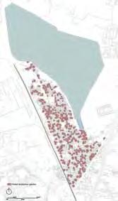
The plan is to design venues with different functions around the main activity spaces of women. On the one hand, it proposes transforming 200+ currently vacant lots adjacent to houses into productive land for housewives. On the other hand, it involves transforming more than 20 vacant lots along the street into women-only places for social contact, consulting, and re-education. Replicating this framework on an urban scale and implementing it as a women’s rights strategy could have a significant positive impact on women’s rights as well as promoting gender equity in India as a whole.
Four Safe Space Principles for Women

The safe space should be located in an area that is conveniently accessible to women and girls. Near places woman go frequently such as the market, temple, and school.
Women/girl-only / dominant space

Evidence suggests that the establishment of women- and/or girl-only spaces help to reduce risks and prevent further harm during acute emergency responses And, if the space cannot garantee women- and/ or girl-only, at least it is a women-led space.
The space should have a privacy fence or wall to ensure privacy and safety. Girl/woman groups should be visible, but avoid to being visible to men as much as possible.


Create a sense of ownership, rather than perceiving it run by an external group. Services should correspond to their life cycle as well as provide woman / girls-target facilities.






The whole productive pocket gardens are going to cover over 1,000 households, which accounts for more than 60% of households.
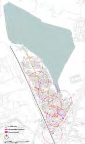
Yelahanka is going to be divided into 7 parts according to women's market locations and 3 minute walking maps, which means the products within one 3 minute distance can be collected in one market for selling together.

Make the main women's re-education and consulting center available for every woman within 5 minutes walking distance from their homes.

58
Farming Block out sight Women's storyboards Combine with woman's daily life cycle Provide girls-target facilities Women plan, implement, and maintain it Block out sight Monitor Block out sight Market Playing with kid Social Location is accessible Between home Next to market Next to school Next to temple Next to water point Individual counsulting Learning
is private but visible
Location
sense of ownership
Create a
Productive LandscapeDrive Approach SOCIAL EMPOWERMENT New Women Social Network EDUCATION EMPOWERMENT Women Reeducation Opportunity ECONOMIC EMPOWERMENT New Job Opportunity Positive Cycle Productive Pocket Garden with 15m Buffer Women Market and Gallery Line Women’s Re-education Center within 5 min Walk
Social



Women



59
Function Space for small group of women Space for big group of women Irrigation system Irrigation system Agriculturerelated Facilities
Function
Productive
Other Function
safe
Decompsed box Decompsed box Water purification system Rainwater harvest system Plant on the ground Plant on the ground Plant on the raised bed Plant on the pergola Vertical growing Make handicraft Raise chicken Vertical growing Children playground Make handicraft Education Raise chicken Trading Vertical green to block out sight Women-only space Women-dominant space Productive pocket garden Women education/Consutant center Vertical green to block out sight Women market
TYPE ONE TYPE TWO TYPE THREE TYPE FOUR Bao Lixia
strategies
Methodology
Bao Lixia


Master Plan of Productive Pocket Garden


Chicken
Foot
Drip
60
Block Master Plan Design Block Women's market Education center Productive pocket garden 1 1 2 2 3 3 Market Private home garden Private under construction land Temple
10 17 16 15 12 13 11 9 8 14 6 5 2 1 1 2 3 4 5 6 7 9 8 11 12 13 14 15 16 17 18 19 19 18 3 7 4 Entrance Door Housework space Sink Vertical planting Pergola
bed
plant
plant
purification box
Raised
Potted
Ground
Greywater
coop
box
Decomposed
pump
irrigation pipe Visual Analysis Walkway Analysis Water flow Function Analysis Ash gourd All year around Tomato All year around Bitter melon All year around Eggplant All year around Ladyfinger All year around Cucumber All year around Snake gourd All year around Corn All year around Grape Aug.-Dec, Guava Dec-Apr. Pomegranate Mar.-Jun Sapota All year around Banana All year around Bael All year around Cauliflower All year around Ashwanga All year round Papaya All year around Jasmine All year around Cumin Dec-Apr. Marigold All year around Fennel Mar.-Jun Hibiscus All year around Holy Basil All year around Rose All year around Rosemary All year around Stevia All year around Coriander All year around Castor All year around Gymnema Sylvestre All year around Lemon grass All year around Mint All year around Shatavari All year around Economic use Harvesting season Medicine use Religion use Pond
space
playground Home
Social
Children's
Women-dominant market
GREYWATER REUSE

Average grey water per household:1635L*94%*4=6148L/month
Average grey water per household after purification:6148L*60%=3689L/month



household grey water can support agriculture area:23m2


Growing fruits brings income/save expenses up to R$450/m2/Year
Growing vegetable brings income/saves expenses up to R$370/m2/Year


Growing flower brings income R$520/m2/Year
A coconutchip biofilter can help purify greywater. Kitchen sink water flows through the system, leaving food and grease behind. Chickens eat food particles in the upper coconutchip layers. When the drainage slows, the top layer of woodchips are replaced, old chips go in a compost bin where worms, centipedes, ants, bacteria, and other soil critters decompose food particles further. Bugs reproduce in the drum, provideing high-protein food for the chickens, and, after the woodchips decompose, provide fertilizer for plants.
Other Considerations:
Discrimination against women in Indian society is a process rooted in Indian religious culture, which has been continuously extended and strengthened in the long history. It is a severe and complex social problem. My approach is a political approach to planning and design. My project cannot realize women to be as free as men in the community, but it can bring women into spaces where they didn't exist before or felt they had no right to exist. In order to achieve the maximum benefits of the project, there are several additional recommendations in the design and implementation process:
1. Women participate in the whole process of project design, decision-making, construction and maintenance;


2. Family-based mobilization activities within the community to ensure the broad participation of women;
3. Active participation of local women's rights organizations;
4. Government policies and laws safeguarding women's rights should be constantly improved.
This is an adaptation of an ancient method of irrigation. It uses the porous nature of clay pots to allow osmotic pressure to suck the water into the soil where it is needed. People use beautiful

61 Bao Lixia
season Wet season
Dry
Drip irrigations systems are typically 90% efficient, as compared to sprinkler systems which are 75% efficient. Water savings can be as high as 50% and crop yields can be increased by up to 40%.A lowcost drip system is available at a cost less than 150 INR and can cover a plot of 20 m2 for household scale. VALVE FOR RAIN DAY VALVE FOR SUNNY DAY
fired pots
a narrow neck buried
the soil.
called Olla with
in
Per
Women-dominant market Bamboo has been used traditionally in construction in ancient days. It entails low transportation costs, labor costs, ease of construction and building aesthetics with a soulful ambiance. Weaving of coconut fronds is an ancient Indian craft. Coconut tree fronds are used in basket-making and roof-thatching. Very few tools and raw materials are required for this natural product. Coconut palm leaves are available abundantly in the Yelahanka. Temporary Storage Handicraft Vendor Fruits Vendor
Gender equity market Market day Market day Gallery day •Easy Setup •Local Construction •Flexible Installation •Simple Transport Gallery day Women-only re-education center Rainwater Harvest System Water tank Outdoor Class •Pest control •Crop propagation •Crop cultivation •Guidance of irrigation and compost system Indoor Class •Literacy education •Information & awareness-raising •Individual consulting •Agriculture loan
Chen Beifei
Revive regional vitality by merging different functional blocks and establishing an energy recycling system
Issues
1. In Bangalore, the construction of the city separates human activities from the natural environment.
2. Human resources move to the city center, and cities replace natural resources.
3. All the energy-flows in the existing site are one-way directional and isolated, and the energy has been lost throughout the process.
Based on the above analysis of the problem and related to the topic of urban agriculture, I believe that it is necessary to establish a demonstration area with good energy flow and practical benefits. Productive landscapes are based on a mix of uses that support each other to create a harmonious space. I want to get rid of the separation of the landscape and imagine a combination of all methods, in the city, where the current partition is very much present. This change will reduce the distance for the cycle to be completed and make the
space more powerful. The reduction in transportation costs between research, production, processing, and retail will help to build a better local economy.
On the one hand, an energy recylcing system can improve the way of urban life, redefine the existing landscape and diversify it. On the other hand, the actual feeling brought by the well-circulated urban ecological environment can arouse people’s motivation to think and change. By creating a new, ever-changing landscape model, the landscape is productive and at the same time integrates people into the site.
The mixed-use of land and the change of land structure enable us to respond to future challenges by creating an elastic venue that will not be damaged by future changes. A productive place with
dynamic characteristics is a flexible machine with strong resistance to change. In contrast, a single use, the passive landscape is resource consumption, but contemporary production landscapes can generate resources.
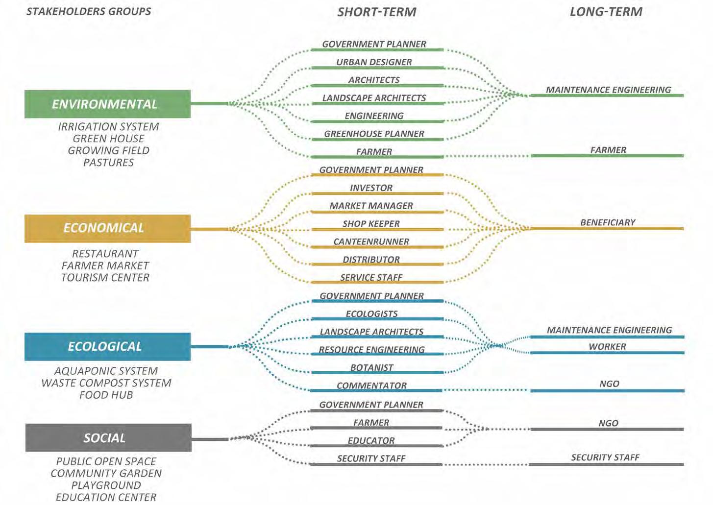
In the overall design, I include municipal ecological facilities such as green infrastructure, public green spaces, food processing, and distribution centers. It creates a closed loop that reconnects the energy, food, water, ecological and economic systems that were initially separated. In addition to planting strategies, recycling strategies include energy production and waste management. The energy flow is divided into four parts: manufacturing, transportation, consumption and recycling. They are arranged in the form of blocks, causing interactions to create a circular energy flow.


Ideal Situation
- collaborative site
- ecological circular system
- increase interest in argriculture
- new technology
- new job oppotunities
- resilience
- self-sufficient
62
At the same time, it gives meaning to the entertainment and education of the whole region. Through the introduction of high-tech agricultural science and technology, it stimulates people’s curiosity and exploration psychology. Through the establishment of community farms, farm restaurants, and agricultural products markets, it attracts the participation of ordinary families and infiltrates the ecological education into people’s In daily leisure activities.

63
Chen Beifei Master plan
Chen Beifei
Farm land area: 50,730 m2

Total output: 10,661 kg/year
India major crops output data:
rice: 2,800 kg/ha
wheat: 2,400 kg/ha
coarse cereals: 2,600 kg/ha
pulses: 730 kg/ha
Greenhouse area: 4,920 m2; 15 kg/m2/year
Total output: 75,000 kg/year
Pasture capibility: 11,680 m2
cow: 300 area: 2,000 m2
meat: 31,200 kg
milk: 183,724 tons/year
sheep/goat: 200 area: 300 m2
meat: 2,400 kg milk: 3.285 tons/
year
poultry: 700 area: 300 m2
meat: 910 kg
eggs: 161,000/year
India livestock ratio: cow:sheep (goat):pig:poultry=3:2:0.1:7
Public space: 10 hectares
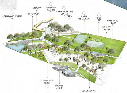


Comfort per capita green are: 9 m2
Capacity of human: 10,000
Community garden area: 6,500 m2

Aquaponic system area: 7,500 m2

India’s per capita food needs include 158kg/year crops, 68kg/year vegetables, 5kg/year meat, 3kg/year eggs, and 108kg/year milk. The restaurant capacity: 100 people, area of market: 1500m2, number of shops: 50.
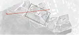
Key map
64
1 2
65 Chen Beifei
vinamra agarwal
Intergenerational CENTER FOR LEARNING
Old Yelahanka is one of the oldest towns in Bangalore. It was the agricultural hub, but due to urbanization, it has transformed into a high-density urban fabric. First, this has led to a generational gap in the society as the younger population migrates to other cities for economic benefits and opportunities leaving the older generation. Second, due to the scarcity of agricultural land, people have to import food from nearby towns and cities to fulfill their needs.
During the community survey, the data suggested that many people were interested in agricultural activities but due to the scarcity of land, lack of awareness, and insufficient funds they are unable to participate in agriculture-related occupations. Various studies have shown the benefits of intergenerational learning: children and elderly work better together to create a cohesive learning environment. There is a need to educate and make people aware of new agricultural technologies that require less space and have a high yield, as well as blur the generational gap in the society.
‘To connect inter-generation by cohesive learning through the integration of different farming methods and recreation.’
Strategies related to the proposed intervention include:
• Center for learning infused with agricultural technologies such as traditional farming, aquaponics, hydroponics, rooftop and vertical farming, and animal husbandry
• Yelahanka ‘Haat’ - Communal recreational spaces for events, food festivals and much more
Design matrix
AQUAPONICS

INTEGRATING BOTH HYDROPONICS
TRADITIONAL FARM
Possible solutions-integrating
ANIMAL HUSBANDRY
FISH, MILK & EGGS COMMUNITY GARDENS COMMUNITY WELLBEING
EDIBLE GARDEN
FLOWER GARDEN
FRUIT GARDEN
PLANT THE PADDY
DYE INDUSTRY
RESTORE THE HERITAGE

FISH POND NATURAL AQUAPONICS
ROOFTOP FARM
YELAHANKA ‘HAAT’
Intergenerational activities
Intergenerational activities increase cooperation and interaction across generations. It involves sharing of skills, knowledge and experience between old and young. In the table shown, there are a few of the activities which young and old people like to do and how these activities can be integrated with the spaces.
This type of program will help establish a connection between generations creating a cohesive learning environment.
FUTURE FARM
SELLING OF SURPLUS
66
EDUCATION ACTIVE RECREATION PASSIVE RECREATION INTERGENERATION PARTICIPATION NOTES
Age distribution Decrease in agricultural land
24% 40% 36% AGE 10-30 YEAR 31-60 YEAR 61 & ABOVE YOUNG INTEGRATING OLD RUNNING PATHWAYS WALKING CATCHING BUTTERFLIES FARM WITH BUTTERFLY CATCHING PLANTS GARDENING LEARNING EDIBLE GARDEN + CULINARY EDUCATION TEACHING PLAY RECREATION + SITTING SPACE RELAX UP AND DOWN ACTIVITY SPACE FOR BOTH SIMPLE EXERCISE NOISY BUFFER SPACES QUIET EVENING MULTI-USE SPACES DAY EAT EDIBLE GARDENS COOK ACTIVE RECREATION RECRETIONAL ZONES PASSIVE RECREATION
Traditional farming is a linear, soil-based agricultural system which requires a lot of resources for output. It requires a lot of land to produce vegetable and crops. This agricultural system is the most economical way to grow, but in the future due to the lack of land because of urbanization, traditional farming will not be an ideal system to grow food products.



Aquaponics is an innovative closed-loop farming system which helps to grow vegetables and fishes cohesively. This system requires six times less space and 90% less water to grow vegetables. An aquaponic system can be expensive to set up, but the cost can be recovered overtime. Aquaponics is the future of farming in urban areas as it is a portable option to grow food.

67
vinamra agarwal
Traditional versus Aquaponics
Proposed site
POTENTIAL SITE 1
SITE AREA : 17400 SQ.M (4.3 ACRE) POND AREA : 600 SQ.M (1080 M3)
vinamra agarwal
DETAIL 1 : INTERGENERATIONAL LEARNING
CONCEPT Plan


DETAIL 1: INTERGENERATIONAL LEARNING PLAN
RE-LEARN
• New Technologies
• Importance of food
• Growing symbiotic systems


• Community engagement
REAP
• Food
• Flowers
• Extensive knowledge
• Economic benefits
INTERGENERATIONAL CENTER FOR LEARNING

Master plan
RESTITUTE


• Give back to nature
• Biodiversity
• Self-sustained ecosystems
• Interdependent systems
Section


Resting Zone (Detail 2)
Resting Zone (Detail B)
Plant the Paddy Pond
Plant the Paddy Pond
Traditional Farm | Animal Husbandry
Traditional Farm | ANIMAL HUSBANDRY
Intergenerational Learning Farm (Detail 1)
Intergenerational Learning Farm (Detail A)
Lakefront Pathway
Lakefront Pathway
Proposed Building
Proposed Building
• Labs
• Labs
• Conference rooms | Classrooms
• conference rooms | CLASSROOMS
• Roof top farm (aquaponics)
• Roof top farm (aquaponics)
Pedestrian Entrance
Pedestrian Entrance
Existing School
Existing School
Recreational Zone
Recreational Zone
Community Garden
Community Garden
Commercial Aquaponics
Commercial Aquaponics
Vehicular Entrance
Vehicular Entrance
Parking
PARKING
Yelahanka ‘Haat’
Yelahanka ‘Haat’
• Farmer’s Market
• FARMER’S MARKET
• Food Festivals
• FOOD FESTIVALS


• Recreational Activities
• RECREATIONAL ACTIVITIES
• Nursery
• NURSERY
• Open-air Amphitheater
• OPEN-AIR AMPHITHEATER
Rail
Rail
DETAIL 1: INTERGENERATIONAL LEARNING
PERSPECTIVE
68
LAKE Herb & spice dye Flowers PB\ GINGER PB\ TURMERIC PARSLEY, BASIL, MINT COMPOST MANURE PB\ CURRY LEAVES CHILI, CORRIANDER, KOKAM F\ MARIGOLD RESTING SPACE W/ ACTIVITIES RESTING SPACE W/ ACTIVITIES F\ BLACK-EYED SUSAN, DAHLIA, SUNFLOWER, INDIGO PB\ ROSE PB\ ROSEmary DIY GROUND DIY GROUND LAKEFRONT PATHWAY STAGE CULINARY CLASS COMPOST BOX SAPLING PLANT PB\ POTATO PB\ CORN PB\ BEANS PB\ ONION, CARROT PB\ TOMATO PB\ BROCCOLI, PEAS Vegetables Beans Tomato Broccoli Peas Potato Spinach Cabbage OnionsCarrots GingerTurmeric Parsley Basil Chili Rosemary Kokam Curry Leaf Indigo Rose Dahlia Marigold Sunflower Black-eyed susan SECTION DETAIL 1: INTERGENERATIONAL LEARNING Path Path Gazebo Play Zone Class Area Lakefront Lake Learning Zone Green 3500 2400 6000 4200 12500 6400 9000 5200
Resting | Reading Potted PlantsCulinary ClassCompost Manure Lakefront Pathway Lake Edible Garden Dye plants| Butterfly Garden Play with plants
7
DETAIL 2 : RESTING ZONE | PLANT THE PADDY
Integrated farming system
DETAIL 2: RESTING ZONE | PLANT THE PADDY PLAN

Plan

FRUIT PEELS USED TO MAKE COMPOST AND FLOWERS USED TO MAKE DYES
OUTDOOR AQUAPONIC SYSTEM TO GROW PADDY CROP

LIVESTOCK (ORGANIC FERTILIERS) TRADITIONAL FARM COMMERCIAL AQUAPONICS (ORGANIC FISH FEED FROM FARM) ROOFTOP GREENHOUSE FARM (AQUAPONIC SYSTEM)
manure COMPOST
COMPOST COMPOST PRODUCE
Donors
Producer Ag Organizations

Quality Control Board
FoundationsCorporate donors Parents
CommunityStudentsFarmers
Farmer’s MarketCommunity Food System
NutritionistFood Labs
Researchers
69 vinamra agarwal
INDUSTRIAL
16
AREA
MANGO TREES Paddy crops Outdoor Aquaponics System 12 Path Path Gazebo Play Zone Class Area Lakefront Lake Learning Zone Green 3500 2400 6000 4200 12500 6400 9000 5200 Rail CartPath Pathway Fish Pond Paddy Paddy Lakefront Lake Elevated Bridge Cleansing Wetland Biotope Path 9000 3500 1500 7200 12200 5150 5150 6200 2400 1500 3000 2000
•
• Herb •
•
•
• Milk •
• Manure
Vegetables
Rice
Flowers
Fruits
Eggs
Toh Zi Gui
Food Travels: Integrating Trustworthy Food Intake with the Joys of Gastronomy
Among Bangalore urbanites, organic home gardening is gaining popularity due to a growing distrust of commercial food production systems. Bangalore urbanites are also foodies who do not just take food for subsistence, but also indulge in the pleasures of dining out. However, these are conflicting practices, because organic home farming is an act of gaining control of food preparation, while gastronomy entrusts the preparation of food to others.
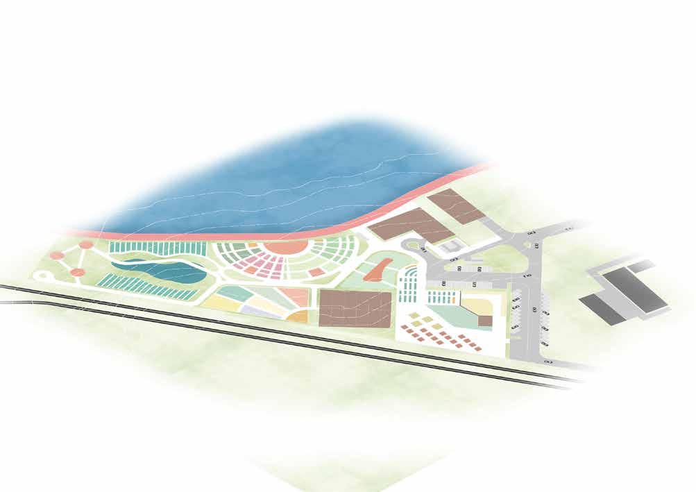
This project provides an escape from hectic urban lifestyles to a gastronomic experience at the peri-urban town of Yelahanka. It is a place where the course of a meal is more than just a destination, but a cultural-historical journey. Crop cycles and recreational programs are closely integrated, so visitors can look forward to fresh experiences throughout the year as programs change with the seasonality of crops. This also enables history to be lively and relevant to Bangalore urbanites of today. The journey also acquaints them with a more accessible and trustworthy food preparation process, serving as a potential solution to the conflicting practices.
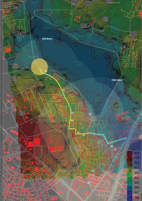
Site analysis: effects of rapid urbanisation


Rise in organic home gardening


Strategies
1. Generate surprise by offering food and recreational programs that vary all year round.
2. Present these offerings as a gastronomic journey.


3. Make commercial food production more personal to Bangalore urbanites.
Calendar of crops & recreational programs

The rise in organic home gardening is an act of taking back control of Bangalore urbanites’ food intake, bypassing commercial agriculture. (Images sourced from “Oota From Your Thota” Facebook page.)
Site selection

Inserting relevant programs in between crop cycles enables the offering of both crops and programs to vary throughout the year. So visitors get varied experiences and surprises with every visit.


Urbanisation is a cycle of effects which is spinning out of control. Rapid rural-urban migration drives housing and infrastructure demand, leading to unsustainable outgrowth of the city. Urban pollution eventually encroaches rural lands, leading to growing distrust of commercial agricultural processes.

Existing

site conditions


Yelahanka is a peri-urban town which serves as a gateway between the rural north and the urban south. This is an accessible location for Bangalore urbanites who seek a convenient getaway from the bustling city, and brings commercial agriculture closer to the urban centre. The site occupies leftover space between the town and the railway. The linear site emphasises the sense of journey undertaken by visitors. Existing site conditions include a railway station, leftover strip of land, small emtpy fields, a swamp, a lake, and a step-pool which is still under construction.

70
Sowing Farmer’s Market Spice
Historic timeline
detail plan
detail plan
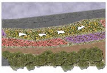


Marigold fields (1:200@a2)
Iron-age field (1:500@a2)
Masterplan
plan
High-tech restaurant & step pool (1:200@a2)
71 Toh Zi Gui
Mango Plantation
Emmer Wheat
Bristle Grass Mung Bean Horse Gram Railway Station Stables
Baking Demonstration
Park Connector
Marigold & Spa Pods Step Pool
High-Tech Restaurant
detail
The immersive process

Visitors generally start at the railway station, with Iron Age themed crops and programs. Every themed zone ends with a themed restaurant, where self-harvested crops are prepared spontaneously. Every exit from a restaurant reveals a new era further down the course of history. Therefore, the visitor experiences a total of six eras from past to a possible future, experiencing varied recreational activities depending on the time of the year, and taking in a 6-course meal in the process.


72
Toh Zi Gui
Visitor’s experience map
Express Park Connector Route
Iron-age fields
sHIFTING sEASONS; sHIFTING cROPS


Marigold fields and spa pods

High-tech restaurant & step-pool/open space

sHIFTING pROGRAMS; sHIFTING eXPERIENCES

73 Toh Zi Gui
Eingeel Jafar Khan
Re: weave - cultural revival of yelahanka old town through injecting tourism as a booster


Historically known as the city of gardens, lakes, and culture, Bangalore, while moving towards rapid urbanization, has been adopting a more global outlook. The multicultural Indian city has had a lifestyle deeply rooted in its religious context where in the places of worship became the main nodes of social and economic activities. But amidst this shift, a question that needs pondering is whether Bangalore is losing touch with its cultural roots?
The old town of Yelahanka in Bangalore is gearing towards the same kind of shift. Known for its surrounding foodscapes of paddy, rice, millet, guava and grapes among other crops, Yelahanka is also known as the Manchester of Bangalore. Being a traditional place for weavers, the silk handloom industry has been the lifeline of the people for over two centuries and is also presently carried out in the North areas of Kamakshamma layout, Agrahara layout, Kogilu and Chowdeshwari layout. Integrating these tangible and intangible facets of the cultural ecosystem of Yelahanka while ecologically and economically reviving the neighbourhood is the main challenge.
The old inter-generation resident families of the place connection with agriculture and the lakefront complained of their long working hours inside the homes devoid of any recreational open space nearby for small work breaks. They miss the olden ways of saree making where in parts of the weaving process used to be carried out in semi-open and open lands (dyeing, drying and reeling threads). The community survey and onsite mapping also revealed that the religious places were the main hubs of social and economic activities, with most of the people going to them either once a day or frequently in a week--for worship, for social gathering, or for buying merchandise from stalls nearby. Hence, it was evident that Yelahanka as a neighbourhood has all these three factors as the backbone of its socio-cultural-economic fabric.
My design strategies are aimed at the ecological, cultural and economic revival of the place through augmenting biodiversity, socio-cultural relations, and local tourism; each building upon each other as part of a big system. For the first sphere of ecology, I aim to introduce the circular lifecycle design process wherein the source to end waste product is produced and utilized at site. The flower waste produced from the places of worship would be utilized in the dyeing process of the weaving industry along with other eco-dyeing crops grown in Yelahanka, and the coconut shell waste produced would be utilized in making craft products from the coir. Creating active open spaces and various pause points for residents and working weavers in conjunction with existing nodes of religious places is aimed at the second core sphere of culture and society. The last strategy of augmenting local tourism through weaving the three cultural elements of Yelahanka together, namely weavers, agriculture and the religious ecosystem is aimed at the third core sphere of economics.
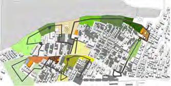
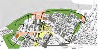


Strategy 2 Strategy 1
Connecting the disjointed patch matrix system of Yelahanka through corridors of edible landscape along wth waste management

(AUGMENT ECOLOGY)


Strategy 3
Weaving the three cultural elements of Yelahanka together: Religious + Weavers + Agriculture ecosystems

(AUGMENT ECONOMY THROUGH TOURISM)
Process Weavers + Religious hubs + Vacant lands


Giving functions based on 3 ecosystems and connecting them through a trail
Weaving Religious Agricultural
Further diving the functions into detailed zones under each ecosystem
74
Indigo
Grapes
Hibiscus
Guava
Turmeric
Turmeric
Fennel Green
Orange
Yellow
Brown
Mulberry
Henna
Chamomile
Carrot
Mango Bark
Tamarind
Beetroot
Nettle
Marigold Blue
Marigold Purple
Henna Red
Millet
Jasmine
Marigold
Paddy Basil Ragi Bael Banana Neem
Coconut
Peepal Mango
Planting palette Dyeing Agriculture and Food Religious
Creating active open spacesand small open spaces at various pause points for varied residents
(AUGMENT SOCIABILITY)


1 2 3 4 5 6 7 8 9 10 11 12 13 14 15 16 17 19 10M 110M 18
1. Parking and Service Centre
2. Gateway towards weaver settlement
3. Weaving History
4. Mulbery Plantation
5. Silk Rearing
6. Tea Break at Religious Centre 1
7. Jasmine flower Farm
8. Marigold and Hibiscus Farm
9. Flower waste centre at Religious Centre 2
10. Paddy, Millet and Ragi Farms
11. Grapes Farms
12. Vegetable Farms
13. Guava grove +Farm to Table
14. Central workshop for dyeing and weaving
15. Coconut+ Banana plantation + Coir Products Centre
16. Mango Orchard
17. Indigo Farms
18. Religious Centre 3 with ancient Kalyani
19. Herb Garden
Legend
Masterplan
Eingeel Jafar Khan
tourism with its elements as a tool for revival
Tourism will act as a booster to Yelahanka, pushing forward the revival process wherein the tourists from downtown and the larger region come to sensorially experience the inter-connected religiousweaving-agriculture ecosystem, and in turn be educated about the various processes involved.
Wayfinding elements


Seating along trail Signage Trail Material: Permeable

detail plan
Legend
Break point 1 and flower waste centre
detail plan

Neem Tree (Azadirachta indica)


Eco- cultural Trail (colored permeable stone paving


Pergola for drying Dyed Raw Silk and Rain Shelter
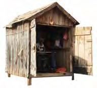
Peepal Tree (Ficus religiosa) Mango Tree (Mangifera indica)
Permeable stone paving


Flower Waste Centre
Flower Farms (Jasmine, Marigold and Hibiscus)
Sensorial Experience along the Trail
76
stone paving
Key Map
Taste Smell Hear See Taste Smell Hear See Touch Smell See Touch Smell See Touch See Touch See Hear Hear SeeSee See Weaver’s Settlement Gateway to Settlement Weaving History Mulbery Plantation Tea-Snack break at Religious Centre 1 Farm to Table Restaurant Agricultural Plantations Herb garden Flower Waste Centre at Religious Centre 2 Food Farms Flower Farms Silk Rearing
Seating under Tree Vendor Stall


 Food Farms: Grapes Plantation during Fruiting Season
Food Farms: Paddy Farms during Harvesting Season
Silk Rearing Centre with all stages of Sericulture
Farm to Table Restaurant in midst of farms
Flower Waste Centre at Religious Centre 2 with all stages of eco- dye process
Annual Kargah Festival at Religious Centre 4 near lake and ancient Kalyani
Dong Yitong
Continuous Productive Urban Landscape (cpul) in Yelahanka

What is needed: Improve people's awareness. Restoration and protection of the ecosystem.
How to do it:
Build green space system. Community garden as medium.
78
Issue Statement
Dong Yitong Master Plan


79
Irrigation
Continuous: Linear park (for green space and community garden) Productive: Community gardens for residents
Continuous: Linear park (lake water for irrigation) Productive: Community gardens for residents
Productive: Sunday market (promotion effect)
Linear park near the railway
Linear park near the lake
1 2 3 4 1 2 3 4
Linear park along the road
Current situation
detail plan

Dong Yitong Little fingers
Phase 1: Full use of vacant land
Half-closed vacant land & connection
Half-closed vacant land near the street
Small area vacant land


Connection with linear park


Functional zone
Interconnectivity

Cow gathering area

80
Main Street
Dong Yitong
Use building facedes for vertical garden
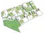


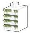
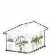

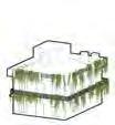


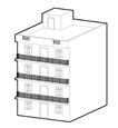


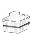


Design process

Community
81
Feed the cows: Kind behavior
Phase 2: Green corridor
Phase 3: Green corridor & roof gardens
types of vacant land
Typical
1 2 3 4
Orchard
Mainly responsible for supply of plant dyes; the garden primarily produces fruits and vegetables that can be made into vegetable dyes
Flower Garden
Mainly responsible for supply of plant dyes, flowers such as tulips and morning glorys are very good natural dyes after treatment. At the same time, it can provide an excellent experience for tourists.
Herb Garden
Mainly responsible for supply of vegetable dyes. Many herbs have great potential for use in dyeing, which enables tourists to learn more medical knowledge while visiting.
Water Treatment

Although Eco-Dyeing, the process of dye production will use a small amount of chemical agent to improve the color of the dye durability. The lightly polluted water needs to be treated.
Cotton Field
Mainly provides cotton, so that visitors can have a better understanding of the raw materials of the fabric. The cotton produced here can be used in the workshop
Central Workshop
An area for various textile activities. Visitors can learn about the extraction of vegetable dyes, the coloring of fabrics, and the making of fabrics. These paid activities can also promote and increase the income of local residents.
Mulberry-base pond
Mulberry trees were planted in large Numbers to guarantee the production of silk, and fish were raised in the fishponds. Tourists could do all kinds of waterloving activities such as fishing.
82
Li Ziheng
Mainly used to purify the pollutants produced in the process of dye production

N 40m80m120m 160m 2 3 4 5 6 7 8 9 10 11 12 13 14 15 1
1. Entrance
2. Shopping Area
3. Agriculture Walk
4. Orchard
5. Tea Garden
6. Muibberry-base Pond
7. Dock
8. Watching Tower
9. Textile-history Walk
10. Central Workshop
11. Purification Stream
12. Glass Cover Street
13. Flower Garden
14. Lake Walk
15. Herb Garen
Li Ziheng
Li Ziheng
Plant selection for dyeing
The choice of plants is very important. Apart from cotton and mulberry trees, which provide fabrics, other plants selected can be used for dyes. The roots, leaves, stems, fruits/peels, and petals of these plants can be used as natural dyes. Also, plants should be chosen for their agricultural qualities, such as apple trees: the fruits can be eaten and the flowers can be used as dyes, making them ideal for growing in fields.

84

Li Ziheng
Interlake - Amplifying The Strength Of Connection Between Community And Yelahanka Lake By Amalgmation Of Productive And Ecological Landscapes






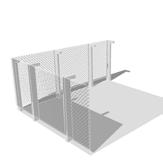
In between understanding the lake series developed throughout Bangalore, the system of lakes helped to know why and how they were built for rich landscape assisting socio-economic aspects. The primary purpose of the lake series faded away with the development of the lake city, creating barriers and destructing the lake series. Even though the authorities tried to keep the buffers for a revival of this lake series the sense of belonging to the lake has mostly diminished. That’s why the part of the design was redefining these boundaries and utilising them to nurture the whole lake series of Bangalore and set up an example to follow.
Though rapid urbanization was taking over such significant features in the town, Yelahanka lake and the stories told by the communities maintained to trace the importance of Yelahanka lake within the community, which inspired me to come up with an intervention that reframes the past by linking the city to the lake and surrounds. The lake served the community for cultural and economic reasons in the past, and the challenge was reintroducing the lost bond with a new expression to engage present and future generations. The strategies revolve around giving access, the original purpose by building and activating edges and sharing the resources to build community.
86
Green
Accesibility Sharing The Buffer Zones
Corridors
Proposing areas for transfers of ownership right to authority. Leasing the land in the buffer zone to public private partnership program where land can be distributed among communities creating opportunities to produce and maintain the buffer zone.
Understanding the proposed landuse plan introducing entry points for better accesibility of fenced zones of the series. Proposing bicycle track connecting the lake series of bangalore for awareness as well as better connectivity to lake system
Living Fence Why Fence? Existing Chain Link Fence Fin Fence Shared Fence Interactive Fence Less Defensive AestheticsDurabilityMaintainanceProduction SecurityRemediative Fences as a better social enclave 75M Buffer
Available Green Buffer Enchroachment Bicycle Track Achievable Buffer Green Buffer Enchroachment Bicycle Track Achievable Green Buffer For Productive Landscape Policy building
Instead of no construction bufferzones making the green buffer orridors providing guidelines for natural remediation techniques according to the context of the lake series
As A Green Corridor
The BDA states that fencing is a crucial aspect in protection and preservation of water bodies.
radha waykool
Past conditions : Multi crop farming
Past conditions : Urban influence
Decline in farming activity
Present conditions : Unorganized development

Encroachment
Gated lake area

High contaminated soil and ground water
Proposed phase 1 : 5-6 Years
Phytoremediation to extract contamination and improve soil quality for productivity
Creating green buffers to purify the surface runoff from surroundings

Proposed phase 2 : 2-3 Years


Post extraction process using the land for production


Proposed phase 3 : 1-2 Year
Planting fast growing + nitrogen
fixing trees to increase soil quality And again using for production
87 2 2 1 12 13 9 10 4 5 5 7 3 3 6 8 14 11 0M150M 450M
1.Constructed
Legend
wetland 2.Kalyani with view points
3.Food forest with guilds 4.Farm pockets
5.Productive ghats 6.Fruit orchard
11.Jetty 12.Community
13.Linkway
7.Activity zone 8.Information centre 9.Reserved vegetation
10.Flower
zone and nursery
zone
14.Trail
through food forest
A B C D E F Build Build The Productive Landscape: Reframing The Past Of The System To Restructure The Present For Better And Sustainable Future Heal Heal With Nature: Remediate The Eco-Sociological Values Of The Lake Share Fraction For Everyone: Managing The Produce For Social And Ecological Balance Activate Activating The Edge: Introducing Better Access And Identity To The Place Existing Entry Point Buffer Segment Proposed Entry Point Ecological Segment Community/Cultural Segment Extraction Plot Multi Mechanism Buffer/Mat Floating Islands Storm Water Filter +Living Fence Degradation Bosque Sub Surface Wetland Wetland Circulation Path Accesibilty And Circulation Zoning Remediation techniques Master Plan radha waykool

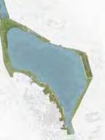




88 5 6 7 9 1 8 4 3 7 10 11 12 13 14 2 0m2.5m7.5m KEY PLAN Ownership and Managnent of the tanks COMMUNITY MEET UPS COMMUNITY LEADERS SHIELDING THE LAKE SERIES BANGALORE Aspiration Experience Skills INTRODUCING SOCIAL CREDITS LAKE MANAGEMENT COMMITEE 4-6 GUARDS 2 LAKE MANAGERS Policy Finance Opportunities Land Availability NGOs COMMUNITY PPP BBMP BDA Forestry Department Lake Development Authority Private Organisations Housing Board Residence GOVERNMENT FISHERMEN FARMERS AND GRAZERS WOMEN EMPOWERMENT GROUP CONSTRUCTION MANAGEMENT OWNERSHIP RIGHTS WITH SOCIAL CREDITS INVITING Techniques Economy Generator Engagement Enhancement Educational FARM POCKETS FARM LANDS ACCESS TO FISHING FOOD FOREST Framework For Floating Farms Detail Plan Material Palette Stakeholders
Bamboo Jute Rope Jute Cowdung Compost Companion Planting Floating Farms Floral Community Nodes Pavillions Community Kitchen Nursery Storage Productive Ghats Kalyani Yield Nodes Community Farm Shared Farm Pockets Flower Farms Floating Farms Productive Screens Nursery Seed Banks Ecological Nodes Constructed Wetlands Remediative Buffers Strom Water Filter Living Fence Experiential Nodes Food Forest Trail Bird Watching Points Boardwalks Linkway Soft Green Edges Activity Zones Heal Activate Build Share 5-6 Years Stage 1 Stage 2 Stage 3 Grow Within Lake Site Build Employment For Community Produce And Share 1-2Years 1-2Years Legend 1. Community gathering space 2. Farm cafe 3. Farm box garden 4. Pavillions 5. Floral fragments 6. Vegetable patch 7. Shared farme space 8. Community fruit orchard 9. Legumeous edge 10. Productive ghats 11. Floating farms 12. Aquatic vegetation zone 13. Water wheel 14. Linkway
Program
radha waykool


89 E F D C A B H G I Productive Edge Ecological edge Interactive edge Tool Box Productive Ghats With Festive Flower Patch Interactive Green Edge Pocket Farms Managed By Women Empowerment Group And Schools C A B E F D Transition Zone Spoteneous Vegetation Patch For Research Constructed Wetland H G I Old Irrigation System For New Generation Learning Hub Linkway To Connect The Opposite Edges And Settlements
With New Purpose Floating Farms As A Part Of Productive Landscape H G I F D E B C A radha waykool
Kalyanis


Credits
Guest critics, Lecturers, & Consultants: Hwang Yun Hye, NUS Tan Puay Yok, NUS
Herbert Dreiseitl, NUS guest lecturer
Saurabh Gaidhani, 100 Resilient Cities
Ryan Shubin, Rambol Studio Dreiseitl
Helen Smith-Yao, STX Landscape Architects
Henry Steed, ICN Design International
We also acknolwedge the work of the students in Prof. Hwang’s studio, whom we teamed up with during the first two weeks of site analysis: Chan Wing Fai, Chen Nan, Dai Yuke, Isabel Villegas Molina, Hou Yanru, Liu Ye, Manasi Prabhudesai, Tang Mengjiao, Yang Xiaowen, Zhang Qinqin, Muhammad Rahmat Bin Khairudin, Mitali Kumar, and Elsa Sim Rui Jia

A special thanks to: Dr. Annapura, Jalaposan Trust
Aparna Rao, Sriganesh Rajendran, Rahul Paul, and Maithily Velangi, FICUS
Rajendra Hedge, Biological Research Innovation Centre and Solutions LLP
And to our knowledgable English-Kanada translators: David and Sumitra Bodapati Hithesh Shettigar, Karthik Gowda, and Nithyam Nachappa who made it possible for us to engage the residents of Yelahanka.
Finally, a very special acknowledgement to the residents of Yelahanka, we were truly inspired by your community.


 ------ Bao Lixia

 -------- Shanika


 ------ Dong Yitong
 ------ Zi Gui


 Food Farms: Grapes Plantation during Fruiting Season
Food Farms: Paddy Farms during Harvesting Season
Silk Rearing Centre with all stages of Sericulture
Farm to Table Restaurant in midst of farms
Flower Waste Centre at Religious Centre 2 with all stages of eco- dye process
Annual Kargah Festival at Religious Centre 4 near lake and ancient Kalyani


