


FRUIT WARS PENTICTON’S FRUITLEGGERS BCMAG.CA COWICHAN SWEATER LEGACY PM 40069119 DISPLAY UNTIL SEPT 16, 2024 $8.95 SUMMER/2024 SUMMER ROAD TRIP FROM KAMLOOPS TO WELLS GRAY PROVINCIAL PARK BC ’ S TOP 5 FORAGEABLE MUSHROOMS #5 Boletes Mushroom


Find summer lodging specials to plan your next mountain getaway: SunPeaksResort.com/Summer-Deals
Trails to nourish your soul. Sun Peaks. Where you belong. Secwépemc Territory
Photographer: Dylan Sherrard

BC MAG • 3 Contents 24 BC’s Top 5 Wild Mushrooms Become a mushroom picking expert this summer 30 Kamloops to Clearwater Road Trip Exploring the Yellowhead Highway & Wells Gray Provincial Park 38 Peaches, Plums and Prohibition How Okanagan farmers once had a reputation as lawbreakers 46 Anatomy of a Mountain Rescue When alpine adventure turns into a rescue mission 54 Conservation Conundrum In the mountains of Western Canada, a deadly bacterium is killing wild sheep 64 The Cowichan Sweater Legacy A new film shines a spotlight on the Cowichan sweater and its history 4 Editor’s Note 6 Mailbox 8 Due West 16 Destination False Creek 70 Flashback 1980s Victoria 74 Backyard Getaways Riding the Rails of Learning 82 Tales of BC Christopher Rock IN EVERY ISSUE Cover Photo sara_winter /Adobe Stock VOLUME 66 - ISSUE 02 SUMMER 55 Helmcken Falls, Wells Gray Provincial Park. FEATURES 8 70 16 30 38
EDITOR’S NOTE
The Future of Backcountry Access
THIS PAST MAY long weekend, my wife and I took our kids out for our first backcountry adventure of the year. Our plan was to do a quick overnighter out to Indian Arm from Squamish to shake the cobwebs out before heading off on longer adventures this summer. This has been our traditional “quick backcountry trip” spot for years, and we’ve never been disappointed. We packed everything up and hit the road by 9:00 am on Saturday and made it to gravel by 10:30 am, expecting to plunge ourselves into the wilderness of the Indian River Forest Service Road and find an open spot to camp for the night. Instead, we were greeted by flagging tape and signs on a well-graded road, and a Fortis BC employee in a pickup truck who turned us back the way we came. It turns out that the Indian River FSR is now closed to recreational users as part of the Eagle Mountain to Woodfibre Gas Pipeline Project, and isn’t expected to fully open again for another two to four years. Now those in more remote parts of BC may be thinking, big deal, industry must go on and there’s plenty of other routes to take, but unfortunately for adventurers in the Vancouver area, this is yet another restriction on our ability to access backcountry areas within a few hours of the city.
Already in the past decade we have lost access to Britannia Mines permanently, parts of the Upper Elaho and Squamish FSRs, several hot springs, Joffre Lakes for selected periods, not to mention the majority of FSRs on Vancouver Island and the mandatory online booking for backcountry campsites in Garibaldi and EC Manning Park. I’m sure I’m missing lots of other examples.
Some of these closures are because of resource extraction companies putting up gates to protect their equipment, some are for First Nations cultural reasons, and others are because of the increased threat of wildfire and overcrowding, which are
all valid reasons. However, it seems like since Covid the default response to challenges is to close-down access rather than compromise or solve the issue at hand.
This also leads to me ask what the end state looks like for access to the backcountry in BC, and if this the canary in the coalmine.
If all roads accessing industrial activities are gated and closed, which ones will remain for us to access the land that we all pay taxes for maintaining? The same goes for forests in general and forest fires, and land with significance to First Nations.
And what are the future plans for the online booking system for backcountry areas: is the government going to increase the number of areas and campsites so we no longer need the system, or are they simply going to expand the online booking program to more spots in BC. I think we all know the answer to that.
Call me cynical if you’d like, but I can see a future where all land that isn’t bookable through a paid, online reservation system is simply off-limits to people looking for an adventure. It’s especially frustrating that the current process is already broken, with sites booked out within minutes of opening day, with people desperately hoping to get any spot available months in advance.
Certainly there’s a need to protect our backcountry areas from abuse and overcrowding, but as I’ve said on these pages before, I don’t think the answer lies in simply decreasing access to the outdoors. I guess we’ll see what the future holds.
PHOTO CONTEST 2024
It’s that time of year again, to take your best shot and send us your favourite pictures from the past year. Entries are open at bcmag.ca/photo-contest until July 22, so don’t forget to submit!
Dale Miller


4 • BC MAG
SUMMER
ART DIRECTOR
Yates
EDITOR Sam Burkhart COPY EDITOR Margaux Perrin GENERAL ADVERTISING INQUIRIES 604-428-0259
MANAGER Tyrone Stelzenmuller
MANAGER (VAN. ISLE) Kathy Moore 250-748-6416
MANAGER Meena Mann
MANAGER Katherine
250-592-5331
EDITOR Dale Miller editor@bcmag.ca
Arran
ASSOCIATE
ACCOUNT
604-620-0031 ACCOUNT
ACCOUNT
604-559-9052 ACCOUNT
Kjaer
MARKETING MANAGER
GROUP CONTROLLER
Williams
- CONSUMER MARKETING Craig Sweetman CIRCULATION &
SERVICE Roxanne Davies, Lauren Novak,
Miller DIGITAL CONTENT COORDINATOR Mark Lapiy SUBSCRIPTION HOTLINE 1-800-663-7611 SUBSCRIBER ENQUIRIES: cs@bcmag.ca SUBSCRIPTION RATES FREE with your subscription: the British Columbia Magazine wall calendar. 13 months of glorious landscape and wildlife photography. 1 year (four issues): $19.95 / 2 years: $34.95 / 3 years: $46.95 Add $6 for Canadian, $10 for U.S., or $12 for International subscriptions per year for P&H. Newsstand single-issue cover price: $8.95 plus tax. Send Name & Address Along With Payment To: British Columbia Magazine, 802-1166 Alberni St. Vancouver, BC, V6E 3Z3 Canada British Columbia Magazine is published four times per year: Spring (March), Summer (June), Fall (September), Winter (December) Contents copyright 2024 by British Columbia Magazine. All rights reserved. Reproduction of any article, photograph or artwork without written permission is strictly forbidden. The publisher can assume no responsibility for unsolicited material. ISSN 1709-4623 802-1166 Alberni Street Vancouver, BC, Canada V6E 3Z3 PRINTED IN CANADA Canadian Publications Mail Product Sales Agreement No. 40069119. Return undeliverable Canadian addresses to Circulation Dept., 7261 River Pl. #201A, Mission, BC V4S 0A2 Tel: (604) 428-0259 Fax: (604) 620-0245 WWW.BCMAG.CA
PUBLISHER / PRESIDENT Mark Yelic
Desiree Miller
Anthea Williams ACCOUNTING Elizabeth
DIRECTOR
CUSTOMER
Marissa
WILD HARVEST
By Linda Gabris
Linda Gabris has been venturing into the outdoors to harvest wild edibles for over 60 years. The lessons taught to her by her grandparents, of responsibility, sustainability and a connection to the land are as important today as they were then. This book shares those lessons as well as tips and practical advice in a personal, easy-to-read style. Combined with a scientific field guide, Wild Harvest BC is the perfect companion book to take with you on your outdoor adventures.
has been venturing into the outdoors to edibles for over 60 years. The lessons taught grandparents, of responsibility, sustainabiliconnection to the land are as important today as then. This book shares those lessons as well as practical advice in a personal, easy-to-read style. with a scientific field guide, Wild Harvest BC companion book to take with you on your adventures. Over 70 recipes ranging from Wild Asparagus Soup to Hazel’s Hazelnut Brittle turn your foraging finds into delicious, So get out there and enjoy the bounty of Nature.

www.opmediagroup.ca


$24 95 SHOP NOW


A forager’s guide to edible plants of British Columbia
W Harvest BC A FORAGER’S GUIDE TO EDIBLE PLANTS OF BRITISH COLUMBIA 71 71 71 W ild Harvest BC BY LINDA GABRIS $24.95 ISBN: 978-1-7778764-2-5
Wild
INCLUDES
70 RECIPES
Harvest BC
OVER
Get your copy from our online bookstore: thebookshack.ca Call1.800.663.7611
NEW RELEASE
Mailbox
BORN IN BRALORNE
I was born in Bralorne! My dad worked as a mining engineer in Pioneer Mines in the late ’30s and early ’40s.
Some years ago, a late friend of mine and I drove up to Bralorne to see what was left there.
From Bralorne we drove the rough, bumpy road to the remnants of Pioneer where my dad had laboured years before.
You pass right through Bradian on the way to Pioneer. We stopped to talk to a fellow named Louie who offered to sell us one of the deserted buildings for a couple hundred dollars (wonder what they want for them today?)
Also, houses in Bralorne went for $4,000 to $5,000—again what are they worth today?
I thoroughly agree with the editor—private property should be respected, watch for no trespassing and private property signs, and of course no vandalism.
Before my legs gave out, I’m 82, one of my favourite hobbies was exploring old building ruins of all kinds, I even wrote a short history of my favourite site—Swanson Bay, BC’s first operating pulp mill. However, I found myself scratching my head over Debby Demare’s letter on the mailbox page. What was the whining on about?
No lookie lous?! Well I remember this sign at certain garage sales, although I’ve never figured out exactly how one can find something to buy at a garage sale without first becoming a lookie lou?
Demare’s letter has all the feeling of this: we own it all and you can’t come near it. You can’t take any pictures. You can’t even look at it!
Some ranch around here, I don’t remember which, had a lake where it was traditional for anglers to go to fish for many years. The new owner—a rich American—cut the road off thus banning the frustrated anglers. When the matter
went to court the judge in his wisdom sided with the new owner. Why worry about the angling privileges of a few Canadian bums?!
The attitude of Debby Demare’s letter appears to be a combination of medieval feudalism and ultra-capitalism. It’s mine, mine, mine, all mine I won’t share it with anyone! Not a good attitude to have.
Dennis Peacock, Clearwater, BC
LIFE IN PEMBERTON
I read your editor’s note “The Concept of Private Property” and also the Mailbox “Lack of Respect from Visitors,” in the Spring 2024 issue. A pleasant thank you for Debbie’s note.
I found “Ready for Ts’zil” very interesting as well. My dad had moved his family to Pemberton in September 1959. He’d rented a home a few miles up the valley, so I’ve seen Mt. Currie for many years from different places in the Pemberton Valley and area.
The photo on page 56 which is Talon Pascal on his way down the slope, shows the airport it was in 1979 when I learned to fly on the grass runway.
I don’t explore the internet, but in the 1970s a ball team in Pemberton had driven Hurley pass to play ball in Bralorne. Many changes over the years.
Susan Cosalich, Boston Bar, BC
THANKS FOR THE MEMORIES
A thoughtful Canadian friend arranged for me to regularly receive your magazine. It is excellent, contains modern and historic information, amazing pictures and interesting articles. After me, many others enjoy it too.
All of our trips to BC were wonderful, made more so by the welcome of friends with whom we stayed. Sadly, many have died, as has my dear husband Doug. Aged
85, I retain clear memories of our BC holidays, often sparked by your magazine.
One such was opening the front door, rudely ignoring the postman, mesmerized by a hummingbird visiting the hanging basket nearby. I had never seen one before. Magic moment.
My late husband was a referee for the UK London Society of Rugby Referees. Stepping in from the touchline watching a game on the University of British Columbia grounds, he took over the remainder of that match when the referee broke his leg. In borrowed boots and shirt, all went well. I remember he was impressed by the fitness of both teams. Later comes a telephone call “Can he do so again on Saturday, how about Wednesday, and attend our referee’s society meeting Tuesday evening?” “Where is the meeting?” “Molson’s Brewery” Ha! Where else?
At home comes a thank you Christmas gift for Doug: a Fraser Valley Referee Society tie. He treasured that. At that time in the 1980s there was a serious shortage of qualified rugby referees. Happy memories. All good wishes to you and everyone who contributes to the magazine. Keep up the good work.
Joan Morgan, Surrey, UK
Send email to mailbox@bcmag.ca or write to British Columbia Magazine, 1166 Alberni Street, Suite 802, Vancouver, BC, V6E 3Z3. Letters must include your name and address, and may be edited and condensed for publication. Please indicate “not for publication” if you do not wish to have your letter considered for our Mailbox.
6 • BC MAG 6 MAILBOX SUMMER
EMAIL
US
A TASTE OF SPRING SPOTTING GIANTS DESTINATION SPRING/2024 THE NISGA'A POLE RETURNS HOME
Missed the Spring issue? Buy it here.
VICTORIA’S CASTLES


BC MAG • 7
Bella Coola Valley - Geo Moore
Chilko Lake - David Jacobson
Gold Rush Trail - Brad Kasselman
Lillooet - Brad Kasselman
Majestic nature & untamed wildlife • Pristine lakes, rivers & rugged trails • Scenic routes & rich history Start your journey today at landwithoutlimits.com Unlock British Columbia's best-kept secret. Embrace the wilderness and experience unmatched hospitality in the breathtaking Cariboo Chilcotin Coast. Explore the cariboo Chilcotin coast a land without limits Turn every stop of your road trip into an epic adventure.
Seton Lake - Jack Madeley
Due West
Osoyoos is Canada’s Hot Spot
OSOYOOS IS A bit of a paradox. It’s one of the fastest-growing communities in the south Okanagan, but it still has plenty of rolling green hills covered in grape vines. It’s home to both Canada’s warmest lake and its only living desert. It has a smalltown feel, but it boasts a world-class cultural centre and a whole lot more.
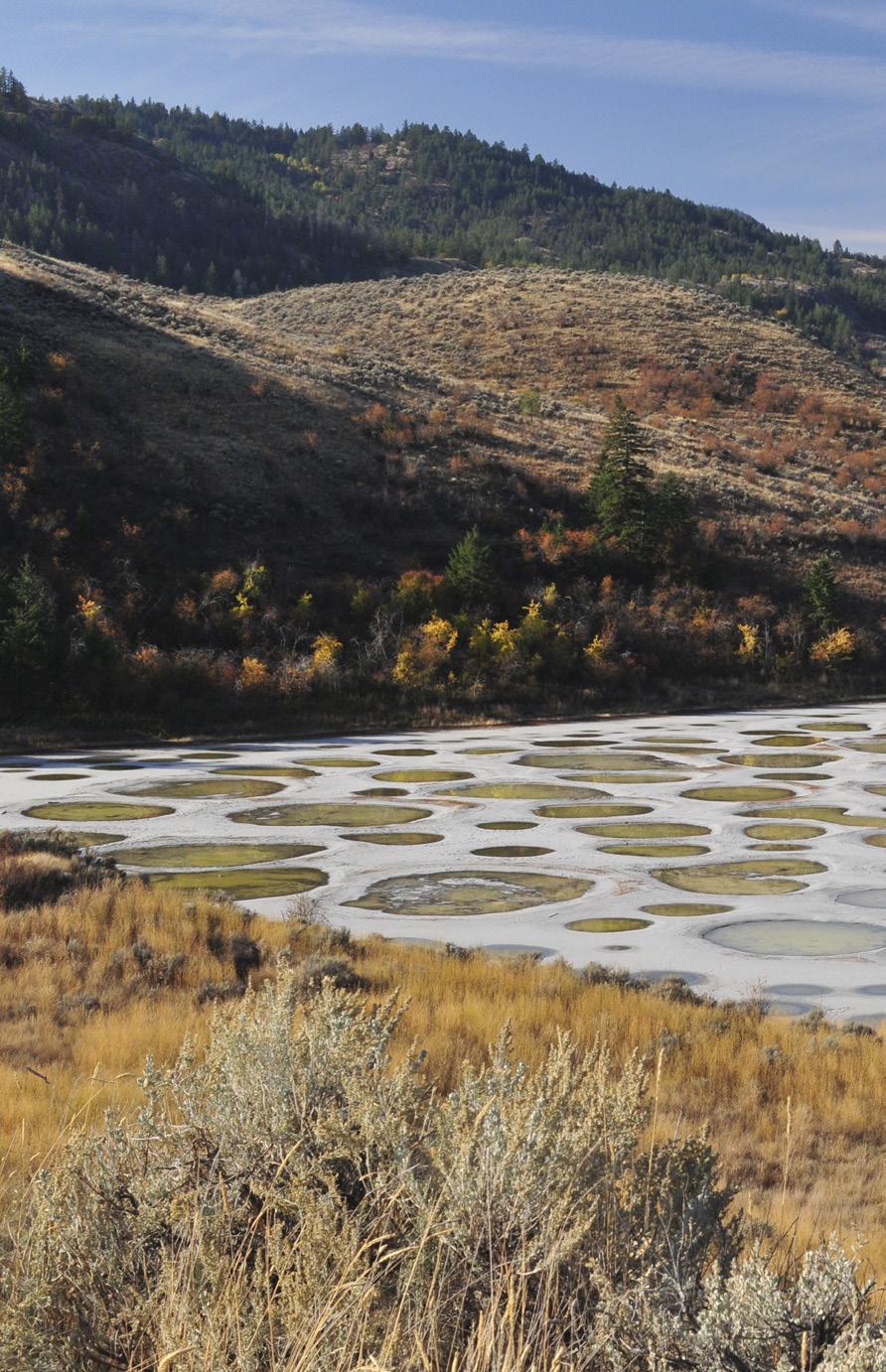
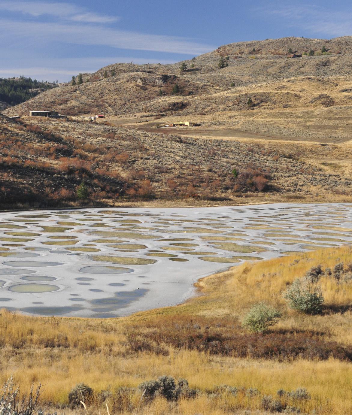
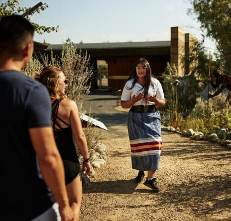
Before you arrive, perhaps you “spotted it” from the viewpoint off Highway 3 just northeast of Osoyoos. Now you can get up close and learn about Spotted Lake from an elder who will tell you that “Kliluk” or Kłlil’xᵂ, as it was called by Okanagan First Nations for thousands of years, is a sacred site that has been considered a revered place of healing for centuries. During the summer most of the mineralrich lake evaporates leaving large, colourful spots ranging from blue to green to yellow, depending on the mineral makeup of each individual spot. According to a New York Times article back in 2016, Kliluk has a spot for each day of the year, but others estimate around 400 briny pools rich in sulfates, magnesium, titanium, sodium and other minerals adorn this lake in the summer.
Jump on the 8:30 am bus at Nk’Mip Desert Cultural Centre, located on the eastern side of Osoyoos Lake, for the Spotted Lake Tour. After that, you’re back at the centre in time for a guided walk and a “snakes alive” show. By now it’s lunchtime. Fancy fish & chips? From the Cultural Centre, a 20-minute walk along a sage-lined trail takes you to the Nk’Mip RV park and campground Footprints Bar & Grill on Spirit Ridge’s exclusive section of beach on Osoyoos Lake. Or get into the laid-back vibe at Spirit Beach Cantina, just behind Footprints and attached to the Nk’Mip Convenience Store. This outdoor beachfront patio features
fresh tacos. In the evening it’s a fun hangout to rub shoulders with the locals, enjoy live music and margaritas.
Besides the Nk’Mip Desert Cultural Centre, the Osoyoos Indian Band owns the Nk’Mip Canyon Desert Golf Course, Spirit Ridge Resort and Nk’Mip Cellars, which is the first Indigenous owned and operated winery in Canada. On its website, the winery says succinctly: “We are inspired to capture time in a bottle.” And their wine has received many awards. On another patio, Nk’Mip (pronounced ‘Ink-a-meep’) Cellars includes a restaurant serving fresh farm-to-table fare on its outdoor terrace, with superb views of the lake and surrounding hills.
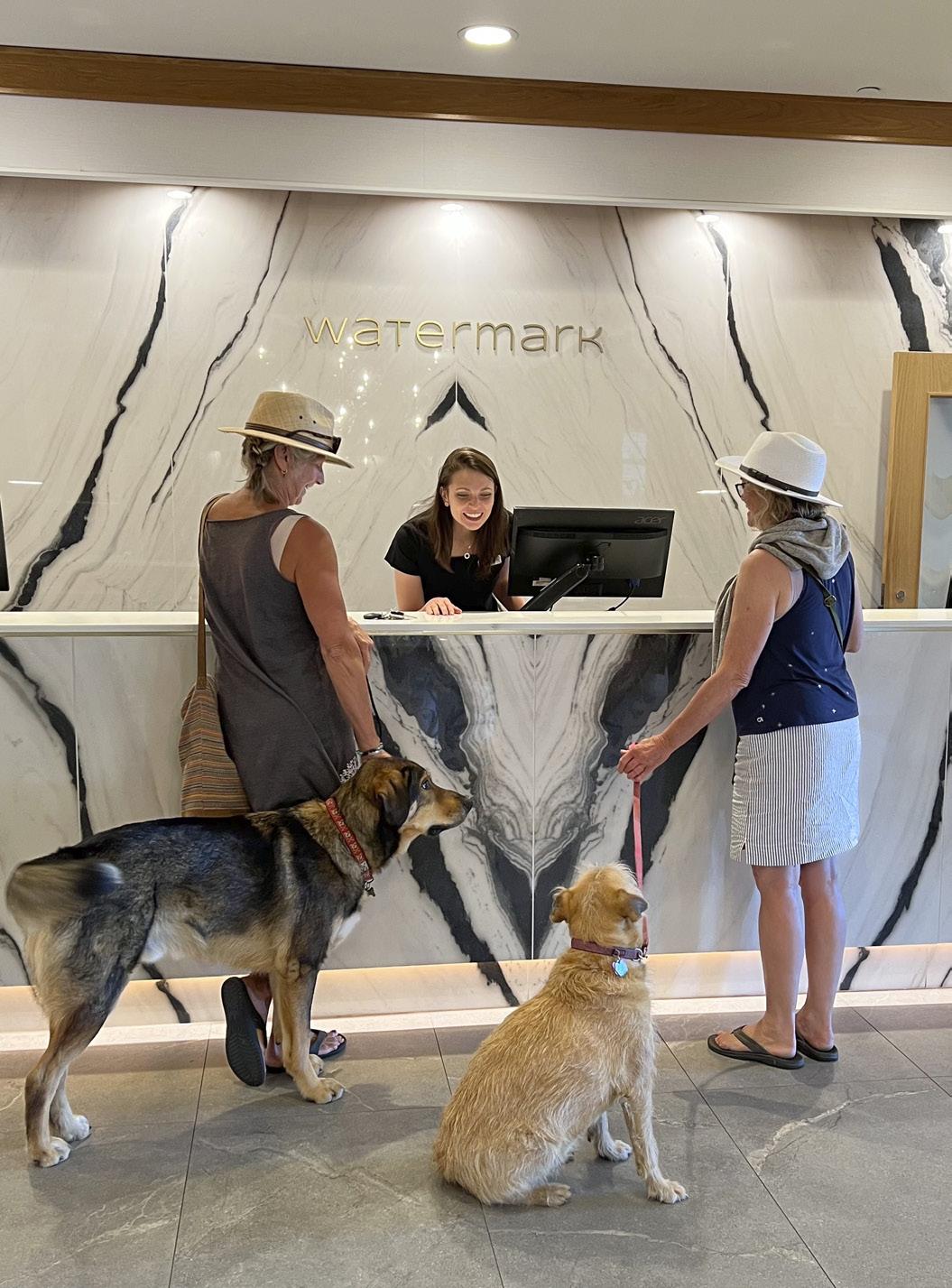
We checked into dog-friendly Watermark Resort and within minutes strolled its sandy beachfront before going for a swim at the nearby doggy beach. With Watermark’s “Sip & Stay” package, guests receive a tasting passport, featuring larger signature wineries along with smaller artisanal options. (It’s advisable to make reservations at the tasting rooms.) Particularly with record wildfire seasons and last year’s devastating cold snap, winemakers and wineries across the Okanagan need our support. As well, initiatives like the #OkanagansGotIt campaign welcome guests to their tasting rooms. Videos on social media show warehouses filled with barrels and cases of wine with tag lines “We’ve got what you need,” “We’ve got wine,” “We’re open, come visit us.” Watermark’s 15 Park restaurant may also have what you’re craving. Chef Jeffery Young’s new
8 • BC MAG
DUE WEST
JANE MUNDY
TRAVEL 1:
2: Osoyoos Desert Centre; 3: Elvis’s Fine Jewellery and Music Room. 1 2 3 1,3,4: Credit to Destination Osoyoos 2: Destination BC/Shayd Johnson
Spotted Lake;
menu features exciting local ingredients. Or DYI at one of the poolside barbecues.
Miradoro Restaurant at Tinhorn Creek in neighbouring Oliver welcomes dogs—and with a glass of wine they will happily serve takeout. Chef Jeff Van Geest suggests picnicking at the Tinhorn Creek amphitheatre or the demonstration vineyard with duck liver pate on grilled sourdough with hazelnut and fig compote, followed by pork cutlet with blue heritage corn polenta with crispy bright salad. Maybe bring your doggo’s dinner to curtail drooling, or a safer bet—and easier to carry—is pizza from Miradoro’s wood-fired oven paired with a Tinhorn rose.
Not to be confused with the cultural centre, the Osoyoos Desert Centre is a 27-hectare preserve of dry scrub, including sage, antelope brush and prickly-pear cactus. Yes, we really have a desert in Canada—it’s the northern tip of the Sonora Desert that ends in Mexico. We opted for a guided tour because there is so much to see and learn from interpretive guides about the local fauna and flora along its 1.5 kilometre boardwalk, and much can be missed if you go it alone. Plan on spending at least two hours on the trail and visit the interpretive building with hands-on, interactive exhibits and a native plant demonstration garden showcasing desert plants.
Osoyoos Lake is a 23-kilometre-long watersports playground and brag-worthy, being the warmest lake in Canada. With three locations on the lake, Wakepilot makes it easy to enjoy water sports experiences such as paddleboarding (with the dogs) to sea-doos to kayaks. If you’re daredevil adventurous, rent an E-foil, which (I’m told) is basically a surfboard with a mast and wing (hydrofoil) that generates lift as the electric motor pushes the foil forward—the
battery allows for about an hour of flight time. I’ll stick with the paddleboard.
If you happen to be in Osoyoos on July 1 and you’re ready to party, the Osoyoos Festival Society is celebrating Canada Day with its 74th annual Cherry Fiesta, an all-day event starting with a pancake breakfast at Town Square followed by a parade down Main Street and family fun at Gyro Beach Park. It culminates with live music and fireworks. My dog’s favourite store has to be Osoyoos Home Hardware, stuffed with all things canines love and staff who are obvious animal lovers. And check out Elvis’s Fine Jewellery and Music Room on the corner of Main Street and Spartan Drive. It’s a hoot, and the owners are clearly having fun.
The Okanagan is filled with local fruit and vegetable stands that showcase the local harvest. Driving between Oliver and Osoyoos, be sure to stop and grab freshly picked vegetables and fruits, perhaps to chuck on the pool-side barbecue.
Osoyoos Desert Centre desert.org
miradoro.ca Wakepilot Locations: Desert Sunrise Marina, Spirit Ridge Beachfront (in Nk’Mip RV Park), and at Walnut Beach Resort. wakepilot.com Watermark Beach Resort watermarkbeachresort. com
BC MAG • 9
5 4 4: Nk’Mip Desert Cultural Centre; 5: Watermark Resort.
IF YOU GO Nk’Mip Desert
Centre at Spirit Ridge Resort nkmipdesert.com
For more, visit Destination Osoyoos destinationosoyoos.com
5. Jane Mundy
Cultural
Miradoro
BOOK REVIEWS
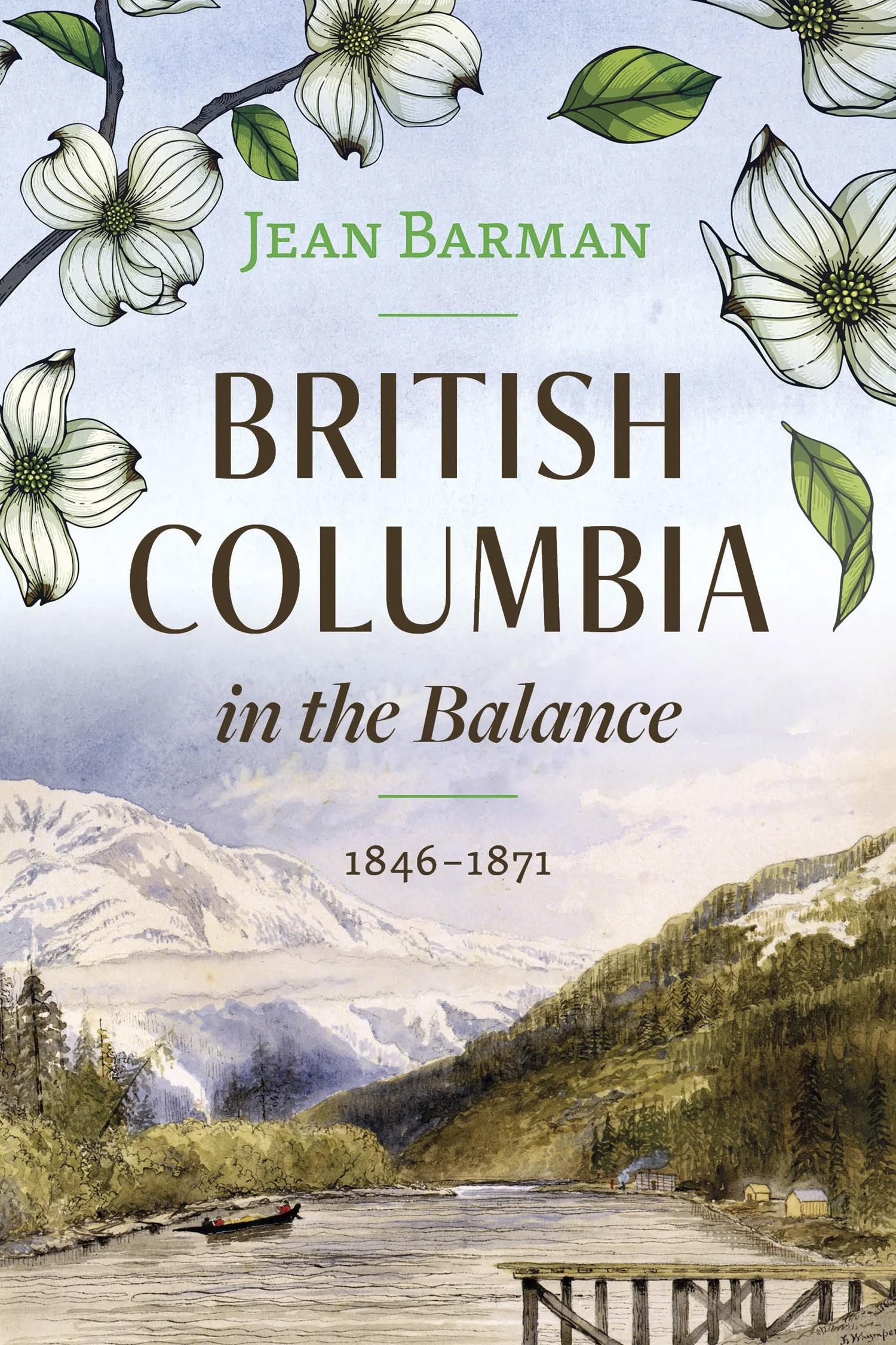
British Columbia in the Balance, 1846-1871
By Jean Barman Harbour Publishing, $36.95
JUST 25 YEARS is all it took for what is now British Columbia to transform from being Indigenous land to a Canadian province. It almost didn’t happen that way and it had a lot to do with greed, furs and the Hudson Bay Company. It seems that the land we now know as British Columbia
was teetering in the balance, close to becoming ‘American Columbia’ instead. If it hadn’t joined the Canadian Confederation as a province, it could easily have been absorbed into the United States. So how did it happen?
Exploring colonial politics by examining James Douglas’s governance and communications with London’s Colonial office and delving deeply into private correspondence that only recently became accessible, Barman has woven this period of the province’s tenuous and complex history into a complete tapestry, a colourful work you never tire of looking at. Best yet, she is still top of her game in her ability to meticulously blend research with accessible and interesting writing.
Europe and the American fur traders were almost exclusively male. Some sent home for their wives or sweethearts but the wise married the women who knew and loved the country where they were born. Indigenous women helped their partners in every way: they were strong and could paddle well, they knew how to obtain and to store food, they understood their land and its moods and they could survive in harsh conditions. Thus happily paired, the men were more likely to stay in the area and to raise hardy children.
An interesting read that leaves us better informed about the history of the country we call home. What’s not to love?
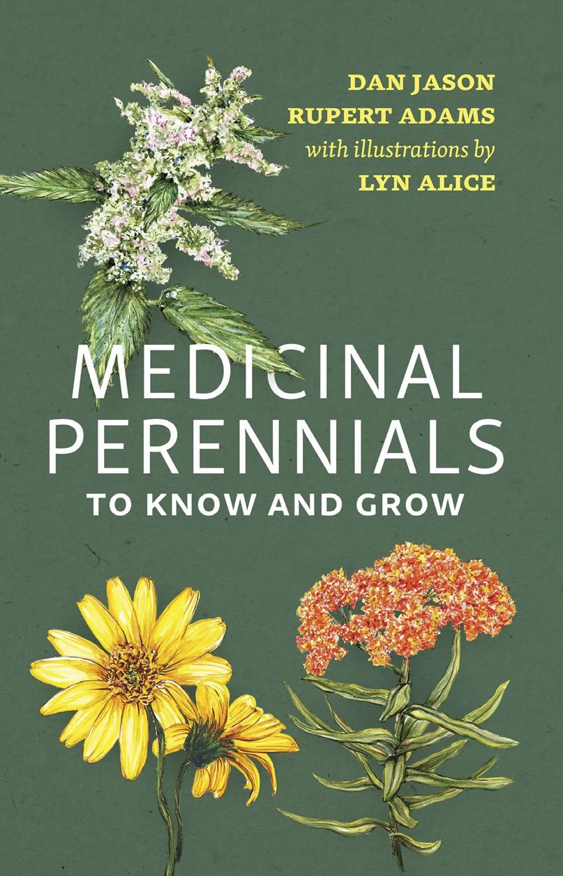
Medicinal Perennials to Know and Grow
By Dan Jason and Rupert Adams
illustrated by Lyn Alice Harbour Publishing, 120pp, $19.95
A good friend came over the other night, looked at the book sitting on my coffee table and exclaimed: “Oh! Can I borrow that? Jean Barman has the most amazing ability to make history so fascinating. I took her course at UVic and the whole class was mesmerized.” He didn’t get the book as I wasn’t finished, but what he said was exactly what I had thought after reading the first few chapters.
Known for her extensive primary research and her copious use of extracts and texts, which add credibility and life to the narration, Barman has also devoted one of the book’s eight chapters to Indigenous women and the role they played in BC’s mid-19th Century history. The gold seekers, the settlers, the immigrants from Britain and
I HAVE ALWAYS gathered nettle and dandelion greens and flowers in spring and rosehips and hawthorn berries in fall; Jason and Adams, however, have rocked my world. Who knew there was so much more out there patiently awaiting recognition? While my bookshelf contains many books on herbs and their benefits, none are anything like this handy little compendium. These two authors have managed to pack a whale of succinct information on 47 healing perennials into a minnow of a book that can happily nestle into a wide pocket. The watercolour illustrations by Lyn Alice, who also successfully collaborated with the artists in an earlier publication, contribute hugely to the book’s appeal as well. She tells me she’s inspired by nature and loves to create
10 • BC MAG
DUE WEST
botanical watercolours for clients throughout the world. That passion shows in the freshness and vibrancy of her art.
Some of the perennials listed are familiar friends, like arnica and fennel, dandelion and echinacea, but many are new to me and even some of the familiar herbs like lavender turn out to be more than just a pretty scent. Along with the benefits each herb offers, the authors give the when and wheres of planting it along with its care and often even a little of its use through history.
Both authors are well positioned to champion these modest and unassuming medicinal perennials. Jason, a Salt Spring Islander who founded Salt Spring Seeds, a mail-order seed company, is also the author of several popular books on seeds and organic foods and Adams runs his own medicinal herb business, growing
his products at a community farm in Agassiz.
From stimulating the immune system to aiding relaxation and sleep, soothing a sore throat to healing injuries, lowering blood pressure to relieving headaches, herbs are nature’s gifts and she offers them to us for free. How ironical that in return people strive to eradicate many of them as weeds!
Medicinal perennials should go mainstream.
— Cherie Thiessen
For more Local authors & local topics visit: thebookshack.ca

Accommodations Restaurant Golf CourseLocal Adventures HEKATESRETREAT.CA
Artists & Art in British Columbia
BY R. MILANA DAVIES
THERE IS NO denying that British Columbia has earned the epithet ‘beautiful.’ The province offers a bounty of aesthetic attractions for residents and tourists alike.
BC’s ocean, mountains, forests, deserts, rivers and lakes have inspired countless artists.
One of BC’s top tourist attractions is the assembly of totem poles in Stanley Park. Written language did not exist for many Indigenous people and the totem pole was a way to pass on stories. Today, there are artists who use their talent and curiosity to tell their own stories, to capture the history, geography and character of the part of BC they call home or to express their heart’s desire. Some artists draw energy from the hustle and bustle of city streets, others look to the animal kingdom, while others still seek divine inspiration to support their supernatural creativity.
Here is a variety of BC artists and their art, sure to entice and appeal to every discerning art lover.
Olga Sugden, and her Whimsical Creations
Sugden was born in 1962 in Ukraine, completing her art education in Europe with a focus on textile arts and later
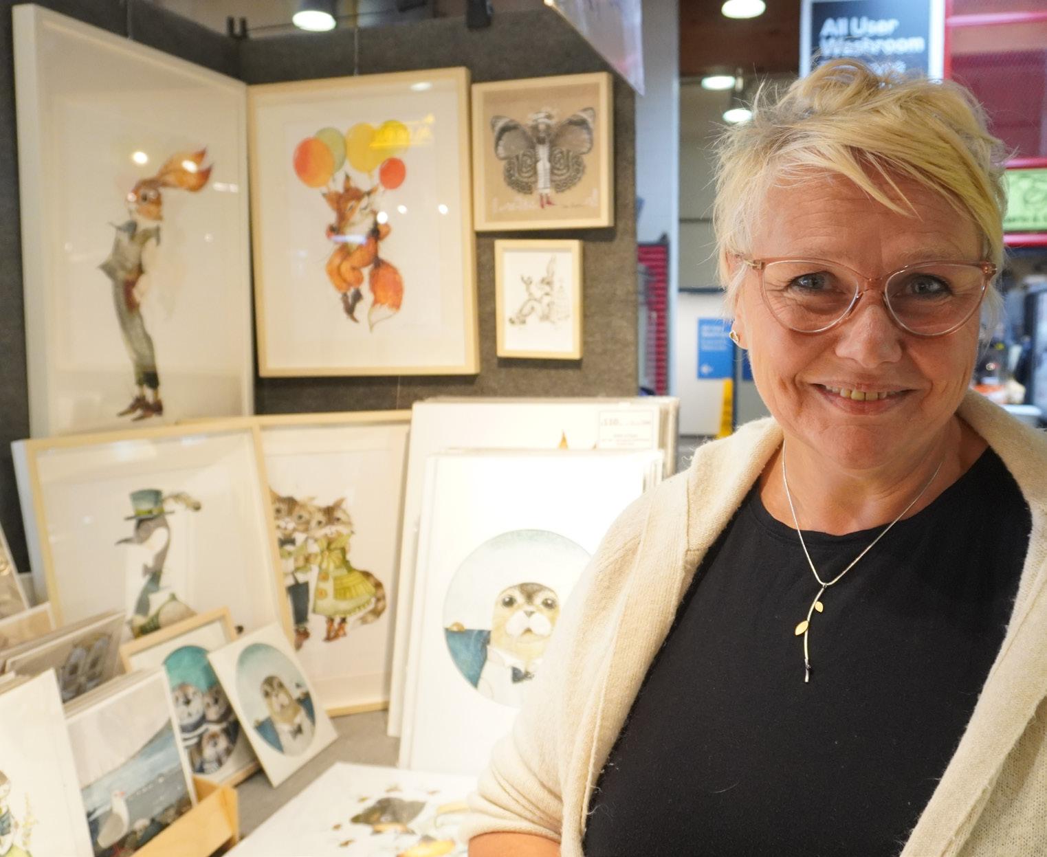


book illustration. She is fortunate to have had her education in Europe, and her influences include such illustrators as Beatrix Potter, Gennadiy Spirin and James Christiansen. She attempts to maintain the original “old-timer” quality approach to her work. She splits her time between Vancouver and Roberts Creek.
There is an innocent poetry to her whimsical artworks. They can tell tales, or they can leave the storytelling up to the viewer. People see themselves in her work, or they may see the faces of friends and relatives. Either way, whimsical art delights and enchants, weaving a charming and spirited path through our imaginations. Drawing sketches—most of the time anywhere she finds herself—a lot of her ideas
12 • BC MAG
WEST
DUE
ART
Olga Sugden.
Charles van Sandwyk.
come straight from her imagination, quite often inspired by life and the people around her. Her delightful painting of a woman catching words in a butterfly net recall her early days in Canada when she was learning English.
After sketching and finding interesting characters, she transfers the ideas onto watercolour paper or linen canvas, starting with graphite pencil, and then working with acrylic washes or watercolour paints. She tries to keep the beautiful texture of linen untouched, concentrating on the detail and the character. She uses a variety of surfaces, which include linen, wood, paper, metallics and stone.
Humour and whimsy capture Olga Sugden’s attention when she is creating her work. Sugden often can be found selling her delightful artwork in the Granville Island Market. goldeneggstudio.com
Charles van Sandwyk, a
Modern-day Gaugin
Childhood experiences on his uncle’s South African farm coloured and shaped van Sandwyk’s life and his art. For as long as he can remember he was attracted to the vibrant colours and vitality of African creatures. He retained his love of nature and it grew after his family emigrated to Canada in 1977. He graduated from art school at Capilano College (now Capilano University) and was mentored by teachers who saw his potential.
One of his childhood heroes was Robert Louis Stevenson, author of Treasure Island, and the outcome was that he too fell in love with a remote island and its inhabitants.
Van Sandwyk now divides his time between BC and Fiji where his simple grass hut, just steps away from the beach,
was constructed for him by the villagers who have adopted him as one of their own. Like the French artist Paul Gaugin who left Paris for the adventure and romance of Tahiti, van Sandwyk finds inspiration for his work in his beloved Fiji, but he returns to his charming cottage studio in Deep Cove to complete the paintings.
“By far my greatest source of inspiration is my lovely Fiji. I don’t mean the constant deriving of imagery from Fiji, but rather the joy of being there, and taking the time to develop ideas for paintings and stories—the freedom to be alone with one’s self. I love to embellish with borders and decorations. I am often, and quite accurately, accused of over-romanticizing my subjects.”
He recently opened a cozy little shop in Gastown which is filled with his artwork and where he will make visitors a
cup of tea while they browse among the many offerings.
One day a girl came into the shop and asked, “Did you get permission from his grandchildren?” she innocently inquired believing the artist was dead. “Oh yes,” he said. Finally, he told her the truth and she burst into tears, saying she had one of his books since childhood.
Van Sandwyk is a steward of beauty in everything he creates. His unique approach to both life and art is what makes his art his own and that is what collectors all over the world prize.
charlesvansandwykfinearts. com
Serhii Kolodka, Iconographer-in-Residence
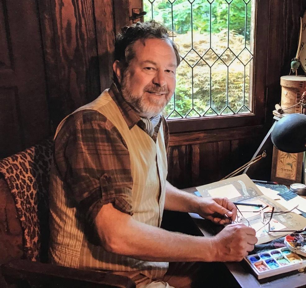
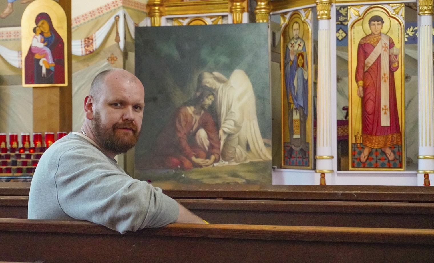
Ukrainian artist and iconographer Serhii Kolodka is one of the approximately 185,000 Ukrainians who have arrived in Canada since the war
BC MAG • 13
DUE WEST
started in February 2022. A modern-day Michelangelo, he has perched precariously on scaffolding to paint giant icons on church ceilings in Ukraine. He was working on a big art project for a BC cathedral when the war began and he went back home to fetch his three young children. His wife, a doctor, remained in Ukraine for a time to offer her help.
The Kolodka family is lucky to be together now. Adult men between 18 and 60 had been banned from leaving Ukraine, but exceptions were made for those with three or more children.
Holy Eucharist Cathedral, a rather modest structure from the outside, houses an astonishing array of colourful icons on every wall, on the altar and even the ceiling. The golden age of Byzantine art flourished after 300 years of Christian persecution when artists turned away from the Greco-Roman style to develop an entirely new style. Laura Grady, organizer of the Annual New Westminster Art Walk, described this Ukrainian church as, “a hidden gem.” She was happy to include the Cathedral on the art tour.
“Each icon I create is a spiritual endeavour,” Kolodka explains, “blending realism that I so passionately love with the profound symbolism inherent in Eastern icons. This unique combination brings each piece to life, inviting viewers into a deep contemplation of the divine.”
All proceeds from the sale of prints are being donated to the Ukrainian army for drones and medical supplies.
Kolodka accepts contracts for portraits and he also offers a range of art courses from beginner to advanced levels focusing on the techniques and theology of iconography. serhiikolodka.com
The Vancouver Biennale, Open Air Museum
The history of biennales was popularized by the Venice Biennale first held in 1895, but the concept of a large-scale intentionally international event goes back to the 1851 Great Exhibition in London, England.
This modern BC bi-annual public art exhibition brings sculpture, new media and performance work by celebrated
and emerging talent.
Prominent art dealer and art advocate Barrie Mowatt founded the Vancouver Biennale in 2002.
“During the 1986 Vancouver World Fair, we were selling ourselves as a world-class city. My objectives were to use significant art installations by renowned artists and to install these works in public spaces, directly on the grass and sandy beach where people
could actually engage in the artworks and discover works not easily visible because of the limitations of art galleries and museums.”
The Vancouver Biennale is unique among the 270 active biennales around the world, not only in the length, which often ranges between 18 and 24 months, but also in that its primary focus is on accessibility, engagement and installations that reimagine public space where people live, work, play and transit. The Vancouver Biennale’s objective is always to be ahead of the curve and
14 • BC MAG
Serhii Kolodka.
Osgemeos six giants. A-maze-ing Laughter.
the need to reimagine the very definition of public space itself. There are three beloved art installations that have become a part of the Vancouver art ecosystem. Every city needs art and it has to be in the middle of the people.
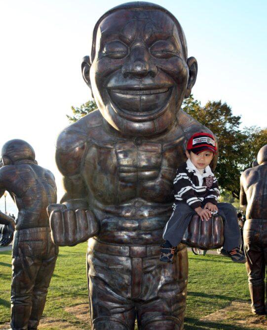
A-maze-ing Laughter in English Bay, artist Yue Minjun used his own features to create the 14 cast-bronze figures. His intention was to use art to touch the heart of each visitor so they can enjoy what art brings to them. They were presented as a gift to Vancouver, thanks to a donation by Chip and Shannon Wilson.
Engagement located in Sunset Beach Park was created by American artist Dennis Oppenheim. Inspired by traditional engagement rings, the art installation coincided with the same-sex marriage debates taking place in Canada.
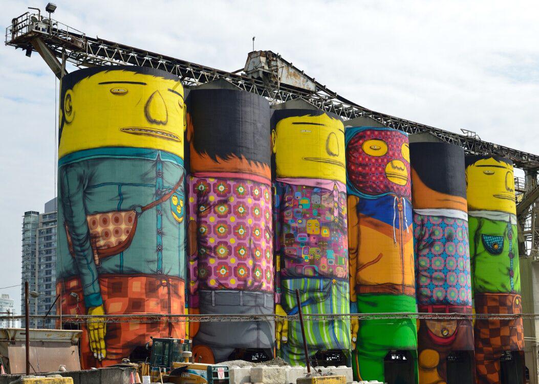
Osgemeos, six giants up in the sky, were conceived in the minds and hearts of Brazilian twin brother street artists, Gustavo and Otavio Pandolfo. It took a while to find the ideal location for their 70 foot (21.3 metre) murals. The unique spot turned out to be in the midst of the Heidelberg Materials cement plant on Granville Island.
The next biennale is slated for Spring 2026 through to 2028 and the focus will return to the original vision of the biennale, namely, Open Borders, Crossroads, Vancouver and the theme will be developed in conversations with the international curators and local indigenous leadership.
For self-directed Vancouver Biennale tours follow the cheerful yellow and pink signage vancouverbiennale.com/ exhibition-map/
to a bigger campus on Great Northern way.
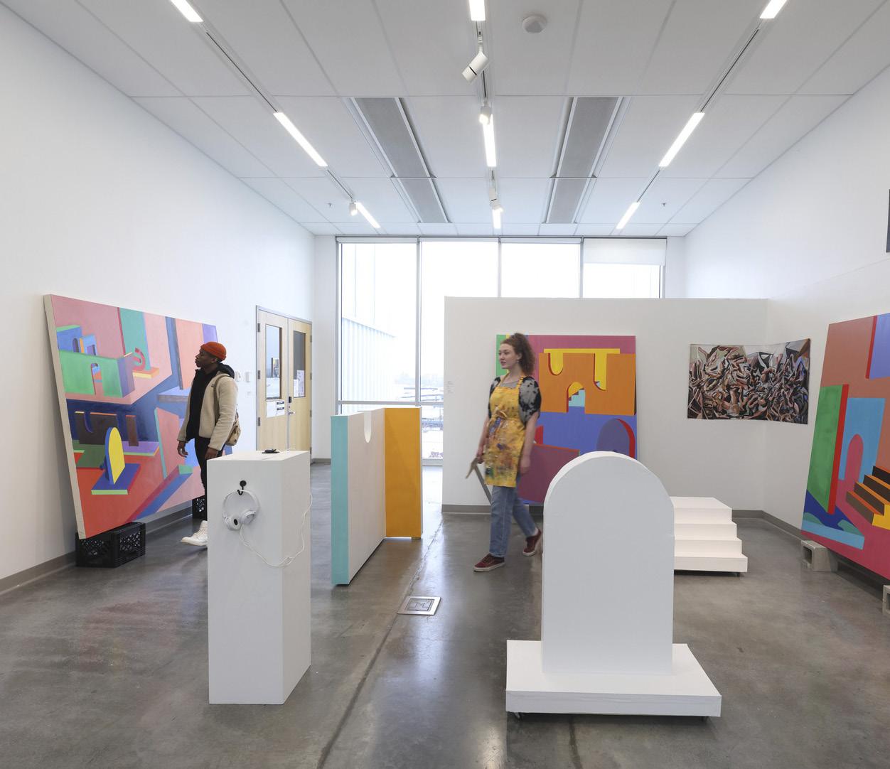
Carr University, Discover the next Picasso or Van Gogh
Emily Carr University of Art and Design, formerly known as the Vancouver School of Applied and Decorative Arts, was officially established on October 1, 1925, solely dedicated to education and research in the creative fields. Once located on Granville Island, the university moved
Many graduating students who have shown in the yearend exhibition over the years have gone on to become renowned international artists. Douglas Coupland, Molly Lamb Bobak and Attila Richard Lukacs are just a few of the notable alumni. In fact, visitors are heartily invited to attend the year-end student exhibition to see if they can discover the next Picasso or Van Gogh! ecuad.ca
BC MAG • 15
Emily Carr University.
Emily

DESTINATION
SUMMER
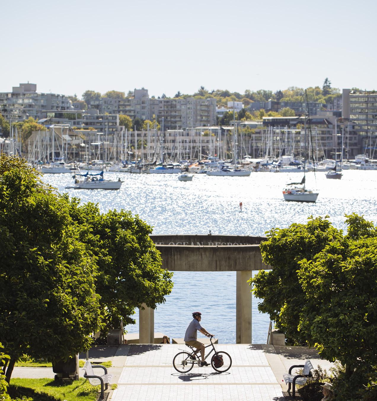
DESTINATION FALSE CREEK
From Sunset Beach to Vanier Park, discover the sights and sounds surrounding Vancouver’s False Creek
BY DESIREE MILLER
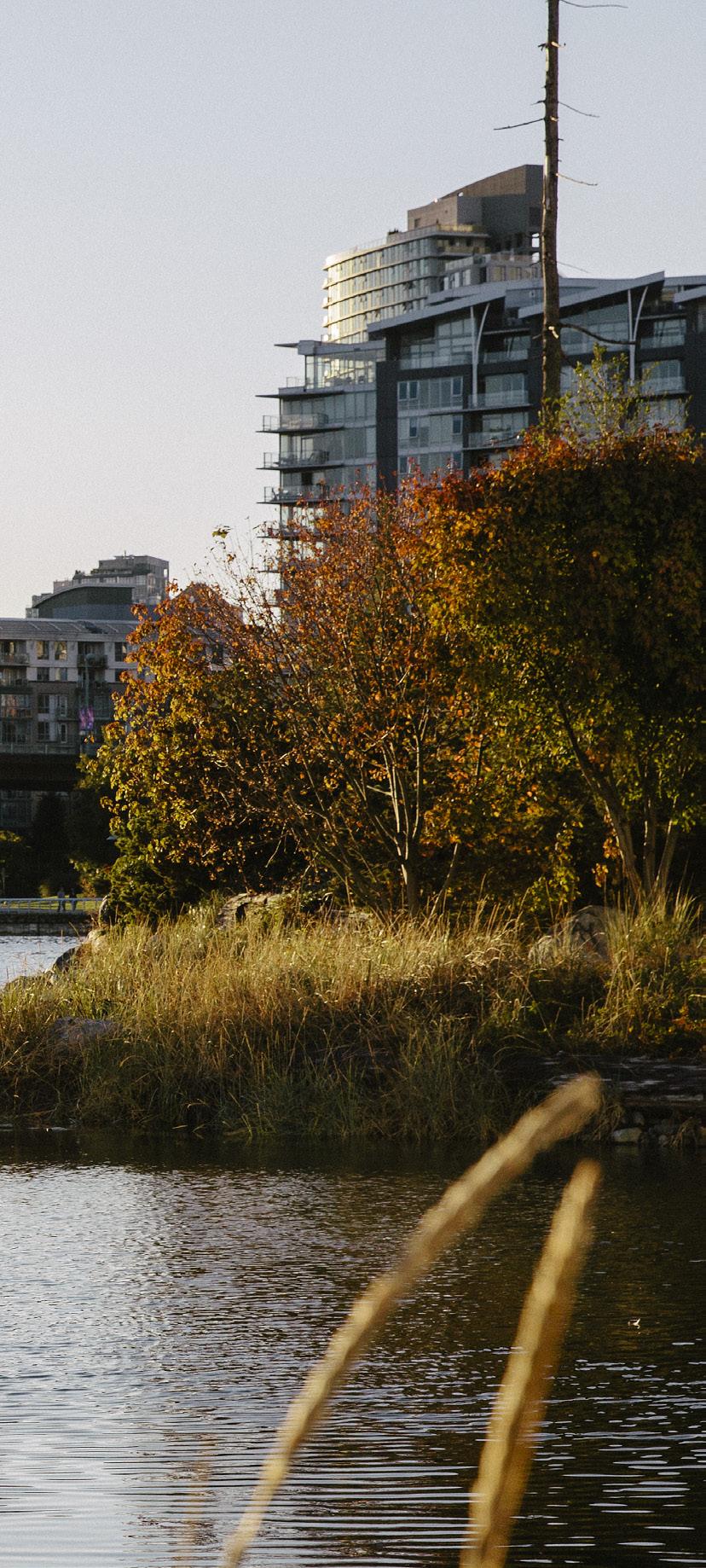
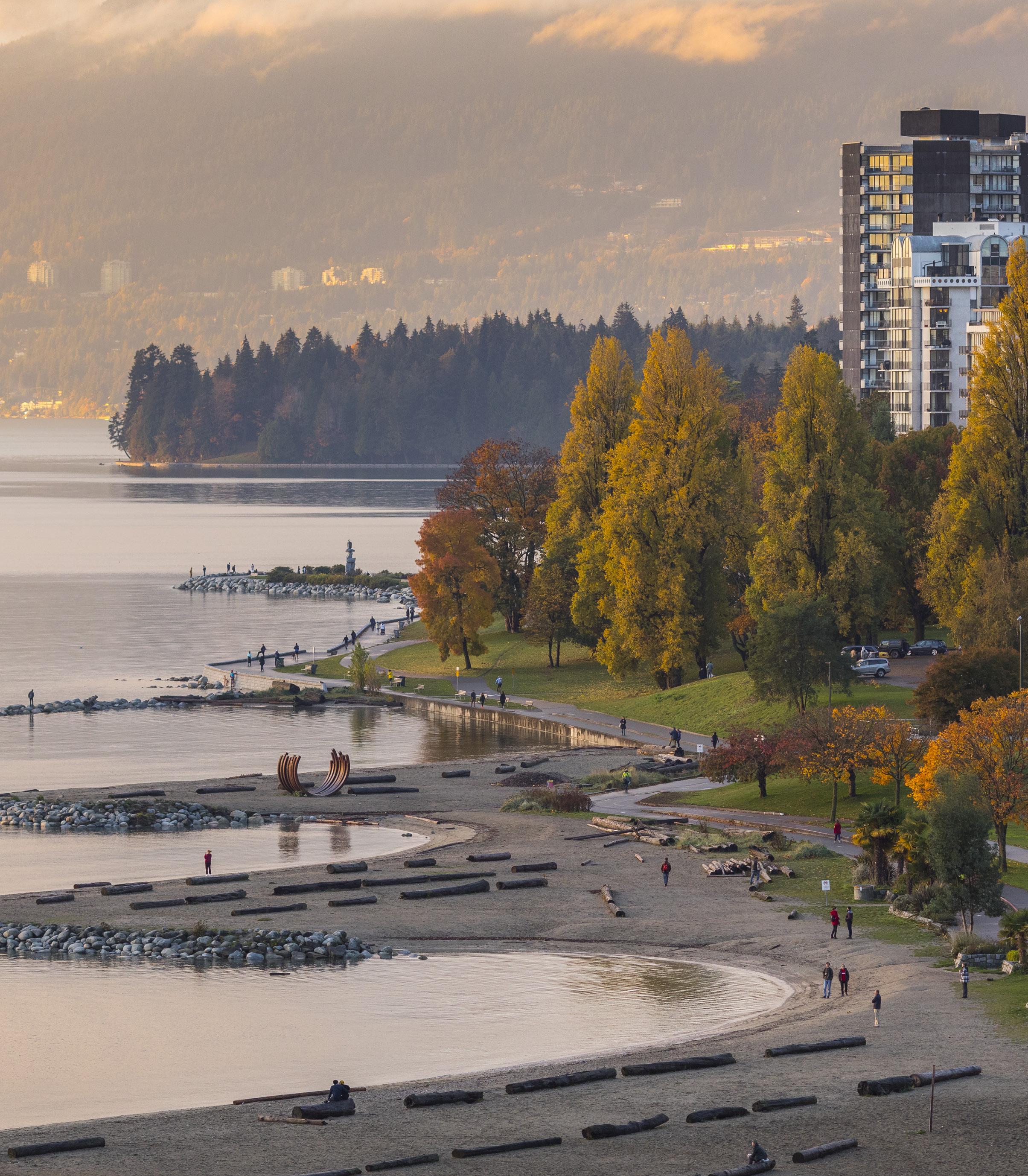
WWithin minutes of hitting the False Creek seawall you’re on a pathway to infinite exploration. You could cover this eight-kilometre, ocean-side pathway in a brisk two hour walk and enjoy stunning skylines, greenspaces and landmarks along the way. Or, make an adventure of it, and engage in the many different neighbourhoods that make False Creek such a popular destination. From Sunset beach in the West End to Vanier Park in Kitsilano, there is no shortage of options for rest or play.
VANIER PARK
Starting at the welcoming structure by Alan Chung Hung named “Gate to the Northwest Passage” Vanier Park has lots to enjoy in and around the area. Overlooking English Bay and West Vancouver, this knoll is known for its wind and is one of Vancouver’s most popular spots for kite flying. Around the corner is Hadden Beach, a small, quiet and dog friendly spot on the seawall. It’s also in close proximity to the Vancouver Maritime Museum, the H.R. MacMillan Space Sciences Centre and the Museum of Vancouver. The later two share the same building, designed by local architect Gerald Hamilton. Take note of the roof
BC MAG • 17
Destination BC/Grant Harder
Spectacular views from Vanier Park and the Vancouver Maritime Museum to English Bay and beyond.
DESTINATION
design, which is inspired by traditional woven-basket headwear worn by the Squamish Nation. Bike lovers can deviate off the seawall just west of the Burrard Bridge to test out a hidden gem at the Vanier Park Bike Skills Track, a small bowl-style pump track for bikes.
This park was once the location of Senakw, a Squamish village that was seized by the federal government with its inhabitants relocated to Burrard Inlet at the turn of the 20th century. This action against the Squamish was later found to be illegal in the courts, and in 2001 an agreement was made to return five hectares of land back to the Squamish Nation, who is now developing the land next to the Burrard Bridge with several new condo towers totally 6,000 units.
Kits Beach
One of the most popular beaches in Vancouver, Kits Beach is just around the corner from Vanier Park. Spend the day on a sandy beach, with gorgeous views of North Shore mountains and English Bay. Also available during summer months is Kitsilano Pool, a historic outdoor saltwater pool dating back nearly 100 years. The beach itself has basketball, volleyball and tennis courts, and a massive playground for kids. Across the street is a selection of coffee shops, restaurants, ice cream parlors and other goodies including the busy patio at Local.
GRANVILLE ISLAND
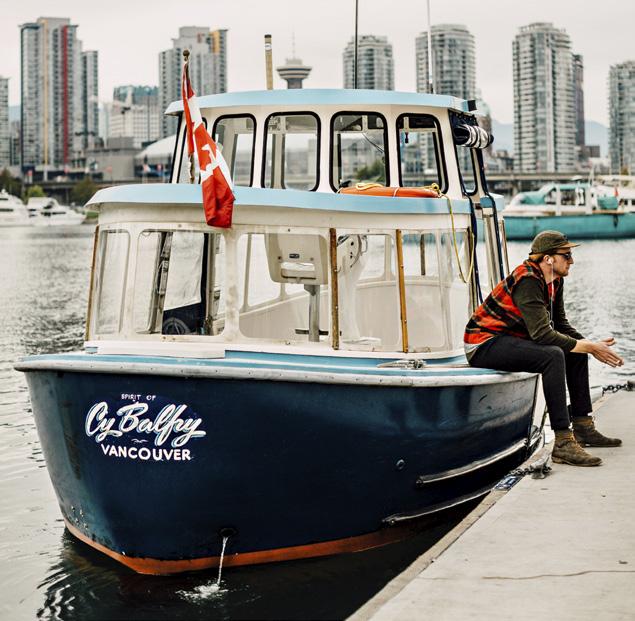
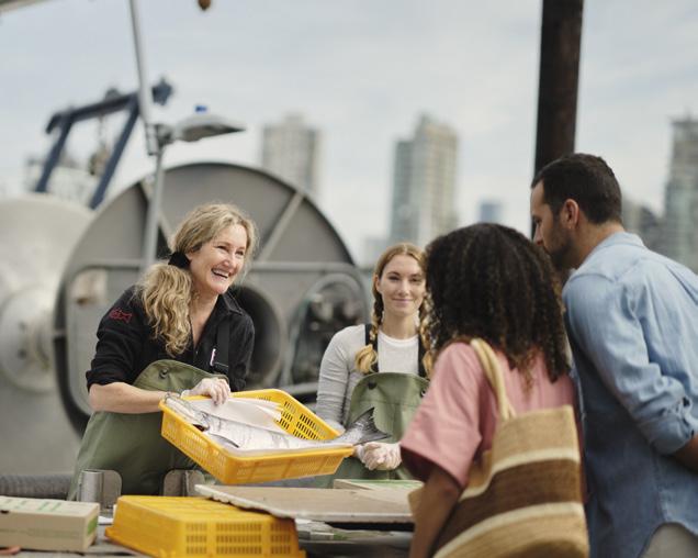
From Vanier, keep walking east on the seawall toward Fisherman’s Wharf, an active commercial fishing hub, where you can purchase freshly caught seafood from local fishermen. Check falsecreek. com/fish-for-sale for the various dealers, and seasons to coordinate. Move onward to visit one of the most famous markets in Canada.
Located under the south end of Granville Street Bridge, the world famous Granville Island is a centre of activity. For waterplay, rent SUPs, kayaks, boats and other watercraft. It’s also a place to
Explore the thriving ecosystem of Habitat Island—also a great spot to enjoy the sunset.

Yaletown.
18 • BC MAG
tc
David Lam Park at the edge of
spend hours enjoying the public market for fresh produce, meat, cheese, baked goods, as well as shops featuring art, imports and homemade artisan products.
This is also a thriving core for the performing arts. Home to the Arts Club Theatre, catch improv, plays and live music all year long. The Carousel Theatre features awesome plays for kids of all ages, and Granville Island holds the campus for Arts Umbrella, a non-profit school for the arts, with classes in art and design, dance and theatre, music and film. This artistic influence is felt throughout the isand.
The Kids Market is a must if you have little ones or are young at heart. Crouch through the mini door on Cartwright Street, and enter into a playland of fun. The owner at Clowning Around Magic Shop is always up for a magic trick, and it’s impossible to leave without a gag or new trick in your pocket.
OLYMPIC VILLAGE
Onward toward Cambie Bridge is a three-kilometre stretch of luscious greenery, parks, playgrounds, community gardens and marinas. The walkway itself is a mix of concrete and cobblestones. Passing by an area known as Stamps Landing, stop at Mahoney & Sons or the Wicklow Pub for their awesome waterfront patios overlooking the city and inlet.
Keep going on the seawall and you’ll enter one of the most interactive sections of the seawall. The Olympic Village walk has mini bridges, three-person lounge chairs, benches, logs, grassy knolls and marshes that are all inviting to sit and hang for a while. Habitat Island is a popular spot for exploration. This urban sanctuary is a short hop from the main path. During high tide, it’s surrounded by water and is home to various native small animals, insects, crabs, starfish, barnacles and other animals. Trees, shrubs, flowers and grasses have albeen planted to make for a thriving little ecosystem.
Olympic Village itself is a great place to refuel with various restaurants, bakeries and stores. Visit the Tap & Barrel patio for views of Science World and BC Place, or grab a coffee and sourdough at Terra Breads before walking to the iconic geo -
desic dome built for Expo 86 that is now the home of Science World. This part of the seawall is one of the best places to catch a sunset with westward views of False Creek in its entirety.
South Mount Pleasant
Take a stroll off the seawall south of Cambie into the eclectic and everevolving area of Mount Pleasant. A 10-minute walk will transport you to a mix of heritage homes, warehouses, animation studios, tech centres, artisan work spaces, funky eateries and more. This unassuming area is tucked away with gorgeous views of the city, North Shore mountains and murals painted on buildings all over. As a brewery hub, there are at least 10 solid breweries all within a 10-block radius of each other, each with a unique feel and flavour. Some notables include 33 Acres, Brassneck, R&B, Electric Bicycle Brewing and tons more. visit bcaletrail.ca for a list to enjoy. For a different vibe, La Fabrique St-George is an urban winery with charcuterie-inspired finger food or Please! Beverage Co., a local distillery making refreshing cocktails and tonics.
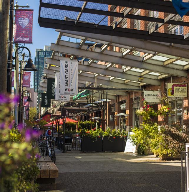
YALETOWN
Rounding the eastern tip of False Creek, you’ll cross over to the north side of the seawall. Here, Concord Community Pop-Up Park is a coveted greenspace that has become a local’s favourite spot to relax outside. With a mix of options, there’s basketball hoops, volleyball nets and lounge chairs sprinkled throughout the park. Ample tables make it a popular picnic and barbecue spot, especially when the patio lights go on at dusk, creating an intimate urban playground. Classic Vancouver venues appear on the horizon. Rogers Arena is home to the Vancouver Canucks and BC Place is where teams like Vancouver Whitecaps, BC Lions and Canada Sevens of World Rugby Seven Series can be seen through the year. It also houses the BC Sports Hall of Fame, which offers an insiders’
BC MAG • 19 Destination BC - Left page top:Grant Harder; below: Nelson Mouellic;
Right top: Tanya Goehring; bottom: Kindred & Scout
Fisherman’s Wharf.
KITSILANO
look to some of BC’s sporting legends. Check your schedule to see what event is taking place during your stay in this entertainment district.
Back on the seawall, refresh at Batch, a funky container-made-into-wateringhole at the Plaza of Nations. Perfect for grabbing a beverage on a hot summer day, Batch also attracts many during the winter months when the fire-pits are turned on. This midway stop is just under three kilometres to the end of the trek and makes you feel like you’re hanging in Vancouver’s backyard.
Beautiful parks line the path as you walk toward the roundabout at the base of Davie Street. Walking up Davie, you can explore the heart of Yaletown, an area that was warehouses and wasteland a mere 40 years ago, but is now one of Vancouver’s most trendy neighbourhoods. Mainland and Hamilton streets are the most popular for neat shops, eateries, coffee stops, boutiques and more. A mix of heritage buildings, revamped warehouse space and interesting architecture with patios on cobblestone streets makes this hood feel like a modern take on old Vancouver.
WEST END
Vancouver’s historic Chinatown was a flourishing hub in the 1880s and 1890s, when Chinese immigrants flocked to the region to work in mines, farms and logging camps. A magnificent gate on Pender Street and welcomes you to a neighbourhood that has gone through some tough transitions over the years. New initiatives to revitalize the look and feel of Chinatown and inject some new energy are underway.
Some notable mentions include the Chinese Canadian Museum, authentic steamed buns at New Town Bakery or traditional dim sum at Jade Dynasty. Dr. Sen Yet Sen Classical Chinese Garden is also a beautiful escape into well-tended grounds, with koi ponds, pagodas and manicured gardens.
GRANVILLE
The stretch around David Lam Park and George Wainborn Park offers many opportunities to enjoy the scenery, either near the water’s edge or in the greenspace and parks along the way. When you’re under the Granville
Street Bridge, look for the Spinning Chandelier by Robert Graham, an art installation that got a lot of press for its $4.8 million price tag. However, when it lights up and spins at 12:00 pm, 4:00 pm and 9:00 pm, there are no shortage of observers taking in the show. (Note, from here look across the way to see Granville Island from a new vantage point, including The Giants, a public art installation on the concrete silos at Heidelberg Materials).
Vancouver House is a complex right under the Granville Bridge that features
20 • BC MAG DESTINATION
Yaletown. Chinatown
0 500 m 1 Kilometres
Granville Island Sunset Beach Vanier Park Kitsilano Pool ENGLISH BAY Bike Skills Track Hadden Beach Vancouver Maritime Museum Kits Beach Fisherman’s Wharf Olympic Village Stamps Landing SOUTH MOUNT PLEASANT YALETOWN BC Place Concord Community Pop-Up Park Science World CHINATOWN David Lam Park George Wainborn Park Habitat Is. Aquatic Centre English Bay Beach GranvilleSt.Bridge Cambie Bridge Rogers Arena BurrardSt.Bridge Chinese Canadian Museum Dr. Sen Yet Sen Classical Chinese Garden DOWNTOWN
E
False Creek Ferries & Aquabus routes Destination Vancouver/Nelson Mouellic
FALS
C R EEK
BC MAG • 21
Destination Vancouver/Nelson Mouellic
Sunset Beach.
The giant Inukshuk at English Bay Beach.
several great restaurants including Autostrada Osteria, a perfect pit stop for rustic Italian and the Milan inspired burger bar, Monzo burger.
SUNSET BEACH
As you pass under the Burrard Bridge and walk alongside Vancouver’s Aquatic Centre you’ll soon reach Sunset Beach. This charming beach is directly across from Vanier Park and at the entrance to False Creek, so it is a fantastic spot to sit and watch the boats coming in and out of the creek and English Bay. Enjoy gorgeous views of Kitsilano and Point Grey in the distance, and step up to Denman Street to explore the funky and historical West End neighbourhood.
ENGLISH BAY
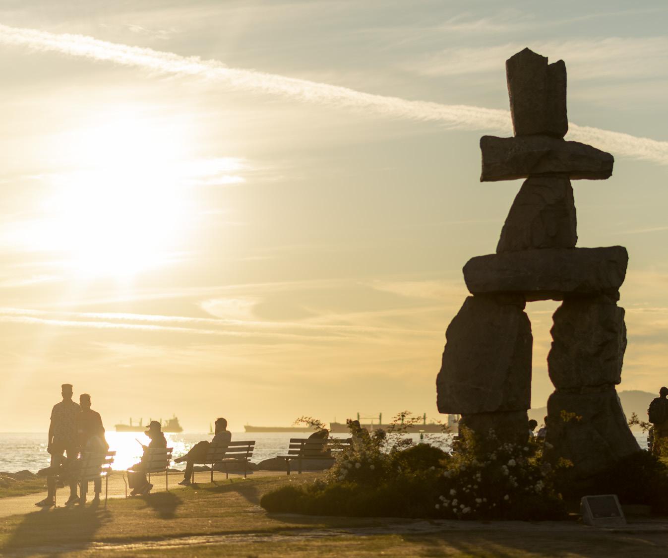
If you’re inspired to keep going, you can stay on seawall and walk to English Bay Beach, which is the last beach before you enter Stanley Park. This beach is home to the annual Polar Bear Swim and a favourite vantage point for the Celebration of Lights fireworks festival. Here you’ll see the famous Inukshuk sculpture by Alvin Kanak, standing at six metres tall. A plaque near the work reads: “This ancient symbol of the Inuit culture is tradi-
tionally used as a landmark and navigational aid and also represents northern hospitality and friendship.”
CUT THE WALK IN HALF
Cut your walk in half and get a unique view of the city from the water via the Aqua Bus or False Creek Ferry. With stops at various landings around the seawall you can hop on or off at any of the neighbouring communities.
Or, all three of the bridges across False Creek to the other are walkable, with lovely walking paths to and from each (although Granville is currently under construction). Crossing the bridges offers a completely different perspective of the area.
Why False Creek?
During an expedition in the late 1980s, Captain George Henry Richards, a hydrographer of British Columbia’s coast was travelling through the south side of Burrard Inlet. Confusing his location as a creek, he soon realized it wasn’t a creek at all, but rather an inlet—and thus the inspiration for the name False Creek.
IF YOU GO
Stay
Downtown Vancouver has a wide range of accommodation options in all price ranges and styles. For closer proximity these are within minutes from the seawall:
Granville Island Hotel granvilleislandhotel.com
Opus Hotel—Yaletown opushotel.com
JW Marriott Parq Vancouver— False Creek North marriott.com
Eat
It’s impossible to list every special place to eat or drink in the diverse neighbourhoods of False Creek, but here are some honourable mentions:
Bao Bei bao-bei.ca
New Town Bakery newtownbakery.ca
Tap and Barrel Craft tapandbarrel.com
Terra Breads terrabreads.com
Honey Salt parqvancouver.com/food-drink/ honey-salt
Batch batchvancouver.com
Autostrada autostradahospitality.ca
Play
Science World scienceworld.ca
Vancouver Maritime Museum vanmaritime.com
HR Macmillan Space Centre spacecentre.ca
Museum of Vancouver museumofvancouver.ca
Granville Island Kids Market kidsmarket.ca
22 • BC MAG
Destination Vancouver/Kate Milford DESTINATION

CHARTERS
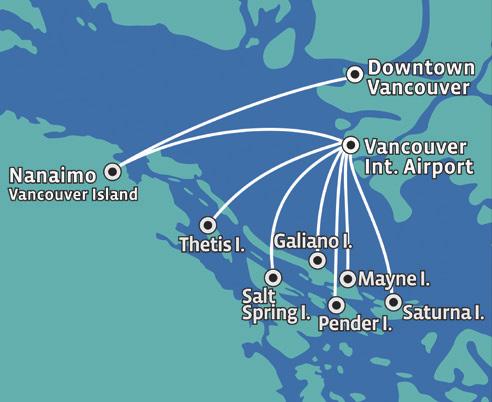
Seaplane Charters to Anywhere on the British Columbia Coast
SCENIC TOURS
Unique Experiences in Amazing Places
SCHEDULED
Up to 32 Flights Daily to Nanaimo and the Gulf Islands from Vancouver
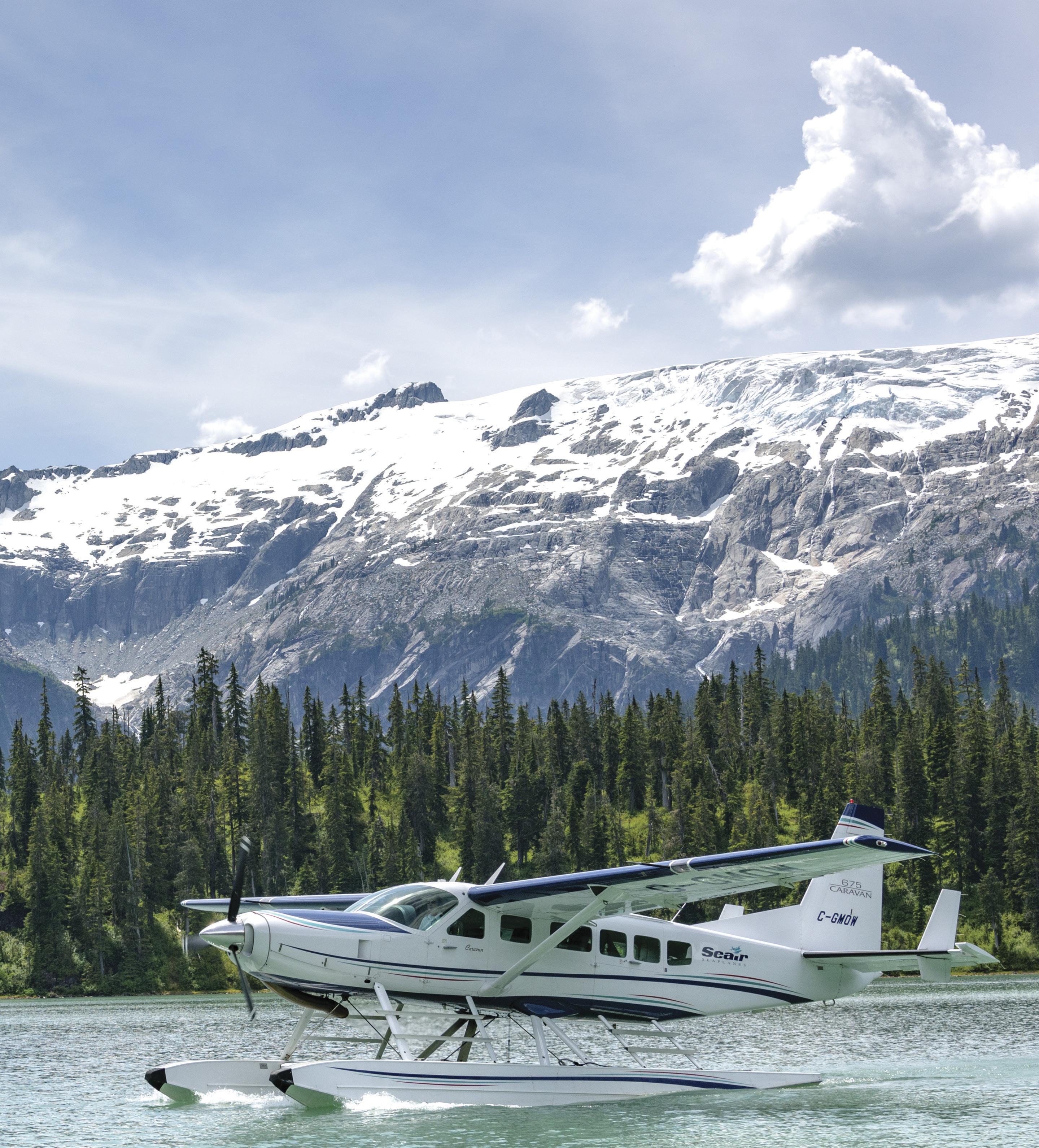
BC MAG 23 1-800-447-3247 | 604-273-8900 | seairseaplanes.com Seair Seaplanes provides you with professional and personalized service specializing in flying charters and scheduled flights throughout Coastal British Columbia.
Seaplanes are leaders in providing fast, safe, and convenient transportation from the busiest urban centres to your favourite great escape. Celebrating over 30 years of operating Canada’s fastest, quietest and most modern seaplane fleet.
Seair
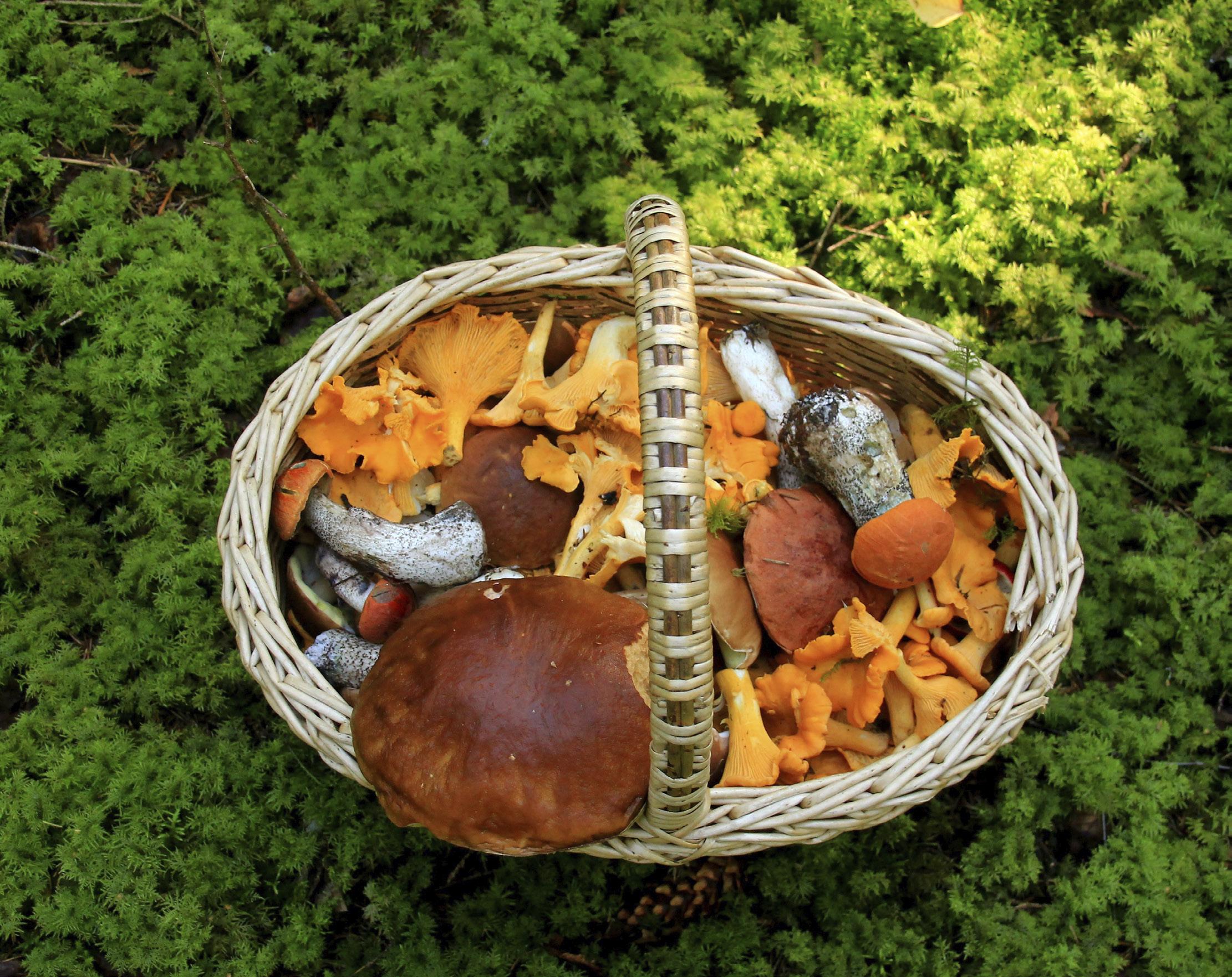
FORAGING TIP
A natural (unpainted) wicker basket is the best choice for gathering mushrooms. It allows them to breathe, which keeps them fresh until they arrive home in the kitchen. Plastic causes sweating and they can draw a “tinny” taste from metal.
FORAGING FOR BC’S TOP 5
EDIBLE WILD MUSHROOMS
BY LINDA GABRIS
IIf you love spending time outdoors and you’re looking for a fun activity the whole family can enjoy from spring through fall, I assure you there’s nothing more gratifying than foraging for edible
wild mushrooms in our province’s beautiful, diverse woodlands.
Going “mushrooming,” as grandma called it when I was kid, dishes up a whole lot of good eating. But before arming your loved ones with baskets and taking off into the wilderness on a mushroom hunting frenzy, it’s important to remember there are a number of species ranging from mildly to deadly poisonous.
The safest way to become a mycophagist (mushroom eater) is to hunt down an experienced mushroom forager whom you can learn from at first hand as I did with grandma. Not only will they introduce you to the edible picks but also, and even more importantly, they’ll steer you clear of the poisonous ones which grandma called “toadstools.” But don’t despair if you can’t find a knowledgeable picker to partner up
24 • BC MAG
BECOME A MUSHROOM PICKING EXPERT THIS SUMMER
with. A finely-illustrated mushroom field-guide book is the next best thing for learning important details about appearance, season, habitat, distribution and other characteristics that will help you make positive identification before eating—which is the number one forager’s rule!
Mushrooms are the fruiting body of a fungus reproduced by spores. One mature mushroom on the verge of expiring can disperse billions (or in the case of puffballs, trillions) of minuscule spores but only a small percentage will germinate, due to unsuitable growing conditions. Spores that do not germinate can lay dormant for very long periods of time, even years, until the mycelia (known as the threads of life) are spurred into action.
Mushrooms thrive on a wide variety of living and dead organic matter such as leaf litter, trees, logs, stumps, shredded evergreen needles, moss, manure and so forth. Thus, areas rich in host materials are the most prospective places to begin your search. And, as I learned from grandma, the best time to go mushrooming is “the morning after a rain…”
So now it’s time to basket up! I recommend the top five mushrooms here for novice foragers to break ground on as they are commonly found and the easiest to positively identify—and most wild mushroom connoisseurs, including myself, sing the highest praises to these chosen few.
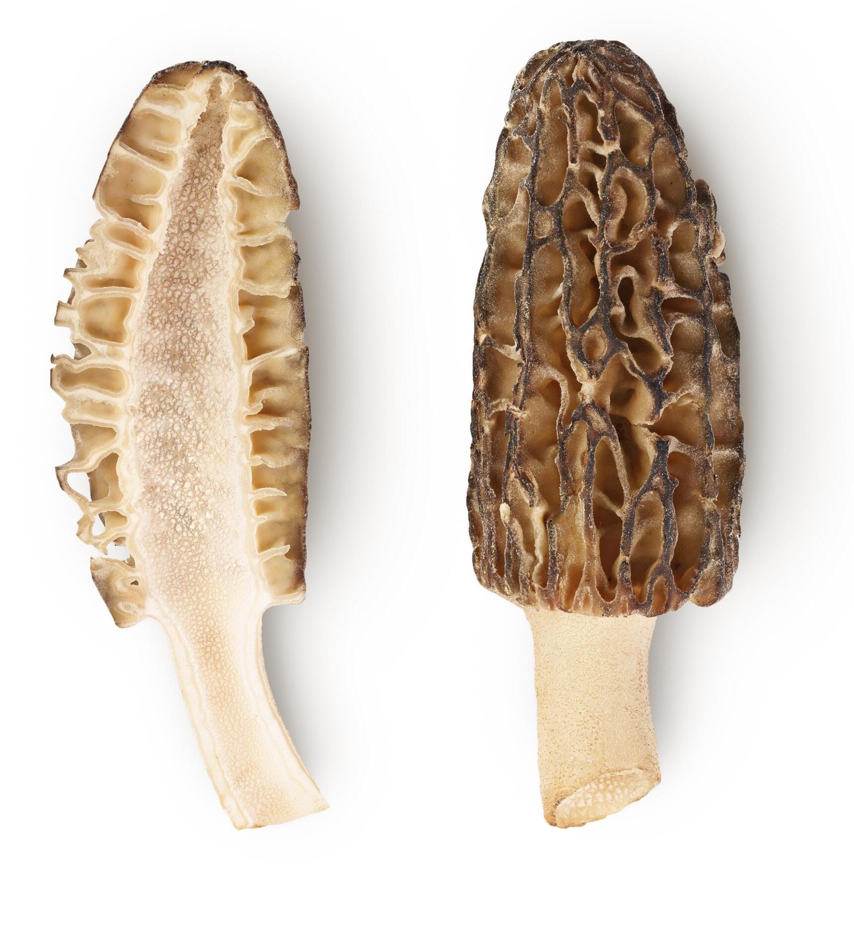
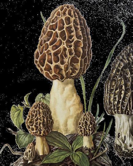
In recent years, morels have become a specialty item in supermarkets across the country while in season. So, if you’ve never seen one before, simply pop into the store and feast your eyes before heading into the field as commercial and wild are one and the same.
There are 18 species of morels and all are edible and delicious. The most commonly found and sought after are the Morchella esculenta (common morel), the Morchella
1MORELS
(Morchella)
elata (black morel) and the Morchella semilibera (half-free, meaning its cap is not hemmed to the stalk as are other one-piece morels but rather flares out like an umbrella when mature). In the field, each species has a scientific name which you can learn to identify by using your guidebook. But in the kitchen, they are all morels!
The caps can be conical, egg-shaped, elongated with a rounded top or spherical, and range from black to various
CAUTION
Be aware of the Gyromitra mushroom (also known as “brain” or “false morel”). As the name implies, these mushrooms are brain-shaped and have rusty to dark brown irregular caps hanging free from the stalk.
shades of browns, grays and yellows. They have honeycomb-like surfaces with darker ridges and lighter pits. Morel season begins in later parts of April to early May and runs on into early parts of August, depending on weather and region which, naturally, applies to all mushrooms. Look for them on recently burned grounds, in rich moist leaf litter, on evergreen forest floors and along the edges of woodland trails and streams.

BC MAG 25
Harvesting Tips For Mushroom Foragers
•Make a habit of only gathering young mushrooms in prime condition. Leave the old “fungi” undisturbed and they will repay you the following season with another bountiful crop.
•Practice good foraging ethics. Never strip a woodland patch of mushrooms bare, for if you do, your basket will come home empty the following season! As grandma used to say, “a special treat is just enough to eat…”
•Remember you cannot enter private land, First Nations traditional territories or reserves without receiving permission first.
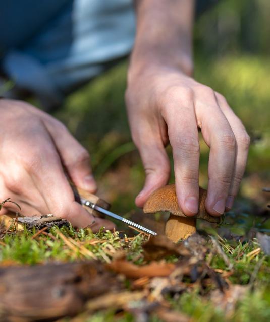
•Use a knife or gently twist and break the mushroom off at the bottom of the stalk, leaving the base standing in the soil. This keeps dirt out of the basket and leaves spores behind for reproducing.
2
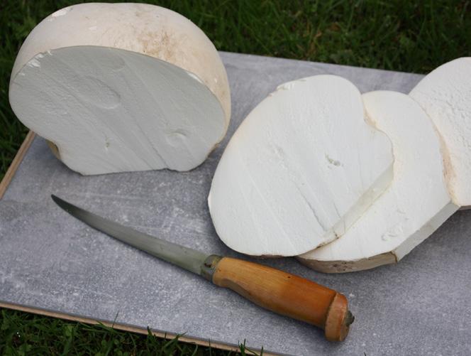
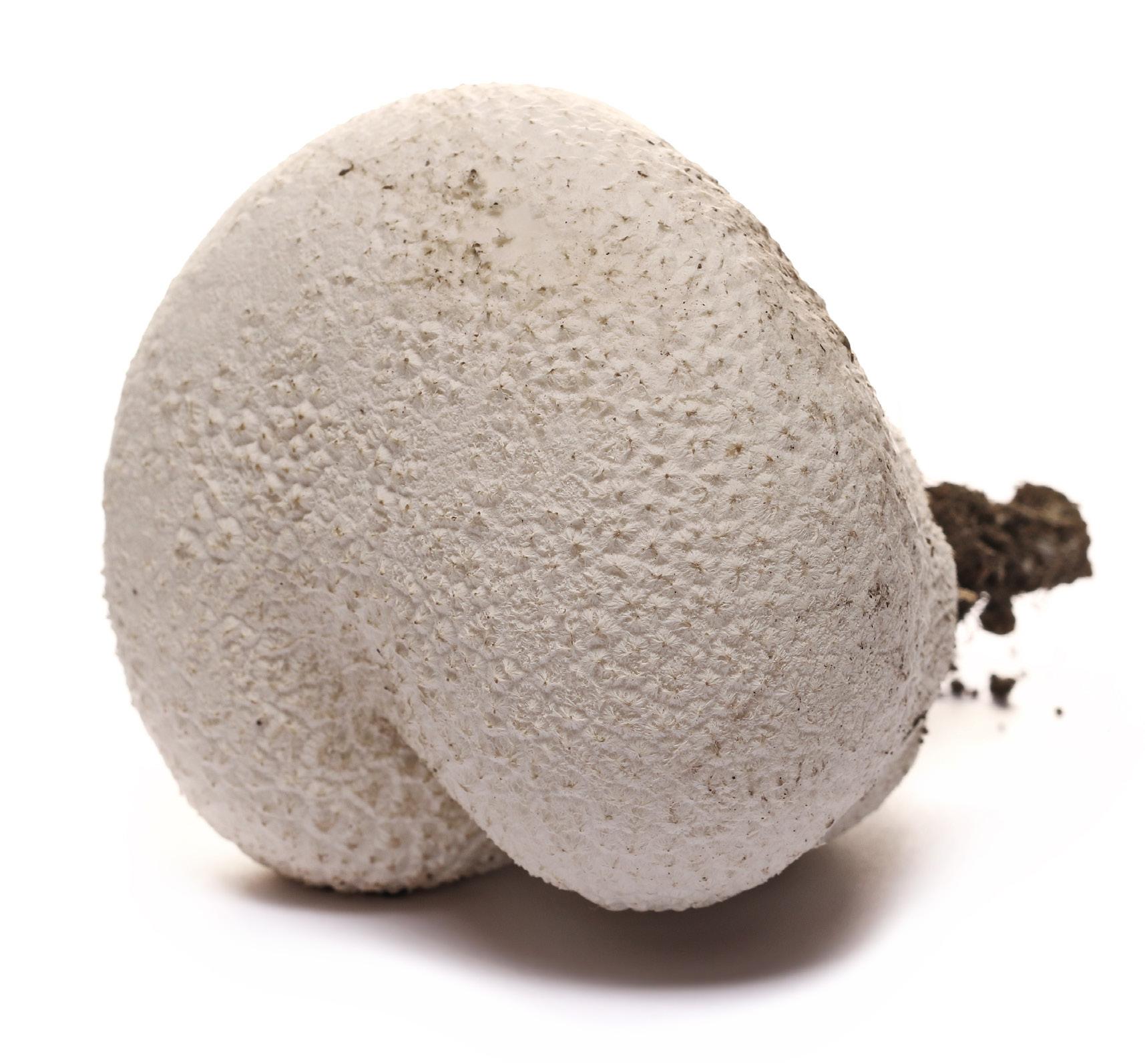
GIANT PUFFBALLS
(Calvatia gigantea)
Even though they go under the name of giant puffballs, not all puffballs are gigantic. They can range in size from marbles and golf balls to baseballs and even soccer balls, with world record-breakers tipping the scales at around 50 pounds!
Puffballs are an excellent mushroom for beginner foragers to go after. Their round, plump snowy bodies are easy to spot growing in pasturelands, grassy meadows, clover fields and just about anywhere where there’s open ground to take a stand on, including lawns and gardens. Their season runs from early to mid-summer all the way through fall. At its prime for eating, a puffball has a beautiful white, smooth interior with a marshmallowlike texture. Overripe puffballs, those with pigmented (grayish to green) interiors and those which have turned “dusty” on the inside are long past their due date and are not fit for the table—but they are fun to step on! Stepping
on them prompts the mature puffball to expel its spores into a puff of gray smoke, spreading them far and wide which, so grandma used to say, ensures a bountiful crop the following season! Of course, before popping a puffball, you’ll want to close your eyes and cast a wish upon the wind…
FORAGING
26 • BC MAG

CHANTERELLES
(Cantharellus)
In Latin the name means “good to eat,” and as an example of just how good they are, in France, chanterelles are made into a very exotic ice cream which is said (as I have not had the pleasure of sampling) to resemble the taste and aroma of fresh apricots.
I have been an avid gold prospector for many years (almost as long as I’ve been a mushroom forager) and I must admit, coming across a wood-
land patch of bright golden yellow chanterelles is every bit as thrilling as striking gold! And when the chanterelle patch is bountiful as they often are, I give thanks while cashing in on nature’s finest “motherlode.”
Chanterelles are commonly nicknamed “trumpet” mushrooms because they have a solid, one-piece funnel-shaped body which, upon maturing, resembles a trumpet. The cap is smooth and dry and slightly depressed in the
centre when young. They have wavy margins with thick, blunt gill-like folds extending down their lanky solid stalks. They range in colour from egg yolk yellow to pumpkin orange.
The most bountiful patches are usually found in deeper, darker, moister woodlands growing in leaf litter, amongst tree roots and near stumps and rotting logs. Their season runs from midsummer to later parts of the fall.
If you’re finicky about find-
WIld Mushrooms in the Kitchen
•Wash mushrooms well under cold running water to remove sand and woodland debris. Pat dry with paper towels. Firm bodied, meatier mushrooms with their robust flavours (morels, chanterelles, boletes) can be used in place of store-bought mushrooms in almost any recipe— steak and pizza toppers, omelets, quiches, stir-fries, soups, stews and any other creation that needs a touch of woodland mushroom magic.
•Puffballs, with their mild flavour and smooth texture, are wonderful in omelets, cream soups and sauces. Shaggy manes,
ing worms in your wilderness gatherings, you’ll be happy to discover chanterelles are never, or should I say, seldom ever infested with bugs or worms as there’s no place on these beautiful one-piece mushrooms for creepy crawlers to hide!
Caution—be aware of Hygrophoropsis aurantiaca, also known as false chanterelles, which have hollow, flimsy smooth stalks and, unlike chanterelles, they glow in the dark.
containing a lot of moisture and very delicate flesh, do not stand up well in the skillet and thus are best-suited for soup and sauce making.
•Firm bodied mushrooms can be dried in a food dehydrator according to your machine’s manual or strung and hung, which was grandma’s old-fashioned method, in a warm place until moisture is gone. Once dry, unstring and store in a paper bag on the pantry shelf where they will keep indefinitely. Use dried wild mushrooms instead of store-bought dried shiitake, porcini or other dried mushrooms in all your favourite recipes.
3
BC MAG • 27
FORAGING
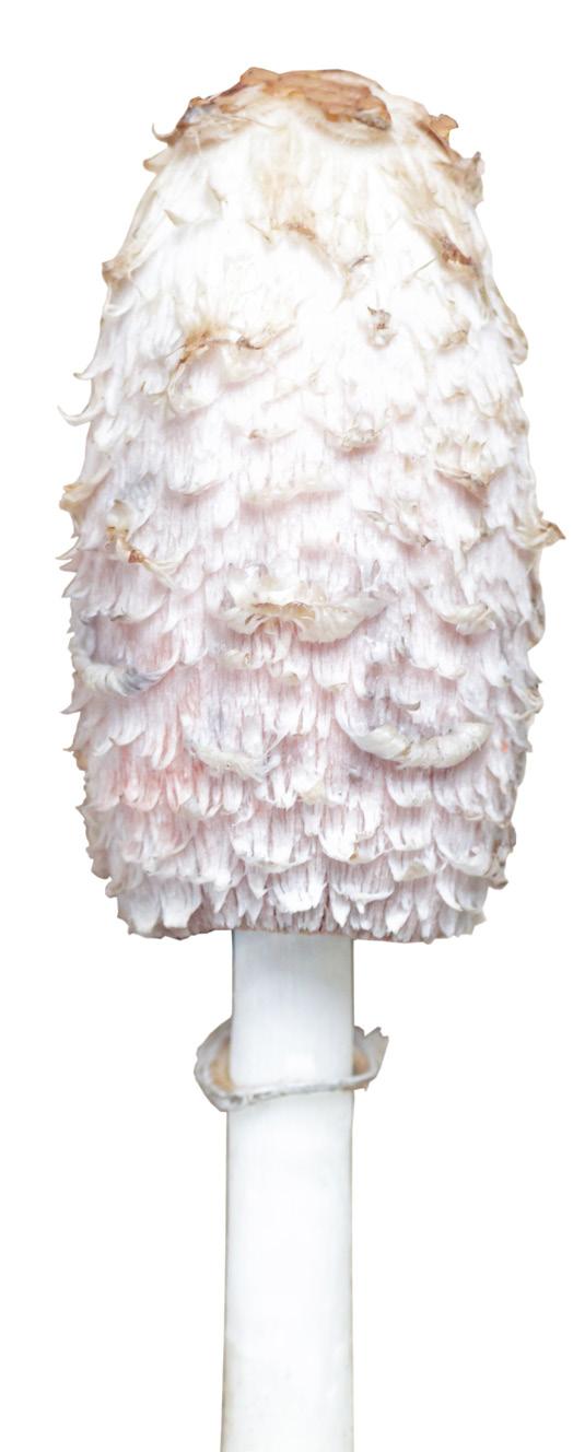
SHAGGY MANES
(Coprinus comatus)
In Latin, the name means “with dense hair” which is why shaggy manes are often dubbed “lawyer’s wigs” since they resemble the fanciful wigs worn by lawyers in British courthouses. They are also known as “inky caps” because, upon expiring, shaggy manes leave an inky splat on the ground.
The mushrooms have egg-shaped white caps with a scale-like appearance and, when mature, they are about the size of a hen’s egg, which they resemble standing on end in the grass. They have hollow white stalks, which run from the base up through the entire body. The mushrooms are at their prime for picking when the caps are still egg-shaped, firm and white. Once the caps flare out, umbrella-fashion, and show signs of inky discolouration, they are no longer edible.
Their season begins in the middle to later parts of summer and runs onward into late fall. Look for shaggy manes marching along the shoulders of gravely backroads, growing in small groups on sandy grounds, in grassy fields, pastures, meadowlands and, yes, even in yards and gardens.
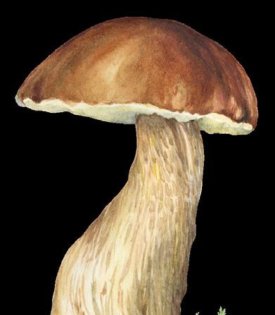
BOLETES
(Boletus)
Europe, especially in Italy where they are known as ing “little piggy” referring to their plump, chubby bodies, smooth skin and meaty texture.
The caps are convex when young and take on the traditional mushroom shape upon maturing. They are smooth and range from yellow and orange to tan and dark brown. The pores on the underside of the caps are tiny, round sponge-like structures (which is why they are often dubbed “sponge-caps”) and range from creamy to pale yellow. Stalks are white to cream with a bulbous base.
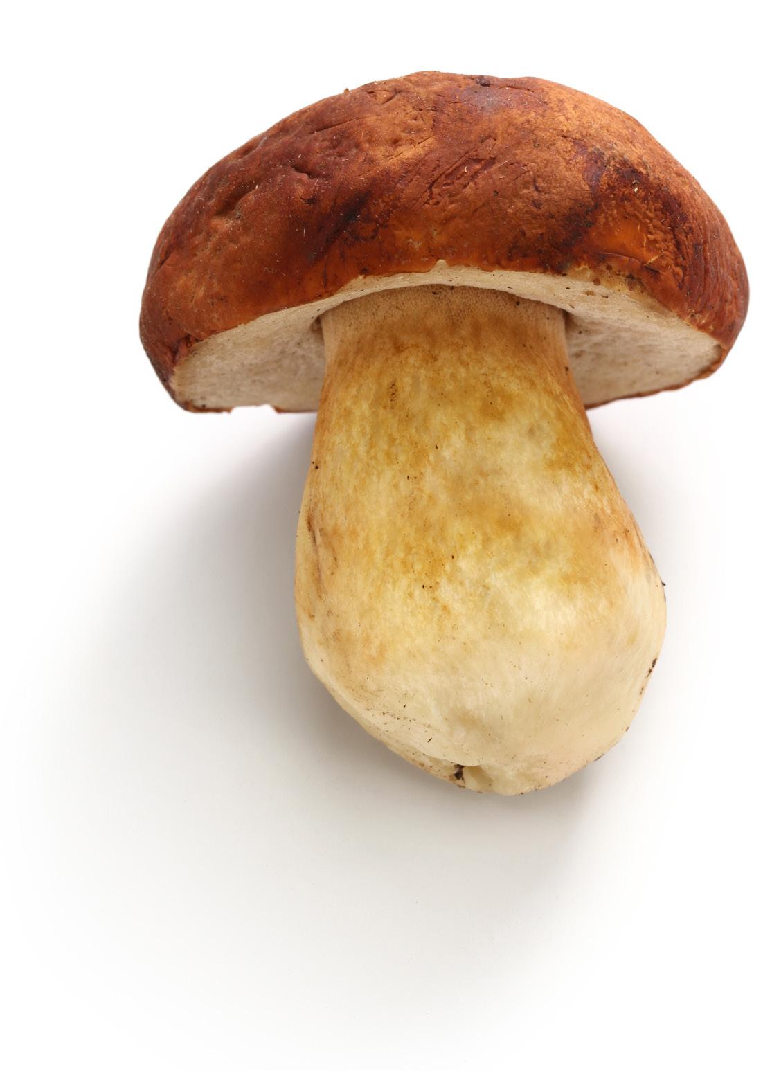
patches appearing after an autumn rain. down-side to boletes—mature specimens are often wormy. But, I’ve been told that bed of ice, the cold will draw the worms on the efficacity of this technique, I have a better solution; only gather young boletes which are usually worm-free and leave the mature mushrooms to feed the woodland nibblers.
CAUTION
The most prospective places to hunt for boletes are under conifer trees, on sandy grounds, in gravel pits and on mossy, spongy woodland floors. Boletes begin to appear in summer and continue to grow through fall with the most profuse

Avoid all species which have reddish pores, as well as those with flesh that turns blue when bruised as these are toxic.


4
W Harvest BC A FORAGER’S GUIDE TO EDIBLE PLANTS OF BRITISH COLUMBIA 71 71 W ild Harvest BC BY LINDA GABRIS $24.95 ISBN: 978-1-7778764-2-5 www.opmediagroup.ca Linda Gabris has been venturing into the outdoors to harvest wild edibles for over 60 years. The lessons taught to her by her grandparents, of responsibility, sustainability and a connection to the land are as important today as they were then. This book shares those lessons as well as tips and practical advice in a personal, easy-to-read style. Combined with a scientific field guide, Wild Harvest BC is the perfect companion book to take with you on your outdoor adventures. Over 70 recipes ranging from Wild Cream of Asparagus Soup to Hazel’s Hazelnut Brittle will help you turn your foraging finds into delicious, hearty meals. So get out there and enjoy the bounty of Mother Nature. Wild Harvest BC Interested in foraging in BC?
your copy of Wild Harvest BC by Linda Gabris from our online bookstore
Get
28 • BC MAG
5
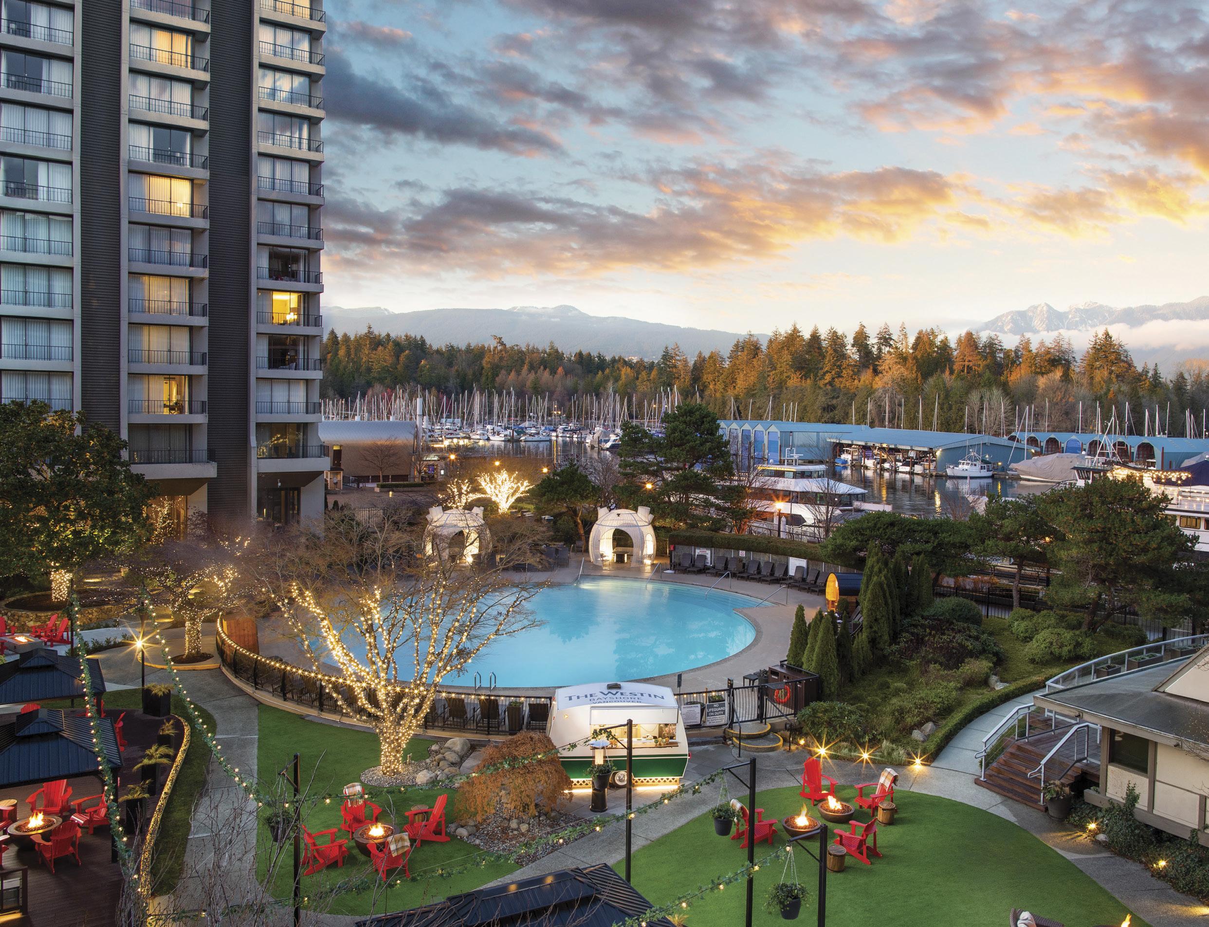
BC MAG • 29 Coastal Bliss Awaits; Your Urban Resort Discover a world of sophistication and tranquility nestled in the heart of Vancouver’s picturesque waterfront. Welcome to The Westin Bayshore, Vancouver, where wellness meets nature, and every moment is designed to rejuvenate your mind, body, and soul. To make a reservation, visit westinbayshore.com or call 1.888.627.8634 ©2024 Marriott International, Inc. All Rights Reserved. All names, marks and logos are the trademarks of Marriott International, Inc., or its affiliates.
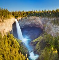
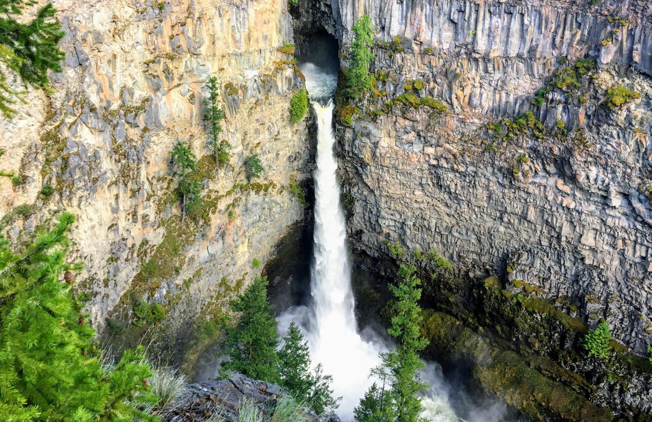
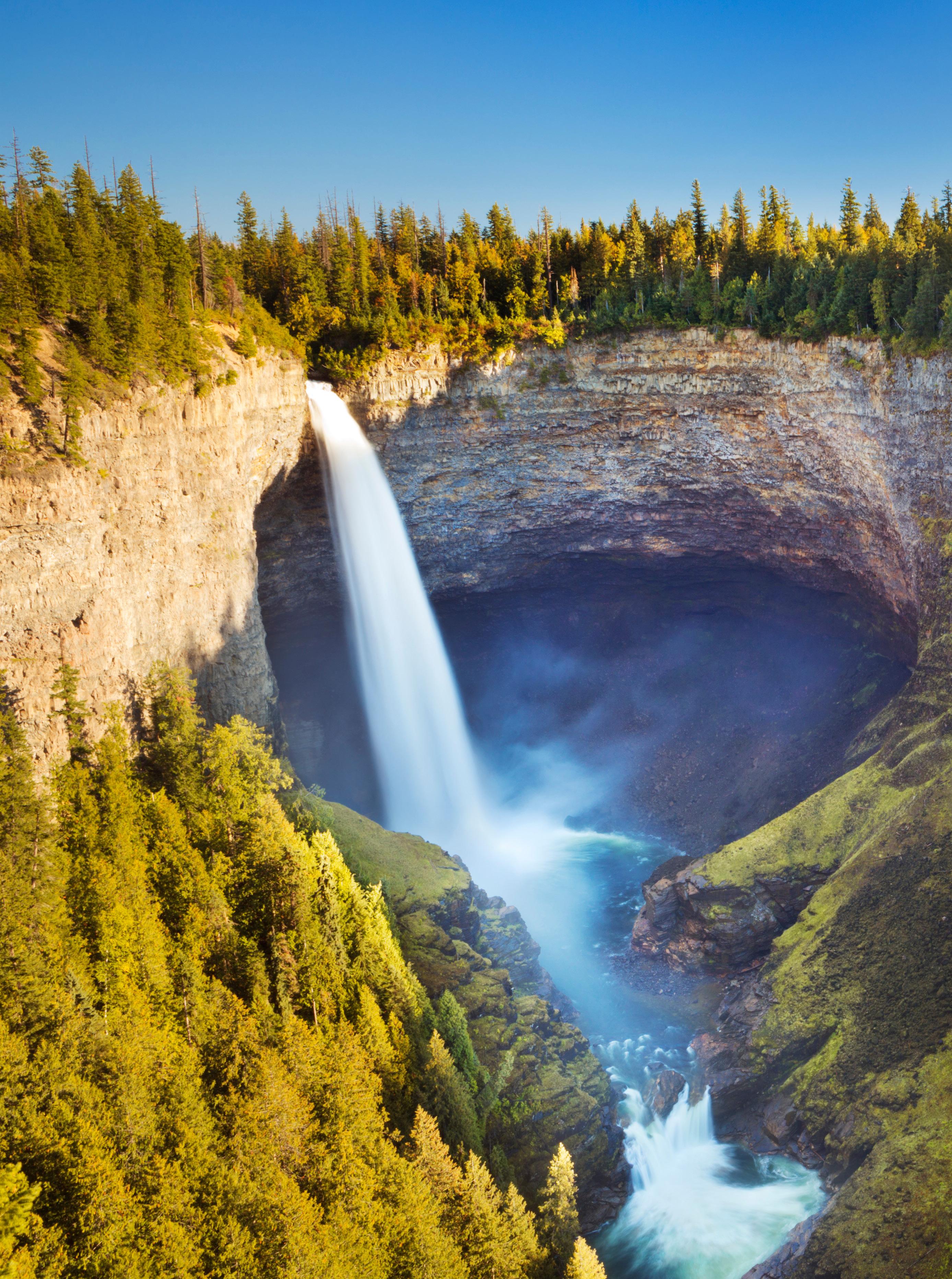 Helmcken Falls in Wells Gray Provincial Park.
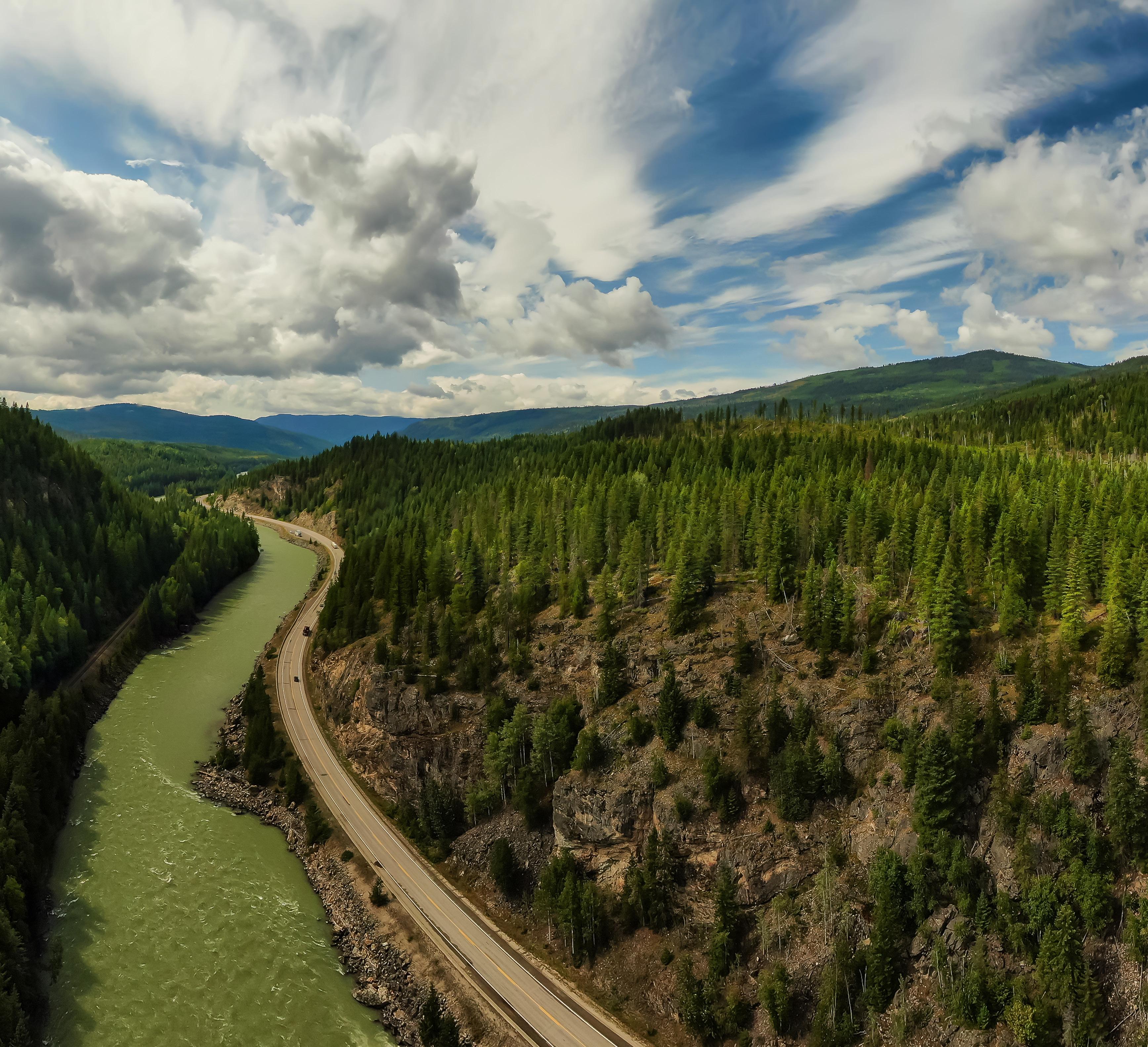
Kamloops to Clearwater Road Trip
EXPLORING THE YELLOWHEAD HIGHWAY & WELLS GRAY PROVINCIAL PARK
BY MURPHY SHEWCHUK
sara_winter
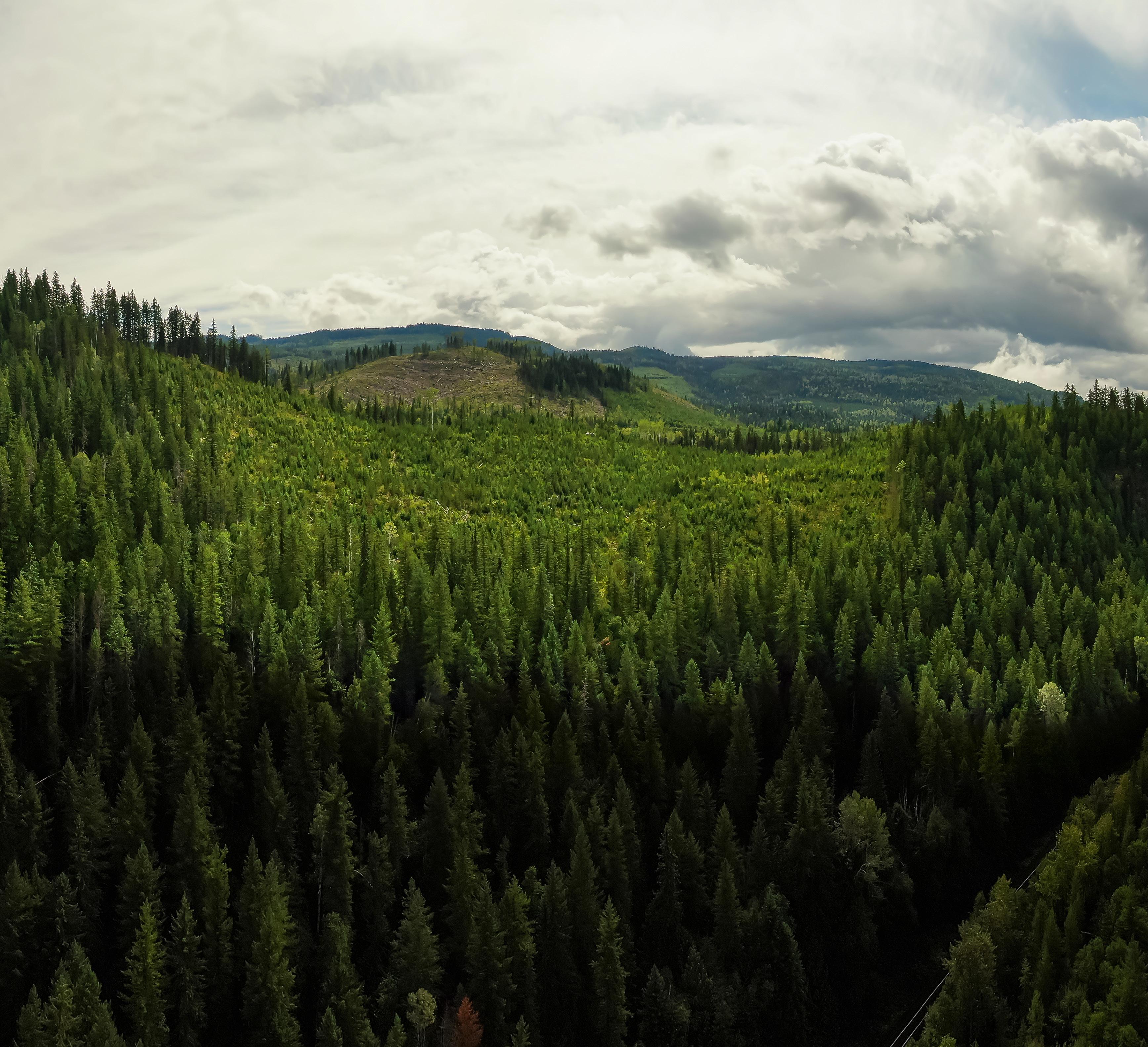
TThe 340 kilometres of paved highway from Kamloops to Tête Jaune Cache follows the route of the Overlanders of 1862, the first survey route for the Canadian Pacific Railway, and the present
path of the Canadian National Railway. For most of its length, it follows the North Thompson River Valley with climatic zones varying from semi-desert at Kamloops to one of the province’s heaviest snowfall areas at Blue River. Traffic is generally much lighter than on the Trans-Canada Highway and the grades are less steep, making recreational vehicle travel less demanding on horsepower and nerves.
FIRST NATIONS TRADING CENTRE
Kamloops, the western junction of
Yellowhead Highway 5 and the TransCanada Highway, has been the centre of trade in the Interior of British Columbia for more than 30 centuries. The Shuswap group of the Interior Salish peoples found the climate mild and the food plentiful. The characteristic depressions of their long-abandoned homes can still be seen in many places near Kamloops. When traders from John Jacob Astor’s Pacific Fur Company discovered the First Nations settlement late in 1812, they were welcomed into the community. The Astorians established the first
32 • BC MAG
Adobestock/edb3_16
Yellowhead Highway 5, north of Kamloops.
and only American fur trading post on what is now British Columbia soil. The American presence was short-lived, however, and the post was soon sold to the Montreal-based Northwest Fur Company, which later merged with the Hudson’s Bay Company.
Today, Kamloops is a modern sprawling city of close to 110,000 people. The fur trade has long slipped into oblivion, but remnants of the past cultures can still be found on display in the Kamloops Museum. Generally regarded as one of the best community museums
in western Canada, the Kamloops Museum houses a superb collection of Salish baskets and artifacts, plus reminders of the people who followed the original fur traders into the Thompson district.
TRANSPORTATION HUB
Kamloops is also the transportation hub with highways coming into it from all directions. From the junction of Yellowhead Highway 5 and the Trans-Canada Highway at what was once the east side of the city, the Yellowhead passes under the morning shadow of Mount Paul, and
then heads north through the suburb centres of Rayleigh and Heffley Creek.
SUN PEAKS RESORT
Heffley Creek is also the junction point for a highway leading eastward to several popular fishing and boating lakes and the Sun Peaks Resort area. Heffley Lake and Little Heffley Lake are near the road, while side roads lead into several other interesting lakes. Sun Peaks, 45 minutes from the Kamloops city centre, is one of the most accessible major ski resorts in Canada. It boasts of a
BC MAG • 33
convivial atmosphere, ample accommodation, and a multitude of downhill ski runs to suit every taste and ability.
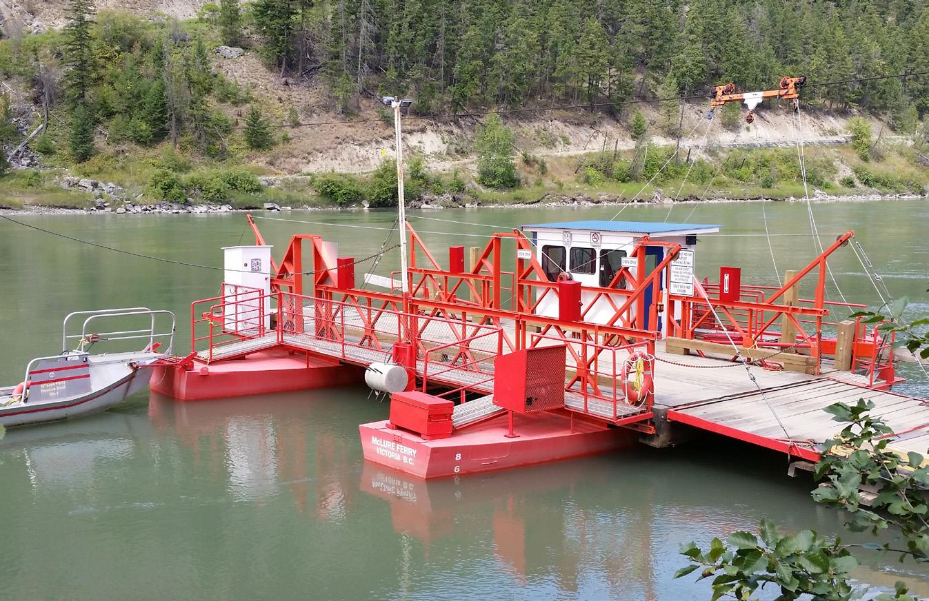
MCLURE REACTION FERRY
North Thompson River crossings are limited north of the bridges in Kamloops. The McLure Ferry, 43 kilometres north of the city, is one of BC’s fleet of free inland ferries. It can carry two vehicles and a dozen passengers and operates on-demand between 7:00 am and 6:20 pm, with a lunch break from noon to 1:00 pm. If you are interested in doing a bit of exploring, you could cross on the ferry and return to Kamloops or continue north to Barrière on the west side of the river.
ADAMS LAKE—SHUSWAP LAKES LOOP
Louis Creek, 14 kilometres north of McLure, is the gateway to Adams Lake and the network of big lakes that lie snuggled up against the Monashee Mountains. Agate Bay Road to Adams Lake is paved, but the rest of the roads in the area are busy gravel logging roads. There are several BC recreation sites on Adams Lake.
SPAWNED BY A GOLD RUSH
While snow may be the source of gold “in them ‘thar’ hills” today, many historians suggest that it was the discovery of gold in the tributaries of the Thompson River that triggered the rush that swept through southern British Columbia in the 1850s. Although not as rich as the bars of the Cariboo, the North Thompson and its tributaries did cause some excitement. While “Doc” Keithley was taking $75 pans out of a Cariboo creek that bears his name, François Lavieur and his compatriots were working the Barrière River, 65 kilometres north of Kamloops and making $50 per day. Gold was worth about $16 per ounce then, but with the present prices reaching 125 times that amount, it could make panning for the gold that Lavieur overlooked worthwhile.
RAINBOW TROUT
It is the rainbow trout, rather than the
Gearing up for a fishing trip at the
gold at the end of the rainbow, that interests many of today’s vacationing travellers as the Barrière area offers ample fishing opportunities. Gravel roads lead east into the headwaters of the Barrière River and the North, East and South Barrière lakes. British Columbia recreational campsites are located at all three lakes and privately operated fishing camps are located on East and North Barrière Lakes.
The Yellowhead Highway crosses to the west side of the North Thompson, just north of Barrière. If you prefer to explore the backcountry, you could wind through town and follow Dunn Lake Road north to Little Fort or Clearwater along the east side of the North Thompson.
To the west of the town of Barrière lies the Bonaparte plateau with dozens of fine fishing lakes, several of which have public camping facilities.
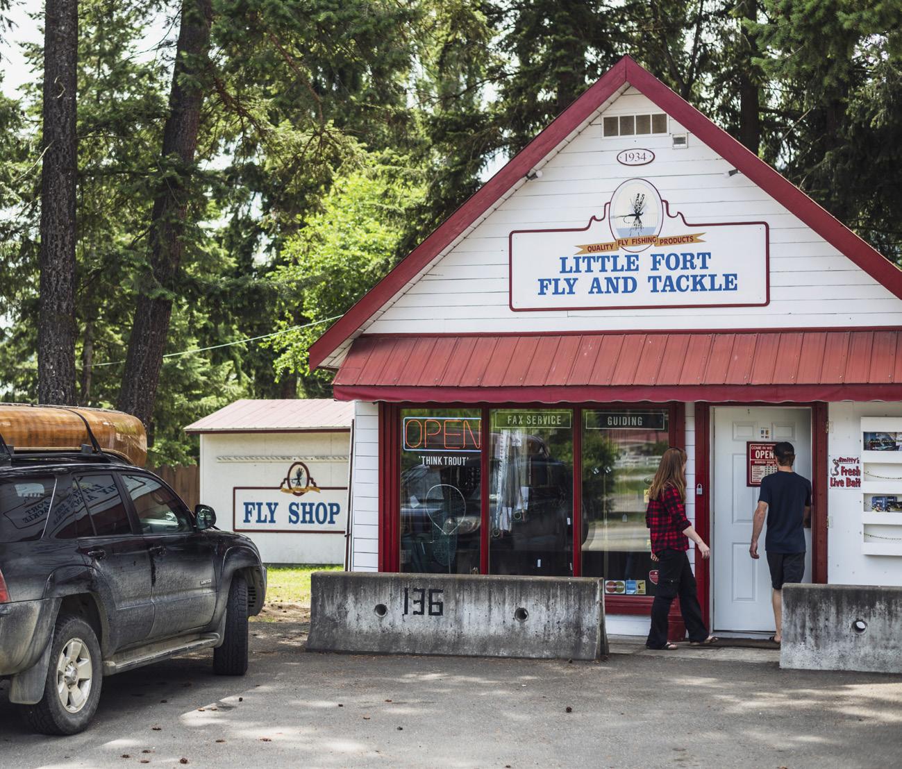
HBC OUTPOST
Little Fort, 29 kilometres north of Barrière, is named so because it served as a Hudson’s Bay Company outpost for the fur trade from 1850 to 1852. It is the junction of Yellowhead Highway 5 and
98-kilometre-long Highway 24, linking the North Thompson Valley with the Cariboo Highway at 93 Mile House. It passes through a recreational area well worth visiting. Dozens of campsites and fishing camps located on cool, clear plateau lakes await those who are willing to venture off the main highways in the summer. In the winter, many of the same fishing camps open their lodges to crosscountry skiers, snowmobilers and icefishers. Lac des Roches and Bridge Lake are two of the larger lakes in the area, while Mahood Lake and the westernmost portion of Wells Gray Provincial Park are also accessible off Highway 24.
Little Fort is also the site of one of British Columbia’s few remaining currentpowered river ferries. The Little Fort ferry also operates from 7:00 am to 6:20 pm, serving the needs of local ranchers and providing access to some excellent fishing holes on the east side of the river.
GATEWAY TO WELLS GRAY PARK
Thirty kilometres north of Little Fort, the Yellowhead Highway 5 passes through the village of Clearwater. If you are looking for a break, there is a BC Parks campground near the North
34 • BC MAG
Destination BC/Andrew Strain
historic fly shop in Little Fort.

KAMLOOPS Sun Peaks Resort
Lake McLure Reaction Ferry Barrière A D A MS LAKE Agate Bay Road Agate Bay Little
Clearwater BONAPARTE PLATEAU
WELLS GRAY PARK Clearwater River Road To Helmcken Falls 5 5 24 0 10 20 Kilometres Area of Enlargement DUNN PEAK PROV. PARK
GRASSLANDS PROTECTED AREA
Heffley
Fort
Little Fort ferry
LAC DU BOIS
Thompson River just south of Clearwater and a commercial campground at nearby Dutch Lake, just west of the main crossroads.
If you are interested in exploring the backroads, Clearwater River Road follows the Clearwater River upstream along the bottom of the canyon. Landslides have limited access, but if you don’t mind getting a bit damp, Interior Whitewater Expeditions offers a variety of trips on the Clearwater River.
TRAFFIC CIRCLE
At the time of writing, the only traffic circle on the Yellowhead Highway was at the north end of Clearwater. The road to the right heads to a school and shopping centre. Clearwater Valley Road heads left (north) to the main entrance of Wells Gray Provincial Park.
The Clearwater Visitor Centre, just north of the junction, is a good place to stop for maps and advice before heading into the wilderness. It is worth noting that the service stations near the junction are your last chances to fuel up.
WILDERNESS AND WATERFALLS
Distance: 125 km
Duration: 1 Day
Off the Beaten
Track Rating:
ADDITIONAL RESOURCES
Backroads Mapbook: Thompson Okanagan BC
Wells Gray Park is the ideal vacationland for the camper, hiker, backpacker and canoeist who wants to enjoy the wilderness atmosphere without chartering a safari to Africa or the Arctic tundra. Although there are fully serviced campsites, motels and hotels in and near Clearwater and along Clearwater Valley Road, a.k.a. Wells Gray Road, the BC Parks campsites in Wells Gray Park and North Thompson Park are not equipped with RV hookups. Instead, each unit has a parking spur, tenting space, fireplace and access to water, wood and a community outhouse. Reservations are accepted online for a number of the campsites.
BC Parks: bcparks.ca
BC Recreation Sites & Trails: sitesandtrailsbc.ca
Clearwater Lake Tours: clearwaterlaketours.com
Interior Whitewater Expeditions: interiorwhitewater.com
36 • BC MAG
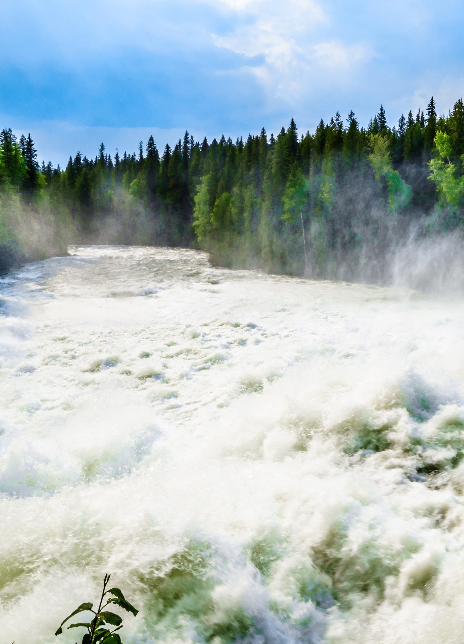
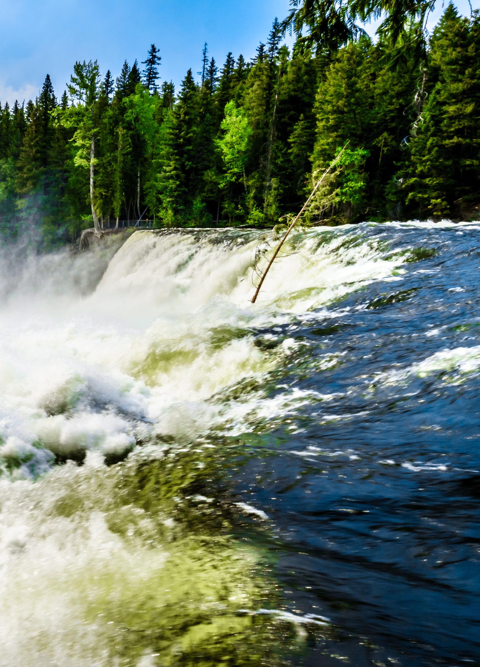
Dawson Falls, Wells Gray Park.
Above: Adobestock/christopher; Top: hpbfotos
Spahats Falls.
Wells Gray Park is truly a waterfall park. Helmcken Falls, which drops more than 140 metres in a single plunge, is the star attraction of the park. For diversity, the 541,500-hectare park also contains five major lakes; two large river systems; numerous small lakes, streams and waterways; plus a multitude of waterfalls, cataracts and rapids. It also contains young volcanic lava beds, unnamed glaciers and snow-capped mountain peaks, mineral springs and plenty of well-marked trails—used in the summer by hikers and in the winter by crosscountry skiers.
If you aren’t up to serious canoeing or kayaking, Clearwater Lake Tours offers boat tours on Clearwater and Azure lakes during the summer months. They have a base at the Clearwater Lake campsite, 68 kilometres north of Yellowhead Highway 5.
A point well worth mentioning is that the rivers of the area are wild and treacherous and are best observed from a firm footing on the shore. They have claimed many lives, as have the larger lakes, and should be treated with respect.

Get your copy of Road Trips 2024: Volume 6 from our online bookstore: thebookshack.ca
BC MAG • 37
NEED MORE ROAD TRIP IDEAS?
McLure Ferry.
Murphy Shewchuk
Prohibition PEACHES, PLUMS &
HOW OKANAGAN FARMERS ONCE HAD A REPUTATION AS LAWBREAKERS
BY DIANE SELKIRK
Summerland
of Commerce
Chamber
The first
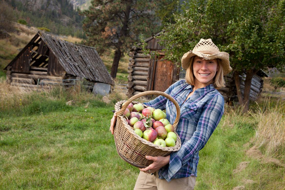
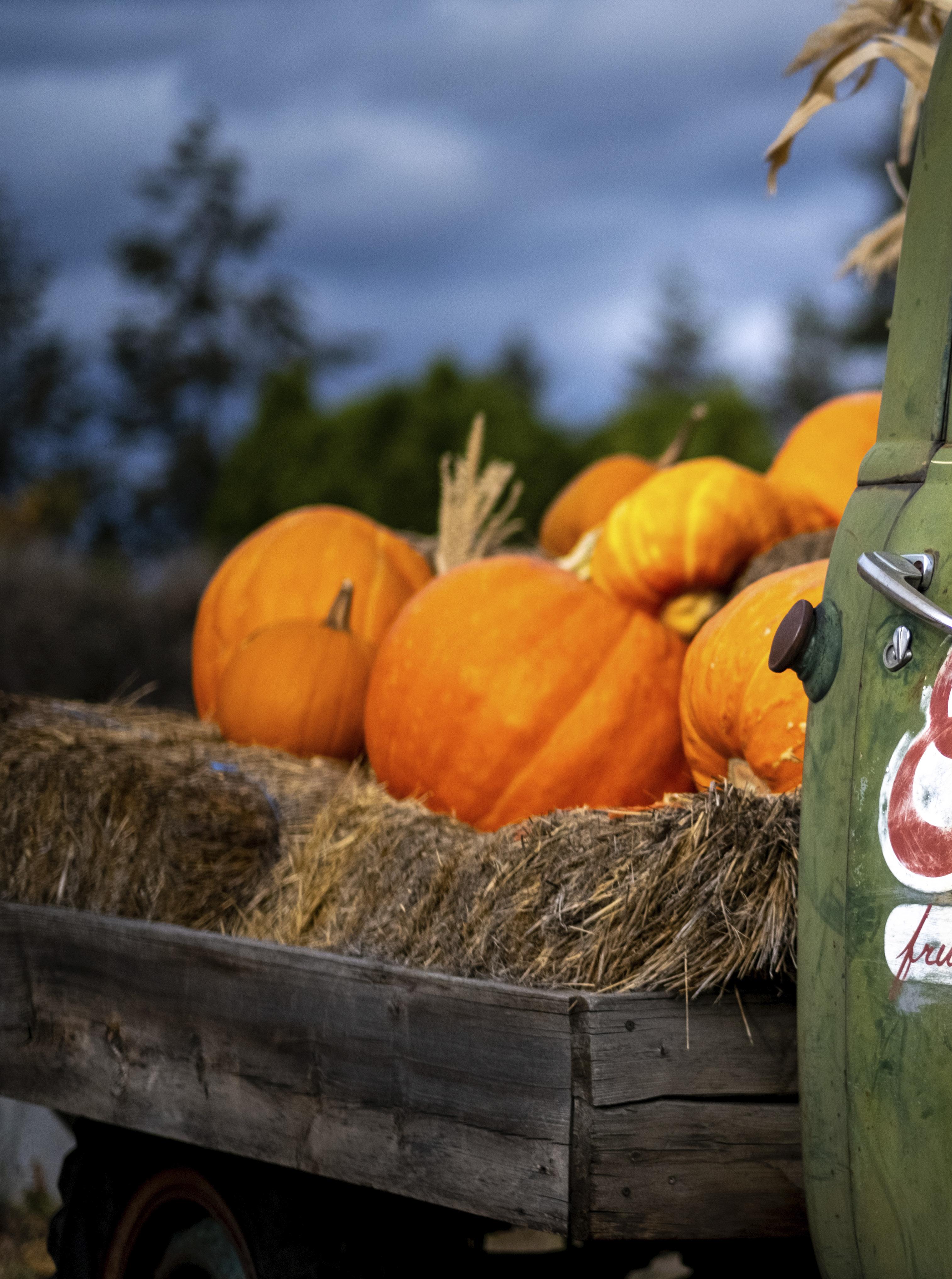
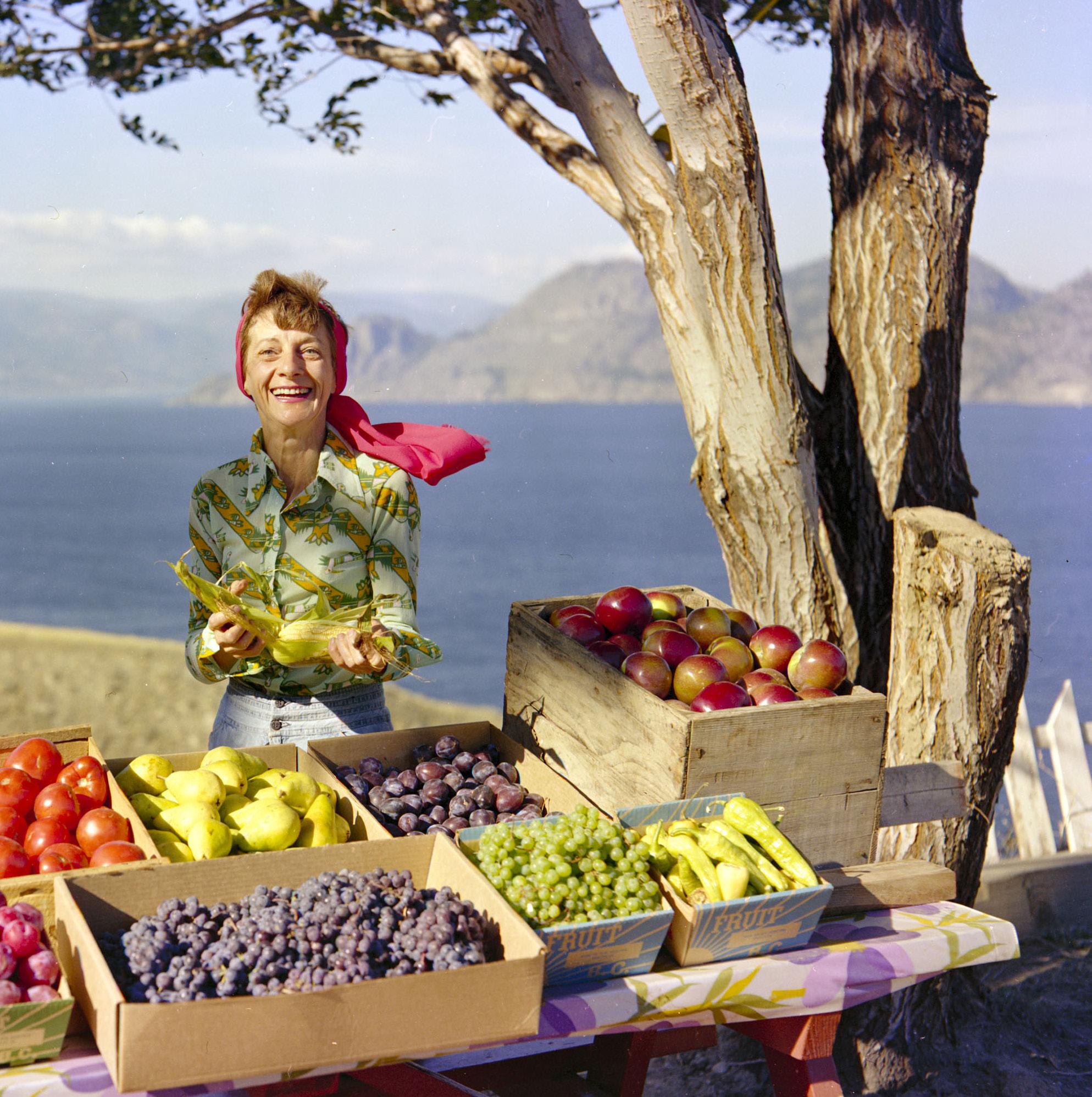
sign we’d reached the Okanagan was the lineup of roadside fruit stands clustered along Highway 3, just on the outskirts of Keremeos. These vibrant shops, offering a full range of fresh, dried, pickled and preserved vegetables and fruit, have long been considered a staple of this agricultural region. They seem so ubiquitous that they appear to have always been part of the rural landscape. However, a chance bit of reading had taught me otherwise. And a long weekend road trip to Penticton felt like the perfect time to share the little-known and somewhat nefarious history of the Okanagan Fruit Stand with my captive family.
BEFORE DIVING INTO the story, I thought we needed some sustenance. So, we pulled over at one of the colourfully decorated shops, this one adorned with a dozen or so paintings of giant fruit and bright displays of freshly picked produce. After a bit of contemplation, we selected a handful of plums and a basket of peaches (one of the crops that made the area famous). Settled back in the car, I take my first juicy bite. Savouring the flavour that only comes with the freshest fruit, I explained that just over 75 years ago, simply buying these roadside peaches would have fallen into a legal grey area. Neither selling nor buying them on the side of the road was completely legal.
The story of Okanagan holiday-makers turned degenerate fruitleggers dates back to the 1930s. This is when the region’s orchardists were struggling to get their produce to market. The solution turned out to be a mandatory system where farmers pooled all the fruit grown across the region’s rolling, lakeside farmlands and sold it through a marketing system called the British Columbia Fruit
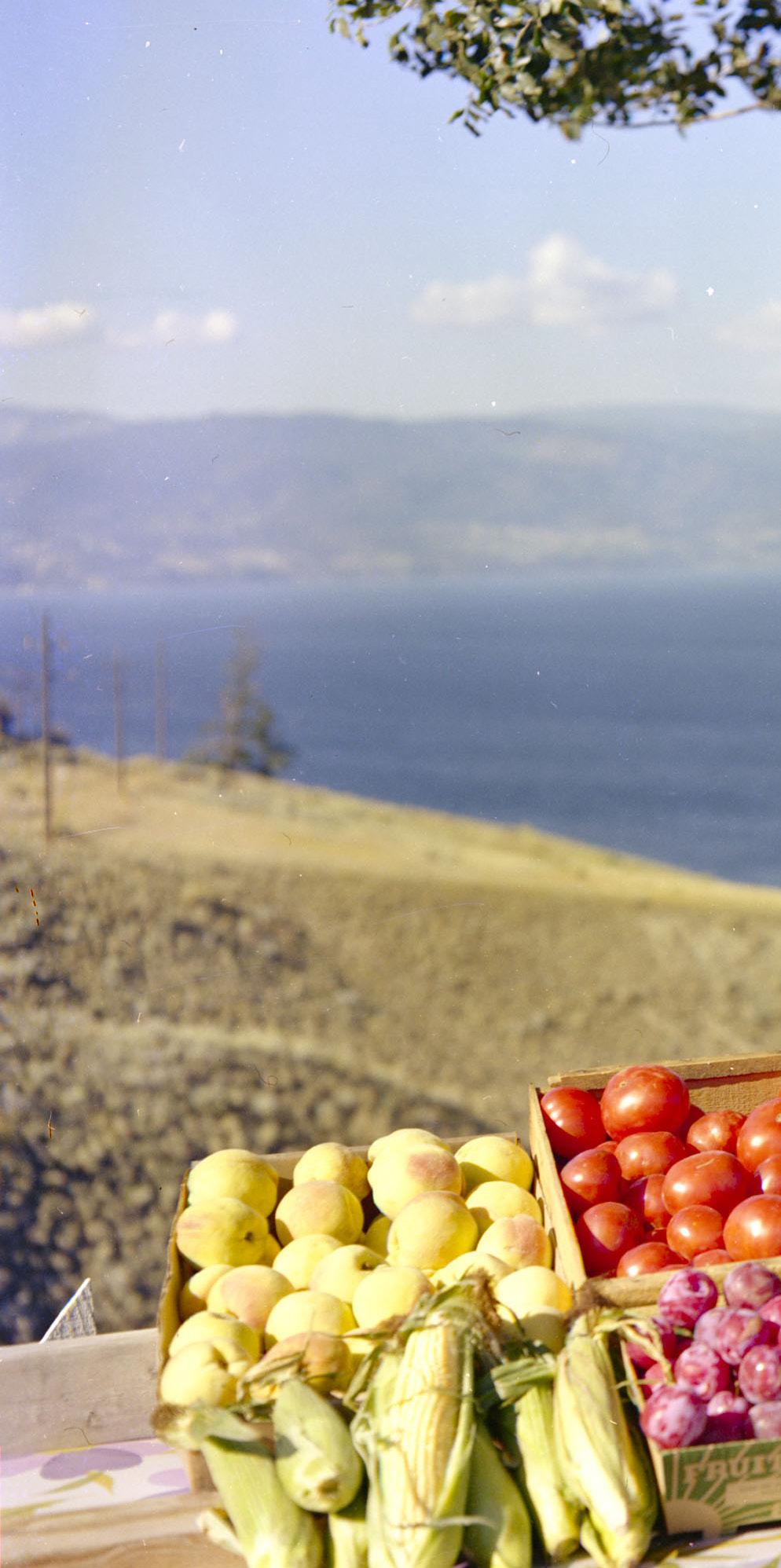
This looks like an innocent enough scene, but pre 1974, this would have been an illegal fruit stand, with violators facing fines and possibly jail time.
Board—a program not unlike the one dairy farmers use today. While the BC Fruit Board helped stabilize the market, not every farmer felt it was fair. So, when Highway 3 opened in late 1949, offering the first road link between Vancouver and the southern Interior, the first roadside fruit stands opened for cash sales— violating the rules of the Fruit Board.
40 • BC MAG
As the landscape outside our window shifted from arid fields to abundant orchards, I told Maia and Evan that thanks to long-ago tourists like us, these illegal fruit stands quickly grew from a handful in 1949, to 200 in 1953, and to about 350 by 1957. Unable to keep up or control the growth, the Fruit Board added rules. You could buy fruit—but only
enough for personal consumption. So, in the mid-1950s, if we had loaded up the car with more than the regulated five boxes of fruit, we would have been considered not road trippers but smugglers, subject to fines or even jail time.
Peach, apple and cherry orchards (and more than a few vineyards) stretched ahead of us as my family reacted similar-
ly to those long-ago fruit buyers: by suggesting ways to hide excess fruit. Pretty soon, loading the kids, pets and luggage into the family car and heading to the lakes for Okanagan summer fun had become a popular summer ritual—and returning home with a car filled with illicit boxes of fruit was an important part of the tradition.
BC MAG • 41
Image I-13341courtesy of the BC Archives
Luckily the days of fruit inspectors are long gone so we can all enjoy fresh produce, purchased directly from the farmer.
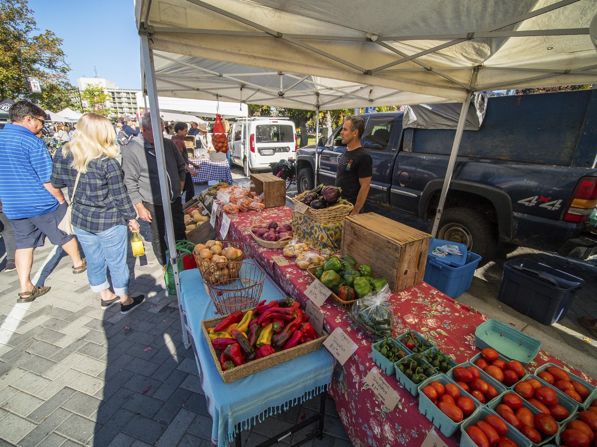
TURNING OFF OF Highway 3, we left the Similkameen Valley and headed north into Penticton. Set between the Okanagan and Skaha lakes, the area was once known a snpintktn by the syilx Okanagan people, a word that means, “A place where people have always been all year long.” Sunny and warm and fringed with gentle beaches, the area became filled with camp grounds, cozy hotels and kitschy (by modern standards) amusements. It was easy to see why the small town became so popular with families.
Checking into the Penticton Lakeside Resort, the three of us marveled at the sunset view of Okanagan Lake. The cloudless sky was tinged with pink, and the lake had turned a deep midnight blue. The hills appeared rusty and
“ The inspectors, known for their inconsistency and rudeness, would often seize excess fruit from unsuspecting tourists & destroy it.
parched from the summer heat, yet the vineyards on the Naramata Bench were lush and productive. Walking along the flower-lined boardwalk, we started looking for a place to have dinner.
Penticton retains much of the oldschool charm from its early days as a tourist hotspot. Yet, among the small-
town restaurants, there are also sophisticated dining options ranging from fine dining at the nearby Poplar Grove Winery, one of the original five wineries on the Naramata Bench, to Turkishinspired Elma, a bright, airy establishment featuring Turkish cuisine with an Okanagan twist.
The next morning, we headed to the Penticton Farmers’ Market—the perfect spot to pick up fresh baked goods for breakfast and dive back into the region’s fruit-filled history. Nowadays, some 80 vendors make, bake or grow items sold to the up to 8,000 visitors who stroll through the market on any given Saturday. As we admired heritage apples, sampled juicy plums and chatted with farmers, only a few could recall the days of the Fruit Board’s reign.
Diane Selkirk
42 • BC MAG
FILLING OUR SHOPPING bags, I realized the old rules would probably have excluded many of the boutique farmers whose diverse crops have become such an important part of the Okanagan’s flavour landscape. Initially, only farms fronting an arterial road could obtain a farm stand license—an option that also encouraged orchardists to grow a wider range of crops for their in-person sales. Farmers ineligible for roadside stands began to push back against this limitation. But it wasn’t until home canners also raised a fuss that the fruit limit was increased to 10 boxes (though only two boxes of cherries were allowed) and rules started to change regarding who could set up a farm stand.
With community members and fruit stand owners continuing to argue that allowing visitors to bring back fruit for friends and family could boost demand for BC orchard products, the limit was raised again to 20 boxes in 1960. However, this still didn’t stop the station wagon smugglers. So, the fruit board beefed up its force of inspectors, established a telephone tip line, and set up roadblocks and checkpoints on the highways leading out of the Okanagan.
AFTER OUR MORNING at the market, we had lunch at Bench 1775 on the Naramata Bench. Sampling the wines, one of the staff recalled that her father had once smuggled fruit out of the valley, dodging roadblocks and the highway-patrolling inspectors known for driving Volkswagen Bugs. It seems the appeal of buying fresh fruit directly from the farmer was something the Fruit Board hadn’t anticipated. But as we looked over the vines, sipping our favourite wines, I realized those long-ago fruit stands likely paved the way for this exact kind of farm-based agritourism. From the vineyard, we headed to the family-owned La Petite Abeille Cidery, where we toured the beautiful orchard and learned about the apple varieties from co-owner Kimberly Wish. After the tour, we found a shady spot on the cidery’s deck for some sampling. Overlooking the orchard and lake, I reflected on the role that fruitlegging must have
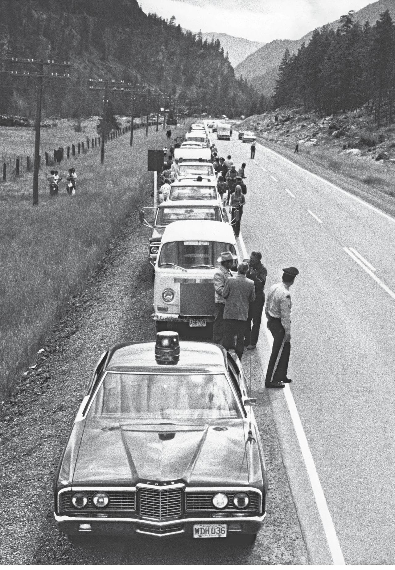
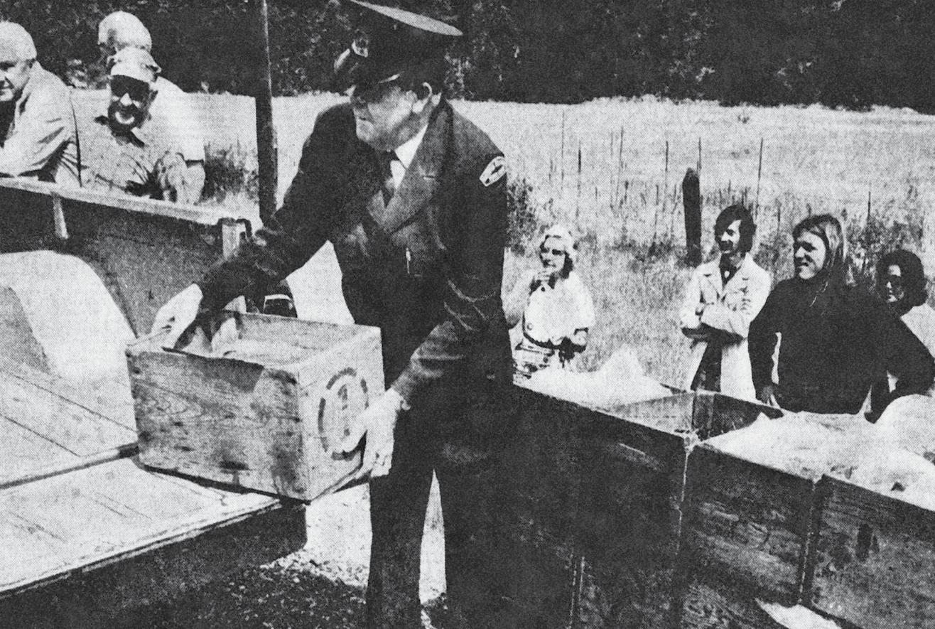
In
BC MAG • 43
Top:
1973, dozens of cherry farmers clash with the authorities by forming a large convoy loaded with produce and headed to farmers markets in Vancouver. Below: Busted, a fruit inspector seizes a load of contraband fruit.
played in the development of highlights like this in the Okanagan.
Hiking, biking, paddling and dining are key to what makes a visit to the region special. But what I’ve grown to love about the area is that you can drive down almost any side road and discover another opportunity to visit a farm, vineyard or orchard, and meet the people who invest their hearts and souls into cultivating our food. And while the Fruit Board was initially established to support farmers and ensure their products reached our kitchens, they couldn’t have envisioned this more intimate future.
AS WE SET out on a lakeside drive, past stands leading to Summerland and Peachland, I shared with my family that it took an event known as the Fruit Wars to end the checkpoints, car chases, citizen-smugglers and occasional violence.
By 1970, farmers were frustrated with the stringent regulations and communities were concerned about the impact on tourism. The inspectors, known for their inconsistency and rudeness,
Dawson Falls, Wells Gray Park.
would often seize excess fruit from unsuspecting tourists and destroy it. Travel writers from the Vancouver Sun and Calgary Herald repeatedly warned potential Okanagan tourists about the risk of being “shaken down by the RCMP” for their fruit purchases.
So, on July 7, 1973, dozens of cherry farmers formed a large convoy and headed to what they advertised as a farmer’s market in Vancouver’s Gastown. Some drove straight through the checkpoints without stopping. Others stopped to collect fines, tickets and jail time—so they could contest them in court.
The battle lasted all summer, with outlaw convoys breaking through blockades to Calgary, Edmonton, Nanaimo and Prince George. “Vans and light cargo trucks could be found at viewpoints and picnic sites along major highways and in suburban parking lots and service stations, with hand-painted signs advertising Okanagan fruit for sale,” wrote Bradley and Hadlaw in a paper titled “Fruitleggers, Fruit Police and British Columbia’s Black Market.” By 1974, the Fruit Board relented,
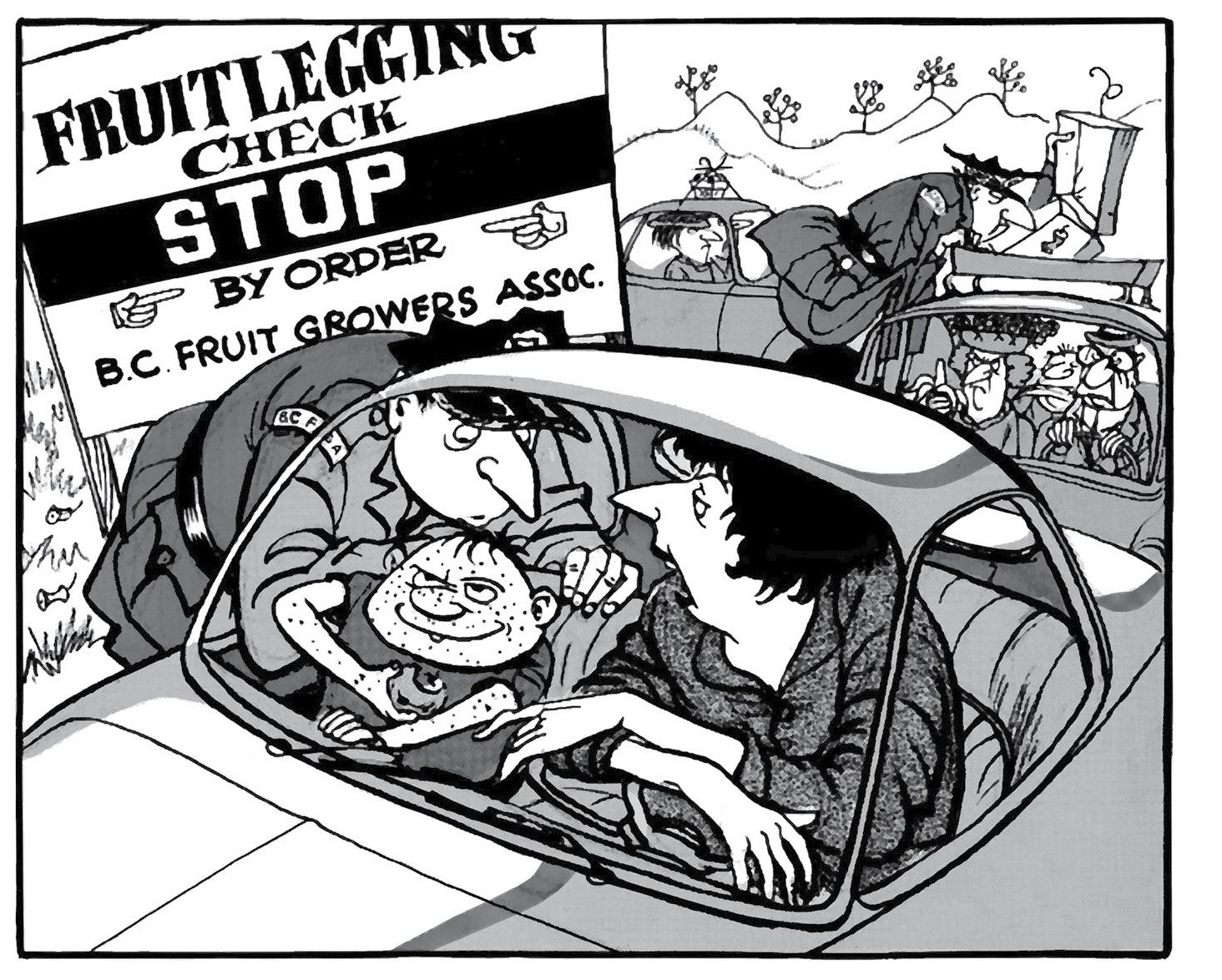
"No we don't have 20 cases of fruit...
IF YOU GO
STAY
Penticton Lakeside Resort 21 Lakeshore Drive West pentictonlakesideresort.com
EAT
Elma 994 Lakeshore Drive West eatatelma.com

The Restaurant at Poplar Grove Winery 425 Middle Bench Road North poplargrove.ca
DO La Petite Abeille Cidery 1085 Fleet Rd Penticton lpacider.com
and the checkpoints were dismantled. It was no longer mandatory for commercial orchard fruit to be marketed through BC Tree Fruits—unless it was for export.
OUR FAMILY GETAWAY to Penticton ended too soon. After a final walk along the waterfront and a promise to do the Lake-to-Lake tube float on the canal running through town on our next visit, we packed up our produce, cider and wine.
We still had one last stop—I wanted to visit an old roadside fruit stand, one of the originals. Arriving at a stand piled high with fruit, we selected our boxes of peaches and plums. Waiting in line to pay, I tried to imagine a time when owning a fruit stand was an act of resistance—and shopping at one was a crime.
44 • BC MAG
The Bench Market 368 Vancouver Avenue thebenchmarket.com
Just
Vancouver
one case of chickenpox"
Sun 1962

WWW.BCMAG.CA/PHOTO-CONTEST OPEN FOR SUBMISSIONS 2023 WINNING PHOTO Liam McIlvenna Location: Toba Inlet 2024PHOTO CONTEST NOW ENTER CONTEST CLOSES JULY 22
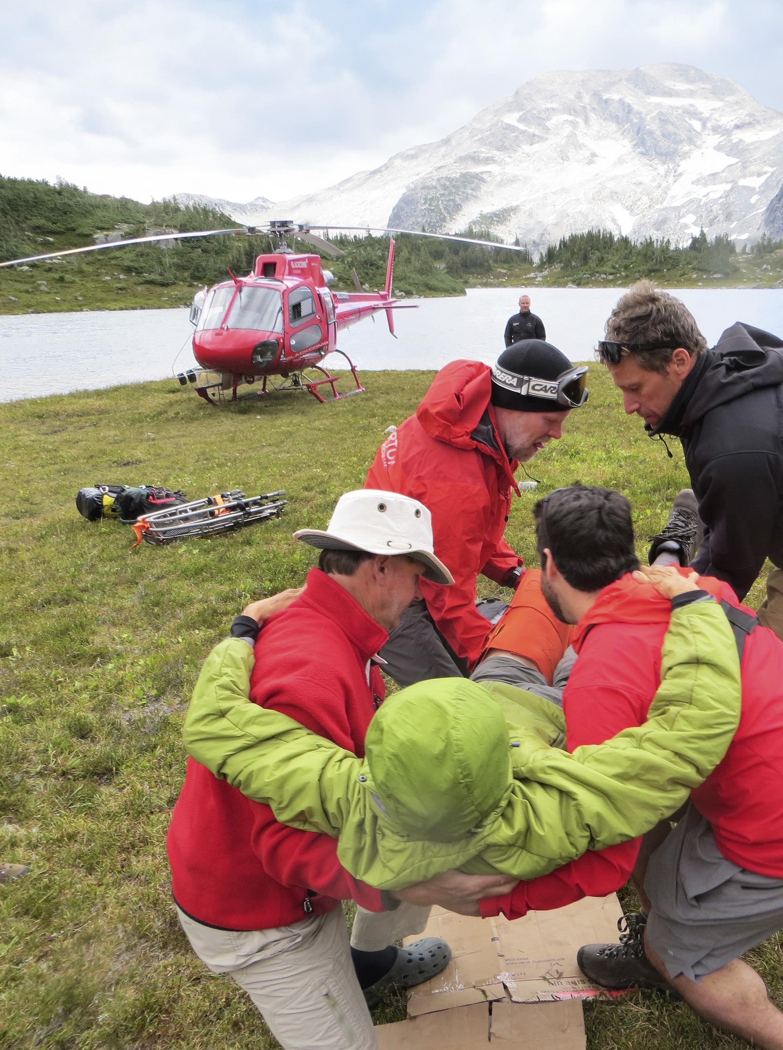

Anatomy of a Mountain Rescue
WHEN ALPINE ADVENTURE TURNS INTO A RESCUE MISSION
BY RICK HUDSON
THE ALPINE CLUB of Canada is a venerable institution. Founded in 1906, it has grown to be the definitive association for those aspiring to climb sizeable mountains, with 24 regional sections spread across the country. While there are many excellent hiking and walking clubs in Canada, and many locally based rock climbing clubs, if you are serious about rock or ice climbing, or tackling big summits, the ACC is the place people gravitate toward. With its many alpine huts, its subsidized training programs and busy outdoor schedules, it’s where active and
BC MAG • 47
Phillipa Hudson
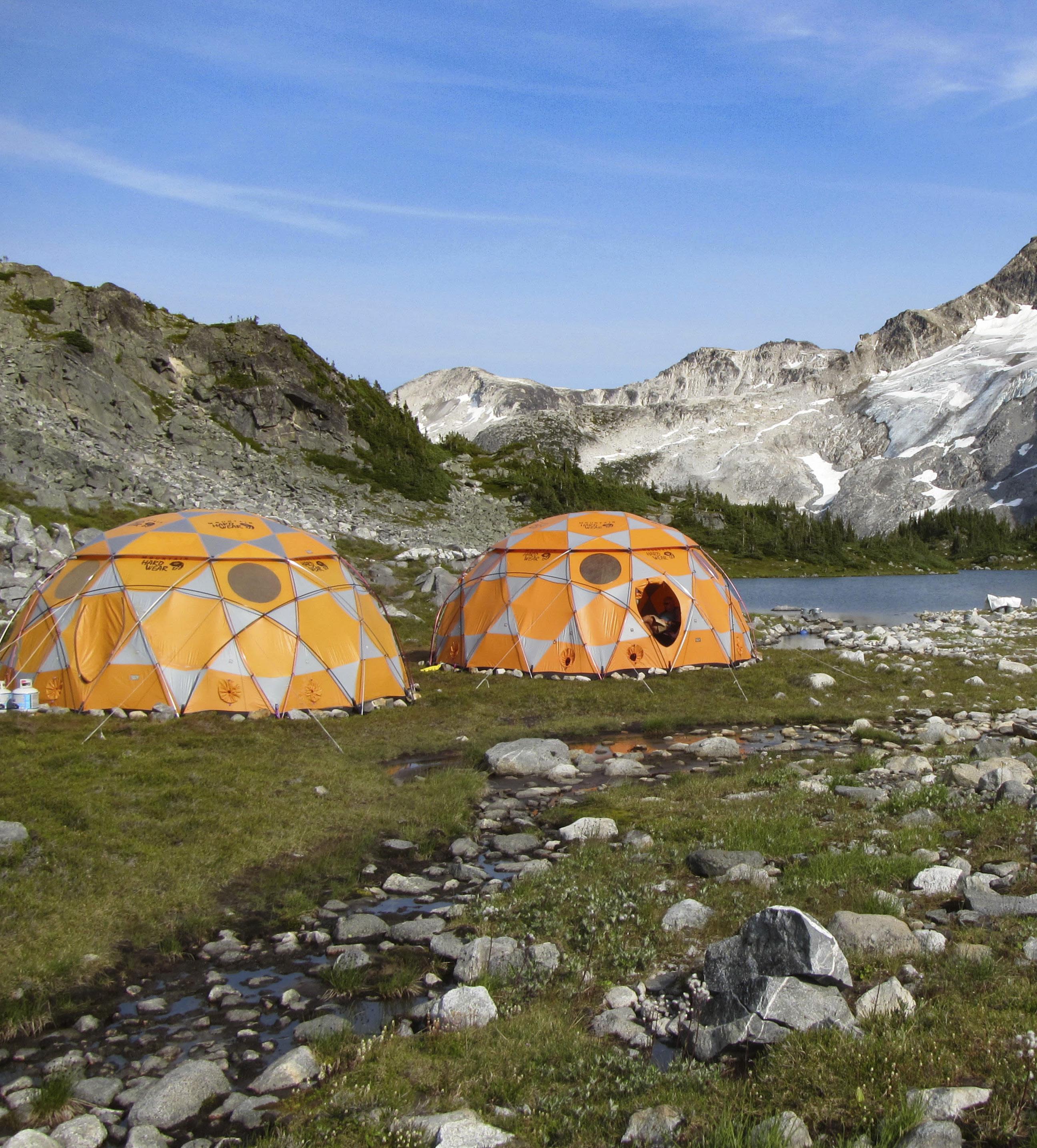
48 • BC MAG
Base camp with Cyclone Peak (2,499 metres) in the background.
Phillipa Hudson
motivated people meet.
Early on in the club’s history, the national office offered week long camps in the backcountry, usually in the Rockies, for members to attend. There, they would live under canvas and spend time socializing while being guided up surrounding summits by certified Canadian mountain guides. Over the ensuing century, those summer camps have been the source of many first ascents of unclimbed peaks, as well as the training ground for many famous mountaineers who later made history around the world.
Over the years, a number of the regional sections have copied the national model by hosting week long summer camps for their section members, as well as inviting neighbouring sections to attend, when spaces allowed.
And this is where our story starts. On this particular summer, our section (who will remain nameless, to protect

There, they would live under canvas while being guided up surrounding summits
the innocent) hosted a three week summer camp. As fate would have it, we were on the third week.
Being on the last week has its pluses and minuses. On the one hand, we benefit from flying into a camp that is already well established. On the other hand, it will be our job to close it down on the final Sunday morning, and leave the site so clean and reclaimed that others passing that way in years to come will never know that three different groups of 15 people have camped there.
THE WEEK BEGINS It’s late July and the time to prepare has arrived. It’s never easy packing for an alpine trip when the temperature on the coast is hovering close to 30°C and all you can think of are T-shirts and shorts. Somehow you
BC MAG • 49
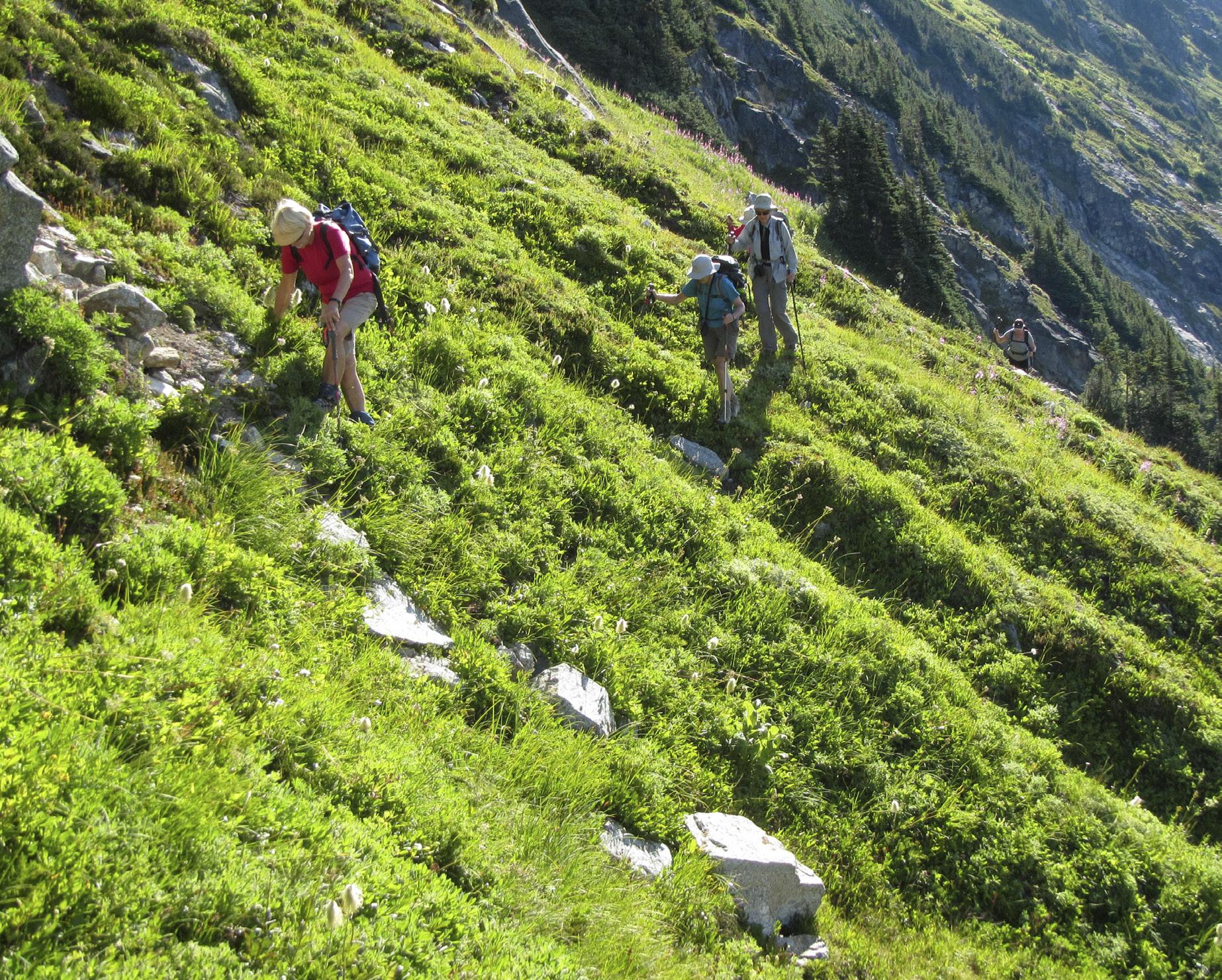
have to remember those cold times in the alpine, even in mid-summer. Fleece top, fleece pants, puffy jacket and, contrary to the past two months of blazing heat, a rain jacket.
We meet at the Pony Restaurant in Pemberton for a final meal, and to meet the new faces. Instead of the usual 15, we’re only 13 this week. Is that unlucky? We’re not a full complement, but that makes the helicopter weight issue less of a worry.
Then we’re off to the staging ground, a large open area in a forest previously used by log sorting equipment. We pitch tents, swat the few itinerant horseflies, and turn in, expectant as always of what tomorrow and the ensuing week will bring.
What it brings is a helicopter right on time, and a hail of flying bark chips and gravel. When the rotors cease to whirl, we emerge from behind the gear piles.
Jock has a brae Scots accent and will be our pilot today. The usual safety talk follows, before we pack what we can into the A-Star’s generous storage areas. Then four of us are off, rising up the valley in a spiraling arc as the blades sweep overhead and the treetops skim just out of reach below.
Why do pilots hug the slope like that?
Jock explains it’s a safety thing. Contrary to logic, being close to one valley side means that, if things suddenly go wrong, he has the full width of the valley in which to do something— such as aiming for a tree on the other side.
We burst over a rise before having time to think this through. Below are two orange domes next to a lake. The elevation is 6,400 feet (1,950 metres) on the helicopter’s altimeter. The domes will be our kitchen and mess tents for the week. A bunch of coloured ants are scurrying around, jumping on boxes to hold the
gear down. The dust cloud settles, the turbine eases and we step out into cool air and friendly handshakes. Week Two is all packed and ready to go home. The handover begins.
In an hour, the personnel exchange is over and silence returns to the alpine. A light wind disturbs the lake as we take stock of our surroundings. Sites are examined, sleeping tents are pitched and it’s time to take in some of the territory and put some of that rushed advice from Week Two into practice. We head through meadows of the upper valley, bound for the lake which, because it’s Sunday today, becomes known as Sunday Lake. All of us tag along, while we look up left and right at the steep slopes of heather and granite bluffs that hem us in.
The flowers are nice, though not as good as some prior years at other summer camps. No doubt the heat wave that’s held BC in its grip for months has

50 • BC MAG
Phillipa Hudson
Above camp, the steep heather slopes were slippery underfoot. It was on just such a slope that the accident occurred.
pushed spring into the alpine zones earlier this year. Talking of heat, on the way back to camp we pass an unlikely beach of fine white sand that leads into a lake. We strip off and swim, enjoying the cool after the day’s warmth.
The evening at the camp is a celebration of communal cooking (fresh sausages in two flavours, mash and veg, followed by chocolate brownies) and getting to know each other. In the ab -
Jennifer says she isn't uncomfortable, but who knows how stoic she is?
cakes and bacon, a group of six decide to reach the high ridge on the north side of camp, a rise of about 400 metres up a steep heather slope.
FRS radio checks are made at 10:00 am. Everyone’s fine. On the ridge by then, we hear that Jennifer and Mike (our unknown Calgary couple) are coming up a different line toward the ridge, followed by Rob who is back from his pre-breakfast peak. At about 11:00 am, Rob radios that he has passed them. Then we hear that Jennifer has fallen and may be hurt. There’s a brief discussion among the ridge party—most will

sence of paid guides, that’s an important part for the camp manager. His or her assessment of everyone’s capabilities will determine how people are grouped and what objectives they are capable of tackling. This week, there are unknown folk from Calgary and the Okanagan, as well as the crowd from our own section, most of whom are known entities.
Throughout that first evening, we find shared experiences from past places and different trips as we weave our non-Facebook connections. As we chat, I listen carefully and tease out others’ capabilities. On the downside, we are an older group, so we need to be more careful. On the upside, there’s a lot of mountaineering experience in the group. Then, it’s time to see if we did a decent job of flattening the ground under the sleeping tents. A big moon hangs in the sky as we drift off to sleep.
A NEW DAY DAWNS It’s Monday, but one full of promise as the first full day of the week. Everyone’s keen to go somewhere. It’s barely light when Rob calls in from the top of a nearby easy peak to say it’s not hard to get up and he’ll be down for a late breakfast. Over muesli, pan-
go back down the up-track to camp, while I join Rob and together we’ll descend to the patient.
The day is thankfully sunny, but there are strong gusts out of the northwest. Jennifer is in a steep gully that shields her from the wind, and in sunshine, but an examination of her left leg reveals she has a prosthetic knee, which may complicate any potential break, and the evacuation. Rob and I splint and bandage the knee as best we can, given our limited medical supplies on hand. Jennifer says she isn’t uncomfortable, but who knows how stoic she is?
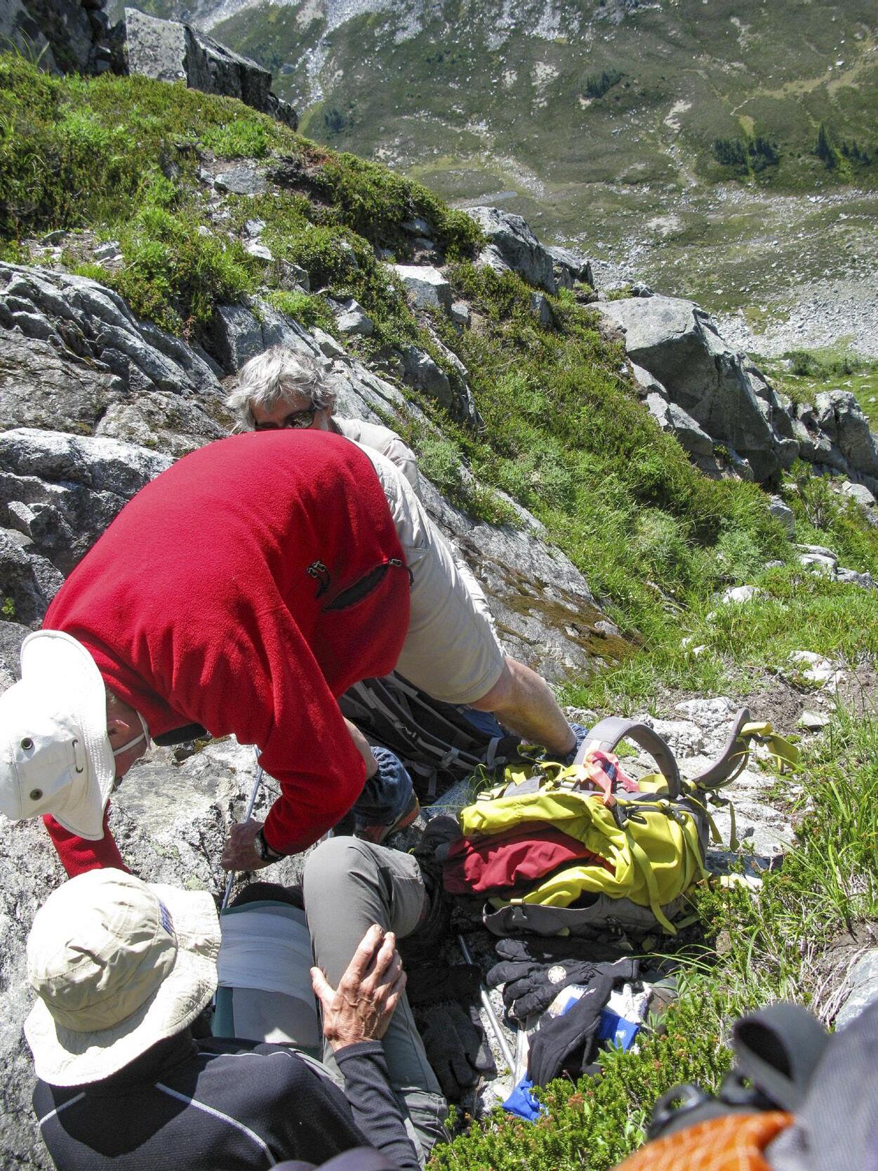
BC MAG • 51
Balanced in a shallow fold on the slope, the first two on the scene anchored the patient to the rock and immobilized her leg with a splint.
Russ Moir
Concerned that this is a serious accident, I push the emergency “911” button on my SPOT (Satellite Personal Tracker).
CALLING FOR OUTSIDE HELP
Mike and Rob stay with her while I run down to the camp. The place is deserted. The satellite phone is the next step. I hope like heck it works after lying around for two weeks, unused. It powers up OK, and after a minute, it registers a satellite. I scan the camp emergency protocol, and call number one on the list—the Pemberton RCMP. A teenage voice answers “Hello?”
“Is this the Pemberton RCMP?” “Hello?”
This goes on for about a minute as I debate whether I have a wrong number or not. Finally, the teenage voice admits this is, indeed, the RCMP.
“I want to report an accident.” “Hello?”
Mercifully, the phone goes dead as the satellite drops the call. I phone again. This time, I get a dispatcher who actu-
ally knows what an emergency is. But when I explain I am near Lillooet Lake, he quickly advises me to call the Lillooet Ambulance Service. I’m halfway through explaining that Lillooet Lake is nowhere near Lillooet, and that a road ambulance is not what I need, when the phone drops me again.
The third time, I get someone who understands I’m in the mountains. I read off the location of the accident (which I’ve set as a waypoint in my GPS). The dispatcher asks if this is the same accident as one already reported through the SPOT network. Bingo! We have connection. But a minute later, while I’m describing the patient’s condition, the satellite drops me again.
And the phone battery is flat. I replace it with the second (and only spare) battery and hope it lasts. I call again. A new dispatcher answers. After a minute of explanation, he’s up to speed and advises they have contacted the Pemberton SAR service. I switch off, update Mike and Rob by radio, and wait. Half an
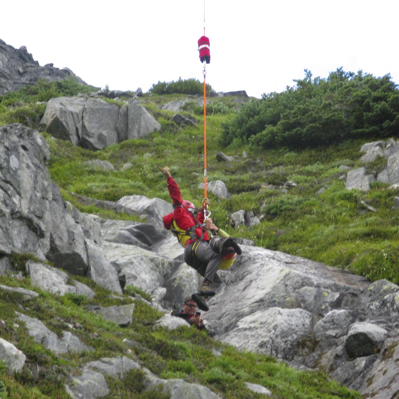
hour later I call back and learn the SAR guys are on their way.
At around 3:00 pm, a helicopter comes up the valley, slows down, and then moves purposefully across the steep heather slope, obviously looking for the rescue site. Once they’ve located Jennifer, Mike and Rob, they come in low over camp and settle on a level patch of grass next to the lake. Five SAR techs in various shades of red emerge, along with numerous bags of equipment. The pilot starts removing all the chopper doors, while two of the guys dress in techie gear. They and the helicopter then head back to the accident site, while the remainder of the SAR techs hang around, sorting equipment.
From camp, we watch the helicopter place a skid on top of a rock bluff. The two techs and a pile of gear jump out. The chopper pulls clear and the two figures scamper across the steep terrain toward the patient. The helicopter disappears towards Pemberton where, we are told by the SAR techs at camp, they need another SAR tech and a long line. Meanwhile, Jennifer is stabilized in a proper leg splint by a British-trained, exIraq War doctor and his assistant. By the time she’s ready to be moved, the helicopter is back. At camp, the long-line is unpacked and coiled out. One of the techs dons a spacey body harness. The helicopter lifts vertically and the orange line uncoils off the grass. He clips into an eye on the end of the line with a gated karabiner and rises into the sky. I’m glad it’s him and not me, no matter what the breaking strain on that karabiner is.

The chopper, despite strong wind gusts, places the SAR tech right in the gully where Jennifer is. We can’t quite see from camp what’s going on, but he must have unclipped because the helicopter pulls away, returning a minute or two later to hover again. Then it rises, this time with the tech and Jennifer attached to the end of the line. There’s no stretcher. I hope Jennifer has her eyes firmly closed. The two of them stream
With the arrival of the long-line SAR tech, he and the patient were hoisted off the slope by the helicopter.
52 • BC MAG
Russ Moir

After being checked over and warmly dressed, the patient is moved to the waiting helicopter, now with its doors reattached.
out behind the helicopter as it turns and comes back to the landing ground in a graceful arc, its cargo far behind and below. Once hovering, it lowers slowly toward the ground until, light as thistledown, the tech’s feet are on the ground. Jennifer is caught by two supporters, and the line is unhooked. She’s safe.
When I get close, it’s clear she’s in shock, whether from the injury or that ride, we’ll never know. We slip insulation under her and cover her with blankets. The day has turned dark and cloudy, and her teeth are chattering.
The helicopter lands and there’s a flurry of activity as gear is sorted, techs change out of harnesses and doors are replaced on the chopper. Jennifer is carried to the machine and made comfortable. Mike and Rob have hiked down with the two attending techs, and Mike quickly packs his gear and chooses a few bags to take with him. Around 6:00 pm, the blades start to whirl again, and they, together with two SAR techs, depart for Pemberton, Whistler Hospital, and finally Vancouver General, where it transpires Jennifer has a broken left femur. I cannot imagine the pain she must have endured during those long hours of waiting.
And that was only Monday. Five more days to go on Week Three.
EPILOGUE
For privacy reasons, some of the names and details have been changed.
Credit must be given to the many SAR doctors, pilots and technicians who volunteer their time to help those in need in the backcountry. They give up a lot for training, searches and rescues, often over weekends, in foul weather, and routinely in danger. Their service is greatly appreciated and very underfunded by governments. Much relies on volunteer efforts and public donations. You can help by going to bcsara.com/donate/ to support this worthy cause.
To learn more about the Alpine Club of Canada and your nearest section, visit alpineclubofcanada.ca.
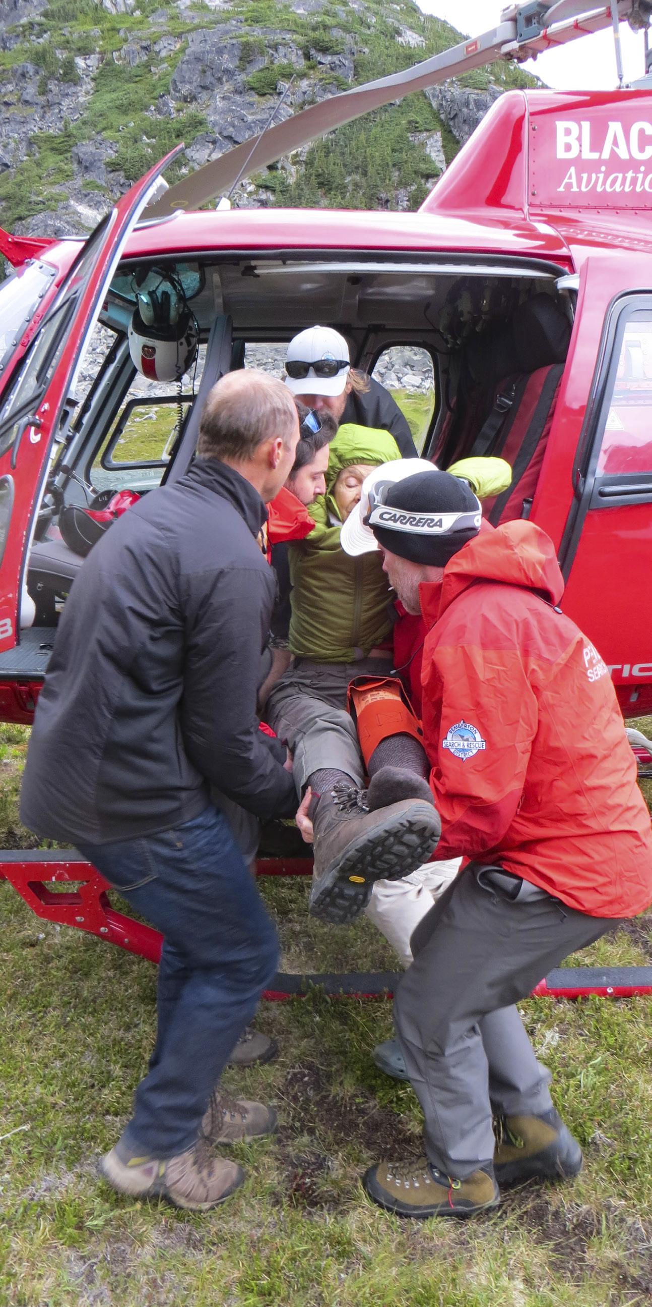
BC MAG • 53
Phillipa Hudson
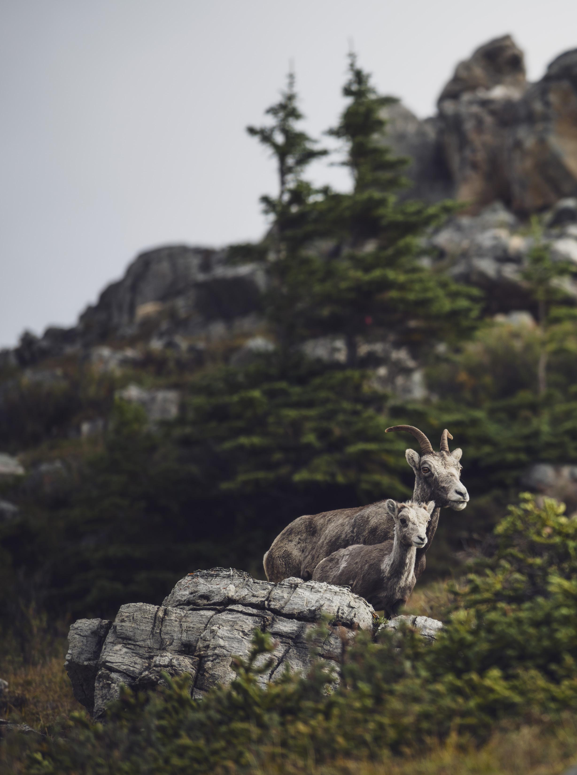
Conservation Conundrum
In the mountains of Western Canada, a deadly bacterium is killing wild sheep
BY ANDREW FINDLAY
Northern BC Tourism/Andrew Strain
ON A BRISK winter day in February 2019, then-provincial wildlife veterinarian Helen Schwantje and Chris Proctor, senior wildlife biologist with the province, travelled with a team of volunteers and a film crew into the remote valley of Ward Creek, a tributary of the Fraser River 60 kilometres north of Lillooet.
Grey clouds hung in the sky. A light dusting of snow skirted the mountain tops. In the monochromatic tan grasses of the valley bottom, the team huddled around a bighorn ram. Moments before, a sharpshooter in a helicopter had snared the animal in a net using a modified shotgun. The pilot landed. They quicky covered the sheep’s eyes to calm it, then attached the animal to a long line and slung it back to a field station. They worked methodically, taking blood, fecal and hair samples, and nasal swabs. After the sampling was done, they sedated the animal before using a PCR (polymerase chain reaction) kit to test the swabs for Mycoplasma ovipneumoniae (M.ovi), a deadly bacterium. Then they waited tensely for the results. Domestic sheep and goats commonly carry the bacterium but have a natural resistance to it, minimizing symptoms to mostly weight loss. Among wild sheep however, M.ovi is a killer. It results in often fatal pneumonia that can wipe out 80 percent or more of a herd in a matter of months. Along with habitat loss, the bacterium is widely considered one of the gravest threats facing wild sheep, especially Rocky Mountain and California bighorns. Yet up until recently, few outside of the
Thinhorned Dall sheep are easily recognizable by their nearly allwhite colour.
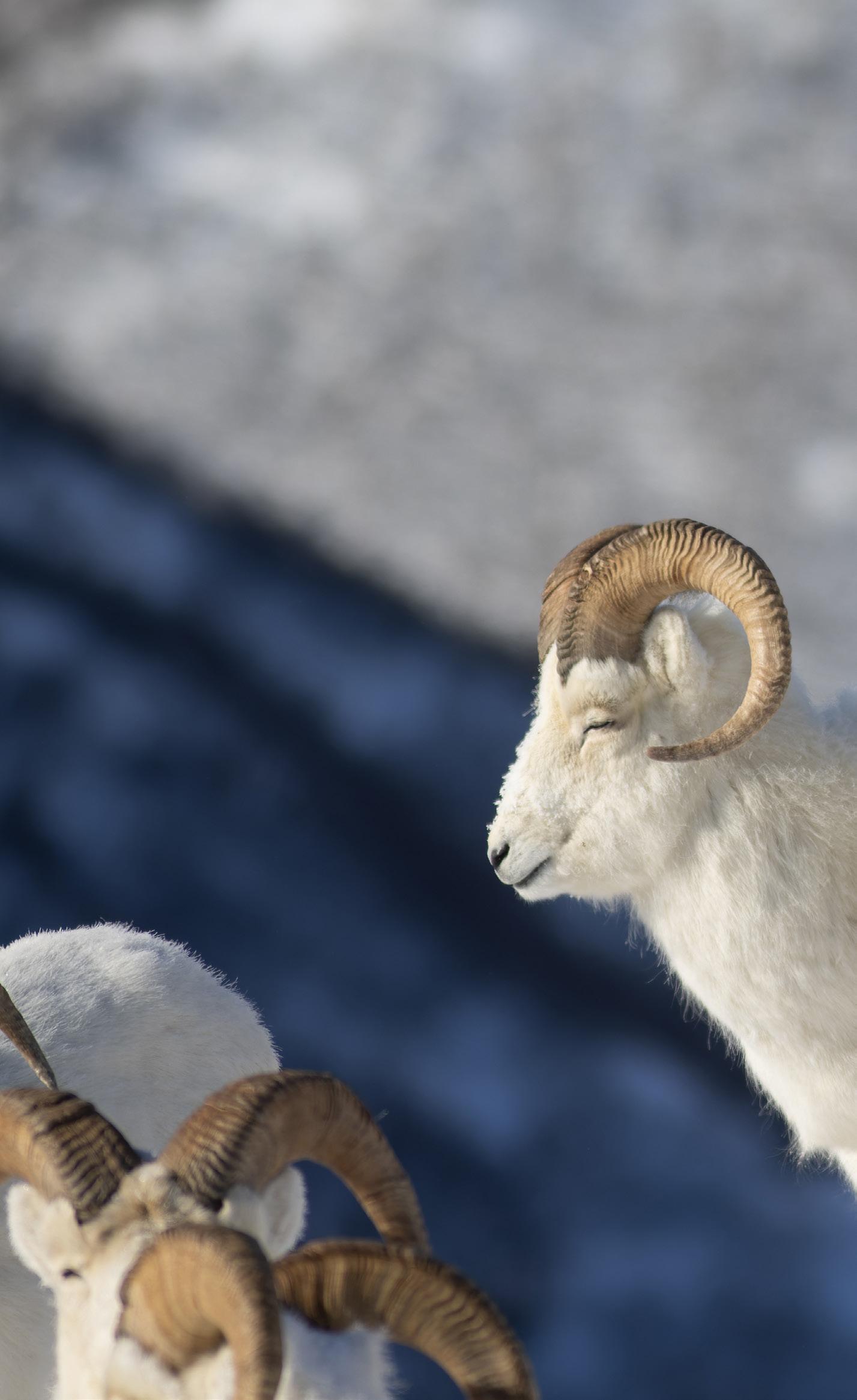
scientific and hunting community had ever heard of M.ovi.
Schwantje exudes a comfortable authority, someone who could just as easily hold her own in a locker room full of hockey jocks as she could in front of the lectern at an academic conference. But there wasn’t much chatter as the team went about its work. In fact, there was a solemn gravity to the proceedings that was palpable.
“We knew we were going to have to kill some animals,” Schwantje says.
Any sheep that tested positive was euthanized on the spot; it was a case of sacrificing the individual to protect the herd.
Wild sheep have roamed the mountains of North America for a long time. It’s believed they first colonized North America during the Pleistocene by crossing the Bering land bridge some
56 • BC MAG
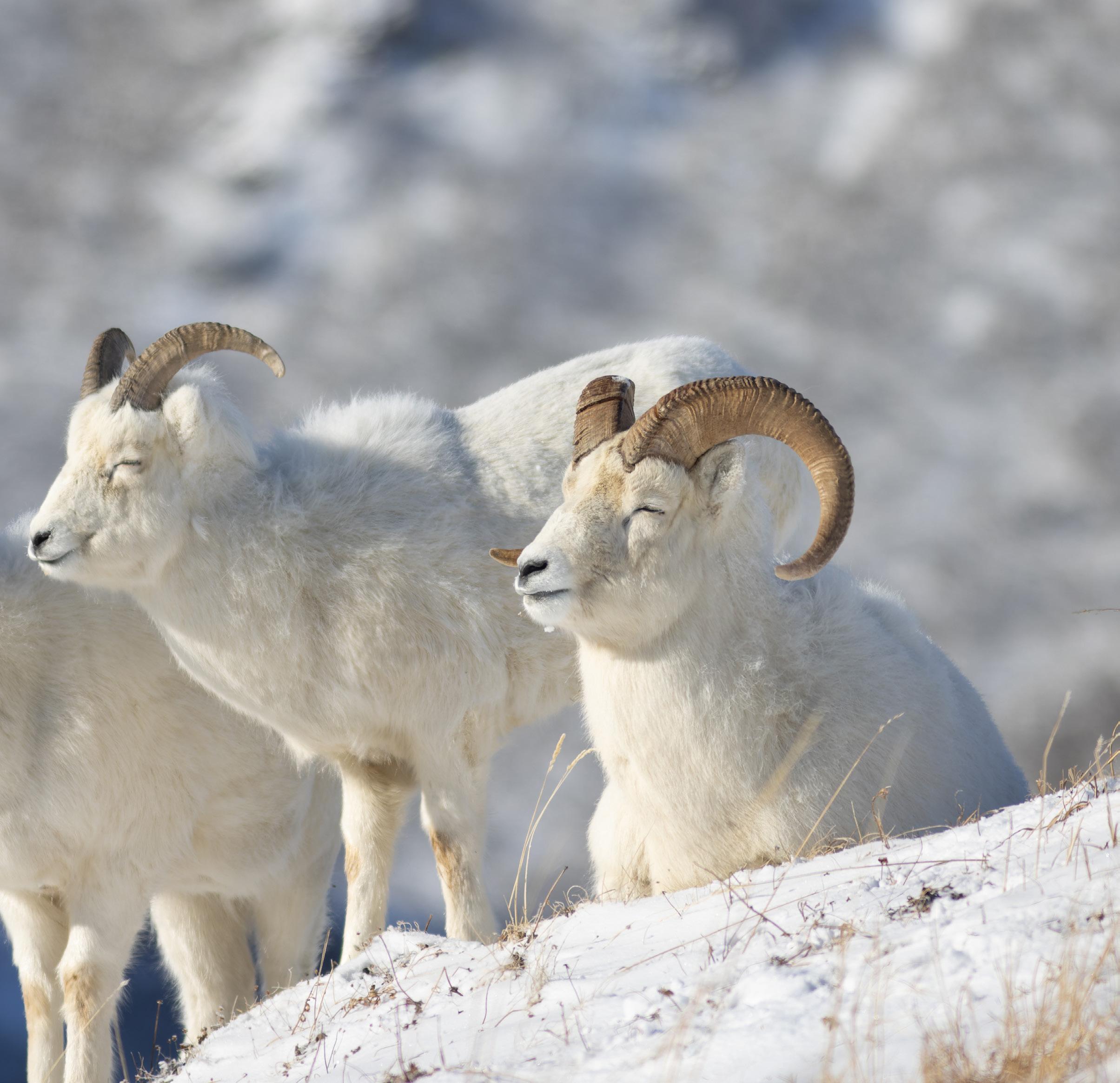
750,000 years ago. Large carnivores, that went extinct more than 10,000 years ago, like the short-faced bear, dire wolf and American cheetah, kept sheep numbers low. Afterward, they proliferated throughout the montane.
In Canada there are two species of mountain sheep, thinhorns and bighorns, each with two subspecies. Thinhorn sheep include Dall’s and Stone’s sheep and are found in northern BC,
Yukon and the Northwest Territories. Bighorns include an estimated 3,600 California bighorn that live in the arid ranges of south-central BC and the larger Rocky Mountain bighorn, which number roughly 3,000 in the Canadian Rockies. California and Rocky Mountain bighorns belong to meta-population of 18,000 animals in BC, Alberta and Montana. In BC they are blue-listed, which means they are
considered at risk.
Scientists have known for almost a century that pneumonia was infecting wild sheep in North America and resulting in mass die-offs. However, it’s taken much longer to understand the bacterium and the mechanism of infection.
Schwantje, who grew up in Saanich in a family of six kids and had what she describes as a “free-spirited childhood,”
BC MAG • 57
Mark Lindberg
has been one of the people leading the fight to find a fix for M.ovi. In fact, her graduate studies focused on M.ovi. Bighorn sheep have charisma, Schwantje says, and that made it relatively easy to get funding for her grad studies and research.
“A lot of people may never actually see bighorn sheep in the wild but they can’t imagine the mountains without them,” she says. “Back in the early 1980s the hypotheses around pneumoniae were evolving. For most bighorn pneumonia events, it was thought to be driven by a family of, at times, quite virulent respiratory bacteria,” Schwantje says, “no one considered Mycoplasmas (a genus of bacteria that lack a cell wall around their cell membrane), but it was impossible to test for them.”
If public support and funding for sheep conservation and research seemed relatively easy to come by, the key to mitigating the threat of M.ovi has proven much more difficult and complicated.
One fact was certain, protecting wild sheep from this disease would require building bridges with the farming community. Sheep farmers have lived with M.ovi-infected sheep for decades, many without even having even heard of the disease. Besides some stunted growth and a rare fatality in the flock, for the most part it was farming as usual. All good, except that wild sheep are naturally curious about their domestic kin, especially during the fall rut when frisky rams have been known to mingle and even mate with free ranging domestic ewes. One sneeze from a M.ovi carrying livestock is enough to infect one wild sheep and endanger an entire herd. The challenge was getting the message out to farmers in a way that didn’t sound like it was going to add costs and hassles to their operation.
In 1999, M.ovi-caused a mass bighorn sheep die-off at Vaseux Lake, an important ecological hotspot north of Oliver in the heavily agriculturalized Okanagan Valley. Four years later,
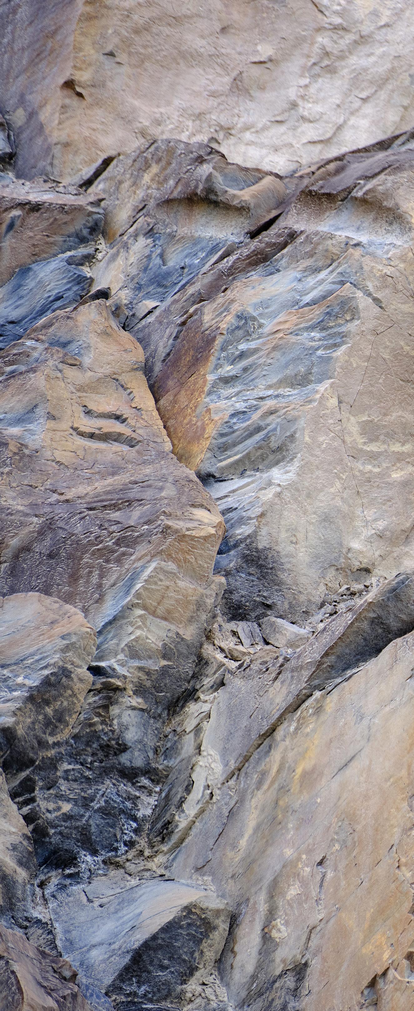
58 • BC MAG
Rocky Mountain bighorn sheep blend in to their environment, making it difficult to spot them from a distance.
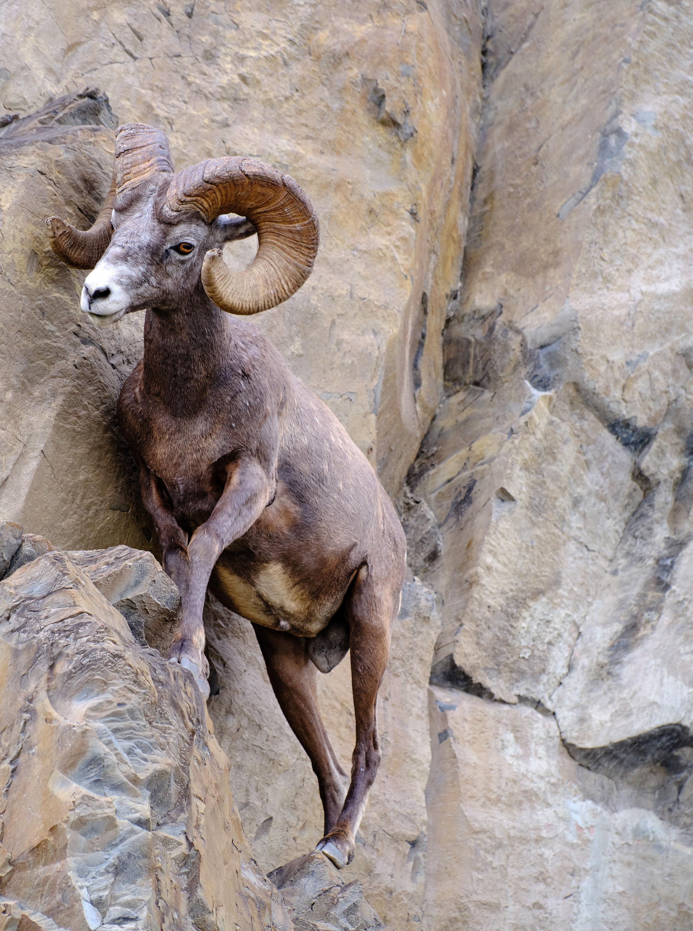 Jorge Moro
the disease decimated 80 percent of the 100-strong Chasm Creek herd, north of Clinton on Highway 97. These events galvanized wild sheep advocates and led to the formation of the Sheep Separation Program. The non-profit’s name said it all—at first, the goal was to reach out to sheep farmers located in high-risk areas where contact with wild sheep was an issue and help fund fencing to keep domestic flock contained, especially during fall rut season. It sounded good on paper, but there were problems with this strategy, says Jeremy Ayotte, who manages the program. Fencing is expensive, and some farmers gladly accepted the free fencing, but then either moved on to another type of farming or got out of farming altogether.
“Sheep are highly valued wildlife. It’s not hard to get funding,” Ayotte says, echoing Helen Schwantje’s words, “But the fencing program wasn’t working out. It was a waste of philanthropic money.”
It’s the reason the program has recalibrated to focus more on farmer education and facilitating more M.ovi testing of domestic sheep.
“Through this effort, we are building up our understanding of the prevalence of M.ovi on BC farms and helping to develop what may one day be part of provincial policy for testing of domestic sheep in high-risk areas,” Ayotte says.
Two years ago, a loose alliance of government biologists, the Wild Sheep Society of BC, as well as sheep and goat farmers, sent a letter to the provincial government asking for more regulation and testing of farms to stop the spread of M.ovi
Last June, the Okanagan Nation Alliance lent its voice to the issue and formally requested that the province implement “legislation that will provide for effective means of separation between wild and domestic sheep and goats to ensure healthy wild sheep populations and the sustainability of
Dawson Falls, Wells Gray Park.
sustenance, societal and ceremonial opportunities wild sheep provide, for generations to come.”
So far, there’s been no action on the legislation front. In an emailed response, a spokesperson for the Ministry of Agriculture and Food Security said that the “BC government continues to work with wildlife and farming partners on ideas and measures that support the health of both wild and farmed sheep but is not planning on implementing geographic restrictions or mandatory testing for domestic sheep at this time.”
WHEN IT COMES to beating M.ovi, the hunter-supported and conservation- focused Wild Sheep Society has been a stalwart ally for government sci-
If support for conservation is easy to come by, mitigating the threat is much more complicated
entists like Helen Schwantje and Chris Proctor. The organization has been willing to put dollars and volunteer time behind research and testing field missions. In fact, it was founded in the 1990s in direct response to the decline of the Fraser River meta population of California bighorns, according to the society’s executive director Kyle Stelter.
The M.ovi testing and management program that began in Ward Creek in 2019 has morphed into a 10-year management project funded to the tune of $1.5 million by Wild Sheep Society members, the Abbotsford Fish and Game Club, and other donors. It’s not just Canadians getting behind the proj -
Spahat Falls.
ect. American conservationists have a keen interest in BC, given that during the 1990s wild sheep from the Fraser River region were translocated to help reintroduce and shore up nearly extirpated populations in Nevada, North Dakota, Utah and Washington (Stelter estimates the Montana-based Wild Sheep Foundation has donated $5 million to BC conservation efforts over the past three decades.)
Besides testing and culling sick animals, the Wild Sheep Society has two other prongs in its three-pronged bighorn conservation strategy—good old public awareness and advocacy amongst domestic sheep producers, and diligently pushing on the public policy front. Stelter says the best-case scenario would see BC following the lead of the Yukon government that has regulated farm exclusion zones where there is high probability of interaction between wild and domestic herds. But it’s not the case of apples and apples. Yukon is sparely populated and has very few sheep producers. It’s a different story in BC. Stelter admits discussions with the government are slow going, especially with an agriculture ministry that has to balance the pressures of supporting farmers and food security with a conservation challenge like M.ovi.
“We’ve been talking about this for decades. We’re not against sheep farming and we believe there’s room for both on the landscape, but we have good conversations with government, and then it goes nowhere,” he says.
A big challenge is identifying where all the domestic sheep are in BC; and they’re not all found on commercial farms. According to Statistics Canada, the province is home to approximately 59,000 domestic sheep and 14,000 goats, which also can carry M.ovi. People raise them for all kinds of reasons, including meat, fibre and milk production, and for lawn and weed control. Others keep them as pets and or to train sheepherding dogs.
60 • BC MAG
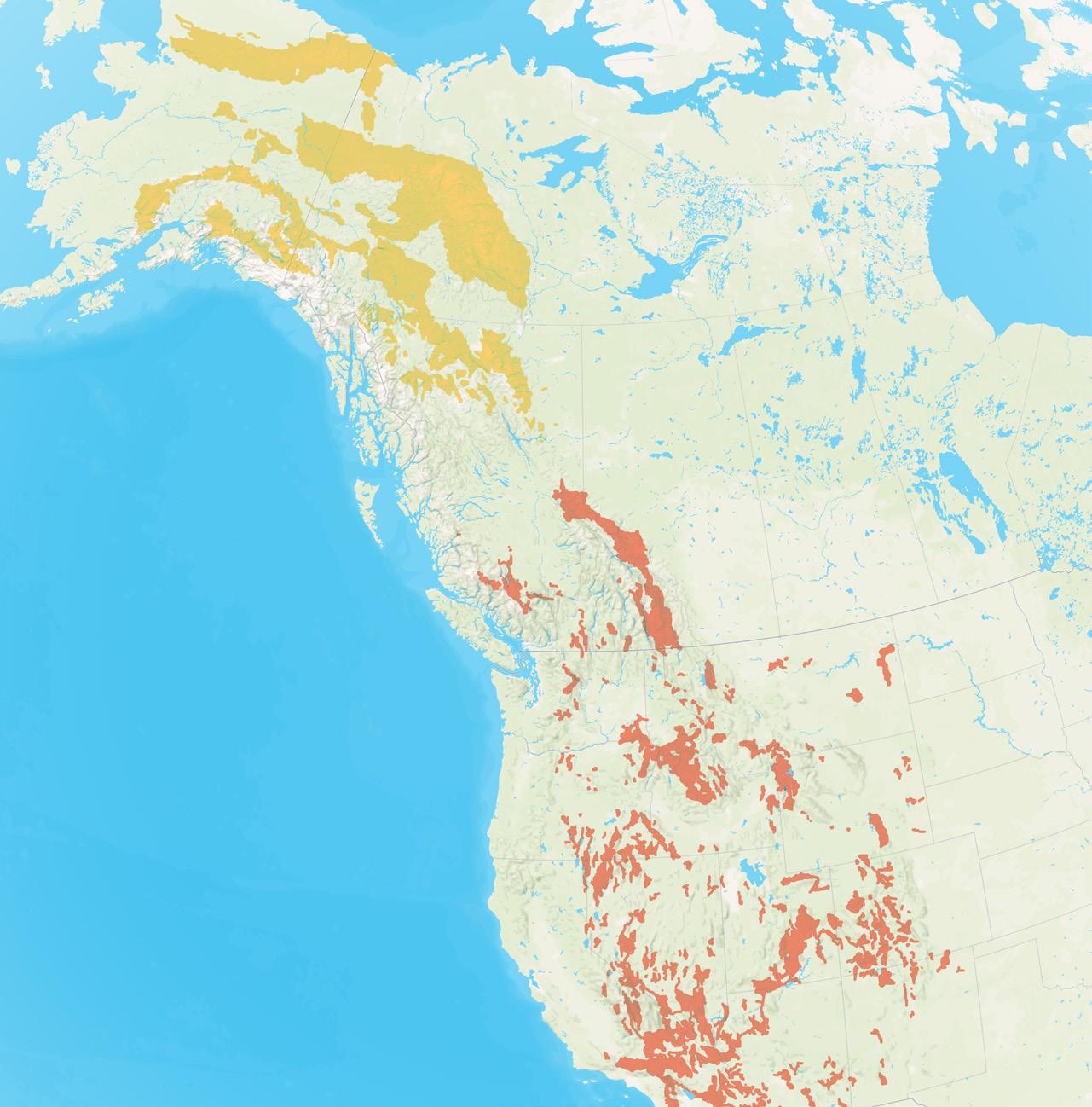
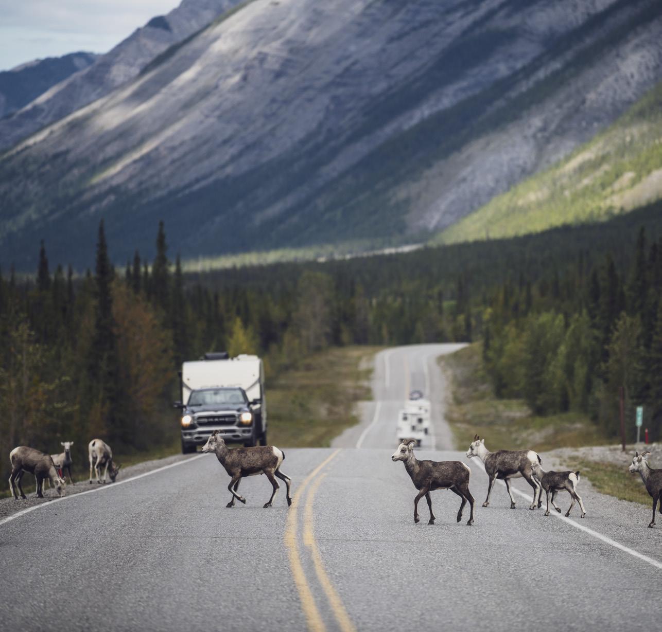
“Some people have a couple of sheep as pets, or to keep their grass under control. You can’t just go onto someone’s private property and tell them what to do or that we’re going to have to shoot their pet” he says, bluntly, “but all it takes is one sheep to get infected with M.ovi and it can wipe out a herd.”
The big fear is that this disease could spread to thinhorn sheep, BC’s other endemic mountain sheep species. So far thinhorns have been largely spared the ravages of M.ovi, but it’s more a function of luck and the fact that they occupy a much less densely humanpopulated habitat.
In the absence of a comprehensive management plan for sheep farms, having a M.ovi battling ally on the inside has proven to be a big ace in the hole. On a fall day, Jenn Bowes is sheering sheep at Riverside Farm in the Columbia Valley. In 2019, Bowes and her partner Trevor Hem pulled up stakes near Dawson Creek, where Bowes said their farm had become “surrounded by gas wells.” They trucked their flock south to a new property near Brisco in the Columbia Valley. It was an expensive move, but worth it. Being ecologically minded, Bowes called the Environmental Farm Planner in the Kootenays to introduce themselves — that’s when she learned about M.ovi. She had never heard of the disease, but she knew of a resident herd of wild sheep in Radium Hot Springs just south of her farm. At the urging of the farm planner, her next call was to the Wild Sheep Society of BC, which led her to Schwantje and Ayotte of the Sheep Separation Program. A few months later, Schwantje showed up at Riverside Farm in a pickup truck loaded with testing equipment.
“Things kind of snowballed from there,” Bowes says.
IN THE FALL of 2019, 15 out of a flock of 75 domestic sheep at Riverside Farm tested positive for M.ovi. Bowes has managed to bring down the rate of infection and raise an overall healthier flock. To do so they used a mix of tactics culling particularly sick ani-
BC MAG • 61
Thinhorn sheep range
Bighorn sheep range
Northern BC Tourism/Andrew Strain
Stone's sheep cross the Alaska Highway in Muncho Lake Provincial Park, Northern BC.
mals, separating infected animals from healthy ones and trying another tact with Schwantje—treating them with antibiotics.
Bowes was convinced that it was the right thing to do as a farmer. Not long after, she dreamed up an ingenious way to help fellow sheep farmers deal with unmerchantable wool while incentivizing them to take part in “free and confidential” M.ovi testing.
Wool can be shredded and compressed into a pellet, then used as an organic fertilizer and nitrogen fixer. So, Bowes bought a pelletizer and started offering to pay farmers 50 cents per pound for otherwise waste wool if they agreed to have their sheep tested. What started with 25
farms quickly gathered momentum.
“It’s exceeded my expectations. I thought I’d get a lot more resistance and I never thought that I’d be working on conservation as much as I am,” Bowes says.
Her pioneering efforts have led to new opportunities to expand the valueadded wool incentive for M.ovi testing.
A grant from The Columbia Valley Local Conservation Fund will support continued testing and monitoring of domestic sheep at farms between Spillimacheen and Canal Flats. At the same time, the Habitat Conservation Trust Foundation funded efforts to expand the program elsewhere in the province, in particular Peace River country that
Bowes says is a hub of sheep farming, transport and wool collection.
THOUGH DOMESTIC SHEEP have natural resistance to M.ovi, they’re not entirely immune. Bowes knows from personal experience. In her first year of M.ovi testing, her barn was full off coughing sheep and the wool quality suffered.
“There’s much less sneezing in the barn, the animals are healthier, and the wool quality is higher. I would never wish M.ovi on any producer. It’s a tedious journey to go through to try and get rid of it,” she admits.
But she says it’s worth it.
“I grew up in Edmonton and remem-
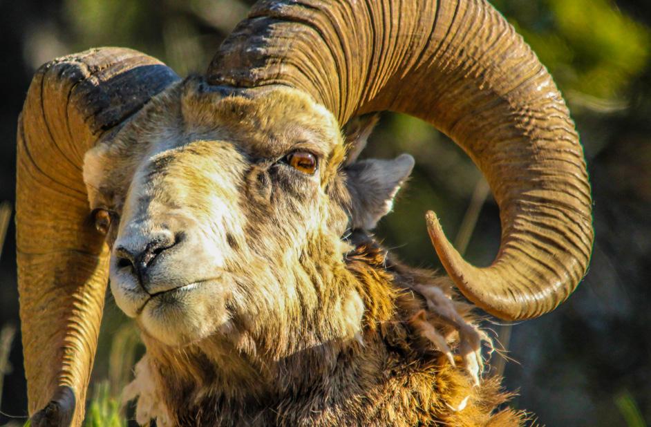
Rocky Mountain Sheep
The Rocky Mountain bighorn sheep is the largest wild sheep inhabiting North America. A large ram may weigh over 300 pounds and stand over 42 inches tall at the shoulder. They are generally a dark brown to gray/brown color with a white rump patch, muzzle and back of legs. Their coats may appear considerably lighter in spring before the winter coat is shed, revealing the darker summer coat beneath. Rams have horns that are massive and tightly curled close to the face. A ewe will have smaller, shorter horns that curve only slightly. Ewes typically weigh 125-150 pounds.
BC Range:
The western flanks of the southern Rocky Mountains.
Canada Population: Approx 3,000
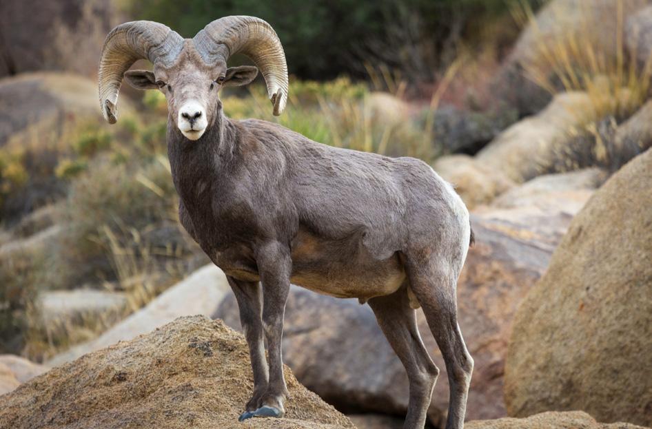
California Sheep
California and Rocky Mountain bighorns look similar, but the California race is slightly darker in colour, and its rams have horns that flare outward more than those of Rocky Mountain rams. They are commonly found in areas with large expanses of open southerly and westerly-facing grassland slopes, parkland forest and canyons.
BC Range:
The dry areas east of the Cascade Mountains and west of the Selkirk and Rocky Mountains in southern central BC.
BC Population: Approx 3,600
62 • BC MAG
BIGHORN SHEEP
ber seeing wild sheep when we were driving to Jasper. I’m like a lot of people who can’t imagine the mountains without them.”
It’s a familiar sentiment. As a conservation issue, M.ovi is gaining momentum thanks to dedicated volunteers and government biologists. The awardwinning conservation film, Transmission, is helping as well. Produced by BC-based Filter Studios, the film is a moving, inside look at M.ovi. It was released in early 2022 to wide acclaim, including official selection at the 2022 Banff Mountain Film Festival, and earning Best Environmental Film at the Echo Mountain Film Festival in Macedonia, among other accolades.
THERE’S SOME GOOD news from a conservation biology standpoint as well. Up in the rugged highlands of the Fraser River in southwestern BC, California bighorns are doing better. The tough love of the testing and culling program has netted positive results. Provincial government biologist Chris Proctor recently completed a survey of the herd and found survival rates have gone through the roof. For at least two years prior to their first treatment in 2019, the Ward Creek herd had a zero percent lamb survival rate. That’s a death sentence for any sub-population of mammals. Today, lamb survival is more than 50 percent and that’s huge in terms of
THINHORN SHEEP
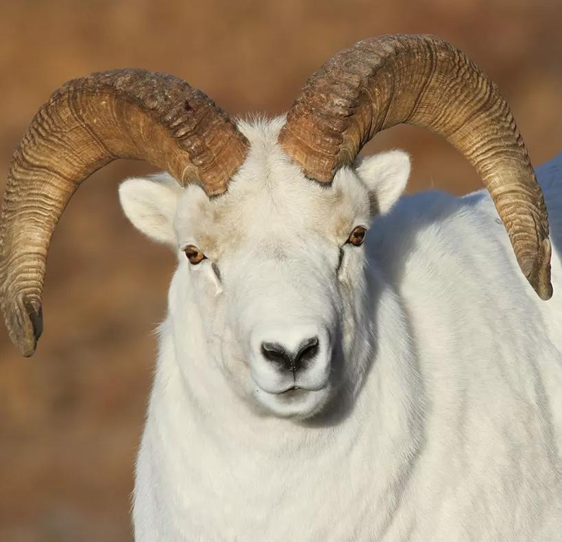
Dall Sheep
The most striking feature of the Dall sheep is their nearly all white colour. Their horns are longer, thinner and yellower when compared to bighorn sheep. Their horns also tend to flare outward, away from the face. Ewes’ horns are usually under 12 inches.
Range:
Dall sheep primarily inhabit Alaska and the Yukon Territory but are also found in BC and the Northwest Territories.
BC Population: Approx 300-400
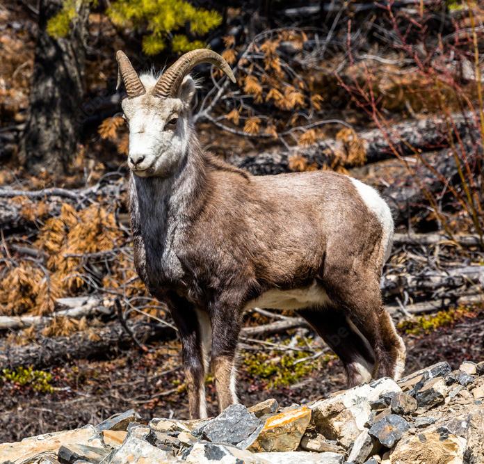
Stone Sheep
The stone sheep is another “thinhorn” sheep. There are many colour phases of stone sheep, from an almost-black charcoal to a light grey/brown and “salt and pepper.” They typically have lighter faces, a white rump patch, and white on the backs of their legs. Their horns are similar to those of Dall sheep.
Range:
Stone sheep are primarily found in southern Yukon Territory and northern BC.
BC Population: Approx 12,000
herd viability. Despite the good news, Proctor doesn’t see it as a long-term solution.
“Testing wild sheep is time consuming and expensive,” he says from his office in Kamloops. “The only real longterm solution is to keep sheep farms away from known wild sheep habitat. It wouldn’t be that hard. Wild sheep don’t live everywhere in the province.”
That’s why, for now, the solution to M.ovi remains an elusive though far from impossible conservation goal. Wild sheep are to the mountains of Western Canada what Orcas are to the Pacific Northwest Coast—iconic to the point that it’s hard to imagine the ecosystem without them.
MOUNTAIN GOATS
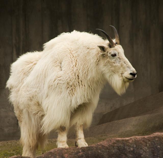
Mountain Goats
BC is the home for approximately half of the world’s mountain goat population. Mountain goats are creamy-white or yellowish-white. When compared to the horns of sheep, mountain goats’ horns are shorter, thinner, sharper and swept backward, not curling. They also have "pixie like" ears and can have a beard under their chin.
BC Range:
Goats are present in most mountain ranges throughout BC, except the coastal islands.
BC Population: 40,000 to 65,000
BC MAG • 63
bighorn.org
Source:
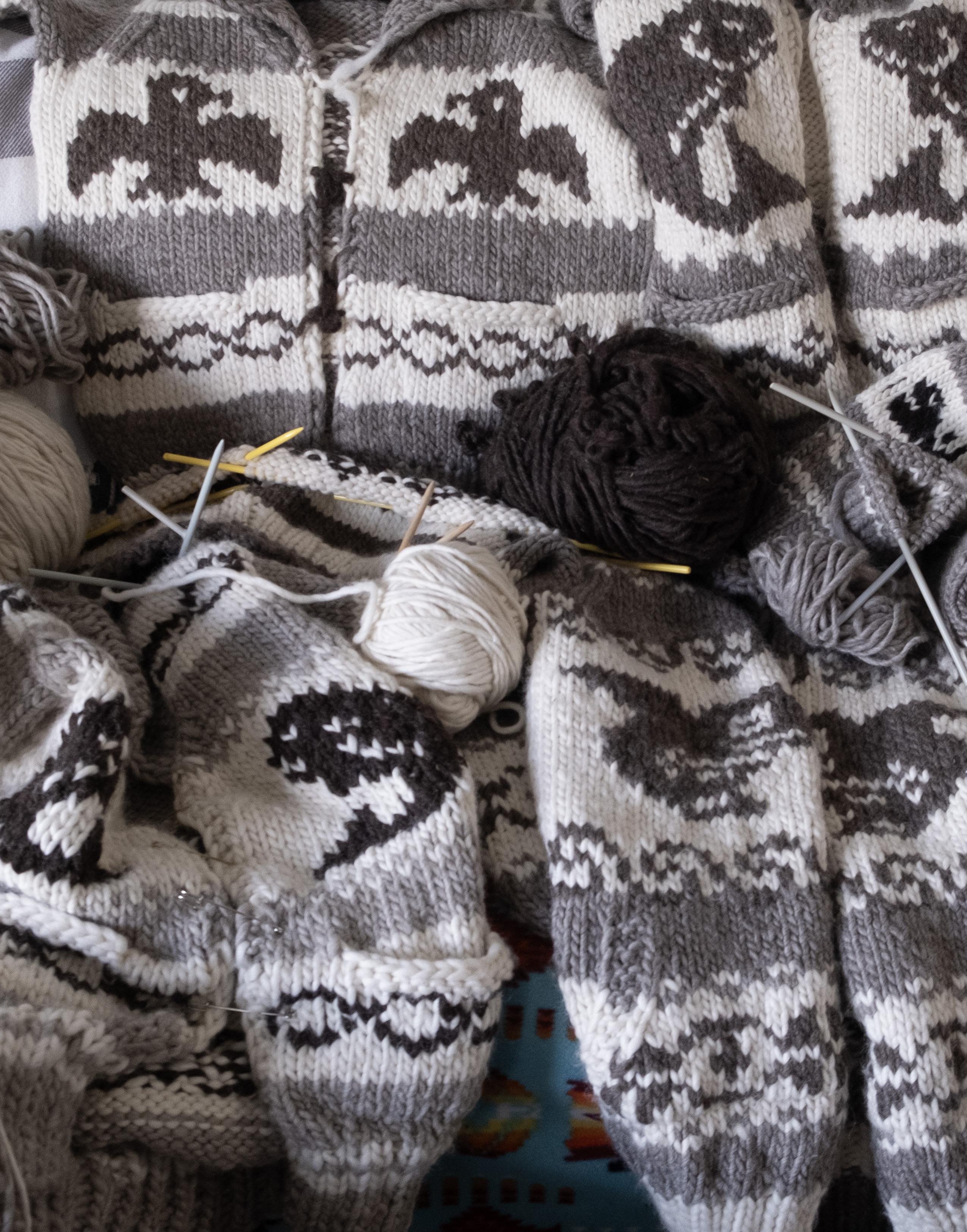
64 • BC MAG
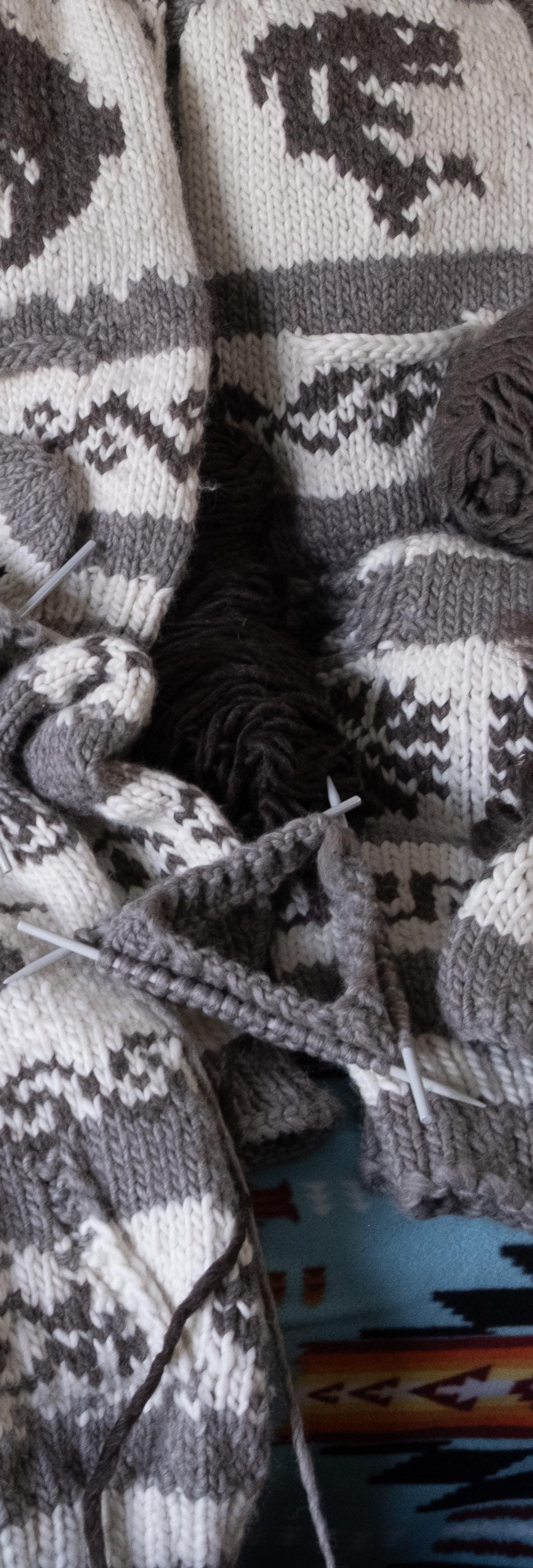
THE COWICHAN SWEATER LEGACY
A NEW FILM SHINES A SPOTLIGHT ON THE COWICHAN SWEATER AND ITS HISTORY
BY
BY JANE MUNDY
GABRIEL UNDERWOOD
There’s a
lot
more than wool that makes up a Cowichan sweater. It is an iconic symbol of the West Coast, but cultural appropriation and the exploitation of Cowichan knitters has made the craft unsustainable for many artisans. Indigenous filmmaker, award-winning writer and director Mary Galloway’s recent documentary, The Cowichan Sweater: Our Knitted Legacy, is set to change that. Galloway’s role in the film is serendipitous. Executive producer Wush’q Ronald Rice of the Cowichan Tribes wanted to make a documentary to support the knitting community and wanted a Cowichan film director—ostensibly for a commercial. He found Galloway on Instagram. “Ron didn’t know my background so during my interview I showed him a photograph of my grandfather wearing his Cowichan sweater,” says Galloway, “when he realized who I was, it was meant to be.” Her grandfather happened to be Dennis Alphonse, who passed
BC MAG • 65
PHOTOS BY
away in 2004 after serving as chief and council of the Cowichan Indian band for more than 40 years.
That realization snowballed into a bigger project. “Ron passed the creative reins to me and I pulled on them,” says Galloway. Along with 10 Indigenous crew members—most of whom are Cowichan—Galloway spent 15 days interviewing more than 20 community expert knitters, all members from the Coast Salish Territory, including the knitter who made her grandfather’s replica sweater—his actual sweater was made by her great-grandma.
“My producer Tiffany Joseph and I got the crew together and I discovered that many of them, including the first AD and caterer, are distant relations,” says Galloway. “We want to protect our Cowichan story and people, we wanted to make sure our elders were comfy with us in their homes. We are shepherds of their stories and want them to know how important their stories are.”
The project was also morphing into a personal story for Galloway. She wanted to know more about her grandfather who passed two decades ago, when she was just 13 years old. By having a replica sweater made for her in his honour, she got to know more about him, about how well-loved and respected he was. During filming, she also learned about how the sweaters originated, hardships of the Cowichan community, and a whole lot more.
In the film, expert knitter Marlene Tommy tells Galloway that her dad made a barbed wire fence so her mum could hang clean wool and not have it blow away. Salish knitter May Sam remembers how her aunties had to boil water over an open fire outside. “Sometimes, their skirts got scorched and then they spun wool that had to be real tight, nice and strong.” Maureen Tommy also remembers Galloway’s grandfather. “Under Dennis Alphonse’s leadership, he ensured homes were built for single moms and most of them knitted. We
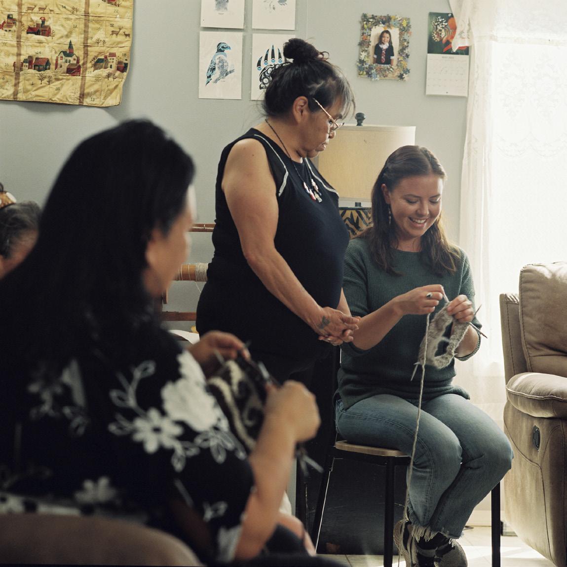
During the making of Mary Galloway’s recent documentary, she spent 15 days interviewing more than 20 expert knitters.
all got along, all us children had a safe house to live in,” she told Galloway. “He was an amazing chief; he was humble and took care of our community.”
Sarah Modeste’s grandmother taught her how to knit and how to follow a pattern. “Counting is second nature and you can talk at the same time. Get to know the feeling of white and grey [coloured wool]. My grandmother said watch and learn. Knitting to me means a part of life—if she didn’t know how to knit there would be nothing to eat in the house. She sold a sweater and next day groceries were on the table. I asked Mrs.
Hill at the post office if she would sell a sweater I made. She said, ‘Nobody wants Siwash (a racial slur) sweaters’. I said it is Cowichan. I brought in a pullover, she paid me $8 and hung it up. Next day she said make me another one. But there is a time limit—it takes a long time.”
Joni Olsen, another knitter, said these women “knitted while the rest of your life went on around you. They never missed a stitch.”
Galloway says these knitters have perfected their craft over the years and passed their knowledge and skill on from generation to generation. Genuine Cowichan sweaters are waterproof; they will keep you warm and they last for decades if you take care of them. “They each are very unique and no two sweaters are alike, and that’s the beauty of them. They’re genuinely works of art,” says Galloway. But genuine is the key word.
66 • BC MAG
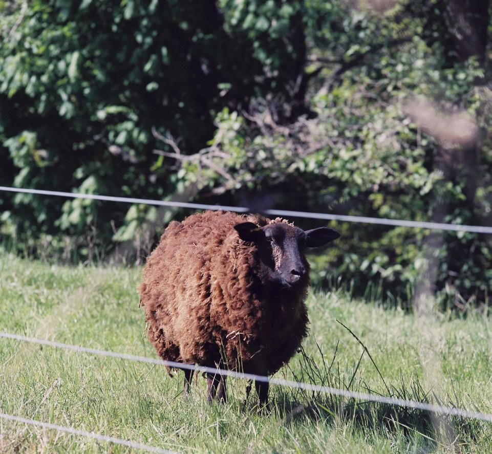
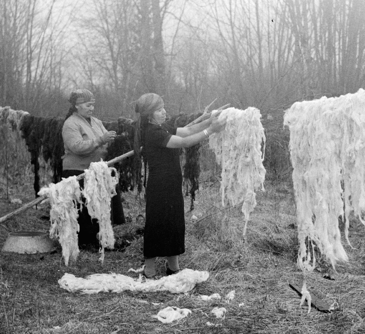
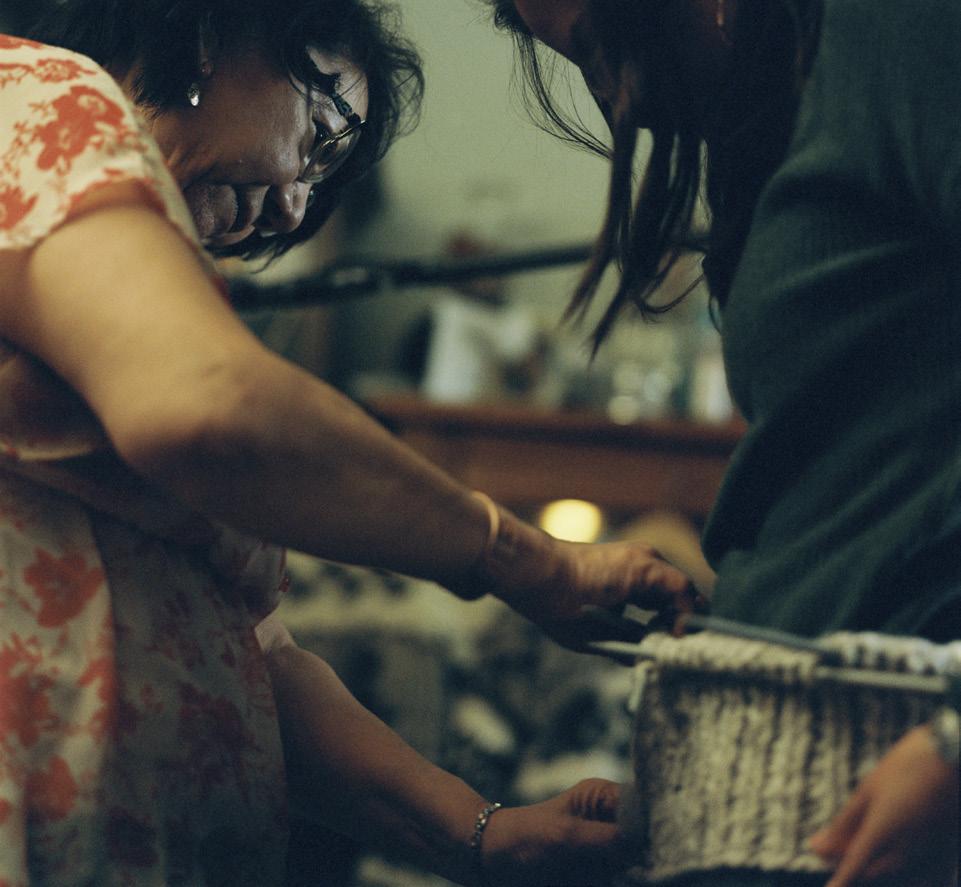
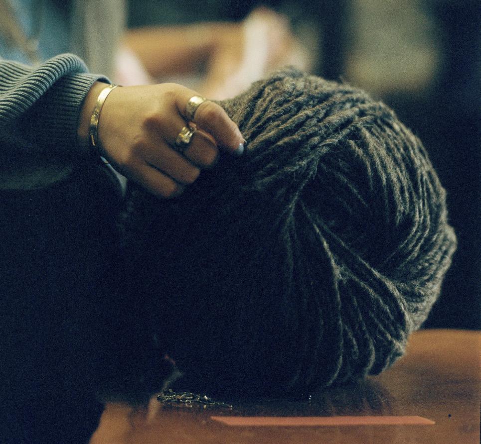
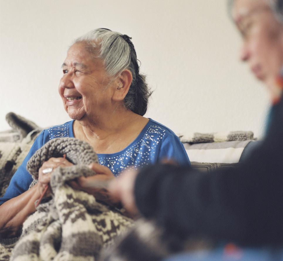
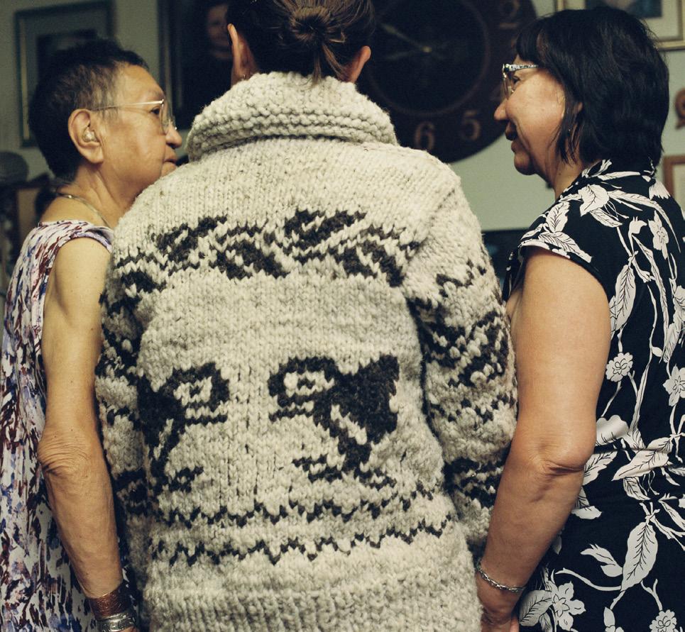
BC MAG • 67

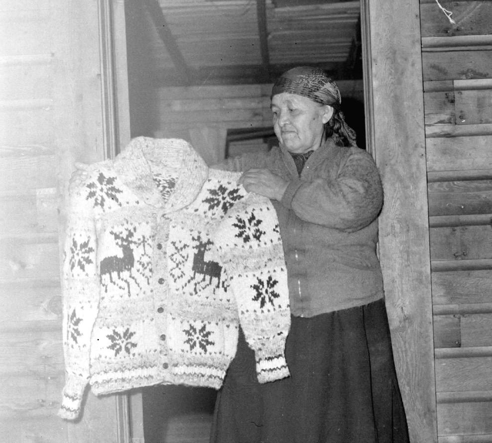

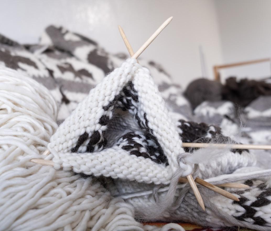
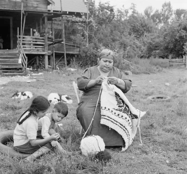
68 • BC MAG
BEFORE THE EUROPEANS
arrived with sheep and knitting needles, mountain goat wool and Salish “woolly dog hair” were spun together and woven into blankets, with some historic examples dating back hundreds of years.
While there is no official story on how knitting sweaters first emerged in Coast Salish culture, there are a few theories. The first is of Jeremina Colvin, a Scottish immigrant to the Cowichan Valley in the late 1880s who taught Cowichan women how to card, spin and knit. The similarities between Cowichan sweaters and the Fair Isle style of knitting, with row patterns and colours, support this theory. A second theory is that sisters from the Roman Catholic church founded a residential school in Duncan in the mid-1860s, which taught local Indigenous girls domestic skills such as knitting.
Whatever the actual story, Cowichan sweaters remain a fascinating blend of traditional Coast Salish and European culture, technique and art. By the 1930s, Coast Salish knitters were selling their garments as they travelled around BC and Washington state working seasonally as berry pickers and fish canners. By the 1950s a wool mill was built on Vancouver Island, which encouraged more knitters, but they were forced to pay for overpriced wool in order to sell sweaters at certain stores.
For instance, “there was a shop in Victoria where you pay $90 for wool and they will buy your sweater for $140 but you have to provide receipts to show you brought their wool,” says Wush’q Ronald Rice, who is also executive director of the Victoria Native Friendship Centre when he isn’t in the film business. “The knitters were making about $1 an hour, maybe $2 an hour if they’re a very fast knitter. And it’s been like that for decades.”
When the mill closed in 2007, Wush’q says the knitters had to buy wool for $22 per pound, up from $4 per pound. And to this day, there is a limit on how much they can buy.
Wait, it gets worse: someone in Japan trademarked “Genuine Cowichan
Sweaters” and started making them in bulk for a lower cost. By the 1950s, imitation sweaters were popular worldwide with examples worn by movie legends Marilyn Monroe and Steve McQueen. But were they wearing the genuine article or a knock-off?
During the 2010 Winter Olympics, the Hudson’s Bay Company sold imitation sweaters, which led to a protest by the Cowichan people. A licensing agreement was eventually reached. In 2015, Nordstrom, the US retailer, issued an apology for using the word Cowichan to describe a sweater in their collection that was not the real deal.
“THE COWICHAN SWEATER is so much more than clothing. With de signs that depict ancestral stories and personal histories in every stitch, the sweaters are more than just a fashion statement; they are canvases for storytelling and cultural preservation,” says Wush’q. He had a mission: to raise the garment profile in the eyes of the consumer and pay a living wage to knitters. “We sat down with a few people and thought about producing a short commercial and Ecologist Films said they could do it for about $10,000. It was during the pandemic when we got an update from their creative director: Sheila Peacock at CBC is looking for a new documentary for Absolutely Canadian as another project did not work out. We sent them a two-page proposal and she asked if we could find a Cowichan director…”
KNIT WITH PURPOSE
The Victoria Native Friendship Centre, an Indigenous-led charitable non-profit, opened in 1970 to provide support for Indigenous people moving to the city. About 15 years ago it moved focus from trauma response to cultural revitalization. Wush’q Ron Rice says that’s when they looked at the Cowichan sweater and developed the retail platform KnitwithPurpose.com. Committed to fair wages, each Cowichan sweater purchase sustains craft, preserves heritage and uplifts communities.
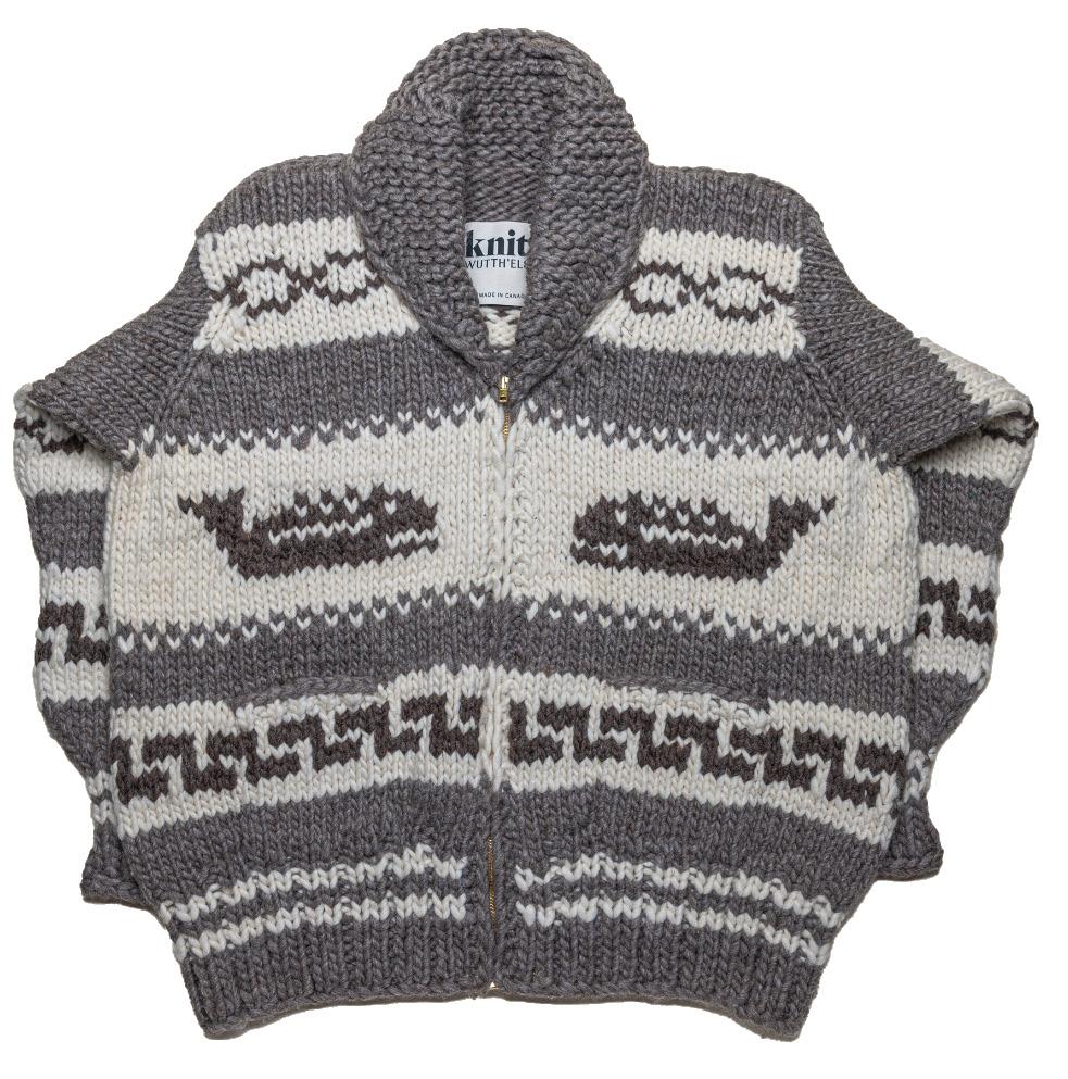
film is told with such heart and honesty, it is a beautiful testimony to the strength of their Elders.”
“Since I as a little girl I have loved beautiful real Cowichan sweaters and wished I had one,” says Peacock. “Working with the filmmakers Mary and Tiffany and learning the history of the sweaters and the knitters was enlightening because I had no idea how badly the Cowichan artisans were treated and poorly compensated for their work. Hearing the elders’ stories of what they went through was heartbreaking. But they persevered and are passing on their tremendous skills and their culture as the next generations learn this gorgeous handmade art. The
Galloway is hopeful that this documentary will encourage people to support the Cowichan knitters, their culture and tradition, and possibly rejuvenate the industry. “Please know where your sweater is coming from and do your best to participate in the ethical practices of supporting knitters,” says Galloway, “for example, a store in Whistler still sells knock-offs so buyer beware: they get away with it by saying ‘inspired by authentic Cowichan knitting.’” It is a close-knit industry. And if you haven’t seen the film yet, check out The Cowichan Sweater: Our Knitting Legacy on CBC Gem.
BC MAG • 69
1980 s VICTORIA
1986
PRINCESS MARGUERITE II : Princess Marguerite II lies at her dock in Victoria Harbour. Commissioned in 1948, she plied the waters between Victoria and Seattle on a daily schedule. The ship had a grand staircase, ballroom, formal dining room, cocktail lounge, wide promenade decks and private staterooms, features usually found only on ocean liners.
FATE:
Retired from service in 1989, scrapped in 1997.
70 • BC MAG SUMMER 70 FLASHBACK
Courtesy of the BC Archives i-03628
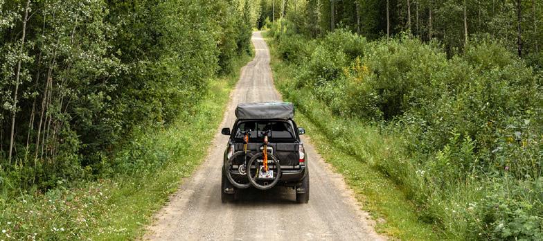
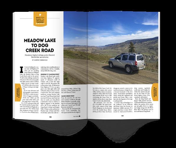
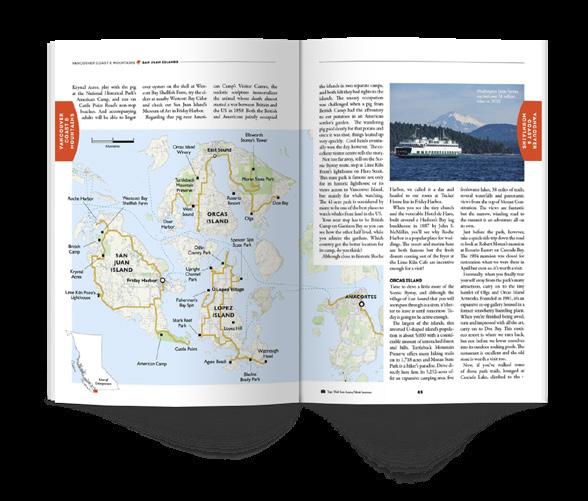


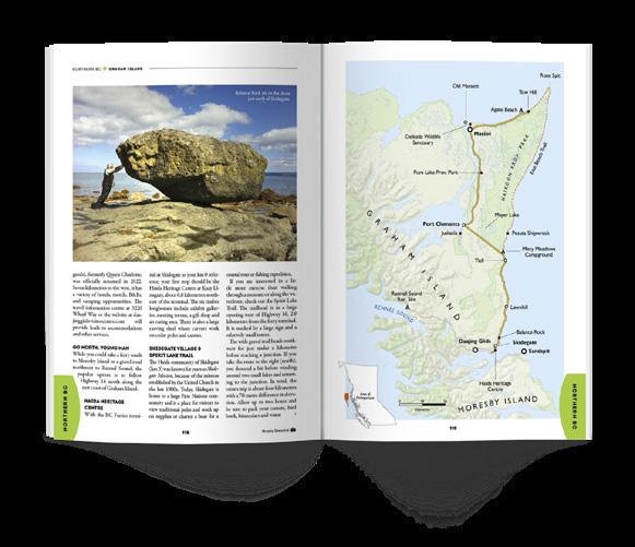

BC MAG • 71 ALSO AVAILABLE AT: ORDER ONLINE BUY ONLINE WWW.BCMAG.CA/ROADGUIDE | 1.800.663.7611 ONLY $1295 NEW EDITION VOLUME 6 - FEATURING: Drivable Diners / Historic Drives / BC Pit Stops / Iconic Destinations Hidden Gems / Cross-Border Trips / Detailed Maps & Drive Times / and lots more! 1 ROAD TRIPS PM 40069119 CARIBOO CHILCOTIN VANCOUVER COAST & MOUNTAINS THE ISLANDS NORTHERN BC KOOTENAY ROCKIES THOMPSON OKANAGAN A SPECIAL ISSUE OF BRITISH COLUMBIA MAGAZINE $12.95 DISPLAY UNTIL DEC 31 2024 18 ADVENTURES INSIDE BC’S HISTORIC HIGHWAYS & BYWAYS BACK ROUTES & FOREST ROADS SCENIC TOWNS & PERFECT PITSTOPS THE ROAD LESS TRAVELLED Volume #6 More amazing road trips 2024 edition, on sale now!
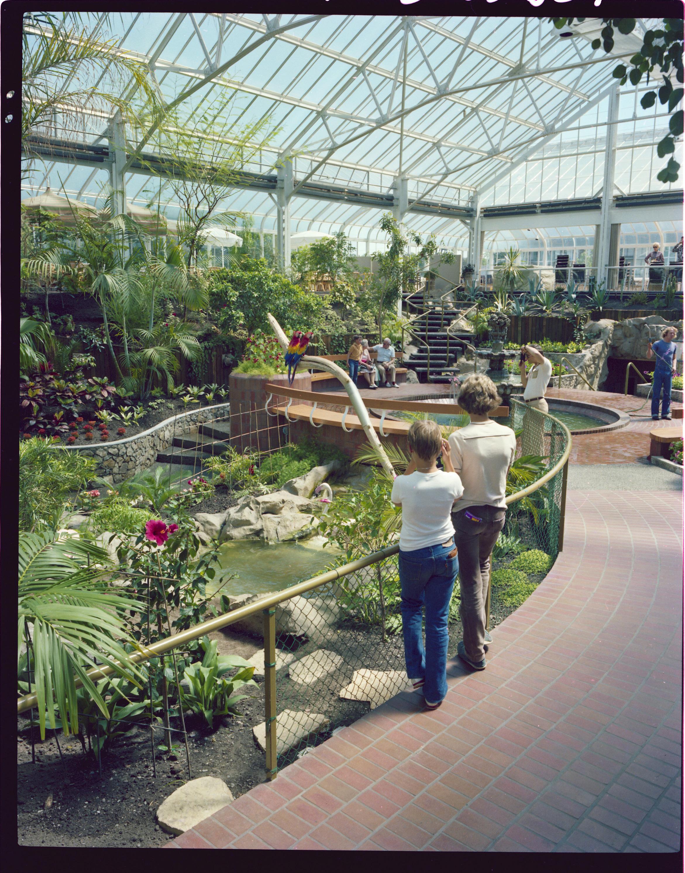
1982
HISTORIC CRYSTAL GARDEN
Inspired by London’s Crystal Palace, Victoria’s Crystal Gardens opened in 1925 and was operated by the Canadian Pacific Railway until 1964. It once housed the largest indoor salt-water swimming pool in the British Empire, until it's closure in 1971. The Crystal Gardens later reopened as a tropical conservatory but again closed in 2004, and the building underwent extensive renovations.
FATE:
Currently part of the Victoria Conference Centre.
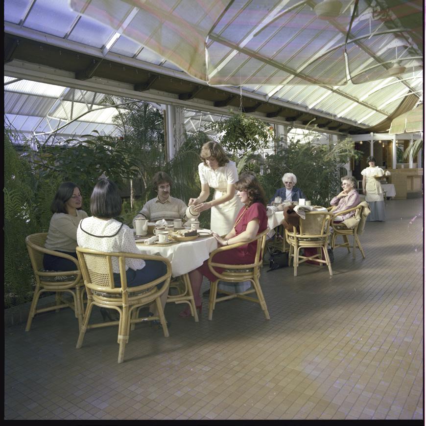
72 • BC MAG FLASHBACK
Courtesy of the BC Archives - Top: i-03554; Above: i-03378
1983
Sea shanties and dockside entertainment down at Victoria’s Inner Harbour.
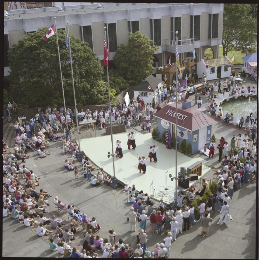
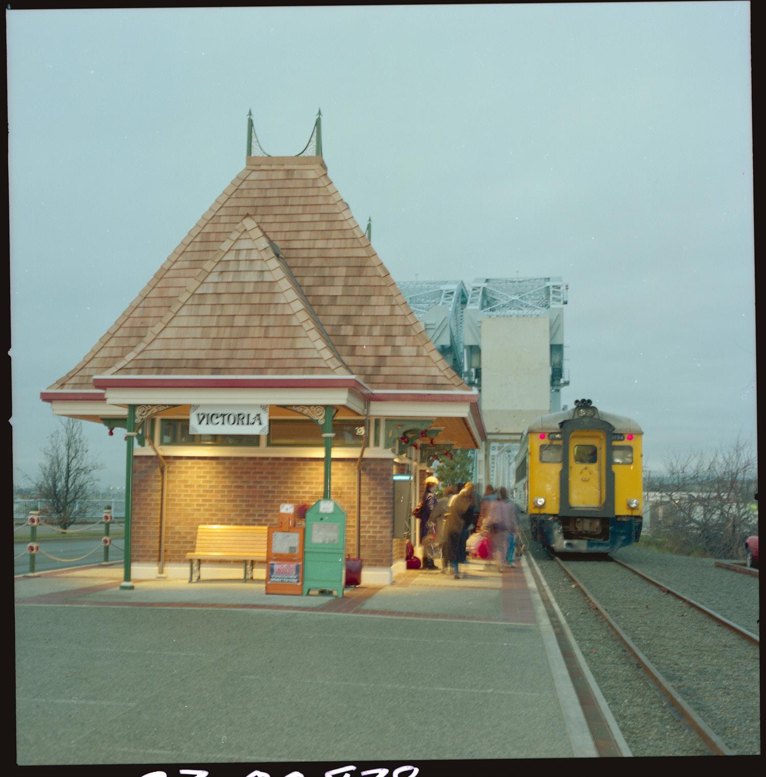
1985
Dancers delight the crowd at the Victoria FolkFest, put on by the Inter-cultural Association of Greater Victoria for decades.
FATE:
While FolkFest is no more, Folktoria is now in its seventh year and continues the cultural legacy this June 1 and 2.
1986
VICTORIA TRAIN STATION
Passengers waiting at the Victoria Station for the Via Rail Dayliner service which ran from Victoria to Courtenay, with a branch line to Port Alberni. In 2011, due to poor infrastructure, VIA Rail suspended the Dayliner passenger service indefinitely.
FATE: Demolished in 2012.
BC MAG • 73
Courtesy of the BC Archives - Top: i-03837; Right: i-04842; Above: i-03746
RIDING THE RAILS OF LEARNING
BC’s much-loved luxury rail line begins a new journey toward reconciliation
BY DIANE SELKIRK
SSitting in the dome car, I keep my eyes peeled for bears or a few of the 250 species of birds that spend time in the marshlands of Shuswap Lake. It’s my second day aboard the Rocky Mountaineer, a family-owned luxury train line with roots in BC. The previous day, I’d travelled from Vancouver to Kamloops—taking in the rugged Hell’s Gate canyon at the narrowest part of the Fraser River and watching the landscape shift from lush forests and fertile valleys to arid grasslands and craggy hillsides. After a full day onboard, the train stopped in Kamloops for dinner and a comfortable night in a local hotel—a feature that ensured I wouldn’t miss a single peak or valley along the way.
Now, we were sedately winding toward the Rocky Mountains, the eagerly anticipated highlight. Amidst serving drinks and spotting wildlife, the hosts in each train car also share historical commentary and point out landmarks. The traditional narrative along this famed route from Vancouver to Banff, known as the First
74 • BC MAG BACKYARD GETAWAYS
SUMMER
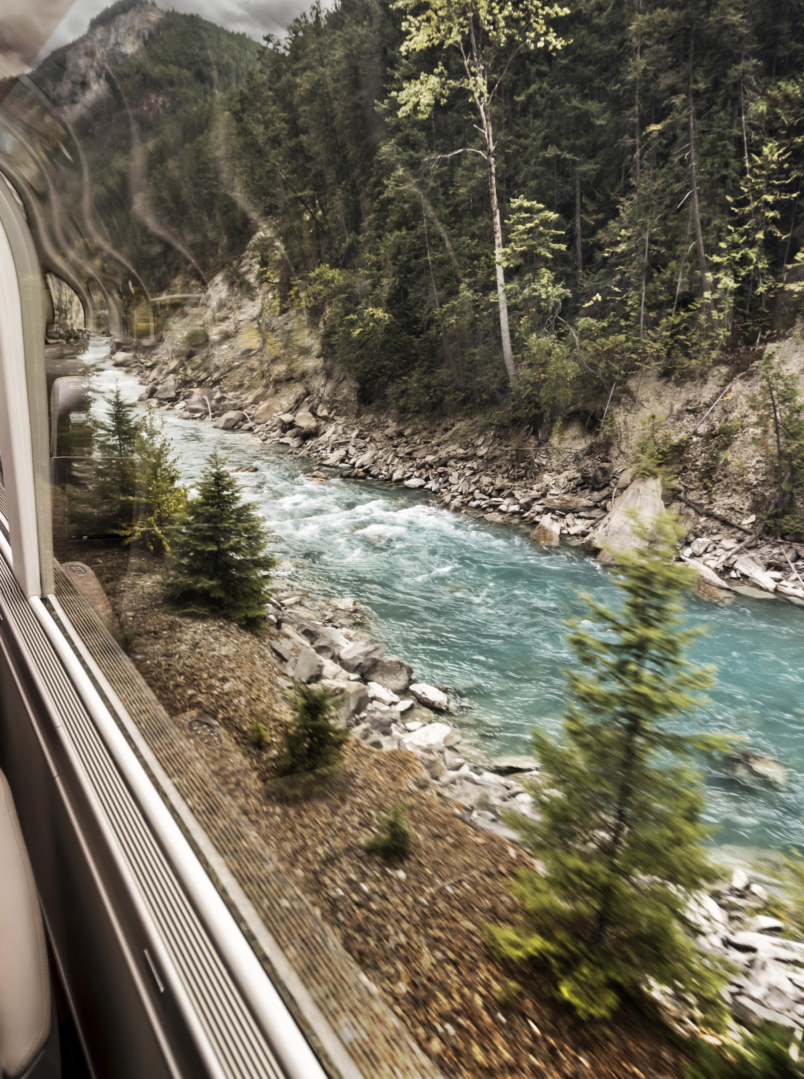
BACKYARD GETAWAYS
Passage to the West, often centered on the settler experience. However, approaching Craigellachie, the site of the “Last Spike” for the Canadian Pacific Railway that connected British Columbia to Canada over 125 years ago, our host Erika (who happens to be of Asian descent), tells us she’s excited about sharing a frequently overlooked part of the story.
As the train slowed so we could view the spot where tracks from the east and west converge, Erika talks about the 17,000 Chinese men who were recruited to work on the most challenging sections of the railway (who are now acknowledged as crucial to the railway’s construction). Despite being paid half as much as their counterparts, thousands of these skilled workers were killed or maimed because they were always assigned the deadliest tasks; jobs like chiseling holes for dynamite, igniting the fuse and swiftly retreating—all while suspended from cliffs.
In recent decades, there’s been a growing awareness around the importance of whose stories get told. In BC, we’re just starting to grasp the extent of history that hasn’t been shared—from the struggles of the Chinese rail workers who later faced poverty, racism and exclusion, to the colonial horrors experienced by Indigenous peoples. For tourism companies like the Rocky Mountaineer, which integrates history into all its onboard experiences, this realization prompted a reckoning.
Nicole Ford, vice president of communications, sustainability, and stakeholder relations at Rocky Mountaineer, explains that while the company has always aimed to be a good guest in communities where they operate, their recent changes have been guided by the Calls to Action of the Truth and Reconciliation Commission of Canada (TRC) and the United Nations Declaration on the Rights of Indigenous Peoples (UNDRIP). When asked how these changes alter the guest experience,
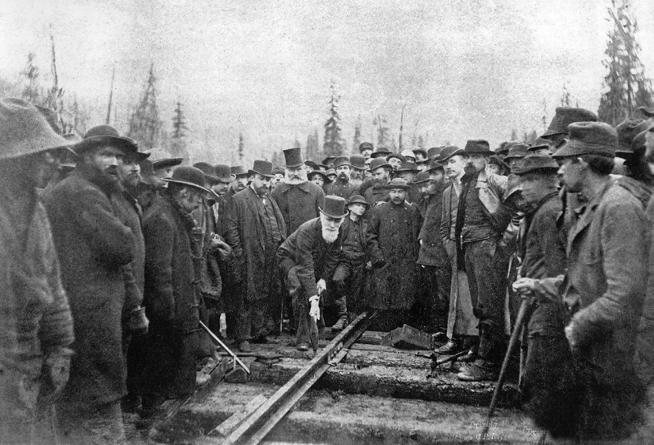
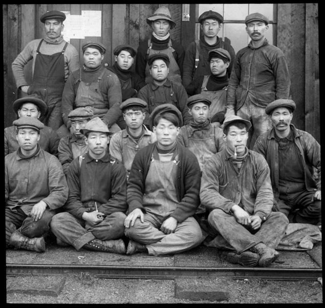
In
Bottom: Chinese railway workers.
Ford notes the shift in onboard commentary to something that’s more inclusive. However, it’s not just about adding a few new Indigenous anecdotes—respecting protocol and obtaining permis-
sion for some stories are vital. “We travel through areas rich with Indigenous culture, and we are working to expand the information we can share [with] our guests,” she explains.
Watching distant peaks take shape, I’m almost reluctant to leave my window when we’re called down to the dining room for lunch. I’m lucky enough to be experiencing GoldLeaf service, Rocky Mountaineer’s premier class.
76 • BC MAG
Top:
1885, at Craigellachie, the “Last Spike” is driven home, completing the Canadian Pacific Railway that connected British Columbia to Canada.
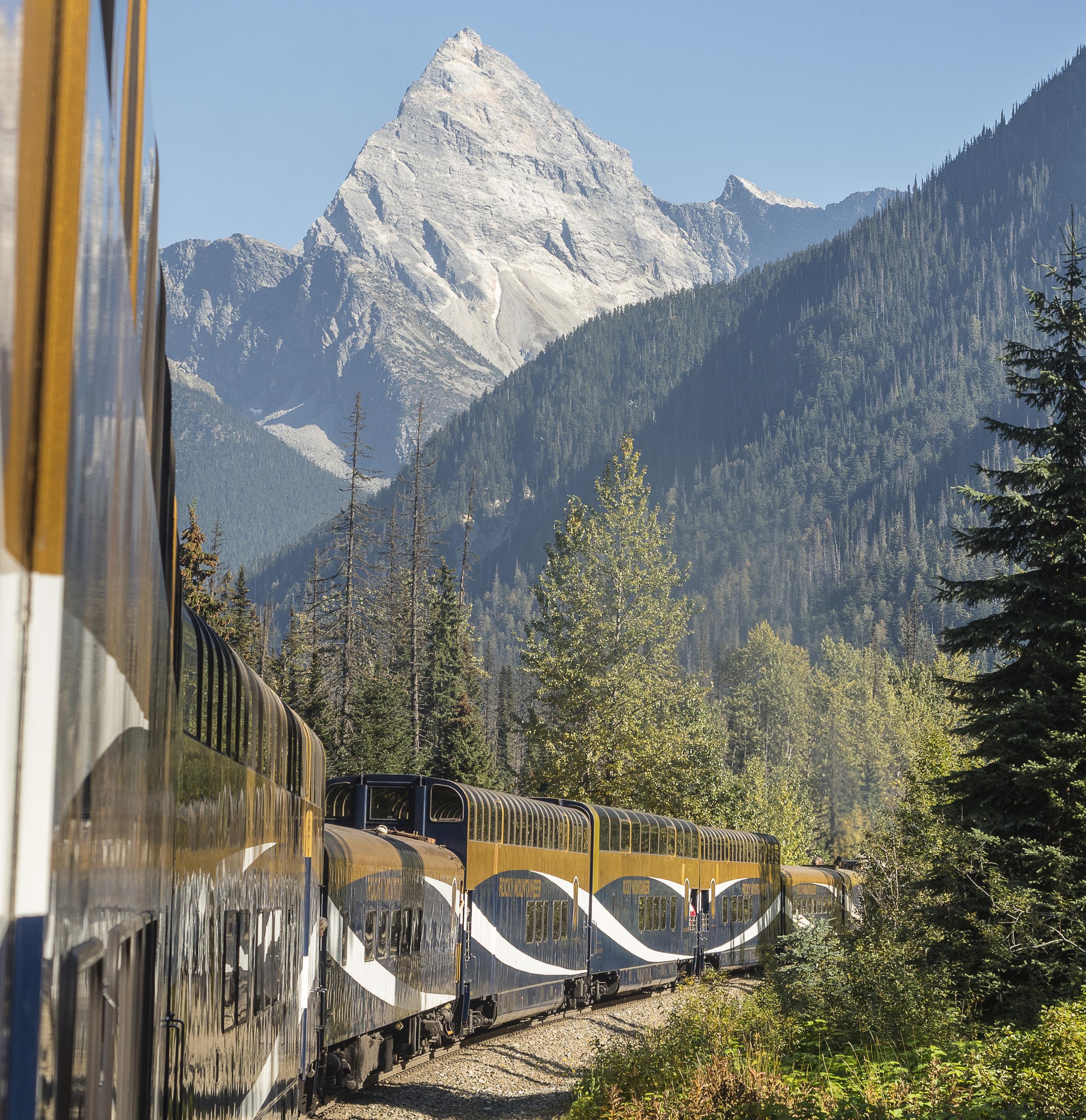
Along with the 360-degree view from the upper dome, our car has a lower level with a dining room and outdoor viewing platform (in Silverleaf, there’s a single-level dome car and outdoor platform, and you’re served meals at your seat). As I look over the menu, trying to decide between the BC wine-braised Alberta beef short rib or the vegan Rocky Mountain power bowl with wild mushrooms (the braised rib won), Kael-
hub Cudmore, Rocky Mountaineer’s executive chef, popped out of the galley to talk about the food.
As part of the effort to expand local culinary offerings and feature local and Indigenous products, Cudmore says he works to source ingredients that reflect the places we travel through, flavours that “tell stories of the land and its people.” On the Rainforest to Gold Rush route, which travels between Vancouver,
Whistler and Jasper, guests are served bannock provided by the Squamish Lil’wat Cultural Centre. On our route, local offerings include crackers from True North Gluten Free bakery in Salmon Arm, squash and mushroom ravioli from Pasta D’Angelo in Port Moody, and wild-foraged bee pollen from Corbicula Pollen Company in Surrey.
Back in the dome car, I flip through the Mile Post, the onboard newspa-
BC MAG • 77
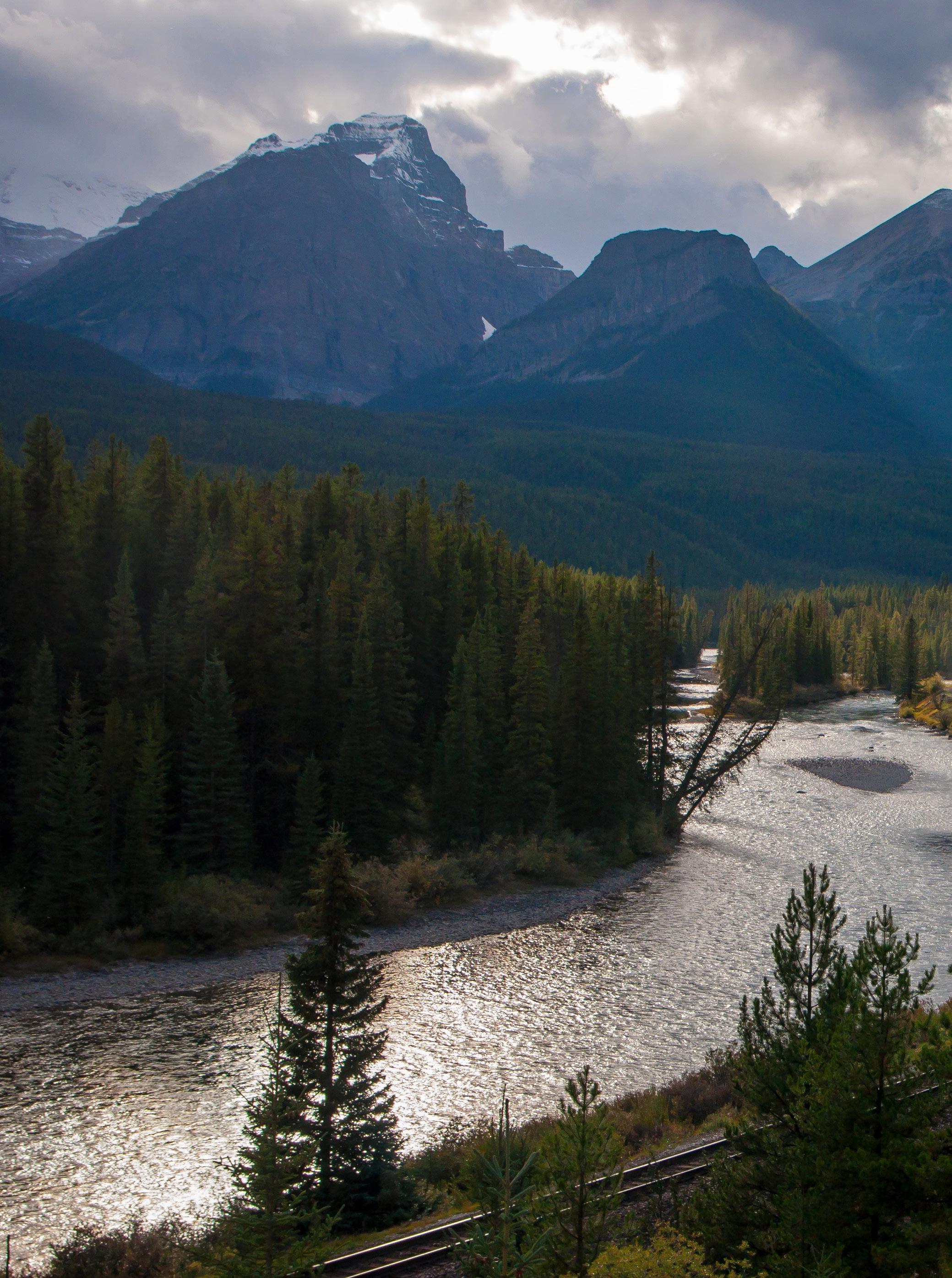
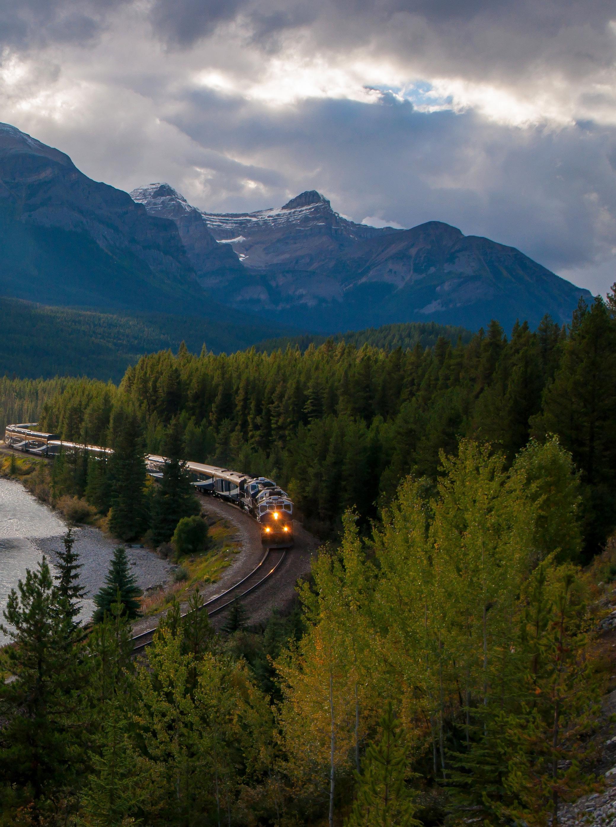
Adobe Stock/AleCam
BACKYARD GETAWAYS
per filled with facts, figures and stories about the people and places along the route. The 2024 version includes each region’s traditional Indigenous place names and contains articles on Indigenous communities—part of an ongoing effort to deepen the onboard narrative. At the same time, Ford says the company is continuing to strengthen their overall commitment to reconciliation; a process that goes beyond updating onboard commentary and includes building partnerships with Indigenous communities and organizations in order to educate Rocky Mountaineer employees and develop economic reconciliation opportunities for local Indigenous Nations.
Often overlooked in reconciliation efforts, economics are highlighted in the Truth and Reconciliation Commission’s Call to Action #92, which asks companies to ensure that Indigenous communities gain long-term economic benefits from activities that take place on their lands or use their resources.
Ford says part of Rocky Mountaineer’s action on #92 includes promoting Indigenous cultural attractions and businesses found on the train routes. They also acknowledged the role railways had in displacing Indigenous people and disrupting cultures by becoming an early supporter of the Indigenous Tourism Destination Fund (ITDF). Developed by the Indigenous Tourism Association of Canada, the fund offers Canadian businesses a mechanism for supporting Indigenous tourism and investing in Indigenous owned businesses. Guestgenerated contributions to the fund also give interested passengers access to more information.
As we pass through Revelstoke and follow the milky-blue Illecillewaet River into the heavily forested Selkirk Mountains, I head down to the open-air observation deck and stick my head out into the wind to look up at the highest peaks. The sky is bright blue, but the autumn sun is low enough to add a hint of winter chill to the air. In the dome car, the hosts occasionally alert passengers when approaching viewpoints—and at those times, the crowd on the platform
swells, and we playfully jostle to get the best shot of the train crossing a bridge or winding around a curve framed with dense green forests and granite peaks.
It’s the moments when I’m alone that will stay with me. The spectacular views from the CPR rail line would have been seen by generations of families as they migrated west to participate in building the country. But at the same time, the railway carried death and displace-
ment to untold numbers of Indigenous people while destroying the hope and health of thousands of Chinese workers. These contradictions should have always been woven into our shared story. But as I’m lulled by the clacking rhythm of wheels on steel tracks and mesmerized by the shifting shades of forest green, I feel hope for a future where exclusion gives way to connection and grief leads to healing.
ROCKY MOUNTAINEER ROUTES
First Passage to the West (Vancouver, Kamloops, Lake Louise, Banff) this two-day, one-night, 594-mile trip is the flagship route developed in 1990 and continues to be the most popular option.
BRITISH COLUMBIA
Journey Through the Clouds (Vancouver, Kamloops, Jasper) the twoday, one-night, 559-mile trip is often selected by visitors who want to spend more time in Jasper.
Rainforest to Gold Rush (Vancouver, Whistler, Quesnel, Jasper) the three-day, two-night 707 mile journey takes a more northern route to the Rockies and includes the most trestle bridges.
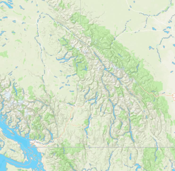
80 • BC MAG CANADA Victoria Lake Louise Jasper Quesnel Banff Kamloops Whistler Vancouver USA
ALBERTA

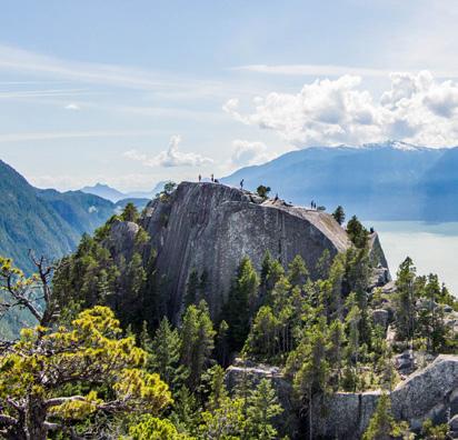
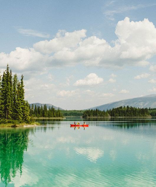
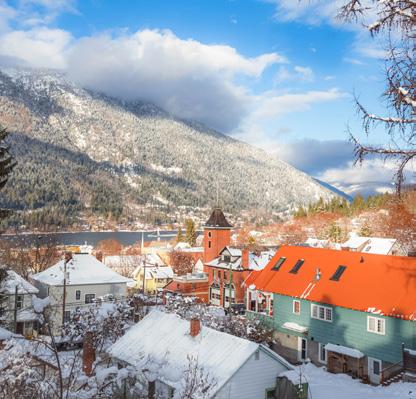
alert. It felt like every rustle in the forest was about to unveil a wild and hungry animal ready to pounce. I’ve seen too many movies. With my heart racing and breathing jacked, I began to power walk downhill. More rustling. The rest of the group seemed content to keep saying “woah bear!” occasionally while chatting about kite surfing.
My mind was getting the best of me and all I could hear was movement in leaves and branches snapping. Leaving them behind me I picked up my pace and started to push it at a fast clip.
I wanted out. Was that a growl? The silence of the wood was now deafening. It felt like we were prey to whatever was lurking about. I did not look behind me, only ahead. My mind was playing tricks on me, but it felt like something was following me and I wanted to be done. And then things went sideways.
The group could no longer see me. They aren’t worried, they are discussing wine country in France. Until out of nowhere they hear a blood curdling scream. My scream.
Steps away from the end of the trail, I had picked up my pace, and on a tight rocky step, I misplaced my footing, tripped, and my left ankle audibly snapped to the left as I fell and tumbled forward. I screamed, looking at my dangling ankle, knowing just how broken my foot was.
Sitting there on the slope in searing pain, I suddenly saw my husband leap over the forest ferns with a massive stick ready to fight off the bear he was convinced had just taken me down. Looking around, he realized there was no bear, but definitely a broken ankle.
“No bear?” he said, with a slightly disappointed tone to his voice. All things considered, I guess the broken ankle was the better of the two options.
in the next issue!
BC MAG • 81
TALES OF BC SEND US YOUR STORIES! Have a funny or interesting BC story? Tales of BC is a reader-submitted column and we are always looking for another good yarn. Send your 600-word story and supporting images if available to editor@bcmag.ca and it might be featured
Order Online at www.bcmag.ca or Call 1-800-663-7611 DESTINATION INDIGENOUS TOURISM PADDLING IS ECOTOURISM HELPING BC’S BEARS? Photo Contest BC’S BEST DINERS, DRIVE-INS & CAR HOPS NELSON DESTINATION A KOOTENAY WINTER WONDERLAND SPRING/2022 DESTINATION HOWE SOUND ÁTL’ K A7TSEM $7.95 ESCAPE TO THE NORTH BEAR ATTACK UNESCO'S NEWEST BIOSPHERE REGION SUMMER/2022 DESTINATION PARKSVILLE QUALICUM BEACH BCMAG.CA 40069119 $8.95 The CLIMATE Issue Implications of the HEAT DOME Bringing FIRE Back to the Land Plus NOOTKA SOUND ADVENTURE CATS IN THE BACKCOUNTRY WANT MORE BRITISH COLUMBIA MAGAZINE? SUBSCRIBE TODAY REDUCED RATES ON ALL SUBSCRIPTIONS SCAN TO SIGN UP TODAY! FREE Calendar with all subscriptions
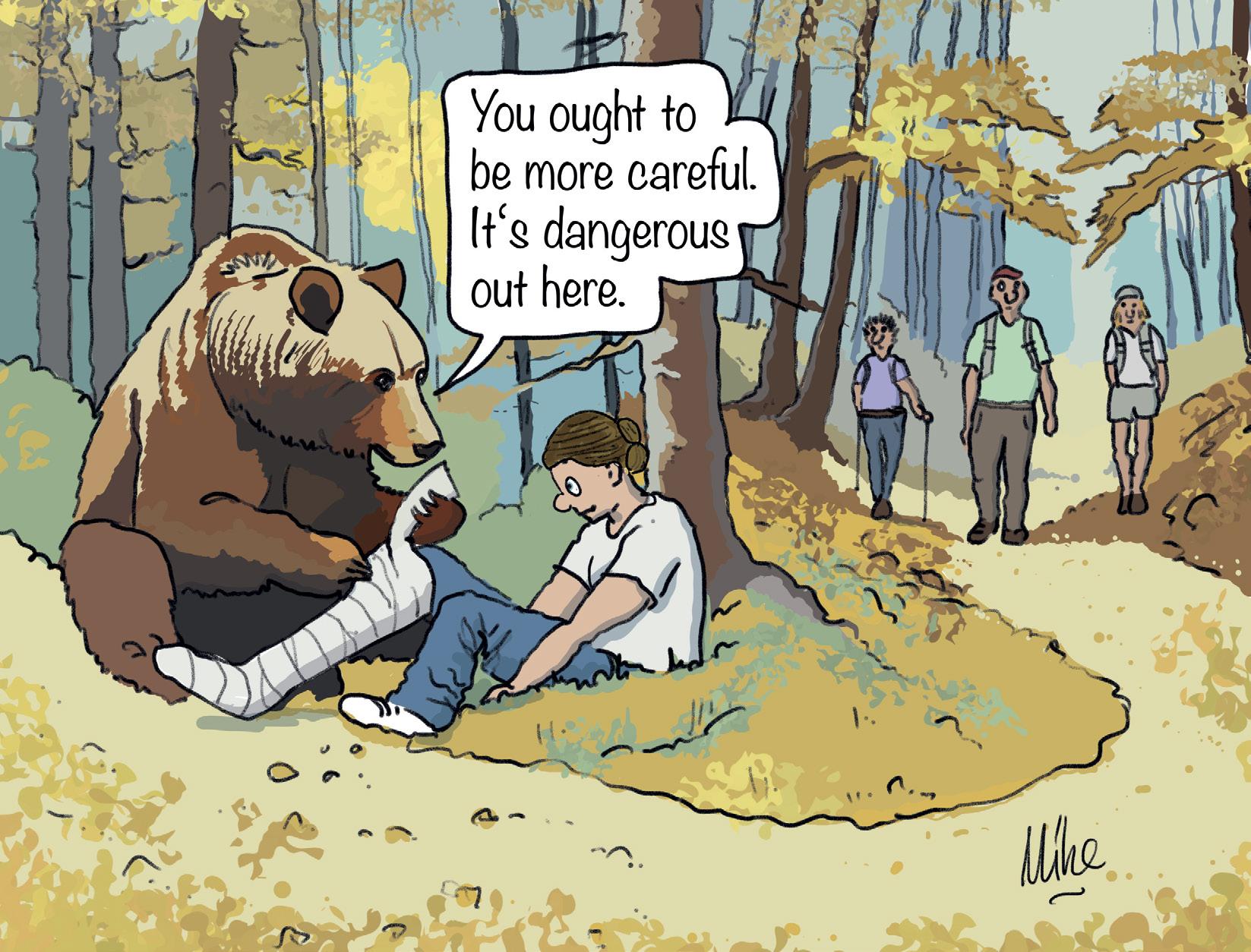
CHRISTOPHER ROCK
BY AVERY LABELLE
SSummer was coming to a close and we were wrapping our holidays with a stay at the family cabin on Cowichan Lake. My sister-in-law and her husband were visiting from Ireland, and after a late night of smoking brisket and tasting local vintages, we made the ambitious decision to wake early and do a morning hike at the nearby Christopher Rock. Seven in the morning came quickly. We were a little foggy, but ready. Once we got to the trailhead, we were mindful of my sister-in-law’s pace, as she was hav-
ing issues with her knees and needed to use trekking poles for support. My husband was very familiar with the climb and led the way.
As we walked from the trailhead through the patch of old growth forest that starts the hike, we talked about the recent cougar sightings and bear activity in the area. A local had seen a cougar wandering in town and bears are frequently spotted here as they get ready for the winter. I am not sure why, but that was the first time I considered the possibility we could encounter a wild animal on our journey.
As that popped into my mind, my husband pointed out fresh bear droppings on the trail as it began to climb upward toward the viewpoint. While everyone took notice, the others quickly moved on from the scat and started talking about more fun topics like travel and
food, but I got stuck on it. How fresh was the scat? Like a day, an hour or five minutes? We kept climbing. My mind kept spinning.
At the top of Christopher Rock, the view is remarkable. You can see nearly the entirety of Cowichan Lake, one of the largest lakes on Vancouver Island, as well as the old mill site, which was the main employer in the area for decades before its closure in 2001. As the others took a pause to enjoy the view, I wondered if a bear was watching us. While I was obsessing over the possibility of an encounter, it became apparent to me that we were not prepared. Besides the walking sticks, we had no bear spray, no cell service and no real means to defend ourselves.
My eagerness to get back to civilization was overwhelming. As we started down the hill, my senses were on hyper
Mike Mockford
82 • BC MAG TALES OF BC SUMMER
Continued on Page 81


SIDNEY ISLAND OCEANFRONT SOUTHERN GULF ISLANDS BC
You won’t believe you are living off grid in this 2,160 sq. ft. 4 bedroom, 2 bath, full basement home on 1.67 acres with 210 ft oceanfront. Thermador kitchen, fenced gardens, orchard, greenhouse, outdoor kitchen and shower, Wi-Fi and TV. It is perfect for indoor and outdoor living. Island caretaker, airstrip, marina and miles of sandy beaches! $2,290,000
RICHARD OSBORNE Personal Real Estate Corporation
604-328-0848 rich@landquest.com
PONDEROSA RIVERFRONT RANCH CHRISTINA LAKE, BC
250 acre ranch with 1.9 km of Kettle River frontage. Climate to produce almost any crop. Multiple farm outbuildings. Fenced and cross fenced paddocks. Modest 2,495 sq. ft home. Sandy beaches with swimming holes and fire pits. Camping area on the river for RVs. Backs on to Crown land. $1,699,000
OFF-GRID PASSIVE, EARTHSHIP INSPIRED HOME AND ACREAGE - WILLIAMS LAKE, BC
Newly built, passive, off the grid home. A secluded location in Chimney Valley just 25 minutes from Williams Lake. Energy efficient home ensures year round comfort while treading lightly on the environment. A blend of sustainable, affordable, convenience and tranquility. $549,000
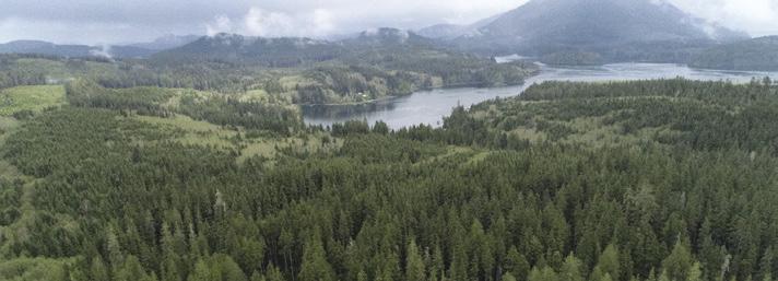
90 ACRE OCEAN AND LAKEFRONT PROPERTY - QUATSINO, BC
coast of Vancouver Island. Road goes through property. May be subdivision potential. Substantial mature timber, some cedar, no estimate of volume. $1,500,000
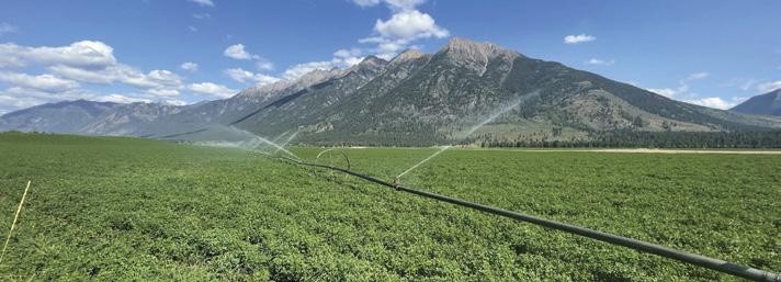
HAWKE RANCH FORT STEELE, BC
Hawke Ranch is now for sale. 505 acres over 4 titles + 20,000 acres of range (763 AUMs). Approximately 300 acres of hay land, water from spring to fall from water licences on creek and an irrigation well. On the land are 3 family homes, a mobile home and an array of ranch outbuildings. $6,999,000
LAKEFRONT AWARD WINNING HOME ON 5.5 ACRES - STUMP LAKE, BC
Stump Lake waterfront executive home with multi Tommy Awards for architectural excellence. No detail spared - expansive windows, geothermal heat, chef’s kitchen, fireplaces, courtyard, heated infinity pool, 3 car garage, barn and paddock. $2,995,000
RIVERFRONT ACREAGE ON THE SEA-TO-SKY HIGHWAY, PEMBERTON, BC

Just one hour north of Pemberton on Highway 99 sits this fully treed acreage at a bend in Cayoosh Creek. There are only 8 private parcels from Mount Currie to Lillooet on the Duffey Lake Road, this one has 2,165 ft of water frontage and spans both side of the road. Priced to sell. NOW $499,000
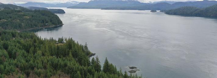
DISCOVERY PASSAGE RECREATION PROPERTY - CAMPBELL RIVER, BC
Waterfront recreational property fronting onto Discovery Passage and overlooking Quadra Island. 8.55 acres, 400 feet of water frontage and a off the grid cabin in the woods. Located in an area known as “The Salmon Capital of the World” this property is 12 miles north of Campbell River. Access is via forest service roads connecting to Highway 19 North. $450,000
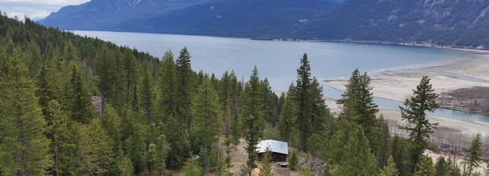
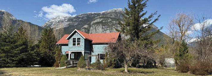
CHARMING FAMILY HOME AND WORKSHOP - BELLA COOLA, BC
Affordable and picturesque 3 bedroom, 1 bath home on 1 acre in the heart of Hagensborg, Bella Coola. Excellent location, across from schools, walking distance to river fishing and minutes to airpot and all amenities. $399,000
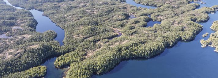
140 ACRE OCEANFRONT BRAMHAM ISLAND, BC
Nestled in south central BC’s coast, this oceanfront haven includes two stunning bays, diverse terrain, including lakefront, wetlands and old growth forests, ideal for outdoor exploration. Accessible from Port Hardy by boat or float plane. Surrounded by Crown land, providing an unparalleled wilderness experience. $1,795,000
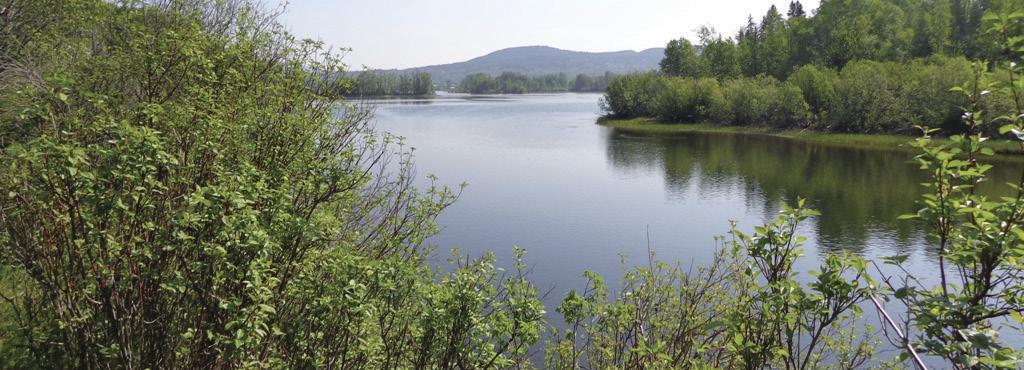
® Marketing British Columbia to the World® www.landquest.com Toll Free 1-866-558-LAND (5263) Phone 604-664-7630 Visit Us This 153 acre property offers diverse potential as a ranch, multi-family home, campground, or RV Park. Year round creek access, stunning mountain and lake views and a solar powered cabin. Its strategic location, favorable zoning and natural beauty make it an ideal opportunity. $1,449,000 KURT NIELSEN 250-898-7200 kurt @landquest.com ROB GREENE 604-830-2020 rob @landquest.com FAWN GUNDERSON Personal Real Estate Corporation 250-305-5054 fawn @landquest.com Located just minutes from town center the nicely treed lots are located just as Stuart Lake becomes Stuart River. Build three residences or just keep a couple of lots for an investment. Hydro, gas and Internet are available all along paved Sweder Road. Outdoor life at its finest. $295,000 LEVEL FORT ST. JAMES RIVERFRONT 3 INDIVIDUAL LOTS A JEWEL IN THE KOOTENAYS 153 ACRE PROPERTY - ARGENTA, BC 2 titles 1,150 ft oceanfront in Hecate Cove and 1,850 ft of lakefront on Colony Lake in Quatsino on the west
JOHN ARMSTRONG Personal Real Estate Corporation 250-307-2100 john @landquest.com MATT CAMERON 250-200-1199 matt @landquest.com SAM HODSON Personal Real Estate Corporation 604-809-2616 sam @landaquest.com FAWN GUNDERSON Personal Real Estate Corporation 250-305-5054 fawn @landquest.com KEVIN KITTMER 250-951-8631 kevin @landquest.com JASON ZROBACK 1-604-483-1605 JAMIE ZROBACK 1-604-414-5577 BC LANDPRO GROUP JAMIE ZROBACK 1-604-483-1605 JASON ZROBACK 1-604-414-5577 BC LANDPRO GROUP CHASE WESTERSUND - WESTERN LAND GROUP Personal Real Estate Corporation 778-927-6634 chase @landquest.com


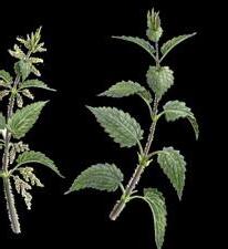
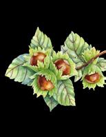
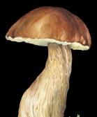
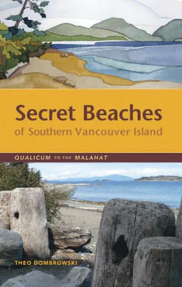

Visit Our Bookstore For More Great Reading! 1-800-663-7611 thebookshack.ca LOCAL AUTHORS • LOCAL TOPICS Because you Love British Columbia Magazine, you may also enjoy these titles: 1 ROAD TRIPS $12.95 DISPLAY UNTIL DEC 31 2024 18 ADVENTURES INSIDE BC’S HISTORIC HIGHWAYS & BYWAYS BACK ROUTES & FOREST SCENIC TOWNS PITSTOPS THE ROAD LESS TRAVELLED V #6 W Harvest BC A FORAGER’S GUIDE TO EDIBLE PLANTS OF BRITISH COLUMBIA 71 71 71 W ild Harvest BC BY LINDA GABRIS NEW NEW NEW
