
Anchorages of JOHNSTONE STRAIT JULY 2024 WEST COAST POWER & SAIL SINCE 1968
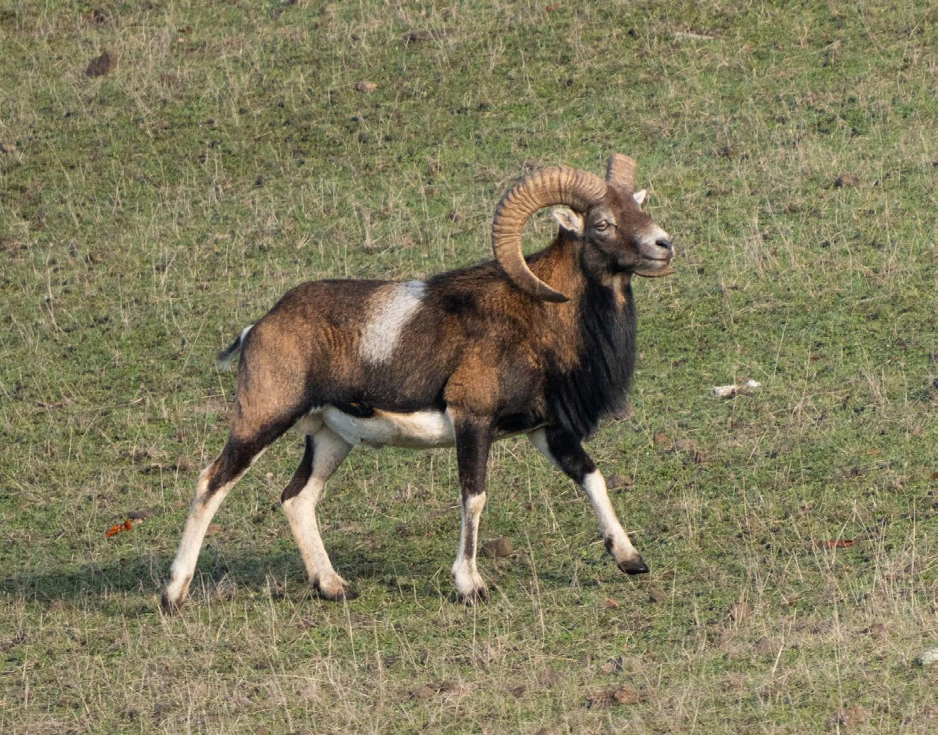
The Unusual History of SPIEDEN ISLAND Favourite
Gulf Islands
EXPLORING THE
NATIONAL PARK RESERVE
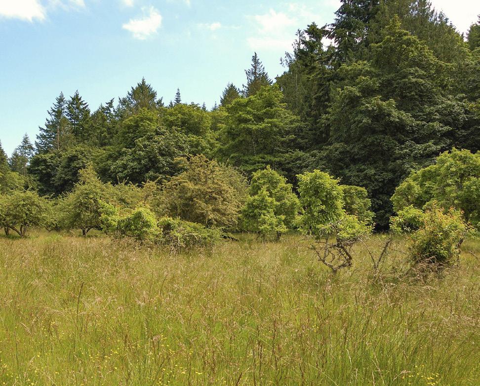
RUSSELL ISLAND


Serving Lower Mainland Boaters Since 1971 8211 River Road, Richmond, BC, V6X 1X8 604-273-7544 www.galleonmarine.com


JULY 2024 - 3
26 JOHNSTONE STRAIT ANCHORAGES Revisiting our favourite places to drop the hook By Anne Vipond and William Kelly 32 SPIEDEN ISLAND The San Juans’ lost “Safari Island” By Annie Means 38 THE GULF ISLANDS NATIONAL PARK RESERVE Wandering through the mosaic of lands, water and history By Deane
46 THE THERMOPYLAE CLUB Keeping maritime history alive By Marianne Scott 54 GETTING PUMPED Emergency bilge pump options, installation and maintenance By Frank Lanier IN EVERY ISSUE 4 PASSAGES By Sam Burkhart 6 LETTERS 8 CURRENTS PY Photo Contest announced, summer books, June Geo Guesser winner revealed! 20 GALLEY Great Chowder By James Barber 22 GO BOATING Why Knot? By Liza Copeland 60 THE FAVOURED TACK Your Process By Alex Fox 64 THE FISHING FIX Salmon Habitat By Tom Davis 68 ON BOARD SAIL Jeanneau Yachts 55 By Zuzana Prochazka 114 COCKPIT CONFESSION White Water Rafting By Linda Leitch ON THE COVER Russell Island Photo:
FEATURES VOLUME 66 - NUMBER 07 38 38 ON BOARD HERB GARDENS OH THE JOY (STICK) ONLINE ARTICLES 46 68
JULY
Hislop
Kevin Oke
PASSAGES

Best of Both Worlds
Finding the right balance of editorial content is what makes putting this magazine together such a joy: Powerboats and sailboats, big boats and small boats, local anchorages and distant destinations. With so many types of boaters out there it’s a challenge to please everyone, but it’s a challenge we are happy to undertake.
During the Vancouver Boat Show we put up an ideas board where readers could share their thoughts with us. At the end of the show two of the comments were: “You should cover more local areas, not everyone is cruising to Alaska.” And, “You should write about more remote places, we’ve been to all the local destinations.” Since we heard both, I’d like to think we are at least close to striking that balance, but both are fair points. A lifelong Gulf Islands boater who’s looking to push a little further might be tired of reading about Montague Harbour, for instance. While a new boater who’s leaving the dock for the first time might get little value from reading about Calvert Island on the Central Coast. On the other hand, places are always changing, with new amenities like restaurants or rental shops, or changes to dock layouts or moorage rates. And even though that new boater might not be heading north this summer or next, there’s no reason not to plant the seed and start thinking about the possibilities. It’s always fun to dream. In this issue we have the best of both
worlds. Long-time PY contributor Deane Hislop, who’s cruised up and down the West Coast, has revisited some of his favourite Gulf Islands destinations in the beautiful Gulf Islands National Park Reserve (page 38). For novice boaters and old salts alike, these are must-visit destinations. We’ve included a handy graphic showing the number of mooring buoys at each location, as well as anchorage and dock availability.
We have also published a roundup of favourite anchorages near famed Johnstone Strait (page 26), including places to duck into if wind and waves start kicking up in the strait. Anne Vipond and Bill Kelly have written books on the area and their local knowledge is valuable for any boater heading north of Desolation Sound this summer.
Finally, I’ve been perusing charts of the West Coast for most of my life, from Puget Sound north to Alaska, and while I would never claim to know every island on the coast (especially the further north you go), I thought I was familiar with most of the Gulf Islands and San Juans. That said, I had never heard of, or even noticed, slender Spieden Island until Annie Means sent me a pitch for an article on the “Safari Island of the San Juans” (page 32). Unfortunately, Spieden is a private island, but the next time you find yourself cruising through the San Juans see if you can spot any wildlife roaming the shoreline—if you see anything, let us know.
Happy Cruising!
Sam Burkhart
DIRECTOR OF SALES Tyrone Stelzenmuller 604-620-0031 tyrones@pacificyachting.com
ACCOUNT MANAGER (VAN. ISLE) Kathy Moore 250-748-6416 kathy@pacificyachting.com
ACCOUNT MANAGER Meena Mann 604-559-9052 meena@pacificyachting.com
PUBLISHER / PRESIDENT Mark Yelic MARKETING MANAGER Desiree Miller GROUP CONTROLLER Anthea Williams
ACCOUNTING Elizabeth Williams
CONSUMER MARKETING Craig Sweetman CIRCULATION & CUSTOMER SERVICE
Roxanne Davies, Lauren Novak, Marissa Miller DIGITAL CONTENT COORDINATOR Mark Lapiy
SUBSCRIPTION
SUBSCRIBER
4 - JULY 2024
50% THE AFTERGUARD EDITOR
ART
AD
Sam Burkhart editor@pacificyachting.com
DIRECTOR Arran Yates
COORDINATOR Rob Benac COPY EDITOR Margaux Perrin
HOTLINE
1-800-663-7611
One year Canadian
International:
to editor@pacificyachting.com or via mail with a self-addressed, stamped envelope. Queries are preferred. The publisher assumes no responsibility for lost material. From time to time, we make our subscribers’ names available to reputable companies whose products or services we feel may be of interest. To be excluded from these mailings, just send us your mailing label with a request to delete your name. Printed in Canada Return undeliverable Canadian address to Circulation Dept. 802-1166 Alberni Street Vancouver, BC V6E 3Z3 Canada Contents copyright 2024 by OP Media Group Ltd. All rights reserved. ISSN 0030-8986 802-1166 Alberni Street Vancouver, BC, Canada V6E 3Z3 Tel: (604) 428-0259 Fax: (604) 620-0245
ENQUIRIES: subscriptions@opmediagroup.ca SUBSCRIPTION RATES
and United States: $48.00 (Prices vary by province).
$58.00 per year. Editorial submissions: Submissions may be sent via email


1996 | 105’ NORDLUND | $1,750,000 JEFF SIHILLING | 619.756.2511 2007 | 64’ OCEAN ALEXANDER | $1,175,000 MICHAEL VRBAS | 949.632.1414 2015 | 45’ PALM BEACH | $1,249,000 JERRY TODD | 206.963.6543 2021 | 54’ RIVIERA | $1,895,000 GREG WILKINSON | 714.331.7131 2019 | 100’ OCEAN ALEXANDER | $8,900,000 HENRY WOLD | 206.427.7167 2024 | OCEAN ALEXANDER 32L | SEATTLE 2020 | 49’ TIARA COUPE | $1,550,000 JR YUSE | 206.679.7983 2024 | AZIMUT 68 FLYBRIDGE | NEWPORT BEACH A Higher Standard of Excellence. YACHTING. ELEVATED. AlexanderMarineUSA.com SEATTLE | 206.344.8566 NEWPORT BEACH | 949.515.7700 SAN DIEGO | 619.294.2628 FORT LAUDERDALE AN OCEAN OF OPPORTUNITY AWAITS
LETTERS
WE WELCOME YOUR LETTERS
Send your letter, along with your full name, and your boat’s name (if applicable), to editor@pacificyachting.com. Note that letters are selected and edited for brevity and clarity.

FOUR WINDS UPDATE
For over 50 years, a beautiful, sturdy 119-year-old boat named Four Winds and I have had many adventures on the high seas. Together, we discovered the underwater world of whales. These amazing and complex creatures have much to teach us mere mortals. In the early ‘70s, my team of researchers was one of the first to discover orcas in Robson Bight and communicate with them using modern sonic equipment and an almost mystic approach to the whales.
The ‘Project Apex’ crew are credited with being the first to create an interspecies ‘orcastra’ soundtrack coupled with film containing the first underwater footage of free orca. The film ‘Orca’ premiered at Vancouver’s Queen Elizabeth Theatre in 1973.
To my way of thinking, no one really owns a dog or a boat. We are merely caretakers. So, it was time to find a young mariner to take on the responsibility for this classic wooden vessel. Four Winds has changed hands from me to a young sailor who has taken up the challenge to maintain the legacy of this wonderful boat. I am teaching him everything I know about maintaining a vintage wooden sailing ship.
The first time my dog Rusty and I sailed Four Winds, her main and jib were hoisted as the best gusts of the day whistled over the Sooke Hills, stiffening her sails taking us forward with acceleration and speed, when from beneath the vessel a pod of orca
6 - JULY 2024
07/2024

burst out of the water taking a position at the bow leading us onward into the wide-open Juan de Fuca Strait. I felt like our allies welcomed us to a new life at sea.
Last week, Dwight had his first sail aboard Four Winds. No sooner had he cleared Lund’s Finn Bay into the open water a pod of orca seemingly out of the blue surfaced right alongside just as he was reaching for his phone with me at the end of the line. What a good omen!
—Bruce Bott
PENDRELL CLEAN-UP
I read with interest Kayleen VandeRee’s article in the May issue about her involvement with the underwater clean-up of Pendrell Sound. Here on Quadra Island, a small group of locals volunteer our time every Wednesday (or more frequently) from January till June when we will have bins from the Comox Valley Regional district waste management and also from Ocean Legacy Foundation. We survive with near zero funding and often spend our own money for vehicle and boat fuel. I know that the federal government has water lot leases in place for all aquaculture operations and marinas.
Why is there no ongoing annual inspections of these operations? The temptation to get rid of unwanted materials the easy way versus the right way, is often taken. Sometimes accidental, many times preventable.
This January I created an artistic display roughly based on Leonardo DaVinci’s last supper painting. Completely made from marine debris collected on Quadra Island’s beaches.
“The Final Supper” showcases some of the smaller pollution that comes to our shores.
Please view the Final Supper, on our Facebook page (Quadra Island Beach Clean Dream Team) or on YouTube @ quadrabeachclean
I hope that all boaters can help fight pollution wherever they find it, in BC’s waters and shores. Bring it out.
—Nevil and Heather Hand

Repair and Overhaul
• Awlgrip™ Refinishing • Fibreglass Repairs
• Hard Tops • Seasonal Maintenance
• Polishing and Detailing
Experts at gel coat colour matching and repair
Yacht Rigging
• Inspections • Work Aloft • Splicing and Swagging
• Custom Aluminium and Composite Spars • Installations • Architectural rigging • Deck Layout Metal Fabrication • Stainless and Aluminium • Arches • Radar Masts • Davits • Bow and Stern Rails • Bow Rollers • Bimini and Dodger frames • Custom fabrication for all your metal needs
JULY 2024- 7
Proudly Serving the Boating Community Since 1980 Blackline Marine, 2300 Canoe Cove Road, Sidney, BC www.blacklinemarine.com | info@blacklinemarine.com | 250-656-6616
•
CURRENTS
07/2024
WE ENCOURAGE CURRENTS SUBMISSIONS
This is a local news-driven section. If something catches your attention that would be of interest to local boaters, send it along to editor@pacificyachting.com.
Do you know where this is?


Geo Guesser
Our monthly Geo Guesser feature continues to be popular among readers and last month may have been our most popular yet. Clearly, many of you have visited Pirates Cove on DeCourcy Island. After a random draw, we have selected Jenny Ferris as the winner of the June contest. This month’s location may be more of a challenge. Send your guesses to editor@pacificyaciting.com for your chance to win a PY drink koozie. Good luck!
8 - JULY 2024
CURRENTS
Deane Hislop
June location: Pirates Cove


At 31+ feet long and just under 10 feet at the beam, the Adventure is the biggest, toughest, most capable boat we’ve ever built. The 55° bow entry deadrise keeps you safe as you cut


ADVENTURE 290
1462 Mustang Place Port Coquitlam, BC V3C 6L2 Phone: 604.461.3434 270 Alaskan 210 Sea Runner Hard Top 220 Ocean Pro Hard Top
Sea Runner Alaskan

Pacific Yachting’s annual photo contest is back! Don’t forget to get behind the lens this cruising season, and start submitting your best boating photos from 2024 for a chance to be featured in Pacific Yachting. Prizes will be announced in the next issue of Pacific Yachting! For contest rules and to enter, visit pacificyachting.com/photo-contest
Deadline: December 15


10 - JULY 2024 07/2024
Pacific Yachting Take Your Best Shot Photo Contest
2023 Winner NILES KOSTICK NOT ALL FOLDING PROPELLERS ARE ALIKE gori-propeller.com rekord-marine.com EXPERIENCE THE DIFFERENCE • Lowest drag of all • For shaft and saildrive • Superior stopping power 8194 Ontario Street, Vancouver Ph 604 325-5233 1-800-324-0414 REKORD MARINE ENTERPRISES Includes: Manual Reverse Direction 110V Charger Carrying Bag Includes: Auto Reverse Direction Winch Handle Pocket Docking Station 12V & 110V Charger Carrying Case Max Speed: 83 RPM Max Speed: 110 RPM ewincher.com $ 2,419 00 $ 2,875 00 •3 Modes - Electric, Manual & Combined •Provides full assistance to all of your winches •Less expensive than a single electric winch •Variable Speed •Reverse Direction for 2 Speed Winches •90 Nm Torque 2 Models: Ewincher SE Ewincher 2 rekord-marine.com 8194 Ontario Street, Vancouver Ph 604 325-5233 1-800-324-0414 REKORD MARINE ENTERPRISES
Dreamspeaker Cruising
Guides’ New Revised Fifth Edition of The Gulf Islands and Vancouver Island
Volume I covers the Gulf Islands and Vancouver Island from Sooke and Victoria to Nanaimo. The Gulf Islands lie sheltered just off southeast Vancouver Island’s mountainous backbone. This closely connected group of islands border the southern Strait of Georgia, offering protected waters and one of the most temperate climates in Canada.
Visitors will be charmed by each island’s distinctive character and lured by clean, sandy beaches, cosy bays, hideaway anchorages and spectacular sunsets. In addition, the area’s marine parks are unique

to British Columbia’s coast and often only accessible by water. Most of the Gulf Islands offer full-service marinas and boating facilities while managing to retain their relaxed charm.
With over 100 hand-drawn charts and up-to-date information alongside stunning colour photographs, this completely revised edition provides detailed knowledge of each anchorage and marina, including the latest advice about fuel docks and available services, as well as marine parks to explore and much more.
Call
The summer is in full swing, but it’s not too early to start submitting content for PY’s annual Summer Cruising Roundup. Our roundup of summer boat gatherings will be published in the December issue and we’d love to hear how you and your friends made the most of the cruising season. Information on rendezvous and boat meetups, along with photos can be sent to editor@pacificyachting.com
Deadline: October 15

JULY 2024- 11
for 2024 Rendezvous Info
23 25 27 29 31 33 55’ 55’ 55’ 55’ 55’ 55’ 55’ 55’ 55’ 59 60 57 58 36 38 40 42 46 50 39 43 47 51 55 24 26 28 30 32 34 44 48 52 54 56 A Dock C 35 B Dock SOLD 100’ 100’ SOLD SOLD SOLD SOLD SOLD SOL SOLD SOLD SOLD SOLD SOLD SOLD SOLD SOLD SOLD SOLD SOLD SOLD 92’ 92’ 250.245.4521 | bcboathouses.com | boathouses@obmg.com Contact us for details. NOW SELLING 92 & 100 BOATHOUSES. ONLY FOUR REMAIN!
OBMG_24-0050-04-BOAtHOuses-PY-HAlf-PAGe-PrInt-Ad_June-Issue 7” × 4.8125” As Of 04/24/24
 BOOKS
BOOKS
Bamfield Posh
By Louis Druehl, Granville Island Publishing
The popular folk meaning for posh claims it is an acronym for port out, starboard home, describing the cooler cabins taken by most rich passengers travelling from Britain to India and back.
Perhaps this is legend, but there’s no denying posh is used to describe a person who fits in or behaves as if they belong to the upper classes.
A fresh start from England’s stifling class system is what 20-year-old shop girl and war bride Molly desires, when she marries the dashing, but flawed Canadian Sargeant, Mike Stanford.
Molly was one of the 48,000 Canadian war brides who traded a Europe of rationing and bombing for a better life in Canada. Or at least that is what she hoped for. What Molly got is a fisherman husband with a murky past who takes her to the remote West Coast village of Bamfield.
Imagine if you will, English writer Jane Austen and Canadian writer and environmentalist Farly Mowatt collaborating on a story, with a dash of sexual sizzle provided by Fear of Fly-
ing author Erica Jong. There was fear in the Bamfield of 1944, where nightly blackouts hid the West Coast town from possible bombing raids.
As writer Druehl writes, “It’s incredible how a tiny village of less than 200 can be so complex, so web-like, that everything impacts so many others.”
Sailors, fishers, telegraph operators, displaced persons, hippies, Indigenous people, and a few sexy neighbours make up the cast of characters. The ebb and flow of life mirrors the inexorable tide that touches the shores of Bamfield before a 1963 road would connect it to the rest of the world.
Although the narrative sometimes stretches credulity, even for fiction, the story chugs away like a sturdy, reliable fishing boat that plies the coastal inlets of this sleepy backwater.
Author Druehl has been a Bamfield resident since the 1960s. He is Professor Emeritus at Simon Fraser University and an expert in kelp species. This story evolved after many chats with his neighbour Eileen Scott who experienced the London Blitz.
A rollicking good yarn, perfect for reading while waiting for a ferry.
—RM Davies

THE EVOLUTION PREMIUM PERFORMANCE
Sidney, BC | 250-656-2639
Verado
12 - JULY 2024
07/2024 CURRENTS
INA MARINE Victoria, BC | 250-474-2448 INLET MARINE Port Moody, BC | 604-936-4602 LA MARINE Port Alberni, BC | 250-723-2522 LUND AUTO & OUTBOARD LTD. Lund, BC | 604-483-4612 MADEIRA MARINE 1980 LTD. Madeira Park, BC | 604-883-2266 M&P MERCURY SALES Burnaby, BC | 604-524-0311 MONTI’S MARINE & MOTOR SPORTS Duncan, BC | 250-748-4451 ROD’S POWER & MARINE LTD. Tofino, BC | 250-725-3735 SEA POWER MARINE CENTRE LTD. Sidney, BC | 250-656-4341 VECTOR YACHT SERVICES LTD. Sidney, BC | 250-655-3222
smooth, quiet
refined, they deliver only Verado outboards can
Mercury engines are made for exploring. MERCURY 5.7L V10 350 AND 400HP
V10
outboards shift your expectations performance feels like. They come to power, propelling you forward to sensational
and
provide.
EVOLUTION OF PERFORMANCE

ADVENTURE AWAITS. FIND YOURS.

MERCURY AVATOR ™ 7.5E ELECTRIC OUTBOARD
expectations of what high-horsepower to life with impressively responsive sensational top speeds. Exceptionally deliver an unrivaled driving experience
What if every journey began with the push of a button? Where would you go? With the Mercury Avator 7.5e electric outboard, all you need is a destination. Its portable design and quick-connect battery will have you ready for the water, no matter where adventure takes you. Avator is intelligent, all-electric propulsion, designed to make exploring effortless.
Let your journey begin with Mercury Avator.
exploring. So are you. Go Boldly.

MercuryMarine.com/V10
MercuryMarine.com/Avator
400HP VERADO ®

BOOKS
Fried Eggs & Fish Scales: Tales from a Sointula Troller
By Jon Taylor, Harbour Publishing, 2024 $22.95 softcover
Jon Taylor, a retired fisherman who’s resided in Sointula on Malcolm Island since 1976, is a poet, musician and a keen observer of humanity. For him, the island is home despite its never-ending rain and dampness, because, he writes, “If the island wants you, it gets you.” In this humorous collection of tales and reminiscences, Taylor explains “the island” is made of sand and gravel dumped by a glacier, lacks good harbours or fertile soil and that its
residents have survived for decades by fishing, logging and drinking. The Kwakwaka’wakw used it for its resources. The island was named for Sir Pulteney Malcolm, another British admiral who never sailed in BC. A group of socialist-minded Finns arrived in the early 20th century to establish an ideal commune where full equality would reign. They founded a small town, “Sointula,” Finnish for a “Place of Harmony.” The sense of unity didn’t exactly pan out, but Taylor writes, for
those who remained, the island “seems to inspire stubbornness and give rise to abnormal levels of individuality.”
The stories introduce us to his fellow Malcolmites and his eclectic, sometimes bizarre, colleagues in the fishing industry. His descriptions of fishermen, their fondness of booze, their competition to get to the right fishing spots for the “big set” even if it means entangling their gear with that of other boats, are hilarious, and carry a good dose of truth. His tales also reveal that more recent environmental rules about the disposal of fossil fuels and waste into the sea were sorely needed.
When Taylor arrived in Sointula at age 32, he had sailing and boating experience but had never fished commercially. He put up a sign “wants to crew” and got hired on a seine boat because he could cook. Subsequently, he worked on a variety of boats, including seiners, gillnetters and trollers, eventually owning his own troller.
He displays a mordant wit when describing how a “done-for” but wily old logger managed to get his derelict, filthy floating camp/home towed to Port Hardy, landing it on the beach. While visiting the welfare people, he declared vigorously he’d never go to an old-folks home, hoping his intransigence would goad the bureaucracy to force him into one. It went exactly as he’d planned.
Taylor graphically describes a sexcrazed fisherman, how a telephone repairman climbed a pole to spy on topless women, how the slime on fish waterproofs them and sticks to everything on a boat like crazy glue. As do fish scales.
This is a delightful book you can read in an afternoon or savour one story at a time before you fall into the arms of Morpheus. It makes you wish for more such tales.
—Marianne Scott
14 - JULY 2024 07/2024
CURRENTS


Dealer inquiries welcome The best prices on : Starters Alternators Power trim motors Solinoids Ignition All makes and models Huge inventory From filters to total rebuild kits Water Pumps Complete Waterpumps for all makes and models as well as -Repair kits -Impellers -Seals Starters, Alternators, Power Trim motors & solenoids Volvo Penta Replacement par ts Dealer inquiries welcome Dealer inquiries welcome Dealer inquiries welcome 100S IN STOCK 100S IN STOCK Propellers over 600 in stock Order on line, same day shipping www.marinepartssupply.com Gas & Diesel


Y Aspen Yanmar partnership
anmar Marine International (YMI) has announced a new strategic partnership with Aspen Power Catamarans which will see Yanmar’s engine fitted on board Aspen’s C100 model.
The collaboration introduces the Yanmar 4LV250 engine to Aspen’s C100 which boasts remarkable improvements, achieving 4.1 mpg at 18 mph—a 32 percent increase in efficiency. Notably, the Yanmar engine is
Peter Chance.
praised for its solid diesel engineering, lightweight build, smooth operation, and quiet performance.
Aspen Power Catamarans, founded in 2008, is renowned for its innovative approach to power catamaran design. With a commitment to excellence and a passion for pushing boundaries, Aspen delivers power catamarans that redefine efficiency, performance, and comfort on the water. aspenpowercatamarans.com
BRITISH COLUMBIA
ANCHOR MARINE
Victoria, BC 250-386-8375
COMAR ELECTRIC SERVICES LTD Port Coquitlam, BC 604-941-7646
ELMAR MARINE ELECTRONICS North Vancouver, BC 604-986-5582
GLOBAL MARINE EQUIPMENT Richmond, BC 604-718-2722
MACKAY MARINE Burnaby, BC 604-435-1455
OCEAN PACIFIC MARINE SUPPLY Campbell River, BC 250-286-1011
PRIME YACHT SYSTEMS INC Victoria, BC 250-896-2971
RADIO HOLLAND Vancouver, BC 604-293-2900
REEDEL MARINE SERVICES Parksville, BC 250-248-2555
ROTON INDUSTRIES Vancouver, BC 604-688-2325
SEACOAST MARINE ELECTRONICS LTD Vancouver, BC 604-323-0623
STRYKER ELECTRONICS Port Hardy, BC 250-949-8022
WESTERN MARINE CO Vancouver, BC 604-253-3322
ZULU ELECTRIC Richmond, BC 604-285-5466
16 - JULY 2024 07/2024
CURRENTS
WWW.FURUNOUSA.COM

You want easy?
You want AI Routing! Let TZ MAPS with AI Routing make route planning a snap. Don’t take our word for it. Scan here to see for yourself how easy it is!

WOMEN’S TEAM
Concord Pacific Racing Announces Squad for First-Ever Puig Women’s America’s Cup and UniCredit Youth America’s Cup
Concord Green Energy, along with lead sponsors RBC and TELUS, has unveiled the Concord Pacific Racing squad for Canada’s first-ever campaign at the historic Women’s America’s Cup and Youth America’s Cup, set to take place in Barcelona later this year.
Supported by official sponsor Dilawri Group and the Royal Vancouver Yacht Club, the Concord Pacific Racing squad features top talent from across Canada including decorated Olympians and SailGP athletes.
The team has now relocated to Barcelona, immersing themselves in the local sailing scene, acclimatising to the
challenging conditions and surveying the race course in preparation for the upcoming regattas.
The Youth regatta starts in Barcelona on September 17 with the final scheduled for September 26. The Women’s regatta starts racing on October 5 with the final to be staged amid the AC75 America’s Cup racing program on October 13.
The two Canadian teams will compete against Spain, New Zealand, Australia, the UK, Netherlands, Germany, Italy, Sweden, Switzerland, USA and France. You can follow all the action of Concord Pacific Racing on Instagram or at concordpacificracing.com.
Isabella Bertold (Royal Vancouver Yacht Club, Captain)
Ali Ten Hove (Kingston Yacht Club)
Maggie Drinkwater (Royal Vancouver Yacht Club)
Mariah Millen (Royal Canadian Yacht Club)
Maura Dewey (Royal Victoria Yacht Club)
YOUTH TEAM
Andrew Wood (Royal Vancouver Yacht Club, Captain)
Andre Van Dam (Royal Vancouver Yacht Club)
Jack Gogan (Royal Nova Scotia Yacht Club / Northern Yacht Club)
Galen Richardson (Royal Canadian Yacht Club)
Georgia Lewin-LaFrance (Chester Yacht Club / Royal Nova Scotia Yacht Squadron)
18 - JULY 2024 07/2024
RACING NEWS
J/24 World Championship Set for Seattle in September
September 28 to October 5
The event’s debut in the Pacific Northwest will pair world class racing with one of the most unique and popular sailing venues in North America. In addition to racing, the event will include a number of Northwest themed Australia, and Asia in addition to the

quarters,


2024
competitive
racing with re-
HYBRID POWER THE FUTURE OF BOATING | Greenline Yachts WWW.OCEANPACIFICYACHTS.COM WWW.GREENLINEHYBRIDNW.COM OFFICE: 206 659 0710 GREENLINE 48 3 Staterooms | 2 or 3 Heads NO SALES TAX WASHINGTON STATE GREEN INITIATIVE For NEW Greenline Hybrid Powered Yachts CANADIAN RESIDENTS Purchase & Moor Your Boat Tax Free in WA STATE, USA. 39 | 40 | 45 | 48 | 58
Authorized Dealer for Greenline Yachts
COLUMN GALLEY

Great Chowder
To make a great chowder, act locally but think globally
BY JAMES BARBER
II have friends who live full-time on a powerless junk with kerosene stove and lamps—no motor, no electricity and no fridge. They sail it on and off the mooring and eat what’s in season (Christmas dinner was oysters). They buy beer and wine, but they make their own bread from flour they grind on board with a hand-cranked grinder (whole grains keep better than flour). They even have a barbecue that burns
driftwood. And every morning they both row ashore to go to work.
This is sailing at its most basic, and they don’t do it just for day tripping— they’ve been around Vancouver Island twice. It may sound pretty grim to anybody with even a minimally equipped boat, but they enjoy it. And, surprisingly, they eat well. He says that good bread and salt pork used to be enough for any non-deep sea trip. Which makes sense. It was enough for the Vikings and the Portuguese, the Basques and the Bretons, and all those early chartless adventuring sailors, some of whose recipes still survive in much of their original form. Think of chowder, pork and clam stew, even the Japanese nabeyaki udon. They’re all basically the same—meat, fish, starch
and water, and if you can cook one, you can cook all the others. North Americans have decided that chowder means clams. Fresh clams are great if you can find them, but canned work well. So do mussels and cubes of frozen fish. Most chowder recipes call for potatoes, but if you haven’t got them, cubes of stale fried bread are fine. That’s the starch. Not many of us pack salt pork around, so use bacon. That’s the meat. Some put tomatoes in chowder, some don’t. Some finish it off with cream, some don’t. The Portuguese put olives in their fish stews, as do Italians. The Japanese and Chinese add ginger, noodles and seaweed. The Spanish and Hungarians use paprika, the French use butter. All use onions and garlic. A good fish stew recipe
20 - JULY 2024
Mike Mockford
is infinitely variable. Just remember the word “chowder” comes from the Breton chaudiere, which means cooking pot.
Anything Goes Chowder
INGREDIENTS
•4 slices side bacon cut into thin strips
•1 large potato, diced or a slice of stale bread, cubed
•1 cup water or beer
•1 can clams or frozen or fresh fish
•1 onion, sliced thin
•1 clove garlic, peeled and chopped
•2 tbsp water
•1 tbsp olive oil
METHOD
1. Put four slices of bacon in a saucepan over medium heat and cook three minutes until it crisps a bit. Add the onion, garlic, two tablespoons of water and olive oil. Cook, stirring continuously, until the water disappears and the onion is limp.
2. Stir in either the potato or bread, and a cup of water or beer. Cover and cook five minutes. This is where you can start to improvise by adding just about anything, as well as enough extra liquid to make it a soup. Rest assured that whatever you or the kids suggest (except for maybe Smarties), it will taste wonderful. Stalks of thin-sliced celery are good; so are diced carrots. Canned tomatoes, chopped red peppers or sliced mushrooms are nice. Also try tomato paste or any of the aforementioned national flavourings. Use lots of pepper, and dill if you’ve got it (you can also use thyme or rosemary). Restaurants stretch and enrich their chowders with chicken stock cubes, and so can you.
3. Now add either a can of clams or some frozen or fresh fish (cubed), or chopped weiners, thin-sliced salami, even cubes of leftover cooked pork or cold chicken. Cook five minutes, taste for salt and eat. Your saucepan or frypan has become a chaudiere. It should be different each and every time. Like the weather and making love.
MARTIN MARINE


JULY 2024- 21
LOCATED AT 1176 WELCH STREET, NORTH VANCOUVER, BC 604-985-0911 | Toll Free 1-866-985-0911 | info@martinmarine.ca NORTH VANCOUVER’S CHANDLERY CHECK OUR WEBSITE FOR UPDATES
 BY LIZA COPELAND
Why Knot?
Knots and nautical miles explained
LLike many words in the English language the word ‘knot’ has multiple meanings. The Merriam Webster dictionary lists eight, of which two are commonly used in the nautical domain. We are all familiar with the tying of a line into a specialised knot every time we go boating, whether attaching the boat to the dock or connecting two lines together, and we are also aware of the importance of using the right kind of knot for safety and security. The second ‘knot’ we use, that relates to speed, appears to be more of an unknown, although marine weather charts show wind strength in knots, and boat speed and currents are also measured in knots. What actually is this knot and what is its significance in marine and air navigation?
THE ORIGINS OF a knot that measures speed dates back to the 17th century, when sailors measured the speed of their ships with the use of a device called a “common log.” This was a coil of rope with uniformly spaced knots attached to a piece of wood shaped like a slice of pie. The line was allowed to pay out freely from the coil at the back of the boat for a specific amount of time. When the specified time had passed, the line was pulled in and

A chip log, also called common log, or ship log, is a navigation tool used by mariners to estimate the speed of a vessel through water. The name of the unit knot, for nautical mile per hour, was derived from this method of measurement. A chip log consists of a wooden board attached to a line (the log-line). The log-line has a number of knots tied in it at uniform spacings. The log-line is wound on a reel to allow it to be paid out easily. Originally, the distance between marks was seven fathoms or 42 feet used with a sandglass with a 30 second running time. Later refinements in the length of the nautical mile caused the distance between knots to be changed. Eventually, the distance was set to 47 feet, three inches for a standard glass of 28 seconds.
22 - JULY 2024
COLUMN GO BOATING
1 knot 2 knots 3 knots 4 knots 5 knots
CHIP LOG
Loops indicate half knots


JULY 2024 - 23 6771 OLDFIELD ROAD (OFF KEATING X RD) 250.652.6520 | 1-877-652-6979 BOATS | OUTBOARDS | TRAILERS | ACCESSORIES | SERVICE LIFE’S BETTER ON A BOAT VISIT SHERWOODMARINE.COM PROUD TO BE YOUR WEST COAST PARKER POLAND DEALER 6771 OLDFIELD ROAD, VICTORIA, BC - TOLL FREE: 1-877-652-6979 - SHERWOODMARINE.COM Find Us On Facebook Over 36 Years in Business IN STOCK IT’S A BOAT SHOW EVERY DAY AT SHERWOOD MARINE CENTRE! VANCOUVER ISLAND’S LARGEST MARINE DEALER OVER 80 BOATS & 150 INFLATABLES 6771 OLDFIELD ROAD, VICTORIA, BC - TOLL FREE: 1-877-652-6979 - SHERWOODMARINE.COM Find Us On Facebook Over 36 Years in Business IN STOCK IT’S A BOAT SHOW EVERY DAY AT SHERWOOD MARINE CENTRE! VANCOUVER ISLAND’S LARGEST MARINE DEALER OVER 80 BOATS & 150 INFLATABLES LOTS OF BOATS, INFLATABLES, AND TRAILERS IN STOCK OVER 40 YEARS IN BUSINESS
the number of knots on the rope between the ship and the wood were counted. The speed of the ship was reckoned to be the number of knots counted (i.e. distance sailed) during the specified time.
Eventually these knots were standardized using nautical miles with one knot of speed equaling one nautical mile an hour. The nautical mile (NM) was officially set at exactly 1.852 kilometres (1.1508 statute miles) in 1929 by what is now known as the International Hydrographic Organization. The US adopted the international nautical mile in 1954 and the UK in 1970. The internationally recognized symbol for knot by the ISO and the Institute of Electrical and Electronics Engineers is kn.
The reason for this particular standard is its relationship to earth’s longitude and latitude coordinates, with one nautical mile equaling one minute of latitude. One minute is equal to 1/60th of a degree. The distance from the equator to the pole is 90 degrees latitude, which is the same as 60x90 = 5,400 minutes = 5,400 NM. So, calculating a route using a lati-

Sailing instriments have enabled the modern sailor to have more information at their fingertips. At a glance, this unit is showing BSPD (boat speed), TWD (true wind direction, TWS (true wind speed) and TWA (true wind angle).
tude and longitude position is easier and more practical for long-distance travel where the curvature of the earth becomes a factor in accurate measurement and as nautical charts use latitude and longitude. That this unit is


standardized internationally is also a benefit. With boat speed calculated in knots it became the custom to also measure wind strength and current speed in knots.
Although there were aids to calculating one’s position such as RDF and Loran (that used radio waves and frequencies), as well as radar and early satellite Satnav (when you were lucky to achieve a good fix), until the early 1990s and the introduction of GPS, mariners mostly relied on dead reckoning (DR). This is the process of calculating one’s present DR position from a previously determined position by using estimates of one’s speed, elapsed time, (an accurate time piece is essential) and heading (direction or course). Instruments with a trip log make DR calculations quicker by providing the first two requirements, with distance equaling speed and time. Set and drift, the currents direction and speed, and leeway from sideways drift caused by the wind are also taken into consideration.
24 - JULY 2024
COLUMN GO BOATING
info@nanaimoboatyard.ca - www.nanaimoboatyard.ca Central Vancouver Island’s Largest Boatyard - 1840 Stewart Ave., Nanaimo, BC - 250-716-9065 INFLATABLE REPAIRS VISIT OUR WELL-STOCKED MARINE CHANDLERY AUTHORIZED YANMAR DEALER & SERVICE CENTRE WE SUPPLY PARTS FOR: BENETEAU, JEANNEAU, LAGOON & HANSE YACHTS
Services FULL SERVICE BOAT YARD
Nanaimo Yacht
TODAY, THERE ARE ever more sophisticated instruments that give us increased information. We have the knotmeter and knotlog records for speed; wind instruments that give true and apparent wind and are fine tuned for shifts and close-hauled sailing; depth units for piloting and anchoring, (with fish finders showing the composition of the ocean floor), along with water temperature that is useful for anglers and divers. These come as stand alone, as systems with identical displays or in multifunction units. They also come in a variety of sizes to suit placement on the boat and can be wired or wireless and may still need a transducer through the hull.
Since the early ‘90s when GPS had not only been released for civilian use but had become more affordable, the world changed for cruisers. (Note: when we installed our first GPS in late 1990 it still was not available 24 hours a day). Now we knew where we were, could plan in advance of landfall and could measure our speed in a different way, by speed over ground (SOG), which unlike an impeller log, which is speed through the water, is unaffected by other conditions. By comparing logged speed and SOG, current can be calculated. GPS instruments can show your velocity made good (VMG), i.e. your true speed toward a waypoint. If you’re heading directly at the destination, your SOG and VMG will match, but when traveling off-course your VMG will be lower. Although useful for all boaters it is especially useful for sailors going upwind. Maybe you can point a little lower, but travel through the water faster, and increase your VMG and comfort. Overlaying radar on GPS charts raises the level of information further.
WE ARE INCREDIBLY fortunate today in that one of the biggest hurdles to cruising, knowing where we are and the hazards ahead of us has been vir-
tually solved with not only detailed charts for most of the world, but also visually knowing where we are in relation to them. There are two caveats, the first is that the GPS may be more accurate than the charted positions, and secondly that electronics can fail, especially in a marine environment, and one should always be able to return to basics.
During our early ocean passages in the ‘80s, before GPS, we always plotted our DR position on paper charts and wrote in the logbook hourly taking any pertinent conditions of drift and leeway into consideration. If we hadn’t had any fixes from the Satnav for several days, in good weather the sextant would be brought out for confirmation. Generally, our DR calculations worked well for the next landfall. We also tried to arrive during daylight hours, had a searchlight at hand if not, and if there was any confusion, the hand bearing compass was put to good use to establish our actual position before entering the wrong bay!
Note: Pacific Yachting has always used the term “miles” when referring to nautical miles. You will not see the term nautical miles in the magazine. We use kilometres when referring to distances on land.
Conversions
Liza Copeland is the author of three successful cruising narratives and a how-to text with husband Andy. She writes for a variety of magazines and gives cruising and travel talks worldwide. See her website aboutcruising.com


JULY 2024 - 25
1 nautical mile = 1.15 miles = 1.85 kilometers 1 knot = 1.15 miles per hour = 1.85 kph

JOHNSTONE STRAIT ANCHORAGES
Revisiting our favourite places to drop the hook
By Anne Vipond & William Kelly
26 - JULY 2024
Once a cannery site, Forward Harbour lies on the mainland side of Wellbore Channel.

BBoaters seeking shelter near Johnstone Strait soon learn to choose their anchorages carefully. Summer northwesterlies can blow strongly in the strait, sometimes reaching gale force strength. These winds funnel the length of this 54-mile-long channel and seek out even the most protected anchorages. But there are a few sheltered places, and at the east end of Johnstone Strait, where it connects with Discovery Passage, there is a road less travelled leading to one of our favourite anchorages. Read on to discover.
1 HANDFIELD BAY
Of all the forest-fringed anchorages lying north of Desolation Sound, the one we most often visit is Handfield Bay on Sonora Island. And each time we approach this anchorage along Nodales Channel, the sight of distant Estero Peak rising above forested mountainsides is a welcome and timeless greeting.
JULY 2024 - 27
JOHNSTONE STRAIT ANCHORAGES

The first time we pulled into Handfield Bay, which lies on the north side of Cameleon Harbour and is part of Thurston Bay Marine Park, it was a warm June day back in the 1980s. This was the furthest north we had then been in our boat and we were slightly disappointed to find several other boats already there. Two rafted sailboats were anchored off the east side of the large islet, called Tully Island, their occupants enjoying happy hour in the cockpit. Further into the anchorage was an old wooden sloop anchored close to the smaller islet where an elderly man was hanging laundry on a line strung between two trees.
We dropped anchor near the bay’s head, aware we would have barely enough depth under our keel at low water, and sat down to supper in the cockpit. Halfway through our meal,
the man we had spotted on the islet came rowing toward us in a large fisherman’s dinghy, the kind in which the oarsman stands up and faces the bow while pushing on the oars.
“Evening, folks,” he said cheerfully as he drew close. “You know, you’re sitting in pretty shallow water that’s going to get more shallow.” He pointed to the small islet behind us and suggested we’d be more comfortable anchored closer to it, where the water was deeper.
His name was Don Godkin and he was a wealth of local knowledge, having once homesteaded on the south shore of the harbour. After discussing our various anchoring options with Don, we raised anchor and under his watchful eye we re-anchored off the north side of the small islet and tied a stern line to shore. He nodded his ap -
proval from the deck of his sloop and we all slept soundly that night.
The next morning, Anne rowed our Scottish terrier ashore, landing the dinghy on Tully Island. As Tuck scampered through the tall grass, past clusters of pink-blossomed nodding onion, the morning peacefulness of the anchorage was suddenly shattered by the hair-raising squeals of two terriers exchanging opinions. A cairn terrier off one of the rafted sailboats had also arrived for her morning walk and she was giving our Scottie, 10 years her junior, a piece of her mind. A more friendly exchange took place between Anne and the other dog owner, who also proved to be a wealth of local knowledge. Fred lived on Quadra Island and said he had been concerned about where we first dropped anchor the previous afternoon until he saw
28 - JULY 2024
Handfield Bay provides sheltered anchorage and recreational opportunites.
Don row over to us. It seemed everyone knew each other around here. When we departed Handfield Bay, waving farewell to Don, we never expected to see any of these people again. Yet, when we returned a few years later, there was Fred’s sailboat once again anchored near Tully Island. Chance encounters with other boaters can quickly blossom into friendships and by sundown that day we had become friends with Fred and his wife Rita, staying in touch for years afterward.
On hot summer days, when Handfield Bay is a millpond, the water is warm enough for swimming. However, the inner part of the bay is not a good place to be if a strong northwesterly is blowing and gusts are blasting through the anchorage. That’s when we stay outside the entrance to the inner bay and drop anchor south of Tully Island in the lee of Bruce Peninsula.
2 BLIND CHANNEL
When we raise anchor and leave Handfield Bay, the conditions in Johnstone Strait will determine our next destination. And it doesn’t take long to find out what those conditions are once we’ve sailed past the lighthouse at Chatham Point to begin our transit of the strait. If a brisk westerly is blowing against an ebb current, the seas will be choppy off the Walkem Islands. This is where we have decided more than once to turn off the strait into the calmer waters of Mayne Passage. This passage leads to Cordero Channel and the ‘back route’ of passes. It also runs past the Blind Channel Resort on West Thurlow Island and, much as we enjoy anchoring, this is a resort we often stopped at.
The once-bustling site of a shingle mill and cannery, Blind Channel had been reduced to a few tumbledown shacks when Edgar and Annemarie
Richter motored up to the small fuel dock in the summer of 1969 and noticed the “For Sale” sign. They were cruising with their children in a 30-foot boat Edgar had built after emigrating from Germany to start a new life in Canada. Settling in Vancouver to be close to the fjords that had drawn them to the West Coast, the Richter family made another big move when they sold their suburban home and moved to Blind Channel. Years of hard work followed, in which they transformed the derelict settlement into a thriving marine resort. Edgar designed and built everything, and Annemarie provided the decorative touches with her colourful artwork.
Over the years we got to know Edgar and Annemarie, always enjoying our

JULY 2024 - 29 Handfield Bay Cameleon Harbour SONORA IS. QUADRA IS. Blind Channel Resort Chatham Pt. Walkem Islands Charles Bay W E S T THURLOW IS . Forward Harbour Thynne Peninsula Bessborough Bay Port Neville J OHNSTONE STRAIT DISCOV E RY P A S S A G E HARDWICK IS. WESTTHURLOW IS . V A N C O U V E R I S L A N D 0 4 8 Nautical Miles
4 1 2 3

visits to their resort and the long chats we shared in the comfort of their airy restaurant overlooking the floats. But it wasn’t just their warm hospitality that prompted us to pull into Blind Channel on a regular basis. Adjacent to the resort property is a network of hiking trails, first developed in 1988 when the forestry company that owned the tree-farm licence on West Thurlow Island was encouraged by the Richters to create a buffer strip between its logging operations and the resort. Since then, many a visiting boater has enjoyed hiking these beautiful interconnecting trails beneath the calmness of a forest canopy.
If you prefer to anchor, there is a decent anchorage opposite Blind Channel in Charles Bay. We have anchored north of Eclipse Islet in soft mud in two fathoms.
3 FORWARD HARBOUR
Leaving Blind Channel, we often proceed north along the back channels leading to Forward Harbour, especially if there’s a strong headwind to be avoided in Johnstone Strait. This is a large harbour with a distinctive, snowcapped peak rising above the other mainland mountains stretching across the inlet’s eastern horizon. It’s possible
to anchor almost anywhere in Forward Harbour, but the Douglas Bay anchorage—nestled along the harbour’s west shore—provides the best shelter from westerlies. There seems to be a constant circular slow-moving current in the bay, so we give ourselves lots of room from other boats.
A clean pebble beach borders the anchorage and a forest trail meanders across a neck of land to Bessborough Bay on the other side of Thynne Peninsula. The first time we anchored in Douglas Bay on a calm summer’s day, a woman on another boat caused a dinner-hour stir in the anchorage when
30 - JULY 2024

she shouted to everyone that there was a bear on shore. We were relaxing in our cockpit at the time, enjoying a glass of wine, when we turned to look. But we were too late, for the embarrassed bear had already slipped back into the forest.
4 PORT NEVILLE
Black bears are common at many northern anchorages, as is the sight of boaters hurrying to their beached dinghies and frantically pushing off from shore after spotting a black bear at the forest’s edge.
When our 14-year-old son took his terrier ashore at the anchorage in Port
JOHNSTONE STRAIT ANCHORAGES

Neville, he wondered why his normally energetic dog didn’t want to scamper along the foreshore. John tried to coax her out of the dinghy, but she refused to budge. It wasn’t until John was pulling away from shore that a black bear emerged from the woods and he then realized a dog’s sense of smell should never be questioned.
The anchorage lying along the west side of the inlet is encumbered with kelp and current, but the holding ground is good. From here you can watch the flow of commercial vessels in Johnstone Strait, including passing cruise ships.
On the opposite shore is the Port Neville public float. This historic settlement was once a bustling community centre for the inlet’s loggers and farmers, but its heyday was long over by the time we began stopping here. During fishery openings the dock would fill at night with commercial fishing boats rafted two or three abreast, but more often we shared dock space with fellow pleasure boaters.
It was at Port Neville that we met up again with Don Godkin, his sloop
tied to a private float beside the main dock. He invited us aboard to view various beachcombing items he had collected over the years. The cabin was lined with wooden shelves packed with odds and ends, including plants growing from coffee tins, and his clothesline was strung on deck with socks and rags hung out to dry. Don brewed us some herbal tea and shared his thoughts on city folk. He wondered why we seem to be in such a hurry, arriving late in the day at an anchorage, then leaving first thing the next morning without having a good look around.
Since then, we have spent time in many a forest-fringed northern anchorage, listening to the sounds of nature, and felt like we were occupying the most beautiful spot on Earth. Don was right—we should linger at places of beauty, and the BC Coast has many. As the poet John Clare observed about the rolling hills near Cambridge, whoever looks round sees eternity there.
JULY 2024 - 31
Above: Blind Channel Resort Grounds.
Left: The public dock at Port Neville.

SPIEDEN ISLAND
The San Juans’ lost “Safari Island”
By Annie Means
Crystal Craig/Dreamstime

WWhen people think of San Juan Island boating, the phrases, “exotic game hunt,” “Safari,” and “John Wayne” aren’t typical word associations. At first glance, such unlikely imagery would seem to be an odd fit in Washington State’s most beloved cruising grounds.
Yet, one of the great beauties of voyaging in the Pacific Northwest is that nearly every island and every gunkhole is laden with some tidbit of strange and engaging history. Spieden Island, formerly referred to as the “Safari Island of the San Juans,” is one such example.
Staring out through the rims of my well-worn binoculars, the inkydark eyes of a Japanese Sika deer gaze back at me. I’m just north of San Juan Island’s Roche Harbor, bobbing at sea as I peer at the southern shore of Spieden Island. Amidst the isle’s swaying verdant slopes stands a mismatched assembly of foreign ungulates.
The herd resembles something akin to the eccentric friend group from The Breakfast Club. Big horned Sheep from the Middle East graze alongside Fallow deer from Europe. Japanese Sika schmooze amongst them, nipping at local vegetation.
This seemingly random cast of characters hails from a bygone era when Spieden Island was once more robustly stocked as a private hunting park.
While the animal rights movement was kicking off broadly in the 1970s and 1980s, Spieden’s “Safari Island” marched to the beat of a different drum. Rumors about the isolated rock abound. Giraffes
JULY 2024 - 33
SPIEDEN ISLAND

and rhinos could once be seen walking the shores. Big executives could pay to fly in, make a trophy of an exotic beast, and then fly out all within a weekend. John Wayne, himself a lover of Pacific Northwest cruising, was rumored to have hunted there, though whether he did so in his iconic cowboy hat, none can say.
Because Spieden Island has always been notoriously private, and still is today—it’s currently owned by the cofounder of Oakley Sunglasses—it’s difficult to substantiate much of the lore surrounding the 516-acre landmass.
What we can say for sure, however, is that archival stories from a local periodical, the Anacortes American, report that the island was purchased in 1969 by a Seattle-based taxidermy and game guide service. The Waggoner Cruising Guide names this group as The Spie-
den Development Corporation, now defunct.
And, like any elite hunting experience, the isle likewise required posh accommodation. In an effort to reproduce an African game hunting experience, visiting guests were hosted in a lodge complete with an impressive fireplace and swimming pool. After all, while stalking prey, the hunters may have even had to walk the entirety of the three-mileby-one-mile island. Surely, such extensive exertion would require a cold gin and tonic and a dip in the pool.
Though rumors of big exotic game may seem fantastical, those legends may not actually be so far-fetched. A 1976 edition of the Anacortes American claims that the island wasn’t just filled with exotic deer and fowl, but with much larger and more dangerous beasts. The periodical recounts the
As you cruise by Spieden Island, train your binoculars on shore. You never know what you might see.
story of a local Anacortes man who described how he was hired to transport both a leopard and a group of apes to the island.
The paper reads, “Del Kahn said he helped unload a leopard, which was to be kept in an enclosure near the lodge, and a group of large apes, which were turned loose in the open.” Despite such impressive prey, the game farm wasn’t all that successful. Part of the reason why this Safari Island was so short-lived is that there really wasn’t much sport in it. Anyone sailing past the stretched shores of Spieden Island can plainly see that there are few places for wildlife to hide from a hunter’s prying eyes or bullets. The southern part of the island is a large, exposed grassy knoll, while a thin strip of evergreen forest covers the northern portion of the rock. Surrounding the island sits Spieden
34 - JULY 2024
TravelMarx.com

EXPLORING LIBERTY
Epitomizing the spirit of adventure and discovery, the Azimut Magellano Series is a timeless yet modern-day milestone of innovation conceived for long cruises. As the first nautical crossover ever designed, it offers true sea connoisseurs safe and tranquil journeys limiting fuel consumption combined with abundant storage space for extended stays on board in full comfort.
AZIMUT. DARE TO AMAZE.
OFFICIAL DEALERS
USA: Alexander Marine USA, alexandermarineusa.com
Canada: Fraser Yacht Sales, fraseryachtsales.com
JULY 2024 - 35 AZIMUTYACHTS.COM
SPIEDEN ISLAND

Channel, where tides have been known to rip, making it a challenge for prey to swim to safety.
All of these factors make for a lackluster chase. Hunting, it turns out, is a lot less fun when the animals you’re stalking have nowhere to run. Local San Juan residents also reported complaints about stray bullets reaching their island to the south. Maybe those elite hunters weren’t so elite after all.
In November of 1970, to further sour public opinion of Safari Island, CBS Evening News Anchor Walter Cronkite aired a less than flattering report on the Spieden Development Corporation’s day-to-day operations. Three Washington state legislators were so moved by the piece that they filed a bill to end the hunting of captive animals, largely in an effort to stifle Safari Island’s business model. And so, amidst bad press
and poor hunting, the Safari Island of the San Juans shut down a little less than a year after it was opened. In the nearly 55 years since its big game days, Spieden Island has changed hands several times. The big animals have been sold off, and the isle remains isolated. In 2024, all that lingers of the Icarian game farm are the foreign four-legged misfits that greet passing boaters.
These days, the only shooting that takes place near the isle comes from a camera lens. Though you can’t step ashore as the island is privately held, you can still participate in a safari of your own, from behind your personal set of well-worn binoculars. Next time you pass by, join in, look up, and wave hello to the living antiques from one of the strangest bits of San Juan history.
WHEN YOU GO
Nearest Marina: Roche Harbor Resort San Juan Island rocheharbor.com marina@rocheharbor.com
36 - JULY 2024
One of the many exotic animals said to roam Spieden Island.
San Juan Is.
SPIEDEN ISLAND
Victoria Orcas Is. Lopez Is.
Salt Spring Is.

THE GULF ISLANDS NATIONAL PARK RESERVE
WANDERING THROUGH THE MOSAIC OF LANDS, WATER AND HISTORY
BY DEANE HISLOP

38 - JULY 2024


JULY 2024 - 39
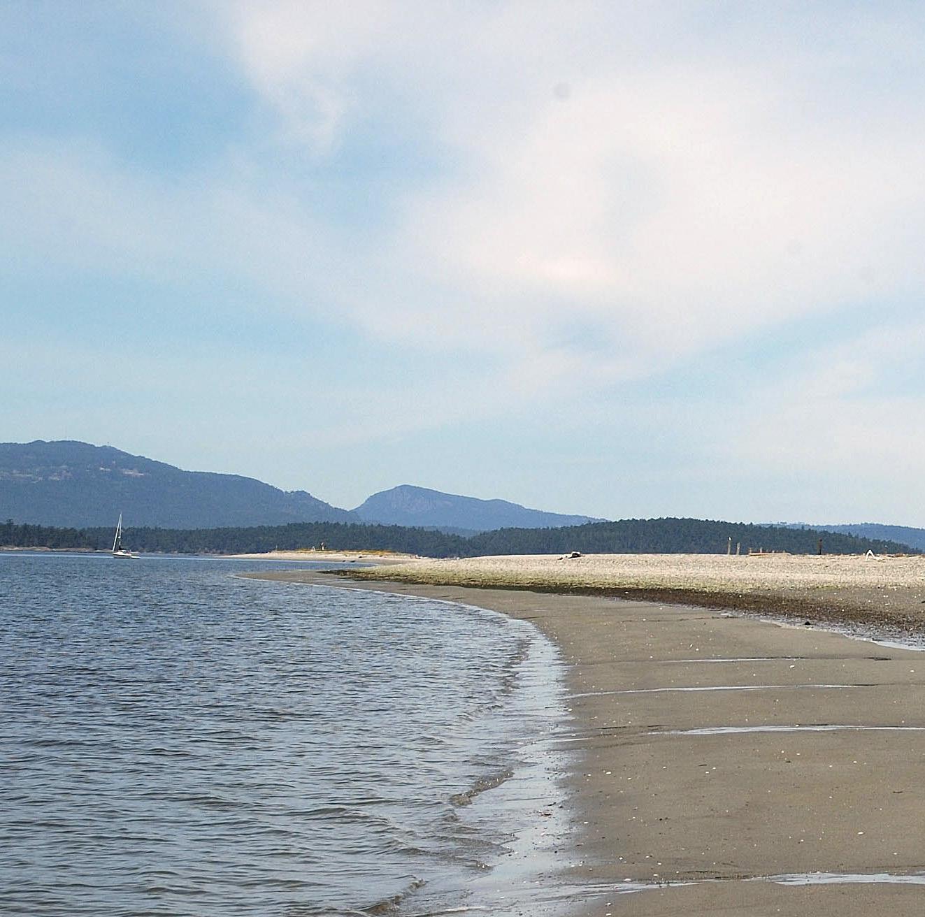
Sidney Spit boasts a mile-long sand beach and plenty of moorage space.

TThe summer sun is beating down on a deliriously lovely tongue of white sand making it warm as it massages our bare feet. My wife and I are walking a onemile-long, half-moon shaped beach, the turquoise waters rolling ashore at a relaxing rhythm. It is easy to imagine Arlene and I are visiting an atoll somewhere in the South Pacific, but no. We are strolling along Sidney Spit in the Gulf Islands. The spit is one of many
parcels that make up the Gulf Islands National Park Reserve in the heart of the Salish Sea.
This magnificent park reserve with its plentiful wildlife, scenic views and historic sites is in the Southern Gulf Islands—a popular area for both Canadian and American boaters—and during our last cruise through the islands we visited many of the park’s locations. Twenty years ago, the cruising viability of the area wasn’t guaranteed, as prior to the park’s establishment in 2003, many of the islands and marine ecosystems were in danger of being lost to development and unmanaged use.
THE PARK
The Gulf Islands National Park Reserve of Canada (pc.gc.ca) is composed of a patchwork of small preserves, un-
developed islands and donated properties. It’s spread across 15 islands, numerous islets and reefs totaling 36 square kilometres of land and 26 square kilometres of underwater preserves. Not all sites have been acquired for recreational boaters. Some have been preserved to protect land and marine ecosystems unique to the Southern Gulf Islands. Parks Canada also ensures the protection of the islands’ cultural assets. Along with recognizing the importance of the islands to the Salish First Nations, Parks Canada protects the buildings and artifacts of the early Kanaka (Hawaiian) and Chinese settlers, using the resources to bring island history to life.
Fragmented as the park may be, it’s easy to experience much of the park by boat.
40 - JULY 2024
GULF ISLANDS NATIONAL PARK RESERVE
Anchored at Russell Island with the midden in background.
IT IS EASY TO IMAGINE ARLENE AND I ARE VISITING AN ATOLL SOMEWHERE IN THE SOUTH PACIFIC

BEAUMOUNT & GREENBURN LAKE
Our first stop on this visit was Beaumont Park on South Pender Island (PY May, 2024), where we moored Easy Goin’ to one of the many park mooring buoys available. Visitors can beach their dinghies or kayaks to enjoy this popular picnic and hiking spot.
Here is where you will find the highest point on South Pender Island, Mount Norman. A 2.4-kilometre switchback trail from the beach leads to the top of the 244-metre pinnacle revealing sensational vistas across the San Juans and Gulf Islands to Vancouver Island. It’s a steep, well maintained trail and the one hour hike up is well worth the effort. We launched the dinghy and headed southwest to Poets Cove Resort & Spa. After a wonderful lunch we made the short walk to pristine Greenburn Lake,
a portion of the Gulf Islands National Park Reserve. It was covered in lily pads about to bloom and surrounded with wild yellow irises. The lake is a wonder as natural lakes are rare in the semi-desert Gulf Islands.
ROESLAND/ROE LAKE
Our next destination was Otter Bay and Roesland on the west side of North Pender Island. We set the anchor in good holding and took the dinghy to the park’s dinghy dock. At the head of the ramp, we discovered a former 1908 farmhouse that now serves as the Pender Island Museum and offers a glimpse into the island’s past. This is also the location of Parks Canada’s field office. We walk to the end of Roe Islet to take in the view of Swanson Channel and Salt Spring and Vancouver islands.
Then it was back along the islet and up Shingle Bay Road to the Roe Lake trail head and through the forest of mostly second growth to beautiful Roe Lake. If you’re looking for a full day of hiking and exploring, this is a terrific location for that. There is a 1.7-kilometre trail that circumnavigates the lake.
PREVOST ISLAND
The following morning, we weighed anchor and set a course for James Bay at the north tip of Prevost Island, which has national park reserve lands on both the north and south shores. Visiting boaters tend to favour James Bay and Selby Cove located at the northern tip of the island where park lands form a narrow point adjacent to a deep cove with a varied shoreline that include steep rock faces, gentle rising rock
JULY 2024 - 41
Princess Bay on Portland Island offers plenty of space to anchor.
shelves, gravel beaches and 10 campsites. We spent the day wandering the shoreline and uplands, where we discovered evidence of old homesteads including split cedar fences and the remains of fruit orchards.
We also took the trail that follows the north side of James Bay leading to Peile Point. The 30-minute hike was a bit strenuous (maybe our age catching up with us), nevertheless it was a good
RUSSELL ISLAND
Our journey continued the next day as we headed to our next destination. At the mouth of Salt Spring Island’s Fulford Harbour, Russell Island is blessed with many natural features typical of the southern Gulf Islands. Open meadows of native grasses host yearly bursts of camas lilies and a variety of other wildflowers. The shell midden beaches are a testament to its first inhabitants, the First Nations that date back 3,000 years. There is a short 1.2-kilometre loop trail to stretch your sea legs.
Visitors anchor on the northwest side of the island over good holding, where the view is dominated by the Salt
Spring Island mountains rising above the harbour.
During the fur trade, the Hudson’s Bay Company hired several hundred Hawaiians as labourers. After their contract expired, some decided not to return to their homeland and many settled in the area. Russell Island was settled by William Haumea and inherited from him in 1902 by Maria Mahoi. Both were of Hawaiian ancestry. A house, an orchard and remnants of what were once flourishing vegetable gardens prove that Maria and her family lived an almost self-sufficient life. A forested trail takes you to the homestead.
PORTLAND ISLAND
Next on the float plan was Portland Island where we spent two days anchored in Princess Bay on the southern side of the island. On previous visits we have anchored in Royal Cove on the island’s northwest side.
Portland Island (also known as Princes Margaret Marine Park) was presented as a gift to Princess Margaret in 1959. She returned the island to British Columbia in 1967. The island features an abundance of wildlife, cliffs, protected coves and sand beaches, and it has long been used by First Nations people, whose shell beaches are the most visible remainder of their presence. The fruit trees, roses and garden plants also found on the island testify to the more recent settlement by Hawaiian (Kanaka) immigrants in the 1880s.
ISLE-DE-LIS (RUM ISLAND)
Cruising south, the next stop is small Isle-de-Lis, also known as Rum Island, a favourite retreat for kayakers offering a gravel beach to land a dinghy or kayak and three campsites. This small island is covered with a Douglas fir and arbutus forest. The narrow isthmus connects Rum Island to neighbouring, privately owned, Gooch Island. We anchored on the
GULF ISLANDS NATIONAL PARK RESERVE
Russell Island
Prevost Is.
Roesland
Isle-de-Lis (Rum Island)
Portland Is.
Cabbage Is.
Tumbo Is.
Narvaez Bay
Winter Cove
Sidney Spit
D’Arcy Island
Greenburn Lake S. Pender Is.
N. Pender Is.
0 2.5 5 Nautical Miles
Saturna Is.
OPEN MEADOWS OF NATIVE GRASSES HOST YEARLY BURSTS OF CAMAS LILIES AND A VARIETY OF OTHER WILDFLOWERS


JULY 2024 - 43
Views of James Bay on Prevost Island and the remains of the old orchard.
GULF ISLANDS NATIONAL PARK RESERVE
north side of the island over a sand bottom for protection from a southern breeze.
SIDNEY SPIT
The final destination of our exploration cruise was Sidney Spit, what we consider the gem of the Gulf Islands. Located at the north end of Sidney Island, Sidney Spit is a popular cruising destination. Its sand bluffs, tidal flats and salt marshes teem with birds and marine life and provide hours of entertainment.
While roaming the trails of the island we discovered the remnants of various settlements, sites of First Nations cultural and spiritual significance and evidence of an abandoned brick factory. There are interpretive signs along the way with historical information and photos. The spit is in the Pacific Flyway,
so it attracts a large numbers of shore birds, and other marine life.
We enjoyed our cruise through the Gulf Islands National Park Reserve and found that it has something for every crew member.
PARK LOCATIONS NOT VISITED
Due to time restrictions and prior commitments, we were unable to visit all the park sites, most of which we have visited on prior trips to the area.
D’ARCY ISLAND
With striking views of the Gulf Islands, numerous small coves, cobble beaches and seven backcountry campsites, D’Arcy Island is a haven for Kayakers. The island has a unique history. From 1891 to 1924 members of Victoria’s Chinese community affected with leprosy were exiled to the island to live out
DOCKING & MOORING
the remainder of their lives. The inhabitants were fed, clothed and housed, but received no medical attention. An orchard and the disintegrating remains of a few buildings are the legacy of this sad chapter of Canada’s history.
WINTER COVE
Surrounded by forested uplands, open meadows and salt marshes is Winter Cove on Saturna Island. Visitors can enjoy a picnic area and easily accessible walking trails. There is a 1.2-kilometre trail that leads to Boat Pass with a spectacular view across the Strait of Georgia. A strong tidal current rushes through Boat Passage at the east side of the cove, and can be viewed close-up from a viewpoint. The cove itself is an excellent sheltered anchorage and a dinghy dock provides easy access ashore. Winter cove is the location of the annual Canada Day Saturna Island Lamb Barbecue. Everyone is welcome to enjoy the country fair style picnic.
NARVAEZ BAY
Narvaez Bay, another park site on the southern end of Saturna Island, is one of the most beautiful and undisturbed bays in the southern Gulf Islands. The dark green of a regenerating Douglas fir forest is punctuated with the contrasting lime green and copper colours of Magnolia trees. The bay also offers seven campsites.
REEF HARBOUR, CABBAGE AND TUMBO ISLANDS
Cabbage and Tumbo are nesting sites for oystercatchers and bald eagles and provide some of the most magnificent sunsets in the Gulf Islands. The park offers 10 mooring buoys, five campsites and five kilometres of hiking trails. This is also a suitable location to set the hook over a good holding bottom, soak the crab trap overnight and fish around the outer reef at the entrance of the harbour.
44 - JULY 2024
Location Mooring Buoys Moorage Float Anchorage Camp Sites Hiking Trails Cabbage & Tumbo Is. Reef Harbour 10-Yes53.5 kmPender Island Beaumount/Mt. Norman Roe Lake Roesland16-Dinghy Dinghy DinghyYes Otter Bay Otter BayClosed-3.2 km 3.0 km 1.0 km James Bay, Prevost Is. - - Yes 10Portland Island Princess Bay Royal Cove Shell Beach--Dinghy DinghyYes Yes Yes12 6 66.5 kmRussell Island - Dinghy Limited - 2.0 km Saturna Island Narvaez Bay Winter Cove--DinghyLimited Yes73.4 km 3.0 km Sidney Spit 15 Yes Yes 29 2.0 km


REQUEST A QUOTE


46 - JULY 2024

THE THERMOPYLAE CLUB
Keeping maritime history alive
By Marianne Scott
IIn 1932 the Thermopylae Club was formed in Victoria, BC. The organization named itself after the Thermopylae, the superfast clipper ship—sometimes called the queen of the seas—that had been based in Victoria in the 1890s. The club’s motto is, “Fostering an Interest in Ships and the Sea.”
No founding member of the club survives today. Nor do we have an exact idea how the organization started. We know that Captain Alexander McDonald, the first master, and author/historian Major FV Longstaff, a retired British army officer, were both instrumental in launching the organization.
In my mind’s eye, I’ve pictured how these gentlemen could’ve launched this group of ancient mariners. I see McDonald and Longstaff in the early 1930s, each taking a walk near Victoria Harbour on a wintery day. McDonald, looking at Longstaff and tipping his cap, asked, “Did you sail on the clipper Thermopylae? I think we might have met somewhere.”
JULY 2024 - 47
THERMOPYLAE
“No, but I know some men who served on her,” was the response.
“But did you ever sail out of Victoria?”
The two men began comparing their dates of service and asking about other shipmates. Soon, one suggested getting a coffee to get out of the cold wind. Having so much joint history, they met again to discuss their maritime adventures. A friendship blossomed. They then invited other mariners “who loved old ships” to these encounters. By 1932, 20-odd men created an official club, naming itself after the iconic clipper and adopting the flag of Thermopylae’s builder, the Aberdeen-based White Star Lines, as their own. They decided to meet once a month, with an annual dinner, and share their tales of derring-do.
The club has maintained logs of every meeting since, welcomes all ranks and annually holds elections for the master, purser, supercargo, first mate, second mate and directors. The master appoints the cook.
The Thermopylae Club has had a close relationship with the Maritime museum of BC. For decades, club members convened at the museum’s premises until the building was closed. The Museum’s present location is small and therefore limits the number of people who can attend the club’s meetings.
IN APRIL 2024, I attended the Club’s 900th meeting and annual dinner at the Royal Victoria Yacht Club. The menu harked back to earlier days and included salt horse (corned beef), dogfish (salmon), boiled cabbage, spuds, plum duff with ambrosia sauce, and, to prevent scurvy, a ration of lime juice. Not a weevil in sight.
Each month since its founding, the Thermopylae Club has invited a member, or another mariner, to speak about their seafaring life. The 2024 dinner speaker was Captain Rich Marriott, recently reaching ancient mariner status. For 35 years he served on fishboats,
THERMOPYLAE

tugs and government ships, rising up the hawsepipe to become the master of CCGS Sir Wilfred Laurier. He spent time in Antarctica “mentoring the Royal Navy in ice operations.” Marriott thus joined a long line of storytellers.
Many past storytellers also put pen to paper and described their most memorable experiences. These yarns were recorded in the club’s logs and were stored until the 1960s when the Club chose to make the stories better known. Historian and writer Ursula Jupp was a natural choice and with slight edits and essays providing context, published two volumes of these recollections. The first, Home Port: Victoria was published in 1967; the second, Deep Sea Stories, arrived in bookstores in 1971. Her books bring to the public true and widely varied stories of seamanship and
survival during the transition from sail to fossil fuel.
Jupp was born in the Scilly Isles, and she and her family emigrated to a Canadian prairie farm. The draw of the sea, however, was too strong and they moved to Victoria a few steps from the sea. She was the first woman to join the club’s ranks with full membership in 1954, decades before other men-only organizations opened their doors to women. The 272 yarns included in these two volumes offer a snapshot of maritime history and customs of the era between around 1880 and 1930 and reveal just how hazardous marine professions can be.
IN DEEP SEA Stories’ first tale, Captain Alexander McDonald narrates how he witnessed a highly inebriated sailor
48 - JULY 2024


being shanghaied onto the St. Paul, a downeaster whose San Francisco departure had been delayed by a one-crew shortage. McDonald describes how, in 1890, he observed two men fighting near the ship: “Hansen continually edged the man toward the face of the dock. At its base a boatman had backed in close, and when Hansen let the drunk have one under the chin, over the dock he went and square into the boat... [At the ship] they pulled the drunk up in a bowline…” The St. Paul left soon afterwards.
Ships still wreck and sink today, but serious mishaps during the age of sail were even more frequent. McDonald described some hazards he experienced or observed. In 1883, at age seven, he fell from the top of the companionway and was knocked out. At Cape Leeuwin, he saw an apprentice fall overboard while
furling a mizzen royal. A two-hour search found nothing. In 1891, another apprentice fell into the sea while trying to set the main topmast staysail in a fierce gale and high seas. “Impossible to attempt any rescue,” McDonald writes.
One long hilarious tale uncovers the travails of “a third cook in a third-class galley” for 300 steerage passengers travelling from UK’s Tilbury to Sydney, Australia. Fred Kemp worked for a vitriolic, profane chef. His main task was to peel potatoes in conditions that would
never pass BC WorkSafe standards. Mishap follows mishap below deck.
In another tale, Frank Wilson revealed the hard truths (inappropriately worded for today) of about 500 “coolies” who were transported on the Latona from the East to the West Indies. They slept on a “tween deck of soft lumber.”
A cyclone caused the ship to leak severely and when the crew couldn’t keep the pumps going, some “passengers” were enlisted. These men frequently deserted the job. Eventually, they were plied with bamboo stimulants and they took to their pumping task. A good thing too according to Wilson, because if the ship had sunk, the derelict lifeboats wouldn’t have held 15 percent of them.
Other yarns also portray the past marine industry on our coast. Several tales remind us how active whaling
JULY 2024 - 49
Above: Thermopylae Master Ken Lien with past Master and circumnavigator Tony Gooch at the TC annual dinner. Right: MMBC President Jamie Webb welcomes the TC members at the annual dinner.
THERMOPYLAE

once was in BC and describe the whale rendering camps. Schooners were built in Victoria to hunt fur seals in the Bering Strait after sea otter overharvesting eradicated them from BC waters.
Not all stories come from logs and books. Jamie Webb, MMBC’s president, told me about his grandfather, Francis Webb, born in England in 1878 and arriving in Victoria in 1889. He then served aboard a UK-flagged sealing schooner near the Pribilof Islands, where northern fur seals were captured in great numbers. “My dad told me the Russians monopolized the fur hunt, arrested the trespassers and his father spent time in a Petropavlovsk prison,” Jamie said. “At age 14! He was released after a sealing treaty was signed.” Francis joined one more voyage from Victoria to China, delivering lumber and bringing back a cargo of rice. That was enough, he decided—he retired from his marine career at 16 and turned his hand to house building and carpentry. But not forgetting his seafaring, he joined the Thermopylae Club in 1948.
Thermopylae loading at Brunette Sawmill in Sapperton, New Westminster on March 27, 1894. Note the size of the timber in the photo.
Grandson Jamie, who never got to meet his ancestor, joined in 1984. “I like the family tradition and really value the diversity of experiences these professional mariners and offshore sailors bring,” he said. “It’s a very welcoming group. Not at all stuffy.”
THE THERMOPYLAE CLUB doesn’t just entice members who’ve been at sea: it introduces them. Graphic artist Denton Pendergast, who developed the Victoria Harbour website and its 450 stories, joined the Club in 1996 without having been a mariner. “I arrived in town from Ontario,” he said, “and the first person I met was the then head of the Salts sail-training program, Martyn Clark, who was building the schooner Pacific Grace. I visited the yard often and also got to know the late John West,
who, deeply involved with the MMBC and maritime ventures, took me out on the water. As my grandfather had been a tugboat engineer, I had some fascination with boats. Both John and Martyn were Thermopylae Club members so I joined too. The members were so welcoming and helped feed my curiosity about nautical topics—leading me to the creation of that website and local lore.”
TONY GOOCH AND his wife Coryn have been high-latitude sailors and have covered tens of thousands of miles. Tony also completed a solo, non-stop circumnavigation in 270 days from Victoria to Victoria. He served as the Thermopylae Club Master for 13 years. He views the organization fulfilling a vital social role. “Members come together in a relaxed atmosphere,” he said. “They enjoy the company of fellow mariners and the storytelling. Some drove tugs alone or worked solo in the engine room. These fellows were isolated, often away from home for
50 - JULY 2024


SPORT BOAT INSURANCE OFFSHORE INSURANCE PERSONAL WATERCRAFT INSURANCE COMMERCIAL INSURANCE MARINE | HOMEOWNERS | COMMERCIAL dolphininsurance.com ph: 1.604.261.9200 / 1.800.460.0619
long stretches. The club cements the fabric of their lives and creates a sense of belonging.”
The club also represents Victoria’s long tradition as a maritime port,” he continued. “And our funny little club maintains these traditions.”
Part of these traditions include service to the community. The club sponsored the restoration of the Tillicum, the Indigenous canoe turned sailboat by Captain John Voss, who leaving Victoria, partially circled the globe.
THERMOPYLAE
She’s part of the MMBC collection. A small group of members built a large model of the Thermopylae. And, each year, along with BC Ferries, the organization presents its Watchkeeping Mate Award to the Camosun College School of Trades and Technology to the student earning the highest marks on Transport Canada’s examinations.

OVER THE LAST few decades the Thermopylae Club has placed a group of plaques on the “Parade of Ships” wall around Victoria Harbour, part of the 162 bronzes that “commemorate famous vessels in the history of Victoria.” They include such famous sailor/circumnavigators as John Guzzwell in Trekka, Tony Gooch in Taonui, and Beryl and Miles Smeeton in Tzu Hang. And of course, Thermopylae herself, the inspiration for the 92-year-
DESPITE HER BEING one of the fastest clipper ships of her era, Thermopylae was on the cusp of being obsolete by the time she was registered in Victoria as her homeport. Built by the Aberdeen White Star Line in 1868, she was a 1,300-ton composite ship with a teak hull above the waterline, elm below and supported by wrought iron frames. The metal frames increased cargo
space and kept her from hogging. To obtain the highest price for a cargo of new tea, a highly prized luxury item, she set a record sailing from Shanghai to England. Other ship builders took note and built similar clippers, including the Cutty Sark, which gave Thermopylae a run for her money. The completion of the Suez Canal in 1869, however, first diminished, then
stopped the clippers’ viability as coal-fired steamships were able to match or surpass the clippers’ speed in delivering goods from Asia to Europe. The Thermopylae switched from the tea trade to transporting wool from Australia, again setting records.
In a later chapter, Montrealbased Mount Royal Rice Milling & Manufacturing Co. bought the Thermopylae in
1890 for the Asian trade and made Victoria her homebase. A year later, she delivered rice from Rangoon (Yangon today in Myanmar) to the warehouses on Store Street. Usually, when returning to Asia, she carried lumber. She ended her tenure as a training ship for the Portuguese Navy, but eventually she was declared derelict and torpedoes sunk her off Lisbon in 1912.
52 - JULY 2024
THE GOOD SHIP THERMOPYLAE


Open to all ages and coastal locations in British Columbia, the 5th Annual Freedom Marine Digital Fishing Derby will be held between August 16th - 25th. With no designated starting point or meeting places, simply upload a picture of your saltwater catch while wearing a complimentary Freedom Marine hat. Visit our website for full details. SIGN UP FOR FREE ENTER TO TAKE HOME OVER $10,000 IN PRIZES Prize categories include: • Best Chinook Salmon • Best Ling Cod • Best Halibut Additional prizes for: • Best photo overall • Best boating photo • Best photo (age 16 and under) x3 • Plus Exciting Daily Prizes! Register for FREE boatingfreedom.com/fishing - Event Sponsors5 T H A N N U A L AUGUST 16 - 25, 2024 SCAN TO REGISTER
HANDS ON BOATER
Getting Pumped
Emergency bilge pump options, installation and maintenance
BY FRANK LANIER

54 - JULY 2024

LLike flares and lifejackets, emergency bilge pumps are a safety investment that boat owners hope they’ll never need. They can provide extra time when taking on water—time that can be spent searching for and repairing a leak, donning a life jacket or making a distress call. Here’s some common-sense advice on emergency bilge pump options, installation and maintenance.
KNOW YOUR TYPE
There are a number of choices when it comes to emergency pumps, from engine driven units to manual pumps, however electric powered centrifugal pumps are probably the most common and are the focus of this article. They pump a lot of water, are relatively inexpensive and are designed to operate while completely submerged.
They also have large internal tolerances and can pass small amounts of debris (a plus for emergency pumps), however this also makes them highly sensitive to vertical or static head—in other words, the higher they have to push water vertically, the less effective they become.
In addition to electrical pumps, you may also want to consider having a large capacity manual pump on board. Though useful as backups, keep in mind they’re powered by elbow grease and even the fittest crewmember will have a hard time keeping up with them after a while—assuming you can spare a member of the crew to man the pump in an emergency situation.
Engine-driven emergency pumps allow you to harness the tremendous
JULY 2024 - 55
HANDS ON BOATER
Static Head, the distance the pump needs to lift the water. A three-foot static head equals a 30 percent loss, so a 500 GPH pump will be pumping at 350 GPH. 3ft.


power of the engine in the event of hull breach. They can be powered off the crankshaft pulley (using a manual or electric clutch assembly) or drive train.
The Fast Flow Emergency Bilge pump for example, mounts directly to the engine shaft and as long as it’s turning, the pump is operating and starts working automatically in the event of an emergency. The smallest Fast Flow pump (the two-inch model) can pump 18,000 litres (4,800 gallons) per hour at a shaft RPM of 800 and a whopping 91,000 litres (24,000 gallons) at a shaft RPM of 2,000.
Another option is installing a suction takeoff from the engine’s raw water pump. Just remember that running the engine pump dry will damage the impeller, and that the intake connection should be in front of the sea strainer (so you don’t suck bilge debris into the engine). This is a proven and accepted pumping method, but know
56 - JULY 2024
The riser loop prevents water flowing back into the boat when heeled.
500 GPH electric pump
750 GPH (gallons per hour) electric pump and float switch

Above: Emergency take off from engine. Below: Fast Flow Emergency Bilge Pump installation.

what you’re doing before you do it— otherwise you can seriously damage your engine.
INSTALLATION TIPS
Emergency pumps should be securely mounted and configured to automatically turn on when bilge water level reaches a predetermined height above the cut on point for the primary pump (typically three to four inches, but low enough to prevent
water from overflowing the bilge and damaging furnishings or equipment).
This lets the smaller primary pump take care of normal bilge water accumulation (with less battery drain) and leaves the larger pump to kick in only when needed. It also keeps the emergency or backup pump from resting in the normal accumulation of bilge water, where it can become clogged with sludge and debris or seized from disuse.


JULY 2024 - 57
maplebaymarina.com 250-746-8482 866-746-8482 LOCAL TOLL FREE CHECK OUR WEBSITE FOR MORE INFORMATION BETAMARINE 250-655-4543 | betacanada@shaw.ca www.betamarinecanada.com CANADA HIGH QUALITY ENGINES AND GENERATORS At Gartside Marine Engines Ltd. 6 REASONS TO BUY A BETA • Unbeatable value • Superior engineering • Designed for easy servicing • Custom tailored packages • 5 year warranty • Expert technical support
Discharge thru-hulls for your emergency pump should be situated well above the waterline to prevent water from siphoning back into the bilge. Siphon breaks and riser loops are also recommended. Ensure they reach at least 18 inches above static waterline where possible.
Use marine grade hose for pump discharge runs and double clamp all bilge pump hoses at each end with marine grade stainless where possible. Make sure all pumps, float switches and strainers are easily accessible, something essential for routine maintenance, emergency repairs and to free the intake should it become clogged. Install “manual on” switches for each pump in addition to any automatic float switches that may be installed. This allows you to operate the pump
HANDS ON BOATER

boat…help SALTS transform


58 - JULY 2024
A manual pump.
your
lives RECEIVE A TAX CREDIT FOR THE FAIR MARKET VALUE OF YOUR VESSEL! CALL OR EMAIL US TODAY! 1.888.383.6811 | DONATIONS@SALTS.CA | WWW.SALTS.CA YOUNG PEOPLE FROM ALL WALKS OF LIFE ARE ABLE TO SAIL ABOARD OUR TALL SHIPS AND GROW IN CONFIDENCE, PERSEVERANCE , AND LIFE SKILLS THANKS TO THE SALE OF DONATED VESSELS LIKE THE ONES PICTURED BELOW
Donate

should the float switch fail.
Provide appropriate circuit protection for each pump and ensure all electrical connections are located well above normal bilge water levels (to reduce corrosion issues) and properly terminated with marine grade connectors—preferably those featuring heat shrink.
Finally, it’s always a good idea to include a visual/audible high-water bilge alarm as part of your emergency dewatering strategy. Alarms must be loud enough to be heard over engine noise while under way and ideally by passersby or marina personnel when docked.
Installing a visual “pump on” indicator at the helm for each electric bilge pump is also a good idea, one that can provide even earlier indications that something is amiss.
Full Service Shipyard

Shipyard Services
Haul out (30 to 130ft)
Custom stainless steel
Blasting, painting, coatings
Mechanical, plumbing


Pneumatics, hydraulics
Steel & aluminum welding
Custom woodwork & decking
Engine repower & retrofit
Steering controls, rudders
Shafts, propellers, zincs
Electrical repair & retrofit


JULY 2024 - 59
Non-return valve
Manual bilge bump
Bilge strainer Electric bilge pump
Y connector
TWO PUMP STEUP
(604) 821-1890 info@bracewellmarine.com Located at Shelter Island Marina 6831 Graybar Rd, Richmond, BC, V6W 1H3

Your Process
Focus and consistency bring success on the racecourse
BY ALEX FOX
SSailboat racing is all about skill and gear development, combined with proper application and execution. It’s knowing
your boat, understanding the game and perhaps most importantly, having faith in your decision-making process—as success in any sporting competition is born from clarity and confidence. Let’s take a look at this through the lens of a sailing crew or team. This should be fun. Sailboat racing is unique in sport, due to the tremendous range in boat types, crew sizes and racecourse format or “playing field.” While recognizing this
diversity, there are constants that can be applied on board any boat, at any time, in every kind of sailing competition! Let’s begin with a basic premise that I would propose is foundational in sailboat racing, and that is to sail fast, with efficiency and purpose! Accepting these touchstones is important as these are the primary threads that tie together a successful race, regatta or long-term program. Let’s begin with the sail fast
Thomas Hawker
60 - JULY 2024
COLUMN THE FAVOURED TACK
part, which sounds like such a simple and obvious goal, yet every sailor appreciates just how many small details combine to achieve the very best straight-line boat speed. There’s below the waterline preparation, we’ll leave that for now. Next is rig tune, an ongoing science project of refinement that includes such things as rake (forestay length primarily), shroud tension (uppers, intermediates and lowers) and prebend (mast chocking at the deck, mast step position). Then, there’s the marriage between the rig set up and the sails, arguably the most important speed producing element, with an infinite number of subtleties! The challenge for a race team then, is to hone in on the fastest settings throughout the wind and sea state range and consistently extract the potential out of the sail plan. In practical terms, this means diligent trimming, relating to halyard, backstay, outhaul, sheet tension, lead position, both fore and aft/inboard and outboard. All the while there will be deference given to heading, helm movement, balance, along with immediate goals and big picture strategy. Coordination between helm, strategist, trimmers and each crew member will only become clear with one final piece of the puzzle: good communication!
THIS LEADS US right into the realm of sailing efficiency, including crew mechanics and positioning, boat balance, sail changes, maneuvers, tacking, gybing and hoisting and dousing sails. Crew dynamics are so important while performing each of these tasks, not just in terms of who does what, but how everything meshes. That’s why, in my experience, it’s important for every crew member to understand every job on board. That shared knowledge and level of engagement gets the whole team on the same page thinking about small tweaks (sometimes big tweaks) and encourages ongoing development and progress. Small improvements in efficiency may not be obvious at first, but through practice and repetition,
improvements in process will show up in the long game, especially when put under pressure.
BACK TO THE word engagement for a second. I think it’s the glue that holds the crew together. The commitment to give your best, from before the starting gun, through to the finish line and beyond, that’s the shared common


ground. Sailboat racing is of course a physical sport, but just as importantly it’s a mental challenge. We’re all motivated by different things, but I think anyone who races is driven by that competition and loves the feeling when it all comes together in a good result. This is what I mean by sailing with purpose. I can think of several other words that also relate here: Awareness, focus,
MARINA & FUEL DOCK
Transient Moorage May to September 30/15amp Power, Wifi & Garbage with Moorage Gasoline and Diesel RESERVATIONS HIGHLY RECOMMENDED
GENERAL STORE & MARKET
Coffee Shop, Ice Cream, Produce, Meat, Seafood, Fishing Gear, Bait, Ice, Books, Clothing & Gifts


Donate your boat in support of our
Donate your boat in support of our local community of sailors with disabilities and receive a tax receipt for its
We call that a win-win.
We call that a win-win.


JULY 2024 - 61
GALIANO ISLAND, BC FIVE DINING OPTIONS
250.539.5733 I INFFOO@MONTAGUEHARBBOUR.COM M
make
breeze.
We
getting out of boat ownership a
local community of sailors with disabilities and receive a tax receipt for its full market value.
All boat sale proceeds directly support the Adaptive Sailing Association of BC Learn more at www.asabc.org/breeze
make
ownership a breeze.
We
getting out of boat
full
market value.
All boat sale proceeds directly support the Adaptive Sailing Association of BC
intensity. I fully appreciate that there are levels of competitiveness. Racing goals will vary from one program to another, and the pure joy of sailing and being on the water is indeed a wonderful thing. I also concede that competing well is great fun, why not give it your all! OK, unapologetically back to the topic. What do I mean by awareness? It goes beyond, “yes, I’m racing on a boat, with my friends, sitting on the rail, isn’t it a lovely day.” Those are all good things to be aware of, things that a passenger on a boat might be thinking. Racing awareness is about making that shift to competitor. It’s about looking up the course and seeing darker water, or a puff touching down ahead or behind. It’s about seeing the boat on our hip lifting off or falling into us, or a rival up ahead heeling more, or less, indicating a change in pressure. Awareness is using your senses, anticipating a lull, moving weight in and powering up with an ease of the sheet and backstay, all before the breeze has actually softened. Awareness is knowing who the competition is, who’s tacked off to the other side of the course, where the most pressure is, who crossed who? Awareness is noticing a current line in three lengths, then reporting on any changes relative to nearby boats. Focus, now that’s something different again. It’s the ability to stay alert to a task, whether that’s calling speed relative to a competitor or keeping to the target speed or faster for three hours, through proper helming and sail trim and boat balance. Focus is trimming the spinnaker sheet with a deft touch, looking for every opportunity to ease and communicating the pressure changes to the helm, trimming partners and crew mates, so they can adjust in unison. Focus is keeping the telltales flying on a two-sail jib reach, when the breeze is up and down in velocity and shifting in direction. It’s just occurred to me that I seem to like grouping things into threes… I’m sure there’s some reason for that? Intensity is a word that seems to carry both positive and negative connotations. On the positive side,
intensity goes hand in hand with focus, it attaches an above and beyond urgency when used at the right time. I would say a dash of intensity can be both motivating and yes, focussing. The potential danger of too much intensity, too often, is that it turns into background noise and can even become a little annoying. Intensity is about staying on it, not letting up or taking your foot off the gas, competing hard.
TRUSTING
YOUR PROCESS is very much about teamwork on multiple levels. Every crew member has a role to play in sailing fast with efficiency and purpose, every required job must be covered. One thing we haven’t spoken about yet is the decision-making process—sail choices, tactics, navigation, strategy. All of these things are related, in the sense that there are constant choices to be made in each of these areas.
Sail choices are generally clear cut, but there can be cross over between sails, and decisions get made based on how the wind is trending. Is it building, dying, heading, lifting? What are the short and long-term goals? Maybe there’s even a sail choice made to match or mirror another boat. There’s generally some discussion amongst the crew, but the correct choice usually becomes clear and then acted on with every crew member playing their part to facilitate.
Tactics are what I think of as shortterm boat for boat stuff like starting, lay lines, clear air, gybing lanes, that type of thing. There is often input and a running dialogue on wind and other boats from crew, typically led by the tactician, with decisions getting made quickly, as crew members spring into action and perform their necessary jobs. Now, the tactician will continue to fill that same role in both short and longer races, but overnight races require bigger picture strategies that factor in weather and wind forecasts, tide and current predictions and tracking of other vessels. This information and related considerations, are shared and discussed to keep everyone in the loop and engaged, with input
and observations welcomed and encouraged. At the same time, decisions and choices must be made, and it’s really important that there is consistency in that decision-making process.
The Spinnaker trimmer can’t be looking around at other boats, she’s laser focussed on the task at hand. The crew who aren’t trimming or helming, are staying engaged, still moving their weight to balance the boat properly, talking about the pressure and angles of other boats, keep that information coming. No second guessing, that’s not positive in any way. The navigator, especially at night, is tracking other boats and painting a picture of the fleet and progress relative to the adopted strategy. These updates are critical and used to maintain the status quo or to revise and adjust if required. Information reigns!
TO TIE A bow on this one, I’d like to remind myself, and everyone who’s reading along, that sailboat racing is a multifaceted sport, with so many good sailors out there and that’s what makes it so fun. Competing well is the goal. Have faith, trust your process and you’ll do fine! Good sailing everyone, see you on the racecourse sometime soon.
SUMMER RACING CALENDAR
Summer Regatta July 13–14
July One Design Regatta July 13–14
SOAR July 26–28
Cowichan Bay Regatta: VIRS 8 August 3–4
English Bay Scramble August 17
August One Design Regatta August 17–18
Maple Bay Regatta August 31–September 2
62 - JULY 2024 COLUMN THE FAVOURED
TACK

SQUAMISH OPEN ANNUAL REGATTA


July 26—28, 2024


Register: squamishyachtclub.com/SOAR
Presented by Squamish Yacht Club
Photo: Robert Torok

Salmon Habitat
Support organizations that work on behalf of salmon
BY TOM DAVIS
TThis article focuses on two groups that have consistently done good work for salmon, salmon habitat and other unique environments that are emblematic of BC’s natural treasures.
The Nature Trust of BC is a large organization, “dedicated to conserving BC’s biodiversity through securement, restoration and management
of ecologically significant lands. Since 1971 the Nature Trust of BC and its partners have acquired over 73,000 hectares of ecologically significant land to save vulnerable wildlife, fish and plants,” like the Princeton Grasslands.
The Cowichan Lake Salmonid Enhancement Society (CLSES) is small by comparison. For years they have operated under the guidance of their past president and qualified Environmental Technologist, Bob Crandall, to restore and enhance the Cowichan River watershed. The CLSES operates a small hatchery located in the community of Lake Cowichan. Of interest, they lease out its upper floor to local groups when it’s not being used to
educate school children about salmon and salmon habitat values.
THE NATURE TRUST of BC needs $350,000 to complete an Englishman River land acquisition.
On April 23, 2024 the Nature Trust announced a campaign to purchase 5.2 hectares along the Englishman River near Parksville, BC. The site is located at 130 Shelly Road and the purchase will “ensure this culturally and ecologically important river corridor remains protected for generations to come,” according to the Nature Trust’s press release.
This announcement comes almost exactly one year after the Nature Trust embarked on a similar program
64 - JULY 2024
The Nature trust of BC X2
COLUMN THE FISHING FIX
The Englishman River Estuary.
to acquire land along the Little Qualicum River, another important salmon and trout stream, located about 20 kilometers further north on Vancouver Island’s east coast.
To facilitate these land transactions the Nature Trust partners with First Nations, corporations, all levels of government and private conservation organizations like the BC Federation of Fly fishers, Totem Fly Fishers, Kingfisher Rod and Gun, Osprey Fly Fishers and the Steelhead Society of BC.
Steelhead trout happen to be one
of the salmon and trout species that spawn and rear in the Englishman River. Unfortunately, in recent years steelhead returns to most rivers across BC have declined significantly and the Englishman’s runs are no exception.
Taking control of this portion of the river should provide additional protection for this trout species. The river also supports important populations of chinook, chum, coho and pink, along with lesser numbers of sockeye salmon as well as rainbow, sea run and native cutthroat trout. These species are


JULY 2024 - 65
Englishman River map
THE FISHING FIX
important contributors to the health of the watershed’s ecosystem, particularly during the salmon spawning cycle when their carcasses add valuable nutrients to the stream’s environment. Baby salmon, produced from the prior year’s spawning, become part of the ocean’s food chain as soon as they enter marine waters. As they mature during their ocean rearing phase they contribute to fisheries all along BC’s coastal waters.
The Englishman River’s floodplain is an internationally significant habitat for migratory and breeding birds, as well as over 250 other mammal, bird, fish and reptile species ranging from tiny hummingbirds to large mammals like bear, cougar and elk.
The Nature Trust’s CEO, Dr. Jasper Lament points out that the trust has, “been working with its partners to protect the Kw’a’luxw (Englishman) River for over 40 years.” In addition to the Shelly Road acquisition the Nature Trust and the City of Parksville, in collaboration with the Snaw-Naw-As First Nation, will create a community pathway to improve trail connectivity. The pathway will feature improved interpretive signs explaining the cultural and ecological importance of the area. The City of Parksville will assume all trail design, construction and maintenance costs, while the Nature Trust will concentrate on land management and conservation measures.
THE COWICHAN LAKE Salmon Enhancement Society needs your support. Shaw Creek is considered a “gem’ by those who know it. It flows for 14 kilometers from high ground on the north side of Cowichan Lake before its waters enter the lake, just a few kilometers from its western end.
According to Bob Crandall, “it ranks far above the other tributaries of Cowichan Lake, with the lower reaches offering habitat for multiple species at risk.” Crandall points out that it has a

unique dual lane side channel that is ideal for spawning salmon and trout. This is also important habitat for elk to safely bed down at night. These two connective watercourses, and the land between them, are called the Elk Garden Side Channels.
Shaw Creek is the most important source for all year water flow into Cowichan Lake. This is because it does not dry in the summer unlike other lake tributaries. Its reliable water flow is in part due to a headwater lake, and a slow melt coming from the snow pillows atop the surrounding peaks. Shaw Creek is utilized by chinook, coho, chum and sockeye salmon, as well as steelhead, dolly varden, cutthroat and rainbow trout.
Crandall says, “at one time it supported a significant spring run of chinook that was an historically important summer food source for the Ts’uubbaa-asatx, or People of the Lake, First Nation. Today, only rem-
nants of this chinook population remain. DNA sampling, done by Fisheries and Oceans Canada and sponsored by the Sidney Anglers Association, determined these salmon did not match any other chinook in known data bases.
The emerald pools are another visually impressive feature of Shaw Creek.
However, there are problems. The most pressing issue involves woody debris, gravel and cobble that are washing into the stream at an excessive rate. This is in part due to questionable steep-slope logging practices. The arrows in the photo above show a steep natural watercourse that has been logged to its banks, leaving little or no riparian zone protection.
THE LOOSE, WOODY debris and gravel overburden have altered the lower creek’s important salmon habitat, where it blocks stream flow access to the uniquely valuable Elk Garden
66 - JULY 2024 COLUMN
CLSES
This drone photo shows upslope logging and the exposed stream course at Shaw Creek.
Side Channels.
Crandall summarized these problems in a covering email requesting letters of support from the public for a formal proposal to remove the blockages. These letters will support their request for funding from the Salmonid Enhancement Program. “Shaw Creek is the only tributary that flows year round to Lake Cowichan and a portion of this stream that contains the Elk Garden Side Channels is currently being threatened by gravel overburden and a log jam. The fish habitat loss of cool water refuge pools and (loss of) elk habitat is very real.”
This kind of stream stewardship work, done in cooperation with the community and local First Nations,
never receives enough public attention. However, it is an example of how small groups, often just volunteers, can be effective in sustaining BC’s valuable salmon resource and protecting freshwater riparian zones.
THE DIFFERENT APPROACHES used by these organizations are rooted in a common desire to help restore struggling populations of important BC fish stocks and preserve the critical habitats they depend upon. With climate warming now putting added pressures on salmon and trout populations, the work done by the Nature Trust and the Cowichan Lake Salmon Enhancement Society will help buffer these impacts.
TOM'S TIP
Support organizations like the Nature Trust of BC and Cowichan Lake Salmon Enhancement Society. Doing so improves the odds that fishing opportunities for salmon and trout will continue into the future. No amount of ‘how to fish tips’ will matter if fishing disappears, consequently the public must do everything possible to ensure that freshwater habitats for salmon and trout are restored and protected. Do not rely on governments to do it for you. So, dig into your wallet, volunteer on a stream restoration project in your community or do both.
• COMPRESSOR High-Efficiency Danfoss variable speed compressors.
• EVAPORATOR PLATE Various models to fit refrigerator or freezer box.
• KEEL COOLER Mounts through hull and uses the sea water outside the boat to cool down refrigerant.
• THERMOSTAT Mechanical or digital thermost available. Complete Systems:


• Corrosion free composite drive legs eliminate the need for anodes
• Drive legs are pre-filled with oil and then sealed for life for zero maintenance
• Tunnels are made of GRP

JULY 2024 - 67
CONTROL TO THE MAX Bow & Stern Thrusters
Distributed by Dealer Inquiries Welcome sales@rekord-marine.com rekord-marine.com max-power.com Ph. 1 800 324-0414 Fax. 604 325-5233 Rekord Marine Enterprises Other Models / Parts / Accessories Available $ 1,899 37 MARINE REFRIGERATION A.C. REFRIGERATION SYSTEMS 45 FRIGOBOAT MARINE REFRIGERATION Frigomatic D.C. refrigeration systems A.C. refrigeration systems Frigoboat cabinets FRIGOMATIC COMPRESSORS 39 EVAPORATORS 41 KEEL COOLERS 43 ACCESSORIES 43 FRIGOBOAT MS SERIE 46 ICE MAKERS 49 FRIGOBOAT CUSTOM LINE 50 FRIGOBOAT COLD ROOMS 52 Keel Cooled Refrigeration Systems
MARINE REFRIGERATION FRIGOMATIC WATER COOLED COMPRESSORS | compressore ad acqua 216 mm - 8,50 in 160 mm - 6,29 in 260 mm 10,23 n 180 mm7,08 in W 35F - W 50 F 5,8 kg- 12,7 lbs Kg 212 mm 8,34 in 145 mm - 5,7 in 170 mm 6,69 in 260 mm - 10,23 in K 35F-K 50F 5,8 kg - 12,7 lb K 50F Kg KEEL COOLED COMPRESSORS | compressore a fuoriscafo MAX CAPACITY FRIDGE (lt) MAX CAPACITY FREEZER (lt) CODE RPM CAPACITY (Btu/h) CONSUMPTION NET WEIGHT (kg) GROSS WEIGHT (kg) SIZE (WxDxH*) REFRIGERANT (A) (W) K 35 F 340 100 E50345X 2000 326 3,00 31 5,8 6,6 260x145x170 r134a 2500 406 3,40 40 3000 471 3,90 47 3500 540 4,60 56 K 50 380 100 E51975 2000 369 4,00 45 5,8 6,6 260x145x170 r134a 2500 472 4,70 56 3000 560 5,70 66 3500 650 6,80 81 MAX CAPACITY FRIDGE (lt) MAX CAPACITY FREEZER (lt) CODE RPM CAPACITY (Btu/h) CONSUMPTION NET WEIGHT (kg) GROSS WEIGHT (kg) SIZE (WxDxH*) REFRIGERANT (A) (W) W 35 F 340 100 E50045X 2000 326 4,00 45 5,8 6,6 260x160x180 r134a 2500 406 4,70 56 3000 471 5,70 66 3500 540 6,80 81 W 50 380 100 E51970 2000 369 4,00 45 5,8 - 260x232x180 r134a 2500 472 4,70 56 3000 560 5,70 66 3500 650 6,80 81 The most efficient cooling system, compared to conventional air or water cooled systems rekord-marine.com REKORD MARINE ENTERPRISES 8194 Ontario Street, Vancouver Ph 604 325-5233 1-800-324-0414 distributed by: #CT-45 Bow Thruster for 20’ - 34’ Boats
Jeanneau Yachts 55
When different works
BY ZUZANA PROCHAZKA
II wasn’t sure what to make of the big boat at the dock. It had a massive bubble dodger, a long foredeck and an enormous cockpit that seemed to go on and on. It was different but is different always what we’re looking for?
DESIGN AND CONSTRUCTION
The new design in the slip was the Jeanneau Yachts 55, the entry point into the French builder’s upmarket Yachts line and it was built with a purpose. It was designed to retain current Jeanneau clients looking to trade in their Jeanneau monohulls for catamarans. Like other monohull builders, Jeanneau has watched their clients eye the comfort, space and privacy of catamarans and trade in their single hull for two. It doesn’t matter that the average production cat doesn’t fit into a conventional slip or that it sails to weather like a shoe box, a cat is easy on older knees, pets, kids and anyone looking for separation when aboard and that makes life on two hulls appealing.

68 - JULY 2024
ON BOARD SAIL


The exterior saloon is a unique feature on the 55, and will help this monohull appeal to catamaran lovers.


70 - JULY 2024 ON BOARD SAIL
How do you make a single hull feel like two? Beneteau tried it a few years ago with their Sense line that many of us called “monomarans” much to the chagrin of the builder. It was a mixed bag that eventually faded from most boaters’ radar. In their attempt to create the new concept of a “monocat,” Jeanneau leaned on designers Philippe Briand and Andrew Winch. And they delivered.
The boat is beamy as is to be expected. It has a hard chine from bow to stern and ample width far forward on the bow where it translates into interior volume below. Despite its girth, below the waterline the hull is narrow for better pointing ability and the bow clears the waterline, angling for more agile maneuvering.
The L-shaped keel has a bulb and comes in a choice of shoal at 1.88 metres (6’ 2”) or standard at 2.54 metres (8’ 4”). Twin rudders keep her on her feet regardless of the angle of heel although as we found, there’s not much heeling to this design at all.
RIGGING AND SAILS
The fractional rig includes a Sparcraft mast with a double backstay. The standard sail plan includes an in-mast furling mainsail and a self-tacking jib on an electric furler which is operated via switches at the helms. The standard sail area includes 1,420 square feet of canvas but despite how intimidating that sounds, it’s managed with pushbutton ease from the helms.
Harken Rewind winches are within reach of the wheels and they trim in both directions for added simplicity.
ON DECK
foredeck. But it’s the cockpit where the design really shines.
Three distinct areas make up the cockpit—the forward exterior saloon with a nav desk, the helm stations amidship and the outdoor lounges and dinettes aft. The twin lounges aft to both port and starboard can be used for dining or as large sunbeds, so they’re the perfect place to lounge the day away whether sailing or at anchor. The drop transom forms a generous swim platform, so water access is much like that on a cat.
Amidships are twin helm stations fronted by control consoles reminiscent of superyacht pods. Here, 12-inch Raymarine multifunction displays are the brains of the entire operation with all systems, communications and navigation led here. Engine throttles and
bow and stern thruster controls are to starboard, and both are up high so the driver never needs to reach down by her knees when shifting.
Controls for the electric winches and the mainsheet on the arch are close at hand and the helm seats are outboard so the driver can lean out and see both the headsails and the main when sailing. Walking from the helms to the foredeck is via Jeanneau’s trademark walk-around deck which ascends gradually so you never have to climb over a cockpit combing or navigate steps. Tall lifelines add a feeling of security when moving about on the side decks.
The best is just ahead—literally. Under the transparent bubble dodger that was so conspicuous from the dock, is the exterior saloon with a nav desk to port


Catamarans offer 1.2-times the living space of monohulls of the same length which is another reason why they’re so popular. The Yachts 55 seems to do the same as it feels another 10 feet longer than its true LOA. The bow is so spacious it could hold a dance floor and its expanse feels more like a powerboat


JULY 2024 - 71
All available at Marine Stores and Book Stores Our Cruising Guides are your Boating Companions. Visit Marine Stores, Marinas and Pacific Yachting Magazine • Broughton Islands • Desolation Sound • Gulf Islands PETER VASSILOPOULOS Puget Sound, the San Juan Islands, the Gulf Islands, Sunshine Coast, Desolation Sound, West Coast of Vancouver Island, Haida Gwaii and the Inside Passage of British Columbia. Aerial Photographs and Full Colour Diagrams Marinas • Fuel Docks • GPS Waypoints AND This tenth edition of Docks and Destinations has many updates. Its full colour format and layout are designed to provide quick and easy reference to marinas and facilities for mariners boating in the Pacific Northwest. The book covers Puget Sound, the San Juan Islands, the Gulf Islands, the Sunshine Coast, Desolation Sound, the Broughton Islands, Haida Gwaii, the West Coast of Vancouver Island, and the Inside Passage to the southern tip of Alaska. It includes numerous places along the way. The pages take the mariner from one stop to the next in a successive, geographic progression. Like its companion cruising guide Anchorages and Marine Parks it returns south by way of the west coast of Vancouver Island. The information is provided in a user-friendly format enabling the reader to see at a glance where they have been and where they are going n relation to other stops. Numerous maps and diagrams include clear icons showing the presence of fuel stations and all services for the mariner so that at a glance it is possible to determine what an overnight stay at a marina has to offer Clockwise from above: View of Anacortes marinas in Puget Sound; Crowds converge on the Saturday market at Ganges in the Gulf Islands; Yacht clubs love to gather at Genoa Bay on Vancouver Island. Front cover: Enjoying the atmosphere at Blind Channel en route to the Broughton Islands. Chyna Sea Ventures Ltd. DOCkS DOCkS “We Have found your guides essential reading and enormously useful and our holidays have been all the more enjoyable as a result.” – David D. Cotterell .UK. and Printed Canada Peter Vassilopoulos Boating Guide to PNW Guest Moorage docks docks destinations Docks Cover OPTION NEW 2022.indd 2022-03-20 7:39 AM • Anchorages • Sunshine Coast • Colour Diagrams • Aerial Views GPS Covering the Coast from the San Juans to Ketchikan Alaska Peter Vassilopoulos and Marine Parks $34.95 Clockwise:At the Bunsby Islands; anchorages anchorages This edition providesout the Pacific Northwest. It includes easy references to the Gu National Park Reserve and covers the San Juan Islands, Desolation Sound, places south to north along the way etween these destinations, as well as the main waterways to Prince Rupert, southern tip of Alaska. Like its companion guide it returns south via the West Coast of Vancouver Island, featuring Quatsino, Kyuquot, Esperanza, Nootka Numerous maps and diagrams include descriptive icons showing th recommended anchorages, coves and bays, so that at glance is possible overnight. The information is provided in a user-friendly format, taking the mariner from one anchorage successive, geographic progression. “We have been sailing our 36 ft Catalina in the San Juans, Gulf Islands and Desolation Sound for 25 years. We have used numerous books and perspective of passages and harbors. The information and the way the book flows and the details that provided de-stresses our journeys and gives us more confidence passages to new and –Jane Braun, Sunshine Coast. Marine Parks The Guide to Popular Pacific Northwest Destinations PETER VASSILOPOULOS Anchorages and parks in the San Juan and Gulf Islands, Desolation Sound, West Coast of Vancouver Island, Haida Gwaii and the Inside Passage of British Columbia AND Packedwithcolourphotographsandinformation Anchorages Anchorages All available at https://shop.opmediagroup.ca/collections/bookstore

and a U-shaped dinette to starboard. It could be called an old school doghouse from where you can drive in inclement weather or sit out night watches in comfort keeping an eye on yet another 12-inch Raymarine display and driving with autopilot control. To starboard is a full-sized dinette. A wide walkway in the middle leads from the companionway all the way back to the transom. Between the forward dinette and the nav desks are two entry hatches that lead to two cabins but more on those later.
INTERIOR
The interior is by Andrew Winch Design and if the goal was to capture the benefits of catamaran living, it achieves that and then some. There are three cabins in total, all well-separated and completely private. The full-beam master stateroom is forward and part of an exclusive “apartment” that takes up nearly 60 percent of the length of the hull. The accommodations suite has a double berth offset to port, ample stowage space, an array of four overhead hatches for light and ventilation and a spacious head and shower
stall in the bow.
The grand saloon is a posh lounge, separated from the master suite by double doors. To port is an L-shaped settee and to starboard is a straight-line galley with a short free-standing island. Household-style appliances including a Bosch stove with an extraction hood, four-drawer refrigeration and a dishwasher make this self-contained apartment larger and more stylish than most city flats.
The wood finishes include teak and white oak with plenty of choices of fabrics to personalize the 55 to your heart’s content. Upscale touches include leather cabinet pulls, soft-close drawers and soft, indirect lighting. Sophisticated technology features include the Scheiber-based digital switching platform called Ship Control and the Jeanneau remote monitoring app called SEANAPPS.
As mentioned above, there are two aft cabins. completely separated from the saloon and master with their own direct access from the forward cockpit. The gullwing hatches access staircases that lead down to nearly identical cabins with double beds and wet heads. An optional crew cabin can be added in the
bow. North American boaters are likely to run a 55-footer themselves and forgo professional crew, so the bow is more likely to store lines and fenders.
UNDERWAY
Our test sail was an ideal day on calm water. The boat was equipped with Incidence sails including a 110 percent genoa with deck tracks, an optional inner self-tacker on a manual furler, a furling mainsail, and a code zero attached to the composite sprit. A traditional hoist, fully-battened main is available and increases the sail plan to a total of 1,731 square-feet (161 square-metres) of canvas.
There were 10 of us aboard and although on other boats this may have felt like a sea trial by committee, everyone scattered and we hardly ran into each other during the afternoon and the boat hardly noticed our combined weight.
With a true breeze of 13 to 15 knots, we slipped long at 7.5 to eight knots on an ideal beam reach that produced
72 - JULY 2024 ON BOARD SAIL
PE CS LOA 16.98 m / 55' 9" LWL 16.15 m / 52' 7" Beam 4.99 m / 16' 4" Draft (std) 2.55 m / 8' 4" Air draft 25.1 m / 82' 4" Sail area 131 sq-m / 1,410 sq-ft Displ.
kg
lbs
Built
Sold
Fraser Yacht Sales Vancouver, 604-734-3344
S
8,542
/ 40,878
Fuel 230 L / 61 USG Water 760 L / 201 USG
by Jeanneau Yachts jeanneau.com
by
fraseryachtsales.com

very little heel. With the code zero we cracked off to 130 degrees apparent wind angle (AWA) and still held onto 6.8 knots of boat speed. Even with the shoal keel, we nudged up to 38 degrees AWA and dug in with 8.1 knots when the breeze freshened to 17 knots. Tacking was a matter of pushing buttons. The wheels were responsive and the boat felt light as air itself.
On the way back to the marina, the 110-horsepower Yanmar diesel with the three-blade Flexofold folding prop on a shaft pushed us along at 9.5 knots which is respectable and a great way to get home fast. Docking was assisted with the fore and aft thrusters which tucked this big boat into a tight slip with minimal drama.
CONCLUDING REMARKS
Our boat was hull #2 and as equipped, it came in at US$1.3 million on a base price of US$900,000. Some key upgrades in that price included the hard dodger and the rigid bimini. These two are rounding errors on the overall price but they make life aboard an absolute win.
The Jeanneau Yachts 55 has already won a handful of awards for its design and execution. It is indeed different, but it works.
Its innovative approach has already sold more than two dozen hulls at press time and it’s likely to be imitated by other brands which is the best form of flattery. In my book, this is exactly the kind of different we’ve been needing.


JULY 2024 - 73
Looking for a specific boat review? Shop PYs database
over 300 boat reviews. BOAT REVIEWS ONLINE YACHT CHARTERS, MANAGEMENT & TRAINING DESOLATION SOUND YACHT CHARTERS Comox, British Columbia, Canada Tel: 250-339-4914 | Toll Free: 1-877-647-3815 charter@desolationsoundyachtcharters.com Now Open at Comox Marina! DESOLATION SOUND YACHT & MARINE SUPPLY STORE DISCOVER DESOLATION SOUND CHARTER BOOKINGS SPECIAL – CALL FOR DETAILS LIVING THE DREAM ONE PAGE AT A TIME Order Online at pacificyachting.com or Call 1-800-663-7611 TRAWLERSSURVIVAL WEST COAST POWER & SAIL SOOKE HARBOUR HISTORIC ANCHOR LIKE A PRO MONTAGUE HARBOUR JOHNSTONE STRAIT PORT NEVILLE ANCHORAGES EXPLORING THE NEW BOATROUNDUP PIRATES COVE BETTER THAN EVER PORT BROWNING DIVA REPOWERED SINCE 1968 A BOAT’S LIFEBLOOD REDUCED RATES ON ALL SUBSCRIPTIONS SCAN TO SIGN UP TODAY!
of


ALSO AVAILABLE AT: ORDER ONLINE BUY ONLINE WWW.BCMAG.CA/ROADGUIDE | 1.800.663.7611 ONLY $1295 NEW EDITION VOLUME 6 - FEATURING: Drivable Diners / Historic Drives / BC Pit Stops / Iconic Destinations Hidden Gems / Cross-Border Trips / Detailed Maps & Drive Times / and lots more! 1 ROAD TRIPS PM 40069119 CARIBOO CHILCOTIN VANCOUVER COAST & MOUNTAINS THE ISLANDS NORTHERN BC KOOTENAY ROCKIES THOMPSON OKANAGAN A SPECIAL ISSUE OF BRITISH COLUMBIA MAGAZINE $12.95 DISPLAY UNTIL DEC 31 2024 18 ADVENTURES INSIDE BC’S HISTORIC HIGHWAYS & BYWAYS BACK ROUTES & FOREST ROADS SCENIC TOWNS & PERFECT PITSTOPS THE ROAD LESS TRAVELLED Volume #6 More amazing road trips 2024 edition, on sale now! 74


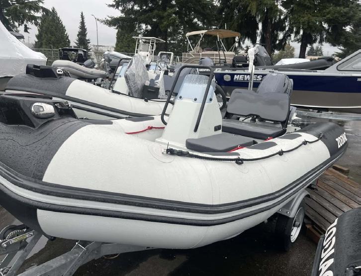


31926 MERCANTILE WAY ABBOTSFORD, BC 604-854-3440 1462 MUSTANG PLACE, PORT COQUITLAM, BC 604-461-3434 STORE HOURS OPEN TUESDAY-SATURDAY 9:00AM - 5:30PM CLOSED MONDAY & SUNDAY HIGHFIELD SPORT 760 $159,999 ZODIAC OPEN 6.5 $99,900 HIGHFIELD SPORT 650 $82,900 ZODIAC YACHTLINE 440 $45,999 ZODIAC OPEN 4.8 $36,999 HIGHFIELD PATROL 500 $64,999 PACIFIC WAVE 360 DB $15,999 ZODIAC YACHTLINE 360 $29,999 ZODIAC OPEN 3.4 $17,999 LARGEST SELECTION OF INFLATABLE BOATS IN WESTERN CANADA


DEALER FOR CATALINA & TRUE NORTH YACHTS – SPECIALIZING IN NEW AND PRE-OWNED POWER AND SAIL BOATS SINCE 1964 • SALES AND SERVICE • PROJECT MANAGEMENT • AWARD-WINNING DEALERSHIP • CPYB ENDORSED BROKERAGE SPECIALTYYACHTS.COM #102-1676 Duranleau St., Granville Island Vancouver, BC, Canada V6H 3S4 604.689.7491 | 1.800.270.2903 2022 Catalina 275 Sport NOLUXURYTAX NOLUXURYTAX 2022 True North 34 OE $599,800 US NEW & PRE-OWNED POWER AND SAIL 60 YEARS


ALSO SPECIALIZING IN PRE-OWNED INCLUDING: COASTAL CRAFT, CATALINA, HUNTER, MARLOW HUNTER, TRUE NORTH YACHTS • SALES AND SERVICE • PROJECT MANAGEMENT • AWARD-WINNING DEALERSHIP • CPYB ENDORSED BROKERAGE SPECIALTYYACHTS.COM #102-1676 Duranleau St., Granville Island Vancouver, BC, Canada V6H 3S4 604.689.7491 | 1.800.270.2903 NEW AND PRE-OWNED LISTINGS CALL US FOR ALL YOUR SALES, SERVICE AND BOATING NEEDS 2013 Coastal Craft 45 – SOLD • 2007 Formula 33 SPORT – $179,000 CDN • 2008 Hunter 33 – $95,000 CDN • 1991 Hughes 38 – $49,500 CDN New Catalina 315 New 2024 True North 34 OE 2017 Beneteau Swift Trawler 30 $399,000 CDN 2007 Tiara 3000 Open $179,000 CDN 2004 Hunter 41ac $199,000 CDN New 2024 Catalina 385 Bought by very nice people – in final stages of being commissioned 1999 Hunter 310 $65,000 CDN SALEPENDING 2009 Meridian 441 Sedan SALEPENDING New 2024 EagleCraft 32 Commuter Bought by very nice people 2009 Hunter 33 $114,900 CDN NEWLISTING


KINGFISHER • STABICRAFT • YAMAHA www.galleonmarine.com or call 604-273-7544 For over 50 Years on the Fraser River across from the Vancouver Airport 8211 River Road, Richmond, BC, V6X 1X8 | sales@galleonmarine.com SPRING SAVINGS ON ALL NEW BOAT PACKAGES 2024 KINGFISHER 1825 FALCON YAMAHA VF90 SHO STABICRAFT 2250 CENTRECAB STABICRAFT 2250 ULTRACAB WT YAMAHA F300 AND T9.9 FACTORY REBATE STABICRAFT 1550 FISHER YAMAHA F70 KINGFISHER 3025 DESTINATION TWIN YAMAHA F200 STABICRAFT 2050 SUPERCAB DEMO CLEARANCE STABICRAFT 1450 FRONTIER YAMAHA F50 2024 KINGFISHER 3425 GFX TWIN YAMAHA F425s 2024 KINGFISHER 2725 TWIN YAMAHA F150 LAST ONE CAMPION E18 YAMAHA VF150 SHO FACTORY REBATE KINGFISHER 2025 ESCAPE HT YAMAHA F200 78


LIST YOUR VESSEL WITH US. WE HAVE TWO HIGH VISIBILITY SALES DOCKS 1993 OCEAN ALEXANDER 52 ASKING $525,000 2019 34’ JEANNEAU LEADER 10.5 ASKING $341,000 VANCOUVER Granville Island T: 604-488-1202 SIDNEY Port Sidney Marina T: 250-656-6644 WWW.YACHTSALESWEST.COM SAIL 51’ Beneteau 510 | 1993 140,000 47’ Catalina 470 | 1999 NEW PRICE 239,000 44’ Beneteau Oceanis 445 | 1992 129,000 44’ Catalina 445 | 2014 399,000 42’ Catalina 42 MKll | 2002 195,000 40’ Beneteau | 2011 239,000 40’ Bavaria 40 | 2008 175,000 40’ Bavaria Cruiser 40 | 2012 265,900 40’ C&C 40-2 | 1980 ...................................... 64,900 39’ Bavaria 39 | 2006 217,500 38’ Bavaria Cruiser 38 | 2011 NEW PRICE 217,900 38’ Bavaria Cruiser 38 | 2008 187,900 62’ West Coast 62 | 2011 ........ NEW PRICE 675,000 57’ Carri Craft Passenger | 1972 119,000 52’ Ocean Alexander 52 | 1993 NEW PRICE 525,000 42’ Navigator 4200 | 1996 NEW PRICE 199,000 42’ Universal Marine Europa | 1982 163,000 40’ Bavaria R40 Coupe | 2021 NEW PRICE 819,000 40’ Nimbus C11 | 2021 USD 514,000 37’ Trojan 370 Express | 1994 109,900 34’ Mainship Pilot 34 | 2000 144,900 34’ Crownline 290 CR | 2002 64,900 33’ Monk Picnic Boat 33 | 1954 ............ USD 95,000 31’ Cutwater C26 | 2015 165,900 POWER 2020 DUFOUR 520 ASKING $649,000 IN STOCK SOLD BAVARIA R40 FLY – ON OUR DOCKS IN STOCK BAVARIA C38 – ON OUR DOCKS – Call for price BAVARIA VISION 42 – ON OUR DOCKS – Call for price IN STOCK IN STOCK IN STOCK BAVARIA C42 – ON OUR DOCKS – Call for price DUFOUR 470 – ON OUR DOCKS – Call for price DUFOUR 530 – ON OUR DOCKS – Call for price IN STOCK IN STOCK IN STOCK BAVARIA C45 – ON OUR DOCKS – Call for price BAVARIA 34 CRUISER – ON OUR DOCKS NEW DUFOUR 390 – ON OUR DOCKS – Call for price 2021 46 DUFOUR 460 ASKING $679,000


for DMS MagnusMaster anti-roll stabilization dms.stabilizers@waterlineboats.com

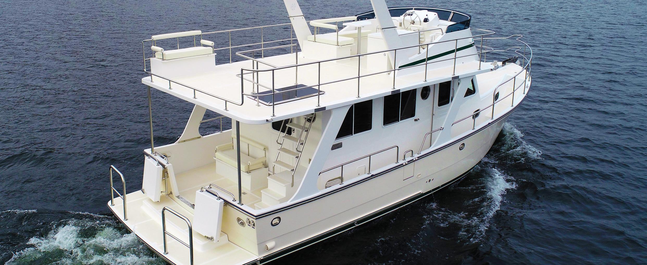
Heard on the docks — from people who’ve toured a Helmsman Trawlers®
“I came specifically to see the Helmsman and it didn’t disappoint.” “It feels so solid”. “There is storage everywhere!”. “It’s even better in person than in the videos”. “This would be a great Great Loop boat”. “I love the real wood”. “Look how beautifully built this is”. “The flybridge is big!”. “The floors don’t creak when you walk on them”. “It is so well thought-out”. “I can’t believe that this is only a 38 foot boat”. The value is beyond anything else I’ve seen at the show.” Helmsman Trawlers® are built to exceptional standards – examine and compare!
Helmsman trawlers ® WLB Brokerage - boatshed seattle . boatshed tacoma boatshed everett . boatshed porttownsend WATERLINE BOATS WLB homeport for helmsman trawlers WATERLINEBOATS.COM | SE ATTLE 206 282 0110 | EVERETT 425 278 9846 | PORT TOWNSEND 564 218 5201 helmsmantrawlers.com | 206 282 0110
View our entire inventory of
for sale at waterlineboats.com superbly crafted surprisingly affordable - top quality means safe comfortable cruising 1987 NORDZEE KOTTER 52 TRAWLER 1986 REDUCED C&L SEA RANGER SUNDECK 45 1992 CRUISERS YACHTS 3850 AFT CABIN 2017 HELMSMAN TRAWLERS 31 SEDAN 2008 OYSTER 53 46 - 43E - 43S - 38E - 38S Helmsman Take the wheel! WATERLINE
38S
boats
BOATS Northwest dealer


70’


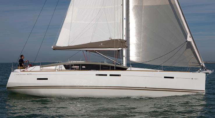
48’


SAIL
Santa Cruz “Westerly” US $379,000 60’
Steel SOLD 53’ Petersen/Jespersen
$474,900
Santa Cruz
US $224,900
50
SOLD
Schooner ’05
’88
52’
’93
50’ X-Yacht XC
’17
SOLD
X-Yachts XC ’24 NEW MODEL 46’ Lagoon NEW MODEL - INQUIRE 44’ Jeanneau SO 440 ’18 $539,000 44’ Jeanneau SO 440 ’21 $599,000 44’ Jeanneau SO 440 ’24 NEW - INQUIRE 44’ Jeanneau SO 44 DS ’13 $379,900
Bahamas $949,000 42’
$829,000
NEW - INQUIRE
Greece SOLD 41’
$575,000 41’
SO 410
NEW - INQUIRE 41’ Hanse
$429,000 40’ Beneteau 40.7
SOLD 40’
NEW - INQUIRE 40’ CS 40 ’87 US $79,900 38’ Jeanneau SO 380 ’24 NEW - INQUIRE 37’ Gartside Pilothouse ’18 $329,000 36’ CS Traditional ’79 $39,900 36’ J Boats J 109 ‘06 US $165,000 35’ Jeanneau SO 350
NEW MODEL - INQUIRE 35’ Beneteau 35s5 ’91 $59,900 32’ Flying Tiger ’06 $30,000 32’ Hunter 320
$54,500 30’ Pogo 30 ’16 $245,000 X-YACHTS XC 47 ’24 44’
37’
’24 41’ JEANNEAU 410 ’22 44’ JEANNEAU SUN ODYSSEY 440 ’21 60’ AZIMUT MAGELLANO ’24 NEW MODEL AVAILABLE NOW 48’ WENDON 480 ‘99 $439,900 53’ PETERSON/JESPERSEN ’88 $474,900 JEANNEAU SUN ODYSSEY 410 ’24 NEW AT OUR DOCKS BUYING OR SELLING A BOAT? FRASER YACHT SALES PROUDLY SERVES YOU AT BOTH OUR VANCOUVER AND CANOE COVE MARINA, SIDNEY LOCATIONS! IAN FRASER 604-377-4773 KEVIN PRITCHARD 604-290-3676 SCOTT MACDONALD 778-991-2852 TONY LAVIN 604-353-3404 fraseryachtsales.com info@fraseryachtsales.com GRANVILLE ISLAND 1818 Maritime Mews, Vancouver, BC CALL US! 604-734-3344 CANOE COVE MARINA 2300 Canoe Cove Road North Saanich BC CALL US! 604-353-3404 46’ BENETEAU 461 ’00 $599,000 AVAILABLE NOW $219,900 $575,000 NEW MODEL $329,000 $379,900 POWER 60’ Azimut 60 Magellano NEW - INQUIRE 58’ Ocean Alexander ’07 US $1,100,000 53’ Azimut 53 Flybridge NEW - INQUIRE 52’ Maritimo ’07 US $839,000 51’ Ocean Alexander ’90 $339,900 50’ Boathouse Canoe Cove $59,000 48’ Wendon 480 ’99 $439,900 45’ NC 14 ’14 $599,000 41’ Canoe Cove Sedan ’70 $49,900 38’ Bayliner 3870 Explorer ’84 $79,900 38’ Silverton Sport Bridge ’07 US $200,000 37’ Carver 370 Voyager ’99 $124,900 37’ Nordic Tug ’01 $429,900 35’ Tiara ’00 $99,000 31’ Boston Whaler 315 ’14 $349,900 30’ Rinker 280 ’08 $99,800 30’ Pursuit 3000 ’99 (Diesel) $129,900 28’ Boston Whaler 285 ’13 $279,900 28’ Albin ’00 $109,900 25’ Carolina Skiff ’03 $68,900 19’ Sea Ray 190 Signature ’97 $19,900
Grainger ’06
47
42’ Lagoon 42 ’24 Lying
Lagoon ’20
42’ Lagoon ’24
42’ Lagoon ’17 Lying
Jeanneau SO 410 ’22
Jeanneau
‘24
’21
’01
X-Yachts 4.0 ’24
’24
’01
JEANNEAU 44 DS ’13
GARTSIDE PILOTHOUSE ‘18 42' LAGOON
US $839,000
52’ MARITIMO ’07


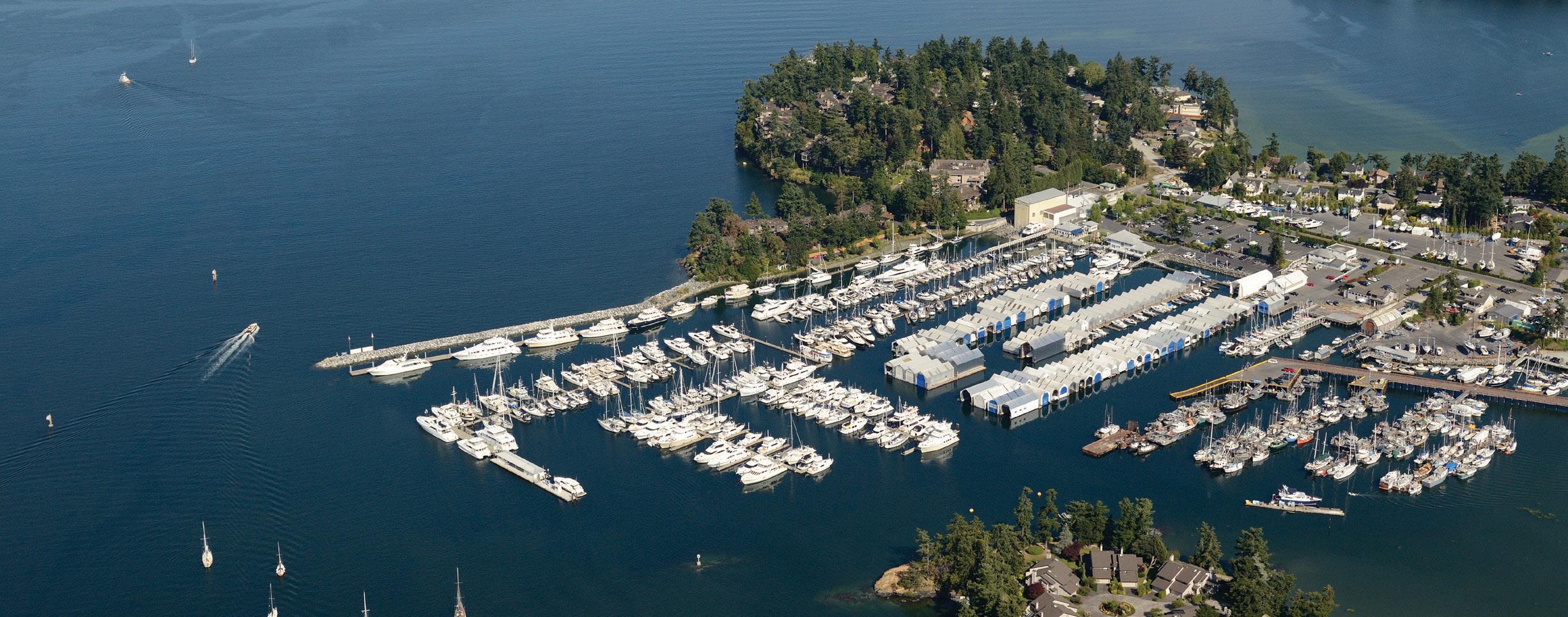
41’ Beneteau 41 Gran Turismo 2022 $875,000 Moorage Available! 59' Marquis 59 Markham Edition 2007 $969,000 Moorage Available! SOLD 35' Mainship 350 Trawler 1998 65’ Tollycraft 1996 $880,000 Moorage Available! Excellence & Value in Every Marina Experience. PRE-OWNED. BROKERAGE. NEW SALES. Sidney, BC | 250 656 1138 | info@vanislemarina.com 40' Trojan 12 Meter Motor Yacht 1987 $190,000 Moorage Available! 37’ Hunter 376 1997 $85,000 USD Moorage Available! 40’ Tiara 4000 Express 1998 $229,500 Moorage Available! 45' Bayliner 4588 Pilothouse 1993 $195,000 Moorage Available! 63’ Monk McQueen 1972 $398,000 Boathouse Moorage Available! 22’ Lifetimer 2200 Cabin 2019 $149,000 30' Sea Ray 300 Sundancer 2002 $95,000 40' Boathouse for Sale! 32’ Pursuit OS325 2021 $574,900 Moorage Available! 33’ Grady White 330 Express 2005 $189,000 Moorage Available! 34’ Silverton 3.4 Convertible 2005 $249,000 Moorage Available! SOLD 52’ Ocean Alexander 2001 53’ Selene 2008 $825,000 USD Moorage Available!


In Stock On Order In Stock OFFSHORE OS445 OFFSHORE OS405 OFFSHORE OS355 OFFSHORE OS325 DUAL CONSOLE DC365 DUAL CONSOLE DC326
CONSOLE DC306
DUAL
CONSOLE DC266 DUAL CONSOLE DC246 $249,988 SPORT CENTER CONSOLE S428 SPORT CENTER CONSOLE S378 SPORT CENTER CONSOLE S358 SPORT CENTER CONSOLE S328 SPORT CENTER CONSOLE S288 SPORT CENTER CONSOLE S268 SPORT CENTER CONSOLE S248 vanislemarina.com
DUAL
New Venture Commander trailer incl.


42' VALIANT 29' JEANNEAU 895 NC 38' MERIDIAN 381 SEDAN PORT MOODY THUNDERBIRDMARINE.COM THUNDERBIRD MARINA @ Thunderbird Marina 5776 Marine Drive West Vancouver, BC 604-921-7457 REED POINT MARINA @ Reed Point Marina 850 Barnet Highway Port Moody, BC 604-939-0499 WESTPORT MARINA @ Westport Marina 2075 Tryon Road Sidney, BC 250-656-5832 THUNDERBIRD YACHT SALES
36' MUNSON PACMAN
WEST VANCOUVER
35' BENETEAU
38' SEA RAY
37' SEA RAY
33' TIARA
38' GRAND BANKS
32' SEA RAY
24' NORTH RIVER
WESTPORT YACHT SALES SIDNEY
31' BOSTON WHALER
30' GRADY WHITE
33' HUNTER
36' CATALINA
26' STRIPER
28' REGAL
42' RIVA
84
32' CATALINA


TROUBADOUR 20m › 65’ › SEA RAY › 2015/2023 $ 1,450,000* MATTHEW.MARTIN@FRASERYACHTS.COM +1 604 209 9791 SAN DIEGO ASCENTE 34m › 112’ › CUSTOM › 1994/2017 $ 3,250,000* MATTHEW.MARTIN@FRASERYACHTS.COM +1 604 209 9791 SAN DIEGO *Not offered for sale or charter to U.S. residents while in U.S. waters. SALES | CHARTER | MANAGEMENT | CONSTRUCTION | CREW | 20 OFFICES WORLDWIDE FRASERYACHTS.COM Greg Marshall design built on a Westport Hull 7600 Series. Spacious accommodations for 12 guests and 6/7 crew. Proven charter record with low operating costs. One of the most exclusive investment opportunities available. Built for the Pacific North West. The proven Sea Ray L650 blends performance with sophistication, comfort and style. Spacious accommodations, state-of-the-art technology, and exquisite craftsmanship, make every voyage a masterpiece. Elevate your boating experience and set sail in elegance.
ASCENTE NEW PRICE
TROUBADOUR


THE PREMIERE CHOICE FOR EXPLORING THE PASSION OF YACHTING. Call Us Today 604.609.0985 / 250.940.9060 75’ 2012 Custom Boathouse with Suite $218,000 CAD 80’ 2007 Ocean Alexander $2,195,000 USD (CAD DUTY PAID) 90’ 2007 West Bay Yacht Fisherman $2,899,000 USD 74' 1996 Hatteras Sport Deck Motoryacht - $589,000 USD 65’ 2006 Marquis 65 $995,000 USD 62’ 2002 North Sea (Greg Marshall) Trawler $1,800,000 USD 60’ 2018 Azimut 60 Flybridge $1,599,000 USD (CAD DUTY PAID) 61’ 1990 Tollycraft Pilothouse $549,000 USD 64’ 2004 Ocean Alexander 62’ 2020 Princess F62 54' 2015 Belize 54 Sedan $1,099,000 USD 112’ 1995 Tarrab Raised Pilothouse $1,499,000 USD (CAD DUTY PAID) 58’ 2003 580 Meridian $699,000 CAD 58’ 2014 Riviera 5800 Sport Yacht $1,150,000 USD Scan to access our listings 52’ 2008 Maritimo 67’ 2016 Hampton 648 Endurance $2,795,000 USD (CAD DUTY PAID) 59’ 2003 Carver 570 Voyager $629,000 CAD 60’ 2018 Princess S60 $1,995,000 USD 65’ 2006 Marquis 65 $1,150,000 USD 54’ 2007 Meridian 490 Pilothouse SOLD 56' 2019 Custom Boathouse SOLD SOLD SOLD 54’ 2006 Meridian 490 Pilothouse 60’ 2010 Viking 60 Enclosed Bridge $1,899,000 USD C M Y CM MY CY CMY K SOLD SOLD 55’ 2011 Custom Boathouse SOLD FOR SALE - POWER BOATS

RIVIERA 465 SUV
Moorage available, trade-ins welcome


Available now for the cruising season, the Riviera 465 SUV is a combination of high performance with luxurious living single-level living. Enjoy the comfort, style, and ambiance of an al-fresco deck, a generous cockpit for water-sports action, and impressive staterooms below deck.


 Riviera 465 SUV
Riviera Range
Riviera 465 SUV
Riviera Range


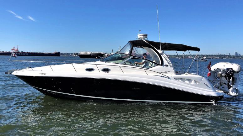


40’ 2006 Sea Ray 40 Motor Yacht $339,000 CAD THE PREMIERE CHOICE FOR EXPLORING THE PASSION OF YACHTING. Call Us Today 604.609.0985 / 250.940.9060 FOR SALE - POWER OVER 46’ #1 IN CANADA BOATS SOLD 35’-180’ BOATINGFREEDOM.COM VANCOUVER 604.609.0985 SIDNEY 250.940.9060 中文服务专线 604.235.1000 FREEDOM@BOATINGFREEDOM.COM 37' 2007 Sea Ray 340 Sundancer $155,000 CAD 37' 2022 Axopar 37XC $481,900 CAD 44’ 2018 Riviera 445 SUV $1,300,000 CAD Scan to access our listings 39’ 1995 Bayliner 3988 Motoryacht $174,000 CAD 48’ 2009 Sea Ray 48 Sundancer $640,000 CAD 47’ 2011 Sea Ray 470 Sundancer $549,000 CAD 50’ 2020 Princess F50 $1,750,000 CAD 45’ 2005 Tiara Yachts Sovran 4000 $320,000 CAD 46’ 1992 Canoe Cove Pilothouse SOLD 50’ 1990 Ocean Alexander 50 Piltohouse SOLD 37’ 2020 Axopar 37XC $459,000 CAD MY CY 37’ 2021 Axopar 37XC SOLD 37’ 2018 Axopar 37XC 300HP w/V8’s SOLD 40’ 2008 Marquis 40 Sport Coupe $499,000 CAD 45’ 2024 Axopar 45XC Cross Cabin In Stock $1,215,626 CAD 37’ 2022 Axopar 37XC Cabin $470,000 CAD 36’ 2007 Carver 36 Mariner $159,000 CAD 37’ 1968 Custom 37 Trawler $110,000 CAD 37' 2022 BRABUS Shadow 900XC Aft Cabin Moorage Available with Purchase 39’ 2019 Nord Star 36 Patrol $588,000 CAD 43’ 2008 Tiara 4300 Sovran $418,000 CAD 46’ 2024 Riviera 465 SUV Price on Request – Available Now 43’ 1991 Bayliner 4388 $132,800 CAD FOR SALE - POWER BOATS


BOATINGFREEDOM.COM 604.609.0985 / 250.940.9060 THE ADVENTURE COMPANY


FOR SALE - POWER OVER 46’ #1 IN CANADA BOATS SOLD 35’-180’ BOATINGFREEDOM.COM VANCOUVER 604.609.0985 SIDNEY 250.940.9060 中文服务专线 604.235.1000 FREEDOM@BOATINGFREEDOM.COM Scan to access our listings 29’ 2024 Axopar 29XC Arriving Spring – Inquiry for Pricing 25' 2023 BRABUS Shadow 300 Inquire for Pricing 24’ 2018 Axopar Hard Top $129,000 CAD 22’ 2023 Axopar 22 $138,000 CAD 25’ 2022 Axopar 25 Cross Top Inquire for Pricing 28’ 2021 Axopar 28 Cabin $238,000 CAD 28’ 2022 Axopar 28 Cabin $279,000 CAD 28’ 2023 Axopar 28 Cabin Aft Cabin 34’ 1991Sabreline Sedan $249,000 CAD 33’ 2002 Grady White 330 Express $238,000 CAD 26’ 2002 Strike Cuddy Cabin w/diesel SOLD C M Y CM MY CY SOLD 31’ 2014 Boston Whaler 315 Conquest Pilothouse 28’ 2004 Pursuit 2870 w/twin 300HP Engines $149,000 CAD 28’ 2019 Axopar Cabin w/Aft Cabin $239,000 CAD 28’ 2023 Axopar 28 Cabin $359,000 CAD 26’ 2017 Sea Ray 260 Sundancer $129,000 CAD 27’ 2018 Chris Craft Corsair $189,000 CAD 35’ 2014 Sea Ray 350 Sundancer $299,000 CAD 35’ 2018 Boston Whaler 345 Conquest Pilothouse $510,000 USD 30’ 2000 Pursuit Express $99,000 CAD 36’ 2023 Delta 33 Open $839,000 CAD 28' 2023 Axopar 28 Cabin Twin Engine Wetbar Inquire for Pricing 31’ 1988 Tiara Yachts 3100 SOLD 25’ 2009 Boston Whaler 250 Outrage SOLD SOLD THE PREMIERE CHOICE FOR EXPLORING THE PASSION OF YACHTING. Call Us Today 604.609.0985 / 250.940.9060 FOR SALE - POWER BOATS


freedom marine INTERNATIONAL YACHT SALES Vancouver Island: 250.940.9060 Vancouver: 604.609.0985 中文或粤语: 604.235.1000 www.boatingfreedom.com Freedom Marine Inc. freedom@boatingfreedom.com TRADE-IN SAVE BIG
saving on taxes!
vessel:
Turn the boat you have into the one you want while
Benefits of trading-in your
• Tax Savings
• Simple & Easy Process
• Single Boat Ownership
• Save on Moorage & Maintenance Costs
SCAN FOR A VALUATION
• Get in a New Boat in time for the Boating Season!


51’ Hanse 510 Orders Available 54’ Moody 54 DS Orders Available 54’ Hanse 548 Orders Available 34’ 2024 Hanse 348 Orders Available 46’ Dehler 46SQ Newly Launched Orders Available 46’ 1990 Nautor Swan 46 Mark II 42' Dehler 42 Orders Available 40’ 1986 O-Day Scan to access our listings 46’ Hanse 460 Customization Available 41’ Hanse 410 (New) Orders Available 48’ 1998 Custom Yachtwerft Luetje SOLD 45’ 2014 Beneteau America Oceanis SOLD 42’ 2022 Lagoon 42 SOLD 38’ 2006 Sabre 386 SOLD 36’ 2009 Jeanneau 36i Performance SOLD 24’ 2021 Cornish Crabbers 24 MKV $159,000 CAD SOLD 41’ Moody 41DS Orders Available SOLD 48’ Moody 48DS Newly Launched Orders Available THE PREMIERE CHOICE FOR EXPLORING THE PASSION OF YACHTING. Call Us Today 604.609.0985 / 250.940.9060 FOR SALE - SAIL BOATS


SUNSEEKER.COM View Our Yacht Collection Today M & P Yacht Centre | (604) 692 0333 | yachtsales@mpyachtcentre.com 510 Nicola Street, Unit #110, Vancouver, BC V6G 3J7 www.mpyachtcentre.com METICULOUSLY DESIGNED. Make a seamless transition from indoors to out. With the Manhattan 55, you have unparalleled flexibility.


604.692.0333 | MPYachtCentre.com AVAILABILITY SUBJECT TO CHANGE. 2020 | SUNSEEKER MANHATTAN 66 | $2,695,000 USD 2020 | SUNSEEKER MANHATTAN 52 | $1,740,000 USD NEW | PRESTIGE F-LINE 520 | TWIN VOLVO D6 IPS 650 WITH JOYSTICKS 2019 | BENETEAU SWIFT TRAWLER 44 2022 | BENETEAU GRAN TURISMO 41 | $854,000 CAD NEW | BENETEAU GRAN TURISMO 41 2013 |MONTE CARLO YACHTS MCY 65 | $1,490,000 USD 2019 | SUNSEEKER MANHATTAN 52 | $1,459,000 USD 2019 | SUNSEEKER MANHATTAN 52 1997 | SEA RAY 500 SUNDANCER | $284,900 CAD 2014 | SEA RAY 510 FLY | $790,000 USD 2021 | PRESTIGE F-LINE 520 | $1,788,000 CAD 2008 | FORMULA 45 YACHT | $449,000 CAD 2016 | SABRE 42 SALON EXPRESS | $799,000 CAD NEW|SUNSEEKERMANHATTAN55| TWINVOLVOD13800HPINBOARDSHAFTS NEW | PRESTIGE S-LINE 520S | TWIN VOLVO D6 IPS 650 2022 | PRESTIGE 460 FLY | $1,279,000 CAD | LOW HOURS NEW | BENETEAU SWIFT TRAWLER 41 FLY | TOP SELLING MODEL NEW | BOSTON WHALER 405 CONQUEST PILOTHOUSE 2021 | SUNSEEKER MANHATTAN 55 | $1,888,000 USD | LLC OWNED 2006 | DORAL 45 ALEGRIA | $349,000 CAD NEW | PRESTIGE F-LINE 420 | TWIN CUMMINS QSB 6.7L INBOARD SHAFTS 2005 | SEA RAY 500 SUNDANCER | $549,000 CAD SOLD SOLD 2022 | BENETEAU SWIFT TRAWLER 41 FLY | $1,050,000 CAD PENDING SALE


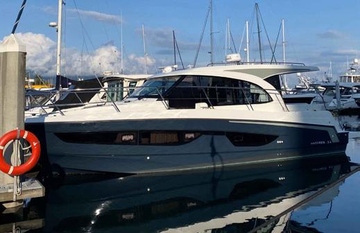


604.692.0333 | MPYachtCentre.com AVAILABILITY SUBJECT TO CHANGE. Reserve your VIP Yacht Discovery Appointment NEW | SEA RAY SLX 310 | PERFECT DAY BOAT FOR ENTERTAINING 2013 | SEA RAY 280 SUNDANCER 2018 | BOSTON WHALER 345 PILOTHOUSE | $730,000 CAD 2009 | SEA RAY 350 SUNDANCER | $198,000 CAD 2020 | RIVER HAWK 28 SH | $325,000 CAD PRICE REDUCED 2023 | BENETEAU ANTARES 11 | $499,000 USD 2017 | BOSTON WHALER 345 CONQUEST | $669,000 USD NEW | SEA RAY SUNDANCER 320 | TWIN MERCURY 6.2L SEACORE 2021 | BOSTON WHALER 325 CONQUEST | $599,000 CAD 2022 | PURSUIT 325 OFFSHORE 2017 | SEA RAY 280 SUNDANCER | $180,000 CAD 2003 | EDGEWATER 265 EXPRESS | $135,000 CAD NEW | BOSTON WHALER 345 PILOTHOUSE 2015 | REGAL 280 EXPRESS | $140,000 CAD NEW | WELLCRAFT 355 TRIPLE MERC 350HP V10 NEW | SEA RAY SUNDANCER 370 | TRIPLE MERC 300HP V8 | SEAKEEPER 2010 | SAN JUAN 40 | $549,000 USD TWIN VOLVO PENTA IPS 500 370HP SOLD 2019 | BOSTON WHALER 315 CONQUEST SOLD 2018 | BOSTON WHALER 285 PILOTHOUSE SOLD 2018 | BOSTON WHALER 285 CONQUEST SOLD SOLD 2010 | BOATHOUSE 5878 SOLD 2022 | ROBALO R230 CENTRE CONSOLE SOLD 2010 | BOATHOUSE 5880 SOLD NEW | SEA RAY SLX 400 | “THE ENTERTAINER” SOLD


View Our Yacht Collection Today M & P Yacht Centre | (604) 692 0333 | yachtsales@mpyachtcentre.com 510 Nicola Street, Unit #110, Vancouver, BC V6G 3J7 www.mpyachtcentre.com IN ULTIMATE HARMONY WITH THE SEA PRESTIGE 420 FLY PRESTIGE 520 S PRESTIGE 520 FLY NEW ARRIVAL


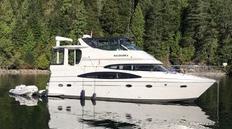


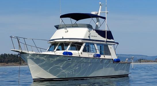


CHECK OUT OUR OTHER FANTASTIC LISTINGS ON www.customyachtsales.com Tel: 250-656-8771 | Toll-Free 1-877-263-2427 | sales@customyachtsales.com Greg Horne - Rom Van Stolk - Mark Impett | Cedar Grove Marina - 1955 Swartz Bay Road, Sidney, BC LIQUID METAL MARINE QUATSINO 24’ 2021 - Beautiful custom aluminum DC bowrider designed by Greg Marshall, launched in 2022. Volvo D4-270,16” Simrad Nevo multi-function, removable hardtop, Shockwave seats, enclosed head. $275,000 CAD AT OUR MARINA TOLLYCRAFT 43’ TRI-CABIN 1984Boathouse kept (boathouse available), twin diesel, generator, diesel furnace, water maker and new flybridge enclosure! $198,000 CAD PASSPORT 47 1984Major refit! Teak decks redone, 2020 Yanmar re-power, new fuel tanks, new Webasto heater, and much more! Rare opportunity to acquire a ready to go blue water vessel! $297,000 CAD CARVER 466 MOTOR YACHT, 2004Tastefully upgraded, boathouse kept, and just 886 hours on her Volvo 480hp diesels. $339,900 CAD BY APPOINTMENT
HUNTER 50 2012 • A Fabulous Luxury Passage Maker! • Tall Rig, In-mast furling, electric winches • 110hp Yanmar only 307 hrs. / Flexfold prop • Hydronic heat, bow thruster, c-pit enclosure • Owner will finance and consider trades $475,000 CAD STRIPER 2601 2008Rare with Volvo D4 Diesel (350hrs) All new canvas and upholstery Great value here $86,000 CAD NAVIGATOR 57 RIVAL 2005Heavily upgraded, all new electronics, custom hardtop, Seakeeper, extended Keel and so much more. $748,000 CAD MERIDIAN 541 2012Bow and stern thrusters, Cummins QSM 11’s (490hrs), New heated bridge enclosure, new tender, and much more! $1,089,000 CAD CUSTOM PHIL BARRON MONK 48’ 1987A Bristol, house kept, show piece ! Garmin electronics, Magnum inverter Hurricane heat, and a reliable Izuzu E120 Diesel. This is a must see!! $149,000 CAD SILVERTON 33 SPORTS COUPE 2008Diesel furnace, newer electronics, comfortable 2 bedroom layout, this boat is ready for cruising! $169,000 CAD RANGER TUG 31 2014Efficient single Volvo Penta D4, Diesel heat, 8’ Fluid Motion tender, new bottom paint, and bow and stern thrusters! $369,000 CAD SEA RAY 480 SUNDANCER 2016Boathouse kept beauty. Cummins 540hp on V-drives. Only 960 hours. Hydraulic swim platform, bow thruster. Shed for rent or purchase. $549,000 CAD TOLLYCRAFT CONVERTIBLE SEDAN 34 1981Twin Cummins diesels, Wesmar Stabilizers, Bow thruster, newer electronics. This is a highly upgraded example! $129,000 CAD TRUE NORTH 38 2008Alaskan Bulkhead, Yanmar diesel, Bow thruster, diesel heat, and much more $395,000 CAD JEANNEAU SUN ODYSSEY 409 2012Over 140,000 in upgrades! New sails, electronics, Lithium batteries - a beautiful example. This boat is a must see! $324,900 CAD
MERIDIAN 441 SEDAN 2009Twin Cummins QSB 380hp on shafts, Hydronic heat, Seawise electric davit, bow and stern thruster, excellent condition! $598,000 CAD MAINSHIP 34 2008Bow and stern thruster, economical Yanmar diesel, Full flybridge strata glass enclosure, All new Garmin, hydronic heat, and much more! $299,500 CAD
MARLOW
SALE PENDING


GrandYachts.com Coal Harbour Marina in Vancouver: 604-687-8943 | Port Sidney Marina in Sidney: 250-656-8909 2018 LAGOON 42 $818,000 2004 GRAND BANKS 46 $875,000 2022 BENETEAU OCEANIS 46.1 $859,000 2017 OUTBOUND 46 $875,000 2011 GRADY-WHITE CHESAPEAKE 290 $229,000 1987 OCEAN ALEXANDER 50 MKII $324,500 2002 MAINSHIP 430 AFT CABIN $320,000 2000 BAYLINER 4788 PH $299,000 2019 JEANNEAU 1095 $419,000 2010 BENETEAU 49 $349,000 1999 WENDON 630 $775,000 GRAND BANKS 42 $99,000 2011 FIRST 30 $122,000 2005 TAYANA 37 $219,000 GRAND MARINER 50 $99,500 USD 2007 FLEMING 65 $3,850,000 NEW 2024 ELECTRONICS PACKAGE 98


YOUR EXCLUSIVE DEALER FOR THE 26, 30, 34, 38 COMMANDER - QUALITY USED VESSELS NEEDED BEST SELECTION OF CONSIGNMENT COMMANDERS - WWW.CANMARYACHTS.COM Why settle for less than the best PHONE: 604-273-2226 UNIT #12 – 8331 RIVER ROAD, RICHMOND, BC V6X 1Y1 2018 COMMANDER 34 Twin 330 Cummins Diesel – Very Low Hours Price Reduced $249,000 – Call for More Info. 2010 COMMANDER 30 – Single Volvo Diesel – Fully Equip. Full Electronics – Aux. Power – Dinghy w/Motor – Bow Thruster Teak and Holly Sole – Pictures Available – $217,900 1989 BAYLINER 4588 – Pilothouse, New Power, 133 Hours, 310 Hp, Boathouse Kept – Ready for New Ownership – $169,000 2000 MODEL BAYLINER 2855 SIERRA SB – Extremely Clean through-out Low Hours – Mark 7.4 MPI – New Canvas – Price Reduced $21,900 1991 COMMANDER 26 – Comes with Tri Axle Trailer – Rebuilt Eng 236 Hours Fully Equipped – Spotless Cond. – Ready for the Summer – Asking $85,000 2002 COMMANDER 26 SINGLE DIESEL – 260 Hp. – Priced for Quick Sale –Radar/Electronics – Outboard Aux. Power & TR Gold Gladiator Auto Pilot – Espar Furnace – Bimini & Cockpit Canvas – A very Clean Neat Commander ready for New Ownership – 79,900 NEW ARRIVAL 2004 COMMANDER 30 Twin Volvo Diesels – 41 Series Full Array of Equipment – in Great Condition! – $179,900 1994 COMMANDER 26 – MINT - Boatshed Kept – Volvo Diesel – 516 Hours Full Serv. & Survey Records – Comes w/ Rebuilt Road Trailer. Many Upgrades. Call for Information $97,000 2000 COMMANDER 26 – Volvo Diesel – Good Service Records – Recent Drive Replacement – Aux. Yamaha High-Thrust Pony/Trolley Motor –Extremely Clean – Spotless Cond. – Asking $86,900 2007 COMMANDER 30 Twin Volvo D4 Diesels – Bow Thrusters – Updated Electronics Low Hours – Spotless Condition! – $230,000


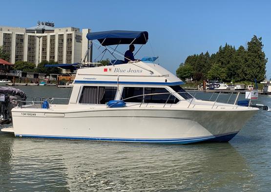


Call or Text Rob Langford 604-250-8800 Shawn Sutherland 604-787-0126 Lori Sutherland 604-789-6067 YACHTBC.COM Contact us for a complimentary market valuation! 76' MONK MCQUEEN $399,000 USD SEA RAY 480 - $329,000 57’ CALIFORNIAN - $299,000 52’ WEST BAY - $579,000 USD 52’ OCEAN ALEXANDER- $399,000 3888 BAYLINER - $79,900 WE HELP OUR CLIENTS BUY AND SELL BOATS! BOATS ARE SELLING! 123 BROWARD - $1,999,000 USD 52’ BAYLINER - $479,000 5788 BAYLINER - $490,000 PRESIDENT 680 SKYLOUNGE - $1,750,000 USD 61' OCEAN ALEXANDER - $1,125,000 USD 38’ GULF COMMANDER - $149,900 36’ STEPHENS TRIPLE COCKPIT $325,000 USD 310 LARSON CABRIO - $92,000 33’ STINGHER - $137,000 REGAL 3360 - $124,900 SCOUT 151 DORADO - $31,000 SEA RAY 340 - $160,000 42’ QUEENSHIP - $219,900 CPYB Endorsed Brokerage 30’ COMMANDER - $92,500 MOORAGE AVAILABLE 43 TOLLYCRAFT - $265,000 42 JERSEY - $249,00 40’ NOVA - $119,900 MOORAGE AVAILABLE MOORAGE AVAILABLE MOORAGE AVAILABLE


56 OCEAN YACHTS Great Layout, Ample room! $289,900 37 BAYLINER One of the Best! Price $175,000 49 BENETEAU Beautifully kept! $435,000 BOATHOUSES Enquire
42 UNIFLITE Double Cabin! $129,900 For complete listing details & new arrivals check arbutuscoastyachts.com LADYSMITH MARINA & CANOE COVE MARINA 38 BAYLINER 3888 Motoryacht ! $79,900 45 TANTON OFFSHORE Well equipped! $235,000 62 KHA SHING Condo on the Water! $399,000 arbutuscoastyachts@shaw.ca 40 COASTAL CRAFT Beautifully finished interior, Massive upper Deck, Expansive covered Cockpit, Three station helm control, Twin Volvo Diesel, Northern Lights Genset, Watermaker, Large swim grid with Seawise Davit system, Sat Dome, Raymarine Hybrid Touch, Hurricane Hydronic Heat Perfectly suited for Coastal Cruising NEW PRICE $450,000 USD 50 JEANNEAU This Exceptional Sun Odyssey 509 delivers outstanding performance, superior comfort and shows pride of ownership! Current owner is consistantly maintaining and upgrading. Contact Larry Thompson to view this stunner! $495,000 CAD 27 COMMANDER Ready to Cruise! $159,900 41 MORGAN $99,000 40 SEA RAY 2008 Gorgeous Sea Ray ! Twin 380 Cummins Diesel Bow Thruster, Navigation Suite... Too many details to list Custom Boathouse (not included in price) $395,000 34 CHB Tri Cabin $74,900 NEWLISTIING NEWPRICE 30 Carver Sedan $42,900 NEWPRICE NEWLISTING 26 Macgregor Motorsailer $28,900 32 Westsail Cutter $65,900 40 FORMULA 2005 Shows like new! Twin Yanmar Diesels 420 HP Center console Tender with 30 HP Custom hydraulic swim grid Boathouse Available (not included in price) $339,000 NEWLISTING NEWLISTING SOLD!!! 27 CHAPARRAL $79,000 NEWLISTIING
PoWER • sAIL• BoATHouSES

BUYING OR SELLING?
Sellers and buyers both benefit from a BCYBA member’s experience. BCYBA brokers assist buyers to find suitable boats in the local market or further afield in the international market. Similarly, they present locally owned boats for sale to local and international buyers.
Take the stress out of purchasing or selling your boat. A BCYBA broker is your guide through a successful transaction. They help in these ways:
• Identify and evaluate yachts of interest.
• Provide experience in negotiating acceptable sale terms.
• Ensure your deposit stays in Canada.
• Outline vessel documentation, title, importation, insurance and taxation issues.
• Utilize strong working relationships with co-operating brokers, marine surveyors, marine mechanics, boatyards and other key industry contacts.
• Provide local follow up to help you in your boating adventures.

FOR A FULL LIST OF BCYBA MEMBERS & CERTIFIED PROFESSIONAL YACHT BROKERS VISIT BCYBA.COM 102


Because you Love Pacific Yachting, you may also enjoy these titles:


Wild Harvest BC
Linda Gabris has been venturing into the outdoors to harvest wild edibles for over 60 years. Tips and practical advice, combined with a scientific field guide, Wild Harvest BC is the perfect companion book to take with you on your outdoor adventures.


Road Trips Volume VI: The Road Less Travelled
In the 2024 issue, we’ve included some of BC’s lesser-known highways and byways, which we hope you’ll add to your summer itineraries. We’ve also included a few of our local favourites such as the North Shore’s Marine Drive and a scenic tour of the Southern Gulf Islands.

Log Book
The Pacific Yachting Daily Cruising Log Book is 6” wide by 9” high and comes with a splash-proof cover. Wire-O binding allows the 200 pages to be folded behind the book for ease of writing. Provides ample space for your daily cruising notes.


Visit Our Bookstore For More Great Reading! 1-800-663-7611 thebookshack.ca LOCAL AUTHORS • LOCAL TOPICS
Flies WITH PHIL ROWLEY & FRIENDS By Phil Rowley 1
PM 40069119 CARIBOO CHILCOTIN VANCOUVER COAST & MOUNTAINS THE ISLANDS NORTHERN BC KOOTENAY ROCKIES THOMPSON OKANAGAN A SPECIAL ISSUE OF BRITISH COLUMBIA MAGAZINE $12.95 DISPLAY UNTIL DEC 31 2024 18 ADVENTURES INSIDE BC’S HISTORIC HIGHWAYS & BYWAYS BACK ROUTES & FOREST ROADS SCENIC TOWNS & PERFECT PITSTOPS THE ROAD LESS TRAVELLED Volume #6 NEW W Harvest BC A FORAGER’S GUIDE TO EDIBLE PLANTS OF BRITISH COLUMBIA 71 71 W ild Harvest BC BY LINDA GABRIS
ROAD TRIPS
NEW
LIMITED QUANTITIES


CAPTAIN’S for advertising opportunities | meena mann | 604.559.9052 | meena@pacificyachting.com FEATURING BOAT PRODUCTS & SERVICES www.channelcutteryachts.com 250-722-3340 DELIVERING PROPELLERS THAT PERFORM Inboard AND Outboard Propeller Sales & Service OSBORNEPROPELLERS.COM NEW LOCATION: UNIT 1, 27272 GLOUCESTER WAY, LANGLEY, BC V4W 4A1 • 604-929-8407 PROFESSIONAL • MOBILE • EXPERIENCED INFO@FUELTRATION.CA / FUELTRATION.CA Fuel Polishing & Tank Cleaning Fuel Testing Fully Mobile Services Call us today for a FREE consultation 250-245-8998 / 604-788-0805 Resort lifestyle marina (Catamaran friendly) Luxury resort, restaurants A mile of sandy beach Semiahmoomarina.com Blaine WA 360 371 0440 1733 Powell Street, Vancouver 604.254.7221 stemtostern.net tallseasinflatables.ca Tall Seas Inflatables Your one stop inflatable shop Aluminum hull Hypalon boats sales (2-7m range) plus custom orders. All inflatable repairs and service tallseasinflatables@gmail.com (778) 240-2559 104 - JULY 2024


meena@pacificyachting.com CAPTAIN’S CHAIR FEATURING BOAT PRODUCTS & SERVICES Trevor Gibbons | Certified Electrician Cell: 604-338-9920 aseamarine@gmail.com | www.a-seamarine.com SilEnT powEr SpECialiST Solar-wind-invErTErS liThium BaTTEriES A-Sea Mar ine Electr ical Ltd. 150 exclusive listings: www.thunderbirdmarine.com B.C.’s Largest Database of Used Boats Thunderbird yachT sales Thunderbird Marina West Vancouver 604.921.7457 See us online at: PacificYachting.com Your boating community Solar panels that give you the wattage that you need. battery world VaNCoUVer 1749 Boundary Road, Vancouver, BC TEL: 604 473 9500 Toll Free 1 877 588 5965 www.buyabattery.com Specialist in trojan, deep Cycle, lithium and aGM batteries We can supply all your battery and solar needs! info@edsmarine.ca 604-534-1115 www.edsmarine.ca Schenker Watermakers Go ahead and stay out longer JULY 202 4 - 105 DIY Welcome. Ask about our DIY promotions. •Bottom Painting•Fibreglass •Sand Blasting•Mechanical Maple Bay Marina, 6145 Genoa Bay Road Duncan, BC quality@valetyachtservices.ca 250.252.3232 valetyachtservices.ca Full Service Boat Yard


SIDNEY ISLAND OCEANFRONT ATTENTION AVIATORS!!
Live, work and play on Sidney Island! 2,500 ft grass strip; a 5 minute drive from the airstrip you are living off the grid in this beautiful 2,160 sq. ft. 4 bdrm home on 1.6 acres. 210 ft oceanfront view of Haro Strait. Gourmet kitchen, fenced gardens, orchard, greenhouse, outdoor kitchen and pizza oven. 67 slip marina, Island caretaker, swimming pond and miles of sandy beaches. $2,290,000
RICHARD OSBORNE
Personal Real Estate Corporation 604-328-0848 rich@landquest.com

LUXURY LAKEFRONT HOME AND ACREAGE FRANCOIS LAKE
Stunning lakefront home on 34 acres in a private bay on Francois Lake. Luxurious 3 bedroom home, 2 large shops, greenhouse, gardens, spa and impressive landscaping. Luxury living in a pristine area, surrounded by endless outdoor opportunities and wildlife. $1,450,000
FAWN GUNDERSON
Personal Real Estate Corporation
250-305-5054 fawn@landquest.com

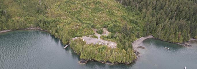
30 ACRES - CACHALOT INLET WEST COAST VANCOUVER ISLAND
30 acres with 2,000 ft of oceanfront and 300 ft beach. Building site and road from beach have been cleared. Great location in Cachalot Inlet, Kyuquot Sound for fishing camp or private retreat near BC’s best fishing, surfing, and kayaking. $600,000
RICHARD OSBORNE
Personal Real Estate Corporation 604-328-0848 rich@landquest.com

7.67 ACRES OF BARE LAND MARA - SICAMOUS, BC
A hidden gem with a mighty shine. Sweeping views of Mara Lake exiting into the Shuswap River and drifting past Rosemond Lake - a sensory and magnetic attraction. Power, well water, and septic installed. $297,000
JOHN ARMSTRONG Personal Real Estate Corporation 250-307-2100 john@landquest.com


YELLOW POINT ESTATE PROPERTY LADYSMITH, BC
This expansive property spans over 100 acres, with a breathtaking blend of diverse landscapes. From lush West Coast rainforest, with a meandering creek and serene pond, to sun-kissed meadows and striking sandstone plateaus. Direct access to a pristine walk-on oceanfront beach. Subdivision application in progress, providing a unique investment opportunity. $4,995,000
KEVIN KITTMER 250-951-8631 kevin@landquest.com

LARGE ACREAGE WITH WEST FACING LAKEFRONT - 103 MILE HOUSE, BC
280 acre ranch. Prime west facing waterfront on 103 Mile Lake. Only 5 minutes to town. Rolling grassland with grazing for cattle or horses. Plenty of treed area. Lakefront building sites. A true paradise for horseback riding, ATV, snowmobiling or hiking. Close to amenities, totally private. $1,230,000
sam@landquest.com


MATT CAMERON 250-200-1199 matt@landquest.com
RealEstate 106 - JULY 2024 ® Marketing British Columbia to the World® www.landquest.com Toll Free 1-866-558-LAND (5263) Phone 604-664-7630 Visit Us Scenic off the grid acreage (2.52 acres) mostly covered with an amazingly lush mature forest. A driveway leads up to a flat open clearing. Zoned Resort Commercial and allows uses such as a single family home + a secondary dwelling unit, campground, cabins, lodge etc. Drilled well in place. Lake access nearby. $225,000 FORESTED ACREAGE BEATON, BC Southwest facing 9.82 acre high bank oceanfront property in the Southern Gulf Islands, just off Galiano Island. Drilled well, power on site and approved septic field installed. Shared dock and landing site in Montague Harbour. NOW $325,000 9.82 ACRE OCEANFRONT ON PARKER ISLAND NEAR MONTAGUE HARBOUR JASON ZROBACK 1-604-414-5577 jason@landquest.com JAMIE ZROBACK 1-604-483-1605 jamie@landquest.com BC LANDPRO GROUP JAMIE ZROBACK 1-604-483-1605 jamie@landquest.com JASON ZROBACK 1-604-414-5577
850 ft of low bank
this is an opportunity
waterfront living
a paradise
outdoor
NOW
OCEANFRONT HOME AND DOCK JERVIS INLET - HARDY ISLAND, BC Court Ordered Sale. Approx 4,150 ft of low bank or beach frontage in protected bay. CD5 Zoning permits resort hotel, spa, restaurant, pub and marina. Ideal for resort development, special interest group or family estate. Water access only. 20 minutes by boat from Egmont or 2.5 hours from Vancouver. $3,905,000 136 ACRE OCEANFRONTJERVIS INLET SUNSHINE COAST JASON ZROBACK 1-604-414-5577 jason@landquest.com JAMIE ZROBACK 1-604-483-1605 jamie@landquest.com BC LANDPRO GROUP JAMIE
jamie@landquest.com BC LANDPRO GROUP JASON ZROBACK 1-604-414-5577 jason@landquest.com BC LANDPRO GROUP Your own 3.9 acre private off the grid eco-island in the heart of BC's beautiful Sunshine Coast. Think wilderness glamping meets bohemian boudoir. Includes a 1,520 sq. ft. round home, glamping tent, tree house, woodfired hot tub, drilled well and licensed 60 x 8 ft dock that can accommodate multiple smaller boats or a large vessel. Accessible via a 10 minute boat ride from Egmont, the island is connected to Nelson Island by a tidal spit with a protected bay and beach. The island's solar and wind powered home has 2 bedrooms, 2 bathrooms and captivating views. The perfect secluded getaway yet easily accessible, where you can kayak, paddleboard, fish or lounge on the beach. Move away from the phone and find your wild! $1,790,000 EAST POINT ISLAND AGNEW PASSAGE - SUNSHINE COAST SAM HODSON Personal Real Estate Corporation 604-809-2616
jason@landquest.com BC LANDPRO GROUP Situated on 4.94 acres with
waterfront,
for
and recreation. With well-appointed main home, additional building site, two beaches, private dock and robust power and water system, it's
for
enthusiasts.
$995,000
ZROBACK 1-604-483-1605


Completely renovated in a contemporary

One of the rarest, most unique waterfront estates to be offered for sale on the Sunshine Coast. Ultra private 17 acre park like setting with 1,000’ of pristine
mature forest & protected deep water moorage with 2 separate docks & a boathouse. Halfmoon Bay • $3,295,000


The ultimate West Coast WATERFRONT


Waterfront property at sought after “Whittakers at Pender Harbour’! This is one of BC’s finest waterfront communities offering private, protected deep water moorage. Gorgeous ocean views & Southern sunshine are featured prominently from this gently sloping property. Garden Bay • $699,000


$1,795,000

legendary coastal adventurer, entrepreneur and author, Jim Spilsbury, it remains in the family to this day. The 20 acres and home sit in the middle of Blind Bay on Nelson Island. West facing & surrounded by crystal clear waters. Nelson Island • $4,650,000

RealEstate JULY 202 4 - 107 Joel O’Reilly Personal Real Estate Corporation 604.741.1837 Scarlet Osborne Licenced Realtor 604.329.7877 www.oreillyrealestate.ca Owned by the same family for 36 years, this spectacular 5+ acre park-like setting at Ruby Lake features 2 separate homes & is steps to the boat launch & public dock for easy access to one of the warmest, most pristine lakes in Canada. Ruby Lake • $1,585,000 One of the most extraordinary homes & properties on the Coast. Low-bank waterfront w/an incredibly rare 250’ of frontage & unheard of West/South/East exposure, prominently positioned on the end of the quiet point & one of the Coast’s prime beaches. Sechelt • $3,150,000 Custom built by “West Coast Log Homes,” this spectacular WATERFRONT home on sought after Franklin Road exudes character & quality craftsmanship. Stunning ocean & island views from nearly every room. Gibsons • $2,698,000 Nearly 5 acres of oceanfront paradise! Situated in a private bay with spectacular ocean & island views and drenched in sunshine, the two separate self-contained cottages are right at the waters’ edge. Halfmoon Bay •
shoreline,
Boater’s Paradise! This 4 bed/ 3 bath waterfront home with protected deep water moorage features stunning ocean & island views of Garden Bay & Pender Harbour. Garden Bay • $1,999,000
property-1.77 acre mid-bank with spectacular ocean & mountain views in a lush forest setting. Brand new custom deluxe cottage, zoning permits a primary full size home in addition to the cottage at 592sf. Garden Bay • $1,150,000 The original homestead of
style, this extremely private & immaculate 3 bed/3 bath waterfront home is situated on a lush, professionally landscaped 1.72 acre property with level, established gardens. Featuring stunning ocean views & sunsets. Halfmoon Bay • $2,125,000 This 2.16 acre waterfront property features a super cute low-bank beach cottage with a 50’ licensed foreshore. Sub-dividable, gorgeous ocean views and prime location. Madeira Park • $1,290,000 “Quarrybbean” an exceptional lifestyle retreat, 2.5 acres of spectacular waterfront on Nelson Island w/2 solar powered buildings. Nelson Island • $2,198,000 SOLD Very private low bank waterfront just mins to Sechelt! Easy access to the pristine beach from this 2,800+ sq.ft. recently reno’d Rancher. You’ll never tire of the spectacular views from the huge new deck /w hot tub, while the ocean provides endless opportunities. Sechelt • $1,899,000 The Sunshine Coast’s premier waterfront estate on sought after Browning Road. Unprecedented quality, style & design are evident in this spectacular West Coast contemporary home, built to perfection & immaculately maintained with ultra high-end finishings throughout. Sechelt • $4,180,000 Exceptionally rare low-bank waterfront home with perfect SW exposure, spectacular sunsets & mere steps to the ocean for swimming, launching a kayak & easy access to your mooring buoy for convenience & enjoyment of your waterfront lifestyle. Halfmoon Bay • $2,490,000 SOLD


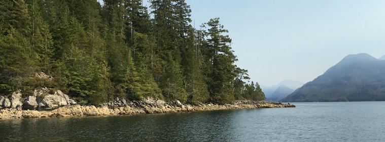


QUADRA ISLAND REAL ESTATE TEAM


RealEstate 108 - JULY 2024 billbradshaw@royallepage.ca | sarahbradshaw@royallepage.ca www.quadrarealestate.ca AFFORDABLE GRANITE BAY ACREAGE QUATHIASKI COVE OCEANVIEW RANCHER & RENTAL TRAILER billbradshaw@royallepage.ca sarahbradshaw@royallepage.ca www.quadrarealestate.ca •6.5 acre lot located on northwest corner of Quadra Island•Comes with driveway into property, drilled well and hydro services to property line•In an area with great outdoor recreation: hiking, kayaking, sports fishing•Community wharf and boat ramp minutes away•Located 20 minutes from services in Heriot Bay MLS # 398896 • $139,000 •Great ocean views of Quathiaski Cove and Discovery Passage•Rancher is at foot of 0.41 acre lot next to ferry to Campbell River• Mature shrubs provide lots of privacy along front of home• Up the hill is a 2 bed room trailer currently rented out to long-term tenant •Shor t walk from all services in Quathiaski Cove MLS# 398397 • $249,000 QUADRA ISLAND Are you ready for island time? PERSONAL REAL ESTATE CORPORATION Sarah Bradshaw AFFORDABLE GRANITE BAY ACREAGE QUATHIASKI COVE OCEANVIEW RANCHER & RENTAL TRAILER billbradshaw@royallepage.ca sarahbradshaw@royallepage.ca www.quadrarealestate.ca •6.5 acre lot located on northwest corner of Quadra Island•Comes with driveway into property, drilled well and hydro services to property line•In an area with great outdoor recreation: hiking, kayaking, sports fishing•Community wharf and boat ramp minutes away•Located 20 minutes from services in Heriot Bay MLS # 398896 • $139,000 •Great ocean views of Quathiaski Cove and Discovery Passage•Rancher is at foot of 0.41 acre lot next to ferry to Campbell River• Mature shrubs provide lots of privacy along front of home• Up the hill is a 2 bed room trailer currently rented out to long-term tenant alk from all services in Quathiaski Cove MLS# 398397 • $249,000 PERSONAL REAL ESTATE CORPORATION Sarah Bradshaw TOLL FREE LOCAL Bill Bradshaw PERSONAL REAL ESTATE CORPORATION
TOLL FREE 250.285.3293 DL364 Whiterock Pass Maurelle Island off-grid home, guest cabin & workshop situated on a 22 acre oceanfront property! Incredible views across Whiterock Pass to Read Island and a newer commercial grade wharf. 1010 Topcliffe Rd Quadra Island oceanfront rancher & two guest cabins on 2.3 acres, overlooking Sutil Channel on the east side of the island! 681 Bull Rd. Oceanfront family home in the heart of Heriot Bay with 150 feet of walk on ocean frontage & views across Heriot Bay to Open Bay & beyond to the mainland mountains! 675 Cove Cres. Brand new built Quathiaski Cove home! This 1,440 sq ft two level turnkey home was constructed by reputable local builders, J Toelle Construction Ltd. 1550 Schooner Rd. Commercial property in the heart of Heriot Bay! DL24 Schooner Rd. Heriot Bay acreage! This 11.29 acre property has preliminary approval in place for a 3 lot subdivision & is in a great walkable location in Heriot Bay on Quadra Island. New Price! $668,000 MLS# 900495 New Listing! $669,000 MLS# 914258 New Price! $928,000 MLS# 905800 New Price! $999,000 MLS# 901410 Just Listed! $2,200,000 MLS# 915885 PERSONAL REAL ESTATE CORPORATION billbradshaw@royallepage.ca | sarahbradshaw@royallepage.ca www.quadrarealestate.ca AFFORDABLE GRANITE BAY ACREAGE QUATHIASKI COVE OCEANVIEW RANCHER & RENTAL TRAILER billbradshaw@royallepage.ca sarahbradshaw@royallepage.ca www.quadrarealestate.ca •6.5 acre lot located on northwest corner of Quadra Island•Comes with driveway into property, drilled well and hydro services to property line•In an area with great outdoor recreation: hiking, kayaking, sports fishing•Community wharf and boat ramp minutes away•Located 20 minutes from services in Heriot Bay MLS # 398896 • $139,000 •Great ocean views of Quathiaski Cove and Discovery Passage•Rancher is at foot of 0.41 acre lot next to ferry to Campbell River• Mature shrubs provide lots of privacy along front of home• Up the hill is a 2 bed room trailer currently rented out to long-term tenant •Shor t walk from all services in Quathiaski Cove MLS# 398397 • $249,000 QUADRA ISLAND REAL ESTATE TEAM Are you ready for island time? Bill Bradshaw PERSONAL REAL ESTATE CORPORATION Sarah Bradshaw 1.877.735.3292 250.285.3293 AFFORDABLE GRANITE BAY ACREAGE QUATHIASKI COVE OCEANVIEW RANCHER & RENTAL TRAILER billbradshaw@royallepage.ca sarahbradshaw@royallepage.ca www.quadrarealestate.ca •6.5 acre lot located on northwest corner of Quadra Island•Comes with driveway into property, drilled well and hydro services to property line•In an area with great outdoor recreation: hiking, kayaking, sports fishing•Community wharf and boat ramp minutes away•Located 20 minutes from services in Heriot Bay MLS # 398896 • $139,000 •Great ocean views of Quathiaski Cove and Discovery Passage•Rancher is at foot of 0.41 acre lot next to ferry to Campbell River• Mature shrubs provide lots of privacy along front of home• Up the hill is a 2 bed room trailer currently rented out to long-term tenant •Shor t walk from all services in Quathiaski Cove MLS# 398397 • $249,000 Bill Bradshaw PERSONAL REAL ESTATE CORPORATION Sarah Bradshaw TOLL FREE 1.877.735.3292 250.285.3293 Bill Bradshaw PERSONAL REAL ESTATE CORPORATION Sarah Bradshaw QUADRA ISLAND REAL ESTATE TEAM TOLL FREE 1.877.735.3293 | LOCAL 250.285.3293 DL364 Whiterock Pass Maurelle Island off-grid home, guest cabin & workshop situated on a 22 acre oceanfront property! Incredible views across Whiterock Pass to Read Island and a newer commercial grade wharf. 1010 Topcliffe Rd Quadra Island oceanfront rancher & two guest cabins on 2.3 acres, overlooking Sutil Channel on the east side of the island! 681 Bull Rd. Oceanfront family home in the heart of Heriot Bay with 150 feet of walk on ocean frontage & views across Heriot Bay to Open Bay & beyond to the mainland mountains! 675 Cove Cres. Brand new built Quathiaski Cove home! This 1,440 sq ft two level turnkey home was constructed by reputable local builders, J Toelle Construction Ltd. 1550 Schooner Rd. Commercial property in the heart of Heriot Bay! Are you ready fortime?island DL24 Schooner Rd. Heriot Bay acreage! This 11.29 acre property has preliminary approval in place for a 3 lot subdivision & is in a great walkable location in Heriot Bay on Quadra Island. New Price! $668,000 MLS# 900495 New Listing! $669,000 MLS# 914258 $859,000 MLS# 907823/907788 New Price! $928,000 MLS# 905800 New Price! $999,000 MLS# 901410 Just Listed! $2,200,000 MLS# 915885 $590,000 Lot 2 Helanton Rd Quathiaski Cove 1 acre lot! $379,000 MLS# 959813 1676 Kanish View Dr Exceptional Kanish Bay oceanfront property! Custom built home, 2 garages & carriage suite on peaceful 5.5 acre oceanfront property! $590,000$1,395,000 *JUST LISTED* MLS# 965448 350 Sutil Rd Southend home with 2 attached suites, garage & garden suite, on stunning 3.96 acre oceanfront property! $590,000$2,100,000 *NEW LISTING PRICE REDUCED* MLS# 963758 1069 Topcliffe Rd Quadra Island home and cabin on peaceful 5.16 acre property! $590,000$1,185,000 *NEW LISTING ACCEPTED OFFER!* MLS# 962978 1509 Schooner Rd Heriot Bay custom-built Westcoast rancher & shop on 1.1 acres, in a highly desirable neighbourhood! $590,000$1,169,000 *NEW PRICE* MLS# 957341 106 Quadra Loop Family home with 2 attached suites on 0.48 acres in a popular residential area on the east side of Quadra Island! $638,000 MLS# 962007 1507 West Rd Heriot Bay home on 0.51 acre property, in a great walkable location! $590,000$639,000 *NEW LISTING ACCEPTED OFFER!* MLS# 963083 2040 Hyacinthe Bay Rd Quadra Island craftsman home on enchanting 10 acre property! $590,000$729,000 *JUST LISTED* MLS# 964592 5 -620 Helanton Rd Whiskey Point ocean view home & garage/suite on 0.45 acres boasting panoramic views across Discovery Passage! $590,000$899,000 *NEW PRICE* MLS# 951122 926 Fern Hill Lane Quadra Island acreage! This 4.35 acre lot is situated in the Fir Crest Acres subdivision, adjacent to the Quadra Island Golf Club and fronting Fairway 2. $489,000 MLS# 956908 1480 Heriot Bay Rd Heriot Bay oceanfront rancher, garage/ suite & cabin on 1 acre, boasting an easy walk-out beach and overlooking Drew Harbour & Rebecca Spit! $1,149,000 MLS# 953014 674 Cove Cres Quathiaski Cove rancher located in the Cove Crescent subdivision, in a great walkable location! $519,000 MLS# 957190 www. BC Ocean front.com 1-888-286-1932 DL 6, Noeick River: 178 Orca Inn, Alert Bay: Inn and restaurant/pub with lots of potential! Commercial kitchen, 3 rental units plus self-contained manager’s suite, retail space. Region renowned for whale watching, fishing and First Nations cultural activities. $600,000 West Coast Oceanfront: 3.56 110 acre private island in Esperanza Vancouver . Numerous little bays, peninsulas, and bluffs. Oneroom cabin plus workshop, fresh water ponds, complement of equipment. Quick access to the open west coast! $1,790,000 Quadra Island Oceanfront Acreage: Get away to breath-taking natural beauty in this Discovery Islands location! 10.3 acres with . Communal access and shared roads, dug well, storage shed. Rare opportunity to establish a floating getaway! 0.151 hectare ocean lease specifically for a recreational float cabin! In Nootka Sound, west coast Vancouver , on the east side of Bligh Island. 18 years remaining on a 30 year lease. Realize Island homesteading in the heart of the Owen Bay community on acre inland property is ready to use as is or Discovery Islands location. $224,900 Personal Real Estate Corporation edhandja@bcoceanfront.com www. BC Ocean front.com 1-888-286-1932 DL 6, Noeick River: 178 acres, ocean and riverfront south of Bella Coola, at the mouth of the Noeick River Potentially harvestable 2nd growth spruce on a portion of the property. Completely off grid. In the Great Bear Rainforest , on the BC Coast $850,000 Orca Inn, Alert Bay: Inn and restaurant/pub with lots of potential! Commercial kitchen, 3 rental units plus self-contained manager’s suite, retail space. Region renowned for whale watching, fishing and First Nations cultural activities. $600,000 West Coast Oceanfront: 3.56 acres in the Hot Springs Oceanside development north of Tofino on Vancouver Island’s west coast. Nicely forested, diverse shoreline Centre Island : 110 acre private island in Esperanza Inlet, west coast Vancouver Island. Numerous little bays, peninsulas, and bluffs. Oneroom cabin plus workshop, Ed Handja Personal Real Estate Corporation 250.287.0011 edhandja@bcoceanfront.com Personal Real Estate Corporation shelleymckay@bcoceanfront.com The BC Oceanfront Real Estate Team gregducloux@bcoceanfront.com www. BC Ocean front.com 1-888-286-1932 It’s a coastal lifestyle...Live it! DL 6, Noeick River: 178 acres, ocean and riverfront south of Bella Coola, at the mouth of the Noeick River Potentially harvestable 2nd growth spruce on a portion of the property. Completely off grid. In the Great Bear Rainforest , on the BC Coast $850,000 Orca Inn, Alert Bay: Inn and restaurant/pub with lots of potential! Commercial kitchen, 3 rental units plus self-contained manager’s suite, retail space. Region renowned for whale watching, fishing and First Nations cultural activities. $600,000 West Coast Oceanfront: 3.56 acres in the Hot Springs Oceanside development north of Tofino on Vancouver Island’s west coast. Nicely forested, diverse shoreline including a peninsula and bay. Protected location, Centre Island : 110 acre private island in Esperanza Inlet, west coast Vancouver Island. Numerous little bays, peninsulas, and bluffs. Oneroom cabin plus workshop, fresh water ponds, complement of equipment. Quick access to the open west coast! $1,790,000 The BC Oceanfront Real Estate Team It’sacoastallifestyle...Liveit! Quatsino Oceanfront Acreage: Bring your ideas for this attractive property on the NW coast of Vancouver Island! 7.7 acres with approx. 270ft of shoreline in Hecate Cove in the boataccess community of Quatsino. Beautiful Quatsino Sound on your doorstep! $350,000


JULY 202 4 - 109 UNIT # 1A - 15050 54A AVE., SURREY, BC V3S 5X7 WITHIN GREATER VANCOUVER: 604-595-5075 Exterior Helmsman Seats, Seats, Flip Back Seats, SEATING BEDDING ON MARKET WWW.RCB.CA INFO@RCB.CA 1-877-887-6887 WE ALSO DO CUSTOM LOGOS BRING IN YOUR UPHOLSTERY AT THE END OF THIS SEASON AND WE WILL STORE AND HAVE IT READY FOR NEXT SPRING FINEST MARINE UPHOLSTERY THAT FITS! UNIT # 1A - 15050 54A AVE., SURREY, BC V3S 5X7 WITHIN GREATER VANCOUVER: 604-595-5075 Exterior Helmsman Seats, Back Seats, SEATING BEDDING ON WWW.RCB.CA INFO@RCB.CA 1-877-887-6887 WE ALSO DO CUSTOM LOGOS BRING IN YOUR UPHOLSTERY AT THE END OF THIS SEASON AND WE WILL STORE AND HAVE IT READY FOR NEXT SPRING FINEST MARINE UPHOLSTERY THAT FITS! MARINE UPHOLSTERY SPECIALIST WE ALSO DO CUSTOM LOGOS MARINE • AUTOMOTIVE • COMMERCIAL • RESIDENTIAL Classifieds MEENA MANN | 604.559.9052 | MEENA@PACIFICYACHTING.COM WE SPECIALIZE IN CROSS BORDER SALES! 250-755-5887 VIEW OUR FEATURED VESSELS AND MORE AT CHARLESDAVIDYACHTS.COM We have qualified power & sail buyers looking now! Get your vessel SOLD & list with us today! Charles David Y achts 1996 32’ NORDIC TUG – Cummins Diesel, BOW Thruster, Wonderful layout, Solar, NEW Lowrance HDS12 Chartplotter, Radar, Autopilot, RIB Tender package and more $189,000 CAD 1973 42’ GRAND BANKS (FIBREGLASS) – CLEAN, MAINTAINED & WONDERFULLY UPDATED! Twin Lehman’s, FULL WINTER COVER, many systems upgraded including genset, Simrad Electronics and nice RIB Tender Package - Must be seen in person! $154,000 CAD 1998 43’ SAGA – Rare & Reputable - Proven offshore traveler, Bob Perry designed, Built in Canada. Re-powered with Yanmar 54 Hp (2013), Rigging (2018), OC Tender package, Watermaker, Planar Diesel heat (2021) and more! $249,000 CAD 2017 24’ RANGER TUG WITH TRAILER – Stunning GREY (unpainted bottom!), OWNER PRIDE KEPT, COCKPIT FULL ENCLOSURE, ALL OPTIONS including custom match teak upgrades. Yamaha 200 Hp.w/ only 379 hours! Yamaha 9.9 Kicker, Full Garmin pack, Rocna, Webasto heat and more!!! $187,000 CAD 2021 35’ PURSUIT OS 355 – INSANE!, “AS NEW”, TWIN Yamaha XTO Digital 425’s (130 hours w/ 100 service complete), Joystick control, Fisher Panda Genset, Watermaker, Full Garmin Pack, Downriggers, AC/ Heat, Beautiful “Nautilus’ Interior - Save Over New! $799,000 CAD 2004 35’ Maxum 3500 SY 1969 32’ Grand Banks Trawler 45’ 2010 Bavaria - Spacious & Modern layout 3 Strm./ 3 Head, BOW THRUSTER, 2022 Full Enclosure, Espar hydronic heat, Dual helm, Twin rudder, tender package and Professionally maintained! $274,900 CAD WE SPECIALIZE IN CROSS BORDER SALES! 250-755-5887 VIEW OUR FEATURED VESSELS AND MORE AT CHARLESDAVIDYACHTS.COM We have qualified power & sail buyers looking now! Get your vessel SOLD & list with us today! Charles David Y achts 1996 32’ NORDIC TUG – Cummins Diesel, BOW Thruster, Wonderful layout, Solar, NEW Lowrance HDS12 Chartplotter, Radar, Autopilot, RIB Tender package and more $189,000 CAD 1973 42’ GRAND BANKS (FIBREGLASS) – CLEAN, MAINTAINED & WONDERFULLY UPDATED! Twin Lehman’s, FULL WINTER COVER, many systems upgraded including genset, Simrad Electronics and nice RIB Tender Package - Must be seen in person! $154,000 CAD 1998 43’ SAGA – Rare & Reputable - Proven offshore traveler, Bob Perry designed, Built in Canada. Re-powered with Yanmar 54 Hp (2013), Rigging (2018), OC Tender package, Watermaker, Planar Diesel heat (2021) and more! $249,000 CAD Stunning GREY (unpainted bottom!), OWNER PRIDE KEPT, COCKPIT FULL ENCLOSURE, ALL OPTIONS including custom match teak upgrades. Yamaha 200 Hp.w/ only 379 hours! Yamaha 9.9 Kicker, Full Garmin pack,
2021
Watermaker, Full Garmin Pack, Downriggers, AC/ Heat, Beautiful “Nautilus’ Interior - Save Over New! $799,000 CAD 2004 35’ Maxum 3500 SY 1969 32’ Grand Banks Trawler 2000 47’ Selene Ocean Trawler - Long Range Beauty!, Boathouse Kept & Maintained, Cummins Diesel, BOW & STERN Thrusters, Genset, 2 heads, 2 staterooms, Washer/ Dryer, Terrific Salon, Deluxe galley, AIS, Fuel Polishing, RIB Package $669,000 CAD 46’ 2009 West Coast - RARE 3 STATEROOM, Desired Single Cummins 305 hp., BOW & STERN THRUSTERS, 5 KW. Genset, Fully Enclosed Flybridge & Cockpit W/ RIB Tender $239,000 CAD 33’ 2002 Grady White 330 Express - TWIN 2015 YAMAHA 300’s RE-POWER (104 hours!!!), BOW-THRUSTER, Upgraded Lowrance Chartplotter, Full Galley Pack, Scott Downriggers, Honda Genset, Seeps 4!, - Hauled February 2024 $189,000 CAD 1983 34’ Pacific Seacraft - Beautiful & Clean!, A must see, wonderfully upgraded, 2022 Tender, 2022 Inverter, 2019 Canvas, Awlgrip, Yanmar, Great sail inventory and a must see if your looking to Bluewater cruise or all season in the PNW $106,900 CAD 2007 50’
Cruiser - IN MUST SEE CONDITION! 75 hp. Diesel,
$299,000 CAD ASSUMABLE MOORAGE POSSIBLE WITH THESE VESSELS BOATS FOR SALE
Rocna, Webasto heat and more!!! $187,000 CAD
35’
PURSUIT
OS 355 –
INSANE!, “AS NEW”, TWIN Yamaha XTO Digital 425’s (130 hours w/ 100 service complete), Joystick control, Fisher Panda Genset,
Bavaria
Carbon Fiber
Sails (2018), Desired Stack Pack System, Espar Hydronic Heat, 5 Staterooms, 3 heads, Spacious Salon, Full Enclosure, Full Winter Cover, Tender Package


MEENA MANN | 604.559.9052 | MEENA@PACIFICYACHTING.COM 110 - JULY 2024 MARINE SUPPLIES BOATS FOR SALE FULL DETAILS on these fine vessels at: agboatsales.com Email: sales@agboats.com • Phone: 250-880-1415 CARLOTTA 1899 55’ original Pilot Cutter Award-winning restoration Fast and able £320,00 BP FIFER LADY Iconic 40’ Fifer Scottish built Bristol condition $125,000 CAD ARROW Beautifully restored Dragon Custom road trailer Price reduced $19,900 USD A Home for Classic Boats YACHT BROKERAGE Get your card today it’s good for life! SUBSCRIBE & SAVE TRAWLERS Find your Diamond in the Rough www.pacificyachting.com SAFETY & SURVIVAL STORMPROOF ANCHORING AIS VS. RADAR A COMPLETE SOOKE HARBOUR & FRESH ANCHOR LIKE PRO MARINE ELECTRONICS SPECIAL Spend Less, Catch More PUGET SOUND GUNKHOLES JOHNSTONE STRAIT CHINOOK REGS EXPLAINED ANCHORAGES SEEKING SOLITUDE WEST COAST POWER & SAIL ECO ISSUE SPECIES AT RISK 8 TIPS FROM A LONG NIGHT ON ANCHOR JOYSTICK STEERING HEAVY AIR SAILING BANANAS AND BAD LUCK! 12 ISSUES FOR JUST ORDER ONLINE WWW.PACIFICYACHTING.COM OR CALL 1-800-663-7611 $48 ONE YEAR SUBSCRIPTION DIGITAL PLATFORMS ALSO AVAILABLE NOW WITH 8 LOCATIONS TO SERVE YOU BETTER AMC Cassells Insurance Your Marine Specialists Saving boaterS $ for over 50 yearS! Call for a FREE Quote Now! C ALL US FIRST FOR ALL YOUR INSURANCE NEEdS 4075 Cambie Street, Vancouver, BC V5Z 2X9 604-876-0126 WWW. AMCINSURANCE . CA MARINE @ AMCINSURANCE . CA 593 W 57th Ave, Vancouver, BC V6P 1R8 604-265-7887 WWW.AMCINSURANCE.CA MARINE@AMCINSURANCE.CA AMC Insurance Services Your Marine Specialists S aving B oater S $ for over 50 year S ! NOW WITH 9 LOCATIONS TO SERVE YOU BETTER INSURANCE


MEENA MANN | 604.559.9052 | MEENA@PACIFICYACHTING.COM JULY 202 4 - 111 BOATS FOR SALE Incrediblygoodvisibility! Bestfuelefficiencyinitsclass Wellkeptpre-ownedmodelsavailable, upgradesandrepowersourspecialty 604-277-7433 • www.monaromarine.com MONARO MARINE LTD. Designing, Building and Maintaining Monaros since 1976. Also repairing other high quality boats. We have moved to a new location 6435 River Road, Delta, B.C. 150 exclusive listings: www.thunderbirdmarine.com B.C.’s Largest Database of Used Boats Thunderbird Marina West Vancouver 604.921.7457 Reed Point Marina Port Moody 604.939.0499 Westport Marina Sidney Vancouver Island 250.656.5832 THUNDERBIRD YACHT SALES See us online at: PacificYachting.com Your boating community Visit PY Online pacificyachting.com $119,000 FOR SALE ON THE SUNSHINE COAST 2008 SEARAY 290 AMBERJACK Two Mercruiser 350 MPI Horizon 5.7 V Drives with 730 HRs Call or text John 604 880 2171 REDUCED RATES ON ALL SUBSCRIPTIONS SCAN TO SIGN UP TODAY! FREE CALENDAR WITH ALL SUBSCRIPTIONS Order Online at www.bcmag.ca or Call 1-800-663-7611 EXPERIENCE BRITISH COLUMBIA ONE PAGE AT A TIME DESTINATION INDIGENOUS TOURISM PADDLING BC Photo Contest The CLIMATE Issue CATS BACKCOUNTRY BC’S BEST POWDER HIGHWAY SEA TO SKY GEOLOGY WINTER/2023-24 HOLIDAY BC BOOKS ROUNDUP NELSON DESTINATION A KOOTENAY WINTER WONDERLAND SPRING/2022 DESTINATION BC IN BLOOM HOWE SOUND ÁTL’ K ESCAPE TO THE NORTH ADVENTURES IN SKEENA BEAR ATTACK UNESCO'S NEWEST BIOSPHERE REGION A TASTE OF SPRING FIVE FORAGING FAVOURITES SPOTTING GIANTS WHALE WATCHING 101 BCMAG.CA DESTINATION GREENWOOD SPRING/2024 THE NISGA'A POLE HOME TAKE A TOUR BACK TO BC'S AFFLUENT PAST VICTORIA’S CASTLES


MEENA MANN | 604.559.9052 | MEENA@PACIFICYACHTING.COM 112 - JULY 2024 MARINE SUPPLIES FORCED AIR HEATERS 7,000 – 27,000 BTU COOLANT HEATERS 17,000 – 100,000 BTU PLANAR DISTRIBUTION Ltd. Unit 106 18663 52 Ave, Surrey, BC V3S8E5 e: info@planarheaters.com / ph: 604 372-3222 N. AMERICAN DISTRIBUTOR OF MARINE AIR and COOLANT HEATERS planarheaters.com Extend your boating season in comfort… www.hydrovane.com Winning Windvane! With Hydrovane: Your Independent Self Steering Windvane AND Emergency Rudder Your best crew ...steers 24/7 Have con dence for all scenarios Install o center, with davits & gear FEEL THE FREEDOM PANDA 34 JEANNEAU SO 43 HALLBERG RASSY 39 RUSTLER 36 HYDROVANE STEERING THE DREAM Hydrogenerator MARINE SUPPLIES LICENCES Summer Smith 01/01/2020 SMI-1234 05/01/2023 GET YOUR BOATING LICENCE TODAY! BoatLicenceCanada.ca CANADA’S PLEASURE CRAFT OPERATOR CARD COURSE Course and Card $49.95 Tax Free SCAN TO LEARN MORE

STRYKER
Ltd. Sales & Service of Marine Electronics


Compatible with Furuno award-winning NXT radars
6710 Hardy Bay Road, Port Hardy, Email: info@strykerelectronics.com Toll Free: 1-888-839-8022 NEW Furuno FR-10 & FR-12 Radar Displays


POWERBOAT, MOTORSAILOR DELIVERIES Maine-Alaska (SE,Gulf,PWS), Panama, China. U.S. West Coast. Electronic Chartplotting, EXPERT: picking weather, bar crossings (2000+), wintertime, North Pacific. USCG Master. 45+ years experience Mike Maurice +1-503-310-7590 www.yachtsdelivered.com
TRADES & SERVICES
behind the island on the north side of the narrows. We were pushed hard toward shore on the port side. Fortunately, at the last minute the pressure of the white water hitting shore and ricocheting back into the narrows was enough to hold us from the edge of disaster. We were sucked into the beginning of the S-bend.
The boat was then pushed hard to the starboard shore with the angry water again holding us just far enough away from a whirlpool that was spinning big logs like they were twigs. Again, we were somehow miraculously swept away by the force of the moving water.


Port Coquitlam, BC aBBOTSFO rd 604-854-3440 31926 Mercantile Way, Abbotsford, BC
MARINE TITLES (CANADA) LTD.
A complete Marine documentation and Licensing company. E-mail: marinetitlesltd@telus.net 400-1681 Chestnut St. Vancouver, B.C. V6J 4M6 Tel: 604-736-3377


Now we could see the end of the narrows, but between us and there was a standing wave so big that I acknowledged to myself that if I had my surf board I would be able to ride that wave in place. The opposing currents then grabbed our keel and laid us over enough that the rigging of our mast started tinging off the trees on shore. My partner hit the throttle and pushed the engine to redline, we rose up on that wave and rounded the last corner like Olympic bobsledders and then were spit out into blissfully still water.
After we got our bearings my partner burst out laughing and said, “So how do you like our new home?” I looked at him slightly annoyed and confused. He explained himself still laughing saying he was never going through those narrows again so this is where we would live, forever.
We did eventually navigate our way safely back out of the narrows, timing everything carefully. We had learned a lesson that we didn’t need to learn again. White water rafting in a 27-foot sailboat is not, at all, fun!
SEND US YOUR STORIES!
Have a funny or interesting story? Cockpit Confession is a reader-submitted column and we are always looking for another good yarn. Send your 600-word story to editor@pacificyachting.com. We’ll send you a PY koozie or hat!
JULY 2024- 113
MEENA MANN | 604.559.9052 | MEENA@PACIFICYACHTING.COM AFFORDABLE WATERMAKERS Desalinators featuring simplicity, reliability & do-it-yourself installation kits. www.wolfwatermakers.com. 250-339-4922 WATERMAKERS LETTERING & GRAPHICS We’re Big On marine YOU r FULL S er V i C e in FL aTa BL e BOaT e XP er TS marine.S a L e S @gaC he C k PO in T CO m WWW.gaC he C k PO in T CO m P O r T CO q U i TL am 604-461-3434 1462 Mustang Place,
INFLATABLES
ELECTRONICS
IN STOCK ELECTRONICS
DELIVERIES

White Water Rafting
BY LINDA LEITCH
brilliant sunshine.
WWe had spent a few weeks exploring British Columbia’s Inside Passage on our 27-foot Catalina and were beginning our trip homeward to Haida Gwaii. That morning, we entered into Grenville Channel from our cosy anchorage in Lowe Inlet just in time to see the day be swallowed by dense fog. Hugging the shore we strained our eyes against the blinding white for anything that could be approaching in the narrow channel. A tug and barge appeared like a ghost ship and sped by into the nothingness behind us. Eventually the fog dissipated and left us in
It was then I realized I had all the precursors of a migraine headache ebbing their way into my vision. I tried to hide it, but as it took over my body, I was forced to admit to my partner that I was now incapacitated and useless to him as crew. I give this embarrassing detail only because it was the justification for the next decision made, which broke with all our good sense and experience.
We decided to try for the closest available anchorage, Baker Inlet just on the other side of Watts Narrows. Now solo, my partner steered while consulting the charts and tide tables. Watts Narrows is only 200 metres wide and can run up to nine knots. It is said to be navigable only at slack tide. We were approaching it three hours early at mid tide when it runs at its maximum.
I was called onto the deck to help as
much as I could. We stalled ourselves at a distance and took turns with the binoculars eyeing up our passage. We could clearly see the other side and it looked like the water was flowing smooth as silk through the narrow channel. All I wanted was a place to drop the hook, kill the engine and lie me down; it was that or death so I voted we go for it. My partner agreed to take us in.
Once we passed Griffon Point at the entrance to Watts Narrows it was immediately evident we’d made the wrong decision. What had appeared to be smooth as silk was actually the top of a waterfall that dropped two feet into a raging river that wound itself through an S-bend so subtle we’d failed to see it at first glance. It was too late to turn around.
After spilling over the falls, we were met with more water surging in from
Continued on page 113
Mike Mockford
114 - JULY 2024
COLUMN COCKPIT CONFESSION

THE R-43 CB THE CUTWATER FLEET INCLUDES THE FOLLOWING MODELS: C-248C, C-288C, C30S, C-30CB, C-32 & C-32CB

THE RANGER TUGS FLEET INCLUDES THE FOLLOWING MODELS: R-23, R-25, R-27, R-29 S, R-29 CB, R-31S, R-31 CB, R-43S & R-43CB


5410 Argyle Street, Port Alberni, BC Canada (Vancouver Island) Cell: 250-720-1376 | 250-724-5754 | 1-877-283-BOAT (2628) sales@portboathouse.com | www.portboathouse.com THE CUTWATER C-30
PORT BOAT HOUSE PBH

242 TURTLEHEAD ROAD BELCARRA, VANCOUVER BC OFFERED AT $5,998,000


Custom-built home situated on a quiet cul-de-sac, surrounded by luxurious homes and waterfront views of the Burrard Inlet and Belcarra Bay. Extra high ceilings on the main floor enhance the spacious feel. Downstairs is perfect for in-laws or guest / nanny suite; gated driveway & 2 car garage.
This 5270 SQFT Home located in Belcarra Bay is built on a 17,500 SQFT lot. High bank waterfront, 139 ft long shore line, less than a minute to access your boat from your home, with the latest technology 70 ft incline rail system (lift) with 1000 pound cabin capacity. 30 ft long concrete floating dock with capacity to accommodate boats larger than 30 fteasy to moor on both sides of the dock with deep moorage and ample distance from neighbours dock.
WATERFRONT
HOME WITH LARGE DOCK!
200 –1455 Bellevue Avenue, West Vancouver, BC V7T 1C3 CONTACT MATT GUL AT 778.888.8888 FOR ACCESS TO VIEW EXCLUSIVE WATERFRONT LISTINGS matt@mattgul.com | www.mattgul.com VIEW LISTING
