Bicycle&PedestrianWay MASTER PLAN


Mayor
Mayor Steve Barnett
CityofFranklin
Mark Richards, City Engineer
Alex Getchell, Senior Planner
Chip Orner, Director of Parks & Recreation
FranklinCityCouncil
Daniel Blankenship, Ward 1
Richard Wertz, Ward 2
Drew Eggers, Ward 3
Kenneth Austin, Ward 4
Joseph Abban, Ward 5
Bob Heuchan, At Large
Danny Richards, At Large
FranklinPlanningCommission
Jim Martin, President
Kevin McElyea, Vice President
Suzanne Findley, Secretary
Joe Abban
Pam Ault
Janice Giles
Diane Gragg
Georganna Haltom
Charlotte Sullivan
Mark Richards
Debra Swinehamer
Franklin Board of Parks & Recreation
Michael Auger
Pam Ault
Debbie Gill
Dr. John Shafer
Bicycle&PedestrianWaySteering Committee
Amanda Ott
Brian Gootee
Chris Tennell
Dana Monson
Eileen Williams
Holly Johnston
Jeff Sewell
Kim Minton
Les Tabeling
Mike Bullington
Steve Leonard
PreparedBy: Rundell Ernstberger Associates, Inc.

Franklin is a growing and active community dedicated to improving the quality of life for residents by providing bicycle and pedestrian facilities which are convenient, comfortable and safe. The city has made significant progress over the past ten years adding to the network with facilities such as the Franklin Greenway Trail and streetscape and trail improvements along East King Street.
As a part of the Indianapolis Metropolitan Area, Franklin has continued to see development and an increased demand for opportunities to bicycle and walk for recreation and for transportation. Franklin recognizes the need to provide a balanced transportation system which includes infrastructure for cyclists and pedestrians in addition to motorists.
The City of Franklin has undertaken an extensive, community-driven planning process to create the Bicycle and Pedestrian Way Master Plan. The Plan outlines a vision for biking and walking in Franklin, with developed goals and objectives to help guide the implementation of the vision. The Plan includes infrastructure and program recommendations that are supported by an action-oriented implementation strategy to sustain momentum and progress for years.
The physical improvement recommendations in the plan will increase connectivity, accessibility, and safety for pedestrians and cyclists. The education, encouragement and enforcement programs will foster a culture that values multimodal transportation and recreation. The improved
network will create additional opportunities for people to be healthier, reduce vehicular miles traveled, support economic development and attract tourism.
The Bicycle and Pedestrian Way Master Plan provides a long-term plan for improving biking and walking in Franklin. The plan provides a measured and consistent strategy for implementing the recommended improvements through prioritization and phasing to ensure implementation is manageable and economically responsible.
The planning process began in January of 2019 and concluded in January of 2020. The diagram on the following page illustrates the process from project initiation to plan completion and adoption. The process included an extensive public input phase providing various opportunities for residents to share the plan’s vision, goals, and recommended facility improvements. The planning process included steps to meet the following key plan objectives:
• Gather meaningful input from a wide crosssection of the community by providing multiple and various types of public input opportunities
• Develop goals and objectives that articulate the input received from the public and the Steering Committee
• Review existing documentation to understand the history of and future plans for the pedestrian and bicycle network
• Evaluate physical conditions to understand the current bicycle and pedestrian facilities
• Recommend facilities and strategies for implementation to continue the growth of the system
• Recommend policies and programs for bicycle and pedestrian facilities to support the physical improvement to the network.
This plan is the first Bicycle and Pedestrian Way Master Plan for the City of Franklin. It encompasses the corporate limits for the city but also addresses regional connections to neighboring communities like Bargersville and Whiteland. Franklin is located in Johnson County and includes
approximately 13 square miles of land area. The population estimate for 2018 was 25,248 residents. Franklin is located 20 miles south of Indianapolis. Major corridors include Interstate 65 along the eastern edge of the city and U.S. Highway 31 which intersects the city. There are three small creeks which flood frequently. The city has utilized these floodplain areas to create the current greenway network and parks system. Several areas of the city are very walkable and bikeable including in the downtown area. The small town atmosphere of Franklin, along with its convenient location, make Franklin a desirable location to live and work.

Creating a complete network of bicycle and pedestrian facilities provides the city with more than a transportation network for various modes of travel. The infrastructure improvements have significant benefits in the form of improved community health, increased property values, greater economic development with new business attraction, lower healthcare costs for residents and safer facilities for all users.

A community’s quality of life is one of the first attributes that businesses and people look at when relocating to a new community. Facilities like trails, greenways and safe places to bike and walk attract tourists. In areas where people walk, there is a sense that these are safe and friendly places to live and visit. Creating communities where walking and bicycling are accepted and encouraged increases a community’s livability in ways that benefit all residents.
Bicycling and walking help to keep kids and adults active and helps to decrease the prevalence of health conditions such as heart disease, diabetes, and other chronic illnesses. Indiana is the 15th most obese state in the U.S. According to the 2019 CDC Behavioral Risk Factor Surveillance System (BRFSS) data, over 34% of Indiana adults are overweight or obese. Obesity disproportionately affects low-income and rural communities. Walking is the number one activity recommended by doctors and preferred by Americans to stay fit. Safe and desirable walking facilities create more opportunities for residents to exercise, increasing their health. Recent studies have shown that bicycling can reduce the risk of dying early by 28% and adding walking to daily routines reduces the risk by 39%.


Walking and biking are the most affordable forms of transportation. Much of the population is unable to drive, including children, individuals with disabilities, seniors, and those unable to afford the cost of owning and operating a vehicle. The average annual cost of operating a bicycle is $308, compared to $8,220 for the average vehicle. Access to bicycle and pedestrian facilities provides an affordable means of transportation for low-income and disadvantaged residents.


Traffic accidents are the primary cause of death among all ages from 3 to 34 in the U.S. Traffic fatality rates tend to be lesser in regions with higher rates of walking and bicycling. Recent trends in the U.S. for roadway design include responses to increased biking and walking. After years of building roadways to support additional automobile traffic, cities are shifting their focus to safety and comfort for all road users, especially pedestrians and bicyclists. Providing improvements which encourage bicycling and walking can enhance safety and comfort levels for all users. Additional bicycle and walking facilities, well designed crossings, and continued education and enforcement can reduce the risk of crashes and injuries.
Trails, sidewalks and on-street bikeways are cost-effective components of a multi-modal transportation system. Increases in property taxes, local spending and tourism activity provide additional tax revenue for local governments, providing strong returns on investment for bicycle and pedestrian projects. In addition to tourism dollars, building new facilities for walking and biking can include rising property values, increased business at local establishments, improved worker productivity, and savings from reduced traffic congestions. A 2016 report on the economic impacts of bicycling and walking in Colorado found that bicycle and pedestrian activities had an estimated $1.1 billion impact on the Colorado economy.
A complete bicycle and pedestrian network which is convenient and comfortable for all users can lead to more walking and biking for short trips within the city. Walking and biking can reduce congestion, energy consumption, and driver frustration by reducing the number of vehicular trips. Fewer vehicles on the road lessen the demand for wider roads and bigger parking lots providing infrastructure savings for the public.

Walking and biking are more sustainable modes of transportation than automobile travel. Replacing driving trips with walking or biking can contribute to lower vehicular emissions. This not only helps the environment but also improves the health of people who are vulnerable to asthma and other chronic respiratory diseases.
In addition to providing connections between the neighborhoods and parks, the pedestrian and bikeways off-road network provides a system of linear parks. Each new project which is located in natural areas or along waterways provides an ancillary opportunity for the city to invest in the natural environment with preservation and restoration projects within these corridors. This can include stream bank restoration, invasive plant removal and native plantings.
The Comprehensive Plan was updated in 2017 and includes a new vision for the city in the form of three principles. The third principle states: “Thethirdprincipleisdesignedtosharpenthe community’svisionofabetterfuture. Thatfuture shouldincludemakinginvestmentsnow to attract young, educated professionals to live in Franklin. Thoseinvestmentsincludequalityoflife amenitiessuchasparksandtrails.”
The Bicycle and Pedestrian Way Master Plan helps the city realize this vision. This plan will help the City of Franklin continue to meet the following goals established with each of the following plans.
• Future development could continue to threaten the already limited supply of ecologically significant natural features remaining in Franklin. The city must take measures to ensure that these areas are at least protected and possibly expanded.
• Take specific steps toward improving the city’s overall air quality, including reduction of the fine particulate pollution associated with fuel combustion.
• Develop policies and practices consistent with, and complementary to, the support of the Five-Year Comprehensive Park System Master Plan.
• Traditional transportation infrastructure should be complemented by alternative fuel vehicles, pedestrian connectivity, bicycle improvements and universal accessibility.
• Improve the functionality and access of the transportation network by including multiple modes of transportation in future planning
and construction projects.
• Promote community connectivity and health by supporting the expansion of the local trail and sidewalk network.
• Continue downtown revitalization: Use the proximity of Province Park and Franklin Greenway Trail system to downtown to create a more appealing live/work/play environment downtown.
• Develop a bike and pedestrian plan, incorporating the trail network as a component.
• Reconstruct Jefferson Street between US 31 and Forsythe Street, including pedestrian facilities.

• Reconstruct King Street between Forsythe Street and Fairway Lakes Drive, including pedestrian facilities.
• Reconstruct South Main Street between Young’s Creek bridge and US 31, including pedestrian facilities.
• Implement intersection improvements, including a roundabout at Jefferson Street and Westview Drive.
• Implement pedestrian improvements at Mallory Parkway and US 31.
• Design and implement urban trail and pedestrian improvements along West Jefferson Street between Westview Drive and the Johnson County Fairground.
• Implement pedestrian improvements along Forsythe Street between Franklin Greenway Trail and King Street.
• Construct pedestrian improvements along State Street/Old US 31 between Wilson Way and South Street.
• Provide a safety and security program that provides safe facilities to attract and impress the public; gives patrons a sense of security, and reduces vandalism.
• Continue to provide a park system with an appearance that is a source of pride, with clean facilities, and maintenance that is guided by a financially sound preventive maintenance program.
• Provide a park system that provides for growth and new facilities commensurate with the growth of the city.
• Finish trail connections.
• Investigate feasibility of trail connection over Youngs Creek at old railroad bridge crossing.
• Install mileage markers on trails.
• This plan supports the adaptive reuse of properties and celebrating the historic small town environment. However, it must acknowledge the need for high quality infrastructure, architecture, retail and services.

• Improve Jefferson Street streetscape from Jackson Street to Water Street to nurture existing business and compliment an INDOT SR 44 improvement project.
• Improve South Main Street streetscape infrastructure from Monroe to South Street to complement improvements to North Main, redevelop the south side of the courthouse square and encourage investment in an under-utilized area of downtown.
• Improve Monroe Street streetscape infrastructure from Jackson to Branigin Boulevard to connect downtown to Franklin College, redevelop the south side of the courthouse square and encourage investment in an under-utilized area of downtown.
• Identification of several accessible ramp projects for public properties.
• Create connections between the communities of Bargersville, Edinburgh, Franklin, Greenwood, New Whiteland, Nineveh, Trafalgar, White River Township, and Whiteland within Johnson County.
• Enhance community connections to neighborhoods, parks, schools, businesses, retail and dining, and government facilities.
• Increase the number of people that exercise daily by providing safe walking and biking experiences for citizens of all ages and levels of ability.

• Increase the number of people walking and bicycling for everyday transportation purposes such as commuting to work, to school and running errands.
• Provide guidance and priorities for implementing infrastructure to support walking and bicycling with a broad range of funding and support.
• Increase eco-tourism in Johnson County by attracting people that are looking for recreational activities in the region.
• The primary goal of this Safe Routes to School (SRTS) Master Planning project was to develop a comprehensive SRTS
plan that would help the community utilize its existing infrastructure network, via multi-use trails and sidewalks, as a means of encouraging student walking and bicycling to school.
• With many miles of multi-use trails already in place within the community, Franklin has clearly demonstrated its commitment to walking and biking. The meaning behind “community” in Franklin Community Schools is to provide the use of outdoor facilities that can be used by all residents, parents, and students living within the Franklin community.
• By incorporating the existing multi-use trail network into the SRTS plan, the City of Franklin and the Franklin Community Schools (FCS) have the opportunity to expand on this existing network to provide additional connections and facilities throughout the community.
• Expand amenities and attractions within Franklin.

• Promote pedestrian connectivity and alternative transportation activities.
• Promote private investment and appropriate development activities.
• This study proposes two new greenway corridors. The King Street greenway and along Main Street through the city.

Plan vision, goals and objectives were established to aid in the development of the planned network, help establish priorities, and to measure the continued progress of the plan. The goals and objectives were developed utilizing community input gathered during the input phase. The objectives articulate specific actions to be taken to support the specific goals of the plan.
The following vision, goals and objectives reflect the overarching need for transportation planning which incorporates multiple modes of travel including bicycles and pedestrians in addition to automobiles. The goals and objectives set forth a road map for the City of Franklin to reach its vision for a complete and connected network of pedestrian and bicycle facilities. The complete network will allow people to incorporate walking and biking into their daily lives by connecting neighborhoods with shopping, schools, work and recreation.
The following chapter is organized around the vision for the network with goals and objectives that will guide the city during plan implementation.
The objectives are specific statements of how to accomplish the goals and identify means of measuring the fulfillment of the goals.

THE CITY OF FRANKLIN IS A COMMUNITY WITH A COMPREHENSIVE, INTEGRATED, CONNECTED TRANSPORTATION NETWORK THAT BALANCES ACCESS, MOBILITY AND SAFETY NEEDS OF MOTORISTS, BICYCLISTS, AND PEDESTRIANS OF ALL AGES AND ABILITIES.Franklin Greenway Trail
CONNECT ALL AREAS OF THE CITY WITH BICYCLE AND PEDESTRIAN FACILITIES.
Objectives:
• Develop the network of bicycle and pedestrian facilities to serve both transportation and recreation needs.
• Provide routes to schools, community services and retail areas.

• Provide bicycle and pedestrian amenities (bike racks, benches, repair stations) on routes linking schools with trails, parks and recreation sites that encourage the mobility of school age children.
• Provide safe and convenient bicycle and pedestrian connections where natural or man-made barriers restrict access.
• Integrate bicycle and pedestrian considerations into all new and replacement projects.
• Develop opportunities for pedestrian and bicycle tourism by connecting destinations with bike and pedestrian facilities.
• Develop marketing materials including route maps to be distributed to tourists and visitors.
• Design and implement a network of facilities to establish Franklin as a bicycle and pedestrian focused city to attract new businesses and residents to the area.

CONNECT THE EXISTING FRANKLIN GREENWAY TO PROVIDE A COMPLETE BIKE AND PEDESTRIAN PATH AROUND THE CITY.
Objectives:
• Complete gaps within the existing greenway network to create a complete loop of offroad facilities which can be utilized by users of all ages and abilities.
• Widen areas of the greenway trail which are currently substandard for shared-use (less than 10’ in width, or 8’ minimum where available width is constrained).
• Evaluate and ensure that the greenway trail is accessible for physically impaired including those in wheelchairs or utilizing walkers.
• Improve at-grade crossings where the greenway trail intersects with major roadways to encourage use of the greenway trail across all areas of the city.
• Pursue public and private funding sources to facilitate faster development of the system. Funding sources might include multi-jurisdictional, private entities and other partners like health agencies and school districts.
IMPROVE AND EXPAND BICYCLE AND PEDESTRIAN FACILITY TYPES TO PROVIDE FORALLUSERS,MAKINGBIKINGAND WALKING MORE COMFORTABLE AND APPEALING TO USERS OF ALL AGES AND ABILITIES.
Objectives:
• Implement additional on-road and off-road facility types to expand the age and ability of users that are utilizing the bicycle and pedestrian network.
• Develop more bike lanes (buffered and conventional) to expand the on-road bicycle network which meets the needs of more confident riders.
• Develop shared lane routes (including directional signage and pavement markings) to guide residents and visitors along routes which are comfortable for bicycles to ride in the traffic lane with automobiles.
• Provide access to bicycle and pedestrian facilities for a variety of users including walkers, runners, bicyclists, wheelchair users, strollers, and other non-motorized modes of travel.

• Establish bicycle and pedestrian connections between parks to allow travel back and forth without the use of an automobile.
• Install bicycle parking at public buildings, retail areas, employment center and recreation areas.
PRIORITIZE SAFETY WHEN DESIGNING NEW NETWORK FACILITIES WITH PARTICULAR FOCUSONINTERSECTION/CROSSINGDESIGN.
Objectives:
• Plan, design and construct bicycle and pedestrian facilities to meet or exceed guidelines for bicycle and pedestrian safety.
• Monitor bicycle and pedestrian related accidents to determine areas in need of improvement.
• Increase visibility of facility intersections, road and rail crossings.
• Provide a buffer between facilities which are adjacent to roadways.
• Enforce speed limits and pedestrian rights in crosswalks.
• Develop and distribute information materials informing all roadway users of their rights and responsibilities concerning bicyclists, pedestrians and motorists.
• Hold motorists and cyclists accountable for rules of the road.
• Design roadway crossings to maximize bicyclists and pedestrian safety.
COMPLETE GAPS IN EXISTING NETWORK TO CONNECT EXISTING TRAILS AND FACILITIES TO EACH OTHER AND TO DESTINATIONS.
Objectives:
• Prioritize projects which complete gaps within the existing network to connect more residents to destinations along these facilities.
• Identify priority corridors or areas for sidewalk development and prioritize construction of these sidewalks with city funding.
• Identify areas of sidewalks which are substandard and plan for replacement or repair.
IMPROVE BICYCLE AND PEDESTRIAN WAYFINDING BOTH FOR VISITORS AND RESIDENTS(ESPECIALLYWHENALTERNATE ROUTESARENEEDEDDURINGFLOODING).
Objectives:
• Design and install signage and mapping to encourage bicycling and walking activities.
• Provide programs utilizing the network of bicycle and pedestrian facilities such as fun runs, festival events, and group rides to increase awareness.
• Develop an easy to read, unified and comprehensive wayfinding system for bicyclists and pedestrians.

Objectives:
• Establish and maintain an annual counts program documenting trends in pedestrian and bicycle activity.
• Maintain the network of bicycle and pedestrian facilities to create a safe, convenient, and reliable bicycle and pedestrian network.
• Provide for adequate drainage of stormwater runoff for all facilities.
• Formalize responsibilities between city departments to avoid gaps in system maintenance.
• Maintain sidewalks, shared-use paths, greenways, and bike lanes to ensure safe use for pedestrians and bicyclists on a yearround basis.
• Plan, design and budget for increased maintenance responsibilities as new facilities are implemented.
• Create standardized maintenance expectations to create consistent treatment throughout the city.
• Develop a maintenance schedule for short and long-term tasks including coordination between departments.
• Evaluate all streets during pavement resurfacing to determine if bicycle facilities can be provided when the striping is applied.
Objectives:
• Generate awareness among motorists, bicyclists and pedestrians of their rights related to safe and courteous use of roadways.
• Provide educational opportunities and encouragement programs aimed specifically to the “interested but concerned” group of cyclists including families and children.
• Develop a bicycle and pedestrian outreach program through the local schools and college to teach children and adults basic rider safety skills, bike maintenance, the benefits of biking and walking for exercise and the “rules of the road”.
• Encourage bicycling and walking as an alternative to the automobile and as a means to reduce pollution and congestion while increasing mobility choices in the community.
• Promote the benefits of recreational use of the network through school programs and informational materials.
• Utilize targeted enforcement to discourage unsafe behaviors of motorists, cyclists and pedestrians.
The existing and planned land uses in Franklin inform the recommendations in this master plan. Creating high quality bicycling and walking infrastructure will encourage more biking and walking to the major destinations within the city.
The Zoning Map (Figure 2) shows the large areas of residential uses around the City of Franklin. These areas will become the start and end of many trips. Although several trips for bicycling and walking now begin in the car with residents driving to parks to access the Franklin Greenway Trail, in the future many of these trips will start and end from home with more convenient and complete bicycle and pedestrian infrastructure.
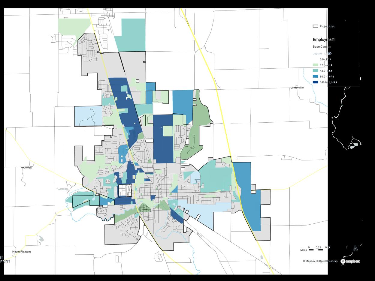
Major destinations are shown on the Destinations Map (Figure 5) and include shopping along U.S. 31, the schools, parks, the hospital and downtown. These destinations are spread around the city and will require a comprehensive network of bicycle and pedestrian facilities to allow people to walk or bicycle instead of driving. Employment density is highest in the commercial areas along U.S. 31, the industrial areas in the northeast and eastern parts of the city and the downtown area
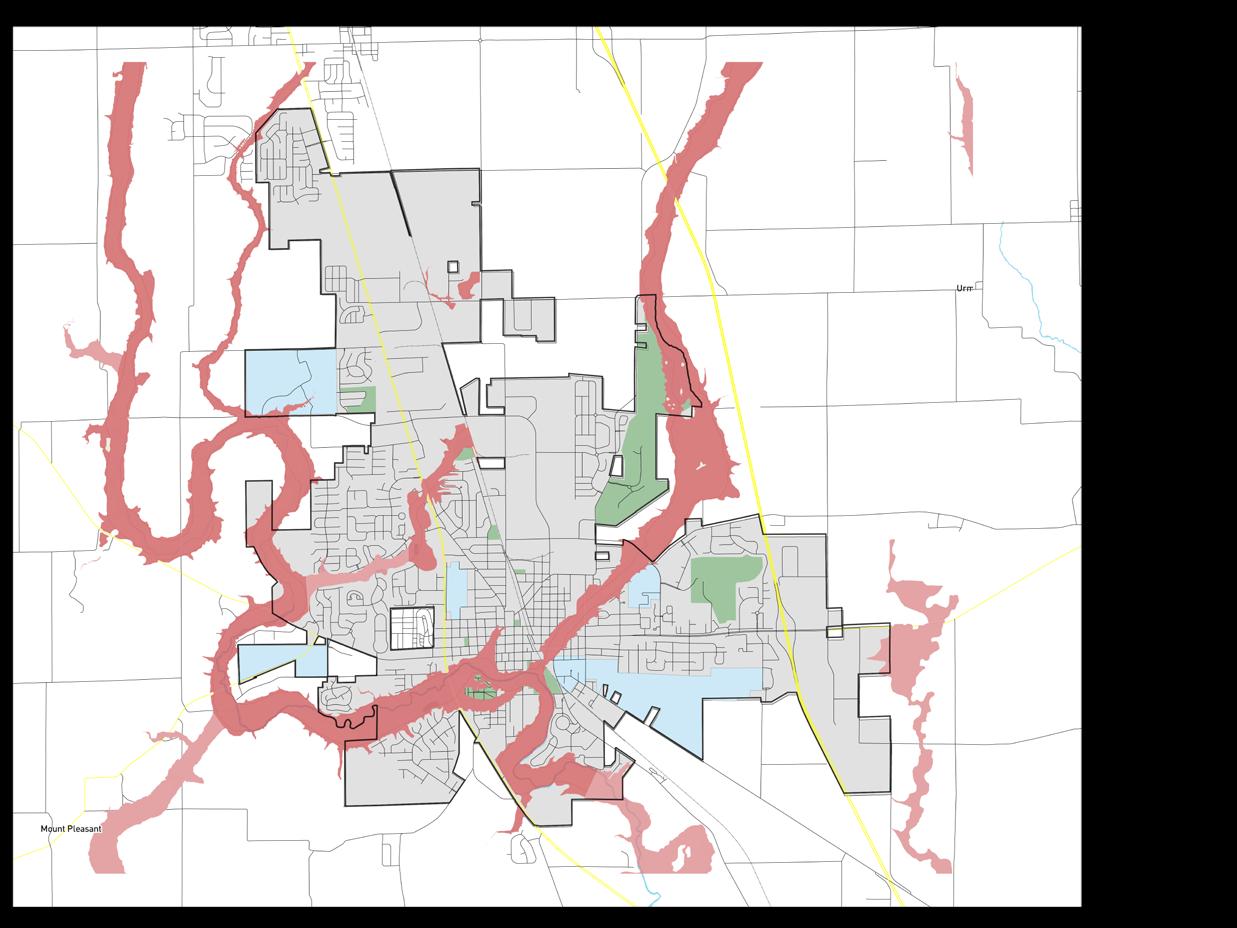
Franklin has many natural resources including many creeks which border, and run through the city. Youngs Creek, Canary Ditch, Hurricane Creek and Brewer Ditch are all natural corridors which are an asset for the community but also present many challenges with frequent flooding. The floodplain areas along these creeks and ditches are shown on the Floodplain Map. A devastating flood in 2008 demonstrated the challenges of developing near these areas with much of downtown Franklin impacted by the flood.
Although many parks suffered from this flooding, and repairs were needed, the repair to park lands is far cheaper than trying to repair structures that suffer from flood damage. The floodplains through the city have been utilized to construct portions of the Franklin Greenway Trail creating linear parks. This provides a community asset in areas that can’t be developed with buildings. In addition, these projects present the opportunity to incorporate environmental restoration and revitalization projects along with trail development. Restoring and protecting these areas will be increasingly more important as the city continues to grow. Planning future greenway trails along other floodplain areas can create additional connections for the network through natural areas.
FIGURE 2
ZONING MAP (CITYWIDE)
GW-OL: Gateway Overlay
WP-OL: Wellfield Protection Overlay
A: Ag riculture
RR: Residential, Rural
RSN: Residential, Suburban Neighborhood
RS-1: Residential, Suburban One
RTN: Residential, Traditional Neighborhood
RT-1: Residential, Traditional One
RM: Residential, Multi-Family
RMH: Residential, Manufactured Home
MXC: Mixed Use, Community Center
MXD: Mixed Use, Downtown Center
MXN: Mixed Use, Neighborhood Center
MXR: Mixed Use, Regional Center
IBD: Industrial, Business Development
IL: Industrial, Light
IG: Industrial, General
IN: Institutional
PUD: Planned Unit Development
3
CENTERS (CITYWIDE)
FIGURE 4 FLOODPLAIN MAP (CITYWIDE)
FIGURE


5 DESTINATION MAP (CITYWIDE)
The existing bicycle network is primarily made up of the Franklin Greenway Trail and cyclists who ride on lower volume roadways. The Franklin Greenway Trail forms the spine of the bicycle network by connecting several areas of the city. Opportunities and challenges for the existing bicycle network include:
Strengths and Opportunities
• Franklin Greenway Trail extends from the High School to Blue Heron Park.
• The Franklin Greenway Trail forms the framework for new improvements to build on.

• The Franklin Greenway Trail provides an off-road facility protected from automobile traffic which is comfortable for a wide range of cyclist skill levels.

• The lower volume rural roadways are attractive to highly confident recreational cyclists who are looking for longer riding routes.
• The trail loops around the high school property add to the bicycle network.
• There are a high number of people who currently cycle in the city creating the need and support for additional bicycle facilities.
• There are a number of active community partners in the city including the hospital, the school corporation and Franklin College.
Challenges and Weaknesses
• Franklin Greenway Trail has challenging crossings including U.S. 31, King Street and Jefferson Street.
• Parts of the Franklin Greenway Trail are substandard with narrow widths which need to be widened.

• Wayfinding is challenging in parts of the city.
• Frequent flooding can cause issues with sections of the greenway trail limiting residents choices for alternative modes of travel during flooding and the time period after while trail clean-up is taking place.
• Budget funding for maintenance of the bicycle network has not always kept pace with construction of new facilities.
• U.S. 31 creates a major barrier between the east and west areas of the town.

• Jefferson Street traffic volumes are challenging for accommodating bicyclists through downtown.

• On-road bicycle facilities are currently limited.
• The railroad through the downtown is a barrier to facilities.
The pedestrian network in Franklin includes sidewalks and the Franklin Greenway Trail. Many newer subdivisions include sidewalks on both sides of the street but have gaps where housing lots have not been developed. The downtown has a fairly extensive network of sidewalks but many of these sidewalks are older and in need of repair or are narrow in width. Current ADA guidelines require sidewalks to be 5’ in width with accessible ramps at roadway crosswalks. Many of the older sidewalks are 4’ in width and sometimes more narrow. Tree roots and wear and tear have caused lengths of sidewalk which are in need of repair. In addition, there are areas where sidewalks simply end or do not include ramps to access the crosswalks creating barriers for people with physical impairments. Opportunities and challenges for the pedestrian network include:
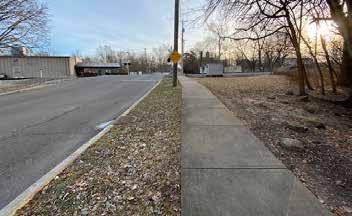
• New sidewalks in the downtown connect with major destinations along Jefferson Street.
• The shared-use Franklin Greenway Trail connects many neighborhood areas with Province Park and Blue Heron Park.
• Many downtown streets include sidewalks.
• Newer subdivisions include sidewalks on both sides of the street.
• The downtown area is very walkable with Main Street connecting many areas of the downtown.
• Most of the parks are accessible by sidewalk from nearby neighborhoods.
• Crossing U.S. 31 is intimidating and can be a barrier for some choosing to walk.
• Heavy traffic along U.S. 31 makes walking along the roadway unappealing.
• Most of U.S. 31 does not include pedestrian facilities
• Older sidewalks in the downtown area are narrow and in need of repair due to age and tree root heave.
• New subdivisions have gaps in the sidewalk network where lots have not been built out.
• There are no sidewalks along S.R. 44 connecting with the schools.
• There is no pedestrian crossing on S.R. 44 between Creekside Elementary School and Custer Baker Intermediate school.
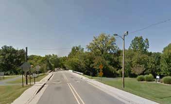
• Automobiles frequently exceed posted speed limits making crossing busy roads even more challenging.
• Areas of town, such as the mobile home park south of downtown, need pedestrian facilities. Some of the residents in these areas do not have automobiles and rely on bike and pedestrian facilities for their transportation needs.

EXISTING

FIGURE 6 EXISTING CONDITIONS (CITYWIDE)

FIGURE 8 EXISTING CONDITIONS (NORTHEAST)
EXISTING
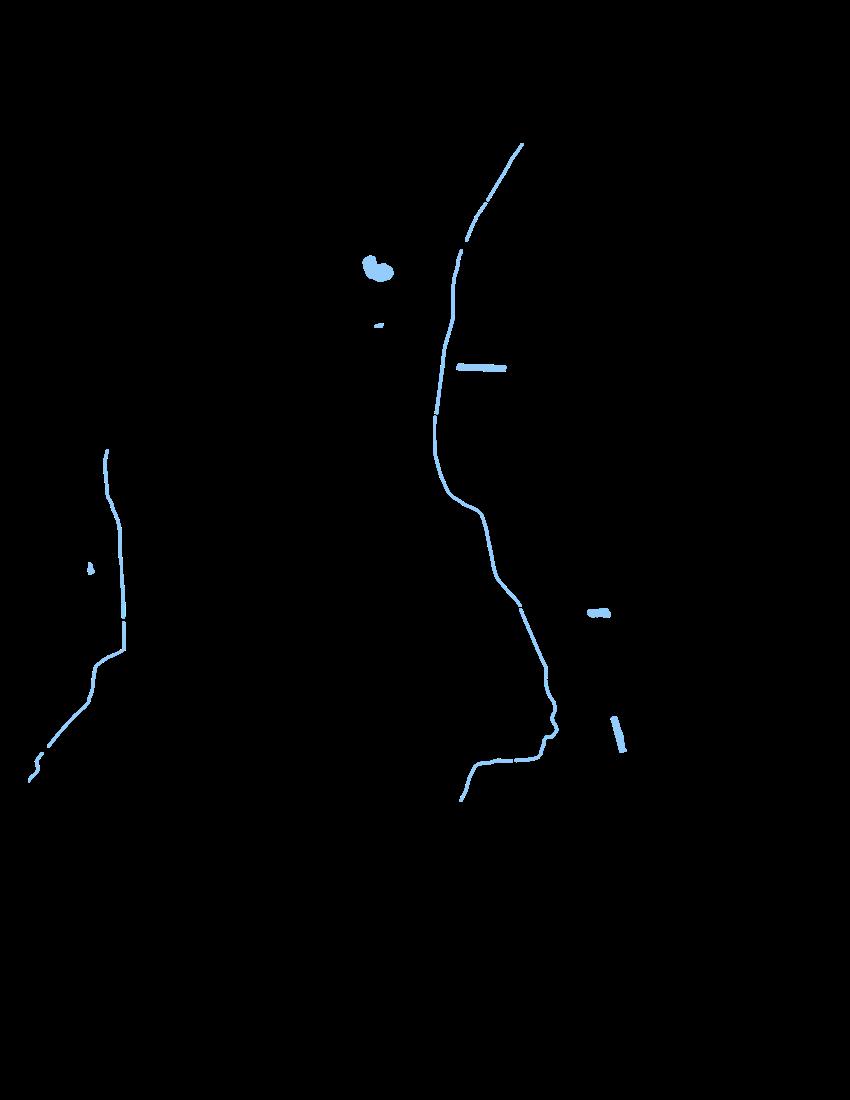
FIGURE 9 EXISTING CONDITIONS (SOUTHWEST)
EXISTING

FIGURE 10 EXISTING CONDITIONS (SOUTHEAST)
The biggest challenge for cyclists and pedestrians in Franklin is the natural and man-made barriers which divide the city. Although many of these barriers have either crosswalks or bridges, providing relatively safe crossings, the opportunities to cross are limited. Barriers were commonly mentioned as one of the main reasons that people don’t bike and walk more often. The major barriers for the network are illustrated on the Barriers Map and include:
• U.S. 31
• The Railroad
• Youngs Creek
• Canary Ditch
• Hurricane Creek
• East King Street
• West Jefferson Street
• Interstate 65
The Franklin Greenway Trail currently has a crossing under U.S. 31 at Blue Heron Park. This is an important part of the network creating a crossing where cyclists and pedestrians do not have to cross the busy highway. However, this crossing is directly adjacent to Youngs Creek which floods frequently. Even with the flooding this in an invaluable crossing which should be maintained and enhanced. The approach to the crossing can be challenging with a downhill run around a curve making cyclists approach the crossing at a high rate of speed. This becomes dangerous when mud and debris are left on the path from flooding. Although the Parks Department has a good strategy for promptly clearing this pathway, additional warning signage would be helpful to alert cyclists and pedestrians to use caution when approaching
the area. The City should consider implementing signage with flashing lights that could be activated during and just after flooding events to further alert trail users.

FIGURE 11 BARRIERS MAP (CITYWIDE)

EXISTING
A Bicycle Level of Traffic Stress Analysis (LTS) looks at the existing conditions of the transportation network in terms of cyclist comfort level while riding on a specific road corridor. The Bicycle Level of Stress Analysis is a method that was developed by the Mineta Transportation Institute to better assess the comfort and connectivity of bicycle networks. The analysis can determine where gaps occur in the low-stress network. The low stress system is the most appealing to cyclists with lower confidence levels including families and children.
The LTS analysis includes several factors to determine the comfort level of bicyclists while riding on that corridor. These factors include the number of lanes, speed limit, annual average daily traffic, the type and width of the bicycle facility, and the presence of a turn lane, median or traffic signal. The LTS for a corridor is determined by the most stressful factor and not an average of all factors. The LTS analysis responds to traffic speeds
and volumes. In other words, LTS is more stressful on roadways with speeds over 35 mph and with four or more travel lanes even if there is a bike lane.
Street segments are classified into four levels of traffic stress with LTS 1 being the least stressful and LTS 4 being the most stressful. Bicycling within individual neighborhoods in Franklin can be done on low-stress streets. However, large traffic corridors like U.S. 31 create barriers between these neighborhoods and connections to other parts of the city.
The Level of Traffic Stress analysis on the following pages illustrates the areas of the city that are currently comfortable for all bicycle riders. Figure 13 shows where the lower stress “pockets” of the city are connected by high stress streets. Reducing the number of high stress connections will increase the number of people who ride in Franklin for various reasons including running errands in addition to recreational rides.
LTS 1 - Suitable for children (shared-use path, greenway, cycle tracks, low volume streets)
LTS 2 - Interested but concerned adults (buffered bike lanes, moderate volume streets)
LTS 3 - Enthused and confident adults (bike lanes, high volume streets, and over 30 mph)

LTS 4 - Strong and fearless adults (high volume streets, over 30 mph, and riding with traffic)



FIGURE 12 LEVEL OF TRAFFIC STRESS LTS 1 - LTS 4 (CITYWIDE)
EXISTING
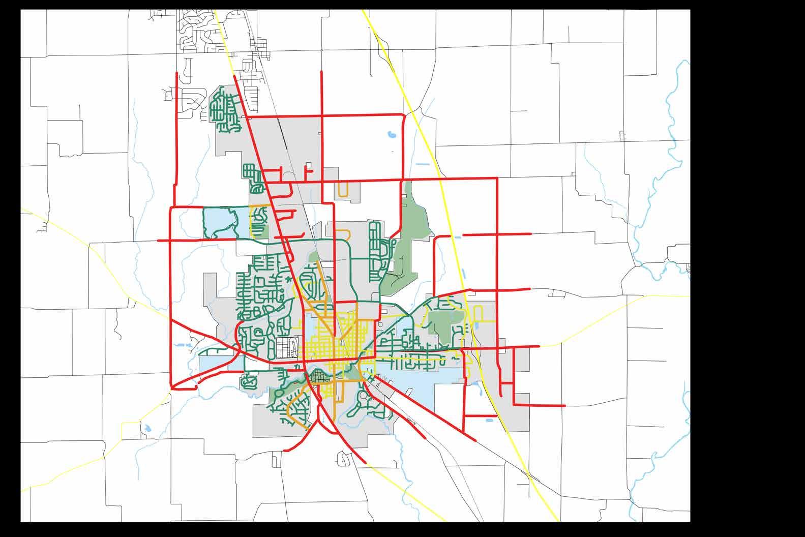
FIGURE 13 LEVEL OF TRAFFIC STRESS LTS 1 - LTS 2 (CITYWIDE)
EXISTING

FIGURE 14
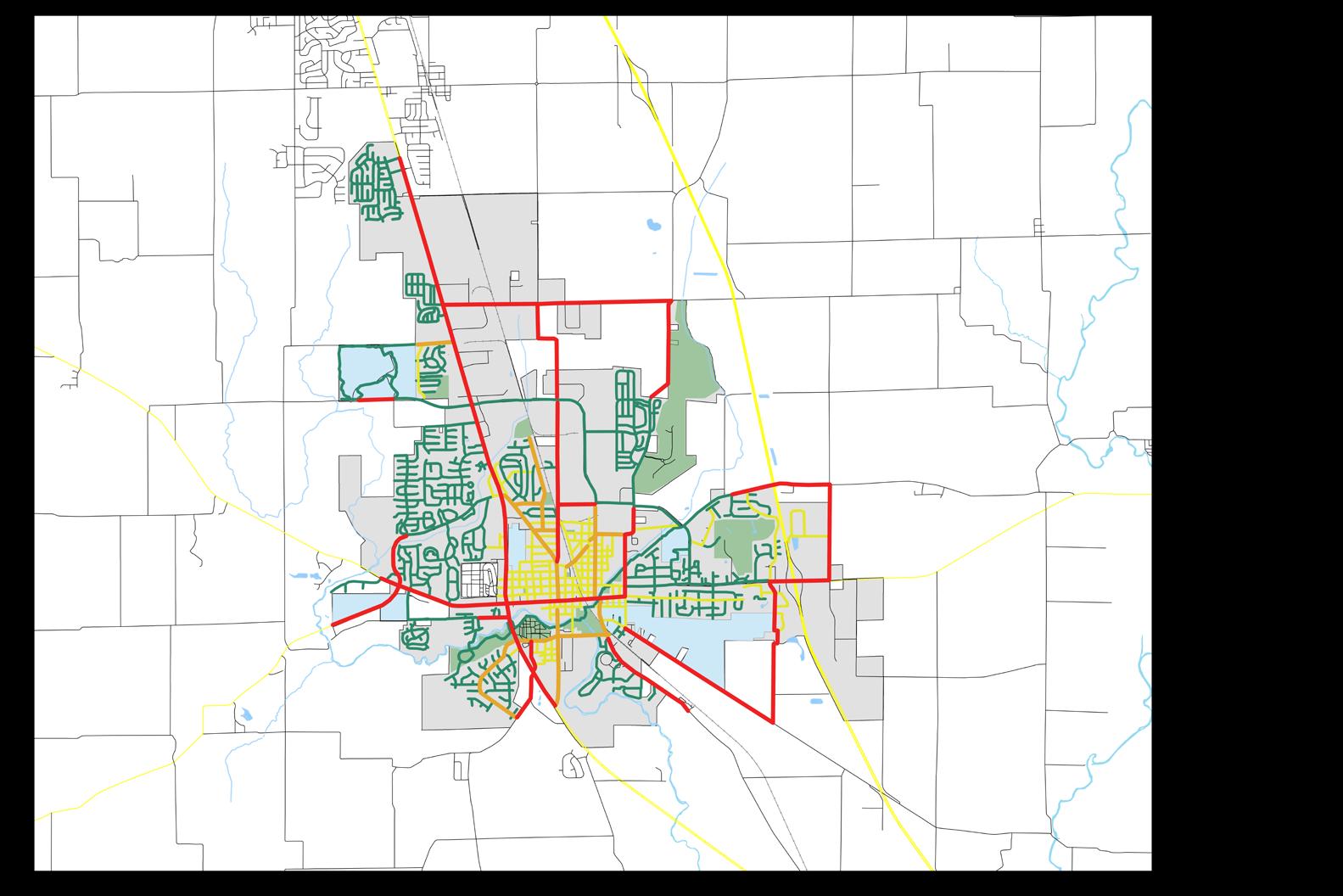
LEVEL OF TRAFFIC STRESS
LTS 1 - LTS 2 W/CONNECTORS (CITYWIDE)
EXISTING

A variety of outreach opportunities were used throughout the master planning process to gather input from the community. The plan development process also included extensive coordination with partner agencies and other city departments to ensure this master plan meets community needs, advances initiatives of local and regional partners, and includes projects and programs that can feasibly be implemented.
• Public Open Houses
• Stakeholder Interviews
• Bicycle and Pedestrian Steering Committee

• Board of Public Works
• Park Board
• Planning Commission
• City Council
• Community Survey
• Interactive Mapping Tool


• Project Website
• Complete the Franklin Greenway as a recreational/family oriented loop without excluding commuters.
• Provide a mix of new facility types for all bicycle skill levels with a preference for off-road or protected bike facilities.
• Complete gaps in the sidewalk network especially in the downtown area and near Franklin College.
• Improve bicycle and pedestrian network connectivity for recreation and transportation.
• Improve safety and comfort of bicyclists and pedestrians along U.S. 31, especially at intersections/crossings.
• Like what we have but want to continue to grow the network.
A community survey was made available online from May to July 2019. The survey was developed to assess the community’s perceptions, use and wishes for the bicycle and pedestrian network. The survey was advertised through email notifications and distributed through community groups. A summary of responses is provided in the following text. The entire survey results are available in the appendix.
Survey respondents stated a clear desire for additional biking and walking facilities. Over 94 percent of respondents consider the goal of creating more opportunities for biking and walking in Franklin “very important”. Nearly 94 percent of respondents would walk or ride more if they were closer to facilities.
Recreation and exercise were identified as the most important benefits of having a complete bike and pedestrian network. However, other uses from transportation to connectivity were also ranked higher in importance.
Survey respondents indicated their comfort level on a variety of facility types. The majority of respondents prefer facilities which are separated from the roadway but there was also a fairly high response for other facility types including bike lanes (see chart below).
When asked about where respondents would like to see city funds spent most people indicated that new sidewalks, expansion of the greenway trail and additional shared-use paths should be the focus of new project spending.
Q12 What are your most desired bicycle and pedestrian route types?
Please select top 3.
Q12: What are your most desired bicycle and pedestrian route types? Please select top 3.
Answered: 34 Skipped: 0 uXA6x0q.jpg indy-cultural-t
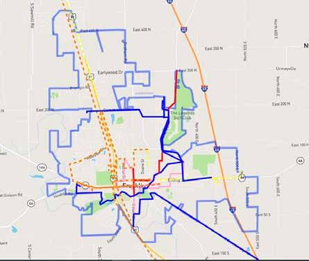
An interactive mapping tool was posted on the project website and used throughout the plan process to gather input and feedback from the community directly on top of a map of the city.
The map was available from May to July 2019 for comments. Respondents were encouraged to draw routes or place pins on the map and add comments to identify desired walking or bicycling improvements, challenging crossing and other information about the walking and bicycling environment.

The adjacent map illustrates respondent responses indicating where they currently ride and walk (dashed lines) and where they would like to ride and walk (solid lines). Other exercises included asking for destinations and dangerous or challenging crossings. The route map shows the desire for residents to reach all areas of the city by bicycle or by walking. Desired destinations include downtown, shopping along U.S. 31, schools and parks.

Barriers to biking and walking were identified along U.S. 31, Westview Drive, King Street and Hospital Drive. Pedestrian barriers were identified near the high school, Creekside Elementary/Custer Baker Intermediate School and the hospital.
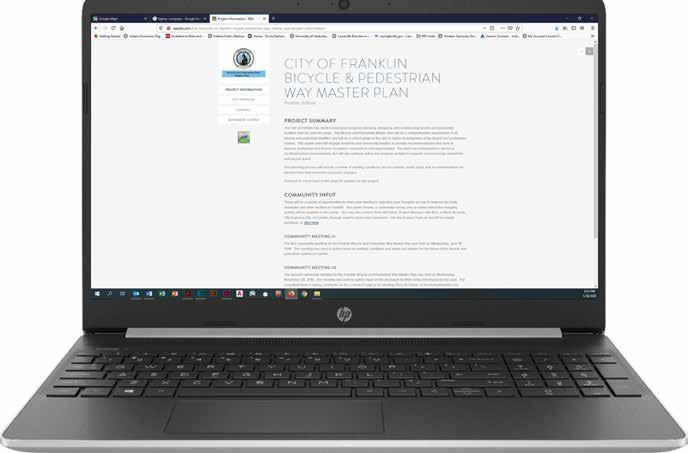
A project website was created at the beginning of the process to provide residents with a basic overview of the purpose of the plan, the planning process and the timeline for completion. The website was updated with summaries of the different phases of the planning process and included information regarding public meetings and other opportunities for input including contact information for the project manager.
The project website included links for the community survey and the interactive mapping tool. Visitors to the website were able to submit comments online.
The project website provided a valuable resource for residents who might not be able to attend public meetings. Information presented at the public meetings was shared on the website.
The first public open house was held on May 19th, 2019. The open house included interactive exercises for attendees to share their opinions. Exercises included a review of existing facilities, what residents are currently using, where they would like to see new facilities added and an exercise to gauge the comfort level of certain facility types. The input that was gathered at the public open house closely mirrored the input from the online interactive mapping exercise. Many of the same routes for existing use and desired routes were identified between the two different methods of outreach. The barriers and challenging intersections were also nearly identical between the two methods.
The exercise gauging the comfort level of cyclists and pedestrians utilizing facilities showed a preference for facilities that are separated from automobile traffic. Other on-road facility types like bike lanes were also identified as desired facilities but not at the same demand as the separated facilities
The second open house was held in November of 2019. This open house presented plan recommendations for the public’s view. Exercises at this meeting included maps with the proposed facilities for the city and additional detail for what those facilities will look like. Attendees were asked to evaluate the recommendations to identify if there were areas of town which were not accessible through proposed bicycle or pedestrian facilities.

In general, attendees at the meeting were supportive of the recommendations and enthusiastic about the future of biking and walking for the city. Attendees at the meeting confirmed again the demand for more bicycle and pedestrian facilities for the city.
The open house also asked visitors to prioritize proposed projects from the master plan. This exercise guided the design team in prioritizing projects for the implementation recommendations of the master plan.
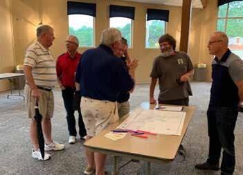
A Bicycle and Pedestrian Plan Steering Committee (the committee) was formed at the beginning of the master plan process. This committee was made up of community members, business leaders, educators, city staff and walking and biking enthusiasts. The committee met at regular intervals during the planning process to offer direct input for the planning process. This committee provided valuable feedback and input regarding the existing conditions, public engagement, plan recommendations, and implementation strategies.
Another important role for the steering committee was to take the planning process and share it with neighbors and friends. The steering committee served as neighborhood liaisons throughout the process.
The steering committee’s participation was vital to the creation of a plan that addresses the diverse needs of residents and sets the stage for integrating bicycling and walking into the every day lives of the community.
A small group meeting was conducted with city staff during the early stages of the project. This meeting included members from the Parks Department, Planning and Engineering Department and the Street Department. The discussion included a wide range of subjects from existing facility challenges and issues to recommendations for implementation of new facilities and their maintenance. Key takeaways from this meeting included:
• A clear delineation of responsibilities between departments would help with maintenance of facilities
• Increased maintenance costs should be included in the budget of new projects.
• A schedule for long-term replacement of facilities should be developed to allow for budgeting.
• Parties that will be responsible for maintenance of new facilities should be included in project planning from early in the process.
The final plan was presented to the following Board, Commission and the Council for review, comment and adoption.
• Park Board
• Board of Public Works
• Planning Commission
• City Council


This chapter provides a comprehensive set of recommendations designed to provide a connected, safe and convenient network of bicycle and pedestrian facilities. The recommendations provide the City of Franklin with the road map needed to continue their current momentum in pedestrian and bike network growth.
Pedestrian recommendations include sidewalks, shared-use pathways and intersection treatments. The bicycle recommendations include bike lanes, shared-use paths, shared lanes, signed routes and amenities such as trailheads and bike parking. Recommendations are considered planning-level, and should be used as a guide when implementing projects. More detailed analysis, including potential traffic studies, will be required to evaluate specific site conditions and develop designs that reflect conditions and constraints.
The following chapter has organized the recommendations in the following order:
• Bicycle Facility Recommendations

• Pedestrian Facility Recommendations
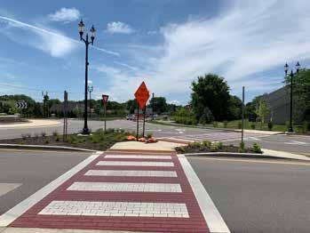
• Facility Guidelines
• Policy and Program Recommendations
Chapter 6 - Plan Implementation details phasing and funding options for the plan recommendations.
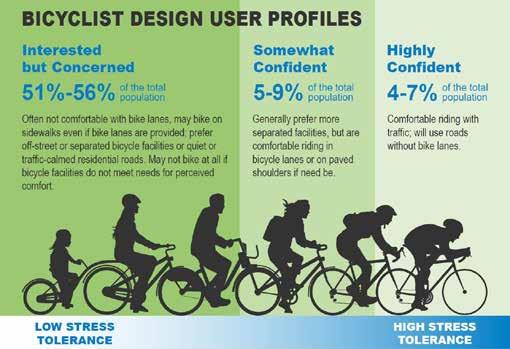
Creating a comprehensive system of bicycle facilities requires the design of safe, comfortable and convenient facilities for all types of bicycle riders. Originally developed by Roger Geller at the City of Portland, the “Four Types of Bicyclists” offer a broad way to define the different types of riders.
Somewhat Confident Bicyclist
One of the primary goals of this plan is to provide a connected network of facilities which will allow residents to reach all parts of the city by bike or on foot. Recommendations include key intersection improvements which will connect facilities which are currently divided by busy roadways.
1) Strong and Fearless: People willing to bicycle with limited or no bicycle specific infrastructure.
Somewhat Confident Bicyclists, also known as Enthused and Confident Bicyclists, are the next-smallest group. They are comfortable on most types of bicycle facilities. They have a lower tolerance for traffic stress than the Highly Confident Bicyclist and generally prefer low-volume residential streets and striped or separated bike lanes on major streets, but they are willing to tolerate higher levels of traffic stress for short distances to complete trips to destinations or to avoid out-of-direction travel.
2) Enthused and Confident: People willing to bicycle if some bicycle-specific infrastructure is in place
user profile as the resulting bikeway network will serve bicyclists of all ages and abilities, which includes Highly Confident and Somewhat Confident Bicyclists.
The bicycle facility recommendations include five facility types. These include:
• Shared-use path
• Conventional bike lane
• Buffered bike lane
• Shared lane
• Bike Route
3) Interested but Concerned: People willing to bicycle if high-quality bicycle infrastructure is in place (typically separated from traffic)
Interested but Concerned Bicyclists are the largest group identified by the research and have the lowest tolerance for traffic stress. Those who fit into this group tend to avoid bicycling except where they have access to networks of separated bikeways or very low-volume streets with safe roadway crossings. To maximize the potential for bicycling as a viable transportation option, it is important to design bicycle facilities to meet the needs of the Interested but Concerned Bicyclist category. This is generally the recommended design
4) No Way, No How: People unwilling to bicycle even if high-quality bicycle infrastructure is in place.
Many streets within the neighborhood network of Franklin are comfortable for all levels of bicycle riders including children. However, neighborhoods are commonly divided by high traffic and high speed roadways such as King Street, Westview Drive, Jefferson Street and U.S. 31 (Morton Street). These road barriers limit the distance that the least confident riders can travel. This often limits their choice to ride a bicycle and forces them into their cars.
The target design user influences the safety, comfort, connectivity, and cohesion of the bicycle network. Communities establish a target design user by selecting a target comfort level for the bicycle network. Comfort and stress are inversely correlated. Exposure to high motor vehicle traffic speeds and volumes is the primary contributor of stress. High-comfort/lowstress networks serve the most people while low-comfort/highstress networks serve the least.
Details for each of these facility types is provided in the Network Facility Guide at the end of this chapter and include context, design guidelines and intended user type for each facility.
While the target design user and target comfort level should be selected based on the vision, this critical decision is often overlooked. In such cases, the network typically defaults to serving Highly Confident and Somewhat Confident users in a Basic Bikeway Network (as described on page 14). Communities seeking to serve all ages and abilities will need to establish lowstress bicycle networks.
Note: the percentages above reflect only adults who have stated an interest in bicycling.
Brewer Ditch YoungsCreek
CanaryDitch
YoungsCreek YoungsCreek
Creekside Elem.
Hurricane Creek YoungsCreek
Proposed Shared-Use Path
Proposed Bicycle Lane
Proposed Greenway
Proposed Shared Lane
EXISTING Hurricane Rd Graham Rd ParkAve
City Franklin College
Proposed Bike Route

Existing Shared-Use Path
Existing Bicycle Lane Paris Dr
PROPOSED
Proposed Shared-Use Path
Proposed Bicycle Lane
Proposed Greenway
Proposed Shared Lane
Proposed Bike Route

EXISTING
Existing Shared-Use Path
Existing Bicycle Lane
DESTINATIONS & BOUNDARIES
City Limits
Project Limits
School Park
PROPOSED
Proposed Shared-Use Path
Proposed Bicycle Lane
Proposed Greenway

Proposed Shared Lane
Proposed Bike Route
EXISTING
Existing Shared-Use Path
Existing Bicycle Lane

PROPOSED
Proposed
Proposed
Proposed
Proposed
Proposed
Existing

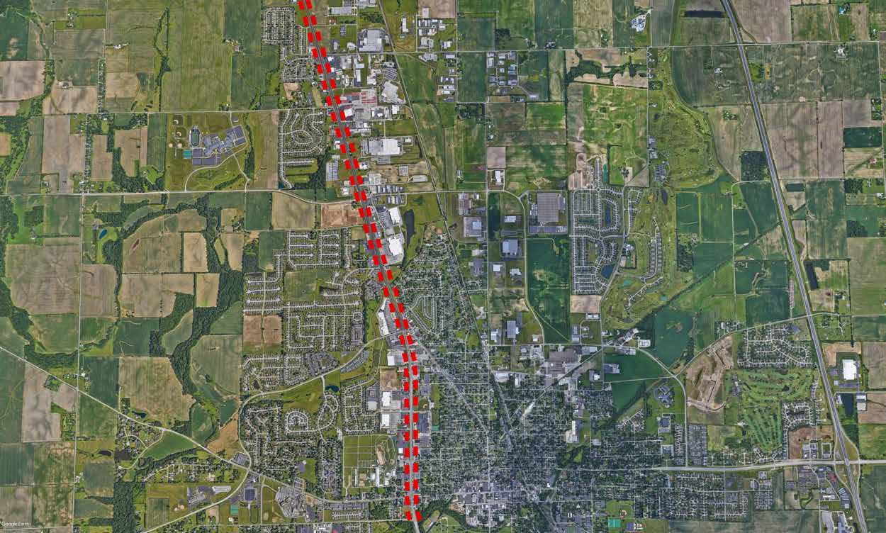
From: City northern limits to City southern limits
Information: working with INDOT for a roadway improvement project which will include safety and intersection improvements for the roadway within this section of the corridor. Improvements also include bicycle and pedestrian facilities. This master plan recognizes the importance of this project to connect the western and eastern areas of the city. These improvements will also provide connections to retail and employment centers along U.S. 31. The current planning efforts propose a sidewalk on one side of the road with a shared-use path on the other side. While this will improve the network for the short-term, the long-term solution should be to provide a shared-use path along both sides of the road.
Notes:
• The city should continue the shared-use path along both sides of the roadway as a future project.
• Coordinate with INDOT as roadway improvements are extended south
• Will provide a vital connection to communities to the south and north along U.S. 31
• Will provide a complete street solution for this corridor
• Intersection improvements should focus on safe and comfortable crossings for pedestrians and cyclists
SHARED-USE PATH FACILITIES (CITYWIDE)
Proposed Shared-Use Path
EXISTING
Existing Shared-Use Path
Existing Bicycle Lane
City Limits
Project Limits
School Park
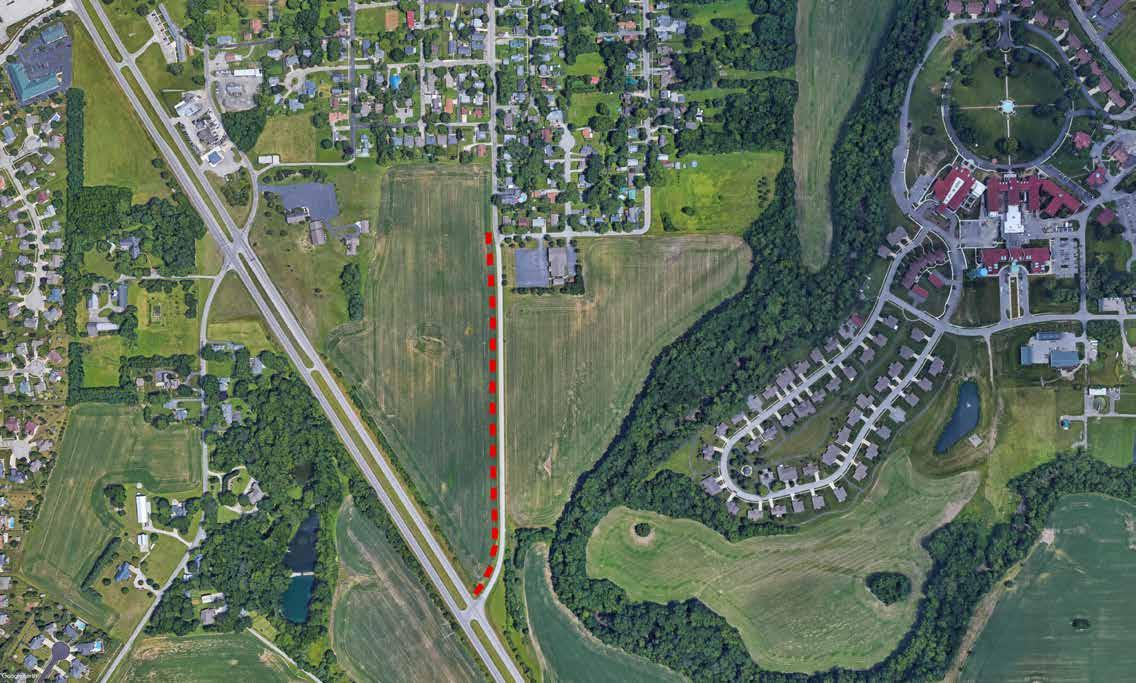
From: Ridge Street to U.S. 31
Information: The City of Franklin is currently working on a roadway improvement project for South Main Street which will include sidewalks on both sides of the street from The Youngs Creek bridge to Champ Ulysses Street and a shared-use path from Champ Ulysses Street to the intersection of U.S. 31.
Notes:
• Right-of-way acquisition may be needed in areas
• Future shared-use path along U.S. 31 will provide important connection
From: Westview Drive to U.S. 31 (Morton Street)
Information: This corridor is one of the primary entrances into the city from the west. A roundabout is proposed at Westview Drive and will include pedestrian and bicycle facilities which will dramatically improve the safety of crossing Jefferson Street. Shared-use pathways are proposed along Westview Drive and for a short distance on Jefferson Street.
The traffic volumes along Jefferson Street create the need for an off-road facility to meet the needs of less confident riders including children riding to Creekside Elementary School and Custer Baker
Intermediate School. The shared-use path will also be accessible to the hospital.
Gateway features such as those constructed along East King Street near Interstate 65 can be implemented as a part of this project creating a western gateway for the city.
Notes:
• Right-of-way acquisition may be needed in areas
• Drainage improvements will be required to eliminate roadside drainage
• Will complete a loop for neighborhoods in the western part of the city when combined with Westview Drive shared-use path

From: Province Park to city limits south
Information: The shared-use path along Grizzly Drive and Park Avenue will provide an off-road regional connection to the county. There is an opportunity to partner with Franklin College which has been supportive of bicycle and pedestrian facilities and provides several pathways around the campus. As the campus grows along this corridor the city should work with the college to incorporate a shared-use path into their plans and potentially engage in cost-sharing for construction. The
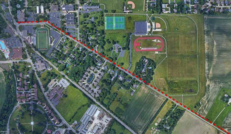
pathway should extend past the city limits along East Greensburg Road as this part of the county develops.
Notes:
• Incorporate with internal walking paths on college campus
• Important regional connection to areas outside of the city
From: Westview Drive to end of road
Information: From Westview Drive to Pamela Drive the facility is a 4’ sidewalk and is identified as a part of the bicycle and pedestrian network and designated as a shared-use facility. The 4’ width is too narrow for shared-use and does not meet minimum ADA requirements for pedestrians. This facility should be widened to a minimum 10’ width to accommodate both pedestrians and cyclists. Signage and pavement markings should be implemented after the facility is widened to indicate that this is a shared-use facility.

The shared-use path widens at Fiesta Drive and continues to the end of the road. This portion of the corridor meets the minimum dimensions needed for a shared-use path.
Notes:
• Crosswalks are needed at intersecting roadways for pedestrians
• Trail width should be 10’ with a minimum of 8’ width only in restricted areas
• Pavement markings and signage should be added to indicate both pedestrians and cyclists are allowed on the pathway
From: U.S. 31 to Cumberland Drive
Information: The existing pathway from U.S. 31 to Oak Leaf Road is 6’ in width. Although the pathway currently functions as a shared-use path it should be widened to 10’ wide to accommodate two-way travel for both bicycles and pedestrians.
The path along Westview Drive from Oak Leaf Road to Cumberland Drive is an existing 4’ sidewalk and is identified as a shared-use facility. The sidewalk should be replaced with a 10’ wide shared-use path (minimum 8’ width in constrained conditions).

Notes:
• Can be implemented in existing right-of-way width
• This is a good corridor for shared-use path with few curb-cuts which can create conflict points
• Crosswalks should be added at roadway intersections
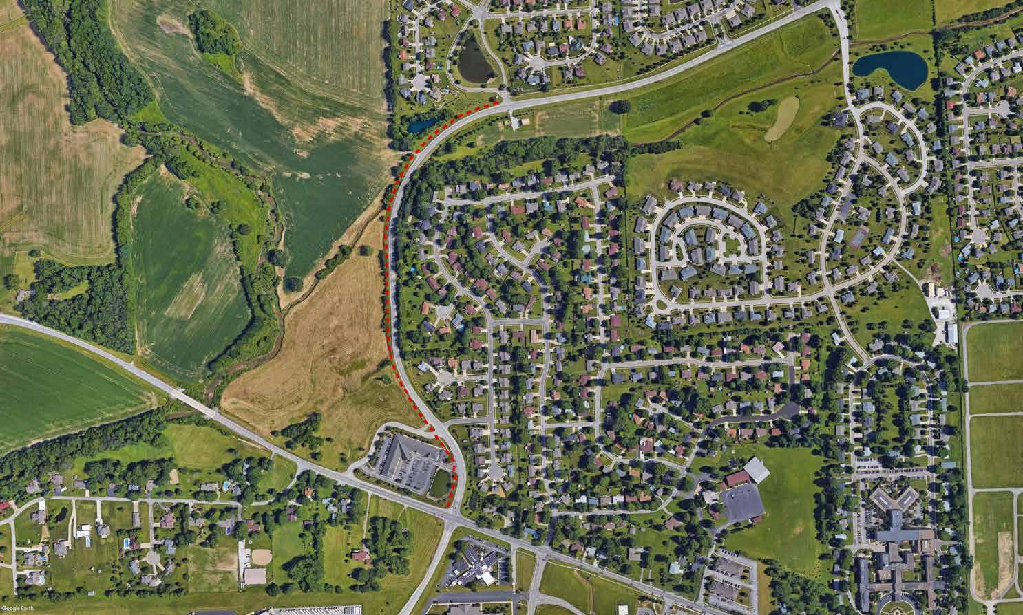
From: West Jefferson Street to North Main Street
Information: Walnut Street provides a north/south route which parallels U.S. 31 but with a drastically different character. This largely residential street has mature trees and informal on-street parking on both sides of the street. Walnut Street provides a direct connection to the pathways which are proposed as a part of the amphitheater project and will connect directly to the Franklin Greenway.

Notes:
• Existing right-of-way width will accommodate improvements
• Informal parking that is occurring within the right-of-way will need to be formalized to allow room for a shared-use path
• Older trees which are declining may need to be removed to allow for the shared-use path on one side of the road
• Provides an off-road facility which is comfortable for all riders
• Parallel route to U.S. 31 which is high volume and high speed roadway


From: Hospital Road to West Jefferson Street
Information: Tracy Miles Road is located along the eastern border of Custer Baker Intermediate School. The existing sidewalk is identified as a part of the shared-use path network and connects Jefferson Street with Hospital Road. The existing sidewalk is 4’ wide and should be replaced with a 10’ wide shared-use path to accommodate both bicycle and pedestrian users. The crosswalk at Hospital Road should also be improved to increase safety.
Notes:
• Provides connection to Jefferson Street and Hospital Road
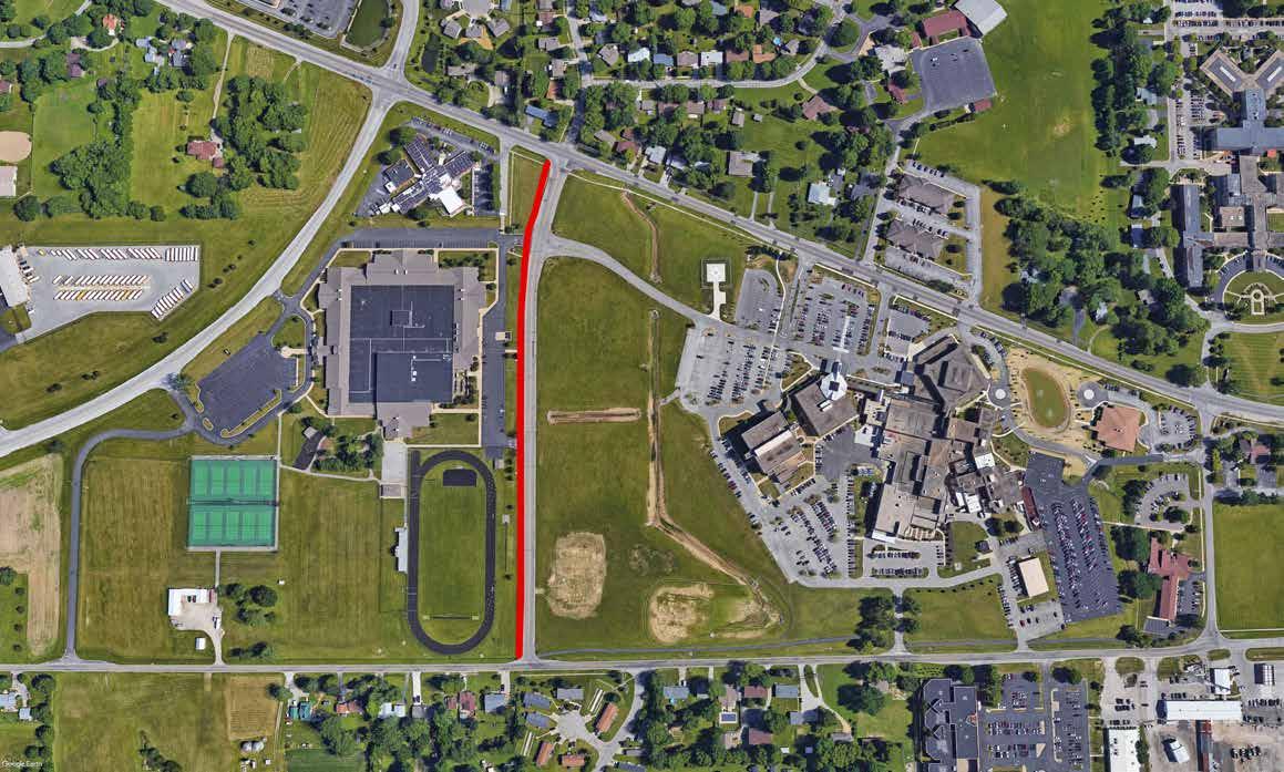
• Hospital Road has many pedestrians with limited facilities
• Coordinate with school corporation to also add amenities such as bike racks at schools
From: West Jefferson Street to City Limits
Information: Implementing this shared-use path will connect with planned bicycle and pedestrian facilities in the county. This pathway can also be designed as an amenity for the school incorporating plantings and features such as seating areas. A smaller loop of shared-use pathways will be created when the Jefferson Street, S.R. 44, Tracy Miles Road and Hospital Drive pathways are completed.

Notes:
• Provide pathway along school property with green space buffer between path and road
From: Woodfield Drive to Cub Drive
Information: There is an existing sidewalk along the northern side of Hospital Road from Drake Road to Woodfield Drive. This sidewalk is identified as a part of the pathway network and should be widened to 10’ width to accommodate multiple user types. There are no facilities from Drake Road to Cub Drive. The shared-use path will be extended to connect to Custer Baker Intermediate School. With improved intersections and crossings this will provide convenient access from the schools to the
Notes:
• Existing power lines and roadside ditch will be considerations in design of this facility
• The shared-use path along school property will require an easement, right-of-way width or will be located on school property as a school amenity
• Shared-use path will extend north along Cub Drive/Intermediate School property line to connect with S.R. 44


From: Paris Drive to Jim Black Road
Information: Recent improvements to East King Street include shared-use paths on both sides of the street, streetscape improvements including plantings, gateway features and amenities such as seating areas. This project serves as a model for the proposed improvements to East King Street from Paris Drive (the end of the current improvements) to Jim Black Road. This project will enhance the current gateway features and provide a gateway to Franklin from all interstate interchange
Notes:
• Continue existing streetscape design including shared-use path on both sides of the roadway
• Creates consistent visual for travelers to know they have arrived in Franklin
• Areas around the interchange will continue to develop presenting the opportunity to partner with developers to implement sections of this project
• Will connect the existing network of pathways to Ivy Tech and Mitsubishi campus

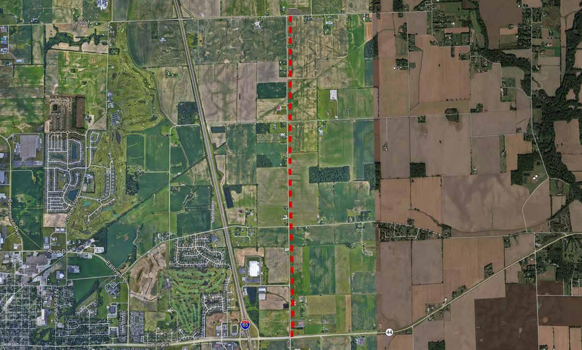
From:
Information: along Jim Black Road (North 500 East) is outside of the city limits it is shown on the master plan as an important connection for surrounding areas. This area of the city has a high potential for development in the near future. The shared-use trail should be incorporated into developments along this corridor.
Notes:
From: 14th Street to Scott Park
Information: Scott Park and Temple Park are located along Younce Street and both are nestled in existing neighborhoods. Their locations within these neighborhoods makes them popular destinations especially for their playgrounds. Scott Park is also a hub of baseball and softball activities for the city. There is a high demand for reaching these parks by bike and foot. Younce Street becomes very busy with vehicular traffic when games are held at Scott Park which creates the need for a facility which is separated from automobile traffic. The shared-use path on one side of Younce Street will connect these neighborhoods with the parks but also connects the parks with the larger Greenway network.
Notes:
• Widen sidewalk on one side of the road to 5’ width including ADA accessible ramps at road intersections
• Replace sidewalk with 10’ wide shareduse path on other side of the roadway to accommodate bicycles and pedestrians
• Will connect Scott Park and Temple Park with an off-road facility
• Will connect Scott Park with Arvin Road future shared-use path which connects with overall trail network

From: Younce Street to Main Street
Information: The 14th Street shared-use path provides a connection between the shareduse paths along U.S. 31 and the Younce Street path. This will provide a connection to shopping and restaurants along U.S. 31 for the adjacent neighborhoods.

Notes:
• Replace existing sidewalk on one side of the road with 10’ wide shared-use path
• Connect with Arvin Road shared-use path
From: Commerce Parkway to Younce Street
Information: The Arvin Road and Younce Street pathways will complete an important connection for the existing pathway network. These two pathway projects will connect both Scott Park and Temple Park with the larger greenway network which will create the opportunity for people to walk or cycle from park to park including reaching Province Park and Blue Heron Park. Although a street extension for Arvin Road is identified in the Thoroughfare Plan it is a long-term project. The connection that will be created after this project is completed makes it a shorter term project which may mean
that the shared-use path project will need to occur independent of the road extension.
Notes:
• Will complete an east/west connection from existing greenway system to Temple Park and Scott Park
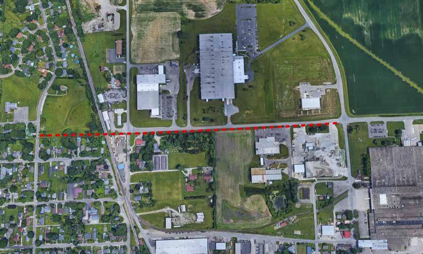
• Will need to include special treatment at railroad crossing
• Few driveway crossings lowering the potential conflict points for the shared-use path
• There is adequate right-of-way to accommodate improvements
Arvin Rd Temple Park Younce St Younce St RR RR Graham St Circle Dr CommercePkwy Hurricane St
From: Woodfield Boulevard to U.S. 31
Information: County Road 260 North becomes Branigin Road at the high school west property line. There is an existing pathway on the school property. Creating a shared-use path which extends from the existing path to the pathways on U.S. 31 will not only connect this area of the city with the network of pathways but will also create an additional loop of off-road facilities for the school and neighborhoods to use.
Notes:
• Creates a smaller run/bike loop around the neighborhood and high school
• Connects Branigin Creek neighborhood to the larger network by connecting with U.S. 31 pathways

• Existing right-of-way is adequate to accommodate
• Replace existing sidewalk with 10’ width shared-use path
Branigin Rd Woodfield Blvd Branigin Rd (260 N)From: Meadow Glen Boulevard to Cumberland Drive Extension
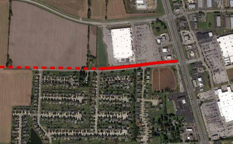
Information: There is an existing shared-use path which was constructed along Simon Road as a part of the Meijer development. The pathway is 10’ wide and includes crosswalks at the entrances to the property. Crosswalks include ADA accessible ramps. The shared use path should be extended to connect with the pathway system along Cumberland Drive which will connect with the high school path system.
Notes:
• Coordinate with developers as properties are improved
• Will create connection between the high school and the shared-use path system along U.S. 31
• Will connect neighborhoods to the south of Simon Road to shopping areas along U.S. 31
From: U.S. 31 to Interstate 65
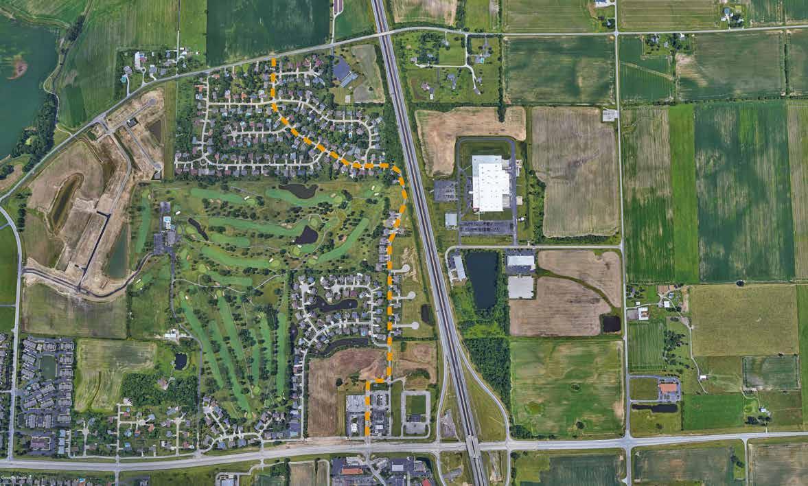
Information: The Earlywood Drive shared-use path is another long-term project that should be incorporated into development designs as growth occurs in this area. A large portion of this project is located in the Planning Fringe and surrounding county area. When this pathway and the pathway along Jim Black Road (500 East) are completed, a much larger running/riding loop will be created with an off-road facility. In addition, having this pathway will connect future areas of the city with the established network and to destinations within the city.

Notes:
• Long term project anticipating future growth in the area
• Will connect new subdivisions and development to overall network of facilities
• Creates a larger shared-use trail loop for additional off-road mileage within the system.
From:
Information:
Road will create a north/south connection between areas north of town and the Commerce Drive/ Parkway greenway trail. This is a long-term project which should be implemented as new growth occurs in the area.
Notes:

From: U.S. 31 to Graham Road

Information: The Paul Hand Boulevard shared-use path is another long-term project that should be incorporated into development designs as growth occurs in this area. Although the larger intent of the shared-use paths that are planned for areas of the city that have not yet developed, they also provide an amenity for new neighborhoods in the short-term before they fully connect with the larger network of the city.
Notes:
• Long term project anticipating future growth in the area
• Coordinate with developers as new development occurs
• Coordinate with County when roadway improvements are implemented
From: Westview Drive to West Jefferson Street
Information: The Canary Ditch path provides a parallel route to the Westview Drive corridor. This route will differ in character with a quieter and more natural setting for the route. This route is also appealing because of the ease of access for an active neighborhood. In addition, this corridor would provide a connection between U.S. 31 and

Notes:
• Within floodplain of Canary Ditch
• Provides access for neighborhoods on south side of Westview Drive
• Provides an off-road facility which parallels Westview Drive but does not require a bridge crossing over Canary Ditch
• Would require an easement
From: Franklin Community High School and Blue Heron Park
Information: The Youngs Creek Greenway will follow Youngs Creek along the western border of the city. The city is currently evaluating the need for additional infrastructure to support new growth which may include a new sewer interceptor along the western edge of the city. If this interceptor were to occur the Youngs Creek Greenway could be included in the same right-of-way. The greenway could be designed to accommodate service trucks which might need to access the sewer line while also creating a greenway along the western edge of the city. This corridor is also an important connection between Franklin and the surrounding neighborhoods in the county.
Notes:
• Greenway trail along floodplain of creek
• Construct as areas develop or as a part of a utility project
• Potential to partner with developers to implement sections of the trail on land that can not be developed

GREENWAY FACILITIES (CITYWIDE)
Proposed Greenway
EXISTING
Existing Shared-Use Path
Existing Bicycle Lane
Existing Sidewalk
City Limits

Project Limits
School Park
From: South Nineveh Street to State Street (Old U.S. 31)
Information: Windstar Boulevard and Franklin Lakes Boulevard are wide streets with curb and sidewalks on both sides of the street. There is adequate width in the existing pavement to stripe 5’ wide bike lanes on both sides of the street. The existing bridge over Youngs Creek on South Street is very wide and includes existing sidewalks. There is existing pavement width to stripe bike lanes on the existing bridge. This facility will connect neighborhoods on the south side of the city to many
Notes:
• Wide streets with available width to accommodate 5’ striped bike lane on both sides of the streets
• Low cost bicycle improvement which will connect southern neighborhoods to downtown and parks
• Intersection improvements will be needed at U.S. 31 which might include signal improvements

BIKE LANES FACILITIES (CITYWIDE)
Proposed Bicycle Lane
EXISTING
Existing Shared-Use Path
Existing Bicycle Lane
City Limits

Project Limits
School Park
From: Westview Drive to U.S. 31
Information: Bike lanes along both sides of West Jefferson Street will connect with bike lanes along Westview Drive. This will create “complete street” designs for both of these roadways by providing a facility for all users including pedestrians, bicycles and automobiles.

Notes:
• Implement when improving West Jefferson Street
• Incorporate with shared-use path and sidewalks to create Complete Street
U.S. 31 (Morton St) W Jefferson St WJeffersonSt

From: Morgan Park to U.S. 31
Information: Franklin currently has a short section of existing bike lane on East King Street near Morgan Park and the intersection of the Franklin Greenway at King Street. This project would extend the bike lane along East King Street to Young Street, then along Young Street to Adams Street and along Adams Street to U.S. 31. This will provide

additional pavement in areas that are within the right-of-way but currently being used by adjoining residential property owners for parking.
Notes:
• Many properties have off-street parking available via a back alley or through driveways
• Formalizing the parallel parking with a paved parking lane and striping will help to define the limits of the city’s right-of-way and private property


From: East Upper Shelbyville Road to East King Street
Information: The existing pavement width on Paris Drive is wide enough to accommodate bike lanes. This would create a separated bike facility connecting shared-use paths on East King Street to the Franklin Greenway with an extension to the greenway. Although this area of the city is close to existing facilities with the new improvements along East King Street and the Franklin Greenway along Hurricane Creek, the bike lane will not only connect the neighborhoods with these facilities but will also create a dedicated facility for visitors who are not familiar with the city and not know where to connect through the existing neighborhood roads.
Notes:
• Incorporate with improvements to roadway as identified in Thoroughfare Plan
• Currently roll curb neighborhood streets
From: U.S. 31 to Centerline Road

Information: This area of Commerce Drive is currently a two-lane roadway with narrow gravel shoulders. Adding bike lanes will require roadway widening. As this area of the city grows and the roadway widening is designed, pavement width should be included for a 3’ striped buffer and a 5’ bike lane on each side of the road.
Notes:
• Currently two-lane roadway with small gravel shoulders would need widening to accommodate bike lanes
• Provides a regional connection to city’s network of bike lanes
• Road improvements should include Complete Street design which would include bicycle, pedestrian and auto travel
From: West Jefferson Street to U.S. 31
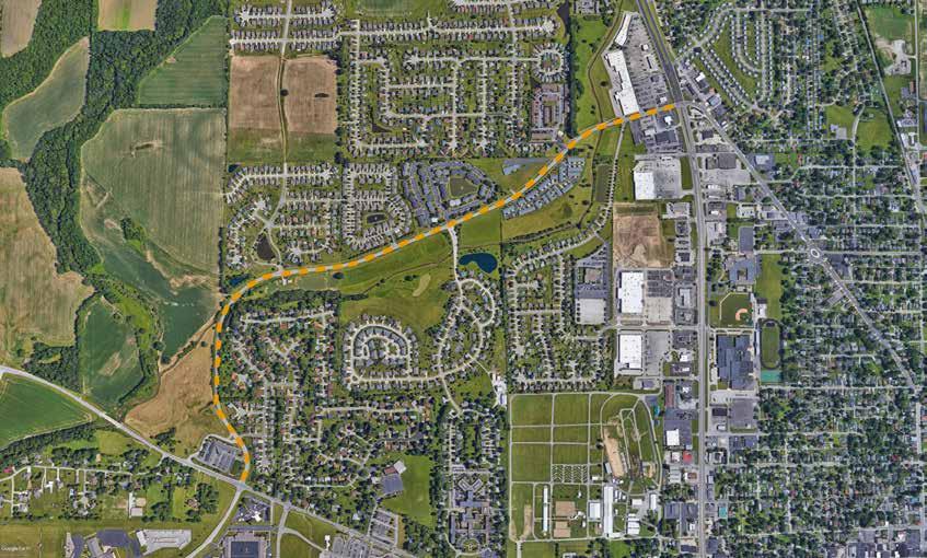
Information: The bike lanes along Westview Drive will connect a large number of residents to West Jefferson Street which will include bike lanes. These two roadways create a bike network which will connect more confident riders to the hospital, fairgrounds and the downtown area.
Notes:
• Implement when improving or resurfacing Westview Drive
• Existing pavement width will accommodate bike lanes and 3’ striped buffer on both sides in most places
• Bridge improvements may be needed over Canary Creek if buffer is also provided over creek
• Will create a primary collector corridor for bikes when complete


From: King Street to U.S. 31

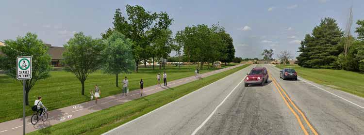
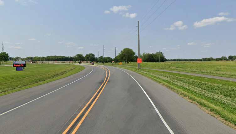
Information: These roadways have a wide paved shoulder providing adequate pavement width to accommodate bike lanes along both sides of the road with a 3’ striped buffer. The buffered bike lane is more comfortable for a wider range of cyclists because of the separation between bicycles and automobiles.
The before and after illustrations on the adjacent page show additional improvements that could be
included with this project which would improve the character of the corridor and create a more pleasant experience for riders in the bike lanes and pedestrians and cyclists on the shared-use path to the side of the roadway.
Notes:
• Low cost improvement if existing pavement width will accommodate bike lanes and striped buffer
• Connects the bike lane network around the city
• Provides some relief to the adjacent sharedlane pathway by providing an alternative facility for bikes

From: Hospital Road to Creekwood Lane
Information: volume neighborhood roadway. The shared-lane route would include sharrow pavement markings and signage to direct people to the Franklin Greenway connection at the end of the street. This route could be a short-term solution to the eventual widening of the sidewalk along Woodfield Drive into a shared-use trail.
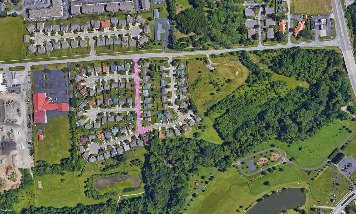
Notes:
• Low volume, low speed neighborhood street
• 25 mph Speed Limit
• Wide pavement width
• Sharrows provide direction to connect with Franklin Greenway Trail
Jim Black Road UpperShelbyville Rd
SHARED LANE FACILITIES (CITYWIDE)
EXISTING ParkAve
Proposed Shared Lane
City Limits

Project Limits School Park
Existing Shared-Use Path
Existing Bicycle Lane
From: U.S. 31 to Edwards Street
Information: The King Street shared lane provides a route for more confident riders who would like to continue straight on King Street instead of following the bike lanes on Young Street and Adams Street. King Street is residential through this corridor and has low speed traffic. While less confident riders will prefer the dedicated bike lane more confident riders will prefer the more direct route of the shared lane.
Notes:
• Low volume, low speed neighborhood street
• 25 mph Speed Limit
• Wide pavement width
• Many curb cuts with off-street parking for most residences

From: U.S. 31 to North Forsythe Street

Information: The automobile volume on Jefferson Street would not typically make it appropriate for a shared lane application. However, Franklin is becoming a bike-friendly city and accommodating bicycles along this primary corridor of the downtown shows the city’s support of equal use of the road by cyclists and motorists. The sharrows and “share the lane” signage provide visual cues to alert all user groups of their shared use of this corridor for transportation. Literature and marketing materials should notify visitors that this is a high-stress corridor and most bicycle
riders which are not as comfortable riding with high volumes of traffic will want to utilize the Adams Street bike lane or walk their bicycles on the sidewalks. The shared-lane markings help to remind automobile drivers that bicycles belong in the roadway with cars and they should be aware that higher volumes of bicycles are likely along this corridor.
Notes:
• Primary corridor through downtown
• Sharrow markings remind cars that bicycles will be using the same roadway
• Directs bicycle riders from out of town to connect with other on-road and off-road bicycle facilities
From: North Forsythe Street to end

Information: East Jefferson Street east of Forsythe Street is a residential street with low volume, low speed traffic. This area of the city has limited access to the other bicycle and pedestrian facilities in the city. Recent improvements on East King Street have helped to connect this area to the Franklin Greenway via the shared-use path along Eastview Drive but residents still have to cross the very busy King Street. There are intermittent connections to the downtown and the southern parts of the city including Province Park and the Franklin Greenway through the park. The low
Notes:
• Low volume, low speed neighborhood street
• 25 mph Speed Limit
• Wide pavement width
• Limited on-street parking
• Provides a bicycle connection for an area which has historically been underserved
From: U.S. 31 to Jefferson Street
Information: North Main Street is a current route for cyclists. Although traffic volumes can be higher at certain times of day the street has a residential character which slows traffic down. Cyclists choose to use this route, riding with traffic, because of this residential character. Adding the sharrow pavement marking and route signage is a visual reminder for cars that bicycles use the route. The sharrow also helps to direct cyclists from out of town who are completing a loop to connect back to pathways along U.S. 31.
Notes:
• Slower speeds and existing traffic calming include on-street parking and curb bumpouts
• Neighborhood character street
• Existing route for more confident riders
• Visual cue to alert motorists to presence of cyclists
• Combined with Monroe Street shared lane will connect Franklin College with the city’s network

From: South Main Street to South Forsythe Street
Information: The Monroe Street shared lane route provides a direct connection to Franklin College. The existing right-of-way does not accommodate bike lanes. Monroe Street is also a residential street with low speed and low volume traffic.

Notes:
• Low volume, low speed neighborhood street
• 25 mph Speed Limit
• On-street parking on both sides of the street in high demand
• Pavement markings alert motorists to greater presence of cyclists
• Provides direction for Franklin College students to access parks and larger greenway system
From: Monroe Street to U.S. 31
Information: The South Main Street shared lane provides an on-street route for cyclists from the southern part of the city. This continues the route from North Main Street and creates a north/south route. This route also provides a connection to Franklin College when used in combination with the shared lane on Monroe Street.
Notes:
• Low volume roadway
• 30 mph Speed Limit through city, 40 mph outside of city
• More rural feeling roadway towards U.S. 31 connection

From: Adams Street to Hamilton Avenue
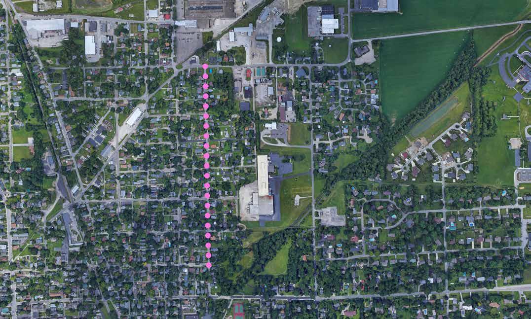
Information: The Young Street corridor provides an on-street bicycle connection between the off-road facilities on Hurricane Street and onroad shared lanes on King Street and Jefferson Street. Young Street is a neighborhood street with lower volume traffic. Young Street is a one-way, southbound street so will provide connections in the southbound direction only. The parallel route along North Forsythe Street (bike lane) will provide the northbound directional cycle traffic.
Notes:
• Low volume, low speed neighborhood street
• 25 mph Speed Limit
• On-street parking on both sides of the street in high demand
• One-way southbound street
From: Simon Road to Cumberland Drive
Information: Although the streets making up this corridor are considered neighborhood streets which would be comfortable for all ages and all abilities of bicycle riders, this shared lane route is provided to direct cyclists through the neighborhood to connect back with the U.S. 31 shared-use path and eventually to shared-use paths which connect to the high school.

Notes:
• Low volume roadway
• Directional markings and signage to connect southern routes with northern routes on the western side of the city
Bike Routes are on-road facilities which do not have dedicated bicycle facilities. Instead bicycles ride in the lane with cars. There are no pavement markings but routes typically include directional signage at roadway crossings. These routes will be included in marketing and promotional materials for the bicycle and pedestrian network. Bike routes typically include county roads and are longer routes used by more confident and skilled bicycle riders. Proposed bike routes include the following:
EAST GREENSBURG ROAD
• City limits to South 450 East
STATESTREET/OLDU.S.HIGHWAY31
• Province Park to south city limits

PAULHANDBOULEVARD/GRAHAMROAD
• U.S. 31 to Arvin Road
EAST400NORTH/COUNTYROAD350EAST
• Graham Road to East 300 North
UPPERSHELBYVILLEROAD/COUNTYROAD
100 NORTH
• Paris Drive to Jim Black Road (North 500 East)
EASTGREENSBURGROAD/SOUTH450EAST
• Franklin College to East King Street
BIKE ROUTE FACILITIES (CITYWIDE)
Proposed Bike Route
EXISTING
Existing Shared-Use Path
Existing Bicycle Lane
Existing Sidewalk
City Limits

Project Limits
School Park
Sidewalks are the primary facility for pedestrians in the city. Sidewalks separate pedestrians from automobile traffic and contribute significantly to creating a pedestrian friendly environment. Many areas of the city have existing sidewalks including within neighborhoods and in the downtown area. However, as with many older cities, many of these sidewalks are substandard with narrow width or are in need of repair because of age, tree root damage or other obstructions to the route. There are also gaps in the sidewalk network creating obstacles especially for those in wheelchairs or with other physical disabilities.
The city does not currently have a method of comparatively prioritizing sidewalk projects. The proposed sidewalk facilities included in the following pages identify priority projects which the city should undertake to begin the process of completing key gaps in the network.
The priority sidewalk projects were determined utilizing the following criteria:
• Completes a gap in pedestrian network
• Connects neighborhoods with nearby parks
• Connects schools to adjacent neighborhoods
• Connects existing facilities such as the Franklin Greenway to parks, schools and neighborhoods
• Provides connections between neighborhoods and key destinations including shopping, restaurants and running errands.
Implementation time-frames for these projects are included in the implementation chapter.
Beyond the priority sidewalk projects there are many existing sidewalks which need repair. There are also areas within the existing street grid where sidewalk gaps need to be filled in. The city’s ultimate goal is to provide a complete pedestrian network in addition to a complete bicycle network. Creating a complete pedestrian network will require city funds to be dedicated specifically for the growth of the sidewalk network. While the residential cost-sharing program can continue to assist the city with the growth of this network additional efforts will be required by the city.
A sidewalk strategic plan should be developed which can assign a scoring mechanism to help the city determine where sidewalk funds should be directed over future years. This system should include the following:
• Defining acceptable sidewalk conditions
• Replacing of deficient sidewalk sections
• Installing new sections of sidewalk
• Construction of sidewalk ramps (for accessibility) on existing sidewalks
The sidewalk strategic plan can provide data driven priority projects for the city to systematically improve and repair existing sidewalks and construct new sidewalks with the end goal of creating pedestrian facilities that can get people to all areas of the city.

EXISTING
Existing Shared-Use Path

Existing Bicycle Lane
Existing Sidewalk
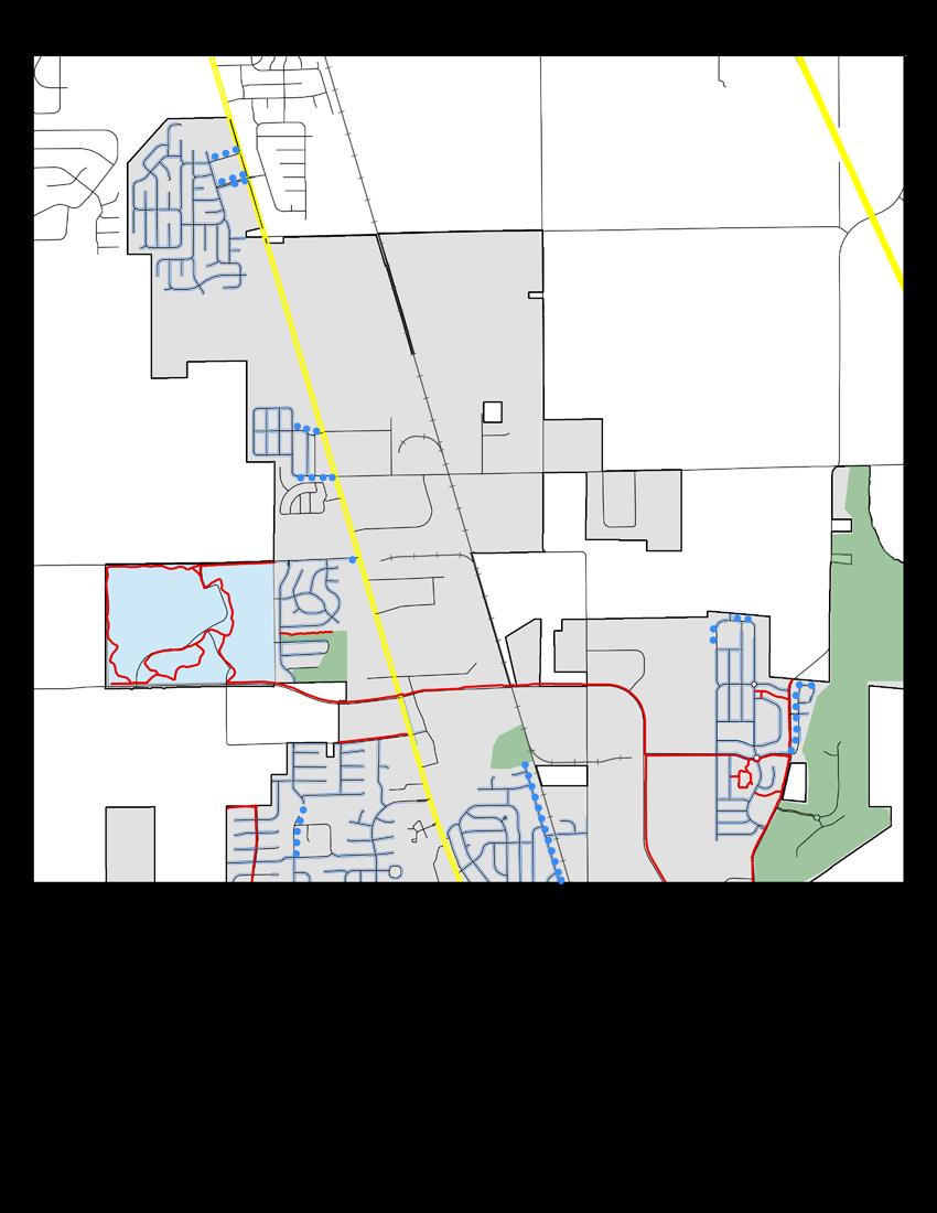

PROPOSED
Proposed Sidewalk

EXISTING
Existing Shared-Use Path

Existing Bicycle Lane
Existing Sidewalk
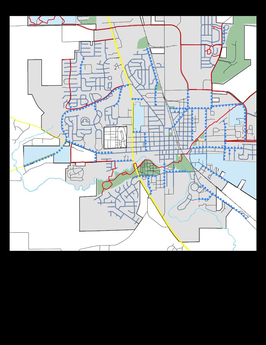
 YoungsCreek
YoungsCreek
CanaryDitch
HurricaneCreek
Proposed Sidewalk
YoungsCreek
YoungsCreek
YoungsCreek
CanaryDitch
HurricaneCreek
Proposed Sidewalk


Facility selection for the bicycle and pedestrian network requires good engineering judgement which can be applied to complex urban environments requiring treatments to be tailored to the individual conditions of each corridor. The process includes design of the broader network and roadway context and then looks at the conditions of the individual corridor to select the appropriate facility. Selecting the appropriate facility type requires consideration of the following:
• What is the function of the corridor in the overall network? (north/south or east/west connector, shorter distance neighborhood connector)
• What user type will the corridor serve? (All Ages and Abilities or Somewhat Confident along with pedestrians)
• What are the physical constraints of the corridor? (Are there buildings close to the right-of-way, are there major utility lines within the corridor)
• What are the land use conditions of the corridor? (residential area with on-street parking and off-street available for each homeowner, busy business district with frequent trips)
• What is the level and speed of vehicular traffic in the corridor?
• Where is there existing bicycle and pedestrian demand?
• Is this facility completing a gap within the existing network?
• Are there short-term and long-term solutions appropriate for the corridor?
• Are there existing facilities which this corridor will connect with and what are the
transitions needed to connect the different facilities?
• Are there barriers to completing the route within this corridor?
The following facility design sheets illustrate the toolbox of facility types considered for the Bicycle and Pedestrian Master Plan. Pedestrian facilities are provided through two facility types, the shareduse path and sidewalks. Shared-use paths are appropriate for all user types including cyclists and pedestrians.
Bicycle Facilities include the following:
• Shared-use paths
• Cycle Tracks
• Buffered Bike Lanes
• Conventional Bike Lanes
• Shared Lane Markings
• Bicycle Routes
Bicycle networks which are designed to be convenient and comfortable are the most effective and increase the number of people riding bikes. The Federal Highway Administration Bikeway Selection Guide identifies seven principles of bicycle network design. The first three of which are the most important. Bicycle and pedestrian facility design solutions should be selected to reduce the number of collisions and reduce conflicts between users. Bicycle facilities should be selected to provide a comfortable facility for the target design user and should reduce the stress, anxiety and safety concerns of that user. A bicycle network should provide complete connections to destinations within the network. Breaks or gaps in the network drastically decrease the number of users on facilities. Transitions between roadways and bikeways should be seamless and clear.
most people given the context.
most people given the context.
most people given the context.
may set it into policy.
the Safe Systems or described in the previous pages, decisions. In this case, the vulnerable road users above priorities inform the planned network and specific objectives for each transportation
networks, set it into policy. Safe Systems or in the previous pages, decisions. In this case, the vulnerable road users above priorities inform the planned network and specific objectives for each transportation
facilities are needed the most. If a roadway that is a critical link in the bike appropriate bike infrastructure should be that project. A lower quality bikeway such a busy suburban arterial road with highspeed traffic is a missed opportunity to build out a low-stress/ network that serves a greater portion of the opportunity to make a high-quality connection decades. While this bike lane may be an bikeway facility, it will not be appealing for context.
A bicycle network is a seamless interconnected system of bikeways. The purpose and quality of the network depends on the assumptions, goals, and decisions made during the
Similarly, if a project is planned on a road that is not part of the bike network, a trade-off on the quality of the bike facility might be more acceptable (keeping in mind that bicyclists have a right to travel on all public roads, unless prohibited, whether or not a bicycle facility is present).
Similarly, if a project is planned on a road that is not part of the bike network, a trade-off on the quality of the bike facility might be more acceptable (keeping in mind that bicyclists have a right to travel on all public roads, unless prohibited, whether or not a bicycle facility is present).
A bicycle network is a seamless interconnected system of bikeways. The purpose and quality of the network depends on the assumptions, goals, and decisions made during the
By influencing bikeway selection in this way, the planned bicycle network helps communities be strategic about investments and implementation, while also helping to balance competing
By influencing bikeway selection in this way, the planned bicycle network helps communities be strategic about investments and implementation, while also helping to balance competing
Networkplanned on a road that is not part of the on the quality of the bike facility might (keeping in mind that bicyclists have a right roads, unless prohibited, whether or not a present).
interconnected system of network depends decisions made during the
interconnected system of the network depends decisions made during the
networks, policy. or pages, case, the above the planned network and specific objectives for each transportation of depends the
By influencing bikeway selection in this way, the planned bicycle communities be strategic about investments while also helping to balance competing
staff and advocates set individual street or road network and that some network also helps to determine route (described on page
By influencing bikeway selection in this way, the planned bicycle network helps communities be strategic about investments and implementation, while also helping to balance competing
staff and individual network network route (described
staff and advocates set priorities by recognizing individual street or road does not serve the network and that some are more important network also helps to determine the extent route (described on page 34) is a feasible
be accessed using the bicycling network and there are no gaps or missing
Seven Principles of Bicycle Network Design 10
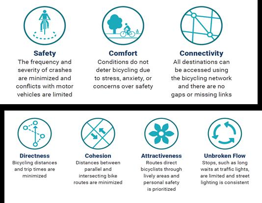


Stops, such as long waits at traffic lights, are limited and street lighting is
Federal Highway Administration Bikeway Selection Guide - 7 Principals of Design
Shared use paths provide a shared space for both cyclists and pedestrians, and are elevated above adjacent roadways to provide enhanced safety for cyclists and pedestrians. Shared use paths should be used when pedestrian and cyclist volumes are low enough that conflicts rarely occur, or in areas where physical space is too constrained to provide for separated facilities. Shared use paths can be on one side of the street or both. As volumes increase over time, the pathway should be monitored for the need to improve the corridor to a separated facility for pedestrians and bicycles.
• Separated from motor vehicle traffic
• May be more appropriate for children, seniors, and persons with disabilities
• Provides recreational opportunities in addition to transportation
• Can create scenic routes within the bicycle and pedestrian network
• Can involve costly and complicated right-ofway acquisition
• Topography and drainage can greatly impact design
• Higher construction costs
• Can present safety concerns when placed adjacent to a roadway with frequent driveway or intersection crossings
• User conflicts such as speed differentials can occur as user volume increases
• Pathways can lose their function as a bicycle commuter route when pedestrian volumes increase
• A shared use path should be designed to suit the characteristics of bicyclists. This includes establishing a design speed (typically 18 mph) and designing curb radii appropriately.
• To accommodate high volumes and reduce conflicts between different user types, a path wider than the minimum can be provided or modes can be separated by constructing parallel paths for bicyclists and pedestrians.
• On a path that is shared by both transportation and recreational bicyclists, additional path width is desirable to allow users to pass.
• Signage to remind users to keep right except to pass should be provided on wider paths
• Consider adding amenities such as benches, rest areas, and scenic overlooks along paths that provide attractive recreational opportunities
• A 2’ or greater shoulder on both sides of the path should be provided. An additional 1’ of lateral clearance (total of 3’) is required by the MUTCD for installation of signage or other furnishings.
• If bollards are used at intersections or access points, they should be brightly colored or supplemented with reflective materials which are visible at night.
Shared Use Path Width:


Desired: 12’+
Minimum: 10’
* Widths as narrow as 8’ are acceptable for short distances under physical constraints.
* Widths exceeding 10’ are recommended for locations with heavy volumes of pedestrians.
References & Resources
• Indiana Design Manual (2013)
• AASHTO Guide for the Development of Bicycle Facilities (2012)
• FHWA Shared-Use Path Level of Service Calculator (2006)
• Manual on Uniform Traffic Control Devices (2009)
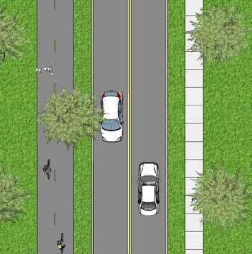
Greenways are shared use paths which follow a natural corridor such as a creek. Many greenway trails are located in floodplains and create a linear park along lands that can’t be developed because of flooding issues. Greenway guidelines are the same as shared use paths with additional considerations for impacts such as seasonal flooding.
• Separated from motor vehicle traffic
• May be more appropriate for children, seniors, and persons with disabilities
• Provides recreational opportunities in addition to transportation
• Can create scenic routes within the bicycle and pedestrian network
• Can involve costly and complicated right-ofway acquisition
• Topography and drainage can greatly impact design
• Higher construction costs
• User conflicts such as speed differentials can occur as user volume increases
• Pathways can lose their function as a bicycle commuter route when pedestrian volumes increase
• Additional maintenance required due to flooding/natural conditions of the corridor
• A greenway trail should be designed to suit the characteristics of bicyclists. This includes establishing a design speed (typically 18 mph) and designing curb radii appropriately.
• To accommodate high volumes and reduce conflicts between different user types, a path wider than the minimum can be provided or modes can be separated by constructing parallel paths for bicyclists and pedestrians.
• On a path that is shared by both transportation and recreational bicyclists, additional path width is desirable to allow users to pass.
• Signage to remind users to keep right except to pass should be provided on wider paths
• Consider adding amenities such as benches, rest areas, and scenic overlooks along paths that provide attractive recreational opportunities
• A 2’ or greater shoulder on both sides of the path should be provided. An additional 1’ of lateral clearance (total of 3’) is required by the MUTCD for installation of signage or other furnishings.
• If bollards are used at intersections or access points, they should be brightly colored or supplemented with reflective materials which are visible at night.
Greenway Trail Width:


Desired: 12’+
Minimum: 10’
* Widths as narrow as 8’ are acceptable for short distances under physical constraints.
* Widths exceeding 10’ are recommended for locations with heavy volumes of pedestrians.
References & Resources
• Indiana Design Manual (2013)
• AASHTO Guide for the Development of Bicycle Facilities (2012)
• FHWA Shared-Use Path Level of Service Calculator (2006)
• Manual on Uniform Traffic Control Devices (2009)

Bike lanes are located on streets and provide lane markings exclusively for bicycle travel. Bike lanes are one-way facility routes that parallel the direction of travel and are located on each side of a two-way roadway or one side of a one-way roadway.
Cyclists with various experience levels usually feel comfortable while using bike lanes depending on the amount of vehicular traffic also using the roadway. Bike lanes are most helpful on streets with posted speed limits of 25 mph or greater and on streets with high transit vehicle volume. Bicycle lanes create separation between cyclists and automobiles and visually remind motorists of bicyclists rights to use the street.
Bicycle lanes are typically low-cost improvements that require roadway re-striping and new signage. While each street offers unique conditions, eliminating on-street parking is occasionally needed to fit bike lanes on streets. In some cases, driving lanes can be reduced to gain additional space if parking is to remain.
Bike lanes may sometimes be painted green, particularly where they cross intersections. This feature alerts motorists of the potential presence of bicycles and reduces the potential for collision.
• Dedicated space for bicyclists (except near intersections where motorists may enter bike lanes to make right turns).
• Can act as wayfinding aids.
• Established facility type that is understood by most road users.
• May encourage more bicycle travel.
• Can lower motor vehicle speeds in some settings.
• Increases the total capacity of streets carrying both automobile and bicycle traffic.
• May not be appropriate for all types of bicyclists.
• Potential risk of “dooring” when placed adjacent to parking.
• Potential for vehicles driving/parking in the bicycle lane.
• Additional roadway width needed which might preclude other possible uses like parking or excess travel lane.
• May be placed on the left side of one-way roadways to avoid adjacency with on-street parking on the right side.
• May optionally be placed on only one side of a roadway in the uphill direction as a climbing lane if space is limited.
• Depending on the design of the roadway, bicyclists may have to operate in mixed traffic (such as to make turns).
• For high-speed or high-volume roads, alternative routes suitable for users of all abilities should be considered.
• Consider whether passing between two bicyclists is desirable and adjust lane widths accordingly.
• May include buffers (minimum 18”) between bike lane and travel lane and/or between
bike lane and parking lane to provide additional separation.
• Researchers have found that when a bike lane is adjacent to a parking lane adding an edge line to the edge of the parking lane leads to better positioning of cyclists. In busy locations where there is a high turnover of cars parking an additional buffer for car door swing should be included to avoid dooring.
• When a bike lane is placed directly adjacent to a guardrail or other physical barrier an additional 2 feet of width is needed to provide minimum shy distance from the barrier.
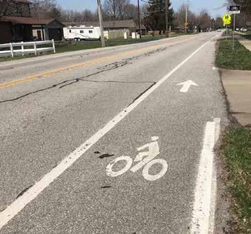

• Bike lanes should be plowed clear of snow.
• Bike lanes should incorporate regular street sweeping to keep the lanes clear of debris and trash which can accumulate in bike lanes.
Bike Lane Width
Desired: 6’
Minimum: 5’
Bike Lane: Pavement markings shall be used to define the bike lane.
Bike Lane signs may be located prior to the beginning of the marked bike lane.
References & Resources
• Indiana Design Manual (2013)
• AASHTO Guide for the Development of Bicycle Facilities (2012)
• NACTO Urban Bikeway Design Guide (2012)
• Manual on Uniform Traffic Control Devices (2009)
Buffered bike lanes are on-street facilities that offer a separation from vehicles. Separation types can include pavement striping, curbs, or curbed plant beds. These routes may be either one or twoway facilities. Buffered bike lanes are intended for exclusive use by bicycles.
Buffered bike lanes are typically well received by cyclists of all ability levels. The separation from traffic provides for a safer cycling environment. The level of safety may be dependent on the type of separation. Curbs and curbed plant beds offer the most protection while pavement striping or breakaway bollards may feel less safe to some cyclists.
• Dedicated space for bicyclists (except near intersections where motorists may enter bike lanes to make right turns).
• May encourage more bicycle travel to a wider cross-section of bicycle users.
• Provides space for cyclists to pass without encroaching into the travel lane.
• Provides greater distance between automobiles and bicyclists.
• Encourages cyclists to ride outside of the door zone when buffer is between parked cars reducing the instances of dooring.
• Encourages bicycling by contributing to the perception of safety among users.
• Not appropriate for roadways with high volume of vehicle curb cuts/driveways.
• Additional space is required.
• Buffer striping requires additional time and materials for installation and maintenance.
• Additional design considerations needed for major intersection approaches.
• May be placed on the left side of one-way roadways to avoid adjacency with on-street parking on the right side or between parking and bike lanes to protect from dooring.
• Consider placing the buffer next to the parking lane where there is high parking turnover.
• Consider placing the buffer next to the travel lane where speeds are 35mph or greater.
• The buffer shall be marked with 2 solid white lines and shall include interior diagonal cross hatching or chevron markings when 3 feet in width or wider.
• If trenching is one in the bicycle lane, the entire bike lane should be trenched so that there is not an uneven surface or longitudinal joints.
• Where bicyclists volumes are high, bicyclists speed differentials are significant, or where side-by-side riding is desired, the desired bicycle travel area width is 7 feet.
• On streets where the buffered bike lane is adjacent to on-street parking, an additional striped buffered area adjacent to the parking lane may be needed.
• Like a conventional bike lane, a wide (6-8”) solid stripe may be used to delineate the edge of the parking lane.
• Intersection design should include a separated bike lane design or visual cues to guide cyclists on mixing with automobile traffic.
Bike Lane Width:


Desired: 6’
Minimum: 5’
Buffer Width: Minimum: 18”
Desired: 3’
Bike Lane: Pavement markings shall be used to define the bike lane. Mark buffer with 2 solid white lines.
References & Resources
• Indiana Design Manual (2013)
• AASHTO Guide for the Development of Bicycle Facilities (2012)
• NACTO Urban Bikeway Design Guide (2012)
• Manual on Uniform Traffic Control Devices (2009)
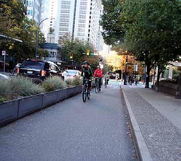
Share-the-road arrows, or sharrows, are pavement markings in the roadway that indicate to drivers and bicyclists that a lane is to be shared. These routes may be used where vehicle traffic is low, where there is inadequate space for bike lanes on the roadway or where the removal of on-street parking or road widening is not feasible.
Sharrows are often used in combination with other facility types. A common example is for sharrows to be used at intersections where bike lanes cannot be safely routed due to right and left vehicle turn lanes. Sharrows direct cyclists to ride in line with traffic and out of vehicle blind spots.
Sharrows are a lower cost solution for bike facilities than bike lanes or cycle tracks, but alternatively offer little protection from vehicles using the street. Experienced riders may feel comfortable using these facilities, however, novice and recreational cyclists may feel less comfortable riding with traffic.
• May increase motorist awareness of the potential presence of bicyclists.
• Can act as wayfinding aids.
• The shared space is more likely to be swept and plowed than separated facility types.
• Low cost of implementation
• Improves the usefulness of the bicycle network, especially when routes are diverted away from well-known streets.
• May encourage the use of lower-stress bikeways.
• May not be suitable for all users as they do not provide separate space for bicyclists.
• May have higher maintenance needs than other facility types due to the wear and tear presented by motor vehicles driving over the pavement markings.
• Typically used on local, collector, or minor arterial streets with low traffic volumes.
• Typically feasible within existing right-ofway and pavement width even in constrained situations that preclude dedicated facilities.
• May be used to fill gaps between bike lanes or other dedicated facilities for short segments where there are space constraints.
• Commonly used on bicycle boulevards to reinforce the priority for bicyclists.
• May be used for downhill travel in conjunction with climbing lanes intended for uphill travel.
• Typically supplemented by signs, especially Bikes May Use Full Lane (R4-11).
• When applied on higher speed/volume roads, consider alternative routes suitable for users of all abilities.
• Posted speed limits of 35 mph or less.
• The sharrow’s centerline must be minimum 4’ from curb where parking is prohibited.
• The sharrow’s centerline must be minimum 11’ from curb where parking is permitted.


• For narrow lanes, it may be desirable to center shared lane markings along the centerline of the outside travel lane.
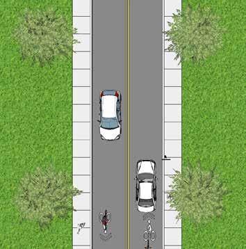
References & Resources
• AASHTO Guide for the Development of Bicycle Facilities (2012)
• NACTO Urban Bikeway Design Guide (2012)
• Manual on Uniform Traffic Control Devices (2009)
Bike Routes are a system of signs and pavement markings that guide bicyclists along preferred routes to destinations across the city and region. Signs may state distance and destinations or include route numbers. Bike routing is used to establish a preferred route where bikeway infrastructure is not needed or is not feasible. Bike routes are most often used by experienced cyclists who are comfortable riding on roadways. These routes are not often used by less experienced riders or families. Wayfinding and signage can encourage the use of lower-stress bikeways.
• May increase motorist awareness of the potential presence of bicyclists.
• Can act as wayfinding aids.
• The shared space is more likely to be swept and plowed than separated facility types.
• Low cost of implementation
• Improves the usefulness of the bicycle network, especially when routes are diverted away from well-known streets.
• May encourage the use of lower-stress bikeways.
• May not be suitable for all users as they do not provide separate space for bicyclists.
• Can cause unnecessary confusion if the selection of destinations and placement of signs is not optimized.
• Can contribute to sign clutter.
• Typically used on local, collector, or minor arterial streets with low traffic volumes.
• Typically feasible within existing right-ofway and pavement width even in constrained situations that preclude dedicated facilities.
• Typically supplemented by signs, especially Bikes May Use Full Lane (R4-11).
• When applied on higher speed/volume roads, consider alternative routes suitable for users of all abilities.
• Bicycle route signs should provide bicyclists with direction, destination, and distance information to commercial centers, rail stations, shared use paths, and other popular destinations.
• The location of signs and represented destinations should be planned in a comprehensive manner, considering the likely routes of bicyclists and probable destinations.
• To assist the bicyclist, the system should provide three general forms of guidance:
» Directional signs: placed at decision points where routes intersect and where routes turn from one street to another.
» Regional route signs: Placed along designated routes.
» Confirmation signs (also called designation signs): used to confirm route choice.

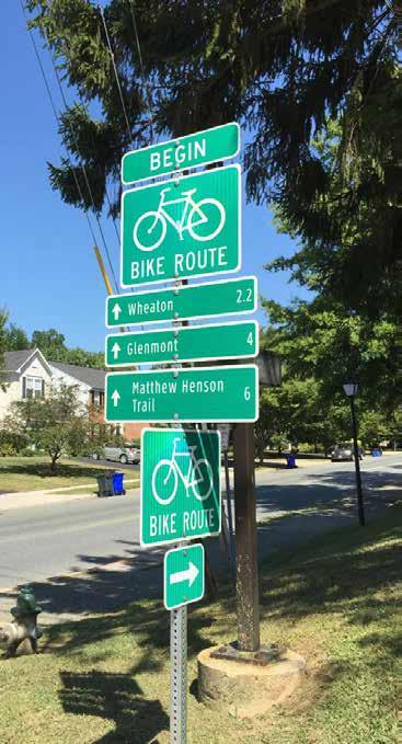


Ensuring that the bicycle and pedestrian network effectively meets the needs of different users requires the adoption of a comprehensive set of policies that addresses each aspect of biking and walking. This includes new policies specific to the City of Franklin as well as the adoption of state and federal policies. Rather than simply focusing on routes and infrastructure, a wellrounded and complete bicycle and pedestrian plan and program is one that is comprehensive in its recommendations and actions. The League of American Bicyclist and the Walk Friendly Communities programs both use the 5 E’s model to help communities develop and document their pedestrian safety and encouragement plans. The 5 E’s include engineering, education, encouragement, enforcement, and evaluation. This chapter is organized around these Five E’s, with each section containing recommendations for new policies unique to Franklin as well as excerpts from the most relevant state and federal policies. Collectively, the policies recommended in this plan
seek to sustain and enhance walking and bicycling conditions for all users, regardless of skill level, physical ability, or whether they walk or bike for transportation or recreational purposes.

MODIFY MUNICIPAL CODE
Title 10: Vehicles and Traffic
Safe Passing Policy
Thirty-two states have a law requiring motorists to provide at least 3 feet of space when passing a bicyclist. Indiana is not one of these states. The City of Franklin should add a safe passing policy to their Code of Ordinances to increase the safety of cyclists on the roadways.
Section 10.40.080 - Vehicles on sidewalks and right-of-way
This section prohibits motorized vehicles on sidewalks. This same restriction should be applied
to shared-use paths. Revise the section to include: “Nopersonshalloperateanymotorizedvehicle, includingbutnotlimitedtogolfcarts(except motorizedwheelchairs,electricpersonalassistive mobilitydevice,orbyspecialpermit),alongany sidewalkoracrossacurb,apublicright-of-way, sidewalk orshared-usepath.Thisdoesnotprohibit crossingonanypublicway,drivewayoralley.No personorpersonsshallcauseamotorizedvehicle tobeparkedorplacedonanypartofacitysidewalk exceptintheprocessofcrossingthepublicrightof-waythroughacitydesigneddrivewayoralley.”
Section 10.40.110 - Injury to streets and public right-of-way
Shared-use pathways should be added to the city infrastructure that is listed in this section.
“A. Nopersonshalldeface,injureormoveany partofanysidewalk,shared-usepath, street, greenspace,alley,orpavementoranystreetsign, lamppost,bench,trashcan,gutter,curb,drain, seweroranytree,unlessauthorizedtodosobythe city.
B. Novehicle(exceptasoutlinedforconstruction vehiclesandmovingvans)shallbepermittedto crossapublicright-of-way,shared-usepath or sidewalkwherethereisnodrivewayorentryway. Anydriverdoingsoisresponsibletothecityfor damagedonetothesidewalk,shared-usepath, curb,ortotreesandshrubberyontheright-ofway.”
Section 10.40.120 - Littering of streets during construction.
Shared-use pathways should be added to the city infrastructure that is listed in this section.
“A.Nocontractororemployeethereofortheowner, iftheownerisworkingonhisownland,shallcause aforeignsubstancetobedepositedonanypublic way,right-of-way,shared-usepath or sidewalk withinthecitybeyondtheendoftheworkingday. Thephrase“theendoftheworkingday”shallmean thattimeatwhichconstructionorotheractivityon aprojectshallceasepermanentlyduringany24hourperiod.”
COMPREHENSIVE PLAN RECOMMENDATIONS
Bicycle and Pedestrian Master Plan
Adopt Bicycle and Pedestrian Master Plan as an element of the Comprehensive Plan comparable to the Thoroughfare Plan.
Thoroughfare Plan Modifications
Table H: Flexible Design Matrix (Page 67)
• Revise minimum shared-use path width to 10’.
Other Modes of Transportation (Page 25)
Update Existing and Planned Trail Network Map to reflect Bicycle and Pedestrian Plan recommendations.
Subdivision design must include implementation of recommended improvements from the Comprehensive Plan and the Parks and Recreation Master Plan. The Subdivision Control Ordinance should also include the approved Bicycle and Pedestrian Way Master Plan.
• The minimum width for sidewalks should be revised to be 5’. This is the minimum width required to meet ADA guidelines.
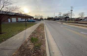
• The Trail Substitution should be revised to read “A10’wideasphaltpathmaybe requiredinplaceofthesidewalkasshown ontheBicycleandPedestrianWayMaster Plan. The subdivider shall meet the minimumrequirementsoftrailconstruction asrecommendedintheBicycleand PedestrianWayMasterPlan.”
• The Trail Requirements (section D) shall be revised to include a minimum 10’ width and should reference the Bicycle and Pedestrian Way Master Plan for trail locations.

Engineering policies and actions are typically the most significant, in terms of cost and public agency involvement. They include changes to design standards and practices, the construction of infrastructure, and any other action that creates changes in the built environment. The following engineering policy recommendations are largely in response to observed infrastructure issues in Franklin.
Many cities across the nation are implementing a “No Right Turn on Red” policy as a part of their Vision Zero plans which are aimed at eliminating all traffic-related injuries. Banning right turn on red lights has been shown to increase the safety of intersections for pedestrians.
This plan recommends a study to evaluate the implementation of a no right turn on red policy in downtown, school zones and key intersections which have seen high accident rates. The study should evaluate the loss in traffic efficiencies balanced with the increase in safety for pedestrians.
Ideally, bicycle and pedestrian facilities and infrastructure will be included with all street projects when they are initially constructed, or when streets are reconstructed. Including bicycle and pedestrian facilities at this time is less expensive than retrofitting facilities as standalone projects. Two federal policies support and mandate this approach for projects utilizing
federal aid unless a) bicycles are prohibited by law from using the roadway, b) the cost is excessively disproportionate to the need (exceeding 20 percent of the project cost), or c) where sparsity of population indicates an absence of need.
Following a Complete Streets process for street projects (especially those along or connecting to a planned bikeway) will help further the implementation of this plan. Such a process will ensure that all street users—motorists, bicyclists, and pedestrians—are considered during the design stage and are adequately accommodated. The process should be flexible in terms of design specifics and sensitive to the surrounding context and land uses. The process will also apply to street resurfacing, restoration, and rehabilitation (3R) projects and streets built by private developers, such as interior circulating streets in a newlydeveloped site when they are part of or are connected to the current and planned bicycle and pedestrian system.
Use nationally-recognized design guidelines, including AASHTO and NACTO, when designing onstreet bikeways
The Indiana Design Manual 2013 (IDM) is the statewide guidance used by INDOT and local jurisdictions during the development and design of transportation projects. Part 3 “Roadway” provides guidance for several subject areas, including accessibility for persons with disabilities (including sidewalks), shared-use paths, and roundabouts. The IDM also contains some guidance for the design of on-street bikeways. Namely, it provides guidance on determining the appropriate type of bicycle facility (bike lane, path, etc.) based on factors such as motor vehicle traffic and speed. However, it does not contain the specific design
guidance necessary to design on-street bicycle facilities.
As such, the AASHTO Guide for the Development of Bicycle Facilities, 4th Edition, 2012 (AASHTO Guide) will be used in the design of all on-street bikeways. While the AASHTO Guide serves as a set of minimum standards, the NACTO Urban Bikeway Design Guide (NACTO Guide), which is used by many communities to design innovative bicycle infrastructure that surpasses the AASHTO minimum standards, may also be consulted.
Utilize national and international best practices and guides as supplemental guidance for path design
Two-way paths along roadways, which constitute the most common dedicated bicycle and pedestrian facility type in Franklin, come with many challenges, including:
• Path crossings of driveways and intersections are often blocked by automobiles waiting to turn (motorists typically ignore stop bars).
• Conflicts exist between slow-moving pedestrians (3 mph walking speed) and faster-moving bicyclists (10-15 mph is considered a moderate pace).
• The need for additional traffic control signage, especially at driveways and intersections.
• There is a lack of clarity regarding who has the right-of-way where paths cross minor streets.
• There is an increased risk of crashes due to the limited visibility of drivers (see Figure 30).
• In light of these challenges, paths are most appropriate where driveways and
intersections are limited. In areas with high concentrations of driveways and intersections, on-street accommodations (including bike lanes and buffered bike lanes) are preferred because they are proven to be safer.
The AASTHO Guide states that paths along roadways should be considered a supplement to, but not a replacement for, on-street bikeways. In other words, the provision of a path does not preclude the need to provide on-street accommodations for bicyclists that are more comfortable riding with traffic.
[Figure 30: Visibility limitations of paths along roadways.]
Since the bicycle and pedestrian system primarily consists of paths along roadways, it is important that the City design paths according to the best
design guidance available. While the Indiana Design Manual contains a significant amount of detail on path design, there are several issues and situations that it simply does not address. Therefore, the City of Franklin should regularly reference additional design guidelines and standards that address more complex issues beyond the limited scope of the IDM. These guidelines and standards include the AASHTO Guide, the NACTO Guide section on two-way cycle tracks, the 2011 Indiana Manual on Uniform Traffic Control Devices, Part 9 (MUTCD), and the CROW Design Manual for Bicycle Traffic (CROW Manual). The CROW Manual is the primary bicycle infrastructure design guide for the Netherlands (a country well-known for its extensive system of paths along roadways) and while it is not directly applicable to American cities, it contains many relevant concepts for path design. The CROW Manual is especially informative for designing path crossings at intersections and
The IDM states that “A bicycle minimum design speed of 15 mph is required. A bicycle design speed of 20 mph is desirable” (IDM 51-7.05(02)). The AASHTO Guide specifies a minimum design speed of 18 mph, which may be lower “in rare circumstances.” Design speed determines sight distances and horizontal alignments. Specifically, curve radii will be at least 60 feet in diameter if the design speed is 18 mph. In locations where physical constraints limit the ability to meet the minimum design speed, warning signage must be used, just like is required for roadway design.
The City of Franklin will design all new paths with a minimum design speed of 15 mph, in keeping with the IDM, and will strive to design all paths with an 18 mph design speed.
Regarding path width, the IDM states that “The desired paved width is 10 feet. The minimum paved width is 8 feet. It may be necessary or desirable to increase the width to 12 ft or 14 ft…” where higher volumes of bicycle or pedestrian traffic is expected (IDM 51-7.05(02)). According to the AASHTO Guide, two-way paths should be a minimum of 10 feet wide (the former minimum was 8 feet). This is the minimum width needed for two bicyclists to safely pass each other. In addition, other path users require wide operating spaces (up to 5 feet for inline skaters), so the 10-foot minimum is justifiable for other users as well. The AASHTO Guide states that 8-foot wide paths “may be used for a short distance due to a physical constraint such as an environmental feature, bridge abutment, utility structure, fence, and such” (AASHTO 5.2.1).
Several existing paths in Franklin are 8 feet wide, which reflects the IDM and old AASTHO Guide minimums. However, in keeping with the new AASTHO Guide standard, the City of Franklin will:
• Design all new paths to be a minimum of 10 feet wide, unless there are short segments with physical constraints that will only allow an 8-foot wide path;
Funding that originates from the federal government—such as the Fixing America’s Surface Transportation (FAST) Act requires that AASHTO standards be met in order for projects to be eligible.
Design all paths with a minimum cross-slope of 2 percent
The IDM (section 51-1.05(01) and the AASHTO Guide both allow a maximum path cross-slope of 2 percent. The United States Access Board’s Public Rights-of-Way Accessibility Guidelines (PROWAG), which is the new design standard for meeting the compliancy requirements of the Americans with Disabilities Act (ADA), also mandates a 2 percent maximum cross-slope for sidewalks and paths. This maximum also applies to sidewalk and path driveway crossings, which should be relatively flat.
The majority of paths and sidewalks in Franklin do not exceed a 2% cross slope. However, excessive cross-slopes of paths are present at several older driveway crossings. The City of Franklin should ensure cross-slopes do not exceed 2 percent for new path and sidewalk construction and reconstruction projects. Achieving flat driveway crossings may require offsetting the path or sidewalk away from the roadway and around the driveway apron.
Design all paths with a maximum grade of 8 percent
Grade or longitudinal slope should be as flat as practical, according to the IDM and AASHTO Guide. Furthermore, in order for a path to be ADAcompliant, its grade cannot exceed 8 percent or the grade of the adjacent roadway. The IDM and AASHTO Guide support these limits as preferable for bicyclists, though the IDM allows grades in excess of 8% under extenuating circumstances (IDM 51-1.05(02)). The City of Franklin will minimize the grade of paths and ensure that new path construction/reconstruction projects do not exceed the grade of the adjacent roadway.
Design street crossings that are safe and easy to understand
Street crossings should be designed to minimize conflicts and increase safety. The operation of off-road facilities is especially challenging at street crossings due to limited visibility, blocked crosswalks, and confusion regarding rightof-way. Although bicyclist crashes are rare in Franklin, statistics from around the country show that cyclists using paths along roadways are at higher risk than bicyclists riding in the street, primarily due to street crossings. Some of the greatest challenges associated with path street crossings relate to the location of the facility as it approaches the intersection. A straight approach to the intersection does not require bicyclists to slow down. Paths that cross too close to the parallel street are often blocked by cars waiting to turn and place bicyclists in a location that is not highly visible for turning motorists. Best practices support taking one of two approaches, moving closer or moving farther away.
Moving Closer (more appropriate for urban settings)
Moving crossings as close to the curb line of the parallel road as possible (and reducing corner radii significantly) is one approach. The IDM recommends that path crossings be located “close to the roadway intersection so as to allow the motorist and path user to be able to recognize each other as intersecting traffic” (IDM 51-7.09(01)). Such a treatment is shown in the photographs in Figure 31, Alternate B. While “close to the roadway intersection” is ambiguous, the referenced Figure
51-7R shows a path setback of what appears to be 10 to 12 feet. However, this results in the aforementioned visibility and crosswalk blockage issues. The only national guidance that is relevant in this case is the NACTO Guide’s section on twoway cycle tracks, which recommends very small corner radii (e.g., 5 to 10 foot actual radius) and high-visibility pavement markings (such as solid green paint bordered by white dashed stripes). However, the NACTO Guide is largely designed for urban contexts and such treatments may not be appropriate in many locations in Franklin outside of the downtown area.
Moving crossings farther away from the curb line so that the crossing functions as a second intersection. Moving the path crossing farther from the curb line of the parallel road has many advantages, including:
• Increasing the visibility of bicyclists and pedestrians in the crossing by motorists turning off of the parallel street, since the crossing is now directly in front of the motorist once he has turned, instead of in his peripheral view.
• Allowing space for cars turning from the parallel street onto the cross street to wait outside of the flow of traffic on the parallel street.
• Slows bicyclists as they approach the intersection, meaning they enter the crossing at slower speeds, making them more visible to motorists.
• Allows one or more cars waiting to turn onto or cross the parallel street from the cross street to queue without blocking the path crossing.
The primary disadvantage is that offset crossings require more right-of-way and additional traffic control (warning signs for motorists). The IDM provides some support for moving path crossings farther from the curb line. IDM Figure 51-7R shows an alternative configuration placing the crossing at least 100 feet from the intersection and treating it as a mid-block crossing. However, this would require an excessive amount of right-of-way at intersections and places the crossing far enough from the intersection that motorists would have enough time to gain a considerable amount of speed.
Instead, the most applicable design guidance for suburban two-way paths along roadways is the Dutch CROW Manual. Its guidelines recommend 16-23 feet of setback from the curb line of the parallel road, with the path offset bend beginning at least 115 feet from the intersection with curve radii at least 39 feet (which serves to slow bicyclists). These recommendations are for intersections between arterial roads and collector/local roads. For intersections between two arterial roads, the crossings should be closer to the intersection and bicycle-specific signal heads should be used.
For locations where paths along roadways cross moderate-volume streets, especially those with moderate to high volumes of turning traffic, the City of Franklin will carefully review the NACTO Guide and CROW Manual and apply the former to urban settings (i.e., downtown) and the latter to all other locations in the community. Using the NACTO Guide and CROW Manual.
The US Department of Justice’s and US Department of Transportation’s Joint Technical Assistance on the Title II of the Americans with Disabilities Act Requirements to Provide Curb Ramps when Streets, Roads, or Highways are Altered through Resurfacing mandates that curb ramps be provided (or replaced if existing curb ramps are noncompliant with current ADA requirements) when a street is reconstructed or resurfaced. This ruling includes the following provisions:
• Curb ramps are required where any sidewalk or pedestrian walkway crosses a curb.
• Resurfacing of a roadway is considered an alteration (thereby requiring the provision of curb ramps) when it spans from one intersection to another.
• Resurfacing includes overlays, with or without milling (new asphalt, concrete rehabilitation, open-graded surface courses, cape seals, etc.).
• Maintenance treatments do NOT trigger the requirement to provide curb ramps (pavement markings, crack sealing, chip seals, joint repairs, friction treatment, etc.). However, multiple maintenance treatments occurring over a short span of time might constitute an alteration.
• If a crosswalk is resurfaced, curb ramps must be provided—regardless of project scope.
• The City has an ADA transition plan to replace the many existing curb ramps in Franklin that were constructed prior to current standards and which do not meet current accessibility requirements. Namely,
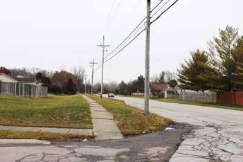
many lack detectable warnings (e.g., truncated domes) and there are several areas in the city where sidewalks simply terminate at rolled/mountable curbs, which is not sufficient for people with disabilities. These issues limit the mobility of people with disabilities and (in the case of rolled/ mountable curbs) are quite dangerous for bicyclists.

The IDM includes a comprehensive set of guidelines for curb ramp design that is in keeping with the United States Access Board’s Public Rights-ofWay Accessibility Guidelines (PROWAG), which is the latest set of standards for complying with ADA requirements. The City of Franklin follows the IDM when constructing new curb ramps and has an ADA transition plan that is used to identify and replace all non-compliant curb ramps in the community. Whether constructed by the City or by developers, curb ramps (not including flared sides) must equal the width of the sidewalk or path to which they connect. When connected to paths they must be of the perpendicular or depressed-corners types, as described in the IDM.

Off-road facility crossings at streets are highconflict locations. Crosswalks must be clear of obstructions and visible to pedestrians, motorists, and bicyclists. For every marked crosswalk, the City of Franklin will, at a minimum, provide two solid white lines (each between 6 and 24 inches wide) in keeping with MUTCD Section 3B.18. This shall be in addition to any colorized concrete or pavers. Alternatively, the City may provide other types of marked crosswalks, including solid, continental, zebra, or ladder patterns. The City will repaint all crosswalks in Franklin every one to two years or as fading occurs. Alternatively, the City may utilize more durable materials (non-slip thermoplastic, preformed tape, epoxy, etc.) to increase maintenance intervals.
Roundabouts reduce instances of crashes resulting in injuries and improve motor vehicle traffic flow.
However, they can be challenging for bicyclists if certain considerations are ignored. The IDM has an extensive section on roundabouts, including several provisions for pedestrian and bicyclist accommodations (IDM 51-12.07(02)). Namely, it recommends providing bicyclist “bypasses,” which provide ramps from the roadway to paths and allow bicyclists to use crosswalks to cross the roundabout exits. The paths should be connected by ramps to the roadway 50 to 150 feet upstream of the yield point on each approach and outlet of
the roundabout. The ramps should have a 25- to 35-degree angle toward the roadway and should be signed as bicycle-only to discourage pedestrians from entering the roadway. These bypasses should be used even at intersections of two roads that do not yet have paths. IDM Figures 51-12V and 51-12W (below) illustrate this concept.
The IDM provides considerable guidance on this subject, but lacks a singular detail that depicts the path bypass entrance/exit ramps and alignment of the path around the roundabout. The City of Franklin should develop such a detail to be included in its Standard Construction Details following the guidance provided in IDM 51-12.07(02).
Regulatory and warning signs are crucial elements for bicyclists and pedestrians in terms of mitigating safety hazards (especially where physical constraints and age of infrastructure results in noncompliance with current IDM and AASHTO standards) and indicating who has the right-of-way at intersections. Warning and regulatory signage makes the transportation system (streets and paths) safer and more efficient.
Several parts of the city’s bicycle and pedestrian network is lacking in regulatory and warning signage. For example, the exit of the Franklin Greenway Trail at the northern entrance to Province Park needs directional signage. To correct this issue, the City of Franklin should assess all existing paths and determine signage needs based on the MUTCD standards. It can then begin a program to purchase and install the necessary signage. Signage for paths along roadways will follow the same regulatory controls as the parallel roadway. For example, a stop sign will not be placed along the path at an intersection or driveway unless the parallel roadway also has a stop sign at the same location. Instead, the perpendicular street will include a stop bar behind the path crossing and warning signage for both the motorists and the path users. At these locations, the motorist should always yield to the path user. Warning signs for motorists turning across shared-use paths may be appropriate at high traffic areas.
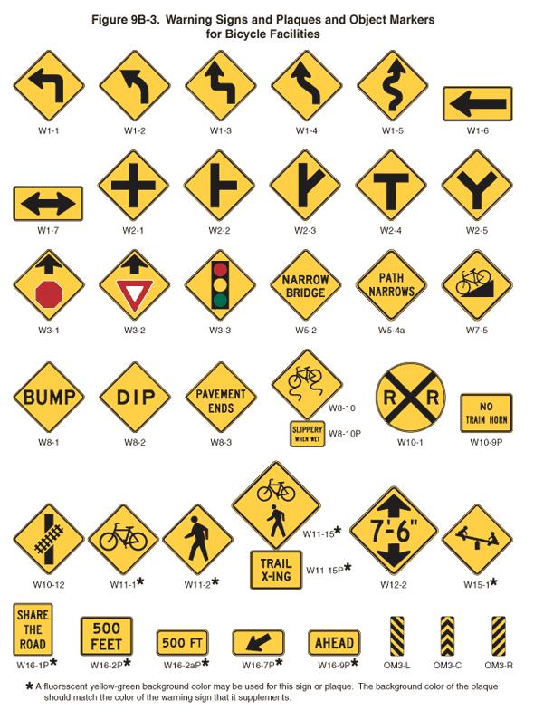


Education policies and programs are instrumental to the success of networks as they encourage users to use the facilities. Education policies and actions range from media campaigns to practical training, such as how to ride safely or properly wear a helmet. The City of Franklin should develop a comprehensive education campaign for bicyclists, pedestrians, and drivers. The goals of the program could include outlining the rights and responsibilities of all road users, familiarizing all users with the rules of the road, and explaining the various pavement markings and signs associated with sharing the road. The following policies provide ways to facilitate the creation of this program.

Many children ride with their families in the City of Franklin. Providing early education will create a more educated generation of users as they grow but children can also educate their families as they learn. Bike rodeos are a great way to direct and deliver bicycle related education to children. Similar events and classes can be held for adults. Topics discussed typically include the parts of a bicycle, how a bike works, how to fix a flat tire, proper helmet fitting, rules of the road, road positioning, and on-bike skills. These rodeos are often facilitated by local police departments and cycling clubs and model programs are available through the League of American Bicyclists website. The Franklin Police Department can develop programs to provide safety training at elementary schools and should assist in delivering the new education campaign to drivers, bicyclists, and pedestrians.
While many forms of education are available for motorists, cyclists and pedestrians, people don’t always see or understand the information. An Ambassador program would include trained experts for the different user groups. Ambassadors would reach people on the trails and facilities, helping to educate on proper etiquette and use of the trail system. Ambassadors would not only be used to distribute information but would serve as good examples by pledging to ride responsibly and follow the laws. Ambassadors would not be expected to enforce rules and laws but would instead distribute information and set a good example of proper use.
The most effective ambassador programs include events during warmer months (helmet and light giveaways, bike rodeos), attending existing community events (festivals, farmers markets), and educating school age children during the school year (classroom presentations).
Imparting the same knowledge to all road users will help create proper expectations of behavior among different modes. New facilities can also lead to confusion about proper use of the facility. Brochures or pamphlets can be developed to enable all transportation user groups to be on the same foot in terms of knowledge. The brochure should cover the range of bicycling and pedestrian issues which might be encountered while using new and existing facilities. Information should include traffic laws, city regulations, basic equipment safety and tips for crossing intersections.
Include at least one piece of road use education annually in City communications to residents
Including educational pieces in utility or tax bills is an easy way to reach a large group of people. Simple communications could cover a seasonal topic such as rules of the road, local bicycling ordinances, and back-to-school safety information. At least once per year, the City of Franklin should distribute hard-copy educational materials explaining the rules of the road for drivers, bicyclists, and pedestrians.
Although riding and walking are common in Franklin there is still misperception or misunderstanding for some of the rules of the road. By creating training sessions and communication materials such as pamphlets, the city can educate motorists in addition to continued education of cyclists and pedestrians. The communication materials could be distributed at businesses and training sessions could be conducted at larger businesses.
Launch a marketing campaign to promote mutual respect and awareness
Members of the community do not necessarily have an inherent understanding of the motivations, needs and behaviors of those traveling by other modes of transportation. For example, a driver may not understand the importance of using a turn signal to notify a bicyclist of an upcoming turn. A bicyclist may not appreciate how their travel speeds impact the comfort of pedestrians on shared pathways, and a pedestrian may not understand how important it is to make eye contact with a driver or bicyclists when crossing the street. Each of these situations can lead to misunderstanding and animosity which does not promote productive interactions on streets and pathways.
Creating a marketing campaign with simple but targeted messaging is a highly effective way to increase awareness of the perspective of other users. Marketing materials might include bus ads, posters and stickers with a hashtag for social media.
Continue to implement educational programs identified in the Safe Routes to School study. Emphasize projects that make it easier to walk and bike to school. Provide bike parking at schools and teach students how to securely lock their bikes. School administrators should meet annually to coordinate progress.
Enforcement includes policies and actions that address safety issues such as speeding, illegal turns and movements, and general rules of the road. Programs include options for community members to work collaboratively to promote safe walking, bicycling and driving.
While most users follow traffic laws there are a few who willfully disobey the rules. Many times, these infractions do not result in crashes or conflicts, but higher incidence of infractions lead to a higher likelihood of conflicts. When users cannot expect other users to obey traffic laws they cannot accurately gauge how to interact with them on the roadway or trail. Spot enforcement of traffic laws for pedestrians and cyclists will encourage these users to obey traffic laws. Word of mouth will spread information about tickets and fines being issued to law breakers and encourage other users to obey the laws. The policy should be to first issue a warning and then a ticket to repeat offenders. Officers should also have education materials to hand to those disobeying the laws. A diversion program for first time offenders can also be implemented where fines can be reduced by attending an education program.
Too often speed limits are viewed as guidelines by motorists. Studies show that the probability of serious injury to non-motorized users when hit by a car exponentially increases with each increment of 5 mph increase in speed. The enforcement of posted speed limits through warnings and
ticketing can quickly make compliance the rule of the neighborhood. Police offers can also station patrol officers at low-compliance locations, such as school zones.

Installing digital speed monitoring signs along main roads, cut-throughs and by school zones has been effective towards decreasing speeds in communities. People drive speeds they feel comfortable driving, and prioritizing areas where people should be more aware of their speeds is a first step. Speed monitors can be posted and eventually might encourage people to reduce their speeds out of habit in those areas. The use of digital speed monitoring is a cost effective way to alert motorists to their speed.
Most police academies include training for officers from the International Police Mountain Bike Associations. This training equips officers with the skills and knowledge to enforce the law on a bike including tactical maneuvers taking advantage of the bike’s speed and ability to be used as a shield. However, this training does not include any content regarding traffic interactions between motorists and bicyclists. Education courses for law enforcement officials can provide information on types of traffic violations that are most likely to result in crashes between bicyclists and motorists. Annual reviews of bicycle and pedestrian crash statistics will provide the Police Department with knowledge of specific behavioral issues and highrisk locations.

Encouragement policies and programs should build enthusiasm and interest in bicycling and walking. Programs can include National Bike Month activities, Cyclovias, Walk to School days, launch parties for new facilities and marketing campaigns to encourage more riding and walking.
Sponsor Bike to Work Week and Bike & Walk to School Day
Bicycling to work or to other destinations is a great way to get exercise, save money, reduce pollution, and have some fun. Bike to Work Weeks and Bike and Walk to School Days are national activities that are part of National Bike Month (May of each year). Bike/Walk to School Day is an important component of Safe Routes to School programs as it both encourages and educates students on how to get to school via bike or their feet. Activities for these events may include:
• Morning commute stations where cyclists are treated to free coffee and breakfast, bike tune ups, and other incentives;
• Group rides with local civic leaders;

• Themed rides, such as a bike parade to school; and
• Discounts at local businesses for commuters and participants.
Sponsor and/or support local family-friendly events that promote bicycling or walking

Family friendly events can be a great way to capture the interested but concerned portion of the cycling population, as well as a great way to introduce kids to cycling as part of everyday normal life. Often these events are community oriented and can be
as simple as a group ride organized on a Sunday. Other events include Cyclovias, themed rides, and rides organized around existing neighborhood festivals, parks, or cultural destinations.
Develop bicycling and walking maps
As facilities are constructed the city should continue to update the bicycle network map. This map should be produced in hardcopy and digital format and should continue to be available to residents and visitors. The maps should include local destinations which encourage active lifestyles including grocery stores, trails and parks.
Evaluation and planning policies include monitoring and documentation of the results of implementing the other E’s and planning subsequent actions. Data collection is critical to measuring the overall effectiveness of the network. The following section provides recommendations for collecting the data both before and after infrastructure improvements and programs are implemented.
This interagency group will identify infrastructure projects such as roadway, sewer and utility projects, which need to incorporate bicycle and pedestrian improvements in addition to driving specific bicycle and pedestrian facility projects. The Bicycle and Pedestrian Planning Team will continue to act as the champion for the Bicycle and Pedestrian Way Master Plan with the goal of developing a complete and connected network for the city.

Annual counts provide data for measuring biking and walking trends throughout the city and over time. The data will help determine the impact of projects, policies and programs. Counts should be conducted utilizing the National Bicycle and Pedestrian Documentation Methodology. There are three methods available for performing the counts:
• Volunteer-based visual counts

• Electronic counts
• Estimates using GPS data
The National Bicycle and Pedestrian Documentation Project provides a recommended methodology,
survey and count forms, and reporting forms online for free. Local trainers for the program are also available. Each of the methods have varying costs but can be economical when used in combination with volunteers. It is important for the data that is taken each year to be taken at the same locations, times of day, week and year for data to be comparable from year to year.
Create an annual report card for new or modified bicycle and pedestrian infrastructure. Include bicycle and pedestrian count data when collected, and share year-to-year changes. The purpose of the report card is to gauge the success of projects and to evaluate where facilities may need further improvements to fully capture their potential.
Without a multi-year plan projects are often implemented on an opportunity basis and not on a need basis. Developing a multi-year capital improvement plan for bicycle and pedestrian projects will allow the city to track the total amount of bicycle and pedestrian facilities being built by the city. The capital improvement plan would focus on filling gaps in the system and on completing highpriority corridors. Long-range budget planning for the overall network will allow the city to implement improvements in a measured and responsible manner.
The Bicycle and Pedestrian Coordinator will provide a centralized point of contact for planning, programming and policies related to both on and off road facilities within the city. Typical job duties should include:
• Planning and managing new programs for safety, education, enforcement and recreation
• Developing safety and promotional information such as brochures, pamphlets or yard signs
• Implementation of Bicycle and Pedestrian plan improvements and updates
• Serving as principal contact with federal, state and local agencies on bicycle and pedestrian matters
• Coordinating and maintaining budget and forecast budget needs
• Seeking funding for implementation of bicycle and pedestrian projects and working with appropriate offices to fully integrate project in programming decisions
• Developing priorities for special studies in areas such as the location and cause of crashes, effectiveness of new facility designs, barrier removal analysis and annual bicycle and pedestrian counts
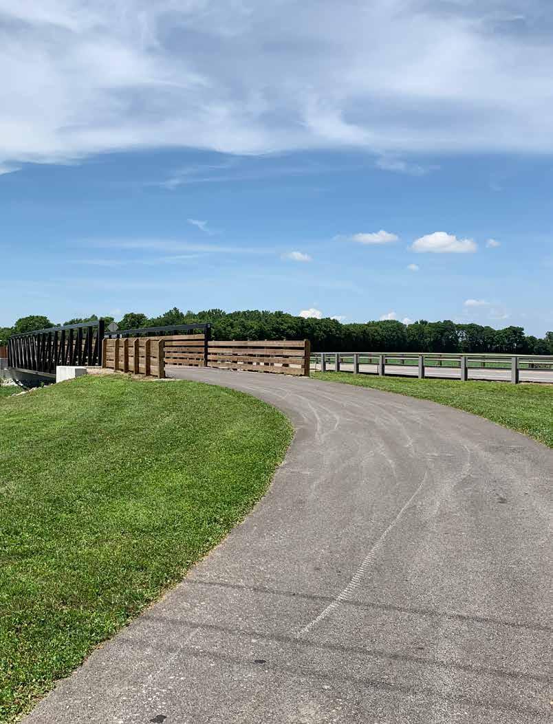
The proposed bicycle and pedestrian network will be implemented over time as resources become available. There are many factors that weigh into decisions concerning sequencing of implementation including availability of funds, the funding source, user needs, land ownership and political will. Implementation of this system will be a longterm investment for the community that will last for many generations with proper care and maintenance. Building on the assets of the existing system and following the goals and objectives of this plan will ensure the system will be built in as little time as possible and in an economically responsible manner. An important part of the plan also involves planning for funding, construction, marketing, and maintenance of the project. This chapter provides a general introduction to these tasks.
The exact route and alignment of each of the specific routes identified on the Proposed Facility Map have not been determined. Land acquisition has not been studied. Therefore, the recommendations for funding, implementing, and prioritizing of the proposed facilities contained herein should be considered guidelines and are being provided at a planning level of detail. The recommendations are based on national practices, information relevant to the project and recent experience with construction and funding of similar project types. The City of Franklin should continue to evaluate the priorities as opportunities for funding become available. When considering these opportunities some general priorities should be considered.
General priorities are recommended for implementation of the master plan as follows:
• Proposed facilities on publicly owned land: Access to the land where the facilities are planned, either through fee simple ownership or through easement rights is critical to implementation. Facilities that are proposed on publicly owned land such as parks or in conjunction with public rights-of-way should be given high priority.
• Proposed facilities associated with other public or private improvements: Planned improvements to land or along corridors where facilities are planned often times provide opportunities for implementation. As plans are developed by the City of Franklin or the Indiana Department of Transportation for road improvements where a bike and pedestrian facility is proposed coordination should occur between the City and the entity making the improvements to incorporate these new facilities into those improvements. Opportunities might also exist when private development occurs through coordination with the developers and the Planning and Zoning process.
• Expansion of existing system: Proposed trail segments which complete existing links between neighborhoods and key destinations shall be given high priority. Franklin has established a foundation for bicycle and pedestrian travel with the Franklin Greenway Trail but there are still areas of the city that can’t reach the trail. Filling in these gaps will provide the maximum benefit to a number of existing users.
• Source of Funding: Funds have been committed to the project or other agencies or private sector groups, through partnerships, have committed funds in support of the project.
• Increases safety for alternative modes of travel: The project provides safe use for all users including people traveling along and across roadways, railways, waterways and other barriers.
• Ease of Construction: Construction of the project is considered simple and easy to build according to criteria such as costs and design constraints such as grading and drainage and structures required for the project.
These general priorities should be considered as guidelines, with opportunity playing a major role in determining actual implementation. Opportunity can come in many forms including the funding source (i.e. grant, dedication of land, endowment, etc.) and the timing of related projects (both public and private). These opportunities may open the door for implementation of a specific facility that might have been lower on the priority list for this plan.
Implementation charts have been developed to prioritize projects for the proposed bike and pedestrian system. This includes short-term, midterm and long-term projects to be implemented over the next 20 years.
Projects listed in the short-range capital projects chart are often considered high priorities in implementation of the system. Short-range projects help to create early success that builds momentum for other improvements recommended within this plan. These routes provide connections to destinations with high demand with a focus on reaching the majority of resident in Franklin. Most of these projects are fairly easy to implement but some of the more difficult projects are listed within the short-term projects list where they will provide critical connections within the system.
Mid-range projects are usually more complex construction projects such as improvements to existing bridge facilities and projects requiring land acquisition. In addition, as development spreads through Franklin, new densities will be created outside of the existing neighborhoods. The midrange projects provide connections to areas of expected growth as well as providing additional connections to destinations identified within this plan.
Long-range capital improvements require additional time for planning, design and budget planning. These projects also seek to incorporate improvements with long-term transportation projects such as road widening projects and bridge improvement projects. Although the majority of these projects will not be constructed for many years there are a number of projects with planning phases which will still be considered a high priority.
* Year 2019 Pricing Estimates
* Year 2019 Pricing Estimates
The City has utilized many funding sources for the pedestrian and bicycle improvements and will need to continue to be flexible to capitalize on partnerships, in-kind matches, and other non-traditional opportunities to implement the Plan. Funding the physical improvements will mostly come from traditional transportation sources, through Federal, State and City capital programs. Certain designated programs that are part of the Federal Transportation Program may be particularly important for implementing pedestrian and bicycle plan recommendations. Federal funding programs may change when new authorization is passed by Congress. This may open up new or restrict existing opportunities for funding pedestrian and bicycle improvements. The following section provides an overview of funding sources that should be utilized.
The Fixing America’s Surface Transportation (FAST) Act was signed into law by President Obama on December 4, 2015. The FAST Act is a five-year bill that will slightly increase funding and slightly change some policy from the previous MAP-21. The biggest change is that it will create longterm certainty for states, local governments and transportation stakeholders. The new bill includes an increase in funding for bicycling and walking and makes nonprofits eligible for that funding. The bill also creates a new safety education program and, for the first time, includes complete streets language.
Surface Transportation Block Grant Program (STBGP)
The Surface Transportation Block Grant Program replaces the previously titled Surface Transportation Program (STP) under MAP-21. The Transportation Alternatives Program (TAP) and Recreational Trails (RT) Program were changed to now be apportioned as a percentage of STBGP.
Nonprofit organizations are now eligible to apply for funds, making it easier for nonprofits to conduct safety and education for Safe Routes to School programs. It also means that nonprofits who run bike share programs can apply directly. The FAST Act creates a priority safety fund to reduce bicycle and pedestrian fatalities. The program will focus on:
• education of law enforcement
• education of motorists, drivers, bicyclists and pedestrians
• implementation of enforcement campaigns
Transportation Infrastructure Financing and Investment Act (TIFIA)
The Transportation Infrastructure Financing and Investment Act provides credit assistance for qualified projects of regional and national significance. Many communities have individual trails, protected bike lanes or sidewalks scattered throughout neighborhoods, but filling in the gaps will enable more people to safely walk or bike to their destinations. Key points of the TIFIA include:
• The minimum project size is $10 million for projects involving local governments.
• Multiple segments of a network can be bundled into a single project, called a “Master Credit Agreement”, to meet the $10 million threshold, thereby making it possible for communities to
complete projects faster and more cohesively.
• The application process is streamlined for lowcost, low-risk projects—like trail networks— to reduce the transaction costs and make it affordable to apply. In addition, at least $2 million per year will be available to defray application costs for smaller projects.
• State Infrastructure Banks may use TIFIA funds to make financing more accessible for rural projects.
The Department of Transportation’s BUILD, Better Utilizing Investments to Leverage Development, was previously known as the Transportation Investment Generating Economic Recovery (TIGER) Discretionary Grants Program which was created in the 2009 Recovery Act. This program includes rounds of competitive grants and provides the US Department of Transportation an opportunity to invest in road, rail, transit and port projects. The 2019 BUILD grants included funds for 55 projects in 35 states. These projects included multimodal corridor projects, riverfront projects and streetscape projects including new bicycle and pedestrian facilities.
The goal of the Land and Water Conservation Fund is the creation and maintenance of high quality recreation amenities through the acquisition and development of public outdoor recreation areas and facilities. The local sponsor matches 50% of the project cost prior to applying for the grant. After the project is approved, the sponsoring park and recreation board receives a reimbursement of 50% of the actual project costs. Applicants must submit a bill to the grant coordinator to request the federal
share of the cost throughout the grant term. Only park and recreation boards established under Indiana law are eligible for the program. These entities must currently have a five-year parks and recreation master plan on file, approved by the Division of Outdoor Recreation. Funding ranges from $50,000-$250,000. Local agencies in Indiana have received over $90 million to date.
While not traditionally viewed as a source of funding for bicycle and pedestrian projects, the Community Development Block Grant (CDBG) program provides money for streetscape revitalization and other improvements that can enhance walking and bicycling. Federal Community Development Block Grant grantees may “use Community Development Block Grant funds for activities that include, but are not limited to: acquiring real property; reconstructing or rehabilitating housing and other property; building public facilities and improvements, such as streets, sidewalks, community and senior citizen centers and recreational facilities; paying for planning and administrative expenses, such as costs related to developing a consolidated plan and managing Community Development Block Grants funds; provide public service for youths, seniors, or the disabled; and initiatives such as neighborhood watch programs.”
The Indiana Heritage Trust Program was instituted to protect natural resources using funds generated through the sale of personalized environmental
license plates. Greenways are eligible under the Division of Outdoor Recreation section of the program. The Division’s mission is to increase these opportunities for underserved regions and populations, regardless of their location in rural or urban settings. All projects must maintain state interests through conservation easements or similar agreements. The facilities must also be assumed by local interests, other division, or agencies. Greenways that make use of abandoned rail lines or other rights-of-way previously used for private/public transportation are eligible projects. The program has generated funds to protect over 71,200 acres of Indiana’s natural heritage in license plate revenue.
Next Level Trails (NLT) Program is designed to incentivize collaborative efforts to accelerate trail connections. The DNR Division of Outdoor Recreation will administer the program in conjunction with the Indiana Department of Transportation. All non-motorized trail types are eligible but consideration will be given to multiuse trails. The NLT Grant requires a 20% match but projects with a higher match will be given additional consideration. Preference is given to trails which connect multiple cities or towns, trails that connect schools, parks and neighborhoods and trails that are a part of an existing regional, local or comprehensive plan.
The Recreational Trails Program is a matching assistance program that provides funding for the acquisition and/or development of multi-use recreational trail projects. Both motorized and non-motorized projects may qualify for assistance.
The assistance program is sponsored by the U.S. Department of Transportation’s Federal Highway Administration (FHWA). The RTP will provide 80% reimbursement for eligible projects. Applicants may request a minimum of $50,000 and maximum of $250,000 in grant assistance. Applications must be submitted by March 1. Projects will be eligible if they provide public access to trails. Funds from RTP can be used for:
• Construction of multi-use trails
• Acquisition of easement or property for trails
• Development of trailheads and other support facilities (parking, water fountains, benches, signage, etc.)
• Operation of educational programs to promote safety and environmental protection related to trails (limited to 5% of State’s funds)
• Providing stream and river access sites
• Construction of bridges, boardwalks and crossings
All facilities should be universally designed to accommodate all people. Facilities, programs and activities funded through this program must be open to the public without discrimination on the basis of race, color, national origin, age or disability.
The CIBA Foundation was organized to inform, educate, advise and promote the general public awareness of the health, recreational, economic, social and cultural benefits of bicycles. Grants range in size from $500 to $5,000 and preference is given to communities promoting bicycling with a focus on the above goals. These grants are
especially beneficial in accomplishing education policies and programs associated with the bicycle and pedestrian network.
While external funding sources for pedestrian and bicycle projects and programs continue to be in short supply and high demand, local funds can often be the most reliable funding source to get projects built. In addition, local funding is often required as a match for external funding sources. Because of this, Franklin should identify and pursue local funding strategies as a means of implementing the plan.
As with most towns and cities, Franklin has limited funds. With other transportation and infrastructure projects pulling at the same source of funds it can be challenging to implement new pedestrian and bicycle facilities. By creating a dedicated set-aside in the Capital Improvement Plan, the City can focus, prioritize and plan for capital expenditures for pathways, on-street bikeways, and other projects that improve conditions for walking and bicycling. This set-aside may also be used as a local match for external funding sources, or as contributory toward bicycle and pedestrian elements of larger projects.
People for Bikes, formerly known as Bikes Belong, is a national organization working to make bicycling better throughout the United States through programs and advocacy work. People for Bikes has funded numerous infrastructure projects and
education and encouragement programs since it first launched in 1999. Although the typical grant amount is small, these grants can be particularly useful in adding bicycle and pedestrian infrastructure such as bike parking and benches.
Community and corporate foundations can play an important role in funding pedestrian and bicycle improvements. With a growing understanding of the connection between pedestrian and bicycle infrastructure improvements and the health of the community, health foundations through the country have joined with environmental foundations to support pedestrian and bike projects that increase opportunities for walking and bicycling within communities. Many corporate and national foundations have supported programs which reduce obesity, increase physical activity, and achieve other positive health related outcomes.
More and more businesses have begun to recognize the benefit of walking and bicycling as economic drivers and indicators of quality of life. Businesses have expressed interest in investing in bicycle and pedestrian infrastructure that supports healthy and active communities. Support from the business community is often the result of strong relationship-building efforts and may come in a variety of forms from the funding of capital projects or associated amenities to the provision of volunteers to assist in trail maintenance activities.

The pedestrian and bicycle network will be an asset to the city but must be maintained at a consistent standard of care to remain viable as an alternate choice for transportation needs. When maintained and operated consistently, the network will be a well-maintained, sustainable, safe, secure and enjoyable bicycle and pedestrian network within the City of Franklin.
The operations and maintenance plan includes recommendations for specific day-to-day tasks as well as long-term remedial tasks and programs needed to assure resources and facilities of the bicycle and pedestrian network are kept in good usable condition. This begins with sound design, durable components, and a comprehensive management plan. In addition, community groups, residents, business owners and other stakeholders will continue to be engaged in the long-term stewardship of the resources preserved and enhanced by trail and greenway development.
The bicycle and pedestrian network should be viewed and maintained as a first-class public resource. When fully implemented the system will serve as city infrastructure similar to the street system, park system or utility networks, serving the community for generations to come. The following guiding principles will help assure the facilities are maintained and operated at a similar level as other city infrastructure:
• Good maintenance begins with sound planning and design. Protect safety, property and the environment as a priority with design.
• Promote and maintain a quality outdoor recreation and transportation experience.
• Develop a management plan that is reviewed and updated annually with tasks, operational policies, standards, and routine and remedial maintenance goals.
• Conduct regular inspections and keep complete records.
• Maintain an effective, responsive public feedback system and promote public participation and use. Discourage inappropriate use.
• Be a good neighbor by limiting impact to adjacent properties.
• Operate a cost-effective program with sustainable funding sources.
• Establish, adopt and implement a uniform plan and level of commitment amongst all respective agencies and jurisdictions maintaining the bicycle and pedestrian network.
The operations and maintenance plan for the bicycle and pedestrian network provides baseline information for tasks that need to be undertaken by the managing agencies and project partners. This plan recommends a series of work items and tasks that need to be completed in order to maintain the system as an attractive, safe, and enjoyable amenity. The following defines key aspects of facility management, beginning with operational policies, followed by facility management, land management, safety, security, emergency response, risk management, responsibilities, costs and funding.
Routine operations refer to the daily activities required to oversee a bicycle and pedestrian system. Remedial operations refer to activities required to sustain the quality of the network. The following list identifies general routine and remedial operations and responsibilities for all network facilities. The charts at the end of this chapter illustrate recommendations for current and future operations.
The Franklin Parks Department and the Street Department shall be responsible for the care and upkeep of the network and all lands, drainage features, signage, fences, bridges, trailheads, landscape plantings and trail amenities. A management and maintenance policy detailing the responsibilities of each department in terms of bicycle and pedestrian facility care shall be implemented and updated to avoid overlap or gaps in maintenance. Gaps in care are the largest complaint of residents using existing facilities across the nation.
The Franklin Parks Department and its designee will work with adjacent landowners on an individual basis to determine fencing and vegetative screening requirements to buffer adjacent property from elements of the network. The care of fences and screening outside of trail right-of-way or not on publicly owned lands is the responsibility of the adjacent landowner.
Habitat enhancements and control can improve
aesthetics, help prevent erosion, and provide for wildlife habitat. Where possible, environmental preservation and restoration should be included in network facility design, especially along greenways and naturalized shared-use trails. Policy measures to enhance environmental resources include:
• Take preventative measures to protect environmental features from wildlife, such as installing fencing around sensitive or newly planted areas.
• Apply herbicide to eliminate any problem plant species, such as poison ivy or crown vetch.
• Plant vegetation, such as shrubs and trees.
• Prohibit and sign litter and dumping along facilities. Users violating the littering laws may be issued a citation.
• Dogs should be kept on leashes at all times.
Good record-keeping techniques are essential to a comprehensive operations and maintenance program, particularly when multiple jurisdictions are involved. This information can be used to eliminate overlap or gaps in maintenance services provided, identify levels of use, and prioritize management needs. Hand-held digital devices and applications with GPS capability carried by field inspectors and maintenance personnel can help expedite and facilitate a more effective record keeping system where data are fed into a central source. A record keeping template should be developed and include:
• Schedule of routine and remedial maintenance tasks
• Inspection reports
• Hazards, incidents, safety issues observed and action taken
• Prioritization of remedial maintenance
• Trail user input and feedback (complaints, comments, suggestions, etc.)
• Annual maintenance budgets and costs
• Projected costs for subsequent years (short term, medium term, and long-term)
• Internal working database for existing, planned, or proposed projects for each system—greenway, off-street, on-street, bicycle, and pedestrian
• Snow and/or debris removal
Routine maintenance refers to the day-to-day regime of trail sweeping, trash and debris removal, sign replacement, weed control, tree and shrub trimming, ice or snow removal and other regularlyscheduled activities. Routine maintenance also includes minor repairs and replacement such as fixing cracks and potholes or repairing a broken handrail.
Remedial maintenance refers to correcting significant defects as well as repairing, replacing or restoring major components that have been destroyed, damaged, or significantly deteriorated during the life of the project. Some items (“minor repairs”) may occur on a five to ten year cycle such as repainting, seal coating asphalt pavement or replacing signage. Major reconstruction items will occur over a longer period or after an event such as a flood. Examples of major reconstruction remedial maintenance include stabilization of a severely eroded hillside, repaving a significant stretch of the trail surface, repaving a street used for biking or replacing a footbridge. Remedial maintenance
should be part of a long-term capital improvement plan.
Seasonal Maintenance—In addition to the routine and remedial categories there are seasonal tasks that should be performed as needed. Designated maintenance crews should remove leaf debris, silt from flooding, snow, and ice, etc. from all facilities as soon as possible.
Following are the key components of the bicycle and pedestrian network:
• Off-street shared-use trails
• Trail-Related Corridors (such as landscaping, vegetation and viewsheds adjacent to the trail.)
• On-Street Facilities (such as bike lanes, shared lanes and bike routes)
• Associated Natural Resource Areas (such as streams, woodlands, wetlands and other natural resources)
• Trailheads and Access Points
• Sidewalks (interconnecting with or adjacent to trails and on-street routes.)
• Associated Streetscapes
Typical operations and maintenance tasks include: In General:
• Trail User Rules and Regulations/Posting Hours of Operation
• Conflict Reduction and Resolution (among trail users)
• User Safety and Risk Management
• Prompt graffiti and vandalism repair
• Pest Management
• Programming and Events
• Stewardship and Enhancement
• Coordinate volunteer and adopt-a-trail/
street activities
• Oversight and Coordination
• User/Neighboring Property Feedback and Response
Off-Street Shared-Use Trails
• Inspection
• Trail Surface Maintenance
• Sweeping
• Snow and ice removal (on designated sections of the system)
• Silt and debris removal after flooding (on designated sections of the system)
• Vegetation Management including tree and branch trimming and fallen tree removal
• Erosion Control
• Litter and Trash Removal
• Repair Trail Structures
• Fixture and Furnishings Maintenance
• Signage and Displays, Public Art
• Lighting and signal maintenance
• Remedy “Social Trails” (such as shortcuts)
• Address Detours/Disruptions
• Patrol and Security Services
• Accident and Incident Data Tracking
• User Feedback and Follow-up
Trail-Related Corridors and Associated Resource
Conservation Areas
• Inspection
• Resource Management/Conservation
• Stream Channel/Riverbank Maintenance
• Litter and Trash Removal
• Pest Management
• Vegetation Management including Weeds and Invasive Plants
• Monitor Dumping and Filling
• Fire Prevention
• Patrol and Security Services
• User Feedback and Follow-up
*Trailrelatedcorridorsincludeopenlandimmediately nextto,orintegralwith,thetrailcorridor.Thisopen spacemayincludestreamcorridorsorotheropen landscapes.Resourceconservationareasinclude wetlands,riparianareas,woodlotsandotheropen spacesthathavebeensetasidealongthetrailsystem.
On-Street Facilities (bike routes, shared lanes and bike lanes)
• Street Surface Upkeep and Repair
• Street Sweeping and Snow and Ice removal
• Repaving and Pavement Overlays
• Signage, Striping and Lighting
• Vegetation Management (including boulevards and medians)
• Bike/Pedestrian Education and Enforcement
• Lighting, Striping, and Signal Maintenance
• Detours/Disruptions (promptly)
• Accident and Incident Data Tracking
• User Feedback and Follow-up
Trailheads and Access Points
• Inspection
• Sign Installation and Management
• Mowing/Vegetation Management
• Fixture and Furnishings Maintenance
• User Feedback and Follow-up
Sidewalk and Streetscape
• Inspection Repair
• Sweeping and Snow and Ice Removal
• Fixture and Furnishings Maintenance
• Signage and Displays, Public Art
• Lighting and signal maintenance
• Vegetation management including tree and branch trimming and fallen tree removal
• User Feedback and Follow-up
• Programming and Events
• Oversight and Coordination
Maintenance includes the removal of all debris, trash, litter, obnoxious and unsafe human-made structures, vegetation and other foreign matter. Trailheads, points of public access, rest areas, and other activity areas will be maintained in a clean and usable condition at all times. The primary concern for facility maintenance should always be public safety.
The Parks Department and Street Department will, from time to time, officially close certain sections of the network in order to conduct repairs and upgrades to facilities. At such times, the Parks Department or Street Department will post signs and install barriers that stipulate facility closure. Closed facilities are not open for public use and individuals that are found using closed facilities shall be considered trespassers and may be subject to prosecution and appropriate monetary fines.
All officially opened facilities should be maintained in a safe and usable manner during hours of operation. Rough edges, severe bumps or depressions, cracked or uneven pavement, gullies, rills and washed out tread surface should be repaired immediately. Volunteer vegetation should be removed in such a manner so that the trail surface is maintained as a continuous, even and clean surface.
Parkland that is owned by the city and used for the network shall be governed by the Parks Department’s operations policies, procedures and programs. Other public rights-of-way and private property that is accessed and used for the network, as the result of a trail easement, should be maintained in a condition that promotes safety and security for users and adjacent property owners.
Vegetation within any trail corridor should be managed to promote safety, serve as habitat for wildlife, buffer public use from private property, enhance water quality and preserve the unique aesthetic values of the natural landscape. Removal of native vegetation should be done with clear purpose and discretion. The objective in controlling growth of vegetation should be to maintain clear and open lines of sight along the trail at all times, at intersections with roadways and driveways, and along roadways. Vegetation removal within the trail development zone (typically the width of the trail tread plus a maintained shoulder on either side of the trail tread) should be accomplished to eliminate potential hazards that could occur from natural growth, specifically to maintain adequate sight lines along the trail.
The removal of non-native and invasive vegetation requires specific action and management. The Parks Department should develop and implement a plan for the systematic removal of non-native and invasive species from the system lands and waters to improve sight lines and visibility, reduce competition with native vegetation, improve public safety, and restore ecological health.
To promote safe use of trails within the system, all vegetation should be clear-cut to a minimum distance of 3 feet from the edge of trail tread. Selective pruning of vegetation should be conducted by the Parks Department, within a zone that is defined as being between three to ten feet from the edge of the pathway. At any point along trails, a user should have an unobstructed view, along the centerline of the pathway, 250 feet ahead and behind his/her position. The only exception to this policy is where terrain or trail curvature is a limiting factor.
Removal of vegetation within any trail right-of-way by an individual or agency other than the Parks Department or Street Department (depending on the responsible agency) or its designee is deemed unlawful and subject to fines and/or prosecution.
The Parks Department and its partners will also engage in the ecological restoration of degraded, disturbed, damaged or destroyed ecosystems, habitats and environments that are found within the corridors that comprise the bicycle and pedestrian network. This scope of work may include, but not necessarily be limited to, erosion control, reforestation, replanting of native species in disturbed landscapes, removal of invasive species, removal of weeds, daylighting of streams, reintroduction of native habitat and the restoration of streams. The goal of this work is to restore to a native or original condition, to the extent practical, ecosystems, native plant and animal species and historically significant landscapes. It is also a goal to create or improve wildlife habitat and wildlife corridors wherever possible.
The Parks Department and its partners will work to eradicate, to the extent possible, invasive plant and animal species from the corridors, waters and landscapes that comprise the bicycle and pedestrian network system. Invasive species are defined as alien or non-native species whose presence within the landscape threatens native species and/or are likely to cause environmental or economic harm and/or harm to human health. The Parks Department should lead an effort to identify where substantial amounts of invasive plant and animal species are found within the trail network, devise a control, management and/or eradication plan and determine methods for implementing the plan.
All public facility managers have the duty to provide safe and secure facilities. Therefore, as construction documents for elements of the bicycle and pedestrian plan are completed, appropriate local and state agencies should review these plans and specifications to ensure that they meet all current local, state and federal safety regulations.
Promoting safety and security of bicycle and pedestrian facility users and the security of adjacent properties should be the foremost objective of the Bicycle and Pedestrian Plan. This should begin with a comprehensive risk management plan and program. The Parks Department and Street Department should develop this plan and designate operations staff to
promote a uniform standard of care and exchange information and resources with network partners. Elements of this plan include:
• Working with city risk management specialists and legal counsel to routinely review system facility plans, operations and issues and incidents.
• Keeping good records of O&M activities including documenting accidents, incidents, and damage to adjoining properties and incidents. This can be facilitated using GPS locations of problems and incorporating with GIS mapping systems. Good mapping could help identify possible “problem areas” and “incident clusters”. Cooperation by police and fire/rescue personnel is vital to good documentation.
Key considerations in promoting public safety and security include:
• Have good, current, data - Implement a data base management system, a crime tracking system, with police for tracking the specific locations and circumstances of all incidents, such as accidents, crime and vandalism, and create a safety follow-up group to address any problems that develop.
• Monitor the condition of facilities - Schedule and document frequent inspections to determine the amount of use, location, age, type of construction, and condition of railings, bridges, facility surfaces, striping, signage, etc. Evaluate and remove all obstacles or objects that could impede facility usage such as debris, rumble strips, etc. and provide solutions such as alternative routing, removal of obstacle, etc. Follow-up with the appropriate corrective measures in
a timely manner.
• Preventative maintenance - Watch for and identify potential safety problems such as a missing curve or stop sign, a damaged facility surface, a missing railing, leaf litter, silt or mud, snow and ice build-ups (especially hidden ice and snow), flash flood issues, storm water drainage and/or erosion issues. It is important to check for these after events like storms or construction along the facility corridors.
• Safety and security features through planning and design - Adhere to standards such as the AASHTO Guide to the Development of Bicycle Facilities, the Manual of Uniform Traffic Control Devices, ADA, OSHA, etc. Incorporate good lines of sight, trimming vegetation and other measures to avoid hiding places and other Crime Prevention through Environmental Design techniques to help reduce crime and accidents. Removal of invasive plant species can improve sight lines along trails and the safety of trail use. Proper signage can alert bicyclists and pedestrians to shared-use facilities and can guide users to destinations along planned routes.
• Multi-disciplinary plan review - All proposed plans and construction drawings should be circulated amongst the various agencies and organizations and staff including the street department, police and fire/rescue, engineering and planning staff.
• User courtesy and conflict reduction - Post signs, equip patrol persons, use brochures and the internet to educate the public on facility etiquette including bicycle yield, pedestrian courtesies, dog on leash and safe practices.
• Wayfinding and location identification on shared-use paths - Include clear trail emblems, street signs at cross streets readily visible from facilities and “mile markers” located at least every 1/4 mile giving the location based on a north to south or west to east numbering starting at a single “point zero” such as a major cross street.
• Wayfinding and location identification onroad facilities - Include street signs as per MUTCD standards to guide bicyclists and provide facility information such as bike lane ending signage. Provide directional signage to indicate routes and facility connections.
• Protecting adjacent properties - Work with adjacent landowners, tenants, and businesses to assure all facilities are acting as a good neighbor. This may include on shared-use pathways, where appropriate, security barriers, “do not trespass” signage, and communication with impacted neighbors.
• Medical emergencies and rescue, response and access on trails within the networkWork with police and fire/rescue for optimal emergency response, including design for rescue and vehicle (to accommodate up to 6.5 tons) access, incident reporting by location using GPS, and location identification.
• Address system - Have in place an “address system” such as mile markers to identify locations for all off-road facilities. Onroad facilities should make use of the existing street names and adjacent property addresses. Each local emergency response office/unit should have an up-to-date map of all bicycle and pedestrian facilities.
• Surveillance Technologies - With the advent of low cost “webcams” and similar video technology it may be advantageous or necessary to position solar powered wireless webcams that transmit visual images of offroad facilities to project partners, increasing the number of “eyes” on these facilities.
Summary Checklist for Safety and Security:
• Establishment of a safety committee and/or coordinator,
• Preparation of a safety manual,
• Establishment of user rules and regulations,
• Development of emergency procedures,
• Preparation of a safety checklist for the network,
• Preparation of a user response form,
• A system for accident reporting and analysis,
• Regular maintenance and inspection programs,
• Site and facility development and review,
• Public information programs,
• Employee training programs for safety and emergency response
• Ongoing research and evaluation of program objectives.
User conflicts are bound to occur along the trail, especially as the system becomes increasingly popular and more crowded. Planning, designing and managing ahead of the curve can help reduce conflicts and promote a safer, more enjoyable experience. Steps to promote conflict reduction include:
• Anticipate issues - This may include reckless and unsafe behavior; incompatible uses; trespassing; disturbances and adverse
environmental impacts. Respond to illegal or disturbing activities quickly.
• Consider varied user goals - Recognize the different goals of different users, such as pedestrian and bicyclists, and separate where feasible.
• Educate - Provide user education through signage, patrol, volunteers, brochures, and media. Promote facility etiquette and techniques such as educating bicyclists and pedestrians on how to approach each other using voice cues or bells.
• Enforce - Post user courtesy signs and speed limits for bicyclists. Cite and if necessary ticket reckless behavior including excessive bicycle speeds, dogs off leash, etc.
• Solicit input from user groups - Provide contact information to report problems and respond promptly and effectively to complaints, concerns, or suggestions.
• Monitor problems - Track, document, and log problem areas and address problems through design and management.
The following rules and regulations should be implemented for the off-road portions of the network. These rules should be displayed in brochures and on information signs throughout the system. It is recommended that these regulations be reviewed by appropriate authorities and adopted by the City.
• Be Courteous: All trail users, including bicyclists, joggers, walkers, and other users should be respectful of other users regardless of their mode of travel, speed or level of skill. Respect the privacy of adjacent landowners.
• Keep Right: Always stay to the right as you use the path or stay in the lane that has been designated for your user group. The exception to this rule occurs when you need to pass another user.
• Pass on the Left: Pass others going in your direction on their left. Look ahead and behind to make sure that your lane is clear before you pull out and around the other user. Pass with ample separation. Do not move back to the right until you have safely gained distance and speed on the other user.
• Give Audible Signal When Passing: All users should give a clear warning signal before passing. This signal may be produced by voice, bell or soft horn. Voice signals might include “Passing on the left!” or “Cyclist on the left!” Always be courteous when providing the audible signal.
• Be Predictable: Travel in a consistent and predictable manner. Always look behind before changing position on the multi-use trail regardless of your mode of travel.
• Control Your Bicycle: Inattention, even for a second, can cause disaster —always stay alert! Maintain a safe and legal speed at all times.
• Don’t Block the Trail: When in a group, including your pets, use no more than half the pathway so as not to block the flow of other users. If users approach your group from both directions, form a single line or stop and move to the far right edge of the path to allow safe passage by these users.
• Yield When Entering or Crossing Trails: When entering or crossing a path at uncontrolled intersections, yield to traffic already using the other path.
• The Use of Lights: When using the trail
during periods of low visibility, each cyclist should be equipped with proper lights. Cyclists should have a white light that is visible from 500 feet to the front and a red reflector that is visible from 500 feet to the rear. Other path users should use white lights (bright flashlights) visible 250 feet to the front, and wear light or reflective clothing.
• Don’t Use this Path Under the Influence of Alcohol or Drugs: It is illegal to use this path if you have consumed alcohol in excess of the statutory limits, or if you have consumed illegal drugs. Persons who use a prescribed medication should check with their doctor or pharmacist to ensure that it will not impair their ability to safely operate a bicycle.
• Clean Up Your Litter: Please keep this path clean and neat for other users to enjoy. Do not leave glass, paper, cans or other debris on or near the path. Please clean up after your pets. Pack out what you bring in —and remember always to recycle your trash.
• Keep Pets on Leashes: All pets must be kept on a secure and tethered leash. Failure to do so will result in fines.
• Vegetation Removal: It is illegal to remove vegetation of any type, size, or species from the pathway. Please contact the Parks Department should you have concerns about noxious weeds, poisonous vegetation, dying or dead vegetation or other concerns about vegetation growth in the pathway.
• Share the Path! Always exercise due care and caution when using the pathway!
The following rules and regulations should be implemented for the on-road portions of the
network. This includes bicycle lanes, buffered bicycle lanes, and when bicyclists are riding on the road with traffic.
• Follow the rules of the road – In general bicycles are expected to follow the same rules on the road as any other vehicle. Bicyclists are required to stop at stop signs and stoplights, follow traffic signs, yield to pedestrians and signal when changing lanes or turning.
• Slowest vehicles to the right – The law is that the slowest vehicles should be as far right as it is safe to do so. If there is a bike lane provided, bicyclists should use this lane as long as it is safe to do so. If there is a hazard (such as parked cars or debris) the cyclist may take the lane after yielding to other vehicles. In areas of high traffic where the cyclists are riding at the same speed as traffic they may ride in the center of the lane with traffic.
• Yield to traffic when moving left – Bicyclists should yield to traffic when moving to the left lane to make a left turn.
• Riding on the sidewalk –Cyclists are allowed to ride on the sidewalk in areas outside of the downtown area but should follow the same rules for off-road facilities with multiple users including lower speed and notifying pedestrians when approaching and passing.
• Ride no more than two-by-two – Bicyclists are allowed to ride two-abreast by city code when it is safe to do so and the cyclists is not impeding traffic.
• Never ride against traffic – bicyclists are required by law to ride with vehicular traffic. Cyclists are not allowed to ride against traffic on one-way streets unless a contra-
flow bike lane which is clearly marked and signed is present.
• Use caution at intersection – Automobiles are allowed to turn across the bike lane when turning right at intersections (after yielding to cyclists already in the bike lane). Cyclists should not pass these right turning vehicles on the right but should move to the left portion of the lane to maneuver around the right turning vehicle.
In order to provide effective patrol and emergency response to the needs of network users and adjacent property owners, the City should develop a specific patrol and emergency response plan for the off-road facilities. This plan should define a cooperative law enforcement strategy for shareduse trails based on the capabilities of different agencies and services typically required for the facility, which agencies should respond to 911 calls, and provide easy-to-understand routing plans and access points for emergency vehicles. Local hospitals should be notified of these routes so that they may also be familiar with the size and scope of the project. The entire off-road pathway system should be designed and developed to support a minimum gross vehicle weight of 6.5 tons to allow emergency vehicle access.
All plans should illustrate: points of access to the pathway; approved design details for making these access points safe, secure, and accessible to law enforcement officials, and potential locations for a system of cellular-type emergency phones.
According to the National Crime Prevention Institute, Crime Prevention Through Environmental Design (CPTED) is defined as a multi-disciplinary approach for reducing crime through urban and environmental design and the management and use of built environments. CPTED strategies aim to reduce victimization, deter offender decisions that precede criminal acts, and build a sense of community among inhabitants so they can gain territorial control of areas and reduce opportunities for crime and fear of crime.
Crime Prevention Through Environmental Design (CPTED) theories contend that law enforcement officers, architects, city planners, landscape designers and resident volunteers can create a climate of safety in a community, right from the start. CPTED’s goal is to prevent crime through designing a physical environment that positively influences human behavior. People who use the bicycle and pedestrian network regularly will need to perceive it as safe, and would-be criminals should view the network as a highly risky place to commit crime. Crime prevention through environmental design (CPTED) is a multidisciplinary approach to deterring criminal behavior through environmental design. CPTED strategies rely upon the ability to influence offender decisions that precede criminal acts. CPTED is based on four principles: natural access control, natural surveillance, territorial reinforcement, and target hardening. The following sections provide guidance and detail for implementing these principals.
Natural surveillance increases the chance of apprehension by taking steps to increase the
perception that people can be seen. Natural surveillance occurs by creating spaces and activities which maximize visibility and cultivate positive social interaction among users of public space. Potential offenders feel increased scrutiny and limitations on their escape routes.
• Use adjacent roadways and the passing vehicular traffic as eyes on the trail.
• Create landscape designs that provide surveillance, especially in proximity to designated points of entry and opportunistic points of entry.
• Use the shortest, least sight-limiting fence or barrier appropriate for the situation.
• When creating lighting design, avoid poorly placed lights that create blind-spots for potential observers and miss critical areas. Ensure potential problem areas are well-lit: pathways, stairs, entrances/exits, parking areas, children’s play areas, recreation areas, storage areas, dumpster and recycling areas, etc.
• Avoid too-bright security lighting that creates blinding glare and/or deep shadows, hindering the view for potential observers. Eyes adapt to night lighting and have trouble adjusting to severe lighting differences. Using lower intensity lights can require more fixtures.
• Place lighting along pathways and other pedestrian-use areas at proper heights for lighting the faces of the people in the space (and to identify the faces of potential attackers).
• Natural surveillance measures can be complemented by mechanical and organizational measures. For example, closed-circuit television (CCTV) cameras can be utilized.
• Remove invasive species of plants to improve sight lines and visibility for users.
Differentiating between public and private space can limit the opportunity for crime. Natural access control can occur by selectively placing entrances and exits, fencing, lighting and landscape to limit access or control flow.
• Use a single, clearly identifiable, point of entry
• Use low, thorny bushes to keep people out of sensitive areas.
• Use waist-level, picket-type fencing to control access and encourage surveillance.
• Natural access control is used to complement mechanical and operational access control measures, such as protective measures to reduce the risk of a crime.
An environment designed to clearly delineate private space does two things. First, it creates a sense of ownership. Owners have a vested interest and are more likely to challenge intruders or report them to the police. Second, the sense of owned space creates an environment where “strangers” or “intruders” stand out and are more easily identified. Natural territorial reinforcement occurs by using buildings, fences, pavement, signs, lighting and landscape to express ownership and define public, semi-public and private space. Additionally, these objectives can be achieved by assignment of space to designated users in previously unassigned locations.
• Maintain premises and landscaping such that it communicates a well-used and cared for facility.
• Provide trees in residential areas. Research results indicate that, contrary to traditional views within the law enforcement community, outdoor residential spaces with more trees are seen as significantly more attractive, safer, and more likely to be used than similar spaces without trees.
• Restrict private activities to defined private areas.
• Display security system signage at access points.
• Avoid cyclone fencing and razor-wire fence topping, as it communicates the absence of a physical presence and a reduced risk of being detected.
• Place amenities such as trailheads in common areas in a commercial or institutional setting to help attract larger numbers of desired users.
• Schedule activities in common areas to increase proper use, attract more people and increase the perception that these areas are controlled.
• Territorial reinforcement measures make the normal user feel safe and make the potential offender aware of a substantial risk of apprehension or scrutiny.
The design, development, management and operation of the bicycle and pedestrian network must be carefully executed in order to provide a resource that protects public health, welfare, and safety. To reduce the exposure to liability, the City and its departments should have in place the following measures:
• A complete maintenance program that provides the appropriate duty or level of care to network users,
• A risk management plan that appropriately covers all aspects of the network,
• A comprehensive working knowledge of public use laws and recent case history applicable in Indiana.
Public use of the network should be covered under existing city policies for the use of park and public spaces and right-of-ways. The Parks Department and the Street Department are charged with the care of the facilities and should exercise reasonable care in managing all facilities to reduce hazards, public nuisances and life threatening situations.
The bicycle and pedestrian network will be managed and maintained by a partnership of public and private sector agencies and organizations, including the Parks and Recreation Department and the Street Department. Private sector partners could include, but not necessarily be limited to the following organizations: Hoosier Mountain Bike Association, Gray Goat Cycling Club, and Franklin Community Schools.
The bicycle and pedestrian network will consist of off-road shared-use trails; on-road facilities accommodating bicycles on the roadway in bike lanes, designated bike routes; and pedestrians on sidewalks and shared-use paths. Because the system includes streets, bridges, parks and other
spaces, multiple agencies and organizations must also be engaged, including police and fire/rescue agencies.
Specific responsibilities for each department should be identified in the Schedule of Routine and Remedial Maintenance Tasks. This schedule should be developed utilizing the general responsibilities identified in the charts at the end of this chapter utilizing current tasks and responsibilities. The Schedule of Routine and Remedial Maintenance Tasks should be evaluated and modified as gaps or overlap of tasks are identified. As new types of facilities are added, new maintenance procedures and tasks will also be required. The Schedule should be reviewed annually and revised to avoid gaps in responsibility and to keep maintenance tasks located in the appropriate department dependent on available staff and equipment.
In general, the current network is maintained by both the Parks Department and the Street Department. The Parks Department is responsible for facilities that they refer to as the Franklin Greenway and shared-use pathways in parks. The Street Department maintains any on-road facilities and facilities within the road right-of-way. A more definitive definition between responsibilities is recommended to provide clear direction for current facilities but also to help assign responsibility for maintenance of future facilities.
Duties for the Parks and Recreation Department include maintenance and operations for all offroad facilities located outside of the road right-ofway and within parks. Shared use pathways that run parallel to a roadway for a brief length of the
pathway but are largely away from the roadway or separated by a buffer shall be maintained by the Parks Department. The Parks Department shall coordinate community events and implement parks programs to help supplement the network.
Duties for the Street Department include maintenance and operations for all on-road facilities and facilities which run directly adjacent to the roadway such as shared-use paths within the right-of-way. This includes bike lanes, buffered bike lanes, shared lanes with sharrows and bike routes. Maintenance tasks shall include directional and information signage for all of these facilities.
The Department of Planning and Engineering should designate a Bicycle and Pedestrian coordinator. This can be achieved with existing personnel or a new hire. Duties should include carrying out this plan, overseeing planning, design and construction of the system, applying for funding, coordinating with departments for budget needs and coordinating with local, regional and state jurisdictions. The Bicycle and Pedestrian Coordinator should create and update maps for the network in GIS, coordinate education, enforcement and encouragement programs and monitor the safety and use of the network.
Duties for the Engineering Department shall include the design and construction of all bicycle and pedestrian facilities included in the network. The Engineering Department and the Bicycle and Pedestrian Coordinator shall work closely to prioritize future projects and implement projects in conjunction with other roadway projects such as roadway widenings and resurfacing.
INDOT should continue to maintain all pedestrian and bicycle facilities within their right-of-ways except where MOA agreements exists for the City of Franklin to maintain these facilities. This includes bike lanes, pedestrian signals, crosswalks and sidewalks on roadways. The Bicycle and Pedestrian Coordinator should identify a process for coordinating with INDOT to report and coordinate when specific safety or maintenance issues come up within the State’s right-of-ways. The Bicycle and Pedestrian Coordinator should coordinate with INDOT when new projects are proposed, or when repairs on existing facilities are planned, to implement facilities as shown in this plan.
The Police Department shall act as the lead agency for enforcement on bicycle and pedestrian facilities. Police officers should be educated about bicycle and pedestrian laws and trained to promote positive interactions between cyclists, pedestrians and motorists. Police officers should be proactive in educating the public and enforcing laws when they are broken.
Volunteers can provide services to help offset or reduce the costs of maintenance for the system of facilities. The use of volunteer citizen groups are especially useful for activities such as trash and litter control, invasive species removal, safety patrols and educational outreach. Volunteer groups can work with the city and stakeholders to promote growth and maintenance of the system. By developing an organized volunteer program it will allow people to get involved and have ownership of the network.
With phased development of the Bicycle and Pedestrian Plan, new personnel and equipment will be needed to undertake the day-today management of the system. It should be understood that trail and on-road facility management and operations are separate from other land management responsibilities currently associated with drainage, parks and public streets. As such, the following offers guidance for how labor and equipment should be assigned for the care and management of the network.
Some of the staff required to operate and manage the network of facilities can be drawn from existing agencies. As the Bicycle and Pedestrian Plan is developed and becomes a functional system, the Parks Department will establish trail crews to care for the daily management of the off-road system including the shared-use trails.
Two (2) two-person trail crews (total of four employees) should be employed by the Parks Department specifically to carry out daily maintenance, management and stewardship of the off-road facilities, including trailhead facilities, signage systems, furniture (benches, picnic tables, etc.) and furnishings (signage, water fountains, lighting), landscaping and vegetation, and other elements of the system.
Shared use trail management by the two (2) twoperson crews shall be performed by subdividing the trails into management zones. It is recommended that the Parks Department create two (2) management zones. The trail crews employed by
the Parks Department would perform complete management activities within each management zone on a five-day rotational basis, including mowing, invasive species management, emptying trash receptacles, repair of trail tread, furniture and furnishings, vegetation management and drainage channel management. The trail crews will also coordinate their O&M activities with the Street Department, and work with the Bicycle and Pedestrian Coordinator to coordinate O&M activities with volunteers.
The trail crews will report directly to the Parks Department Director, who will establish daily work schedules and priorities. Trail crews will be furnished with equipment, supplies, tools, machinery and other operations needed to carry out their responsibilities. One member of the twoperson trail crew will be defined as the trail crew leader.
Below is a list of recommended equipment required to manage mowing and other land management
activities associated with the off-road sections of the network. The assumption is that this is new equipment that is required and would be in addition to other stated needs for maintaining and managing park lands and facilities.
In addition to labor and equipment, it is recommended that an annual budget of $50,000 be set aside to pay annual costs for fuel, materials, repair to equipment, and other miscellaneous charges and costs for completing the maintenance and management of the off-road facilities.
People riding bicycles are especially sensitive to the conditions of the roadway making maintenance related issues like potholes, debris and uneven surfaces uncomfortable and even dangerous. Maintenance affects the comfort and appeal of facilities, and lack of well-maintained facilities may reduce the number of bicycle users. On street bicycle facilities can be maintained as part of other routine roadway maintenance, but with greater attention to detail. However, buffered bike lanes
are typically narrower than roadway lane widths and will require special equipment to clear. Some buffered bike lanes can be cleaned by attaching a plow to an existing tractor or the purchase of an ATV, similar to a Gator or Kubota may be needed to fit within the width of the protected bike lane.
An Adopt-a-Trail program is an excellent way for City government to engage local citizens in the care and maintenance of the bicycle and pedestrian network. The Adopt-a-Trail Program would be operated by the Parks Department with the goal of maintaining the environmental and aesthetic quality of facilities by generating a strong sense of ownership among the citizens. Through the Adopta-Trail program, residents, businesses, trail users, and various community groups can have an active role in maintaining the lands and facilities of the trail system. Volunteers will work with the Parks Department staff to participate in various projects, which may include:
• Litter Pickup
• Leaf Raking
• Graffiti Removal
• Spreading of mulch, gravel
• Maintenance of paved trails
• Removal of exotic invasive plants
• Landscaping installation
• Reporting of safety hazards, illegal dumping, injured or dead animals, storm damage, and other issues
• Tree donation and commemorative recognition program
A Trail Watch program for the Franklin Greenway will help to promote safety and appropriate trail use by providing information and assistance to all
trail users. Trail Watch Volunteers observe and document safety issues requiring attention, serve as a positive presence on the trail and would assist the Parks Department and the Police Department to keep the trail safe and well maintained.
Cost planning should take into account routine maintenance and remedial maintenance over the life cycle of the improvements and on-going administrative costs for programs. Depending on a variety of factors, costs can vary significantly for operations and maintenance of trails, greenways and on-road facilities. Considerations include types of facilities offered, size, cost of utilities such as irrigation water and other factors. However, as a planning benchmark, typical unit costs can be helpful in planning. To that end, Figure 34 (see following page) offers cost information based on costs nation-wide. It is important to stress that these numbers should be utilized only as an orderof-magnitude measure. More project-specific costs should be calculated on a case-by-case basis when budgeting for each improvement.
There are many factors that influence the cost of managing the system. The estimate of probable costs itemized herein is based on industry averages using contract labor, materials and industry practices. The purpose of providing these costs is to enable the Parks Department and the Street Department to define a budget for the long term care of the network.
Shared Use Path
$4,000 - $7,000/mile
Depending on intensity of development, fixtures and standard of maintenance. Crew sizes range from 0.5 to 5 full time employees per 10 miles of trail.
On-Road Bicycle Facility
$100 - $250/mile
Part of street maintenance. Depends on improvements.
Sidewalks
$0 - $100/mile
Typically property owners maintain sidewalks including clearing of snow and debris. The city should supplement property owners maintenance in the downtown district where retail establishments are located to ensure a clear path over vacant or absent property owners properties.
Natural and Buffer Areas
$75 - $200/acre
Depending on the level of use and disturbance.
Remedial maintenance refers to correcting significant defects in the network, as well as repairing, restoring or replacing facilities that have been damaged or destroyed or have deteriorated from normal usage. Some minor repairs may occur on a five to ten year cycle such as seal coating asphalt pavement, repainting, or replacing signage. Major construction items will occur over a longer period or after an event such as a flood. Examples of major remedial maintenance include stabilization of stream banks, repaving a trail surface or street used for biking or replacing a pedestrian bridge.
The table to the right shows the average life of each facility type with normal wear and tear. The repair or replacement of existing facilities should be reflected in a projected budget for future maintenance costs.
Identifying funding sources, creating funding sources and sustaining reliable funding for maintenance operations over the long term is critical to the overall success of the bicycle and pedestrian network. Several types of funding sources can be identified and it is likely that a combination will offer the best solution. Following are potential funding sources:
Budget Allocation from Current Agency Programs
These are funds coming to agencies and departments as a part of the annual city budget.
These are usually the base revenue source for operations and management. A detailed operations and management plan can help the different departments when presenting their labor and costs needs to the City Council. Note that on most projects around the nation, private donors or other potential partners will want to see a strong longterm public side commitment to management as a condition of awarding grants for capital bicycle and pedestrian improvements and management programs.
Many of the facilities will serve a dual purpose by providing utility access, street maintenance and enhancements of private property. This creates a number of partnership opportunities between departments and between the city and private properties. Task and cost sharing should be explored in these situations.
In-Kind Services
Management services might be supported and
enhanced by available non-cash resources such as volunteers, youth, student labor, user groups (such as bicyclist associations), correctional services and seniors. In-kind support may also include donations of materials and equipment. Consider also adopt-a-trail programs. Services clubs might be encouraged to “adopt” a park or a trail and hold annual fundraisers.
Note, however, that volunteer and in-kind participation will likely meet only a fraction of the operations and maintenance needs and funding of these programs may be sporadic. The management program will still need a base of trained professionals and proper equipment. These programs require staff time to coordinate.
An endowment is a set-side account held strictly to generate revenue from investment earnings. The endowment could be held by a non-profit. Funding of the endowment could come from a percent of capital grants and from an endowment campaign. The endowment could also be funded by bequests and deferred giving such as donations of present or future interests in stock or real estate. To have an effective impact the endowment should have several million dollars in its “corpus” (asset holdings). This endowment could be built up gradually in tandem with project development.
The Parks Department can work to identify programming for trails and facilities within the network which can generate funds to support the operations and maintenance of the network. Although a portion of the network is maintained under the umbrella of the Parks Department, as a part of the parks system, as the network continues
to grow, programming specifically for the bicycle and pedestrian network will aid in funding for the network’s upkeep and maintenance.
In most cases, however, earned income revenue streams are not likely to fund more than a fraction of the total management costs, though the fraction could be substantial. Note that these programs have an administrative cost. It is also important to avoid compromising or commercializing the quality of the network.
The bicycle and pedestrian network will become a community-based asset for the city and county. The network of facilities will provide health and wellness benefits and social interactions which support community building. These benefits are directly in-line with the Community Foundation mission creating opportunities for the network to benefit from donations and grants.
A number of communities have specific dedicated tax programs in place such as park impact fees or special districts with property tax based funding. To implement such a program it will be important to have a specific visionary plan in place and build broad based public support and partnerships with park, recreation and open space advocacy groups. Pursuing this process should begin with an examination of the potential property, sales, lodging and other potential tax bases.
Facility Maintenance
Sweeping including pathways, shoulders and bike lanes
Pavement repair including pathways, shoulders and bike lanes (potholes, cracks, small pavement failures)
Repaving including asphalt pathways, shoulders and bike lanes
Median islands, curb and gutter, and curb extension repairs
Pedestrian signals including replacing burned out or broken signals and adjusting timing to accommodate MUTCD standard pedestrian walking speed
Signs and markings including replacing or repairing broken signs, crosswalk markings, bicycle lane and sharrow markings
Trash and debris removal
Corridor Maintenance
Trimming and pruning trees and shrubs including along pathways and sidewalks
Mowing
Parks Department, Street Department
2 times/year
Parks Department, Street Department As needed
Parks Department, Street Department
Street Department
During regularly scheduled roadway resurfacing
As needed
Street Department As needed
Parks Department, Street Department As needed or with regularly scheduled roadway resurfacing
Parks Department, Street Department 6 times per year, good task for volunteer groups
Parks Department, Street Department 2 times/year (early spring and early fall)
Parks Department, Street Department 30 times/year
Mulching and Edging Parks Department
Invasive Species Control Parks Department
time/year or as needed
Facility Replacement
Repaint or restripe - bike lanes, sharrows, crosswalk markings, identity emblems in asphalt
Replace concrete facility - sidepath, sidewalk, cycle track
Replace asphalt pathway
Correct drainage issues
Repair/replacement of culverts, bridges, retaining walls
Rerouting or detour routes to accommodate environmental sensitive areas like new floodways or habitat areas.
Seasonal Maintenance
Remove leaf litter
Remove snow and ice
Parks Department, Street Department
Parks Department, Street Department
Parks Department, Street Department
Every 2-4 years
Every 50-75 years
Every 10-12 years
As needed or as part of resurfacing or roadway improvements
Parks Department, Street Department
Parks Department, Street Department
As needed or every 20100 years
As needed.
Parks Department, Street Department As needed, prioritize most used facilities
Parks Department, Street Department As needed, prioritize most used facilities
Plant vegetation to supplement the natural environment such as perennials, shrubs and trees
Apply herbicide to maintain edges and prevent vegetation from blocking or encroaching onto facilities
Implement invasive species removal.
Implement streambank restoration along with new trails in floodplains
Parks Department, Street Department
Parks Department, Street Department
Parks Department, Street Department
Parks Department, Street Department
1 time/year or more as budget allows
As needed
1 time/year or more as budget allows
As needed.
Schedule regular assessment for each facility type. Document facility conditions including short-term issues such as debris removal and long-term issues such as pavement failure or faded striping.
Develop a database using PASER rating for all asphalt facilities to plan for long-term replacement budgets.
Develop a quick response policy for identifying and removing obstacles or objects that could prevent facility usage.
Identify an entity to provide on-going oversight, coordination and leadership for the overall network including maintenance and operations of the network.
Develop a policy to formally review all new transportation and development projects with all parties responsible for maintenance and operations to coordinate future care.
Implement a data base management system to be located in a central location so that different departments are viewing current and accurate information.
Pursue grants and cooperative agreements to fund operations and maintenance.
Monitor operations and maintenance care for the network.
Coordinate between departments to evaluate crime and accident reports and take the necessary actions to address corrections to the network
Parks Department, Street Department
2 times/year (early spring and early fall)
Engineering
Parks Department, Street Department
Update existing conditions annually
Develop a regular schedule for clearing and trimming
Parks Department, Street Department
Parks Department, Street Department, Engineering
Bicycle and Pedestrian Coordinator/ Engineering
Parks Department, Street Department
Parks Department, Street Department
Parks Department, Street Department, Engineering
Give more oversight to coordinator to provide consistent standards across the network
Annually
Database should be evaluated regularly and updated
Ongoing efforts
Ongoing efforts
Ongoing efforts
Record daily activities.
Develop schedule of routine and remedial maintenance tasks
Parks Department, Street Department May need additional administrative employees.
Parks Department, Street Department Regularly schedule routine tasks and communicate with public if there will be conflicts with users
Inspection reports.
Safety incidents and maintenance issue reports and action taken.
Parks Department, Street Department 2 times/year
Parks Department, Street Department Provide contact information for users to report - have standard form for reports on how issues were resolved
Develop annual maintenance budget.
Parks Department, Street Department Coordinate with grants, volunteer work and private partnerships
Develop long term maintenance budget including increased needs with implementation of future projects.
Maintain internal database for existing, planned and future projects.
Parks Department, Street Department Include schedule for replacing facilities in response to unforeseen issues and aging of facilities
Parks Department, Street Department GIS database
Implement informational and directional signage to indicate the People Trail and other facilities within the network. Include signage for proper usage of facilities.
Update facility maps to indicate most current facilities and to coordinate between different departments maintaining the system.
Establish contact information and process for users to report incidents, issues, comments or complaints.
Continue to provide and develop education materials and content for network users.
Develop a training program for both the Parks Department and Public Works with established procedures and expectations for maintenance of facilities.
Develop a maintenance manual to incorporate into existing and new maintenance procedures for each department.
Incorporate environmental resources policy into maintenance manual for responsible and sustainable maintenance of the natural environment surrounding facilities.
Parks Department, Street Department Plan for progressive addition of signage along existing and future facilities
Bicycle and Pedestrian Coordinator In addition to updated facility maps consider developing route maps
Bicycle and Pedestrian Coordinator Develop website or hotline for users
Bicycle and Pedestrian Coordinator Continue to develop educations, enforcement and encouragement efforts
Parks Department, Street Department Provide training specifically for maintenance of pedestrian and bike facilities
Parks Department, Street Department Provide training specifically for maintenance of pedestrian and bike facilities
Parks Department, Street Department Provide responsible maintenance procedures for natural areas

Q1 How important to you is the goal of creating more bicycle and pedestrian facilities in Franklin?
Answered: 34 Skipped: 0
ANSWER CHOICES
Very important
Somewhat important
Not important
TOTAL
Somewhat important
Somewhat important
Somewhat important
Somewhat important
Somewhat important
Somewhat important
Very important
Very important
Very important
Very important
Very important
Very important
ANSWER CHOICES
5+ times per week
Few times per week
Few times per month
Never
Few times per month
Few times per month Few times per month
Few times per month
Few times per month
Few times per month
Few times per week
Few times per week
Few times per week
Few times per week
Few times per week
Few times per week
Q6 Would you walk/bike/run more often if you were closer to bike and pedestrian facilities (sidewalks, shared-use trails, bike lanes)?
Q8 What would be the most important benefits and uses of a complete system of shared-use trails, sidewalks and bike lanes? Select all that apply.
Answered: 34 Skipped: 0
ANSWER CHOICES RESPONSES Transportation
Community-building and events
Connectivity to surrounding areas
Habitat and environmental improvements
Economic stimulation
Education
Total Respondents: 34
Answered: 13 Skipped: 21 # RESPONSES
1 to walk to the college and grizzley park there are no sidewalks on park avenue I added to master plan request at first community meeting
2 The towns of Franklin and Bargersville should be connected!
5 From Simon road to the Franklin Community High School needs a lot of love That curve is not driving friendly let alone the cross country team that runs that way or anyone else running or biking that way
6 I'd like to connect the various existing trails to create loops, make the existing trails go fur ther outward, and connect to county efforts, like to get to Greenwood or Johnson County Park eventually
7 I would like to see trail extended along Simon road out to high school Would also connect the housing editions to the high school
Q11 What do you think are the biggest factors that discourage trail, sidewalk, or bicycle facility use? Rank Top 3.
Answered: 33 Skipped: 1
Q12 What are your most desired bicycle and pedestrian route types? Please select top 3.
Q13 Where would you like to see capital funds for bicycle and pedestrian facilities focused? (rank in order with 1 being the most important)

Answered: 18 Skipped: 16
There are no sidewalks on Park avenue between forsythe and Grizley Park (American Legion Area) I see a sidewalk is in progress in the first block off Forsythe YEAH! There are some overgrown pieces along Park
6 Yes Many sidewalks are in terrible shape or almost non-existent north of Jefferson St State St./Old US 31 from Jefferson to the city limits needs to be repaved badly. Greensburg Rd. to the county line needs to repaved
People parking on the sidewalks forcing runners , walkers, and bicyclist into
Shared path flooded across from Legends golf course and collapsed where Arbor is putting in new subdivision, and section unpaved along Arvin by Johnson County Recycling District office Also, geese are aggressive on path through park, near cemetery
Answered: 14 Skipped: 20
# RESPONSES
1 The current walking path maps are too hard to read I'm fairly new to Franklin and am unable to figure out where the access points are and where they go once they cross a major street
2 Flooding areas, no signs to announce bikers, limited access to trails
3 No
4 Drainage issues on my running areas is an issue The closest thing Franklin had to an unpaved trail is now a frisbee golf course ��♂ A hiking trail would be nice Some sort of access to a restroom or to refill water when running at the Franklin Community High School would be great.
5 Love it! Keep up the great work Parks and trails distinguish Franklin from other locations It's one of the things I love about Franklin
6 It is great to be able to bike from my house by Legends Golf Course and get to Franklin High School, Blue Heron Park, Downtown, Upper Shelbyville Road, and King Street by I-65 on dedicated bike/walk paths Keep the number of trail miles growing!
7 I would like to see tr ail extended along Simon road out to high school Would also connect the housing editions to the high school
8 Downtown Franklin is not pedestrian friendly I walk about 50-70 miles a week in downtown Franklin Crossing Jefferson Street at stoplights or at East Cokurt is not safe Many drivers exceed the posted speed limit and do not offer pedestrians a safe means to cross the streets I hear numerous people complain daily about how short the lights are crossing from the south side of Jefferson to the north or vice versa If you turn onto to Jefferson Street from Forsythe on the east or US 31 on the west, you travel 1/2 miles in either direction before you potentially run into a stop sign Downtown Franklin has so much to offer but drivers are Jefferson Street are through the town so quickly that I doubt they see many storefronts Drivers driving the wrong way on one way streets and drivers who don't stop at Monroe or Madison stop signs is another problem
9 I think it's so important that people without cars are able to walk to work and the grocery as safely as possible, the most direct routes The city has done a nice job of that so far, specifically putting in t he sidewalk and bridge on Westview a handful of years ago And a great end game would be to see more people walking and biking as a choice, reducing emissions, less general traffic, and encouraging health benefits Franklin is so walkable/rideable
10
It would be nice to have water fountains throughout the length of the trail
11 Yes, the greenway trail around the high s chool needs some low areas filled/fixed/raised up/covered/addressed Also, the greenway trail needs to go somewhere there needs to be loops to complete the trails or destinations at the end not just walking to an on-ramp for I-65
12 No
13 We help promote groups that can ride together to better develop relationships
14 I would love to see more promo tion of existing trails and encouragement of walking and biking in general (e g Bicycle Friendly City & Business designation, bicycle education for kids, etc )