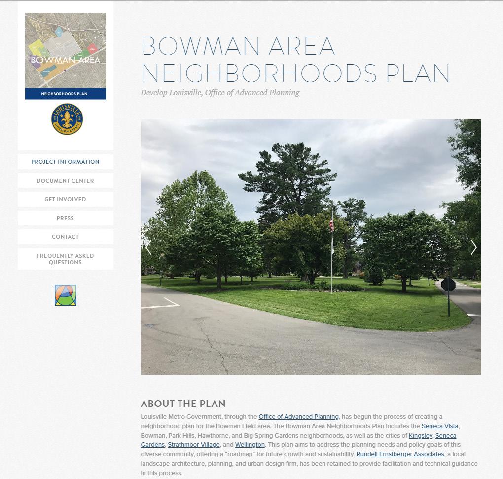
BOWMAN AREA NEIGHBORHOODS PLAN

October 2019

October 2019
The Bowman Area Neighborhoods Plan would not have been possible without the many residents, business owners, and other stakeholders who generously devoted their time and ideas in the hopes of building a stronger and more vibrant community. We would also like to thank each Advisory Group member for their service and commitment to community development.
Mayor Rebecca Beld
City of Kingsley
Mayor David Brown
City of Seneca Gardens
Anne Faulls
Hawthorne Neighborhood Association
Christine Hardin
John Hayden
Seneca Vista Neighborhood Association
Laura Benson Jones
Mayor Mark Klein
City of Strathmoor Village
Pat MacDonald
Board Member, LRAA
Dan Mann
Executive Director, LRAA
Diane Partridge
Park Hills Neighborhood
Commissioner Sara Sievert City of Wellington
Tom Wissinger
Jewish Community Center
Metro Government
Mayor Mayor Greg Fischer
Metro Council
Brandon Coan (D-8)
Legislative Aide: Jasmine Weatherby
Bill Hollander (D-9)
Legislative Aide: Kyle Ethridge
Brent Ackerson (D-26)
Legislative Aide: Jeffrey Noble
Gretchen Milliken, AIA Director
Ken Baker, AICP
Neighborhood Planning Manager
Claire Yates
Urban Planner
Bowman Area Neighborhoods Plan
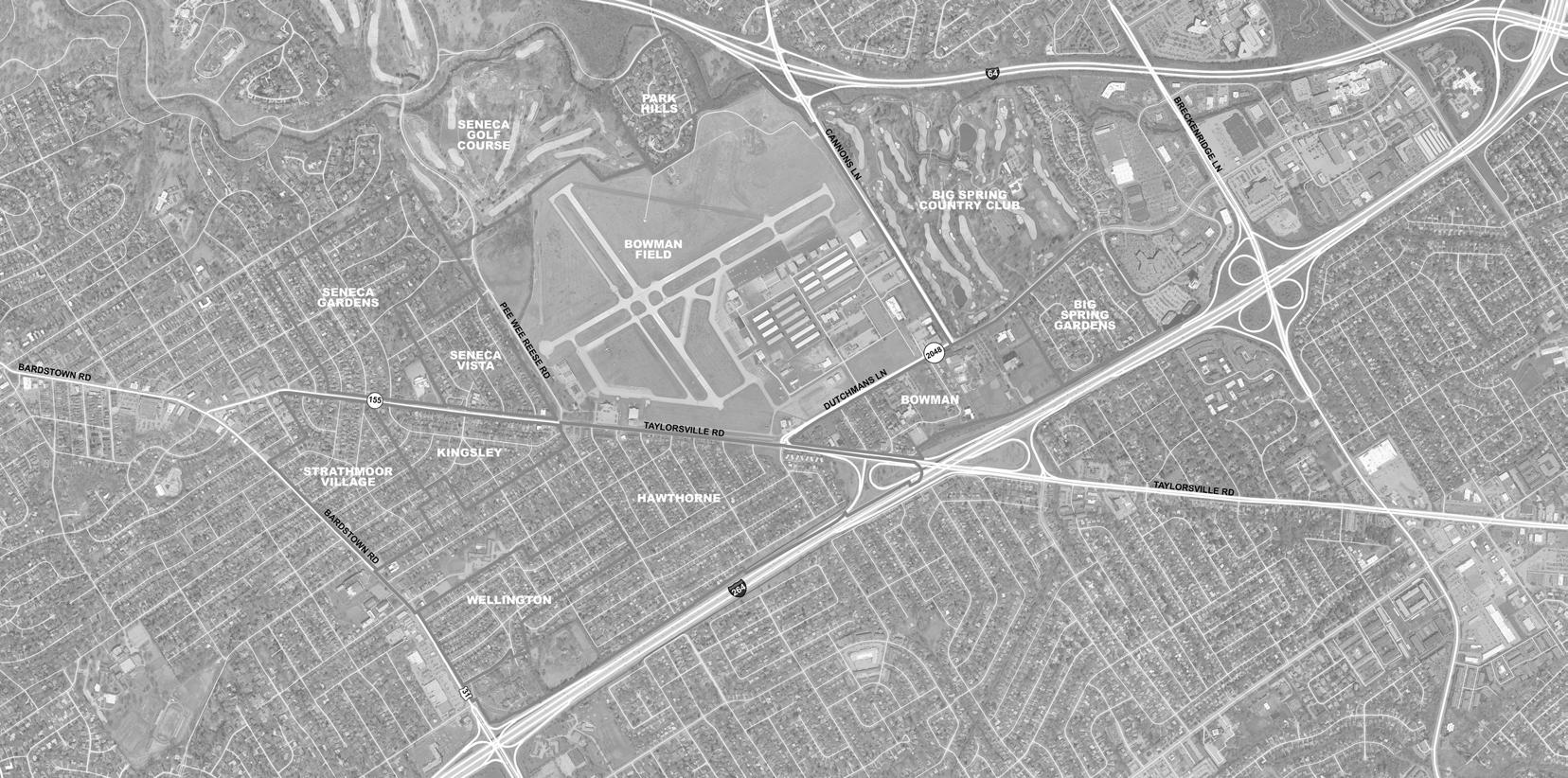
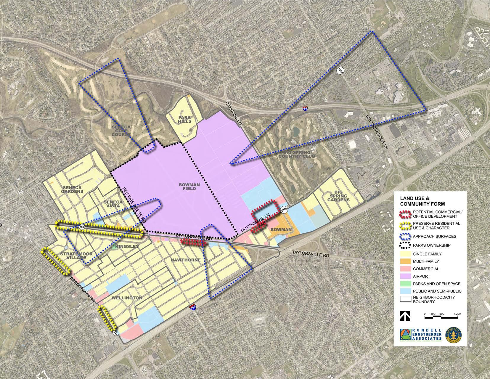
The Bowman Area Neighborhoods Plan is a plan for the neighborhoods and cities around Bowman Field. It is not a plan for the airport itself. The plan covers five Louisville Metro neighborhoods and four home rule cities, as shown in the map on the following page.
Louisville Neighborhoods:
• Big Spring Gardens
• Bowman
• Hawthorne
• Park Hills
• Seneca Vista
Home Rule Cities:
• Kingsley
• Seneca Gardens
• Strathmoor Village
• Wellington
Neighborhood plans are intended to address the planning needs and policy goals of the citizens of the neighborhood plan area. They allow a community to become proactive in response to neighborhood issues and concerns as opposed to reactive. The plan must be prepared in accordance with Chapter 161 of the Louisville Metro Code of Ordinances. The process is guided by an advisory group, whose members are tasked with identifying important neighborhood issues, highlighting local opportunities, and working with the planning team to provide input on the direction and recommendations of the plan.
Neighborhood plans are an opportunity for residents of the area to further refine the Plan 2040 vision and recommendations to a level of detail specific to the neighborhood. While Plan 2040 establishes the overarching vision and goals for the community, by nature it must be high-level and long-range. For this reason, neighborhood plans are created to more closely examine existing conditions and make detailed recommendations. By adopting the plan, Metro Council and the Planning Commission recognize the recommendations of the plan as official policy. It will be referred to when considering zoning changes and development plans for properties within the study area. However, more than a public policy document, the neighborhood plan should serve as a to-do list and advocacy guide for residents and business owners of the area.
The planning process began in January 2019. It was led by Louisville Metro Government’s Office of Advanced Planning & Sustainability, with the assistance of Rundell Ernstberger Associates. The advisory group was organized and met for the first time in March. This group included representatives from area neighborhoods and cities, the Louisville Regional Airport Authority (LRAA), and local institutions. They continued to meet periodically throughout the process to provide input and direction for plan components and feedback on draft recommendations. Additionally, a series of stakeholder and focus group discussions were held early in the process to gain a wide array of input on existing opportunities and concerns within the study area.
In addition to the advisory group and focus group meetings, residents were able to stay engaged in the process as part of a three-day community workshop in May. The workshop included a public open house, open studio time with the planning team, and a public presentation of draft recommendations. More detailed recommendations were presented at a second community open house in late August.
Throughout the process, a project website was maintained to advertise meetings, post project materials, and provide another avenue for citizen involvement. Following the second community open house, the planning team finalized plan recommendations and created the implementation action plan, resulting in plan completion in September 2019.
It is our vision for the future of the Bowman area to remain a vibrant collection of neighborhoods with a high quality of life. The desirable location is enhanced with even better pedestrian, bicycle, and vehicular connectivity, especially along and across Taylorsville Road. Historic Bowman Field remains an invaluable asset to the area, and open communication between the airport and surrounding neighborhoods is vital to ensure ongoing prosperity. The residential character of the area is preserved, with limited growth at appropriate locations. The Bowman area is green, with a robust tree canopy, and residents have safe and easy access to parks, open spaces, and other community assets.
Land Use & Community Form
GOAL: Protect the established character and scale of the Bowman area neighborhoods and cities to ensure continued success of the area.
1. Ensure any proposed development on the north side of Dutchmans Lane, between Gast Boulevard and Cannons Lane, meets neighborhood goals of building and site design.
2. Ensure continued residential use along Bardstown Road and Taylorsville Road, west of Pee Wee Reese Road.
3. Support residential to commercial conversions on Taylorsville Road, between Dartmouth Avenue and Seneca Boulevard, and along Dutchmans Lane, between Bowman Avenue and the Seneca Place care center.
4. Continue to work with MSD to address drainage issues in the neighborhoods around Bowman Field.
5. Better utilize open spaces as community amenities.
6. Continue protection and expansion of the area tree canopy.
7. Support continued ownership of Metro-owned property adjacent to Bowman Field and Seneca Park.
8. Promote compatible infill housing on vacant residential lots.
9. Form a multi-neighborhood implementation committee to advocate for and assist in realizing plan recommendations.
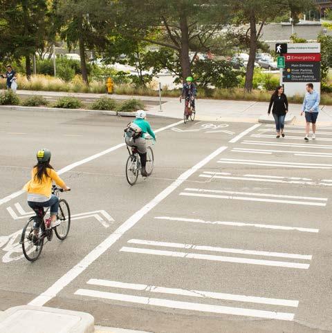
GOAL: Provide a safe and effective transportation system that accommodates all users and abilities, including pedestrians, cyclists, transit riders, and motorists, to connect neighborhoods, employment centers, and community destinations.
1. Improve pedestrian infrastructure and lighting at key intersections to ensure accessibility and safety.
2. Direct pedestrians and bicyclists to safe crossings at controlled intersections.
3. Fill gaps in the sidewalk network and construct new sidewalks along high-traffic roads that are lacking them.
4. Better align bus stop locations with safe pedestrian crossings.
5. Ensure the safety of pedestrians, bicyclists, and motorists by reducing chances of collision and improving predictability of vehicle movements.
6. Coordinate with KYTC for improvements and renovations to Taylorsville Road and Dutchmans Lane with the goal of implementing Complete Streets.
7. Explore opportunities for intersection modifications as roadways are renovated and maintained.
8. Explore traffic calming and speed reduction tactics.
9. Improve connectivity and pedestrian access to Hawthorne Elementary.
GOAL: Promote programming of communityoriented events and activities to foster a safer, more vibrant, and engaged community.
1. Formalize and grow neighborhood associations and continue collaboration efforts among Bowman area communities.
2. Enhance existing open spaces with both active and passive amenities to promote healthy living and community gathering.
3. Maintain trail and open space areas as attractive neighborhood assets.
4. Enhance communication between neighborhood groups and LRAA.
5. Promote and celebrate the cultural and historic assets of the community.
6. Beautify key corridors using welcome and wayfinding signs, enhanced landscape treatments, public art, lighting, and street trees.
Bowman Area Neighborhoods Plan
The Bowman Area Neighborhoods Plan is the result of a community planning process with and for the residents and businesses within the Bowman, Seneca Vista, Hawthorne, Park Hills, and Big Spring Gardens neighborhoods, and the cities of Kingsley, Seneca Gardens, Strathmoor Village, and Wellington.
Proximity to Bowman Field is the primary unifier of the study area, but this is not an airport plan. This is a plan to preserve and strengthen the neighborhoods and home rule cities surrounding the airport, while respecting the unique asset that is Bowman Field.
Neighborhood plans are intended to address the planning needs and policy goals of the citizens of the neighborhood plan area. They allow a community to become proactive in response to neighborhood issues and concerns as opposed to reactive. The plan must be prepared in accordance with Chapter 161 (Neighborhood Development Plans) of the Louisville Metro Code of Ordinances. The process is guided by an advisory group, whose members are appointed by Mayor Greg Fischer with concurrence of the Metro Council members who represent the study area.
The advisory group’s participation in the development of the neighborhood plan involves identifying important neighborhood issues, highlighting local opportunities, and working with the planning team to provide input on the direction and recommendations of the plan.
Neighborhood plans address multiple topics, including desired neighborhood character, potential development or redevelopment sites, needed transportation system improvements, and possible parks and open space enhancements. They are an opportunity for residents of the area to further refine the Plan 2040 vision and recommendations to a level of detail specific to the neighborhood.
Plan 2040 is a comprehensive plan that covers all of Louisville Metro. It establishes the overarching vision and goals for the community, but by nature it must be high level and long range. For this reason, neighborhood plans, small area studies, and corridor plans are created to provide more specific recommendations for key areas.
The Bowman Area Neighborhoods Plan was initiated by Councilman Brandon Coan (D-8), with support from Councilmen Bill Hollander (D-9) and Brent Ackerson (D-26), the Louisville Regional Airport Authority (LRAA), and the cities of Kingsley, Seneca Gardens, and Strathmoor Village. This is the first neighborhood plan to cover this specific geography.
Given the relative size of several of the Bowman area neighborhoods and cities, in combination with the shared proximity to the airport, it was determined a “neighborhoods” plan was better suited for the area. Through this plan, larger issues and concerns that stretch across this area can be addressed more completely. Neighborhoods and cities within the Bowman area can work together
and with other stakeholders to further the vision for the future.
By adopting the plan, Metro Council and the Planning Commission recognize the recommendations of the plan as official policy. It will be referred to when considering zoning changes and development plans for properties within the study area.
However, more than a public policy document, the neighborhood plan should serve as a to-do list and advocacy guide for residents and business owners of the area. Successful implementation of plan recommendations will require significant effort by neighborhood groups, local institutions, Louisville Metro Government, and other agencies.
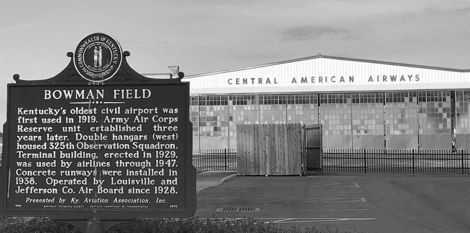
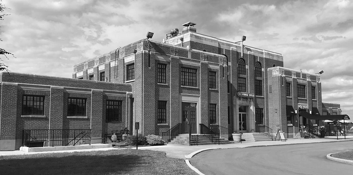
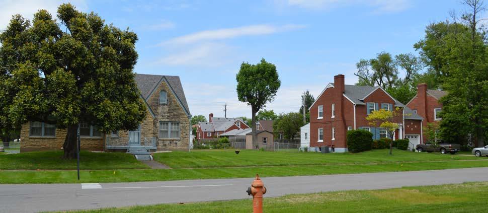
Bowman Field was founded by Abram H. Bowman, on land leased from the U.S. Government in 1919. The airport officially opened in 1921. It was the first commercial airport in Kentucky and is one of the longest continuously operating general aviation airports in the United States.
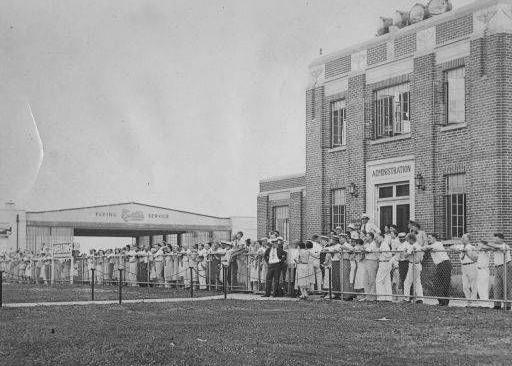
Bowman Field sits on 426 acres and includes 17 buildings, the most significant being the historic Administration Building, built in 1929 in the Art Deco architectural style. The two runways, 6-24 and 15-33, are 3,200 feet and 4,356 feet, respectively. The airport is home to two fixedbase operators and several general service and instruction businesses, as well as 217 T-hangars available for lease. Operations at Bowman Field totaled 84,182 in 2018, a 56% reduction from 1994 operation counts. These counts represent total takeoffs and landings during air traffic control tower hours, which are presently 7 am to 10 pm, daily. During World War II, Bowman Field was the busiest airport in the country, as it served as training grounds for soldiers who underwent combat readiness training. It was also home to the Army Air Force school for flight surgeons, medical technicians, and flight nurses, where they learned the necessary skills for helping wounded soldiers in combat zones.
In 1947, all Louisville passenger operations moved from Bowman Field to Standiford Field, now known as Louisville Muhammad Ali International Airport. Bowman Field assumed a new role as Louisville’s primary general-aviation airfield. It now serves as a reliever airport for Louisville Muhammad Ali International Airport and continues to offer services such as flight instruction, aircraft leases, charters and sales, aircraft cleaning and refueling, and repair and maintenance.
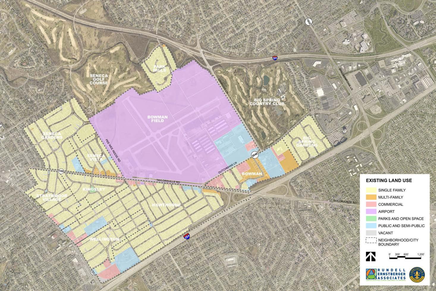
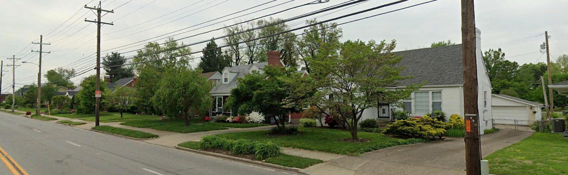
The Big Spring Gardens neighborhood comprises approximately 48 acres on the east side of the Bowman area. Big Spring Gardens is bordered by the Bowman neighborhood to the west, Dutchmans Lane to the north, The Springs Medical Center to the east, and the Watterson Expressway to the south. It is made up of two residential subdivisions, with most of the homes built during the late 1950s and early 1960s.
Bowman
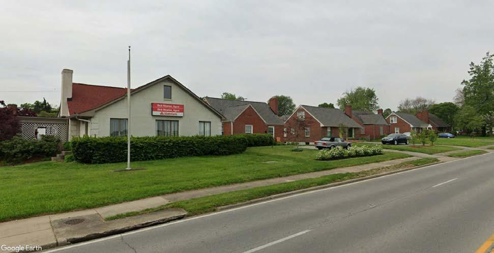
The Bowman neighborhood is bordered by Dutchmans Lane to the north, the Big Spring Gardens neighborhood to the east, the Watterson Expressway to the south, and Taylorsville Road to the west. It includes a combination of single and multi-family residential dwellings, offices, and institutions, including the Jewish Community Center. Other notable businesses and organizations include Highlands Funeral Home, Wetterer & Clare, Seneca Place, Twinbrook Assisted Living, and Hosparus Health of Louisville.
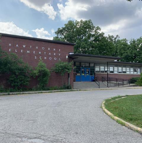
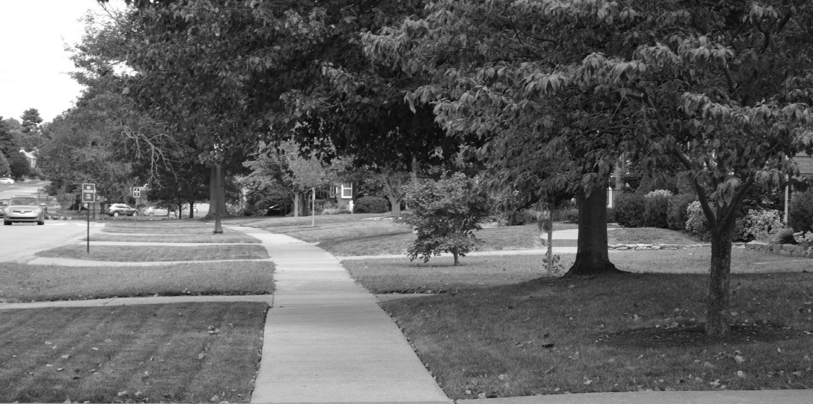
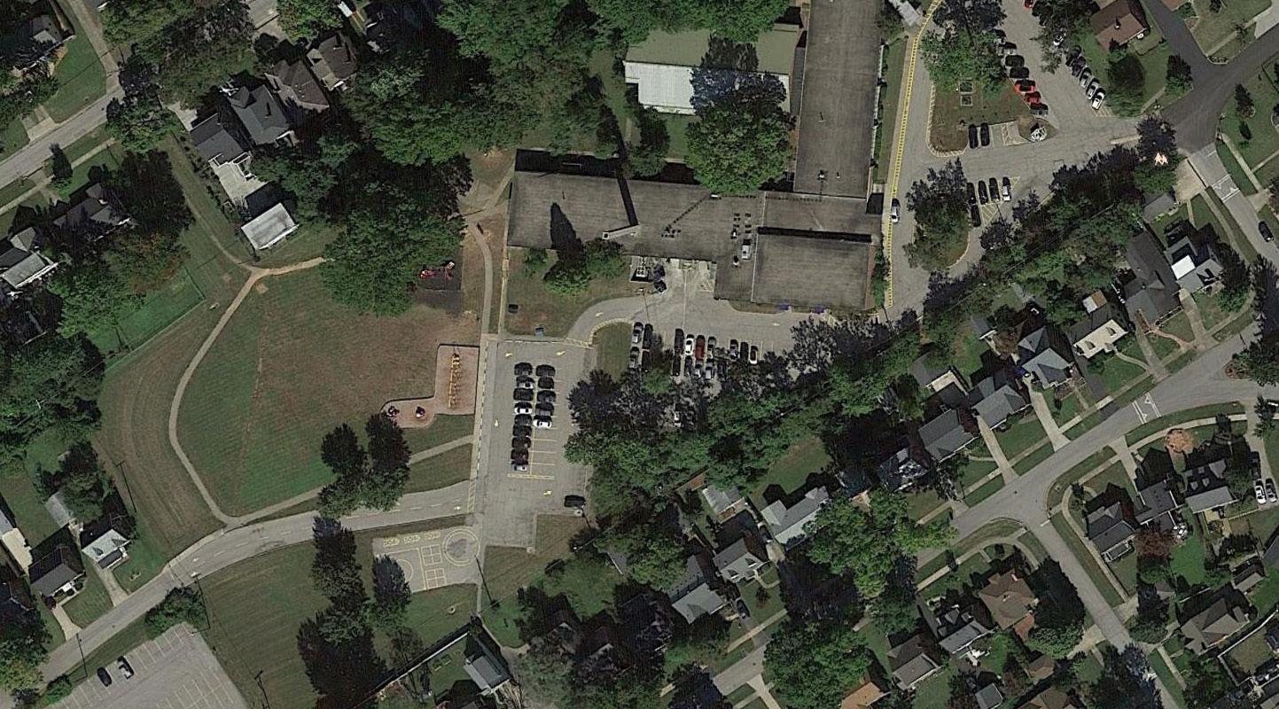
The Hawthorne neighborhood is the largest neighborhood in the Bowman area. It is located south of Bowman Field and Taylorsville Road, north and west of the Watterson Expressway, and north and east of Bardstown Road. It surrounds the City of Wellington and borders both Strathmoor Village and Kingsley. Hawthorne is comprised primarily of single-family residential dwellings, with some commercial and multi-family uses along Taylorsville Road and Bardstown Road. Subdivisions in the Hawthorne neighborhood range in date from 1910 to 1954. The neighborhood is home to several important institutions, including Farmington, Hawthorne Elementary School, Sullivan University, and the Strathmoor Presbyterian Church.
The City of Kingsley covers approximately 44 acres along the south side of Taylorsville Road. The City of Strathmoor Village is to the west, and the Hawthorne neighborhood is to the east. The city was platted in 1925 and incorporated as a sixth-class city in 1939. With the exception of two commercial properties at the southwest corner of Taylorsville Road and Bon Air Avenue, the city is entirely residential in use. Central to the city and bounded by Gladstone, Montrose, and Sydney avenues is the Kingsley Green, a 0.9-acre open space full of diverse tree species.
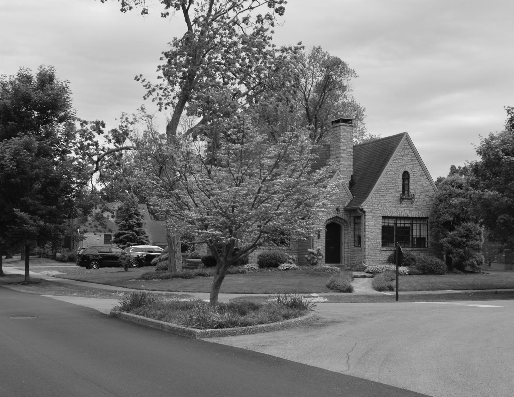
Park Hills is an entirely residential neighborhood on the north side of Bowman Field. It is bounded by Interstate 64 to the north and east, Bowman Field to the south, and Seneca Park to the west. The first section of Park Hills was subdivided in 1955, with a second section added in 1962. The neighborhood contains a mix of architectural styles, with MidCentury Modern being the most prevalent.
The City of Seneca Gardens encompasses approximately 98 acres on the west side of the Bowman area. It is bounded by Seneca Park, Bowman Field, and the Seneca Vista neighborhood to the east, Taylorsville Road to the south, and the Highlands-Douglass neighborhood to the north and west. The city is entirely residential in use, with the exception of the Keneseth Israel Congregation on Taylorsville Road. Sections of Seneca Gardens were platted between 1925 and 1942, leading to a variety of architectural styles and character. The city was incorporated in 1930 and grew several times before reaching its current size in 1950. Most of the dwellings are single-family homes, but some duplexes are present along Broadmeade Road.
The Seneca Vista neighborhood is immediately west of Bowman Field and Pee Wee Reese Road. It is further bounded by Taylorsville Road to the south, and the City of Seneca Gardens to the north and west. Seneca Vista is comprised primarily of single family residential homes, with multi-family and commercial properties along Taylorsville Road. Sections of the neighborhood were first subdivided in 1939, with homes being constructed through the early 1950s.
The City of Strathmoor Village covers approximately 65 acres of land, between Taylorsville Road and Bardstown Road, on the west side of the Bowman area. It is bordered by the City of Kingsley and the Hawthorne neighborhood to the east, and the Highlands-Douglass neighborhood to the west. The city is mainly residential in use, with several smaller commercial properties present along Bardstown Road. Portions of the city were first subdivided in 1921. It was incorporated in 1928 and grew in size with the annexation of Strathmoor Gardens in 1993.
The City of Wellington was incorporated as a sixthclass city in 1946 and covers approximately 56 acres. It lies on the east side of Bardstown Road and is surrounded on the north, east, and south sides by the Hawthorne neighborhood. It is entirely single-family residential in use. Subdivision platting began in the mid-1920s.
Existing Land Use Map
Louisville Metro Government, through the Office of Advanced Planning & Sustainability, retained the services of Rundell Ernstberger Associates to facilitate the planning process and creation of the Bowman Area Neighborhoods Plan. The process began in January 2019. The advisory group was organized and met for the first time in March. This group included representatives from area neighborhoods and cities, LRAA, and local institutions. They continued to meet periodically throughout the process to provide input and direction for plan components and feedback on draft recommendations.
Additionally, a series of key stakeholder and focus group discussions were held early in the process to gain a wide array of input on existing opportunities and concerns within the study area. Groups represented in these meetings included neighborhood leaders and residents, business owners, and Metro staff.
In addition to the advisory group and focus group meetings, residents were able to stay engaged in the process as part of a three-day community workshop in May. The workshop included a public open house, open studio time with the planning team, and a public presentation of draft recommendations. More detailed recommendations were presented at a second community open house in late August.
Throughout the process, a project website was maintained to advertise meetings, post project materials, and provide another avenue for citizen involvement. Following the second community open house, the planning team finalized plan recommendations and created the implementation action plan, resulting in plan completion in September 2019.
More detailed information regarding the plan process and meeting outcomes can be found in Chapter 2: Community Engagement.
Plan 2040: A Comprehensive Plan for Louisville Metro lays out a vision for the future of the Louisville area. It is the result of a communitydriven planning process to update and replace the Cornerstone 2020 Comprehensive Plan.
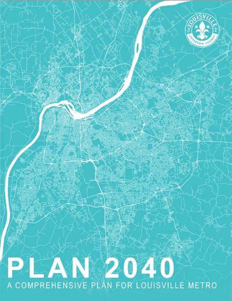
Goals and objectives are outlined to work toward making the community a better place, increasing the quality of life, creating more pride of place, and developing a connected community.
The Plan 2040 Vision Statement states:
“In 2040, Louisville Metro is a vibrant and diverse community that is connected, healthy, authentic, sustainable and equitable, with compassionate citizens and memorable places among its greatest assets and where all people are able to achieve their full potential.”
The vision statement is supported by five guiding principles – Connected, Healthy, Authentic, Sustainable, and Equitable (CHASE). These CHASE principles were the guiding force behind the six plan topics: community form, mobility, community facilities, economic development, livability, and housing. Each plan topic includes a series of goals, objectives, and policies.
Plan 2040 details 20 goals and more than 100 objectives. Collectively, these topics work to create the best Louisville possible, by examining the built environment and setting design standards for the future, working toward creating an
equitable community with access to all types of transportation, and planning for adaptable growth in the coming years.
The Plan 2040 process included 78 public meetings held for the advisory committee, data committee, and work groups. In addition, Metro staff facilitated nine community forums, assisted with four CHASE workshops, and participated in over 60 meetings with community organizations. As a result of this inclusive and extensive process, over 6,000 people participated in the creation of Plan 2040.
The Bardstown Road Safety Study focuses on multiple sections and intersections along Bardstown Road. Three segments are within the Bowman Area Neighborhoods Plan study area: Taylorsville Road to Tyler Lane, Tyler Lane to Brighton Drive, and Bardstown Road at Assumption High School and St. Raphael Church & School.
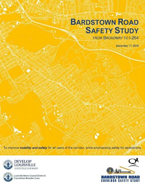
Taylorsville Road to Tyler Lane
Bardstown Road from Taylorsville Road to Tyler Lane is not recommended for roadway improvements. Instead, the plan recommends that sidewalks should be installed or replaced and additional curb development and enhancements be done to accommodate stormwater drainage. The sidewalk would help accommodate people who walk or bike to the nearby schools and keep them separated from traffic.
Tyler Lane to Brighton Drive
Bardstown Road from Tyler Lane to Brighton Drive is a section of road that might be turned from a four-lane road to a five-lane road, with a left turn lane becoming the new addition. Crosswalks would be improved, and a 10-foot-wide multi-use path is recommended for the west side of Bardstown Road. This recommendation aims to provide a safer multi-modal path for people who walk or bike to nearby schools and increase connectivity across the community. Dedicated left turn lanes are recommended on Bardstown Road at the Tyler Lane intersection to help facilitate traffic flow to and from Assumption High School.
Bardstown Road at Assumption High School and St. Raphael Church & School
Bardstown Road at Assumption High School and St. Raphael Church & School has a few improvement suggestions to improve safety, access, and traffic flow. This segment of road directly affects Assumption and St. Raphael, but also impacts Hawthorne Elementary School. The primary access point for St. Raphael and Hawthorne Elementary School is Lancashire Avenue to the west and east, respectively, which makes this section difficult to drive during peak school hours. Adding a center turn lane on Bardstown Road would help improve traffic flow and mobility.
Assumption and St. Raphael are on the west side of Bardstown Road and have adjacent parking lots with entrances located close to each other. One long-term concept is to create a single point of access for Assumption and St. Raphael which would align with Hawthorne Avenue to allow for better traffic flow and limit conflicting turns onto Bardstown Road.
Another recommendation of the plan is to eliminate on-street parking along Bardstown Road (southbound lane) closest to Assumption. The onstreet parking currently provides temporary staging for those picking up students in the afternoon but creates safety issues and should be removed. A center turn lane could be added along Bardstown Road by converting the 10-foot wide shoulder into a southbound lane and replacing the current inside southbound lane with a center turn lane.
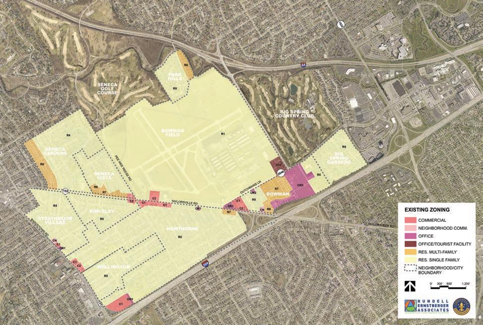
The LDC establishes districts and a zoning map for all properties under the planning and zoning jurisdiction of Louisville Metro Government. The base zoning districts present in the Bowman area include:
Residential Districts
• R-1 Residential Single Family District
• R-4 Residential Single Family District
• R-5 Residential Single Family District
• R-6 Residential Multi-Family District
• R-7 Residential Multi-Family District
Office Districts
• OR-1 Office / Residential District
• OR-2 Office / Residential District
• OR-3 Office / Residential District
• OTF Office / Tourist Facility
Commercial Districts
• C-N Neighborhood Commercial District
• C-1 Commercial District
• C-2 Commercial District
In addition to the base zoning districts, the LDC establishes a series of form districts to “supplement and extend use and density regulations associated with individual zoning districts...Form district regulations govern the design of permitted uses and land activities to ensure compatibility with adjacent uses and activities, adequate transportation access, and preservation of the public health, safety and welfare.”
The following form districts apply within the study area:
• Neighborhood Form District (NFD): The Neighborhood Form District design standards are intended to promote development and redevelopment that is compatible with and enhances the unique site and community design elements of a neighborhood. NFD design standards are also intended to promote the establishment of activity centers at appropriate locations as established in Guidelines 1 and 2 of the Comprehensive Plan. Activity centers should effectively integrate a mix of retail, institutional, and other nonresidential uses within neighborhoods in a manner that provides convenient service to residents while protecting the character of the neighborhood.
• The NFD covers the majority of the study area, excluding the airport, shopping/ office district southeast of the airport, and Sullivan University.
• Campus Form District (CFD): The Campus Form District is an established or proposed pattern of development having a mixture of uses clustered for a single or predominant purpose. Residential or commercial uses should primarily serve the people who work or live on the Campus. The form should be compact and walkable, with substantial open space, central gathering areas, shared parking and signage, and an internal circulation system.
• Sullivan University is the only site in the study area designated as CFD.
• Suburban Workplace Form District (SWFD): The Suburban Workplace Form District is designed to reserve land for large-scale industrial and employment uses in suburban locations. District standards are designed to ensure compatibility with adjacent form districts, buffer heavy industrial uses from potentially incompatible uses, ensure adequate access for employees, freight, and products, provide services and amenities for employees, and improve transit service.
• The SWFD covers the airport and institutional uses directly east of the airport (bordered by Dutchmans Lane and Cannons Lane).
• Suburban Marketplace Corridor Form District (SMCFD): The design of the Suburban Marketplace Corridor Form District is characterized by linear commercial development along major roadways. The Suburban Marketplace Corridor is a medium to high density district, with a mixture of highway commercial uses, shopping centers, and office development. Buildings along the corridor are typically set back from the roadway with parking lots in front. Examples of Suburban Marketplace Corridors include Hurstbourne Parkway, Dixie Highway, and Preston Highway.
• Within the study area, the SMCFD is only applied to three parcels on the east side of Bardstown Road, between Manchester Road and Hawthorne Avenue.
Bowman Area Neighborhoods Plan
Community engagement is vital to any public planning process. Local needs, concerns, and ideas are identified through meeting and interacting with the residents and patrons of communities. The information shared by the public is invaluable to informing the planning process and provides insight into the neighborhoods that may otherwise go unrealized. Additionally, the opportunity for public input provides a sense of ownership and buy-in for the neighborhoods, increasing local support, and encouraging adoption and implementation of the plan’s recommendations.
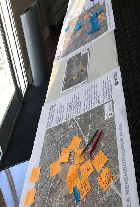
During the planning process, public input was gathered through four methods: an advisory group, small focus groups, public meetings, and a project website. Common themes and comments among the different forms of community engagement are discussed within this chapter.
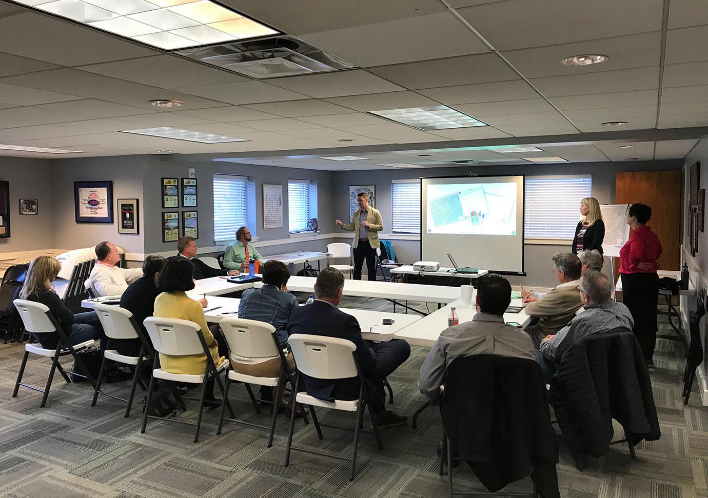
The advisory group is comprised of neighborhood representatives from the different neighborhoods and cities located within the planning area. The group was appointed by the mayor with support and advice from the Metro Council members who represent constituents of the planning area. The advisory group’s participation in the development of the neighborhood plan involves identifying important neighborhood issues, highlighting local opportunities, and working with the planning team to provide input on the recommendations and priorities of the plan. In addition, it is the responsibility of the advisory group to communicate project progress and results back to neighbors and residents within their purview.
Meetings were held with the advisory group during each phase of the planning process. The advisory group provided input on their perceptions of opportunities and challenges that the community currently faces, reviewed and responded to the public input summaries, provided input and clarification for the vision statement, and reviewed plan recommendations and priorities.
Focus group meetings were held over several days in different venues throughout the area to encourage attendance with easy and convenient locations. These meetings were focused on the individual cities and neighborhoods and included detailed discussions for their particular neighborhood or city and the Bowman area. Each group was questioned/prompted with the same interview guide created by the project team to ensure questioning consistency. All of the discussions were recorded and analyzed. The following themes were heard from the stakeholders. They are not listed in any particular order.
• Sense of pride in neighborhoods
• Great location – close to downtown, parks, services and businesses
• Strong property values
• Effective pedestrian, bike, and vehicular connectivity
• Airport as a cultural asset
• Established tree canopy
• Developed system of pathways around airport
• Good connections to parks
• Safe and walkable roadways inside neighborhoods
• Proximity of restaurants and businesses
• Traffic volume and speeds along Taylorsville Road
• Maintenance of commercial and multifamily properties on Taylorsville Road
• Potential for development on open land surrounding airport
• Lack of parking for some businesses
• Cut-through traffic in neighborhoods
• Pedestrian and bike connections across busy roadways
• Drainage issues
• Airport noise
• Airport air-clearance pathways
• Communication between airport and neighbors - need to address and reduce opposition to airport operations and activity
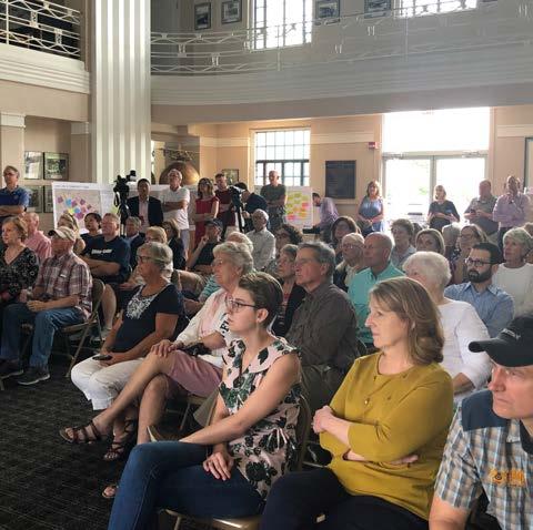
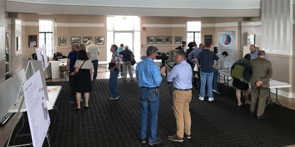
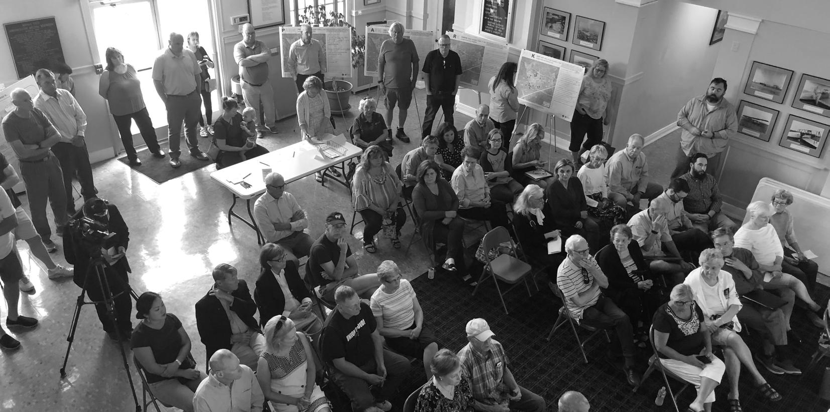
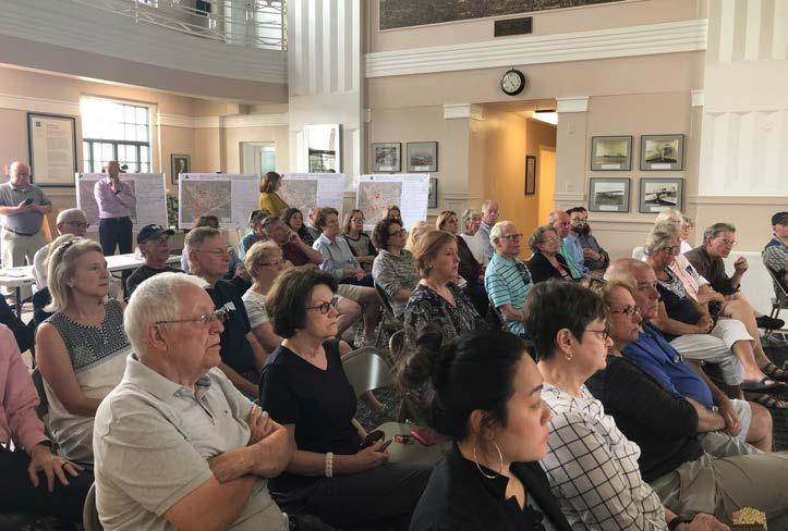
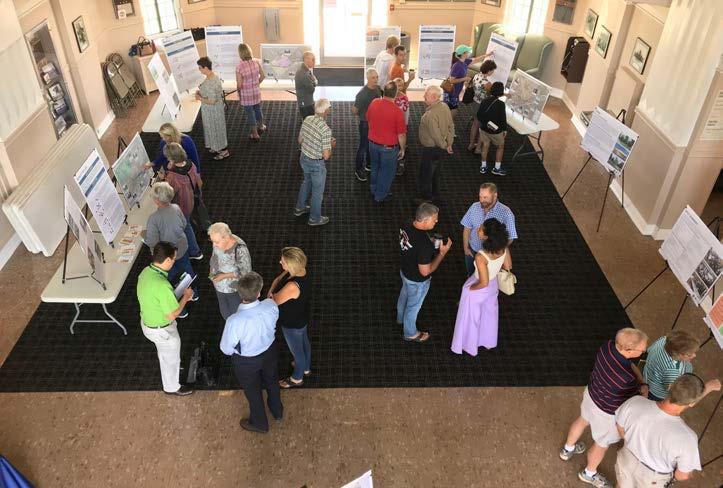
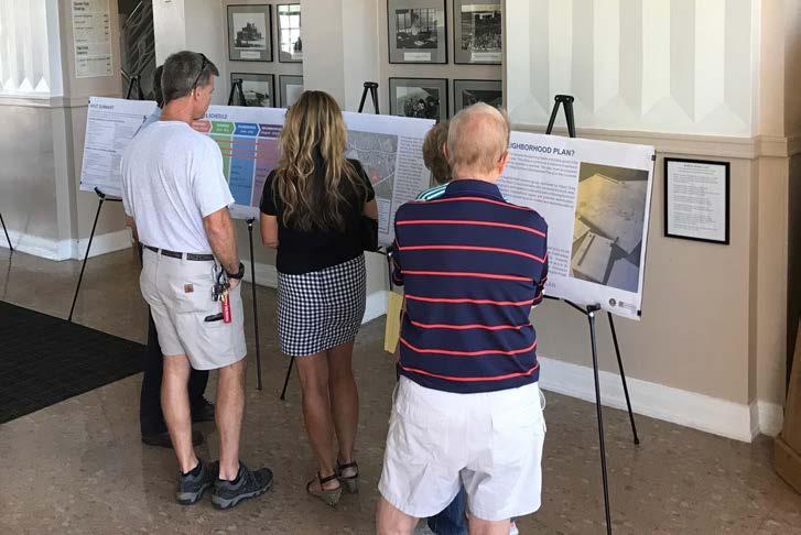
The community workshop was held May 14-16, 2019 during the discovery phase of the project. The workshop was held over three days in the Bowman Field Administration building. The workshop included several opportunities for residents to offer their input regarding the current condition of the neighborhoods and to share their wishes for the future of the community. Residents could participate in a community open house held on the first evening, open work sessions during business hours on May 15 and the morning hours of May 16, and a public presentation followed by a question/ answer session on the final evening.
The workshop and larger plan process were covered by multiple media outlets. Insider Louisville promoted the workshop in advance, and several news stations, including WAVE, WHAS, WLKY, and WDRB, covered the open house and public presentation.
The following comments were provided during the workshop and are not listed in any particular order:
Preserve
• Look and feel of Bowman area - sense of pride in neighborhoods
• Bowman Field as a rich and valued component of the area
• Eclectic feel of the neighborhood
• Farmington
• Undeveloped field on airport property
Add
• Extension of multi-use path to east side of Pee Wee Reese Road
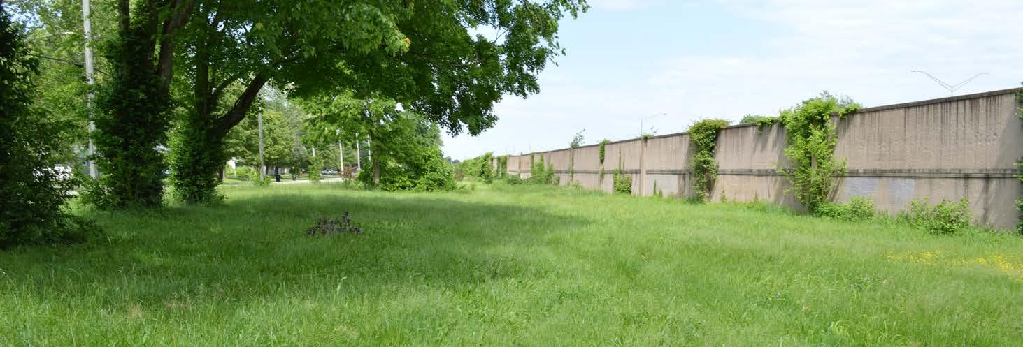
• Park space along Watterson Expressway buffer wall
• Trees and other shade structures along bike path around airport (outside of flight path)
• Extension of walkway from Pee Wee Reese Road to Cannons Lane along Bowman Field fence, north of the airfield
• The addition and replacement of trees
• Sidewalks from First Financial Bank to Bambi Bar
• Improvements to fencing and landscaping at the corner of Old Cannons Lane and Five Oaks Place
• Sidewalk along Bon Air Avenue
• Updates to and addition of street signs
• Pocket parks in the neighborhoods
• Roadway improvements to improve safety of all users
• Conversion of a portion of Taylorsville Road from four lanes to three lanes, with the additional space dedicated to bicycle facilities
• Billboards
• Dead trees (general area clean-up)
• Trash and overgrowth along the multi-use path around airport
• Barbeque grills in front of Kingsley Meats
• Opposition to the airport activity and adopt a pro-aviation culture
• Road development on north side of airport
• Additional multi-family and commercial uses on Dutchmans Lane, Bardstown Road, in Kingsley
• Deviation from air traffic lanes and landing heights
• Cut-through traffic
• Excessive speeding
• Additional traffic lights on Taylorsville Road
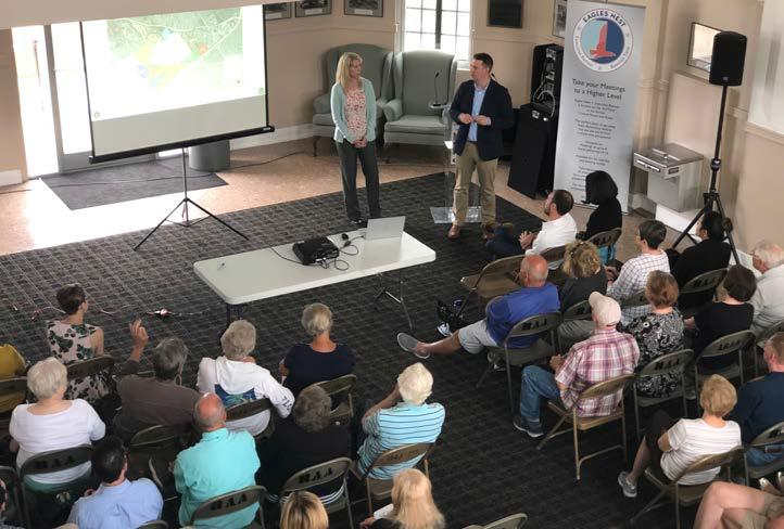
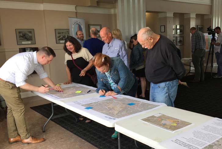
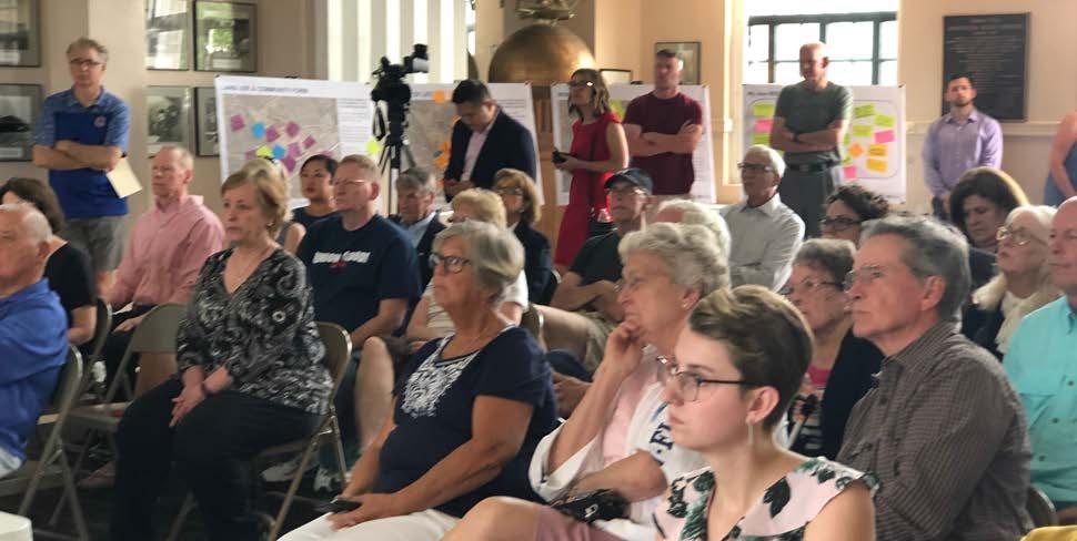
A public open house was held on August 24, 2019 at the Bowman Field Administration Building, after development of the proposed plan recommendations. The meeting included presentation of draft recommendations and exercises to gather input on priorities for plan implementation.
Key recommendations were presented for the three plan components: land use and community form, mobility, and quality of life. Meeting attendees identified the following as recommendations that they considered to be the most important.
• Continue protection and expansion of the existing tree canopy to enhance streetscapes, open spaces, and private development.
• Continue to work with MSD to address drainage issues in the neighborhoods around Bowman Field.
• Encourage continued residential use along Bardstown Road and Taylorsville Road, west of Pee Wee Reese Road, and discourage conversions to commercial use.
• Improve pedestrian infrastructure and lighting at key intersections to ensure safety.
• Fill gaps in the sidewalk network and construct new sidewalks along high traffic roads that are lacking sidewalks.
• Coordinate with KYTC for improvements and renovations to Taylorsville Road and Dutchmans Lane with the goal of slowing speeds, improving safety, providing additional bicycle and pedestrian facilities, and creating more area for lawn and trees.
• Maintain trail and open space areas as attractive neighborhood assets.
• Promote and celebrate the history of Bowman Field and the cultural assets of the surrounding community.
• Enhance communication between neighborhood groups and the airport, especially regarding tree encroachment into approach surfaces and other safety regulations that apply outside of the airport boundary.
In addition to in-person community engagement opportunities, the planning process included a project website. The website was updated throughout the process so that residents unable to attend engagement opportunities would have an opportunity to view project materials and progress. The website included a comment section for visitors to offer their input to the planning team.
Bowman Area Neighborhoods Plan
It is our vision for the future of the Bowman area to remain a vibrant collection of neighborhoods with a high quality of life. The desirable location is enhanced with even better pedestrian, bicycle, and vehicular connectivity, especially along and across Taylorsville Road. Historic Bowman Field remains an invaluable asset to the area, and open communication between the airport and surrounding neighborhoods is vital to ensure ongoing prosperity. The residential character of the area is preserved, with limited growth at appropriate locations. The Bowman area is green, with a robust tree canopy, and residents have safe and easy access to parks, open spaces, and other community assets.
A vision statement reflects local potential and makes a commitment to future action. A vision generally describes what the community wants to be. It should encompass existing community values and address what should be improved in the future. The vision statement must be clear and succinct, but also purposeful and descriptive enough to ensure common understanding.
A vision provides a sense of direction and is the overall endgame once the plan is achieved, which is why a vision is written as a future condition. The vision is developed relatively early in the planning process and helps to guide decision-making and shape the overall plan. If an idea, policy, or objective would help advance the Bowman area neighborhoods toward the vision, it was included in the plan.
The vision not only serves as part of a decisionmaking tool for the plan, but also for the decisions that are made in implementing the plan. While not the only consideration, policy and decision makers should remember the vision to help guide whether a decision is right for the community.
The initial vision statement was created as part of the community workshop in May 2019. It was based on comments and input received from the advisory group, focus group discussions, and attendees of the first open house. After presentation at the workshop, the vision statement was further refined with the help of the advisory group.

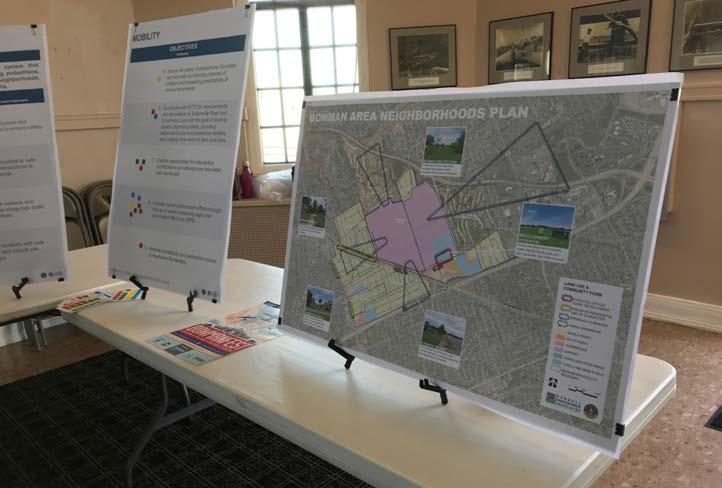
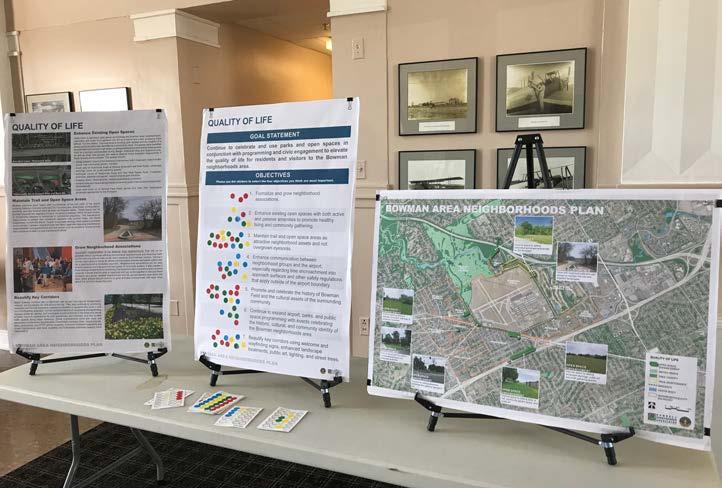
The vision statement is further defined and supported by a series of goals and objectives. These goals and objectives are organized around three plan elements that guide the remainder of the document:
• Land Use & Community Form
• Mobility
• Quality of Life
Goals are concise statements that establish the long-range desired outcomes. They act as a further definition of the vision and address those things the community wants to accomplish over the life of the plan.
Objectives are statements that describe a specific, measurable task, and collectively serve as a path toward goal achievement. Objectives are statements of community intent against which individual actions and decisions are evaluated. Objectives should be sufficiently quantifiable to evaluate the appropriateness of development applications, have a general time frame, and be understood by both decision-makers and the general community.
Together, goals and objectives serve as the basis for development decisions. They are implemented by legislative and policy actions throughout the city, such as zoning ordinances, design regulations, capital improvement programs, and building code enforcement.

Land Use & Community Form: Protect the established character and scale of the Bowman area neighborhoods and cities to ensure continued success of the area.
Mobility: Provide a safe and effective transportation system that accommodates all users and abilities, including pedestrians, cyclists, transit riders, and motorists, to connect neighborhoods, employment centers, and community destinations.
Quality of Life: Promote programming of community-oriented events and activities to foster a safer, more vibrant, and engaged community.
Bowman Area Neighborhoods Plan
GOAL: Protect the established character and scale of the Bowman area neighborhoods and cities to ensure continued success of the area.
It is important to identify supportive patterns of land use to guide future development and redevelopment within the Bowman area. The land use and community form recommendations support the vision established earlier in this plan, as well as that of Plan 2040, and begin to translate this vision into a tangible, physical form. In most instances, the existing land use is the desired future use and expected to continue indefinitely. However, there are some areas where changes in land use may be appropriate in order to achieve the highest and best use.
It is also important to note the difference between land use and zoning. While related, they serve separate functions. Land use describes the activity that occurs on the land. Zoning regulates the character, building size, density, and other development standards of that land use activity. Some of the land use and community form recommendations conflict with current zoning designations and would require a change in zoning. It would be at that time that Metro agencies and commissions, including the Planning Commission, could evaluate development proposals with respect to the vision and goals of this plan.
The map on the following page summarizes many of the land use and community form recommendations. It highlights critical corridor areas where the existing character must be preserved. Additionally, three areas have been identified as potentially appropriate for development given certain character and form considerations. These are described in more detail later in this chapter. Airport runway approach surfaces have also been noted on the map.
1. Ensure any proposed development on the north side of Dutchmans Lane, between Gast Boulevard and Cannons Lane, meets neighborhood goals of building and site design.
2. Ensure continued residential use along Bardstown Road and Taylorsville Road, west of Pee Wee Reese Road.
3. Support residential to commercial conversions on Taylorsville Road, between Dartmouth Avenue and Seneca Boulevard, and along Dutchmans Lane, between Bowman Avenue and the Seneca Place care center.
4. Continue to work with MSD to address drainage issues in the neighborhoods around Bowman Field.
5. Better utilize open spaces as community amenities.
6. Continue protection and expansion of the area tree canopy.
7. Support continued ownership of Metroowned property adjacent to Bowman Field and Seneca Park.
8. Promote compatible infill housing on vacant residential lots.
9. Form a multi-neighborhood implementation committee to advocate for and assist in realizing plan recommendations.
LU1: Ensure any proposed development on the north side of Dutchmans Lane, between Gast Boulevard and Cannons Lane, meets neighborhood goals of building and site design.
One of the most important components of a neighborhood plan is establishing a vision for potential development or redevelopment sites. While some residents may not want to see additional development in an area, the plan must balance this with the reality of development pressures and property owner rights. For this reason, the plan should be used to describe neighborhood goals and interests if a development project is proposed.
The property at the northeast corner of Dutchmans Lane and Gast Boulevard is owned by LRAA. While there are no immediate plans to develop the property, it is actively being marketed for development. If the property is to be developed, it should be primarily comprised of office, medical office, or additional government and institutional uses. Some supporting neighborhood commercial use may also be appropriate, but only as a part of a larger project. Individual, high-intensity commercial uses, such as gas stations, restaurants, and large footprint retail stores should not be permitted given adjacent context and already busy thoroughfares. Quality architectural design and building materials should be used to reflect the character established by the Jewish Family & Career Services and existing medical office buildings. Form and massing of any new development should also reflect these existing buildings, including similar setbacks from the street, with parking areas to the rear.
LU2: Ensure continued residential use along Bardstown Road and Taylorsville Road, west of Pee Wee Reese Road. Bardstown Road and Taylorsville Road contain a wide variety of uses and building types along their lengths, both within the Bowman area and beyond. Because of the higher traffic volumes, they are desirable corridors for commercial development. However, the segment of Taylorsville Road between Talbott Avenue/Trevilian Way and Pee Wee Reese Road is almost entirely residential in use. Similarly, Bardstown Road between Eastview Avenue and Tyler Lane is lined with mostly residential dwellings. The residential character and use of these segments should be protected, and further conversion to commercial use should not be allowed.
Where there are commercial uses in or adjacent to these segments, additional setbacks and landscape plantings should be used to buffer the commercial use from adjacent residential structures. Oftentimes there is not a mechanism to go back to existing development and require additional buffering, but as uses may change, site improvements are made, or signage enhanced, it should be ensured that these commercial uses are doing all they can to avoid conflicts with neighboring residential properties.
LU3: Support residential to commercial conversions on Taylorsville Road, between Dartmouth Avenue and Seneca Boulevard, and along Dutchmans Lane, between Bowman Avenue and the Seneca Place care center.
As stated previously, the primarily residential sections of major thoroughfares in the study area should be preserved. However, there are two segments where conversion from residential use to commercial use may be appropriate. This includes along Taylorsville Road, between Dartmouth Avenue and Seneca Boulevard, and along Dutchmans Lane, between Bowman Avenue and the Seneca Place care center. In fact, these three and two block segments, respectively, already contain some commercial uses.
The long-term marketability of continued residential use in these areas is unlikely. With respect to the segment of Taylorsville Road, conversion to small office and professional service businesses is appropriate to create a transitional zone near the Watterson Expressway. When conversion does occur, the existing structures should be preserved and remain compatible with the adjacent residential character. In the event of redevelopment, new structures should be designed to maintain the established form and character along the street. As properties may change use, access easements across the rear of the property should be granted so that parking areas and an alley connector can be created. This would allow for the closing of driveways along Taylorsville Road and Dutchmans Lane, thereby improving roadway safety and function. The parking areas should be screened from adjacent residences.
LU4: Continue to work with MSD to address drainage issues in the neighborhoods around Bowman Field.
Throughout the community engagement process, drainage issues and a lack of stormwater infrastructure were identified as a high priority. Given the relative timeframe when most of the subdivisions in the Bowman area were developed, they either utilize open drainage swales or lack stormwater conveyance infrastructure entirely. While stormwater infrastructure has been added to major thoroughfares as they’ve been widened or reconstructed, it is still absent from many local streets.
The topography of the area means some locations experience more severe stormwater impacts than others, but the issue is systemic and likely cannot be managed on a property by property basis. Current MSD regulations should prevent issues with new development where it can connect to existing stormwater infrastructure. However, correcting drainage issues in developed neighborhoods will be a costly and time-consuming process. Neighborhoods should continue to communicate issues with MSD and work together on long-term solutions. In the short-term, individual property owners should explore on-site mitigation strategies, such as installing rain gardens, vegetated swales, and other green infrastructure.
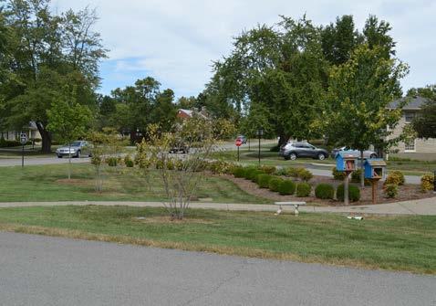
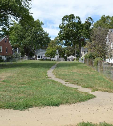
LU5: Better utilize open spaces as community amenities.
Seneca and Cherokee parks are major community assets with active trails, sports facilities, and passive open spaces for residents. The issue is access to these amenities, as major thoroughfares such as Taylorsville Road can create a barrier for some Bowman area residents. Other recommendations in this plan focus on improving connectivity and safe crossings of major thoroughfares, which should improve access to these parks.
In addition to these accessibility improvements to larger parks, there are many smaller open spaces within Bowman area neighborhoods that could be better utilized for recreation. Presently, most of these spaces only act as visual amenities and have low levels of activity. Some of these spaces
require only minor programming, while others, such as the potential Hawthorne Linear Park or aviation easements at Taylorsville Road, require more significant plantings, pedestrian connections, and public art. Additionally, some of these spaces exist because of airport approach restrictions. Improvements to these areas will need to be cognizant of any conflicts and avoid trees which could extend into the potential approach zone. More detailed recommendations for each of these spaces are included in the Quality of Life section. It is unlikely these improvements will be funded through Louisville Metro Government, requiring the Bowman area neighborhoods and home rule cities to secure funding for these projects. Grant programs should be explored to find funding applicable to the proposed improvements at each location.
LU6: Continue protection and expansion of the area tree canopy.
The Bowman area neighborhoods and cities are well known for their attractiveness and desirability. One reason for this is the mature trees and landscaping throughout the area. A recurring theme heard during public input and focus group meetings was the importance of protecting and expanding the tree canopy.
Across the Louisville Metro region, the tree canopy is decreasing as trees die, grow into utility lines and are removed, or become a nuisance and threaten a building structure. At the same time, trees are significant assets in urban areas, as they provide shade and combat urban heat island effects, help to calm and slow traffic speeds, and improve overall aesthetics and property values. One of the key findings of the Louisville Urban Heat Management Study states, “Tree planting and other vegetative strategies should be prioritized in residential zones, where population exposures to heat are greatest and lower-cost planting opportunities are found.”
The airport should continue to replace trees with those of an appropriate species as they are forced to remove trees from the runway protection areas. Similarly, trees should be replaced or installed as part of roadway and other infrastructure projects. Trees are also required with new development as part of the Land Development Code.
Ultimately, the greatest opportunity to expand the tree canopy is on existing residential properties. The Bowman area neighborhoods and cities should organize a “Neighborhood Tree Team” to advocate for additional tree planting and assist property owners with selecting, sourcing, and maintaining unique tree species throughout the area. The City
of Seneca Gardens already has a tree program and arborist dedicated to the planting of shade and ornamental trees within the neighborhood. Expansion of this program or creation of similar programs for other Bowman area neighborhoods would go a long way to realizing a more robust tree canopy across the community.
LU7: Support continued ownership of Metro-owned property adjacent to Bowman Field and Seneca Park.
Approximately 200 acres of Bowman Field is owned by Louisville/Jefferson County Metro Government, successor to the Board of Parks Commissioners, and leased to LRAA. This land is part of the original 540 acres purchased to create Seneca Park in 1928. Bowman Field was already in operation at that time, so the airport was granted a long-term lease on the property.
During the neighborhood planning process, this ownership arrangement was discussed with the advisory group. While transferring these 200 acres from Metro to LRAA may make sense from an operations standpoint, it was resoundingly desired that the property stay under Metro ownership. Long-term, should anything happen to cease Bowman Field operations, Metro could then expand Seneca Park or plan other recreation activities on this land.
LU8: Promote compatible infill housing on vacant residential lots.
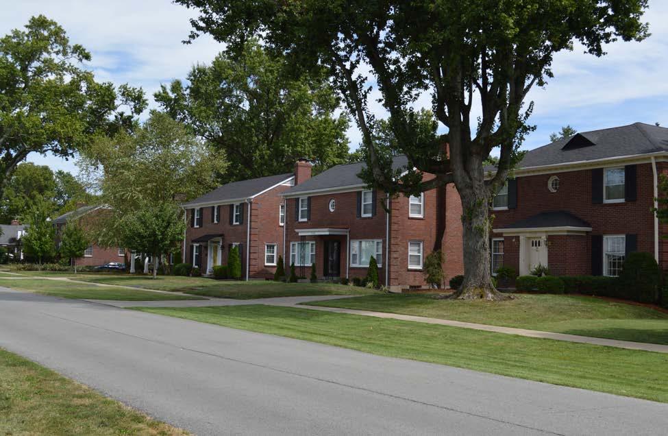
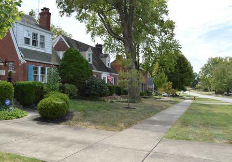
The Bowman area neighborhoods are a highly desirable residential location within the Louisville Metro region. These historic neighborhoods have a charm and appeal that draws many here. As the neighborhoods continue to be a destination, it is important to identify and preserve the qualities which have retained existing residents and attracted new ones.
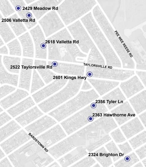
The entire plan area is generally built out, but there are several vacant lots scattered throughout the neighborhoods (see map at left). Most of these lots are associated and under common ownership with a dwelling next door. However, as properties are sold, these lots may be marketed individually. Similarly, some older, desirable communities struggle with “tear down” pressures where property owners demolish smaller structures to make room for a new, much larger house that is out of context and uncharacteristic of the established form.
On these infill and double lots, it is important to discourage this type of development and ensure new construction that preserves the character, scale, and orientation of established character.
LU9: Form a multi-neighborhood implementation committee to advocate for and assist in realizing plan recommendations.
The creation of the Bowman Area Neighborhoods Plan is only the first step in realizing the vision and goals desired by the community. The recommendations within this plan will not be taken up by other organizations without the leadership and advocacy of the Bowman area neighborhoods. While some recommendations are dependent on other organizations, such as KYTC or Louisville Metro Government, successful implementation will be dependent on local leadership.
The Bowman area neighborhoods should work together to form a multi-neighborhood implementation committee immediately after plan adoption. This should include representation from each neighborhood and home rule city, LRAA, and other local institutions and organizations like Sullivan University and Jewish Community Center. This group would take the lead on implementation of some recommendations, while serving in an advisory role to drive other recommendations toward community goals.
GOAL: Provide a safe and effective transportation system that accommodates all users and abilities, including pedestrians, cyclists, transit riders, and motorists, to connect neighborhoods, employment centers, and community destinations.
A community’s transportation network plays a central role in supporting and maintaining economic success and quality of life. As a part of the planning process, the transportation network has been viewed as a key component to the ongoing success of the Bowman area. As such, the transportation system should be balanced to provide for all means of travel cooperatively and in a manner that serves the needs of all users.
For the Bowman area, this includes automobiles, buses, bicycles, and pedestrians. The mobility recommendations on the following pages seek to create a more balanced transportation system and effectively allocate the existing right-of-way to accommodate plan goals. These recommendations aim to enhance pedestrian and bicyclist safety and alleviate roadway concerns associated with high traffic volumes, irregular intersections, and numerous curb cuts and driveways. Finally, through effective planning and thoughtful design, new mobility improvements can contribute to the overall neighborhood aesthetic and play a part in reinforcing the identity of the Bowman area.
In addition to the recommendations presented later in this section, a series of guiding principles was used to direct future mobility planning and decision making. The principles are:
• Safety is the main priority for all travelers.
• Pedestrian and bicycle facilities should be considered with every roadway project.
• The transportation system must be integrated with adjacent land uses, both existing and planned.
• Connectivity between neighborhoods, existing and proposed trails, parks, and other community destinations is essential.
• Congestion should be minimized to provide a safer and more efficient vehicular transportation system.
• Continued coordination with KYTC will be vital in realizing the mobility goals of the Bowman area neighborhoods.
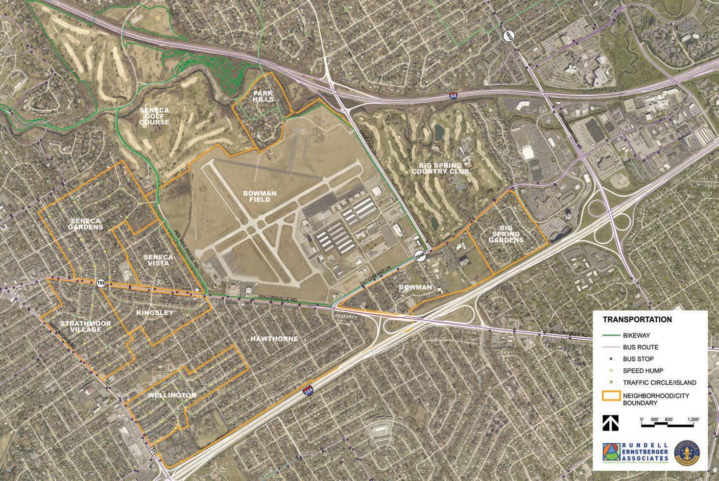
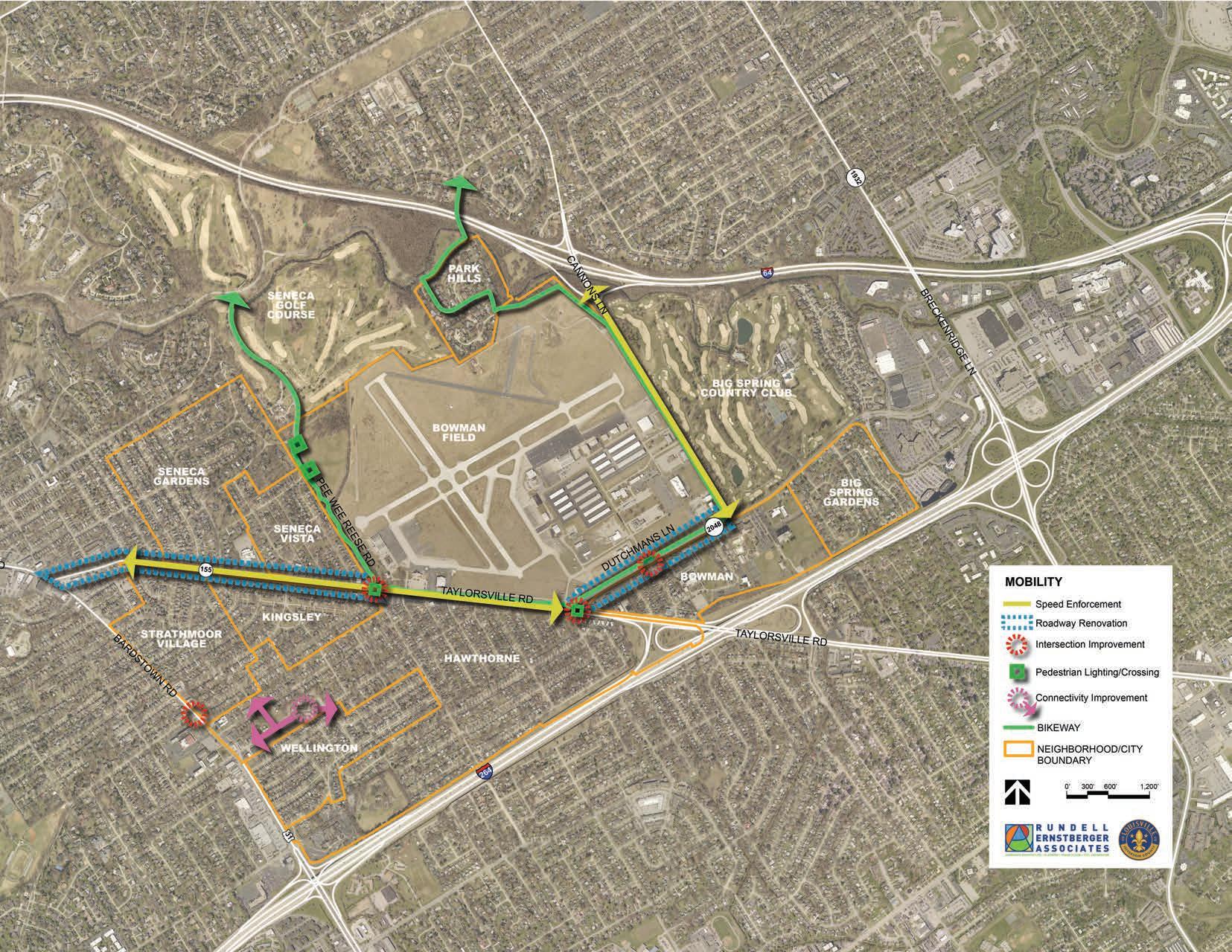
The map on the next page highlights many of the mobility recommendations of this plan. This includes potential renovation of existing rightof-way for key segments of Taylorsville Road and Dutchmans Lane, improving several key intersections, addressing speed concerns on portions of Taylorsville Road and Cannons Lane, and enhancing bicycle and pedestrian connectivity to Hawthorne Elementary. Because the major thoroughfares in the Bowman area are controlled by KYTC, many of the recommendations will require a longer timeframe and depend on state or federal funding. When these projects do occur, it is important for neighborhood leaders to proactively advocate for community goals to be addressed as part of any construction or improvements.
1. Improve pedestrian infrastructure and lighting at key intersections to ensure accessibility and safety.
2. Direct pedestrians and bicyclists to safe crossings at controlled intersections.
3. Fill gaps in the sidewalk network and construct new sidewalks along high traffic roads that are lacking them.
4. Better align bus stop locations with safe pedestrian crossings.
5. Ensure the safety of pedestrians, bicyclists, and motorists by reducing chances of collision and improving predictability of vehicle movements.
6. Coordinate with KYTC for improvements and renovations to Taylorsville Road and Dutchmans Lane with the goal of implementing Complete Streets.
7. Explore opportunities for intersection modifications as roadways are renovated and maintained.
8. Explore traffic calming and speed reduction tactics.
9. Improve connectivity and pedestrian access to Hawthorne Elementary.
M1: Improve pedestrian infrastructure and lighting at key intersections to ensure accessibility and safety.
Thoroughfares generally provide improved access for motorists but can create problems for pedestrians and bicyclists. There are multiple strategies that help make thoroughfares, and especially intersections, safer for non-motorized travel, including high visibility crosswalks, ADA accessible ramps, curb extensions (bump outs) where on-street parking is present, pedestrianscaled lighting, and signal priority for pedestrians and bicyclists. Locations where improvements are recommended include the intersection of Taylorsville Rd. and Dutchmans Ln.; the intersection of Pee Wee Reese Rd. and Taylorsville Rd.; and the intersections of Trevilian Way and Denham Rd. with Pee Wee Reese Rd.

Most conflicts between roadway users occur at intersections, where travelers cross each other’s path. For pedestrians and bicyclists, conflicts are exacerbated due to their greater vulnerability, lesser size, and reduced visibility. Principles of good intersection design are:
• Clearly defined spaces and travel paths for all modes.
• Legibility in symbols, markings, and signs for all modes.
• Corners should be clear of obstructions.
• All corner features should meet standards for ADA accessibility and universal design.
• Intersections should be adequately lighted.
• Pedestrian crossing distances should be minimized wherever possible.
Crosswalks are used to direct pedestrians through intersections and help to alert motorists to their
possible presence. Crosswalks legally exist at intersections whether they are marked or not, unless the pedestrian crossing is specifically prohibited. At non-intersections, crosswalk markings are used to legally establish the crosswalk. Parallel striping is the most basic type of crosswalk marking. Continental or ladder crosswalk markings provide greater visibility and are recommended as the minimum for the area. Similarly, bicycle pavement markings should be used to guide cyclists through intersections and across driveways.
Curb extensions increase pedestrian visibility at intersections through improved sightlines, shortening the crossing distance, and reducing vehicle turn speeds by physically and visually narrowing the roadway. Pedestrians also have more waiting space to cross the street making them more visible to motorists. Signals that give pedestrians priority can also work to reduce traffic collisions; delaying the traffic lights to give pedestrians the right-of-way first allows for drivers to see pedestrians in advance before accelerating. Additionally, a tight curb radius creates more space for pedestrians, shortens crossing distances, and requires vehicles to slow more as they turn the corner. However, curb radii must be kept at sizes sufficient to accommodate emergency vehicles.
Pedestrian-scaled lighting can improve the safety and visibility of pedestrians. Too often, lighting is only used to illuminate the travel lanes and adjacent sidewalks and paths are ignored. Light fixtures can help define the buffer between the sidewalk and the street. Future provision of lighting will need to be evaluated based on the availability of right-of-way, utilities, and capital. Lighting can represent a significant cost in streetscape projects and should be used at intersections to maximize benefit.
Just as it is important for people to be able to safely walk along streets, people must be able to safely cross streets. Crossing a street must be easy, safe, and convenient. Sidewalks and street design can play an important role in helping to encourage pedestrians and bicyclists to cross streets at intersections instead of making dangerous crossings in the middle of a block. Direct routes are appealing because they shorten the walking distance of a person’s route, but by providing sidewalks, shade trees, lighting, crosswalks, and additional safety signage, pedestrians may be more likely to only use safe crossing locations. Controlled intersections along major thoroughfares in the study area currently include:
• Taylorsville Road and Dutchmans Lane
• Taylorsville Road and Pee Wee Reese Road
• Bardstown Road and Tyler Lane
• Bardstown Road and Gardiner Lane
• Bardstown Road and Brighton Drive
• Dutchmans Lane and Cannons Lane
Where crossing demand is expected to be high and a controlled intersection is not possible, higher visibility crosswalk treatments should be used including:
• Raised crosswalk or raised intersection: Raised crosswalks and intersections can eliminate grade changes for pedestrians and give them greater prominence in the crosswalk. These treatments should only be used in areas where a special emphasis on pedestrians is needed.
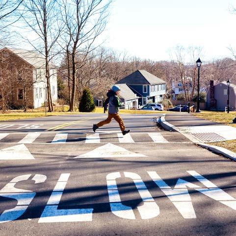
• Rectangular Rapid Flashing Beacon (RRFB): Flashing beacons call attention to the pedestrian crossing and are generally activated by pedestrian push button or a pedestrian detection device. Once activated, the beacon produces an irregular flashing pattern for a prescribed length of time. RRFBs are merely a warning device, not a traffic control device. RRFBs are useful at mid-block crossings but should not be installed at intersections controlled by stop sign or traffic control signals.
• Pedestrian Hybrid Beacon: A Pedestrian Hybrid Beacon is a combination of a beacon flasher and a traffic control signal for marked crosswalks. When a pedestrian presses the button to activate the beacon, approaching drivers see a flashing yellow light indicating they should slow down and be prepared to stop for a pedestrian. The flashing yellow light is followed by a solid yellow period, and then solid red, requiring drivers to stop at a marked line, very similar to a typical traffic signal. Once the solid red light has been established, a “walk” signal is illuminated, indicating safe crossing for the pedestrian.
The possibility of relocating bus stops throughout the neighborhoods can also incentivize individuals to cross only at intersections. This is explained in more detail in Mobility Recommendation #4.
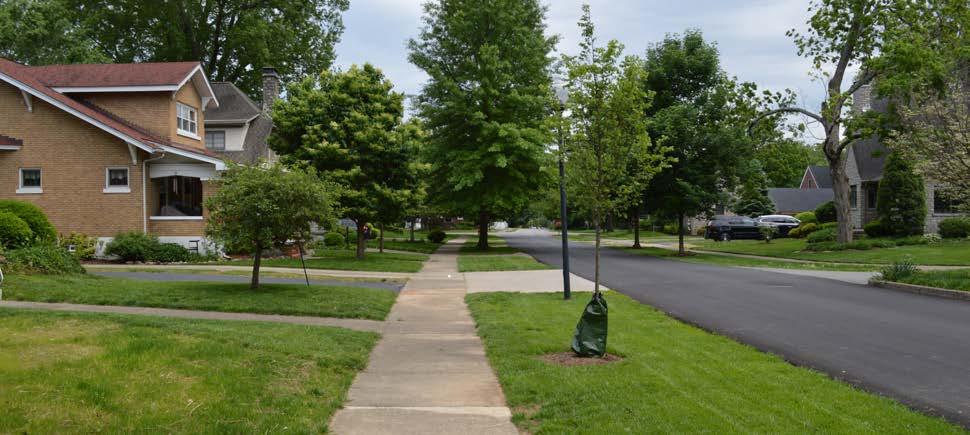
M3: Fill gaps in the sidewalk network and construct new sidewalks along high traffic roads that are lacking them.
Sidewalks are a key component of creating a safe, attractive, and walkable community. The goal of this plan is to achieve 100% connectivity along all public streets in the study area, excluding Park Hills due to its location north of the airport. Sidewalks not only connect residents to recreational amenities and commercial areas - they also connect neighbors with each other by fostering interaction, encouraging walking, and adding “eyes on the street” to make streets feel safer. Several streets in the Bowman area, especially within the Hawthorne neighborhood, are lacking key sidewalk infrastructure.
Priority gaps include:
• Bon Air Avenue between Taylorsville Road and Alanmede Road
• Betty Lane between Taylorsville Road and Alanmede Road
• Lancashire Avenue between Bardstown Road and Hawthorne Elementary School
• North side of Hawthorne Avenue between Bardstown Road and Beaumont Road
Sidewalks should be repaired and installed where applicable to enhance continuity between and within neighborhoods. Additionally, ADA accessible ramps at intersections and crossings provide equitable infrastructure for those with disabilities and helps to provide more mobility options for people across the community.
Because funding for transportation projects, especially projects that serve non-vehicular travel, is limited, prioritization of the most important gaps is necessary to ensure that the projects with the greatest benefit are constructed first. Factors to consider when prioritizing sidewalk projects may include:
• Proximity to pedestrian or bicycle generators such as schools, parks, office areas, and higher density residential development.
• Connection to shared use path.
• Location along an arterial or major collector.
• Access to bus stops.
M4: Better align bus stop locations with safe pedestrian crossings.
Bus stops should be placed in a logical manner that best serves users while discouraging dangerous, unprotected crossings at midblock locations along busy corridors. By locating bus stops at key intersections, pedestrians will be more likely to use designated, protected crossings rather than simply cross midblock because it is more convenient. This will improve safety for transit riders, pedestrians, and motorists alike.
The area has already seen some consolidation of bus stops. The goal is to maintain and improve transit accessibility, but repositioning stops where they are better suited to give more people the best and safest access must also be a goal. A necessary tradeoff to ensuring safety may be removal of bus stops at unsafe locations. All key intersections and bus stop locations should include pedestrian amenities such as benches and trash receptacles, as well as clear crosswalk markings and ADA accessible ramps. For bus stops that experience higher ridership counts, a covered bus shelter should be provided. Bus shelters can include public art, wayfinding, and additional signage to make them attractive amenities and not visual obstructions along the roadway.
Existing bus stops of specific concern include:
• On the north side of Taylorsville Road, across from Carson Way (see photo at left), and in front of the Bowman Field Administration Building. Stops at Pee Wee Reese Road should be used.
• Bardstown Road at Wadsworth Avenue. Stops are close enough to Brighton Drive, which is signal controlled intersection.
• Dutchmans Lane at Gast Boulevard. If ridership volumes necessitate this stop, additional signage and crossing treatment is needed.
• Other locations along Taylorsville Road or Bardstown Road that experience low utilization and that are within 1/4 mile from another stop.
M5: Ensure the safety of pedestrians, bicyclists, and motorists by reducing chances of collision and increasing predictability of vehicle movements.
Safety is a large concern for everyone when driving and walking throughout a community. Collisions are preventable and by working to predict vehicle movements, collisions could be reduced through a series of changes that would increase driver awareness and decrease the chance of crashes. Taylorsville Road and other corridors that are highly traveled can be problematic thoroughfares for drivers when turning onto and off the roadway into businesses, schools, or neighborhoods. Reducing the number of driveways by encouraging shared parking in the rear of businesses, connecting adjacent parking lots, and eliminating access points can result in smoother and more predictable traffic flow.
Additionally, increasing signage and pavement markings allow motorists to be more aware of any upcoming areas where traffic might be merging, where side streets are located, and where crosswalks are present. Other physical infrastructure improvements that can be used to restrict vehicle movements are raised medians and traffic safety bollards.
M6: Coordinate with KYTC for improvements and renovations to Taylorsville Road and Dutchmans Lane with the goal of implementing Complete Streets.
Location was often cited as one of the attractions for living in the Bowman area. The surrounding interstates and major thoroughfares of Cannons Lane, Dutchmans Lane, and Taylorsville Road are important parts of the transportation system connecting the area to both downtown and the commercial hub of the east end. However, high traffic volumes accompany these convenient connections. In addition, the physical nature of Cannons Lane and Taylorsville Road, with long straight-aways and few stoplights, make them especially conducive to high rates of speed and high traffic volumes. This creates a challenge for the different areas of the community to be connected in a safe and convenient manner.
Cannons Lane, Dutchmans Lane (between Cannons Lane and Taylorsville Road), and Taylorsville Road are all owned and operated by the Kentucky Transportation Cabinet (KYTC). When improvements or changes are needed to any of these roadways, KYTC is the agency responsible for the design and construction. While coordination with KYTC during the design phase will be important, the neighborhoods should begin discussions with the Louisville Metro Public Works Department to express their support for changes to the roadways which will create safer and more attractive thoroughfares for the community. Potential changes could include:
• Exploring lane reductions, where traffic volumes would allow, to gain additional tree lawn or bicycle/pedestrian space.
Mobility
• Eliminating perpendicular parking areas immediately adjacent to Taylorsville Road to close large curb cuts, continue the pedestrian network, and reduce conflict points with pedestrians.
• Exploring opportunities to close curb cuts where shared access is possible.
• Advocate for reduced lane widths and other traffic calming improvements along these corridors.
These suggestions work to implement a Complete Streets strategy which is meant to increase safety for all users.
M7: Explore opportunities for intersection modifications as roadways are renovated and maintained.
Intersection modifications can be done as singular projects or as a part of roadway improvements. Improvements to intersections within the study area could include:
• Reducing radii at corners to reduce automobile speeds and narrowing the roadway width, creating shorter crossing distances for pedestrians.
• Enhancing crosswalk striping, signage, and signal timing to provide better access for pedestrians.
• Evaluating turn lanes, including right-turn
slip lanes, to increase safety measures to lower pedestrian/motorists conflicts.
One such example would be the right-turn slip lane at the intersection of Taylorsville Road and Dutchmans Lane. While these types of turn lanes are very effective at moving traffic quickly through intersections, they have the potential to create additional conflict between motorists and pedestrians. The current alignment and roadway geometry at this intersection allows for higher rates of speed for turning vehicles and results in a wider intersection. This intersection, and specifically the right-turn slip lane, should be redesigned to slow turning vehicles, create a safer pedestrian path through the intersection, and reduce the chance of collision either with other drivers or pedestrians crossing the street.
In keeping with the community’s desire for curtailing cut-through traffic, any proposed intersection modfication should not increase traffic through residential neighborhoods.
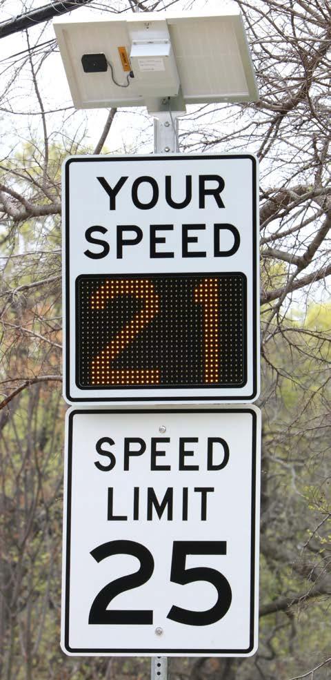
M8: Explore traffic calming and speed reduction tactics.
People drive speeds they feel comfortable driving. While police enforcement of speed limits may temporarily force people to drive slower, roadway design is the primary factor in determining travel speeds. A long roadway, with minimal to no stops and generous lane widths, encourages high travel speeds. While this design may be effective for interstates, it is not appropriate for residential streets.
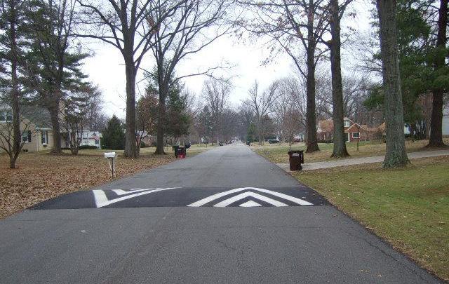
Most residential streets in the Bowman area are narrow, in the range of 16-18 feet. People typically feel uncomfortable driving fast on narrow roadways, particularly when combined with onstreet parking. Additionally, frequent stops, reduced turning radii, and pedestrian activity can contribute to slower travel speeds.
Other speed reducing measures, such as speed humps or digital monitoring signs, may be appropriate on residential streets with high cutthrough traffic or within a school zone.
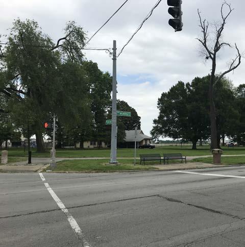
Increase speed enforcement with the assistance of speed measuring signs similar to the one depicted in this image.
M9: Improve connectivity and pedestrian access to Hawthorne Elementary.
Better pedestrian access to Hawthorne Elementary School was identified as a need during early public discussions. The playground at the elementary school is used by the public as a community amenity. Currently, access to the site is dominated by vehicular access and is lacking in pedestrian connectivity. Improvements should include:
• Along Lancashire Avenue from Bardstown Road to the school’s playground. There are no sidewalks on either side of Lancashire Avenue. At a minimum, a sidewalk should be provided on the north side of the street to connect to the sidewalk at the gas station and ultimately the crosswalk across Bardstown Road.
• From Hawthorne Avenue to the school’s playground. There is currently a narrow asphalt path to provide this connection, but it should be improved to a facility that meets ADA accessibility requirements.
• From Spencer and Clarendon avenues, through the parking lot to the school entrance. Sidewalks are provided for students and pedestrians leading up to the school property, along Spencer Ave and Clarendon Ave, but stop at the corner. Clear delineation of pedestrian paths through the parking lot, so students know where to walk and so drivers are aware of potential pedestrians, would increase safety.
GOAL: Promote programming of community-oriented events and activities to foster a safer, more vibrant, and engaged community.
Quality of life is a subjective concept that combines both tangible and intangible elements of a community, including its social, cultural, economic, and physical attributes. The relationship between these elements creates a unique community fabric that influences the experiences of residents and visitors. Positive attributes are often associated with housing character, quality schools, access to recreation and entertainment, and a healthy environment. Just as important to overall quality of life is the interaction of residents with each other and building community among its members.
Strong community characteristics improve the neighborhood vitality while contributing to its reputation and image. These characteristics are what make people want to live in the Bowman area and make businesses want to locate here. The map on the following page summarizes several of the existing quality of life assets and plan recommendations. These include enhancements to existing neighborhood open spaces, maintenance of trail and open space areas, and aesthetic enhancements to corridors. Not represented on the map, but equally important, are recommendations regarding celebrating the history of Bowman Field, increasing public space programming, and growing neighborhood associations and civic engagement.
1. Formalize and grow neighborhood associations and continue collaboration efforts among Bowman area communities.
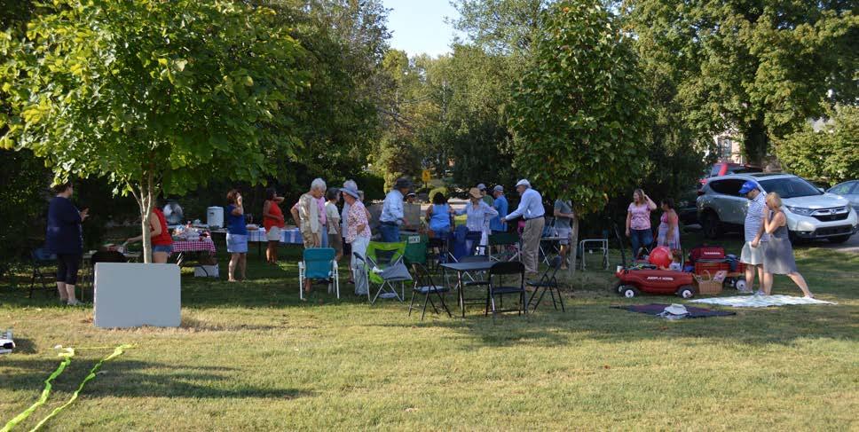
2. Enhance existing open spaces with both active and passive amenities to promote healthy living and community gathering.
3. Maintain trail and open space areas as attractive neighborhood assets.
4. Enhance communication between neighborhood groups and LRAA.
5. Promote and celebrate the cultural and historic assets of the community.
6. Beautify key corridors using welcome and wayfinding signs, enhanced landscape treatments, public art, lighting, and street trees.
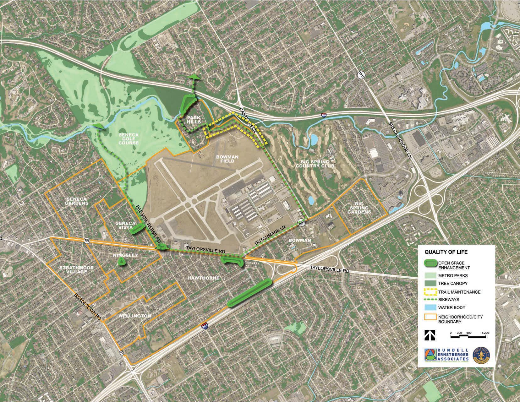
QoL1: Formalize and grow neighborhood associations and continue collaboration efforts among Bowman area communities. Successful implementation of the Bowman Area Neighborhoods Plan will not be possible without significant effort by the neighborhoods and cities that comprise the planning area. Having a formal organization to act as an official communication channel and speak collectively for a neighborhood is incredibly important. Neighborhood associations can be used to build capacity and help grow the next group of community leaders. It also creates a more distinguishable front for contacting city leadership about problems and concerns because it shows that the area is organized and has come together to discuss these problems as a group. While the home rule cities of the Bowman area are well organized, city neighborhoods often struggle to maintain a formal organizational structure and retain volunteers. The neighborhoods of Hawthorne and Park Hills should formalize associations, while the Seneca Vista Neighborhood Association should grow and continue events that encourage a sense of community.
QoL2: Enhance existing open spaces with both active and passive amenities to promote healthy living and community gathering.
While Seneca Vista, Park Hills, and the City of Seneca Gardens are in close proximity to Seneca Park, the remaining neighborhoods and cities are constrained by major thoroughfares, distance, or both. For this reason, improvements to existing open spaces and the creation of a series of pocket parks was identified as a community need. Six spaces were identified for potential improvement:
• Along Gardiner Lane and the Watterson Expressway wall: Linear park, trees to buffer sound, meandering trail, seating areas, community garden, mural(s).
• South side of Taylorsville Road at Seneca Boulevard and Kent Road: Landscape plantings, public art, small gathering spaces.
• Northeast corner of Taylorsville Road and Pee Wee Reese Road: Pedestrian amenities, gateway signage/art, design that respects original Seneca Park entrance.
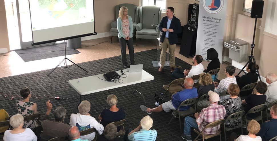
• Kingsley Green: Pervious path that enhances the established usage plan for the space.
• Seneca Vista open space along Drayton Drive and Landor Avenue (airport easement): Pervious path, low plantings.
• Lawn area at the northwest quadrant of Seneca Park Road and Old Cannons Lane, across from Park Hills: Restorative landscape appropriate for floodplain. In all cases, ongoing maintenance and care for these spaces must be a primary consideration during design. Individual cities and neighborhoods, as well as other user groups, will need to assume some long-term responsibility if these spaces are to succeed.
Quality of
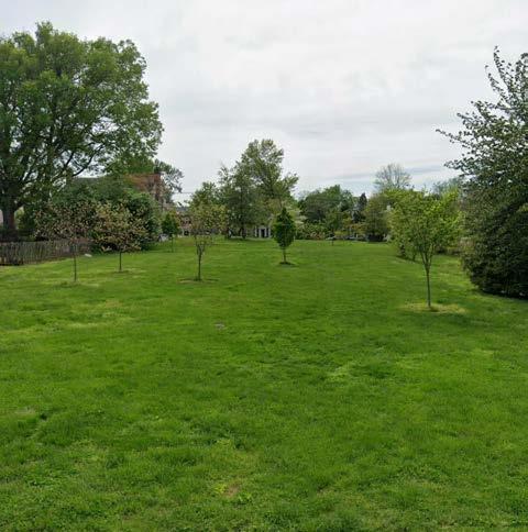
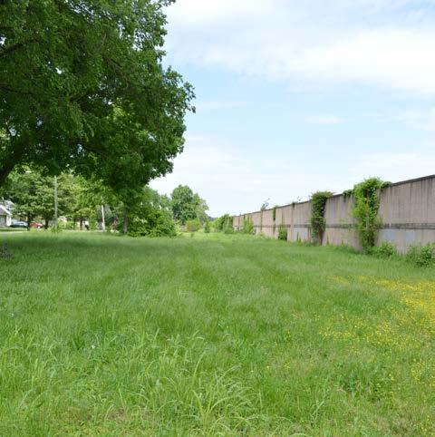
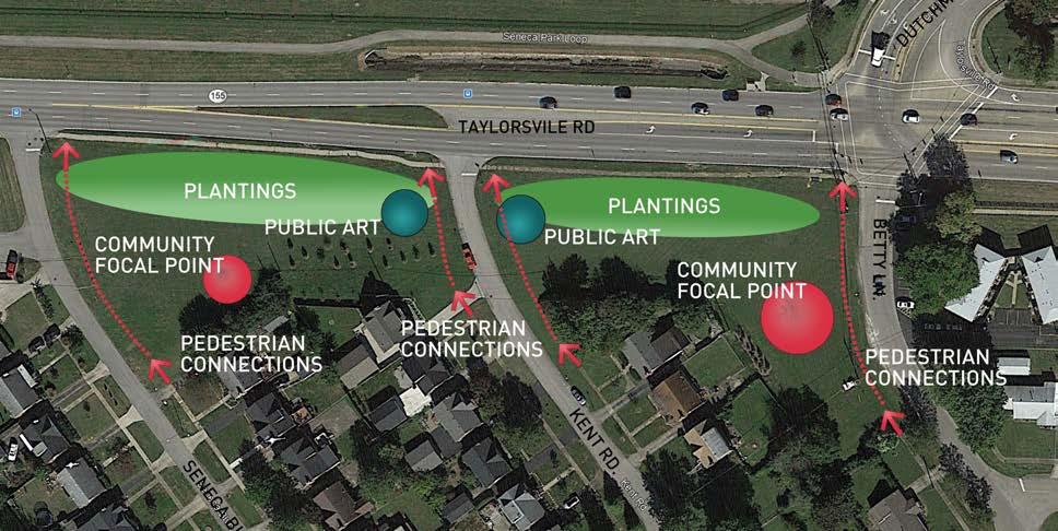
Quality
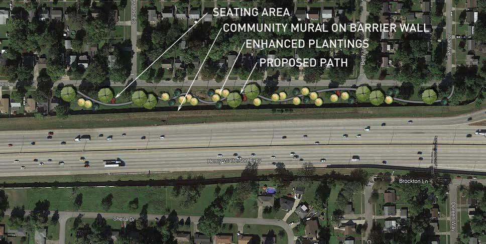
QoL3: Maintain trail and open space areas as attractive neighborhood assets. Multiple concerns were raised with maintenance of the trail north of Bowman Field, between Cannons Lane and Old Cannons Lane. Specifically, pruning plants, weeding, and litter removal were all frequently cited as needs. These issues may be partially because this segment of trail is not along a roadway, within the park proper, or immediately adjacent to residential or commercial properties. As part of a broader strategy, there should be better communication between neighborhoods and Metro agencies regarding maintenance responsibilities, but neighborhood and user groups such as cyclists or runners should also contribute to clean up and maintenance efforts.
QoL4: Enhance communication between neighborhood groups and LRAA.
During early stakeholder meetings, concerns were raised about communication issues between neighborhood groups and LRAA. Most of the comments were in reference to past tree removal efforts to protect runway approach surfaces. The consensus was that while communication was improving, the primary means for residents to voice concerns or communicate with the airport was through calling the air traffic control tower. This is not ideal because it may result in high volumes of non-air traffic related calls to the tower. At the same time, some residents may be hesitant to call the tower in non-emergency situations, and with few other means of communication, feel like they have no opportunity for input.
Because open communication is so critical to the ongoing success of both the surrounding neighborhoods and Bowman Field, LRAA is in the process of developing a new communications protocol. LRAA will share the details of this new process with surrounding neighborhoods, once finalized.
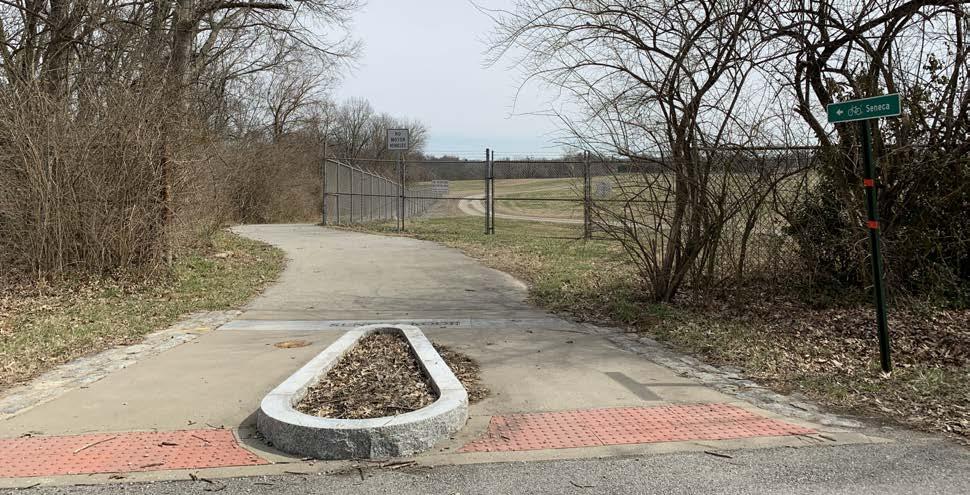
QoL5: Promote and celebrate the cultural and historic assets of the community. The Bowman area contains several cultural and historic assets, including Bowman Field, Farmington, Hawthorne Elementary, Jewish Community Center, and the neighborhoods themselves.
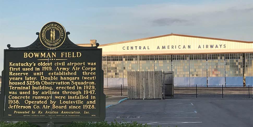
Bowman Field has a rich history, dating back prior to development of the surrounding neighborhoods. Bowman Field opened in 1921, the first commercial airport in Kentucky. It was vital to the war effort of World War II, and it holds the distinction of being the longest continuously operating general aviation airport in the United States. Bowman Field also hosts several annual festivals and events, including BowmanFest, 5K on the Runway, and Tailspin Ale Fest.
Farmington is a historic Federal-style home once at the center of a 550-acre hemp plantation, with approximately 50 enslaved persons, owned by John and Lucy Speed. Today, this historic site, now approximately 13 acres, hosts tours, weddings, festivals, and other events, including the City of Wellington’s annual picnic. Farmington is also open to the public, and neighbors can walk the grounds during hours of operation.
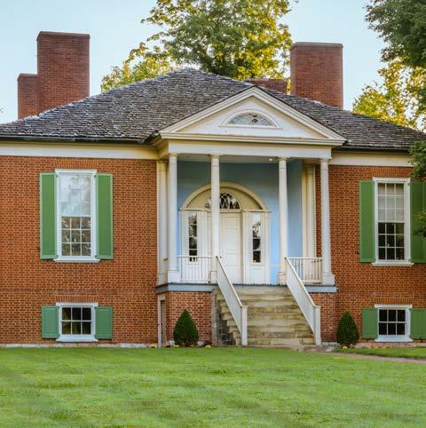
Similarly, Hawthorne Elementary may act as a community hub and pocket park for the largely residential area bounded by Taylorsville Road, Bardstown Road, and the Watterson Expressway.
Neighborhoods can also offer programming within their boundaries, such as picnics or block parties. These neighborhood-centric events are an opportunity to foster social interaction among neighbors and can act as a fundraiser for the neighborhood association or home rule city.
QoL6: Beautify key corridors using welcome and wayfinding signs, enhanced landscape treatments, public art, lighting, and street trees.
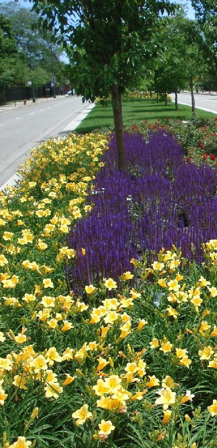
Major thoroughfares play a significant role as part of the regional transportation network, moving people into and around the city. They also contribute to community character and impressions of the area. Corridor enhancements, such as gateway and wayfinding signage, public art, lighting, and landscapes would contribute to a sense of place, improve experiences for both pedestrians and motorists, and help slow traffic speeds. These improvements come with costs and associated maintenance requirements. Coordination between cities, neighborhoods, Metro Government, and KYTC will be necessary to ensure consistent treatments and proper maintenance.
The goal of this objective is to reinforce a sense of place in the area communities. This could be anything from an entryway into the community that distinguishes Bowman from other surrounding areas, or the addition of public art around the community to create a sense of place that is enjoyable to be in. Wayfinding signs to help people get from place to place, lighting along sidewalks for people to feel safer and more comfortable in the later hours, and landscaping along streets make for a better experience for pedestrians and bicyclists, and encourage motorists to drive slower which creates a safer environment.
Responsibility needs to be addressed to determine what roles people play for maintaining these enhancements. Residents and neighborhood associations should report when something
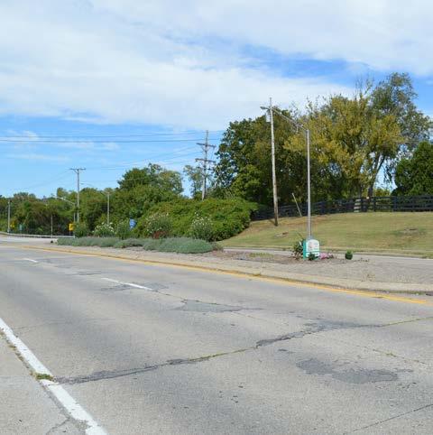
is wrong; whether landscaping needs to be maintained or a sign needs to be replaced, someone in the community should be responsible for reporting the issue. However, costs will be more difficult to address. Through formalized neighborhood associations and other representatives for the residents, contact with the local government will be important in determining fiscal responsibility.
Quality of Life Recommendation 6:
Quality of Life Recommendation 6:
Bowman Area Neighborhoods Plan
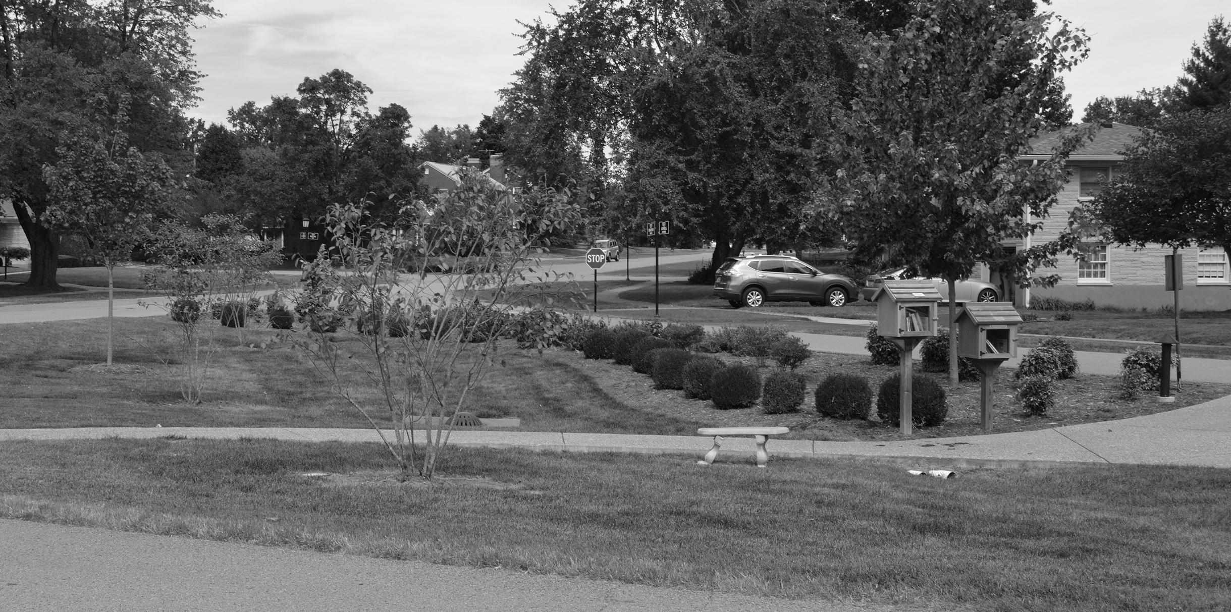
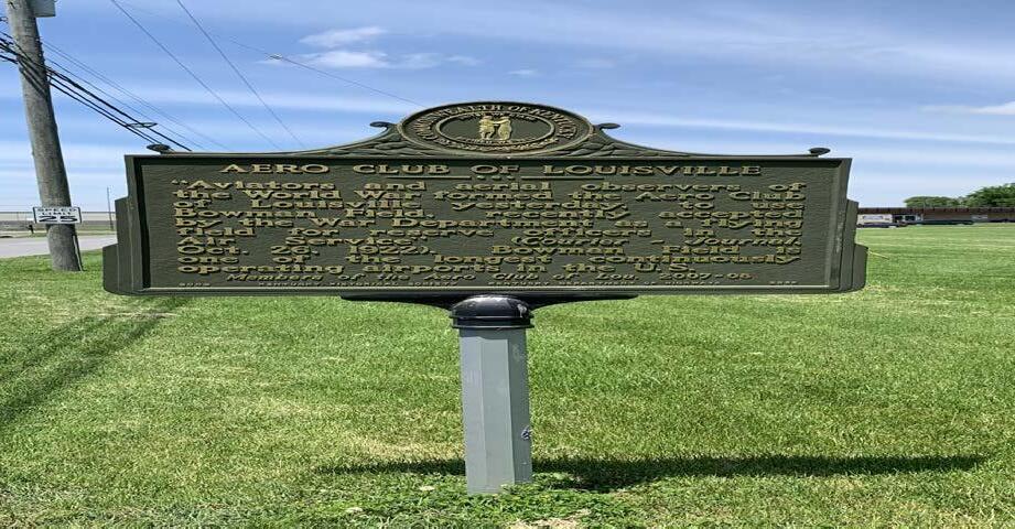
The Bowman Area Neighborhoods Plan is both a development guide and policy document for future decision-making and advocacy within the area. Success of the plan will require ongoing coordination and partnerships among the neighborhoods and cities that make up the Bowman area, Louisville Metro Government, Louisville Regional Airport Authority (LRAA), the Kentucky Transportation Cabinet (KYTC), and local residents and business owners. The previous sections of this plan outline the vision, goals, policy, and physical recommendations. This section focuses on implementation and how those recommendations can be realized. Just as the many neighborhoods and cities have collaborated on this plan, they will need to be able to implement this plan both jointly and independently via other regulations and policies. In addition, for this plan to function over time, it must be periodically reviewed and updated to stay responsive to trends or changes in economic, physical, social or political conditions.
Planning does not have a defined beginning and end. It is an ongoing process that responds to new information and circumstances and incorporates changing conditions into the decision-making process. Circumstances that may change include physical conditions of infrastructure, economic climate, the natural environment, and social and community goals. This plan will need to be revised from time to time to ensure that it stays consistent and relevant to current conditions. A plan update should occur every five to ten years, unless a more immediate amendment is warranted. The purpose of a plan update is to re-evaluate the goals, policies, and strategies contained within the neighborhood plan, and to develop new policies if necessary. Similar to this process, plan updates should include opportunities for involvement by residents, business owners, and elected and appointed officials.
A disciplined schedule for plan review is also helpful in plan implementation. Noting areas of the plan’s success helps to build support for future planning activities. The identification of less successful components of the plan may suggest a need for refinement. The multi-neighborhood implementation committee should conduct a thorough annual review of the plan, asking whether the conditions on which the plan was predicated still hold true. Within that review, each recommendation should be reviewed with respect to achievement, process, and relevancy.
The following pages list each plan objective under one of three categories, as well as the leading and supporting parties responsible for implementation, and the relative timeframe of each. The three implementation categories correspond to whether the recommendation relates to Plan 2040 or a development process detailed in the Land Development Code, is a capital project, or is a policy or programmatic strategy.
Plan 2040 or Land Development Code (LDC): Objectives are related to Plan 2040 recommendations or require Planning Commission and/or Metro Council action. This includes recommendations that address rezoning or development plan approval. While the LDC includes the actual development standards, development goals of the neighborhood may be used to inform additional conditions or commitments.
Capital Project: Objectives that detail needed capital projects, often occurring within the public right-of-way or on land owned by the City. These projects will often be led by Louisville Metro Government, KYTC, MSD, utility providers, or other governmental bodies, but the plan can be used to ensure capital improvements will support neighborhood goals.
Policy or Programmatic Strategy: These objectives do not typically involve physical construction. Instead, they represent creation of new initiatives or expansion of existing programs that will reinforce neighborhood goals and further contribute to the quality character of the area.
The four timeframes included in the implementation table are:
• Ongoing – Already underway
• Short – Zero to three years
• Medium – Three to seven years
• Long – More than seven years
These timeframes are intended only to serve as a guide for plan implementation and should be considered flexible. Implementation will depend on funding limitations, staff availability, citizen involvement, and other changing conditions. The decision to undertake any project at a particular time is discretionary, and these priorities are not a commitment to complete the recommendation in the identified timeframe. It may be beneficial to reassess timeframes as part of an annual review process.
Ensure any proposed development on the north side of Dutchmans Lane, between Gast Boulevard and Cannons Lane, meets neighborhood goals of building and site design.
Property owner, Metro Councilperson, Planning & Design
Metro Council, Advanced Planning & Sustainability ONGOING
Ensure continued residential use along Bardstown Road and Taylorsville Road, west of Pee Wee Reese Road.
Support residential to commercial conversions on Taylorsville Road, between Dartmouth Avenue and Seneca Boulevard, and along Dutchmans Lane, between Bowman Avenue and the Seneca Place care center.
Continue to work with MSD to address drainage issues in the neighborhoods around Bowman Field.
Property owner, Seneca Vista, Cities of Kingsley, Seneca Gardens, Strathmoor Village, Planning & Design
Property owner, Hawthorne, Bowman, Planning & Design
City or neighborhood, Implementation Committee
Metro Council, Advanced Planning & Sustainability
ONGOING
Metro Council, Advanced Planning & Sustainability ONGOING
Metro Councilperson SHORT
Better utilize open spaces as community amenities.
City or neighborhood, Metro Councilperson
Parks, Implementation Committee MEDIUM
Continue protection and expansion of the existing tree canopy to enhance streetscapes, open spaces, and private development.
Property owner, city or neighborhood
Support continued ownership of Metro-owned property adjacent to Bowman Field and Seneca Park. Parks, LRAA
Promote compatible infill housing on vacant residential lots.
Form a multi-neighborhood implementation committee to advocate for and assist in realizing plan recommendations.
Property owner, city or neighborhood
Cities and neighborhoods
Metro Councilperson, environmental nonprofits ONGOING
Metro Council MEDIUM
Metro Councilperson ONGOING
Metro Councilperson, Center for Neighborhoods SHORT
Improve pedestrian infrastructure and lighting at key intersections to ensure accessibility and safety.
Public Works
Advanced Planning & Sustainability, Metro Councilperson SHORT
Coordinate with KYTC for improvements and renovations to Taylorsville Road and Dutchmans Lane with the goal of implementing Complete Streets.
Infrastructure
Public Works
LONG
Home rule city, Public Works, Metro Councilperson Implementation Committee MEDIUM
Better align bus stop locations with safe pedestrian crossings. TARC
Policy and Programming
Direct pedestrians and bicyclists to safe crossings at controlled intersections. KYTC, Public Works
Explore opportunities for intersection modifications as roadways are renovated and maintained.
Metro Public Works, KYTC
City or neighborhood, Metro Councilperson SHORT
KYTC, Metro Public Works MEDIUM
Seneca Gardens, Wellington, Kingsley, Strathmoor Village SHORT
Metro Council, city or neighborhood LONG
Explore traffic calming and speed reduction tactics.
Improve connectivity and pedestrian access to Hawthorne Elementary.
City or neighborhood, Metro Councilperson
JCPS, Hawthorne, City of Wellington
Louisville Metro Police Department SHORT
Metro Councilperson, Public Works MEDIUM
Capital Infrastructure
Enhance existing open spaces with both active and passive amenities to promote healthy living and community gathering.
City or neighborhood, Metro Councilperson
Metro Councilperson, Implementation Committee MEDIUM
Beautify key corridors using welcome and wayfinding signs, enhanced landscape treatments, public art, lighting, and street trees.
City or neighborhood, Metro Councilperson
Maintain trail and open space areas as attractive neighborhood assets. Parks
City or neighborhood, Metro Councilperson SHORT
Promote and celebrate the cultural and historic assets of the community.
City or neighborhood, LRAA
Metro Councilperson ONGOING
Enhance communication between neighborhood groups and LRAA.
Seneca Gardens, Wellington, Kingsley, Strathmoor Village
Brightside, Advanced Planning & Sustainability, Public Works LONG Policy and Programming
LRAA, Metro Councilperson ONGOING
Formalize and grow neighborhood associations and continue collaboration efforts among Bowman area communities.
Big Spring Gardens, Bowman, Hawthorne, Park Hills, Seneca Vista
Metro Councilperson, Center for Neighborhoods ONGOING
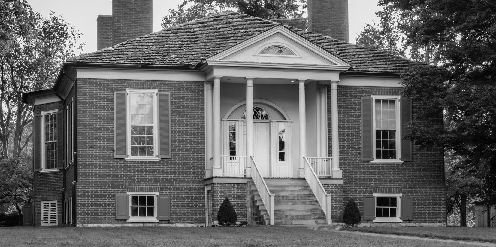
The following pages examine each neighborhood and home rule city with respect to demographics and identity, assets and concerns identified during the planning process, and the plan recommendations most relevant to each community. Demographic information includes population estimates and breakdown by age and sex. Housing characteristics are presented in terms of owner versus renter occupancy, home value and mortgage cost as a percentage of income for owner-occupied dwellings, and gross rent and rent as a percentage of income for renteroccupied dwellings. Additional socio-economic data included for each neighborhood and city includes educational attainment, household income, and employment distribution by sector.
The data collected for Louisville neighborhoods does not exactly correspond to neighborhood boundaries. This is because Census geography, and specifically the block group level used for this analysis, does not match the geographic boundaries of the neighborhoods. As a result, data for the Bowman and Hawthorne neighborhoods has been grouped. Similarly, Seneca Vista and Park Hills have been grouped. The Census tracts and block groups used in each analysis are noted for reference. The data for home rule cities reflects the municipal boundary.
Each neighborhood and city summary includes the plan recommendations most relevant to it. Only the recommendation statements, organized under the Land Use & Community Form, Mobility, and Quality of Life headings, and sample photos are included here. Please refer to the Recommendations chapter for additional information related to each plan recommendation. The applicable recommendations for each neighborhood and city were based on input gathered from residents and business owners in those areas, as well as additional analysis by the planning team.
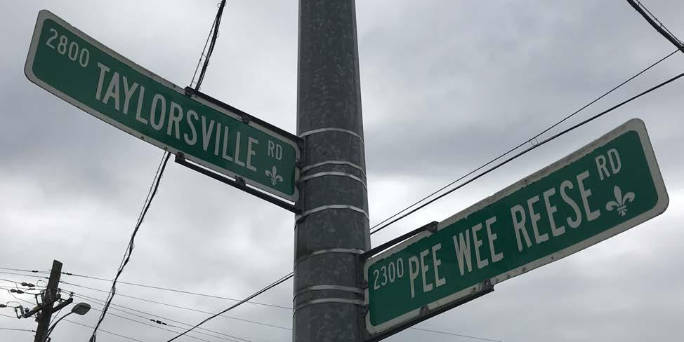
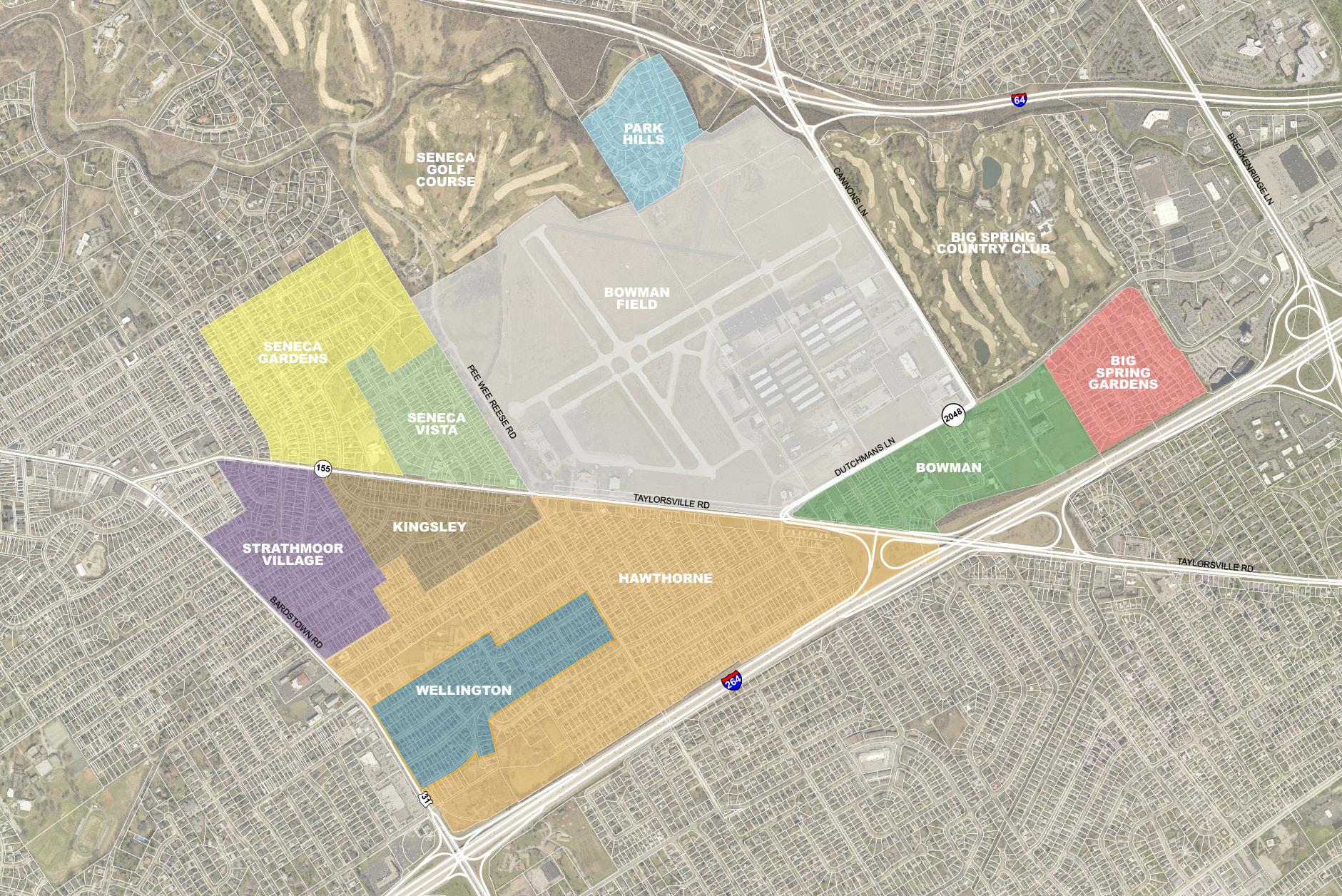
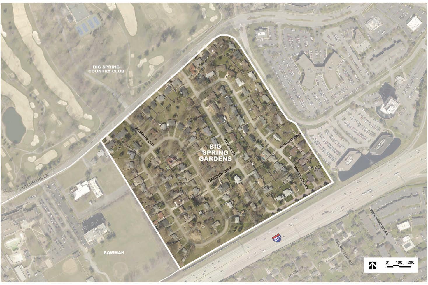
The Big Spring Gardens neighborhood comprises approximately 48 acres on the east side of the Bowman area. Big Spring Gardens is bordered by the Bowman neighborhood to the west, Dutchmans Lane to the north, The Springs Medical Center to the east, and the Watterson Expressway to the south. It is made up of two residential subdivisions, with most of the homes being built during the late 1950s and early 1960s. One exception is the historic farm house at 1663 Al Mara Circle, pictured below.
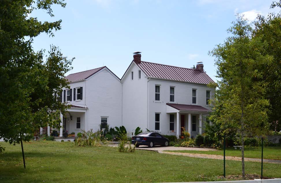
• Great location
• Proximity to shops and restaurants
• Small community
• Access to public transit along Dutchmans Lane
• Walk/bike path at Bowman Field
• Traffic along Dutchmans Lane
• Commercial development along Dutchmans Lane
• Noise and traffic
The population of Big Spring Gardens is not diverse with respect to age or race. A majority of residents are over the age of 50, and 96 percent of residents identify as white.
*Shalom Tower inside Census boundaries may skew data
*Source: 2010 Decennial Census. Census Tract 105; Block Group 2; Block 2046, 2048, 2049, 2050
The majority of Big Spring Gardens is likely owneroccupied. However, the data is skewed due to the presence of Shalom Tower inside the Census boundaries which encompass the neighborhood. Of the owner-occupied homes, the median home value is $259,700, which is more than double the median home value of Jefferson County ($146,900). The median gross rent ($954) is also higher than Jefferson County’s ($779). A majority of residents spend less than a third of their monthly income on their mortgage or rent, indicating a high degree of affordability.
Residents of Big Spring Gardens have a high level of educational attainment. Over 40 percent of residents over age 25 have a bachelor’s degree or higher. Less than 25 percent of residents have not pursued some form of higher education. The educational attainment levels of Big Spring Gardens surpass that of Jefferson County in each category.
The Big Spring Gardens neighborhood has household income levels comparable to the rest of Jefferson County. Half of households earn over $50,000 annually. The most common professions within the community include office administrative support, education, legal, community service, arts, and media.
*Percentages have been rounded to the nearest tenth and may not total 100%.
*The data in Housing (excluding occupancy), Education, and Employment are from the Census 2017 American Community Survey, 5-year estimates. Census Tract 105; Block Group 2.
1. Ensure any proposed development on the north side of Dutchmans Lane, between Gast Boulevard and Cannons Lane, meets neighborhood goals of building and site design.
3. Support residential to commercial conversions on Taylorsville Road, between Dartmouth Avenue and Seneca Boulevard, and along Dutchmans Lane, between Bowman Avenue and the Seneca Place care center.
1. Improve pedestrian infrastructure and lighting at key intersections to ensure accessibility and safety.
2. Direct pedestrians and bicyclists to safe crossings at controlled intersections.
6. Coordinate with KYTC for improvements and renovations to Taylorsville Road and Dutchmans Lane with the goal of implementing Complete Streets.
8. Explore traffic calming and speed reduction tactics.
1. Formalize and grow neighborhood associations and continue collaboration efforts among Bowman area communities.
6. Beautify key corridors using welcome and wayfinding signs, enhanced landscape treatments, public art, lighting, and street trees.
Land Use Recommendation 1: Developable property along Dutchmans Lane.
Mobility Recommendation 2: Direct pedestrians to safe crossings such as the one depicted, where the crosswalk is well marked for visibility to motorists.
Quality of Life Recommendation 6: Corridor beautification can inspire pride and create a strong first impression for visitors to the area.
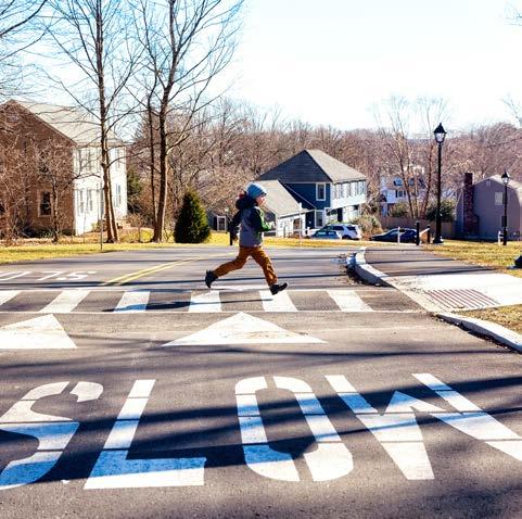
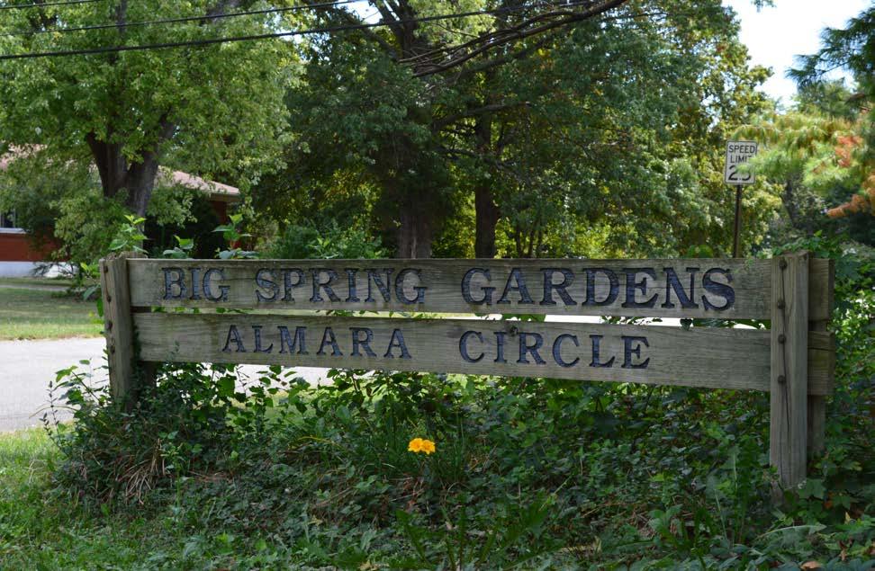
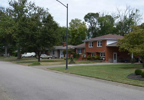
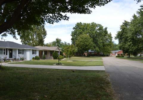
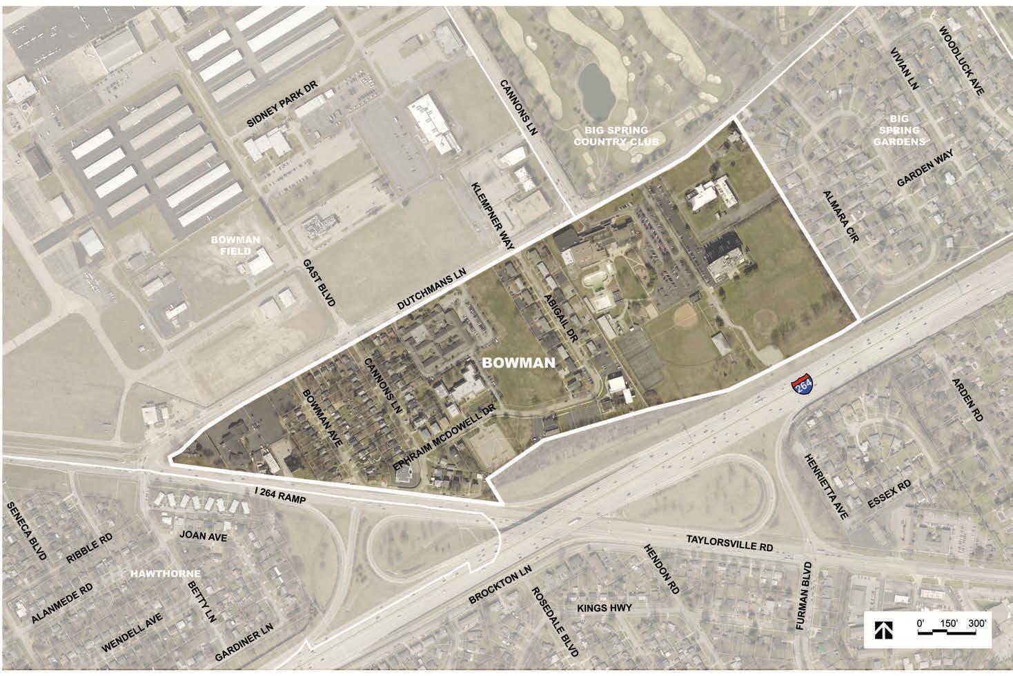
The Bowman neighborhood is bordered by Dutchmans Lane to the north, the Big Spring Gardens neighborhood to the east, the Watterson Expressway to the south, and Taylorsville Road to the west. It includes a combination of single and multi-family residential dwellings, offices, and institutions, including Jewish Community Center. Other notable businesses and organizations include Highlands Funeral Home, Seneca Place, Twinbrook Assisted Living, Hosparus Health, and Wetterer & Clare.
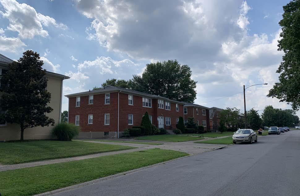
The majority of the single family dwellings in the neighborhood are within the Airview subdivision, originally platted in 1928. Numerous multi-family structures are included within the Kiltmoor Gardens subdivision, which was created in 1957. The neighborhood has experienced some residential to commercial conversions, and continued development pressure is likely given the adjacent transportation context and many investor-owned homes. Additional development is also possible across Dutchmans Lane, to the north, on property currently owned by LRAA. Should development occur on this site, a traffic analysis will be critical to assess potential impacts and determine whether signalization of the Dutchmans Lane/Cannons Lane/Gast Boulevard intersection is warranted and feasible. Difficulty in accessing businesses in the Bowman neighborhood is an ongoing concern, especially for those without Dutchmans Lane frontage, like Hosparus and Wetterer & Clare. Hosparus Health, which owns multiple parcels on Ephraim McDowell Drive, is currently undergoing a master planning process to identify expansion and redevelopment plans. Again, transportation access will be an ongoing concern.
• Small community
• Great location
• Neighborhood has a combination of commercial and residential uses
• Walk / bike path to Bowman Field
• Open space across from Twinbrook
• Multiple community institutions
• Intersection at Cannons Lane and Dutchmans Lane
• Development along Dutchmans Lane
• Overall access into and out of the neighborhood
• Noise and traffic
• Drainage and localized flooding
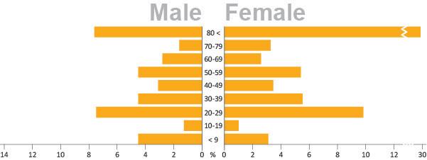
The population of the Bowman neighborhood is diverse with respect to age. The highest concentration is of those age 80 and older. This is likely due to the presence of senior living facilities in the neighborhood, including Seneca Place and Twinbrook. The community is not diverse with respect to race, as 96 percent of residents identify as white.
*Source: 2010 Decennial Census. Census Tract 97; Block Group 1; Block 1000, 1001, 1002.
Renter-occupied households comprise 70 percent of the Bowman neighborhood. This reflects the presence of rental properties along Abigail Drive and senior living facilities in the neighborhood.
Among owner-occupied homes in the Bowman and Hawthorne neighborhoods, the median home value is $151,200. This is comparable to the median home value of Jefferson County ($146,900). Similar ranges exist for housing cost as a percentage of income for both homeowners and renters.
Residents of the Bowman and Hawthorne neighborhoods have a high level of educational attainment. A majority of residents over age 25 have a bachelor’s degree or higher. Less than 20 percent of residents have not graduated high school or pursued some form of higher education. The educational attainment levels of the Bowman and Hawthorne neighborhoods surpass that of Jefferson County in each category.
The Bowman and Hawthorne neighborhoods have, on average, slightly higher household income levels than Jefferson County. Most households earn between $50,000 and $125,000 annually. This is likely due to the prevelance of employment within the management, business, science, and arts occupations.
*Percentages have been rounded to the nearest tenth and may not total 100%.
*Information found on this page is in combination with the Bowman and Hawthorne neighborhoods.
*The data in Housing (excluding occupancy), Education, and Employment are from the Census 2017 American Community Survey, 5-year estimates. Census Tract 97; Block Group 1.
1. Ensure any proposed development on the north side of Dutchmans Lane, between Gast Boulevard and Cannons Lane, meets neighborhood goals of building and site design.
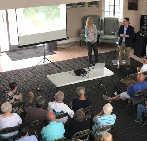
3. Support residential to commercial conversions on Taylorsville Road, between Dartmouth Avenue and Seneca Boulevard, and along Dutchmans Lane, between Bowman Avenue and the Seneca Place care center.
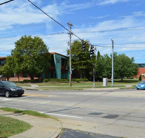
4. Continue to work with MSD to address drainage issues in the neighborhoods around Bowman Field.
1. Improve pedestrian infrastructure and lighting at key intersections to ensure accessibility and safety.
2. Direct pedestrians and bicyclists to safe crossings at controlled intersections.
4. Better align bus stop locations with safe pedestrian crossings.
6. Coordinate with KYTC for improvements and renovations to Taylorsville Road and Dutchmans Lane with the goal of implementing Complete Streets.
7. Explore opportunities for intersection modifications as roadways are renovated and maintained.
1. Formalize and grow neighborhood associations and continue collaboration efforts among Bowman area communities.
4. Enhance communication between neighborhood groups and LRAA.
6. Beautify key corridors using welcome and wayfinding signs, enhanced landscape treatments, public art, lighting, and street trees.
Land Use Recommendation 3: An example of a residential dwelling to professional office conversion along Taylorsville Road.
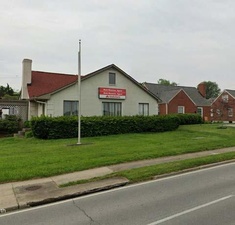
Mobility Recommendation 7: The intersection of Dutchmans Lane and Cannons Lane could be made more pedestrian-friendly with reduced corner radii, improved crosswalk markings, and a dedicated or early pedestrian signal phase.
Quality of Life Recommendation 1:
One of the key outcomes of the planning process is to grow local capacity by better organizing residents and leaders.
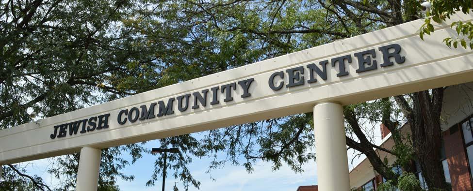
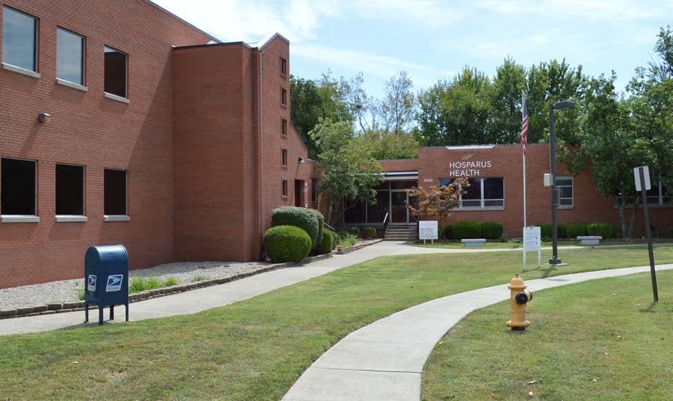
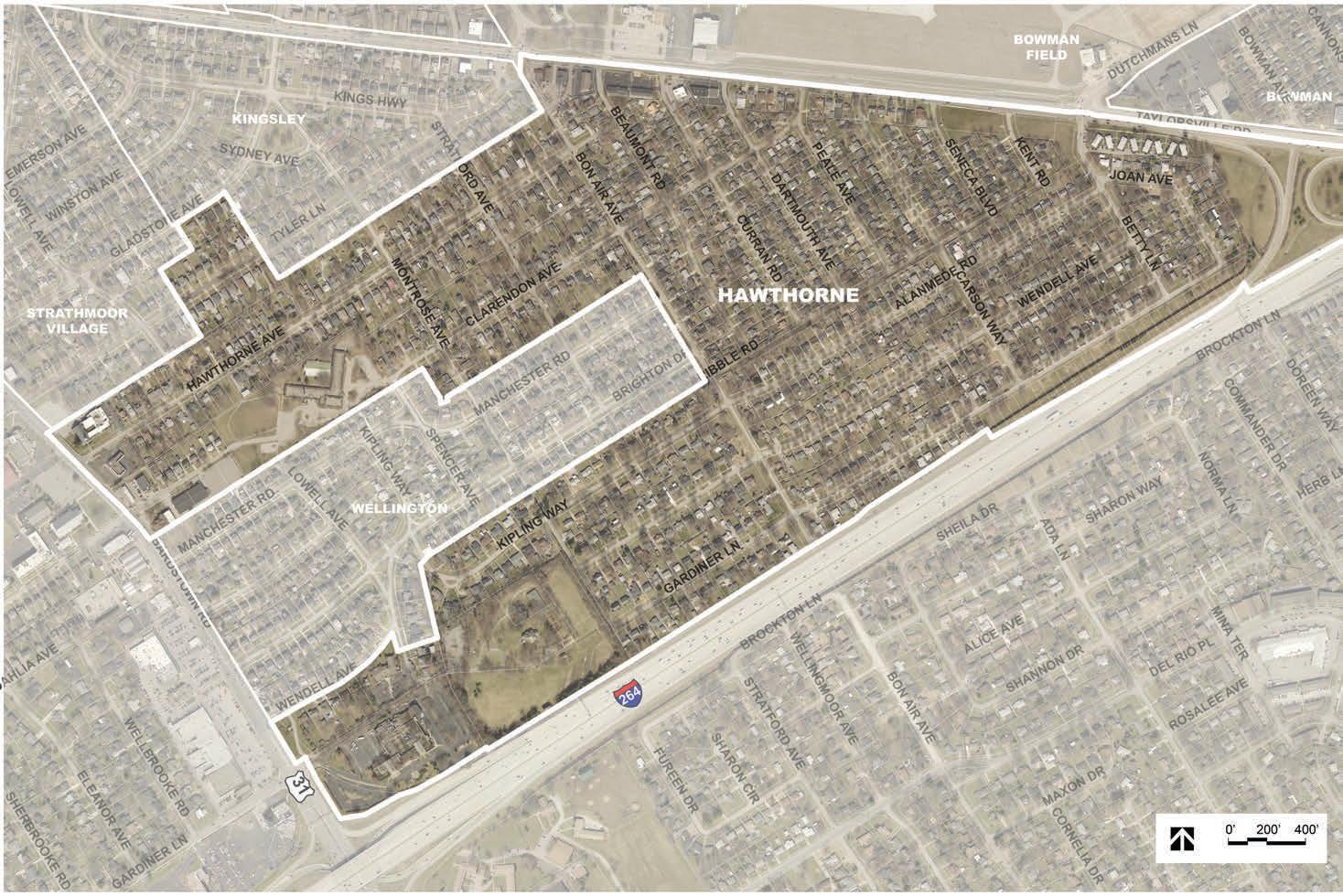
The Hawthorne neighborhood is the largest neighborhood or city in the Bowman area. It is roughly bounded by Taylorsville Road, Tyler Lane, Bardstown Road, and the Watterson Expressway. The neighborhood surrounds the City of Wellington on three sides and borders the cities of Kingsley and Strathmoor Village. Hawthorne is comprised primarily of single-family residential dwellings, with some commercial and multi-family uses along Taylorsville Road and Bardstown Road. Subdivisions in the Hawthorne neighborhood range in date from 1910 to 1954. The neighborhood is home to several important institutions, including Farmington, Hawthorne Elementary School, Sullivan University, and the Strathmoor Presbyterian Church.
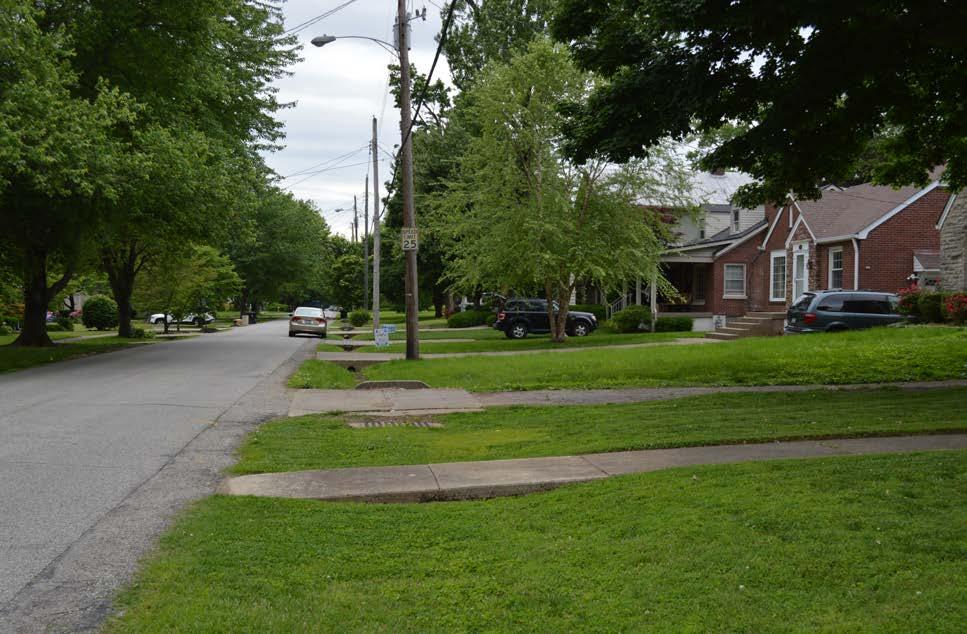
• Airport adds character to the area
• Diversity of housing
• Has Highlands feel with a little more yard
• Affordability
• Walkability and proximity to restaurants and the park
• Hawthorne Elementary as a park for neighbors
• Multiple sidewalk gaps and accessibility issues
• Semitrucks through neighborhood
• Preservation of historic structures in neighborhood
• Drainage and localized flooding
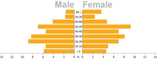
The population of the Hawthorne neighborhood is diverse with respect to age. The Hawthorne neighborhood also has one of the highest rates of children under age 10 within the Bowman area. However, the community is not diverse with respect to race, as nearly 94 percent of residents identify as white.
*Source: 2010 Decennial Census. Census Tract 97; Block Group 1; Block 1004-1011, 1013-1021 and Census Tract 97; Block Group 2; Block 2000-2013, 2015-2017, 2024-2026.
A majority of homes in the Hawthorne neighborhood are owner-occupied, with few rental properties.
Among owner-occupied homes in the Bowman and Hawthorne neighborhoods, the median home value is $151,200. This is comparable to the median home value of Jefferson County ($146,900). Similar ranges exist for housing cost as a percentage of income for both homeowners and renters.
No High School Diploma
Residents of the Bowman and Hawthorne neighborhoods have a high level of educational attainment. A majority of residents over age 25 have a bachelor’s degree or higher. Less than 20 percent of residents have not graduated high school or pursued some form of higher education. The educational attainment levels of the Bowman and Hawthorne neighborhoods surpass that of Jefferson County in each category.
The Bowman and Hawthorne neighborhoods have, on average, slightly higher household income levels than Jefferson County. Most households earn between $50,000 and $125,000 annually. This is likely due to the prevelance of employment within the management, business, science, and arts occupations.
*Percentages have been rounded to the nearest tenth and may not total 100%.
*Information found on this page is in combination with the Bowman and Hawthorne neighborhoods.
*The data in Housing (excluding occupancy), Education, and Employment are from the Census 2017 American Community Survey, 5-year estimates. Census Tract 97, Block Groups 1 and 2.
2. Ensure continued residential use along Bardstown Road and Taylorsville Road, west of Pee Wee Reese Road.
3. Support residential to commercial conversions on Taylorsville Road, between Dartmouth Avenue and Seneca Boulevard, and along Dutchmans Lane, between Bowman Avenue and the Seneca Place care center.
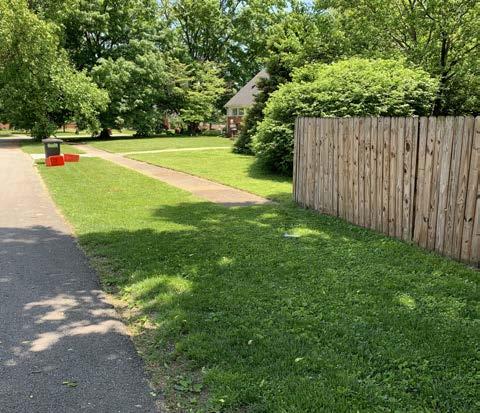
4. Continue to work with MSD to address drainage issues in the neighborhoods around Bowman Field.
5. Better utilize open spaces as community amenities.
6. Continue protection and expansion of the area tree canopy.
2. Direct pedestrians and bicyclists to safe crossings at controlled intersections.
3. Fill gaps in the sidewalk network and construct new sidewalks along high traffic roads that are lacking them.
6. Coordinate with KYTC for improvements and renovations to Taylorsville Road and Dutchmans Lane with the goal of implementing Complete Streets.
9. Improve connectivity and pedestrian access to Hawthorne Elementary.
1. Formalize and grow neighborhood associations and continue collaboration efforts among Bowman area communities.
2. Enhance existing open spaces with both active and passive amenities to promote healthy living and community gathering.
4. Enhance communication between neighborhood groups and LRAA.
of Life Recommendation
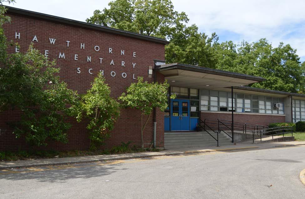
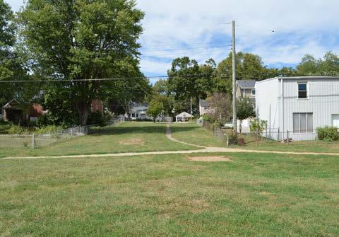
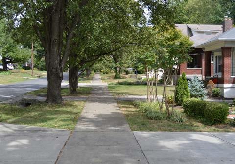
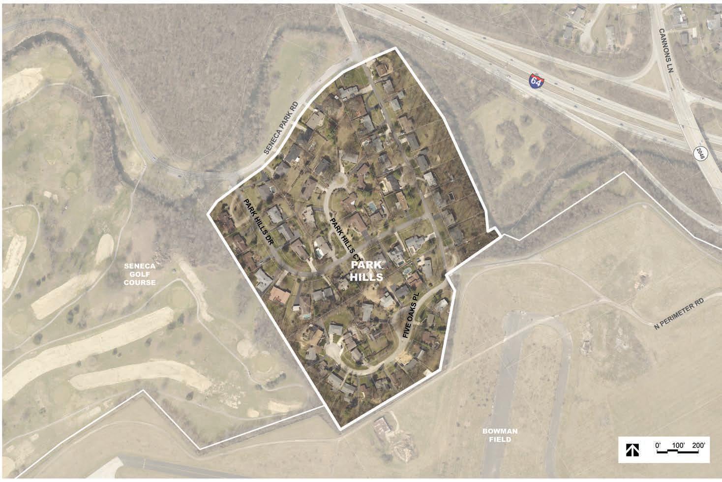
Park Hills is an entirely residential neighborhood on the north side of Bowman Field. It is bounded by Interstate 64 to the north and east, Bowman Field to the south, and Seneca Park to the west. The first section of Park Hills was subdivided in 1955, with a second section added in 1962. The neighborhood contains a mix of architectural styles, with MidCentury Modern being the most prevalent.
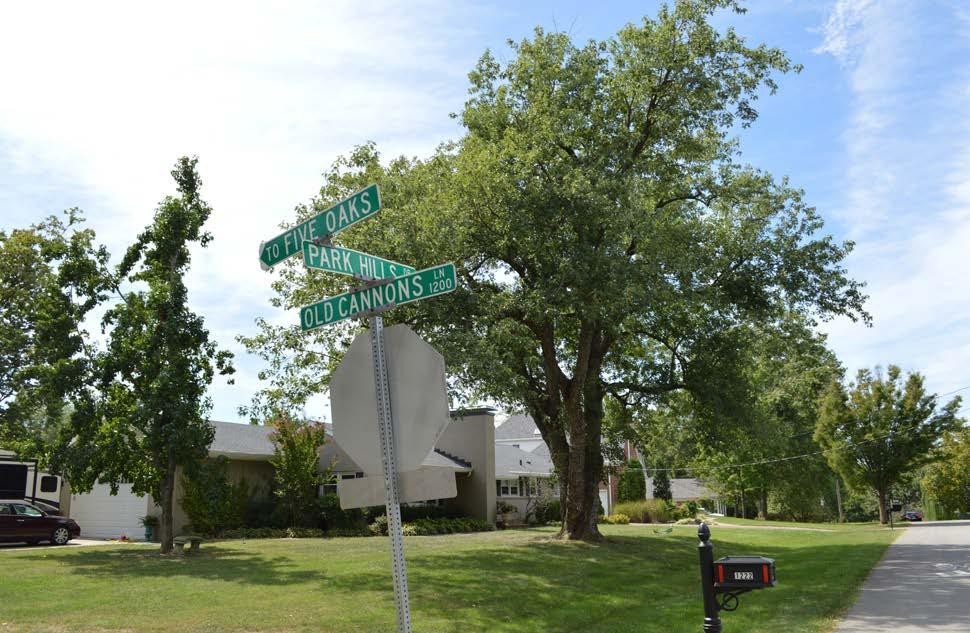
• Quiet and isolated
• Proximity to park
• Strong home values
• Interested in forming a neighborhood association (not incorporated)
• Development
• Cyclists
• Property maintenance
• Poor drainage
• Better communication with LRAA
• Improve area at Old Cannons Lane and Bowman Field
• Overall upkeep of the neighborhood and Bowman Field
The population of the Park Hills neighborhood is not diverse with respect to age or race. A majority of residents are over the age of 40, and 95 percent of residents identify as white.
*Source: 2010 Decennial Census. Census Tract 87; Block Group 1; Block 1008, 1012.
The majority of homes in the Park Hills neighborhood are owner-occupied, with few rental properties.
Among owner-occupied homes in the Park Hills and Seneca Vista neighborhoods, the median home value is $268,800, which is nearly twice the median home value of Jefferson County ($146,900). However, the median gross rent ($691) is lower than Jefferson County’s ($779).
About half of homeowners and renters can comfortably afford their housing, spending less than 20 percent of their monthly income on mortgage or rent.
Residents of the Park Hills and Seneca Vista neighborhoods have a high level of educational attainment. A majority of residents over age 25 have a bachelor’s degree or higher. Less than 15 percent of residents have only a high school diploma or equivalent.
The Park Hills and Seneca Vista neighborhoods have, on average, higher household income levels than Jefferson County. 48 percent of households earn over $100,000 annually, compared to only 22 percent of Jefferson County. Most residents work in the management, business, science, and arts occupations, particularly in the educational or training fields.
*Percentages have been rounded to the nearest tenth and may not total 100%.
*Information found on this page is in combination with the Park Hills and Seneca Vista neighborhoods.
*The data in Housing (excluding occupancy), Education, and Employment are from the Census 2017 American Community Survey, 5-year estimates. Census Tract 87, Block Group 1.
1. Ensure any proposed development on the north side of Dutchmans Lane, between Gast Boulevard and Cannons Lane, meets neighborhood goals of building and site design.
4. Continue to work with MSD to address drainage issues in the neighborhoods around Bowman Field.
7. Support continued ownership of Metroowned property adjacent to Bowman Field and Seneca Park.
6. Coordinate with KYTC for improvements and renovations to Taylorsville Road and Dutchmans Lane with the goal of implementing Complete Streets.
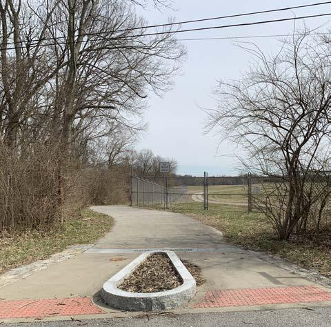
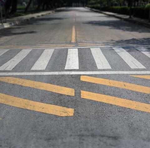
7. Explore opportunities for intersection modifications as roadways are renovated and maintained.
8. Explore traffic calming and speed reduction tactics.
2. Enhance existing open spaces with both active and passive amenities to promote healthy living and community gathering.
3. Maintain trail and open space areas as attractive neighborhood assets.
4. Enhance communication between neighborhood groups and LRAA.
Mobility Recommendation 8:
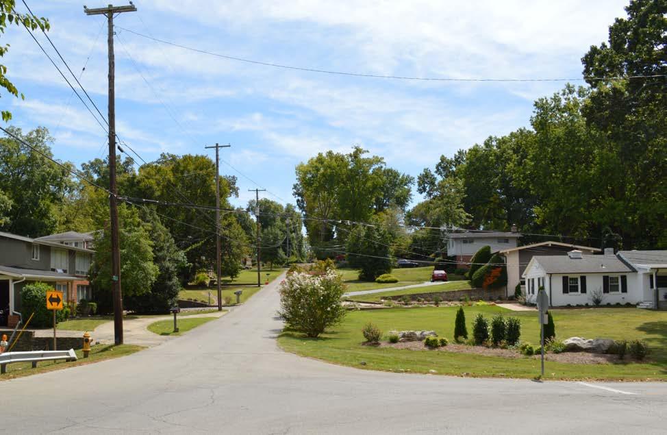
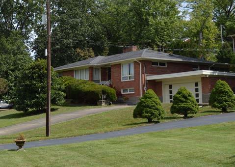
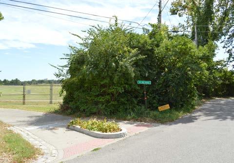
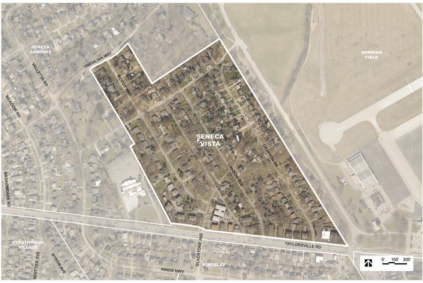
The Seneca Vista neighborhood is immediately west of Bowman Field and Pee Wee Reese Road. It is further bounded by Taylorsville Road to the south, and the City of Seneca Gardens to the north and west. Seneca Vista is comprised primarily of single-family residential homes, with multi-family and commercial properties along Taylorsville Road. Sections of the neighborhood were first subdivided in 1939, with homes being constructed through the early 1950s.
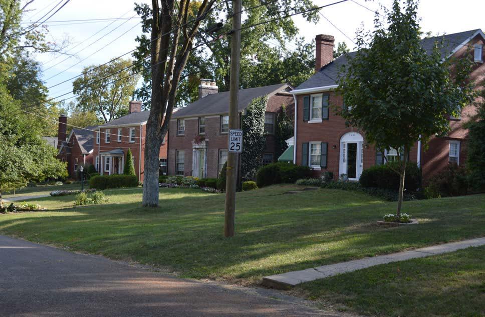
• Proximity to parks
• Great location, close to everything
• Walk/bike path
• Property values
• Noise from airport
• Planes flying too low
• Taylorsville Road traffic and safety
• Tree removal because of runway approach surfaces
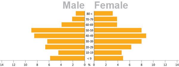
The population of the Seneca Vista neighborhood is diverse with respect to age. The neighborhood also has one of the highest rates of children under age 10 within the Bowman area. However, the community is not diverse with respect to race, as 93 percent of residents identify as white.
*Source: 2010 Decennial Census. Census Tract 87; Block Group 1; Block 1010, 1014, 1019-1024.
The Seneca Vista neighborhood has a majority of owner-occupied homes, with a third of its housing units being rental properties.
Among owner-occupied homes in the Park Hills and Seneca Vista neighborhoods, the median home value is $268,800, which is nearly twice the median home value of Jefferson County ($146,900). However, the median gross rent ($691) is lower than Jefferson County’s ($779).
About half of homeowners and renters can comfortably afford their housing, spending less than 20 percent of their monthly income on mortgage or rent.
Residents of the Park Hills and Seneca Vista neighborhoods have a high level of educational attainment. A majority of residents over age 25 have a bachelor’s degree or higher. Less than 15 percent of residents have only a high school diploma or equivalent.
The Park Hills and Seneca Vista neighborhoods have, on average, higher household income levels than Jefferson County. 48 percent of households earn over $100,000 annually, compared to only 22 percent of Jefferson County. Most residents work in the management, business, science, and arts occupations, particularly in the educational or training fields.
*Percentages have been rounded to the nearest tenth and may not total 100%.
*Information found on this page is in combination with the Park Hills and Seneca Vista neighborhoods.
*The data in Housing (excluding occupancy), Education, and Employment are from the Census 2017 American Community Survey, 5-year estimates. Census Tract 87, Block Group 1.
2. Ensure continued residential use along Bardstown Road and Taylorsville Road, west of Pee Wee Reese Road.
4. Continue to work with MSD to address drainage issues in the neighborhoods around Bowman Field.
5. Better utilize open spaces as community amenities.
6. Continue protection and expansion of the area tree canopy.
7. Support continued ownership of Metroowned property adjacent to Bowman Field and Seneca Park.
1. Improve pedestrian infrastructure and lighting at key intersections to ensure accessibility and safety.
6. Coordinate with KYTC for improvements and renovations to Taylorsville Road and Dutchmans Lane with the goal of implementing Complete Streets.
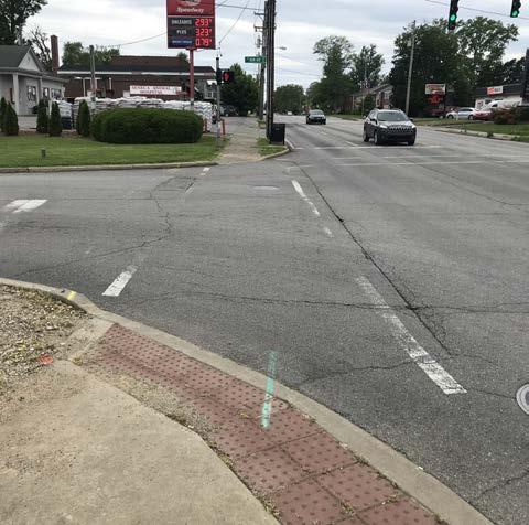
7. Explore opportunities for intersection modifications as roadways are renovated and maintained.
8. Explore traffic calming and speed reduction tactics.
1. Formalize and grow neighborhood associations and continue collaboration efforts among Bowman area communities.
2. Enhance existing open spaces with both active and passive amenities to promote healthy living and community gathering.
3. Maintain trail and open space areas as attractive neighborhood assets.
4. Enhance communication between neighborhood groups and LRAA.
Land Use Recommendation 6:
This view of Montrose Avenue demonstrates the diverse tree canopy to be preserved and expanded on.
Mobility Recommendation 1:
The Pee Wee Reese Road, Taylorsville Road, and Bon Air Avenue intersection would benefit from enhanced crosswalks.
The airport easement in the Seneca Vista neighborhood could become a pocket park and connection to the Pee Wee Reese trail.
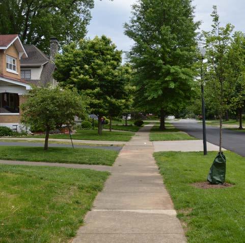
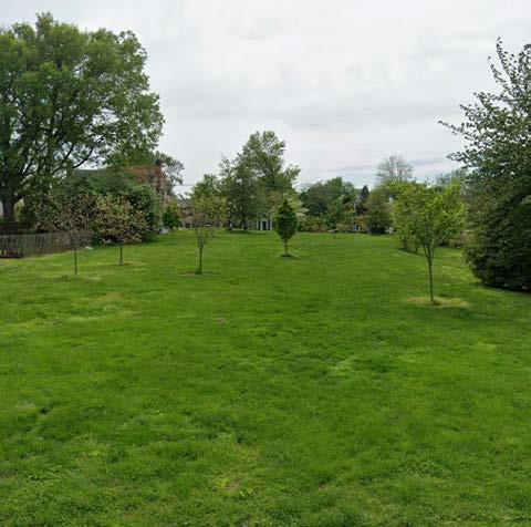
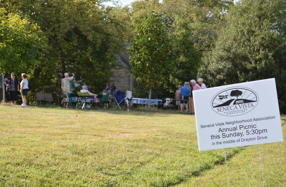
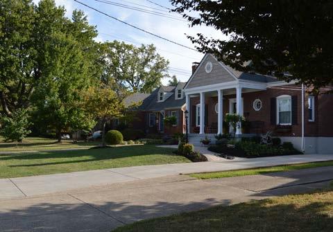
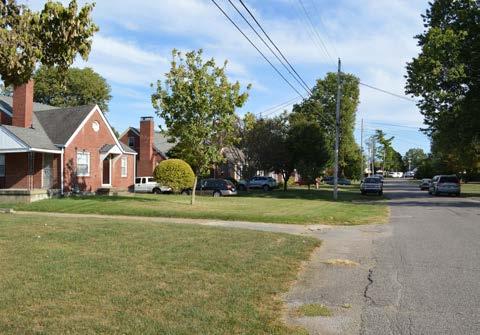
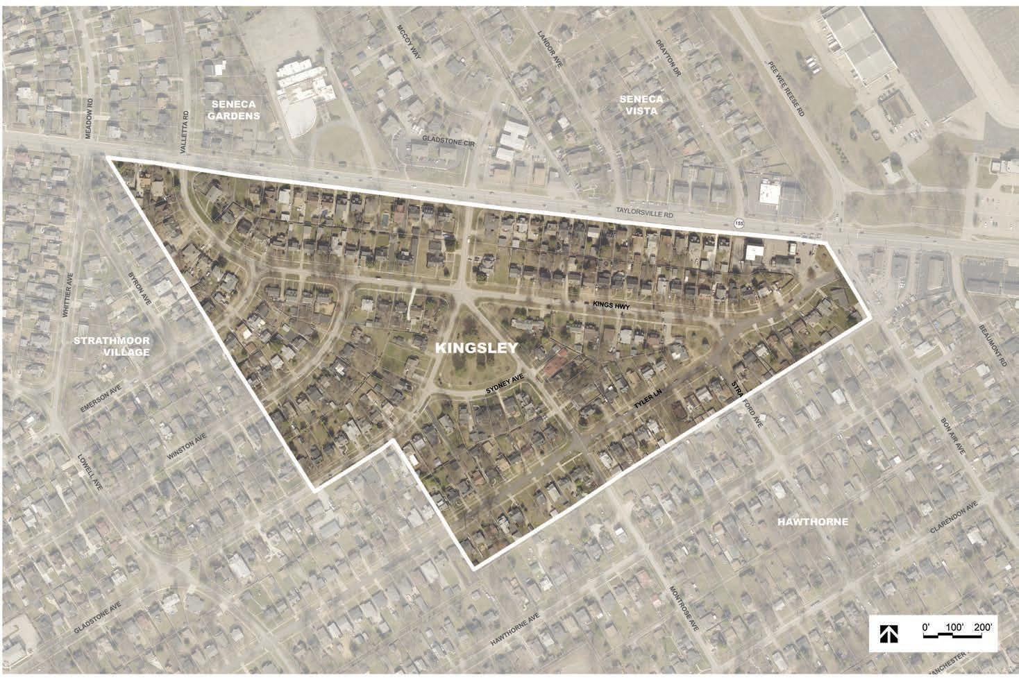
The City of Kingsley covers approximately 44 acres along the south side of Taylorsville Road, across from the Seneca Vista neighborhood and City of Seneca Gardens. The City of Strathmoor Village is to the west and the Hawthorne neighborhood is to the east. The neighborhood was platted in 1925 and incorporated as a sixth-class city in 1939. With the exception of two commercial properties at the southwest corner of Taylorsville Road and Bon Air Avenue, the city is all residential in use. Central to the city and bounded by Gladstone, Montrose, and Sydney avenues is the Kinsley Green, a neighborhood open space full of diverse tree species.
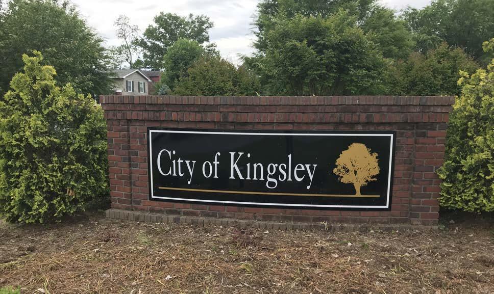
• Similarity in home size and price
• Kingsley Green
• Bowman Field – walking/bike path and charm of the small planes
• Close to Highlands, close to everything
• Safe
• Restrictions to keep neighborhood clean
• Good property values
• Nice community with friendly neighbors
• Single-family residential development
• Noise
• Traffic
• Accidents and speeding on Taylorsville Road (and Bardstown Road intersection)
• Low flying planes and staying in the flight path
• Lack of trees on Taylorsville Road
• Various home values and looks depending on location within City
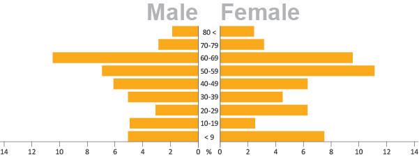
While the City of Kingsley experienced a slight population decline between 2000 and 2010, the community experienced 12 percent growth between 2010 and 2017. In contrast, Jefferson County experienced only 3 percent growth during this period.
The population of the City of Kingsley is diverse with respect to age. The most prevalent age group is between 50 and 70. However, the community is not diverse with respect to race, as 97 percent of residents identify as white.
The majority of homes in Kingsley are owneroccupied homes, with few rental properties. Of the 159 owner-occupied homes, the median home value is $255,600. This is higher than the median home value of Jefferson County ($146,900), and comparable to the City of Wellington ($244,000). The median gross rent ($1,125) is also significantly higher than Jefferson County’s ($779).
A majority of residents spend under a third of their monthly income on their mortgage or rent, indicating most households can comfortably afford their housing cost.
Residents of Kingsley have a high level of educational attainment, with a majority of residents over age 25 holding a bachelor’s degree or higher. Less than 15 percent of residents have only a high school diploma or equivalent.
The City of Kingsley has higher household income levels than Jefferson County. 40 percent of households earn over $100,000 annually, compared to only 22 percent of Jefferson County. 60 percent of residents work in the management, business, sciences, and arts occupations. The most common employment sector is management, followed by office and administrative support.
*Percentages have been rounded to the nearest tenth and may not total 100%.
*Data gathered from the Census 2017 American Community Survey, 5-year estimates.
2. Ensure continued residential use along Bardstown Road and Taylorsville Road, west of Pee Wee Reese Road.
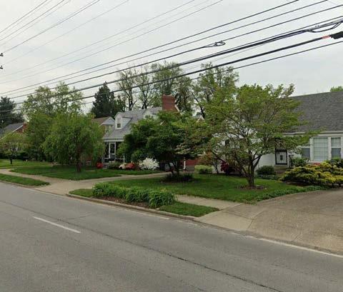
4. Continue to work with MSD to address drainage issues in the neighborhoods around Bowman Field.
5. Better utilize open spaces as community amenities.
6. Continue protection and expansion of the area tree canopy.
1. Improve pedestrian infrastructure and lighting at key intersections to ensure accessibility and safety.
2. Direct pedestrians and bicyclists to safe crossings at controlled intersections.
6. Coordinate with KYTC for improvements and renovations to Taylorsville Road and Dutchmans Lane with the goal of implementing Complete Streets.
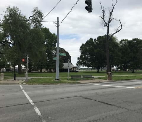
8. Explore traffic calming and speed reduction tactics.
2. Enhance existing open spaces with both active and passive amenities to promote healthy living and community gathering.
4. Enhance communication between neighborhood groups and LRAA.
6. Beautify key corridors using welcome and wayfinding signs, enhanced landscape treatments, public art, lighting, and street trees.
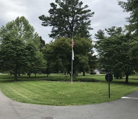
Land Use Recommendation 2:
Example of residential homes which demonstrate the character to be preserved along Taylorsville Road.
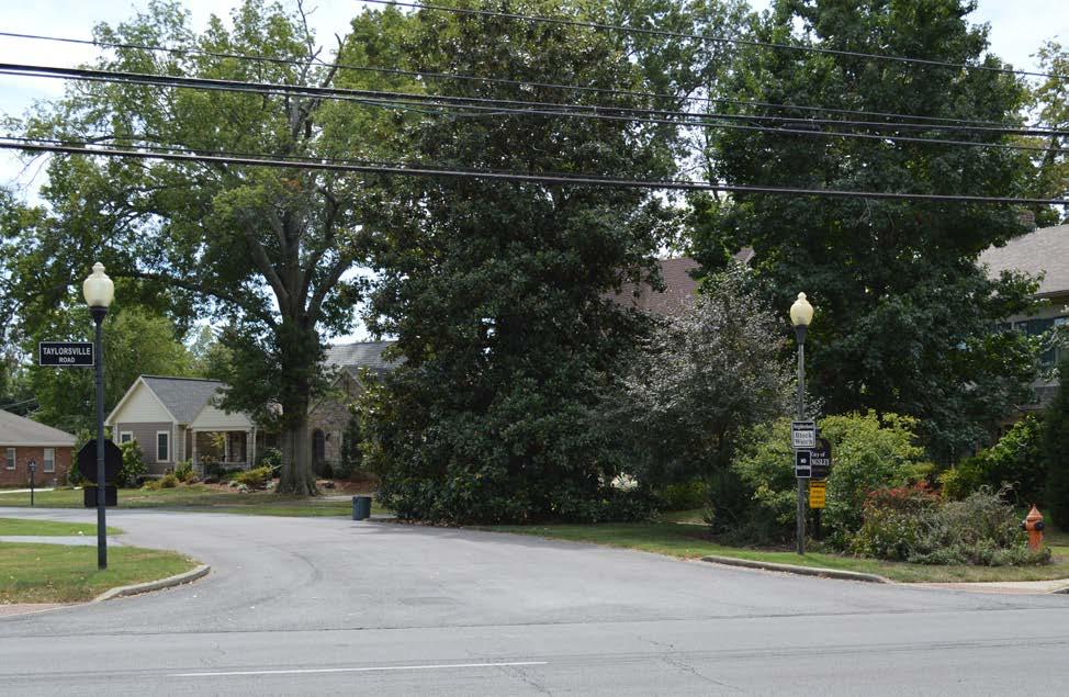
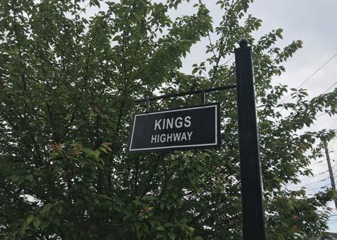
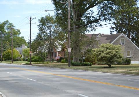
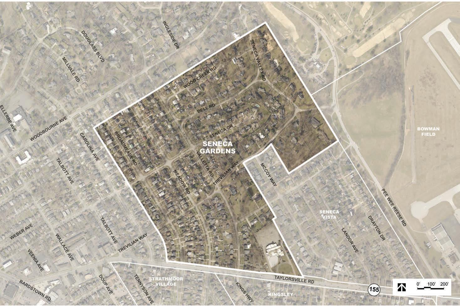
The City of Seneca Gardens encompasses approximately 98 acres on the west side of the Bowman area. It is bounded by Seneca Park, Bowman Field, and the Seneca Vista neighborhood to the east, Taylorsville Road to the south, and the Highlands-Douglass neighborhood to the north and west. The city is all residential in use with the exception of the Keneseth Israel Congregation on Taylorsville Road. Different sections of Seneca Gardens were platted between 1925 and 1942, leading to a variety of residential styles and character. The city was incorporated in 1930 and added to several times before reaching its current size in 1950. Most of the dwellings are single family homes, but some duplexes are present along Broadmeade Road.
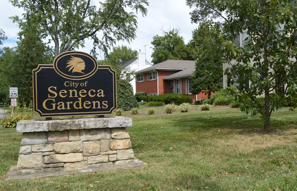
• Kingsley Green
• Walkability and safety
• Sidewalks
• Housing variety
• Property values
• Taylorsville Road
• Noise
• Traffic
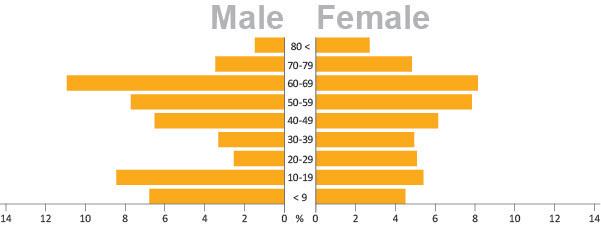
The City of Seneca Gardens has seen minimal change in its population rate over the past twenty years.
The population of Seneca Gardens is diverse with respect to age, with residents in varying stages of life. However, the community is not diverse with respect to race, as 98 percent of residents identify as white.
The majority of homes in Seneca Gardens are owner-occupied, with few rental properties. Of the 238 owner-occupied homes, the median home value is $391,700. This is higher than the median home value of Jefferson County ($146,900), and identical to the City of Strathmoor Village. The median gross rent ($1,306) is also significantly higher than Jefferson County’s ($779).
A majority of homeowners (70%) spend less than a third of their monthly income on their mortgage. However, approximately 40 percent of renters spend more than a third of their monthly income on rent.
Residents of Seneca Gardens have a high level of educational attainment. Over 80 percent of residents over age 25 have a bachelor’s degree or higher, compared to only one-third of Jefferson County.
The City of Seneca Gardens has higher household income levels than Jefferson County. Over 60 percent of households earn over $100,000 annually, compared to only 22 percent of Jefferson County. 73 percent of residents work in the management, business, sciences, and arts occupations. The most common employment sectors are management and legal, followed by healthcare.
*Percentages have been rounded to the nearest tenth and may not total 100%.
*Data gathered from the Census 2017 American Community Survey, 5-year estimates.
2. Ensure continued residential use along Bardstown Road and Taylorsville Road, west of Pee Wee Reese Road.
4. Continue to work with MSD to address drainage issues in the neighborhoods around Bowman Field.
6. Continue protection and expansion of the area tree canopy.
7. Support continued ownership of Metroowned property adjacent to Bowman Field and Seneca Park.
1. Improve pedestrian infrastructure and lighting at key intersections to ensure accessibility and safety.
6. Coordinate with KYTC for improvements and renovations to Taylorsville Road and Dutchmans Lane with the goal of implementing Complete Streets.
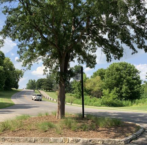
8. Explore traffic calming and speed reduction tactics.
3. Maintain trail and open space areas as attractive neighborhood assets.
4. Enhance communication between neighborhood groups and LRAA.
6. Beautify key corridors using welcome and wayfinding signs, enhanced landscape treatments, public art, lighting, and street trees.
Land Use Recommendation 6: This view of Montrose Avenue demonstrates the diverse tree canopy to be preserved and expanded on.
Mobility Recommendation 8: A speed table can be midblock or associated with a crosswalk, and is used to reduce traffic speeds.
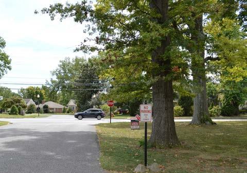
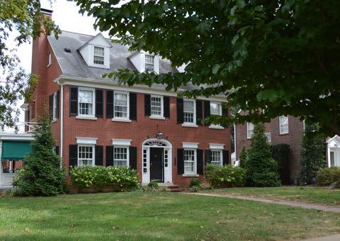
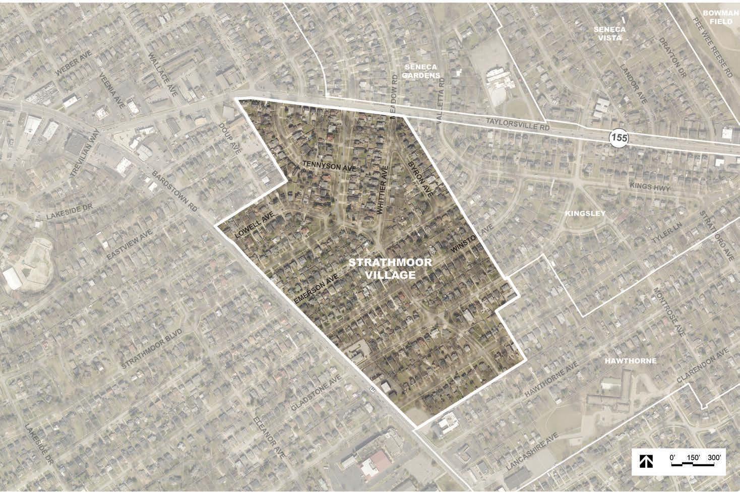
The City of Strathmoor Village covers approximately 65 acres of land, between Taylorsville Road and Bardstown Road on the west side of the Bowman Area. It is bordered by the City of Kingsley and the Hawthorne neighborhood to the east, and the Highlands-Douglass neighborhood to the west. The city is mainly residential in use with several smaller commercial properties present along Bardstown Road. Portions of the city were first subdivided in 1921; it was incorporated in 1928, and grew in size with the annexation of Strathmoor Gardens in 1993.
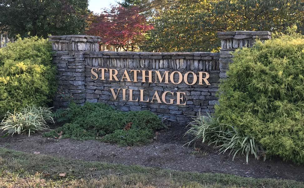
• Walkable
• Great place to live
• Property values
• City services/garbage pickup
• Speed bumps to cut down on speeding
• Cut-through traffic that includes semitrucks and Assumption High School students
• Speeding on Bardstown and Taylorsville Roads
• The intersection at Bardstown Rod and Emerson Road
• Planes flying too low
• Traffic enforcement
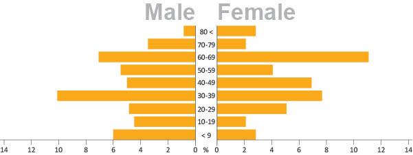
The City of Strathmoor Village has seen steady population growth over the past twenty years. However, this is slower than the 10 percent growth rate of Jefferson County over the same period.
The population of Strathmoor Village is diverse with respect to age, with residents in varying stages of life. However, the community is not diverse with respect to race, as 92 percent of residents identify as white.
The majority of homes in Strathmoor Village are owner-occupied, with few rental properties. Of the 221 owner-occupied homes, the median home value is $391,700. This is substantially higher than the median home value of Jefferson County ($146,900), and identical to the City of Seneca Gardens. The median gross rent ($1,150) is also significantly higher than Jefferson County’s ($779).
A majority of homeowners (75%) spend less than 25 percent of their monthly income on their mortgage. However, 84 percent of renters spend more than 25 percent of their monthly income on rent.
Residents of Seneca Gardens have a high level of educational attainment. Over 65 percent of residents over age 25 have a bachelor’s degree or higher, compared to only one-third of Jefferson County.
The City of Strathmoor Village has higher household income levels than Jefferson County. Nearly 47 percent of households earn over $100,000 annually, compared to only 22 percent of Jefferson County. 65 percent of residents work in the management, business, sciences, and arts occupations. The most common employment sectors are management and education.
*Percentages have been rounded to the nearest tenth and may not total 100%.
*Data gathered from the Census 2017 American Community Survey, 5-year estimates.
2. Ensure continued residential use along Bardstown Road and Taylorsville Road, west of Pee Wee Reese Road.
4. Continue to work with MSD to address drainage issues in the neighborhoods around Bowman Field.
6. Continue protection and expansion of the area tree canopy.
2. Direct pedestrians and bicyclists to safe crossings at controlled intersections.
6. Coordinate with KYTC for improvements and renovations to Taylorsville Road and Dutchmans Lane with the goal of implementing Complete Streets.
8. Explore traffic calming and speed reduction tactics.
4. Enhance communication between neighborhood groups and LRAA.
6. Beautify key corridors using welcome and wayfinding signs, enhanced landscape treatments, public art, lighting, and street trees.
Land Use Recommendation 2:
Example of residential homes which demonstrate the character to be preserved along Taylorsville Road.
Mobility Recommendation 8: Increase speed enforcement with the assistance of speed measuring signs similar to the one depicted in this image.
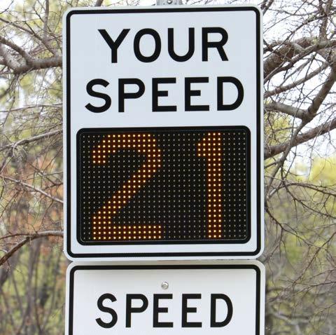
Quality of Life Recommendation 6: Bardstown Road is a major gateway into the Bowman area neighborhoods and would benefit from corridor enhancements.
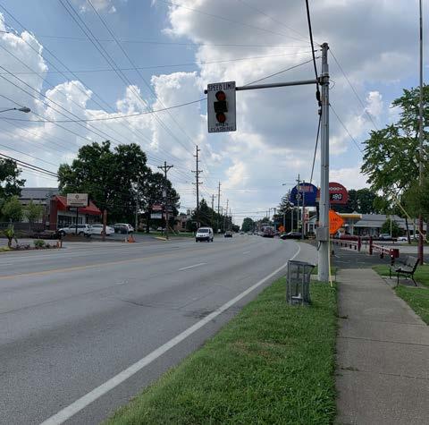
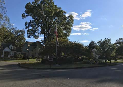
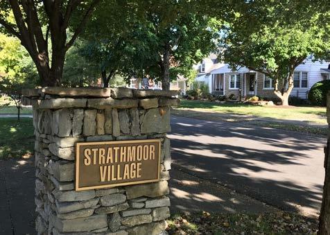
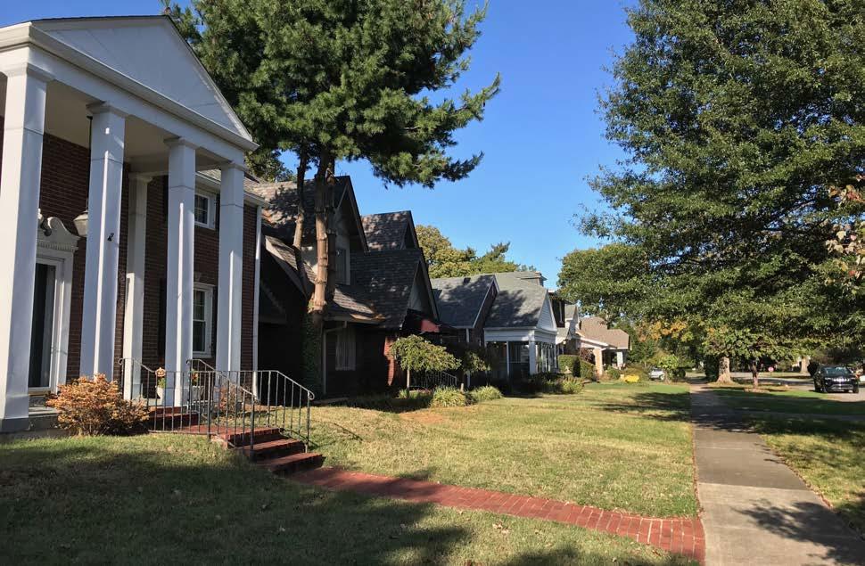
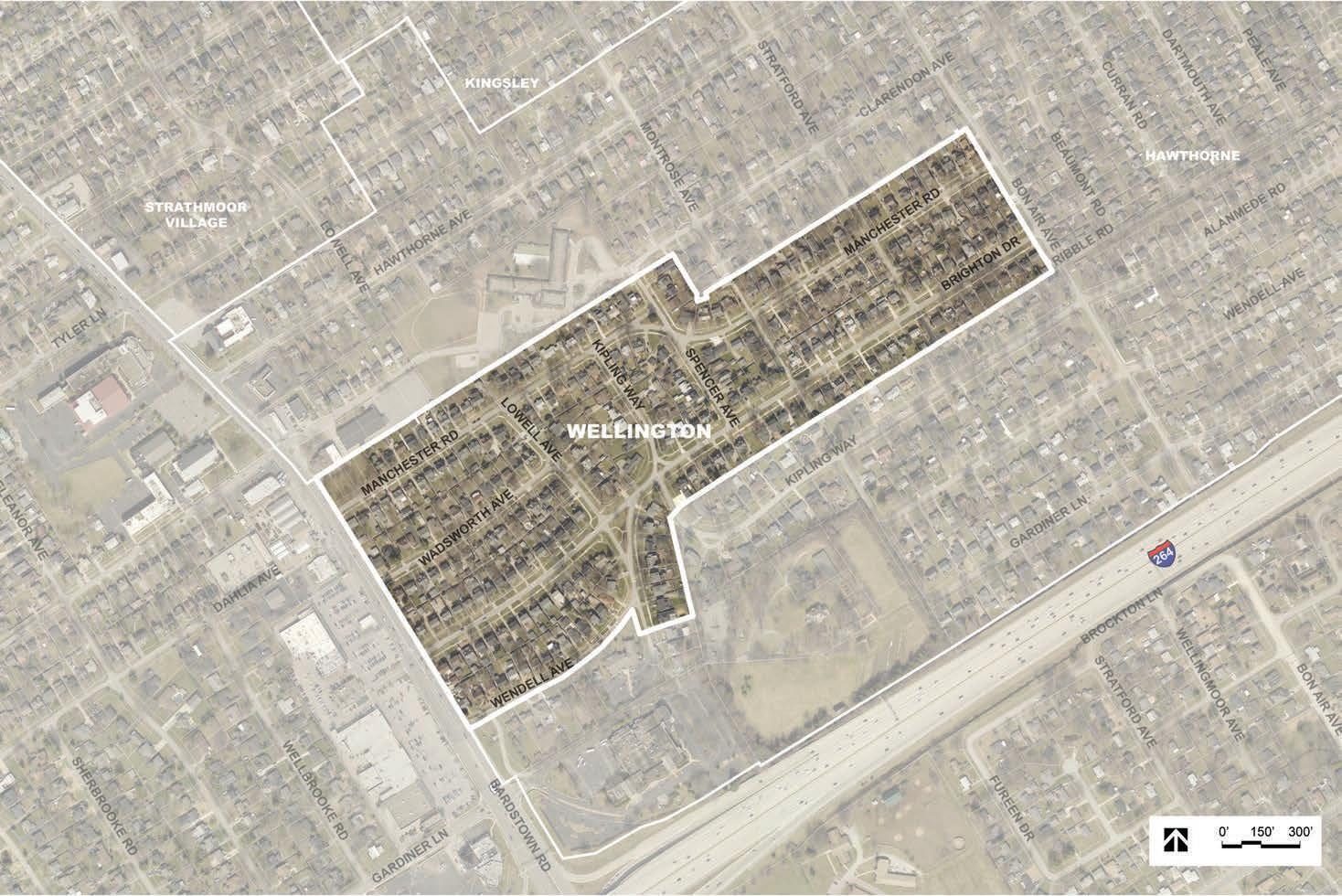
The City of Wellington was incorporated as a sixthclass city in 1946, and covers approximately 56 acres. It lies on the east side of Bardstown Road and is surrounded on the north, east, and south sides by the Hawthorne neighborhood. It is all single family residential in use; subdivision platting began in the mid-1920s.
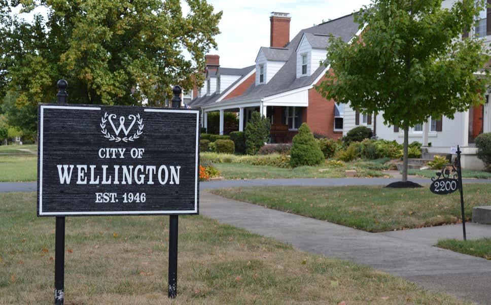
• Location
• Walkability to nearby shops and restaurants
• Property values
• Farmington – good neighbor. Can use a dog area
• Walk/bike path to Bowman Field
• Similarity of home styles and prices
• Good relationship with Hawthorne Elementary and Assumption High School
• Need for intersection improvements (Bardstown Road and Brighton Drive)
• Cut-through traffic of Brighton Drive
• Sidewalk on Bon Air Avenue would be nice
• Keep open grass lots along Manchester Road
• Keeping the community entirely residential – no retail fronting Bardstown Road
• Drainage and localized flooding
The City of Wellington has seen a minimal decline in its population rate over the past twenty years.
The population of Wellington is diverse with respect to age, with residents in varying stages of life. However, the community is not diverse with respect to race, as 90 percent of residents identify as white.
A majority of homes in Wellington are owneroccupied, with few rental properties. Of the 234 owner-occupied homes, the median home value is $244,000. This is higher than the median home value of Jefferson County ($146,900), and comparable to the City of Kinsgley ($255,600). The median gross rent ($1,625) is also significantly higher than Jefferson County’s ($779).
A majority of residents (80%) spend less than a third of their monthly income on their mortgage. However, over 60 percent of renters pay more than a third of their monthly income on rent.
Residents of Wellington have a high level of educational attainment. Over 72 percent of residents over age 25 have a bachelor’s degree or higher, compared to only one-third of Jefferson County.
The City of Wellington has higher household income levels than Jefferson County. 41 percent of households earn over $100,000 annually, compared to only 22 percent of Jefferson County. 60 percent of residents work in the management, business, sciences, and arts occupations. The most common employment sectors are education, management, and office administration.
*Percentages have been rounded to the nearest tenth and may not total 100%.
*Data gathered from the Census 2017 American Community Survey, 5-year estimates.
2. Ensure continued residential use along Bardstown Road and Taylorsville Road, west of Pee Wee Reese Road.
4. Continue to work with MSD to address drainage issues in the neighborhoods around Bowman Field.
6. Continue protection and expansion of the area tree canopy.
1. Improve pedestrian infrastructure and lighting at key intersections to ensure accessibility and safety.
2. Direct pedestrians and bicyclists to safe crossings at controlled intersections.
8. Explore traffic calming and speed reduction tactics.
9. Improve connectivity and pedestrian access to Hawthorne Elementary.
1. Formalize and grow neighborhood associations and continue collaboration efforts among Bowman area communities.
4. Enhance communication between neighborhood groups and LRAA.
Land Use Recommendation 6:
This view of Montrose Avenue demonstrates the diverse tree canopy to be preserved and expanded on.
Mobility Recommendation 9:
The existing path to Hawthorne Elementary from Hawthorne Avenue should be widened.
Quality of Life Recommendation 1:
One of the key outcomes of the planning process is to grow local capacity by better organizing residents and leaders.