

I-69 CORRIDOR STRATEGIC DEVELOPMENT
FOR DELAWARE & GRANT COUNTIES

June 2020


Acknowledgments
Thank You
The I-69 Corridor Strategic Development Plan for Delaware and Grant Counties would not have been possible without the many community representatives, business owners, and other stakeholders who devoted their time and ideas. We would also like to thank each Steering Committee member for their dedication and commitment throughout this process.
Client
Bill Walters, Executive Director
Brad Bookout, Project Manager
East Central Indiana Regional Planning District
1208 W. White River Boulevard, Suite 136 Muncie, Indiana 47303
Kyle Darton, Economic Development Representative, Chicago District
U.S. Economic Development Administration 230 South Dearborn Street, Suite 3280 Chicago, Illinois 60604
Steering Committee
Michael Hicks, PhD, Center for Business and Economic Research, Ball State University
Araminta Tuttle, Ball State University
Justin Miller, Ball State University
Marta Moody, Delaware-Muncie Metropolitan Planning Commission
Larry Strange, Grant County Area Plan
Sam Ramsey, City of Marion Planning Dept.
Angie Moyer, Delaware County Engineering
Jess Alumbaugh, City of Marion
Terry Dieckmann, Town of Van Buren
Tonya Hiatt, Town of Gaston
Larry Leach, Gas City
Robert McNutt, City of Jonesboro
Pete Olson, Town of Yorktown
Jonathan Perez, Town of Upland
Tom Roberts, Town of Daleville
Adam Jones, Town of Daleville
Jane Sickman, Town of Fairmount
Stakeholders
Exit 234 Stakeholders
Tom Roberts, Daleville Town Council
Adam Jones, Daleville Town Council
Steve Brogan, Daleville Town Council
Tammy Staimpel, Daleville Town Council
Amy Roberts, Clerk-Treasurer
Ryan Ballard, Delaware County Council
William “Bill” Walters, ECIRPD
Paul Garrison, Daleville Community School
Exit 241 Stakeholders
Brad Bookout, ECIRPD
Ron Quakenbush, Delaware Co. Council
Jerry Breeck, Vectren
Marty Cripe, MacAllister Machinery
Gary Huttel, MacAllister Machinery
Michael Burton, All-Steel Carports
Pete Olsen, Town of Yorktown
Becca Rice, Ball State University
Jim Lowe, Ball STate University
Rob Bellucci, Commonwealth Engineers, Inc.
Wayne Bailes, Commonwealth Engineers, Inc.
Joe Rhetts, Delaware Co. Commissioner
Susan Carlock, Mursix Corp.
Exit 245 Stakeholders
Kyle Mealy, Wes-Del Community School
Michael Bush, Wes-Del Community School
Katina Gleeson, Gaston Town Council
Brett Ellison, Gaston Town Council
James Dragoo, Dragoo Auction & Realty
Joe Rhetts, Delaware Co. Attorny
Sherry RIggin, Delaware Co. Commissioner
Brad Bookout, ECIRPD
Exit 255, 259, 264 Stakeholders
Sam Ramsey, City of Marion Planning Dept.
Jane Sickman, Fairmount Town Council
Richard Dollan, Fairmount Police Dept.
Terry Dickmann, Van Buren Town Council
Alex Huskey, Ivy Tech Community College
Bill Walters, ECIRPD
Larry Strange, Grant Co. Area Plan
Donna F.M. Davis, Town of Fowlerton
Tom Davis, Town of Fowlerton
Deborah Cain, Marion City Council
Joe Thomas, Primco, Inc.
Mikayla Marazzi, Grant Co. Economic Growth Council
Victoria Herring, Grant Co. Economic Growth Council


(Gaston)


1Executive Summary
Purpose of the Plan
The I-69 Corridor Strategic Development Plan for Delaware and Grant Counties, Indiana is the result of an effort spearheaded by the East Central Indiana Regional Planning District (ECIRPD) to provide an in-depth analysis of the existing and potential social, economic, and aesthetic impact that the Interstate 69 (I-69) corridor has, and can have, on Delaware and Grant Counties in East Central Indiana.
Funded by a grant received from the United States Economic Development Administration (EDA), this plan provides an analysis and recommendations for each of the following interchanges.
• Exit 234: SR 67 & SR 32 (Daleville & Muncie)
• Exit 241: SR 332 (Yorktown & Muncie)
• Exit 245: US 35 & SR 28 (Gaston)
• Exit 255: SR 26 (Fairmount & Fowlerton)
• Exit 259: US 35 & SR 22 (Gas City & Upland)
• Exit 264: SR 18 (Marion & Van Buren)
Executive Summary
Background
The East Central Indiana Regional Planning District (ECIRPD) received a grant from the U.S. Economic Development Administration (EDA) to complete the I-69 Corridor Strategic Development Plan for Delaware and Grant Counties in an effort to determine the overall existing and future impact of the Interstate 69 (I-69) corridor on Delaware and Grant Counties.
Project Scope
The I-69 Corridor Plan focuses on the six interstate interchanges in Delaware and Grant Counties including:
• Exit 234: SR 67 & SR 32 (Daleville)
• Exit 241: SR 332 (Yorktown & Muncie)
• Exit 245: US 35 & SR 28 (Gaston)
• Exit 255: SR 26 (Fairmount & Fowlerton)
• Exit 259: US 35 & SR 22 (Gas City & Upland)
• Exit 264: SR 18 (Marion & Van Buren)
The purpose of this study is to identify potential deficiencies in regards to infrastructure that is prohibiting new economic development opportunities or creating safety concerns and to identify aesthetic and quality of life improvements that will make Delaware and Grant Counties more attractive to new development and redevelopment of existing communities.
Report Organization
The report is outlined into the following chapters and content:
• Introduction - Reviews general background information on the project as well as the project’s scope and process.
• Shared Similarities & Planning Principles - Reviews common themes among the interchanges in regards to their existing conditions and provides general guidance and best practices for future development.
• Exit 234: SR 67 & SR 32 (Daleville) - Reviews existing conditions, development opportunities, and proposed recommendations.
• Exit 241: SR 332 (Yorktown & Muncie) - Reviews existing conditions, development opportunities, and proposed recommendations.
• Exit 245: US 35 & SR 28 (Gaston) - Reviews existing conditions, development opportunities, and proposed recommendations.
• Exit 255: SR 26 (Fairmount & Fowlerton) - Reviews existing conditions, development opportunities, and proposed recommendations.
• Exit 259: US 35 & SR 22 (Gas City & Upland) - Reviews existing conditions, development opportunities, and proposed recommendations.
• Exit 264: SR 18 (Marion & Van Buren) - Reviews existing conditions, development opportunities, and proposed recommendations.
• Economic Impact Analysis - Provides a summary of potential economic impacts should potential development occur and proposed projects be implemented.
Process
The development of the I-69 Corridor Plan was guided by a project steering committee comprised of stakeholders from each of the communities and local governments surrounding the six focus interchanges within Delaware and Grant counties.
Additionally, a series of stakeholder groups was held with various community representatives, residents, and business owners to gather information on existing opportunities and challenges. Information was received, analyzed, and consolidated into five categories, which became the organizational structure for the remainder of this plan. The five organizational categories include:
• Land Use & Development
• Utilities
• Transportation & Access
• Gateways
• Parks & Recreation
Shared Similarities
A review of existing conditions at each of the interchanges revealed several commonalities in relation to the five organizational categories.
Land Use & Development: Development at each of the interchanges has been largely reactionary.
Utilities: Development has generally occurred where utilities are available.
Transportation/Access: In general, transportation planning at each of the interchanges has heavily focused on vehicular circulation and logistics. Very few, if any, pedestrian amenities have been provided.
Gateways: There is a general lack of unique gateway elements within the I-69 corridor. Gateways are predominately limited to common interstate guide signage along the highway.
Parks & Open Space: All of the interchanges in Grant and Delaware counties have natural features and/ or undeveloped areas surrounding them: however, there is a general lack of managed public open space and conservation measures to protect environmentally sensitive areas.
Planning Principles
As the interchanges continue to develop in the future, there are key principles regarding each of the five organizational categories described above that should be considered.
Development: The governing bodies surrounding the interchanges should establish an Interchange Service District which will serve as the primary area for future development and should be the focus of local government planning and economic funding endeavors.
Planning/zoning/development standards should be established and adopted within each Interchange Service District and the primary focus when recommending locations for new development should be on available properties within the Interchange Service District that are near, or surrounded by, existing development. Minimizing development sprawl should be a primary goal.
Utilities: Existing utilities should be expanded and/or improved to encourage continued development in a given area. As utility improvements are made, utilities should be placed underground, behind facilities, or within designated setbacks where possible to minimize clutter within the public realm. Additionally, where possible, sustainable infrastructure approaches should be used to minimize environmental impact..
Transportation: Right-of-way acquisition should be a priority where inadequate right-of-way exists to support transportation improvements and future development. Curb cuts for commercial and private drive approaches should be consolidated with frontage roads to minimize confusion and prevent vehicular conflicts. Pedestrian infrastructure should be installed to increase walkability and traffic calming measures should be instituted.
Gateways: Gateways and landmarks should be erected to take advantage of the exposure to the tens of thousands of daily travelers along I-69. Erection of new gateway landmarks and features should be locally focused and celebrate history, amenities, unique attributes, and the numerous educational institutions that are located within the region.
Additionally, roadways should be considered as gateway corridors intersecting the interstate interchanges. These state routes should be improved with consistent landscape treatments, lighting, sidewalks and trails.
Parks & Open Space: Currently, very few public parks, green spaces, and conservation areas are set aside within the study area. As development continues within the focus area, an effort should be made by the local municipalities to preserve open space for the protection of sensitive and significant environments and to encourage healthy, active communities through the development of new recreational spaces.
Executive Summary
The following information provides a brief summary of existing conditions and recommendations for each of the six interchanges in Grant and Delaware counties. For additional information and detail, please refer to the individual interchange chapters.
Exit 234: SR 67 & SR 32 (Daleville
& Muncie)
Existing Conditions:
Development: Due to its proximity to the Town of Daleville, Exit 234 is the most urban interchange in the corridor study area. The entire interchange is located within the corporate limits of the community (no, a portion of it is located within Chesterfield’s corporate limits). Current development along the SR 67 corridor is dominated by mixed commercial and convenient service, light manufacturing, and residential housing. Development between SR 67 and SR 32 is characterized by more traditional town development. Available property within the corporate limits of the Town is limited and the Town may need to consider annexation of additional property (this is an opinion/analysis and not an inventory item. Remove from this section.)
Utilities: The Town provides utility services to the interchange with adequate capacity based on current development. However, the water utility will need to be upgraded with substantial new development. The current water system can be supplemented with service from the
neighboring community of Chesterfield.
Transportation: Exit 234 is the most convoluted interchange (that sounds opinionated. Make is sound more factual) in Delaware and Grant counties servicing the independent state roads SR 67 and SR 32. Several steering committee members indicated that the interchange is confusing to many non-local commuters who mistakenly exit onto SR 32 instead of SR 67. Additionally, there is a general lack of pedestrian amenities including sidewalks, lighting, and curbed roadways along both the state roads and the local streets. The CSX railroad travels along the south edge of SR 32 and creates a physical barrier to pedestrian and vehicular movement. Additionally, the very active railroad creates substantial noise and is visually obtrusive as it transects the community.
Gateways: Potentially, the most substantial gateway viewed from a traveling vehicle as one approaches Exit 234 from I-69 is the Chesterfield water tower. The Town of Daleville has minimal signage located within the rightof-way along I-69. The Town requires a more substantial presence to encourage development and investment. Additionally, there is a limited amount of information or directional signage for the City of Muncie, Ball State University, or Delaware County located within the study area despite this exit serving as a major connector route to each of these respective entities. The attractiveness of both the SR 67 and SR 32 corridors could be significantly improved with enhanced landscape
improvements and additional pedestrian amenities. The Town of Daleville has recently invested in multiple freestanding wall gateway markers and directional signage along SR 67 and SR 32. These elements, which may provide an attractive sense of arrival to the community, fail to effectively identify the community as a unique and prosperous community in East Central Indiana.
Parks & Open Space: The existing Town Hall Park, recently constructed in 2017, serves as a regional attraction. Significant features of the park include multiple playgrounds, splash pad, concession, and community pavilion. Many local and regional families often attend one or more of the regularly programmed public events within the park. As population growth within the community continues, the need for additional park space south of SR 67 will increase.
Past Planning: The Town of Daleville completed a Downtown Revitalization Plan in 2015. The plan focused on improvements to quality of life within the community in order to attract future development and new residents. The Town has implemented many of the plan’s recommendations including construction of the Town Hall Park, building of gateways, development of multi-family housing, and working towards completion of a network of accessible sidewalks. Additionally, the East Central Indiana Regional Development Plan placed an emphasis on improving the quality of life for residents and the construction of the downtown commercial core.

Executive Summary
Exit 234: SR 67 & SR 32
(Daleville & Muncie)
Proposed Improvements:
Development: At Exit 234, property annexation is recommended near the town’s southern boundary to allow for additional expansion. Available parcels within the towns’ corporate boundary are recommended for development as use as convenience and service facilities , light industry, commercial and office space, and residential housing.
Utilities: Upgrades are recommended to the existing water and sewer system to allow for continued development at the Exit 234 interchange. Improvements include …..
Transportation: This report recommends the development of a more detailed traffic study to verify necessary traffic improvements along the I-69, State Road 67, and State Road 32 corridors. Additional recommendations include the implementation of traffic circles at the interstate’s egress and ingress ramps, attractive and pedestrian friendly improvements to the SR 67 corridor , advancements to the intersection of SR 67 and Innovation Dr. to improve vehicular safety, and pedestrian improvements to the intersection of Walnut St. and SR 67. Other supplemental transportation improvements include a new access drive to Daleville community schools to alleviate traffic congestion and
implementation of pedestrian sidewalks and amenities within the community to improve walkability.
Gateways: Gateway and signage enhancements are recommended along southbound I-69 to alleviate confusion for commercial traffic. The distressed railroad box bridge that spans across the interstate should be repaired and re-painted in order to become a physical attractive landmark for the Town of Daleville. Construction of additional monumental gateway elements at the convergent of the I-69 interchange ramps and SR 67 corridor will announce the arrival of motorist to the local community. Beautification efforts and construction of gateway elements at the intersection of Walnut Street and SR 67 will help spur economic development with in the Town of Daleville’s economic core. This report also recommends the use of vegetation along the SR 32 corridor to provide a visual buffer between the existing railroad.
Parks & Open Space: While no parks or open space project area identified for this report, long-term planning, land acquisition, and funding should evaluated to provide future open space south of SR 67 as community development continues.

Exit 234 Proposed Improvements Diagram
Executive Summary
Exit 241: SR 332
(Yorktown & Muncie)
Existing Conditions:
Development: Land use development at Exit 241 occurs primarily east of the interstate. Land use consists of light manufacturing and some convenience retail within the existing Park One Industrial Park. Additional development includes a pre-fabricated metal building construction facility north of SR 332. Development west of the interchange is limited to one equipment rental facility primarily due to the presence of Big Kilbuck Creek which serves as a natural barrier to development further west. The interchange and surrounding development is contained within the corporate limits of the Town of Yorktown.
Utilities: Town of Yorktown utilities service the area east of the interstate interchange. Utilities do not extend west of the interchange. Water, storm, electric, and gas utilities provide available capacity, however, wastewater and telecommunications utilities will need improvement to support significant additional development.
Transportation: SR 332 serves as the intersecting roadway to I-69 and traffic signals are located at the interchange. Immediately east of the interchange, traffic volumes during peak times of the day create conflict for vehicles entering and exiting the Park One entrance on to SR 332. There is an expressed need for
a secondary entrance or signalized entrance to help alleviate concerns. Executive Park Road serves as the primary corridor into Park One and is excessively wide. Additionally, SR 332 would benefit from landscape enhancements and a railroad spur serves the industrial park providing opportunities for shipment of goods and materials.
Gateways: Exit 241 has the most prominent and attractive gateway from I-69 which announces arrival to the Town of Yorktown. This exit also serves as a main access point to the City of Muncie and Ball State University, however, there is no gateway for either entity. SR 332 serves as a gateway corridor to the City of Muncie and would benefit from landscape enhancements. Similarly, Executive Park Road acts as a gateway to the Park One Industrial Park and would benefit from additional landscape enhancement.
Parks & Open Space: No existing parks facilities exist within proximity of the interchange, however significant natural features including woodlots and drainage ways provide opportunities for new parks, recreation, and conservation facilities. Additionally, the businesses located within Park One Industrial Park have expressed an interest in walking trails for on-site employees.
Past Planning: The most recent comprehensive plan for Delaware County recommends improvements to SR 332 and the creation of landscape districts as the corridor approaches the City of Muncie. Additionally,
the Town of Yorktown’s most recent comprehensive plan recognizes the need for utility expansion the industrial park.

Exit 241 Existing Conditions Diagram
Executive Summary
Exit 241: SR 332
(Yorktown & Muncie)
Proposed Improvements:
Development: Additional property is identified for acquisition and incorporation into the Park One Industrial park on the south side of the current development to allow for continued expansion. Additional sites have also been identified along SR 332 for future retail/ restaurant/hotel development.
Utilities: Utility recommendations for the interchange include expansion of the existing water utility to allow for future expansion of the industrial park.
Transportation: Recommended transportation improvements at Exit 241 include the completion of an in-depth traffic study to analyze appropriate implementation projects. Additionally, traffic circles are recommended at the entrance/exit ramps to I-69 to improve interstate access and gateway opportunities. SR 332 is recommended for landscape enhancements as recommended in the Delaware County Comprehensive Plan and a secondary entrance to the industrial park is recommended at the intersection of SR 332 and Jackson St. An extension of Jackson St. into the industrial park is also recommended , as well as additional internal roadway extensions, and improvements to Executive Park Road.
Gateways: Gateway enhancements are recommended at the entrance/exit ramps to the interstate, as well as new gateways for Ball State University north and south of the interchange, and improved identify/wayfinding signage on I-69 to better announce direction and arrival to communities along SR 332.
Parks & Open Space: Recommendations for parks and open space at Exit 241 include the protection of environmentally sensitive areas as well as the creation of a walking trail through the Park One Industrial Park.

Exit 241 Proposed Improvements Diagram
Executive Summary
Exit 245: US 35 & SR 28 (Gaston)
Existing Conditions:
Development: Development at Exit 245 is relatively limited. The interchange does not lie within the corporate limits of any community. West of the interchange, a logistics company, auction house, and limited residential development exists. East of the interchange, a truck stop is located north of SR 28. Remaining land surrounding the interchange is primarily agricultural.
Utilities: No municipal utilities extend to the interchange and existing development is serviced by on-site, private utilities for water and sewer. Electric and gas utilities have ample capacity for expansion; however, stormwater and telecommunications utilities will need upgraded with additional development. Wes Del Community Schools, located approximately three miles east of the interchange, has expressed interest in a shared utility expansion effort.
Transportation: SR 28 serves as the primary intersecting highway at Exit 245. The roadway has a narrow right-of-way and high traffic volumes. There has been expressed concern over the danger of short merge lanes onto I-69 which has caused a number of past vehicle accidents. Additionally, N CR 925 W previously served as an access road to the adjacent logistics facilities, however, that use has been restricted because the
current design of the roadway does not support heavy truck traffic.
Gateways: Gateways at Exit 245 are limited to basic wayfinding signage along the interstate. Additionally, while this exit serves as access to Muncie, Wes-Del Schools, and northern Delaware County, there is no signage announcing these respective entities.
Parks & Open Space: No current park facilities are located within proximity of the interchange, although the Cardinal Greenway does connect to the Town of Gaston approximately three miles northeast of the interchange. Existing woodlots and drainage ways due present opportunities for future conservation and open space.
Past Planning: Recently completed engineering reports explored alternatives for extension of water and sewer service to the interchange to support existing and future development.

Executive Summary
Exit 245: US 35 & SR 28 (Gaston)
Proposed Improvements:
Development: Recommendations for development at Exit 245 include establishing a service district extending to the nearest county roads east and west of I-69. Sites have been identified for potential development of new light industrial development, as well as retail and restaurant development.
Utilities: In accordance with the previously complete engineering reports, recommendations are included for water and sewer improvements to service existing and future development immediately surrounding the interchange. Additionally, stormwater enhancements are recommended west of the interchange to correct current drainage concerns.
Transportation: Transportation enhancements at Exit 245 include the completion of a more detailed traffic study to better determine appropriate roadway enhancements. Additional recommendations include right-of-way acquisition along SR 28 to allow for future roadway improvements and the incorporation of traffic circles at the entrance/exit ramps to I-69. Improvements to CR 925 W and CR 875 W are recommended to support truck traffic and adjacent development. Roadway widening and landscape enhancements are
recommended to SR 28 to increase safety and improve the aesthetics of the corridor.
Gateways: Arrival gateways are recommended at the entrance/exit ramps to I-69 to announce arrival and provide direction to the Town of Gaston, City of Muncie, Delaware County, and Wes-Del Community Schools. Additional gateway improvements are recommended at the intersection of CR 600 W and SR 28 to announce arrival to Wes-Del Community Schools and the Town of Gaston. Identity and wayfinding signage improvements are recommended along I-69 to better announce communities and points of interest accessible via SR 28.
Parks & Open Space: While no parks or open space projects are identified for this interchange, consideration should be given to conservation of open spaces to allow for protection of natural features and management of stormwater.

Exit 245 Proposed Improvements Diagram
Executive Summary
Exit 255: SR 26
(Fairmount & Fowlerton)
Existing Conditions:
Development: The Exit 255 interchange is the southernmost interchange in Grant County and is located within unincorporated area. Existing development is solely agricultural. Former commercial development was located in the southeast quadrant of the interchange but was removed several years ago. Remnants of the previous development remain in the form of old building foundations and parking lots that are used as staging areas during road construction.
Utilities: No municipal utilities are present at the Exit 255 interchange. The Town of Fowlerton, located just southwest of the interchange, has recently improved the municipal sewer system, but those services do not extend beyond the corporate limits of the community. Gas utilities near the interchange offer excess capacity to support future development, however, electric utilities are limited and would require upgrades.
Transportation: SR 26 serves as the major east/west highway at Exit 255. In most cases, there is no platted right-of-way which limits development and improvement opportunities in the near future. Additionally, CR S 525 E serves as the primary connecting roadway into Fowlerton from SR 26. CR S 525 E does not
currently have platted right-of-way until arrival within the corporate limits of the community.
Gateways: Signage along I-69 is limited to wayfinding signage announcing SR 26, Fairmount, and Hartford City. There is no interstate presence for Fowlerton, Indiana Wesleyan University, Taylor University, or Grant County. Since SR 26 acts as a gateway corridor into the surrounding communities and universities, it would benefit from landscape roadway enhancements.
Parks & Open Space: Parks development is limited to a small community park located in the Town of Fowlerton southwest of the interchange. If future development occurs, consideration should be given to protection of existing drainage ways and woodlots.
Past Planning: The most recently complete Grant County Comprehensive Plan recommended improvements to SR 26 including development into a four-lane arterial highway.

Executive Summary
Exit 255: SR 26
(Fairmount & Fowlerton)
Proposed Improvements:
Development: Recommendations for development at SR 26 include the establishment of an Interchange Service District to conserve agricultural development surrounding the interchange. Additionally, remediation of the existing brownfield and former convenience development site southeast of the interchange are recommended.
Utilities: Long-term utility expansion recommends creation of water and sewer utilities to support future interchange development.
Transportation: Transportation recommendations at Exit 255 include the completion of a more detailed traffic study to determine the appropriate improvements to SR 26 as well as right-of-way acquisition to allow for future improvements. Additional recommendations include the construction of traffic circles at the I-69 entrance/ exit ramps to improve safety and create gateway opportunities.
Gateways: Gateway enhancements are recommended at the I-69 entrance/exit ramps to provide better wayfinding and arrival experiences for Fairmount, Fowlerton, Taylor University, and Indiana Wesleyan University. Additionally secondary gateway enhancements are recommended near the intersection of
SR 26 and CR S 525 E for Fairmount and Fowlerton.
Parks & Open Space: While no parks or open space projects are identified for this interchange, consideration should be given to conservation of open spaces to allow for protection of natural features and management of stormwater should development occur in the future.

Executive Summary
Exit 259: US 35 & SR 22
(Gas City)
Existing Conditions:
Development: The exit 259 interchange is located within the corporate limits of Gas City. Within a ¼ mile of the interchange, development is predominately limited to convenience stores, gas stations, fast food restaurants and limited hospitality. West of the convenience development along SR 22, warehouse and distribution facilities, as well as limited residential exist. Unlike many other communities within Grant and Delaware counties, Gas City controls many available properties surrounding the interchange.
Utilities: Gas City provides municipal utilities to the interchange with adequate capacity for future development.
Transportation: Platted right-of-way varies along SR 22 in proximity of the interchange creating challenges for future roadway improvements and expansion. Additionally, despite some limited hospitality development, there are essentially no pedestrian amenities such as sidewalks. South of SR 22, the existing railroad serves as a logical edge to future development and expansion.
Gateways: Traveling on I-69, standard interstate signage does note arrival to US 35, SR 22, Gas City, and Upland, however, there is no mention of Taylor University or Indiana Wesleyan University. The Gas City water tower does serve as a prominent gateway marker north of SR 22. The Gas City community has also created unique sign posts near the interchange which helps in branding the community and celebrating the history of natural gas. Upland has recently constructed a new gateway east of the interchange and inc loser proximity of the community, however, a stronger presence should be considered in closer proximity of the interstate. US 35/SR 22 is excessively wide and would benefit from the incorporation of landscape enhancements including a central median.
Parks & Opens Space: While there are no public parks and open space in proximity of the interchange, there are several facilities located within Gas City. Multiple existing woodlots and drainage ways provide opportunities for future conservation and open space areas.
Past Planning: The most recent comprehensive plan for Grant County provides recommendations for US 35/ SR 22 including development into a four-lane arterial highway.

Executive Summary
Exit 259: US 35 & SR 22
(Gas City)
Proposed Improvements:
Development: Development recommendations at Exit 259 include the establishment of an Interchange Service District extending east and west of the interchange to CR 700 E and CR 600 E respectively, as well as south to the existing CERA rail line. Additional recommendations include potential sites for additional light industry, retail/ restaurant/hotel development, and commercial office development.
Utilities: No utility improvements are currently recommended for Exit 259. Existing utility capacity is sufficient to support additional development into the foreseeable future.
Transportation: Recommended transportation improvements include the completion of a traffic study to better determine the appropriate enhancements to US 35/SR22 and surrounding roadways. Additional recommendations include the continued acquisition of right-of-way along US 35/SR 22 to allow for future roadway expansion and improvements. Traffic circles are recommended at the intersection of the I-69 entrance/exit ramps and US 35/SR 22 to improve safety, vehicular movement, and corridor aesthetics. Creation of a landscaped median and additional landscape enhancements is also recommended to
US 35/SR22. Improvements to S CR 600 E are recommended to support additional development east and west of the roadway, as well as to better accommodate truck traffic accessing existing facilities. Additional pedestrian amenities such as sidewalks are recommended for Beaner Boulevard to improve walkability.
Gateways: Enhanced gateways are recommended near the intersection of the interstate entrance/exit ramps and US 35/SR 22. These would occur adjacent to the interstate or within the traffic circles recommended as a part of the transportation enhancements, and would provide additional direction to Gas City, Upland, Taylor University, and Indiana Wesleyan University. Additional identity/wayfinding signage improvements are recommended on I-69 approaching the Exit 259 interchange to announce Taylor University and Indiana Wesleyan University.
Parks & Open Space: While no parks or open space projects are identified for this interchange, consideration should be given to conservation of open spaces to allow for protection of natural features and management of stormwater should development occur in the future. Additionally, if residential or additional hospitality development occurs surrounding the interchange in the future, there will be an additional need for public park space.

Exit 259 Proposed Improvements Diagram
Executive Summary
Exit 264: SR 18
(Marion & Van Buren)
Existing Conditions:
Development: The majority of the Exit 264 interchange is located within the corporate limits of the City of Marion. The exception to this is the area southeast of the interchange. Development at the interchange is characterized by convenience development, large warehouse and logistics facilities, and IVY Tech Community College. Significant acreage remains available surrounding the interchange for future development. Undeveloped land is primarily privately owned and consists of agricultural uses and wood lots.
Utilities: The City of Marion has extended utility services to the interchange and adequate capacity exists to support future new development.
Transportation: The primary highway, SR 18, consists of four travel lanes and a central median. N 600 E, north of SR 18, lacks adequate right-of-way to accommodate road improvements and support future development to the north. Commerce Drive requires enhancements to support heavy truck traffic and volumes. There is a general lack of pedestrian amenities at the interchange which is challenging for commuters traveling to IVY Tech Community College.
Gateways: There is a general lack of prominent gateways along I-69. Standard interstate signage provides direction to SR 18, Marion, and Montpelier, however, there is no reference to Van Buren, IVY Tech Community College, or Indiana Wesleyan University. IVY Tech does have a prominent interstate presence due to the campus’ siting immediately adjacent to the interstate, however, there is no signage to IVY Tech Community College from SR 18. Both SR 18 and Commerce Dr. have potential for becoming significant gateways to the City of Marion and IVY Tech Community College respectively.
Parks & Open Space: While there are no public parks facilities near the interchange, the IVY Tech Community College campus serves as a major public green space adjacent to I-69. The campus is a unique opportunity for recreation potential near the interstate. Additionally, several woodlots and drainage way existing around the interstate and provide opportunities for future green space and conservation. Residents of Marion have also referenced the desire for a physical pedestrian connection between the interchange and the historic city development.
Past Planning: The most recent comprehensive plan for Grant County provides recommendations for SR 18. Most recommended improvements from that plan have been completed.

Executive Summary
Exit 264: SR 18
(Marion & Van Buren)
Proposed Improvements:
Development: Establishment of an Interstate Service District is recommended at the Exit 264 interchange to control future development in proximity of I-69. Additionally, multiple sites have been identified as potential development opportunities for future light industrial and retail/restaurant/hotel uses.
Utilities: No utility improvements are currently recommended for Exit 264. Existing utility capacity is sufficient to support additional development into the foreseeable future.
Transportation: A detailed traffic study is required to identify inefficiencies, existing traffic hazards, and the need for future growth suggest along the SR 18 corridor. Additional recommendations for SR 18 include enhanced landscape treatments within the existing grassy median and the construction of new curbing and crosswalks to make the corridor more attractive and safer for pedestrians. Improvements to the Commerce Drive/SR 18 intersection are specifically recommended to address pedestrian connectivity across SR 18 and to IVY Tech Community College. Additional recommendations include the incorporation of formal transit stops at IVY Tech and SR 18. CR 600 E is recommended for roadway enhancements to
support truck traffic and encourage development further north of SR 18. Commerce Drive is recommended for improvements to support heavy truck traffic and provide pedestrian connectivity to IVY Tech Community College. Traffic circles are recommended at the intersection of the interstate entrance/exit ramps and SR 18 to improve safety and aesthetics.
Gateways: Enhanced gateways and wayfinding signage are recommended near the intersections of the interstate egress ramps and SR 18 to better communicate arrival to Marion, Van Buren, IVY Tech Community College, and Indiana Wesleyan University. Additionally, the construction of a IVY Tech gateway sign will improve navigation to the campus within the study area for visiting students, faculty, and guests. Improved wayfinding/ identity signage is recommended within the right-of-way along I-69 to announce proximity to Van Buren, IVY Tech, and Indiana Wesleyan. Additionally, a gateway for Van Buren is recommended at the intersection of SR 18 and SR 5 east of the interchange.
Parks & Open Space: While no parks or open space projects are identified for this interchange, land use conservation efforts should be implemented in order to protect natural features and improve the local drainage network. Preservation of open space may also be vital as new residential, hospitality, and commercial development demands the need for shared public and recreational space.
Closing
With specific projects identified, the governing bodies surrounding I-69 will be able to better prioritize public spending, access potential funding sources, and encourage new development in the foreseeable future. This document is intended to be a living document. As the interstate and surrounding communities continue to evolve, priorities will shift and some projects may be complete more quickly than others. Certain projects may be eliminated and new projects may replace them. It will be critical that the communities surrounding the interchanges revisit the plan on a regular basis to make necessary updates and refinements.

Exit 264 Proposed Improvements Diagram


2 Introduction
General
The I-69 Corridor Strategic Development Plan for Delaware and Grant Counties, Indiana focuses on the impact of Interstate 69 on six existing interchanges occurring in Grant and Delaware counties. Located in East Central Indiana, Delaware and Grant Counties are located approximately mid-ways between the City of Indianapolis and Ft. Wayne, the State of Indiana’s two largest metropolitan areas.
The impact of the I-69 corridor on these counties and communities is undeniable and is evidenced by the development that has occurred along it’s length since its establishment. Into the future, the corridor will continue to have a major influence on the region as transportation of goods and people becomes easier and more efficient. The following chapter provides background information on the project, as well as additional information on the planning process.
Introduction
Background
The East Central Indiana Regional Planning District (ECIRPD) is a state designated, multi-county regional planning district with a mission to serve the economic development, planning, and grant development needs of Delaware and Grant Counties, a region encompassing four cities and fourteen towns. The ECIRPD received a grant from the U.S. Economic Development Administration (EDA) to complete the I-69 Corridor Strategic Development Plan for Delaware and Grant Counties (I-69 Corridor Plan) in an effort to determine the overall existing and future impact of the Interstate 69 (I-69) corridor on Delaware and Grant Counties, and specifically the six interchanges located along the corridor through those respective counties.
Through a competitive selection process, the ECIRPD commissioned the team of Rundell Ernstberger Associates, Inc. (REA) and VS Engineering (VS) to work in coordination with Ball State University’s Center for Business and Economic Research (CBER) on the planning effort.
Project Scope
The I-69 Corridor Plan focuses on the six interstate interchanges in Delaware and Grant Counties and their nearby, surrounding communities. The six interchanges of focus include:
• Exit 234: SR 67 & SR 32 (Daleville)
• Exit 241: SR 332 (Yorktown & Muncie)
• Exit 245: US 35 & SR 28 (Gaston)
• Exit 255: SR 26 (Fairmount & Fowlerton)
• Exit 259: US 35 & SR 22 (Gas City & Upland)
• Exit 264: SR 18 (Marion & Van Buren)
It is widely recognized that I-69 is a critical trade and commerce transportation corridor for the State of Indiana, Midwest region, and country. The corridor connects the largest metropolitan areas within the State of Indiana and currently services 23 million people and more than 100 counties in eight states. As the physical construction of the I-69 corridor continues to develop and expand within the State of Indiana, it has become an increasingly convenient and attractive economic asset and component of infrastructure to new development and residents. Specifically, within Central Indiana, and as it relates to the aforementioned interchanges, the recent improvements to widen I-69 to six travel lanes from Indianapolis north through

Madison County, which is the county directly southwest of Delaware County, has made travel between Indiana’s largest metropolitan area and the communities to the north much quicker and more convenient. This, coupled with rising property values near Indianapolis and surrounding suburbs, is creating development pressure to the north. Continued expansion of I-69 through Delaware and Grant Counties will undoubtedly increase the attractiveness of Delaware and Grant County communities for new development and redevelopment of existing businesses, industries, and communities.
The purpose of this study is to identify potential deficiencies in regards to infrastructure that is prohibiting new economic development opportunities or creating
I-69 Corridor Strategic Development Plan Study Area
safety concerns and to identify aesthetic and quality of life improvements that will make Delaware and Grant Counties more attractive to new development and redevelopment of existing communities. Specifically, this study seeks to:
• Determine specific economic projects related to industry and logistics in need of infrastructure improvements at the I-69 interchanges that will benefit from enhanced improvements.
• Determine job creation numbers and private capital investment for industry and logistics projects.
• Determine project-specific, potential economic impact of improvements and the benefit to the local communities. This is intended to determine how the quality of living in the region will be enhanced.
• Determine the economic impact of goods and services in to and out of both Delaware and Grant counties via I-69.
• Identify and plan for branding needs of the I-69 corridor.
• Identify potential marketing and promotion of infrastructure investments on the I-69 corridor.
• Determine the importance of aesthetics to a completed corridor, and its impact on attracting visitors from the highway.

I-69 Corridor Routing
Introduction
Process
The development of the I-69 Corridor Plan was guided by a project steering committee comprised of stakeholders from each of the communities and local governments surrounding the six focus interchanges within Delaware and Grant counties. The design team met with the steering committee regularly throughout the planning process. Beginning with an initial kick-off meeting, the design team coordinated with the steering committee to define the project scope and boundaries, collect data, and establish the stakeholder meeting format.
A series of stakeholder groups was held shortly after the kick-off meeting with various community representatives, residents, and business owners to garner information on existing opportunities and challenges. The format of the meetings was an open discussion. Attendees were grouped by interstate interchange to better determine the stakeholders’ individual perceptions, needs, and goals at each location.
The information was received and analyzed by the design team. Input received by stakeholders was consolidated into five categories, which became the organizational structure for the remainder of the plan. The five organizational categories include:
• Land Use & Development
• Utilities
• Transportation & Access
• Gateways
• Parks & Recreation
Following the analysis of existing conditions, the design team met with the steering committee to review these findings, shared similarities among the interchanges, and initial recommendations. The recommendations were refined based on input from the steering committee and were organized into each of the aforementioned categories. Recommendations are given a priority as well as an approximate cost opinion based on current market conditions. Recommendations were reviewed with the steering committee a second time prior to completion of the report.

Delaware County Stakholder Meeting


3Shared Similarities & Planning Principles
General
Coordination with the steering committee and various stakeholders, and review of the existing conditions and past planning studies at each of the interchanges (as discussed further in the following chapters) revealed several shared similarities among the interchanges related to the five organizational categories - land use & development, utilities, transportation & access, gateways, and parks & recreation.
Similarly, general recommendations were identified that apply to each of the categories. These planning principles should guide development and inform investment decisions and priorities in the future. Adherence to these principles will result in development at the interchanges that is more attractive, efficient, and safe.
Shared Similarities
Land Use & Development
Development at each of the interchanges has been largely reactionary, meaning development has occurred based on market demand with a minimal amount of planning or guidance. This is not unusual or unique to the study area as investment and development is typically viewed in a positive light and permitted to occur unencumbered. In order for developers to be as profitable as possible, construction is usually done cheaply with the sole intent of maximizing profits and return on investment.
The issues which have arisen from this development model include non-complimentary land uses within proximity of one another, as well as the inefficient use of space and often unattractive development that detracts from nearby communities.
Additionally, the resultant convenience development is automobile oriented with few pedestrian amenities or infrastructure.
Areas within the study area that have received the most development have been those where the local community holds property near the interstate and incentivizes development through various means such as tax abatements or selling the property below market value.
Utilities
Development has generally occurred where public investment in utility infrastructure has occurred and where basic services are readily available adjacent to the interstate. This provides initial cost savings to developers who otherwise have to invest in their own services.
This is apparent within Delaware and Grant counties. Interchanges with adequate utilities adjacent to the interstate have experienced the most growth. Conversely, communities within the study area that have not extended utilities to the interstate have experienced stagnant or slow development and economic growth. In some instances, industries or businesses that were once located near an interchange that lacked basic utility infrastructure failed or relocated.


Typical Development Along I-69 Corridor
Typical Development Along I-69 Corridor
Transportation & Access
In general, transportation planning at each of the interchanges has been heavily focused on vehicular circulation and logistics. There is a general lack of curb management, or planned drive locations, resulting in numerous curb cuts and drive approaches that have increased circulation conflicts due to cars and trucks entering state highways from several, uncontrolled locations.
Very few, if any, pedestrian amenities such as sidewalks, lighting, signage, signalization, crosswalks, etc. have been provided near any of the interchanges. This coupled with fast moving and heavy vehicular traffic creates an environment which is unwelcoming to pedestrians and discourages certain types of development.
In many cases, the right-of-way for the intersecting highways at the interchanges is inconsistent. In some cases, there are no platted right-of-ways, and in other locations, the platted right-of-ways are too narrow to support improved roadway infrastructure. Interchanges with consistent, adequate right-of-way have experienced the most development and improvement.
Gateways
There is a general lack of identity signage and physical gateways along the I-69 corridor within the study area. Where signage does occur, it is primarily limited to interstate wayfinding signage. Traveling along the corridor, multiple communities and points of interest are unannounced despite their proximity to the interstate and their attraction to travelers.
Similarly, verfy few communities have constructed physical gateways which can be a critical component in announcing arrival and establishing a sense of place along the interstate.
Intersecting state roads within the study provide opportunities to act as gateways into surrounidng communities, but lack basic amenities such as lighting, curbs, sidewalks, landscape and signage.
Parks & Open Spaces
All of the I-69 interchanges in Grant and Delaware counties have natural features and/or undeveloped areas surrounding them: however, there is a general lack of managed public open space and conservation measures to protect environmentally sensitive areas. Open spaces that exist consist of areas that are undevelopable due to flooding or other natural conditions, as well as agricultural areas that remain undeveloped.
Parks and open space amenities that do exist occur primarily in nearby communities with few offerings near the interstate.
Planning Principles
Conditions at the I-69 interchanges within Delaware and Grant counties are characteristic of interstate development patterns in other areas throughout the state and country. What is unique is the opportunity that this project provides to create an experience along the I-69 corridor that will attract future investment and set the stage for community growth and revitalization.
The following planning principles provide the baseline recommendations for encouraging smart growth that will attract desired investment and create the quality of life characteristics and development attractive to visitors, businesses, and residents alike.
LAND USE & DEVELOPMENT
The overall goal of the strategic development plan is to capitalize on opportunities provided by I-69 to attract quality development, grow municipal revenues, and increase amenities for residents, employees, and visitors. This can be accomplished through proactive planning for infrastructure and establishing a framework to protect property owner and business investments. The Delaware and Grant County communities along I-69 will be better positioned to attract and retain quality development by establishing proper zoning regulations, ensuring access management along key thoroughfares, enhancing the character of the right-of-way, and enacting clear regulatory processes. While more relaxed or less stringent zoning regulations may seem attractive to businesses and developers, that is not always the case.
They want assurances that their investment will not be harmed by incompatible or undesirable development next door. It is also imperative that development review and approval processes are clear. The more clarity a community can provide regarding allowable uses, desired development character, and the timing and steps in the approval process the better. An understanding of these key concepts provides the basis to create and enforce access management, signage, landscape, and other development standards or use restrictions.
Land use and development forecasts have been prepared for each interchange area in order to inform infrastructure analysis and estimating. These maps and forecasts do not suggest market demand or potential absorption at each interchange. They are based on previous long-range planning studies as well as discussions with the project steering committee, key stakeholders, and community representatives. They should be reviewed and confirmed with additional community planning processes such as comprehensive plans, corridor plans, or small area plans as development progresses. The land use and development forecast approach assumes that any site in the immediate vicinity of the interchange is potentially developable, and if developed, what are appropriate and likely development types, and what might it cost to serve that site or area with the necessary infrastructure. The strategic development plan does not suggest infrastructure should proactively be extended to all of these sites because
that would simply be too costly and there is not currently the market demand to support those investments. However, investments in infrastructure can be used as a way to guide desired development types to targeted development areas. Once investments in transportation and utility infrastructure have been made, they should be fully or near fully utilized before significant investments elsewhere.
Development Types & Assumptions
The following pages include descriptions of development types and their respective impacts that have potential at some or all the interchange areas. Much of the focus is on lighter industrial, warehousing, and logistics uses. A discussion of these development types must begin with acknowledging that the nature of manufacturing and distribution has changed dramatically over the past 20 years. Where once heavy manufacturing facilities imported raw materials and turned them into finished goods in large integrated plants, today manufacturing is an additive process, with products moving through several assembly stages, taking place over larger distances, and involving multiple suppliers and supply chains. Inventory is drastically reduced, and supply chains provide just-in-time delivery of components or finished goods. Inventory is more likely to be moving on a truck or container than stored in a warehouse, meaning that land use factors associated with truck access and trailer parking / storage figure more importantly in site design today. Additionally, with increased pavement for access and circulation, stormwater runoff volumes increase and must be accounted for with on-site detention and storage facilities.

WHOLESALE/SERVICE
• Building Size: 28,000 SF – 75,000 SF
• Floor Area Ratio (FAR)*: 0.25 – 0.30
• Site Area: 2 – 7 acres
• Typical Users: Wholesale and service businesses, more so in urban areas, may have a retail component.
• Site Requirements: Employee / patron parking requirements tend to be slightly higher. Truck impacts are modest, with daily deliveries by UPS or FEDEX. Limited need for on-site truck/trailer parking.

MANUFACTURING/FINAL ASSEMBLY
• Building Size: 75,000 SF – 1,000,000 SF
• Floor Area Ratio (FAR): 0.30
• Site Area: 5 – 75 acres
• Typical Users: Light manufacturing and assembly.
• Site Requirements: Employee, truck parking, and dock requirements tend to increase significantly with buildings larger than 100,000 SF.
*Floor Area Ratio (FAR) is a measure of development intensity on a site. It is the measurement of a building’s floor area in relation to the size of the lot/parcel that the building is located on. FAR is calculated by dividing the total area of the building by the total area of the parcel.
Planning Principles

OFFICE/WAREHOUSE FLEX
• Building Size: 100,000 SF – 400,000 SF
• Floor Area Ratio (FAR): 0.30
• Site Area: 7 – 30 acres
• Typical Users: Office, distribution, light manufacturing, showroom (furniture, textiles, equipment, etc.), laboratories, or other research and development functions; larger buildings are used by freight forwarders.
• Site Requirements: Combination of Employee, truck parking, and dock requirements
• Most common form of speculative industrial development

WAREHOUSE DISTRIBUTION
• Building Size: 250,000 SF – 1,000,000+ SF
• Floor Area Ratio (FAR): 0.35
• Site Area: 15 – 100+ acres
• Typical Users: Facilities are geared toward storage of high volume goods in standardized packaging
• Site Requirements: With a high ratio of loading docks, these facilities can generate significant truck impacts, along with greater need for trailer parking areas.

HOTEL
• Building Size: 35,000 SF – 75,000 SF
• Floor Area Ratio (FAR): 0.75
• Site Area: 2 – 3 acres
• Typical Users: Hotel, may be associated with additional conference space or include attached restaurant
• Site Requirements: Employee / patron parking. Truck impacts are modest. Do not need access to arterial but generally want interstate visibility.

OFFICE
• Building Size: 5,000 SF – 100,000 SF
• Floor Area Ratio (FAR): 0.25
• Site Area: 1 – 10 acres
• Typical Users: Office, research and development, may have internal ancillary commercial uses.
• Site Requirements: Employee parking requirements are high. Truck impacts are low, with daily deliveries by UPS or FEDEX.

CONVENIENCE RETAIL/RESTAURANT
• Building Size: 2,000 SF – 10,000 SF
• Floor Area Ratio (FAR): 0.12
• Site Area: 1 – 2 acres
• Typical Users: Restaurants, free-standing or strip retail, gas stations.
• Site Requirements: Patron parking requirements result in the low FAR. Multiple ingress/egress points frequently required.

SINGLE FAMILY RESIDENTIAL
• Density: 5 units/acre
• Lot Area: 7,000 SF – 10,000 SF
• Typical Users: Single family dwellings
Planning Principles

MIXED RESIDENTIAL
• Density: 8 units/acre
• Lot Area: N/A
• Typical Users: Single family dwellings on smaller lots, duplex/triplex/fourplex, townhomes, bungalow courts

MULTI-FAMILY RESIDENTIAL
• Density: 12 units/acre
• Site Area: 5 – 40 acres
• Typical Users: Apartments, condominiums
Interchange Service District
While the strategic development plan goes into great detail regarding project priorities and the vision for each interchange area, meaningful implementation will not occur without a supportive regulatory framework. Land use and development control tools must complete the difficult task of balancing community interest with individual property rights. Therefore, an Interchange Service District should be created for each interchange area. The interchange service district concept recognizes the unique potential and planning issues facing interchange areas as compared to the larger city, town, or county area. The interchange service district can then be used as a guiding framework for infrastructure investments; area specific development regulations; and agriculture, open space, and natural feature preservation. It will be incumbent upon the cities, towns, counties, and the ECIRPD to refine the geographic limits of each interchange service district and choose the tools and approaches that will work best for them to implement the respective projects and recommendations of this plan. Considerations when creating land use and development regulations should include:
• Ability to achieve desired goals
• Effectiveness in changing the existing development type and/or character
• Ease of understanding for property owners and the public
• Ease of administration for city, town, and county officials
• Impact to established uses
• Potential increase in development costs
• Balancing rigid standards versus flexible ones to accommodate site or project specific context while reflecting community goals
• Using incentives to better achieve development goals while offering some benefit to owners/ developers
Zoning is the most common form of land use and design control in Indiana. The cities of Marion and Gas City, the towns of Daleville and Yorktown, and Delaware and Grant counties each exercise planning and zoning authority over their respective jurisdictions. Zoning ordinances regulate the uses that are permitted on a property, the size and organization of structures, and additional items such as landscaping, parking, and signage. Zoning can help to protect property values by keeping potentially incompatible uses away from each other and providing some assurance as to what can and cannot happen in a particular area. From a development standpoint, businesses and developers find zoning attractive because it provides some certainty about the acceptance and approval of a project if it meets minimum requirements. And just like with homeowners, commercial and industrial property owners want to ensure incompatible uses will not locate
next door and create potential nuisance complaints against their operations. Finally, zoning can help to contribute to community character by requiring aesthetic improvements such as lighting and street trees, or limiting negative characteristics such as excessive signage along a corridor.
Given the specific goals and objectives for development within the interchange areas, a new overlay zoning district should be considered by each county and municipality. The overlay district would contain special provisions for the interchange areas. These aeras would need to be defined by the overlay district and could be based on a specific group of parcels or could be defined as any parcels within a certain measurement from the interchange itself or from the right-of-way or the intersecting thoroughfare. The overlay district may include:
• Purpose and Intent Statement
The purpose and intent statement is important in establishing the legal foundation, overall goal, and reason for creating the overlay district.
• Development Review Process
Given the importance and visibility of interchange areas, it may be appropriate to define a particular approval process. For example, site development plan approval by the Plan Commission may not be required for all projects within a community, but it
Planning Principles
could be required for non-residential projects within the overlay area.
• Permitted or Excluded Uses
Overlay districts rarely allow more uses than what would be allowed in the base zoning districts. However, the overlay may permit a mixture of uses that would otherwise not be permitted or it may exclude certain uses that are not appropriate for the area.
• Special Exception Uses
Special exception uses require an additional level of approval by the Board of Zoning Appeals. The overlay district could be used to require special exception approval for uses that would otherwise be permitted.
• Setbacks
Consistent setbacks along a corridor, regardless or zoning district or development type, can help to create a consistent street character.
• Building Height
Some communities may allow taller buildings along the interstate.
• Parking
Parking lots should be designed to provide coordinated access to parking areas on adjoining tracts or parcels to minimize the need for multiple driveways along a corridor. Additionally, minimizing large parking areas between the street and the front of buildings can help to make a more attractive streetscape.
• Landscape and Buffering
Landscape area can help define the transition from the right-of-way onto adjacent development sites, enhance gateway and signage features, buffer unsightly areas of a site or building, and help to mitigate stormwater runoff. In general, landscape areas and the plants within them lead to a more attractive built area. Consideration should also be given to preserving existing trees and sensitive areas of the site. For zoning ordinances that don’t require a landscape plan currently, it may be beneficial to do so for the interchange area; this will make it easier for elected and appointed officials to evaluate the development proposal. For industrial uses with more significant outside storage needs or operations, more landscaping should be required.
• Lighting
Lighting should be considered an integral component to any development. Proper lighting is an effective tool to be used in the creation of safe and attractive buildings and sites. In general, lighting must be scaled to specific applications such as on a façade, along a pedestrian route, in a parking lot, or along a roadway. The minimum amount of light needed to successfully serve its purpose should be used so as to avoid unnecessary glare and casting light onto adjacent properties.
• Signage
Signage is incredibly important to commercial and industrial businesses, but sign size, number, and location must be controlled to ensure quality visual character of the area. Additionally, some communities may want to limit billboard signage in the overlay area.
• Architectural Requirements
Architectural standards may include required façade articulation, permitted or prohibited siding materials, or minimum window area. Each community will need to decide if and how they regulate architectural standards for non-residential development.
• Access and Circulation
The overlay district can also be used to support transportation goals for the interchange area and/ or intersecting corridor. Where possible, several properties should share common entrances/ exits. Minimum spacing of driveways can also be regulated. Pedestrian and bicycle facilities may also be required as recommended in this plan or other community planning documents.
• Placement of utilities
While utilities are required to serve development, utility infrastructure can be unsightly. Where possible, the installation of new utility systems should be installed underground in a manner approved by the applicable utility provider. Electric power transmission lines, not including distribution lines, should be exempted from these requirements.
• Conservation
The overlay district should be used to promote conservation of existing natural areas. While some land clearing may be required, significant wooded areas and riparian areas along waterways should be protected and preserved. These areas can then be turned into site and district amenities when connected by a trail system.
Planning Principles
Utilities
Existing utilities pertinent to future development include water, wastewater, telecom, electric, and gas. As developers search for locations for new projects, understanding whether the existing utilities can support the new development and at what cost are critical for the developer to understand. Utility extensions to undeveloped land is typically seen by developers as positive for the land nearby the extension. Adequate utility infrastructure reduces initial cost to the developer. For example, adequate water and sanitary infrastructure eliminates the need for a developer to have to construct wells and treatment facilities. In this way, utility extensions can guide private development without much public or governmental action. In many cases, infrastructure may be available but at capacity. In these instances, government agencies need to consider expansion of services to encourage continued development. It is also critical to consider the type of development the government agency is trying to attract. Some types of development are much more taxing on utilities than others. For instance, food processors require a significant amount of water consumption whereas warehouse and distribution facilities do not.
Similarly, other infrastructure also plays a critical role in supporting development, including streets, drainage, traffic signage and routing, and pedestrian mobility. This infrastructure is typically owned and operated by a government agency; therefore, large-scale planning
can be accomplished and implemented to guide and support development in the appropriate areas.
Utilities and planning agencies should utilize best practices when planning and installing infrastructure by focusing efforts on underground construction and proper utilization of public corridors. Utility corridors should be placed within or parallel to the public rightof-way. Planning for major utilities in critical corridors can mitigate major conflicts. Installation should occur underground as much as possible, as well as behind facilities, such as in alleys or easements. This enhances aesthetics of the main corridor and reduces installation costs by keeping utility conflicts and pavement replacement to a minimum. Water tower and well placement is constrained by the location of the aquifer and available land; however, a water tower is also an opportunity to showcase the location of the water tower (ie, Daleville/Chesterfield and Gas City).
Communities should strive to implement green infrastructure and utilize low impact design when possible and cost effective. Green infrastructure benefits are typically realized over the short and long-term future, reducing long-term cost and maintenance, and thereby presenting a forward-thinking approach to development. Green infrastructure practices have developed significantly over the last decade. There are now many solutions that rival the effectiveness and cost of conventional methods, including:
• Permeable pavers
• Porous pavement
• Rain gardens
• Hybrid ditches
• Bio-swales
• Native plantings
• Solar and other renewable energy
• High efficiency HVAC and other building equipment

Development w/Underground Utilities
Transportation
ROW Acquisition
Adequate right-of-way (ROW) along transportation corridors is critical to ensure a high level of service for adjacent development and to provide opportunities for amenities and infrastructure such as curbs, drainage, signage, lighting, sidewalks, trails, and parking among others. Adequate right-of-way provides the space necessary to accommodate larger volumes of traffic and larger size vehicles. Where inadequate ROW exists, development opportunity can be limited due to spatial constraints and an inability to accommodate the type of traffic needed to support desired development.
Where inadequate ROW is a concern and development is desired, land acquisition is typically required. Land acquisition requires close coordination with the jurisdictional agency and proper investigative due diligence to identify available land. Land acquisition is also challenging because it can take a significant amount of time and effort. A typical land acquisition process and schedule could include:
Amenities
Beyond the basic requirements of an asphalt roadway and drainage infrastructure, amenities must be given serious consideration when developing transportation corridors. Amenities include items such as sidewalks, trails, lighting, signage, and landscaping. These features create quality of place, enhance quality of life, and improve and provide an arrival experience along a corridor when entering a community or district. They improve aesthetics and are critical in attracting developers, visitors, and residents. Think about it in terms or your own experiences. The places that most people prefer to visit and/or live or those which are activated with both vehicles and pedestrians and which are attractive and include well maintained roadways with curbs, landscaping and street trees, adequate lighting, and decorative signage. Conversely, those areas that most people avoid are unattractive, or appear run down with dilapidated roadways, little or no lighting, weeds, and no signage.
Safety
Design of corridors and utility expansion shall be done with the safety of motorists, pedestrians, and residents in the forefront. By following best practices and the appropriate design standards, infrastructure can be designed with safety in mind, while successfully meeting the needs of local businesses and residents and providing an attractive experience.
Traffic calming
Many major corridors can experience traffic at high speeds if traffic calming or speed restrictions are not implemented. Roundabouts, traffic signals, signage, pavement markings, and pedestrian signaling/signage can be utilized to calm traffic, protect vehicular and pedestrian travelers, and promote a safe corridor. Additionally, the implementation of ROW landscaping and landscaped medians can calm traffic by introducing vertical elements and creating the perception of a narrowed roadway which helps to reduce traffic speeds. Careful consideration must be given to the placement of trees to avoid blocking driver sight lines and to ensure safety.

Pedestrian Refuge Island & Cross Walk
Planning Principles
Wayfinding
Wayfinding signage is important in identifying places and points of interest along a transportation corridor. Lack of signage often leads to confusion and a lack of understanding regarding current location. Wayfinding signage is often a very cost-effective method to improve traffic patterns and promote strategic areas for future development. It should be upgraded and implemented along all major corridors to promote nearby communities and points of interest.
Gateways
Gateways are a critical part of announcing arrival to, and celebrating, a community or place. They provide unique branding and marketing opportunities that allow visitors and individuals who are unfamiliar with a specific place to identify a symbol or landmark with them. Often times, communities design gateways to be an artistic expression of local values, history, or of something unique to the area. Gateways can take the form of a sign, unique construction, and/or they can be an arrival experience such as a landscape or material treatment along a transportation corridor.

Gateway implementation should occur at a variety of scales. Along an interstate corridor such as I-69, gateways should be large and visible to gain the attention of travelers moving at a high rate of speed from a far distance. Any text should be large and visible. These gateways are typically the most expensive due to their scale. Along main arterial roadways such as state highways, gateways can be medium-sized, however, they need to remain large enough to be legible and visible at a moderate rate of speed. Within communities or districts, and on collector or local roads, gateways can be much smaller and are therefore the least expensive.
When treating entire corridors as a gateways, consistency is critical. A common landscape planting, sidewalk and intersection treatment, signage, lighting, and other furnishings is key to making a corridor attractive, identifiable, and unique.
Where possible, communities, government agencies, and local points of interest should collaborate with one another on the design and implementation of gateways. This will help reduce cost and create a consistent branding approach.


has been proven to encourage economic development.
new recreational amenities. Opportunities for new parks development such as in wetlands, within floodplains and

and tourists. These spaces also provide necessary environmental benefits such as stormwater and wildlife management that can become a maintenance issue and cost concern if not addressed.
Depending on the purpose of the park or open space, programming is also critical to encouraging new development and creating successful spaces. Programming regular activities such as concert series, movies on the lawn, and festivals among others, creates energy and activity in a space that can drive new development.
Where feasible, communities should also look to connect existing parks and open spaces. This often occurs through the implementation of trail systems that link a community’s parks and recreational facilities to
one another. Connecting natural amenities increases use and provides pedestrian and bicycle access that encourages business development and patronage. It also provides alternative options to automobiles for commuting to work and home which has a positive benefit on the environment and personal health.
Design of trails should follow national standards such as NACTO and AASHTO, and should be implemented with the end-user in mind, with safety being the first priority. A greenway along a stream is much different than a path on a roadway. Along a roadway, recreational trails should be separated physically where possible so that families of all ages feel comfortable walking and riding bicycles.

Interstate Gateway
Interstate Gateway
Stormwater Management Park & Trail System


4
Exit 234: SR 67 & SR 32
(Daleville & Muncie)
General
Exit 234 is the most urban interchange in Delaware and Grant counties. The interchange lies within the corporate limits of the Town of Daleville and within close proximity of the community’s historic development. Because of Daleville’s proximity to Indianapolis, it is a desirable location for new business and residential development.
The community has several opportunities for aesthetic and quality of life improvements that will make it further attractive to new development as discussed in the following chapter.
Existing Conditions
Development
Exit 234 serves as the southernmost interchange along the I-69 corridor in Delaware County. Egress from I-69 onto State Roads 67 and 32 provides access to the surrounding communities of Daleville, Yorktown, and Muncie in Delaware County as well as Chesterfield and Anderson in Madison County.
Existing development along SR 67 is characterized by unplanned sprawl. Primary development directly adjacent to the interstate is comprised of convenience stores, hospitality-type businesses, fast food restaurants, and a combination of commercial, light industrial, and warehouses. Several major call centers and service centers are located within close proximity to the I-69 corridor. The Daleville community has expressed interest in placing some standards and guidelines on future development in this area to avoid additional, uncontrolled growth. East of I-69 and north of SR 67, some single-family and multi-family housing is located within one-block of SR 67. Due to convenience of being located adjacent to the interstate, availability of utilities, and proximity to larger urban areas such as Indianapolis, Muncie, and Ft. Wayne, there is a demand for light industrial development in the area.
immediately northeast of the interchange, noted as owned by IAT II LLC, has been recently targeted for light industrial development, as has approximately 8.5 acres south of SR 67 and immediately north of the Heartland Business Center which is currently owned by Delaware County. Approximately 7 acres of property currently owned by CTP Investments, LLC is available for development immediately east of Edwards Street.
Developable land is limited west of Walnut Street, with the exception of some agricultural land located approximately .25 miles south of SR 67 and along Walnut Street, which is technically outside of the Daleville corporate limits. East of Walnut St., south of SR 67, and within the Daleville corporate limits, just under 80 acres of agricultural land is undeveloped across three parcels. The community has expressed interest in the development of additional single-family housing in this area.
As the Town of Daleville is situated to experience continued growth, the community may want to consider annexation of additional property to take advantage of the development potential within proximity of the interstate along SR 67.
Development along SR 32 is limited within the corporate limits of the Town of Daleville to the north side of the roadway until Walnut Street, which is approximately 0.7 miles east of I-69. The active CSX Railroad serves as a major barrier to development south of SR 32 until
a block east of Walnut Street. Land use north of SR 32, both east and west of I-69, is primary single-family residential. Potential development is limited north of the State Road 32 interchange as the East Fork of the White River forms a natural barrier. Historically, the intersection of SR 32 and Walnut St. was the commercial center of the community. However, few commercial buildings remain intact. The Town of Daleville has recently purchased many of the vacant properties downtown to spur economic redevelopment in the area. The Town plans to construct a new Town Hall at the southeast corner of Walnut St. and SR 32. East of Walnut St., existing development continues to be primarily single-family residential in a typical, mid-20th century, suburban development pattern.
The SR 67 corridor continues to display signs of development and growth. However, available property west of Walnut Street and immediately adjacent to SR 67 is limited. The 55.69 acre parcel located Development Along SR 67
Existing Conditions
Utilities
The Town of Daleville has its own water supply which services the businesses east of I-69. West of I-69, the Town of Chesterfield services businesses and has excess capacity that can help to supplement Daleville should additional development occur that would require additional capacity. One addition necessary for major water demand south of SR 67 is fire protection. A tower may be necessary to provide adequate capacity without reliance on Chesterfield.
Gas utilities include an existing 6” pipe along SR 67, gas utilities are adequate; however, major users or large growth will need to be met with an associated increase in service to match demand. Electric utilities include overhead facilities along SR 67, gas utilities are adequate; however, major users or large growth will need to be met with an associated increase in service to match demand.
Sanitary sewer service is provided by the Town of Daleville. The wastewater treatment was recently upgraded; however, major users or large growth will need to be met with an associated increase in service to match demand.
Electric and telecommunication service is adequate; however, major users or large growth will need to be met with an associated increase in service to match demand.
AT&T is the telecom utility provider. Existing telecom fiber extends along SR 32 across I-69, and buried utilities exist along SR 67 across I-69. Capacity for limited development is adequate; however, major users or large growth will need to be met with an associated increase in service to match demand.
Transportation & Access
I-69 serves as a major north/south transportation route through Delaware County. Exit 234 serves as the southernmost service interchange within Delaware County. Exit 234 provides dual access to both State Road 67 and 32.
I-69 is a barrier for the Daleville community. As Chesterfield is located west of I-69, many people assume I-69 is both the Madison County/Delaware County boundary, as well as the corporate boundary between Chesterfield and Daleville.
State Road 67 is a major east/west corridor located along the southern terminus of the Exit 234 interchange. The four-lane limited access highway is classified as an urban state road east of the interchange before joining with I-69 southbound and continuing to Exit 222 in Anderson. Due to this routing of State Road 67, the road west of the interchange is classified to an urban local roadway not under INDOT jurisdiction. The road is known as CR 550 S west of the interchange before transforming into Old State Road 67 at the DelawareMadison County Line. The right-of-way is maintained by local government.
According to 2018 data provided by INDOT, the average annual daily traffic (AADT) count for State Road 67 directly east of the interchange was 17,793 vehicles. The AADT for CR 550 S was 12,314 vehicles per day. The speed limit east of the Exit 234 interchange is 45
mph for both east and westbound traffic. Traffic reduces to 30 mph for both directions of travel along CR 550 S, west of the interchange.
The right-of-way for State Road 67 averages 190’ wide. The roadway consists of two east-bound travel lanes, two west-bound travel lanes, a center turn lane, and emergency shoulders that average approximately 95’ wide. The expansive roadway and area of asphalt detracts from the arrival experience, and as the center lane turn lane is not necessary in all locations, the roadway aesthetics may benefit from its removal and conversion to a planted median. With its current development, SR 67 serves as the southern boundary to the more traditional town development of the community and as a major, pedestrian barrier for north/south travel in the community and to the commercial development south of SR 67. In order to improve walkability within the Daleville community, an improved pedestrian crossing should be considered. Given the intersection of Walnut Street and SR 67 is already signalized, it is logical to update the intersection signalization with pedestrian controls and crossing improvements. Additionally, consideration should be given to the implementation of trails and sidewalks parallel to the roadway to connect the community to existing development, the library facility on the east side of town, and potential future development.
SR 32 is an east/west corridor located at the northern end of the interstate interchange. Travelers southbound
on I-69 who exit the interstate at this interchange, often confuse the routing to SR 67 and SR 32. It is not uncommon for motorists intending to exit onto SR 67 to Exit on SR 32, and due to lack of familiarity, to execute a u-turn and travel back onto the interchange and south to SR 67. Improved wayfinding signage would help alleviate this concern and for those errant drives who do exit onto SR 32 instead of SR 67, additional signage for alternate SR 67 routing would be beneficial.
SR 32 is primarily a two-lane highway through the Daleville corporate limits. A signalized intersection does exist at the Walnut Street/SR 32 intersection. As development within the community continues, improved pedestrian crossings will be necessary to accommodate increased traffic and improve safety. An INDOT grant was recently received which will result in the resurfacing of SR 32 and the addition of sidewalks from the Madison County line on the west to CR 400 E to the east.
Local roads within the traditional Daleville community between SR 32 and SR 67 are relatively narrow and lack adequate curbs, drainage, sidewalks, and lighting. As development within the community continues, it will be necessary to provide pedestrian amenities to improve walkability and quality of life. South of SR 67, roadways are completely geared towards vehicular traffic and lack basic pedestrian facilities.
A very active CSX rail line runs parallel to the SR 32
corridor through the Daleville community and separates the historic downtown from the rest of the community. The intersection of Walnut St. and the rail line provides minimal pedestrian improvements and would benefit from improved sidewalks and signalization.
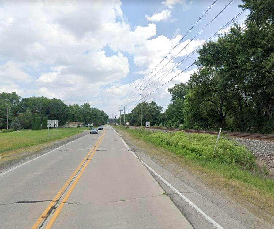
SR 32 Corridor
Existing Conditions
Gateways
Physical gateways are limited along the I-69 corridor at the Exit 234 interchange. Large, green-colored directional or guidance signs common along most highways in the United States announce the approach to adjacent communities at the Exit 234 interchange. Traveling northbound, these large directional signs announce the egress to Muncie, Anderson, SR 67 and SR 32. Slightly smaller guidance signs along the egress ramp directs traffic to Daleville, Chesterfield and nearby road service facilities. Perhaps the most prominent signage along the I-69 corridor is the large monumental Heartland Business Center sign. Additionally, upon exit of the interstate, the Chesterfield water tower and several large pole signs advertising service facilities are visually apparent in the western skyline.
Similar to northbound I-69, southbound I-69 has several larger directional signs indicating circulation to Muncie, Anderson, SR 32, and SR 67. As you exit the interstate, smaller directional signage provides information regarding Anderson, Muncie, IVY Tech, and Mounds State Park.
It has been indicated by the Town of Daleville that unclear signage has caused confusion for drivers attempting to navigate the dual egress of Exit 234. Confusion of existing signs -or lack thereof- has caused several tractor trailer operators to exit onto State Road 32 rather than their desired destination of State Road 67.
The unexpected amount of larger vehicle traffic along State Road 32 attempting to re-route back to State Road 67 has caused significant deterioration to the pavement and shoulder of State Road 32.
No prominent wayfinding signage for the Town of Daleville is present along the I-69 corridor. As you exit toward SR 67, the Chesterfield water tower becomes visually prominent to the west. The interchange would benefit from the addition of more prominent gateway signage announcing arrival to Delaware County, Daleville, and potentially the City of Muncie, IVY Tech, and Ball State University.
Traveling eastbound along SR 67 from the west, the Chesterfield water tower is readily apparent and development density increases at the intersection of Co. Rd. 500 E. As you continue to travel east, the transition from Chesterfield to Daleville is nearly indiscernible. The first announcement to Daleville occurs at the northeast corner of the SR 67 and Edwards St. intersection with a masonry gateway sign. Traveling westbound on SR 67, a masonry gateway for Daleville occurs immediately north of the S. Co. Rd. 750 W and SR 67 intersection. Daleville would benefit from additional gateway announcements along the SR 67 corridor, especially west of I-69. Recent wayfinding signage at the Walnut St. intersection is attractive and beneficial, providing direction to the park, canoe rental, and Daleville schools. SR 67 itself could be improved by a partial removal of the center turn lane and the inclusion of a planted
median with landscape treatments.
Traveling eastbound along SR 32, minimal signage exists west of I-69. Immediately east of the interchange, small wooden signage announces arrival to Daleville, and as you travel further east, an attractive masonry gateway has been recently constructed. Although downtown Yorktown is located east of Daleville on SR 32, no wayfinding signage appears to be present providing direction to the community. Westbound along SR 32, a masonry gateway announces arrival to Daleville just east of the Mound Rd. intersection and recent wayfinding signage at the Walnut St. intersection provides directional information to the park and schools.
The CSX railroad also serves as a part of the gateway experience along the SR 32 corridor as it immediately parallels the roadway west of the Walnut St. intersection. The exposed rail line and rail ballast is uninviting in appearance and active trains create significant noise. The gateway experience would benefit from landscape and wall treatments to better screen the railroad and soften the noise.
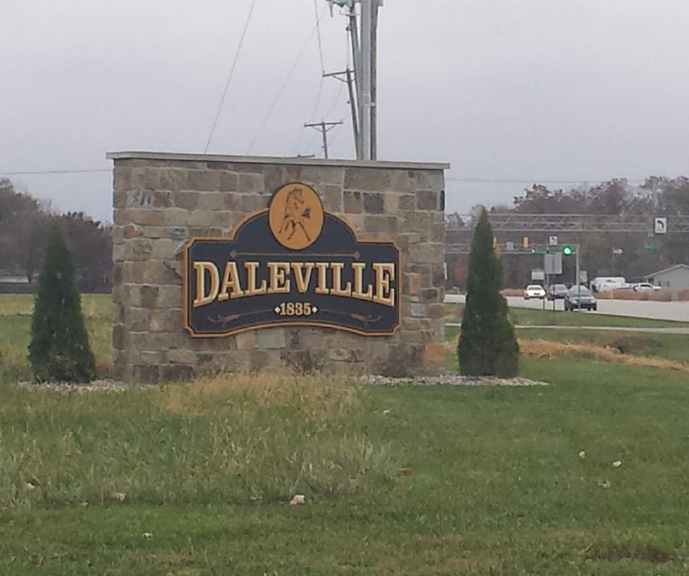

Parks & Recreation
Daleville’s primary park, Town Hall Park, is located west of Walnut Street adjacent to the existing Town Hall, and immediately south of SR 32 and the CSX railroad. Improved in 2015 to incorporate new roads, parking lots, a splash pad, performance lawn and stage, playgrounds, concession’s building, and ecological restoration of a creek, the park has become the central gathering place for the community and a regional attraction for kids visiting the large splash pad. Identified in the community’s 2014 Downtown Revitalization Plan, the park has attracted development interest and aided in the attraction of new businesses and housing within the community.
On the north side of the community, Shellabarger Park is sited on the banks of the White River and provides walking paths, a shelter, playground, and basketball court. This park, and the White River, seem to be an underutilized asset within the Daleville community. Pedestrian sidewalks and/or trails connecting the park to the community are non-existent.
At the western limits of 4th St., and immediately adjacent to I-69, the Daleville Junior Baseball and Softball Association has (3) small fields which serves as the community’s baseball/softball facilities. On axis with Daleville Community Schools, pedestrians paths connecting the facilities are not provided, but would provide a direct link and increase the walkability of the community.
Additionally, Daleville Orchard Park is an outdoor classroom and community park that has been recently embraced by the community and provides a variety of fruit available to the community, as well as amenities for use by teachers during the school day.

Recently Constructed Gateway Along SR 67
Chesterfield Water Tower Immediately West of I-69
Daleville Town Hall Park
Existing Conditions
Review of Past Plans
Town of Daleville Downtown Revitalization Plan
: The Town of Daleville adopted their Downtown Revitalization Plan in 2014. While the document was primarily focused on the historic core of the Town, it did take a more comprehensive look at the community. The plan provides an assessment of existing conditions related to amenities and infrastructure, demographics, housing, and economics and provides an analysis of the potential development effects that creation of a Mounds Reservoir would have on the community.
Specific recommendations of the plan included redevelopment of the Town Hall Park, creation of gateways into the community along SR 67 and SR 32 at I-69 and on the eastern boundary of the community, screening of the CSX railroad, establishment of trails to connect various amenities within the community, purchase and redevelopment of key downtown properties, and development of available property immediately north of SR 67. Since completion of the plan, the community has completed re-construction of the Town Hall Park, developed significant housing immediately north of SR 67, implemented gateways along SR 67 and SR 32, and completed additional planning for development of a town trail network. Additionally, the Town has purchased properties in the historic core, removed existing buildings, and prepared the sites for new development. The Town is currently planning to construct a new Town Hall at the southeast
corner of the Walnut St. and SR 32 intersection and they are currently approaching developers about additional downtown development.
Muncie-Delaware Co. Vision 2021 Five-year Economic Plan
: Focused on Delaware County as a whole, the Muncie-Delaware County, Indiana Economic Development Alliance facilitated this document to set forth the goals for fostering economic development in Delaware County between 2016 and 2021. The process was a county-wide effort where stakeholders from multiple organizations and communities met and identified goals to: enrich quality of life, enhance quality of place, expand and retain existing businesses, create a culture of education, prepare the community for the future, and encourage job growth in targeted sectors. These goals were accompanied by specific objectives, tactics, and metrics for success. Key objectives and tactics and tactics directly pertinent to this study include supporting wellness activities, making communities more bicycle and pedestrian friendly and providing transit options, expansion of commercial corridor standards, expansion of broadband access, and extensions of utilities to provide shovel-ready development sites.
Muncie-Delaware County Comprehensive Plan (2000
): This document specifically noted the need to establish enhanced corridors along the SR 67 corridor between I-69 and the City of Muncie.
ECI Regional Development Plan (2015)
:
Focused on six counties in East Central Indiana, including Delaware and Grant Counties, this plan focuses on an assessment of the existing socio-economic conditions of the region and recommending strategies for improving conditions within the counties. Many of the recommendations are focused on place making and quality of life projects. Specific to this interchange, redevelopment of Daleville’s downtown historic district at Walnut St. and SR 32 is noted as a high priority project. Other recommendations include general land banking of property to be able to offer to potential developers, as well as general “curb appeal” or aesthetic improvements.
Stakeholder Input
Below is a summary of information received from steering committee and stakeholder interviews.
• Development
• A RFP was issued in October for the development of a new town hall on the southwest corner of Walnut Street and SR 32. The current town hall facility will remain and be converted into a community center.
• There is a need for “design standards” for new development along SR 32 and Walnut Street. The intent is to have the new Town Hall Design inform the architecture of new development.
• Would like to maintain the “Mayberry” feeling within the downtown core, but to expand 2-3 times its current growth.
• There is a lack of basic services within the downtown core (quality hotel, fine dining/family restaurant, grocery store, pharmacy).
• Business development is not available along SR 32 from interchange to downtown.
• The Heartland Business Center is at 95% capacity.
• Wesco has relocated to former county-owned shell building along Innovation Drive. Since its purchase, there is no warehouse space available for future development.
• Commercial development is still desired near downtown Daleville.
• Potential for residential growth between Walnut Street and Sam Pierce Chevrolet along SR 67
corridor.
• There is a demand for industrial growth.
• Recent purchase of ADM’s 500,000 sq ft warehouse property (behind Wendy’s restaurant). The intent is to develop the area into (2) 250,000 sq ft light manufacturing and retail facilities.
• A developer has recently committed to constructing 81 full market rate housing units in an unknown location near Daleville. 41 of the units will be allocated for residents 55 and older. This development will increase the tax base and will take up a significant amount of land. The development will have limited access and noise restrictions enforced.
• The parcels northwest of Walnut Street and SR 67 are available for development. The land is owned by Sam Pierce.
Utilities
• Daleville has own water supply.
• Daleville’s municipal water does not service businesses located west of the interchange along SR 67.
• Daleville’s water supply can be supported by Chesterfield’s surplus during periods of emergency.
• There is an adequate supply of water along SR 67 to Sam Pierce Chevrolet.
Existing Conditions
Transportation
• Southbound exit to SR 67/SR 32 is confusing to motorists.
• Tractor trailers turn onto SR 32 with the intention to actually exit onto SR 67. Trucks then attempt to make u-turn on SR 32 and have damaged shoulder.
• The SR 32 corridor is visually not appealing to motorists.
• The CSX rail bridge has weathered and aged. Attempts to contact have been made to CSX, but CSX indicates that maintenance is INDOT jurisdiction.
• Vegetation has overgrown medians and shoulders at SR 32 and SR 67 interchanges. INDOT has jurisdiction of these areas. Town performs minimum maintenance and mowing of these areas.
• Daleville would like to see beautification efforts along SR 32.
• Large amount of traffic heading to Ball State University on SR 32 or SR 67.
• The roadway is not a state highway west of I-69. State Road 67 was decommissioned by INDOT. Chesterfield is supposed to maintain it, but repairs are a joint venture between Daleville and Chesterfield.
• n INDOT Community Crossings Matching Grant has been awarded to resurface the roadway and add sidewalks along SR 32. Sidewalks will be added from Daleville-Madison County line to CR 400 E.
• A secondary entrance on SR 67 for Daleville Community Schools is needed. A traffic light is discouraged by INDOT, but a right-in, right-out situation is feasible.
Gateways
• There is a need for more community identity and a sense of arrival off of I-69 interchange. Potential to develop partnership with BSU, Ivy Tech, and the City of Muncie to install a gateway or landscaping.
• Parks & Open Space
• Flatland Resources has completed a study for a trail to connect the little league baseball fields to downtown.
• The town would like to see a greenway trail spur to connect to the Daleville Public Library. The challenge will be crossing SR 67.
• Would like to see a trail developed along Tennessee Street and follow the railroad towards downtown.
• The Mounds Lake Reservoir proposal is still active. No other known information is available at this time.
Development Opportunity Diagram
General
The Town of Daleville has limited available property for new development within the existing corporate limits of the community. As discussed on the following pages, parcels south of SR 67 should be considered for future annexation to allow for continued development.
The diagram on the following page illustrates currently undeveloped property that may be considered for future development. Potential development areas include several parcels immediately surrounding the interchange that may be appropriate for development as light industrial use. These parcels are near others that currently have similar land use.
Along SR 67 east of the interchange, several parcels are of appropriate size and location for future commercial and retail development. As the town has expressed the need for additional residential development, parcels have been identified within the core of the community for multi-family housing. Parcels near the edge of the community have been identified for lower density, single family housing.
The diagram identifies the areas of each group of parcels as well as the development potential within them. Refer to Chapter 3 Shared Similarities and Planning Principles for additional information regarding development assumptions.
Please note, this land use plan and corresponding development assumptions were created to inform the infrastructure analysis and proposed project recommendations. The development figures should not be interpreted as reflective of actual market demand. This map should be updated and refined as development occurs and as a part of future community planning initiatives.

Proposed Improvements
General
The following proposed projects for the SR 32, SR 67, and I-69 interchanges will provide revitalization and enhanced traffic routing to support economic development. Recommended projects include the Town’s annexation of properties to support continued development, as well as, utility projects to increase development potential at the interchange, and a number of transportation projects focused on enhanced pedestrian safety and walkability, aesthetics, and the efficient movement of vehicles through the community.
Gateway recommendations include improvements to the existing SR 32 and SR 67 corridors, as well as improvements to the existing CSX railroad bridge and corridor, and new gateway structures at key locations throughout the Daleville community.
Refer to the Shared Similarities & Planning Principles chapters for general recommendations that apply to all interchanges within the study area.

Proposed Improvements Development
Utilities
D1: South Property Annexation
Cost: T.B.D.
Due to the limited amount of available property within the town limits for future development, annexation of the current agricultural fields south of SR 67 and east of Walnut St. is recommended to allow for future expansion of light industrial development as well as mixed residential development.
U1: Water and Sewer Upgrades
Cost: $4,800,000
Water and wastewater upgrades are recommended to provide adequate service to new development in Daleville. A water tower with approximately 400,000 gallon capacity, approximately 4,000 feet of water main, and an approximately 120 feet deep water well are recommended for additional capacity within the interchange project area. Approximately 4,000 linear feet of sanitary sewer main will be installed to service new development occurring at the interchange project area. All water mains and sanitary sewer lines can be installed within the public right-of-way. Street resurfacing will be included as part of the restoration of the area after installation of water mains and sanitary sewers.
Transportation & Access
T1: I-69/SR 67 Traffic Circle (x2)
Cost: $4,200,000
Roundabouts have been shown to decrease the severity of car crashes. Installation of two roundabouts on the entrance/exit ramps to the interstate will calm traffic while improving flow and community entry aesthetics from the interstate. Close coordination with INDOT will be necessary as this is the intersection of a State Road and Interstate. This is the likely location for any gateway or announcement to the community. Maintenance of traffic and disruption to the local community are both challenges to work through. The roundabout designs will be heavily dependent on the recommendations of the traffic study.
T2: SR 67 Corridor Enhancements
Cost: $1,500,000 - $8,500,000
Roadway enhancements are recommended to the SR 67 corridor through Daleville. These include the removal of unnecessary asphalt pavement in portions of the center of SR 67 and implementation of a curbed and landscaped median as well as new lighting and pedestrian sidewalks on both sides of the roadway. Additional improvements include new vehicular signage from the interstate to SR 67, new vehicular signage along SR 67 itself, reduction in curb cuts where feasible, and asphalt pavement restoration.
T3: Future Access Road/SR 67-Innovation Dr. Intersection Improvement
Cost: $1,100,000
An access road is recommended for development from Innovation Drive to the west to allow for future development and expansion of the existing Heartland Business Center. Amenities would include lighting, sidewalks, and landscaping in addition to roadway development. Additionally, as traffic volumes increase on Innovation Drive, intersection improvements will be needed at the SR 67 intersection to allow for increased vehicular safety.
T4: Walnut Street Improvements
Cost: $1,650,000
Walnut St. is recommended for improvements to allow for future development south of SR 67. Improvements would include roadway widening, repaving, and implementation of pedestrian sidewalks, lighting, and landscaping extending south to the overlay district boundary. New pavements would be designed to accommodate heavy vehicular traffic that may be travelling to new development south and east of the existing Heartland Business Center.
T5: School Access Road/SR 67 Intersection Improvements
Cost: $1,500,000
A new access road onto SR 67 for use by Daleville Community Schools is recommended to help alleviate traffic congestion in the mornings and afternoons during
child drop-off/pick-up. This new roadway should access SR 67 at an existing roadway intersection, or a proposed new intersection, in order to control SR 67 curb cuts and provide a potential, future signalized intersection that can help encourage growth south of SR 67 and provide a safe pedestrian crossing of SR 67. The new access road should include pedestrian sidewalks, lighting, and storm drainage infrastructure.
T6: Town Sidewalk Network
Cost: $3,250,000
A town sidewalk network is recommended to improve walkability and connect key amenities within the community along select, existing streets. Due to limited right-of-way, improvements would include sidewalks on one side of the street as well as additional amenities including lighting, curb ramps, and crosswalks. Where possible, curbs and stormwater infrastructure should be implemented to provide vertical separation and additional safety for pedestrians.
T7: SR 67 Pedestrian Trail/Sidewalk
Cost: $685,000
Understanding that pedestrian enhancements to SR 67 may be a long-term project, an immediate pedestrian connection between Walnut St. and the Daleville Public Library is recommended to provide residents with a physical, walking connection to existing town amenities.
T8: SR 67/Walnut Street Intersection
Improvements
Cost: $75,000
Improvements to the SR 67/Walnut Street intersection are recommended to provide safe pedestrian crossing over SR 67 at the community’s primary roadway intersection. Enhancements may include improved signalization and implementation of curb ramps and crosswalks.
T9: Traffic Signage/Traffic Study
Cost: $90,000
A traffic study will inform other designs and maximize funding impact by fixing signage deficiencies, which are low hanging fruit. Major roadways and intersections to be studied include:
• S.R. 67 from I-69 to C.R. 800 West
• S.R. 32 form I-69 to Walnut St.
• Entrance/Exit ramps for roundabouts
• S.R. 67/Innovation Dr. intersection
• S.R. 67/Walnut St. intersection
The study findings will help identify best methods to route traffic to and through Daleville and Chesterfield. Traffic signage will be installed where recommended to better direct southbound interstate traffic, so they don’t mistakenly exit onto S.R. 32 instead of S.R. 67. All major intersections will be studied to recommend signaling and pavement markings to provide a safe route for pedestrians.
Proposed Improvements
G1: Identity Signage
Cost: $40,000
Improved signage along I-69 is recommended to reduce confusion for motorists exiting at SR 234 who are also unfamiliar with the SR 67 and SR 32 interchange. These improvements would help alleviate errant drivers from exiting onto SR 32 instead of SR 67. Improved signage could also announce Ball State University and the City of Muncie.
G2: CSX Bridge Beautification
Cost: $85,000
Upgrades to the CSX Bridge, including repainting, is recommended to prevent deterioration of the structure and improve aesthetics of the interchange.
G3: I-69/SR 67 Gateways
Cost: $80,000 - $500,000
Gateway enhancements are recommended at the intersection of the interstate entrance/exit ramps and SR 67. These gateways could be sited within the recommended traffic circles or adjacent to the entrance/exit ramps and within the right-of-way. The gateways could be constructed in a number of ways including unique and prominent markers, masonry walls, or simple landscape enhancements. Gateways may announce arrival or direction to the Town of Daleville, City of Muncie, Ball State University, other Delaware
G4: SR 67/Walnut St. Gateway
Cost: $40,000
Additional gateway treatments are recommended at the intersection of Walnut St. and SR 67 to draw attention to the community’s primary intersection and increase interest towards the community’s historic core. Improvements may include more substantial signage and landscape treatments.
G5: SR 32/Railroad Gateway
Cost: $790,000 - $2,200,000
Landscape enhancements along SR 32 are recommended to improve the arrival experience from the interstate into Daleville along the corridor. Recommendations include installation of colorful trees and perennials along the south side of the roadway in the separation between the road and the railroad. Additionally, a decorative screen wall is recommended to control the view of the railroad and reduce the amount of noise from passing trains.
G6: SR 32/Walnut St. Gateway
Cost: $40,000
Additional gateway treatments are recommended at the intersection of Walnut St. and SR 32 to draw attention to the community’s historic intersection, encourage redevelopment, and increase interest towards the community’s historic core. Improvements may include more substantial signage and landscape treatments.
Parks & Open Space
While no specific parks and open space projects are currently proposed for Exit 234, future development should consider the protection of existing natural and environmental features. Additionally, as development south of SR 67 continues, particularly in regards to residential development, consideration should be given to establishing additional park space to service future needs.
County communities, and Delaware County itself.


5 Exit 241: SR 332
(Yorktown & Muncie)
General
Exit 241 is located within the corporate limits of the Town of Yorktown. The interchange is comprised of commercial and light manufacturing development and is home to the Park One Business Park. Transportation improvements will allow for more efficient and safer travel to and from the business park and utility improvements are needed to promote continued development into the future.
Existing Conditions Development
Exit 241 serves as the primary access point to Yorktown, SR 332, and the McGalliard commercial district of Muncie. Since 2013, Exit 241 has existed within the Town of Yorktown as Mount Pleasant Township and the Town of Yorktown consolidated. Existing development west of I-69 is limited due to Big Killbuck Creek creating a natural boundary to development. McAllister Rentals does exist northwest of the interchange between the interstate and Big Killbuck Creek. Southwest of the interchange, an abandoned waste water treatment plant exists which was recently purchased by an unknown buyer. The property is under IDEM corrective order with an EPA lien on the property.
East of the interchange, an abandoned Amoco Gas Station is present. The property has been identified by multiple developers as desirable, however, contact with the current owner has been unsuccessful. Agricultural land and wood lots surround the abandoned gas station on the north and northeast. East of the gas station, and north of SR 332, All Steel Carports is developing a new facility in the triangular property bounded by SR 332 on the south, Jackson Street on the north, and Jones Cemetery on the east.
East of the interchange and south of SR 332, Park One Business Park is home to Brevini USA, Mursix Corporation, and a Save-A-Lot Distribution Center. An empty building owned by the Brevini Corporation is
located on the eastern edge of the business park with access to a rail spur that was developed to service the facility. The facility receives regular business interest, however, remains vacant at this time. Additional acreage is available within the business park, however, it is limited. The Town of Yorktown and Delaware County are currently looking at expansion opportunity south of the existing park into the current agricultural land, and north of SR 332 and the abandoned gas station as well.
One active gas station, Get Go, is located immediately north of the Park One Business Park and shares access via SR 332 and Executive Park Road. Businesses within Park One Business Park have noted that access to food may be beneficial for employees of the business park who otherwise have to travel to Yorktown and/ or Muncie for food, which is a challenge with a limited lunch break.


Development within Park One Business Park
Development Along SR 332
Conditions Diagram
Existing Conditions
Utilities
The Town of Yorktown currently provides water and sewer service to the Park One Business Park southeast of the interchange. Sewage is collected just west of the Get Go Gas Station and then transported to the Town’s wastewater treatment facility for processing. There is currently no extension of service to Macallister Rentals northwest of the interchange and they have a selfcontained facility that gets regularly pumped. Within the Park One Business Park, the Mursix Corporation has their own water well to supplement service.
The abandoned wastewater treatment plant, in the southwest quadrant of the interchange, does not provide any service to the business park or surrounding interchange development.
AT&T is the telecom provider in the Yorktown area. Internet service to the interchange has been noted as adequate, however, there are some issues with internet access despite having a large communication and fiber line east of the interchange and along SR 332.
Gas utilities are serviced by Vectren. Infrastructure includes a 6” pipe east of theI-69 and SR 332 interchange, service is adequate; however, development along the interchange will need to be met with associated increase in service to match demand.
Electric infrastructure is owned by AEP and consists of overhead utilities. The overhead utilities extend along CR
950 W, and along SR 332 across I-69. AEP does not have overhead utilities north of SR 332, at the SR 332 and I-69 interchange. Existing service and capacity is adequate; however, major users or large growth will need to be met with an associated increase in service to match demand.
Transportation & Access
The primary east/west thoroughfare connecting to I-69 at Exit 241 is SR 332, locally known as McGalliard Road in Muncie. SR 332 is an expansive roadway with a right-of-way averaging approximately 150’ in width but widening at the I-69 interchange and at key stream crossings. Eastbound travel near the interchange consists of two-travel lanes, a left-turn lane, and a rightturn lane. It appears the left-turn lane was originally implemented for access to the former Amoco gas station which has since been vacated. Westbound travel near the interchange consists of two-travel lanes, a right-turn lane for merging onto I-69 north, and a left-turn lane for merging onto I-69 south. The intersections of both the northbound entrance/exit ramps and southbound entrance/exit ramps and SR 332 are signalized.
West of the southbound entrance/exit ramp intersection, SR 332 narrows to two travel lanes, one eastbound, and one westbound. As noted by local businesses, the abrupt shift from a four-lane roadway to a twolane roadway causes traffic congestion and vehicular accidents in the area near the entrance to McAllister Rentals. It also creates issues for trucks leaving McAllister Rentals attempting to turn on to SR 332.
East of the interchange, traffic volumes along SR 332 and the Executive Park Rd. intersection (entrance to Park One Business Park) create conflict for vehicles exiting Park One Business Park and the Get Go Gas Station Yorktown/Park One Water Tower


and turning west onto SR 332. A major priority for local businesses within the park is to improve this access onto SR 332. Due to the proximity of the intersection to the interstate entrance/exit ramp signalized intersections, INDOT does not support the addition of a signal at the existing intersection. For this reason, additional discussion has suggested the creation of a secondary access road to exit the Park One Business Park further east, potentially near the intersection of Jackson St. and SR 332.
Executive Park Rd through the Park One Business Park is comprised of an approximately 90’ wide right-ofway and a 65’ wide pave roadway. The roadway is not striped and is excessively wide as it is used as two travel lanes, one north, and one south. The aesthetics of the corridor and maintenance of the roadway could be improved with the selective removal of portion of the asphalt and the implementation of a central, landscape median. Additionally, Executive Park Rd. does not currently have any sidewalks and or trails which, if present, would provide employees pedestrian access to the Get Go gas station and encourage active living.
Other roads within Park One Business Park include Priority Way, Brevini Drive, and Jackson Street. These roadways are unstriped but function as two-way roadways. Sidewalks, lighting, and pedestrian amenities are not provided but would be beneficial for employees traveling through the business park.
North of SR 332, Jackson Street serves as the northern boundary to the All Steel Carports development. A narrow, uncurbed, and historically rural roadway, there is inadequate right-of-way to allow for future road expansion and improvements if necessary. Yorktown, or the County, may want to consider purchasing and establishing a right-of-way large enough to accommodate future development north of SR 332.
A rail spur travels connects the Norfolk Southern Railroad approximately 1.5 miles east of I-69 to the east side of the Park One Business Park and the vacant Brevini facility. The spur was established by the County for use by the Brevini Corporation. Although it has been unused to-date, the spur serves as a major amenity and attraction to potential businesses. Additionally, there is potential for extension of the rail spur to additional businesses within the Park One Business Park should demand increase.
SR 332 East of the Interchange
Executive Park Road
Existing Conditions
Gateways
Signage approaching Exit 241 when traveling northbound on I-69 notes access to Muncie and Frankton via SR 332. Within the footprint of the interchange, a large, attractive, masonry gateway announces arrival at Yorktown. State wayfinding signage on the exit ramp provides directional arrows to Frankton, Muncie, and Ball State University. Signage approaching Exit 241 when traveling southbound along I-69 directly mirrors the experience of northbound traffic. With the development of the large masonry gateway, the interchange is most visibly branded as a “Yorktown” exit. As this exit also serves as a primary access to the City of Muncie and Ball State University, efforts should be made to make an announcement to these entities as well.
SR 332 serves as a gateway corridor to Park One, Yorktown, and the City of Muncie. The road is currently characterized by an expanse of asphalt and is uninviting and unattractive. East of the Park One Business Park development where turn lanes are not required, consideration should be given to removal of pavement and implementation of landscape medians to improve the aesthetic appearance of the corridor. This recommendation directly relates to the MuncieDelaware County Comprehensive Plan completed in 2000 which recommended creation of a “Rural Treatment” zone in this area that would be comprised
of a landscape median, landscaped right-of-way, and decorative fence.
Within the Park One Business Park Executive Park Road serves as the primary gateway into the business park. The gateway experience of the corridor would be greatly improved through a reduction the area of asphalt roadway, the implementation of a landscaped median, additional perennial and tree plantings within the rightof-way, and incorporation of pedestrian amenities such as sidewalks, benches, updated lighting, etc.
Parks & Recreation

Park and recreation amenities are non-existent in proximity of the Exit 241. The nearest facilities is a public golf course located approximately 4.5 miles southeast and in closer proximity of Yorktown. The Town of Yorktown and Park One Business Park stakeholders have noted a desire to improve quality of life at the business park and create parks and recreation opportunities. Despite the lack of developed facilities, the area surrounding Exit 241 does offer potential for parks and recreation development. The low lying areas adjacent to Big Killbuck Creek and south and east of the Park One Business Park area largely undevelopable and could be developed into passive recreational facilities with trails. Additional Park One Business Park has several water features and green spaces required to mitigate stormwater runoff that could be used as passive recreation areas and developed with trails. Development of these low-lying areas in to recreational facilities directly aligns with Yorktown’s Comprehensive Development Plan to protect existing riparian corridors and better manage stormwater runoff.
Long-term, and as Park One Business Park expands and Yorktown development extends toward the interstate, consideration should be given to the development of trail systems to connect the Exit 241 interchange to the Yorktown community.
Yorktown Gateway at Exit 241 Interchange
Review of Past Plans
Yorktown Comprehensive Development Plan (2018-2022): Key recommendations of the plan included expansion of utility infrastructure to allow for future growth and economic development, as well as the development of master utility plan. Additionally, it was recommended that design standards be reviewed for commercial and industrial development and to consider the implementation of overlay districts exclusive to certain areas to further establish community identity and foster economic development. Priorities were also established for protecting existing, undeveloped areas and natural resources.
Muncie-Delaware
Co. Vision 2021 Five-year Economic Plan: Focused on Delaware County as a whole, the Muncie-Delaware County, Indiana Economic Development Alliance facilitated this document to set forth the goals for fostering economic development in Delaware County between 2016 and 2021. The process was a county-wide effort where stakeholders from multiple organizations and communities met and identified goals to: enrich quality of life, enhance quality of place, expand and retain existing businesses, create a culture of education, prepare the community for the future, and encourage job growth in targeted sectors. These goals were accompanied by specific objectives, tactics, and metrics for success. Key objectives and tactics and tactics directly pertinent to this study include supporting wellness activities, making communities more
bicycle and pedestrian friendly and providing transit options, expansion of commercial corridor standards, expansion of broadband access, and extensions of utilities to provide shovel-ready development sites.
Muncie-Delaware
County Comprehensive Plan (2000): This document provides specific recommendations for the SR 332 corridor. Recommendations for the corridor include creation of “character zones” along the corridor between the interstate and the east side of the Muncie to create a “consistent linear expression.” In the area closest to the interstate, the plan identified a “Rural District” characterized by landscape plantings and a decorative fence within the right-of-way. East of the Norfolk Southern railroad, the district slightly modified to also include a landscaped median.
From Nebo Road to Tillotson Road, a “Parkway Treatment” is recommended to include landscape buffers between the roadway and adjacent development, and a landscape median. Within Muncie, a “Village Treatment” is recommended to create a more walkable corridor with pedestrian amenities and landscape buffers between the roadway and existing development.
Existing Conditions
Stakeholder Input
Below is a summary of information received from steering committee and stakeholder interviews.
Development
• Vacant Fox Amoco gas station located northeast of interchange is visual blight; needs to be redeveloped.
• Construction currently in progress for All Steel Carports production and sales facility at SR332 and West Jackson Street.
• Concern of land availability for future development in the Park One Business Park; there is potential for expansion south of the existing park.
• Former Brevini facility is listed for sale; there has been interest but the asking price may be limiting the number of potential buyers.
• County purchased easement from Priority One to rail spur. Rail spur was originally installed by County for sole use by Brevini. County is exploring construction of road, turnaround, and laydown yard for local companies that would use the rail spur and trans-loader company services
Utilities
• Lands west of the interchange lack connection to Yorktown sewer; Town currently provides service to MacAllister Rentals but has to pump and truck off-site..
• The abandoned waste water treatment plant (WWTP) site located southwest of intersection was under IDEM corrective order. Property was recently purchased by unknown owner through tax sale.
• Town of Yorktown provides sewer service to Park One Business Park. Sewage is collected just west of BP gas station and transported to town for processing.
• Town of Yorktown provides water service through two sub-surface wells.
• 500,000 gallon sub-grade storage capacity.
• 150,000 above ground storage capacity.
• Potential issue with internet access in the area.
Communication fiber located along SR 332 east of interchange.
Transportation
• Traffic flow and safety around the interchange and nearby intersections was identified as a significant concern.
• Four lane traffic compresses to two lane traffic west of I-69 interchange. Speed limit reduces from 55 mph to 45 mph, but vehicles do not slow down. Dangerous for MacAllister Rentals tractor trailers making turns at the SR 332 and Lee Pit Road intersection.
• Congestion accumulates on Innovation Drive during changing of work shifts. It is difficult to make left turn onto SR 332 from Innovation Drive.
• Commonwealth Engineering prepared a traffic signal report for the intersection. The report’s two recommendations included traffic signal at SR 332/ Innovation Drive intersection, and a new signalized intersection near West Jackson Street.
• INDOT discourages installation of new traffic signal at Innovation Drive intersection because it is too close to existing traffic signal on I-69 ingress/egress ramps (650 feet center to center).
• •J-turns, roundabouts, or other intersection designs should be considered around this interchange.
Gateways
• Need to develop a gateway treatment that attracts and directs people from the interstate to Muncie, Ball State University, and surrounding communities.
• Potential for digital billboard or iconic landmark (similar to Nesquik rabbit near Pendleton).
• Redevelopment Commission has interest in beautifying entrance to Park One Business Park.
• Innovation Drive is too wide. Potential to reduce pavement footprint and improve lighting.
Parks & Open Space
• Yorktown wants to address quality of life in this area.
• A recommendation was made to develop a park/green space in the low-lying land near the southwest quadrant of Park One.
Development Opportunity Diagram
General
Development at Exit 241 is primarily light industrial businesses with some limited retail use. Forecasted development suggests new development will most likely be of a similar scale and character.
Park One Business Park currently has limited available property to accommodate future expansion. The diagram on the following page identifies logical parcels for future expansion with the majority of it occurring on the south and east.
Additional retail/restaurant/hotel development could be accommodated immediately adjacent to SR 332 near the interchange, however, these parcels are not appropriate for light industrial use due to available acreage.
The diagram identifies the areas of each group of parcels as well as the development potential within them, that was used to inform infrastructure planning recommendations. Refer to Chapter 3 Shared Similarities and Planning Principles for additional information regarding development assumptions.
Please note, this land use plan and corresponding development assumptions were created to inform the infrastructure analysis and proposed project recommendations. The development figures should not be interpreted as reflective of actual market demand. This map should be updated and refined as development occurs and as a part of future community planning initiatives.

Proposed Improvements
General
The following recommendations at Exit 241 focus on improvements to encourage continued development of the Park One Business Park, as well as additional economic development and expansion. Specific recommendations include annexation of additional property adjacent to the existing Park One Business Park and new utility infrastructure to support that expansion.
Transportation enhancements include completion of a traffic study and improvements to existing roadways and intersections to increase vehicular safety, efficiency, and aesthetics within and surrounding the business park, as well as new roadways to expand the existing network and encourage future growth and expansion. Pedestrian enhancements are also recommended to existing and future roadways to improve walkability.
Gateway improvements are focused on announcing arrival to the communities and attractions along SR 332 and a new trail system is recommended within the Park One Business Park.
Refer to the Shared Similarities & Planning Principles chapters for general recommendations that apply to all interchanges within the study area.
Diagram
Proposed Improvements Development
Utilities
D1: South Property Acquisition
Cost: T.B.D.
Space within the existing Park One Industrial Park is limited and expansion is needed to provide opportunities for future development. Based on existing infrastructure, logical expansion of the industrial park would occur towards the west and south and into the existing, adjacent agricultural fields. Approximately 100 acres is situated between the existing development and W CR 100 N to the south. Property values will need to be assessed to determine the costs of property acquisition.
U1: Water Upgrades
Cost: $3,500,000
Water infrastructure is likely required to provide adequate fire protection service for future development at this interchange, and add capacity if a large user develops nearby. A water tower with approximately 400,000 gallon storage capacity, approximately 5,000 feet of water main, and an approximately 120 feet deep water well with associated equipment and controls are recommended to service the interchange area. All water mains will be installed within the public right-of-way. Street resurfacing will be included in the installation of water mains as part of the typical restoration process.
Transportation & Access
T1: I-69/SR 332 Traffic Circles
Cost: $4,200,000
Roundabouts have been shown to decrease the severity of car crashes. Installation of two roundabouts on the entrance/exit ramps to the interstate will calm traffic while improving flow. Close coordination with INDOT will be necessary as this is the intersection of a State Road and Interstate. This is the likely location for any gateway or announcement to the community. Maintenance of traffic and disruption to the local community are both challenges to work through. The roundabout designs will be heavily dependent on the recommendations of the traffic study.
T2: SR 332 Corridor Enhancements
Cost: $5,600,000
Roadway enhancements are recommended to a 1.5 mile stretch of SR 332 east to the interstate. These include the removal of unnecessary asphalt pavement in portions of the center of the roadway and implementation of a curbed and landscaped median as well as new lighting. Additional improvements include new signage, landscape enhancements within the rightof-way, and some storm utility infrastructure.
T3: Access Road Extension/SR 332
–
Northern Jackson St. Intersection Improvements
Cost: $1,700,000
Intersection improvement at SR 332 and Southern Jackson Street is proposed to promote development and provide a clear exit for traffic from the Park One Business Park. Truck traffic exiting the park would be provided a signal or roundabout to help control traffic on SR 332 and allow truck traffic to enter the highway safely on the way to the interstate. A road extension to within Park One is necessary but should be coordinated with other projects within the business park.
T4: SR 332/Southern Jackson St. Intersection Improvements
Cost: $1,500,000
Intersection improvements are proposed at SR 332 and Jackson Street at the east end of the area of interest to extend access to the Business Park toward Yorktown and Muncie. This project will become a higher priority as development of the business park extends east and it is recommended to be the last intersection improvement implemented along SR 332 in this area.
T5: Jackson Street Connection
Cost: $1,100,000
Extension of Jackson Street south of SR 332 between CR 850 W and Priority Way is proposed to provide increased access within the business park and access to
the railroad spur loading dock. This, coupled with future improvements to the southern intersection of Jackson Street and SR 332 will alleviate congestion within the business park and offer an additional means of ingress/ egress further east of the interstate.
T6: Executive Park Road Landscape Median
Cost: $1,800,000
Executive Park Road, the primary entrance to the Park One Business Park, is excessively wide and recommended for aesthetic improvements. Recommendations include removal of a portion of the center of the roadway, and implementation of a curbed, landscaped median. Additional enhancements would include new sidewalks on either side of the roadway, as well as new lighting, street trees, and necessary storm drainage improvements.
T7: Existing Roadway Extension
Cost: $1,000,000
Roadway extension of Priority Way and Executive Park Road k is intended to support further development of the business park to the south and provide additional routes for truck traffic. Recommended improvements would include sidewalks, street trees, and lighting in addition to basic roadway infrastructure.
T8: Traffic Signage/Traffic Study
Cost: $65,000
A traffic study will inform other designs and maximize funding impact by fixing signage deficiencies, which are low hanging fruit. Major roadways and intersections to be studied include
o S.R. 332 from I-69 to C.R. 800 West
o S.R. 332/Executive Park Dr.
o S.R. 332/Jackson St.
The study findings will help identify best methods to route traffic to and through Yorktown, as well as focusing on the entrance/exit traffic from the Park One Business Park. All major intersections will be studied to recommend signaling and pavement markings to provide a safe route for pedestrians, where necessary.
Proposed Improvements
G3: Identify Signage
Cost: $80,000
G1: I-69/SR 332 Gateways (Muncie/ Yorktown)
Cost: $100,000
Gateway enhancements are recommended at the intersection of the interstate entrance/exit ramps and SR 332. These gateways could be sited within the recommended traffic circles or adjacent to the entrance/exit ramps and within the right-of-way. The gateways could be constructed in a number of ways including unique and prominent markers, masonry walls, or simple landscape enhancements. Gateways may announce arrival to the Town of Yorktown, City of Muncie, and potentially Ball State University, IVY Tech Community College, and other Delaware County communities.
G2: BSU Gateway
Cost: $500,000
Prominent gateways are recommended for Ball State University along the interstate and near the Exit 241 interchange to announce arrival and celebrate the university.
Identity signage along northbound and southbound I-69 is proposed to provide location information for motorists and to announce the Town of Yorktown, Ball State University, IVY Tech Community College, and other Delaware County communities.
Parks & Open Space
P1: Industrial Park Walking Trail
Cost: $1,700,000
Approximately two (2) miles of walking trails are recommended within the limits of the existing Park One Business Park. The pat would travel along the perimeter of the business park and would provide access to some of the remaining wooded areas of the property. The walking trail would consist of an 8’ wide asphalt path with lighting at regular intervals.


6 Exit 245: US 35 & SR 28 (Gaston)
General
The exit 245 interchanges located within unincorporated Delaware County. The exit serves primarily as a trucking route and development is primarily limited to logistics operations and a truck stop. Agricultural use and limited residential development surround the interchange as well.
Future development at the interchange will be contingent on utility extension. Additional recommendations include improvements to the SR 28 corridor and branding of the nearby Gaston community and Wes Del Community School system.
Existing Conditions Development
Exit 245 serves as the primary exit for US 35 South, SR 28, the Town of Gaston and Wes-Del Community Schools, the north side of Muncie to the east, Albany east of Muncie, and Alexandria to the west. West of I-69, existing development is limited to the south side of SR 28. Existing development includes R&L Carriers, a logistics’’ company, and Emily’s an auction house and rentable event center. An additional logistics’’ company and Aunt Millie’s distribution center were located west of the interstate, but have gone out of business and the properties have been purchased by R&L Carriers. North of SR 28 and west of I-69, land is undeveloped agricultural ground.
Approximately .25 miles east of I-69, a Petro Gas Station is located on the north side of SR28/US 35. A farm and residence is located immediately south of the Petro Gas Station. All other development within close proximity of the interstate is agricultural farm land and undeveloped.
Approximately three miles east of I-69, N 600 W (Yorktown-Gaston Pike) provides direct access to WesDel Community Schools, which is located approximately .2 miles north of SR28/US 35. The Town of Gaston is located approximately 2 miles north of SR 28/US 35 on N 600 W and approximately 5 miles from the I-69 interchange.


SR 28 Logistics Development
SR 28 Convenience Development
Existing Conditions
Utilities
There is a general lack of water and sewer service to the Exit 245 interchange. Currently, the existing development east and west of I-69 and adjacent to the interchange provide their own water and sanitary services. The Petro Gas Station has a relatively extensive system and is able to treat their own wastewater. The Delaware County Regional Sewer District….
Similarly, Wes Del Community Schools has their own water and sanitary sewer infrastructure and they are looking to expand their facilities to accommodate future demand. If the opportunity exists, the schools system would like to see a combined effort with the County and Gaston to upgrade the water and sanitary infrastructure in the area to service both their needs and those necessary to accommodate additional growth at the interstate, and within the Town of Gaston. In general, the lack of adequate water and sanitary utilities is limiting the development opportunity at Exit 245.
Recent engineering reports were completed to identify alternatives and costs for providing water and sanitary utilities at the interstate. The preferred option for providing water service to the interchange includes provisions for a new well, water tower, and 8” water main to service the existing development west of I-69 and extending east of the Petro Gas Station approximately .25 miles. The cost for this preferred alternative is approximately $4.3 million. While this
alternative would not provide any service to Wes-Del Community Schools, it is believed to be the most costeffective for providing the required level of service for future needs at the interstate.
The preferred alternative for providing sanitary service includes construction of a wastewater treatment plant at Killbuck Creek on N 600 W south of SR 28. An 8” gravity sewer would be implemented along N 600 W to Wes-Del Community Schools. Along SR 28, a 4” forcemain is recommended to the Petro Gas Station where a lift station would be provided. From the lift station an 8” gravity sewer would connect to the western extents of the existing development west of the interchange. Approximate costs for development of this alternate would be $8 million. While this alternative would not provide a direct connection to the School, it would allow for a future connection by the school system and would provide the required level of service, result in the least costs, and provide the most environmental benefit.
Local stakeholders have noted drainage concerns west of I-69 where water flows east from R&L Carriers and causes ponding issues on the Emily’s property.
Vectren is the gas utility provider. Gas utilities include a 2” main along CR 925 W extending south from SR 28. Existing service is adequate; however additional growth will need to be met with an associated increase in service to match demand.
Electric utility is provided by AEP, service is adequate; however, major users or large growth will need to be met with an associated increase in service to match demand. Overhead utilities exist along CR 925 W, south of SR 28, and extend along SR 28 across I-69. East of I-69, overhead utilities extend from SR 28 north along CR 875 W.
AT&T is the telecom service provider at the SR 28 and I-69 interchange. Buried fiber extends along SR 28 across I-69. Existing telecom service is adequate and will service additional growth. However large users will need to be met with an associated increase in service to match demand.
There is a lack of existing stormwater infrastructure. Future development will require stormwater drainage evaluation.


Transportation & Access
The primary east/west corridor connecting to Exit 245 is SR 28/US 35. SR 28/US 35 is characterized by an approximate 60’ right-of-way with one eastbound and one westbound travel lane and narrow shoulders located on each side of the road. At the interchange, there are no turn lanes prior to the entrance ramps to the interstate which local stakeholders have noted as a safety concern causing congestion and hazardous conditions for large trucks merging onto I-69. The nearest signalized intersection is approximately 3 miles east of the interchange at N 600 W.
West of I-69, N CR 925 W, serves as the primary north/south roadway connecting SR 28 to R&L Carriers and Emily’s facilities. The narrow county road is in need of reconstruction to accommodate heavy truck traffic that uses it to access the adjacent facilities. In the interim, a weight restriction has been placed on the roadway to prohibit vehicles beyond a certain size.
West of the interchange, N 600 W is a narrow, twolane rural road without shoulders, curbs, sidewalks, or lighting. As Gaston experiences growth toward the interstate, presumably south along N 600 W, future consideration should be given to the additional pedestrian facilities to connect Wes-Del Community Schools to the Town of Gaston.
Gateways
Traveling northbound on I-69, signage for exit 245 notes access to Alexandria and Albany. Traveling along the exit ramp, smaller scale signage notes direction to Elwood as well as Alexandria and Albany. Traveling southbound on I-69, signage for exit 245 mirrors northbound travel. In both instances, there is no reference to Gaston, Muncie, or Delaware County. Southbound travelers may benefit from a gateway noting arrival in Delaware County, and Gaston and the City of Muncie should market themselves to both north and south bound travelers.
Traveling along SR 28, small wayfinding signage near the N 600 W intersection notes direction to Gaston and Wes-Del Community Schools. The Gaston and school corporation should create a more significant announcement near the N 600 W intersection.
SR 28 Corridor Near I-69 Interchange
CR N 925 W
Existing Conditions
Parks & Recreation
Parks and recreation opportunities are limited in close proximity of Exit 245. A few existing woodlots and drainage ways exist that should be protected in order to maintain high environmental quality. East of I-69, the nearest recreational opportunity occurs at WesDel Middle and High Schools where a running track, football field, baseball field, and softball field are present.
Within the Town of Gaston, the Cardinal Greenway travels northwest/southeast and connects the Town south to Muncie and beyond. A trailhead is located within the community and future plans call for the extension of the Cardinal Greenway further to the northwest. WesDel Elementary School is located immediately adjacent to the eastern corporate limits of Gaston and provides playgrounds and a small running track.

Review of Past Plans
I-69/28 Gaston Drinking Water Preliminary Engineering Report: Completed in late 2018, this report reviews the existing water infrastructure near the Exit 245/I-69 interchange and provides alternatives for expansion of the utility to accommodate future growth. Five alternatives for expansion are referenced within the report. The alternatives review various extensions of the utility, including limiting extension to the area immediately surrounding the interchange, as well as extending it as far as the town of Gaston. The preferred concept recommends establishment of a well and water tower near the Petro Gas Station and an 8” water main servicing the existing development west of the interstate and extending east of the interstate to .25 miles east of the Petro Gas Station.
I-69/28 Gaston Sanitary Preliminary
Engineering Report: Similar to the water engineering report, the sanitary report was complete in late 2018 and reviews the existing sanitary infrastructure near the Exit 245/I-69 interchange and provides alternatives for expansion of the utility to accommodate future growth. Five alternatives for expansion are referenced within the report. The alternatives review various extensions of the utility, including limiting extension to the area immediately surrounding the interchange, as well as extending it as far as the town of Gaston. The preferred concept recommends establishment of a wastewater treatment facility near
Cardinal Greenway in Gaston
Killbuck Creek south of SR 28 on N 600 W. This alternative provides a 8” gravity system north along N 600 W to the southside of Wes-Del Community Schools. Along SR 28, a 4” force main is provided west to the Petro Gas Station where a lift station is planned and a 8” gravity system continues west to service the development west of I-69.
Economic Development Plan for the 69/28
Gaston Economic Development Area: This plan outlines general goals of increasing and enhancing business opportunities, increasing and enhancing job opportunities, and increasing and diversifying the County’s tax base. General objectives include improve water, wastewater, and storm water infrastructure, capacity and access to roadways, improving essential public services, mitigating public safety and/or health risks, creating amenities that attract and retain residents, expanding employment opportunities, and increasing property tax base.
Muncie-Delaware Co. Vision 2021 Five-year
Economic Plan: As recommendations were general in nature, refer to Exit 234 information.
ECI Regional Development Plan (2015): No specific recommendations were made for Exit 245. Refer to Exit 234 for general recommendations outlined within the document.
Stakeholder Input
Below is a summary of information received from steering committee and stakeholder interviews.
Development
• Community would like to see future growth and economic expansion, but do not want to lose the small-town “Mayberry” atmosphere.
• The Town of Gaston is considered a bedroom community. Community needs higher paying jobs and employment. Most of community works in bluecollar, lower-paying workforce.
• School leadership would like to see residential housing or mixed use development near the school at the SR 28 and CR 600 W intersection.
• The Wes Del school system offers a business-student partnership within the community.
• Many high school students attend the Muncie Area Career Center (MACC).
• School offers pathway diplomas (Project Lead the Way, Biomedical pathway, Computer Science pathway, etc.)
• There is a need for basic community services including a grocery, food and retail, and public institutions such as a library.
• Land is available on a case-by-case basis immediately adjacent to SR 28. There will be a challenge getting individual property owners willing to sell their land.
• There is a need for investment into new utilities in
order to attract new development.
Utilities
• There is currently a lack of water and sewer service to the area adjacent to the I-69 interchange.
• Wes Del Community School has own private wastewater treatment plant on site. It is nearing the end of its lifespan and will require upgrade within the next 5 years.
• Poor drainage near Emily’s property. Runoff from R+L Carriers property flows onto Emily’s property and develops standing pools.
Transportation
• Heavy equipment and large tractor trailers turning into nearby businesses have damaged CR 925 W. Protests from local residents south of SR 28 helped to pass a weight restriction ordinance on the road.
• There is a need to lengthen the northbound I-69 turn lane along SR 28. It is dangerous for trucks turning onto the ramp. Other vehicles do not have enough time to slow down or yield to trucks slowing down.
• Would like to see SR 28 widened to four lanes.
Development Opportunity Diagram
General
Development at Exit 245 primarily consists of logistics operations with some limited convenience and residential development. New development will be contingent upon utility expansion to the area, however, likely future development will consist of additional light industrial and logistics use with some additional retail needed to service trucking and interstate needs as shown on the following page.
Agricultural property surrounds the interchange and provides opportunities for future development.
The diagram identifies the areas of each group of parcels as well as the development potential within them. Refer to Chapter 3 Shared Similarities and Planning Principles for additional information regarding development assumptions.
Please note, this land use plan and corresponding development assumptions were created to inform the infrastructure analysis and proposed project recommendations. The development figures should not be interpreted as reflective of actual market demand. This map should be updated and refined as development occurs and as a part of future community planning initiatives.

Proposed Improvements
General
The following recommendations at Exit 245 focus on the installation of new water and wastewater utility infrastructure to encourage future development surrounding the interchange. An additional utility project addresses poor drainage in key areas southwest of the interchange.
Transportation projects correct deficiencies in existing roadway infrastructure to increase motorist safety and access onto the interstate. Additional recommendations suggest future roadway expansion to support new development, as well as general aesthetic recommendations. Gateway projects focus on wayfinding signage and announcing arrival to communities surrounding SR 28.
Refer to the Shared Similarities & Planning Principles chapters for general recommendations that apply to all interchanges within the study area.
Project Implementation Chart
Exit 245: US 35 & SR 28 (Gaston)
Proposed Improvements Development
No development projects are recommended at this time. Available property exists to accommodate future development.
Utilities
U1: Water and Sewer Utilities
Cost: $7,750,000
There is a lack of public water and sewer service to the existing S.R. 28 and I-69 Interchange project area. In order to provide adequate water and sewer service to the interchange area, a new water well, water tower, and water main nearby the intersection is proposed to service future development. In the future, this would replace all private wells. A water tower with approximately 400,000 gallon capacity, approximately 6,000 feet of water main, and an approximately 100 feet deep water well are recommended to service the interchange project area.
The preferred alternative for providing sanitary service includes construction of a wastewater treatment plant nearby the intersection. Wes-Del Community Schools has expressed interest in connecting to a public sanitary sewer services; however, the school is approximately 3.25 miles from the intersection which makes a connection to the school costly. Along S.R. 28, a 4” forcemain could be installed to connect the school, but this is not recommended as part of this project unless additional funding is obtained to cover this additional cost. Private treatment plants at the intersection (owned by Pilot and R&L Carriers) may be purchased or taken over as part of this project, which would provide service before the new infrastructure is completed. Approximately 3,000 feet of sewer main is proposed to collect wastewater at the interchange.
U2: Drainage Improvements:
Cost: $100,000
Drainage improvements are recommended in the southwest quadrant of the interchange to alleviate ponding issues that occurs from water shedding from west to east towards the interstate.
Transportation & Access
T1: I-69/SR28 Traffic Circles
Cost: $3,600,000
Roundabouts have been shown to decrease the severity of car crashes. Installation of two roundabouts on the entrance/exit ramps to the interstate will calm traffic while improving flow. Close coordination with INDOT will be necessary as this is the intersection of a State Road and Interstate. This is the likely location for any gateway or announcement to the community. Maintenance of traffic and disruption to the local community are both challenges to work through. The roundabout designs will be heavily dependent on the recommendations of the traffic study.
T2: CR 925 W Road Improvements
Cost: $730,000 - $1,400,000
Roadway improvements are recommended along CR 925 W to support smooth traffic flow and development. These improvements will include pavement restoration, sidewalk replacement and/or new construction, and signage for motorists. Extraneous curb cuts will be removed where possible.
T3: CR 875 W Road Improvements
Cost: $1,400,000
Roadway improvements are recommended along CR 875 W to support large trucks and smooth traffic flow and development. These improvements will include
pavement restoration, sidewalk replacement, and signage for motorists. Extraneous curb cuts will be removed where possible.
T4: Traffic Signage/Traffic Study
Cost: $1,200,000 - $2,000,000
A traffic study will inform other designs and maximize funding impact by fixing signage deficiencies, which are low hanging fruit. Major roadways and intersections include:
• S.R. 28 from I-69 to C.R. 925 W
• S.R. 28 from I-69 to 0.25 miles east of C.R. 875 W
• Entrance/Exit ramps for roundabouts
• Entrance/Exit to Pilot Truck Stop
The study findings will help identify best methods to route traffic to and through the interchange. Traffic circles at the entrance/exit ramp to I-69 from S.R. 28 are recommended to provide revitalization to the exit and enhance traffic fluidity. Gateway signage along northbound and southbound I-69 is recommended to welcome motorists and provide direction to identify the exit to Gaston.
T5: SR 28 Corridor Enhancements
Cost: $1,200,000 - $2,000,000
Roadway improvements are recommended in proximity of the interchange to widen and improve merge lanes onto the interstate. Additional improvements include
milling and resurfacing, restriping, curb construction, and installation of storm sewer improvements and new landscape plantings.
T6: SR 28 ROW Acquisition
Cost: T.B.D.
Right-of-way acquisition is recommended along SR 28 east of the interchange to allow for utility installation and to encourage future development of the land adjacent to the interstate and highway.
G2: SR 28/US 35/600 W Gateway
Cost: $40,000
A new gateway treatment is recommended near the intersection of SR28/US 35 and N CR 600 W to announce arrival and direction to the Town of Gaston and Wes Del Community Schools. Treatments should include signage and landscaping.
G3: Identity Signage
Cost: $32,000
Gateways
G1: I-69/SR 28/US 35 Gateways
Cost: $80,000 - $200,000
Gateway enhancements are recommended at the intersection of the interstate entrance/exit ramps and SR 28. These gateways could be sited within the recommended traffic circles or adjacent to the entrance/exit ramps and within the right-of-way. The gateways could be constructed in a number of ways including unique and prominent markers, masonry walls, or simple landscape enhancements. Gateways may announce arrival to the City of Muncie, Ball State University, other Delaware County communities, and Delaware County itself.
Identity signage along northbound and southbound I-69 is proposed to provide location information for motorists and provide direction to the City of Muncie, Town of Gaston, Ball State University, and Delaware County communities.
Parks & Open Space
While no parks and open space projects are currently identified for Exit 245, future development should consider the protection of existing natural and environmental features. Additionally, connections to the Town of Gaston and the Cardinal Greenway should be strongly considered if development surrounding the interchange accelerates.


7 Exit 255: SR 26
(Fairmount & Fowlerton)
General
Exit 255 is located within unincorporated Grant County and is the southernmost interchange in the county. The interchange has seen previous commercial development which has since been removed. The primary land use surrounding the interchange is agricultural with some residential development. The Town of Fowlerton is located within one and one-half miles of the interstate,
Attracting future development will be contingent on providing utilities and recommendations include improvements to SR 26 and gateways to nearby communities and points of interest.
Existing Conditions Development
Exit 255 serves as the primary exit for SR 26, the Town of Fowlerton and the Town of Fairmount west of I-69, and as a primary route to Taylor University east of the interstate. Current development surrounding the interchange is limited to agricultural land with farm residences and out buildings located north and south of SR 26 west of I-69 and south of SR 26 east of I-69. Fowler Ditch runs north/south through the agricultural ground west of the interchange and will serve as a natural barrier as future development occurs. Immediately southeast of the interchange, remnants of a former Stuckey’s convenience store provide parking for INDOT contract workers during I-69 and SR 26 construction.
The Town of Fowlerton is located approximately 2 miles southeast of the interchange. The community is relatively small with a population just under 300 and is primarily older residential development with a couple of churches. A limited number of commercial buildings remain in the location of the historic downtown.
The Town of Fairmount is located approximately 5 miles west of the Exit 255. Fairmount is a larger community with a population of just under 3,000. The community offers a historic downtown with primarily older residential housing, commercial and retail businesses, and light industry. Some newer housing is located on the west side of the community in closer proximity of SR 9.
Utilities
Utilities at the interchange are limited. Previous development such as the Stuckey’s convenience store functioned with a well and septic system. It has been noted that a general lack of utility infrastructure at the interchange is the primary reason that development has never been successful.
The Town of Fowlerton recently constructed a new waste water treatment plant in 2004 which services the community, however, the Town does not provide a water utility and residents are serviced by private wells. Sewer service is approximately 6 miles from the intersection. Natural gas is available if a demand were present.
The Town of Fowlerton is also serviced by its own waste water treatment plant which was upgraded recently. The facility has excess capacity, however, distance and topography between the community and I-69 make extension of the utilities challenging and expensive.
Electric infrastructure is serviced by AEP. Electric overhead facilities extend from along CR 900 S on the east and west sides of the interchange. Existing service is adequate; however, major users or large growth will need to be met with an associated increase in service to match demand.


Former Convenience Development East of Interchange
Town of Fowlerton Wastewater Treatment Facility
Existing Conditions
Transportation & Access
The primary corridor to Exit 255 is SR 26. The apparent right-of-way of SR 26 at the interchange is unclear, but it appears to be approximately 70’ and is comprised of two travel lanes, one eastbound and one westbound, narrow roadway shoulders, and grassed swales/ drainage ditches. The width of the roadway itself, including the shoulders, is approximately 32’.
There does not appear to be a platted right-of-way which means future improvements or expansion of the roadway will require significant coordination with adjacent property owners and potential right-of-way acquisition. Traveling west towards Fairmount, a platted right-of-way of 80’ appears to begin immediately west of CR 188 E. Traveling east from the interchange, a platted right-of-way does not appear to exist.
CR S 525 E serves as the primary north/south corridor connecting SR 26 to the Town of Fowlerton. The roadway has an apparent right-of-way of approximately 40’ which includes a two lane roadway of approximately 22’ in width. The remaining 18’ includes grassed swales/drainage ditches on either side of the roadway. If growth within Fowlerton were to occur north towards SR 26, it will require significant coordination with adjacent property owners and the acquisition of right-of-way.
Within the corporate limits of Fowlerton, S 525 E becomes Leach Ave. Leach Ave. has a platted rightof-way of 50’, which is comprised of an approximately 30’ wide roadway with two travel lanes, one north and one south, on-street parallel parking, and sidewalks separated from the roadway by narrow lawn strips. Overhead utility lines are located within the lawn strips.

Gateways
Traveling northbound on I-69, wayfinding signage for the exit provides direction to Fairmount, Hartford City, and SR 26. Signage also notes attractions including the Fairmount Museum and James Dean Museum. Traveling southbound on I-69, the gateway experience mirrors the northbound experience. The exit provides no signage or mention of Taylor University or Fowlerton which would be beneficial to the community and University. Additionally, as Exit 255 is the southernmost exit in Grant County, it may benefit from signage marketing the County as a whole.

SR 26 West of Interchange
SR 26 East of Interchange


Parks & Recreation
There are no parks and recreation facilities directly adjacent to the Exit 255 interchange. The Town of Fowlerton has limited playground equipment adjacent to The Worship Church which appears to be a former, local school.
The Town of Fairmount is home to Playacres Park which is a 13 acre facility providing a shelter house, community building, playground, picnic shelters, sports courts, and which hosts the James Dean Festival and car show every Fall. The community also has James Dean Memorial Park which is a small, passive green space with a memorial to James Dean.
As development occurs at the Exit 255 interchange, conservation of existing green space and protection of existing natural amenities and drainage ways should be considered any may provide opportunities for additional green space.
Review of Past Plans
Comprehensive Plan of Grant County, Amended 1997: Recommendations pertinent to Exit 255 included development of SR 26 as a four lane arterial to encourage economic development in Fairmount and at the interstate interchange. Additionally, the plan identified the need to protect existing, undeveloped land and natural assets near major transportation routes and to promote the James Dean history of Fairmount to increase local tourism.
ECI Regional Development Plan (2015): No specific recommendations were made for Exit 245. Refer to Exit 234 for general recommendations outlined within the document.
Exit 255 Identity Signage
Exit 255 Identity Signage
Existing Conditions
Stakeholder Input
Below is a summary of information received from steering committee and stakeholder interviews.
Development
• Previous development occurred at interchange without foresight or planning for sewage connection.
• Previous businesses at the interchange included Stuckey’s and Grandma’s Filling Station.
• Currently no active businesses at interchange. Stuckey’s building was demolished. The remnants of the parking lot and building foundation are used for parking for INDOT contract workers.
• Would like to see more restaurant/dining businesses in this area.
Utilities
• A new Fowlerton waste water treatment plant (WWTP) was completed in 2004. The town does not have a water utility. Residences and businesses access private wells for water source.
• Access to natural gas is possible.
• Fairmount is serviced by its own WWTP. It was upgraded a few years ago. The WWTP has excess capacity. Connection to interstate is a challenge due to topography (valleys and ridges). Would have to use lift stations and pump to higher elevation.
Transportation
• SR 26 was poorly maintained and in disrepair. INDOT recently resurfaced portions of the road.
• State Road 26 is the fastest route to Taylor University when traveling northbound on I-69. However, many access the university by traveling along SR 22 in order to travel through Upland.
Gateways
• •There is no sense of arrival at the I-69 interchange into any of the communities or Grant County in general.
Development Opportunity Diagram
General
Exit 255 remains largely undeveloped and agricultural use surrounds the interchange. Future development will be contingent upon utility infrastructure extensions to the area or construction of on-site infrastructure; however, due to the interchange’s proximity to other developed interchanges, significant development is not expected in the near future.
Refer to the following pages for recommendations that will enable the interchange to support development long-term.
Please note, this land use plan and corresponding development assumptions were created to inform the infrastructure analysis and proposed project recommendations. The development figures should not be interpreted as reflective of actual market demand. This map should be updated and refined as development occurs and as a part of future community planning initiatives.

Exit 245 Development Opportunity Diagram
Proposed Improvements
General
The following recommendations at Exit 255 focus on improving existing conditions and setting the stage for future development. Recommendations include the remediation of formerly developed sites and the implementation of water and wastewater infrastructure to support future growth and development.
Transportation projects focus on improvements to the existing state roads, including acquisition of right-of-way that does not currently exist. Additional transportation recommendations include the development of traffic circles at the interchange and state road intersections. Gateways, wayfinding, and identify signage are recommended along the interstate, as well as within the interchange and at the intersections of roadways to adjacent communities.
Refer to the Shared Similarities & Planning Principles chapters for general recommendations that apply to all interchanges within the study area. Exit 255: SR 26 (Fairmount & Fowlerton) Project Implementation Chart
Proposed Improvements Development
Utilities
D1: Brownfield Remediation
Cost: $75,000
Remediation of the former gas station/convenience store/restaurant site in the southeast quadrant of the interchange is recommended. This will include removal and clean up of any underground storage tanks, as well as removal of any remaining concrete footings, slabs, and parking areas. The site could then be reseeded or incorporated into the adjacent agricultural landscape.
U1: Water and Sewer Utilities
Cost: $6,200,000
Water and wastewater upgrades are recommended in the future to provide adequate service to new development at the Exit 255 interchange. A water tower with approximately 400,000 gallon capacity, approximately 6,000 feet of water main, and an approximately 100 feet deep water well are recommended to service the interchange project area. Approximately 6,000 feet of sewer main is proposed to collect wastewater from the intersection and transport it to the Fowlerton wastewater treatment plant. Street resurfacing will be included as part of the restoration of the area after installation of water mains and sanitary sewers.
Transportation & Access
T1: SR 26 ROW Acquisition
Cost: T.B.D.
Right-of-way acquisition is recommended along SR 26 to allow for future roadway improvements and widening in accordance with the Grant County Comprehensive Plan. Right-of-way may also be able to be acquired as properties are parceled and developed.
T2: I-69/SR 26 Traffic Circles
Cost: $4,200,000
Roundabouts have been shown to decrease the severity of car crashes. Installation of two roundabouts on the entrance/exit ramps to the interstate will calm traffic while improving flow. Close coordination with INDOT will be necessary as this is the intersection of a State Road and Interstate. This is the likely location for any gateway or announcement to the community. Maintenance of traffic and disruption to the local community are both challenges to work through. The roundabout designs will be heavily dependent on the recommendations of the traffic study.
T3: Traffic Signage/Traffic Study
Cost: $80,000
A traffic study will inform other designs and maximize funding impact by fixing signage deficiencies, which are low hanging fruit. Major roadways and intersections to be studied include:
• S.R. 26 from I-69 to C.R. 700 E
• S.R. 32 from I-69 to C.R. 500 E
This study proposes identity signage at the C.R. E 900 S and I-69 Interchange is recommended to provide direction to Fowlerton, Grant County, and Taylor University is recommended to benefit the community and University to travelers along northbound and southbound I-69.
Gateways
G1: I-69/SR 26 Gateways
Cost: $80,000 - $200,000 Gateway enhancements are recommended at the intersection of the interstate entrance/exit ramps and SR 26. These gateways could be sited within the recommended traffic circles or adjacent to the entrance/exit ramps and within the right-of-way. The gateways could be constructed in a number of ways including unique and prominent markers, masonry walls, or simple landscape enhancements. Gateways may announce arrival/direction to the Town of Fowlerton, Town of Fairmount, Taylor University, Indiana Wesleyan University, other Grant County communities, as well as Grant County itself.
G2: Fairmount/Fowlerton Gateway
Cost: $40,000
A new, secondary gateway comprised of signage and landscape enhancements is recommended near the intersection of S 525 E and SR 26 to announce direction/arrival to the Town of Fowlerton and Town of Fairmount.
G3: Identity Signage
Cost $80,000
Identity signage along northbound and southbound I-69 is proposed to provide location information for motorists. In addition to the signage for Fairmount and Hartford City that currently exists, signage for Fowlerton, Taylor University, and Indiana Wesleyan University should be added.
Parks & Open Space
While no parks and open space projects are currently identified for Exit 255, future development should consider the protection of existing natural and environmental features. Additionally, because of the Town of Fowlerton’s proximity to the interchange, improved parks and open space facilities will be an important quality of life attraction for new residential development.


8 Exit 259: US 35 & SR 22
(Gas City & Upland)
General
Exit 259 is located within the corporate limits of the City of Gas City. One of the most developed interchanges in the study area, this interchange is comprised of commercial and convenience development immediately adjacent to the interstate. Further west, development along SR 22/US 35 transitions to logistics and light manufacturing uses with some residential development. Gas City is well prepared for future development. Utility infrastructure has been extended to the interchange and the community holds several available properties for future development.
Recommendations for the interchange include improvements to existing roadways and new gateways that will provide the quality of life improvements attractive to potential development.
Existing Conditions Development
Exit 259 serves as the primary exit for SR 22, US 35 North, Gas City, Upland, and Taylor University. Additionally, many people travel to Indiana Wesleyan University via SR 22. The interchange lies within the corporate limits of Gas City and development immediately surrounding the interchange is characterized by convenience stores and gas stations, fast food restaurants, and hotels. Within .25 mile west of the interchange, the development begins transitioning to distribution/warehouse, logistics, light industrial, and mixed commercial businesses. Approximately .75 miles west of the interchange, the Gas City Speedway attracts tourists to regularly scheduled events during the spring, summer, and fall months.
Developable property still exists west of the interchange. The Gas City Redevelopment Commission owns approximately 19 acres north and west of Taco Bell and the Phillips 66 gas station which is bounded by Munire Dr. on the north, Sloan Dr. on the west, Beaner Blvd. and SR 22 on the south, and which extends as far west as the I-69 right-of-way. Additional agricultural land is available north of Earthwise Plastics as well.
South of SR 22 and immediately west of the interchange, a significant amount of agricultural land is undeveloped and privately owned. Just west of S 600 E, and south of the Gas City Speedway, The City of Gas city controls approximately 60 acres of property which is prime for development. West of the property noted above, and
slightly less than 1.5 miles west of the interchange, at the intersection of SR 22 and S 500 E, the Gas City Industrial Park is located south of SR 22. The industrial park is home to a large Walmart distribution facility; American Woodmark, a large cabinet manufacturing facility; Butterworth Industries, a robotics coverings manufacturer; AVG Group, an automotive accessories manufacturer; and Wright Repairs, an electric motor repair shop. The industrial park appears to have several developable parcels remaining available. Additionally a significant amount of agricultural land remains undeveloped northwest of the SR 22 and S 500 E intersection. Northeast of the intersection, several apartment buildings and town homes have been developed. The Central Railroad of Indianapolis is located approximately .5 south of SR 22 and serves as a logical boundary to southern development.
West of the Gas City Industrial Park at the intersection of SR 22 and Olynger Rd., Gas City is developing a 1,200 seat auditorium to host community and school performances. The center will be funded by the City, operated by the school corporation, and will also be available for rental and use as an event facility.
East of I-69, existing development is less dense and is limited to primarily gas stations, fast food restaurants, a hotel, and some mixed commercial and service industries. A significant amount of agricultural land remains undeveloped and privately held between the interstate and the Town of Upland.

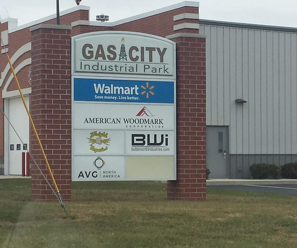
Convenience Development Along SR 22
Gas City Light Manufacturing and Logistics Development
Existing Conditions
Utilities
The City of Gas City has extended utilities from the community east to the Exit 259 interchange, and beyond to CR 700 E. The City has developed a secondary fire/ EMS station at the Gas City Industrial park as well as an electrical substation to provide adequate resources for development.
Immediately northwest of the interchange, the City has constructed a large water tower to provide adequate water service to the development surrounding the interstate. Water service is adequate for existing users, and has capacity to service future development.
Wastewater utilities are provided by the City of Gas City. Wastewater is collected from the interchange area and transported to the City of Gaston’s wastewater treatment facility. Wastewater infrastructure is adequate at the interchange and has capacity to provide service to future development; however, major users would require upgrade.
Gas infrastructure is serviced by Vectren. A high pressured 10” steel gas main extends along CR 500 S. 2” low pressure gas main is located around the interchange to service the existing area. The existing area is adequately serviced with capacity to service future development. Large growth will need to be met with an associated increase in service to match demand.
AEP provides electric infrastructure to the interchange. Overhead utilities extend along CR 500 S and underground utilities exist east of the interchange along Kaybee Drive and Amyway Drive.
Telecom service is provided by AT&T with extensive utilities around the interchange. Service at the interchange has capacity for future growth; however, major users or large growth will need to be met with an associated increase in service to match demand.
Transportation & Access

The primary east/west corridor connecting to I-69 at Exit 259 is SR 22/US 35 North. Immediately surrounding the interchange, SR 22 is approximately 52’ wide and comprised of an eastbound travel lane, westbound travel lane, center turn lane, and narrow asphalt shoulders. The right-of-way varies. West of the interstate, a platted right-of way exists for the north half of the roadway and extends west to CR 600 E. Along this same stretch of SR 22, properties south of SR 22 appear to extend to the center line of the road. West of 600 E and extending to 500 E, SR 22 appears to have a right-of-way easement, although, adjacent property lines extend to the center of the roadway. West of 500 E, and extending into Gas City, SR 22 has a platted right-of-way of approximately 120’. The platted right-of-way narrows to 70’ west of 10th St. in Gas City. As development continues along SR 22 towards the interstate, it will be necessary to plat right-of-way as the opportunity arises to allow for future roadway improvements to the corridor.
Within Gas City, sidewalks are sporadic east of 6th St. West of 6th St., sidewalks are provided north and south of SR 22 and are separated from the roadway by lawn strips. Between 3rd and 1st Streets, the lawn strips are removed to accommodate on-street parking and larger sidewalks through the historic commercial core of the community.
Electric Substation Near Industrial Park


East of the Exit 259 interchange, the right-of-way varies as well with some platted right-of-way north and south of SR 22 extending to CR 700 E. East of CR 700 E, which is also the approximate corporate limits of Gas City, there is not a platted right-of-way until arrival at SR 5 just west of Upland, where a platted right-of-way occurs on the south side of SR 22. East of the intersection of CR 500 S, a platted right-of-way is present both north and south of SR 22 with a total right-of-way of approximately 100’. SR 22 in this location remains a two lane road with narrow shoulders.
Within Upland, SR 22 is a curbed roadway comprised of a 50’ platted right-of-way which includes two travel lanes and sidewalks separated from the road by lawn strips. Through the historic downtown area between Anson St. and the railroad overpass south of downtown, the lawn strips are primarily removed and the sidewalk widens.
Additional roadways immediately surrounding the interchange are characteristically vehicular oriented and do not provide pedestrian amenities such as sidewalks, lighting, crosswalks, etc. As additional hotels and housing are developed within proximity of the interstate, consideration should be given to the addition of pedestrian amenities to allow for multi-modal travel and improved walkability. Additionally, it has been noted by local stakeholders that the shared driveway condition at the Hardee’s and Starbucks development is confusing, inconvenient, and would benefit from access
improvements. While there are numerous curb cuts from the convenience development onto SR 22, the curb cuts are not currently excessive. The number of curb cuts should be regulated to avoid creating future hazards and, where possible, access from side and frontage roads should be encouraged.
Roadways within the core of both Gas City and Upland are more traditionally developed with basic pedestrian amenities, although some roadways in both communities do lack basic infrastructure such as lighting, curbs, adequate drainage, and sidewalks. As these communities continue to develop and implement quality of life improvements, basic pedestrian infrastructure should be included.
Additionally, the Central Railroad of Indianapolis travels north/south along the western side of Gas City connecting north to Marion. The railroad alignment shifts to and east/west orientation through Gas City and runs parallel to SR 22 connecting to Upland and ultimately Hartford City. The Marion Municipal Airport is also located just west of Gas City.
SR 22/US 35
Beaner Boulevard
Existing Conditions
Gateways
Northbound on I-69, wayfinding signage denotes exit to US 35 North, SR 22, Gas City, and Upland at Exit 259. Additionally, tall interstate signage advertises local gas stations, restaurants and hotels. The Gas City water tower does become visually prominent and provides an announcement of arrival to the community. Along the exit ramp, additional wayfinding signage is provided to note local gas stations, restaurants, and hotels. The experience on southbound I-69 directly mirrors the experience of northbound I-69 with the exception of the Gas City water tower being much more prominent.
Along the interstate, and as it is exited at Exit 259, there is no wayfinding or marketing for Taylor University or Indiana Wesleyan University. As this is a primary exit to both of these universities, they should have a presence at the interstate.
Along SR 22 west towards Gas City, the unique gas well style light posts provide a sense of place, however, the corridor lacks a grand statement of arrival to the community. Further west at the intersection of S 500E, the Gas City Fire Station and Gas City Industrial Park, and signage, provide an increased density at the intersection that creates a sense of arrival to the community. The construction of the new auditorium at Olynger Road will create a prominent structure along SR 22 that will further increase the density of the corridor and act as a gateway. At the Thompson Trucking facility, the density of the community significantly increases and there is a strong sense of arrival to a community.
SR 22 itself is a gateway to the Gas City community. The roadway is currently striped with a center turn lane from the I-69 interchange west to 10th St. Where it would not have a negative effect on future development, Gas City may consider removal of selective pavement and the implementation of a landscaped median. Additionally, the right-of-way adjacent to SR 22 would benefit from additional landscape planting.
Traveling east into Upland along SR 22, the community as recently constructed an attractive gateway just east of the E 500 S intersection. The community, as well as Taylor University, should consider additional gateway signage in closer proximity of I-69. Additionally, the SR 22 corridor, which serve as a gateway into the Upland community, could be improved with additional landscaping within the right-of-way.

Parks & Recreation
There are no publicly owned parks and recreation facilities directly adjacent to the Exit 259 interchange, however, several existing woodlots and drainage ways are present. As development continues along SR 22 and within existing agricultural land, these natural features should be protected which will present future opportunities for new public parks and recreation facilities.
Approximately one mile north and east of the Exit 259 interchange on County Rd. 400 S, Sports Lake Campground is a 56 acre, privately owned facility offering a swimming pool, nature trails, miniature golf, basketball court, horse shoe pits, fishing lake, and playgrounds. Immediately north of Sports Lake Campground and directly across CR 400 S, Walnut Creek Golf Course is a privately owned, 36 hole golf course that attracts a significant number of users on an annual basis.
Within the communities of Gas City and Upland, several parks facilities are available. Gas City Park is the community’s largest facility. Located four miles west of the Exit 259 interchange on the west side of Gas City and adjacent to the Mississinewa River, the park offers shelter houses, ball diamonds, tennis and pickleball courts, a swimming pool, playgrounds, and pond for fishing. Additional recreation amenities within Gas City include the elementary, middle, and high schools which each provide large green spaces, tracks, and ball fields.
Gas City Water Tower
Within Upland, Upland Park provides multiple baseball/softball fields, playgrounds, rentable shelter houses, tennis courts and large, passive green space. Upland Depot Park, sited on Main St., celebrates the community’s railroad heritage and offers a restored depot, caboose, wooden train, clock tower, and landscaping.
Taylor University also provides numerous recreation facilities. The Kesler Student Activities Center provides indoor basketball courts, fitness equipment and training, and a pool. Additionally, the University offers football, baseball, and softball fields, as well as a field and track complex, cross country course through the Taylor Wilderness, and tennis courts.
Review of Past Plans
Comprehensive Plan of Grant County, Amended 1997: The document included policies regarding the development of key corridors within Grant County. Polices specific to SR 22 included:
• Insuring that adequate utilities were provided.
• Creating a high standard of visual quality along the entrance corridor to Gas City including color coordination, landscaping, signage, building height, and building location along the corridor
• Not allowing storage areas for equipment and materials.
• Limiting highway access to existing access points, and that in order to minimize strip development, private access to collector roads would be limited to one per 660’ on each side.
• Preserving natural features including drainage ways, woodlands, and interesting topography.
• Review of development plans prior to approval and construction.
• Encouraging planned unit developments.
Additionally, the plan notes the need for a city-county agency to regulate park development and address additional park needs, specifically for Gas City and Marion.
ECI Regional Development Plan (2015): No specific recommendations were made for Exit 245. Refer to Exit 234 for general recommendations outlined within the document.
Existing Conditions
Stakeholder Input
Below is a summary of information received from steering committee and stakeholder interviews.
Development
• There is existing development at the I-69 interchange, but the community desires more. There is land available for future expansion and growth.
• Gas City is in the process of constructing a new $10 million 1,200-seat auditorium and civic center at the corner of Olynger Road and US 35. The auditorium will host community and school performances. The civic center will be funded by the city, but operated by the Mississinewa Community School.
• Need to create a high visibility of convenient/ service facilities.
• There have been several inquiries by manufacturing companies to develop at this intersection. Most companies require 50 to 100 acres of developable land.
• There is currently housing east of the interchange close to the Gas City corporate limits.
• The existing strip mall east of the interchange is vacant. There is a need to re-develop the property.
Utilities
• The Hardee’s property holds water after storm events. There is a concern that standing water will freeze and be hazardous in the parking lot.
• There is a need to improve surface drainage east of I-69 interchange.
Transportation
• The community would like to see the I-69 interchange overpass bridge rebuilt to accommodate 6 lanes of traffic and provide twolane access for trucks.
• There is no order to vehicular circulation. Potential to develop a frontage road to reduce curb cuts along SR 28.
Gateways
• Need to add signs to direct visitors to Indiana Indiana Wesleyan University (IWU) and Taylor University.
• Potential to develop “Educational Corridor” identity and coordinated signage along I-69 (Anderson University, Ivy Tech, Ball State University, Indiana Indiana Wesleyan University, and Taylor University).
Parks & Open Space
• Potential to expand pedestrian greenway and connect to Upland greenway or Cardinal Greenway.
Development Opportunity Diagram
General
Existing development at Exit 259 is primarily located within the corporate limits of the City of Gas City. Development varies and includes multiple land uses. Compatible future land use consists of additional light industrial development and retail/restaurant/hotel development. Due to the limited size of many parcels immediately adjacent to SR 22, development near the corridor is primarily appropriate for additional retail/ restaurant/hotel development. Parcels set back from SR 22 are larger and provide opportunities for additional light industrial and commercial/office development.
Multiple parcels within the existing corporate boundaries of the city are controlled by government bodies and remain available for additional development as shown in the diagram on the following page. Additionally, the diagram illustrates parcels immediately adjacent to the existing corporate boundary which may be appropriate for future development should additional space be needed.
The diagram identifies the areas of each group of parcels as well as the development potential within them. Refer to Chapter 3 Shared Similarities and Planning Principles for additional information regarding development assumptions.
Please note, this land use plan and corresponding development assumptions were created to inform the infrastructure analysis and proposed project recommendations. The development figures should not be interpreted as reflective of actual market demand. This map should be updated and refined as development occurs and as a part of future community planning initiatives.

Exit 259 Development Opportunity Diagram
Proposed Improvements
General
The following recommendations at Exit 259 support continued development of the interchange. Specific recommendations include acquisition of right-ofway along SR 22, as well as other improvements to the state road and surrounding roadways that will enhance automobile efficiency and improve pedestrian walkability and aesthetics. Underdeveloped roadways are recommended for improvements to support existing and continued development.
Gateway, wayfinding, and identity enhancements are recommended at key locations to announce arrival, and provide direction to, surrounding communities and points of interest.
Refer to the Shared Similarities & Planning Principles chapters for general recommendations that apply to all interchanges within the study area.
Keynote Project Description
Project Implementation Chart
Exit 259: US 35 & SR 22 (Gas City)
Proposed Improvements Development
No development recommendations are currently provided. Gas City controls adequate property to support continued development into the near future.
Transportation & Access
T1: SR 22 ROW Acquisition
Cost: T.B.D.
Right-of-way along SR 22/US 35 in proximity of the interchange is inconsistent. As new development occurs and opportunities arise, right-of-way acquisition should continue to be a high priority to allow for future roadway improvements.
T2: I-69/SR 22 Traffic Circles
Cost: $3,600,000
Utilities
No utility recommendations are currently provided. Gas City has extended adequate utilities to the interchange to support development into the near future.
Roundabouts have been shown to decrease the severity of car crashes. Installation of two roundabouts on the entrance/exit ramps to the interstate will calm traffic while improving flow. Close coordination with INDOT will be necessary as this is the intersection of a State Road and Interstate. This is the likely location for any gateway or announcement to the community. Maintenance of traffic and disruption to the local community are both challenges to work through. The roundabout designs will be heavily dependent on the recommendations of the traffic study.
T3: SR 22 Corridor Enhancements
Cost: $400,000 - $5,000,000
Improvements to SR 22/US 35 include the removal of excess pavement where the turning lane is unneeded and unused and the creation of a curbed, landscape median. Additional improvements will include new lighting, signage, street trees, and pedestrian sidewalks along the corridor.
T4: S600E Road Reconstruction
Cost: $860,000
Roadway improvements are recommended along C.R. 600 E from 0.25 miles north of the interchange to 0.25 miles south of the interchange. Roadway improvements are deemed necessary as the current conditions of the road show degradation from traffic. These improvements will also revitalize the half mile radius around the interchange to promote growth and development in the area. These improvements will include pavement restoration and signage for motorists.
T5: Beaner Boulevard Pedestrian Improvements
Cost: $325,000
Recommended improvements include sidewalks, lighting, and signage to improve walkability and connectivity between hotels and convenience development. Improvements to Beaner Boulevard will help establish setbacks and encourage future development.
T6: Traffic Signage/Traffic Study
Cost: $45,000
A traffic study will inform other designs and maximize funding impact by fixing signage deficiencies, which are low hanging fruit. Major roadways and intersections to be studied include
• S.R. 22 from I-69 to C.R. 500 E
• S.R. 22 from I-69 to C.R. 700 E
• Entrance/Exit ramps for roundabouts
• S.R. 22/Beaner Boulevard intersection
• S.R. 22/C.R. 600 E intersection
The study findings will help identify best methods to route traffic to and through the Interchange. Traffic signage will be installed where recommended to better direct interstate traffic. All major intersections will be studied to recommend signaling and pavement markings to provide a safe route for pedestrians.
Gateways
G1: I-69/SR 22 Gateways
Cost: $80,000 - $500,000
Gateway enhancements are recommended at the intersection of the interstate entrance/exit ramps and SR 22/US 35. These gateways could be sited within the recommended traffic circles or adjacent to the entrance/exit ramps and within the right-of-way. The gateways could be constructed in a number of ways including unique and prominent markers, masonry walls, or simple landscape enhancements. Gateways may announce arrival/direction to the City of Gas City, Town of Upland, Taylor University, Indiana Wesleyan University, and other Grant County communities.
G2: Identify Signage
Cost: $40,000
Identity signage along northbound and southbound I-69 is proposed to provide location information for motorists and to identify communities and points of interest that do not already have a presence along the interstate. These may include Taylor University, Indiana Wesleyan University, and other Grant County communities.
Parks & Open Space
While no specific parks and open space projects are currently proposed for Exit 259, future development should consider the protection of existing natural and environmental features. Additionally, as development surrounding SR 22 continues, particularly in regards to residential development, consideration should be given to establishing additional park space to service future needs.


General
Exit 264: SR 18
(Marion & Van Buren)
Exit 264 is located within the corporate limits of the City of Marion. The interchange is comprised of commercial, light manufacturing, and convenience development immediately adjacent to the interstate. Marion has extended utility infrastructure to the interchange and is unique when compared to other interchanges in the service as IVY Tech Community College is located immediately adjacent to the interchange.
Recommendations for the interchange include improvements to existing roadways to make them more walkable for pedestrians traveling to and from IVY Tech. Additionally, gateway enhancements are recommended to celebrate the nearby communities of Marion and Van Buren, as well as local points of interest such as IVY Tech and Indiana Wesleyan University.
Existing Conditions Development
Exit 264 serves as the primary interchange for SR 18, Marion, Montpelier, and Van Buren. West of the interchange, the majority of the property surrounding it is within the corporate limits of the City of Marion. East of the interchange, the City of Marion does encompass the Love’s Travel Stop and a small residential development immediately east of CR 700 E. Development immediately surrounding the interchange is characterized by convenience development including truck stops, gas stations, fast food restaurants, and a hotel. Additionally, a Harley Davidson dealership is located southwest of the interchange and a model home development is located southeast of the interchange.
South of the Harley Davidson dealership, Ivy Tech Community College is located adjacent to Commerce Drive and I-69. Immediately west of Ivy Tech, a large Dunham’s Sports Distribution Center is sited adjacent to CR S 600 E. Across SR 22 and west of N 600 E, a large Dollar General Distribution Center is present.
A large amount of developable land remains available surrounding the interchange. Immediately west of the interstate and north of SR 22, several parcels directly adjacent to SR 22 remain undeveloped between the recently constructed Flying J Travel Center and the Mike Anderson Ram Truck Center. North of these facilities and Big Play Way, several undeveloped parcels remain and provide approximately 100 acres of development
potential. South of SR 22 and west of the interchange, several available parcels provide opportunity for additional convenience development. Located between Commerce Drive and S 600 E, 30+ acres remains undeveloped and used as farmland. West of S 600 E, more than 70 acres of currently agricultural land remains undeveloped, although some has had some infrastructure development, including roads, and utilities. West of S 600 E and the Dollar General Distribution Center, hundreds of acres remain undeveloped and offer potential for new development as it pushes west towards the City of Marion.
East of the Exit 264 interchange, land remains primarily undeveloped and in-use for agriculture with the exception of the Love’s Travel Stop and Redbud Homes. New development should be focused towards the west and the City of Marion.


SR 18 Distribution Development
SR 18 Convenience Development

Conditions Diagram
Existing Conditions
Utilities
The City of Marion has extended major sewer and water service from the city east to the Exit 264 interchange and beyond to the housing development immediately east of CR 700 E. Additionally, service extensions are routed along the primary intersecting roadways west of I-69 including Commerce Drive, S 600 E, and N 600 E.
16” water main extends along the south side of SR 18 across the I-69 Interchange. Water infrastructure for the City of Marion has adequate capacity to service future development. However, major users or large growth will need to be met with an associated increase in service to match demand.
An 8” sewer main services the housing development immediately east of CR 700 E. The 8” sewer main expands to 12” sewer main, which extends along SR 18, parallel to the 16” water main. Sewer infrastructure has available capacity for growth; however, major users or large growth will need to be met with an associated increase in service to match demand.
Electric infrastructure is serviced by AEP and includes overhead facilities, along the north side of SR 18 across the interchange. Existing service is adequate with capacity for development. AT&T provides telecom service to the interchange. Telecom service is adequate with available capacity for limited growth; however, major users or large growth will need to be met with an associated increase in service to match demand.


Transportation & Access
The primary corridor connecting to I-69 at Exit 264 is SR 18. SR 18 west of the interchange is a divided highway comprised of two westbound travel lanes with emergency shoulders, two eastbound travel lanes with emergency shoulders, and a central grass median. The platted right-of-way varies between 210’ and 275’ west to S 600 E. West of S 600 E, the platted right-ofway widens to 320’. The right-of-way width remains consistent west to the location the highway splits just east of the Mississinewa River and becomes E. 3rd St. (westbound) and E. 4th St. (eastbound) within the City of Marion.
East of the Exit 264 interchange, the platted right-of-way of SR 18 is 150’ to approximately the midpoint between the interchange and CR 700 E. Through this stretch of roadway, SR 18 remains a divided highway with four total travel lanes. East of the midpoint, SR 18 narrows to a two lane roadway with one travel lane eastbound and one travel lane westbound, as well as narrow, paved shoulders. Once the roadway transitions to a two-lane configuration, there does not appear to be a platted right-of-way; adjacent property lines extend to the center of the roadway.
North/south roadways intersecting SR 18 within ½ mile of Exit 264 include Commerce Drive and S 600 E west of the interchange and Tippey Ditch Rd. and CR 700 E east of the interchange. These roadways are
SR 18 East of the Interchange
SR 18 West of the Interchange
characteristically vehicular oriented and do not provide pedestrian amenities such as sidewalks, lighting, seating, etc.
Commerce Drive has a platted right-of-way averaging 60’ and it is the direct access to Ivy Tech Community College north of SR 18. The roadway consists of one northbound travel lane, one southbound travel lane, and narrow paved shoulders. Local stakeholders have noted that pedestrian improvements to allow access to Ivy Tech would be beneficial due to a large number of students who commute from Marion and do not have vehicles or regular vehicle access.
North of SR 18, the entrance to the recently constructed Flying J Travel Center aligns with Commerce Drive south of SR 18. The entrance provides one travel lane into the facility, and right and left turning lanes exiting the facility.
S 600 E has a platted right-of-way averaging 110’ and provides direct access to the Dunham’s Sports Distribution Center. The roadway is comprised of one northbound travel lane, one southbound travel lane, a center turn lane, and paved shoulders. The roadway has been designed to accommodate additional development east and west of the corridor south to E 100S.
North of SR 18, N 600 E has a platted right-of-way from the centerline west of 50’ and extending north along the Dollar General Distribution Center. Along
this same stretch, property lines on the east side of the property extend to the centerline of the roadway. North of the Dollar General Distribution Center, property lines extend to the center of the roadway along both sides. Additional development along N 600 E will require infrastructure improvements to the roadway and acquisition of additional right-of-way.
East of the interchange and intersecting Commerce Drive, Corridor Drive serves as a frontage road running parallel to SR 18 and services America’s Best Value Inn, the BP Gas Station, Arby’s, and the Harley Davidson dealership. The roadway terminates at the interstate right-of-way on the east and just beyond the hotel on the west. If the roadway were to extend west to S 600 E, it would align with E. Montpelier Pike. Montpelier Pike serves as a frontage road running parallel to SR 18. The roadway ends approximately 3 miles west of S 600 E and just west of S. Bethlehem Rd (CR 300 E). Montpelier Pike is relatively narrow, averaging 24’, and the platted right of way for SR 18 extends to the centerline. The property lines for the bounding, private property on the south extend to the centerline of the roadway and there is no platted right-of-way on the south. Local stakeholders have noted the roadway should be considered as a potential pedestrian route for connecting the City of Marion to the Exit 264 interchange development.
East of the interchange, north of SR 18, and intersecting N 600 E, Big Play Way provides east/west access

between the Flying J Travel Center and N 600 E. Platted with a 50’ right-of-way, the roadway will provide access to future development north of the travel center.
East of the Exit 264 interchange, Tippey Ditch Road provides access to the Love’s Travel Stop and agricultural ground north of SR 18. South of SR 18, the roadway provides access to Redbud Homes. Tippey Ditch Rd. appears to be privately maintained and has no platted right-of-way. Further east, N 700 E is a relatively narrow, two lane roadway approximately 22’ in width. There is no platted right-of-way and adjacent private property extends to the centerline of the roadway.
Commerce Drive
Existing Conditions
Gateways
Northbound on I-69, Exit 264 signage provides wayfinding for SR 18, Marion, and Montpelier. While exiting the interstate, additional signage provides wayfinding for Marion National Cemetery, Ivy Tech Community College, Tucker Career & Tech Center, the Quilter’s Hall of Fame, and truck stops and fast food restaurants. Prior to exiting I-69, Ivy Tech Community College provides a strong and attractive interstate presence with outdoor walking paths and gathering areas. Tall signage for the local convenience development is also very apparent. There is no unique announcement for arrival at the City of Marion and there is no reference to Indiana Wesleyan University. Additionally, there is no reference to Grant County or Van Buren along I-69 or while exiting the roadway. The southbound experience along I-69 directly mirrors the northbound experience, with the exception of the Ivy Tech presence.
While Ivy Tech has a prominent presence along I-69, its presence along SR 18 which serves as the primary access to Commerce Dr. is non-existent. The college should consider the addition of prominent gateway/ wayfinding signage at the intersection of Commerce Drive and SR 18.
Traveling westbound along SR 18 towards the City of Marion, the SR 18 corridor acts as a gateway into the community. There is no announcement of arrival to
Marion as a traveler exits I-69 onto SR 18 and due to a lack of dense development between the interstate and Pennsylvania St. to the west, the corridor does not feel as though it is within any community or municipality. The addition of attractive landscaping within the central median and right-of-way should be considered to improve the aesthetic approach to the community and to develop a sense of place. Gateway signage is located within the central median immediately east of the location where the roadway diverges and becomes 3rd and 4th Streets within the community. Further east of this location, a digital marquee announces arrival at the Grant County Fairgrounds. Continuing east, the 3rd Street bridge crossing the Mississinewa River and Ballard Field, a local community park, provide additional opportunity for gateway announcement and community celebration. Eastbound on SR 18, the 4th Street bridge and Mississinewa River provide gateway opportunities as you leave the City center.
Upon exiting I-69 and traveling eastbound, there is no wayfinding or gateway signage for Van Buren. Wayfinding signage is present at the approach to the SR 5 intersection. The community should consider additional branding and welcoming signage in closer proximity of the Exit 264 interchange.


Exit 264 Interstate Wayfinding Signage
City of Marion Gateway Signage
Parks & Recreation
The Ivy Tech Community College campus is located immediately adjacent to I-69 and within ½ mile of SR 18. While the facility is not technically a public park, the grounds provides walking paths, outdoor gathering areas, wooded areas, and a large pond/water retention feature.
Additionally, significant undeveloped ground surrounds the interchange. While much of the acreage is comprised of active agricultural land, multiple woodlots and drainage ways provide opportunities for future conservation and park opportunities.
The City of Marion west of the interchange provides an extensive parks systems. On the east side of the community, Ballard Field includes three soccer fields, public restrooms, and space available for special events. The City of Marion parks systems provides access to 13 additional parks, as well as the Cardinal Greenway and Mississinewa River. Indiana Wesleyan University, located on the south side of Marion, also provides numerous indoor and outdoor athletic and recreational facilities,
Located approximately .75 mile east of the interchange, Green Acres Campground provides access to a number of RV sites and hosts regular festivals and live events.
Review of Past Plans
Comprehensive Plan of Grant County, Amended 1997: The document included policies regarding the development of key corridors within Grant County. Polices specific to SR 22 included:
• Insuring that adequate utilities were provided.
• Creating a high standard of visual quality along the entrance corridor to Gas City including color coordination, landscaping, signage, building height, and building location along the corridor
• Not allowing storage areas for equipment and materials.
• Limiting highway access to existing access points, and that in order to minimize strip development, private access to collector roads would be limited to one per 660’ on each side.
• Preserving natural features including drainage ways, woodlands, and interesting topography.
• Review of development plans prior to approval and construction.
• Encouraging planned unit developments.
Additionally, the plan notes the need for a city-county agency to regulate park development and address additional park needs, specifically for Gas City and Marion.
ECI Regional Development Plan (2015): No specific recommendations were made for Exit 245. Refer to Exit 234 for general recommendations outlined within the document.
Stakeholder Input
Below is a summary of information received from steering committee and stakeholder interviews.
• Development
• Ivy Tech Community College provides education for Grant, Blackford, and Jay counties. It acts as an anchor for the interchange area.
Transportation
• Several accidents have been observed at the intersection of CR 600 E and SR 18. A recent fatality occurred at the intersection.
• The entrance to Ivy Tech is not clear. There is a need for better gateway signage.
• There is a need for better vehicular signage at the Flying J. Large tractor trailers turn into the entrance for vehicles and drive through parking lot.
• Many Ivy Tech students ride bicycle or moped to classes, and do not have access to personal car.
• Marion Public Transportation is available, but service ends at 5:00 PM. The last class ends at 9:30 PM.
• A large volume of pedestrian traffic walks from Ivy Tech Community College to adjacent Dollar General and convenient stores to eat lunch.
• There is a lack of basic pedestrian infrastructure. Site lighting, sidewalks, and traffic calming are needed.
• There is a desire to develop bike lanes along SR 18
Development Opportunity Diagram
General
Existing development at Exit 264 is primarily located within the corporate limits of the City of Marion. Development varies and includes multiple land uses. Compatible future land use consists of additional light industrial development and retail/restaurant/hotel development.
Multiple parcels within the existing corporate boundaries of the city remain available for additional development as shown in the diagram on the following page. Light industrial development is shown set back from SR 18 due to available acreage and parcel sizes. Available parcels immediately adjacent to SR 18 are smaller and more conducive to retail/restaurant/hotel development.
Additional recommendations include developing existing, impacted areas, and maintaining existing natural features for conservation.
The diagram identifies the areas of each group of parcels as well as the development potential within them. Refer to Chapter 3 Shared Similarities and Planning Principles for additional information regarding development assumptions.
Please note, this land use plan and corresponding development assumptions were created to inform the infrastructure analysis and proposed project recommendations. The development figures should not be interpreted as reflective of actual market demand. This map should be updated and refined as development occurs and as a part of future community planning initiatives.

Proposed Improvements
General
The following recommendations at Exit 264 support continued development at the interchange. Projects focus on transportation enhancements to improve under-developed roadway infrastructure, increase automobile efficiency and safety, and improve aesthetics along the SR 18 corridor. Recommendations include the development of pedestrian infrastructure to improve walkability and provide better connectivity to IVY Tech Community College, convenience development, and the City of Marion.
Gateway improvements target enhanced wayfinding and identity signage in addition to landscape enhancements that promote local communities and points of interest with proximity of the interchange.
Refer to the Shared Similarities & Planning Principles chapters for general recommendations that apply to all interchanges within the study area.
Exit 264: SR 18 (Marion & Van Buren)
Proposed Improvements
Development
No development recommendations are currently provided. The City of Marion has adequate property available to support development into the foreseeable future.
Transportation & Access
T1: SR 18 Corridor Enhancements
Cost: $3,000,000
Recommendations along SR 18 include the addition of curbs to existing medians, as well as enhanced landscape plantings, pedestrian sidewalks, street trees, and lighting. Unnecessary curb cuts will be removed where possible. Additional signage and intersection improvements are also recommended.
T2: CR 600 E Road Reconstruction
Cost: $820,000 - $1,900,000
Utilities
No utility recommendations are currently provided. The City of Marion has extended adequate utilities to the interchange to support development into the near future.
Roadway reconstruction is recommended along CR 600 E north of SR 18 to accommodate large truck traffic that currently accesses the Dollar General Distribution facility and to support future development along the corridor. Improvements would include new asphalt, curbs, storm sewers, sidewalks, lighting, and drainage infrastructure, as well as removal of excess curb cuts where possible.
T3: Commerce Drive Road Reconstruction/ Pedestrian Enhancements
Cost: $100,000 - $675,000
Improvements to Commerce Drive are primarily focused on pedestrian enhancements to increase walkability to IVY Tech Community College. Recommended improvements would include asphalt restoration, new concrete curbs where necessary, sidewalks separated from the curb line where space allows, signage, and
installation of street trees and roadway and sidewalk lighting.
T4: IVY Tech Bus Stop
Cost: $75,000
A new City of Marion bus stop is recommended near the entrance to the IVY Tech facility to improve student mobility from the central part of Marion. The bus stop should consist of signage, a shelter, and should become a part of a regular bus route.
T5: IVY Tech/Commerce Dr. Bus Stop
Cost: $125,000
A new City of Marion bus stop is recommended near the intersection of Commerce Drive and SR 18. This will allow access from central Marion to the development near the interstate and for students traveling between IVY Tech Community College and Marion. The bus stop should consist of signage, a shelter, and should become a part of a regular bus route.
T6: Commerce Drive/SR 18 Intersection Improvements
Cost: $150,000
Intersection improvements at the SR 18/Commerce Drive intersection are proposed to enhance pedestrian safety and walkability across the intersection. Recommendations include enhance traffic signalization, a pedestrian queuing zone, regulatory signage, and new crosswalk striping.
T7: I-69/SR 18 Traffic Circles
Cost: $4,200,000
Roundabouts have been shown to decrease the severity of car crashes. Installation of two roundabouts on the entrance/exit ramps to the interstate will calm traffic while improving flow. Close coordination with INDOT will be necessary as this is the intersection of a State Road and Interstate. This is the likely location for any gateway or announcement to the community. Maintenance of traffic and disruption to the local community are both challenges to work through. The roundabout designs will be heavily dependent on the recommendations of the traffic study. This study proposes a roundabout at the entrance/exit ramps of the S.R. 18 and I-69 Interchange to provide revitalization to the exit and enhance traffic fluidity.
T8: Traffic Signage/Traffic Study
Cost: $65,000
A traffic study will inform other designs and maximize funding impact by fixing signage deficiencies, which are low hanging fruit. Major roadways and intersections to be studied include
• SR 18 from I-69 to C.R. 700 E.
• SR 18 from I-69 to C.R. 500 E.
• Entrance/Exit ramps for roundabouts
• SR 18/C.R. 600 E Intersection
• SR 18/Commerce Dr. Intersection
All major intersections will be studied to recommend signaling and pavement markings to provide a safe route for pedestrians.
Gateways
G1: I-69/SR 18 Gateways
Cost: $80,000 - $500,000
Gateway enhancements are recommended at the intersection of the interstate entrance/exit ramps and SR 18. These gateways could be sited within the recommended traffic circles or adjacent to the entrance/exit ramps and within the right-of-way. The gateways could be constructed in a number of ways including unique and prominent markers, masonry walls, or simple landscape enhancements. Gateways may announce arrival/direction to the City of Marion, Van Buren, Indiana Wesleyan University, and other Grant County communities, as well as the county itself.
G2: IVY Tech Gateway
Cost: $40,000 - $150,000
A new gateway marker for IVY Tech Community College is recommended at the intersection of Commerce Drive and SR 18. This gateway should be prominent in order to attract motorist’s attention and provide a sense of arrival and direction the facility.
G3: Identity Signage
Cost: $40,000
Identity signage along northbound and southbound I-69 is proposed to provide location information for motorists and to identify communities and points of interest that do not already have a presence along the interstate. These
may include the City of Marion, Van Buren, Indiana Wesleyan University, and Grant County.
G4:
Van Buren Gateway
Cost: $40,000
A gateway for the Town of Van Buren is recommended at the intersection of SR 5 and SR 18 to provide direction to the community. This could take several forms but may include improve signage, masonry construction, and landscape treatments.
Parks & Open Space
While no specific parks and open space projects are currently proposed for Exit 264, future development should consider the protection of existing natural and environmental features. Additionally, as development surrounding SR 18 continues, consideration should be given to establishing additional park space to service future needs. The IVY Tech Community College campus should consider it’s potential role in the context of the interstate and surrounding development as there may be future opportunities for the campus to service parks and open space needs.


10Economic Impact Analysis
General
The following chapter outlines the potential economic impact of the proposed development at each of the previously discussed interchanges as well as assumptions for how the development impact was arrived at.
Economic Impact Analysis
General
The preceding chapters detail planning and infrastructure investments adjacent to six interstate exits from 234 through 264 on Interstate 69. These are located in Delaware and Grant Counties in East Central Indiana. This region experienced significant economic restructuring over the past half century, with the loss of more than 36,000 persons, or nearly 16 percent of its population since 1970. Most of that loss was due to household migration to more urban places.
The economic changes of the past 50 years also influenced the composition of employment. Manufacturing lost roughly 25,000 positions, or twothirds of all jobs. Non-manufacturing employment more than replaced the lost factory jobs, with almost 28,000 new jobs, a roughly 45 percent increase from 1970.
These economic changes also fueled expansion of urban population and geographic size. Indianapolis Metropolitan area grew by a third in just the first two decades of the 20th Century. Just over a quarter of the nearly half million new residents were due to the addition of Madison County to the metropolitan area. This reflects the geographic expansion of urbanization along Interstate 69, north of Indianapolis.
The six interstate exits examined and reviewed in the preceding chapters represent the future of the geographic expansion of the greater Indianapolis region. Indeed, the only two regions experiencing
population growth within East Central Indiana are those in Daleville and Yorktown, the two most geographically proximal to Indianapolis.
Many factors determine economic growth within a region. The quality and quantity of human capital and private and public capital. This planning document focuses on the availability and deployment of public capital in the form of infrastructure and land use planning. The availability of public capital influences the location, type, size and productivity of both human and private capital. The plans detailed in this report offer options to communities for developing public capital for these purposes.
A number of studies evaluate the role of enhancements to transportation infrastructure. David Aschauer (1989) offered early work that generated a long discussion of the role of infrastructure investments and output growth. This was followed by work from Holtz-Eakin and Schwartz (1995), Munnell (1990), Rubin (1991), and Morrison and Schwartz (1996) who all report positive impacts of highway investments. Hicks (2006) reports clustering of economic activity along Indiana’s highways, and outlined the effects of corridor development in Appalachia (Hicks, 2014) The conclusion from these works is simply that there is evidence of at least modest and persistent benefits to regions of aggregate public capital investment (1).
These studies examine the historical path of development
as highways are constructed. That option is unavailable to us in the setting of this document. To evaluate the potential economic impact of the public capital investments outlined in this document, we use instead an input-output analysis. In this analysis we use the available space outlined in each exit’s plans to derive the direct impact on employment or sales for firms. This generates indirect effects as these firms and household purchase inputs to production, and induced effects as other firms respond to increased demand locally.
The input-output analysis assumes perfectly elastic labor supply, which is in practice means that there is sufficient available labor to meet existing demand for new business. It also assumes linearity in production relationships along with static productivity changes during the short run. We address each of these issues in our summary.
Each of the interstate exits was offered some infrastructure improvements, with different types of potential development from large, levels of commercial and light industrial, to community gateway and wayfinding only. These activities require infrastructure spending, which is estimated for each location.
The preceding chapters also detail potential options for commercial, industrial and residential investment. They report square footage of commercial and industrial activities, which permit us to translate these investments into potential economic activity. To accomplish this, we
use common estimates of employment or revenue for each activity.
We assume that each square foot of restaurants or accommodations will generate at least $150 per square foot of revenue. This is a minimally profitable level, and so should be viewed as conservative. For commercial property, we assumed each employee would require 300 square feet of space, and for light industrial property we assumed 800 square feet per employee.
For each interchange, we present the potential impact of this infrastructure and proposed land use, when full. Following that discussion, we will discuss the aggregate potential impact, as well as limitations to this approach.
We will also discuss these estimates against the expected path of manufacturing, logistics, commercial and residential development in these areas.
(1) See Aschauer, D.A. 1989. Is public expenditure productive?. Journal of Monetary Economics. 23(2): 177-200., Holtz-Eakin, D., and A.E. Scwhartz. 1995. Spatial Productivity Spillovers from Public Infrastructure: Evidence from State Highways. NBER Working Paper, 5004., Munnell, A.H. 1990. Why has productivity growth declined? Productivity and public investment. New England Economic Review, Jan/Feb: 3-22. Rubin, L. S. 1991. Productivity and the public capital stock: Another look (No. 118). Board of Governors of the Federal Reserve System (US). Morrison, C.J., and A.E. Schwartz. 1996. Public infrastructure, private input demand, and economic performance in New England manufacturing. Journal of Business & Economic Statistics 14(1): 91-101. Rubin, L. S. 1991. Productivity and the public capital stock: Another look (No. 118). Board of Governors of the Federal Reserve System (US). Hicks, M.J., 2014. Estimating the impact of highways on economic activity: Evidence from Appalachian Development Corridor G. Journal of Regional Analysis & Policy, 44(2), pp.132-142. and Hicks, MJ . “Transportation and infrastructure, retail clustering, and local public finance: Evidence from Wal-Mart’s expansion.” Regional Economic Development, Federal Reserve Bank of Kansas City, (2006): 100-114.
Economic Impact Analysis
Exit 234 (Daleville/Chesterfield/SR 67/SR 32)
The plans presented in Chapter 4 of this report, detail infrastructure spending of between $19.8 and $28 million, with some property annexation not estimated. They also detail a large residential setting, with over 725 available units of single and mixed residential units. They outline land use planning for over 900,000 square feet of light industrial property, over 300,000 feet of retail, restaurant and accommodations and almost 200,000 square feet of commercial or office space.
The following tables outline the construction impacts, retail, accommodations and restaurants, commercial/ office use and light manufacturing and warehousing use. Construction Impacts at Exit 234
Accommodations, Retail and Restaurant Impacts at Exit 234
Office/Commercial Impacts at Exit 234
Light Manufacturing and Logistics Impacts at Exit 234
Exit 241 (Yorktown/Muncie/SR 332)
The plans presented in Chapter 5 of this report, detail infrastructure spending of roughly $22 million. That chapter also outlined land use planning for over 3.5 million square feet of light industrial property, and over 150,000 feet of retail, restaurant and accommodations. The following tables outline the construction impacts, retail, accommodations and restaurants and light manufacturing and warehousing
Accommodations, Retail and Restaurant Impacts at Exit 241
Light Manufacturing and Logistics Impacts at Exit 241
Economic Impact Analysis
Exit 245 (Gaston/US 35/SR 28)
The plans presented in Chapter 6 of this report, detail infrastructure spending of between $14.7 and $16.58 million. That chapter also outlined land use planning for over 2.0 million square feet of light industrial property, and over 155,000 feet of retail, restaurant and accommodations. The following tables outline the construction impacts, retail, accommodations and restaurants and light manufacturing and warehousing use.
Exit 255 (Fowlerton/Fairmount/SR 26)
The plans presented in Chapter 7 of this report, detail infrastructure spending of between $10.7 and $10.8 million. This investment was for the remediation of existing brownfields, gateway, wayfinding and signage, along with a large future development of water and sewer utilities. The sum of these investments generates the following construction impacts.
Economic Impact Analysis
Exit 259 (Gas City/Upton/US 35/SR 22)
The plans presented in Chapter 8 of this report, detail infrastructure spending of between $5.3 and $10.3 million. That chapter outlines land use planning for over 1.4 million square feet of light industrial property, over 130,000 feet of retail, restaurant and accommodations and almost 220,000 square feet of commercial or office space.
The following tables outline the construction impacts, retail, accommodations and restaurants, commercial/ office use and light manufacturing and warehousing use.
Exit 264 (Marion/Van Buren/SR 18)
The plans presented in Chapter 9 of this report, detail infrastructure spending of between $8.6 and $10.9 million. That chapter also outlined land use planning for over 2.3 million square feet of light industrial property, and over 84,000 feet of retail, restaurant and accommodations. The following tables outline the construction impacts, retail, accommodations and restaurants and light manufacturing and warehousing use.
Economic Impact Analysis
Summary and Discussion
This chapter presents research, a method of analysis and estimates of the potential of infrastructure and land use developments along six exits along I-69. These areas are certain to experience economic growth over the coming decades as the population of Indianapolis continues to expand north along I-69. Indeed, the two most southerly of these exits have visible impacts of that expansion.
The modeling provided here does not measure potential population growth due to new housing. We note that there is obvious housing pressure in Yorktown and Daleville, but that housing is heavily oversupplied across East Central Indiana. Any potential impacts on population growth will have to be accompanied by additional investment in public services in both communities.
The land use plans for each of these exits reflect similar activities in other locations distant from metropolitan areas that approach 2 million population. For that reason, we are very confident of the economic impact estimates of the commercial and office space facilities, as well as that of the retail, accommodation and restaurant activities. Labor in the coming decades, as well as demand for these services continue to rise. Across the entirely of the region, these levels of employment are consistent with a two-decade growth pattern north, along I-69.
The light industrial property outlined in these plans offers a more challenging absorption in that sector. The available space for light industrial property is sufficient for almost 12,000 additional workers at current occupancy rates. Manufacturing employment in this region will see losses in the coming decades. It is unlikely that these counties will experience any net manufacturing growth in the coming years. However, this space may help preserve some existing manufacturing firms who find their current locations unacceptable for future levels of production. Also, thee facilities are likely to be ideal for logistics and warehousing. Under each of these scenario’s the sales or output impact will be similar to that of light manufacturing. The employment impact will be roughly 15 percent that of light manufacturing.
The assumptions deployed in this chapter are consistent with economic modeling. For example, labor elasticity is well within realistic ranges given the size of the area from which employers may draw. However, the most difficult demographic forecasts are of population growth contiguous to large metropolitan areas. In recent decades, forecasts of urbanization underestimated both population and geographic growth of urban places.