For personal use only
Highlights:

Highlights:
• New drill campaign commences to define significant JORC Resource
• 36 reverse circulation holes planned for total length of 5,400 metres
• Drill permits approved to enable an expanded program up to 55 holes
• Drilling expected to be completed by Mid-December 2022
American Rare Earths Limited (ASX: ARR, OTCQB: ARRNF, FSE: 1BHA) (ARR or ‘the Company’) is pleased to announce that exploration drilling will commence on October 5, 2022 to drill 36 reverse circulation (R/C) holes to define a maiden JORC resource at the 100% owned Halleck Creek project. Each drill hole is planned for a depth of 150 metres, for a total length of 5,400 metres. An additional 19 holes have been permitted to enable the program to be further expanded.
The Company contracted with FTE Drilling USA Inc to perform the work and expects drilling to be completed by Mid December 2022.

This new drill campaign closely follows the capital raise of A$14.0 million the Company performed in August 2022 and the 328% increased exploration target announced in September 2022.
Managing Director and CEO Chris Gibbs commented:
“We’re very excited to commence this drilling program to advance the massive Halleck Creek Project
“The success of the maiden drill campaign saw us announce on September 1, 2022, the boosting of the exploration target by 328% to a globally significant 1.01 1.27 billion tonnes of rare earth mineralised rocks.
“After completing a A$14 million placement, announced on 17 August 2022, we are well capitalised to unlock the project’s potential and drive it forward into 2023 and beyond.
“Further encouragement for the progress of Halleck Creek came from the test work results on ore from our large scale La Paz project, announced last week. These are significant for both projects because of the similarities between the ore.
“We’ve also initiated metallurgy test work specifically for Halleck Creek ore and look forward to providing an update on this as soon as results are available”.
The Company plans on using the results of this exploration drilling to define a JORC Compliant Maiden Resource at Halleck Creek. Work on developing initial geological models and grade models will commence in Q4 2022. The Company hopes to present Maiden Resource estimates in Q1 2023, depending on time required for all assays be completed.
Development of a JORC Resource at Halleck Creek is the next step in development after the updated JORC compliant Exploration Target estimate released September 1, 2022. The updated exploration targets outline between 1.01 and 1.27 billion tonnes of rare earth mineralised rocks with TREO grades ranging between 2,245 ppm and 2,807 ppm (Figure 1 and Figure 2). Readers are advised that the potential quantity and grade of the Halleck Creek resource are conceptual in nature, and there has been insufficient exploration to estimate a Mineral Resource and that it is uncertain if further exploration will result in the estimation of a Mineral Resource. The Exploration Target in Table 1 has been prepared and reported in accordance with the 2012 edition of the JORC code.
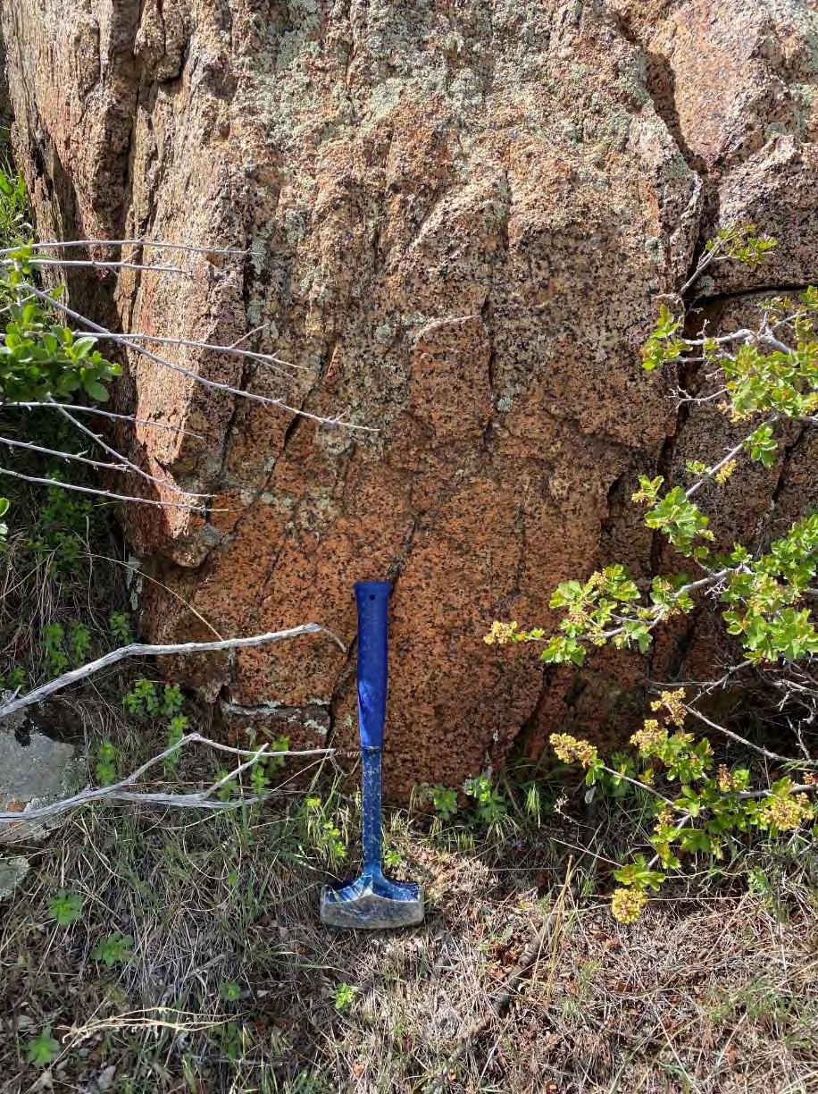 CQM Outcrop at Halleck Creek Rare Earths Project, Wyoming USA
* Photo by Sara Stotter
CQM Outcrop at Halleck Creek Rare Earths Project, Wyoming USA
* Photo by Sara Stotter
 Figure 1: Overton Mountain Proposed Drill Hole Locations

Completing the drilling campaign at Halleck Creek will be the focus of the Company's operational personnel in the near term. The data collected from this drilling will be used to prepare our first detailed geological models of the area and then define the maiden JORC resource in Q1 2023.
We have initiated metallurgy test work for Halleck Creek ore with Wood Australia and Nagrom Laboratories in Western Australia. We look forward to updating the market as these results come to hand.
This market announcement has been authorised for release to the market by the Board of American Rare Earths Limited.
Mr Chris Gibbs CEO & Managing DirectorThe information in this document is based on a company memorandum entitled "2022 Exploration Target Summary of the Halleck Creek Project Area", August 2022, compiled by Mr Dwight Kinnes employed by American Rare Earths, respectively. This memorandum has been reviewed and approved for release by Mr Dwight Kinnes (Society of Mining Engineers #4063295RM) is employed by American Rare Earths and has sufficient experience which is relevant to the style of mineralisation and type of deposit under consideration and to the activity which he is undertaking to qualify as a Competent Person as defined in the 2012 JORC Code. Mr Kinnes consents to the inclusion in the report of the matters based upon the information in the form and context in which it appears.
About American Rare Earths:
American Rare Earths Limited (ASX: ARR, OTCQB: ARRNF, FSE: 1BHA) is an Australian company listed on the ASX with assets in the growing rare earth metals sector of the United States of America, emerging as an alternative international supply chain to China's market dominance of a global rare earth market expected to expand to US$20 billion by the mid 2020s. The Company's mission is to supply Critical Materials for Renewable Energy, Green Tech, Electric Vehicles, National Security, and a Carbon Reduced Future.
Western Rare Earths (WRE) is the wholly owned US subsidiary of the Company. The Company owns 100% of the world class La Paz Rare Earth Project, located 170km northwest of Phoenix, Arizona. As a large tonnage, bulk deposit, La Paz is potentially the largest, rare earth deposit in the USA and benefits from containing exceptionally low penalty elements such as radioactive t horium and uranium. Approximately 742 928 million tonnes of Rare Earths mineralised rocks are identified as an exploration target in the La Paz Rare Earths Project’s Southwest area with an average TREO Grade of 350 400ppm and Scandium Oxide grade of 20 24.5ppm. The new exploration Target is additive to the La Paz Rare Earth project recently upgraded 170MT Resource. (ASX Announcement, 29 September 2021). During the period from February to April 2022 the Company drilled nine holes for 821 metres and collected 677 samples in the La Paz southwest area. The assay results from the first 332 samples demonstrate rock type associated with higher rare earth grades. The enhanced grades and thickness of the mineralised zone have accelerated
exploration planning. Preliminary metallurgical test work demonstrates that La Paz ore can be effectively concentrated using conventional magnetic separation, selective grinding and direct flotation. Under the guidance of Wood Australia, advanced metallurgy and mineral processing test work is near completion with Nagrom Laboratories in Perth Western Australia (ASX Announcement, 7 April 2022).
In the first half of 2021, The Company acquired the USA REE asset, the Halleck Creek Project in Wyoming. Since acquiring the asset, the Company has increased the land holding to over 6,000+ acres. Approximately 1,015 to 1,268 million tonnes of rare earths mineralised rocks were identified as an exploration target for the Halleck Creek project area with an average Total Rare Earth Oxide (TREO) grade of 2,245 2,807 ppm. The Exploration Target estimate includes between 2.8 and 3.56 million In Place tonnes of TREO at Halleck Creek. The maiden exploration drilling program was completed in April 2022. The Company is executing a drilling program with the objective of defining a high tonnage maiden JORC resource.
La Paz and Halleck Creek's mineral profiles are incorporated into emerging US advanced rare earth processing technologies in collaboration with US national laboratories, major universities and the US DOE innovation hub, the Critical Materials Institute.
Section 1 Sampling Techniques and Data (Criteria in this section apply to all succeeding sections.) Criteria JORC Code explanation
Nature and quality of sampling (e.g. cut channels, random chips, or specific specialised industry standard measurement tools appropriate to the minerals under investigation, such as downhole gamma sondes, handheld XRF instruments, etc.). These examples should not be taken as limiting the broad meaning of sampling.
In March and April 2022, WRE drilled nine HQ sized core holes across the Halleck Creek Resource claim area. All holes were approximately 350 ft with the exception of one hole which was terminated at 194 ft. Total drilled length of 3,008 ft (917 m). Rock core was divided into sample lengths of 5 ft (1.52 m) long and at key lithological breaks.
An additional 71 surface rock samples were collected on claim areas east of the Overton Mountain study area.
Sampling techniques
Include reference to measures taken to ensure sample representivity and the appropriate calibration of any measurement tools or systems used.
Aspects of the determination of mineralisation that are Material to the Public Report.
In cases where 'industry standard' work has been done, this would be relatively simple (e.g. 'reverse circulation drilling was used to obtain 1 m samples from which 3 kg was pulverised to produce a 30 g charge for fire assay'). In other cases, more explanation may be required, such as where there is coarse gold that has inherent sampling problems. Unusual commodities or mineralisation types (e.g. submarine nodules) may warrant disclosure of detailed information.
Core recoveries and RQD's were calculated by WRE field geologists.
Rock core samples 5 ft (1.52 m) long are being fillet cut. The fillet cuts are being pulverized and sampled for 60 elements including rare earth elements using ICP MS and industry standards. A select number of samples are additionally being assayed for whole rock geochemistry. American Assay Labs in Sparks, NV is performed the analyses.
Drill type (e.g. core, reverse circulation, open hole hammer, rotary air blast, auger, Bangka, sonic, etc.) and details (e.g. core diameter, triple or standard tube, depth of diamond tails, face sampling bit or another type, whether the core is oriented and if so, by what method, etc.).
The rock samples pulverized and analyzed for 48 elements, including rare earth elements using ICP-MS. American Assay Labs in Sparks, NV is performed the analyses.
Method of recording and assessing core and chip sample recoveries and results assessed.
Core: HQ, diamond tip, 5-ft runs, unoriented. Total drilled depth of 3,008 ft (917 m).
Measures are taken to maximise sample recovery and ensure the representative nature of the samples.
Whether a relationship exists between sample recovery and grade and whether sample bias may have occurred due to preferential loss/gain of fine/coarse material.
Whether core and chip samples have been geologically and geotechnically logged to a level of detail to support appropriate Mineral Resource estimation, mining studies and metallurgical studies.
Whether logging is qualitative or quantitative in nature. Core (or costean, channel, etc.) photography.
The total length and percentage of the relevant intersections logged.
All drill core was visually logged, measured, and photographed by WRE geologists. Drill core was collected in lengths (runs) of 5 ft (1.52 m). Recoveries were calculated for each core run.
Each rock sample was described, photographed with its location determined using handheld GPS.
All core and associated samples were immediately placed in core boxes.
Recoveries were very high in competent rock. No loss or gain of grade or grade bias related to recovery
All drill core was visually logged, measured, and photographed by WRE geologists. Drill core was collected in lengths (runs) of 5 feet (1.52m). WRE geologists calculated recoveries for each core run. WRE geologists logged lithology, various types of alteration and mineralization, fractures, fracture conditions, and RQD.
Core logging is quantitative in nature. All core was photographed.
All drill core was visually logged, measured, and photographed by WRE geologists. Drill core was collected in lengths (runs) of 5 feet (1.52m). WRE geologists calculated recoveries for each core run. WRE geologists logged lithology, various types of alteration and mineralization, fractures, fracture conditions, and RQD.
Sub sampling techniques and sample preparation
If core, whether cut or sawn and whether quarter, half or all core taken.
If non core, whether riffled, tube sampled, rotary split, etc. and whether sampled wet or dry.
For all sample types, the nature, quality and appropriateness of the sample preparation technique.
Drill core was fillet cut by American Assay Labs, with approximately 1/3 of the core used for assay. The remaining core material will be kept in reserve by WRE in a secure location.
Quality control procedures adopted for all sub-sampling stages to maximise the representivity of samples.
All samples were dry. Sample preparation: 1kg samples split to 250g for pulverizing to -75 microns. Sample analysis: 0.5g charge assayed by ICP MS technique.
WRE submitted CRM sample blanks, CRM standard REE samples from CND Labs and duplicate samples for analysis. Blank samples were added one for every 10 core samples, REE samples were added one for every 25 core samples, and Duplicate samples were added one per every 25 core samples.
Measures are taken to ensure that the sampling is representative of the in situ material collected, including, for instance, results for field duplicate/second half sampling.
Fillet cuts along the entire length of all core are representative of the in-situ material.
Quality of assay data and laboratory tests
Whether sample sizes are appropriate to the grain size of the material being sampled.
The nature, quality and appropriateness of the assaying and laboratory procedures used and whether the technique is considered partial or total.
For geophysical tools, spectrometers, handheld XRF instruments, etc., the parameters used in determining the analysis including instrument make and model, reading times, calibrations factors applied and their derivation, etc.
Allanite is generally well distributed across the core and the sample sizes are representative of the fine grain size of the Allanite.
AAL Labs uses 5 acid digestion and 48 element analysis including REE reported in ppm using method REE-5AO48 and whole-rock geochemical XRF analysis using method X-LIB15.
No geophysical tools used in the drilling program.
Verification of sampling and assaying
Nature of quality control procedures adopted (e.g. standards, blanks, duplicates, external laboratory checks) and whether acceptable levels of accuracy (i.e. lack of bias) and precision have been established.
The verification of significant intersections by either independent or alternative company personnel.
The use of twinned holes.
Location of data points
Documentation of primary data, data entry procedures, data verification, data storage (physical and electronic) protocols.
WRE submitted CRM sample blanks, CRM standard REE samples from CND Labs and duplicate samples for analysis. Blank samples were added one for every 10 core samples, REE samples were added one for every 25 core samples, and Duplicate samples were added one per every 25 core samples. Internal laboratory blanks and standards will additionally be inserted during analysis.
Consulting company personnel have observed the assayed samples. Company personnel sampled the entire length of each hole.
No twinned holes were used.,
Data entry was performed by WRE personnel and checked by WRE geologists. All field logs were scanned and uploaded to company file servers. All photographs of the core were also uploaded to the file server daily. Drilling data will be imported into the DHDB drill hole database. All scanned documents are crossreferenced and directly available from the database.
Assay data was received electronically from AAL labs. These raw data as elements reported ppm were imported into the database with no adjustments.
Discuss any adjustment to assay data. Oxide values are calculated in the database using the molar mass of the element and the oxide
Accuracy and quality of surveys used to locate drill holes (collar and down hole surveys), trenches, mine workings and other locations used in Mineral Resource estimation.
Specification of the grid system used.
Quality and adequacy of topographic control.
Data spacing for reporting of Exploration Results.
Down hole surveyed were not used.
Drill hole location is based on GPS coordinates +/ 10 ft (3 m) accuracy.
The grid system used to compile data was NAD83 Zone 13N.
Topography control is +/- 10 ft (3 m).
Both randomly spaced and localized clustering of drillholes.
Data spacing and distribution
Whether the data spacing and distribution is sufficient to establish the degree of geological and grade continuity appropriate for the Mineral Resource and Ore Reserve estimation procedure(s) and classifications applied.
The data is not at a sufficient spacing to determine a mineral resource or reserve. No resources or reserves are being reported for the Halleck creek area.
Orientation of data in relation to
geological structure
Whether sample compositing has been applied.
Whether the orientation of sampling achieves unbiased sampling of possible structures and the extent to which this is known, considering the deposit type.
If the relationship between the drilling orientation and the orientation of key mineralised structures is considered to have introduced a sampling bias, this should be assessed and reported if material.
Each sample is the result of assaying a 5 ft interval of core. Composite assay values have not been calculated or applied.
6 holes were vertical, and three were angled at 65° in various directions depending on drill hole location.
Sample security The measures are taken to ensure sample security.
All core was collected from the drill rig daily and stored in a secure, locked facility until the core was dispatched by bonded courier to American Assay Labs. Chains of custody were maintained at all times.
All rock samples were in the direct control of company geologists until dispatched to American Assay Labs.
Audits or reviews
The results of any audits or reviews of sampling techniques and data.
No external audits or reviews have been conducted to date. However, sampling techniques are consistent with industry standards.
(Criteria listed in the preceding section also apply to this section.)
Criteria JORC Code explanation
Mineral tenement and land tenure status
Type, reference name/number, location and ownership, including agreements or material issues with third parties such as joint ventures, partnerships, overriding royalties, native title interests, historical sites, wilderness or national park and environmental settings.
Wyoming Rare Earths Project Acquisition – 5 Unpatented mining claims on BLM US Federal Land totalling 71.6 acres (29 has) were acquired from Zenith Minerals Ltd.
Sixty seven (67) additional unpatented mining claims were staked by ARR that totalled 1193.3 acres (482 ha). Overall, the ARR subsidiary controls 3101 acres (1255 ha) of mining claims and Wyoming State Leases.
ARR staked an additional 182 federal claims in March 2022 covering an area of approximately 3,088 acres (1,250 ha).
Exploration done by other parties
The security of the tenure held at the time of reporting and any known impediments to obtaining a licence to operate in the area.
No impediments to holding the claims exist. To maintain the claims an annual holding fee of $165/claim ($11,880.00) is payable to the BLM. To maintain the State leases minimum rental payments of $1/acre for 1-5 years; $2/acre for 6-10 years; and $3/acre if held for 10 years or longer.
Acknowledgment and appraisal of exploration by other parties.
Geology
Deposit type, geological setting and style of mineralisation.
Prior to sampling by WIM on behalf of Blackfire Minerals and Zenith Minerals there was no previous sampling by any other groups within the ARR claim and Wyoming State Lease blocks.
The REE's occur within allanite which occurs as a variable constituent of the Red Mountain Pluton. The occurrence can be characterized as a disseminated type rare earth deposit.
A summary of all information material to the understanding of the exploration results including a tabulation of the following information for all Material drill holes:
Authentic Drilling from Kiowa, Colorado used both a track mounted and ATV mounted core rig to drill nine HQ diameter core holes. From March to April 2022, WRE drilled nine core holes across the Halleck Creek claim area. Drill holes ranged in depth from 194 to 352.5 ft with a total drilled length of 3,008 ft (917 m). easting and northing of the drill hole collar
elevation or RL (Reduced Level – elevation above sea level in metres) of the drill hole collar dip and azimuth of the hole downhole length and interception depth Hole length.
If the exclusion of this information is justified on the basis that the information is not Material and this exclusion does not detract from the understanding of the report, the Competent Person should clearly explain why this is the case.
All relevant information for this section can be found in Table 1 of the report entitled "Summary of Maiden Exploration Drilling at the Halleck Creek Project Area", May 2022.
Data aggregation methods
In reporting Exploration Results, weighting averaging techniques, maximum and/or minimum grade truncations (eg cutting of high grades) and cut off grades are usually Material and should be stated.
Where aggregate intercepts incorporate short lengths of highgrade results and longer lengths of low-grade results, the procedure used for such aggregation should be stated and some typical examples of such aggregations should be shown in detail.
Average Grade values were cut at minimum of TREO 1,500 ppm.
Assays are representative of each 5 ft (1.52 m) sample interval.
Relationship between mineralisation
widths and intercept lengths
The assumptions used for any reporting of metal equivalent values should be clearly stated.
These relationships are particularly important in the reporting of Exploration Results.
If the geometry of the mineralisation with respect to the drill hole angle is known, its nature should be reported.
If it is unknown and only the downhole lengths are reported, there should be a clear statement to this effect (eg 'down hole length, true width not known').
No metal equivalents used.
Appropriate maps and sections (with scales) and tabulations of intercepts should be included for any significant discovery being reported. These should include, but not be limited to, a plan view of drill hole collar locations and appropriate sectional views.
The geometry of the mineralization with respect to drill hole angle is not yet known. Vertical holes represent true depth and angled holes represent down hole length.
Where comprehensive reporting of all Exploration Results is not practicable, representative reporting of both low and high grades and/or widths should be practised to avoid misleading reporting of Exploration Results.
See Figures in this report.
The latest exploration results reported in "mapping and Surface Sampling Summary at the Halleck Creek Project Area: April 2022"
All relevant information for this section can be found in Table 1 of the report entitled "Summary” of Maiden Exploration Drilling at the Halleck Creek Project Area", "May 2022.
In hand specimen this rock is a red colored, hard and dense granite with areas of localized fracturing. The rock shows significant iron staining and deep weathering.
Other substantive exploration data
Other exploration data, if meaningful and material, should be reported, including (but not limited to): geological observations; geophysical survey results; geochemical survey results; bulk samples size and method of treatment; metallurgical test results; bulk density, groundwater, geotechnical and rock characteristics; potential deleterious or contaminating substances.
Microscopic description: In hand specimen the samples represent light colored, fairly coarse-grained granitic rock composed of visible secondary iron oxide, amphibole, opaques, clear quartz and pink to white colored feldspar. All of the specimens show moderate to strong weathering and fracturing. Allanite content is variable from trace to 2%. Rare Earths are found within the allanite.
Metallurgical testing to date consisted of concentrating the allanite by both gravity and magnetic separation. The rare earth rich allanite concentrate will be further evaluated for extraction of the rare earths.
Further work
The nature and scale of planned further work (eg tests for lateral extensions or depth extensions or large scale step out drilling).
Further drilling, mapping and sampling is planned.
Diagrams clearly highlighting the areas of possible extensions, including the main geological interpretations and future drilling areas, provided this information is not commercially sensitive.
Locations of additional drillholes will be based on assay results when received.