7 minute read
TRAIL RUNNING: AT SPEED THROUGH THE MOUNTAINS


Wearing running shoes, shorts and a small backpack, they’re on their way, passing hikers in a flash – trail runners are out enjoying nature, just in a different way.
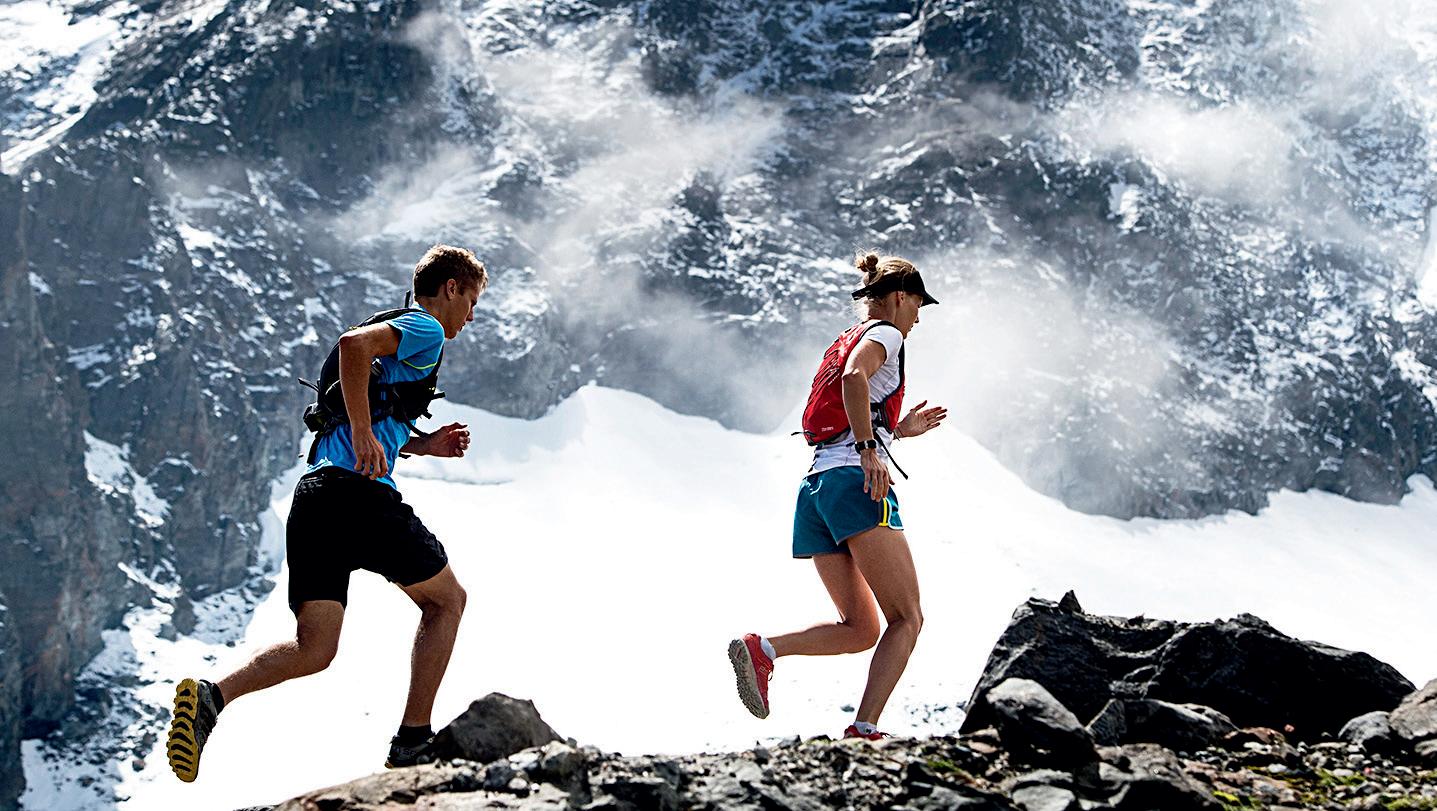
Can you still remember? Running across meadows and through forests and jumping over every stream as children. No hill was too high and no path too narrow. Trail running is also about this lightness and the joy of exercising outdoors surrounded by nature. Sure, the routes are longer and also lead high up into the mountains. What hikers approach leisurely, trail runners master in double time – not rushed, but at an athletic pace that is pretty impressive.
Trail Running Equipment
❙ Trail running shoes with tread soles
❙ Comfortable, breathable clothing
❙ Mobile phone
❙ If required for longer trails: small rucksack with drink & food, weather protection, first aid kit
Thanks to the sheer endless network of hiking trails, the Stubai Valley is made for trail running. But what is this sport that is now far more than just a trend? You run on paths and trails, which take you through nature, uphill and downhill again and again.
HOW DO YOU BECOME A TRAIL RUNNER?
Trail running is first and foremost about moving. That’s all it takes. The sport can be practised wherever there is a path or trail. Compared to running on asphalt roads, trail running constantly challenges you, keeping both the mind and body alert. What is the surface like under my feet? Where should I place my next step? What awaits me around the next bend? When trail running, it is worth increasing the distance and technical challenges step by step, taking in nature with all your senses and letting it work its magic on you.
ULTRATRAIL, MOUNTAIN RUNNING AND WORLD CHAMPIONSHIPS
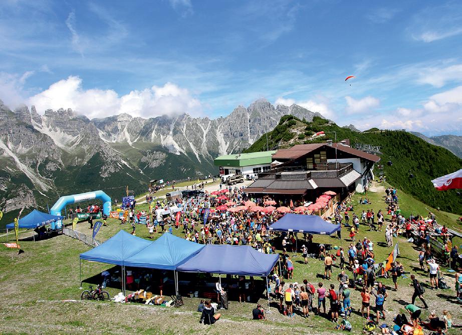
Many trail runners have ambitious goals. The term ‘ultra’ quickly comes up in this context. Ultratrails are races that are over 42 kilometres long (marathon course). Often with many metres in altitude to climb. One of the most beautiful in the Alps is the Stubai Ultratrail (SUT) on 1 July 2023, which starts in Innsbruck and finishes on the Stubai Glacier at around 3,000 metres above sea level. In between are 68 kilometres of wonderful trails through the entire Stubai Valley, with an elevation gain of 4,700 metres and elevation loss of 2,355 metres. Anyone who is not quite ready for the ultratrail can choose from four shorter routes (more on this on page 32).
With a pure mountain run, like the Schlickeralm Run on 9 September 2023 in Telfes, it’s practically all uphill (more on this on page 32). Trail running and mountain running are not just pure running though. On steep inclines, you alternate between running and walking and sometimes use poles.
From 6-10 June 2023, the absolute world elite in trail running and mountain running will meet in the Stubai Valley and Innsbruck for the World Mountain and Trail Running Championships, WMTRC for short (more on this on page 33).

But back to the lightness of running. With cross-country running, you are simply faster than when you just walk.
Wildewasser Trail
Start | Start: Klaus Äuele
Ziel | Final: Grawa Alm
Routenlänge | Route length: 9,2 km
Höhenmeter | Altitude difference:
↑444 hm / ↓97 hm
Höchster Punkt | Highest point: 1.539 m
Schwierigkeit | difficulty: •
Kondition | Condition: •
Technik | Technique: •
Erlebnis | experience:
Landschaft | landscape:
With the right equipment like trail running shoes, functional clothing, poles and a backpack, longer tours in the mountains are also possible in one day. Pack some provisions and a rain jacket and you’re ready to go. But be careful! What generally applies to activities in the high mountains is particularly important for trail runners due to the reduced and very light equipment. The tour must be planned carefully in great detail. This includes correctly assessing your own fitness and technical ability in order to not overexert yourself and to prevent injuries. Always check the weather forecast to avoid rain, fog or thunderstorms, if possible. On the way, signposts and information signs are reliable orientation guides to ensure you stay on the right path.
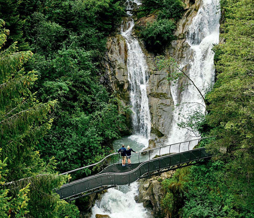
Der Taltrail eignet sich für den Einstieg und lässt sich praktisch bei jedem Wetter laufen. Auf Asphalt und breiten Schotterwegen führt der Weg von Klaus Äuele vorbei an den Schauplätzen des WildeWasserWeges bis zur Grawa Alm. Zurück geht es mit dem Bus.
The valley trail is suitable for beginners and can be run in practically any weather. The trail leads from Klaus Äuele past the sites of the WildeWasserWeg to the Grawa Alm. Back you can take a bus-ride.

Gloatsteig Trail
Start, Ziel: Parkplatz Schlick 2000
Start, Final: Bottom station Schlick 2000
Routenlänge | Route length: 16,3 km
Höhenmeter | Altitude difference: ↑1.200 hm / ↓1.190 hm
Höchster Punkt | Highest point: 2.001 m
Schwierigkeit | difficulty: •
Kondition | Condition: •
Technik | Technique: •
Erlebnis | experience:
Landschaft | landscape:
Milderer Almentrail
Start, Ziel: Freizeitzentrum Neustift
Start, Final: Leisure center Neustift
Routenlänge | Route length: 20,7 km
Höhenmeter | Altitude difference:
↑1.564 hm / ↓1.563 hm
Höchster Punkt | Highest point: 2.261 m
Schwierigkeit | difficulty: •
Kondition | Condition: •
Technik | Technique: •
Erlebnis | experience:
Landschaft | landscape:
Von Neustift über Milders auf die Milderaunalm und zum Naturschauplatz Hühnerspiel, weiter zur Brandstatt-Alm, Auffangalm und zum Bichlhof. Der zweite Anstieg führt nach Forchach, zu den Kartnallhöfen und über den Naturschauplatz Kartnall zum Ausgangspunkt.
From Neustift via Milders to the Milderaunalm and the Hühnerspiel scenic nature site, then on to the Brandstatt-Alm, Auffangalm and the Bichlhof. The second climb leads to Forchach, to the Kartnallhöfe and via the Kartnall scenic nature site to the starting point.
Die aussichtsreiche Strecke führt entlang des Schlickerbachs zum Panoramasee und über den Gloatsteig zum Berglerbründl. Weiter geht es über den Naturschauplatz Sailenieder zur Pfarrachalm und auf dem Hirtensteig zurück zum Ausgangspunkt.
The scenic trail leads along the Schlickerbach stream to the panoramic lake and via the Gloatsteig trail to Berglerbründl. It then continues via the Sailenieder scenic nature site to the Pfarrachalm and on the Hirtensteig trail back to the starting point.
Beim Stubai Ultratrail erwartet die TeilnehmerInnen eine einmalige Erfahrung. Die fünf Distanzen führen durch traumhafte Landschaften bis auf den Stubaier Gletscher.
❙ Der STUBAI ULTRATRAIL K68 (66 km, ↑4.700 hm, ↓2.355 hm) ist die ultimative Herausforderung im Herzen der Alpen. Start ist in der Olympiastadt Innsbruck. Das Ziel liegt auf 2.960 m Seehöhe am Stubaier Gletscher – von der Stadt ins ewige Eis. Der Lauf verbindet urbanes Feeling mit körperlicher Höchstleistung in beeindruckender Naturlandschaft.
❙ Der STUBAI K32 (31,6 km, ↑2.630 hm, ↓720 hm) führt von Neustift auf den Stubaier Gletscher – vom Tal ins ewige Eis.
❙ Der STUBAI K20 (20 km, ↑1.796 hm, ↓75 hm) mit Start in Klaus Äuele beeindruckt durch seine landschaftliche Schönheit.
❙ Der STUBAI K9 (9 km, ↑1.210 hm, ↓35 hm) ist ein reiner Berglauf mit Start bei der Talstation der Stubaier Gletscherbahn bei Mutterberg.
❙ Der STUBAI VERTICAL (7,2 km, ↑1.024 hm, ↓5 hm) von Neustift zur Elferhütte (2.004 m) wird auf der WM-Strecke 2023 gelaufen.
A unique experience awaits participants in the Stubai Ultratrail. The five distances lead through fantastic landscapes up to the Stubai Glacier.
❙ The STUBAI ULTRATRAIL K68 (66 km, ↑4,700 m elevation gain, ↓2,355 m elevation loss) is the ultimate challenge in the heart of the Alps. It starts in the Olympic city of Innsbruck. The finish is at 2,960 m above sea level on the Stubai Glacier – from the city into the eternal ice. The run combines an urban feeling with peak physical performance in an impressive natural landscape.
❙ The STUBAI K32 (31.6 km, ↑2,630 m elevation gain, ↓720 m elevation loss) leads from Neustift to the Stubai Glacier – from the valley into the eternal ice.
❙ The STUBAI K20 (20 km, ↑1,796 m elevation gain, ↓75 m elevation loss) starting in Klaus Äuele impresses with its scenic beauty.
❙ The STUBAI K9 9 km, ↑1,210 m elevation gain, ↓35 m elevation loss) is a pure mountain run starting at the Stubaier Gletscherbahn cable car bottom station near Mutterberg.
❙ The STUBAI VERTICAL (7.2 km, ↑1,024 m elevation gain, ↓5 m elevation loss) is run on the 2023 World Championship trail from Neustift to the Elferhütte (2,004 m) www.stubai.at/ultratrail www.stubai.at/schlickeralmlauf
Der Schlickeralmlauf (11,5 km, ↑1.177 hm, ↓60 hm) zählt zu den renommiertesten Bergläufen der Welt. Von Telfes laufen die AthletInnen zum Panoramasee, an welchem die Kurzstrecke (7,2 km, ↑749 hm), mit Start an der Mittelstation Froneben, einmündet. Danach führt der Weg über Almen und mit den markanten Kalkkögeln als Hintergrund ins Ziel am Kreuzjoch (2.110 m).
Doch damit nicht genug. Am Wochenende des Schlickeralmlaufs steigt in Telfes ein richtiges Lauffest für die ganze Familie. Bei den Kinderrennen im Dorfzentrum (300 m, 600 m, 1.200 m) zeigen die Kleinsten, wie schnell sie sein können. Beim Benefizlauf machen sich alle Generationen auf, um mit ihren Runden durch Telfes Geld für soziale Einrichtungen im Stubaital zu sammeln. Der Telfer Wiesen Run (8,06 km, ↑146 hm, ↓135 hm) ist ein Volkslauf mit Straßen-, Cross- und Berglauf-Elementen. Er kann einzeln oder als Zweierteam im Staffelbewerb bewältigt werden.
The Schlickeralm Run (11.5 km, ↑1,177 m elevation gain, ↓60 m elevation loss) is one of the most renowned mountain runs in the world. From Telfes, athletes run to the panoramic lake, where the short course (7.2 km, ↑749 m elevation gain), starting at the Froneben middle station, merges into the route. Afterwards, the trail leads across alpine pastures and with the striking Kalkkögel as a backdrop to the finish at Kreuzjoch (2,110 m).
But that is not all. On the weekend of the Schlickeralm Run, a fantastic running festival for the whole family takes place in Telfes. The youngest show how fast they can run in the children’s races in the village centre (300 m, 600 m, 1,200 m). In the charity run, all generations set out to raise funds for social institutions in the Stubai Valley with their laps through Telfes. The Telfer Wiesen Run (8.06 km, ↑146 hm, ↓135 hm) is a fun run with road, cross-country and mountain running elements. It can be completed individually or as a team of two in the relay event.