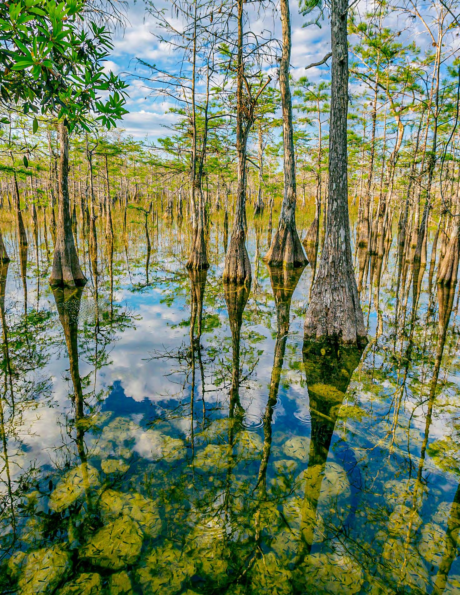

IN THIS ISSUE Home Life of the Florida Indians Exhibitor & Sponsorship Opportunities The Liquid Heart of Florida T he F lorida Surveyor March 2024 Volume XXXII, Issue 3

Call us t o g et your complete work flow solution today ! Efficiency and versatility that will accelerate productivity comes part of a workflow solution that includes the FC-6000 field controller, Magnet software, a HiPer VR receiver and the GT-1200/GT-600 single-operator robotic system. The power of longrange reflectorless measurements comes in your choice of 1”, 2” or 3” GT-1200 models or 2”, 3” or 5” GT -600 models.



State Road 19 Altoona, FL 32702 www.lengemann.us
43316

The F lorida Surveyor is the official publication of the Florida Surveying and Mapping Society, also known as FSMS. It is published monthly for the purpose of communicating with the professional surveying community and related professions who are members of FSMS. Our award winning publication informs members eleven months out of the year about national, state, and district events and accomplishments, as well as articles relevant to the surveying profession. In addition, continuing educational courses are also available.
EXHIBITOR/SPONSOR Opportunities 31 HOME LIFE OF THE Florida Indians 18 THE LIQUID HEART Of Florida 37 SUSTAINING Firms 71 FACES ON The Frontier 83 103 COMMITTEE Consideration 77 FROM THE Archives PRESIDENT’S Message 1 2023-24 FSMS Officers 3 AROUND The State 7
TABLE OF CONTENTS
PRESIDENT’S Message
March 14th, 2024

Dear FSMS Members,
I am excited to share some significant updates and events that will shape our journey forward. With great anticipation, we look towards the annual FSMS Strategic Planning Meeting scheduled to take place in Gainesville on April 1112, 2024. Following this crucial session, we will convene for the Quarterly Board Meeting. Click here for hotel information and reservations with our group rate.
March also marks a special occasion for our profession as we celebrate National Surveyor’s Week from March 17th to March 23rd, culminating in Global Surveyors' Day on March 21st. These observances provide us with an opportunity to reflect on the importance of our work and the invaluable contributions of surveyors worldwide. Email your proclamations to communications@fsms.org for them to be featured in The Florida Surveyor.
I would like to take a moment to discuss three of the thirteen seminars that will be offered this year at the Annual conference, July 24-27 . To my knowledge, this will be the first year that other professionals can attend and be a part of our conference, as well as receive continuing education credit.
The Riparian Rights Surveying Seminar will be moderated by Richard P. Green, Esq. with Lewis, Longman, & Walker, P.A. with a panel consisting of Andrew J. Baumann, Esq., James C. Weed, PLS, George “Chappy” Young, Jr, PSM, Richard Malloy, PSM, and Scott Woolam, PSM. It has been twenty years since a Riparian Seminar has been provided, and it is long overdue. The waterways and coastlines are being cut up into smaller pieces and riparian rights have become a big issue.
President Howard Ehmke (561) 360-8883
Howard@GCYinc.com
The Florida Surveyor Page 1
PRESIDENT’S Message
The Role of Title in the Government Land Acquisition Due Dilig ence Process Seminar will be taught by Wendi McAleese. She will, among other things, cover the products that are available to you as surveyors. Knowing wh at to ask for his half the battle. We must know the history of property to provid e them with a map that reflects all their rights.
The Surveying the Infrastructure GIS Seminar will be moderated by Richard Allen, PSM, CFM. This panel of eight will have top GIS professi onals and top Surveyors in the Field of GIS. Prior to the panel discussion wi ll be two miniseminars - CAD vs GIS, & Intro to the “Parcel Fabric ” taught by Frank Conkling PSM, GISP and Successful Project Integration of Survey & GIS ta ught by Richard Pryce, RLS, PSM. You will have an opportunity to pick their bra ins on Surveying the framework of GIS. This will be a very interesting seminar. For years we have said that GIS stands for “ Get it surveyed. ” I think the time has come for us to take this very seriously and partner with GIS instead of pushin g them away. Their potential as a client is huge. We can provide the quality and accuracy to make them more successful. One of our jobs is to “make our clients look good ” and to do that we need to step up to the plate and provide the m with the expertise they need to provide their clients with a quality job .
Lastly, thank you all for your unwavering dedication to the Flo rida Surveying and Mapping Society. Your contributions are invaluable, and tog ether, we will continue to chart a course towards a brighter future.
Respectfully submitted.
Howard J. Ehmke II
March 2024 Page 2
Richard
(954) 651-5942
rdpryce@gmail.com
Vice President
Allen Nobles (850) 385-1179
allen@burritobrothers.biz
Secretary Sam Hall (352) 408-6033
surveysam17@outlook.com
Treasurer
Bon Dewitt (352) 682-6007
bon@ufl.edu
Lou Campanile, Jr. (954) 980-8888
lou@campanile.net
President-Elect
Pryce
Immediate Past President
The Florida Surveyor Page 3 2023-24
FSMS Officers
2023-24 Districts and Directors
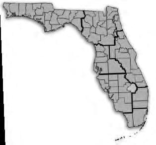
1 - Northwest
Bay, Calhoun, Escambia, Franklin, Gadsden, Gulf, Holmes, Jackson, Jefferson, Leon, Liberty, Madison, Okaloosa, Santa Rosa, Taylor, Wakulla, Walton, Washington
Angela Bailey (850) 559-5039
bailey.angelak@yahoo.com
Chad Thurner (850) 200-2441
chad.thurner@ sam.biz
2 3 4 7 6 5
Alachua, Baker, Bradford, Clay, Columbia, Dixie, Duval, Gilchrist, Hamilton, Lafayette, Levy, Marion, Nassau, Putnam, Suwannee, St. Johns, Union
Nick Digruttolo (863) 344-2330
ndigruttolo@pickettusa.com
Pablo Ferrari (904) 219-4054
pferrari@drmp.com
Shane Christy (941) 840-2809
schristy@georgefyoung.com
Donald Stouten (239) 281-0410
dstouten@ ardurra.com
Brevard, Flagler, Indian River, Lake, Okeechobee, Orange, Osceola, Seminole, Martin, St. Lucie, Volusia
Al Quickel (352) 552-3756
alq.fsms@gmail.com
Robert Johnson (772) 370-0558
bobj@carterassoc.com
Citrus, Hernando, Hillsborough, Pasco, Pinellas, Polk, Sumter
Greg Prather (863) 670-9612
gprather@pickettusa.com
Alex Parnes (813) 493-3952
alexwolfeparnes @gmail.com
John Liptak (786) 547-6340
Broward, Palm Beach
JohnLiptak@ICLoud.Com
Earl Soeder (954) 818-2610 earl.soeder@ duncan-parnell.com
Miami-Dade, Monroe
Jose Sanfiel (305) 375-2657
psm5636@gmail.com
Manny Vera, Jr. (305) 221-6210
mverajr@mgvera.com
Russell Hyatt
(941) 812-6460
russell@hyattsurvey.com
1
Charlotte, Collier, DeSoto, Glades, Hardee, Hendry, Highlands, Lee, Manatee, Sarasota
District
District 2 - Northeast
District 4 - West Central
District 3 - East Central
District 5 - Southwest
District 6 - Southeast
NSPS Director
District 7 - South
District 1
Panhandle
Angela Bailey bailey.angelak@yahoo.com
Gulf Coast
Jonathan Gibson jgibson0102@gmail.com
Chipola
Jesse Snelgrove jsnelgrove@ snelgrovesurveying.com
Northwest FL
Jeremiah Slaymaker jslay@wginc.com
District 2
FL Crown
Brandon Robbins
brndrbbns@netscape.net
North Central FL
Jeremy D. Hallick jdhallick@hotmail.com
UF Ge omatics
Kenneth Dell
kennethdell@ufl.edu
2023-24 Chapter Presidents
District 3
Central FL
William (Bill) Rowe browe@southeasternsurveying.com
Indian River
Brion Yancy
brionyancy@gmail.com
Volusia
Je ff Cory
jeff@corysurveyor.com
District 4
Ridge
Kenneth Glass
kglass@civilsurv.com
Tampa Bay
John Beland
jbeland1979@gmail.com
District 5
Charlotte Harbor
Derek Miller
millersurveying@comcast.net
Collier-Lee
Steve Shawles II
sshawles@haleyward.com
Manasota
Brian Sleight
psm6162@comcast.net
District 6
Broward
Benjamin Hoyle
benjamin.hoyle@kci.com
Palm Beach
Todd Bates
tbates@craventhompson.com
FAU Geomatics
Lemuel Roberts
lroberts2022@fau.edu
District 7
Miami-Dade
Eddie Suarez
marketing@longitudefl.com
2023-24 Committees
Standing Committees
Nominating Committee
Membership Committee
Finance Committee
Ethics Committee
Education Committee
Constitution & Resolution Advisory Committee
Annual Meeting Committee
Legal & Legislative Committee
Surveying & Mapping Council
Strategic Planning Committee
Executive Committee
Rick Pryce
Nick DiGruttolo
Bon Dewitt
Shane Christy
Greg Prather
OPEN
Allen Nobles
Jack Breed
Randy Tompkins
Rick Pryce
Howard Ehmke
Special Committees
Equipment Theft
Awards Committee
UF Alumni Recruiting Committee
Professional Practice Committee
Workforce Development Committee
Liaisons
Manny Vera, Jr.
Lou Campanile, Jr.
Russell Hyatt
Lou Campanile, Jr.
Allen Nobles
CST Program
FDACS BPSM
Surveyors in Government
Academic Advisory UF
FES
Alex Jenkins
Don Elder
Richard Allen
Justin Thomas
Lou Campanile, Jr.
Practice Sections Geospatial
Users
Young Surveyors Network Melissa A. Padilla Cintron, SIT
Group Earl Soeder
round the State A
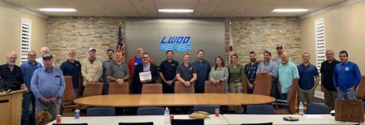
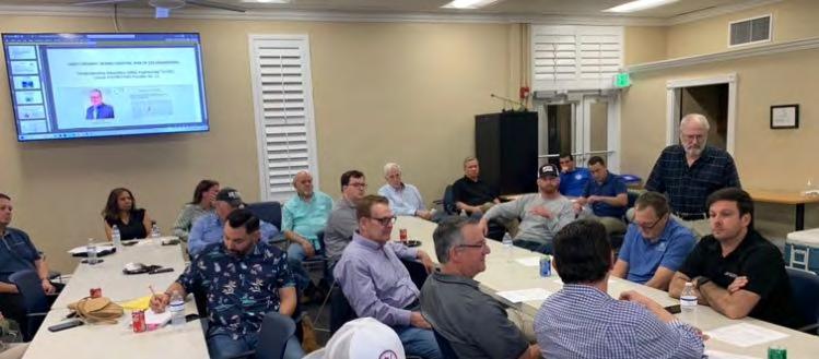
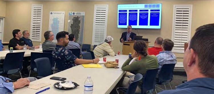
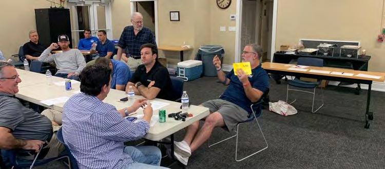
Palm Beach & FAU Chapter Meeting — From Todd Bates (Palm Beach Chapter President):
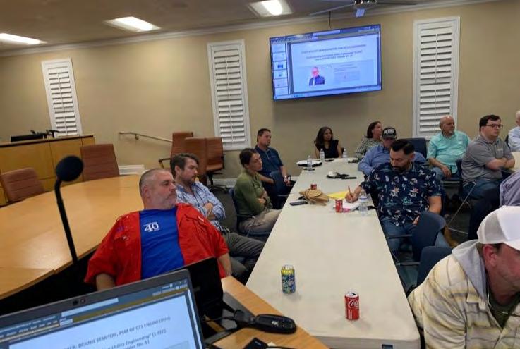
30 surveyors, FAU students, and guests came together for a time of networking, learning, and fun at the LWDD office. We enjoyed a delicious Mission BBQ and listened to an informative presentation from Dennis Stanton of CTS Engineering. He shared his insights on the latest trends and technologies on SUE Mapping. Thank you Dennis! We also had the honor of having FSMS State President Howard Ehmke speak at our meeting and share his vision and goals for the future of our profession. He shared exciting news about the FSMS state conference in July and future initiatives in the works at the state level.
I want to thank everyone who attended and contributed to the success of our meeting. You play a huge role in our success as a chapter. A BIG thanks to the Lake Worth Drainage District office and David Bends for hosting and coordinating our efforts.

 From Jeremiah Slaymaker — Northwest FL Chapter President:
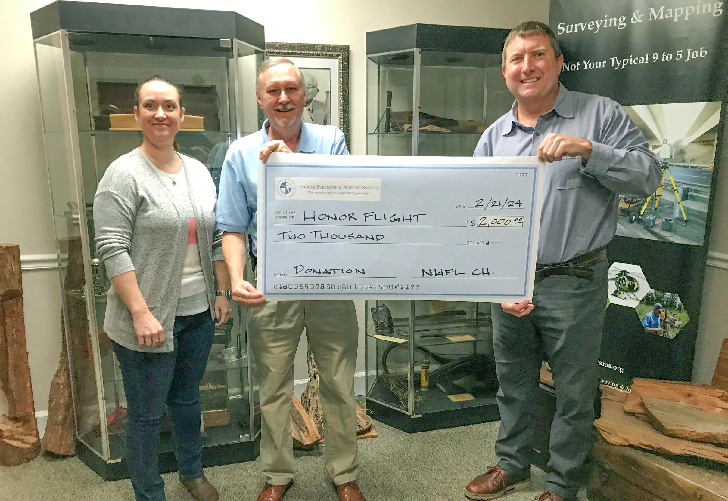
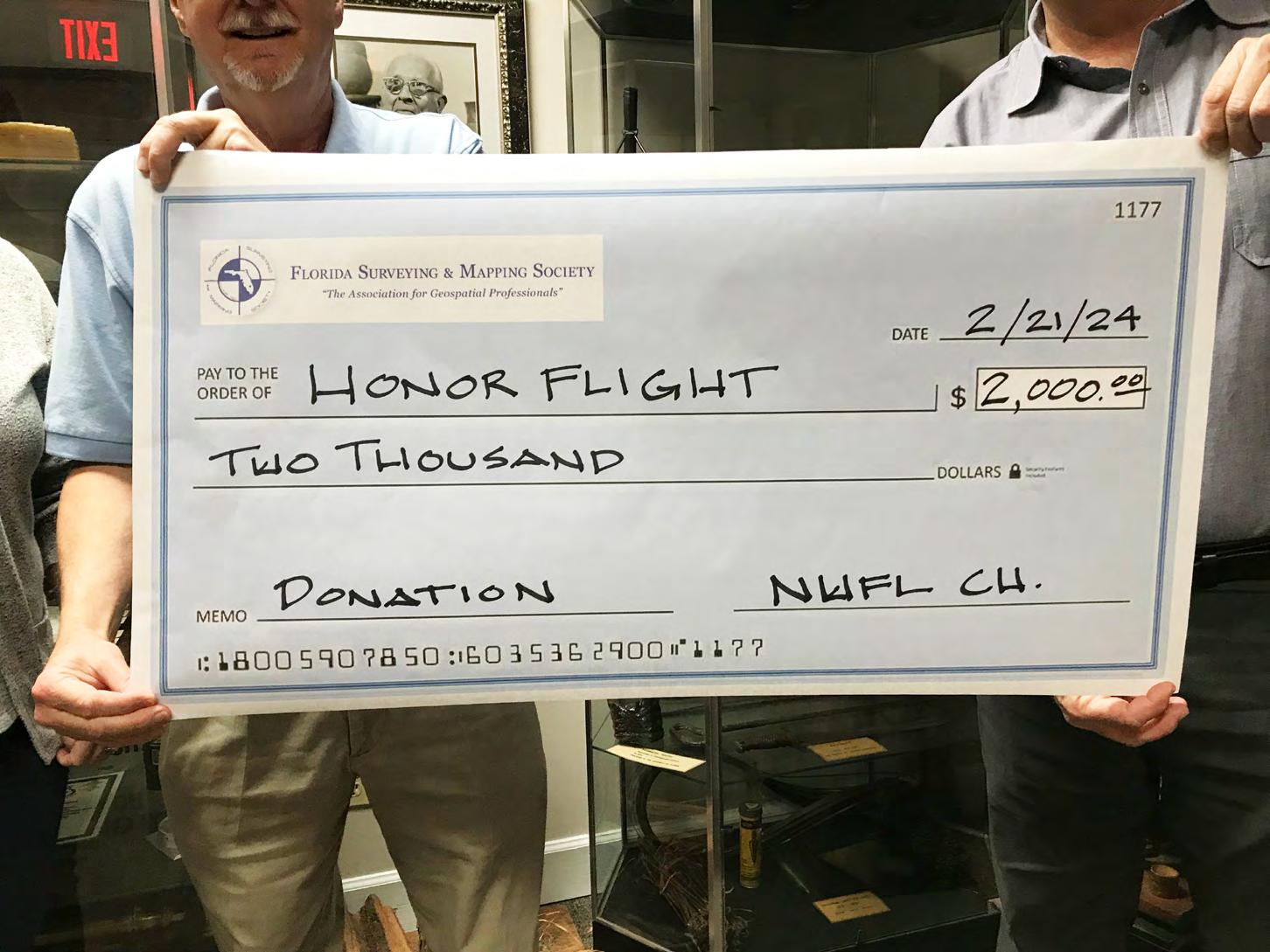
The Northwest FL Chapter holds an annual charity clay shoot and we had the pleasure of presenting a $2,000.00 donation to Honor Flight Network. In reverence to those WWII, Korean, and Vietnam War veterans who served, fought, and fell for our country, Honor Flight Tallahassee salutes their service each year by sponsoring a flight to Washington, DC. This is a once-in-a-lifetime opportunity for military veterans to visit the various monuments raised in their honor.
Big thank you to all our local members for their support and participation, along with our corporate sponsors - Bowman Consulting, Melissa Seitzinger, SAM, Chad Thurner, eGPS Solutions, Chipola Engineering Group, Inc., GPI / GreenmanPedersen, Inc., Elva Peppers, & WGI.
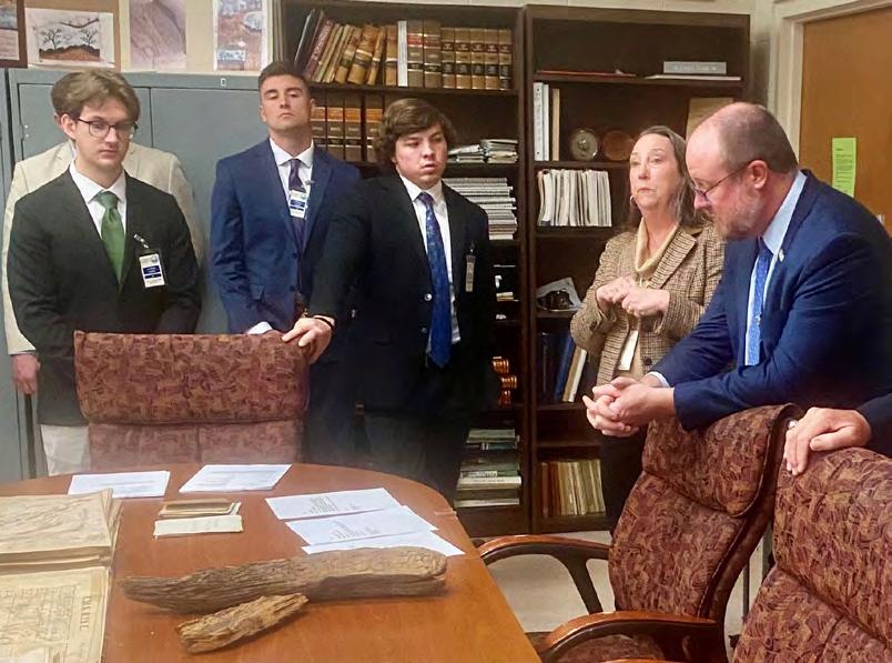
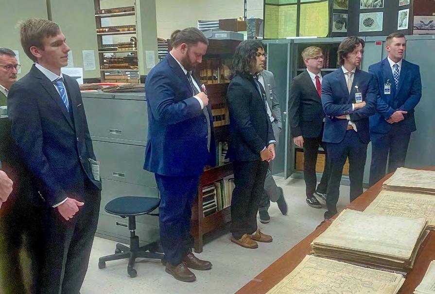
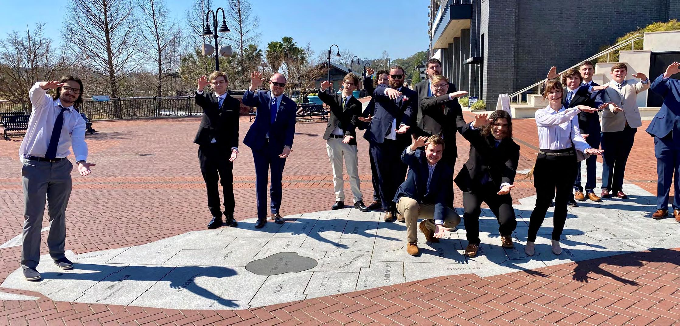
2024 Graduating Geomatics/Surveying Students from the University of Florida
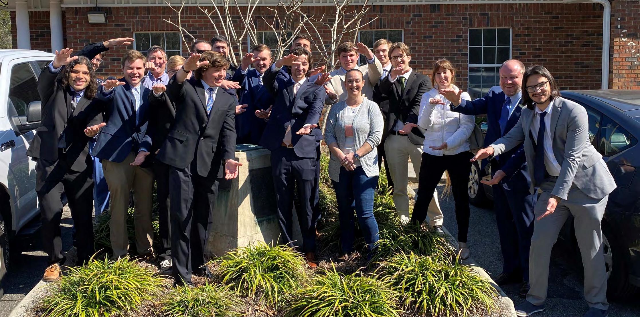
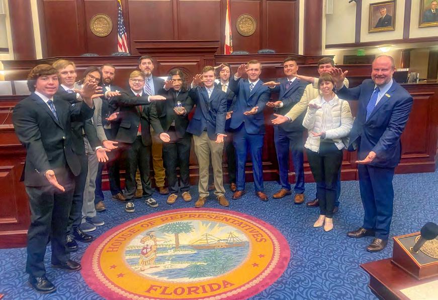
FSMS was honored to host the 2024 graduating geomatics and surveying students from the University of Florida. Past President & current Legal and Legislative Committee Chair, Jack Breed, does a tremendous job each spring allowing us to speak with these budding superstars about how they can play a role in the future of the profession through the Florida Surveying & Mapping Society!


PLEASE JOIN US FOR Register at: info.Sam.Biz/Geospatial_Symposium Canvas Event Venue 1401 Florida Mall Ave Orlando, FL 32809
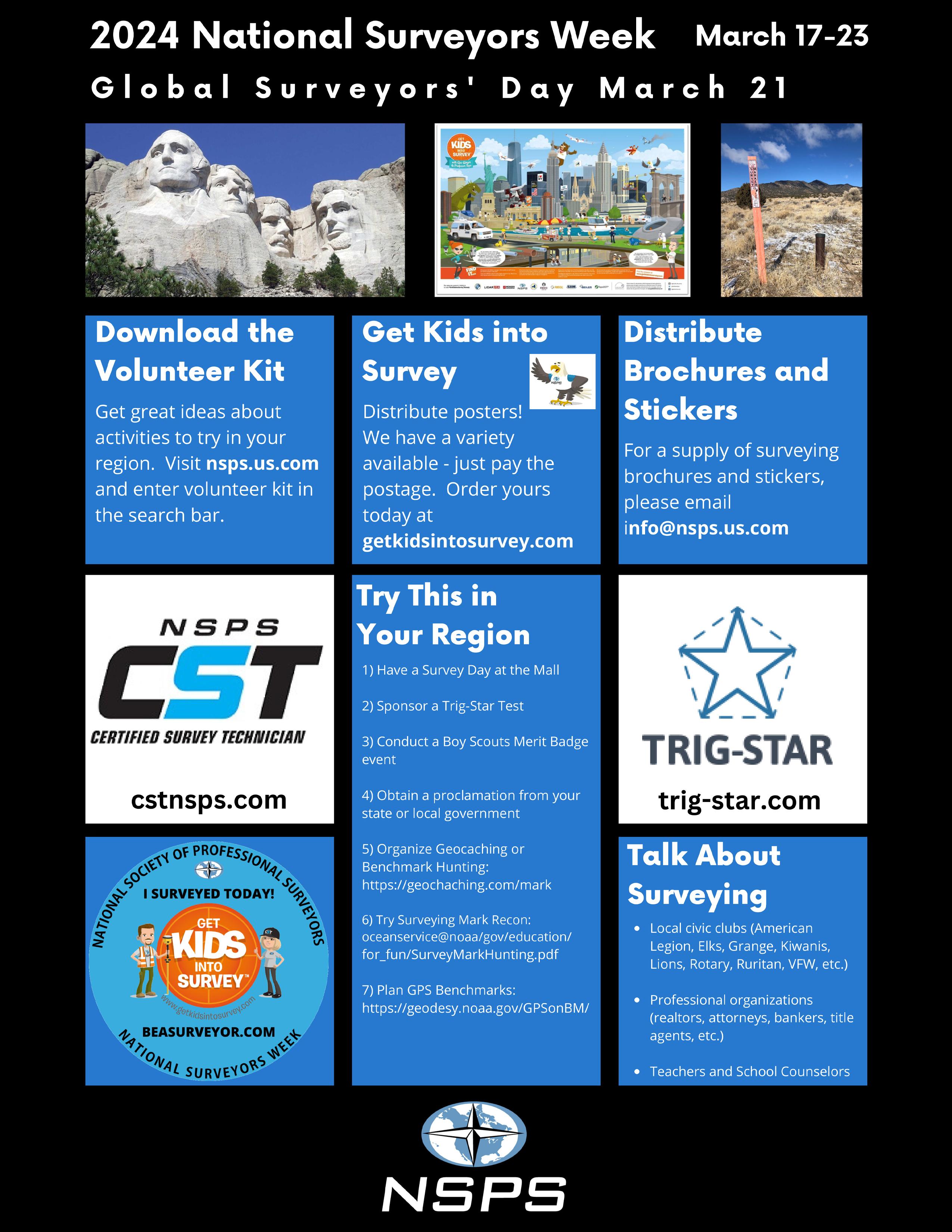

Proclamations to communications@fsms.org for them to be featured in The Florida Surveyor
Email

The Florida Surveyor Page 13
How to request a proclamation.
An easy way to bring public recognition to the profession is by obtaining proclamations from local, state, and national governments to recognize the contributions of surveyors.
Contact the state and local government offices from which you would like to request a proclamation to determine the process for each. Most state and local governments need at least 3–4 weeks to complete the request. Sample proclamations are available on the National Surveyors Week website, www.nsps.us.com/page/NSW. Make sure you follow up to confirm receipt of your request and to find out how long it will take to complete it, how you will be notified, and if you can schedule a signing ceremony.
If you are able to schedule a signing ceremony, Arrange to have several surveyors present
Promote the day and time of the ceremony on community calendars and in local news publications
Be sure to take pictures during the event so that you can include a photo with any news releases, and post them on your website and other social media that you use.
Provide information and photos about signing ceremonies to NSPS (info@nsps.us.com)
H ow do I t a l k to kids ab o ut surveying ?
HOW do I start?
Identify potential groups within your local community. Your list should include local elementary and middle schools, after-school care programs, Boy Scout and Girl Scout troops, Boys and Girls Clubs, and other area youth groups.
HOW do I set up a visit?
Contact NSPS (240-439-4615 or info@nsps.us.com) for give-away items. Look at your list and see if you have a personal connection to any of the groups. Do you have a daughter who is a Girl Scout? Is your neighbor an elementary school teacher?
March 2024 Page 14
Once you’ve identified a group to work with,
Reach out to them and explain that you are interested in visiting the group and to lead a hands-on activity related to surveying
Answer any questions they may have
Ask if they have a volunteer policy
Schedule and confirm a date and time for the visit
HOW do I explain surveying to kids?
Hands-on activities are the best way to engage the group and illustrate basic surveying principles. You can bring some of your equipment and demonstrate how and why you use it. Additionally, you can use programs like Get Kids Into Survey (GKIS). Since 2017, GKIS has been working internationally to educate young students about the world of surveying. Through the development of online resources, school, and career-day events and through the production of engaging and exciting learning materials, children all over the world have already learned a great deal about geospatial work. GKIS has a variety of resources that you can use when speaking to young students, including coloring sheets, lesson plans, posters, quizzes, and a comic book. In addition to using these free resources online, you can also become a brand ambassador or sponsor of GKIS. Visit getkidsintosurvey.com for more information.
HOW do I get kids excited about the profession?
Use phrases like making a difference and problem solving. Avoid phrases and terms that make it sound difficult to become a surveyor. Ask them about their interests, and see if any of them relate to the profession. Do they like to work with computers? If so, tell them how you use computers and other advanced technology in surveying. Are they interested in history? Tell them about the historical significance of the profession and boundaries. Demonstrate the technology you use every day especially today’s high-tech data gathering/processing equipment.
HOW do I prepare for my visit?
7–10 days before the visit
Decide which of your favorite activities you’d like to share with the group, and gather the necessary materials. If you don’t have a favorite activity or would like some new ideas, visit the National Surveyors Week website via www.nsps.us.com/page/NSW and download a free copy of GPS Adventures. This easy-to-follow guide provides sample GPSrelated hands-on activities that are easily adapted to include basic surveying principles.
Day of visit
Make sure you wear something that you would typically wear to work. If you often work in the field, consider wearing your outdoor attire and gear. Students are usually quick to recognize a surveyor when he or she has on a hard hat and other outdoor gear. And remember, relax, smile, and have fun!
Day after visit
Follow up with the teacher or leaders of the group to thank them for the opportunity and to make sure they know where to find more information. Ask for feedback on the session and activity.
Global Surveyors Day - March 21 annually
Global Surveyors Day (www.globalsurveyorsday.com) was created in 2018 through a collaboration among worldwide surveying organizations to recognize the role of Surveyors.
March 21 was chosen as the date for GSD so that the event will always fall within the dates for National Surveyors Week in the US which is celebrated each year during the week in March following the 3rd Sunday.
Surveying Merit Badge
HOW can I help a Boy Scout earn the Surveying Merit Badge?
Helping a Boy Scout earn the surveying merit badge has never been easier. Start by visiting the Boy Scouts of America website (www.scouting.org ) to download the current badge requirements. Then visit the NSPS website (www.nsps.us.com/page/BSmeritbadge) for step-by-step instructions on how to complete the requirements and tutorials.
After reviewing the requirements, identify local Boy Scout troop leaders in your community. Reach out to them and offer to help their scouts complete the badge requirements. Completing all of the requirements for the badge can take approximately 6–7 hours.
Find out if there is a “Scouts Day” or similar event in your area and contact the hosting organization regarding participation.
Trig-Star
HOW can I get involved in the Trig-Star Competition?
Trig-Star is an annual competition for high school trigonometry students. It connects what students are learning in the classroom with a profession that requires those skills.
Volunteers are needed to assist in administering the exams and presenting information to the students about the surveying profession. Contact your state coordinator and let them know that you are interested in volunteering. Visit www.trig-star.com for more information and for a list of state coordinators.
Winners from the state competitions (typically 35-40) participate in the annual National Trig-Star Competition.
All students who participate in Trig-Star are eligible to apply for the Trig-Star Scholarship upon proof of enrollment in a college surveying curriculum.

Home Life of the Florida Indians
Author(s): Benjamin Harrison
Source: Publications of the Florida Historical Society , Jul., 1924, Vol. 3, No. 1 (Jul., 1924), pp. 17-28
Published by: Florida Historical Society
Stable URL: https://www.jstor.org/stable/30138249
JSTOR is a not-for-profit service that helps scholars, researchers, and students discover, use, and build upon a wide range of content in a trusted digital archive. We use information technology and tools to increase productivity and facilitate new forms of scholarship. For more information about JSTOR, please contact support@jstor.org.
Your use of the JSTOR archive indicates your acceptance of the Terms & Conditions of Use, available at https://about.jstor.org/terms

Florida Historical Society is collaborating with JSTOR to digitize, preserve and extend access to Publications of the Florida Historical Society
The Florida Surveyor Page 17
HOME LIFE OF THE FLORIDA INDIANS
By B enjamin H arris
Every family of mankind refers fondly to a Golden Age, when peace and innocence reigned on earth. The lost paradise is no monopoly of the Christian, of the Greek or even of the Old World, since the Inca and the Aztec were equally confident in the truth of his traditions describing it. When Columbus compared the happy conditions he observed in the islands to which he came, with those of Europe, he declared the inhabitants were close to the angels in disposition as well as in geography, and he confidently looked for his Blessed Mountain in all his wanderings. When the French came into the mouth of the St. Johns, and were hospitably entertained, Ribault says: “We entered and explored their country hereabouts, which is the fairest fruitfulest and pleasantest of all the world, abounding in honey, venison, wild game, forests, woods of all sorts and vines with grapes. And the sight of the fair meadows is a pleasure inexpressible.” Moreover, the inhabitants seemed hospitable and kind beyond all experience, while in dignity and fair speech they were “both courtier-like and wise.”
Yet the first act of these visitors was to build a fort for fear of these people, and they learned by experience that men might starve in a land so overflowing with food that the inhabitants freely gave of their abundance! Those who seemed “like unto angels” came to be denounced as savages, and to be suspected of witchcraft—as idolaters and necromancers, they were to be exterminated unless they could be used as slaves! So we are prone to pass from one extreme to another; if the Floridians of that day were disposed to be hospitable and kind, they were yet men who took offense when robbed and knew how to repel injury by hostility.
Study and observation have taught us to reject the theories which marked off the eras in human history as Ages of Gold and Silver and Bronze, until coming to our own time, which we called that of Iron, because general happiness seemed to have fled with Astrea to the stars! Instead of these divisions we know that in every age are people of every condition; today we can study the manners of the people of the Ages of Stone, because we can now mingle with tribes in like circumstances; even in the New
March 2024 Page 18
World, there were, or had been but lately, palaces of stone, though yet savages of the most brutal characteristics roamed the interior, while some gentler than their visitors could be found on the Southern coasts.
The great mistake made by the Europeans was the assumption that these savages were rising from barbarism, as their ancestors in England and Germany and France and Spain had lately risen, as they would have said, “By the grace of God.” But the truth was, as now held, that a process of declension was going on; such condition as followed the downfall of the Roman Empire in Europe from which these observers were struggling to rise. The difference was that the American had been isolated, while in Europe successive waves of migration had brought advancement and compelled progress.
Science agrees with inspiration that human life began in Central Asia and flowed outward to Europe. The first man of whom science finds the trace is the Pithecanthropus Erectus—barely human in shape and little more than animal in mind. But the first European is an improvement on the original, and is known as the Piltsdown or Neanderthal; certainly he possessed the land for centuries from the Thames to the Danube. With him roamed animals of like shape to those we know—not the monstrous forms we are digging from the rocks of our land. Against these he fought for life with flint-headed spears and clubs; the flints being first the forms he chose from accidental breakage, but finally rudely shaped by hand. Lands rose and sunk; climates varied and animals wandered north or south to escape the cold or to follow the invitation of renewed pasturage; man lived as best he might. Next, coming from the east, appeared a superior race before whose strength and cunning and superior weapons the Neanderthal vanished; the Cro-Magnon gave graceful forms and a fine surface to his stone implements; he began to fish, and so lived with less labor, and he drew forms and painted colors on the walls of the caves in which he dwelt, for the proof of his presence; he held Europe for 25,000 years. Then came the ancestor of the races known to us— the Etruscans of Italy and the Latins who conquered them, while the forests of France and Germany were still held by barbarians not so docile or kind as the Indians discovered in America.
Thus in Europe there was always movement; in America the immigration was confined to short distances. Before Britain was separated from the continent except by a river, and while Africa was joined to Europe
The Florida Surveyor Page 19
Home Life of the Florida Indians
by more than one natural bridge, variations of climate and arrangements of land and water may have opened the way in those remote times to a wave of immigration to America, but the date was at least too distant to admit of proof. The Nahua journeyed from Central America, and the Aztec set up a kingdom in Mexico; the Inca conquered to the north and south of Cuzco, but there was no exchanges of population from continent to continent. Cities were built in South America and Central America with which England and Germany and France of the same period had nothing to compare, but the builders were content to stay at home and had no dreams of assimilating and educating any beyond their immediate neighborhood.
Yet our own territory had but lately been the seat of a wide empire, and its disintegration did not long precede the arrival of the Spaniards at Tampa, and the Frenchmen at the mouth of the St. Johns. Of this empire the kindred families of the Muscogees were members, although the headship seems to have been vested in the Natchez on the Mississippi River. Of their wide domains the mounds are still the monuments and the witnesses; the people of Florida and Georgia still used mounds and built them when DeSoto passed through their country. Practically, this race possessed the Southern States when the white man came; the Algonquins of New England and Virginia were being driven by the fiercer Iroquois, while the Cherokee mountaineers were stoutly holding their own.
Until evidence was found of the decadence of the Muscogees, Maskokis or Creeks, from a more complicated social and political condition, the facts observed by travelers and traders who lived among them were too marvelous to be credited. How could a people only beginning to rise above the rudest of savage conditions have adopted such relations with each other? We are the heirs of a gradual process of development reaching beyond the Christian era, yet these earliest inhabitants of our country enjoyed some advantages to which we are only beginning to aspire. In much their social and political organizations resembled ours, but the grades of rank were more carefully marked, the line of descent was regarded with greater pride on the one part and deference on the other; the laws of marriage and the family, for instance, were at once more absolute and more free. Let us examine into some of these facts.
Usually we have the savage—scarcely to be distinguished from the
March 2024 Page 20
brute, then the hunter, then the shepherd and next the agriculturist. When we know the Southern Indian maize was the staple food, and this grain had been developed from an inferior plant found only in Guatemala; would mere savages have watched this plant into usefulness and have preserved the seed for generations uncounted? Nomads do not accomplish such results; the
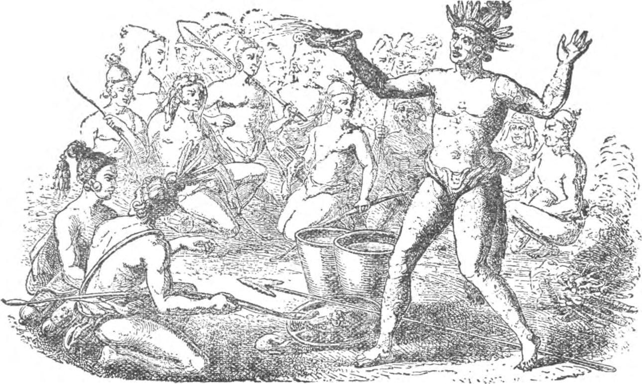
CHIEFS OF FLORIDA INDIANS IN COUNCIL OF WAR
From LeMoyne, 1765
Indian who plants remains to reap, and he who has fields to till holds to his native land. No expressions of patriotism can be found in Creek literature that the orators of the Creeks have left us in our comparatively short acquaintance with them before their extermination or degradation. While the Indian is responsible for the existence of maize as we know it, we must see that the maize is largely responsible also for the Indian at his best.
INDIAN MARRIAGE PROCESSIONS
When a Creek warrior wished to marry, he sent his mother or his
The Florida Surveyor Page 21
Home Life of the Florida Indians
sister to consult the relations of the girl he had chosen. If his proposals were favorably received, he sent presents to her female relations; when those were not returned the two were considered betrothed. Then he built a house and planted a crop; when the harvest was ready he brought meat from the hunt, and she came as his wife to take possession. Either party could demand a divorce, but the woman could not marry again till after the next green corn dance, which was never more than a year since it was an annual festival. The children were entirely under the guidance of the wife; in case of divorce, she took them to her family, and they always belonged to her gens. All the household goods were the property of the wife; she could send the husband out of the house at will. All the men and women of the town joined in clearing the field for planting; the chief divided this common field into lots for each family. After the harvest each family contributed of its crop to the share of the family of the chief, and this was guarded to entertain visitors and strangers, for the support of the fighting bands, and as a reserve against a period of scarcity. Of this the chief could give a share to the needs of the European settlers, but when this was exhausted, he refused to give more; the supplies from private stocks were soon exhausted, then force was used by Europeans to extort more.
Each town was a separate community, and each sent a delegation to the national council. Each town had public buildings set about a square so as to form a tetragon; the government was administered by a Micco and his Old Men, or cabinet; but they were bound to observe customs and precedents which were accepted as laws. Over the national government council presided one chief in time of peace; on a declaration of war he was automatically displaced for some war chief; might not this arrangement prove a valuable hint to us, in view of our experience with presidents who are warriors, but not statesmen, and politicians who are not warriors; only Washington of all our presidents has been first in war and first in peace. All differences between the towns, which were in much like our States, were submitted to a body composed of the Peace Chief and the Ancients, which might have suggested our Supreme Court to Jefferson, had he known of the Indian institution, of which there is no proof; but the Muscogees preceded him in the only feature of our government that was original; since it is not the same as the old Greek Areopagus. But our constitution-makers are justly lauded throughout civilization, though they had knowledge of experiments of peoples of whom the Muscogees had never heard; many
March 2024 Page 22
of them were scholars as well as statesmen, and all of them had the inheritance of centuries of regular government under the English law; what shall be said of the men who set up the Muscogee system?
In practice, the matrons of the Creek nation had the deciding voice in questions of peace and war; practically they could interpose a veto when a decision for war had been rendered. Have we gone so far as this? Do the suffragettes even demand so much?
We have heaps of volumes of law enacted for the preservation of fish and game; these needed no protection from the Indians, although the woods and waters furnished the tables of the inhabitants of the country.
There were no beggars among the Muscogees, because each man or woman had tasks which must be done, and for these food and clothing were paid unfailingly; while one family had a surplus there could be no hunger.
There were no prisons; for all offenses except murder punishment was prescribed, but if the offender chose to absent himself till after the occurrence of the annual festival, no mention of the offense was permitted. If a murderer took himself out of the country his absence was accepted as sufficient; if he returned he met the executioner. Thus the public was relieved of the most burdensome taxes of our systems; the Creeks had no policemen, no prisoners or prison-keepers; a judge was honored when the parties to a difference accepted him as arbiter and made no charge, but he was not compelled to serve nor the disputants expected to pay for his services.
If scandal arose because of the talk of a woman, the matrons investigated the case and punished the guilty party in case the charges were not proved. If a man made the charge the warriors investigated and punished.
Before he had been degraded by contact with the white man, the Indian was provident in proportion to his needs; it was more honorable to give freely than to amass property, as it is among the Arabs of the desert. He did not consider himself bound in honor to give his enemy a fair show; he proposed to kill when he went to war, and did not desire to be killed. In contrast to the habits of the Iroquois, the Muscogees were
The Florida Surveyor Page 23



surveying technologies continue to advance, a trusted and knowledgeable partner can help you stay ahead of the game. For over 75 years Duncan-Parnell has provided leading-edge products and services to help surveyors succeed. YOUR FIELD-TO-FINISH SURVEY PARTNER • Robotic Total Stations • Trimble GNSS Instruments • UAS/Drone Solutions • Technical Training • Software for Survey & Mapping • Survey Supplies • Instrument Repair & Maintenance • Monitoring Solutions www.duncan-parnell.com Jacksonville, FL (904) 620 - 0500 Orlando, FL (407) 601 - 5816
As

The Florida Surveyor Page 25
Home Life of the Florida Indians
kind in peace and placable in war; a tribe that felt itself too weak to fight would be admitted into the Confederacy on equal terms, and it was by such accessions that the Muscogees increased in number, while their kindred, the Chickasaws and Choctaws, declined. Bartram, Duval, Pickett, Milfort, and all the other observers report that the Muscogees were tall and straight, athletic and handsome. Certainly they were devoted parents, as are the Seminoles today.
It is often said that the Indian was treacherous and cruel to his enemies; the charge may be admitted if it is allowed that we treated them worse than they treated us.
The Muscogee was an agriculturist and not a simple hunter. We doubt if a like population of white people would be able to feed a wandering body of five hundred men, as the Muscogees fed the army of DeSoto. Time and time again we find such remarks as this in October and other harvest months: “Thenceforward the country was well inhabited, producing much corn, the day leading by many habitations like villages.” “The Indians never lacked meat. With arrows they got abundance of deer, turkeys, conies (hares) and other animals, being very skillful in killing game, which the Christians were not.” “The country was delightful and fertile, having good interval land upon the streams; the forest was open with abundance of walnut and mulberry trees.” “There was abundance of lard in calabashes (great gourds) drawn like olive oil which the inhabitants said was the fat of bears. There was likewise much oil of walnuts which, like the lard, was clear and of good taste, and also a honeycomb which the Christians had never seen before, nor saw afterwards, nor honey, nor bees, in all the country.” Yet honey was soon found to be a staple article of trade.
Bartram testifies that in a residence of several months in an Indian town, he never heard a man speak angrily to a woman; he never heard of a man cruelly treating a child; he never heard of a family contention about children or property. Others have testified that in a Muscogee Village theft was unknown; a trader's property was entirely safe if left exposed to public view, exactly as our show windows are used for advertisement. There was no hunger; there was no overwork. If it be true that the Indians were never afflicted with consumption and other diseases of kindred character, there is a disease of the feet caused by intrusion of a germ, due to lack of sanitation,
March 2024 Page 26
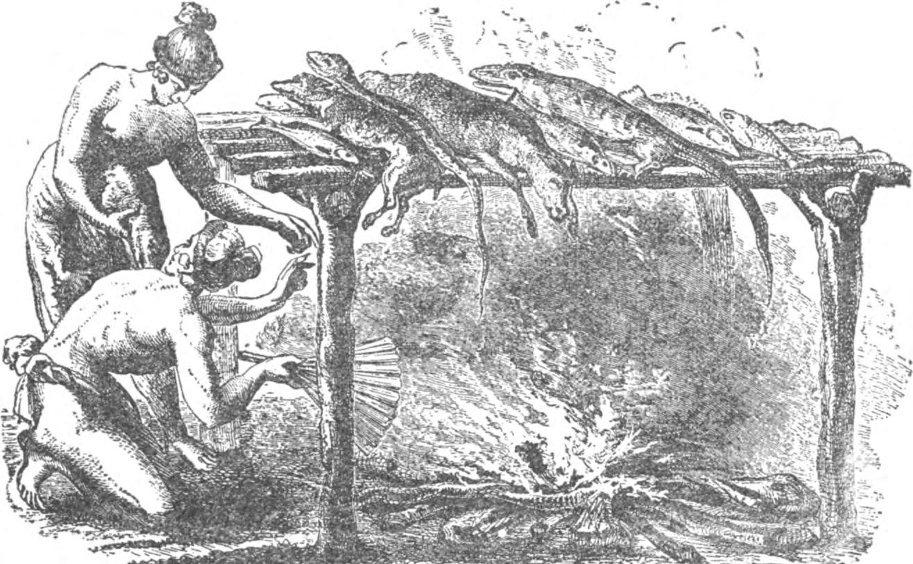
INDIANS CURING THEIR MEATS
From LeMoyne, 1565
but the germ was imported from Africa and was never heard of in aboriginal America. Smallpox is a filth disease; America never heard of it till a negro in the train of Narvaez brought it to Mexico. One other instance: The water at Hot Springs in Arkansas is a specific for certain diseases; the government of the United States obtained possession of the springs and admitted all to them, but those who cannot pay must take the refuse after the rich have had the benefit. All aboriginal America had the free use of such waters, in Arkansas and at Saratoga and in Virginia; doubtless in North Carolina also. Members of tribes at war with those about these springs could pass freely with their families and were allowed to remain as long as they desired, the friends of the diseased hunting freely while taking the treatment. There was no ownership of such provisions for health, just as there was only tribal ownership of lands; the man who could not support a family under such conditions must be worthless indeed. Age was honored—the public holding that a support was amply repaid in the advice given by the experienced.
Let it not be understood that all the tribes were living under these
The Florida Surveyor Page 27
Home Life of the Florida Indians
conditions; we speak only of the Muscogees, who were the Apalachees of Florida; not even their kindred, the Choctaws and the Chickasaws, were so happy in all respects. But if there were inferior peoples among the aboriginees of America, there were others deserving to rank with the Creeks—men of ability and virtue came from each of the principal stocks. Let us not lightly estimate warriors who went down before greater numbers and better weapons; the orators whose eloquence was not taught by other civilizations, nor the statesmen who could organize confederacies of independent populations and gain the ends without force, which in Europe must be imposed by the swords of knights and the armies of retainers on unwilling subjects. On the original inhabitants of continental Europe the Romans forced the lessons they derived from the Greeks, who had drawn upon the deeper springs of Egyptian thought; after the Romans came the Northern nations, and from the resulting mixtures the men who discovered America found the strength to overcome the Indians, who had no such advantages of diverse thought, manners and organizations. Remains the charge that the native races of America were cruel. Today who can accuse them of superiority in this particular without reckoning the advantages of Christianity for the Europeans now slaughtering each other?
Still, they are accused of worshipping the powers of nature only; if their conquerors were better taught, to what influence should credit be given? What were the Celtic and Teutonic Races before they were baptised into a faith drawn from Asia? What sort of religion animated the minds of those who exterminated the populations of the New World?
Spaniard and Puritan accused the Indians of being enchanters, witches and warlocks, children of the devil, and predestined to eternal punishment; read the accusation and be convinced that the accused were better than their defamers. Were they thriftless? What need for flocks and herds, had the people for whom nature provided parks and game, that must be defended against a starving peasantry by the aristocracy of Europe ? Is it not better to sustain a community without beggars or prisoners than one in which the suffering outnumber the millionaires and the comfortable or prosperous? Is not the child without clothes, a better proof of paternal care than one condemned to slavery in a factory, before body or mind is mature? Is not the sufficient meat and bread of the savage better than the kickshaws of civilization, which leave the stomach craving? Is not the free
March 2024 Page 28
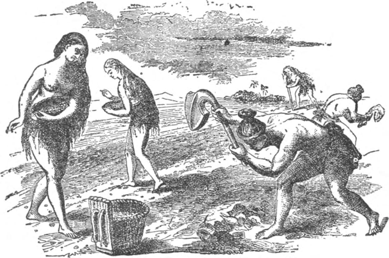
FLORIDA INDIANS PLANTING THEIR CROPS
From LeMoyne, 1565
forest better than the little parks of the city, plastered with notices to keep off the grass? Might not the mind and body be healthier with the teaching which made theft and falsehood unknown, than one that had collected the vices along with the wisdom of books? Perhaps we might do well to admit it were well if we had tried to learn something from the Indian instead of demanding that he learn from us or die.
The Florida Surveyor Page 29
COMING IN JANUARY 2025 — Seminars at Sea


Live Seminar at Sea:


Relax, Rejuvenate & Learn!
Join your fellow surveyors & bring along the family & friends in January of 2025 on a 4 night cruise to the Bahamas on Royal Caribbean’s Voyager of the Seas. We will leave from Orlando (Port Canaveral), Florida on Thursday, January 30th 2025 at 4 pm, and return Monday, February 3rd at 7 am.
GROUP SPACE IS BEING HELD!
• Book early to get the best rates.
• Cabins starting as low as $456.
• Rate is per person based on double occupancy!
• Be sure to book with our Travel Advisor, Gail Oliver to get the Group benefits. Click Here for more information and booking availability.
Course # 10757 (5 CECs) FL Surveying and Mapping Laws, Rules, and Other Statutes. — Saturday, 2/1/25 from 7:30 am to 12:00 pm.
Description: This course will review various laws and rules which regulate the practice of surveying and mapping within the jurisdiction of the State of Florida. It will also include "other" random laws the surveying profession has listed and that you may not have heard or thought of. Get ready for an interactive fun discussion on laws and rules, including Standards of Practice!
Included with Registration: One voucher for a 6 hour correspondence course of your choice. Contact education@fsms.org after registering with course selection to redeem your voucher. Link to Seminars at Sea Webpage
SPONSORSHIPS:
For Sponsorship Opportunities & Info contact Education Director Sam Hobbs at education@fsms.org.
Thank You to our T-Shirts Sponsor — E.R. Brownell & Associates

Education Sponsor $1000 (Provides Coffee & Pastries during the Education Class, Printed & digital signage displayed in the classroom, Dedicated “Sponsor Thank you” on FSMS website & social media posts, Listed in all Seminars at Sea Communication, Recognition in The Florida Surveyor Magazine)
Private Cocktail Party Sponsor $3000 (Pirate Themed Welcome Party with cocktails & appetizers (1 Hour), Verbal Recognition during Event, Dedicated “Sponsor Thank you” on FSMS website and social media posts, Listed in all Seminars at Sea Communication, Featured Full-page ad in The Florida Surveyor Magazine)
March 2024 Page 30
Provider No. CE11

The Florida Surveyor Page 31
March 2024 Page 32

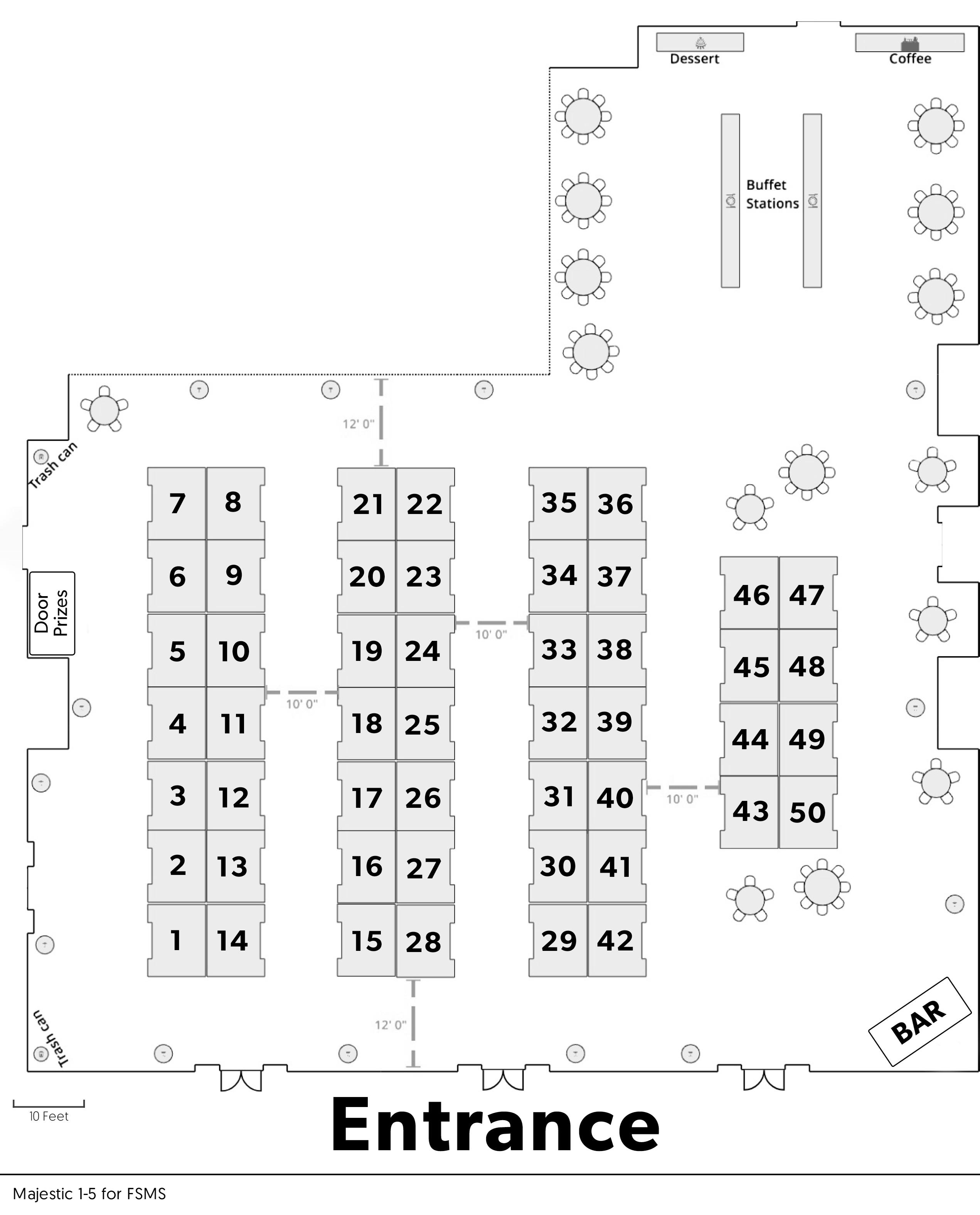
ALL SPONSORSHIPS INCLUDE:
• Recognition in Conference Program Book
• Recognition in the Conference Edition of The Florida Surveyor
• Company Logo with Hyperlink to website displayed on FSMS.org
*Conference App Sponsor
$3,500
- Sponsorship of phone app available for all registrants to download
-Company Name & Logo on App
Swag Sponsor
$2,300
- Sponsorship of multiple Key Events throughout Conference
-Conference/Sponsor Swag for All Attendees
-Name and Logo on Swag
*Lanyards
$2,000
-Company Name & Logo on Lanyards given to All Conference Attendees
Recognition Banquet
$2,700
-Sponsorship of Conference Banquet
-Full-Page Ad in The Florida Surveyor
-Company Name & Logo on Signage
*Conference Tote Bags $2,300
-Sponsorship of Tote Bags given to Attendees
-Company Name & Logo on Tote Bags
*Name Badges $2,000
-Company Name & Logo on Name Badges given to All Conference Attendees

*Room Keys
$2,500
-Sponsorship of Room Key Cards given to each Attendee staying at hotel
-Company Name & Logo on Room Key Cards
Exclusive Geo Sponsor $2,000
-Company Name and Logo on Signage at the General Business Session & Friday Night Banquet
-Full-Page Ad in The Florida Surveyor
-Assists in Conference Expenses
Top Golf $2,000
- Sponsorship Assists with Top Golf Expenses
-Full-Page Ad in The Florida Surveyor
-Signage at the Registration Desk -Assists with Food & Beverage Costs Welcome BBQ $2,000 -Sponsorship of our Conference Welcome BBQ (popular networking event) -4 Complimentary Tickets -Company Name & Logo on Signage Refreshment Breaks $1,700 -Sponsorship of Refreshments available during Seminar Breaks -Full-Page Ad in The Florida Surveyor -Company Name & Logo on Signage *Program Book (Front Cover) $1,700 -Company Name & Logo displayed on front cover *Program Book (Back Cover) $1,500 -Company Name & Logo on back cover Banquet Door Prizes $1,500 -Sponsorship of Prizes given at Recognition Banquet -Company Name & Logo on Signage Casino Night $1,500 -Company Name & Logo on Signage -Recognition in Conf. Program Book *Only 1 Sponsorship Available — Call for Availability (850) 942-1900 *Only 1 Sponsorship Available — Call for Availability (850) 942-1900 sponsorship s o pportuniti E s SOLD SOLD SOLD SOLD The Florida Surveyor Page 33
*Only 1 Sponsorship Available — Call for Availability (850) 942-1900

Legislative Reception $1,500
- Sponsorship for Reception and Guest Speaker
- Company Name & Logo on Signage
Exhibit Hall Door Prizes
$1,200
- Name & Logo on Signage
- Company Recognized during Raffle as Sponsor of Door Prizes
Cornhole Tournament $1,000
- Company Name & Logo on Signage during Welcome BBQ & Cornhole Tournament
*Program Book (Inside Front Cover)
$1,000
- Full-Page Ad on inside Front Cover of the Conference Program Book
*Program Book (Inside Back Cover)
$500
Company Name & Logo on Signage at
Afternoon
Sat. Seminar Sponsor
Registration Desk & Signs
$1,500
- Sponsorship of Signs at Conference
- Company Name & Logo on Conference Welcome Banner at Registration Desk
Exhibit Hall Luncheon $1,200
- Company Name & Logo on Signage
- Sponsorship Assists with Lunch Expenses
Golf Tournament $1,000
- Company Name & Logo on Signage
- Assists with Food, Beverage & Prize Costs
Exhibitor Welcome Bags $950
- Company Name & Logo on Exhibitor Welcome Bags
CST Exams
- Company Name & Logo on Signage before & during Exam

Exhibit Hall Breakfast $1,200
- Company Name & Logo on Signage
- Sponsorship Assists with Breakfast Expenses
SIT Test Prep $1,200
- Company Name & Logo on Signage outside of classroom
Marquee Speakers $1,000
- Sponsorship of Headlining Education Speakers
- Company Name & Logo on Signage
Cash Bar During Exhibit Hall Luncheon
- Beer & Soda at 1 Bar in the Exhibit Hall on Friday (Includes 4 Drink Tickets)
- Company Name & Logo on Signage
General Business Session
$700
Sat. Refreshments Break
$500
Saturday Seminar Refreshment
1 Sponsor
Name &
Sponsorship of Special Activity
March 2024 Page 34
*Only 1 Sponsorship Available — Call for Availability (850) 942-1900
FSMS 69 th Annual Conference Exhibitor Packet 14
$800
$800
- Full-Page Ad on inside Back Cover of the Conference Program Book $750
- Company Name & Logo on Signage at & during GBS
Exhibitors Coffee Break
$500
-
Coffee/Water Break in the Exhibit Hall Registration Packets
- Company Name & Logo on Registration Packets given to All Attendees
$500
- Company Name & Logo on Signage at All
Breaks
Company
Logo on Signage
of Your Choice
$500
-
at Seminar
Young Surveyors Event
-
General Sponsor $300
- Half-Page Ad in The Florida Surveyor
sponsorship s o pportuniti E s

6 9 th Annual Conference Program Book Advertising


Print
1 full page 5.5” (width) x 8.5” (height) $200.00 7.5% sales tax $15.00 TOTAL $215.00 OR 1/2 page 5.5” (width) x 4.25” (height) $125.00 7.5% sales tax $9.38 TOTAL $134.38
Name
City State Zip
Email
must
in
.jpg, or
We
Sponsor/Advertiser Contact
Address
Phone
Ads
be
.pdf,
.png format
agree to the terms & conditions in the rate schedule.
Name Signature
Information:
Enclosed AE/Discover/Mastercard/Visa
Number Card Expiration Date
Identification # Billing Zip Code Signature
CHECK AND FORM TO: Florida Surveying & Mapping Society P.O. Box 850001-243, Orlando, FL 32885-0243 Email: director@fsms.org Program Book Sponsor: 68th Annual Conference FSMS The Florida Surveyor Page 35
Payment
Check
Card
CCV/Card
MAIL

6 9 th Annual Conference
Flyer Insert Advertising

An additional way to showcase your company at our Annual Conference is through our Attendee Registration Packets. Prepare your company’s flyer and ship (200 inserts) to the Administrative Office for arrival by June 15th.
Cost - $100 (choose one)
Or, FSMS can print your flyers on letter size copy paper (8.5” x 11”) with B & W print
Cost - $200 (choose one)


We agree to the terms & conditions in the rate schedule.
Create a Unique Advertising Touchpoint with Your Brand's Flyer!
Company Contact Name Signature Address City State Zip Method of Payment: Check Credit Card(AE/Discover/MasterCard/Visa) Card # Exp. Date CCV/Card Identification # Billing Zip Code Email
Florida Surveying & Mapping Society P.O. Box
Orlando,
director@fsms.org
MAIL CHECK AND FORM TO:
850001-243,
FL 32885-0243 Email:
March 2024 Page 36

CHAPTER SIX
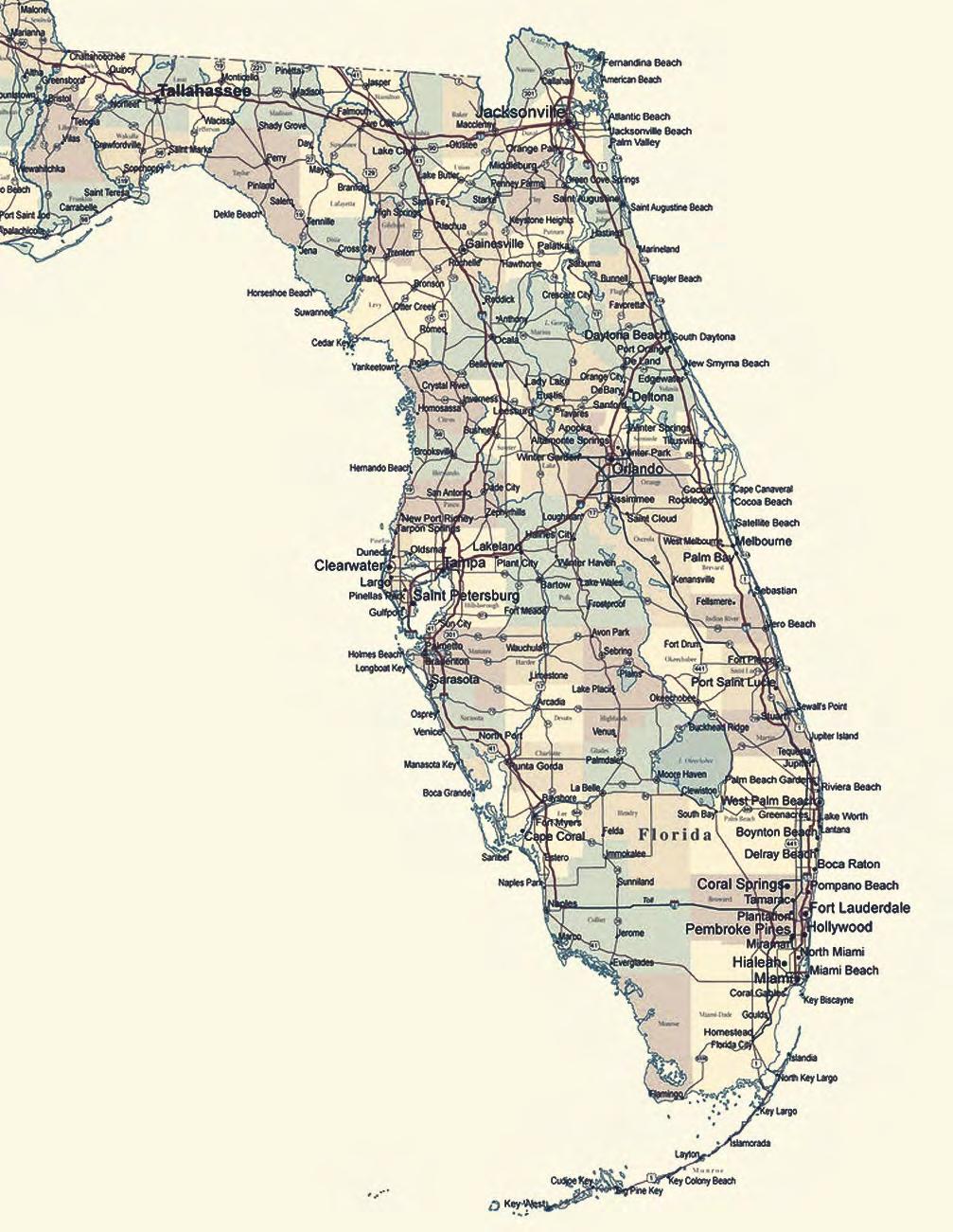
The Liquid Heart of Florida: Lake Okeechobee and the Kissimmee River in the 1970s
By the end of 1971, environmentalists had a few successes to celebrate in Florida. They had halted construction of the Cross-Florida Barge Canal and forced proponents of a proposed jetport to rethink their Big Cypress Swamp location. But other problems loomed on the horizon, ones that would not see such immediate resolutions. “There is a water crisis in South Florida today,” a group of academic, government, and environmental scholars told Florida Governor Reubin Askew in September 1971, predicting a dire future for the region unless the state instituted land and water planning.
One of the major reasons for this pessimism was the condition of Lake Okeechobee. By the early 1970s, many scientists were forecasting the imminent demise of the lake because of a heavy influx of nutrients, especially from the Kissimmee River, which the U.S. Army Corps of Engineers had channelized in the 1960s for flood control. All of these problems led Florida state officials to take major action in the early 1970s. During the 1972 legislative session, the Florida legislature passed several land and water planning measures, including authorization of a major study on the eutrophication of Lake Okeechobee. At the same time, environmentalists called for the restoration of the Kissimmee River, believing that this was one of the best ways to heal the lake. Despite all of these measures, little firm action had been taken to resolve the river and the lake’s problems by the end of the 1970s. The state had authorized additional studies and had formed a coordinating council to deal with Kissimmee restoration, but the river remained channelized and nutrient-rich water continued to pour into Lake Okeechobee, in part because of disagreement among environmentalists, state, and Corps officials as to the best remedy for the lake’s sickness.
In 1970, environmentalists such as Arthur Mars hall predicted that Florida would soon suffer from a water shortage if development continued at its current pace. “It became common, and indeed fashionable,” scholar Robert Healy has argued, “to question the value of growth itself” in 1970s Florida because of the state’s tremendous growth.1 Florida as a whole had doubled in population every 22 years since 1920, while South Florida counties had doubled every 14 years in that same time span, adding at times an average of 110,000 people a year for an average annual growth rate of 3.08 percent.2
Compounding South Florida’s expansion was the construction of Disney World in Orlando on the northern border of the C&SF Project. Walt Disney Productions had secretly purchased approximately 27,000 acres near Orlando in the 1960s for $5 million, desiring to build a park five times larger than southern California’s Disneyland and to sequester it from the rest of the region. Construction began in the mid-1960s; the corporation hoped to have the amusement park in place by the end of 1971, as well as hotels, motels, and boating and golfing facilities. The company also planned on building an industrial park, an airport, 2,500 additional hotel and motel units, and a 50-acre shopping and recreation complex. In order to maintain water levels in the development and to prevent flooding, Disney also constructed a water conservation system of 40
The Florida Surveyor Page 37
miles of canals and 16 structures, using Major General William E. Potter, a former District and Division Engineer for the Corps, as its supervisor. As the construction occurred, the population of Orlando began climbing rapidly in the late 1960s, reaching 100,000 in 1970. Residents, as well as the new facilities, demanded not only water, but also dumped sewage and other wastes into existing waterways, creating water quality problems.3
Concerned by these conditions, scientists and environmentalists wondered what the future held for South Florida, both in terms of water quantity and quality. By the 1970s, ecologists had begun to focus research efforts on an aspect of the science known as systems ecology. An outgrowth of the study of ecosystems, systems ecology, in the words of ecologist George Van Dyne, was “the study of the development, dynamics, and disruption of ecosystems.” Interdisciplinary in nature, systems ecology tried to integrate mathematics, engineering, and social science in its studies, which primarily focused on “large-scale biological communities or ecosystems of very great complexity.” Because it examined “inanimate processes of the ecosystem,” those involved in systems ecology had to have a “knowledge of physics, chemistry, geology, geochemistry, meteorology, and hydrology beyond that of traditional ecologists.” Thus, systems ecology differed in five major ways from more general ecology:
• it examined “ecological phenomena at large spatial, temporal, or organizational scales;
• it used methodologies from other disciplines;
• it emphasized mathematical models;
• it used digital and analog computers in its modeling;
• it embraced “a willingness to formulate hypotheses about the nature of ecosystems.”4
One of the areas that seemed well suited to the application of systems ecology was South Florida, an ecosystem of immense complexity. Therefore, scientists in the 1970s, such as Arthur Marshall, began to embrace the methods of systems ecology in their examinations of water issues in South Florida.
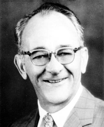
As Marshall continued his studies, he did not see bright prospects. An employee of the U.S. Fish and Wildlife Service for 20 years, Marshall joined the University of Miami in 1970 because, according to some observers, his position with the FWS did not allow him to voice publicly his true convictions about South Florida’s ecosystem. Having removed those constraints, Marshall began speaking frequently to private groups and organizations, state officials, and the media about his concerns with man’s destruction of the Everglades in South Florida.5
Marshall promulgated his views as a member of the Special Study Team on the Florida Everglades, a group formed by the FCD and the Florida Game and Fresh Water Fish Commission in 1970 to investigate wildlife issues within the region. The genesis of this report stemmed from
March 2024 Page 38
Arthur R. Marshall. (Source: The Florida Memory Project, State Library and Archives of Florida.)
issues involving deer and water levels in Conservation Area No. 3. As explained previously, heavy rains in the spring and summer of 1966 had imperiled the deer herd in that region, and the same situation occurred in 1968 and again in 1970 despite attempts to provide long-term solutions to the problem, such as the Corps’ construction of 315 islands for refuge. Although the endangerment of deer did not seem to have any direct correlation to water quality in South Florida, the issue involved water management in the region in general, especially since the water conservation areas were storage areas for excess water. As the water rose in Conservation Area No. 3, the Corps again faced criticisms and attacks from the media and environmental organizations that it and the FCD placed agricultural and municipal interests over those of wildlife. This was especially prevalent in 1970 because high water in Conservation Area No. 3 that year was caused in part by the pumping of large amounts of excess water from the EAA, which experienced heavy rainfall in March. Although, in the words of a press release from the Florida Wildlife Federation, the preservation of the Everglades was a “more far reaching [problem] than saving the deer herd,” environmentalists considered deer to be “an indicator animal” signifying the health of the region. The fact that deer had suffered in both 1966 and 1970 because of high water levels showed, according to the Federation, that “the ecology of the Everglades is being altered.”6
At the same time, wildlife problems occurred in the Loxahatchee National Wildlife Refuge (Conservation Area No. 1), albeit from fluctuating levels of water, rather than from an excess of the resource. In May 1970, FWS officials investigated the effects of a rapid drop in the water level of interior and exterior canals (estimated as a decline of over three feet in 30 days) and discovered that the drawdown might have harmed fledgling populations of the Everglades Kite, an endangered bird. By July, it was clear that fluctuating water levels in the refuge – caused by the Corps’ regulation of water – had adversely affected several other species as well, including the rare Florida Sandhill crane, the gallinule, and the alligator. John R. Eadie, manager of the refuge, emphasized that the problem was not that periods of high and low water existed, but that man had “artificially manipulate[d] the water levels in a short period,” leaving nature to “react violently to try to adjust the animal population to the reduced carrying capacity of the land.”7 Clearly, environmentalists believed that water management of the water conservation areas was significantly harming Everglades wildlife.
These problems led the FCD and the Florida Game and Fresh Water Fish Commission to ask the Florida Chapter of The Wildlife Society to commission a special study team in March 1970 to investigate the problem and to propose solutions. This team consisted of George W. Cornwall, a professor of wildlife management at the University of Florida; Robert L. Downing, a wildlife research biologist with the FWS; James N. Layne, director of research at the American Museum of Natural History in Lake Placid, Florida; Charles M. Loveless, assistant director of the FWS’s Denver Wildlife Research Center; and Arthur Marshall, director of the Laboratory for Estuarine Research at the University of Miami. Because the team’s primary goal was to examine wildlife problems in the Everglades, the majority of its final report, issu ed in August 1970, dealt with wildlife matters, including the problems that fluctuating water levels in the water conservation areas had on deer. Along with specific recommendations about how to manage Conservation Area No. 3 to preserve deer life and about revisiting the regulation schedules for all of the conservation areas, the document related that concern for any individual species had to be
The Florida Surveyor Page 39
“viewed in the context of the total problem.” It therefore suggested that the natural hydroperiod of the Everglades be restored, or at least be approximated as closely as possible, and it recommended that an interagency coordinating committee be established to allow for “interaction and information exchange” between those “agencies and groups” responsible for natural resource management in the Everglades.8
The report also examined the effects of poor water quality on flora and fauna in the Everglades. As such, the group mirrored larger concerns in the United States about water quality. As urban areas expanded, especially in the eastern United States, Americans became more concerned about how urbanization affected the quality of water. Therefore, in 1965, Congress passed the Water Quality Act to increa se the amount of federal funding available for sewage treatment plants and to charge states with developing water quality standards. Shortly thereafter, jurisdiction over the Federal Water Pollution Control Administration shifted from the Department of Health, Education and Welfare to the Department of the Interior. By the early 1970s, some states, such as Maine, had already enacted significant measures to deal with water quality. Other programs were not as strong, perhaps in part because scientific technology had not yet advanced to the stage where it could accurately test and measure the “toxicity of chemicals to aquatic organisms.” Instead, administrators focused more on biological observations to determine where water quality problems existed.9
In Florida, the upper Kissimmee River Basin – the headwaters of the entire Florida watershed –exhibited water quality problems in the early 1970s. The Kissimmee chain of lakes, especially Lake Tohopekaliga, faced pollution from the dumping of cattle excrement and fertilizers into the water by dairies, ranches, and farms. These pollutants subsequently flowed down the Kissimmee River into Lake Okeechobee. Backpumping from the Everglades Agricultural Area (EAA) also contributed nutrients and pesticides to the lake. “It is therefore imperative that the quality of the water in the Everglades ecosystem be continua lly monitored,” the special study team’s report declared, “and that steps be taken to maintain high water quality standards.”10
Over the next few months, Marshall developed some of these ideas in his own speeches. At a state water resources conference in January 1971, he told Governor Askew and his cabinet that South Florida’s ecology was under “stress” from a variety of factors. “I view environment –human ecology – as the number one problem of Florida,” he declared.11 In June 1971, he produced a paper entitled “Repairing the Florida Everglades Basin,” claiming that drainage had wreaked devastation on Everglades ecology, not only because it had reduced the amount of water flowing through the area, but also because it had shortened the basin’s hydroperiod. This caused saltwater intrusion, salinity concentration in estuaries, and soil subsidence. Almost more damaging, however, was that drainage allowed farming and settlement in vast areas of South Florida, creating a water shortage by increasing demand while reducing supply. Marshall also expressed concern for the quality of water in Florida, especially the overenrichment of Lake Okeechobee and the Kissimmee lakes.12
To deal with these concerns, Marshall proposed a series of measures for the state of Florida to take. These included improving the quality of water in the Kissimmee lakes, restoring the channelized Kissimmee River, slowing the Kissimmee’s run-off into Lake Okeechobee, setting Lake Okeechobee’s water levels at 15.5 to 17.5 feet (rather than the 17.5-21.5 feet schedule proposed by the Corps), restoring coastal bays such as the St. Lucie Estuary, preventing waste
South Florida History provided by US Army Corps of Engineers March 2024 Page 40
and nutrients from flowing to Lake Okeechobee, and establishing constraints on urban and agricultural settlement in South Florida. “We must change direction,” Marshall pleaded. “Our exploitive and technological orientation must be re-directed in favor of more considerate uses of natural systems.” Otherwise, South Florida would continue to face “accelerating impoverishment of its natural and human resources.”13
While admitting that South Florida had serious water problems in need of resolution, some scientists believed that Marshall was unnecessarily foisting “doomsday predictions” on Floridians and that the situation was not as dire as he forecasted.14 Others criticized him as not being realistic, of wanting to eliminate all human occupation of South Florida. William Storch, chief engineer of the FCD, called Marshall a polemicist and accused him of taking “immoral” actions to scare the public. “You seek to polarize rather than unite,” Storch said.15 But Garald G.Parker, a longtime hydrologist in South Florida, agreed with many of Marshall’s conclusions and had an even more extreme solution. “The onl y way to save [the Everglades],” he asserted, “is to move man off them, keep them flooded, and let nature, in her implacable way, start all over again.”16
Marshall’s statements came during a year of severe drought in Florida, when rainfall amounts were 22 inches below normal, forcing the FCD to pump surface water into Miami’s wells and causing fires in the Everglades that burned 500,000 acres. Marshall therefore caught Governor Reubin Askew’s attention, and the governor decided to call a special conference on water management in South Florida in September 1971. He asked some of the top scholars in ecological and water issues to congregate in Miami for discussions of what the state could do to maintain water supply and quality as the region continued to grow. Participants included John M.DeGrove, dean of the College of Social Sciences at Florida Atlantic University who chaired the conference, Marshall, State Senator Daniel Robert (“Bob”) Graham, Florida Wildlife Federation president John Jones, environmentalist William Partington, many scientists and engineers from Florida universities, and representatives from Everglades National Park, the Florida Game and Fresh Water Fish Commission, the U.S. Geological Survey, and the U.S. Sugar Corporation. In his opening remarks, Askew told the gathering that he wanted answers –“stated clearly, bluntly and forcefully” – to five questions: how muck fires and saltwater intrusion could be halted; how an impending shortage of high quality water could be prevented; how soil subsidence could be curbed; whether there should be a limit on South Florida’s population growth; and who should manage South Flor ida’s natural resources. “I realize that no study and no three-day conference on Miami Beach is going to solve our water management and pollution problems,” Askew said, but – adopting a phrase first coined by landscape architect and regional planner Ian McHarg in 1969 – he wanted the meeting to mark “the beginning of a new ‘design with nature’ for South Florida.”17
After studying the issues, conference participants developed a statement of solutions for the governor; Marshall served as one of the prime author s. “There is a water crisis in South Florida today,” the statement proclaimed, recommending that the state immediately institute “an enforceable comprehensive land and water use plan” to limit population in certain areas. To solve the water quality issues, the statement suggested that Kissimmee marshes be restored and that backpumping from the EAA into Lake Okeechobee be eliminated, or at least not continued until backpumped water could be treated. It also recommended that, in order to preserve the
The Florida Surveyor Page 41
South Florida History provided by US Army Corps of Engineers March 2024 Page 42
Cover of the FCD's Water Management Bulletin detailing Governor Askew's conference on Florida water issues.
animal and plant life immediately around the lakeshore, the lake’s level not exceed 17.5 feet, even though the U.S. Army Corps of Engineers had believed that the maintenance of a higher level, coupled with backpumping, could provide more water for South Florida. The statement asked that the state establish an agency or board comprised of nine gubernatorial appointees to manage Florida’s land and water use plan, and that the board assume a wide range of responsibilities, including “managing water quality and quantity for the long term benefit of the environment of the region and the State” and “establishing policy and guidelines for such activities as drainage, water use, well drilling, land use, estuary protection, watershed management, flood control and soil conservation.”18
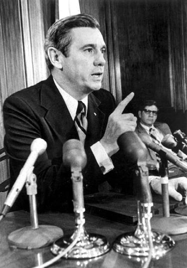
After reading the statement, Askew established a Task Force on Resource Management to draft legislation implementing the recommendations. This committee had several key members, including DeGrove, who had written his Ph.D. dissertation on the C&SF Project; Marshall; and Graham, whose background in Miami real estate, coupled with his desire for environmental preservation, allowed him to see issues from both sides. Fred P. Bosselman, an attorney from Chicago who had been instrumental in the preparation of the American Law Institute’s Model Land Development Code, served as a consultant. Largely influenced by the institute’s code, which outlined how states could designate environmentally unique regions as areas of critical concern, the task force developed several bills for introduction, including an environmental land and water management act, a comprehensive planning act, a water resource act, and an act asking for a $200 million bond issue to purchase environmentally endangered lands.19 These bills were not without controversy; many special interests and large-scale developers did not agree with the proposals and lobbied hard for their defeat. But the proposals had the backing of several prominent individuals, including Governor Askew, who sent summaries of the “highest priority” bills to interested parties, telling them to inform their senators and representatives of their “strong support” for the legislation.20 Other important supporters included members of Conservation 70s, an organization formed in 1969 by Lyman Rogers, an environmental adviser to Governor Claude Kirk, to lobby environmental measures in the Florida legislature. Consisting of many state officials and legislators, the group had a great deal of influence in the early 1970s, and during the 1972 session, according to journalist Luther Carter, a well-known environmental reporter, it “was working the capitol corridors full time.”21 Senator Graham and Representative Richard Pettigrew, who sponsored the environmental land and water management legislation in their various chambers, also expended a great deal of effort, as did Representative Jack Shreve, who helped to usher the measures through Florida’s House of Representatives. Due to these exertions, the Florida Environmental Land and Water
The Florida Surveyor Page 43
Governor Reubin Askew. (Source: The Florida Memory Project, State Library and Archives of Florida.)
SUPPORT FSMPAC TODAY!
Your contribution can make a monumental difference in ensuring that our profession thrives and our voices are heard where it matters most.
Join FSMPAC and become a driving force for the future of Surveying & Mapping in Florida.

FSMPAC, the Florida Surveying & Mapping Political Action Committee, is your ticket to shaping the future of our profession. Our mission thrives on the generosity of dedicated Surveyors and Mappers who want to champion and safeguard our profession.
Your contributions go toward researching, identifying,and supporting candidates who champion our concerns.
Le arn More & Donate Here
Management Act passed in 1972, as did the Water Resources Act, the Land Conservation Act, and the Florida Comprehensive Planning Act.22
These laws implemented many of the measures desired by Askew and the task force. The Land Conservation Act created a $200 million fund for the purchase of environmentally endangered lands, while the Comprehensive Planning Act formed the Division of State Planning and authorized it to prepare a comprehensive land and water plan for Florida. The Florida Environmental Land and Water Management Act, according to Graham, provided “a strong state role in those land use decisions which transcend the jurisdiction of individual local governments.”23 It allowed the governor and the cabinet, upon recommendations from the Division of State Planning, to designate regions as areas of critical state concern if they met environmental or historical standards. In such cases, local governmental agencies would compose and administer land development regulations, subject to the approval of the governor and cabinet. The state also had the power under the law to declare certain land developments as developments of regional impact when they affected more than one county in terms of health, safety, or welfare. The local government would then have to ensure that any construction conformed to the state land development plan.24
The Water Resources Act of 1972, meanwhile, created five regional water management districts to make all water resource decisions – be they flood control, drainage, water supply, or whatever else – in the counties over which they had jurisdiction. As part of this, the FCD was reorganized as the South Florida Water Management District (SFWMD) –although this did not officially occur until 1977 –and the Northwest Florida, Suwannee River Basin, St. Johns River Basin, and Southwest Florida water management districts were established. When the FCD became the SFWMD in 1977, several significant changes were made. For one thing, it fell under the supervision of the Florida Department of Environmental Regulation (formerly the Department of Pollution Control), although the governor and the cabinet still had the ability to rescind or modify district policies. For another, it received the responsibilities of maintaining water supply and water quality as well as ensuring flood control. The importance of that change cannot be overemphasized, as it meant that the water management district would now be in a position to manage water in ways that did not harm the environment. Indeed, according to Executive Director John “Jack” Maloy, the district established an Environmental Sciences Division soon after the reorganization “in order to understand the effects of the (drainage) system.”25 All of these pieces of legislation greatly impacted water management in South Florida. According to
The Florida Surveyor Page 45
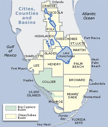
Boundaries of the South Florida Water Management District. (Source: South Florida Water Management District.)
Luther Carter, environmentalists were “jubilant” over the acts, but their effectiveness remained to be seen.26
As state legislators enacted measures to ensure better land and water planning in South Florida, the state also worked in cooperation with the USGS to prepare a report analyzing the effects that water control and management had had on South Florida since the establishment of the C&SF Project. Three USGS hydrologists – S. D. Leach, Howard Klein, and E. R. Hampton –studied the matter in cooperation with the FCD and with the financial backing of the Florida Department of Natural Resources, the counties of Broward, Dade, and Palm Beach, the cities of Fort Lauderdale, Miami Beach, and West Palm Beach, the NPS, and the U.S. Navy. This study admitted that “the prime effect of the water-control works in South Florida” was the “changing [of] the spatial and temporal distribution of runoff from the Everglades,” but it also pointed to the positive results of C&SF Project works, including a reduction in the amount of water discharged to the ocean from the Miami, North New River, Hillsboro, and West Palm Beach canals and the successful prevention of saltwater intrusion into the Biscayne aquifer.
“Additional improvements in the hydrologic situation in places in southeast Florida can be achieved by applying existing hydrologic management practices to smaller, specific areas of need,” the report concluded.27
Yet despite the general positive nature of the USGS’s report on the C&SF Project, controversy swirled around the Kissimmee River and Lake Okeechobee. Marshall had noted in several of his speeches that concerns existed about the U.S. Army Corps of Engineers’ channelization of the Kissimmee River as part of the C&SF Project. Before the 1960s, the river, which began near the town of Kissimmee, meandered along a 92-mile course through central Florida, eventually reaching Lake Okeechobee. A lyrical description of the river in a turn of the century edition of The Kissimmee Valley Gazette showed the appreciation that many observers had of the river’s beauty:
It is an extraordinary river in its narrowness, in the rampant growth of water plants along its low banks, in the unbroken flatness of the landscape, in the variety and quantity of its bird life, in the labyrinth of by-channels and cutoffs and dead rivers that best its sluggish course, and above all in the appalling, incredible, bewildering crookedness of its serpentine body. There are bends where it takes nearly an hour’s steaming to reach a spot less than 100 yards ahead of the bow.28
But the river flooded often, causing consternation for ranchers who wanted to raise cattle on the floodplain. Hamilton Disston had initially proposed channelizing the Kissimmee in the 1880s, but he had not made much progress by the time of his death. Therefore, when the C&SF Project was authorized, the Corps included flood control for the Kissimmee River Valley in its plans. The 1954 Flood Control Act allowed the Corps to begin its efforts in that basin, including the construction of eight water control structures in the Kissimmee’s upper headwater lakes, the straightening of the river itself, and the building of six water control structures within it. Essentially, the Corps removed the meanders and turns of the river and created Canal 38, a 52mile waterway running to Lake Okeechobee with five different pools, each containing a water control structure and a lock.29
Some agencies objected to the channelization almost immediately. The U.S. Fish and Wildlife Service and the Florida Game and Fresh Water Fish Commission both claimed that the Corps’ actions would destroy fish and wildlife in the Kissimmee Valley. They proposed that the
South Florida History provided by US Army Corps of Engineers March 2024 Page 46
Corps investigate other alternatives, but the Corps believed that channelization was the only effective means of dealing with the flooding problems.30 Therefore, straightening proceeded, leading to other protests. The Florida Audubon Society passed a resolution in 1966 opposing the project, fearing “further destruction of the Kissimmee river and its wild tributaries,” while several individuals contacted Florida’s congressional delegation, requesting that construction be stopped.31 “We are aware that a straight, wide, deep canal is not as esthetically pleasing as a winding natural stream,” Jacksonville District Engineer Colonel R. P. Tabb responded, “but it does have distinct advantages where economics and water conveyance are concerned.”32
The Corps completed the channelization of the river, which cost approximately $30 million, in 1971, leaving it as a straight waterway interrupted by five shallow pools along the way. Not long after, the Corps manipulated Taylor Creek, Nubbin Slough, and other tributaries of the Kissimmee located north and northeast of Lake Okeechobee into one basin, totaling 116,000 acres, so that they would all drain into the lake. The Corps lauded these completions, believing that they prevented $12.1 million in flood damages between 1971 and 1978. 33 But environmentalists were outraged, both because of the destruction of fish and wildlife and because they believed that the Corps had created “a sewer that funneled pollutants and nutrients straight into [Lake Okeechobee,] choking it.”34
Indeed, Lake Okeechobee experienced some problems at the beginning of the 1970s. Not only did C&SF Project canals bring EAA farmers lake water in times of drought, they also conveyed water from the farmlands back to the lake in times of excess rain – a process known as backpumping. Because such water contained fertilizers, pesticides, and other nutrients, environmentalists believed it contributed heavily to the eutrophication of the lake.
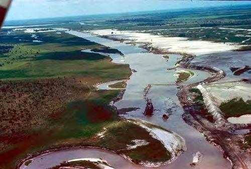
The Florida Surveyor Page 47
Construction of C-38. (Source: U.S. Army Corps of Engineers, Jacksonville District.)
Eutrophication essentially consisted of the contamination of surface waters by an influx of nutrients, usually nitrogen and phosphorous. It was the process of turning “clear, sandybottomed lakes filled with bass” into bodies of water “algae laden and swarming with gizzard shad.”35 Although all lakes experienced gradual natural eutrophication over an extended time span, cultural eutrophication, or the adding of nutrients by human land use, accelerated the process, killing lakes in a relatively short time. Florida’s Lake Apopka, located some miles west of Orlando in Central Florida, had become hypereutrophic through human interference, for example, and in the late 1960s and early 1970s, algal blooms indicated that Lake Okeechobee was on a path to the same fate. Many thought that the channelization of the Kissimmee compounded Lake Okeechobee’s problems, mainly because straightening the river had eliminated nutrient-filtering marshes in the Kissimmee Valley and had greatly shortened the basin’s hydroperiod, meaning the amount of time that water actually stood on the land.36
Critics pointed to another problem that, they claimed, channelization of the Kissimmee had exacerbated: regulatory releases from Lake Okeechobee to the St. Lucie and Caloosahatchee estuaries. Under the C&SF Project, the Corps had enlarged the Caloosahatchee River and had constructed additional canals facilitating the flow of water to the St. Lucie estuary. The Corps then used these structures, as well as the existing St. Lucie Canal, to regulate the level of Lake Okeechobee, sending water down the waterways when the lake got too high. Although the Corps enlarged the Caloosahatchee River in 1970 to allow more water to flow down to the Gulf of Mexico, the St. Lucie estuary bore the brunt of the releases. Channelization of the Kissimmee River, some stated, worsened the situation by forcing the Corps to send even more “mud-laden” and polluted water to the estuaries.37 Residents of Martin County and FWS officials especially protested such releases, charging that they damaged estuary life, both because of the increased sedimentation that they caused and because the unnatural quantities disrupted the balance of fresh and salt water, driving fish from the estuaries. Because of these conditions, the Corps revisited the lake’s regulation schedule in the 1970s and informed interested parties that it was “constantly” pursuing ways to “alleviate the situation.”38
Although concerns about Lake Okeechobee estuary releases had existed since the 1950s, Arthur Marshall was one of the first to raise the alarm about the effects of Kissimmee channelization on Lake Okeechobee. Because the lake served as the “liquid heart” of South Florida’s water system, he explained, any problems with its water quality affected the region as a whole. Marshall called channelization “an abuse of the public’s water supply and wildlife resources,”39 while claiming that “re[c]ent analyses of algal content in Okeechobee waters clearly indicate approach of eutrophication. There is no question as to whether this will occur,” he continued, “it is a question of when.”40 To halt the process, the state of Florida could reflood Kissimmee marshes, thereby slowing the rate of runoff and allowing cleansing to occur. The final report of the Governor’s Conference on Water Management in South Florida suggested the same thing, recommending as well that backpumped water either be treated before flowing into the lake or not allowed at all. Meanwhile, the results of a USGS study, published in 1971, explained that Lake Okeechobee was in an early state of eutrophication and that many tributaries draining into the water body contained excessive amounts of nutrients.41
South Florida History provided by US Army Corps of Engineers March 2024 Page 48
The Florida Surveyor Page 49
The Kissimmee-Okeechobee Basin. [Source: State Department of Administration, "Findings and Recommendations from the Special Project to Prevent the Eutrophication of Lake Okeechobee" (1976).]
But some remained skeptical about Lake Okeechobee’s condition. William Storch, the FCD’s chief engineer, for example, claimed that the USGS study actually showed that the lake was not in danger of dying and that its nutrient concentrations were not excessive. The study did highlight that poor quality water flowed into the lake, Storch explained, but that did not mean that the lake was in imminent danger. In addition, Storch and other FCD officials, as well as the Corps, disputed whether Kissimmee River channelization really had a detrimental effect on the lake.42
Despite these doubts, the FCD did agree that the restoration of some Kissimmee marshes was desirable, mainly for fish and wildlife purposes. Accordingly, in the spring of 1972, the FCD’s board approved a restoration plan of approximately 9,000 acres, costing $400,000 in land acquisition costs. Because the FCD did not ha ve any eminent domain authority, it needed the approval of the governor and cabinet in order to implement the proposal, and in the summer and fall of 1972, it prepared a presentation for the cabinet.43
In November, the FCD held a public hearing about the matter in West Palm Beach, obtaining testimony from those interested in Kissimmee restoration. Although admitting that marsh restoration was important, many environmentalists were disappointed at the small scale of efforts proposed by the FCD. FCD board member Don Morgan responded that it was “the best we can do with a flood control program,” but Marshall and other ecologists, including Dr. Robert Harris of the Florida State University Marine Laboratory, averred that more was necessary to prevent Lake Okeechobee’s eutrophication. On the other hand, Andrew Lamonds of the USGS contended that Kissimmee River channelization was not the only thing causing problems in Lake Okeechobee; population increases in the 1960s would have resulted in nutrient addition regardless of the channelization. “The rate of flow is not the primary concern,” he insisted. But others, including Marshall and O. Earle Frye, director of the Florida Game and Fresh Water Fish Commission, disagreed. “Channelization has worsened conditions for fish and wildlife, and has reduced the buffering effect of marshes,” Frye stated. “We would like to see as much of the river put back in a natural state as possible.” John Jones, representing the Florida Wildlife Federation, agreed, calling river restoration the first step in restoring water quality to Lake Okeechobee. Most participants realized, however, that financing and land acquisition were obstacles in any reflooding plan. Representatives of landowners in the Kissimmee Valley, who vehemently opposed marsh restoration, emphasized these issues, declaring that alternative measures for improving Lake Okeechobee’s water quality should be studied.44
At the conclusion of the hearing, the FCD’s governing board finalized their findings and recommendations for the governor and the cabinet. Lake Okeechobee water quality, the statement began, was a “serious and perplexi ng problem” that required more authority and responsibility than any existing agency had. “Total restoration of the Kissimmee River marshes,” it continued, “may or may not be an effective solution by itself, in view of other possible grave consequences, especially flood control.”45 Because acquiring all of the lands in the river’s floodplain would require $88 million, th e board recommended that its limited program be implemented and that polluted water be treated before entering the lake. Then additional studies could be made to discover whether or not complete restoration was necessary or possible.
On 12 December 1972, the FCD presented these findings and suggestions to Governor Askew and the cabinet at a four-hour hearing where representatives from the FCD, the Corps,
South Florida History provided by US Army Corps of Engineers March 2024 Page 50
and environmental groups testified on the condition of Lake Okeechobee and the channelization of the Kissimmee. After the FCD made its presentation, Marshall reported on analyses that the Center for Urban and Regional Studies at the University of Miami had conducted, stating that these showed that the state needed to take immediate action, including restoration of the whole Kissimmee River, in order to prevent further water quality loss in Lake Okeechobee. “The water quality situation in Lake Okeechobee is tending rapidly toward irrevocable misfortune,” he argued.46 To curb the destruction, Marshall wanted the governor to appoint a water quality master for the Kissimmee-Okeechobee Basin to oversee nutrient-removal efforts. Marshall also presented the governor and cabinet with a copy of the center’s report, entitled The KissimmeeOkeechobee Basin. Colonel Emmett Lee, District Engineer of the Jacksonville District, however, opposed wholesale restoration, believing that it would return flooding problems to the Kissimmee Basin. After hearing these different viewpoints, the cabinet voted to implement a program to correct existing pollution in the Ki ssimmee Valley, to monitor water quality in the Kissimmee Basin and Lake Okeechobee, and to establish an interdisciplinary team of scientists to study whether or not restoration was necessary.47
The Florida legislature passed measures during its 1973 session to implement the governor’s and cabinet’s requests, including one creating a “Special Project to Prevent the Eutrophication of Lake Okeechobee” to conduct a study of the lake’s water quality problems. The Division of State Planning received the responsibility of overseeing the effort, while the Florida Department of Pollution Control and the FCD were charged with water quality and quantity data collection and analysis. Federal, state, and local agencies, universities, and private consultants also contributed; Dale Walker, a critic of Kissimmee channelization who had worked for the Florida Game and Fresh Water Fish Commission, was appointed project leader. The study’s main goal was to comprehend “the Lake Okeechobee ecosystem sufficiently to derive a land and water management plan which, when implemented, will prevent further cultural eutrophication of the lake.”48
As the study commenced, Corps leaders decided that an objective examination of the Kissimmee River Basin and the effects of channelization on water quality was necessary. Fearing that Floridians did not have sufficient emotional detachment to make an objective analysis, the Corps hired Atlantis Scientific, an environmental auditing firm in Beverly Hills, California, to conduct the study. In April 1973, Atlantis filed its report with the Jacksonville District after concluding two months of fieldwork and consultations in Florida. It found little evidence that the channelization of the Kissimmee had adversely affected Lake Okeechobee’s water quality and no definitive results as to how well marshlands would remove nutrients from water. Besides, the report argued, marshlands would serve only as a holding place for nutrients; any nutrients removed from the water would merely sit in the vegetation or soil until a future inundation released them back into water. This was a conclusion that seemed to fly in the face of assertions by environmentalists and scientists such as Marshall that the marshes acted as “scrubbers” to prevent nutrient-loaded water. The report also claimed that the most polluted water reaching Lake Okeechobee came from EAA backpumping. Finally, Atlantis stated that no clear evidence existed that Lake Okeechobee was in an accelerated eutrophic state.
“Eutrophication is the natural aging process of bodies of water,” the report related, and “every body of water is in some stage of eutrophication.” Although “components or constituent matter
The Florida Surveyor Page 51
contributing toward eutrophication” all existed in the lake, “there is no evidence of the synergism necessary to supposedly expedite the process.”49
Supporters of Kissimmee restoration severely criticized Atlantis’s report, claiming that it had no objectivity because it was performed at the Corps’ bequest. Others saw the study as “a quiet effort [by the Corps] to discredit environmentalists’ proposals for restoring the channelized Kissimmee River.”50 Atlantis, which referred to its work as an “environmental audit,” insisted that it had no responsibility “to sustain the judgment of our client nor to refute the testimony of concerned citizens” and that its “first obligation” was “to our own professional integrity to provide an impartial and qualified assessment,” but its actions in Florida belied that statement.51
David S. Anthony, a biochemist with the University of Florida, for example, claimed that the Atlantis team had employed “deliberately deceptive behavior” in order to deflect attention from its relationship with the Corps. “I, personally, was given an evasive answer which contained no mention of the Corps when I asked one of the team what his mission in Florida was,” Anthony related. Two other scientists, he continued, “were given an answer that was a flat untruth when they asked the same question of one of the consultants.”52 It seems unlikely that the Corps pressured Atlantis to mirror the Corps’ own conclusions, and, indeed, scientists eventually came to accept some of Atlantis’s conclusions, including its contention that the Kissimmee River was not the major polluter of the lake. However, other findings, which directly contradicted conclusions reached by prominent Florida scientists (who had been studying the issues for years), indicate that the California firm may have been unqualified to analyze the pertinent subjects. Since the company based its conclusions on already-existing scientific literature, interviews with “a broad spectrum” of individuals, and an inspection of the area, rather than any scientific studies it conducted itself, this view seems justified.
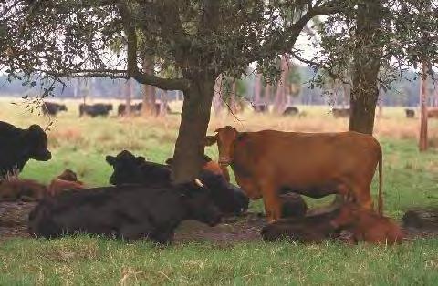
History provided by US Army Corps
Engineers March 2024 Page 52
Cattle grazing around Lake Okeechobee. (Source: South Florida Water Management District.)
South Florida
of
Meanwhile, the FCD conducted additional studies of Lake Okeechobee and the Kissimmee River, including one examining how manipulating water levels in impoundment pools on the river might affect vegetation. After extended observations, the report concluded that raising water levels two feet above their normal control stage would help to reproduce natural marsh conditions and enhance survival rates of the fish and birds.53 The FCD also studied how it could reduce nutrient loads in water flowing into Lake Okeechobee, especially from three sources: the Taylor Creek/Nubbin Slough drainage area (the location of numerous dairies and cattle ranches), the north-central part of the EAA, and areas in the lower Kissimmee Basin including and below pools S-65D and S-65E. The FCD recommended that Taylor Creek/Nubbin Slough and Lower Kissimmee Basin farmers use land and water management techniques to prevent large-scale concentrations of nutrients, and that EAA agriculturists store runoff water for reuse in land between the Miami and North New River canals known as the Holey Land tract. This was a 55square mile area in southwestern Palm Beach County that served as a kind of wildlife buffer zone for Conservation Area No. 3, protecting wildlife in that area from development. “The time has come to begin to move out of the study phase and into the action phase,” the FCD concluded, but “there must be assurance that action is not taken just for the sake of action,” especially since another FCD study had determined that nitrogen and phosphorous levels in Lake Okeechobee had not significantly increased in the last five years.54
As different agencies performed their own analyses, some environmentalists, eager for concrete action, became angry. Lyman Rogers, environmental adviser to Governor Claude Kirk and a founder of Conservation 70s, complained that despite the clear recommendations of the Governor’s Conference on Water Resources in S outh Florida, the state had implemented only “studies” and “studies to study the studies.” In the meantime, he argued, “Lake Okeechobee is DYING” and would “continue to eutrophicate, until it becomes a giant sized Lake Apopka.” Rogers called Askew an environmental phony, saying that he promised Florida “all kinds of cures, and has given us none.” Askew needed to provide specific solutions to Lake Okeechobee’s problems, Rogers declared, rather than just commission more studies.55 Lieutenant Governor James H. Williams responded that Askew was “deeply committed” to finding a cure for Lake Okeechobee, but that “simple solutions do not solve complex problems.” He counseled patience, explaining that the report by the Special Project to Prevent the Eutrophication of Lake Okeechobee would contain detailed management plans to reduce Lake Okeechobee’s nutrient content.56
Before the publication of the Special Project’s findings and recommendations, the Florida Sugar Cane League, which represented the major sugar producers in Florida, commissioned its own examination of Lake Okeechobee’s problems, specifically focusing on backpumping. Black, Crow & Eidsness, Inc., a Gainesville firm, completed this study, which claimed that backpumping from the EAA supplied only 7.7 percent of the lake’s phosphorous and 20.2 percent of its nitrogen. The Taylor Creek/Nubbin Slough watershed, on the other hand, contributed 33.7 percent of phosphorous and 7.7 percent of nitrogen, while the Kissimmee River supplied 30.5 percent of phosphorous and 36.4 percent of nitrogen. Citing studies of eutrophication in the Great Lakes, Black, Crow & Eidsness argued that phosphorous, and not nitrogen, was the limiting nutrient for algal and plant growth. Since the EAA was not a heavy supplier of phosphorous, the company recommende d that backpumping continue while more
The Florida Surveyor Page 53

investigations were performed to determine whether phosphorous or nitrogen served as the limiting nutrient in Lake Okeechobee. If phosphorous played the most important role, state officials should examine ways of reducing input from the Taylor Creek/Nubbin Slough. If nitrogen was the critical element, backpumping from the EAA should be reduced or eliminated.57
In December 1975, the FCD released its findings as to the engineering and environmental feasibility of storing backpumped water in the Holey Land area, stating that such a project could work. It therefore recommended that a reservoir be constructed on the Holey Land and the adjacent Rotenberger Tract and that it have a regulation schedule of 12 to 15 feet. In order to make the plan work, the state would have to acquire private lands on the Rotenberger Tract, and to do so, the FCD suggested that an exchange for state-owned lands be made. In addition, the Corps would have to enlarge the Miami and North New River canals in order to ensure that runoff went to the reservoir instead of the lake. The project would cost approximately $14 million, but if constructed, would divert 203,910 acre feet of runoff annually away from the lake.58
Some disagreed with the FCD’s recommendations, in part because they wanted to maintain the Holey Land and Rotenberger tracts as buffer zones for wildlife. Others insisted that the areas were largely void of wildlife, using a report conducted by Ecoimpact, Inc., in 1974, to support their views. Ecoimpact’s study, however, was wide ly panned by environmentalists, in large part because they viewed it as a hatchet job performed at the bequest of sugar interests wanting to use the tracts for cultivation.59 Still others, such as the Florida Department of Environment Regulation, which had succeeded the Department of Pollution Control, rejected the FCD’s suggestions because they wanted a complete cessation of backpumping. The department’s Report of Investigations in the Kissimmee River-Lake Okeechobee Watershed, which summarized all of the studies the department had performed as part of the Special Project, claimed that EAA backpumping contributed more phosphorous to the lake than the Black, Crow & Eidsness report had indicated. C&SF Project pumping stations S-2 and S-3 alone contributed 10.9 percent of the lake’s phosphorous, the department contended, and when one added backpumping from private interests and small drainage districts, the total approached 45 percent. The department also concluded that channelization of the Kissimmee did impact Lake Okeechobee eutrophication because of the elimination of marshes and the development of higher flow rates that caused larger nutrient releases, conclusions that clashed with those presented in the Corps-sponsored Atlantis study.60
The Department of Environmental Regulation’s report, issued in March 1976, was the precursor to the Division of State Planning’s final Special Project report, which was not officially published until November 1976. The Special Project’s findings and recommendations, however, were provided to the state legislature in April. The major conclusion of the study was that Lake Okeechobee was “of such eutrophic condition that present nutrient loads must be substantially reduced.” Nutrients came from various sources, but EAA backpumping was an especially egregious supplier. To correct this problem, the Special Project recommended that backpumping from the EAA “be eliminated or reduced to the maximum degree feasible,” and it suggested that an impoundment reservoir be constructed on the Holey Land Tract in order to store water for reuse. The report did not recommend complete restoration of the Kissimmee River, but it did suggest that mars hes be re-established in order to aid upland retention of water.61
The Florida Surveyor Page 55
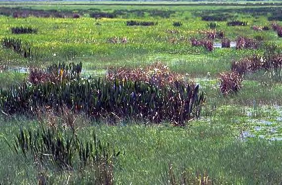
Despite its moderate findings, or perhaps because of them, the Special Project’s report met opposition from all sides. Colonel Donald A. Wisdom, District Engineer of the Jacksonville District, criticized the document for containing many “purely subjective” statements “designed to sell an idea by eliciting an emotional response in the reader.” The report did not address what the C&SF Project had done for South Florida in terms of “agricultural and human productivity,” Wisdom complained, although it delineated extensively “what has been lost in natural productivity.”62 Agricultural interests in the EAA, including sugar growers, did not like the backpumping recommendation, nor did they agree with the proposal to build a reservoir on the Holeyland, mainly because sugar producers wanted to expand into that area. Hunters did not like the Holeyland suggestion either, as it would eliminate an excellent deer hunting spot. Environmentalists, meanwhile, wanted the full restoration of the Kissimmee River, not just a reflooding of some of its marshes. All of these interests conveyed their displeasure to Florida senators and representatives. Especially vocal was Johnny Jones of the Florida Wildlife Federation, who was convinced that dechannelization of the Kissimmee River was the only way to save Lake Okeechobee. Jones wrote a bill mandating the restoration of the river and, with the approval of Marshall, sent it to the Florida legislature in its 1976 session.63
This bill, which was sponsored by Representative A. H. “Gus” Craig in the House and Senator Jon Thomas in the Senate, recognized the findings of the Special Project, but went further in its recommendations. It mandated the restoration of the Kissimmee River to its natural channel, and allowed for the reflooding of natural marshes in the Taylor Creek-Nubbin Slough
Wet prairie lands around the Kissimmee River. (Source: South Florida Water Management District.)
South Florida History provided by US Army Corps of Engineers March 2024 Page 56
FSMS is offering a Recruitment Bonus for Current Members who bring in New Members. The Recruitment Bonus will be a Conference Packet One Registration (includes One Wed. BBQ Ticket, One Fri. Exhibitor's Luncheon Ticket, One Fri. Recognition Banquet, & Six Sat. Seminar CECs) along with a 2 Night Stay at the DoubleTree by Hilton Hotel Orlando at Seaworld.
Recruitment Bonus will be Awarded based on a Point System. 6 Points for each New Full Member, Gov. Surveyor, & Sustaining Firm. 1 Point for each New Associate, Affiliate, & Student Member.
Whenever a New Member fills out their membership form they must provide referred current member's name when asked, “Were you referred by a Current Member of FSMS?”
Points will be awarded during Open Enrollment between November 15, 2023 and March 31, 2024. The Member with the most points will be deemed the Winner & be announced in The Florida Surveyor!
basin. It also proposed that cattle and dairy farmers in the Taylor Creek-Nubbin Slough Basin build polishing ponds to remove nutrients before releasing water into Lake Okeechobee. These ponds would hold water for a short period of time, generally one to three days, in order to extract nutrients through biological processes. Moreover, the bill established a four-person advisory council to oversee restoration efforts – the Coordinating Council of the Restoration of the Kissimmee River Valley and the Taylor Creek-Nubbin Slough Basin – composed of the executive directors of the Florida Department of Natural Resources, the Florida Game and Fresh Water Fish Commission, the FCD, and the secretary of the Department of Environmental Regulation. Jones lobbied for the bill incessantly, proclaiming to the media that “the Florida Legislature can pass a Kissimmee River bill or we in South Florida can all move out.”64 His tactics worked; the Senate and the House approved the measure unanimously, and Askew signed it in June 1976.65
The passage of the bill meant that the state now fully supported the restoration of the Kissimmee River. However, there were still a few unresolved issues. For one, the legislation did not clearly define what restoration meant. Thomas believed that it denoted returning the Kissimmee to its natural channel and “recreating the natural marshes and flood plain” in order to “enhance the water storage capabilities” of the Kissimmee Valley, improve Lake Okeechobee’s water quality, and increase wetland vegetation and wildlife.66 Others were not so certain. Colonel Wisdom, for example, who would have charge of the restoration since Kissimmee channelization was an authorized component of the C&SF Project, was not convinced that dechannelization was either necessary or mandated. “There is a large communication gap between the environmental investigators and the hydrologists and water resources managers,” he explained.67
Nowhere was that gap more clearly seen than in two accounts of the debate over Kissimmee River channelization and what the restoration bill actually meant. An article in ENFO, a periodical published by the Environmental Information Center of the Florida Conservation Foundation, depicted the initial channelization of the Kissimmee as the product of Corps leaders intent on steamrolling any opposition to straightening the river. “The project was promoted in the name of flood control,” the article argued, “and its opponents never had a chance.” The essay disputed that flood control really resulted from the channelization, claiming that it enabled settlement in the floodplain, an area obviously more prone to flooding, the Corps project notwithstanding. In addition, the article claimed that channelization had changed the Kissimmee Valley from an area with thriving fish populations, “hundreds of thousands of wading birds and waterfowl,” and a “healthy ecosystem” to a place of “stagnant water,” “noxious aquatic weeds,” “foul-smelling gas,” and “a biological desert.” Because the channelization of the Kissimmee sent pollutants from the Upper Kissimmee Valley to Lake Okeechobee, it threatened to give the “liquid heart” a massive “heart attack.” Therefore, the essay concluded, somewhat misleadingly, the Florida legislature had mandated complete restoration of the Kissimmee in the 1976 legislation; any alternative was out of compliance with the law.68
Patrick McCaffrey, staff director of the Coordinating Council of the Restoration of the Kissimmee River Valley and the Taylor Creek-Nubbin Slough Basin, had an entirely different perspective. He claimed that initial opponents of Kissimmee channelization, although unable to halt the process, forced the Corps to make major design modifications to accommodate fish and
South Florida History provided by US Army Corps of Engineers
The ENFO publication heavily criticizing the channelization of the Kissimmee River and calling for restoration.
The Florida Surveyor Page 59
wildlife. The “fruits of their labors may not have been as sweet as expected,” McCaffrey explained, “but in the context of the times they were major concessions by the Corps of Engineers.” McCaffrey also expressed doubts that restoring the river would improve water quality in Lake Okeechobee, a view, he asserted, that the Special Project report supported. Because data showed that routing flows through natural or man-made marshes and nonpoint source control had a greater impact on Lake Okeechobee water quality than Kissimmee River restoration, the Special Project had dismissed reinstating the river as a viable option. Although pro-restoration forces claimed that the 1976 law mandated complete restoration of the Kissimmee, McCaffrey and FCD leaders believed that it merely required the Coordinating Council to “develop measures . . . to restore water quality,” and those measures could consist of marsh reflooding, partial restoration, or other solutions.69 This, then, was the point of contention: environmentalists (as well as the bill’s sponsors) believed that the law mandated dechannelization, but others, including FCD and Corps officials, interpreted it as requiring the restoration of water quality to the Kissimmee Basin in whatever ways the Coordinating Council deemed necessary, an opinion supported by Florida’s attorney general.70
Despite the disagreements, the Coordinating Council began operations in the summer of 1976, believing that it had the responsibility for investigating different options for restoring good quality of water to the Kissimmee Valley. It quickly established an ad hoc advisory committee and an interagency technical committee to provide advice and assistance. The advisory committee contained representatives from environmental organizations such as the Florida Audubon Society and the Sierra Cl ub, as well as members of agricultural groups such as the Florida Sugar Cane League and the Florida Cattleman’s Association. The interagency committee had representatives from the FCD, the Corps, several state agencies, and the U.S. Department of the Interior. With the help of these groups, the Coordinating Council developed 11 actions that the state could take to improve water quality in the Kissimmee Basin. These included dechannelizing the river through plugging the pools in the canal, recreating marshland through pool manipulation and tributary marsh impoundments, and backfilling Canal 38 to restore the river to its natural course. After holding public hearings on the alternatives in February 1977, the Coordinating Council made its recommendations to the state legislature in March.71
The Coordinating Council explained that the best way to restore water quality to the Kissimmee River Valley was by treating agricultural pollution at its source in the Taylor CreekNubbin Slough basin. This included creating an upland detention/retention project and implementing on-farm monitoring programs. As far as restoring the river was concerned, the Coordinating Council decided to let the legislature decide. If the legislature wanted complete restoration, the council suggested that a partial backfilling method be used, whereby 60 percent of the canal would be refilled, restoring two-thirds of the marshland. The state would need to obtain congressional approval in this case since the Corps did not have authorization to undo a project unless Congress specifically mandated it. If the legislature did not intend for the Kissimmee to be dechannelized, the Coordinating Council recommended that pool stages be implemented in order to create impounded wetlands. The choice, however, solely rested with Florida’s legislators.72
South Florida History provided by US Army Corps of Engineers
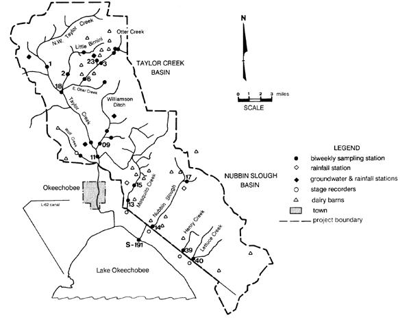
of
Taylor Creek-Nubbin Slough area. [Source: J. A. Gale et al., Evaluation of the Experimental Rural Clean Water Program, EPA-841-R-93-005 (Washington, D.C.: U.S. Environmental Protection Agency, 1993).]
As the 1977 legislative session began, environmentalists moved into action, believing that the impounded wetlands idea was merely, in the words of McCaffrey, “an attempt to prevent dechannelization.”73 Jones again lobbied hard for the legislature to mandate complete restoration, and initially it looked as though he would succeed, as both houses passed resolutions requiring dechannelization. But when the actual legislation came forward, agricultural interests influenced legislators to kill the bill unless other measures were implemented. With almost no chance of passing an act requiring restoration, proponents had to compromise, and the measure that emerged merely requested that the state ask Congress to authorize a Corps restudy of the river. Several state agencies issued resolutions supporting this action, and Congress authorized the restudy in April 1978, appropriating money for the examination in September.74 The Corps clearly saw the examination as a way of investigating a variety of options for the river; dechannelization would only be an “alternative” under study, not the main purpose of the analysis.75
Map
the
The Florida Surveyor Page 61
Likewise, little firm action was forthcoming on other issues pertaining to Lake Okeechobee water quality. Despite the Special Project’s recommendation that backpumping from the EAA cease, it continued. Because the pollutants resulting from backpumping exceeded state water quality standards, the Florida Department of Environmental Regulation was required to issue a permit to the South Florida Water Management District (as discussed above, the name and organization had changed in 1977) before backpumping could occur, but the state did not enforce that requirement until faced with litigation. In 1977, the state asked the SFWMD to apply for a permit, and after the district did so, the Depa rtment of Environmental Regulation issued a temporary operating permit with the understandi ng that the SFWMD would develop an Interim Action Plan to reduce nutrients flowing into the lake from the EAA. The plan did not diminish how much water was backpumped from the area, however; it merely redirected some of the backpumped water to the water conservation areas instead of the lake. Environmentalists were livid with the Department of Environmental Regulation for issuing the permit, believing that the state should require stricter measures to cu rtail backpumping, but agricultural interests, especially the sugar industry, protested that halting backpumping would have detrimental effects on farming activities.76
In many ways, the conflicts over Lake Okeechobee and the Kissimmee River in the 1970s represented a failure for the environmental community. Although it had successfully halted jetport construction and forced a halt to the Cross-Florida Barge Canal, the problems with water quality in Lake Okeechobee and the channelization of the Kissimmee River remained. Yet environmentalists had called attention to serious water quality issues in South Florida, and had forced state officials to take significant measures to ensure a clean and adequate water supply for the region in the future. The 1972 legislative session saw the passage of several land and water planning laws, while a plethora of scientific studies on Lake Okeechobee and the Kissimmee River were produced. At the least, environmentalists had set the necessary background for more stringent measures to occur at a later time.
But why was the environmental community not able to stop backpumping to Lake Okeechobee or to force the Corps to restore the Kissimmee River, especially in light of the jetport and barge canal successes? First, the problems surrounding Lake Okeechobee and the Kissimmee River did not receive significant national attention, and there were few in the federal government interested in these endeavors or willing to push legislation to resolve the issues. In addition, it was a different matter to get the Corps to halt a project under construction than it was to destroy a project already completed. Had the cry about the Kissimmee River been stronger during its actual construction (rather than just muted complaints from a few individuals in the U.S. Fish and Wildlife Service and the Florida Game and Fresh Water Fish Commission), it might have been easier to stop channelization. For example, environmentalists in southern California in the late 1960s and early 1970s had successfully prevented the Corps from channelizing the Sierra Madre Wash through numerous protests and through the active efforts of city council personnel opposed to the project.77 Florida did not see the same scale of efforts when channelization of the Kissimmee River was proposed; instead, as former SFWMD executive director John Maloy related, the hot environmental issues in Florida in the 1960s were the barge canal and the condition of Lake Apopka – “the Kissimmee kind of slipped underneath the threshold and didn’t gain a lot of attention.”78 Finally, state officials, including Governor
South Florida History
by US Army Corps of Engineers
provided
Askew, waffled as to their commitment to full restoration of the Kissimmee or to the cessation of backpumping. Although Askew had strongly acted in his first term to preserve Florida’s environment, several forces prevented the implementation of stringent measures regarding Lake Okeechobee and the Kissimmee River. For one, the sugar industry, which was increasing in political strength, vehemently opposed the stoppage of backpumping, as did agricultural interests in the Kissimmee Valley. For another, despite all of the studies that had been completed, an air of uncertainty still existed at the end of the 1970s as to whether complete restoration of the Kissimmee was really the best step to take, or whether water quality could be improved through other means. Also important was the issue of funding. Dechannelizing the Kissimmee would require a large amount of money, at least some of which would probably have to come from Florida. It would take several more years of studies, including water quality examinations conducted by the Lake Okeechobee Technical Advisory Committee and some strong gubernatorial support, before Kissimmee restoration and stringent measures to protect Lake Okeechobee’s water quality would become a reality.
Course #10835
Provider: CE11
South Florida History provided by US Army Corps of Engineers
Chapter Six Endnotes
1 Robert G. Healy, Land Use and the States (Baltimore, Md.: The Johns Hopkins University Press, 1976), 109.
2 Senator D. Robert Graham, “A Quiet Revolution: Florida’s Future on Trial,” The Florida Naturalist 45 (October 1972): 146-147.
3 See “How the Florida Boom is Changing,” U.S. News & World Report 66 (5 May 1969): 88; “Florida’s Land Boom Gets Down to Earth,” Business Week (6 April 1968): 136; U.S. Army Corps of Engineers, Office of the Chief of Engineers, Engineering Memoirs: Major General William E. Potter, EP 870-1-12 (Washington, D.C.: U.S. Army Corps of Engineers, 1983), 189-194.
4 All quotations (including Van Dyne’s) in McIntosh, The Background of Ecology, 200, 203, 229.
5 “Arthur Marshall, Director of the Division of Applied Ecology, The Center for Urban Studies, University of Miami,” Folder 8, Box 4, Arthur R. Marshall Papers, Manuscript Series 73, Special and Area Studies Collections, George A. Smathers Library (East), University of Florida, Gainesville, Florida [hereafter referred to as Marshall Papers]. For more information on Marshall, see Grunwald, The Swamp, 246-248.
6 Quotation in Florida Wildlife Federation press release, 8 April 1970, File Everglades High Water & Deer Situation: U.S. Senate Subcommittee Hearing, Box 1, S1719, Game & Fresh Water Fish Commission Everglades Conservation Files, 1958-1982, FSA. For more information about the deer problems in 1970, see “Information Sheet on Spring 1970 High Water Situation – Southern Florida,” File 1110-2-1150a (C&SF) Conservation Area Jan 1970-Dec 1970, Box 15, Accession No. 077-96-0038, RG 77, FRC.
7 Quotations in “Adequate Water Essential for Wildlife Survival,” Bureau of Sport Fisheries and Wildlife, South Florida National Wildlife Refuges press release, File Conservation Areas 1, 2, 3, 1970-86, Box 02193, SFWMDAR; see also Joseph D. Carroll, Jr., Acting Field Supervisor, to Regional Director, 7 May 1970, no file name, FWSVBAR.
8 “Report of the Special Study Team on the Florida Everglades, August 1970,” 3, 5-8, 12, 17-27, copy in South Florida Water Management District Reference Center, West Palm Beach, Florida.
9 Henry B. Sirgo, “Water Policy Decision-Making and Implementation in the Johnson Administration,” Journal of Political Science 12, nos. 1-2 (1985): 53-58.
10 “Report of the Special Study Team on the Florida Everglades, August 1970,” 13-15. The report did not dwell on the EAA backpumping issue, only listing it as one of the factors contributing to poor water quality in the lake.
11 Arthur R. Marshall, “Water Problems of South Florida,” 26 January 1971, File Water Resources Development Comm. General/Meetings 1957-73, Box 02500, SFWMDAR.
12 Arthur R. Marshall, “Repairing the Florida Everglades Basin,” 11 June 1971, copy in South Florida Water Management District Reference Center, West Palm Beach, Florida.
13 Marshall, “Repairing the Florida Everglades Basin.”
14 See G. W. Cornwell, “The Everglades—Nature’s Yo-Yo,” Folder 16, Box 4, Marshall Papers.
15 W. V. Storch to Professor Arthur R. Marshall, 6 July 1971, attachment to Marshall, “Repairing the Florida Everglades Basin.”
16 Garald G. Parker, Chief Hydrologist, to Dale Twachtmann, Executive Director, 3 August 1971, Folder 5, Box 7, Marshall Papers.
17 Quotations in “Remarks of Reubin O’D. Askew, Governor of Florida, at the Governor’s Conference on Water Management in South Florida, Miami Beach, Florida, September 22, 1971,” Folder 4, Box 6, Marshall Papers; see also “Five Major Problems Listed By Governor,” Water Management Bulletin 5 (October-November 1971): 2; Graham, “A Quiet Revolution,” 146-147; Grunwald, The Swamp, 260; “Lake Okeechobee Health Center of Rising Dispute,” The Miami Herald, 20 September 1971. McHarg’s book Design With Nature (Garden City, N.Y.: Natural History Press, 1969) emphasized the importance of environmental planning in the protection of ecosystems.
Chapter Six Endnotes (continued)
18 Quotations in “A Statement to Reubin O’D. Askew, Governor, State of Florida, from the Governor’s Conference on Water Management in South Florida,” September 1971, 1-6, File Wetlands Regulation Federal, State, Local Correspondence/General 1973-75, Box 02500, SFWMDAR; see also “Population, Drainage Limits Urged,” The Miami Herald, 25 September 1971; Grunwald, The Swamp, 260.
19 Reubin Askew, Governor, to Friend, 7 March 1972 (with attachment), File L54 Water Resources Jan 72-June 72, EVER 22965, CR-ENPA; Askew to Conference Participant, 30 December 1971, ibid.; Carter, The Florida Experience, 126-131; Healy, Land Use and the States, 110-111.
20 Askew to Friend, 7 March 1972.
21 Carter, The Florida Experience, 136.
22 Carter, The Florida Experience, 132-136; Grunwald, The Swamp, 261; Jones interview, 20.
23 Graham, “A Quiet Revolution,” 148; see also The Florida Environmental Land and Water Management Act, copy in EVER 22965, CR-ENPA.
24 “The Florida Environmental Land and Water Management Act of 1972,” summary in File Legislation Environmental Land & Water Management Act of 1972 – General, Box 25, Graham Papers; “Water Management in Florida,” 2 November 1973, ibid.; Carter, The Florida Experience, 133; Blake, Land Into Water, 230.
25 As quoted in Stephen Glass, “Rebirth of a River,” Restoration & Management Notes 5 (Summer 1987): 7; see also Jack Shreve to Senator, 3 April 1972 (with attachment), File Legislative Water Resources Act 1973-1975, Box 38, Graham Papers; “Water Management in Florida,” 2 November 1973, ibid.; “Water Management Act of 1972,” File Legislative Water Management Districts 1974-1975, Box 38, Graham Papers; Forrest T. Izuno and A. B. Bottcher, “The History of Water Management in South Florida,” in Everglades Agricultural Area (EAA): Water, Soil, Crop, and Environmental Management, A. B. Bottcher and F. T. Izuno, eds. (Gainesville: University Press of Florida, 1994), 21-22; Maloy interview; Carter, The Florida Experience, 133; Blake, Land Into Water, 230. Because the FCD did not become the SFWMD until 1977, we will continue to refer to it as the FCD until our discussion reaches that year.
26 Carter, The Florida Experience, 137.
27 Leach, Klein, and Hampton, Hydrologic Effects of Water Control and Management in Southeastern Florida, 1-3.
28 As quoted in M. Timothy O’Keefe, “Cows, Crackers and Cades: Bloody, Muddy and ‘Unbent,’ The Kissimmee River Has Seen Some Weird Goings-On,” Florida Sportsman (August 1978): 20.
29 “Presentation by Colonel James W. R. Adams, District Engineer, Jacksonville District, to the Florida Wildlife Federation, Orlando, Florida, 23 September 1978: ‘Two Rivers—Kissimmee-Oklawaha—Where We Are Today,’“ 1-3, Kissimmee Binder, Box 4383, JDAR.
30 Unsigned letter to District Engineer, 17 December 1958, copy in South Florida Water Management District Reference Center, West Palm Beach, Florida; Blake, Land Into Water, 260.
31 C. Russell Mason to General W. S. Cassidy, Chief Army Engineer, 4 February 1966, File 1110-2-1150a (C&SF) Kissimmee River Valley Study Aug 1965-Feb. 1967, Box 10, Accession No. 077-01-0023, RG 77, FRC.
32 Colonel R. P. Tabb, District Engineer, to Honorable George A. Smathers, 17 October 1967, File 1110-21150a (C&SF) Kissimmee River Valley Study March 1967-December 1968, Box 10, Accession No. 077-01-0023, RG 77, FRC.
33 “Kissimmee River Survey Review, Town Hall Meetings, Information Packet,” Binder Kissimmee, Box 4383, U.S. Army Corps of Engineers, JDAR; “Presentation by Colonel James W. R. Adams, District Engineer, Jacksonville District, to the Florida Wildlife Federation, Orlando, Florida, 23 September 1978,” 3; James L. Garland, Chief Engineering Division, to Mr. Alexander L. Crosby, 25 May 1973, File 1110-2-1150a (C&SF) Kissimmee River Valley Study Jan 1973-Dec 1973, Box 9, Accession No. 077-01-0023, RG 77, FRC.
The Florida Surveyor Page 65

Please update any contact information in your account so that you do not miss out on any exciting events, news, or promotions.
Click Here to log in to your FSMS account:
https://fsms.memberclicks.net/login#/login
Click Here to Retrieve your FSMS username:
https://fsms.memberclicks.net/login#/retrieve-username
Click Here for FSMS password reset:
https://fsms.memberclicks.net/login#/reset-password
Membership is Open for 2024
Chapter Six Endnotes (continued)
34 M. Timothy O’Keefe, “The Kissimmee Problems: Trying to Unmuddle Man’s Meddling,” Florida Sportsman (August 1978): 29.
35 Carter, The Florida Experience, 26.
36 Carter, The Florida Experience, 26, 123.
37 Arthur R. Marshall, “Water Problems of South Florida,” 26 January 1971, copy in File Water Resources Development Commission, General/Meetings, 1957-73, Box 02500, SFWMDAR.
38 Quotation in Colonel Emmett G. Lee, Jr., District Engineer, to Honorable Lawton Chiles, United States Senate, 27 August 1974, File 1110-2-1150a (C&SF Martin County) Project—General—1968 Authn 1968-1979, Box 1, Accession No. 077-01-0023, RG 77, FRC; see also Donald B. Benedict, Martin County Conservation Alliance, to Mr. Carol White, Corps of Engineers, 3 June 1976, ibid.; Joseph D. Carroll, Jr., Field Supervisor, Fish and Wildlife Service, to District Engineer, 4 June 1976, File 1520-03 (C&SF) Water Control Jan. 1976-Dec. 1976, Box 3579, JDAR.
39 Quotation in Marshall, “Water Problems of South Florida,” 1; see also “Report of the Special Study Team on the Florida Everglades, August 1970,” 14.
40 Quotation in Arthur R. Marshall, “Are The Everglades Nearing Extinction?” The Florida Naturalist 44 (July 1971): 80-81 (this is a reprint of Marshall’s statement); see also Marshall, “Repairing the Florida Everglades Basin,” 4.
41 “A Statement to Reubin O’D. Askew, Governor, State of Florida, from the Governor’s Conference on Water Management in South Florida,” 1; see also Lothian A. Ager, Fishery Biologist, to John W. Woods, Fisheries Division, 16 September 1971, File LO Historical Data/Text, Box 18060, SFWMDAR.
42 “Lake Okeechobee Not Dying, Official Study Shows,” The Palm Beach Times, 24 August 1971.
43 J. Walter Dineen to Jack Maloy, 3 August 1971, Folder 5, Box 3, Marshall Papers; “FCD To Seek Restoration of Kissimmee Marshes,” The Palm Beach Times, 1 December 1972; “Urges Support Be Given To Restoring Kissimmee,” Stuart News, 19 November 1972. In August 1972, Marshall received an appointment to the FCD’s board, but he resigned in 1973 because he believed that other board members did not take environmental matters seriously. See Governor to Mr. Art Marshall, 17 August 1972, Folder 9, Box 4, Marshall Papers; Askew to Marshall, 17 July 1973, ibid.
44 All quotations in “Summary of Kissimmee River Hearing – At West Palm Beach – November 15, 1972,” 3, 5-10, File Kissimmee River Restoration History, Box 17166, SFWMDAR.
45 “Findings and Recommendations of the Governing Board, Central and Southern Florida Flood Control District, as the Result of Public Hearing Concerning Alleged Environmental Damage Resulting from Channelization of the Kissimmee River, November 15, 1972,” copy in South Florida Water Management District Reference Center, West Palm Beach, Florida.
46 The Kissimmee-Okeechobee Basin: A Report to the Cabinet of Florida (Miami, Fla.: Division of Applied Ecology, Center for Urban and Regional Studies, University of Miami, 1972), 2, 48-50.
47 “December 12, 1972, Cabinet Meeting, 9:00 A.M.,” 36-37, 53, 57, 67, File Lakes & Streams Kissimmee River Basin (FCD) 1969, Box 1, S1570, Game & Fresh Water Fish Commission, Lake & Stream Restoration Project Files, 1950-1986, FSA.
48 Quotation in Interim Report on the Special Project to Prevent the Eutrophication of Lake Okeechobee (Tallahassee: Florida Department of Administration, Division of State Planning, 1975), 1; see also Blake, Land Into Water, 263.
49 Atlantis Scientific, “An Assessment of Water Resource Management in the Central and Southern Florida Flood Control District: A Review and Evaluation of Environmental Reports on the Kissimmee River and Lake
The Florida Surveyor Page 67
Chapter Six Endnotes (continued)
Okeechobee,” 2 April 1973, 49-50, 52, 59-60, 69, 77, copy in Library, Jacksonville District, U.S. Army Corps of Engineers, Jacksonville, Florida.
50 “Corps Is Quietly Attacking River Restoration Proposal,” The Miami Herald, 27 May 1973.
51 Atlantis Scientific, “An Assessment of Water Resource Management,” 2.
52 David S. Anthony, “Water Problems in the Kissimmee_Okeechobee Basin in Florida,” 6, File Kissimmee River Restoration History, Box 17166, SFWMDAR.
53 Robert L. Goodrick and James F. Milleson, Studies of Floodplain Vegetation and Water Level Fluctuation in the Kissimmee River Valley, Technical Publication No. 74-2 (West Palm Beach, Fla.: Central and Southern Florida Flood Control District, 1974); “Lake Okeechobee – Kissimmee Basin, Proposals for Management Actions, Central and Southern Florida Flood Control District, March 20, 1975,” copy in South Florida Water Management District Reference Center, West Palm Beach, Florida.
54 “Lake Okeechobee – Kissimmee Basin, Proposals for Management Actions, Central and Southern Florida Flood Control District, March 20, 1975”; Frederick E. Davis and Michael L. Marshall, Chemical and Biological Investigations of Lake Okeechobee, January 1973-June 1974, Interim Report, Technical Publication No. 75-1 (West Palm Beach, Fla.: Central and Southern Florida Flood Control District, 1975). The Division of State Planning published an interim report on the SPPELO in 1975 that noted the FCD’s conclusions, but explained that other studies of vegetation and sediments showed that phosphorous and nitrogen levels had tremendously increased. It expected to have “hard data” about the lake’s eutrophic condition by the end of the study. Interim Report on the Special Project to Prevent the Eutrophication of Lake Okeechobee (Tallahassee: Florida Department of Administration, Division of State Planning, 1975), 32.
55 Lyman E. Rogers to Lt. Governor J. H. ‘Jim’ Williams, n.d., Folder 45, Box 1, Marshall Papers (emphasis in the original); see also Lyman to Art, 28 August 1975, ibid.
56 Williams to Rogers, 11 September 1975, Folder 45, Box 1, Marshall Papers.
57 Black, Crow & Eidsness, Inc., “Report to Florida Cane Sugar League on Eutrophication of Lake Okeechobee,” December 1975, xii-xiii, xv, 1-2, 2-7, copy in South Florida Water Management District Reference Center, West Palm Beach, Florida.
58 Central and Southern Florida Flood Control District, “Report on Investigation of Back-Pumping Reversal and Alternative Water Retention Sites, Miami Canal and North New River Canal Basins, Everglades Agricultural Area,” December 1975, i-iv, copy in Folder 12, Box 3, Marshall Papers. The Rotenberger Tract was named for Ray Rotenberger, a man who built a camp and airfield in the area in the late 1950s and early 1960s. The state purchased 6,300 acres of land in the area in 1975. Florida Fish and Wildlife Conservation Commission, “Rotenberger Wildlife Management Area” <http://www.floridaconservation.org/recreation/rotenberger/history.asp> (March 22, 2005).
59 See J. Walter Dineen, Director, Environmental Sciences Division, to Director, Resource Planning Department, 16 September 1974, Folder 35, Box 2, Marshall Papers; Dineen to Director, Resource Planning Department, 19 November 1974, ibid.; John C. Jones, Executive Director, Florida Wildlife Federation, to Honorable Reubin Askew, Governor of Florida, 4 December 1974, ibid.
60 State of Florida Department of Environmental Regulation, Report of Investigations in the Kissimmee RiverLake Okeechobee Watershed (Tallahassee: State of Florida Department of Environmental Regulation, 1976), 2, 4, 13.
61 Department of Administration, Division of State Planning, Bureau of Comprehensive Planning, “Findings and Recommendations from the Special Project to Prevent the Eutrophication of Lake Okeechobee,” May 1976, copy in South Florida Water Management District Reference Center, West Palm Beach, Florida. For the full report, see Florida Department of Administration, Division of State Planning, Final Report on the Special Project to Prevent Eutrophication of Lake Okeechobee (Tallahassee: Florida Department of Administration, Division of State Planning, 1976).
March 2024 Page 68
South Florida History provided by US Army Corps of Engineers
Chapter Six Endnotes (continued)
62 Colonel Donald A. Wisdom, District Engineer, to Honorable John H. Williams, Lieutenant Governor of Florida, 13 April 1976, File C&SF Special Project to Prevent Eutrofication [sic] of Lake Okeechobee 1975, Box 3693, JDAR.
63 Jones interview, 13-14; “Conservationist Urges River Bill Passage,” The Palm Beach Times, 24 May 1976; Patrick M. McCaffrey, “Politics of the Kissimmee River Survey Review,” 51-56, Folder 7, Box 3, Marshall Papers.
64 “Conservationist Urges River Bill Passage,” The Palm Beach Times, 24 May 1976.
65 “New Law May Help Stricken Kissimmee River,” unidentified newspaper clipping, File Kissimmee River News Clippings, Magazine Articles, Box 17166, SFWMDAR; A. H. “Gus” Craig to Mr. Joseph W. Landers, Jr., 21 June 1976, Folder 6, Box 3, Marshall Papers. Most accounts say that the bill passed unanimously, but “New Law May Help Stricken Kissimmee River” reported that two members of the House voted against it.
66 Jon C. Thomas to Mr. Jay Landers, Secretary, Department of Environmental Regulation, 22 June 1976, Folder 6, Box 3, Marshall Papers.
67 Colonel Donald A. Wisdom, District Engineer, to Honorable J. H. “Jim” Williams, 4 February 1976, File C&SF Special Project to Prevent Eutrofication [sic] of Lake Okeechobee 1975, Box 3693, JDAR.
68 “Restoring the Kissimmee River May Be Florida’s Environmental Armageddon,” ENFO, n.d., copy in Folder 7, Box 3, Marshall Papers.
69 McCaffrey, “Politics of the Kissimmee River Survey Review,” 51-56.
70 Robert L. Shevin, Attorney General, to Honorable A. H. “Gus” Craig, Representative, 28th District, 15 April 1977, File 10-1-7a (Kissimmee River Restoration-State Coop Study) May 1977-August 1977, Box 3693, JDAR.
71 Coordinating Council on the Restoration of the Kissimmee River Valley and Taylor Creek-Nubbin Slough Basin [Coordinating Council], Legislative Summary: First Annual Report to the Florida Legislature (Tallahassee, Fla.: Coordinating Council on the Restoration of the Kissimmee River Valley and Taylor Creek-Nubbin Slough Basin, 1977), 1-1 – 1-4.
72 Coordinating Council, Legislative Summary, 1-5 – 1-8; McCaffrey, “Politics of the Kissimmee River Survey Review,” 57.
73 McCaffrey, “Politics of the Kissimmee River Survey Review,” 58.
74 Colonel Donald A. Wisdom, District Engineer, to Honorable J. Herbert Burke, 24 August 1977, File 10-1-7a (Kissimmee River Restoration-State Coop Study) May 1977-August 1977, Box 3693, JDAR; “Kissimmee River Battle Subsides,” The Palm Beach Times, 21 September 1977.
75 Colonel Donald A. Wisdom, District Engineer, to Arthur J. Fox, Jr., Editor, Engineering News Record, 7 July 1977, File 10-1-7a (Kissimmee River Restoration-State Coop Study) May 1977-August 1977, Box 3693, JDAR.
76 Thomas G. Tomasello, Counsel, to Colonel James W. R. Adams, District Engineer, 28 June 1979, File C&SF Special Project to Prevent Eutrofication [sic] of Lake Okeechobee 1975, Box 3693, JDAR; 12; South Florida Water Management District, “Executive Summary: Water Quality Management Strategy for Lake Okeechobee,” 11 December 1981, Folder 16, Box 3, Marshall Papers; Forrest T. Izuno and A. B. Bottcher, “Introduction,” in Everglades Agricultural Area (EAA): Water, Soil, Crop, and Environmental Management, A. B. Bottcher and F. T. Izuno, eds. (Gainesville: University Press, of Florida, 1994), 8.
77 See Jared Orsi, Hazardous Metropolis: Flooding and Urban Ecology in Los Angeles (Berkeley: University of California Press, 2004), 134-137.
78 Maloy interview.
The Florida Surveyor Page 69
A.

Amerritt,
Arc
904-384-8377
ARCVERTEX
631-480-2201
Ardurra,
AIM
239-332-4569
Allen
407-654-5355
Allen
321-783-7443
Altapro
386-837-0244
American
813-933-3322
American
813-234-0103
BBarnes,
407-896-8608
Barraco
239-461-3170
Bartram
904-284-2224
Bello
407-869-5002
ATWELL,
866-850-4200
Avirom
561-392-2594
AXIS
410-822-1441
305-251-9606
Bennett-Panfil, Inc. 941-497-1290
Berntsen
Betsy
BGE,
561-485-0824
Biscayne
A
Surface Pro, Inc.
AA
239-471-2668
D. Platt & Associates, Inc.
850-329-5551
Engineering & Surveying
& Company, Inc.
Engineering
Surveyors
Government Services Corporation
Surveying, Inc.
Inc.
813-221-5200
Surveying & Mapping, Inc.
LLC
Inc. 239-292-7773
Surveying
Mapping,
Associated Land
&
Inc.
LLC
& Associates, Inc.
GeoSpatial, LLC
Ferland
Associates,
and
Inc.
& Associates, Inc.
Surveying,
Trail
Inc.
Surveying
& Bello Land
Corporation
International 608-443-2772
Lindsay,
Inc. 772-286-5753
Inc.
Engineering Company, Inc.
Land Surveyors, Inc. 904-241-8550
& Clark Corporation(NV5) 330-665-4821
Consulting Group 703-454-1000
& Associates, Inc.
& Phillips, Inc. 561-615-3988
Consultants, Inc. 321-725-3674
& Harper, Inc. 850-763-7427 202 4 S u S taining The Florida Surveyor Page 71
305-324-7671 Boatwright
Bock
Bowman
Bradshaw-Niles
904-829-2591 Brown
BSE
Buchanan
F irm S Directory
CCalvin, Giordano & Associates, Inc.
954-921-7781
Carnahan, Proctor & Cross, Inc.
407-960-5980
Carter Associates, Inc.
772-562-4191
Caulfield & Wheeler
561-392-1991
Chastain-Skillman, Inc.
863-646-1402
CivilSurv Design Group, Inc.
863-646-4771
Clements
Surveying, Inc.
941-729-6690
Coastal Engineering Associates, Inc.
352-796-9423

Colliers Engineering & Design
732-383-1950
Cousins Surveyors & Associates, Inc.
954-689-7766
CPH Consulting, LLC
407-322-6841
Craven-Thompson & Associates, Inc.
954-739-6400
Culpepper & Terpening, Inc.
772-464-3537
DDARIUS
561-427-9514
DeGrove Surveyors, Inc.
904-722-0400
Dennis J. Leavy & Associates
561-753-0650
Dewberry
407-843-5120
Donald W. McIntosh Associates, Inc. 407-644-4068
Donoghue Construction Layout, LLC. 321-248-7979
Douglass, Leavy & Associates, Inc.
954-344-7994
DRMP, Inc. 833-811-3767
DroneView Technologies
248-321-9417
DSW Surveying & Mapping, PLC. 352-735-3796
Duncan-Parnell, Inc. 800-849-7708
Durden Surveying and Mapping, Inc. 904-853-6822
EECHO UES, Inc.
888-778-3246
Eda Consultants, Inc. 352-373-3541
Eiland & Associates, Inc.
904-272-1000
Element Engineering Group, LLC.
813-386-2101
Engenuity Group, Inc.
561-655-1151
Engineering Design & Construction, Inc.
772-462-2455
ER Brownell & Associates, Inc.
305-860-3866
ETM Suryeying & Mapping
904-642-8550
March 2024 Page 72
Exacta Land Surveyors, Inc.
866-735-1916
FFerguson Land Surveyors
727-230-9606
First Choice Surveying, Inc.
407-951-3425
Florida Design Consultants, Inc.
727-849-7588
Florida Engineering & Surveying, LLC.
941-485-3100
FLT Geosystems
954-763-5300
Ford, Armenteros & Fernandez, Inc. 305-477-6472
Fortin, Leavey, Skiles, Inc.
305-653-4493

Frontier Precision Unmanned 701-222-2030
F.R.S. & Associates, Inc. 561-478-7178
GGCY, Inc. 772-286-8083
GeoData Consultants, Inc 407-732-6965
Geoline Surveying 386-418-0500
Geo Networking, Inc. 407-549-5075
GeoPoint Surveying, Inc. 813-248-8888
George F. Young 727-822-4317
Germaine Surveying, Inc. 863-385-6856
GPI Geospatial, Inc. 407-851-7880
Gustin, Cothern & Tucker, Inc. 850-678-5141 H
Haley Ward, Inc. 207-989-4824
Hanson Professional Services, Inc. 217-788-2450
Hanson, Walter & Associates, Inc. 407-847-9433
H.L. Bennett & Associates, Inc. 863-675-8882
Hole Montes, Inc. 239-254-2000
HUB International 850-386-1111
Hyatt Survey Services 941-748-4693
IIbarra Land Surveyors 305-262-0400 I.F. Rooks &
954-776-1616
Keith and
Kendrick Land Surveying, LLC 863-533-4874
Associates,
LLC. 813-752-2113 K KCI Technologies
Associates, Inc. 954-788-3400
The Florida Surveyor Page 73
202 4 S u S taining

Landmark Engineering & Surveying Corporation 813-621-7841 Land Precision Corporation 727-796-2737 L&S Diversified, LLC. 407-681-3836 Langan Engineering and Environmental Services, Inc. 973-560-4900 Leading Edge Land Services, Inc. 407-351-6730
Perez & Associates, Inc. 305-652-5133
Corp. 800-342-9238
Mills & Associates
Longitude Surveyors, LLC 305-463-0912 Long Surveying, Inc. 407-330-9717 Lynx Surveyors & Engineering 833-721-2907 M
G. Vera & Associates, Inc. 305-221-6210
Surveying & Mapping, LLC. 305-853-0066 Masteller, Moler & Taylor, Inc. 772-564-8050
& Creed, Inc. 919-233-8091 McLaughlin Engineering, Co. 954-763-7611 Metron Surveying and Mapping, LLC. 239-275-8575 Mock Roos & Associates, Inc. 561-683-3113 Moore Bass Consulting, Inc. 850-222-5678 Morris-Depew Associates, Inc. 239-337-3993 Murphy’s Land Surveying 727-347-8740 N Navigation Electronics, Inc. 337-237-1413 NEXGEN ENTERPRISES 561-207-7446 Northwest Surveying, Inc. 813-889-9236 NV5, Inc 954-495-2112 O On The Mark Surveying, LLC. 321-626-6376 P PEC Surveying & Mapping 407-542-4967 Pennoni Associates, Inc. 863-594-2007 Perret and Associates, Inc 904-805-0030 Pickett & Associates, Inc. 863-533-9095 Platinum Surveying & Mapping, LLC. 863-904-4699 Polaris Associates, Inc. 727-461-6113 F irm S Directory March 2024 Page 74
Leiter
Lengemann
Leo
941-722-2460
Manuel
Massey-Richards
McKim
Porter

863-853-1496
Pulice
954-572-1777
QQ
RReece
305-872-1348
Rhodes & Rhodes Land Surveying, Inc. 239-405-8166
Richard
Ritzel-Mason,
904-675-9300
R.M.
Robayna and Associates, Inc. 305-823-9316
SSAM Surveying & Mapping, LLC. 850-385-1179
SCR & Associates
NWFL Inc. 850-527-1910
Sergio Redondo & Associates, Inc. 305-378-4443
Sexton Engineering Associates, Inc. 561-792-3122
SGC Engineering, LLC. 407-637-2588
Shah
954-943-9433
Sliger
386-761-5385
T407-292-8580
Stephen H. Gibbs Land Surveyors, Inc. 954-923-7666
Stoner Inc. 954-585-0997
Suarez
Survey
SurvTech
Geographical Positioning & Surveying, Inc.
Land Surveyors, Inc.
Grady Minor & Associates, PA 239-947-1144
& White Land Surveying, Inc.
P. Clarson & Associates, Inc. 904-396-2623
Inc. 786-472-0358
Surveying
Mapping, LLC
River City
&
Barrineau & Associates, Inc. 352-622-3133
Drotos & Associates, PA
& Associates, Inc.
Southeastern Surveying & Mapping Corp.
Surveying & Mapping, Inc. 305-596-1799
Data Solutions, LLC 352-816-4084
Solutions, Inc. 813-621-4929
T2 UES Inc. 407-587-0603 Tectonic Engineering and Surveying Consultants 845-534-5959
Roddenberry & Associates 850-962-2538 TopoDOT 407-248-0160 TranSystems Corporation Consultants 727-822-4151 202 4 S u S taining The Florida Surveyor Page 75
Thurman
F irm S Directory

U352-846-0850
Upham,
WZ352-753-6511 Wantman
WBQ
Whidden
LinkedIn
Facebook
X
Instagram
YouTube

Winnigham
School of Forest, Fisheries, and Geomatics Sciences
UF/IFAS
Inc. 386-672-9515
Surveying, Inc.
Wade
Group, Inc.(WGI) 561-687-2220
Design & Engineering, Inc.
407-839-4300
Surveying & Mapping, Inc.
561-790-5515
& Fradley
Inc. 800-414-1045
954-771-7440 Woolpert,
ZNS Engineering, LLC. 941-748-8080
March 2024 Page 76
LINKS
SOCIAL MEDIA
= 1,062 Followers
=
Followers
966
= 383 Followers
= 293 Followers

Committee Consideration

The Florida Surveyor Page 77

Join Us for a Two Day Strategic Planning Event & Board Meeting in Gainesville, FL.
WHEN: 4/11/24, 8 am - 4 pm 4/12/24, 8 am - 11 am — Board Meeting from 12 pm - 4 pm
WHERE: Austin Cary Forest Campus, located at 10625 NE Waldo Rd in Gainesville, FL.
Click Here for Hotel Details & Link to Group Rate (Must Reserve Your Room by 3/22/24 to Receive Group Rate)

NGS Multi-Year CORS Solution 3 Coming Later This Year
In order to maintain consistency with the International Earth Rotation and Reference System Service (IERS) and the International GNSS Service (IGS) reference frames, NGS has been working to implement the new International Terrestrial Reference Frame 2020 (ITRF2020) and IGS20 realizations in the U.S. National Spatial Reference System (NSRS). This will result in updated North American Datum 1983 (NAD 83) coordinates for stations in the NOAA CORS Network (NCN) that are consistent with the existing NAD 83 epoch 2010.0 realization. This update will be called the Multi-Year CORS Solution 3 (MYCS3), and the last time NGS did a similar update was 5 years ago for MYCS2, where you can read more information on the MYCS2 website .
What’s new?
This update to the NSRS is expected to be released later this year. What’s new?
• New coordinate functions for NOAA CORS Network (NCN) stations consistent with ITRF2020
• Datasheets will display new NAD 83 coordinates transformed from ITRF2020 coordinate functions. The new NAD 83 coordinates will remain at reference epoch 2010.0.
• Position and Velocity (P&V) files will display coordinates/veloc ities in both NAD83 and ITRF2020
• The NGS Online Positioning Users Service (OPUS) will begin processing data with NCN control that is consistent with ITRF2020 at the time of measurement; results will still be transformed to NAD83 at epoch 2010.0.
NGS will share more information, including an upcoming webinar, as the transition date approaches.
The Florida Surveyor Page 79
Background:
On 2 October 2022, the International Earth Rotation and Reference System Service (IERS) released a new realization of the International Terrestrial Reference Frame called ITRF2020 . The new frame supersedes the previous version called ITRF2014. The ITRF2020 release was followed shortly by the release of a new frame realization by the International GNSS Service (IGS) called IGS20 which is closely related to ITRF2020.
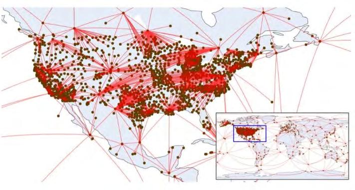
March 2024 Page 80
DID YOU KNOW?

NASA Discovers New “Scorching”
Seven-Planet System Orbiting Distant Star
The Kepler telescope was deactivated in 2018, ending its mission almost a decade after its launch. However, its observations continue to teach us new things about the universe. NASA reports that astronomers have found a system of seven planets thanks to the data gathered by the Kepler telescope.
Known as Kepler-385 due to the involvement of the telescope in its discovery, this seven-planet system has a Sun-like star at the center. However, it is about 10% larger and 5% hotter than our Sun; and it creates scorching conditions throughout the system. NASA even points out that each of the planets is bathed in more radiant heat from their host star per area than any planet in our solar system.
As for these seven exoplanets (planets that orbit a star outside the solar system), the inner two are both slightly larger than Earth, probably rocky
with thin atmospheres. The other five planets are thought to be larger, with a radius about twice the size of Earth’s but smaller than Neptune, and surrounded by thick atmospheres.
Kepler-385 is part of a new catalog of 4,400 planet candidates and 700 multi-planet systems discovered by the telescope. A planet candidate is a planet that has been discovered by a telescope, but not yet confirmed to actually exist. Among all the planet candidates and systems listed, Kepler-385 caught the astronomer's attention as it's rare for there to be a system with more than six planet candidates.
“The ability to describe the properties of the Kepler-385 system in such detail is testament to the quality of this latest catalog of exoplanets, ” writes NASA. “While the Kepler mission’s final catalogs focused on producing lists optimized to measure how common planets are around other stars, this study focuses on producing a comprehensive list that provides accurate information about each of the systems, making discoveries like Kepler-385 possible.”
With Kepler having provided the first steps in the long process to further studying neighbor systems and planets, researchers will turn to other resources to confirm their existence and learn more about them. “We’ve assembled the most accurate list of Kepler planet candidates and their properties to date,” says Jack Lissauer, a research scientist at NASA’s Ames Research Center in California’s Silicon Valley and lead author on the paper presenting the new catalog. “NASA’s Kepler mission has discovered the majority of known exoplanets, and this new catalog will enable astronomers to learn more about their characteristics. ”
 Photos: NASA/Daniel Rutter
Source
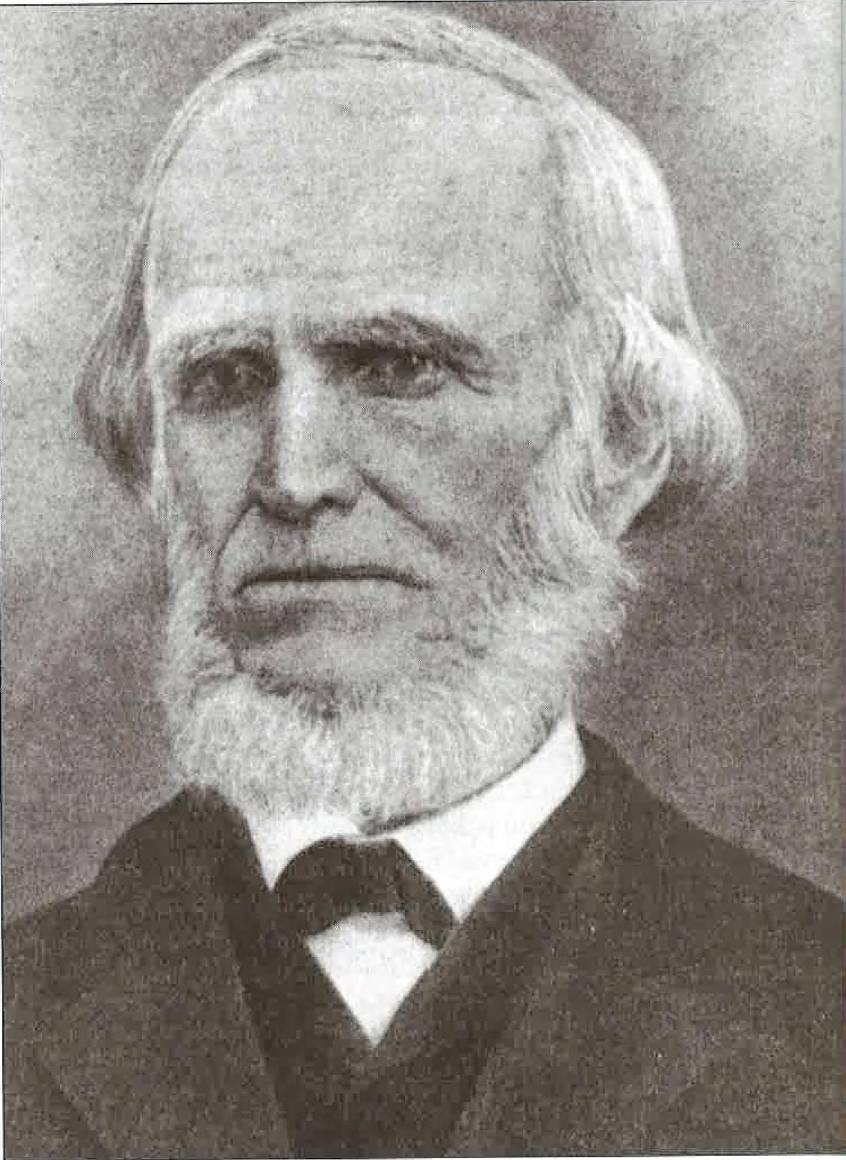
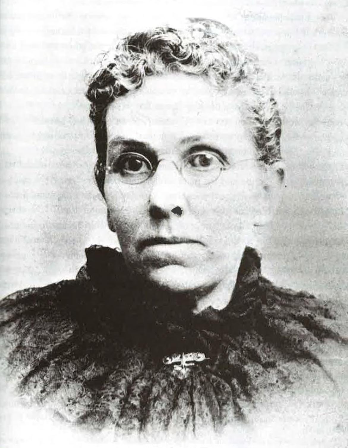
The Florida Surveyor Page 83
John Jackson (Florida State Photographic Archives)
Catherine Maher Jackson (Florida State Photographic Archives)
FACES ON THE FRONTIER
FLORIDA SURVEYORS AND DEVELOPERS IN THE 19TH CENTURY
by Dr. Joe Knetsch
CHAPTER 6
A SURVEYOR'S LIFE: JOHN JACKSON IN SOUTH FLORIDA
John Jackson, pioneer surveyor, general store owner, mill owner and civic leader has had comparatively little attention paid to his remarkable career.
Few pioneers can claim that they laid out the boundaries of a metropolis, avoided Indian attacks in the wilds of the Everglades, owned and operated a general store and mill and took part in many civic affairs culminating in a term as mayor of the city whose boundary he helped to establish. Many of the early citizens of Tampa owed their property descriptions to this Irish immigrant and engineer. In a long and distinguished career as a professional surveyor and civil engineer, he often defended his work and advised others until well into advanced age and long after he had retired as an active surveyor. Such a memora ble person deserves more recognition in the eyes of history.
John Jackson was born in 1812 at Ballybag, County Monaghan, Ireland, the son of Hugh and Ann (Corocran) Jackson. His early education appears, from the limited records, to have been obtained in the local schools of County Monaghan and rounded off, in the fashion of the day, in some form of apprenticeship to a local engineer. 1 By 1841, the economy of Ireland was fairly depressed and the beginnings of famine already appearing, John Jackson and his younger brother, Thomas, immigrated to the United States. The Ireland he left was heavily populated and arable land was too expensive for anyone but English lords.
March 2024 Page 84
The population was so high that Benjamin Disraeli declared that the country was more densely populated, on its usable land, than China. Even some of the census takers of Ireland thought that the numbers (over eight million) used by the official record were far too low. Unemployment was widespread and the specter of people living in caves and sod-huts surely influenced many to leave the Emerald Isle. 2 The Jackson brothers soon found themselves in the bustling port city of New Orleans and John made his living as the assistant city engineer. It was during this period that John Jackson met Simon Turman. Turman, who was then heading a group of colonists migrating to Florida, persuaded Jackson to join the group and avail him self of the opportunity to receive 160 acres of free land, which were offered to set tlers under the Armed Occupation Act of 1842. To the young Irish engineer, 160 acres of free land seemed too good to be true, given his background. Jackson readily accepted the offer and came to Tampa Bay in early 1843. 3
1 Florida Genealogical Journal , 18 (1982), 43.
2Cecil Woodham-Smith, The Great Hunger: Ireland 1845-1849 (New York: Harper & Row, 1962), 23-31.
3 Florida Genealogical Journal and Karl H. Grismer, Tampa: A History of the City of Tampa and the Tampa Bay Region of Florida (St. Petersburg: St. Petersburg Printing Co., 1950), 105-06.
The Armed Occupation Act of 1842 authorized an individual to stake a claim on government land if they agreed to clear at least five acres of land, build a house suitable for human beings and to bear arms against any Indian aggression. The purpose was to create a line of armed settlements on the frontier between the Indi ans remaining in Florida and the main white settlements and towns. 4 Jackson, Turman and many others eagerly sought out these lands on the frontiers of modern Hillsborough and Manatee Counties. Jackson's first permit, No. 917 Newnans ville, requested the Southeast corner of Section 2, Township 34 South, Range 18 East. However, there was a conflict with a claim already filed by one William Mitchel and Jackson withdrew his request for this land and settled for the South west corner of Section 13, Township 34 South, Range 17 East. 5 This land was near Turman's on the Manatee River, but, by 1845, both men had moved to Tampa and had begun relatively successful careers in their new homes. 6
4James Covington. “The Armed Occupation Act of 1842,” Florida Historical Quarterly,
The Florida Surveyor Page 85
Faces on the Frontier
Dr.
40 (1961). This article contains the best account of the provisions of the act.
5Armed Occupation Act Permit # 917. Newnansville Office. Undated letter found in: Drawer N-Z, Armed Occupation, File “Land Office Notices, Refusals, Acceptances, and Sundry Letters,” Lane Records and Title Section, Florida Department of Natural Resources, Tallahassee, Florida.
6Grismer, Tampa , 106.
While living on the Manatee River, Jackson met and was befriended by United State Deputy Surveyor Sam Reid. From this friendship bloomed a new and lucrative career for John Jackson, that of a U. S. Deputy Surveyor. It was Reid who introduced Jackson, through letters, to Surveyor General Robert Butler, a former acquaintance of Reid's from his days in Leon County and as his superior in tht surveying business. By late 1846, Butler had contacted Jackson to survey on his own as an official U. S. Deputy Surveyor.
Jackson's friendship with Reid, the subject of some sharp criticism and charges of fraudulent surveying in the Manatee region, lasted until the latter's death in 1947. But, another relationship grew directly out of the circumstances into which Reid had enticed Jackson. Because the Surveyor General's office was located in St. Augustine, Jackson, to file his Field Notes and returns, had to travel to the Ancient City. It was while on such a duty that Jackson met his bride to be, Ellen Maher, the daughter of Robert and Catherine Maher of County Tipperary, Ireland. The arrangements were quickly made between the two and they were married on July 22, 1847. This marriage lasted until John Jackson's death in 1887 and she continued to live in her Tampa home until her death in January 1906. 7 Thus, by conducting the business of surveying for the government, Jackson's friend had introduced him, albeit indirectly, to the person destined to be his closest friend and companion, Ellen Maher Jackson.
7 Florida Genealogical Journal , 32.
Jackson's first major job as a surveyor in the new area was to lay out the town of Tampa. The town had allegedly been platted by Judge Augustus Steele in 1838, but it appears that this work was not actually completed except for Tampa and Water Streets. Jackson was given the job of completing
March 2024 Page 86
Joe Knetsch
the survey and extending it into the new areas of settlement. In the process, he named many of the early streets of Tampa, mostly after presidents and military leaders. The survey took just a little over two months to complete and the town plat was recorded officially on January 9, 1847. 8
8Grismer, Tampa , 106.
Shortly after John Jackson finished his work in Tampa, Surveyor General Butler sent him to survey the private grant given to the late Dr. Henry Perrine on the Southeast coast, near the city that presently bears his name. This survey introduced Jackson to a whole new type of terrain that was not very appealing to the surveyor. Jackson wrote to Colonel Butler on June 12, 1847, “This is a very Rocky country we can wear out 2 pairs of Shoes (each of us) every week notwithstanding all this there are some tracts of very fine rocky firm land.” 9 He had trouble finishing the contract on time because, “the Country is so rough and (in the latter part of the time) so wet; that I could not get done sooner.” 10 While waiting for representatives of the heirs of Dr. Perrine to show him the approximate loca tion they desired, Jackson surveyed some additional mainland property and marked off the three acres that were to become the rebuilt Key Biscayne light house. 11 Thus, John Jackson not only laid out the important Perrine Grant but also surveyed the sight for one of Southeastern Florida's major historical sites, the Key Biscayne/Cape Florida lighthouse.
9Letter of April 5, 1847. Jackson to Butler. Letters and Reports to Surveyor General , Volume 1, 1825-1847, 819-20. Land Records and Title Section, Florida Department of Natural Resources. Tallahassee, Florida. The letters to the Surveyor General are bound into three volumes and are a fruitful source of primary information regarding the conditions of surveying the Florida Frontier. For the sake of brevity, they will be referred to only as Letters and Reports , volume number and page number if given.
10Letter of June l2, 1847. Jackson to Butler. Ibid , 824.
11Letter of April 5, 1847. Jackson to Butler. Letters and Reports , 1, 815-16.
While on this survey, Jackson informed Butler of some technical difficulties he had with the variations used by the previous surveyor in the area, George Mackay. As he wrote his returns, he notified the Colonel that
The Florida Surveyor Page 87
Faces on the Frontier
he would be in St. Augustine within three to four weeks to file his report and Field Notes. These two small iso lated notices indicate the larger problems faced by the professional land surveyor of early Florida. In the first place, there was the technical competency needed to follow the directions of the Surveyor General and apply them in the field. Sec ondly, the surveyor, at his own expense, had to procure a survey team, outfit them, find transportation, file his bond, get provisions for the crew and get into the field and begin work. Upon finishing the field work, the surveyor would then have to pay the crew and other outstanding expenses, correct his field notes and sketches, get his accounts squared away (miles surveyed and meanders run) and then travel to St. Augustine to file the finished product with the Surveyor General. If the Sur veyor General found any errors or miscalculations, etc, he would return the work for personal corrections by the surveyor. Should the surveyor be fortunate enough to pass muster with the Surveyor General, he then ran the gauntlet of the General Land Office in Washington, which could accept or reject the work on any techni cality. The Comptroller then reviewed his contract, bond and expenditures to make sure they met the standards of the day. Not until all of this was completed was the surveyor compensated for his work by a draft drawn on a regional bank. As Florida's banking system was nearly nonexistent in the 1840s, this meant the drafts were drawn on a regional bank, either a Savannah or Mobile based bank. The entire process could take as much as a year to complete and sometimes took even longer. By implication, the surveyors had to be either men of some wealth or someone who had a good standing in the community who would be backed by cit izens with the means to support the survey. The system was open to a variety of pressures which, to use the modem term, could lead to “insider trading.” 12
12For Jackson's problems, see letters of July 17 and 29, 1848. Letters and Reports, 2, 107, 111-12.
In late 1848, John Jackson was again called upon to survey the immediate Tampa area. The citizens of Tampa had applied through the State Legislature to the federal government for 160 acres of land to be used as a county site for Hillsborough County. In this effort they were successful and Jackson was awarded the contract for the survey of this land. On October 30, 1848, he informed Butler that he had completed the fieldwork of this important survey and would file the returns as soon as possible. 13 Thus, the two most important public surveys of early Tampa's history were conducted
March 2024 Page 88
Dr. Joe Knetsch
by one of her own citizens, John Jackson.
13Letter of October 30, 1848. Jackson to Butler. Letters and Reports , 2, 115.
There was a change of administrations in Washington in 1849 and this also meant a change in Surveyor General in Tallahassee. The new man on the job was Major Benjamin, Putnam, one of the leading citizens in East Florida and a prominent Jacksonville attorney. Putnam immediately questioned the survey Jackson made of the county site. In a detailed letter of August 11, 1849, Jackson justified his work by quoting a letter by Major L. Whiting that was, by instructions from the previous Surveyor General, to guide him in the survey. 14 His explanation appears to have persuaded Putnam and he was soon in line for more survey work.
14Letter of August 11, 1849. Jackson to Putnam. Letters and Reports , 2, 127-29.
The year 1849 stands out in Jackson's life for two other reasons. The first involved a serious outbreak of Indian trouble (or apparent trouble). This trouble began with the attack on two men in the Indian River settlement and the murders of Captain Payne and Mr. Whidden at the Kennedy and Darling store on present day Payne's Creek, near Wauchula, Florida. As Jackson informed Putnam, “The Indians have set the whole country in an uproar—people are gathering together in every neighborhood building Forts & Blockhouses in order to protect themselves. [T]his country never will be settled whilst the Indians are allowed to remain.” 15 The second reason was the opening of his general store on the corner of Tampa and Washington Streets. Jackson, if writer Karl Grismer is to be believed, was fortunate to be able to accomplish this goal. In the great hurricane of 1848, Jackson's home, like most others near the water in Tampa, was destroyed and the contents of two strong boxes, which he kept at the store of Josiah Ferris, were carried away by the action of the water. Luckily, “Jackson employed two trustworthy Negroes to search for the strong boxes in the debris along the riverbanks. Both boxes were found, near the foot of Washington Street, with the cash still in them.” 16 Jackson's store proved to be a life-long business but the Indians were an important source of anxiety until the end of the Third Seminole War.
15Letter of July 30, 1849. Jackson to Putnam. Letters and Reports , 2, 119-20.
The Florida Surveyor Page 89
Faces on the Frontier
16Grismer, Tampa, 113-14
The Indian Scare of 1849, which Jackson noted had caused such panic on the frontier, resulted in more troops being sent to the area. Along with the Indian problem, there was a growing fear of a slave rebellion if Indian troubles rose again in Florida. As a passing note to Surveyor General Putnam, Jackson observed in his August 11, 1849, letter, “P.S. Mr. Irwin was here a few days ago he was obliged to go to the Manatee again in order to muster a party to go with him to the Myacka where he left his Waggon & cos. &c when he was here he gave a pass to 2 Boys belonging to a Mr. Sanchez from St. Augustine to go home Major Morris the Commander at this place followed them and brought them back—on suspis sion of having inviagled a negroe of here away with them. He has them in the guard house instead of delivering them over to the civil authorities Mr. Irwin was gone before they were brought back he has not heard of it yet.”
17 Major William W. Morris, then commander at Fort Brooke, with two companies of the Fourth Artillery as his sole support in the face of an Indian outbreak, was not taking any chances with Surveyor John Irwin's hirelings causing any disturbances or defect ing to Billy Bowleg's camps. Having served in Florida during the Second Semi nole War, he was not about to allow the large scale defections witnessed in the first year of that conflict. Major Morris would not be responsible for allowing a slave or an Indian rebellion while he was on watch duty. 18
17
Letter of August 11, 1849. Jackson to Putnam. Letters and Reports , 2, 127-29.
18
Donald L. Chamberlain, “Fort Brooke; A History,” (Unpublished Masters Thesis. Florida State University, June, 1968), 125.
Indian tensions continued to build along the frontier. With the murder of a one Daniel Hubbard, the situation became so tense that rather than risk another war, Billy Bowlegs, who had been living near Lake Thonotosassa, decided to leave the vicinity of white society and retire to the relative safety of the Everglades. The departure of the Bowlegs encampment, the last was the last of the Indians in Hills borough County until the outbreak of war in December 1855. 19
19Grismer, Tampa , 123.
March 2024 Page 90
Dr. Joe Knetsch
The strong suspicion of a possible renewal of war against the remaining Seminoles was expressed frequently in John Jackson's letters of 1854-55. Writing the new Surveyor General, John Westcott, on July 1, 1854, Jackson quipped, “I cannot go to the field for some time yet until I get supply's which I sent for to N. Orleans. Unless the Indians get my scalp (which is the opinion of many in this part) you shall hear from me occasionally.” 20 For the entire last quarter of 1854, while Jackson was in the field, Westcott did not hear from his old friend and fellow surveyor. Jackson opened his January 12, 1855, letter as follows, “I presume on account of my long silence that you begin to think by this time (with others of our neighbours) that King Billy has got hold of us but such is not the case as you will presently see on my reporting progress.” 21 This somewhat playful attitude seems to have been necessary to survival facing the conditions of Florida's difficult frontier, Indians and all.
20Letter of July 1, 1854. Jackson to Westcott. Letters and Reports , 2, 139.
21Letter of January 12, 1855. Jackson to Westcott. Letters and Reports , 2, n.p.
The 1854-55 surveying season was a very harsh one for John Jackson and his crew. It begun with the admonition of Surveyor General Westcott, “It is my wish and intention , so far as I can control the matter, to have all surveys made under my supervision to be more perfect than they have been heretofore, and executed strictly according to Law.” The surveys of Florida, up to this time, had not been noted for their accuracy, but for the “careless manner” in which many had been conducted. 22 By starting in August, Jackson ran into Florida's rainy season, which complicated a survey that was already in trouble by having incorrect measurements for the township corners. On August 14, he wrote Westcott, “I have ran west on the standard line as far as Peas Creek we had some swimming through the swamp before we got as far as the bank of the creek every Pond and Prairie swamp &c are flowing over—I have taken the Chills on saturday last I presume its owing to my not being accustomed to wading waste deep in water for some years past.” 23 By September 10, the rains had flooded the entire area and forced Jackson to suspend operations. To complicate matters, one of the chainmen caused a number of errors that forced the surveyor to resurvey portions of the area again under the same adverse conditions. He notified Westcott, “when I commence again (which I will as soon as the water falls) I hope to have better
The Florida Surveyor Page 91
on the Frontier
Faces
Frontier Precision has the latest LiDAR photogrammetry innovations to fit your job or application. Our staff has the knowledge and real-world experience to help you select the solution that’s best for you and the training to make you more proficient and profitable. Just as important, our professional services group can help you implement LiDAR and photogrammetry solutions on your next project – from field data capture to data processing – we have the expertise to make sure your project is done right.

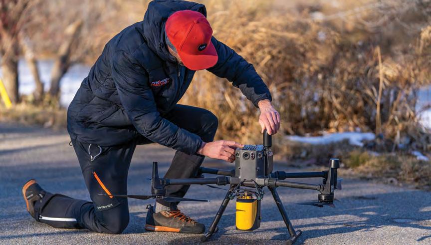


delivers the
accuracy and density for real-time georeferenced point cloud data. Lightness and accuracy combine for a LiDAR solution that works hard for you.
Emesent automates the collection and analysis of data in challenging GPS-denied environments, delivering revolutionary efficiency, safety, and operational insights to underground mining and other industries. It’s core areas of expertise are drone autonomy, SLAM-based LiDAR mapping, and data analytics.
March 2024 Page 92
& PHOTOGRAMMETRY SOLUTIONS
YOUR LIDAR
EXPERTS.
level of
The YellowScan LiDAR UAV
highest
FIND OUT MORE AT www.frontierprecision.com/lidar FRONTIER PRECISION 8301 Cyprus Plaza Drive, #107 Jacksonville, FL 32256 PRODUCTS | TRAINING | REPAIR | RENTALS | TECHNICAL SERVICES Joey Civello | 904.477.6662 [Cell] or jcivello@frontierprecision.com
Chainmen.” 24 To make sure the Surveyor General had a clear idea of the cause of this suspended operation, Jackson wrote, “I am very sory that I can not proceed with the work, as you seem to be in a hurry with __. I will loose but as little time as possible untill I try it again my men were very ill with the diarea &c & could not get them to continue.” 25 By October 1, 1854, Jackson was writing that provisions were a problem, “I scarcely know what to do for provisions as there has not been a vessel here from New Orleans in 2 or 3 months and there is not one Barrel of Flower or Bread in the place; however I will be able to get some provisions in the country untill the steamboat arrives. She is expected about the 8th Inst.” 26 Jackson and his crew(s) did not finish the work of his contract until February 1855.
22Letter of June 1854. Westcott to Jackson. Drawer: U. S. Surveyors H-N. File: U. S. Surveyor John Jackson. Land Records and Title Section, Florida Department of Natural Resources, Tallahas see, Florida. (Hereafter: “Jackson File.”)
23Letter of August 14, 1854. Jackson to Westcott. Letters and Reports , 2, 143.
24Letter of September 10, 1854. Jackson to Westcott. Letters and Reports , 2, 147-48.
25 Ibid
26Letter of October 1, 1854. Jackson to Westcott. Letters and Reports , 2, 151.
This same survey also brought another problem to the fore. The Seminoles were watching the progress of his survey party and made some highly visible ges tures to warn them not to enter the area. In one of the more telling letters written by the surveyor, he stated:
I had a great deal to contend with in having a rough country, bad weather, and what was worse than all in trying to dispell the fears of the men—The Indians were watching our movements, ever after our cross ing Char1epopka Creek and perticularly about the Big Prairie and thence to Istockpoga Lake they set the woods on fire about us frequently; I presume they thought to frighten us from going further on their Boundariy, however I was determined to go on with the work unless they were to come up and explain themselves, they tryed to keep out of sight all they could but in the end I caught one of them
The Florida Surveyor Page 93
Faces on the Frontier
reconiter ing our camp it happened on Sunday near the S.E. comer of T. 34. R. 28 I was out examining the country and on my return as I emerged out of a spruce pine scrub I saw an Indian travelling along our line from our Camp I called to him and motioned to him to come up to me, he signed to me and stood untill I went to him I shook hands with him and asked him to our Camp he appeared very much mortified at my seeing him he came to the camp and east and smoked the pipe with me and was to return the next day with a few dressed Buckskins, when the Foxey (Sun) would be about one hour high he did not return nor did they set fire near us after ___. They have been complaining to Capt Casey that we frequently crossed their lines. 27
27Letter of February 7, 1855. Jackson to Westcott. Letters and Reports , 2, n.p.
Jackson's candor indicated that he knew he was close to the twenty mile neu tral area that was guaranteed by General Worth in 1842. It was the deliberate policy of the U. S. Government, with heavy pressure from the state's officials to violate the line with surveys, who presumed that if the lands were surveyed, and the Seminoles knowing what that implied, they would see the fruitlessness of their resistance to emigration. It was a policy of “peaceful” pressure to get the Indians to remove and the U. S. Deputy Surveyors, like John Jackson, were the instruments of this policy. In December 1855, when Lieutenant George Hartsuff and his command violated the infamous “banana patch” of Billy Bowlegs, they were not in the area as surveyors in the manner of Jackson, Irwin and others. They were on a scouting mission for the U. S. Army seeking to locate Indian settlements and fields. There was a marked difference between the activities of Jackson and those of Hartsuff, which explains why, of the three U. S. Deputy Surveyors in the field at the outbreak of hostilities, none of them were harmed in any way. The Indians new the difference in the functions of the groups violating their boundary, even if historians have confused the issue. 28
28Joe Knetsch, “John Westcott and the Coming of the Third Seminole War: Perspectives from Within.” Paper presented to the Florida Historical Society's Annual Meeting. Tampa, Florida, May 12, 1990.
Jackson's experience with the Indians in the field, immediately prior
March 2024 Page 94
Dr. Joe Knetsch
to and during the Third Seminole Wars, illustrates the dangers to which the surveyors were subject to on the volatile frontier. Yet even at the end of the war, the tensions had not totally subsided. On February 20, 1858, Jackson reported to Surveyor General F. L. Dancy:
[O]n the 9th of this month near the station of Fish eating Creek between there and Fort Denaud 2 Indians met my waggon and made signs to my camp man to leave the prairie he was a negroe man and was so much frightened that he put out for Fort Denaud the next morn ing he met another Indian who stoped him on the Road and inquired for his Master he told him I was coming after him he also held up two fin gers and Struck the man on the breast and signed him to be off the negroe was nearly frightened out of his wits [O]n Saying his master was coming after him the Indian got excited and struck himself on the breast at the same time pointing to the Hammock saying “a heap” I pre sume meaning there were a heap such as he was to meet the Master [h]e told the man to stop and put out for the Hammock but as soon as the Road was clear the negroe put whip to the mules and made himself scarce as fast as he could [After going without food and fire, Jackson crew continued and searched for their campman.] [w]e pushed on after the waggon untill after about 1 Ocl when we saw some Indians ahead of us on the Road going the same way that we were going they stoped on the Road where there were some Cabbage trees extending to a ham mock on each side of the Road as we approached to about 3 or 4 hun dred yards of them they squatted and we could see them extending toward the Hammock on each side and every one taking a tree. I did not like the movements of the Indians and did not deep it prudent to aproch them in that position upon which we made a circuit round and came in on the Road out the other side of the Hammock my idea for so doing was that they thought we were armed with revolvers and altho' they must have been 3 or 4 times our number they would not wish to attack us openly
Jackson's crew was, in fact, unarmed and could not have offered resistance to the Indians. The campman was found the next day “crying like a child” because of the fright. Jackson sent him to Fort Meade and continued his survey, but was continually watched and having the woods set on fire around him. 29
The Florida Surveyor Page 95
Faces on the Frontier
29Letter of February 20, 1858. Jackson to F. L. Dancy. Letters and Reports , 3, 3.
During the 1855 surveying season, Jackson found himself involved in the sur veying of lands around Tobacco Bluff and Terra Ceia, in particular, the permits of some of the Armed Occupation Act settlers. He had been contacted early in 1855 to prepare to survey Tobacco Bluff and had even discussed this with Westcott. However, it does not appear that Westcott was in a hurry to have the area sur veyed. 30 On June 11, 1855, Jackson disclosed to Westcott that he needed to know about the survey because “I have been indiscreet in mentioning the conversation that you and I had on the subject.” 31 Jackson was probably correct in assuming that he had been indiscreet, he did not get the contract to survey this part of the area until 1858. 32
30Letters of March 30 and April 25, 1855. Jackson to Westcott. Letters and Reports , 2, 159160, and Miscellaneous letters to Surveyor General , Volume 2, 1849-56, 537.
31Letter of June 11, 1855. Jackson to Westcott. Letters and Reports , 2, 163.
32Letter of June 29, 1867. Jackson to Hugh Corley. Jackson File.
Directly related to the surveys of this island area was the survey of the Joseph Atzeroth permit. This survey was very unique in that, though technically not di ffi cult, it had a bureaucratic history that caused serious delays in Atzeroth finally obtaining his patent. In her article, “The Joseph Atzeroth Family: Manatee County Pioneers,” Cathy Bayless Slusser made a special point of showing some of the difficulties faced by this early and important settler. She correctly notes that Atzeroth received Permit No. 949, dated October 29, 1844, for the land in U. S. Government Lot No. 1, in Section 34, Township 33 South, Range 17 East. He, indeed, did travel to Newnansville to finish the proceedings and file additional documents, a cumbersome requirement of the law, until changed at the request of David Levy Yulee, and probably assumed things were fine. According to Slusser's research, in January 1849, the problem of mixed Permit numbers was allegedly solved by the testimony of Judge Simon Turman and Samuel Bishop. Why then, didn't Joseph Atzeroth get his patent to the land he had obviously set tled until April 14, 1870? Slusser assumed that the mix-up over the numbers and the intervening war years were the causes of delay. 33 This is true as far as it goes, but it goes much further.
March 2024 Page 96
Dr. Joe Knetsch
33Cathy B. Slusser, “The Joseph Atzeroth Family: Manatee County Pioneers,” Tampa Bay History, 4 (Fall/Winter 1982), 20-34.
What Jackson's letters to the Surveyor General and others show is that there were technical problems with the survey of the grant. As noted above, Jackson was hired to survey the Terra Ceia site in 1858. The survey was not accepted by the Commissioner of the General Land Office because the starting point of the survey was not sufficiently clear. In a letter to the Register and Receiver of the Tampa Land Office, dated October 24, 1859, Commissioner S. A. Smith wrote, “The testimony in question is not sufficiently clear upon the point at issue to jus tify this office in concurring in your joint opinion in the case.” The letter also noted that “a Stake or Blazed Tree bearing N.W.” was not clear enough to establish a proper corner. Smith further questioned as to where this alleged point fell in relation to the official public surveys. All in all Smith did not feel justified in approving the patent until “competent testimony” was offered to properly estab lish the corner. 34 What happened next is of note in the history of Tampa Bay. The case was turned over to the Tampa Land Office for further work just as the War Between the States commenced. In a hand written note at the end of a letter from Acting Commissioner of the General Land Office, Joseph Wilson, dated May 24, 1859, is the wording “filed by John Darling in the Tampa Land Office on October 11, 1861,” well after the start of the conflict. 35 As many of Darling's personal papers were burned during the war, it may be that the Atzeroth claim went up in these same flames.
34Letter of October 24, 1859. Smith to the Register and Receiver, Tampa Comr 's Letters , Volume 16. Unnumbered, P. K. Yonge Library of Florida History, University of Florida, Gainesville, Florida. Thanks to Elizabeth Alexander, the individual land office letters are preserved in good condition and are an invaluable source for anyone interested in local land conditions, sales, patents, etc. The indi vidual land offices were: Tallahassee, Tampa, Newnansville, St. Augustine and Gainesville.
35Copy of a letter dated May 24, 1859. Wilson to Atzeroth. Jackson File.
However John Jackson was not a man to let a neighbor down. On June 29th, 1867, Jackson wrote to Hugh A. Corley, Register of State Lands, asking him to look into the granting of the patent to Atzeroth “which he should have had years ago.” He requested that Corley look into the documents at hand in
The Florida Surveyor Page 97
Faces on the Frontier
Tallahassee to see the justice of Atzeroth's claim. As Jackson pleaded, “He is one of our best Citizens and is very much injured by not having his Patent like other settlers under the Armed occupation.” He also informed Corley that Atzeroth had written him to intervene as the surveyor of the land and one most knowledgeable about the boundary. Jackson followed up with another letter dated October 1, 1867, to Corley, asking that he intervene on behalf of Atzeroth with Dr. Stonelake, Register of Public Lands for the Reconstruction Government, pointing out to him the justice of Atzeroth's claim. Jackson asked him to argue most strongly that the Atzeroths had totally complied with the provisions of the Armed Occupation Act and were living on the land. 36 Whether these entreaties on behalf of Atzeroth had the desired impact is difficult to judge, but it should be noted that Jackson stressed their compliance with the law, their citizenship and the implication that unnamed “interested parties” were trying to oust them as arguments for the patent. 37 This last allegation was sure to set well with Stonelake and other Reconstruction bureaucrats in that it was almost universally assumed that these “interested par ties” were probably unrecontructed rebels and obstructionists.
36Letter of October 1, 1867. Jackson to Corley. Jackson File.
37Letter of June 29, 1867. Jackson to Corley. Jackson File.
Jackson continued to have an interest in his surveying career long after he had quit the fields and settled in as a full-time businessman and service in the Confed erate army. 38 He often wrote letters to the Surveyor General suggesting correc tions to surveying problems that arose in his area and referred to his days as a United States Deputy Surveyor. His case was strong in asserting his position, as he was often employed by Surveyor General F. L. Dancy as an examiner of other surveyor's work. His widely recognized abilities as a surveyor, community leader and businessman assured him the continuing respect of his peers and the commu nity as a whole. Jackson's life was full of adventure, daring, hard work and the true pioneering spirit that helped to settle the wilderness of Florida.
38Janet Snyder Matthews, Edge of Wilderness: A Settlement History of Manatee River and Sarasota Bay, 1528-1885 (Tulsa, Oklahoma: Caprine Press, 1983), 254. Ms. Matthews' excellent research turned up the fact that he was listed as a soldier in the Confederate Army, but I have not found the exact unit. It is very possible he served in the Tampa area throughout the war.
March 2024 Page 98
Dr. Joe Knetsch
D. A. SPAULDING IN FLORIDA: A SPECIAL MAN WITH EXCEPTIONAL TALENT
Joe Knetsch has published over 170 articles and given over 130 papers on the history of Florida. He is the author of Florida's Seminole Wars: 1817-1858 and he has edited two additional books. Faces on the Frontier: Florida Surveyors and Developers in 19th Century Florida is a history of the evolution of surveying public lands in Florida and traces the problems associated with any new frontier through the personalities of the majort historical figures of the period. As the historian for the Division of State Lands, Florida Department of Environmental Protection, he is often called to give expert witness testimony involving land titles and navigable waterways issues.
The Florida Surveyor Page 99
Next Month … CHAPTER 7
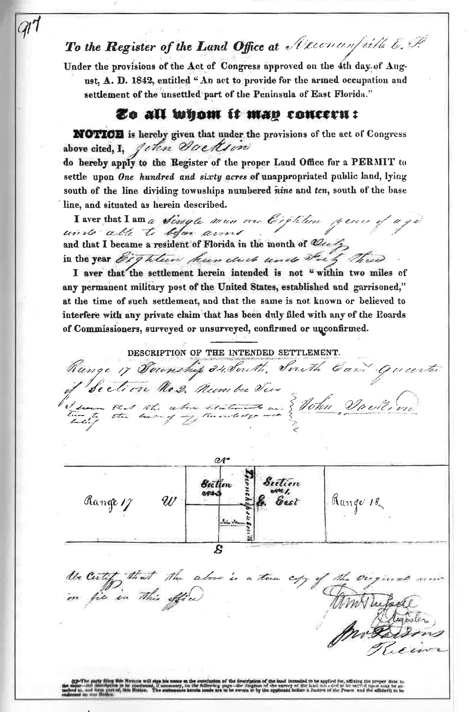
March 2024 Page 100
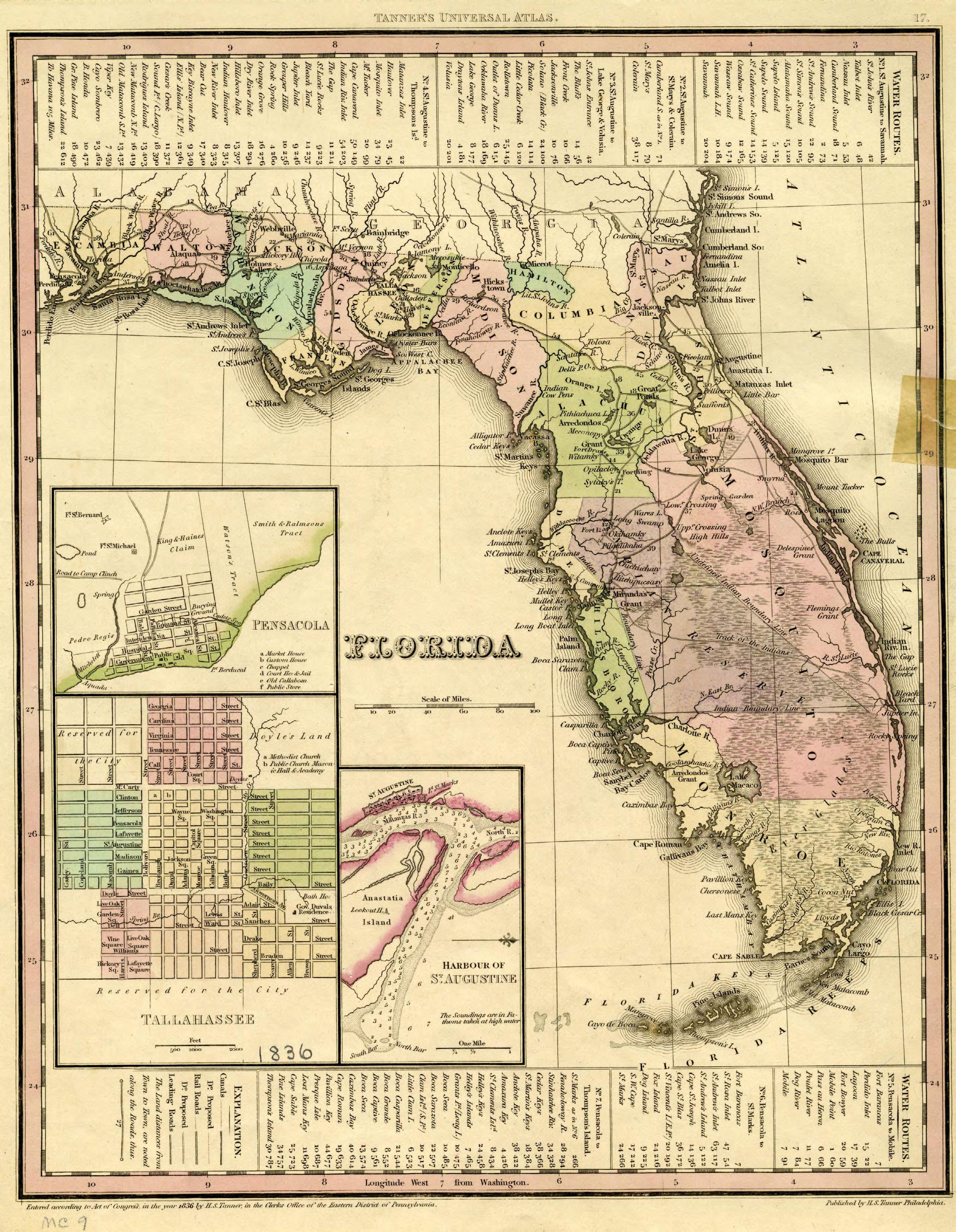
UNIVERSITY of FLORIDA GEOMATICS
Geomatics Instruction and Outreach Staff Position
A full-time, Teams position, is available in the School of Forest, Fisheries, and Geomatics Sciences, Institute of Food and Agricultural Sciences, at the University of Florida.
This Staff position in Geomatics supports both local and statewide Geomatics faculty in teaching and administering Geomatics courses and labs in Gainesville. The position acts as lead instructor for field labs and provides classroom and technology-based training to meet organization and individual needs. This position develops and maintains an office and field equipment inventory related to spatial data collection and analysis and provides related guidance for Geomatics learning and training programs. Th is position in Geomatics participates in spatial data collection, analysis, and processing, resulting in the generation of maps, 3D models, and other geospatial products. This position in Geomatics trains staff and student employees in data collection and management. The position acts as a liaison between the educational community and the professional geospatial community, measures outcomes of outreach and recruitment events, and is responsible for promotion efforts through social media and other online venues. The position attends statewide meetings as required, which may include weekend and evening extension and training activities.
Minimum Qualifications: A master's degree in an appropriate area and 4 years of relevant experience; or a bachelor's degree in an appropriate area and 6 years of relevant experience.
Expected Salary: $77,000.00 - $82,000.00
Preferred Qualifications: A Professional Surveyor’s license.
Individuals wishing to apply should go to http://tinyurl.com/GeomaticStaff or scan the QR code below to view the full position description and application instructions. Questions about the position should be directed to Justin Thomas, jthomas88@ufl.edu.
The Institute of Food and Agricultural Sciences is committed to creating an environment that affirms diversity across a variety of dimensions, including ability, class, ethnicity/race, gender identity and expression. We particularly welcome applicants who can contribute to such an environment through their scholarship, teaching, mentoring, and professional service. We strongly encourage historically underrepresented groups to apply.


POSITION ANNOUNCEMENT

ARCHIVES FROM THE

The Florida Surveyor Page 103
SCENES IN A SURVEYOR’S LIFE ;
OR A
RECORD OF HARDSHIPS AND DANGERS ENCOUNTERED. AND AMUSING SCENES WHICH OCCURRED, IN THE Operations of a Party of Surveyors IN SOUTH FLORIDA .
March 2024 Page 104
By W. L. PERRY.
JACKSONVILLE:
C. DREW'S BOOK AND JOB PRINTING OFFICE 1859.
CHAPTER VI
IN THIS CONNECTION IT WOULD , probably, not be in appropriate to relate an adventure with a panther, a very ferocious animal inhabiting almost every Florida swamp and hammock. This animal, in natural history, is appropriately termed the American lion. He is a powerful beast, able to destroy animals much larger than himself, and has frequently been known to carry off and devour, in some instances, even grown persons. But to the adventure:
It was our custom to set aside, out of every two or three weeks, a day for the purpose of washing and mending our clothes, together with other little matters necessary to be done for the comfort of a camp life. On one of these interesting occasions, one morning about nine o'clock, while all were plying the needle and scissors with the utmost assiduity, Tap looked up from his work and spied, not more than seventy yards from where we sat, a huge panther, half hidden behind a large pine, peeping at us, and cogitating within himself, no doubt, as to what steps he should take in order to procure one of us for his breakfast. Scarcely had Tap cried out, “ Look at the panther! ” before all were on foot and gave a simultaneous shout for the dogs, which sudden and boisterous proceeding the panther not understanding, took to his heels with all his might. The dogs (Bull and Cash) saw his first leap, however, and scampered off in pursuit, encouraged at every jump by the almost incessant yells of the boys. In the hurry of the moment Tap snatched up the gun, the Captain and Sile, each a large hickory club, Ralf the jacob staff, and myself a butcher-knife, all of which were brought into full requisition, as will presently be seen. We endeavored, by loud shouts, to keep the dogs encouraged, and by straining every muscle to keep
The Florida Surveyor Page 105
within hearing of them, which we succeeded pretty well in doing, by taking advantage of near cuts.
The scene was a ludicrous one in the extreme, I had on but one shoe, and Tap had none. Ralf had pulled off his shirt to wash it, and Sile his unmentionables for a similar purpose, and, of course, they would not take time to put them on. There wasn't a hat in the crowd.
Picture to yourself, reader, a set of fellows in the above plight, running through the woods as though old Nick was after them, falling over palmetto roots, scrambling through tie-tie swamps, and plunging into sloughs, and you can form some idea of the scene.
For about an hour the race was continued with great energy, but at last the dogs bayed, and we knew he had treed. In a few minutes we arrived at the spot, and sure enough, there, perched sugly among the boughs of a little pine in a fern pond, sat the panting beast.
“ Treed, hey! ” cried Ralf, “ treed, are ye? Don't be glaring down upon us with them great green eyes—it won't do you any good, old fel, your time's up. Oh, you sneaking villain! you thought you'd have a glorious breakfast of one of us this morning, but the tables are turned. We don't expect to eat you, that's a fact, but, Jeeme's river! what a lot o' shot bags we'll make o' that yaller hide o' your'n! ”
A dispute next arose as to who would shoot. Tap had the gun, and was unwilling to give it up; he was but a boy, and we feared his excitement might cause him to miss. A deafening roar from the gun, however, settled the dispute—Tap had fired. A loud scream, followed by a hideous growl, told a tale of pain and rage as the result. In a moment more he sprang from the tree and again took to his heels; but, being badly wounded, ran only a short distance, and squatted under a thick bunch of fern. Seeing him squat, and fearing he would tear both of our dogs in pieces, the Captain, Ralf, Sile, and myself, determined to go to their rescue. When we got within ten yards of the panther, he made a desperate spring for us, but was met by the sharp point of Ralf's staff, which happened, luckily, to stick through the skin of his back near his shoulders. He then whirled over on his back to play the clawing game, and Ralf pinned him in this position to the ground, and there held him with some difficulty, while, at regular intervals of about one second, the Captain's and Sile's clubs descended upon his head, and my butcher-
March 2024 Page 106 FROM THE ARCHIVES
knife sank to the hilt in his body.
The fracas lasted but a few minutes—he was a dead panther. In his desperate struggle for life he stripped my right arm of a shirt sleeve, and left sundry red marks acrosss Sile's bare legs. This panther was the largest one I ever saw, measuring from the tip of his nose to the tip of his tail nine feet and two inches.
On the Sunday following our somewhat dangerous panther fight, as well as I now recollect, late in the afternoon Ralf and myself concluded to take a walk, partly for exercise and partly for the purpose of reconnoitering a portion of country to the south of us, which none had as yet explored. On our return to camp we chanced to pass a small hammock about sunset, in which we noticed a large flock of turkeys flying up to roost. Having no gun with us at the time, I took particular notice of the spot, intending to come out next morning before they flew down and shoot some of them. On reaching the camp I put the gun in order, all ready for the morning's sport. In the morning I arose some three hours before day, and started alone for the hammock, thinking it much nearer day than it really was. When I reached the thicket, instead of waiting on the outside, like a sensible man would have done, I strode right into it, about where I thought the turkeys were roosting, and stopped to wait for daylight.
I had sat but a very few minutes, leaning against a tree, when my attention was attracted by the noise of something moving cautiously in the leaves just before me, and, as well as I could judge, not more than ten or twelve paces off. My first thought was that it was another panther, and the noise I heard was the adjustment of his feet for a spring upon me. I immediately, but slowly and cautiously, slid around to the opposite side of the tree, and arose to my feet to await the result. I had not remained in that position, however, more than three or four minutes, before a rustling in the leaves, similar to the one first heard, proceeded from behind me. Knowing it could not possibly be made by the same thing that caused the first, I at once felt that I was between two fires, and in the most imminent peril. I was at a loss to know what to do. If I should start to go in any direction, I knew not but I might go precisely to the very thing I wished most to avoid. Presently a low whine, terminating in a most hideous growl, not more than ten feet from me, made my hair stand straight on end. At this juncture I determined, as a last resource, to aim as nearly at the spot
The Florida Surveyor Page 107
as possible in the pitchy darkness, fire, and trust to Providence for the rest. Another blood-freezing growl, and I fired.
CHAPTER VII
At the crack of the gun, a hundred wild shrieks burst upon my astonished ears from every direction, that made my very heart jump into my throat. The truth flashed upon me in a moment—I was surrounded by a large pack of hungry wolves, bent on an early breakfast of my flesh and blood. I knew there was only one chance to escape them, and that was by climbing a tree. The one I was then standing behind was too large for me to climb—it seemed a bad chance; but there being no time to lose, as the bloodthirsty brutes were closing up around me, I determined to rush in some direction until I came to one I could climb. Fortunately, I proceeded only a few steps before coming to one of suitable size, and the reader may rest assured no time was lost in dragging myself up out of reach of the voracious creatures.
Climbing some twelve or fifteen feet up the tree to a large limb, I straddled it to wait quietly for daylight, and consider how to proceed in order to extricate myself from this very unpleasant predicament. The wolves gathered thickly around the tree, and made the whole neighborhood ring with their hideous and incessant yells of disappointment until morning. As soon as it was light enough for me to see distinctly, I took aim at the largest of the pack, and he bit the dust. Turning my other barrel to another, he shared the same fate. At this the whole pack took fright and scampered away to the thickest part of the hammock, leaving me in victorious possession of the field, or rather of the tree, where I remained till some time after sunrise, when I descended and made tracks for the camp, without so much as remembering I was out on a turkey hunt. It can scarcely be necessary to add, that this was the last time I went alone, before daylight, to hunt turkies.
March 2024 Page 108 FROM THE ARCHIVES
It would be well, perhaps, just in this connection, to relate an adventure of Sile with a wolf, which, though not attended with much danger, was really one of the most interesting and laughable affairs of the whole survey: Smith having become tired of the cooking business, proposed to exchange places with Sile, which proposition, after consulting the Captain, the latter accepted. One day shortly after he began to act in this capacity, while he and Tap were alone at the camp, the oxen strayed off and did not return at night as usual. Next morning Sile called to Bull and started out to hunt them up, leaving Tap to take care of the camp. When he had walked about three-fourths of a mile, while passing a patch of tall palmetto, Bull dashed into the thicket, and immediately a fight commenced between him and some other animal, which Sile could not see for the brush. Presently, however, the dog came trotting out toward the spot where Sile stood, and just behind him came a large wolf trotting after. The idea at once struck Sile, that he would slip behind a tree, and let the dog go by, and when the wolf came along he would “ scare him to death. ” The dog trotted past as he desired, and when the wolf came up within four feet of him, he sprang suddenly out from his hiding place, threw up his arms, and gave a thundering “ boo! ” Instead of falling down with fright, or breaking his neck in getting out of the way, as Sile confidently expected, the wolf stopped short, turned his hair all the wrong way, and gave a low, angry growl in return. Sile waited for no more, but turned and took to his heels with all his might. About the third or fourth jump, his hat dropped off—whether it was pushed off by hair, which he thinks was standing pretty straight out at the time, or whether he simply ran out from under it, he has never been able correctly to say. At any rate, he didn't stop to pick it up. Tap, who at the time was rubbing up the gun to take a hunt, spied Sile while he was yet nearly a quarter of a mile from the camp, coming through the woods, his hair streaming to the wind, like Nick was after him, concluded at once that the Indians were after him, and that they would both be killed unless some immediate and decided step was taken to prevent it. He determined, however, to make an effort with that view, and while Sile was yet a great way off, he bridled up one of the ponies as quickly as he could, took the gun on his shoulder, mounted the pony, and sat waiting for Sile to come up and tell him the news, and all ready to “ cut stick ” as soon as he should hear it. Of course, when Sile came, the pony was again turned loose to graze.
The Florida Surveyor Page 109
It is nothing but fair to state that Tap always, and to the bitter end, denied that part of the story relating to him; but Sile as resolutely affirms it to be so. I shall not pretend to decide between them.
I come now to the record of an adventure or two of my own. One morning, while engaged in frying pancakes, in order to assist the cook, that we might get an early breakfast and a good start for a big day's work, I was so unfortunate as to burn one of my feet badly, which accident happened as follows: While holding the frying pan by the handle to steady it on the coals, the grease in it caught fire, and in giving it a quick jerk toward me, for the purpose of blowing out the blue flame which blazed up to the height of two feet or more, for want of proper skill in performing the maneuver, poured the whole of the burning fluid into my shoe. Of course I gave the laughing, heartless crowd a rather operatic specimen of an up-country dance, but I can conscientiously assure the reader that the operation afforded no amusement to myself. Having performed a series of gymnastic lurches right and left, fore and aft, upset half a dozen pots, kicked two quarts of sand into the tray of dough, and slapped my agonised foot in to the pail of drinking water, I became quiet enough to proceed to an examination as to the extent of injury done. I pulled off the shoe, and along with it came the dermis , epidermis , and cuticle , even down to the superficial fascia , (skin,) from the whole of the top and one side of the foot.
As may well be imagined, I was entirely incapacitated for continuing my place on the line, and, consequently, had to exchange places with Sile, and assume the onerous duties and responsibilities of cook and teamster. Now it happened, unfortunately for me, that just at the time of which I write, the provisions began to run low, and it became necessary for me, as teamster, to proceed to Fort Capron to get a load, to which place, from where we were then working, it was very nearly three days travel through the woods, without the sign of a road to guide one aright. I felt many misgivings as to making the trip alone through that wolfy, beary, and paintery country, and particularly with a knowledge of the fact before me that, numbers of the Seminole Indians were roaming through the swamps and jungles of that region, who were not wanting in disposition to scalp the pale-face wherever they might meet him, and were only deterred from doing so through fear. But there was no use to dread it; I had to go. Accordingly, two mornings
March 2024 Page 110
subsequent to pouring the hot fat into my shoe, after an early breakfast, I made ready and started. Travelling the entire day through the woods, as nearly in the right direction as my semi-compass cranium could pilot me, I brought up at sunset on the side of, and about one hundred and fifty yards from, a small pond, and began to make preparations for spending my first night alone in the woods. First, I unharnessed the ponies and tied them to a couple of blackjacks, some twenty yards from the wagon, a little to the right of the direction to the pond, and after feeding and properly attending to them, looked around for a suitable camping place. I finally settled upon a spot between the wagon and pond, about one third of the distance to the latter, where there was a good log of lightwood and plenty of lightwood knots scattered around. Having kindled a fire, about which time it was quite dark, I lighted a few small chips and proceeded with the bucket to the pond for water. I found the pond surrounded entirely with a sort of marsh grass as high as my shoulder, and as thick as the hair on a dog's back. Through the grass and water, the latter some six or eight inches in depth, I had to burrow my way for twenty yards, to the open space beyond, before finding a place where the bucket could be submerged sufficiently to fill it with water. Having accomplished this by no means easy or pleasant task, and turned round to come out again, my attention was attracted by a slight rustling noise in the grass only a few feet from me. Quickly I raised the light high above my head, and peered wistfully into the high grass all around, but saw nothing. Thinking, perhaps, I might be mistaken, my alarm (I am not loth to confess I was alarmed) somewhat subsided, and I started for my encampment. Scarcely had I made a single step, however, when a heavy, unmistakable movement in the grass again stopped me short. My eyes were directed to the spot whence came the noise, but everything was still, and I saw nothing. I made another step, and the same frightful sound greeted my ears. Again I raised the light, and by the aid of its almost expired rays, I beheld, through an opening in the grass, a sight terrible enough to make the stoutest and boldest heart quake with fear. There lay, crouched to the earth, his ears lain close back to his head, his eyes gleaming like balls of livid fire, and slowly lashing his tail from side to side, an enormous panther. The imminent peril of my situation was at once manifest to my mind. The noise I last heard was his final adjustment for a fatal spring. I knew the slightest motion on my part would be the last forever. A thousand
The Florida Surveyor Page 111
worlds, had they been at my disposal at that moment, would have been too little to offer for succour; but, alas! where was it to come from?
There I stood, thirty miles from the nearest human being, in the wild woods, face to face with one of the most ferocious animals— when driven to desperation by hunger—in existence, and not even the smallest weapon with which to defend myself.
I thought of home, of kindred, of kind friends. I thought how dreadful was my last end; how cruel the fate that destined me for it; how sad the intelligence to those who felt an interest for me, that I was gone, and none knew how or where. But, while these thoughts were passing rapidly through my mind, and I stood gazing on the fiery eyes of the monster crouched before me, in the very act of making his leap, a thought struck me—hope flashed across my mind. I recollected Bull was at the camp, and knowing he was ever on the alert, I thought I might bring him to me by a whistle. The terrible creature gathered up his hind feet, and I believed the awful moment had come. A deadful suspense; another low whistle, very low, and how my heart beat with rising hope as I heard Bull coming as fast as he could run through the bushes! In another moment he was at my side, and the frightened panther fled as if for his life, leaving me in a state of mind which may be better imagined than described.
I returned in haste to my encampment, devoutly thanking the Almighty disposer of all events for my almost miraculous deliverance from a death most horrible.•
March 2024 Page 112

The Florida Surveyor Page 113

SPROCCET to Replace HTDP
NGS is building Software for PRojecting Observations, Constraints and Cofactor matrices/Errors through Time (SPROCCET), as a replacement for the Horizontal Time-Dependent Positioning (HTDP) utility in the modernized NSRS. Improvements include: (a) support for orthometric data, (b) use of GDX, (c) use of IFDM2022, (d) error propagation through time, as per the multi-epoch least-squares adjustment (ME-LSA) problem, (e) distinct modules for 14-parameter Helmert transformations and deformation models, (f) use of a modern coding language, (g) bug fixes and model corrections. SPROCCET will be capable of projecting geodetic information through time, and changing the geometric frame, and therefore will be a pre-processor for LASER, used in both the modernized version of OPUS and in REC adjustment projects.
Multi-GNSS OPUS-S Available for Beta Testing
OPUS-S, the NGS service for processing GPS data for 2+ hour occupations, can now process all GNSS constellations. NGS has developed M-PAGES, our new multiple-constellation Global Navigation Satellite System (Multi-GNSS) software for position solutions. M-PAGES has been added to OPUS-S and is available for testing at https://beta.ngs.noaa.gov/OPUS/ This new version
of OPUS-S allows users to process data from all GNSS systems in operation today that have two or more frequencies (GPS, GLONASS, Galileo, Beidou, QZSS). We call on the community to help us test the new service during this BETA release.
Multi-Epoch Least-Squares Adjustment Papers, Redux
Two new papers, providing details on the application of the Multi-epoch Least-squares adjustment (ME-LSA) problem have been published:
• NOAA Technical Memorandum NOS NGS 95
• NOAA Technical Memorandum NOS NGS 96
TM 95 discusses the complications of covariances that arise from using gridded deformation models, while TM 96 provides specific equations for observation types supported by NGS software, based on earlier ME-LSA papers.
Where’s the GRAV-D Progress Chart?
GRAV-D’s airborne campaign has come to a close. All re-flights have finished, and the final data-set is being prepared for hand-off to the GEOID2022 team. With this success, the beloved GRAV-D progress chart has been happily removed from our newsletter.


Issue 35 January 2024

The Florida Surveyor Page 115
Step 2: Choose Member Type FSMS Member EMAILED Fee Quantity Amount 6 CEC $115 Per Course x = $ 3 CEC $58 Per Course x = $ MAILED 6 CEC $125 Per Course x = $ 3 CEC $68 Per Course x = $ TOTAL $ Non Non Name: _ YES _ NO Firm: ____ _ YES _ _ NO Address: ______________________________________________________________________________________ City/State: Email Address: Work Phone: Payment Information: ___ Check Enclosed (Payable to FSMS) _ VISA/MasterCard/American Express Card #: _______ Exp. Date: __ CVV Code:___________ Billing Address of Credit Card: ______________________________________ Signature: _____________________________________ __ IF PAYING BY CHECK, MAIL FORM TO: FSMS, P.O. Box 850001-243, Orlando, Florida 32885-0243 IF PAYING BY CREDIT CARD, FAX OR EMAIL FORM TO: 850.877.4852 education@fsms.org QUESTIONS? CALL 800.237.4384 Provider No. CE11 fsms.org March 2024 Page 116
Past Presidents
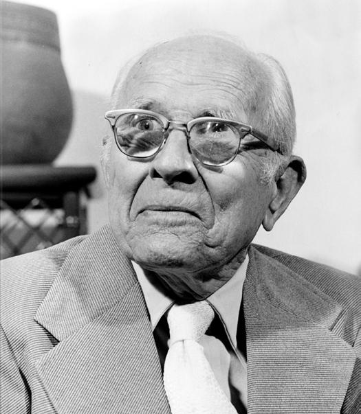
 1956 - 1957
H.O. Peters
1957 - 1958
Harry C. Schwebke
1958 - 1959
John P. Goggin
1959 - 1960 R.H. Jones
1960 - 1961
Hugh A. Binyon
1961 - 1962
Russell H. DeGrove
1962 - 1963
Perry C. McGriff
1963 - 1964
Carl E. Johnson
1964 - 1965
James A. Thigpenn, III
1965 - 1966
Harold A. Schuler, Jr.
1966 - 1967
Shields E. Clark
1967 - 1968
Maurice E. Berry
Past Presidents
 1968 - 1969
William C. Hart
1969 - 1970
Frank R. Shilling, Jr.
1970 - 1971
William V. Keith
1971 - 1972
James M. King
1972 - 1973
Broward P. Davis
1973 - 1974
E.R. (Ed) Brownell
1974 - 1975
E.W. (Gene) Stoner
1975 -1976
Lewis H. Kent
1976 - 1977
Robert S. Harris
1977 - 1978
Paul T. O’Hargan
1978 - 1979
William G. Wallace, Jr.
1979 -1980
Robert W. Wigglesworth
Past Presidents
 1980 - 1981
Ben P. Blackburn
1981 - 1982
William B. Thompson, III
1982 - 1983
John R. Gargis
1983 - 1984
Robert A. Bannerman
1984 - 1985
Buell H. Harper
1985 - 1986
H. Bruce Durden
1986 - 1987
Jan L. Skipper
1987 - 1988
Stephen M. Woods
1988 - 1989
Stephen G. Vrabel
1989 - 1990
W. Lamar Evers
1990 - 1991
Joseph S. Boggs
1991 - 1992
Robert L. Graham
Past Presidents
 1992 - 1993
Nicholas D. Miller
1993 - 1994
Loren E. Mercer
1994 - 1995
Robert D. Cross
1994 - 1995 Kent Green
1996 - 1997
Gordon R. Niles, Jr.
1997 - 1998
Dennis E. Blankenship
1998 - 1999 W. Lanier Mathews, II
1999 - 2000
Jack Breed
2000 - 2001
Arthur A.
Mastronicola
2001 - 2002
Michael H. Maxwell
2002 - 2003 John M. Clyatt
1995 - 1996
Thomas L. Connor
Past Presidents
 2004 - 2005
Stephen M. Gordon
2005 - 2006
Richard G. Powell
2006 - 2007
Michael J. Whitling
2007 - 2008
Robert W. Jackson, Jr.
2008 - 2009
Pablo Ferrari
2009 - 2010
Steve Stinson
2010 - 2011
Dan Ferrans
2011 - 2012
Jeremiah Slaymaker
2012 - 2013
Ken Glass
2013 - 2014
Russell Hyatt
2014 - 2015 William Rowe
2003 - 2004
David W. Schryver
Past Presidents
 2016 - 2017
Lou Campanile, Jr.
2017 - 2018
Robert Strayer, Jr.
2018 - 2019
Dianne Collins
2019 - 2020
Don Elder
2020 - 2021
Hal Peters
2021 - 2022
Lou Campanile, Jr.
2015 - 2016
March 2024 Page 122
Dale Bradshaw
ADMINISTRATIVE Staff



Executive Director
Rebecca Porter director@fsms.org
Education Director
Samantha Hobbs education@fsms.org
Communications Director
Justin Ortiz communications@fsms.org
Regional Coordinator
Cathy Campanile seminolecc84@gmail.com
The Florida Surveyor Page 123
The Florida Surveying and Mapping Society has a new eLearning Platform that is now linked to your FSMS membership account.
When accessing the new eLearning platform, use your FSMS membership username (Not Available for Sustaining Firm Memberships) and password to log in. As always, Correspondence Courses are always available my mail or email.

2023 Updated Correspondence & eLearning Courses:
• Writing Boundary Descriptions
• Basics of Real Property
• Map Projections and Coordinate Datums
• Elevation Certificates and the Community Rating System
• Datums (eLearning Video Course)
CHECK YOUR CREDITS HERE
Provider No. CE11
Please email communications@fsms.org to notify us of upcoming events.

Advertise With Us!
All advertisements contained within the publication are published as a service to readers. Publication of the advertisements does not imply or express any endorsement or recommendation by FSMS.
Benefits: Full color; hyperlinks added to your webpages as well as email addresses.
Requirements: Contracts for one year (11 issues) receive 10% discount if paid in advance; 15% for Sustaining Firms. (Ads should be in jpeg, pdf, or png format)
New ads and/or changes are due by the 25th of each month.
The Florida Surveyor Page 125
Size 1 Issue 2-11 Issues Full Page $720 $395/issue 1/2 Page $575 $320/issue 1/4 Page $290 $175/issue


 From Jeremiah Slaymaker — Northwest FL Chapter President:


 Photos: NASA/Daniel Rutter


 1956 - 1957
H.O. Peters
1957 - 1958
Harry C. Schwebke
1958 - 1959
John P. Goggin
1959 - 1960 R.H. Jones
1960 - 1961
Hugh A. Binyon
1961 - 1962
Russell H. DeGrove
1962 - 1963
Perry C. McGriff
1963 - 1964
Carl E. Johnson
1964 - 1965
James A. Thigpenn, III
1965 - 1966
Harold A. Schuler, Jr.
1966 - 1967
Shields E. Clark
1967 - 1968
Maurice E. Berry


 1968 - 1969
William C. Hart
1969 - 1970
Frank R. Shilling, Jr.
1970 - 1971
William V. Keith
1971 - 1972
James M. King
1972 - 1973
Broward P. Davis
1973 - 1974
E.R. (Ed) Brownell
1974 - 1975
E.W. (Gene) Stoner
1975 -1976
Lewis H. Kent
1976 - 1977
Robert S. Harris
1977 - 1978
Paul T. O’Hargan
1978 - 1979
William G. Wallace, Jr.
1979 -1980
Robert W. Wigglesworth


 1980 - 1981
Ben P. Blackburn
1981 - 1982
William B. Thompson, III
1982 - 1983
John R. Gargis
1983 - 1984
Robert A. Bannerman
1984 - 1985
Buell H. Harper
1985 - 1986
H. Bruce Durden
1986 - 1987
Jan L. Skipper
1987 - 1988
Stephen M. Woods
1988 - 1989
Stephen G. Vrabel
1989 - 1990
W. Lamar Evers
1990 - 1991
Joseph S. Boggs
1991 - 1992
Robert L. Graham


 1992 - 1993
Nicholas D. Miller
1993 - 1994
Loren E. Mercer
1994 - 1995
Robert D. Cross
1994 - 1995 Kent Green
1996 - 1997
Gordon R. Niles, Jr.
1997 - 1998
Dennis E. Blankenship
1998 - 1999 W. Lanier Mathews, II
1999 - 2000
Jack Breed
2000 - 2001
Arthur A.
Mastronicola
2001 - 2002
Michael H. Maxwell
2002 - 2003 John M. Clyatt
1995 - 1996
Thomas L. Connor


 2004 - 2005
Stephen M. Gordon
2005 - 2006
Richard G. Powell
2006 - 2007
Michael J. Whitling
2007 - 2008
Robert W. Jackson, Jr.
2008 - 2009
Pablo Ferrari
2009 - 2010
Steve Stinson
2010 - 2011
Dan Ferrans
2011 - 2012
Jeremiah Slaymaker
2012 - 2013
Ken Glass
2013 - 2014
Russell Hyatt
2014 - 2015 William Rowe
2003 - 2004
David W. Schryver


 2016 - 2017
Lou Campanile, Jr.
2017 - 2018
Robert Strayer, Jr.
2018 - 2019
Dianne Collins
2019 - 2020
Don Elder
2020 - 2021
Hal Peters
2021 - 2022
Lou Campanile, Jr.
2015 - 2016


