T he F lorida Surveyor
IN THIS ISSUE
Control Monuments with Stories to Tell That Damn Sewer Ditch 2024 Exhibitors & Sponsors


May 2024 Volume XXXII, Issue 5

Call us t o g et your complete work flow solution today ! Efficiency and versatility that will accelerate productivity comes part of a workflow solution that includes the FC-6000 field controller, Magnet software, a HiPer VR receiver and the GT-1200/GT-600 single-operator robotic system. The power of longrange reflectorless measurements comes in your choice of 1”, 2” or 3” GT-1200 models or 2”, 3” or 5” GT -600 models.


43316 State Road 19 Altoona, FL 32702
www.lengemann.us


The F lorida Surveyor is the official publication of the Florida Surveying and Mapping Society, also known as FSMS. It is published monthly for the purpose of communicating with the professional surveying community and related professions who are members of FSMS. Our award winning publication informs members eleven months out of the year about national, state, and district events and accomplishments, as well as articles relevant to the surveying profession. In addition, continuing educational courses are also available.
SURVEYORS IN Government 36 CNTRL MONUMENTS With Stories to Tell 23 THAT DAMN SEWER Ditch 55 SUSTAINING Firms 81 FACES ON The Frontier 113 129 69TH CONFERENCE Exhibitors & Sponsors 95 FROM THE Archives PRESIDENT’S Message 1 2023-24 FSMS Officers 3 AROUND The State 7
TABLE OF CONTENTS
PRESIDENT’S Message
May 6th, 2024
Dear FSMS Members,
With the Strategic Plan in place, we are setting our sites on the Annual Conference in July at the DoubleTree by Hilton Hotel Orlando at SeaWorld.
Please make sure to register for conference and make your hotel accommodations as soon as you can. Our Annual Conference webpage is where you can register for conference, read about this year's continuing education seminars, check out the proposed schedule, as well as reserve your hotel room.
I want to thank Mr. Justin Ortiz, Communications Director, for his work on the Florida Surveyor. Every month the publication becomes better and better with interesting articles and great pictures of what’s going on around the state in the chapter meetings.

Respectfully submitted.
Howard J. Ehmke II
President Howard Ehmke (561) 360-8883 Howard@GCYinc.com
The Florida Surveyor Page 1
Cypress Land Survey’s, Inc.
A well-established Land Survey Business in Central Florida with a solid reputation and loyal customer base. The Owner is looking to sell the business to someone to build on it’s success. In business since 1988, a profitable business with significant opportunities for growth. Current employees ready to continue with existing contracts which may run up to 2 years. Owner may provide owner financing. Please contact Steve at 863299-8165 or email to cypressland@msn. com for more information.
May 2024 Page 2


President-Elect Richard Pryce (954) 651-5942 rdpryce@gmail.com Vice President Allen Nobles (850) 385-1179 allen@burritobrothers.biz Secretary Sam Hall (352) 408-6033 surveysam17@outlook.com Treasurer Bon Dewitt (352) 682-6007 bon@ufl.edu Immediate Past President Lou Campanile, Jr. (954) 980-8888 lou@campanile.net The Florida Surveyor Page 3 2023-24 FSMS Officers
2023-24 Districts and
Directors
District 1 - Northwest
Bay, Calhoun, Escambia, Franklin, Gadsden, Gulf, Holmes, Jackson, Jefferson, Leon, Liberty, Madison, Okaloosa, Santa Rosa, Taylor, Wakulla, Walton, Washington
Angela Bailey (850) 559-5039 bailey.angelak@yahoo.com
Chad Thurner (850) 200-2441 chad.thurner@ sam.biz
District 2 - Northeast
Alachua, Baker, Bradford, Clay, Columbia, Dixie, Duval, Gilchrist, Hamilton, Lafayette, Levy, Marion, Nassau, Putnam, Suwannee, St. Johns, Union
Nick Digruttolo (863) 344-2330 ndigruttolo@pickettusa.com
Pablo Ferrari (904) 219-4054 pferrari@drmp.com
District 3 - East Central
Brevard, Flagler, Indian River, Lake, Okeechobee, Orange, Osceola, Seminole, Martin, St. Lucie, Volusia
Al Quickel (352) 552-3756 alq.fsms@gmail.com
Robert Johnson (772) 370-0558 bobj@carterassoc.com
District 4 - West Central
Citrus, Hernando, Hillsborough, Pasco, Pinellas, Polk, Sumter
Greg Prather (863) 670-9612 gprather@pickettusa.com
2 3 4 7 6 5
District 5 - Southwest
Shane Christy (941) 840-2809 schristy@georgefyoung.com
Donald Stouten (239) 281-0410
dstouten@ ardurra.com
District 6 - Southeast
Broward, Palm Beach
John Liptak (786) 547-6340 JohnLiptak@ICLoud.Com
Earl Soeder (954) 818-2610
earl.soeder@ duncan-parnell.com
District 7 - South
Miami-Dade, Monroe
Jose Sanfiel (305) 375-2657 psm5636@gmail.com
Manny Vera, Jr. (305) 221-6210 mverajr@mgvera.com
Alex Parnes (813) 493-3952 alexwolfeparnes @gmail.com
Russell Hyatt (941) 812-6460
russell@hyattsurvey.com
1
Charlotte, Collier, DeSoto, Glades, Hardee, Hendry, Highlands, Lee, Manatee, Sarasota
NSPS
Director
Angela Bailey bailey.angelak@yahoo.com
Jonathan Gibson jgibson0102@gmail.com
Chipola
Jesse Snelgrove jsnelgrove@ snelgrovesurveying.com Northwest FL
Jeremiah Slaymaker jslay@wginc.com
Brandon Robbins brndrbbns@netscape.net
Jeremy D. Hallick jdhallick@hotmail.com
Kenneth Dell kennethdell@ufl.edu
Broward Benjamin Hoyle benjamin.hoyle@kci.com Palm Beach Todd Bates tbates@craventhompson.com FAU Geomatics Lemuel Roberts lroberts2022@fau.edu Miami-Dade Eddie Suarez marketing@longitudefl.com District 5 District 6 District 7 Central FL William (Bill) Rowe
veying.com Indian River
Yancy
Volusia
ff Cory jeff@corysurveyor.com Charlotte Harbor Derek Miller millersurveying@comcast.net Collier-Lee Steve Shawles II sshawles@haleyward.com Manasota Brian Sleight psm6162@comcast.net Ridge Kenneth Glass kglass@civilsurv.com Tampa Bay John Beland jbeland1979@gmail.com District 3 District 4 Panhandle
browe@southeasternsur
Brion
brionyancy@gmail.com
Je
Gulf Coast
FL Crown
North Central
FL
UF Ge omatics
District 1 District 2
2023-24 Chapter Presidents
2023-24 Committees
Standing Committees
Nominating Committee Rick Pryce
Membership Committee Nick DiGruttolo
Finance Committee Bon Dewitt
Ethics Committee Shane Christy
Education Committee Greg Prather
Constitution & Resolution Advisory Committee Angela Bailey
Annual Meeting Committee Allen Nobles
Legal & Legislative Committee Jack Breed
Surveying & Mapping Council Randy Tompkins
Strategic Planning Committee Rick Pryce
Executive Committee Howard Ehmke
Special Committees
Equipment Theft Manny Vera, Jr.
Awards Committee Lou Campanile, Jr.
UF Alumni Recruiting Committee Russell Hyatt
Professional Practice Committee Lou Campanile, Jr.
Workforce Development Committee Allen Nobles
Liaisons
CST Program Alex Jenkins
FDACS BPSM Don Elder
Surveyors in Government Richard Allen
Academic Advisory UF Justin Thomas
FES
Lou Campanile, Jr.
Practice Sections
Geospatial Users Group
Young Surveyors Network
Earl Soeder
Melissa A. Padilla Cintron, SIT
round the State A
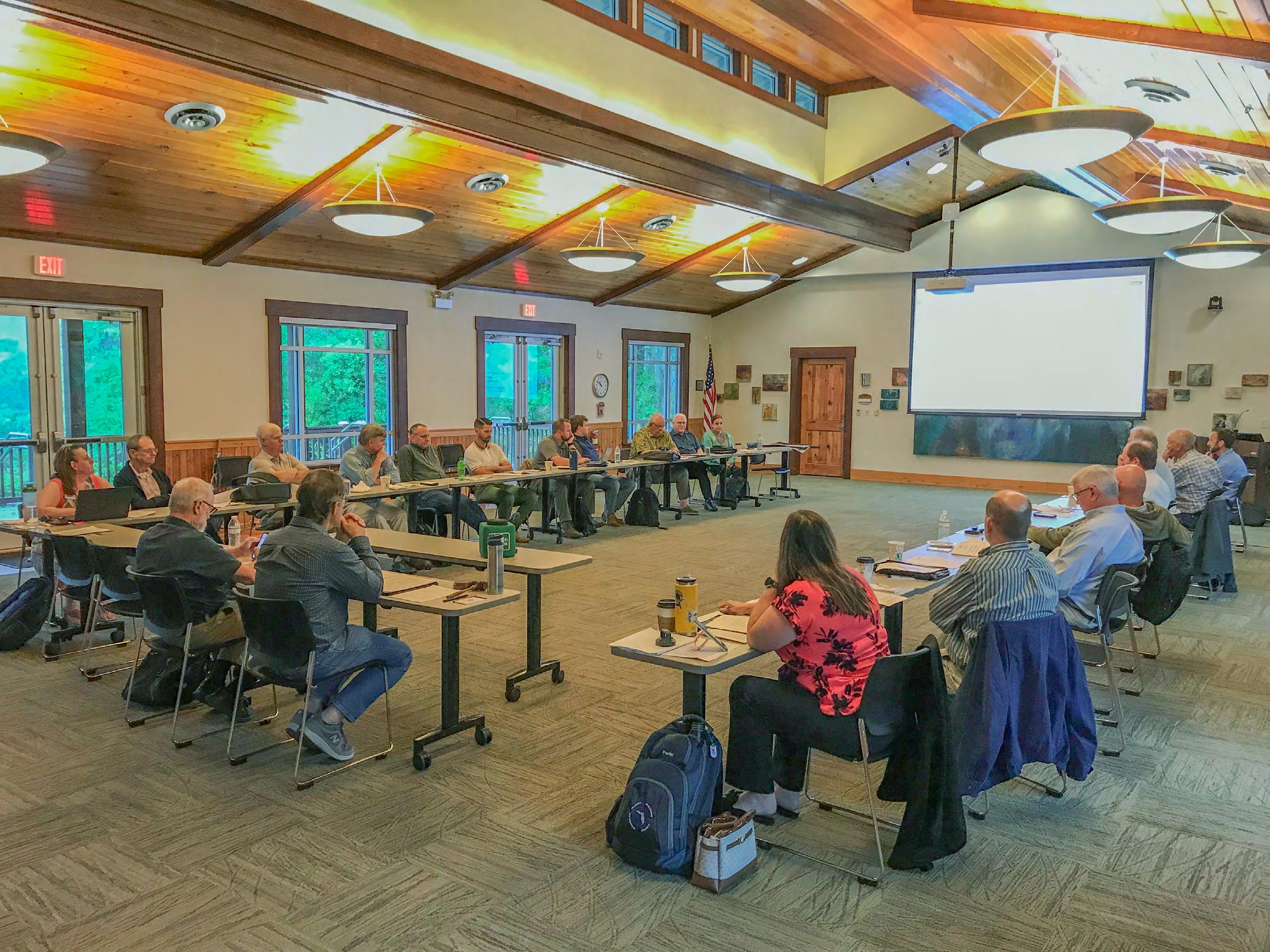
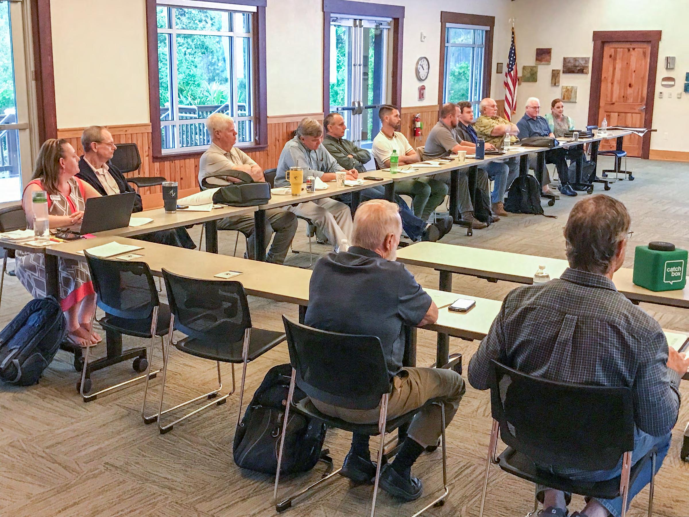
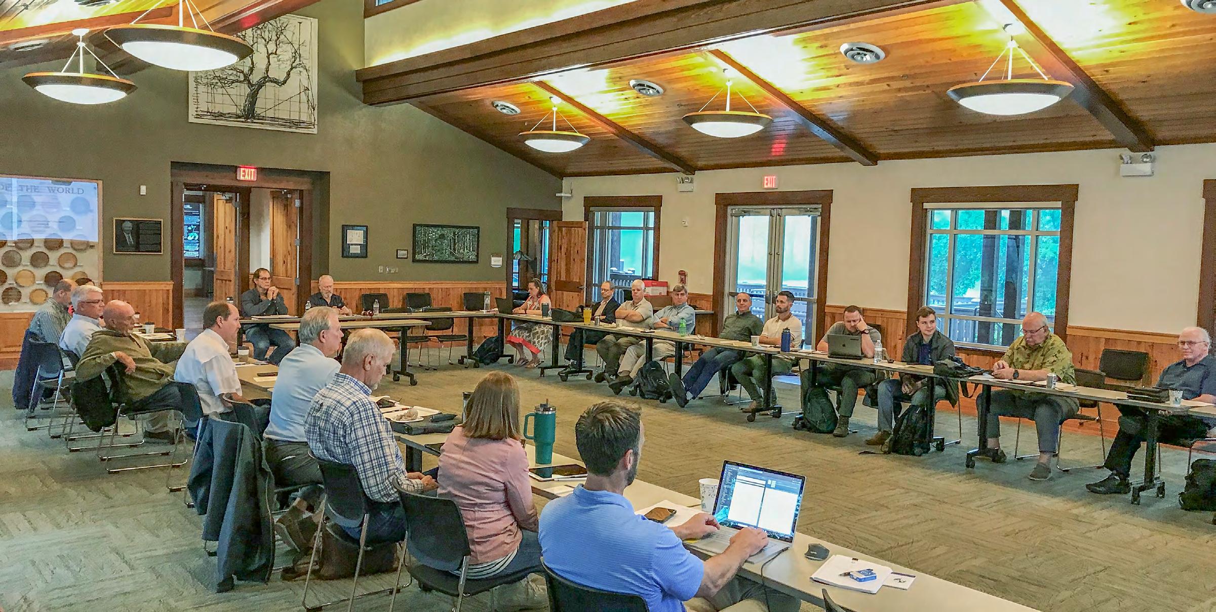
Strategic Planning Meeting from April 11th, 2024. The Board of Directors met with attending members at the Austin Cary Forest Campus in Gainesville, Florida, to prepare the upcoming FSMS Strategic Plan for 2025. Mr. Rick Pryce, President elect, conducted the meeting, which set the goals for the next two years.
The Florida Surveyor Page 7
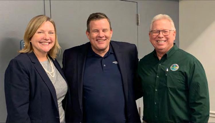
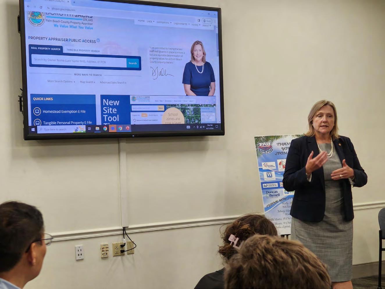
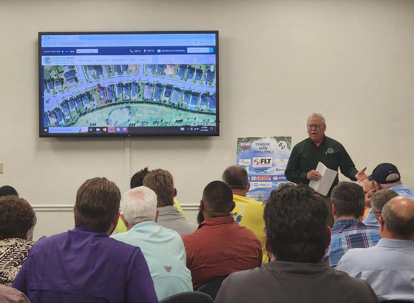
From Todd Bates, PSM
Palm Beach Chapter
President:
62 Geomatics Engineering students and professionals met at FAU, Boca Raton. Dorothy Jacks, Palm Beach County Property Appraiser and John Enck, GIS Director shared their expertise and knowledge. Many thanks to Dorothy and John. Also, a special thanks to FAU Geomatics students and professors for hosting our joint FSMS chapter meeting.
Please join us May 23 at the Lake Worth Drainage District in Delray Beach when Dr. Youssef Omar Kaddoura, University of Florida Geomatics, presents on Artificial Intelligence Land Surveying and Geospatial Applications at 6PM.
We are super excited about everything happing in the survey community and FSMS in Palm Beach County. Keeps getting better for our chapters! The Palm Beach leadership Jim Sullivan John Liptak, PSM Andrew L. Beckwith, CST I Kelly Stout Clyde Mason Hongbo Su Sudhagar Nagarajan Lemuel Roberts do an incredible job. Great to hang out with these guys.
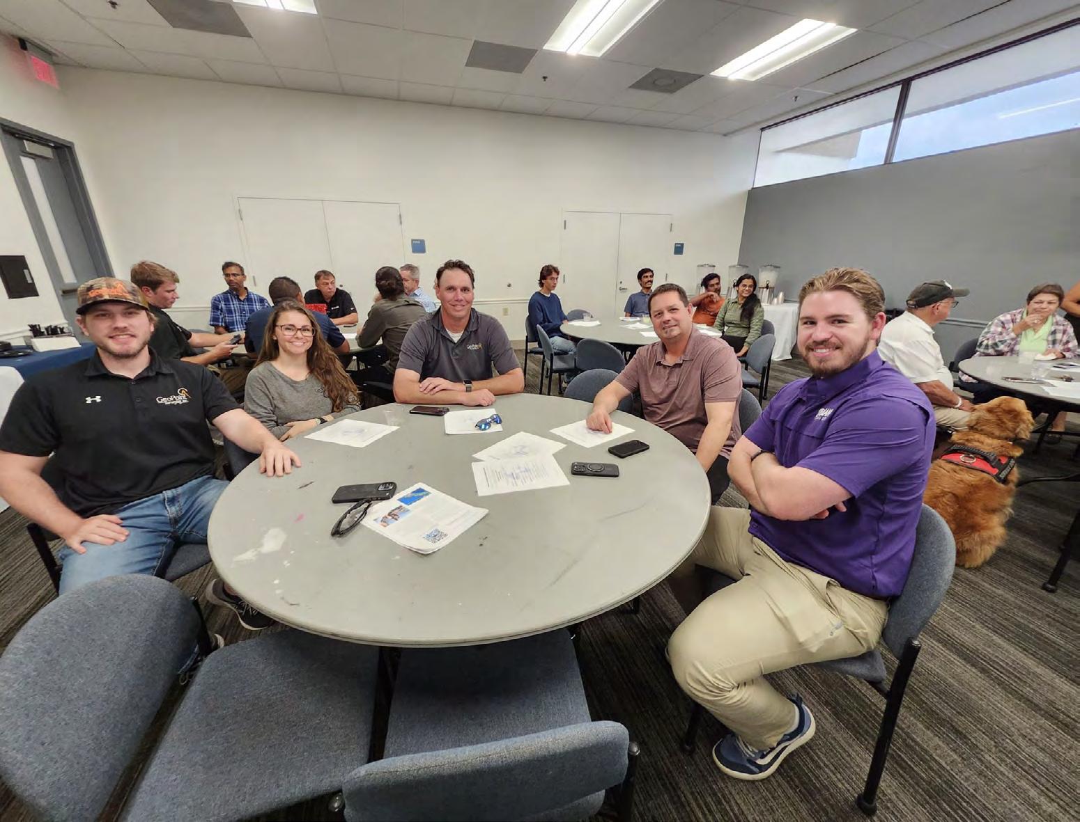
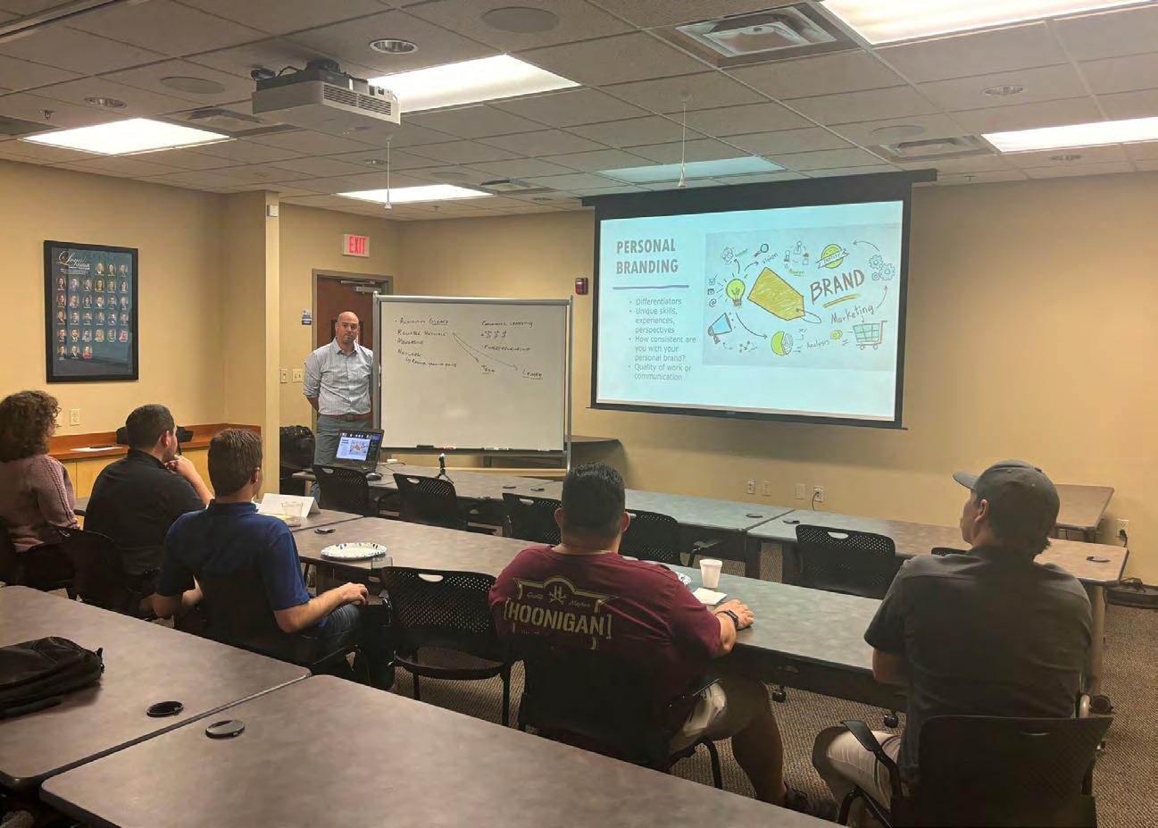
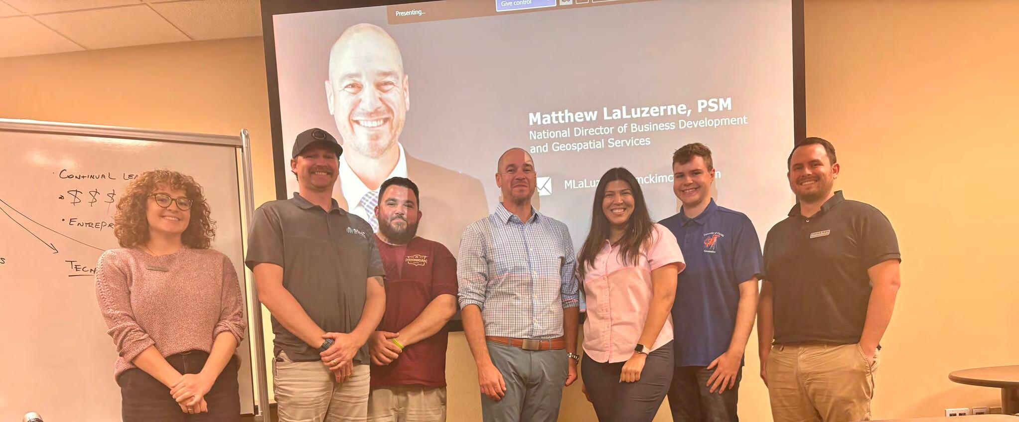
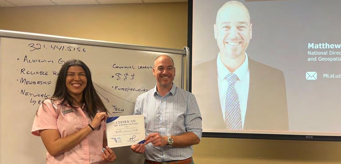
The first meeting of the year for the Florida Young Surveyors Network was at the DRMP headquarters in Orlando. Thank you to Matt LaLuzerne, MBA, PSM and all who attended for making this such a productive event.
Mathew LaLuzerne is the National Director of Business Development and Geospatial Services for McKim & Creed. The title of his presentation was, "How to Posture Yourself in Today's Market."
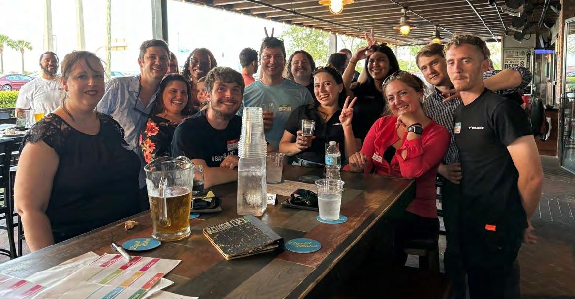
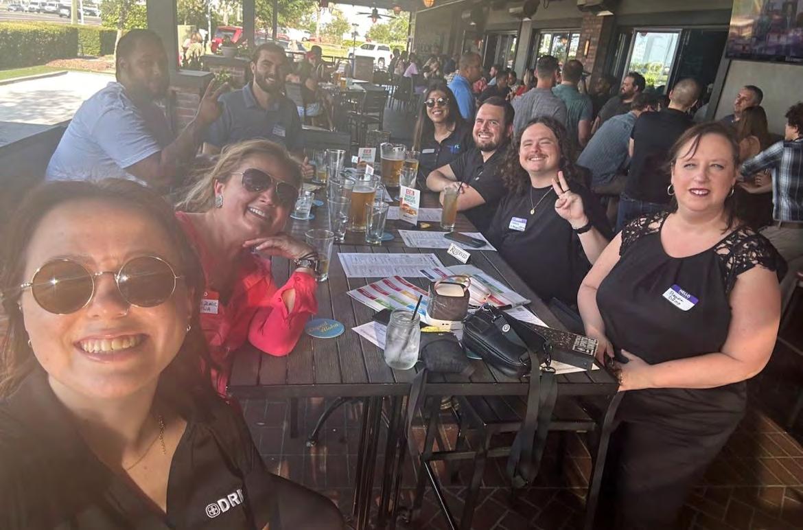
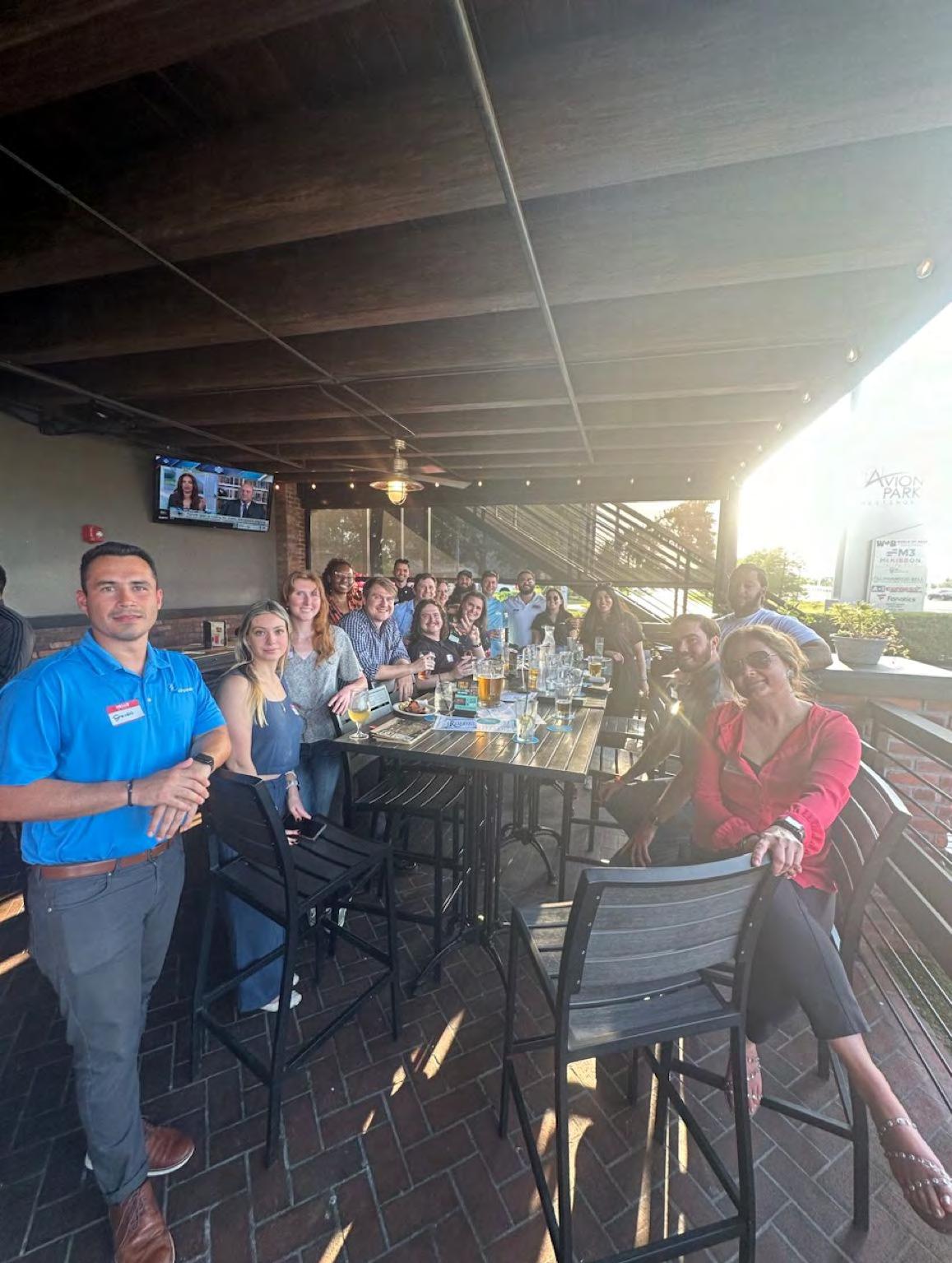
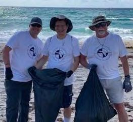
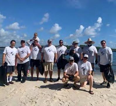
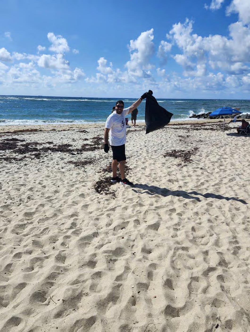
American Public Works Association and The Florida Young Surveyors Network had an amazing turnout as they teamed up to host an open house and Happy Hour at World of Beer in the Tampa area on April 18th. Stay tuned for more young professional networking events.
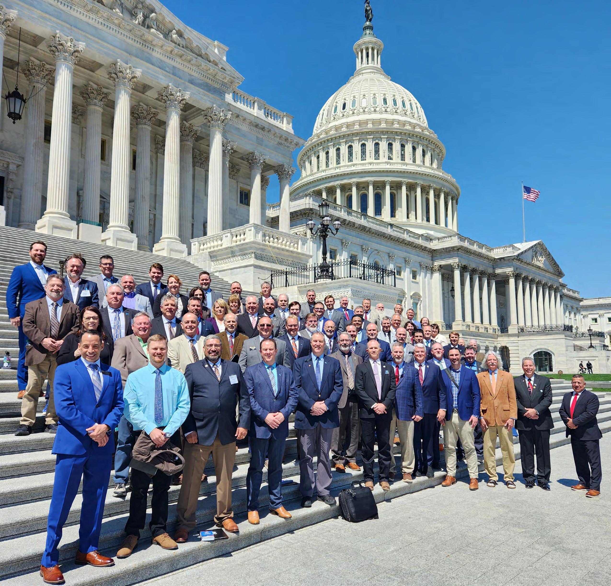
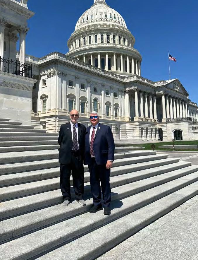
NSPS conference in Washington DC — Day on the Hill. On the Right: Two members of the Manasota Chapter, Bob Miller, NSPS Treasurer, along with Russell Hyatt, NSPS Florida representative.
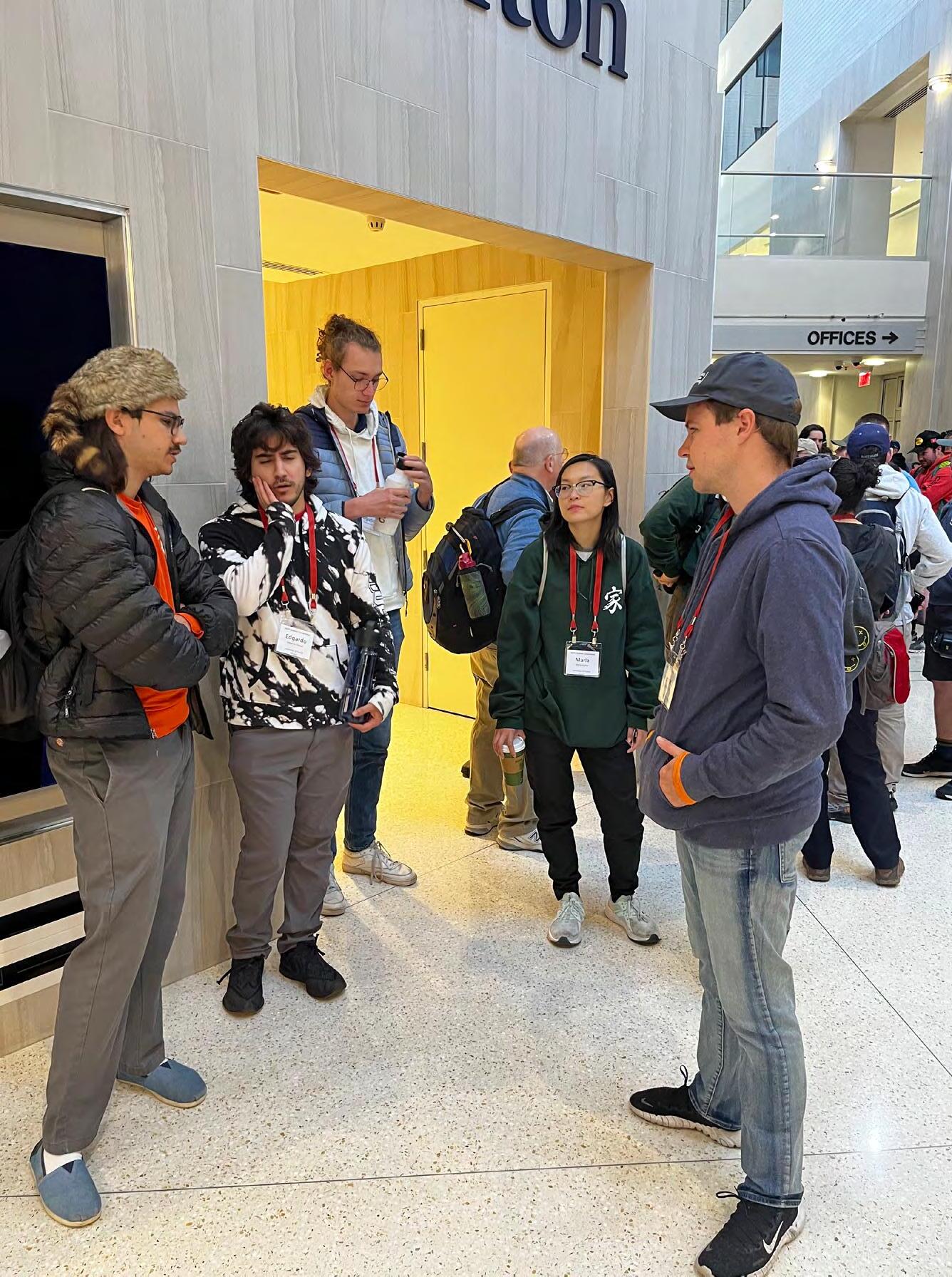
UF Students strategizing for the NGS Monument Hunt (From Left to Right: Jacob Suarez, Augustus Benoit, Chayse Bell [YSN Representative] Marla Horn, Vanessa Zhao, Kenneth Dell, Eddie Vargas)
From Justin Thomas, PSM UF Faculty: NSPS 2024 YSN Student Competition in Washington DC.
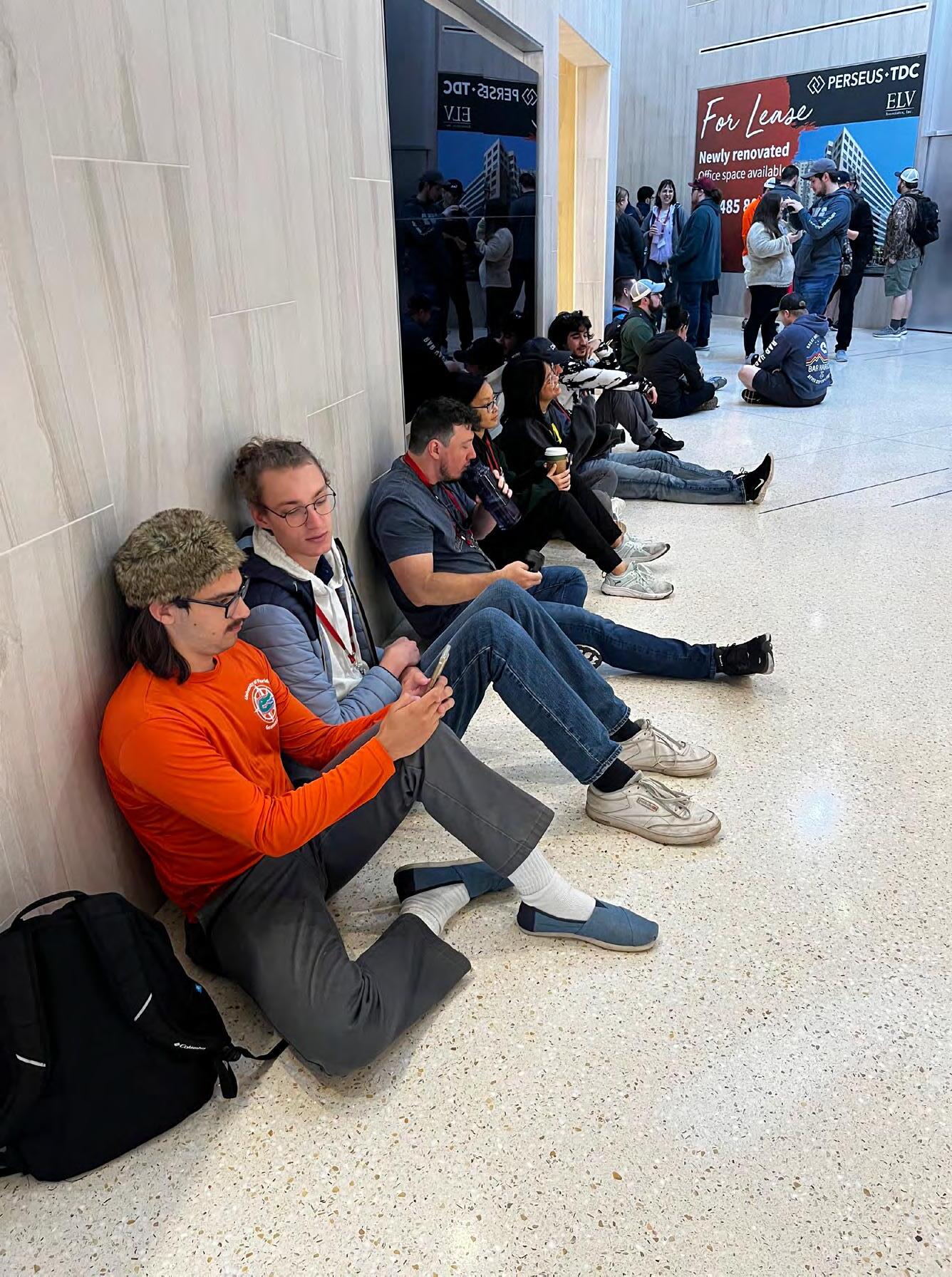
Day 1: UF Students strategizing for the NGS Monument Hunt (From Left to Right: Jacob Suarez, Eddie Vargas, Augustus Benoit, Marla Horn, Kenneth Dell)
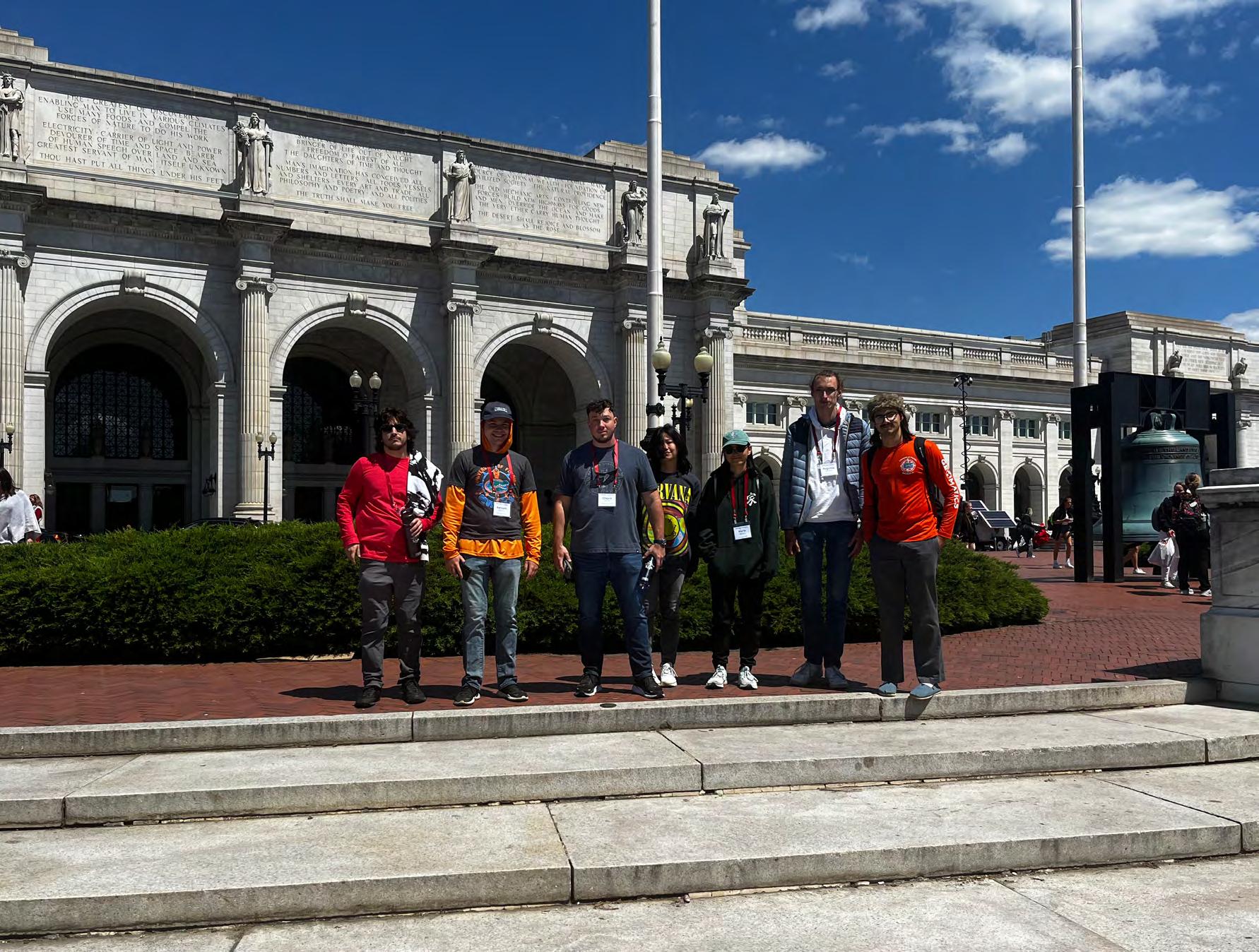
Day 1: UF Students in front of Union Station where they located NGS Monument “NE 134 A”. (From Left to Right: Eddie Vargas, Kenneth Dell, Chayse Bell [YSN Representative], Marla Horn, Augustus Benoit, Jacob Suarez)
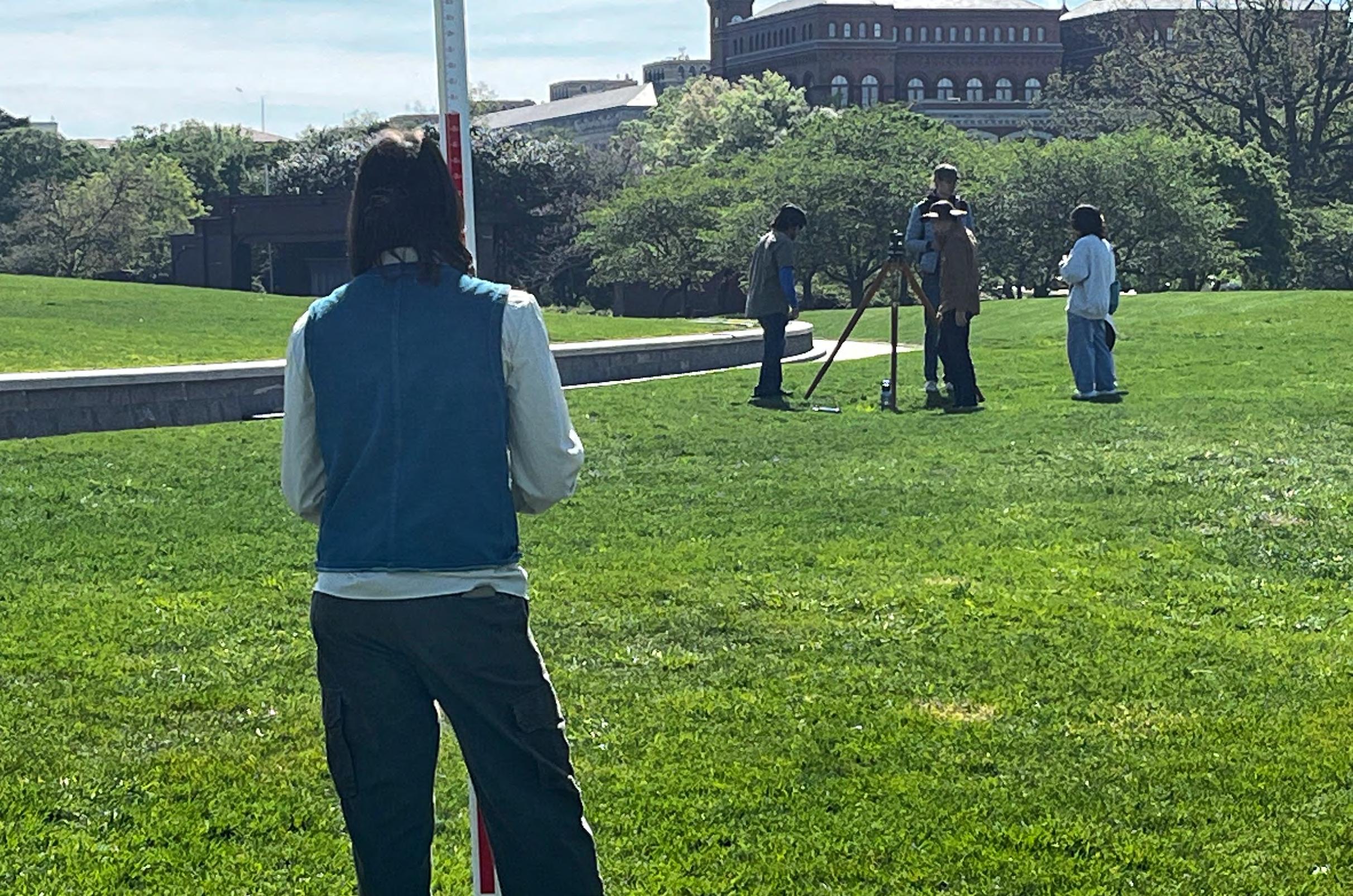
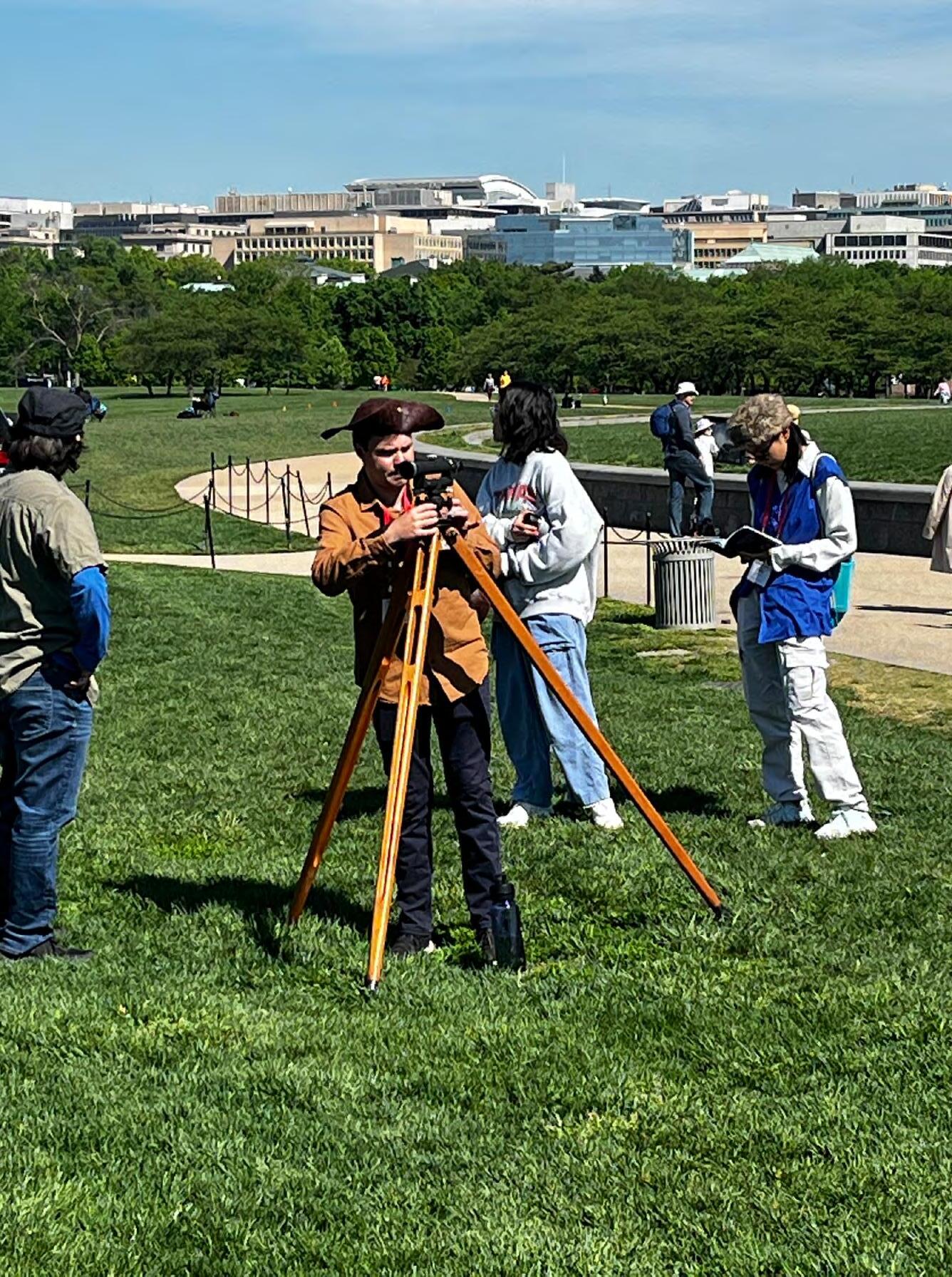
Day 2: UF Students Performing a Level Run using a Dumpy Level with a fixed leg tripod on the National Mall. (From Left to Right: Jacob Suarez, Eddie Vargas, Augustus Benoit, Kenneth Dell, Marla Horn, Vanessa Zhao)
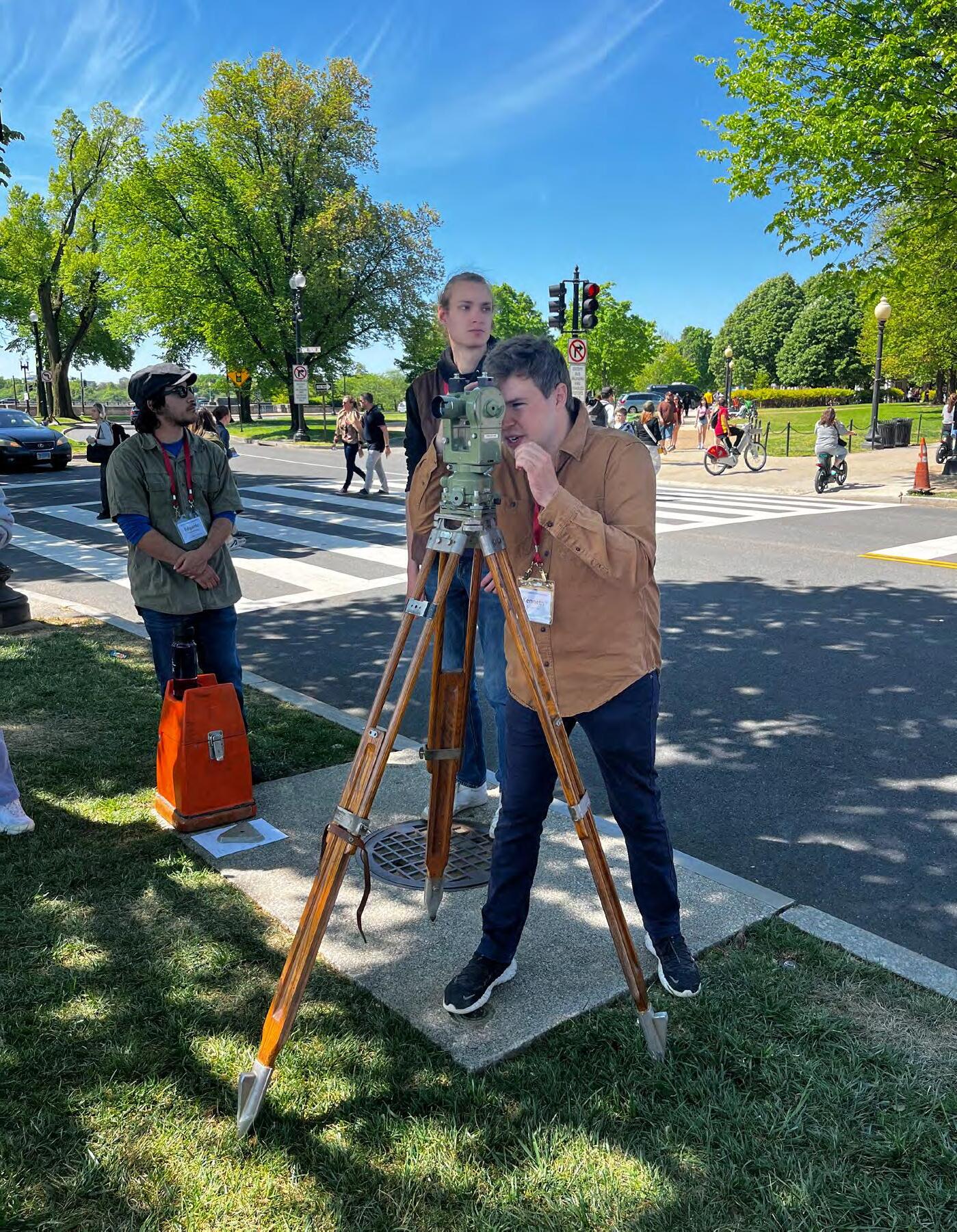
Day 2: UF Student Kenneth Dell sighting the Mini Monument using a T2 Theodolite in the “Unknown Point” exercise where students were tasked with computing the position of an unknown point. Students must sight the Washington National Monument and the Mini Washington National Monument from two different known positions and record the interior angles of the triangle.
Day 2: UF Students leveling the Dumpy Level with a fixed leg tripod on the National Mall while reducing their field notes. (From Left to Right: Eddie Vargas, Kenneth Dell, Vanessa Zhao, Marla Horn)
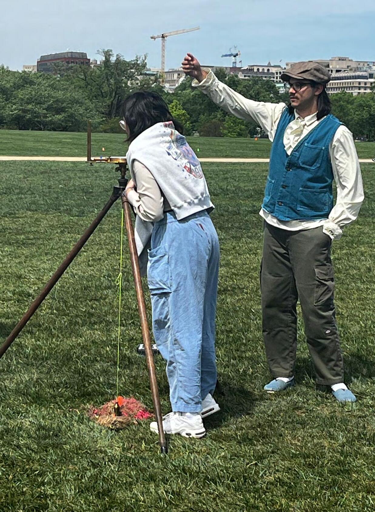
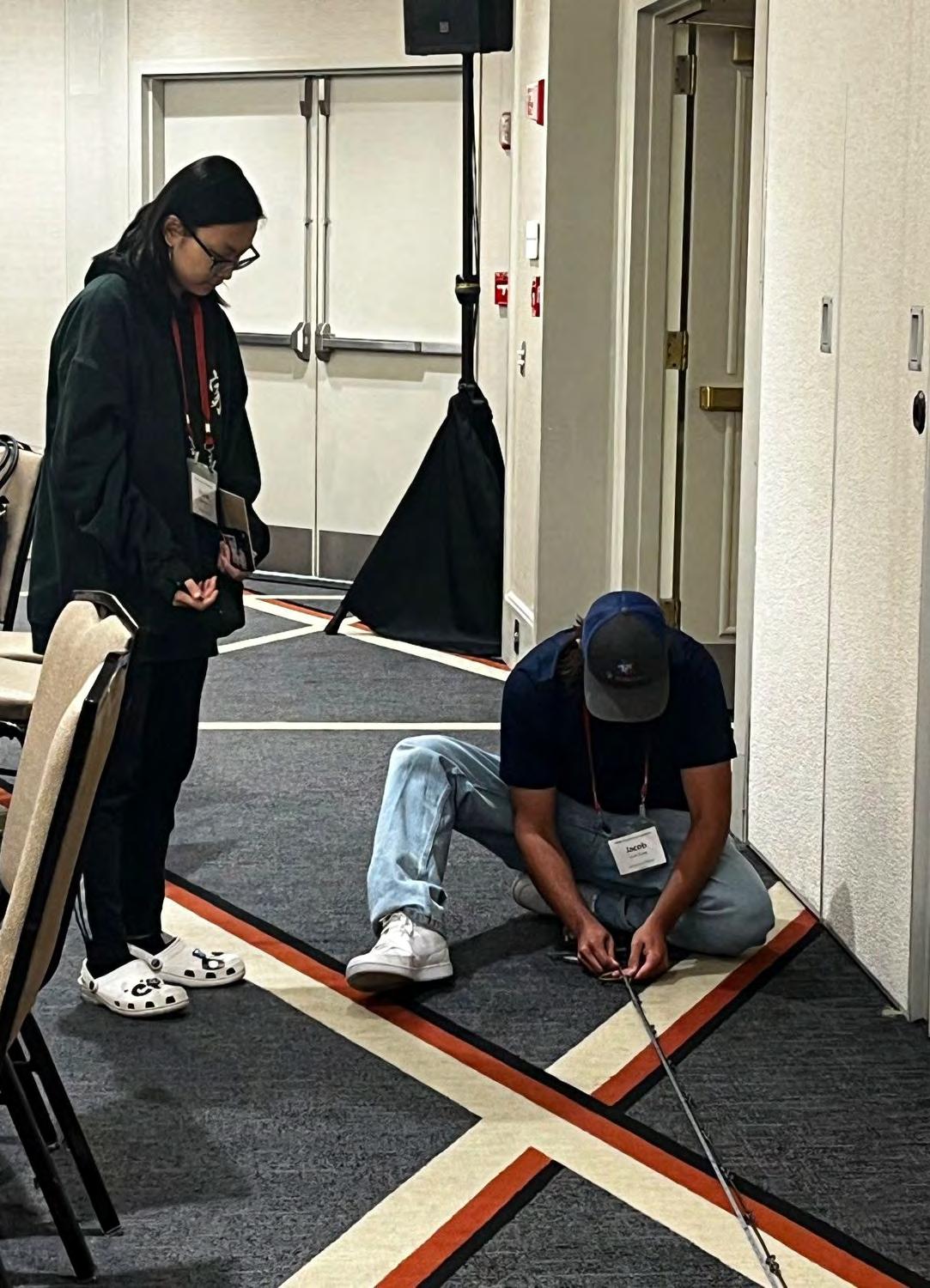
Day 2: UF Student Jacob Suarez aligning the chaining crew while Vanessa Zhao is reading the azimuth on the Compass during the Traverse Exercise. Students were tasked with recording azimuth readings from a 1800s Compass while using a 33’ Gunters Chain to measure the distance between corners.
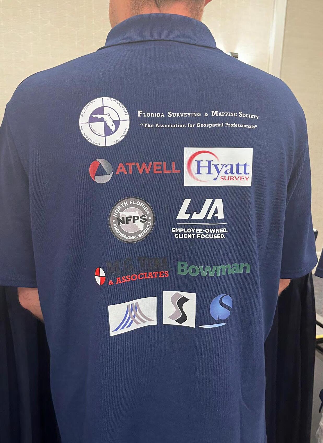
Day 3: UF Student, Kenneth Dell, wearing the sponsorship polo that displays all the Businesses and Organizations that financially supported the 2024 UF Geomatics Competition Team. THANK YOU!!!
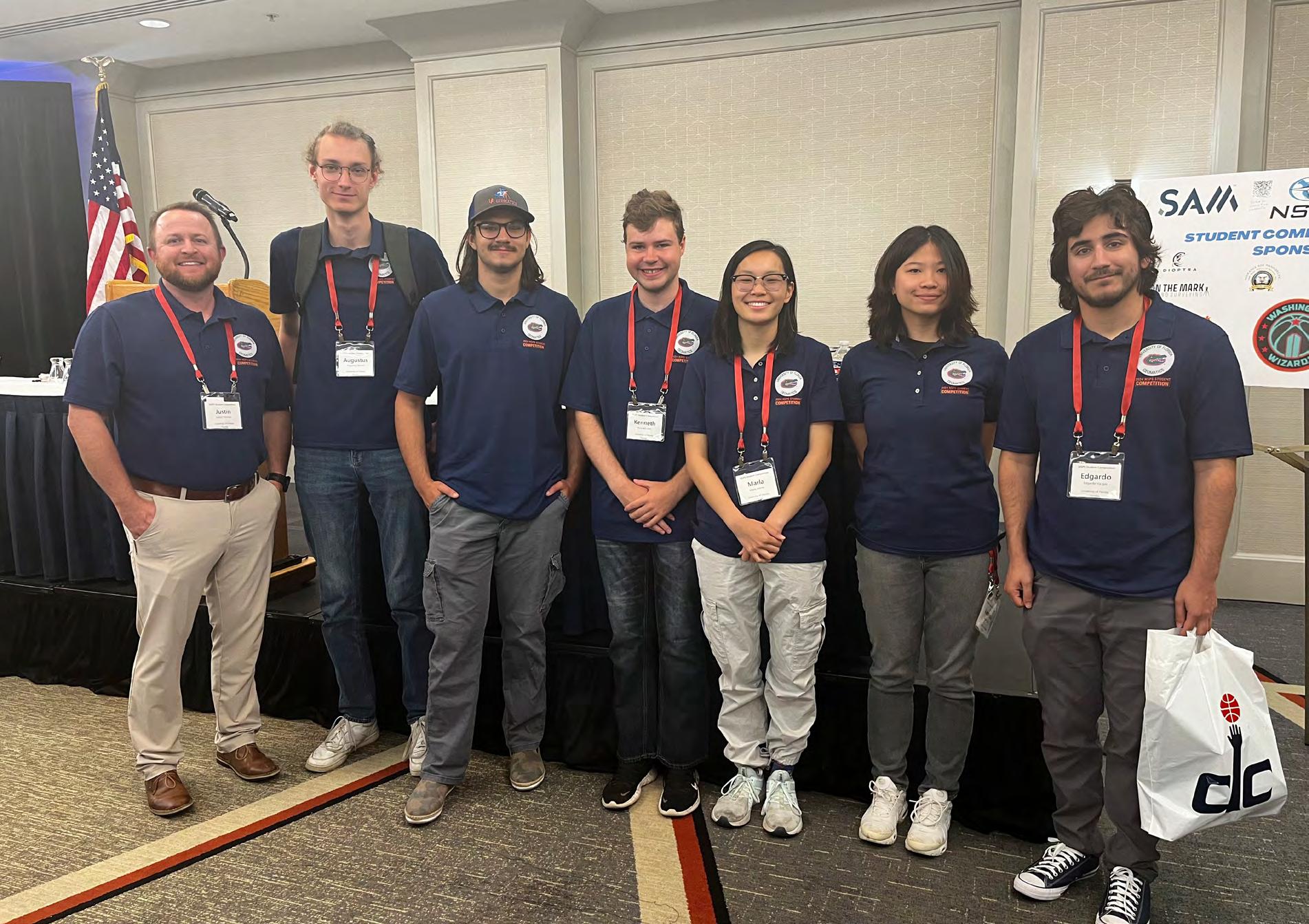
Day 3: UF Students and Faculty at the NSPS Student Competition Awards Luncheon. (From Left to Right: Justin Thomas [UF Geomatics Faculty Advisor], Augustus Benoit, Jacob Suarez, Kenneth Dell, Marla Horn, Vanessa Zhao, Eddie Vargas)
From Kenneth Dell, UF GSA Student: Thank you so much to everyone who has supported UF GSA students to go to this event. We have learned so much through it already and we appreciate all the organizers, YSN, NSPS, the Van Horns, and the many others involved. You have made me a better Surveyor and Person and I truly appreciate the opportunity.
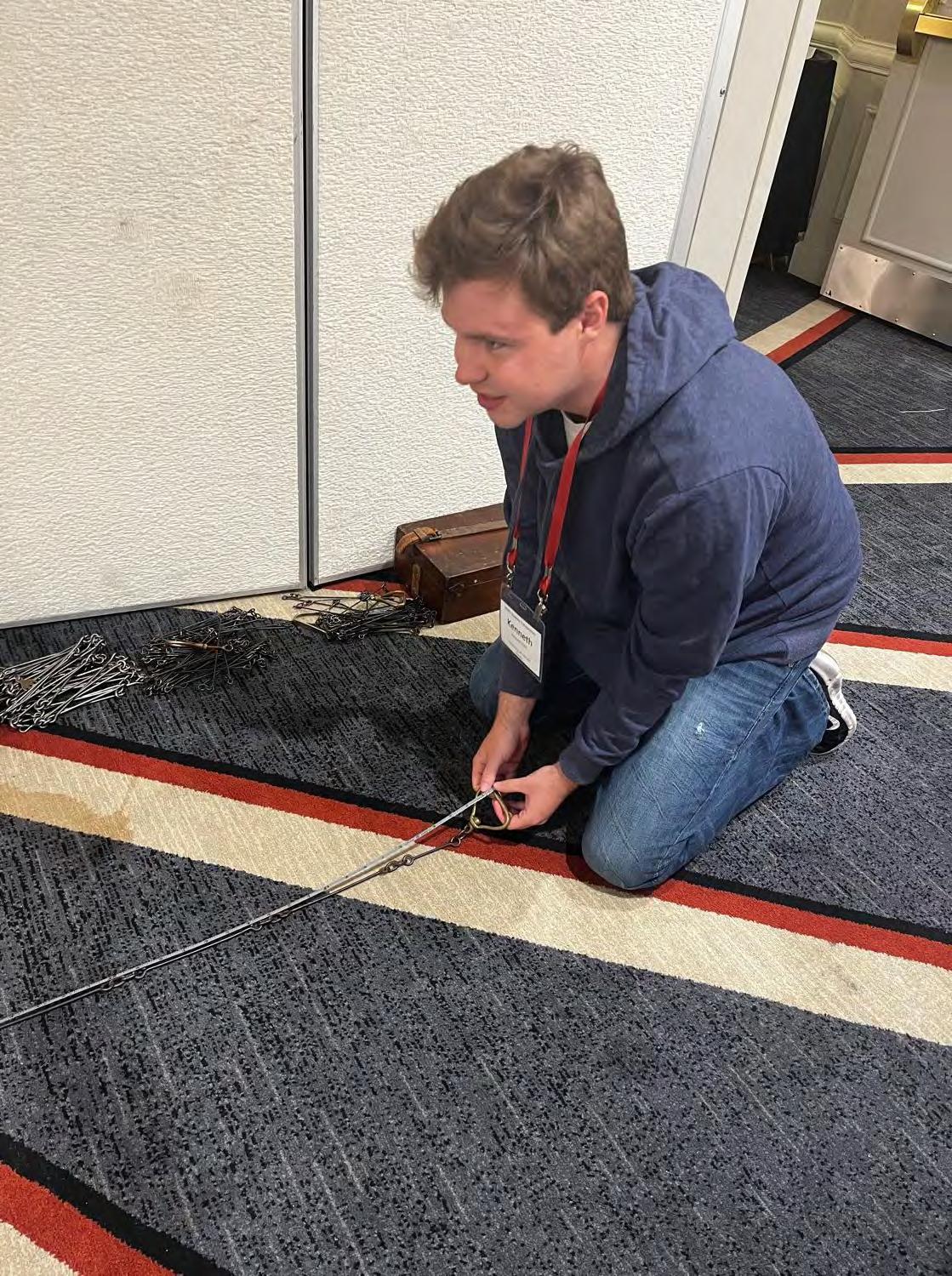
From Justin Thomas, PSM UF Faculty: UF Geomatics students (Kenneth Dell, Marla Horn and Jacob Suarez) are measuring the multiple Gunter Chains used in competition to know the actual lengths from end to end. They will then know the calibrated lengths during the competition to produce a more accurate result.
I wanted to thank all of you who spent time with our students, answering questions and providing support in the preparation for this trip. The opportunity to attend this NSPS meeting can be a once in a lifetime for most student. The biggest takeaway from these types of events is that our industry is not limited to the City, County or State that we exist in. There are others around the country who are just as passionate about and dedicated to the furtherance of our profession. Needless to say, the value of this experience is priceless.
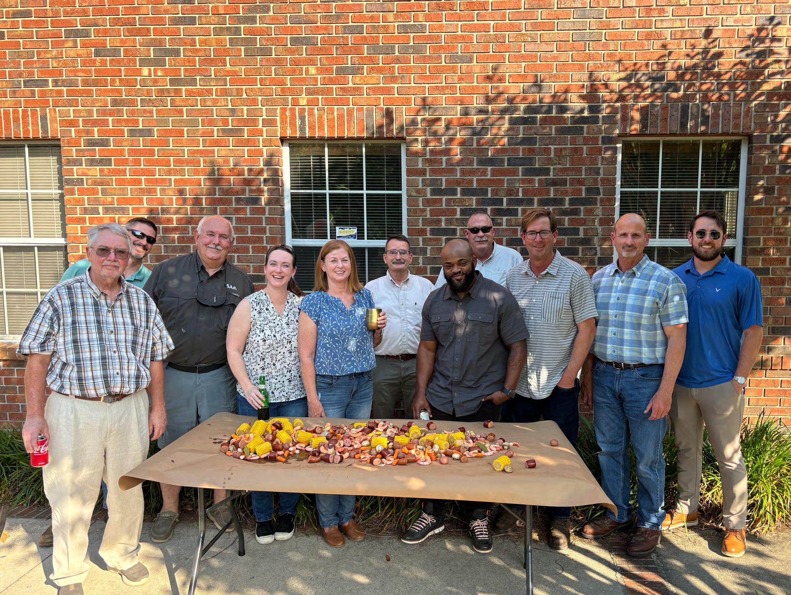
Big Turnout for the NW FL Chapter Lowcountry Boil! Photographer/Chef/Chapter President Jeremiah Slaymaker takes a picture of the crew before they dig in outside our administrative office in Tallahassee, FL.
From Todd Bates, PSM, Palm Beach Chapter President: Today was remarkable. Great time spent with great people at the FSMS Palm Beach event. It was inspiring to see everyone who came out to support our cause.
Andrew L. Beckwith, CST I and Kelly Stout did a stellar job on coordination, and a big thank you to Caulfield & Wheeler, Inc. (CWI) Inc. for their support. Thanks to all attendees.

R.D. Pryce RLS/PSM
Whilst we go about our everyday Survey Projects, I am constantly reminded of the control monuments that have been lost over time. The many I have set and lost from construction, and those countless others I have recovered set by Government agencies from maps and field notes over the past 5 decades which have played important roles in Surveys I have performed. Some of them have played important roles in past old surveys and others were used to establish and prove original corners in Florida’s PLSS system.
I think those ones, if found destroyed, we should make every effort to recognize them for the role they played in our work, but more importantly look for the remnants as well underground as there might be enough to use again even though the top may be gone.
------
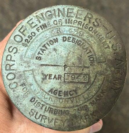
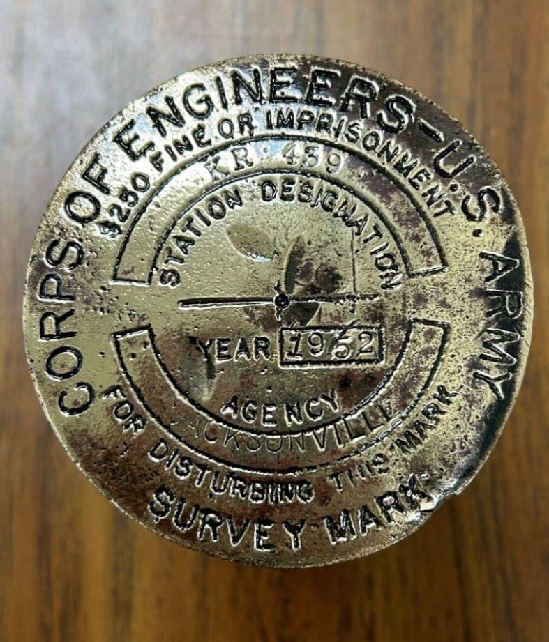
Such is the case of several Army Corp of Engineers Monuments set in 1952 along Glades County Road 721, near the west line of Sections 6, 7, and 18-40-33. They were part of the ACOE traverse used to establish the C-41 and L-60 R/W in the 1950’s for Central and Southern Florida Flood Control District (now SFWMD).
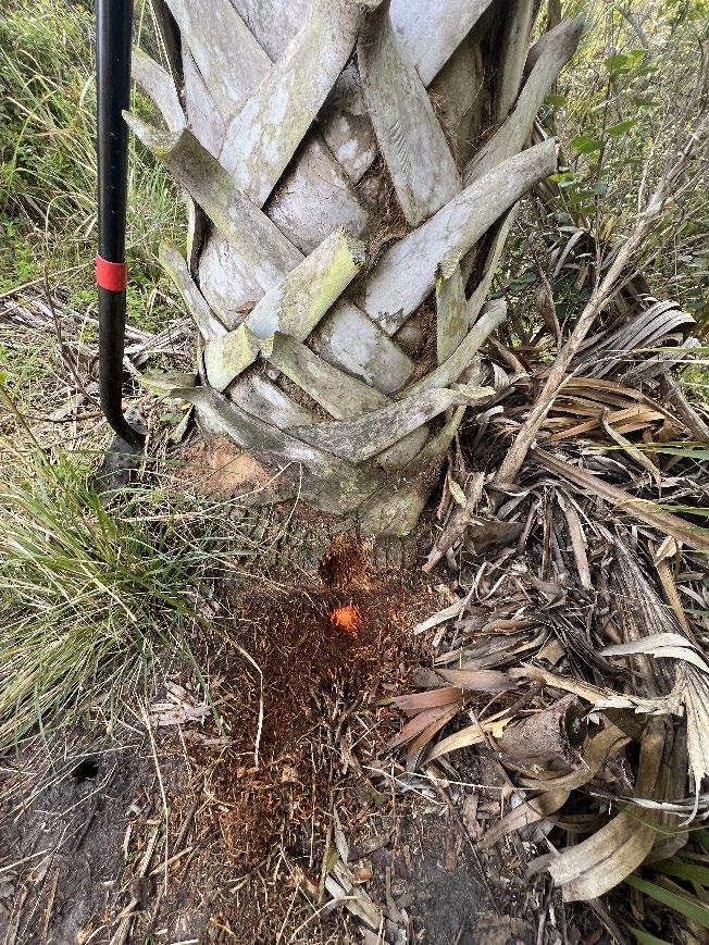
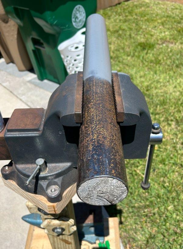
This particular monument KR-439 along with its two partners to the North, KR-438 and KR-437, were used by me in 1994 to assist in reestablishing the GLO positions of the NW, NE, and SW corners of Section 6-40-33. And as of 3/12/24 only KR-437 is still in its original shape. Our survey crew was working in the area in March, reestablishing the R/W of CR 721 and recovering Section corners along a 12+ mile stretch of roadway, so I asked them to relocate these monuments to aide in the recovery of the Section corners. They found KR-437 in good shape, relocated the base of KR-438 under a foot of rock and asphalt, and then found KR-439 laid over along a fence line. I had the crew look for the base and was able to locate it and determine it still straight up and down and useful, even though the top 3 ½ feet was missing with its unique brass disk. The original pipes were 5-6 feet long so there was still at least 2 feet in the ground, and they found it, and the roots of a cabbage palm which was not there in 1994, now surrounds and protects it.
I asked the crew to break off the concrete of the laid over pipe and bring it back to the office so I could see it in person. Something I’ve always done on any historic monument that I have found destroyed.
The Florida Surveyor Page 23
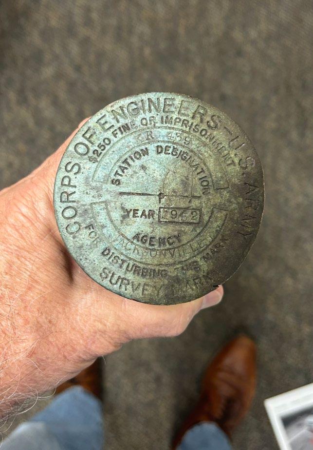
ACOE KR-439 Data Sheet

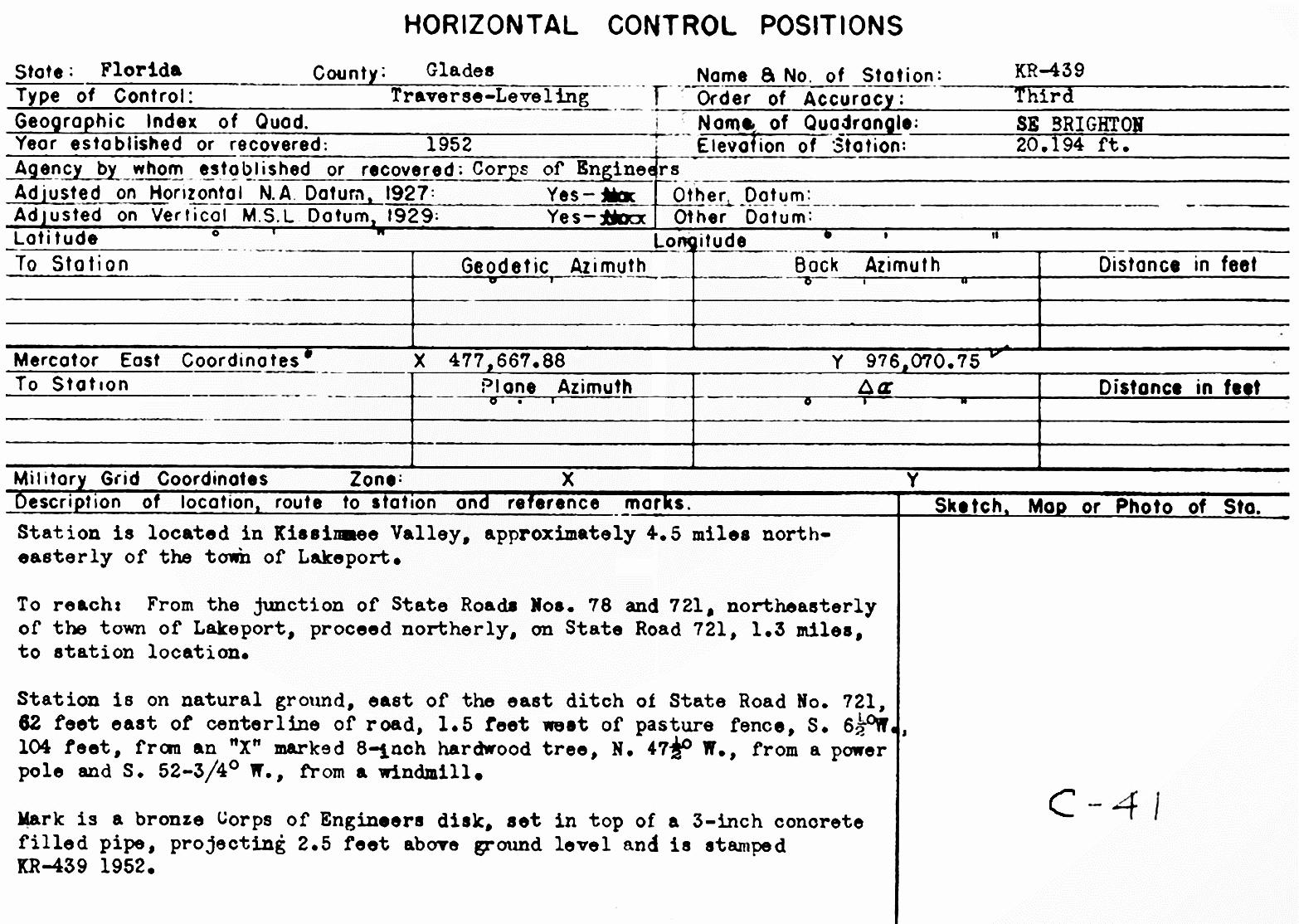
New Coordinates – Base of KR-439 NAD 83(2011) US Survey Feet
N: 976234.6130' E: 633904.2170'
Latitude: N027°01'09.8903"
Longitude: W081°04'06.1725"
May 2024 Page 24
Original
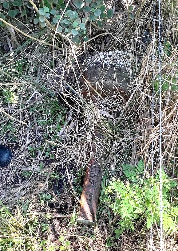
FOUND 3-12-24 LAID OVER
The Back Story:
Back in 1994, I was in my own business and performing Surveys for the Seminole Tribe on the Brighton Reservation in Glades County. One day an older man pulled up next to me in his old beat-up pickup truck on the side of the road and asked me what I was doing. When I explained that I was doing a Survey for the Tribe, he introduced himself as Paul Beck, and he had some survey work he needed on his family’s property to the south of the reservation and asked if I could come meet him there when I was done for the day. I said I would, so he gave me his address and he left.
Later that day I met with him, and he took me out to his big barn and laid out a USGS map that his Dad had drawn out the limits of the family farm on. It included all Section 6 and some of Section 5-40-33. He also had a bunch of deeds that was supposed to describe all of it. Long story, his parents had recently passed away and left him in charge of the Family business. His Sister who lived abroad was coming back to live on the portion of the farm that was left to her, and they need it surveyed so they could get a permit to build on. The portion of her property they needed was only about 8+ acres, but the legal was a breakdown of the Section, so you can see where this is going. I asked him if he had a overall survey of the property in his records and of course he did not, just the map and the deeds from his father. I spent the next two hours going over the process of how I would need to Survey the entire Section 6 in order to figure out where his sister’s property was, and the approximate cost of that. He was just a farmer, but I think he got the jest of it and thanked me for my time to explain it to him. I suggested that he do a thorough search of his dad’s records and see if there wasn’t a survey in there someplace, and if there was, maybe it was a local Surveyor in the Okeechobee area, and their price would be more reasonable because they knew the area better.
About two-three weeks went by and I was up in the area again for Seminole work and he again pulled up next to me on the side of the road. He explained that his sister was now here and would like to discuss it more, so I said I’d come by later. Well, they hadn’t found surveys in their father’s records, and they asked around their neighbors about surveyors and did not get anywhere. So, they said they now understand they needed to be able to know the limits of the property for all of their siblings involved. We talked for some time, and I eventually agreed to do the work at a smaller fee with a verbal agreement that they will use me for all future survey work for the family to recover my costs on the initial work.
I did my part and haven’t heard from them since, but anyways, the experience I got from doing that work far exceeded my expectations and is now just a part of my background. I will forever be thankful I took that job on even though it was difficult and challenged me at every step of the way.
May 2024 Page 26
Sectional work:
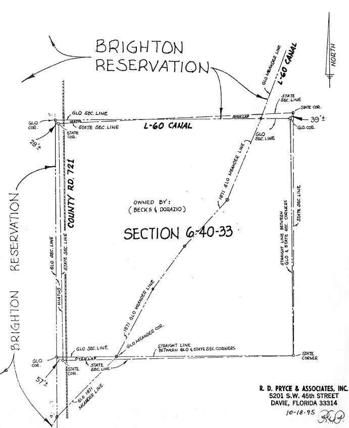
Doing my research on the Section 6, I found the GLO only Surveyed the North and West lines of the Section and a small portion of the South line because of the swamp around Lake Okeechobee in 1860-71, so they meandered the rest running NE diagonally through it. It was a fractional Section with only a portion of the Section by the GLO and the other was completed by the State in 1917-18. However, the State did not recover the GLO lines and set all 4 corners of the Section. So now I had that to deal with as well, See Exhibit below I did back in 1995.
When I started the sectional work both KR-437 and KR-439 were still intact, and 6” underground I had found the base of KR-438. Holding these monuments, the SFWMD maps, the field notes, and the ACOE monument sheets I was able to reestablish and set the GLO position of the NW and SW corners of Section 6 with new monuments since both were obliterated. I continued easterly along the north line of Section 6 with SFWMD maps and field notes, starting at the west line and using the KR monuments I traversed along L-60 berm tying down R/W monuments from SFWMD for the North ¼ corner and easterly to the bend in the R/W which was originally at the Meander corner from the original survey.
Using the same alignment, I continued east to look for the NE Corner of Section 6. When I got close to the corner position, it was in an open and slightly wet cow pasture with a ditch about 15 feet east running N-S. I saw another monument sticking up from the ground to the North and went to investigate. There I found a 5” diameter State Section corner monument set in 1917 which shows up on the L-60 R/W Map and was 39 feet north of my position. I tied it down to my traverse and continued my search. Within a foot of my calc position I find a squarish 4 ½” wood post rotted off just below ground in muck. I continued my search about 10-foot square area and found nothing else under the sod, so I straddled the post and dug it up. It was a well-preserved 2+ foot long, +/- 4 ½” square post with rounded corners with a triangular pointed bottom. The top foot was in muck and the bottom foot in pure white and very wet sand. SFWMD did not find it previously, only the Meander corner 600 +/- feet west which is now in the Canal.
I brought the Farmer out to the site and asked him about fencing in the area and he said he’d been there for 40 years and there was never a fence in this area of the pasture. At the time I still wasn’t 100% sure of what I found, so I sent pictures of it to and spoke to Paul O’Hargan. He confirmed it appeared to be an original GLO corner post to him, which per the notes was set by John Jackson on January 24, 1860. (Commenced at the NW corner of the Township and ran 80 chains East, set Post, corner of Sections 5, 6, 31 & 32 in boggy sawgrass, the sawgrass was so dense I could not proceed any further with this line.) No mention of references in the field notes.
I took a piece of the wood to a tree expert I knew, and he confirmed it was Pine which also matched the period and posts set. Elated as to finding an original GLO Section corner I carefully replaced it with what I thought was a monument to stand the test of time just like the original but more visible and easier to find. (See CCR #0049912). Another lesson learned DO NOT leave important monuments sticking up above ground, because they become a target).
In 2020, I went back to this particular corner as part of an Aerial Lidar project for the Seminole Tribe, and the whole pasture is now a Sugar Cane field and both the State and my GLO corner are no longer there. Wiped out and brushed away like they never existed. But I had the forethought to set a 5/8” x 18” iron pipe, under the monument, just in case.
Fast forward to April 2, 2024, the current project, which I figured I could now find and reset it properly and as luck would have it, it is now in ditch dug for drainage, so much for the Iron pipe. My previous traverse points are still in the Berm for L-60 canal, but no point trying to set the corner at the bottom of a ditch that my change in the future.
Back to KR-439
Part of this new Project of re-establishing the R/W for County Road 721, I had to search for all of the Section corners along the route. I had previously established the R/W of CR 721 through the Brighton Reservation back in the late 1980’s and 90’s tying down several GLO Monuments set in 1938 when they did a Dependent Resurvey for the Reservation boundary. Not all corners along the Township line were still in the ground, but there was enough to tie down the R/W to. But this project started at State Road 78, 2 ½ miles south of the Reservation in Fractional Section 18-40-33 and running north through Section 7 and 6-40-33. The best information I had on Sections 7 and 18 was from SFWMD R/W and Control maps (C-41, L-49, L-50, & L-60) along with their field notes from the 1950’s.The southwest corner of Section 7-40-33 had two corners (iron rods and caps) in the ground already and after tying down the R/W of Canal C-41 to other ACOE Monuments and occupation along CR 721 and SR 78, I found I didn’t agree with either of the iron rods for the SW corner of Section 7, one by over a foot and the other by almost 9 feet. So, I contacted both firms to find out what other information they may have to prove their corners, because maybe I missed something. The one 9 feet off sent me his survey and after his own review, said he wasn’t married to its position since it was based on a dimension coming from information he had to the south, and the other firm did not respond.
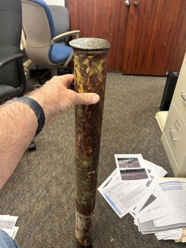
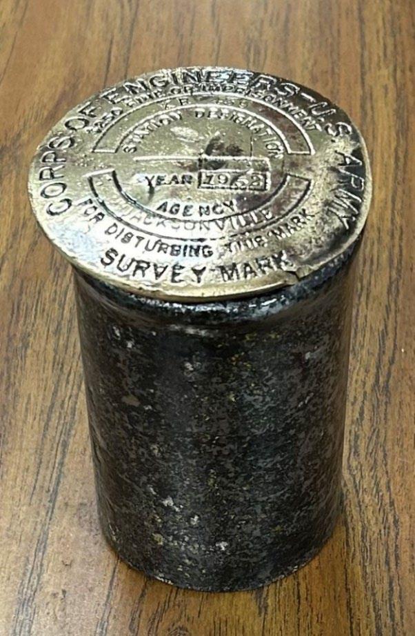
With this information and going back to everything I had done, I decided it needed to be set with a monument. In the field notes from SFWMD in 1956, they had originally found a 3” diameter Prewitt monument marking the State Corner. My crew searched the area, and even straddled the rod 1 foot east and removed it to search under and around a 10foot area with no results, so they replaced the rod back to its original position and marked the location for the new monument. I got back to my office after thinking about the new monument and wanting to have something substantial to put in the ground and staring at me in the corner of my office was the 3 ½ foot remains of the KR-439 monument.
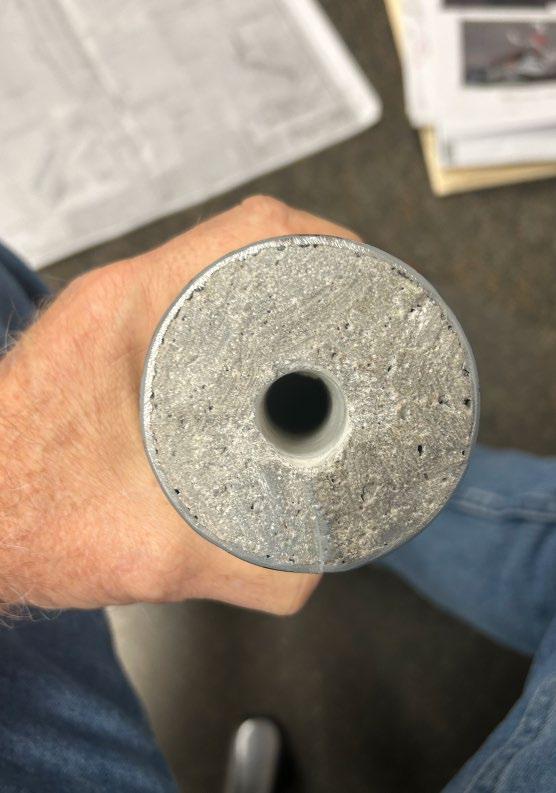
Now these ACOE monuments were originally 5-6 feet long 3” diameter iron pipes filled with concrete and then concreted into the ground. I knew I wanted to keep the top of KR439 so I took it home to work on it. I cut the top 3” off to preserve and the bottom 3” that was badly rusted through which left me with a 3” x 30” iron pipe filled with concrete. Even though it was rusted it was still structurally sound, so I then worked on the outside to clean it up and remove the top layer of rust scale. Wiped it down with mineral spirts, dried it and
The Florida Surveyor Page 29
then painted it with gray Rustoleum paint. I then drilled 5/8” diameter hole in the concrete center of the pipe for the new disk.
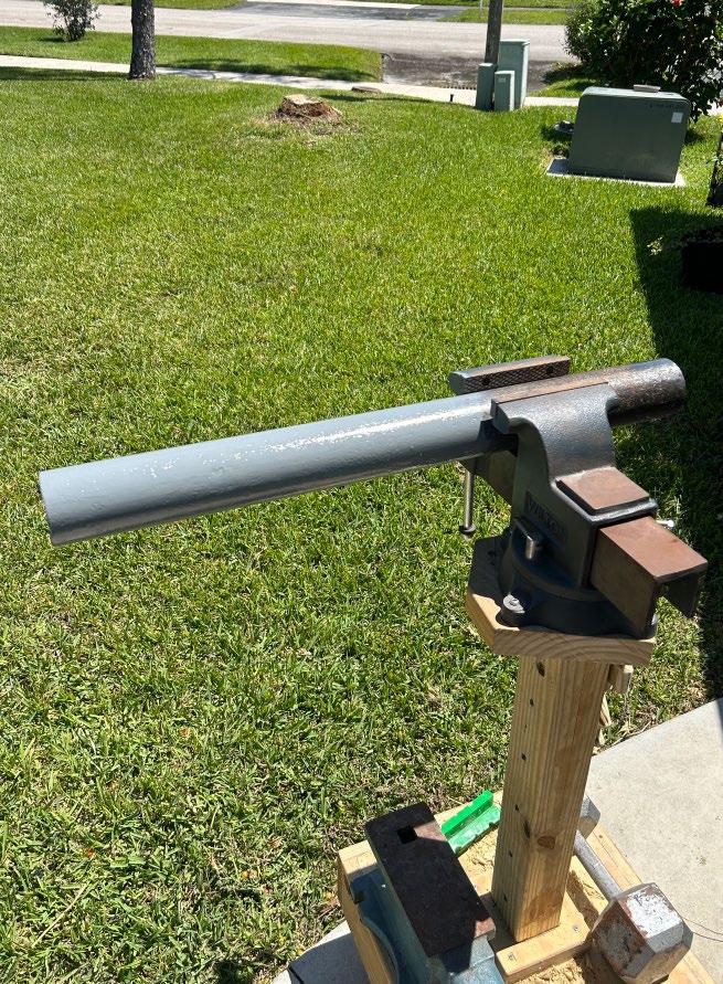
Now I had something substantial to use for the Section corner monument. Knowing that the base stood the test of time already (1952-2024) and was structurally sound, it was now all cleaned up, and ready for its next 72-year job as the restored common corner of Sections 7 & 18-40-33 and 12 & 13-40-32, Glades County, Florida.
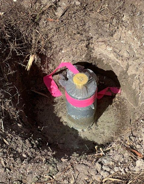
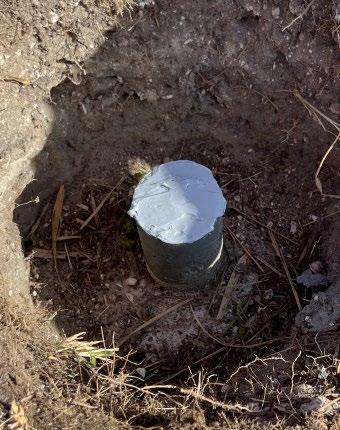
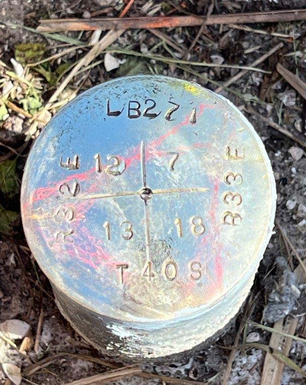
It has now been set 32” in the ground with an 18” deep 4” concrete collar around it with brass disk shown below. New Coordinates – Section Corner
NAD
N: 970686.2494' E: 633825.3525' Latitude: N027°00'14.9416" Longitude: W081°04'07.0112"
83(2011) US Survey Feet


As surveying technologies continue to advance, a trusted and knowledgeable partner can help you stay ahead of the game. For over 75 years Duncan-Parnell has provided leading-edge products and services to help surveyors succeed.

• Robotic Total Stations
• Trimble GNSS Instruments
• UAS/Drone Solutions
• Technical Training
• Software for Survey & Mapping
• Survey Supplies
• Instrument Repair & Maintenance


• Monitoring Solutions www.duncan-parnell.com Jacksonville, FL (904) 620 - 0500 Orlando, FL (407) 601 - 5816

YOUR FIELD-TO-FINISH SURVEY PARTNER
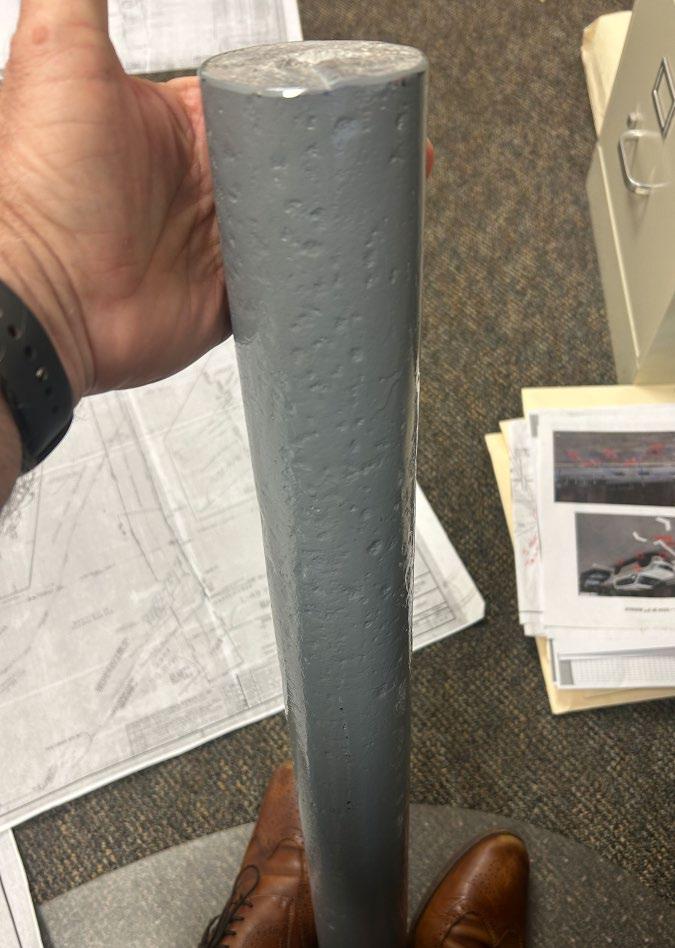
The nal Memorialization of KR-439 is shown below. The rest was wire brushed, the top sanded with 400 grit paper, washed and then polished. Then the entire thing was clear coated twice. I then presented it to my Party Chief, who had lots of questions throughout the project, and for his hard work with no complaints on all of the searching he and his crew had to do on this project to make it a success.
BEFORE AFTER


W HY FSMS?
FSMS is a professional membership society representing the Surveying & Mapping Profession, including: Photogrammetry, Imagery, Remote Sensing, Base Mapping, GIS/LIS, Cartography, Geodesy, Geomatics, GPS, Geographic Information and Geospatial Data.
MEMBE R SHIP
OPPORT U N I T I E S
• NETWORKING
• CONTINUING EDUCATION
• LEGISLATIVE FSMPAC
• PROMOTING THE PROFESSION
• PROTECTING LICENSURE
• ADDRESSING UNLICENSED PRACTICE
• ENCOURAGING FUTURE SURVEYORS
• AWARDS & SCHOLARSHIPS
• CAREER OPPORTUNITIES
May 2024 Page 34


Surveyors in Government
May 2024
Greetings, as I find you this month we have already had a taste of summer here in the central part of the state with repeated hig hs in the mid to high 90’s, so this is a good time to state to be sure to have your field staff to hydrate and to be cautious when working in the heat. For the topic of this month’s article, I will be touching upon the monumentation requirements of Florida Statutes Chapter 177, or specifically the perpetuation of monumentation.
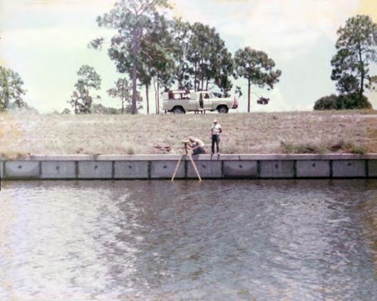
Monumentation in surveying is as old as time with much of the early monumentation being natural such as rocks, boulders, trees, and even water bodies. Over time we start to see man - made materials come about that were used in conjunction with natural monumentation as we have all covered in Brown’s Boundary Control and other various material on the importance of monumentation. For artificial monumentation we find iron rods or rebars, iron pipes, concrete monuments, axles, and other various odd materials that surveyors have had on- hand over the years. These monuments can be unique by region throughout the state, in Central Florida you will find coffee can monuments, pyramid sandstone (because they fall apart because the surveyor did not use enough concrete) mon umnents, and in the older parts of Orlando, iron pipes were heavily used.
May 2024 Page 36
Surveyors in Government
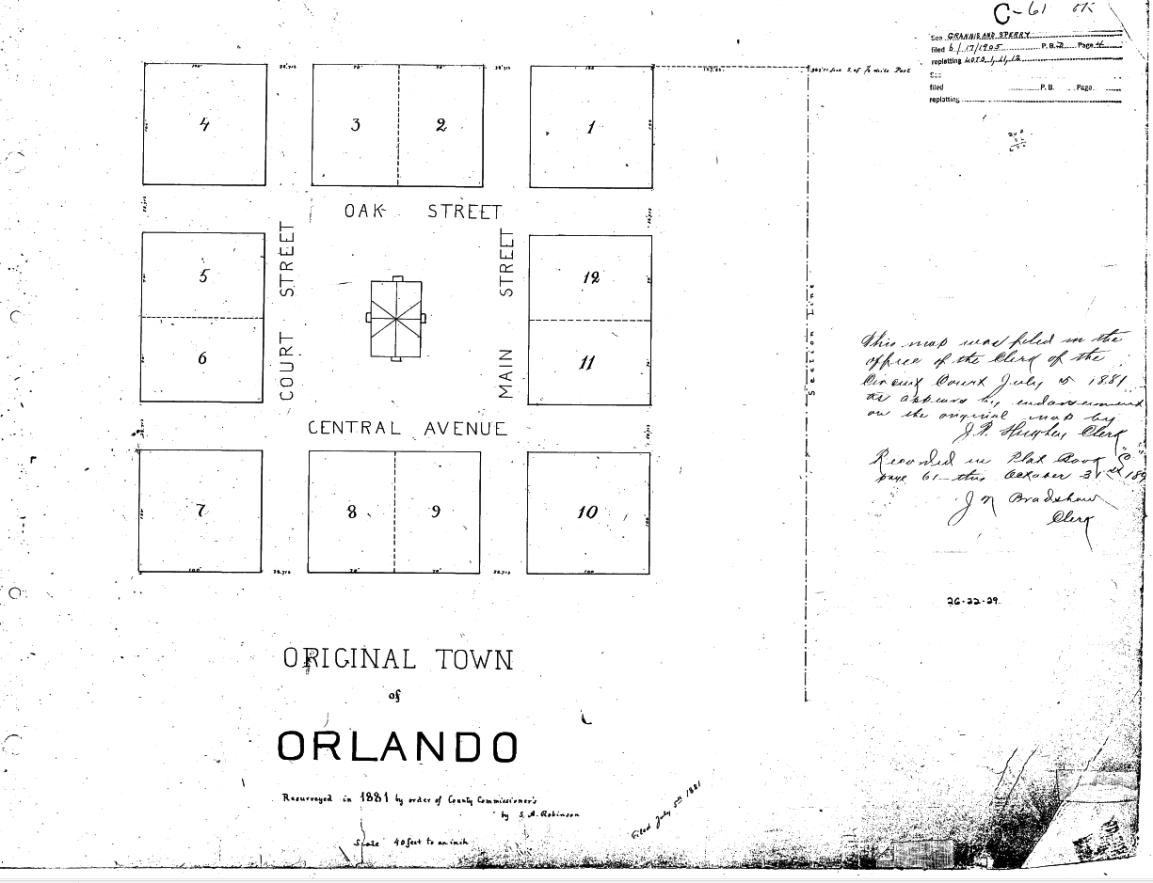
In Florida Law, monumentation has always been vital and so has the Permanent Reference Monument, or P.R.M., from which you can see even from plat law in 1925 in Chapter 10275 of the Laws of Florida :
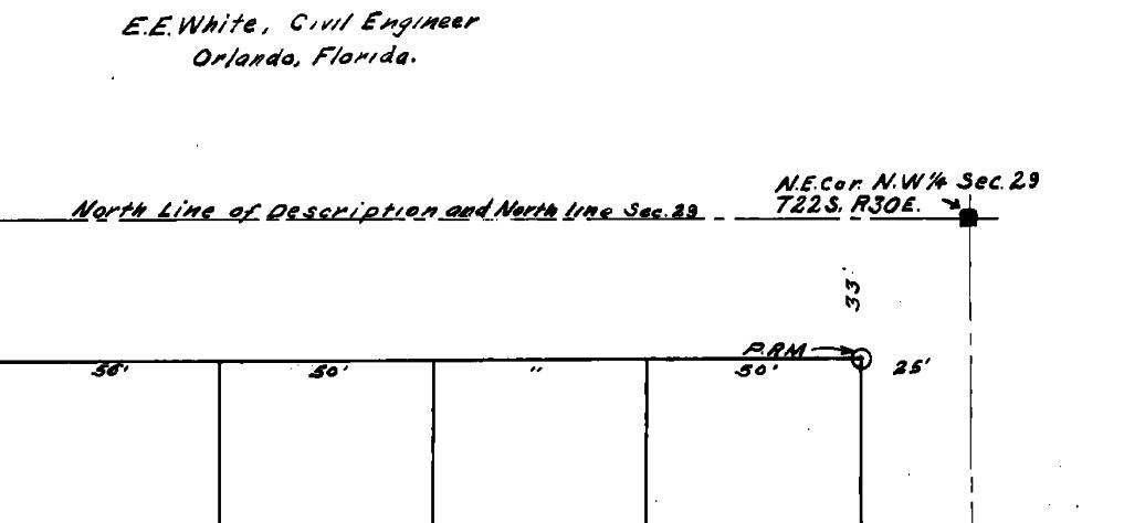
As you read, you can clearly see the designation to Permanent Reference Monument (P.R.M.), is for the label on the plat, and not to the disk as so is the case today. So early plat law did indeed create P.R.M.’s and they were both metal 3” in diameter and larger or smaller metal incased in concrete. So we must keep in mind that older monuments that do not have disks could be original P.R.M.’s and should be held. They did not stamp disks at this time, so the designation was on the face of the plat. A good point could be made as why car and wagon axles were used as they are metal larger that 3” in diameter at the largest breadth. The spindles also make good measuring points at their dimples.
Surveyors in Government
An example of a 1925 plat below that shows the PRM designation required.
As we look at the current statutes (in navy blue), in Florida Statute (F.S.) 177.031 we have the following definitions provided:
(1) “Alley” means a right -of-way providing a secondary means of access and service to abutting property.
Surveyors in Government
(2) “Block” includes “tier” or “group” and means a group of lots existing within well -defined and fixed boundaries, usually being an area surrounded by streets or other physical barriers and having an assigned number, letter, or other name through which it may be identified.
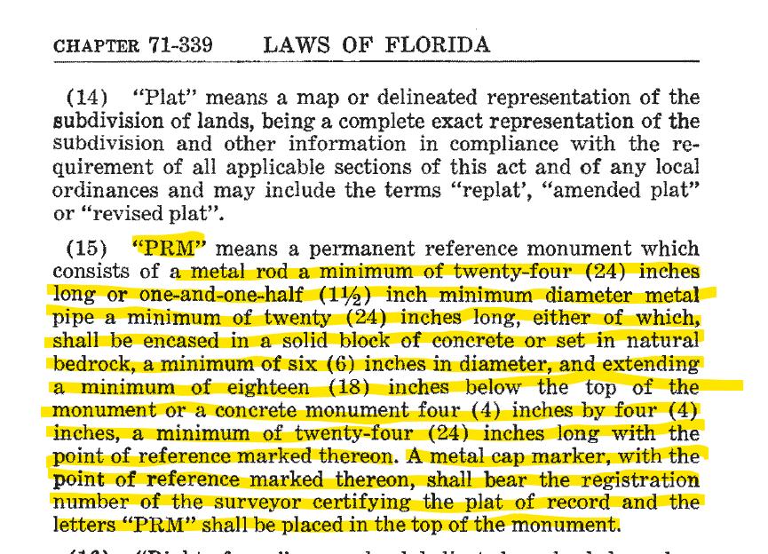
(15) “P.R.M.” means a permanent reference monument which must:
(a) Consist of a metal rod having a minimum length of 18 inches and a minimum cross -section area of material of 0.2 square inches. In certain materials, encasement in concrete is optional for stability of the rod. When used, the concrete shall have a minimum cross -section area of 12.25 square inches and be a minimum of 24 inches long .
(b) Be identified with a durable marker or cap with the point of reference marked thereon bearing either the Florida registration number of the professional surveyor and mapper in responsible charge or the certificate of authorization number of the legal entit y, which number shall be preceded by LS or LB as applicable and the letters “P.R.M.”
(c) Be detectable with conventional instruments for locating ferrous or magnetic objects.
If the location of the “P.R.M.” falls in a hard surface such as asphalt or concrete, alternate monumentation may be used that is durable and identifiable.
(16) “Right-of-way” means land dedicated, deeded, used, or to be used for a street, alley, walkway, boulevard, drainage facility, access for ingress and egress, or other purpose by the public, certain designated individuals, or governing bodies.
(17) “Street” includes any access way such as a street, road, lane, highway, avenue, boulevard, alley, parkway, viaduct, circle, court, terrace, place, or cul -de-sac, and also includes all of the land lying between the right -of-way lines as delineated on a plat showing such streets, whether improved or unimproved, but shall not include those access ways such as easements and rights -of-way intended solely for limited utility purposes, such as for electric power lines, gas lines, telephone lines, water lines, drainage and sanitary sewers, and easements of ingress and egress.
(20) Surveying data:
(a) “Point of curvature,” written “P.C.,” means the point where a tangent circular curve begins.
(b) “Point of tangency,” written “P.T.,” means the point where a tangent circular curve ends and becomes tangent.
(c) “Point of compound curvature,” written “P.C.C.,” means the point where two circular curves have a common point of tangency, the curves lying on the same side of the common tangent.
Surveyors in Government
(d) “Point of reverse curvature,” written “P.R.C.,” means the point where two circular curves have a common point of tangency, the curves lying on opposite sides of the common tangent.
And Lastly, the definition of monumentation:
(22) “Monument” means a survey marker which must:
(a) Be composed of a durable material.
(b) Have a minimum length of 18 inches.
(c) Have a minimum cross-section area of material of 0.2 square inches.
(d) Be identified with a durable marker or cap bearing either the Florida registration number of the professional surveyor and mapper in responsible charge or the certificate of authorization number of the legal entity, which number shall be preceded by LS or LB as applicable.
(e) Be detectable with conventional instruments for locating ferrous or magnetic objects. If the location of the monument falls in a hard surface such as asphalt or concrete, alternate monumentation may be used that is durable and identifiable.
History. s. 1, ch. 71-339; s. 2, ch. 72 -29; s. 49, ch. 73-333; s. 6, ch. 82-179; s. 49, ch. 83 -217; s. 42, ch. 91-45; s. 101, ch. 94-119; s. 1452, ch. 95-147; s. 2, ch. 98 -20; s. 3, ch. 2004-366.
You may ask, why am I listing all of these definition s in F.S. 177.031? That is because they all pertain to permanent reference monuments and where they are to be either established, or have been in place. That is the importance of the boundary survey as required in F.S. 177.041, to not only verify what will be subdivided, but to validate what control and monumentation is in - place that will become part of the newly platted lands.
177.041 Boundary survey and title opinion or property information report required. Every plat or replat of a subdivision submitted to the approving agency of the local governing body must be accompanied by:
(1) A boundary survey of the platted lands. However, a new boundary survey for a replat is required only when the replat affects any boundary of the previously platted property or when improvements which may affect the boundary of the previously platted proper ty have been made on the lands to be replatted. The boundary survey must be performed and prepared under the responsible direction and supervision of a professional surveyor and mapper preceding the initial submittal of the plat to the local governing body . This subsection does not restrict a legal entity from employing one
Surveyors in Government
professional surveyor and mapper to perform and prepare the boundary survey and another professional surveyor and mapper to prepare the plat.
In F.S. 177.091:
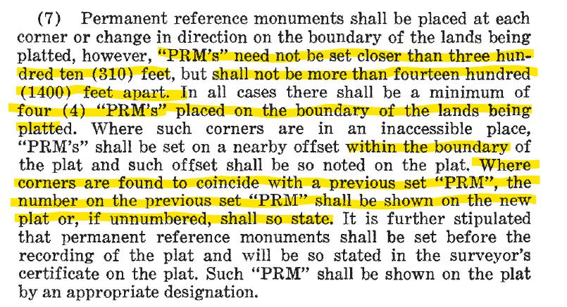
(7) Permanent reference monuments must be placed at each corner or change in direction on the boundary of the lands being platted and may not be more than 1,400 feet apart. Where such corners are in an inaccessible place, “P.R.M.s” shall be set on a nearby offset within the boundary of the plat and such offset shall be so noted on the plat. Where corners are found to coincide with a previously set “P.R.M.,” the Florida registration number of the professional surveyor and mapper in responsible charge or the certificate of authorization number of the legal entity on the previously set “P.R.M.” shall be shown on the new plat or, if unnumbered, shall so state. Permanent reference monuments shall be set before the recording of the plat. The “P.R.M.s” shall be shown on the plat by an appropriate symbol or designation.
This is not much different from the language as described in Chapter 177 and referred to in legislative acts as 71- 339:
Surveyors in Government
(9) Monuments shall be set at all lot corners, points of intersection, and changes of direction of lines within the subdivision which do not require a “P.R.M.” or a “P.C.P.”; however, a monument need not be set if a monument already exists at such corner, point, or change of direction or when a monument cannot be set due to a physical obstruction . In those counties or municipalities that do not require subdivision improvements and do not accept bonds or escrow accounts to construct improvements, monuments may be set prior to the recording of the plat and must be set at the lot corners before the transfer of the lot. In those counties or municipalities that require subdivision improvements and have the means of ensuring the construction of those improvements, suc h as bonding requirements, monuments shall be set prior to the expiration of the bond or other surety. If the professional surveyor and mapper or legal entity of record is no longer in practice or is not available due to relocation, or when the contractual relationship between the subdivider and professional surveyor and mapper or legal entity has been terminated, the subdivider shall contract with a professional surveyor and mapper or legal entity in good standing who shall be allowed to place the monument s within the time allotted.
Additionally in the 1971 version of Chapter 177, specifically 177.091 (7):
Surveyors in Government
177.121 Misdemeanor to molest monument or deface or destroy map or plat. It is a misdemeanor of the second degree, punishable as provided in s. 775.082 or s. 775.083, for any person to molest any monuments established according to this part or to deface or destroy any map or plat placed on public record.
Molestation as defined by Black’s Law Dictionary 2nd Edition, the term was from Scotch Law: A possessory action calculated for continuing pro - prietors of landed estates in the lawful possession of them till the point of right be determined against all who shall attempt to disturb their possession. It is chiefly used in questions of commonty or of controverted marches. Ersk. Inst. 4, 1, 48.
Surveyors performing subdivision boundary layout are perpetuating monumnentation and are not molesting the monuments, the decision must be made as to whether a corner is original or being perpetuated. A concrete monument from an original plat should be carrier over with any subsequent replat if it is in an acceptable position. An argument can be made for other original m onumentation as well, such as an axle or large pipe if it can be referenced back as being an original P.R.M. and evident that should be perpetuated. If you encounter an iron rebar you would replace said rebar to bring the monument to current requirement because it is deficient according to statute and needs to be remonumented with a corner that meets statutory requirement. Now you may have mo re strigent codes that require new monumentation with every replat, but I think there should be evidentury items provided within the replat to denote what monumentation was replaced to carry forward the previous evidence, especially when boundary surveys a re not recorded. Brown’s aluded to the importance of original monuments and the control of monuments over plats.
In the Subdivision’s class I teach at Valencia College, I stress to the students the difference between statutes and codes, as statutes are the minimum requirements that cannot be lowered or codes that can be more stringent , but that doesn’t mean that some common sense must be used from time to time .
Until next time my friends, I bid you adieux. Thank you for taking the time to read this article!
Sincerely,
Richard Allen, City Surveyor for Orlando 407.246.2788 (O)
Richard.Allen@orlando.gov
FSMS Surveyors in Government Liaison
President of the Geospatial Users Group
ASPRS Florida Region Director
Region V Director of the Florida Floodplain Managers Association
The Florida Surveyor Page 43
SUPPORT FSMPAC TODAY!
Your contribution can make a monumental difference in ensuring that our profession thrives and our voices are heard where it matters most.
Join FSMPAC and become a driving force for the future of Surveying & Mapping in Florida.

FSMPAC, the Florida Surveying & Mapping Political Action Committee, is your ticket to shaping the future of our profession. Our mission thrives on the generosity of dedicated Surveyors and Mappers who want to champion and safeguard our profession.
Your contributions go toward researching, identifying,and supporting candidates who champion our concerns.
Le arn More
Here
& Donate
Frontier Precision has the latest LiDAR photogrammetry innovations to fit your job or application. Our staff has the knowledge and real-world experience to help you select the solution that’s best for you and the training to make you more proficient and profitable. Just as important, our professional services group can help you implement LiDAR and photogrammetry solutions on your next project – from field data capture to data processing – we have the expertise to make sure your project is done right.


The YellowScan LiDAR UAV delivers the highest level of accuracy and density for real-time georeferenced point cloud data. Lightness and accuracy combine for a LiDAR solution that works hard for you.
Emesent automates the collection and analysis of data in challenging GPS-denied environments, delivering revolutionary efficiency, safety, and operational insights to underground mining and other industries. It’s core areas of expertise are drone autonomy, SLAM-based LiDAR mapping, and data analytics.
YOUR LIDAR & PHOTOGRAMMETRY SOLUTIONS EXPERTS.
FIND OUT MORE AT www.frontierprecision.com/lidar FRONTIER PRECISION 8301 Cyprus Plaza Drive, #107 Jacksonville, FL 32256 PRODUCTS | TRAINING | REPAIR | RENTALS | TECHNICAL SERVICES Joey Civello | 904.477.6662 [Cell] or jcivello@frontierprecision.com
8:00 am - 3:00 pm
Choose one 6-hour seminar for Wednesday

SIT Prep 8:00 am4:00 pm
Wednesday - July 24
Riparian Rights Surveying (6 CECs - Course #10807)
Panel Discussion (6 speakers) - Moderator: Richard P. Green, Esq.
Florida Bar CLE's: Course Reference Number: 2403461N
This course will provide a history of riparian rights in Florida and the role of the Florida Department of Environmental Protection. From this foundation the course will detail a “nuts and bolts” of riparian rights surveying including techniques, standards, methodology, and emerging technologies. Surveyors will be equipped with the basics for performing a riparian rights survey along any waterbody where riparian rights are applicable.
Richard P. Green, Esq. is Senior Attorney at the St. Petersburg office of Lewis, Longman & Walker, P.A. He has extensive litigation experience in a variety of areas such as real property, commercial, riparian rights, and environmental matters. He represents various public and private entities in litigation in both federal, state, and administrative forums. Green was included in Tampa Magazine’s 2024 Top Lawyers List in the areas of Administrative/Regulatory Law and Environmental Litigation, the 2024 Best Lawyers in America “Ones to Watch List” for Environmental Litigation and Real Estate Law, and Rising Star by Florida Super Lawyers, a peer designation awarded to only 2.5% of Florida lawyers, since 2020.
Panelists:
Andrew J. Baumann, Esq.
James C. Weed, PLS
George “Chappy” Young, Jr, PSM
Richard Malloy, PSM
Scott Woolam, PSM
A Mock Trial - A Boundary Dispute Case - Based in part on the case of Dowdell v. Cotham (6 CECs - Course #10808) Instructor: Jeffery N. Lucas, JD, PLS, Esq.
This mock trial is loosely based on the case of Dowdell v. Cotham, a case involving neighbors who for over 20 years lived in happy-peaceful-coexistence, until one of the neighbors hired a surveyor to survey his property. After that—well —let’s just say that things were never the same. This seminar will explore the world of civil litigation through a mock trial based on a real-life boundary dispute case. Through audience participation, volunteers will play the roles of attorneys, landowners, lay witnesses and expert land surveyor witnesses; the seminar leader plays the role of judge. The remainder of the audience will be divided into jury pools, each with a foreman spokesperson. The size and number of juries will be determined by the size of the remaining audience. The trial will be held, and the juries will deliberate. Following deliberation, each jury will then render their verdict, and discuss their reasoning. This seminar is designed to demystify the litigation process and explain the rules of engagement that will be used in court.
Jeffery N. Lucas, JD, PLS, Esq. is a licensed land surveyor in Alabama, Florida, Georgia, Mississippi and Tennessee. He is also a licensed attorney in the State of Alabama. Jeff is a recognized expert in land boundary law, riparian rights, and land surveying liability issues. He has practiced land surveying throughout the five southeastern states in which he is licensed. Jeff is also an author, columnist, lecturer and seminar presenter. He has authored three books on surveying, has over 100 nationally published articles and over 30 titles in his seminar library. Jeff has presented continuing education seminars at conferences from Alaska to Florida, from California to Nova Scotia, and most places in between.
Geoscholar's Florida Surveying and Mapping Society Fundamentals of Surveying (FS) Exam Prep Course
Un-Licensed Attendees - No CEC Credit - Dr. Stacey Lyle, PhD, RPLS, PLS
Geoscholar's Florida Surveying and Mapping Society Fundamentals of Surveying (FS) Exam Prep Course is designed to provide critical information needed to obtain a Surveyor in Training (SIT) Certificate based upon topics tested on the NCEES Fundamentals of Surveying (FS) exam. The course offers an in-person FS review during the annual Florida Surveying and Mapping Society Conference, as well as an online preparation course.
You must complete the online course before attending the Seminar. Dr. Lyle will be covering select questions over the required sections to help you with examination preparation. After the Seminar you will have access for 1 year to the online course.
Dr. Stacey Lyle, PhD, RPLS, PLS is an Associate Professor of Practice at Texas A&M University’s Zachry Department of Civil and Environmental Engineering and Department of Geography. He has served as an expert witness on land boundary court cases. He is active in the industry with over 35 years of surveying experience including civil engineering, land surveying, cadastral land records databases, GIS/CAD/BIM Fusion, geodesy, hydrography, photogrammetry, and cartography.
CE 11
Thursday - July 25
8:00 am - 10:45 am
The Historical Cartography of Florida Course #10809 - 3 CECs
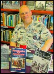
Dr. Joe Knetsch, PhD
The course is designed to facilitate the understanding of the early and current mapping of the State of Florida. Each age has had its differing purposes and various nations have contributed to the mapping of the land of Florida. From the earliest explorers to the current GIS systems, the maps of Florida have shown the changes in the land, the formations exposed or covered and the property lines of all individuals who claim to own the land. Each type of map, coast charts, property plats, etc. have their individual purposes and all need to understand that each map will show or highlight something different depending upon the use for which it is intended. This course will demonstrate that each map has its use and interpretation and it is important to understand these before committing a proper survey of the lands to be depicted.
Dr. Joe Knetsch, PhD received his PhD in history from Florida State University (1990), an MA in history from Florida Atlantic University (1974) and a BS from Western Michigan University with a major in History and Economics. He was the historian for the Florida Department of Environmental Protection (formerly Department of Natural Resources), Division of State Lands, from 1987 to August, 2014. He is the author of fourteen books (mostly on Florida History), over two hundred journal articles, forty book reviews, and over two hundred and twenty papers and presentations on Florida history. Dr. Knetsch is a member of numerous historical societies and associations. He currently resides in Tallahassee, Florida, with his wife of forty-five years, Linda. He also currently works as a consultant for the Town of Redington Beach, the State of Alabama, and other private interests.
Choose one 3-hour seminar for Thursday

Impact of NGS 2022 DATUM & Low Distortion Projections (LDPs) to Mapping & Engineering Projects Course #10810 - 3 CECs
Vasileios "Vas" Kalogirou, RPLS, PLS, PS, PSM, LS
The National Geodetic Survey (NGS) is updating both the HORIZONTAL and VERTICAL DATUMS. The presentation will depict the impact of Surveying/Mapping, GIS and Engineering projects based on the design and configuration of the NEW State Plane Coordinate Systems (SPCSs) and the Low Distortion Projections (LDPs). The learning objectives of this presentation will be to have a better understanding of: The principles of the new NGS 2022 Datum & LDPs, The impact of the new DATUMs to various geographic regions after 2022, managing legacy, small-scale & large-scale projects before and after 2022.
Vasileios "Vas" Kalogirou, RPLS, PLS, PS, PSM, LS started his surveying career in Greece 30+ years ago through his surveying family business and is a third generation Surveyor. While working in the surveying industry he received a 5-year bachelor’s degree in Land Surveying Engineering from the Aristotle University of Thessalonica, Greece in 2001. At the end of the same year he received his license as a Professional Land Surveyor in Greece and then moved to the United Kingdom where he received his master’s degree in GIS in 2003. At the end of 2003 he served in the Greek Artillery where he continued working as a surveyor for various expeditions. Vas moved to Dallas, Texas in 2005 and started working for Halff, which is where he is still employed today as the VP, Survey Practice Leader. Throughout his career, Vas managed several TxDOT & ALTA Surveys, FEMA, USACE, Oil & Gas and Geospatial projects in various parts of Texas and other States. Vas is a Licensed Surveyor in seven (7) States, including the State of Florida. Since 2007 he has been coordinating the RPLS & SIT study groups while serving as the President of the Dallas TSPS Chapter 5 in 2021. Vas is also an adjunct professor teaching the courses of GIS and Geodetic Surveying & Mapping at Dallas County College since 2015 and currently serves as a Surveying Advisory Committee member on behalf of the Texas Board of Professional Engineers and Land Surveyors, but most importantly, he is a devoted family man who really enjoys surveying.
CE 11 The Florida Surveyor Page 47
8:30 am10:10 am

8:30 am10:10 am
8:30 am10:10 am

Saturday - July 27
Boundary Litigation and the Surveyor
Course #10816 – 2 CECs
Knud Hermansen PLS, PE, PhD, Esq.
Many surveyors will be involved in boundary litigation as an expert witness. For those surveyors without experience as an expert witness, boundary litigation can be a stressful experience. Even surveyors with experience may wish to improve their testimony and be more credible and persuasive. This workshop will explain boundary litigation and the surveyor’s role in litigating boundaries.
Knud Hermansen PLS, PE, PhD, Esq. is an attorney, professional engineer, and professional land surveyor. His education includes a Ph.D. in Civil Engineering from the Pennsylvania State University and a J.D. (Doctorate in Law) from West Virginia University. Knud has served as an expert witness, litigator, appellate counsel, arbitrator, mediator, boundary commissioner, member of a board of licensure, and surveying faculty member. Knud is a professor emeritus at the University of Maine. He operates a consulting firm offering surveying, engineering, and legal services. He is an author or coauthor of numerous books and articles.
Filling Available Survey Positions with Technology
Course #10867 – 2 CEC’s
Robert Martin, PS
In this course, I'll show you how advanced technology can boost profits and replace experienced field personnel who have retired or moved on. Finding and training skilled field personnel is increasingly difficult, impacting profitability. Advanced tech offers a solution, enabling efficient operations with a smaller workforce. We'll explore technologies like aerial LIDAR, photogrammetry, terrestrial scanning, and mobile mapping, which streamline workloads and enhance client satisfaction. These tools shift tasks from the field to the office, optimizing efficiency. Join me to discover how integrating advanced tech can overcome workforce challenges and ensure sustained profitability.
Robert Martin, PS Employed by Navigation Electronics since 2006, Robert is a licensed surveyor in Arkansas and Mississippi. Robert works with the surveyors in Alabama and the panhandle of Florida for NEI selling and training on Trimble geospatial products. Robert’s survey career started in 1986 with Mickle & Waggner in Fort Smith, AR. You can find Robert on YouTube under Surveying with Robert with 11,000 subscribers, where he enjoys sharing his experience and knowledge of surveying.
Retracement of the Initial Baseline Survey for Florida (Before GPS)
Course #10818 – 2 CECs
Allen Nobles, PSM
This class will cover the retracement survey of 75 miles of the initial Florida baseline ran in 1824 with a compass and survey chain. This project was done before GPS (1979) so we will cover the use of a Litton inertial guidance system for control; the search for witness trees; proving section corners; doing the solar observations for control traversing; and the data results found.
Allen Nobles, PSM is a licensed surveyor in Florida and Georgia and has previously managed his own company in North Florida for 40 years delivering multidisciplinary professional services in the surveying industry and has an extensive background in hands on surveying, project management and business practices. Mr. Nobles is a Life Member of the Florida Surveying and Mapping Society and has been a speaker at the industry’s leading professional groups and has provided classes on LiDAR, photogrammetry, GPS, and boundary surveying for many professional groups (including the University of Puerto Rico, FAU, the University of Florida and Troy University). He has also provided several articles for the major surveying magazines on a wide range of subjects.
CE 11 May 2024 Page 48
10:30 am -
12:10 pm

10:30 am12:10 pm

10:30 am12:10 pm

Saturday - July 27
Surveying Railroad Corridors with Respect to Property Course #10819 – 2 CECs
Leslie Odom, PSM
This course discusses the historical, best practices and practical problems in determining railroad corridor location s with respect to the land and property rights beneath the tracks. Railroads have played a major role in the settlement and development of these United States of America. The importance of ‘bands of steel’ uniting the country was underscored by the powers granted the railroad companies to acquire land and property rights in whatever way necessary, whether by grant, fee simple absolute, fee with reversionary right, fee determinable, easement or simply by occupation. Surveyors involved with the original location and placement of the railroad faced hostile environment s, extreme weather conditions, low pay, no beds, no showers and few hot meals. Today, our goal is to follow in their footsteps and define, as best we can, the original configuration of the rails and the land parcels associated with the rails.
Leslie Odom, PSM is a Registered Land Surveyor in Texas and Florida and has 28 years of land surveying experience with 12+ years dedicated to surveying the railroad at CSX (retiring 2017) and various other railroad projects since retiring. As the lead in-house surveyor for CSX, his responsibilities included managing surveys in 23 eastern states and 2 Canadian provinces and being an expert witness in several railroad land disputes. Les has surveyed and designed tracks within active rail yards, mainlines, passing sidings and industry tracks. Les is a graduate of the University of West Florida with a B.A. in Mathematics, has taught surveying mathematics at Northlake Community College in Lewisville, Texas and authored mathematic courses specific for survey technicians.
A.I. Unleashed - Surveyor's Dream or Nightmare Course # 10820 – 2 CECs
Dr. Youseff Kaddoura, PhD
This presentation explores the possible advantages and hurdles associated with incorporating A.I. technologies into geospatial analysis and surveying. Attendees will be guided through the changing terrain where surveying and artificial intelligence converge, examining the intricate dynamics of A.I. as both an ally and a potential obstacle in the realm of surveying technologies.
Dr. Youssef O. Kaddoura, PhD currently holds the position of Academic Program Specialist II at the Fort Lauderdale research and Education Center within the University of Florida (UF). His Ph.D. in Geomatics Science from UF forms the basis for his specialized focus on developing a replicable technique for georeferencing oblique tower mounted (PhenoCam) images. In addition to his responsibilities as Chapter Coordinator at FSMS Broward Chapter, Dr. Kaddoura has served as a voting Board Member for ASPRS in the years 2020 and 2023, and he presently serves as ASPRS Florida Region President. Beyond his doctoral degree, he also earned a Master of Science in Computer Engineering, also from the University of Florida. Prior to his tenure at the University of Florida, Dr. Kaddoura gained valuable expertise through employment at Geospatial Consultancy Company, an ESRI affiliate.
An Introduction to Leveraging Remote Sensing and Surveying Practices for Design-Grade Survey Projects Course #10821 2 CECs
Michael Zoltek, LS,CP,CFedS, GISP,PMP/Jeffery Young, PSM, CP, PPS, SP
As remote sensing, surveying, and geospatial technology continue to improve, so do the requirements and workflows for applying these services to engineering design and survey projects. This presentation will provide a background in remote sensing technology and will give insight into how to apply remote sensing technology and methods to projects that have a tight accuracy tolerance. Topics will include the creation of customized flight and drive acquisition plans for aerial and mobile mapping projects, the design of ground control layouts, the feature extraction and compilation process, and the QA/QC of final deliverables. Attendees will leave this class with an understanding of remote sensing workflows and, how they are applied to design projects, and how to assess the accuracy of remotely sensed data.
Mike Zoltek is a land surveyor, photogrammetrist, and GIS professional with over 30 years of geospatial experience. As the National Geospatial Program Director at GPI Geospatial, Inc. (GPI), Mike is responsible for the coordination, execution, and supervisi on of projects for local, state, federal, DOT, and private clients. A licensed surveyor who holds active registrations in 26 states Mike bri ngs to clients a comprehensive background in surveying and mapping, which includes data collection and processing, project management, and QA/ QC coordination. Mike is a current member of Florida’s State Board of Professional Surveyors & Mappers and is a long-standing member of the American Society for Photogrammetry and Remote Sensing (ASPRS). Mike has presented numerous technical seminars at universities and community colleges, as well as at industry conferences, and has served as an expert witness in boundary litigation cases in t he state of Florida.
T. Jeffrey “Jeff” Young has more than 40 years of involvement in the photogrammetry field. Currently a Senior Geospatial Manager with GPI Geospatial Inc., Jeff manages photogrammetry projects for the company out of their Tampa office. Formerly with Pickett and Associates, Inc., Jeff managed the Lakeland based photogrammetry department for 25 years. Jeff was also with BKS Surveys, Ltd . in Northern Ireland and Washington, D.C. He has received extensive photogrammetric training and has vast experience utilizing an alog, analytical, and softcopy photogrammetric instruments. Jeff earned his Photogrammetric Training from Coleraine Technical College in Northern Ireland. He is a Florida licensed Surveyor & Mapper, a licensed Photogrammetric Surveyor with the State of South Carolina, a licensed Surveyor Photogrammetrist with the Commonwealth of Virginia.
CE 11 4 The Florida Surveyor Page 49
1:30 pm3:00 pm

1:30 pm3:00 pm

1:30 pm3:00 pm
Saturday - July 27
Tidal Datums and Property Boundaries Course #10822 — 2 CECs
Dr. Nick DiGruttolo, PSM, PhD/Martin Scott Britt, PSM
This seminar covers the things a surveyor needs to know to establish a boundary line on a tidal water body. We will discuss the forces that influence the tides and the causes of local variations. Tidal datums and how to determine their elevation at a project site will be described. The effects of erosion, accretion, avulsion and sea level rise on tidal boundaries will be shown with case studies and the resources and methods surveyors use to perform tide studies will be compared in detail.
Nick DiGruttolo, PSM, PhD has been surveying since 1988 and spent 15 years working as a field crew chief for Sarasota County before moving to Gainesville to pursue his bachelors in Geomatics. After obtaining the bachelor’s degree, Nick obtained surveying licenses in Florida, Georgia and Mississippi and completed a MSc and PhD, with a concentration in geomatics, while working for Northrop Grumman Advanced Geospatial Intelligence Operating Unit. Nick’s PhD research focused on variations in mean high water in bays and tidal creeks. Nick currently works for Pickett and Associates as a Survey Manager supporting electrical utility projects.
Martin "Scott" Britt, PSM founded MSB Surveying, Inc. in 2000 and is currently the acting President and Surveyor & Mapper. Scott is a second-generation Surveyor & Mapper in the Sarasota, Manatee and Ch arlotte County areas and he has surveyed for over forty years. His expertise and project experience includes historical research and local knowledge, boundary, topographic, hydrographic, mean high water, tidal stu dies, littoral rights, route surveys, construction stake out, subdivision and condominium pl atting, ALTA/ACSM Land Title S urveys, FEMA Elevation Certificates, and expert witness on boundary, tidal water boundaries and littoral lines.
Emerging Technology for Data Collection Course #10823 — 2 CECs
Adam Long, PE, PS
This course will provide examples of the use of emerging technologies for surveying and mapping. This will include current programs using AI technologies for extracting survey data from photos and LiDAR, working with 3D data in visible formats, working with a Calibration Test Facility to test equipment specifications from a surveyor’s point of view, and examples of other emerging technology trends.
Adam Long, PE, PS joined SAM in 2011 as Chief Technology Officer. He has over 30 years of diverse experience in engineering, surveying, and information technology, which he used to create the Applied Technology department at SAM. Adam partners with SAM leaders to provide strategic technology innovation focusing on quality and efficiency for client solutions. His curiosity in technology and physical sciences fosters original ideas and designs that deliver precise results. Adam holds a Bachelor of Science i n Civil Engineering from Ohio State University and is registered as an engineer in Ohio and Texas, as well as a Registered Professional Land Surveyor in Ohio, Indiana, Texas, and West Virginia. He has served as an adjunct profe ssor in the Geospatial Engineering Department at the Austin Community College since 2014, teaching Engineering Design Surveying, Land Surveying, and Intro to Surveying.
The Role of Title in the Government Acquisition Due Diligence Process Course #10824 — 2 CECs
Wendi McAleese
During this presentation, Wendi will discuss the various title products available, how each one supports the due diligence products required by government agencies, including surveys, and how to determine which one best meets the needs of project stakeholders. Wendi will review title issues relevant to the survey and outline changing agency concerns with these issues. She will present recent case studies for these issues and discuss solutions used to move projects forward.
Wendi McAleese is a Florida licensed Title Agent and a Florida licensed Real Estate Agent with 25-plus years of experience with public acquisition projects. Wendi is the President and a principal at American Government Services Corporation, a fullservice title agency which specializes in acquisitions by government agencies at all levels – local, state and federal. She has recently been appointed to the Florida Board of Professional Surveyors and Mappers as one of two Consumer Members.
CE 11 May 2024 Page 50
8:30 am3:30 pm
Saturday - July 27 - All Day Course
Surveying the Infrastructure of GIS Course #10815 — 6 CECs
Moderator: Richard Allen, PSM, CFM (9 speakers)
CAD vs GIS, & Intro to the “Parcel Fabric” Frank Conkling PSM, GISP Successful Project Integration of Survey & GIS Richard Pry ce, RLS, PSM Panel Discussion - Experts and Users on Survey and GIS
A presentation on the differences between CAD and GIS and an introduction to the Parcel Fabric by Frank Conkling, PSM, GISP, and then a presentation of Successful Project Integration of Survey & GIS by Rick Pryce, PSM. Following the presentations will be a panel discussion of the topics presented and what opportunities, misconceptions, and problems that exist for those in both industries with a diverse group of individuals from academia, government, and the private sector.

Richard Allen, PSM, CFM is a Florida Licensed Surveyor & Mapper and Certified Floodplain Manager. He is the City Surveyor at the City of Orlando. He has been in surveying for over 27 years and has been with the City for 18 years. He is the Surveyors in Government Liaison for FSMS, Region V Director for the Florida Floodplain Manager's Association, and a Director for the ASPRS Florida Region. He is the scholarship chair and Valencia College Liaison for the Central Florida Chapter of FSMS. He is an Adjunct Professor at Valencia College's Built Environment Program, teaching Surveying and Drafting. He is married to his lovely wife Amanda and has a son named Richie.
Frank J. Conkling, PSM, GISP owns Panda Consulting, an LB-licensed Professional Surveying and Mapping business offering GIS Professional Services since 1998. Frank is a recognized authority on GIS and Surveying and Mapping technology, including mapping various types of ownership interest in land. Frank has been involved in GIS and Parcel Mapping since 1974 and has enjoyed studying and guiding the creation, implementation, and maintenance of some of the country's most effective GIS systems and most accurate land ownership databases. Frank is a licensed Professional Surveyor and Mapper in Florida and a licensed GIS Surveyor in South Carolina. He is a Past President of the Florida Association of Cadastral Mappers, an organization focused on cadastral mapping throughout the state of Florida, and a Member Emeritus of the Florida Board of Professional Surveyors and Mappers, the regulatory Board for all Surveyors and Mappers in the State. Panda Consulting is the first organization in the nation to receive the Esri Parcel Management Specialty Designation.
Richard Pryce, RLS/PSM Vice President Survey & G.I.S. at Craven Thompson & Associates, Inc.; current President-Elect for State FSMS; former Director and President of Broward Chapter FSMS. Rick has been surveying since 1972 and was licensed in 1983. He has performed surveys in 42 counties within Florida and was an early adopter of Geographic Information Systems using ESRI software since 1990. He has successfully integrated and completed multiple Survey, Engineering, and GIS multi-million-dollar projects over the past three decades and has provided numerous presentations and general talks on them to a diverse group of Engineers, Surveyors, and GIS Professionals. His interest, knowledge, and expertise in remote sensing started in 1996 when he worked directly with a remote sensing firm while surveying, to assist in developing a precision agriculture applications. He has expanded his knowledge and expertise to include all forms of LiDAR, (terrestrial, mobile and aerial) since then, and has also included forensic work on disaster sites. He developed multiple ways to QA/QC LiDAR work and check both horizontal and vertical accuracies to improve upon the final product. Most recently he has been using his background with LiDAR and remote sensing to assess properties for Monroe County Land Authorities in determining how much of the property is below the Mean High water line.
Panelists:
Richard Allen, PSM, City of Orlando Surveyor
Frank Conkling, PSM, GISP, Owner Panda Consulting
Richard Pryce, RLS/PSM, VP Survey & GIS at Craven & Thompson
Matthew Kalus, PSM, PE, Chief Engineer, Development Review Services, Orange County
Dr. Bon Dewitt, PSM, PhD, Retired Professor Geomatics at UF
Allen Nobles, PSM, VP. SAM,LLC & Former Owner: Nobles Consulting
Greg Caffee, CCF, Mapper Sr./Cadastral, Orange County Property Appraiser
Howard Ehmke, PSM, GCY, INC
Mike Garcia, PSM, Program Manager II, Seminole County
CE 11 The Florida Surveyor Page 51

69th Annual FSMS Conference
Conference Registration - July 24 – July 27, 2024
Doubletree by Hilton Hotel Orlando at SeaWorld 10100 International Drive Orlando, FL 32821
Packet 1 – Full Registration/Best Value
Member
Licensed Non-Member
Non-licensed
$370
$470
$32 0
(Includes one (1) Welcome Barbecue ticket (Wed.), one (1) Exhibit Hall Breakfast & Lunch ticket (Fri.), one (1) Recognition Banquet ticket (Fri.), six (6) Saturday Seminar CECs)
Member
Member
Packet 2 – Partial Registration
Licensed Non-Member
Non-Licensed
$355
$455
$305
(Includes one (1) Exhibit Hall Lunch ticket (Fri.), one (1) Recognition Banquet ticket (Fri.), six (6) Saturday Seminar CECs)
Packet 3 – Saturday Only
Licensed Non-Member
Non-licensed
$230
$330
$180
(Includes six (6) Saturday Seminar CECs)
Saturday Seminars
July 27
Course options are listed below, please mark the circle next to the course. Choose only ONE course per time segment
8:30 am – 3:3 0pm (All day course)
8:30 am–10:10 am (choose one from this row)
10:30 am – 12:10 pm
(choose one from this row)
6 Hour Course Option
Course name:
Surveying the Infrastructure of GIS CAD vs GIS, & Intro to the “Parcel Fabric” Frank Conkling PSM, GISP Successful Project Integration of Survey & GIS Richard Pryce, RLS, PSM
Panel Discussion - Experts and Users on Survey and GIS - Moderator: Richard Allen, PSM, CFM (9 speakers) (6 CEC – Course #10815)
2 Hour Course Options
Course name:
Boundary Litigation and the Surveyor
(2 CEC – Course #10816 ) Instructor: Knud Hermansen PLS, PE, Ph.D., Esq.
Course name:
Surveying Railroad Corridors with Respect to Property
(2 CEC - Course #10819 ) Instructor: Leslie Odom, PSM
Course name: Filling Available Survey Positions with Technology
(2 CEC - Course #10867) Instructor: Robert Martin, PS
Course name: A.I. Unleashed – Surveyor’s Dream or Nightmare
(2 CEC - Course #10820) Instructor: Dr. Youseff Kaddoura, PhD
1:30 pm – 3:1 0 pm
(choose one from this row)
Course name: Tidal Datums and Property Boundaries
(2 CEC – Course #10822)
Instructors: Dr. Nick Digruttolo, PSM, PhD/Martin Scott Britt, PSM
Course name: Emerging Technology for Data Collection
(2 CEC – Course #10823) Instructor: Adam Long, PE, PS
Course name:
Retracement of the Initial Baseline Survey for Florida (Before GPS)
(2 CEC - Course #10818 ) Instructor: Allen Nobles, PSM
Course name: An Introduction to Leveraging Remote Sensing and Surveying Practices for Design-Grade Survey Projects
(2 CEC – Course #10821) Instructors: Michael Zoltek, LS, CP, CFedS, GISP, PMP / Jeffrey Young, PSM, CP, PPS, SP
Course name: The Role of Title in the Government Land Acquisition Due Diligence Process
(2 CEC - Course #10824 ) Instructor: Wendi McAleese
Name______________________________ Company PSM#__________
May 2024 Page 52
Additional Seminar Offerings
Wednesday Seminar s (Separate Registration Required)
July 24
8:00 am – 3:00 pm ONLY CHOOSE ONE Seminar I:
Riparian Rights Surveying (6 CEC’s - Course #10807)
Panel Discussion (6 speakers)
Moderator: Richard P. Green, Esq. Seminar II:
A Mock Trial - A Boundary Dispute Case Based in part on the case of Dowdell v. Cotham (6 CEC’s - Course #10808)
Instructor:
Jeffery N. Lucas, JD, PLS, Esq.
SIT Prep Course (Un-Licensed Attendees, No CEC Credit )
July 24
8:00 am – 4:00 pm
Geoscholar's Florida Surveying and Mapping Society Fundamentals of Surveying (FS) Exam/Surveyor in Training (SIT) Certificate Prep Course
You must complete the online course before attending the Seminar. Dr. Lyle will be covering select questions over the required sections to help you with examination preparation. After the Seminar you will have access for 1 year to the online course.
Instructor: Dr. Stacey Lyle, PhD, RPLS, PLS
Thursday Seminars (Separate Registration Required)
July 25
8:00 am – 10:45 am ONLY CHOOSE ONE Seminar I:
The Historical Cartography of Florida (3 CEC’s - Course #10809)
Instructor: Dr. Joe Knetsch, PhD Seminar II:
Impact of NGS 2022 DATUM & Low Distortion Projections (LDPs) to Mapping & Engineering Projects (3 CEC’s - Course #10810)
Instructor: Vasileios "Vas" Kalogirou, RPLS, PLS, PS, PSM, LS
Complete payment information on the following page Cancellation Policy:
30 days prior to conference: 50% refund
Less than 30 days to conference: No refund
69th Annual FSMS Con ference
The Florida Surveyor Page 53

Name: PSM#: FSMS Member: YES NO Phone:
Address: City/State: Zip Code:
Email Address:
PACKET SELECTION
(Will contact for Sat. Seminars. A Complete Conference Registration will be available soon on fsms.org)
Packet 1 ($370 member, $470 licensed non-member, $320 non-licensed) Licensed governmentemployees receivea $100 discounton Packet1
Packet 2 ($355 member, $455 licensed non-member, $305 non-licensed)
Packet 3 ($230 member, $330 licensed non-member, $180 non-licensed)
ADDITIONAL SEMINARS
Only Select One Per Day
SITPrep Course-Wed.(8 hrs.) For Un-Licensed Attendees, 0 CECs
Includes: 1 Welcome BBQ ticket (Wed.), 1 Exhibit Hall Breakfast ticket (Fri.), 1 Exhibit Hall Lunch ticket (Fri.), 1 Recognition Banquet ticket (Fri.), and 6 Saturday Seminar CECs (Continuing Education Credits)
Includes: 1 Exhibit Hall Lunch ticket (Fri.), 1 Recognition Banquet ticket (Fri.), and 6 Saturday Seminar CECs (Continuing Education Credits)
Includes: 6 Saturday Seminar CECs (Continuing Education Credits)
$300 July 24, 8:00 am – 4:00 pm Instructor: Dr. Stacey Lyle, PhD, RPLS, PLS
Wednesday Seminar I (6 hrs.) $220 Riparian Rights Surveying (Panel Discussion) Course #10807 6 CECs July 24, 8:00 am – 3:00 pm Moderator: Richard P. Green, Esq.
Wednesday Seminar II (6 hrs.) $220 A Mock Trial – A Boundary Dispute Case Course #10808 6 CECs July 24, 8:00 am – 3:00 pm Instructor: Jeffery N. Lucas, JD, PLS, Esq.
Thursday Seminar l (3 hrs.) $120 The Historical Cartography of Florida Course #10809 3 CECs July 25, 8:00 am – 10:45 am Instructor: Dr. Joe Knetsch, PhD
Thursday Seminar II (3 hrs.) $120 Impact of NGS 2022 DATUM & Low Distortion Projections (LDPs) to Mapping & Engineering Projects Course #10810 3 CECs July 25, 8:00 am – 10:45 am Instructor: Vasileios "Vas" Kalogirou, RPLS, PLS, PS, PSM, LS
Amount:
69th AnnualFSMS ConferenceRegistration Form
$
$
$
$
$ Amount:
$
$
$
$
$ EVENT TICKETS *Only Pay if Participating Number of Tickets: $ Amount: Golf Match (Wed): $100 per person $ $200 per team (2 players) Players: $ Top Golf (Thur.): $120 per person $ *Casino Night (Thur.): $50 $ FOOD TICKETS (AdditionalorIndividual Tickets) * No cancellations unless replacement found Number of Tickets: $ Amount: Welcome BBQ (Wed.): $55 or $65 (at conference) $ *Legislative Reception (Thur.): $100 $ Exhibit Hall Breakfast (Fri.) $20 or $30 (at conference) $ Exhibit Hall Lunch (Fri.): $50 or $60 (at conference) $ Recognition Banquet (Fri.): $100 or $110 (at conference) $ $25 (kid’s meal 12 or under) $ Requested Vegetarian Meal TOTAL ENCLOSED $ PaymentInformation: CheckEnclosed (Make Payable to FSMS) VISA/MasterCard/AE/Discover Card #: Exp. Date: CVV Number: Billing Address of Credit Card: IF PAYING BY CHECK, MAIL FORM TO: FSMS, P.O. Box 850001-243, Orlando, Florida 32885 IF PAYING BY CREDIT CARD, FAX OR EMAIL FORM TO: 850.877.4852 or director@fsms.org Questions? Call us at 850-942-1900 Cancellation Policy: 30 days prior to conference: 50% refund Less than 30 days to conference: No refund Provider No. CE11 fsms.org May 2024 Page 54

CHAPTER EIGHT
“That Damn Sewer Ditch”: Kissimmee
River Restoration Efforts, 1978-1988
Facing a federal government largely at odds with environmental concerns in the 1980s, Governor D. Robert “Bob” Graham initiated what was essentially an ecosystem restoration plan for South Florida known as “Save Our Everglades.” Developed through discussions with prominent environmentalists, including Marjory Stoneman Douglas, Johnny Jones, and Arthur Marshall, the plan acknowledged the interconnectedness of the Kissimmee-OkeechobeeEverglades ecosystems and outlined ways to restore the water health of the region. An integral part of that plan was dechannelizing the Kissimmee River in accordance with the 1976 state law requiring the restoration of water quality in the Kissimmee River Basin. Efforts in the 1980s to remove C-38 – called “that damn sewer ditch” by some environmentalists1 – were promoted most vigorously by Graham and the South Florida Water Management District. Although the Corps seemingly dragged its feet for most of the 1980s on Kissimmee restoration, either by design or because of a lack of authorization to do much more than study the issue, it received an appropriation from Congress under Section 1135 of the Water Resources Development Act of 1986 to begin restoration efforts. By 1988, then, several significant steps had been taken toward dechannelization, setting a foundation for actual restoration in the 1990s.
In September 1978, Congress, responding to the state of Florida’s initiative, provided appropriations to the Corps for a restudy of the Kissimmee River, and the Corps began its work in 1979. According to a 1980 publication, the pu rpose of the study was “to determine the feasibility” of altering the Kissimmee River flood control system in order to enhance water quality and improve “environmental amenities” and “fish and wildlife resources,” among other things.2 In October 1979, the Corps completed its reconnaissance report (Stage I) and began Stage II of the restudy, which would develop numer ous alternatives that the Corps could take. Thereafter, Phase III would examine the feasibility of those plans and recommend one as the course to follow. Because the Corps had a large amount of data to analyze, it decided to use a data management system known as SAM (Spatial Analysis Methodology) for the study. SAM, which had been developed by the Corps’ Hydrologic Engineering Center in Davis, California, could evaluate all study aspects, including economic, environmental, and hydraulic conditions. The Corps pledged to obtain as much public i nput as possible in its examinations by conducting public meetings and workshops, thereby allowing for comments from a broad constituency. Corps officials estimated that all three phases of the examination could be completed by August 1982, with a draft Stage III report issued by January 1982.3
For those who believed that the 1976 Florida law mandated dechannelization of the Kissimmee River, this timetable was too long. Likewise, Marshall and others felt that there was an urgency to the issue. “The effectiveness of all the elements” of the Marshall Plan, Marshall explained, were “totally dependent on filling the Kissimmee ditch.” In fact, he continued, “dechannelization [was] the answer and the hope for repairing the Everglades system.”4 To
The Florida Surveyor Page 55
pressure the Corps to expedite its study and to champion Kissimmee restoration, new environmental organizations appeared, including the Kissimmee Restoration Coalition and Marshall’s Coalition to Repair the Everglades.5 Meanwhile, the Friends of the Everglades, holding that “the opportunity for the State of Florida to dechannelize the lower Kissimmee will not remain long,” prepared a petition requesting that the state disallow further floodplain development, that it purchase floodplain lands, and that Congress and the President of the United States order the Corps to restore the river.6
As the first years of the 1980s passed, the Corps increasingly fell behind schedule on its feasibility study, frustrating many state officials. Victoria Tschinkel, secretary of the Florida Department of Environmental Regulation, for example, told newspapers that “the Corps was very behind schedule and above budget on its plans to restore the Kissimmee River.”7 She and Governor Graham called on the Corps to accelerate its work, and Jacksonville District Engineer Colonel Alfred Devereaux responded by pledging to have a decision by the end of 1982 as to how restoration could occur.
Many critics claimed that the Corps was merely dragging its feet because it did not want to dechannelize the Kissimmee, an accusation that Devereaux denied. He blamed the delays on SAM, explaining that the program had never been used on such a large study as the Kissimmee River plan, and that, therefore, establishing parameters became a long, drawn-out process. It “took a lot longer to get working than expected,” he said, estimating that the program “probably
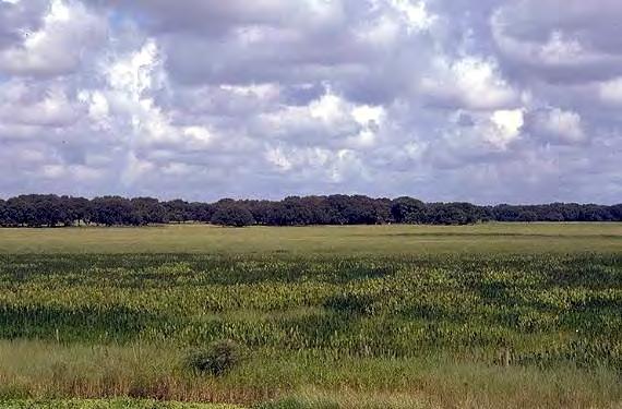
May 2024 Page 56
A broad leaf marsh in the vicinity of the Kissimmee River. (Source: South Florida Water Management District.)
added a couple of years” to the study’s completion time.8 M. Kent Loftin, an engineer in the Jacksonville District agreed, explaining that data compilation and the need to break the river into a grid of three and twelve-acre land cells caused the slowdown.9
But it was also clear that despite the growing power of environmental organizations in the 1970s and the Corps’ own attempts to transform itself into a more environmentally friendly organization, the agency was experiencing some setbacks. For one thing, it was difficult to shift agency culture away from engineering and towards environmental restoration. Corps leaders who actually embraced the transformation, for example, found resistance from old-time engineers who, in the words of historian Jeffrey Stine, declared that “they did not join the Corps of Engineers to come up with non-structural solutions to flood control problems.”10 Environmental organizations had helped to make the Corps more accountable in the 1970s, but, as Kissimmee River restoration efforts in the 1980s demonstrated, a long journey still lay ahead.
Regardless of the reasons for the delay, environmentalists wanted the Corps to act quickly. This feeling was heightened in 1982 when several scientists, including Arthur Marshall, claimed that the channelization of the Kissimmee River had altered the region’s normal rain cycle. Meteorologist Patrick Gannon first proposed this hypothesis in 1977 in a doctoral dissertation titled “On the Influence of Surface Thermal Properties and Clouds on the South Florida Sea Breeze,”11 but the theory was not widely publicized until an article appeared in a March 1982 issue of Sports Illustrated titled “Anatomy of a Man-Made Drought.” This essay, written by Robert H. Boyle and Rose Mary Mechem, cited Marshall’s assertion that drought in the Kissimmee Valley – which had approximated a one-in-700 years event in 1981 – was “a predictable consequence of the land development and the drainage of wetlands in the Everglades and the Kissimmee River basin.” According to the article, Marshall explained that water that flowed from the Kissimmee River Basin to Lake Okeechobee to the Everglades was “the key to the region’s abundant rainfall” because vast amounts of it evaporated quickly in the summer and descended in the form of afternoon rain. Marshall claimed that “almost all the water that had risen from the wetlands would come down again,” replenishing water supplies. With Kissimmee River channelization and other developments, however, not enough water was available for evaporation, meaning that the “rain machine” could not function as in the past. Boyle and Mecham also quoted Gannon as saying that the “entire [weather] cycle has been altered, weakened and shifted,” and “we’re setting up a heat regime rather than a rainy regime in the summer period.”12
After the publication of the Sports Illustrated article, the Florida Water Resources Research Center of the University of Florida sponsored a conference on 14 May 1982 to discuss drought, rain, and their causes in Florida. In the course of this meeting, several scientists raised doubts about Gannon and Marshall’s theory, noting that the 1981 drought affected all of Florida, not just the Kissimmee River Basin, and that more studies were necessary before anyone could definitively say that channelization provoked drought . Garald Parker, a former hydrologist with the U.S. Geological Survey, who had been quoted by Sports Illustrated as supporting Marshall’s position, distanced himself from the rain-machine theory, insisting that claims of channelization’s effects on climate were “not supported by anything more than a superficial look at hydrology. . . . We know there’s a whole lot more work to be done.”13 Gannon himself backed off slightly from his previous position, claiming that his research had focused only on
The Florida Surveyor Page 57
urbanization’s effects on Florida’s coastal areas and that he had no expertise in Kissimmee River matters. However, discounting any human manipulation of nature, Gannon also noted that “if the entire 3,300 square mile basin was once shal low wetlands and is now no longer so,” climate changes “had to have occurred.”14
For the most part, the rainfall debate diminished after this May 1982 conference, but efforts to dechannelize the Kissimmee River did not. Johnny Jones of the Florida Wildlife Federation continued his lobbying efforts for restoration, telling Senator John Vogt, chairman of the state senate’s Natural Resources Committee that the Corps was deliberately delaying its studies. According to Boyle and Mechem’s article, Jones then asked Vogt to propose a bill in the state legislature to use funds under Florida’s Conservation and Recreation Lands Act and the Save Our Rivers Act to “start filling that ditch . . . if the feds don’t get off their butts.” Vogt agreed, concerned that Florida would “become a desert” if “unlimited development and drainage of wetlands” continued.15
Others had similar ideas. In February 1982, Nathaniel Reed, former assistant secretary of the interior for fish, wildlife, and parks, requested that state officials designate the Kissimmee River floodplain as an area of critical state concern under the Florida Environmental Land and Water Management Act of 1972. Likewise, Vince Williams, a fishery biologist with the Florida Game and Fresh Water Fish Commission, advocated the designation of the entire Upper Kissimmee River Basin (Lake Kissimmee northward) as an area of critical state concern, in part because the region suffered from significant fish and wildlife decline due to “deteriorating water quality and unregulated residential encroachment.”16
In the meantime, the SFWMD decided to take matters into its own hands. In May 1982, its governing board approved a plan to install a two-foot-high metal extension on the lift gates of five water control structures separating the Kissimmee River into five pools. In the rainy season, the SFWMD would raise water levels in the pools by two feet, allowing drained marshes to reflood. During the dry season, the SFWMD would reduce each pool’s level by one foot below its normal elevation so that the marshes could dry. In part, the SFWMD wanted to see the effects of such reflooding, but its scientists and engineers also believed that the program could “dramatically enhance fish and wildlife habitat.”17 The district noted that its plan, which it hoped to begin in the fall, would cost only $22,000, and it submitted an application for approval to the Coordinating Council for the Restoration of the Kissimmee River. According to John “Jack” Maloy, executive director of the SFWMD, the plan was “a way in which we can easily and inexpensively almost double the river’s marshlands without jeopardizing flood control objectives.”18
Although Graham and other state officials enthusiastically endorsed the SFWMD’s plan, not all Florida residents were pleased. Kissimmee Valley ranchers appeared before the SFWMD’s board in August and expressed concern with the reflooding. “The plan you are proposing is going to cripple every cattleman on this river-marsh,” said Perry Smith, who owned a farm in Okeechobee County.19 Others agreed; proprietors of McArthur Farms asked for a state administrative hearing because, they claimed, the SFWMD’s plan would unconstitutionally prevent them from using their land. Because of these protests, the governing board voted to stop its reflooding plans until, according to one newspaper account, “staff members have the opportunity to further assess what the impact will be on the lands of ranchers on the river.”20
South
by US
of Engineers May 2024 Page 58
Florida History provided
Army Corps
Agriculturists continued to fight against Kissimmee River restoration in general. “The people we are facing are the environmentalists who want to increase the bird and fish population,” said Mike Palmer, who owned a dairy in the Kissimmee Basin. “They want to help ducks and fish and forsake the land animals who have had 10 years to adapt to habitats created” by channelization.21 Likewise, Paul Wilson, a rancher from Frostproof, insisted that he preferred the straightened river because “it handles the flow of water more efficiently,” while Allen Whitston, director of the Upper Chain of Lakes Property Owners Association, claimed that the state’s Kissimmee plans used too much “scientific theory” and ignored “historical documented fact.”22
Despite ranchers’ concerns, the move to do something on the Kissimmee River accelerated in 1983, a benchmark year in the push for dechannelization. For one thing, as we have already seen, Governor Graham instituted his “Save Our Everglades” program in August, in part from frustration with the lack of progress on the Kissimmee River. Indeed, one of the major components of the first phase of his program was to revitalize the river, and he called on both the state and the federal government to “recognize the problem and correct the wrong done to the Kissimmee and the people of Florida.” Specifically, Graham asked the Coordinating Council on the Restoration of the Kissimmee River Valley to make a firm recommendation as to how “the natural values of the Kissimmee River” could be restored, and he called on President Ronald Reagan to facilitate federal cooperation with the state.23 “The governor is not going to wait forever for a resolution to these problems,” Estus Whitfield, environmental aide to Graham, said. “He wants to start doing something now.”24
Under this pressure, the Coordinating Council asked the Corps, in the words of Colonel Devereaux, to interrupt its feasibility study and “pull together some options” about how
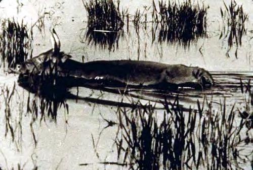
The Florida Surveyor Page 59
Cattle wading through the Kissimmee River. (Source: South Florida Water Management District.)
restoration could proceed. According to Devereaux, the council then would study these choices and “decide where they wanted to go.”25 To fulfill the council’s needs, the Corps presented it with three options: the do-nothing alternative, where the river would be left alone; the partial backfilling alternative, consisting of refilling a large part of the river with dredged spoil material to allow for marshland reformation; and the comb ined wetlands alternative, which would leave the channelized river in place, but would develop pockets of wetlands along the watercourse.26
Before making its final decision, the Coordinating Council held a series of public meetings in August.27 Environmentalists championed the partial backfilling plan, asking the state to move forward with it even if the Corps refused to provide aid, and they disparaged the combined wetlands alternative as “highly structural” and “worse than what’s out there now.”28 Driving these statements was an implicit distrust of the Corps’ focus on structural solutions for water problems. As reported in an article in Oceans, Marshall and others believed that the Corps had “engineered” the state of Florida “nearly to death”; manipulating the system even more through the creation of artificial impoundments was not the answer.29
But ranchers and agriculturists in the Kissimmee River Basin expressed their opposition to backfilling, fearing that it would flood their lands. “We were told we would have flood control and our operation is based on that,” cattle rancher Pat Wilson said. “With restoration, you want to bring that water right back to our fro[n]t door.” Kent Bowen, manager of McArthur Farms, agreed. “We could lose up to 3,000 acres,” he protested, and “that would make our ranching operation economically unviable.”30 At the very least, ranchers called on the state to do nothing until the Corps had completed its feasibility study (now estimated to be finished in the spring of 1984).
The Coordinating Council did not take agriculturists’ advice; instead, on 19 August, it declared that, “after careful consideration” of the Corps’ preliminary findings, it supported the partial backfilling alternative. “As much of the original channel of the Kissimmee River should be restored as possible,” the council stated, and “any alternative which continues the existence and function of the C-38 Canal” should be shelved. The council tempered its decision by saying that it wanted more information about whether or not backfilling would “materially affect existing levels of flood protection in the Upper Kissimmee Basin,” but as long as flood control could continue, backfilling was the preferred option. The council also recommended that the state “assume primacy” in restoration efforts even though many state officials believed that the federal government had a “moral obligation” to participate since a federal project had caused the damage in the first place.31 Unfortunately, “it seems unlikely that the Corps could participate in restoration under the current Administration’s policies and guidelines,” the council explained, “unless there are quantifiable economic benefits.”32
Acting on the council’s recommendations, the SFWMD took the lead in conducting state efforts. One reason for this, according to Stanley Hole, who was elected chairman of the SFWMD’s governing board in 1985, was that Graham had replaced members of the board “who [did] not share his environmental commitment to broad restoration.” This move, Hole continued, effectively “changed the character of the board,” making the SFWMD a “natural resources” district interested in environmental quality. “The most recognizable change,” Hole related, “is that we used to say, ‘Just tell me where you want the water put,’ and then we’d manage it.
South Florida History provided by US Army Corps of Engineers May 2024 Page 60
Now,” Hole concluded, “we have to be concerned with the overall effects of everything we do.”33
The SFWMD was not alone in making such an attitude adjustment. Other flood control districts in the United States, such as the Los Angeles County Flood Control District, also began exhibiting an increased awareness of environmental values in their water management efforts. The Los Angeles County Flood Control District, which had been formed primarily to operate Corps flood control operations on the Los Angeles River, stated as early as 1971 that it wanted “to make our engineers sensitive to possible social and environmental problems of each project.”34 It pledged to consider cultural values, recreation, aesthetics, and the environment in its operations, much like new SFWMD members promised to explore environmental quality measures in South Florida.
But even long-term SFWMD officials, such as Executive Director Jack Maloy, supported the restoration effort. Maloy initially proposed that the district fill in a ten-mile stretch of the river, at a cost of between $400,000 and $700,000, to observe whether positive ecological conditions would return.35 On 9 September 1983, the governing board of the SFWMD met to discuss Maloy’s plans, eventually adopting it as the best method to follow. Graham concurred on 11 September after meeting with Florida’s congressional delegation and with authorities in the Reagan administration. Under Maloy’s plan, the SFWMD would place a weir at the south end of Pool B of C-38, effectively “plugging” the pool, and then refill approximately four to eight miles of the river between S-65A and S-65B. The SFWMD proposed to begin constructing the weir on
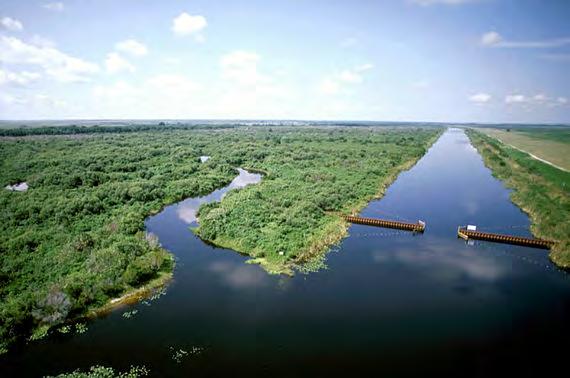
The Florida Surveyor Page 61
Weirs placed in the Kissimmee as part of the Demonstration Project. (Source: South Florida Water Management District.)

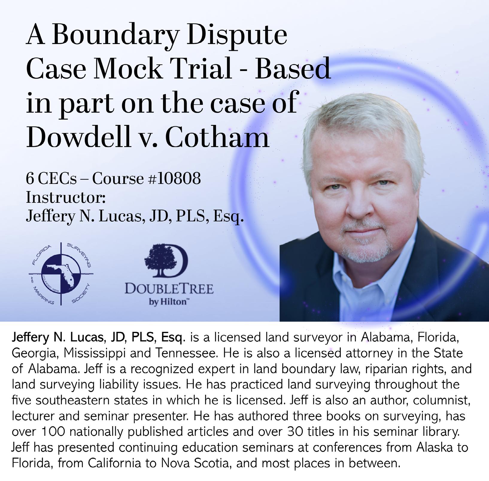
1 January 1984, estimating a completion date of two years for the entire project. After that time, the district would “monitor and evaluate” the “environmental impacts and benefits,” as well as how the reflooding affected area land use and whether it had detrimental consequences on flood control in the region north of Lake Kissimmee.36
Before any construction could begin, the SFWMD had to receive both state and federal permits for the project. After the SFWMD had submitted its applications to the State Department of Environmental Regulation and the Corps, the Latt Maxcy Corporation, a large cattle company in the region, filed a protest, arguing that the Corps had not finished its studies on restoration and that the SFWMD merely wanted to “dump 4,519,898 cubic yards of silty sands” in the river “without knowing the effect, method, and cost.” The corporation also contended that the demonstration project would forestall navigation of the Kissimmee, and that it would “destroy the biota and habitat” that had developed after the Corps straightened the river. Finally, the company argued, its operations “relied on the permanence of the canal” and any restoration efforts would “adversely” affect its land rights.37
It is unclear how much influence the protests of Latt Maxcy and other agriculturists had, but the Corps eventually rejected the SFWMD’s application. According to Colonel Deveraux, the denial occurred for several reasons. First, Corps officials believed that the demonstration project was large enough to require an EIS, something that would take at least a year to produce. Second, Devereaux explained, backfilling any part of the river would alter the navigability and flood control intent of the Corps’ original Kissimmee project, and that could not occur without congressional approval. Most importantly, Devereaux said, the project only “put dirt back in the ditch” and “did not generate any wetlands,” meaning that it did not fulfill “many of the State objectives.”38
Environmentalists, however, saw the action as more evidence that the Corps did not want to dechannelize the Kissimmee. According to Estus Whitfield, environmental aide to Graham, Corps officials were “quite reticent and not too thrilled with the state’s and the South Florida Water Management District’s exuberance to go out and fill in C-38.” One problem, Whitfield stated, was that “some of the [engineers] who designed the Kissimmee channel were still there” and did not want to undo it.39 Whitfield had a point; Devereaux himself characterized advocates for complete restoration as “starry-eyed folks” and claimed both privately and publicly that the combined wetlands alternative was the only feasible option.40
Regardless of the reasons for the permit’s denial, Corps officials, including Deveraux, Assistant Secretary of the Army (Civil Works) William Gianelli, and Director of Civil Works Major General John Wall met with state and SFWMD authorities in January 1984 to develop an alternative plan. In February, the SFWMD proposed a new program. Under this plan, known as Kissimmee River Restoration Phase I, the SFWMD would place three metal sheet pile walls in Pool B in order to divert water into the river’s natural channels. A navigation notch would be placed in the walls so that boats could continue to navigate the river, and the Corps would construct baffle blocks on structures S-65B, C, and D so that it could manipulate the river’s water levels. If the state legislature approved the plan, the SFWMD proposed to begin work on the approximately $1.2 million project in the spring of 1984.41
The Florida Surveyor Page 63
South Florida History provided by US Army Corps of Engineers
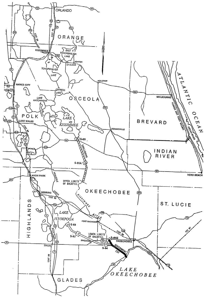
S-65 structures on C-38. (Source: U.S. Army Corps of Engineers, Jacksonville District.)
May 2024 Page 64
Many SFWMD officials saw the new demonstration project as a way to determine “once and for all” whether it was “realistic” to restore the Kissimmee River to its “meandering, natural” state.42 Jan Horvath, director of the SFWMD’s Resource Coordination Department, also thought that the project could demonstrate the best way for the state to manage the floodplain, as well as show how restoration would impact residents along the river. Yet others, including SFWMD Assistant Executive Director John Wodraska, worried that the SFWMD did not have enough information about the demonstration project’s impacts, and he wondered if it would just create another “environmental disaster.”43
Meanwhile, the state took other measures to aid in Kissimmee River restoration. In November 1983, Graham issued an executive order creating the Kissimmee River-Lake Okeechobee-Everglades Coordinating Council to coordinate state and regional endeavors that would “restore and enhance the natural values and functions” of the Kissimmee-OkeechobeeEverglades ecosystem.44 The council, which would basically have charge of Graham’s “Save Our Everglades” program, would consist solely of state officials, including the secretaries of the departments of Environmental Regulation, Community Affairs, and Transportation; the commissioner of the Department of Agriculture and Consumer Services; and the executive directors of the Department of Natural Resources, the SFWMD, and the Game and Fresh Water Fish Commission. Likewise, these same entities concluded a memorandum of agreement on 1 November 1983, pledging to cooperate in dechannelization efforts and delineating specific responsibilities for each agency.45
The Florida Surveyor Page 65
A remnant of the old Kissimmee River before channelization. (Source: South Florida Water Management District.)
One of the duties that the SFWMD assumed was purchasing floodplain lands in the Kissimmee Basin, both to expedite the demonstration project and to prevent further development in the area. In March 1984, the district’s governing board decided to pursue a purchase plan for 40,000 acres in the Kissimmee Basin, even though the state would have to provide at least $40 million for that action. According to board member Nathaniel Reed, price should not be a factor; “no blinking,” he stated, “regardless of the financial crunch.”46 SFWMD officials proposed to fund the effort at least partly through the Water Management Lands Trust Fund, which was created by the state’s Save Our Rivers Act of 1981 to allow the purchase of lands needed to conserve and protect water resources.
Yet an obstacle arose to both the purchasing plan and to the demonstration project. In March 1984, McArthur Farms Inc., Save Our Waterways Association, and Riley Miles (a Kissimmee resident and former SFWMD board member) opposed the SFWMD’s new permit application to the Department of Environmental Regulation, charging, in the words of one newspaper account, that the demonstration project would “cause temporary and longterm pollution of the river” and would “drastically decrease the river’s navigability.”47 Accordingly, the state held hearings on the application. In the course of these hearings, the SFWMD told concerned parties that the project would not adversely affect either navigation or flood control. The district also related the necessity of the demonstration project in order to determine exactly how restoring the river would impact the basin and whether or not changes in flora and fauna would occur. The project’s purpose, the SFWMD reiterated, was to see whether “the historical ecological function of the river” could be restored through “the overall management of water, fish, and wildlife,” in hopes that “further degradation of water quality” could be prevented and wildlife habitat restored.48 The SFWMD’s responses seemed to satisfy both the Corps and the Department of Environmental Regulation, and they issued permits for the Phase I work on 9 July and 29 July 1984.49
But even though the SFWMD took the lead on the demonstration project, many of its officials still had viewpoints that differed from the opinions of other state authorities. In May 1984, for example, Estus Whitfield composed a draft outlining the Kissimmee River restoration program and why it was necessary. John Wodraska, who had become executive director of the SFWMD upon Maloy’s resignation, took issue with some of Whitfield’s statements. Whereas Whitfield claimed that channelization of the Kissimmee caused much ecological destruction, Wodraska held that actual construction work caused some damage, but that the system had “healed” since that time and was now “a stabilized ecosystem.”50 Likewise, Whitfield insisted that channelization was not necessary for flood protection in the Upper Kissimmee Basin (since improving structures in the area could accomplish the same purpose), but Wodraska disagreed, stating that channelization provided “necessary ‘getaway’ for floodwaters from the upper basin.” Finally, Whitfield asserted that a diminishment in the river’s water quality resulted from channelization, while Wodraska claimed that degradation occurred because of “the development of intensive land use practices” rather than from a “reduction in wetlands.”51 Although both Whitfield and Wodraska agreed that some form of action was necessary to enhance ecological values in the Kissimmee Basin, they disputed how degraded the environment was and why that had occurred.
South Florida History provided by US Army Corps of Engineers May 2024 Page 66
Such disconnect in views became more apparent in August 1984 when the Corps finally released its draft feasibility report on Kissimmee River restoration. This document noted that because of state requests, Congress had directed the Corps in 1978 to determine whether modifications to the congressionally authorized Kissimmee River project were “advisable.” In discussing this question, the Corps noted that the construction of C-38 had “reduced flooding and enabled more intense land use,” which some believed had led to “a number of adverse environmental effects.” The Corps contended with claims that channelization had accelerated eutrophication of Lake Okeechobee, stating that the bigger problem was the Taylor CreekNubbin Slough area, which contributed most of the phosphorous to the lake, and the EAA, which supplied most of the nitrogen. “There is little evidence to suggest that water quality has been degraded in the Kissimmee basin as a result of channel modification,” the report declared, “or that C&SF Project works . . . have accelerated the eutrophication of Lake Okeechobee.”52 These, of course, were arguments that the Corps had been making since the mid-1970s.
Aside from its conclusions regarding the condition of the Kissimmee River and its effects on Lake Okeechobee, the Corps discussed different alternatives that it could take to allow for at least a partial restoration of ecological conditions along the Kissimmee River. The six that it found feasible included partially backfilling C-38; constructing controlled wetlands; having agriculturists implement Best Management Practices (BMPs) to decrease the amount of nutrients in runoff; creating impounded wetlands at various points along the river; manipulating pool stages to increase wetlands; and restoring wetland conditions to Paradise Run, an eight-and-ahalf mile stretch of the river in the southern part of the Kissimmee floodplain. However, the Corps had serious reservations about several of these, including the partial backfilling plan. Although environmentalists, state officials, and the SFWMD had all embraced either partial or full backfilling as the best program, the Corps disagreed. For one thing, it believed that backfilling would increase flooding risks in the Lower Kissimmee Basin. The Corps also claimed that partial backfilling could actually reduce the number of wetland acres, in part because not enough water would exist “to attain a natural hydroperiod.” Indeed, the Corps asserted, it would produce only “a semi-natural riverine system.”53
Instead of partial backfilling, the Corps recommended the BMP, Paradise Run, and pool stage manipulation options because they would produce “the greatest benefit at the lowest cost.” Yet the Corps claimed that it could not participate in these programs because “while generally beneficial for environmental concerns,” they would not “contribute to the nation’s economic development.” Moreover, the Corps explained, if the state wanted to initiate the partial backfill plan or Phase II of the Demonstration Project, the Corps would have to obtain congressional authorization since these actions would “significantly alter the flood control and navigation purposes of the Kissimmee River project.” The Corps believed that its report contained useful information that the state could us e in developing its own restoration efforts, but from the Corps’ perspective, “there is no basis for Federal implementation of modifications to the Kissimmee River Basin.”54
Upon examining the draft feasibility report, state officials wondered about some of the Corps’ conclusions. Governor Graham was especially concerned about the Corps’ unfavorable partial backfilling assessment, fearing that it would “impede the State’s restoration efforts,” and he disagreed with the Corps’ recommendation against federal participation.55 In response, the
The Florida Surveyor Page 67
Corps emphasized that it was required by law to recommend the plan that had “the greatest net economic benefit” and that it could find “no basis for Federal implementation of project modifications.” According to the Corps, the Kissimmee River project was “functioning as designed,” and altering it through partial backfilling would reduce “existing and future” economic project benefits, while producing only “limited environmental benefits.” The Corps therefore had no “overriding reason” to suggest implementation of partial backfilling.56 This view did not change; when the Corps issued its final feasibility report in September 1985, its conclusions were largely the same as in the draft report, although, based on comments from state agencies, it did revise upward its estimate of wetlands acreage produced by partial backfilling. Regardless, the report still stated that BMPs, pool stage manipul ation, and restoring wetlands at Paradise Run provided the best economic benefits, and it maintained that no federal action was warranted.57
To many environmentalists and state authorities, this was just another example of the Corps stonewalling the issue because it was not interested in restoring the Kissimmee River. That charge, although technically true, did not take into account all of the nuances of the situation. Some Corps officials, such as Devereaux, were clearly against complete restoration. “The Kissimmee River is a man-changed system now, and it will always be one as far as I can see,” he stated in 1984. “I don’t see any reasonable way that it can ever go back to doing what people refer to as a pure kidney function.”58 Colonel Charles Myers III, who replaced Devereaux as
The floodplain of Pool B of the Demonstration Project. (Source: South Florida Water Management District.)
South Florida History provided by US Army Corps of Engineers May 2024 Page 68
District Engineer, agreed. “There are people in the Kissimmee Valley benefiting from the valley as it now exists,” he said. “There’s no way we can back up to 1900.”59 Whether Devereaux and Myers took this position because they did not want to admit that channelization had been a mistake, or whether they truly believed that it was not possible to return the river to a natural state is unclear. On the one hand, the Corps’ position was technically correct: it could not do anything to alter the original purpose of channelization without authorization from Congress, nor could it recommend a project if economic benefits did not justify it. The main problem, however, was that the Corps did not pursue restoration with enthusiasm, or support the idea in a meaningful way, effectively preventing the issuance of any congressional “authorization.” In the eyes of many environmentalists and state officials, the agency was merely hiding behind its operating regulations to get what it truly wanted – the maintenance of C-38. 60
With the Corps unwilling to participate in any restoration efforts, the state of Florida and environmentalists laid the groundwork for their own endeavors. In August 1984, Governor Graham oversaw the beginning of the SFWMD’s demonstration project by symbolically planting a baby cypress tree on the banks of the Kissimmee River. He declared that the state’s goal in the endeavor was that “by the year 2000, the water system will look and function more as it did in the year 1900 than it does today.”61 Graham also continued to call for federal participation in Kissimmee restoration, and environmental organizations sought to repair the breaches in the Everglades Coalition, banding together again in order to stimulate public involvement in South Florida ecological issues.62
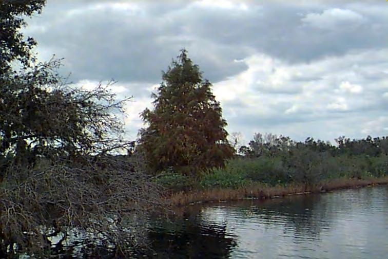
The Florida Surveyor Page 69
The tree planted by Governor Graham by the Kissimmee River. (Source: U.S. Army Corps of Engineers, Jacksonville District.)
At the same time, Graham adopted a seven-point plan for Kissimmee River restoration, beginning with Phase I of the demonstration project. Other steps included restoring wetlands in the Paradise Run area; expanding the Best Management Practice program to include not only Taylor Creek-Nubbin Slough, but also the lower Kissimmee River; developing modeling systems to measure hydraulic and sediment transport effects of restoration endeavors; and acquiring 50,000 total acres of the Kissimmee floodplain.63 As part of this plan, Graham dismantled the Kissimmee-Okeechobee-Everglades Coordinating Council and gave responsibility for all restoration aspects, such as land acquisition, physical modeling, and the development of restoration alternatives, to the SFWMD.64
To help the SFWMD in its endeavors, Graham also established a 34-member Kissimmee River Resource Planning and Management Committee – composed of individuals from local, state, and federal agencies, including the Corps and the SFWMD – to review land and water problems in the Lower Kissimmee and Taylor Creek basins. In August 1984, Graham directed the committee to focus on land use management, land acquisition, water quality protection, and economic development in its examinations; by doing so, he hoped that the state could “guarantee the long-term health of the [Kissimmee] river system.”65
One of the first tasks that the committee undertook was investigating land acquisition. This was important not only for the demonstration proj ect to occur, but also because of continuing agricultural encroachment into the Kissimmee floodplain, hastening drainage of the region. One account reported that between 1958 and 1972 – the era when the Corps was straightening the river – agriculturists drained over half of the unimproved land in the region and planted it to Bahia grass for grazing. Then, in the early 1980s, citrus growers considerably increased their holdings in the Kissimmee area. Because of these endeavors, according to naturalist Ted Levin, “land that once spawned bobcats and sandhill cranes now [grew] cattle and oranges.”66

A
South Florida History
by US Army Corps of Engineers May 2024 Page 70
citrus field. (Source: U.S. Army Corps of Engineers, Jacksonville District.)
provided
To forestall further development, the Resource Planning and Management Committee proposed to develop “a workable land use strategy” to protect the river and allow for its restoration.67 In January 1985, the committee sent to the state seven land management options that it considered viable. These ranged from doing nothing to acquiring land in fee simple to recommending that counties and the city of Okeechobee adopt a comprehensive land management and zoning plan.68 After receiving these suggestions, the SFWMD decided to continue with its goal of purchasing 50,000 acres of the Kissimmee floodplain, and in January 1985, it bought 7,500 acres with funds provided under the Save Our Rivers Act. The district stated that public management of half-mile strips of land on both sides of C-38 would be necessary for restoration to succeed, as well the acquisition of an additional 42,500 acres to protect the entire floodplain. According to Executive Director Wodraska, the purchase was “a giant stride” that would allow the SFWMD to see “if we can coax Nature to reestablish some of her lost beauties into the river’s marshes.”69
But as the end of 1985 approached, it was clear that, unless a change of attitude occurred, the state would have to generate any restoration effort without federal involvement. Colonel Charles T.Myers III, District Engineer of the Jacksonville District, for example, presented the Corps’ final feasibility report to the Board of Engineers for Rivers and Harbors, recommending in person that no federal action be taken. According to Myers, a District Engineer usually did not present negative reports to the Board, but because the Jacksonville District’s decision was “a very controversial” one “that necessitated lots of discussion,” he believed it was necessary.70
After receiving the report, the Board deliberated on the recommendation, while Governor Graham lobbied for federal involvement. “As the State of Florida pursues its goal of restoring the Kissimmee River,” he told the Board, “we will seek federal approval of and participation in this project.” Graham claimed that the channelization of the river had decreased the basin’s original wetlands by “70 to 80 percent,” and that this had led to degradation of water quality and loss of wetland habitat. Therefore, “just as the Corps has been a partner with the State in flood control, water supply, navigation, and other public works projects,” Graham wanted it also to participate “in our new mission of environmental enhancement.” Although the state could pledge “a great many dollars” towards Kissimmee River restoration, it still needed federal help in order to make a final restoration plan viable. Graham asked the Board to overturn the Jacksonville District’s no federal participation recommendation, and he pledged to “work closely with the Corps” to develop “a specific restoration plan.”71 Despite Graham’s efforts, the Board ultimately agreed with the District’s decision, and in July 1987, Chief of Engineers Lieutenant General E. R. Heiberg III transmitted a report to Congress, stating that it was “not advisable” for the Corps to participate in project modifications “in the interest of water quality, flood control, recreation, navigation, loss of fish and wildlife resources, environmental problems, and loss of environmental amenities.” Instead, Heiberg recommended that District Engineer Myers “continue to cooperate with the State of Florida under his existing authorities.”72
In the meantime, Congress had passed the Water Resources Development Act of 1986 (WRDA-86), which authorized approximately $16 billion worth of water projects. Along with mandating cost sharing between local and federal interests on water projects, the law also contained a section significant to the Kissimmee River controversy.73 Riding the wave of environmental concerns with water resource development, Congress included Section 1135 in
The Florida Surveyor Page 71
May 2024 Page 72
WRDA-86, authorizing the Corps to review existing projects and to “determine the need for modifications” in those projects in order to “improv[e] the quality of the environment in the public interest.”74 If the Corps made any modifications, the law directed, non-federal interests would pay 25 percent of the total cost.
Florida officials tried to get the Corps to undertake restoration of the Kissimmee River under the authority granted by Section 1135. In 1987, according to an Everglades status report issued by the governor’s office, Governor Robert “Bob” Martinez, a Republican who had replaced Graham that same year (Graham had won an election bid for the U.S. Senate), informed Acting Assistant Secretary of the Army (Civil Works) John Doyle of “Florida’s strong desire to restore the values of the Kissimmee River.” Martinez asked Doyle to consider the Kissimmee “as it makes plans for implementing Section 1135.”75 Florida’s congressional delegation, which now included Graham, requested the Corps to take the same action, but the politicians were not alone. Indeed, environmentalists, led by the Sierra Club and Theresa Woody, its Fl orida representative, made a push for Kissimmee River authorization under Section 1135. Their position was strengthened when the environmental community agreed that the only project it would request under Section 1135 was Kissimmee River restoration.76 The Jacksonville District, led by Colonel Robert L. Herndon, District Engineer, nominated the project for Section 1135 consideration, but when it went to the Secretary of the Army (Civil Works) for approval, the Reagan administration determined that, according to Herndon, it was an “inappropriate use of federal funds to conduct such an environmental demonstration” and refused to transmit the request to Congress.77 Regardless, Congress included $2 million in its 1988 fiscal year budget for a Corps Kissimmee River demonstration project. Unfortunately, the executive branch’s Office of Management and Budget never allocated funds for that purpose, and Herndon was left
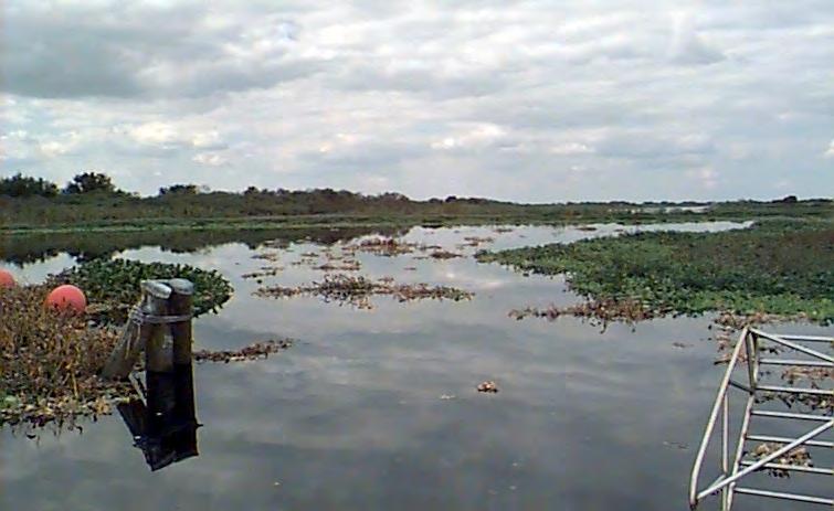
The Florida Surveyor Page 73
Kissimmee River. (Source: South Florida Water Management District.)
to face environmentalist blame. “I would be more than willing to carry out environmental enhancement features of the Kissimmee River,” Herndon related in 1989, but until he received authorization to use money for that purpose, “my hands are rather well-tied.”78
In addition to this setback, some disagreements surfaced between environmentalists and state authorities as to what restoration meant. To people such as Richard Coleman, who spearheaded grassroots efforts supporting dechannelization, it meant “restoring [the Kissimmee] to what it was before, bend-for-bend, acre-for-acre.”79 State officials were not so sure. Louis Toth, who headed up the SFWMD Demonstration Project, defined restoration as “restoring a functioning ecosystem.”80 Stanley Hole, chairman of the SFWMD’s governing board in the mid-1980s, agreed. “We can’t just go in there and fill the [flood canal], no matter how the environmentalists cry for it,” Hole stated. Instead, the SFWMD would try to “restor[e] the values the river offered in its pristine state without sacrificing the navigational and recreational benefits that channelization brought about.”81
Despite these disagreements, the state and environmentalists had achieved some success on the Kissimmee front. Faced with a presidential administration largely uninterested in environmental quality, and with a Corps of Engineer s that was, at best, unable to participate in restoration efforts and, at worst, dragging its feet because it did not want to dechannelize the Kissimmee, Governor Bob Graham and the SFWMD pushed Kissimmee restoration along. Because of the demonstration project (the construction of which the SFWMD had completed by 1986), the state now had a mechanism in place to observe how the environment would react if restoration occurred, and it had fully dedicated state resources to dechannelization. This commitment continued even when the Republican Martinez assumed the governorship from the Democrat Graham. With dechannelization, the state had taken its first steps along the road of ecosystem restoration, and it would move farther down that path in the 1990s.
South Florida History provided by US Army Corps of Engineers May 2024 Page 74
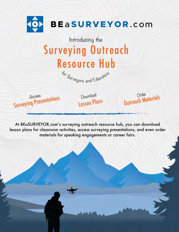
Chapter Eight Endnotes
1 See “The ‘Sewer Ditch’ Undone,” Audubon 89 (March 1987): 114.
2 U.S. Army Corps of Engineers, Jacksonville District, Kissimmee River Study Including Taylor Creek – Nubbin Slough Basins (Jacksonville, Fla.: U.S. Army Corps of Engineers, 1980).
3 Jacksonville District, Kissimmee River Study Including Taylor Creek – Nubbin Slough Basins
4 Arthur R. Marshall, “Repairing the Florida Everglades: A Brief Update to the members of the Coalition to Repair the Everglades,” 2 April 1983, Folder 5, Box 1, Marshall Papers.
5 “Report Backs Kissimmee River Restoration,” The News Tribune, December 13, 1981; Steve Yates, “Marjory Stoneman Douglas and the Glades Crusade,” Audubon 85 (March 1983): 118.
6 “The Problem & The Plan,” For the Future of Florida: Repair the Everglades 2 (1981): 2.
7 As cited in “Kissimmee ‘Disaster’: Graham Asks Corps To Speed Up Repairs,” The Tampa Tribune, 1 March 1982.
8 Colonel Alfred B. Devereaux interview by George E. Buker, 23 April 1984, Jacksonville, Florida, 58-59, transcript in Library, Jacksonville District, U.S. Army Corps of Engineers, Jacksonville, Florida [hereafter referred to as Devereaux interview].
9 “Political Fix For Wetland Woes,” ENR 186 (2 September 1982): 33.
10 Stine, “Environmental Politics and Water Resources Development,” 65.
11 Patrick Thomas Gannon, Sr., “On the Influence of Surface Thermal Properties and Clouds on the South Florida Sea Breeze” (Ph.D. diss., University of Miami, 1977).
12 All quotations in Robert H. Boyle and Rose Mary Mechem, “Anatomy of a Man-Made Drought,” Sports Illustrated 56 (15 March 1982): 46-48.
13 As quoted in Margaret Yansura, Public Information Office, South Florida Water Management District, to Executive Director, Deputy Executive Director, and all Department Directors, n.d., File Kissimmee River, Box 17166, SFWMDAR.
14 As quoted in Ron Mierau, “Trip Report – May 14, 1982, Regional Influence of Drainage on the Hydrologic Cycle in Florida,” 19 May 1982, File Kissimmee River, Box 17166, SFWMDAR.
15 As quoted in Boyle and Mechem, “Anatomy of a Man-Made Drought,” 48.
16 Quotation in Vince Williams, Fishery Biologist, to Mr. Richard Coleman, Polk County Sierra Group, 17 February 1982, Folder 8, Box 3, Marshall Papers; see also Nathaniel P. Reed to Victoria Tschinkel, et al., 2 February 1982, Folder 43, Box 1, ibid.
17 South Florida Water Management District New Release, 24 May 1982, File Kissimmee River Restoration (File #1), Box 17166, SFWMDAR.
18 South Florida Water Management District New Release, 24 May 1982.
19 “Kissimmee Flood Plan Stalled After Protests,” Fort Lauderdale News and Sun-Sentinel, 14 August 1982.
20 “River Raising Halted,” Okeechobee News, 20 August 1982.
21 Quotation in “Ranchers: Kissimmee River Level Fine as Is,” The Palm Beach Post, 5 September 1982; see also “Kissimmee Plans for Restoration Slowed by Corps?” The Palm Beach Post, 4 September 1982.
22 Quotations in “Water-Management Fight Simmers Along Kissimmee,” The Miami Herald, 6 March 1983.
23 Quotation in “Issue Paper: Save Our Everglades,” 9 August 1983, 5, copy in Folder 16, Box 2, Marshall Papers; see also Bob Graham, Governor, to Honorable Ronald Reagan, 8 August 1983, ibid.
South Florida History provided by US Army Corps of Engineers
Chapter Eight Endnotes (continued)
24 As quoted in “Graham Seeking Rescue Blueprint for Everglades,” The Palm Beach Post, 8 April 1983.
25 Quotation in Devereaux interview, 59; see also Buker, The Third E, 85.
26 Coordinating Council on the Restoration of the Kissimmee River Valley and Taylor Creek – Nubbin Slough Basin, “Significant Findings Adopted by Majority Vote on 8/19/83,” File Kissimmee River Restoration History (File #1), Box 17166, SFWMDAR; “Efforts to Restore Kissimmee Called Political,” The Miami Herald, 10 August 1983; Devereaux interview, 59.
27 Coordinating Council on the Restoration of the Kissimmee River Valley and Taylor Creek – Nubbin Slough Basin, “Kissimmee River Restoration: Public Hearing Discussion Paper, Public Meetings, August 1983,” File Kissimmee Valley Planning Area, Box 17166, SFWMDAR.
28 First quotation in “Battle Lines Flank the Kissimmee’s Banks,” The Miami Herald, 8 August 1983; second quotation in David S. Anthony, “Kissimmee River Survey Review: Reasons for Preferring Partial Backfilling Alternative,” Folder 9, Box 3, Marshall Papers.
29 Sue Douglas, “Save the Everglades,” Oceans 18 (March/April 1985): 4.
30 Both quotations in “Angry Ranchers Oppose River Project,” The Palm Beach Post, 11 August 1983; see also “Water, Growth Hinge on Plan,” The Palm Beach Post, 11 August 1983; “Governor Sees the Caged and Free Kissimmee,” The Miami Herald, 11 August 1983; “Troubled Waters: Panel to Consider Fate, Direction of Kissimmee River,” Fort Lauderdale News and Sun-Sentinel, 7 August 1983.
31 Quotations in Coordinating Council on the Restoration of the Kissimmee River Valley and Taylor Creek –Nubbin Slough Basin, “Council Recommendations on Kissimmee River Restoration, Adopted by Unanimous Vote on August 19, 1983,” File Kissimmee River Restoration History (File #1), Box 17166, SFWMDAR; see also “Kissimmee Restoration Gets Boost,” The Miami Herald, 20 August 1983.
32 Coordinating Council on the Restoration of the Kissimmee River Valley, “Kissimmee River Restoration: Public Hearing Discussion Paper.”
33 As quoted in Douglas, “Save the Everglades,” 4. Hole himself came from an interesting background, as he was previously an engineer for the Gulf American Corporation, the promoter of Golden Gate Estates. After leaving the corporation to become chairman of Collier County’s water management advisory board, he continued to serve as a consultant to Gulf American. Carter, The Florida Experience, 241.
34 As quoted in Jared Orsi, Hazardous Metropolis: Flooding and Urban Ecology in Los Angeles (Berkeley: University of California Press, 2004), 130-131.
35 “Graham Applauds Decision on Kissimmee Restoration,” The Miami Herald, 20 August 1983; “Kissimmee Council Decides to Undo Channelization,” The Stuart (Fla.) News, 21 August 1983. Maloy later related that he came back from a Coordinating Council meeting, telephoned the SFWMD’s director of operation and maintenance, and told him, “Bill, I want you to put a weir across the Kissimmee Channel.” When the director expressed some disbelief, Maloy continued, “Let’s see whether or not we can really impact the reestablishment of the oxbows and the way the river actually ran.” See Maloy interview, 5-6.
36 Quotations in “Kissimmee River Demonstration Project,” File Kissimmee River Demonstration Project, 1983 (File #1), Box 17166, SFWMDAR; see also Buker, The Third E, 86.
37 “Comments Submitted to the Department of Environmental Regulation by the Latt Maxcy Corporation,” 31 October 1983, File Kissimmee River Demonstration Project, 1983 (File #1), Box 17166, SFWMDAR.
38 Devereaux interview, 61.
39 Whitfield interview, 20.
40 Devereaux interview, 58, 62.
The Florida Surveyor Page 77
41 Will Abberger and Estus Whitfield, Save Our Everglades: The Kissimmee River (Tallahassee, Fla.: State of Florida, Office of the Governor, Office of Planning Budgeting, Natural Resources, Unit, 1985), 27-28; see also “WMD Seeks Permits for River Restoration,” South Florida Water Management District Bulletin 9 (Winter 1983): 1.
42 Jan Horvath, Director, Resource Coordination Department, to Mr. W. H. Morse, Chairman, Osceola Waterways Committee, Kissimmee/Osceola County Chamber of Commerce, 30 December 1983, File Kissimmee River Demonstration Project (File #1), 1983, Box 17166, SFWMDAR.
43 As quoted in “Saving the Everglades,” The Times-Union and Journal, 8 January 1984.
44 State of Florida, Office of the Governor, Executive Order No. 83-178, 4 November 1983, copy in Abberger and Whitfield, Save Our Everglades: The Kissimmee River, Attachment 12, 100-106.
45 Memorandum of Agreement Between Florida Department of Environmental Regulation and the South Florida Water Management District and the Florida Game and Fresh Water Fish Commission, and the Florida Department of Agriculture and Consumer Services, and the Florida Department of Natural Resources, and the Florida Department of Community Affairs Concerning the Restoration of the Kissimmee River, 1 November 1983, copy in Abberger and Whitfield, Save Our Everglades: The Kissimmee River, Attachment 11, 89-99.
46 Quotations in “District Will Push Restoring of River,” Fort Lauderdale News and Sun-Sentinel, 17 March 1984.
47 “SFWMD May Buy Kissimmee Flood Plain,” Fort Lauderdale News and Sun-Sentinel, 16 March 1984.
48 Fred Schiller, Director, Community Relations Division, to John P. Clark, Public Issue Specialist, Community Relations Division, 28 June 1984, File Kissimmee River Demonstration Project (File #1), 1983, Box 17166, SFWMDAR.
49 Abberger and Whitfield, Save Our Everglades: The Kissimmee River, 28.
50 John R. Wodraska, Executive Director, to Mr. Estus Whitfield, Office of the Governor, 6 February 1985, File Kissimmee Restoration History (File #1), Box 17166, SFWMDAR.
51 Both quotations in Wodraska to Whitfield, 6 February 1985; see also “Draft—May 29, 1984, Kissimmee River Restoration,” File Kissimmee Restoration History (File #1), Box 17166, SFWMDAR.
52 U.S. Army Corps of Engineers, Jacksonville District, Central and Southern Florida, Kissimmee River: Executive Summary (Jacksonville, Fla.: U.S. Army Corps of Engineers, 1984), 2-5, 17 [hereafter referred to as 1984 Executive Summary].
53 1984 Executive Summary, 6-10.
54 All quotations in 1984 Executive Summary, 22-23; see also Stuart Appelbaum interview by Brian Gridley, 22 February 2002, 8, Everglades Interview No. 11, Samuel Proctor Oral History Program, University of Florida, Gainesville, Florida.
55 As cited in untitled memorandum, 4 June 1985, File 1517-08 (Kissimmee River-Lake Okeechobee, FL12222), Jan. 1985-Dec. 1985, Box 25, Accession No. 077-96-0033, RG 77, FRC.
56 Untitled memorandum, 4 June 1985.
57 See U.S. Army Corps of Engineers, Jacksonville District, Central and Southern Florida: Kissimmee River, Florida (Jacksonville, Fla.: U.S. Army Corps of Engineers, 1985), i-ii; Kissimmee River-Lake OkeechobeeEverglades Coordinating Council, “Save Our Everglades: Annual Summary Report,” January 1986, i.
58 Devereaux interview, 67.
59 As quoted in Ronald A. Taylor, “Saving a Fountain of Life,” U.S. News and World Report 100 (24 February 1986): 64.
Chapter Eight Endnotes (continued)
South
of Engineers May 2024 Page 78
Florida History provided by US Army Corps
Chapter Eight Endnotes (continued)
60 See Buker, The Third E, 86-87.
61 As quoted in Natalie Angier, “Now You See It, Now You Don’t,” Time 124 (6 August 1984): 56.
62 See Robert Pierce, “South Florida’s Land Puzzle: Federal, State, and Private Agencies Purchase Protection,” National Parks 59 (July/August 1985): 17.
63 Kissimmee River-Lake Okeechobee-Everglades Coordinating Council, “Save Our Everglades: Annual Summary Report,” January 1986, 7.
64 Attachment to Jon Glogau, Office of the Attorney General, Department of Legal Affairs, to Peter Antonacci, 17 September 1991, File PRO Background, Kissimmee River Restoration, Box 21213, SFWMDAR.
65 Quotations in “Graham Panel to Study Growth Problems in Kissimmee River Region,” State of Florida, Office of the Governor Press Release, 20 August 1984, File Kissimmee River Resource Planning and Management Committee, Box 17166, SFWMDAR; see also Bob Graham, Governor, to Colonel Charles T. Myers III, District Engineer, U.S. Army Corps of Engineers, 14 August 1984, File 1517-08 (Kissimmee River-Lake Okeechobee, Fla.) Study 12222, Box 25, Accession No. 077-96-0033, RG 77, FRC.
66 Ted Levin, Liquid Land: A Journey Through the Florida Everglades (Athens: The University of Georgia Press, 2003), 238-239.
67 “Issue Paper: Kissimmee River Resource Planning and Management Committee,” August 1984, 4, File Kissimmee River Resource Planning and Management Committee, Box 17166, SFWMDAR.
68 “Kissimmee River Resource Planning and Management Committee Land Acquisition Strategy Subcommittee Expanded Options A Through G,” attachment to John P. Clark, Public Issue Specialist, Resource Coordination Department, to Mr. Dwaine T. Raynor, Bureau of State Land Planning, 10 January 1985, untitled file, Box 17166, SFWMDAR.
69 South Florida Water Management District News Release, 23 January 1985, File Kissimmee River, Box 17166, SFWMDAR.
70 Colonel Charles T. Myers III interview by George E. Buker, 30 December 1987, Jacksonville, Florida, 30, transcript in Library, Jacksonville District, U.S. Army Corps of Engineers, Jacksonville, Florida.
71 Bob Graham, Governor, to Colonel John W. Devens, Resident Member, Board of Engineers for Rivers and Harbors, 28 January 1986, File 1517-08 (Kissimmee River-Lake Okeechobee, FL-12222), Jan. 1986-Dec. 1986, Box 25, Accession No. 077-96-0033, RG 77, FRC.
72 Quotations in E. R. Heiberg III, Lieutenant General, USA, Chief of Engineers, to The Secretary of the Army, 6 July 1987, File 10-1-7a (Kissimmee River-Lake Okeechobee, FL) 12222, Box 25, Accession No. 077-96-0033, RG 77, FRC; see also Buker, The Third E, 87.
73 For a thorough discussion of the Water Resources Development Act of 1986 and its significance, see Reuss, Reshaping National Water Politics
74 Act of 17 November 1986 (100 Stat. 4082, 4251).
75 Quotations in “Everglades Status Report,” 12 January 1988, File Everglades, Box 88-02, S1331, Executive Office of the Governor, Brian Ballard, Director of Operations, Subject Files, 1988, FSA; see also Dale Twachtmann, Secretary, Florida Department of Environmental Regulation, to Honorable Robert K. Dawson, Assistant Secretary of the Army (Civil Works), 11 February 1987, File LO Major Programs, Correspondence, Background, LOSAC, Box 18060, SFWMDAR.
76 See Theresa Woody, “Grassroots in Action: The Sierra Club’s Role in the Campaign to Restore the Kissimmee River,” Journal of North American Benthological Society 12, No. 2 (1993): 203; Theresa Woody interview by Theodore Catton, 18 January 2005, Naples, Florida, 1; Theresa Woody, Southeast Associate Field Representative, Sierra Club, to John R. Wodraska, Executive Director, South Florida Water Management District, 5 June 1987, File LO Major Programs, Correspondence, Background, LOSAC, Box 18060, SFWMDAR.
The Florida Surveyor Page 79
South Florida History provided by US Army Corps of Engineers
Chapter Eight Endnotes (continued)
77 Colonel Robert L. Herndon interview by Joseph E. Taylor, 26 May 1989, Jacksonville, Florida, 19, transcript in Library, Jacksonville District, U.S. Army Corps of Engineers, Jacksonville, Florida [hereafter referred to as Herndon interview].
78 Quotation in Herndon interview, 19; see also Buker, The Third E, 87-88.
79 As cited in Glass, “Rebirth of a River,” 13-14.
80 As cited in Glass, “Rebirth of a River,” 13-14.
81 As quoted in Douglas, “Save the Everglades,” 5.

May 2024 Page 80
202 4 S u S taining
A
AA Surface Pro, Inc.
239-471-2668
A. D. Platt & Associates, Inc.
850-329-5551
AIM Engineering & Surveying
239-332-4569
Allen & Company, Inc.
407-654-5355
Allen Engineering
321-783-7443
Altapro Surveyors
386-837-0244
American Government Services Corporation
813-933-3322
American Surveying, Inc.
813-234-0103

Amerritt, Inc.
813-221-5200
Arc Surveying & Mapping, Inc. 904-384-8377
ARCVERTEX LLC
631-480-2201
Ardurra, Inc. 239-292-7773
Associated Land Surveying & Mapping, Inc. 407-869-5002
ATWELL, LLC 866-850-4200
Avirom & Associates, Inc. 561-392-2594
AXIS GeoSpatial, LLC 410-822-1441
B
Barnes, Ferland and Associates, Inc.
407-896-8608
Barraco & Associates, Inc. 239-461-3170
Bartram Trail Surveying, Inc. 904-284-2224
Bello & Bello Land Surveying Corporation 305-251-9606
Bennett-Panfil, Inc. 941-497-1290
Berntsen International 608-443-2772
Betsy Lindsay, Inc. 772-286-5753
BGE, Inc. 561-485-0824
Biscayne Engineering Company, Inc. 305-324-7671
Boatwright Land Surveyors, Inc. 904-241-8550
Bock & Clark Corporation(NV5) 330-665-4821
Bowman Consulting Group 703-454-1000
Bradshaw-Niles & Associates, Inc. 904-829-2591
Brown & Phillips, Inc. 561-615-3988
BSE Consultants, Inc. 321-725-3674
Buchanan & Harper, Inc. 850-763-7427
The Florida Surveyor Page 81
F irm S Directory
C
Calvin, Giordano & Associates, Inc.
954-921-7781
Carnahan, Proctor & Cross, Inc.
407-960-5980
Carter Associates, Inc.
772-562-4191
Caulfield & Wheeler
561-392-1991
Chastain-Skillman, Inc.
863-646-1402
CivilSurv Design Group, Inc.
863-646-4771
Clements
Surveying, Inc.
941-729-6690
Coastal Engineering Associates, Inc.
352-796-9423

Colliers Engineering & Design
732-383-1950
Cousins Surveyors & Associates, Inc.
954-689-7766
CPH Consulting, LLC
407-322-6841
Craven-Thompson & Associates, Inc.
954-739-6400
Culpepper & Terpening, Inc.
772-464-3537
DARIUS
561-427-9514
DeGrove
Surveyors, Inc.
904-722-0400
Dennis J. Leavy & Associates
561-753-0650
Dewberry 407-843-5120
Donald W. McIntosh Associates, Inc.
407-644-4068
Donoghue Construction Layout, LLC. 321-248-7979
Douglass, Leavy & Associates, Inc. 954-344-7994
DRMP, Inc.
833-811-3767
DroneView Technologies 248-321-9417
DSW Surveying & Mapping, PLC. 352-735-3796
Duncan-Parnell, Inc.
800-849-7708
Durden Surveying and Mapping, Inc. 904-853-6822
E
ECHO UES, Inc.
888-778-3246
Eda Consultants, Inc.
352-373-3541
Eiland & Associates, Inc.
904-272-1000
Element Engineering Group, LLC.
813-386-2101
Engenuity Group, Inc.
561-655-1151
Engineering Design & Construction, Inc. 772-462-2455
ER Brownell & Associates, Inc.
305-860-3866
ETM Suryeying & Mapping
904-642-8550
D
May 2024 Page 82
202 4 S u S taining
Exacta Land Surveyors, Inc.
866-735-1916
Ferguson Land Surveyors
727-230-9606
First Choice Surveying, Inc.
407-951-3425
Florida Design Consultants, Inc.
727-849-7588
Florida Engineering & Surveying, LLC.
941-485-3100
FLT Geosystems
954-763-5300
Ford, Armenteros & Fernandez, Inc.
305-477-6472
Fortin, Leavey, Skiles, Inc.
305-653-4493
Frontier Precision Unmanned 701-222-2030
F.R.S. & Associates, Inc. 561-478-7178
GPI Geospatial, Inc. 407-851-7880
Gustin, Cothern & Tucker, Inc. 850-678-5141
GCY, Inc.
772-286-8083
GeoData Consultants, Inc 407-732-6965
Geoline Surveying 386-418-0500
Geo Networking, Inc. 407-549-5075
GeoPoint Surveying, Inc. 813-248-8888
George F. Young
727-822-4317
Germaine Surveying, Inc. 863-385-6856
Haley Ward, Inc. 207-989-4824
Hanson Professional Services, Inc. 217-788-2450
Hanson, Walter & Associates, Inc. 407-847-9433
H.L. Bennett & Associates, Inc. 863-675-8882
Hole Montes, Inc. 239-254-2000
HUB International 850-386-1111
Hyatt Survey Services 941-748-4693 I
Ibarra Land Surveyors
305-262-0400
I.F. Rooks & Associates, LLC. 813-752-2113 K
KCI Technologies 954-776-1616
Keith and Associates, Inc. 954-788-3400
Kendrick Land Surveying, LLC 863-533-4874
KPMFranklin (407) 410-8624
F
G
H
The Florida Surveyor Page 83
F irm S Directory
L
Landmark Engineering & Surveying Corporation
813-621-7841
Land Precision Corporation
727-796-2737
L&S Diversified, LLC.
407-681-3836
Langan Engineering and Environmental Services, Inc.
973-560-4900
Leading Edge Land Services, Inc.
407-351-6730
Leiter Perez & Associates, Inc.
305-652-5133
Lengemann Corp.
800-342-9238
Leo Mills & Associates
941-722-2460
Longitude Surveyors, LLC
305-463-0912
Long Surveying, Inc.
407-330-9717
Lynx Surveyors & Engineering
833-721-2907 M
Manuel G. Vera & Associates, Inc.
305-221-6210
Massey-Richards Surveying & Mapping, LLC. 305-853-0066
Masteller, Moler & Taylor, Inc.
772-564-8050
McKim & Creed, Inc. 919-233-8091
McLaughlin Engineering, Co. 954-763-7611
Metron Surveying and Mapping, LLC. 239-275-8575
Mock Roos & Associates, Inc. 561-683-3113
Moore Bass Consulting, Inc.
850-222-5678
Morris-Depew Associates, Inc. 239-337-3993
Murphy’s Land Surveying 727-347-8740 N Navigation Electronics, Inc. 337-237-1413
NEXGEN ENTERPRISES
561-207-7446 Northwest Surveying, Inc. 813-889-9236
NV5, Inc
954-495-2112
O
On The Mark Surveying, LLC. 321-626-6376
P
PEC Surveying & Mapping
407-542-4967
Pennoni Associates, Inc. 863-594-2007
Perret and Associates, Inc 904-805-0030
Pickett & Associates, Inc. 863-533-9095
Platinum Surveying & Mapping, LLC. 863-904-4699
Polaris Associates, Inc. 727-461-6113
May 2024 Page 84
202 4 S u S taining
Porter
Geographical Positioning & Surveying, Inc.
863-853-1496
Pulice Land Surveyors, Inc. 954-572-1777
Q Grady Minor & Associates, PA
239-947-1144
R
Reece & White Land Surveying, Inc.
305-872-1348
Rhodes & Rhodes Land Surveying, Inc. 239-405-8166
Richard P. Clarson & Associates, Inc. 904-396-2623
Ritzel-Mason, Inc.
786-472-0358
River City Surveying & Mapping, LLC
904-675-9300
R.M. Barrineau & Associates, Inc. 352-622-3133
Robayna and Associates, Inc. 305-823-9316
S
SAM Surveying & Mapping, LLC. 850-385-1179
SCR & Associates NWFL Inc. 850-527-1910
Sergio Redondo & Associates, Inc. 305-378-4443
Sexton Engineering Associates, Inc. 561-792-3122
SGC Engineering, LLC. 407-637-2588
Shah Drotos & Associates, PA 954-943-9433
Sliger & Associates, Inc. 386-761-5385
Southeastern Surveying & Mapping Corp. 407-292-8580
Stephen H. Gibbs Land Surveyors, Inc. 954-923-7666
Stoner Inc. 954-585-0997
Suarez Surveying & Mapping, Inc. 305-596-1799
Survey Data Solutions, LLC 352-816-4084
SurvTech Solutions, Inc. 813-621-4929
T
T2 UES Inc.
407-587-0603
Tectonic Engineering and Surveying Consultants 845-534-5959
Thurman Roddenberry & Associates 850-962-2538
TopoDOT 407-248-0160
TranSystems Corporation Consultants 727-822-4151
Q
The Florida Surveyor Page 85
UF/IFAS
352-846-0850
SOCIAL MEDIA LINKS
LinkedIn = 1,249 Followers
Facebook = 1000 Followers
X = 387 Followers
Instagram = 317 Followers
YouTube

561-790-5515
954-771-7440
U
School of Forest, Fisheries, and Geomatics Sciences
Upham, Inc.
W Wade Surveying, Inc.
Wantman Group, Inc.(WGI)
Design & Engineering, Inc.
Surveying & Mapping, Inc.
386-672-9515
352-753-6511
561-687-2220 WBQ
407-839-4300 Whidden
& Fradley
Winnigham
Woolpert, Inc. 800-414-1045 Z ZNS Engineering, LLC. 941-748-8080
May 2024 Page 86
F irm S Directory

The Florida Surveyor Page 87

May 2024 Page 88
*Only 1 Platinum Exhibitor Allowed. All Other Levels can have Multiple Exhibitors.
PLATINUM EXHIBITOR *
$4,700
• Company Name and Logo on a Banner at the Registration Desk
• Company Bio and Logo in the Conference Program Book
• 1 mon th free full-page ad in The Florida Surveyor (Sustaining Firms will receive an additional month free ad in The Florida Surveyor)
• Recognition in the Conference Edition of The Florida Surveyor
• Homepag e Banner Ad on FSMS.org for 2 months
• Log o with hyperlink to website displayed on FSMS.org
• Complimen tary full page ad in Conference Program Book
• 2 nigh t complimentary hotel stay
• A Packet 1 Registration ( includes 1 BBQ ticket, 1 Exhibitor Breakfast ticket, 1 Exhibitor
Luncheon ticket, 1 Recognition Banquet ticket, & 6 Saturday Seminar CECs )
• 2 Booths with a 5 amp ele ctric power drop (outlet only)
• First priority when choosing booth(s)
• Opportunity t o speak at Welcome BBQ
SOLD
GOLD EXHIBITOR
$3,500
• Company Bio and Logo in the Conference Program Book
• 1 mon th free half-page ad in The Florida Surveyor W: 8.5 in. x H: 5.5 in.
( Sustaining Firms will receive an additional month free ad in The Florida Surveyor)
• Recognition in the Conference Edition of The Florida Surveyor
• Log o with hyperlink to website displayed on FSMS.org
• 1 nigh t complimentary hotel stay
• A Packet 1 Registration ( includes 1 BBQ Ticket, 1 Exhibitor Breakfast ticket, 1 Exhibitor Luncheon Ticket, 1 Recognition Banquet Ticket, & 6 Saturday Seminar CECs )
• 5 amp e lectric power drop (outlet only)
• Se cond priority when choosing booth(s)
• Opportunity t o speak at Welcome BBQ
E xhibitor o pportuniti
E s
The Florida Surveyor Page 89
SILVER EXHIBITOR
$2,000
• Company Bio and Logo in the Conference Program Book
• 1 mon th free half-page ad in The Florida Surveyor W: 8.5 in. x H: 5.5 in.
(Sustaining Firms will receive an additional month free ad in The Florida Surveyor)
• Recognition in the Conference Edition of The Florida Surveyor
• Log o with hyperlink to website displayed on FSMS.org
• Third priority when choosing booth(s)
• 2 Welcome BBQ tickets
CONFERENCE EXHIBITOR
$1,500
• Company Bio and Logo in the Conference Program Book
• 1 mon th free half-page ad in The Florida Surveyor W: 8.5 in. x H: 5.5 in.
(Sustaining Firms will receive an additional month free ad in The Florida Surveyor)
• Recognition in the Conference Edition of The Florida Surveyor
• Last priority when choosing booth(s)
• Log o with hyperlink to website displayed on FSMS.org
ALL EXHIBITORS WILL RECEIVE:
8’ x 10’ draped booth with 10’ backdrop and 36” side rails
7” x 44” sign provided by Request Only!
6’ draped table, 2 chairs and waste basket
4 name tags for booth personnel per booth
2 Exhibitor breakfast tickets per booth
2 Exhibitor lunch tickets per booth
Attendee List
— Additional Booths can be purchased for $850 per Booth —
May 2024 Page 90
E xhibitor o pportuniti E s
SponS or Ship S o pportunitie S
SPONSORSHIPS INCLUDE:
• Rec ognition in Conference Program Book
• Rec ognition in the Conference Edition of The Florida Surveyor
• Company Logo with Hyperlink to website displayed on FSMS.org
*Conference App Sponsor
$3,500
- Sponsorship of phone app available for all registrants to download
-Company Name & Logo on App
Swag Sponsor
$2,300
- Sponsorship of multiple Key Events throughout Conference
-Conference/Sponsor Swag for All Attendees
Recognition Banquet
$2,700
-Sponsorship of Conference Banquet
-Full-Page Ad in The Florida Surveyor
-Company Name & Logo on Signage
Keys $2,500
-Sponsorship of Room Key Cards given to each Attendee staying at hotel
-Company Name & Logo on Room Key Cards
-Company Name & Logo on Tote Bags Exclusive Geo Sponsor
-Sponsorship of Tote Bags given to Attendees
-Name and Logo on Swag *Conference Tote Bags $2,300
-Company Name & Logo on Lanyards given to All Conference Attendees *Name Badges $2,000
$2,000
-Company Name and Logo on Signage at the General Business Session & Friday Night Banquet
-Full-Page Ad in The Florida Surveyor
-Assists in Conference Expenses *Lanyards $2,000
-Company Name & Logo on Name Badges given to All Conference Attendees Top Golf $2,000
- Sponsorship Assists with Top Golf Expenses
-Full-Page Ad in The Florida Surveyor
-Signage at the Registration Desk
-Assists with Food & Beverage Costs
Welcome BBQ
$2,000
-Sponsorship of our Conference Welcome BBQ (popular networking event)
-4 Complimentary Tickets
-Company Name & Logo on Signage
*Program Book (Back Cover) $1,500
-Company Name & Logo on back cover
Refreshment Breaks $1,700
-Sponsorship of Refreshments available during Seminar Breaks
-Full-Page Ad in The Florida Surveyor
-Company Name & Logo on Signage *Program Book (Front Cover) $1,700
Banquet Door Prizes $1,500
-Sponsorship of Prizes given at Recognition Banquet
-Company Name & Logo on Signage
-Company Name & Logo displayed on front cover
Casino Night $1,500
-Company Name & Logo on Signage
-Recognition in Conf. Program Book
1 Sponsor 1 Sponsor 1 Sponsor 2 Sponsor
ALL
*Room
*Only 1 Sponsorship Available — Call for Availability (850) 942-1900 *Only 1 Sponsorship Available — Call for Availability (850) 942-1900
SOLD SOLD SOLD SOLD SOLD The Florida Surveyor Page 91
SponS or Ship S o pportunitie S
Reception
-Company Name & Logo on Signage Registration Desk & Signs
-Sponsorship for Reception and Guest Speaker
Exhibit Hall Door Prizes $1,200
-Name & Logo on Signage
-Company Recognized during Raffle as Sponsor of Door Prizes
-Sponsorship of Signs at Conference
- Company Name & Logo on Conference Welcome Banner at Registration Desk
Exhibit Hall Luncheon
-Company Name & Logo on Signage
-Sponsorship Assists with Lunch Expenses
-Company Name & Logo on Signage during Welcome BBQ & Cornhole Tournament Golf Tournament
Exhibit Hall Breakfast $1,200
-Company Name & Logo on Signage
-Sponsorship Assists with Breakfast Expenses
-Company Name & Logo on Signage outside of classroom Cornhole Tournament $1,000
-Company Name & Logo on Signage -Assists with Food, Beverage & Prize Costs
Exhibitor Welcome Bags
-Sponsorship of Headlining Education Speakers
-Company Name & Logo on Signage *Program Book (Inside Front Cover)
-Full-Page Ad on inside Front Cover of the Conference Program Book
-Company Name & Logo on Exhibitor Welcome Bags Cash Bar During Exhibit Hall Luncheon $800
-Beer & Soda at 1 Bar in the Exhibit Hall on Friday (Includes 4 Drink Tickets)
-Company Name & Logo on Signage *Program Book (Inside Back Cover) $800
-Full-Page Ad on inside Back Cover of the Conference Program Book
Exhibitors Coffee Break
Exams
-Company Name & Logo on Signage before & during Exam
-Company Name & Logo on Signage at & during GBS
Refreshments Break
-Company Name & Logo on Registration Packets given to All Attendees
-Company Name & Logo on Signage at Afternoon Coffee/Water Break in the Exhibit Hall Registration Packets
-Company Name & Logo on Signage at All Saturday Seminar Refreshment Breaks Sat. Seminar Sponsor $500
-Company Name & Logo on Signage at Seminar of Your Choice Young Surveyors Event
-Sponsorship of Special Activity
Sponsor
-Half-Page Ad in The Florida Surveyor
2 Sponsors 1 Sponsor 1 Sponsor 2 Sponsors 1 Sponsor 1 Sponsor 1 Sponsor 1 Sponsor *Only 1 Sponsorship Available — Call for Availability (850) 942-1900 *Only 1 Sponsorship Available — Call for Availability (850) 942-1900
Legislative
$1,500
$1,500
$1,200
SIT Test Prep $1,200
$1,000
Marquee Speakers $1,000
$1,000
$950
$750
CST
General
$700
Business Session
$500
$500
Sat.
$500
$500
General
$300
SOLD May 2024 Page 92
6 9 th Annual Conference Program Book Advertising
Sponsor/Advertiser Contact Name


full page
$200.00 7.5% sales tax $15.00 TOTAL $215.00 OR
page 5.5” (width)
4.25” (height) $125.00 7.5% sales tax $9.38 TOTAL $134.38
1
5.5” (width) x 8.5” (height)
1/2
x
Address City State Zip Phone Email Ads must be in .pdf, .jpg, or .png format We agree to the terms & conditions in the rate schedule. Print Name Signature Payment Information: Check Enclosed AE/Discover/Mastercard/Visa Card Number Card Expiration Date CCV/Card Identification # Billing Zip Code Signature MAIL CHECK AND FORM TO: Florida Surveying & Mapping Society P.O. Box 850001-243, Orlando, FL 32885-0243 Email: director@fsms.org Program Book Sponsor: 68th Annual Conference FSMS The Florida Surveyor Page 93
6 9 th Annual Conference Flyer Insert Advertising
Create a Unique Advertising Touchpoint with Your Brand's Flyer!
An additional way to showcase your company at our Annual Conference is through our Attendee Registration Packets. Prepare your company’s flyer and ship (200 inserts) to the Administrative Office for arrival by June 15th.
Cost - $100 (choose one)
Or, FSMS can print your flyers on letter size copy paper (8.5” x 11”) with B & W print
Cost - $200 (choose one)


AND
We agree to the terms & conditions in the rate schedule.
Company Contact Name Signature Address City State Zip Method of Payment: Check Credit Card(AE/Discover/MasterCard/Visa) Card # Exp. Date CCV/Card Identification # Billing Zip Code Email
MAIL CHECK
FORM TO: Florida Surveying & Mapping Society P.O. Box 850001-243, Orlando, FL 32885-0243 Email: director@fsms.org
May 2024 Page 94

To All of Our Exhibitors and Sponsors EXHIBITORS
PLATINUM
Duncan-Parnell
Duncan-Parnell is an authorized Trimble dealer for land survey, mapping/GIS, and construction instruments and accessories, and has been the leading provider of survey & mapping solutions in Florida for over 25 years. Our product offerings include GNSS receivers, drones/UAVs solutions, robotic and manual total stations, software for workflow integration, digital and automatic levels, 3D laser scanners, mobile mapping and monitoring solutions, utility locating equipment (GPR), construction lasers, as well as a full range of field supplies and accessories. DuncanParnell is your full field-to-finish provider. Our Geospatial team has decades of industry experience, certified maintenance centers, and experienced trainers on staff. We’re ready to be a trusted partner and assist with your sales, rental, or maintenance needs. Contact us today!

EXHIBITORS
GOLD
Big Sky Aerial Solutions
Big Sky Aerial Solutions is a leading LIDAR and specialized aerial data collection organization with advanced sUAS capabilities. Our focus is on meeting the specific requirements of professional licensed surveyors and engineers through tailored solutions. Collaboration lies at the heart of our approach, where we seamlessly integrate your expertise into our deliverables. Founded on safety, accuracy, and efficiency, Big Sky utilizes cutting-edge technology and specific Federal Aviation Administration operational waivers, including Beyond Visual Line of Sight (BVLOS), as we maintain the utmost due diligence. We can assist surveyors from a simple orthomosaic photo overlay to complex surface development on large, expansive, and heavily vegetated projects.


Caulfield & Wheeler, Inc. (CWI)
Caulfield & Wheeler, Inc. (CWI) was incorporated in October of 1982 in Palm Beach County, Florida. Its principals and employees provide professional Civil Engineering, Planning, Land Surveying, Landscape Architecture, 3D Laser Scanning, and Unmanned Aerial Systems services. CWI has been contracted by many prestigious municipalities, developments, and governmental agencies throughout Florida. CWI's principals have over 200 years of combined experience serving as active project managers, ensuring every project meets our technical quality standards while remaining within the client's budget and schedule.

May 2024 Page 96
EXHIBITORS
SILVER
American Government Services Corporation
American Government Services (AGS) is a full-service title company that specializes in providing real estate services to government agencies. AGS has been providing title and closing services in the State of Florida since 1979. American Government Services is a 100% women-owned business, certified as a DBE/MBE firm with the State of Florida and registered as a real estate broker corporation with the Florida Department of Business and Professional Regulation. AGS hopes to meet and exceed all of your Title service needs.
Atwell, LLC
Atwell, LLC is a national consulting, engineering, and construction services firm with offices throughout the country that deliver a broad range of strategic and creative solutions to clients in three core markets: real estate and land development, power and energy, and oil and gas. Atwell provides comprehensive turnkey services including land and right of way support, engineering, land surveying, environmental compliance and permitting, and project and program management. We are pleased to announce that effective January 2024 the Fort Myers and Port Charlotte offices of Banks Engineering have merged with Atwell, LLC.

The Florida Surveyor Page 97
EXHIBITORS
SILVER
Leica Geosystems
Leica Geosystems – when it has to be right With more than 200 years of history, Leica Geosystems, part of Hexagon, is the trusted supplier of premium sensors, software and services. Delivering value every day to professionals in surveying, construction, infrastructure, mining, mapping and other geospatial content-dependent industries, Leica Geosystems leads the industry with innovative solutions to empower our autonomous future.
Navigation Electronics, Inc. (NEI)
Navigation Electronics, Inc (NEI) is a woman-owned small business, with Barbara Poche serving as President & CEO. NEI is a Trimble Geospatial solution provider in the Southeast and has been in business for 35 years. NEI represents Trimble as its’ premier product line distributor and has been a Trimble distributor since 1990. We are committed to excellent customer service and have a long history of customer satisfaction.


NEI has assembled a team of professionals, each having unsurpassed expertise in various areas of Surveying. NEI currently has three licensed land surveyors on staff, two GIS professionals and three Part 107 pilots on staff. These individuals will ensure that all components of this bid will be addressed to complete satisfaction. NEI’s corporate headquarters, a state-of-the-art facility in Lafayette, LA and has over 100 years of service experience. This facility is complimented by a training center and sales office in Duluth, Georgia. NEI also maintains satellite offices in Florida, Mississippi, Alabama, and Arkansas.
May 2024 Page 98
EXHIBITORS
SILVER
TopoDOT
TopoDOT is a point cloud processing software application offering a comprehensive feature extraction tool suite with the right balance between automation and quality assurance. TopoDOT offers a well-documented process to extract Digital Twin deliverables such as topographies, assets, 3D models, measurements, analyses, and reports meeting the highest quality-controlled standards. Our TopoShare product provides a comprehensive process to organize, store and share your data across operations at the lowest possible cost. TopoDOT LLC is headquartered in Winter Garden, Florida.
STANDARD
CARLSON
Carlson Preferred Solutions is the exclusive Carlson Software Authorized Dealer for the state of Florida. Specializing in Carlson centric GNSS RTK base and rover solutions, total stations, RTK drones, data collection hardware & software, and CAD software to the Land Surveyor, Civil Engineer, and Construction professional.


The Florida Surveyor Page 99
EXHIBITORS
STANDARD
CHC Navigation USA
CHC Navigation is a global leader in navigation, positioning, and mapping solutions for various professional applications. Our offerings include surveying, GNSS technology, 3D data collection, precision agriculture, unmanned navigation, real-time GNSS infrastructure, and more. With a commitment to technology advancement and affordability, we serve geospatial professionals in over 120 countries.
eGPS Solutions


At eGPS Solutions, we are a full-service survey equipment and supplies distributor. At the best prices, we sell top-quality equipment from GeoMax, CHC, DJI, and LiDARUSA to create unique solutions to fit your surveying needs. We also provide comprehensive services to fully support our customers, including supplies, M2M data plans, certified repairs, technical support, and UAV-LiDAR training, all just a phone call away. So look no further than us for all your surveying needs because, at eGPS Solutions, we will not let you fail.
FLT Geosystems
FLT Geosystems (Florida Level & Transit) is a fullline dealer for Leica Geosystems (optical, GPS, HDS scanning, & lasers), Topcon Positioning (optical & lasers), Spectra Precision (optical, data collectors, & lasers), Carlson Software, Septentrio, and many more. Our home office is in Ft. Lauderdale, with a full-service office in Tampa

May 2024 Page 100
EXHIBITORS
GPI Geospatial, Inc.
STANDARD

For fifty years, GPI Geospatial, Inc., a subsidiary of Greenman-Pedersen, Inc., has delivered advanced geospatial services in both public and private sectors throughout the eastern United States. Our comprehensive offering of professional surveying and mapping services caters to engineers, architects, land developers, planners, and a wide range of both public and private markets, such as energy, transportation, and private development. GPI Geospatial provides the most accurate remote sensing and survey data by utilizing specialized aircraft, vehicles, and personnel outfitted with cutting-edge equipment and software. Our unwavering commitment to precision, innovation, and client satisfaction has earned GPI Geospatial an unparalleled reputation, making them the preferred firm of choice for those seeking unrivaled geospatial solutions tailored to their needs. Our team is comprised of dedicated subject matter experts and support staff, many of whom are licensed Land Surveyors, ASPRS Certified Photogrammetrists and Mapping Scientists, GIS Professionals, FAA Licensed Pilots, and Project Management Professionals.
SAM
For over thirty years, SAM has built a reputation as a trusted, knowledgeable, and innovative partner. Our licensed professionals transform petabytes of complex spatial data into intelligent insights in a holistic Managed Geospatial Services™ (MGS™) framework. As North America's premiere MGS™ company, SAM provides practical, precise, and high-fidelity solutions designed to enhance decision-making, mitigate risks, achieve strategic objectives, and drive costs out of our client's business. Our vision is to advance spatial data acquisition, improve analysis capabilities, and develop predictive analytics to redefine and transform how infrastructure assets are developed and managed throughout their lifecycles.
SmartDrone
EXHIBITORS
STANDARD

Founded in 2020 and based in Tyler, Texas, SmartDrone is a leading innovator in the field of unmanned aerial technology. We design, engineer, and manufacture state-of-the-art U.S.-made mapping drones. Our products are designed to redefine industry standards and are equipped with advanced technology to deliver highly accurate data. SmartDrone is not just a drone manufacturer; we are a complete solution provider. With our team of drone specialists stationed across the U.S., we offer comprehensive drone services that cover every phase from data collection and processing to delivery. Our team is dedicated to provide fast, accurate, and cost-efficient services to support the vital work of surveying, construction, engineering, mining, and more.
Surveyors Instrument Services, LLC
Surveyors Instrument Services, LLC is a land surveyor and construction equipment supplier based in Tampa, Florida. We offer repairs, service, rentals, supplies, new and used equipment options for all of your surveying needs. Owner, Stan Denison, has 40+ years or service and expertise in the surveying and construction industry. We provide customers with superior service and a quick turnaround time. Our years of experience, knowledge, and service in the industry has allowed us to be a reputable company for our customers. The list of equipment we sell and service is extensive.

May 2024 Page 102
EXHIBITORS
STANDARD
Timeless Fence System
Timeless Fence System is proud to announce its latest innovative application of Rigid PVC posts, now being used as Survey Marker posts for land surveying. This groundbreaking use of Timeless Fence's products showcases the versatility and durability of Rigid PVC posts, marking a significant advancement in the field of land surveying. Traditionally, land surveyors have relied on various materials for marker posts, but Timeless Fence's Rigid PVC posts offer a modern, efficient, and durable solution. Designed to withstand the elements and the test of time, these posts are becoming an essential tool for surveyors across the nation.

Timeless Witness Posts are manufactured with the highest quality standards, ensuring that they provide reliable and long-lasting markers for land surveying. Their visibility, durability, and resistance to environmental factors make them an ideal choice for this precise field.
The Florida Surveyor Page 103
SPONSORS
Exhibitor Reception Trimble
Room Keys Whidden Surveying & Mapping, Inc.


Conference Tote Bags Langan Young Surveyors Event

Swag Sponsor Pickett

May 2024 Page 104


Lanyards ETM Name Badges GPI Geospatial, Inc. Welcome BBQ Keith Program Book (Front Cover) WGI The Florida Surveyor Page 105
SPONSORS
Casino Night Atwell
CST Exams

Casino Night SAM
Registration Desk & Signs BGE


SIT Test Prep
CFB Clymer Farner Barley
SPONSORS
May 2024 Page 106
SPONSORS
Cornhole Tournament DRMP
Cornhole Tournament Lengemann


Golf Tournament Central FL Chapter
Registration Packets
Young Surveyors Event
Exhibitor Welcome Bags Brown & Phillips

The Florida Surveyor Page 107
SPONSORS
Program Book (Inside Back Cover) LLW

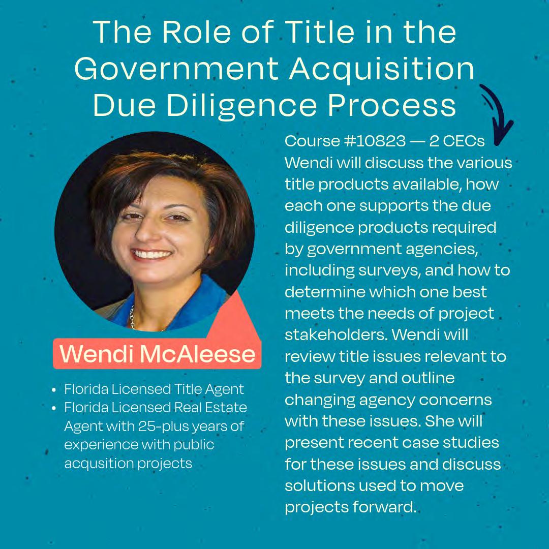

House Floor


The Florida Surveyor Page 109
Hello,
I am Noah Sirmans, Florida PSM #7538. I am the new Forest Land Surveyor for the National Forests in Florida.
I work with all three National Forests in the state out of the Supervisor’s Office in Tallahassee. If there is ever any need for information regarding boundaries, plats, deeds, etc. of the forests in Florida, please do not hesitate to reach out to me by phone (850) 523-8548 or by email at noah.sirmans@usda.gov.
Thank you,
Noah Sirmans, PSM Land Surveyor Forest Service
National Forests in Florida Supervisor's Office


May 2024 Page 110

Four new online tools are now available for the public, providing easier access to NGS data
After extensive testing though our Beta site, NGS is making the following four online tools available to the public as official products off ered on the geodesy.noaa.gov website:
• DSWorld Web - enables users to submit updated information on survey marks available on NGS datasheets.
• Leveling Project Page - simplifies searches for mark and observation information for an entire leveling project.
• Calibration Baselines (CBL) Web Map - provides quick and easy access to the latest CBL information.
• Passive Marks Page - for user-friendly datasheet access, including graphics, maps, and project information.
Example of Leveling Project Page, showing project L18355, a Louisville to LaGrange KY survey from 1960.
The Florida Surveyor Page 111
Calibration Baselines (CBL) Web Map showing available GOOD (Blue) SUSPECT (Yellow) or DISTURBED (Red) calibration stations.
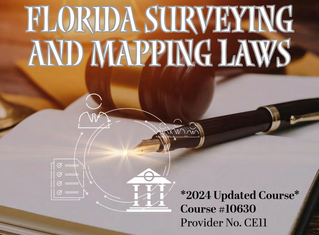
FACES ON THE FRONTIER
FLORIDA SURVEYORS AND DEVELOPERS IN THE 19TH CENTURY
by Dr. Joe Knetsch
CHAPTER 8
SURVEYS AND SURVEYORS OF SOUTHWESTERN FLORIDA
The history of surveying in Florida begins with the creation of the Territory and the establishment of the office of the Surveyor General for Florida. The first such officer was Colonel Robert Butler of Tennessee, the former ward of General Andrew Jackson and the son of Colonel Thomas Butler who died in New Orleans after blowing the whistle on General James Wilkinson's involve ment in the Burr conspiracy. None of the surveys of Florida during the period between the Territorial period, 1821-1845, and the early Statehood era, 1845-1861, covered southwestern Florida. Two U.S. Deputy Surveyors did reach the area prior to the outbreak of the War Between the States. One, John Irwin, left no record of his work other than his field notes, but he did notice the havoc wrought on Tampa by the storm of April 1850, the same storm that damaged the Kennedy-Darling store on Charlotte Harbor. 1 The other surveyor to reach the area, in its eastern extremity, was Ramon Canova of St. Augustine. His surveys of the area show the extreme swampy nature of the land. Canova, who had a large contract, gave up his efforts when he received the news of the outbreak of war. He left the field and joined the Confeder ate cause. 2
1 Letters and Reports to Surveyor General , Volume 2, 1848-56, 97. Land Records and Title Section, Division of State Lands, Florida Department of Environmental Protection, Tallahassee, Florida. Letter of April 11, 1850. Irwin to Benjamin Putnam. Hereafter
The Florida Surveyor Page 113
Letters and Reports , date and corre spondents.
2 Letters and Reports , Volume 3, 1857-61. Page number unreadable on copy. Canova to F. L. Dancy.
Only one other surveyor reached the shores of the Caloosahatchee River and his assignment was the area north of that landmark. John Jackson, a native of Ire land, was surveying the area at the time of the Third Seminole War, 1855-58, and his crew was in constant danger from the Seminoles. However, with luck and the reluctance of the Indians and their allies to attack such crews, knowing them to be lightly armed, if at all, Jackson's crew escaped death. They did, of course, run into Indians and had to avoid direct contact. One of the crew, the Negro camp man, was stopped by the Indians and asked where his master was. Scared, but still with some wits about him, he pointed in the wrong direction and spurred his wagon on to the banks of Fisheating Creek where the crew found him the next day sobbing, scared and in extreme mental anguish. Jackson, who was an excellent surveyor and an honorable man, drafted a sketch of the area that remains one of the most accurate projections of the area at that time. 3
3Joe Knetsch, “A Surveyor's Life: John Jackson in South Florida,” Sunland Tribune , Tampa His torical Society, Tampa, Florida, 1992. In this article the author has published a complete life of Jack son showing the importance of his work, including the laying out of the streets of modern Tampa. serving as its mayor and being the proprietor of a notable store, where many shopped for their dry goods in Tampa's pioneer days.
With the close of the Civil War, the task of settling the wilderness of south western Florida began in earnest. The office of Surveyor General was reestablished under the direction of Marcellus Stearns, a one-armed Union Army Officer who later became a governor of Florida. Stearns, and his brother Timothy, who surveyed in southwestern Florida after his brother left the position of Surveyor General, was born in Center Lovell, Maine, the son of a distinguished family of Revolutionary War fame. His education included a stint at Waterville Academy and then at Waterville College, now Colby College. Here he was described as, “one of those frank, cordial, genial, open-hearted, whole-souled fellows whom everybody likes to meet—a man of integrity always ready for honest work.” Yet in early 1861 his future, along with that of many young men of the day, lay with the fortunes of war. He
May 2024 Page 114
Faces on the Frontier
joined the 12th Maine, Company E, as a private. Partici pation in several skirmishes resulted in his promotion to the rank of lieutenant and further action in and around Port Hudson, Department of the Gulf. He later was transferred to the Army of the Potomac, where, at the Battle of Winchester, he bravely raised the spirit of his troops when all of the superior officers had been killed or wounded. In the charge of his unit under his direct command, he was severely wounded and lost his right arm. Two things came from this injury, a decision to enter the study of law under Judge Josiah Drummund in Portland, Maine, and an appointment to the newly created Bureau of Refugees, Freedmen and Abandoned Claims. This latter appointment brought him to Quincy, Florida, in 1866. Stearns became very active in Republican politics and was rewarded with an appointment to the office of Surveyor General, which he held until 1872. He brought with him his brother, Timothy and other members of his family, all of whom eventually served in the Surveyor General's office in one capacity or another.
The men surrounding Stearns were all staunch Republicans, especially Horatio Jenkins, Jr. and J. W. Childs, both of whom received surveying contracts under Stearns. Samuel Hamblin, a neighbor of Stearns in Quincy and a strong local sup porter of the Surveyor General, also received a contract. Another officer in the Freedman's Bureau, William Lee Apthorp, received a contract and, later, so did his younger brother, John Apthorp. Although one surveyor, Josiah Stearns, received a contract and the Surveyor General was warned not to hire direct relatives, it was suspected that although Marcellus claimed no relationship, there may have been more than just a coincidence in name, particularly since both lived in Quincy. Yet, it should be noted here, not all of these political appointees were bad surveyors. Indeed, Hamblin, Childs, Apthorp, the two Stearnses and James Tan nehill proved to be very competent surveyors. The one true failure as a surveyor, Horatio Jenkins, normally signed his contracts in partnership with Marcellus Williams, an experienced Deputy Surveyor with close contacts with David Levy Yulee, Samuel Swann and Hugh Corley. As Reconstruction was a time of active political campaigns, it is not surprising to see most of the Deputy Surveyors so blatantly political in their private lives. 4
4Joe Knetsch, “Marcellus L. Stearns’ Report on South Florida: 1872,” Florida Surveyor , 1999, 22-26. I briefly cover most of the surveyors mentioned in this report in the article.
The Florida Surveyor Page 115
For the career of Marcellus Williams, see, Joe Knetsch, “A Well Connected Man: The Career of Marcellus A. Williams,” Broward Legacy , Summer/Fall 1993. For the career of John Apthorp, see Joe Knetsch, “Sur eying the Southern Tip: Impracticable Swamp, Salt Marsh and Murder,” Florida Surveyor , November 1992.
The man who laid out the exterior lines of many townships in southwestern Florida, including the area of modern Bonita Springs, was the well-known cartog rapher, William Lee Apthorp. William was born on December 31, 1837, in Lee County, Iowa, the son of a Congregational preacher. His early education was begun near home and he advanced rapidly to the Denmark Academy and the “preparatory department” at Iowa College, the forerunner to the University of Iowa. In 1856, he enrolled in Amherst College and graduated in 1859, taking a short-termed teaching position in Albany, New York. He was teaching music in Kingston, New York, when the War Between the States commenced. He immediately joined E Company of the 90th New York Infantry. His enlistment ran until 1863, when he mustered into the newly formed B Company of the Second South Caro lina Infantry, a “Colored Unit.” This unit took part in the “Third Annual Invasion of Jacksonville” and was there when the town was burned, although Apthorp maintained it was not the colored troops that caused the conflagration. He spent most of the remainder of the war in recruiting activities in South Carolina and engaged in some local scouting against the enemy. His military career carried with it a promotion to lieutenant colonel in February 1865 and further service at Jacksonville, where he was mustered out of the service in 1866. He was a close personal friend of the Hawks family and sometimes accompanied Esther Hill Hawks on her travels in and around the Jacksonville area. Like the founders of Port Orange, Apthorp was a strong abolitionist, as was his wife, Charlotte Childs Apthorp. Both were fast friends with the Beechers. 5
5See the introduction to the Diary and other papers of William Lee Apthorp, Museum of South Florida History, Miami, Florida. For the Apthorp’s relationship to the Hawks and Beechers, see Gerald Schwartz, Editor, A Woman Doctor’s Civil War: Esther Hill Hawks’ Diary (Columbia: Uni versity of South Carolina Press, 1984), 175, 189, 238. Dr. Hawks served as a surgeon to the 2nd South Carolina while they were stationed in Beaufort, South Carolina. She was a leading advocate of education for African-Americans and founded many temporary schools in Florida during her ser vice here. Colonel T. W. Osborne, another of the Reconstruction politicians and Freedman's Bureau personnel,
May 2024 Page 116
Dr.
Joe Knetsch
was also a frequent companion of the Hawks and Apthorps.
Apthorp's service in the Freedman's Bureau led him to Quincy where he may have met Marcellus Stearns. By 1868, he had moved south to Hillsborough County where he accepted a county Judgeship and an assistant postmaster’s posi tion. These political plums undoubtedly helped to pay the bills in the frontier environment of Tampa. Returning to northern Florida, Apthorp signed a contract for the surveying of the area south of the Caloosahatchee River on December 23, 1871. The instructions given to him in this contract indicated the unknown nature of the area to be surveyed, even at this late date:
Survey, measure and mark a Standard Meridian Line beginning at the intersection of some Range Line with the Caloosahatchee River, and running South as far as practicable, the location of this line to be deter mined by the Deputy according to the nature of the Country, so as to give the longest and least obstructed line. Also a correction Parallel, beginning at the point on the Meridian marked for the South boundary of Township 46 South, and running East and West as far as practicable, Provided that the location of this line may be changed one township north or south, should the nature of the country require it. Said Meridian and Correction Lines amounting by estimation to one hundred and twenty miles. Also the Exterior lines of Townships, proceeding in regu lar order East and West from the Meridian Line as far as practicable, and southward from the Caloosahatchee River, until they shall amount to five hundred and sixty three miles. Provided that if the actual num ber of miles of the Meridian and Correction Lines should fall short of the estimate, the deficiency may be made up by addition to the Town ship lines. 6
6Contracts and Bonds: U.S. Deputy Surveyors. “Wm. L. Apthorp: U.S. Deputy Surveyor,” Land Records and Title Section, Division of State Lands, Florida Department of Environmental Protection, Tallahassee, Florida.
These directions left much to the deputy to decide in the field. They also indicated that, in spite of the fact that the area was heavily mapped by the United States Army during the Third Seminole War, the land was still
The Florida Surveyor Page 117
Frontier
Faces on the
virtually unknown. Surveyor General Stearns must have had a great deal of faith in Apthorp 's ability to place such responsibility in his hands.
In late 1872 when Myron H. Clay received a contract to survey the area, he was directed to run the section lines—mark the subdivisions—within the exterior lines run by Apthorp and to run the meanders of the fractional sections. Clay was also ordered to run, “such of the exterior lines as may be unsurveyed or obliterated, of the following townships.” 7 This procedure was a bit unusual because the general policy was stated in no uncertain terms shortly thereafter, not to let a surveyor run the exterior lines of townships he was assigned to subdivide into sections. The reason for this prohibition was simple, the corners established on the exterior lines were to be connected by the interior section lines and this served as a check on the lines run by the person assigned the exterior lines. To allow the same person run the subdivision would potentially lead to false returns of surveys with no field checks. Apthorp, according to a letter dated October 1, 1873, may have made an error in the statement of his survey. This letter noted a discrepancy between Clay and Apthorp of about thirty chains or 1980 feet in setting the first mile post south of the river. According to Apthorp it was, “probable that the error arose either from a mistake in putting down the distance, or more probably from an accidental mark or defacement of the original 10 making it look like 40.” This error, Surveyor General G. W. Gilbert noted, would carry on to all surveys which joined the river or the old survey itself. 8 It is interesting to note that one of the clerks in the office of the Surveyor General was Anna W. Apthorp, the other clerk was Timo thy S. Stearns. If this error had not been brought to the attention of the Surveyor General, many more mistakes and errors would have caused even more confusion than those attributed to the deputy surveyors today.
7Contracts and Bonds: U. S. Deputy Surveyors. “M. H. Clay: Deputy Surveyor,” Land Records and Title Section, Division of State Lands, Florida Department of Environmental Protection, Talla hassee, Florida.
8Letters of Surveyor General, Volume 11, 1869-81. 335-36. Land Records and Title Section, Division of State Lands, Florida Department of Environmental Protection, Tallahassee, Florida.
William Lee Apthorp continued to work in the office of the Surveyor General until he left for the North in 1877 for health reasons. He did have
May 2024 Page 118
Dr. Joe Knetsch
one additional surveying contract, that of the Daniel Hurlburt Grant in 1874. He also served as chief clerk in the office until his resignation in 1877. In the prior year, he had brought to the attention of the Board of Trustees of the Internal Improvement Fund the poor condition of the township plats in the office of the Commissioner of Lands and Immigration. Apthorp was given a contract to make as many new maps as possible, not to exceed one thousand for $2.50 each. 9 It was this contract that led to the creation of the famous Apthorp Map of Florida in 1877. The basis of the map was to replace the worn, torn maps in the office of the Commissioner of Lands and Immigration. Unfortunately, William Lee Apthorp did not live long after the completion of the project that has given him lasting fame. He died on January 24, 1879, in Springfield, New Jersey. 10
9 Minutes of the Board of Trustees of the Internal improvement Fund of the State of Florida , Volume II (Tallahassee: J. H. Hilson, 1904), 141.
10“Introduction to the Diary of William Lee Apthorp.”
Myron H. Clay was known to the members of the Stearns family and he arrived in Florida about the time they controlled the office of Surveyor General. He was hired as a draughtsman in the office and served there until his resignation on November 26, 1872. 11 He received his contract on January 6, 1873, to survey the lands in southwestern Florida, and soon left for the field. His familiarity with that system of surveying rendered no special instructions necessary for this veteran. When he returned to Tallahassee, he was not a well man. Within a few weeks of filing his reports and revising his notes, he died. The discrepancy he found in that Apthorp lines was duly reported, but there was no way to discuss the matter further. 12 What he put on the ground had to be accepted as correct and unchangeable. As Surveyor General Gilbert noted, “Mr. Clay’s health, never very robust, gave way to the exposure and hardship of his tour.” Like Sam Reid and others before and after him, Myron Clay gave his life for the profession he loved so much.
11Miscellaneous Letters to Surveyor General, Volume 4, 1869-74. 177. Land Records and Title Section, Division of State Lands, Florida Department of Environmental Protection, Tallahassee Florida.
12 Letters of Surveyor General , Volume 11, 1869-81. 335-36.
The Florida Surveyor Page 119
Faces on the Frontier
Dr. Joe Knetsch
Probably no surveyor has caused as much trouble with flawed surveying than Horatio Jenkins Jr. Jenkins was neither a fool nor an uneducated bumpkin. Born on March 23, 1837, in Boston, Massachusetts, he was educated in the better schools of the area and later attended Yale University. He also attended Harvard Law School in nearby Cambridge. At that time it was not necessary to graduate from the school to enter the practice of law and prior to the War Between the States, Jenkins practiced law. A striking man with neat mustache and goatee and blondish hair, he entered the service shortly after the war began, as a private in the 4th Massachusetts Militia He was soon elected lieutenant colonel of the 40th Massachusetts Infantry, transfering to the 4th Massachusetts Cavalry as a full colonel. He saw a great deal of action with these units during the Virginia campaigns. For his gallant and efficient service, he was given the rank of brevet brig adier general on March 13, 1865. 13 In 1866, he, along with many others, migrated to Florida to improve their fortunes. Jenkins bought land in Alachua County and settled down as a gentleman cotton grower. Settling down to a “normal” life was not in the cards for this ambitious man. The call of politics was too strong and he entered the Reconstruction milieu with gusto.
13Roger D. Hunt and Jack R. Brown, Brevet Brigadier Generals in Blue (Gaithersburg: Olde Sol dier Books, Inc., 1990), 314. The author would like to thank Dr. David J. Coles for leading him to this source.
Jenkins became involved in the moderate version of Reconstruction in Florida. In this he opposed the policies of the radical faction led by Jonathan C. Gibbs, Charles H. Pearce and Liberty Billings. Jenkins was a leader in the fight for a new constitution and was elected president of the second convention. After proposing a compromise that General George G. Meade was willing to accept on behalf of the government, Jenkins was elected president of the convention that drafted the Constitution of 1868. During this time, he was also elected state senator from Alachua County but had to fight for his seat when his occupancy was challenged during the first seating of the new government under this constitution. Once seated, he led the fight to impeach Governor Harrison Reed, whom Jenkins believed was too radical and corrupt. Twice during this turbulent period Jenkins introduced bills to impeach the governor and actually during the second attempt admitted when pressed that he had no serious charges to make. Both bills failed. In these attempts
May 2024 Page 120
to unseat Reed, Marcellus Stearns supported him. Jenkins also had an ally in Congress, the powerful Radical General Benjamin Butler, who had probably known Jenkins in Massachusetts and during the war. Jenkins used a circular from this influential leader throughout Florida in getting the constitution of 1868 adopted. Despite his leadership of the moderate faction, Senator Simon Conover and Congressman Josiah Walls, who opposed him and his Jacksonville ally attorney, Horatio Bisbee, removed Jenkins from his federal patronage job as collector of customs. At this time, 1873, Jenkins became interested in surveying as a politically appointed job. He was not to be disappointed.14
14For information on his activities during Reconstruction, the best source remains Jerrell H. Shofner, Nor Is it Over Yet: Florida in the Era of Reconstruction, 1863-1877 (Gainesville: Univer sity Presses of Florida, 1974). I have not gone into great detail about Jenkins’ rise and fall or his var ious alliances during this turbulent era. Jenkins is probably worthy of a biography for his role in Florida during this troubled time.
Jenkins began his surveying career aligned, as noted above, with the experi enced Marcellus Williams of Fernandina. Williams, whose political ties were as equally impressive as Jenkins’, had begun his own career as a surveyor in the late 1840s under the guidance of Arthur M. Randolph and other experienced surveyors. Williams, along with Charles Hopkins of Jacksonville, was one of the few men to return to the field as a surveyor following the war. The first contract called for the Williams-Jenkins team to survey along the eastern coast of Florida and across the Everglades to the west coast. This task, difficult in favorable times, proved to be impossible because of the low water in the Everglades during the dry surveying season. The pair swung around the peninsula of Florida and attempted to join their lines from the east, but in this they failed, because the weather had not cooperated. In the early part of 1875, Jenkins, on behalf of the team, applied for an extension of time to complete the surveying in southwestern Florida. With the approval of Surveyor General Leroy Ball, the surveys of the islands of Charlotte Harbor were completed, along with the extension of the Meridian line between Ranges 25 and 26. The base parallel connecting Townships 50 and 51 was not run because of the lateness of the season. However they did find sufficient water to float their canoes and finish the exterior lines and subdivision of Townships 48 and 49, Ranges 32, 33, and 34 South and East. They also surveyed Township 49 South, Range 25 East. This, again, was against the normal policy of not allowing the same surveyors to subdivide
The Florida Surveyor Page 121
Frontier
Faces on the
sections of Townships where they had surveyed the exterior lines. On July 23, 1875, Jenkins informed Ball that the team had sur veyed one other township, Township 50 South, Range 25 East. All of the other townships south of this were too wet, part of the mangroves surrounding the Thousand Islands and very difficult to survey. 15
15Miscellaneous Letters to Surveyor General, Volume 5, 1875-77, 18, 20, 30, and 34. Land Records and Title Section, Division of State Lands, Florida Department of Environmental Protec tion, Tallahassee, Florida.
Jenkins’ survey of the islands of Charlotte Harbor under this contract left much to be desired. Contrary to the specific instructions in the Manual of Surveying and common practice, Jenkins adopted a different method in running the mean ders around the mangroves found on Sanibel, Captiva and Gasparilla Islands. According to a letter written by Captain Sam Ellis, John Jenkins Jr. of Tallahassee, a member of his uncle's crew on this occasion, told him that Horatio Jenkins used a new measuring device, three feet to the oar stroke, to calculate the distance around the islands. The younger Jenkins even knew that one island was more than a mile off on the recorded maps of the area. 16 Additionally, it is unlikely that Jen kins ever set any monuments on the ground on these islands since few have been found and confirmed as his and simply protracted his lines across these land forms. The corners were set theoretically, but not actually. This failure later caused a number of problems for surveyors that followed him in the area, particu larly Albert W. Gilchrist, later governor of Florida. 17
16Miscellaneous Letters to Surveyor General, Volume 22, 25. Letter of August 2, 1898. Sam Ellis to Richard Scarlett, Surveyor General of Florida. Land Records and Title Section.
17For the career of Albert W. Gilchrist, see Joe Knetsch, “Impossibilities Not Required: The Surveying Career of Albert W. Gilchrist,” Florida Surveyor , December 1995.
Jenkins was paid for the erroneous surveys, but still complained to Surveyor General Ball when he was shorted some $800. The cause of the shortage was innocent enough, a shortfall in the funding of the surveys of that year, however, because another surveyor, C. F. Smith, had been paid the full amount due him, Jenkins felt abused by the system. He blamed the chief clerk in the office, William Lee Apthorp, for the mix up, even though Apthorp had
May 2024 Page 122
Dr. Joe Knetsch
explained the situation to him. Jenkins felt he should have been paid first and Smith made to wait, especially since he had finished his work before Smith and the latter had overrun the costs of his contract lines by about $1,000. Jenkins immediately lined up political support to receive his funds from Congress, enlisting the aid of a General Farley in the cause. In his fight, he received the backing of the Commissioner of the General Land Office, whose hands were tied politically because of the controver sial election of 1876.
Jenkins returned to Jacksonville in the 1870s and set up a law practice. There he represented a large number of individuals who had problems with the land offices and other governmental agencies and officials. He left Florida after the tum of the century and moved to Minnesota. He died on January 13, 1908, in Alexandria, Minnesota. His body was transferred to the Universalist Church Cemetery in Nashua, New Hampshire, where he had expressed a desire to be bur ied. 18
18 Brevet-Brigadier Generals in Blue , 314.
Next Month …
CHAPTER 9
MARCELLUS L. STEARNS’ REPORT ON SOUTH FLORIDA: 1872
Joe Knetsch has published over 170 articles and given over 130 papers on the history of Florida. He is the author of Florida's Seminole Wars: 1817-1858 and he has edited two additional books. Faces on the Frontier: Florida Surveyors and Developers in 19th Century Florida is a history of the evolution of surveying public lands in Florida and traces the problems associated with any new frontier through the personalities of the majort historical figures of the period. As the historian for the Division of State Lands, Florida Department of Environmental Protection, he is often called to give expert witness testimony involving land titles and navigable waterways issues.
The Florida Surveyor Page 123
Faces on the Frontier
Farewell to NGS Director Blackwell
The Modernization of the NSRS has been underway for 17 years, and for 15 of those years, NGS has been led by Ms. Juliana Blackwell. As Director, she supported, encouraged, and facilitated Modernization in so many ways small and large. It is impossible to quantify how important she has been to this ongoing effort On March 29, Director Blackwell retired from NGS. We wish her well in her retirement. She will truly be missed.
Clarifying Roll-out and Testing of the Modernized NSRS
NGS operates three websites. The official website is geodesy.noaa.gov This website holds the official NSRS data and tools. This will remain true through the phased roll-out and testing of the Modernized NSRS.
During the phased-rollout and testing, each component of the Modernized NSRS will be put on the NGS Beta website (beta.ngs.noaa.gov). This will begin with GEOID2022 in the summer of 2024, and will continue into 2025. As each component is rolled-out, users may test it After all components are rolled-out, a final six-month testing period will commence, at the end of which the Federal Geodetic Control Subcommittee will be asked to vote to make the Modernized NSRS the official NSRS of the nation. When that happens (likely in early 2026), the current NSRS will be moved off of the official NGS website (to some other location, TBD), and the Modernized NSRS will be moved from the Beta website to the official website There will then be a brief overlap period, after which the current NSRS
data and tools will be formally removed from service. During the roll-out and testing, NGS will occasionally release some data or tool on a third website, the Alpha website (alpha.ngs.noaa.gov). Alpha releases will be incomplete, possibly inaccurate, and are not authoritative. They are purely for an early glimpse into future releases.
GEOID2022 on Alpha
The geoid teams of the USA, Canada, and Mexico have finalized the software which will create GEOID2022, and an alpha version of GEOID2022 has been created from it This model is an alpha, because it was finalized before GRAV-D data collection was completed. Readers interested in this alpha release of GEOID2022 may access it here: https://alpha.ngs.noaa.gov/GEOID2022/ Later this year, the official release of GEOID2022 will occur on the NGS Beta website.
Joint NGS/CGS Adoption of GGXF for Gridded Geodetic Products
NGS and the Canadian Geodetic Survey are jointly adopting the Open Geospatial Consortium’s Gridded Geodetic data eXchange Format (GGXF) as our distribution format for gridded geodetic files. For NGS, this will begin with our NSRS Modernization products but will also mean back-translating older files as time allows. This means that every grid NGS releases to the public with the Modernized NSRS will be in GGXF at a minimum; but it does not preclude our distributing grids in additional formats.


Issue 36 April 2024
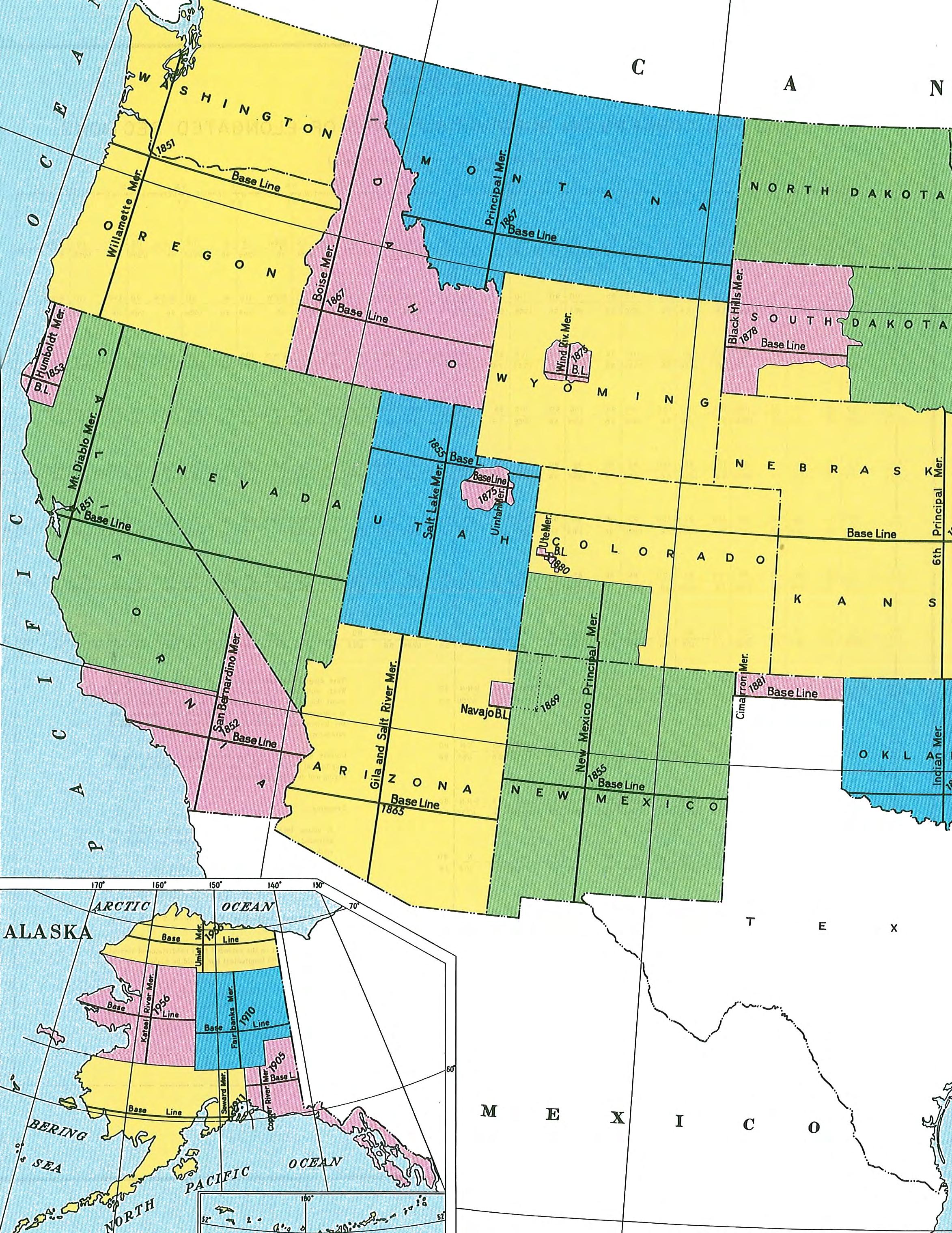
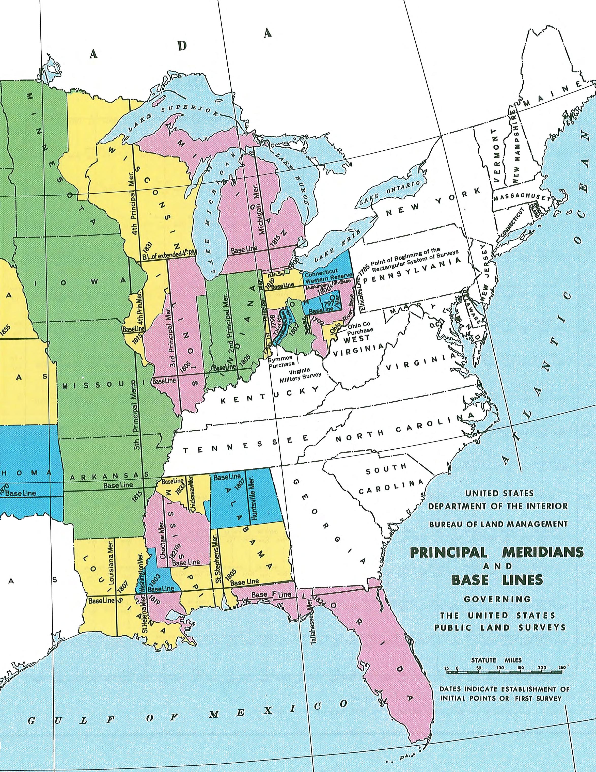
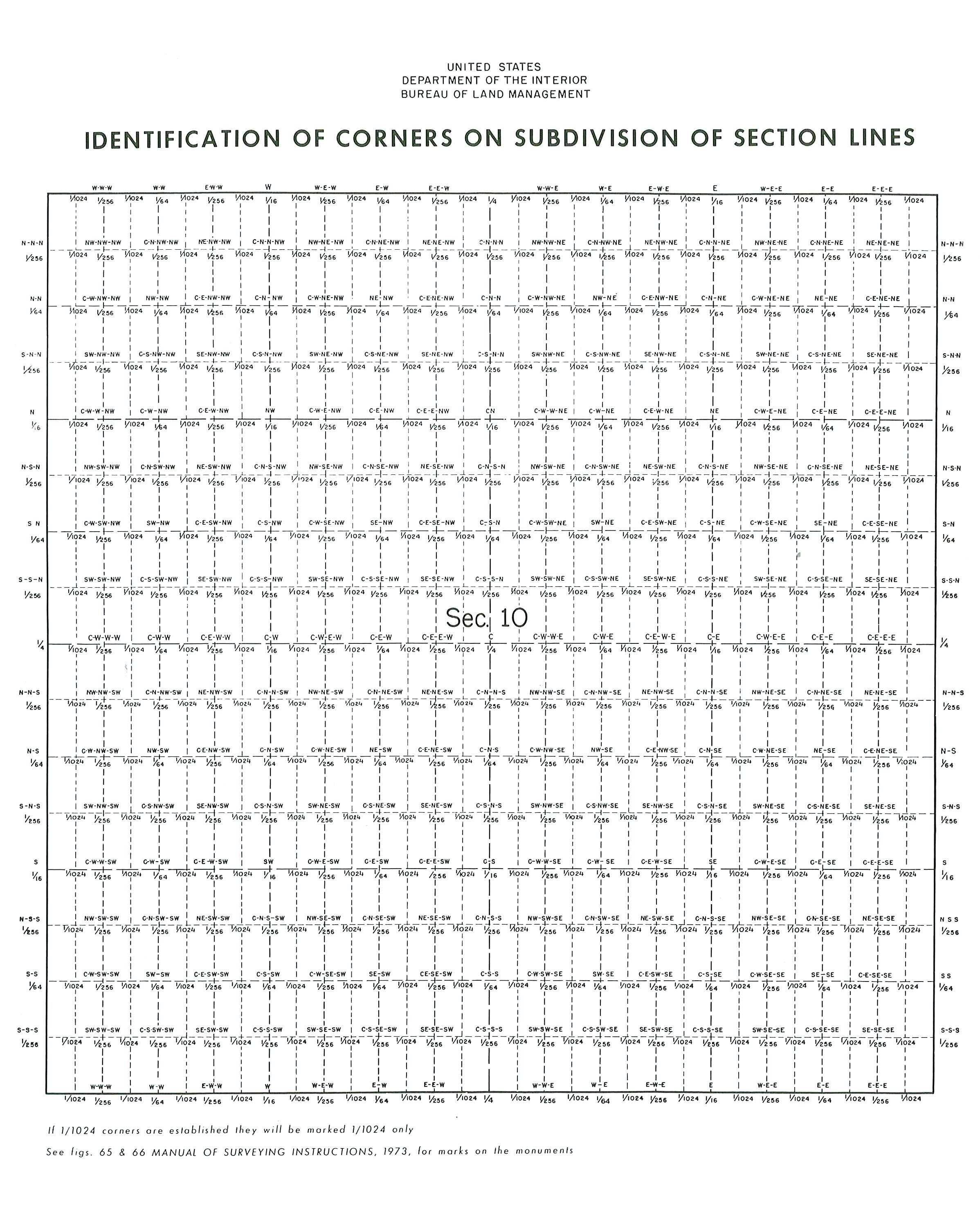
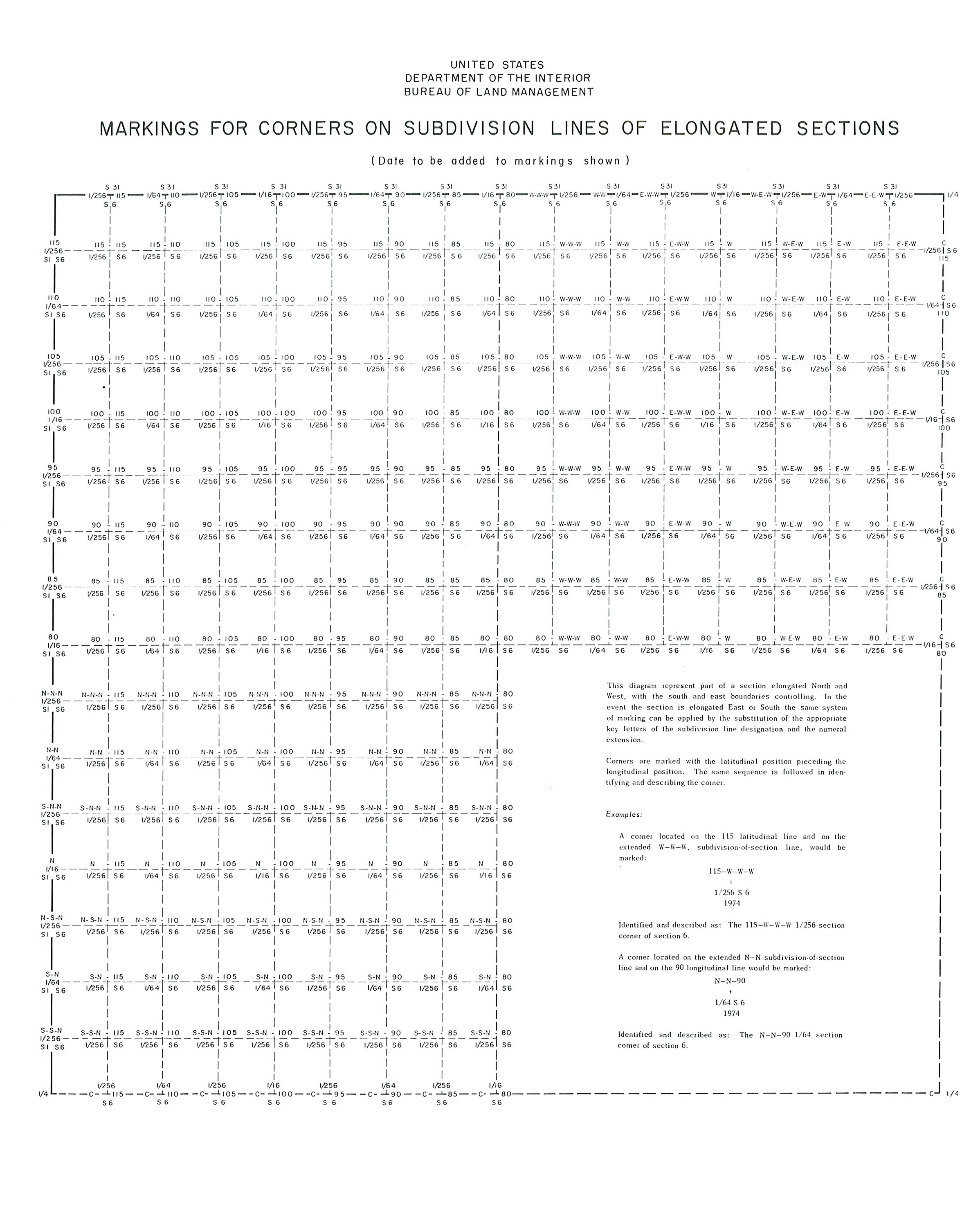

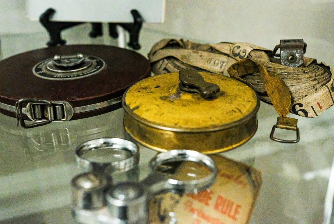
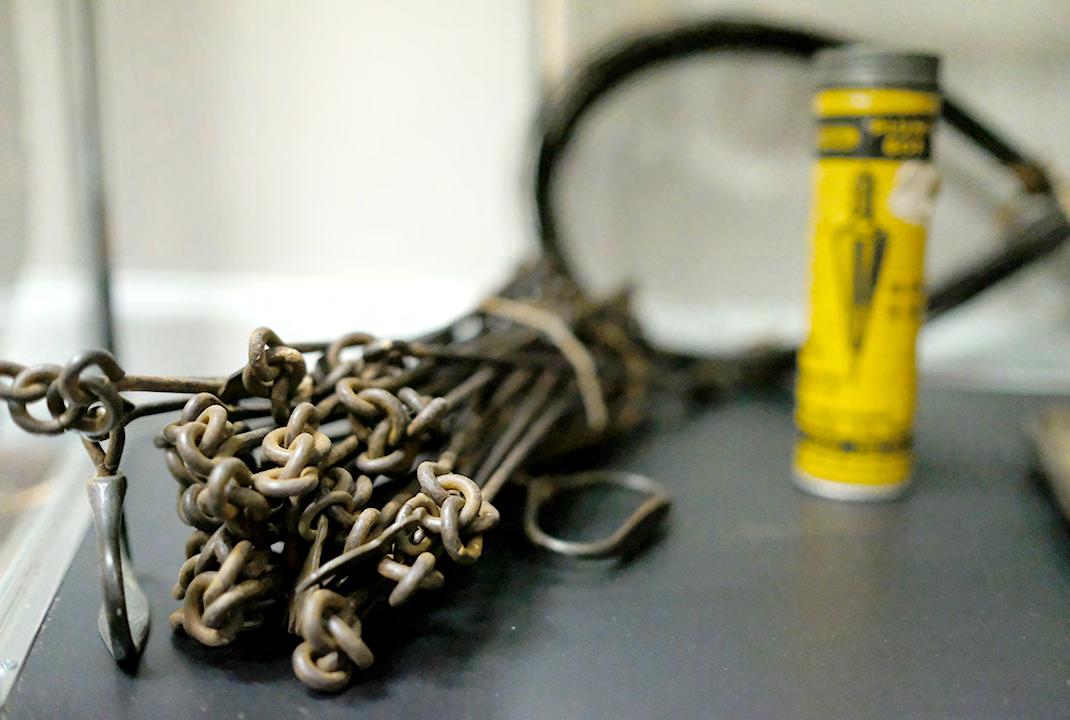

ARCHIVES FROM THE

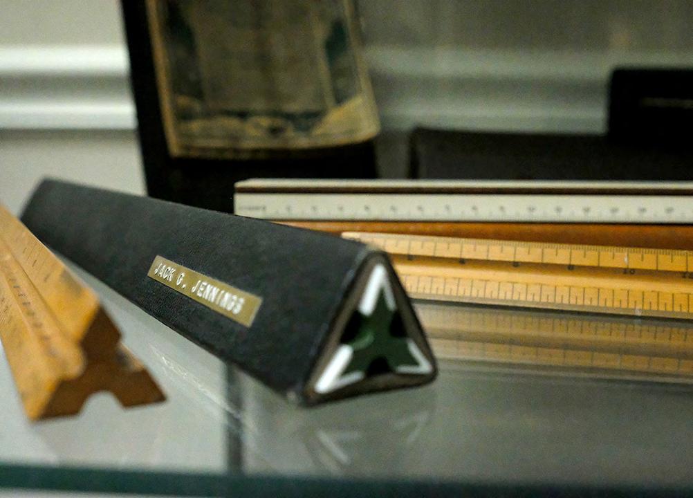
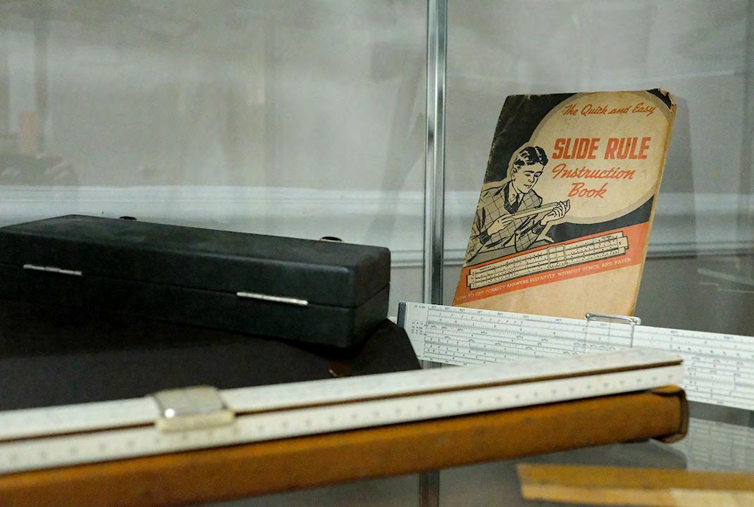
The Florida Surveyor Page 129
SCENES
IN A SURVEYOR’S
OR A
LIFE ;
RECORD OF HARDSHIPS AND DANGERS ENCOUNTERED. AND AMUSING SCENES WHICH OCCURRED,
IN THE
Operations of a Party of Surveyors IN SOUTH FLORIDA .
May 2024 Page 130
By W. L. PERRY.
JACKSONVILLE:
C. DREW'S BOOK AND JOB PRINTING OFFICE 1859.
CHAPTER IX
THE C aptain dispatched two of the men after the broken-down wagon the morning after our arrival, who succeeded in getting it to the camp at the end of three days from the time of their departure, during which time the men at camp subsisted entirely on saw palmetto buds, which, by the by, if they were not quite so hard to “ pull up, ” is no mean article of food.
My burnt legs and foot—the former by the scorching rays of the sun, and the latter by upsetting on it a frying-pan of hot grease, as the reader doubtless remembers—got well in due course of time, and I resumed my place, at the front end of the chain, on the line. I by no means regretted having to turn over to Sile again the cookship, as my experience in that capacity had not been altogether such as to inspire me with a very great fondness for it.
For some time after this we met with no other adventure worthy of record. We progressed with our work as rapidly as the nature of the country would admit, and to describe all the minutia would be but a repetition of descriptions of cutting our way through briary hammocks, sousing through lagoons, marshes and prairies, covered with water, and floundering through bamboo and tie-tie swamps, of which I imagine the kind reader would soon tire.
While the work is progressing thus, day after day, in the same monotonous manner, I trust the reader will pardon me for introducing a subject which, thus far in these “ scenes, ” have been scrupulously avoided, but one in which, I venture positively to assert, everyone who has honored my scribbling with a perusal does now feel, has felt, or will
The Florida Surveyor Page 131
hereafter, if life is spared, feel the most lively interest. The subject to which I allude is that of the tender passion. Who, having reached the age of maturity, has not felt its over-powering influence? its vicissitudes of pleasure, pain, hope, fear, bliss, and despair, which sometimes follow each other in quick succession, and always fast enough to keep one eternally in hot water?
True, the wild woods of South Florida, in the midst of savages and wild animals, and where the ribbons and head-gearing of the gentler sex were never known to flutter in the passing breeze, is a strange place to select for the scene of a love story; but the facts shall speak for themselves.
Ralf was the bore of the whole company. Endowed by nature and practice with an inordinate love of laughter and fun, he never lost an opportunity to gratify it, no matter at what expense or sacrifice to others. Not a day passed but the most bitter complaints were made against him on account of some mischievous trick, resulting in the loss, inconvenience or pain of someone in the company.
One would wake up in the night and find his soft pine-knot pillow removed, and his head half buried in a puddle of mud and water; another would have a log of wood lain across his breast—not heavy enough to wake him up, but sufficiently so to cause him to dream of devils, hobgoblins, and frightful fiery-eyed spirits perched on his bosom, gradually sucking away his breath; and another would have a red-hot coal stuck to his toe, or a nest of sandspurs placed under his body ready to pierce the flesh whenever the unfortunate sleeper should chance to move. Fighting being strictly prohibited by a solemn pledge of all hands when we entered on the survey, under any circumstances whatsoever, the violation of which subjected the aggressor in the case to severe punishment, of course no satisfaction could be obtained in this way. Besides, it was not always an easy matter to catch him at these pranks; for, when anyone of the party woke up and found himself in any of the conditions described, Ralf was sure to be found commingling his snores with those of the loudest of his sleeping companions, and, to all appearances, as sound asleep; and when aroused and charged with the mischief, always protested his innocence in such a manner that it was impossible to convict him of guilt. Every attempt to pay him off in his own coin was soon abandoned in despair; for whoever undertook to play this game with Ralf was sure to come out at ten times “ the littlest
May 2024 Page 132 FROM THE ARCHIVES
end of the horn. ” We had scarcely any alternative left, therefore, but to bear our troubles with a good grace, which we did until forbearance amounted to an absolute sin. At length, however, we discovered the young gentleman's vulnerable part, and made use of it to the accomplishment of our purposes.
Accidentally we discovered that his heart was touched with the tender passion. Sile, pretending to make a confidant of him in many little love matters, drew from him the whole story, which was just as we would have desired. He was in love—deeply in love—with a charming little Miss at home, to whom he had made love, nay, had actually made offers of marriage outright, and was rejected, but in such a gentle, friendly manner as only to make him love her the more, and resolve to redouble his efforts on his return home.
As I was on intimate terms with Mollie (for that was her name) and her family, Sile induced him to communicate the whole affair to me, telling him that I might be of incalculable service to him, through my influence with the family in his suit. This he readily acceded to, and frankly asked my advice as to what would be the best course to pursue on his return home. He repeated to us every word of the last conversation between himself and Mollie, from the tenor of which I drew the correct conclusion, that she had intended her refusal to his hymeneal proposition as a final and decisive one. This conclusion, however, we kept strictly secret from his ears, and led him, by every inducement, to believe that another good, strong effort on his part would certainly be crowned with success. At the proper time we urged him to write to her, to lay open his whole heart, and portray his feelings in such a manner that it would be impossible for her to look upon him with indifference. To this, however, he obstinately objected for a long time, saying that it was “ agin his principle to put himself in a position in love matters in which black and white might be produced agin him in after time; ” but when we urged upon him the danger of his losing her altogether by delay—that she, thinking he had abandoned all idea of obtaining her hand, would, in all probability, accede to the first proposition made by another, and he be left with his fingers in his mouth, his scruples in this particular were entirely overcome, and he consented that if we would “ fix up a good, nice, proper love-letter ” for him, he would send it and risk the consequences. Accordingly, that
The Florida Surveyor Page 133
evening, when night had drawn her sable curtains around us, we three gathered up a quantity of lightwood knots, some distance from the camp, built a flaming fire, and by its brilliant light, with the heading out of a pork barrel for a writing desk, some time between midnight and day completed the following letter to Miss Mollie. Should this letter chance ever to meet the eye of Miss Mollie, I trust she will pardon me for the liberty I have taken in publishing it to the world:—
m y deare S t m i SS m ollie : It does, I confess, smatter of presumption in me to trouble you again, either verbally, or with pen and ink, and so soon, too, after what has already passed between us, and after my solemn promise no more to inflict my attentions upon you.
Will you, my love, as some degree of palliation for my seeming presumption, and to some extent broken promise, take into consideration the feelings which I have told you I never felt before, and which I now again, from the fullness of an honest heart and true affection, reiterate? Will you calmly consider how grievous and sore must be my disappointment by the sudden blasting of hopes and prospects, which at first were faint, 'tis true, but which grew stronger and brighter with the lapse of time, under the influence of your heavenly smile, and with the increase of that tender feeling toward the only being whom, before God, I have ever fondly and truly loved— the only being I have ever looked upon as combining all those noble qualities and characteristics of her whom I would make my wife?
Think not, Miss Mollie, that the object of this note is to press to a speedy issue a suit which, I confess with feelings anything but pleasant, has already met with a rebuff sufficient to satisfy anyone with impulses less ardent than mine; but I cannot, without one more effort, resign the object of so cherished a hope.
I would not willingly inflict a single wound upon your feelings—not one; but it is hope, that bright beacon which lures men on to repeated and redoubled action, that leads me once more to trouble you upon a subject which is ever uppermost in my mind.
My object is, to crave your final—your decisive answer, as to
May 2024 Page 134 FROM THE ARCHIVES
anther
wam P , S outh F lorida .
P
S
whether I may or may not hope—however distant the realization of that hope—that your mind and feelings toward me will one day undergo a change; that you will, at least, endeavor to look upon me with more exalted sentiments than those inspired by the cold word “ friendship. ”
I do not ask you to make a speedy decision in so important a matter—for truly it is an important matter; one in which is involved the happiness or misery of all your future life, and one that should elicit your most serious and dispassionate consideration upon every depending point; but I only ask that, if in accordance with your present feelings, I may entertain the least degree of hope, in time—no matter how long the time—you will endeavor to overcome your present indisposition to marry, in favor of one whose only solace is to love you.
Unfortunately, I have no fortune to offer you; none of the glittering metal that runs mad all men; no broad acres, or fields, to lay at your feet; nothing but an honest, loving heart, with the promise to devote the efforts of my whole life, be it long or short, to the advancement of your happiness and your comfort. Can I do more? Do you fear the act of its acceptance might be repented, because you have seen unhappiness the result of married life? Why judge the whole masculine race by the soul of one man, or even two? But this is a point upon which your own faculties of reasoning and judgment should be exercised—not mine. Do you ask why I harbour the lingering hope that prompts the writing of this letter, after all that has passed between us? I can only answer, it is the slender thread of hope inspired by a few words which fell from your lips involuntarily when last we met, and a love which I fear, should you again refuse my offer, even the strong arm of time will fail to eradicate.
But ere your patience is wearied, I will close by saying that, if you can find in your heart one reciprocal feeling for the sentiments herein expressed, and will tell me so, the object of my happiness is complete; but if not, then commit this sheet to the flames, and permit its contents quietly to sink into the depths of oblivion; and, oh! let not the smile of contempt or derision for the writer for a moment desecrate your lips, but rather let one heartfelt sigh escape your bosom in commiseration for him whose all is involved in your answer.
RALF.
“ How do you like it, Ralf? ” inquired Sile, as I finished reading it
The Florida Surveyor Page 135
over for his approbation. “ O, it's capital, ” answered Ralf; “ It's capital, only I think there's a leetle more mashed turnips and potatoes about it than necessary, but then I reckon it will do. ” “ You reckon it will do! ” said Sile, “ you reckon it will do? Why, I think it's one of the most perfect things of the kind I ever saw in my life. There isn't a man in the world that could write a letter to fit a case like yours better than this one does, and yet you reckon it will do . ”
“ O, it's first-rate, ” said Ralf. “ I was only thinking that when Mollie and me got married, and we should fall out some day, as married folks very often do, she would go and fetch out this letter and read it, and then tell me how deceitful I was before we got married, &c. &c.; but then when we git married, you know, I kin manage to git hold of this letter and burn it up, and that will put an end to the thing. ”
The letter was duly sealed and directed, and when Sile started to Fort Capron a day or two afterward for a load of provisions, it was deposited in his jacket pocket, to be mailed at that place. From the moment of Sile's departure, Ralf was in a constant fever of excitement. His peace of mind was gone. He could think of nothing else but Mollie, and the effect his letter would produce upon her. While the other boys slept soundly, after eating their pork and beans, poor Ralf rolled and tumbled in the wiregrass for half the night before sleep would soothe his troubled feelings, which were constantly alternating between hope and despair.
During the day, when talking with me about it, as was the case whenever an opportunity presented itself out of hearing from the others, he often wondered what she would say when she read the letter. He would give anything to be where he could see her, and she not know it, to see the tears fall from her blessed eyes, for he knew such a letter could not fail to touch the tender chord of her heart.
Sometimes he got very low down, but when Sile returned we did everything possible to keep up his spirits, and led him to expect a favourable answer, and succeeded finally in inducing him to dispel every thought of receiving any other sort; and by the time Sile started for another load of provisions, he was perfectly confident that he would get a letter from Mollie full of expressions of the most devoted love, and a warm acceptance of his proffered heart and hand.
May 2024 Page 136 FROM THE ARCHIVES
Knowing very well that Miss Mollie would never answer his letter, Sile and myself concluded that rather than he should be disappointed, we would write an answer ourselves, and forge the name, which we did the night previous to Sile's departure for Fort Capron, while Ralf was soundly asleep, and probably not dreaming of what a dupe he was being made.
When the wagon returned, Ralf was among the foremost who went to meet it, and was the first to inquire:
“ Any letters, Sile? ”
“ Plenty, ” was the answer.
“ Any for me? ”
“ Don't remember just now, think maybe there is one with your name on it. ”
“ Well, ” continued Ralf, “ let's have it as soon as possible. ”
“ Just you hold on now, ” said Sile, “ till I can get it out of my pocket, won't you? ”
By this time all hands had gathered around the wagon, eagerly inquiring for letters. Sile drew from his pocket a large bundle, and standing in the front end of the wagon, read off the names, and as each answered, he received his letter. Ralf stood trembling with excitement, and when at last his name was called, he grasped the extended letter with as much anxiety as if his very existence depended upon the contents.
“ Ah! ” said he, “ that's it, ” as he held up before me a letter neatly directed, in a fine lady's hand, and as he turned off to read it, gave me a nudge in the ribs with his elbow, and made a sly wink with his left eye.
He sat down by a tree some thirty yards from the camp, and opened his letter. Whether it was difficult for him to decipher the contents, or whether some other matter was the cause, I cannot tell, but certain it is, he remained in the same position, as if transfixed to the spot, for more than an hour, and would probably have remained so to the end of the day, had not Sile called out—
“ I say, Ralf, what's the matter? Is it going to take you all day to read your letter? You seem mightily interested. What's the news? ”
The Florida Surveyor Page 137
“ Come here, fellers, I want to see you, ” said Ralf, beckoning to Sile and myself, and then walking off towards the margin of the lake, near which we were then encamped. We followed, and when we came up with him he handed me the letter, and said, “ read that. ” I took it, and read aloud, as follows:
m r . r al F : Sir, your very “ presumptuous ” epistle has been received, and in answer thereto I have only to say, that I “ can find in my heart ” no “ reciprocal feeling ” for the sentiments you express, and hope in future you will not trouble me with anymore such stuff. In conclusion, I would give you a little piece of advice, and it is this: next time you send a love letter to a lady, write it yourself, and don't get somebody else to compose one that any fool would know such a jackanapes as you never wrote.
MOLLIE.
I had scarcely finished reading the letter when Sile set up a roar of laughter that no doubt astonished half the alligators in the lake, in which, when I looked at Ralf's palid cheek, sunken eyes, and distressed countenance, I could but join most heartily.
“ You may laugh, gentle men , ” said Ralf, “ laugh as much as you please. You got me in this here scrape, and now as you are the first to laugh at me for being such a big fool as to let you do it, just laugh now, till you pop your eyes out! ”
This speech only made us laugh the more, which soon brought down all hands from the camp to see what was the matter. Sile related the whole story and read the letter, in spite of Ralf's entreaties and threats to prevent it, but we did not let Ralf, or any of the boys know but what the letter was really written by Miss Mollie.
Even after this, whenever Ralf undertook to play off one of his little tricks on any of the boys, it was only necessary to say, “any late news from Mollie, Ralf?” and he was done. It was a subject he couldn't bear mentioned.
Soon, therefore, we could lie down at night to sleep with the comfortable assurance that we would not be awakened by the juxtaposition of a red-hot fire coal with our toes, and that we should not be put to the necessity of having to fish our heads out of a mud hole before morning.
May 2024 Page 138 FROM THE ARCHIVES
Some six months after our work was completed, and we had returned home, I met Ralf one day in the road, told him the truth of the whole matter, and asked his pardon for the part I had taken in it; but it was a long time before I could get the idea of a fisticuff sufficiently out of his head to induce him to do so; he did, however, at last, and we have been good friends ever since. •
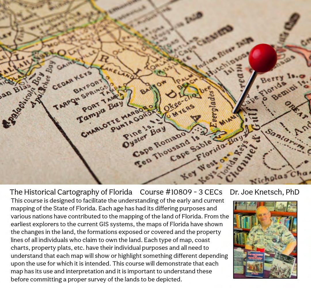
The Florida Surveyor Page 139

CONGRATULATIONS TO GREG PRATHER, FSMS RECRUITMENT CHAMPION!
Mr. Prather Successfully Recruited Two NEW Full Members and Two NEW Associate Members as part of Our Membership Recruitment Contest.
Mr. Greg will Receive a Conference Packet 1 Registration along with a 2 Night Stay at the DoubleTree by Hilton Hotel Orlando at SeaWorld.
FSMS would like to thank all of the participants in this year's membership recruitment contest. Through your combined efforts, FSMS gained 37 New Members: 9 Full, 12 Associate, 3 Affiliate, 3 Sustaining Firms, and 10 Students.

The Florida Surveyor Page 141
Step 2: Choose Member Type
FSMS Member EMAILED Fee Quantity Amount 6 CEC $115 Per Course x = $ 3 CEC $58 Per Course x = $ MAILED 6 CEC $125 Per Course x = $ 3 CEC $68 Per Course x = $ TOTAL $ Non Non Name: _ YES _ NO Firm: ____ _ YES _ _ NO Address: ______________________________________________________________________________________ City/State: Email Address: Work Phone: Payment Information: ___ Check Enclosed (Payable to FSMS) _ VISA/MasterCard/American Express Card #: _______ Exp. Date: __ CVV Code:___________ Billing Address of Credit Card: ______________________________________ Signature: _____________________________________ __ IF PAYING BY CHECK, MAIL FORM TO: FSMS, P.O. Box 850001-243, Orlando, Florida 32885-0243 IF PAYING BY CREDIT CARD, FAX OR EMAIL FORM TO: 850.877.4852 education@fsms.org QUESTIONS? CALL 800.237.4384 Provider No. CE11 fsms.org May 2024 Page 142
Past Presidents
1956 - 1957
H.O. Peters
1960 - 1961
Hugh A. Binyon
1964 - 1965
James A. Thigpenn, III
1957 - 1958
C.
1961 - 1962
Russell H. DeGrove
1965 - 1966
Harold A. Schuler, Jr.
1958 - 1959
P. Goggin
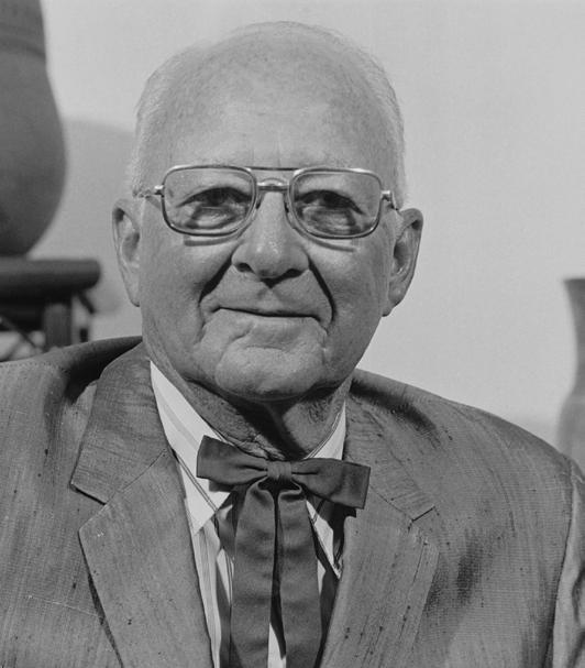
1962 - 1963
Perry C. McGriff
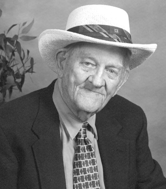
1966 - 1967
Shields E. Clark
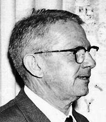
1959 - 1960
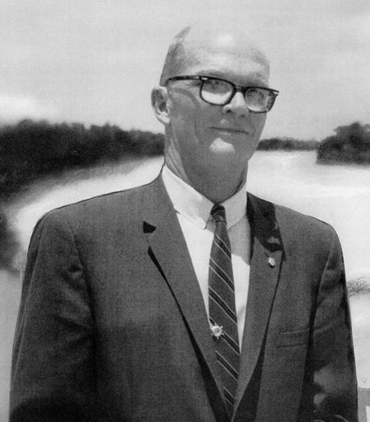
1963 - 1964
Carl E. Johnson
1967 - 1968
Maurice E. Berry
Harry
Schwebke
John
R.H. Jones
Past Presidents
1968 - 1969
C. Hart
1972 - 1973
Broward P. Davis
1976 - 1977
Robert S. Harris
1969 - 1970
1973 - 1974
E.R. (Ed) Brownell
1970 - 1971
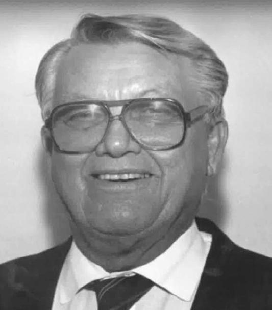
1974 - 1975
E.W. (Gene) Stoner
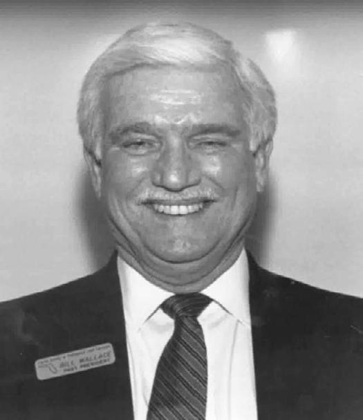
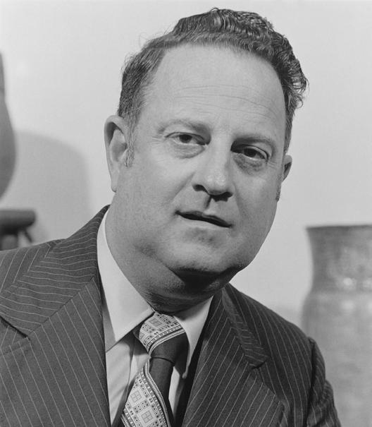
1971 - 1972
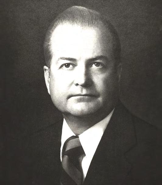
1975 -1976
Lewis H. Kent
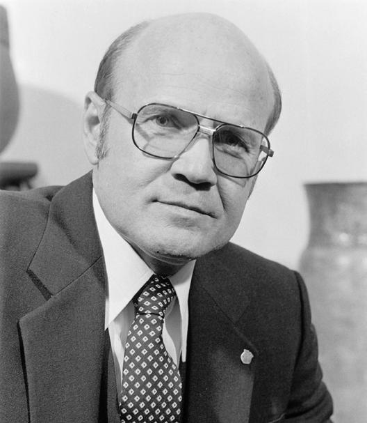
Robert W. Wigglesworth
William
Frank R. Shilling, Jr.
William V. Keith
James M. King
Paul
O’Hargan
1979
1977 - 1978
T.
1978 -
William G. Wallace, Jr. 1979 -1980
Past Presidents
1980 - 1981
Ben P. Blackburn
1984 - 1985
Buell H. Harper
1988 - 1989
Stephen G. Vrabel
1981 - 1982
William B. Thompson, III
1985 - 1986
H. Bruce Durden
1989 - 1990
W. Lamar Evers
1982 - 1983
John R. Gargis
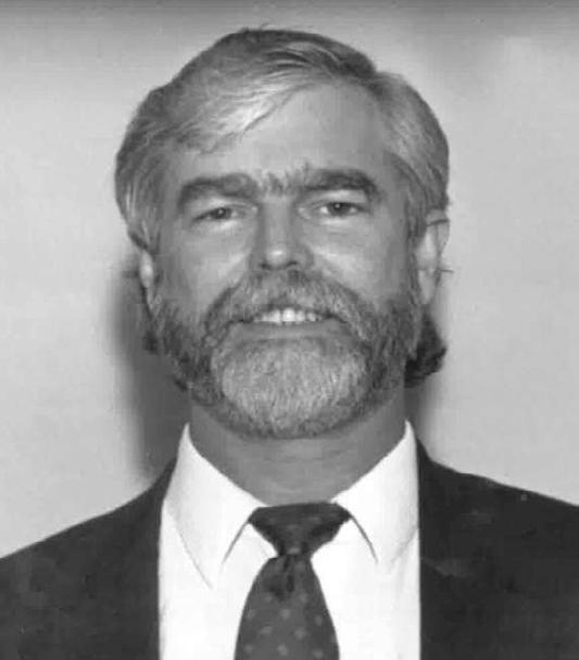
1986 - 1987
Jan L. Skipper

1990 - 1991
Joseph S. Boggs
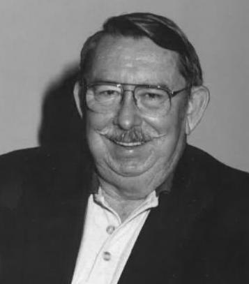
1983 - 1984
Robert A. Bannerman
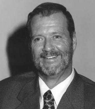
1987 - 1988
Stephen M. Woods
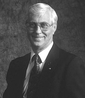
1991 - 1992
Robert L. Graham
Past Presidents

1992 - 1993
1995 - 1996
Thomas L.
1999 - 2000 Jack Breed
- 1994

1996 - 1997
R.

- 1995
1997 - 1998
E.
1998 - 1999
 Nicholas D. Miller
1993
Loren E. Mercer 1994 -
1995
Robert D. Cross
1994
Kent Green
Gordon
Niles, Jr.
Dennis
Blankenship
W. Lanier Mathews, II
2000
2001 Arthur A. Mastronicola 2001
Michael
Maxwell
-
- 2002
H.
2002 - 2003
John M. Clyatt
Conner
Past Presidents
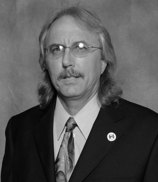

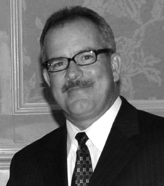
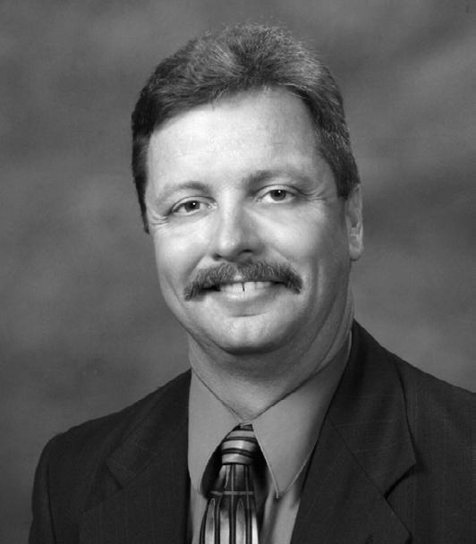


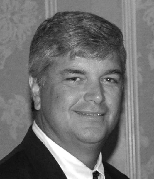
2004 - 2005
2005
2006
Stephen M. Gordon
-
2006
2007
Richard G. Powell
-
Michael J. Whitling 2007
- 2008
2009
Robert W. Jackson, Jr. 2008 -
2010
Pablo Ferrari
2009 -
2011
Steve Stinson
2010 -
2012
Dan Ferrans 2011
-
2012 - 2013
Jeremiah Slaymaker
2013 - 2014
Ken Glass
2014 - 2015
Russell Hyatt
2004
William Rowe 2003 -
David W. Schryver
Past Presidents

2015 - 2016

2019 - 2020

2016 - 2017
2020 - 2021

2017 - 2018

2021 - 2022
Lou Campanile, Jr.
Robert Strayer, Jr.
2018 - 2019
Dianne Collins
Don Elder
Hal Peters
Lou Campanile, Jr.
May 2024 Page 148
Dale Bradshaw


Executive Director Rebecca Porter director@fsms.org Communications Director Justin Ortiz communications@fsms.org Regional Coordinator Cathy Campanile seminolecc84@gmail.com Education Director Samantha Hobbs education@fsms.org The Florida Surveyor Page 149 ADMINISTRATIVE Staff

The Florida Surveying and Mapping Society has a new eLearning Platform that is now linked to your FSMS membership account.
When accessing the new eLearning platform, use your FSMS membership username (Not Available for Sustaining Firm Memberships) and password to log in. As always, Correspondence Courses are always available my mail or email.
Updated Correspondence & eLearning Courses:
• Writing Boundary Descriptions
• Basics of Real Property
• Map Projections and Coordinate Datums
• Elevation Certificates and the Community Rating System
• Datums (eLearning Video Course)
• FL Surveying and Mapping Laws
CHECK YOUR CREDITS HERE
Provider No. CE11

Advertise With Us!
All advertisements contained within the publication are published as a service to readers. Publication of the advertisements does not imply or express any endorsement or recommendation by FSMS.
Benefits: Full color; hyperlinks added to your webpages as well as email addresses.
Requirements: Contracts for one year (11 issues) receive 10% discount if paid in advance; 15% for Sustaining Firms. (Ads should be in jpeg, pdf, or png format)
New ads and/or changes are due by the 25th of each month.
The Florida Surveyor Page 151
email communications@fsms.org to notify us of upcoming events.
Please
Size 1 Issue 2-11 Issues Full Page $720 $395/issue 1/2 Page $575 $320/issue 1/4 Page $290 $175/issue
