

October 2023 Volume XXXI, Issue 9
Call us t o g et your complete work flow solution today ! Efficiency and versatility that will accelerate productivity comes part of a workflow solution that includes the FC-6000 field controller, Magnet software, a HiPer VR receiver and the GT-1200/GT-600 single-operator robotic system. The power of longrange reflectorless measurements comes in your choice of 1”, 2” or 3” GT-1200 models or 2”, 3” or 5” GT -600 models.



43316 State Road 19 Altoona, FL 32702 www.lengemann.us

FROM THE DESK Of Rick Pryce 38 THE Swamp 36 SURVEYORS In Government 76 2023 SUSTAINING Firms Directory 79 FROM THE Archives 100 FACES ON THE Frontier 85 PRESIDENT’S Message 1 2023-24 FSMS Officers 3 CHAPTER ONE Draining the Swamp 7 The F lorida Surveyor is the official publication of the Florida Surveying and Mapping Society, also known as FSMS. It is published monthly for the purpose of communicating with the professional surveying community and related professions who are members of FSMS. Our award winning publication informs members eleven months out of the year about national, state, and district events and accomplishments, as well as articles relevant to the surveying profession. In addition, continuing educational courses are also available. TABLE OF CONTENTS
PRESIDENT’S Message
September 29th, 2023
When you complete a survey ask yourself:
Can I back up what I did and why I did it? You may understand it, but can you present your findings in a way that the court and a lay person can understand it?

Did you complete your internal surveyor’s report at the end of the survey while the reasoning is still fresh in your mind? Not the day you get the notice that it is going to court. Oh, you do not do an internal surveyor's report on each job? Why not?
Did I meet the survey requirements of the Board of Surveyors and Mappers at the time of the survey? Keep a copy of the rules at the time of the survey. Keep a copy of the backup. You never know when your survey will be brought into question.
On the more difficult surveys set up a meeting with the party chief and at least two or three surveyors in your offic e and go over the issues of the survey. Everyone needs to be free to speak what t hey think. Do not block them out if they disagree with your conclusions. Open you r mind to what they are saying, and if it makes more sense than your analysis, incorporate their input into the survey.
Thoughts on the rules:
Think of 5J-17 as a contract with your client: in this case the Board. As you move through the rules you will see the constant theme of “Truth in Labeling ” , on the face of the survey “ tell what you did. ” This was a big part of the rewrite from Minimum Technical Standards to Standards of Practice.
President Howard Ehmke (561) 360-8883 Howard@GCYinc.com
The Florida Surveyor Page 1
PRESIDENT’S Message
5J-17.015 Statement Regarding Lack of Insurance. In addition to the office sign required by section 472.015, F.S., if neither the business entity nor the individual licensee has professional liability insurance, a written notific ation shall be provided directly to the client prior to commencement of any work, in the form of a written statement that clearly and conspicuously states to the client that neither the business entity nor the individual licensee has professional liability insurance. The notice shall be retained for a period of six yea rs from the date of creation pursuant to paragraph 5J-17.053(5)(a), F.A.C.




President-Elect Richard Pryce (954) 739-6400 rdpryce@gmail.com Vice President Allen Nobles (561) 687-2220 allen@burritobrothers.biz Secretary Sam Hall (352) 408-6033 surveysam17@outlook.com Treasurer Bon Dewitt (352) 392-6010 bon@ufl.edu Immediate Past President Lou Campanile, Jr. (954) 980-8888 lou@campanile.net The Florida Surveyor Page 3 2023-24 FSMS Officers
2023-24 Districts and Directors
District 1 - Northwest
Bay, Calhoun, Escambia, Franklin, Gadsden, Gulf, Holmes, Jackson, Jefferson, Leon, Liberty, Madison, Okaloosa, Santa Rosa, Taylor, Wakulla, Walton, Washington
Eric Stuart (850) 685-1149
eric.stuart@sam.biz
Chad Thurner (850) 200-2441 chad.thurner@sam.biz
District 2 - Northeast
Alachua, Baker, Bradford, Clay, Columbia, Dixie, Duval, Gilchrist, Hamilton, Lafayette, Levy, Marion, Nassau, Putnam, Suwannee, St. Johns, Union
Nick Digruttolo (863) 344-2330
ndigruttolo@pickettusa.com
2 3 4 7 6 5
District 5 - Southwest
Charlotte, Collier, DeSoto, Glades, Hardee, Hendry, Highlands, Lee, Manatee, Sarasota
Shane Christy (941) 840-2809
schristy@georgefyoung.com
Pablo Ferrari (904) 824-3086 pferrari@drmp. com
District 3 - East Central
Brevard, Flagler, Indian River, Lake, Okeechobee, Orange, Osceola, Seminole, Martin, St. Lucie, Volusia

Al Quickel (407) 567-1566
alq.fsms@gmail.com
Robert Johnson (772) 562-4191
bobj@carterassoc.com
District 4 - West Central
Citrus, Hernando, Hillsborough, Pasco, Pinellas, Polk, Sumter
Greg Prather (863) 533-9095
gprather@pickettusa.com
Alex Parnes (813) 493-3952
alexwolfeparnes @gmail.com
Donald Stouten (239) 281-0410 dstouten@ ardurra.com
District 6 - Southeast
Broward, Palm Beach
Mark Sowers (954) 868-7172 msowers@mgvera.com
Earl Soeder (407) 601-5816 earl.soeder@ duncan-parnell.com
Miami-Dade, Monroe
Jose Sanfiel (305) 351-2942 psm5636@gmail.com
District 7 - South NSPS
Manny Vera, Jr. (305) 221-6210 mverajr@mgvera.com
Russell Hyatt (941) 748-4693
russell@hyattsurvey.com
1
Director
District 1
Panhandle
Bill Butler wtb@butlersurveying.com
Gulf Coast
Jonathan Gibson jgibson0102@gmail.com
Chipola Jesse Snelgrove jsnelgrove@ snelgrovesurveying.com
Northwest FL
Jeremiah Slaymaker jslay@wginc.com
District 2
FL Crown
Brandon Robbins brndrbbns@netscape.net
North Central FL
Jeremy D. Hallick jdhallick@hotmail.com
UF Ge omatics
Andrea Slaven aslaven@ufl.edu
2023-24 Chapter Presidents
District 3
Central FL
William (Bill) Rowe browe@southeasternsurveying.com
Indian River Brion Yancy brionyancy@gmail.com
Volusia Je ff Cory (Interim) jeff@corysurveyor.com
District 5
Charlotte Harbor
Derek Miller millersurveying@comcast.net
Collier-Lee
Steve Shawles II sshawles@haleyward.com
Manasota
Shane Christy schristy@georgefyoung.com
District 6
Broward
Benjamin Hoyle benjamin.hoyle@kci.com
District 4
Ridge
Kenneth Glass kglass@civilsurv.com
Tampa Bay John Beland jbeland1979@gmail.com
Palm Beach
Lee Powers
lpowers@zemangroup.com
FAU Geomatics
Leah Ballou leahmballou@gmail.com
District 7
Miami-Dade
Eddie Suarez marketing@longitudefl.com
2023-24 Committees
Standing Committees
Nominating Committee
Membership Committee
Finance Committee
Executive Committee
Education Committee
Annual Meeting Committee
Legal Committee
Strategic Planning Committee
Ethics Committee
Legislative Committee
Surveying & Mapping Council
Constitution & Resolution Advisory Committee
Rick Pryce
Nick DiGruttolo
Bon Dewitt
Howard Ehmke
Greg Prather
Allen Nobles
Jack Breed
Rick Pryce
Shane Christy
Jack Breed
Randy Tompkins
Eric Stuart
Special Committees
Equipment Theft
Awards Committee
UF Alumni Recruiting Committee
Professional Practice Committee
Workforce Development Committee
Liaisons
CST Program
FDACS BPSM
Surveyors in Government
Academic Advisory UF
FES
Manny Vera, Jr.
Lou Campanile, Jr.
Russell Hyatt
Lou Campanile, Jr.
Allen Nobles
Alex Jenkins
Don Elder
Richard Allen
Justin Thomas
Lou Campanile, Jr.
Geospatial Users Group
Soeder
Practice Sections
Earl
CHAPTER ONE
Draining the Swamp: Development and the Beginning of Flood Control in South Florida, 1845-1947

In the mid-1800s, the Everglades, a region of water and sawgrass between Lake Okeechobee and the southern edge of Florida, percolated in Floridians’ minds. What, they asked, was the purpose of this vast wetland? Was it destined to lay unoccupied, or were there measures they could take to make the area conducive to settlement? Unappreciative of the plethora of flora and fauna in the region, most Floridians could see only a wet swamp that had to be drained and seeded to crop before it could reach its full potential. Accordingly, throughout the late 1800s and the first decades of the twentieth century, Floridians, both privately and with state help, examined the possibility of draining the Everglades. Hamilton Disston and Napoleon Bonaparte Broward, for example, pursued drainage relentlessly, and railroads and land speculators marketed the dry land as an agricultural paradise. But problems appeared in the 1920s and 1930s: storms sporadically produced devastating floods, while flora and fauna dwindled because of the lack of water. Such problems required federal action; in 1930, the U.S. Army Corps of Engineers began a flood control project around Lake Okeechobee, and in the 1930s and 1940s, conservationists were able to secure protection for wildlife and vegetation through the creation of Everglades National Park. The state had sponsored drainage programs for much of the twentieth century, but by the mid-1940s, officials realized that federal help was necessary so that water in South Florida could be managed comprehensively.
Because this period of drainage, early flood control, and conservation laid the groundwork for the establishment of the Central and Southern Florida (C&SF) Flood Control Project in 1948 and for the subsequent water supply tensions prevalent throughout the rest of the century, it constitutes a critical era in the history of water management in South Florida. No flood control project or water supply scheme in the second half of the twentieth century began with a tabula rasa; instead, the Corps and other agencies had to construct projects in an environment that had already been extensively modified. In the words of historian George E. Buker, the Corps was “faced with correcting past mistakes.”1 By the time the Corps developed the C&SF Project, numerous political entities, including federal interests (the National Park Service and the U.S. Fish and Wildlife Service), state interests (the trustees of the Internal Improvement Fund), and local interests (boards of county commissioners) had already staked out their water terrain. Thus, the Corps would not only have to work within a manipulated and modified ecosystem, but also with existing political interests, each with a different perspective as to how water should be managed.2
Thousands of years before Americans had made any attempts to alter the South Florida environment, including the Everglades, native peoples had traversed the area, discovering ways to subsist and flourish within the soggy marshes. By the first years of the common era, three groups had settled in the Everglades area: the Calusa, who resided in a region that began north of the Caloosahatchee River and extended south through the Ten Thousand Islands to Cape Sable;
The Florida Surveyor Page 7
the Mayaimi, who occupied the shores of Lake Okeechobee; and the Tekesta, who lived on the east coast beaches from Boca Raton south to Biscayne Bay and the keys.3 By the time of Spanish contact in the early sixteenth century, the most dominant and populous group was the Calusa. This tribe, like the Mayaimi and the Tekesta, had learned how to use the Everglades, its water, and its resources in the most efficien t ways. The groups subsisted mainly on food obtained in the freshwater and saltwater of the region, including cocoplum, sea grape, prickly pear, cabbage palm, and saw palmetto, as well as fish and game. They made clothes out of tree moss and palmetto strips, and employed conch shells as tools and drinking cups. They built houses using cabbage palm posts and palmetto, and applied fish oil to discourage mosquitoes and sandflies.4
Despite their knowledge of the land, the groups could not escape the problems that resulted from non-Indian settlement. In the early 1500s, Spanish explorers reached Florida, led by Juan Ponce de León in 1513. The first Spaniard to explore the region extensively was Pedro Menendez, who, in the 1560s, conducted investigations to try to find a waterway across the Florida peninsula to facilitate Spanish navigation to the Americas. By 1570, however, Spanish interest in South Florida had waned, mainly because no trans-peninsula waterway had been discovered. Yet non-Indians still influenced the region, and European diseases and slave raids decimated Indian populations. When Great Britain assumed authority over the area from 1763 to 1783, only 80 Calusa families remained, and they left with the Spanish. By the time the United States had gained official control over Florida in 1821, other Indian groups, including the Seminole, an offshoot of the Creek in Georgia, had moved into the Everglades, and Americans spent a great amount of time and energy trying to remove them in the 1830s, 1840s, and 1850s.5
The Second Seminole War (1835-1842) and the Third Seminole War (1854-1855), for example, represented concerted campaigns by the United States to extricate the Seminole from the Everglades. Although these battles were characterized by one scholar as “America’s first Vietnam,” in that it was “a guerilla war of attrition, fought on unfamiliar, unforgiving terrain, against an underestimated, highly motivated enemy who often retreated but never quit,” the expeditions provided numerous accounts and maps of the South Florida landscape, including the Ives map discussed below. Despite the colorful accounts of the landscape – or perhaps because of them, as most soldiers depicted the scenery as an “interminable, dreary waste of waters” infested with mosquitoes, snakes, and sawgrass – Floridians expressed little interest in the Everglades until the mid-1800s.6
This situation changed on 3 March 1845, when Congress allowed Florida to enter the United States as the 27th state in the Union. Thereafter, the state’s legislature, seeking new areas

South Florida History provided by US Army Corps of Engineers October 2023 Page 8
Ken Hughes' rendition of Pedro Menendez, the first Spaniard to explore South Florida extensively. (Source: The Florida Memory Project, State Library and Archives of Florida.)
where people could settle, passed resolutions declaring that “there is a vast and extensive region, commonly termed the Everglades, in the southern section of this State, . . . which has hitherto been regarded as wholly valueless in consequence of being covered with water at stated periods of the year.” The resolution asked Florida’s representative and senators to “earnestly press upon” Congress to appoint “competent engineers to examine and survey the aforesaid region” in regard to the possibilities of drainage.7 Buckingham Smith, an attorney from St. Augustine, Florida, received this appointment, and he submitted a report to the secretary of the treasury on 1 June 1848. In this document, Smith provided a detailed description of the Everglades landscape: The Everglades extend from the southern margin of Lake Okeechobee some 90 miles toward Cape Sable, the southern extremity of the peninsula of Florida, and are in width from 30 to 50 miles. They lie in a vast basin of lime rock. Their waters are entirely fresh, varying from 1 to 6 feet in depth. . . . As the Everglades extend southwardly from Lake Okeechobee they gradually decline and their waters move in the same course. They have their origin in the copious rains which fall in that latitude during the autumn and fall and in the overflow of Lake Okeechobee through swamps between it and the Everglades.8
Smith believed that in order to reclaim the Everglades, canals would have to be constructed from Lake Okeechobee to the Caloosahatchee and Loxahatchee rivers, thereby allowing the lake to drain into these rivers, lowering its water level and preventing it from sending water on its normal southward trek. Drains would also have to be placed at strategic locations “by which the waters accumulating from the rains may be conducted to the ocean or gulf.” If such actions were not taken, Smith claimed, “the region south of the northern end of Lake Okeechobee will remain valueless for ages to come.” But if drainage was implemented, the land could produce cotton, corn, rice, and tobacco, as well as lemons, limes, oranges, bananas, plantains, figs, olives, pineapple, and coconuts.9 According to historian David McCally, Senator Westcott forwarded this report to the Commercial Review of the South and West, which “embraced Smith’s conclusions and urged Congress to deed the Everglades to the State of Florida so that reclamation could begin.”10
Congress listened to the Commercial Review’s recommendation. In the Swamp Lands Act of 1850, Congress expanded the jurisdiction of an 1849 act granting swamp areas to the state of Louisiana, allowing the federal government to provide swamp and overflowed lands unfit for cultivation to other states as well.11 Under the authority of this act, the federal government transferred title to more than 20 million acres to the state of Florida. In 1851 and 1855, the Florida legislature passed acts creating an Internal Improvement Fund (IIF), consisting of the land and the money obtained from land sales, and establishing a board of trustees to oversee the fund. This board, composed in part of the governor and his cabinet, essentially had authority over all state land sales and over all reclamation matters.12
In 1856, more information about the topographical features of South Florida was made available when Lieutenant J. C. Ives, a topographical engineer serving in the Third Seminole War, conducted a survey of the area and combined his data with other records produced in the 1840s by army officers traversing the region to produce a map of the “comparatively unknown region” south of Tampa Bay. The Department of War wanted the map to inform officers fighting the Seminole, but it became, in the words of Marjory Stoneman Douglas, “the first fine
The Florida Surveyor Page 9
South Florida History provided by US Army Corps of Engineers
Lieutenant J.C. Ives' military map of South Florida, 1856. (Source: U.S. Army Corps of Engineers, Jacksonville District.)
October 2023 Page 10
American map of the country.”13 Ives highlighted not only the Everglades, but other areas of South Florida, including Big Cypress Swamp and Lake Okeechobee, and he noted that the land was basically “a flat expanse, where the prairie of one day may at another be converted into a lake and where the lakes, rivers, swamps and hammocks” fluctuated as much as three feet at a time.14
Eager for a chance to promote the settlement of South Florida, the IIF began granting deals to railroad companies in which it would give the corporations land in return for completed rail lines. In this way, the IIF hoped to “open the interior and attract settlers, who would buy land and replenish the fund, which could perhaps be used to finance drainage ditches someday in the future.”15 After many railroads succumbed to financial difficulties in the post-Civil War era, the IIF essentially faced bankruptcy. Its situation worsened when Francis Vose, a New York metals manufacturer who had provided iron to railroad companies in Florida in return for state bonds, refused to accept the state’s offer of 20 cents on the dollar for the bonds and sued the IIF instead. From that suit, an injunction was placed agai nst the IIF’s, preventing it from distributing any more land for discounted prices until Vose had been paid in full. Desperate for money, the IIF, under the leadership of Governor William D. Bloxham, began looking for new investors interested in obtaining land for reclamation purposes. In 1881, it found a candidate: Hamilton Disston.16
Disston was a 34-year-old entrepreneur from Philadelphia whose wealthy father owned a lucrative saw and file manufacturing company. First visiting Florida in 1877 on a fishing trip, Disston had been obsessed with draining the Everglades ever since. In 1881, Disston proposed to drain lands flooded by Kissimmee River and Lake Okeechobee waters by constructing a system of canals and ditches from Lake Okeechobee to the Caloosahatchee River, the St. Lucie River, and the Miami River, and by straightening and deepening the Kissimmee. This would convey water in the flooded Kissimmee basin to Lake Okeechobee, and the excess water would then be flushed out via the Caloosahatchee, St. Lucie, and Miami rivers, thereby lowering Lake Okeechobee’s water level and allowing vast acreages of land to be cultivated. In exchange, the IIF would give Disston and his associates “one-half of all the reclaimed land already belonging to the state or later turned over by the federal government,” as well as four million more acres for $1 million.17 In September 1881, Disston’s corporation, the Atlantic Gulf Coast Canal and Land Sales Company, began drainage operations.
By deepening and straightening the Kissimmee River, and by constructing canals connecting the various lakes that formed the headwaters of the river, Disston was able to drain portions of the area and sell it to cattle operators as grazing land in the 1880s. Disston’s company also deepened the Caloosahatchee River and connected it to Lake Okeechobee through a linchpin canal. In addition, the corporation began a canal south of Lake Okeechobee, hoping to drain water into the Shark River, and started another east of the Kissimmee Valley toward the St. Johns River. To promote the reclaimed land, Disston produced advertising brochures, planned model cities, built hotels, settled families, and established agricultural enterprises such as sugar, rice, and peach cultivation. By the 1890s, however, Disston had overextended his operations, and the Panic of 1893 dealt a devastating blow to his finances. Banks began recalling loans and bonds became due. Faced with an increasingly precarious situation, Disston died on 30 April 1896, either through suicide or from a heart attack. Although his decade-long drainage effort
The Florida Surveyor Page 11
reclaimed less than 100,000 acres, he left two legacies: first, he demonstrated conclusively the agricultural potential of the region through his experimental farms, and second, his connection of the Caloosahatchee River to Lake Okeechobee was “the first significant step in draining the Everglades.”18
Meanwhile, the vision of canals and drainage lived on in other minds. John Westcott, for example, formed the Florida Coast Line Canal and Transportation Company in 1881 to build a canal from the mouth of the St. Johns River to Biscayne Bay. The enterprise received a boost in the 1890s when Henry L. Flagler, who became a millionaire with Standard Oil, formed the Florida East Coast Railroad to build a rail line from St. Augustine to Miami Beach. Flagler became interested in the canal project, perhaps because the company agreed to provide the railroad corporation with 270,000 acres of land it had obtained. However, even with Flagler’s interest and resources, canal construction proceeded slowly, not reaching completion until 1912, although the construction of his railroad did precipitate South Florida’s first settlement boom, leading to the establishment of West Palm Beach, Fort Lauderdale, and Miami.19
By the close of the nineteenth century, large-scale drainage and agricultural development of the Everglades, although attempted by many different parties, had not reached fruition. Despite the granting and sale of millions of acres of land in southern Florida to railroads and other corporations, successful reclamation lay in the future. An 1891 report written by H. W. Wiley of the U.S. Department of Agriculture observed that, although “the possibilities of bringing into successful cultivation the swamp lands of Florida have occupied the minds of capitalists for several years,” large tracts remained inundated. Even those that had been drained were “still in the wild state, . . . no attempts having been made to fit them for cultivation.”20 Conditions were no better in 1903, leading Governor William S. Jennings to compare Florida’s drainage endeavors to “the man who undertook to lift himself,” opining that the state was “almost as helpless.”21
In the early 1900s, drainage schemes gained momentum, largely because of changing ideas about the human use of nature. The late 1800s and early 1900s saw the development of a conservation movement in the United States, characterized, in the words of historian Samuel P. Hays, by “rational planning to promote efficient development and use of all natural resources.”22 This movement expressed itself in several ways, including the formation of the U.S. Reclamation Service in 1902, and in the creation of national parks, which were conceived as areas to preserve pristine wilderness for the enjoyment of future generations. Other conservationists held that

South Florida History provided by US Army Corps of Engineers October 2023 Page 12
Hamilton Disston, the first to set up extensive drainage operations in South Florida. (Source: The Florida Memory Project, State Library and Archives of Florida.)
making wasteland productive was an excellent way to promote the efficient use of the nation’s resources. The editors of Collier’s magazine, for example, claimed that the terms “conservation” and “reclamation” meant not only the irrigation of dry land, but the draining of wetlands as well.23 In Florida, these ideas, coupled with populist notions of the necessity of taking land from railroads and other large corporations to benefit small farmers, influenced state officials to implement drainage policies vigorously so that Everglades land could be used for agriculture.24
The drainage program was facilitated in 1903 when the federal government provided the IIF trustees with the patent to over two million acres of the Everglades, thereby ending several disputes over whether the state, railroad interests, or corporations were entitled to the land.25 With this title secured, state officials actively implemented their own drainage program. Napoleon Bonaparte Broward, a Jacksonville jack-of-all-trades who had previously been employed as a steamboat captain, a sheriff, and a gunrunner, was especially active in promoting drainage.26 In 1904, Broward entered Florida’s race for governor, concerned that the state was relying too much on railroads and special interests to drain the land (and consequently was allowing these entities to accumulate large holdings and vast amounts of Florida wealth). During his campaign, Broward “carried his map of the Everglades from one end of the State to another, always crying in the hustings, ‘Save and reclaim the people’s land!’”27 He pledged that, if elected, he would use state money to drain the land, financing the endeavor by selling the dry tracts for $5 to $20 an acre.28
After winning the election, Broward began to implement his promises, thereby inaugurating the first official state-sponsored drainage program. In May 1905, Broward gave a special message to the state legislature dealing exclusively with draining the Everglades. Insisting that it was the “duty” of the IIF trustees to drain Florida lands, he proposed that the state build a system
 Early settlers to South Florida. (Source: South Florida Water Management District.)
The Florida Surveyor Page 13
of canals from Lake Okeechobee to the St. Lucie, St. Johns, and Caloosahatchee river basins, thereby allowing the lake’s level to drop six feet. Such a scheme would allow large amounts of land, including three million acres held by private interests, to become productive. Broward also proposed that the state pass a constitutional amendment creating a drainage district that would collect taxes from private landowners “in proportion to benefits that the land will derive,” thereby producing more money to be used in other drainage efforts.29 The state legislature acted on Broward’s recommendation, passing an act in 1903 that created the Everglades Drainage District (EDD) with boundaries roughly corresponding to the two million acres patented to the state in 1903.30
With the EDD in place, Broward ushered in an era of intensive state interest in drainage, including the construction of the New River Canal, running southeast from Lake Okeechobee to the New River near Fort Lauderdale. But in actuality, Broward accomplished relatively little; only 15 miles of canal were dug by the end of his term and the IIF fund had been depleted. Therefore, in December 1908, only a week before his term as governor ended, Broward convinced the IIF trustees to give Richard J. Bolles, a Colorado developer, 500,000 acres of land in exchange for $1 million. The trustees then proposed that most of this money be used to build five major canals – the North New River, South New River, Miami, Hillsboro, and Caloosahatchee. However, no studies had been completed on whether or not these waterways were practicable, resulting in a sale that “irrevocably committed the State of Florida to a specific drainage project even before the first engineering study regarding its feasibility appeared.”31
For the next several years, the state commissioned numerous engineering reports that revised the best methods to drain the land. These included the Wright Report (1909), which facilitated land speculation in South Florida based on low cost estimates of drainage schemes (which turned out to be faulty at best and fraudulent at worst); an Everglades Land Sales Company examination (1912) which recommended that Lake Okeechobee’s water levels be regulated to facilitate drainage; and the Randolph Report (1913), which recommended the construction of a control canal from Lake Okeechobee to the St. Lucie River (the St. Lucie Canal) and that became “the master plan for all drainage work.”32 By the end of the 1920s, the major drainage canals were largely in place, consisting of the Caloosahatchee Canal, which ran from the western shore of Lake Okeechobee to the Gulf of Mexico; the St. Lucie Canal, which extended from the eastern side of Lake Okeechobee to the Atlantic Ocean; and the West Palm Beach, Hillsboro, North New River, and Miami canals, which all ran from various points on the southern shore of Lake Okeechobee to the Atlantic Ocean.33

of Engineers October 2023 Page 14
Napoleon Bonaparte Broward. (Source: The Florida Memory Project, State Library and Archives of Florida.)
South Florida History provided by US Army Corps

The Florida Surveyor Page 15
Location of major canals in South Florida. (Source: U.S. Army Corps of Engineers, Jacksonville District.)
South Florida History provided by US Army Corps of Engineers
As these waterways were completed, agriculture developed in the region south of Lake Okeechobee. In the 1910s and 1920s, many new settlements appeared along the canals extending from Lake Okeechobee, including South Bay (on the North New River Canal), Lake Harbor (by the Miami Canal), Belle Glade (on the Hillsboro Canal), Pahokee (near the West Palm Beach Canal), and Moore Haven (on the southeast shore of Lake Okeechobee). By 1920, 23,000 people resided in the EDD. These numbers increased in the 1920s, in part because of better information about how to make Everglades soil productive and in part because of a growing demand for agricultural products. Perhaps even more important was the development of the sugar industry in the Everglades, started by the Southern Sugar Company in the 1920s and continued by Charles Stewart Mott, who rescued Southern Sugar from bankruptcy and reorganized it as the United States Sugar Corporation in 1931. Because of these efforts, cane sugar quickly became one of the predominant crops in the region.34
Yet even with the drainage works, flooding still occurred periodically in the Everglades region. After excessive rainfall in 1924, the EDD constructed a small dike around the southern end of Lake Okeechobee from Bascom Point to Moore Haven, the region’s largest town.35 Unfortunately, the barrier did not hold in 1926 when a hurricane swept over Moore Haven with winds between 130 to 150 miles an hour. Over 400 people were killed, approximately 1,200 had to be evacuated, and thousands of dollars of property damage occurred. Because of the devastation, the IIF trustees appointed an Everglades Engineering Board of Review in 1927 to examine the drainage program established by the Randolph Report, and to make additional recommendations about Everglades reclamation.36
 Destruction wreaked by the 1926 hurricane. (Source: The Florida Memory Project, State Library and Archives of Florida.)
October 2023 Page 16
The board, which consisted of Anson Marston (a prominent transportation engineer who had worked on the establishment of different highways), S. H. McCrory, and George B. Hills, spent two weeks examining drainage works, records, and data pertaining to reclamation. In its final report, published in May 1927, it stated that the Randolph Report’s drainage plan had several fatal flaws, especially in terms of controlling floods. To correct the problems, the board recommended that the EDD complete and deepen the St. Lucie Canal as soon as possible (since its operation would have aided flood control efforts during the 1926 storm); that it enlarge the Caloosahatchee Canal; that Lake Okeechobee be controlled to a maximum and minimum level of 17 and 14 feet above mean low water (Punta Rosa datum, which the U.S. Coast and Geodetic Survey had determined to be 0.88 foot below mean sea level), respectively; and that a “greatly enlarged and highly safeguarded levee” be constructed on the south shores of Lake Okeechobee to protect the surrounding communities.37
The chances of the EDD implementing the board’s suggestions were slim, however, because of continued financial problems.38 Then, in 1928, another disaster struck the Lake Okeechobee region. In August and September, torrential rain fell in the area, causing the lake to reach a high level. On 16 September, another hurricane appeared, striking Florida at West Palm Beach and traveling northwest across Lake Okeechobee. Winds reached velocities of 135 miles per hour, causing wind tides and waves on the lake to exceed 29 feet in height on the southeastern shore. Unfortunately, the existing levees extended only 22 feet in elevation, causing water to pour over the dikes and into the streets of Belle Glade and other shore communities to depths of eight feet. The water ripped houses from their foundations and swept terrified residents to their deaths. By the time the hurricane moved on, it had killed over 2,000 people, most of them migrant black laborers.39
Emerging from the disaster, residents called for help. But because of the financial difficulties of the EDD, and because it was unclear whether or not the EDD could properly operate for flood control instead of drainage, the state could do little to provide the desired flood protection. To rectify the situation, the state legislature created the Okeechobee Flood Control District in 1929, with boundaries including all of South Florida beginning at the northern shore of Lake Okeechobee, and directed it to construct flood control structures and to regulate Lake Okeechobee and the Caloosahatchee River to prevent damaging floods.40
To fulfill these missions, the Okeechobee district worked closely with the U.S. Army Corps of Engineers, which had already been making investigations as to what could be done to alleviate flooding from Lake Okeechobee. Since the early 1800s, the Corps had been the federal government’s leading civil works agency, but most of its construction involved navigation projects on rivers and lakes. Until the 1930s, the federal government regarded flood control mainly as a local responsibility; not until 1936 would Congress recognize flood control as a proper federal activity nationwide, although it did pass a flood control act in 1917, allowing the construction of works on the Sacramento and Mississippi rivers.41 Likewise, in 1928, Congress authorized the Corps to undertake an ambitious effort on the Lower Mississippi River, covering several states.42 In 1924, U.S. Representative Herbert Drane, a Democrat from Florida, introduced a bill into Congress requesting that the Corps examine the Caloosahatchee River to ascertain whether deepening the channel could relieve flooding. Congress passed the act and provided $40,000, but the Corps, under the leadership of Chief of Engineers Major General
The Florida Surveyor Page 17
Area hit by the 1928 hurricane. (Source: The Florida Memory Project, State Library and Archives of Florida.)

October 2023 Page 18
South Florida History provided by US Army Corps of Engineers
Edgar Jadwin did not commence any work. After the hurricane passed, the Corps held public hearings at Pahokee and Moore Haven and completed its study, but found no justification for federal action. Nevertheless, Congress passed another bill requiring the Corps to investigate more comprehensively the problem of flood control in the region. After holding public hearings in communities around the lake, Jadwin recommended to Congress in April 1928 that the Corps take no flood control action until state and local resources had been exhausted. Jadwin believed that the plans already in place by the EDD, including enlargement and completion of the St. Lucie Canal, were sufficient. “If carried out,” he promised, “they will provide for the control of floods in these areas with a reasonable factor of safety.”43
After the devastation of the 1928 hurricane, Jadwin reexamined flood control possibilities around Lake Okeechobee, in part because Florida Governor John W. Martin and his cabinet sent a resolution to Congress asking that the federal government construct a high levee around the lake’s southern shore. After considerab le study by the Jacksonville District, Jadwin recommended that the Corps undertake a flood control and navigation program consisting of “a channel 6 feet deep and at least 80 feet wide from Lake Okeechobee to Fort Myers” (basically deepening the Caloosahatchee River to make it a second control canal); “the improvement of Taylor Creek to the extent of providing a channel 6 feet deep and 60 feet wide to Okeechobee [C]ity”; and the construction of levees along the south and north shores of the lake to heights of at least 31 feet. Jadwin estimated that the project would cost over $10 million, and he suggested that the state of Florida or other local interests provide 62.5 percent of that cost, not to exceed $6.74 million.44
Because of the expense of the Corps’ proposal, the Okeechobee Flood Control District hired George B. Hills, one of the members of the 1927 Everglades Engineering Board of Review, to conduct an independent investigation of flood control. He recommended early in 1930 that Congress authorize a navigation and flood control project whereby the Corps, using the existing Caloosahatchee and St. Lucie canals, would build a waterway across Florida through the Everglades. At the same time, Congress requested that the Board of Engineers for Rivers and Harbors review Jadwin’s 1929 report, and in March 1930, the board recommended that the levees be at least 34 feet above sea level and that instead of the $6 million contribution, the state provide $3.8 million and build at its own cost the north shore levee.45
In the spring of 1930, Congress passed a general river and harbor bill that included these provisions for flood control and navigation. Because many representatives were uneasy about the Corps implementing a flood control project, the House and Senate portrayed the program as primarily one that would improve navigation and provide only incidental flood protection. No matter how it was depicted, the plan, according to U.S. Senator Duncan Fletcher, would allow the Corps to make improvements to the St. Lucie Canal, to expand the levees along Lake Okeechobee’s north and south shores, and to complete the “canalization” of the Caloosahatchee River. Fletcher believed that this would provide a “complete solution of the problems of adequate interstate navigation facilities and flood-control protection.”46
Following this plan, the Corps built over 67 miles of dikes along Lake Okeechobee’s south shore – later named the Hoover Dike after President Herbert Hoover – and another 15 miles of levees along the north shore near the city of Okeechobee. These were all constructed to handle crests of 32 to 35 feet in height. The Corps also performed the required deepening of the
The Florida Surveyor Page 19
Caloosahatchee River, and by March 1938, the entire project was completed.47 The Corps then assumed control of regulating the water level of Lake Okeechobee, maintaining a level between 14 and 17 feet through discharges to the St. Lucie Canal and the Caloosahatchee River.

Interesting, however, was the fact that in the 1930s, the U.S. Coast and Geodetic Survey, which had originally demarcated Lake Okeechobee’s water levels in accordance with the Punta Rosa Datum (corresponding to the mean low water elevation of the Gulf of Mexico), discovered that the datum plane was not 0.88 foot below mean sea level, but was actually 1.44 feet below mean sea level. Therefore, the original levee construction around Lake Okeechobee, which was supposed to have been 31 feet, was actually only 29.56 feet according to the National Geodetic Vertical Datum (NGVD) of 1929. Many continued to use the old Punta Rosa Datum plane for Lake Okeechobee (designating it as Lake Okeechobee Datum), even though the Corps had to convert the datum before designing any Lake Okeechobee project in order to avoid errors.48 Regardless, by the end of the 1930s, the drainage system in southern Florida essentially consisted of the structures that enabled the Corps to regulate Lake Okeechobee; the four major drainage canals (West Palm Beach, Hillsboro, North New River, and Miami); and two canals connecting the four waterways (the Bolles and Cross canals).49
The success of drainage and flood control efforts, coupled with periods of drought, had detrimental effects on flora and fauna in the Everglades, emphasizing that proper amounts of water were essential to preserve the unique natural resources of the area. The region housed, among other things, orchids, mangroves, magnolia, cypress, mahogany, lignum vitae, rubber trees, egrets, cranes, herons, flamingos, spoonbills, alligators, turkeys, bear, deer, fox, wildcats, panthers, raccoons, and opossums. However, drainage, human settlement, and hunting slowly destroyed this rich diversity of life.50 In the late 1800s, a flourishing plume trade brought hunters of all kinds to the Everglades, where they massacred thousands of egrets by invading rookeries.51 The Florida state legislature passed a law in 1901 outlawing plume hunting, and the National Audubon Society, first formed in the 1880s, hired four game wardens to patrol the rookeries and enforce the law. Hunters did not welcome this supervision, and on 8 July 1905, Guy Bradley, one of the wardens, was murdered as he investigated a poaching incident, becoming America’s first environmental martyr. This event led to laws “which strengthened bird protection and helped bring the significance of the Everglades to the American people.”52
Drainage in South Florida only compounded the poaching destruction, as it enabled settlement to encroach on the Everglades. Recognizing the danger that human habitation posed, James Ingraham of the Florida East Coast Drainage and Sugar Company called for the preservation of Paradise Key, located in the Royal Palm area of the current Everglades National Park, in 1905. His efforts led Mary Barr Munroe of the Florida Federation of Women’s Clubs to
Engineers October 2023 Page 20
A poster commemorating the construction of Hoover Dike. (Source: South Florida Water Management District.)
South Florida History provided by US Army Corps of
join the fight, and she, along with several scientists, including botanists David Fairchild and J. K. Small, advocated the creation of a Paradise Key reserve. Heeding these cries, the state established Royal Palm State Park in 1916.53
In the 1920s, Ernest Coe, a landscape architect from Connecticut who had moved to the Miami area, became the loudest voice for Everglades preservation. Coe had always been interested in nature, and he became entranced with the mangroves, the orchids, the giant royal palm trees, and other plants in the Everglades region, as well as the numerous bird rookeries and other wildlife. Coe claimed that these natural attributes justified the creation of a national park to preserve the unique ecology.54 In promulgating these views, Coe was drawing on the ideas of many conservationists in the late 1800s and early 1900s who believed that the nation’s natural wonders should be preserved as national parks for the enjoyment of future generations. Beginning with Yosemite and Yellowstone, Congress set aside vast tracts of land characterized by monumental scenery – huge mountain peaks, pr istine vistas, waterfalls, canyons, and geysers –to protect these resources from exploitation and development, and in 1916, it created the National Park Service (NPS) to manage these areas.55
By the 1920s, some Americans had decided that national parks could also preserve plant and wildlife as well as scenery. Coe was one of these, and he began agitating for the creation of a national park to protect the ecology of the Everglades. In 1928, he formed the Tropic Everglades National Park Association and persuaded David Fairchild, a botanist with the U.S. Department of Agriculture, to serve as its first president. For the next several months, Coe, with the aid of the association, studied and mapped the area, conducting surveys by plane and boat. He brought his data to U.S. Senator Duncan U. Fletcher, a Democrat from Jacksonville, and in 1929, Fletcher ushered a bill through Congress authorizing an investigation of the Everglades as a possible national park.56
In 1930, an NPS committee, consisting of Director Horace Albright, Assistant Director Arno Cammerer, and Yellowstone National Park Superintendent Roger Toll, explored the Everglades on a four-day tour sponsored by the Tropic Everglades National Park Association. At the conclusion of this inquiry, the committee made a favorable report on the park’s creation, and in December 1930, the secretary of the interior recommended that Congress establish a park constituting 2,000 square miles in Dade, Monroe, and Collier counties. However, Florida’s congressional delegation had a difficult time passing a bill to create the park, mainly because many members of Congress could not understand why preservation of the area was necessary or important.57
The task became easier as more evidence mounted of how drainage and a lack of water affected plants and wildlife in the Everglades. In 1929, New York botanist John Kunkel Small had warned of the pending “extermination” of plants and wildlife in the Everglades because drainage facilitated fires that destroyed the soil. “Florida is being drained and burned to such an extent that it will soon become a desert!” he exclaimed.58 Secretary of the Interior Ray Lyman Wilbur echoed these thoughts in 1933, stating that drainage prevented enough fresh water from reaching the Shark River and other waterways in S outh Florida, thus destroying “the most unique qualities” of the area.59 John O’Reilly, a reporter for the New York Herald Tribune, also explained how the lack of water affected wildlife, noting that drainage had removed “a single block in the foundation on which the wild beauty and natural abundance of such a region is
The Florida Surveyor Page 21
South Florida History provided by US Army Corps of Engineers
built.” The evidence for this, he claimed, was “in the brown and dying vegetation; in the vast fires that have been eating plants and soil alike; [and] in the wholesale migration of birds and animals from a habitat which has been their home since before history.” The solution, O’Reilly believed, was “to get the overflow of Lake Okeechobee directed back onto the Everglades,” thereby reestablishing feeding grounds and allowing “thousands upon thousands of White Ibises and other water birds [to] return to their rookeries.”60
Influenced by these arguments, Congress passed an act in 1934 authorizing the creation of Everglades National Park. Heeding the report submitted by the NPS committee, this law recommended that an area of approximately 2,000 square miles be established as the Everglades National Park as soon as the state was able to transfer title to the lands to the United States.61 This large area included much of Dade, Monroe, and Collier counties, including what would become known as the East Everglades area and islands in Florida Bay and the southern Gulf of Mexico. According to NPS Director Arno Cammerer, one of the main reasons for the establishment of the park was “so that the wild life may in fact be protected. . . . [T]he only hope the wild life has of surviving is to come under the protective wings of the National Park Service.”62
 The effects of drought on the land. (Source: The Florida Memory Project, State Library and Archives of Florida.)
October 2023 Page 22
Yet one group lost out in this effort to preserve Everglades flora and fauna: the Seminole Indians. The Seminole had originally been part of the Creek Confederacy. After the Yamasee War in the 1710s, a group of Creeks moved into northern Florida. After several years, those Creek that had not relocated began referring to the Florida Creek as simanó·li, meaning “wild” or “runaway.” This term eventually morphed into “Seminole,” the English term for this group. After a series of wars in the first half of the nineteenth century, the United States removed the Seminole to southern Florida, establishing a reserve for the group in 1849 in Big Cypress Swamp, and most Seminole took up residence in either the swamp or the Everglades. When the Tamiami Trail was built in 1928, some families moved to areas surrounding the highway in order to conduct business with tourists.63
In 1917, the state of Florida created a reservation for the Se minole out of 99,000 acres of land in Monroe County. Likewise, in the early 1930s, the federal government consolidated several small areas of land into tracts set aside for the Seminole: Brighton (located to the northwest of Lake Okeechobee), Big Cypress (in the northeastern part of Big Cypress Swamp) and Dania (later called Hollywood, located near the eastern coast just south of Fort Lauderdale). Most Seminole ignored these reservations and continued to live wherever they wanted. Yet problems resulted in 1934 because the state reservation lay within the proposed boundaries of Everglades National Park. To resolve the situation, the state agreed to provide the federal government with the Seminole land in exchange for 104,800 acres in Broward and Palm Beach counties. This land lay north of the Tamiami Trail in the eastern part of Big Cypress Swamp.64
With the Seminole situation resolved, the state of Florida turned to the task of acquiring additional lands for the park, and it passed an enabling act allowing it to convey tracts to the United States as soon as it acquired them. But despite the best efforts of the Everglades National Park Association and the State Everglades National Park Commission (which had been created in 1935 to handle the land purchase and transfer issues), acquisition proceeded slowly.65 One of the problems was that in the early 1940s oil was discovered in southern Florida, and the state began issuing oil and gas leases on the land it owned within the proposed park boundaries. By 1947, Humble Oil and Refining Company alone had produced 230,701 barrels of oil. This caused consternation among many conservationists; an article in Natural History, for example, lamented that “liquid death may ooze up from the bowels of the earth to spread its polluting destruction through the fresh water” and called for immediate action “to make certain that the production of oil entails a minimum of damage to the numberless natural assets of this exotic wilderness.”66 Despite conservationists’ concerns, drilling continued, and the NPS reported in the early 1940s that it “saw no way of establishing a national park for some time, since the area would be constantly subject to pressure for exploring and drilling for oil.”67
In the meantime, wildlife and plants continued to be destroyed. In 1937 and 1938, Daniel Beard, a wildlife technician for the NPS, traversed the Everglades region and made observations about its flora and fauna and the effects of drainage on them.68 Beard reported that before drainage began, “the park got the bulk of the western flow and some of the eastern flow that went through the Everglade Keys.”69 After the construction of the drainage canals, water entered the park only from the east. Drainage also lowered the water table, leading to the destruction of gator holes and the abandonment of large bird rookeries. According to A. E. Demaray, acting director of the NPS, Beard’s main finding was that “changed water levels are in all probability
The Florida Surveyor Page 23
fundamentally responsible for the depletion of characteristic plants and animals of the proposed park area.” Based on these conclusions, Demaray proclaimed that “restoration of water levels is fundamental and must be accomplished if the area becomes a park. . . . Water is the basis for the unique features of southern Florida that make it of national park caliber.”70 The NPS therefore called for another extensive study of how drainage and flood control systems had affected the wildlife.
Meanwhile, the NPS participated in meetings in 1939 about saltwater intrusion and a shortage of drinking water for municipalities in South Florida. Although the conference focused on these issues, NPS representatives emphasized that state and federal interests should not deprive the Everglades of water in order to solve the problems. Continued inadequate water supplies, they stated, would “result in increasing the fire risk, decreasing soil building and destroying wildlife.”71 What was necessary, NPS officials declared, was the “restoration and maintenance of normal water conditions” in order to guarantee the “preservation and restoration of the national park character.”72
An inspection of the Everglades in 1939 by Clifford C. Presnall, assistant chief of the NPS’s Wildlife Division, reiterated the importance of water. Presnall reported that water levels were as much as three feet below normal and that some ditches were completely dry. He believed that “this lowering of the water table would not have been nearly so pronounced had there been no drainage canals.” He blamed drainage for causing bird migrations and for decimating tree snail populations, thereby drastically reducing the number of Everglades kites. Drainage had also caused fire to become “unnaturally preponderant.” Only the restoration of the “unhampered overflow from lake Okeechobee into the Everglades such as existed before the construction of dikes” would alleviate the situation, Presnall asserted, but he understood that the preponderance of agriculture south of Lake Okeechobee would make such a renewal difficult.73
In order to ensure that the animals and plants in the region had at least some form of protection, the state established a state wildlife refuge within the proposed park boundaries. Unfortunately, the designation did little to reduce the destruction, whether by drought or by poaching.74 Therefore, on 6 December 1944, Congress passed an act allowing the secretary of the interior to accept “submerged land, or interests therein, subject to such reservations of oil, gas, or mineral rights” within the 2,000 square mile boundary, and to protect such land until the federal government could clear the mineral reservations.75 The state then conveyed to the United
South
October 2023 Page 24
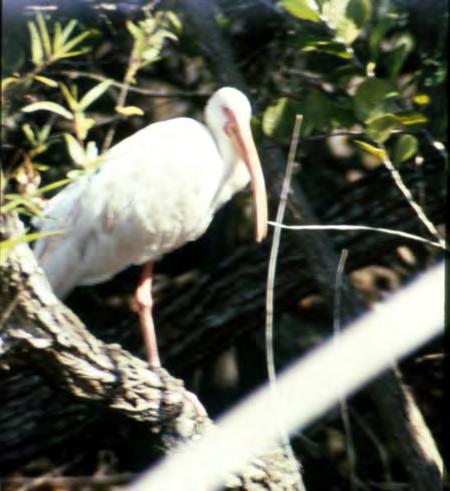
White ibis. (Source: The Florida Memory Project, State Library and Archives of Florida.)
Florida History provided by US Army Corps of Engineers
Everglades National Park boundaries, 1944. (Source: Records of Everglades National Park, Record Group 79, National Archives and Records Administration II, College Park, Maryland.)
States more than 850,000 acres of land within the proposed boundaries. One publication noted that the land consisted of three areas: Florida Bay; a 34-mile long and three-mile wide strip between Cape Sable and Lostman’s River; and 400,000 acres from the Shark River to Royal Palm State Park and north to Forty Mile Bend on the Tamiami Trail, a highway constructed in the 1910s and 1920s from Miami to Fort Myers and Tampa. Some of the lands not included were those in the Big Cypress region, those north of the Tamiami Trail, those located on the upper keys, and those which would become known as the East Everglades.76 All of the deeded land was designated as the Everglades Wildlife Refuge, and the U.S. Fish and Wildlife Service was given administrative authority over it, with Daniel Beard as manager.77
Because of continuing difficulties with acquiring private land and with oil and gas rights, the state agreed in 1947 to the establishment of a “minimum” park, something that would at least get portions of the Everglades protected. This acreage, totaling 454,000 acres and corresponding roughly to the third section deeded to the United States in 1944, became Everglades National Park on 27 June 1947 when Secretary of the Interior J. A. Krug issued Order No. 2338.78 Both park and state officials regarded this “minimum” park as only the beginning, noting that additional land to total 1,282,000 acres would “ultimately . . . be added to the park.”79 President Harry Truman officially dedicated the park on 6 December 1947, making it the first national park
The Florida Surveyor Page 25
to be established not for its scenery but solely to protect its flora and fauna.80 According to Acting Secretary of the Interior Warner W. Gardner, the establishment of the park only was a first step in its creation; more acreage would be added as it became available.81
Everglades National Park advocates, as well as NPS personnel, were enthusiastic about the park’s creation, believing that it was a step in the right direction for the preservation of the unique flora and fauna of southern Florida. However, because it was, in the words of Marjory Stoneman Douglas, “the only national park in which the wild-life, the crocodiles, the trees, the orchids, will be more important than the sheer geology of the country,” it was essential that the flora and fauna had sufficient water.82 Just two days before the creation of the park, NPS officials had reiterated that “this new national park is dependent to a large degree on the conservation and favorable distribution of the surface waters of the lower Everglades drainage basin.” Therefore, “the restoration of natural conditions is the first requirement in any plan for bringing back many forms of wildlife which have been reduced to critical numbers.” The NPS expressed its interest and concern “with any plans dealing with drainage, storage, and distribution of the waters of the lower Everglades,” and believed that it was now an active player in any decisions involving this resource.83
In the 100 years following the state’s declaration of interest in drainage, southern Florida had undergone vast transformations. Several canals had been built, and rivers flowing out of Lake Okeechobee had been channelized in order to control flooding from the lake and to remove water from the land. Settlement and agriculture had quickly followed the desiccation of land; the lower east coast of Florida’s population had increased from 22,961 in 1900 to 228,454 in 1930, while cane sugar production had doubled between 1931 and 1941. Although the state had initiated drainage operations and implemented them for much of the first half of the twentieth century, it ultimately had to turn to the U.S. Army Corps of Engineers for flood control works. Yet all of these structures, whether for drainage or for flood control, had serious consequences for southern Florida’s flora and fauna, especially in the Everglades. The federal government created Everglades National Park in 1947 to protect these resources, but the problem of ensuring that the park received adequate water remained. Many, including John H.Baker, executive director of the National Audubon Society, believed that the solution lay in “an intelligent water-control and land-use plan, backed by adequate legislative and administrative authority” and executed by “a qualified hydraulic engineer.”84 Whether one could be developed remained to be seen.

South Florida History provided by US Army Corps of Engineers October 2023 Page 26
August Burghard and Ernest Coe at the dedication of Everglades National Park. (Source: The Florida Memory Project, State Library and Archives of Florida.)
REACH RS3


Multi-band RTK GNSS receiver with tilt compensation

Survey grade precision in hard-to-reach spots. Comes with the Emlid Flow mobile app


$2799
IMU


RTK +2 mm + 0.3mm/º
GNSS

GPS/QZSS, GLONASS L1, L2; BeiDou B1, B2; Galileo E1, E5

NTRIP and RTCM3
Supported protocols to send and receive corrections
Dual-band radio
868/915MHz LoRa to get and send corrections between Reach receivers
450 MHz receive-only UHF
LTE and Wi-Fi
To connect the device to the internet
Industrial-grade battery
18 hrs as an RTK rover with tilt compensation.
USB Type-C charging
Explore and order at emlid.com
South Florida History provided by US Army Corps of Engineers
Chapter One Endnotes
1 George E. Buker, Sun, Sand and Water: A History of the Jacksonville District, U.S. Army Corps of Engineers, 1821-1975 (Fort Belvoir, Va.: U.S. Army Corps of Engineers, 1981), 104.
2 For examples of discussions of this period, see McCally, The Everglades; Nelson Manfred Blake, Land Into Water – Water Into Land: A History of Water Management in Florida (Tallahassee: University of Florida Presses, 1980); Lamar Johnson, Beyond the Fourth Generation (Gainesville: The University Presses of Florida, 1974); Junius Elmore Dovell, “A History of the Everglades of Florida,” Ph.D. dissertation, University of North Carolina at Chapel Hill, 1947; and Christopher F. Meindl, “Past Perceptions of the Great American Wetland: Florida’s Everglades during the Early Twentieth Century,” Environmental History 5 (July 2000): 378-395.
3 Marjory Stoneman Douglas, The Everglades: River of Grass, 50th anniversary edition (Sarasota, Fla.: Pineapple Press, 1997), 68.
4 Douglas, The Everglades, 68-70; McCally, The Everglades, 39-53.
5 McCally, The Everglades, 53-57, 59-60 (quotation on p. 56); see also Charlton W. Tebeau, A History of Florida (Coral Gables, Fla.: University of Miami Press, 1971), 19; Douglas, The Everglades, 185-188, 196-245; and Robert H. Keller and Michael F. Turek, American Indians & National Parks (Tucson: The University of Arizona Press, 1998), 217.
6 Grunwald, The Swamp, 40-47.
7 “Resolution by the Legislature of Florida,” in Senate, Everglades of Florida, 62d Cong., 1st sess., 1911, S. Doc. 89, Serial 6108, 34-35.
8 “Report of Buckingham Smith, Esq., on His Reconnaissance of the Everglades, 1848,” in Senate, Everglades of Florida, 46.
9 “Report of Buckingham Smith,” 46-47, 49-50, 53.
10 McCally, The Everglades, 88.
11 Act of 28 September 1850, in Senate, Everglades of Florida, 67.
12 Quotation in McCally, The Everglades, 88; see also “Acts of Florida Legislatures (1851-1855) Relating to the Everglades,” in Senate, Everglades of Florida, 67-68; and “History of Drainage and Reclamation Work in the Everglades of Florida,” in Senate, Everglades of Florida, 7.
13 Douglas, The Everglades, 266.
14 Lieutenant J. C. Ives, Memoir to Accompany a Military Map of the Peninsula of Florida, South of Tampa Bay (New York: M. B. Wynkoop, 1856), 5-7.
15 Grunwald, The Swamp, 67.
16 McCally, The Everglades, 89; Grunwald, The Swamp, 67-72.
17 Quotation in Blake, Land Into Water, 75; see also McCally, The Everglades, 89; Grunwald, The Swamp, 8587.
18 Quotation in Ann Vileisis, Discovering the Unknown Landscape: A History of America’s Wetlands (Washington, D.C.: Island Press, 1997), 136; see also Blake, Land Into Water, 81-83; McCally, The Everglades, 89; and Light and Dineen, “Water Control in the Everglades: A Historical Perspective,” 53. The traditional historical accounts of Disston’s death label it as a suicide, but more recent publications, including works by Joe Knetsch, a historian with the Florida Division of State Lands, and Michael Grunwald, a Washington Post reporter, attribute his death to heart problems, citing the coroner’s report and several obituaries at the time. See Joe Knetsch, “Hamilton Disston and the Development of Florida,” Sunland Tribune 24, no. 1 (1998): 5-19; Grunwald, The Swamp, 96.
19 Blake, Land Into Water, 84-87; Grunwald, The Swamp, 99-109.
October 2023 Page 28
Chapter One Endnotes (continued)
20 “Report by Dr. H. W. Wiley, of the Bureau of Chemistry, United States Department of Agriculture, in 1891, on the Muck Lands of the Florida Peninsula,” in Senate, Everglades of Florida, 73-74.
21 “Message of Gov. W. S. Jennings to the Legislature of Florida Relative to Reclamation of Everglades,” in Senate, Everglades of Florida, 84.
22 Samuel P. Hays, Conservation and the Gospel of Efficiency: The Progressive Conservation Movement, 18901920 (Cambridge: Harvard University Press, 1959; reprint, New York: Atheneum, 1969), 2; references are to the reprint edition. Hays’ book is one of the best sources on the conservation movement in the late 1800s and early 1900s.
23 Introduction to Napoleon B. Broward, “Homes for Millions: Draining the Everglades,” Collier’s 44 (22 January 1910): 19.
24 Quotation in Blake, Land Into Water, 88; see also Meindl, “Past Perceptions of the Great American Wetland,” 379; Vileisis, Discovering the Unknown Landscape, 113. For information about engineering studies and the Progressive influence, see Jeffrey Glenn Strickland, “The Origins of Everglades Drainage in the Progressive Era: Local, State and Federal Cooperation and Conflict,” M.A. thesis, Florida Atlantic University, 1999, 69-81.
25 Quotations in W. Turner Wallis, “The History of Everglades Drainage and Its Present Status,” Soil Science Society of Florida Proceedings, 4-A (1942): 31-32; see also Dovell, “A History of the Everglades of Florida,” 178; Strickland, “The Origins of Everglades Drainage in the Progressive Era,” 127; McCally, The Everglades, 88; and Blake, Land Into Water, 94.
26 For a complete biography of Broward, see Samuel Proctor, Napoleon Bonaparte Broward: Florida’s Fighting Democrat (Gainesville: University of Florida Press, 1950).
27 Quotation in S. Mays Ball, “Reclaiming the Everglades: Reversing the Far Western Irrigation Problem,” Putnam’s Magazine 7 (April 1910): 798; see also Grunwald, The Swamp, 131.
28 N. P. Broward, “Draining the Everglades,” The Independent 64 (25 June 1908): 1448; Blake, Land Into Water, 95-96; Vileisis, Discovering the Unknown Landscape, 136-137.
29 “Message of Gov. N. B. Broward to the Legislature of Florida Relative to Reclamation of Everglades,” in Senate, Everglades of Florida, 99-109.
30 Blake, Land Into Water, 97; McCally, The Everglades, 92; Grunwald, The Swamp, 134-140.
31 Quotation in McCally, The Everglades, 93-94; see also Blake, Land Into Water, 105; Grunwald, The Swamp, 141-142. For more information about drainage under Broward’s administration, see Proctor, Napoleon Bonaparte Broward, 216-224, 240-260
32 McCally, The Everglades, 114.
33 McCally, The Everglades, 95-98, 100-102, 109-110; Blake, Land Into Water, 107-112, 116-117, 120-121, 127-128; Meindl, “Past Perceptions of the Great American Wetland,” 383-384. For information about the Wright Report, see “Report on the Drainage of the Everglades of Florida by J. O. Wright, Supervising Drainage Engineer,” in Senate, Everglades of Florida, 140-180; and Aaron D. Purcell, “Plumb Lines, Politics, and Projections: The Florida Everglades and the Wright Report Controversy,” The Florida Historical Quarterly 80 (Fall 2001): 161-197. For the Everglades Land Sales Company report, see Daniel W. Mead, Allen Hazen, and Leonard Metcalf, Report on the Drainage of the Everglades of Florida (Chicago: Board of Consulting Engineers, 1912). For the Randolph Report, see Senate, Florida Everglades: Report of the Florida Everglades Engineering Commission to the Board of Commissioners of the Everglades Drainage District and the Trustees of the Internal Improvement Fund, State of Florida, 63d Cong., 2d sess., 1913, S. Doc. 379, Serial 6574
34 Blake, Land Into Water, 130-132; McCally, The Everglades, 121-125; Howard Sharp, “Farming the Muck Soil of the Everglades,” The Florida Grower 32 (7 November 1925): 4; John A. Heitmann, “The Beginnings of Big Sugar in Florida, 1920-1945,” The Florida Historical Quarterly 77 (Summer 1998): 44, 50-54; J. Carlyle Sitterson,
The Florida Surveyor Page 29
Chapter One Endnotes (continued)
Sugar Country: The Cane Sugar Industry in the South, 1753-1950 (Lexington: Univeristy of Kentucky Press, 1953; reprint, Westport, Conn.: Greenwood Press, 1973), 361-370 (page references are to the reprint edition).
35 Robert Mykle, Killer ‘Cane: The Deadly Hurricane of 1928 (New York: Cooper Square Press, 2002), 34, 36.
36 McCally, The Everglades, 135; Blake, Land Into Water, 134-136; Grunwald, The Swamp, 186-189; Okeechobee Flood Control District, A Report to the Board of Commissioners of Okeechobee Flood Control District on the Activities of the District and on Lake Okeechobee, copy in Library, Jacksonville District, U.S. Army Corps of Engineers, Jacksonville, Florida.
37 Everglades Engineering Board of Review, Report of Everglades Engineering Board of Review to Board of Commissioners of Everglades Drainage District (Tallahassee, Fla.: T. J. Appleyard, 1927), 5-16, 52.
38 McCally, The Everglades, 139-140.
39 Blake, Land Into Water, 136; McCally, The Everglades, 139; Grunwald, The Swamp, 192-194; Edgar Jadwin, Major General, Chief of Engineers, to Hon. Wesley L. Jones, 31 January 1929, in Senate, Caloosahatchee River and Lake Okeechobee Drainage Areas, Florida, 70th Cong., 2d sess., 1929, S. Doc. 213, Serial 9000, 2. For a full discussion of the hurricane and its impacts, see Mykle, Killer ‘Cane and Eliot Kleinberg, Black Cloud: The Great Florida Hurricane of 1928 (New York: Carroll & Graf Publishers, 2003).
40 Okeechobee Flood Control District, A Report to the Board of Commissioners of Okeechobee Flood Control District on the Activities of the District and on Lake Okeechobee, 7-8; see also Senate Committee on Commerce, Rivers and Harbors: Hearings Before the Committee on Commerce, United States Senate, Part 3, 71st Cong., 2d sess., 1930, 322-323.
41 For more information on the 1917 act, see Matthew T. Pearcy, “A History of the Ransdell-Humphreys Flood Control Act of 1917,” Louisiana History 41 (Spring 2000): 133-159.
42 Joseph L. Arnold, The Evolution of the 1936 Flood Control Act (Fort Belvoir, Va.: Office of History, United States Army Corps of Engineers, 1988), iii; Martin Reuss, Designing the Bayous: The Control of Water in the Atchafalaya Basin, 1800-1995 (College Station: Texas A&M University Press, 2004), 121. Because the Flood Control Act of 1917 only applied to the lower Mississippi and the Sacramento river basins, Reuss contends that the 1936 Flood Control Act was “the real beginning of comprehensive federal flood control work.” Martin Reuss, “Introduction,” The Flood Control Challenge: Past, Present, and Future, Howard Rosen and Martin Reuss, eds. (Chicago: Public Works Historical Society, 1988), x-xi.
43 Quotation in Edgar Jadwin, Major General, Chief of Engineers, to The Secretary of War, April 2, 1928, in House, Caloosahatchee River and Lake Okeechobee Drainage Areas, Florida, 70th Cong., 1st sess., 1928, H. Doc. 215, Serial 8900, 5; see also McCally, The Everglades, 138-139; Blake, Land Into Water, 142-143; Grunwald, The Swamp, 197-199.
44 Quotations in Jadwin to Jones, 31 January 1929, in Senate, Caloosahatchee River and Lake Okeechobee Drainage Areas, 7; see also Blake, Land Into Water, 143-144; McCally, The Everglades, 139.
45 Quotation in Blake, Land Into Water, 146; see also Lytle Brown, Major General, Chief of Engineers, to Hon. Hiram W. Johnson, 15 March 1930, in Senate, Caloosahatchee River and Lake Okeechobee Drainage Areas, Fla., 71st Cong., 2d sess., 1930, Serial 9219, 4-6; Okeechobee Flood Control District, A Report to the Board of Commissioners of Okeechobee Flood Control District, 8-9.
46 Quotation in Duncan U. Fletcher to Hon. Hiram W. Johnson, 13 May 1930, in Senate Committee on Commerce, Rivers and Harbors: Hearings Before the Committee on Commerce, United States Senate, Seventy-First Congress, Second Session, Part 1, 71st Cong., 2d sess., 1930, 203-205; see also Johnson, Beyond the Fourth Generation, 151.
47 Untitled document beginning “Q3: Hoover Dike Design,” File Lake O, Box 745, JDAR; Okeechobee Flood Control District, A Report to the Board of Commissioners of Okeechobee Flood Control District, 22. The dike itself was not formally dedicated until 12 January 1961, when it was named after President Herbert Hoover. Kleinberg, Black Cloud, 198.
South Florida History
by US Army Corps of Engineers October 2023 Page 30
provided
Chapter One Endnotes (continued)
48 U.S. Army Corps of Engineers, Jacksonville District, Central and Southern Florida Project for Flood Control and Other Purposes: Rule Curves and Key Operating Criteria, Master Regulation Manual, Volume 2, Part 1 (Jacksonville, Fla.: Department of the Army, Jacksonville District, Corps of Engineers, 1978), D-37A – D37B; U.S. Army Corps of Engineers, Jacksonville District, and South Florida Water Management District, “Central and Southern Florida Project, Comprehensive Everglades Restoration Plan: Topographic Technical Memorandum, Lake Okeechobee Watershed Project,” Proj 01.2.6, March 2003, 1, copy at <www.evergladesplan.org> (8 March 2006).
49 Light and Dineen, “Water Control in the Everglades: A Historical Perspective,” 55.
50 “Florida Fairyland,” Reader’s Digest 28 (June 1936): 32.
51 Douglas, The Everglades, 279.
52 Quotation in Cesar A. Becerra, “Birth of Everglades National Park,” South Florida History 25-26 (Fall 1997/Winter 1998): 12. For more information on Bradley’s death, see Stuart A. McIver, “Death of a Bird Warden,” South Florida History 29 (Fall 2001): 20-27; Stuart A. McIver, Death in the Everglades: The Murder of Guy Bradley, America’s First Martyr to Environmentalism (Gainesville: University Press of Florida, 2003).
53 Becerra, “Birth of Everglades National Park,” 12-14; Vileisis, Discovering the Unknown Landscape, 157158; Grunwald, The Swamp, 170-171.
54 Theodore Pratt, “Papa of the Everglades National Park,” The Saturday Evening Post 220 (9 August 1947): 46, 49; Grunwald, The Swamp, 206-208.
55 For more information on the development of the national park movement in America, see Alfred Runte, National Parks: The American Experience, 3rd edition (Lincoln: University of Nebraska Press, 1997).
56 Act of 1 March 1929 (45 Stat. 1443); see also Duncan U. Fletcher to Dr. J. H. Paine, 10 July 1934, File Everglades H. R. 2837, Box 903, Entry 7, Record Group [RG] 79, Records of the National Park Service, National Archives and Records Administration II, College Park, Maryland [hereafter referred to as NARA II].
57 See, for example, Fletcher to Paine, 10 July 1934; David Fairchild, “The Everglades National Park as an Introduction to the Tropics,” at Library of Congress, “Reclaiming the Everglades: South Florida’s Natural History, 1884-1934” <http://memory.loc.gov/ammem/award98/fmuhtml/everhome.html> (1 December 2004).
58 John Kunkel Small, From Eden to Sahara: Florida’s Tragedy (Lancaster, Penn.: The Science Press Printing Company, 1929), 7, 48.
59 As quoted in “The Proposed Everglades National Park,” Science 77 (17 February 1933): 185.
60 John O’Reilly, “Wildlife Protection in South Florida,” Bird-Lore 41 (May-June 1939): 130, 136, 138.
61 Act of 30 May 1934 (48 Stat. 816).
62 Quotation in Arno B. Cammerer, Director, Memorandum for Mr. Poole, Assistant Solicitor, 2 April 1934, File Everglades H.R. 2837, Box 903, Entry 7, RG 79, NARA II; see also Newton B. Drury, Director, to The Secretary, 10 May 1948, File 0-10 Laws and Legal Matters, Box 902, Entry 7, RG 79, NARA II.
63 Buffalo Tiger and Harry A. Kersey, Jr., Buffalo Tiger: A Life in the Everglades (Lincoln: University of Nebraska Press, 2002), 7; William C. Sturtevant and Jessica R. Cattelino, “Florida Seminole and Miccosukee,” in Handbook of North American Indians, ed. William Sturtevant, vol. 14, Southeast, ed. Raymond D. Fogelson (Washington, D.C.: Smithsonian Institution, 2004), 429-438; Keller and Turek, American Indians and National Parks, 217. For more information on the early history of the Seminole in the Everglades and Big Cypress Swamp, see Brent Richards Weisman, Unconquered People: Florida’s Seminole and Miccosukee Indians (Gainesville: University Press of Florida, 1999), 66-89, 123-124.
64 Sturtevant and Cattelino, “Florida Seminole and Miccosukee,” 438; Harry A. Kersey, Jr., “The East Big Cypress Case, 1948-1987: Environmental Politics, Law, and Florida Seminole Tribal Sovereignty,” The Florida Historical Quarterly 69 (April 1991): 457-458; Patricia R. Wickman, “The History of the Seminole People of
The Florida Surveyor Page 31
Chapter One Endnotes (continued)
Florida,” The Seminole Tribune, copy at <http://www.semtribe.com/tribune/40anniversary/history.shtml> (5 January 2006).
65 A. S. Houghton to Hon. Harold L. Ickes, Secretary of the Interior, 15 April 1938, File Everglades H.R. 2837, Box 903, Entry 7, RG 79, NARA II.
66 Quotation in Kenneth D. Morrison, “Oil in the Everglades,” Natural History 53 (June 1944): 282; see also Alfred Jackson Hanna and Kathryn Abbey Hanna, Lake Okeechobee: Wellspring of the Everglades (Indianapolis, Ind.: The Bobbs-Merrill Company, 1948), 345.
67 Quotation in Department of the Interior, Information Service, National Park Service, For Immediate Release, n.d., File 714 Fishes, Box 919, Entry 7, RG 79, NARA II; see also Ernest F. Coe, Director, Everglades National Park Assn., Inc., to Honorable Harold L. Ickes, Secretary of the Interior, 21 April 1937, ibid.
68 A. E. Demaray, Acting Director, to Mr. Abel Wolman, National Resources Committee, 12 June 1939, File E. G.660-05 Water Supply Systems (Gen.), Box 918, Entry 7, RG 79, NARA II.
69 Daniel Beard, “Wildlife Reconnaissance: Everglades National Park Project,” October 1938, 46, 50, copy provided by Nancy Russell, Museum Curator, Everglades and Dry Tortugas National Parks, Homestead, Florida.
70 Demaray to Wolman, 12 June 1939.
71 O. B. Taylor, Regional Wildlife Technician, Memorandum for the Regional Director, Region I, 18 July 1939, File 801-02 Floods Everglades, Box 920, Entry 7, RG 79, NARA II.
72 J. R. White, Acting Director, National Park Service, to C. G. Paulsen, Acting Chairman, Departmental Committee on Water Resources, 8 August 1939, File E. G. 660-05 Water Supply Systems (Gen.), Box 918, Entry 7, RG 79, NARA II.
73 Clifford C. Presnall, “Wildlife Report on the Everglades National Park (Proposed),” 1-6, File 207 Paul Bartsch, Box 905, Entry 7, RG 79, NARA II.
74 James O. Stevenson, Assistant in Charge, Section on National Park Wildlife, Memorandum for Mr. Ben Thompson, National Park Service, 26 June 1942, File 720-04 Everglades, Box 920, Entry 7, RG 79, NARA II.
75 Act of 6 December 1944 (58 Stat. 794).
76 Quotation in “The President’s Report to You,” Audubon Magazine 47 (January-February 1945): 46-47; see also Vileisis, Discovering the Unknown Landscape, 190-191.
77 Newton B. Drury, Director, National Park Service, to The Secretary, 10 May 1948, File 0-10 Laws and Legal Matters, Box 902, Entry 7, RG 79, NARA II.
78 United States Department of the Interior, Title 36—Parks and Forests, Chapter I—National Park Service, Department of the Interior, Order Establishing the Everglades National Park, Florida, in File Everglades National Park—Washington Liaison Office June 1947-July 1947, Box 900, Entry 7, RG 79, NARA II.
79 “Everglades Becomes 28th National Park,” National Park Service Advance Release, 20 June 1947, File Everglades National Park—Washington Liaison Office, June 1947-July 1947, Box 900, Entry 7, RG 79, NARA II.
80 J. A. Krug, Secretary of the Interior, to Hon. Millard F. Caldwell, Governor of Florida, 2 April 1947, File Everglades National Park—1947, Box Labeled Everglades National Park 1950’s, State Lands Records Vault, Division of State Lands, Florida Department of Environmental Protection, Marjory Stoneman Douglas Building, Tallahassee, Florida; Runte, National Parks, 108-109. For copies of speeches given during the dedication, see “Superintendent’s Monthly Narrative Report for the month of December 1947 for Everglades National Park,” 2 January 194[8], File 207-02.3 Everglades Supt. Report, Box 906, Entry 7, RG 79, NARA II.
81 Warner W. Gardner, Acting Secretary of the Interior, to Senator Butler, ca. 25 June 1947, File Everglades National Park—Washington Liaison Office June 1947-July 1947, Box 900, Entry 7, RG 79, NARA II. The Royal Palm State Park was included in the 454,000 acres.
South Florida History
US Army
of Engineers October 2023 Page 32
provided by
Corps

Chapter One Endnotes (continued)
82 Douglas, The Everglades, 381.
83 “Statement of the Interests of The National Park Service, United States Department of the Interior in the Water Resources of the Everglades,” 18 June 1947, File Everglades National Park—Washington Liaison Office June 1947-July 1947, Box 900, Entry 7, RG 79, NARA II.
84 John H. Baker, “Time Is Running Out on the Everglades,” Audubon Magazine 45 (May-June 1943): 177.
Bermont Shooting Club
40571 Bermont Rd Punta Gorda, FL 33982
50 Bird Tournament

8 :00 AM Registration 9:00 AM Start
Must arrive by 8:30 AM for a mandatory safety lesson
Lunch and awards ceremony after the tournament
Challenges /Raffles / Prizes


Prizes for 1ST , 2ND , and 3RD place teams
Prizes for 1ST, 2ND, and 3RD place individual Green Bird Challenge for shotgun entry
50/50 Raffle
ABOUT US
The Florida Surveying & Mapping Society has served the State of Florida for over 60 years dedicating its efforts to making a difference within the community each local chapter resides in.
OUR MISSION
Our mission is to expand our community outreach to help provide school supplies for children in need and continue providing Christmas gifts and holiday dinners to families within Lee and Collier Cou nty.
The Florida Surveyor Page 35
PRICING SPONSORSHIPS
ONE PLAYER $130 FOURSOME $520
Pricing includes golf cart for a foursome, ammo, entry fees, breakfast, and lunch.
Shotgun rental is available for $20 (limited supply)
It is recommended 1 shotgun is shared by 2 people
There are only 28 golf carts available , act quickly!!
FOOD SPONSOR $2,500
1 - Full Price Slot, or
2 - $1,000 Slots & 1 - $500 Slot
Includes table display signs on each table and on the food table.
GREEN BIRD SPONSOR $1,200
*PRICE IS SUBJECT TO CHANGE*
1 - Slot Available
Tickets to display the company logo and table display to be displayed with rifle.
CART SPONSOR $800
1 - Slot Available
SPECIALTY STATIONS
PLEASE BRING CASH FOR ALL SPECTIALTY STATIONS
50/50 RAFFLE
1 TICKET FOR $2 OR
3 TICKETS FOR $5
GREEN BIRD CHALLENGE
1 TICKET FOR $20
RULES FOR THE GREEN BIRD: Players will get 1 shot at the Green Bird. If you hit it we will dou ble your tickets into the raffle. If you miss it, the amount of tickets you purchased will go into the raffle.
Includes 1 - 8.5"x20" color low tac sign to be displayed on the front of (28) golf carts.
DRINK SPONSOR $750
1 - Slot Available
Includes koozie with company logo per participant, and drink tickets to display the company logo.
STATION SPONSOR $250
14 - Slots Available
Includes 1 - 18"x24" color sign at a station.
VOLUNTEERS ARE NEEDED!
PLEASE LET US KNOW IF YOU OR ANYONE YOU KNOW WOULD LIKE TO VOLUNTEER FOR THIS EVENT.
FOOD AND DRINKS WILL BE PROVIDED TO ALL VOLUNTEERS
October 2023 Page 36
REGISTRATION FORM
TEAMS
The deadline for participant registration is October 30th
SPONSORSHIPS
The deadline for sponsor registration is October 13th
PAYMENTS ARE ACCEPTED VIA CHECK OR CREDIT CARD THROUGH SQUARE
Please make checks payable to: Florida Surveying & Mapping Society
Collier-Lee Chapter FSMS
Please mail checks to: Jennifer Sheppard 10511 Six Mile Cypress Parkway Fort Myers, Florida 33966
UNDER 16
SHOOTER #1
SHOOTER #2
SHOOTER #3
SHOOTER #4
INCLUDED WAIVER MUST BE COMPLETED AND EMAILED TO JSHEPPARD@BANKSENG.COM WITH YOUR REGISTRATION FORM
The Florida Surveyor Page 37
ONE
PLAYER $130 FOURSOME $520
FOOD SPONSOR 2 - $1,000 Slots 1 - $500 Slot $2,500 $1,000 $500 GREEN BIRD SPONSOR $1,200 CART SPONSOR $800 DRINK SPONSOR $750 STATION SPONSOR 14 Slots $250
ENCLOSED
MALEFEMALE
TOTAL AMOUNT
NAME
PARTICIPANT INFO
The Swamp


October 2023 Page 38


From the desk of Rick Pryce:
Surveying Maps……..especially old Survey/ Military Maps hold a special place for me as a surveyor, as an artist, and a history buff.
I do a lot of personal research on different areas of the USA related to surveying and mapping, always looking for uniqueness in maps, Florida has many.

Surveying never disappoints on these matters. The surveyors, cartographers and geographers of old were true artists in their own right and their works are worth the effort when you find them.
I found this beauty last night by Surveyor General John Wescott 1855 and figured I’d share with all.
It shows the state of surveys and resurveys in Florida just 10 years after statehood. Below is a link to a high resolution copy I made (29mg PDF).
https://fsms.memberclicks.net/assets/docs/ SurveyingDocs/PlatOfFloridaSurveys1855.pdf
Page 40
From the desk of Rick Pryce:
Survey Maps — Part 2
This map I found by chance some time ago. It’s an 1829 Topographic Map of the North Florida time to splice them together with minimal distortion so you can get the full effect and majesty Now even at that time they were contemplating a canal route between the Atlantic Ocean and of two separate routes that are shown on the top of the map.
I have highlighted them on the map to make them easier to see, and color coded the Profiles I drew out the southern route (blue) in Google Earth trying to use the landmarks to match as in Google Earth to check the 1829 topography, and the results were surprising. I have attached Below is a link to download a high resolution copy of the map (92 megs) https://fsms.memberclicks.net/assets/docs/SurveyingDocs/2_FloridaNorthernTerritory_Feb19_1829.pdf
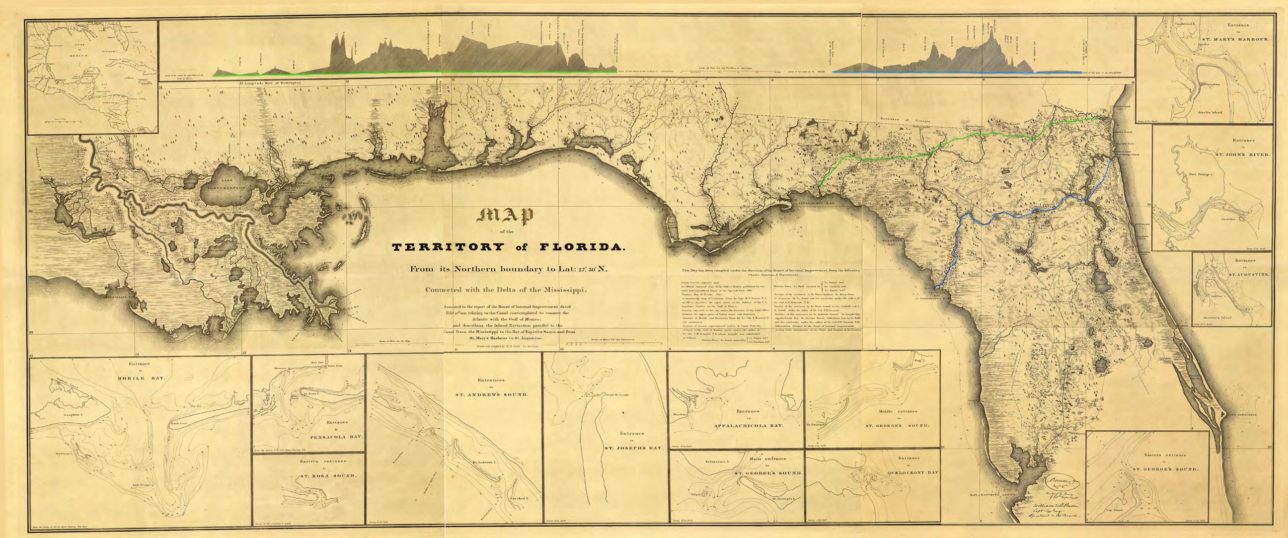
Florida Territory with exquisite detail. This map was cut into three pieces, so I took the majesty of the original drawing. and the Gulf of Mexico. So the Surveyors performed a topographic survey with profiles at the topo of the map. as close as I could visually and following what the map details show. I then did a profile attached those results as a pdf.
https://fsms.memberclicks.net/assets/docs/SurveyingDocs/2_FloridaNorthernTerritory_Feb19_1829.pdf


The Florida Surveyor Page 43
From the desk of Rick Pryce:
Just because it’s on this map got me curious about what they actually drank back onboard ships. A little research and …..turns out they really did drink a lot of beer/rum, a daily ration and a reward, times haven’t changed that much. Would be Pirates…………
“It cannot be denied that sailors drank large quantities of alcohol. The average alcoholic beverage consumption across the drinking-age population in the early Republic stood at about 6.8 to7.1 gallons per person per year, whereas a sailor receiving his full spirit ration every day consumed slightly over 27 gallons per year.” USS Constitution Museum
Drink in the "Grog" Tub: Beer, Rum, and Whiskey
Beer on Board in the Age of Sail — Smithsonian Libraries and Archives/Unbound


October 2023 Page 44

From the desk of Rick Pryce:
To continue on with this series, we come to the US Office of the Coast Survey.
The surveys conducted and produced under them of the entire coast of the United States were extensive. The results of which were all works of art based on Surveyors, Cartographers, and Scientists, the brightest minds of the time. The one I have attached and provided a link to download is “Sketch F – Section VI”, just one in a series produced under A.D. Bache (great grandson of Benjamin Franklin) that shows the progression of the Coastal Surveys 1848-1856 of the Peninsular portion of Florida. The details and art work is amazing.


Side note: The bottles thrown overboard were to map and understand the currents along the coast and yes most of the bottles used were Rum bottles.
Download Map 3: https://fsms.memberclicks. net/assets/docs/SurveyingDocs/3_SketchF_ USCoastalSurvey1856.pdf
Page 46
From the desk of Rick Pryce:
History:
The Office of the Coast Survey, founded in 1807 by President Thomas Jefferson and Secretary of Commerce Albert Gallatin, is the oldest scientific organization in the U.S. Federal Government. Jefferson created the Survey of the Coast, as it was then called, in response to a need for accurate navigational charts of the new nation's coasts and harbors.
Those performed in 18431867 were extensive under Superintendent A.D. Bache.
Alexander Bache 1806-1867 was born in Philadelphia, the son of Richard Bache, Jr., and Sophia Burrell Dallas Bache. He came from a prominent family as he was the nephew of Vice-President George M. Dallas and naval hero Alexander J. Dallas.

He was the grandson of Secretary of the Treasury Alexander Dallas and was the great-grandson of Benjamin Franklin.
U.S. Coast Survey (Office of Coast Survey)
The Office of Coast Survey is the official chart-maker of the United States. Set up in 1807, it is one of the U.S. governments oldest scientific organizations. In 1878 it was given the name of Coast and Geodetic Survey (C&GS). In 1970 it became part of the National Oceanic and Atmospheric Administration (NOAA).
The agency was established in 1807 when President Thomas Jefferson signed the document entitled An act to provide for surveying the coasts of the
The Florida Surveyor Page 47
Frontier Precision has the latest LiDAR photogrammetry innovations to fit your job or application. Our staff has the knowledge and real-world experience to help you select the solution that’s best for you and the training to make you more proficient and profitable. Just as important, our professional services group can help you implement LiDAR and photogrammetry solutions on your next project – from field data capture to data processing – we have the expertise to make sure your project is done right.
YOUR LIDAR & PHOTOGRAMMETRY SOLUTIONS EXPERTS.
The YellowScan LiDAR UAV delivers the highest level of accuracy and density for real-time georeferenced point cloud data. Lightness and accuracy combine for a LiDAR solution that works hard for you.


Emesent automates the collection and analysis of data in challenging GPS-denied environments, delivering revolutionary efficiency, safety, and operational insights to underground mining and other industries. It’s core areas of expertise are drone autonomy, SLAM-based LiDAR mapping, and data analytics.
Joey Civello | 904.477.6662 [Cell] or jcivello@frontierprecision.com
October 2023 Page 48
FIND OUT MORE AT www.frontierprecision.com/lidar FRONTIER
PRODUCTS | TRAINING | REPAIR | RENTALS | TECHNICAL SERVICES
PRECISION 8301 Cyprus Plaza Drive, #107 Jacksonville, FL 32256
United States. While the bills objective was specific—to produce nautical charts—it reflected larger issues of concern to the new nation: national boundaries, commerce, and defense.
The early years were difficult. Ferdinand Rudolph Hassler, who was eventually to become the agency’s first superintendent, went to England to collect scientific instruments but was unable to return through the duration of the War of 1812. After his return, he worked on a survey of the New York Harbor in 1817, but Congress stepped in to suspend the work because of tensions between civilian and military control of the agency. After several years under the control of the U.S. Army, the Survey of the Coast was reestablished in 1832, and President Andrew Jackson appointed Hassler as superintendent.
The U.S. Coast Survey was a civilian agency but, from the beginning, members of the Navy and Army were detailed to service with the Survey, and Navy ships were also detailed to its use. In general, army officers worked on topographic surveys on the land and maps based on the surveys, while navy officers worked on hydrographic surveys in coastal waters.
Alexander Dallas Bache, great-grandson of Benjamin Franklin, was the second Coast Survey superintendent. Bache was a physicist, scientist, and surveyor who established the first magnetic observatory and served as the first president of the National Academy of Sciences. Under Bache, Coast Survey quickly applied its resources to the Union cause during the Civil War. In addition to setting up additional lithographic presses to produce the thousands of charts required by the Navy and other vessels, Bache made a critical decision to send Coast Survey parties to work with blockading squadrons and armies in the field, producing hundreds of maps and charts. Bache detailed these activities in his annual reports to Congress.
Coast Survey cartographer Edwin Hergesheimer created the map showing the density of the slave population in the Southern states. Bache was also one of four members of the governments Blockade Strategy Board, planning strategy to essentially strangle the South, economically and militarily. On April 16, 1861, President Lincoln issued a proclamation declaring the blockade of ports from South Carolina to Texas. Baches Notes on the Coast provided valuable information for Union naval forces.
Maps were of paramount importance in wartime: It is certain that accurate maps must form the basis of well-conducted military
The Florida Surveyor Page 49
operations, and that the best time to procure them is not when an attack is impending, or when the army waits, but when there is no hindrance to, or pressure upon, the surveyors. That no coast can be effectively attacked, defended, or blockaded without accurate maps and charts, has been fully proved by the events of the last two years, if, indeed, such a proposition required practical proof. — Alexander Dallas Bache, 1862 report.
Coast Survey attracted some of the best and brightest scientists and naturalists. It commissioned the naturalist Louis Agassiz to conduct the first scientific study of the Florida reef system. James McNeill Whistler, who went on to paint the iconic Whistlers Mother, was a Coast Survey engraver. The naturalist John Muir was a guide and artist on Survey of the 39th Parallel across the Great Basin of Nevada and Utah.
The agency’s men and women (women professionals were hired as early as 1845) led scientific and engineering activities through the decades. In 1926, they started production of aeronautical charts. During the height of the Great Depression, Coast and Geodetic Survey organized surveying parties and field offices that employed over 10,000 people, including many out-ofwork engineers.
In World War II, C&GS sent over 1,000 civilian members and more than half of its commissioned officers to serve as hydrographers, artillery surveyors, cartographers, army engineers, intelligence officers, and geophysicists in all theaters of the war. Civilians on the home front produced over 100 million maps and charts for the Allied Forces. Eleven members of the C&GS gave their lives during the war.
October 2023 Page 50
SUPPORT FSMPAC TODAY!
Your contribution can make a monumental difference in ensuring that our profession thrives and our voices are heard where it matters most. Join FSMPAC and become a driving force for the future of Surveying & Mapping in Florida.
FSMPAC, the Florida Surveying & Mapping Political Action Committee, is your ticket to shaping the future of our profession. Our mission thrives on the generosity of dedicated Surveyors and Mappers who want to champion and safeguard our profession. Your contributions go toward researching, identifying,and supporting candidates who champion our concerns.

Le arn More & Donate Here
From the desk of Rick Pryce:
I try to ensure these maps are the highest quality so you can print and display them to others. There’s just something about a great map. It creates thoughts and discussions between professionals, scholars and lay persons. It transports you back in time to when it was created, what they were doing and planning, and how they saw the world. And if done with the eye of an artist, the detail of a Cartographer/Surveyor, it creates a masterpiece, one of a kind.
We’ll continue this map series with the Cross-Florida Canal saga that never got built. I just love a Great map with a back story ………………….

Remember this image below from Part 2, and I compared the blue line profile with Google Earth profile today?
Well in 1879 they revisited the Cross-Florida Shipping Canal with a more extensive and detailed survey along the northern (Green) route, and created an exquisitely fine map of the project showing the original proposed barge canal route from 1829, the new route based on the survey, and a proposed alternate route.

October 2023 Page 52
From the desk of Rick Pryce:
What started as the profile from February 1829 below,

Grew into a serious topographic survey and engineering project design with a series of proposed locks starting at Camp Pinckney of the St Mary’s River and running to St Marks River south of Tallahassee. (Below)

The Map is titled below:

The Florida Surveyor Page 53

October 2023 Page 54
See the full map below and download a high-resolution version (72megs) here: https://fsms.memberclicks.net/assets/docs/SurveyingDocs/4_ FLoridaShipCanal1879.pdf
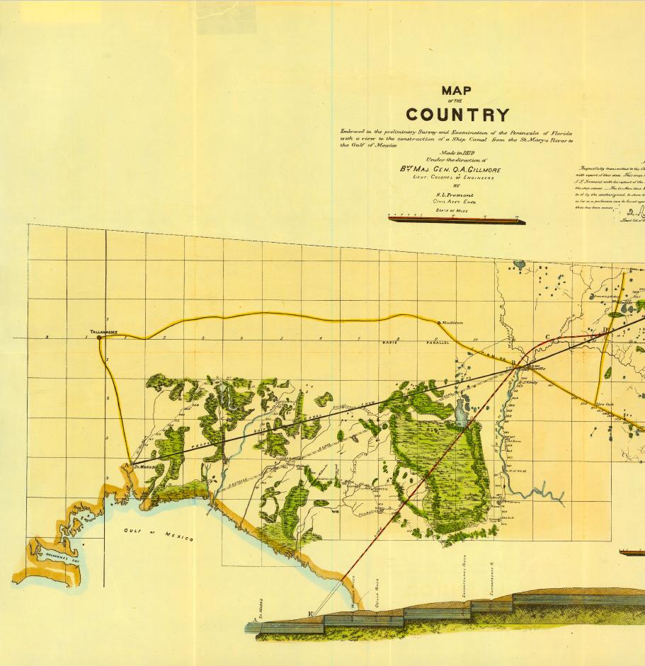
The Florida Surveyor Page 55
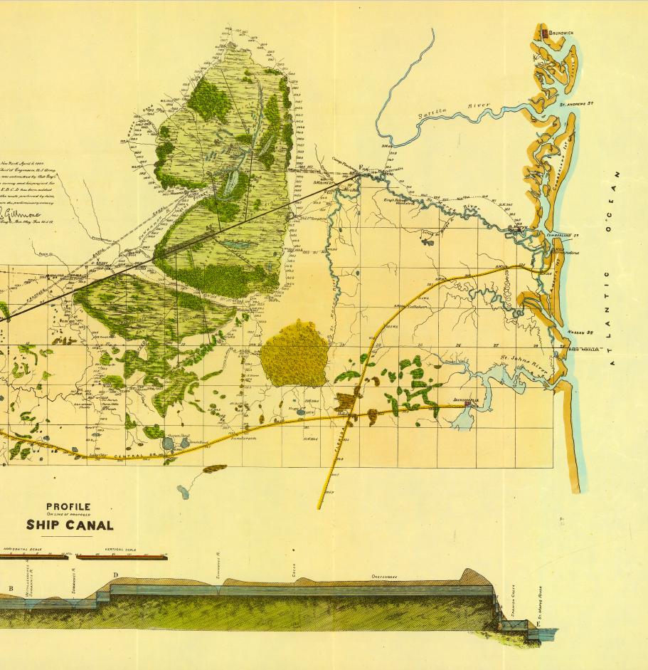
October 2023 Page 56
YOUR FIELD-TO-FINISH SURVEY PARTNER

As surveying technologies continue to advance, a trusted and knowledgeable partner can help you stay ahead of the game. For over 75 years Duncan-Parnell has provided leading-edge products and services to help surveyors succeed.

•Robotic Total Stations
•Trimble GNSS Instruments
•UAS/Drone Solutions

•Technical Training
•Software for Survey & Mapping
•Survey Supplies


•Instrument Repair & Maintenance
•Monitoring Solutions
www.duncan-parnell.com


Jacksonville, FL (904) 620 - 0500
Orlando, FL (407) 601 - 5816
From the desk of Rick Pryce:
Let’s all take a step back in time to see the progression of Maps & Surveys of Florida in sequence and the years leading up to Civil War and after Statehood. I have hand picked seven of the best quality for you in this series, all in color, and each one is a large high-quality PDF so downloads are available.
As a Surveyor, artist, and survey history buff, these reflect the wild Florida in its early stages of development, from some of the best map makers in the country at the time. The last two are particularly nice and in full color and highest of quality for the time.
Hope you enjoy them.
1. John Williams Map of Western part of Florida 1827,
October 2023 Page 58

John Williams Map of Western part of Florida 1827,

Page 60
1.
2. Map of the Seat of War of southern half of Florida compiled under the direction
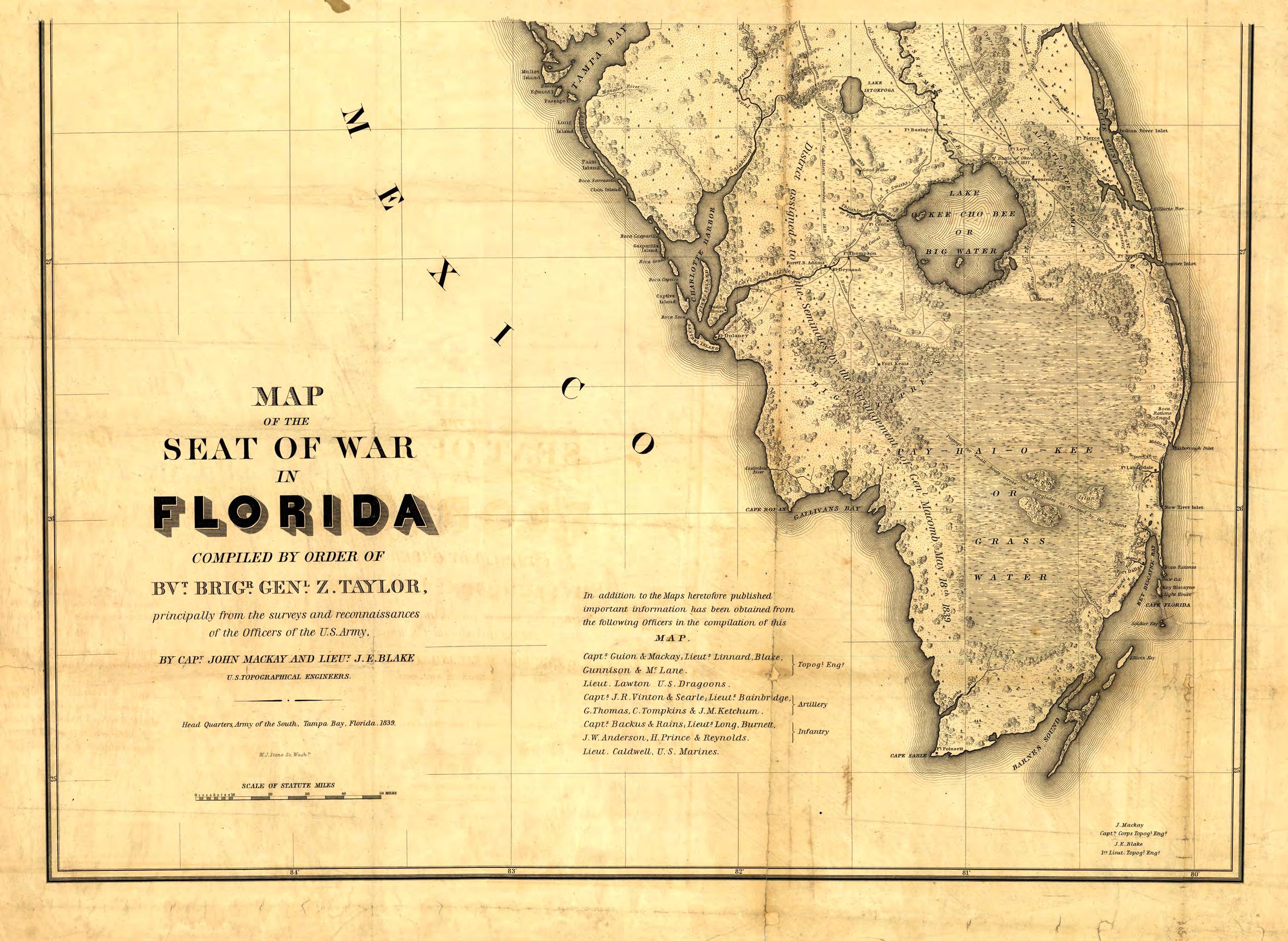 of Brigadier General Zachary Taylor 1839,

3. 1838 Plat of Surveys Territory of Florida by Survey General Robert Butler,
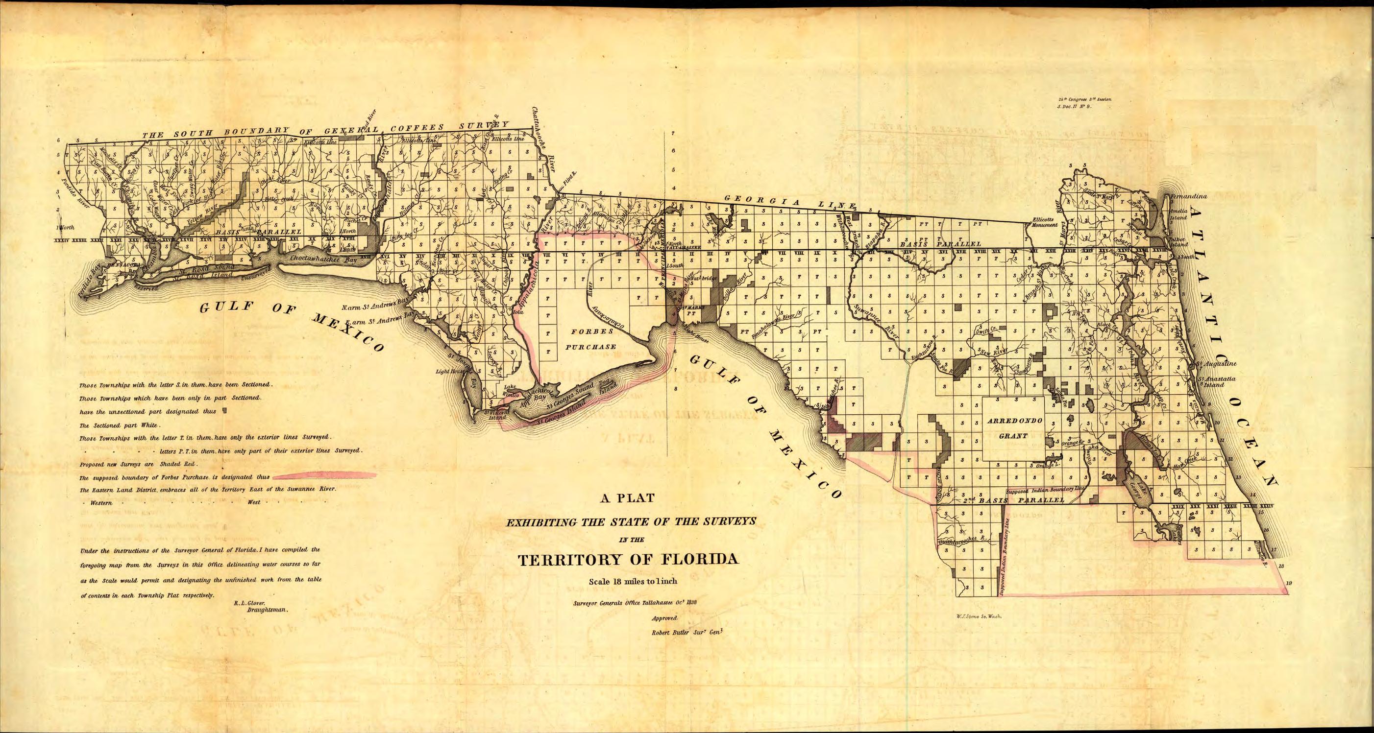
The Florida Surveyor Page 63

October 2023 Page 64

4. 1851 Plat of Surveys in the State of Florida by B.A. Putnam, Survey General,

Page 66
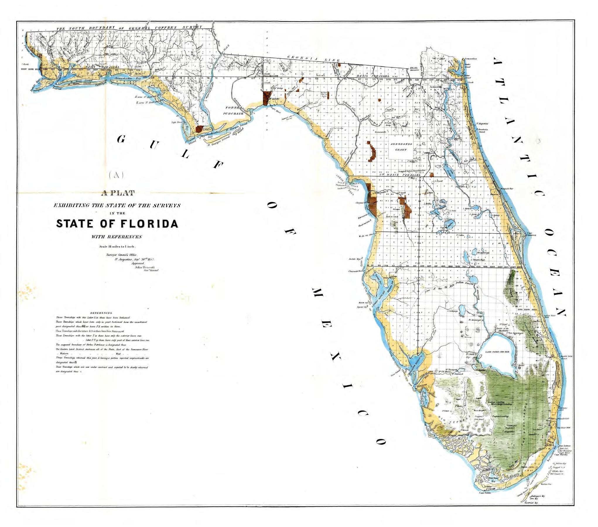
5. 1853 Plat of Surveys in the State of Florida by John
 Wescott, Survey General,
Page 68
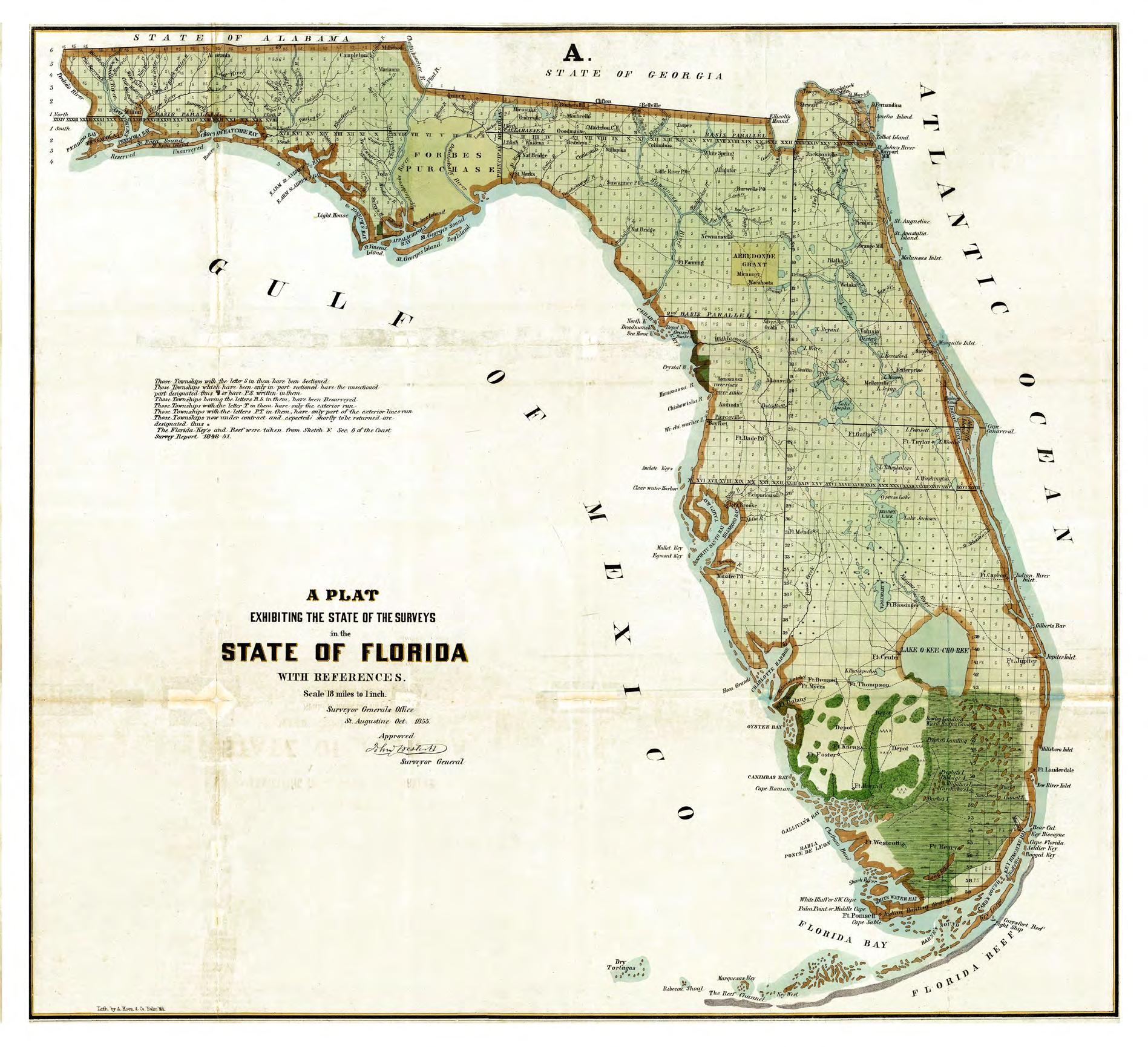
6. 1855 Plat of Surveys in the State of Florida by
 John Wescott, Survey General,
Page 70
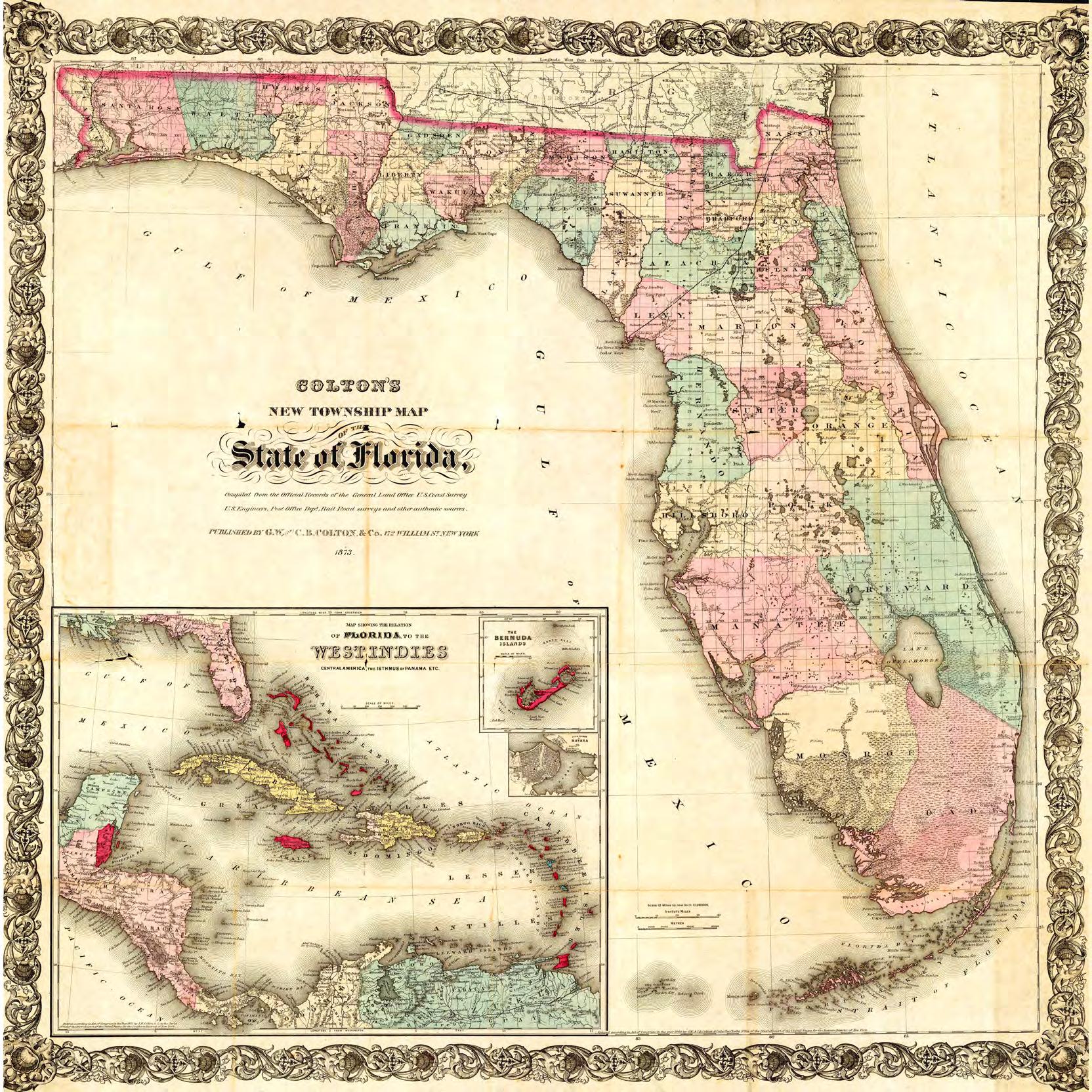
7. And Finally the exquisitely detailed and colored 1873
Colton’s New Township Map of the State of Florida
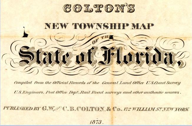

Page 72
W HY FSMS?
FSMS is a professional membership society representing the Surveying & Mapping Profession, including: Photogrammetry, Imagery, Remote Sensing, Base Mapping, GIS/LIS, Cartography, Geodesy, Geomatics, GPS, Geographic Information and Geospatial Data.
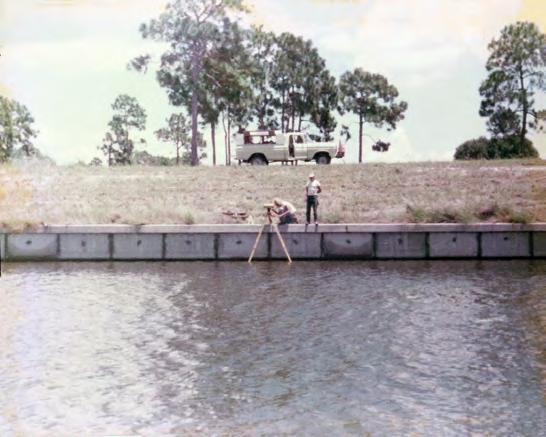
MEMBERSHIP OPPORTUNITIES
• NETWORKING
• CONTINUING EDUCATION
• LEGISLATIVE FSMPAC
• PROMOTING THE PROFESSION
• PROTECTING LICENSURE
• ADDRESSING UNLICENSED PRACTICE
• ENCOURAGING FUTURE SURVEYORS

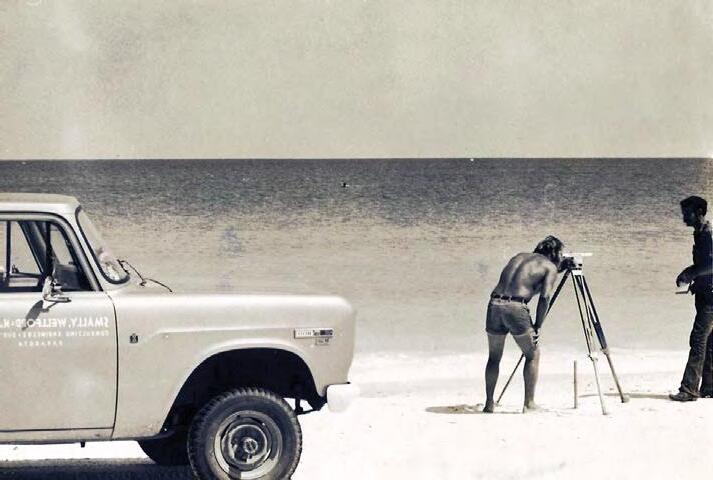

• AWARDS & SCHOLARSHIPS
• CAREER OPPORTUNITIES

October 2023 Page 74
Billing Address of Credit Card: _____________________________________________________________________ Signature: _____________________________________ __
IF PAYING BY CHECK, MAIL FORM TO: FSMS, P.O. Box 850001-243, Orlando, Florida 32885-0243
IF PAYING BY CREDIT CARD, FAX OR EMAIL FORM TO: 850.877.4852 education@fsms.org QUESTIONS? CALL 800.237.4384
FSMS Member EMAILED Fee Quantity Amount 6 CEC $115 Per Course x = $ 3 CEC $58 Per Course x = $ MAILED 6 CEC $125 Per Course x = $ 3 CEC $68 Per Course x = $ TOTAL $ Non-Member Non-Licensed in ANY State Name: ___ YES ___ NO Firm: ___________________ _ YES _ _ NO Address: ______________________________________________________________________________________ City/State: Email Address: __________________________________________ Work Phone: Payment Information: ________ Check Enclosed (Payable to FSMS) ________ VISA/MasterCard/American Express Card
Exp. Date: __ CVV Code:___________
Step 2: Choose Member Type
#: _______
Provider
The Florida Surveyor Page 75
No. CE11 fsms.org
Greetings once again to my fellow surveyors in government and those who read this article. It has been a few months since my last article, and my apologies for that. I am trying to get back on the monthly ball of having an article ready. I know in the past I had a big talk about environment preservation for infrastructure. I know I have talked to a number of other government surveyors about the state of development within their jurisdictions. As you look at Florida, most of the counties are still rural. I work in a heavily developed region of the state, and as we know the south Florida region is heavily developed as well and forever pushing into sensitive lands.

Although I work in a heavily developing region, I live in an area that is not heavily developed but is on the cusp of being impacted by development, just as many other other rural jurisdictions are experiencing. As surveyors we find that development is good for business, but we all find we are left with congested roadways, depleting infrastructure, impact on wildlife, and a change of community.
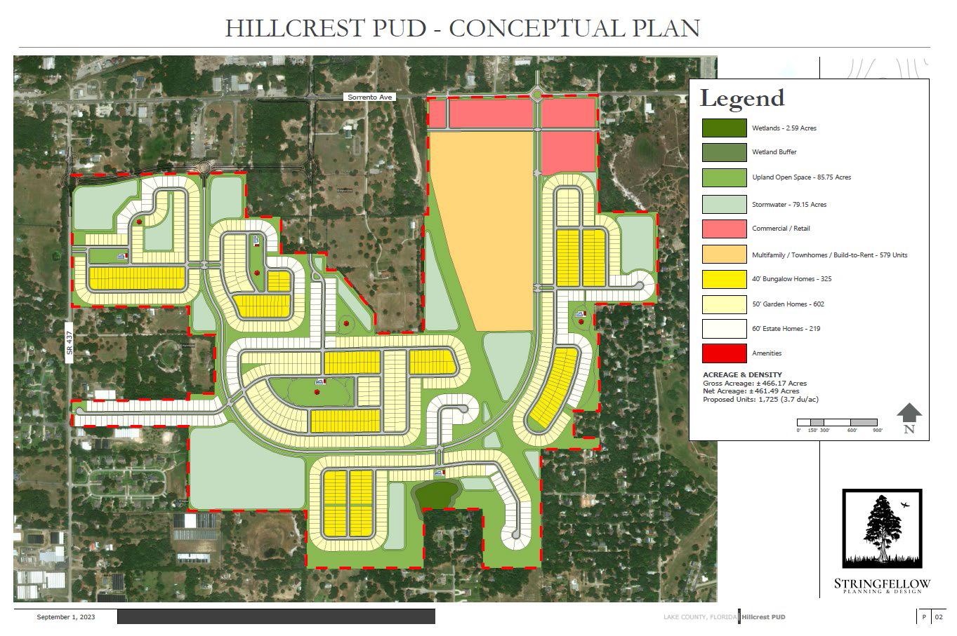
October 2023 Page 76
In my neighborhood of Mount Plymouth, it is a close-knit community of less than 1,000 people. I have read some numbers of less than 750 people as it is a combination of many old subdivisions and large tracts of land. In the map below you can see the area in blue is the existing community and the red is the Hillcrest PUD, which proposes to put 1,752 homes on 461 acres. For me in this area that I have spent most of the 45 years of my life living, it is heart breaking. As a surveyor, this is good work but as surveyors we are not all just about build, build, build!

I think a large number of us like land conservation and preventing urban sprawl, but that is hard to do when everyone wants to move here. We are an income tax free state as you know. In addition, our lack of snow and good weather are not helping us either. I do like all that but it can be heart breaking. Couple this with the rate of investors buying up real estate and making it difficult for our children to be able to afford to buy a home is concerning as well. Development can be a good thing for our industry but it can be detrimental as well.
I could not imagine the strain of development has put onto rural communities who have a lack of resources to keep up with demand. I am fortunate that it is not just me representing survey for the City of Orlando, I have a number of staff that work with me to insure development is done properly. I know there are many communities that are lucky to have a licensed surveyor or a field crew.

The Florida Surveyor Page 77
I find the more you can check what is being submitted the more likely you are to keep developers honest. Old saying of you build fences to keep the honest people out.
For those lifelong Floridians I want to ask you, what is your legacy that we leave to our children and grandchildren? Do we leave them a bunch of houses and strip malls? Do we leave them a community? Or does it matter what we leave them? A home is whatever we make of it, but it can be difficult to adjust to what an overdeveloped home may be. At one respect we are surveyors but in another we are constituents who must express what we envision for our community and place we call home.
Thank you for taking the time to read this article!
Sincerely,
Richard Allen, City Surveyor for the City of Orlando
FSMS Surveyors in Government Liaison

407.246.2788
(office)
Richard.Allen@orlando.gov
October 2023 Page 78

3002 Surveying 352-538-1320 A AA Surface Pro, Inc. 239-471-2668 A. D. Platt & Associates, Inc. 850-329-5551 Agnoli,
Brundage, Inc. 239-597-3111 AIM Engineering & Surveying 239-332-4569 Allen & Company, Inc. 407-654-5355 Allen Engineering 321-783-7443 American Surveying, Inc. 813-234-0103 Amerritt, Inc. 813-221-5200 Arc Surveying
Inc. 904-384-8377 Ardurra,
239-292-7773 Associated
407-869-5002 Atwell,
Avirom
Axis
B Banks Engineering
Barnes,
Barraco
Bartram
Benchmark
Bennett-Panfil,
Bowman
703-454-1000 Bradshaw-Niles
904-829-2591 Brown
561-615-3988 BSE
321-725-3674 Buchanan
C Calvin, Giordano & Associates, Inc. 954-921-7781 Carlson Environmental Consultants, PC 704-283-9765 Carnahan, Proctor & Cross, Inc. 407-960-5980
The Florida Surveyor Page 79
Barber &
& Mapping,
Inc.
Land Surveying & Mapping, Inc.
LLC 866-850-4200
& Associates, Inc. 561-392-2594
Geospatial, LLC 410-822-1441
239-939-5490
Ferland and Associates, Inc. 407-896-8608
& Associates, Inc. 239-461-3170
Trail Surveying, Inc. 904-284-2224 Bello & Bello Land Surveying Corporation 305-251-9606
Surveying & Land Planning, Inc. 850-994-4882
Inc. 941-497-1290 Berntsen International 608-443-2772 Betsy Lindsay, Inc. 772-286-5753 Biscayne Engineering Company, Inc. 305-324-7671 Boatwright Land Surveyors, Inc. 904-241-8550 Bock & Clark Corporation(NV5) 330-665-4821
Consulting Group
& Associates, Inc.
& Phillips, Inc.
Consultants, Inc.
& Harper, Inc. 850-763-7427
202 3 S u S taining
F irm S Directory

Carter
Caulfield
Chastain-Skillman,
CivilSurv
Clements
Clymer
Coastal
Colliers
Collins
Cousins
CPH
Craven-Thompson
Culpepper
Associates, Inc. 772-562-4191
& Wheeler 561-392-1991
Inc. 863-646-1402 CHW Professional Consultants (Causseaux,Hewett & Walpole, Inc.) 352-331-1976
Design Group, Inc. 863-646-4771
Surveying, Inc. 941-729-6690
Farner Barley Surveying, Inc. 352-748-3126
Engineering Associates, Inc. 352-796-9423
Engineering & Design 732-383-1950
Survey Consulting, LLC. 863-606-2155
Surveyors & Associates, Inc. 954-689-7766
Consulting, LLC 407-322-6841
& Associates, Inc. 954-739-6400
& Terpening, Inc. 772-464-3537 Cumbey & Fair, Inc. 727-797-8982
DeGrove
E ECHO
Eiland
Element
Engenuity
October 2023 Page 80
DSurveyors, Inc. 904-722-0400 Dennis J. Leavy & Associates 561-753-0650 Dewberry 407-843-5120 DMK Associates, Inc. 941-412-1293 Donald W. McIntosh Associates, Inc. 407-644-4068 Donoghue Construction Layout, LLC. 321-248-7979 Douglass, Leavy & Associates, Inc. 954-344-7994 DRMP, Inc. 833-811-3767 DroneView Technologies 248-321-9417 DSW Surveying & Mapping, PLC. 352-735-3796 Duncan-Parnell, Inc. 800-849-7708 Durden Surveying and Mapping, Inc. 904-853-6822
UES, Inc. 888-778-3246 Eda Consultants, Inc. 352-373-3541
& Associates, Inc. 904-272-1000
Engineering Group, LLC. 813-386-2101
Group, Inc. 561-655-1151

Engineering Design
Construction,
772-462-2455 ER
305-860-3866 ESP Associates,
803-802-2515 ETM
&
904-642-8550 Exacta Land Surveyors, Inc. 866-735-1916 EXP Energy Services Inc. 305-213-9969 F Ferguson Land Surveyors 727-230-9606 First Choice Surveying, Inc. 407-951-3425 Florida
727-849-7588 Florida
FLT
Ford,
Frontier
G GCY,
H Haley
207-989-4824
239-254-2000 HUB International
Hyatt Survey Services 941-748-4693
The Florida Surveyor Page 81
&
Inc.
Brownell & Associates, Inc.
Inc.
Suryeying
Mapping
Design Consultants, Inc.
Engineering & Surveying, LLC. 941-485-3100
Geosystems 954-763-5300
Armenteros & Fernandez, Inc. 305-477-6472 Fortin, Leavey, Skiles, Inc. 305-653-4493
Precision Unmanned 701-222-2030 F.R.S. & Associates, Inc. 561-478-7178
Inc. 772-286-8083 GeoData Consultants, Inc 407-732-6965 Geoline Surveying 386-418-0500 Geo Networking, Inc. 407-549-5075 GeoPoint Surveying, Inc. 813-248-8888 George F. Young 727-822-4317 Geosurv, LLC 877-407-3734 Germaine Surveying, Inc. 863-385-6856 GPI Geospatial, Inc. 407-851-7880 Gustin, Cothern & Tucker, Inc. 850-678-5141
Ward, Inc.
Hanson Professional Services, Inc. 217-788-2450 Hanson, Walter & Associates, Inc. 407-847-9433 H.L. Bennett & Associates, Inc. 863-675-8882 Hole Montes, Inc.
850-386-1111
202 3 S u S taining

I Ibarra Land Surveyors 305-262-0400 I.F. Rooks & Associates, LLC. 813-752-2113 J John Mella & Associates, Inc. 813-232-9441 Johnston’s Surveying, Inc. 407-847-2179 K KCI Technologies 954-776-1616 Keith and Associates, Inc. 954-788-3400 Kendrick Land Surveying, LLC 863-533-4874 L L&S Diversified, LLC. 407-681-3836 Land Precision Corporation 727-796-2737 Landmark Engineering & Surveying Corporation 813-621-7841 Langan Engineering and Environmental Services, Inc. 973-560-4900 Leading Edge Land Services, Inc. 407-351-6730 Leiter Perez & Associates, Inc. 305-652-5133 Lengemann Corp. 800-342-9238 Leo Mills & Associates 941-722-2460 Longitude Surveyors, LLC 305-463-0912 Long Surveying, Inc. 407-330-9717 M Manuel G. Vera & Associates, Inc. 305-221-6210 Marlin Engineering Inc. 305-477-7575 Massey-Richards Surveying & Mapping, LLC. 305-853-0066 Masteller, Moler & Taylor, Inc. 772-564-8050 McKim & Creed, Inc. 919-233-8091 McLaughlin Engineering, Co. 954-763-7611 Metron Surveying and Mapping, LLC. 239-275-8575 Mills & Associates, Inc. 813-876-5869 Mock Roos & Associates, Inc. 561-683-3113 Moore Bass Consulting, Inc. 850-222-5678 Morris-Depew Associates, Inc. 239-337-3993 Murphy’s Land Surveying 727-347-8740
Directory October 2023 Page 82
F irm S

N Navigation Electronics, Inc. 337-237-1413 Northwest Surveying, Inc. 813-889-92356 NV5, Inc 954-495-2112 O On The Mark Surveying, LLC. 321-626-6376 P PEC Surveying & Mapping 407-542-4967 Pennoni Associates, Inc. 863-594-2007 Perret and Associates, Inc 904-805-0030 Pickett & Associates, Inc. 863-533-9095 Platinum Surveying & Mapping, LLC. 863-904-4699 Point Break Surveying 941-378-4797 Polaris Associates, Inc. 727-461-6113 Porter Geographical Positioning & Surveying, Inc. 863-853-1496 Pulice Land Surveyors, Inc. 954-572-1777 Q Q Grady Minor & Associates, PA 239-947-1144 R Reece & White Land Surveying, Inc. 305-872-1348 Rhodes & Rhodes Land Surveying, Inc. 239-405-8166 Richard P. Clarson & Associates, Inc. 904-396-2623 Ritzel-Mason, Inc. 786-472-0358 River City Surveying & Mapping, LLC 904-675-9300 R.J. Rhodes Engineering, Inc. 941-924-1600 R.M. Barrineau & Associates, Inc. 352-622-3133 Robayna and Associates, Inc. 305-823-9316 S SAM Surveying & Mapping, LLC. 850-385-1179 SCR & Associates NWFL Inc. 850-527-1910 Sergio Redondo & Associates, Inc. 305-378-4443 Settimio Consulting Services, Inc. 850-341-0507 SGC Engineering, LLC. 407-637-2588 Shah Drotos & Associates, PA 954-943-9433 Sherco, Inc. 863-453-4113 Sliger & Associates, Inc. 386-761-5385 202
S u
taining The Florida Surveyor Page 83
3
S
F irm S Directory
Southeastern Surveying & Mapping Corp.
407-292-8580
Stephen H. Gibbs Land Surveyors, Inc.
954-923-7666
Stoner Inc.
954-585-0997
Survey Data Solutions, LLC
352-816-4084
Surveying & Mapping Inc.
239-340-2409
SurvTech Solutions, Inc.
813-621-4929
Thurman Roddenberry & Associates
850-962-2538
TranSystems Corporation Consultants
727-822-4151
WBQ Design & Engineering, Inc.
407-839-4300
Whidden Surveying
561-790-5515
Winnigham & Fradley, Inc.
954-771-7440
UWoolpert, Inc.
803-214-5928
UF/IFAS School of Forest, Fisheries, and Geomatics Sciences
352-846-0850
Upham, Inc.
386-672-9515
ZZNS Engineering, LLC.
941-748-8080
SOCIAL MEDIA LINKS

T2 UES Inc.
407-587-0603
Tectonic Engineering and Surveying Consultants

845-534-5959
Wade Surveying, Inc.
352-753-6511
Wallace Surveying Corp.
561-640-4551
Wantman Group, Inc.(WGI)
561-687-2220
LinkedIn = 758 Followers
Facebook = 852 Followers
X = 408 Followers
Instagram = 233 Followers
YouTube
T
W
October 2023 Page 84
FACES ON THE FRONTIER
FLORIDA SURVEYORS AND DEVELOPERS IN THE 19TH CENTURY
by Dr. Joe Knetsch
CHAPTER 1
A BRIEF LIFE OF ROBERT BUTLER: SURVEYOR GENERAL OF FLORIDA
On February 22, 1824, Andrew Jackson wrote to John Coffee the follow ing, “I found shortly after my arrival here that the surveyor Genls office for the Floridas was intended for Colo Preston late governor of Virginia, he had been appointed commissioner of land claims, held it nearly two years, recd the emoluments, and never went there. I had, in justice to Colo Butler, to interpose his claim, and bring to Mr Monroes recollection his promise to do something for Butler, and I have obtained his promise that he shall be provided for in Florida, and Mr Preston provided for otherwise.” 1 Thus, through the direct intervention of Andrew Jackson, Robert Butler became the first Surveyor General of Florida in 1824. This office carried with it very heavy responsibilities, including setting out the territorial capitol, hiring the first surveyors and establishing the integrity of the sur veys offered for acceptance. In performing these duties over an extended period of time from 1824 to 1848, Robert Butler performed a service for the State of Florida that should never be forgotten.
1 The following sketch of the life of Robert Butler was presented on behalf of the Northwest Florida Chapter's nomination of the Butler grave site for the National Register of Historic Places. Its purpose was to quickly show the importance of Florida's first Surveyor General to the history of the Territory and the Nation. His life needs little introduction to the professional land surveyors of Florida because each follows,
The Florida Surveyor Page 85
to some degree, the dictates, orders or instructions Butler sent to the pioneer surveyors of Florida's vast frontier. In the daily life of most surveyors, the name of Robert Butler appears on plats, instructions or some other historic document that sets the pattern for public land surveys in our state. It is hoped that this brief biography will add a bit more depth to our understanding of this cautious and steady leader of Florida's first surveys.
T he Correspondence of Andrew Jackson , Volume III, 229.
But ler began life on December 29, 1786, the eldest son of Colonel Thomas Butler, a Pennsylvania born Revolutionary War veteran and career officer in the United States Army. The life of a career officer led Thomas Butler through many moves and family displacements. One of the moves, however, put him in David son Count y, Tennessee, and a near neighbor to Andrew Jackson, with whom he became close friends. Upon Thomas Butler's tragic death in 1805 from the Yel low Fever epidemic in New Orleans, at the request of the father, Andrew Jackson extended a “father's guidance” over the career of young Robert A. Butler. At this point in his life, the young Butler was over six feet in height and noted for his fine physical appearance. Being reared in a military family, young Robert A. Butler turned to the military for his career, although the exact nature of his training is unclear. 2
Be ing the eldest son also gave young Butler much of the estate that his father had accumulated, including plantation lands near to Jackson's. The nearness to Jackson and the society of Nashville gave Butler some advantages in social learn ing and e conomic advancement. One of the main advantages was the love of horse racing, the favorite sport of the planter class. Also a lover of this sport was Rachel Jackson, the General's wife, and her favorite niece, Rachel Hays. Miss Hays was one of the more attractive and sought after young ladies of her day and Robert Butler became the victorious suitor. They were married at the “Hermit age ” on August 29, 1808. The marriage not only made Butler a “relative” of Andrew Jackson, but also of the Hays and Donelson families, two of the more important families in frontier Tennessee. The marriage also brought other eco nomic advantages that allowed Butler to advance in the amount of land and slaves owned. Robert Butler was well on the way to becoming one of the more success ful plant ers in western Tennessee.
October 2023 Page 86
2 Mary L. Davis, “Robert Butler: An American Pioneer,” 1939.
At this point in his life, the United States went to war with Great Britain in the War of 1812. In recognition of his previous military training and political con t acts, he began the conflict with the rank of captain. According to his “memoir”, published in the Nashville Union , in 1849, Butler served in some of the more important campaigns in the western theater of the war. He served in the invest me nt of Camp Meigs under General Clay Green, of Kentucky, in early 1813. He accompanied General, later president, William Henry Harrison on his campaign into Upper Canada and fought at the Battle of the Thames. He was present at the re-occupation of Detroit, serving as the Adjutant-General for the Eighth Military Department. Presumably, he was promoted to the rank of major with this assign me nt, for when he is transferred to the Seventh Military Department, then under Andrew Jackson, he is listed as “Colonel” Robert Butler. For Butler, one of his most important services was the service on a board of officers that was “mainly instrumental in saving the troops from famine,” in Detroit, the lakes being frozen over in that year. 3
His t ransfer led him into the thick of the fighting verses the Creek Indians in Southern Alabama. Here he raised troops to assist in the fighting under General John Coffee, later Surveyor General of the lands south of Tennessee. The object was to chastise the commander at Pensacola, who was correctly suspected of providing t he Creeks with weapons. Jackson's force soon penetrated Florida and proceeded to Pensacola, where, by rapid movements, the General essentially surprised the enemy and with quick charges took the out-lying batteries. After entering Pensacola and dispatching the Indian faction, Jackson's men, including Butler, returned to Mobile, reinforced its defenses and headed toward New Orleans, the suspected target of British operations. 4
4 Ibid
T he transfer to the Southern District, as Jackson called it, brought him into contact with many of his former friends and future associates, including Richard Keith Call, two-time governor of Territorial Florida, who frequently shared mess with him. Call also recalled sharing the privations
The Florida Surveyor Page 87
3 Davis, 51.
Faces on the Frontier
of campaigning and his tent with “the friend of my youth.” 5 He was soon assigned recruiting duty in western Tennessee. Butler arrived back at headquarters in time to actively participate in the famed Battle of New Orleans. According to Call, he was heavily engaged in the fighting on January 8, 1815, when General Packenham and many others fell to American arms. For his part in the battle, he was one of three officers chosen to accept the surrender from the British commander at the close of the battle. 6 After this service, he immediately resumed his recruiting duties, assisting General Coffee in raising a force to fight the “Red Stick” faction of the Creeks. 7
5 J. Roy Crowther, The Grand Lodge of Florida Free and Accepted Masons History, 1839-1989 (Jacksonville: Drummond Press, 1990), 10.
6 Donald E. Merkel, Colonel Butler and The Public Land Survey of Florida (1824-1849) (Tallahassee: Florida Department of Transportation, 1974), 2.
7 Davis, 52.
S hortly after the triumph at New Orleans, Jackson and his staff returned to Ten ne ssee. Although Butler had been assigned to assist Coffee, he soon was back at his plantation attempting to get his affairs in order. In December of 1817, Jackson received orders to move his men out and drive the Creeks and Seminoles out of American territory and then out of Florida, technically a neutral area. The march took Butler through western Georgia and into Florida on the Apalachicola River. From Fort Gadsden, on said river, the march went nearly straight to the heart of the Miccosukee territory near the lake of the same name. There, a brief skirmish with the Indian forces under Kinhage took place and many cows, scalps and other goods were taken. As the enemy fled south, Jackson's forces followed hotly in pursuit. Another skirmish was fought near Suwannee Old Town and many prison e rs and cattle were taken. The army then, after the capture of Arbuthnot and Arm brist er, two British subjects suspected by Jackson of arming the Indians, held a court martial at St. Marks, Florida. Robert Butler, who had participated in the trial in which both men were found guilty as charged, signed the execution order. The executions caused a major international incident, which was soon smoothed over by tactful diplomacy.
October 2023 Page 88
Dr. Joe Knetsch
After this exciting and dangerous mission had been completed, Butler was assigned to be the secretary to the commission negotiating with the Chickasaw nation. As secretary, Butler was assigned the duty of delivering the treaty in per son to the president, James Monroe. Jackson wrote to the president, “Sir, This will be handed you by Colo. Robert Butler Adjutant Genl of the Southern Divi sion, and who acted as Secretary to the commission charged with holding a treaty with the chikisaw [sic] nation, who I beg leave to introduce to your personal knowledge as a good citizen & valuable officer who has served throughout the whole Southern campaigns in the late war, and accompanied me in the late campaign ag ainst the Seminoles, and to whom I beg leave to refer to you for any infor mation on the subject of the latter campaign.”8 Although Calhoun, in his efforts to embarrass Jackson, accused Butler of putting in “exorbitant” rates for his rooms and meals, Butler had the total confidence of Jackson, and later, Monroe. 9 Butler remained in Washington after delivering the papers and kept Jackson fully informed on the actions of his enemies and the passage of the treaty. 10
Upon returning to Tennessee, Robert Butler began to get his affairs in order. He remained on “duty” as Jackson's Adjutant, a very important post in the turbu le nt political climate of the day. In early 1819, he began getting Jackson's papers in order and notified the General of a certain letter book that had disappeared from the collection. He voluntarily took it upon himself to oversee the organization of these papers so Jackson could quickly and effectively answer his many critics, especially Calhoun and William Crawford of Georgia, both of whom viewed Jackson as a dangerous political rival for the presidency. During this period, Jack son frequently called on Butler's services to answer his critics and those who may have felt slighted by certain rumors or comments in the press. 11 As an honorary reward for his contributions during the Florida campaign of 1817-18, Butler was given the command of the party overseeing the exchange of flags at St. Augustine, in 1821.
The Florida Surveyor Page 89
8 The Papers of Andrew Jackson , Volume IV, 1816-1820 , 1994, 245.
9 Davis, 55.
10 The Papers of Andrew Jackson , VI, 1816-1820 , 255-56.
Faces on the Frontier
11 Ibid , 290-91; 400-01.
As a reward for his many services, Monroe, on Jackson's urging, appointed Butler the first Surveyor General of Florida in 1824. The tasks before him were of great magnitude. As the government depended upon the sale of public lands for financial support, there was a great urgency in the directives coming from the General Land Office to Butler. After seeing that the confirmed Spanish land grants were laid off and separated from potential public lands, Butler was charged with running out the Prime Meridian, Basis Parallel and laying out the new capitol, Tallahassee. Recruiting some of the finest public surveyors available, Butler had these tasks accomplished in remarkably quick time. However, the very nature of Florida's land, the belief that the rainy season was unhealthy, nay deadly, and the lack of transportation led to a slow start for the public surveys and the sale of usable, cultivatable lands. The large number of “impassable swamps” in Florida made the accomplishment of any survey very difficult. Because the 1820s were, apparently, very wet, many surveyors had to request extensions of time for the completion of their contracts. Additionally, experiments in surveying, such as the “compound meander”, were tried but proved ill-advised, taking up additional time and public monies. His task as the first Surveyor General was not an easy one.
Aft er laying out Tallahassee, where he purchased a lot, Robert Butler began to purchase land around the beautiful Lake Jackson, name in honor of the General. The plantation he established was situated on the northern shore of the lake with a beautiful view and fertile land. For some, yet unknown reason, he attempted to sell the plantation in 1833, but, luckily, found no takers and remained on the land until he passed from this world. The advertisement for the land, however, gives the excellent picture of the extensive nature of his holdings:
P lantation for Sale.— Considerations of private interest in the west, induce me an offer for sale, my tract of hammock land, on which I reside, bordering on Lake Jackson, five miles from Tallahassee. This tract, combining quality, fertility, & beauty of situation, together with extensive improvements, is perhaps not surpassed by any other in the Territory of Florida, and affords at once a residence for a large
October 2023 Page 90
Dr. Joe Knetsch
family, with every convenience suiting taste and comfort. An extensive dwelling-house & kitchen, cotton-gin, and press, corn-mill, sugar-house, sta bles, etc. etc., of the best materials with a beautiful garden spot, well supplied with choice fruit and shrubbery, and a young orchard in a state of towardness of choice fruits of different kinds, and many springs of delicious water. Nearly three hundred acres in cultivation, and about five hundred under fence, wanting but little repair. Time will be afforded to meet the payments, for a large portion of the purchase money, they being well secured, and an indisputable title will be given the purchaser…Apply to the subscriber on the premises. Robert Butler. Lake Jackson, November 16th 1833.
From the first purchase of portions of this land, in 1825, until just eight years later, all of these improvements were made. The fact that this extensive plantation existed at all at this period is remarkable and speaks to the industry of Butler and his labor force. 12
12 Tallahassee Floridian, November 30, 1833.
T his plantation became one of the showplaces of Middle Florida and the center of much of its social life. Ellen Call Long, in her famous Florida Breezes , and others, have described the life of the Colonel and his family on his Lake Jackson plantation. Mrs. Long, the daughter of Richard Keith Call, noted in her volume that the roses were the Colonel's pride and joy. His farm included an orange grove (in first bearing), a sugar cane field that stretched to the lake's shore and, of cour se, cotton fields. She also wrote of the main house as having two halls, one crossing the other, where dances and other social events took place, “detached rooms, called offices,” which were where the men retired to discuss business, and other family rooms. The halls were described as “spacious.” The main social event of the season was held at Butler's estate and was known as the “feast of roses.” The food and drink consumed there were of the finest quality and in ample quantity. Although it was situated five miles from Tallahassee, the social season always included Butler's feast. 13
13 Long, Ellen Call, Florida Breezes, (Gainesville: University of Florida Press, 1962. Reprint of 1883 edition), 116-18.
The Florida
Page 91
Surveyor
Faces on the Frontier
Colone l Robert Butler was an active participant in the affairs of the community. In conjunction with other Masons, he was instrumental in founding the Andrew Jackson Lodge in Tallahassee, on December 19, 1825. He was also a mover behind the founding of the first school in Tallahassee, the sessions being held in the Mason Lodge building. He was also active in the affairs of the Presby t erian Church and was the vice-president of the Agricultural Society of Middle Florida. 14
14 Crowther, The Grand Lodge of Florida Free and Accepted Masons History, 1830-1989, 12-13.
It is not surprising that four other of the first masons were U. S. Deputy Sur veyors, who served under Butler. Romeo Lewis, later Sheriff of Leon and Jackson Counties, LeRoy May, Davis Floyd and Major Benjamin Clements, who surveyed the Prime Meridian and the Western half of the Basis Parallel, were these surveyor s. Included in the first group of surveyors that were hired by Robert Butler, was Henry Washington, considered by the Bureau of Land Management's historian as one of the nations finest and most accurate, the Donelson brothers—Butler's cousins—Charles C. Stone, who ran the eastern half of the Basis Parallel, Thomas White, William McNeill, who ran one of the lines between Georgia and Florida, and R. C. Allen, later territorial Circuit Judge. These men, all whom were leaders in the community in their own right, made up the core group of surveyors in early Florida. Although some “mistakes” did occur, on the whole, these surveyors were remarkably accurate for the first run. Butler, whose integrity was never in doubt, always supported his men when the occasion arose and often encouraged them to exercise their best judgment. From the large volume of correspondence available, it is readily apparent that these men held their leader in high esteem.
But ler was not only the first but also the longest serving Surveyor General in Florida's history. Therefore, he may be judged fairly on the accuracy of the surveys completed under his regime and the lack of controversy about the surveys in general. Overall, professional land surveyors of today give Butler very high marks because most of the early surveys, considering the relatively crude instruments used, are remarkably accurate and can be followed in the field to this day. This holds true, especially, for the work done by Washington, Clements, Benjamin F. Whitner Jr., Arthur M. Randolph and others. Of course, some of the early surveys contained major
October 2023 Page 92
Dr. Joe Knetsch
errors or incorrect directions, however, compared to his immediate successor and other state surveyor generals, Butler still ranks as one of the best.
From the above description of this important man's life, it can be readily seen that his homestead deserves to be placed upon the National Register of Historic Places. However, the dwelling house and some of the out buildings were burned in 1886, long after the Colonel had passed to his reward, in 1860. While he lived there, he fathered ten children and provided well for them. Unfortunately, eight of his children preceded him in death and may be buried on the property in the fam ily g raveyard. However, the only surviving evidence of the entire family is the gravesite of Robert Butler, whose grave was remarked in 1901 by the Mason Lodge and another monument was placed there more recently. The Butler gravesite sits just outside of the boundaries of Lake Jackson Mounds Historic Site and on private property just off Crowder Road. 15
15 Elizabeth Smith, “The Fighting Butlers Come South,” Magnolia Monthly, Volume 14, No. 2, 1976.
Next Week …
CHAPTER 2
BENJAMIN PUTNAM
Joe Knetsch has published over 170 articles and given over 130 papers on the history of Florida. He is the author of Florida's Seminole Wars: 1817-1858 and he has edited two additional books. Faces on the Frontier: Florida Surveyors and Developers in 19th Century Florida is a history of the evolution of surveying public lands in Florida and traces the problems associated with any new frontier through the personalities of the majort historical figures of the period. As the historian for the Division of State Lands, Florida Department of Environmental Protection, he is often called to give expert witness testimony involving land titles and navigable waterways issues.
The Florida Surveyor Page 93
Faces on the Frontier
F.S.M.S. 2023 CHARITY SPORTING CLAY SHOOT
ADVANCE TICKETS
$400 – per 4-person team
$100 – Individual shooter
WHEN: November 3rd 2023
Check in 9a - 10a
Clay shoot 10a - 1p
Awards & lunch 1p - 2p
WHERE: Talon Range
550 Commerce Blvd, Midway FL 32343
REGISTRATION DEADLINE: October 27, 2023
SUBMIT TEAM INFORMATION TO:
Chad Thurner – (850) 200-2441 chad.thurner@sam.biz
Melissa Seitzinger – (850) 566-5518 mseitzinger@bowman.com
2844 Pablo Ave, Tallahassee FL 32308
SPONSORSHIPS
Due Oct 23rd
$150 – Per Station
$75 – Score card
*Donations welcome
BENEFITING
Local Community Initiatives such as Honor Flight
INFORMATION
Bring your own gun & shells
100 rounds per person
Target load 7.5-9
Breakfast & Lunch Included
Complete online waiver at Talon.com
PAYMENTS

Checks payable to “FSMS NW
Florida Chapter”

Credit Cards
Https://paypal.me/NWFSMS
October 2023 Page 94
NGS Releases Tool to Dynamically Create CORS Short-term TimeSeries Plots
The CORS Time-Series Tool allows users to evaluate the performance of a CORS in the NOAA CORS Network over any period of time from October 27th, 2018, to the present (the former date coinciding with the completion of the Multi-Year CORS Solution II, or MYCS2). Currently, NGS only offers time-series plots for either the entire data record of a station, or for the past 90 days.
The new tool, currently on our Beta site, allows the user to enter a list of station names and a date range, and the output are:
• time-series graphs showing the residuals or deviations from the published coordinates, and
• a table showing the mean, standard deviation, and root mean square error of these residuals.
The data can also be downloaded.
The tool also plots time-series graphs for multiple stations on the same page, which is helpful for quickly comparing stations. For processing projects older than 90 days, this new tool will provide users with helpful data when choosing stations for controlling their GPS projects.
NGS Welcomes Your Feedback
To help ensure that we are meeting your needs, NGS provides users with an opportunity to beta test our tools before their development is finalized. Please give this new tool a try and let us know what you think.
Email ngs.feedback@noaa.gov with your your comments and suggestions at any time.

The Florida Surveyor Page 95
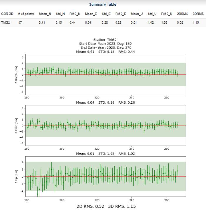
October 2023 Page 96
2023
NOVEMBER TIME: 7:30 a.m., SHOTGUN
Breakfast sponsor: $500
Trophy sponsor: $500
Closest to sponsor: $500
Lunch sponsor: $500
Cart sponsor: $500
Bob Johnson
Office: (772)562-4191
Cell: (772)370-0558
bobj@carterassoc.com
Hole sponsor: $500 Longest Drive sponsor: $500

Longest Put sponsor: $500 Shortest Missed Put sponsor:
PROCEEDS TO BENEFIT:
• INDIAN RIVER CHAPTER SCHOLARSHIP
• FSMS PAC

The Florida Surveyor Page 97
- INDIAN FLORIDA SURVEYING CHARITY GOLF GATOR TRACE GOLF FORT
SURVEYING AND MAPPING
GOLF TOURNAMENT

GOLF AND COUNTRY CLUB

PIERCE, FL
NOVEMBER 11, 2023
SHOTGUN START: 8:30 a.m. Put $500
the Pin $500
Missed sponsor: $500
“Best Dressed” sponsor: $250
October 2023 Page 98
INDIAN RIVER CHAPTER
to:
c/o
SCHOLARSHIP FUND
Please make checks payable to “FSMS Indian River Chapter” Mail
FSMS Indian River Chapter
Marla Moore 301 SE Ocean Blvd, Suite 301 Stuart fl, 34994
ARCHIVES FROM THE
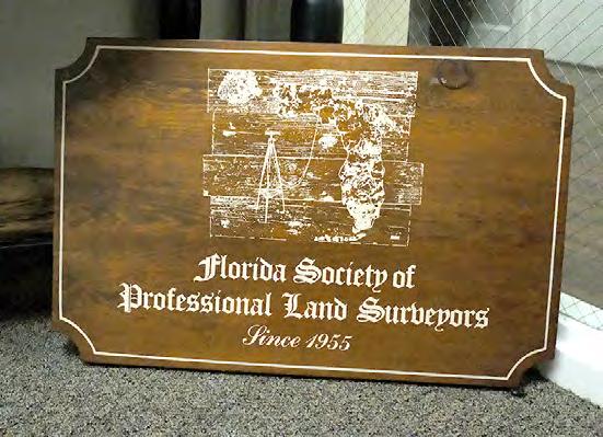


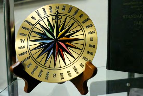
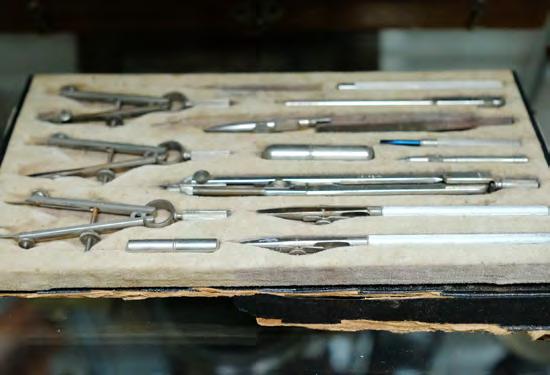
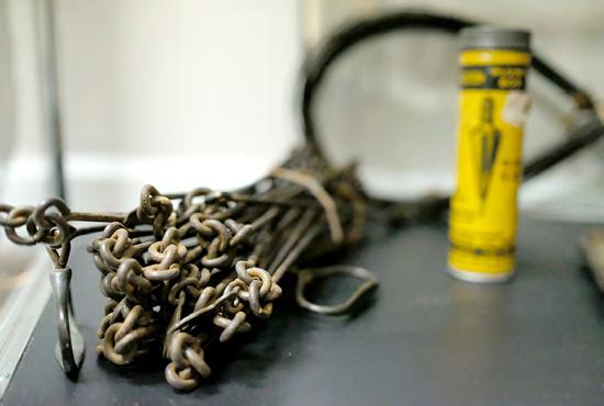

The Florida Surveyor Page 99
SCENES IN A SURVEYOR’S LIFE ;
OR A
RECORD OF HARDSHIPS AND DANGERS ENCOUNTERED. AND AMUSING SCENES WHICH OCCURRED, IN THE Operations of a Party of Surveyors IN SOUTH FLORIDA .
October 2023 Page 100
By W. L. PERRY. JACKSONVILLE: C. DREW'S BOOK AND JOB PRINTING OFFICE 1859.
PREFACE
This little volume is respectfully offered to the public, not without some “misgivings” as to how it will be received. Trusting, however, to the kindness of the indulgent reader, it is sent forth with the sincere hope that it may contribute in some degree to the pleasure and amusement of those into whose hands it may chance to fall. If so, the author's object will have been attained. The following pages contain a record of the dangerous and exciting, as well as amusing scenes encountered by a party of surveyors in South and East Florida, whilst engaged in the labor of laying out the public domain. There is, perhaps, no class of men who endure so many hardships and privations—whose fortitude and energy, whose intellectual powers, are taxed to a greater extent than the Government surveyor in his operations in the wild forests of the Southern and Western portions of the United States, in paving the way for the future wealth and aggrandizement of his country; and yet there is no class of men, of useful occupation, who receive a less share of consideration and sympathy.
In justice to himself, the author feels called upon to plead the very unfavorable circumstances under which the manuscript was written, arising from the fact that it was prepared at moments spared from the press of business, and not intended when first written as an offering to the public in the form of a book. This, then, is offered to the considerate reader as an apology for the very many imperfections which the volume contains. He is aware it should have been revised before it was handed over to the publisher; but his
The Florida Surveyor Page 101
situation has been such as rendered it impossible for him to bestow the time and labor necessary to such a purpose. Relying upon the kind disposition of the reader, he determined to publish as originally written.
Scenes in a Surveyor's Life.
CHAPTER I
if the life of the frontier settler, in his little log cabin, situated on the line of demarcation between civilization on the one hand and a wilderness of savages and ferocious wild animals on the other, whither he has gone to blaze the way for a more enlightened era, be one of danger, toil, and wild adventure, that of the surveyor, who goes far beyond the settler, even into the very heart of the wilderness, to mark out the land-lines for approaching settlements, is one certainly not less so. Indeed, when we calmly study and compare the pursuits of the two, it cannot but be conceded that the surveyor is surrounded with more dangers, the subject of more toil and hardships, and the recipient of fewer of those articles denominated the luxuries of life.
Let us for a moment more particularly examine and compare the life and pursuits of the surveyor and frontier settler.
When the latter returns from a day's hunt, which, aside from a small pumpkin and potato-patch, is his principal business, tired and hungry, he is sure, on entering his humble cabin, of finding the steaming coffee and smoking venison all ready for him, prepared by his better-half, whose affectionate smile, and the joyful outbursts of whose prattling progeny, bid him welcome. When his hunger is satisfied he repairs to a comfortable moss-mattress for rest, made smooth by a hand of affectionate regard for his welfare and comfort.
When the former, on the contrary, returns from a hard day's work, lugging the heavy implements necessary for his business through swamps, lagoons,
October 2023 Page 102 FROM THE ARCHIVES
saw-grass, and palmetto hammocks, he enters no cabin, meets no smiling wife, hears not the clamors of his little children, sees no smoking viands, but is forced to prepare his own supper as best he can, by thrusting his venison or bear's meat on a sharp stick and holding it over the flames until half cooked, which he ravenously devours, with a cake of bread of his own make, and then retires to the damp earth for a bed, a pine-knot for a pillow, and the broad sky for a covering.
When the heavens open and the rains descend, the settler enters his logcabin, unpretending as it is, and he is secure from the beating storm.
Under similar circumstances, the surveyor has no alternative but to lay his troubled head on a soft lightwood knot, his body on the wet ground, and let it rain, thanking his stars it isn't a hailstorm instead of a rain.
Such are some of the advantages of the frontier settler over the public land surveyor, briefly stated. I will not tax the time or patience of the reader adducing others, but proceed at once to the object in view, which is simply to give an unvarnished historical account of a tramp of the writer and others in a survey of Government land in South Florida, and some of the many adventures connected with it.
The kind reader, who patiently follows me through, will find recorded many hardships, and dangerous, exciting, as well as amusing scenes, which transpired while we were engaged in that work, and which, I trust, may prove of interest to while away an hour of leisure.
Captain — having procured the services of several persons, whom I shall denominate as Ralf, Sile, Tap, Shepley, Major — John Smith, Joe Rogers, and your humble servant, to assist him in executing his contract, we began at once making preparations for departure to our field of operation. As the journey to Jacksonville was coupled with nothing of interest, we pass over it, and commence at that place in our history.
It was arranged that Tap, with other boys, should proceed with the team, consisting of a yoke of oxen and a pair of marsh ponies, by land to Enterprise, while Sile and myself should go up the St. Johns River per steamer for the purpose of taking up a yawl boat to be used in shipping our plunder down
The Florida Surveyor Page 103
* * * * * * * * * * * * * * *
Indian River to the nearest point to our work, and all meet at Enterprise, and there wait the arrival of Capt. —, who was to follow in the next steamer.
In accordance with this arrangement, both parties left Jacksonville on Saturday, September 2 , 185 —. On Saturday evening, the Darlington (the steamer on which Sile and myself took passage) reached Palatka, a flourishing little village some seventy-five miles up the river from Jacksonville, where she remained until Monday morning, in order to make connection with the Sunday's steamers for Savannah and Charleston. Early Monday morning we loosed from Palatka and sailed for Enterprise, which is situated on Lake Monroe, some hundred and twenty-five miles above Palatka.
Of the St. Johns River it is only necessary to say that it is universally admitted to be, by those who have enjoyed the pleasure of a steamboat ride upon its placid bosom, one of the most magnificent streams in all the country. Properly speaking, we think the St. Johns could hardly be called a river at all, but an immense chain of lakes, stretching itself through the territory. At its entrance into the Atlantic it is, perhaps, not more than half a mile in width, while at Jacksonville (twenty-five miles above) it spreads out to the width of more than a mile. From Jacksonville to Palatka it varies from three to seven; but as you ascend from the latter place it gradually contracts until, in some places before reaching Lake Munroe, one might almost step from either guard of the boat on shore.
Immense numbers of alligators inhabit the river, and a prolific source of amusement is offered to the passengers on board the boat in shooting them from the deck as she passes swiftly along.
The scenery on this river is not very magnificent or grand, there being no towering mountains or lofty hills to draw out the poetic imagination or excite a feeling of admiration; yet the variety of scenery renders steamboat-traveling on the St. Johns any thing but irksome. Here you pass through a wide lagoon literally covered with myriads of wild ducks and geese, whose tremendous roar, as they rise like a thunderstorm from the surface of the water, may be heard even above the din of machinery; there you guide by some small island in the river, clothed in flowers of the most beautiful hue, around whose fragrant petals a thousand hummingbirds hover; here you sail along almost within arms-length of a magnificent orange grove, loaded down with its golden fruit, presenting a delightful contrast with the luxuriant green of the surrounding forest; there,
October 2023 Page 104 FROM THE ARCHIVES
again, you suddenly shoot out from the narrow confines of the river into an immense lake, which at once brings to remembrance all those strange emotions you experienced when, for the first time, you launched out upon the bosom of the great deep.
One of the most beautiful sheets of water is Lake George, situated about thirty miles above Palatka. It is eighteen miles broad, and twenty in length. The river enters it at the southern extremity and passes out at the northern. On an island of considerable extent, near ,where the river passes out, is the residence of the late Dr. Calhoun, son of the South Carolina statesman.
Another of those lakes is Monroe, but not so large as the one just described, being only eight miles in length, and five in width. The river passes through it from east to west.
On the northern shore of this lake is Enterprise, our place of destination on the steamer, which we reached safely on Monday night.
It being dark when we arrived, we chose to remain on board the boat, as it did not leave on its downward trip until morning.
Enterprise is not, as erroneously supposed by many, a city, or even a village, but simply a hotel, built by the enterprising commander of the steamer Darlington, Capt. Brock, for the accommodation of those of a more northern latitude, suffering under pulmonary and other diseases, who may wish to spend their winters in a more genial climate. And certainly a more beautiful place—a place better adapted to the physical wants, and a place affording a greater variety of amusements to while away the time—could nowhere be found in the sunny South.
Situated as it is on the northern shore of the lake, the susceptible frame of the invalid is protected from the chilling northern blasts by the heavy pine forests which lie in that direction, while the balmy, bracing southern breezes sweep the bosom of the tranquil lake to fan his feverish brow. The woods in the vicinity afford an abundance of game; and those who love the sport of hunting, and possess the strength to enable them to with stand the fatigue, need never complain at Enterprise.
On the morning after our arrival, Sile and I brought ashore our camping equipage, consisting of pots, kettles, fry pans, blankets, knapsacks, etc., and struck camp near Enterprise, in the edge of a wood, to await the coming of the
The Florida Surveyor Page 105
boys with the team, and whom we expected that day, and also for the Captain, on the next boat. The team arrived in due time, and we waited patiently a week for the boat, but, to our great disappointment, the Captain did not come. He had been detained with his business longer than he expected, and we, of course, could do nothing but wait another week, which, in our excessive anxiety to be in the woods, was a long one. It rolled around, however, in due course of time, and the Captain came.
Next morning we began packing up for a start, but before we go through I was seized with a Georgia ‘double wabble,' in the shape of an ague, which terminated in a severe spell of bilious fever. This misfortune detained us ten days longer. As soon as I was able to be hauled in an ox-wagon, I was tumbled in with the other rubbish, and we started.
From this point our route lay south, about one hundred and seventyfive miles, down Indian River, which stream, or rather inlet, runs parallel with the Atlantic coast. The St. Johns and Indian rivers approaching within eight or ten miles of each other, some twenty-five miles above Enterprise, the Captain determined to send four men with the yawl up St. Johns to the nearest point on Indian River, and there meet them with the team and haul the boat and load across to the latter stream. The boat was dispatched accordingly, and the men directed to proceed to Lake Harney, and there await our arrival. Now, it happened that neither of the men knew the river between Enterprise and Lake Harney, and it was difficult to navigate on account of islands and a great number of channels running here and there among them. There is also a Lake Jessup between the two places, of which fact the men were not aware, and as a very natural consequence mistook it for Lake Harney, and struck camp to wait our coming. In the mean time the Captain, with the rest of the company, pushed forward to Lake Harney and encamped, every moment expecting the boat's crew to heave in sight. It did not come.
Having waited, and whooped, and fired off guns at various points up and down the lake and river for three long days, the Captain set out to hunt in good earnest the missing men, and after two more days of laborious search, found them snugly ensconsed on Lake Jessup, enjoying themselves in fishing, shooting alligators, and occasionally taking a pull at the bunghole of the keg of snake medicine.
October 2023 Page 106
FROM THE ARCHIVES
About this time we learned, contrary to first information, that it was not only impracticable, but utterly impossible to transfer our boat and chattels from one river to the other, as designed. There was no road, besides several creeks and many impassable swamps intervened. We had no alternative but to retrace our steps to Enterprise and take some other course, after a clear loss of eight days, and no inconsiderable amount of provisions.
At Enterprise we fortunately succeeded in procuring wagons to haul our boat and goods across to Smyrna, and sent our own team immediately on to Fort Capron, laden with as much of the plunder as it could conveniently carry, in charge of the Major, Ralf, Rogers, and Smith, at which place we hoped to meet them in nine or ten days.
The Captain, Tap, Sile, Shep, and myself fell to loading the teams we had hired, with the residue of our effects, which was soon accomplished; and about three o'clock in the afternoon we took up our line of march for Smyrna. From Enterprise to Smyrna the distance is thirty miles, through an open pine country, interspersed here and there with large, clear water lakes, and dense scrubs, with an occasional swamp. The course is a little north of east.
Being heavily laden, we made slow progress, but reached Deep Creek about sunset, where we encamped for the night.
On former surveys the Captain had been in the habit of taking flour to make bread of, or soldier's biscuit, but experience had taught him that it was difficult of preservation, exposed, as it must necessarily be, to all the inclemencies of the weather; so this time he concluded to take corn instead, and a steel mill to grind it in. It is possible he had also another motive in view, if the men had their corn to grind, they would probably be less apt to waste.
The night we camped on Deep Creek, as soon as the cattle were properly attended to all hands set in to bear an equal part in preparing supper, our regular cook having gone with our wagon. On rummaging around in the wagon for the cooking utensils, we found, to our dismay, that in the hurry of the morning, in getting our team off for Fort Capron, all the pots were inadvertently put into it, and were gone, save only a small frying pan and a tea-kettle. I went to bring out the mill to grind corn for bread, but the handles were missing; they had dropped somewhere on the road, and, of course, the mill was of no use without the handles to turn it. However, this was no very serious difficulty, as
The Florida Surveyor Page 107
we had a good supply of rice. A fry pan of rice was soon boiled, and a kettle of coffee drawn. We then emptied the rice on palmetto leaves, and used the pan again for frying bacon. Supper now being ready, we seated ourselves on the grass around it, except Shepley, who went to fetch some tin-cups from the wagon, out of which to sup the coffee. After a long search, Shep reported no cups to be found; then Tap suddenly remembered he had put them all into our wagon, and they were gone with the pots. Here was a new, and decidedly the most serious difficulty yet. To do without the coffee was out of the question, for it is just as necessary an article to a man camping out as a pipe is to a grandmother; to drink it hot from the spout of the kettle was impossible, and, as we had eaten nothing since morning, to wait until it cooled was more than our hungry stomachs could submit to. Fortunately, I bethought me of a few large sweet potatoes we had purchased at Enterprise, and I directly converted one of them into a cup, by scooping out the pith, that held near a pint. All hands following suit, we were soon supplied with cups which answered every purpose of silver goblets, and lasted to Fort Capron.
After a comfortable night's rest on the luxuriant grass, we arose early in the morning and proceeded on our journey. It being only eighteen miles to Smyrna, we reached that place early in the afternoon, without any other serious difficulty.
As this is merely the introductory, I hope to make the next, and succeeding chapters, more interesting.—AuThor.
October 2023 Page 108 FROM THE ARCHIVES
* * * * * * * * * * * * * * *
NGS Announces Geospatial Modeling Grant Awards

NOAA’s National Geodetic Survey (NGS) is pleased to announce the projects selected for funding in response to the FY23 Geospatial Modeling Grant competition . Each of these projects will be cooperative agreements with NGS for a 5-year period, and all projects selected for funding address key issues facing the geodetic community.
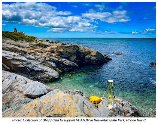
NGS awarded approximately $4 million in grant funding to Oregon State University, Scripps Institute of Oceanography, Michigan State University, and the Ohio State University. These projects will research emerging problems in the field of geodesy and support a Geodesy Community of Practice to address a nationwide deficiency of geodesists. In ad dition, these projects will develop tools and models to advance the moderniza tion of the National Spatial Reference System (NSRS).
Learn More About Federal Grant Resources
FY23 Grant Awards System for Award Management (SAM)
Uniform Administrative Requirements, Cost Principles, Audit Requirements for Federal Awards

The Florida Surveyor Page 109
Introducing the NSRS Modernization Alpha Site
To provide early access to upcoming, yet incomplete, products of the modernized NSRS, NGS has created the Alpha NSRS Modernization website. That site provides examples of the content, format, and structure of select data and products that NGS plans to release as a part of the Modernized NSRS. Products found on this page are for testing purposes only and do not contain any authoritative NGS data or tools. They are under active development and are subject to change without notice. But early access to alpha products should enable a smoother rollout of the Modernized NSRS. As products are released to this site, NGS will refer to them as being “released to Alpha.”

SPCS2022 Released to Alpha
An alpha version of the State Plane Coordinate System of 2022 (SPCS2022) and its implementation in the NGS Coordinate Conversion and Transformation Tool (NCAT) has been released to the Alpha site This includes:
• Alpha SPCS2022 website
• Alpha NCAT with SPCS2022 conversions enabled
• Online interactive maps of SPCS2022 zones
• Tables of zone definitions and example coordinates

• Maps of linear distortion with performance statistics
• Updated SPCS2022 Policy and Procedures

Alpha SPCS2022 content will be updated and augmented as it evolves toward completion
Progress in Ongoing Projects
There are currently 32 ongoing projects related to NSRS modernization around NGS. Here are some highlights.
GRAV-D (Project Manager: Jeffery Johnson)
In June of 2023, NGS's Gravity for the Redefinition of the American Vertical Datum (GRAV-D) project completed the airborne data collection effort in the American Samoan and Hawaiian regions. NGS teamed up with NASA Langley Research Center's Research Services Directorate to use their Gulfstream IV jet (Tail # N522NA) for this project. These remote Pacific islands were the largest hurdles for the GRAV-D project to finish before December 2023 so that the geoid team can have a complete airborne gravity data set as they build the North American-Pacific Geopotential Model of 2022 next year.

Issue 33 July 2023
Past Presidents



 1956 - 1957
H.O. Peters
1957 - 1958
Harry C. Schwebke
1958 - 1959
John P. Goggin
1959 - 1960
R.H. Jones
1960 - 1961
Hugh A. Binyon
1961 - 1962
Russell H. DeGrove
1962 - 1963
Perry C. McGriff
1963 - 1964 Carl E. Johnson
1964 - 1965 James A. Thigpenn, III
1965 - 1966
Harold A. Schuler, Jr.
1966 - 1967
Shields E. Clark
1967 - 1968 Maurice E. Berry
Past Presidents



1969
1968 -
William C. Hart 1969 - 1970 Frank R. Shilling, Jr. 1970 - 1971
1972 - 1973
1973
1974 E.R.
1975
1976 - 1977 Robert S. Harris 1977 - 1978 Paul T. O’Hargan
1979
William V. Keith 1971 - 1972 James M. King
Broward P. Davis
-
(Ed) Brownell 1974 -
E.W. (Gene) Stoner 1975 -1976 Lewis H. Kent
1978 -
William G. Wallace, Jr. 1979 -1980 Robert W. Wigglesworth
Past Presidents



 1980 - 1981 Ben P. Blackburn
1981 - 1982
William B. Thompson, III
1982 - 1983
John R. Gargis
1983 - 1984
Robert A. Bannerman 1984 -
1985
Buell H. Harper 1985 - 1986 H. Bruce Durden
1986 - 1987
Jan L. Skipper
1987 - 1988
1989
1989 - 1990
Stephen M. Woods 1988 -
Stephen G. Vrabel
W. Lamar Evers 1990 - 1991 Joseph S. Boggs 1991 - 1992 Robert L. Graham




1992 - 1993
1993 - 1994
1994 - 1995
1994 - 1995
1996 - 1997 Gordon R. Niles, Jr. 1997 - 1998 Dennis E. Blankenship 1998 - 1999 W. Lanier Mathews, II 1999 - 2000 Jack Breed 2000 - 2001 Arthur A. Mastronicola 2001 - 2002 Michael H. Maxwell 2002 - 2003 John M. Clyatt 1995 - 1996 Thomas L. Connor
Past Presidents
Nicholas D. Miller
Loren E. Mercer
Robert D. Cross
Kent Green
Past Presidents




 2004 - 2005
Stephen M. Gordon
2005 - 2006
Richard G. Powell
2006 - 2007
Michael J. Whitling
2007 - 2008
Robert W. Jackson, Jr.
2008 - 2009
Pablo Ferrari
2009 - 2010
Steve Stinson
2010 - 2011 Dan Ferrans
2011 - 2012
Jeremiah Slaymaker
2012 - 2013
Ken Glass
2013 - 2014 Russell Hyatt
2014 - 2015 William Rowe
2003 - 2004
David W. Schryver
Past Presidents


 2016 - 2017
Lou Campanile, Jr.
2017 - 2018
Robert Strayer, Jr.
2018 - 2019
Dianne Collins
2019 - 2020
Don Elder
2020 - 2021
Hal Peters
2021 - 2022
Lou Campanile, Jr.
2015 - 2016
October 2023 Page 116
Dale Bradshaw
ADMINISTRATIVE Staff
Executive Director

Rebecca Porter director@fsms.org
Education Director
Samantha Hobbs education@fsms.org

Communications Coordinator
Justin Ortiz communications@fsms.org

Regional Coordinator
Cathy Campanile
seminolecc84@gmail.com
The Florida Surveyor Page 117

Please email communications@fsms.org to notify us of upcoming events.

Advertise With Us!
All advertisements contained within the publication are published as a service to readers. Publication of the advertisements does not imply or express any endorsement or recommendation by FSMS.
Benefits: Full color; hyperlinks added to your webpages as well as email addresses.
Requirements: Contracts for one year (11 issues) receive 10% discount if paid in advance; 15% for Sustaining Firms. (Ads should be in jpeg, pdf, or png format)
New ads and/or changes are due by the 25th of each month.
Size 1 Issue2-11 Issues Full Page $720 $395/issue 1/2 Page $575 $320/issue 1/4 Page $290 $175/issue The Florida Surveyor Page 119


 Early settlers to South Florida. (Source: South Florida Water Management District.)


 Destruction wreaked by the 1926 hurricane. (Source: The Florida Memory Project, State Library and Archives of Florida.)


 The effects of drought on the land. (Source: The Florida Memory Project, State Library and Archives of Florida.)


 of Brigadier General Zachary Taylor 1839,


 1956 - 1957
H.O. Peters
1957 - 1958
Harry C. Schwebke
1958 - 1959
John P. Goggin
1959 - 1960
R.H. Jones
1960 - 1961
Hugh A. Binyon
1961 - 1962
Russell H. DeGrove
1962 - 1963
Perry C. McGriff
1963 - 1964 Carl E. Johnson
1964 - 1965 James A. Thigpenn, III
1965 - 1966
Harold A. Schuler, Jr.
1966 - 1967
Shields E. Clark
1967 - 1968 Maurice E. Berry


 1980 - 1981 Ben P. Blackburn
1981 - 1982
William B. Thompson, III
1982 - 1983
John R. Gargis
1983 - 1984
Robert A. Bannerman 1984 -


 2004 - 2005
Stephen M. Gordon
2005 - 2006
Richard G. Powell
2006 - 2007
Michael J. Whitling
2007 - 2008
Robert W. Jackson, Jr.
2008 - 2009
Pablo Ferrari
2009 - 2010
Steve Stinson
2010 - 2011 Dan Ferrans
2011 - 2012
Jeremiah Slaymaker
2012 - 2013
Ken Glass
2013 - 2014 Russell Hyatt
2014 - 2015 William Rowe
2003 - 2004
David W. Schryver


 2016 - 2017
Lou Campanile, Jr.
2017 - 2018
Robert Strayer, Jr.
2018 - 2019
Dianne Collins
2019 - 2020
Don Elder
2020 - 2021
Hal Peters
2021 - 2022
Lou Campanile, Jr.
2015 - 2016


