Join us in Australia for FIG Working Week 2025, where you'll gain unparalleled access to the international surveying and geospatial community. This event o ers a platform to exchange experiences and stay at the forefront of the industry, covering topics such as innovation, resilience, and sustainability.
Why attend?
• Learn and share globally
• Network across related professions
• Make an impact on your career
• Enjoy undisturbed face-to-face time
Brisbane, Australia 6-10 April
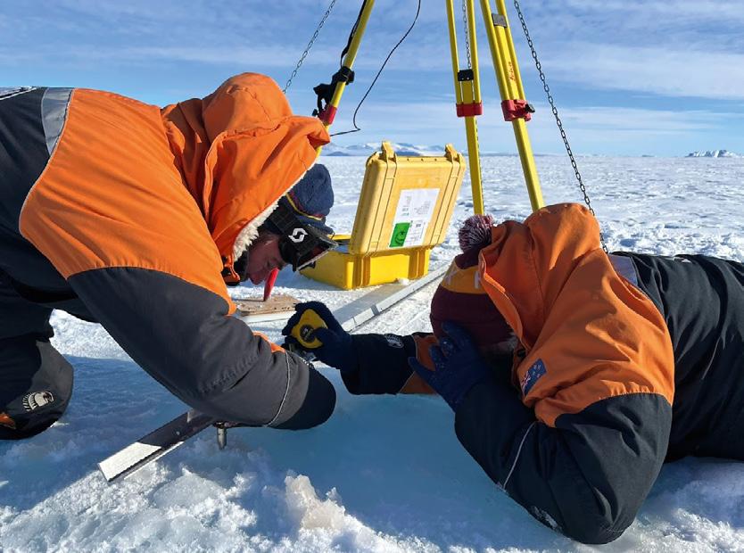
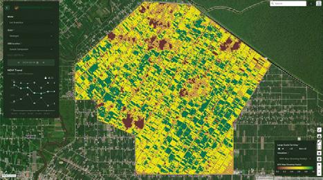
Tackling geospatial tasks in Antarctica
Experts from Toitū Te Whenua Land Information New Zealand (LINZ) have recently conducted work in Antarctica that will, amongst other things, help scientists monitor the effects of climate change.
The hydrographic, surveying and positioning team members undertook a range of activities aimed at maintaining the flow of key data, for which precise annual recalibration is required. One task was to use GNSS equipment to calibrate tide gauges situated at Scott Base and Cape Roberts, the first step of which was to dig through the snow and drill through the ice to determine the water level.
“The Scott Base tide gauge is the world’s southernmost, and sensors at this location have measured Antarctic sea levels since 1957,” said LINZ Principal Geospatial
Specialist, Dave Collett, who was this year’s field leader. “The data contributes to research into climate change and sea level rise and is an important marker for sea level changes which may impact other parts of the world.”
Another of the team’s jobs was to prepare for the installation of SouthPAN infrastructure near Scott Base next year.
“The Antarctic SouthPAN site will provide crucial updates on the status of satellites used by SouthPAN which allow users to position themselves more accurately,” said Collett.
LINZ has been involved in survey work to support science and operations in Antarctica since the 1950s. Its annual work program is supported by Antarctica New Zealand.
“Whenever our crew is down on the ice, our surveying experts take precise measurements of historic huts and wind turbines to measure ongoing movement of the structures in the permafrost,” said Collett.
Upcoming Events
20–21 February: ISNSW Annual Conference, Sydney
24–26 March: APAS 2025 Conference, Hunter Valley
1–3 April: GISTAM 2025, Portugal
1–4 April: 59th Photogrammetric Week, Stuttgart
3-4 April: Country Surveyors Association Easter Conference, Sydney
3 August: International Geoscience and Remote Sensing Symposium, Brisbane
26–29 August: GIScience 2025, Auckland
17-19 September: 2025 AIMS National Conference, Sunshine Coast
“Monitoring of heritage huts is essential for their long-term preservation. The surveys help to show whether there is any risk to these historic structures from subsidence or other movements.” n
29 Sep–3 Oct: 76th International Astronautical Congress, Sydney
17–23 November: FOSS4G 2025, Auckland
For more details about these and dozens of other events, go to www.spatialsource. com.au/event-listing
Experts from LINZ are seen setting up for tide gauge calibration in Antarctica. Photo by Pepper Cook, Antarctica New Zealand.
Surveying wind turbines at the Crater Hill Wind Farm. Photo by Dave Collett, LINZ.
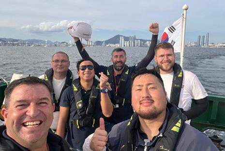
Hydrographic training and regional diplomacy
Collaborations between Australia, South Korea and Vietnam are helping build regional skills and connections.
Hydrography and cartography play crucial roles in international diplomacy and capacity building, fostering collaboration among nations by improving maritime capabilities and strengthening relations.
Both the Korean Hydrographic and Oceanographic Agency (KHOA) and the Australian Government have recently showcased exemplary initiatives in this domain, promoting technical skills and international partnerships.
KHOA’s global training KHOA, as part of its commitment to the International Hydrographic Organisation’s (IHO) Capacity Building initiative, alternates annually between delivering the S-5B Hydrographic Surveyor Program and the S-8B Marine Geospatial Information Program. These programs are hosted in Busan, Korea, are delivered for KHOA by IIC Academy and are offered free of charge to participants from around the world.
This year’s S-5B Hydrographic Surveyor Program included students from Croatia, Georgia, Ukraine, Nigeria, Suriname, South Korea, Sri Lanka, Jamaica, the Philippines and Thailand.
The program aims to develop the students’ technical expertise in hydrography, preparing them to lead projects in their home countries and share their knowledge. The Program combines on-site theoretical and practical instruction and culminates in a month-long Comprehensive Final Field Project where students apply their learning to conduct and deliver a hydrographic survey.
One of the attendees was Isuru Weerasinghe, a specialist in the Sri Lankan Navy Hydrographic Service.
“I have enjoyed the program a lot,” he said. “From the education perspective, in my case this is the first time learning about hydrography as I have had no experience prior to this. However, on this course I have learned in the classroom, and I have gained experience at sea and doing practicals in the field and on the equipment.”
“This has been a great opportunity for me, and I would encourage all others to apply to do this Program,” he added. “I would also very much like to thank
IIC and KHOA for this opportunity.”
Another attendee was Henrice Jed Lopez from the National Mapping and Resourcing Permission Authority of the Philippines.
“The KHOA Cat B Program gives a unique opportunity to delve into the field of hydrography and I am very drawn to the hands-on training and the opportunity to learn from experienced hydrographers,” he said.
“For me, the practical aspects and best practices involving the hydrographic surveying techniques impressed me most during this program. These provided a realworld context to the theoretical aspects and knowledge we had learned in the classroom; and we were doing it in the real world in the actual hydrographic environment.”
“This Program is very valuable in my professional development and in my career in hydrography,” he added. “It has equipped me to pursue a better understanding in surveying and mapping.”
Of particular interest for this Program, a documentary was filmed to raise awareness of the program within Korea and for use by KHOA and IHO in attracting new students to future courses.
Australia-Vietnam S-8B program
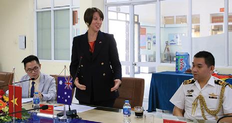
In Vietnam, the Australian Government sponsored and facilitated the IBSCrecognised S-8B Nautical Cartographer Program, delivered by the IIC Academy. This program, held in Hai Phong, Vietnam, aimed to strengthen bilateral ties and enhance Vietnam’s hydrographic and cartographic capabilities. Twelve Vietnamese students successfully completed the program, which included in-depth training over six months.
A formal graduation ceremony was conducted on 25 October 2024, which was attended by high-ranking officials, including Rear Admiral Tran Ngoc Quyet of Vietnam, Deputy Head of Mission, Renee Deschamps, from Australia, and IIC Technologies Managing Director Australasia, David Crossman.
The event highlighted the program’s diplomatic significance, celebrating its role in capacity building and reinforcing the cooperative efforts between the two nations.
During the speeches it was announced that the Australian Government would fund a second S-8B program in Vietnam 2025, reflecting its long-term commitment to Vietnam’s hydrographic development.
A tool for global diplomacy
These programs exemplify the use of hydrographic training as a tool for diplomacy, addressing global challenges such as environmental change, maritime safety and capacity building. Both Korea and Australia have demonstrated how investing in hydrography and cartography can provide tangible benefits to recipient nations while fostering international goodwill and collaboration. These initiatives highlight the enduring relevance of hydrography in modern diplomacy and nation-building efforts. n
Takhou Law is Operations Manager Australasia with IIC Technologies.
TAKHOU LAW
The Australian Embassy in Vietnam’s Deputy Head of Mission, Renee Deschamps, spoke at the graduation ceremony.
A documentary was filmed to raise awareness of the program and attract new students.
KHOA S-5B Hydrographic Surveyor Program participants on the water in South Korea.
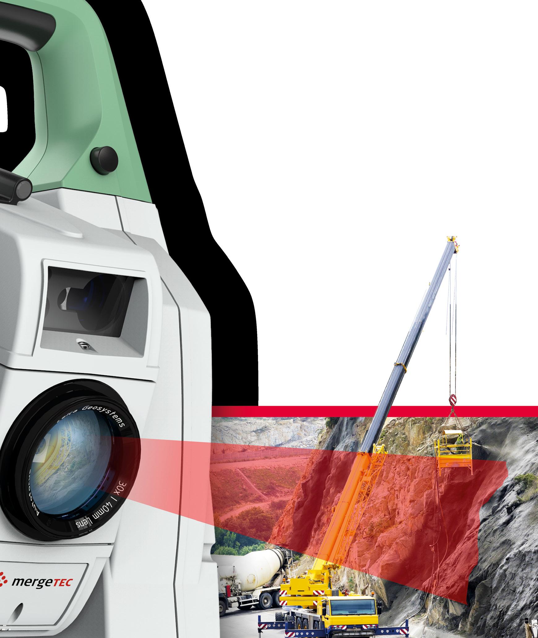
Leica NOVA MS60 MultiStation
Take a step forward from classic detailing with a pole. With the new Leica Nova MS60 scanning speed of up to 30.000 points per second you will be able to deliver complex projects even before the deadline. Saving time means saving money. The quick distance and long-range reflectorless measurements, fast motorisation and reliable prism Search&Aim will help you additionally speed up your performance. Why not have it all? Find out more: leica-geosystems.com/MS60
Publisher
Simon Cooper
Editor
Jonathan Nally
jnally@intermedia.com.au
National Advertising Manager
Anna Muldrock
amuldrock@intermedia.com.au
Prepress
Tony Willson
Production Manager
Jacqui Cooper
Subscribe
Position is available via subscription. A 12-month subscription (6 issues) is AU$76.00. To subscribe visit spatialsource.com.au/magazine, phone 1800 651 422 or email subscriptions@ intermedia.com.au
Position is published six times per year, in February, April, June, August, October and December by The Geospatial Council of Australia. ABN: 22 135 572 815
Reprints from Position are permitted only with the permission of the publisher. In all cases, reprints must be acknowledged as follows: ‘Reprinted with permission from Position Magazine’, and must include the author’s byline.
The opinions expressed in this publication are those of the authors and do not necessarily represent those of the publisher.
Official publication of
Learning opportunities, at home and abroad
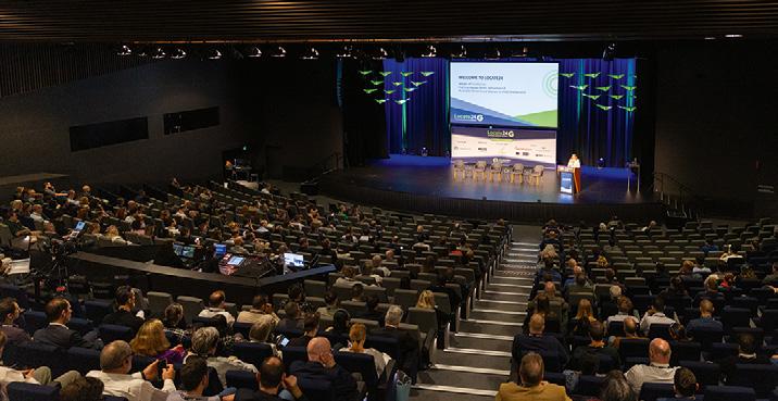
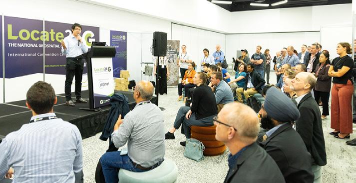
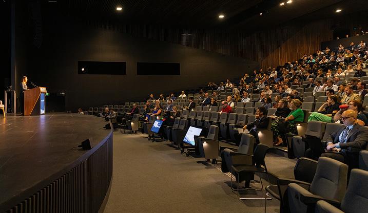
The combined Locate25 and FIG Working Week 2025 conference is now only a few weeks away, and the excitement is building. Organisers say that registrations are booming, and not just from within Australia but also from overseas. No doubt many international delegates are being lured by the promise of Australia’s, and specifically Brisbane’s, many positive features — the climate, the surroundings, the nature, and of course, the hospitality of the locals.
This event will be a once-in-a-decade-or-more opportunity meet and greet, mingle with and learn from other geospatial professionals from around the world. You’ll be able to see first-hand how things are done differently, and possibly better, in other countries. Each nation has its own challenges and priorities, and we can all learn from one another.
By the time you read this, the final program will have been released, featuring more than 200 presentations and workshops. If you haven’t registered yet, there’s still time. Head to spatialsource.com.au/event/locate25-conference for links to the event.
Still on international matters, it’s great to see how Australia is working with other nations in the Asia-Pacific to build skills and increase cross-border learnings. The highly successful hydrographic programs profiled in this issue (page 5), involving Vietnam and South Korea, are fantastic exemplars of the value of working closely with our neighbours. Equally important is encouraging the next generation of geospatial professionals here in Australia. In this issue (page 34) we look at the Let’s Locate program that was run recently in Canberra, in which high school students were given a sneak peak into the world of surveying. It’s programs such as these that will help keep the stream of undergraduates flowing through our educational institutions; something that is sorely needed, given the huge projected shortfall of surveyors and geospatial professionals over the coming decade.
Jonathan Nally Editor
We take our Corporate and Social Responsibilities seriously and is committed to reducing its impact on the environment. We continuously strive to improve our environmental performance and to initiate additional CSR based projects and activities. As part of our company policy we ensure that the products and services used in the manufacture of this magazine are sourced from environmentally responsible suppliers. This magazine has been printed on paper produced from sustainably sourced wood and pulp fibre and is accredited under PEFC chain of custody.
PEFC certified wood and paper products come from environmentally appropriate, socially beneficial and economically viable management of forests.
April/May 2025 — Issue 136
Infrastructure: Our second issue for 2025 will take a detailed look at all aspects of geospatial technologies as used in the fields of construction, infrastructure, engineering surveying, 3D, BIM, smart cities and more. PLUS this will be our bumper Locate25 / FIG Working Week 2025 issue, full of previews and details of the biggest geospatial event ever held in Australia.
For article proposals, contact our Editor, Jonathan Nally at jnally@intermedia.com.au
For marketing, contact our Advertising Manager, Anna Muldrock at amuldrock@intermedia.com.au
Advertising booking date: 24 February 2025
Advertising material date: 27 February 2025
Publication date: 21 March 2025
Position magazine acknowledges the traditional custodians of country across Australia, and we pay our respects to Aboriginal and Torres Strait Islander cultures and to their elders, past, present and emerging.
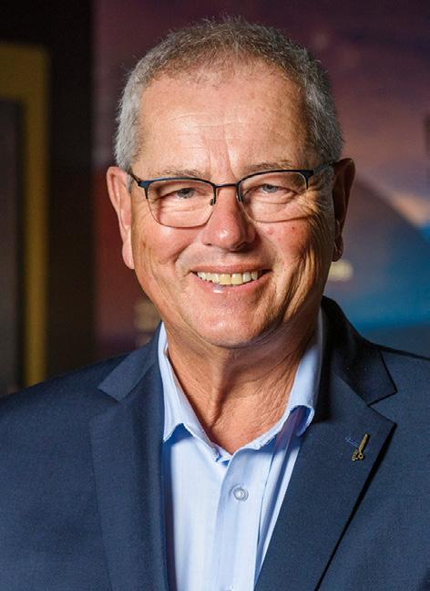
Aptella announces new CEO
Aptella has announced the appointment of Greg Macklin as the company’s incoming CEO, effective 1 April 2025. Macklin will succeed Martin Nix, who has led the company for the last 15 years. Nix will take up a position as non-executive director on the company’s board.
Macklin has worked in the business for more than 10 years and has experience across sales, business management and executive leadership.
“It is a great honour to lead this business and its people, who I’ve had the privilege to work with over many years,” said Macklin. “My congratulations to Martin for how he has shaped Aptella into the company it is today. I am committed to its ongoing success and support of our customers into this next chapter.”
“We were fortunate to have a choice of very talented and experienced people show interest in this role,” said Ian Petherbridge, Chairman of Aptella. “After careful consideration, the board was unanimous in its support of Greg as the best candidate to lead the business.”
“I have every confidence in Greg to take the baton from me and lead Aptella through its next phase of growth,” said Martin Nix, Aptella’s current CEO.
“His care for, and knowledge of, our team and our customers runs deep and I look forward to seeing him succeed with the full support of his executive team and our board.”
Nix joined Aptella (then known as Position Partners) in 2010 when it had newly formed as a national company. As its first CEO, he led the business through many milestones such as its expansion into Southeast Asia and New Zealand; diversification into new markets and technology through partnerships and acquisitions; the transition to Mitsui as majority shareholder; and the rebrand to Aptella.
New app surveys, maps wild animals
A new, freely available and open-source app that uses aerial survey data to map and identify wild animals, has been launched by researchers from Edith Cowan University. The app is intended to help researchers and community groups across the world to conduct wildlife imagery surveys.
Known as WISDAM — Wildlife Image Survey Detection and Mapping — the app was co-developed by ECU senior research fellow Dr Amanda Hodgson.
“Advanced technology has allowed researchers to shift towards imagery aerial surveys from drones or piloted planes to collect data on wildlife distribution and abundance. These surveys involve collecting photos along survey flight paths and processing them post-survey,” said Dr Hodgson. “The challenge is now in how to efficiently extract animal detections and other data from the images in a reasonable timeframe.”
WISDAM is designed to standardise the image review
process, enabling users to map the image footprints and detected animals to real-world coordinates and assign information such as species type, age class and habitat details.
Animals can be detected manually or by using AI models such as the automated Marine Animal Detector that has been developed by Hodgson and her collaborators. WISDAM has a built-in feature that helps to ensure that individual animals appearing in overlapping images are only counted once.
“We’ve conducted many aerial surveys of marine mammals and have established methods for imagery surveys,” said Dr Hodgson. “So, we needed one tool that allows us to manage, annotate and map our imagery, and extract all the information that we need from survey images in a standardised way, and that provides outputs we can directly fed into population assessments and spatial modelling.”
Greg Macklin
Members of the ECU WISDAM team
Plowman Craven sets up local office
UK-headquartered surveying company Plowman Craven has opened an office in Sydney and appointed Mark Howells as its local managing director. The company, which also has offices in the US and India, describes itself as specialising in delivering high-quality geospatial data for sectors such as property, rail, infrastructure and logistics.
In April this year, the company secured private equity backing from Agathos to speed its international expansion, as well as to continue development of its digital service offering.
Howells will oversee the company’s strategic business direction in Australia and will be responsible for growth objectives in the region. He comes to the role having built up leadership experience in the geomatics, real estate and engineering sectors, having spent more than 20 years with Plowman Craven in the UK.
After relocating to Australia in 2023, Howells has re-joined the company to support its expansion in the Australian market.
“The launch of Plowman Craven Australia is a significant milestone for us. It’s a region that we are committed to and where we see tremendous potential,” said Howells.
Plowman Craven says its services range from detailed surveys to advanced 3D modelling and data analysis, including leasing surveys, BIM, structural and environmental monitoring, aerial and inspection services, and floor flatness surveys.
PHS becomes Revelare Hydrospatial
The company formerly known as Precision Hydrographic Services, and since April 2024 as ‘PHS, a Revelare Company,’ has made the final switchover to its new name, Revelare Hydrospatial. PHS was acquired by Revelare in April 2024, and at that time it was announced that the rebrand to Revelare Hydrospatial would take place in the middle of 2026.
Revelare describes itself as “the only 100% Australian owned and operated spatial intelligence company,” bringing “greater capacity, expertise, and resources to help Hydrospatial deliver advanced solutions to clients in Defence, ports and harbours, and renewable energy”.
Revelare Hydrospatial says it is “broadening our capability beyond hydrography to include cutting-edge geophysical services,” reflecting its “mission to illuminate and interpret the complexities of the underwater environment”.
“The transition … to Revelare Hydrospatial strengthens our position in the industry and creates new opportunities for our clients,” said Neil Hewitt, Managing Director of Revelare Hydrospatial. “With Revelare’s support, we are better equipped to deliver accurate, reliable, and innovative solutions to meet the challenges of our evolving industry.”
Last November, the company announced a new partnership with Seabed 2030, to boost ocean mapping in the South Pacific and other areas.
The company plans “a stronger push into the renewables sector” with its Director of Geophysics, Dr Elizabeth Johnstone, saying that by “delivering detailed insights into seabed conditions and tidal behaviour, we help ensure safe navigation, optimise dredging operations, and support infrastructure upgrades to handle growing demands.”
Certified GIS Professional exams
The international non-profit GIS Certification Institute (GISCI) has announced the testing window for its Geospatial Core Technical Knowledge Exam, a key component of the GISP (Certified GIS Professional) certification.
The exam will be available from 7 to 15 June 2025 and will be administered through Pearson VUE’s global network of testing centres, including those in Australia.
Applications must be submitted no later than two weeks prior to the exam window, and applicants need to go through a specified process in order to take part.
First, they need to apply for the exam by going to GISCI’s Exam Application Portal (gisci.org/Want-to-be-a-GISP/The-Exam) to submit their application (with new users needing to create an account).
Once the exam fee has been paid during the application process, applicants will receive and authorisation email with instructions to register with Pearson VUE. These emails will be sent beginning 3 February.
Applicants will then be able to schedule their preferred exam date and location.
The exam will be in conducted as a computer-based test, which candidates will have up to four hours to complete.
Australian researchers have responded to a surge in jamming attacks to develop a navigation system that uses visual data from stars rather than relying on the GNSS.
Remote sensing engineers from the University of South Australia have combined celestial navigation with vision-based technology to provide an alternative means of night-time navigation in environments where GNSS is unavailable or unreliable.
UniSA researcher Dr Samuel Teague says the lightweight system can be integrated into standard drones.
“Unlike traditional star-based navigation systems, which are often complex, heavy and costly, our system is simpler, lighter and does not need stabilisation hardware, making it suitable for smaller drones,” Dr Teague says. “This type of navigation is ideal for operations over oceans, or in warfare zones where GPS jamming is a risk. Apart from the defence sector, it could also be highly useful for environmental monitoring.”
The system relies on an algorithm that uses visual data from stars and processes it through standard autopilot systems.
Senior researcher Professor Javaan Chahl, DST Joint Chair of Sensor Systems in UniSA’s STEM unit, says the technology could enhance the operational capabilities of uncrewed aerial vehicles (UAVs) across many industries.
“For instance, in environmental monitoring over remote locations or long-endurance surveillance missions where GPS might be unavailable or compromised, this technology offers a valuable new capability,” Prof Chahl says.
“GNSS denial is an increasing challenge, and our research addresses this gap. We have developed a navigation method that’s resilient, independent of external signals, and achievable with low-cost, easily accessible components.
SDT Explorer to replace SIX Maps
NSW’s DCS Spatial Services is inviting users to try out the beta version of its new Spatial Digital Twin Explorer prior to the retirement of the SIX Maps service next year.
According to Spatial Services, the Spatial Digital Twin Explorer (SDT Explorer) combines the best features of the NSW Digital Twin Visualisation Service and SIX Maps, enabling users to undertake a variety of mapping tasks in one place.
SIX Maps is described as the entry point for viewing Spatial Services’ interactive images and mapping of NSW, incorporating a range of spatial and property data. It is free to use and can display whole-of-NSW imagery and base map data, including
EO start-up awarded $1m funding
Victorian Earth observation (EO) satellite start-up firm, Esper Satellites, has been awarded $1 million in venture capital funding by virtue of coming out on top in the Northern Territory’s Croc Pitch 2024 competition. The funding is to be provided, subject to due diligence, by the Paspalis Innovation Investment Fund.
Esper Satellites produces hyperspectral EO payloads which, it says, are particularly suited for monitoring carbon emissions and deforestation, and for promoting sustainable mining and agriculture.
“We’re so glad to be the winners of Paspalis & Darwin Innovation Hub’s Croc Pitch. There’s so much opportunity in the state of the Northern Territory and Esper is excited to have local partners as a part of our journey”, said Shoaib Iqbal, the company’s CEO.
Esper aims to slash the cost of acquiring space-based hyperspectral imaging from around $40 per square kilometre to just $1.50.
The company says it has secured $100 million in letters of intent and is in the process of raising a total of $4 million in seed funding to accelerate its operations.
The firm’s first EO mission, named ‘Over the Rainbow,’ saw the launch of two imagers aboard a SpaceX flight in March 2024, with a third planned for early 2025 in collaboration with India’s Dhruva Space and the Indian Space Research Organisation. The company has plans to expand this to a constellation of 18 sensors in orbit, with nine of them to be in place by 2027.
“Esper’s technology is a major breakthrough for industries dependent on accurate data,” said Paspalis’ CEO, Harley Paroulakis. “We’re excited to see how this investment will propel innovation and sustainability in mining and energy exploration.”
NSW address and property administrative boundaries, lot, deposited plan, strata plan and local government areas.
The SDT Explorer (https://portal.spatial. nsw.gov.au/explorer/index.html), on the other hand, gives access to data categories such as: addresses, location and positioning; buildings and settlements; energy, communication and other utilities; environment; farming and agriculture; elevation and depth; government districts and boundaries; imagery and land cover; inland waters; population and society; property
and land parcels; and transportation.
DCS Spatial Services is asking users to try out the SDT Explorer and provide feedback (via the feedback menu item on the website).
UniSA
Shoaib Iqbal, CEO of Esper Satellites.
Courtesy Darwin Innovation Hub.
DCS Spatial Services
$50m for Myriota’s expansion plans
Australian IoT telecommunications provider Myriota has successfully raised a $50 million funding injection that it will use to expand its Adelaide-based workforce. The company says it will also use the capital influx to “enhance the capability and scale of its IoT connectivity platform and infrastructure”.
“It will ensure our advanced manufacturing stays here in Australia, helping to diversify the Australian economy while delivering up to 100 highly skilled jobs with the opportunity and expertise to drive global impact,” said Myriota’s CEO, Ben Cade.
Myriota’s technology enables remote ground-based monitoring sensors to communicate at lowcost via satellite signals. It is used by farmers and other businesses to access data that would otherwise be impractical to gather.
The funding comprises $25 million from the Australian Government-established National Reconstruction Fund Corporation (NRFC), with the balance coming from venture capital partner Main Sequence and investors such as Inter Valley Ventures.
Myriota says it has a “growing list” of customers that includes innovators from Australia and around the world, who are “solving monitoring and tracking challenges across industries such as agriculture, water management, transport, and utilities”.
Examples include Queensland-based Rain Harvesting Connect, which uses Myriota’s IoT solution to help its customers track rainfall, and Corrosion Instruments, which monitors pipeline deterioration.
Another is Agbot, a water tank monitoring company Agbot, whose CEO, Phil Livingston said that “Building on the Myriota platform has enabled us to get connectivity everywhere and meet the needs of the most remote stations, giving clear access and visibility on asset performance.”
Interference testing of GNSS tech
The National Land Survey of Finland (NLS) has deliberately exposed its equipment to GNSS interference during the Jammertest event so that researchers can develop solutions against it. The event, which was held at Andøya in Norway, gave NLS specialists and Finnish Geospatial Research Institute (FGI) researchers the opportunity to observe the effects of interference in a controlled environment.
Notably, the tests targeted a FinPos precise positioning reference station, and provided important information about the resilience of such stations.
According to the Finnish Transport and Communications Agency, Traficom, in 2024 there were around 1,200 notifications of GPS interference in the aviation sector across Finland, compared to 239 the previous year.
The team from the NLS and FGI prepared and used a wide variety of equipment of different quality, from consumer-grade to that used in professional mapping and surveying. Also included were high-grade reference stations.
Different tests were done under static and dynamic conditions. For example, a professional GNSS RTK receiver used by surveyors was operated under the effect of five different jammers.
NLS says the event provided NLS and FGI with a significant amount of data, and new useful knowledge and ideas.
“Analysing data from Jammertest is now in progress in NLS and FGI,” said Martta-Kaisa Olkkonen, Research Group Manager from the Finnish Geospatial Research Institute (FGI).
“On the one hand, the outcomes will influence the already adopted strategies to further increase the robustness of NLS’ services in the near future, and on the other hand they will shape the future research directions and test plans of our colleagues at FGI, both in our laboratories and in forthcoming editions of the Jammertest and alike events.”
Minister for Industry and Science, Ed Husic, holds a Myriota IoT circuit board
A FinPos precise positioning reference station. Photo by Martta-Kaisa Olkkonen.
LatConnect60 selects Spire for GNSS-R
Perth-based Earth observation company, LatConnect60, has selected Spire Global to provide GNSS reflectometry (GNSS-R) data and soil moisture insights. The deal will see LatConnect60 combine its satellite-based optical and SWIR imagery with Spire’s soil moisture insights and GNSS-R data.
The information will be made available through LatConnect60’s web-based platforms to provide information on water management, usage efficiency and crop stress levels for users across Southeast Asia and Australia.
“LatConnect 60 looks forward to working closely with Spire to make this combined capability easily accessible to our end users across the Southeast Asian and Australian continents,” said Venkat Pillay, CEO and Founder of LatConnect60.
“We envisage tremendous demand for the insights that will be made available, particularly in agricultural or forestry areas that are not easily accessible for manual data collection, while leveraging the ability for the GNSS-R data to enable daily soil moisture readings even in heavy cloud cover and dense canopy environments.”
Spire uses its GNSS-R satellite constellation to deliver worldwide soil moisture insights at 500-metre and six-kilometre resolutions.
“Predicting biomass growth and understanding soil moisture conditions are essential for building climate resilience,” said Michael Eilts, General Manager of Weather and Climate at Spire Global.
“By combining our GNSS-R technology with LatConnect60’s analytical platforms, we are setting new benchmarks for accuracy in soil moisture data and comprehensive environmental monitoring in any corner of the globe.”
Vexcel imagery for Lloyd’s Market
Vexcel Imaging has announced a new partnership with London Market Operations and Strategic Sourcing Limited (LIMOSS), under which it will offer its aerial imagery, geospatial data and property attributes services to the Lloyd’s Market.
The deal began on 1 January, with Vexcel’s products and platform now available as a LIMOSS elective service.
The partnership will enable Lloyd’s Managing Agents tap into a detailed imagery and property intelligence data from Vexcel’s UltraCam sensors and dedicated fleet of aircraft.
The Lloyd’s Market comprises more than 50 insurance companies, more than 380 registered Lloyd’s brokers, and a
global network of more than 4,000 local coverholders.
Vexcel provides high-resolution aerial imagery and geospatial data across more than 40 countries, including Australia, the USA, Canada, the UK and Japan, and countries in Western Europe and other regions.
In addition to its imagery collections, Vexcel also provides post-catastrophe imagery of properties affected by events such as fires and cyclones.
“While we have a small segment of the Lloyd’s Market using our platform today, we are excited to showcase our extensive aerial imagery and data library to a broader segment of the Market, offering insurers quick access to valuable, ready-to-use imagery and insights to enhance decision-making across their policies,” said Glen Brooks, SVP of Insurance at Vexcel.
Hexagon to acquire Septentrio
Positioning technology firm, Hexagon, has announced an agreement to acquire Belgium-based Septentrio, a manufacturer of GNSS technologies. Hexagon said that combining Septentrio’s GNSS platform with Hexagon’s positioning portfolio, which include sensor fusion, anti-jamming, correction services and perception technologies, “will enable cutting-edge solutions for diverse markets and applications”.
A primary goal is to increase accessibility to high-accuracy and high-performance positioning technology with low SWaP (size, weight and power) characteristics.
“The combination of Hexagon and Septentrio will transform the positioning industry across existing and new markets, setting new standards for the accuracy, resilience and scalability of positioning technologies, necessary to support and accelerate the journey towards full autonomy,” said Norbert Hanke, interim President and CEO of Hexagon.
In related news, Septentrio has announced that GEODNET GNSS correction services are being added to its Agnostic Corrections Partner Program.
GEODNET is a blockchain-based decentralised physical infrastructure network (DePIN), which ensures secure data sharing and transactions. The GEODNET protocol autonomously monitors and controls its 10,000-plus base station network to ensure service reliability and quality.
“This collaboration brings innovative decentralised GNSS correction options, offering users centimetre-level accuracy solutions that support new use cases requiring precise positioning, even in areas where RTK correction services are not typically available due to infrastructure limitations,” said Gustavo Lopez, Market Portfolio Manager.
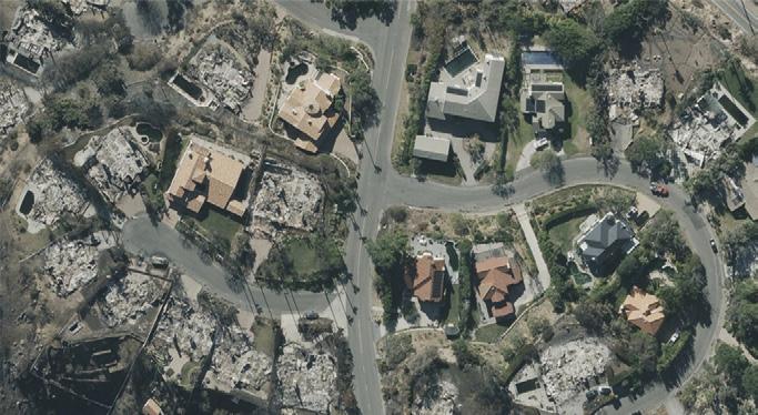
A Vexcel-provided aerial image of the aftermath of the recent fires in Malibu.
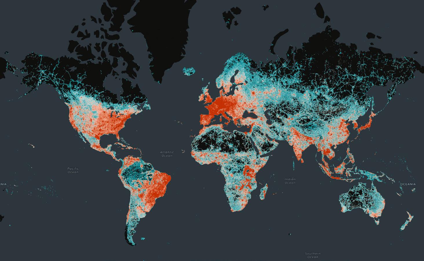
OMF releases transport dataset
The Overture Maps Foundation has announced the general availability (GA) of its global transport dataset, which includes 86 million kilometres of roads worldwide and which is already being used by Microsoft, Meta and TomTom in mapping applications.
The dataset supports new and expanded use cases across a broad swath of industries, including automotive, ride-sharing, logistics, navigation, local search, urban planning, and disaster and humanitarian response.
The GA release means the data and underlying schema is now stable and that developers can start using the data in applications.
The transport dataset joins other Overture datasets in reaching GA status, including buildings, places of interest, divisions (boundaries) and a base layer.
“The Transportation layer of Overture is an iconic map data
NASA data now in Living Atlas
NASA datasets geared for GIS users are now available through a collaboration with Esri’s ArcGIS Living Atlas of the World. The Atlas now includes more than 120 of NASA’s most popular Earth observation products, all formatted for GIS, such as true-colour, corrected-reflectance Earth imagery from the MODIS instrument.
“I like to think of Living Atlas as Google for GIS users,” said Leah Schwizer, manager of NASA’s Earth Science Data Systems Geographic Information Systems Team and leader of the project to bring NASA Earth science data to the Living Atlas. “Users go there knowing everything they find will be ready to go and work in GIS software.”
The call to add NASA data to the collection came time and again from users NASA spoke with at conferences, workshops and other events. “We heard over and over ‘I go to Living Atlas first — is NASA in Living Atlas?’” said Schwizer.
“For a long time, we would actually use Earthdata Search APIs to access the data and then build our own web services around it for users,” said Charlie Hoffman, Esri’s account manager for NASA. “In the last couple of years, we’ve been partnering with NASA to host and
layer used across a wide range of applications. It is also the most complex, and I’m pleased to see it hit the GA milestone so quickly,” said Marc Prioleau, executive director of the Overture Maps Foundation.
“The team’s work now lets any application developer take advantage of this dataset and deliver services to businesses and consumers around the world,” he added.
“Overture data is built open and free for anyone to use, so we expect many innovative use cases across industries, organisations, geographies, and future mapping efforts.”
The Transportation dataset includes detailed, accurate data from aerial imagery, clear road routes with recognisable highway signs, comprehensive rail and ferry route information, and better handling of complex traffic rules and restrictions.
manage its own GIS-formatted data layers so the agency can get maximum attribution.”
Schwizer says that “The data is very curated, and it must meet high quality requirements before it’s added to the repository.”
Global coverage map of Overture’s transportation data.
NASA
OGC releases urban digital twins paper
The Open Geospatial Consortium has released a new discussion paper on the topic of urban digital twins (UDT). Developed for city administration officials and professionals working within urban data contexts, the paper (https://docs.ogc.org/dp/24-025. html) seeks to clarify the concept of UDT and to position the concept in relation to digital twins in general, as well as with the emerging Metaverse.
According to the paper, the UDT concept is “an approach to
understand characteristics and processes of the built environment at the scale of a city,” because between “climate change and various demographics, dynamic cities are facing challenges that are becoming more complex to solve”.
The paper presents three use cases — climate change adaptation, urban transformation and urban air mobility — and identifies the benefits to each of applying a UDT. It also explains the role of geospatial information and how it can contribute to an UDT.
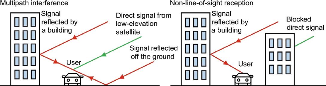
Overcoming GNSS errors in urban jungles
In an effort to tackle the persistent challenge posed by non-line-of-sight GNSS errors in urban jungle environments, researchers have introduced an innovative solution powered by AI. By leveraging the Light Gradient Boosting Machine (LightGBM), the method analyses multiple GNSS signal features to accurately identify and differentiate NLOS errors.
The researchers say the breakthrough promises to significantly improve the precision and reliability of GNSS-based positioning systems, particularly for urban environments, where accuracy can be crucial.
In those urban environments, GNSS often struggle with signal obstructions
caused by tall buildings, vehicles and other structures, leading to non-line-of-sight (NLOS) errors that cause positioning inaccuracies.
The research, published in Satellite Navigation, introduces a machine learning approach to tackle the problem.
Researchers from Wuhan University, Southeast University, and Baidu developed a solution using the LightGBM, a powerful AI-driven model designed to detect and exclude NLOS-related inaccuracies.
The model’s performance was validated through dynamic real-world experiments conducted in Wuhan, China, proving its effectiveness in challenging urban environments.
The method involves the use of a fisheye camera to label GNSS signals as either line-of-sight (LOS) or NLOS, based on the visibility of satellites. The researchers then analysed a range of signal features, including signal-to-noise ratio, elevation angle, pseudo-range consistency, and phase consistency.
By identifying correlations between these features and signal types, the LightGBM model was able to accurately distinguish between LOS and NLOS signals, achieving an impressive 92% accuracy.
Compared to traditional methods such as XGBoost, the researchers say the approach delivered superior performance in both accuracy and computational efficiency.
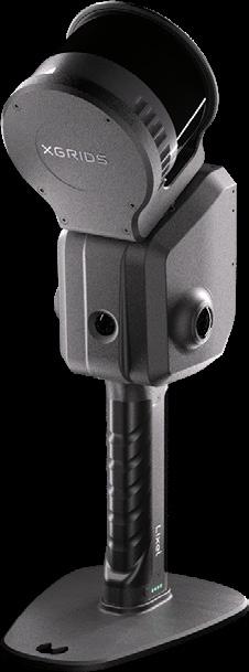
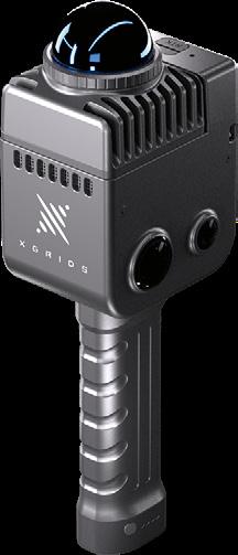
With advanced 3D Gaussian splats (3DGS) technology and SLAM mobile scanning, XGRIDS will transform traditional surveying practices, bridging the gap between accuracy, efficiency and immersive visualisation.
BIM integration workflows
Building information modelling (BIM) has long been a cornerstone of modern construction and surveying. However, traditional methods for capturing as-built data and integrating it into BIM often fall short due to inefficiencies and inaccuracies in data collection and processing.
XGRIDS’ Lixel series SLAM-based scanners generate centimetre-level accurate point cloud data, which can be exported in formats like LAS and RCP, and directly imported into BIM platforms such as Autodesk Revit. This streamlined workflow reduces manual intervention, enhances model accuracy and accelerates project timelines.
Gaussian splats
Gaussian splats (3DGS) represent a paradigm shift in 3D modelling and visualisation for the surveying industry. Unlike traditional mesh-based models, Gaussian splats use point-based representations, allowing for:
• High-resolution visualisation: Rich detail and smooth rendering for largescale environments.
• Efficiency: Faster processing times compared to traditional modelling techniques.
• Interactivity: Enhanced user experiences in real-time applications, such as immersive VR environments. 3DGS offers the ability to create lightweight yet visually stunning 3D representations of sites, structures and terrain, enabling more informed decision-making across project stakeholders.
SLAM technology for complex environments
XGRIDS’ SLAM-based scanners excel in environments where traditional methods
struggle. From sprawling urban landscapes to confined indoor spaces, the combination of LiDAR, IMU and visual data ensures accurate spatial information even in GNSSdenied environments.
For example:
• Infrastructure Surveys: Capturing asbuilt conditions of bridges, tunnels and railways with high accuracy.
• Urban Development: Generating detailed 3D digital twins for urban planning.
• Conservation: Documenting historical landmarks for conservation and management.
Future-ready for the surveying industry
The adoption of XGRIDS’ technology marks a significant leap forward for surveyors aiming to embrace digital transformation. By combining the precision of SLAM-based data acquisition with the visual power of Gaussian splats, XGRIDS is helping the industry transition toward smarter, faster, and more collaborative workflows.
From enhancing the accuracy of asbuilt documentation to unlocking new possibilities in immersive visualisation, XGRIDS empowers surveyors to deliver results that are not only efficient but also visually impactful. As the surveying landscape continues to evolve, XGRIDS stands at the forefront, driving innovation and redefining what’s possible in spatial data acquisition and processing.
Road-test XGRIDS today!
Try XGRIDS demo hardware for yourself. Grab a loaner from Mangoesmapping or access Australian project data and demo licences for the Lixel range of software for visualisation and data processing. n
Complex features such as shiny thin handrails are easily documented with a quick scan.
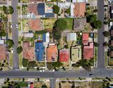
With many billions of dollars to be spent in the geospatial sector in the coming years, Terria has set its sights on grabbing a bigger share of the digital twin market.
Terria targets the digital twin universe
Terria, the latest tech company to be spun out of the CSIRO, is aiming to grab its share of the expected $50 billion growth in the geospatial market over the next few years.
The company was established last year following a funding round led Main Sequence Ventures, a venture capital investor with $1 billion under management and which itself was spun out of the CSIRO in 2017.
According to Mike Nicholls, Partner at Main Sequence, “We first saw Terria a few years ago in the CSIRO Data61 lab and loved the products and how they were being adopted by users”.
“A typical city street has thousands of data sets and plans for buildings, streets, footpaths, electricity, water, sewage, telecommunications, parks, stations, transport, planning and the natural environment,” he said. “Terria can bring all that data together integrating 80 different formats and visualise this on one map.”
“We are excited to help spin this company out and look forward to them growing a huge customer base over the coming years.”
Fronting Terria are its co-founders, Ana Belgun (CEO) and Amber Standley (Chief Experience Officer). We spoke with both of them to find out more about the company, its history within CSIRO, its capabilities and ambitions.
How would you sum up Terria’s main purpose?
Ana Belgun: One of our main goals is not only to make the development of spatial digital twins much easier than it is today, but also to develop a geospatial software library which is open source. The purpose of that is to basically scale the impact that we have by developing software and products and allowing other teams around the world to use our technology and build their own platform applications.
How did the business begin?
AB: Basically, in 2014 we started with a problem. We were functioning as an engineering and design team within NICTA [which was merged into CSIRO in 2016 to become Data61]. The Australian Government at that time had the problem of producing a lot of spatially enabled datasets and they wanted to see a return on that investment by making sure people have access to those datasets in an easier way. The solutions that were on hand were very expensive and didn’t actually solve the core of the problem, which is, how do we make sure people better consume these data we make available for free?
So our team worked with the Government back then to create a prototype which became NationalMap, which was connected to data.gov.au to allow users to consume the data in an easier way. That was the beginning. And from then on, we evolved that use case into creating an entire technology which was made open source, which is TerriaJS.
Fast forward to 2018, we started in the same vein of trying to help or work with governments to experiment with technologies. We started working with state governments and developed the first spatial digital twins in Australia — there were no other examples in Australia that we could point to; the only one was in Singapore at that time. So it was very much a learning experience and a journey that we shared with everybody else, other governments, the Commonwealth etc, to make sure the investment government makes into such technologies and learning is scalable and other people can use it and derive value.
Why has Terria been spun out of CSIRO?
AB: Once research or technology reaches a maturity level, there are a number of ways that the CSIRO wants to scale that impact. They do it through licencing or they do it through creating new companies. So what they did in 2024, with support from Main Sequence Ventures, was to create a new company, Terria. The idea was to take the technology that we developed together with governments and government partners, and take it to a level of commercial success to ensure there is a long term sustainable plan to reinvest in the open source.
You’ve entered a very competitive sector.
AB: I think competition is good and healthy in order to create competitive products and services for the customers. The fact that we have a core technology which is open source speaks volumes, because we want to scale the impact that we have, and have other teams around the world building products and services and platforms.
However, in this competitive market, we believe that having that open source core, and a drive and knowledge around building platforms like spatial digital twins, with datasets that we help customers bring together into one platform, is a huge differentiator. We have had experience working with our partners in the Australian Government since 2014 on understanding the landscape of data in Australia and helping users have access to that data in an easier way.
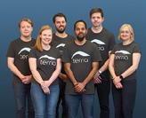
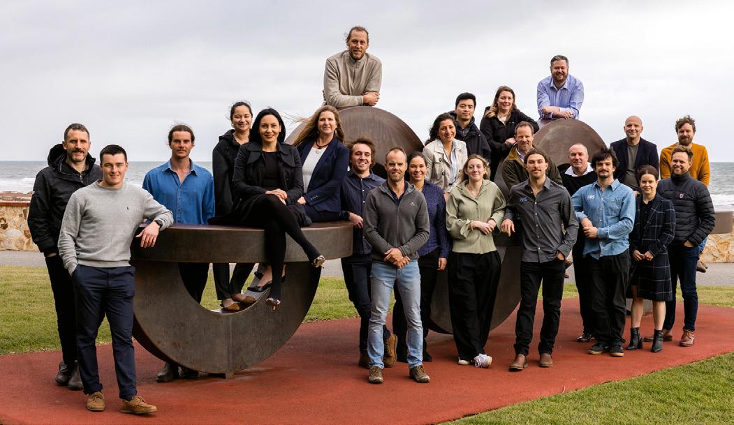
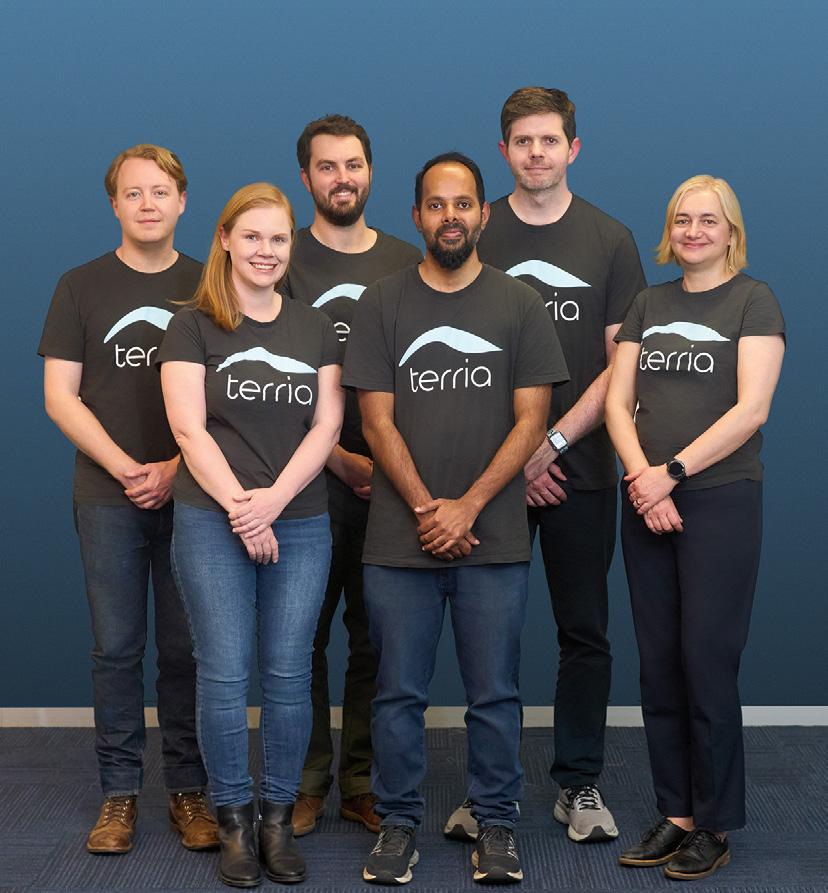
The Terria team, including CXO Amber Standley (second from left) and CEO Ana Belgun (far right).
Amber Standley: We are also focused on enabling people who aren’t developers to create digital twins easily and quickly. So that’s something that’s also a bit of a differentiator for Terria.
What sort of data is available through Terria?
AB: The data that is already available is produced mainly by government organisations. They invest a lot of their resources into creating datasets, and the degrees of complexity or the levels of updates brought to the data is controlled by the custodians of those datasets. Everything they publish, they control, in terms of how many times they update it, how high the quality is etc. And that’s good because you don’t want a middle kind of operation between the end user and the creator of the data. Whatever the government is deploying in terms of datasets, we help the users access them in one place through our Terria platform.
So right now we have a subset of that catalogue of open datasets in the Terria demonstration platform, which is available on the website. That catalogue will grow over time by adding more open datasets, but also having partnership with the commercial data providers, which we haven’t done before. So that’s a new thing that we will add to our platform and the product going forward.
Is Terria aimed only at Australian users?
AB: Absolutely not. Terria is just the open core that sits at the core of product that we build, or the platforms that we build on top of it. Right now it is used globally and has been translated into 22 languages; in six or seven cases with up to the 99% of translations done by the community.
There are communities around the globe; for example Italian, French, Japanese. So it’s been global since day one.
Tell us about your Partner Program.
AS: In 2023 we ran an Early Adopter Program — it was the first time that Terria had engaged industry to understand their needs when it comes to digital twins. Out of that program we found a
number of use cases, mainly in infrastructure, energy, renewables, construction, and so the Partner Program is version 2.0 of that Early Adopter Program. We’ve completed a lot of iterations and changes based on feedback, and we want to run that program again as the Partner Program and engage a new cohort of industry to help them build their first digital twin proof of concept. And also stress test the Terria product and give us feedback so we can refine it.
Are digital twins for everyone? Can a client or project be too small?
AB: Not at all. One of the things that we really care about is making this technology accessible. For some organisations it might seem a little bit scary, too complicated, or going to cost a lot of money. We want to make sure that first they understand what it is; secondly, they prepare themselves for such technologies; and thirdly, that there is an accessible pathway for them to access the technology and use it for a return on investment. So no, no organisation is too big or too small.
AS: And that’s pretty much the goal of the Digital Twin 101 guide that’s on our website. It’s to help people get a) an understanding of digital twins and what they can do, and b) come up with their own plan to tackle a particular problem or particular project. So they can stay really focused on what their goals are and how they’re going to achieve it with digital twin technology.
Ten, 20 years from now, will we all be using digital twins?
AB: We believe that data will transform the technologies that people will use in the future, especially in the business technology that we are talking about here — geospatial. And the signal that we see from the market is that data is growing hugely and there are more and more 3D data added to the assets that organisations have today. You need the technologies to be prepared and mature enough to consume and make sense of that data. So in terms of the geospatial journey, we believe digital twins are here to stay and their maturity will grow over time. n
A Terria 3D digital twin rendering of buildings in Melbourne.
Credit: Terria, Cesium ION, City of Melbourne and Google Photorealistic 3D Tiles.
Mean, green surveying machines
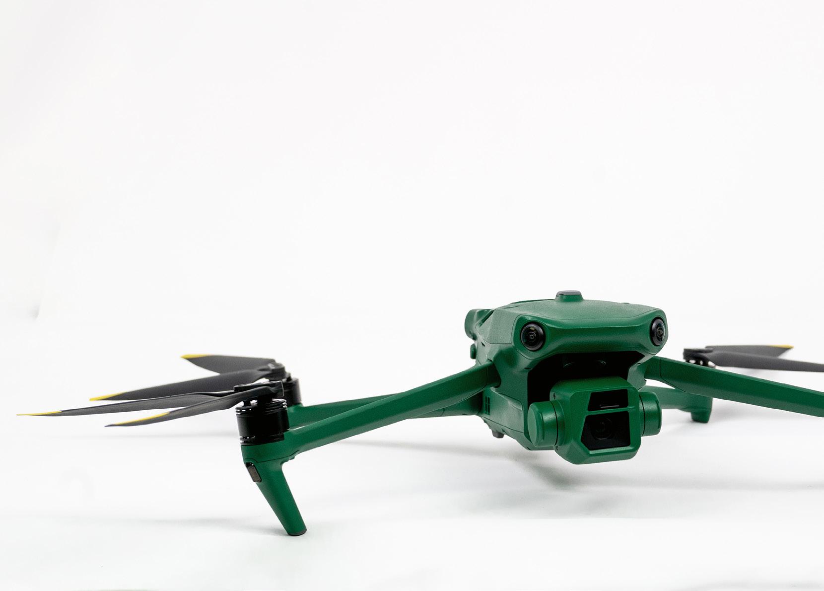
TThe new Raptors from Anzu Robotics are filling a much-needed niche for affordable, fully capable survey drones.
here’s a new player on the drone block, but it’s one that has a familiar look — albeit with a distinctive green finish — being essentially a licensed version of one of the popular DJI models. The company behind it is US firm Anzu Robotics, for whom the master distributor within Australasia is C.R. Kennedy.
While DJI is a dominant player in the global drone market, concerns have been expressed in some markets regarding security implications of using the Chinese technology. Indeed, the Australian Department of Defence has suspended the use of DJI drones, as has the Australian Border Force and the US military.
Anzu has taken steps to quell concerns about licensing DJI’s technology. For a start, Anzu Robotics is a US-based company that simply licenses its drone technology from DJI. Almost all the hardware in each drone is made and assembled in Malaysia, before being shipped to the US for installation of firmware and for quality review.
When it comes to software development, Anzu has partnered with Aloft, a US-based company and FAA-approved UAS Service Supplier that holds ISO 27001 and SOC 2 TYPE II certifications. The drones are designed to meet US regulatory standards and are fully compliant with the US National Defense Authorization Act
the drone’s SD card, minimising the risk of unauthorised access during transmission. Additionally, all flight data stored by Aloft is encrypted in transit and at rest using AES-256 encryption, and Aloft’s Air Control platform runs on servers located in the US.
“The market has been looking for an alternative that isn’t made in China,” says Jeff Bethell, Product Manager at C.R. Kennedy. “Particularly when it comes to using drones near critical infrastructure and other areas where authorities don’t want to risk information going back to a foreign party.”
Bethell says the DJI suspensions left very few drones to choose from, and those that were available could be very expensive. Until Anzu came along, that is.
“Anzu gives you a very competitively priced product that opens up a market niche that DJI could no longer enter,” he says.
“If you’re imaging or surveying an area that is of a security concern, you can fly comfortably knowing that there’s no risk of relaying information back to an unwanted source.”
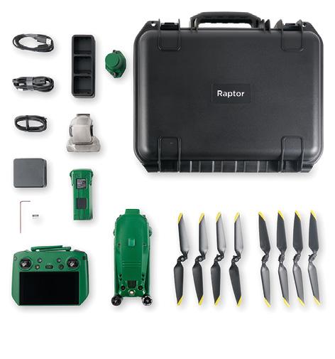
Bethell says that C.R. Kennedy’s first Anzu sale was to a surveying company that had exactly this requirement. The Raptor is enabling that client to survey in sensitive areas that it was unable to tackle previously, and in a very affordable way. Both the Raptor and RaptorT models come packaged with an RTK module and a charging hub.
All data captured is stored locally on
Two versions
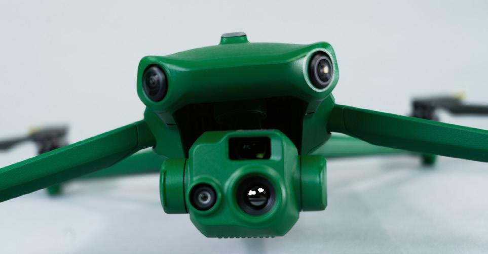
The drone comes in two versions: the Raptor, equipped with an RGB camera, and the RaptorT, which has an RGB camera that also has IR thermal capabilities.
The Raptor is equipped with a 4/3 CMOS camera (FOV 84°), 56x hybrid zoom, a mechanical shutter for preventing blur, fast-charging batteries, a multi-camera obstacle avoidance system, low-light camera mode, and up to 45 minutes of flight time. The controllable range of the tilt on the gimbal is from –90° to +35°.
The RaptorT has everything that Raptor has, with the addition of a built-in high resolution 640×512 LWIR sensor. And that sensor is radiometric, meaning that users can measure the temperature of every pixel of the image when capturing data as radiometric file types.
Both drones are rated for wind resistance of 43 kph and have a maximum take-off elevation of 6,000 metres — more than 2.5 times the height of Mount Kosciuszko!
“This drone format has set the standards for long-lasting flight times,” says Bethell. “The motors are very efficient, which is why it can have a long flight time. Two years ago we were talking 10-, 15-minute flight times. Now you’re talking 45 minutes, so it’s a big difference.
“It’s going to meet everybody’s expectations head on.”
The complete package
The all-inclusive package includes the airframe with applicable payload, the RTK module, hand controller with builtin screen, a battery, the charging station, propellers, and applicable manuals, all in a hard case with custom foam inserts.
The Raptors are operated through the hand controller via the Aloft Air Control app, which has a range of features, such as live video streaming. Streaming enables users to share real-time, lowlatency video securely with mission stakeholders, including multiple streams from different aircraft locations.
The app’s flight telemetry playback function enables operators to use the Air Control web platform to see the locations and flight paths of aircraft, with second-by-second playback. Pilot and fleet management are simplified, providing the ability to track pilot certifications and flight hours, along with aircraft registration, remote ID compliance and maintenance records.
The hand controller also has an HDMI port for displaying data on a desktop monitor.
“Although the Anzu drones are priced slightly higher than their DJI equivalents, it’s important to note that both the Raptor and RaptorT models come packaged with an RTK module and a charging hub, making them competitively priced for the added value,” says Bethell.
Summing up the Raptor models, Bethell says they are “affordable, reliable and efficient, and they’re also backed by C.R. Kennedy, so if something goes wrong you know you’re going to be looked after.” n
For more information, visit https:// survey.crkennedy.com.au
The complete package (Raptor model shown).
The Anzu Robotics Raptor weighs just 1 kg and has a flight time of up to 45 minutes.
The hand controller runs the Aloft Air Control app.
The RaptorT has both RGB and thermal IR imaging capabilities.
Victoria’s vision for a modern cadastral system
With a 10-year strategy well underway, Victoria is on track to deliver a land administration system for the 21st century.
What should Victoria’s cadastral system look like in ten years’ time? To answer this question, Land Use Victoria (LUV) launched a 10-year strategy for advancing Victoria’s cadastral system in March 2024. Co-developed with key stakeholders, the strategy outlines a vision and approach for delivering a future-ready land administration system to meet the needs of Government, industry and the wider community for generations to come.
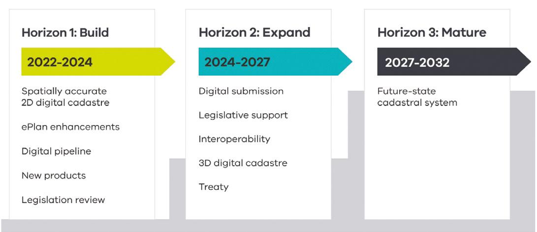
The strategy is being delivered over three horizons, each involving a number of steps. Over the last 12 months, LUV has worked with its stakeholders to deliver Horizon 1, including the completion of:
• The digital cadastre modernisation project, which upgraded the spatial accuracy of Victoria’s digital cadastre and the systems for its ongoing maintenance;
• Enhancements of the ePlan system, which is gearing up to provide the requisite functionality for the representation,
submission, validation and download of digital cadastral plan and survey data;
• Development of a digital pipeline, including the delivery of a sophisticated digital examination tool, processing of cadastral plan and survey data, and the first phase of eComply; and
• Development of new products, including Vicmap Survey, Vicmap Buildings and Vicmap Utilities.
Horizon 2 will run from 2024 to 2027 and aims to:
• Take the next steps in the phased transition from PDF to ePlan for cadastral plan and survey data;
• Develop capability to handle 3D plans (e.g. building subdivisions, consolidations, tunnels, corridors and vistas) through the 3D Cadastral Survey Data Model (3D CDSM);
• Achieve data interoperability between cadastral and geospatial datasets; and
• Support Treaty negotiations.
JONATHAN NALLY
Horizon 3 is due to run from 2027 to 2032 and will focus on maturing Victoria’s cadastral system and its digital capabilities. The goals and aspirations for the end of this period include:
• A fully digital, highly automated, spatially accurate 3D cadastral system;
• A system capable of handling 3D cadastral data;
• Mandatory digital submission and lodgement for all plan and survey information;
• Vicmap Survey being the product of choice for obtaining authoritative digital data relating to cadastral boundaries; and
• Seamless, end-to-end exchange and processing of cadastral information.
Victoria’s cadastre plays an important role in underpinning the state’s financial prosperity. The cadastre supports approximately one million land transactions annually, representing $700 million in land dealings in Victoria each day.
The 10-year strategy is being led by LUV, which is part of the Department of Transport and Planning, the state’s key agency for land registration and property information, surveying, land valuation, geographic names, government land policy and advice, and government land transaction oversight.
To find out a more about the program, we put the following questions to LUV.
What is the main impetus for the initiative?
The context for the strategy is population growth, technological advancement and increased community expectations for the services we deliver. Victoria’s population is forecast to exceed 10 million residents by 2051. The Victorian Government is driving reforms to tackle housing supply and affordability, with the state experiencing significant growth in property development, land subdivision, transport infrastructure, construction and high-density urban renewal.
At the same time, rapid and widespread adoption of digital technology is being seen in almost every sphere of life.
What are the principles and priorities of the program?
The key principles and priority areas for delivering our future state cadastral system include: a digital-by-default approach; a community focus; ongoing investment in data and infrastructure assets; co-design solutions with stakeholders; continuous improvement; development of capability, capacity and culture; and timely review of legislation, regulations and policy.
Victoria’s cadastral system is built on an invaluable repository of information spanning Victoria’s subdivision and land development history. This includes surveyed parcel boundaries, cadastral surveying measurements, evidence of fencing (or ‘occupation’), and related information about Crown and freehold parcels. It’s important we preserve this legacy for generations to come.
Tell us more about the delivery of Horizon 1
As outlined above, the first Horizon has focused on establishing the building blocks required for future transformation. The Digital Cadastre Modernisation (DCM) project included:
• Digitisation of cadastral information from more than a million PDF documents;
• Spatial and topological upgrade of Vicmap Property via least squares adjustment;
• Cascading these changes to other Vicmap themes; and
• Development of a digital pipeline for verifying, processing and adjusting new cadastral data to automate updates to Vicmap.
The DCM project embraced a ‘big data’ mindset that was open to exploring novel approaches to tackling computationally demanding tasks and complex problems
Victoria’s population is forecast to exceed 10 million residents by 2051.
efficiently, using open-source software supported by bespoke solutions and systems.
We have also taken opportunities to deliver additional value from the project, with the raw digitised data from the DCM project now available to surveyors via SPEAR as a new product called Vicmap Survey.
Another major output from Horizon 1 was the development of technology and infrastructure to support the digital examination and validation of subdivisions, providing increased integrity, more consistent decision making, process improvements and faster registration times.
LUV established a Surveyors Advisory Group to continue to incorporate stakeholder feedback across the phased delivery.
What will be involved in the next two horizons?
With the fundamental building blocks in place, Horizon 2 will focus on further developing the systems to support the submission of digital cadastral data. As with any digital transformation journey, ongoing stakeholder engagement will be imperative to ensure a smooth transition.
LUV is taking an agile approach to ensure we can respond and adapt to changing stakeholder needs, feedback, highly variable ways of working across industry, and process efficiencies. This will also involve developing and implementing data standards to cater for all plan and survey based dealing types, and the harmonisation of digital data submission.
As innovative and more efficient ways for managing our cadastral system develop, we will take stock, reset and reprioritise outcomes where we need to.
Has there been much stakeholder involvement?
LUV worked closely with more than 200 stakeholders representing state and local government, industry, academia and professional institutions who interact with Victoria’s cadastral system.
The strategy harnesses their views about what a future-ready cadastral system must deliver to government, industry and community sectors.
At the time of launching the strategy, LUV established a Surveyors Advisory Group to continue to incorporate stakeholder feedback across the phased delivery. The purpose of the Group is to provide peer-support, and to facilitate co-design of cadastral systems, products and services that maximise benefits for industry, government and the community.
Industry participation in the Group is helping to shape initiatives critical to the success of the strategy. This includes the ongoing development of ePlan (2D and 3D), digital cadastral standards for plans and surveys (2D and 3D), access to digital cadastral data for efficient reuse and performing pre-lodgement checks on plans, and matters relating to the copyright of cadastral data.
Who will benefit from the strategy?
The strategy provides benefits for all who rely on Victoria’s cadastral system including, industry professionals involved in subdivision and land development, federal, state and local governments (including government authorities, services authorities and emergency management), property owners and investors, academia and the general public.
The long-term benefits expected include: reduced costs to the state, industry and the community through reduced duplication of effort and manual processes; higher levels of integrity in the cadastre; more efficient ways for checking, verifying and publishing information; ready access to cadastral information that can be seamlessly integrated with other datasets; and maximising the reuse of digital data.
Victorian land use at a glance
3.5 million: The number of freehold titles on Victoria’s land register.
19,000: The number of land transactions processed each week.
3 million: The approximate number of property searches per year administered through Land Use Victoria’s commercial providers and brokers.
7,500: The number of plans of subdivision captured and registered per year.
70,000: The average number of new lots each year.
10,000: The number of new addresses each month.
10,000: The number of unique customers per year accessing Vicmap web-based spatial data services.
500 million: The total number of times per year that customers access Vicmap data services.
Have there been any surprises?
Yes, especially with the DCM project. Like most digital transformation projects, many previously hidden issues were uncovered. A program is now in place to progressively address these issues, for example, digitisation queries, anomalies in the cadastre, unadjusted blocks and zones, and areas showing poor levels of spatial quality.
The enormous scale and volume of data inevitably meant we found more food than we could digest. An inestimable amount of knowledge, skill and insight has been gained by all project participants and partners. In this context, the greatest challenge is how to harness and capitalise on the immense knowledge and experience gained from the project for the benefit of the organisation, industry and future generations. n
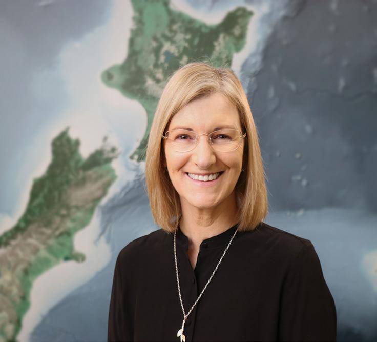
As Chief Executive of Toitū Te Whenua Land Information New Zealand, Gaye Searancke leads a team responsible for managing vast areas of land and sea.
Q&A
with Gaye Searancke
New Zealand is a country of abundant natural beautiful and widely varying landscapes, from snowy mountain peaks to fertile farmland, from active volcanoes to pristine sandy shores. It’s also quite large, with a land area about 15% greater than that of Victoria plus vast oceanic expanses and a substantial territory in Antarctica.
The responsibility for managing New Zealand’s extensive location and property information, cadastral systems, official surveying (including hydrographic) and Crown property, belongs to a single government agency known as Toitū Te Whenua Land Information New Zealand, or LINZ.
LINZ is guided by a four-point framework that ensures its mission is aligned with the nation’s needs and priorities:
• To be a respected and honourable Treaty partner with strong and enduring relationships with iwi and Māori.
• To provide trustworthy and reliable geographic and property information that is freely available and well used.
• To be a trusted regulator, delivering fair and transparent systems.
• To ensure Crown estate is well managed, cared for and enhanced for existing and future generations. Position magazine reached out to LINZ’s Chief Executive, Gaye Searancke, to find out more about it and its activities.
How did you get into this field?
I started my career, what seems a very long time ago, as a lawyer in the private sector. I joined the New Zealand public service in a legal role, and it was so exciting (and challenging!) from day one, working on a big range of subject areas and issues. I moved into a senior leadership role mainly because of the
belief in me from a wonderful boss, and I was part of leadership teams across a few agencies before I became the Chief Executive of LINZ in 2019. LINZ is such a great agency; we have a long history, our people are dedicated and strongly connected to what we do, and I love being part of the many ways we contribute to New Zealand.
What are your role and responsibilities?
I lead the organisation along with a team of three executive leaders, or Kaihautū. We are focused on being a tight and effective team, leading the just-over 800 people who are part of LINZ.
I also have responsibilities as a public service chief executive as a designated co-lead for diversity and inclusion. We’re responsible for leading diversity and inclusion progress in the public service and supporting chief executives to meet their obligations and expectations under our Public Service Act 2020
For those unaware, what is LINZ and what does it do?
LINZ is the New Zealand government’s lead agency for property and geographic information. We manage around two million hectares of Crown land, deal with overseas investment applications, and maintain New Zealand’s positioning infrastructure. We have a world-class property system enabling people to own, transact, develop and invest in land and property with confidence. We manage geospatial information, deliver land surveying functions, administer land titles, survey New Zealand’s area of maritime responsibility to create nautical charts, and produce the official topographical maps for the country and some Pacific Islands. In addition, our people support emergency services by making key datasets available and acquiring new data during disasters to aid the response.
Gaye Searancke, Chief Executive of LINZ
We are the sole agency responsible for national mapping, hydrographic charting, and positioning. This is rare and enables us to coordinate work plans and investments, collecting and creating geographic information and making it openly available for others to use.
LINZ is also the home of the Registrar General of Land, Surveyor General, Valuer General and Commissioner of Crown Lands. These four roles, between them, oversee the legal and survey systems that land ownership and valuations rely on. This has enabled forward-thinking initiatives such as the New Zealand Property Spine, which captures
common data for every property in the country to support statistical analysis, GIS and planning.
Our joined-up, online, cadastre and land registry streamlines processes and ensures this information is discoverable and accessible. It gives New Zealanders certainty about exactly where their boundaries are when they buy, sell and make use of land. Often referred to as the three Rs: the rights, restrictions and responsibilities of ownership are clearly understood and allow for the efficient use of property in New Zealand. The cadastre provides a robust foundation for government and private individuals to grow New Zealand’s economy, safeguarding $1.62 trillion in residential property assets.
Does LINZ have regional responsibilities?
A range of work extends beyond our shores, in the Pacific and Antarctica.
We produce the official maps of the Cook Islands, Niue, Tokelau and the Ross Sea Region of Antarctica, and we also hydrographic survey and produce nautical charts for those areas, as well as Tonga and Samoa.
LINZ supports and is the secretariat for Ngā Pou Taunaha o Aotearoa, the New Zealand Geographic Board. The Board works on naming places and features in New Zealand and our offshore islands, the seafloor to the limits of our extended continental shelf, and the Ross Sea Region of Antarctica.
LINZ also supports overseas emergencies, using our international connections to obtain satellite imagery for use by other agencies to make assessments about events. We most recently provided satellite imagery of the May 2024 Papua New Guinea landslide to GNS Science (a New Zealand Crown research institute) to support its assessments and aid the response.
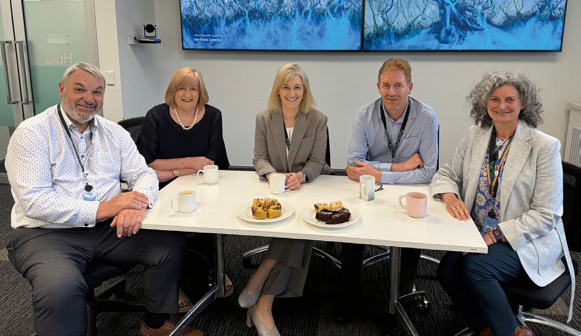
LINZ’s Kaihautu leadership team: from left to right, Murray Young, Kaihautu Digital Delivery; Jan Pierce, Kaihautu Customer Delivery; Gaye Searancke, Chief Executive; Richard Hawke, Director, Office of the Chief Executive; and Claire Richardson, Kaihautu Organisational Effectiveness.
“The economic benefits of SouthPAN are estimated to be at least NZ$864 million over the next 20 years.”
Gaye Searancke, LINZ
How important are international partnerships?
International partnerships are key to our work. We work with other governments’ agencies, intergovernmental organisations and international professional bodies to support and deliver our work.
One of our major projects, the Southern Positioning Augmentation Network (SouthPAN) project, is being delivered in partnership with Geoscience Australia.
We’re also working with our international counterparts to ensure we use the same standards to make timing calculations, which underpin so much of our daily lives. We feed our data into the International Earth Rotation and Reference System (IERS) service, which makes computations that we then add back into our positioning and timing systems, and which better the global system.
LINZ experts contribute knowledge and expertise to several key international bodies. We have people serving on the United Nations Committee of Experts on Global Geospatial Information Management and the UN Group of Experts on Geographical Names. Our hydrographic expertise is recognised through our work with the International Hydrographic Organisation and the South-West Pacific Hydrographic Commission. We also maintain strong professional connections through organisations like the International Federation of Surveyors.
Particularly important are our regional partnerships, including our work with the Australia New Zealand Location Information Council and the Australasian Council of Valuers General. These relationships help ensure consistency across our region and enable us to tackle shared challenges more effectively.
How much of a change will SouthPAN bring?
SouthPAN is already providing benefits to some users, and we expect this will grow to support innovation across many industries including transport, agriculture, construction, forestry and horticulture. The aviation industry is looking forward to adopting SouthPAN to help aircraft land in adverse weather, particularly at our regional airports. Our agricultural and horticultural sectors stand to benefit from improved positioning, with potential
to save money and increase productivity. Improved positioning also helps the survey and spatial community with managing assets and supporting compliance activities.
The economic benefits of SouthPAN are estimated to be at least NZ$864 million over the next 20 years. This figure will grow as new technologies and innovations are developed to harness SouthPAN’s possibilities.
What are some of your other projects or activities?
Over the next three years our 3D Coastal Mapping program will map up to 40% of New Zealand’s coastline to understand how it is changing and help our country prepare for the impacts of climate change. We’re mapping the highly populated parts of our coastline, areas with significant coastal infrastructure, and where there is a higher risk of coastal inundation.
LINZ is also capturing bathymetric LiDAR so that we can create detailed 3D maps of the coast and adjacent seafloor. This provides a baseline from which we can measure changes to coastal areas, for example, from climate events and natural hazards such as tsunami and earthquakes.
As an island nation, LINZ’s nautical charts are vital for international shipping. The International Hydrographic Organisation has developed a new global standard (S-100) for digital products, and we’re working with Maritime New Zealand (the maritime safety authority) to deliver a digital navigation framework for New Zealand and our area of hydrographic responsibility. It’s an exciting multiyear program that will deliver up-to-date information in real time, to:
• enhance navigation safety in open ocean and port environments;
• improve efficiency and optimise load capacity for ships;
• plan routes to reduce carbon emissions; and
• pave the way for autonomous shipping and e-navigation.
We are rebuilding Landonline, New Zealand’s digital survey and title information platform. Landonline was a world-first digital survey and title platform, launched in 2000, and it has served us well.
New Landonline will be substantially completed by June 2025, and will provide:
• a modular, secure and more adaptable technology platform;
• online, real-time access to property information for the public and decision makers;
• higher-quality survey and title services covering a broader range of transactions; and
• improved productivity and a better flow of information, due to the integration of property data with regimes such as the Māori Land Court’s Pātaka Whenua, an online Māori land portal.
What sort of geospatial challenges does New Zealand face?
The data we deal with is used by many different scientific and research domains, including climate change, forestry, hydrology, and inundation modelling. They all have different data needs and speak different languages, so translating these requirements and meeting expectations is a constant challenge. We regularly review how often we should capture data, and to what resolution. We also come across challenges caused by data gaps, such as when data has not been digitised into usable forms, e.g. historical imagery.
We have programs of work to build geospatial capability, including:
• our Ngā Poutama Matawhenua monthly webinars tailored to provide iwi, Māori Trusts, environmental and conservation groups with tools to access GIS data, map their land and create 3D stories and flythroughs.
• supporting the international Women in Hydrography program by hosting interns at LINZ to learn new skills alongside our experts.
What is something that we might not know about LINZ?
You may not know that we do levelling surveys of historic huts in Antarctica, including Scott’s Discovery Hut, to monitor any movements and
ensure their long-term preservation. We also calibrate and make measurements at the world’s southernmost Scott Base tide gauge, ensuring continuity of data at this important site.
Our Surveyor General in LINZ plays an important role ahead of each national election, being part of the team that defines the electoral boundaries.
We measure gravity across the whole country to define the vertical datum, and this data is freely available on the LINZ Data Service.
We also fund New Zealand’s Warkworth Radio Astronomical Observatory that provides Very Long Baseline Interferometry geodetic observations that help measure the size and shape of the Earth to a very high degree of accuracy. Radio-telescopes based around the globe simultaneously observe celestial objects such as quasars, which emit radio waves. Our radio-telescope is one of only 10 such sites in the Southern Hemisphere.
Where can people find more information? Check out our website (linz.govt.nz) and follow us on LinkedIn and Facebook for updates. The LINZ Data Service has its own X (Twitter) profile for data updates. Register with the LINZ Data Service to receive updates on free, open data, including 3D LiDAR of most of the country, historical imagery, surface models etc.
Is there anything else you’d like to convey?
I can’t pass up the opportunity to say how enormously proud we are of our recently retired Chief Geodesist, Graeme Blick. Graeme received the Companion of the New Zealand Order of Merit in the 2025 New Years Honours for services to geodesy, reflecting his 55-year career dedicated to improving the science of geodesy in New Zealand and his contribution to global geodesy. Graeme is an inspiration and role model to many LINZ staff, having followed a specialist career path and having made a lasting contribution nationally and internationally. n
“We manage around two million hectares of Crown land, deal with overseas investment applications, and maintain New Zealand’s positioning infrastructure.”
Gaye Searancke, LINZ
Gaye Searancke with Peter Saywell, Farm Manager, at Simons Pass in the Mackenzie Basin. LINZ is responsible for 156 pastoral leases covering much of the South Island’s high country.
GATHERING the global geospatial community
Upwards of 2,000 people are expected to attend the combined FIG Working Week 2025 and Locate25 conferences in April.
The eyes of the geospatial world will be on Brisbane from in April this year, as thousands of local and international professionals take part in the combined Locate25 and International Federation of Surveyors (FIG) Working Week 2025 conference and exhibition.
While the Geospatial Council of Australia’s Locate conference is well known to those in the Australasian region, FIG and its annual event perhaps are a little less familiar. Founded in 1878, FIG is an international nongovernment organisation, the membership of which includes national geospatial associations, government surveying and mapping agencies, research organisations, private companies and individuals.
Unlike many geospatial bodies and agencies with which Australian readers
will be familiar — which sometimes tend to focus more on the technical aspects the field — FIG has a strong focus on land administration and sustainability issues that affect people across the globe.
Australia has a strong track record of involvement with FIG, having previously hosted FIG congresses in Melbourne in 1994 and Sydney in 2010, and Australians have held, and continue to hold, senior positions as chairs of commissions.
The theme for the 2025 event is ‘Collaboration, innovation and resilience: Championing a digital generation,’ and overall it is expected that almost 2,000 attendees will be attracted from more than 80 countries. There will be more than 70 speaker sessions, and dedicated networking opportunities and extensive exhibition floor that will provide plenty of opportunities for doing business and meeting new people.
The event’s Convenor is Steve Jacoby, Executive Director, Spatial Information at Department of Resources (Queensland). Jacoby has 23 years’ experience as a Senior Executive with the Queensland and Victorian Governments, leading their spatial information businesses.
The Chair of the Local Organising Committee is
FIG Working Week 2025 / Locate25 at a glance
When: Conference: 7 to 9 April
FIG General Assembly: 6 and 10 April
Pre-events/tours: 4 to 5 April
Where: Brisbane Convention & Exhibition Centre
Who: Almost 2,000 attendees from 80-plus countries
Peter James, Chair of the Local Organising Committee
“This is more than just a conference - it’s a platform for fostering meaningful connections.”
Peter James, LOC Chair
Peter James, a geospatial professional with Cohga, an Australian geospatial systems and integration company.
Interestingly, Peter is a thirdgeneration surveyor; his father, Earl James, was the 20th President of FIG from 1992 to 1995, and the first person from the Southern Hemisphere to hold that role.
We spoke with Peter James to find out more about what we can expect from the event and why it is so important to be there.
How are plans progressing?
Plans are progressing very well, and this event is set to be a cornerstone for the geospatial community, both locally and globally. The unique combination of FIG’s international reach and Locate’s strong local foundation, is creating a dynamic program that promises something for everyone — whether you’re focused on innovation, collaboration or tackling the pressing challenges of our time.
Coordinating an event of this scale is no small task. The Local Organising Committee (LOC), in close partnership with the FIG Committee, has been working hard over the past year to integrate the strengths of both conferences. We’re well on track with securing an impressive lineup of keynote speakers, curating a robust technical program, and locking in a variety of social and technical tours designed to showcase Australia’s geospatial expertise and Brisbane’s vibrant culture.
From engaging panel discussions to interactive workshops, gala dinners, and networking opportunities, every element is being carefully planned to ensure an enriching and memorable experience for delegates. This is more than just a conference — it’s a platform for fostering meaningful connections, driving innovation, and championing the resilience of the geospatial profession in an increasingly digital world.
What are some of the topics to be covered?
This conference presents an incredible opportunity to delve into how the geospatial profession is addressing some of the most pressing societal, environmental, and economic challenges of our time. I’m particularly interested in exploring the role of geospatial technologies in building climate resilience — how they’re being used to predict, prepare for and respond to natural disasters, as well as accelerate recovery efforts in communities around the world.
Equally fascinating is the transformative impact of these technologies on industries such as mining, agriculture, and transportation. By improving efficiency, optimising resources and driving innovation, geospatial tools are becoming critical drivers of national productivity and economic growth.
Another area close to my heart is the social impact of geospatial innovation, particularly in empowering Indigenous communities. Geospatial technologies are increasingly being used to support land rights, preserve cultural heritage, and strengthen
the connection between identity and place — conversations that resonate deeply in both local and global contexts.
What are you most looking forward to?
One of the aspects I’m most excited about is the opportunity to showcase Brisbane and Australia to a global audience. Brisbane’s unique combination of vibrant culture, stunning natural landscapes, and cuttingedge industry makes it the perfect host city for an event of this magnitude. I’m particularly eager to highlight how Australian innovation is driving advancements in the geospatial sector, demonstrating our capability to lead and inspire on the global stage.
Another highlight will undoubtedly be the chance to meet and connect with colleagues from across the world. Engaging with professionals from diverse backgrounds and hearing their insights will offer a fresh perspective on the challenges and opportunities we face as a profession. These exchanges often spark new ideas and collaborative possibilities that can have a lasting impact.
I’m also looking forward to
Registration options
Although the early bird registration deadline has now passed, you can still save money by registering before 4 March, as after that a late-registration rate will apply.
The combined conferences are expected to bring together almost 2,000 delegates from all around the world, for an unmissable occasion of information sharing, learning and networking.
There are heavily discounted rates for young delegates and accompanying people, plus there are separate registration options for special pre- and post-event activities, such as a Young Surveyors’ Conference, an ICESat-2 data workshop, and a Climate Masterclass workshop.
There’ll also be a number of special social occasions, such as the welcome reception, Geospatial Excellence Awards dinner and presentation ceremony, a gala conference dinner, and a farewell reception.
A range of very affordable technical and social tour options is available, including visits to North Stradbroke Island and the Queensland Lands Surveying and Mapping Museum, and a technical walking tour focused on the upcoming Olympic Games to be held in Brisbane in 2032.
Full details of all these options can be found at fig.net/fig2025/registration.htm.
discovering the latest technologies, processes and innovations in the field. Understanding how these advancements are being applied to solve real-world problems — and witnessing their tangible benefits — is always a source of inspiration and motivation.
Finally, this event represents an invaluable opportunity to build and strengthen my professional network. Conferences like this are a melting pot of expertise, and the relationships formed here have the potential to evolve into long-term collaborations that drive progress for years to come.
What are the opportunities for Australian professionals?
It presents an extraordinary opportunity to engage with the global geospatial community and gain a broader perspective on how our profession is making a meaningful difference worldwide. It’s a chance to see firsthand how geospatial technologies and expertise are being leveraged to address critical issues — enhancing the health and well-being of our planet and communities across the globe.
From a local perspective, the event provides a unique platform to expand professional networks and explore new business opportunities. It’s a rare occasion to connect with international experts, exchange ideas, and learn from the diverse experiences of colleagues from around the world.
What about for visiting overseas professionals?
This event offers Australian professionals an opportunity to showcase our nation’s reputation for innovation and excellence in the geospatial field. By highlighting our cutting-edge technologies, forward-thinking solutions, and remarkable achievements, we can demonstrate Australia’s leadership on the global stage and inspire new collaborations that will shape the future of our profession.
Australia is recognised for its forward-thinking solutions and cutting-edge technologies in areas such as climate resilience, disaster management and sustainable land use. This event will provide international delegates with direct exposure to these advancements and the chance to engage with local experts driving these initiatives.
The event also will serve as a gateway to understanding the distinct geographic, cultural and societal aspects of Australia, including insights into Indigenous land management practices and the role of geospatial technologies in preserving cultural heritage. These conversations will undoubtedly inspire new ideas and approaches that can be applied in other parts of the world.
Additionally, visiting professionals will benefit from the opportunity to forge lasting connections with both Australian and global colleagues. From networking events to technical
tours, the conference offers an ideal environment for building relationships, fostering collaborations, and exchanging ideas that transcend borders.
The reciprocal exchange of knowledge will help enrich the collective understanding of the profession and strengthen the global geospatial community.
Are there any Brisbane-specific attractions?
The Local Organising Committee has curated a range of social and technical events designed to showcase the unique charm and character of Brisbane and its surrounds. Attendees looking to explore the local environment can join pre- and post-conference day trips to Minjerribah (North Stradbroke Island), a stunning sand island in Moreton Bay renowned for its natural beauty and fascinating history. This tour includes an informative session on the island’s complex transition from sand mining to sustainable tourism, as well as insights into Indigenous cultural heritage and environmental management.
Brisbane itself offers plenty of opportunities to experience its vibrant culture and scenic landscapes. Built around the winding Brisbane River, the city can be explored through leisurely river cruises that highlight iconic landmarks like the Story Bridge. Art enthusiasts will enjoy the Queensland Art Gallery and Gallery of Modern Art (QAGOMA), home to world-class exhibitions, while live performances at the Queensland Performing Arts Centre (QPAC) provide a dose of creativity and entertainment.
For those willing to venture a little further afield, Brisbane’s location offers easy access to the pristine beaches of the Gold Coast and Sunshine Coast, both just an hour away. Alternatively, head into the lush hinterland to explore places like Lamington
National Park, where you’ll find breathtaking hiking trails and tranquil rainforests.
This combination of urban sophistication, coastal beauty, and wilderness adventure ensures that attendees will leave Brisbane with not only professional insights but also unforgettable experiences to cherish.
We understand that travelling to Brisbane can be a significant investment, so we encourage attendees to make the most of their visit by exploring these breathtaking destinations. To help with your planning, we’ll have a dedicated tourism booth at the conference registration area. The team will be ready to assist you in organising and booking experiences that turn your trip into an unforgettable adventure.
Give us your strongest sales pitch — why should people attend?
Simply put, this is the premier event for anyone passionate about the geospatial profession and its impact on the world. The combined FIG Working
Week and Locate25 conference offers an unparalleled platform to learn from global thought leaders, share your own insights, and engage with cutting-edge innovations shaping the future of our field.
This is your chance to connect face-to-face with a diverse community of professionals — from surveyors and spatial scientists to policy makers and technologists — each bringing unique perspectives and expertise. These interactions could spark collaborations, open doors to new opportunities, or provide fresh inspiration for tackling challenges in your work.
Beyond the professional benefits, the event offers a rare opportunity to gain a deeper understanding of international developments and trends in the geospatial industry. Whether you’re looking to broaden your horizons, sharpen your expertise, or elevate your career, this conference delivers the knowledge, connections, and inspiration to help you achieve your goals.
I can’t wait to welcome you to Brisbane in April 2025 — see you there! n
Taking the low road for satellite-based PNT
There’s a new space race underway, but this time it’s in low-Earth orbit and being led by private industry.
Low-Earth orbit is shaping up to be the next battleground for satellite-based positioning, navigation and timing efforts, according to a new report published by FrontierSI.
The State of the Market Report: Low-Earth Orbit Positioning, Navigation and Timing (LEO PNT) report (tinyurl.com/yc336aza) outlines current and future systems and technologies that are, may be or will be used for LEO-based PNT, as well as the technical challenges that must be overcome.
“LEO PNT represents the next frontier in satellite navigation, offering enhanced reliability and performance for industries and communities,” said Graeme Kernich, FrontierSI CEO. “This report provides the insights needed to understand and shape the future of this transformative technology.”
PNT service provision, traditionally the preserve of governments, will increasingly be offered by the private sector as lower launch costs and technology improvements combine to make LEO PNT an attractive business proposition.
The report demonstrates that the future of PNT probably lies in a combination of private enterprise ventures and traditional government-led systems. Each has its advantages and disadvantages, with the market likely to determine in which direction the overall mix will head.
The means of delivering LEO PNT services can be divided into three categories:
• PNT-only services from dedicated satellite constellations;
• Those relying upon ‘signals of opportunity’ (SOP) from non-PNT satellite systems; and
• Those that will provide a hybrid of PNT and communications services.
Of course, the overall driver behind LEO PNT is the alternative it could provide to the current GNSS, which is dominated by half a dozen large, state-controlled systems such as the GPS (the USA) and Galileo (Europe). These ubiquitously adopted systems, while excellent, carry sovereign risk — they are controlled by a handful of
nations, are provided free of charge and could be denied or intentionally degraded in times of conflict or contention.
Independent PNT services provided by low-cost satellite constellations in LEO offer a potential alternative that is increasingly being seen as attractive by a wide range of potential users.
But the picture is not all roses. The FrontierSI report outlines concerns regarding the interoperability of different proposed systems, as well as the management of the required radio spectrum and governance issues. It points out that “Coordination among commercial, government, and multi-national players will be essential to ensure these systems can operate harmoniously”.
While the report mainly focuses on dedicated LEO PNT systems, it also delves into SOP using constellations such as Starlink. While early efforts in this area are achieving near-metre-level navigation accuracy under ideal conditions, there’s still a long way to go before they might be ready for commercial operation.
The report also compares the characteristics of different proposed LEO PNT systems with those of the traditional GNSS. Aspects covered include the determination of precise orbits, timescale issues, and ionospheric effects, the latter of which differ between LEO and higher orbits. There’s also the problem of the increased atmospheric drag that will be encountered by LEO satellites, which again has implications for precise orbit determination.
The proposed LEO PNT constellations would comprise very small satellites that would not be able to carry the heavy atomic clocks used by GNSS satellites, so alternative time synchronisation methods will need to be found. This might take the form of “time transfer from ground stations, GNSS or geostationary satellites, or employing optical inter-satellite links,” the report says.
There are quite a few players in the
emerging LEO PNT space, and the report takes a look at each of them: Iridium STL, Xona Space and TrustPoint (all from the USA); JAXA and ArkEdge Space (Japan); Centispace, Geely and SatNet LEO (China); as well as ESA’s FutureNAV LEO-PNT In-orbit demonstration (Europe). There are also two emerging systems, Fergani Space (Turkey) and GNSSaS (UAE).
So far, only Iridium offers a commercial PNT service. Although it achieves a timing accuracy of less than 100 ns, its positioning accuracy is limited to metres to tens of metres because of the restricted number of satellites it has in LEO. A low number of satellites will not be a problem for other providers, with most of them planning to have between 200 and 500 satellites.
The report also ponders other important considerations, such as the availability of receiver technology and radio frequency spectrum allocation.
“This report is a foundational resource for anyone involved in satellite navigation, from policymakers and industry professionals to researchers and investors,” said Eldar Rubinov, FrontierSI’s PNT & Geodesy Technical Lead and the report’s lead author.
“It is the basis from which we can track the evolution of LEO PNT technology and its implications across civilian and defence domains.” n
JONATHAN NALLY
Building a global GEOSPATIAL BUSINESS
Kurloo is an Australian technology success story with its sights set on worldwide expansion.
Many successful businesses and individuals are often described as being overnight successes, but rarely is that really true. Success mostly comes from many years of hard slog, ingenuity and perseverance. And this is certainly true of Australian company Kurloo, whose success is founded upon decades of experience and years of focused innovation.
And it helps to be able be spot a gap in the market. According to Kurloo’s founder, Lee Hellen, “We saw an opportunity around six to seven years ago where there was a converging of technology — low-cost GNSS chipsets, other low-cost components, solar and battery systems, advanced manufacturing, and improved positioning infrastructure.”
“We had limited accessibility to a digital fiduciary geodetic network a decade ago, but today we have positioning infrastructure that we can take advantage of to operate our service globally,” he says. “We used our knowledge to create a service that would effectively allow automation of geodetic measurement to be more widely adopted not only in geospatial, surveying and mapping, but also in mining, transport and infrastructure — monitoring geo-hazards and landslips more simply and more easily than ever before.”
Hellen says he is inspired by Australian companies such as Maptek and Emesent. “We know that Australian businesses can succeed on the world stage,” he says. “Kurloo is just another example of that, but our specialisation is in positioning and the Internet of Things.”
And that’s paying off for the company on an international level. Kurloo devices are operating in seven countries and regions — Australia, the UK, Switzerland, South Korea, Singapore, New Zealand and North America — with South America soon to come.
Challenges
Hellen points to the difficulties of marrying the efforts of the academic research sector and that of private industry.
“I think the difficulty is that the opportunity for forging partnerships between research and industry is quite limited. You know, it’s quite a big step for a lot of businesses to step out of making money to do some research and development. We were very lucky, as we came out of the Innovative Manufacturing CRC.”
But Kurloo is not shying away from the problem. In fact, the company is taking the lead by sponsoring three industry PhD
collaborations: one through the CSIRO and Curtin University on work with InSAR, another with Deakin University on the scalability of cloud platforms, and a third one under development with QUT.
“Industry and research collaboration is really important because it helps researchers solve real-world problems,” says Hellen. “A lot of companies don’t have the people free to do research; they’re just too busy. What makes me proud is that we can provide employment opportunities for highly skilled and educated people in the fields of computer science, electronics manufacturing and positioning.”
Success stories
Hellen says he wants more stories like Kurloo’s to be told to encourage Australians to be inventive. “People just think, ‘Well, why would I invent something when I can just buy an imported product off the shelf?’ And unfortunately, we pay the price for that, because quite often the products that we bring in aren’t well designed for or suited to an Australian environment; in other words, they rely on the user to do their development for them,” he says. “That was one of the motivations for establishing Kurloo. The equipment we were using needed a lot of additional investment to make it practical for the conditions we worked in. Being able to roll out simply and with a high degree of confidence that it would perform in our local conditions was vital to us using it more frequently in our consulting practice.”
Designing a product based on years of experience under tough Australian conditions has turned out to be a real blessing. “We’re finding both our hardware and software systems are working very well for the customer, because of the amount of research and development that’s gone into it,” says Hellen, adding that he finds it amazing how quickly Kurloo is being adopted internationally. For instance, “I had an online meeting with a guy in Colorado this morning. We sent some units to him via the post, and they were up and working at –25° Celsius within a week.”
Hellen says he’s now starting to see the growth in the company that he always knew it was capable of achieving. “Accessing geodetic measurements simply and autonomously to truth all kinds of data in all types of conditions is something that the world is crying out for,” Hellen says. Kurloo currently has 14 staff members, but there are plans to double that over the next 18 months.
The company is also looking at setting up more sales channel partners and personnel around the world. “It’s about aligning ourselves with people who hold similar values,” says Hellen. “We seek out people who have a really strong service component, that are motivated by helping people work smarter and inventing better ways of solving real work problems with good science and technology.” n
A Kurloo fixed to a structure in the Rocky Mountains, Colorado.
Let’s Locate engages the next generation
GREG LEDWIDGE
The Let’s Locate immersion program aims to help high school students take the next step to learn more about the industry.
For decades the surveying and geospatial industry has tried to engage high school students in a variety of ways in the hope of getting them to pursue a career in our industry. Passionate individuals have initiated and progressed a range of engagement activities such as speaking in schools, the Maths in Surveying days and careers expos.
These efforts have had success, but there was always the question of where students could go to learn more. Some may do work experience or seek out further education opportunities. But what happens to those who are curious to learn more but, for a range of reasons, can’t take it further and therefore lose interest? There is a missing link in the system — Let’s Locate looks to bridge that link.
Let’s Locate is an immersion program designed to help interested and curious high school students, and others, take the next step to learn more about our industry. They can get a taste for surveying or geospatial and immerse themselves in the
The students were ably tutored and enthused by Libby Evans from TAFE NSW.
industry in a structured and supportive learning environment. They get the opportunity to learn what a surveyor or geospatial professional does and become more aware of the skills and education needed. In, addition they get to play with some of the great technology we use.
The program runs for up to five days, generally in school holidays — and surely, all parents wish to have their kids doing something productive, fun and safe for a week of the holidays!
At the end of each program the students get to connect with supportive local companies, the vocational training sector and interested universities. There is, of course, follow-up and ongoing connections with industry groups to facilitate work experience — Surveying Careers has been great in making this happen so far.
While the program was previously delivered on a small local scale, it was in 2024 that various peak industry groups came together in the ACT to progress to towards our first modern pilot program. It was great to see representatives from GCA, ISNSW, Surveying Careers and the ACT Office of the Surveyor-General and Land Information collaborating to make the Canberra pilot program happen. Supporting the pilot program were the Canberra Institute of Technology, TAFE NSW and some wonderful volunteers.
The Let’s Locate Surveying, Canberra 2024 immersion program was run from 30 September to 4 October and saw a small group of students from Canberra and as far away as Tamworth in northern NSW, spend an exciting week learning surveying skills and seeing drones and terrestrial laser scanning (TLS) in action. It was great to witness their enthusiasm, expertly encouraged by Libby Evans from TAFE NSW. The students gained a basic awareness of levelling, traversing, detail surveys, set-out and the use of TLS and UAVs. On the last day they heard from and spoke with representatives of local surveying companies and education providers. Surveying Careers has been working on follow-up with the students.
The 2024 Canberra program was the first of a series of pilots intended to test and develop a framework for delivering Let’s Locate far beyond Canberra. Wherever there are students curious about our great surveying and geospatial industry, we need to be able to provide them with an opportunity to learn and progress.
It is anticipated the next Let’s Locate Surveying will be held in Sydney in early to mid-2025, with others to follow. On the Canberra front, work has begun on delivering Let’s Locate Geospatial in the first half of 2025. While the exact nature of the program is yet to be finalised, there
We can change a student’s future work trajectory and give them a truly rewarding career.
has been some engagement with the local Planning Institute of Australia to jointly deliver a project-based planning program. Students will be able to bring together spatial data and information, perform site analysis and design a development. It will be a challenge for all — I can’t wait!!
I would like to thank all of the Let’s Locate partner organisations: Surveying Careers, Canberra Institute of Technology, TAFE NSW and GCA. Without them, Let’s Locate would not happen. Thanks also go to the wonderful local volunteers and local sponsors: Lonergan Surveying, Landmark Surveys, Veris Canberra, Spire Surveying and ACT Office of the Surveyor-General and Land Information. Finally, to our teacher Libby Evans, from NSW TAFE in Albury NSW, a special thanks for bringing so much drive and enthusiasm. You really
engaged the students. Despite rumours to the contrary, it had nothing to do with the handing out of Cadbury Favourites chocolates!
Some final thoughts. After our first Let’s Locate attempt in 2016, a Year 12 girl said, “All I thought I could do was hospitality. I never thought I could do something like this.” While we focus on getting more people into our industry to ‘get the job done,’ we should also remember that we can change a student’s future work trajectory and give them a truly rewarding career. We have so many exciting opportunities to change a student’s life. n
Greg Ledwidge is the Surveyor-General of the Australian Capital Territory. For further information on the Let’s Locate program or to become involved, please email him at Greg.Ledwidge@act.gov.au
Students came to Canberra from afar afield as Tamworth in northern NSW.
Supporting young and emerging professionals
JONATHAN NALLY
James Sadler, the new chair of the GCA Young and Emerging Professionals area of practice, has his eyes on the future.
The young and emerging professionals (YEP) cohort of Australia’s geospatial sector is perhaps its most important, as that is where the future of our industry lies. That’s why YEPs deserve support and encouragement from everyone involved in the sector.
The Geospatial Council of Australia has a specialist YEP area of practice; its immediate past chair, Oscar So, worked tirelessly for many years to progress the cause of YEPs and their needs. The new chair is James Sadler. We spoke with him to learn about his career trajectory and to find out what his ambitions are.
How did you get into this industry?
It came from my interest in geography. A conversation with my school’s career adviser led me to complete a Bachelor of Applied GIS at Flinders University. I entered the industry in early 2021 via work experience with Aerometrex and Sproutt in South Australia. From there I decided I wanted to pursue a remote sensing role and found one in satellite remote sensing in the ACT. My work focuses on environmental projects, where I monitor native vegetation, agriculture and waterways for compliance and efficiency.
What do you enjoy about your work?
I thrive in an environment where I get to do a variety of work. In my current role, I am directly interacting with clients in a sales-like capacity, but I also get to deliver the work I’ve scoped with them. This gives me greater control over the solutions I offer, but also means I get to offer what I think is the best solution for the client’s problem, not necessarily the most profitable.
What do you hope to do next in your career?
I see the first five to seven years of my career being focused on learning and upskilling in ways that enable me to greater contribute to the industry. My ideal role is one with enough down time that I can complete R&D background work that aligns with my employer’s aims. I hope to stay around remote sensing for most of my career, however I recognise that this is only a tiny part of the GIS industry. To be a stronger professional I see the need to learn the adjacent data management and map production skills that exist across wider industry.
What is the purpose of the GCA YEP group? It has a different purpose depending on who you ask. When I
was early in my studies, it gave me a community that made me feel like I belonged. This was critical to me following through with my degree, rather than dropping out and going down another career path. So I like to think I might be helping other early career professionals gain that sense of belonging and stay in the industry.
One of my main aims, which is shared by the YEP vice chair, Sijan Bhandari, is to grow the group. Currently we see different levels of engagement in different states, and we would like to get them all to be self-sufficient.
What does the sector need to do to support YEPs?
This kind of goes back to that sense of belonging. There is a bit of imposter syndrome when you enter the industry. For me it was wondering why I had the authority to be organising early career networking events. This fear was put aside by having senior people tell me that what I was doing was good and, in a way, validating my efforts.
The YEP group is full of volunteers who get involved because they want to contribute to the community; receiving validation for their efforts can help reignite their sense of purpose. For me it was talking to people such as Maree Wilson from Geoscience Australia (who had been in an earlier iteration of the group), who shared some of her insights, and Jonah Williams from Onneer, who made me reflect on what my overall aim was and how to rescope to achieve it.
What’s coming up for YEPs in 2025?
The FIG conference in Brisbane in April should be very interesting, with a FIG Young Surveyors Network (YSN) and GCA YEP collaboration in the works. Some of the other team members and myself have been assisting with planning the YSN conference. It has been great seeing the different approach that FIG takes towards its event planning. Hopefully, I’ll pick up a few skills along the way that I can apply in the future.
How can people contact the YEP Group?
The best way is to reach out to me on LinkedIn or find the GCA state representative in your area. You can also reach out via the GCA admin team. n
James Sadler, chair of the GCA’s YEP area of practice.
Geographic software
Blue Marble Geographics has launched Geographic Calculator 2025, its latest desktop version, alongside the new Geographic Calculator Cloud. Geographic Calculator 2025 includes small updates and fixes requested by users. Geographic Calculator Cloud, which is currently offered as an add-on to Geographic Calculator desktop, provides users with single point, point file, and vector file conversions on any device with a web browser. It uses the same comprehensive suite of powerful coordinate conversion, datum transformation, and format translation tools as the desktop application. The new Geographic Calculator Cloud supersedes the existing GeoCalc Geodetic Online Registry (GCO) Library, Search and Calculator functions.
Fixed-position LiDAR scanning
Klau Geomatics (geomatics.com.au) has released a new LiDAR-based bulk materials management system called Stockpiler, intended for use in the shipping and handling of bulk dry products such as minerals or grain, particularly those stored in sheds. The Stockpiler array of fixed LiDAR scanners, calibrated and centrally controlled, can capture and process accurate material volume data in minutes. It overcomes the limitations of traditional methods, such as indoor drone operations or terrestrial scanning. Shipping operators can schedule scans or initiate a scan on demand, giving them the data they need to make critical logistics decisions.
Multi-sensor drones
DJI has introduced the Matrice 4 Series as the company’s new compact flagship enterprise drone range. With a 70mm medium telephoto lens (1/1.3 CMOS, 48MP, f/2.8), screws and cracks can be identified in medium-range inspections for power lines and bridges from a distance of 10 metres. For longer-range inspections, the 168mm telephoto lens (1/1.5 CMOS, 48 MP, f/2.8) can capture details from up to 250 metres away. Additionally, the laser range finder can measure distances from 1,800 metres. The thermal camera supports high-res mode up to 1280x1024 pixels, while the NIR auxiliary light can illuminate objects 100 metres away.
Utility solution
Teledyne Geospatial and Pointerra3D have announced a partnership for grid management in the electric utility industry. The deal introduces the Network Surveyor bundle, combining Teledyne Geospatial’s airborne acquisition technology with Pointerra3D’s software suite. The companies say the integrated solution dramatically reduces the time required to transform airborne 3D data into actionable insight on the health of electrical utility grid infrastructure. Pointerra3D is a geospatial web mapping SaaS solution that enables collected digital twin data to become more accessible through end-to-end cloud-based workflows, storage and compute resources.
News and views from the Geospatial Council of Australia CEO’s Column
GCA Board Members
Kate Lundy President/Chair
Kate Ramsay Deputy Chair
Alistair Byrom Deputy Chair
Noel Davidson Director
Alex Leith Director
Stewart Dunne Director
Mary-Ellen Feeney Director
Darren Mottolini Director
Roshni Sharma Director
As we look to the year ahead, there is much to celebrate and anticipate at the Geospatial Council of Australia (GCA). Our focus remains on fostering growth, collaboration, and excellence within the geospatial industry. Here are some key highlights and initiatives in the works for 2025.
Welcoming NGIS as a new partner
We are delighted to welcome Perth-based company NGIS as a Supporting Partner and Organisational Member of GCA. NGIS has been a cornerstone of innovation in Australia, driving geospatial solutions that contribute to the nation’s economic growth and sustainability.
I would also like to thank NGIS for hosting us at their Perth offices in December for a discussion with the Honourable Stephen Dawson about the findings of our recent economic impact study. As you may already be aware, this study revealed that geospatial technology is projected to contribute $689 billion to Australia’s economy by 2034, with WA leading the way with a forecasted $190 billion impact on Gross State Product.
Local leaders such as NGIS exemplify the transformative potential of our sector. We look forward to engaging with government ministers in other states over the coming months to continue these vital discussions and promote the value of geospatial services nationwide.
FIG Working Week 2025 and Locate25
Another major milestone for GCA is hosting the FIG Working Week 2025 in conjunction with our annual Locate25 event. Registration is now open for this
What’s ahead for GCA in 2025
combined global and national conference, taking place at the Brisbane Convention & Exhibition Centre from 6 to 10 April 2025. This event promises unparalleled opportunities for learning, networking and collaboration. With up to 2,000 attendees expected from more than 90 countries, the program features 70-plus sessions, a comprehensive exhibition and dedicated networking opportunities. Pre- and postevent activities are also available for those who want to maximise their experience.
Under the theme ‘Collaboration, Innovation and Resilience: Championing a Digital Generation,’ participants can expect insights from leading practitioners, allied professionals and academics. This is a unique chance for Australia’s geospatial community to showcase its technical expertise and research capabilities, and its warm hospitality, to a global audience.
Certifications for professional excellence
Our commitment to professional development remains steadfast, with several key certifications being enhanced and relaunched:
• National Engineering Surveying Certification: Formerly the ESP-AP Certification, this program has been revamped to set new standards for excellence in engineering surveying. The current intake is open until 14 March, offering professionals the chance to highlight their expertise and gain recognition as Accredited Engineering Surveyors.
• GISP-AP Certification: Following its suspension, we are collaborating with GISCI in America, and Survey and Spatial NZ to reintroduce this certification in Australia and New Zealand, with plans to expand to other Pacific nations. We plan to relaunch the certification this year.
• Hydrography Certification: This specialist certification, conducted through the Australasian Hydrographic Surveyors Certification Panel, continues to provide official recognition of expertise in hydrographic surveying, enhancing career opportunities and instilling confidence among employers and clients alike.
All these certifications can be accessed through our website, where you’ll find detailed information on eligibility, application processes and upcoming intakes.
Young & Emerging Professionals Committee
We are delighted to welcome James Sadler as the new Chair of the Young & Emerging Professionals (YEPs) Committee. James takes over from Oscar So, who has dedicated immense effort to supporting young professionals in our industry. Thank you, Oscar, for your invaluable contributions.
Under James’ leadership, the YEPs Committee will continue to empower its members through resources, mentorship and networking opportunities. Already, James has made an impact by supporting the ACT event in November, which featured presentations from YEPs and emergency services, showcasing the power of crosssector collaboration.
The energy, creativity and technical skills of our young professionals are critical to the continued evolution of the geospatial sector. We are committed to supporting their growth and ensuring they have the tools to drive meaningful change.
Leadership transition
At the AGM in November 2024, I announced my decision to retire as CEO of GCA in May 2025. This transition marks the end of an era but also the beginning of an exciting new chapter for our organisation.
Under my leadership, GCA has achieved significant milestones, including the release of the economic impact report, the acquisition of Position magazine and Spatial Source, and the launch of the updated National Engineering Surveying Certification. These accomplishments have strengthened our position as a unified and influential peak body. The Board is now actively recruiting a new CEO to lead GCA into the future, ensuring continuity and momentum. I am confident the organisation will continue to thrive, building on our legacy of collaboration, innovation, and resilience.
As we embark on this new phase, I invite our members and partners to join us in shaping the future of the geospatial industry. Whether through attending events, engaging with our certification programs, or supporting the next generation of professionals, there are countless ways to make an impact.
Here’s to a transformative and inspiring year ahead for GCA and the geospatial community!
Tony Wheeler CEO, Geospatial Council of Australia
State and Territory Chairs and Co-Chairs
NSW Chair
Brittany Baker
NSW Vice-Chair
Hanno Klahn
ACT Chair
Mike Stapleton
Queensland Chair
Koray Ozdogu
South Australia Chair
Graham Walker
South Australia Vice-Chair
Jennifer Brindle
Tasmania Chair
Anthony O’Flaherty
Victoria Chair
Nicole Kiely
Western Australia Chair
Laren Collen
GDARS Chair
Surveying Chair
Mike Stapleton
Hydrography Chair
Neil Hewitt
Young and Emerging Professionals Chair
James Sadler
The combined FIG Working Week 2025 and Locate25 conferences will be held in Brisbane in April.
Inspiring the next generation through STEM and Drones
For more than two decades, Katie Vidal has been a passionate educator, guiding young learners from kindergarten to Year 2. But seven years ago, her career took an exciting turn when she joined She Maps, an organisation dedicated to making STEM education inclusive and accessible.
Reflecting on her start, Katie recalled the pivotal moment Dr Karen Joyce, cofounder of She Maps, posed a simple question: ‘Do you want to fly drones in the classroom?’ Katie’s immediate response was ‘Yes!’ followed by ‘How?’”
Starting as a certified instructor, Katie initially ran face-to-face drone programs in schools. Over time, her role expanded significantly, moving from educational resource creation to online and face-to-face teacher professional development support, and then into project management overseeing initiatives like the federally funded Women in STEM and Entrepreneurship (WISE) program.
Today, as the Education Lead for She Maps, she is a driving force behind programs that connect students, teachers, and industries with the exciting possibilities of drone technology and STEM careers.
Breaking barriers in STEM
STEM fields have long been perceived as male-dominated, and this perception often deters girls and non-binary students from pursuing these subjects. Katie and the She Maps team are challenging this narrative by making STEM education more inclusive. They’ve integrated real-world applications of drone technology into their curriculum, using it as a tool to engage students in hands-on problem-solving tasks. Drones, with their innate appeal and practical uses, spark curiosity and encourage participation in STEM in a way few other technologies can.
A key element of She Maps’ strategy is representation. Programs feature positive female role models, showcasing scientists, drone pilots and technical experts who break the traditional stereotypes of STEM professionals. She Maps also supports gender-specific programs where possible, creating environments where girls feel more confident as they learn to navigate new technologies.
Empowering teachers
Recognising that teacher confidence is critical to student success, She Maps places significant emphasis on equipping educators to lead STEM lessons effectively. Many teachers, especially those teaching outside their areas of expertise, struggle with confidence in delivering technical subjects. Compounding this is the limited time available for professional development.
Katie and her team tackle these challenges by providing a combination of online and hands-on professional development programs. Flexible resources, such as modular units of work, enable teachers to adapt the materials to their specific needs. Personalised support is also available to help schools launch drone programs, ensuring that educators feel supported every step of the way.
This focus on teacher development not only enhances the classroom experience but also ensures that the benefits of STEM programs extend far beyond a single workshop or lesson.
At the heart of She Maps’ programs is the belief that education should be relevant and practical. Classroom activities are designed to mirror real-world scenarios, introducing students to challenges they
Katie Vidal’s passion for education has taken her to some amazing places.
Students at Mutitjulu, near Uluru, created maps using craft materials.
Collaboration, Innovation and Resilience
Championing a Digital Generation
Join us in Brisbane, Australia for the opportunity to connect and learn as part of a global community:
• Up to 2,000 Attendees
• 3 Day Conference
• Pre- and post-events
• 70+ Sessions
• 90+ Countries represented
• Dedicated Networking Opportunities
• Comprehensive Exhibition
Brisbane, Australia 6-10 April
might encounter in the workforce. For example, students might simulate assisting emergency services during a natural disaster, design drone delivery services to address community needs, or assess agricultural crop success through drone data. These scenarios use microdrones as tools to develop solutions, bridging the gap between theoretical learning and practical application.
She Maps also fosters direct connections between students and industry. Through partnerships with organisations like the Geospatial Council of Australia, FrontierSI, Girl Guides Victoria, Geography Teachers Association of Victoria, Surf
Life Saving NSW, In2Science – LaTrobe University, Uniq You and Study Work Grow, students can attend events, interact with professionals, and gain insights into geospatial careers. These experiences open doors to future opportunities, helping students envision themselves in STEM fields.
Katie’s passion for education has taken her to some extraordinary places, but few experiences have been as impactful as her time in Mutitjulu, a small community near Uluru. There, she led a week-long program that combined drone education with community mapping. Working with students, Katie facilitated the creation of a
map using craft materials to identify local infrastructure such as homes, schools and health clinics. Senior students learned to collect data on recycling using iPads, sparking discussions on waste management and environmental sustainability. The project didn’t just teach technical skills; it empowered students to consider how they could use STEM to solve real problems in their community.
A vision for the future
As She Maps looks to the next five years, the organisation aims to continue expanding its network of educators, students and industry partners. Katie envisions a growing community supported by workshops, events and resources delivered both face-to-face and online.
Her advice to schools considering drone education is simple: take stock of existing resources, reach out for support and embrace the possibilities. Many schools already have drones tucked away in storage; with the right guidance, these tools can unlock incredible learning opportunities.
Katie Vidal’s work with She Maps exemplifies how innovative education can inspire students and teachers alike. By combining cutting-edge technology with a commitment to inclusivity, She Maps is helping to redefine STEM education — making it accessible, engaging and transformative for all. n
Engineering Surveying Certification
The March 2025 intake for the Engineering Surveying Certification is now open, with applications closing on 14 March. This is your opportunity to gain a recognised credential as an Accredited Engineering Surveyor, showcasing your expertise and advancing your career in the surveying industry.
The Engineering Surveying Certification has been a hallmark of excellence in the Australasian Pacific region for over a decade. It serves as a trusted benchmark for individuals and organisations alike, identifying professionals equipped with the advanced skills required for complex projects.
As an individual, obtaining this certification highlights your ability to deliver specialist engineering surveying tasks. For contractors, agencies and organisations, the credential offers a reliable means to assess competency, ensuring the successful execution of projects.
To qualify for the certification, applicants must demonstrate:
• Successful completion of a formal tertiary qualification in a surveying related discipline.
• Achievement of relevant professional experience.
Certified professionals are also required to undertake continuing professional development (CPD) to maintain their accreditation, ensuring their skills remain current and relevant.
All the resources you need to apply, including the Candidate Guide and required templates, can be found on the Geospatial Council of Australia (GCA) website. To ensure a smooth application process, it is vital to carefully review the guide and use the templates provided.
Professionals and organisations alike recognise the value of the Engineering Surveying Certification. According to Tony Kirchner, Director at the Department
of Transport and Main Roads (TMR), “At TMR, we place great importance on professional certification, viewing it as essential to ensure that individuals possess the required skills and knowledge for engineering surveying tasks. It serves as a reliable benchmark and, for our more complex pre-construction and construction surveying activities, is mandated. This independent assessment of competency reduces risks and adds significant value to both TMR and the broader public.”
“Encouraging more surveyors to obtain this certification will undoubtedly strengthen the overall capability of the surveying industry and help support the successful completion of numerous engineering projects across Australia.”
Don’t miss this opportunity to demonstrate your expertise and join certified professionals leading the way in engineering surveying. Visit the GCA website to start your application today! n
She Maps produces educational resources for teachers and students.
Introducing the Tersus Luka GNSS solution, now available from Aptella. This versatile receiver offers high-accuracy tilt compensation, supports all satellite constellations and goes the distance with up to 19 hours’ battery run-time. ONLY $10,575 + GST
> Compatible with 12D Field and Carlson SurvPC
> Backed by 3-year warranty and local servicing from Aptella
> Customised features for Australian market
> All constellations
> AllDayRTK network-ready
Groundbreaking performance and productivity
• Improve layout productivity up to ten times compared to traditional chalk-line layout.
• Autonomous printing with obstacle avoidance.
• Printed on-slab text helps deliver executions as per plan.
Accurate
layouts
• Precise printing to complete every project accurately.
• Complex layouts spot-on, laying out intricate arcs and circumferences.
• Raise the bar of predictability, minimizing redos and with great rigour.
One easy solution to do it all
• Simple layout management with cloud-based tools.
• Easily print on most surfaces thanks to HP inks expertise.
• Compact design that fits in a portable case for effortless transport.