


Atiqullah Faizy
Kritika Singh
This report is the result of a semester's work conducted by students of a 2 year International Master of Science Program in Urban Ecological Planning (UEP) at the Faculty of Architecture and Design atthe Norwegian University of Science and Technology (NTNU) in Trondheim, Norway.
While the traditions of UEP fieldworks date back to the 1980s, this year’s project work is much different than everything we have done before. Most of the previous one semester UEP fieldworks were performed together by the entire class in one or two cities simultaneously in Nepal, India, Uganda and/or Norway and with a maximum of three case neighbourhoods in eachcity.
The sudden outbreak of the COVID-19 pandemic in early 2020 made international mobility close to impossible and ethnographic fieldwork very difficult. We have spent a lot of time discussing adjustments and changes to replicate teaching this semester in such a way that the students get the best learning experience possible and resemble what their forerunners had experienced in previous fieldworks.
Most of the 18 students who finished this challenging semester had to stay in their hometowns located in Bangladesh, China, Ethiopia, Ghana, India, Iran, Nepal and Norway. They were divided into four groups of four or five, where every student was from a different country. Each of them chose their own local case study area close to where they live. Examples of the chosen spaces are road stretches, intersections, parks, public squares and markets. All the communication between students and their supervisors took place digitally. While it is unfortunate that the
students could not travel together, their diverse backgrounds and all the coronarelated adjustments allowed us to expand the number of case cities from one or two (as in previous fieldworks) to a total of 13 cities on three continents!
In their project work, students practiced what we call the “Urban Ecological Planning” approach, which focuses on integrated area based (as opposed to sectorial) situational analysis and proposal making using participatory and strategic planning methods. All students performed regular site visits and engaged with local communities and stakeholders, asmuch as the COVID-19 protocols allowed. Social distancing and other locally-imposed restrictions forced many of the students to look for and test new ways of collecting field data, for example using mobile applications and social networks. This has beena greatlearning experience forboth the students and teachers.
Through a combination of fieldwork and remote methods, students gained an in depth understanding of the local contexts, which allowed them to identify opportunities and challenges in their corresponding areas. This kind of in depth understanding would be impossible to achieve by applying more traditional technocratic and purely quantitative planning methods. In some cases, students rediscovered places they knew very well from a new perspective, and realized how complex urban development can be. Others made strategic partnerships, which will hopefully lead to implementing some of the ideas they developed.
For us in the teaching team it was the first experience of supervising multiple fieldworks without physical interaction with the students. While it was difficult at the beginning, wefound good ways towork together andexchange knowledge. This
practice of working closely, but from a distance, seems like a very relevant and important ability in the post-COVID19 future.
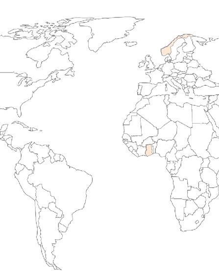
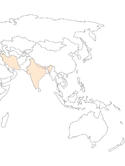
Each of the four student groups was responsible for developing their own report, with four orfive casestudy chapters (one per student). This report sums up the work of the group working in Wa Central Market (Ghana), malvik Center (Norway), Tajrish Square (Iran), Underneath Flyover (India), Newroad (Nepal) We hope you enjoy reading this document as much as we enjoyed supervising students in their work!
Marcin Sliwa, Cinthia Stecchini, Riny Sharma and Rolee Aranya
Fieldwork Supervisors, NTNU, Department of Architecture and Planning
Due to the pandemic, the first semesterof Urban Ecological Planning atNTNU has been holding online. Each group member has chosen an area in his or her place of living. This fieldwork includes five casestudies which are asfollowed: Wa Market, Ghana. Malvik Center, Norway. Tajrish Square, Teharn, Iran. Underneath Flyover Dehradun, India, and last but not the least New road, Kathmandu, Nepal.
The rationale for the choice of case study was to explore deep into the subject of urban informality with a focus on key individuals and other stakeholders who have responsibility for urban planning in the Municipality (Yin, 2004). It was also to enable the study gain a comprehensive perspective on the subject since case study is a multi-method that allows the use of a combination of methods including documents analysis, key informant interviews and observation in the collection of data (Creswell, 2009).
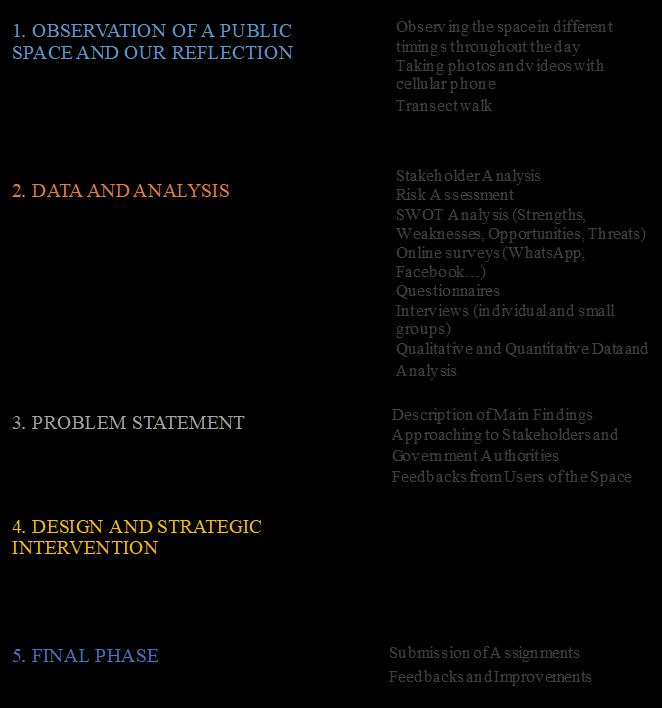
In eachcasestudy different methods have been usedby authors. However, the main methods were observation, interviewing people and communicating with different stakeholder in order to hearing their voice and needs, online survey, and analysing the strengths, weaknesses, opportunities, and threats of the area through SWOT analysis. All the group members have intended to use Co-design approach in his or her investigation, but because of the spread of COVID19 it was impossible.
The fieldwork has started by the context of each place, which followed by situational analysis. In situational analysis section, various feature of the area has been investigated and analysed. Basedon the gathered data problem statement has
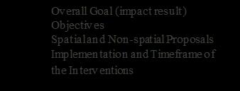
been written. The practice of conducting Situational Analysis and Problem Statement contributed significantly to identify Strategic Problems, main factors, and shortcomings. I have been brainstorming the issues with different age groups trying to find out, how levels of expectations differ from one another. Continuing discussions with people are giving us new ideas and suggestions to solve the problem. In order to mitigate the problem short term and long term intervention in the form of spatial and non spatial intervention has been suggested by each author.


Abasic observationfromalocalpublic space of Wa Central Market, Ghana, malvik Center in Norway, Tajrish Square in Iran. Underneath Flyover Dehradun, India New road, Kathmandu, Nepal Carried out to collect information using various methods Initial analysis is made, and our reflection is written and presented toUEPTeam(Formoredetailsreferto methodology section of thisreport)
Starting Initial Phase
August2020
Collecteddatais verifiedandtestedby approaching to Stakeholders, main users of the space and relevant government entities throughout meetings, surveys, interviews and sharing of our findings, concepts to residents, small groups, and area associations
All individual fieldwork assignments of the project is Presented at NTNU UEP class for our lectures and supervisors. Constructive feedbacks received, materials, references collected for finalreport.
Phase
2020
Analyzing phasestartedto knowmore details of thesituation and go through thewhole process questionnaires/surveys are formulated
2020
Impact based overall goal and sub objectives are set based on new information, feedbacks received and analyzed along theprocess.
From Northern Afghanistan, Mazar i Sharif, living in Norway since April 2018, he has more than a decade of experience working for International NGOs, he finished his Bachelor in Law and Political Science, His interests include urban planning and sustainable development.

From Ghanaand pursued Development Planning.

He has a strong passion for urban planning and development and that's why he choseUEP NTNU, Norway.


From Iran, with a background in Urban Planning.
Making a decision about studying UEP at NTNU is a clear turning point to her in that she knows she wants to work with better facilities, improve her techniques, experiences new lifestyle, and have new sources ofinspiration

From Nepal with the Bachelor’s in Architecture.
Her interest towards sustainable development encouraged her to join UEP in NTNU

From India, with the background in Architecture
Love for design thinking. Interested in planning & design. In free time likes to travel, read, create digital art and explore software.
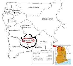
The study area is located in the heart of the Wa Municipality which is the capital town of the Upper West Region of Ghana. Being one of the youngest Municipalities with a population currently estimated at 117,180 (GSS, 2020), it is growing big both in population because of the influx of people from its hinterlands for various reasons including education and economic opportunities and in physical infrastructure.
Fig. 1: Maps of Ghana, Upper West and Wa Municipality
Figure1: location. Source: Wa Municipal Assembly, 2020.
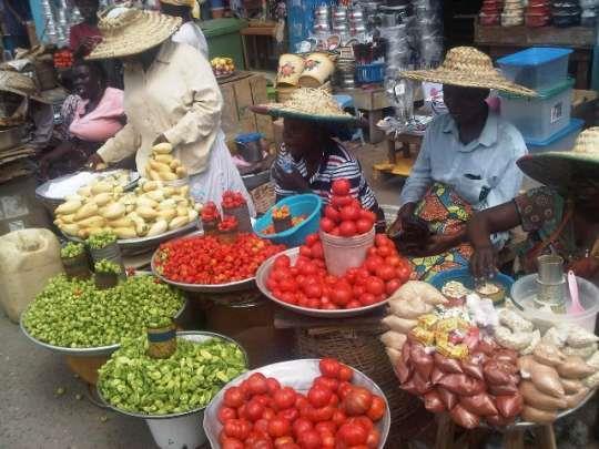
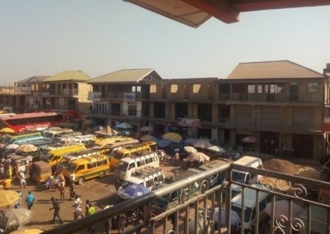
The Central Market is one of the many varieties of systems, institutions, procedures, social relations and infrastructure where people from all walks of life, in and beyond the region, meet to facilitate the exchange of goods and services. Located at the heart of Wa Municipality, It is home to all manner of users and is a physical infrastructure which provides for the growing population, from the most basic needs to automobiles. The market covers approximately 32.3 acres of land and still developing and expanding at a fasterrate more than the last decade to accommodate and serve the growing population.
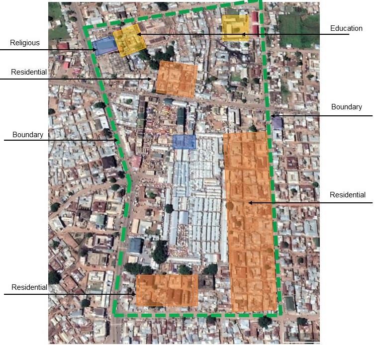
It is a space with mixed land uses from residential, commercial, light agro industries, service providers, financial offices, educational and health facilities. The neighbourhood is the residences which are gradually making wayfor commercial purposes.
It was established by the early settlers who became landlords or owners, Tindaamba, in the early 1900s as symbolic gesture for a tribe that arrived later in search of food. The Tindaamba then handed the market to the new arrivals to trade after feeding their landlords and specifically the king of the Tindaamba. It was relocated from its original place Mangu, a suburb to another called Sinimuniin 1933, all in the Municipality. It was again relocated to its current place in the 1950s and has since been a viable economic space providing livelihood to people far and near. Within the market is a cultural site called JenJeng, a small pond which never dries up and it serves as a landmark of the market and the Municipality.
As an urban commoner that provides livelihood for hundreds of people in the Municipality and beyond, it was chosen because any interventions resulting from the study will immensely improve the source of livelihood of the people and make it a better economic space that provides the needs of all.
Transect walk: this method was used in the initial stage of the fieldwork to familiarize myself with the market environment and to help me connect with the vendors, shop owners and other stakeholders within the market.
Interviews: this enhanced participation of the users and other stakeholders of the market. It was used to obtain unbiased information from stakeholders. This was to know whether there are rules and regulations governing the use of spaces and walkways in the market.
Observation: this was used to collect information on vendors on walkways, bus and fuel stations and more importantly it helped in the situational analysis and the subsequent proposals. Coupled with the transect walk, photographs were taking to link and confirm the issues discussed and it was used throughout the duration of the fieldwork.
Purposive sampling was used to select stakeholders as the Municipal Authority, Fire service department, health service, Land owners, shop owners, managers of bus and fuel stations and vendors for data collection. Consequently, no specific sampling distribution approach was used to select respondents for interview. In all, 44 respondents were interviewed.
Fieldwork in the peak of Covid-19 was very challenging as activities in the market reduced which made it difficult to meet more stakeholders especially during the situational analysis stage. This limited my ability to reach more of the users especially the vendors (those that have been appropriated spaces)and shop owners in the initial stage of the fieldwork.
For more than 80 years this central market has served the Municipality and the Upper West Region at large. Coupled with being important for the supply of food to the Municipality, the market also employs more than 600 vendors and is therefore an important source of livelihood in the Municipality. With the expansion of the population, growth of the economy and overall development of the Municipality, newer economic activities have continued to spring up necessitating an expansion of the market to accommodate the growing economic activities. However, many users of the market face anomalies of varied forms and despite the intervention strategies that have been put in place by the Municipal Assembly to dealwith these anomalies, users continue to express their frustrations.
Available documents (Agyeman, 2013) and (Abu, 2015) have emphasised on the physical layout the plans and infrastructure, the products with the prospects and challenges, land market, consumer behaviour, the origin and the traditions norms and the culture of the indigenous people among others. However, there is little attention on the issues of injuries and in some instances fatalities caused by the usage of walkways by both vendors and automobiles within the market. This has resulted in users of the market (including these automobiles) to occupy spaces at fuel stations within the market. This study will therefore seek to understand the nature of the laws and other regulations, if any, governing the usage of the market. It will also aim at emphasising on the laws and their implementation as wellas
effectiveness and especially in the era of Covid-19. It will help in understanding human behaviour, the economy and the social experience.
Figure. 3 shows the use of space at the fuel stationby automobiles and in formal vendor.
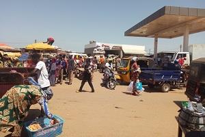
Figure. 4 shows informal vendors on a walkway in the market.
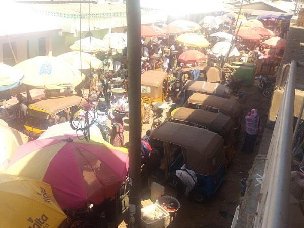
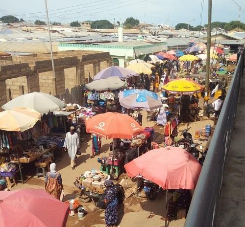
Figure.5 shows automobiles on a walkway.
Since its relocation, it has undergone major development and redevelopment under various governments as it has expanded beyond its original demarcated lot due to an increase in population and human activities. For now, the market has not been properly demarcated so more residences are gradually making way to commercial purposes around of the market.
The Municipal authority has started building a second market which is a kilometer away from the central market to contain the users and also to spread development.
The market is strategically located at the heart of the Municipality which makes all to access it with ease. Even though it is separated from residential areas by major roads, the areas immediately opposite
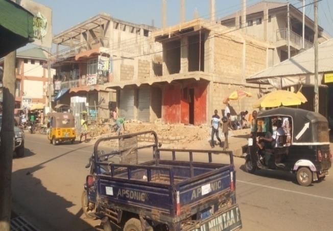
the roads are gradually being converted to commercial purposes making it spread beyond the boundaries. The land use has been changing ever since its relocation.
The Wa central market has lots of stakeholders who affect or are affected by its development. They include the Tindaamba, the Municipal Authority, the government of Ghana, private investors and developers, politicians, residents, health personnel, NGOs, the Judicial and the Security services. The others are buyers, students, CSOs, the media, shop owners, neighbouring areas and individuals.
The most important of these are the Tindaamba, the government and the Municipal Authority. The Municipal Authority is responsible for the daily administration of the market as they have the authority to regulate the usage of the market. Together with the Municipal Authority, the government allocates resources for infrastructural development of the market. They wield high interest and power and easily affector influent changes.
The bus station managers, shop owners and the vendors in the market have high interest as they are mostly concerned with selling and making a livelihood but do not wield high power to be able to influence decisions in the management and development of the market.
The media as a stakeholder also played and continue to play a vital role in this era of Covid-19. The other stakeholders were constantly educated by the media on the safetyprotocols in using the market.
High Power Low Low levelofinterest high Figure.8. Stakeholder mapping, the power/interest matrix
One major risk in the market is the issue of people being allowed to use the fuel stations for vending and as mini station. A decade ago, a fire outbreak at the fuel station caused lots of damages to properties and people even when the population was not big as today. Any fire outbreak could affect these users on the space and especially those who vend on the space.
The usage of walkways by automobile has led to situations where items and to some extreme, injuries are recorded. In 2018, 7 injuries were recorded and 21 recorded in 2019 alone (Ministry of Health, Wa). Provisions and other items worth thousands of cedis have been destroyed since 2018 (formal vendors). In instances where there are serious injuries, victims are referred to Municipal or Regional Hospital for treatment (Ministry of Health, Wa).

Another is that of people building over constructed drain within the market. Interviews with some vendors and shop owners revealed that sometime they experience flooding because other people have built on top of the drain and that prevents the free flow of wateranytime there are heavy rains.

Fig. 13: Stalls over the main drain.
Source: Author
Fig. 14: Container built over the drain
Source: Author
The central market provides livelihood for both formal and informal sectors and specifically the informal sector. The usage of walkways by vendors and automobiles in the market clearly shows the activities of the urban poor. This is informal in the market but it forms an integral aspect of the economy.
It was clear from interactions and interviews with the stakeholders of the market that there are problems that need the urgent attention of all and especially the Municipal Assembly. Among these is the usage of walkways and spaces at the bus and fuel stations by vendors and automobiles. Interviews and interactions with some shop owners revealed that informal vendors on these walkways cut them off from user of the market. According to some shop owners interviewed, the rents are high but they are not able to make profit because of the informal vendors. As a consequent, some vendors have abandoned their shops and joined the informal vendors on the walkways. This has further compounded the situation.
Interviews with some riders and automobile users also revealed that they are afraid that their motorbikes or tricycles would be stolen and that is why some of them ride theirs within the market. Even when the Municipal assembly provided a parking lot along one of the entrances to the market, they are still afraid of losing their automobiles to thieves. These are the concerns of some riders: “I ride my motorbike through the market because it is not secured parking it by the road side. There are no enough security personnel to secure my motorbike so I cannot also afford to lose this bike to thieves”. (Shahad, 2020) “Why will I park a motorbike here and walk all the way to that end to buy something when I know I can easy ride it through to get whatever I want? It is the distance that makes me to ride it in the market”. (Kamal, 2020)
Further investigation revealed that these vendors are allowed some spaces at the bus stations by the station managers even when they are evacuated by the Municipal Assembly. One of the managers had this to say: “We know that they should not be here but then we have to realise that they also have
families and are struggling to feed their families so we allowed them spaces here. If we are to be moved fromhere, then they will also move because they have nowhere to go”.(Adinan, 2020)
Some of them lamented that the Municipal Assembly has not made any emergency plans for them before evacuation for redevelopment so they have found themselves on walkways and spaces in the bus station. A vendor had this to say: “I have decided to sit and sell products at this space because we were evacuated from our place for redevelopment but what is worrying is that, when the construction finishes, we will not get the stalls because we do not have enough money to rent them. “Only the rich will get access to those stalls leaving us out”. (Vida, 2020)
It was also revealed by one of the fuel station managers that they allow these vendors and other users to use the space because they (vendors and other users) were evacuated for redevelopment and since they are costumers, driving them away meant driving away their costumer. However, there are no measures put in place to ensure the safety of users at the fuel stations but according to one of the managers, they will help to extinguish any fire outbreak by using fire extinguishers.
Besides the main problem of vendors and automobiles using walkways and other spaces within the market, some vendors who are appropriated spaces within the market expressed their dissatisfaction on the daily payment of taxes to the Municipal Assembly. Some vendors pay on monthly basis and that is used to remunerate the night security personnel at the market. However, some lamented that they are also levied on daily basis aside the monthly payment which burdens them financially. Informal vendors quickly avoid the tax collectors by relocating to different areas upon seeing them. A vendor had this to say:
“We have been paying daily taxes at this place and even if I have not made sales, I still have to pay it. This is a problemfor us because sometimes we use all we have to pay and go home with nothing. You come to get something for the family only to go empty handed afterspending hours under this hash condition”.(Hanniatu, 2020)
Some vendors mentioned that such animals as sheep and goats have been destroying their products in the market making them ran into loses sometimes. Even though this situation has reduced in recent times as stated by some vendors, there are still instances of this problem happening.
It was very clear from the interviews with the users of the market that there are many problems that need attention but the pressing issue here has to do with the usage of walkways and spaces at the bus and fuel stations by vendors and automobile. This has lots of safety concerns for some of the stakeholders and especially the shop owners, vendors on appropriated spaces and those at the fuel stations.
Based on the information gathered from the study, some strategic interventions have been proposed to help in addressing informal activities within the market. This was done with the participation of the stakeholders through interviews. These interventions are to help reduce, if not completely curb, the risks involved in using walkways and spaces at the bus stations and most importantly at the fuel stations by vendors and other users. These interventions are of short term and mid term based on the ideas from the most important stakeholders of the market: the Municipal Assembly, the Ministry of
Health, the Security agencies, bus station managers and the formal as well as informal vendors. These were also grouped into spatial and non-spatial interventions.
As a short-term intervention, the managers in collaboration with the security agencies and the Municipal Assembly should make it a priority to have at least a fire tender at the station. They should acquire more fire extinguishers as well to deal with any unexpected fire outbreaks because they have allowed vendors and automobiles to be using spaces atthe stations.
There should be fire hydrants at vantage points in the market to enable fire fighters have easy access to waterto fight fire outbreaks.
It is paramount for the managers to ensure that every automobile at the station have fire extinguishers. They should have more security personnel to help in controlling the use of the space by ensuring that these vendors abide by the strict measures put in place.
Going into the future, they should make it a policy that automobiles that will be allowed to use spaces at their premises are insured as it was surprising to know that none of the cars or mini buses at the fuel stations was insured.
At the bus station, it was clear that the managers of the station did not consult or consider the shop owners before allowing the informal vendors to use spaces at the premises even when they are considered informal and often evacuated by the Municipal Assembly. According to some of the managers, they allowed the informal vendors because the vendors also have families and therefore should make a living. There is nothing wrong with this humane gesture by the station managers in the
context of formalising informality within an urban economic space but that should have been a consensus reachedby both the shop owners and station managers.
It is therefore proposed that the managers together with the Municipal Assembly should temporarily appropriate spaces outside the bus station to these vendors for the time being. Some vendors on already appropriated spaces revealed that they can now afford to co hire shops if they are given the opportunity. I propose that the Municipal Assembly should get these vendors the opportunity to cohire shops and then the vacancies appropriated to the informal vendors as that is better than occupying spaces atthe bus stations and causing inconvenience to other formal vendors.
Some of the vendors using the walkways have shops but have closed them and joined the informal vendors on the walkways. These vendors need to be evacuated and ordered to use their shops within the market.
Fortunately, a second market has been established, to the West, and it is less that a kilometer away from this market. This is because the amount of human activities taking place in the market has outgrown the space so we definitely will have to encounter such informalities. It is therefore proposed that part of the bus station be moved to the new market because the Municipal Assembly has moved the cargo stations to the new market so it will be good to move part of the bus station to the new market.
I counted four spaces, including a private space, around the market that could serve as parking lots for riders and other automobile users who use walkways in the market. Together, these spaces could accommodate between 370 420 motorbikes and tricycles. It is proposed that the Municipal Assembly converts these spaces into parking lots with tight security so that riders can park their motorbikes and
tricycles and not ride them through walkways. Some riders lamented that they risk parking their motorbikes and tricycles outside because there are no secured spaces so they prefer riding them on walkways. The Municipal Assembly therefore will have to adopt a system that will let users have confidence and trust that their automobiles are safe. It could be the issuing of tickets, coupons, stickers or numbers to riders upon arriving and parking and for easy identification of owners when they return for their automobiles. These spaces should be well protected areas with security personnel and installation of security cameras. Sign posts prohibiting riders and other informal users to use spaces not appropriated to them should be erected at vantage points. When this is done and still automobile users are found on walkways within the market, they shall be arrestedand sanctioned.
Best practices from countries around the world including Vietnam and Maldives could be adopted in this situation.
Figure. 15: Parking lot in Male, Maldives
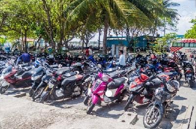

Figure. 16: Hanoi, Vietnam (Google)
Figure 17: One of the spaces that could be converted to parking lot for motorbikes
We will prioritise having
least
fire tender at the station.
Acquisition of fire extinguishers should be made compulsory for automobiles allowed to use the space.
The Fuel Stations:
Fire hydrants should be put at vantage points within market to enable fire fighters have easyaccess to water.
More security personnel should be put at the stations to help in controlling the use of the space.
Going into the future, they should make
a policy
automobiles that will be allowed to use spaces
insured.
Managers together with the Municipal Assembly should temporarily appropriate spaces outside the bus station to these vendors for the time being.
Some vendors on already appropriated spaces should be allowed to co-hire stalls /shops.
The station managers and the shop owners should engage and consult themselves in decision making on space usage by informal vendors and any other issue that may affectthe one or both parties.
Some bus stations should be relocated to the new market.
open spaces around
other
market
turned to parking lots for riders
Municipal Assembly should adopt a system that lets users have confidence
trust in them.
spaces
instance,
tickets, coupons or numbers to riders afterparking.
have
installed security cameras.
users
erected
It revealed from the studies that all that the stakeholders have to concern themselves with is policy and implementation and even though the market is undergoing redevelopment, these strategic interventions are aiming to contribute to the growth and development of the market as a critical component of the urban economy. This has also revealed that policies, development and its practitioners have always given less attention the urban poor in urban areas across the world.
The fieldwork startedwith observinga public spacewithin a local context along with writing a short reflectionaboutthefindings. The observantlearnttherealessenceofsimplemethodsfordatacollection and understanding the use of space by stakeholders. It was quite an interestingexperiencetofindoutmanythingsthatwehavenotknown about the spacewhereprobablywe have spentour whole lives. How thespaceis usedbydifferentstakeholdersduringanormalday. The fieldwork bit more advanced as the observant is interestedin knowing more details about the situation. To go throughthe whole process, general questions were designed for users and their interaction in the space. For instance,the stakeholder analysis as to whohas powerandinterestto influencedecision.Thecaseis studied withmoredetails;multipleapproachestodifferentpeopleandrelevant departmentshavebeenmade.Manymethodsappliedtocollectreliable datahavinginmindthelimitationresultingfromCovid 19. Having analysedsituation of the studyarea, the researcher came up with goodfindingswhichconstitutedthemainproblems withandthe causesandeffects. The researcher applies strategic interventions that require spatialand non spatial interventions based on the problem statement. Having gone through the entire process of the fieldwork, Abdul-Jelilu has cometoadmire andvalueparticipationas akeytoreachinginformed decision making at all levels and also learnt that policy and practitioners of urban planning have always ignored the informal vendorsinurbancenters,eventhoughtheyconstituteasignificantpart of theurbaneconomy.
Methods and Reflection course during fieldwork was a rewarding course for him giving some certain required knowledge and needed skills to engage with a community. He has learnt a lot and it was a greatexperience.
WrittenbyafellowStudent.


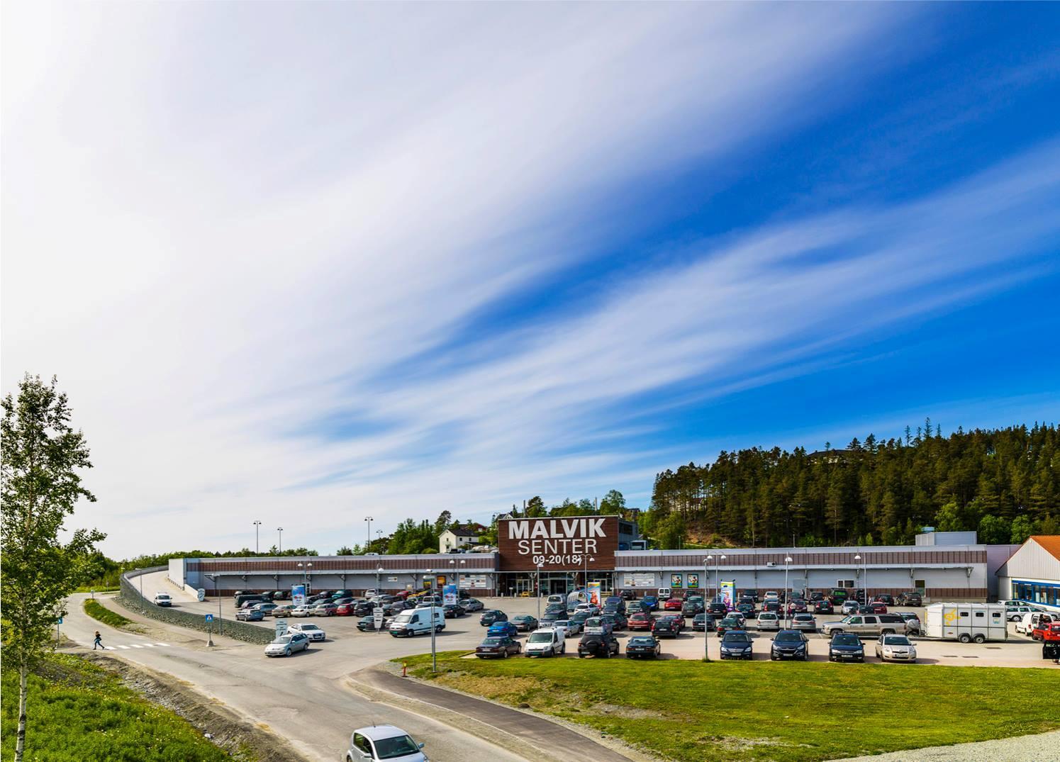
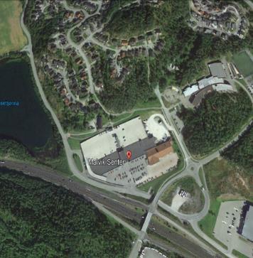
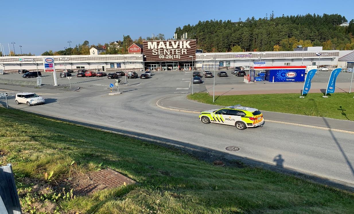
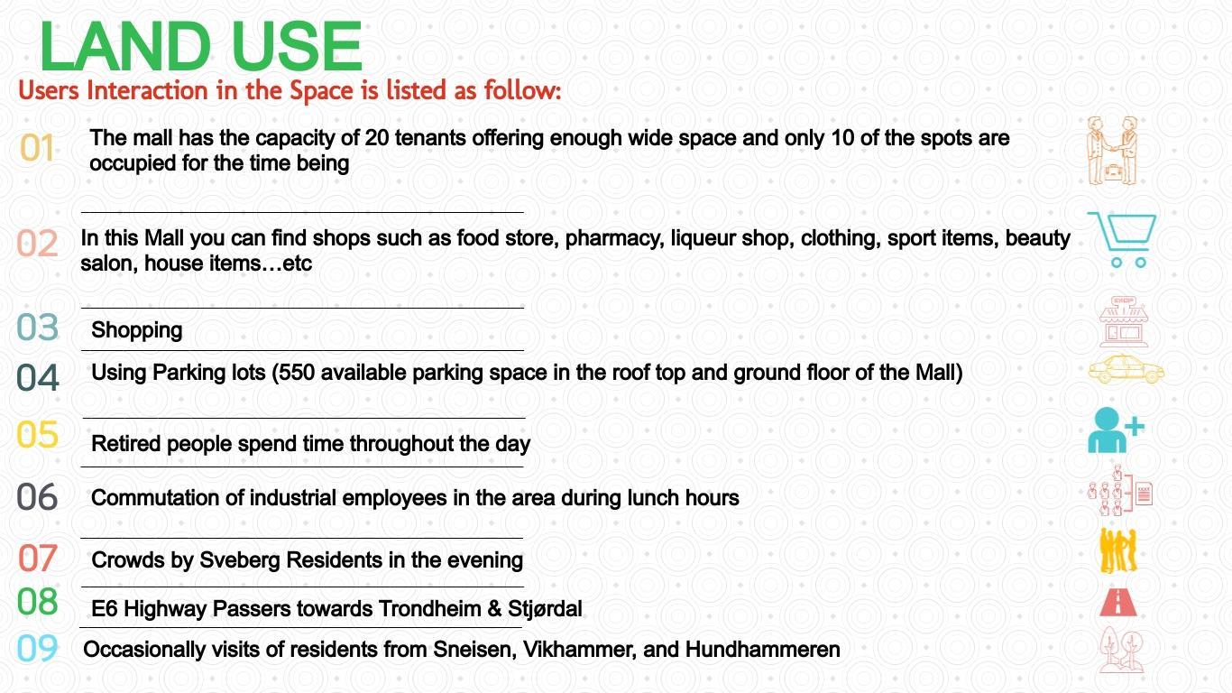
Malvik Center has the capacity of around 20 tenants spread over 13,600 m² and for the time being here you will find a large supermarket, housing items, clothing, pharmacy, training hall, sport items, beauty salon and a government owned liqueur store. The last store closed was JYSK furniture and accessories. The Center is located in the middle between Trondheim and Stjørdal by the E6 at Sveberg in Malvik Municipality of Trøndelag county in Norway. It has 550 free parking spaces on the roof and ground floor. The planning phase started in 1997, the Center is opened in September 2010, and opening hours are 09-20 on weekdays and 09-18 on Saturdays. The Center has new manager took over March 2020. Shop owners are very positive about the new Market Manager’s capabilities and believe that she has good plans for the growth of the Center.
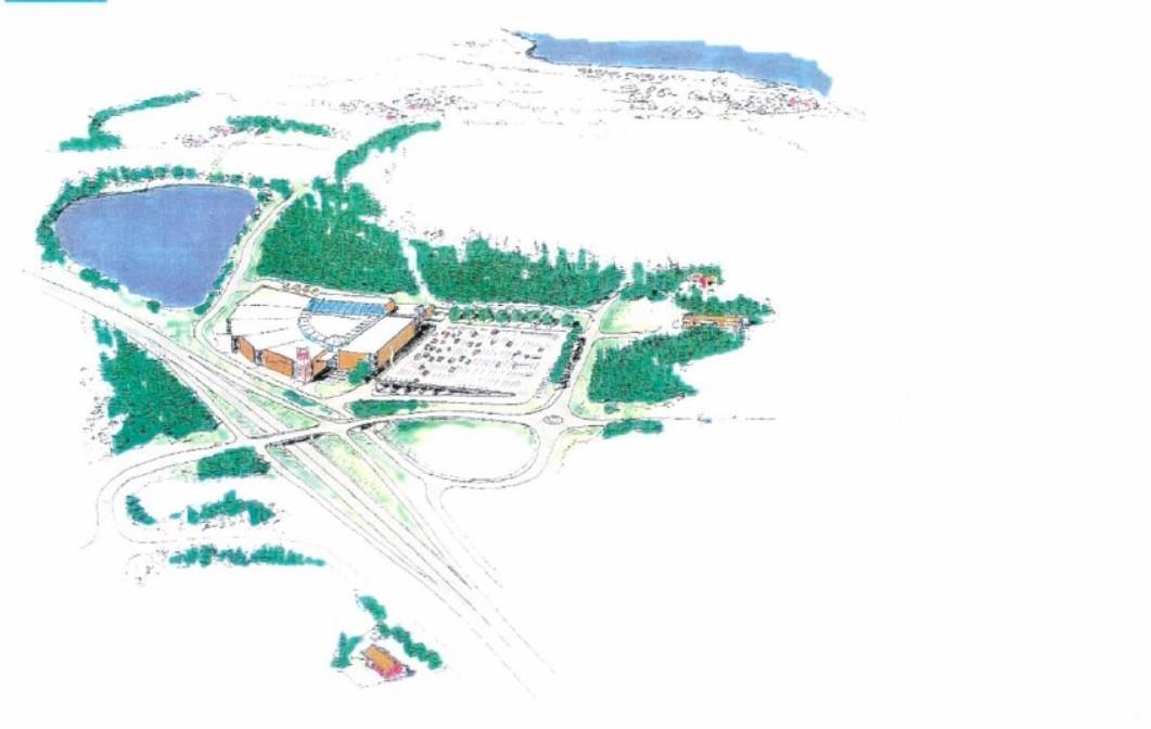
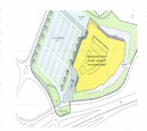
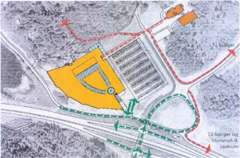
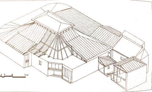
The situation plan shows the location of the building on the site and the disposition of the outdoor areas.
It shows access for both pedestrians / cyclists and bus passengers to the main entrance at Sveberg road.
It also shows the location of the warehouse, which will be areas for goods delivery to the center.
Figure 4 Location of the building on the site. Source: Malvik Municipality Planning Department
Figure 5 Access for both pedestrians / cyclists and bus passengers to the main entrance at Sveberg road. Source: Malvik Municipality Planning Department
My aim was to choose an area with lots of dimensions to scope my field research during the during the semester as a learning process and not to face with any shortages of information to apply strategic interventions along the process. A Shopping Mall in an isolated area by the E6 and built away from people attracted my attention. The Mall is not working well. Shops are being closed and people are losing jobs. I was really challenged during my fieldwork to find out ways in how to contribute some solutions for the future of the Mall. These were the main reasons I chose Malvik Center for this fieldwork.
Figure 6 Map of Norway in the left highlighted with red color Trøndelag County in the middle, Location of Malvik municipality in Trøndelag in red the right upper map and google maps is the location of Malvik Center.
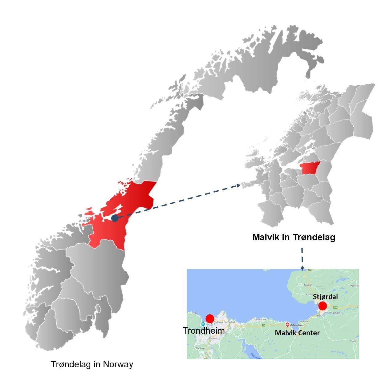
Location of the Municipality: Malvik is a municipality between Trondheim and Stjørdal also neighbored by Selbu Municipality in the middle of Norway, Trøndelag county. The capital of the municipality is in Hommelvik by the old E6 at the coastal side of the ocean.
Approximate dimensions of the Shopping Mall Area:
Perimeter: 897.9 m / 0.8979 km
Area: 4.828e+4 m² / 4.828 hectares / 0.04828 km²
The Shopping Center is located on the way north of Trondheim by the new highway E6 ring road at Sveberg before you arrive to Stjørdal Municipality.
Population of Malvik Municipality: 14193 (2nd quarter of 2020)
The assignment started with observing the situation in the Shopping Mall area, where I tried to note down what really is happening overall in the surrounding, and later on started the first phase of field work conducting situational analysis. During situational analysis I used the Tools provided by Jan Gehl on how to observe a public space to collect data and the ways to approach people, conduct interviews
with people, which helped me to recognize and collect reliable data from Center case study during writing problem statement and strategic intervention.
The public life tool as a complete guide from Jan Gehl has been significantly helpful during the field work and from the guideline, I learnt how to carry out surveys of public spaces and the public life within the community. The methods and tools in Shopping Center field work I used was direct observation, talking to users, interviews, meetings, transect walk, taking photos and referring to secondary data. In all phases of my field work while approaching to people, I have asked general open questions to find out overall perceptions, views and expectations of users from Mall and this have had a significant contribution in phase of data collection and contextualize the collected data for design interventions.
I had the ideas to conduct focus group discussions, co design workshops, and brainstorm the case of Shopping Mall with a group of stakeholders to study the case more deeply with people considering the idea as a complete approach in identifying and prioritizing requirements, but during Pandemic and its increased positive cases in Trøndelag made it unapplicable. The good alternative that worked well for my field work was approaching to individuals and interviewing small groups. I have had some challenges as well during data ghatering and analysis which was difficult to reach out the Center Leader andpeopleintheMunicipality.Inaddition,mostofthegatheredinformationwasin Norwegianlanguage and my language barriers towards it.
People are busy and data collection phase was not an easy task, but I learned that the most important thing for a field researcher is to engage well with local community while designing any intervention.
Along with challenges and considerable damages, Pandemic as an established fact has posed a significant threat to the lives and well being of millions around the Globe yet has been a great opportunity for Online Stores related to the project case and Municipal residents working from home, using digital platform, avoiding the use of collective transportation and increasement of private vehicles use. This reminds me of a well-known quotation about opportunity says, “If one door is closed to you, in return hundred doors will be opened by the grace of God”. I have been focusing to accept realities caused by COVID 19 and thinking to find out ways to adapt and facing it as opportunity. It is obvious that when commodities are sold in an unfair way, makes it difficult to compete, while being relatively cheap, but the same quality with low price. Virus restrictions increased people’s motivation towards online stores. This trend or so call it be enthusiasm reflects a point that pandemic as a puzzle is now being accepted as a recognized truth and giving us the chance to find out suitable was to apply relevant approaches to deal with the chaos. Online stores with no physical being have been very problematic not only for the fieldwork at hand (Malvik Center), but overall, to physical shops. Physical stores finding it very difficult to compete when comes to “price matters” idea. One of the new dimensions that has been very popular during Covid 19 is the online stores. It has made very convenient that people could buy anything from home behind their computers.
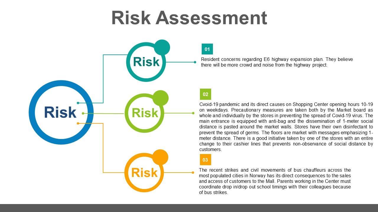
The Center is owned privately and has quite a lot stakeholders while being in the middle between Trondheim and Stjørdal by the E6 highway. In relation to influence and power interest diagram Shopping Mall Owner has the main decision making right for the operation and maintenance of the Center, while Local Municipality has very low influence since the market is owned privately. Labor Party and Center Party are working together, and they have the main political influence in Malvik Municipality. High ranking municipality positions are led by the members of the mentioned parties. The Norwegian PublicRoads Administrationhas direct influenceon issues relating to E6highway expansion plan. Based on Stakeholder Issue interrelationship diagram our direct beneficiaries would be the inhabitants living in the area, sport organizations, industrial neighboring building and companies across the street, school stuff, E6 passers, shopkeepers, companies deliver goods to the mall and people parking cars to use public transportation.
Store employees and shop managers are not satisfied with the way Shopping Center owners run the mall. They define the relationship between shop owners and market owner’s association very weak. Besides, they do not have that level of authority to propose suggestions.
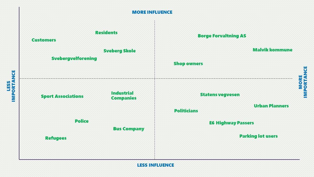
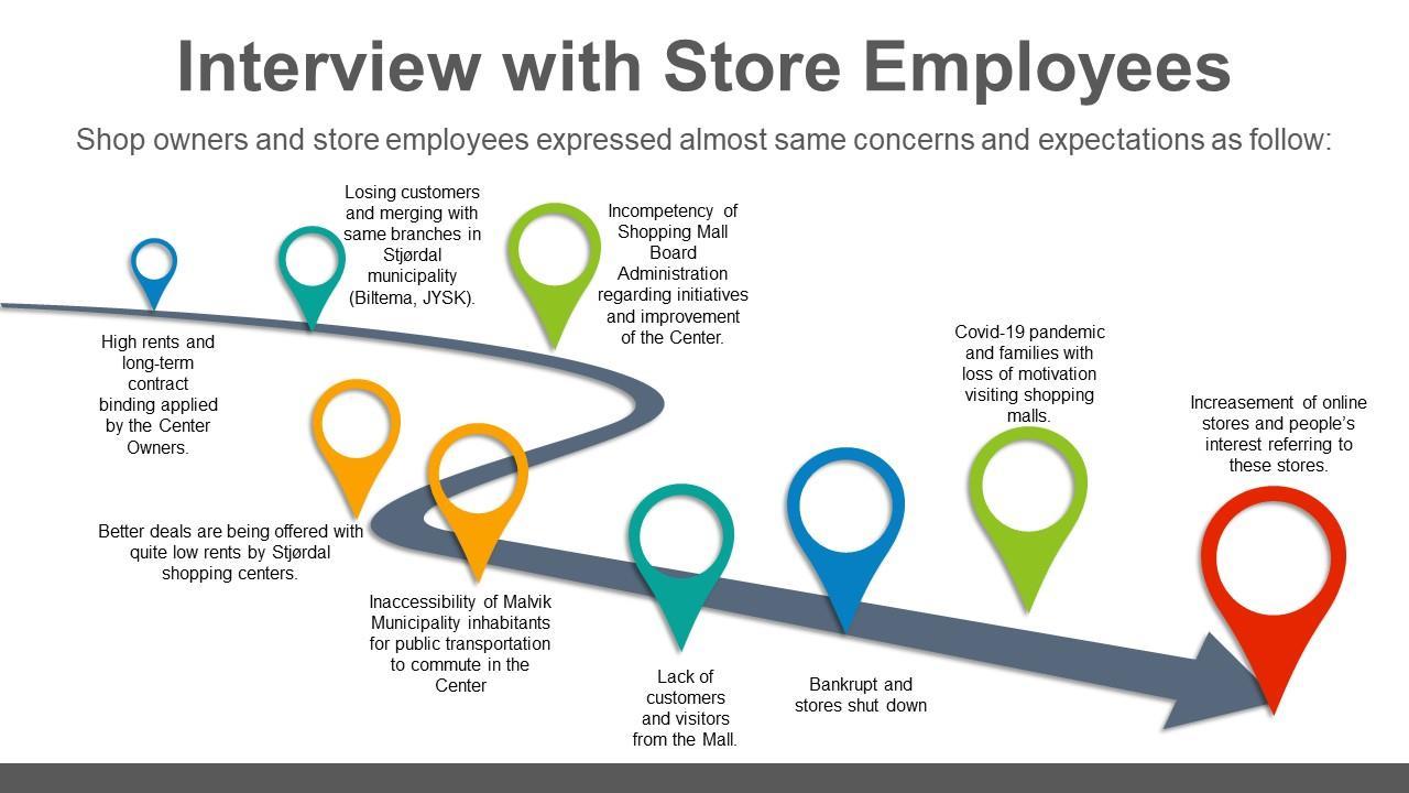
Transect Walk 1 with Acoustics Engineer: A man with master’s degrees in Acoustics Engineering (the skills to analyze, design and control sounds in mechanical systems and technology) from Sveberg accompanied me in the area surrounding. Being one of the active residents in Sveberg, he takes me on a walk around the Center. He says the Center does not meet our requirements, the shops are shutting down one by one and it is not fun driving all the way to Stjørdal/Trondheim especially when E6 is closed. He proposes the branch of Clas Ohlson the Swedish homeimprovement chain,arestaurant,and a bakerywhere people couldbuy freshbread/cakes.Relevant to his expertise he expressed his concerns regarding E6 highway expansion plan. He says I been very engaged in the work and expressed my ideas in the Municipality meetings to prevent more noise from the highway project. There will be more highway lines, tunnels and the speed limit will increased from 80 km/h to 110 km/h. Neighbours have expressed interest about it, but we are worried that the area will be too noisy and crowded once the construction starts.
She has degree of PhD in Design Methods and MA of Tech in Industrial design. I have been inspired with her ideas during the whole phases of this fieldwork, in fact the idea of turning Malvik Center to a Community Center came to my attention after hearing her thoughts and the sustainable solutions she proposes fortheCenterto survive.Accordingto hertheareaneeds to providemorefacilitiesandservices and places for families to spend time with their children. She expressed her dissatisfaction as well on how things are being administered in the area. She says people in Sveberg is not originally from Malvik and this has often pointed the area not being in prior agenda of the Municipality. The Municipality is governed by those who have been living in the region for generations. Hommelvik and Vikhammer probably being in the center of the Municipality’s attention is a main reason Sveberg lacking interest.
The Center is not working well and two shops closed in the past 2 months. Ever since from the establishment of the Shopping Mall business and enterprises could not run their companies according to anticipated plans. Conducting situational analysis and applying multiple ways to collect data, talking to customers, shop owners, residents, center manager and more deeply addressing specific questions to authorities in the Local Municipality of Malvik helped me to understand more details to identify the gaps between the current problems and the desired goals to contextualize the issue and find out how are the pieces connected. Based on academic theories any initiatives taken along the way will address the interest of the whole and if all the players not reflecting collecting efforts, will lead the process to fail, so the case in Malvik Center appears to be that there is a huge distance between relevant actors.
At this portion of the paragraph I am aiming to describe major and minor problems causing directly and indirectly the Center not functioning properly.
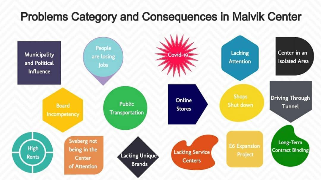
Malvik Municipality/Reputation: Peoplearelosingjobs; shops arebeing closedandifthis is any concern to the Municipality representing Central Government in the region. The market is owned privately, and the municipality claims that there is a very little influence towards how things are being operated in the Center. We have bigger priorities says the Municipality Advisor; the shopping mall is not in the center of our attention. Officials in the Municipality are now more tight up with focus on Hommelvik as the Center of the Malvik Municipality, more high rise blocks and detached houses are being built by the ocean side in Hommelvik. Though, relevant to this research he added that the Shopping Center being located at Sveberg will be influenced by the Strategic Infrastructure Intervention Plan (New Era) of Trøndelag Regional County and around 800 housing constructions in Sveberg. The Reginal Government
in Trøndelag has taken some initiatives and highlighted around 10 zones in various Local Municipalities of Trøndelag to develop Commerce and Industry Area, which the allocated land for this purpose is located in the West of the Shopping Center. These initiatives might affect the Center to attract more visitors and for the time being vehicles only pass through the E6 with no intention of stopping and do some shopping.
Accessibility: The Center is in an isolated area which makes it often not convenient for visitors, especially during daytime. There is a local bus line in the evening time from 17:30 till 21:00, but according to residents in Sveberg and the other villages of Malvik is not enough for them to visit the area during daytime. Since the Center is by the E6 highway the accessibility for pedestrians and cyclists of other areas in Municipality is difficult. This might be more and more chaotic once the E6 highway expansion plan crosses Sveberg. There will be more construction work and crowds in the area. Public transportation service is not regularly available to connect Municipality residents to the Center and people living in Sveberg facing challenges reaching to the Center of the Municipality, especially when E6 is closed for traffic. Local Municipality entities and service agencies are centered in Hommelvik and Vikhammer. You need to have private transportation to commute during preferred times of the day. While collecting data throughout observation and via interviewing people, I noticed that most people even do not like to drive the tunnel in the E6 that connects Hommelvik residents to the Center. Driving old E6 towards Stjørdal more convenient, where we can get wider alternatives, says Hommelvik residents. User/Customers vs Center Lacking fulfilling expectation: According to the users Malvik Center does not meet their requirements and this often ends up with less visitors from the center. Malvik Center
lacking service facilities, restaurants, cafes, unique brands, handcraft items, recreational facilities for families/children and initiatives that would require peoples’ physical presence in the complex are the core causes not being able to satisfy consumers and compete with neighbouring municipality shopping malls. There are only few shops in the Center, and we can find the same brands with quite more alternatives, if we travel to Trondheim and Stjørdal
Online Stores, Sales and Covid-19: The Center has been facing many challenges and this ends up with more shops to shut down their businesses, especially during Covid 19 pandemic families with loss of motivation visiting shopping malls and increasement of online stores. Online stores with no physical being have been very problematic for Malvik Center while already being affected with less visitors and this challenge includes other Shopping Malls as well. Physical stores finding it very difficult to compete. Any purchasing more than 300 kroner gets free delivery, and the products are relatively cheap e.g. 20 tablets of paracetamol in a pharmacy costs 47 kroner while same product in the online stores cost 20 kroner. Shop Owners and Center Leadership: Shop owners have expressed almost same concerns that the Center leadership being incompetent towards finding common ground dealing with shortages Shopping Mall facing. High rents and long term contract binding applied by the Center Owners. Better deals are being offered with quite low rents by Stjørdal shopping centers. Bankrupt and stores shut down has been a continues process in the Center.
Now that I have provided enough details of the problems and findings, where the main focus was to address all concerned issues related to Malvik Center field work. The individual case study as follow elaborates the linkages and contradictions of the mentioned key outcomes of the analysis and will describe prioritized problems for strategic intervention as next steps.
The aim of this Problem Statement is to investigate causes and effects concerning Malvik Shopping Center. Iam not intending to offer any conclusive solutions at this stage, but Iwould seek out the reasons behind the problem causing the Mall to fall down, and apply the very basic knowledge I have gained so far from NTNU UEP Study Program. This Statement will identify the most significant factors engaged with theCenterthroughcontinues observations, interviews,andsurveys to collect moredataand propose spatial and non-spatial strategies later along the process.
• Where and when does the problem arise? It is now 10 years passed since the establishment of Malvik Center. The Mall in an isolated area at Sveberg with not good access to public transportation between two neighboring municipalities (Trondheim and Stjørdal) makes it difficult to compete equally. One of the main deficiencies in this Center comparing to Trondheim and Stjørdal shopping Malls is that the Mall is lacking to offer various services for customers. In most cases shopping malls in surrounding areas are designed to provide service as a Community Center, where you most of the important services are provided and it requires peoples’ physical presence.
• Who does the problem affect? Shopping Mall being in Malvik Municipality territory reputationally affect Local Municipality and the commitment made with promising more job opportunities to residents during project proposal and financially Borge Forvaltning AS the owner of the Center. Shops are being closed, people are losing jobs, and chains added to this value services are also falling.
• What attempts have been made to solve the problem? The Center has a new elected leader now and there is a high expectation that she has the capacity and technical knowledge to put all the missing pieces together and bring the Center on feet. She has submitted her proposal to Borge Forvaltning Leadership, which requires Spatial and non-spatial Interventions. She says the Leadership should have made a decision 10 years ago. She did not share the details of her proposed interventions for the improvement of the Shopping Mall.
I found this very interesting that why a Shopping Mall is planned in the first place in an area with very few residents. As UEP student this research has been quite interesting for me and I am looking forward to going more into details.
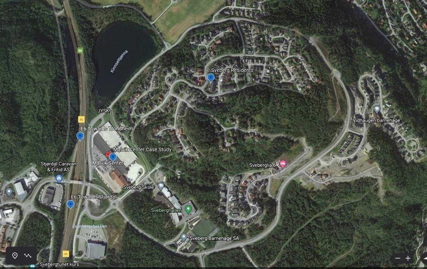
Figure 8 Location of the Center in the right side of E6 on the site, and Sveberg residents in the center of the image. Source: Google Maps
Looking into this picture gives you the first impression that there has been made a huge investment. However, there is a plan of 800 New Housing Construction in Sveberg. The European Ring Road E6 Expansion Plan will be completed by 2025 that passes next to the Center. In addition, Sveberg will be influenced by the Strategic Infrastructure Intervention Plan (New Era) of Trøndelag Regional County gives the Shopping Mall a window of opportunity.
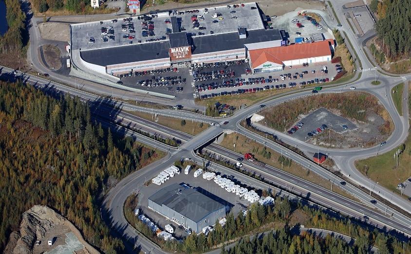
Why is it important for the residents in the Municipality that the problem is solved in the Center?Figure 9 View of the Center on the site. Source: Shopping Mall Photo Archive
This research involvement is very genuine, and it is carried out as a learning process to reflect challenges that the Shopping Mall is struggling. There has been made a very huge investment, the capacity still exists and turning the current challenges in to opportunities will be an interesting case study.
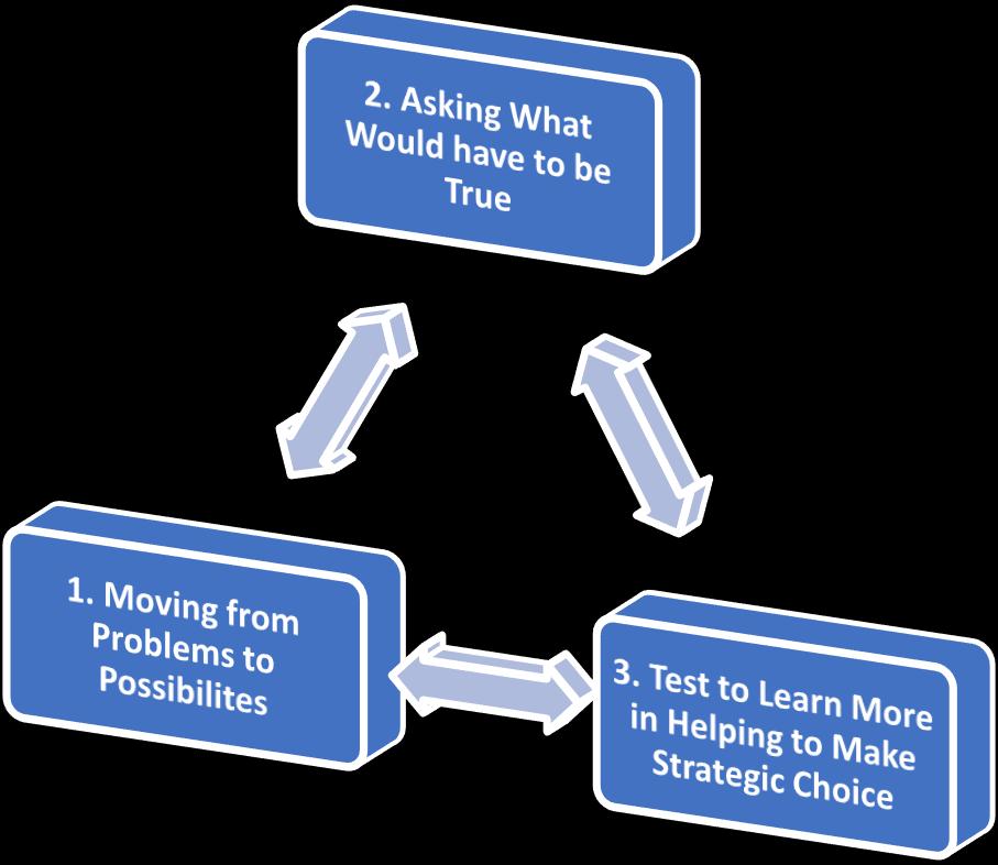
To answer these questions, I have made some inputs as follow.

Why is it that they do not find it satisfactory to visit the Mall?
What needs to be done for t he Mall to meet their expectations?
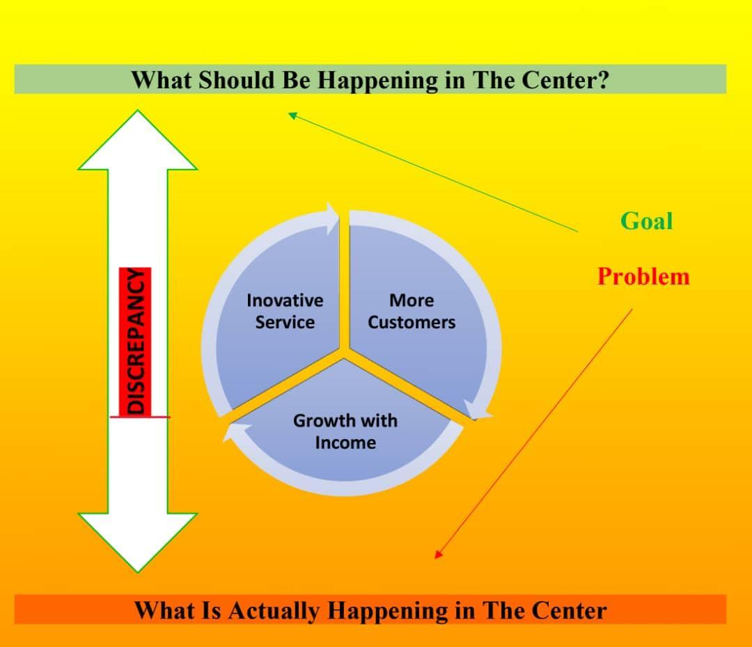
what would have to be true to surface the Malls condition?
The improved situation I aim at this Strategic Intervention in the case of Center is to change the core problem formulation into a solution that would positively effect and sustain the future of the Mall.
Turning the Center from being empty environment into an active area.
RevisingoutdatedpoliciesandencouragingtoaclosecoordinationbetweenMarketOwner,Shop Owners and Local Municipality.
Finding main discrepancies and applying fundamental solutions with adapting best practices in the region.
To address the Major Problems in the Center that are as follow and required strategy to be applied:
Accessibility through Public Transportation regularly during the day
Changes in the Policies and suggesting close coordination and communication of three main actors (Mall Owners, Shop Owners & Municipality)
Lack of Service Centers
Defining strategic steps on reaching to solutions require both short term and long-term efforts. My proposal is divided in two parts. First, suggestion of non-spatial intervention with immediate outcome solving Public Transportation gap maintaining accessibility of Malvik municipality residents to Shopping Mall during preferred time of the day and suggestion of changes to some rules andlawswithbuildingcloserelationshipbetweenShoppingMallandLocal Municipality.Withshort term changes as quick impact I aim to address regular accessibility of residents throughout the day in the Shopping Mall and condition based changes to the laws and rules of the Mall that would make it convention for the shop owners to continue their business and this will also encourage new investors interested to open their business in Malvik Center. In addition, I suggest that good coordination and network between the Municipality and the Mall owners should be maintained to continue work on sustainable solutions for the greater good of the Shopping Mall. Secondly, suggestion of spatial intervention that requires changes in the physical design of the Mall and establishing servicefacilitiessuchas dentist clinic,healthstation, family clinic,recreational facilities for families/children, restaurants, cafes, unique brands, handcraft items, and any other initiatives that would require peoples’ physical presence in the complex.
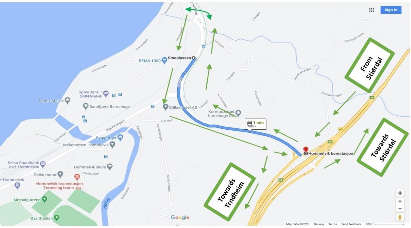
Accessibility through Public Transportation: Sustainable means of transportation is the accessibility through collective transportation. In order for the residents to have regular commute to the Mall a joint effort needs to be taken by Municipality and the Shopping Mall owner to coordinate the issue with ATB bus company. The facility is already in place and there is a bus line (310) every hour from Stjørdal direction towards Trondheim using the E6. Accessibility of all Villages in the Municipality will be maintained including people at Sveberg to Hommelvik Center,
If the Bus number 310 from Hommelvik Bomstasjon bus stop at the E6 makes one round from Smeplassen Malvik bus stop in the old E6.
Figure 10 The arrows show direction of bus from Stjørdal towards Trondheim at the E6 highway. Source: Google Maps
Changes in the Policies and Improving Communicational Bridges: Policy changes and building improved relationship between Municipality and Borge Forvaltning company as private owner of the Mall requires hard efforts and long negotiations to come up with a solution that is good to safe the future of the Shopping Mall and reputationally will be a great achievement for the Municipality being part of the solution in turning the area to a crowded, busy and active environment.
▪ Condition based and flexible regulations should be developed by Shopping Mall owners that would make easy for available businesses to continue services and will encourage new investors to open their business. This is because the Mall has less visitors and not working well, and it is hard for available shops to cover their running costs and new investors are uncertain to move in and make risks whether their business will have a promising future. The available enterprises in the Center are already facing many challenges and their profit is very low and this requires taking a risk for new shops that are willing to open their branches in Malvik Center.
▪ The Municipality can cooperate with some other institutions and facilitate the movement and relocation of some government service providing agencies to the compound (dentist office, family clinic, health station…etc) that would make easy the idea of turning the Center to a Community Center providing various services in one square. Involved parties should find a common ground and agree on certain issues that are beneficial and mutual interest for both.
▪ Close coordination between Shop Owners, Mall Owners and the Municipality should be maintained. This will help to make broader plans and take initiatives for the improvement of the Mall. The engagement and close coordination initiatives should start first by Borge Forvaltning
AS as the owner of the Shopping Mall since the Municipality believes the Center is privately owned property. There are many vacant spaces in the Mall, and it is smart if the owners of the Mall offer a good deal to convince authorities in the Municipality for moving the above mentioned services and agencies to the complex. This effort requires regular follow up until an agreement is made.
This part of the Intervention is mainly reflection of customers and their expectation from the space to fulfil. In case of the Shopping Mall Customers Satisfaction should be the most vital priority of theCenter Owner. There is need for creative thinking, but no need for absolute unique dimensions. In the case of Center the future and the survival of the Mall depends on how the owners intend to integrate and adopt best practices from services being provided by other Malls in the region. The Shopping Mall owners can be inspired by the initiatives being taken in Trondheim and Stjørdal Municipality Malls. All most all the Shopping Malls in the surrounding neighbourhoods of Malvik Center is designed in a way to provide multiple services in one square. Therefore, it is not just Shopping you are offered in the area, but more alternatives you receive while visiting the square. It is not sufficient to have only few shops in Malvik Center and any concept that focuses on ignoring outdated modes of Center Structure would be best decisions as well. The new dimensions and reinventing of turning Shopping Centers into Community Centers where many of the services offered in one square has been one of the best successful practices.
▪ Make sure that the investment is not wasted, and the Shopping Mall is in a capacity to fulfill the needs of customers and able to compete equally with neighboring municipality Malls.
▪ Malvik Center as a public space is turned from empty area to more active environment and prior to implementation phase resident’s perception should be considered in the planning process.
▪ With the improvements of the Mall more job opportunities for Municipal residents and neighbor cities. This will be a significant project for our direct and regular visitors as beneficiaries and in case of the Center they are the inhabitants living in the municipality including sport
organizations, industrial neighbouring building companies across the street, Sveberg school stuff and indirect beneficiaries would be anyone that passes often E6 highway.
▪
The executive partners for this proposal are Malvik Municipality, companies, and enterprise in the Mall. Earliest possible start for short term intervention is 6 months from January 2021 and long-term efforts require 3 to 5 years of implementation process.
▪ During this period of time I propose Borge Forvaltning AS the owner of the Malvik Center to start coordination with Malvik Municipality to find out solutions for the mentioned short term interventions and long term interventions require more time and budget. Any achievements during negotiations with the Municipality would establish the foundation of initiatives in related to turning the space from a Center to a Community Center.
▪
The initial steps to reach impact goals for long term interventions require deeper studies, surveys, and analysis from the Malls in the region with details. In addition, this requires the Center Owner to start good marketing in the region to convince new enterprises, shops, restaurants, and service providing facilities to open their branches in the Center.
▪
Interventions follow up will be taken care of by the foundation in place and is responsible for Shopping Mall operation and maintenance. The cost and the fees will be covered by contribution of enterprises in the Mall and the Center Owner.
It was clear that the outbreak of pandemic affects the way of gathering information and made the situation a bit difficult for author. However, in order to being more familiar with the place good methods were implemented, one of which is observation. This is a great way to know how the place is being used and whether it is an inclusive area or no. language barrier was another challenge of this fieldwork because most of the stakeholders have tended to speak Norwegian, however, it is interesting that the author could communicate with some stakeholders and heard the positive and negative issues of the place from them especially in problem statementandinterventionsectionas he knows the importance of engaging people in the fieldwork. Overall, the whole process of fieldwork was informative as well as an interesting experience for author.
Written by a fellow student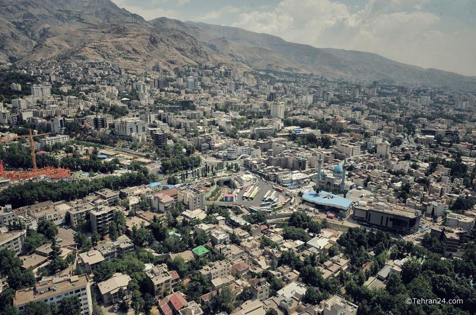
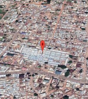
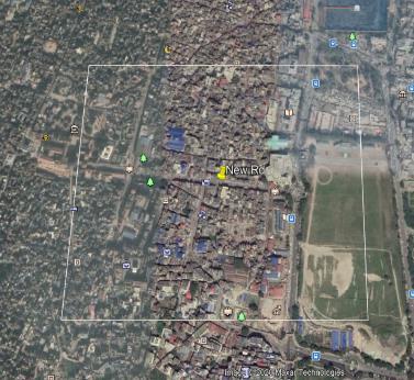
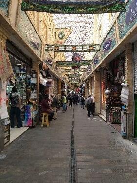
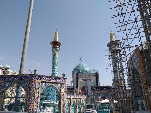
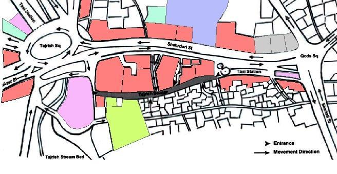
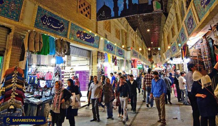
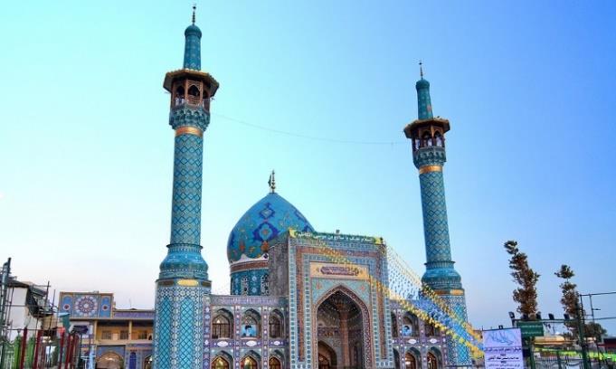
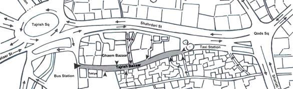
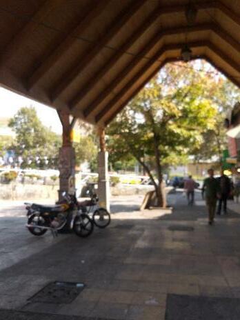
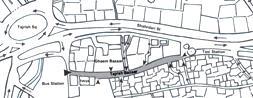
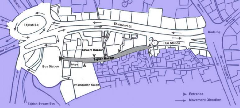
Tajrish is located in the northern part of Tehran, Iran. Tehran has 22 districts and Tajrish is sited in the westpart of district 1. Tajrish is one of the oldest and busiest part of Tehran. This area which used to be a solitude spot and only has had a shire and small bazaar, now turned to a commercial place of Tehran. The shrine and bazaar in now considered as landmarks. Atthe first glance, Tajrish is an attractive place where absorb many people from different age group and gender. Different group of people travel to Tajrish from different parts of the city to meet their needs there mostly because of the existence of bazaar. However, there are some problems related to the quality of public spaces which require more attention. All of these features is why Tajrish square has been chosen for this fieldwork.
Figure 1. Location of Tehran in Iran (pishgam sms.ir)
Perimeter: 1596 m / Area:9.870 hectares
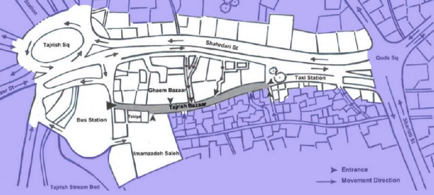
Figure 3. Tajrish square (Nejadriahi, Fasli, 2016, 8)
Figure 2. Location District 1 in Tehran (fa.wikipedia.org)
- the pleasant weather attracted the wealthy people to the place.
- Somestores formed besidetheSaleh shrine - Gradually the traditional bazaar has been formed TheTajrish squareturned to aeconomic place.
- Theold road had been improved - Bus station and taxi station was located beside the Tajrish square.
People and vehicles traffic increased.
- This ruralareachanged to thecity by themiddleof the1951. Educational centres, administrative and governmental organization had been built, gradually.
- Until 1961it wasanindependent cityfromTehran.However, due to the physical growth of the Tehran, it becamepart of theTehran.
- Because of the increasing immigration to Tehran, the constructions continued unabated. - Access routes developed.
- All of the gardens, except some embassy gardens, public parks and palaces was destroyed. - Nowadays, we are facing with a lot of high-rise building which have developed uncoordinated and regardless of the topography of theplace.
Through the fieldwork my goal was assessing the quality of public spaces and realize the urban challenges of Tajrish square through various methods such as observation, exploratory walk, and more importantly communicating with stakeholders in the area. Iwanted to see and feelthe challenges in the area as well as hear about them through the voice and experience from those who present in this area. The summary of the methods which has been usedthrough the fieldwork from September till November are as followed:
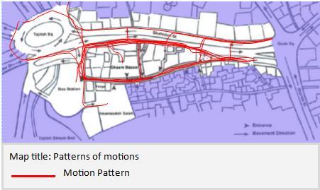
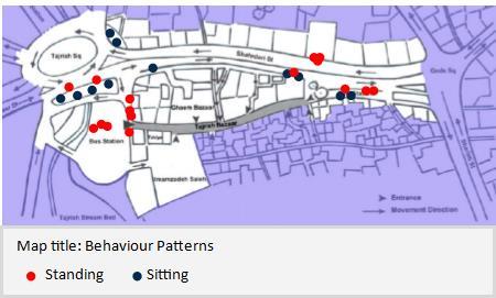
Observation: The observation has been done in order to be familiar with the area and focus on how the place in being usedand by whom. First, the study measured 1weekday and 1day during the weekendin the morning, in the afternoon, and in the evening based on Gehl’s methods of observation, so it included counting those who are walking through the space, considering where they walk, sit, and stand and why? and what they actually do in the area. I noted whateverI observed and took some photos as well.

Exploratory Walks: Afterobserving area individually I decided to plan an exploratory walk so as to observing the area with the neighbourhoods and investigating the positive and negative aspects of Tajrish public spaces from their perspective. I walked through the area with 2 other people, one of them was resident while another was passer. Itried to take a leadership to them. They talked about the history of the place, the need, and some issues. Due to the COVID19most people reluctant toaccompany me in this survey and it was the big challenge and limitation of the fieldwork.

Interview and Questionnaire: Since most people do not eager to participate in exploratory walks it was wasmuch more easierto interview them especially when they were waiting on taxi and bus station. In this way I got a chance to interview different stakeholders who directly directly involved in planning and implementation of urban projects such as residents, passers, users, shop keeper and so forth. I also used questionnaire to gather more data. These two methods really helped me especially in problem statement and intervention section. For intervention, I also interviewed stakeholders to received their ideas and feedbacks in order to reaching best option for intervention. via WhatsApp (mobile application for communication) because of the locked down stemming from Pandemic, interview people in person was not possible.
UN Habitat/ Public Space site-specific assessment: in order to assessing the quality of public spaces, UN Habitat guideline which measure five dimensions of place such as uses, accessibility, amenities, safetyhas been used. This approach has been explained in Situational Analysis.

SWOT Analysis: In order to categorize the positive and negative aspects of the place which was recognized based on the methods mentioned earlier, SWOT has been used to analysis the strengths, weaknesses, opportunities, and threats of the area.


As mentioned on Method section, UN Habitat guideline has been used in this part to analysis the quality of public spaces in Tajrish square.

What has been assessed in situational analysis are as followed:
- How inclusive the space is through observing the variety of users and the type of activities taking place.
How people access the place and whether they feelcomfortable or not.
- What amenities and furniture are available? Are they inclusive?
- Assessing the safetyin area.
(UN-Habitat, 2020, 17-21)

Figure 5. Land use (Author / 2020)

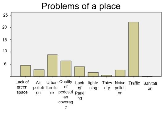
This area is surrounded by various activities. Which is used by people from different age and gender. However, there are some difficulties for disabled people to use the area. However, lack of green space areas is a big problem in Tajrish.
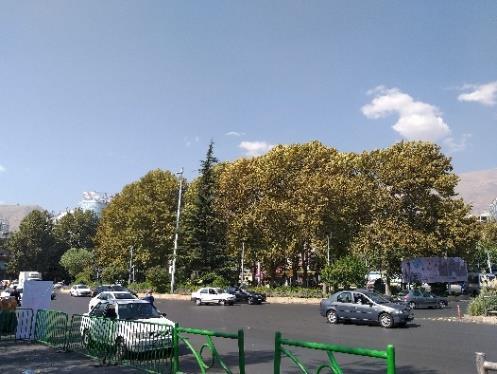
Fig 6. Tajrish area(author/2020)
Because of the existence of various activities for example commercial, religious and recreational such as café and restaurants, many people use this place for various reason on a daily basis.
I tracked people from different age group in different time periods in two days, one weekday and one weekend.
In terms of type of activities, there are three types of activities such as walking, sitting and standing. The problem that can be seen in first glance is the lack of urban furniture. There are not enough trees and shrub to smooth the atmosphere the place. And because of the lack of benches people sit at the edge of the kerb or flower boxes.
Apart from that, due to the high density of land uses in the whole area people cross the road irregularly, which increase the danger of accident.
Figure
There are some uses such as Tekiye Tajrish, Saleh shrine, and Bazaar which defined the identity of Tajrish square. These land uses play an important role in Tajrish on the grounds that they directly affectthe social, cultural, political, and economic features.

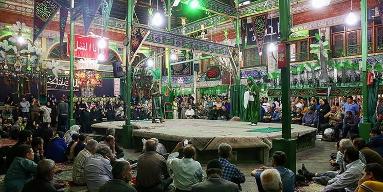
It is a gathering place. Some people through the bazaar get together and talk about different thing.
Some of them may participate to religious event, while passing through the bazaar
The bazaar is a symbol of Iranian lifestyle. The bazaarand holy places around it develop the religious and moral believe among people.

Most of the bazaari people are powerful, and their opinion and decisions directly affectthe notion of other people in a city.


This is a place where not only for residents but also for the whole work. People from different categories and age group come to Tajrish to meet their needs. So, it has a great role to maintaining the economy of a city (Shalchi, 2012).

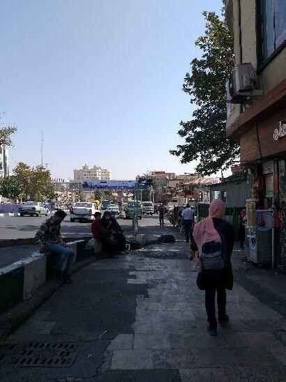
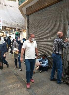
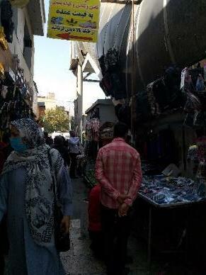
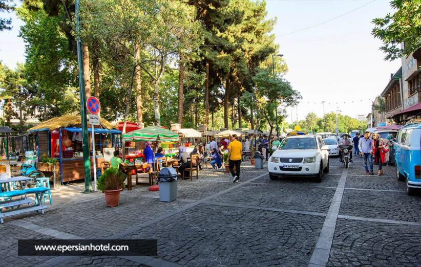
In Tajrish square there are many street vendors. They usually locate beside the pedestrian areas and sell legal goods such as cloths, cosmetic, fruit and vegetables. There are also some people who beg.
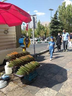
While passers are not happy with the presence mendicants, they claimed that they are happy with the presence of street trades because they not only increase the vitality of the place but also give them achance ofchoice andselection as they can comprise shops in terms of price and quality of the goods.
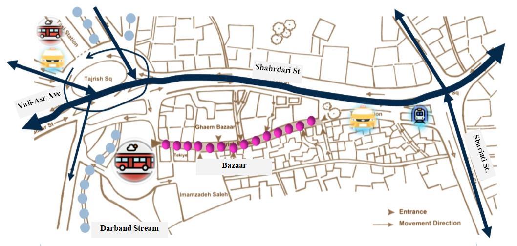
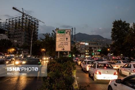
Tajrish has a great connection with important streets such as Vali_e_asr and Shariati St which provides greataccessibility and permeability for its commuters. For those who preferto travelby public transport, the presence of different types of public transportation such as bus, taxi, metro and especially BRT makes Tajrish square an accessible destination. However, the main issue is about the traffic congestion, and low quality of public transportation such as old buses
Because of the heavy traffic most of the motors pass through the pedestrian areas which is really dangerous. And sometimes they use sidewalk as a parking for their motors
Narrow ramps with insufficient slop in another problem which affect the mobility of disabled group of people.
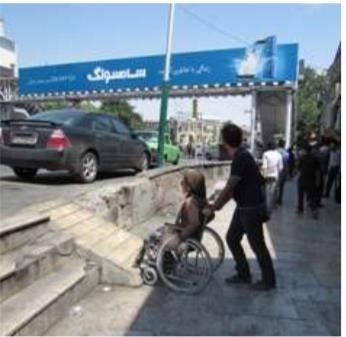
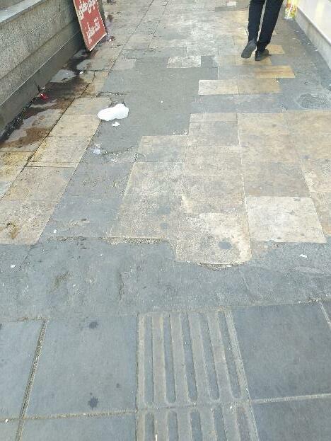
People are not happy with the quality of pedestrian coverage. They mentioned the flooring is insufficient and slippery especially when the weather is rainy or snowy
Flood: ‘Tajrish square’ experienced a flood in 1987 .after a huge rain the level of water increased in Darband stream and Kolabdare Stream. In ashort times ahugefloodwater aswellas the huge amount of mud, rocks, thick trunks of trees, and people’s livelihoods moved towards ‘Tajrish square.’Sincethe Darbandand Gilabdarestreamflowingthis placethereis always a risk of flooding.
Figure 26. Stream bed (author /2020)
Air pollution, Noise pollution,and Accident:Oneof the main problems in Tajrish square is the heavy traffic congestion which causedair pollution and threatens residents’ health and quality of life. Due to the high volume of vehicles and road traffic in Tajrish square, especially during the day, noise pollution is inevitable.
Because of the high speed of vehicles there is the danger of accident in area as well.
COVID19: Due to the pandemic more people rely on their own car and reluctant to use public transportation. Therefore, it can increase the amount of air pollution in city, as well as the noise pollution.There would be socio-economic impact by imposing further restriction in city.
Earthquake: Tajrish is located on one of the faults of the city so there is always a risk of earthquake.
Figure 27. map of faults(tka eng.com)
In order to being more familiar with Tajrish, some question about the gathering place, recreational activities, the main issue of the place and their opinion about traffic congestion has been asked people through the questionnaire. Statistical analysis of the questionnaire was performed using SPSS software. 38 people filled up the questionnaire, 56% of them were women while others were men. Result shows that:
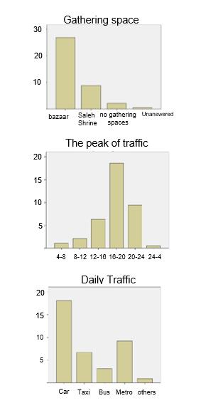
People consider Bazaaras a gathering space.
Most of them feel satisfy by the recreational activities and said they usually choose this place to spend their time with they family or friends.
Less people use public transportation they usually rely on their own car .
From their point of view traffic is the main issue of the place especially during rush hours.
The presence of natural elements such as stream.
The presence of historical elements like Tajarish bazaar.
The presence of religious elements like Tekiye, mosque, and the holy shrine.
Unfavorable congestion of vehicles and passers.
Pollution causedby the terminals (taxi, bus and BRT) located beside the square.
Lack of green space areas.
Environmental issues such as air pollution, sound pollution as well as littering issues.
Lack of attention to the maintenance and protection of natural elements.
It is not anoperational place for disabled group of people.
Take the advantages of natural and historical of the place to create a recreational area,as well as creating the sense of place.
Inattention to the boundary of the stream and fault.
Sanitation issues (littering on the stream and beside it.
In Tajrish there would be multiple stakeholders who directly and indirectly affect the place. I collaborated with some stakeholders through communication to know more about the area. Stakeholders can be analysed in terms of interest and power in Tajrish. The key stakeholders in Tajrish are residents, commuters, public space users, shop keepers, vendors, students, researchers, police, municipality, investors, transportation association, urban planners, and tourists. Each stakeholder has its own interest and power in the area which is really important to know about it especially for writing proposal for intervention. The figure below shows the stakeholders mapping based on their interest and power.
Residents
Students and researchers
Commuters
Tourists
Public spaceusers
Investors Municipality
Transportationassociation
Urban Planners
Police
Vendors
Tajrish square is one ofthe oldest and busiest part of Tehran, Iran. To analyse the place Iused qualitative methods such as observation, interview, and questionnaires as well as UN Habitat guideline. The results show that traffic congestion and the high level of air pollution is one of the most important problem of the place.
This place is surrounded by various activities and attracts many people from different part of the city to it, most of them prefer to rely on their own vehicles, This is why Tajrish is always crowded with cars and people. According to the interview with some people in the place, they claimed no matter whattime it is, there is always a constant stream of the traffic in Tajrish and during rush hours, one could spend hours to get to and from the workplace.
There are various reasons for this problem. people tend to use the clean, safe, modern accessible transportation system. Most of the public transportation in Tajrish areworn out andthey areinsufficient, moreover, the buses usually do not have precise timetable.
The other problems which are also important are related to urban furniture and the quality of pedestrian coverage. Most of the interviewers mentioned if there aremore comfortable place to sit, wewould spend more time in a place so it would be great if there is more benches and trees to smooth the atmosphere of the place.
About the quality of sidewalk coverage, the flooring is insufficient and there is not a specific sidewalk line for blind and the slop of ramp is inappropriate.
It canbe concluded that the leisure dimension of Tajrish square requires more consideration.
Based on the information gathered through the research and the feedbacks from the participatory of different stakeholders both in person and virtually the proposal are aiming to contribute to the mitigate traffic congestion through spatial and non-spatial interventions.
Figure

Charging scheme: The government with effective political leaders should impose charge for drivers especially during peak hours (from 16:00 t0 20:00), from Saturday to Wednesday (weekdays). Some exemption should also be considered. For example, exemptions forpublic transportation and low carbon emission vehicles.
Based on the feedbacks which received from residents in the zone, they are not happy with this policy, so the high discount should be available for them. These financial surplus can be used to support and improve public transportation.
Congestion charging was implemented in London, Stockholm, and Singapore. The scheme has been successful. It has been reduced congestion and travel times (Metz, 2018).
Constraints onparking provision: lack of parking with high charge for discouraging private cars. This may reduce cartraffic.
Promoting using public transportation such as bus: buses are the most common forms of transportation which paly an important role in mitigating congestion. Some non-spatial factors should be considered when it comes to success public transports and encouraging people to use them in Tajrish square. There must be an accurate time information for passengers such as when a bus will arrive and how long it will take to reachthe next bus station. Apart from that, offering free wifi on buses can also encourage commuters to using buses. Another thing to consider is the increase in the number of buses
(Because people reluctant using buses due to the Covid-19 outbreak). By ensuring safe, adequate and comfortable public buses which pursue passengers to using them the capacity of road will release and a large volume of traffic will reduce.
Promoting using public transportation suchas bus: An attractive and comfortable waiting areas for passengers should be designed Walking and Cycling: Encouraging people to divert their travel toward walking and cycling not only has health benefits for them and reduce the air pollution but also help to calming traffic congestion. Those non-spatial interventions which has been mentioned earlier could lessen congestion and make the room for improving active travel. However, improving legibility of area andmake a clear and safe place for cyclist and those on foot are required. There is already a place for cycling and walking but the duality is low. Considering the high desire of pedestrian and cyclist for green areas, green path should be designed. The flooring of both pedestrian and bicycle path should be changed. Suitable place for urban furniture such as benches, flower box, etc. should be considered. These elements directly affect the walkability and cycling of the place.


The other problems in Tajrish square are related to the safety of place, and hard mobility of disabled group of people. The interventions are as followed:
Changing material and Designform: the material of the street should be changed. Drivers feel the texture of paving stones as they drive over and the vibration make them feel like they are going faster than they would feel driving a smooth asphalt. This can increase the safety of the place especially for those who want to across the street.
Colouredpaving can guide the eye. A contrasting coloured border can be used to narrow the street for drivers, which encourage slower driving.
Instead of traditional traffic control device such as speed bumps or pinch points more trees and flowers should be planted. Because streets with this features make users feel like they are in a neighbourhood instead ofa racecartrack. Basedon the feedbacks from stakeholders most ofthem agreedwith this plan. They said this plan not only reduce the speed of vehicle and increase safety but also smooth the atmosphere of place (usa.streetsblog.org).
For disabled people: suitable ramp with appropriate slope should be designed. The structure of the stairs must be updated for the passage of these people, special furniture, for example, for people with a wheelchair should be designed. There should be suitable toilets for physically disabled people, there should be specific lane for blind.
Setting up underpasses inarea and turning the route from Tajrish square to Qods square into a pedestrianarea:
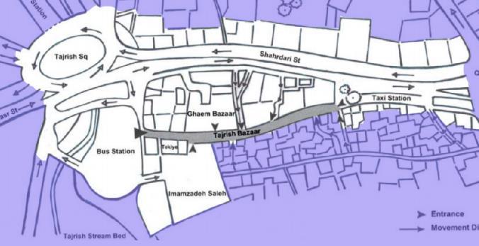
According to the interview with municipality the only way to tackle traffic congestion in Tajrish square is the set up underpass. The ratio of passages in Tajrish square is about 6 to 7 percent. However, the passages should normally occupy more than 20 percent of the area. Therefore, this vast intervention is inevitable. Basedon the feedbacks from residents, shop keepers, employees who use the place on a daily basis If Tajrish is paved and the area around it will improve not only the traffic in this area will significantly reduce but also the attraction of this area will increase. This project will take nearly 3years and it requires 50 million dollars. The sketch below shows how Tajrish square will look if this plan implement.
Figure 32. Tajrish , (If underpass will be built) (newspaper.hamshahrionline.ir)
It seems Tajrish square is a great place for spending time and doing leisure activities for different groups of people.
The methods which has been used for gathering data were interesting. Observing place and having exploratory walk with stakeholders is a great wayto be more familiar with the place and its challenges. Using WhatsApp as a virtual way to communicate with people was also a good idea especially during the pandemic.
The spatial and non spatial intervention for tackling problem in Tajrish show that how we can improve the quality of public spaces and mitigating challenges by some realistic policies as well as a good design approach. For example, by simply changing the material and design form of the place.
Written by a fellow student
Wrote
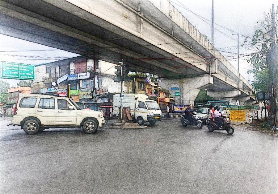
The fieldwork is located in Dehradun which is the capital city of the state of Uttrakhand, India. With the current estimated population of 895,000 (2019), Dehradun is one of the fastest growing cities in India, contributing to a very high rate of urban growth.
Fig1. Location of Uttarakhand state & Dehradun City, India (source digitalofficepro.com)
Urban growth
Fig2. Urban growth pattern of Dehradun in the year a 2001, b 2011 & c 2020
Fig3. Dehradun’s Land Use 2020 (Urban sprawl and its impact on land use, Vol. 6, 2017)
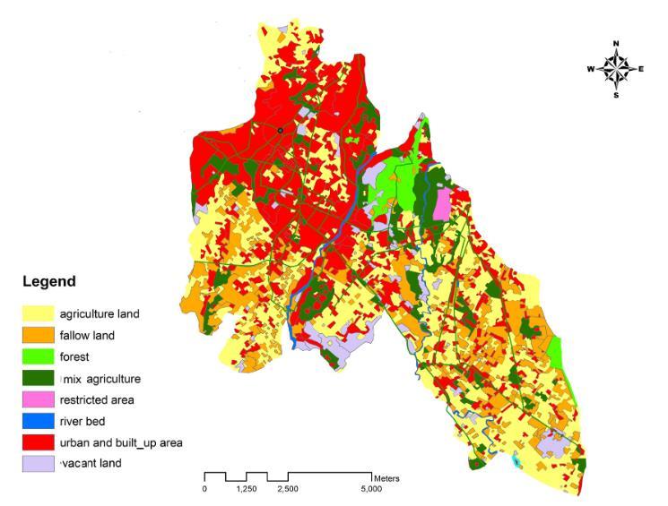
The ‘Balliwala flyover’ establishes the connection between the bus station in the inner city to the outer peripheral road of the city. The flyover is designed above a roundabout which allows the traffic to directly pass through it, avoiding the junction below. The flyover is one kilometer in length.
The junction below the flyover is a roundabout known as the ‘Balliwala chowk’ which is an intersection of two major road networks in the north-south & east-west direction. This serves as the landmark of the region and is considered to be one of the busiest routes in the city. The neighborhoods access this area every day for commuting.
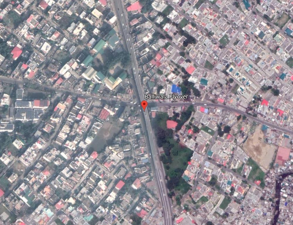
The fieldwork is a mixed-use space and significant areas around the roundabout comprise a market square, series of showrooms, a gas station, and a school along the adjacent stretch. Furthermore, the scope includes vacant areas below the flyover.
The reason for choosing this area for the fieldwork is that its management, development, and interventions will directly impact the whole neighborhood and will prove fundamental in improving the everyday experience.
Direct Observations


Transect Walks
Online & Offline Surveys


The initial methods adopted were direct observations and transect walks. The direct observations included counting the number and type of vehicles during different times of the weekdays and the weekends to define the traffic movement patterns. Transect walks proved vital in understanding and reflecting on the fieldwork. Additionally, during transect walks, photographs and videos were recorded about the activities of the fieldwork. This was followed by the method of digital mapping of the project on a scale to indicate the scope and study the adjoining areas and factors.
For involving the stakeholders, a mix of both online and physical surveys and interviews were undertaken. The challenge during the problem statement stage was to involve different groups of stakeholders. The parents of the school kids responded to the online questionnaires and surveys. They weren’t physically present at the site nevertheless their opinion was necessary; hence an online survey came to the rescue. However, to reach categories of daily commuters, shopkeepers, and pedestrians, a different strategy of face to face surveys was adopted, engaging one stakeholder at a time. This was an alternative approach to reach them with the easing of the Covid 19 lockdown restrictions in the region. The challenge was that relying solely on an online method of the survey did not give the desired number of participants. Consequently, a mix of both online and offline methods was included. The consent was taken from each participant before their respective surveys and their responses were rewarding. The interview with the municipal head engineer proved insightful in the stages of the problem statement and strategic interventions.
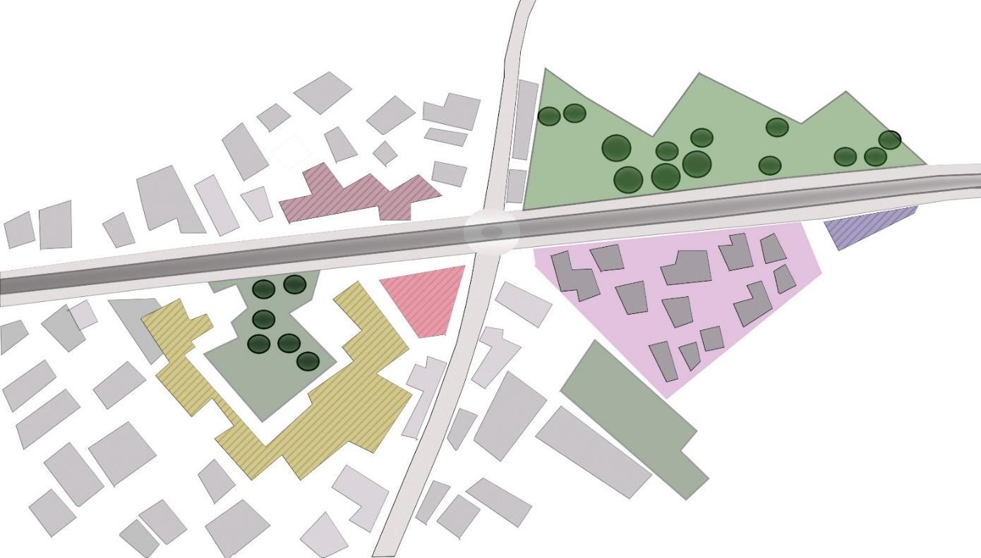


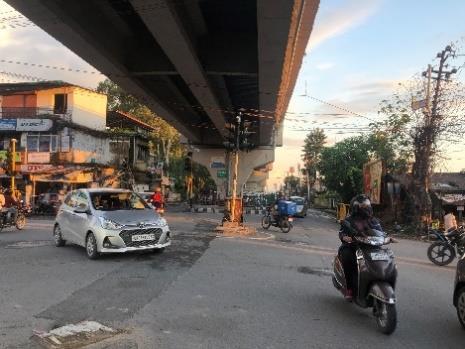
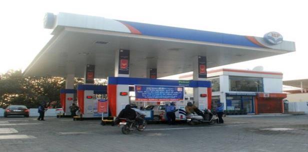
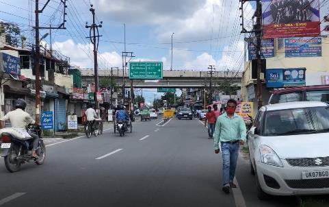

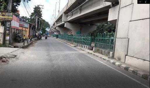
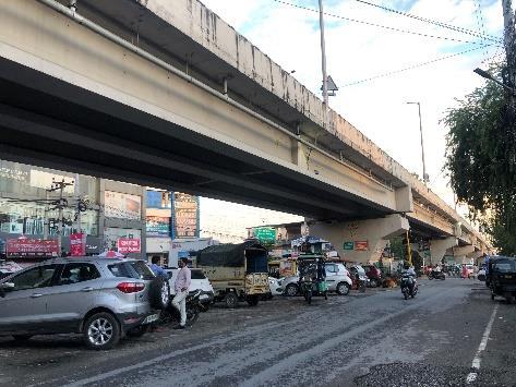
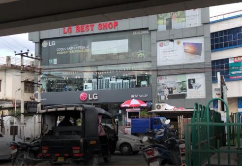
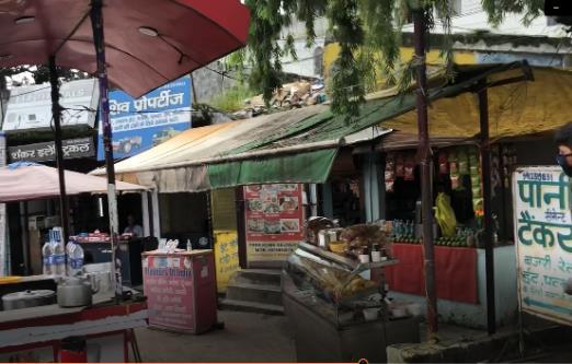
The vehicular traffic around the roundabout constitutes private cars, motorized two-wheelers, and public autos. During Covid-19 the use of public transport i.e. buses is halted because of the social distancing rules. Additionally, there are pedestrians & cyclists in the fieldwork whose number has slightly increased in Covid 19 possibly due to the non availability of public transport options.
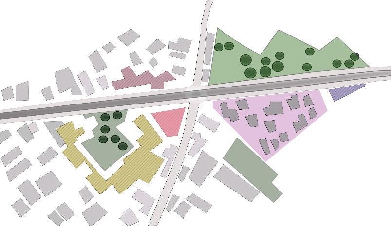
The count of vehicles is tabulated below. The time frame for each sample is 5 minutes and 30 seconds on a weekday, a weekend, and peak rush hour i.e. 10 am & 6 pm.
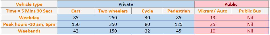
The number of
TWO WHEELERS
Fig5.
of traffic analysis
author)
PUBLIC BUS
Public
any given time, followed by the number of private cars.
due to Covid 19. The use of public buses was more in the region before covid 19.
increase in the use of private vehicles


In the Power Interest diagram, the stakeholders are classified into four categories as per the interest and power in the fieldwork. The shop owners and market vendors are focussed on their respective sales more thus they are in the category of low power & low interest. Everyday commuters and school kids have high interests while their power in decision making remains low. On the other hand, Town Country planning department has other priorities, for example, tourist places so their power is high & interest is low, similarly the traffic police force whose job remains to manage the traffic. The key players are the Public Works Department (Municipality) and Mussorie Dehradun Development Authority who have high power along with high interests in the fieldwork. They are responsible for decision making and development works in the region.


Police traffic force
Public Works Department, Dehradun
Traffic congestion around a roundabout
Pedestrian safety for school kids
Lack of safety for pedestrians/ cyclists
Town & Country Planning, Dehradun
Commuters
Environmental air & noise pollution
Underutilized areas below the flyover
Mussorie Dehradun Development Authority
Informal Parking
Shop owners
In the stakeholder issue relationship, the existing issues/problems are linked with their concerned stakeholders. For instance, commuters experience traffic congestion around the roundabout of which the responsibility lies with the traffic police and the municipality. The lack of pedestrian safety is related to the development body called Mussorie Dehradun Development Authority. The shop owners are concerned about the increasing pollution levels in the area due to the increased traffic. The vacant areas below the flyover are occupied by the informal parking that comes under the scope of the municipality.

There are vacant areas below the flyover known as voids, in between the columns supporting the flyover. Two voids are on one side of the roundabout & four on the opposite side of the roundabout. The vacant area is used as informal parking and the remaining is unoccupied.
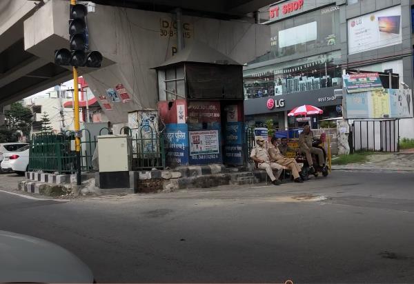
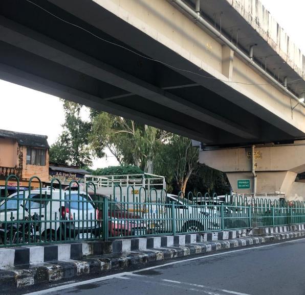
The area experiences clusters of garbage at the corners of road intersections.
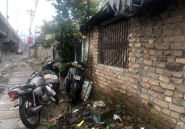
The market square requires public toilets for shop owners and customers. Moreover, the traffic police control room which is a temporary structure for traffic police force at the roundabout lack toilet facilities. Notably, there are women constituting 50 percent of the total police force.


The roundabout and the flyover are prone to road accidents because of the huge traffic inflow. During Covid 19, there is a furthermore increase in the number of private vehicles. Citizens are refrained from using public transport due to the social distancing norms currently implemented in the city.
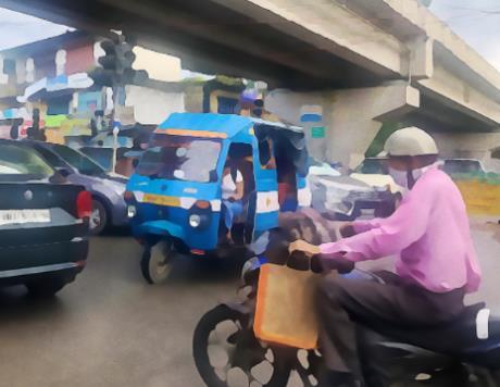
Another risk identification is that there is a lack of safety for people walking on the streets due to the absence of any segregated pedestrian walkways. This is especially a concern for school going kids passing through the area.


The problem statement is exercised to discover important issues that can be identified through the different stakeholders to propose & address strategic interventions. Therefore, this stage proved to be significant in involving all the concerned groups to reach the most common goals.
Following is the list of challenges identified in situational analysis during direct observations, transect walks, and communication with the different stakeholders. Additionally, this list can be interpreted as the set of opportunities for growth & interventions in the fieldwork.
The roundabout experiences traffic congestion at all times during the day due to the increase in private vehicles C. Informal Parking
The spaces under the flyover is c urrently occupied by the taxi drivers for parking their vehicles
Uncontrolled vehicular movement & absence of pedestrian crossings has resulted into a complete chaos
The increased vehicular traffic has resulted into higher levels of environmental pollution in the fieldwork


The pedestrians and the school kids commute through the area via a common vehicular road
Lack of facilities including the public toilets for market square and traffic police force
arrive at the problem statement,


people were surveyed followed by an interview with the municipal head engineer. For the survey, the stakeholders were divided into three categories namely vehicleowners(dailycommuters),localshopkeepers,andpedestriansconsistingoftenparticipantseach.
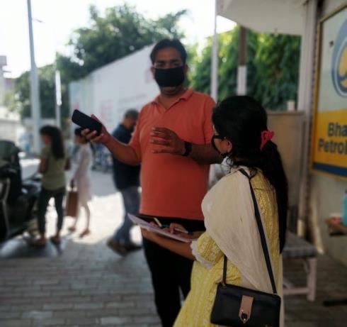
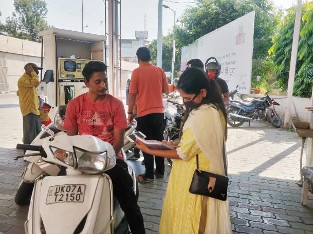
questionnaire had some common questions for all the categories. Common questions included a ranking of the problems from the most important to the least important. This was done to arrive at an essential problem of the project with the involvement of all concerned stakeholders.
Pedestrians


D. Interview
Head Engineer
Interview
A. Vehicle Owners/
Commuters
Shopkeepers
Parent of a school Kid
A. Traffic Jams
B. Air & Noise Pollution
C. Informal Parking
D. Road accidents
E. Pedestrian safety
F. Facilities & Services
Daily Commuters Problems
Pedestrians Problems
Traffic Congestion Informal Parking
Road Accidents Pedestrian safety
Air & Noise pollution Road Accidents
Pedestrian safety Others Shopkeepers Problems
The findings above indicates the three groups of stakeholders voting their number one problem, according to them in the fieldwork.


Air & Noise Pollution Informal Parking
Pedestrian safety Others
The graphs below represent the voting percentage for each problem in the groups.
Survey Results (out of sample size 30)
1. Pedestrian safety 11 Participants
2. Road Accidents - 5 participants
3. Informal Parking - 5 participants
4. Air & Noise Pollution - 4 participants
5. Traffic Jams - 3 participants
6. Facilities & Services 2 participants
11 participants voted for the pedestrian safety as the number one issue. Additionally, road accidents and informal parking are important concerns for the public in the area. Participants want informal parking to be converted into formalized parking to stop the invasion by taxi drivers. Air & noise pollution, however, is a relevant issue and contrary to the belief, people do not consider traffic congestion as one of the major issues in the area. The other problem highlighted by the two participants is the lack of facilities and services of public toilets.
Q. Have you envisioned any future changes in the area?
Pavement on both sides of the road, development of the chowk, zebra crossing and pedestrian signals along with the traffic lights.
Q. There is high probability of road accidents in the area. What are your thoughts and what are your ground preparations?
❖ Installation of board with emergency contact numbers
❖ Tie ups with the nearby hospitals for emergency and safe evacuation
❖ Mock drills/ trainings to the traffic police force
Q. According to the survey results - Pedestrian and school kids safety commuting through the area is the greatest concern among the users, what is your take on the same
In this case, the municipality would take it into consideration, probable solutions could be -
❖ Railings on the side of pavement/walkways
❖ Speed limit for the vehicular traffic with a sign board indicating Drive slowly, school nearby
❖ Speedometers to check and control the speeds of passing vehicular traffic.
The study of the fieldwork intends to find solutions in the existing case scenarios of the site. The strategic intervention is done to enhance the overall experience of the stakeholders and the users of the area. Solutions to the existing fieldwork in the form of spatial or non-spatial interventions constitute strategic intervention. In the project ‘Underneath a flyover’, Dehradun, there is a combination of both spatial and non spatial interventions.
Spatial & non spatial interventions can be further divided into short term, mid term and long term, based on the factors priority (as per observations & stakeholders), total finances (budget) for intervention, and time frame to complete. For this stage, the stepwise maps and plans are developed for the existing and proposed scenarios.
Short term interventions, in this case, is the incorporation of traffic lights with pedestrian signals along with the road intersections around the roundabout.

Another crucial intervention is the introduction of walkways for pedestrians along the roadsides. Additionally, proposal of Zebra crossings/ double crossings for the pedestrian’s to crossover. The pedestrian walkways are further to be connected with the green zones under the flyover.
Pedestrian walkways
Traffic signal lights Zebra crossing

With the increase in parking demand for the customers of market square and showroom, stakeholders want regularized parking in the areas under the flyover. In the current scenario, there is an informal parking by taxi drivers who park their vehicles for indefinite time that creates a lack of parking space for shopping customers. Regularized parking will solve the parking issue with controlled parking time for each vehicle, let’s say three hours maximum. The regularized parking will also generate an income that can be utilized for the further development of fieldwork.

Midterm intervention is an effective & balanced proposal that brings significant changes to the environment. It has the power to remarkably transform the space and improve the site conditions. Midterm intervention in this fieldwork is a design intervention to develop green urban activity zones under the flyover. The green zones are small patches of parks for activities like sitting, playing, and interacting. People who buy eatables from the market square will finally have a place to sit & enjoy their meals in the greens. The park will have plantations and urban furniture including outdoor lamps, swings, benches and dustbins for garbage disposal. The green zone will help improve the overall air quality of the space.
Regularized Parking II
Regularized Parking I Green zones
Green zones
These are a few international examples of possibilities for utilizing areas below the flyovers. After the completion of the flyover, the under spaces remains vacant and are therefore concrete voids. Introducing green areas below the flyover is an efficient utilization of voids. The greens are horizontal or vertical plantations that manages the local pollution and enhance micro climate. Furthermore, green areas can be developed into park for urban activities. The funds collected from the regularized parking to be utilized for the maintenance of the green areas.
The midterm intervention proposes the establishment of a control room building for the traffic police force deployed at the intersection circle to manage the traffic. Proposal for setting up essential services like drinking water and public toilets. Provision for an emergency building block for risk mitigation in case of vehicular accidents.
The roundabout lacks any structural boundary despite being a reference/nodal point. The missing traffic lights causes movement chaos and creates traffic congestion for the drivers. Construction of a structural boundary around the roundabout and installing traffic lights will solve the issues concerning smooth traffic movement.
There is an alternate intervention to develop bike lanes for cyclists in the region. The bike lane network can prove to be effective for everyday commute. This shall too some extent help solve the problem of growing heavy traffic. In Dehradun, citizens cycle, especially the youth for fitness. Their passion can be turned into mode of transport to office or for work every day.
Non spatial intervention in the project is a change in the use of public transport from the motorized autos to clean fuel/ electric or battery-operated vehicles. The motorized diesel autos are the major cause of air pollution in the fieldwork.
Furthermore, there is a need to improve and increase the use of public transport, for instance, public buses. This is a long-term intervention because, with the onset of COVID-19, the use of public buses is halted in the city. In the long term, the use of sustainable public buses will prove beneficial in providing sustainable mobility options to the public.
Fig.16 Proposed Bike lanes for the fieldwork
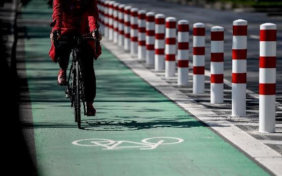
(Source Arstechnica.com)
Fig.17 Clean/Eco friendly vehicles for long term interventions (Source www.intelligenttransport.com)
Development of pedestrian walkways
- Zebra/double crossings
Mid Term Development of green zones under the flyover
Establishment of control room for the traffic police force Development of the roundabout
Provision of drinking water & public toilets
Building block called emergency room for risk mitigation and management
Regularization of car parking from informal parking
Long term
Develop a bike network in the region for cycling.
Link to establish communication between the residents and municipality on urban planning - Regularized & Mechanized traffic movement from being completely dependent on manual traffic police force for managing the traffic
Switch from the motorized autos to the battery operated/ electric vehicles
The strategic interventions proposed above are progressive & step wise starting from the short term followed by the midterm to finally a long term. These interventions are interlinked & connected as a transition from one stage to another.
The topic ‘Underneath a flyover, Dehradun, India’ is an engaging fieldwork that brings in a lot of possibilities for innovation in urban planning. There are lot of ongoing activities in the area, for example vehicular traffic around the roundabout, parking below the flyover and has infrastructure for commercial activities in place for example, shops and market. There is a school at the end of the flyover. This fieldwork is a good example in understanding what happens after the construction of a flyover. Additionally, to study the mixed-use activities below the flyover is intriguing. The reflection on proposing pedestrian walkways especially for school kids & utilizing the under spaces of the flyover into parking, green & activity zones is the highlight of the project along with proposed spatial and non-spatial interventions.
Written by a fellow student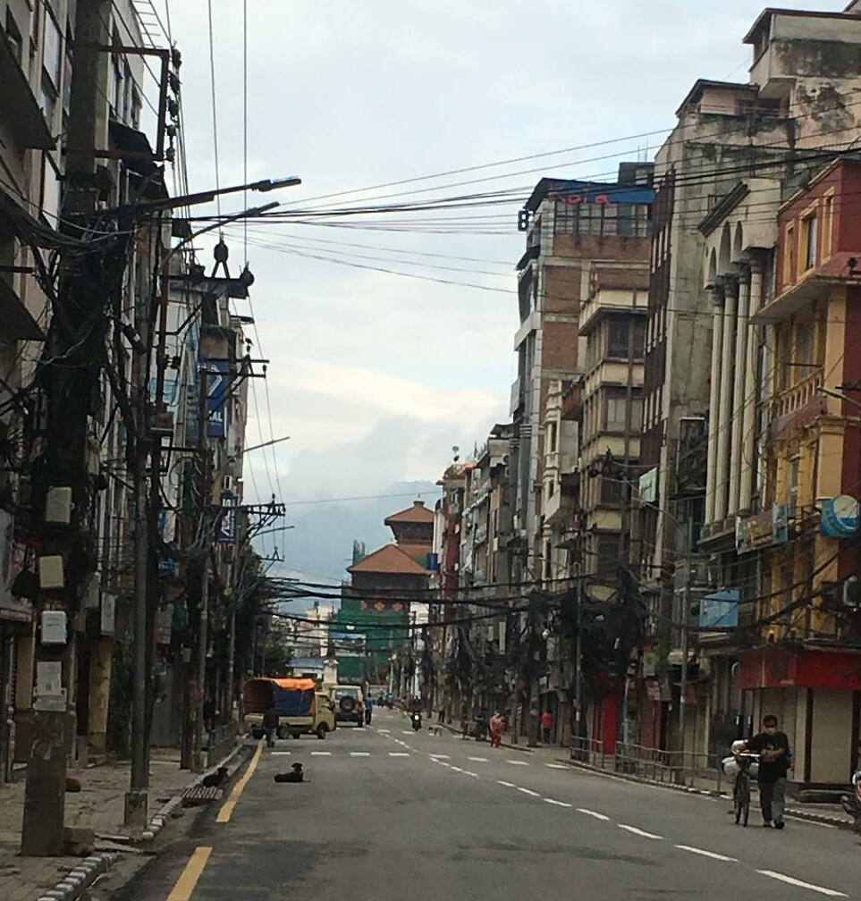

Source: (Nepal Map and Satellite Image, 2020)

The New Road lies in the capital city of Nepal. It is one of the oldest downtowns in the center of Kathmandu valley. It is the busiest marketplace in the central location, near the mid-point of the ring road in Kathmandu. The road is around 438.50 m long connected with sub streets. The New Road lies in ward no 22 of Kathmandu metropolitan city which had 1,009 households and a population of 5,840 in the ward in 2001. (Kathmandu.gov.np, 2020)
105
Boundaries of New Road are:
East: Tundikhel
West: Basantapur( Kathmandu Durbar Square)
North: Dugambahii, Pyukha, Fasikyeba
South: Khichhapokhari,
Source: open street map
Source: (Kathmandu (District), 2020)
Source: open street map

New Road is one of the oldest downtowns in Kathmandu valley. theareahasmixedlandusebutlatelyisitismorecommercialized, and trend of residents migrating from the area is increasing. New Road is losing its charm.Thus,the interest ofknowingmoreabout New Road in depth made me choose this site for fieldwork.
Figure 3 business from generation (author)
New Road is a commercial area which has mixed land use, it is the marketplace, residential square, as well as a place to host ceremonial events. The building adjacent to road is used for commercialpurpose.Thefootpathofnewroadisusedbyinformal street vendors. The one third part of connecting street is used for parking.
Figure 4 Covid 19 awareness program in foot path (author)
Figure 1 Land use Map

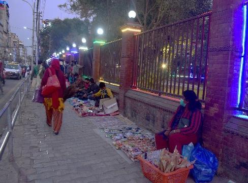
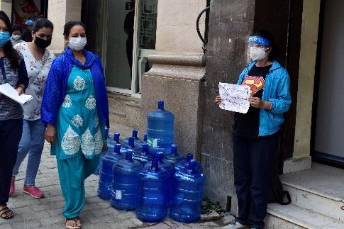


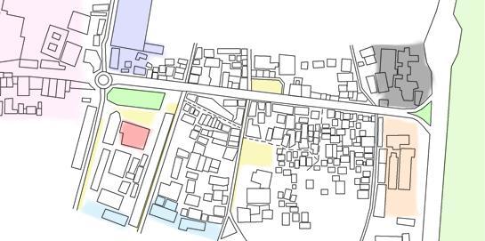
Figure 5street vendors(author)
Figure 6 parking(author)
Looking around the street of New Road some important landmarks have a huge impact on public movement and activities held in the street. The largest greenfield of Kathmandu known as ‘Tundikhel’ lies in the eastern part of the area, where colorful festivals and sports activities are quite frequent. While the new road is the gateway to Kathmandu Durbar Square, the old royal residence is locally known as ‘Basantapur’. The first fire squad, the head office of the first national daily newspaper, the head office of the first commercial bank of Nepal, and the first supermarket of Nepal lies around the main street of the new road. A small park called ‘Bhugol Park’ which stands just beside the street. Usually, a blood donation program is held there. The park is also used by pedestrians as a resting space as it is the only green space in the street.
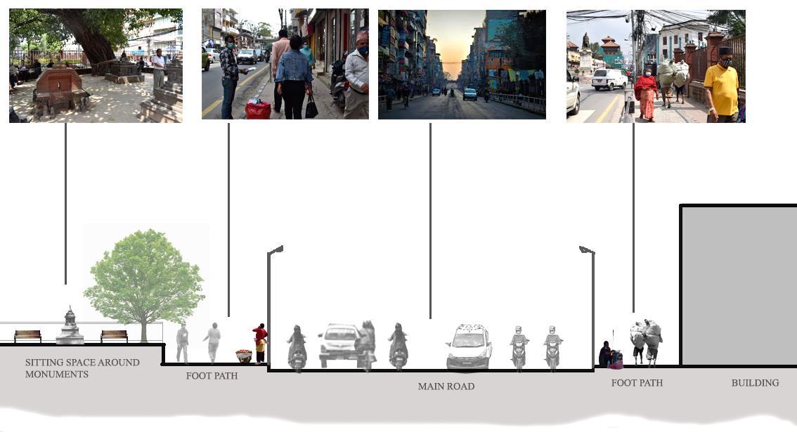
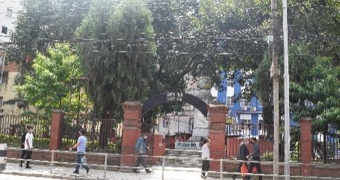


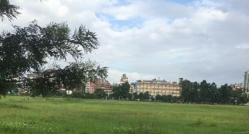
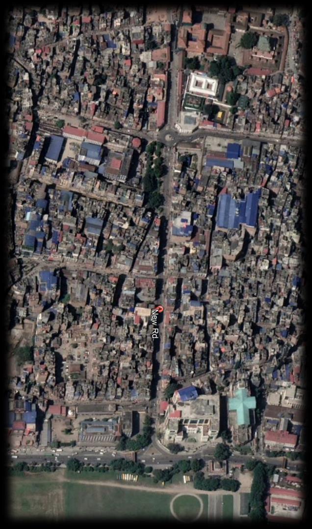
New Road is also known as ‘Juddha Sadak’ as the road was constructed during the prime minister ship of Juddha Shumsher Rana after the 1934 earthquake in Kathmandu valley. A statue of ‘Juddha Shumsher’ was situated in the westernmost round turn of the road in his honor.beingkathmandus firstcommercialroad it is called “New Road”. However, the settlement surrounding the New road and culture can be traced back to the Licchavi period. Over the years New Road has experienced rapid urbanization and population growth. The building typology around the road has also changed. (Figure 9,10,11)
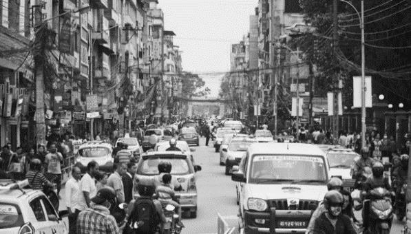
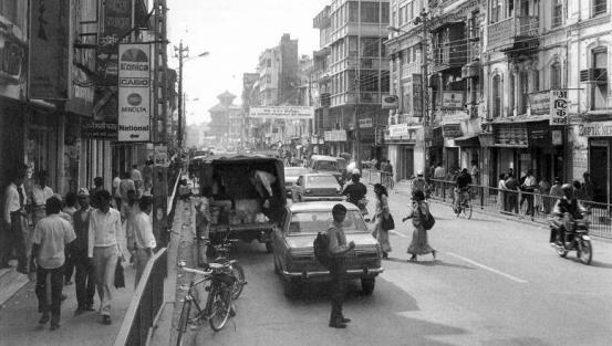
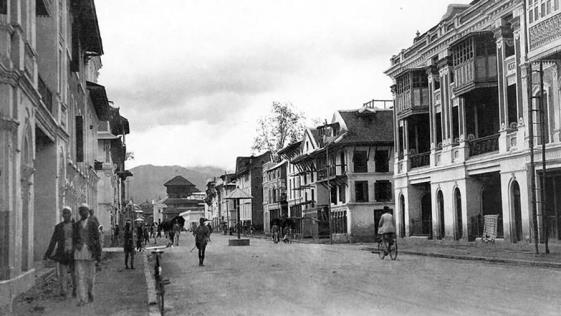
The analysis encompasses both primary and secondary data gathered through general observation, transect walk, key informant interviews. The secondary sources include books, journals, articles, and relevant research reports. or further research of the area, participatory methods like co-design were not possible in the area due to the pandemic. A Digital meeting platform was created involving stakeholders of the area but resulted ineffective due to a lack of response from the stakeholders. So, the survey was done by interviewing creating different questioners for different stakeholders in person.
The methods of studies varied due to the pandemic. Kathmandu valley was under lockdown during the initial phaseofstudies soapartfromobservation,onlineresearch and transect walk all other methods for fieldwork were restricted. After the government of Nepal unlocked Kathmandu with some COVID 19 regulations to follow, I could finally interview some of the stakeholders like the Deputy Mayor, Deputy inspector, traffic inspector along with regular customers, residents, and formal and informal vendors.
Thebuildingadjacentto theroadismostlyprivateproperty. The buildings are usually three to seven story tall in the area. Theground floorof thebuildings isoccupiedby shops selling different products like clothes, electronics, and jewelry. While first and the second floor of the building are usually used as different offices and restaurants. In most cases, the houses are rented to businessperson to run their business and the owner lived on the top floor of the building. While in other cases the owner ran their own business in the building themselves for generations. There are five malls scattered around the area. Most of the structures are built using cement concrete material, in modern design while some buildings are found in neoclassical as well as in Nepalis style of design. (Figure 12,13)
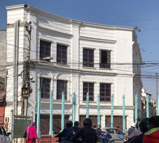
Being one of the oldest settlements of the Kathmandu valley. The building was built creating a central courtyard (Figure 14). The courtyard was used for gathering and socializing for the residents in the past. This left over courtyard now is used for parking and by informal vendors. Which resulted in insufficient open space for locals as well as visitors.

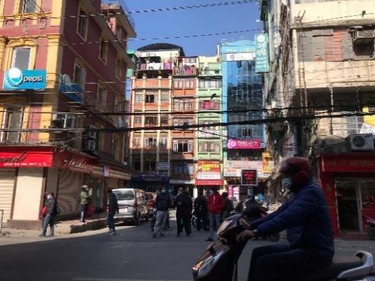
Many vendors are occupying the space on the footpath of the roads. The practice of trade on the streets squares, and the public space in New Road can be linked to historic times. People from Lhasa selling their goods in traditional urban centers were common in the Newari community. There are different categories of informal vendors in the area according to their nature. They are a temporary vendor or seasonal vendors, permanent vendors, and mobile vendors.
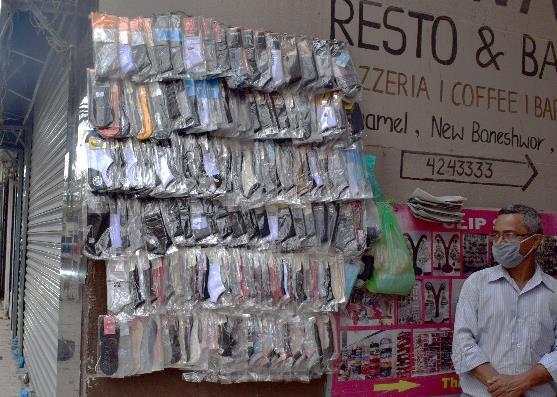
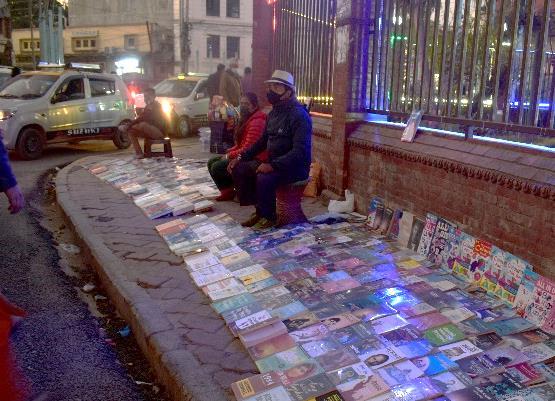
Figure 18 zoning of vendors (open street map)
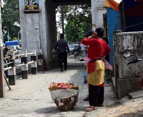
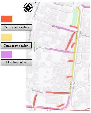
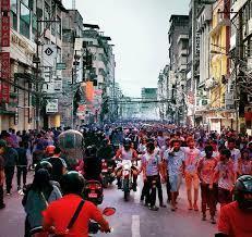
The inhabitants of the area are Newars, known for their rich culture and tradition. The daily activities in the area start early in the morning. The activities and crowd in the area vary according to the different times. This commercial hub is busiest during evening time from 3 pm to 7 pm. The energy on the street has its unique charisma during festivals. For an instance in the festival called ‘Holy’, people of different ages, gender, and socioeconomic group gather in the street playing and walking around with colors and interacting with each other celebrating the festival of colors (Figure 19). Lots of small monuments are found scattered around the area. Which is preserved and maintained by the residents (Figure 20,21).
Residents of the area are usually found worshipping cleaning the monuments in the morning. That reflects the cultural belief of the people living there. Mostly older generation people are found around the monument gathering and socializing. The land value of the area is very high which makes the rent amount in the area high. The house owners of the area have a good income source due to the land value. The living standard ofthe resident ofthe area is higher. Informalstreet vendorsare the most vulnerable group in the area. As the government is trying to evict and, they are deprived of basic facilities.
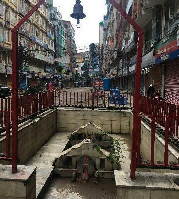
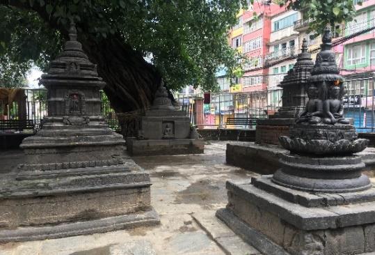
The public vehicles are not permitted inside the New road, we must enter the financial hub on foot or by private vehicles through the entry gate called ‘New Road Gate’. The area is entered through the road called ‘Kanti path’ (4lane one way road). Kanti path in the east and Dharma path in the west. The main street of the New road relates to several sub street providing entry to the neighborhoods. The public vehicle transit is beside the Kanti path near the New road gate. Different means of public vehicles like tempo (three wheelers vehicle), bus, the microbus that connects thewholeKathmanduvalleyarefoundthere.The main reason for making New road the most frequent marketplace is easy to access public vehicles in the area.
Figure 22 Kathmandu transport Routes source: open street map
Figure 23 New Road connecting Routes (open street map)
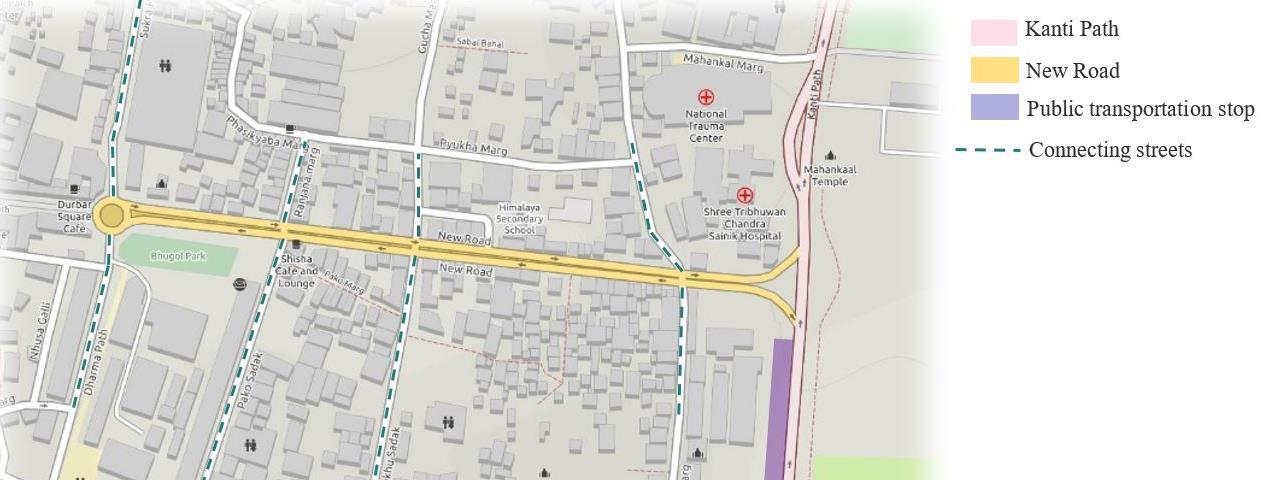
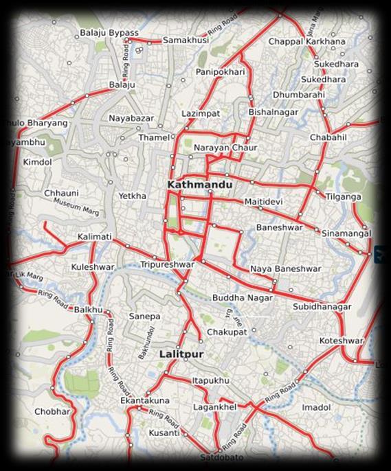
Earthquake: One of the major risks of the area is an earthquake. Nepal lies under the high risk of an earthquake. The area was highly affected by the earthquake that hit Nepal in 2015. After the earthquake government of Nepal had established a risk sensitive land used plan. The construction and land use of the area should be done according to it. Even though the area lies under high risk as it lacks open space and is densely populated.
Covid-19: The cases of coronavirus are rapidly increasing in Nepal, particularly higher in Kathmandu valley. The risk of transmission of coronavirus is very high in the area as it is a commercial hub and densely populated. People are wearing masks and using sanitizer to avoid transmission of the virus but maintaining 2 meters of social distancing seems impossible as the area is very crowded. Road accident: Road accident is quite often in the area especially in the connecting sub street of New road. Informalstreetvendorsareoneofthemajorcausesastheydisturbthemobilityinthestreet.Another cause is the haphazard driving of two wheelers without following the traffic rule.
Crime: The area has a low crime rate however, sometimes bag snitching, thievery of the vehicles has been witnessed.
Easy accessibility through public transportation
Important historical landmarks around the area
Mixed use and mixed income area.
Difficulty in mobility due to informal street vendors
Traffic jam
COVID 19 Earthquake
Migration of residence
Space management
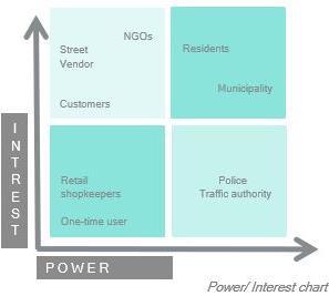
▪ Users:
The residence or landowners, costumers, formal and informal vendors, tourists; local as well as international and one-time users.
▪ Organizations:
Kathmandu valley preservation trust (KVPT), Local non-profitable organizations
▪ Governmental organization:
Kathmandu district administration, Kathmandu valley development authority, Kathmandu Metropolitan City, Kathmandu Metropolitan police, Kathmandu Traffic Police.
Along with the increasing urbanization of the city, many problems have been raised in the New Road. The problem of the area was identified based on observation, interviews with stakeholders, and survey data collected creating questioners for stakeholders. These methods concluded that some of the major problems that the area is facing are as follows:
1. Increasing informal street vending: With the increasing urbanization and commercialization, the number of informal vendors is increasing in the area.
2. Increasing traffic: Though the public vehicle is not allowed in the area, there is traffic congestion which is another problem due to population growth. Street vendors contribute to disturbing mobility which makes the traffic problem even worse.
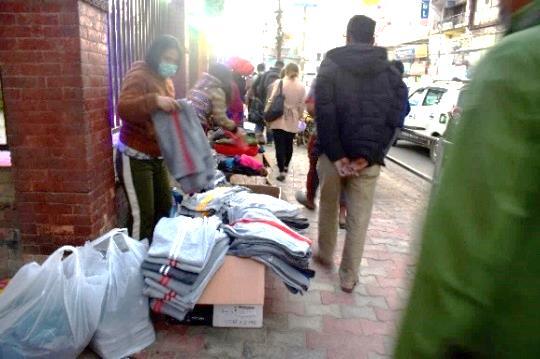
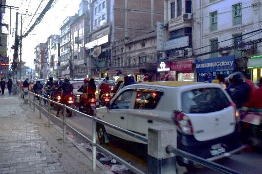
3. Waste management: The waste was observed unmanaged and littered all around the road polluting the area. The waste remains beside the road until the municipality collects the waste.
4. Migration of residents: Due to the commercialization of the area and high land value in the New Road the trend of residents migrating from the area is increasing.
• Earthquake: Nepal lies at a high risk of an earthquake. The building constructed in the area is at high risk as houses are old and not constructed under risk-sensitive rules authorized by the government of Nepal. The area lacks sufficient open space, and the area is overcrowded.
All these problems are interconnected as the main source of the problem is increasing urban migration, urban poverty, and limited land. Among these various issue’s street vending is the major issue as they disturb the mobility in the streets, contribute to the informal economy, and pollutes the city. If this problemissolvedtheotherissueswillgraduallybesolved.Informalstreetvendingisviewedasanarising problem now in the New Road but the practice of trade on the streets squares, and the public space can be linked to historic times. People from Lhasa selling their goods in traditional urban centers were common in the Newari community.
The city planners assume that an increase in the number of street vendors was after the earthquake that struck Nepal on April 25th,2015 as the displaced people from the rural areas migrated to Kathmandu in search of jobs and ended up in vending (Ojha,2018). However, the number of street vendors in the area decreased due to pandemic. As soon as government of Nepal announced lockdown due to COVID 19 the informal vendors started going back to their villages because of difficulty in surviving in urban area. After the ease of lockdown with COVID-19 regulation , governmental authorities of New Road were more strict with eviction of informal vendors in the area, as they are considered one of the reason to transmit the disease because they attract more crowd.
Informal street vendors have both positive as well as negative affect in the area. Although it promotes informal economy, disturb mobility, and pollutes the area, the contribution of street vending has helped urban citizens, especially the urban poor to survive in the city that cannot be ignored.
Accordingto theinterviewwith aroundtenstreet vendors,themainreason forthem to choose the New Road as their vending station are:
• Central location
• Easy accessibility of public transportation
• High land value
Similarly, the other findings of this survey include worksite problems like eviction, lack of basic facilities like water supply, public toilet, weather, etc. Eviction is a majorproblem apartfrom thedifficulties dueto weather.Theyworkformorehours and are paid less in compression to formal workers. Interview with vendors made it clear that there are no well-defined boundaries for the vending station. Vendors seem to have co-ordination and certain kind of norms among each other on not capturing someone else place. However, there is no rule on who can or cannot vend in the place.
Based on a study on New Road, there are different types of vendors working around the area. One could be termed as formalized vendors among the informal which has a certain systematic arrangement of spaces like under the bridge, beside the NAC building, and are supported by the local clubs. They have been working as vendors for around 20 to 25 years.Similarly,there areothertypes of vendors whoare new migrants to the city and chose to vend in New Road (Figure 27,28,29).
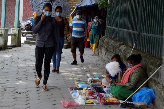
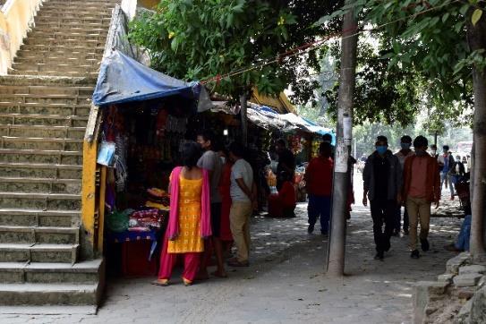
Lack of coordination amongst the different stakeholders in spatial management of informal sectors are the major problem in managing the spaces around the New Road. Thus, the state must understand why a certain group of people use foot paths and other similar public space for informal business and reconsider how a public street can be a multi functional area. The high dependency of urban population in the informal sector demands the state to reconsider street vending to be licensed to create jobs. While doing so, it is also necessary to understand how they can be managed in a saturated space of the urban area. The vending experience of New road suggests the potentiality of Urban Commons, which can be an instrument to develop an alternative way to manage these informal works.
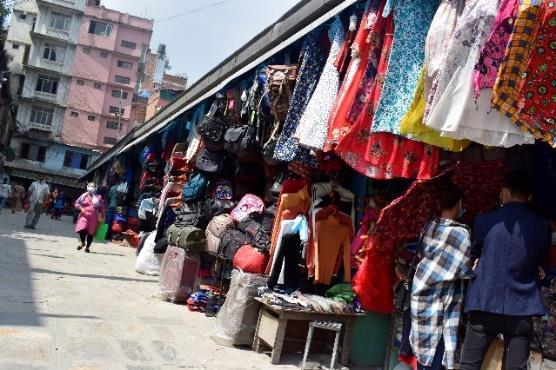
The main burning problem in the area was increasing street vending. Proper space management for street vendors is required in the area. The increase in the number of street vendors caused various problems like difficulty in mobility for pedestrians as well as vehicles, pollution, and road accidents.
It is seen that one third of the connecting street of New Road is occupied by the parking for private vehicles, especially two wheelers. That parking space can be shifted leaving the space for street vendors to install their permanent stalls. Creating mixed-use and mixed-income area. Also, contribute to creating walkable streets and human-scale neighborhood.
The proposal of shifting parking from the area fulfilled the following goals:
• Formalizing informal economy: Installing stalls for informal vendors will help to formalize their business. They will be registered and pay tax so that the government can provide vendors basic facilities like proper water supply, sanitation, and shelter in extreme weather. There will be no disturbance in the mobility of pedestrians. Helps to create a safe clean area.
• Traffic management: Designing parking space outside New road will automatically reduce the vehicular flow in the area making less and manageable traffic. Also promotes a walkable neighborhood. Reduces road accidents and noise as well as air pollution.
• Community involvement: Shifting parking and installing vendors creates mixed use of the area. Promotes socio-economic activity.
The first phase of the proposal can be considerd as trial phase, where no permanet structure are constructed. Shifing the parking from one of the connecting road to the Tundikhel. And replacing parking with vending stall. The parking site is around 175m away from the market area.(Figure 31) I introduced the proposal of shifting parking space and locating street vendors in the place of parking to regular users of the area like residents, regular visitors, shopkeepers, and informalvendors.Surveyedtheirviews about the intervention, the result was posituve as most of the user liked the idea of locating vendors in place of parking.
Figure 30 short term intervention
If the short-term intervention becomes effective underground parking can be proposed in the Tundhikhel, gradually parking from all the connecting streets can be shifted to new proposed underground parking. Which will create sufficient space to manage informal street vendors in New Road area.
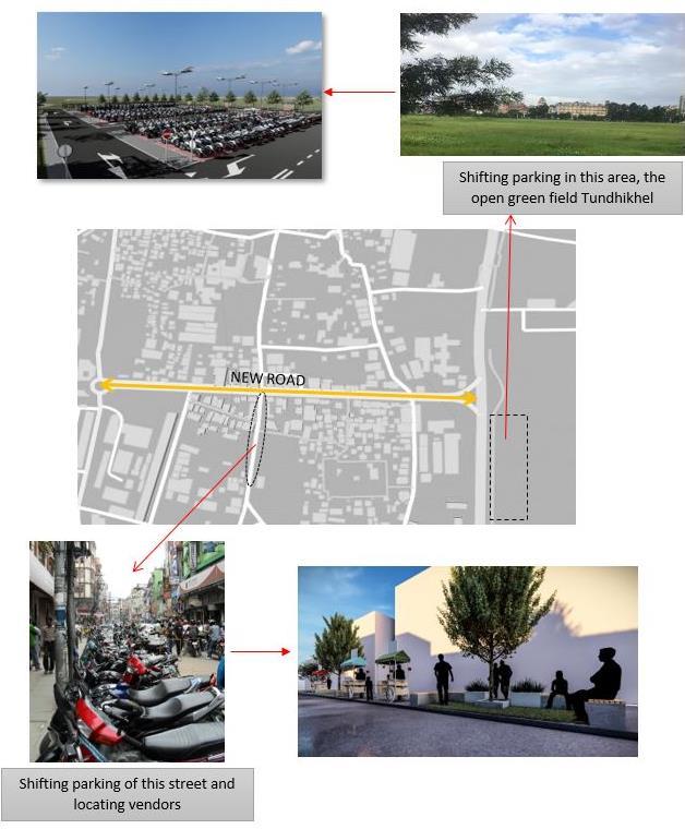
Underground parking in the Tundhikhel. These types of parking can be witnessed in many cities with a dense population. For an instance, Mumbai city is set to get its first underground parking lot which will be built by the civic body under Jhula Maidan in Mumbai Central’s Madanpura area (Hindustan Times, 2018) (Figure 32).
Some other examples of underground parking are Underground parking integrated with open public space in Liverpool, UK (Figure 33), underground parking established below open space and parks; A Coruna, Spain (Figure 34). (Types of parking- Auckland design manual,2020)
Underground parking helps the area to take full advantage of the existing street and available open spaces for the placement of commercial users, particularly informal street vendors in the case of the New Road.

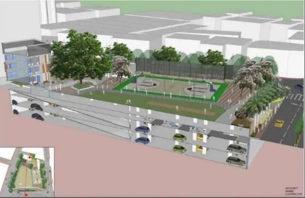
The main goal of this proposal is as follows:
• To create a parking space without disturbing the present landform.
• Makes more land available for other socio economic usages.
• Reduces traffic congestion.
Figure 31 underground parking proposed in Mumbai. Source: (Hindustan Times, 2018)
Figure 32 underground parking Liverpool, UK (Source: types of parking Auckland design manual,2020)
Figure 33 underground parking; A Coruna,Spain
Source: Types of parking- Auckland design manual,2020
• Security and safety: Underground parking also provides safety and security to the vehicles. As the vehicles are virtually eliminated it is safe from thievery. It protects the vehicles from weatherrelated issues.
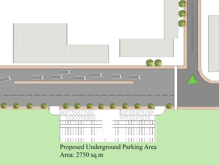
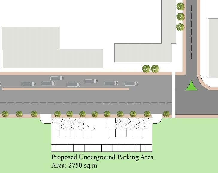
Two story underground parking of total area 2750 sqm. The proposed parking is 175 m away from entry gate of new road. First story with capacity of 150 two wheelers while second story with capacity of 50 four wheelers.
Figure 34 two wheelers parking 1st floor of underground parking Figure 35 four wheelers parking on ground floor of undrground parking
Figure 36 section of proposed underground parking
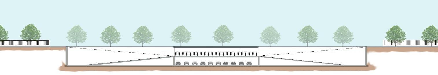
The field study was good experience. The study in New Road insights behavior of public streets during lockdown and after ease of lockdown, as during the initial phase of study Kathmanduwas underlockdown. NewRoad shows the potential of mixed land use and mixed income area. The field work shows the contribution of informal economy to urban population. The report highest both negative and positive impact of informal economy in urban cities. It is interesting to see the strategic intervention focused onthemanaging thespaceforinformalstreetvendors,the most creating mixed land use area.
Written by Fellow StudentOur group reflection on methods havethemost common synergies whereall the individual field workcarriedoutin public spacesandsimultaneously affectedbyCovid 19Pandemic. ThegroupthroughoutthesemesterinUEP studyprogramcontinuouslylearnedondifferent methods to apply in the field work and to collect reliable data for understanding and designing interventions. We understand that forming participatory and co design workshop with agroup of stakeholders would havebeen very comprehensiveapproach in identifying and prioritizing requirements, but during Pandemic and its increased positive cases in our project areas madeit unapplicable, but good alternatives that worked wellfor our field work was approaching to individuals, interviewing small groups, direct observations for collecting primary data, referring to secondary data, transect walk, conducting online surveys through WhatsApp and creating questionnaires havebeen very usefulmethods.
Observing public spaces within the local context have been our main assignment and we all havebeen inspired well with tools provided by Jan Gehlinstituteto study apublic space and turning that into active environment for communities to benefit the most out of it. Observation during data gathering process, talking to people for contextualizing the collected raw data and converting them into information, meanwhile connecting them to academic concepts learned at UEP program have been very useful tool to identify discrepancies.
During all phases of our field work wehavenever stopped talking to people and this have had significant contributionforourfieldwork.Itwasademanding taskand pandemicmade our respondents uncertain to attend the interviews and welcome us for meetings, but ultimately produced a remarkable result. Engaging with stakeholders, elaborating inputs for contextualizing their expectations from thefieldwork under study in the area was one of the fundamental, comprehensive, and very positive things to do in adding them to our proposal.Agenuine reflectionto thisend wasthatwelearned beneficiaries know whatthey need, and what exactly aretheir expectations from any intervention in the community. We now understand that the most thoughtful action for a professional is to take into considerationthecommunity’sproposalunderstudyifaprofessionalplanner asan outsider is asked to contribute her/his technical inputs to an intervention. If not directly, but somehow tips weregiven by stakeholdersbased on each individualinterpretation along the way in a part of our conversation during all phases of thefield work.
Feedbacks from UEP mentors to guide the group on various effective ways of methods applicable to onespecific individual casestudy and acommon tip to thewholegroup field work turned each challenge into opportunity and a learning experience. Lectures on sensitivity of ethical issues in research methods towards applied tools prior to fieldwork and during fieldwork in an area have been one the most essential lessons in UEP and formation of groups in the beginning of the semester was an added value of the study program. It was an exciting opportunity; the team has performed good work collectively and wehavelearned from each other.
Methods and Reflection was undeniably a rewarding Course for giving us certain knowledgeand needed skills to engagewith acommunity for participatory assessment and
design purposes that NTNUUEP program covered. Thefirst semesterin theprogram was quite delightful and welearned a lot.
Thestep after thesituational analysis was theproblem statement in our field study. Based on our situational analysis wefurther worked to identify the major challenges in the site. Thesection problem statement in our report of fieldwork acts asarelating section between situational analysis and strategic interventions. To come up with an intervention it is necessary to identify the relevant problem or challenge in the area. In our situational analysis, weidentified various issues in the respectiveareas and the connection between theissueand its cause. Thoseproblems or issuesthat needed intervention or consideration was further analyzed in detail based on various methods used, in the problem statement part of our report.
Themain problem and challenges along with their causeand why theproblem needs to be considered was further discussed in the problem statement. For this stage, weconsidered all the challenges, problems, risks along with thepositive and negative aspects of thearea fromsituationalanalysis and furtherinterviewedandtalked aboutthesituation andproblem of thesitewith different stakeholders. Based on thequantitativemethods used likesurveys along with our observation and analysis weidentified the major problem that needs to be addressed and their causes. Some of the policies and effort from government level to addresstheproblemwasfoundin someofour sitehowever,thepolicies failed dueto social and political aspects in the area. We also discussed the effect of the pandemic and challenges created dueto covid 19 on our site.
For strategic interventions, acombination of spatialand non-spatial interventions was addressed in all thefieldwork. Strategic interventions helped in developing solutions based on theexisting issues in thefieldwork. Thepurposeof thestrategic intervention is to improvethe areas significantly for thestakeholders and its users.
Spatial Intervention involves the development or changes related to spaces. Design interventions arethe modifications and additions/subtractions to thephysical environment. In thefieldworks, design interventions remarkably improved thesite scenarios through suggested design solutions. Forinstance,urban furniture, additions of greens, theintroduction of pedestrian and bikelanes arepart of thedesign interventions.
Non-spatial interventions arean introduction of a policy, or achangein apolicy, defining of rules & regulations for land ownerships, and other related planning schemes.
Non spatial interventions result in thechangeof theusageof spacein thefieldwork and thus overall benefits theconcerned stakeholders and users.
Theinterventions areprogressiveand effectivein proposing solutions. Someof the interventions arestepwiseand in phases. Thestakeholders wereinvolved in theprocess of strategic interventions through interviews.
Furthermore, thespatialand non spatialinterventions weredivided into threecategories of short term interventions, mid terminterventions, and long term interventions. The categories werebased on thefeasibility of theinterventions.
To conclude, strategic interventions arefundamentalto fieldworks in improving thelives of thecommunity.
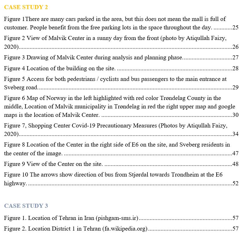
Sanders, E. (2002). ‘Fromuser centered to participatorydesign approaches: 10.1201/9780203301302.ch1. p3
Organisation for Economic Cooperation and Development (2006). The challenge of capacitydevelopment: Working towards good practice. DACNetworkfor Governance. OECD.
Akanbang A.A.B., Sulemana M, YachoriB. (2015), Urban Planning Capacity Development’sResponse to Emerging Towns: A case study of Wa in the Upper West Region of Ghana, ODI.
Mario Gauthier, « Urban planning and sustainable development », Environnement Urbain / Urban Environment, 2009, URL: http://journals.openedition.org/eue/894.
Kuusaana, E.D., Eledi, J.A. (2017), Customary land allocation, urbanisation and land use planning in Ghana: Implication for food system in Wa Municipality.
Abu, M.B., (2015), Groundnut Market participation in the Upper West Region: DOI//http://dx.doi.org/10.4324/gidsv12i&2.7
UKEssays. (November 2018). Wa Municipal Profile. Retrievedfrom https://www.ukessays.com/essays/tourism/community profile of thewamunicipality.php?vref=1
Oteng-Ababio, M., Owusu, G., Asafo, D.M. (2019). ”Following the footsteps: Urbanisation of Wa Municipality and its synergism in risk accumulation, uncertainties and complexities in urban Ghana”. Jamba: Journal of Disaster Risk Studies 11(1), a479.
Statistics Central BureauNorway. The population Malvik 2nd quarter 01.12. 2020
https://www.ssb.no/kommunefakta/malvik
Google Map. 2020. Maps and photos of Malvik Center and Malvik Municipality. 01.12.2020. o https://www.google.com/search?q=malvik+senter&rlz=1C1CHBD_enAF766AF7
66&sxsrf=ALeKk032Al4R2N2fZUFY4GZ0ps3Ecen5Pg:1607247606421&source
=lnms&tbm=isch&sa=X&ved=2ahUKEwj75JX1h7ntAhXNAhAIHSEVDPIQ_A
UoAXoECAkQAw&biw=1396&bih=665
Malvik Municipaltiy Historielag. History Timeline and Area Statistics. 01.12.2020. https://www.malvik.kommune.no/oppvekst.175024.no.html
https://www.google.com/search?q=malvik+kommune&tbm=isch&ved=2ahUKEwiy99H8 h7ntAhVIlYsKHQKEBWQQ2- REFERENCES
cCegQIABAA&oq=malvik+k&gs_lcp=CgNpbWcQARgBMgQIIxAnMgIIADIECAAQ
HjIECAAQHjIECAAQHjIECAAQGDIECAAQGDIECAAQGDIECAAQGDIECAAQG
DoGCAAQCBAeOgYIABAKEBg6BggAEAUQHlCvgwJYzZACYKWoAmgAcAB4AI
ABX4gBqQSSAQE3mAEAoAEBqgELZ3dzLXdpei1pbWfAAQE&sclient=img&ei=Bqf
MX7LcBMiqrgSCiJagBg&bih=665&biw=1396&rlz=1C1CHBD_enAF766AF766
Ardalan, N. and Bakhtiar, L. (1973) The Sense of Unity, The Sufi Traditionin Persian Architecture. Chicago, IL: University of Chicago Press.
Behzadfar, M. 2011. The identity of city, case study Tehran. Nasre Shahr frim, Tehran, Iran.
Shalchi, Sh. 2012. The Emergence of Shopping Centers and the Synchronic Continuity of the Tajrish Traditional Bazaar : A Comparative Study of the Tajrish TraditionalBazaar andthe Ghaemand Tandiis Modern Shopping Centers (Tehran) and their Relationship - TEL - Thèses en ligne (archives-ouvertes.fr).
Sedighi, N. Nahibi, S. Eslamlou, M. 2015. Appropriating the Sidewalks for Physically Motional Handicapped with the Approach of Safety (Case Study: Shahrdari Street in the Tajrish Neighborhood of Tehran). Cumhuriyet University Faculty of Science Science Journal (CSJ), Vol. 36, No: 6
Nejadriahi, H. Fasli, M. 2016. Analytic hierarchyprocess for assessing sustainability of bazaars: The case of Tajrish bazaar in Tehran. URBAN DESIGN Internationaladvance online publication. doi:10.1057/udi.2015.15
UN Habitat. 2020.Public space site specific assessment, Guidelines to achieve quality public spaces at neighbourhood level.
Metz, D. 2018. Tackling urban traffic congestion: The experience of London, Stockholm and Singapore. ELSEVIER. Case study on transport policy. Vol.6 (494 498)
https://www.isna.ir/photo/96062213021/%D8%AA%D9%87%D8%B1%D8%A7%D 9%86%D9%85%D8%AD%D9%84%D9%87%D8%A8%D9%87%D9%85%D8%AD %D9%84%D9%87%D8%AA%D8%AC%D8%B1%DB%8C%D8%B4
https://www.ilna.news/%D8%A8%D8%AE%D8%B4%D8%A7%D8%AC%D8%AA %D9%85%D8%A7%D8%B9%DB%8C5/795758%D8%AD%D9%81%D8%B8%D8 %AF%D8%B1%D8%AE%D8%AA%D8%A7%D9%86
%D8%AE%DB%8C%D8%A7%D8%A8%D8%A7%D9%86%D9%88%D9%84%D B%8C%D8%B9%D8%B5%D8%B1%D8%A8%D8%A7%DA%A9%D9%85%DA% A9%D9%85%D8%B1%D8%AF%D9%85%D8%B4%D8%AF%D9%86%DB%8C% D8%A7%D8%B3%D8%AA%D8%B6%D8%B1%D9%88%D8%B1%D8%AA%D8 %A7%D9%82%D8%AF%D8%A7%D9%85%D9%81%D9%88%D8%B1%DB%8C %D8%A8%D8%B1%D8%A7%DB%8C%D8%B1%D8%B3%DB%8C%D8%AF%D A%AF%DB%8C%D8%A8%D9%87%D8%AF%D8%B1%D8%AE%D8%AA%D8 %A7%D9%86 %D8%AE%D8%B4%DA%A9 %D8%B4%D8%AF%D9%87
Rasamahale. 2020. History of Tajrish. 03.12.2020. http://www.rasamahale.com/tehran/tehran/1/tajrish/jeo REFERENCES
Hozehemarvi. 2020. Tekiye Tajrish. 03.12.2020 http://www.howzehmarvi.ir/mrvj990527/
Tajrish Underpass http://newspaper.hamshahrionline.ir/id/11010/%D8%A7%D8%AD%DB%8C%D8% A7%DB%8C%D8%AF%D9%88%D8%A8%D8%A7%D8%B1%D9%87%D9%87% D9%88%DB%8C%D8%AA%D8%AA%D8%AC%D8%B1%DB%8C%D8%B4.html
Streetblog. 03.11.2020https://usa.streetsblog.org/2014/11/17/shared space the casefor a little healthy chaos on city streets/
https://www.epersianhotel.com/mag/tehran/%D8%AE%DB%8C%D8%A7%D8%A8 %D8%A7%D9%86%D8%B3%DB%8C-%D8%AA%DB%8C%D8%B1-%D8%AA%D9%87%D8%B1%D8%A7%D9%86
https://tkaeng.com/%D9%86%D9%82%D8%B4%D9%87%DB%8C%DA%AF%D8 %B3%D9%84%D9%85%D9%86%D8%B7%D9%82%D9%87 1 %D8%AA%D9%87%D8%B1%D8%A7%D9%86/
https://fa.wikipedia.org/wiki/%D9%85%D9%86%D8%B7%D9%82%D9%87_%DB %B1_%D8%B4%D9%87%D8%B1%D8%AF%D8%A7%D8%B1%DB%8C_%D8% AA%D9%87%D8%B1%D8%A7%D9%86
https://mag.safarestan.com/%D8%A8%D8%A7%D8%B2%D8%A7%D8%B1%D8%
AA%D8%AC%D8%B1%DB%8C%D8%B4-%D8%AA%D9%87%D8%B1%D8%A7%D9%86/
https://almosaferonline.com/%D9%85%D8%B1%D9%82%D8%AF%D8%A7%D9%
85%D8%A7%D9%85%D8%B2%D8%A7%D8%AF%D9%87%D8%B5%D8%A7% D9%84%D8%AD%D9%81%D9%8A%D8%B7%D9%87%D8%B1%D8%A7%D9%
86/%D8%B7%D9%87%D8%B1%D8%A7%D9%86/
https://www.ilna.news/%D8%A8%D8%AE%D8%B4%D8%A7%D8%AC%D8%AA
%D9%85%D8%A7%D8%B9%DB%8C5/795758%D8%AD%D9%81%D8%B8%D8
%AF%D8%B1%D8%AE%D8%AA%D8%A7%D9%86-
%D8%AE%DB%8C%D8%A7%D8%A8%D8%A7%D9%86%D9%88%D9%84%D B%8C%D8%B9%D8%B5%D8%B1%D8%A8%D8%A7%DA%A9%D9%85%DA%
A9%D9%85%D8%B1%D8%AF%D9%85%D8%B4%D8%AF%D9%86%DB%8C %D8%A7%D8%B3%D8%AA
%D8%B6%D8%B1%D9%88%D8%B1%D8%AA
%D8%A7%D9%82%D8%AF%D8%A7%D9%85%D9%81%D9%88%D8%B1%DB %8C%D8%A8%D8%B1%D8%A7%DB%8C%D8%B1%D8%B3%DB%8C%D8%A
F%DA%AF%DB%8C%D8%A8%D9%87%D8%AF%D8%B1%D8%AE%D8%AA %D8%A7%D9%86%D8%AE%D8%B4%DA%A9 %D8%B4%D8%AF%D9%87
Location of Uttrakhand& Dehradun on Indian Map, Soucehttps://www.digitalofficepro.com/ppt/uttarakhand india powerpoint map slides018M10.html REFERENCES
Urban sprawl and its impact on landuse/land cover dynamics of Dehradun City, India https://doi.org/10.1016/j.ijsbe.2017.10.003
Guardian.com – Mexico City’s verticalgarden https://www.theguardian.com/cities/2018/oct/30/mexico city-via-verde-vertical-gardenspollution-climate-change
Whoa! Mumbai’s 1st Under Flyover Park Is Open And It’sStunning http://www.thestorypedia.com/article/whoa mumbais 1st flyover park open stunning/
Sustainable mobility options - Intelligent transport
https://www.intelligenttransport.com/
Ojha, A. (2018, July 1). Fresh KMC drives to evict street hawkers. The Kathmandu Post
Kathmandu.gov.np. 2020. [online] Available at: https://www.kathmandu.gov.np/sites/kathmandu.gov.np/files/ward%2022.pdf
Hindustan Times, 2018. Construction of BMC’S first public underground parking lot in the works. [online]
Available at : https://www.hindustantimes.com/mumbainews/construction-of-bmc-s-first-publicunderground parking lot in the works/storysBB4UxxoqMkD8rnVkPlHzL.html
Aucklanddesignmanual.co.nz. 2020. Types Of Parking Auckland Design Manual. [online] Available at:
My Republica, 2017. New RoadLosing ItsCharm. [image] Available at: o
Facebook.com. 2020. Kathmandu| New Road, FreakStreet & Around | Facebook. [image] Available at: https://www.facebook.com/media/set/?vanity=oldnepal&set=a.155170794522165
Kathmandu, N., 2020. Kathmandu, Nepal Most BeautifulPicture Architecturepin. [image] ArchitecturePin. Available at:
The Himalayantimes, 2017. Over 6 lakh vehicles face the music. [image] Available at: o https://thehimalayantimes.com/kathmandu/6-lakh-vehicles-face-music/ REFERENCES
Tripadvisor. 2020. Basantapur Tower (Kathmandu) 2020 All You Need To Know BEFORE You Go (With Photos) Tripadvisor. [image] Available at:
Geology.com. 2020. Nepal Mapand Satellite Image. [image]Available at:
De.wikipedia.org. 2020. Kathmandu (District). [image]Available at:
Steemit.com. 2020. Newroad Kathmandu! Empty Street Steemit. [image]Available at: