

SAO TOME . FONTAINHAS . MALA Panaji, INDIA Urban Ecological Planning AAR4525 – Urban Informality: Project Norwegian University of Science and Technology
SAO TOME, FONTAINHAS, AND MALA
Goa, India Fieldwork 2019
AAR4525 Urban Informality: Project Urban Ecological Planning
Department of Architecture and Planning Faculty of Architecture and Design Norwegian University of Science and Technology
Group 5
Sao Tome and Fontainhas


Annalise Winter Robin Surya Shayesteh Shahand
Group 6 Fontainhas and Mala
Fabian Wildner Nora Sønstlien Ursula Sokolaj
As a yearly tradition, the master students of Urban Ecological Planning (UEP) at the Faculty of Architecture and Design at the Norwegian University of Science and Technology (NTNU) embark on an immersive fieldwork during their first semester. This report is the outcome of a one-semester fieldwork in Panaji, India, conducted by the students in collaboration with the School of Planning and Architecture (SPA) Delhi. The fieldwork was part of a research project “Smart Sustainable City Regions in India” (SSCRI), financed by the Norwegian Centre for International Cooperation in Education (SIU), which included fieldwork in Bhopal in 2018 and Pune in 2017.
The diverse backgrounds and nationalities of students participating in the UEP fieldwork ensures a multi-perspective view. This year’s 19 fieldwork participants are architects, food sociologist, engineers, landscape architects and planners, coming from Albania, Australia, Austria, Ecuador, France, Germany, India, Indonesia, Iran, Nepal, New Zealand, Norway, the UK and the USA.
PREFACE
The immersion of the fieldwork gives students a real-life practice of the ‘UEP approach’, which focuses on addressing urban complexities from an area-based and participatory point of view, leading to contextual, inclusive and humandriven development processes. Through daily interactions with local communities and relevant stakeholders, students become acquainted with residents and discover the complex realities of these areas, with their specific assets and challenges. By using a variety of participatory (design) methods, the students work on co-designing strategic proposals with the community and other stakeholders.
Students worked in the colonial Fontainhas area, the central business district and along the St Inez Creek. While the main topic of the course is urban informality in all its forms, this year’s students addressed topics such as public space, heritage, livability and environmental challenges. Warmly hosted by Imagine Panaji Smart City Development Limited, IPSCDL, students were asked to put their areas and proposals in the perspective of the Smart
Cities Mission, the large urban development fund and initiative currently implemented by the Government of India.
As an outcome of their learning process, students prepared three reports to illustrate and reflect upon the participatory process through a situational analysis and reflection on methods and methodology that informed a problem statement which they tried to address in strategic proposals. This report sums up the work done by group 5 and 6 in Sao Tome, Fontainhas, and Mala.
Hanne Vrebos, Rolee Aranya, Brita Fladvad Nielsen and Peter Andreas Gotsch, fieldwork supervisors, NTNU, Department of Architecture and Planning
3
PREFACE TABLE OF CONTENTS ACKNOWLEDGEMENTS INTRODUCTION HISTORY SITUATIONAL ANALYSIS GROUP 5 : SAO TOME AND FONTAINHAS 1: METHODS AND FINDINGS Preliminary Phase Secondary Phase Concluding Phase 2: STAKEHOLDERS 3: SUMMARY AND PROBLEM 4: PROPOSALS Conclusion 2 4 6 8 13 21 46 53 73 79 83 92
TABLE OF CONTENTS GROUP 6 : FONTAINHAS AND MALA 1. TIMELINE 2. METHODS Empathizing Defining Ideating Testing & Prototyping 3. STAKEHOLDERS 4. FINDINGS 5. PROPOSALS Community, Pride and Ownership Achieve Change in Regulations Building Awareness REFLECTION ETHICS STATEMENT LIST OF FIGURES REFERENCES 96 100 102 122 130 138 154 156 158 162
Dedicated to everyone who was involved throughout the process of making the following research and report feasible. Whom without, this work would not have been possible.
Firstly, we want to thank our professors from NTNU, Dr. Rolee Aranya, Dr. Peter Gotsh and Dr. Britta Fladvad Nielsen for their feedback and input they provided throughout the duration of the fieldwork. Special regards to our research assistant Hanne Vrebos, who organized insightful stakeholder presentations and meetings for us and who was always there for us during the entire three month fieldwork!
Having a beautiful workspace in the Old Secretariat, Adil Shah Palace, would not have been possible without the support from Imagine Panaji Smart City Development Limited. We enjoyed the wonderful facilities and the possibility to cooperate and collaborate with their team. They assisted generously in guiding us through understanding the structure, systems, and culture of India, Goa, and Panaji.
6
ACKNOWLEDGEMENTS
We want to thank our wonderful host university, the School of Planning and ArchitectureDelhi, for inviting us to collaborate with their professors and students. Special thanks to Arunava Das Gupta, Sanjay Kanvinde, and Shveta Mathur who gave knowledge and guidance. And to Aditya Kushwaha, Arunima Saha, Hari Krishnan, Ranjit Singh, Rudra Sharma and Tarang Matia, we gained many skills and knowledge through your presence during the workshop week. It was a joy to work with you.

Last but not least, we want to thank all the residents and stakeholders who accepted us and embraced cooperation. We felt very welcome in our study area and were lucky to meet so many openhearted people, many of whom invited us into their homes and shared their stories with us. Special acknowledgement to the Bookworm Library for offering their facilities, making our workshop possible. And to Raghuvir Mahale for giving us constructive feedback countless times and consistently being open to discuss our ideas and proposals.
And finally, we would not have survived these 12 weeks without the strong cohesion amongst our cohort. Thank you for solving issues together, having a shoulder to lean on, and of course, having lots of fun and sharing laughter. It was probably the most extreme team-building experience ever and we are looking forward to the next semesters to come! To all the wonderful exchange students, you have been a crucial asset to our projects and your diverse backgrounds have made for a challenging and insightful collaboration. We will miss you and wish you luck in your future studies!
7
Figure 1.1. Students and Faculty of NTNU and SPA
Entering Fontainhas is like taking a step back in time. Unlike anywhere else in India, the remnant of the Portuguese era is ever present in Panjim, but specifically in the neighborhoods of Sao Tome, Fontainhas, and Mala, some of the first areas of colonialism in Goa. Entering from the north, colorful heritage homes line the narrow and winding streets with their beautiful façades painted to perfection. There are restaurants, cafés, galleries and guest homes scattered throughout this historical area. But as the streets progress, the atmosphere and exterior begin to shift. Colors begin to fade, unkept buildings have fallen to ruins, and evidence of economic struggles emerge.
In the mornings, you will find locals outside their homes, noise picks up during the afternoons when the school children emerge, and in the evenings, you can spot tourists dining in the restaurants. While inside the neighborhood is fairly quiet and little traffic, the east boundary on Rua De Ourém street is a commercial hub, mainly catering to tourists, with heavy traffic,
8
INTRODUCTION
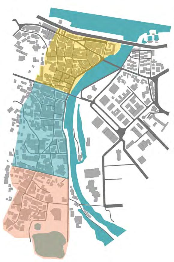
both vehicle and pedestrian. In the evenings, the smell of the river Rio De Ourém fills the air, making late night strolls less than pleasant. While often referred to as solely as Fontainhas, the area is actually comprised of three neighborhoods, Sao Tome, Fontainhas, and Mala. Each carries a unique identity, but with overlapping values and blurred boundaries.
For 10 weeks, our group of six masters students from the Urban Ecological Planning (UEP) program from the Norwegian University of Science and Technology (NTNU), conducted fieldwork in this area, attempting to grasp the complexities and challenges this historic area presents. The goal was to not only understand this place and the people in it, but also to uplift the residents and address their most pressing challenges. We collaborated with the stakeholders in this area to support their needs and bring them together as best as we could.
The following report provides a brief history of Panaji and Fontainhas and what the current
Smart Cities office, Imagine Panaji Smart City Development Limited, is addressing in the city. Following comes a situational analysis, pieced together through research, interviews, and lectures. After, the report splits into two sections as while there were six students in the field, after several weeks, we divided the area and worked three and three. Each section dives deep into the participatory methods used to gather data, an overview of stakeholders in these areas and proposals for strategic interventions. These proposals are meant to represent a bottom up approach and exemplify the needs of the community through their own voices. We did our best to act as facilitators of knowledge and not let our personal biases impose on the people we aim to serve.
9

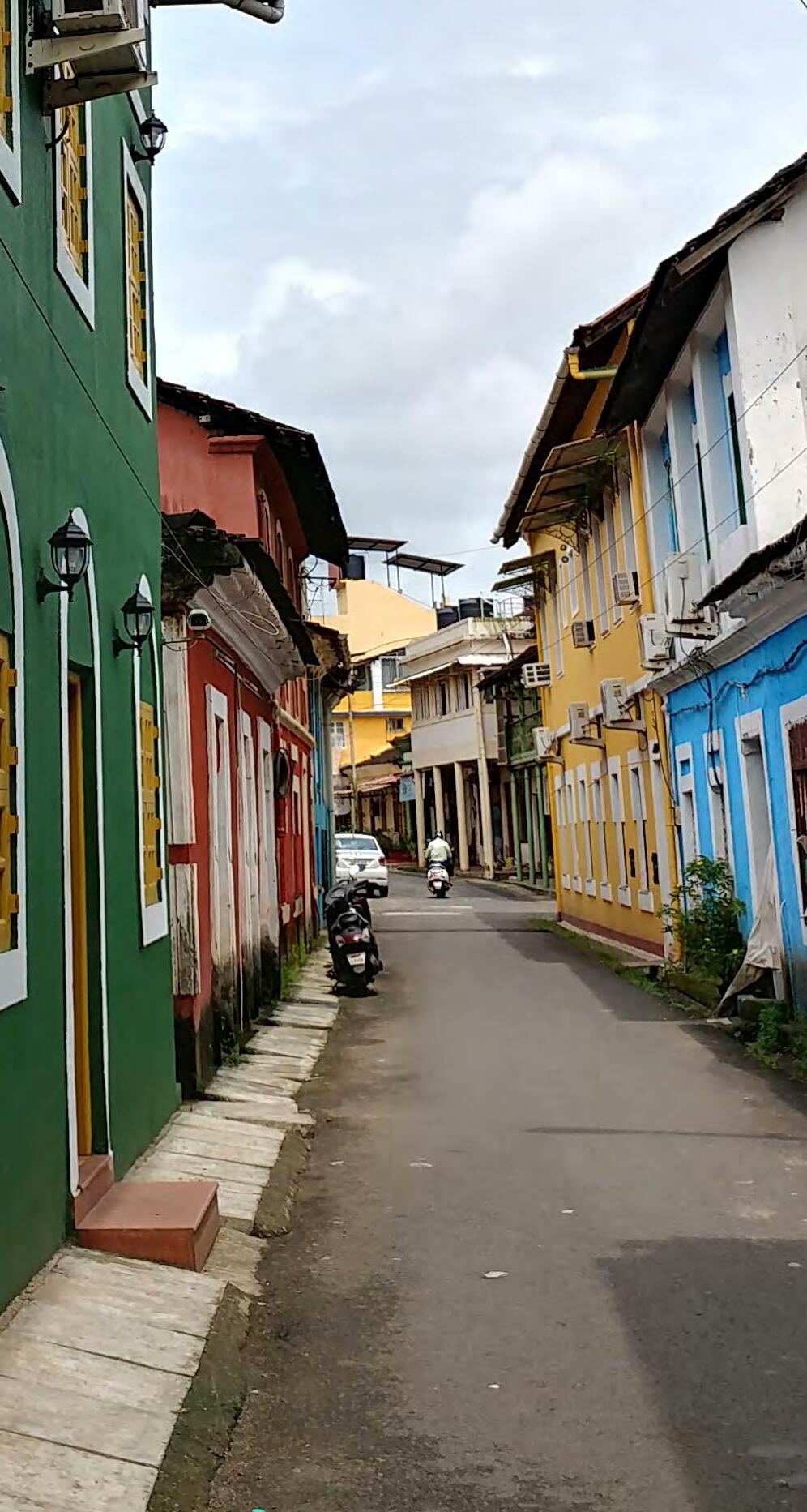 Figure 2.2. Heritage house in FontainhasFigure
2.1.
31st January Roadc
11 SAO TOME FONTAINHAS MALA City Center Patto Figure 2.4. Fieldwork SiteFigure 2.3. House in Mala
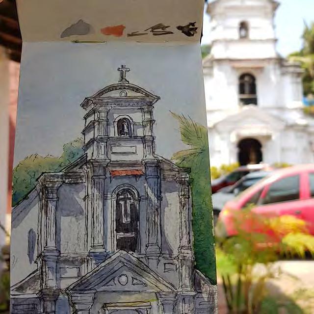 Figure 3.1. A sketch of Saint Sebastian Chapel in Fontainhas
HISTORY
Panaji, also known as Panjim, is the capital city of the state of Goa in southern India and is known for its Portuguese architecture, seafood specialties, culture, and more recently, casinos. While Old Goa used to serve as the capital city, in 1843, Panjim was declared as the new capital by the royal decree, but was named Nova Goa at the time, under Portugeuse rule (Ahmed & Shankar 2012b). After liberation in 1961, Panjim was still the acting capital for the territories of Goa, Daman, and Diu and in 1987, the government officially reconfirmed Panjim as the capital once Goa gained its statehood (GHAG 2017, pg.34 ). But before becoming the capital city, Panaji served as a coconut grove surrounded by rivers, creeks, canals, and saltwater rice paddies that was ruled by Portuguese colonizers for more than 450 years. Goans gained their freedom over 50 years ago, but the lasting effects of this history can be seen throughout the entire city through language, religion, and perhaps most
discernible, architecture. Panjim’s borders include the Mandovi river to the north and Rio De Ourém creek to the east. This created plenty of opportunities for trade and fishing along the waterways, making it an ideal location for settlement.
The Portuguese came to Panjim in the 16th century and are responsible for constructing all the now designated heritage buildings of Panjim, with the exception of the Adil Shah Palace, which was constructed by Muslim king Adil Shahi in the 15th century prior to Portuguese conquer. After this time, the construction of Our Lady of the Immaculate Conception Church finished in the beginning of the 17th century and still stands as the centerpiece landmark of the city (Government of Goa 2019). In the 18th and 19th centuries, Portuguese settlers began constructing the first residential neighborhoods in Sao Tome, Fontainhas, Mala, and Portais, on the west
13
side of Rio De Ourém, while government and official buildings were constructed on the hill of Altinho. Due to the natural water boundaries, as the city expanded, construction took place west of existing neighborhoods, creating what we now know today as the central business district.
The neighborhoods of Sao Tome, Fontainhas and Mala sit on land that was formerly occupied by coconut plantations, village huts, rice paddies and mangroves (Ahmed & Shankar 2012, pg.546). But as wealth in the area increased, residential development by wealthy Catholic Portuguese descendants cleared the area and created the vibrant neighborhoods that remain on the east side of Panjim. The homes are unique in every way due to the clash between the European Portuguese style, Goan influence, and building materials available in the region. Characteristics include brightly colored exteriors, Mangalore tiled roofs and Solomonic columns, all of which can be seen today. Construction of these homes in these wards began in the early 1800’s and continued until liberation in the 1960’s.
Panjim experienced a rapid economic growth towards the end of the second millennium, due to thriving tourist economies and mining in the state, creating new opportunities for Goans (Ahmed & Shankar 2012a). The rapid expansion and development in the 1990’s can be looked at as positive for the city, but it came at the cost of demolishing old structures to manufacture new and modern buildings. This happened throughout the city, even in
the neighborhoods of Sao Tome, Fontainhas, Mala, and Portais, as it became more valuable for the land and property owner to rebuild then to add onto or fix existing property. While economic gain for the owner is an important value of land ownership, history, heritage and significance of the uniqueness of historic homes became apparent when many were lost, thus creating need for preservation. Therefore, the neighborhoods were declared a heritage conservation zone in 1974 and were reaffirmed in the 2011 Panaji development plan (Sukhij 2019). The Charles Correa Foundation and Goa Heritage Action group have documented each heritage home in their book The Mapped Heritage of Panaji Goa.
Panjim Today
Panjim today is a thriving capital, full of life and culture, and is one of the few places in India where Christians, Hindus, and Muslims live harmoniously as neighbors. But things have been changing rapidly over the past decade. Goa is unique for several reasons, one of those being the legality of gambling in this state. That has brought 15 live gambling casinos to the state since 1999, five of those being boats on the Mandovi river (BBC 2013). While the taxes from the casinos have brought a huge amount of revenue to the state and local governments, locals are less excited about how this recent industry has changed and shaped the city. Previously, tourism in Panjim was focused on heritage and Portuguese architecture, but the introduction of gambling into the city, and state, has brought an influx of domestic
14


 Figure 3.3. Mandovi River and Adil Shah Palace from 1950s (Nadkarni 2003, pg. 23)
Figure 3.2. A Historic Photo of Ourém Creek from 1950s (Nadkarni 2003, pg. 26)
Figure 3.4. Fontainhas and Mala Seen from Altinho Hill
tourists. Ask any local and they will blame the casinos and gambling for misfortunes of the city. While not responsible for all the troubles in Panjim, the river boat casinos do have major implications for residents including parking and traffic congestion, river pollution and increased tourism to Panjim.

Smart City Mission Panjim
Imagine Panaji is one of the 98 branches of Smart Cities in India, initiated by the Ministry of Housing and Urban Affairs (MoHUA). The goal of a Smart City is to provide life enhancing alterations to a city through infrastructure or societal changes. Smart City works on new or existing development projects with an emphasis on inclusion, sustainability and technology. Projects should improve lives, economic opportunities and prioritize citizens as well as display replicability for other cities going through the same challenges (Imagine Panaji 2019).
Panjim’s Smart City development and projects are being designed and implemented by Imagine Panaji Smart City Development Limited (IPSCDL), a Special Purpose Vehicle (SPV) of the state government (Imagine Panaji 2019). This government company is led by Managing Director and CEO Swayandipta Chaudhuri and a team of urban planners, architects, and public policy leaders. The purpose of this SPV is to fast-track development projects that enhance the quality of the city. IPSCDL has the freedom to mobilize resources, fund and execute projects in a way that traditional planning departments
16
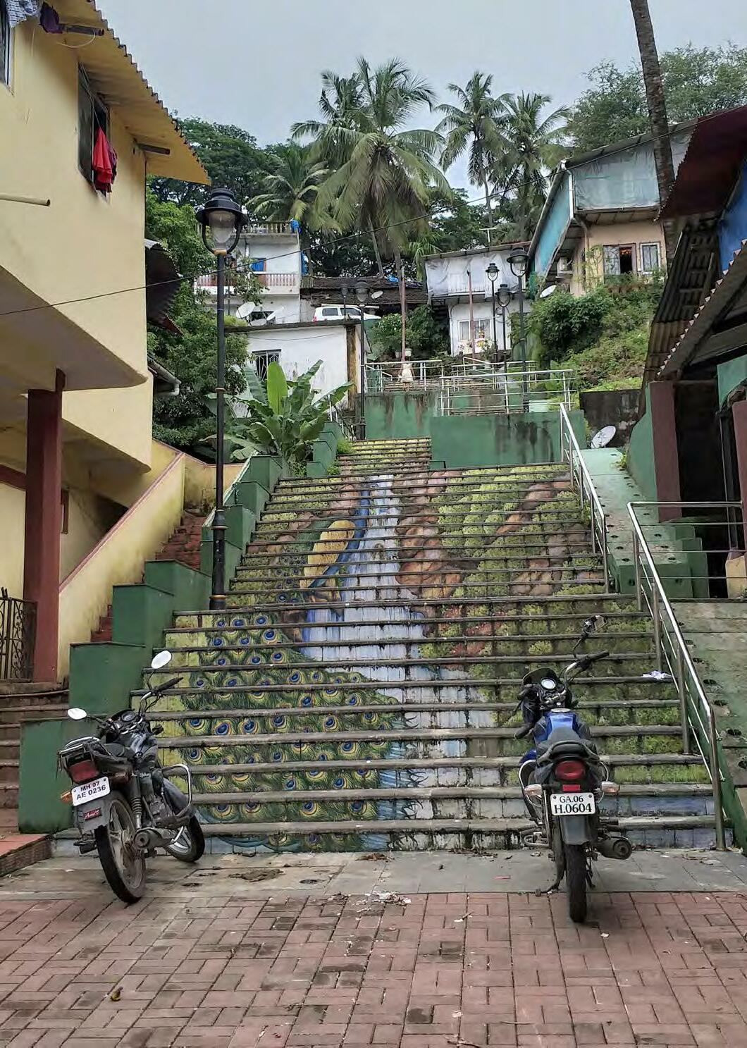
Figure
3.6.
Beautification on Stairscase in Mala
Figure 3.5. Casinos on Mandovi River
lack. They claim to focus on citizen well-being, pedestrian friendly initiatives, sustainability, livability, biodiversity, and multi-modal transit systems. Existing projects for Panaji include a redesign of parking policy for the city, emphasis on beautification and public space around Panaji, and cleanup of waterways in the city as well as many others.

Fontainhas Today
Sao Tome, Fontainhas, and Mala sit at the base of Altinho hill, with Sao Tome being the northern most neighborhood of the area, Fontainhas in the middle, and Mala to the south. Collectively, this area can be referred to as Fontainhas but there are notable differences in the land-use and religious influences between the neighborhoods, as Sao Tome is more commercial and Catholic, Fontainhas is residential and Catholic, and Mala is a residential neighborhood but predominantly Hindu. And though today, these areas may look very similar to the colorful neighborhoods built by the Portuguese Catholics, many things have changed in the area as a result of the long history. Fontainhas was named after the spring at the southern end of the neighborhood that historically supplied the area with water (Panjim and Its History 2019). It is commonly referred to today as the Latin Quarter of Panjim for the style of housing and chapels, specifically the Chapel of St. Sebastian and St. Thomas Chapel in Sao Tome. Due to its history and beauty, the neighborhoods of Sao Tome and Fontainhas have become a hub for tourism. The buildings painted in bright reds, yellows,

17
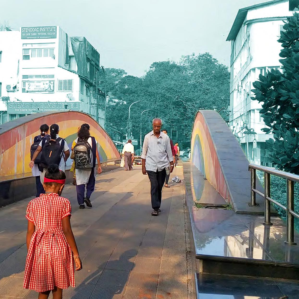
Figure 3.7. Beautification on Pedestrian Bridge over Rio De Ourém Creek
Figure 3.8. Marquito’s Guest House Fontainhas
and blues attract both domestic and foreign tourists and walking through the streets, one can see the influx of passersby’s observing the structures and taking photos.
The beauty that has attracted tourists and the heritage conservation designation has created an interesting and complicated dynamic for residents of Sao Tome and Fontainhas. The regulations on heritage conservation of the homes has created an undue financial burden on the residents, yet the preservation brings in tourism. This has created economic opportunity for residents and through the late 1990’s and early 2000’s, we can see a transition in many of the homes from residential space to commercial space in the form of guest homes, restaurants, cafés, galleries, and boutiques. This type of transition still happens today, but the residents struggle with this double-edged sword. On one hand, tourism brings money and jobs to Fontainhas, yet on the other, tourism brings noise, disruption, and rubbish as well as puts a strain on infrastructure and resources.
Smart City Mission Fontainhas
IPSCDL has already completed several projects in the Sao Tome, Fontainhas, and Mala neighborhoods, as well as pertinent projects nearby, that while technically not inside the boundaries of Fontainhas, have implications for the residents of these neighborhoods. Beautification projects have taken place on a large staircase in Mala and on the footbridge connecting Fontainhas neighborhood to Patto, the new business district. If one crossed the
footbridge and headed south towards the public library, they would find another Imagine Panaji project behind the public institution, the Mangrove Boardwalk. While technically in Patto, the boardwalk is accessible by foot to the residents of Sao Tome, Fontainhas, and Mala.
Future projects that are being considered for the area are a redesign of Rua De Ourém street to reduce traffic congestion and hazards and a redesign of the junction at the north end of the same street in an effort to increase traffic ease and efficiency. The last major project for the area is on the east side of Rio De Ourém in Patto and is an addition to the completed Mangrove Boardwalk. Using existing infrastructure in combination with new development, Imagine Panaji plans to connect the Mangrove Boardwalk to the Mandovi river, allowing one to walk the entire stretch of the east side of the river. There are also plans for a public park that connects to this boardwalk.
18
 Figure
3.9. Heritage
Buildings in Fontainhas
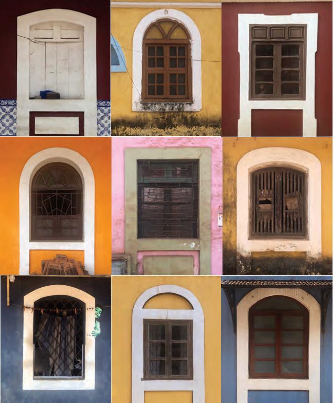
Figure 4.1. Collage of
Windows
in
Fontainhas
SITUATIONAL ANALYSIS
Analysis of the current situation in Fontainhas has been assessed using the livelihoods framework proposed by Carole Rakodi. Trying to understand and capture the complexities of a new area can be overwhelming and there are a multitude of ways to approach it. We chose to use this framework for our analysis to provide a comprehensive overview of the current situation in Sao Tome, Fontainhas, and Mala. The framework defines five types of assets: human capital, social capital, natural capital, physical capital and financial capital, each of which is explored and applied to the research field. This approach not only tries to grasp the vast range of resources and activities in which people depend for their livelihoods but also attempts to achieve an exhaustive view of the structure, strengths and essentials within a community. The livelihoods framework is a useful tool to capture crucial components and build a foundation for identifying potential leverage points for interventions (Rakodi 2002).
PHYSICAL CAPITAL
Physical capital is the basic infrastructure (transport, water, shelter, energy, communications) and the production equipment which enables people to pursue their livelihoods (Rakodi 2002, pg.11). It is one of the most dominant assets of Fontainhas, based on its value as a heritage area. In this analysis, it has been categorized into four main topics: land use, building typology, infrastructure and mobility.

LAND USE
While residential is the dominating land use category in Fontainhas overall, its density differs between the three wards composing the area. Mala has remained a more quiet neighborhood consisting mostly of residences. However, in Sao Tome and Fontainhas, many of the houses have been converted through the years, partially (ground floor) or fully, into commercial functions such as shops, cafés, restaurants, hotels and guesthouses, thus resulting in a mixed use character.
21

Public Building Commercial Residential Figure 4.2.
Land Use Map of Sao Tome, Fontainhas and Mala
Housing and Heritage
The Portuguese influence is strongly manifested in the area in the Indo-Portuguese style of architecture. With the narrow colorful streets and the facades decorated with pilasters, cornices and moldings, Fontainhas has been considered and protected by law as a Heritage Conservation area since 1974 (Mohta 2011, pg. 34).

The basic material used in the construction of the houses was taipa (wetted mud), reinforced with bamboo netting and coconut husk, while the walls were plastered with a lime and cane jaggery mixture (Ahmed & Shanker 2011). The houses date back to the early 19th century, meaning they are nearly 200 years old. While the materials then were in abundance, today these construction techniques require a lot of effort. Furthermore, consistent maintenance for these buildings demands financial resources that the residents do not possess. Today, many of them face physical deterioration due to lack of funds. Some of the owners have chosen to disregard the regulations and demolish the heritage houses to build modern buildings in their place. This has been done with no consideration to the historical context, by both disrupting the height proportions and the architectural style.
Ownership
Another important factor contributing to the current problematic condition of the houses is
the issue of ownership. Having been inherited from one generation to the other over a long period of time, the houses now have split ownership between many people within the same family. This brings disagreements, long procedures and even lack of responsibility, making it difficult to take any kind of action.
INFRASTRUCTURE
Streets
Fontainhas is organized in a linear profile, along a main spine of Rua 31 de Janeiro. The spine stretches and narrows organically, adding an element of surprise to the experience of walking through it. Houses on both sides open directly onto it. The spine was initially created as a pedestrian pathway, but nowadays it suffers from vehicular congestion disturbing the street life.
23 BUILDING TYPOLOGY
Figure
4.3.
Rua 31 de Janeiro
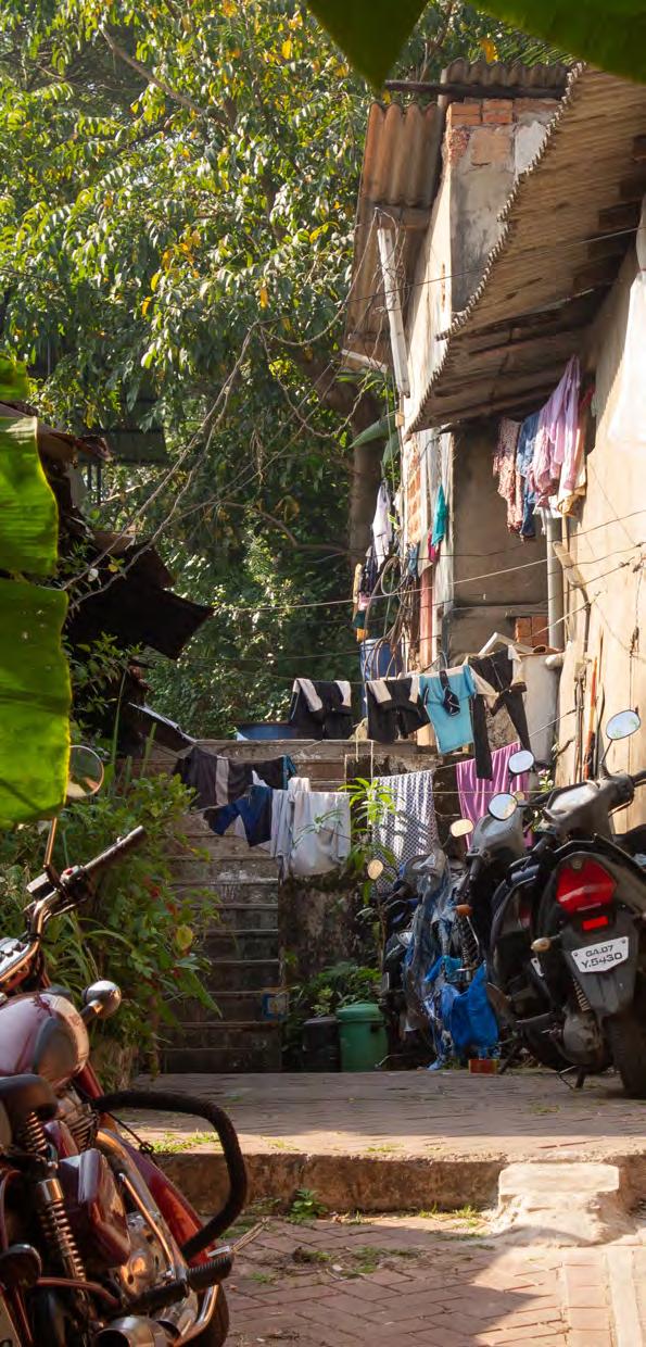
Narrow Alleys
The smaller streets on the sides of the spine have less vehicular movement. Because of this, the residents take their function beyond just transportation, turning them into extended living areas, especially for smaller households.
Main Open Spaces
The Marble Plaza, the Hedgewar school playground and the Mala lakefront are the main open spaces in the area. The Marble plaza is the most active one, used by different groups of people at different times of the day. In the morning hours you will see loud primary school kids brought by their teachers for their playtime. In the afternoon, high school students will come during their break for a chat or a badminton game. And at all times of day, commuters, tourists and residents will be hanging out and relaxing under the shade. The Hedgewar school playground, located in Mala, is used mostly for games and tournaments, however, with the relocation of some of the schools from the area, it has become vacant more often than not. This is especially true during the rainy season when because of the mud, its usage is inconvenient. The Mala lakefront is another space with high potential, however because of the poor conditions of the lake, it has turned into a forgotten area.
Several proposals for revitalization of the lake have been created, but all were dismissed before they sought funding.
Figure 4.4.
Narrow Alleys as Extended Living Areas
Mobility
Location and Connectivity

Fontainhas is a linear narrow settlement which is bounded on the east by Rio De Ourém creek and on the west by Altinho hill. It stretches from Mandovi river on the north until Fonte Phoenix, marking its southern limit. Fonte Phoenix at the foot of the hill is where the settlement initially started growing.
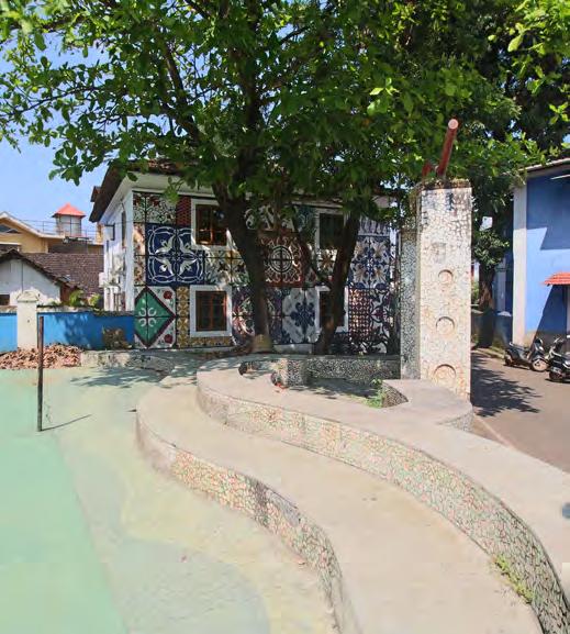
Fontainhas can be accessed by public transport only along its edges, Avenida Dom Joao de Castro Street and Rua de Ourém
along the creek, while the interior roads of the neighborhood can only be entered by private vehicles.
In comparison to the rest of the city, the area does not suffer from as severe traffic congestion, with the exception of the school ending hours, when the parents picking up their kids overcrowd the streets with their vehicles.
Parking however is an issue in the area. With no designated car parks, people have no choice but to park their cars and motorbikes on the sides of the roads, making them even narrower than before and disturbing the historical character of the area.
25
Figure 4.6. Public Transport and Traffic Congestion Points
Figure 4.5. Marble Plaza
 Figure
4.7.
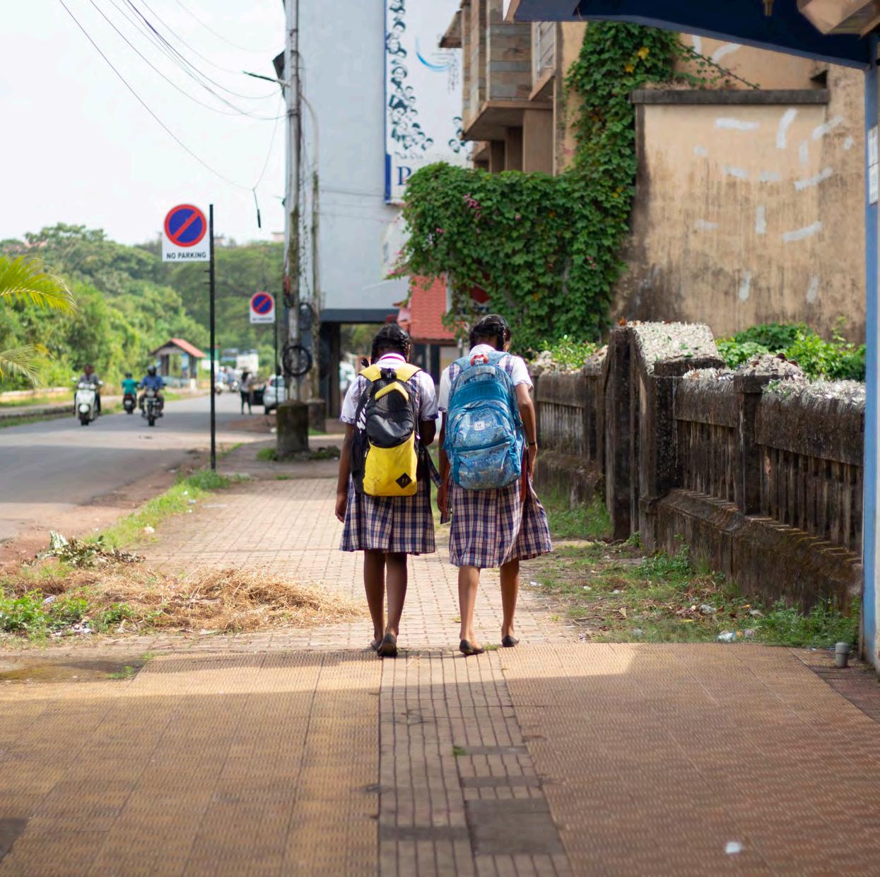
Students from Mary Immaculate High School
HUMAN CAPITAL
Human capital is defined in the livelihoods framework as the quantity and quality of labor resources available to a household. The ability of households to manage their labor assets and take advantage of opportunities for economic activity is constricted and facilitated by the levels of education, skills and health status of the household members (Rakodi 2002, pg. 11). In Fontainhas, the people have decent opportunities to get an education, learn skills and take care of their health.
EDUCATION
Within the Fontainhas area there are many options for education, both for children and adults. There are four schools, one public and three private, ranging from pre-primary to high school level. The People’s Higher Secondary School, founded in 1936, is the only public school in the area. This is a highly regarded institution, and pupils come from far outside the community to study there.
Two of the private schools are run by religious organizations, Mary Immaculate Girls High School, opened in 1971, and the Seventh Day Adventist English School, opened in 1974. Lastly, there is a private pre-primary school started in 2001, Lok Chetana. All the schools have good rankings and many extracurricular activities.
In addition to the schools in the area, there are several places that offer private tutoring for

children after school. This is usually in private apartment or houses.
In terms of skill building and adult education, there are various opportunities for the residents. First one is Stenodac, an institute for career training and professional education for adults. It was established in 1971 and has courses within a broad range of fields and subjects such as journalism, computers, office training, etc.
Secondly, the Bookworm library is a library and non-profit organization which hosts a variety of free workshops for children and adults. They have reading and writing workshops, a needle craft group, a preschool program and an adult arts program.
The last one is the women’s association where women come together to cook and sell their food in the Panjim main market. This promotes skills such as cooking and business management.
HEALTH
The residents of Fontainhas have a few options regarding health services. The first one is a private hospital located in the southern part of Fontainhas. This is part of a chain of private hospitals and is not a viable option for a lot of the residents as it is quite expensive. The other option is a public hospital in Bambolim, which is 5-6 km away, so it’s necessary to travel by vehicle to get there.
There is also a small pharmacy in the area where the residents can get medicine and medical aid for small injuries
27
SOCIAL CAPITAL
HIGH - INCOME TOURISTS
Staying for 2-3 days, mostly in heritage-hotels
Heritage-Walks, Fine-dining, organized trips
Social capital is one characteristic of a neighborhood and one of the components of the sustainable livelihood framework. Regarding to the Department of International Development social capital is defined as “social resources upon which people draw in pursuit of their livelihood objectives.” (Department for International Development, 1999) These resources contain networks (vertical or horizontal, bonding or bridging), memberships and relationships. In our study area we focused on showing and analyzing the different user-groups as well as to highlight the existing civic engagements like associations, foundations or even institutions.

NETWORK STRUCTURE AND INFLUX
Fontainhas is the most multicultural area of Panaji city, due to its historical context which leads to a mix of religious groups. The numerous institutions such as schools, care-centres, public and private institutions and others, make Fontainhas an important location on a local and regional level.
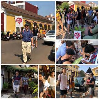
Tourists
The influx of tourism in Fontainhas has been rising over the last 15 years when the beauty and uniqueness of the old heritage, and its importance for tourists, was rediscovered. Since tourism in the state of Goa is still mainly focussed on beach and leisure activities and less on culture, Panaji is often used as a stopover for tourists who arrive via Goa
€
More pro t for non-local operators
BUDGET TOURISTS
Staying for 1-2 days, prefering hostels/homestays

Self-exploring, local experience
€
More pro t for community
DAY TOURISTS
Staying for less then 24h
Heritage-Walks, Fine-dining, organized trips
Less value for the neighbourhood
Figure 4.8. Types of Tourists in Fontainhas
International Airport. Additionally, there are often daily excursions for tourists from cruise ships that stop at the nearby Mormugao port or from hotels and resorts north or south of Panaji that offer organized trips to Fontainhas. The tourism due to the casinos that are anchored in Mandovi river, just across the study area, affect the influx of tourists, especially during evenings. There are a few casino guests who use guesthouses close to the boats and stay only for a short period. Culture and heritage of the neighborhood are not their main focus, but bars and restaurants in the area can profit from them.
The local-added-value and the profit from
28
DURATION INTERESTS ADDED VALUE
DURATION INTERESTS
tourism for the community varies depending on the type of tourist. Tourist activities are limited to the Fontainhas and Sao Tome areas whereas in Mala, with the exception of only a few tourists who get lost when they want to visit the Maruti Temple or the Phoenix Spring, despite similar heritage architecture, there is little to no infrastructure which would attract tourists to stay.
Students
The study site has a high density of educational institutions. Those are mainly focused in Fontainhas whereas schools from Mala have been shifted to other parts of state in nearby cities, such as Bambolin, over the past years due to emerging traffic issues.
Schools in Fontainhas are attracting students from all over the city as well as suburban areas because of its advantageous location close to the main axis to Old Goa and to the Porvorim. The way of transport to and from the school, and the resulting influx of traffic within the neighborhood, is dependent on the student’s age and place of residence.
As observed, students are using local facilities during their breaks or to skip a class during lunchtime or in the afternoon. Established local restaurants or cafés around schools function often as third places for both local and commuting students. Public spaces, like the Marble Plaza, are used for sports activities like playing badminton or football. This specific ground is even used by teachers who want
to spend the sports class with their students outside since some schools lack sufficient outdoor facilities.
Workers
The described user groups in the study area, students and especially tourists, have an influence on needed labour forces. Lodging establishments transformed in the past years from mostly local influenced homestays to more professional hotels or hostels, where additional affordable labour is needed. Here we can only rely on informal sources since no statistics about labour influx are available. Resulting from our investigation, we have heard that many workers are coming from suburbs like Taleigao or Porverim. In the more established commercial area of Sao Tome, most shops are run by local workers who live in the house of their shop or in suburbs of Panjim, such as Dona Paula and Nagalli Hills.
Institutional “Special Influx”
Besides the broadest influx group, there is also some local influx due to the existing institutions or associations in the study area, which underlines the importance of the Fontainhas neighborhood on a local level. For example, the recently opened BNM Senior Citizens Recreation Centre attracts residents from all over Panaji and the surrounding suburbs. The North Goa Planning Department, the responsible authority for the northern part of the state of Goa, has an even broader importance. Similar to the Charles Correa Foundation, they organize exhibitions and have national
29
CIVIC ENGAGEMENT
Associations
Charles Correa Foundation
The foundation is a declared non-profit organization and is situated right in the heritage area of Fontainhas, near St. Sebastian chapel, in a building designed by Charles Correa himself. Some of the foundation’s past and present projects have worked with the cultural heritage of the Fontainhas area. An important one was the mapping, cataloguing and evaluation of the heritage buildings, which serves as a base for the categorizing of the buildings by level of protection. Doors are always open to serve, with information for people interested in their work.
Bookworm Library
Situated in the facilities of a former primary school, the Bookworm library offers a wide variety of

children’s books which can be lent by members for a small annual membership fee and focuses on educational activities like reading or cooking workshops. Another target is on organizing events for the community, not just for Mala or Fontainhas, but for all members of this area, regardless of religion or income. “Usually children from Mala come to the free-events and children from Fontainhas to the events where you have to pay” (Employee of Bookworm Library). After opening the library in 2018 in its new location, they tried to involve the surrounding neighborhoods in their activities. People were sceptical in the beginning, but in the end, they gained one new employee who comes from Mala, helping bridge the gap between communities. Due to the library’s spacious facilities and also to support community activities, Bookworm Library makes it possible to rent the event room on the upper floor, free of charge, if the event serves community purposes.
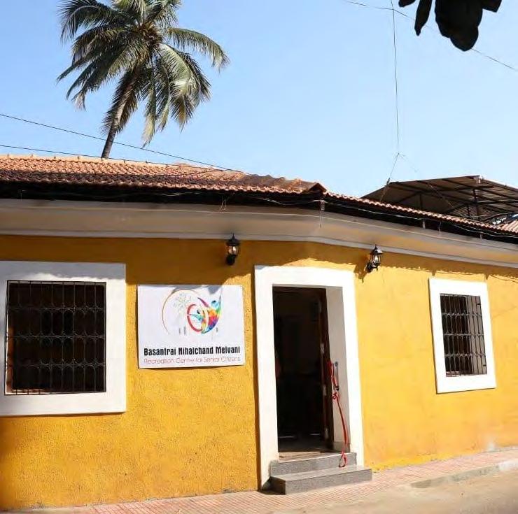
Basantrai Nihalchand Melvani Senior Citizens Recreation Centre
Located in an old heritage building in Fontainhas, it was always the dream of the deceased homeowner to “do something against the lonely plight of seniors as age caught up with them” – as one employee explained to us. It was only one year ago that the already ruined building was renovated and reopened as a senior’s centre. To become a member, a one time payment of INR 500 is taken. Members get offered a daily schedule of activities like lectures from doctors or gym classes. Members can also gather for playing
30 importance and impact.
Figure 4.9. Bookworm Library in Fontainhas
games during which we see a clear separation between men and women. During our visit, the former were playing Carrom, the latter were coloring Mandalas. As we found out, only few people come from Sao Tome, Fontainhas and Mala, most members come from the whole area of Panaji city because there is a lack of similar centres in the city.
Mala Women’s Association (Shri Vitthal Rakhumai Mahila Sanghatna)
The Mala Women’s Association consists of about 40 women and is a cooperative oriented towards economical collaboration of women in the neighborhood. Founded in 2010, the idea was to empower women and give them the chance to cooperate and generate their own income. The association is mainly focused on making food products, selling them at the main market of Panaji as well as offering catering for events. The food gets produced at the women’s private residences since a bigger, community kitchen is not available. Also handcrafted products like diaries get sold at the market. The primary school close to Mala lake serves as a meeting place, where the women meet once a month to discuss their activities.
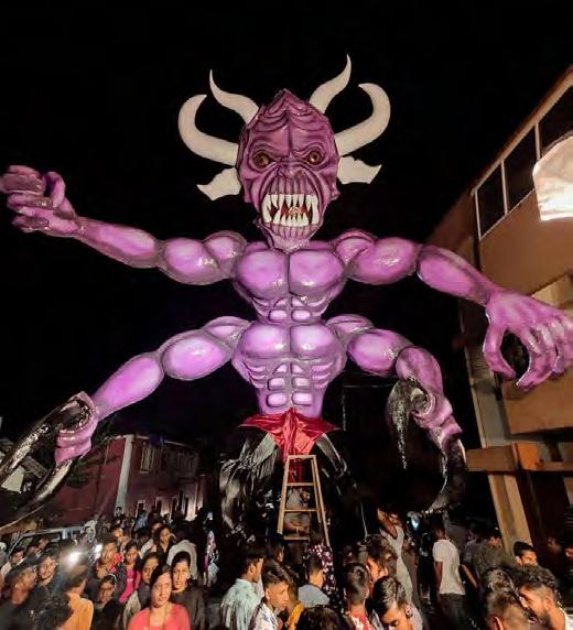
Prince of Mala
This association is mainly focused around the Diwali festival. Around a week before the start of the festival, its members, male only, start to prepare the Narkasur demon, a 5m tall metal skeleton covered with paper mâché, which is ceremoniously burned on beginning of the
31
Figure 4.11. Narkasur Prepared by the Prince of Mala Association
Figure 4.10. Senior Citizens Recreation Centre
Diwali festival. During the year, activities are mainly focusing on informal meetings of the members.
Role of Religious Institutions
There are two religions mainly dominating the study area. Where as Sao Tome and Fontainhas are largely catholic, the area of Mala was always considered Hindu. South of Rua Armade Portuguesa, you can recognize pots of basil plants before the house entrances, signifying a Hindu household.
Catholic Religion
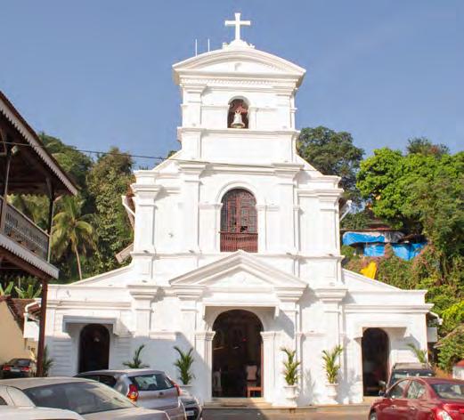
The St. Sebastian chapel is the main meeting point for the catholic community in Fontainhas where the holy mass happens every Sunday morning. Due to its bad condition, the chapel was refurbished in the past years and the work was finished in November 2019 when a big opening ceremony was held. The money for the renovation was raised from members of the community. A committee consisting of residents of Fontainhas and the priest were in charge of collecting the money. There is also a small chapel, Saint Thomas, in Sao Tome.
Hindu Religion
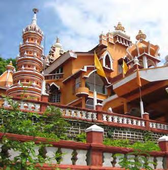
Two temples are situated in Mala, the Shri Vithal Rakhumai Mandir temple on the border to Fontainhas and the Maruti temple on the slope to Altinho.
32
Figure 4.12. Maruti Temple
Figure 4.13. St. Sebastian Chapel
What is Your Neighborhood Called?
Basil plants in front of the house entry symbolize if a household is Hindu, but nowadays, it can be seen as an indicator for receiving financial support from the municipality. The current ruling nationalist BJP party prefers, as we heard from stories, to give funds to associations that are Hindu orientated. So it happens that festivities get funded but not the important ongoing maintenance issues of many heritage houses.
People also say that today’s political situation in the country leads to a bigger division among the neighborhoods then it was before.
Name Differences in Fontainhas
Less shaped social networks can also be seen through the different interpretation of the neighborhood’s naming. While officially the area is divided into Sao Tome, Fontainhas and Mala, different terms are used by residents. If you ask people of Mala about the differences between Fontainhas and Mala they would respond that they also belong to Fontainhas since the origin of the name, the Phoenix spring (Fontainhas means in Portuguese “spring on the bottom of the hill”), is situated in Mala neighborhood. On the other hand, people of Fontainhas see a clear border between the neighborhoods south of Rua Armada Portuguesa.

33
Figure 4.14. Different Terms Used by the Residents to Call Their Area
Political dimension
The City Corporation of Panaji is made up of a ward committee (37 territorial constituencies in the area of Panaji, the study area comprises three wards – Sao Tome, Fontainhas and Mala). Each ward has one seat in the ward committee which gets elected for a period of five years. These members are also known as ward councillors. This elected councillor serves as a representative on a local level for the residents and can be asked for mainly infrastructural matters such as waste distribution, road issues or anything regarding the infrastructure or livelihoods of the area.
While for municipal services like wastemanagement, the City corporation of Panaji is the main responsible authority and the political and legal situation do not differ from other parts of the city. The legislation for receiving permissions for building or modifications varies because of the heritage conservation law.
Listed buildings in the heritage conservation zone, are amenable to several restrictions which should protect and keep the original shape of the buildings that remained from the Portoguese time. Responsible authorities are the North Goa Planning Department and the Town and Country Planning department.
We demonstrate the process of receiving a building permit with and without heritage conservation laws in Figure 4.15.
Social Neighborhood Cohesion
“People were asking me, how I could open up a hotel in this kind of neighborhood,’’ said a guest home owner, one of the oldest hotel in Fontainhas. One reason for that was the Fontainhas Arts Festival that was a yearly festival starting in 2003. Organized by the Goa Heritage Action Group, it had the aim to bring the, until then, rather shabby neighborhood into a new spotlight. Concerts and exhibitions were organized, not only in the public space of the area but heritage house owners opened their doors and invited guests to listen to concerts or visit art exhibitions inside the houses. The profits of the event were equally split between organizers, artists and house owners. Even the houses were repainted for this particular event (following the old Portuguese tradition where the houses had to be painted by law annually). Due to some issues inside the community, the organization of the event was not continued after several years, but community members are working to revive the festival in the near future.
34
FINANCIAL CAPITAL
Financial capital is the monetary resource for people to have different options for livelihoods. This can take the form of income, savings, credit, remittances, and pensions (Rakodi 2002, pg.11 ). The state of Goa may be the physically smallest state in India, however, Goa has the highest GDP per capita of any state in the country (Kumar Jha 2019). This high income is derived from the previous mining industry and, past and presently, Goa’s expansive tourism industry.

Here in the area of Fontainhas, financial capital is mainly generated from the salaries of residents in the ares, businesses in Fontainhas, and commercialization in the tourism sector.
OCCUPATION
Looking at the occupations in the area enable us to see the monetary income of the people working and living in the area. Many residents of Fontainhas are business owners, government employees, lawyers, doctors, and dentists, or retired from said professions. There are few young adults living in the area compared to retired individuals. This has developed due to lack of job opportunities for educated young people. They see their best chance for a sustainable livelihoods as getting government jobs, but openings can be rare and applicants are extremely competitive. Those who have studied arts degrees over the sciences, are faced with the options to work in tourism related jobs, try to work in the casinos
Process of receiving a building permit (simplified)
Transmitting Plans to CCP, North Goa Planning Department, Town & Country Planning Department
Development/re-development/repairs/ change of colour/demolition falls in Conservation Zone?
YES NO
Plans have to be referred to Conservation Committee
Committee examines building plans and reject them if they don’t accord to the law.
Approval from CCP, North Goa Planning Department, Town & Country Planning Department
35
Figure 4.15. The diagram shows the process of applying building permit
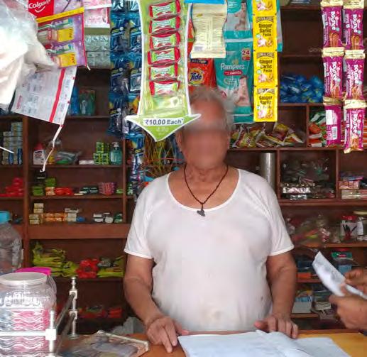
Figure 4.16. Shop Owner in Mala
or to migrate to larger Indian cities or abroad. These factors have led to an aging population in Fontainhas and makes retired individuals the dominant population group in the area, whom rely on their pensions and savings to acquire daily needs and unexpected expenses. Those who struggle financially to maintain their homes, often commercialize their house into income generating businesses, such as guest homes, small convenience stores, and boutiques.
BUSINESS
Sao Tome and Fontainhas are still residential areas, but they also have a lot of commercial activities, with more and more permeating the neighborhoods as the years progress. The number of businesses have increased there over the past few decades, though there is a difference with the business in these neighborhoods. Sao Tome area contains more businesses related to daily activity for locals while businesses in Fontainhas are more tourism related. In Mala, the neighborhood has not commercialized and only has a couple businesses for the local residents including a pharmacy and some corner stores.
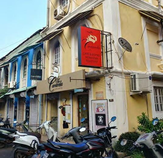
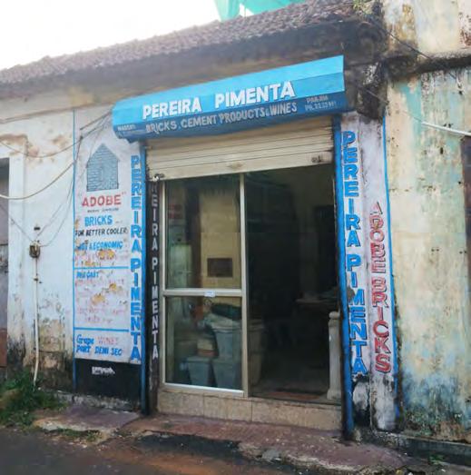
Some of the businesses in Sao Tome are operated by the owner of the house. For example, Welfit Tailors, a gents specialist tailor, is owned and managed by a 53 year old man who lives on the premises. He is the second generation that runs the business and also has the tenure rights of the house. There are also businesses that rent space from the owner of
36
Figure 4.17. Tourism Related Business
Figure 4.18. Local Business in Sao Tome
the house, like Pereira Pimenta, a showroom of building products such as bricks and cement works. Other businesses in this area include barbers and salons, clothing, notary, architects, electronics, dentist, and art galleries and shops.
An activist and architect, who has been working in Panjim for most of her professional career, explained to us that around 15 years ago, as mentioned in the previous section, the Goa Heritage Action Group was hosting an annual art festival. The purpose was to raise funds for residents and homeowners in Fontainhas to preserve and upkeep their homes. Furthermore, the owner of a hotel said the annual art festivals helped to increase awareness of the value of Fontainhas. Since then, tourism related businesses have grown. Eventually the annual event stopped running due to internal conflict, but this did not stop the tourism activity in Fontainhas. Restaurants, guest houses, and shops keep popping up in many corners of the neighborhood, and the numbers are growing rapidly.
 Figure 4.19. Map Shows Business and Commercial Activity
The residents in Fontainhas also have to maintain the façade according to certain standards due to the heritage laws, but without any help or funds from the government. A resident told us these regulations outprice some people from their homes and they have had to move out of the neighborhood since they could not afford the house maintenance. Another consequence is an increase in abandoned properties in the area. Some of these fall into disrepair and regulations make it
hard to redevelop the properties.
 Figure 4.20. Mangrove Trees by Rio De Ourem Creek
NATURAL CAPITAL

Natural capital refers to the natural resource stocks including land, water and other environmental resources, that people can draw on for their livelihoods (Rakodi 2002). Natural resources and their contribution to livelihoods receive relatively little attention in urban context compared to rural areas as they are typically limited in urban spaces yet remain an important asset to analyze . In the research area, natural capital consists of three main categories: Mandovi river, Ourém creek and green spaces.
Both the north and east of Fontainhas and Mala are surrounded by a river and a creek. Located to the north of Fontainhas, Mandovi river, is one of the major rivers of the state of Goa. For Goans, the Mandovi is very important as it provides recreation and opportunities for fishing. Moreover, it waters the rice crops and serves as a means of transport. Cargo ranging from iron ore to coconuts are carried down the river on boats of varying sizes. The river also hosts offshore casinos, cruises and music boats.

Rio De Ourém creek goes along east side of Fontainhas and Mala and used to provide a beautiful space for boating, fishing and recreation. Although nowadays, the creek is suffering from pollution, lack of freshwater and dumping of untreated sewage. While the quality
39
Figure 4.21. Transport Ferry and Casinos on Mandovi River
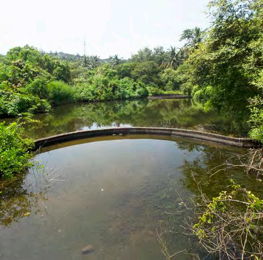
Figure 4.22. Mala Lake
of the river has declined over the years, it still has many opportunities and potential. In the evenings, you can still see some people fishing in the creek or canoeing. It also offers a fertile ground for mangrove vegetation. Mangroves in the bank of the creek provide a slew of benefits for coastal human communities. In addition to storing carbon, they reduce flooding and erosion, act as nurseries for fish, and filter pollutants from water (Erickson-Davis 2018). These mangroves are also home to a host of biodiversity such as birds, insects, crustaceans, fish, etc. In recent years the lack of proper protection of them leads to many problems such as increasing probability of flooding, especially in Mala.
Green spaces such as parks and sports fields play a significant role in urban areas. Green spaces are important for both physical and mental health. They help filter out harmful air pollution and facilitate physical activities, relaxation, social interaction and recreation. They can reduce health inequalities and improve well-being. In Sao Tome, Fontainhas and Mala, there are not many green spaces. Buildings form a dense neighborhood and due to the heritage conservation regulations, they have not changed significantly during the last decades, limiting the availability of public and green space. However, people and residents try to bring some greenery by using flower pots in front of their buildings.

40
Figure 4.23. Green Spaces, East of Rio De Ourém Creek
Green spaces in the research area are as follows:
● Small park in front of the post office in Sao Tome area but it is fenced, preventing use by people.
● Riverbank is seen as a green space but because of the lack of environmental protection, pollution and unpleasant smell has limited its availability of use as public space.
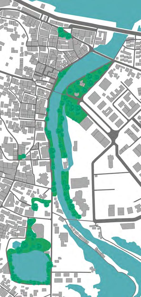
● Marble Plaza, next to a Bombay café, is sometimes used by students to gather and play badminton.
● Vacant lot in Mala and Hedgewar school playground, despite the poor conditions, provide a place for children to play and enjoy their time.
● Mala lake is an artificial lake which, based on our findings from people, was initially established for recreation purposes. However, it has been neglected for years after plans for its beautification by North Goa Planning and Development Authority fell through. Redevelopment was halted due to financial disputes.
Figure 4.24. Open Spaces in Fontainhas
INFORMALITY
Informality can present itself in many ways and is dependent upon the context of a place (Altrock 2012, pg. 172). Informality can be defined in relation to legality, commerce, housing, land tenure, and more, and is not always performed by people, but can include government bodies as well (Meijer & Ernste 2019, pg. 3). When discussing India and informality, it is often in the context of informal housing, sometimes referred to as slums, a category that other NTNU students worked with this semester.
But Fontainhas is different, and informality takes place in other ways around the area. With the heritage conservation regulations, anyone who makes alterations to their property that go against these laws without written permission from the government, is practicing informality as they are operating outside the law.
In Sao Tome, we heard a story surrounding a building that was a hotel with a restaurant underneath that caught fire and burned the building down. Some people said it was an accident, others speculated that it was intentional to avoid preserving the building. If the latter is true, while unverifiable, this is a form of informality. Throughout the area, one can also see rental buildings in disrepair. The tenants often pay low rents if they have lived there for a certain number of years. Because landlords want a higher return, they will not
repair damages in hopes of having tenants leave, renovate the space, and charge higher rent. While technically legal, this borders informality.
We also see informality in small ways such as a woman who became frustrated that cars kept parking in front of her home, blocking the pathway to enter. She decided to put large, heavy planters in the street to physically block cars from parking there. While she knows it is possible that the government could come ticket her or confiscate the planters, she does not care, as she needed to take back her space.
Throughout Fontainhas, there are many street art installations and graffiti, this is informality.
We can spot informality throughout the field site in a multitude of manners. While neither group 5 or 6 tackled informality head on, the effects of these factors had an impact on our analysis, methods, and proposals in subtle ways.
42
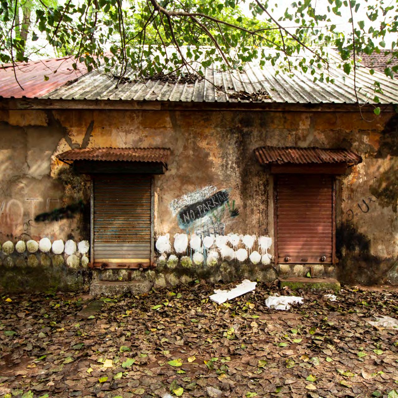
Figure 4.25.
Abandoned unmaitaned building
CONCLUSION
Our analysis of the area gave us a comprehensive overview of the current situation in Sao Tome, Fontainhas, and Mala. We identified the different types of inhabitants that reside in these neighborhoods, found struggles in the municipal systems, listened to concerns over parking and traffic, learned about the existing institutions and associations, and observed the tension between different parties in the area. These, and many other factors, gave us a general understanding of the field and aided in dividing the areas into two seperate field work sections, each examined further by group 5 and group 6.
Group 5 chose Sao Tome and Fontainhas as their research field, splitting Fontainhas in half at St. Sebastian chapel on Rua De Natal. While the two areas have differences, there are many similarities among identity, residential structure, and commercial activities.
Group 6 chose the lower half of Fontainhas, south of Rua De Natal, and Mala as their research area. These two areas have very different identities and a harsh dividing line, the largest separator being religion. Fontainhas is predominantly Catholic while Mala is nearly unanimously Hindu.
The separation of the field in this manner allowed researchers to focus on different challenges in the area and target interventions to address concerns applicable to people in those neighborhoods.
44


45 Sao Tome and Fontainhas Fontainhas and Mala Figure 4.26. Division of Fieldwork Areas
group5 Sao Tome & Fontainhas

48

49 Figure 5.1. Current
Situational
Sketch of
Fontainhas
INTRODUCTION
After conducting the situational analysis, the entire area was divided into two sections, the north consisting of Sao Tome and the upper half of Fontainhas and the south consisting of the lower half of Fontainhas and Mala, with the dividing line near St. Sebastian chapel on Rua De Natal street. Through analysis, a divide in identity presented itself with Sao Tome and Fontainhas consisting of mainly Catholic residents whereas further south you see more Hindu and Muslim families present. While upon first glance, the neighborhoods could be viewed as more formalized, preserved, and maintained compared to other parts of the city, residents and stakeholders in this area combat many difficulties in their daily lives.
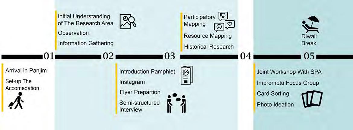
Our process began upon arrival to Panjim, just after the monsoon season. We spent time exploring the city before we were assigned our research and fieldwork area. The next few weeks were spent analyzing the area, practicing many methods and talking to as many people as possible. Leading up to the halfway mark, we had a crash course collaboration with second year masters students from the School of Planning and Architecture-Delhi where we dove deeper into our site and learned new participatory methods. After a much needed break, we began discussing our problem statement and proposals before bringing them back to our community for input. We concluded our fieldwork by constructing our report and
50
Preliminary Phase Secondary Phase
proposals while simultaneously continuing to collect input and feedback from stakeholders and looking at ways to anchor our ideas.
The following methods, findings, and proposals are applicable to Sao Tome and Fontainhas, where our group conducted fieldwork for 10 weeks, analyzing the area, listening to stories and struggles, and codesigning solutions with the community.

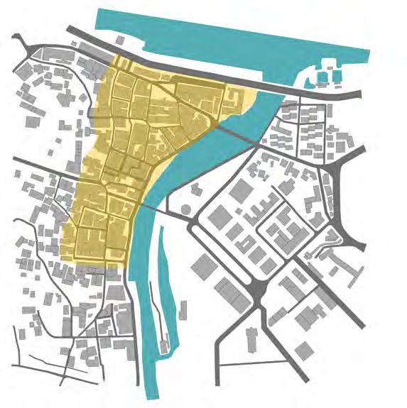
ToCityCenter
51
Mandovi River
OurémCreek Main Street
Panjim Bus Stand
Sao
Tome
Fontainhas
Concluding Phase
Figure
5.2. Map of Focused Area Figure 5.3. Timeline
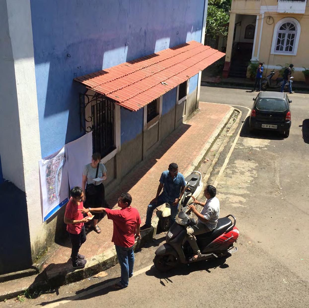 Figure
5.4.
Participatory Mapping Method
1: METHODS AND FINDINGS
Throughout the fieldwork, our goal was to realize and address some of urban challenges of Sao Tome and Fontainhas by working directly with the community and stakeholders in the area. We wanted to hear about the area through their voices and acknowledge some of the challenges living here presents. As a main focus point for the Urban Ecological Planning program, we explored many different participatory methods and tailored each with the intent of collecting certain types of information throughout our fieldwork. We have categorized our process into three phases, as we experienced a natural progression throughout our research.
Preliminary – Our first phase was focused on gathering as much information from as many people as possible. We wanted to understand the area, people, and challenges living and working in Sao Tome and Fontainhas bring.
Secondary – After gathering preliminary data, we wanted to focus on what people feel were the most important issues to tackle in the area. We used this phase to allow citizens to voice their concerns and solutions to those concerns.
Methods focused on stakeholder solutions.
Concluding – Our last phase was focused on co-design. We used methods to allow citizen creation as well as feedback on our interpretation of their needs. The intent was to address important issues as well as create viable and desired solutions.
PRELIMINARY PHASE
Observations
Our research started with observations and getting familiar with the research area. First, the colorful facades of houses and Portuguese’s architecture caught our attention immediately, as it drastically stood out from the rest of Panjim. It became obvious that Sao Tome and Fontainhas were special and we understood the need for conservation of this beautiful heritage site. In the first days, we walked along the narrow streets, spending time in context at cafés, restaurants and galleries, trying to get to know more about the current situation and
53
st PHASE1
AIM
To gain awareness of the area, meet community members, educate residents on our intent in the neighborhood, and begin mapping the space and people’s movement within it.
METHODS
Observations
Semi-Structured Interviews
Flyers & Social Media
nd PHASE2
AIM
Participatory Mapping
Resource Mapping
Historical Research
people interactions with the physical space and each other. We recorded things we saw and heard and used this preliminary information to help us develop and shape our next methods.
Semi-Structured Interviews
To deepen our understanding of Sao Tome and Fontainhas, empathize with the struggles residents face, identify areas of concern, and begin gathering community solutions to community issues.
METHODS
Impromptu Focus Group Card Sorting
Photo Ideation / Participatory Design
rd PHASE3
AIM
To allow stakeholders to dictate and design proposals, provide feedback and criticism to the proposals, and to create something of meaning for the people of Sao Tome and Fontainhas.
METHODS
Movement Mapping Stakeholder Co-Designing Community Feedback on Proposals
Figure 5.5. Methods Used in Different Phases
After observations, we began conducting semistructured interviews. We conducted informal and open-ended interviews with people working in local shops, libraries and galleries. We also targeted residents within Sao Tome and Fontainhas. When trying to approach people on the street, we quickly realized many of the people in this area were not residents but tourists and commuters, thus we began going door to door to gather information from the residents. Our intentions were to understand the space and the community better and to develop an understanding of how the community functions. We practiced guiding the interviewee into the direction we wanted through trial and error with our questions, which sometimes worked and sometimes did not. They were sharing information about themselves, positive and negative aspects of the surroundings as well as their challenges and concerns regarding the neighborhood. Most of them were so eager to respond and spend time to talk with us when they found out we were students. While we focused on this method in the beginning phase, we continued to use it throughout the entire fieldwork as it helped us to get basic information and an impression of the area as a whole.
54
Flyers and Social Media

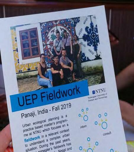
After we began conducting semi-structured interviews, we realized that people were very curious about us and our purpose in their neighborhood, especially coming in as foreigners to this country. Thus, we prepared printed flyers to inform people of our purpose and intent as well as use them as conversation starters and a way to attract attention to our work. We tried to design a simple eyecatching flyer, with suitable context and colors. Moreover, the contact information helped for further communication as well as to create an atmosphere of trust and professionalism.
As UEP students, seeing the area from the community’s perspective is significant to our work. We want to be able to lift up people’s voices and perspectives, not only report our perception of what was said. Social media gave us opportunity to ask people to share their favorite views or spots in Fontainhas. In collaboration with group 6, we created a social media campaign with flyers that contained brief instructions and asked people to post photos on Instagram using the hashtag #myfontainhas. We created this campaign spontaneously and thought it would be an interesting way to try to continuously gain information throughout the entire research period. Only after spending more time on the site did we realize that many of the residents in Fontainhas are older and less active on social media. While still an interesting and potentially useful method, it was not the right tool for this population and we have received limited data from it.
55
Figure 5.7. Participatory Mapping Poster
Figure 5.6. Distributed Flyer
Participatory Mapping
Since the focus area is touristy and often foreigners are present in Sao Tome and Fontainhas, we needed some tools to attract people’s attention to us specifically and try to start conversations with residents and strollers. Therefore, we prepared a simplified map of the neighborhood that included the mains roads and footpaths as well as landmarks in the area and printed a large poster. While we are used to reading maps, many people we engaged were not. They had a hard time understanding the image in relation to their neighborhood and the places they frequented. By highlighting landmarks in Panjim, we were able to orientate them better to the map. We asked three simple and easy to understand questions, in English and Hindi, associating each with a different colored sticker. We requested people to place the stickers on the map, indicating if they liked a certain place, disliked a certain place, or wished some place was changed. This allowed them to tell us a briefly about their neighborhood and showed us the most liked and used places in the area as well as the places of concern which we investigated further later on. The poster was a one tool used to facilitate communication with different groups of stakeholders including residents, workers, students and tourists in Fontainhas. While at first, we were feeling discouraged, patterns and trends of feedback became apparent and we quickly identified the most loved places and least favored spots.
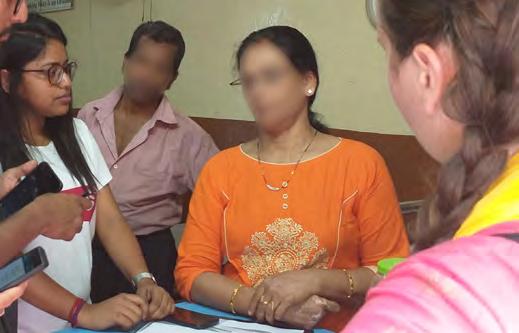
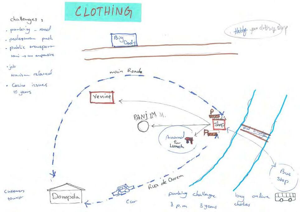
The last method of this preliminary phase was, resource mapping, a method taught to us by the SPA Delhi students with whom we collaborated with for one week. Resource mapping not only gave us the opportunity to understand how people live, work and meet their daily needs in Sao Tome and Fontainhas but also allowed us to see the connections between our area and the rest of Panjim. The method starts with one or two participants and a blank piece of paper. We then asked the person to draw a map based on their daily activities such as buying groceries, commuting from home to work, or which restaurants they liked to eat at. We found people were often hesitant at first, in this case, one of us would draw a landmark and a street, allowing the participant to visually understand what we were trying to accomplish. Then the participant would add in other things, usually outside Fontainhas and into the city center or away from the city if they lived or worked outside the area. We asked them to include daily needs, special occasions such as
Resource Mapping
56
Figure 5.8. Restaurant Owner in Sao Tome


Figure 5.9.
Practicing Resource Mapping
Resource Mapping
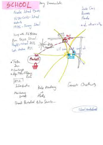
festivals, and typical places they usually use in leisure time.
Sometimes a participant wanted to dictate and not draw themselves, we found if a researcher put a landmark in the wrong place, every time the participant took the pen and began drawing themselves. This was an interesting way to encourage the participant to take control. Saying that someone is an expert of their city and space is easy, but they might not believe you or feel insecure about the knowledge they hold. By us making one small, but intentional mistake, it showed them how much they actually know and encouraged them to share and demonstrate that knowledge. This approach provided the general overview of easily accessible resources and also the lack of available resources in Fontainhas and Panjim. We tried to let people become the experts of their area and show what it is really like to live in Fontainhas and how they must travel to live their lives.

Historical Research
In addition to the participatory methods conducted during this phase, we also dug into historical research on Sao Tome and Fontainhas. As a heritage conservation zone, several academics have written about the area and challenges in planning and developing in such an area. We also found that many architecture students use the area for projects and theses, so we looked into past masters thesis work to gain an understanding of how
58
Figure 5.10. Results of
the area was in recent history. Lastly, we visited the Goa College of Architecture and looked into student coursework that has been conducted in Fontainhas in the past. The reports from the university gave us similar information to what we had been gathering ourselves, but the masters thesis work we discovered elaborated on architecture, which when paired with the articles published by the planning department, gave a preliminary understanding of the challenges of building within this conservation zone.
Findings of Preliminary Phase
This phase was dedicated to hearing the voices and understanding the lives of the people we are designing with as well as gain an understanding of the physical space and how people interact with it. Information was gathered from many people with different ages, genders and social position to collect various perspectives. What we observed and heard during these methods was recorded in the form of writings, drawings and photos. When entering the field, we usually started with broad questions about people’s lives and gradually steered the conversation towards the challenges in the area. At the end of this stage researchers achieved the broad vision of the strengths and challenges in the area. We then used this information to divide the boundaries of our research area and develop the next methods.
Residents told us good things about the area, such as how quiet the neighborhood is, the
accessibility of buses, and the proximity to Panjim market for fresh foods. A woman who runs a restaurant in Sao tome told us she looked very favorably on the development in Patto as she was hoping it could bring more business to her restaurant. This is where we began to see conflicting information based on which group we were talking to. As she liked the development, many older residents told us that recent developments were leading to flooding on their streets. The development removed Mangroves in the area, a tree that helps hold rainwater and redistribute it to the ground, causing displacement of rainwater. In a city where monsoon rains come several months out of the year, it can have drastic effects on residents.
Other concerns voiced by the residents were contaminated well-water, lack of parking for residents and customers of businesses, sidewalks and walkways were poorly maintained, tourism is bringing too many people into the neighborhood, traffic is dangerous and congested, casinos are bringing nuisance, streets are littered with rubbish, young people are migrating out of Goa due to a lack of job opportunities in sectors outside of tourism, heritage laws are restricting desired alterations on homes, rental buildings are poorly maintained, lack of community cohesion, rivers are polluted from casinos and hotels dumping sewage into them, and development can happen illegally with enough money. We also heard concerns in regard to Imagine Panaji. One woman told us she could not understand
59
why they were painting stairs when people did not have drinking water, that does not make a smart city.
We used this information to try to think about what issues could we potentially address in this neighborhood and what could we eliminate based on resources available. We then tried to develop our next methods with these things in mind.
SECONDARY PHASE
Impromptu Focus Group
Although group interviews and discussions can offer a quick understanding of community’s life and challenges, they can sometimes lack deep information compared to individual interviews
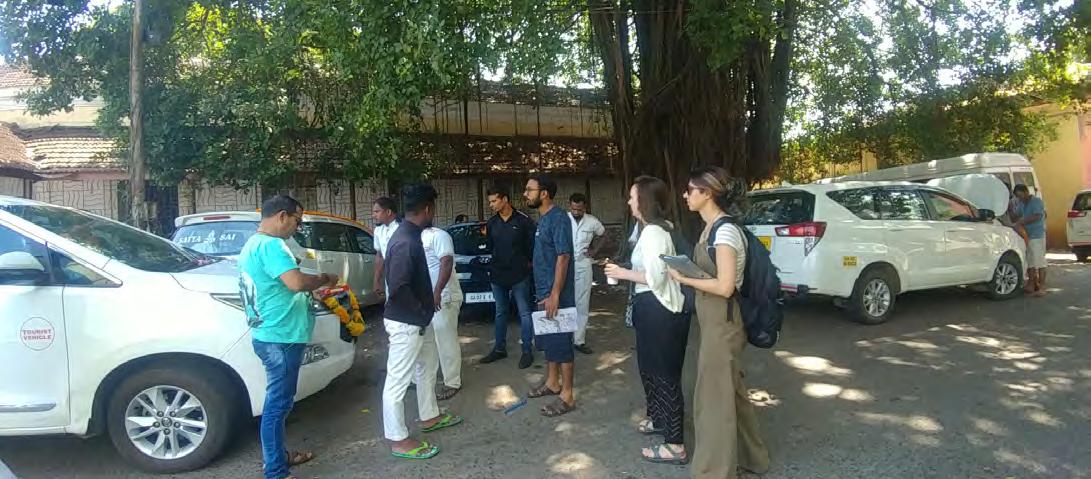
or more focused discussions. In the process of research, group discussions and resource mapping were conducted with taxi drivers, as many do not live in Fontainhas but work there every day. They were using the northeast of Sao Tome as an informal taxi stand as they waited to be called. While not a formal focus group, the congregation of one type of stakeholder allowed us to gather information quickly about their needs and the comfort of having their peers around allowed them to open up to us. Through resource mapping as a starting point, we were able to ask questions about home and work life, good and bad things about Panjim, find out their needs and desires, and gain an understanding of the struggles of being a young man in this area. While diverse groups can spark discussion and debate, homogeneous groups can provide ease and
60
Figure 5.11. Group Interview With Taxi Drivers
understanding in sensitive situations. The purpose of formal focus groups is to create a welcoming atmosphere for participants, a place where they can speak freely without judgement. We were able to achieve this same atmosphere on the street at the taxi stand and gather meaningful data.
Card Sorting
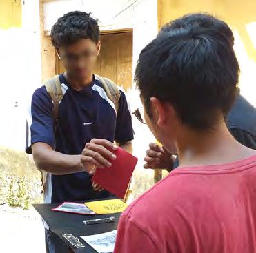
Card sorting is a simple exercise that gives the chance to spark the conversation about the most important issues of the people we are designing with and let them prioritize their concerns (IDEO 2015, pg. 57). Based on the previously gathered information from our preliminary phase, we identified key issues and concerns for residents and stakeholders. We prepared cards with simple images, sketches, words and phrases to represent each of these key issues
as well as blank cards for them to write new topics. For this method, we targeted residents as the stakeholder of interest since they have the greatest knowledge and understanding of the fieldwork area. Additionally, they have the biggest stake in the neighborhood as they face these topics and challenges on a daily basis. People were asked to prioritize the issues based on their biggest concerns or areas of interest. The first few participants we interacted with became fixated on the casino card and could not discuss any issues beyond that. Because casino related issues are a city-wide problem and not specific to the people in Sao Tome and Fontainhas, we experimented with removing that card for the remaining participants and acquired much more interesting results. We noted the most pressing concerns for people and continuously referred back to them in later stages and when beginning to develop our

61
Figure
5.12. (Left)
Cards for Card Sorting Method (Right) Card Sorting Method Participant

 Figure
5.13.
Card Sorting Method with Participants
proposal. This exercise not only allowed us to rank people’s concerns, it also helped us to have deeper conversations with residents and understand their values.
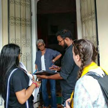
Photo Ideation/Participatory Design
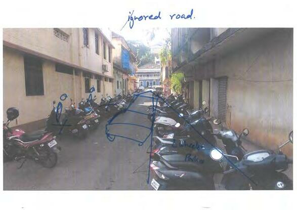

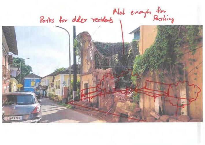
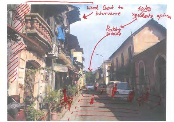
Photo Ideation was one of the methods we conducted that gave us impressive results and useful insights. We began this method by taking photos of different areas in the neighborhood, then worked with participants to allow them to draw on the photos and visually create changes they would want to see in the area. This method was not useful for every participant, as some were too shy or busy to sit with us for a considerable period of time, but
the respondents we did get to participate made some incredible images. We experienced hesitation at first, but similar to the resource mapping, if one person helped them get started, they would take over from there. By demonstrating one or two things on the photo, it allowed the participant to then take control and complete their own vision. One young college age man drew images of taking back parking space and converting it into a play area for children in the neighborhood. A woman drew an image of a footbridge that goes over Rua De Ourém street so people can cross more easily. Many of the themes people presented to us revolved around traffic safety and public space. We took these ideas, compiled them, and used the people’s ideas and desires to create proposals.
63
Figure
5.14.
(Left) Results of Photo Ideation (Right) Photo Ideation Participants

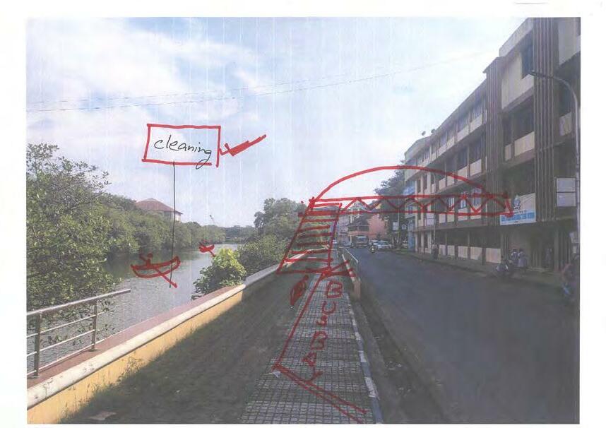
Figure 5.15. Photo Ideation
Findings of Secondary phase
The findings from phase 2 were very interesting as we began to see different patterns emerge with different methods used. The focus group saw a concern with lack of job opportunities for young people in this area which was also a concern several young women discussed when we did the card sorting exercise with them. Both demographics explained how tourism had taken over and the young men were working as taxi drivers, the young women as housemaids in a guest home. The women had both completed their bachelors degrees but were still struggling to find work in Goa. One told us that many of her friends had left the state. She said, “you either get your Portuguese passport or marry someone with a Portuguese passport.” As many Goans speak English, there is a trend of acquiring Portuguese citizenship and moving to England. During weekday mornings, you can sit outside the Portuguese consulate and see anywhere from 40-100 people lined up waiting for the doors to open.
Others often placed the casinos and gambling as their biggest concern. An older woman, who had lived in Fontainhas most her life, told us that there were no problems in Panjim before the casinos arrived. They brought trouble tourism and the guests would park their cars all throughout the streets of Sao Tome in the evenings, creating traffic congestion and lack of parking for her and other residents. One card we presented represented tourism. When speaking with older residents, they always said tourism was a concern for them. It created
many problems in the neighborhood, and they wished to bring some tourism out of their community. While young people saw this as their only opportunity for work, they appreciated the tourism. Though both groups presented some hypocrisy and classism when discussing tourism. Both young and older residents looked favorably on foreign tourists as they “respected the area” more, keep the streets cleaner, and were quieter. When referring to domestic tourists, they classified them as loud, dirty, and disruptive.
When we moved onto the photo ideation and participatory design method, we began to see different results and desires from people. Visually, traffic was still a big concern for people but a new pattern emerged, displaying a lack of public space. While we had seen the restrictions the heritage laws put on home alterations, people also showed us how it created narrow roads and limited availability to have outdoor gathering spaces. One woman who participated created a tiny park out of the space where a desolate and collapsing home stood. Another woman with young kids in the area, drew and image of a footbridge going over the Rua De Ourém street as she voiced her concerns about the safety of crossing this road. By the end of this phase, we began to asses how an intervention could address multiple concerns at once. While tackling the issues surrounding casinos felt pretty impossible, traffic, safety, and public space felt approachable as well as potentially incorporating new economic opportunities for young residents in the area.
65
CONCLUDING PHASE
Based on the previous methods that have been done with the residents, we concluded that there is a desire for public space for the residents of Sao Tome and Fontainhas as well as a concern for vehicle traffic near the river. We also gained knowledge about Imagine Panaji’s plan to develop a park on the east side of Rio De Ourém river in the next two years. Residents did not know about this plan and Imagine Panaji has not finished the design of the park yet. Thus, we decided to focus our methods on gaining stakeholder input regarding what should be included in the designs of this park. What do they desire that is currently not being offered and what would bring them across the bridge and into this park? What are they missing from the current available public space and what more could be offered?
To gain this input, we designed a collage workshop to allow stakeholder’s co-design of the park. We again focused on residents but also commuters as they pass by the space where the park would be, sometimes on a daily basis. Lastly, we wanted to get community input and opinions on our proposal designs to be able to incorporate those desires into the final proposal.
Movement Mapping
To get information from additional stakeholders in the area, informal interviews with the community had been done once more, but with the intent to find out why people were in a
specific area near the existing pedestrian bridge and what brought them to cross that bridge on a daily basis. We also counted the number of pedestrians who crossed in each direction once per hour for 5 minutes, then multiplied these numbers to get an average for each direction per hour on a typical weekday. We discovered that many of the commuters passing over the pedestrian bridge start from the city center, pass through Fontainhas, over the bridge, and head to the Panjim Bus Stand in Patto and vice versa, with more people entering the city in the morning and exiting the city in the evening. The commuters vary in terms of age, occupation, and gender, but all share a common aspect of using this space temporarily as they do not reside in Fontainhas.
Stakeholder Co-Design
Co-designing of the future public park with residents and commuters was our next method. We took a photo of the space where the future park will be and morphed it to create a blank green space. We then took small images such as trees, benches, picnic tables, play equipment, people, boats, and much more and asked people to design their ideal park. We positioned ourselves near the space as to help people envision what we were trying to do, on the east side of Ourém creek, near the pedestrian bridge, and targeted residents, commuters and tourists. Everyone loved the idea of having a public park in that space. We had children, teens, adults, and elders all participate in designing their own ideal
66


Figure 5.16. Co-design of The
Future Park
parks. This activity took place in the mornings and afternoons during weekdays. While we understand there is a limitation to the type of information we can gather using this method, we chose it because people had a hard time understanding where the park was going to be when we discussed it with them in other areas. The current space is massively overgrown with foliage, parts are also used to dump rubbish, making the place incredible inaccessible. We tried showing residents on a map where the park would be located but they did not seem to completely understand. But when we sat in front of the area with a diagram, people more easily understood what we were talking about. This is why we continued our research situated near the space as it helped people understand and visualize what we were talking about.
Community Feedback on Proposals
The last step in our fieldwork and final method we conducted was gathering community feedback on our proposals. Because the park is an existing Imagine Panaji project, we focused specifically on our design proposal of the bridge. We created diagrams and morphed images of our ideas, printed them, and used these to have discussions with stakeholders about our interpretation of their ideas and concerns. We returned to community members as well as businesses and students in the area to see how they felt about the proposals. We wanted to allow stakeholders to be able to voice their opinions and concerns about our interpretation of their needs, get their solutions

68
Figure
5.17.
Co-design with Commuters
to these concerns, and brainstorm with them about possible alterations that could be made to the proposal to mitigate some of these concerns.
700 meters for residents, meaning if they are okay walking all the way to Jogger’s Park, they surely would walk to the new one.
Findings of Concluding Phase
From the movement mapping, we found an influx of people coming into Panjim in the mornings and then leaving in the evenings. We also found that very few people use the bridge after 7pm because there are no working lights and it becomes quite dangerous for people. Simple fixes such as repairing street lights could greatly improve the usability of the existing space.
Everyone we talked with told us that a public park in this space was a good idea, but many voiced concerns over the implementation and maintenance of such space. When designing their own parks, all of the results gathered included facilities and activities for children such as playgrounds, jungle gyms and swings. Some adults activities like sport and exercise spaces are mentioned often too, and one woman told us we should keep the exercise equipment in close proximity to the children’s space so that adults can exercise while keeping an eye on the children. Another woman told us that exercise equipment was not necessary because they have similar equipment in Jogger’s Park and her and her friends walk there to use the equipment. Jogger’s Park is over two kilometers from Fontainhas and the proposed park would be between 200 and
Each participant also desired to have activities that are related to the creek, like boating or fishing. Shaded spaces are needed to provide a comfortable space in the hot months of the year. Pathways for cyclists was also mentioned by every participant. A young man discussed how he desired an open area for street vendors was because they could attract more people to come and spend some time in the park. He likes to hang out at Miramar beach with his friends and eat from the carts. He said it would be great to have a space where they could hang out like that in this area. He uses the existing Mangrove Boardwalk behind the public library, implemented by Imagine Panaji, but wanted more attractions near the area as well. He also mentioned that if we wanted to attract young people, we should have free wifi in the park. The findings from this method display not only people’s desire for a leisure space for themselves, elders, and children but want to make sure there are water activities on the creek, shaded spaces for gathering, bike paths, and space for food and street vendors. Everyone liked the idea and saw the need for a park in this area.
We learned a lot through bringing our pedestriant bridge designs back to community members and stakeholders. Many people really liked the idea but voiced some concerns as well. All of the students we talked to loved the bridge and park proposal. We discussed with students
69
from Mary Immaculate Girls Highschool and they thought it would be so cool to have a bridge right outside their school leading to a park. One girl thought it was great but that we needed a designated bike lane. Another woman explained to us that leaving designated space on the street for pedestrians would be lovely, but she feels in Goa, hawkers would come and use the newly available space. But she also informed us that if there were a parking lot and a bridge, she would leave her car on the east side of the river and walk into Fontainhas as it would make avoiding traffic much easier for her and worth the extra 10 minutes walking.
Some business owners voiced concern about such a proposal restricting parking near their business. One man told us that this proposal would never work as a footbridge but if we allowed cars and scooters on it then maybe it would be viable. Another business woman in the area loved the design, especially because the bridge would go over the street as well as the river. She crosses the existing pedestrian bridge every day and thinks there needs to be a second one to handle the quantity of traffic that currently exists. Her biggest concern was the maintenance of such a bridge. She said that the current one is unmaintained and unsafe so why build a new one if the same thing will happen to it? Her comments made us question how we could ensure such a project would be maintained after completion.
The last notable findings were the satisfaction residents articulated by the prospect of the government bodies, planning departments,

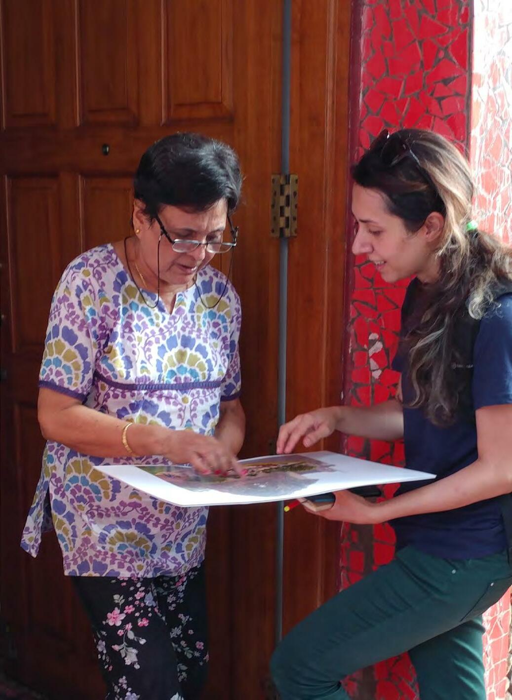
70
Figure 5.18. Gathering Community Feedbacks on Proposals
and Imagine Panaji using such methods to engage citizens further. Countless residents voiced their frustration with governing bodies making changes to the neighborhood, landuse, and regulations without ever telling people it was happening or involving them in the process. One man explained to us how the traffic department converted a street into a one-way road and did not notify or converse with the people who live on that road, they just expected them to go along with it. People presented several stories similar to this and with such as small area in Fontainhas, they did not understand why they were not asked their opinion. A resident of Sao Tome, who has lived in the area his entire life in a beautiful blue Portuguese Goan style home, told us he would love these type of methods to be used when looking to make changes in his neighborhood.
discussion-based methods. With the park codesign method, we were able to capture more information from less strong English speakers because once we demonstrated what we were trying to do, visual information could be transmitted with less language necessary. We also had the wonderful advantage of collaborating with SPA-Delhi for one week and they were able to speak Hindi to some participants. While some of these people also spoke English, they felt more comfortable speaking Hindi and opened up further then when we tried to solely conduct the methods in English.
FINAL CONCLUSION
So much data was gathered, it became challenging to decide where our focus and energy would be best placed. Eventually, we felt the most realistic and sustainable solutions would be those that integrated into existing Imagine Panaji and Smart City projects. This is why we decided to focus on information that was presented to us through the community that could collaborate with existing plans.
We also recognize limitations and biases to our methods. While most people in our area spoke English, we did find many people who did not, thus eliminating them from participating in some
We have done our best to bring many voices and opinions from our findings into our solutions and proposal, yet there will always be conflicting stakeholder opinions. While we tried to mitigate these opposing views as much as possible, we know our proposals will not be accepted by every person.
71
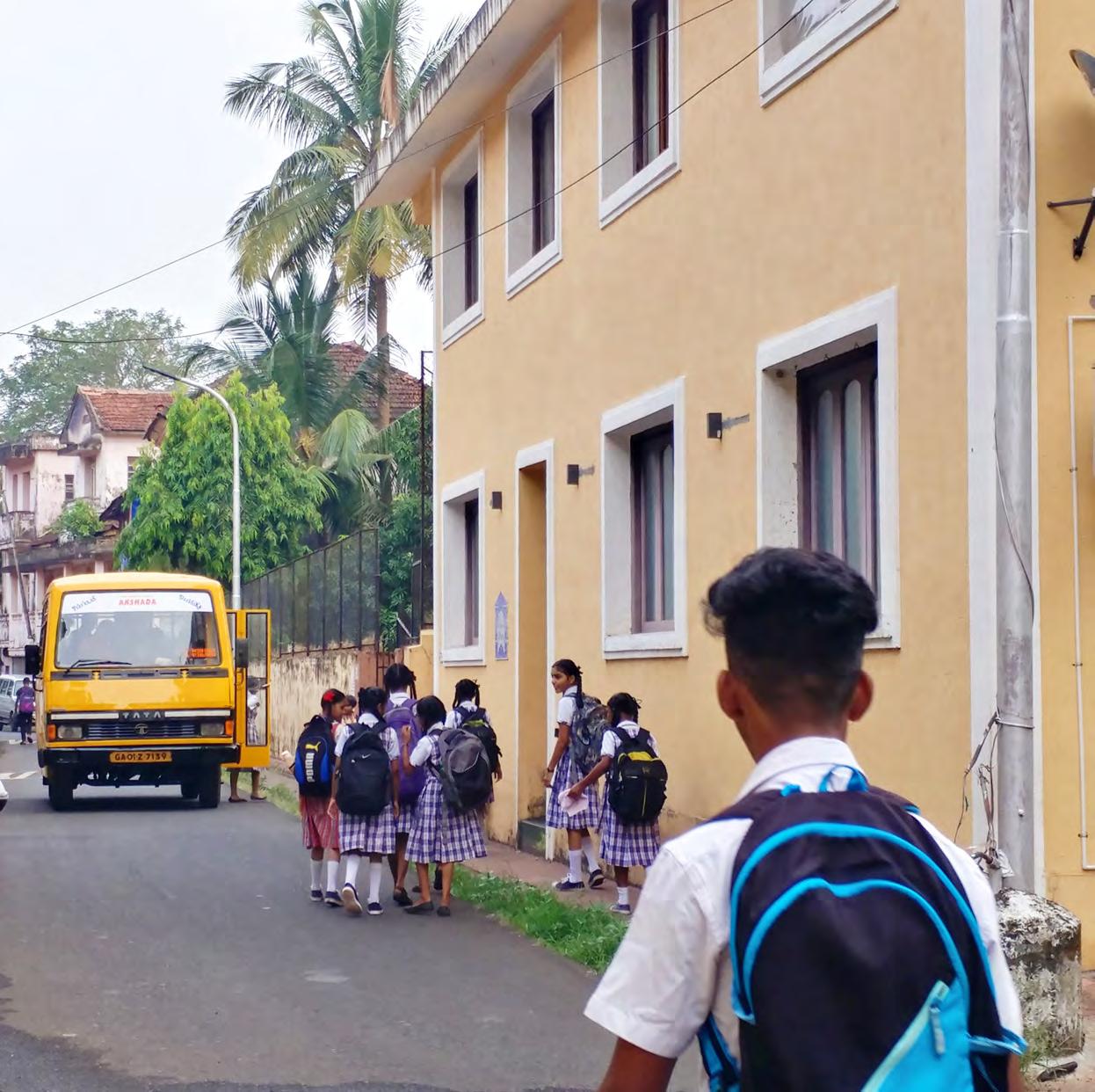
Figure 5.19. Students in
Fontainhas
2: STAKEHOLDERS
One of the goals of Urban Ecological Planning is to involve and uplift stakeholders, therefore, it is crucial to find out more about their characteristics and role in the site. We attempted to identify and analyze the stakeholders relevant to our area to ensure we had proper insight when designing and developing proposals. We collaborated with key stakeholders during every step of the process. We gained knowledge through communication,
cooperation, and partnerships, and used this as a basis for analyzing the stakeholders in terms of interest and power in the research area. This helped us to gain an appropriate perspective about the level of involvement they have, and could have, in regards to our proposals and interventions.
PEOPLE
Residents
Residents in the area include senior citizens, young parents, and a few young children. Due to poor job opportunities for educated youth and young adults, many of them are migrating out of the area to larger cities in India and even abroad. Additionally, restrictions on expansion of homes, due to the heritage conservation regulations, limit the size in which a family can grow. Meaning larger families can often outgrow their homes and move elsewhere. These factors are leading to an aging population in Sao Tome and Fontainhas, many of whom are accepting of the heritage restrictions as they

73
Figure 5.20. Commuters on Rua De Ourém
like the atmosphere the old homes bring and also continue to practice Catholicism, more remnants of the Portuguese past.
Commuters
Located between the city center and Patto district, the research area, pedestrian bridge and main roads along the creek and river are the host of many commuters during the day. During peak times, the number of people passing the main road can reach over 900 people per hour, see Figure 5.22. We see people coming in from outside cities and entering Panjim through the Panjim Bus station in Patto. While they do not live in the area, they use the discussed space regularly, even sometimes on a daily basis.
Business Employees
Similar to commuters, but these employees come into Sao Tome from close-by areas, typically by cars and scooters. They work in shops, restaurants, guesthouses and offices. They affect the area in different ways such as traffic congestion, available parking space, and often dine at local restaurants for lunch and dinner. While they do not live in the area, they have incentive to participate and make the area the best that it can be.
Figure 5.21. Mobility Map of Commuters
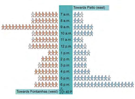
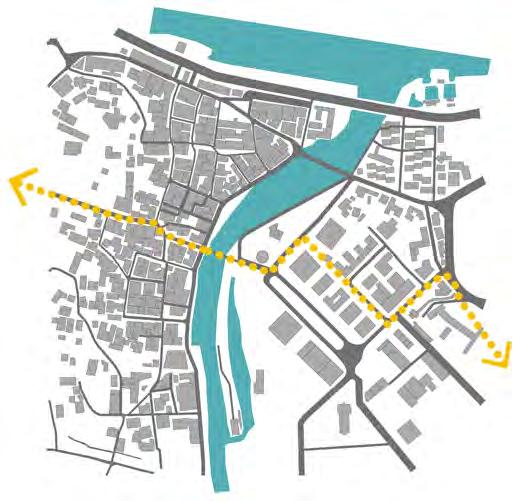
City Center and Bus Stand
Tourists
Since the research area is designated as a heritage conservation area and displays physical history and architecture of the Portuguese era,
74
ToCityCenter OurémCreek Panjim Bus
Stand
Between
Figure 5.22. Diagram Showing Number of People Per Hour Crossing The Pedestrian Bridge
it has become a tourist destination, often used as a stopover for travellers heading to North Goa. Both domestic and international tourists come to Sao Tome and Fontainhas to see the architecture and chapels. Their presence has greatly impacted and influenced the area, both culturally and economically. While they do not spend enough time in the area to have active involvement in projects, we see them as an important group to consider when looking at the effect of interventions.
City Corporation of Panaji (CCP)
The CCP is the overarching municipal body for the city of Panjim. When looking at proposals involving changes to streets, traffic, infrastructure and services, the CCP must be considered and involved as these categories fall under their jurisdiction.
Education Institutions
Students
There are more than 1000 students who come into Fontainhas every week day to attend school at the Mary Immaculate Girls School. They travel by bus, cars, and two wheelers with their parents. They spend lots of time in Fontainhas and the surrounding area and desire more gathering spaces near the school.
PUBLIC
Smart City/Imagine Panaji
Imagine Panaji has finished projects in Fontainhas that are focused on beautification. Proposed projects include traffic control and a boardwalk along side the east of Ourém Creek. Imagine Panaji has more freedom than other government branches to enact change faster than the standard bureaucratic process. They have been given some special permissions and exemptions in and near Fontainhas that are pertinent to our proposals.
Mary Immaculate Girls School is located in the east side of Fontainhas next to the Stenodac Institute for Career Training. These educational institutes house many students in the area who could use the public space as well as provide opportunities to integrate them into the proposed vendor stalls.
Goa Tourism Development Corporation (GTDC)
The Goa Tourism Development Corporation
Limited focuses on bringing in and engaging tourists with the city. Due to the high tourist traffic in the area, it would be beneficial to strategize with this corporation. Their headquarters are located just across Rio De Ourém creek in Patto and regulations published by the department have an impact on how tourism functions in the city of Panjim.
Ward Councillors
There are two wards in the research area, ward 23 represented by Manerkar Manisha and 26 represented by Dias Lorraine. These elected
75
officials are meant to represent the people’s interest, but in reality, have little power in the government to enact big change.
Local Business Owners
Commercial businesses have increased in this area over the past few decades. In Sao Tome, businesses are focused on the daily lives of locals. There are a variety of sectors including tailors, electronic shops, groceries, restaurants, construction workers, barbers and salons, clothing, notary, architects, dentists and doctors, and art shops.
Tourism Based Business
PRIVATE
Goa Heritage Action Group (GHAG)
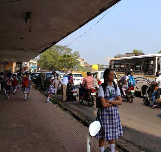
The Goa Heritage Action Group is a nongovernment organization dedicated to the preservation of Goa’s priceless heritage. They used to organize the Fontainhas Arts Festival, which is being revived in the coming years, and they wrote the book The Mapped Heritage of Panaji, Goa, a detailed record of every heritage protected building in the city. They have a vested interest in protecting the heritage homes and the people who live in them.
In Fontainhas, the heritage homes have created economic opportunities through tourism. The unique characteristics attract domestic and foreign tourists. This leads to development of many tourism based businesses such as guest houses, cafés, international restaurants, art galleries, tours and heritage walks. These businesses are motivated to keep tourists in the area, often contradictory to the desires of locals.
Charles Correa Foundation
Charles Correa Foundation is an institution that works in the field of architecture, urban design and planning. Additionally, they act as a catalyst for community-based projects to improve the conditions of human settlements in India. Their foundation studio is located in Fontainhas and is an integral part of the community.
76
Figure 5.23. Students of Mary Immaculate School
RELIGIOUS
St. Sebastian’s Chapel
The Chapel of St. Sebastian was built in 1818 and is a popular tourist attraction in Goa, due to a crucifix inside depicting Jesus with open eyes. Chapels can have a strong community influence on their congregation and can be key players in instigating change. Many residents in Fontainhas belong to the congregation at St. Sebastians.
Saint Thomas Chapel
The Chapel of Saint Thomas is a small chapel in Sao Tome, with nearly all their members coming from this neighborhood.
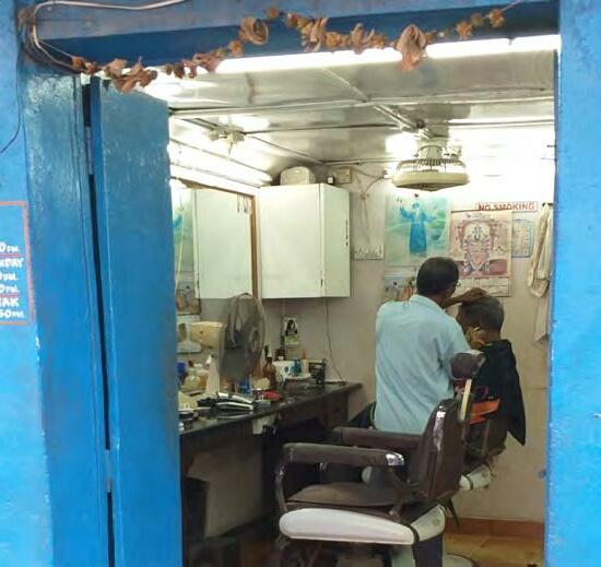
Figure 5.25. Stakeholders Mapping
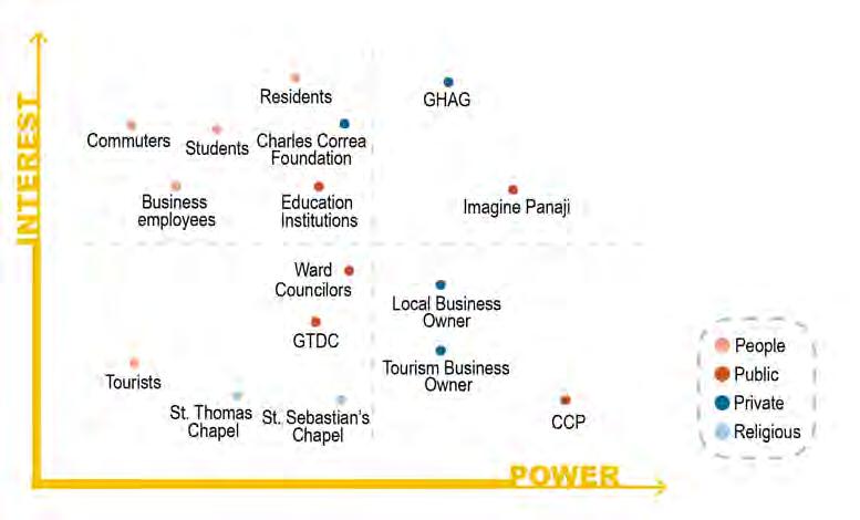
77
Figure 5.24. A Local Business in Sao Tome
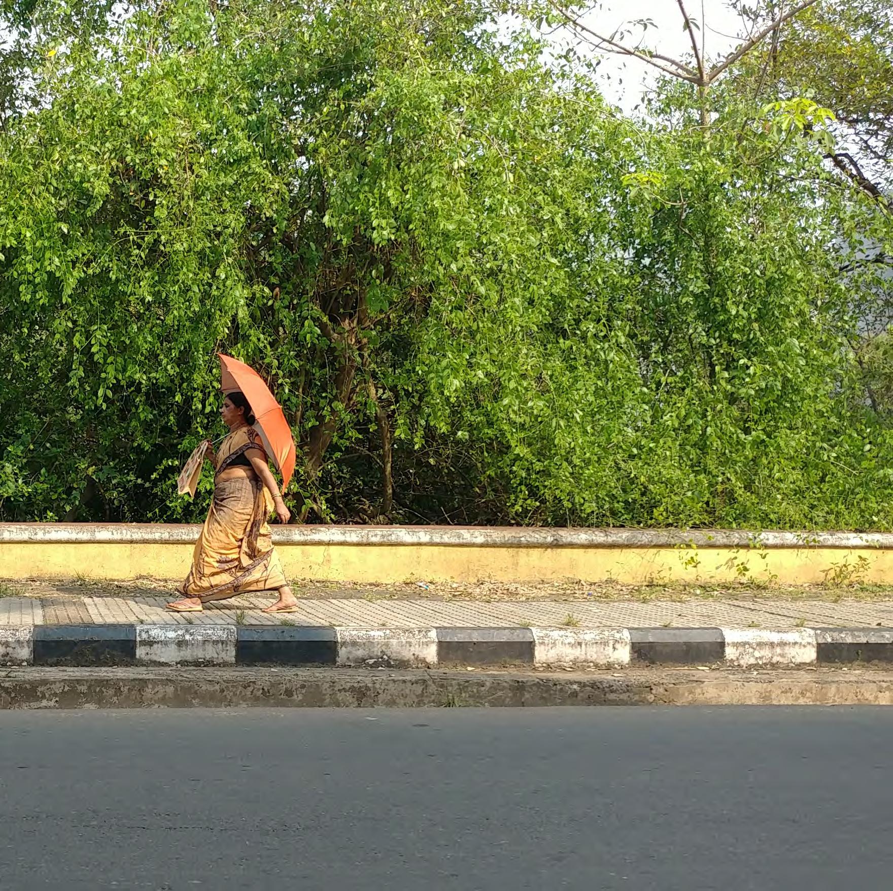
Figure
5.26. Pedestrian Path, West of Rio De Ourém Creek
3: SUMMARY AND PROBLEM
SMARTCITIES IN AND NEAR FONTAINHAS
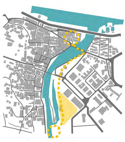
Upon consultation with Mrs. Shusheela Varma, the Associate Manager of Urban Planning for Imagine Panaji, it was discovered that IPSCDL has plans to expand the Mangrove boardwalk that was completed in 2018 and connect it to a walkway that would span over 1 kilometer, connecting the existing boardwalk to the Mandovi river. Infrastructure from a past walkway exists along the east side of Rio De Ourém, both north of the pedestrian bridge and south into a protruding jetty that splits the river into two sections. The north portion of the promenade has a brick footpath with some damage and overgrown foliage as well as informal rubbish dumping and occasional unhoused folks resting in the secluded spaces. The south portion along the jetty also is affixed with existing damaged brick walkways, overgrown foliage, and abandoned huts with the end of the jetty housing the remains of a former nightclub that we were told it shut down
Mandovi River
OurémCreek
Public Park
Mangroove Boardwalk
79
Tourist Center
Figure 5.27. IPSCDL
Proposed Plan for Boardwalk
and Park
about 10 years ago after a woman was raped and murdered. The bones of the infrastructure exist, and the property is government owned and formerly managed by the Department of Tourism, but special permission has been given to IPSCDL to redevelop the space. They plan to fix the pathways, demolish the structures, and connect the missing pieces between the boardwalks to create a seamless promenade.
In addition to the walkway, IPSCDL plans to develop a triangle of greenfield space to the east of the jetty and behind the State Bank of India. The preliminary designs include a large public park and possibly an outdoor amphitheater, but a final design will not be finished or approved for at least 6 months. This
park will connect to the walkway and greatly enhance the quantity of public space available for the residents of Fontainhas, commuters in Patto, and tourists in the area. We see this as a great opportunity to connect the resident’s desires of public space to the existing plans and projects being implemented by IPSCDL. Yet people in Fontainhas do not know of these development plans and often do not speak highly of the Smart Cities projects and mission. While we found through our methods that residents desire recreational space, and IPSCDL plans to implement recreational space, there is a disconnect between the knowledge of the people and the plans and projects being implemented.
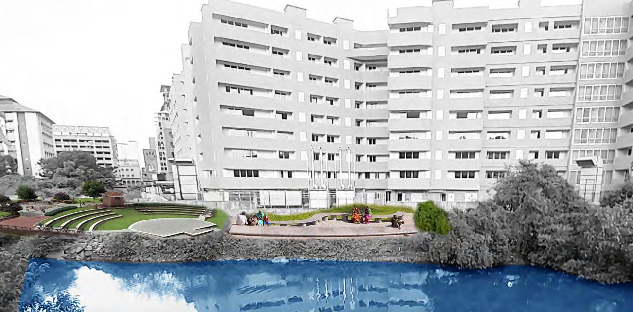 Figure 5.28. Example of Park Collage Along Rio De Ourém Creek
OVERVIEW AND PROBLEM STATEMENT
We had been assigned to work in the Sao Tome and Fontainhas neighborhoods of Panjim city. While at first glance, this heritage area may seem like a neighborhood with few problems, through different participatory research methods and community engagement events, we have identified several areas of concern for the residents and potential points for area-based interventions. Concerns raised by community members include heavy traffic on Rua De Ourém, lack of public green space, limited jobs opportunities, disruptive tourism, and lack of communication from government departments about development plans in their area. While more critiques have been made by citizens, we see potential for intervention in these categories. Thus, historical construction in the area, paired with the heritage preservation laws in Sao Tome and Fontainhas, has created limited access to public space in the neighborhoods as well as congested streets and heavy traffic. Considering regulations in the area, how can we create access to high quality public space, alleviate traffic congestion, and potentially create economic opportunities?
81

Figure 5.29.
Co-design Method Performed as A Participatory Approach
4: PROPOSALS
PROPOSAL 1
Conceptual: Integrate Community Participation into Imagine Panaji Protocol
There is a disconnect between Imagine Panaji’s park development plans and community feedback and input. We see this disconnect as an opportunity to do two things. First, to gather information from the public about what they would desire in a public park and what would make them want to use such a space. And second, an opportunity to connect the people who IPSCDL is meant to be serving with their existing plans and projects. The purpose of these actions is to give Imagine Panaji the report and feedback from our findings to display stakeholder’s desires for this public space as well as demonstrate the interest from residents in participating in decision making regarding development and changes in their areas.
Justification
Residents do not know about the development plans proposed by IPSCDL and IPSCDL has not asked the residents about their opinions in the design and development of this new public space. There is a need for building this metaphorical bridge between the two entities, especially considering public engagement and satisfaction are stated missions of IPSCDL. Residents do not speak highly of Smart Cities in general and especially Imagine Panaji. When we have spoken with them, they mention the beautification projects around the area, but consider these to be frivolous and not addressing the true problems
83
in Fontainhas. Yet, through participatory methods, we have identified public space and parks as something the residents desire for their community. If we can aid both sides, the residents and Imagine Panaji, in seeing the other’s point of view as well as realizing they want a lot of the same goals, there is potential for overall greater satisfaction for residents from the government and greater faith in community involvement for Imagine Panaji.
Implementation

Continuous work towards this goal has already taken place through collaboration with Imagine Panaji and involving them in our projects
throughout the entire fieldwork process. Our report is evidence that the communities in Sao Tome and Fontainhas want to be involved in planning and development decisions in their home, this has been concluded through our findings. It would be beneficial to Imagine Panaji to focus on participatory involvement methods in their process. One possible method of implementation is to have an internship or fellowship program for students or recent graduates in disciplines such as planning, architecture, urban development, resource management or public policy. This team could focus on research and participation alongside existing Imagine Panaji projects and proposals.
84
Figure 5.30. Diagram Illustrates Lack of Public Engagement
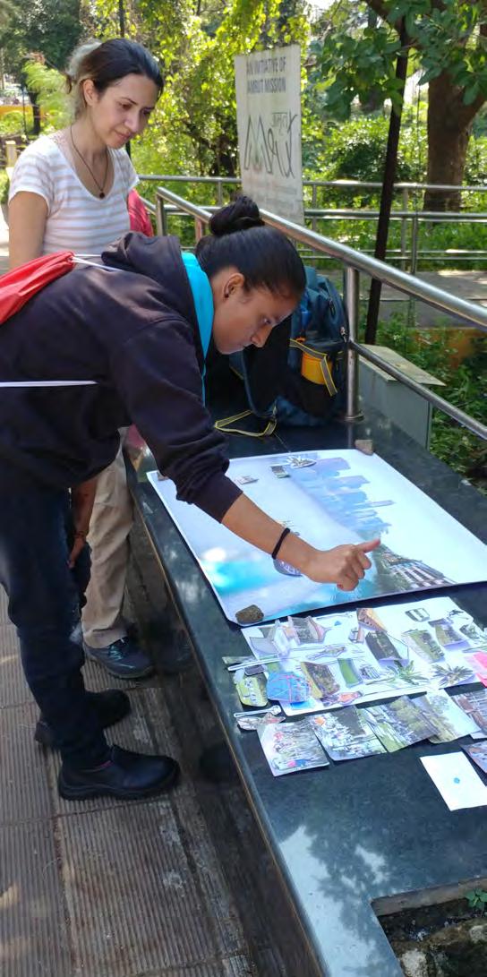
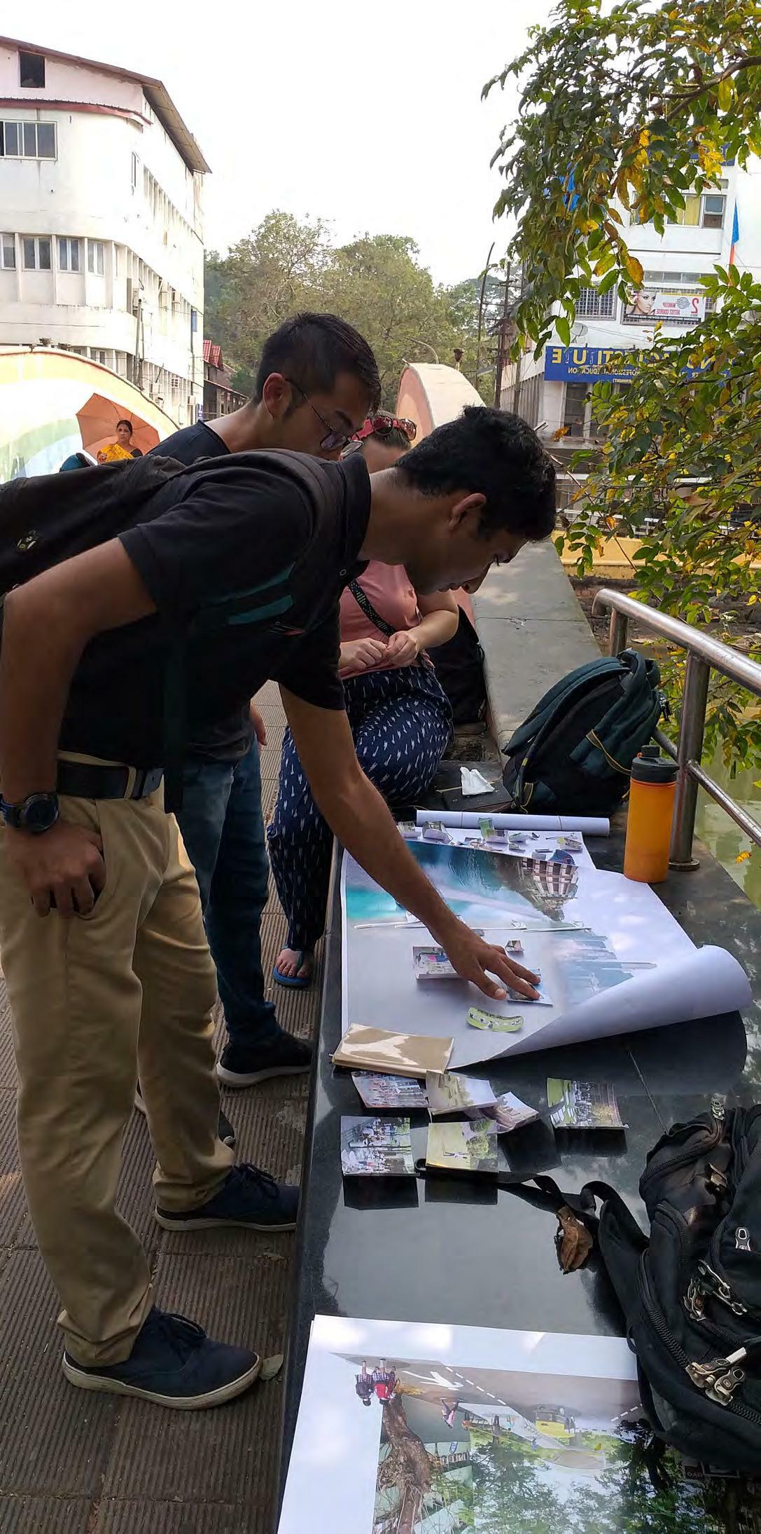
85 Figure 5.31.
Collage as A Participatory Method and Getting People’s Perspectives
PROPOSAL
Short-Term: Transformation and Improvements to Community Space
For a short-term intervention, we see an opportunity to create a small park in Sao Tome where the ruins of a vacant building remain. The park would be tailored to the older residents of Sao Tome who may have trouble walking the 500-700 meters it would take to get to the new public park. This small park would have shade, benches and light exercise equipment. We propose keeping the outer walls, if structurally sound, and incorporate them into the design to provide shade and preservation of the heritage building that once stood in its place. The purpose would be to provide a small shaded, comfortable outdoor gathering space in a neighborhood that has limited access to outdoor areas, less the roads and streets.
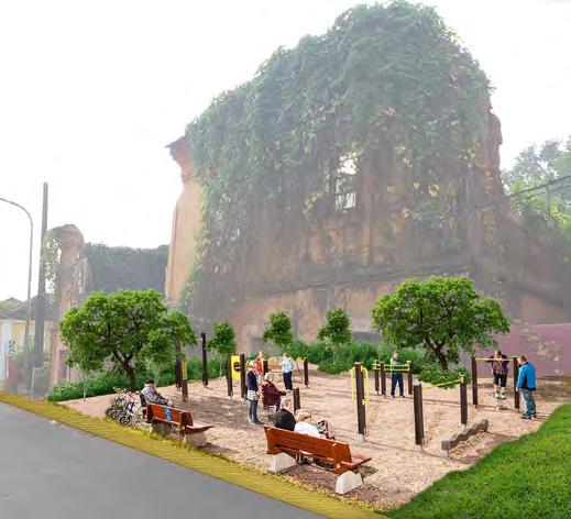
The first steps to implementation would be to find the owner of this lot. It could then be acquired by Imagine Panaji or the City Corporation of Panaji. Once the land is secured, a small investment can be made to develop the park.
Additionally, another short-term proposal we suggest is pedestrianization of half of Rua De Natal in replacement of one side of parking. This will allow more free movement from the chapel to the footbridge. We also recommend repairs be made to the light fixtures on the
current footbridge that crosses Rio De Ourém. This well used bridge becomes quite dangerous after dark as there is currently no functioning light along that pathway. Street lights run along the east side of the bridge, but they have been damaged and unmaintained.

86
2
Figure 5.33. Initial Proposal of a Park in Fontainhas
Figure 5.32. Resident’s Idea from Photo Ideation Method

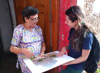 Figure 5.34. Revised proposal of Park Based on Participants’ Feedback

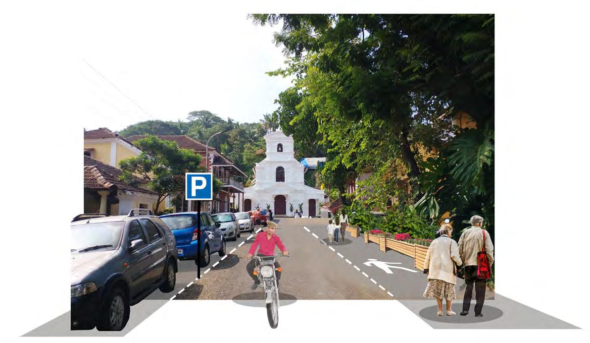

88 Figure 5.35.
Pedestrianization of Half of Rua De Natal in Replacement of One Side of Parking
Long-Term: Additional Pedestrian Bridge

Imagine Panaji has plans for revitalizing a boardwalk and developing a public park on the east side of Rio De Ourém in the coming years, just a few hundred meters from Fontainhas. Our preliminary design includes a pedestrian bridge from Rua De Natal that begins on the west side of Rua De Ourém and ends at the new public park. This bridge will act to reduce the dangers for pedestrians crossing the road and increase foot traffic through the area. Furthermore, it can create a space for community interactions, through the inclusion of bike paths for children and adults and designated stalls for food and commercial street vendors. We envision this to be more than just a footbridge to a park, but a socializing destination on its own.
Justification
IPSCDL has proposed two new footbridges over Rio De Ourém. Our design is not an additional footbridge, but a replacement design of a proposed bridge that does more than just get people across the river. The current footbridge is highly used by commuters, locals, and tourists with nearly 1,000 people crossing it during peak hours. It is also used as a meeting place, a spot to have lunch, and a place to fish. But the lack of shade during the day and lighting at night make it less than ideal for recreation. While some improvements could and should be made to this existing bridge, we also propose a second footbridge south of the existing one. This footbridge would start on the street near St. Sabastian chapel, go over Rua De Ourém, over the creek, and into the entrance of the new park. The location was picked because it connects to St. Sabastian chapel, a place where may tourists end their visit in Fontainhas, allowing them to easily cross over the water and reducing saturation of tourists inside Fontainhas. We also see the potential for easier access from east to west for commuters coming from the Panjim Bus Stand in Patto to Fontainhas and into downtown Panjim. When researching foot traffic on the existing bridge, we found that many commuters come from outside villages to work or go to school in Fontainhas and Panjim. By connecting the footbridge in this location, a more direct route from the bus stand to the schools in Fontainhas and downtown Panjim is created. This would bring increased foot traffic to our bridge.
89 PROPOSAL 3
ToCityCenter OurémCreek Panjim Bus Stand Public Park Figure 5.36. Connection of Public Park and Proposed Bridge with City Center and Bus Stand
Implementation
The first steps to implementation of this bridge would be continuous fieldwork with the community to address further concerns that may arise from this project. If the project gained stakeholder approval, a collaboration between Imagine Panaji and the Public Works department, the latter handles roads and bridges in Panjim, would be necessary. Other bodies involved include the Department of Tourism, who controls the space but has given permission to Imagine Panaji to develop, and the Water Resource Department, who manages the waterways in Goa. Approval from these departments is necessary as well as an in depth analysis of the cost of the project would need to be conducted. Once funds are secured, a team can be hired to complete the design, engineering, and construction of the bridge.
After construction, a maintenance plan would need to be developed to ensure the bridge stays in proper working conditions that retain the proper functions and safety of the bridge. Weekly maintenance would include rubbish bin collection while things such as light fixtures could be addressed on a monthly basis. Maintenance of the bridge is a big concern after implementation. Evidence of ill maintenance can be seen on the existing footbridge that crosses Rio De Ourém river. We have designed this space with vendor stalls, mainly food but also potentially art or craft stalls as well. These vendors would need to receive permits and
be monitored by the city. To help maintain the cleanliness of the bridge, we propose each vendor be responsible for their section of the bridge in return for a free vendor permit. This provides incentive for the stakeholders to maintain their space.

We recommend vendor priority be given to young adults in the area, giving them economic opportunities through food production, art, or other goods that can be marketed and sold to commuters passing between Fontainhas and Patto.
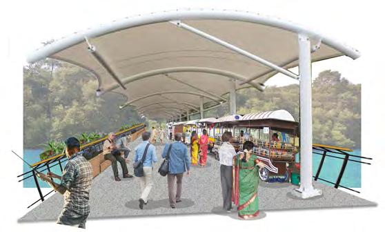
90
Figure 5.37. Proposed Bridge Considering as Public Space
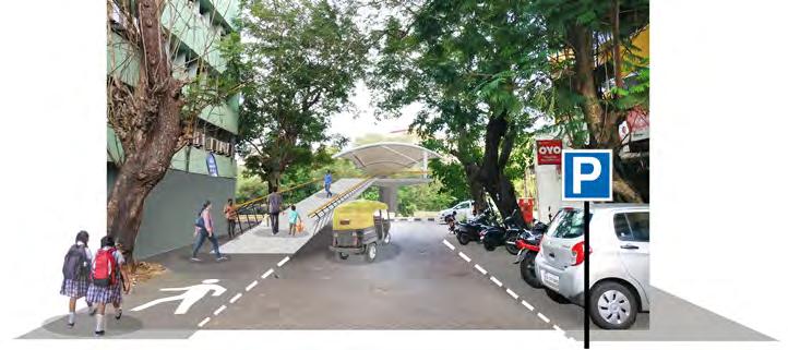
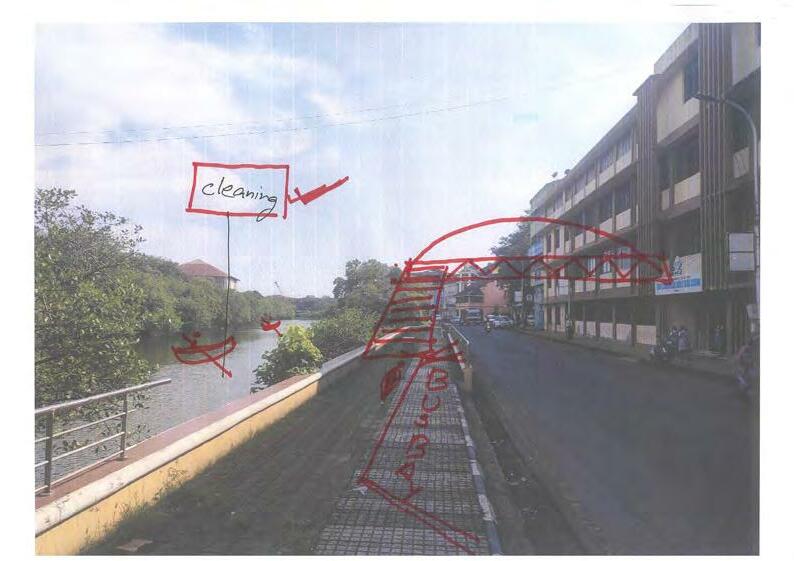
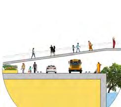
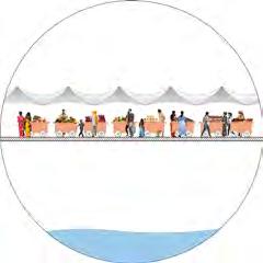
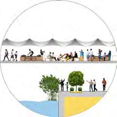

91
Planned Public Park Fontainhas Ourém Creek
Proposed Bridge Street Vendor
The Ramp Gathering Space
Figure 5.39. Sections of The Proposed Pedestrian Bridge
Figure 5.38. Proposed Bridge Started from Rua De Natal Road
CONCLUSION
The purpose of our proposals are to integrate more public space for the residents of Sao Tome and Fontainhas as well as other stakeholders including commuters and tourists. By developing a park with stakeholder’s interests in mind, we can ensure a higher rate of satisfaction with the development and future government projects. The voices and opinions of residents can be heard, allowing them to take ownership of their public space. We also want to make this space as accessible as possible by adding an additional footbridge near the St. Sebastian chapel and Mary Immaculate Girls school. Using the proposed design, this bridge can eliminate the dangers for pedestrians crossing Rua De Ourém street and potentially bring tourists into the new park also. But this bridge will also serve a function beyond a traditional footbridge. It will be a place to gather, have a quick meal while commuting, and relax. The purpose of the proposed food and vendor stalls is to create more attraction and use of the
space and can provide economic opportunities for vendors. The proposals we are suggesting build off existing Imagine Panaji work as we feel the best chance for implementation is to use stakeholder input and interest and integrate this into the new and existing Smart City projects. This not only improves community approval but is financially beneficial as Imagine Panaji already has budgets dictated for these projects, meaning less funds would need to be acquired. The alterations we envision for the footbridge will no doubt cost a great deal more than a simple footbridge that only crosses the river. But we feel the rewards could easily justify the cost. Yet further collaboration with the community should take place before such project is implemented. Residents want their voices and opinions to be heard, they have made that very clear. Our goal is to demonstrate how this can be possible through participatory community methods and to show both parties that they have more in common then less.
92
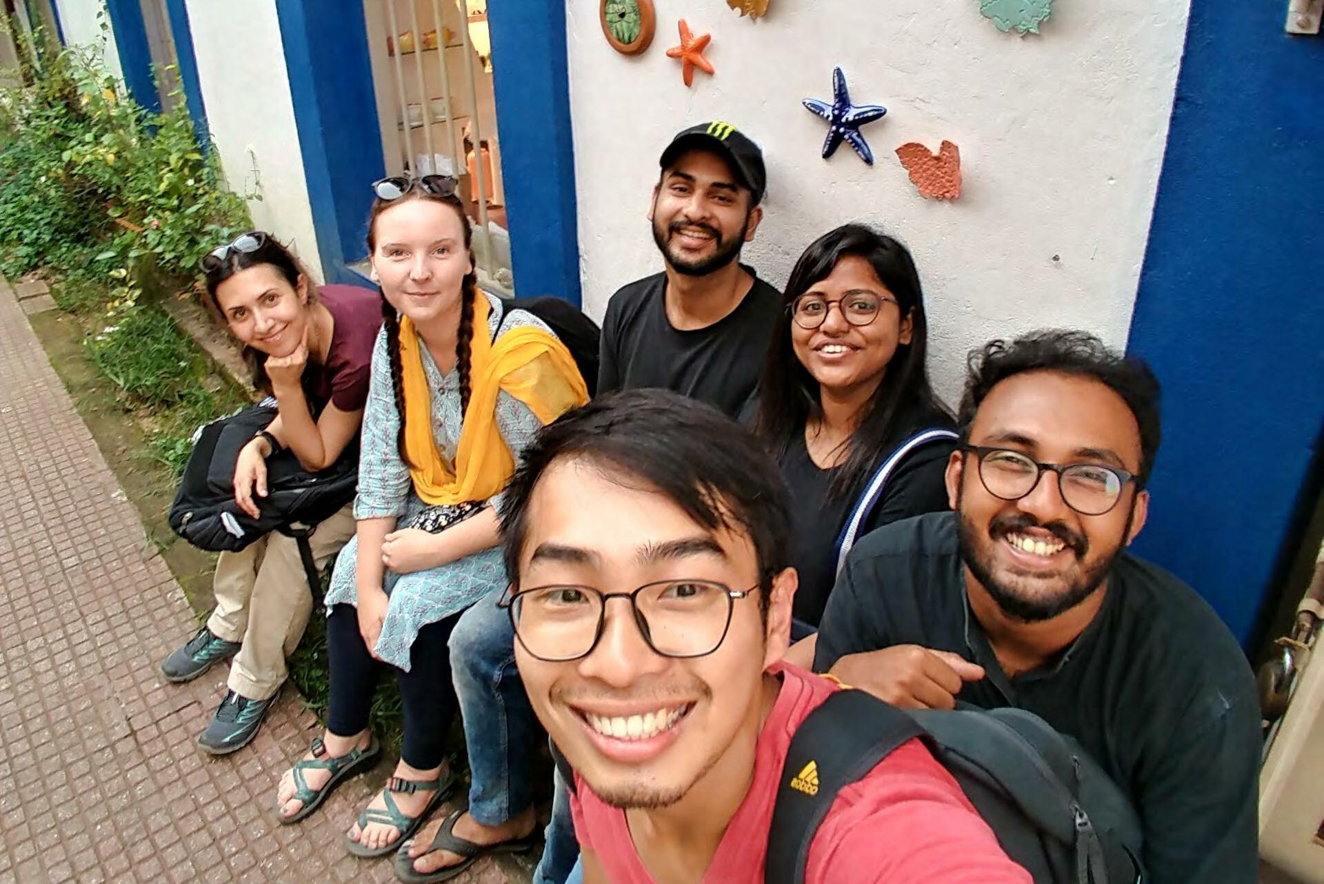 Figure 5.40. UEP and SPA Students

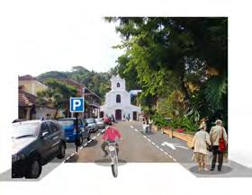
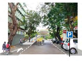
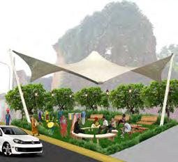
94

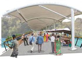


95 Figure 5.41. Proposed
Situational
Sketch of
Fontainhas
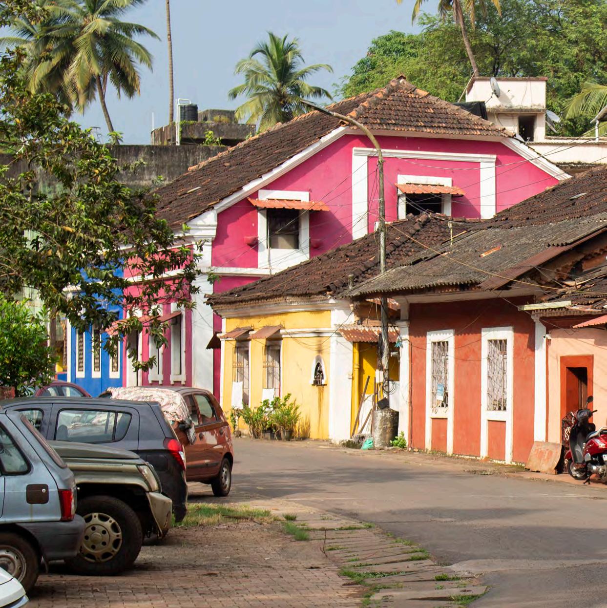
group6 Fontainhas & Mala


98 Figure 6.1 Overview Map
BACKGROUND
Background
As you walk through Rua 31 de Janeiro, leading from the casino boats all along to the phoenix spring, you get to experience the 3 neighborhoods of the Latin Quarter. The colorful, small scale houses and the peacefulness of the area make it a special place and you almost forget that you are in India, only a few hundred meters away from the busy central business district.
However, despite the homogeneous architecture of the buildings, it is not hard to feel differences as you walk along the main strip, especially as you shift from Fontainhas to Mala. The heritage houses are less maintained and the density of commercial offers decreases the more south you get. It was through our later research and observations that we learnt that the neighborhoods have been historically divided according to their religious affiliations, reflected in the built up form and community cohesion as well. During our three month fieldwork as group 6, we focused on Fontainhas and Mala and the relation between the two.
Aims and objectives
The aims of this study are to understand the site and the community in its different aspects, and develop proposals for strategic interventions in interaction with the stakeholders. To achieve these aims, we studied the site through different participatory methods with the community and key stakeholders, prepared the situational analysis from our findings and observations, identified the issues in the area - as well as strengths and potentials, and developed proposals as well as strategies to implement them.
99
Familiariza�on Semi-structured interviews Expert interviews


Expert interviews Par�cipatory mapping
Empathizing

- Resource mapping -Mental mapping -Focused group discussion -S�ckers game
Theory Paper Issue Priori�za�on
SEPTEMBER OCTOBER NOVEMBER
Introduc�on booklet
01 04 05 Arrival in Goa
02 Diwali break
JOINT STUDIO with SPA DelhiIden�fica�on of problems
Stakeholder Mapping
Start of Foto challenge
Focus group
The Elderly - Associa�on with photos - Idea�on
Emoji game Sociotechnical mapping Interviews

100 Figure 6.2 Timeline
03
TIMELINE
Theory Paper Issue

Priori�za�on

Midterm Presenta�on Report
Report Dra� Issue Priori�za�on
Feedback from Comunity Vision Crea�ng Workshop
Final Presenta�on
07 08 09 10
Discussions with stakeholders
Elabora�ng on solu�ons

“Future of Fontainhas”
Delivery
11
12
Collage with high school children
Tes�ng of Proposals

Departure from Delhi
Joint Workshop with SPA Delhi
101
Diwali break NOVEMBER DECEMBER
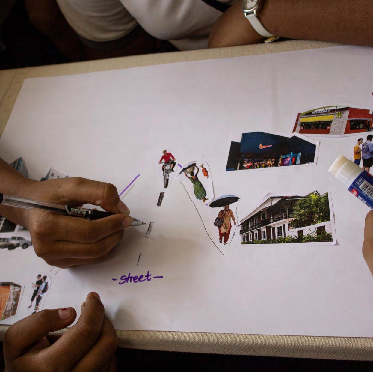
Figure 6.3
Collage Workshop With High School
METHODS
To conduct our research in the field we have been working with participatory methods and human-centered design approach, which is a non-linear, continual process, useful when tackling problems that are unknown or illdefined. It’s aim being designing with people and not for them, the process consists of five stages which help the designer to understand the users, challenge assumptions, redefine problems and invent creative solutions. (IDEO. org, 2015, pg. 9-25).
1. Empathizing. This step is about researching the users’ needs and gaining an empathetic understanding of the problems we’re trying to solve.
2. Defining. In this stage all the information gathered and created in the first step is used to define the core problems and needs of the users.
3. Ideating. This is the time to create ideas and think outside of the box. With the background knowledge from the two previous stages, we look for different ways to view the problem and identify solutions.
4. Prototyping. In this phase the objective is to determine the best possible solutions for the
problems identified in the earlier phases. The idea is to be experimental and try out various versions of the product.
5. Testing. This phase is about trying out the best solutions from the previous phase. Even though this is the last phase of the model, the results from this are often used to redefine one or more further problems.
During our work in the field we tried to use different methods to find out what would work best in our community. We learned a lot through trial and error, and went back and forth between stages to be able to identify the most pressing problems in our community and create the best possible solutions to them. However, due to limited time and resources, it made sense to combine the prototyping and testing phase in our case. Since we spent most of our time in the empathizing, defining and ideating phase we didn’t have the possibility to prototype different solutions.
103
EMPATHIZING
Familiarization
Familiarization was the first step needed to approach the site. While it was our focus in the beginning of the fieldwork, we constantly had new aspects we needed to get familiar with throughout the three months.
The first step was doing research - putting “Fontainhas” into Google and going through Google News and other articles related to the area. This prepared us with an initial understanding and notion of Fontainhas before stepping into the site.


As a second step we had to get familiar in a physical way. We printed out a map and did our first walks through the area to get a general overview, while recording the paths we took and the main landmarks. Eating at local restaurants and observing the interactions between people aided us in creating some first impressions as well.
As a third step we participated in small conversations with people living and working in the area. Through this we were able to not only gain some information, but also introduce ourselves and the purpose of our fieldwork.
Flyer


Approaching community members and explaining exactly what we are doing was a difficult step for us, especially in the first days in the area. Hence we decided to design a flyer with our picture, contact details and information about our work
Figure 6.4 Familiarization Graphic
104
and background. Handing it out to people made it easier to initiate conversations, and it raised their interest and curiosity in engaging with us. Moreover, it helped us in gaining their trust.
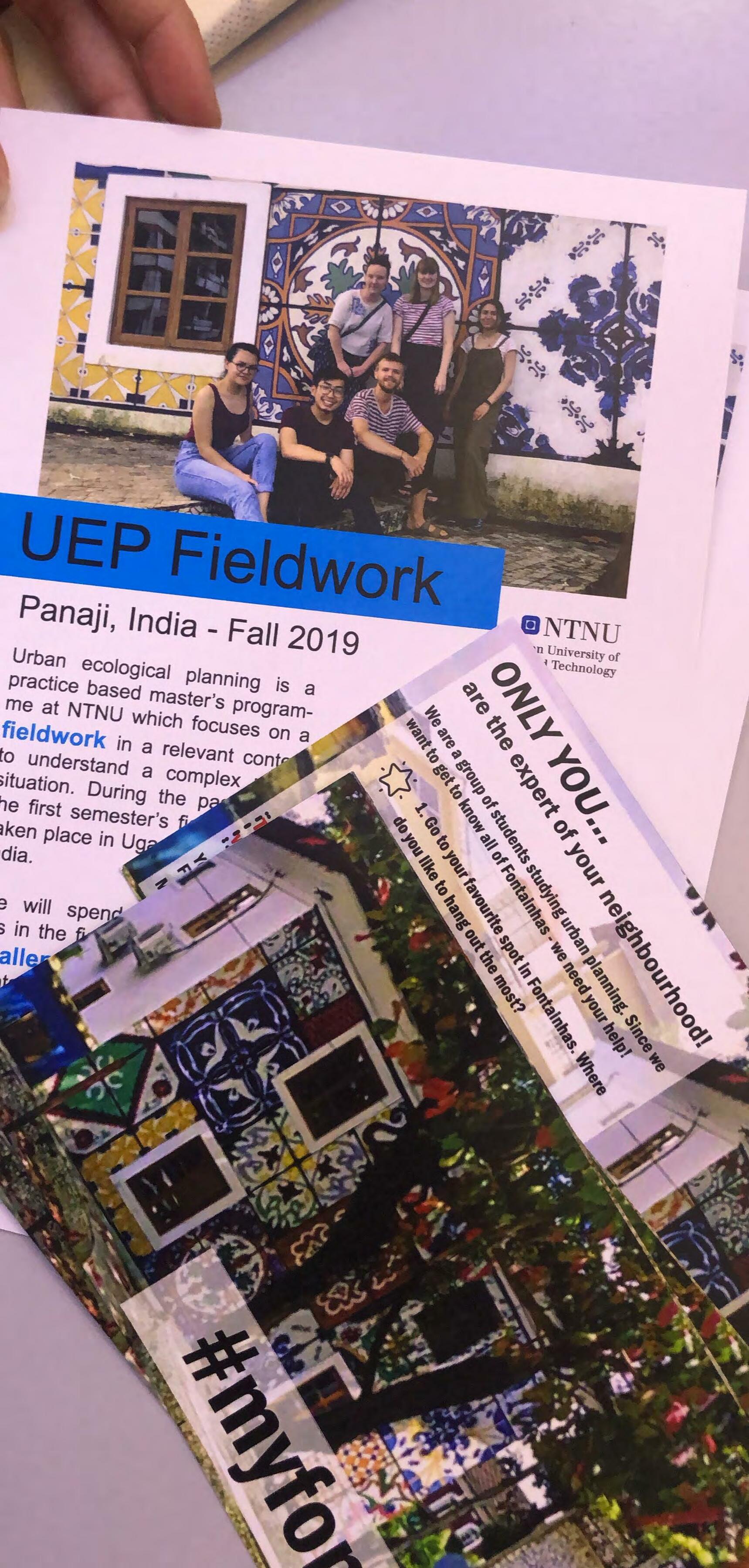
Instagram Challenge
We wanted to expand our interaction means with the community. So, in collaboration with group 5, we ideated a photo challenge so as to give people a platform to express themselves in a more creative way, and give us a perspective of their feelings towards the area through a different angle. Instagram, as one of the most popular image sharing social media networks, was chosen as the site where they could upload a picture of their favorite spot in Fontainhas using the hashtag #myfontainhas. Flyers were prepared and distributed around the site for this campaign.
The final result we expected was a “mosaic” of Fontainhas, built up over the time we spent here. However, we did not receive the response we anticipated. Towards the end of the fieldwork we learnt that the naming of the neighborhoods is a rather sensitive topic. Residents from Mala don’t relate to the name “Fontainhas”, even though it’s a term used to encompass the three wards. Furthermore, the picture we used in the design of the flyer is from one of the gentrified buildings of the area. If these issues were considered in the beginning, this might have been a more useful method.
105
Figure
6.5 Introduction
Flyer & Photo Challenge
Semi-structured interviews
Gaining insight of the area was naturally accompanied with a continual arisal of questions. With these in mind, we conducted a lot of semi-structured interviews. We organized several open-ended interviews with experts or stakeholders from the neighborhood, like architect Tallulah da Silva, or owner of the Panjim Inn hotel, Jack Sukhija. Additionally, we held informal interviews mainly targeted at residents. The collaboration with SPA students was very helpful in this, as it broke down language barriers and enabled us to access more residences.
Participatory Mapping
To get an idea of how the local people felt about their neighborhood we did a mapping exercise in public space. We created a poster with a map of the Fontainhas area and handed out stickers in different colors, each color representing a different category: “Place I like”, “Place I dislike,” and “Place I want to change.” The participants could then put these stickers directly on the map. We hung the map on several spots in the area to reach as many diverse people as possible.
The greatest outcome of this method was that we came in touch with a lot of people. The poster was easy to spot and sparked curiosity, making people approach us and be open to talking with us. Even in the case where they were reluctant to put stickers on the map, it was a successful mean to initiate
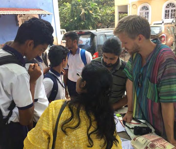
insightful conversations. Unfortunately a lot of the partakers were not local residents but tourists, so it was sometimes hard to get sitespecific results.
Resource- and Mental Mapping
This method, also conducted in cooperation with the SPA students, was done for a better understanding of the way the residents relate to their neighborhood. They were given a blank piece of paper and asked to draw the routes they usually take in the neighborhood and landmarks, services or other spots they use in their everyday life. The results helped us perceive their connection to the area and availability of resources in it. An experienced difficulty was people not willing to draw, in which case we had to take over the pen and make the sketches for them. Through repeated inquiries, we made sure to draw as close to the people’s ideas as possible.
106
Figure 6.6 Resource Mapping With Students

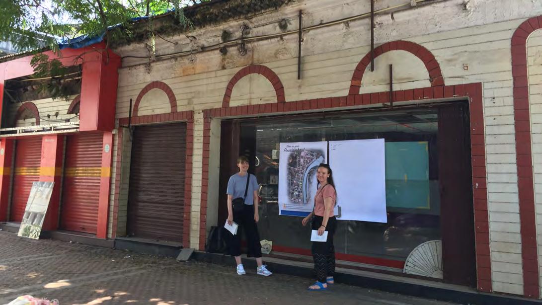
107
Figure 6.7 Participatory Mapping
Figure 6.8 Semi-strucured Interview With Tuk-tuk Driver
Focus group: Senior citizens
We considered learning how the area has transitioned through time an important aspect of analyzing the site. Hence, we decided to concentrate on the elderly as a focus group and carry out some activities with them. This was further motivated by the presence of the Senior citizens Recreation center in the area, which made it possible to hold a spontaneous group discussion. To cover an even larger variety of residents we extended our research to senior citizens from other parts of the neighborhood and approached random people on the street who invited us into their house.
The following exercises were done with the focus group:
- “What’s Your opinion?” Game
In this exercise – similarly to the participatory mapping – we gave the seniors the chance to write their opinions divided into three categories: “What is good about the area?” “What is bad about the area?” “What would you like to change?”
- Spatial associations through photos
By showing print out shots from different spots, we aimed to understand how the elderly associate to them and invoke storytelling about the situation in the past. The pictures showed a variety of assumed problem areas like house abandonment, fractured development or lack of open space. The elderly expressed their concerns and worries about the present
situation, and a longing for the past when their association to the public space was different and some of the problems did not exist.
- Old Photographs
Another method we planned to use to not only further encourage the storytelling, but also provide us with visual information of Fontainhas in the past, was asking the seniors for old photographs they have. However, it was an unsuccessful tool in our case, as the residents claimed to not have any pictures or gave empty promises to give them at a later time.
DEFINING
Emoji game
Emojis have become a common way of showing emotions and can be seen as a simplified international language for feelings. In this method we used emojis to get an understanding of how the locals felt about the old and new developments in our area. We printed out chosen pictures from the site and made people vote on which emoticon that fit their feelings towards the place in the image. The results revealed that most of the participants had positive feelings for the long established cafés and restaurants, while they had mostly negative feelings towards the new, hip businesses.
108
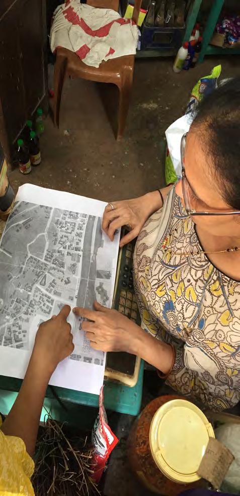


109
Figure 6.9 Spatial Associations Through Photos
Figure 6.10 Spatial Associations Through Photos With Senior Citizen
Figure 6.11 Resource Mapping With Shopkeeper
Prioritization
It was important for us to confirm that our understanding of the site and its issues were accurate and not simply our interpretation of the analysis and methods used. Therefore, we decided to have an exercise for the residents to prioritize their needs and to give them increased control over the direction of our proposals.
We made 5 cards with problem statements, and asked residents from both Mala and Fontainhas to prioritize them. The selection of the residents was made together with a resource person who helped us get contacts who were willing to participate in this method.
The following issues were given to rank:
1. Tourists are disturbing our everyday lives
2. We do not receive any support to maintain our houses
3.Heritage laws limit our business opportunities
4. Fontainhas & Mala are losing their identity due to non-local influence (cafés, restaurants, etc)
5. We do not profit from the increasing number of tourists
The financial problems regarding the maintenance of the heritage houses were highlighted by the people from both neighborhoods, whereas tourism was only regarded as an issue for the residents in Fontainhas.
Compared to other methods with a rather open outcome this one is suitable to get participants to focus on specific topics. However, we discovered that the pictures used to illustrate the issues should be selected carefully because they can distract from the original statement. Using icons seemed to work more efficiently.
IDEATING Draw your ideas
To understand what is important to people and what changes they would like to see in the neighborhood, we gave them pictures taken from the area and asked them to draw on top of them. We chose pictures of places we thought could be improved, but also pictures of sites we were curious of people’s opinions about. Some of the participants were reluctant to draw on their own, but then one of us would draw for them while they explained what they wanted.
This method gave us ideas for improvements that could be done in the area, and we got some interesting insights: The Smart City beautification of the stairs was not so well liked, as it was thought to be out of character for the area. We also understood the importance of keeping the heritage buildings, since participants turned an abandoned building into a museum on the drawing. We did this workshop at a time we had a focus on the elderly population - we might’ve gotten different results if we focused on the younger generation.
110
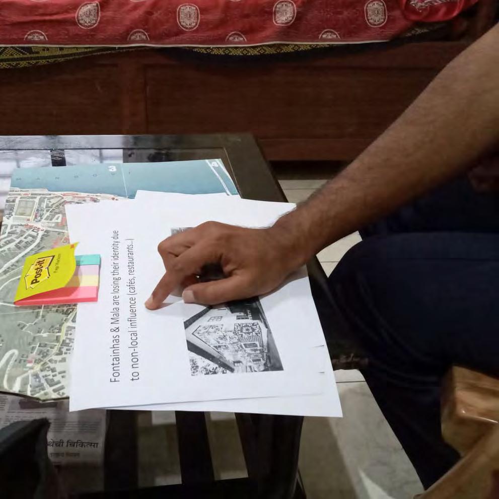
Figure 6.12 Pioritization Of Problem Statements With Resident
RESULTS FROM DRAW YOUR IDEAS

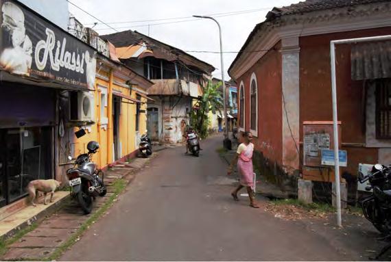


112
Figure 6.13 Results From Draw Your Ideas - Exercise
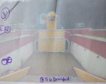
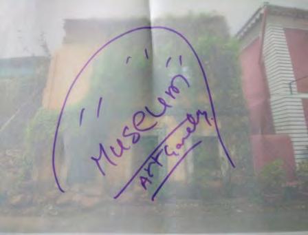
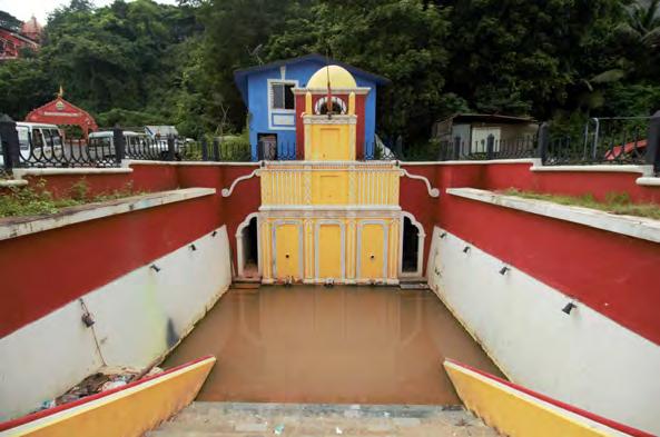

113
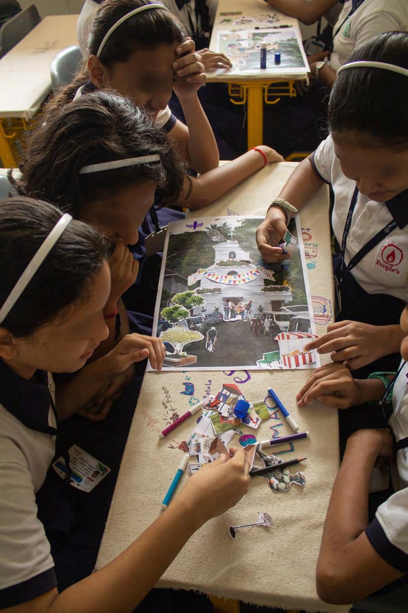
114
Figure
6.14
Collage Workshop With High School Students
Collage workshop
We organized a collage workshop with a focus on 8th grade students from the People’s Higher Secondary School. This kind of interaction with people one is designing with helps understand how they think, what they value, and may bring unexpected themes and needs to the surface. Collages are an easy way to push people to make something concrete and then get them to explain what it means to them.
The collage workshop was divided into two different exercises. In the first one we wanted the students to give us ideas on how to design events/festivals that can happen at open spaces in our area. We gave them pictures of three open spaces we picked out, and provided them with stickers of various street furniture, greenery, decorations, food stalls, bands, etc. They were then asked to make the open space according to what they would like to see happen there.
In the second exercise we wanted to see how aware the younger generation is of the importance and values of the heritage buildings of Fontainhas. Therefore, we gave them blank sheets of paper with a drawing of a street and stickers with heritage buildings, local people, local cuisine and, as a contradiction, skyscrapers, western chains such as Nike and McDonald’s, and tourists. The students were told to make the street how they would like it to be in Fontainhas, and they were also encouraged to draw on the paper in addition to
using the stickers. At the end of each exercise we went around to the groups and asked them to explain what they made and why they made it that way.
The workshop was a success. In the first exercise the students had a variety of different ideas for the open spaces and what can happen there, and it was nice to have them co-design with us. It became clear that a lot of them wanted more green space/park areas and places to sit like benches in the area. Some collages also showed festivities organized in public space and children explained to us how the streets could be used for this purpose.
Looking at the second task it’s clear that they were more aware of the heritage than we first suspected. A lot of the groups separated a local street from a bigger city street. In the local street they only put heritage houses, local people, Indian food and Anita’s Tea house. In the bigger city street, they would put space for parking, museum and the Western chains. When asked where they would like to live, they would respond in the local street. However, there were also a lot of cases where the students would juxtaposition heritage houses with high rise office buildings and Nike shops, put McDonalds burgers on top of Anita Tea-house, and, while acknowledging the value of the heritage, express a wish for new development. At the end of the workshop we thanked them for their input and explained to them our understanding of the results.
115

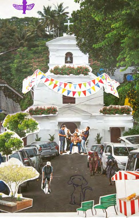
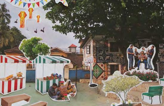
116 RESULTS FROM EXCERCISE 1 Figure 6.15 Results From
Collage
Workshop Exercise 1

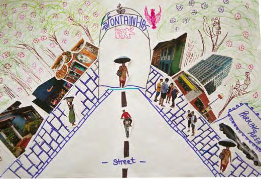
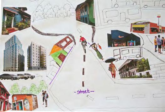

117 RESULTS FROM EXCERCISE 2 Figure 6.16 Results From Collage Workshop Exercise 2
Future Vision Workshop
One of the last workshops we planned to do with the community was one workshop where we invited the residents of Mala and Fontainhas, ward councilors, experts like Smart city to create a common vision for the area. In gathering all these people, we hoped to activate their creativity by finding solutions to their mentioned problems in one process.
The format of this workshop is based on another existing one, the Future Workshop. Future Workshop has been developed as a method to support the political struggles of community groups for a better enforcement of their interests to create an improved future. It’s based on the approach that to change the situation of a system you first need to criticize the actual situation, then dream about a preferable future situation, and finally find ways to move from the actual situation to a preferable one. It emphasizes critique, learning, teamwork, democracy, and empowerment in one single activity. This can be seen in its focus on facilitated and participative group processes to deal with real-life problems.
The “classic” Future Workshop consists of five phases:
1. The preparation phase. The practical parts of the workshop, such as the theme, the methods and the timetable, are decided by the organizers and facilitator before the workshop starts. Participants are invited.
2. The critique phase. The identified problem
is critically and thoroughly discussed and investigated. Brainstorming is the preferred creative technique followed up by a structuring and grouping of ideas in some main sub-themes.
3. The fantasy phase. The participants try to work on utopia, to draw an exaggerated picture of the future. Brainstorming and other creative techniques might be used. The social fantasies of the participants are developed in this phase.
4. The implementation phase. The ideas found are checked and evaluated in what concerns their practicability. An action plan is elaborated.
5. The follow-up phase. The action plan is monitored, eventual changes are made and if needed, new Future workshops are planned (Valqui Vidal, 2005).
Due to feedback of the owner of the Bookworm Library we decided to reduce the duration to two hours although the usual recommended length is about a whole day so as to have enough time for each phase. In our schedule we shortened each phase and focused on the critical and the fantasy ones and let it open if there would be enough time for the implementation phase.
The workshop was scheduled for Friday 15th of November, from 17.00 to 19.00 in the local Bookworm library.
To promote the workshop, flyers were distributed on three site visits and posters were hung up on important spots of the neighborhood. Additionally, all known stakeholders and residents got informed via whatsapp and calls. Some closer contacts even forwarded the invitation to whatsapp groups
118
CREATE YOUR FUTURE NEIGHBOURHOOD


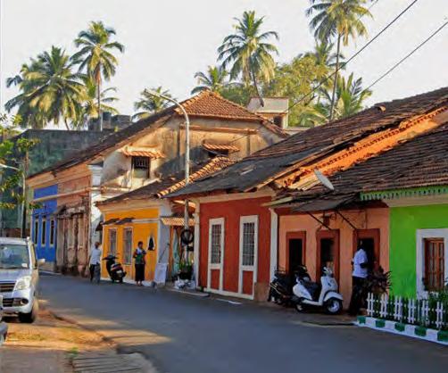
119 How should Fontainhas & Mala develop in the future? Do you have an idea in mind to improve your living environment? FRIDAY November 15th 17:00 - 19:00
Bookworm Library This is the chance to present your opinion and ideas. We want to hear, what You think since only You know your neighbourhood the best. Don‘t miss your chance to participate in your future! In the futureworkshop we‘ll work on Your ideas and try to find ways to implement them in the reality. यह आपकी राय और विचारों को प्रस्तुत करने का मौका है। हम सुनना चाहते हैं, जो आप सोचते हैं, केवल आप अपने पड़ोस को सबसे अच्छे से जानते हैं। अपने भविष्य में भाग लेने का मौका न छोड़ें ें! भविष्य की कार्यशाला में हम आपके विचारों पर काम करेंगे और उन्हें वास्तविकता में लागू करने के तरीके खोजने की कोशिश करेंगे। free SNACKS & Drinks! For more informations call: 7558658962 भविष्य में फॉनटेनहास और माला का विकास कैसे होना चाहिए? क्या आपके मन में अपने रहने के माहौल को बेहतर बनाने का विचार है? Figure 6.17 Poster For Vision Workshop
or posted it in a Facebook page.
Outcomes:
Despite the wide promotion of the workshop in the end only five people participated. In the beginning it was a couple and the ward councilor from Mala. We tried to fulfill our workshop schedule, but it was difficult to make the participants understand how the procedure would be and what we expected them to do. So in the critical phase they wrote down their issues on post-its but sadly no discussion amongst the participants occurred. The problems that got addressed during the critical phase were similar to the ones we already discovered: Expensive maintenance of heritage buildings or infrastructure issues that are applicable for the whole city like transport, aggressive street dogs or the increase of car-traffic.
Unfortunately there were some misunderstandings regarding the outcome of the workshop. So, instead of discussing and brainstorming about possible solutions for the problems, the participants were expecting solutions from our behalf. In the end, participants seemed to be disappointed and left the workshop earlier than planned.
Focus Group Discussion
Two other participants attended the workshop later - one from Fontainhas, one from the Mala neighborhood. This opened up a very interesting discussion. Although the workshop did not work as expected at least the goal to bring together residents from both communities
was fulfilled.
Findings/Observations:
- There are missing links between residents from Mala and Fontainhas. Residents did not have any bonding capital yet and did not know about occurring happenings in the other ones neighborhood.
- Both said that there is a lack of platforms to communicate with each other and introducing a new one would help to have a better understanding of their issues.
- “There is no unity to fight for something.”there is a solid base and an optimistic view to achieve a change.
TESTING & PROTOTYPING
Feedback from stakeholders
In the last phase of the fieldwork we wanted to get feedback from the people in our area on our proposals. The future workshop showed us that getting the whole community together is not easy to achieve as very few people showed up. This would also be difficult to organize because of the time constraints. Therefore, we thought it would make more sense to show our proposals to important stakeholders who have a wide network in the community and get feedback from them. For each proposal we selected the most relevant stakeholders to get constructive feedback about possible implementations.
120

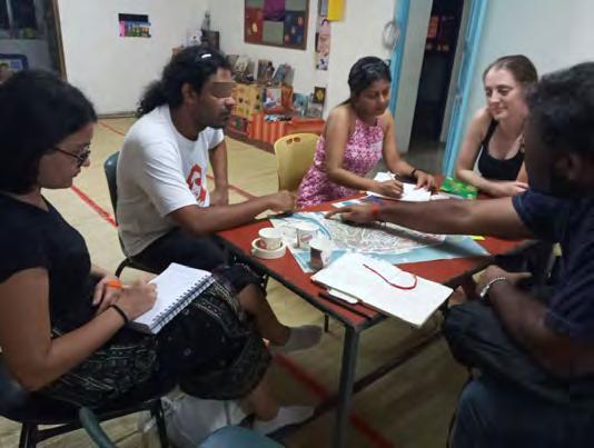

121
Figure 6.18 Vision workshop - Focus Group Discussion
Figure 6.19 Vision Workshop
Figure
6.20
Feedback From Raghuvir Mahale
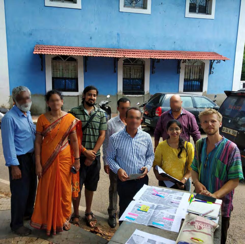
Figure 6.21 Unplanned Meeting With
MLA Of Panjim
STAKEHOLDERS
Analyzing the stakeholders involved or affected by the decision-making in Fontainhas is a crucial step to creating a better understanding of the area. This step provided us with insight on who has the potential to assist with the project and who is currently being left behind, who can become a barrier to our proposals and who is a possible anchor for implementation. To create a clearer idea, the stakeholders have been categorized into four groups: institutional, social, religious and economic, and positioned into a stakeholder map reflecting their interest and power in influencing changes in the area.
INSTITUTIONAL
Imagine Panaji Smart City Development Limited (IPSCDL) - This Government Company and Special Purpose Vehicle of the Government of Goa is formed to develop smart urban projects for the city of Panaji. It has the power to plan, approve, release funds, implement, manage and evaluate development projects in Panaji City, but under the requirements of MoUD (Ministry of Housing and Urban Affairs). This autonomy coming from the administrative authority and financial resources position it relatively high in
the power coordinate of the map. Their interest in the area is also high, as demonstrated by numerous implemented projects and ongoing proposals around the area.
Charles Correa Foundation – an initiative of the Indian architect and urban planner Charles Correa. It aims to catalyst interventions in the problematic areas by encouraging communities to participate with ideas and involving the implementing stakeholders. Its office is located in one of the heritage buildings in Fontainhas, and it has already shown interest to improve the area through several studies and project proposals.
Goa Heritage Action Group – This nongovernmental organization was founded in 2000 to monitor and preserve Goa’s heritage. Because Fontainhas is a heritage conservation zone, it’s a body likely to be interested in the improvement of the area, but also able to facilitate project realization.
CCP - Corporation of the City of Panaji provides foundation towards planning and improving urban infrastructure and services to make Panaji
123
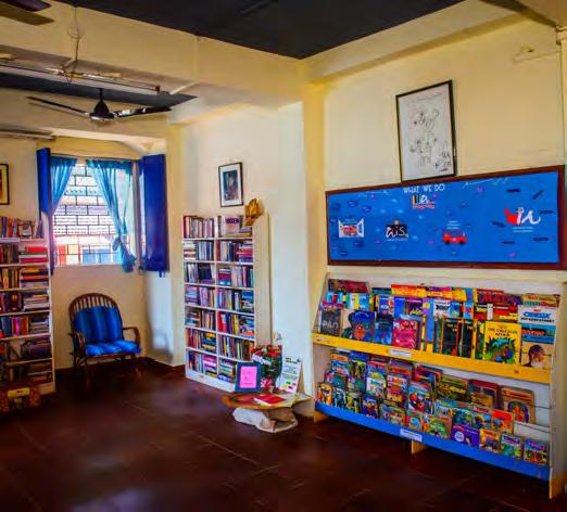
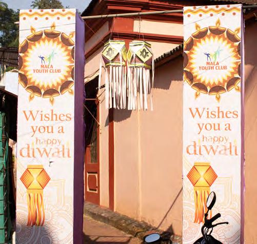

124
Figure 6.22 Bookworm Library
Figure 6.23 Association In Mala
Figure
6.24
Charles Correa Foundation
more livable, sustainable and resilient and ensure a good quality of life to its citizens. It works with Smart City Mission, AMRUT (Urban Transport, Water Supply and Sewerage) and Swachh Bharat Mission (Clean and Green city), so it is an important figure in the stakeholder map.
Ward Councilor – Each ward councilor is a member of the ward committee, which gets elected for a period of five years. The role of the councilor is to have public meetings with the community and represent them in the council, so that the municipality addresses their issues related to basic services and infrastructure. Two wards fall into our study area, Fontainhas (no. 23) and Mala (no. 19). As the main bridge between the residents and the government sector, the two councilors possess relatively high power.
Town & Country Planning Department
- The physical planning and development control department for the State of Goa has the objective of implementing various plans like Regional Plan, Outline Development Plan, Traffic and transportation plan etc. Its scope also covers the heritage buildings and sites of Goa. Offices of the department for North Goa district are located in Mala.
MLA – The current Member of the Legislative Assembly is Atanasio Monserrate. MLA’s responsibilities encompass formulating laws referring to different sectors and ensuring the budget for the governance of the state is used
efficiently, which position it high in the power axis of the map.
Bookworm library – Established in 2005, its main aim is to encourage reading and provide accessible collection of books for all kids, especially the ones coming from families with limited economic resources. Even though it’s mainly for kids, it’s highly interactive with the community through its workshop spaces and cultural activities for different age groups, which demonstrates a high potential for involvement in projects in the area.
Schools – There are four schools in the area of different levels, ranging from preliminary to high school. The students attending are not just from Fontainhas, but all over Panaji and further. The students are kept inside the school facilities during the school hours. Since these institutions are not using the outdoors, their interest in changing the area is not as high. Their power is even lower.
ECONOMIC
Business owners – While all the business owners benefit from improvements done in the area, foreign ones usually have a stronger financial capital as compared to the smaller local businesses, which locates them in different points regarding the power they hold.
Make-It-Happen Heritage Walks - Founded by Maria Victor in 2015, “Make-It-Happen” is focusing on guided tours through Fontainhas, Sao Tome and other areas close to Panaji.
125
What differentiates her company from other tour providers is her local, community based approach. “Make-it-Happen” tries to include some local activities into their tours which makes it possible for the locals to profit from the rising number of tourists. These activities include listening to a local musician, visiting a typical heritage house or checking the cooking techniques of an old bakery.
Maria is always open for new inspirations and is currently thinking about possibilities for the expansion of her offers - also to the Mala neighborhood.
SOCIAL
Residents – Faced with the issues of the area on a daily basis, the residents’ wish for improvement is high. However, the stagnant situation and lack of responsiveness from the governmental bodies has led them to believe they have no power to bring any change. The general absence of networking and unity has furthermore aided in the lack of initiative for action and expression of demands. During the fieldwork we managed to get to know many resource people who were willing to provide us information and to cooperate with us. These “gate-keepers” were important contacts also in terms of sharing and spreading invitations to the rest of the neighborhood.
YUVA - This voluntary organization, founded in 2012, organizes activities related to different aspects of social life, with the aim of giving back to society in terms of progression and
development. The founder, Raghuvir Mahale, being a resident of the Mala area, and the running of several projects in the zone (i.e the cleaning of Fonte Phoenix spring) are indicators of this team’s high interest.
Mala Women’s Association – This cooperative’s purpose is to enhance the economical collaboration of women in the area. Its power relies on the networking created between the women, and the interest in interventions is relatively high because it would benefit both the women as individuals and the association as a whole.
Prince of Mala – It’s a youth association of only boys who organizes events for different activities, but mainly Diwali. Similarly to Women’s Association, its power relies in the social capital created.
Students from outside Fontainhas – The kids of different ages attending classes in the heritage area like to spend time in their break or after classes around the neighborhood, especially the middle and high school level. So, even though projects in the area wouldn’t affect them as much, it would still benefit them to a certain point.
Tourists – Fontainhas is a constant destination for tourists coming to visit Goa. Their interest in seeing changes in the zone would be translated in higher motivation to spend their traveling hours here. However their importance is secondary compared to the priority that should
126
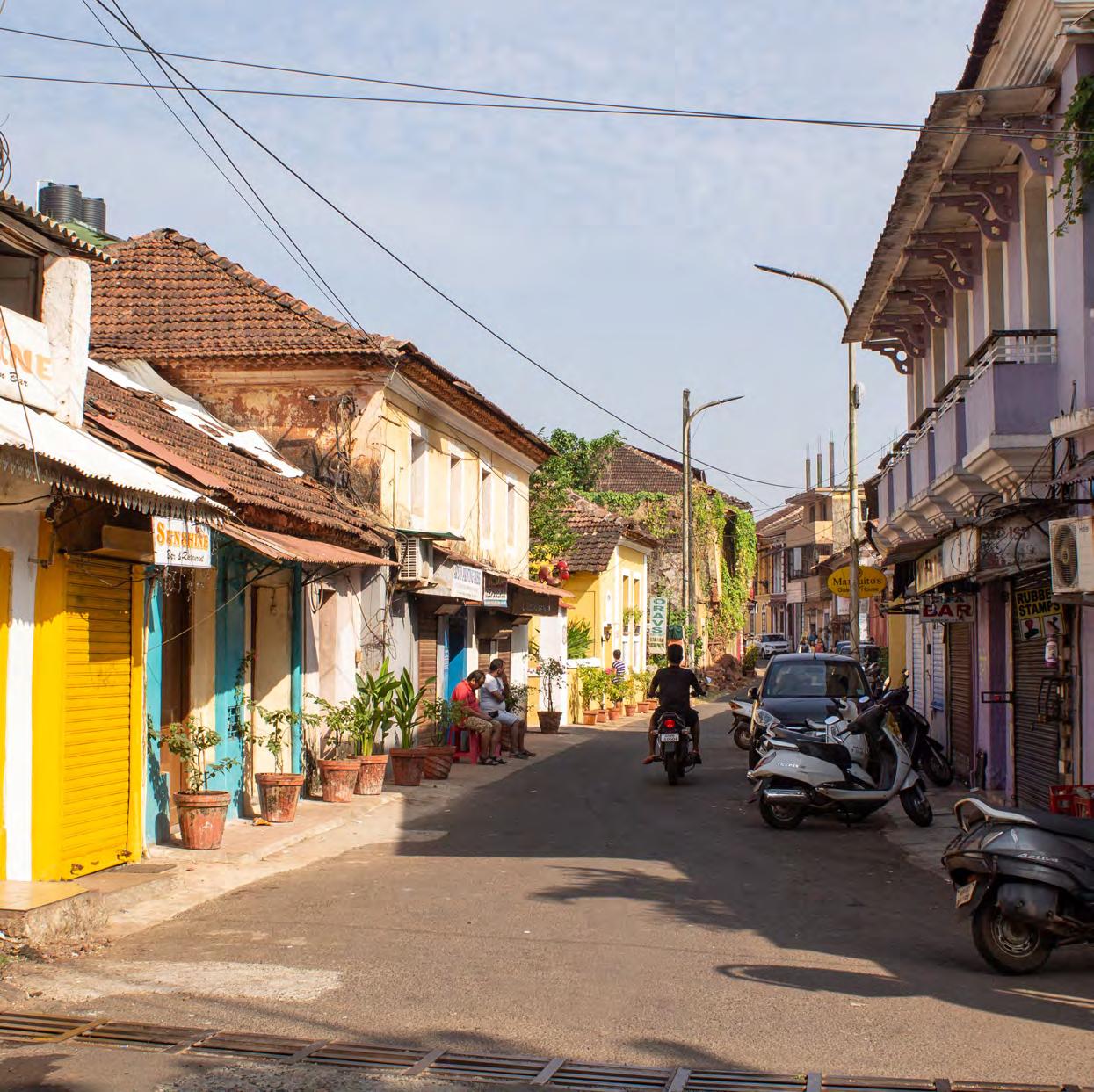
Figure 6.25 Residents On The Street
be given to the residents.
Basantrai Nihalchand Melvani Senior
Citizens Recreation Centre – The seniors center is used more by citizens from out of Fontainhas than the ones living there. The users only come for several hours for the organized activities and then move back outside. So their interest would be related to recreational purposes, but not necessity.
RELIGIOUS
Religious Institutions – The three Hindu temples and the St. Sebastian chapel are the religious spaces used by the community of Fontainhas. Even though they do not play a key role as stakeholders, they have the potential of bringing people together and enforcing social capital, especially the Maruti temple and the Chapel.
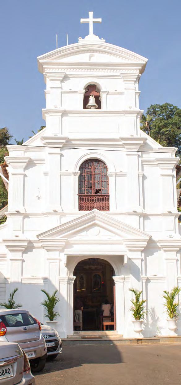
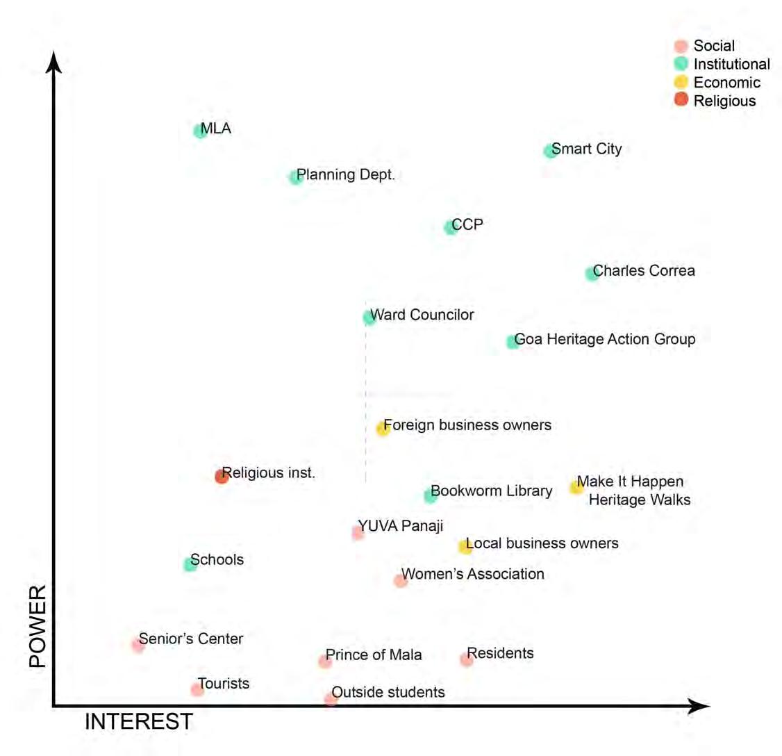
129 STAKEHOLDER MAP Figure 6.26 Stakeholder Mapping
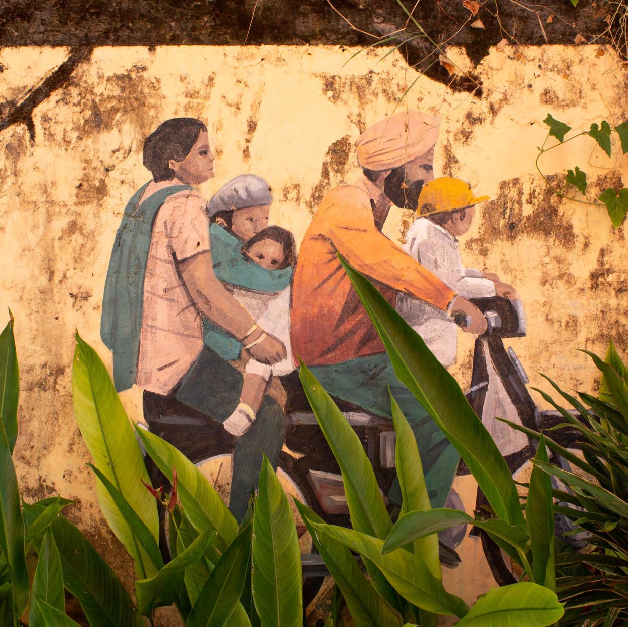
Figure 6.27 Mural In Fontainhas
FINDINGS
As a result of the different participatory methods used and our own observations, we were able to identify several issues in different areas in our study region. During the first phases we classified these problems under mobility, infrastructure, tourism, public space, riverfront condition, community and heritage. But after issue prioritization activities and further analysis of the problems, some overlaps and underlying connections between the above-mentioned topics became evident. The findings were then reorganized under three main recurring themes: community, heritage and tourism.
Heritage Fontainhas is known for the colorful streets and the characteristic architecture style that attracts a lot of tourists; however, looking at heritage through the eyes of the residents gives a completely different perspective. The houses are not being well maintained in some parts of the area, and there are several reasons behind this, the main one being the high cost. We got to know through a real estate agent living in Mala that it takes about INR 10 lakhs
to fully renovate a house, and 10 % of this for yearly maintenance. (This information was later confirmed by members of Smart city) There is no funding or incentive coming from the government to assist with these expenses. Residents claim that before every election promises for change are made, but afterwards no action is taken.
Another factor contributing to the poor conditions of the houses is the shared ownership between members of big joint families. This makes it hard to make any decision regarding the building, because of disagreements as well as the long procedures following up – especially in the case where members have moved out of the city. Furthermore, as some residents explain, the desire to invest in the conservation of their house is low, when the others owning a share do not do the same. Some residents have chosen to convert their building into businesses, so as to generate income. However, this requires a high initial capital and business management skills that not everyone possesses. Shared ownership becomes a barrier in this case as well.
131

132 FONTAINHAS Figure 6.28 Overview Of Problem Findings
These issues have forced a lot of residents to move away, leaving their houses abandoned and prone to complete deterioration. Some have sold them to people coming from outside to start businesses, (i.e. Bombay Café) contributing further to the gentrification of the area. Others, unable to take any of the above-mentioned decisions, feel stuck by the limiting laws and regulations and have thus lost appreciation for the values of heritage.
Tourism
While the high tourists’ influx should be an opportunity for economic benefits for the residents, it is becoming, to the contrary, a detriment for them. Commercialization is contributing to the gentrification of the area, with the new businesses being opened by outsiders more often than by residents themselves. Furthermore, their target being the tourists, they become places the residents cannot use because of the inability to afford them. When asking them about the eating places they visit, the long established Anita tea house, and the alike, are the common answers from all different age groups, but people do not associate with the coffee shops and the other newly opened businesses. Lead by financial interests, in an attempt to conform to the preferences and taste of the ongoing waves of tourists, the newly opened businesses promote anything but the local culture. While the authentic characteristics and unique elements of the area could be utilized to differentiate this destination and enhance its attractive values, the cultural identity is not being preserved.
Community
Interviews with the residents and other users of the area lead us to believe that there is a strong sense of community and social networking. To the contrary, after further activities and indirect observations, we found out that this is not the case. There is a clear divide between Central Fontainhas and Mala area, which originates in the historical division based on religious affiliation (Catholic and Hindu respectively) but is then reflected in other areas as well. Social cohesion in the Hindu community is stronger than the Catholic one. However the community is generally not very interactive and most importantly there’s a lack of civic engagement. Although there are a few niches for networking with the community, such as Senior’s Recreation Center, the residents of the area have minimal attendance, as compared to seniors from out of the area who come regularly.
Another niche would be the open public spaces, but their general poor conditions and lack of maintenance might be a factor hindering social gatherings. Inability for the residents to come together seems to weaken the social capital. Enhanced by the loss of trust in the governmental authorities and their belief that they’re powerless in bringing a change to the community, they demonstrate no willingness to engage in and initiate action for their area.
133
STATEMENTS FROM RESIDENTS
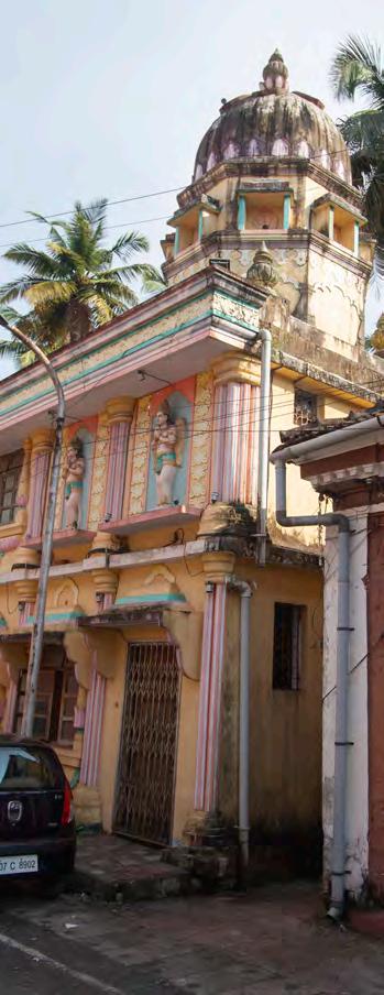
134
“Every caricature of Mario, I’ve seen it live. Now culture is not being preserved.”
“I don’t want to come to Fontainhas to eat pizza and bagels.”
“It’s hard to maintain the houses. They can’t be demolished and people are risking their lives living in them.”
“I go to South Panjim to hang out. Fontainhas is very expensive for us, only tourists can afford it.”
Figure 6.29 Shri Vithal Rakhumai Mandir


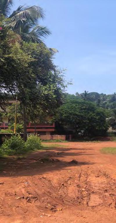
135
Figure
6.30
Hygge Cafè In Fontainhas
Figure 6.31 Hedgewar Grounds In Mala
PROBLEM STATEMENT

136
Collage Of Problem
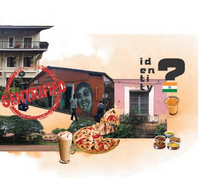
137
“Problematic heritage conservation laws and regulations result in incapability of maintaining the houses, loss of identity and gentrification of the area.”
Figure 6.32
Statement
Figure 6.33 Street Art In Fontainhas
PROPOSALS
Based on our findings we came up with solution proposals within three main areas: community, pride and ownership, building awareness and creating financial incentives.
INCENTIVES FOR HERITAGE HOUSE OWNERS
RATIONALE
As we learned through our research, people lack opportunities to finance the maintenance of their heritage buildings which they are bound to by the heritage conservation laws. Even though the law says that a repair fund might be created, despite political promises none of this has happened yet. The proposal can be seen as a push to start thinking about possible alternatives to funding.
To make maintenance expenses more affordable we propose introducing a catalogue of small measures that effect in a financial discharge of the households and could result in higher willingness by the owners to improve the poor condition of their houses.
Three different measures can serve as an idea of ways that can encourage the owners to maintain their heritage houses:
1) Cutting house tax for heritage buildings
The Corporation of City of Panaji is in charge of assessing and collecting the house tax of each property in the city area. The cost for the annual tax is around INR 90 per m2 (Corporation of the City of Panaji 2019). Cutting the house tax for a certain amount of years could help the heritage house owners to get back a bit of their investments. The City of Panaji on the other hand profits from the rising value of the whole neighborhood. A more maintained neighborhood will improve its value and also impact the neighboring areas. Waiving on some income from a house tax is an indirect investment in the long term conservation of the historical site for future generations.
2) Cutting utility-costs
Another discharge could be achieved by cutting the utility costs for heritage houses protected by the heritage conservation law.
139
Additionally to the saved money through the cut house tax, the house owners could receive a small incentive if they undertake maintenance activities for their houses.
3) Repair-Loans without interests
Especially in unexpected events - when parts of the buildings need to be maintained as soon as possible (i.e. in case of damage due to flooding) money for repairing is needed immediately.
BENEFITS
House owners would benefit from reduced maintenance expenses. Getting these incentives also serves as a motivation to invest more into the condition of the houses.
The state of Goa would benefit from the rising willingness of the owners to invest in the future of their houses to keep the value of the heritage buildings. This again corresponds to the long-term plans of the tourism-strategy of Goa where the focus is set on cultural tourism. Investing indirectly through tax incentives into the heritage helps to preserve its value and the importance of this unique area.
STAKEHOLDERS
The North Goa Planning Department + Town & Country Planning Department
As responsible authorities - in charge of the heritage conservation law these departments have to get in touch with other authorities to implement the tax cutting in order to follow the law and facilitate maintenance of the heritage buildings.
Corporation of City of Panaji
Collects the money of the house taxes and needs to be involved in order to achieve tax reduction. The responsible ward councilor is part of the bylaw committee and can open up discussions for changes.
ACTION STRATEGIES
The implementation of this proposal is not easy to achieve. There are complicated political and bureaucratic obstacles and many institutions that need to be convinced about the necessity and the long term benefits that this “tax package” would affect.
Step one: The community has to unify to clarify its needs and should speak up about their difficulties and the incentives they need to maintain their houses. For this, a platform is needed to unify the residents and open possibility for discussions and support (referred to in the later proposals).
Step two: For the cutting of the house tax, the ward councilor is the responsible person that needs to be addressed to start a discussion about initiating some changes.
Step three: The ward councilor who is part of the bylaw committee can bring the topic about the tax cutting into the council where discussion can be started.
Step four: The bylaw committee needs to be convinced about the benefits the city can achieve by cutting the law for heritage
140
ACTION STRATEGIES

Starting discussion in community
house owners. With the support of the bylaw committee’s majority the tax package can be introduced.
CONCLUSION
Unifying to get incentives
Today there does not seem to be any intention of authorities to go further with plans to gain some tax reductions although even one Partner of the North Goa Planning Department, Shaikh Ali Ahmed proposed a similar strategy in his case study about “Conservation of Heritage Areas in the City of Panaji”: “Incentives in the form of rebate in taxation should be given to the owners of the heritage houses for maintenance of heritage properties from spoliation and disfiguration.”
Addressing Ward Councilor
When contacting the North Goa Planning Department to present the tax incentive proposal, we met no enthusiasm or statement about possible considerations.
Bringing up proposal in bylaw committee
Introducing tax package
We realized that in our role as research students, we are not able to open up the responsible authority for a discussion since it seems that they are not willing to question the existing laws. An alternative strategy would have been preparing a thorough case and presenting it to the community. At the point where a stronger social capital is established, the community as a whole could get organized to demand these changes from the legal authorities.
141
Figure 6.34 Action Strategy For Maintenance Incentives
BUILDING AWARENESS AMONG YOUTH
RATIONALE
In this focus area the target is to raise the pride and create awareness for heritage among the youth. Since youngsters are the future decision makers of the area it’s important that they grow up knowing the values of the heritage, so that they make conscious decisions in the future. A well informed and educated youth will affect the parents and wider community. It also creates potential for a future heritage movement. Moreover, good understanding can increase the feeling of belonging and impact the youth to stay in the area when they grow up, instead of moving away as a lot of the young people are doing today.
Proposal – Heritage club
We propose to revive the heritage club at the People’s Higher Secondary School in our area within the HECS-network. As there already exists a heritage club at the school that is less active, it would be good to rekindle more activities in the club again.
Every student who becomes a member of the heritage club is motivated to participate in heritage conservation and to learn more about their local and natural heritage. A student who becomes a member of INTACH Heritage Club receives: - Heritage club badge to become a part of the
growing community of heritage keepers. - Heritage club passport to identify with the Heritage Club movement. - Nine Stars to record information about the natural and cultural heritage of their town and city.
- Young INTACH, which is a quarterly newsletter for Heritage Club student members on various aspects of heritage related news and information (INTACH, 2019).
There are also a lot of activities that can be done within this club, making it fun for the children to learn about the value of the heritage. For instance: - Adopt a house-project - Making of films on culture and heritage - Heritage walks - Learning a craft
Adopt a house project consists of each student “adopting” a heritage building, being responsible for learning about its history and monitoring it. They will also learn by experts how to maintain the houses, so they both learn practical skills and the history of the heritage.
STAKEHOLDERS
People’s Higher Secondary School: This is the only school in our area that has students old enough to teach about the importance of heritage. They also already have a heritage club but its activeness has slowed down during the last few years.
142
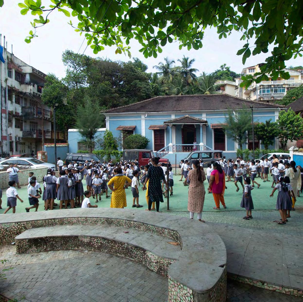
Figure 6.35 Children
At The Marble Ground
INTACH and HECS: The Indian National Trust for Art and Cultural Heritage was founded in 1984 in New Delhi with the vision to spearhead heritage awareness and conservation in India. Today, INTACH is recognized as one of the world’s largest heritage organizations with over 190 Chapters across the country. In the past 31 years INTACH has pioneered the conservation and preservation of the natural, built, and the intangible heritage.
Heritage Education and Communication Service (HECS) was set up by INTACH in 1998. HECS is dedicated to spreading awareness to all, especially young people about India’s natural, built and cultural heritage. It designs different types of training programs with the aim to make citizens aware of their role in the conservation and preservation of the heritage (INTACH, 2019).
Charles Correa Foundation: This foundation has done a lot of studies on the heritage in Fontainhas and can therefore be a collaborating agent with the schools to educate children on the heritage values.
Goa Heritage Action Group: This organization has experts that can provide advice and teach how to preserve heritage houses.
ACTION STRATEGY Step one: Getting authorization

To implement a heritage club at the school we needed the approval from the head of the school, the principal. When we went to talk to
Initiating
-
-
Initiating - Send program - Arrange awareness - Involve activities - Get
- Heritage come!

144
Active
the Getting
Talk
Start Get 1 2 3 4 Getting authorization
activities Getting experts involved Active Heritage Club! Figure 6.36 Action Strategy For Heritage Club
her about our proposal, we found out that the school already had a heritage club. However, the club had not been very active in the last few years. Therefore, we revised our proposal from setting up a heritage club in the school to trying to revive the already existing one. The principal was enthusiastic about this idea. This also seemed like a proposal that would have success seeing that we already would have an anchor for it.
Step two: Initiating activities
The next step is for us to send an e-mail with suggestions for activities the heritage club can do to the principal. Today the activity is limited to making films about the heritage and participating in a film competition. The principal will forward our proposals to the people responsible for the heritage club at the school. With more activities offered, the probability of more students wanting to join the club becomes higher. The more students are members, the more likely it is that the club will stay active in the future.
We also think it would be a good idea to set up fun activities for the students to try out, without being a member of the club, so they can get a taste of how it would be to join the club. This would also gain some new attention to the club, hopefully making more students aware of its existence. For instance: - Heritage walks for the children around the area
- Painting or drawing competitions of Future Fontainhas – how should the heritage area look
like in the future?
Step three: Getting experts involved
To make the activities offered in the club more interesting and educational we need to get experts involved such as the Charles Correa foundation or the Goa Heritage Action Group. Having them involved also increases the chances of the heritage club staying active as there are more parties invested in the project and not only the school. These two organizations can provide experts to teach the students about the heritage and the skill of how to preserve the houses.
CONCLUSION
Although we didn't have enough time to see this proposal come to life, the school principal has been very enthusiastic about our aims and ideas each time we met her, and very keen in collaborating with us. She showed special interest when we went back to present our proposal to her and promised to send us results and works of the students once they start organizing the activities we planned for them.
We are hopeful that longer term steps such as collaboration with Charles Correa Foundation will be taken upon by the school staff.
145
COMMUNITY, PRIDE & OWNERSHIP
One of the main problems identified in the site is the lack of a strong sense of community among the residents and between the neighborhoods. The area has no real direction or future common vision and is constantly pulled between the restricting heritage laws and the tourist gentrification. The lack of unity in the community hinders collective action and initiation to hold the authorities accountable. Under this topic we hope to strengthen the feeling of belonging and responsibility for the area among the residents, strengthen the community bond and give the power back to the people. In order to do this we looked at two main strategic interventions that could be done.
PROPOSAL 1 FACEBOOK PLATFORM
RATIONALE
The current situation of the social capital in the study area calls for a tool to unify the community and especially integrate the two wards – Fontainhas and Mala - with eachother. Initially, our idea was to encourage the residents to create an association, however considering the current situation of the social capital, we realized that this would be quite difficult to achieve. With smartphones and social media being omnipresent in our daily lives, an online
platform would be a quicker and more practical space for residents to come together and interact. Furthermore, it would make it possible to encompass a wider scope of participants and stakeholders. A Facebook group would be a catalyst to facilitate exchange of information not only within the community, but also with other stakeholders and authorities as the Ward Councilor in real time.
BENEFITS
The online community created is expected to develop strong bonds between residents. Posts about common interests can become niches for people to meet up in real life, so the online group will gradually lead to integration of the community in reality. This will enhance the feeling of belonging. Additionally, people united as a whole will have the power to approach authorities and hold them accountable for their actions.
STAKEHOLDERS
The residents. People living in the area, despite their age, religion or interest can become part of the group. Different posts about upcoming events or common interests can be initiators of interactions that will later lead to strong bonds within the community. The potential for the later creation of a real life association is also created.
The owner of an existing Facebook group. Towards the end of the fieldwork, we discovered that there is an existing Facebook group named “Fontainhas First”, but it is only focused on residents of Fontainhas while the ones
146
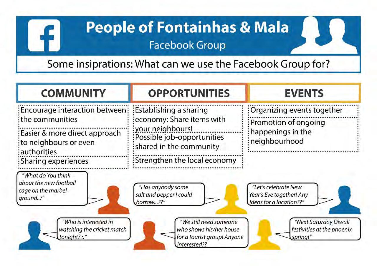
147 Figure 6.37 Facebook Platform
148 Getting feedback ACTION STRATEGIES Launching the page Sharing posts Meeting in real life Identifying anchors 1 2 3 4 5 Getting feedback Identifying anchors Launching the page Sharing posts Meeting in real life ACTION STRATEGIES Figure 6.38 Action Strategy For Facebook Platform
from Mala are being excluded. The possibility of also opening the page to residents of Mala was discussed, however this was seen as an inefficient decision, due to the chance of creating a feeling of inequality. Furthermore, the page is currently not very active and there would be difficulties in trying to revive it. Due to these reasons the idea of creating a new separate platform common to both Fontainhas and Mala was met with more support. Having the experience of initiating and running a community group the owner of “Fontainhas First” could be one of the administrators of “People of Fontainhas and Mala” at least in the initial stages.
Raghuvir Mahale, the founder of YUVA, is a resident of Mala. He is well connected and integrated in the Mala neighborhood and has know-how in community activities due to his experience from the YUVA association. He plays an important role as a stakeholder because he has the potential to encourage involvement of residents from Mala.
The Ward Councilor: Once the Ward Councilors become participants of the group it will be easier for the residents to approach their representatives in real time, organize meetings and address different issues regarding their ward.
Existing associations from the area can participate in the group by getting feedback and informing residents about events to be organized.
ACTION STRATEGY
Step one: Getting feedback
We discussed the idea of creating a unifying platform with residents from both neighborhoods. During a focus-group-discussion we realized that there was a general lack of knowledge about activities in the neighboring ward. We talked about benefits of a platform and tried to understand if there is any interest and motivation to participate in it. Our idea was met with enthusiasm.
Step two: Identifying anchors
We defined possible stakeholders who can be in charge of managing and moderating the platform. Our aim was to find one resource person from each neighborhood, who already has an existing network in the community. Having identified these people, we presented our proposal.
Both sides were convinced about the benefits, accepted to administrate the group and assured to invite their neighborhood to participate in the platform.
Step three: Launching the page
The Facebook Group “People of Fontainhas and Mala” was launched. We designed a flyer to distribute to people and invite them to join. Meanwhile, the stakeholders also started inviting their friends.
Step four: Sharing posts
We initiated posting in the group by sharing
149
information about our fieldwork. After this point, the stakeholders are expected to take over. The joining members are expected to start making posts and interact.
Step five: Meeting in real life
Engagement of the members under the comment section will lead to spontaneous interaction and planned meetings in real life, which will bring further integration of the community and enhance the social capital. The unity created in the community would make it possible for the residents to operate as a whole and organize events or express demand towards authorities.
This could assist with our proposal about incentives for house maintenance. Having the ward councilor in the facebook group would furthermore help in organizing meetings with her, so that the demands can be passed towards the relevant legal bodies.
PROPOSAL 2
COMMUNITY EVENTS
RATIONALE
Throughout the interviews and other methods organized with the community, the memories of the festival that revived the area are of the most outstanding ones. It was then that Fontainhas regained its beauty and pride, by becoming an attraction point of visitors and investments in the area. It is evident that in the organization of a big event lies a great potential of rebuilding
social network and capital. Our proposal therefore is to activate the public space for community building and to organize different events like festivals, street parties, etc. Not only will the event foster a sense of civic pride and create new links between members of the community, but it will also generate revenue which can be used to invest in the maintenance of the houses.
BENEFITS
While the visitors and tourists attracted by these events will be boosting the local economy both on and off the site hence contributing to the funds needed for the heritage maintenance, the social benefits will be just as strong. Especially during the planning phase the bonds between the residents themselves and the different organizations are forged. The Facebook group created ahead can be the niche to initiate the event and encourage the two neighborhoods for engagement and collaboration.
STAKEHOLDERS
Make it Happen: Showing interest in community involvement, “Make it Happen” initiated the idea of organizing a common event for the Fontainhas & Mala neighborhoods. Their interest is in activating especially Mala for more community based tourism in order to help preserve and value the heritage.
Smart City Mission: For the events to be organized, appropriate public spaces are necessary. The open spaces of the area are currently in not very good conditions. Small
150
Ideating the event
Identifying an anchor
Identifying an anchor
physical interventions would be necessary to make them more user friendly and attractive. Smart City Mission, having already shown interest in the area, is a potential stakeholder to aid in the placemaking process.
Identifying resource people
Ideating the event
Residents: By either organizing the events or simply attending them the residents of the segregated neighborhoods will be brought together through the shared experiences, thus deepening the social network. One important resource person from each neighborhood can be a representative in the initiation team.
YUVA, Prince of Mala, Women’s Association: Different associations already functioning in the Latin Quarter can come together and assist in the planning of the events through the services they are capable of offering. YUVA and Prince of Mala for instance have already shown good planning skills, while the Women’s Association can help with catering.
Identifying resource people
ACTION STRATEGY
Step one: Identifying an anchor
After ideation activities held with various groups of residents, we contacted Make it Happen heritage walk tour guides, who surprised us with their motivation to not only assist but even initiate big scale events spreading through the length of the settlement. Make it happen thus serves as an anchor for us, carrying on with the planning of the event even after our fieldwork is over.
Step two: Ideating the event
A draft for an event concept for organizing a
151
1 2 3 4 Planning
Planning Figure 6.39 Action Strategy For Public Space
New Year’s feast was prepared. A handout describes the What-Why-Who questions and includes a possible organigram that shows how and at which stage the community should be included, as well as a list with stakeholders who can be involved.
Step three: Identifying resource people

Two relevant stakeholders from each community were selected and contacted to discuss possibilities for the event organization.
They agreed on being resource persons for their neighborhoods and to attend a common meeting with the initiation team to brainstorm about further procedures. Make it Happen got delivered the event concept and we agreed on organizing a first meeting for the initiating group - together with the representatives from Mala and Fontainhas. The team from Make it Happen assured us to work further on the concept and to make the implementation of the feast possible.
152
Figure 6.40 Collage For Events In Public Space Mala
Step Four: Planning
The event can be promoted in the created Facebook group to gain more support from the community. Funds need to be generated. After detailed organization of the event, small interventions needed for the area should be ideated. Stakeholders able to assist carrying these interventions out need to be contacted.
Collage
As seen in Figures 6.40 and 6.41, small
interventions such as ground textures and paintings, as well as street furniture, can make the public space more inviting to host events and community gatherings.
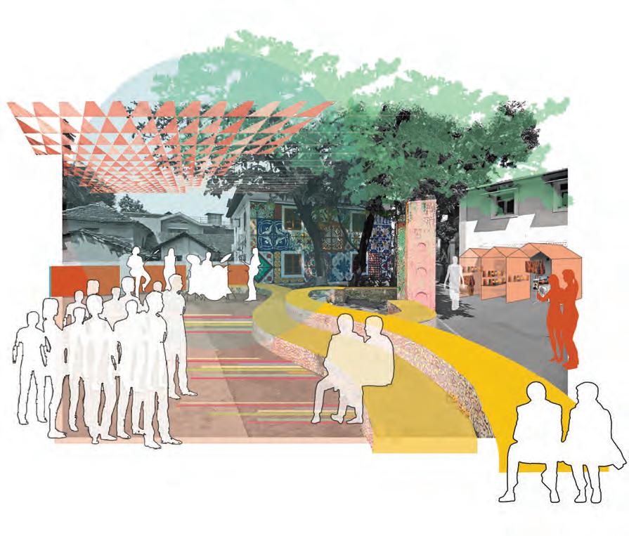
153
Figure 6.41 Collage For Events In Public Space Marble Ground
Before coming to Panjim, everyone told us how lucky we were that our fieldwork was taking place in Goa. We heard stories about pristine beaches, raging parties, and advanced infrastructure and municipal services compared to other parts of India. But when we arrived at Dabolim Airport (Goa International) it was quite a culture shock. We quickly realized that although the state of Goa is known as a resort destination, Panjim is anything but a vacation.
After a week of chaos and rearranged living conditions, we finally managed to settle down in our new home.
As the weeks progressed, we found the beauty in the city and its people. Things began falling into place as we learned about the history, culture and individuality of Goa, a place like no other. As foreigners, we were glared at yet tolerated, with only the occasional person trying to take photos of us. We stood out, yet in a place known for tourism, we also weirdly blended in.
We developed new routines but each time we thought we had a grasp on the complexities, India would throw new challenges our way.
Working on our sites confronted our preconceived ideas about what fieldwork really means. For many of us, stepping into someone else’s neighborhood and homes felt intrusive, especially when it is obvious by our skin color and accents that we do not belong. But more times than not, we were welcomed in unexpected ways. Being offered beverages in people’s homes, having children want to show us around the areas they are most proud of, and sparking an interest in collaboration between the community and government bodies. When working with certain stakeholders, we also got to feel the appreciation for our work approach and they were genuinely interested in the community-based methods, which are very different from the hierarchical way projects are traditionally organized here. We also had
154
REFLECTION
the pleasure to get to know a lot of people who actually believe in possible change, want to improve their communities, and do not let themselves get frustrated by the slow bureaucratic process.
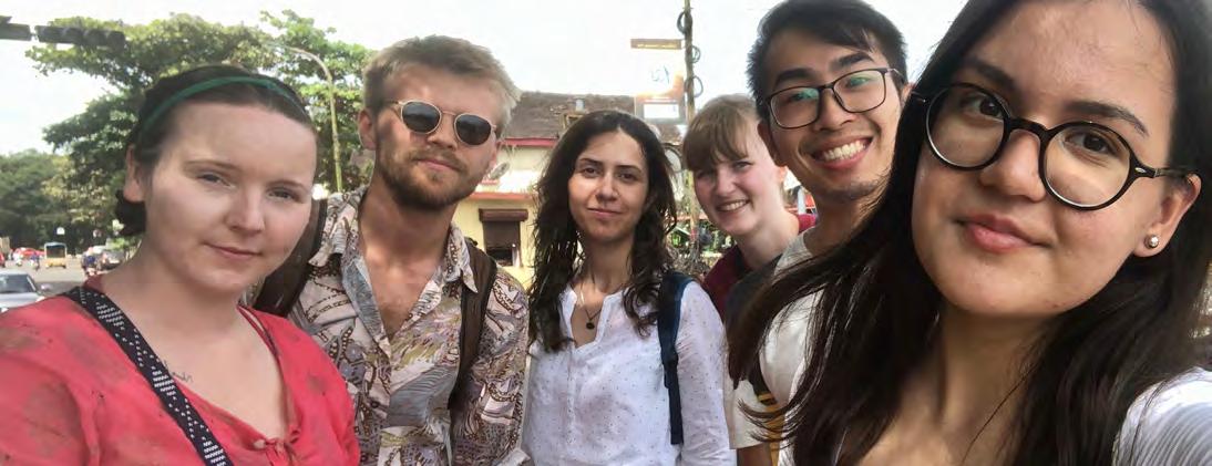
But it was still hard. Being an intruder and knowing you cannot make any promises to the people you say you are there to help, because at the end of the project, we go home and return
to our student lives while they stay in this place. It is hard not to feel disheartened by this fact and the dichotomy between academic agenda and meaningful impact will always remain in this kind of projects.
Nevertheless, we are incredibly thankful for the knowledge and friends this semester has brought. This experience will not be one that is easily forgotten.
155
Figure 7.1. UEP Students
156
ETHICS STATEMENT
Our analysis of the area gave us a comprehensive overview of the current situation in Sao Tome, Fontainhas, and Mala. We identified the different types of inhabitants that reside in these neighborhoods, found struggles in the municipal systems, listened to concerns over parking and traffic, learned about the existing institutions and associations, and observed the tension between different parties in the area. These and many other factors gave us a general understanding of the field and aided in dividing the areas into two seperate field work sections, each examined further by group 5 and group 6. Group 5 chose Sao Tome and Fontainhas as their research field, splitting Fontainhas in half at St. Sebastian chapel
on Rua De Natal. While the two areas have differences, there are many similarities among identity, residential structure, and commercial activities. Group 6 chose the lower half of Fontainhas, south of Rua De Natal, and Mala as their research area. These two areas have very different identities and a harsh dividing line, the largest separator being religion. Fontainhas is predominantly Catholic while Mala is nearly unanimously Hindu. The separation of the field in this manner allowed researchers to focus on different challenges in the area and target interventions to address concerns applicable to people in those neighborhoods.
157
ACKNOWLEDGEMENT
Figure 1.1. Students and Faculty of NTNU and SPA
INTRODUCTION
Figure 2.1. 31st January Road
Figure 2.2. Heritage House in Fontainhas
Figure 2.3. House in Mala
Figure 2.4. Fieldwork Site HISTORY
Figure 3.1. A sketch of Saint Sebastian Chapel in Fontainhas, instagram.com/theartoftej/
Figure 3.2. A Historic Photo of Ourém Creek from 1950s (Nadkarni 2003, pg. 26)
Figure 3.3. Mandovi River and Adil Shah Palace from 1950s (Nadkarni 2003, pg. 23)
Figure 3.4. Fontainhas and Mala Seen from Altinho Hill
Figure 3.5. Casinos on Mandovi River
Figure 3.6. Beautification on Stairscase in Mala
Figure 3.7. Beautification on Pedestrian bridge over Rio De Ourém Creek
Figure 3.8. Marquito’s Guest House Fontainhas
Figure 3.9. Heritage Buildings in Fontainhas
158
LIST OF FIGURES
SITUATIONAL ANALYSIS
Figure 4.1. Collage of Windows in Fontainhas
Figure 4.2. Land Use Map of Sao Tome, Fontainhas and Mala
Figure 4.3. Rua 31 de Janeiro
Figure 4.4. Narrow alleys as extended living areas
Figure 4.5. Marble Plaza
Figure 4.6. Public Transport and Traffic Congestion Points
Figure 4.7. Students from the Mary Immaculate High School
Figure 4.8. Types of Tourists in Fontainhas
Figure 4.9. Bookworm Library in Fontainhas
Figure 4.10. Senior Citizens Recreation Centre
Figure 4.11. Narkasur Prepared by the Prince of Mala Association
Figure 4.12. Maruti Temple
Figure 4.13. St.Sbastian Chapel
Figure 4.14. Differnt Terms Used by the Residents to Call their Area
Figure 4.15. The Diagram shows the process of applying building permit
Figure 4.16. Shop Owner in Mala
Figure 4.17. Tourism Related Business
Figure 4.18. Local Business in Sao Tome
Figure 4.19. Map Shows Business and Commercial Activity
Figure 4.20. Mangrove Trees by Rio De Ourém Creek
Figure 4.21. Transport Ferry and Casinos on Mandovi River
Figure 4.22. Mala Lake
Figure 4.23. Green Spaces, East of Rio De Ourém Creek
Figure 4.24. Open Spaces in Fontainhas
Figure 4.25. Abandoned Unmaintained Building
Figure 4.26. Division of Fieldwork Areas
GROUP 5 : SAO TOME AND FONTAINHAS
Figure 5.1. Current Situational Sketch of Fontainhas
Figure 5.2. Map of Focused Area
Figure 5.3. Timeline
Figure 5.4. Participatory Mapping Method
Figure 5.5. Methods Used in Different Phases
Figure 5.6. Distributed Flyer
Figure 5.7. Participatory Mapping Poster
Figure 5.8. Restaurant Owner in Sao Tome
Figure 5.9. Practicing Resource Mapping
Figure 5.10. Results of Resource Mapping
Figure 5.11. Group Interview With Taxi Drivers
Figure 5.12. (Left) Cards for Card Sorting Method (Right)
159
Card Sorting Method Participant
Figure 5.13. Card Sorting Method with Participants
Figure 5.14. (Left) Results of Photo Ideation (Right) Photo Ideation Participants
Figure 5.15. Photo Ideation
Figure 5.16. Co-design of The Future Park
Figure 5.17. Co-design with Commuters
Figure 5.18. Gathering Community Feedbacks on Proposals
Figure 5.19. Students in Fontainhas
Figure 5.20. Commuters on Rua De Ourém
Figure 5.21. Mobility Map of Commuters Between City Center and Bus Stand
Figure 5.22. Diagram Showing Number of People Per Hour Crossing The Pedestrian Bridge
Figure 5.23. Students of Mary Immaculate School
Figure 5.24. A Local Business in Sao Tome
Figure 5.25. Stakeholders Mapping
Figure 5.26. Pedestrian Path, West of Rio De Ourém Creek
Figure 5.27. IPSCDL Proposed Plan for Boardwalk and Park
Figure 5.28. Example of Park Collage Along Rio De Ourém Creek
Figure 5.29. Co-design Method Performed as A Participatory Approach
Figure 5.30. Diagram Illustrates Lack of Public Engagement
Figure 5.31. Collage as A Participatory Method and Getting People’s Perspectives
Figure 5.32. Resident’s Idea from Photo Ideation Method
Figure 5.33. Initial Proposal of a Park in Fontainhas
Figure 5.34. Revised proposal of Park Based on Participants’ Feedback
Figure 5.35. Pedestrianization of Half of Rua De Natal in Replacement of One Side of Parking
Figure 5.36. Connection of Public Park and Proposed Bridge with City Center and Bus Stand
Figure 5.37. Proposed Bridge Considering as Public Space
160
Figure 5.38. Proposed Bridge Started from Rua De Natal Road
Figure 5.39. Sections of The Proposed Pedestrian Bridge
Figure 5.40. UEP and SPA Students
Figure 5.41. Proposed Situational Sketch of Fontainhas
Figure 6.23. Association In Mala
Figure 6.24. Charles Correa Foundation, https:// charlescorreafoundation.org/
Figure 6.25. Residents On The Street
Figure 6.26. Stakeholder Mapping
Figure 6.27. Mural In Fontainhas
Figure 6.28. Overview Of Problem Findings
GROUP 6 : FONTAINHAS AND MALA
Figure 6.1. Overview Map
Figure 6.2. TImeline
Figure 6.3. Collage Workshop With High School Students
Figure 6.4. Familiarization Graphic
Figure 6.5. Introduction Flyer And Photo-Challenge
Figure 6.6. Resource Mapping With Students
Figure 6.7. Participatory Mapping
Figure 6.8. Semi Structured Interview With Tuk-Tuk Driver
Figure 6.9. Spatial Associations Through Photos
Figure 6.10. Spatial Associations Through Photos With Senior Citizen
Figure 6.11. Resource Mapping With Shopkeeper
Figure 6.12. Prioritization Of Problem Statements With Resident
Figure 6.13. Results Of “Draw-Your-Ideas-Exercise”
Figure 6.14. Collage Workshop With High School Students
Figure 6.15. Results Of Collage Workshop, Exercise 1
Figure 6.16. Results Of Collage Workshop, Exercise 2
Figure 6.17. Invitation Poster For Vision Workshop
Figure 6.18. Vision Workshop, Focus Group Discussion
Figure 6.19. Vision Workshop
Figure 6.20. Feedback From Raghuvir Mahale
Figure 6.21. Unplanned Meeting with MLA Of Panjim
Figure 6.22. Bookworm Library, https://www.bookwormgoa.in/
Figure 6.29. Shri Vithal Rakhumai Mandir Temple In Mala
Figure 6.30. Hygge Café In Fontainhas
Figure 6.31. Hedgewar Ground Mala
Figure 6.32. Collage Of Problem Statement
Figure 6.33. Street Art In Fontainhas
Figure 6.34. Action Strategy For Maintenance Incentives
Figure 6.35. Children At The Marble Ground
Figure 6.36. Action Strategy For Heritage Club
Figure 6.37. Facebook Platform
Figure 6.38. Action Strategy For The Facebook Platform
Figure 6.39. Action Strategy For Public Space
Figure 6.40. Collage For Events In Public Space Mala
Figure 6.41. Collage For Events In Public Space Mala
REFLECTION
Figure 7.1. UEP Students
161
Ahmed, S. & Shankar, B., (2012a). Conservation of Heritage Are in the City of Panaji: A Case Study of Fontainhas Area. International Journal of Modern Engineering Research. 2(2), 442-446.
Ahmed, S. & Shankar, B., (2012b). Challenges of Planning for Heritage Areas in Panaji City. International Journal of Modern Engineering Research. 2(1), 546-550.
Altrock, U., (2012) Conceptualising Informality: Some Thoughts on the Way Towards Generalisation. Urban Informalities: Reflections on the formal and informal. Ashgate publishing. New York, New York.
BBC, (2013). Is Goa’s Casino Industry Fueling Gambling Addiction? British Broadcasting Corporation. Retrieved from https://www.bbc.com/news/world-asia-india-25180893
CCP, (2019). Corporation of the City of Panaji. Panjim/Panaji and Its History. Retrieved from http://ccpgoa.com/panjim-history-ci5
CCP, (2019). Corporation of the City of Panaji. House Tax Assesment for new Premises/ Buildings. Retrieved from http://ccpgoa.com/taxation-section-s4
Erickson-Davis, M., (2018). New study finds mangroves may store way more carbon than we thought. Mongabay, News and inspiration from nature’s frontline. Retrieved from https:// news.mongabay.com/2018/05/new-study-finds-mangroves-may-store-way-more-carbonthan-we-thought/Mongabay.
Goa Heritage Action Group, (2017). The Mapped Heritage of Panaji Goa. Silverpoint Press Pvt. Ltd., Goa, India.
Government of Goa, (2019). Our Lady of the Immaculate Conception Church. Government of Goa. Retrieved from https://www.goa.gov.in/places/our-lady-of-the-immaculateconception-church/
Government of Goa [Department of Law & Judiciary Legal Affairs Division], (2018), The Goa (Regulation of Land Development and Building Construction) Act and The Goa Land Development and Building Construction Regulations. Official Gazette.
162
REFERENCES
Imagine Panaji, (2019). Imagine Panaji Smart City Development Limited. Retrieved from https:// imaginepanaji.com/
INTACH, (2019). Heritage Education and Communication Service. INTACH. Retrieved from http://heritageeducation.intach.org/
IDEO.org, (2015), IDEO.org. The Field Guide to Human-Centered Design. 9-25.
Kumar Jha, A., (2019). Goa on the Go. India Today. Retrieved from https://www.indiatoday.in/ magazine/state-of-states-goa-2019/story/20191104-goa-on-the-go-1612692-2019-10-26
Meijer, M. & Ernste, H., (2019). Broadening the Scope of Spatial Planning: Making a Case for Informality in the Netherlands. Journal of Planning Education and Research. 1-14.
Mohta, A., (2011). Old Quarter Heritage Nexus [Architectural Thesis]. School of Planning and Architecture. New Delhi. Retrieved from https://issuu.com/nishitamohta/docs/nishita_ thesis_issuu
Department for International Development, (1999). Policy Planning and Implementation: Social Capital.
Nadkarni, R., (2003). Investigation of Built Form of Fontainhas Based on Socio-Cultural Aspects [Bachelor thesis]. Goa College of Architecture. 23-26.
Rakodi, C., (2002). A Livelihoods Approach - Conceptual Issues and Definitions. Routledge. 3-22.
Sukhij, J., (2019). Story About Us. Panjim Inn. Retrieved from http://www.panjiminn.com/index. php/about-us/ Valqui Vidal, R., (2005). The Future Workshop: Democratic problem solving. Technical University of Denmark. Lyngby
163


 Figure 2.2. Heritage house in FontainhasFigure


 Figure 3.1. A sketch of Saint Sebastian Chapel in Fontainhas


 Figure 3.3. Mandovi River and Adil Shah Palace from 1950s (Nadkarni 2003, pg. 23)
Figure 3.2. A Historic Photo of Ourém Creek from 1950s (Nadkarni 2003, pg. 26)
Figure 3.4. Fontainhas and Mala Seen from Altinho Hill


 Figure


 Figure


 Figure 4.19. Map Shows Business and Commercial Activity
 Figure 4.20. Mangrove Trees by Rio De Ourem Creek


 Figure


 Figure


 Figure 5.28. Example of Park Collage Along Rio De Ourém Creek


 Figure 5.34. Revised proposal of Park Based on Participants’ Feedback


 Figure 5.40. UEP and SPA Students


