

1 | Ila, Trondheim | Public Space Network Urban Ecological Planning: Project Course Project Report, Autumn 2021 Urban Ecological Planning Master’s programme Department of Architecture & Planning, Faculty of Architecture Norwegian University of Science and Technology, Trondheim, Norway Public Space Network Ila, Trondheim
AAR4525 - Urban Ecological Planning: Project Course
Project Report, Autumn 2021 Urban Ecological Planning Master’s Programme
Department of Architecture and Planning, Faculty of Architecture
Norwegian University of Science and Technology (NTNU), Trondheim, Norway
Course Coordinator: Marcin Sliwa Assistant Professor (NTNU) Doctoral Researcher (University of Oslo)
Main Supervisor: Peter Gotsch Professor, NTNU
Supervision Team: Marcin Sliwa Assistant Professor (NTNU), Doctoral researcher (University of Oslo)
Mrudhula Koshy Assistant Professor
Riny Sharma Research Associate, NTNU
Booklet Layout: Mrudhula Koshy Assistant Professor, NTNU
2 | Ila, Trondheim | Public Space Network
Public Space Network

Ila, Trondheim
Authors
Angela Subedi
Architecture Nepal Anne Klenge
Environmental Engineering Germany

Azam Mirjalali
Architecture Iran
Bhuvana Nanaiah Architecture India
Marcela Moraga Architecture and Urbanism Chile
Michael Dyblie Global Studies USA Nathaniel Gallishaw
Transportation Engineering USA
Olawale Olugbade
Real Estate Management Nigeria
Rupak Bhattarai
Civil Engineering Nepal
3 | Ila, Trondheim | Public Space Network
Preface
This project report consolidates the results of the 2021 Autumn semester conducted by students of the 2-year International Master of Science Program in Urban Ecological Planning (UEP) at the Faculty of Architecture and Design at the Norwegian University of Science and Technology (NTNU) in Trondheim, Norway.
For the second consecutive year, the COVID-19 pandemic made it impossible to conduct the usual fieldwork we have been undertaking traditionally. Before 2020, most UEP student groups have been traveling to Nepal, India and Uganda to study urban informality and practice areabased and participatory approaches to planning. However, mobility restrictions caused by the pandemic forced us to modify the fieldwork logistics and our pedagogical approaches to adjust to the uncertain situation, and at the same time work towards the similar learning objectives as before.
As opposed to last year, where most students performed individual fieldwork in their home cities, in 2021 all the UEP students worked in Trondheim, Norway, which is the home city of our university. For the first time in the UEP program, the entire class has been working together in a Global North context. The students were divided into 6 groups and were assigned three different cases. This report summarizes work of the group working in the neighbourhood of Ila. In their project work, students practiced the “Urban Ecological Planning” approach, which places emphasis on integrated area-based (as opposed to sectorial) situational analysis and proposal making using participatory and strategic planning methods. Our approach was inspired by the Chicago school, which proposed ethnography as a way to study urban spaces and social ecology as a framework to understand them. This approach is not new to UEP, but this year we had to make pedagogical changes to adjust the fieldwork courses to a Global North context. This included revising our compendiums to make it more relevant to urban planning in Norway, distributing students in groups in a way that helps them with language barriers and using our existing research network to kick start three parallel student projects in Trondheim.
4 | Ila, Trondheim | Public Space Network
By spending a large amount of time in the assigned areas and engaging with local communities as well as other relevant stakeholders, students gained an in-depth understanding of the local context. This allowed them to discover strengths and weaknesses and identify opportunities and challenges in each of their assigned areas, something that would be impossible to achieve by applying traditional technocratic and purely quantitative planning methods. The rich evidence and data collected in the field was used by the student groups as a basis for proposals for spatial and policy interventions in their corresponding areas.
We hope that you enjoy reading this document as much as we enjoyed supervising students in their work!
Marcin Sliwa, Riny Sharma, Mrudhula Koshy and Peter Gotsch
Fieldwork Supervisors, NTNU, Department of Architecture and Planning
5 | Ila, Trondheim | Public Space Network
Acknowledgements
During the process of this fieldwork, our project team has received substantial support for which we are incredibly grateful. First, we would like to thank our supervisor, Professor Peter Andreas Gotsch. Throughout the process, his expertise and assistance have been invaluable. We thank him for the time he invested and constructive feedback he provided.
Furthermore, we would like to thank all our other advisors for their insightful feedback that advanced our work. We thank Marcin Sliwa, Mrudhula Koshy, and Riny Sharma for sharing their knowledge and offering valuable guidance. Additionally, we received helpful suggestions from Rolee Aranya, Hans Christian Bjørne, and Per Gunnar Røe for which we are also thankful.
Without Ila’s residents, volunteers, community leaders, business owners, interviewees, participants in our workshops, and everyone else involved in our various methodologies, it would have been impossible to complete this project. We thank everyone who got involved and made this participatory approach possible. We would especially like to thank Annette Taraldsen, April Maja Almaas, Bjørn Fjeldvær, Bjørn Inge Melås, Grete Kristin Hennissen, Merete Støvring, Nabin Thakur, Sigrid Gilleberg, Stian Wannebo, and Øystein Aarlott Digre.
Finally, we are sincerely grateful to our families and friends for their moral support throughout the project.
6 | Ila, Trondheim | Public Space Network
Acronyms and Abbreviations
ArcGIS Generic term for Geographic information system software products of the company ESRI
ATM Automated Teller Machine
COVID-19 Coronavirus disease 2019
Friviligsentral Eng. Volunteer Centre
GIS Geographic Information System
Iling/Ilinger demonym for resident(s) of Ila (singular/plural)
Kommune Eng. Municipality
NTNU Norges teknisk-naturvitenskapelige universitet
SWOT Strengths, Weakness, Opprtunities and Threats
UEP Urban Ecological Planning
UN United Nations
7 | Ila, Trondheim | Public Space Network

8 | Ila, Trondheim | Public Space Network Public Space Network Ila, Trondheim

9 | Ila, Trondheim | Public Space Network
10 | Ila, Trondheim | Public Space Network Contents 1. Introduction to the Project 12 2. Project Timeline 14 3. Introduction to case study area and its context 16 4. History of Ila 18 5. Main Methodological Approaches 20 5.1. Situational Analysis 22 5.2. Reaching an Opportunity Statement 28 5.3. Conceptualizing a Strategic Implementation Plan 30 5.4. Generating Spatial Solutions 33 6. Findings of the Situational Analysis 35 6.1. Social and Cultural Dimension 36 6.2. Spatial and Physical Dimension 47 6.3. Reaching an Outcome 59 7. Opportunity Statement 64 8. Conceptualizing a Strategic Implementation Plan 66 8.1. Strategic Implementation Plan 66 8.2. Spatial Interventions 68
11 | Ila, Trondheim | Public Space Network 8.3. Engaging the Community 72 9. Spatial Solutions Public Space Network Ila 74 9.1. Group 5 Solutions 79 9.2. Group 6 Solutions 91 9.3. Future Outlooks 108 10. Reflection 110 11. Conclusion and Recommendations 114 12. References 115 12.1. Literature 115 12.2. Images 117 13. List of Figures 118 14. Appendix 120
1. INTRODUCTION TO THE PROJECT
It is projected that 68% of the world population will live in cities by 2050 (United Nations, 2018). The population of Trondheim has been growing by about 3,000 residents annually in recent years, with much of the growth occurring in areas such as Ranheim, Ila, and Kattem (Trondheim Municipality, 2019). To accommodate this growth, it is important to create and enhance facilities that make neighborhoods more livable and give the residents a sense of belonging to the urban network.

While in many cases professionals dictate these changes, such top-down approaches often fail to incorporate the perspectives of its end users. The resultant ‘solutions’ neither cater to the real needs of the residents, nor utilize the community’s
potential. The Urban Ecological Planning (UEP) approach instead focuses on using participatory methods to develop humancentered solutions. These solutions provide frameworks for addressing complex urban issues and creating more sustainable communities. The UEP approach formed the foundation of this semester-long fieldwork undertaken by the project team in Ila.
The team endeavored to achieve promising yet flexible outcomes that, through an iterative implementation process, can stand the test of time.
Ila’s diversity of built environments, proximity to natural beauty, and evidence of contested land use make this neighborhood located west of Trondheim’s city center unique. The colossal
12 | Ila, Trondheim | Public Space Network
Figure 1.1: Ilevollen (Source: Authorship of Team Ila - UEP 2021)
corn silos form the backdrop to a quaint row of vibrantly colored, historic houses inhibited by warm and friendly faces. The ambience makes one feel as though they traveled back in time to an old Norwegian village, all while being in the heart of the country’s third-largest city. Located a few blocks to the west is the newer, denser development known as Ilsvika. The buildings in this section of Ila look like many of the other concrete residential complexes in Trondheim. The spaces between the buildings feel private, secluded, and disconnected from the welcoming aura of the original housing settlement. Despite the higher population density, Ilsvika’s residents are visibly absent from its many public spaces. The cause of this problem is not just the architecture of the area, but also the influence of its spaces on social dynamics. Nevertheless, the consensus is that the entire neighborhood of Ila is an attractive place to live.

The initial exposure to Ila and UEP sparked questions that acted as guidelines for the fieldwork. What are the problems in Ila?
How can the UEP approach be tailored to suit the designated project context? What do the residents of Ila want? How can the project team make use of existing resources for the benefit of Ila?
What external factors should be accounted for when facilitating development? And finally, what can other neighborhoods in Trondheim learn from Ila? This report details how the project team used the UEP approach to guide its exploration and experimentation in Ila. It explains how opportunities in the neighborhood were identified through citizen participation and how a framework was developed to enhance community cohesion by magnifying existing strengths.
13 | Ila, Trondheim | Public Space Network
Figure 1.2: Juxtaposition of the old residential buildings with the corn silos (Source: Authorship of Team Ila - UEP 2021)


14 | Ila, Trondheim | Public Space Network 2. PROJECT TIMELINE August 16, 2021 Start of Semester November Spatial October 29, 2021 Presentation of Opportunity Statement October 1, 2021 Situational Analysis (Authorship of Team Ila, UEP 2021) (Authorship of Team Ila, UEP 2021) (Authorship of Team Ila, UEP 2021) (Authorship of TeamFigure 2.1: Project Timeline (Source: Authorship of Team Ila - UEP 2021)


15 | Ila, Trondheim | Public Space Network November 2021 Solutions November 19, 2021 Presentation of Draft Spatial Solutions December 3, 2021 Final Group Presentation December 10, 2021 Submission of Final Report (Authorship of Team Ila, UEP 2021) (Authorship of Team Ila, UEP 2021) eam Ila, UEP 2021) (Authorship of Team Ila, UEP 2021)
3. INTRODUCTION TO CASE STUDY AREA AND ITS CONTEXT
When asked what comes to mind when thinking of Norway, one might mention the high standard of living, equality and flat hierarchies, a strong bond to nature, and an exemplary urban development framework. However, the country is located at the far northern periphery of the European continent, and is therefore exposed to harsh weather conditions. Icy winters and darkness leave their mark on the Norwegian mindset. Kuvac and Schwai describe the Norwegian identity by saying that “in an inaccessible and sparsely populated country, rich in vast natural beauty, a ‘small nation’ lives characterized by modesty and patience, but also by loneliness, depression, and cold” (2017).
Located in the middle part of this country, on the shore of Trondheim Fjord, one can find Norway’s third-largest city, Trondheim. Norway’s so-called innovation capital is home to Ila, a neighborhood and district located west of the Midtbyen, the city center. Ila is connected to its surroundings by numerous modes of transit, such as Trondheim’s only tram line, bus routes, a nearby train station, and a motorway. With a rich history, Ila has taken quite a different development path than the Municipality had intended back in the mid-20th century. As a result, the area is mostly residential nowadays. The steel and agricultural industries that remain in the neighborhood are confined to a section of land north of the residential areas (Trondheim Municipality, 2021).
Of note are the three physical divisions of the residential area into what can be considered ‘Core Ila’ 1 to the east, Ilsvika to the west, and Ilsvikøra in between. One will notice changes in the built environment when moving through these areas. In Core Ila, many residents living here today have a strong connection with Ila’s industries, both past and present. Also, several retirement homes were built in Core Ila in the 1960s, on land that had previously been hotels. This is just one example of the continual
evolution of land use in this area (Kjenstad, 2004; Rosvold, 2020; Trondheim Municipality, n.d.). Ilsvika, meanwhile, was formerly the site of metal works factories. There is a heritage preservation site at Ilsviken gård, formerly a terraced garden laid out between the main building and the fjord. Ilsvika today primarily consists of new residential developments constructed in the early 2000s. These were constructed over the span of about a decade, with the same developers overseeing the project (Kjenstad, 2004; Rosvold, n.d.; Trondheim Municipality, n.d.). The area is noticeably newer than the rest of Ila, with taller buildings overall, and less diversity of building typology. Ilsvikøra became the first urban renewal area (specially regulated for conservation) in the city of Trondheim after residents won the battle for conservation in the 1960s. The former fishing village was and is a place of strong family ties and local pride. This is part of the reason that the area was preserved after intense debate over the area’s future in the 1960s and 1970s (Kjenstad, 2004; Kuvac and Schwai, 2017; Rosvold, 2020; Trondheim Municipality, n.d.).
Regarding the historical and cultural value of the area, it is evident that the construction of (social) identities in Ila is a continuous, never-ending process. Dynamic and independent, but still linked to the visible physical framework, identity is the invisible association with a particular place (Kuvac and Schwai, 2017). Space is changeable, which shows that identification with it is more of an evolution than a constant. In Ila, three parts, different in their external appearances, become neighbors. Older and newer built environments in Ila, Ilsvika, and Ilsvikøra house various societal groups within the same larger spatial context. The question of how to shape common identity within a neighborhood may be considered. One important finding is that identification happens in exchange. That is why public space is considered to play a special role in identity creation. Public space
16 | Ila, Trondheim | Public Space Network
enables interaction, communication, and a common sharing of values within the same spatial context (Murphy, 2011). The strengthened identification in a spatial context ultimately leads to public participation, which in turn promotes identity within this space (Haeberle, 1987). Finally, this neighborhood identity loop effect can be perceived beyond the boundaries of the neighborhood itself (Sadeque, et al., 2020).
1 For the sake of consistency, the project team decided to refer to the oldest residential area, located in the eastern part of the neighborhood, by the unofficial name of Core Ila.


17 | Ila, Trondheim | Public Space Network
Figure 3.2: Ilsvika (Source: Authorship of Team Ila - UEP 2021)
Figure 3.1: Ila (Source: Authorship of Team Ila - UEP 2021)
18th century
First school, Ilens Friskole,


The first buildings
built in Ila
18th century
19th Century


first Norwe gian Constitution
developed as an industrial area
developed as an entertainment center of Trond
Elisabeth’s Hospital was established

six years of construction, Ilen Church was consecrated

18 | Ila, Trondheim | Public Space Network 4. HISTORY OF ILA Early
18891826Late
Early
1880
were
St.
Ila
Ila
heim
was established After
The
Day parade was organized in Ila 1 1 1 2 1 2 1 (Olsen, 1900-1908) (Schrøder, 1939) (Næss, Unknown) 6 5 7 8 9 10(Unknown, 1915) (Unknown, 1945) * The photographs are representation of the area from the past, but they were taken at different times than the dates mentioned in the timeline. (Unknown, Unknown) Figure 4.1: History of Ila (Source: Authorship of Team Ila - UEP 2021) References: 1. Rosvold, 2009 2. Hapnes, 2003 3. Kjenstad, 2004 4. Trondheim Kommune, 2008 * The photographs are representation of the area from the past but they were taken at different times than the dates mentioned in the timeline.
Ilaparken was created

Ila Line (carts pulled by horses)

established
Ila and Midtbyen
Late 19th Century

substantial amount of dense, working-class housing for indus trial laborers was built in Ila
Ila Line,
A municipal propos al to demolish Ilsvikøra to make way for additional industry was not implemented due to strong community opposition

estate developers began construct ing contemporary buildings in Ilsvika

19 | Ila, Trondheim | Public Space Network 1893 1891 1901
1970 2003
A
The
was
between
Tracks were built for the
with trams replacing horses Real
1 3 1 3 1 (Authorship of Team Ila, UEP 2021) (Authorship of Team Ila, UEP 2021) 4 11 12 13 (Unknown, 1870s) (Authorship of Team Ila, UEP 2021) (Unknown, Unknown) (Unknown, Unknown)
5. MAIN METHODOLOGICAL APPROACHES
To better identify and address the needs of the community, the project team used participatory approaches at every stage of the project. The initial stage of the project involved deciding which methods to use in order to implement this approach as successfully as possible. This chapter will present the methodological path that was taken in examining the fieldwork area and analyzing the needs of the residents of Ila. The chapter is subdivided based on the phases of the project.
20 | Ila, Trondheim | Public Space Network
GIS Traffic Modelling Mappingof existing/potentia Situational Analysis Opportunit y Statement C o n c e p t s f o r S t r a t e g i c P l a n laitapStfarDnoituloS laniF noituloS TransectWalkDesign thinking andbrainstorming OnlinTraffic Count Opportunity PrioritizationBoard Co-designing Storytellin GROUP METHODOLOGY Figure 5.1: Group Methodology (Source: Authorship of Team Ila - UEP 2021)
of Ideas
Stakeholder Validation
The methodology used in each stage was collectively decided by the team based on our past expeiriences, learnings from the theory and methods course, case studies, and suggestions by the course coordinator. The process was not linear and involved alot of back and forth. Regular group and self reflection of project and team dynamics helped us learn through experience, and streamline the process better.
21 | Ila, Trondheim | Public Space Network Sketching Exhibition
Spatial Plan PrioritizationBoard
Case
Studyofalvalues
Realistic
Renders
e
Survey Co
ff
ee Stand Interview Attend Public Meetings
Internal
Prioritization
Secondary Research SWOTMapping
Tree
Sketching Case
Studies Useof ToolkitsDesign thinking andbrainstorming
ng
5.1 Situational analysis
5.1.1. Quantitative methods
5.1.1.1. Census data analysis
From the earliest stage of the project, it was important to understand the Ilinger. To this end, demographic data from Statistics Norway were analyzed. Because these data were presented by rectangular census tract (250 m by 250 m), the project area did not fit neatly into a set of these tracts. Therefore, the population data of those tracts that contained part of Ila and part of an adjacent neighborhood were apportioned based on each neighborhood’s proportion of land area within that tract. Those tracts that contained only populated areas within Ila were analyzed normally. While apportioning the population data introduced a potential source of error, more granular data were unfortunately not available. The data analyzed were population, gender distribution, and age distribution.


5.1.1.2. Traffic count
Two major intersections within Ila were chosen for traffic counts. At each intersection, the number of buses, bicycles, cars, motorcycles, trucks, and pedestrians during a 15-minute period was observed. These samples were taken at specific times throughout the day in accordance with general traffic counting procedures: weekday AM peak, weekday midday off-peak, weekday PM peak, weekday evening off-peak, Saturday off-peak, and Sunday off-peak. Using this data, the proportion of people using each mode of transportation and the total traffic volumes were calculated.
Figure 5.2: Census Tracts Containing Parts of Project Ila (Statistics Norway, 2021)
Figure 5.3: Traffic Count (Source: Authorship of Team Ila - UEP 2021)
22 | Ila, Trondheim | Public Space Network
5.1.1.3. Online survey

An online survey consisting of 22 questions was created for the purpose of gathering feedback from the community. The first several questions were demographic (age, gender, occupation, and housing situation); these were followed by questions about appreciation of the neighborhood, identity and community dynamics, mobility, and public space. Residents were also invited to provide additional comments. The questionnaire was posted on a Facebook page popular in the community: Hva skjer i Ila? (“What is going on in Ila?”) and hard-copy posters were put up at Frivilligsentral, the community volunteer center. Norwegian and English versions of the document were created to maximize the reach of the survey in the community, facilitating communication with both native-born Norwegians and immigrants.
Figure 5.4: Social Media Post for the Online Survey (Source: Authorship of Team Ila - UEP 2021)
5.1.2. Qualitative methods
5.1.2.1. Design thinking and brainstorming: Sticky notes

Starting a project course with a multidisciplinary and multicultural team posed challenges and opportunities. Different views and ideas were discussed during a brainstorming session using sticky notes, with team members endeavoring to answer 3 central questions: What? How? and Who?
• “What?” refers to the information that was considered relevant to understanding Ila and its community.
• “How?” refers to the methods to apply in order to obtain and organize the relevant information; this included techniques and representation tools.
• “Who?” refers to the person(s) responsible for working on each defined method, for which interest and ability, according to team members’ diverse professional backgrounds, were prioritized.
Figure 5.5: Brainstorming with Sticky Notes (Source: Authorship of Team Ila - UEP 2021)
23 | Ila, Trondheim | Public Space Network
5.1.2.2. Secondary research and online research
With respect to history and demographics, existing literature and various Internet webpages were reviewed for information applicable to the project area. In addition, available data from Trondheim Municipality was used. This proved to be particularly useful when researching future projects planned in Ila.

5.1.2.3. Interviews
The project team scheduled nine interviews for the purpose of collecting qualitative data about Ila. These semi-structured conversations with stakeholders and residents allowed a deeper insight into the neighborhood and its existing social structures

and dynamics. The team hoped to learn about problems or positive elements in the community. The interviewees provided the basis for expanding the team’s social network within Ila and reaching new relevant contacts. This created a snowball effect by which the project team was able to obtain even more valuable information.

24 | Ila, Trondheim | Public Space Network
Figure 5.6: Online Research (Source: Authorship of Team Ila - UEP 2021)
Figure 5.8: Interview with a Stakeholder (Source: Authorship of Team IlaUEP 2021)
Figure 5.7: Group Interview at Ila Frivilligsentral (Source: Authorship of Team Ila - UEP 2021)
5.1.2.4. Transects
Each visit to Ila revealed new spatial and social phenomena that the project team observed through transect walks. For visual representations of these walks, elevation views of some of the most interesting paths through the neighborhood were developed and notes and pictures of the team’s observations were included. Conducting the transects individually, as a group, and with community members supported a better understanding of the needs and wants of Ilinger, especially as it pertained to the spatial dimension. The four main axes for the walks were
Mellomila, Ilevollen, Ilsvikøra to Iladalen, and Koefoedgeilan.
While walking, the following questions were reflected upon:
• What does a particular space do well?
• What could be improved upon?
• How does this space relate to other spaces within the project area?
• What feelings and thoughts do the residents have when they walk in these areas?

25 | Ila, Trondheim | Public Space Network
Figure 5.9: Transects (Source: Authorship of Team Ila - UEP 2021)
5.1.2.5. Coffee stand
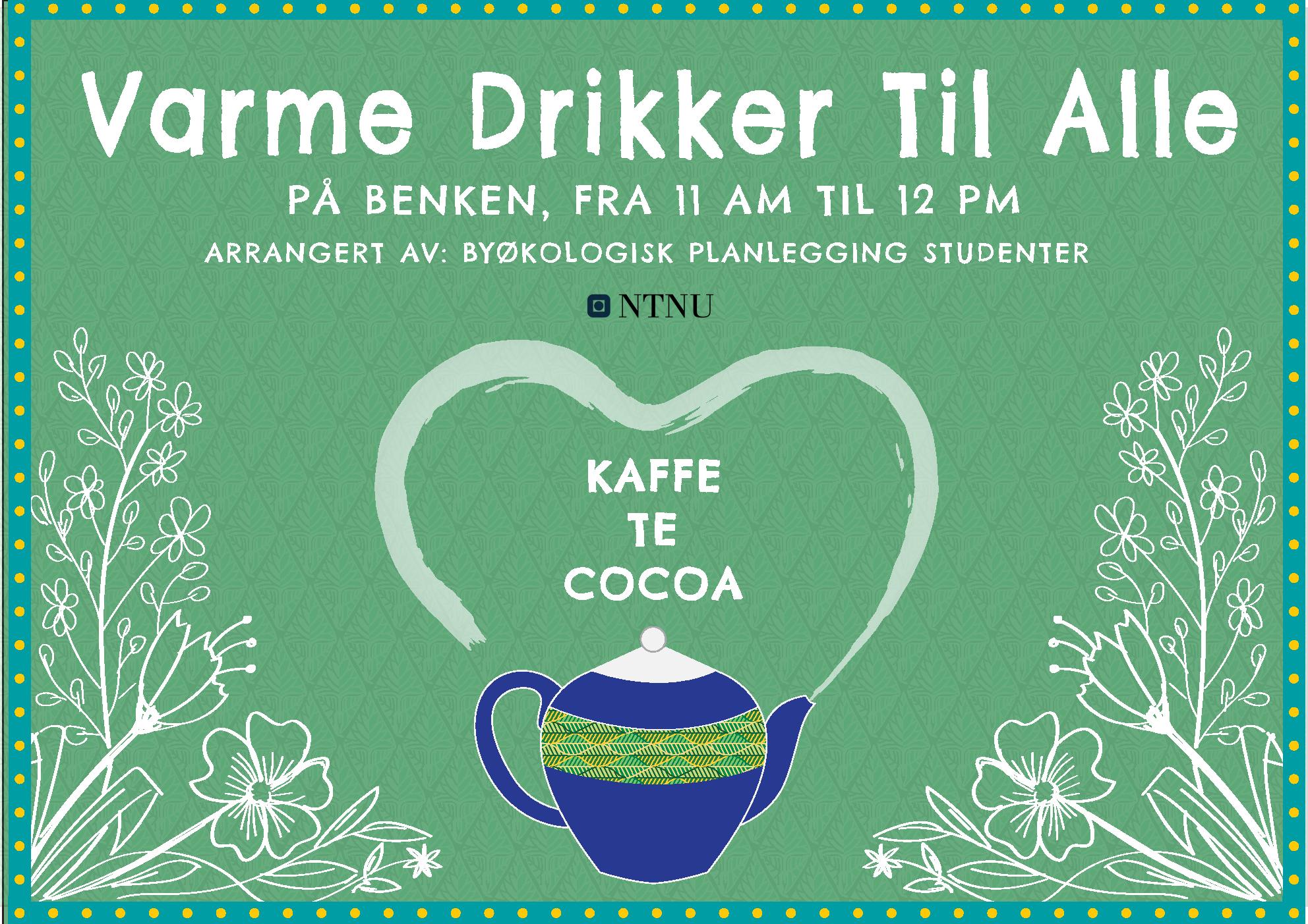
After publishing the online survey, the project team organized a free coffee stand to raise awareness about the project and to encourage residents to complete the survey. At midday on a Sunday and with a pleasant weather forecast, coffee, tea, cocoa, and snacks were offered next to the Ila Free Fridge, a well-known point in the neighborhood. The event was advertised beforehand on Facebook so that residents could visit either deliberately or spontaneously. According to Nabeel Hamdi, a concept such as this tends to attract invisible stakeholders, “those community members unidentified as part of any stakeholder group” (Hamdi, 2010).

26 | Ila, Trondheim | Public Space Network
Figure 5.10: Coffee Stand next to the Free Fridge (Source: Authorship of Team Ila - UEP 2021)
Figure 5.11: Coffee Stand Poster (Source: Authorship of Team Ila - UEP 2021)
5.1.2.6. Attend public meetings
Existing institutions in the neighborhood, such as Ilen Kirke (the local church), Frivilligsentral, or Ila Brainnstasjon (a local bar) offer space for community interaction. In order to experience the spirit of the community, the project team participated in several community events in Ila. These included Waffle Tuesday at the Frivilligsentral, a Bible study at Ilen Kirke, and an evening at Brainnstasjon. The team had the chance to talk to several residents about their experiences and perspectives. Volunteers were able to share their experiences of serving various members of the community. Through these conversations, the team gained the sense that Ila was an artistic and creative place.

5.1.2.7. Mapping: Event/Cultural/Stakeholders/Land-use
Mapping was used to visually depict the observations collected through the various ‘walks and talks’ in Ila. With a base map of the project area as a backdrop, culturally relevant locations in Ila and different land uses were able to be visualized. Stakeholder mapping was used to create a graphical depiction of the stakeholders involved in the project and their relationships both to one another and to specific issues.
questions were addressed: How does Ila fare when compared to other parts of Trondheim? What can other parts of Trondheim learn from Ila?
5.1.2.8. Studying Other Neighborhoods: Lademoen, Svartlamon
Since the Norwegian context was relatively new to the entire project team, it was decided that comparing Ila to other popular neighborhoods of Trondheim, such as Lademoen and Svartlamon, would provide a better understanding of the city’s urban dynamics. These neighborhoods would be compared to Ila both quantitatively and qualitatively. Through secondary research, direct observation, and conversations with peers, the following
5.1.2.9. SWOT analysis
A SWOT Analysis enabled the team to identify the neighborhood’s existing Strengths and Weaknesses, and its potential Opportunities and Threats. Numerous factors were included, including COVID-19 and climate change. The factors deemed most important would be given special consideration in the subsequent definition of the problem (or, in this case, opportunity) statement (Leigh, 2009).
27 | Ila, Trondheim | Public Space Network
Figure 5.12: Public Meetings (Source: Authorship of Team Ila - UEP 2021)
5.1.3. Mixed methods
5.1.3.1. Internal prioritization
In the final stage of the situational analysis phase, all topics were examined, including identity, events and community activities, public space, traffic and mobility, demographics, and vision for the future. This step led to a prioritization of opportunities. In a team brainstorming session, the issues raised by the community were formulated into seven ideas for community interventions. These ideas would then be visualized using an opportunity prioritization board.
5.2. Reaching an opportunity statement
5.2.1. Mixed methods

5.2.1.1. Opportunity prioritization board
Once the internal prioritization from the previous phase was completed, a participatory activity was held in which these seven alternatives were presented to the community. Participants were given the chance to choose which issues they believed were most relevant. Each person was given three votes (in the form of stickers) that they could distribute to one, two, or three different projects. Most residents distributed one sticker each to three projects; however, a few chose to put all their stickers on just one of the alternatives. The activity happened on a weekend in Ilaparken, a popular outdoor space for the community.

28 | Ila, Trondheim | Public Space Network
Figure 5.13: Internal Prioritization (Source: Authorship of Team Ila - UEP 2021)
Figure 5.14: Opportunity Prioritization Board with Stickers (Source: Author ship of Team Ila - UEP 2021)
5.2.2. Qualitative methods
5.2.2.1. Tree of ideas

After completing the prioritization exercise, participants could then contribute their proposals for potential solutions to the ‘tree of ideas.’ It consisted of a box with hanging slips of paper, on which people could write their ideas. This enabled the gathering of additional feedback from the community and the collection of numerous ideas to be considered for the solution phase of the project. The tree of ideas is an artifact that facilitates urban participation and allows planners to gather thoughts, concerns, and ideas from the community in a qualitative manner (Ciudad Emergente, 2013).
Figure 5.15: Tree of Ideas (Source: Authorship of Team Ila - UEP 2021)
5.2.2.2. Design thinking and brainstorming
The first step towards developing an opportunity statement was assessing the needs of the community. Input from interviews, the opportunity prioritization board, and the tree of ideas were considered by the project team. These ideas provided a foundation for the team’s collaborative work, which took the form of a mural using the platform Miro. Later, a template from the Field Guide for Human-Centered Design, specifically the “Frame Your Design Challenge” (Ideo, 2015) was used. It started with a tentative statement that was then modified, using the questions included in the template as a guide.
Figure 5.16: Brainstorming to Reach an Opportunity Statement (Source: Authorship of Team Ila - UEP 2021)

29 | Ila, Trondheim | Public Space Network
5.3. Conceptualizing a Strategic Implementation Plan
5.3.1. Quantitative methods
5.3.1.1. Traffic modelling using GIS
In order to improve pedestrian and bicycle access, the team considered proposing the closure of a portion of Mellomila to vehicular traffic. To this end, ArcGIS network analysis tools were used to model the impact of detouring traffic. In addition, traffic signal times of the roads that would be utilized by the detour were measured, modeled, and added to the network analysis results. The data gathered was later used to model pedestrian and bike friendly measures in Mellomila.

Figure 5.17: Traffic Modelling of Proposed Situation (Source: Authorship of Team Ila - UEP 2021)
5.3.1.2. Mapping of Existing Values / Mapping of Potential Values
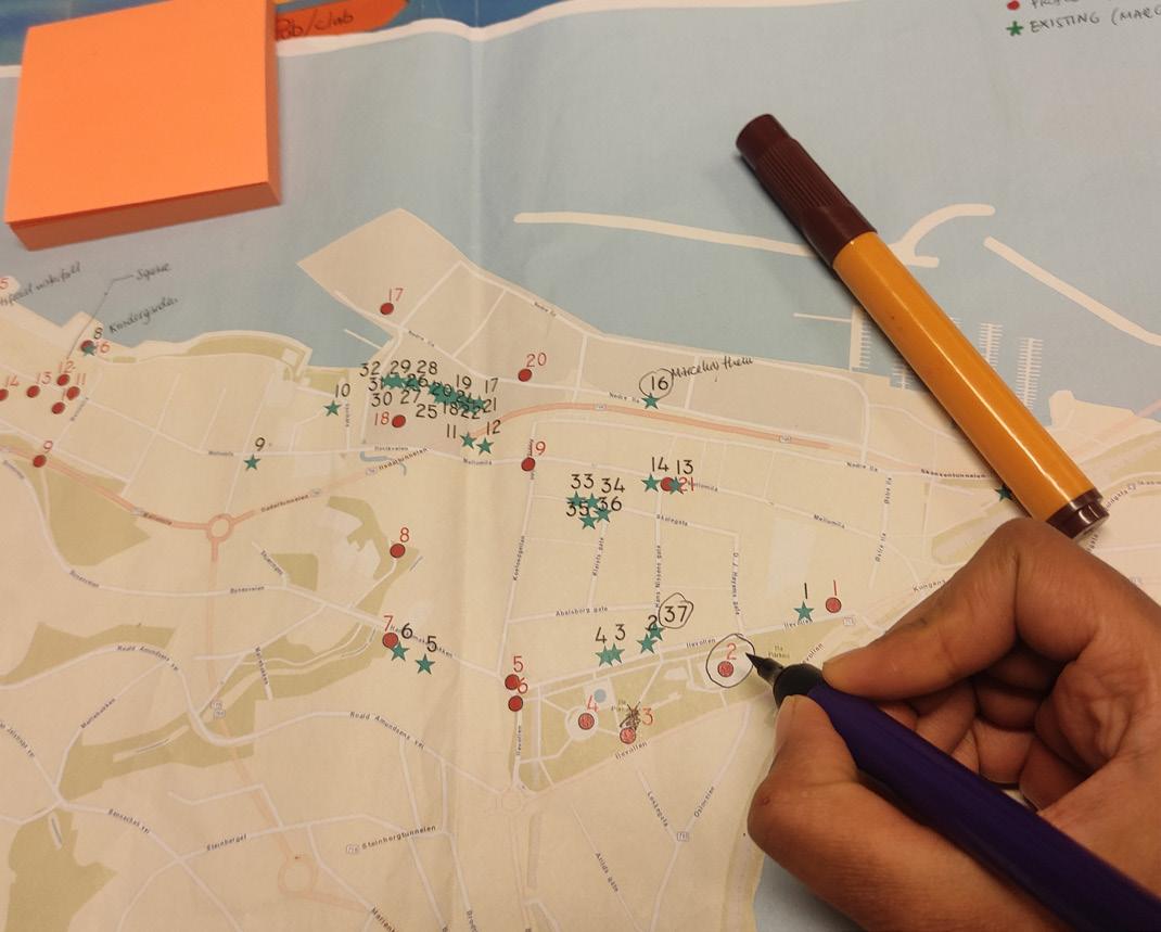
To make the project team’s proposal cohesive and utilize the available resources of the neighborhood, the existing points of interest in Ila, as well as places with the potential to be integrated into the proposal, were identified. The project team again walked through the area to get a better spatial understanding of these two types of places. Using the application Input, these points were mapped and compiled into an ArcGIS file, and a map showing these points was created. This allowed for the recognition of areas with higher concentrations of points of interest, which contributed to detailing the art path as part of the Strategic Implementation Plan.
Figure 5.18: Mapping of Existing/Potential Values (Source: Authorship of Team Ila - UEP 2021)
30 | Ila, Trondheim | Public Space Network
5.3.2. Qualitative methods


5.3.2.1. Case Studies: Urban Art all over the World


Formulating an opportunity statement necessitated another brainstorming process. This time, the process was more focused than the initial brainstorming session as many previously unknown data were now known. After a consensus on the concept was reached, to encourage the creative process, each team member presented one or more examples of urban art that inspired them. These examples from around the world were visualized using a mind map. In addition, secondary research of Johannesburg was also conducted in order to better understand how art can be used as a medium of cohesion and urban upliftment.

5.3.2.2. Sketches for Strategic Implementation Plan


Once the areas of potential intervention were spatialized on a map, the actual interventions were formulated, adhering to the interests of the participating residents and stakeholders. Handmade sketches were created to portray ideas for uses of the various spaces. Showing these sketches to residents would spark conversations about additional potential interventions at a later stage of the project. Abstract representations were used so that changes could be easily adapted.
Figure 5.20: Sketches for Strategic Implementation Plan (Source: Authorship of Team Ila - UEP 2021)
31 | Ila, Trondheim | Public Space Network
Inspiration from all around the world
Valparaiso, Chile Boston, USANagpur, India
India India
STREET GAMES AND ACTIVITY Iran
India
SCULPTURES Iran Iran
TEMPORARY Germany
USA IranUSA
ChileNigeria LIGHTS
GRAFFITI Spain
Iran Iran
Figure 5.19: Urban Art References (Source: Authorship of Team Ila - UEP 2021)
5.3.3. Mixed methods
5.3.3.1. Strategic Implementation Plan Prioritization Board
After the Strategic Implementation Plan was developed, neighborhood participation provided new momentum for the project. In another participatory activity in Ila, passersby living in Ila were asked to prioritize three of the 13 detailed interventions presented to them. In addition to the specific interventions, they were also asked to cast a vote for which one of four designated sections of the neighborhood they believed was most in need of intervention. Conducted on a Wednesday afternoon in cold, sunny weather conditions, nearly 20 residents participated in the survey in just under two hours.

Figure 5.21: Prioritization of Strategic Implementation Plan (Source: Author ship of Team Ila - UEP 2021)
5.3.3.2. Feedback Collection for Strategic Implementation Plan
After conducting the street survey, the project team sought more qualitative data, which was obtained through targeted feedback solicitation. Four specific stakeholders were invited to the UEP Studio, where the project team provided a detailed explanation of the Strategic Implementation Plan. These stakeholders then provided valuable feedback on the proposed concepts. This process was also used by the team to obtain inter-disciplinary insights from practitioners of fields such as geography, sustainable architecture and industrial economics .The step proved to be valuable for the further progress of the project.
Figure 5.22: Feedback for Strategic Implementation Plan (Source: Author ship of Team Ila - UEP 2021)

32 | Ila, Trondheim | Public Space Network
5.4. Generating spatial solutions
5.4.1. Qualitative methods
5.4.1.1. Co-designing Workshops with Community Members
To continue with the team’s participatory approach to the project work, co-designing was used in this phase of the project. This method seeks to obtain creative input from residents. Due to the situation regarding the COVID-19 pandemic at this time, the workshop was conducted online using social media. Ilinger were asked to contribute to the design using their own creativity and imagination. The co-design focused on the spatial solutions that the project team, relying heavily on the community’s input, had chosen. The format of the contribution was left open-ended in order to allow as much innovation as possible.
Figure 5.23: Co-designing Workshops with Community Members (Source: Authorship of Team Ila - UEP 2021)
5.4.1.2. Sketches / Drawings for Spatial Solutions
To convey the role of visuals in this project and to evoke creativity and imagination, hand-drawn sketches and drawings were used in the process of generating the spatial solutions. They were supplemented by detailed renderings that were created in Photoshop.
5.4.1.3. Video Editing

A montage video complements the Photoshop renderings by presenting moving images. Drone footage was also used in the video to reinforce spatial classifications.
Figure 5.24: Video Editing (Source: Authorship of Team Ila - UEP 2021)
33 | Ila, Trondheim | Public Space Network

34 | Ila, Trondheim | Public Space Network
6. FINDINGS OF THE SITUATIONAL ANALYSIS
In order to define the geographical boundaries of Ila for the purposes of this project, Trondheim Municipality’s official neighborhood delimitation was consulted. However, the distrct identified as Ila by the Municipality covered one square kilometer and was deemed too extensive for the scope of the project. Therefore, it was decided to consult numerous residents, including community leaders, about their understanding of Ila’s boundaries. Synthesizing the various answers received, the
project team defined the limits of Project Ila. With a total area of 40.2 hectares, Project Ila consists of three distinctive residential areas: Core Ila, Ilsvikøra, and Ilsvika. The parklands of Ilaparken, Iladalen, and the western portion of Skansenparken are included within the limits, as is the industrial area along Trondheim Fjord dominated by Felleskjøpet’s towering corn silos.

35 | Ila, Trondheim | Public Space Network
Figure 6.1: Map with
Definition
of
Boundaries
of
Ila Neighborhood
(Source:
Authorship of Team Ila - UEP 2021)
6.1. Social and Cultural Dimension
Ila is a well-known neighborhood within Trondheim, with particular social dynamics that are highly valued by its residents. It has a prominent cultural scene that is attractive not only to the local community but also to other neighborhoods of the city. In this section, these aspects will be examined in accordance with the diverse methods applied during the situational analysis phase.
6.1.1. Demographics and Characterization of Ilinger
Based on official estimates, Project Ila is populated by 2,551 people, distributed over an area of 40.2 hectares (Statistics Norway, 2021). Excluding the industrial area for the purpose of comparing Ila’s population density with other parts of Trondheim, Ila has a net area of 29.4 hectares. The resulting density is 87 inhabitants/ ha, which is significantly higher than that of Midtbyen, the central business district of Trondheim, which has 51 inhabitants/ha. Ila’s gender distribution is equal to that of Trondheim Municipality, with the female-to-male ratio in both entities being 49% to 51% (Trondheim Municipality, 2021).
Residents of Ila describe their neighborhood as “a very nice and diverse district,” which can be explained at least in part by the presence of immigrants and by the varied age distribution (Ila Survey, 2021). Immigrants account for 15.9% of the neighborhood population, which is higher than the proportion for the city of Trondheim, where 12.0% of residents are foreign-born (Trondheim Municipality, 2021). With respect to age, Ila is, on average, slightly older than Trondheim Municipality. The median age in Ila is 39.7 years. Dividing Ila into age brackets of 20 years, the 20-39 age bracket contains a plurality (47%) of residents. Only 6% of the population is under the age of 20. The 40-59 and 60-79 age brackets contain 18% and 22% of the population, respectively, with an additional 7% of residents over the age of 80. Something
quite distinctive about Ilsvika, according to an interview with local senior citizens, is that this area houses a higher concentration of elders, most of whom own their apartments. One resident characterized it as “a comfortable place to live.”
Figure 6.2: Chart with Age Distribution within Ila, in Brackets of 20 years, in Percentages (Source: Trondheim Population Statistics 2021)
During the initial stage of the project, residents were asked to answer an online survey created by the project team. The survey received an encouragingly high 97 responses. The age of the respondents ranged from 16 to 82 years old, with a mean of 45 and a standard deviation of 16, indicating that many participants were well into adulthood. Regarding the gender distribution of the respondents, women (71%) were overrepresented relative to their census population in Ila (49%). Most of the participants were of Norwegian origin (89%), with 10% of respondents having been born elsewhere in Europe and the remaining 1% coming from Oceania. Those who answered the survey work in a diverse range of occupations, including schoolteachers, advisors and

36 | Ila, Trondheim | Public Space Network
consultants, kindergarten teachers, health care professionals, artists, musicians, and academic staff at NTNU. Pensioners and students made up 15% and 6% of respondents, respectively.
When asked about their housing situation, 80% of the respondents indicated that they are owners and 18% indicated that they are renters. The rest of the respondents (2%) stated that they were staying with friends or relatives.
An interesting result from the survey data was the length of time that residents had lived in Ila. The plurality of residents had lived in Ila for less than 5 years (31%); this was followed in magnitude by those who had lived there for 11 to 20 years (25%) and those who had lived there for 6 to 10 years (21%). These data show that many residents are new to the area, which is consistent with Statistics Norway data from 2018 showing that 25.5% of Ila residents had just moved into the community during that year. This is much higher than the proportion for the entire city (15.3%).

However, a substantial number of respondents had lived in the area for over 20 years (15%). One of these residents is “Mama Ila,” a senior citizen who was interviewed during the fieldwork. She is
well known in the community, and several residents interviewed referred to her by her ‘matriarchal’ name. She was born in Ila and had lived in the neighborhood all her life. She and several other senior women from Ila explained that many residents who leave the neighborhood during their twenties tend to come back later in life, especially when they decide to settle down and start families. These women perceive there to be many creative people in Ila; they find that this contributes positively to community dynamics.
31, female
41, female
Figure 6.3: Response to Survey about Years Living in Ila (n=97). (Source: Survey carried out by Team Ila - UEP program, 2021 in September)
Figure 6.4: Response to Survey about Satisfaction with the Neighborhood (n=97) (Source: Survey carried out by Team Ila - UEP 2021 in September)

37 | Ila, Trondheim | Public Space Network
“Very good. Charming and safe district with proximity to most things.”
“Great place to stay. It has everything I love about a neighborhood.”
During the interview, this group of senior women also mentioned that they saw Ila as “the jewel of Trondheim,” and used the following phrases to describe their neighborhood: “inclusiveness,” “people who take care of each other,” “very safe place,” “nice buildings,” and “active community.” Their glowing reviews of Ila were mirrored in the survey data, where 93% of respondents were either satisfied or highly satisfied with their neighborhood.
During an interview with the project team, representatives of Trondheim Municipality’s City Planning Office stated that most people in Ila were highly content with their neighborhood. Nevertheless, the representatives pointed out that there are some small units in Ila where low-income residents live. Some of these residents live in Ila not by choice but by necessity, as it is more affordable than other neighborhoods located near the center of Trondheim.
6.1.2. Community Dynamics
When asked to evaluate their relationships with neighbors and other community members, residents had slightly lower levels of satisfaction. In this case, 84% of residents were either satisfied or highly satisfied, with an additional 7% expressing low levels of satisfaction. According to the data, there is no correlation between years of residency in the neighborhood and satisfaction with the community dynamics. However, during the interview with the senior group of women, all of them expressed great satisfaction with the neighborhood and highlighted that “people in Ila are great at supporting each other, especially in hard moments, such as grief for the loss of a loved one.”

In terms of residents’ affiliation to community initiatives and organizations, the survey revealed that most respondents take part in community activities in Ila (51%), while a substantial number of people participate in other types of initiatives (28%). The volunteer center involves 21% of Ila residents from a variety of
42, female
age groups. However, it is possible that the residents who do not take part in its activities would still like to have more community spaces within the neighborhood.
Figure 6.5: Response to Survey about Satisfaction in terms of the Relation ship with Other Members of the Community (n=97) (Source: Survey carried out by Team Ila - UEP 2021 in September)
38 | Ila, Trondheim | Public Space Network
“Suitable mix of known and unknown faces. Belonging and unity.”
“Beautiful, historical with a rich cultural life and inclusive community.” 29, male
“Would be nice with more common activities that connect the neighborhood, flea markets, etc. [...]” 34, female
The group of elders also mentioned that Ila now offers more social activities than it did in the past. They explained that people meet up more often, and they believe that social media has made it easier for them to participate in activities and stay informed.
As Annette, the chief coordinator of Frivilligsentral, confirms, the elders of Ila use Facebook often, having done so especially during the COVID-19 pandemic. On this topic, the survey shows that most respondents (67%) believe that COVID-19 has not had a significant effect on their community dynamics. Some think that the pandemic changed these dynamics for the better (10%) and others, for the worse (21%).
During the fieldwork, it was identified that there are many activities and initiatives occurring throughout the year, with many seasonal types of events. The community is quite active in comparison to other parts of Trondheim, as some of the residents pointed out. Ilinger organize and participate in various activities, shown on the map below, such as:
• Urban Gardening takes place on a plot of land behind Mellomila 52 and above Ilsviktunnelen; 33 families participate, with about 50% of them being native-born Norwegians and 50% being immigrants (Melås, 2021).
• Benken, or “bench” in English, consists of informal community meetings where residents gather to share waffles and discuss issues of interest. It is limited to the warm months of the year.
• Bålet på Skansen, or “bonfire at Skansen” in English, consists of informal meetings that the attendees normally organize through a Facebook group. It takes place in Skansenparken, where people light bonfires using pallets from the corn silos. Improvised jams and parties take place in an area with no neighbors other than the boats in the marina. During the COVID-19 pandemic, this outdoor gathering attracted many people due to the restrictions on indoor events in Trondheim.
Figure 6.6: Response to Survey about Participation in Neighborhood Organizations (n=97) (Source: Survey carried out by Team Ila - UEP 2021 in September)

• The Free Fridge is an initiative that takes place throughout the year and provides the opportunity for food sharing, which many residents enjoy.
• Ila Dagen is a one-week festival that takes place during the warmer months and includes several activities that take place in various parts of Ila. Residents and visitors take part in the music performances, children’s activities focused, community gatherings, and flea markets.
Other institutions and organizations that gather people both from inside and outside the neighborhood are:
• Ila Brainnstasjon, a local cafe and pub, is a common meeting place for Ila residents. There is a stage inside the building where musicians perform regularly. Sometimes there are larger events, such as visiting international artists.
• Home/restaurant Visit Bjørn is a unique place in Trondheim since it is the only place in the entire city with a permit to operate as a restaurant within someone’s home. The place
39 | Ila, Trondheim | Public Space Network
is solely run by homeowner Bjørn, who prepares the meals and plays music for the paying guests. He also performs at the local pub sometimes.
• Ilen Kirke is a 19th-century church that hosts services every week along with several different activities throughout the year. Some of the events are done in collaboration with Ila Frivilligsentral. The church hosts several religious activities for a wide range of age groups and hosts a non-religious event during October where a group of residents gathers for a jam session that is open to all.
• Galleri Dropsfabriken is an art gallery that opened its doors in 2018 and presents Norwegian contemporary art. It has a permanent exposition but also organizes several temporary exhibitions each year. It is a place that attracts both residents of Ila and other inhabitants of Trondheim.
• Galleri Ismene AS is one of Norway’s leading private art galleries, that focuses on visual art. In parallel with continuous exhibition activities, the gallery operates eight graphics clubs and the exhibition business of graphic circulation. (Galleri Ismene, n.d.)
• Ila Frivilligsentral is the volunteer center in the neighborhood, and it provides a vast number of activities and events which are mostly catered to Ila residents, but also attract people from other areas. They have daily activities at their community building such as community walks, Zumba and yoga classes, knitting days, Waffle Tuesday, bingo night, children’s activities, and a Christmas market. They also offer the possibility to rent their hall for events such as christenings, birthdays, and lectures.( Taraldsen, 2021)

40 | Ila, Trondheim | Public Space Network
Figure
6.7:
Sociocultural Mapping of Ila Activities, Institutions, and Organizations
(Source:
Source: Authorship of Team Ila - UEP 2021)
Another part of analyzing the social dynamics of the community was identifying major stakeholders in the project. This was an inexhaustive process, where new stakeholders were continually discovered during every interaction with the community.
During the course of the project, a substantial number of stakeholders were identified. Individual persons or institutions either show interest, have reasonable amounts of power, are affected, or influence the process and outcome of the project. In a stakeholder-issue interrelationship diagram (Figure 6.9), the most relevant stakeholders are placed in their proper contexts among the opportunities identified as priorities by the community. This manner of representation conveys the dynamics of who supports, might support, or might oppose the interventions that this project proposes for addressing specific issues in Ila. As can be seen in the diagram, the majority of stakeholders support the idea of
having a space for community interaction and for creativity and business. This is especially true for institutions whose mission is to provide a social framework, such as Ila Frivilligsentral and Ilen Kirke. Trondheim Municipality is a powerful stakeholder and is considered to be a supporter of the interventions, notwithstanding applicable legal restrictions and alternate urban development strategies. Following the participatory approach, residents were always given a role in shaping the process. While not very influential at the individual level, residents as a group are to be valued and not underestimated. Two potential conflicts arise around an outspoken community leader. His visions of two specific interventions might conflict with the Ila nursing home in one case and a private property owner in the other. It is also important to consider the role of restaurants in Ila; some of the proposed interventions would be beneficial to this type of business.

41 | Ila, Trondheim | Public Space Network
Figure 6.8: Stakeholders Power Interest Diagram and Influence between them (Source: Authorship of Team Ila – UEP 2021)
Trondheim
Kommune

Support
Support Support
DIAGRAM


Support Visitors
Might oppose
Need
SupportMightsupport/oppose


Residents Norwegians
Port (Skansen)
Businesses Café, Salon, Bar


Support
Might oppose
Health care
Potential conflict
Support Support Support Support
Enhancement of sidewalks and bicycle lanes Integration between Corn silos and Ila Integration between Ila and Ilsvika

Ila Sykejhem
Space for creativity and business
Potential conflict Support
A Property owner
Trondheim city Residents Immigrants

A Community Leader
Space for interaction
Support
Support
A Researcher

Might support
Might support Residents Immigrants
Figure 6.9: Stakeholder-Issue Interrelationship DIagram (Source: Authorship of Team Ila – UEP 2021)
Ila Frivillig Sentral

Might support
Ila Kirke Community activities and festivals

Need Industries Might oppose Real estate developers Might oppose Need

Student Dormitory
Educational institutions

42 | Ila, Trondheim | Public Space Network
STAKEHOLDER-ISSUE INTERRELATIONSHIP
INTERVIEWS
Chief coordinator of Frivilligsentral, and two senior ladies
Overall, the chief of the volunteer center and the elderly ladies communicated a very positive image of Ila. They stated that they do not like the newer housing developments in the area and identified some services missing in Ila, such as pharmacies and ATMs.
Regarding the role of the volunteer center in the neighborhood, the chief coordinator explained that “people from all over Trondheim come here, not just residents from Ila.” She pointed out that the building is quite old and has had several uses through the years, but it has always been an important meeting place for the community. Even though the activities are open to all, they are mostly attended by Norwegian-speaking residents. According to the interviewees, immigrants usually attend the language café, where they have the chance to practice Norwegian. The group highlighted the role of this chief coordinator in Frivilligsentral and indicated that since she started working there, the center had become much more active than it was before, something they greatly appreciate.
She indicated that “most people come to the volunteer center in the wintertime” because the center offers indoor activities, but she said that there are still many activities throughout the year.
Priest of Ilen Kirke
The priest of Ila parish, states that Ilen Kirke is the home church of not only all Ilinger, but also of the people of many surrounding neighborhoods. She was the person who first introduced the project team to the fact that Ila had historically been a haven for people who were outcasts from society. She explained that the medieval city of Trondheim was located entirely on the peninsula known today as Midtbyen, strategically surrounded by the fjord and the Nidelva river, with only the isthmus of Skansen requiring military defense. Thus, the city wall was built at Skansen, and the community of Ila was founded just outside the wall. As a result, Ila welcomed those who Trondheim rejected, including prostitutes and outcasts. This shaped Ila’s identity as a home for people who were a little rebellious or outside the societal norm. She also shared her experiences in Trondheim as an immigrant and a member of a minority race. She has found that while those who attend her church are almost exclusively native-born Norwegians, she has had only positive experiences with respect to her race and immigrant status in Ila. Whereas in other areas of Trondheim she has experienced overt racism, she has found Ila to be a very accepting community.
43 | Ila, Trondheim | Public Space Network
Business owner of the restaurant Visit Bjørn
Visit Bjørn has a special permit unique not only to Ila but to all of Trondheim. Its owner is the only person in the municipality who holds a license allowing his kitchen to be used both for commercial and private use. He continuously emphasized how lucky and thankful he was to the Municipality for granting him such an opportunity. He noted that if the Municipality were to grant similar licenses to others in Ila and around Trondheim it could help foster the creation of various new and unique local businesses that would have the potential to add more life and character to their neighborhoods. He also highlighted that if asked in the right manner and consistently, the Municipality is willing to entertain such ideas as they have done in his case.
Merete Støvring, owner of the Red Building
The current use of the Red Building is residential, with housing on the upper floor. The ground floor is currently under construction. Merete does not want to create any expectations, but she envisions the place to serve as a modest, family-friendly cafe that underlines the natural atmosphere of the park. As the owner of an ecological store in the city center, she believes that there is an existing demand to buy local products in the area. Merete does not want the future use of the Red Building to be dominated by any one group, but rather to be open for everyone.
NTNU researcher writing on Urban Farming in Ila
Urban Farming in Ila involves 33 urban agricultural plots. About 50% of those participating are not native-born Norwegians. The researcher interviewed stated that there could be more agricultural gardens and that it is practiced more as a social activity than as a source of food, with workshops and activities throughout the year. In addition, he said that Ila needs indoor spaces with activities in winter. A lot of things have potential in Ila; for example, it would be nice to reuse a currently unused space as a (bookable) community space (in Norwegian, a grendehus). As space is valuable, he agreed that it could be beneficial to move parking in the area underground.
Business owner of Indian Curry and Nepali Restaurant
Nabin explained that Ila is a beautiful place where people both from Norway and from abroad live. He mentioned that Ilaparken and the nearby fjord were the most popular spots in Ila. During the interview, he stated that he had opened the restaurant recently and did not live in Ila. Nabin further explained that even though there were community activities in the nearby community center, he did not take part in such activities due to lack of language skills. When asked how Ila could be better, he stated that frequent community gatherings would help strengthen community bonds. He also expressed his concern about drug abuse in the younger generations. Nabin identified issues with traffic congestion in the area during peak hours. He explained that there were no environmental and commercial conflicts in the community of which he was aware.
44 | Ila, Trondheim | Public Space Network
A ‘community leader’ in Ila, as stated by several residents
This community leader came to Ila after having grown up in the Bakklandet neighborhood. As a child in such a popular and well-known neighborhood of Trondheim, he felt that he was always being photographed, as if his life were part of a tourist attraction. In Ila he found community and life away from the tourist spotlight. Over his 15 years in Ila, he has become a prominent community figure in the area, with his house serving as a common place for community gatherings. Outside of his home sits the Ila Free Fridge, for which he provides the space and electricity. He highlighted the need and desire for more businesses, cafes, and places to meet within Ila, and pointed to the past to highlight how Ila used to be a neighborhood full of commercial activity. He pointed out the site of Ilevollen helse- og velferdssenter (a local elderly home) as a potential location for more shops and businesses in the future. Ilevollen is, in his view, the prime street in Ila for such activities. He felt that this building’s purpose should, at some point in the future, evolve to fill that niche.
Trondheim Municipality, represented by Grete Kristin Hennissen and Sigrid Gilleberg
Trondheim Municipality is currently not heavily focused on Ila, as there exist other areas in the city that require more attention. It was explained that at present there are no densification plans for the Ila area. This is informed by the fact that Ila’s schools are already at capacity and that the neighborhood receives an unfavorably low amount of sunlight. There are no specific plans for redevelopment of the corn silos or the rest of the industrial area as they are an important part of Norway’s agricultural industry. Also, the Municipality explained that in the city center there exists a renting system for temporary market stands; this is something that could potentially be implemented in Ila. It was also noted that the narrow sidewalks on Mellomila are not optimal for traffic flow and accessibility.
45 | Ila, Trondheim | Public Space Network
Geographer and resident of Ila
Stian is a particularly insightful resident of Ila who is interested in this project’s subject matter and, generally speaking, to the development patterns of Norway in general. Stian highlighted the concept of ‘Ma,’ or empty space, especially as it pertains to public space. In the context of Ila, Ma would be the space between the buildings. The way users of a space perceive this Ma is quite dependent on the buildings and other amenities themselves. Stian pointed out that humans tend to feel more comfortable in spaces with a lot of variety in shapes and sizes. For example, spaces with large squares that turn into narrow alleys have this tendency. Spaces with open first floors appeal to human instinct as they provide opportunities to escape potential dangers or discomforts. Furthermore, spaces with mixed typologies of buildings (buildings of a variety of shapes, sizes, numbers of floors, and architectural styles) tend to be more favorable when compared to spaces of a monotone nature. Such a monotone style might include buildings or spaces that are copies of a basic template. These spaces tend to make people uncomfortable as there is not enough variety for the human brain to subconsciously contemplate. They are, in a sense, “too perfect,” giving the brain an eerie feeling as it struggles to look for imperfections, blemishes, and character in the space. In the context of this project, Core Ila represents to Stian a more favorable kind of Ma, with the older mix of buildings from a variety of eras and former uses helping to create a space that is more inviting. It is no surprise, then, that more people are found frequenting the outdoor spaces of this area. Ilsvika, however, represents a less favorable kind of Ma. As a development that was built entirely around the same time and with little to no thought given to much of the first-floor space, the area is rarely frequented by those who do not live in the area. Streets are quiet, as there are hardly any cafes, businesses, or inviting meeting spaces in the area, and the monotony and height of the buildings creates spaces that are not at a human scale. Stian suggested that one way to better connect both sections of Ila would be to encourage the development of more first floor activities, such as shops, cafes, restaurants, or bars. These types of places would give more life to spaces, giving people a reason to be there in the first place.
46 | Ila, Trondheim | Public Space Network
6.2. Spatial and Physical Dimension
6.2.1. Diversity in Land Use and Residential Typologies
Several methods of analysis were conducted in order to better understand the spatial/physical dimension of Ila. To this end, residents were asked in the survey to identify the characteristics they valued the most in their neighborhood. Five such characteristics were frequently recognized and are listed here from most to least common: accessibility/mobility, proximity to services, landscape, members of the community, and history/ architecture. These results match the observations of Kuvac and Schwai in their analysis of Ila; they state that “despite this high level of urbanity, the residents pointed to proximity to nature as the main characteristic of the neighborhood, including its position in relation to the center of the city and its excellent transport connections” (2017).
In terms of land use, mapping tools revealed that residential buildings comprise most of the buildings in Ila. While Core Ila and Ilsvikøra are mostly composed of single- and doublestoried residential buildings, the rest of Ila has multi-storied apartment buildings with commercial- or business-related activities happening on their first floors. However, some of these activities do not generate significant levels of interaction on the first floor because much of the space on the western side of the neighborhood is used primarily by offices. Neither is attention given to the public, nor are services offered to the community.
In addition to this, the industrial sector in the northern part of the neighborhood occupies a major portion of Ila’s built-up area. The road network here is disconnected from the rest of Ila and lacks the orderliness evident in the rest of the neighborhood.
Other prominent land use includes kindergartens, commercial spaces, business areas, green spaces, and healthcare facilities.
Open spaces, both private and public, are plentiful. Also, one notable space within Ila is the school, located on the western side of the neighborhood. According to senior residents, this is the oldest school in Norway still in use. The priest of Ilen Kirke stated that this school receives foreign children who arrive in Trondheim and must learn the Norwegian language; as a result, it is a highly diverse institution. In terms of the services that the neighborhood does not offer, senior residents expressed their desire for having pharmacies, ATMs, and more cafes.
In Ilsvika, most residential developments have courtyard-style open spaces surrounded by built structures on at least three sides. Most importantly, Ila’s location amid an abundance of natural settings, such as the fjord to the north and Bymarka to the west, and its proximity to the city center enhance its desirability as a place.
Given that the most prominent function in the neighborhood is residential, it is important to emphasize that the residential buildings were built in different years and thus comprise various typologies.
In the 18th century, the area comprised some farmhouses for wealthy families in the region; nevertheless, there are very few of this type of building left in the Ilsvika area. Ilsviken gård is one such building. The most dominant type of housing is semidetached or row housing both in traditional and modern style. Towards the western side of Ila, newer developments in Ilsvika area are mixed-use houses which have commercial ground floors and residences above. Newer developments also feature multi-family medium and large houses, reflecting the housing densification trend in Trondheim. When senior residents were asked how they felt about changes in the neighborhood, they were generally fine with them. A resident known as ‘Mama Ila’ said that “the world moves forward and there are things we like and do not like, but they will still happen.” However, they
47 | Ila, Trondheim | Public Space Network
stated that they did not like the newer housing developments in the area. Additionally, as residents of the Ilsvika area, they expressed their desire for “buildings to stay with a lot of space in between them.” This is reflected in the relatively small difference in population density between Ilsvika and Core Ila; the first one has an estimated 96 inhabitants/ha, slightly higher than the 83 inhabitants/ha of the second one.
Something interesting to observe about Ilsvika is that it corresponds to a relatively new residential development from the early 2000s (Trondheim Municipality, 2008). Unlike the rest of Ila, it was populated all at once by a diverse group of people. Most people living in Ilsvika own their homes instead of renting.
Therefore, this part of the neighborhood was shaped by diverse societal groups (with different identities) that abruptly became neighbors and did not know how to dialogue in the public spaces that they share (Marcus, 2011; Kuvac and Schwai, 2017).
The elders also expressed their impressions of the rest of the neighborhood. They see Ilsvikøra as a great place in Ila and feel that it raises the standard of the neighborhood. Regarding the corn silos, they maintain that they were never consulted when they were built (around the 1960s to 1970s); however, they do not have a problem with their presence now. This was not the case a couple of decades ago when there was an issue with dust pollution, which was later solved. Talking about some of

48 | Ila, Trondheim | Public Space Network
Figure 6.10: High Level of Mixed Uses Identified in Land-Use Mapping in Ila (Source: Authorship of Team Ila - UEP program, 2021)
the historical milestones of Ila, they remember when residents fought to keep the area residential and think back to when they won that battle. They remember when in the 1980s some of the old industrial buildings were turned into housing units.


49 | Ila, Trondheim | Public Space Network
Figure
6.11: Matrix with Housing
Typologies Identified,
Including
Single Family and Multi-family Units (Source: Authorship of Team Ila - UEP program,
2021) Figure 6.12: Diverse Housing Typologies were also Identified in Ila (Source: Authorship of Team Ila - UEP program, 2021)
6.2.2. Public and common use spaces
Public spaces and common infrastructure were a fundamental part of the analysis of Ila. Both observations from the project team during the fieldwork and inputs from the residents were extremely valuable. Some of the main findings were that even though there is a great number of public (or publicly used) spaces in the neighborhood, many of them are underutilized by residents. This is also reflected in the survey results; most respondents only make regular use of parks and squares, mainly Ilaparken according to several resident testimonies. The rest of the spaces, however, were found to have few respondents ever making use of them.
One of the factors that could explain this observation is the evaluation of public spaces and infrastructures by respondents to the survey. Their highest evaluations were of those spaces they use the most, such as parks and squares, streets and sidewalks, and on-street vegetation. The built environment, meaning urban facades and the exterior condition of housing in general, as well as illumination also have positive evaluations. However, for urban amenities, sports infrastructure, and public buildings, the survey reveals less satisfied or indifferent views from the majority of respondents.

50 | Ila, Trondheim | Public Space Network
Figure 6.13: Unused
Public Space near the Waterfront
(Source:
Authorship
of
Team
Ila - UEP 2021)
Figure 6.14: Response to survey about use of public/common spaces within the last 30 days (n=97) (Source: Survey carried out by Team Ila - UEP program, 2021 in September)

Figure 6.15: Response to survey about evaluation of public places and infrastructure in Ila (n=97) (Source: Survey carried out by Team Ila - UEP program, 2021 in September.

51 | Ila, Trondheim | Public Space Network
MELLOMILA: It was also observed that Mellomila serves a fundamental purpose for the neighborhood, as it has both diverse uses and building typologies, and it serves as a connection between Skansen and Ilsvika. However, its condition differs greatly when comparing the east side of the street (Core Ila) to the west side (Ilsvika). In the resident survey, a great number of residents identified the Ilsvika area as one of their favorite places within Ila, highlighting the waterfront area. Nevertheless, several other residents identify Ilsvika as one of the places they least like in Ila, and they emphasize that the building typology is one reason for this. As observed by the project team, streets


and public spaces are generally less inviting on this side of the neighborhood, and the dimensions of the sidewalk are not wider despite the increased housing density in this area. As stated by the municipal representatives interviewed during the fieldwork, this is an issue that the Municipality plans to address in the coming years. Another interesting observation about Mellomila is the differently colored building facades in Ila, but a lack of such diversity in Ilsvika, as well as the variety of vegetation. Diversity creates a better walking environment and makes an area more attractive, which could explain the high level of walkability and cyclability within Ila.

52 | Ila, Trondheim | Public Space Network
Figure 6.16: Transects analyzed during the fieldwork in Ila: Mellomila (Source: Authorship of Team Ila - UEP program, 2021)
Figure 6.17: Transects analyzed during the fieldwork in Ila: Ilevollen (Source: Authorship of Team Ila - UEP program, 2021)
Figure 6.18: Transects analyzed during the fieldwork in Ila: Ilsvikøra – Iladalen park. (Source: Authorship of Team Ila - UEP program, 2021)
ILEVOLLEN: As previously noted, it was possible to observe a lack of indoor-outdoor connectivity on the first floor, which is especially lacking in the western part of Ila. However, this does not only occur on Mellomila, but also on Ilevollen and Hanskermakerbakken (important road axes in the neighborhood) in terms of cultural and commercial activities. However, despite these streets’ central role in mobility as transport corridors, there is not much human interaction. The only exceptions are the bus stops where commuters concentrate during peak hours. One of the reasons for this is the land use in the area, with a nursing home and a medical center occupying a large proportion of the
northern side of Ilevollen. These buildings have mostly closed facades that do not allow for interaction


HANSKEMAKERBAKKEN: With regards to Hanskemakerbakken at its intersection with Koefoedgeilan, the situation is similar to that of Ilevollen. This is an area where vehicles and people mostly pass by and do not stay. However, Hanskemakerbakken has potential for more social interaction due to existing commercial uses, including small shops, cafes, and a restaurant. This is also the site of Ila Frivilligsentral, the community building. As one of the residents commented in the survey, “The buildings on one side

53 | Ila, Trondheim | Public Space Network
of Hanskemakerbakken pull down the neighborhood. Quawah [cafe] lifts it up a lot, but the remaining buildings on the same side .... pull down the neighborhood” (Ila Survey, 2021). Another situation observed here is the large footprint of car parking on the south side of the street, especially notable considering that the parking lot behind the volunteer center is rarely occupied.
ILSVIKØRA – ILADALEN PARK: Together with Ilaparken, Iladalen is certainly one of the favorite places of the residents, according to the survey. This green open area is quite unique in the city and Ilinger have high appreciation for it. In the past, when the area had more industrial activities, the river ran through underground pipes, making the area less livable than it is now. A sustainable project was carried out in the area, aimed at reverting the land into a natural space where people could be in touch with the natural surroundings again (Trondheim Municipality’s City Planning Office, 2021). During the fieldwork, it was identified that despite its pleasant surroundings, the area had very few activities inviting people to stay. The Red Building is situated in the middle of this park, with its residential upstairs and currently vacant downstairs.
This suggests that Mellomila is a street that could potentially be made into an exclusive right of way for pedestrians and bicycles. Temporally, each intersection has a vehicular traffic distribution that reflects the typical bimodal distribution of a morning and afternoon rush hour. The afternoon rush hour has slightly higher peak volumes, with the morning rush hour being spread out over a longer period of time. Pedestrians do not follow the same trends as bicycles and motor vehicles, with a relatively constant volume at Location 1, and a very high-volume peak in the late evening. Also, pedestrianism generally increases on the weekends, whereas bicycle traffic and car traffic decrease on weekends. This suggests that people primarily use bicycles and cars for commuting purposes, while pedestrianism is the preferred mode of choice for leisure.
In accordance with the results obtained in the traffic study analysis, when consulted on their forms of transportation for daily commuting, the majority of respondents indicated that bicycle is their main mean of transport (44%), followed by public transportation (25%), and walking (19%). The least preference was given to scooters and to taxis/carpools (each 0%), with personal cars proving to be less common for daily commutes (12%). This means that only one out of eight residents uses their private vehicle on a regular basis.
6.2.3. Transport Infrastructure and Mobility
From the perspective of mobility, the traffic study carried out during this phase revealed that pedestrians and bicycles make up a large proportion of the total traffic in Ila. At Location 1 (Koefoedgeilan and Hanskemakerbakken), pedestrians were 50% of total traffic, and at Location 2 (Hans Nissens gate and Mellomila), pedestrians were 57% of total traffic. Bicycles were 14% of the total traffic at Location 1 and 27% of the total traffic at Location 2. The percentage of traffic that is motorized at each location is 36% at Location 1 and only 16% at Location 2.
Most of the regular destinations of Ilinger lie within the city of Trondheim but outside of their neighborhood (84%), followed by a number of residents that usually stay within Ila (13%). These residents are mostly women. Just a small number of residents commutes daily to areas outside of the city (3%).
Some of the common destinations for Ila residents within Trondheim city include Midtbyen, Gløshaugen, Heimdal, and Øya. According to some of the interviews and informal conversations with residents, the commercial, social, and services on offer within Ila do not meet the inhabitants’ needs, so it is common for
54 | Ila, Trondheim | Public Space Network
Figure 6.19: Response to survey about forms of daily commute (n=97). (Source: Survey carried out by Team Ila - UEP program, 2021 in September)

Figure 6.20: Response to survey about forms of daily commute (n=97).
(Source: Survey carried out by Team Ila - UEP program, 2021 in September)
them to commute to the city center where they can satisfy these requirements.
Finally, in terms of evaluation of the available means of transportation into, out of, and within Ila, a high percentage of respondents is satisfied or highly satisfied with the current offer (87%), followed by a smaller group of residents who seem neutral about the question (10%), and a minority of respondents who evaluate this item with a low grade (3%).

Figure 6.21: Response to survey about forms of daily commute (n=97).
(Source: Survey carried out by Team Ila - UEP program, 2021 in September)

55 | Ila, Trondheim | Public Space Network
6.2.4. Future of Ila
Concerning future projects for the neighborhood, primary sources such as Trondheim’s city plan were reviewed and an interview with municipal representatives was carried out. During this interview, the representatives stated that Ila is considered for the development of a new Area Plan in the years to come; this will aim to work on areas of Trondheim that present certain issues. In this particular case, a decision has been made to make the city center and surrounding areas such as Ila more family-oriented. This strategy is being planned through the construction of new housing units that comprise diverse types of apartments for different types of families. However, the city center strategy does not recommend densifying the area further, since its already quite close to the desired density. Therefore, the approach taken by authorities is to use pre-existing infrastructure within the urban fabric of the city center instead of incorporating new and bigger buildings. One important aspect of this plan is the provision of social infrastructure, as a vital part of neighborhoods with good qualities.
When asked about existing initiatives for densifying Ila, the representatives indicated that there is one ongoing project in the Ilsvika area, which considers demolishing an existing building at Mellomila 81 and building new infrastructure there, as well as refurbishing the building directly behind it due to its heritage declaration. The project will maintain a similar height but will increase housing density in the neighborhood, since the previous use was office space.
Furthermore, a fundamental aspect to consider in Ila is the substantial risk of gentrification, considering its positive attributes such as proximity to the city center, closeness to the waterfront area, relationship with the landscape (something highly valued in Norwegian society), presence of historical buildings and areas, and existence of art installations. This risk is significantly
increased if the industrial buildings that currently coexist with Ila’s residential areas were to be demolished, which some residents support. As previously stated, however, others see it as a negative potential change since they understand that it would accelerate a reconversion process of the whole area that could make it more unaffordable in the long term. Even though not all processes of gentrification are bad, in this case, it would generate a problem that would mainly affect tenants, who might not be able to keep up with the resulting rent increases (Steinmetz-Wood, 2017). According to Gibbons et al., “even if gentrifying neighborhoods prove more healthy than other neighborhoods, cities overall may be less healthy due to the displacement of poorer residents” (2019). This is also something that is discussed in the UN Habitat Principles for Sustainable Cities, which will be examined later.
In the long term, the municipality, in partnership with private architecture consultants, has laid out plans for the Ila neighborhood, within the greater defined area of Sentral Vest (center west). For the city of Trondheim as a whole, the 10- to 12-year plan calls for no new car traffic, a reduction in the carbon footprint to 80% below 1991 figures, a reduction in the need for transit as a whole, the adoption of a compact alternative land use strategy, and increasing the number of families and children in the city center (Trondheim Municipality, 2020). On the local scale, municipal representatives stated that there are no plans to densify Ila in the near future, as the municipality hopes to focus on other areas of the city first. Rather, these plans rather serve as a template for long-term strategies in the area, if the municipality ever plans to explore such proposals further. Additionally, there is a national strategy that was recently discussed which decided to keep the grain silos in Ila at least for the next several years; however, there is no certainty that the area will remain the same after a decade from now.
56 | Ila, Trondheim | Public Space Network
Figure 6.22: Plans for density of Trondheim’s transit paths, walking being the most dense and private vehicles being the least (Source: Framtids Trondheim, 2020).

“Pedestrians must have the densest network. [...] Cycling has the second densest network. The bicycle must have priority in most streets - except for pedestrian streets and public streets”.
(SKAJAA Architect’s office for Framtids Trondheim, 2020)
“The bus must reach all destination points in the city and be able to drive in routes through the city center without being delayed by private cars or areas with many people. [...] The driving pattern is based on a sector principle where you have to drive in and out of the same sector in a system with one-way streets.”.
(SKAJAA Architect’s office for Framtids Trondheim, 2020)
57 | Ila, Trondheim | Public Space Network
In addition, there is great interest among the city’s population to develop more climate-friendly lifestyles. This can be seen through the growing interest in the reuse of goods, dumpster diving, knowledge sharing, and bicycling (Trondheim Municipality, 2013). The city’s volunteering spirit, that won it the designation of ‘Europe’s Volunteer Capital for 2023,’ could be used to its advantage to foster citizen engagement in building better urban communities (Trondheim Municipality, 2021). Furthermore, the role of agriculture in reducing climate change impacts, increasing food supply, and acting as a carbon absorber is gaining much recognition. Through the integration of circular economy policies, creation of arenas for research and innovation, and juxtaposing development and climate resilience, the city plans to be an international pioneer for good environmental solutions (Trondheim Municipality, 2013).
For 2050, the city plans take a highly ecological approach and propose a larger pedestrian street network by reducing the spaces intended for private cars in the central city districts, including Ila. This aims to prioritize other means of mobility that put pedestrians, cyclists, and public transport passengers in the higher levels of the planning hierarchy (Trondheim Municipality, 2020). Regarding the public transport network, the plan proposes integrating a super-bus with dedicated streets throughout the central areas. It is important to note that the plan includes a note about how the Ilsvika and Ilsvikøra areas should also be integrated into the network, ensuring a maximum distance of 500 m to the nearest bus stop.

Figure 6.23: Illustration of future view for Ila, with new buildings and green spaces. (Source: Framtids Trondheim, 2020).
Figure 6.24: Illustration of future proposals for Ila core area, more green space, and increased building density (Source: Framtids Trondheim, 2020)

58 | Ila, Trondheim | Public Space Network
For Ila in particular, this radical (and even slightly utopian) vision offers the possibility to free up the existing car space, which could then be integrated into the pedestrian network. Considering the trend towards having more open spaces within the neighborhood, the proposal includes the possibility of reclaiming from car use many parking spaces in front of numerous buildings around Ila. As proposed, these buildings and their surroundings should respond mostly to the needs of children and young people by creating playground areas and green open spaces where people can interact with each other. In addition, community uses such as open libraries, playrooms, and youth clubs, should be considered. Furthermore, the proposed plan shows the creation of new parks and greenways within Ila. Figure 6.24 shows greenway developments along Hans Nissens gate and Koefoedgeilan. New park areas are integrated into what is now the industrial areas of Ila, reinforcing the idea that natural corridors are fundamental to ensuring healthy and balanced developments in the future.
6.3. Reaching an Outcome
The diverse range of data-gathering methods provided numerous findings with respect to the social/cultural and spatial/physical dimensions. The findings were analyzed using several tools that are common in participatory planning projects. These tools were instrumental in guiding the team towards the next steps of the project.
6.3.1. What can be learned from Ila?
Ila is not a typical neighborhood, and there are several characteristics that make it a valuable study case. The feedback during the situational analysis phase provided a broadly positive impression of Ila from the perspective of the residents. To better understand what is it that makes Ila an interesting study case, the neighborhood will be analyzed from the perspective of UN
Habitat’s Sustainable Neighborhood Planning five principles, which include: adequate space for streets and an efficient street network, high density, mixed land use, social mix, and limited land-use specialization (UN Habitat, 2014, p.1). One of the starting points for defining these principles is that “to prevent urban sprawl and promote sustainable urban extension, it is necessary to achieve high density, which is the foundation of a sustainable neighborhood. High density essentially means a concentration of people and their activities” (Ibid, p.4). Therefore, they propose five principles to sustainable cities and neighborhoods, which essentially support three concepts considered fundamental for sustainable cities and neighborhoods, including compact, integrated, and connected. The goals of these principles aim to raise the life quality standards for residents, aligned with environmentally responsible practices that together create livable and efficient neighborhoods.
Some of the key features that should be present in a sustainable neighborhood, according to UN Habitat, and that are highly interconnected, include:
(1) fostering a vibrant city life through the inclusion of diverse activities and reduction of private transport spaces;
(2) encouraging walkability to bring people together in public spaces, reduce traffic congestion and boost local interactions both in the social and economic perspectives; and
(3) strengthening affordability both in the sense of housing and provision of services, from the perspective of transactions and economic activities, through the increase of proximity and promotion of diversity of services and reduction of costs.
Before diving into Ila’s features, it is important to contrast this neighborhood with other parts of Trondheim city, to better understand its distinctive qualities, and to enable reflections
59 | Ila, Trondheim | Public Space Network
on Ila itself. It was also considered relevant to introduce cases that shared some similarities with Ila in terms of livability and creativity. The neighborhoods chosen were Lademoen and Svartlamoen.

Lademoen is a district situated to the northeast of Trondheim city center with buildings from the industrialization era of Trondheim. On site observations revealed an evident disconnection between the public spaces and the first floor along the street, and the indoor spaces of the second floor. Despite the wide profile of the main street, the high presence of cars certainly creates a physical and visual barrier for cyclists and pedestrians. Also, there are few mix-used buildings in the area, which comprises traditional wooden buildings. In addition to this, it was observed that some of the existing public spaces in Lademoen are left unused and barren.
Svartlamoen is an alternative district in Trondheim; its social structure and public space framework is particularly interesting. It that has been part of the city’s counterculture since the late 1980s and has received the title of ‘urban ecological experimental area.’ Svartlamoen has an internal democracy, and there are many opportunities to participate in getting to know people and making the neighborhood even better. It has a flat structure, which means that everyone has basically the same amount of power to influence (Sager, 2018). Open spaces in Svartlamoen (such as gardens and parks) belong to the public and are not privately owned. This co-owning of spaces enables broader accountability towards their maintenance and development. Empirical observations of Svartlamoen revealed it as neighborhood that embraces and thrives in informality.
Going back to Ila, the five principles for sustainable neighborhoods (UN Habitat, 2014) will be discussed in the following paragraphs, including comparisons to the study cases presented earlier.
Figure 6.25:Photograph of Case Study Lademoen.
Source: Authorship of Team Ila - UEP program, 2021.
Figure 6.26: Case Study Svartlamoen.
Source: Authorship of Team Ila - UEP program, 2021.
i. In terms of an adequate street network, this principle “aims to develop an adequate level of street network that not only works for vehicles and public transport, but also specifically aims to attract pedestrians and cyclists” (Ibid, p. 3). In this sense, Ila is a remarkable place within Trondheim city, with high levels of walkability provided by the provision of diverse uses and services in the area, as well as good connections to the public transport network. When compared with Svartlamoen, where the pedestrian network is generous, however, the area lacks provision of diverse services for the residents’ needs. In

60 | Ila, Trondheim | Public Space Network
this sense, most of Ila follows the principles behind the idea of 15-minute city, with the exception of Ilsvika, the western part of the neighborhood, which is more disconnected from the public transport network but still has several types of uses and services.
ii. High density is a key aspect proposed by the sustainable goals, as it “addresses population growth and is a direct response to the global population explosion and rapid urbanization” (Ibid., p.4). Nevertheless, developed countries like Norway, where sun conditions also play a crucial role in the discussion of densification on a national scale, tend to set a lower target and work gradually towards increasing their urban density. So, despite Ila’s density (8,677 inhabitants/km2) being much lower than the one proposed by the UN Habitat principles (15,000 inhabitants/km2), the neighborhood still experiences the benefits of compactness such as efficient land use, reduced public costs, minimized car dependency, and low levels of pollution. To put it in context with one of the neighborhoods in Trondheim presented earlier, Svartlamoen’s density is estimated at around 2,316 inhabitants/km2 (Standal, 2021, as cited by Svartlamoen UEP 2021).
iii. Mixed land use is also a fundamental principle that targets the inclusion and development of diverse but compatible activities within a neighborhood, being adaptable to market changes over time. This is derived from the urban lessons acquired by the end of the 19th century that revealed that single-use zoning approaches tended to increase problems within cities, such as expansion of urban sprawl and generalized reduction in quality of life. Similar to Lademoen, Ila is broadly residential and has within the area most of the social infrastructure that is required by the residents, such as educational and health related services, among others. However, despite its industrial roots, there is a much higher mix of uses on buildings’ first floors within Ila (and specially in the Core Ila area), with shops, cafes,
restaurants, offices, and both public and private services. This certainly enhances the walkability of the area, which still has room for more attractive mixed uses on the first floor.
iv. From the perspective of the community’s conformation, social mix is a principle that focuses on the interaction between people from different social and economic realities within one neighborhood. It responds to the need to generate inclusive and diverse neighborhoods where residents can thrive irrespectively of their financial situation. According to 2018 data, the median income of Ila district residents is slightly less than the median income of Trondheim city, but higher than that of Midtbyen and Lademoen districts. When looking at the lowest and highest 20% income brackets, the data reveal that in Ila the presence of low-income bracket residents ascends to 29.0%; from the highest income perspective, the proportion is estimated at 14.6% (Statistics Norway, 2021). Also, as stated before, Ila district contains a slightly higher percentage of foreign-born residents than the rest of Trondheim, making it then a well-balanced neighborhood in terms of social composition.
v. Finally, the limited land-use specification principle seeks to establish limitations to functional zoning and promote mixed land-use policies within neighborhoods in order to avoid single-function areas. These areas tend to create issues such as urban segregation, traffic congestions, and private vehicle dependency. Ila was about to become an industrial-only area in the second half of the 20th century; however, due to the residents’ protests and resistance, the neighborhood was defined as a mixed-used area, preserving both residential use and industrial activities. It is relevant to highlight that the type of industrial activity carried out in the area poses no threat to the health of the residents. In this sense, Ila presents a good balance of land uses; this promotes the introduction of more activities and jobs in the area and drives this vibrant community towards a multi-functional type of neighborhood.
61 | Ila, Trondheim | Public Space Network
Figure 6.27: Analysis of 5 principles of sustainability of a neighborhood: comparing UN standards to Ila (Source: Authorship of Team Ila - UEP 2021 over UN Habitat’s analysis).

62 | Ila, Trondheim | Public Space Network
Discussion of Main Results
To summarize the main aspects that will be considered in the later phases of the project, the project team constructed a SWOT table that comprises several topics considered relevant to working on urban planning proposals within Ila.
Table: SWOT analysis (Source: Authorship of Team Ila - UEP 2021).
63 | Ila, Trondheim | Public Space Network 6.3.2.
7. OPPORTUNITY STATEMENT
The Situational Analysis led to the conclusion that formulating a ‘problem statement’ would be an inappropriate step. The majority of the participants in the survey and in informal as well as formal interviews have indicated that Ila is a place that offers potential rather than problems. The following quotes highlight these findings.
By framing the proposals around the idea of a ‘problem,’ this would in itself create a problem. The team made the decision to use the potential that already existed. Problems are, in a way, possibilities, and thus offer room for innovation, creativity, and the spirit of change. This paradigm shift not only puts the students in a more positive frame of mind, but in many ways supports the participatory approach by using words that are amicable to the community.
Framing the opportunity statement in detail was an intense milestone. Finding the right words and forming a statement that would convey the team’s intentions in a comprehensive manner was a fundamental step in the course of the project. The team used the framework provided in the toolkit, ‘The Field Guide to Human-Centered Design’ (Ideo, 2015). Finally, through an internal thinking process and after multiple revisions, the team formulated the following opportunity statement, phrased in the form of a question:
The city’s nicest district.
male
Good but could be better.
female
A good place for living.
female
Inclusive, a lot of culture, music [...]
male
How can we incrementally create a robust community space that
existing social, economic, and physical features, while
providing a coherent identity to Ila and Ilsvika?
64 | Ila, Trondheim | Public Space Network
enhances
simultaneously
32,
65,
67,
31,

65 | Ila, Trondheim | Public Space Network Figure 7.1: Design thinking process for opportunity statement (Source: IDEO.org).
8. CONCEPTUALIZING A STRATEGIC IMPLEMENTATION PLAN
The response to the opportunity statement (formulated as a question) is the development of a Strategic Implementation Plan. This begins by recognizing that there are great qualities in Ila that make it a neighborhood with high living standards. Thus, the proposals contained in the Plan aim to preserve these qualities and enhance them with new interventions that assess the needs of the residents. These needs have been expressed by the residents through the different participatory and community activities carried out during the fieldwork.
8.1. Strategic Implementation Plan
During the situational analysis phase, the Ilsvika area was identified as disconnected from the rest of the neighborhood, especially Core Ila. Ilsvika is characterized by newer and more modern residential buildings with ground level space dedicated to mixed uses, following the principles of the City at Eye Level (Karssenberg et al., 2016 and UN Habitat, 2014). However, the types of uses that are present in the area now do not significantly contribute to a sense of placemaking, making the area less interesting for residents.
Another relevant factor is identity, a difficult concept to define; residents provided several different responses according to their own individual experiences despite being part of a broader community. However, some of the common aspects highlighted by the residents included inclusion and diversity, enjoyment of nature and surrounding landscapes, a sense of being a neighborhood unique from others in Trondheim, high pride for being Ilinger, and appreciation for Ila’s cultural and artistic scene.
Considering these inputs together with the findings of the situational analysis and the needs assessment, the project
team identified the idea of an artistic cultural route as a strong concept to give cohesion to Ila as a whole. Additionally, an artistic cultural route allows the team to address additional opportunities prioritized by the community such as incorporating commercial, social, and cultural spaces.
The next step toward realizing a concrete proposal consisted of developing a Strategic Implementation Plan. This allowed the team to convey general proposal ideas for the neighborhood and to identify certain areas of interest within the proposed route. The project team mapped both existing and potential areas of interest for the artistic cultural route, including not only street art but also businesses and places of culture. All these places were spatialized using GIS and became the basis for defining the specific path of the artistic cultural route.
During the brainstorming session held by the project team to discuss the possibilities for this artistic cultural route, several international examples of art were explored. These were from places where art played an important role into improving the

66 | Ila, Trondheim | Public Space Network
Figure 8.1: . Urban Art in Johannesburg (Source: inyourpocket, 2021).
living standards of diverse neighborhoods. It was also considered relevant to introduce an international case study that shared some similarities to Ila in terms of livability and creativity. Johannesburg in South Africa was selected for this case. Johannesburg has a well-known artistic scene that shapes its cityscape. This art scene has its origins in the situation of unemployed residents in the 1980s and 1990s and was used by residents to express their despair. Today, murals by local and international artists enliven spaces, create reasons to pause along busy streets, and add color to the concrete cityscape (Inyourpocket, 2021).
The concept of an artistic cultural route incorporates considerations raised by residents of Ila. This proposal is intended to play the role of fertilizer, inspiring new projects in the community in the future. It provides the possibility to integrate both attractive areas and underutilized spaces in Ila. In Johannesburg, for example, murals have enlivened previously-underutilized spaces.


For developing the artistic cultural route as visualized in the Strategic Implementation Plan, three fundamental elements were established. Firstly, the artistic cultural route would be signed and would integrate the valuable spaces throughout Ila that had been previously mapped. Secondly, a traffic intervention along Mellomila would be considered. Since the idea would be to promote interaction between the street and the ground level of Ila’s buildings, the proposal would disincentivize the use of motorized vehicles. This could be done by implementing a shared roads policy that prioritizes cyclists over cars, constructing barriers that would allow only residents (or other authorized vehicles) to access the road, or adding speedbumps that would reduce car speeds. Thirdly, after identifying the spaces that would become part of the route, specific interventions would be developed along the route, considering the needs and desires of the community. This resulted in the development of 15 proposals located throughout the neighborhood.

67 | Ila, Trondheim | Public Space Network
Figure 8.2: Photographs of existing art and places of interest in Ila (Source: Authorship of Team Ila - UEP 2021).
8.2. Spatial interventions
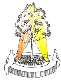


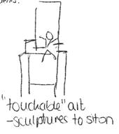


The spatial interventions were developed by the project team based on suggestions received from residents and stakeholders and represented visually through sketches. Great care was taken to ensure that every proposal was in line with the intentions set out previously in the opportunity statement. The proposals were designed to enhance existing community resources and create new opportunities. These solutions were then taken back to the community for further feedback, revision, and validation.


The final Strategic Implementation Plan for spatial interventions comprised black icons representing existing places of interest and red icons representing potential places of interest. By incrementally enhancing the diversity of spaces in Ila, providing more opportunities for businesses, and creating spaces that can be co-governed by the community, the project team hopes to activate existing spaces around Ila and thereby reduce the need for residents to travel to the city center to appease their socioeconomic needs. The opportunity to actively participate in the co-creation of an even better neighborhood is meant to create a sense of belonging to the place, which some residents of Ilsvika currently lack, thus providing provoking an ‘identity’ in them. It is important to note that the suggested proposals are to be considered frameworks that can act as placemaking strategies.
They are in no way a finalized proposal. Further collaboration is recommended through discussions with multi-disciplinary experts and physical co-design workshops with potential users of the spaces to come up with a comprehensive solution that will stand the test of time. The proposals can be treated as prototypes that, if successful, can be implemented in other parts of Trondheim.


The 15 proposed spatial interventions are as follows:

68 | Ila, Trondheim | Public Space Network
1. SENSORIAL PARK 2. EXPOSITION SQUARE 3. SUSTAINABLE CATALYTIC 9 UNDERPASS WEST ILA 11.THE RED BUILDING 10. SCULPTURE PARK 8. MELLOMILA Mellomila Ilsvikveien Hanskemakerbakken Route715(toFosen) ILSVIKØRA ILSVIKA STRATEGIC IMPLEMENTATION PLAN FOR ILA: ARTISTIC CULTURAL
LEGEND


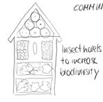


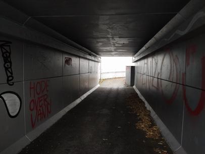


69 | Ila, Trondheim | Public Space Network Abelsborg gate INTEGRATION OF INDUSTRIAL AREA THROUGH ART PROJECTS 4. COMMUNITY GARDEN 5. SKYWALK OVER NEDRE ILA 7. ILEVOLLENCAFE 6. SITTING SPOT 14. UNDERPASS SOUTH ILA 13. GAZEBO 12. ILELVA RIVER BANK Combination of multiple functions in the same space. Adults can make use of the canopy while children can also use the same space. 15. HANSKEMAKERBAKKEN
Community/Cultural Gathering Community/Cultural Gathering Urban Gardening Urban Gardening Afforestation Entry/Exit to Art Route Art Stops Art Stops Commercial Spots Commercial Spaces Public Toilets Proposed interventions ProposedExisting Hang-out Spot Scenic Spot Play area Play area Non-motorized paths Shared roads Shared roads Nedre Ila Mellomila Il e v ollen Ilevollen S k olega t a MellomilaSkolegata Route 706 Hans Nissens gate Kleists gateKoefoedgeilan ILSVIKØRA CULTURAL ROUTE Figure 8.3: Strategic plan for Ila - Artistic cultural route (Source: Authorship of Team Ila, UEP 2021) Scan here to for the full resolution image of Strategic Implementation Plan
1. Sensorial Park:
The artificial waterfall at the western end of Ila is currently nothing but a bare space of concrete and water. Despite a pristine view of the fjord, nearby coniferous forests, a backdrop of a heritage building, and adjacent high-density housing, the project team did not observe any users here in its multiple visits to Ilsvika. The proposal is to activate this space through art, community gardening, lighting elements, seating, and play areas. This idea received the most interest from the community during the prioritization workshop.
2. Exposition Square:
This is proposed in the open space next to Ilsvika Barnehage. The presence of existing business activities on the first floor of the buildings surrounding it provides potential stakeholders who could be use and maintaining the space. The project team observed that this open space can be made more attractive through the additional of art, seasonal pop-up stalls, information boards, seating, or landscaping.
3. Public/Commercial Space:
As with the Exposition Square, a prime space such as this could have a more useful function than a mere parking lot. By moving the parking underground, the land could be reclaimed for community-related purposes. The proposal is to construct a self-sustaining cafe designed to be a working prototype of the principles outlined in ‘Kommunedelplan: Energi og Klima 20172030’ (Trondheim Municipality, 2017).
4. Community Garden:
Community gardening in Ila is a popular social activity that engages native-born Norwegians and immigrants alike. However, due to limited space, the current garden cannot accommodate more than 33 interested parties. This activity can be extended to other parts of the neighborhood for better engagement and results. Greenhouses, composting, insect hotels, vertical farming,
roof farming, and disabled accessibility can be added to the existing activities.
5. Skywalk over Nedre Ila:
Many residents pointed out the lack of a continuous walkable pathway between the corn silos and the rest of Ila. The industrial nature of the structures in this part of Ila and the automobilefocused design of the adjacent motorway discourage pedestrians from actively using this space. The disuse of existing underpasses around Ila resulted in a proposal for a pedestrian skywalk to better connect the corn silos to Mellomila while providing continuity in the user’s relationship with the built environment. The skywalk can be a robust space with exhibits, public reading spaces, and interactive floor interventions instead of a structure merely used for commuting.
6. Sitting Spot:
At the intersection of Hans Nissens gate and Mellomila is a space with a forlorn bench, devoid of users and activities. This could be converted to an open gym, summer workspace, or urban gardening pod.
7. Multipurpose Intersection:
Ilevollen currently has great potential for commercial activity due to its aesthetics and its ease of accessibility due to public transport. Many Ilinger stated that they often visit Ilaparken. To take advantage of this potential, the first floors of buildings on Ilevollen could be opened up to the street in order to reduce the indoor-outdoor spatial divide. This would better connect passersby with the surrounding built environment. The grass median between the street and the bikeway adjacent to the park can easily accommodate stalls between its trees.
8. Mellomila
Use of private vehicles will be discouraged by the introduction of a traffic calming measure called bump-outs to the western
70 | Ila, Trondheim | Public Space Network
portion of Mellomila. The street will become a shared space for bicycles and cars, with bicycles having priority. The sidewalks will be for the exclusive use of pedestrians. The bump-outs will reduce the street width to one lane in certain places, requiring a car to temporarily come to a stop if another car is already maneuvering around the bump-out. Having to yield to other drivers at the bump-outs, and to pedestrians throughout the street, will cause drivers to slow down and be more attentive. This will increase safety for cyclists and pedestrians.
9. Underpass in West Ila
The user experience of this underpass can be enhanced by artwork, opportunities for busking, indoor gardens, and lighting elements.
10. Sculpture Park
The existing sculpture park can be improved upon with interactive structures built with the support of local communities. This would contribute to social engagement and identity creation. However, as suggested by a resident, great care must be taken to not disturb the existing avian population through this intervention. This proposal can also be applied to other underutilized public spaces in Ila, such as courtyards in the residential complexes.
11. The Red Building
The survey and interviews show that many people do not use the existing community center. In order for the community to have another place, the first floor of the privately-owned Red Building, located in Iladalen, can be used to act as a gathering space for Ila. Such social spaces are commonly used to strengthen community bonds in rural Norway and are called grendehus. Possible ideas for this space are a cafe, a shared kitchen, a meeting space, an indoor-outdoor socializing space, or indoor games. By reusing an existing building instead of constructing a new one, the aim is to reduce the carbon footprint of this proposal.
12. Ilelva River Bank
The view of the river, ample natural vegetation, the pleasant gushing sound of the river, and the aromatic smell of the bakery next door makes this an ideal location for placemaking (Refer to attached map). Some suggestions for this space include a natural playground, urban sitting-gardening furniture, outdoor workout spaces, and outdoor puzzles.
13. Gazebo
Even though the gazebo in Ilaparken is utilized to a certain extent, it still has untapped potential. The corridors surrounding it can be upgraded to include exhibition spaces, vertical gardens, or play areas for children as shown in the team’s sketches. Better illumination could make this space usable at night and in winter. The gazebo has potential to be converted into a structure that can be used for multiple purposes at the same time. For example, the space could be designed such that parents could read the information boards detailing the latest events in Ila, while their teenage child attends a workshop in the gazebo and their toddler plays on one of the slides built on one of the existing corridors.
14. Underpass in South Ila
Like the underpass in West Ila, this space is rarely utilized by residents. A lot of people do not even know of its existence. Providing better lighting, accessible ramps, a formal space for people to unleash their artistic energy, and interactive installations could help in revitalizing this space, and possibly in providing an alternative entry to the Artistic Cultural Route.
15. Hanskemakerbakken
Arriving from the east, this street begins at Ila Frivilligsentral and heads west, flanked by often-forgotten gastronomical businesses. With many parking spots on the street, car-dominance is evident. By shifting the focus to walkability and strengthening the gastronomical options, an existing space can be developed into a destination within the neighborhood.
71 | Ila, Trondheim | Public Space Network
8.3 Engaging the Community
Apart from the physical and material aspects of the spatial interventions, the Strategic Implementation Plan is based on the foundation of using existing community resources, fostering new avenues of community, and aiming to mutually reinforce space and identity. to fulfill a social purpose and act as the foundation for community action. The multitude of opportunities for residents to be active in Ila’s undertakings helps to develop a sense of responsibility, nurture social connections, and strengthen residents’ connection to their neighborhood. By elaborating the Strategic Implementation Plan based on public input, the project team intends to plant the seeds that will grow further commitment, acting as fertilizer. The project team recommends the Artistic Cultural Route as a framework for further neighborhood engagement and creativity. It inspires residents to live out the identity that the place gives them and to breathe life into it. The ability and reach of Ila Frivilligsentral can be utilized to co-create and manage many of these interventions. Art in the area can be a contribution not just of renowned local artists, but also residents looking for a platform of self-expression. The existing community gardening group can be expanded to take responsibility for agriculture-related interventions. Collaboration with Ila’s institutions, such as schools and kindergartens, to conduct experiments in designing childfriendly spaces will improve the possibility of continued usage of these spaces after construction. To bring these interventions to life, collaboration with local innovate institutions can be explored. Alternatively, some of Ila’s many qualified residents can be encouraged to take responsibility for such projects. The resulting spaces could be flexible in their functions. Such a space could one day host a creative workshop for upskilling the marginalized, and the next day be converted into a travelling market. Needs assessment and impact evaluation may be done after every stage of construction in order to the tailor future strategies to changing
trends. The theories of co-governance and public-private partnership are crucial to the success of any urban development proposal. The Artistic Cultural Route specifically creates avenues where the implementation of such systems is possible.
72 | Ila, Trondheim | Public Space Network

73 | Ila, Trondheim | Public Space Network

74 | Ila, Trondheim | Public Space Network Figure 9.1: Detailed Map of Spatial Solutions - Group 5 and 6 (Source: Authorship of Team Ila - UEP, 2021)
Scan here to watch the video

- Visualizing Spatial
SPATIAL SOLUTIONS
PUBLIC SPACE NETWORK

75 | Ila, Trondheim | Public Space Network 9.
ILA
“ILA
Solutions”
Incremental Development


76 | Ila, Trondheim | Public Space Network Community Placemaking Heritage Preservation Identity Creation and Inclusion Climate Resilience & Action
Figure 9.2: Five core principles of the Public Space Strategy (Source: Authorship of Team Ila - UEP, 2021) PUBLIC SPACE NETWORK Figure 9.3: Graffiti Alley in Ila (Source: Authorship of Team Ila - UEP, 2021)
The detailed elaboration of the spatial solution is the concept of a Public Space Network that follows a Public Space Strategy. All proposed interventions are guided by the five core principles of the Public Space Strategy.
1. Community Placemaking
This participatory approach creates places out of existing spaces by co-creating with residents and, where applicable, owners. It is meant to connect and strengthen existing target points and turn them into robust places that serve multiple functions 365 days/ year.
2. Climate change Resilience and Climate Action
By following this principle, the vulnerability of the area with respect to the effects of climate change can be reduced. By adding bluegreen instead of grey infrastructure elements, rainwater and flood control are managed according to the principle of the sponge city. Carbon capture can be accomplished by adding greenery, which serves not just a climate function but a recreational one. Making the public spaces climate-resilient raises awareness of human impact on the planet and can enhance climate action.
3. Identity Creation and Inclusion
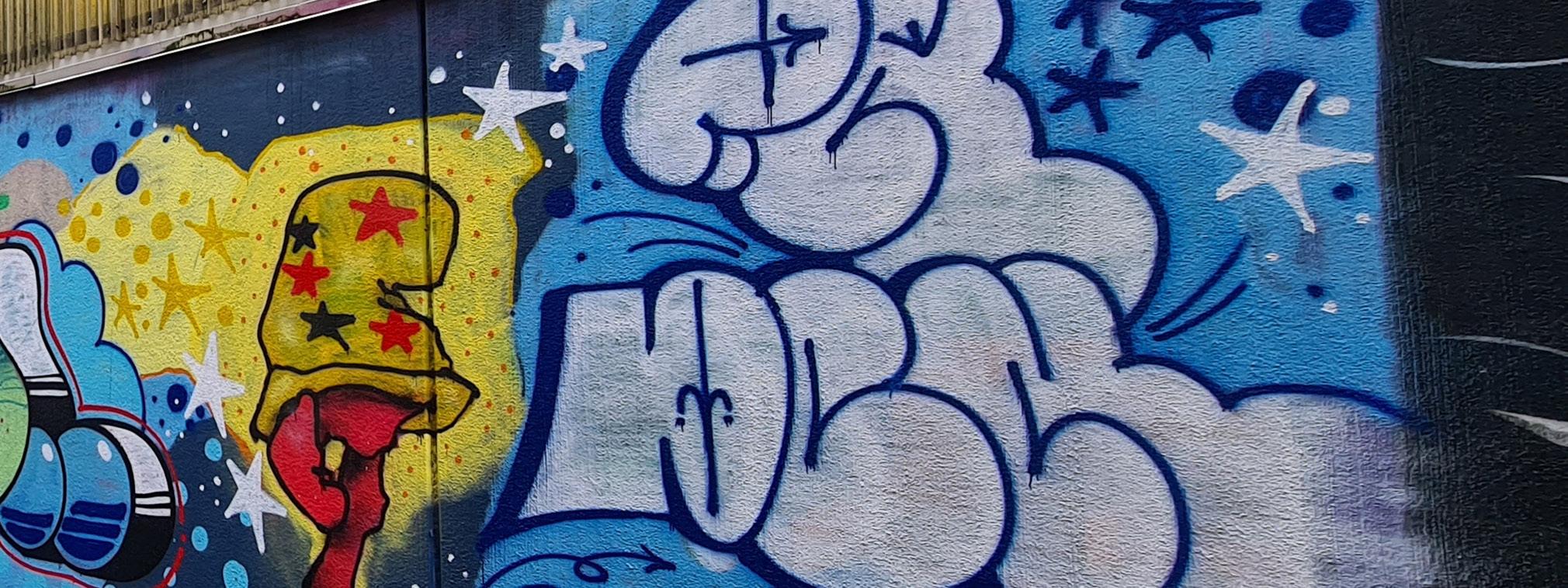
Ila is a neighborhood with a strong sense of community. That is why identity creation and inclusion play an important role within the Public Space Strategy. The Public Space Network should therefore have elements that strengthen a sense of belonging and shared identity to make the places inclusive and accessible for everyone. This should be done according to the idea of the 8 80 City, where cities are accessible for all, whether they are 8 or 80 years old (8 80 Cities, 2021).
4. Incremental development
The spatial solutions are meant to be implemented iteratively over short-term, mid-term, and long-term periods of time. An incremental development leaves flexibility for the Public Space Network implementors to react to urban developments, gentrification, or densification regulations.
5. Heritage Preservation
By adhering to applicable heritage laws and regulations, existing cultural value can be preserved and even enhanced.
77 | Ila, Trondheim | Public Space Network

78 | Ila, Trondheim | Public Space Network
The so-called ‘pop-up market corridor’ focuses on the roads Ilevollen and Hanskemakerbakken, as well as the Red Building in Iladalen park. The major objective is to tie the place together by connecting existing target points. These existing target points are Ilaparken and Iladalen, including the Red Building. By redefining
the roads Ilevollen and Hanskemakerbakken as streets, a more beautiful, eco-friendly streetscape can be implemented that enhances walkability, the quality of stay, and social interaction. This concept is in line with the Public Space Strategy for Ila and was inspired by the community dynamics and input.

Figure 1: Detailed Map of Spatial Solutions – Group 5 (Source: Authorship of Team Ila - UEP, 2021) 79 | Ila, Trondheim | Public Space Network 9.1. GROUP 5 SOLUTIONS: THE POP-UP MARKET CORRIDOR Figure 9.4: Detailed Map of
Spatial
Solutions –
Group
5 (Source:
Authorship of Team Ila
-
UEP,
2021)
9.1.1. ILEVOLLEN
Ilevollen became one of the focus areas because of the community’s strong desire for there to be more commercial activities such as shops and cafes within Ila. This was evident from the survey:
This street, sandwiched between Core Ila and Ilaparken, has massive potential as a space for more commercial activity and as a green movement corridor. Many major transit modes travel on this street, creating the possibility to attract customers both from Ila and the rest of Trondheim. The short-term proposal is that the grass median area of Ilaparken, dividing the park from the street, be made into a space for pop-up market stands. Part of this proposal would be to have more frequent commercial markets where sellers can come to sell their products, whether that be for just a few hours (on one day) or more regularly, such as several days per week. At this

Would be nice with more common activities that connect the neighborhood, flea markets, etc. [...]
34, female
Places you like least in Ila?
The tram rails.
Places you like least in Ila?
The traffic (bus, tram, taxi) at Ilevollen. 59, female
43, male
Figure 9.5: Ilevollen - Existing context (Source: Authorship of Team Ila - UEP, 2021)
Figure 9.6: Ilevollen - Sketch (Source: Authorship of Team Ila - UEP, 2021)

80 | Ila, Trondheim | Public Space Network
time, construction on a more permanent market-stand typology as presented in Fig 9.13 should begin. These stands should be structured so that they protect vendors and customers from the unpredictable weather (rain, wind, and snow) in Trondheim.

Finally, the asphalt between the tram tracks should be removed and replaced with grass to further provide greenery to the area; removing the sealed surface will also allow for easier infiltration of excess rainwater.
In the mid-term period, these structures should be completed and there should be an establishment of more frequent sales activities. Regulations and a legal framework could be established to better manage and organize activities at these market stalls. This step of the process could include things like establishing a schedule sign-up system for vendors, securing partnerships with organizations such as Frivilligsentral, or arranging for the vendors to help pay for the maintenance cost of these new facilities.
Figure 9.7: Ilevollen - Vision (Source: Authorship of Team Ila - UEP, 2021)
In the long-term, the proposal intends that more of the ground level along Ilevollen should be opened for commercial use in order to bring more small businesses to the area. This area is ripe for new developments like cafes, specialty shops, or a needed pharmacy for the neighborhood. Of course, this development is one that will take a lot more time, requiring long transitional periods, as one of the current buildings in this space is being used as a nursing home. The interests of these individuals must

81 | Ila, Trondheim | Public Space Network
be carefully considered. There was a discussion regarding a proposal for a third floor to be added to part of this building as a means of compensating the nursing home for lost floor space converted to first-floor storefronts. This alternative will be considered if allowed by the Municipality allows; this proposal also assumes that the nursing home will remain in this location for decades to come. Figure 9.9 below shows a basic idea for this concept. This space has enormous potential to better be utilized in the future for commercial activities due to its proximity to multiple transit modes.


Figure 9.8: Ilevollen - Sketched Incremental Development (Source: Author ship of Team Ila - UEP, 2021)

Figure 9.10: Ilevollen - Incremental Development Sections (Source: Author ship of Team Ila - UEP, 2021)

Figure 9.9: Ilevollen Long-term-Vision – Longitudinal Section (Source: Authorship of Team Ila - UEP, 2021)
Figure 9.11: Ilevollen - Long-term Vision Top View (Source: Authorship of Team Ila - UEP, 2021)

82 | Ila, Trondheim | Public Space Network
Café BusinessCo Working Business BEFORE AFTER
Low
Seasonal
regional
WHAT IS MY BENEFIT AS A SELLER
person
local businesses
location
Unique, engaging
experience
9.12: Market Stands - Seller and Buyer
of Team Ila - UEP,
LONG TERM
Ground floor of Ilevollen
commercial use
MID TERM
Regulations and legal framework
Establishment of more frequent
activity
Grass between tram tracks
SHORT TERM
Stands
construction of permanent sales stands
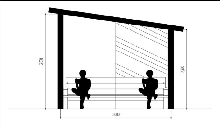

WHAT IS MY BENEFIT AS A BUYER?
9.13: Market Stands - Sectional Elevations
Author ship of Team Ila - UEP, 2021)
83 | Ila, Trondheim | Public Space Network 1
ke y Low c ost In
connection with customers Good accessibilit y
and
offer Support
Central
shopping
? Figure
(Source:
• Open
for
•
•
sales
•
• Pop-Up
• Begin
Figure
(Source: Authorship
2021)
9.1.2. HANSKEMAKERBAKKEN
A handful of people mentioned that they like the street Hanskemakerbakken the least, as the above quotes demonstrate. In addition, the survey data showed that only 12% of residents use their personal car for commuting, adding even more incentive for prioritizing other transit modes and uses on this street. This proposal makes better use of space and is better for the environment. Furthermore, the back sides of the buildings also provide currently underutilized car parking spaces if business owners still need them. This proposal works to make a safer, more attractive space that strengthens existing and future restaurants and businesses in the area and transforms this street into a highlight of the Ila area.
Which places do you like the least?
The parking spaces.
male


Hanskemakerbakken.
female
The new buildings in Ilsvika and Hanskemakerbakken with the blocks on each side. 26, female
Figure 9.15: Hanskemakerbakken - Sketches (Source: Authorship of Team Ila - UEP, 2021)

84 | Ila, Trondheim | Public Space Network
50,
76,
Figure 9.14: Hanskemakerbakken - Existing context (Source: Authorship of Team Ila - UEP, 2021)
The short-term proposal is to establish a pop-up parklet by temporarily closing the parking spaces for a short amount of time. The immediate closure of the parking leaves space for vibrant community meetings, and urban furniture such as outdoor seating that the restaurants could use.


The focus on the legal framework and regulations would be begun in the mid-term and finally implemented in the long-term. The vision for the pop-up parklet would be to supplant the current parking usage. In the mid-term, regulations and legal frameworks should be reviewed to find the optimal path forward for making this space livelier.
In the long-term perspective, the intervention creates a public square from what was previously a large asphalt surface. The parklets have a distinctive design that incorporates seating, greenery, and bike racks, and can accommodate additional public space. In partnership with the neighboring restaurants and cafes, the local businesses and gastronomical establishments are strengthened. By adding greenery on both sides of the street, the climate resilience of the street is increased.
85 | Ila, Trondheim | Public Space Network
Figure 9.16: Hanskemakerbakken - Vision (Source: Authorship of Team Ila - UEP, 2021)
LONG TERM

MID TERM
SHORT TERM
86 | Ila, Trondheim | Public Space Network Figure 9.17:
Hanskemakerbakken - Long-term Vision Top View (Source: Authorship of Team Ila - UEP, 2021)
• Strengthen the gastronomical options • Climate resilient features: trees, rainwater/flood management
• Regulations and legal framework
• Pop-Up Parklet
9.1.3. RED BUILDING
From a conversation with the owner, it became clear that the Red Building has the potential to become a vital cultural space and could connect residents and visitors to the local agriculture in the Trøndelag area. The Red Building would be a family-friendly space, offering space for farmers markets, weekend classes, and an ‘organic vending machine.’ This space would allow for sharing the natural atmosphere of the surrounding area and meeting the demand to buy local products in the area.
The Red Building, called the ‘heart of Iladalen,’ is currently semiused: the first floor is under construction whereas the second floor is a residential area. By co-creating an ecological recreation area on the first floor with the owner, additional space can be made available to enable community interaction. The implementation of a modest cafe and grocery vendor for local goods underlines the natural atmosphere in the middle of the greenspace. Ecofriendliness would be a key characteristic of this space, as it would be transformed into an ecological hub for local products, a space for farmers markets, a setting for weekend classes related to organic food cultivation, and a place to bond with nature.

The Red Building’s transformation will be conducted in three phases. In the short-term, second-hand furniture from places like Finn.no and local businesses can be scavenged, and a framework can be developed for an open, inviting outdoor space. Pop-up farmers markets can also be hosted in this space to better test and refine its viability for continued use of this nature.
In the mid-term, the cafe can be established and opened for business, providing a lovely spot for residents and visitors to enjoy a coffee in the park on a Saturday morning. An automated vendor for organic goods would create a space for residents to pick up, for instance, local organic eggs at any time of the day or night. The machine would have a digital payment system, offering a unique code for each purchase. A framework can also be established for small parties to be able to rent out the space for special events, like birthday parties or workshops. With respect to workshops, the space could also be regularly utilized for agriculture seminars, in order to better connect the community and particularly children to where their food comes from. These activities can help to strengthen bonds between rural and urban areas, as attendees would gain a greater appreciation for the work of local farmers.
87 | Ila, Trondheim | Public Space Network
Would love to have more cafes and specialty shops.
65,
female
That it is possible to engage in urban cultivation and be environmentally friendly.
35,
female
Figure 9.18: Red Building - Existing Context (Source: Authorship of Team Ila - UEP, 2021)
9.20: Red Building - Sketch Farmers Mar ket (Source: Authorship of Team Ila - UEP, 2021)

LONG TERM
Continual financial support by municipality for continued cultural and heritage activities
MID TERM
Establishment of café
Automated vendor for organic goods
Framework set up for rentals of space by small events
Space for ecological workshops
SHORT TERM
2nd hand furniture
Pop-up farmers market

88 | Ila, Trondheim | Public Space Network
•
•
•
•
•
•
•
Figure
9.19: Red Building - Vision - Southern View (Source: Authorship of Team Ila - UEP,
2021) Figure
In the long-term, the Municipality, along with other public and private donors, should continue to assist the various activities
with financial support, recognizing the cultural and heritage value provided by the Red Building.
Figure 9.21: Red Building - Sketch Regiomat (Source: Authorship of Team Ila - UEP, 2021)

Figure 9.23: Red Building - Vision - Northern View (Source: Authorship of Team Ila - UEP, 2021)

Figure 9.22: Red Building - Existing and Proposed Floor Plan (Source: Authorship of Team Ila - UEP, 2021)

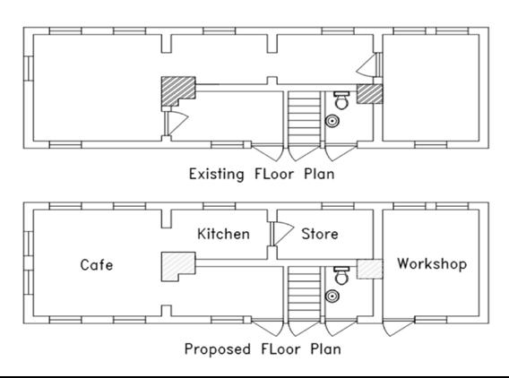
89 | Ila, Trondheim | Public Space Network

90 | Ila, Trondheim | Public Space Network
GROUP 6 SOLUTIONS: THE QUALITY-OF-LIFE CORRIDOR
THERE ARE SEVERAL PUBLIC SPACES IN ILSVIKA, BUT NOT MANY PUBLIC PLACES.
In response to the general consensus among Ila’s residents that Ilsvika is the area in the neighborhood that is most in need of development, the project team decided to propose interventions along the western portion of Mellomila. The experimental proposals are intended to provide opportunities for citizengoverned spaces that would enhance the socio-economic and spatial dynamics of this area, and hopefully lay the foundation for creating a shared identity for the residents of Ilsvika.

These spatial interventions are strategically placed at different locations along the Ilsvika portion of Mellomila. Through parallel
implementation of these ideas, the project team aims to achieve consistent development across the neighborhood, preventing heterogeneity. It is recommended to break down the proposals into short-term, mid-term and long-term phases. The short-term changes in the proposals are small changes inspired by Nabeel Hamdi’s philosophy that “problems are solved by drawing on a variety of information from the multitude of small, relatively simple and local elements, rather than from some power elite or single brain” (Hamdi, 2004, p. xvii). The mid-term and long-term strategies can be revised and incrementally executed based on the responses stimulated by the short-term interventions.
91 | Ila, Trondheim | Public Space Network Figure 9.24: Detailed Map of Spatial Solutions – Group 6 (Source: Authorship of Team Ila - UEP, 2021) 9.2.
9.2.1. MELLOMILA STREET INTERVENTION
In order to better facilitate mobility along the artistic cultural route, improvements have been proposed that will prioritize bicycle and pedestrian traffic. The overarching theme of the redesigned Mellomila is that it would become a sykkelgate (literally “bike street,” a direct translation of the original Dutch concept of fietsstraat). This means that bicycles would have priority over cars at all times on this street. Bicycles would be entitled to (and, for safety, required to) use the entirety of the travel lane as if they were cars. The governing principle of this intervention is that biler er gjester (“cars are guests”).
The priority of bicycles and pedestrians would be reinforced by the installation of traffic calming measures known as bump-outs. These bump-outs will reduce the width of the roadway to one lane of vehicular traffic, allowing only one direction of traffic to pass at a time. The first car to arrive to the bump-out proceeds first, while the other car waits for the first car to pass before proceeding. If both cars arrive simultaneously, the car whose lane is not obstructed by the bump-out proceeds first. If multiple cars are

waiting in each direction, then cars from each direction alternate, one car at a time. The bump-outs are placed along the road, spaced 40 meters apart on center, alternating on opposite sides of the roadway. The bump-outs themselves would be defined by curbs, making them level with the surrounding sidewalks. They would have brightly colored vertical poles to alert snowplows to the presence of the curbs during wintertime.
This intervention has been proposed because it allows for traffic calming without drastic changes to the roadway. The impact on drivers is minimal, and the improvement to the safety and enjoyment of pedestrians and cyclists is substantial. The design of the bump-outs forces drivers to slow down in order to safely maneuver around them. Because drivers must drive in the opposite lane temporarily, they must be alert and communicate with other drivers and cyclists. Additionally, pedestrians have exclusive use of the sidewalks. Bump-outs are considered a good solution on roads with low traffic volumes such as Mellomila
58, female
Figure 9.25: Mellomila - Temporary Bump-out (Source: Authorship of Team Ila - UEP, 2021)
“Confusing bike road situation” 23, female
92 | Ila, Trondheim | Public Space Network
“There should be a square / meeting place with outdoor seating in the area of the blocks in the middle of Mellomila / Ilsvika”
because they would not create congestion. In fact, the presence of the bump-outs would add less than one minute to the average drive down Mellomila. The bump-outs themselves would provide additional spaces for community activity or for artwork.

This intervention will be implemented in short-, medium-, and long-term phases. The first phase will involve installing four of the eight proposed bump-outs, but only as temporary bump-outs. The temporary bumpouts will simply be planter boxes along with red paint defining the future footprint of the bump-out on the street. The planter boxes will have temporary signage painted on them in order to inform residents about their purpose. The second phase of the project will involve completing the installation of the remaining four temporary bump-outs, and upgrading the first four temporary bump-outs to permanent bump-outs. These bumpouts will be fully made into the permanent version with curbs, snowplow warning signs, and permanent traffic signs. The third phase of the project will involve bringing the remaining four bump-outs up to the permanent bump-out standard.
•
LONG TERM
Second 4 permanent bump-outs (replace old temporary ones)
• Improvement of public transit facilities
MID TERM
•
First 4 permanent bump-outs (replace old temporary ones)
• Second 4 temporary bump-outs
SHORT TERM
•
First 4 temporary bump-outs (painted asphalt & planters)
Build awareness
• Finalize permanent bump-out design through participatory methods
93 | Ila, Trondheim | Public Space Network
•
Figure 9.26: Mellomila - Existing Context (Source: Authorship of Team Ila - UEP, 2021)
Figure 9.27: Mellomila Street Intervention - Sectional View 1 (Source: Authorship of Team Ila - UEP, 2021)

Figure 9.28: Mellomila Street Intervention - Sectional View 2 (Source: Authorship of Team Ila - UEP, 2021)
Figure 9.30: Mellomila Street Intervention - Vision (Source: Authorship of Team Ila - UEP, 2021)


Figure 9.29: Mellomila Street Intervention - Plan (Source: Authorship of Team Ila - UEP, 2021)


94 | Ila, Trondheim | Public Space Network

95 | Ila, Trondheim | Public Space Network
9.2.2. SUSTAINABLE ‘CATALYTIC’ CAFE
The sustainable catalytic cafe is a prototype building designed to be a working example of self-sustainability in a built environment. The design enables the creation of a space that could cater to the expansion of existing community gardening activities and provide a shaded interaction space, all while using less energy and reusing existing resources.
Currently, significant space throughout Ila is wasted on parking. By moving some of this parking to an underground facility, the at-grade space with access to plenty of natural light could be reclaimed for more interactive and fruitful activities. Providing volume and functions to such spaces also improves the experience of non-motorized users, and ultimately benefits the national cycling and walking strategy listed in National Transport

There should be a square/meeting place with outdoor seating in the area of the blocks in the middle of Mellomila/Ilsvika. 58, female
Places you like least? “The new buildings in Ilsvika and Hanskemakerbakken with the blocks on each side.”
26, female
We need more outwardlooking industry, cafes etc.
32, male
Places you like least?
“Nasty architecture in ilsvika.”
31 , female
More gathering places for most people. 68, female
96 | Ila, Trondheim | Public Space Network
Figure 9.31: Private Parking - Existing Context (Source: Authorship of Team Ila - UEP, 2021)
Plan 2014-2023 (Trondheim Municipality, 2017). In addition to this, the existing community gardening facility is looking to expand to other parts of the neighborhood and Trondheim Municipality is envisioning the city as a pioneer for the development of climatefriendly environmental solutions (Trondheim Municipality, 2017). This proposal aims to provide a holistic framework that not just enables the implementation of these ideas, but also creates a space where residents are educated on eco-friendly practices that can be implemented in their households.

For a short-term intervention, two to three parking spots can be reclaimed to create a temporary eco-friendly kiosk outfitted with solar panels. The kiosk could also demonstrate grey water recycling, which can be used for non-potable uses, such as irrigating urban gardens and (later) flushing toilets. It is recommended to consult with technical experts and to cooperate
with citizen groups that use the existing parking lot in order to ensure a successful implementation.
If this proposal is successful and receives a positive community response, the next step could be reclaiming the at-grade land for more fruitful purposes and relocating the parking spaces underground. The underground structure could have a dedicated space for grey water recycling. The at-grade land could have a cafe with ‘open-to-all’ seating space. The project team proposes a model wherein the cafe is only a subsidiary function of the space, and the main function is to provide an inclusive space for interaction, irrespective of whether an individual wants to buy something from the cafe. The cafe could have an adjacent greenhouse where urban agriculture is practiced. Through composting of the organic waste created in this space, and using water from the grey water recycling unit, this food garden would
97 | Ila, Trondheim | Public Space Network
Figure
9.32:
Sustainable ‘Catalytic’ Cafe - Vision (Source: Authorship of Team Ila - UEP, 2021)
Underground Parking and ‘Catalytic’ Cafe
be sustainably operated. The solar panels on the roof would reduce dependency on external sources of energy, at least during the summer months.
In the long-term, if the prototyping is successful, this model can be implemented in other parts of the neighborhood and throughout Trondheim. Grey water recycling systems can be implemented in unused public spaces of residential buildings in this area. Solar panels can be made mandatory in new buildings. Existing buildings can be encouraged to be retrofitted with such systems through attractive buyback policies. A strong partnership between government, residents, and private organizations would be key in the implementation.
LONG TERM
• Implementation of the ecofriendly techbology used here in the residential complexes of Ilsvika
MID TERM
Grey water treatment
Greenhouse and Composting

Figure 9.33: Sustainable ‘Catalytic’ Cafe - Sketches (Source: Authorship of Team Ila - UEP, 2021)


Underground Parking
Sustainable Café combined with green house.
Prototyping eco-friendly technology
Impact Assessment
SHORT TERM
Reclaiming 2-3 parking spots to set up temporary sustainable pods
Awareness building
Car Sharing platforms
98 | Ila, Trondheim | Public Space Network
•
•
•
•
•
•
•
9.2.3. EXPOSITION SQUARE
The exposition square proposal consists of intervening in existing neighborhood infrastructure and providing new activities for increased social interaction. These activities would have a cultural and commercial focus. As the name implies, the plan considers turning the now-barren space into an area where the community can host or present diverse expositions, thereby turning this underutilized space into a lively place.
This spacious open courtyard adjacent to Mellomila is enclosed by buildings with mixed uses on the first floor, such as offices and a kindergarten, and housing units on the other three levels. The

enclosure is privately owned by the owner of the building located on its east side, but it functions as a public space since there are no barriers to accessing it. However, this space currently has minimal infrastructure and therefore does not offer the possibility for any type of interaction between passersby and the space itself or among members of the community.
The proposal enables this space to become a public meeting place by intervening in the existing infrastructure and adding more urban amenities, such as sitting places, illumination, and greenery. Also, urban elements such as exposition totems, festival
99 | Ila, Trondheim | Public Space Network
Figure 9.34: Exposition Square - Existing Context (Source: Authorship of Team Ila - UEP, 2021)
lights and pop-up food trucks for certain events could be added. An issue identified in this space is the lack of connection with the waterfront, so the proposal also contemplates painting the existing pavement in such a manner to help better visualize this connection and make the place more dynamic.
The short-term proposal contemplates collaborating with local actors, such as Galleri Dropsfabrikken, Ila Frivilligsentral or Ila Brainnstasjon, and with institutions or organizations outside the neighborhood, such as NTNU, Trondheim Kunstmuseum, or Trondheim Municipality. In this stage, the idea is to begin the activation of the place by exhibiting temporary structures or panels from the aforementioned actors and having people


interact with them. Local artists, children, and residents can be invited to enliven the floor of this square with colors and artwork that demonstrate the connection between Mellomila and the waterfront. As an established art gallery in the area, Galleri Dropsfabrikken could potentially take responsibility for this.
For the medium-term, the proposal considers implementing some minimal interventions and establishing cooperation with some stakeholders. One such example of this would be forming a panel of community members to decide how different expositions in the square would be curated. The panel could also develop its own prototypes for the temporary expositions to be held in the square. In addition to these interventions, pop-up markets can be invited to participate in special events, offering drinks or
100 | Ila, Trondheim | Public Space Network
Figure 9.35: Exposition Square - Vision (Source: Authorship of Team Ila - UEP, 2021)
products from local businesses. This would support more activity and interaction in the area. To facilitate a better visitor experience, infrastructure for sitting as well as temporary greenery can be introduced.
In the long-term, permanent greenery and infrastructure for sitting will be added. The permanent green areas are proposed as clusters of low-rise trees or shrubs to act as carbon sponges with seating infrastructure around them to break up the monotony of the concrete. These interventions also include a lighting project that makes the space more dynamic and attractive to younger audiences. The first-floor organizations around the square may be encouraged to ‘spill’ into the square, utilize it for their own activities, and ultimately blur the gap between indoor and outdoor.


Figure 9.37: Exposition Square - Sketches of the Proposals (Source: Author ship of Team Ila - UEP, 2021)
LONG TERM
• Blurring the gap between indoor and outdoor spaces of Ground floor businesses.
MID TERM
• Curation of different itinerant expositions
• Space for businesses to set up temporary stalls
• Seats with vegetation and light ing project.
SHORT TERM
Figure 9.36: Exposition Square - Overall Vision Sketch (Source: Authorship of Team Ila - UEP, 2021)

• Adding colors to the floor space to attract crowd
• Invite organizations to exhibit their panels.
• Lighting and information boards
101 | Ila, Trondheim | Public Space Network
9.2.4. SENSORIAL PARK
The Sensorial Park is a proposal that will take place around the existing artificial waterfall at Ilsvika and in the vacant lot between Ilsviken gård and the fjord. Currently, both of these spaces are open, vast, and devoid of people. They lack opportunities to spark interaction between users. Despite the presence of the waterfront and the heritage building Ilsviken gård, a dearth of activities discourages people from spending time in these spaces. Furthermore, these spaces are even more off-putting in winter due to the long hours of darkness and cold. The intervention is an experiment to test the role of sensory stimuli in placemaking. Through the upgrading of existing structures and the inclusion of prompts for the five human senses, this proposal strives to make this forgotten bit of Ila as attractive to users as the spaces in Core Ila.
The proposal for the area around the artificial waterfall includes interventions for communication (such as pods for seating) and play (such as see-saws) that are further enhanced through lighting elements. The concept of 8 80 can be implemented through the use of ramps and anthropometrically designed interventions that leave no age group forgotten. The former

farmland in front of Ilsviken gård is an ideal space for extending the popular community gardening initiative. The activity, in addition to being inclusive for individuals of diverse nationalities as previously stated, also reinstates this space to its historical land use, farming. Moreover, it further contributes to Trondheim Municipality’s plan of using agriculture for carbon storage and increased food production (Trondheim Municipality, 2017).
For short-term intervention, it is crucial to nudge passersby to walk through the space. A portal or door is known to instinctively invite people to walk through it. Therefore, a portal designed in a local architectural style can be introduced in the garden in front of the gård, as shown in Figure 9.47. Since the plot of land is currently under heritage protection, this intervention can initially be introduced temporarily and later made permanent if it does indeed encourage foot traffic through the former farm.
The project team also proposes the development of an app which can replace the need to construct new public toilets. There are not many public toilets in Ila, and construction of even a few toilets can take a lot of time. This app will show the users available toilets in cafes and restaurants. The users can use the toilets without having to buy expensive coffee or food in the restaurants in exchange for paying a small monthly fee.
For the mid-term, information boards can be set up in the culde-sac near the waterfall. These boards can act as an element of surprise for passersby, encouraging them to read the information on the boards and to learn about the activities that exist in this place. Community members may also use these boards to circulate information to the community. In the former farmland, once the addition of the portal creates new foot traffic, urban gardening activities can be introduced through partnership
102 | Ila, Trondheim | Public Space Network
Figure
9.38:
Sensorial Park - Existing Context (Source: Authorship of Team
Ila - UEP, 2021)
Figure 9.39: Frontal view of IIlsviken Gård building - Existing Context (Source: Authorship of Team Ila - UEP,

with the existing group of passionate gardeners. The utilization of existing urban gardening frameworks, which have already been tried and tested by the community, will provide a smoother transition to the full realization of this project.
term proposal takes this into consideration by introducing interventions like 8 80 exercise areas beside the waterfront and LED see-saws around the waterfall. The ‘endless bench’ at the end of the community garden will cater to those residents who would rather enjoy the peace and quiet of the fjord. The introduction of ‘interaction eco-pods’ to the area is an intervention that will facilitate interaction between people all year round. These pods can be strategically placed such that their walls are against the direction of the wind. The sloping roof will not only protect users from the rain, but will house solar panels that will harness energy to light up the pods whenever they are in use. The roof also acts as catchment basin for harvesting rainwater that water the planters on the sides of the pod.
SENSORIAL PARK: URBAN REGULATIONS
The analysis of the urban planning regulations revealed important considerations to take into account for this project, since Ilsviken Gård is part of the network of heritage buildings in the city , therefore, has restrictions regarding the type of interventions that can be carried out in the area.

Norwegians are famous for their active way of life. The long-
Ilsvika

F2 COMMON OUTDOOR LIVING AREA
F2 and F4 are common to all buildings within the planning area and for the buildings covered by the zoning plan Ilsvika west R611.

F4 ILSVIKEN GARDEN
There shall be «no competing dominance» between the farm and the recreated garden.
6.1 ILSVIKEN FARM, OFFICE AND RESIDENTIAL AREA
must be approved by the antiquarian authority in accordance with Cultural Heritage Act.
103 | Ila, Trondheim | Public Space Network
2021)
16
Interventions
farm was built in 1760 and was originally a pleasure garden for one of Trondheim's wealthy families. It has since been used as diphtheria hospital in the past and now it is used for housing. 2 129.9 m2 ca. 1.315 m2 Figure 9.41: IIlsviken Gård - Urban Regulations (Source: Trondheim Kommune, 2021)Figure 9.40: IIlsviken Gård photographs (Source: Trondheim Kommune, archive)


104 | Ila, Trondheim | Public Space Network 3 4 4 5 Exercise area 1 2 3 Interaction Eco-pods LED see-saws Information boards 2 3 2 34 5 Exercise area 16 SENSORIAL PARK 12 1 3 2 3 4 5 Interaction Eco-pods 6 LED see-saws Information boards Figure 9.43: Sensorial Park - Sketches (Source: Authorship of Team Ila - UEP, 2021) Figure 9.42: Sensorial Park - Intervention Map (Source: Authorship of Team Ila - UEP, 2021) 1 Interaction Eco-pods 3 Information boards 4 Exercise area 2 LED see-saw
LONG TERM

MID TERM
TERM


105 | Ila, Trondheim | Public Space Network
• Continued maintenance of Islviken Gard, and possible conversion of it to a cultural museum.
• Public Space Activation • Extension of existing Community Gardens to more Eco-Pods • LED See-saws and 8-80 Exercise areas SHORT
• Portal in the Urban Gardening Park • Pilot Eco Pod • Find my Toilet App Figure 9.45: Find my toilet - App (Source: Authorship of Team Ila - UEP, 2021) 5 76 Endless bench Community garden Portal 76 Endless benchPortal Figure 9.44 Sensorial Park - Sketches (Source: Authorship of Team Ila - UEP, 2021) 76 Endless benchPortal5 Community garden 6 Portal 7 Endless bench


106 | Ila, Trondheim | Public Space Network
Figure 9.46: Sensorial Park - Vision (Source: Authorship of Team Ila - UEP, 2021)

107 | Ila, Trondheim | Public Space Network
Figure 9.47: Sensorial Park - Vision (Source: Authorship of Team Ila - UEP, 2021)
9.3. FUTURE OUTLOOKS
9.3.1. Stakeholders for the future

After the design proposal and elaboration of the spatial solutions, the next step in the project would be to re-address relevant stakeholders. Trondheim Municipality is involved in almost every intervention proposed. Approaching the Municipality can initiate exploration of necessary regulatory steps and open the door to an existing network. This network could include organizations such as Trondheim Bydrift, Trondheim’s technical services, and those responsible for the maintenance of public spaces and roads. Regarding the economic background of some of the spatial solutions, a partnership with existing gastronomical businesses can lead to the establishment of fundamental bonds. The initiated public participatory approach can be maintained
through the commitment of existing community initiatives, such as Ila Frivilligsentral. Since urban development will always play a role in Ila, the consultation of real estate developers should not be neglected when coordinating the (re-) design of public space with respect to buildings. As highlighted in the name ‘Artistic Cultural Route,’ art and culture have strong ties to the proposed spatial interventions. Therefore, they would be among the stakeholders in the hypothetical realization of this project. The proposed interventions in this case are, for the most part, sustainable. The next phase of the project involves consulting various stakeholders.
The main stakeholders of every spatial solution that should first be consulted in the implementation process of the spatial solutions are listed in Figure 9.49.
Who are involved in the projects
Ilevollen
Trondheim Kommune Businesses Café, Salon, Bar
Ila Sykejhem
Ila Frivillig Sentral
Private owners Residents
Hanskemaker bakken Red building Mellomila traffic calming Sustainable “Catalytic” Café Exposition square Sensorial park Who benefits: Trondheim Kommune Businesses Café, Salon, Bar

Ila Frivillig Sentral
Trondheim Kommune Trondheim bydrift Real estate developers


Trondheim Kommune


Ila Frivillig Sentral

Sintef Trondheim Energi

Trondheim Kommune Galleri Dropsfabrikken Norges teknisk naturvitenskapelige universitet Real estate developers
Cultural section Trondheim bydrift
Residents Norges teknisk naturvitenskapelige universitet

Businesses Café, Salon, Bar Ilsvika Barnehage
Residents
108 | Ila, Trondheim | Public Space Network
Real estate developers
Visitors Trondheim city
Residents Businesses Café, Salon, Bar
Figure 9.48: Future Outlooks - Stakeholders for the Future (Source: Authorship of Team Ila - UEP, 2021)
9.3.2. Cost-benefit outlook
The Public Space Network in Ila revives underutilized public space and is expected to contribute to a higher quality of life in the area. Nevertheless, the implementation and operation cannot occur without financial resources. The highest cost items are expected to be maintenance and cleaning. On the other hand, these investments will create benefits for the environment and for residents. Some benefits may be difficult to measure, but they will still be noticeable. The long-term impacts of the interventions justify the comparably small investments required. Generally, expected costs and benefits can be divided into the three pillars of sustainability: social, environmental, and economic. The distribution of public space in Ila provides residents with quick and hurdle-free access to infrastructure that positively
COST-BENEFIT OUTLOOK

influences health. By reducing the vulnerability of the area by adding elements of blue-green instead of grey infrastructure, not only does the project address a climatic function but also a recreational function. Besides the environmental benefits, a stronger social connection among visitors to the public spaces can be created. Enabling increased economic activity can also provide value in this area. The costs and benefits are predicted to have the impacts that are visualized in Figure 9.50 (Pearsall, H. et al., 2020).
The costs and benefits can be expected to have impacts as shown in Figure 9.50. They can be divided into the three pillars of sustainability: social, environmental, and economic. In general, the benefits outweigh the costs. The highest cost items are expected to be maintenance and cleaning.
* Based on assumptions

109 | Ila, Trondheim | Public Space Network
Figure 9.49: Future Outlooks - Cost-Benefit-Outlook (Source: Authorship of Team Ila - UEP, 2021)
10. REFLECTION
10.1. Reflection on methods
Success and Failure of Methods Used: The group drew on a large repertoire of tools to obtain the information necessary to analyze, interpret, verify, strategize, and plan. The focus on participatory methodologies was maintained to enable as much citizen engagement as possible under the circumstances. Some methods were determined to be more effective than others. However, the hands-on experience helped the team reflect on how best to improve the methodologies used for greater participation in the future.
Diversity of Participants: The academic nature of the project made it difficult to find a fixed focus group for needs assessment that could work with the team to see the evolution of the entire project from start to finish. The project team did not consult the same set of individuals both for conception and validation of ideas but engaged with different participants at every stage. This resulted in interactions with people from diverse cultural backgrounds and different age groups within a short span of time. The team interacted with approximately 60 individuals, excluding those who participated in the survey. Furthermore, most of the formally interviewed residents were discovered by using the ‘snowball effect’ to expand the team’s Ila network using past interviewees’ own networks. In order for this method to give an accurate representation of Ila, one would need to assume that the initial contact was connected to the entire community and not just a small bubble. If their social network was indeed a bubble, then that could wrongly cause the project team to imagine this bubble as a stand-in for the community.
Social Media as a Tool: Social media platforms allowed team members to reach out to a wide range of citizens and to analyze Ila from the comfort of their homes. The online survey received
more responses than did any of the physical participatory workshops. Existing community activities in Ila were analyzed via publicly available information that had been shared on Instagram and Facebook. Social media thus emerged as an effective tool for community engagement and research. The team realized that the voices of immigrants who were not as active in such local groups and youth who were busy with academics and other activities may not have been accurately represented through these platforms.
Prioritization Workshops: The prioritization workshops were successful in procuring creative ideas from community members and in understanding what is of value to them. However, due to insufficient time and human capacity, organizing multiple iterations of such workshops was impractical. However, this would have had the potential to make the project team’s findings even more representative.
10.2. Reflection on Problems Encountered and Insecurities
The Language Barrier: No team member is a fluent Norwegian speaker, though some have a remedial level of conversational knowledge. This presented difficulties when talking to many older residents in the neighborhood, who either did not know English, knew little, or were simply more comfortable speaking in Norwegian. This challenge was evident during the time spent at Frivilligsentral where often just one student was able to converse with the residents in attendance, and only when the subject matter was kept simple. The language barrier presented not just a challenge of understanding but also a challenge of comfortability, as most people tend to be more communicative in a language they use daily rather than one they use far more
110 | Ila, Trondheim | Public Space Network
sparingly. The language barrier also made it challenging to reach out to immigrants who had moved to the area. For instance, the group had tried to set up an interview with a Syrian man living in Ila. He had a limited knowledge of both English and Norwegian, but was far more comfortable in Arabic. Therefore, the team got an Arabic speaker who was kind enough to volunteer to help with this interview. However, due to some miscommunication and misunderstanding over the phone, that interview never materialized.
Weather: It was observed that the weather influenced engagement levels achieved in workshops. A workshop organized on a weekend with bad weather disincentivized people from participating, despite the abundance of hot drinks and snacks intended to attract a crowd. This result was a stark contrast to another participatory event conducted on a sunny weekday. It was observed that people were more willing to have longer and more insightful conversations with the team even without refreshments to offer. Furthermore, the interactive ‘tree of ideas’ did not achieve its full potential as the materials used were not suitable for Trondheim’s rainy weather and strong winds. The decision to leave the box outdoors for community input would have likely led to its disappearance or destruction before the next day. A lesson learned from this experience was to be more mindful of the weather conditions in Trondheim when attempting to conduct participatory activities.
Team Disagreements: Work is most streamlined and efficient when all teammates agree and are on the same page. However, it is also good to have some voices challenging the ideas put forth by other team members, as a mechanism to protect against groupthink. Finding the right balance between these two is difficult. There were a multitude of occasions of lengthy debates where some teammates were not in agreement with the rest of the group. Reflecting on this, while there were valuable insights to be gained from some of these conversations, the length of time
spent on such quarrels was far too long. A stricter time keeping mechanism and voting for decision making could have made the process more efficient.
COVID-19: The COVID-19 situation affected the project such that some events that were intended to take place with the community had to be canceled or could not be carried out due to the pandemic situation.
Time Efficiency vs. Learning Experience: An insecurity encountered by the project group was the balance between the time crunch and the desire to learn new skills. Everyone had initially expressed a desire to expand their skillsets by working on tasks they never worked on before. Because of the limited amount of time to work on this project, and the necessity to be efficient, the members often had to forego learning new skills in favor of sticking with what they knew. While each of the members gained valuable experience working together as a group, the learning was not as interdisciplinary as it could have been.
Participatory Planning: While participatory planning often has favorable results, the process is elaborate and more suitable when time is not a constraint. The issue of representation in participation was raised at certain points. Considering the sometimes-conflicting desires of the majority and special interests of the minority at the same time was also an issue. While this issue is not specific to participatory planning, the participatory method does tend to amplify passionate voices.
10.3. Reflection on strategic interventions
Participatory approach: The participatory approach helped to streamline the goals to be achieved during this project, and to incorporate the values of inclusiveness, diversity, and identity creation based on community inputs. The team reflected that
111 | Ila, Trondheim | Public Space Network
‘snowballing’ resulted in lesser contact with immigrant groups, and therefore may have caused their voices to be underrepresented in the Strategic Implementation Plan. Moreover, due to the public nature of the interventions, the team agreed that participation did not end with needs assessment and design, but had to be carried forward to the implementation and post-construction phases in order for the project to have a significant impact. Assuming ample time and resources and no language barrier, the team would have organized physical workshops with focus groups for needs assessment, co-design interventions, and co-govern final outputs. However, this would also have potentially created more conflicts due to private interests of a few inhabitants taking precedence. Long-term maintenance of such solutions is not guaranteed either, as in the case of Ila Free Fridge. While this citizen initiative against food waste and hunger is an excellent community activity in theory, residents rarely cleaned up the space after picking up their food. Some donors also misused the initiative as a means of discarding rotting food. This ultimately resulted in extra work for the initiator of this idea, who may be forced to bring it to an end if this trend continues.
Gentrification: The project team understood that upgrading public space networks may result in the gentrification of the area. However, by incrementally developing it and making sure the growth is parallel to the development in other parts of the larger city, the risk can be greatly diminished. Additionally, several residents and experts suggested that the industrial area in Ila plays a large role in preventing it from gentrifying into a development owned by the elite; therefore, the corn silos ought to be left unmodified.
Group Composition and Teamwork: The diversity in the team composition led to multi-disciplinary solutions, with everyone utilizing their strengths. The diversity allowed the project to be seen from more than one point of view and it helped with understanding the necessity of working in a team for the
successful implementation of a project of such scale.
Right Amount of Ambition: Most urban planning projects on the web today present a very utopian vision. While these projects may look enchanting on paper, it is rarely feasible to practically implement them in urban settings with existing complexities. The concepts of incrementality, prototyping, and reusing existing frameworks helped the team stay grounded with their proposals and focus on solutions that neither set the bar too low, nor raised expectations to an unachievable high. Making spaces multifunctional will hopefully activate existing public space networks and ensure their sustainable usage.
Stakeholder Engagement: Overall, most stakeholders thought that the proposals were well-conceived and represented the needs of the community; many of them were impressed by the work done by the project team. With each phase of the project, the team had more people that wanted to or were suggested to interview, but not everyone could be accommodated due to the shortage of time, and non-response in some cases. A relevant finding was the importance of understanding that every story has two sides, and things are often not as they seem. No narration is absolute, and every point of view needs to be dissected and analyzed before a conclusion is reached.
Planners as Mediators: The participatory approach resulted in citizens often suggesting ideas that were not pragmatic, or that duplicated needs previously identified. Also, as the team progressed through the project, several conflicts between stakeholders were recognized. The team reflected on the need to take on diplomatic roles in such situations.
Heritage Laws: The historical foundation of the neighborhood played a fundamental role in defining the strategic interventions. The interesting combination of industrial heritage (now turned mostly into housing or mixed-use buildings) and wooden
112 | Ila, Trondheim | Public Space Network
constructions was noted by the project team. In consideration of this, the team recognized the need to understand the possibilities and limitations defined by the local authorities in relation to these structures. Research revealed that the stringent heritage laws in Norway impose significant constraints on some of the elaborated proposals. For example, Ilsviken gård has limitations not just on the building and its plot, but also on an adjacent property. This input was highly valuable in terms of the proposal, because in real-world planning projects these matters must be taken into consideration and will certainly play an important role in shaping proposals.
113 | Ila, Trondheim | Public Space Network
11. CONCLUSION AND RECOMMENDATIONS
The extensive fieldwork and research in Ila showed that most of the neighborhood generally fared better than Trondheim as a whole quantitatively, qualitatively, and in terms of citizen consensus. The initial approach of the project team to find a ‘problem’ in Ila that needed solving was therefore often met with disapproving glances and awkward silences by residents when addressed during the various participatory activities. It was only when the UEP approach was modified to a more optimistic approach of finding ‘opportunities’ as opposed to ‘problems’ that the residents actually opened up and started giving the team valuable insights.
A strategy designed and based on Participatory Learning Action principles created a platform not just for receiving inputs from the community that helped the team better understand the project context, but also for encouraging them to reflect on and evaluate their own situations. The extensive use of visuals to support the strategy at every phase helped to bridge the language barrier to some extent and to facilitate more meaningful conversations. The applied methodology helped to reinforce the hypothesis that, in complex urban systems such as Ila, it is always effective to
recognize and build upon existing systems to which residents have already adapted, rather than to create new systems. This helps to foster a more sustainable urban ecology. On a larger scale, Project Ila can be integrated with existing city-level initiatives such as the ‘blue thread’ project that focuses on improving connections between the city, its cultural history, and the Nidelva river (Ministry of Local Government and Modernization, 2019). The possibility of improving public transport in Ilsvika area should be explored. Measures to amalgamate the corn silos, which many residents recognized as an area of social and spatial disconnect from the rest of Ila, can be investigated. Co-governance and local partnerships for effective policy formulation and implementation may be considered.
To conclude, the research conducted by the project team is just the tip of an iceberg. Longer, more extensive studies using the methodologies already tested will help recognize more dimensions to the opportunity-laden dynamics of this unique neighborhood. These studies, in combination with mindful involvement of the community in every step of the process, will lead to more favorable outcomes for Ila.
114 | Ila, Trondheim | Public Space Network
12. REFERENCES
12.1. Literature
• Almaas, A. (2021, October 1) Personal Interview [Personal Interview]
• Digre, Ø. A. (2021, September 25) Personal Interview [Personal Interview]
• E.A. Smith & Digitroll AS. (n.d.). Smith Stål - Ledende leverandør av armering, stål og metall. Byggern.no. [Online] Available at: https://www.smithstal.no/ [Accessed 10 11 2021]
• Fjeldvær, B. (2021, September 29) Personal Interview [Personal Interview]
• Galleri Ismene (n.d.). About Galleri Ismene. [Online] Available at: http://www.ismene.no/wordpress/galleri-ismene/ [Accessed 09 12 2021]
• Gibbons, J., Barton, M., & Brault, E. (2018). Evaluating gentrification’s relation to neighborhood and city health. PloS one, 13(11), e0207432. https://doi.org/10.1371/journal.pone.0207432
• Habitat, U. N. (2014). A new strategy of sustainable neighbourhood planning: Five principles. Nairobi, Kenya: United Nations Human Settlements Programme.
• Haeberle, S. H. (1987). Neighborhood Identity and Citizen Participation. SAGE Journals, Issue Volume: 19 issue: 2, pp. 178-196.
• Hamdi, N. (2004). Small Change: About the Art of Practice and the Limits of Planning in Cities. Routledge
• Hamdi, N. (2010). The Placemaker’s Guide to Building Community. Sustainable Future, 23.
• Hennissen, G. K., & Gilleberg, S. (2021, December 02) Personal Interview with representatives from Trondheim Municipality [Per sonal Interview]
• Inyourpocket (2021, November 18) Where to explore Joburg’s graffiti and street art scene. . [Online] Available at: https://www. inyourpocket.com/johannesburg/where-to-explore-joburgs-graffiti-and-street-art73698f. [Accessed 09 12 2021]
• Karssenberg, H., Laven, J., Glaser, M. & Van ‘t Hoff, M. (2016). The city at eye level: lessons for street plinths. Eburon Academic Publishers
• Kjenstad, Rune (2004). Trikken i Trondheim 100 år. Tapir Akademisk Forlag. ISBN 82-519-1895-2.
• Kuvac, I., & Schwai, M. (2017). Three elements in the construction of spatial identities in Madir (Banjaluka, Bosnia and Herzegovi na) and Ilsvika (Trondheim, Norway) neighbourhoods. Urbani izziv, 28(1), 83-95.
• Leigh, D. (2009). SWOT Analysis. In Handbook of Improving Performance in the Workplace. Volumes 1-3. https://doi. org/10.1002/9780470592663.ch24
• Melås, B. I. (2021, October 27) Personal Interview [Personal Interview]
• Murphy, M. A. (2011) Boundaries to socially and environmentally equitable communal spaces – finding common ground for a sustainable urban existence in multicultural Oslo. Master’s thesis. Trondheim, NTNU.
• Org, I.D.E.O. (2015). The field guide to human-centered design. San Francisco.
• Pearsall, H. et al., 2020. The benefits and costs of urban public spaces. William Penn Foundation.
• Rosvold, Knut A. (2020): Ila - Trondheim in Store norske leksikon [Online] Available at: https://snl.no/Ila - Trondheim [Accessed 10 11 2021]
115 | Ila, Trondheim | Public Space Network
• Rosvold, Knut A . (n.d.): Ilsvikøra in Store norske leksikon on snl.no. [Online] Available at: https://snl.no/Ilsvik%C3%B8ra [Ac cessed 08 12 2021]
• Roy Åge Håpnes (2003): Trondheim tar form: bygningshistoriske blikk på bydelene. Tapir akademisk forlag. Trondheim
• Søring, G. (2021, September 21) Personal Interview [Personal Interview]
• Sadeque, S. et al., 2020. An integrated model of city and neighborhood identities: A tale of two cities. Journal of Business Re search, Issue Volume 117, pp. 780-790.
• Sager, T. (2018). Planning by intentional communities: An understudied form of activist planning. Planning Theory, 17(4), 449-471.
• Senior Residents at Ila Frivilligsentral (2021, September 29) Group Interview [Group Interview]
• SSB Statistics Norway, 2021. Statistisk sentralbyra. [Online] Available at: https://www.ssb.no/en [Accessed 07 12 2021].
• Steinmetz-Wood, M., Wasfi, R., Parker, G., Bornstein, L., Caron, J., & Kestens, Y. (2017). Is gentrification all bad? Positive association between gentrification and individual’s perceived neighborhood collective efficacy in Montreal, Canada. International journal of health geographics, 16(1), 24. https://doi.org/10.1186/s12942-017-0096-6
• Støvring, M. (2021, November 17) Personal Interview [Personal Interview]
• Taraldsen, A. (2021, September 29) Personal Interview [Personal Interview]
• Thakur, N. (2021, September) Personal Interview [Personal Interview]
• The Ministry of Local Government and Modernisation (2019). Network of Public Spaces- An Idea Handbook
• Trondheim Municipality (2008) Ilsvikveien 30, Ilsviken Parsell Og Jernbanegrunn 5, Isa Proposed Planning Plan Final Treatment. Trondheim Municipality. https://publikum.trondheim.kommune.no/application/ge saksfremlegg/32629 [Accessed 09 12 2021]
• Trondheim Municipality (2019, October 10) Byutviklingsstrategi for Trondheim - strategi for arealog transportutvikling fram mot 2050. Trondheim Municipality. https://
• www.trondheim.kommune.no/byutviklingsstrategi-for-trondheim-sreal-ogtransportutvikling-2050/ [Accessed 09 12 2021]
• Trondheim Municipality (2020, September 30) Framtidsbilder Trondheim sentrum 2050. City Planning Office. https://drive.google. com/file/d/1ddjdu-q29UA9sdz24ySTF8yRFWrZIhxW/view
• Trondheim Municipality, (2017). Kommunedelplan: energi og klima 2017-2030
• Trondheim Municipality (2021). Living conditions and public health in Trondheim municipality: Immigrant population. Data from 2018, from Eastern European countries, Asia and Africa. [Online] Available at: https://sites.google.com/trondheim.kommune.no/ levekar-og-folkehelse/innledning?authuser=0 [Accessed 06 12 2021].
• Trondheim Municipality, 2021. Trondheim Municipality - Trondheim, Norway’s Innovation Capital. [Online] Available at: https:// www.trondheim.kommune.no/english/trondheim-norways-innovation-capital/ [Accessed 08 12 2021].
• Trondheim Municipality (2021, December 6). Trondheim will become the voluntary capital of Europe in 2023. https://www.trond heim.kommune.no/aktuelt/nyhetssaker/2021/trondheim-blir-europas-frivillighetshovedstad-i-2023/?fbclid=IwAR0M4uIHiJj6Ixi KNwWbw2YW6pBxAHopbEYRXRYGQ6ONutvX v2WK84kLHA [Accessed 09 12 2021]
• Trondheim Municipality (n.d.): Matthias Conrad Peterson 1761-1833, [Online] Available at: https://www.trondheim.no/en/history/ matthias-conrad-peterson-1761-1833/ [Accessed 12 11 2021]
• United Nations (2018, May 16) 68% of the world population projected to live in urban areas by 2050, says United Nations. https:// www.un.org/development/desa/en/news/population/2018-revision-of-world-urbanization-prospects.html [Accessed 09 12 2021]
116 | Ila, Trondheim | Public Space Network
• Visit Trondheim AS. (n.d.) Matthias Conrad Peterson [Online] Available at https://www.trondheim.no/en/history/matthias-con rad-peterson-1761-1833/ [Accessed 10 11 2021]
• Visit Trondheim AS. (n.d.). Ila. Visit Trondheim. [Online] Available at: https://visittrondheim.no/aktiviteter-attraksjoner/bydeler/ila/ [Accessed 11 11 2021]
• Wannebo, S. (2021, October 13) Personal Interview [Personal Interview]
• 80 Cities, 2021. 8 80 Cities. [Online] Available at: https://www.880cities.org [Accessed 07 12 2021].
12.2. Images
• 5. Photo By: Schrøder, A. (1939). Ilsviken gård [Ilsviken farm] [Photograph]. Sverresborg Trøndelag Folkemuseum, Ila, Trondheim. https://digitaltmuseum.no/011012877352/ilsviken-gard?i=5&aq=descname:%22Midtark%22
• 6. Photo By: Olsen, E. (1900-1908). Ila gamle skole [Ila old school] [Photograph]. University Library in Trondheim, NTNU, Ila, Trond heim. http://www.kildenett.no/portal/kilder/1183532784.42
• 7. Photo By: Unknown. (1945). Flyfoto over Hjorten, Ila og Ilevollen [Aerial photo of Hjorten, Ila and Ilevollen] [Photo graph]. Trondheim byarkiv, The Municipal Archives of Trondheim, Ila, Trondheim. https://www.flickr.com/photos/trondheim byarkiv/24622325510/in/photostream/
• 8. Photo By: Unknown. (1915). 17.mai-toget [May 17 parade] [Photograph]. Trondheim City Archives, Ila, Trondheim. https://www. nrk.no/trondelag/her-gikk-det-forste-17.mai-toget-1.8137711
• 9. Photo By: Næss, P. O. (Unknown). St. Elisabeths Hospital/Hans Nissens gate 3 [Photograph]. Trondheim byarkiv, The Municipal Archives of Trondheim, Trondheim. https://www.flickr.com/photos/trondheim byarkiv/3989085677
• 10. Photo By: Unknown. (Unknown). Ilen kirke [Ilen Church] [Photograph]. Trondheim byarkiv, The Municipal Archives of Trond heim, Trondheim. https://www.flickr.com/photos/trondheim byarkiv/8463980429/
• 11. Photo By: Unknown. (Unknown). Ilaparken [Photograph]. Trondheim byarkiv, The Municipal Archives of Trondheim, Ilaparken, Trondheim. https://www.flickr.com/photos/trondheim byarkiv/4004279542/in/photostream/
• 12. Photo By: Unknown. (Unknown). IUtrykning med hestekjøretøy fra brannstasjonen i Kongens gate 2 [Emergency response by horse-drawn vehicle from the fire station in Kongens gate 2] [Photograph]. Trondheim byarkiv, The Municipal Archives of Trondheim, Trondheim. https://digitaltmuseum.no/011012877352/ilsvi
• 13. Photo By: Unknown. (1870s). Ila, Ilevollen og Arildsløkken i 1870-årene [Ila, Ilevollen and Arildsløkken in the 1870s] [Pho tograph]. Trondheim byarkiv, The Municipal Archives of Trondheim, Ila, Trondheim. https://www.flickr.com/photos/trondheim byarkiv/4189096385
117 | Ila, Trondheim | Public Space Network
LIST OF FIGURES
• Coverpicture. Ilevollen (Source: Authorship of Team Ila – UEP 2021)
• Group picture 1. (Source: Authorship of Team Ila – UEP 2021)
• Group picture 2. (Source: Authorship of Team Ila – UEP 2021)
• Image Picture Ilevollen. (Source: Authorship of Team Ila – UEP 2021)
• Figure 1.1: Ilevollen (Source: Authorship of Team Ila – UEP 2021)
• Figure 1.2: Juxtaposition of the old residential buildings with the corn silos (Source: Authorship of Team Ila – UEP 2021)
• Figure 2.1: Project Timeline (Source: Authorship of Team Ila – UEP 2021)
• Figure 3.1: Ila (Source: Authorship of Team Ila – UEP 2021)
• Figure 3.2: Ilsvika (Source: Authorship of Team Ila – UEP 2021)
• Figure 4.1: History of Ila (Source: Authorship of Team Ila – UEP 2021)
• Figure 5.1: Group Methodology (Source: Authorship of Team Ila – UEP 2021)
• Figure 5.2: Census Tracts Containing Parts of Project Ila (Source: Statistics Norway, 2021)
• Figure 5.3: Traffic Count (Source: Authorship of Team Ila – UEP 2021)
• Figure 5.4: Social Media Post for the Online Survey (Source: Authorship of Team Ila – UEP 2021)
• Figure 5.5: Brainstorming with Sticky Notes (Source: Authorship of Team Ila – UEP 2021)
• Figure 5.6: Online Research (Source: Authorship of Team Ila – UEP 2021)
• Figure 5.7: Group Interview at Ila Friviligsentral (Source: Authorship of Team Ila – UEP 2021)
• Figure 5.8: Interview with a Stakeholder (Source: Authorship of Team Ila – UEP 2021)
• Figure 5.9: Transects (Source: Authorship of Team Ila – UEP 2021)
• Figure 5.10: Coffee Stand next to the Free Fridge (Source: Authorship of Team Ila – UEP 2021)
• Figure 5.11: Coffee Stand Poster (Source: Authorship of Team Ila – UEP 2021)
• Figure 5.12: Public Meetings (Source: Authorship of Team Ila – UEP 2021)
• Figure 5.13: Internal Prioritization (Source: Authorship of Team Ila – UEP 2021)
• Figure 5.14: Opportunity Prioritization Board with Stickers (Source: Authorship of Team Ila – UEP 2021)
• Figure 5.15: Tree of Ideas (Source: Authorship of Team Ila – UEP 2021)
• Figure 5.16: Brainstorming to Reach an Opportunity Statement (Source: Authorship of Team Ila – UEP 2021)
• Figure 5.17: Traffic Modelling of Proposed Situation (Source: Authorship of Team Ila – UEP 2021)
• Figure 5.18: Mapping of Existing/ Potential Values (Source: Authorship of Team Ila – UEP 2021)
• Figure 5.19: Urban Art References (Source: Authorship of Team Ila – UEP 2021)
• Figure 5.20: Sketches for Strategic Implementation Plan (Source: Authorship of Team Ila – UEP 2021)
• Figure 5.21: Prioritization of Strategic Implementation Plan (Source: Authorship of Team Ila – UEP 2021)
• Figure 5.22: Feedback for Strategic Implementation Plan (Source: Authorship of Team Ila – UEP 2021)
• Figure 5.23: Co-designing Workshops with Community Members (Source: Authorship of Team Ila – UEP 2021)
• Figure 5.24: Video Editing (Source: Authorship of Team Ila – UEP 2021)
• Cover Image. (Source: Authorship of Team Ila – UEP 2021)
• Figure 6.1. Map with Definition of Boundaries of Ila Neighborhood (Source: Authorship of Team Ila – UEP 2021)
• Figure 6.2. Chart with Age Distribution within Ila, in Brackets of 20 years, in Percentages (Source: Trondheim Population Statistics 2021)
• Figure 6.3. Response to Survey about Years living in Ila (n=97) (Source: Survey carried out by Team Ila – UEP program, 2021 in September)
• Figure 6.4. Response to Survey about Satisfaction with the Neighborhood (n=97) (Source: Survey carried out by Team Ila – UEP program, 2021 in September)
• Figure 6.5. Response to Survey about Satisfaction in terms of the Relationship with other Members of the Community (n=97) (Source: Survey carried out by Team Ila – UEP program, 2021 in September)
• Figure 6.6. Response to Survey about Participation in Neighborhood Organizations (n=97) (Source: Survey carried out by Team Ila – UEP program, 2021 in September)
• Figure 6.7. Sociocultural Mapping of Ila Activities, Institutions, and Organizations (Source:
Authorship of Team Ila – UEP 2021)
• Figure 6.8. Stakeholders Power Interest Diagram and Influence between them (Source: Authorship of Team Ila – UEP 2021)
• Figure 6.9. Stakeholder-Issue Interrelationship Diagram (Source: Authorship of Team Ila –UEP 2021)
• Figure 6.10. High level of Mixed Uses identified in Land-use Mapping in Ila (Source: Authorship of Team Ila – UEP 2021)
• Figure 6.11. Matrix with Housing Typologies identified, including single Family and Multi-Family units (Source: Authorship of Team Ila – UEP 2021)
• Figure 6.12. Diverse Housing Typologies were also Identified in Ila (Source: Authorship of Team Ila – UEP 2021)
• Figure 6.13. Unused Public Space near the Waterfront (Source: Authorship of Team Ila –UEP 2021)
• Figure 6.14. Response to Survey about use of public/ common spaces within the last 30 days (n=97) (Source: Survey carried out by Team Ila – UEP program, 2021 in September)
• Figure 6.15. Response to survey about evaluation of public places and infrastructure in Ila (n=97) (Source: Survey carried out by Team Ila – UEP program, 2021 in September)
• Figure 6.16. Transects analyzed during the Fieldwork in Ila: Mellomila (Source: Authorship of Team Ila – UEP 2021)
• Figure 6.17. Transects analyzed during the Fieldwork in Ila: Ilevollen (Source: Authorship of Team Ila – UEP 2021)
• Figure 6.18. Transects analyzed during the Fieldwork in Ila: Ilsvikora – Iladalen park (Source: Authorship of Team Ila – UEP 2021)
• Figure 6.19. Response to survey about forms of daily commute (n=97) (Source: Survey carried out by Team Ila – UEP program, 2021 in September)
• Figure 6.20. Response to survey about forms of daily commute (n=97) (Source: Survey carried out by Team Ila – UEP program, 2021 in September)
• Figure 6.21. Response to survey about forms of daily commute (n=97) (Source: Survey carried out by Team Ila – UEP program, 2021 in September)
• Figure 6.22. Plans for Density of Trondheim’s Transit Paths, walking being the most dense and private vehicles being the least (Source: Framtids Trondheim, 2020)
• Figure 6.23. Illustration of Future View for Ila, with new Buildings and Greenspaces (Source: Framtids Trondheim, 2020)
• Figure 6.24. Illustration of Future Proposals for Ila Core Area, more Green Space and increased Building Density (Source: Framtids Trondheim, 2020)
• Figure 6.25. Photograph of Case Study Lademoen (Source: Authorship of Team Ila – UEP 2021)
• Figure 6.26. Photograph of Case Study Svartlamoen (Source: Authorship of Team Ila – UEP 2021)
• Figure 6.27. Analysis of 5 principles of sustainability of a neighborhood comparing UN standards to Ila (Source: Authorship of Team Ila – UEP 2021 over UN Habitat’s analysis)
• Figure 7.1. Design Thinking Process for Opportunity Statement (Source: Authorship of Team Ila – UEP 2021)
• Figure 8.1. Urban Art in Johannesburg (Source: inyourpocket, 2020)
• Figure 8.2. Photographs of existing art and places of interest in Ila (Source: Authorship of Team Ila – UEP 2021)
• Figure 8.3. Strategic Implementation Plan for Ila – Artistic Cultural Route (Source: Author ship of Team Ila – UEP 2021)
• Cover Picture. Aerial Shot (Source: Authorship of Team Ila – UEP 2021)
• Figure 9.1. Detailed Map of Spatial Solutions – Group 5 and 6 (Source: Authorship of Team Ila – UEP 2021)
• Figure 9.2. Five Principles of the Public Space Strategy (Source: Authorship of Team Ila –UEP 2021)
• Figure 9.3. Graffiti Alley in Ila (Source: Authorship of Team Ila – UEP 2021)
• Cover Picture. Aerial Shot of the Red Building (Source: Authorship of Team Ila – UEP 2021)
• Figure 9.4. Detailed Map of Spatial Solutions – Group 5 (Source: Authorship of Team Ila –UEP 2021)
• Figure 9.5. Ilevollen – Existing Context (Source: Authorship of Team Ila – UEP 2021)
• Figure 9.6. Ilevollen – Sketches (Source: Authorship of Team Ila – UEP 2021)
• Figure 9.7. Ilevollen – Vision (Source: Authorship of Team Ila – UEP 2021)
118 | Ila, Trondheim | Public Space Network 13.
• Figure 9.8. Ilevollen – Sketched Incremental Development (Source: Authorship of Team Ila – UEP 2021)
• Figure 9.9. Ilevollen Long-term Vision – Longitudinal Section (Source: Authorship of Team Ila – UEP 2021)
• Figure 9.10. Ilevollen – Incremental Development Sections (Source: Authorship of Team Ila – UEP 2021)
• Figure 9.11. Ilevollen Long-term Vision – Top View (Source: Authorship of Team Ila – UEP 2021)
• Figure 9.12. Ilevollen Pop-up Market Stands – Seller and Buyer (Source: Authorship of Team Ila – UEP 2021)
• Figure 9.13. Ilevollen Pop-up Market Stands – Sectional Elevations (Source: Authorship of Team Ila – UEP 2021)
• Figure 9.14. Hanskemakerbakken – Existing Context (Source: Authorship of Team Ila – UEP 2021)
• Figure 9.15. Hanskemakerbakken – Sketches (Source: Authorship of Team Ila – UEP 2021)
• Figure 9.16. Hanskemakerbakken – Vision (Source: Authorship of Team Ila – UEP 2021)
• Figure 9.17. Hanskemakerbakken Long-term Vision – Top View (Source: Authorship of Team Ila – UEP 2021)
• Figure 9.18. Red Building – Existing Context (Source: Authorship of Team Ila – UEP 2021)
• Figure 9.19. Red Building – Vision- Southern View (Source: Authorship of Team Ila – UEP 2021)
• Figure 9.20. Red Building – Sketch Farmers Market (Source: Authorship of Team Ila – UEP 2021)
• Figure 9.21. Red Building – Sketch Regiomart (Source: Authorship of Team Ila – UEP 2021)
• Figure 9.22. Red Building – Existing and Proposed Floor Plans (Source: Authorship of Team Ila – UEP 2021)
• Figure 9.23. Red Building – Vision- Northern View (Source: Authorship of Team Ila – UEP 2021)
• Cover Picture. West Mellomila (Source: Authorship of Team Ila – UEP 2021)
• Figure 9.24. Detailed Map of Spatial Solutions – Group 6 (Source: Authorship of Team Ila – UEP 2021)
• Figure 9.25. Mellomila – Temporary Bump-out (Source: Authorship of Team Ila – UEP 2021)
• Figure 9.26. Mellomila– Existing Context (Source: Authorship of Team Ila – UEP 2021)
• Figure 9.27. Mellomila Street Intervention – Sectional View 1 (Source: Authorship of Team Ila – UEP 2021)
• Figure 9.28. Mellomila Street Intervention – Sectional View 2 (Source: Authorship of Team Ila – UEP 2021)
• Figure 9.29. Mellomila Street Intervention – Plan (Source: Authorship of Team Ila – UEP 2021)
• Figure 9.30. Mellomila Street Intervention – Vision (Source: Authorship of Team Ila – UEP 2021)
• Figure 9.31. Private Parking – Existing Context (Source: Authorship of Team Ila – UEP 2021)
• Figure 9.32. Sustainable ‘Catalytic’ Cafe – Vision (Source: Authorship of Team Ila – UEP 2021)
• Figure 9.33. Sustainable ‘Catalytic’ Cafe – Sketches (Source: Authorship of Team Ila – UEP 2021)
• Figure 9.34. Exposition Square – Existing Context (Source: Authorship of Team Ila – UEP 2021)
• Figure 9.35. Exposition Square – Vision (Source: Authorship of Team Ila – UEP 2021)
• Figure 9.36. Exposition Square – Overall Vision Sketch (Source: Authorship of Team Ila –UEP 2021)
• Figure 9.37. Exposition Square – Sketches of Proposal (Source: Authorship of Team Ila –UEP 2021)
• Figure 9.38. Sensorial Park – Existing Context (Source: Authorship of Team Ila – UEP 2021)
• Figure 9.39. Frontal view of Ilsviken Gård – Existing Context (Source: Authorship of Team Ila – UEP 2021)
• Figure 9.40. Ilsviken Gård photographs (Trondheim Kommune, archive)
• Figure 9.41. Ilsviken Gård – Urban Regulations (Trondheim Kommune, 2021)
• Figure 9.42. Sensorial Park – Intervention Map (Source: Authorship of Team Ila – UEP 2021)
• Figure 9.43. Sensorial Park – Sketches (Source: Authorship of Team Ila – UEP 2021)
• Figure 9.44. Sensorial Park – Sketches (Source: Authorship of Team Ila – UEP 2021)
• Figure 9.45. Find My Toilet – App (Source: Authorship of Team Ila – UEP 2021)
• Figure 9.46. Sensorial Park – Vision (Source: Authorship of Team Ila – UEP 2021)
• Figure 9.47. Sensorial Park – Vision (Source: Authorship of Team Ila – UEP 2021)
• Figure 9.48. Future Outlooks – Stakeholders for the future (Source: Authorship of Team Ila – UEP 2021)
• Figure 9.49. Future Outlooks – Cost-Benefit Outlook (Source: Authorship of Team Ila – UEP 2021)
119 | Ila, Trondheim | Public Space Network
Survey data

120 | Ila, Trondheim | Public Space Network 14. APPENDIX

121 | Ila, Trondheim | Public Space Network

122 | Ila, Trondheim | Public Space Network

123 | Ila, Trondheim | Public Space Network

124 | Ila, Trondheim | Public Space Network
125 | Ila, Trondheim | Public Space Network

