Campus Plan
UNIVERSITY OF VERMONT AND STATE AGRICULTURAL COLLEGE 2022 -


2032

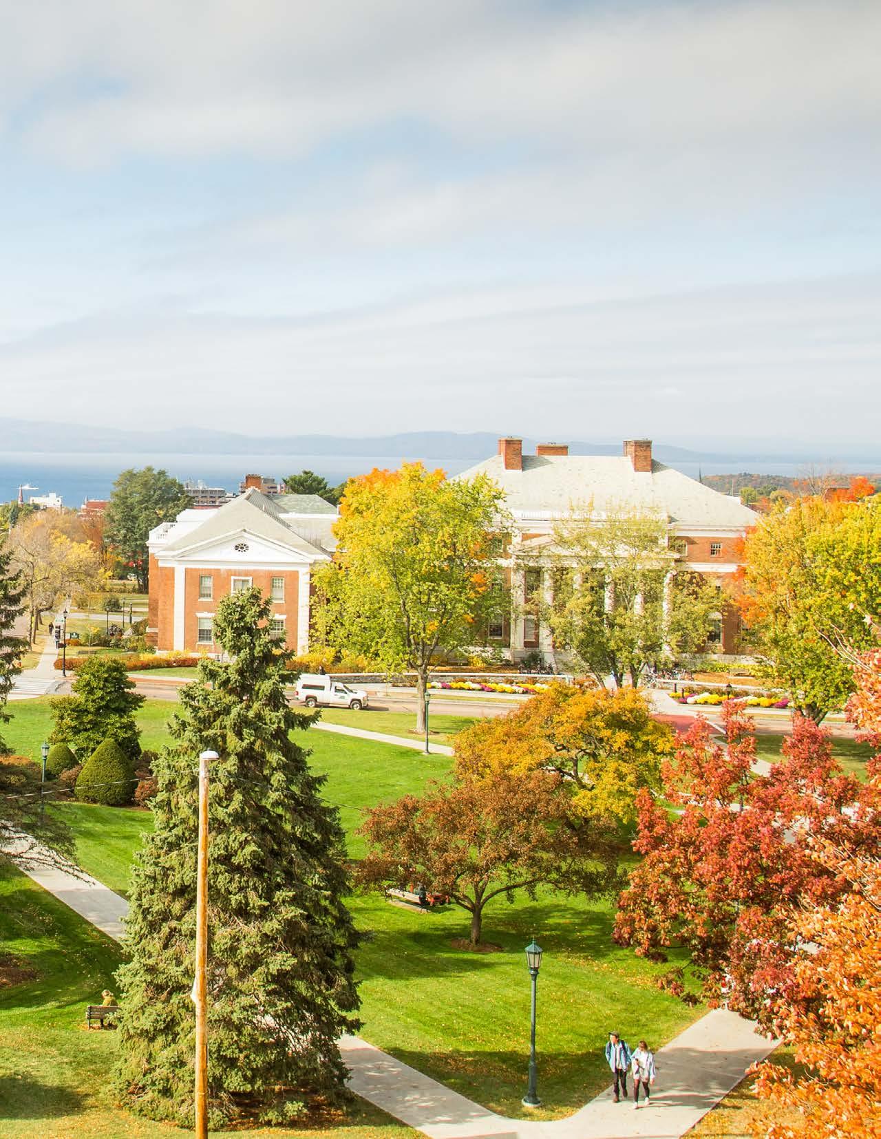
The University of Vermont (UVM) is a vibrant and intimate campus in a breathtaking location overlooking Lake Champlain, the Adirondack Mountains, and the Green Mountains. It is a premier institution of higher education with a welcoming and cohesive physical environment and a diverse university community that values respect, integrity, innovation, openness, justice, and responsibility.
This Campus Plan updates the 2006 Campus Master Plan. It retains many of the guiding principles of that plan while addressing the evolving needs of a dynamic, comprehensive research university. This plan supports the vision and mission of the university for the next ten years and beyond, and is consistent with the university’s strategic vision, Amplifying Our Impact.
In alignment with the signature goals of Amplifying Our Impact, the Campus Plan emphasizes the student experience through effective classroom and common-space utilization. Further, the Plan prioritizes enhancing our campus landscape, promoting research success and innovation in distinctive areas, focusing on efficiency and sustainability in our existing buildings, and addressing deferred maintenance needs. The university’s long-term focus on student success is bolstered through this Plan’s framework for a campus environment structured for personal and intellectual development.
I am thankful and proud of the engaging and collaborative work of many that led to the Campus Plan 2022-2032. This work will continue to support the University of Vermont’s strategic goals while enhancing the quality of life for students, faculty, staff, and our surrounding community.
 Suresh V. Garimella President
Approved by the UVM Board of Trustees, December 2022
Richard Cate, Chair, Vice President, Finance and Administration
Patricia Prelock, Senior Vice President and Provost
Luce Hillman, Executive Director, Facilities Management
Paula Carlaccini, Director, Planning, Design & Construction
Lisa Kingsbury, Associate Director of Planning, Planning Design & Construction
Lisa Kingsbury, Chair, Associate Director, Planning Design & Construction
Jim Barr, Director, Transportation & Parking Services
Eric Berliner, Assistant Director of Maintenance & Operations, Physical Plant Department
Dave Blatchly, Capital Renewal Engineer, Physical Plant Department
Paula Carlaccini, Director, Planning Design & Construction
Luce Hillman, Executive Director, Facilities Management
David Nestor, Dean of Students
Elizabeth Palchak, Director, Office of Sustainability
Mark Starrett, Associate Professor, Horticulture, Plant and Soil Science
Gioia Thompson, Outreach Manager, Office of Sustainability
Tom Visser, Professor, Historic Preservation Representative
Matt Walker, Grounds Manager, Physical Plant Department
Claire Forbes, Team Leader, Campus Plan Project Manager
Ken Bean, University Architect
Joanna Birbeck, Campus Space Manager
Lisa Kingsbury, Associate Director of Planning
Lani Ravin, Associate Planner
Michael Richards, Space Planning/Mapping Specialist
Caitlyn Clauson, Principal-in-Charge, Campus Planner
Mary Anne Ocampo, Principal, Urban Design Lead
Gwendolyn Sands, Planner and Project Manager
Andrew Gutterman, Landscape Architecture Lead
Rafael Marengoni, Urban Designer
Steve Lacker, Student Life/Housing Specialist/Architect
For a full list of acknowledgments, please see page A-1.
Architectural and Landscape Guidelines 157
Central District 162 Trinity District 172 Redstone District 176 Athletic District 182 Centennial District 186 South Campus District 190
The campus of the University of Vermont sits within a place of gathering and exchange, shaped by water and stewarded by ongoing generations of Indigenous peoples, in particular the Western Abenaki.
Acknowledging the relations between water, land, and people is in harmony with the mission of the university. Acknowledging the serious and significant impacts of our histories on Indigenous peoples and their homelands is a part of the university’s ongoing work of teaching, research, and engagement and an essential reminder of our past and our interconnected futures for the many of us gathered on this land.
UVM respects the Indigenous knowledge interwoven in this place and commits to uplifting the Indigenous peoples and cultures present on this land and within our community.
The purpose of the Campus Plan 2022-2032 is to articulate a vision and direction for the transformation of the physical components of the campus, and to provide a document that will guide and control that vision to ensure its proper and logical implementation over time. The university is a dynamic, evolving institution, so this plan is by necessity a flexible framework and living document that can accommodate changing attitudes and the evolving nature of campus environments. The plan ensures that projects are planned comprehensively according to the Vision and Principles outlined in Chapter 2: Foundation, that advocate campus-wide physical and visual coordination. The core priorities for this update to the Campus Plan are outlined in Chapter 3: Key Ideas, which guide building and landscape designs recommended throughout the plan.
The Campus Plan does not define all potential building needs, identify funding, or dictate the specific design of individual buildings, but rather provides a framework for changes to the campus so that resources expended on improving the physical campus support UVM’s mission and make the best use of existing land and facilities. The plan can also guide incremental decisions relative to the physical environment as part of a long-term vision.
The Campus Plan 2022-2032 is an update to the 2006 Campus Master Plan (CMP). The 2006 CMP marked the outset of a time of planned growth for UVM, both in terms of enrollment and facilities. The concept of land banks was introduced in the 2006 CMP, providing a flexible framework with which to organize physical growth and development by designating infill areas, with a preliminary focus on already developed sites. Utilizing this framework, since 2006 UVM constructed or renovated 1.2 million square feet of space, adding 22 major new buildings/ additions, and undertaking major renovations of another 22 buildings.
UVM is not anticipating major growth in the next ten years, focusing more on improvements to our existing buildings and landscape, with the exception of additional student housing. The framework of the 2006 CMP continues to provide a strong foundation for the organization of any needed development, and the Campus Plan 2022-2032 updates the major concepts of the 2006 CMP.
This Campus Plan 2022-2032 developed over a duration of 18 months beginning in 2020 and is the product of shared values among campus users. This document grew out of a series of interactive and collaborative meetings with a broad base group of representatives and several committees including the Oversight Committee, Working Committee, Campus Master Planning Advisory Committee
(CMPC), Strategic Working Groups, and Planning Team. This update incorporates input from students, faculty, and staff from many departments and colleges. The plan update was also developed in concert with many existing planning documents to ensure a comprehensive approach to all new projects. See Appendix for the list of planning documents.
Campus Master Planning Advisory Committee (CMPC)
The Working Committee started their work identifying priorities for the university for the next ten years. The major themes that stood out include deferred maintenance,
sustainability, active transportation, research, efficiency, and environmental stewardship.

The Campus Plan update commenced in November 2020 and the process included four phases:
• The first, Assessment and Analysis, established committees that identified the vision, goals, and principles. These were updated throughout the process, as necessary. The data collection and analysis involved a review of the 2006 CMP, assessment of existing conditions, and a review of existing plans and studies.
• In the second phase, Outreach and Concept Development, the Strategic Working Groups were formed comprised of faculty, staff, and students. Each group reviewed literature and resources to help inform and recommend objectives and strategies for this update to the plan. The five Strategic Working Group themes included:
o Sustainability and Healthy Lives
o Building Assessment of Single-Family Residences
o Efficiency and Innovation in Space Utilization
o Movement and Outdoor Space
o Safety, Diversity, and Accessibility
Data collection and outreach also continued including
gathering feedback from the campus community. The consultant group, Sasaki Associates, a Boston-based, award-winning integrated architectural, planning, and design firm, was hired to provide a high-level analysis, report, and recommendations to include best practices and guidelines for this update.
• In the third phase, the Planning Team drafted the plan with input from the Working Committee, Oversight Committee, and additional university stakeholders. Staff created a planning document that can be easily visible on the university’s website, as well as interactive maps illustrating physical aspects of the plan so that users have a more hands-on experience and data can be updated more regularly.
• The final plan was then presented to all of the committees and stakeholders, and finally to the Board of Trustees.
The goal for the Site Planning and Design Review process is to provide diverse perspectives on campus projects. The Campus Planning Committee (CPC) and Advisory Groups are charged with reviewing proposed projects to determine conformity with the Campus Plan and any applicable design standards. Feedback from the CPC is advisory and is shared with the university’s project manager and senior leadership.
The CPC is appointed by senior leadership and includes representation as follows:
• Facilities Management
o Executive Director (Chair)
• Planning, Design, & Construction o Planning Representative (Vice-Chair)
o University Architect
• Office of the Provost
• Office of Sustainability
o Director
• Physical Plant Department o Grounds Manager o University Engineer
• Student Affairs/Residential Life
University senior leadership will evaluate the composition of the CPC periodically and may appoint new members.
The CPC will determine criteria to evaluate projects based on the principles, key ideas, and alignment with the Campus Plan.
Advisory Groups may be comprised of staff, faculty, and students. Members are invited to the Advisory Groups based on their specific areas of expertise or interest in the specific advisory group theme. Advisory Groups are consulted when projects relevant to their group are brought to the Campus Planning Committee (CPC). Advisory Groups will review projects specific to their relevant area and then provide written comments to the CPC. When applicable, a representative from the Advisory Group(s) may attend the CPC meeting where the project is discussed to ensure that the Advisory Group’s feedback is conveyed accurately.
The Advisory Group themes are:
• Historic Preservation
• Landscape, Mobility, and Sustainability
• Diversity, Safety, and Accessibility
The Campus Planning Committee (CPC) will review all projects that may result in significant changes to campus, affect the aesthetics of the overall campus or the campus standards, and/or have a project cost equal to or greater than $2 million. Repair and maintenance projects are not subject to review by the CPC.
Step 1: The project manager for any project that requires evaluation will request a meeting with the CPC to present the project at the beginning of the design process.
Step 2: The Chair and Vice-Chair of the CPC will review the project and determine which Advisory Groups (if any) will review the project.
Step 3: Planning, Design & Construction (PDC) planning staff will complete an initial report outlining the project’s consistency with the Campus Plan and will distribute with the project presentation materials at least two weeks before the CPC meeting and any Advisory Group meetings. CPC and Advisory Group members are responsible for reviewing the materials before the meetings and will be responsible for bringing written evaluation criteria to the meeting.
Step 4 (if needed): Advisory Group meetings are conducted, and Advisory Groups provide written summary comments to the CPC.
Step 5: The CPC meets to discuss the project. A representative from the Advisory Group(s) who reviewed the project may also attend.
Step 6: Within five working days of the meeting, PDC Planning staff will create a final set of comments based on feedback from the CPC meeting and distribute them to the CPC.
Step 7: Within five working days of receiving the comments, CPC members will review and provide any edits to the final comments. The final comments are then compiled and sent to university senior leadership and the project manager of the proposed project.
Step 8: Depending on the scale of the project, a synopsis of the project that highlights key facts and figures as well as at least one graphic, will be posted to the UVM website on the list of active projects.
The Campus Plan 2022-2032 has been updated as a plan and tool to serve as a resource for the UVM community to guide the direction of the development of campus lands and facilities. This plan sets out recommendations for aligning enhancements to the campus environment with the vision, principles, and the university’s strategic vision. In addition to the Campus Plan document, interactive mapping tools were created as a resource to better understand and inform users about the changing components of the physical campus environment. These interactive tools provide map layers that show information such as UVM landholdings, building information, campus districts, land use, capital projects, along with future functional planning frameworks such as land banks, mobility priority areas and landscape priority areas.
Interactive Mapping Tool - Existing Conditions
Interactive Mapping Tool - Future Planning Frameworks
The Campus Plan contents include the following sections:
• Chapter 1 Introduction: The Introduction informs the reader why the plan is important and how it can be most useful. Background is provided on the process and the people that shaped the plan document along with a description of the Site Planning and Design Review Process.
• Chapter 2 Foundation: The Campus Plan Foundation is intended to explain the intention of the plan, and how it relates to the ongoing goals and vision of the university at large. The principles of the plan explain the overall direction of the plan, and where it will take the campus over the next ten years. The planning assumptions frame the institution’s expectations for areas such as enrollment, housing, and mobility. The UVM Strategic Plan is summarized to show how it aligns with the Campus Plan. The chapter focuses on campus history and existing conditions which describes the campus’s ongoing inventory and analysis of the physical campus.
• Chapter 3 Key Ideas: This chapter outlines the key ideas, which are the core priorities of the plan. These ideas are informed by strategic needs and priorities of UVM as determined through the Strategic Working Groups’ planning process and are used to guide recommendations throughout the plan.
• Chapter 4 Functional Planning Frameworks:
The Functional Planning Frameworks organize the details and strategies of the plan within four specific frameworks. The building and land use framework provides recommendations related to the uses of the land and buildings. The open space and landscape framework provides recommendations related to outdoor spaces and paths on campus. The mobility framework provides recommendations related to all forms of mobility and parking on campus. Finally, the utilities and infrastructure framework provides recommendations related to infrastructure and stormwater management. For each framework, there are graphics showing existing conditions and proposed plans for future priorities of the framework.
• Chapter 5 Campus Districts: This chapter outlines architectural and landscape guidelines for each area of campus, including the unique character, goals, and potential development of each district.
• Appendix: The Appendix section provides links to supporting supplementary material and reports as they are developed.
Additional Documents:
• Executive Summary: This is a quick summary of the major components of the plan.
• Condensed Summary: This is a condensed version of the full plan. It includes a summary of each chapter and the core ideas and purpose of the plan. The Condensed Summary is a tool that can be shared with stakeholders, community members, or others who are interested in learning about the contents of the plan in a more succinct manner.
The Campus Plan and the Interactive Mapping Tool are intended to function as a living document that will be revised accordingly in response to any changing strategic priorities. This plan provides the process and recommendations to guide improvements to the campus environment to best serve students, faculty, staff, alumni, and other university users.
When considering and planning new capital, maintenance, landscape, or mobility improvements, users should familiarize themselves first with each section of the Campus Plan. Some overarching questions to ask when planning projects:
• Does this project align with the vision and principles as outlined in Chapter 2: Foundation?
• Have the key ideas in Chapter 3 been considered as part of the project planning?
• Which functional planning frameworks in Chapter 4 are applicable to this project?
• What campus district is this project in and does this project align with the goals and architectural and landscape guidelines outlined for the district in Chapter 5?
Planning, Design & Construction staff are available to assist in understanding and interpreting the Campus Plan and ensuring that all necessary components of the plan are considered early in the planning process.
To initiate a project once funding and support are identified, a Project Request Form must be completed.

The University of Vermont is poised and ready to build upon our reputation as a premier research institution focused on sustainable solutions with local, national, and global applications and impact. Our distinctive strengths align with the most pressing needs of our time: the health of our societies and the health of our environment.
- UVM Strategic Imperatives
To create and uphold a beautiful and vibrant campus that promotes an educational community that is welcoming, inclusive, and respectful of all, while promoting and nurturing the student experience, world-class research, and sustainable solutions.

Sustainability
Interdisciplinarity and Innovation
Healthy Lives
Efficient Use of Limited Resources
Academic Excellence and Student Success
Diversity and Inclusion
Open Space and Compatibility
Accessibility and Flexibility
Connectivity
Sense of Place
Cultivate connections to sustainability and healthy living


Determine future plans for former singlefamily residences


Enhance and improve space on campus
Create vibrant outdoor spaces and connective mobility corridors
Prioritize safety, diversity, and accessibility on campus

The objectives and strategies will guide future work and improvements on campus.
These principles form the overall guiding structure of the Campus Plan. Every change on campus should be seen as a means to enhance its functional, aesthetic, and experiential qualities. It should be noted, the inclusion of all identities and abilities is embedded in each of these principles.
Support the university’s role as a sustainability leader in education, research, student life, and physical facilities. Prioritize the wellbeing and health of our community in decision-making. Plan, design, and implement fiscally responsible capital improvements that incorporate responsible environmental practices and contribute to a vibrant and resilient campus.
Create space to foster the ability for students to make connections with faculty and engage in research.
Design indoor and outdoor physical and social environments that promote and facilitate physical activity, mental health, and total wellbeing. Create spaces that demonstrate the university’s commitment to building healthy environments and healthy societies.
Efficient Use of Limited Resources
Improve and maximize space efficiency in a manner to reduce operations and maintenance costs. Demonstrate efficient use of financial resources in the implementation of this plan.
Establish state-of-the-art teaching and research facilities that place the university at the international forefront of learning and research.
Enhance the campus such that it helps to promote diversity, foster intellectual dialogue, bring together a vibrant mix of people, and be truly inclusive for all.
Foster campus community through the creation of vibrant and accessible public spaces that enhance our natural resources and educational opportunities. Preserve and enhance the continuity of open space and buildings and ensure the integration of additional facilities into the existing campus.
Ensure accessibility and adaptability within the university’s academic and support services, information (electronic technology), people, and programs by providing settings for a diverse community that facilitate communication and promote interaction and integration among all segments of the university and larger community. Apply the Seven Principles of Universal Design to guide decision making: Equitable Use, Flexibility in Use, Simple and Intuitive Use, Perceptible Information, Tolerance for Error, Low Physical Effort, Consider Size and Space for Approach and Use.
Create a fully accessible campus that is logically, efficiently, and technologically connected and create a campus that promotes community and institutional cohesiveness. Enhance and develop welcoming and safe circulation systems that emphasize the needs of pedestrians and multimodal connectivity to reduce reliance on single-occupancy vehicles. Invest in accessible and equitable infrastructure that supports this principle.
Create a campus environment that has a strong sense of place and fosters wellbeing in the community. Establish an environment that is safe, welcoming, and organized, where the arrangement of physical elements is unifying; provide a sense of entry and identity to the university (gateways); provide identifiable, visually satisfying places that encourage human connection; preserve, enhance, and restore the built and natural environment; and provide a safe and pleasant climate in which to learn, work, and live.
• Maintain undergraduate enrollment within the constraints of existing infrastructure and faculty capacity.
• Increase graduate enrollment within the constraints of existing infrastructure and faculty capacity.
• Continue to house first-year and second-year students on campus, and upgrade and expand housing to the degree that financial constraints allow.

• Create housing for some graduate students to the degree that financial constraints allow.
• Increase research faculty, as needed, to support research growth.
• Hire faculty to support curricular and enrollment needs.
• Adjust staff levels as needed.
• Maximize the use of existing classroom and office space by improving efficiencies and sustainability, address deferred maintenance needs, and where appropriate take buildings offline that are not efficient in terms of cost of operation and functionality.

For more than 230 years, the University of Vermont has developed the potential of its students, generated research focused on sustainable solutions with local, national, and global applications, and served the interests of Vermont. UVM’s distinctive strengths align with the most pressing needs of our time: the health of our societies and the health of our environment. The university pursues these interconnected challenges through the cross-disciplinary research and collaboration that comes more easily at a public research university of its size and scale. UVM’s strategic vision, “Amplifying Our Impact,” includes three imperatives that are interconnected and reliant on each other. These initiatives are to support student success through ensuring academic excellence, focus on and expand distinctive research strengths, and better-realize UVM’s land-grant mission by partnering with communities, businesses, and the state.
The connection between health and well-being and academic achievement is promoted holistically. UVM must offer a vibrant educational experience, ensuring that UVM is affordable and accessible for a broad and diverse population, and providing support and meaningful opportunity well beyond graduation day. This vision includes:
• Providing an unparalleled educational experience for students by continually enhancing course offerings through rigorous evaluation and evolution, and alignment with a liberal arts foundation and societal demands. Exposure to the humanities—and the critical thought this engenders—will position UVM’s graduates for success in the broadest range of pursuits.
• Carefully evaluating expenses to minimize costs and make a UVM education more affordable and accessible.
• Growing corporate, foundation, federal and philanthropic partnerships to develop new internship, research, study-abroad and service-learning opportunities, while enhancing existing programs.
• Enhancing online offerings and programs that promote efficient course and degree completion with targeted support for first-generation and non-traditional learners.
• Attracting a larger cohort of graduate students by enhancing their academic experience and research opportunities.
• Providing an environment that fosters diversity of all kinds, including diversity of thought.
• Welcoming nontraditional students to new professional, certificate, and online programs.
Investing in our Distinctive Research Strengths UVM benefits from the powerful combination of a liberal arts core and the comprehensive academic resources of a major research institution. UVM has built distinctive research strengths that align with the urgent—and interdependent— need to support the health of our environment and our societies:
• Healthy Societies: UVM’s cross-disciplinary work is strengthened by collaboration and research in areas ranging from immunobiology and microbiology, to data mining, mapping, and analysis, to ethics, historical context, and communication. This will drive actions with broad application including substance abuse prevention and rehabilitation, and immunobiology, microbiology, infectious disease treatment, vaccine testing, and public health campaigns.
• Healthy Environment: Faculty, researchers, and practitioners from throughout UVM collaborate to create new knowledge and establish best practices in areas related to sustainable farming, food systems and business solutions, and the protection of water systems. Leveraging our strength in engineering, machine learning, and complex systems will provide pathways for the development of scalable solutions.
Strategic investment of available resources will accelerate and enhance these distinctive strengths, positioning UVM as the preeminent institution for innovative and sustainabilityfocused solutions.
Cultivating these areas of research strength will leverage the unique characteristics of the state of Vermont. As one of the smallest states in the nation with a thriving participatory democracy, Vermont offers a microcosm for national programs to be piloted at a manageable scale.
As one of the nation’s first land grant institutions, the University of Vermont’s alignment with the state is fitting. The university is nationally acclaimed for helping Vermonters tackle everything from farm viability to complex environmental issues to business growth. UVM’s partnership with the state includes more than 200 programs designed to help Vermont and Vermonters.
Engaging with the state not only helps Vermont, but also benefits the university by strengthening its connection to entrepreneurship, hands-on learning, problem-solving, and critical thinking, all ideals championed by alumnus, educator, and noted philosopher John Dewey. This enriches the educational experience of our students and broadens our faculty’s research portfolios.

This section includes a narrative of the history and existing conditions of the University of Vermont including:

• Campus History and Identity
• Campus Planning Timeline
• UVM Landholdings
• Zoning
• Land Use
• Watersheds and Stormwater Treatment
• Edge Conditions
• Historic Resources and Archaeological Sensitive Areas
• Campus Buildings by Primary Use
In order to set the directions for the future development and growth of the university, the history of the physical evolution of the campus and its current state must be given careful consideration.
The University of Vermont (UVM) was chartered in 1791, the same year that Vermont became the fourteenth state in the Union, as the fifth college in New England and the twentieth in the United States. The Vermont Agricultural College was formed in 1864 as the state’s land-grant institution in accordance with the provisions of the Federal Morrill Act. The University of Vermont and State Agricultural College was formed in 1955 as the result of the combination of The University of Vermont and the Vermont Agricultural College.
UVM blends the academic heritage of a private university with the service mission of the land-grant tradition. In 1955, the General Assembly recognized The University of Vermont and State Agricultural College “as an instrumentality of the State for providing public higher education.” Even before that recognition, the state has annually appropriated funds specifically to the College of Medicine and to the Agricultural Sciences and has appropriated tuition scholarship funds for Vermont residents in certain fields of study.
UVM is the state’s flagship university and its only comprehensive research institution of higher education. As of fall 2021, the university enrolls approximately 13,800 students (undergraduate, graduate, medical, and nondegree) and employs approximately 4,192 faculty and staff. It is primarily located in Burlington, the largest community in the state with a greater metropolitan population of approximately 219,433 (U.S. Census Bureau (2019)). It is approximately 90 miles south of Montreal, 230 miles northwest of Boston, and 300 miles north of New York City, accessible via Interstate 89 and US Routes 2 and 7, and served by the Burlington International Airport.
The Main Campus and South Campus are located on 957 acres overlooking the cities of Burlington and South Burlington and Lake Champlain. The campus, which
includes 190 ± buildings, is a unique and historic mix of styles and features spanning the last 230 years of architecture. Each building or complex represents an aspect of the economy, technology, social values, and aesthetic philosophy of the time that produced it. Forty-five buildings are listed on the National Register of Historic Places on the Main Campus. An additional historic district (Fort Ethan Allen Historic District) contains eight contributing buildings that were added to the National Register of Historic Places in October 1995. There are also three buildings located at the Morgan Horse Farm District in Weybridge that are on the National Register.
In addition, although separate legal entities, the University of Vermont Medical Center (UVMMC), is the largest medical research facility in the state, and the university’s Larner College of Medicine and College of Nursing and Health Sciences works in partnership with UVMMC and shares resources. UVMMC’s campus is adjacent to the university’s Main Campus and the Larner College of Medicine’s facilities as well as the College of Nursing and Health Sciences. UVMMC leases the facility located at 1 South Prospect Street within the Main Campus boundaries from the university.
In 1966 and 1967, the university hired the Office of Dan Kiley, Site and Landscape Consultants in Charlotte, Vermont, to work with the university community to develop a Campus Master Plan. The “philosophy and objectives” statement has withstood the test of time and the university continues to plan with this in mind:
“The long-range development plan should provide a positive direction of growth within a flexible framework that the campus will be able to evolve in an efficient, orderly, and harmonious manner; and at the same time, be able to accommodate unforeseen changes in curriculum or administrative policy. We continue to stress the importance of locating new buildings on sites appropriate to their function, size, and projected growth, and in accordance with the proposed campus development plan. This plan is intended to give a new structure to the overall campus by organizing the various university facilities in an attractive and functional order...
By turning the campus inward and creating a pedestrian core with a strong link between the residential and academic zones; by encouraging the highest standards of excellence in the architecture of the future buildings; and by freeing the campus from the clutter and confusion of the automobile, an environment of the highest order will be created, providing the atmosphere for the discovery, exchange, and transmission of ideas.”
The development of the existing Campus Master Plan began in 1981 with the Board of Trustees’ adoption of the “Comprehensive Facilities Planning: An Overview” goals and objectives. The university continued this effort and retained The Eggers Group P.C. in 1984 to develop a campus-wide site plan to serve as a guide for future growth and change on campus. This plan identified major issues to address including Site and Surroundings (Relationships to City Governments, Historic District, Campus Orientation and City/Boundary Concerns, and Open Space), Building on the Campus (proposed new building, existing buildings, University Heights, handicapped access, and design guidelines), Traffic, Circulation, and Parking (vehicular, pedestrian, bicycle, and handicapped access).
In 1988, the Administrative and Facilities Services (AFS) Department, including the University Planner, developed the first Board of Trustees approved Campus Master Plan and addressed three time periods: 1987-1997, 1997-2007, and Beyond 2007. The plan addressed topical areas and issues for each of these time periods including Land Use (housing, academic/ administrative, research, support services, and activities), Energy and Utilities (water, sewage, stormwater,
electricity, and heat), Signage and Lighting, Parking, Solid Waste, Circulation (vehicular, pedestrian, and bicycles), Natural Areas (recreation, open green space, and park land), and Renovations. The 1988 Campus Master Plan had two addenda. One, in February 1990, provided a revision to the Housing, Parking, Traffic and Circulation, Energy and Utilities, and Natural Areas sections. In April 1991, a supplement was published addressing Natural Areas, Stormwater, Agricultural and Forestry Soils, Hazardous Waste, Solid Waste, Energy Demands and Conservation (inclusive of water usage and wastewater), Aesthetics, Air Quality, and Transportation.
Through an extensive collaborative planning process, in October of 1997, the UVM Board of Trustees adopted the 1997/98 Campus Land Use Master Plan that provides the overriding planning framework that must be considered in all physical development across campus. The planning principles, premises, and open space development designations provide the key criteria that are utilized to assess all projects to ensure compliance with the Campus Master Plan, thereby, meeting one of the primary goals of the Board of Trustees – to create and adopt a “living” master plan. At the time of adoption, it was known that this was a “land use plan” and not a facilities’ master plan. The planning framework of the land use plan provides the elements to strategically “site” new facilities, but it did not include specific locations for the new facilities that were being considered at that time or definitive mapping of current utility infrastructure and future best locations. In addition, it was also known at that time that the university needed to develop and adopt building and landscape design and materials guidelines and an infrastructure master plan. This was necessary to ensure that all day-to-day decisions, along with major new projects, would enhance and improve the campus appearance and that operations aligned with the planned vision.
The 2006 CMP not only updated the 1997 Campus Land Use Master Plan but focused on guiding principles for future university development and planning principles that stemmed from the guiding principles for assessment of new projects. The 2006 CMP defined the concept of land banks appropriate for future buildings and land banks for no-build zones. This plan also defined campus architectural districts and gave the surrounding community an overview of where
the university would and would not consider expansion or disposition of property. The plan also defined five priority landscape design projects, most of which have been implemented by 2021. In 2008, the UVM Board of Trustees approved a supplement to the CMP--the Site Planning and Design Review Process. The Campus Plan 2022-2032 is an update to the 2006 CMP.
UVM Campus Planning Timeline (1966 - 2022)


The University of Vermont owns several properties throughout the State totaling 4,488 acres as of 2022. The properties include 956 acres located in the cities of Burlington and South Burlington, (which includes the 463-acre Main Campus in Burlington and the 494-acre South Campus in the city of South Burlington) and 3,533 acres that are defined as “off-campus.” Off-campus properties include three acres at Fort Ethan Allen, 16 acres at Colchester Research Campus, 214 acres at the Morgan Horse Farm District, 490 acres at the Jericho Research District, 210 acres at the Proctor Maple Research District, 12 acres of gift property, 334 acres of off-campus research property, 20 acres for the Outing Club in Bolton, and 2,234 acres designated as off-campus Natural Areas. There are 122 acres designated as Natural Areas within the Main Campus and South Campus located in the cities of Burlington and South Burlington.
Since the 2006 Campus Master Plan, a number of properties were acquired on Main Campus, including Alumni House (61 Summit Street), 50 Fletcher Place, 439 College Street, 23 Mansfield Avenue, and 172 South Prospect Street. In addition, the Centennial Woods Natural Area increased in size by 3.2 acres with the acquisition of the Turner parcel. Major off-campus land acquisitions include the 331-acre Carse Wetlands Natural Area in Hinesburg, the 2-acre Lot 3 in Colchester Business Park, an 8-acre addition to the Colchester Bog Natural Area in Colchester, a 47-acre addition to the H.L. Achilles Shelburne Pond Natural Area primarily located in Shelburne, approximately 30 acres at the Proctor Maple Research Complex in Underhill, and 50 acres from Vermont Land Trust in Washington. Dispositions include the sale of 308 South Prospect Street on Main Campus, the sale of 36.5 acres of the Maeck property in Charlotte, the sale of the County and Ethan Allen Apartments at the Fort Ethan Allen District in Colchester and Essex, and the sale of the Nason and Pew Tracts in Manchester.
The map identifies the UVM landholdings locations:
A. Bolton: Bolton Outing Club, 20 acres
B. Burlington and South Burlington: Main Campus, 463 acres, including Centennial Woods Natural Area (69 acres), and Redstone Quarry Natural Area (3.3 acres)
C. Charlotte: Pease Mountain Natural Area, 179 acres
D. Colchester: Colchester Bog Natural Area, 208 acres
E. Colchester: Colchester Research Campus, 16 acres
F. Essex: Fort Ethan Allen, 3 acres
G. Hinesburg: Carse Natural Area, 330 acres H. Jericho: Jericho Forestry, 490 acres
I. Morristown: Molly Bog Natural Area, 31 acres
J. North Concord: Concord Woods Natural Area, 100 acres
K. Shelburne, Williston, and South Burlington: H. Lawrence Achilles Natural Area (Shelburne Pond, 985 acres)
L. South Burlington: South Campus, 494 acres, including East Woods Natural Area (50 acres)
M. South Hero: Lessor’s Quarry, 2 acres N. Stowe and Underhill: Mount Mansfield Natural Area, 400 acres
O. Underhill: Proctor Maple Research, 210 acres P. Washington: Lot 7 Range 3 Div 1, 65 acres and 378 Roberts Road, 50 acres
Q. Weybridge: Morgan Horse Farm, 214 acres R. Williston: Talcott Tract, 88 acres S. Wolcott: Lot 93 Div 3, 129 acres T. Wolcott: Lot 25 Division, 12 acres
Burlington, South Burlington, Colchester, and Essex
The University of Vermont’s landholdings in the cities of Burlington and South Burlington and the towns of Colchester and Essex include:
Main Campus is a 463-acre tract located principally in the city of Burlington with a small portion in the city of South Burlington. The Main Campus contains the primary academic core, athletic, and residential functions of the university. The original 50 acres on the hilltop given to the university by Ira Allen in 1791 was expanded with the addition of University Heights in the 1860s and the A.A Buell Estate (Redstone) in the 1920s and other subsequent land acquisitions. In 2002, UVM acquired Trinity Campus, on the north side of Colchester Avenue, perched on the edge of a wooded ravine. Refer to Chapter 5: Campus Districts for a more detailed description.
South
South Campus includes 494 acres, located principally in the city of South Burlington with a portion in the city of Burlington. The South Campus embodies agricultural, environmental, and geological perspectives and is currently utilized primarily for agriculture, horticultural, and natural areas management purposes, for both instruction and research. Refer to Chapter 5: Campus Districts for a more detailed description.
Fort Ethan Allen is a 3-acre parcel of land and is located in the town of Essex within the Fort Ethan Allen Historic District. Fort Ethan Allen is used primarily by Physical Plant and Transportation and Parking Services for administrative, shop, storage, and maintenance functions. The eight buildings are located within the town of Essex and are contributing buildings in the National Register of Historic Places as part of the Fort Ethan Allen Historic District. One of the buildings serves academic units as a storage facility.
Colchester Research Campus is a 16-acre parcel of land located in the town of Colchester, proximate to Routes 2 and 7 and Exit 16 of Interstate 89. Since the early 1990s,
the university owns a portion of the Colchester Business Park that includes the Colchester Research Facility (CRF). The Vermont Department of Health facility is adjacent to the CRF, which offers UVM additional research and collaborative space within the state’s facility. The Colchester Research Campus is located within the Winooski River Watershed, which flows into Lake Champlain. The university owns a 3.25-acre stormwater retention pond and surrounding wetlands to the east and southeast of the research building. Lot #1 at the Colchester Research Campus is still considered a land bank for potential future development or circulation needs. See the definition of land banks in Chapter 4: Functional Planning Frameworks.
The Rubenstein Ecosystem Science Laboratory is a lakefront extension of the Rubenstein School of Environment and Natural Resources. Research focuses on water and sediment quality in Lake Champlain, the impacts of human activities on physical, biological, and chemical processes on the greater Lake Champlain Basin Ecosystem, aquatic biota including fish, invertebrates and algae, and ecosystem processes that determine the ecological health and influence the quality of all life in the Lake Champlain Basin. The architecture of the Rubenstein Ecosystem Laboratory itself placed great emphasis on innovation in energyefficient technologies, the use of sustainable materials and construction techniques, and community-based design development. UVM’s research vessel is docked adjacent to the laboratory building.


The Environmental Program at UVM is responsible for the identification, protection, and management of important natural areas on university-owned lands. These natural areas provide outstanding resources to meet the teaching and research needs in disciplines that require or can benefit from field experience:
• Carse Wetlands Natural Area is located in Hinesburg, Vermont. The property is a mix of open agricultural fields, forests, and wetlands including a basin of open water. The eastern side of the property is effectively landlocked and contains a collection of significant ecological features including unusual upland and wetland natural communities and several rare plants. A trail system has been developed for the natural area with a short boardwalk leading out into the core wetland.
• Centennial Woods Natural Area is one of the most frequently visited natural areas owned by UVM. This area contains over 69 acres of mature conifer stands, mixed hardwoods, fields, streams, and wetland areas. Within the city limits of Burlington and South Burlington and adjacent to the UVM campus, this area serves as an excellent natural laboratory to study the region’s plants, animals, and natural processes, as well as cultural history. A well-developed trail system wanders through Centennial Woods, offering visitors samples of the natural communities and landscape features thriving here. Students in Environmental Studies, Botany, Zoology, Forestry, Recreation Management, and Education use this area extensively for academic study.
• Colchester Bog is a 208-acre peatland bog on a peninsula between two rapidly developing shoreline areas of Lake Champlain in Colchester. It serves as a haven for a great diversity of flora and faunal species which makes it a prime location for research. The area consists of an open peatland, shrub and treedominated swamps, open water areas called laggs, a sand dune, and several adjacent uplands. The bog itself consists of a forest dominated by a dense thicket of shrubs and trees and an open mat of sphagnum moss and sedges. Some of the tree types at Colchester Bog include maple, ash, and elm, as well as white cedar, pitch pine, black spruce, and tamarack. Some of the common shrubs include mountain holly, rhodora,
sheep laurel, and Labrador tea. To minimize impacts, a boardwalk and observation deck made of wooden planks were constructed and are kept in place by plastic floats.
• Concord Woods Natural Area is a mature, northern, upland, hardwood forest in a secluded, northeastern Vermont setting. Sugar maple is the prevalent tree species within the natural area, with many of the trees measuring 18 inches or more in diameter. Although actively logged many years ago, as much of Vermont was, Concord Woods is one of the few mature hardwood forests surviving in the state. Its remote and undisturbed character makes it an ideal laboratory for studying this type of ecosystem.
• East Woods Natural Area was purchased in 1949 due to its potential educational value and its close proximity to the UVM campus. Students can study plants and animals of a mature northern forest in this relatively undisturbed, 40-acre, mixed hardwood and conifer forest. The Potash Brook runs through the middle which drains a 7.5-mile watershed and serves the important function of filtering and slowing stormwater while also improving water quality and habitat conditions. The sunlit openings in the canopy allow for the regeneration of plant growth on the forest floor.
• Molly Bog Natural Area is a classic example of a northeastern kettlehole bog, illustrating textbook zonation from open water to evergreen forest. The bog complex involves a two-acre pond skirted by four distinct zones each characterized by a particular community type. In addition to the bog, this 35-acre natural area includes a spruce-fir swamp and an adjacent upland hardwood forest.
• Mount Mansfield Natural Area is one of the most striking land features in the state of Vermont. The university owns almost the entire summit ridge of Mt. Mansfield, a piece of land about 400 acres in extent, most of which is above 4,000 feet. The largest single expanse of alpine vegetation in the state is found here on the nearly treeless ridge, making it an ideal location to study flora and fauna of an arcticalpine environment. Some of the rare plants found here include Lapland diapensia, bearberry willow, Boott’s rattlesnake root, black crowberry, and mountain cranberry.
• Pease Mountain Natural Area is located in the town of Charlotte. In 1949, the university acquired approximately 180 acres of the mountain, including the summit, from the Pease family. Pease Mountain offers a breathtaking view of most of Champlain Valley, the Adirondack Mountains to the west, and the Green Mountains to the east. Mesic and dry hardwood forests dress much of the mountain, but it is also lush with understory vegetation such as staghorn sumac, barberry, honeysuckle, and blueberry.

• Redstone Quarry Natural Area is nestled in a quiet south end suburban neighborhood within the city of Burlington. This 3-acre natural area sits at the base of an abandoned Monkton Quartzite quarry. The Redstone Quarry Natural Area is a small yet diverse ecosystem and is used as an outdoor lab for classes in geology and other natural sciences. The area is noted for its diversity of birds and amphibians, as well as its showy wildflower displays.
• H. Laurence Achilles Natural Area at Shelburne Pond consists of 985 acres of upland and wetlands in the town of Shelburne, Williston, and the city of South Burlington. It is located along the shores of Shelburne Pond, the largest undeveloped body of water in the Champlain Valley. The walking trails at Shelburne Pond run through a forest with rich, calcareous soils and are home to a variety of trees such as sugar maple, ash, hemlock, and others. White cedar trees inhabit the rocky shoreline, and many types of ferns are known to exist here. Numerous rocky outcrops along the trail make Shelburne Pond a popular location for fishing.


The University of Vermont functions within a regulatory environment unique among comparable universities across the country. The university is required to apply for all local and state regulatory permits, including environmental permits for any building activity, similar to any landowner or commercial for-profit developer.
Act 250 is the state’s land use environmental law, which requires that all large-scale development and/or smallscale projects that fall under specific criteria undergo a rigorous state review. The university must prove that the project does not adversely impact:
1. Water and air pollution 2. Future water supply 3. Existing water supplies 4. Soil erosion 5. Traffic 6. Educational services 7. Municipal or government services 8. Scenic and natural beauty, aesthetics, natural areas, historic sites 9. Conformance with capability and development plans (public and private financial and utilities capacity)
10. Conformance with duly adopted local and regional plans
These 10 criteria have been amended, clarified, and interpreted over the years, resulting in stringent environmental protections.
In addition to and separate from Act 250, all university development must comply with all other state permit requirements for historic preservation and environmental quality such as stormwater quality, erosion control during and after construction, air, and water pollution.
Finally, local jurisdictions also want to make sure that the university complies with all local zoning requirements. Both the Main and South Campuses are located within the cities of Burlington and South Burlington which both have extensive and detailed zoning review requirements, including a public process.
There is state legislation that limits municipal review under 24 VSA §4413, to the extent that university uses may be regulated only with respect to location, size, height, building bulk, yards, courts, setbacks, density of buildings, off-street parking, loading facilities, traffic, noise, lighting, landscaping, and screening requirements, and only to the extent that regulations do not have the effect of interfering with the intended functional use. Both Burlington and South Burlington have acknowledged that municipal review for UVM is limited under this statute.
The university, through Planning, Design & Construction, has developed a system of proactive public input solicitation and communication with state and local planning staff to ensure that all projects take into consideration public needs and interests as well as the latest planning and design requirements. This system has resulted in better projects moving faster through the required approval steps.

Within the city of Burlington, the university’s landholdings are zoned as follows:
Institutional (I): Most of the Main Campus is zoned I, including Trinity District and parts of Centennial District. This designation enables the university to use its lands for academic and institutional uses.
Institutional Core Campus Overlay Districts (ICC): In addition to the base Institutional (I) zoning, UVM’s Main Campus has several areas designated as ICC Overlay Districts. These districts are “intended to provide for reasonable future growth for institutions within the core of their respective campuses without further intrusion into surrounding residential neighborhoods” (excerpted from the Burlington Comprehensive Development Ordinance, 2022).
There are three Institutional Core Campus Overlay Districts on UVM’s Main Campus:
• UVM Central Campus (UVM)
• UVM Trinity Campus (UVMT)
• UVM South of Main Street (UVMS)
These are zoned with higher lot coverage and height potential than the regular Institutional zoning districts with no overlay districts.
Most of the Centennial District in Burlington that is wooded is zoned Recreation, Conservation & Open Space –Recreation/Greenspace. The city encourages a “diversity of passive and active recreational opportunities and other urban green spaces that provide for public use and enjoyment” in this district.
Apart from any city or state mandates, the university has designated part of Centennial District as the Centennial Woods Natural Area, thereby ensuring that it remains a natural area in perpetuity. This natural area is located within both the cities of Burlington and South Burlington.

Within the city of South Burlington, the university’s South Campus land holdings are zoned Institutional-Agricultural (IA North or South). This enables the university to use its lands in South Burlington for educational, conservation, research, and agricultural purposes. I-A North parcels located in the Athletic and Centennial Districts can also be used for recreational and limited retail activities.
Commercial 1 (C-1/Residential 12 (R-12)): This South Burlington portion of Centennial District, contiguous to the hotel and rugby field, can be used for recreation facilities, retail, offices, and residential mixed-use development. In addition to the potential commercial uses, this area can be used for high-density residential buildings. Any residential project is required to be a Planned Unit Development (PUD). Conditional uses include places of worship, group homes, continuous care facilities, social services, and recreational facilities. The maximum lot coverage is 60% maximum, with a 40% maximum for buildings only. There is a maximum limit of 12 dwelling units per acre. At present, it is a mostly undeveloped area with one parking lot leased to the hotel and another parking lot used by commuters to the university.
UVM also owns several parcels that are zoned Neighborhood Residential, R-1 and R-2, low-density residential. Some of these parcels are currently used as agricultural fields to support the dairy herd at the Miller Research and Education Center (MREC).
The city of South Burlington recently revised its Land Development Regulations (LDRs), which include substantial changes to the Environmental Protection Standards, among other changes. Both the city and the university have agreed that the South Burlington LDRs are limited by state statute 24 VSA §4413 regarding academic/institutional uses on university-owned land.
Academic Administrative Athletic Leased to Third Party
UVM Medical Center Natural Area Residential Student Support Map data

The analysis of existing campus land use paints a broad picture of how the University of Vermont functions dayto-day on a macro scale. It allows us to understand daily patterns of movement around campus, destinations, and points of departure, and to evaluate current and future locations for key services and pedestrian corridors.
The university’s academic, research, and administrative life is largely concentrated in the Central District, with academic facilities also in the Trinity and Redstone Districts, as well as in the Colchester Research Facility.
Residential life centers within several districts including, Redstone and Athletic Districts south of Main Street, Trinity District north of Colchester Avenue, and Central District within the Central Campus Residential Hall Complex and Converse Hall.
Athletic uses occur more at the periphery of campus in the Centennial and Athletic Districts.
Student support services are primarily located in the Central District with academic and student support services at the Dudley H. Davis Center conveniently sited near Main Street, at the hinge between the Redstone and Central Districts.
The Green Mountain Pathway, from Redstone to Trinity District, creates a north-south spine of pedestrian and active transportation movement through the campus districts.
Projects currently under design and/or construction, such as the Tarrant Multi-Purpose Events Center and the Firestone Building, will maintain and augment existing patterns of land use.
Trinity Watershed Centennial Bleachers Watershed Colchester Ave. Watershed North Campus Watershed
North Campus Stormwater Treatment Facility
Main St. East Watershed East Campus Watershed
Southwest Watershed #1
Southwest Watershed #2 UVM Property Boundary
Southwest Stormwater Treatment Facility
Burlington South Burlington
DoubleTree Stormwater Treatment Facility
Main Street East Stormwater Treatment Facility
East Campus Stormwater Treatment Facility
Map data © OpenStreetMap contributors, Microsoft, Esri Community Maps contributors, Map layer by Esri
The University of Vermont’s Main Campus and South Campus are located in two different municipalities (Burlington and South Burlington) and in four different stream watersheds (Centennial Brook, Englesby Brook, Potash Brook, and Winooski River). Portions of UVM’s stormwater drain to the city of Burlington’s combined system where it is treated before draining to Lake Champlain. UVM uses best management practices to prevent, control, and treat stormwater runoff on campus. Ultimately, all four watersheds discharge to Lake Champlain.
The university’s stormwater system functions within a highly regulated environment of federal, state, and local regulations and permit requirements. The university uses a multifaceted approach to limit and treat stormwater runoff as well as participate within the wider regional network to address stormwater impacts throughout the affected watersheds and beyond.
Within these regulations, the university is defined as a ‘nontraditional’ MS4 (responsible for a Municipal Separate Storm Sewer System). That means that the university has to obtain and comply with an MS4 permit, which is a federally required Clean Water Act permit that the State of Vermont has been authorized to administer.
The MS4 permit requires that each MS4 (including UVM) prepare and implement a Stormwater Management Program (SWMP) that addresses six Minimum Control Measures:
(1) Public Education and Outreach
(2) Public Participation/Involvement
(3) Illicit Discharge Detection and Elimination
(4) Construction Site Runoff Control
(5) Post-Construction Runoff Control
(6) Pollution Prevention/Good Housekeeping
The first two minimum control measures (public education and involvement in stormwater issues) are not site-specific, so the university participates in a regional effort with other MS4 entities to educate and involve the public in best practices to reduce stormwater impacts. UVM helps fund and regularly attends the Chittenden County Regional Planning Commission’s Clean Water Advisory Committee (CWAC) meetings to discuss stormwater projects,
regulations, goals, education, outreach, etc. The CWAC also has an MS4 Subcommittee consisting of representatives of the nine municipalities and three agencies, including UVM, charged with implementing activities as part of minimum control measures (1) and (2), the Public Education and Outreach and Public Participation/Involvement portion of the state permit requirements.
The other four minimum measures are met by a complex, campus-wide system of stormwater facilities, treatments, conveyances, and best practices. The university submits an annual report to the state that documents these efforts. As permit conditions evolve, the university has added treatments and adjusted best practices as necessary.
In 2012, new permit conditions were added to develop Flow Restoration Plans (FRPs) to implement more stringent stormwater goals in each impaired watershed. The university worked with other MS4s in the same watershed to produce FRPs that address region-wide goals. Part of this process included the identification of treatments and sites and financing of these treatments. The university is a full partner in this effort, and several treatment sites are on UVM land, funded by the university.
The cities of Burlington and South Burlington, and the towns of Colchester and Shelburne have created stormwater utilities that charge all landowners, including UVM, for addressing stormwater impacts. These cities and towns then use the funds from these fees to improve stormwater treatments and comply with their own MS4 requirements. The university pays fees as necessary and also gets “stormwater credits” (i.e., discounts on the fee amounts) for use of its own stormwater treatment facilities.
UVM-owned and managed natural areas, such as the Colchester Bog, naturally contribute stormwater capacity to the municipal systems.
The University of Vermont continues to be a steward of the land and participate in both UVM-specific and community efforts to address stormwater impacts locally and regionally. See Chapter 4: Functional Planning Frameworks for more information on UVM’s stormwater management initiatives.


Edge conditions describe the appearance, character, and environment of the University of Vermont from its boundaries and transitions to the surrounding landscapes. Edge conditions help form the initial impression of the university for the visitor, or prospective student, and are an important tool for defining the character of surrounding neighborhoods and land-uses and for responding appropriately and sensitively when planning future development.
This Campus Plan has defined five edge conditions that exist at the University of Vermont:
A commercial edge occurs at the eastern edge of campus along Main Street/Williston Road. The commercial edge incorporates commercial services that are not under the control of the university.
The university’s residential edge consists of primarily noncommercial uses such as housing or small-scale offices and is the predominant edge condition at most boundaries of the Main Campus.
The institutional edge consists of buildings controlled by the university, or neighboring institutions such as the University of Vermont Medical Center (UVMMC), Champlain College, and Mater Christi School. By definition, the interior edge of the whole university campus is an institutional edge. Main Street, west of the University Green, contains a mixed institutional/residential edge with Champlain College and some university facilities intermingling with the residential fabric.
The woodland edge consists of forests and managed or natural open space. The shared boundary between the university and the Burlington Country Club on the southern boundary of Main Campus and the north edge of Trinity District are woodland edges.
The transitional landscape edge consists of open spaces that mark the transition between land uses. The University Green continues to mark the traditional threshold between the city of Burlington and the university. The jug handle on Main Street, at the intersections of Spear Street and East Avenue,
is a more contemporary transition between the landscape of the interstate and the university.
UVM Property Boundary
Map data © OpenStreetMap contributors, Microsoft, Esri Community Maps contributors, Map layer by Esri
Map data © OpenStreetMap contributors, Microsoft, Esri Community Maps contributors, Map layer by Esri
Several sites of archaeological significance have been identified on the Main and South Campuses of the University of Vermont. As part of the State of Vermont Act 250 regulations, all capital projects are reviewed in relation to the historic preservation and archaeological assessments. The university is committed to identifying potential archaeologically sensitive areas when evaluating plans for the proposed development site. If the site is determined to be potentially archaeologically sensitive, the university will conduct an archaeological evaluation and proceed as appropriate. The evaluation will follow the general procedures contained within the Guidelines for Archaeological Studies (updated last in 2017).
Examples of identified archaeologically significant sites on campus include: a Native American settlement thought to be 3000 years old, an early nineteenth-century farmhouse, a prehistoric site that contains evidence of at least two periods of occupation, one dating to within 1,000 years and the second to roughly 5,000 years ago. An early beach line of the Champlain Sea was identified and university archaeologists report that very old Native American sites could be associated with such an environmental feature. The most recent discovery is that a small area of university land may have been exposed as a tiny island within the Champlain Sea.
The UVM Consulting Archaeology Program (CAP) completed an Archaeological Resources Assessment (ARA) for UVM for the Main Campus in May 2020. The Vermont Division for Historic Preservation concurred with this ARA in May 2021. In addition to a plethora of information about campus land, this document maps which areas of the Main Campus are archaeologically sensitive, giving both the university and the state a valuable tool for site assessment. See Appendix for more information.
The university is the steward of a rich collection of historic architecture and features that are fully integrated into the everyday life of the campus. The university has a responsibility to steward and maintain its historic resources in accordance with local, state, and federal regulations, standards, and guidelines. The university has ongoing and evolving needs for new and improved facilities, as well as regular and deferred maintenance needs for older historic resources. UVM works collaboratively with the Vermont Division for Historic Preservation (VDHP) on all projects that may impact a historic resource.

When planning for the preservation, reuse, or conversion of an older building, it is necessary to know if it is an officially designated historic resource or meets the criteria for such designation and what reviews and approvals may be necessary. Historic resources in this context follow the state’s definition of “historic site” as “any site, structure, district or archaeological landmark which has been officially included in the National Register of Historic and/or the State Register of Historic Places or which is established by testimony of the Vermont Advisory Council on Historic Preservation as being historically significant.” For the Division’s review purposes,
the historical significance of a resource can be determined by evaluation under the State and National Register criteria used to determine if a resource is eligible for listing on the State or National Registers. The State and National criteria are identical. Sites that may be eligible to be determined as historically significant, but have not yet been, can be subject to the same rules and regulations. The VDHP should be consulted to assist in determining eligibility.
The National Register criteria for evaluation: The quality of significance in American history, architecture, archaeology, engineering, and culture is present in districts, sites, buildings, structures, and objects that possess integrity of location, design, setting, materials, workmanship, feeling, and association, and:
a. That are associated with events that have made a significant contribution to the broad patterns of our history; or
b. That are associated with the lives of significant persons in our past; or
c. That embody the distinctive characteristics of a type, period, or method of construction, or that represent the work of a master, or that possess high
artistic values, or that represent a significant and distinguishable entity whose components may lack individual distinction; or d. That have yielded or may be likely to yield, information important in history or prehistory.
It is recognized that the historic buildings, structures, objects, and sites of the university contribute to an understanding of its identity and history. Historic structures can include any structure of significant character or special historic or aesthetic interest or value as part of the development, heritage, or cultural characteristics of a city, state, nation, or the world. The stewardship shown to these resources reflects on the stature, the quality, and the very integrity of the institution. The well-maintained historic resources contribute to the overall beauty of the campus environment and its attractiveness for visitors, prospective students, and the surrounding community.
The university recently completed an update to the University Green Historic District Nomination to the Historic Register, as well as an update to the Redstone Historic District Nomination. The university has 47 contributing and two non-contributing buildings listed on the National Register of Historic Places primarily in three historic districts on its Main Campus (University Green Historic District, Redstone Historic District, Pearl Street Historic District) located in the city of Burlington. A “contributing building” describes a building whose appearance, character, or historical associations have a direct bearing on the integrity of the historic district. A “non-contributing building” describes a building that is not integral to the character or appearance of the historic district. “Non-contributing buildings” are not protected by historic preservation statutes and would be considered suitable for sensitive redevelopment. Additionally, Converse Hall and 61 Summit Street are listed individually on the National Register of Historic Places.
Over the past few years, the university has dedicated significant resources to preserving and rehabilitating some of its historic architecture, such as the Billings Library, Old Mill, Ira Allen Chapel, Williams Hall, Torrey Hall, Wheeler House, Wheeler Barn, Nicholson House, and Alumni House. The Hills Science Building is currently being
renovated.
Several small historic buildings that had deteriorated were removed: the White Farmhouse on the Miller Farm, 172 South Prospect, and the Pomeroy Barn. The Pomeroy Garage had been structurally damaged by a city vehicle in early 2021 and was removed.
The Fort Ethan Allen Historic District contains 8 contributing buildings that were added to the National Register of Historic Places in October 1995. This district is located in the town of Essex.
The university surveyed all the garages and carriage houses that serve historic main buildings to assess their historic value. The university has additional reports and assessments regarding historic resources. See Appendix.
The University Green Historic District has six contributing sites including the University Green and five archaeological sites. The University Green Historic District has five contributing objects including the Marquis de Lafayette Statue, the Howard Fountain, the Ira Allen Statue, the UVM Class of 1923 Marker, and the UVM Boulder.
The Redstone Historic District has one contributing site, the Redstone Green, and three contributing structures including the Redstone Wall and the two water towers located just off the northeast corner of the Redstone Green. The water tower structures are owned by the city of Burlington. The Centennial District’s Centennial Field is eligible for listing on the State Register of Historic Places.
Additional campus buildings, structures, objects, and landscape features may be eligible for listing on the National and State Registers and would also be subject to regulatory review under local, state, and federal ordinances, laws, and regulations. The university should strive to preserve and adapt these resources to serve future needs and opportunities.

Administrative Athletic Parking Structure
UVM Property Boundary
One of the unique assets of the University of Vermont is its relative physical compactness: research and learning alike benefit from the breadth of academic fields and methodologies that are brought together on the campus. Spatially, the university has developed organically over two centuries, resulting in a rich mixture of colleges and departments that encourages a fertile discourse between disciplines.
As the campus has evolved and research has grown more specialized, the university has recognized the benefits and efficiencies of collocating colleges, departments, and facilities such as laboratories and libraries for maximum efficiency while not compromising the essential intimacy that makes the university such a unique learning environment.
At the University of Vermont’s core is its largest college, the College of Arts and Sciences. The College of Arts and Sciences is primarily housed in a collection of historic buildings around the University Green.
The College of Agriculture and Life Sciences (CALS) is also represented around the University Green within the historic Morrill Hall. The main body of the College of Agriculture and Life Sciences is grouped together near the south end of the Central District. Other off-campus locations also serve the college’s programmatic needs.
The Rubenstein School of Environment and Natural Resources is primarily located within the Aiken Center at the southern edge of the Central District, and also includes a location on the University Green, at the southwest corner of Main and South Prospect Street. Laboratory facilities are located at 1 College Street in Burlington, within the South Campus at 705 Spear Street, as well as off-campus research sites.
The College of Nursing and Health Sciences (CNHS) also has a presence on the University Green in Pomeroy Hall. The primary location for the College of Nursing and Health Sciences is adjacent to the facilities that house the Larner College of Medicine (LCOM). These facilities for CNHS and LCOM are located at the eastern edge of the Central District next to the University of Vermont Medical
Center (UVMMC) and include the Medical Education Center, owned and operated in partnership with UVMMC, which is located on the UVMMC property just north of the Given Medical Building. In addition, LCOM’s Vermont Cancer Center and the Psychiatry departments are housed at 1 South Prospect Street through a lease-back arrangement with UVMMC. This facility is located on the northwest corner of the University Green.
The College of Engineering and Mathematics is housed in several buildings grouped around and including Votey Hall. Among the buildings occupied is the STEM Complex which connects to Votey Hall’s second floor.
The Grossman School of Business Administration is housed in Kalkin and Ifshin Halls located at the northwest corner of the Fleming Green. These connected facilities provide a single location for the college.
The College of Education and Social Services (CESS) is housed in the Waterman Building in the Central District, and in Mann Hall within the Trinity District.
Student Services Distribution Student support services at the University of Vermont are broadly distributed throughout the campus. This distribution can be a challenge for students and the university focuses on taking opportunities to collocate student services in easily accessible locations. As an example, currently, the Living Learning Center houses Accommodations, Center for Academic Success, CFAS TRIO Programs, the Mosaic Center for Students of Color, and the PRISM Center. The Dudley H. Davis Center also houses student services that relate in a central and easily accessible facility in the Central District. The services at the Davis Center include Career Services, Center for Health and Wellbeing, Student Government Association, Student Life offices, and Admissions Tours.
Support services, whether diversity coalitions, academic support, and/or physical and mental healthcare, are key to the recruitment and retention of top-quality students. These services and their easy accessibility have a direct impact on the quality of the student’s life and experience on campus.
The University of Vermont offers a wide variety of housing types to its students, faculty, and staff both on campus and in the immediate campus vicinity. The university’s residence halls house approximately 5,766 students in the Central District, Trinity District (including four cottages), Redstone District, and Athletic District. Apartment housing for faculty and staff is provided at Centennial Court in the Centennial District. Privately owned Redstone Lofts and Redstone Commons located in the Redstone District, house an additional 617 students.
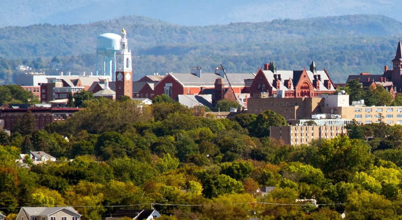
The university considers the on-campus living experience an integral and necessary part of the total education of its first and second-year students. In addition, the university recognizes that attractive housing options serve as recruitment tools for the university. First and second-year students are required to live on campus for four consecutive matriculated semesters with the goal that they will realize greater academic achievement, are better integrated into the cultural, social, and extracurricular life of the university, interact more with faculty and peers, and be happier with their overall college experience and have a greater chance of graduating.
The university encourages students in their third and fourth years to reside on campus by offering more independently oriented housing options such as apartment-style accommodation. To expand independent living options for students, faculty, and staff, the university has pursued cooperative relationships and agreements with private developers. For example, the university and a private developer agree that while the university maintains title to the property, a private developer builds and manages residential facilities under a long-term ground lease. Such is the case with the Redstone Commons, Redstone Lofts, and the Centennial Court Faculty/Staff Apartments.
The university is also committed to working with surrounding cities and neighborhoods to maintain and retain the residential character of these neighborhoods affected by students living off-campus. UVM and Burlington jointly work to develop creative approaches to improve quality of life in the neighborhoods such as providing off-campus living workshops, offering neighborhood grants for community building activities like gardening and block parties, and facilitating neighbor and student meetings utilizing restorative practices.
Other faculty and staff residential apartments are located throughout residence halls on campus.


Cultivate connections to sustainability and healthy living: Promote a sustainable future financially, socially, and environmentally.
Determine best use of former single-family residences.
Enhance and improve space on campus through optimization, innovation, flexibility, renewal, and adaptation.
Create vibrant outdoor spaces and connective mobility corridors. 5
Prioritize safety, diversity, and accessibility on campus: Plan and design buildings, circulation, and open spaces that are safe, resilient, and accessible to a dynamic academic environment.
Cultivate connections to sustainability and healthy living. Promote a sustainable future financially, socially, and environmentally. Design indoor and outdoor built, natural, and social environments that promote and facilitate physical activity, mental health, and total wellbeing. Prioritize the use of sustainable materials when possible.

The University of Vermont is committed to embrace a culture that advances the principles of sustainability and healthy lives in both education and campus development. This culture recognizes that the pursuit of ecological, social, and economic vitality must come with the understanding that the needs of the present be met without compromising the ability of future generations to meet their own needs. When applied to campus development, sustainability is about financial, social, and ecological vitality occurring simultaneously, both in the short and long term.
UVM also recognizes that the health and well-being of the campus community is an integral component of sustainability. Wellness is an integration of multiple dimensions of health, including physical, emotional, spiritual, social, intellectual, occupational, financial, and environmental. A holistic approach to campus planning, design, and development seeks to understand the relationships between these dimensions and the physical landscape and spaces both on campus and between the campus and the community. From a planning perspective,
environmental wellness can be a catalyst for the other dimensions of wellness since it inspires us to live a lifestyle that is respectful of our surroundings and promotes interaction with nature. Recognizing that we are responsible for the quality of air, water, and landscape that surrounds us forges a relationship between people and the environment that impacts our physical, social, and emotional well-being.
The concepts inherent in sustainability and healthy lives are intended to guide the overall vision and principles throughout this document and are subsequently integrated with the other four key ideas. In order to cultivate a sustainable environmental and social ethic into future transformations of the campus, four essential priorities were identified from the strategic working group sessions, including: using the campus as a living laboratory to generate and test sustainability solutions; providing an environment that is welcoming and promotes physical and mental health; enhancing environmental quality in indoor and outdoor spaces; and continuing efforts to reduce energy usage and maximize renewable energy capacity.
Use campus as a living laboratory to generate and test sustainability solutions.
• Generate awareness of campus sustainability issues.
• Facilitate collaborations and research on campus to test sustainability solutions that benefit UVM and surrounding communities.
• Improve awareness of and access from Main Campus to existing UVM farms, forests and natural areas.
• Provide diverse spaces and accommodations such as informal and formal learning spaces, solo and group study spaces, and gender-inclusive spaces.
• Provide places and opportunities for reflection such as walking paths that enable people to take regular breaks and replenish their energy.
Provide an environment that is welcoming and promotes physical and mental health.
• Provide opportunities for physical/visual engagement with nature by bringing the natural environment into the interior of buildings and creating purpose-built landscape areas that support wellness.
• Promote a sense of belonging. For example, incorporate social and dining spaces that naturally foster connections between students, faculty, and staff.
• Maximize the availability of athletic and recreational facilities to all students.
• Promote healthy nutrition by providing access to healthy and sustainable food for diverse preferences distributed across campus.
• Provide facilities such as protected bike parking and showers for active transportation users.
Enhance environmental quality in indoor and outdoor spaces.
• Work to enhance thermal comfort and air flow in indoor spaces.
• Maintain both indoor and outdoor spaces without harmful chemicals.
• Minimize noise pollution in both indoor and outdoor spaces.
• Utilize natural materials to create and enhance outdoor gathering spaces.
• Identify current renewable energy systems and perform site/rooftop evaluations for future systems.
• Define minimum energy requirements for new buildings.
Continue efforts to reduce energy usage and maximize renewable energy capacity.
• Reduce fossil fuel use in fleet vehicles and increase shared and alternative modes of transportation.
• Complete capacity to take advantage of net metering.
• Optimize energy performance of campus infrastructure through long-term planning, investments, and efficiency first designs.
• Develop communications in campus community to encourage reductions in energy usage.
• Prioritize energy efficiency solutions first as the lowest cost and cleanest energy solution.
Sustainability is an interdisciplinary topic with many key elements. Success as a sustainable institution requires initiatives, standards, and thoughtful consideration of many different aspects of life and the built environment. The graphic above is one way to envision all the intersecting pieces of sustainability. The three key areas of sustainability are: environmental, economic, and social. Environmental aspects include energy and emissions, water, food, sustainable buildings and infrastructure, sustainable
landscapes, and diverse mobility options, among others. The economic aspects are crucial to enabling sustainable initiatives. This includes innovation, partnerships, dividing up resources equitably, and being fiscally sustainable and resilient as an institution. And finally, the social aspects of sustainability are a key part to creating sustainable communities yet are often left out of sustainable goals and visions.
UVM has made sustainability a core value of the campus community for many years, allowing UVM to be a leader within sustainable higher education institutions. Some of
UVM’s many sustainability initiatives and achievements are listed below and included in the Sustainability Timeline.
100% of undergrads at UVM take classes in sustainability.
UVM committed to divestment from fossil fuels in 2020.
UVM has the #1 Green MBA in the US.
UVM has bikeshare bikes available to students, faculty, and staff for a discounted rental fee. 8 hub stations are located across campus.
UVM is currently conducting a building conditions assessment; annual renewal varies year to year.
UVM purchased 100% renewable energy from 2015-2020.
The Sustainability Learning Community offers an opportunity for 700 students to live in a sustainability focused residential community.
The Davis Student Center was the first LEED Goldcertified student union in the US.
UVM’s Salt Mitigation Task Force researched and implemented innovative strategies to reduce salt use on campus and related water quality issues in surrounding water bodies.
In 2013 UVM ended all sales of bottled water on campus.
Over 25% of food UVM purchases is local, humane, fair trade, and organic.
Rally Cat Cupboard provides accessible food pantry on campus.
Bioretention rain garden on campus controls runoff and is used as an educational tool for students.
UVM has been composting in all dining halls since 1997.
The Office of Sustainability partnered with the Division of DEI to highlight the intersection of equity and environmental issues in 2022.
1970 First Earth Day 1972 Environmental Program Established
1973 School of Natural Resources Founded 1974 Natural Areas Established Campus Responds to Global Oil Crisis

1980 Energy Planning Begins 1989 Recycling Program Launched 1990 Campus Bus Service Introduced
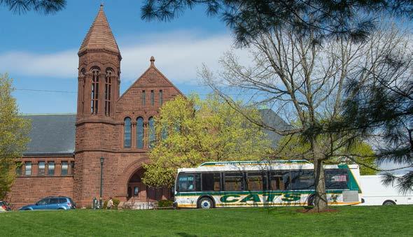
1996 Environmental Council Forms
1970 1975 1980 1985 1990 1995
1988 Student Club “VSTEP” Founded
1992 Energy Efficiency Revolving Fund Created 1995 Campus Sustainability Course Begins
1998 Ice Storm of the Century Damages 90% of Campus Trees
2004 Eco-Reps Program Created First Solar Panels Installed 2006 Green Building Policy Established
2008 Clean Energy Fund and Office of Sustainability Created

2002 Gund Institute for Ecological Economics Founded 2003 Stormwater Management Plan Created
2007 UVM Joins Carbon Commitment Central Chilled Water System Installed
2009 Sustainability Faculty Fellows Established 2010 Climate Plan Created Students Advance Bike Culture 2011 Reusable Takeout Program Begins 2012
2014 UVM Earns STARS Gold President’s Commission on Inclusive Excellence Launched 2015 Sustainability Course Requirement Established 100% Renewable Electricity Purchased 2016 First EV Charging Station Installed
2013 Sales of Bottled Water on Campus Ends Tree Campus USA Designation
Real Food Challenge Commitment Signed
GreenHouse Residential Learning Community Created
2018 Regional Bikeshare Launched 2019 Sustainability Ambassador Program Launched 2020 Food Pantry Opened Commitment to Fossil Fuel Divestment UVM campus bike co-op UVM

2021 Facilities Sustainability Plan Created 2022 Comprehensive Sustainability Plan Created
2000 2005 2010 2015 2020 2025
Central Plant Solar Size: 28.21 AC KW
Potential Annual Output: 28,500 kWh
Aiken Forestry Trackers Size: 64.6 AC KW
Potential Annual Output: 101,100 kWh
Aiken Forestry Fixed Size: 78 AC KW
Potential Annual Output: 128,600 kWh

Aiken Center Solar Tracker Size: 1.33 AC KW
Potential Annual Output: 2,300 kWh
Miller Farm Sandia Solar Phase I Size: 1.89 AC KW
Potential Annual Output: 2,500 kWh
Miller Farm Equine Solar Size: 30.55 AC KW
Potential Annual Output: 37,500 kWh
Miller Farm Sandia Solar Phase II Size: 11.97 AC KW
Potential Annual Output: 14,200 kWh
Miller Farm Milking Parlor Solar Size: 14.25 AC KW
Potential Annual Output: 17,500 kWh
650 Spear Street Solar Size: 150 AC KW
Potential Annual Output: 257,300 kWh
The University of Vermont is committed to using electricity, fuel, and water efficiently, with the overall goal of increasing energy efficiency, reducing fossil fuel energy use, and greenhouse gas emissions, and increasing flexibility for growth. As discussed in Chapter 4: Functional Planning Frameworks (Utilities and Infrastructure Framework), UVM operates its own efficient, on-campus Central District Energy Plant (Plant) that reliably supplies heating, cooling, and hot water to most buildings on campus. There are also several solar installations on UVM-owned land, including 48 fixed roof-mounted solar panels on the Plant with a potential annual output of 28,500 kWh, one solar tracker that supplies power to the George D. Aiken Center with a potential annual output of 2,300 kWh, 17 solar trackers and 306 fixed ground mounted panels at the Forestry Research Complex with a potential annual output of 229,700 kWh, 612 fixed ground-mounted solar panels at 650 Spear Street with a potential annual output of 257,300 kWh, 134 roof-mounted solar panels on the Equine Center at the Miller Research and Educational Center (MREC) with a potential annual output of 37,500 kWh, 50 roof-mounted panels at the MREC Milking Parlor with a potential annual output of 17,500 kWh, and the Phase I and Phase II test sites at the MREC that include 15 panels with a potential annual output of 2,500 kWh and 144 panels with a potential annual output of 14,200 kWh, respectively, that are part of a national research effort monitored by UVM in conjunction with Sandia National Laboratories and New Mexico State University that tests environmental wear and tear on solar panels in varying climates.
Funding for energy efficiency projects comes from several sources. Since 1992, a $125,000 energy revolving fund administered within Physical Plant has been used to finance many small projects conducted with assistance from local utility companies which provide rebates that are funneled back into the revolving fund. Projects have also been funded through bonds, borrowing, and by taking long-term life cycle costs into account during new building construction. In 2012, a larger $13M Energy Revolving Fund administered by the Controller’s Office was established that enables funding from UVM’s cash-on-hand reserves to be used for energy projects that have a payback of less than seven years. In 2007, students asked for a $10/semester fee to create the Clean Energy Fund to support cleaner energy sources and wiser use of energy. In 2020, the Clean Energy
Fund transitioned to the Sustainable Campus Fund (SCF) after students proposed broadening the goals of the fund. The SCF’s $200,000 annual budget has financed the 17 solar trackers at the Forestry Research Complex and solar panels on the Miller Research Complex. Overall, the SCF supports the students’ vision of enhancing a culture of sustainability, innovation, and research on campus.
UVM’s commitments to renewable energy have been successful. In 2010, UVM developed a Climate Action Plan committing to progress towards reducing greenhouse gas emissions and addressing the climate crisis by starting with energy efficiency upgrades. UVM purchased 100% renewable energy between 2015-2021. In addition to generating electricity from the on-campus solar arrays mentioned above, UVM has purchased certified renewable power from local farms and from Midwest wind projects. Since 2018, the Student Government Association calculated its clubs’ energy use from buildings and transportation and bought carbon offsets to cover all of the related greenhouse gas emissions. In addition, water use has dropped 33% per square foot since 2007. Since 2014, UVM has also achieved a gold rating in the Sustainability Tracking, Assessment, and Rating System (STARS).
In 2021, the departmental units that comprise Facilities Management (FM) at UVM engaged in weekly sessions that highlighted current practices and both short and long-term goals and strategies to advance sustainability at UVM. The sessions were organized around five focus areas, including landscape, transportation, buildings, energy, and waste. The data was compiled into a Facilities Sustainability Plan (FSP) that highlights ways that staff in FM departments can collaborate to increase the sustainability in campus operations and to advance toward a net-zero carbon campus. The FSP will be used in the development of a UVM Comprehensive Sustainability Plan that will further support carbon emissions reductions and associated timelines.
LEED Platinum
LEED Gold
LEED Silver
LEED Pending UVM Property Boundary

In 2011, UVM established the Environmental Design in New and Renovated Buildings policy that defines UVM’s commitment to a high level of environmental sustainability in all new buildings and in major renovations to existing buildings. The goal of the policy is to bring new and renovated buildings to the forefront of environmentally sustainable design, construction, and operation, thereby supporting positive impacts on natural resources and enhancing occupant health and productivity. More specifically, the policy recommends that UVM achieve a minimum rating of LEED™ Silver in the United States
Green Building Council’s Leadership in Energy and Environmental Design (LEED) green building rating system for all new buildings and major renovations. To date, UVM has completed 18 LEED certified projects impacting 30 buildings and two that are pending certification. As illustrated on the map, the projects include:
LEED Platinum:
• George D. Aiken Center
LEED Gold:
• 438 College Street
• Bertha M. Terrill Hall
• Dudley H. Davis Center
• James M. Jeffords Hall
• Slade Hall Renovation
• University Heights Student Residential Learning Complex
• The Courtyard at Given
• Recital Hall Renovation and Addition
LEED Silver:
• Alumni House at 61 Summit Street
• Central Campus Residence Hall
• Colchester Research Facility
• Harris/Millis Residential Hall
• Joseph E. Carrigan Wing
• Wing Davis Wilks Residential Complex
• Redstone Dining Hall
• Ifshin Hall
• Science Technology Engineering & Mathematics (STEM) Complex
Pending Certification:
• UVM Rescue Facility
• Larner College of Medicine – New Research Building
An area for opportunity within sustainable buildings and design would be to consider the goals of other sustainable building standards alongside LEED.
The Facilities Sustainability Plan identifies future goals to further increase energy efficiency and reduce reliance on carbon-intensive energy sources, including: documenting existing conditions; leveraging internal and external resources to invest in energy upgrades and renewables; developing a balanced energy plan to create efficiency and a bridge to renewables; implementing a long-range utility plan; exploring options for carbon-neutral electricity; expanding solar generation on campus; and improving the communication and integration of information. Please refer to the Facilities Sustainability Plan in the Appendix for more details on the strategies to implement these goals.
Many institutions are explicitly using their campus to identify sustainability challenges and develop research questions that contribute to sustainability solutions. Campuses are communities with very similar challenges as small cities. Energy use, water quality, and waste are examples of the sustainability issues that all campuses must grapple with. By connecting students to the challenges of pursuing sustainability on a college campus, it’s possible to create authentic learning opportunities that can be implemented on campus, but also scaled beyond campus, to other campuses or even municipalities. The Office of Sustainability at UVM is launching a Sustainable Solutions Lab to connect campus sustainability challenges to faculty and staff who can support the development of research projects to test various ideas on campus. If feasible, these ideas can be
implemented by campus staff. These are rich learning experiences that benefit students and faculty, but also the staff responsible for implementing good solutions. The Salt Mitigation Task Force is an example of a group that has exemplified this kind of creative, collaborative problemsolving and has become the model for the Sustainable Solutions Lab at UVM. Creating living labs and sustainable solutions on UVM’s campus was well-received by strategic working groups in the campus planning process as a high priority concept. Below is one way Cornell is approaching this model, with a sustainable landscape trail that provides natural stormwater drainage using native plants to provide a space for students to learn about stormwater and sustainable landscapes.
Renewable water solutions are another important piece of campus sustainability. The University of Colorado Boulder example provides a precedent for a way to reduce a school’s water use by eliminating the water footprint of the athletic fields. The Bioswale Garden at Cornell University is

an example of natural stormwater drainage that enhances the resiliency of the campus, while creating a beautiful landscape element. Any landscape improvements on campus will consider stormwater management strategies. See Chapter 4: Functional Planning Frameworks.

Many campuses throughout the US are working to provide and encourage sustainable modes of transportation, whether that be biking, walking, taking public transportation, or driving an electric car. UVM’s bikeshare program, the CATS bus system, and the campus pedestrian network supports sustainable commuting and mobility options for the campus community. Key Idea 4 (create vibrant outdoor spaces and connective mobility corridors),

Many universities have seen a growth in sustainable research. At Cornell, 33% of all faculty members are engaged in some form of research that centers on sustainability. The University of Michigan makes its research sustainable by reusing chemicals and lab equipment to reduce waste and toxins created in their labs. UVM currently requires all undergrads to take at least one class relating to sustainability and plans to continue to
Food use and waste is another area where many schools are looking to improve their sustainable practices. UVM has been working hard for many years now to create sustainable food systems on campus by composting all food on campus, and sourcing food locally as much as possible. As many UVM students live off campus and cook their own food, an area of improvement for the university would be to provide access to sustainable food for these students.
provides recommendations for an enhanced pedestrian and bike spine on campus, which would support improved sustainable mobility pathways across campus. Additionally, Chapter 4: Functional Planning Frameworks (Mobility Framework) outlines mobility and transportation priorities. One area for improvement would be to convert UVM’s fleet of buses to electric or hybrid only. This would greatly support sustainable transportation on campus.
expand educational and research opportunities related to sustainability. The most recent National Science Foundation (NSF) ranking of research universities places UVM among the top 100 public institutions in the nation. As number 85 among 415 public institutions, UVM boasts an impressive and far-reaching portfolio of advanced research including projects that touch on every element of our commitment to healthy societies and a healthy environment.
Hosting farmers market pop-ups on campus, having a farm store on campus, or providing easy mobility to sustainable food sources are all ways to support students in accessing sustainable and local food. Also, community gardens on or adjacent to campus could provide opportunities for students, faculty, and staff to increase access to nutritious fresh foods, improve food security, reduce food miles, and create a more sustainable system.

Wellness and sustainability frequently overlap. Many schools are prompting students to think about their own personal wellness in terms of sustainability. This includes environmental sustainability as well as physical and emotional sustainability. Providing an integrated health experience for students is also important and one way to achieve this is through a central location for the Center for Health and Wellbeing.

The global pandemic has highlighted the increased importance of wellness on campuses, in particular the
benefits of outdoor environments. Spending time outdoors has been a focus of UVM for many years, including the UVM Trek program, which provides outdoor opportunities for incoming students, as well as the UVM Outing Club. UVM could expand these and similar programs.
The examples below articulate ways that schools promote holistic sustainability for all students, whether it be through spending time outside, learning about personal wellness as it is linked to nature, or providing services such as health and counseling offices in a sustainable space.

Waterman-Redstone Loop
Green Mountain Pathway Redstone to Trinity
Centennial Woods Natural Area Main Loop
UVM Medical Center Loop
Athletic to South Burlington Recreation Path
Waterman to Centennial Woods
Central Campus Loop
Waterman Block Loop
UVM Property Boundary

Additionally, wellness walks can promote health and wellness by providing students, faculty, and staff a way to relieve stress as well as connect with nature and a deeper state of mindfulness. Incorporating regular activity into daily routines is imperative for the health and wellness of the campus community. Regular brisk walking can increase energy levels, help maintain a healthy weight, improve cardiovascular health, help manage stress, prevent, or manage chronic illness, improve balance, coordination, and muscle endurance, and improve mood, cognition, memory, and sleep. Walking to campus, from a bus stop, or parking in the peripheral lots around campus can also provide walking opportunities for students, faculty, and staff. The accompanying map highlights eight suggested routes within and around the UVM Main Campus that offer a variety of views, distances, and levels of difficulty.
Route 1: Waterman-Redstone Loop Length: 7,422ft (~1.4 miles)
Difficulty: Easy Start at the University Green fountain and cross South Prospect Street towards the Waterman Building. Walk towards Main Street and continue on South Prospect Street until you reach the exit drive from the Redstone Green. Turn left and walk on the diagonal path across the Redstone Green toward Southwick Hall and the Music Building. Turn left on the Green Mountain Pathway and walk back toward Main Street. Take the tunnel under Main Street and walk through the Davis Center. Exit the Davis Center and proceed across the Davis Center-Howe Library quadrangle toward University Place until you reach the starting point at the University Green fountain.
Route 2: Green Mountain Pathway Redstone to Trinity Length: 7,670ft (~1.45 miles one-way)
Difficulty: Moderate This linear north to south route will expose pedestrians to several campus districts, including Redstone, Athletic, Central, and Trinity. If entering from the south, start at Wing-Davis-Wilks and proceed north toward Southwick Hall and stay on the pathway behind the Interfaith Center. Take the diagonal path behind Adams Building and the Johnson House and cross Main Street at the crosswalk near the Living/Learning Complex. Take the diagonal path across the Davis Center oval and descend the stairs in front of Aiken or take the handicap accessible path around the building. Continue on the pathway through the Central Campus Residence Hall until you reach Colchester Avenue. Cross and walk along Colchester Avenue toward the Trinity District. Turn left on the path and go past Mann Hall toward the Trinity back-five dormitories.
Route 3: Centennial Woods Natural Area Main Loop Length: 4,617ft (~.87 miles)
Difficulty: Moderate Start at the Centennial Woods Natural Area trail head located on Catamount Drive. The trail is wooded, can be wet or muddy, and has several steep sections, so appropriate hiking footwear is recommended. The trail is also fairly secluded and could contain spotty cell phone coverage, so a walking partner is also recommended. Follow the small wooden arrow signs around the main loop. Note: there are several paths off the main loop that connect to different sides of the natural area. Be sure to keep your bearings relative to the main loop to prevent getting lost and/or disoriented.
Route 4: UVM Medical Center Loop Length: 3,234ft (~.61 miles)
Difficulty: Easy Start outside the UVM Medical Center Main Pavilion and take a right on the paved sidewalk. Continue down the concrete stairs past the emergency department entrance around the Converse loop. Turn right on the path and walk past the Miller Building on your right. Continue to follow the sidewalk past the Mary Fletcher building and follow the sidewalk around the medical complex until you reach the start point at the Main Pavilion.
Route 5: Athletic to South Burlington Recreation Path Length: 7,637ft (~1.4 miles one-way)
Difficulty: Easy Start at the northwest corner of the Patrick-Forbush-Gutterson Complex and connect to the Joggers Course that eventually loops around the Livak Track and Field Facility. Turn right and proceed along the paved South Burlington Recreation Path. You will travel by the Burlington Country Club and past the Bio-Research Complex. Turn around at the Forestry Research Complex and head back north toward the starting point.
Route 6: Waterman to Centennial Woods Length: 3,880ft (~.73 miles one-way Difficulty: Easy This is one of the primary west to east routes through the heart of the academic buildings on Main Campus. Start at the main entrance of Waterman and proceed past the fountain on the University Green. Walk towards Discovery Hall and bear to the right past the Central District Energy Plant. Follow the sidewalk past Hills, Stafford, and Jeffords and continue on the path to East Avenue. Cross East Avenue and continue to the entrance of Centennial Woods. (See Route 3 to continue onto the main loop in the Centennial Woods Natural Area).
Route 7: Central Campus Loop Length: 6,193ft (~1.2 miles) Difficulty: Easy Start in front of Ira Allen Chapel and head south down the path along the historic row of buildings toward Main Street. Turn left on the path along Main Street passing the Davis Center on the left. Turn left past the entrance to the Davis Center loop and walk along the path east of Jeffords Hall. Follow the path past Stafford and Hills and cross Carrigan Drive near Rowell Hall. Continue to the east of the Central Campus Residence Hall Complex and cut across the diagonal path towards Kalkin where you will be able to view the Tango sculpture to your left and the five female figures in long robes made from welded scrap steel (known as the Lamentations) to the right. Walk past Votey Hall and turn right on the path between the Billings Library and Torrey Hall. Head toward Colchester Avenue and turn left toward the starting point.
Route 8: Waterman Block Loop Length: 3,403ft (.64 miles)
Difficulty: Easy Start either at the main entrance of the University of Vermont Medical Center on 1 South Prospect Street or at the main entrance of the Waterman Building. Walk on the sidewalk along South Prospect Street until you reach the corner of College Street. Turn right onto College Street and walk towards the corner of South Williams Street. Take a right on South Williams Street and continue until you come to Pearl Street. Turn right on Pearl Street and turn right on South Prospect Street toward your starting point.
The university has acquired many smaller structures over its long history including former residential buildings and outbuildings. The influx of students after World War II necessitated construction of larger buildings and complexes for housing, academic, and administrative uses to support the growth of the institution, but the smaller structures continue to be utilized to serve the needs of the UVM community.


Resources for the maintenance and upgrades, ADA access, historic preservation, or other issues factor into the discussions about the future plans for smaller buildings. The pandemic has shown that changes to higher education are necessary including ways to meet the needs of the institution by carefully considering every decision strategically.

Confirm the university-owned structures to be assessed, including any associated outbuildings such as garages and carriage barns.
Identify assessment criteria for each structure.
• Review all available existing building lists and reports, campus and historic district maps, and listings.
• Compile and review all available information including historic, structural, deferred maintenance, ADA access, location, and utilization reports to identify criteria.
• Review comparable criteria used by other institutions including management systems such as AssetWorks.
Apply criteria identified to assess structures to a sample list of structures to test the recommendations for the future plans for buildings including renovation, adaptive reuse, divestment, or removal. When feasible, sell or lease the former single-family residences while maintaining control of the property.
• Discuss using a scoring system to be applied to the assessment criteria.
• Use renovations including Nicholson House, 109 South Prospect Street, and Wheeler House and Carriage Barn as benchmark projects to understand potential costs, and precedents in handling ADA, historic preservation, and other considerations.


• Review recent building assessments and studies for information about sample structures.
• Discuss key UVM offices and positions who should participate in applying and reviewing the assessment criteria in the future.
Phase 1 Phase 2 Phase 3
UVM Property Boundary

The former residential buildings, often historic houses, on the edges of campus have a unique set of needs when it comes to renovation or adaptive reuse. When renovating a historic house, some recommendations to consider include:
• Regulated historical status
• Building character
• Building location relative to continuity of campus character, image, and district definition
• Deferred maintenance backlog including envelope, structural, electrical, and mechanical systems
• Accessibility: both building entry and internal circulation
• Life safety including egress, fire alarms, and fire protection
• Alignment with program units or academic missions such as student or faculty residence, department, or administrative unit, or “centers” or other programs that can fully occupy a house effectively
• Potential for future residential use
The former residential structures shown in the map are divided into three phases, with Phase I being the highest priority to assess as outlined in Objectives 1-3.
Strategies for re-use of historic former homes can range from targeted renovations, to providing accessibility, to extensive renewals, creating a new identity for the building. In all cases life safety and accessibility should be prioritized. This example project proposes upgrades to a historic, former residential building:
The first floor is made accessible by providing a ramp that is integrated into the landscape, departs from the original entrance path, and arrives at the same point central to the floor plan ensuring a parallel entry experience. The first floor has a new accessible bathroom and kitchenette. These facilities support public use of the first-floor meeting rooms and offices. This level of the building would be available to all building occupants for public interaction in an accessible environment.
Minimal interventions are proposed for the second floor. Clutter is removed from the central hallway providing a clear understanding of the distribution of rooms on the floor. Smaller spaces are combined into medium sized offices.

Third floors of former residential buildings are often repurposed attic spaces without the detail and generous room size of the lower floors. As such, this third floor is conceived as an open flexible office space. Desks line the perimeter of the space and are supplemented with tables for small meetings and storage space. Office activities are supported by a new conference room, social lounge, and kitchenette.
optimization, innovation, flexibility, renewal, and adaptation. Reduce overall campus footprint where feasible and increase footprint for identified highpriority needs, including research and housing.
The 2006 Campus Master Plan identified that, “At the heart of this document is the Vision’s insistence that the university needs to maintain and improve the range and quality of its facilities if it is to remain competitive for top students and faculty.” Enhancing and improving indoor campus space is a vital component to ensuring competitiveness as well as efficient use of limited resources, which has been incorporated as one of the guiding principles in the Campus Plan. This plan highlights the need to make the best and optimum use of existing facilities before considering campus development and construction of new facilities. Campus space should support the university’s mission and priority needs. Space should be high-quality and well-maintained for optimal comfort and to effectively support programmatic needs and to help the university remain competitive. As identified in Key Idea 2 (determine best use of former single-family residences), spaces located in buildings that are currently inefficient and ineffective with regard to maintenance and operations and meeting programmatic needs, should be analyzed, and considered for renovation, adaptive reuse, divestment, or removal. Value should be placed on the historic structures and their contribution to the campus fabric, so analysis must include historic significance of the structures as well as regulatory requirements when considering alternative uses or enhancements to campus buildings. Enhancing and improving space on campus includes several specific objectives:
1. Reduce overall space footprint through optimization, renewal, and adaptation for existing buildings. Reorganize/redesign space for high priority purposes (research, interdisciplinary, study, collaboration, and housing).
2. Enhance and increase library, study, and collaboration space to meet needs.
3. Encourage the design of classroom spaces that promote active and peer-to-peer/small group learning.
4. Increase and upgrade research facilities to support expected growth.
5. Create housing for students to facilitate affordability, safety, and community.
Several themes emerged to accomplish the objectives focused on enhancing and improving space on campus.
• Readily Reconfigurable - develop flexible design standards to address fixtures, furniture, power, lighting, air quality, and technology for all space types to support flexibility for current and evolving space needs, both in the short and long term in order to maximize efficiency and utilization, while optimizing limited resources.
• Engage those utilizing the space to understand what works and does not work to identify best configurations, furniture, lighting, technology, etc.
• Promote community and collaboration when enhancing space to support programmatic needs and healthy lives, as well as to support the changing environment with the implementation of the new Telework Policy.
• Identification of best sites for priority space types including research, interdisciplinary, library, study, collaboration, and classroom spaces. There may, for example, be opportunities, with the academic reorganization to identify additional study spaces or research sites to support these high-priority needs.
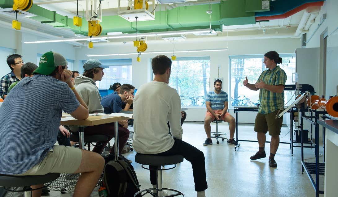

• Identify impact of people teleworking on office space needs.

o Facilitate necessary cultural transformation by creating flexible redesign to offer employees readily configurable spaces for the unique user.
Reduce overall space footprint for campus through space optimization, renewal, and adaptation for existing buildings. Reorganize/ redesign space for other priority purposes (research, interdisciplinary, study, collaboration, and housing).
• Identify impact of academic reorganization on office, collaborative, and interdisciplinary and other space needs.
• Identify deferred maintenance and building use to better understand which buildings may not meet university priorities and that could be vacated or converted for other uses.
o Vacate house-style office space: eliminate/convert to meet housing needs.
• Create a design standard for flexible scheduled and/or shared office spaces that include designs that encourage collaboration and community.
o “Readily reconfigurable” should be a standard for all space types.
o Engage faculty and staff to understand spaces that work/do not work.
o Identify sites for potential scheduled workspace facilities.
o Identify and improve space for staff lounges.
• Within the limitations of available resources, upgrade HVAC systems, especially in buildings with classroom, meeting room, and conference space.
• Evaluate interior gathering spaces to ensure they can adapt to be inviting and welcoming in both pandemic and post-pandemic scenarios.
Enhance and increase library/study/collaboration space to meet educational needs.
• Identify flexible design standards for library/study spaces (outlets, charging stations, optimal configurations, furniture etc.). “Readily reconfigurable” should be a standard for all space types.
o Furniture: a mix of furniture in spaces helps optimize utilization by offering variety and flexibility.
o Engage faculty and students to understand spaces that work/do not work.
• Identify sites for additional study spaces and collaboration spaces and incorporate soundproofing/noise dampening, when possible.
• Specifically address:
o Flexible seating (i.e., the ability to move furniture, chairs that swivel).
o Adequate space (i.e., surface areas for demonstrations, collecting or distributing materials, storage of personal items).
o Comfort (i.e., temperature, air quality, acoustics, lighting, ergonomic seating).
Encourage the design of classroom spaces that promote active and peer-to-peer/small-group learning.
o Access to technology/infrastructure for both faculty/students (i.e., projection equipment that enables engagement of both in-person and remote students, high-density wireless, electrical outlets, physical whiteboards, student response systems equipment, mics to amplify student voices in large classrooms).
• “Readily reconfigurable” should be a standard for all space types.
o Large lecture halls might be updated to include wider risers so two rows per riser with one row being swivel style for group discussion/exercises.
o Lecture halls without risers and with varying stool/table heights instead of fixed seating.
• Engage faculty and staff to understand spaces that work/do not work.
• Consider consolidation during summer months to a few classroom buildings to reduce energy use.
• Identify design standards for research space that includes flexible furniture, fixtures, and equipment to meet different types of research as well as evolving research needs over time.
o “Readily reconfigurable” should be a standard for research space.
Increase and upgrade research facilities to support expected growth.
• Acknowledge researcher’s career phases and fluctuating space utilization and adapt to optimize utilization.
o Adopt culture where space assignments are considered flexible and based on research activity needs and remove value judgment.
o Do not build space if there is underutilized space.
o Promote flexibility as a positive practice, allowing researchers to grow/shrink space as needed to support research endeavors.
o Engage researchers to understand what works/does not work.
• Identify campus sites for research space to optimize collaboration.
• Create “maker spaces” that promote community and collaboration.
Create housing for students to facilitate affordability, safety, and community.
• In coordination with analysis of current residential-style office buildings, consider utilization of vacated residential-style structures through third-party partnerships for housing where feasible.
• Create student housing, potentially with a third-party partner, on or near campus considering affordability, safety, and desire for community.
A campus plan is primarily focused on the exterior landscape, and normally does not include indoor space guidelines. However, one of the goals of this plan is to focus on efficiency and innovation in space utilization on campus, and therefore identifying opportunities to improve indoor space is warranted. Part of achieving space efficiency and innovation is to adopt a program and space guidelines to ensure the current approaches to renovation and new construction are standardized and aligned to create innovative, flexible, and well-utilized spaces. Examples of spaces that function well and that can be used as models for future renovation and new construction include the newly constructed Innovation and Discovery Halls


as well as renovations within Votey Hall, all of which are devoted to research and instruction in Science, Technology, Engineering, and Mathematics (STEM). Components of indoor space planning also include addressing specific regulatory laws and guidelines surrounding the historic preservation of buildings and landscapes on the UVM campus, which is considered during the early stages of a design for any project on campus. In addition, utility locations, conditions, and capacities are a critical component of project implementation and are evaluated during early planning stages once specific initiatives are identified. Current space guidelines are available through the Campus Space Manager.


Renovations are a tool for addressing space deficiencies and Sasaki assisted UVM’s planning team in identifying examples of renovation types in three categories, with each addressing challenges within the space(s). The categories are provided as examples of differing levels of intervention from minor to significant. These categories are meant to provide a framework for levels of capital investment and not be constraining or restrictive in terms of project definition and scope. An overall objective of renovations should be to solve as many problems as possible within one project. For example, if the mechanical system requires replacement also consider improving the classroom configuration or information technology. The indoor space renovation project categories are separated into minor renovations, major renovations, and improving office efficiency.
Minor renovations are defined as smaller spaces such as an individual classroom, a zone of a building, and nonstructural renovations. Simple upgrades can go a long way to improving the experience within spaces. Characteristics of a space that would be a good candidate for a minor renovation:
• Under-utilized classrooms
• Rooms with “good bones”: natural light, good sightlines, adequate mechanical systems
• Rooms with outdated furniture and technology
• Rooms with tired finishes
Major renovations include structural changes or full building renovations. Major renovations can address space that cannot offer a quality experience and which function poorly. Spaces that would be a good candidate for a major renovation might include:
• Spaces with end of useful life mechanical or electrical systems
• Spaces that require life-safety or accessibility upgrades
• Under-utilized classrooms and poorly proportioned classrooms that require upgrades to improve utilization and quality of the classroom experience
In the era of a global pandemic, much consideration is being given to how offices and workspaces function. Private offices often use a large percentage of the space on a college campus, which many schools are working to determine if that is the best use of their space. Renovations to office space include several strategies to improve utilization of this space type, including addressing specific needs of faculty and establishing office space models and guidelines. Offices for staff, administration, and faculty should incorporate a variety of shared and dedicated space including offices, workspaces, support spaces, and collaboration spaces. Office needs for staff, administration, and faculty that should be considered include:
• Provide a variety of shared and dedicated space: offices, workspaces, support spaces, and collaboration spaces.
• Accommodate different working styles.
• Provide for social interaction with colleagues and students.
• Coordinate scheduling for maximum accommodation and space utilization.
• Consider office space strategies unique to faculty.
• “Meet students where they are” strategy distributes faculty offices throughout academic buildings and creates huddle spaces near classrooms.
• “Third place” strategy establishes space away from faculty offices where professors can meet with students and also provides a home for adjuncts and retired professors.
• “Layered” strategy includes a diversity or layers of spaces, tailored to the needs of the work being done.
Prioritization of campus projects is key to creating a clear and successful campus plan. When determining the priority level of a specific project it is recommended to consider:
• Deferred maintenance of the building
• Pre-requisite projects required to allow the completion of the determined project
• Cost of the project
• Strategic priorities that the project addresses
• Donor interest in the specific project
• Critical space needs that the project addresses
• Impact on the overall campus experience
This example renovation proposes the repurposing of a 200 seat, poorly proportioned lecture hall into two flexible classrooms that can be connected by retracting a central partition. The classrooms are supported by in-room storage space and improved technology. Additionally, this proposes new spaces outside the classroom for student gathering, a quick study session, or a space to meet with cohorts ahead of, or after class. The central idea behind this design is to support active learning. By providing technology enhancements, flexible classrooms set ups, and additional spaces near the classrooms, this allows for professors to engage their students in diverse types of discussion and learning.

Below is an example of a flexible classroom (left top and bottom), that can be used as two smaller seminar style rooms or enlarged to a medium size lecture format by retracting the center folding wall. Study and social niches (right) can be located outside the classroom and support informal student gathering.


Support informal student gathering
A movable partition wall provides the opportunity for either 2 smaller or one larger 1390 sf classroom
Set up as an active learning style classroom Room A
Set up as a lecture or seminar style classroom

This project proposes a significant renovation of an aging campus resource. In this comprehensive rethinking, rooms are right-sized for a variety of functions including large, medium, and small classrooms, office and meeting rooms, as well as areas for social gathering. Spatial clarity is enhanced by creating a generous central hallway off of which the range of room sizes are arrayed with the four largest rooms providing spatial and organizational anchors at the corners of the building. Smaller spaces are directly off of the hall providing a gradient of interaction from social to more private. A large auditorium is repurposed as flexible space for presentations, workshops, fairs, or exhibits supporting the academic programs housed in the building, as well as broader campus community events. With an extensive renovation such as this, mechanical, electrical, and information technology would be upgraded and integrated throughout the building. This major renovation works to update an older building, while also optimizing the spaces for their current and future uses.
Classrooms (bottom left) should have natural light, integrated technology, and flexible furniture all to support a range of teaching styles. Small spaces (bottom right) along the central circulation hall provide opportunities for spontaneous collaboration, socialization, or private focused work.

The lobby and lounge spaces provide diverse types of casual gathering and working spaces
Small offices provide private work spaces for faculty and staff
Flexible classrooms that fit 12-15 students
Large flexible use space

Diverse classroom sizes accommodate various types teaching and learning styles

This example project proposes rethinking office space to provide a range of space types that align with a range of work styles and occupancy scenarios. Spaces are provided to support group work, private focused work, technology enabled conferencing, meetings, quick huddles, and casual socialization. Open spaces are interspersed with offices and conference rooms to ensure visual connections to co-workers, daylight, and views. Storage spaces and a kitchenette provide support functions and a separation from the common corridor. This office design aims to provide more flexibility in the type of workspaces it provides than

a traditional office, while also making more efficient use of space, so as to free up existing office space for other uses.
Offices can be assembled from a kit of parts that support the range of programmatic needs from department identification and enclosed offices to mailboxes and resource libraries. These components can be assembled to reflect a range of spaces including areas for private work, collaboration, or relaxed work.
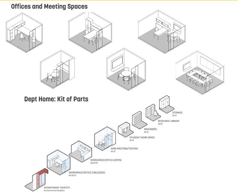


One large meeting room is provided for big groups
Small independent and group workspaces
Diverse meeting room sizes are provided throughout the office
Small offices provide private work spaces
The lobby and lounge spaces provide diverse types of casual gathering and working spaces
Additionally, office spaces can be more flexible and adaptable for hybrid working with the addition of office/ meeting pods, touchdown spaces, and lounge meeting areas. The office pods can include systems for ventilation and acoustic privacy and the lights, air, and louvers are triggered in the pod when entering. These configurations can be used in office spaces, library/study areas, and faculty/student “third place” spaces. As workspaces

become more open and configurable, offering selfcontained private spaces can be beneficial to make the work environment conducive to a variety of work styles and comfort optimization. Also, incorporating soundproofing/ noise dampening in workspaces is important.


The global pandemic has permanently influenced how students utilize space on campus. There are many places on campus in between destinations that can be purposed more efficiently. These spaces include hallways, stairwells, atriums, informal areas, lounges, UVM dining halls, and other circulation spaces. These spaces can allow for passive and/or active learning or gathering. Many students like to be in areas where they can visually see activity as well as experience light-filled spaces, which can be beneficial for mental health and well-being. It is also important to consider the location of these spaces to allow for a variety of uses including quiet places to study/work. Incorporating


different types of seating and flexible furniture is crucial to improve these areas throughout UVM’s buildings. This idea supports Objective #2 which is to enhance and increase study/collaboration space with a mix of furniture in spaces to help optimize utilization by offering variety and flexibility. Some examples of these furniture configurations include tables and stools in stairwell landings, banks of benches at alcoves between columns, and booth seating or lounge chairs with laptop tables in wide corridors. In some cases, these spaces can be shrunk or expanded for different purposes including special events, social spaces, or supporting circulation as needed. Images of these

Classroom spaces also need improvements to be more flexible, collaborative, and innovative. Many institutions are moving towards more active learning classrooms since there seems to be a bigger emphasis around project-based learning. These active learning classrooms are typically for 40-50 students, and are technology rich, student-centered, and allow for adaptations for a variety of pedagogies to be utilized. However, some of these strategies can still be incorporated into smaller seminar rooms and large lecture style classes. This concept is consistent with Objective #3 which says to encourage the design of classroom spaces that promote active and peer-to-peer/small group learning. Furniture configurations to create these types of classrooms
may include mobile tables and chairs with castors, multiple screens/whiteboards around the room, rolling whiteboards, mobile power stations, taller tables around the back of a room for a tiered approach, and multiple cameras for improving collaboration with remote participants. Images of these examples are shown below. Many classrooms on campus are general-purpose (GP) classrooms and the purpose of these is to accommodate any class that does not need special equipment. These can be reconfigured for a more collaborative approach, but the addition of technology would turn GP classrooms into specialized rooms.


Space prototypes can be used as references when planning renovations or new construction. It is important to coordinate room size and seat count with the academic schedule, current space utilization, and anticipated changes in enrollment or academic programs.

Recognizing that outdoor spaces help define the character and identity of the campus and also impact the daily lives of the entire UVM community, Sasaki assisted UVM’s planning team in identifying key opportunities for enhancing the campus landscape.


Initial feedback from the campus community was essential in helping develop a foundation of knowledge regarding the quality and purpose of existing outdoor spaces on the UVM campus. Participants identified favorite outdoor spaces on campus, those that were well-suited for the intended use or purpose, and those that could be opportunities for improvement.
Among the themes that emerged from this exercise, the observation was made that apart from certain recently renovated outdoor spaces such as the Andrew Harris Commons, there was a certain level of passive uniformity to the campus landscape that would benefit from more purposeful design and programming. Universal accessibility was also highlighted as an area that could use improvement particularly given the topography of the campus, which can be challenging to traverse in certain areas.
Density of buildings throughout the campus in relation to the scale and distribution of outdoor spaces was also a topic of discussion. The core of campus has had several successful building infill projects in recent years and is seen to have a favorable balance between buildings and open spaces. Other parts of campus, such as many areas south of Main Street, are likely not at full capacity yet in terms of building density.
To successfully and safely move through and around campus, enhancing pedestrian and bicycle infrastructure is important as well as reducing single occupancy in vehicles. While visitors and users are on campus, it is vital to focus on creating vibrant, adaptable, and accessible multi-use spaces and sustainable landscapes for outdoor learning, gathering, and respite.

• Where possible, separate motorized vehicles, pedestrians, and bicyclists.
• Support upgrading crossings that connect to Main Campus.
• Improve pedestrian connections to follow desire lines.
Create a pedestrian-centric campus through humanscale design strategies that provide connectivity, safety, and accessibility.
• Improve accessibility of all crosswalks, curb ramps, and sidewalks (min 8’); install pedestrian level lighting and signal actuators at key intersections; ensure adequate lighting along pedestrian pathways; and improve wayfinding with accessible signage showing routes, destinations, and access/egress.
• Evaluate where to best locate parking lots or structures, preferably on the campus periphery.
• Provide a contiguous network of pathways that link to community and regional trail systems.
• Develop branded wellness walks across campus.
• Prioritize the needs of people with mobility limitations.
• Create a continuous and convenient network of bike lanes and paths.
Increase bike ridership by improving bicycle infrastructure to increase safety and access to and across campus.
• Provide covered bike parking at convenient locations within close proximity to building entrances; blend well with nearby buildings and landscaping; and install protected bike parking pods near residential, academic, and administrative buildings.
• Encourage the inclusion of indoor and outdoor bike parking and storage, showers, and lockers in newly constructed buildings.
• Expand access to bikes through enhanced shared and ownership bike programs.
• Add a biking in Burlington orientation to inform users of bike and e-bike rules, norms, and etiquette.
• Align UVM shuttle system to complement Green Mountain Transit (GMT) service and optimize efficiency and usability on campus; encourage GMT to expand their service hours to accommodate UVM’s off campus population.
Reduce single occupancy in vehicles and increase use of alternatives and shared modes.
• Provide priority parking spots for carpoolers.
• Partner with surrounding municipalities to improve bicycle mobility infrastructure leading to campus and on campus.
• Expand car-sharing opportunities on campus.
• Increase park and ride and connected commuter hub opportunities.
• Maximize the use of alternative fuels for fleet vehicles.
• Increase the number of electric charging stations on campus.
• Where feasible, design spaces to adapt to variable weather conditions.
Create flexible, multi-use outdoor gathering and learning spaces that are welcoming, adaptable, equitable, and accessible.
• Update existing sculpture map and identify new opportunities.
• Incorporate sheltered outdoor classrooms and amphitheaters that are accessible and include technology aids (closed circuit audio/visual) to enhance outdoor learning.
• Add additional outdoor seating along pathways and areas that are accessible to allow for gathering and respite.
• Program outdoor spaces that can be scheduled or reserved.
Foster ecological landscape design strategies.
• Optimize stormwater management by reducing impervious surfaces and incorporating onsite treatment, green infrastructure, and low impact development (LID) practices into design standards, where possible.
• Map existing green infrastructure systems and prioritize locations for new systems.
• Update land banks mapping to ensure open space is prioritized/preserved.
• Incorporate research findings and best practices taught in the classroom into projects on campus.
The outdoor space projects on the following pages are separated into three varied landscapes to provide guidance for other landscape spaces to be updated in the future. The three examples of spaces include:
• Connector Landscape - The Green Mountain Pathway is an example of a connector landscape. This path runs all throughout campus but could have a cohesive look that strings the landscape together and provides accessible connections all across UVM.
• Primary Landscape - The University Green is an example of a primary landscape, meaning a key or iconic campus landscape, which is often open to the surrounding community. This landscape is activated through a light touch approach so as to add gathering spaces, but not alter the existing historic landscape.
• Secondary Landscape - The Heart of Trinity is an example of a secondary landscape, meaning a landscape that is more secluded, intimate, and often tailored more to the on-campus community. Landscape improvements illustrated here are simply examples and if additional housing is built here, similar improvements could be located elsewhere in the district.
Prioritization of campus projects is key to creating a clear and successful campus plan. When determining the priority level of a specific project it is recommended to consider:
• Deferred maintenance of the space
• Pre-requisite projects required to allow the completion of the determined project
• Cost of the project
• Strategic priorities that the project addresses
• Donor interest in the specific project
• Critical campus needs that the project addresses
• Impact on the overall campus experience
• Integration with multiple campus projects
• Environmental benefits of the project
The Green Mountain Pathway (GMP) is a proposed north-south mobility corridor that unifies the Redstone Walkway and Green Mountain Walkway into one spine that is intended to improve connectivity and accessibility which will contribute to the cohesiveness of the outdoor experience. Its design expression should promote continuity while amplifying the unique characteristics of each area of campus through which it passes. Because the route of the GMP spans the full elevation change within the campus, it can be seen as a microcosm of the larger Vermont landscape, which is characterized by its dramatic topography.

Primary mobility corridors with their own unique character and sense of place are found on other campuses. In many cases, they arise as a result of the removal of vehicles from certain areas of campus.

In addition to informing the character of the landscape along the GMP itself, the identity of key nodes and open spaces along the route are inspired by the ecological community framework.
Benches and lighting to complement the grove of trees and sculpture
Alpine Community Community amenities and gathering space to provide places of connection for the Redstone campus community
Welcoming landing base for Trinity District with hardscape, seating, signage, and lighting dependent on development/ redevelopment building configurations
Intersections provide large pedestrian crossing areas. Intersections are used as gateways to connect to neighboring communities
A calming space that provides the nearby residence halls with a connection to nature and to the pathway
Consistent paving and lighting the length of the path. Wayfinding signage provided all along path. Smaller signs provide information on the plants, trees, and views
Connector Landscape: Green Mountain Pathway

To complement the variety introduced by the ecological framework, several aspects of the GMP should remain relatively consistent across its length. Pavement material, lighting, and signage are among the elements that provide continuity. A robust stormwater management strategy that is expressed through bioswales or other best practices is also recommended, including signage as an educational
tool for the university and local community. The GMP should promote all forms of non-motorized mobility and have signage and policies that promote safety and a sense of shared experience. While the best configuration for the various use zones of the pathway should be determined through additional study, it is recommended to include an area where higher-speed modes such as bikes and electric
UVM branded signage will line path to provide clear wayfinding around campus
Stone and wood benches will line the path and create accessible seating nooks
The path will include a shared pathway for bikes and pedestrians, as well as a space that is pedestrian only
scooters are provided an alternative route so that high congestion areas are prioritized for slow speed modes such as pedestrians and those needing assistance.
The UVM campus already consists of a palette of elements including pavement types, planting, and signage that could be drawn from for the GMP. Other elements, such as lighting and site furnishings might depart from the existing palette and contribute instead to the uniqueness of this linear landscape gesture.
A bioswale will line the path to aid in natural stormwater drainage

Lights will line the path to improve visibility and safety. Banners may be affixed to the light poles
The University Green is an iconic, historically significant landscape and the symbolic heart of the UVM campus. Any modifications to this landscape must adhere to all applicable standards for historic landscapes and ensure the continued integrity of the space. While a certain degree of uniformity exists within the current landscape of the University Green, the way that different areas are used, and certain physical characteristics are also present, inform the recommendations. The proposed University Green landscape is intended to reinforce the intrinsic hierarchy that already exists, while adding space for people to
congregate in small groups. The plan also aims to strengthen and reinforce the main access points and pathways. A comprehensive tree condition assessment is recommended to inform any potential tree removal or planting.
Other historically significant campus landscapes have seen similar modifications without compromising integrity.


The north end of the University Green has the potential to promote enhanced daily use by integrating seating and gathering space at an important circulation crossroads. The health of the tree canopy and resilience and appropriateness of the species distribution should be
carefully assessed, and removal of certain trees considered. Wherever existing trees are removed, new plantings should favor native and adapted species planted along pathways where they can provide beneficial shade and be pollinator friendly.

The central zone is the most formal in character and hosts large events including commencement. Open views are important to maintain while path hierarchy is reinforced.
Main cross sectional path across the green is widened to create a promenade, with a patio area surrounding the fountain at the center
Additional seating is added where possible without impeding the flexible use of the space for events.
Adirondack chairs on the grass provide a spot to relax and enjoy the view of the lake Pedestrian

University Place Plan provides an enhanced pedestrian crossway zone

Benches sit along the eastern side of the fountain walkway
The area used for graduation is maintained as a flexible event zone
The southern end of the green is the most garden-like in character and this quality is reinforced with additional plantings. Where drainage patterns make turf grass difficult to maintain, other types of ground cover such as native meadow or prairie plantings could be considered. Successful practices for establishing meadows include proper soil preparation, species selection, and starting with a limited palette for ease of identifying undesirable

volunteer species. Additional diversity can always be added over time once the dominant native grass species are established. “No-mow” or “low-mow” turf grass is another option for transitional areas, and while not providing the same level of habitat value there is at least a reduction in energy use associated with maintenance. Additional trees and benches are also suggested along main pathways.
Planting and landscape strategies used to create a natural stormwater management zone or a constructed wetland along the pathways
Native trees planted along the pathways
Food Truck Pull-Off University Place Plan provides a special loop road for food trucks to park
Native plants line the paths and create a calming natural space
Benches along the walkways provide resting or gathering places nestled within the plants and trees
By building upon the inherent qualities and variety within the University Green landscape, complementary landscape types that promote greater social use and ecological health can be established.

The Trinity District would benefit greatly from improvements that foster a greater sense of community. A community gathering space is proposed consisting of an informal amphitheater along the slope, patio space for outdoor gatherings, a four-season recreation field, connecting pathways, and other amenities.

The character of the amphitheater could draw from the nearby forest, creating an identity that is both site specific and distinctive. Examples of amphitheaters that share some of these characteristics exist at Swarthmore and Case Western (Nord Family Greenway). Free-standing hammocks, festive lighting, and infrastructure for winter activities could all help encourage the use of the space for outdoor activities and create a sense of community.
The amphitheater provides a natural gathering or event space for the community. Trees trickle down from the existing forest into the amphitheater
A flexible recreation field allows students to play sports in the warmer months, and can be converted to an ice rink in the winter
The patio space provides tables and chairs for an outdoor work or gathering space. String lights allow for the space to be used after dark
Hammock stands around the base of the trees allow students to bring their own hammocks to use in the space
* Landscape improvements illustrated here are simply examples of what could be done if building configurations remained as they are. If additional housing is built here, similar improvements could be located elsewhere in the district.

An accessible pathway connects the dorms to the landscape and to the surrounding paths
5: Prioritize safety, diversity, and accessibility on campus. Plan and design buildings, circulation, and open spaces that are safe, resilient, and accessible for a dynamic academic environment; encourage and celebrate the campus community’s cultural diversity.
UVM’s priorities are to enhance how welcoming the campus feels and how easy the campus is to navigate for people of all identities and abilities. The goal is to design the physical environment so that it can affirm and celebrate the university’s full diversity of cultures and abilities.

Applying Universal Design in Higher Education standards when enacting strategies can help to achieve the principles, objectives, and strategies of the Campus Plan.

The objectives for this key idea include continuing efforts to make public and active transportation easy to navigate and accessible and safe. Together with being able to get to all corners of campus, it is important to be able to provide a safe and accessible indoor environment to accommodate the diverse needs of all, including the establishment of spaces and places that have not traditionally been provided for on campus. These spaces include places for prayer, ablution, spaces for student identity groups, and welcoming spaces for custodial staff to take breaks and be able to network with others on campus.
Incorporating memorials and references to the institution’s history and social justice efforts as well as incorporating artistic and spiritual material from UVM’s broadest cultural representation can help build a sense of belonging. It is a goal to inspire reflection, restoration, and recreation.

• Transportation systems (including buses, bike shares, electric scooters, etc.) should be designed to help address the diverse needs of visitors to campus.
Continue efforts to make transportation on and around campus safe and accessible.
• Keep paths and bike racks free of snow and ice.
• Continue to work with student groups on strategies for safe late-night transport.

• Continue to provide reliable bus service with an accurate tracking app.
• Promote the use of the LiveSafe app’s many relevant features.
• Apply flexible parking designations/delineations, such as mapping accessible parking and flexibility in accessible parking.
Use public landscapes and features to celebrate cultural diversity.
• Celebrate our diverse communities through the creation or dedication of visible features in the landscape: sculpture, plaques, and specific landscape features that can be appreciated by all.
• Encourage interactive landscapes and features that are accessible to the entire UVM community.

• Where possible, create flexible indoor spaces with easily adjustable furnishings, lighting, and temperature; incorporate furniture that functions well for differing body types, sizes, and abilities.
Create accessible and inclusive indoor environments that people can utilize easily, safely, and with dignity.
• Provide inclusive restrooms in all buildings: academic, administrative, and residential.
• Review, prioritize, and complete all standing items from the 2017 Accessibility Report & Gender Inclusive Restroom Taskforce (GIRT). Increase spaces for informal gatherings, meditative corners, prayer, and ablution stations.
• Consider retrofitting spaces to improve accessibility and inclusivity.
Diversity, Equity, and Inclusion (DEI) is a broad, complex, and multifaceted topic with the goal of enabling individuals to bring their whole selves to campus. Some elements of
Gender inclusive and single occupancy restrooms will be included in any new building that is constructed or any major renovation on campus.

UVM’s Indigenous Peoples Working Group was formed in 2021.
existing practices related to DEI at UVM are highlighted below.
UVM’s general education requirements include a diversity class requirement.
In 2021 UVM hired a Vice Provost for Diversity, Equity, and Inclusion to lead strategic initiatives relating to DEI.
UVM’s Career Center provides identity based resources for minority students.
4 identity centers on campus provide community for minority students.
The following themes should be considered when evaluating DEI practices on campus.
In an effort to better support diverse identity groups, many institutions have started to introduce identity group spaces on campus. These spaces may take the form of a consolidated and intersectional multicultural centers, or individual identity group spaces. Consolidated, intersectional spaces provide a shared space for multiple

identity groups to gather, hold events and meetings, and create a welcoming, empowering, and safe space to develop, embrace and celebrate diverse identities. The Trotter Multicultural Center at the University of Michigan is an example of a consolidated multicultural space that supports multiple identity groups.
In contrast to the consolidated multicultural center, other institutions are creating dedicated physical facilities to support individual identity groups. The University of Washington’s Intellectual House is a community group space that supports students, faculty, and staff that identify with the American Indian and Alaska Native communities. As recognition and acceptance grows, there is a trend toward placement of identity centers in more central locations thereby increasing visibility. At the same time,


university students come from many different backgrounds and may want and need discretion and privacy when they first explore their still-forming identities. Also, consideration for security and safety needs may be elevated for the various identity centers. UVM will continue to work with identity centers to come up with the best solutions for their physical spaces and focus on helping to highlight and connect identity centers.
University of Washington Intellectual House is a longhouse style facility. It provides a multi-service learning and gathering space for American Indian and Alaska Native students, faculty, and staff, as well as others from various cultures and communities to come together in a welcoming environment to share knowledge.
The graphic below outlines existing accessibility successes at UVM.

Student Accessibility Services works with 1500-2000 students each semester, or 15% of UVM students.
The on campus bus service (CATS shuttle) has a fully ADA accessible bus fleet.
Living Well Space in the Davis Center provides wellness classes, workshops, service clinics, and educational sessions.
Tutoring center is free and accessible for all undergrads.
The icons below outline the principles of universal design. Universal design is a set of guidelines for accessibility that go a step further than what the Americans with Disabilities

Accessible connections throughout campus both indoors and outdoors.
Act (ADA) requires. Ensuring that the campus environment is physically accessible to all is key to having a welcoming and inclusive campus community.
The photos below provide examples for integrating accessible paths within landscapes. An integrated landscape is defined as a combination of accessible
pathways, campus connections, and green spaces to create a thoughtfully woven and inclusive campus structure.

An example of integrating paths within a landscape at UVM leading up to Aiken; this type of design can be incorporated in other areas on campus.

Having clear signage and wayfinding throughout campus makes the space easy to navigate, accessible for all, and aids in helping everyone to feel welcome on the campus. The examples of wayfinding shown below include a digital sign that can be changed to include updated information,
upcoming events or announcements, and two examples of 3D campus maps. These 3D maps allow people to familiarize themselves with the campus before exploring the campus.


The Functional Planning Frameworks organize the details and strategies of the plan within four specific frameworks. The Building and Land Use Framework provides recommendations related to the future uses of buildings and the land in and around campus. The Open Space and Landscape Framework provides existing conditions and future recommendations related to green
spaces and landscape enhancements on campus. The Mobility Framework provides existing conditions and future recommendations related to all forms of mobility and parking on campus. And finally, the Utilities and Infrastructure framework provides recommendations related to energy, infrastructure, and stormwater management.
When considering buildings for restoration, renovation, additions, or potential removal, a historical review analysis will be conducted for any facility that is historic or over fifty years old to determine appropriate next steps and to comply with the Secretary of Interior Standards and be coordinated with the Vermont Division for Historic Preservation (VDHP). Many existing structures represent the rich, historic image of the campus and will continue to be preserved and protected in perpetuity. Other historically important buildings should be maintained for as long as they can serve the university in a useful and efficient manner. The maturing of all physical components of our facilities combined with requirements for cyclical renewal is inevitable. The true risk to the campus is not directing proper long-term fund support to sustain the total cost of ownership of our facilities.
An internal working committee within Facilities Management is in continuous review of a Master Project list. The Facility Assessment approach of identifying, assessing, prioritizing, and maintaining the specific maintenance, repair, renewal, and replacement requirements for all facility assets is utilized. The goal is to provide valid and credible documentation, reporting mechanisms, and budgetary information in a detailed database of facility issues. It will serve as the 5-10-year capital renewal forecast that will mitigate and manage the risk of the capital renewal backlog.
A number of the buildings on campus are recommended for renovation due to significant deferred maintenance issues. The impact of teleworking needs to be considered when reviewing building and space utilization. Many of UVM’s buildings are historic, and therefore require major upgrades to meet today’s code requirements. Assessments of buildings that will remain in the inventory should be evaluated for the following items:
• ADA requirements
• Energy usage and carbon footprint
• Structural integrity
• Mechanical infrastructure
• Electrical infrastructure
• Flexible floor plan layouts
• Historic preservation needs
Additions to existing buildings need to be considered with the same level of planning as a new building including factors such as:
• How will an addition affect existing campus landscapes?
• Can the host building support an addition?
• If the existing building is a historic structure, can the addition be constructed to limit the loss of the original building’s architectural character?
• How will an addition impact existing building spaces, including circulation, structure, and utility systems?
• Are the proposed programmatic spaces appropriate for an addition, or are they better suited to another location?
• Will an ADA-accessible addition be capable of supporting two adjacent historic structures?
Additional guidance on architectural guidelines for additions can be found in Chapter 5: Campus Districts.
After evaluation of existing buildings, it may be determined that they can no longer be maintained affordably or efficiently updated and that the total cost of ownership is best served by demolishing, divesting, or moving the structure and possibly replacing the building. The following items should be assessed:
• Historic relevance of the building
• How it defines UVM’s brand
• Significant architectural style
• Prominent location, such as on the University Green
• Total cost of renovation vs. new construction
• Effective use of space
• Code violations and necessary upgrades
• Building location and impact on campus mobility
The university recently removed the Pomeroy Barn located at the southeast corner of Main Street and South Prospect Street and adjacent to the Allen House parking lot and the house located at 172 South Prospect Street. Removal of these two buildings offers an opportunity for landscape improvements and enhanced circulation in that area.
Additional buildings are also being considered to be assessed for potential removal. Coolidge Hall located within the Redstone District is outdated and removal would offer opportunities for redevelopment in this residential area, including creation of a quad encompassed by a new residential structure on the north side and existing structures on the south, east, and west sides of the quad. The “Back Five” residence halls that include Sichel, Ready,
McCann, Richardson, and Hunt Hall as well as the Villa, an administrative building, and Boiler House, all located within the Trinity District, are proposed to be assessed for removal to offer the opportunity for redevelopment and enhancements to this academic/residential district. Also, the Quonset Hut behind Dewey Hall may be considered for potential removal.
Plans should be developed for the Wheelock Barn, located at the southwest corner of Swift and Spear Street. As this is a historic structure, options should include assessing the potential for continued maintenance and/or adaptive reuse. Sale or lease options should also be considered before planning demolition. Such planning should be done with the involvement of the campus community, the Vermont Division for Historic Preservation, and municipal planning officials.

Potential Land Opportunities Potential Adaptive Reuse
Potential Redevelopment
UVM Property Boundary
The purpose of the Future Development Opportunity Areas
Plan is to identify potential additions and removals from the university’s landholdings that will support the university’s primary educational mission.
Potential acquisitions that neighbor the Main Campus take priority. Properties with buildings that would be easily upgraded to institutional uses and safety codes are also a priority. Property that could be combined with neighboring landholdings and redeveloped, either by the university or by a private developer should also be considered appropriate acquisitions. Within these parameters, the university is committed to working with neighborhoods to preserve the residential nature of their community.
The following properties are recommended for consideration of acquisition should they become available. Prior to any acquisition, the university should conduct a full assessment.
• 415 Pearl Street (apartment house)
• 28 South Williams Street (professional office building and residential building)
• 420 College Street (fraternity house)
• 50 Mansfield Avenue (Mater Christi School)
• UVM Medical Center Parking lot east of the Given Building
• 150 Colchester Avenue (Ira Allen School owned by Burlington School District)
• 243 Colchester Avenue (connection between Colchester Avenue and Centennial District)
• 525 Main Street (open space east of Pomeroy Hall, owned by city of Burlington)
• DoubleTree Hotel on Williston Road (the university has first rights of refusal)
• Staples Plaza on Williston Road
• Burlington Country Club properties
• Burlington Tennis Club on East Terrace
Highly recommended acquisitions include: 415 Pearl Street, 28 South Williams Street, and 420 College Street. Acquisition of these properties would allow UVM to control the block bounded by South Prospect Street, Pearl Street, South Williams Street, and College Street. This block has one of the larger areas for potential development in the Central District and UVM ownership of the block could assist with ensuring new development can be accomplished within the city’s lot coverage allowance. Ira Allen School is
also a highly recommended acquisition due to the location in the Trinity District, connected to the UVM-owned portion of the building, and the large footprint, including the parking lot to the south of the building that could be utilized as a land bank or to meet parking needs.
UVM-owned buildings recommended for adaptive reuse include the buildings located on the periphery of campus along South Williams Street and the buildings in the “Dewey Block” including the Dewey Building, 12 Colchester Avenue, 16 Colchester Avenue, the Dewey Garage, the Quonset Hut, the Outing Club, and 23 Mansfield Avenue. These buildings can be assessed for both leases to and improvements by third-party developers or for removal as part of larger development projects. Many of the buildings recommended for adaptive reuse are considered historic and the importance of these buildings should be thoroughly assessed by a qualified architectural historian at the outset of any planning. The buildings on the Dewey Block were assessed by VHB in 2021.
UVM-owned buildings recommended for redevelopment include the “Back Five” dormitories, the Villa, the Boiler House, and the Cottages in the Trinity District. These buildings have significant deferred maintenance issues and could be considered for removal/redevelopment as part of any new capital project planning for Trinity District, including potential new housing. Some of these buildings are considered historic and the importance of these buildings should be thoroughly assessed by a qualified architectural historian at the outset of any planning. The Villa was assessed by Liz Prichett Associates in 2006. That assessment should be updated.
This is not a static plan and therefore the list of potential acquisitions or dispositions may change. Should conditions or forecasts change, there may be additional properties that the university would consider for acquisition and/ or disposition of beyond this list of properties. Unique circumstances, like the availability of the Trinity College campus in 2001, may arise in the future and will require a separate campus planning process.
contributors, Map layer by Esri
ÜGeneral Campus Use Leased to Third Party UVM Property Boundary Map data © OpenStreetMap contributors, Microsoft, Esri Community Maps

Residential Academic Student Service/Academic Athletic
*No Build Until 2028 is in reference to the 2018 Agreement between UVM and the City of Burlington Regarding Participation in the City’s Ten Year Capital Plan that states that UVM will not develop the parcel along Grove Street until 2028 or later.
Until 2028
The Campus Plan has identified several infill land banks to organize future development because the university’s needs for future academic, housing, administrative, and support space will continue to evolve. When the university chooses to develop projects, these land banks for infill uses will accommodate that need while providing a flexible framework that is adaptable for changing needs. The land banks have also been designed to provide convenient linkages to pedestrian and transit nodes without infringing on existing viewsheds. Adding buildings within this framework becomes a process of infill that strengthens the campus image and fabric. This strategy will continue to help ensure that new building massing will physically relate to both old and new structures.
While all new buildings are to be viewed as part of the overall fabric of the campus, some should generate a new image for areas in need of such a change and others should respond to the positive architectural image that exists. The Campus Plan district guidelines for specific infill development create a framework that recognizes this distinction within the specific districts of the campus. Refer to Chapter 5: Campus Districts.
It is important to note that for this Campus Plan, “land banks” are defined as sites that have the potential for:
• Accommodating new buildings or additions, with the programs for these buildings and related site development identified and defined in the future.
• Providing circulation needs for pedestrians, bicycles, emergency access, and service vehicles.
• Providing recreation and flexible outdoor space needs.
In all cases, building replacement and new construction must be based on a due diligence analysis that assesses current conditions and the potential for renovation, adaptive reuse, and/or additions to existing facilities versus the longrange cost of new construction to meet current and future needs.
Note that all land bank boundaries are fluid in nature and represent general areas for the location of future development and campus improvements. Land bank delineations are not intended to suggest literal footprints of proposed buildings.

The UVM campus is made up of a variety of different open spaces and landscapes. The Existing Open Space Map shows campus landscapes that contribute to the social or recreational life or green setting of the campus. The Campus Plan divides open spaces across campus into five categories that broadly define visual and qualitative aspects of the University of Vermont’s landscape.
Significant Spaces/No Buildings are those places that embody earlier moments in the university’s institutional past and should be protected from new building development. These open spaces foster a unique sense of place and are a link between the modern life of the university and its collective memory. These are iconic places that form an image of the university for the visitor. Examples of historically significant spaces include the Redstone Green, University Green, Central Green, and Andrew Harris Commons. The area in between the Davis Center and the Howe Library, a popular quad on campus, was named the Andrew Harris Commons in 2018 commemorating UVM’s first African American graduate (1838). This speaks to university’s commitment to diversity, equity, inclusion, reconciliation, and unity.
Recreational Spaces include open spaces that contribute to the green setting of the campus and provide space for formal and informal active recreational use. They consist of campus playing fields and the running track located at the Athletic and the Centennial Districts.
Informal/Flexible Spaces are those spaces that function as gathering spots, outdoor classrooms, and/or important intersections. Some of these spaces may have clear spatial definition and may be paved plazas, traditional quadrangles, spaces with lawns and paths, and open green spaces that allow for recreation. Some of these spaces in between and around buildings lack spatial definition. Trinity District includes open spaces with some wide vistas, sloped hillsides, and a few winding pathways. Re-imagining the Trinity District may include improvements to open spaces in conjunction with new development/redevelopment.
Pathway Corridors are the mobility connectors that contribute to the cohesiveness of the outdoor experience. They provide many connections to the existing campus landscapes, facilities, and amenities. The Green Mountain Pathway is the primary north-south pathway corridor through Main Campus. These pathway corridors are used primarily for active transportation.
Natural Area/Wooded Spaces are significant natural spaces that the university has undertaken to preserve as an ecological, recreational, and/or educational resource. The Centennial Woods Natural Area (Natural Area), which is a portion (69 acres) of the overall Centennial Woods parcel, has been set aside in perpetuity as a forested preserve both to protect the unique Natural Area characteristics, including the Centennial Brook watershed, and to serve as a resource for non-intrusive passive recreational uses and education.
Most of the natural areas within Chittenden County are open to the general public for natural history related activities and non-intrusive passive recreational use. Nonintrusive passive recreational uses include hiking, wildlife watching, and natural area study. More information on the UVM Natural Areas can be found in Chapter 2: Foundation.
Open Spaces with Potential/Need Improvement UVM Property Boundary
Trinity Open Space
Fleming Museum North Lawn
Redstone Green
University Green
Area Between Green Mountain Pathway and University Heights
Map data © OpenStreetMap contributors, Microsoft, Esri Community Maps contributors, Map layer by Esri
Open space on campus should promote human interaction, create a sense of community, preserve the natural vistas, and provide spaces for recreational, contemplative, and educational use. In addition, open spaces function as nodes along corridors that connect both the outdoor spaces and buildings throughout campus. It is vital to intentionally connect these spaces to create a strong visual character for the campus and a memorable sense of place. This will create a campus environment that is conducive to learning and reinforces the university’s image and identity as a leading institution for research and teaching centered on the environment. While the campus grounds are beautiful and should be preserved, there is also a desire to see more programmed outdoor space. Additionally, there are mental health and wellness benefits of being in outdoor spaces. Many of the green spaces across campus are manicured lawns that are not very accessible with minimal focal points that prevent people from being drawn to a space. Some of the areas on campus that could be improved include:
In light of the current housing shortage in Burlington, both the city and the university have expressed interest in potentially more student housing in the Trinity District. Any new development will sculpt the existing interior open spaces in the district. Currently, some of the open space consists of lawns and sloped areas. Improvements could be made to enhance and activate the green space including a more deliberate pathway system, outdoor activity space,
seating, and outdoor classroom/amphitheater space. In addition, the slopes and sandy, infiltrative soils provide an opportunity to showcase on-site and educational stormwater treatments, benefiting students, UVM, and the city. There is also an opportunity to create a livelier and more functional streetscape along Colchester Avenue if the setback is reduced.
The grand lawn north of the Fleming Museum is part of the city’s 150’ transitional buffer zone, which creates zoning incentives to not increase impervious surface in this area. That was one of the main reasons that the Fleming Museum expanded to the south in the 1980s, opening a new entrance and amenities facing campus rather than the community on Colchester Avenue. Today the university and the museum are interested in finding a way to reopen the Fleming Museum toward the community, without changing the historic north façade of the building or building within the transitional buffer zone. A draft landscape plan has been developed in cooperation with the Vermont Division for Historic Preservation that incorporates the existing pedestrian desire lines as well as provides a new north entry to the Fleming Museum.


The University Green (Green) is the most iconic and historic open space on campus. This is a multi-functional, elongated quadrangle, oriented along a north-south axis.
The University Green functions as a major circulation route throughout campus as well as providing a major vista downhill toward Burlington and Lake Champlain.

The Green is crisscrossed with a network of concrete paths, trees, benches, and sculpture interspersed in the grassed areas in between the pathways. The paths are lit with UVM-designed pedestrian light poles with banners. The Green currently lacks relaxing social and study spaces that are fully accessible and places for people to congregate in small groups. A majority of the existing benches are scattered throughout the lawn in sloped areas and are not connected to the pathway system.
The University Green can be divided into three major zones: Ceremonial Zone (central), Open Space and Social Zone (north), and Garden Zone (south). The Ceremonial Zone in the central area is used for large ceremonies such as commencement and focuses on the main entrance plaza at the Waterman building on the west side of the Green. Some of the sculptures on the Green include John Dewey, General Lafayette, and the University Fountain. The Open
Space and Social Zone (north) has the potential to create a primary connection and gathering space with a paved patio and seating and chairs at the pathway intersection. The Garden Zone (south) has several wet areas and a set of benches commemorating the Class of 1921. This area could be improved with planting and landscape strategies to create a natural stormwater management zone. Overall, the goal for the University Green is to return to a more traditional configuration of trees and benches lining the main walking paths. Another goal is to create an inventory of existing trees and other vegetation on the Green, remove invasive species and replace them with native species that are sustainable, provide habitat for pollinators, and maintain sightlines and the views of the lake. See Chapter 3: Key Idea 4 (Create vibrant outdoor spaces and connective mobility corridors) for more information.
Redstone Green is the second area on campus to be nominated as a Historic District on the National Register. Excerpted description from the Historic District nomination:

“Originally a private estate, the gently sloping, predominantly open terrain surrounded by the district’s buildings has been periodically landscaped with planted trees and shrubs since 1889. Evidence of the district’s original landscaping exists throughout the grounds, though the trees and shrubs originally planted have long since matured or become overgrown.
Three overgrown clumps of trees and shrubs, one of which covers a small rock ledge, are located where the gravel driveways originally curved through the front lawn and include lilacs, hawthorns, honeysuckles, northern white cedars, black locusts, and red spruce. Small stands of Norway spruce separate both Redstone Lodge and Robinson Hall from the stone wall which runs along South Prospect Street.”
Currently, the Redstone Green functions as an informal field for recreational sports activities but is not ideal due to leveling issues. Grassy expanses invite playfulness, but it could be improved if there were more trees and seating in specific areas that still allowed for the open space to remain. Other improvements could be made after a plantings inventory, to replace and/or plant more native and sustainable species, as well as define the open space better as a recreational field and provide seating near pathways.
This area in between the Catholic Center/Interfaith Center and University Heights Road has not been designated as a building land bank due to the presence of ledge. Currently, there are vegetable gardens and a student-managed apiary, with wild grasses allowed to grow in lieu of mowing. This space between the Green Mountain Pathway and University Heights Road has incredible views of the Green Mountains and offers opportunities for landscape enhancements. This area could use more tree plantings; however, safety and visibility are important. Appropriate additions could include pollinator gardens, benches and/ or seating along pathways, and an outdoor classroom/ amphitheater space.


STEM Outdoor Amphitheater
Fleming Museum North Lawn
Landscape Improvements
University Green
Hills/Marsh Life Science Courtyard
Stafford/Benedict Auditorium Courtyard Area
Trinity Open Space University Heights Amphitheater Improvements
Area Between Green Mountain Pathway and University Heights
The 2006 CMP priority landscape design projects helped to create a connective tissue for the campus landscape by tying together existing successful open spaces and building a coherent pedestrian experience. These projects included University Place, the Green Mountain Walkway, the Redstone Walkway, the University Gateway Arboretum, and the Land Bridge. While not complete, to continue this work, it is important to activate landmark landscapes and enhance what is working well already. Through outreach and engagement in the Campus Plan process, many noted that there was a certain level of passive uniformity to the campus landscape that would benefit from more purposeful design and programming. Some characteristics of a successful outdoor space include adaptability, accessibility, flexibility across all seasons, maintainability, welcoming, and clearly identifiable for particular uses. To promote inclusivity with a limited amount of impervious surfaces, it is important to intentionally locate activities and primary use spaces in central areas instead of on the periphery. Additionally, many stakeholders observed a lack of places to hang hammocks, and this could be improved upon. Some of the areas on campus that were identified as priority areas/projects include:
Fleming Museum North Lawn Design concepts have been explored to enhance the pathways through the green, incorporate stormwater management best practices, and improve the north entrance.
Area Between GMP and University Heights
This area may be an opportunity for some self-sustaining and lower maintenance landscapes to add to the apiary area, an outdoor classroom/amphitheater space, and/or outdoor seating.
Trinity Open Space
See Chapter 3: Key Idea 4 (Create vibrant outdoor spaces and connective mobility).
University Green
See Chapter 3: Key Idea 4.
Originally this area consisted of several individual parcels, with stately buildings in front and more informal back lot
structures and parking, which developed over the years. The outbuildings eventually deteriorated to the point of needing either comprehensive renovation or removal. This area is currently under construction (2021-2022). The goal is to unify and beautify an area that is one of the primary connections between UVM and the residential neighborhoods. This project is part of the larger story of both making improvements to a sensitive and important area of campus, as well as fitting in with the university’s overall historic preservation priorities. Redevelopment of this area included removal of Pomeroy Barn, removal of the building at 172 South Prospect including its driveway, and creation of an open-air sitting area and a gathering space. A third small structure was damaged by accident by a city-owned vehicle and removed in 2020. Previously, two outbuildings were renovated: the barn in the back of the Admissions building and the Wheeler barn. The university worked closely with the Vermont Division for Historic Preservation (VDHP) and other state agencies regarding documentation, renovation, or demolition/mitigation for all structures. The landscape improvements include creating a new pathway with areas for seating and gathering, new vegetation, and a pedestrian connection to a city-owned shared use path. Eventually, an existing granite arch will be moved to where the path meets Main Street. This will create a frame to welcome people walking northerly to UVM and will mark this part of campus for pedestrians on Main Street, looking south.
As part of a renovation of the Hills building, the courtyards to the north/west and the south of the building will be improved. Both courtyards are peaceful, green, and quiet areas. The courtyard to the north currently includes curricular plantings. The improvements include new ADA accessible entries to both Benedict Auditorium and the northwest side of Hills. Some trees will be removed and a new one-sided allée of trees will be planted. There will be a new curved driveway to maintain utility access. The courtyard to the south will also get improved access to the new building entrance. Mature plantings and curricular plantings will be maintained and improved.
The Stafford/Benedict Auditorium courtyard area, the University Green, the area south of the STEM buildings, the Redstone Green, the area between the Interfaith Center/ Catholic Center and University Heights Road, and the Trinity District are all potential areas for outdoor classroom(s)/ amphitheater space(s). Some of the characteristics for outdoor classrooms should include shelter (pergolas, covered areas), accessible, heating options, quiet spaces avoiding, when possible, roads, dumpsters, machinery, and vehicles, and ways to broadcast classroom activity limited to participants only (closed-circuit audio/visual).
Ideally, a natural amphitheater space that is accessible is recommended. The existing University Heights Amphitheater is an amenity to the Athletic District but could be improved through increased accessibility due to the lack of a direct and accessible pathway/entrance to approach the space. It is used by some and has a lot of potential with a circular shape and built-in stone seating. There is a stormwater feature in between the University Heights buildings that goes through the amphitheater into a collection detention pond. There is a potential for it to be a stormwater management learning space.

The University of Vermont has a wide array of site furnishings on campus that have been placed for different purposes and different projects over time. The addition and relocation of site furnishings to outdoor spaces can contribute greatly to the transformation of the entire campus into an inviting environment for campus users. Benches, tables, chairs, and other seating furnishings should be located in areas to enhance the outdoor experience by providing a variety of places for resting, eating, studying, gathering, socializing, people watching, classes, and informal recreation. Some of the guidelines and considerations for seating across campus should include providing accessible paths to accessible seating, accommodating all sizes and abilities, offering spaces for wheelchairs, allowing for varied configurations for many different activities, taking into consideration comfort in table/chair configurations, incorporating benches or low


seating walls along pathways, and considering outdoor heating options to extend the outdoor season. Whenever possible, seating should be sturdy, yet cost-effective and low maintenance, not require placement into storage seasonally, and be located on hard/durable surfaces to not interfere with mowing or plowing. Locations for outdoor seating should be chosen with regard to views and/ or climate including locations in the sun as well as some seating in shaded areas. The historic bench-style used throughout campus should continue to be used. However, alternative bench and seating styles can be considered if the aesthetic of natural colors and materials are consistent with the university’s site furnishing palette. Below are existing furnishings across campus along with precedents to provide guidance on materials and styles when selecting outdoor furnishings:


Primary Circulation Path Informal Gathering Area
Secondary Circulation Path Tertiary Circulation Path
UVM Property Boundary
The University of Vermont has a well-established network of existing paths that make non-motorized transportation a viable way to move around campus. The campus must function as a pedestrian environment throughout the year including the winter months, which can be challenging. Walking and biking are the primary means of travel around campus, although the efficient shuttle system is a popular alternative, especially from the farther reaches of campus.
There have been many improvements and additional plans since the 2006 CMP. This plan reflected a desire to improve the campus landscape through better pedestrian amenities and landscaping improvements. In particular, in 2011, the Landscape Advisory Subcommittee compiled recommendations for open space and walkway improvements, which have since been mostly implemented. In 2017, UVM adopted the UVMoves Active Transportation Plan which was developed with the goal to increase rates of non-motorized mobility through improving walking and biking conditions in the campus environment. In 2020, UVM also completed the Transportation Master Plan which included key recommendations to develop parking program goals and priorities, improve transit connections, and expand active transportation and TDM opportunities. Since the adoption of these plans, several pathways have been improved to better reflect the desire lines and travel patterns. For example, several “cow paths”, (eroded paths in the lawn areas), have been paved since these reveal legitimate travel connections. Also, some of the redundant pathways have been removed to reduce impervious cover. Currently, there are still a number of issues associated with the campus pedestrian and bicycle circulation network. Surfacing, signage, and pathway widths are inconsistent. Conflicts continue to exist among walkers, skateboarders, bicyclists, and vehicles. As the density of campus development has increased and the emphasis on pedestrian and bicycle circulation continues, it is imperative for the institution to improve the safety, flow, and function of its pedestrian and bicycle facilities and circulation system. .
Primary circulation paths encompass circulation between residential areas of campus and the academic core. They are analogous to commuter roads in the city. Primary circulation routes are likely to be longer than other pathways taken on campus, cross major roads, and have points of conflict with vehicular traffic. They need to accommodate peak crowds throughout the day, in addition to cyclists and other mobility modes. An example of a primary circulation path is the Green Mountain Pathway (existing Redstone Walkway and Green Mountain Walkway).
Secondary pedestrian paths encompass circulation within a given district. They are shorter journeys between major buildings. Secondary paths often accommodate large numbers of students, particularly at peak moments during the school day. These are trips between classes and to dining areas. Their use tends to taper off at the end of the school day.
Tertiary pedestrian routes include paths at the periphery of campus. These routes are generally serving members traveling to campus or cover trips between smaller facilities. Tertiary paths are most likely to be city pavements or even informal paths cutting across lawns.
Informal gathering points are key to the success of a good campus. They generally occur at intersection points on well-traveled pathways and at the entrances to major campus buildings, at spots with good exposure to sunlight and shelter in inclement weather. They are the setting for the random encounters that make for a rich, spontaneous, and vibrant university life.
Indoor Bike Storage
Outdoor Covered Bike Parking
Conflict Area
Striped Bike Lane
Shared-Use Path
Conflicts Along Road
Public Roads
Limited Access Campus Road
UVM Property Boundary

Bicycling continues to be a popular form of both recreational and functional travel to, from, and within the University of Vermont campus. UVM is currently a Goldlevel Bicycle Friendly University, designated by the League of American Bicyclists, in recognition of the institution’s achievements in promoting and enabling safe, accessible bicycling on campus. The current state of bicycle travel in and around the campus has several areas that need attention, including:
1. Lack of definition between walking and bicycling routes
2. Inadequate widths of circulation routes to support multimodal travel
3. No identification of bicycle routes
4. Confusion as to where the university system and routes connect with designated city and regional routes
5. Conflicts between bicyclists and pedestrians at certain locations within the campus
6. Inadequate road capacities for bicycling and inconsistent lane delineation along streets such as Main Street
Greater Burlington has benefited from the growth of bicycling and bicycle facilities through the efforts of groups such as Local Motion, The Burlington Walk/Bike Council, the Chittenden County Regional Planning Commission (CCRPC), and the local municipalities. The city of Burlington has been a designated Bike Friendly Community since 2005. Chittenden Area Transportation Management Association (CATMA) has also been extensively involved in developing bicycling initiatives working cooperatively with each of these groups. Recently, strides have been made to critical bike routes around campus, including the Pearl Street/Colchester Avenue corridor which now has bike lanes heading east and west from campus.
In April 2018, UVM partnered with three municipalities, UVMMC, CATMA, CCRPC, and Champlain College to bring the bikeshare system to campus. This bikeshare was upgraded in 2020, swapping out the 125 pedal bikes for 200 e-assist bikes. There are eight stations on campus and UVM students and employees are eligible for discounted memberships. Also, the student-run UVM Bike Co-Op provides free bike fixes and low-cost rentals to the UVM community.
While it is unrealistic to expect that bicyclists will and can limit themselves to designated routes for bicycle travel, it is clear that there are a number of primary patterns within the campus; these typically mirror the north-south and east-west travel patterns on campus. At the campus perimeter, there is limited connectivity with regional routes and bicycling to destinations such as South Campus District properties, downtown Burlington, Winooski, and Williston Road/ Dorset Street businesses.


Municipal Mobility Areas Needing Improvement
Green Mountain Pathway (GMP)
GMP - Primary Bike Route
GMP - Primary Walking Route
UVM Property Boundary
South Prospect Street/ Colchester Avenue University Place/ Colchester Avenue
Main Street/ University Place
Main Street/ South Prospect Street
Green Mountain Pathway (GMP)
Connection to South Burlington Rec Path
Main Street/ University
East Avenue/ Colchester Avenue
East Avenue Corridor
Sidewalk Along Main Street
Exit 14 Interchange
Jughandle
Spear Street Corridor
Pedestrian/Bicycle Bridge Over I-89
There are several major points of conflict where pedestrian and bicycle paths cross heavily trafficked roads. Students traveling to and from the Main Campus cross fast-moving traffic on Colchester Avenue, Main Street, East Avenue, Spear Street, and South Prospect Street daily. Long waits for lights obstruct the flow between campus districts and the sense of a cohesive pedestrian circulation system. Many of these conflict areas are owned and controlled by the municipalities (Burlington and South Burlington).
Main Street/Williston Road Main Street, a major arterial and route to downtown Burlington that bisects the campus, provides the primary east-west corridor for all modes of traffic. The pedestrian underpass at the intersection of a the Green Mountain Pathway (former Redstone Walkway) and Main Street creates a grade separation between pedestrians and traffic and connects to the Dudley H. Davis Center. However, the majority of students cross Main Street at the intersection of University Heights Road, which has heavy pedestrian volume during class changes, without adequate infrastructure to address the periodic high volume of pedestrians, bicycles, and vehicles.
The corner of Main Street and South Prospect Street, an expansive and busy 3-legged intersection, is also a highvolume area for vehicles, pedestrians, and bicycles. There are not adequate bicycle and pedestrian facilities at this intersection.
The jug handle intersection of Main Street and Spear Street/East Avenue is a high traffic volume area and can be challenging to navigate for pedestrians, bicyclists, and vehicles. In 2015, the university installed a UVM Gateway sign to define the southeasterly entrance to campus in a difficult area. Also, the Main Street/Williston Road corridor leading to and from campus includes several transitions of bicycle facilities, going from off-road, on-road, and off-road again, within a short road span. This introduces conflicts and is not very accommodating or safe for pedestrians and bicycles. The city of South Burlington recently installed a sidewalk near East Terrace and has plans to construct a pedestrian and bicycle bridge south of Exit 14 of the I-89/ Williston Road intersection to provide a safe and protected way to travel between South Burlington and Burlington.
Spear Street
Spear Street is a critical corridor for the campus and surrounding community and lacks basic infrastructure such as sidewalks and bike lanes, creating a barrier for those unable or choose not to drive to campus.
East Avenue is also a critical north-south corridor for the campus community and lacks a northbound bike lane.
The difficulty of crossing heavy traffic on Colchester Avenue to get from the Central District to the Trinity District has a strong impact on the overall perception of isolation felt by Trinity residents. The lack of connectivity and accessibility has recently been improved with the installation of a midblock crossing at Fletcher Place and the replacement and widening of the existing side path on the south side of Colchester Avenue between South Prospect Street and East Avenue. Also, UVM and UVMMC completed the Green Mountain Pathway segment from the Central Campus Residence Hall to Colchester Avenue. There are also plans for the city of Burlington to improve safety, parking, and bicycling along Colchester Avenue to include separated bike lanes and the realignment of the East Avenue intersection and the Prospect Street/Pearl Street intersection. Pedestrian and bicycle circulation must become a priority in the ongoing efforts to improve safety and connectivity to the Trinity District.
Covered Bike Parking (In-Design)
University Place (Under Construction)
Covered Bike Parking
Enhance Connection Across Main Street
Parking Improvements at Interfaith Center/ Catholic Center
Green Mountain Pathway (GMP) Improvements
UVM Property Boundary

Green Mountain Pathway (GMP) Improvements
Green Mountain Pathway (GMP) Improvements
Covered Bike Parking (In-Design)
The overall goal for the future bicycle and pedestrian network on the campus is to provide the safest, most logical, and engaging circulation system for pedestrians and bicyclists, and to sustain a seamless connection with all modes of travel including the CATS shuttle system, as well as external vehicular access and parking
The University of Vermont, in partnership with the city of Burlington, is in the process of constructing street improvements for the University Place public street and associated right of way. The project will improve safety on the street for pedestrians, bicyclists, and other active transportation users. Physical changes to the street will include limiting vehicle traffic to one-way northbound, eliminating most on-street parking, adding bike lanes and additional/improved sidewalks, creating space for food trucks on the south side of the street near Main Street, and improving and focusing on crosswalks in one central area. This was one of the priority landscape design projects in the 2006 CMP and is a signature project recommendation in the UVMoves Active Transportation Plan.
The crossing at Main Street and University Heights is the heaviest and most critical crossing location for nonmotorized users on campus. At this intersection, Main Street is also U.S. Route 2, a state route, increasing the complexity to coordinate improvements. There is not enough space in the existing crosswalk or time allotted to accommodate the high volume of users during class changes. As a result, many users navigate this intersection improperly. Infrastructure improvements and retiming of lights can better designate spaces for different modes and therefore allow more efficient crossings of the intersection. With the availability of new federal and state funding, the university can coordinate with the city of Burlington to explore more significant improvements. The current tunnel provides access to the Davis Center which is not along the route of many destinations. The pathways leading to the Davis Center tunnel could be improved to increase non-motorized use through enhancements such as covered walkways, lighting, seating, signage, or visual interest such as murals, etc.
The Green Mountain Pathway (GMP) is a campus-wide proposed north-south active mobility corridor intended to
improve connectivity and contribute to the cohesiveness of the outdoor experience. This can be accomplished with the merging of the Green Mountain Walkway and Redstone Walkway and continuing the pathway into the Trinity District. Its design expression should promote continuity while amplifying the unique characteristics of each area of campus through which it passes. Because the route of the GMP spans the full elevation change within the campus, it can be seen as a microcosm of the larger Vermont landscape, which is characterized by its dramatic topography. The GMP should promote all forms of nonmotorized mobility and have signage and policies that promote safety and a sense of shared experience. While the best configuration for the various use zones of the pathway should be determined through additional study, it is recommended to include a separation where higherspeed modes such as bikes and electric scooters may come in conflict with slower-speed modes such as pedestrians and those needing assistance. The UVM campus already consists of a palette of elements including pavement types, planting, and signage that could be drawn from for the GMP. Other elements such as lighting and site furnishings might depart from the existing palette and contribute instead to the uniqueness of this linear landscape route. A robust stormwater management strategy that is expressed through bioswales or other best practices is also recommended.
Covered bike parking helps to protect bicycles from the elements, such as snow and rain, a benefit that is especially important given Burlington’s harsh winters. Covered bike parking is recommended across campus and shelters should serve both popular origins and destinations. Key areas of focus are those not adequately served by indoor bike rooms, including Trinity District, Central District (Davis Center), Redstone District, and the Athletic District (Harris/ Millis). Two covered bike parking structures near the Davis Center and Harris/Millis are currently in planning/ construction. These areas would enable many bicyclists to park their bicycles in a visible, covered location, and then walk to their final destination. Providing visible, secure, and convenient covered parking not only makes bicycling a year-round option, but properly sited structures can also promote bicyclists to park and walk in more heavily congested areas where conflict with pedestrians may be higher.
The implementation of a truly pedestrian campus is a key vision and continues to be one of the primary goals of the University of Vermont Campus Plan. A range of interrelated initiatives are proposed to accomplish this goal. These include multi-modal pathway networks to reinforce the north-south circulation spine of the campus, design enhancements and amenities for pedestrian and bicycle travel, further improvements to the popular and successful Campus Area Transportation System (CATS) shuttle service, and an emphasis on serving the majority of the parking needs in peripheral lots located at the perimeter of the campus. However, as parking lots are redeveloped
The university has developed a hierarchical system of pathway designations for the future delineation of vehicular, bicycle, and pedestrian routes on campus. This approach will guide the implementation of new pathways as well as the reconfiguration and rehabilitation of existing pathways. The proposed pathway network includes:
Multi-Use Paths – 15’ to 24’ in width to accommodate shuttle, service, and emergency vehicles such as the Green Mountain Pathway and the pathways through the Andrew Harris Commons. In some cases, multi-use pathways will be shared roads assigned to accommodate limited-service vehicle and shuttle traffic. Surfacing will be primarily asphalt, but textured or otherwise defined lanes for bicycle and pedestrian travel on one or both sides of the vehicular travel way should be considered as a design option.
Primary Pathways – 8’ to 15’ in width and should support bikes and pedestrians with limited-service vehicular use for access to utilities. At utility access points extra coverage should be built in to prevent vehicle damage to lawn areas. These paths would comprise part of the bicycle network so logically they should connect with each other across campus.
Secondary Walkways – 5’ to 8’ and primarily for pedestrian use only. These are typically city and limiteduse sidewalks. These are almost always of concrete construction and where they follow or relate to the municipal networks, the surfacing should remain concrete.
for building sites, this affects Transportation and Parking Services’ revenue. Assessment of these revenue implications should be considered for any redevelopment. UVM Main Campus serves approximately 16,000 people and currently manages approximately 5,000 parking spaces. This presents an opportunity for sustainable transportation initiatives, including transportation demand management. The Campus Plan also identifies priority landscape projects to significantly improve the open space network by building and/or connecting components of the outdoor experience across campus (refer to the Open Space and Landscape Framework).
Note that all pedestrian and bicycle facilities will be designed in accordance with American Association of State and Highway Officials (AASHTO) standards and builtin conformance with Vermont Agency of Transportation (VTrans) construction specifications.
Entry Areas and Plazas – These will also continue to be an integral part of the pedestrian campus when located as part of a building entry or to provide outdoor gathering spaces. These areas will be constructed of similar materials already being used around campus, including concrete pavers, native stone, or patterned concrete. Brick should be used as an accent element rather than as the primary surfacing material. Accessible entryways and seating will be another important consideration in the design of these plazas and building arrival areas.
Interior Circulation - Where possible, new construction will consider circulation routes and their connectivity. The goal is to create alternative options to other buildings within the interior of buildings for pedestrian use during the winter months and inclement weather.
Several additional considerations and initiatives will further support the goal of creating a complete pedestrian campus. For example, future routing of pathways will serve land bank areas as they are developed. “Trunk routes,” the primary circulation network through the campus will be consistently signed and surfaced to better accommodate skateboarders, bicyclists, and pedestrians together on
one route, such as the Green Mountain Pathway. Future or refined bicycle routes will need to be reviewed by the appropriate municipalities and organizations. Overall accessibility for pedestrians will also be an important consideration in pathway location and design.
Transition and conflict areas must be dealt with consistently via the use of signage, appropriate infrastructure, and policies. Bike lanes and routes might also employ color treatments as an approach to better “signing” the routes. However, maintenance must be considered with regard to the surface coloring. Service and shuttle roads can
The university continues to improve accessibility in facilities, including buildings and the physical landscape. Accessibility and Flexibility are one of the overall guiding principles for the Campus Plan. As part of this principle, it is important to apply the seven principles of universal design to guide decision making:
• Equitable Use - The design is useful and marketable to people with diverse abilities.
• Flexibility in Use - The design accommodates a wide range of individual preferences and abilities.
• Simple and Intuitive Use - Use of the design is easy to understand, regardless of the user’s experience, knowledge, language skills, or current concentration level.
• Perceptible Information - The design communicates necessary information effectively to the user, regardless of ambient conditions or the user’s sensory abilities.
• Tolerance for Error - The design minimizes hazards and the adverse consequences of accidental or unintended actions.
• Low Physical Effort - The design can be used efficiently and comfortably and with a minimum of fatigue.
• Consider Size and Space for Approach and UseAppropriate size and space is provided for approach, reach, manipulation, and use regardless of user’s body size, posture, or mobility.
also accommodate bicyclists, and shuttle stop pullovers may be necessary to avoid conflicts inflow, particularly with increased shuttle headways over time. Bicycle routes from peripheral lots need to be reinforced and added as peripheral lot expansion occurs. Bike racks should be appropriately located at all buildings and meet Association of Pedestrian and Bicycle Professionals (APBP) standards. Current bike rack locations and conditions should be continuously assessed and improved over time. Bicycle amenities such as route maps, improved signage, covered storage and a commuter bike facility with lockers/tools/ showers are to be considered as improvements in the future.
The university is conducting a self-assessment in an effort to identify barriers in the physical environment. As part of this work, UVM will create a transition plan to guide future planning and implementation of accessibility improvements.
It is the policy of UVM to comply with all U.S. laws and regulations relating to the provision of equal access to those with disabilities, and to provide reasonable and effective accommodations that enable qualified UVM students, employees and, where applicable, members of the public with disabilities, equal access to its programs, services, activities, and information. Specifically, UVM is required to adhere to Section 504 of the Rehabilitation Act of 1973, 29 U.S.C. 794 (Section 504), the Americans with Disabilities Act of 1990, 42 U.S.C. 12131 (the ADA), as amended by the Americans with Disabilities Act Amendments Act of 2008, (the ADAAA), and applicable Vermont law.
CATS Shuttle - Redstone Express
CATS Shuttle - On Campus Parking - Faculty/Staff
Parking - Faculty/Staff/Student
Parking - Paid Visitor
Parking - UVM Medical Center UVM Property Boundary
contributors, Map layer by Esri
Map data © OpenStreetMap contributors, Microsoft, Esri Community Maps
ÜMap data © OpenStreetMap contributors, Microsoft, Esri Community Maps contributors, Map layer by Esri

Vehicular circulation is a necessary component of the campus circulation network at the University of Vermont. Vehicular circulation on roads and pathways is necessary to allow access for service vehicles, visitor and handicapped parking, and a minimum of proximate or short-term parking for faculty and staff. Currently, on campus, there are several shared-use roadways or pathways that serve the multiple modes of transportation that the university community relies on to get to and around the campus.
The existing network of paths and roads within the campus lacks consistent widths and is not well delineated or designed to readily accommodate the flow of shuttle and truck traffic. These routes are shared by all campus travelers including vendors, bicyclists, and pedestrians. In some locations and instances, there are safety concerns and conflicts between users. There is a range of conditions of the roads and pathways across campus. There are many locations where service and vendor vehicles have used access paths that are too narrow or lack sufficient subbase to support these vehicles with the consequent impact to the surface and adjacent landscaped or lawn areas. Additionally, it may not be necessary for vendor and service vehicles to access some of the multi-use pathways, such as the area around Andrew Harris Commons, and efforts have been made to minimize this including signage and staff education.
The Campus Area Transportation System (CATS) will continue to be the backbone of the university’s transportation system. UVM has ten shuttle buses on three static routes as well as the CATSRide on-demand service to transport users to non-shuttle route areas of campus and off-campus to UVM owned properties within the metro area. This type of transportation is critical for a campus that spans well over 1.5 miles from the Redstone District to the Trinity District. The CATS buses are integral to a pedestrian campus. The shuttle bus system allows commuters, faculty, and staff to park at the campus perimeter in the peripheral lots and travel safely, comfortably, and promptly to their university destinations. Furthermore, in a move towards a more sustainable environmental operation, on-campus buses will be hybrid, electric, or powered by Renewable Natural Gas (RNG) whenever possible, and route locations will serve the expanded pathway system and peripheral lots, as well as efficiently link up with the local and regional bus routes.
The CATS network will continue to be based on ridership needs and thus have a certain level of adaptability in terms of routing and stops designed to serve the campus districts and the land bank areas as they are developed. Thus, shuttle routes need to be flexible and adaptable over time and will continue to serve the key campus destinations. Co-location of internal shuttle routes and service roads currently exists and will continue where possible. These routes will continue to serve bicyclists as well, reinforcing the internal shared roadway network. This network should be continually redeveloped over time so that roadways reflect consistent widths, surfacing, signing, and are designed with alignments that are more fluid to better accommodate traffic flows amongst a diversity of users. Another need with regard to enhancing the shuttle system will be to improve and/or upgrade shuttle stops to provide better protection from inclement weather. Students currently wait in or under the cover of adjacent buildings until the shuttle arrives. This practice should continue where appropriate. In locations where this opportunity does not exist, the university should build shuttle stops with coverage and amenities so that students can wait safely and comfortably.
Funding for shuttle system improvements could be obtained through new development projects which result in the need for changes to the system. It is envisioned that the CATS shuttle system will connect effectively with the evolving regional transit system as well, to promote commuting via public transit. If new peripheral parking lots or satellite parking lots are added, then the CATS shuttle system or other shuttles may be used to serve users as needed.
The shuttle bus system will continue to be integrated with the other university circulation systems, i.e., pedestrian, bicycle, and vehicular to ensure that movement around the university campus is a seamless experience.
The CATS shuttle service has continued to evolve as a reliable and important piece of the comprehensive oncampus transportation network. It provides linkages with downtown, the airport, Amtrak, and the waterfront via buses operated by Green Mountain Transit (GMT). GMT serves as an important partner connecting commuters with their home and/or an expansive network of park and ride lots. As of fall 2022, GMT fares are free for all users and UVM makes financial contributions to assist in this initiative.
Parking at the university is managed by UVM Transportation and Parking Services. The provision of parking on campus is a dynamic process, shifting as needed to accommodate new demands, new buildings, and relocation of existing parking spaces. Parking policies are also adapted to reflect an increased focus on TDM, increased telework options, accessibility requirements, as well as land use changes resulting from new construction. As parking lots are redeveloped for building sites, this affects Transportation and Parking Services’ revenue. Assessment of these revenue implications should be considered for any redevelopment.
UVM installed its first electric vehicle charging station in
Transportation Demand Management, known more simply as TDM, consists of specialized policies, targeted programs, innovative mobility services, and products that encourage people to use sustainable modes of transportation, rather than driving alone, or make fewer trips by car. TDM programs attempt to counterbalance the incentives to drive that are so prevalent in subsidies of parking and roads.
Burlington Ordinance Article 8 Section 8.1.16 defines the goals of TDM to reduce parking demand, reduce car ownership, reduce vehicle miles traveled (VMT) and congestion, and increase transit use and non-motorized travel. (Excerpted from CATMA’s JIPMP Update, 2022.)
At UVM, TDM goals include reducing the need for parking on campus, the need to build additional parking facilities, and the university’s carbon footprint. The university, in collaboration with CATMA, has an extensive array of TDM options that are detailed in the most recent Joint Institutional Parking Management Plan (JIPMP) and its yearly updates. These options include:
• Free public transit service
• CATMA Bike/Walk Rewards Program
• Bikeshare System Access/Member Discounts
• Carpool/Vanpool Services
• CarShare Vermont System Access/Campus Discounts
• Guaranteed Ride Home
• Education, Outreach, and Awareness
2016 and has rapidly expanded to 18 charging ports by 2020. These ports are primarily Level 2 (240V), except two stations in Gutterson Garage that are Level 1 (120V). UVM has seen an increase in demand for these stations and intends to create a charging station master plan to help focus on intentional expansion and serving the needs of all campus community members, including supporting residential students and assisting the university fleet transition to electric. This also contributes to UVM’s overall reduction of its carbon footprint. There is also potential for on-demand compact EV vehicles that would be intended to provide transportation for short trips in the immediate area.
In addition, UVM provides:
• On-campus CATS shuttle buses
• A shuttle tracking system for on-campus buses: TransLoc Real-Time Shuttle App
• On-campus academic year bike rentals and bike fixes through the UVM Bikes! Co-op
• A learning module that explains all the university TDM options, mandatory for anyone who requests a parking pass on campus
• UVM Telework Policy that allows staff members to submit requests for a telework schedule
• Parking policies that give various incentives to use cars as little as possible:
o Employee permits within the core campus are more expensive than peripheral areas.
o The cost of employee permits is progressive, i.e., higher paid employees pay more for their parking permit (up to a certain point).
o Zoned lots create a “park once” campus.
o All on-campus students are discouraged from bringing cars to campus.
o First-year students are prohibited from bringing cars to campus unless the student can prove a special need.
o Resident student permits are priced higher than commuter student permits.
o Only students living farther than a half-mile of CATS shuttle stops are eligible for a commuter
permit.
o Off-campus students within a half-mile of CATS shuttle stops may be eligible for an evening commuter permit.
o Preferential parking for carpools.
o As of Fall 2021, UVM added daily parking permits, reducing incentives to daily driving.

All of the measures listed above contribute to a lower rate of UVM affiliates using their cars to drive to and from, and on-campus on a daily basis. The university will continue to develop further measures to encourage active and sustainable modes of transportation and discourage single occupancy of vehicles.


Steam Electrical Telecom Chilled Water

No Build Zones
Future Potential Utility Projects
UVM Property Boundary

UVM’s underground utilities form a complex matrix of civil, electrical, and mechanical infrastructure that govern where future development can or cannot occur. In some cases, surface access to the underground infrastructure must be maintained, and in many cases, the cost of relocating the utilities can be prohibitive to future development sites. Although sited on UVM property, many utilities also belong to other municipalities or public utility agencies, including the city of Burlington, the city of South Burlington, Burlington Electric, Burlington Public Works Department, Vermont Gas, and Green Mountain Power. Collaboration with said municipalities and agencies is therefore essential in project planning and development.
UVM’s Central District Energy Plant (Plant) is located in the center of campus on the east side of Royall Tyler Theatre and is operational 24 hours a day, 365 days a year. The Plant was originally constructed in 1915 and has undergone various upgrades and expansions over the years, including the most recent expansion to the Chilled Water Plant in 2017 that constructed a 1500-ton electrical chiller and additional floor space to house another new chiller to meet the ever-increasing demand for air conditioning in new buildings in the future. The Plant generates and distributes steam and chilled water to meet the needs of the campus community for space heating, air conditioning, hot water generation, and scientific research support. The pressurized steam and chilled water are carried from the Plant to campus buildings through a network of underground pipes. All of the equipment inside the Plant—including the boilers and chillers—are used on a rotational basis. The redundancy built into the system allows for reliability, flexibility, backup capacity, and for regular preventive maintenance to be performed. A diesel-powered generator is available to keep approximately half of the system operating in case of a major power outage.
The University of Vermont is committed to using electricity, fuel, and water efficiently. Physical Plant professionals oversee energy projects with the goal of improving reliability, reducing operational risk, reducing energy consumption and greenhouse gas emissions, and increasing
flexibility for growth. A mission of the Physical Plant is to operate systems efficiently to meet the university’s research needs while providing thermal comfort and indoor air quality for the faculty, staff, and students.
The associated map identifies corridors where the concentration of underground utilities would challenge or prohibit potential above-ground development. The map highlights the major utility corridors zones or “no build” zones that are sacred areas. These are areas in which significant disruption (and cost) to the campus would occur if the infrastructure were to be altered. While all utility disruption requires extreme coordination on campus, the campus steam, chilled water, communications, as well as, high voltage electrical underground lines are determined to be the most problematic to relocate and thus would mandate the most significant plans when working around. Also shown are potential future infrastructure and plant upgrades that could affect development due to the timing of their construction. Both the existing utility corridors and the future infrastructure sites where there will be additions or upgrades to campus utilities have been coordinated with the land banks identified in the Priority Potential Development Areas map of this document.
Future utility projects include:
• Completing the chilled water mains in the HSRF/ Given/Hills area.
• Completing the loop behind the historic row of buildings on University Place.
• Providing features for potential connection to BURDES for Torrey area.
• Upgrading hydronic systems and transitioning to condensing boilers in outbuildings.
• Evaluating condensing stack optimizers for boiler stack heat recovery.
• Expanding UVM Central District Energy Plant cooling capacity.
• Replacing HSRF Chillers and increasing pumping capability.
Future utility strategies include:
• Establish standards for commercial space versus hardened critical space (research, large assembly rooms, areas of refuge, etc.).
o Include features for robustness for: electrical power, backup heating/cooling, and city water (adding additional valves in existing utilities).
o Include features for accommodating new technologies.
o Provide redundant utility connections if warranted.
• Implement Waterman block District Energy Plant BETA test concepts.
• Create a carbon reduction timeline.
• Increase system efficiency.
• Connect all buildings to OSI Pi central monitoring system and use automatic energy tracking.
• Establish a replacement plan and renewal fund for steam and chilled water utility infrastructure across campus.
• Incorporate solar into UVM farms’ land use plans.
• Ensure energy and other plans allow for fuel/energy diversity, storage, and peak-power shedding or time of day peak load shifting.
• Identify underground areas for cold storage, including evaluating ice storage in basements of new buildings for electrical peak load management.
Refer to the UVM Utilities Master Plan for more information on existing utility conditions and the 2021 Facilities Sustainability Plan for more information regarding energy use and future projects and strategies relating to utilities.

Green Roofs Bioretention
Stormwater Ponds Existing Stormwater Infrastructure UVM Property Boundary

439 College Street
Stormwater Tanks
UVMMC Oncology Wing Green Roof (Non-UVM)
Stone Edging Along Walkways
Aiken Green Roof
Larner Learning Commons Green Roof (Earth-Sheltered)
North Campus Stormwater Treatment Facility
Jeffords Bioretention Cells (8)
Davis Center Green Roof East Campus Stormwater Treatment Facility
Stormwater Tank
University Heights North and South Green Roofs
DoubleTree Stormwater Treatment Facility
Main Street East Campus Stormwater Treatment Facility
Stone Edging
Along Walkways
Redstone Lofts Parking Lot Bioretention
Southwest Stormwater Treatment Facility
In addition to the regulatory component of UVM’s efforts, there are several physical facilities related to stormwater across campus, some student-initiated, some researchrelated, and some demonstration projects providing real-life curricular opportunities.
The Aiken Center’s roof features eight research watersheds, sloped sections that channel unabsorbed water into separate drains for measurement and further data collection. While the roof’s plantings actively absorb runoff, the roof also acts as a testing environment to improve green roof designs of the future.
The green roof over the loading dock at the Davis Center adds green space to this lively part of campus, helps with insulation, manages and reduces stormwater runoff, as well as provides a radiant heat system for the loading dock below eliminating the need for salt and other ice melt.
There is a bioretention laboratory near Jeffords Hall that is a site for ongoing research investigating the use of bioretention rain gardens to detain and treat stormwater runoff from paved surfaces. The roadside gardens use soils and vegetation to slow the rate of stormwater flow, infiltrate runoff and rainfall, and capture pollutants before they travel downstream to Lake Champlain. Water and soil samples collected from the gardens are analyzed for nutrients such as nitrogen and phosphorous, as well as sediments and heavy metals that wash off the road. Faculty are also measuring variability in temperature, moisture, and greenhouse gases in the soil of the gardens.
Several locations across campus have stone edging to reduce scour and salt impacts to vegetation.
Bioretention Cells at Miller Research and Education Center (MREC)
A full-scale bioretention system was installed at the MREC by a team of UVM researchers to monitor influent and effluent nitrogen and phosphorus concentrations. The bioretention system was split into three sections each receiving the same influent but with slightly different designs, enabling the researchers to isolate the contribution of the different design elements to the nutrient removal performance. The three designs tested were:
• Cell 1: No Vegetation, No Compost
• Cell 2: Vegetation, No Compost
• Cell 3: Both Vegetation and Compost
Influent and effluent nitrogen and phosphorus concentrations were measured during 29 major storm events in 2018 and 2019 and compared between the three treatment cells. 1
A wood chip bioreactor treatment system, consisting of three pre-treatment tanks, two wood chip bioreactors, and one infiltration basin, was also constructed at the MREC in 2016 to treat silage from a farm. Runoff and leachate from an adjacent silage storage bunker is directed into the system. The pre-treatment tanks include two settling tanks that allow for sedimentation of organic matter and one aeration tank to allow for nitrogen transformations that will help maximize nitrogen removal in the bioreactors. The treatment system significantly reduces nutrient loads (nitrate, ammonium, nitrogen, and phosphorus) in the runoff. This technology could provide Vermont farmers an affordable, effective strategy in water quality management.2

In addition to the existing stormwater management practices and MS4 obligations discussed in Chapter 2: Foundation, UVM is continually assessing the landscape to implement Green Stormwater Infrastructure (GSI) best management practices to further reduce stormwater runoff on campus. GSI practices are a component of ecological design and Low Impact Development (LID) and include both natural and human-made solutions that reduce impervious surfaces, maximize permeability to promote infiltration, and disconnect impervious areas to adjacent storm/ sewer systems and/or waterbodies. LID strategies include clustering development, reducing surface parking, reducing road and pathway widths, curvilinear road and path designs to decrease sheet-flow runoff, vegetated swales, infiltration trenches, bioretention/rain gardens, pervious paving materials, street trees, and green roofs.
UVM has also been focusing on ways to reduce salt usage, as the water quality in streams, rivers, and lakes is negatively impacted by the amount of salt washing into the waterways in the winter and spring. UVM created a Salt Mitigation Task Force with the mission to investigate, recommend, and implement processes and procedures that reduce salt usage across campus while still maintaining a safe campus community.
The following areas in the associated map have been identified as sites for potential stormwater management and/or GSI/LID best management practices:
1. Farrell: possible maker space and LID improvement
2. Trinity District: sandy soils with percolation rates conducive to infiltration
3. University Green: future conveyance due to high groundwater issues
4. Williams Englesby Watershed: high levels of groundwater
5. Stormwater Edging: Andrew Harris Commons


6. Alumni House: runoff issues, potential LID or stormwater improvement
7. Nolin Edging and Riprap: needs erosion control
8. Adams House Stormwater Tank: infrastructure erosion problems
9. Blundell Parking: natural sheet flow area that needs stormwater improvement
10. Redstone Lodge Parking: natural sheet flow area that needs stormwater improvement
11. Redstone Hall Grading: pond area north of Redstone Hall does not retain water well and could incorporate LID project
12. Wright Hall back stairs: could benefit from LID project integrating runoff with a stair/ramp
13. Erosion issues at the northwest corner of the Wing parking lot

The campus district guidelines establish the character, goals, and development potential for buildings and landscape for each of the districts. The architectural and landscape guidelines are intended to promote high-quality architecture and contextual design throughout the campus that enhances the image and identity of the University of Vermont (UVM). The description of existing and architectural guidelines describes the distinguishing characteristics of each architectural district and then provides specific guidelines for how new buildings and additions should be designed to fit in with that character. The design guidelines
are intended to establish essential design relationships with the campus and surrounding buildings but also leave flexibility for architectural creativity and innovative design. The landscape guidelines are intended to ensure that additions and improvements to the landscape maintain and respect the historic character of the campus and relate to the existing geometries and forms. All of the district guidelines are intended to be reviewed for any project that goes through the Site Planning and Design Review Process. They will also be given to any selected architect as part of the planning and design process.
Trinity District Central District Redstone District Athletic District
Centennial District Centennial Woods Natural Area
South Campus District UVM Property Boundary

The Overarching Goals and Strategies for all of the districts include:
• Campus Plan Compliance – All projects will comply and be consistent with the vision, principles, and key ideas identified within the Campus Plan.
• Inclusive and Accessible – All projects, including new building, major renovation/addition, and landscape/ mobility projects must consider the best options to promote interaction and integration among a diverse community and comply with all local, state, and federal standards.
• Sustainable Design – All new building and major renovation projects will be developed for LEED Silver or above certification.
• Light-Filled Spaces – It is recommended that all new buildings, additions, and renovations have glassenclosed gathering spaces that bring daylight inside and allow users to view the campus. Spaces filled with
natural light have been shown to inspire creativity and collaboration. Many light-filled spaces already exist on campus including hallways, stairwells, atriums, lounges, and other circulation spaces, which are referred to as “in between spaces.” These areas can be enhanced to increase study/collaboration space with a variety of seating and furniture configurations.
• Circulation within and between Buildings – It is recommended that circulation within new buildings provide interior connections with other buildings or campus destinations.
• Building and Landscape Materials – It is recommended to prioritize the use of recycled and/or sustainable products or materials as well as materials indigenous to Vermont.

The Overarching Goals and Strategies for all of the districts include:
• Historic Context – New additions and alterations to historic resources should be designed in accordance with the following Secretary of the Interior’s Standards for Rehabilitation. Rehabilitation is defined as the act or process of making possible a compatible use for a property through repair, alterations, and additions while
preserving those portions or features which convey its historical, cultural, or architectural values.
1. A property shall be used for its historic purpose or be placed in a new use that requires minimal change to the defining characteristics of the building and its site and environment.
2. The historic character of a property shall be retained and preserved. The removal of historic materials or alteration of features and spaces that characterize a property shall be avoided.
3. Each property shall be recognized as a physical record of its time, place, and use. Changes that create a false sense of historical development, such as adding conjectural features or architectural elements from other buildings, shall not be undertaken.
4. Most properties change over time; those changes that have acquired historic significance in their own right shall be retained and preserved.
5. Distinctive features, finishes, and construction techniques or examples of craftsmanship that characterize a property shall be preserved.
6. Deteriorated historic features shall be repaired rather than replaced. Where the severity of deterioration requires replacement of a distinctive feature, the new feature shall match the old in design, color, texture, and other visual qualities and, where possible, materials. Replacement of missing features shall be substantiated by documentary, physical, or pictorial evidence.
7. Chemical or physical treatments, such as sandblasting, that cause damage to historic materials shall not be used. The surface cleaning of structures, if appropriate, shall be undertaken using the gentlest means possible.
8. Significant archaeological resources affected by a project shall be protected and preserved. If such resources must be disturbed, mitigation measures shall be undertaken.
9. New additions, exterior alterations, or related new construction shall not destroy historic materials that characterize the property. The new work shall be differentiated from the old and shall be compatible with the massing, size, scale, and architectural features to protect the historic integrity of the property and its environment.
10. New additions and adjacent or related new construction shall be undertaken in such a manner that if removed in the future, the essential form and integrity of the historic property and its environment would be unimpaired.
• Architectural Considerations for Additions to Existing Buildings – Historic buildings may need additions or alterations for accessibility and code compliance, as well as additional space. Additions should be designed with large areas of glass to make the existing buildings feel more open and inviting and should be clearly different and more modern than the historic architecture, yet match the original architecture in scale and articulation, without direct imitation. All such additions and modifications should follow the guidance for designing a compatible new addition according to the Secretary of Interior’s Standards:


• A new addition should be simple and unobtrusive in design and should be distinguished from the historic building—a recessed connector can help


to differentiate the new from the old.
• A new addition should not be highly visible from the public right of way; a rear or other secondary elevation is usually the best location for a new addition.
• The construction materials and the color of the new addition should be harmonious with the historic building materials.
• The new addition should be smaller than the historic building—it should be subordinate in both size and design to the historic building.
The same considerations should also be followed for renovations/additions to buildings that are not on the historic register, when feasible.
The Central District represents the core of UVM’s Main Campus, where the majority of academic, administrative, and student support services are located. The district is comprised of approximately 105 acres and has a great variety of architecture that represents almost every architectural period on the University of Vermont’s campus. Connections to all other architectural districts of the Main Campus can be found around the perimeter of the Central District making this district a true hub of campus life for
students, faculty, and staff. This district is divided into two subdistricts, drawing distinction between the historic nature of the University Green Subdistrict where the development of the campus first began and its most iconic historic buildings are located and the Main Street North Subdistrict, representing a much more diverse collection of architectural styles and time periods from the late 19th century to present day.

The University Green Subdistrict represents the historic heart of the campus. The university’s oldest buildings are located here, and the majority of the subdistrict is part of the University Green Historic District, which was nominated in 1975 and updated in 2020-2021 as a historic district on the National Register of Historic Places.
The Main Street North Subdistrict contains a mix of academic, student support, and housing functions. Most of the architecture in this subdistrict represents a more recent vernacular, having been built in the mid-20th century and beyond.

University
The University Green Subdistrict is comprised of approximately 45.4 acres, and it was the first area of campus to be developed, starting in the late 18th century. The University Green (Green) is shown on the oldest maps of Burlington. Some of the oldest buildings still existing in the city are located on the north side of the Green. Gradually,

dedicated academic and residential buildings were added on the east side of the Green, informally called “University Row”; later the street that developed was named “University Place.”
The University Green Subdistrict contains 55 UVM-owned buildings. This subdistrict is described as the westerly portion of the Central District, including university holdings around Main Street, South Prospect Street, Summit Street, South Williams Street, and Pearl Street/Colchester Avenue. The University Green Subdistrict buildings were built in the 18th, 19th, and early 20th centuries, spanning a variety
of architectural styles and scales. These range from large scale residential, later converted to academic use, to grand collegiate buildings of the 19th and early 20th century such as the Billings Library and Old Mill. The buildings either face the University Green or are part of the urban street grid. Historic architectural styles include Federal (Grasse Mount), Greek Revival (Wheeler House), High Victorian Gothic
(Old Mill), Richardsonian Romanesque (Billings), Italianate (Torrey Hall), Queen Anne (Mansfield House), and Colonial Revival (Ira Allen).


This subdistrict includes the university’s historic core and some of its most iconic buildings and open spaces, including University Row (University Place) and the University Green. The buildings along the east side of the Green each have a monumental façade that helps to frame the open space of the Green, a prominent roof typically with slate shingles, and exterior walls of red brick or brownstone that are deeply sculpted with three-dimensional relief. On the west side of the University Green, the texture of the university buildings is smaller and more residential with the exception of the Waterman Building. The Colonial Revival Waterman Building is the largest building on the west side of the University Green, although it lacks the height, dominant character, and distinctive skyline features of the ensemble of buildings on University Place. Other distinguished buildings


in this subdistrict include the Wheeler, Peirce-Spaulding, and Nicholson Houses that are typical of the historic houses in the district. These houses are typically set back from the street on large, landscaped lots. They are generally constructed of red brick or wood siding, have hipped roofs, and their entrances are usually marked with white columnar porches. This subdistrict is oriented toward academic and administrative uses and is the university’s primary interface with visitors and the local community. This is one of the major gateways to campus from the city of Burlington and forms a signature image of the university.
The materials of the large iconic buildings on University Row include sandstone, red brick, Redstone, granite, buff brick, marble, ironwork, slate, terra cotta tile roofing, and wood framed windows. Formerly residential buildings have wood or brick siding, wood porches, brick, granite, and simulated granite foundation walls.


The general goals for the University Green Subdistrict are to showcase the highly prized historic resources, and to preserve the scale, visibility, and beauty of the existing buildings. Any infill development, building additions, and amenities in the landscape should maintain visibility of the historic facades, showcase the historic architecture, and also work within the regulations of the Vermont Division for Historic Preservation (VDHP) and existing municipal zoning.
Landscape improvements must consider campus wide circulation patterns and existing use of the landscape. The University Green includes areas of open vistas for viewing the city and lake, and for ceremonial use, as well as the more northerly and southerly areas that are appropriate for sitting and small gatherings. New plantings should be native species and pollinator friendly; sustainable landscaping is the goal. See Ch. 3: Key Ideas.
Historic buildings may need additions or alterations for accessibility and code compliance, as well as additional space. New additions and alterations should be designed in accordance with the Secretary of the Interior’s Standards for Rehabilitation in the introduction of this chapter and be coordinated with the VDHP. Appropriate materials include glass, stone, brick, or brick-colored elements. New buildings should harmonize with the subdistrict in terms of height, mass, setback, rhythm, and scale; new buildings should respect the cornice height of the adjacent buildings, and the setbacks from the street should align with the adjacent buildings. The University Green is a no-build land bank.
Landscape guidelines for the University Green:
• As the University Green contributes to the historic significance of the National Register University Green Historic District, a cultural landscape preservation approach should be used for planning projects located on the University Green, including assessment of historic character defining features of affected landscape areas.
• Increase seating along the edges of existing pathways, primarily in the northerly and southerly areas of the Green.
• Create small landscape improvements that can be used for informal gatherings as well as informal or occasional openair classes.
• Preserve the open views in the middle of the University Green
for large ceremonies.
• Maintain view of Waterman grand entrance to be visible from the middle of the Green.
• See Chapter 3: Key Ideas (Create vibrant outdoor spaces and connective mobility corridors).
Additional landscape guidelines for the subdistrict:
• Highlight the university’s architectural heritage of grand facades on University Place.
• Add bike parking as needed, near buildings, but not directly on the University Green.
• Add trees and seating along existing paths and edges to reinforce the historic character of the subdistrict. Tree species should be curricular and native species with no low branches, to enhance security, visibility, and views. Inventory and assess existing vegetation to inform the creation of a plan for new vegetation. Overall, incorporate a pollinator friendly landscape.
• Low seating/retaining walls in existing topography or terraced areas to create informal seating and gathering. Provide opportunities to showcase low impact stormwater treatments.
• Consider sculpture that welcomes a diverse audience.
The largest site and land bank currently underutilized is the parking area located between the DeGoesbriand and Waterman buildings, between South Williams Street, South Prospect Street, Pearl Street, and College Street. Another land bank site is the Dewey Block, that includes the area behind Dewey Hall, 12 and 16 Colchester Avenue, and 23 Mansfield Avenue. This area is just north of the University Green.
The area near the Allen House parking lot is currently undergoing landscape improvements. This area, including the parking lot, may be considered for future building redevelopment.
The historic wood buildings may be altered within the subdistrict, within state and federal historic guidelines. As all buildings in this subdistrict are part of the University Green Historic District, these types of projects must be reviewed by the VDHP. The main front facades will have preference for historic preservation purposes, while the backs and sides of the buildings may have more flexibility for additions and alterations, particularly where the buildings may have already been altered or added to.
Parking lots may be used as building land banks, to the extent that transportation needs can be otherwise accommodated. The parking lot near 109 South Prospect Street may have development potential, though it is currently one of the few lots on campus where visitor parking is accommodated and an alternate appropriate location for visitor parking would need to be identified.
Plans and supplemental information related to the planning,
design, and approval of a typical building and/or landscape architecture campus project:
• UVMoves Active Transportation Plan
• Facilities Sustainability Plan
• National and VT State Register of Historic Places
• National Register University Green Historic District
• National Register Pearl Street Historic District
• Secretary of the Interior’s Standards for Rehabilitation
• UVM Main Campus Archaeological Assessment
Land Banks - Central District Central District Boundary Academic Student Service/Academic
General Campus Use Leased to Third Party

The Main Street North Subdistrict is comprised of approximately 59.5 acres and is bounded between the University Green Historic District to the west, and the university property boundary with the University of Vermont Medical Center (UVMMC) on the east. The
subdistrict is bounded on the north and south by two main arterial roadways, Main Street and Colchester Avenue. Along these boundaries, exists a 150’ transitional buffer (See Map 4.5.2–2: Transitional Buffer in the Burlington Comprehensive Development Ordinance, BCDO).

The Main Street North Subdistrict contains 27 UVM-owned buildings. This area includes the UVM medical and health sciences buildings such as Given, Rowell, and the new Firestone addition to the Health Science and Research Building. Though some of the buildings were constructed in the 19th and early 20th century, including the Perkins
Building (1891), Converse Hall (1895), and the Colonial Revival Fleming Museum (1931), most buildings were built mid-20th century and onward including more recent buildings such as Jeffords Hall, the Discovery and Innovation Halls, and the Central Campus Residence Hall. Buildings are primarily large academic buildings, generally
up to 4-5 stories, even though municipal zoning allows up to 140’ in building height within a height overlay in this area.
Buildings are located within an urban campus fabric of plazas, greens, and connecting walkways. The landscape consists of green open space, a growing number of outdoor

sculptures that are mostly abstract, and granite slab seating along with traditional benches.
There are large parking lots on the south and east side of this subdistrict, near the medical education buildings.
Materials include glass, stone, steel, and brick.


The goals of the Main Street North Subdistrict are to create and maintain state of the art academic facilities, beautify the campus landscape, utilize sustainable principles of landscape stewardship with native and curricular plantings, and improve outdoor spaces to foster use for people of all abilities and identities. Parking lots may be used as building land banks, to the extent that transportation needs can be otherwise accommodated.
The subdistrict is bound by Colchester Avenue and Main Street on the north and south high-volume roads, which are used by many students. A 150’ transitional buffer exists along these roads. The goals of the transitional edges of the Main Campus can be complex and may change at different points along the corridor. Residential neighborhoods are located away from the main roads. The university may want to use this transitional zone in certain locations to connect to and improve the streetscape along the campus, and in other locations create a green buffer.
Buildings may need renovations, rehabilitation, and additions or alterations for accessibility and code compliance, as well as additional space. All such additions and modifications on buildings and features eligible for listing on the Vermont or National Register of Historic Places should comply with the Secretary of Interior Standards for Rehabilitation in the introduction of this chapter and be coordinated with the VDHP. New buildings may be built up to a height of 140 feet within a height overlay in this subdistrict, according to the Burlington ICC-UVM Central Campus Height Overlay regulations. This is significantly higher than the existing buildings in this area.
New buildings can be designed to showcase their function as academic state-of-the-art facilities. Although red brick is the predominant exterior material in this subdistrict, the use of stone, metal, and wood is encouraged to enrich the university’s palette. Large windows and areas of glass are important to be inviting and to open buildings to the environment, especially along the easterly edge of this subdistrict. Roofs may be pitched or flat. Buildings should continue to create campus quads and gathering spaces as well as indoor, weather-protected connections to buildings.
When feasible, create an active, lively, and safe streetscape
for pedestrians on Colchester Avenue and Main Street. Consider retail opportunities, provide seating and site furnishings, and incorporate stormwater management practices in this area. Avoid large blank walls, parking lots, or other large areas of impervious surface.
Some of the existing open commons and greens in this subdistrict include:
• Andrew Harris Commons, located between the Howe Library and the Davis Center
• Central Campus Green, located between Fleming Museum and Central Campus Residence Hall, which includes the Locust Grove
• Courtyard between Hills and Marsh Life Sciences
• Courtyard between Hills, Stafford Hall, and the Carrigan Wing
• Davis Oval
A primary north-south active transportation spine is the Green Mountain Pathway. This path can be activated with unique lighting and seating alongside it, and additional landscaping and stormwater management practices. See Chapter 3: Key Ideas (Create vibrant outdoor spaces and connective mobility corridors).
New vegetation should include native species that are easily maintainable and sustainable, pollinator-friendly, curricular and educational plantings, while keeping visibility between spaces for security and scenic viewing.
Landscape guidelines for the Main Street North Subdistrict:
• Consider sculpture that welcomes a diverse audience.
• Low seating/retaining walls in existing topography or terraced areas to create informal seating and gathering.
• Provide opportunities to showcase low impact stormwater treatments.
• Seating can be placed at the edges of walkways, along with trees, to encourage utilization of the outdoor campus landscape.
• Consider creating an outdoor amphitheater with low seating walls nestled into the slope on the south side of Discovery and Innovation Halls (STEM facility) and north of the Central District Energy Plant. Another potential location for an outdoor classroom/ amphitheater space is the green space in between Hills, Stafford Hall, and the Carrigan Wing.
The transitional streetscape along Colchester Avenue and Main Street should incorporate stormwater treatments, when possible. These streetscapes can also incorporate well-designed entrances and access to campus such as the entrance to walkways, the UVM Gateway sign located at the southeast corner of the district, the “UVM Arch” along the Pomeroy walkway, and the entrances to the Green Mountain Pathway on the north and south sides of Main Street and on Colchester Avenue. Also, consider trees and pedestrian-scaled features where feasible.
For landscape areas potentially eligible for listing on the Vermont or National Register of Historic Places, cultural landscape preservation approach should be used for planning projects. This planning should include assessments of historic character defining features of affected landscape areas.
The large parking lots at the easterly edge of this area remain the most likely sites for new development. As these are some of the only large areas of parking remaining in the Central District, they may be developed to the extent that alternatives to parking in the area are identified.

The stand of trees near the jug handle in the southeast corner of the subdistrict was planted as a research project. This research has concluded, and the trees have reached the end of their expected life. This area may be redeveloped.
Plans and supplemental information related to the planning, design, and approval of a typical building and/or landscape architecture campus project:
• UVMoves Active Transportation Plan
• Facilities Sustainability Plan
• National and VT State Register of Historic Places
• Secretary of the Interior’s Standards for Rehabilitation
• UVM Main Campus Archaeological Assessment Land Banks - Central District
Central District Boundary Academic Student Service/Academic General Campus Use Leased to Third Party
Located northeast of the Central District, and north of the main arterial of Colchester Avenue, the Trinity District was added to the UVM campus in 2002 upon the closure of Trinity College and UVM’s subsequent purchase of the campus. Due to the location being somewhat separated
from the Central District and a smaller amount of housing and academic uses on the Trinity District, it has tended to be a quieter campus and has the potential for development that may enliven the district and make it a more desirable destination for students, faculty, and staff.

The Trinity District is comprised of approximately 21.4 acres and the boundary is defined as the area north of Colchester Avenue, east of Fletcher Place, west of and including the Cottages, and south of the ravine leading down to Riverside Avenue.
The Sisters of Mercy established Trinity College in 1925 as a college for young Catholic women. The early classes met nearby in the Mount St. Mary’s Academy building on Mansfield Avenue. The principal college building, Mann Hall, an imposing brick, flat roof building just west of the Villa, opened in 1940, and its simple Modern style form and flat wall planes foretold the later construction of numerous significant International Style buildings on the campus built between the 1950s and 1970s. In 2002, the University of Vermont purchased the Trinity College campus.
The Trinity District contains 18 UVM-owned buildings and has a diverse collection of architecture that includes academic and office buildings and small residence halls. The buildings have a range of materials: Mann Hall built in 1939, has red brick and limestone trim in a late Art Deco Style; McAuley and Mercy Halls were built in 1958 and 1962, and have metal and glass in an International Style; and Delehanty Hall and the “Back Five residence halls (Hunt, Ready, Sichel, Richardson, and McCann), built between 1966 and 1973, have brown brick with slate panels. The roofs are typically flat although the Farrell Building, built in 1985, has a prominent sloping metal roof.
The network of walkways in the Trinity District juxtaposes a formal structure derived from the Trinity grid and the layout of its existing buildings, and a more sinuous series of braided walkways that cuts through the grid on the diagonal
and connects the north edge of Trinity to the rest of the campus. Tree plantings in the Trinity District consist of linear allées blending into alternate side plantings on the braided paths. While the Trinity walkways are narrower than the Green Mountain Pathway, their curvilinear form and similar palette of plant and paving materials will give these paths a unified and coherent appearance.


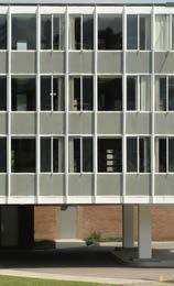

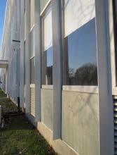
New sidewalks and a bike lane currently exist along Colchester Avenue. A new protected bike lane has been planned by the city of Burlington. This is a main thoroughfare in and out of the city of Burlington and the city of Winooski.
The majority of new development or redevelopment at UVM in the next ten years will most likely occur in the Trinity District. This allows development to remain within campus boundaries, thereby protecting residential adjacencies and maintaining university presence in Burlington.

There is an opportunity to activate and enliven the Trinity District with the addition of undergraduate and graduate


student housing through redevelopment, renovation of existing housing, and/or construction of new housing. There is also an opportunity to foster interdisciplinary work and support research growth through adaptive reuse of buildings such as Farrell Hall, Delehanty Hall, and Mann Hall. Mercy and McAuley Halls also need to be renovated.

In order to meet the housing and development goals, the zoning regulations will need to be updated for this area of campus to add additional development potential within the existing Trinity Campus Institutional Core Campus zoning overlay with increased lot coverage, a standard setback through elimination of the transitional boundary, and the addition of a height overlay on the north side of the campus.
Along Colchester Avenue, the goal is to create a more activated and livelier streetscape for pedestrians and active transportation users. Mixed-use, residential scale buildings could allow for retail opportunities as well as other uses. Other goals include adding seating and programmable space between buildings and within the streetscape. Also, avoid large blank walls and locating structures, parking lots, or other large areas of impervious surface along the streetscape.
The landscape goals are to increase recreational use, remediate stormwater runoff, and provide space for an outdoor amphitheater to take advantage of the existing grading conditions.
Although there are currently no buildings in the Trinity District on the National Register of Historic Places, the potential for any properties in this campus area to be eligible for listing on the state and National Register of Historic Places should be considered. For buildings and features eligible for listing on the Vermont or National Register of Historic Places, all repairs, additions, and modifications should comply with the Secretary of Interior Standards for Rehabilitation in the introduction of this chapter and be coordinated with VDHP.
New buildings in the Trinity District should respect the architectural characteristics of the district in terms of height, mass, scale, and proportions. Exterior walls should be of brick, glass, or stone in a color which is sympathetic to the district. For example, the use of slate (or similar) panels that reference the adjacent buildings would be encouraged. Windows should also fit in with the scale and rhythm of fenestration in adjacent buildings. Depending on the location of new development/ redevelopment, additional materials such as wood or metal may be incorporated to allow for flexibility in the style of architecture. Roofs may be sloped or flat.
The Trinity District’s intimate sense of scale, its mixed-use program, and its situation at the edge of a heavily wooded ravine are reflected in a landscape that is more intimate in scale than that of the rest of the campus. The existing fabric of the Trinity District is structured by a grid derived from its neighborhood context that is distinct from those of the rest of the university. The existing character of the landscape has been set by a zoned setback from the road that was put in place around 2001. While this setback may change, future buildings on the Trinity District should maintain some distance from the road to preserve the character of the surrounding neighborhood.
This area of campus is ideal for stormwater management because it is one of the few places on campus with sandy soils that have percolation rates conducive to infiltration and permeation. This part of campus could allow for more Tier 1 and Tier 2 stormwater treatment practices such as bioretention, disconnection, dry swales, infiltration basins, gravel wetlands, etc. to meet state regulations in accordance with the Vermont Stormwater Management Manual.
Low seating/retaining walls in existing topography or terraced areas can create informal seating and gathering as well as provide opportunities to showcase low impact stormwater treatments. Seating can be placed at the edges of walkways, along with trees, to encourage utilization of the outdoor campus landscape. This area is ideal for an outdoor natural amphitheater nestled into the slope(s) as proposed in Chapter 3: Key Ideas. Improvements to the Green Mountain Pathway, a primary north-south mobility corridor, should also continue through the Trinity District, incorporating hardscape, seating, signage, and lighting to be consistent with the linear landscape. See Chapter 3: Key Ideas.
There are several land banks in this district. With the potential to increase the lot coverage, add a height overlay, and decrease the setback, there are possibilities for development and/or redevelopment.
There is a residential land bank in the underutilized open space, over the Villa and Boiler House, and over the five residential halls in the northeast corner of this district. This
space could be used for additional housing managed by UVM or a third party as well as landscape enhancements. The Villa, originally a c. 1860 farmhouse on the north side of Colchester Avenue, has been moved and modified significantly. It served as a residence for elderly women during the early 1900s and in 1919 the Sisters of Mercy bought the building and soon after moved it back from Colchester Avenue to its existing site, raised the roof, and added the porches and other elements that converted the structure into a dormitory for the college.
There is a general campus use land bank along the Colchester Avenue streetscape. There is potential for mixed-use development and active green space including stormwater management practices, if the setback is decreased. The creation of a lively streetscape can increase perception of safety as well as be an attractive improvement
Land Banks - Trinity District
to the neighborhood. There are also academic land banks in between Mann Hall and the Villa and in front of Farrell Hall. The area in front of Farrell Hall may be a possible location for a maker space to help promote community and collaboration.
Considerations
Plans and supplemental information related to the planning, design, and approval of a typical building and/or landscape architecture campus project:
• 2011 Housing Master Plan

• 2018-2019 Housing Master Plan Market Study
• UVMoves Active Transportation Plan
• Facilities Sustainability Plan
• The Villa: Significance and Condition of the building, Liz Pritchett Associates
• VT State Register of Historic Places
Trinity District Boundary Academic Residential General Campus Use
The Redstone District is a lively area of campus that includes many of the university’s residence halls, including two privately owned complexes for upper-class students. The landscape includes the informal active quad between residential complexes, as well as the more formal Redstone Green, attracting both students and families to its large open
spaces on nice days, as well as the quieter buffer space between the Green Mountain Pathway and the adjacent residential neighborhoods. The Green Mountain Pathway offers a direct route from the residence halls to the Central District.

The Redstone District is comprised of approximately 64.6 acres, including 61.3 acres that are situated between the Athletic District and South Prospect Street and, separately, 3.3 acres at the Redstone Quarry Natural Area (not shown). The district includes 29 UVM-owned buildings and 15 non-UVM owned buildings managed by ground leases, including the Newman Catholic Center, the Redstone Lofts, and
Redstone Commons. The city of Burlington also owns approximately .319 acres that contain a brick water tower originally constructed in 1880-1881 and an elevated water tower constructed in 1934-1935. The newer tower is approximately 90 feet high and is 546 feet above sea level, making it the highest point on the UVM Main Campus. The Redstone Quarry Natural Area is located slightly southwest of the Redstone Campus. It was active until the late 1930s
and provided stone to build many buildings in Burlington and at UVM. The quarry was acquired by UVM in 1958 and it is currently managed jointly by the Rubenstein School for Environment and Natural Resources and the College of Arts and Sciences.


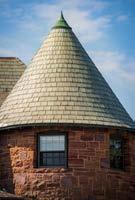


A large portion of the land in the Redstone District was originally owned by Andrew Buell, who purchased the land from the estate of Franklin J. Hendee. Buell eventually constructed a summer residence that included a mansion (now Redstone Hall), a gatehouse for the staff (now Redstone Lodge), a stable for horses (now Robinson Hall), and a large front lawn (now the Redstone Green) bounded by a stone wall along South Prospect Street. The estate was completed in 1889 and Buell resided there until he sold the land to UVM in 1921. UVM initially redeveloped Buell’s buildings as women’s dormitories and soon added

Slade Hall as a dormitory and the Mabel Louise Southwick Memorial Building as the women’s student union. Between 1943 and 1945, the U.S. military used the Redstone District as a barracks during World War II. After the war, the influx of students compelled UVM to construct additional dormitories between 1947 and 1967, including Coolidge Hall, the Mason-Simpson-Hamilton (M-S-H) complex, the Christie-Wright-Patterson (C-W-P) complex, and the WingDavis-Wilks (W-D-W) complex. Several houses were also constructed in the mid-20th century, including 322, 460, 466, and 474 South Prospect Street, and the 1960s saw the construction of the Newman Catholic Center, the Interfaith Center, the Alice Blundell House, and the Music Building. In 1991, the Redstone District was officially entered into the National Register of Historic Places.


The most recent additions to Redstone Campus include Redstone Commons (formerly Redstone Apartments) constructed in 1991, Redstone Lofts constructed in 2012, and the Music Building Addition constructed in 2020. Redstone Commons and Redstone Lofts are owned and managed by a private developer and offer townhouse and apartment-style living for upper class and graduate level students.
The general goals and guidelines for the Redstone District are to:
• Preserve the buildings and landscape features that contribute to the significance of the Redstone Historic District.
• Preserve the pine grove northeast of the Redstone Green.
• Preserve the open space between the Green Mountain Pathway and the Robinson Parkway/Henderson Terrace/University Terrace neighborhoods.
• Preserve viewsheds of the Green Mountains to the east, the Adirondacks and Lake Champlain to the west, and the Burlington Country Club to the south.
• Improve the Redstone Green by providing more trees and sitting areas while maintaining open space for recreation.
• Improve the contiguity of the Green Mountain Pathway, leading to the Central District.
• Upgrade student housing as needed within financial constraints.
The Redstone District includes a wide variety of architectural styles. Buell’s original structures—including Redstone Hall, Robinson Hall, and the Redstone Lodge—were designed by Marling & Burdett in the Richardsonian-Romanesque Style. Southwick Hall and Slade Hall were designed by McKim, Mead & White in the Colonial Revival Style, which was also the style used in several of the residential houses in the district, including 322, 460, 466, and 470 South Prospect Street. Redstone Hall, Robinson Hall, Redstone Lodge, Southwick Hall, Slade Hall, the Music Building, Blundell House, and the Redstone Water Tower buildings (nonUVM-owned) are all contributing buildings or structures in the Redstone Historic District.
On the northern end of the district near Main Street, the Colonial Revival Style was also used in the Nolin House and the Adams Building, while the Johnson House (no longer in its original location) was designed in Federal Style. The Pedestrian Underpass Building is also located in this area, providing connection to the Davis Center via an underground tunnel. The small building also bears the same Postmodern architectural style of the Davis Center.
The dormitory complexes on the southern end of the district that were constructed in the mid-20th century—including Coolidge Hall, the Mason-Simpson-Hamilton complex, the Christie-Wright-Patterson complex, and the Wing-Davis Wilks complex —were designed in International Style and feature brick walls, small windows, and flat roofs. The International Style was also used by Ruth Reynolds Freeman in the single-story, flat-roofed Blundell House. Modernist styles were used in the Newman Catholic Center, the Interfaith Center, the Redstone Lofts, and the Music Building, which is an archetypal example of Brutalist architecture in Vermont. The Redstone Commons fill the southern edge of the district with a series of Postmodern townhouses.
New development within the Redstone District should respect the existing architectural characteristics of the buildings in terms of compatibility, mass, and scale. Viewsheds should be preserved both looking eastward from South Prospect Street toward Southwick Hall and westward across the Redstone Green toward Lake Champlain and the Adirondacks. New additions and alterations should be designed in accordance with the Secretary of the Interior’s Standards for Rehabilitation in the introduction of this chapter and be coordinated with the Vermont Division for Historic Preservation.
Recent renovations to the dorm complexes in the Redstone District have included making public gathering and dining spaces more open, bright, inviting, and accessible. This concept should continue to be expanded upon when renovating interior spaces in student residence halls.
The Redstone District contains a variety of landscape elements that both augment the historic remnants of the original Buell Estate and provide serenity, functionality, and structure for its intended residential use. Similar to the University Green in the Central District, the Redstone Green
serves as a central determinant of form for a large portion of the Redstone District. As the Redstone Green contributes to the historic significance of the National Register Redstone Historic District, a cultural landscape preservation approach should be used for planning projects on the green. This planning should include assessments of historic character defining features of affected landscape areas.
Efforts should be made to preserve the viewsheds looking east toward Southwick Hall and looking west toward Lake Champlain and the Adirondacks. The Redstone Green can also be enhanced by strategically planting more trees, providing informal gathering spaces and/or more seating, and preserving open spaces for informal recreation. The pine grove on the northeast edge of the Redstone Circle should also be preserved as it provides both a buffer between the campus and the adjacent neighborhoods and a place for respite that can provide protection from weather elements.
The Green Mountain Pathway is a major circulation component that bisects the Redstone District, extending north from the intersection at Main Street southward toward Wing-Davis-Wilks. Starting from the northern end on Main Street and heading south, the pathway meanders the contours of the landscape, proceeds along the pine grove, opens to the Redstone Green, and then formalizes in the quadrangle between the dormitories. Improving the contiguity of the path can be achieved with consistent paving, lighting, wayfinding signage, and smaller signage that provides information on views, vegetation, and historically and culturally significant points of interest. Seating improvements along this section of the pathway can create accessible nooks that can be used for informal gathering. The space between the pathway and University Heights Road just north of the Newman Catholic Center has exceptional views to the east of the Green Mountains and should be considered as a gathering space or outdoor classroom, and the space between the pathway and the Robinson Parkway/Henderson Terrace neighborhoods should be preserved as an open space and buffer to the
residential neighborhoods. Efforts also should be made to preserve the tree plantings at the southern periphery of the Redstone District to draw some of the viewsheds of the Burlington Country Club into the campus. This is a strategy of “borrowed scenery,” whereby background elements in the landscape are tied to foreground elements to create a sense of greater depth and expanse.
The Southwest Stormwater Treatment Facility is also located at the southern edge of the Redstone District. There is an existing grass path that encircles the southern and eastern edges of the upper pond and an existing interpretive sign on the northern side of the main pond that could be enhanced by improving the interpretive signage and landscaping. Where feasible, accessibility should also be improved on and along the path.
Consistent with the other districts, existing impervious sites should always be considered for new development over existing pervious sites. Three areas have been identified as residential land banks, including Coolidge Hall and the adjacent land to the west and south, the Wing parking lot, and the Davis parking lot. A general campus use land bank has also been earmarked on the south side of the Adams Building and the Johnson House, and an academic land bank has been reserved on the 0 Main Street/0 University Terrace parcels.
Plans and supplemental information related to the planning, design, and approval of a typical building and/or landscape architecture campus project:
• 2011 Housing Master Plan
• 2018-2019 Housing Master Plan Market Study
• UVMoves Active Transportation Plan
• Facilities Sustainability Plan
• National Register Redstone Historic District
• VT State Register of Historic Places
• Secretary of the Interior Standards for Rehabilitation
• MS4 Stormwater Management Program (SWMP) Plan
Land Banks - Redstone District
Redstone District Boundary Academic Residential General Campus Use Leased to Third Party
No Build Until 2028


The Athletic District comprises a mix of student residences and the majority of the university’s athletic facilities. The residence halls make up the north side of the district, with a relatively compact layout of complexes and small gathering spaces, including a small west-facing amphitheater and a

basketball court and ice rink in the winter. The south side of the district contains athletic facilities, including the student focused fitness areas as well as spaces for the university’s sports teams to host games as well as other special events.
The Athletic District is approximately 67.9 acres and is bound by Main Street to the north, Spear Street to the east, the Burlington Country Club to the south, and the Redstone District to the west. The Burlington-South Burlington boundary line bisects the Athletic District and subsequently apportions 52.2 acres in Burlington and 15.7 acres in South Burlington.
The district contains 30 UVM-owned buildings and primarily includes residence halls (Marsh-Austin Tupper Complex, Living Learning Complex, Harris-Millis Complex, and the University Heights Complex) and the PatrickForbush-Gutterson Athletic Complex (P-F-G). The Patrick Gymnasium and the Gutterson Field House were both built in 1961 and have had several additions and renovations
since that time, including the Gutterson Field House expansion and renovation in 1991 that provided more seating for UVM’s hockey teams, the Gucciardi Fitness Center addition constructed in 1999, and several locker room renovations. The Gutterson Parking Garage was built in 2005 to accommodate the parking demand for daily use and events. The P-F-G complex recently underwent renovations to better accommodate academic programs and athletic events and to provide improved facilities to promote health, fitness, and wellness. The scope of work included the expansion and upgrade of fitness, recreation, wellness, and intramural facilities as well as the creation of academic support spaces, upgraded venues for hockey and basketball, and improved locker rooms, training facilities, meeting spaces, and offices. The renovations comprised of a group fitness facility in the northern portion of the existing


Multipurpose area and a new Multi-Activity Court (MAC) in the existing Gymnastics building. There are plans in the future to construct a new On-Campus Multipurpose Center (OCMC, The Tarrant Event Center) adjacent to the existing Gutterson Field House that will be used for basketball as well as for a variety of events.
The Athletic District also includes several outdoor venues that comprise the Archie Post Athletic Complex, including Moulton Winder Field opened in 2005, the Frank H. Livak Track and Field Facility opened in 2011, and Virtue Field that has been developed in phases starting in 2012. There are also two intramural fields and a 1.5-mile walking/running path that runs along the western and southern boundaries of the district and connects to the South Burlington Recreation Path.


The overall goals for the Athletic District are to provide quality living conditions for students and to foster health, fitness, and wellness by improving existing buildings and constructing new facilities that provide spaces that are versatile, accessible, and adaptable to accommodate a variety of social, cultural, recreational, and athletic events and activities. Other goals include improving connections across Main Street from the Athletic District to the Central District, improving pedestrian mobility routes along Spear Street, improving the stormwater feature between the University Heights North and South Complexes, improving the existing amphitheater between Austin Hall and Millis Hall, and preserving the expansive views to the Green Mountains.
Although there are currently no buildings in the Athletic District on the National Register of Historic Places, the potential for any properties in this campus area to be eligible for listing on the state and National Register of Historic Places should be considered. For buildings and features eligible for listing on the Vermont or National Register of Historic Places, all repairs, additions, and modifications should comply with the Secretary of Interior Standards for Rehabilitation in the introduction of this chapter and be coordinated with VDHP.
There are many International Style buildings in the Athletic District, including the Living/Learning Complex, the HarrisMillis Complex, the Marsh-Austin-Tupper Complex, Patrick Gymnasium, and the Gutterson Field House. The Gucciardi Fitness Center was added to the south façade of the Gutterson Field House in 1999 and offers a modern style constructed with glass and steel that is elevated over an open first story supported by concrete columns. The Tarrant Event Center is planned for the east side of the P-F-G Complex and will include a semi-cylindrical barrel-vault roof that echoes the form of the Gutterson Field House. The University Heights Complex is designed in the Postmodern Style with steep gable roofs that pierce the otherwise flat roof lines that dominate most of the district.
If a flat roof is part of the design for a new structure, consider use of the roof for a green roof, solar panels, natural lighting, or other creative and sustainable uses.
The steel and glass facades used for the Harris-Millis Commons renovation in 2007 complements the existing buildings with a design that is clearly different and more modern than the existing buildings, yet respects the scale, massing, height, and materials of the original architecture. Any new development should also preserve viewsheds to the Green Mountains and have minimal impacts to the open space used for intramural sports or recreation.
As mentioned in the architectural guidelines, efforts should be made to preserve viewsheds to the Green Mountains and to preserve the open spaces used for sports, recreation, and social gathering. Enhancements to the accessibility and interpretation of the watercourse that runs between the University Heights South and North Complex can better educate the public on how rainwater is channeled through the bio-retention area. Improving accessibility and comfort in the circular amphitheater that is adjacent to the bioretention pond can further enhance this area as a multi-functional gathering, educational, and activity space. Other green stormwater management solutions are also recommended around the large surface parking areas, including the Marsh-Austin-Tupper parking lot, the Harris-Millis parking lot, and around the Gutterson Parking Garage. New walking paths and bicycle lanes are also recommended along Spear Street to provide safer and more efficient pedestrian mobility through and around this district and would be the responsibility of the city of South Burlington. Although the northeast corner of the district (informally known as the Marsh-Austin-Tupper Green) is identified as a general campus use land bank, preserving the open space that is currently utilized by students for informal recreation should also be considered for any future development.
In addition to the future Tarrant Event Center that is located on an athletic land bank identified in the 2006 Campus Master Plan, there are also general campus use land banks located on the northeast corner of the district (referred to above) and one land bank in the recreation field in the southwest corner of the district.
Plans and supplemental information related to the planning, design, and approval of a typical building and/or landscape architecture campus project:

• UVMoves Active Transportation Plan
• 2011 Housing Master Plan
• 2018-2019 Housing Master Plan Market Study
• Facilities Sustainability Plan
• National and VT State Register of Historic Places
• Secretary of the Interior Standards for Rehabilitation
Land Banks - Athletic District Athletic District Boundary General Campus Use Athletic
The majority of the land in the Centennial District is encompassed by the 69-acre Centennial Woods Natural Area and the wooded and open land around it. Located on the north end of the district are athletic facilities for soccer and baseball as well as two parking lots, land for Physical Plant functions, and the North Campus Stormwater Facility.

The south side of the district is a mix of privately owned housing for faculty and staff, parking, more stormwater facilities, administrative and first responder facilities, and a large field used for rugby as well as containing a helipad leased to the University of Vermont Medical Center (UVMMC).
The Centennial District is located within the cities of Burlington and South Burlington and is comprised of approximately 206 acres. The Centennial District contains: the Centennial Field Athletic Complex; Centennial Woods and the designated Centennial Woods Natural Area; the Grove Street property; the Centennial Court Faculty/ Staff Apartments; Patchen Road Parcel; several parking lots including the lot leased to the DoubleTree Hotel, the university commuter lot, and the parking leased to the UVMMC near the Centennial Field Grounds Complex; several buildings for facilities maintenance, grounds, and storage; administrative and academic support buildings; and undeveloped open spaces. There is also a substation
and an easement for power transmission for the Vermont Electric Co-Op that runs from the Centennial Field Complex in an eastward direction through the natural area toward Patchen Road.
The character of the Centennial District is defined by the 69-acre Centennial Woods Natural Area and low-intensity land uses such as the athletic facilities, facilities management shops/support facilities, and developer-owned faculty/ staff residential housing. UVM owns 18 buildings, and the ground lease for the Centennial Courts Apartment complex includes 26 residential buildings. The district is comprised
of 8 tracts of land obtained over the years from several different owners beginning with the Baxter Estate tract in 1891 and followed by the Ainsworth tract in 1904, Hickok tract in 1908, Kirby tract in 1954, Deslaurier tract in 1963, Unsworth tract in 1968, Minkel tract in 1972, and the UVM Medical Center tract in 1974. In 2008, UVM acquired the Turner Conservation Parcel that added 3.18 acres to the Centennial Woods Natural Area. The primary architectural focal point of this district is Centennial Field, which since 1906, was the home of the university’s baseball team and is now under a long-term lease with the Vermont Lake Monsters, who were in Minor League Baseball’s NewYork-Penn League between 1994-2020. As a result of Major League Baseball’s reorganization in 2020, the Lake Monsters are currently in the Futures Collegiate Baseball League. In 1913, the original wooden bleachers at Centennial Field burned to the ground. Temporary wooden bleachers were built and were subsequently replaced in 1922 by the concrete and steel grandstand that exists today. The Centennial Field National Register of Historic Places nomination states, “Centennial Field’s grandstand is currently honored with the distinction of being the oldest grandstand structure in use by minor league baseball … unlike many of its contemporaries, Centennial has remained virtually unaltered that gives it a distinction unique in itself. As it continues to play host to college-club and professional


baseball, Centennial Field retains integrity of location, design, materials, and feeling, and remains a focal point in its community”1

A soccer field lies adjacent and to the north of the baseball field. In 2016, the soccer bleachers were converted into a storage facility for UVM’s Physical Plant Department (PPD). Additional minor structures in this area of the district also serve PPD and the activities to support the baseball field, which is associated with the Vermont Lake Monsters’ lease. The other major architectural feature in this district includes a faculty/staff housing complex built in 1994 that is owned and managed by the Centennial Court Partnership. The complex includes 26 buildings, including 14 housing structures and 12 associated garages. In addition to the facilities associated with Centennial Field and the developer owned housing, structures in this district located at the corner of East Avenue and Williston Road include buildings for facilities management, UVM Police Services, UVM Libraries, the Instrumentation and Modeling Facility, and the UVM Rescue Building. Centennial District also provides parking at the periphery of the campus, some of which is utilized by UVM while some is currently leased to the UVMMC. A helicopter pad to the east of the UVM Rescue Building is leased to the UVMMC for the purposes of emergency air transport.


The architectural styles in the northern part of the district include mostly recreational/functional designs for baseball and soccer and industrial styles for maintenance and storage needs. In the southern portion of the district, the Centennial Court Apartments are designed in a Postmodern Style, 284 East Avenue is designed in the International Style, and the UVM Rescue Facility is designed in a modern, shed style.
The general goals and guidelines for the Centennial District are to respect the characteristics of the surrounding residential neighborhoods, while maintaining the architectural styles that are clearly identified with the University of Vermont. The Centennial Woods Natural Area is preserved in perpetuity with the Vermont Land Trust and managed by the UVM Environmental Program. The facilities and activities associated with Centennial Field will remain a highlight and serve to benefit the community while continuing the tradition of intended use of this historic facility.
New buildings in this district could be utilized for a variety of functions, including residential, student services, academic, athletic, administrative, or parking facilities. Designs should respect the characteristics of the surrounding residential neighborhood in terms of height, mass, setback, rhythm, scale, and proportions and should have exterior materials, windows, and roofs that are sympathetic to the wooded surroundings. Roofs may be sloped or flat. Given the historical significance of Centennial Field, any modifications to the Centennial Baseball Grandstands should be in consultation with the Vermont Division for Historic Preservation and the Secretary of the Interior’s Standards for Rehabilitation guidelines. New development in the district should also respect views that highlight the baseball field and grandstand.
The proximity of Centennial Woods at the center of the Centennial District creates a unique sense of seclusion from traffic and the rest of the university. The natural area contains 69 acres of conifers, hardwoods, streams, and wetlands and serves as a natural laboratory for students and for the
general public to study the region’s ecosystems and natural habitats. Development adjacent to the natural area should not encroach upon or impair any of the natural processes. Connections to the natural area should also respect the residential neighborhoods that reside within the district. Trails within the natural area should be minimally maintained to support wellness and recreation with minimal impact on soils, vegetation, and habitat.
There are four stormwater treatment facilities in the Centennial District—the North Campus Stormwater Treatment Facility, the East Campus Stormwater Treatment Facility, the DoubleTree Stormwater Treatment Facility, and the Main Street East Stormwater Treatment Facility. These should continue to be maintained and improved to limit and treat stormwater runoff and to comply with the MS4 (Municipal Separate Storm Sewer System) permit. Development at the southwest corner of the district should consider the existing athletic field (Rugby Field) that is currently utilized for informal recreation and intramural sports. If this space is developed, an alternative space to house these activities should be considered. Improvements in pedestrian connections to the Centennial Field Athletic Complex and Centennial Woods and from the Catamount west parking lot and the DoubleTree Hotel to the Central District should be considered.
There are currently five general campus use land banks earmarked in the Centennial District, including the soccer field, the parking lots on the north and south sides of University Road, the area south of the maintenance buildings, the Rugby Field, and the southeast corner of the district that contains the commuter lot and the DoubleTree parking lot. These general campus use land banks provide flexibility to be utilized for a variety of functions, including residential, student services, academic, athletic, administrative, open space, or parking facilities. There are also two residential land banks identified, including the Patchen Road Parcel and the Grove Street Parcel, the latter which cannot be developed until 2028. Consistent with other districts, new development on existing developed areas—namely the commuter lot, the University Road lots, and the DoubleTree parking lot—will take precedence over development on existing open space. New development should also respect the historic Centennial Field and its
viewing stands as a central focal point in the district.
The Centennial Woods Natural Area is protected from development in perpetuity. The university will continue to be mindful of the sensitive ecological character inherent in this district and will undertake any future development with care for its context and the concerns of the community. Any future development will also include significant plantings of woodland to augment the existing natural character and ecological value of the site. The potential development site identified as a land bank at the current Rugby Field should have a setback from Williston Road and East Avenue to minimize impact on the campus’s gateway, just west of the intersection of East Avenue and Main Street. Informal plantings will minimize the visual impact of these structures. If this field is developed, the university should consider
alternative spaces to house the existing recreational activities that utilize the space.
Plans and supplemental information related to the planning, design, and approval of a typical building and/or landscape architecture campus project:
• UVMoves Active Transportation Plan
• Facilities Sustainability Plan
• Secretary of the Interior Standards for Rehabilitation
• UVM MS4 Stormwater Management Program (SWMP)
contributors, Map layer
ÜCentennial District Boundary Residential General Campus Use Leased to Third Party Map data © OpenStreetMap contributors, Microsoft, Esri Community Maps

The South Campus District is the quietest and least developed area of UVM’s districts. Parcels associated with this district have been acquired over many years with the intention identified in former Campus Master Plans as being for future expansion of the campus facilities. In the
meantime, they are utilized mainly as agricultural facilities for the university’s two farms and as crop land, along with some open and natural areas where both educational and recreational opportunities exist.
Hoag Tract East (MREC) 68 Acres

Hoag Tract West (BRC) Burlington 25.4 Acres
Hoag Tract West, South Burlington 30.9 Acres
Edlund Tract North (Forestry Research Complex) 19.7 Acres
East Woods Natural Area 50 Acres
Martin Tract 10 Acres
Wheelock Tract West 95 Acres
Deslauriers Tracts (2) 30.7 Acres
Edlund Tract South 34 Acres
Whittlesey Tract 18.2 Acres


VonTurkovich Tracts 4 Acres


Wheelock Tract East 10.6 Acres
Horticulture Research and Education Center (HREC) 97 Acres
Map data © OpenStreetMap contributors, Microsoft, Facebook, Inc. and its affiliates, Esri Community Maps contributors, Map layer by Esri
The University of Vermont owns 494 acres in the South Campus District, most of which are located in South Burlington on 9 discrete areas of land which are largely accessible from Spear Street. Most of this land is currently used for academic/research oriented agricultural uses, including crop land and farm animal husbandry.

The district contains 38 UVM-owned buildings. From north to south, the properties in the South Campus District include:
1. Miller Research and Educational Center (MREC), east side of Spear Street, 68 acres
2. Bio-Research Complex (BRC), 25.4 acres, and Forestry Research Complex, 19.7 acres, (Hoag Tract West and Edlund Tract North) both connected by 30.9 acres of crop land, west side of Spear Street, total 76 acres
3. Deslaurier Tracts, east side of Spear Street, north of the I-189 interstate highway, 30.7 acres
4. East Woods Natural Area, north side of Swift Street, 50 acres
5. Edlund, 34 acres and Martin Tracts, 10 acres, west side of Spear Street, total 44 acres
6. Whittlesey, 18.2 acres and VonTurkovich Tracts, 4 acres, east side of Spear Street, total 22.2 acres

7. Wheelock Tract West, 95 acres
8. Wheelock Tract East, 10.6 acres
9. Horticulture Research and Education Center (HREC), 97 acres


East Woods Natural Area
Bio-Research Complex
Agricultural Use/Undeveloped Open Space UVM Property Boundary

Miller Research and Educational Center
Martin Tract
Wheelock Tract West
Forestry Research Complex
Horticulture Research and Education Center
Deslauriers Tracts (2)

Edlund Tract South
Whittlesey Tract


VonTurkovich Tracts

Wheelock Tract East
Map data © OpenStreetMap affiliates, Esri Community

Map data © OpenStreetMap contributors, Microsoft, Facebook, affiliates, Esri Community Maps contributors, Map
In the South Campus Land Use Map, the blue areas are academic/research buildings that focus on the agricultural and research activities that surround each parcel. Most of the UVM-owned land in South Burlington is zoned Institutional/Agricultural South, unless otherwise noted. This zoning district enables a diverse range of academic, agricultural, and university-related uses. Buildings and other impervious surfaces are limited to 20% total of the parcel.
1. Miller Research and Educational Center (MREC) focuses on dairy farm education as well as provides facilities for students’ horses and horse care. In addition to housing UVM’s “Cream” program for dairy farming and pre-vet education, there is research on treating farm runoff and solar panel research. The surrounding fields provide food for the UVM herd. There is a new milking parlor and cow barn, horse barn, an “arena” for farm shows, a classroom building, and staff residence. One building is no longer in use.
2. Bio-Research Complex (BRC), located on the north side of the parcel, includes the Environmental Safety Facility, and several other buildings including three greenhouses. One building is not in use. This area is located within the city of Burlington and is zoned Institutional. The Forestry Research Complex, located at the south side of the parcel, located within the city of South Burlington, includes one main building, a green house, a garage, and several small outbuildings. There are two arrays of solar panels in the back, and two demonstration solar panels in the front, near Spear Street. There is a small, constructed gravel wetland to the north of the buildings, installed as part of the watershed-wide efforts of stormwater management of the Potash Brook Flow Restoration Plan, in collaboration with the city of South Burlington.
3. Deslaurier Tracts include agricultural fields, two compost pads, and a pond. One of the compost pads is used for compost and the other has solar panels placed on the gravel pad.
4. East Woods Natural Area was designated a natural area by the UVM Board of Trustees. Potash Brook runs through it and the natural area is open to the public.
5. Edlund Tract is wooded, with Potash Brook running
through the northwest corner of the tract. Parts of the tract were borrow and fill sites from the nearby interstate construction. The Martin Tract surrounds a residential parcel and several homes. It is partially wooded, and partially used for agricultural fields, both for research and for crops for the UVM herd.
6. Whittlesey and VonTurkovich Tracts are zoned residential but currently are being used as cropland for the UVM herd.
7. Wheelock Tract West is a large tract that includes a large barn, currently used for storage, active agricultural fields, and a wooded area with a space designated for the UVM Ropes Course. A small stream runs through the woods. The university has enabled the city of South Burlington to install a public, shared use recreation path through the parcel. This path is well used and connects with the South Burlington shared use path system, providing connection beyond to the larger regional shared use network. The university has an agreement with the city of Burlington to use a small area near the intersection of Swift and Spear Streets for community garden plots for Burlington residents.
8. Wheelock East has a small linear wetland running through it and is currently cropland. It is zoned Neighborhood Residential, as part of the city’s Southeast Quadrant zoning.
9. Horticulture Research and Education Center (HREC) is used for agricultural education, agriculture, and research. There are several small buildings used for a classroom, research, and processing food from the farm. There is a student-run CSA, as well as apple sales in the fall, a partnership with the city of Burlington for urban tree stands, and other innovative programs and research. The university collaborates with the city of South Burlington on use of the pond and drainage system at the HREC for both agricultural use and as part of the city’s stormwater system.
The lands that UVM owns in South Burlington have historically been considered as land banks, for potential future expansion of the campus beyond the 10-year time frame of this update. The university is interested in preserving development potential as much as possible, for a future time, situation, and currently unknown needs.
• Within the time frame of this 10-year Campus Plan update, it is expected that the Miller Research and Educational Center (MREC) and Horticulture Research and Education Center (HREC) will continue to be active educational and agricultural complexes run by the College of Agricultural and Life Sciences (CALS). Both of these campuses have plans to expand and/or renovate facilities to meet the educational needs of UVM students and develop new avenues of academic/agricultural research. Several buildings at the MREC are being considered for renovation including 490A Spear Street, the Livestock Holding building, 496 Spear Street, the North Farmhouse, and 504 Spear Street, the Nutrition Research Building. Also, 509 Spear Street, a storage building, at the MREC is being evaluated for potential removal. Plans may also include solar power and other clean energy ideas that may utilize farm output, as well as innovative ways to improve stormwater quality and reduce impacts from farm-related stormwater.
• Bio-Research Complex (BRC) and the Forestry Research Complex are more involved with research opportunities and may also have building needs over the next 10 years. The Bio-Research Complex has several structures and buildings that need to be evaluated for long-term use and renovation versus removal or reconstruction. In addition, the George D. Aiken Forestry Sciences Laboratory and associated property, located at 705 Spear Street, will need to be evaluated for long-term use.
• Deslaurier Tracts will continue to have the solar panels and a managed compost pad, as well as agricultural use.
• East Woods Natural Area will continue to be a resource to UVM and the wider community, for nature study, and protection of Potash Brook.
• Edlund and Martin Tracts will continue to be a future land bank and current wooded area for
curricular activities.
• Whittlesey and VonTurkovich Tracts will continue to be a future land bank and current cropland.
• Wheelock West will continue with its existing uses. The College of Agricultural and Life Sciences (CALS) will continue to utilize this area for agricultural/ academic programming and longer-term future land banks.
• Wheelock East will continue to be a future land bank and current cropland.
While some of the parcels are unbuilt and used for agricultural purposes and/or provide natural landscapes, several of the parcels have active academic campuses. Architectural guidelines for the Miller Research and Educational Center (MREC), the Bio-Research Complex, the Forestry Research Complex, the Horticulture Research and Education Center (HREC), and the Wheelock Barn are below.
Currently these parcels are a mix of mostly agricultural buildings with some academic spaces, within the larger open space of the parcel that has a variety of agricultural and research uses. Architectural guidelines for future development:
• Preserve farm/agricultural architectural scale and style: 1-3 story buildings.
• Retain a centralized, compact campus, surrounded by agricultural buildings and fields.
• Connect buildings by covered and outdoor walkways.
• Limit parking to peripheral areas near access driveways.
• Make connections with the South Burlington shared use/recreation path, as much as possible.
• Consider removal and replacement of outdated, inoperative buildings, while working within the regulatory process with the Vermont Division for Historic Preservation, as necessary.
• For properties in this area eligible for listing on the State and National Register of Historic Places, appropriate design guidelines should be applied for renovations, additions, and when considering new development.
• Plans should be developed for the Wheelock Barn, located at the southwest corner of Swift and Spear Street. As this is a historic structure, options
should include assessing the potential for continued maintenance and/or adaptive reuse. Sale or lease options also should be considered before planning demolition. Such planning should be done with the involvement of the campus community, the Vermont Division for Historic Preservation, and municipal planning officials.
• Incorporate sustainable and net zero or net positive building practices, striving to utilize clean on-site energy sources whenever possible.
The unbuilt parcels are mostly designated as future general campus use land banks with building potential, with the exception of the East Woods Natural Area. However, within the framework of the Campus Plan 2022-2032, each parcel does have individual characteristics that lead to landscape guidelines as follows:
• Deslaurier Tracts: This is an active agricultural working landscape with compost on the southerly compost pad and solar panels on the northerly pad.
o Continue and maintain the existing situation of vegetative screening from the public right-of-way.
o Continue to maintain buffers, and control and monitor potential runoff from the actively used compost pad.
o Enable additional compatible agricultural uses.
• East Woods Natural Area:
o Maintain natural area according to best practices.
o Maintain paths for public and academic use.
o Encourage dogs to be leashed and picked up after.
• Edlund and Martin Tracts: The northwest portion of this area includes the Potash Brook and associated buffer areas. Other areas of the parcel are former fill/borrow pits associated with the nearby interstate construction as well as former agricultural fields that have gradually filled in with new growth over the last few decades; such areas may be appropriate for academic/research needs and possible construction.
• Whittlesey and VonTurkovich Tracts: These are residentially zoned tracts that are currently in active agricultural use. Agricultural fields to remain as needed.
• Wheelock West: This is a large 96+ acre tract, with a variety of current uses and landscape guidelines.
o Agricultural fields to remain as needed; opportunities for agricultural and/or agricultural research should remain.
o Ropes Course may have the opportunity to grow as necessary.
o Paths in the woods to be minimally maintained but not expanded; wooded areas to be minimally maintained in this largely suburban residential surrounding area.
• Wheelock East: This is largely one field in agricultural use with a wetland/small stream bisecting the field and a small wetland on the north near Swift Street. While there are no current plans to change the current use, this area is zoned Neighborhood Residential as part of South Burlington’s Southeast Quadrant (SEQ). UVM has an agreement with the city to enable a shared use path and underground utilities on the east side of the parcel.
Land Banks: Priority Potential Development Areas
The South Campus Priority Potential Development Areas Map shows the land bank areas of each tract that have the potential to be appropriate for future development, or no build areas, either within the time span of this plan or beyond. This map illustrates the guidelines previously listed:

• New university-related buildings should be located near areas of relatively dense buildings.
• Current agricultural fields are designated as future land banks, whether academic, residential, or general campus use.
150 Swift Street
UVM
596 and 600 Spear Street
696 and 700 Spear Street
Several potential land opportunities are identified in the map above as properties recommended for consideration of acquisition should they become available. The properties on Spear Street are adjacent and surrounded by universityowned land that is currently largely in agricultural use. The
property at 150 Swift Street includes important natural resources that can be observed and studied for academic study, as well as contribute to the potential wildlife corridor on the northerly edge of the property.

Plans and supplemental information related to the planning, design, and approval of a typical building and/or landscape architecture campus project:
• At the time of this writing, the city of South Burlington is transitioning to new Land Development Regulations.
• State legislation: 24 V.S.A. § 4413 defines the limits of municipal regulation on certain educational institutions, including the University of Vermont.
• The city of South Burlington is considering active transportation projects on Swift and Spear Streets that may impact university-owned parcels.
• The city of South Burlington is considering improvements to the Swift/Spear Streets intersection that may impact the university-owned parcels around this intersection.
• UVMoves Active Transportation Plan
• Facilities Sustainability Plan
• Horticultural Research Complex Plans
• Secretary of the Interior Standards for Rehabilitation
• Potash Brook Flow Restoration Plan
• UVM MS4 Stormwater Management Program (SWMP)

The Campus Plan, an update of the 2006 Campus Master Plan, was developed over the course of approximately 18 months through the efforts of many members of the UVM community, who gave insightful comments and ideas that enabled staff to not only update the 2006 plan, but modernize it with new approaches to planning, adding Key Ideas, to the document, and updating the process by which projects are reviewed.
President Suresh Garimella’s Amplifying Our Impact: Strategic Vision for UVM set the tone for priorities within the Campus Plan, particularly setting the stage for the development of the Key Ideas.
The Oversight and Working Committees, comprised of staff and faculty were tasked with the development of the plan. We thank the members of these committees for giving their time, ideas, and opinions generously to this process:
The Oversight Committee met approximately every two months to establish overall direction (planning assumptions, guiding principles, key ideas, and objectives), check on the progress of the plan, and validate the conclusions developed for the plan prior to its final release. Members of this committee included:
• Chair, Richard Cate, Vice President, Finance & Administration
• Patricia Prelock, Senior Vice President and Provost
• Luce Hillman, Executive Director, Facilities Management
• Paula Carlaccini, Director, Planning, Design & Construction (PD&C)
• Lisa Kingsbury, Associate Director of Planning, PD&C
The Working Committee met monthly to propose strategies to further UVM’s goals, objectives, and principles. This committee was the main working group for the plan and provided a sounding board for concept development and draft recommendations. Members of this committee included:
• Chair, Lisa Kingsbury, Associate Director of Planning, PD&C
• Jim Barr, Director, Transportation & Parking Services
• Eric Berliner, Assistant Director of Maintenance & Operations, Physical Plant Department (PPD)
• Dave Blatchly, Capital Renewal Engineer, PPD
• Paula Carlaccini, Director, PD&C
• Luce Hillman, Executive Director, Facilities Management
• David Nestor, Dean of Students
• Elizabeth Palchak, Director, Office of Sustainability
• Mark Starrett, Associate Professor, Horticulture, Plant and Soil Science
• Gioia Thompson, Outreach Manager, Office of Sustainability
• Tom Visser, Professor, Historic Preservation Representative
• Matt Walker, Grounds Manager, PPD
The Campus Master Planning Advisory Committee met periodically during the process to receive updates and provide feedback. Several members of this committee also served on the Working Committee and/or a Strategic Working Group. Members of this committee included:
• Chair, Lani Ravin, Associate Planner, PD&C
• Jim Barr, Director, Transportation & Parking Services
• Ken Bean, University Architect, PD&C
• Joanna Birbeck, Campus Space Manager, PD&C
• Teresa Cahill-Griffin, FPPC Representative, College of Nursing & Health Sciences
• Paula Carlaccini, Director, PD&C
• Kerry Castano, Chief of Staff to the Provost
• Katharine Coffey, Construction Project Manager/Architect, PD&C
• Owen Doherty, Student Government Association
• Amber Fulcher, ADA Coordinator, HR Services & Affirmative Action
• Shoshanna Grunwald, Business Operations Administrator, Vice Provost and Dean of Students Office
• Luce Hillman, Executive Director, Facilities Management
• Stephanie Hurley, Associate Professor, Plant and Soil
• Lisa Kingsbury, Associate Director of Planning, PD&C
• Anne-Marie Resnik, Staff Council Representative
• Michael Richards, Space Planning/Mapping Specialist, PD&C
• Mark Starrett, Associate Professor, Horticulture, Plant & Soil Science
• Sandy Thibault, Executive Director, Chittenden Area Transportation Management Association (CATMA)
• Gioia Thompson, Outreach Manager, Office of Sustainability
• Tom Visser, Professor, Historic Preservation Representative
• Matthew Walker, Grounds Manager, PPD
.
Five Strategic Working Groups were formed to analyze the components of assigned themes and gather feedback and input from others as necessary. This analysis and development of objectives and strategies was integral to the Key Ideas section of the Campus Plan. The Strategic Working Groups and each group’s members included:
Sustainability and Healthy Lives Members
• Facilitator, Michael Richards, Space Planning/Mapping Specialist, Planning, Design & Construction (PD&C)
• Shoshanna Grunwald, Business Operations Administrator, Vice Provost and Dean of Students Office
• Stephanie Hurley, Associate Professor, Plant and Soil Sciences
• Olivia Lopez, Student Government Association, Committee on Environment Representative
Building Assessment of Single-Family Residences
• Facilitator, Ken Bean, University Architect, PD&C
• Caylin McCamp, Education & Outreach Coordinator, Office of Sustainability
• Michelle Paavola, Medical Director, Center for Health and Wellbeing
• Elizabeth Palchak, Director, Office of Sustainability
• Brandon Schoenfeld, Student
• Gioia Thompson, Outreach Manager, Office of Sustainability
• Dave Blatchly, Capital Renewal Engineer, Physical Plant Department (PPD)
Efficiency and Innovation in Space Utilization Members
• Co-Facilitator, Joanna Birbeck, Campus Space Manager, PD&C
• Co-Facilitator, Lisa Kingsbury, Associate Director of Planning, PD&C
• Kerry Castano, Assistant Provost and Chief of Staff
• Paula Carlaccini, Director, PD&C
• Kirk Dombrowski, Vice President for Research
• Andrew Gingras, Director, Client Services
• Katie Hugget, Assistant Dean for Medical Education, Director
• Facilitator, Claire Forbes, Campus Plan Project Manager
• Jim Barr, Director of Transportation & Parking Services
• Abby Bleything, Sustainable Transportation Coordinator, Office of Sustainability
• Clare Nelson, Transportation & Parking Services Intern, College of Engineering and Mathematical Sciences Student
• Peggy O’Neil-Vivanco, Vermont Clean Cities Coordinator
• Facilitator, Lani Ravin, Associate Planner, PD&C
• Teresa Cahill-Griffin, Faculty Senate Financial Planning and Physical Committee Representative, College of Nursing & Health Sciences
• Kate Coffey, Construction Project Coordinator, PD&C
• Bev Belisle, Director, Mosaic Center for Students of Color
• Maeve Forbes, Student Government Association Senate –Committee on Diversity, Inclusion, and Equity Chair
• Amber Fulcher, ADA Coordinator, HR Services & Affirmative
• Luce Hillman, Executive Director, Facilities Management
• Adam Frazier, Project Coordinator, PPD
• Tom Visser, Professor, Historic Preservation
Teaching Academy
• Laura Lesage, Residential Life
• Avery Rasmussen, Graduate Student Senate President
• Cristine Rowley, Interior Designer, PD&C
• Randy Spooner, Director, Telecommunication and Network Service
• Wendy Verrei-Berenback, Assistant Director, Center for Teaching & Learning
• Annie Seeger White, Lecturer/Ecological Landscape Designer, Plant & Soil Science
• Mark Starrett, Associate Professor, Horticulture, Plant and Soil Science
• Sandy Thibault, Executive Director, CATMA
• Matt Walker, Grounds Manager, PPD
• Caleb Gilbert, Training & Development Coordinator, Custodial Services, President of Staff Council
• Kate Jerman, Director, Prism Center
• David Nestor, Vice Provost & Dean of Students
• Erica Spiegel, Assistant to the Director, PPD
• Jesse Suter, Executive Director, Center on Disability and Community Inclusion
The consultant group, Sasaki Associates, a Boston-based, award-winning integrated architectural, planning, and design firm, was hired to provide a high-level analysis, report, and recommendations on the following scope areas:
• UVM Peer Institution Comparison - Review, critique, and new and innovative ideas for planning tools along with benchmarks, successes from other peer institutions, and a best practices review of university campus planning.
• Flexible Indoor Space Analysis - Best practices and higher education trends in designing space that promotes active learning while also providing flexibility for the university’s space needs. Additionally, as more employees are teleworking or working off-site, recommend strategies to consolidate, shrink, and share the space devoted to offices.
• Outdoor Space Enhancements - Strategies to create and/or enhance outdoor classrooms, therapeutic and calming spaces, curricular landscaping, and sustainable landscapes for a university in a northern New England climate.
• Organization of the Campus Plan - Looking at the 2006 CMP and the vision for this campus plan, guidance on the organization of the plan content and documentation.
• Improvements to the Site Planning & Design Review Process - Better define and clarify the process for internal review of new projects.
The Sasaki team included: Gwendolyn Sands, Planner and Project Manager; Caitlyn Clauson, Principal-in-Charge, Campus Planner; Mary Anne Ocampo, Principal, Urban Design Lead; Andrew Gutterman, Landscape Architecture Lead; Rafael Marengoni, Urban Designer; and Steve Lacker, Student Life/Housing Specialist/Architect.
The Planning Team, comprised of staff from Planning, Design & Construction, met every other week throughout the process, analyzing ideas generated from other committees and providing new ideas for consideration in every aspect of the Campus Plan. Each Planning Team member was also responsible for facilitating a Strategic Working Group and for drafting the portions of the text for the plan. Special thanks go to Mike Richards for developing all of the mapping for the plan. Members of the Planning Team included: Ken Bean, University Architect; Joanna Birbeck, Campus Space Manager; Claire Forbes, Campus Plan Project Manager; Lisa Kingsbury, Associate Director of Planning; and Lani Ravin, Associate Planner.
Thanks also go to Lisa McNaney, Assistant to the Director, Planning, Design & Construction, for her role in organizing the many meetings required throughout the process as well as facilitating travel arrangements and managing the project budget.
Extra special thanks go to Claire Forbes, the Campus Plan Project Manager. The process of developing this plan could not have been possible without her strong expertise in planning, her understanding of UVM’s campus and its surrounding municipalities, her organizational and project management skills, and her design expertise. From developing the overarching process, setting the timelines, developing and facilitating presentations and interactive exercises, managing consultants, drafting, reviewing and refining text, and designing the final document, Claire guided every step of the process. Developing this Campus Plan update during the COVID-19 pandemic presented extra challenges and Claire skillfully managed and kept all members of committees and our consultants engaged through an almost fully remote process.
The plans, reports, documents, and supplementary material referenced in the Campus Plan include:
• Interactive Mapping Tool - Existing Conditions
• Interactive Mapping Tool - Future Planning Frameworks
• UVMoves Active Transportation Plan, January 2017
• UVM Facilities Sustainability Plan (2021-2030)
• Secretary of the Interior’s Standards for Rehabilitation
• UVM MS4 Stormwater Management Program (SWMP)
• Potash Brook Flow Restoration Plan
• UVM 10-Year Transportation & Parking Plan*
• Joint Institutional Parking Management Plan (JIPMP)*
• UVM Archaeological Resources Assessment (ARA) for Main Campus, May 2020*
• UVM Historic Garage and Carriage House Inventory Report and Stabilization Treatment Plan, 2005*
• National and VT State Register of Historic Places*
• National Register University Green Historic District*
• National Register Redstone Historic District*
• National Register Pearl Street Historic District*
• 2011 Housing Master Plan*
• 2018-2019 Housing Master Plan Market Study*
• The Villa: Significance and Condition of the building, Liz Pritchett Associates*
• South Campus Transportation and Parking Master Plan*
• 24 V.S.A. § 4413*
*Contact arch@uvm.edu for more information about these documents.
.
AASHTO = American Association of State and Highway Officials
ADA = Americans with Disabilities Act
ADAAA = Americans with Disabilities Act Amendments Act of 2008
AFS = Administrative and Facilities Services
APBP = Associate of Pedestrian and Bicycle Professionals
ARA = Archaeological Resources Assessment
BRC = Bio-Research Complex
BCDO = Burlington Comprehensive Development Ordinance
C-1 (Commercial 1)
C-W-P = Christie-Wright-Patterson Complex
CALS = College of Agricultural and Life Sciences
CAP = Consulting Archaeology Program
CATMA = Chittenden Area Transportation Management Association
CATS = Campus Area Transportation System
CCRPC = Chittenden County Regional Planning Commission
CESS = College of Education and Social Services
CMPC = Campus Master Planning Advisory Committee
CNHS = College of Nursing and Health Sciences
CPC = Campus Planning Committee
CRF = Colchester Research Facility
CWAC = Chittenden County Regional Planning Commission’s
Clean Water Advisory Committee
DEI = Diversity, Equity, and Inclusion
FM = Facilities Management
FRP = Flow Restoration Plan
FSP = Facilities Sustainability Plan
GIRT = Gender Inclusive Restroom Taskforce
GMP = Green Mountain Pathway
GMT = Green Mountain Transit
GSI = Green Stormwater Infrastructure
HREC = Horticulture Research and Education Center
I = Institutional
IA North or South = Institutional-Agricultural
ICC = Institutional Core Campus Overlay Districts
• UVM = UVM Central Campus
• UVMT = UVM Trinity Campus
• UVMS = UVM South of Main Street
JIPMP = Joint Institutional Parking Management Plan
LCOM = Larner College of Medicine
LDR = Land Development Regulations
LEED = Leadership in Energy and Environmental Design
LID = Low Impact Development
M-S-H = Mason-Simpson-Hamilton Complex
MAC = Multi-Activity Court
MREC = Miller Research and Educational Center
MS4 = Municipal Separate Storm Sewer System
NSF = National Science Foundation
OCMC = On-Campus Multipurpose Center
P-F-G = Patrick-Forbush-Gutterson Athletic Complex
PDC = Planning, Design & Construction Plant = Central District Energy Plant
PPD = Physical Plant Department
PUD = Planned Unit Development
R-12 = Residential 12
RNG = Renewable Natural Gas
SCF = Sustainable Campus Fund
SEQ = South Burlington’s Southeast Quadrant
STARS = Sustainability Tracking, Assessment, and Rating System
STEM = Science, Technology, Engineering, and Mathematics
SWMP = Stormwater Management Program
TDM = Transportation Demand Management
UVM = University of Vermont
UVMMC = University of Vermont Medical Center
VDHP = Vermont Division for Historic Preservation
VMT = vehicle miles traveled
VTrans = Vermont Agency of Transportation W-D-W = Wing-Davis-Wilks Complex
.
BUILDING
YEAR BUILT NATIONAL REGISTRY ARCHITECTURAL STYLE FLOORS
109 S Prospect Annex 1898 NR - University Green 3 178 S Prospect St. Garage 1845 ca 2 23 Mansfield Ave. 1950 3
34 S Williams St. 1926 NR - University Green COLONIAL REVIVAL 4 34 S Williams St. Garage 1926 NR - University Green 1
439 College St. 1923 NR - University Green 4 440 College St. 1908 NR - University Green 3 479 Main St. 1891 NR - University Green QUEEN ANNE REVIVAL 4 481 Main St. 1891 NR - University Green QUEEN ANNE REVIVAL 4 70 S. Williams St. 1861 NR - University Green GREEK REVIVAL 4 86 S. Williams St. Garage c. 1926 NR - University Green 2
Admissions Visitor Center 1861 2
Allen House c. 1830 NR - University Green GREEK REVIVAL/QUEEN ANNE 4
Alumni House 1892 NR - Individual QUEEN ANNE 6
Benedict House 1804 NR - University Green FEDERAL STYLE 3
Billings Addition/Lecture Hall 1986 NR - University Green POSTMODERN 2
Billings Library 1883/1889 NR - University Green RICHARDSONIAN ROMANESQUE 5
Bittersweet 1804 NR - University Green FEDERAL STYLE 4
Bittersweet Garage c. 1935 NR - University Green 1
Booth House 1900/1926 NR - University Green COLONIAL REVIVAL 4
Central Plant 1911 NR - University Green ROMANESQUE REVIVAL 4
Chilled Water Plant 2007 NR - University Green 1
Clement House 1861 ITALIANATE/COLONIAL REVIVAL 4
Dewey Garage 1906 1
Dewey Hall 1904 NR - University Green NEOCLASSICAL REVIVAL 4
Englesby Garage 1914 NR - University Green 2
Englesby House 1914 NR - University Green COLONIAL REVIVAL 4
Grasse Mount 1804 NR - University Green FEDERAL STYLE 4
Henry Lord House 1890 ca NR - University Green QUEEN ANNE REVIVAL 5
Ira Allen Chapel 1925 NR - University Green COLONIAL REVIVAL 6
Jack & Shirley Silver Pavilion 2016 1
Jacobs House c. 1850 NR - University Green GREEK REVIVAL 4
Jeanne Mance Hall 1962 NR - Pearl Street 7
Lafayette Hall 1995 NR - University Green INTL STYLE/POSTMODERN 4
Mansfield House 1891 NR - University Green QUEEN ANNE REVIVAL 4
Morrill Hall 1907 NR - University Green ITALIANATE 5
Nicholson Building 1804/1895 NR - University Green FEDERAL STYLE/QUEEN ANNE 4
Old Mill 1825/1882 NR - University Green HIGH VICTORIAN GOTHIC 6
Old Mill Annex 1998 NR - University Green POSTMODERN 6
Outing Club-Main Campus 1900 3
Pearl House 1789/1925 NR - University Green COLONIAL REVIVAL 4
Peirce-Spaulding House 1895 NR - University Green COLONIAL REVIVAL 5
Pomeroy Hall 1828/1858 NR - University Green ITALIANATE REVIVAL/POSTMOD- 5
Quonset Building 1959 2
Royall Tyler Theatre 1901 NR - University Green ROMANESQUE REVIVAL 3
The Lattie F. Coor House 1908/2006 NR - University Green COLONIAL REVIVAL 4
Torrey Hall 1863 NR - University Green ITALIANATE 4
UVMMC 1 S. Prospect St. Arnold Pavilion 1960 NR - University Green INTERNATIONAL 8
UVMMC 1 S. Prospect St. Clinic 1962 NR - University Green INTERNATIONAL 3
UVMMC 1 S. Prospect St. Old Hall 1922 NR - University Green INSTITUTIONAL GOTHIC REVIVAL 5
UVMMC 1 S. Prospect St. Rehab Building 1958 NR - University Green INTERNATIONAL 5
UVMMC 1 S. Prospect St. St. Joseph’s Pavilion 1942 NR - University Green INTERNATIONAL 8
Wadhams House c. 1845 GREEK REVIVAL 4
Waterman Building 1941 NR - University Green COLONIAL REVIVAL 7
Wheeler House 1842 NR - University Green GREEK REVIVAL 4
Wheeler House Garage c. 1875 NR - University Green 3
Williams Hall 1896 NR - University Green GOTHIC REVIVAL/ROMANESQUE 5
NR – University Green = National Register – University Green Historic District
NR – Individual = National Register - Individually listed
NR – Pearl Street = National Register – Pearl Street Historic District
BUILDING
YEAR BUILT NATIONAL REGISTRY ARCHITECTURAL STYLE FLOORS
Aiken Center 1981 2
Central Campus Bicycle Storage 2017 3
Central Campus Residence Hall East 2017 4
Central Campus Residence Hall West 2017 1
Converse Hall 1895 NR - Individual COLLEGIATE GOTHIC 4
Discovery Hall 2017 3
Dudley H. Davis Center 2007 POSTMODERN 4
Fleming Museum 1931 COLONIAL REVIVAL 4
Given 1960-1963 INTERNATIONAL 4
Health Science Research Facility 2001 2
Hills Agricultural Science 1950 ART DECO 2
Howe Library 1960 INTERNATIONAL/BRUTALIST 4
Ifshin Hall 2018 6
Innovation Hall 2019 3
James M. Jeffords Hall 2010 2
Kalkin Bldg. 1987 POSTMODERN 5
Larner Learning Commons 2005 4
Marsh Life Science 1965 INTERNATIONAL 1
Medical Education Pavilion 2005 4
Pedestrian-underpass Equipment Bldg. 1975 4
Perkins Bldg. 1891 1
Rowell Hall 1970 INTERNATIONAL 4
Stafford Greenhouse 1991 1
Stafford Hall 1991 POSTMODERN 4
Stafford Head House 1991 2
Terrill Bldg. 1950 ART DECO 4
The Courtyard at Given 2009 4
Votey Hall 1964 INTERNATIONAL 5
NR – Individual = National Register - Individually listed
BUILDING
YEAR BUILT NATIONAL REGISTRY ARCHITECTURAL STYLE FLOORS
252 Colchester Ave. 1915 2
254 Colchester Ave. 1880 3
256 Colchester Ave. 1915 2
258 Colchester Ave. 1910 3
50 Fletcher Pl. 1947 3
Delehanty Hall 1965 4
Farrell Hall 1985 4
Hunt Hall 1973 3
Ira Allen School 1958 2
Mann Hall 1939 ART DECO 4
McAuley Hall 1958 INTERNATIONAL 4
McCann Hall 1973 3
Mercy Hall 1962 INTERNATIONAL 4
Ready Hall 1973 3
Richardson Hall 1973 3
Sichel Hall 1973 3
St. Joseph's Villa c. 1860 5
Trinity Boiler House 1959 1
BUILDING
YEAR BUILT NATIONAL REGISTRY ARCHITECTURAL STYLE FLOORS
322 S. Prospect St. Garage 1912 1
322 S. Prospect St. 1912 4 460 S. Prospect St. c. 1940 COLONIAL REVIVAL 4 466 S. Prospect St. Garage c. 1900 2 466 S. Prospect St. 1829 4 474 S. Prospect St. Garage c. 1950 2
Adams Bldg. 1905
COLONIAL REVIVAL 4
Blundell House 1961 NR - Redstone INTERNATIONAL 2
Christie Hall 1962 INTERNATIONAL 5
Coolidge Hall 1947 NR - Redstone INTERNATIONAL 4
Davis Hall 1967 INTERNATIONAL 5
Hamilton Hall 1956 INTERNATIONAL 5
Interfaith Center 1963 1
Johnson House 1806 FEDERAL STYLE 3
Mason Hall 1956 INTERNATIONAL 6
Music Bldg. 1973 NR - Redstone EXPRESSIONIST/BRUTALIST 4
Music Bldg. Addition 2020 NR - Redstone 3
Nolin House c. 1925 4
Patterson Hall 1960 INTERNATIONAL 5
Redstone Hall 1889 NR - Redstone RICHARDSONIAN ROMANESQUE 5
Redstone Lodge 1891 NR - Redstone RICHARDSONIAN ROMANESQUE 4
Robinson Hall 1889 NR - Redstone RICHARDSONIAN ROMANESQUE 3
Simpson Hall 1956 INTERNATIONAL 6
Slade Hall 1928 NR - Redstone COLONIAL REVIVAL 4
Southwick Hall 1934 NR - Redstone COLONIAL REVIVAL 5
Wilks Hall 1967 INTERNATIONAL 5
Wing Hall 1967 INTERNATIONAL 5
Wright Hall 1962 INTERNATIONAL 5
Austin Hall 1960
INTERNATIONAL 6
Group Fitness & Multipurpose 1980 1
Gucciardi Rec & Fitness Center 1999 2
Gutterson Field House 1961 INTERNATIONAL 4
Gutterson Parking Garage 2005 3
Harris Hall 1967 INTERNATIONAL 5
Harris-Millis Commons 1967 INTERNATIONAL 3
Living/Learning A,B,C,D,E, Commons 1972 INTERNATIONAL 3
Mac Court 1980 1
Marsh Hall 1960 INTERNATIONAL 6
Millis Hall 1967 INTERNATIONAL 5
Moulton-Winder Field Building 2012 1
Patrick Gymnasium 1961 INTERNATIONAL 4
Track & Field Bldg. 2011 1
Tupper Hall 1960 INTERNATIONAL 6
University Heights North 1,2,3 2006 POSTMODERN 6
University Heights South 1,2,3 2006 POSTMODERN 6
280 East Ave. 1980 2
284 East Ave. 1957
INTERNATIONAL STYLE 2
CFC Baseball Stands 1921 2
CFC Bleacher Facility Storage 2016 1
CFC Champ Field House 1965 1
CFC Grounds Bldg. c. 1960 2
CFC Grounds Garage c. 1960 1
CFC Grounds-Garage/Pump c. 1960 1
CFC HVAC & Electrical Shop 1950 1
CFC Lapointe Field House 1950 1
CFC Maintenance Facility 2010 1
CFC Maintenance Garage 1995 1
CFC Salt Shed 1,2,3 2020 1
CFC Soccer Press Box 1965 3
CFC Ticket Booth #2 1950 ca 1
CFC Ticket/Storage 1995 1
CFC Visitor Field House 1965 1
Library Research Annex 1995 2
UVM Rescue Facility 2017 1
BUILDING
BRC 657 Spear St. 1967 1
BRC 659 Spear St. 1965 1
BRC 663 Spear St. 1967 2
BRC 665 Spear St. 1986 2
BRC Bioresearch Lab 1962 1
BRC Entomology Research Lab 1967 1
BRC Environmental Safety Facility 1993 2
BRC Greenhouse 2 1993 1
BRC Greenhouse 3 1997 1
BRC Greenhouse 4 1997 1
BRC Trailer c. 2002 1
Forestry Research Garage 1968 2
Forestry Research Head House & Greenhouse 1968 1
Forestry Research Science Lab 1968 1
HRC Apple Storage c. 1975 2
HRC Blasberg Lab 1962 1
HRC Electrical Pump c. 1975 1
HRC Electrical Pump 2 c. 1975 1
HRC Greenhouse #3 2013 1
HRC Greenhouse East 2003 1
HRC Greenhouse West 2003 1
HRC Pole Barn 1974 1
HRC Storage Bldg. c. 1945 2
HRC Trickle Pump c. 1957 1
MREC Classroom 1967 1
MREC Dry Cow Facility 1995 1
MREC Fitzsimmons Arena 1965 1
MREC Hardacre Equine Center 1998 1
MREC Hay & Commodities 1965 1
MREC Livestock Holding 1965 1
MREC Maternity Barn 2003 1
MREC Milking Parlor & Cream Barn 2015 1
MREC North Farm House c. 1910 3
MREC Nutrition Research Bldg. 1965 3
MREC Research Barn 2015 1
MREC Storage 1965 2
MREC Youngstock Facility 2003 1
Wheelock Barn c. 1942 2
