



The City of Fresno thanks the community members, stakeholders, elected officials, and public agencies who participated in the creation of this Parks Master Plan, many of whom are listed below.
Mayor Lee Brand
Esmeralda Soria (District 1) - Council Vice President
Steve Brandau (District 2)
Oliver L. Baines III (District 3)
Action Change / Accion Cambio
Building Healthy Communities
Central Unified School District
California State University, Fresno
Cultiva La Salud
Downtown Fresno Foundation
Downtown Fresno Partnership
Every Neighborhood Partnership
Fresno Boys and Men of Color
Fresno Unified School District
Habitat for Humanity
Paul Caprioglio (District 4)
Luis Chavez (District 5)
Garry Bredefeld (District 6)
Clint Olivier (District 7) - Council President
Leadership Council for Justice and Accountability League of Women Voters
Fresno Metro Ministry
San Joaquin River Parkway & Conservation Trust
SEIU 1000
Shifting Gears
Southeast Fresno Community Economic Development Association
St. Rest Baptist Church
Tree Fresno
The Trust for Public Land
This Parks Master Plan was also made possible through State of California, Strategic Growth Council Urban Greening Grant funds. Images courtesy of the City of Fresno PARCS, DARM, Fresno Unified School District, and the consultant team.
Alternate formats of this document will be provided by the City upon request. To request alternate formats contact Shannon M. Mulhall, Certified Americans with Disabilities Act Coordinator at (559) 621-8716.

with PROS Consulting, Precision Engineering, Urban Diversity Design, and Studio 39
No

Welcome to the 2018 Fresno Parks Master Plan, a community-based vision and road map for planning a complete and functional park system. The executive summary offers a concise summary of the plan, highlighting key findings and recommendations.
This parks master plan (PMP) articulates a vision for improving Fresno’s park and open space system based on robust community engagement and thorough analysis. The planning process began with a detailed needs assessment conducted by consultants, City of Fresno staff, residents, and stakeholders, to evaluate Fresno’s individual parks and the park system as a whole. This included examining the City’s General Plan park land acreage goals, population growth, and demographic information as part of a comprehensive level of service evaluation. Mapping and analysis of existing parks and their service areas revealed how well or inadequately each neighborhood is currently served by parks and recreation amenities. Recreational programs were also evaluated. The financial health of the park system was studied, including benchmarking Fresno’s expenditures with comparable cities. In 2023 a Technical Amendment of this plan provided a strategic reframing given the influx of funds from Measure P, which provides a guaranteed, local funding source for parks through a 3/8-cent sales tax in the City of Fresno. Overall, from vision through recommendations, this parks master plan reflects priorities of Fresno community members, institutional leaders, and City Council members who have the common goal of wanting to see their park system thrive.
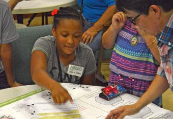
“A SPECIAL PLACE THAT INVITES OUR DIVERSE COMMUNITY + NEIGHBORHOODS TO GATHER AND ENJOY EACH OTHER.”
- Community comment in response to “Tell us about Your Ideal Park”
From assessment and analysis processes, several findings emerged that characterize challenges and opportunities for Fresno’s park system.
• Maintenance: To address existing park system daily maintenance and repair operations, an increased annual funding of nearly $5 million is needed, with an extra $10,000 - $15,000 needed for each additional acre added to the park system (this does not include any capital improvement or lifecycle costs)
• Lifecycle Replacements: Deferred investment of approximately $112 million is needed to adequately fund critical lifecycle replacement costs. If PMP recommended capital improvements of roughly $50 million are made, lifecycle costs may be reduced to approximately $80 million.
• Park Acreage: Park land needs to increase by 1,095 acres to meet the General Plan overall level of service goals for Fresno’s current population, and by 1,751 acres to meet recreation needs of Fresno’s future population (year 2035)
• Poor Condition Parks: Fresno’s park and open space system is dominated by parks in poor condition that suffer from lack of investment, lack of adequate maintenance, and public safety concerns due to inappropriate activities
• Park Deserts: Significant areas of Fresno have limited or no parks, creating “park deserts,” especially notable in portions of Districts 1, 5, and 7
• Limited Park Land in Urban Areas: There is insufficient park land to meet the needs of a growing Fresno, and a critical need for new park development in higher density urbanized areas that have extremely limited land available for new parks
• Parks are Highly Valued: The community values its parks and recreational programs, especially for kids and seniors
• Limited Resources: PARCS staff operate as best they can with limited available resources to provide unique experiences to the community
In addition, feedback from stakeholder meetings, public workshops in each council district, and extensive dialogue with City staff helped identify top priorities and strategies for improving Fresno’s park system.
Fresno’s park and open space system is an extremely valuable asset that requires adequate funding. This means accounting for total cost of ownership - including routine maintenance, planned lifecycle replacements, and strategic enhancements. Factoring these costs into capital park improvement plans helps identify, target, and prioritize park improvements so that Fresno’s existing park and open space system can better meet the needs of the community it serves. Financial realities
RECOMMENDED FOR STRATEGIC ENHANCEMENTS
Al Radka
Carozza (Basin G)
Einstein
El Capitan
Emerald
First and Bullard (Basin 0)
Frank H. Ball*
Highway City
Hinton
Large
Orchid
Radio
Reedy Discover Center
Robinson
Romain
Rotary West (Basin BE)
Safety
Selma Layne
Vinland
CAPITAL INVESTMENT
OPERATIONS + MAINTENANCE
RECOMMENDED FOR RE-MASTER PLAN / REDEVELOPMENT
Barstow & Del Mar (Basin F)
Bigby-Villa
California/Tupman
Dickey
Eaton Plaza
Fink-White
Granny's
Holman
Kearny
Lafayette
Mary Ella Brown
Quigley
Riverbottom
Spano
Stallion Park
Ted C. Wills
University
LIFECYCLE REPLACEMENT
TOTAL COST OF OWNERSHIP
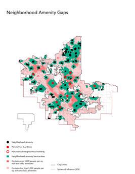
are such that new park development will be heavily scrutinized unless associated maintenance and lifecycle costs are addressed. This PMP targets the following parks for improvements, organized by parks recommended for strategic enhancements, or improvements that change user experience by offering a new amenity, and parks that should be re-master planned and completely redeveloped as a brand new park.
In addition, the influx of funds from Measure P can be directed toward repairing and improving existing parks. When it was approved by a majority of voters in 2018, Measure P began to address the clear and urgent need to improve what we have.

54% of those surveyed felt there was a LACK OF USABLE GREEN SPACE within walking / biking distance from their HOME
In addition to taking a total cost of ownership approach to parks in the system, critical gaps have been identified that must be addressed. Strategic approaches for closing these gaps include:
• Capitalize on existing infrastructure and opportunities for partnership by expanding joint-use site agreements at schools and basins when possible.
• Target park renovations by prioritizing parks in areas with park acreage deficiency and/or concentrations of parks in poor condition.
• Designate “flagship” or priority parks in each of Fresno’s Council Districts so that quality parks are found throughout the city.
• Concentrate resources in fewer, higher quality aquatic facilities that offer more value and reduce operating costs.
• Implement urban greening strategies to improve the public realm, especially in urbanized, park deficient areas.
52% of those surveyed are willing to support an increase in public funding for parks
• Acquire land through purchase or repurpose of City property and build new parks in existing urbanized neighborhoods.
The poor condition of many parks combined with concentrations of homeless populations in need of social services exacerbate public safety concerns and reduce the effectiveness of a park to serve its intended use. Staffing of parks, improved maintenance, attractive entries and perimeters, and natural surveillance resulting from park activation and community programming, are some examples of strategies for keeping parks safe.
Overarching goals for Fresno’s park and open space system include fund, maintain, improve, expand, secure, connect, partner, advocate, and celebrate. Chapter 9, “Goals and Recommendations,” outlines a comprehensive list of recommendations organized by these goal categories. From this comprehensive list, the following select recommendations have been highlighted:
1. Employ a business planning approach to the financial management of Fresno’s park and open space system that accounts for total cost of ownership and adequately funds new parks, maintenance, and ongoing operations, including the following strategies:
Increase investment in assets, including costs for lifecycle replacement and maintenance.
Increase Fresno’s annual maintenance and operations budget to align with standard state funding levels.
2. First prioritize funding for maintenance and existing park improvements, then prioritize budget for land acquisition.
3. Expand maintenance funding and support, including implementing a work order management system, employing a systematic approach to contracting services, and expanding full time equivalent (FTE) staffing.
4. Increase shade elements, including trees and built structures, in all park and open space areas, particularly those with high recreation value such as seating, picnic, and play areas.
5. Identify facilities that do not meet current community needs because they are underused, unpopular, or outdated and inaccessible, and strategically convert them into facilities that the community has identified as a priority.
6. Target expansion of Fresno’s park, open space and trails in existing urbanized, high need, “park-poor” areas.
7. Provide a diverse range of staffed programming to encourage positive, active use of parks throughout the course of the day, with particular emphasis on programming at parks with security concerns.
8. Provide neighborhood park amenities within ½ mile distance from all Fresno residences.
9. Maintain joint-use agreements and establish new, long term joint-use agreements with Fresno, Washington, Sanger and Central Unified School Districts that maximize availability of site use during non-school hours.
10. Continue to partner with Fresno Metropolitan Flood Control District (FMFCD) to maximize recreational opportunities at ponding basins through expanded seasonal access, redesign, grading, and amenity development.
11. Continue to collaborate with agencies and organizations working to maintain, develop and enhance the San Joaquin River Parkway and nearby riverfront land and habitat.
12. Encourage local community advocates and organizations working in the areas of public health, wellness, education, recreation, arts, community development, and environmental issues to support and advocate for Fresno parks.
13. Designate “flagship” or priority parks in each of Fresno’s Council Districts to direct funding toward so that quality parks can be found throughout the city and can become a source of local park pride.
14. Conduct system-wide re-branding of Fresno’s park and open space system, including strong online and on-site efforts, that are developed in conjunction with funding initiatives.

Fresno’s future is bright. With a rebounding economy, new high speed rail connectivity, anticipated population growth, and a development framework for creating strong neighborhoods, it is an appropriate time for the City of Fresno (City) to strengthen its public amenities. Parks are a valuable resource to the public - contributing to Fresno’s environment, economy, beauty, and public health, and this Parks Master Plan (PMP) positions parks as central to the City’s future. The 2018 PMP will guide strategic actions and daily operations of the park system for the next ten years, and beyond. The recommendations contained herein reflect the vision of the community and provide planning tools for decision makers as they strategically manage, fund, and improve Fresno’s park and open space system.
On June 27, 1989, the City of Fresno adopted the “1989 Master Plan for Parks and Recreation” as a component of the 1984 General Plan Open Space and Recreation Element. In decades since, the population, demographics, development patterns, land use, and needs of Fresno residents have significantly changed, but the Parks Master Plan has not been updated. The 2018 PMP takes these changes into account and reflects a vision for improving the City’s park and recreation system so that it better serves current and future needs of the people of Fresno.
In 2023, a technical amendment was made to the 2018 PMP that reframed the plan in the context of Measure P, which was passed by a majority of voters in 2018 and became effective in 2021. The technical amendment also addressed the Parks, After School, Recreation, and Community Services (PARCS) Department reorganization which occurred in 2022. The update also streamlined the plan for greater clarity and useability. The organizational structure of this amendment can be seen in Figure 1.1.
Fresno was founded in 1872 as a Central Pacific Railroad railway station, incorporated in 1885, and is now the economic hub of Fresno County and the San Joaquin Valley. It is the most populous city in the Central Valley and among the most populous cities in California, with a 2023 population of 552,604 estimated to grow to 600,407 by 2038. As it grows, Fresno’s population will continue to become more diverse. By 2035 the population is projected to be approximately 50% Hispanic, 29% White, 23% Asian, and 7% African American. In addition to the large Hispanic population, Hmong, Armenian, and Persian are other well established cultural groups. For a detailed description of Fresno demographic trends broken out by Development Areas, see Chapter 2, “Demographic and Recreation Trends.”
CURRENT NEED: + 1,095 ACRES FUTURE NEED: + 1,751 ACRES
Simply put, Fresno is growing, and the parks and recreation system needs to grow with it. In order to meet the level of service (LOS) goals for city park land, as outlined in the 2014 adopted General Plan, Fresno will need to significantly increase land in its park and open space network. Specifically, Fresno’s park land needs to increase by 1,095 acres to meet the General Plan overall LOS goals for current population, and by 1,751 acres to meet future population needs (year 2035).
But perhaps even more important than the quantity of Fresno’s parks and open space is the quality of these public amenities and their distribution across the city. Public feedback and technical analysis during the planning process reveal that park and open space needs of residents throughout the city are not currently being met. As Fresno grows, it will need a variety of well-distributed, high-quality public spaces, from playgrounds to community centers to natural areas, in both urbanized and developing parts of the city to ensure that Fresno’s parks and open space system meets the physical and cultural needs of Fresno’s diverse and growing population.
Using mapping technology, demographic information and data for categories including “Park Acreage,” “Facilities & Investment,” and “Access,” the Trust For Public Land (TPL) ranked Fresno in 90th place out of the 100 American cities they analyzed for their most recent 2017 ParkScore. Though low on the list, this most current ParkScore ranking shows improvement from 97th place in 2016, and a last place ranking in the years 2013, 2014 and 2015.
This opening chapter situates the need for an improved park system in a rapidly growing Fresno. It states the need for an increased quantity of green space, but more importantly improved quality of parks. The chapter provides an overview of the community engagement themes and goals as well as an introduction to Measure P. It also provides an overview of other relevant plans.
This demographic analysis provides an understanding of Fresno’s population in 2023, projected population growth over the 15-year planning period, and what our demographics mean for recreation needs. The analysis also provides recreation trends at a national level as a point of comparison to Fresno.
This chapter provides an overview of Fresno’s parks and open spaces. It describes the different types of parks in Fresno and level of service goals for each. It also details joint-use relationships with schools and basins in Fresno. The last section in the chapter provides a set of maps detailing the park system including a map and table cataloging all the parks in the system as of 2023.
Chapter 4 outlines the recreation programs offered by Fresno’s PARCS Department. It lays out programmatic strategies to improve and maintain recreation programs and describes fiscal strategies such as cost of service analysis and cost recovery. It includes a park operations and maintenance cost of service analysis and proposes strategies to improve maintenance in a variety of areas.
The guidelines in this chapter are intended as a resource for use in the planning and design of future parks and open spaces. The guidelines provide performance-based measures that create more sustainable, attractive, user-friendly sites that meet the needs of the public they serve.
This chapter describes a systematic analysis of existing conditions, identifying aspects of the park and open space system that do not meet user needs. This chapter also summarizes the process for determining Highest-Need Neighborhoods, a distinction that can help PARCS allocate resources to those who need it most.
The strategies in this chapter are provided to guide the City in prioritizing improvements and investments in existing parks and identifying priority locations for new parks. It also identifies other targeted ways to create more access to greenspace for Fresnans.
Chapter 8 introduces a “total cost of ownership” approach to sustaining Fresno’s park system over time. It introduces a three-tiered strategy for making critical, strategic, and visionary improvements to Fresno parks and provides tables that indicate improvements site by site. It also provides key sources of funding for each tier.
These system-wide recommendations to improve Fresno’s park and open space system are organized by nine overarching goal categories; fund, maintain, improve, expand, secure, connect, partner, advocate, and celebrate. They can be used to guide the PARCS Department in developing a thriving park system.
01 INTRODUCTION
• Added introductory overview of Measure P.
• Added PARCS mission statement.
• Added updated guidance for how to use the Parks Master Plan.
02 DEMOGRAPHIC + RECREATION TRENDS
• Added updated 2023 demographic and recreation trends.
03 PARK SYSTEMS OVERVIEW
• Documented new parks in Fresno and projects in the pipeline.
• Reviewed park typology and narrative about joint use.
04 PARK SYSTEM MANAGEMENT
• Documented recent updates to the park system including departmental reorganization.
• Added park operations and maintenance cost of service analysis, including direct expenditures, indirect and administrative/ overhead expenditures and a summary of total cost of service.
05 GUIDELINES FOR DESIGN
• No changes.
06 NEEDS ASSESSMENT
• Presented highest-need neighborhoods methodology and process for determining definition.
• Relocated prioritization strategies to Chapter 7.
07 PRIORITIZATION + IMPROVEMENT STRATEGIES
• Included strategies for closing the gaps and citywide themes for park system improvements.
• Presented the Measure P Park Prioritization Framework for existing and new parks.
• Move Urban Greening sections to appendix.
08 FINANCING
• Updated language to be relevant in 2023.
• Added a section on typical park improvement costs.
09 GOALS AND RECOMMENDATIONS
• Reorganized to more clearly highlight relevant master plan sections, figures and tables.
• References to Measure P added where appropriate.
Measure P was approved by a majority of voters in 2018, and became effective in 2021. It was born out of the clear and urgent need for high quality parks and is a great resource for helping to raise the quality of Fresno’s park system in the years ahead. The Ordinance provides a guaranteed, local funding source for parks through a 3/8-cent sales tax in the City of Fresno. It raises an estimated $38 million per year and takes special care to ensure the revenue can only be spent on what’s specified in the Ordinance.
The Ordinance also establishes the Parks, Recreation, and Arts Commission (PRAC) which is a 9-member commission that is appointed by the Mayor and approved by City Council. The membership of the Commission reflects the cultural, demographic, and geographic diversity of the City. The Commission’s primary authority on behalf of the City is to conduct hearings and receive public input on programs, facilities, and services funded with Measure P, and to make recommendations to the City Council for the adoption of Measure P expenditures in connection with the annual budget process. See sidebar for the Commission’s role as defined in the Ordinance.
Measure P helps ensure Fresno’s neighborhoods receive funding to improve and maintain our parks and facilities, create new parks and trails, and fund recreation, community, and arts programs. The proceeds are utilized to fund specific purposes defined in the Measure P Ordinance (see Figure 1.1).
The Commission shall have primary authority on behalf of the City to:
1. Conduct hearings and receive public input on allocations related to this ordinance, updates to the Parks Master Plan and Cultural Arts Plan, and annual PARCS Department Budget and Capital Improvement Plans; make recommendations to the City Council;
2. Review City staff recommendations for budget allocations related to this ordinance to ensure consistency with the ordinance and Expenditure Plan; make recommendations to the City Council for adoption of expenditures in connection with annual budget process and any amendments thereto; Created: 2021-07-30 15:39:15 [EST] (Supp. No. 37) Page 10 of 14
3. Review and recommend for City adoption guidelines for competitive grant programs established with funds from this Measure;
4. Oversee development and recommend City Council adoption of the Cultural Arts Plan and subsequent updates;
5. Review and make recommendations to the Mayor and City Council on fees related to parks, trails, and open space;
6. Review the Controller’s annual independent audit of the Clean and Safe Neighborhood Parks Account; ensure that a complete accounting of all expenditures each year is published and posted on a publicly accessible website;
7. Every five years, submit an evaluation of the program to the public and the City of Fresno;
8. Provide input on an annual report prepared by City staff that includes:
(A) Update on the percentage of Fresnans that live within ½ mile of a park;
(B) Update on the number and percentage of Fresnans accessing PARCS programs;
(C) Update on the implementation of the Parks Master Plan;
(D) Update on the implementation of the Active Transportation Plan;
(E) Update on the implementation of deferred maintenance and improvements to existing parks and recreational facilities in the City.
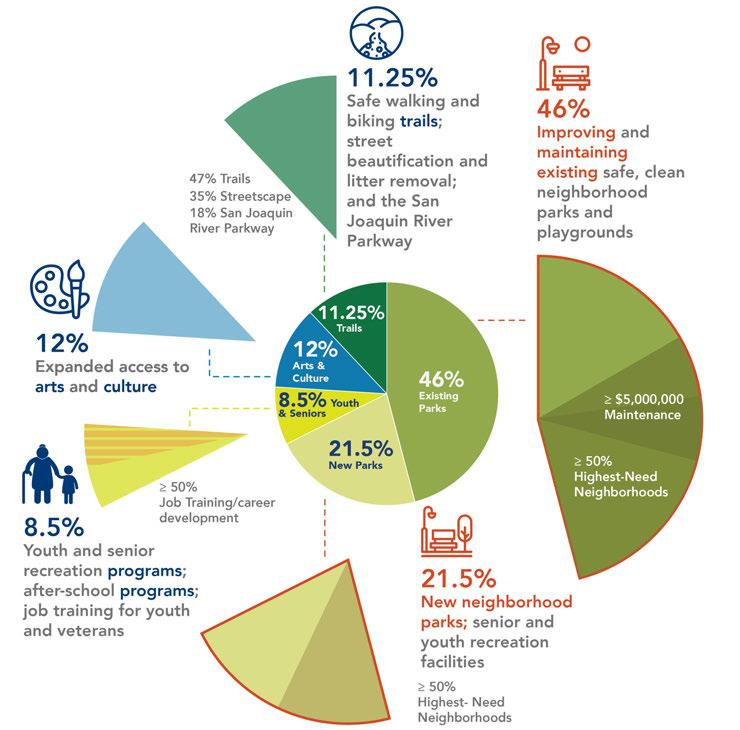
* Remaining .75% for planning and program costs
Measure P funds are distributed into five categories: Existing parks, new parks, youth and senior programming, access to arts and culture and trails and street beautification.*
1
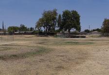
46% of the funds are allocated to existing parks This includes park rehabilitation and other capital improvements, facility upgrades to improve efficiency and safety, playgrounds and picnic areas, new restrooms and restroom improvements, park access for individuals with disabilities, sports facilities and swimming pools, and city-owned arts, cultural, and recreational facilities. Of the funds available for existing parks, no less than $5,000,000 must be used for maintenance and operations. Additionally, no less than half of the funds for existing parks must be made available for highest needs neighborhoods.
2
3
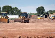
21.5% of the funds are allocated to new parks. This includes new neighborhood parks, pocket parks, and community gardens, public restrooms in new parks, new senior and community centers associated with the park systems, new regional parks located in the City of Fresno, playgrounds and picnic areas in new parks, and new public sport facilities and swimming pools. No less than half of the funds for new parks must be made available for neighborhoods of highest needs.
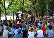
80.5% of the funds are allocated to programming for youth and seniors. This includes projects and programming that promotes recreation and accessibility to recreational facilities, sports, arts and active programs, community and senior recreation center programs, swimming and wateroriented programs, and other youth-oriented activities. No less than half of these funds must go to programs that provide job training, career development, to youth, young adults and veterans.


4
12% of the funds are allocated for expanded access to arts and culture. These funds are allocated in partnership with the Fresno Arts Council and include organizational stability for arts and cultural organizations that reflect the cultural, geographic and demographic diversity of the City of Fresno. It prioritizes organizations and programs that support and expand diverse public or youth engagement and equity.
5
11.25% of the funds are allocated for safe walking and biking trails, street beautification, and the San Joaquin River Parkway. Of these funds, forty-seven percent are reserved for projects that include trail development, including bike, pedestrian and equestrian trials and urban greening and tree planting. Twenty percent are reserved for operations and maintenance of trails. Twenty five percent of the funds are prioritized for pedestrian and bicycle pathways. Eighteen percent are for operations and projects consistent with the San Joaquin River Parkway Master Plan. Lastly, thirty-five percent are for development, improvement, restoration, maintenance, or rehabilitation along major roads and streets in the City of Fresno.
* An additional .75% of the total funds are made available on an annual basis to invest in program implementation, planning and plan updates, program and project innovation, and audit and oversight support to ensure the investments made by the citizens of Fresno create a world class set of facilities and programs.
Providing a robust, comprehensive, quality park and recreation system is a sure way to enhance quality of life for city dwellers. With population projected to dramatically increase in the next 25 years, the physical growth of the City, and in particular its parks and open space system, will have profound implications for public and environmental health.
The Centers for Disease Control and Prevention, along with other federal, state, and non-profit organizations including the Trust For Public Land (TPL), The Robert Wood Johnson Foundation, and The National Recreation and Park Association (NRPA), have thoroughly documented the link between having access to places for physical activity and improved physical and mental health. Regular contact with nature has proven benefits ranging from improved cardiac performance to lower stress levels and increased mental wellness. Consequently, the ability for Fresno’s increasing population to have easy, regular access to nature and open space will directly influence the physical and spiritual health of the city’s residents. In addition, providing open space and active transportation networks, including bicycle and pedestrian connections, increases opportunities for physical activity which can reduce rates of obesity, a serious health epidemic with incidence above the national average in the Fresno community.
Parks and open spaces are also valuable for their ability to help mitigate air and water pollution, in both urban areas like Fresno and areas with intensive agricultural industry like the San Joaquin Valley. Environmental services provided by parks and open space include air filtration, stormwater infiltration, and reducing the “urban heat island effect.” These services also bring public health and ecological cost savings – a value for taxpayers, state and local agencies alike.
Because negative environmental factors such as pollutants, lack of open space, and limited access to healthy food disproportionately impact low income communities, issues of equity are tied to Fresno’s parks and open space system. Investing in a comprehensive parks and open space network is a critical step toward ensuring that all Fresno citizens – particularly those located in areas of the city that are currently park poor – can have greater access to resources that support improved quality of life.
The value of parks also encompasses social factors like strengthening communities and improving safety. When people have access to inviting outdoor spaces they are more inclined to spend time with neighbors, family, and friends engaged in healthy, interactive outdoor activity. Such positive social behavior enriches public life and strengthens the connection people feel to their community. These conditions contribute to Crime Prevention Through Environmental Design (CPTED) and support methods to increase public safety such as “eyes on the parks” and natural community surveillance. Providing accessible, well-programmed community space for a diverse user group – in terms of age, income, and activity – is a first step toward making safe, successful public spaces.
Quality parks and recreation systems also bring with them economic benefits in the form of increased property value, tourism dollars and investment in local businesses. In short, parks are major assets for cities. As such, a business approach to asset management, by which there is financial incentive to make sure that parks and open space are properly maintained so they continue to appreciate in value over time, is applicable. This assetfocused business management approach to the planning and development of Fresno’s parks and open space system is a central driver for the 2018 PMP.
Since implementation in summer 2010, LA’s PAD program to extend park evening hours and activities at select locations has provided significant community benefits, including increased physical activity, improved social cohesion and decreased violent crime. Some highlighted statistics related to public safety include:
• Serious and violent crimes in the communities surrounding the original 3 parks in the PAD program declined 32 percent during the summer months between 2009 and 2013. During the same time period, such crimes increased 18 percent in nearby communities with parks that did not offer the PAD program.
• The perception of safety among community members was also very high, with 97 percent of respondents to a 2013 survey indicating that they felt safe while participating in PAD activities.
The 2018 PMP builds on a foundation of plans, studies and ordinances. The most relevant of these are summarized here.
The 1989 Parks Master Plan guided Fresno’s park development for 25 years before being superseded by the new General Plan. It provides a profile of the Fresno community at that time, establishes park and recreation facility standards and policies, and establishes 17 park planning areas, with proposed new parks and park improvements in each.
“QUALITY PARKS AND RECREATION SYSTEMS ALSO BRING WITH THEM ECONOMIC BENEFITS… PARKS ARE MAJOR ASSETS FOR CITIES”
The General Plan outlines a long-range vision for the physical development of the city, with an emphasis on infill development. The Plan’s Parks, Open Space and Schools (POSS) Element analyzes Fresno’s parks and recreation facilities and establishes goals and policies for future development of the parks and recreation system. The General Plan features:
• Classification of park types and calculation of existing “city park space”/”city park land;”
• Level of Service (LOS) goal to provide 5 acres of city park space per 1,000 residents, including 3 acres of community, neighborhood and pocket parks and 2 acres of regional parks, greenways and trails;
• Parks and Open Space map indicating locations and service areas of existing and potential future parks.
The 2018 PMP is the basis for General Plan amendments related to parks and open space.
The Downtown Neighborhoods Community Plan further details land use and development characteristics, public facilities, and implementation strategies for Downtown and surrounding areas. The Downtown Neighborhoods Plan emphasizes the role of street trees in providing identity and supporting quality of life, and sets a goal of putting all residents within a half mile of a park or publicly accessible open space. Strategies include partnering with schools, using city-owned vacant land for parks, and evaluating other underutilized parcels for potential parks.
The Southwest Fresno Specific Plan is a community-informed vision for a part of Fresno that has experienced disinvestment over the years but has potential for positive change. Among other policies, the draft Specific Plan supports an emphasis on improving existing parks first; calls for increased
access and amenities at ponding basin parks; identifies “essential” and “recommended” improvements applicable to all parks; and identifies future park locations.
The Active Transportation Plan (ATP) analyzes conditions for walking and biking in Fresno, sets goals for Fresno to equitably improve the safety, convenience, access, and completeness of bike facilities, and recommends specific improvements. The ATP features maps of existing and future bike and pedestrian networks.
The Nexus Study Update determines the park impact fee needed to cover the acquisition and development of 2 acres of new park land per 1,000 residents as well as a share of debt repayment on the 2008 parks bond. Nexus Study is a legal requirement and basis for the City’s updated Parks Impact Fee (PIF).
The ADA Facilities Transition Plan lists, prioritizes and sets forth a schedule for the physical changes that must be made in order to provide programmatic access to City programs, activities and services. The parks facility improvement priorities identified in the PMP are included in the annual addenda to the ADA Facilities Transition Plan.
The Fresno Municipal Code provides the regulatory structure for creating new parks in connection with the development approval process. Key provisions are summarized below.
• Article 4.7 establishes the Park Facilities Fee and authorizes City Council to set the parameters, including the amount of land and the typical facilities to be included in parks.
• Article 4.7 Section 12-4.705 states that residential subdivisions with fewer than 50 parcels shall be responsible for paying the park fee but not for dedicating land. Subdivisions with 50 parcels or more shall pay the fee and dedicate 0.6 acres per 1,000 residents in the form of pocket parks.
• Article 33 states that the City may impose conditions of approval on subdivisions, as needed to achieve consistency with planning policies, design guidelines, ordinances or State law.
• Article 37 defines the process for requiring land to be dedicated and reserved for specified public purposes, including parks. The article enables the City to provide the option for a subdivider to pay a fee in lieu of land dedication.
• Article 41 provides subdivision design standards, including standards for park location and design.
• Article 59 describes the Planned Development process, which allows for variation from base zoning where the City finds that the proposed development is “demonstrably superior” in terms of community design, environmental preservation, and/or community benefit.
• Article 61 states that “concept plans” are required when land designated for Low, Medium Low, or Medium Density Residential in the General Plan is proposed to be annexed. Concept plans must show how they will achieve “complete neighborhoods.”
The San Joaquin River Parkway Master Plan recognizes and supports related efforts that expand recreational opportunities for Fresnans. The San Joaquin River Parkway offers unique experiences such as kayaking, fishing, and nature interpretation in the City’s backyard. Several City parks are located adjacent to the Parkway and provide trailhead access points. Parkway land is being assembled and developed incrementally as part of a long-term vision for public access, recreation, and natural area conservation along the river. Development of the San Joaquin River Parkway is being managed by the San Joaquin River Conservancy. Funds have been identified for construction, and funding needs to be identified
and allocated for maintenance once the Parkway is built. Measure P helps support the development of the San Joaquin River Parkway, including the creation of the Eaton Trail which will be in River West and is estimated to be complete in Summer 2024.
Also notable is the Midtown Trail, a planned 7.1-mile multi-use trail that would follow roadways, rail and canal rights-of-way to provide a connection between Blackstone Avenue and the Clovis Old Town Trail. The Midtown Trail will be completed in 5 segments. As of 2023, 1.5 miles have been constructed, an additional 1/2 mile has been awarded for construction and several other segments will follow.
The Fresno Trail Network Expansion Feasibility Plan (Plan) builds on the City of Fresno’s efforts to develop the Class I bikeway (trails) network proposed in the adopted 2017 Fresno Active Transportation Plan. The goal of this project is to prioritize all planned but currently unfunded trails, to select five corridors, roughly five miles in length, and to develop concept designs and analyze the feasibility for the five selected corridors. The resulting recommendations will help the City begin to build out its trail network.
With this project, funded by a grant from Caltrans, the City of Fresno has set out to create a Wayfinding Plan to knit together the City’s trails and transit network, and to support and encourage transportation and recreation. Current trail and bike facility signage across the city is inconsistent and incomplete, resulting in a lack of guidance and creating confusion for people using the trails and bikeways. This plan, completed in February 2022, provides guidance for a seamless, coordinated wayfinding system that can be implemented across the City’s trail network and to close the gaps between first- and last-mile connections to transit. The City
encourages other local trail owners and jurisdictions, such as the County of Fresno and City of Clovis, to make use of the guidance included to promote a unified look and feel for Fresno’s wayfinding signage. The proposed signs, vetted by local maintenance staff, are designed to be easy to manufacture, install, and maintain.
This report documents the City of Fresno’s work to assess and improve transportation safety conditions citywide. According to the five most recent years of available collision data, approximately 3,164 reported collisions occur on City streets annually, 4% of which result in fatality or severe injury (37 annual deaths and 94 annual severe injury collisions). The City has analyzed the data and engaged local partners to identify emphasis areas, including engineering and non-engineering solutions, to improve transportation safety for all road users. This transportation safety report documents that effort and has been adapted to meet Caltrans SSAR Program requirements and align with the LRSP Program. This report provides a roadmap to improve upon the trends of the past five years into the future.
Additionally, the City has several neighborhood plans, community plans and specific plans underway that will support the PMP. New parks and open spaces are being explored and developed following the guidance of these plans:
• Central Southeast Area Specific Plan
• West Area Neighborhoods Specific Plan
• South Central Specific Plan
• Southeast Development Area Specific Plan
• Kings Canyon Corridor Transit-Oriented Development Connectivity Study
• Tower District Specific Plan
The parks master planning process was initiated with community engagement and the creation of a “Vision” document. The Vision document identified important themes for the parks master plan including equity, health, safety, design for beauty, and innovation
Community outreach to articulate themes and goals continued throughout the planning process in multiple formats including stakeholders interviews and meetings, mobile workshops on nights and weekends at Fresno parks and schools, community-wide meetings soliciting feedback on current park system issues, and detailed online public surveys. Stakeholder meetings were held with key, engaged residents interested in parks, recreation, public health, and Fresno’s civic identity. Community and institutional leaders, City Council members, and community advocates were some of the people involved in these meetings. Stakeholders were given an overview of the parks master planning process and current strengths and challenges the park system faces to help further articulate community needs and priorities.
From themes established in the Vision document, and continued community engagement, the PMP goals of fund, maintain, improve, expand, secure, connect, partner, advocate and celebrate emerged. Chapter 9, “Goals and Recommendations,” provides recommendations that are organized around these fundamental park goals.
In the future, all Fresno residents are able to easily walk to a park to access community and neighborhood amenities. Parks are welcoming with clear entries, signage, and attractive perimeters.
• All existing parks are upgraded to be ADA compliant. Barrier-free designs are implemented wherever possible. Universal accessibility is designed into all new parks.
• Parks are connected through multi-use trails, transit connections and pedestrian routes. All parks have adequate mobility connections to enhance public safety including visible crosswalks, bicycle lanes and marked transit stops. Pedestrian connections within parks link to amenities with clear sight lines and access points. Adequate lighting, comfortable sidewalk width, consistent bicycle lanes and visible transit stops will enhance access.
• Parks are clearly branded with consistent signage that is visible from outside of the park. Signage provides an opportunity for system branding as well recognizing each park by name. Wayfinding signage within the park helps facilitate accessibility and clearly direct users to amenities within the park.
• Entries are welcoming at new and existing parks. These entries have clear signage, pedestrian access, and respond to logical hierarchy of program areas.

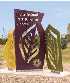
Future parks in Fresno equitably serve the entire population. From creating new parks, to restoring amenities within existing parks, the Fresno park system of the future is available for all residents. Parks in Fresno will also serve the city’s growing and diverse population and be inclusive of all age ranges, cultures and recreational needs.
• At a minimum, 5 acres of parks and open space amenities exist per 1,000 Fresno residents. This standard was established by the General Plan.
• Park facilities are multi-generational with facilities for every age group from children to seniors.
• Equitable park space in Fresno is a priority for the city to accomplish in the future.
• Programming in Fresno parks is inclusive of all cultures including adequate open space and facilities for outdoor programming for multicultural sports and games. Parks provide multicultural learning opportunities and places for celebration of our diverse heritage.
• New parks are built, existing parks are renovated and adequately maintained to provide quality service.
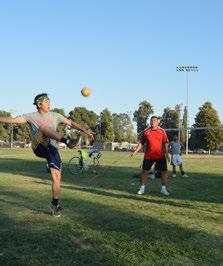
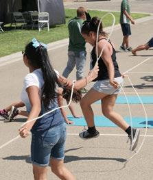
Parks are for people of all ages, backgrounds, and ability.
In the future, Fresno’s park system is at the forefront of City initiatives to improve health and wellness for residents. Initiatives linking public health and parks can be about more than simply providing places for exercise, it can extend to programming, design, and improving quality of life through increased access to green space and natural features such as trees, water, and shade. This is important for everyone, especially those living in urban environments.
• Trees found in and around parks improve air quality and provide comfort - two benefits tied to health and wellness. Improved air quality also has implications for the environmental health of the city and region.
• Paths and trails facilitate healthy lifestyles for residents and provide active transportation options.
• The themes of wellness and nutrition permeate park programming, including organized activities that promote physical health, casual activities that support mental health, and other City programs occurring at parks, community and recreation centers where healthy snacks and meals are provided for children and seniors.
• Park amenities including play equipment are clean and safe places to play.
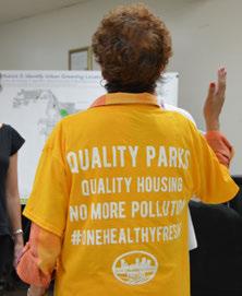
Issues pf parks, community, and health are all connected.
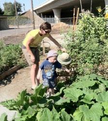
Future Fresno parks are safe, welcoming places where every person feels welcome and safe regardless of time of day, neighborhood, or security presence.
• In order to make parks safer, it is important to have people, residents, and merchants surrounding the park, providing surveillance. “Eyes on the park” means that the more people we have in parks and surrounding them, the safer they become.
• Having clear sight lines is an important design consideration for safety in parks. Open spaces are less likely to be used for undesirable activity and allow accessibility across parks for emergency access and other needs. While shade is an important feature in Fresno parks, all spaces should be designed so that they are open and have visibility for park users and Staff.
• Coordination with social service providers to regularly visit parks can assist transient and homeless populations who seek temporary shelter and other benefits from the PARCS department.
• The Park Ranger program places 20 Park Rangers throughout 5 policing districts. The Park Rangers began working in the parks during the Summer of 2023. This program is new to the department and will be assessed as the program develops. There is potential for expansion of the program if the implementation is successful.

PARCS staff provide security, education, and mentoring of children.
Future Fresno Parks are beautiful places that attract residents and tourists alike. They create comfortable spaces that showcase the ecology of the San Joaquin Valley and the unique history of Fresno.
• Parks are welcoming for all users. Fresno Parks have clear entryways and signage for all modes of transportation, paying special attention to gateway functions that are welcoming and comfortable.
• Planting in Fresno Parks is aesthetically pleasing, providing different textures, colors and scents for park users. Native planting is encouraged especially plants that are low maintenance and drought tolerant.
• The regional character of Fresno is expressed in the park system through architectural, planting and landscape materials. Multi-cultural programs are encouraged to showcase the diverse population. Historic sites within parks are showcased with interpretive signage and programming elements.
• All Fresno Parks provide elements of shade for users. From tree groves to shade structures, the benefits of comfortable spaces offset the extreme summer temperatures and make park space usable year round.
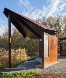

This park in Zurich Switzerland combines elements of light, water, and vegetation to create a beautiful experience at all times of day.
Future Fresno Parks serve as a model for innovation in resiliency and sustainability. Climate change requires a greater attention to landscape management to reduce resource inputs and maximize ecological function.
• New parks are designed and maintained for energy efficiency. Existing parks are evaluated for their resource use and modified through changes in maintenance practices, material and plant selections.
• Water efficient initiatives are explored including gray water and recycled water systems. Stormwater systems are designed into parks especially where there is room for treatment, detention and storage of stormwater. When possible, low water and xeriscaping is incorporated into new and existing parks in order to decrease resource inputs.
• Fresno parks feature planting and landscape features that support the Fresno ecosystem. Ecosystem restoration and creation is focused in areas that can revitalize habitats and native planting areas. Educational programs and signage is encouraged to educate the general public about their environment.
• Working landscape features are incorporated into existing and proposed parks as much as possible. Incorporating green infrastructure functions can help filter pollutants and capture stormwater.

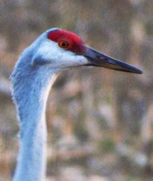
Creating and restoring habitats can renew ecosystems for wildlife,
The 2018 PMP is intended to be used as a tool for planning and managing Fresno’s park and open space assets. The PMP is intended to be revisited and updated as necessary, with a 10 year near term planning horizon The 2023 Technical Amendment, which updated this document in the context of Measure P and the PARCS Department reorganization, was the first such revisiting of the Plan. (See figure 1.1)
Primary responsibility for implementing this Plan falls to the following City departments, as summarized:
• Parks, After School, Recreation and Community Services (PARCS): PARCS Department: Of 1023 acres of park land, PARCS maintains 966 acres (including some Fresno Metropolitan Flood Control District ponding basin land with recreation amenities). The remaining 57 acres are maintained by Public Works. The PARCS Department provides an array of recreational programs for people of all ages, and manages special events in parks.
• Planning and Development Department : Planning and Development has broad responsibility over land use planning and development in Fresno. The Current Planning Division and the Building and Safety Division review planning and building applications and issues permits. The Housing and Community Development Division focuses on improving property values and quality of life through housing rehabilitation, and distribution of federal grants. The Long-Range Planning Division administers Fresno’s long-range planning efforts, including this PMP Update.
• The Public Works (PW) Department builds and maintains the City’s infrastructure, including its streets, sidewalks, traffic signals, trails, parks, street trees, irrigation and landscaping. The Department also provides design services, construction and project management for public facilities and parks, and maintains Community Facilities District parks. New park improvement projects and new park development informed by the PMP are implemented through a partnership between
Through our dynamic and dedicated staff, we enhance the quality of life for the community by providing safe, clean, accessible parks and community centers offering diverse programs and recreational activities and fostering meaningful community partnerships.
THIS PLAN BELONGS TO ALL FRESNO COMMUNITY MEMBERS. THESE ARE YOUR PARKS, AND WE HOPE YOU WILL HELP US ACHIEVE THE COMMUNITY’S PARKS VISION!
the PARCS Department and Public Works. The PMP’s “urban greening” recommendations that have to do with the tree canopy, bioswales, and active transportation facilities will also be a partnership between the PARCS Department and Public Works.
• The General Services Department provides support services for City Departments including fleet management, facilitates management, and procurement. The Department’s facilities management division implements capital maintenance projects for the PARCS Department including life cycle maintenance activities informed by the PMP.
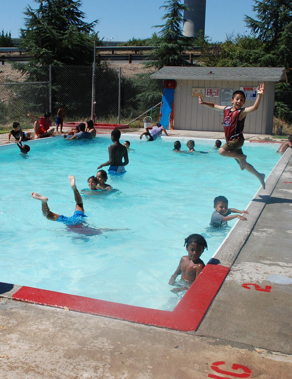
Studying population and demographic trends helps us understand park users and their generalized needs. Our ethnic background, age, and income can all influence the way we use parks. Looking at population estimates and demographic changes was therefore an important part of this parks master planning process. This chapter provides information about Fresno’s current and future population, and predicts trends in recreation needs. Demographic information is categorized by park planning districts, sub-areas of the City that allow a finer grain application of these findings.
Fresno is growing. It is the most populous city in the Central Valley and among the most populous cities in California. With a 2023 population of 552,604 estimated to grow to 600,407 by 2038, the City is projected to have a population increase of 8.7%. As it grows, Fresno’s population will continue to become more diverse.
By 2038 the population is projected to be approximately 56% Hispanic or Latino, with the non-Hispanic portion of the population being 18% White, 17% Asian, and 7% African-American. In addition to the large Hispanic population, Hmong, Armenian, and Persian are other well-established ethnic groups. The only population that may see little change in size over time is the African American population.
Population growth will not occur uniformly, potentially focusing more demand in some development areas of the city. The greatest increase in population is projected to be in two main areas: Existing Neighborhoods South of Shaw and Existing Neighborhoods North of Shaw. This growth may be attributed to a focus on infill development, the location of this area in the north part of the city and/or due to the large geographic boundaries of these neighborhoods as compared with the others. The areas of the city that are projected to experience the greatest percent increase in population are DA-2 North and South, and DA-4 East. These areas have relatively low population, but their numbers are predicted to double or almost double in the next 15 years (2023-2038).
This demographic analysis provides an understanding of Fresno’s population. This analysis is broken down by Development Areas as defined by the City’s General Plan and is reflective of the total population, and its key characteristics such as population density, age distribution, households, gender, ethnicity, and household income. It is important to
Source: U.S. Census Bureau and Environmental Systems Research Institute, Inc. (ESRI)
note that future projections are based on historical patterns. Unforeseen circumstances during or after the time of the projections could have a significant bearing on the validity of the final projections.
The demographic data used in the 2023 Technical Amendment was obtained from U.S. Census Bureau and from Environmental Systems Research Institute, Inc. (ESRI), the largest research and development organization dedicated to Geographical Information Systems (GIS) and specializing in population projections and market trends. All data was obtained in June 2023 and reflects actual numbers as reported in the 2010 and 2020 Census. ESRI then estimates the current population (2023) as well as projections for the future. The geographic boundaries for the Development Areas within Fresno were drawn from the boundaries shown in the Residential Capacity map in the Fresno General Plan.
Please Note: The 2023 Technical Amendment demographic projections differ from the projections in the plan as adopted in 2018 due to updated information. The ESRI data used in the 2018 version of the plan was obtained in June 2017 and reflected the 2010 Census and 2017 estimates as well as 5 year incremental projections for 2022, 2027 and 2032.
The City’s population has experienced growth in the last 13 years, increasing 10.5% from 2010 to 2023, or on average 0.81% per year. This is in-line with the national annual growth rate. Like the population, the total number of households also experienced an increase of 12.4% over the 13 years, or on average 0.95% annually.
Currently, the population is estimated at 552,604 individuals living within 150,135 households. Projecting ahead, the total population is expected to continue to grow, but at a slower pace than the last 13 years. By 2038, the City’s population is projected at 600,407 residents (0.58% annual growth) living within 198,960 households (0.70% annual growth).
Evaluating the City’s age breakdown, the population has become slightly older in the last 13 years but remains balanced across the major age segments. In 2010, the 55+ population made up only 19% of the population, whereas today it makes up 22% of Fresno’s populace, an increase of 3%. Despite this increase, the City of Fresno remains much younger than the U.S. population. The 2023 population has a median age of 29.6 years old compared to the U.S. median age of 38.5 years. Fresno’s balanced age profile is projected to continue over the next 15 years, though it must be noted that the community will consistently age as well. By 2038, the 55+ are expected to represent 24% of the total population (an increase of 2% over 2023) while most other major age segments will experience a slight decrease.
2. 1 POPULATION BY AGE SEGMENTATION
The Census Bureau defines Race as a person’s self-identification with one or more of the following social groups: White, Black, or African American, Asian, American Indian, and Alaska Native, Native Hawaiian and Other Pacific Islander, some other race, or a combination of these, while Ethnicity is defined as whether a person is of Hispanic / Latino origin or not. For this reason, the Hispanic / Latino ethnicity is viewed separate from race throughout this demographic analysis.
The City of Fresno is a melting pot and is racially and ethnically diverse in each development area of the community. It will be important for the PARCS Department to provide programming and services that can be defined by cultural preference and continually seek to identify emerging activities and sports.
The City’s current population has diversified significantly over the last 13 years as the White Alone population has decreased by 15%. Though still the largest racial segment in the City, the White Alone population represents 32% while the next largest racial segment - Some Other Race (28%) - has increased by 6% since 2010. By 2038 the population is projected to become more diverse, as the Some Other Race segment (32%) is projected to be the largest racial segment in Fresno while the White Alone population will decrease by an additional 14%..
The City’s population was also assessed based on Hispanic/Latino ethnicity, which by the Census Bureau definition is viewed independently from race. Individuals who are Hispanic/Latino in ethnicity can also identify with any racial categories identified above.
People of Hispanic/Latino origin have increased by 5% over the last 13 years and currently represents approximately 52% of the City’s population, which is well above the national average (19% Hispanic/Latino). The Hispanic/ Latino population is expected to grow to 56% of the City’s total population by 2038.
As seen in Figure 2.4, the City’s per capita income ($29,101) and median household income ($60,617) are both lower than the averages of the State of California and the U.S. The per capita income is that earned by an individual while the median household income is based on the total income of everyone over the age of sixteen living under the same roof. This indicates that the average household may have less disposable income and may be more sensitive to the cost associated with the quality of life benefits that parks provide.
This section provides a summary of the demographic trends broken down by city planning area. The geographic boundaries for the development areas are those of the Residential Capacity map in the City’s General Plan.
Source: Fresno General Plan, Adopted December 18, 2014
Established Neighborhoods
Downtown Planning Area
BRT Corridors Outside Downtown Planning Area
Established Neighborhoods South of Shaw
Established Neighborhoods North of Shaw
South Industrial Area
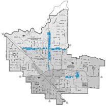
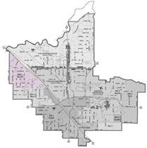
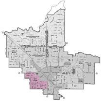
5.6 % 18.7 % 4.2 % PROJECTED POPULATION GROWTH FR0M 2023 TO 2038
PROJECTED POPULATION GROWTH FR0M 2023 TO 2038 PROJECTED POPULATION GROWTH FR0M 2023 TO 2038
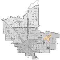
DA-3
DA-2 NORTH POPULATION DA-2 SOUTH POPULATION
% 47.9 %
POPULATION
PROJECTED POPULATION GROWTH FR0M 2023 TO 2038
8.4 % PROJECTED POPULATION GROWTH FR0M 2023 TO 2038
PROJECTED POPULATION GROWTH FR0M 2023 TO 2038

Projection
DA-4 WEST POPULATION DOWNTOWN POPULATION + 1,226 PEOPLE + 1,673 PEOPLE - 1,671 PEOPLE
41.3 % 10.6 % 2.5 % PROJECTED POPULATION GROWTH FR0M 2023 TO 2038
PROJECTED POPULATION GROWTH FR0M 2023 TO 2038
PROJECTED POPULATION DECLINE FR0M 2023 TO 2038
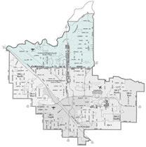
EXISTING NEIGHBORHOODS NORTH OF SHAW POPULATION
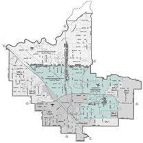
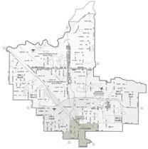
PROJECTED POPULATION GROWTH FR0M 2023 TO 2038
PROJECTED POPULATION GROWTH FR0M 2023 TO 2038
PROJECTED POPULATION DECLINE FR0M 2023 TO 2038
+ 14,967 PEOPLE + 23,823 PEOPLE - 52 PEOPLE
The following implications are derived from the analyses provided above.
The development areas established in the General Plan are hard to compare: on the one hand, the great majority of Fresno’s existing neighborhoods fall into one of two subareas. These are projected to grow relatively slowly. In these areas, new residents will be distributed throughout neighborhoods, so new park demand will also be distributed. But many existing neighborhoods are park-deficient today, so new residents will add to existing demand. Siting and funding for new parks will also be challenging. In the still-developing subareas around the edges, population growth is projected to be faster, because in many cases there is very little development in these areas today. New parks in these areas must be provided as part of future development.
Each area of the city is characterized by an extremely broad age segmentation, meaning that there are not parts of the city with a significant concentration of just one age group. Over the next 15 years, the city is projected to remain balanced, but also age as the 55+ segment will make up 22% of the population in 2038. This is significant because programs and facilities need to focus on multiple ages and age segments have different likings towards activities. For example, children (0-12) may enjoy active, skill development-based recreation activities while adults (65+) are more likely to enjoy more passive recreation activities.
Fresno will continue to diversify, requiring PARCS to continue providing traditional and emerging programming and service offerings. A diverse population will focus the PARCS Department on providing programming and service offerings that can be defined by cultural preference while always seeking to identify emerging activities and sports.

In most planning areas throughout the city, barring those in the North, median and per capita household income is below or well below the state and national averages. It is important for the PARCS Department to provide offerings that focus on low-cost services with exceptional customer service. It would also benefit the system to investigate different funding and revenue strategies to help the department cover the costs of these services.
Recreation planning at the local level can be supported by an understanding of national trends. Trends data used for this analysis was obtained from Sports & Fitness Industry Association’s (SFIA), National Recreation and Park Association (NRPA), and Environmental Systems Research Institute, Inc. (ESRI). All trend data is based on current and/or historical participation rates, statistically valid survey results, or NRPA Park Metrics.
The Sports & Fitness Industry Association’s (SFIA) Sports, Fitness & Leisure Activities Topline Participation Report 2023 was utilized in evaluating the following trends:
• National Recreation Participatory Trends
• Core vs. Casual Participation Trends
The study is based on findings from surveys conducted in 2023 by the Sports Marketing Surveys USA (SMS). The purpose of the report is to establish levels of activity and identify key participation trends in recreation across the U.S. This study looked at 120 different sports/activities and subdivided them into various categories including: sports, fitness, outdoor activities, aquatics, etc.
Approximately 236.9 million people ages six and over reported being active in 2023, which is a 1.9% increase from 2021 and the greatest number of active Americans in the last 6 years. This is an indicator that Americans are continuing to make physical activity more of a priority in their lives. Outdoor activities continue to thrive, recreation facilities reopened, fitness at home maintains popularity, and team sports are slowly reaching pre-pandemic participation levels. Figure 2.6 depicts participation levels for active and inactive (those who engage in no physical activity) Americans over the past 6 years.
Figure 2.6 ACTIVITY AND INACTIVITY TREND
In addition to overall participation rates, SFIA further categorizes active participants as either core or casual participants based on frequency of participation. Core participants have higher participatory frequency than casual participants. The thresholds that define casual versus core participation may vary based on the nature of each individual activity. For instance, core participants engage in most fitness activities more than fifty times per year, while for sports, the threshold for core participation is typically thirteen times per year.
In each activity, core participants are more committed and tend to be less likely to switch to other activities or become inactive (engage in no physical activity) than causal participants. This may also explain why activities with more core participants tend to experience less pattern shifts in participation rates than those with larger groups of casual participants. Increasing for the fifth straight year, 158.1 million people were considered CORE participants in 2023.
Figure 2.8 shows 2023 participation rates by generation. Fitness sports continue to be the go-to means of exercise for Boomers, Gen X, and Millennials. Over half of the Gen X, Millennials, and Gen Z generation participated in one type of outdoor activity. Team sports were heavily dominated by generation Gen Z and a third of Gen X also participated in individual sports such as golf, trail running, triathlons, and bowling.
In 2023 team sports participation rate increased to 23.2% which is near 2019 participation levels. Pickleball continues to be the fastest growing sport in America by doubling its participation in 2023. Following the popularity of pickleball, every racquet sport also increased in total participation in 2023.
Americans continue to practice yoga, attend pilates training, and workout with kettlebells. In 2023, many people started indoor climbing, while others took to the hiking trail. The waterways traffic had an increase of stand-up paddlers, kayaks, and jet skis. Gymnastics, swimming on a team, court volleyball, and fast-pitch softball benefited from the participation boom created from the Olympics.
Water sports had the largest gain in participation rates. Activities such as jet skiing, scuba diving, and boardsailing/windsurfing all contributed to the 7% increase. Outdoor sports continue to grow with 55% percent of the U.S. population participating. The largest contributor to this gain was trail running, having a 45% increase over the last five years.
23.6
The most recent year shares similarities with the five-year trends; with pickleball (85.7%) and golf - entertainment venues (25.7%) experiencing increases in participation this past year. Other top one-year increases include racquetball (8.0%), badminton (7.1%), and gymnastics. BASKETBALL 28.1
The top sports most heavily participated in the United States were basketball (28.1 million), golf (25.6 million), and tennis (23.6 million) which have participation figures well more than the other activities within the general sports category. Baseball (15.5 million), and outdoor soccer (13.0 million) round out the top five.
The popularity of basketball, golf, and tennis can be attributed to the ability to compete with small number of participants, this coupled with an ability to be played outdoors and/or properly distanced helps explain their popularity during the COVID-19 pandemic. Basketball’s overall success can also be attributed to the limited amount of equipment needed to participate and the limited space requirements necessary, which make basketball the only traditional sport that can be played at most American dwellings as a drive-way pickup game. Golf continues to benefit from its wide age segment appeal and is considered a life-long sport. In addition, target type game venues or golf entertainment venues have increased drastically (86.2%) as a 5-year trend, using golf entertainment (e.g., Top Golf) as a new alternative to breathe life back into the game of golf.
Since 2017, pickleball (185.7%), golf - entertainment venues (86.2%), and tennis (33.4%) have shown the largest increase in participation. Similarly, basketball (20.3%) and outdoor soccer (9.2%) have also experienced significant growth. Based on the five-year trend from 2017-2023, the sports that are most rapidly declining in participation include ultimate frisbee (-31.5%), rugby (-28.1%), and roller hockey (-25.4%).
Sports that have seen moderate 1-year increases, but 5-year decreases are racquetball (8.0%), gymnastics (7.1%), and court volleyball (4.2%). This could be a result of coming out of the COVID-19 pandemic and team program participation on the rise. Like their 5-year trend, rugby (-5.8%), roller hockey (-4.0%), and ultimate frisbee (-2.2%) have seen decreases in participation over the last year.
Table 2. 1
Overall, national participatory trends in fitness have experienced growth in recent years. These activities have become popular due to an increased interest among Americans to improve their health and enhance quality of life by engaging in an active lifestyle. The most popular general fitness activities in 2023 also were those that could be done at home or in a virtual class environment. The activities with the most participation was walking for fitness (114.8 million), treadmill (53.6 million), free weights (53.1 million), running/jogging (47.8 million), and yoga (33.6 million).
Over the last five years (2017-2022), the activities growing at the highest rate were trail running (44.9%), yoga (23.0%), Pilates training (14.0%) and dance, step & choreographed exercise. Over the same period, the activities that have undergone the biggest decline in participation include group stationary cycling (-33.4%), cross-training style workout (-32.1%) and nontraditional/off road triathlons (-28.1%).
In the last year, fitness activities with the largest gains in participation were group-related activities, cardio kickboxing (8.5%), Pilates training (5.8%), and group stationary cycling (5.5%). This 1-year trend is another indicator that participants feel safe returning to group-related activities. Trail running (5.9%) also saw a moderate increase indicating trail connectivity to continue to be important for communities to provide. In the same span, fitness activities that had the largest decline in participation were cross-training style workout (-5.3%), bodyweight exercise (-2.6%) and running/jogging (-2.4%).
Table 2. 2
NOTE: Participation figures are in 000’s for the US population ages 6 and over
Results from the SFIA report demonstrate rapid growth in participation regarding outdoor/adventure recreation activities. Like general fitness activities, these activities encourage an active lifestyle, can be performed individually, and are not as limited by time constraints. In 2023, the most popular activities, in terms of total participants include day hiking (59.5 million), road bicycling (43.6 million), freshwater fishing (41.8 million), camping (37.4 million), and wildlife viewing (20.6 million).
From 2017-2023, sport/bouldering (174.8%), camping (42.5%), skateboarding (41.3%), day hiking (32.7%), birdwatching (28.6%) has undergone large increases in participation. The five-year trend also shows activities such as indoor climbing (-51.4%), adventure racing (-32.2%) to be the only activities with double-digit decreases in participation.
The one-year trend shows most activities growing in participation from the previous year. The most rapid growth being in sport/boulder climbing (151.1%), BMX bicycling (8.3%), birdwatching (6.8%), and in-line roller skating (4.7%). Over the last year, the only activities that underwent decreases in participation were indoor climbing (-56.9%), adventure racing (-6.1%), and overnight backpacking (-0.9%). Core vs. Casual trends in Outdoor recreation.
Table 2. 3
NATIONAL PARTICIPATORY TRENDS - OUTDOOR / ADVENTURE RECREATION
NOTE: Participation figures are in 000’s for the US population ages 6 and over
PARTICIPATION LEVELS
Description automatically generatedSwimming is deemed a lifetime activity, which is why it continues to have such strong participation. In 2023, fitness swimming remained the overall leader in participation (26.3 million) amongst aquatic activities.
FIVE-YEAR TREND
Assessing the five-year trend, fitness swimming (-3.2%) and swimming on a team (-3.4%) experienced moderate decreases due to the accessibility
of facilities during COVID-19. While aquatic exercise (2.1%) saw a slight increase in participation during this same time period.
In 2023, all aquatic activities saw moderate increases in participation which can be asserted to facilities and programs returning to pre-COVID-19 pandemic levels. Swimming on a team (2.8%), aquatic exercise (2.7%) andn fitness swimming (2.5%) saw moderate increases in participation.
Table 2. 4
NOTE: Participation figures are in 000’s for the US population ages 6 and over
PARTICIPATION LEVEL
The most popular water sports / activities based on total participants in 2023 were recreational kayaking (13.6 million), canoeing (9.5 million), and snorkeling (7.4 million). It should be noted that water activity participation tends to vary based on regional, seasonal, and environmental factors. A region with more water access and a warmer climate is more likely to have a higher participation rate in water activities than a region that has a long winter season or limited water access. Therefore, when assessing trends in water sports and activities, it is important to understand that fluctuations may be the result of environmental barriers which can influence water activity participation.
Over the last five years, surfing (37.8%), recreational kayaking (28.7%), stand-up paddling (13.6%) and white-water kayaking (9.0%) were the fastest growing water activities. From 2017-2023, activities declining in participation were water skiing (-14.9%), snorkeling (-12.0%), boardsailing/windsurfing (-11.6%), and sea/touring kayaking (10.6%).
In 2023, water skiing (-0.6%) was the only water activity to see a decrease in participation. Activities which experienced the largest increases in participation in the most recent year include jet skiing (7.6%), scuba diving (7.4%), boardsailing/windsurfing (7.2%), and surfing (6.6%).
Table 2. 5
NATIONAL PARTICIPATORY TRENDS - WATER SPORTS / ACTIVITIES
NOTE: Participation figures are in 000’s for the US population ages 6 and over
In addition to participation rates by generation, SFIA also tracks nonparticipant interest. These are activities that the U.S. population currently does not participate in due to physical or monetary barriers, but is interested in participating in. Below are the top five activities that each age segment would be most likely to partake in if they were readily available.
Overall, the activities most age segments are interested in including camping, bicycling, fishing, and swimming for fitness. All of which are deemed as low-impact activities, making them obtainable for any age segment to enjoy. Fishing
Camping
Fitness
Fishing
Fitness
Birdwatching/Wildlife Viewing
Working
Departments like PARCS are a vital service provider to older adults, and yet there remains significant opportunity to provide more. The key findings in the report indicate that more than nine in ten park and recreation agencies offer facilities, activities and programming that cater to older adults. These activities vary, including providing older adults with chances to socialize with others, ways to stay healthy and active, and opportunities to serve others in their communities. Following is a list of activities that are among those most often geared to older adults:
• Exercise classes
• Field trips, tours, vacations
• Arts and crafts classes
• Opportunities to volunteer
• Community events and festivals targeted at older adults.
• Group walks
• Paid job opportunities to lead exercise classes, work in recreation centers or at parks.
As noted above, the list of activities varies from active to passive and everywhere in-between.
The wide breadth of service offerings for older adults should reflect the broad population served. This includes Fresno following a wide definition of “older adults” when designing and marketing offerings — starting with adults as young as 55 years old.
Furthermore, Fresno may be unique in ensuring that the needs of underserved older adults are met. PARCS can be a critical, lifesaving resource for lower and/or fixed income segments of the older adult population. This can include transportation to and from activities and facilities and low-cost or free fitness programs.
Fresno could consider developing programming for older adults with key partners. To best serve this population, partnerships can include, but not limited to:
• Area agencies on aging
• Retirement communities
• Senior meals providers
• Hospitals and doctors’ offices
• Local health departments
• Health insurance companies
• Community-based organizations
Even with these partners, Fresno will have hurdles that must be overcome before providing more services to older adults. The challenges are the result of inadequate resources, including facility space shortages, insufficient funding, and inadequate staffing. These resource constraints will become even more acute as the older adult population grows and the demand for these services increases.
ESRI’s 2023 Sports and Leisure Market Potential Data measures the demand for recreation activities as well as expected consumer attitudes towards these activities by City of Fresno residents. The Market Potential Index (MPI) shows the likelihood that a resident of the City of Fresno will participate in certain activities when compared to the US National average. The City is compared to the national average in three (3) categories – general sports, fitness, and outdoor recreation.
Please Note: The participation by Fresno residents in these activities is not restricted geographically to the City of Fresno. For example, a Fresno resident may participate in an activity offered by a neighboring city or park and recreation provider.
Looking at the three categories (general sports, fitness, and outdoor activity), Fresno’s MPI shows that Fresno has strong participation rates when it comes to general sports whereas MPI numbers for fitness activities are inline with national averages while outdoor recreation activities are generally below the national averages.
Activities with MPI numbers greater than the national average are significant because they demonstrate that there is a greater potential that Fresno residents will actively participate in offerings if the city or surrounding communities provided these activities. Activities with MPI numbers lower than the national average are also significant because they demonstrate that there is either a lower potential that Fresno residents will participate in these activities or the opportunity to participate in these activities is not available to them.
This data should be interfaced with other key findings derived during the master planning process to determine an appropriate level of service for park acreage and amenities for the City of Fresno. Other key factors that determine level of service include, but are not limited to demographic projections, resident need as determined by the community engagement process, current level of service (existing park and amenity inventory), and access to existing parks and amenities.
This chapter provides an overview of Fresno’s parks and open spaces, including identifying city park land, defining park types, and examining Fresno’s park and open space system through a series of existing conditions maps.
The City of Fresno provides several types of parks and open space facilities, or park types, to meet park and open space recreation needs of the community. These park types are explained in detail later in this chapter and include pocket parks, neighborhood parks, community parks, regional parks, special use parks, greenbelts/trails, and open space/natural areas . To ensure that park and open space recreation needs of Fresno residents are being met, the General Plan identifies level of service (LOS) goals by park type. These goals are 3 acres per 1,000 residents for pocket parks, neighborhood parks, and community parks; and 2 acres per 1,000 residents for regional parks, open space/natural areas, and special use parks. Since LOS goals are based on resident counts, as Fresno’s population grows, the amount of park land must grow with it in order to meet established LOS goals. Chapter 6, “Needs Assessment” provides more information regarding Fresno’s population and park acreage needs.
The City of Fresno also has joint-use agreements that allow select school and basin sites to be used for recreation by the public during certain times. Joint-use basin sites count toward LOS acreage goals. However, because of limited access, school sites with joint-use agreements do not count toward acreage goals. Though valuable, trails, greenways and parkways are also not associated with park land LOS goals. Other open space assets that have limited access or do not provide broad-based community value, such as golf courses and private land, are also not associated with LOS goals. Upon adoption of this plan, public grounds less than .5 acres are recommended for sale and are not associated with LOS goals (note: select land less than .5 acres has been grandfathered into park land inventory).
To address the city’s shortage of open space and recreation opportunities, Fresno could leverage joint-use agreements with Central Unified School District (CUSD) and Fresno Unified School District (FUSD) to provide weekend recreation, fitness, and health/nutrition programs at school sites throughout Fresno.
The City of Fresno partners with FUSD for the Sports, Play, Active Recreation for Kids (SPARK) After School Program at up to 29 school sites throughout Fresno. The program is implemented, operated, supervised and managed by PARCS. Additionally, the City of Fresno partners with FUSD (and previously with CUSD) for use of their aquatics facilities through the Blue Space Program. At these sites, the City and school districts have agreements for shared use of aquatic facilities during certain hours and dates that they are open to the public. Within FUSD, Blue Space sites may include Hoover, Fresno, McLane, Roosevelt, Sunnyside, and Edison High Schools, and Bullard High School. Within CUSD, the Blue Space site was previously Central High School East Campus. As of 2023 this partnership was not active but this may change in the future. In addition, Clovis and Central Unified School Districts have open campuses, which are open to the public but not officially part of Fresno’s city park land inventory.
SCHOOL DISTRICT DATE ENACTED TERMS
CUSD May 31, 2016 Year to year automatic rollover through perpetuity, unless terminated by either party FUSD May 31, 2016 Year to year agreement, can be extended year to year with extension addendum
TABLE 3.3
TABLE 3.4
JOINT-USE: BLUE SPACE SITES
*** As of 2018 PMP Implementation ** Also public school with open campus * Table acreage reflects amount of site available for public recreation use only
* Dates open to the public are adjusted seasonally
** Table acreage reflects amount of site available for public recreation use only
*** As of 2018 PMP Implementation
* Table acreage reflects amount of site available for public recreation use only
As of 2018 PMP Implementation
The City of Fresno also partners with Fresno Metropolitan Flood Control District (FMFCD) to operate 18 FMFCD storm water detention basins that are available for public recreation use. These basins are often designed with two to three floor levels. The upper-most floor is available for amenity and recreational uses during the dry weather seasons, while lower levels may be used for ground water recharge and runoff part of the year or exclusively, depending on site specific design. The recreation portion of basin sites typically include landscape areas for passive recreation, and active recreation areas with play equipment or sports fields where flood control design parameters allow. The adaptation of detention basins for park use must be carefully balanced with the need to use these facilities for groundwater recharge and stormwater detention.
TABLE 3.6 BASIN SITES WITH PUBLIC RECREATION USE
Note: Basin sites provide public recreation use from MayNovember, depending on weather and stormwater detention needs
* Table acreage reflects amount of site available for public recreation use only
*** As of 2018 PMP Implementation
Each park type within Fresno’s park and open space system presents different design, planning, and recreation opportunities, as outlined in the following section. Note: To ensure that Fresno’s parks and open space system meets a variety of community needs, the City should prioritize upgrading existing sites and facilities to meet PMP Park Classification System park type definitions and Guidelines for Design (Chapter 5), including crime prevention through environmental design (CPTED) measures and Americans with Disabilities Act (ADA) Standards for Accessible Design. These park type definitions should be used in tandem with Chapter 5, Guidelines for Design.
• Size: 0.5-1 acre (less than 0.5 to be grandfathered in)
Serving Radius: Less than ¼ mile
Serving Population: A smaller portion of a specific neighborhood
• Function/Purpose: Pocket Parks are small, comfortable, inviting open spaces that can serve a variety of functions but, due to their limited size, typically do not provide a wide range of recreational activities. They should be designed to allow people to engage in active or passive activity, and be sociable places. Pocket Parks are especially valuable in dense urban areas with limited open space resources. They must be accessible and provide program or amenity elements that draw neighbors, such as a small event space, play area, tot lot, picnic table, benches, or shade structure. These small spaces should be efficiently designed to get as much amenity value as possible, but they are not intended to have the level of service or range of recreational activities offered at a Neighborhood or Community Park.
• Access & Siting: Pocket Parks must be physically and visually accessible to the surrounding neighborhood, clearly marked with a sign, and linked to the neighborhood with a sidewalk, path or trail. These parks must have safe pedestrian access and meet ADA requirements for accessibility. Vehicular access and parking are not required. The parks may be surrounded by commercial buildings, residential lots, neighborhood streets or trails.
• Unique Features: These parks are typically funded, designed, constructed and maintained as a commons area within a Home Owner’s Association (HOA) or Community Facilities District (CFD), or paid for by Developer Impact Fees.
• Typical Amenities & Facilities: Due to small size, limited programming elements are on site. However, at least one of the following amenity features is required at a Pocket Park: small event space, play area, play element, tot lot, seating/benches, picnic area, shade element, water feature, and/or landscape elements. These facilities have staffing and maintenance requirements.
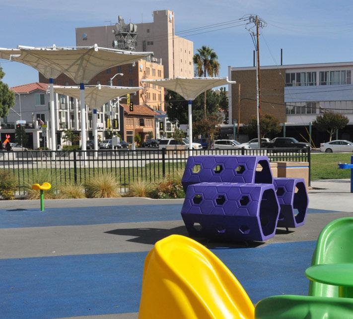
• Size: 2-10 acres (though determined by use and facilities, not size alone)
Serving Radius: 1/2 mile (or 6 blocks)
Serving Population: 10, 000-15, 000 people
• Function/Purpose: Neighborhood Parks contribute to a distinct neighborhood identity and serve as a recreational and social focal point for the surrounding neighborhood. These parks provide options for both active and passive uses, with a majority of space dedicated to active use. They should have a multi-purpose room or hall.
• Access & Siting: Neighborhood Parks are located on a local neighborhood or collector street (not an active intersection), adjacent to a trail or other open space, and linked to the surrounding neighborhood by sidewalks. If possible these parks should be located next to an elementary school with active portions of the park located away from homes to reduce noise impacts. If near an arterial street, a visually pleasing natural or artificial barrier should be provided for safety. These parks must have safe pedestrian access and meet ADA standards for accessibility. Traffic calming features are encouraged around the park. The park must be clearly marked with signage (entry, directional, and regulation as needed), be visually accessible to the surrounding neighborhood, and have amenities that meet
ADA requirements for accessibility. Parking may or may not be included. If parking is provided it should account for fewer than 10 cars including spots meeting ADA requirements. Trail linkages to other parks and adjacencies to bicycle routes are encouraged.
• Unique Features: Neighborhood Parks must have one signature amenity which may include a playground, spray ground park, sport court, shade structure, or custom element that meets unique demographic needs of the local neighborhood. Given the intention that Neighborhood Parks primarily serve the local neighborhood population, there is an emphasis on direct neighborhood involvement in the park planning process of Neighborhood Parks.
• Typical Amenities & Facilities: Neighborhood Parks should include a multi-purpose room, center or hall, restroom and drinking fountain facilities. These sites may include small event space, play areas, play elements, benches, picnic areas, shade elements, water features, loop trails, security lighting, and landscape elements that enhance the park identity, use, or experience. These facilities have staffing and maintenance requirements.
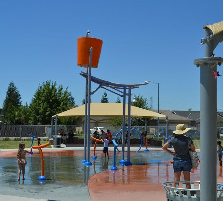
• Size: 10-40+ acres
Serving Radius: Up to 4 miles
Serving Population: 50, 000 - 80, 000 people
• Function/Purpose: Community Parks are intended to serve multiple neighborhoods, meet active and passive recreational needs of a larger community, and preserve unique landscape and open space features. They provide space for members of the community to congregate for area-wide functions or programs outdoors or within a community center building. These parks are typically larger and more amenity-rich than Neighborhood Parks, but are smaller than Regional Parks. They should provide recreational opportunities for a variety of ages and host significant, unique amenities with community appeal.
• Access & Siting: Community Parks are located on collector and/or arterial streets with a minimal number of residences abutting the park site. Parks must be surrounded by sidewalks when possible and adjacencies to schools, trails, open spaces or other municipal facilities are encouraged. If near an arterial street, provide a visually pleasing natural or artificial barrier for safety. These parks must have safe pedestrian access. Traffic calming features are encouraged within and surrounding the park. Park must be clearly marked with signage (entry,
directional, and regulation as needed), be visually accessible to the surrounding neighborhood, and have amenities that meet ADA requirements for accessibility. Parking should be sufficient to support amenities and include spots that meet ADA requirements, but goal is to maximize usable park space and employ highly efficient parking design. Trail linkages to other parks and adjacencies to bicycle routes are highly encouraged.
• Unique Features: Community Parks often contain facilities for specific recreational purposes, including athletic fields, swimming pools, tennis courts, sport courts, extreme sports amenities, recreation center, loop trails, picnic areas, picnic shelters, shade structures, pavilions, large turfed and landscaped areas, and playgrounds or spray grounds. Sports fields and sport complexes are typical. Community center buildings are at the heart of these parks. Sites may include one or more revenue facility (such as a pool, sports complex, pavilion, etc.). Other signature amenities may include a custom element that meets demographic needs of the neighborhood, unique public art, and courtyard or plaza space. Community Parks may include special program services or activities such as sports programs, day camps, aquatics, arts or education activities, and senior activities. Partnerships with community groups, clubs or schools are highly encouraged. Unique park
identity should be strengthened through signage and integrated color schemes.
• Typical Amenities & Facilities: Community center buildings with a gym or meeting room are typical of a Community Park. In addition to active use, passive outdoor recreation activities may include meditation,
quiet reflection, or wildlife watching. Landscape components that enhances park theme and user experience are encouraged. Community Parks must include permanent restrooms, drinking fountains, security lighting, and lighted sport field/courts. These facilities have staffing and maintenance requirements.
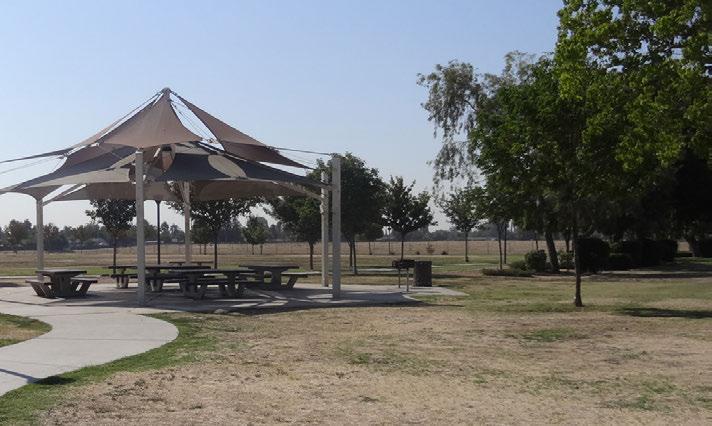
LOS GOAL: 2 ACRES PER 1,000 RESIDENTS
• Size: 40-1,000+ acres (can be less than 40 acres if site provides a unique regional serving opportunity, i.e. river access, etc.)
Serving Radius: ½ hour drive (or 1 – 4+ miles)
Serving Population: 100, 000 +/- people
• Function/Purpose: Regional Parks serve the entire city of Fresno and surrounding communities. They provide active and passive recreation opportunities, and unique public facilities for use by the greater Fresno area.
• Access & Siting: Regional Parks are large parcels typically sited in areas to preserve natural, cultural or historic resources on site. These parks must be accessible by public roads with capacity to handle larger amounts of traffic and adequate parking demand, including spots that meet ADA requirements. Traffic calming measures are encouraged within and surrounding the park. Directional and regulatory signage to enhance user experience and strengthen park identity should be easily found throughout the park. Regional Parks should be linked to pedestrian and bicycle trail systems and public transportation when possible. Park amenities and facilities should meet ADA requirements for accessibility.
• Unique Features: Regional Parks often contain unique facilities with scenic, athletic or cultural value including athletic fields, sports complex, concessions, retail, boating facilities, camping, conservation/wildlife viewing, fishing, art center, amphitheater, zoo, gardens, nature areas, and interpretive signage and trails. These unique features may have unique staffing and maintenance requirements. Regional Parks are usually dominated by natural resource based amenities. These parks and associated facilities can promote tourism and economic development, enhance the economic vitality for the region, and include revenue facilities to offset operational costs. Strengthening unique park identity through signage and integrated color schemes is encouraged.
• Typical Amenities & Facilities: Typical amenities and facilities can include all of those found in a Neighborhood or Community Park, with active and passive recreation opportunities, and programming for a variety of ages. Enhanced landscape elements, public restrooms, drinking fountains, and security lighting are all typical. These facilities have staffing and maintenance requirements.
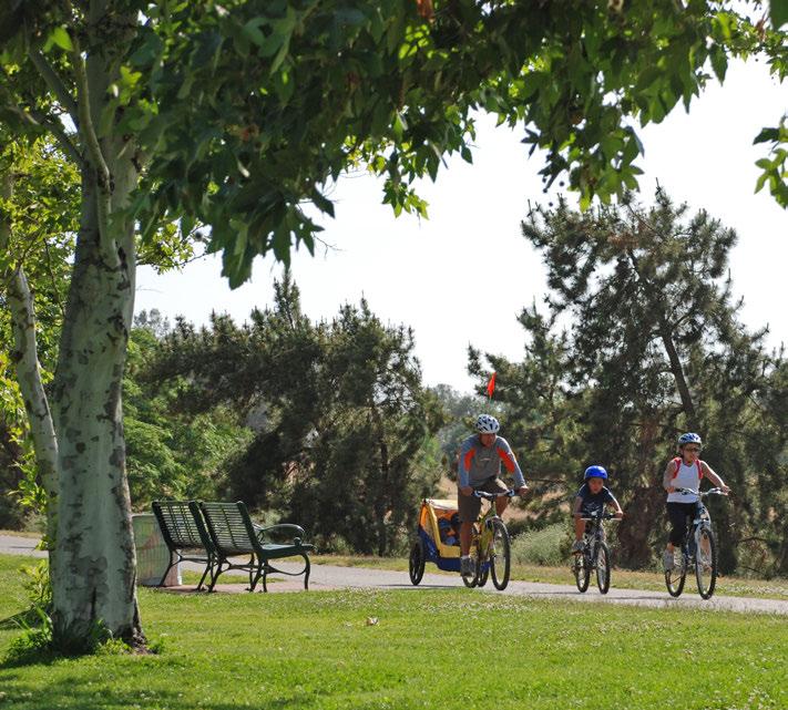
LOS GOAL: 2 ACRES PER 1,000 RESIDENTS
• Size: Varies
Serving Radius: Varies
Serving Population: Varies
• Function/Purpose: Special Use Parks include spaces that do not fall within a typical park type and usually serve a single purpose. These sites can be either stand-alone (i.e. not located within a Pocket Park, Neighborhood Park, Community Park, Regional Park, Greenbelt/Trail, or Open Space/Natural Area) or may be located within another park (typically found at Community or Regional Parks).
• Access & Siting: Special Use Parks must be accessible by public roads with capacity to handle anticipated traffic and adequate parking demand, including spots that meet ADA requirements. Traffic calming measures are encouraged within and surrounding the park. Directional and regulatory signage to enhance user experience and strengthen park identity should be easily found throughout the park. These sites should be linked to pedestrian and
bicycle trail systems and public transportation when possible. Park amenities and facilities should meet ADA requirements for accessibility.
• Unique Features: Special Use Parks may include historic, cultural, or socially significant sites with educational value such as vista points, historic areas, commercial zones, plazas, performing arts venues, arboretums, specialized gardens, theaters, and amphitheaters. These sites may also include outdoor recreation facilities such as aquatic parks, pools, disk golf, skateboard, bike/BMX facilities, and dog parks that are stand-alone park facilities. These unique features may have unique staffing and maintenance requirements.
• Typical Amenities & Facilities: Varies
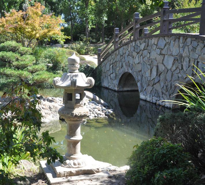
LOS GOAL: 2 ACRES PER 1,000 RESIDENTS
• Size: Varies
Serving Radius: Varies
Serving Population: Varies
• Function/Purpose: Open Space/Natural Areas serve the entire city of Fresno and surrounding communities. These sites are undeveloped areas (such as lands under power lines, around bodies of water, etc.), and contain natural resources that can be managed for recreation or natural resource conservation purposes such as protecting wildlife habitat, water quality, endangered species, etc.. These areas provide opportunities for nature-based, unstructured, low-impact recreational opportunities like walking or nature viewing.
• Access & Siting: These sites must be accessible to the public and are often sited in undeveloped areas with natural resource value. May be linked to pedestrian and bicycle trail systems and public transportation when possible.
• Unique Features: Open Space/Natural Areas may include trails, wildlife viewing areas, mountain biking, disc golf, interpretation and educational facilities. When appropriate, areas may include kiosks or restrooms and drinking fountains. These features may have unique staffing and maintenance requirements.
• Typical Amenities & Facilities: These areas typically do not include enhanced landscape design, though sustainable design principles may be employed and accent planting may be used at focal points such as entry areas or on-site facilities.
The San Joaquin River is a great ecological asset for Fresno and has the potential for positive impact on the city’s park system. The San Joaquin River Parkway is planned to encompass 22 miles of natural and recreational areas as public access park land that will benefit the region. The San Joaquin River Parkway Master Plan, adopted in 2000, aims to “preserve, protect and restore” the river corridor and provide use for the public. Currently, there are strategic points of access into parks that border the river, but as the plan progresses, more can be done to link the two together. Additionally, strong programming such as trips down the river and ecological education about regional watersheds should continue to be a part of the Fresno park system.

LOS GOAL: NO ACREAGE GOAL ASSOCIATION
• Size: Varies
Serving Radius: Varies
Serving Population: Varies
• Function/Purpose: Greenbelts/Trails can include paved and unpaved trails in parks and natural areas for people, domesticated animals, and wildlife that are open to the public and accessible from the city of Fresno. Multi-use trails accommodate pedestrian, bicycle and other non-motorized activity. Other types of trails include linear or loop trails within parks. This park-type can also include linear parks. These spaces may connect people to city attractions, commercial areas, cultural landmarks, recreation elements, open space, and protect natural areas. They are intended to be used for leisure, exercise and commuting purposes. Because Greenbelts/Trails provide access for alternative transportation, they bring with them associated health, ecological and social benefits. For further information on Fresno’s trail network see the Transportation and Mobility Element of the General Plan and Fresno’s Active Transportation Plan.
• Access & Siting: Greenbelts/Trails should be part of larger city-wide and regional trail, active transportation (pedestrian and bicycle), and conservation planning efforts. They may vary in size and should connect to other trails, paths, parks, facilities, and public transportation when possible. Park amenities and facilities should meet ADA requirements for accessibility.
• Unique Feature: May include directional, interpretive or educational signage. Greenbelts typically include at least 40’ of unencumbered land and may include a trail that supports walk, bike, run, equestrian or other non-motorized activities. Typical urban trails are 10’ wide, and incorporate signage to demarcate user locations and connections to local and regional destinations. For specific trail design standards see City of Fresno Trail Design Guidelines.
• Typical Amenities & Facilities: Varies. May include mileage/half mileage markers, parking, security lighting, and restrooms at major trailheads, kiosks, and connections to other parks and associated facilities. These unique features may have unique staffing and maintenance require - ments.
The Midtown Trail project will connect the Clovis Old Town Trail and Fresno Sugar Pine Trail with seven miles of walking and biking, providing access to much-needed green space to the approximately 50,000 residents in central Fresno.
The Midtown Trail is a great example of how an interconnected trail system can serve a large population and connect with other city amenities. The Active Transportation Plan (ATP) has created a robust bicycle and pedestrian network for the city, and the Parks Master Plan aims to capitalize on this, using the Midtown Trail as an example of how Fresno’s park system can become even more successful with the advent of a well-connected, bicycle and pedestrian friendly city.

While each individual site is an important asset, Fresno’s park and open space facilities can also be understood as an entire system. The following maps illustrate existing conditions of Fresno’s park and open space system.
Al Radka
Almy
Audubon
Barstow & Del Mar (Basin FF)
Basin XX (Huges & Floradora)
Bigby Villa
Bluff & Churchill River Access
Bluff & Delmar River Access
Bob Belcher
Broadway & Elizabeth
California Tupman
Camp Fresno
Carozza (Basin G)
Cary
Centex
Chandler
Citywide Senior Center
Cultural Arts District (CAD)
Dakota & Barton
Dickey Playground
Dickey Youth Development
Dolores Huerta
Eaton Plaza
Einstein
El Capitan Dog Park (Basin AH1)
El Dorado
Emerald
Figarden Loop & Basin AC
Fink White
First and Bullard (Basin O)
Florence Avenue Site
Frank H. Ball
Fulton 665
George R Marcus Jr. (Basin FF)
Granite
Granny’s
Highway City
Hinton
Holman
Holmes Playground
Huntington Boulevard Greenbelt
Inspiration
Jaswant Singh Khalra
Kaiser Park & Basin CN
Kearny Triangle
Keats
Keith Tice
Koligian
Lafayette
Large
Len Ross Center & Marcus Park (Basin FF)
Lions Park
Logan
Manchester (Basin BB)
Maple & Balch
Maple & University
Martin Ray Reilly
Mary Ella Brown
Maxie L. Parks
Melody
Merced and Modoc
Merced & Pickford
Merced & Plumas
Merced & Stephens
Merced & Trinity
Meux Home Museum
Milburn Overlook
MLK
Mosqueda
Neilson
Ninth & Tulare
Orchid
Oso de Oro (Basin D)
Paul “Cap” Caprioglio Center
Pilibos
Pinedale
Polk Overlook
Quigley
Rabe
Radio
Reedy
Regional Sports Complex
Riverbottom
Riverside Golf Course
Robinson
Roeding
Romain Playground
Rotary East
Rotary West (Basin B/E)
Safety
San Pablo
Selma Layne
South Peach Ave Park
Spano
Stallion
Sunnyside
Sunset
Ted C. Wills
The Link @ Blackstone
Todd Beamer
Tollhouse
Tower Theatre
University
Van Ness & Weldon Park
Van Ness Boulevard Greenbelt
Veterans Memorial Auditorium
Vinland
Water Tower
Willow & Balch
Woodward

3.2 PARK SYSTEM CONTEXT
* Park system as of 2018
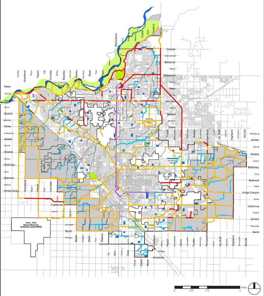

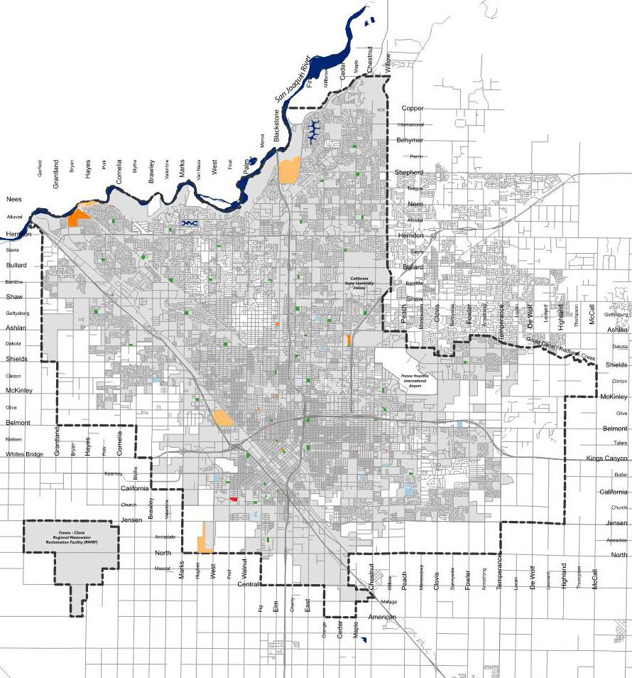

A successful park system is connected to its community by well-defined, safe routes that offer mobility choice. This includes walking, biking, transit and vehicular options. The Fresno Active Transportation Plan, San Joaquin River Parkway plans, and City of Fresno Specific Plans provide additional background regarding connectivity plans for Fresno’s parks and open space areas.

3.4
PARKS & TRAILS CONNECTIVITY
* Park system as of 2018
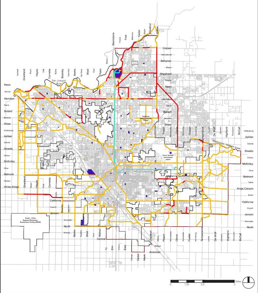

3.5a
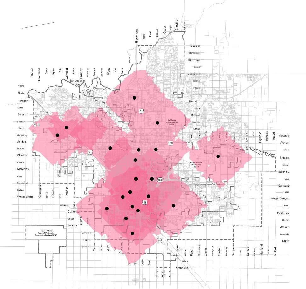
SPECIAL AMENITY: COMMUNITY CENTERS, COMMUNITY CENTERS WITH GYMS, NEIGHBORHOOD CENTERS, AND NEIGHBORHOOD CENTERS WITH GYMS
* Park system as of 2018 City Limits
Note: Hinton Community Center is owned and operated by a private entitiy
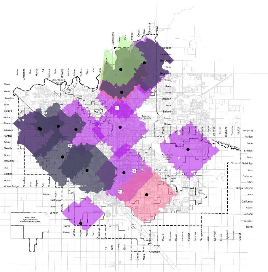
* Park system as of 2018 City Limits
Individual park condition is an especially important factor when determining the overall quality of a park system. The ability of a park to meet community needs is highly affected by the condition it is in. The health of each individual park site is especially important in Fresno because of the City’s overall deficiency in park land.
The consulting team prepared a Park Assessment Form and completed a general on-site park assessment utilizing an asset condition rating system as follows. A site with a good rating is free of major problems and may have some repairable mechanical/equipment issues, a park site with a fair rating indicates some mechanical/equipment defects that require major repair and/or replacement, and a park site with a poor rating has major defects and requires significant lifecycle replacement and/or redesign. Park assessments identified approximately 80% of Fresno’s existing parks are in fair or poor condition.
APPROXIMATELY 80% OF FRESNO’S EXISTING PARKS ARE IN FAIR OR POOR CONDITION.
The poor condition of many parks combined with concentrations of homeless populations in need of social services exacerbate public safety concerns and reduce the effectiveness of a park to serve its intended use. Staffing of parks, improved maintenance, attractive entries and perimeters, and natural surveillance resulting from park activation and community programming, are some examples of strategies for keeping parks safe.
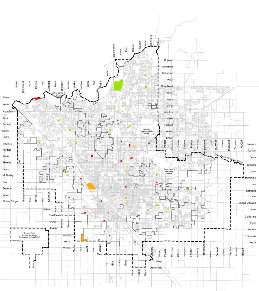
3.7
PARKS & COUNCIL DISTRICTS
* Park system as of 2018
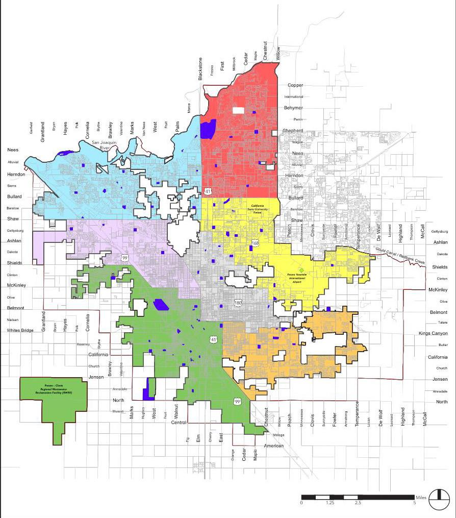

* Park system as of 2018
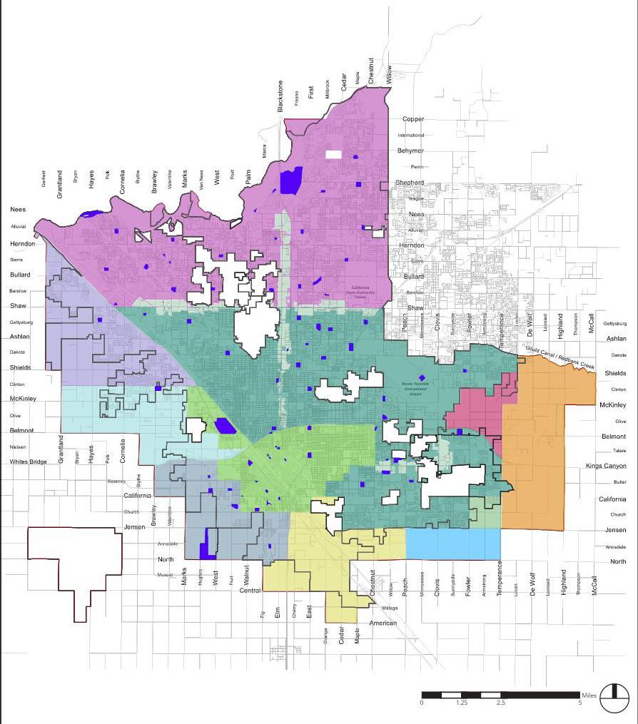
Downtown
Existing Neighborhoods North of Shaw

Existing Neighborhoods South of Shaw
South Industrial
Parks
City limits
Sphere of Influence
Source: DARM Department

Existing Parks City Limits Sphere of Influence Area Divisions
2.5 5
Barbecues,
40
52
Baseball/Softball Fields, Basketball Courts, BB-Tennis or Hockey Lts, Childrens Play Area, Comp Lab, Football/Soccer Field, Handball Courts, In-Line Hockey Court, Kitchen, Picnic Tables, Restrooms, Social Hall, Tennis Courts, VB Courts, Wading Pool
Property donated in 2018 by the Fresno-Greater San Joaquin Youth Golf Foundation. It original served as a junior golf learning facility and now holds office space for PARCS staff with future plans to resume recreational activities. N/A
Barbecues, Baseball/Softball Fields, BB - Tennis or Hockey Lights, Childrens Play Area, Football/Soccer Field, Parking Lot, Picnic Tables, Restrooms, Tennis Courts,
59
59
60
Baseball/Softball Fields, Childrens Play Area, Community Center, Computer Lab, Football/Soccer Field, Kitchen, Parking Lot, Restrooms, Social Hall, Swimming Pool Fair
Barbecues, Baseball/Softball Fields, Basketball Courts, BB - Tennis or Hockey Lights, Childrens Play Area, Computer Lab, Football/Soccer Field, Kitchen, Picnic Tables, Restrooms, Skate Park, Social Hall, Tennis Courts Fair
Part of the new West Creek Village development located in Southwest Fresno. This development will also house the Southwest Fresno campus. Also called Church & MLK. Playground, Walking Trails, Restrooms, Trees, Landscaping
Skate Park, Baseball/Softball Field, Football/Soccor Field, Basketball, Playground, Community Center, Computer Lab, Kitchen, Library, Meeting/Conference Room(s), Parking Lot, Picnic Tables, Barbecues, Restrooms, Social Hall, Swimming Pool
70
Refer to Chapter 7 for “Tier” definitions
Refer to Chapter 7 for “Tier” definitions
Opened as a 20th Century Fox Movie House, the Tower Theater today is completely restored as a center for the performing arts while maintaining it’s art deco theme. Please visit https://www.towertheatrefresno. com/
Located in the Tower District near art galleries and quaint shops. Playground, Exercise Stations, Bocce Ball Court, Shade Trees, Picnic Tables
The Art Deco building houses a theater and the Veterans Memorial Museum with exhibits that tell the story of America’s wars as seen by individual soldiers, sailors, marines and airmen. Museum, theater, meeting rooms, ticket booth, historic place
Field, Football/Soccer Field, Lighted Tennis Courts, Childrens Play Area, Parking Lot, Picnic Tables, Barbecues, Restrooms
The Old Fresno Water Tower is located at Fresno and O Streets in downtown Fresno. It ceased operation in the 60’s and now serves as a visitor center and coffee shop. Visitor center, coffee shop, historic place
Frisbee Golf, BMX Course, Healing Garden, Amphitheater, Barbecues, Playgrounds, Dog Park, Par/Fitness Course, Parking Lot, Picnic Shelters, Picnic Tables, Restrooms, Scenic views, Hiking Trails, River Access
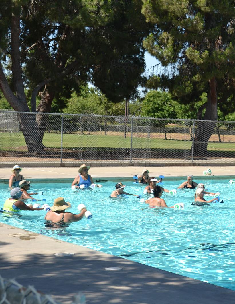
Having a park system that is properly and efficiently managed is critical for maintaining quality. The following chapter provides an overview of park system management for recreation programs and park maintenance. This includes assessment, analysis, and strategies regarding recreation programs and maintenance services. Specific recommendations related to management, programs, and maintenance can be found in Chapter 9, “Goals and Recommendations.”
The Fresno PARCS Department has a professional staff that annually delivers over 70 aquatic, recreation and special event programs. Department staff are responsible for the management and implementation of a diverse array of recreation programs and special community-wide events, as well as the operation of multiple facilities. Employees are engaged year round in planning, implementing, conducting, and evaluating programs and events.
All functions within the Department combine to provide an extensive selection of services in the areas of youth camps and after school programs, aquatics, sports, health, fitness, and special events. But in addition to the provision of services provided directly by the Department, partnerships with other organizations are utilized throughout the service area. Through formal and informal cooperative relationships with various school districts and nonprofit agencies, partners assist with delivering select programs, training of staff, granting access to specialized facilities, and providing support to programs with supplies and materials.
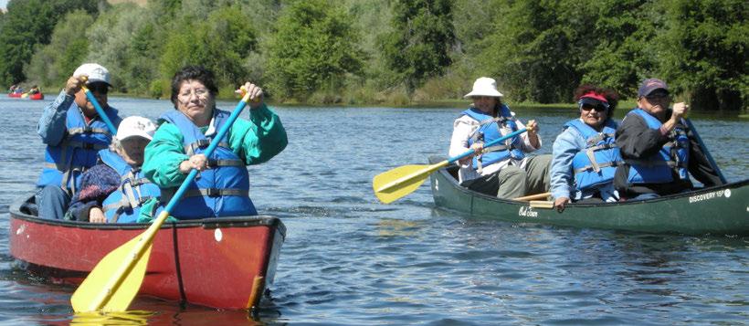
The vision of the Department is to be one of the premier park and recreation systems in the United States providing all residents access to high-quality programs and experiences. Part of realizing this vision involves identifying Core Program Areas to create a sense of focus around activities and outcomes of greatest importance to the community as informed by current and future needs. However, public recreation is challenged by the premise of being all things to all people, especially in a community such as Fresno. The philosophy of the Core Program Area assists staff, policy makers, and the public to focus on what is most important. Program areas are considered as Core if they meet a majority of the following categories:
• The program area has been provided for a long period of time (over 4-5 years) and/or is expected by the community.
• The program area consumes a relatively large portion (5% or more) of the agency’s overall budget.
• The program area is offered 3-4 seasons per year.
• The program area has wide demographic appeal.
• There is a tiered level of skill development available within the programs area’s offerings.
• There is full-time staff responsible for the program area.
• There are facilities designed specifically to support the program area.
• The agency controls a significant percentage (20% or more) of the local market.
Since 2021, the PARCS Department has undergone a significant transformation, restructuring, and expansion. FY 2022 marked a pivotal moment with the addition of 41 positions across various divisions, enabling the initiation of a broad restructuring which saw:
• Consolidation of landscaping and irrigation activities to the Department of Public Works.
• Consolidation of facility improvements to the Facilities Division of General Services.
• Reorganizing of the department operations into 5 geographic areas, each with dedicated management and supervisory staff responsible for direct services, including custodial, guest experience and after school/ neighborhood recreation programs. (See figure 3.9)
• Establishment of citywide program areas including seniors; after school; neighborhood safety; youth employment; science; youth sports; and bicycle, aquatics, and action sports.
• Enhancement of capital and administration areas to better equip the department to maintain compliance, efficiency and oversight as the department expanded dramatically to meet the requirements of Measure P.
These changes exemplify the department’s proactive approach to aligning resources with the community’s dynamic requirements and ensuring a vibrant and inclusive recreational experience for all.
The Department currently offers programs and services in the following Core Program Areas, identified in the table below:
CORE PROGRAM AREA BRIEF DESCRIPTION
ACTION SPORTS
ADOPT-A-PARK/GO GREEN & CLEAN
ADULT SPORTS
AQUATICS
COMMUNITY SPECIAL EVENTS
CONTRACTED SERVICES (SPARK & YEP)
NEIGHBORHOOD PARK AFTER SCHOOL PROGRAM
To provide dynamic skate and BMX venues to support beginners, enthusiasts and professional athletes from the community. Sites include Todd Beamer, Mosqueda, Lions and the Woodward Park BMX facility.
Allow community and/or organizations to identify and care for a regional park, neighborhoods parks, community centers and/or green space in need of supplement and enhancement maintenance. Over 80 adoptable locations to choose from.
To provide a year round fee-based sports program for men, women and coed organized sports league for residents. Leagues include Softball, basketball, flag football and soccer.
To provide a professional, safe and fun aquatics experience to participants that provides swimming skills for a lifetime and access to water based recreational swimming to cool off on hot summer days.
To bring people of all ages together in an organized and fun environment to share time with their fellow neighbors and community residents.
To provide on a contracted fee for service in the areas of physical activity and nutrition literacy (SPARK) and acquiring job skills and employment (YEP) for local area school districts.
To provide a safe environment where youth and families can participate in a variety of programs and services including arts and crafts, sports, fitness, nutrition, computer classes, homework centers, science cooking classes and community service projects.
SCIENCE To provide state of the art hands on science programing to local area school districts and daily programing at the Highway City Science Center.
SENIORS To provide healthy and nutritious meals and recreational activities to seniors over 60 years of age.
SUMMER CAMPS
WEEKEND RECREATION AND FITNESS PROGRAM
To provide children with a creative outlet during the summer with which they can participate with peers in a variety of activities. Camps include BMX/Skate Camps, Princess Camps, Fun In The Sun Camp, Adventure Camp, Survivor Camp and Healthy Lifestyle Fitness Camp.
To provide green space access to participants at 16 school sites on Saturdays & Sundays from 9 a.m. - 6 p.m. and provide programming in the areas of sports, fitness, nutrition, and leisure recreation.
YOUTH SPORTS To provide a variety of sports program instruction to children ages 3-6 years old. Sports include soccer, indoor soccer, flag football, t ball and basketball.
To offer facilities where families can enjoy a variety of action sports programs including mountain Biking, BMX Racing, Street Skate and BMX competitions.
To provide volunteer driven supplement and enhancement maintenance services to more than 80 adoptable locations in Fresno.
To provide an outlet for adults to recreate in a competitive environment. This program also provides adults with an opportunity to stay physically active with a variety of sports offerings.
Teach youth participants how to swim and build confidence and stamina in the pool. Provide a safe recreational swimming environment for participants to keep cool on hot summer days.
To offer free community-wide events and promote quality annual events such as Carnival and Mosqueda Idol.
To provide professional curriculum opportunities for school students to learn lifelong exercise and nutrition skills. To provide school students with business soft skills to learn the techniques to acquire and keep a job.
To enrich and improve the quality of life for our participants by providing a variety of programs and services that fosters the development of social, physical, cultural and intellectual skills.
Expose youth to the wonders of science and create a lifelong interest in the subject. Cover direct cost expenses.
Provide affordable healthy meal to seniors on a weekday daily basis. Provide a congregate environment where recreational and fitness activities occur daily.
To provide a safe environment for kids to creatively participate in a variety of activities including sports, fitness, cooking classes, dress up, table manners and social integration.
To offer free access to previously closed school district school sites. Offer a variety of activities for all ages.
To provide youth with the beginning fundamentals for a variety of sports. Skills learned would include sport fundamentals, teamwork, family unity and a basic understanding of each sport.
The Core Program Areas provided by Fresno currently appears to meet some of the major needs of the Fresno community, but the program mix must be evaluated on a regular and reoccurring basis to ensure that the offerings within each Core Program Area – and the Core Program Areas themselves – align with changing leisure trends, demographics, and needs of residents. The National Recreation and Park Association (NRPA) recommends that six determinants be used to inform what programs and services are provided by the Department. According to NRPA, those determinants are:
• Conceptual foundations of play, recreation, and leisure – Programs and services should encourage and promote a degree of freedom, choice, and voluntary engagement in their structure and design. Programs should reflect positive themes aimed at improving quality of life for both individuals and the overall community.
• Organizational philosophy, mission, and vision – Programs and services should support the Department’s mission and vision statements, values, goals, and objectives. These generally center on promoting personal health, community well-being, social equality, environmental awareness, and economic vitality.
• Constituent interests and desired needs – Departments should actively seek to understand the recreational needs and interests of their constituency. This not only ensures an effective (and ethical) use of taxpayer dollars, but also helps to make sure that programs perform well and are valued by residents.
• Creation of a constituent-centered culture – Programs and services do reflect a departmental culture where constituents’ needs are the prime factor in creating and providing programs. This should be reflected not only in program design, but in terms of staff behaviors, architecture, furniture, technology, dress, forms of address, decisionmaking style, planning processes, and forms of communication.
49,933 SWIM PARTICIPANTS in the Fresno Parks Aquatic Program in 2017
37,277 MEALS
• Experiences desirable for clientele – Programs and services should be designed to provide the experiences desirable to meet the needs of the participants/clients in a community and identified target markets. This involves not only identifying and understanding the diversity of needs in a community, but also applying recreation programming expertise and skills to design, implement, and evaluate a variety of desirable experiences for residents to meet those needs.
• Community opportunities – When planning programs and services, a Department should consider the network of opportunities afforded by other organizations such as nonprofits, schools, other public agencies, and the private sector. Departments should also recognize where gaps in service provision occur and consider how unmet needs can be addressed.
Findings from the analysis show that the Department provides a good balance of programs across all age segments. All segments are targeted as a primary market for multiple Core Program Areas.
This balance should be maintained moving forward, and the Department should update this Age Segment Analysis every year to note changes in Core Program Areas or to refine age segment categories. Given the growing population trend for residents ages 55 and over and the growing demand for services in this age bracket, it is also recommended that the Department further segment this group into 55-69 and 70+. These two sub-segments will have increasingly different needs and expectations for programming in coming years, and program planning will be needed to provide differing requirements.
Age Segment Analyses should ideally be done for every program offered by the Department, not just for each Core Program Area. Program coordinators/managers should include this information when creating or updating program plans for individual programs. An Age Segment Analysis can also be incorporated into Mini Business Plans for comprehensive program planning.
The “Program Age Segment Analysis” table depicts each Core Program Area along with the age segments they serve. Recognizing that many Core Program Areas serve multiple age segments, Primary (noted with a ‘P’) and Secondary (noted with an ‘S’) markets were identified.
A lifecycle analysis involves reviewing every program identified by City of Fresno’ staff to determine the stage of growth or decline for each as a way of informing strategic decisions about the overall recreation program portfolio. The various stages of program lifecycles are as follows:
• Introduction - New program; modest participation
• Take-Off - Rapid participation growth
• Growth - Moderate, but consistent participation growth
• Mature - Slow participation growth
• Saturated - Minimal to no participation growth; extreme competition
• Decline - Declining participation
This analysis is not based on strict quantitative data, but rather is based on staff’s knowledge of their program areas. The “Recreation Program Lifecycle Stage” table shows the percentage distribution of the various lifecycle categories of existing recreation programs. These percentages were obtained by comparing the number of programs in each individual stage with the total number of programs listed by staff.
As seen in table above, overall, the lifecycle analysis results indicate a less than desirable distribution of all programs across the life cycle. A combined total of 87.8% of programs fall into the Introduction, Take-off and Growth stages. This is well above best practice standards but is acceptable given the significant increase in programming over the last two years as the resources have become available after the Great Recession.
While it is important to provide new programs to align with trends and help meet the evolving needs of the community, it is also important to have a stable core segment of programs that are in the Mature stage. As of 2017, the Department had 12% of their programs in this category. The consulting team recommends this be approximately 40% so as to provide stability to the overall program portfolio, but without dominating the portfolio with
programs that are advancing to the later stages of the lifecycle. Programs in the Mature stage should be tracked for signs they are entering the Saturation or Decline stages. There should be an ongoing process to evaluate program participation and trends to ensure that program offerings continue to meet the community’s needs.
A total of 0% of programs are saturated or declining. The consulting team recommends keeping as few programs as possible in these two stages, but it is understood that programs eventually evolve into saturation and decline. If programs never reach these stages, it is an indication that staff may be “over-tweaking” their offerings and abbreviating the natural evolution of programs. This prevents programs from reaching their maximum participation, efficiency, and effectiveness. For departments challenged with doing the most they can with limited resources, this has the potential to be an area of concern.
As programs enter into the Decline stage, they must be closely reviewed and evaluated for repositioning or elimination. When this occurs, the consulting team’s recommendation is to modify these programs to begin a new lifecycle with the introductory stage or to add new programs based upon community needs and trends. Staff should complete a lifecycle review on an annual basis and ensure that the percentage distribution closely aligns with desired performance.
The PARCS Department currently does not classify its programs and services. Classifying programs and services is an important process for an agency to follow in order to remain aligned with the community’s interests and needs, the mission of the organization, and for financial sustainability. The basis for the program classification in the PMP stems from concepts and strategies derived from the book, “Marketing and Social Services,” by Dr. John Compton and Dr. Charles Lamb. The authors purport that programs should be evaluated based on type, benefactor, and cost bearer of the program. Services are classified according to who the program is targeted toward, and what the intended purpose, benefit, cost and outcome are.
The first milestone is to develop a classification system for the services and functions of the City of Fresno PARCS Department. The system needs to reflect the statutory obligations of the agency, the support functions performed, and the value-added programs that enrich both the customer’s experience and generate earned revenues in mission-aligned ways to help support operating costs. In order to identify how the costs of services are supported and by what funding source, the programs are to be classified by their intended purpose and the benefits they provide. Then funding source expectations can be assigned and this data used in future cost analysis. The results of this process is a summary of classification definitions and criteria, classification of programs within the City of Fresno PARCS Department and recommended cost recovery targets for each service based on these assumptions.
Program classification is important as financial performance (cost recovery) goals are established for each category of service. This is then linked to the recommendations and strategies for each program or future site business plan. These classifications need to be organized to correspond with cost recovery expectations defined for each category. In this section of the PMP, each program area will be assigned specific cost recovery targets that align with these expectations.
The service classification process consists of the following steps:
1. Develop a definition for each program classification that fits the legislative intent and expectations of the PARCS Department; the ability of the PARCS Department to meet public needs within the appropriate areas of service; and the mission and core values of City of Fresno PARCS Department.
2. Develop criteria that can be used to evaluate each program and function within PARCS, and determine the classification that best fits.
The program classification matrix was developed as a guide for PARCS staff to follow when classifying programs, and how that program needs to be managed with regard to cost recovery. By establishing clarification of what constitutes an “Essential Public Service,” “Important Public Service”, and “Value Added Service” PARCS and its stakeholders will have a better understanding of why and how to manage each program area as it applies to public value and private value.
Additionally, the effectiveness of the criteria linked to performance management expectations relies on the true cost of programs (direct and indirect cost) being identified. Where a program falls within this matrix can help to determine the most appropriate cost recovery rate that should be pursued and measured. This includes being able to determine what level of public benefit and private benefit exists as they apply to each program area. Public benefit is described as, “everyone receives the same level of benefit with equal access”. Private benefit is described as “the user receives exclusive benefit above what a general taxpayer receives for their personal benefit”.
In order to improve the fiscal performance and delivery of programs and services, the consulting team provides the following fiscal strategies.
CLASSIFICATION DESCRIPTIONS
(i.e., health, safety, protection of assets).
• Requires public funding • Fees cover some direct costs
• Requires a balance of public funding and a cost recovery target
• Substantial public benefit (negative consequence if not provided) • Public and individual benefit
• Fees cover most direct and indirect costs
• Some public funding as appropriate
Primarily individual benefit
• Limited access to users
Through the program assessment analysis, the major functional program areas were assessed and classified based on the criteria established in the previous section of the plan. This process included determining which programs and services fit into each classification criteria. Then cost recovery goals were established based on the guidelines included in this plan. The percentage of cost recovery is based on the classification of services and will typically fall within these ranges, although anomalies will exist :
• Essential 0-35%
• Important 35-75%
• Value Added 75%+
Table 4.5 represents a summary of programs and services, the classification of those programs, as well as, recommended cost recovery goals.
To properly fund all programs, either through tax subsidies or user fees, and to establish the right cost recovery targets, a Cost of Service Analysis should be conducted on each program, or program type, that accurately calculates direct (i.e., program-specific) and indirect (i.e., comprehensive, including administrative overhead) costs. Completing a Cost of Service Analysis not only helps determine the true and full cost of offering a program, but provides information that can be used to price programs based upon accurate delivery costs. The figure below illustrates the common types of costs that must be accounted for in a Cost of Service Analysis.
PERSONNEL COSTS
VEHICLE
The methodology for determining the Total Cost of Service involves calculating the total cost for the activity, program, or service, then calculating the total revenue earned for that activity. Costs (and revenue) can also be derived on a per unit basis. Program or activity units may TOTAL COSTS FOR ACTIVITY
BUILDING COSTS
include number of participants, number of tasks performed, number of consumable units, number of service calls, number of events, and required time for offering program/service.
Agencies use Cost of Service Analyses to determine what financial resources are required to provide specific programs at specific levels of service. Results are used to determine and track cost recovery as well as to benchmark different programs provided by Fresno between one another. Cost recovery goals are established once Cost of Service totals have been calculated. Department staff should be trained on the process of conducting a Cost of Service Analysis and the process undertaken on a regular basis.
Currently, the Fresno PARCS Department does track revenue, expenditures and cost recovery goals as lines of service as noted in Table 4.6.
Table 4.6
program provides supplement and enhancement labor to parks standard maintenance and targets several special event cleanups through out the
Program charges for recreation swim and swim lessons at standard pools. Learner & Wader pools are free of charge.
is a community program that is designed to be free to all participants.
a community program that is designed to be free to all participants.
service to FUSD in the areas of SPARK and YJPP for full cost recovery of direct service and designated overhead.
is a community program that is designed to be free to all participants.
Program operates off of grants and schools contracts.
is a community program in partnership with FMAAA which has a suggested donation but not required.
This is a weekend community program in partnership with FUSD & CUSD to increase access to green space and is designed to be free to all participants.
To more accurately track cost of service and cost recovery, the consulting team recommends developing new pricing policy based on classification of programs and services. Given the recommended shift in philosophical approach, it is important to refocus the division on cost recovery goals by functional program area or line of service. Pricing based on established operating budget recovery goals will provide flexibility to maximize all pricing strategies to the fullest. Allowing the staff to work within a pricing range tied to cost recovery goals will permit them to set prices based on market factors and differential pricing (primetime/non-primetime, season/ off-season rates) to maximize user participation and also encourage additional group rate pricing where applicable.
To gain and provide consistency among the Fresno City Council, user groups, staff, and the community, a revised pricing policy must be adopted in order for the Fresno PARCS Department to operate effectively and efficiently to meet the program cost recovery goals identified above. In short, it is important that the Fresno PARCS Department state its policy in all publications, on its website, and in its reservation processes to describe how they establish a price for a service or use of a facility. Example:
“The Fresno PARCS Department’s funding that is derived from taxpayers is focused on mission-based facilities and services. The programs and facilities that are furthest from our mission, that provide an individual benefit, or that provide exclusive use will require higher fees from users or other sources to help offset operating costs.”
It is recommended that the Fresno City Council adopt the recommended cost recovery goals for the Parks and Recreation Department as presented in this PMP. In order to achieve the cost recovery goal, it is expected that the Fresno PARCS Department will strive to continue to meet the cost recovery goals established for each program area as recommended. In order to continue to meet these goals, efforts must be made to:
• Consistently deliver high quality programs and services
• Strategically price programs and services
• Solicit sponsorships and donations to develop a sustainable earned income stream
• Increase the utilization of volunteers to offset operational expenditures
• Expand marketing to increase the volume of participation in programs and services
The cost recovery goals are expected to be achieved over a 5-year period and there should be no expectation that they be realized immediately. It is expected that an iterative implementation process of introducing the classification methodology and a new pricing policy along with the refinement of the PARCS Department’s Cost of Service Analysis will occur over the next 5 years. This process will have an impact on cost recovery as it will result in the refinement of foundational business elements including but not limited to service levels, service delivery, pricing and the guidelines developed to secure external operational funding sources such as grants, donations and partnerships. Additionally, external factors such as economic conditions and changes to the City’s financial policies will have a bearing on achieving a cost recovery goal in which revenue offsets 50% of expenditures.
As the Fresno PARCS Department embarks on the implementation of a new pricing policy, it will be necessary to develop pricing strategies that will not only increase sales but also maximize the utilization of the City of Fresno’s parks, programs and recreation facilities. By creating pricing options, customers are given the opportunity to choose which option best fits their schedule and price point. The consulting team recommends that the Fresno PARCS Department continue to explore pricing strategies that create options for the customer.
The following are examples of pricing strategy options:
• Primetime
• Incentive Pricing
• Non-primetime
• Length of Stay Pricing
• Season and Off-season Rates
• Cost Recovery Goal Pricing
• Multi-tiered Program Pricing
• Level of Exclusivity Pricing
• Group Discounting and Packaging
• Age Segment Pricing
• Volume Pricing
• Level of Private Gain Pricing
The most appropriate pricing strategies for Fresno to consider are as follows:
• Primetime and Non-primetime pricing strategy – The price is set based on the time of the day. Primetime is considered to be the time of day in which the demand for the service is highest. Fees for the rental of a park or pool during this time would be set at rate that would recover 125-150% of costs incurred. To lessen the demand for “primetime”, the Department can lower prices for rentals of the park or pool during times in which demand is lower. This will assist in maximizing the utilization of its facilities.
• Premium pricing - The price set is high to reflect the exclusiveness of the product. An example of this would be a user group paying higher rental fees for the exclusive use of a facility that prohibits the general public or other groups from participating.
• Consider a pricing strategy that provides a discount for online registration of programs.
Parks and amenities that are properly maintained (i.e. clean and functioning efficiently) are a critical element to delivering high quality programs and services. This is no small task. As of 2017, the City of Fresno maintains 1023 acres of park land, not including miscellaneous public grounds, right of way, or median landscaping, greenways or trails.
The landscape and custodial “core lines of service,” or functions performed by Fresno’s PARCS Department, are numerous and include custodial maintenance (restrooms cleaning and trash removal), contract management, equipment maintenance, furniture, fixture and amenity maintenance, Integrated Pest Management (IPM), irrigation maintenance, landscape maintenance, open space maintenance, playground maintenance, response to citizen inquiries, special event facilitation, special projects, streetscape maintenance, turf maintenance, and urban forestry.
Maintenance of the parks system is the responsibility of both the Public Works Department and the PARCS Department. This has resulted in a number of inefficiencies, including but not limited to: overlapping of crews, duplication of travel time to and from parks, and lack of consistent maintenance standards.
Through the review of limited data and workshops with staff, the PROS Consulting team determined that the PARCS and Public Works Maintenance Divisions do have “institutional” routine maintenance practices in place. However, the maintenance practices have limited written standards and accompanying standard operating procedures, are based on “one-size-fitsall” approach to parks maintenance and are inconsistently applied in the field and minimal maintenance is completed in natural areas, primarily due to lack of staffing capacity.
The City of Fresno does utilize a Work Order Management System for the maintenance that it performs, however the Public Works Department and PARCS Department do not effectively utilize this system to allow for maximum benefit. In addition to a system that tracks equipment that is being used, and parks that are being maintained, there would be significant benefits to utilizing a City wide Work Order Management System that makes better use of City wide data so that maintenance decisions can be made that can improve efficiency and reduce costs across departments. This relates to better tracking data about items that routinely need maintenance and replacement and time that is spent on specific tasks in order to make informed decisions about how future costs can be reduced. In addition, a management system for tracking lifecycle replacement cost, needs and longevity would also provide significant benefit.
Staff does not lack the necessary equipment or resources to perform tasks at a high level, however, lack of staff create hardships when managing turf, trees and landscaping.
Given the varying cycles of the economy, it is imperative that the PARCS Department continually evaluates the capacity and cost of service in the private sector. Currently, the PARCS Department does not track unit activity costs and therefore cannot analyze the unit cost to perform work internally against the unit cost to perform work by a third party vendor. Without this level of analysis the division is unable to determine if it is more effective and efficient to perform work in-house or to contract it out.
The lack of equitable distribution of maintenance yards is likely a major contributor to the inefficient use of park maintenance dollars due to the likelihood of the high amount of travel time required between park locations, also known as windshield time.
Based on analysis conducted by PROS Consulting, unit costs are not in alignment with best practice cost per acre.
The following chart illustrates:
• Acreage by park type maintained by the City of Fresno
• Annual funding allocated for park maintenance by park typology
• Annual funding allocated for utility costs by park typology
• Annual funding allocated for facility maintenance by park typology
• Annual funding allocated for administration and overhead by park typology
• Total annual funding expended on park and facility maintenance for each park typology
• Fresno direct cost per acre expended on park maintenance by park typology
• Best practice cost per acre expended on park maintenance by park typology
• Additional annual funding needed to meet best practice cost per acre by park typology
• As noted in the table, the parks maintenance in the City of Fresno is underfunded annually by nearly $5 million
The PARCS and Public Works Parks Maintenance Divisions are comprised of 38.38 Full Time Equivalents (FTE). Best practice ratio of staff per park acres at a “Level 2” maintenance standard is 1:20 acres. With the responsibility of actively managing 1028.54 acres (does not include right of way and median landscaping), the staff does not have the capacity to manage the parks system consistently at a Level 2 maintenance standard as the current ratio of FTEs to park acres is 1:26.8 and is currently understaffed by at least 13 FTEs.
It is recommended that maintenance of the parks system be the responsibility of either the Public Works Department or the PARCS Department. Clear lines of role and responsibility should be established between PARCS and Public Works to ensure the effective and efficient utilization of taxpayer dollars.
A work order system should be used to track lifecycle maintenance requirements that are tied to weekly and monthly work orders. This will help the staff to stay ahead of preventative maintenance and limit breakdowns. Furthermore, utilizing the system will provide staff the necessary “actual cost” data for work being performed.
Through the development of management processes, the PARCS Department must begin to track unit activity costs through the implementation of a work order management system and in turn, would internally analyze the unit cost to perform work internally against the unit cost to perform work by a third party vendor
It is recommended that additional maintenance yards are constructed and located strategically within each of the park maintenance zones to maximize efficiency and reduce maintenance “windshield time.”
It is recommended that the PARCS Department be allocated an additional $4,614,307 for parks maintenance functions within the next three years to meet best practice cost per acre standards. Note: this cost estimate relates to Fresno’s current park system maintenance needs, but as City of Fresno park land expands, the cost of park maintenance will increase.
PROS Consulting recommends the addition of 13 maintenance worker FTEs within the next three years.
Maintenance standards are based on a Level (1), (2) and (3) modes (tasks and frequencies of each task) and follow best practices as established by the National Recreation and Park Association. The PARCS Department can customize the standards based on the park and recreation values of the Fresno community. These standards will need to be adopted and implemented by staff and applied regardless of whether work is performed by City staff or third party contractors.
The following tables illustrate examples of general maintenance standards that could be adapted for the City of Fresno.
Table 4.8
Table 4.8 (continued)
GENERAL PARKS MAINTENANCE CONTINUED Both frequency and timeframe vary for each level
Table 4.9
Table 4.12 (continued)
Table 4.12 (continued)
4.13
4.14
Maintenance operations are typically spent in divisions that do not have direct revenue sources that can offset expenditures. There are however, opportunities to reduce expenditures through the following partnership programs:
• Adopt-a-Trail Programs: These are typically small-grant programs that fund new construction, repair or renovation, maps, trail brochures, and facilities (bike racks, picnic areas, birding equipment, etc.), as well as providing maintenance support. These programs are similar to the popular “adopt-a-mile” highway programs most states utilize. Adopt-atrail programs can also take the form of cash contributions in the range of $12,000 to $16,000 per mile to cover operational costs.
• Adopt-a-Park Programs: These are small-grant programs that fund new construction and provide maintenance support. Adopt-A-Park programs can also take the form of cash contributions in the range of $1,000 to $5,000 per acre to cover operational costs.
• Operational Partnerships: Partnerships are operational funding sources formed from two separate agencies, such as two government entities, a non-profit and a public agency, or a private business and a public agency. Two partners jointly share risk, operational costs, responsibilities, and asset management based on the strengths of each partner.
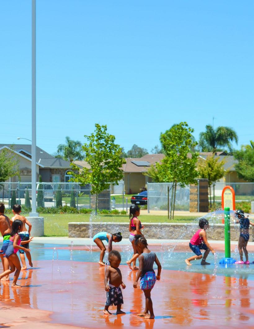
The Guidelines in this chapter are intended as a resource for use in the planning and design of future parks and open spaces. The Guidelines provide performance-based measures that create more sustainable, attractive, user-friendly sites that meet the needs of the public they serve.
Park System Design Guidelines are organized by overarching category. The recommendations are high level, appropriate to the context of a systemwide park master plan, not site-specific design requirements. Categories include sustainability, public safety, durability, user experience, accessibility, identity and branding. These general guidelines should be used in tandem with the park type definitions found in the Park Classification System, Section 3.4 (page 65), as well as maintenance and operations standards, to ensure that all parks and open space areas owned and maintained by the City of Fresno are planned, designed, managed, and maintained to provide the greatest value to the community. Detailed standards for design, materials, and maintenance should be developed and incorporated into future park master plan updates.
Sustainable practices in park and open space planning, design, and management promote healthy, thriving landscapes. Sustainable measures also promote the efficient use of natural and financial resources. In order to create conditions that are more ecologically and financially sustainable, the City of Fresno requires the following measures.
a. Require energy efficient technology when replacing existing or installing new technologies, including light elements
b. Use “smart” technology when possible, i.e. lighting systems that adjust automatically depending upon user patterns in buildings and parks
c. Explore options for harnessing alternative energy including solar and wind
d. Conduct energy use audits at regular intervals of 10 years
e. Target energy use reduction by at least 20% over next 10 years
a. Refer to section 5.8, “Recommended Irrigation Equipment & Practices” (page 160) for technical irrigation guidelines
b. Require water efficient technology when replacing existing or installing new irrigation systems
c. Expand use of recycled water for irrigation with priority on lawns and toilet flushing
d. Explore options for on-site water harvesting and rainwater capture
e. Conduct water use audits at regular intervals of every 10 years
f. Target water use reduction by 25% in the next 10 years to work toward General Plan and state wide water reduction goals
g. Provide bubblers to trees for the establishment period and beyond as appropriate
a. Employ a drought tolerant, climate appropriate, low maintenance plant palette for 95% of all on-site plant material (excluding turf/lawn)
Refer to Appendix A for the “Recommended Park and Open Space Plant Palette,” including appropriate tree and understory plant options
b. Generally reduce turf areas in parks as they are high water use and high maintenance, and consult an athletic turf manager for ongoing athletic field management best practices
c. Reduce highly visible, low use turf areas, with deeply mulched ornamental planting
Refer to Appendix A for the “Recommended Park and Open Space Plant Palette” for turf alternatives
d. Reduce less visible, low use turf areas with deep mulch
e. Increase plantings of trees with large canopies in park and open space areas and surrounding streets and sidewalks to provide more shade and reduce urban heat island effect
Refer to Appendix A for the “Recommended Park and Open Space Plant Palette,” including appropriate tree options
f. Employ plants with habitat value for pollinator species
g. Consider interpretive value of plantings as part of public educational program i.e. ethnobotanical species related to early indigenous people and the historic landscape
h. Strictly follow “right size” planting strategy to avoid the need to maintain plants to size smaller than their natural habit, i.e. avoid plants that will limit clear sightlines into the park
i. Establish construction guidelines for the preparation of site soil that is suitable for healthy plant growth including depth of planting soil, soil amendment, and compaction limitations, and perform soil testing to determine the necessary amendments and nutrients needed
j. Establish guidelines for suitable trees and plant materials to be planted in parks, and consult certified arborists when needed
The field of energy has seen major changes in recent decades. We now have access to better, more efficient, more affordable energy technology. Concurrently, the State of California has implemented energy reduction programs designed to have the State significantly reduce use of fossil fuels in coming decades. Considering this, it seems appropriate timing for the City of Fresno to start shifting away from using outdated, inefficient technology and start using more efficient, cost effective options.
Energy use is a major on-going expense for the park system. Many of City buildings currently operate with inefficient air conditioning systems and furnaces, thermostats, lighting systems, and have poorly insulated walls and ceilings with single pane windows. This is wasteful in terms of energy, and also operations costs.
To better track energy use and opportunities to increase efficiency, it is recommended that energy audits be conducted for parks and facilities on a regular basis. These audits can include buildings and their associated electrical components, athletic field lighting, and irrigation pump systems. From these audits current usage and cost can be determined and strategies for energy reduction and cost savings can be developed and implemented.
Looking ahead, strategies for incorporating renewable energy can also be explored. This will require reviewing the capital improvement costs associated with renewable energy alternatives and return on investment projections - and may provide a win-win situation for Fresno’s future park system.
a. Employ Low Impact Design (LID) practices to increase opportunities for stormwater and groundwater recharge by utilizing:
■ Bioretention areas, to provide soil and plant passed filtration services that remove pollutants
■ Permeable pavers, to allow rainwater to infiltrate on site
■ Rain barrels and cisterns, to retain and store rainwater to be used for irrigation on-site
■ Soil amendments, including the addition of compose and mulch, top soil, lime and gypsum to help offset erosion and improve their physical, biological and hydrological characteristics so they are more effective agents for stormwater management
■ Green roofs, which help mitigate negative effects of urbanization on water quality by filtering, absorbing, or detaining rainfall
a. Reduce and or eliminate chemical use in landscape areas and all facilities when possible
■ Landscape Areas
* Replace chemical herbicides, pesticides, and fertilizers with non-toxic treatments, including LID practices for improving soil health
* Use organic fertilizer with humic acid and mycorrhizea fungi when possible
* Support use of Integrated Pest Management (IPM) which focuses on pest prevention through biological control (such as the introduction of a natural predator), habitat manipulation, and modification of cultural practices including site monitoring, cleanliness, routine maintenance, installing pest barriers, physical removal of pests, and as a last resort chemical control
■ Facilities
* Replace chemical cleaning products with non-toxic alternatives
Parks and open spaces must feel inviting, comfortable, and safe in order to best serve the entire community. The safety of public spaces can be improved through careful design and programming, or Crime Prevention Through Environmental Design (CPTED) strategies that activate sites and promote positive social activity at various times of day to ensure “eyes on the parks” and “natural community surveillance”. Similarly, the “broken windows theory,” which links the perpetuation of disorderly behavior with neglected areas, applies to parks and open space. Therefore, maintaining clean, vandalism-free parks and open space is another key strategy for promoting safer public spaces. The following CPTED measures are highlighted and should be employed through design and ongoing management of all City of Fresno parks and open space areas.
a. Provide amenities that attract positive social activity, including sports, play, and picnicking, throughout a site so “dead” zones do not welcome anti-social behavior
b. Provide a diversity of site amenities that attract different types of recreation activity at various times of day
c. Provide program elements that encourage site activation among different age groups
a. Create highly visible spaces by designing park elements, including pathways, play areas, picnic areas and benches, to allow for natural surveillance among users
b. Use the least sight-limiting fence and gate heights possible, and the least sight-limiting fence and gate materials possible
c. Limit fence and gate use to areas where such elements are necessary (such as select entry points and play areas to protect young children)
d. Design buildings and facilities so that entries, windows, staffed areas and programmed activity overlooks populated public spaces
e. Create clear sight lines into, out of, and within parks by strategically locating buildings and other large site elements
f. Design pathways and sidewalks with unobstructed sight lines
g. Locate seating and play elements in areas with unobstructed views
a. Create inviting park perimeters and entry areas that encourage park use, including accent planting, attractive signage, and buffers that are not overly engineered
b. Consider landscape buffers as an alternative to fencing at park perimeters and entry areas
c. Clearly identify and limit park entry and exit points when necessary
a. Maintain a high standard of upkeep for all park and open space hardscape and landscape elements to promote a sense of ownership, encourage orderly behavior, and spur positive social interaction in public spaces
b. Avoid using materials that can easily be damaged or vandalized
DG 3. DURABILITY
Designing for durability has economic, environmental, social, and safety advantages, and should be a guiding principle for the selection of materials and site furnishings for Fresno’s parks and open space system. The selection of durable materials may have a higher upfront cost, but will ultimately result in cost savings. Measures that establish a standard, system-wide catalog for common “baseline” materials and site furnishings supports efficient, cost effective maintenance practices.
3.1 DURABLE MATERIALS
a. Select all paving, site furnishing, and landscape materials based on durability as well as aesthetic value
b. Select all materials that deter vandalism and graffiti, including paints and protective finishing treatments
3.2 “BASELINE” SITE ELEMENT STANDARDIZATION
a. Establish a system-wide standard vocabulary for common “baseline” site elements including:
■ Site Furnishings: Benches, tables, waste receptacles, drinking fountains, gates, fences
■ Lights: area and path lights, parking lot lights, sports field lights
■ Hardscape Materials: Concrete paving colors and finishes, unit pavers, compacted gravel
■ Facility Elements: Paint, hardware, finishes, equipment
Park and open space user-experience, which encompasses a broad range of factors such as legibility, comfort, amenities and activities, is directly related to how well public spaces meet the needs of the community they serve. The following measures promote an enhanced user experience for park and open space users in the city of Fresno.
a. Clearly mark all park entries with park name and important regulation information
b. Establish a standardized wayfinding system to clearly identify amenities and facilities within the park as well as nearby civic, historic, cultural or ecological landmarks
a. Require at least 50% of all seating and picnic areas to be shaded, either through natural tree canopy or installed shade structure (from at least 11 am – 4 pm)
b. Require at least 75% of all play areas to be shaded, either through natural tree canopy or installed shade structure (from at least 11 am – 4 pm)
c. Select non-heat conducting material for all seating elements, such as wood, concrete, or recycled plastic products, and avoid using heat-conducting materials in seating and play areas when possible
d. Employ mitigation measures for sound, air quality, views, and safety at parks located near highways and major roadways such as:
■ Dense tree canopy
■ Dense vegetation buffers
■ Water features
■ Art elements with screening features
e. Provide restrooms at neighborhood, community and regional parks
f. Install drinking fountains near play areas and sports fields, add bottle fillers, misters, and dog basins to drinking fountains in order to expand usefulness
g. Provide seating elements that are located to take advantage of hospitable conditions including shade, views, and sound
a. Provide both active and passive recreation opportunities in all park designs
■ Passive recreation opportunities may include seating, picnicking, and nature viewing
■ Active recreation opportunities may include play areas, jogging/walking loops, aquatic and sport facilities
b. In areas with adequate space, provide pedestrian loops for walking and jogging
See City of Fresno standards for trail specifications
a. Design play areas to support activities for children of varied ages including tots, young children, and teenagers
b. Create unique play experiences by including a variety of visual and physical elements that incorporate sight, sound and texture exploration
c. Provide opportunities that encourage play in “unstructured” natural areas within parks
Park and open space systems are just that – they are systems of interconnected networks well linked to the surrounding community by sidewalks, streets, trails, and transit to ensure that a wide variety of users can access these public amenities. Park amenities must also be universally accessible allowing similar experiences to be enjoyed by the public. The following measures promote accessibility for Fresno’s park and open space system.
a. Establish “safe-routes to parks” that are multi-modal, safe and accessible connections to all park and open space areas, including links to park and open spaces from sidewalks, streets, paths and trails that support pedestrian and bicycle activity
b. Locate future parks, open space and trails in areas that connect to the larger park, open space and trail network system when possible
c. Build upon multi-modal connections planned for in existing planning documents, including Fresno’s General Plan and Fresno’s Active Transportation Plan
d. Design all future parks to have sidewalk and/or trail adjacencies, refer to PMP park-type definitions for access requirements
e. Include secure bicycle parking infrastructure at all parks
f. Consider and prioritize close proximity to transit systems in future park and open space planning and design
a. Comply with current state and national design standards that meet or exceed the requirements of the Americans with Disabilities Act (ADA) Standards for Accessible Design and the California Building Code in the design of new and altered park and open space elements
b. Refer to the US Consumer Product Safety Commission (CPSC) and/or American Society for Testing and Materials (ASTM) for playground standards
c. Refer to the National Park Service (NPS) for standards related to open space trails and other offtrail paths
a. Ensure that programming meets the wide needs of a diverse community and also allows equitable options or modifications for people with disabilities to participate
b. Monitor on-going communications and online interface tools for the public
c. Provide regular training for staff on accessibility regulations, such as accessible project scoping for staff involved in project development, physical accessibility regulations for maintenance staff, and programmatic accessibility and customer service for staff interacting with program participants
Having cohesive, attractive, recognizable elements that help the public identify Fresno’s park and open space system strengthens a sense of “brand” and promotes pride in parks. The following measures can be taken to enhance the sense of identity and brand throughout Fresno’s park and open space system.
a. Establish a “baseline” vocabulary for attractive, well-designed, commonly placed site elements for standard, system-wide identity cohesion (also see DG.3 Durability)
■ Baseline elements may include benches, picnic tables, trash receptacles, bicycle racks, bollards, lights, etc.
b. Identify key “enhanced” site elements that are unique and contribute to special character of a particular site that relates to local community demographics, culture, and ecology
■ Enhanced elements may include play features, art pieces located in a highly visible location (murals, sculpture), gateway signage, furnishings, site specific stormwater treatment components, etc.
a. Entry Signage: Develop standard entry signage treatments that serve as a baseline to identify the park name and promote a positive identity of the Fresno park system
b. Regulations: Develop a standard, legally confirmed set of rules placed in a visible and secondary location that does not negatively impact the welcoming nature of the park entry
c. Other signage: Develop standard guidelines for other park signage that is attractive, simple, and adaptive to many uses, and consider strategies to eliminate the need for a standalone sign altogether by employing better design or embedding into another object
6.3
a. Use established graphic communication components, including park agency and site logos, colors, fonts, etc., in promotional material related to park events and programming
a. The exterior appearance of the parks should be attractive from adjacent pubic areas in order to promote the positive use by the general public. Signage, openness, fence materials if applicable, and planting should be carefully designed
■ Consider full removal or lowering of existing perimeter fencing where active sports do not require separation from adjacent areas
■ Avoid galvanized chain link fencing in visible areas, use black vinyl coated or steel picket type materials
■ Direct connections to the street sidewalk should be visible and part of the entry sequence
■ Lighting of park formal entries should promote the park name and presence during evening hours
■ Place trash enclosures, backflow devices, and above ground utilities away from the entry or carefully conceal in other park features
a. Provide coordinated shirts (i.e. green T-shirts with PARC logo) for all on-site staff who interact with the public in parks to encourage unity, security, pride, and quality service
Though limited in size, the potential value pocket parks can provide is large – if properly designed. Pocket parks should be designed to allow people to engage in active or passive activity, be accessible, and provide amenities that draw neighbors, such as a small event space, play area, tot lot, picnic tables, seating/benches, or shade structures. These small spaces should be efficiently designed to get as much amenity value as possible. The following design concept for a pocket park in the Tower District, an urban area with limited park space, illustrates principles for successful pocket park design.
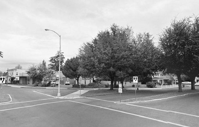
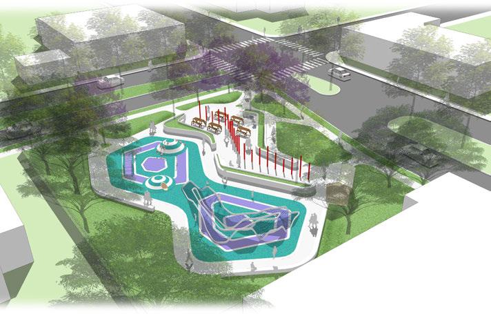
The above graphic illustrates a design concept for a pocket park located at Van Ness and Weldon Avenue in the Tower District, an existing urbanized neighborhood. The Tower District is an area in Fresno that has been identified as park poor and high need, so locating a new park there would help address park equity issues. This site is also adjacent to Fresno High School, providing potential for joint-use with the school and associated facilities. Locating a pocket park in such a highly visible corner intersection is a strategy to activate the park and promote park use.
Park features include a play structure (tot, elementary age), picnic area, plaza area, circulation path, restroom facility with storage, and highly viable sculptural elements. Aspects of this pocket park design concept may be applied to other pocket park sites.
In order for joint-use parks, including school and basin sites, to successfully serve as joint-use park space, they must have typical recreation amenities that are expected of parks. Though these sites may have certain restrictions inherent in their dual use, they should provide a level of passive and/or active recreation amenities as outlined in the park-type definitions for neighborhood or community parks. These amenities may include enhanced landscape (including trees with large canopies that provide shade), areas for picnicking with tables and or benches, play areas, nature viewing areas, and architectural shade structures. See Chapter 3, Park System Overview, Sections 3.2 and 3.3 (page 61) for more details regarding function/purpose and typical amenities at joint-use sites serving as neighborhood or community parks. In addition, design guidelines should be applied to all joint-use sites whenever possible.
Topography is a critical design element at basin sites. Because of this, issues of access - both in terms of accessible routes to areas of activity, and the ability to secure portions of the site, must be carefully designed and demarcated to ensure that these sites are successful as both recreation and flood control facilities.
Note: Figure 5.2 is conceptual, any park planning and park design at flood control basin sites would be done in full consultation with FMFCD, taking into consideration all FMFCD requirements and policies.
elevated walkway with controlled access during flooding
children’s play area with slides and climbing structures over rubber surfacing
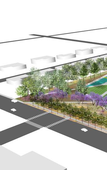
upper walking path
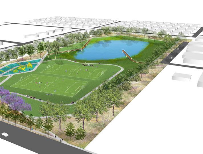
5.2
DESIGN CONCEPT: JOINT-USE BASIN SITE EXAMPLE
controlled access viewing pier
Basin XX is owned and operated by FMFCD. It is located one block west of Highway 99, and is bordered on the east by Hughes Ave., Addams Elementary on the north, and residences on the south and west. The residences do not face the park. The primary lower basin on the west sides is fenced off while the secondary upper basin has open space that includes a baseball field for public use. The entrance is on Hughes Avenue.
The design concept for Basin XX, or other similar basins, works within the constraints that it continue to operate as a functio nal basin for the Flood Control District, therefore, the slopes of the primary basin are maintained with minimal change in topography in the secondary basin. The design minimizes fencing, using tree hedges as buffers instead. The primary basin is a beautiful and tranquil space. The design capitalizes on this with a path that meanders over the basin and includes an overlook as well. In the seconda ry basin, two soccer fields are housed. On the southern slope, a play area capitalizes on topography, with slides that transition from the upper path to the lower path. A picnic area is designed for the upper portion of this area as well. This design idea could also be replicated at Carozza (Basin G), Rotary West (Basin B/E), and 1st & Bullard (Basin O).
In order to encourage recreation at functional flood basin parks in the future, signage and access need to be clear. Fence systems must be designed to allow for year round access and also provide safety. Fresno park basin sites do not need to be completely enclosed and can be fenced at critical points. Most basins have dynamic topography that can transform into a play area or an amphitheater.
The design of site perimeters and boundaries is especially important to consider at joint-use school sites where there are distinct times of public recreation use and school use. By placing community-serving park amenities at community-facing edges, these sites can be inviting and permeable for public recreation. At the same time, strategic placement of fences and gates will help create clear and secure boundaries as needed.


resurfaced basketball courts re-striped soccer field resurfaced & consolidated play area
new pedestrian connections to park/school
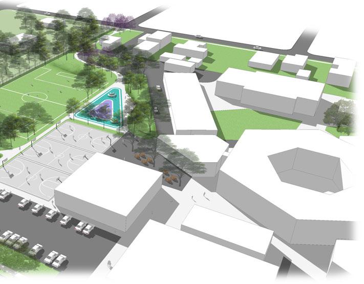
outdoor classroom/dining plaza for students
CONCEPT: JOINT-USE SCHOOL
The above graphic illustrates a design concept for a joint-use facility at Winchell Elementary School located at East Lowe Avenue and South 8th Street in Southeast Fresno. This location is a park poor area of Fresno that is well connected to the adjacent neighborhood. This site provides opportunity for the community to use school amenities such as a basketball facility and soccer field for expanded recreation, and to maintain and reintroduce public right of way to increase park permeability.
Park elements in this design concept include an improved soccer field and basketball court, play equipment (tot, elementary age), a picnic zone, and enhanced pedestrian and bicycle connections to the adjacent neighborhood. Aspects of this design concept can be applied to other joint-use school sites.
Community Centers are at the heart of many neighborhood and community parks. They provide a place for residents to engage in physical, educational, and social activity that builds community and enhances quality of life. In order to best meet the needs of the residents they serve, the following six principles shall be used to guide future planning and design of Fresno’s community centers:
• Accessible – Develop a center open and welcoming to all members of the community and is conveniently accessible to the neighborhood it serves.
• Integrated – Create a place that can become an integral part of the community, building from an understanding of their shared needs.
• Social – Maximize the opportunities for shared experience with other community members, through creating supportive formal and informal social settings, in and around the center.
• Connected – Integrate the center with surrounding community amenities/services in the park system, such as recreation areas and other natural settings.
• Unique – Express and support the unique character of the community in the kinds of services and spaces offered and in the character of the place itself.
• Flexible – Infuse the center with flexible spaces that can support many uses and easily evolve as the needs of the community change and grow
Note: For more information related to design and requirements of Community and Neighborhood Parks, see the Park Classification System park type definitions, Section 3.4.
The relationship between various program elements in a community center - in terms of both size and layout, is critical to its success. The above diagrams and supporting table paint a picture of ideal spatial relationships, i.e. square footage and adjacencies, for a well functioning community center. These conceptual principles can be applied to site specific community center design.




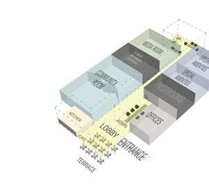




Regional parks are comprised of unique features, but should be designed to provide users with a cohesive experience within park boundaries. This can be accomplished through coordinated design elements such as signage, circulation treatments, entry/exit areas, lighting, and site furnishings that work together to enforce a consistent park identity. Iconic branding is encouraged at regional park facilities.
The City of Fresno Department of Public Works has established and adopted City Standards. Refer to the Department of Public Works website for specifications and drawings as they relate to parks, trails and open space.
In addition to the design guidelines identified in the Parks Master Plan, local, state, and federal standards, requirements, and regulations shall be observed for all of Fresno’s park and open space planning and design efforts. These include and are not limited to the following:
Among other things, the Americans with Disabilities Act (ADA) ensures access to the built environment for people with disabilities. The ADA Standards for Accessible Design establish design requirements for the construction and alteration of facilities subject to the law. These enforceable standards apply to places of public accommodation, including parks, playgrounds, trails and open space, as well as state and local government facilities.
The City of Fresno enforces California Building Code (CBC) during plan review and construction of park buildings and sites.
The California Code of Regulations, Title 24, also known as the California Building Standards Code, contains 12 parts that govern construction of buildings and their sites in California. Any one of these could be applicable for construction of a park. Part 6 of the California Building Standards Code, also titled the “Energy Efficiency Standards for Residential and Nonresidential Buildings,” were created by the California Building Standards Commission in 1978 in response to a legislative mandate to reduce California’s energy consumption. The standards are updated periodically by the California Energy Commission to allow consideration and possible incorporation of new energy efficiency technologies and methods.
About half of California’s urban water use is attributed to landscape irrigation. The Model Water Efficiency Landscape Ordinance (MWELO) was established to promote water efficiency for new and rehabilitated landscapes. MWELO aims to guide landscape design, installation and maintenance to achieve substantial water savings. Depending on the size and type of landscape, parks, trail and open space projects are likely subject to MWELO requirements enforced by local land use agencies. The most current version of Water Use Classification of Landscape Species (WUCOLS) should be used to select plants of the same water usage hydrozones.
The U.S. Consumer Product Safety Commission’s (CPSC) “Public Playground Safety Handbook” was first published in 1981 under the name “A Handbook for Public Playground Safety.” The recommendations in the Handbook are focused on playground-related injuries and mechanical mechanisms of injury; falls from playground equipment have remained the largest single hazard pattern associated with playground use. Refer to the US Consumer Product Safety Commission (CPSC) and/or American Society for Testing and Materials (ASTM) for current playground standards.
The State Water Resources Control Board has jurisdiction throughout California. Created by the State Legislature in 1967, the Board protects water quality by setting statewide policy, coordinating and supporting the Regional Water Board efforts, and reviewing petitions that contest Regional Board actions. There are nine regional water quality control boards that exercise rule-making and regulatory activities by basins.
Irrigation systems are to be designed for water efficiency according to the Model Water Efficient Landscape Ordinance (MWELO). It is important that irrigation designer and installer have a thorough knowledge of Best Management Practices (BMP) regarding the athletic field irrigation systems. For existing irrigation systems it is recommended that an irrigation audit be performed for each park facility in order to determine current water use efficiency. Each facility should strive to achieve an efficiency rating of 70% or better or a minimum reduction of 25% water use over current usage.
1. All controllers (replacement and new) and their associated accessories are to be compatible with the TORO Central Control System
2. Controllers are to be housed in a secure lockable pedestal mount
1. All pumps are to VFD (variable frequency drive) types
2. All pumps are to be housed in a secure lockable cage
3. All pumps for new parks are to be recycled water compatible
1. All valves are to be pressure compensating and adjustable
2. All valves for new parks are to be recycled water compatible
1. All shrubs beds to be drip irrigated. Drip lines should be installed at grade, pinned, and covered with bark mulch for ease of access.
2. All athletic fields are to use rotor sprinklers with matched precipitation nozzles
3. All sprinklers and drip lines for new parks are to be recycled water compatible
1. Mainline pipes are to gasket fitted Pressure PVC Pipe that conforms to ASTM D2241 for standard dimension ratios and is available in SDR 17 (250 psi)
2. Lateral line pipes are to be Cl 200
3. Fittings for PVC pipe 4 inches and larger shall be gasketed fittings, preferably ductile iron. Pipe fittings 3 inches and smaller shall be gasketed, solvent welded or push-on style
4. Thrust blocks are required at all turns and at dead ends
5. For new parks all pipe and fittings are to be recycled water compatible
6. All pipes are to be new, stored outdoors for more than a period of 3 months
1. A qualified experienced person with large scale water management systems should be hired to monitor the Central Control System to maintain water efficiency and minimize labor costs
2. A three year cycle of irrigation audits for all parks should be standard
3. A landscape and turf management plan should be established in conjunction with the Central Control System
4. Retain the local University of California Cooperative Extension as a consultant for on-going turf management
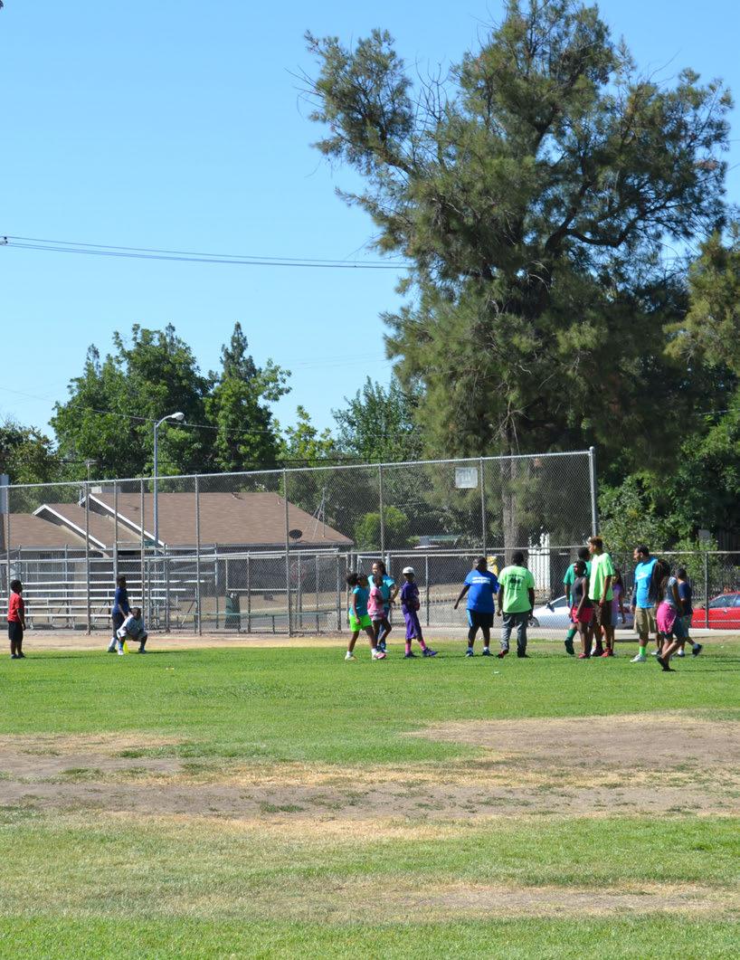
Understanding the needs of a community is foundational to planning a park system. What facilities are available? What is missing? What condition are the parks in? How does the system measure up to other comparable cities? As part of the master planning process, consultants and City agencies, including Parks, After School, Recreation and Community Services (PARCS), Planning & Development, Capital Projects and Public Works departments, employed various methods to gather information about Fresno’s park and open space system. This chapter describes the needs assessment – a systematic process of analyzing existing conditions to identify aspects of the park and open space system that are not meeting user needs. This chapter also summarizes the process for determining Highest-Need Neighborhoods, a definition required by the Measure P Ordinance, passed in 2018 by a majority of Fresno voters, to determine which neighborhoods in Fresno are most in need of parks. Results of the needs assessment and Highest-Need Neighborhoods definition shall guide future planning and design efforts for Fresno’s parks and open spaces.
As part of the needs assessment process, several methods were employed including:
• Assessments: Site assessments were conducted during visits to Fresno parks in 2017.
• Engagement:
Surveys: Online and paper surveys were used to gather community input on park and open space system priorities and needs in 2017.
Workshops: Feedback was gathered from public stakeholders and the Fresno community during three rounds of multi-lingual workshops in 2017.
• Analysis: Consultants and staff performed extensive geographic information system (GIS) mapping and analysis to determine existing conditions, and a system-wide gap analysis to identify opportunities and needs for future park development in 2017. GIS analysis was also used later in 2021 to determine the Highest-Need Neighborhoods definition.
• Benchmarking: Benchmarking studies compared aspects of Fresno’s system to comparable cities in 2017.
Individual park site assessments were conducted to collect data about park facilities, amenities, and conditions, including specific information about park access, connectivity, signage, parking, design and use. Information was systematically recorded using a Park Assessment Form, which can be found for each park in Appendix B. Information from these assessments was used to determine overall park condition, priorities for improvements, and order of magnitude cost estimates (found in Chapter 8).

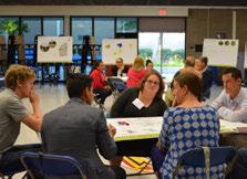
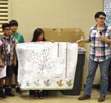
Community engagement was a critical component of this parks master planning process. Information gathered through group engagement activities played a central role in informing Parks Master Plan (PMP) goals and recommendations. Community outreach included stakeholder meetings, mobile workshops, public workshops, and detailed user surveys that allowed consultants and City agencies to identify community needs and priorities.
Stakeholder meetings were held with key community members interested in issues related to parks, recreation, public health, and Fresno’s civic identity. Stakeholders were encouraged to voice their opinions and discuss park issues. Stakeholder feedback was recorded and analyzed so that the consultant team understood site-specific and geographically determined needs, and could record park related priorities voiced by the Fresno community. Common stakeholder priorities identified include:
• Equitable availability of quality parks and amenities
• Improvements to existing neighborhood recreation amenities
• Safety to encourage parks are used for their intended purpose
• Access to parks from surrounding neighborhoods
Public workshops were held at both city-wide and council district levels. Public workshops engaged residents, community advocates, government representatives, and City Council members. These meetings gave residents a chance to become more familiar with their park system, voice their opinions regarding parks throughout the city, and articulate concerns within individual Fresno Council Districts.
Interactive exercises were conducted to identify community needs and priorities. As seen in stakeholder and council district workshop summary tables and maps, feedback consistently demonstrated that the highest community priority was to spend funding dollars on park maintenance, followed by funding park renovations. While important, funding the creation of new parks was determined to be the lowest community priority. In addition, the majority of need for new parks was targeted in the existing neighborhoods South of Shaw, with the Southwest and Downtown areas also identified as being areas of need.
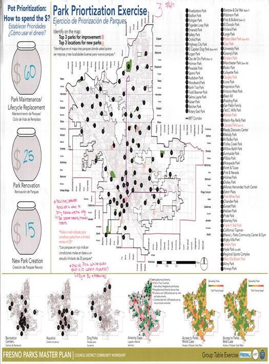
Through interactive exercises at public workshops the community prioritized how they want park funding dollars spent in terms of maintenance, improvements, and new parks
COUNCIL DISTRICT Maintain
1 $58 $23 $18
2 $62 $28 $10
Roeding (4 votes)
Quigley (3 votes)
Fink White (2 votes)
Romain (2 votes)
Quigley (3 votes)
Fink-White (1 vote)
Mary Ella Brown (1 vote)
Einstein (1 vote)
Frank H Ball (1 vote)
Hyde Park (1 vote)
Mosqueda (1 vote)
3 $33 $31 $36 Hinton (4 votes)
Frank H Ball (4 votes)
Mary Ella Brown (3 votes)
New Parks & Open Space Land along canals should be used for parks and trails
Tree Canopy SW Fresno is in great need of park amenities / Walkability & Bikeablility along trail & canal systems
New Parks & Open Space SW Fresno is in great need of park amenities / Shade elements / Accessibility
Pocket Parks need amenities, otherwise they have little value as a park.
Hyde Park is not a park
Park safety is a big concern (homeless presence, park lighting)
4 $55 $22 $23
Quigley (3 votes)
Einstein (2 votes)
Romain (2 votes)
Mary Ella Brown (2 votes)
Logan (1 vote)
El Dorado (1 vote)
Melody (1 vote)
Cary (1 vote)
Hinton (1 vote)
Large (1 vote)
Fink-White (1 vote)
Vinland (1 vote)
Reedy Discovery Center (1 vote)
Urban Agriculture & Community Gardens
5 $51 $29 $20
Quigley (2 votes)
Romain (2 votes)
Mosqueda (2 votes)
Hinton (1 vote)
Roeding (1 vote)
Mary Ella Brown (1 vote)
Cary (1 vote)
Ninth & Tulare (1 vote)
Holmes (1 vote)
6 $58 $22 $20
Roeding (2 votes)
Quigley (1 vote)
Hinton (1 vote)
Romain (1 vote)
Rotary West (1 vote)
Mary Ella Brown (1 vote)
Belcher (1 vote)
7 $52 $35 $13
Einstein (3 votes)
Radio (2 votes)
Mary Ella Brown (2 votes)
Romain (2 votes)
Lafayette (1 vote)
Frank H Ball (1 vote)
Fink-White (1 vote)
New Parks & Open Space, Urban Agriculture & Community Gardens
Find other sources of funding to improve parks / Transportation & accessibility to parks
Accessibility to parks, linking parks via walking/biking trails
Public space along canals is highly valued
AVERAGE $53 $27 $20
Drought Tolerant, Low Maintenance Vegetation
49 Acres site for potential park development / Park partnerships & sponsors
Tree Canopy/ Pedestrian & Bicycle Infrastructure/ Technology
Hyde Park is not a park, it's a landfill / Park proximity to highways / Health concerns / SW & SE Fresno in need of park amenities
Accessibility / Trails / Smart park (technology), Exercise (workout stations, fitness classes) / Park Safety
SE/SW Fresno is an area that is in great need of park amenities (park equity)
Table 6.2
Maintain Renovate
$64
$13
LISTED IN DESCENDING ORDER:
Einstein = 6 votes
Romain = 6 votes
Mary Ella Brown = 6 votes
Fink White = 5 votes
Quigley = 5 votes
Hinton = 4 votes
Frank H. Ball = 2 votes
Carozza = 1 vote
Cary = 1 vote

El Dorado = 1 vote
Maxie L. Parks Community Center & Gym = 1 vote
Melody = 1 vote
LISTED IN DESCENDING ORDER:
Existing Neighborhoods South of Shaw = 22 Locations
DA-1 South (Southwest Growth Area) = 5 Locations
Downtown ( Non-Vacant Land Infill) = 4 Locations
BRT Corridors (Non-Vacant Land Infill) = 2 Locations
Existing Neighborhoods North of Shaw = 2 Locations
DA-4 West (West Growth Area South of Clinton) = 1 Location
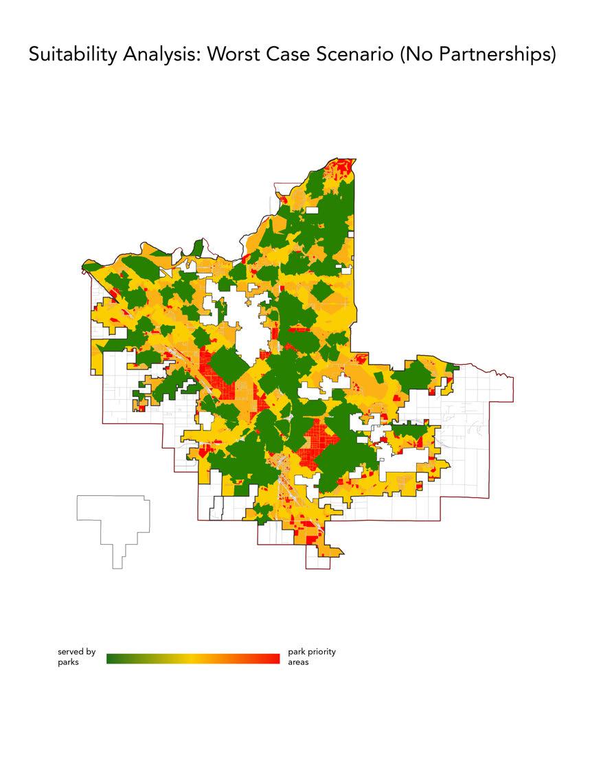
Figure 6.1
COMMUNITY FEEDBACK:
IDENTIFYING PRIORITY PARKS FOR IMPROVEMENT


Left: The community identified priority parks for improvement, shown here with the needs gradient map underlay to illustrate the relationship between areas of Fresno that lack park amenities and specific parks that need improvement
The above map summarizes feedback from the Stakeholder Workshop regarding priority areas for new parks, and includes an underlay of Fresno’s Existing Neighborhoods, BRT Corridors, and Development Areas
The above map summarizes feedback from a series of Council District Community Workshops regarding priority areas for new parks, and includes an underlay of Fresno’s Existing Neighborhoods, BRT Corridors, and Development Areas

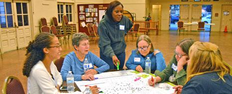
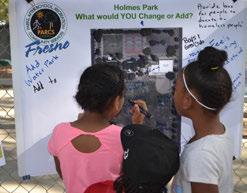
The above images depict public workshop exercises that provide a record of resident feedback during engagement activities
User surveys were disseminated online and through in-person workshops in English, Spanish and Hmong. Survey respondents were asked about usability of the current system and future needs. Nearly 900 surveys were compiled and analyzed in order to inform this parks master plan. Survey respondents were asked about the usability of the current system, from amenities to access to security. Residents were also asked what they would want in a future park system, ranking indoor and outdoor recreation amenities and programming. Survey respondents recognize the importance of parks with 90% of responses placing a high importance on quality parks, facilities, and available program opportunities to the overall pursuit of a healthy and active lifestyle. Of residents surveyed, the top five park amenity needs include (starting with the most popular) picnic areas, community gardens, dog parks, soccer fields, and splashpads. The following graphics illustrate some general priorities in terms of park programming and facilities.
Mapping park deficient areas was a primary goal of the gap analysis process.
Identifying the parks that contain valuable “neighborhood amenities,” meaning those amenities that are considered standard for neighborhood parks (including playgrounds, shaded picnic areas, basketball courts and soccer/football fields), was a first step in the gap analysis. In addition to City of Fresno PARCS Department park land, other amenities in the analysis includes public schools with open campuses (Clovis and Central Unified School Districts), San Joaquin River Parkway land, Fresno Metropolitan Flood Control District owned and maintained ponding basin/parks, Calwa Recreation District, and City of Fresno Department of Public Works Community Facility Districts. Amenity analysis helped identify parks that currently provide neighborhood amenities and revealed parks that do not. Parks without basic amenities provide little to no recreation value to the community, which becomes critically important in a park system that includes areas under-served by parks. Neighborhood amenity gaps are identified in Figure 6.3.
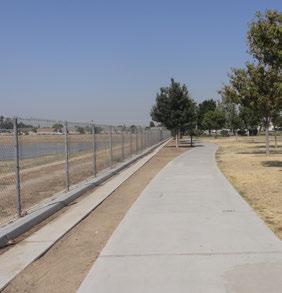
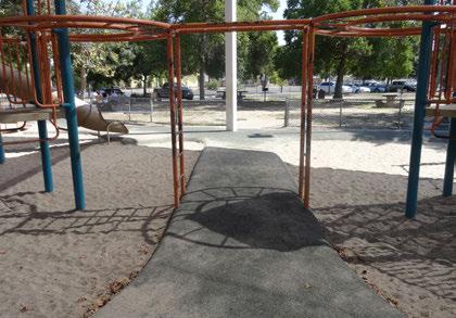

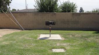
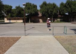
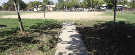


Geographic areas of need were determined by mapping access to existing park amenities. Park amenities (e.g. playgrounds, shaded picnic areas, etc.) were given a buffer for access radius depending on the typical catchment area for the amenity ranging from 1 to 5 miles. This buffer conformed to the street grid so that barriers such as railroad tracks, freeways and waterways were taken into account when calculating accessibility measurements.* Additionally, amenities in poor condition were considered “areas of need” because they are not in usable condition, and therefore cannot be categorized as functioning amenities. Analysis was based on park assessments and community feedback.
Several areas in Fresno were identified as being areas of need because they have either poor condition parks that lack adequate amenities or lack community and/or neighborhood parks entirely. These areas are generally located in the west, central southeast and northeast of the city. A high concentration of parks in poor condition is found in the south and southwest, while areas in the west and southeast of the city lack recreation centers. Areas in the west, southeast, and northeast of the city lack water features (pools and splash pads), and several parks in the southwest of the city have these facilities but they are in poor condition. Areas that lack all community and neighborhood park amenities are located in the west and southeast which are also areas with high population densities.
*This analysis was completed in 2018. Analysis completed for the Technical Amendment in 2023 used a 1/2 mile radius as per the Measure P Ordinance.
Figure 6.3
Source:
Contains
Contains
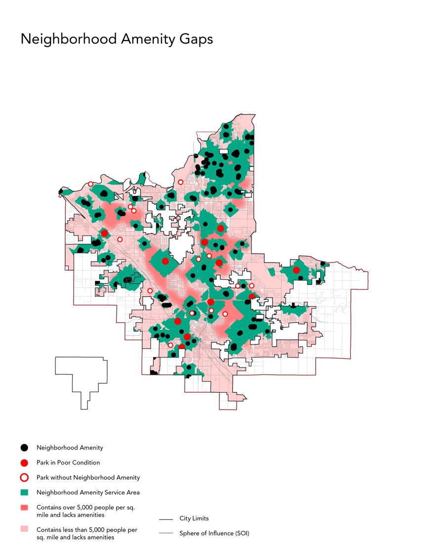

SUITABILITY ANALYSIS
The next step in the gap analysis process combined areas of need with other environmental, geographic and public health information including density, vacant land, rates of obesity, etc. to create maps based on suitability analysis. The “Lack of Trails Access” layer was created with existing and planned trails from the city’s Active Transportation Plan. The “Underserved by Schools + Basins” layer was created by mapping all schools and basins and analyzing those neighborhoods that could not access them. “Physically Inactive Populations” were from the Centers for Disease Control and Prevention (CDC). The “Priority Development Areas” and “Vacant Land” layers were provided by City of Fresno Planning & Development Department. “The “Underserved by Parks Layer” analyzed city access to all parks, even those that do not contain neighborhood amenities.
Figure 6.4
SUITABILITY ANALYSES LAYERS

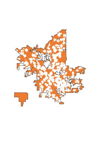
Underserved by Schools + Basins
Physically Inactive Population
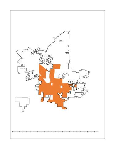
Underserved by Parks
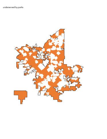
Priority Development Areas
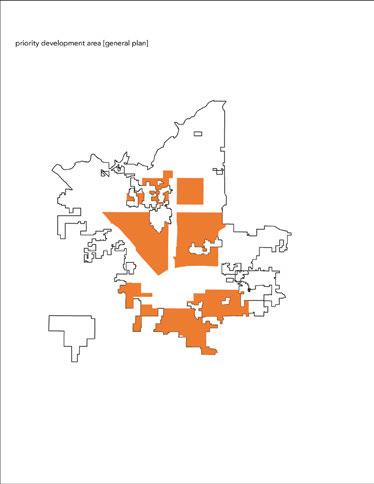
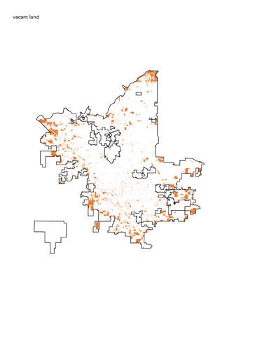
“PARK


Overlaying needs assessment and suitability analysis data produced information to create a needs gradient map that identifies geographic areas of Fresno that range from being adequately served by parks (depicted in green), to being park poor areas, not adequately served by parks (depicted in red). Red areas that are extremely underserved by parks become priority zones for new parks. This analysis reveals a high concentration of park poor areas in Council Districts 1,5 and 7 (as of 2018 Council District boundaries).


Figure 6.5
EXISTING CONDITIONS NEEDS GRADIENT MAP & COUNCIL DISTRICTS


A needs gradient map exercise was also used to explore how expanding school and basin partnerships would impact access to park amenities throughout Fresno. The existing conditions needs gradient map – Figure 6.6 (page 179) – has significant areas of park poor, red areas. The expanded school and basin partnerships map – Figure 6.7 (page 181) – illustrates how expanded partnerships with schools and basins throughout the city would significantly increase areas served by parks (areas in green). This map is followed by maps that illustrate the impact to park amenity access that could result from expanding basin partnerships only and school partnerships only. Overall, this series of map exercises demonstrate that expanding partnerships with schools and/or basins could significantly decrease areas of Fresno that are underserved by parks, including in several neighborhoods that currently have no neighborhood park amenities at all.
The City of Fresno has identified 410 acres of land with potential availability for joint-use partnerships with schools in the Fresno Unified School District. This is the acreage of all Fresno USD school fields and play courts including the 14 school sites the City of Fresno has joint-use agreements with now.
Additionally, there are 366 acres of combined Clovis Unified School District and Central Unified School District school fields and play courts that are open to the public after school and on weekends. No agreement is necessary between these school districts and the City of Fresno. It has simply been their policy since the inception of both districts.
Source: City of Fresno DARM


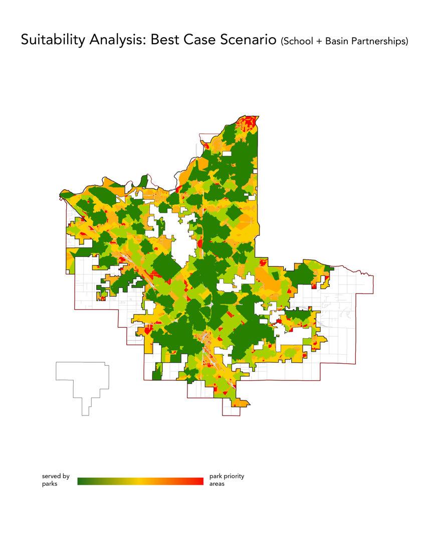


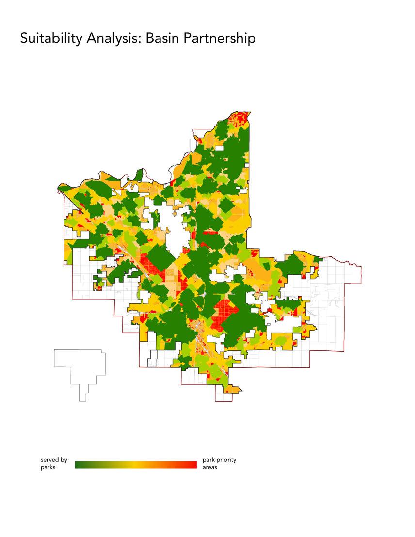


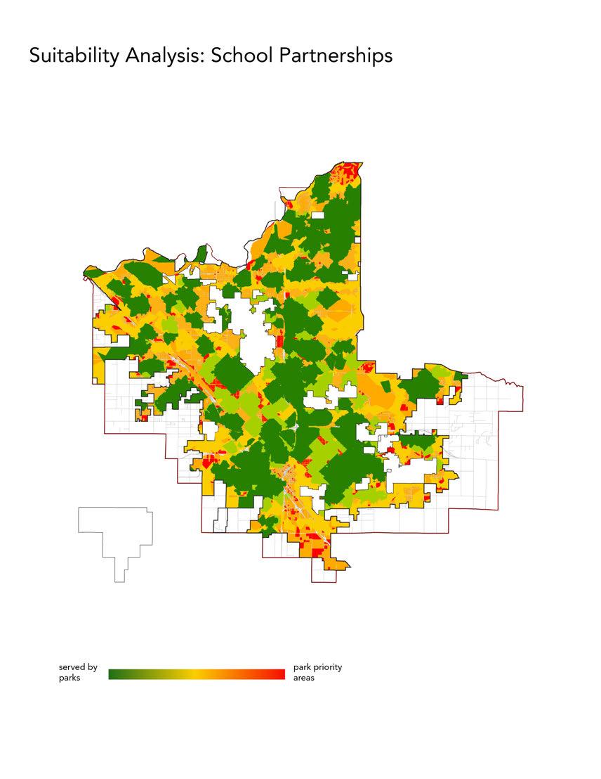

In 2022, after Measure P was passed, the planning team conducted additional GIS analysis to assess which neighborhoods in Fresno have the “highest-need,” based on criteria established by the Measure. For both existing and new parks, Measure P requires that no less than 50 percent of funds must be allocated to “highest-need neighborhoods.” The Measure P Ordinance calls for the City, in conjunction with the Parks, Recreation and Arts Commission (Commission), to “adopt a new definition of highest-needs neighborhoods, after conducting a public process, to be updated every three years and included in subsequent updates to the Plan.”
The Ordinance calls for the City and Commission to create a weighted index incorporating a set of data that must be considered in defining highest-need neighborhoods. This includes park condition and access, health data, demographics, and neighborhood safety data. All these factors, referred to as “Equity Factors” must be considered in the highestneed definition.
Existing conditions of parks and facilities based on needs assessment data in the Plan.
The proportion of the population that lives within walking distance (1/2 mile) to a park.
Park acreage per 1,000 residents.
Population density.
Neighborhood youth and senior population.
Neighborhood safety.
Neighborhoods of concentrated poverty.
Pollution burden, as defined by CalEnviroScreens 3.0, or subsequent updates.
Pre-term birth rates.
Years of potential life lost.
Neighborhood composite mortality rate.
*Data Sources: Fresno County, City of Fresno, ESRI 2021, Fresno PMP, Fresno Police Department, CalEnviroScreen 3.0, Fresno Health Priority Index
In November and December 2021, the City and the Commission led two public workshops, giving people the opportunity to provide input on (1) which Equity Factors are most important when considering park investments in high-need neighborhoods and (2) what proportion of Fresno neighborhoods should be considered “highest-need.” Following an analysis of the available data, the Commission proposed a recommended definition to City Council. After deliberation, City Council adopted the following definition of highest-need neighborhoods:
The following Equity Factors shall be prioritized by giving them two times the average weighting:
• (A) Existing conditions of parks and facilities based on needs assessment data in the Plan;
• (C) Park acreage per 1,000 residents;
• (E) Neighborhood youth and senior population;
• (G) Neighborhoods of concentrated poverty;
• (H) Pollution burden, as defined by CalEnviroScreen 3.0, or subsequent updates;
• (J) Years of potential life lost;
The following Equity Factors shall be given average weighting:
• (B) The proportion of the population that lives within walking distance (1/2 mile) to a park;
• (D) Population density;
• (F) Neighborhood safety;
• (K) Neighborhood composite mortality rate;
The following Equity Factor shall be de-emphasized by giving them half the average weighting:
• (I) Pre-term birth rates;
The top 33 percent of Fresno census tracts, based on this weighting, shall be considered highest-need for the purposes of allocating funds under Measure P from January 1 2020 to December 31 2024. This number may change as the highest-need definition is updated every three years.
In addition to identifying park needs through mapping, population estimates were used to identify park needs in terms of park acreage and level of service (LOS) goals. General Plan LOS goals are 3 acres per 1,000 residents for pocket, neighborhood and community parks, and 2 acres per 1,000 residents for regional, open space/ natural areas, and special use parks. The following table provided by City of Fresno’s Planning & Development Department summarizes park acreage needed to meet current and future LOS goals (by park planning area and city-wide), based on 2017 and 2035 population estimates. Although not included in the LOS calculations, the last two columns on the far right show school acreage to demonstrate how that resource could be a part of the solution given the fiscal challenges involved in the acquisition and development of new parks. School acreage is not included in the city’s LOS calculations, but the numbers are included here to show that it could be part of the solution.
LOS GOALS & PARK ACREAGE NEEDS (BASED ON 2017 & 2035 POPULATION)
* ESRI; Vintage 2017; 2017 Household Population (ESRI); population totals. HHPOP_CY
** Population increase 2017 through 2035 extrapolated from General Plan
Table 1-3: Residential Development Capacity Under General Plan Horizon
*** 2035 population based on projections in the General Plan Table 1-5: Population Estimate Under Horizon and Build Out
**** Subject to water availability
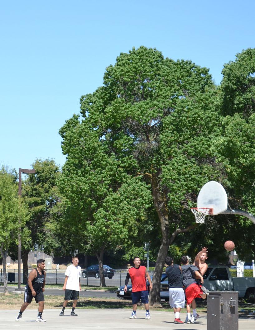
Increased funds from Measure P have marked a positive step forward towards improving Fresno’s park and open space system. Yet despite this welcomed support, existing funding levels still present challenges in fully addressing the diverse repair, maintenance, and expansion needs. Over the 30 year lifespan of Measure P there will be opportunities to make significant changes to the park system, but in the short term, funding and resources prohibit all the changes from happening at once. Given this reality, the community has indicated strong support for the concept of strategic prioritization. The following chapter outlines strategies for prioritizing park improvements and creating new parks, so that Fresno’s parks can better meet the needs of a growing community. Some of these strategies are identified as recommendations in Chapter 9, “Goals and Recommendations.” Additional strategies related to urban greening opportunities can be found in the appendix along with further description of the Measure P parks prioritization process.
Current and future park deficiencies were identified through the gap analysis and needs assessment outlined in chapter 6. This helped to answer the question of where to invest, but with limited funds, strategic prioritization is needed to make steps towards closing the gaps. Analysis revealed that the majority of future park land need is in urbanized development areas. However, these parts of the city are built-out and provide limited opportunities for adding new parks. Because of this limiting condition, and other financial constraints, decisions regarding where to invest in park improvements and expansion need to be strategic and prioritized.
The following is a summary of strategies that can help guide investment and close the gaps in Fresno’s park system:
• Capitalize on existing infrastructure and opportunities for partnership by expanding joint-use site agreements at schools and basins when possible
• Target park renovations by prioritizing parks in areas with park acreage deficiency and/or concentrations of poor condition parks
• Designate “flagship” or priority parks in each council district so that quality parks are found throughout the city
• Concentrate resources in fewer, higher quality aquatic facilities that offer more value and reduce operating costs
• Implement urban greening strategies to improve the public realm, especially in urbanized, park deficient areas
• Acquire land through purchase or re-purpose of City property and build new parks in existing urbanized neighborhoods
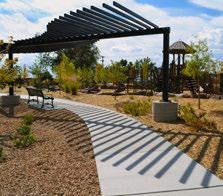
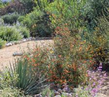
Given limitations of full-scale park renovations, targeted amenity improvements can be made in many parks across the system. This strategy is comprised of a number of thematic, rather than park-specific, improvements. These themes were recognized during the development of this plan and/or have been reinforced by the Measure P online survey in 2022 and discussion by the Parks, Recreation and Arts Commission. The Commission discussed these recreation priorities and recommended to Council that park improvements address these thematic priorities. The themes inform amenity improvement projects and should be defined through the CIP process.
1.
CLIMATE RESILIENCE: HEAT
Climate change will create hotter conditions. Parks, pools, and recreation centers can help protect our community by offering shade, services, and cooling close to home. Examples of potential improvement projects could include:
• Shade structures over picnic areas and playgrounds
• Pool renovations and splash pads
• Drinking fountains / bottle fillers
• Cooling centers at existing facilities
2.
CLIMATE RESILIENCE: DROUGHT
Climate change will increase drought. Park planting should become more water-wise. Water delivery systems should become more efficient. Examples of potential improvement projects could include:
• Drought tolerant tree planting for shade
• Lawn reduction through turf conversion
• Climate appropriate planting
• Irrigation system renovations and modernization
• Water-wise fixture replacement
Parks should appear welcoming to all at the entry and perimeter and contribute positively to the surrounding neighborhood. Examples of potential improvement projects include:
• Entry and perimeter beautification
• Updating park signage/branding/rules
• Painting buildings, adding murals
• Improving safety lighting
Parks should be equipped with functional amenities that can be enjoyed by users. Examples of potential improvement projects include:
• Restroom upgrades and maintenance
• Furnishing upgrades such as benches, picnic tables and trash cans
• Field renovations
• Playground renovations
• Aging amenity repair and replacement
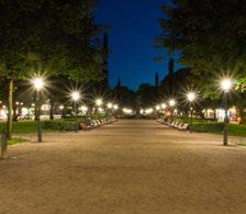
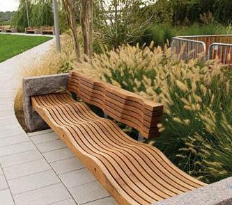
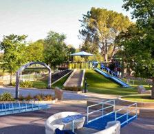

Parks are inclusive to all users and improvements are coordinated with the City’s American Disabilities Act transition plan. Examples of potential improvement projects could include:
• Enhanced accessible routes
• Building ADA upgrades
• Inclusive/all-abilities play features
• Program support for health and wellness
• Multigeneration park amenities
Parks should be safely accessed from surrounding neighborhoods by all ages. Trails are integral to a park system and can provide access to both urban parks and natural areas. Examples of potential improvement projects include:
• Sidewalk and safe street crossing enhancements at parks
• Facilities for bikes in parks
• New trail development
• Improvements to existing trails
7.2 STRATEGIES FOR EXISTING PARKS
Despite the influx of funds from Measure P, current funding levels are not sufficient to take care of all existing assets and build new facilities for Fresno’s park and open space system. The result is the recommendation to develop a three tier prioritization strategy to guide Fresno’s park and open space Capital Improvement Plan (CIP) that acknowledges the City of Fresno’s stark fiscal reality and accounts for an evaluation of priorities and their associated expenditures. The following three tiers help define the level of capital improvements necessary for Fresno’s park and open space assets. Note, future parks associated with new development are not described here, but are expected to be incorporated into capital improvement planning in tandem with new development.
These park improvements are characterized as being critical to address existing facility repairs and lifecycle replacements. These basic lifecycle improvements are necessary for a functional park system . These may include routine maintenance, repairs, repainting, replanting, as well as replacing inaccessible amenities with accessible amenities to remove barriers to access for people with disabilities. This category includes plans for prioritized spending within existing budget targets. The intention of this category is to refocus and make the most of existing resources with the primary goal being for the department to maintain services. The actions associated with this category address deferred maintenance at existing facilities and are funded through existing tax dollars.
Lifecycle replacement is considered an annual value to be included in the City’s budget. Total replacement value is amortized over the life of the facility. As determined through the assessments conducted as part of this PMP, the poor condition of most parks suggests the needed replacement of various amenities immediately, however, a ten year window is useful for planning purposes and is more realistic for the City’s budget planning.
This critical tier is adjusted to target the general priorities based on what is known about the park system and its more valuable assets such as buildings. Buildings have a longer lifecycle than park benches and irrigation systems. New buildings such as the one at Inspiration Park or the Alfonso Hernandez Youth Center have a lifecycle replacement cost to be considered. The estimates in this PMP exclude newer buildings and assume only cosmetic and equipment repair of existing older buildings. Parks recommended for total renovation are also excluded since it is assumed those improvements would not need to be replaced in the coming ten year cycle. Parks with partial renovations are similarly adjusted for those newly built facilities.
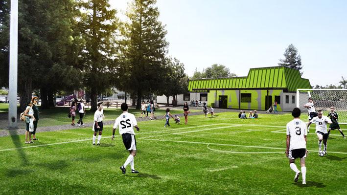
The above images illustrate critical improvements to Melody Park, including upgrades to paint, fields, and pathways. These critical, basic improvement strategies can be applied to other parks.

The above images illustrate critical improvements to Rotary Park, including upgrades to paint, pathways, signage, and landscape areas. These critical, basic improvement strategies can be applied to other parks.
These park improvements are characterized as being strategic to make measured park enhancements to the existing system. Strategic improvements and redesign may include site, amenity, and facility upgrades and removal of barriers to access for people with disabilities. This category describes the extra services or capital improvement that should be undertaken when additional funding is available. This includes strategically enhancing existing programs, beginning new alternative programs, adding new positions, or making other strategic changes that would require additional operational or capital funding.
Examples include removal of unused wading pools and replacement with splash pads or converting tennis courts and baseball fields to multi-use recreation spaces. In coordination with the City Manager’s Office and City Council, the PARCS Department would evaluate and analyze potential sources of additional revenue for these improvements, including but not limited to capital bond funding, partnerships, program income, grants, and existing or new taxes.
7.3
Fink-White is an 8.6 acre neighborhood park located in Southwest Fresno. It is bound by residential streets to the west, east and south, and the 99 Freeway along its north edge. Generally, this park is used by surrounding neighbors. The park currently has a wading pool and learner pool, a small recreation building, basketball courts, multi-purpose fields, a baseball diamond, a shade structure and a playground. Amenities within the park are well used; however, several of the facilities including the building and aquatic facilities are in need of extensive upgrades. This park presents an opportunity to encourage more users from the neighborhood from all age groups and backgrounds.
A strategy for rehabilitating Fink-White that can be applied to other existing parks including Mosqueda, Vinland, Logan and Quigley is to update existing facilities, improve site accessibility, add new amenities that fill gaps within the surrounding access area. The design concept illustrated here includes sports facilities (soccer fields, multi-purpose fields and basketball courts), with the soccer fields generally sited within the existing lawn area, and new basketball courts along S. Trinity Street. A fully enclosed dog park is at the northwest corner. A new pool, recreation building, and splash pad create an active edge. Large shade structures are included where people recreate gather. In addition, this design concept includes playground facilities for tots and older children. South of the park, an unused traffic triangle is transformed into a community garden.
POTENTIAL COST: $10-12 million
vegetation to filter pollutants from adjacent freeway
enclosed dog park
adult exercising loop multi-use field + soccer fields
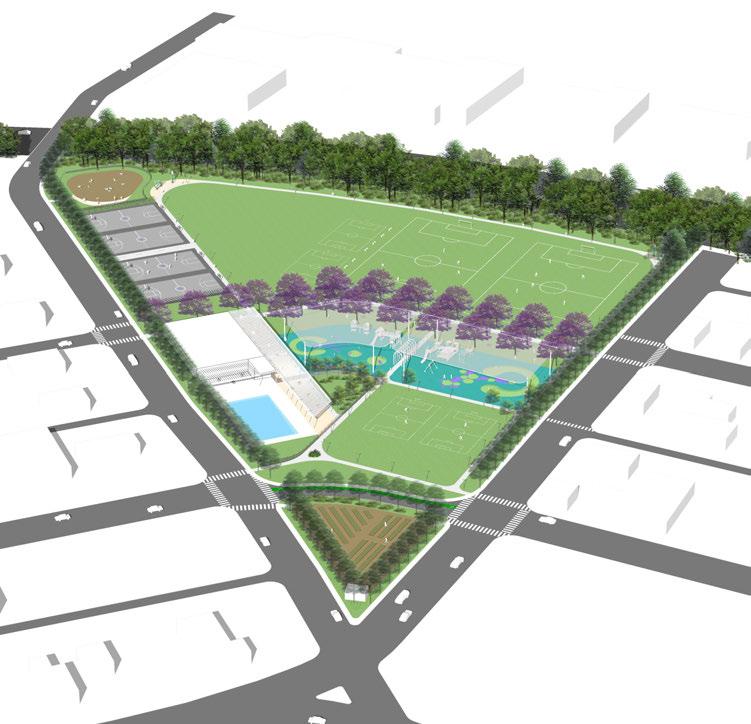
basketball courts
new recreation center building
welcoming entry pool with shallow learning zone
trellis and patio
reconfigure adjacent street for safety and bicycle access
community garden
point of entry
splash pad and shaded playground
point of entry
multi-use field
point of entry
safe crossing
Conceptual illustration showing potential strategic improvements to Fink-White Park.
These park improvements develop new opportunities, including complete site “re-dos” and new site design. Visionary park improvements include comprehensive park renovations, acquisitions, and the creation of new parks designed with universal accessibility in mind. This category represents the complete set of services and facilities desired by the community. It is fiscally unconstrained but can help provide policy guidance by illustrating the ultimate goals of the community, and by providing a long-range look to address future needs and deficiencies. Examples include parks in need of total reconstruction. Typically a master plan is conducted to analyze conditions, determine any items of value, explore the needs of the community, and design a brand new park. Funding for visionary projects would be derived from partnerships, grants, private investments and new tax dollars.
7.4
VISIONARY PARK IMPROVEMENTS - ILLUSTRATIVE DESIGN CONCEPTS: 5-ACRE NEIGHBORHOOD PARK
This spotlight introduces a new park prototype to Fresno, where a five to ten acre site may become available for the park system. This design envisions building a park in an area where there are few amenities currently. It is seen as a park that is surrounded by residences and businesses that face the park and provide an active street presence.
This park design concept is based on the idea that there is a central green that can also operate as a soccer field. This green is bordered by a central loop path that connects to other amenities including a recreation building, large playground, splash pad, basketball courts and adult exercise area. The park is well connected to adjacent streets and designed for universal accessibility. Clear access points and paths lead to neighborhood streets and create clear visual linkages.
With all new parks, it is important to balance amenities with multi-use greenspace. Of primary importance are edge treatments and neighborhood connections with “eyes on the park.”
POTENTIAL COST: $8-10 MILLION DOLLARS (not including land costs)
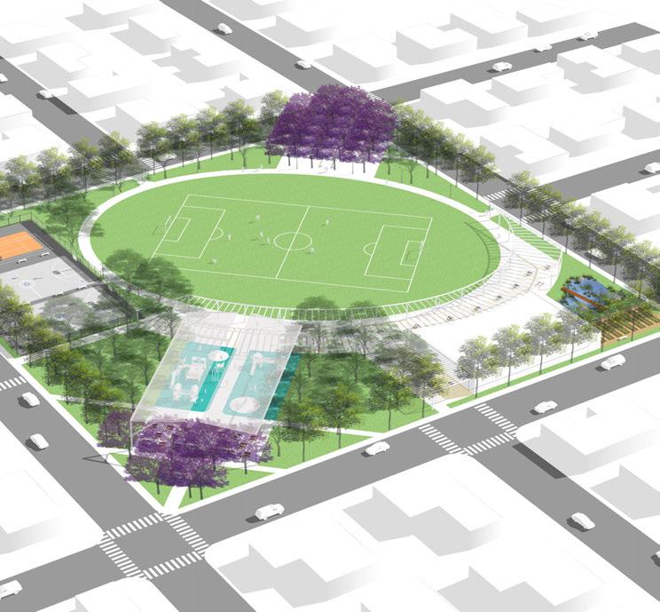
Conceptual illustration showing potential future improvements.
Enhancing existing parks through renovations, strategic upgrades, and appropriately funded maintenance operations is a key goal of this Parks Master Plan (PMP). Individual park assessments were conducted to understand park-specific conditions. As a result, many parks across the city have been recognized as needing significant improvement and are recommended for major capital investment.
To provide a more even geographic distribution of park improvements, a council district “flagship” park strategy is recommended. Table 7.1 and the supporting map (Figure 7.5) provide information to help City of Fresno staff, the community, and elected leadership answer the question of where to invest. It identifies possible flagship, priority parks distributed across the city by council districts. Flagship parks are recommended to be prioritized for ongoing upgrades and fully funded maintenance including lifecycle replacement. It is an additional tool for ongoing park planning and funding activities. One outcome of this tool may be to ensure in the near term that at least one park in each Fresno Council District achieves the desired level of quality. It is recommended that each community and council member revisits flagship park designations based on use, popularity and community priority.
1 Inspiration, Quigley*, Lions
*Quigley was designated one of the highest priority parks in the city by community members during outreach.
2 Oso de Oro, Orchid, Logan Most parks in this district were in fair to good condition.
3 Mary Ella Brown*, Fink White, Frank H. Ball
4 Cary*, Vinland, Rotary West
5 Mosqueda*, Pilobos, Al Radka
6 Todd Beamer, Rotary East, Belcher
7 Romain, Radio, Einstein
There are a number of poor to fair condition parks in this district.
*Mary Ella Brown is also a priority for tier 3 renovations. Holmes and Hinton may also be considered.
There are a number of poor to fair condition parks in this district.
*Cary Park is also a priority for tier 3 renovations.
Most parks in this district were in fair to good condition.
*Mosqueda Park is also a priority for tier 2 renovations.
Most parks in this district were in fair to good condition. Selma Lane may also be considered.
There are a number of poor to fair condition parks in this district. Lafayette, Manchester, and Romain may also be considered.
Note: Regional parks such as Woodward, Regional Sports Complex, and Roeding share attributes of the designated flagship parks (i.e. source of civic pride, high use) however they serve a regional audience and are not included in this table. Regional parks are separately identified for funding and improvement and their important stature as regional destinations is noted.
Targeting park expansion in urban, dense areas of the city that lack park access will help channel resources where they are most needed. In addition to areas identified in the gradient map (in red), this also includes parts of Downtown, such as Chinatown, and areas served by high speed rail where future plans for development are being explored.
The analysis in Figure 7.6 illustrates how fencing around parks decreases park access. In this analysis map, fences were strategically removed and buffer analysis was performed to measure how park access may changed with fence removal. Exercise results reveal that simply removing park fences improves park access at several locations, since the park could then have several access points instead of access restrictions. Strategic fence removal can be an especially efficient strategy for increasing park access in high density, park poor areas.
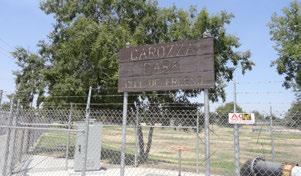

Existing Fresno park access and fence conditions
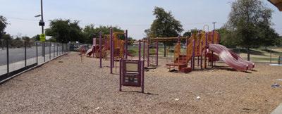
Improved access to existing parks and open space
Densely populated areas containing over 5,000 people per sq. mile and lacks amenities

Existing trails
Proposed
Parks
Existing
Improved
Densely

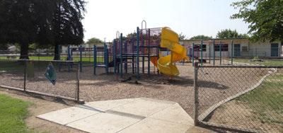
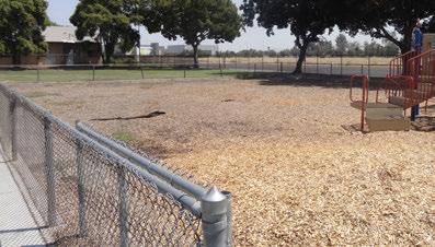
Existing Fresno park access and fence conditions
Prioritizing investment by channeling resources into fewer, higher quality facilities is a strategy that can be applied in specific cases like swimming pools. Currently there are four large outdoor pools, six small learner pools, and eight wader pools in parks across Fresno. In addition, five splash pads exist as a warm weather playground with airborne water. Pools offer a unique recreational fitness program and in the summer, a popular place to keep cool. Programs run by PARCS teach kids water safety skills. Fresno’s lifeguard training program is a valuable and unique aquatic asset to this community.
Instead of having multiple locations of small, narrowly serving facilities (such as multiple facilities that provide one learner pool only), the larger community may be better served with a large “Aquatic Center” that offers several different types of aquatic amenities, such as a learner pool,
community pool, and splash pad all at one site. This resource consolidation can be an efficient strategy to achieve the goal of meeting a larger variety of community level recreation needs for a wider user group.
To illustrate and support an aquatic center strategy, a design concept was developed for the creation of an aquatic center at Mary Ella Brown. This site was deemed appropriate for the development of an aquatic center for several reasons related to location (adjacent to West Fresno Middle School), existing site conditions, existing school amenities, and site size. Developing a complete aquatic facility at this site would provide benefit to community and school user groups, as both would have increased access to recreation amenities. When operated as a joint-use site, the large athletic fields, swimming complex, locker rooms, and parking area offer valuable resources to school and public communities. The design concurrently accommodates different groups. For example, seniors or preschoolers can use the community center while physical education classes or the swim team use the pool. In addition, the City of Fresno’s 41 & North Plan establishes zones for new park development on a vacant parcel adjacent to the school and owned by West Fresno Elementary School District.
Park elements illustrated in this design concept include amenities that serve a variety of community needs. Aquatic amenities include a swim building, community swimming pool, and splash pad, which support a range of aquatic activity - from recreational swimming and casual play, to aquatic learning and swim competition. In addition, other community amenities at this site include a community building, skate park, picnic areas, central plaza, and play structure (tot and elementary age). As a whole, this facility meets a wide range of needs for the broader Fresno community, while individual elements target specific user needs. Aspects of this design concept could be applied to other sites.
outdoor dining area
skate park
central plaza with special paving
community pool with lap lanes and casual wading area
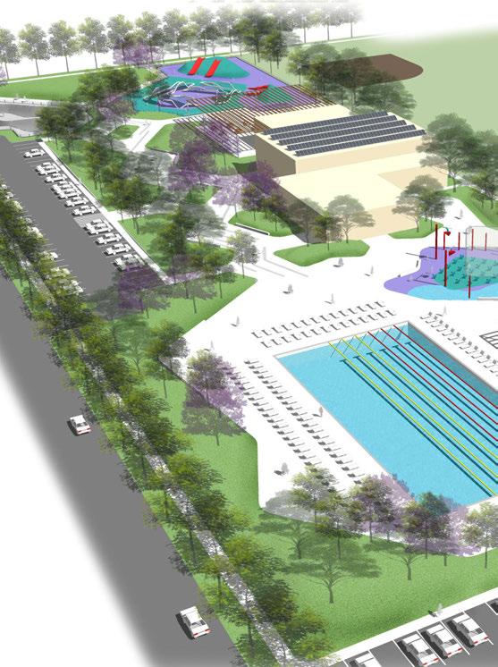

welcoming entry
play area with rubber climbing mounds and shade
community building with solar panels
splash pad with overhead shade structure
pedestrian connections to adjacent school site, could include a plaza between park and school

pool building with shaded outdoor seating and dining area
flexible pool deck seating with shade

The Measure P Ordinance states that 46% of Measure P funds must go to improving and maintaining existing neighborhood parks and playgrounds, 50% of which must be for parks in highest-need neighborhoods.
In 2022 the Commission considered an approach to prioritizing which individual parks should receive Measure P funds. The prioritization framework considered a set of seven “prioritization factors” (Figure 7.8). By
using these factors as an evaluation framework to determine if a park should be prioritized, the Commission and the City use a rigorous and systematic approach to allocating funds.
On January 10, 2022 the PRAC approved these seven factors as the framework for prioritizing improvements to existing parks under Measure P. The Commission then voted on which factors should be considered greater, equal or of lesser importance. The results of this vote are displayed in table 7.2.
* The Commission found Emerging Priority Parks to be a criterion of higher importance. The Planning Team assigned parks that were prioritized by large numbers of survey respondents a weighting of “3”. Parks that received only moderate or low levels of identification in the survey were weighted “2” and “1” respectively.
The Consultant Team completed analyzing data for each of the seven prioritization factors. The scores for each factor were added together, resulting in an overall score for each park. Parks with higher scores are considered to have higher needs. Figure 7.9 shows how each park, and its associated score are distributed throughout the city. The top scoring parks overall as well as the ones that are in a Highest-Need Neighborhood are:
1. Vinland
2. Einstein
3. Quigley
4. El Dorado
5. Logan
6. Ninth & Tulare
7. Roeding Regional
8. Riverbottom Park
* Bolded parks appear on both lists
1. Ninth & Tulare
2. Roeding Regional
3. Basin XX
4. Romain
5. Frank H. Ball
6. Mary Ella Brown
7. Dickey Playground Park
8. Holmes
In 2022 this prioritization framework led to an engagement and design process that occurred at Frank H. Ball, Romain, Dickey, and Holmes, four of the top scoring parks in Highest-Need Neighborhoods. The Consultant team led an engagement effort and developed cost estimates and priorities for improvements at each of these sites. This process, or a similar one, is one component of determining which parks should be prioritized for improvements.
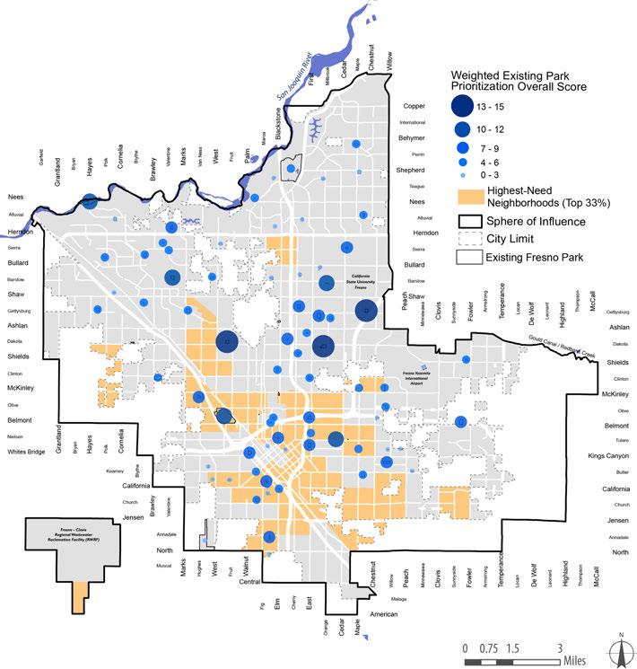
Even as Fresno focuses on the need to maintain and improve its existing parks, the City must also provide new park land to keep pace with population growth and Level of Service (LOS) goals. At a high level, this section lays out strategies for the City to improve its delivery of new parks by consistently using the resources at its disposal and adding more tools to its kit. These tools are intended to help the City go further with limited resources, while maximizing the value of new parks for current and future residents. Some of the approaches outlined here are most relevant to support growth in existing infill neighborhoods, while others are more suited to future development areas. Some strategies may be applied citywide.
Fresno falls short of recreation needs in existing neighborhoods today, and this will become more acute as population and development increase. The General Plan is intended to support an additional 29,000 dwelling units by 2035 in Fresno’s established neighborhoods (about half of which would be located Downtown or along the BRT corridors). Land available for new parks in developed areas is limited. Infill development is dispersed in many neighborhoods, so Park Impact Fee proceeds may not be easily applied to a single site. The strategy for infill areas, therefore, emphasizes ways for public land with recreation potential to be better used; ways for the City to encourage the creation of small publicly accessible spaces as part of new development; and priority locations where the City should invest scarce resources to build new City parks.
Partnerships with school districts and other public agencies represent the most realistic, economical way to add significant acreage to the park system in areas with limited space for new park land. Expanding joint-use partnerships with schools would significantly increase recreation amenities, especially in areas with little land available for new parks. The City of Fresno has identified 410 acres of land with potential availability for joint-use partnerships with schools in Fresno Unified School District.
• Maintain Joint-Use Agreements and Establish Agreements for Additional Sites. Fresno should continue to seek agreements with school districts for joint-use of recreational facilities. As the City and school districts gain experience with joint-use, future agreements can become more ambitious in terms of the amount of community and public use available and the facilities included in the agreements. The City should prioritize joint-use at school sites in park-deficient and economically disadvantaged areas, with the long-term goal of establishing joint-use for all school sites.
• Partner with School Districts to Create Enhanced Joint-Use Park Sites. There is also the opportunity to work with school districts on design enhancements to make existing school sites more usable for all segments of the community. For example, the addition of shade trees, picnic tables, benches, and amenities in neighborhood-oriented portions of school sites could go a long way toward making these sites function as full-spectrum parks, at a fraction of the cost of developing a new park from the ground up.
THE CITY OF FRESNO HAS IDENTIFIED 410 ACRES OF LAND WITH POTENTIAL AVAILABILITY FOR JOINT-USE PARTNERSHIPS WITH SCHOOLS IN FUSD.
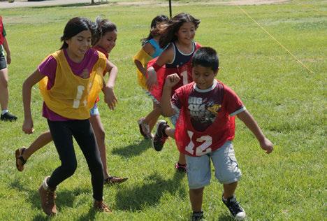
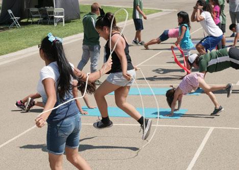
JOINTUSE PARTNERSHIPS WITH SCHOOLS WOULD SIGNIFICANTLY INCREASE RECREATION AMENITIES, ESPECIALLY IN AREAS WITH LITTLE LAND AVAILABLE FOR NEW PARKS
As Fresno “grows in” we can expand our definition of parks to apply to more urban settings, and give developers incentives to create these spaces.
• Provide Incentives for Park Land beyond What Is Required. The City can consider offering additional density, height, floor area, or flexibility in meeting other Code requirements, in exchange for the provision of public open space. A well-designed program would be based on an understanding of the level at which a “bonus” would become financially attractive to developers, and an evaluation of resulting building forms. It may apply in some but not all parts of the City.
• Explore “Park Equivalencies” to Expand Potential for Creating a Variety of Public Open Spaces. Another way to incentivize the creation of small public spaces is to credit those spaces toward what a developer owes in the form of park land dedication or in-lieu fees. When designed well, small urban spaces contribute to place-making and quality of life— and may be suitable to count toward Fresno’s LOS goals.
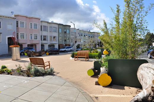
Full-scale new City parks in infill areas may be possible, despite land and funding constraints, with careful targeting in terms of funding and location.
• Pursue Grants for Parkland Acquisition and Development. Community Development Block Grant (CDBG) funds have been an important source of funding for park improvements that benefit lowerincome communities in Fresno. State and other funding sources will change and emerge with specific focus areas. PARCS must continue to be organized and proactive in pursuing appropriate grants.
• Look for Opportunities to Locate New Parks in Areas with Public Transit, Including Near High-Density BRT Corridors. Fresno aims to attract substantial new development to certain key corridors. New parks near these corridors would serve new development as well as adjacent neighborhoods that may be park-deficient today. Because of the easy access by all modes of travel, these would also be good locations for recreation amenities that serve broad segments of the community.
City-owned property and even excess street right-of-way can also be tapped for recreational purposes. Converting City-owned land to park land removes the cost of land acquisition, allowing the City to go further with available resources.
• Leverage City-owned Property to Create New Parks. The City should evaluate its inventory of land and determine whether there are sites wellsuited to park use due to their location in a park-deficient area, their size, and other characteristics. Specific sites may then be planned for park development. Elsewhere, PARCS should be given the right of first refusal before disposition.
• Explore Creation of a Land Banking Agency to Assemble Property for Park Use. A land banking agency may serve a useful purpose in managing, assembling, transferring and/or disposing of properties. Such an agency may have the discretion to sell property strategically to serve Fresno’s Oso de Oro Park is a great example of a joint-use basin park.

City goals, while allowing the City’s service-oriented departments to focus on their core missions.
• Evaluate Streets as Potential Open Space Assets. Fresno could study the street network to identify streets that may have excess right-of-way that could be converted to linear parks and plazas, and street segments that may not serve local land uses and could be vacated to provide park space. This may be especially appropriate where the street space can be combined with adjacent property, in dense and park-deficient neighborhoods, and in areas with pedestrian activity. Parklets are another public space amenity to be considered. Streets are technically owned by adjoining property owners, while the City has a transportation easement, so converting street space to parks may require modifying existing easements to support open space functions, or purchasing land.

Even with the emphasis on infill, most of Fresno’s residential development between now and 2035 is projected to occur in the Development Areas (DAs) east and west of the City, mainly outside today’s City limits. Future development in these areas must include an expansion of the City’s park system to contribute to a high quality of life for future residents. Partnership opportunities remain important in the DAs, where parks can be planned in coordination with other public facilities. Much more than in Infill Areas, the City’s approach to the development review process is also critical.
In areas slated for future growth, the City has the opportunity to establish partnerships with other agencies that produce parks that are planned, designed, and managed for joint-use from the outset.
• Coordinate with Police and Fire Departments. PARCS should coordinate with the Police and Fire departments to co-locate future parks with planned stations in Development Areas. Coordination may allow PARCS and the public safety departments to leverage funding sources to acquire and develop land. Well-designed parks adjacent to these facilities have built-in security, and can facilitate positive recreational interactions between officers and the communities they serve.
• Partner with School Districts and FMFCD. Co-located park and school sites can be designed so that some amenities are shared, resulting in land efficiencies. Sites can have permanent joint-use agreements for shared facilities, allowing these school-adjacent parks to be counted toward park land requirement. Coordination may allow the financing of future park land to also benefit schools, or vice versa.
Fresno Metropolitan Flood Control District (FMFCD) and the City have joint-use agreements covering 20 ponding basins within City limits. Future ponding basins will be needed to support urbanization in Development Areas. The City should work with the District through the subdivision and
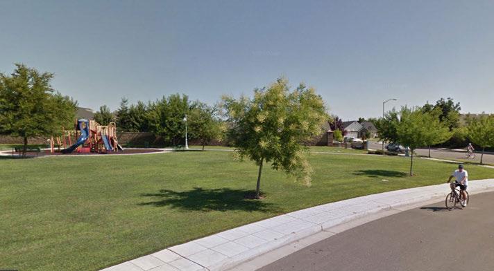
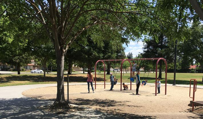
concept plan processes, to ensure that new development is designed to relate positively to the basins, and that basins are designed to be both aesthetic amenities and recreational assets to the greatest extent possible.
The Development Code contains important tools to create park land as part of residential development. Through the Parks Master Plan, the City has identified ways in which the terms of park land dedication could be adjusted for better park outcomes.
• Change Pocket Park Requirements. The Code currently requires that subdivisions of 50 parcels or more set aside at least 0.6 acres per 1,000 residents in the form of pocket parks. In some cases this results in very small spaces with limited recreational value. The code could be revised to change both the acreage set-aside and the subdivision size threshold at which pocket parks are required. Dedicated land could be required to be at least 0.5 acres in size, appropriately shaped and located, and with adequate amenities. Changing pocket park dedication requirements could be explored as part of the next Nexus Fee Study update.
• Continue to Require Land Dedication for Parks. The General Plan provides a citywide blueprint for the development of the parks system. More recent Specific Plans provide more current and locally-identified potential park sites. Staff should continue evaluating development, subdivision, and concept plan proposals as they relate to the planned parks system; determine whether development proposals accomplish the City’s parks system goals; and exercise the right to require land be reserved and developed for parks.
• Acquire and Develop New Parks to Meet the City’s Level of Service Goals. Park Impact Fee (PIF) revenues generated by development give the City the means to acquire land and develop parks. The City must choose land that is well-suited to park use, negotiate its purchase, and develop it to produce high-quality parks well-integrated into the larger system.
Elements of the strategy for new parks that apply citywide could include partnerships with a range of agencies and organizations; adjusting the PIF and broadening the use of other funding mechanisms; and keeping an eye on the whole system when expanding it park by park.
Partnering with agencies and organizations to facilitate new parks may include expanded and/or new partnerships with the following:
• Fresno Irrigation District (FID), whose canals provide great rights-of-way for multiuse paths.
• Organizations working on the San Joaquin River Parkway, including the San Joaquin River Partnership which is leading the effort to complete the SJRP.
• Caltrans could be a good partner in efforts to make unused space adjacent to freeways available for recreational use.
• Fresno State and Fresno Community College are other potential partners, whose campus greens and athletic facilities are potential candidates for more community use.
The PIF is the most important mechanism tying new development to new parks, and could be revisited during the course of the Master Plan period. Special districts could also play a larger role in Fresno.
• Consider Creating a Tiered Park Impact Fee. An updated Nexus Study could establish a two-tiered PIF that would both incentivize infill development and better support the creation of new parks in new neighborhoods. The PIF could be set closer to 3.0 acres per 1,000
residents in Development Areas, achieved through fees, land dedication, or a combination. For Infill Areas, the PIF could be set lower, in recognition that the City is placing greater emphasis on joint-use schools and other approaches, and to provide another incentive for “growing in.”
• Explore Greater Use of Special Districts. Community Facilities Districts (CFDs), Mello-Roos districts, and Landscaping and Lighting Maintenance Districts (LLMDs) allow for the formation of a special district within which a special assessment is levied to pay for public facilities or services. The districts require approval by a majority of property owners within their boundaries. Fresno currently relies on CFDs to maintain pocket parks and landscaping in new subdivisions. Special districts could be used more widely to fund parks as part of new developments. They could also be explored in existing neighborhoods, especially where active neighborhood associates or HOAs could ease the process. The City does not seek to be a party to CFDs, but recognizes them as a potential resource for creating and maintaining parks.
It’s essential that parks serve local populations effectively. In addition, green connections that link neighborhoods and parks are critical. General Plan maps and policies support greenways along canals, creeks, and between Fresno neighborhoods and the San Joaquin River Parkway. The City can ensure that these ideas come to fruition by requiring that land be reserved and dedicated, and directing funds to develop these trails and greenways.
In 2022, with support from the consultant team and City staff, the Commission approved an evaluation framework for prioritizing locations for new parks. This framework takes into consideration factors from this PMP as well as input from 2022 community and City priorities. The framework consists of five prioritization factors seen in Figure 7.10.
Using Geographic Information Systems analysis, the consultant team layered each factor, resulting in a heat map that shows new park priority locations (Figure 7.11). Priority should continue to be assigned to projects in or adjacent to Highest-Need Neighborhoods.
FRESNO PARKS MASTER PLAN FRESNO PARKS MASTER PLAN
GAP ANALYSIS COMMUNITY PRIORITY
HIGHEST NEED NEIGHBORHOODS?
FRESNO PARKS MASTER PLAN INPUTS
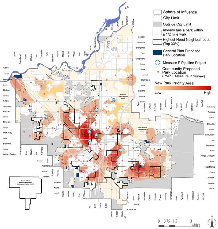
Park and recreation needs of the Fresno community can also be met through the application of urban greening strategies. “Urban greening” refers to the creation of vegetation (including trees, shrubs, groundcover), green spaces (such as parks, open space, and gardens), and green infrastructure (including stormwater, pedestrian and bicycle infrastructure, as well as energy efficient technologies), within the urban fabric, and employing a sustainable approach to maintaining those elements. In addition to expanding green space, urban greening strategies provide a number of environmental and community benefits, including improving air and water quality, reducing heat island affect, reducing flooding and sewer overflow, creating wildlife and pollinator habitat, providing recreation opportunities, and providing public green space where community members can socialize and connect.
The City of Fresno can refer to the following catalogue for urban greening strategies that can be applied to existing sites, or used for future planning and design efforts. Many of the ecological and social benefits of urban greening strategies overlap and are inter-connected.
ACTION
Build new parks, trails, and open space/natural areas
BENEFIT
Improve air quality, improve water quality, reduce heat island, reduce flooding and sewer overflow, create wildlife and pollinator habitat, provide recreation opportunities, provide community social spaces
ACTION
Increase street trees and the amount of trees in parks and open space areas, particularly shade providing trees with large canopies that strengthen the urban forest and “Valley Arboretum” concept
BENEFIT
Improve air quality, improve water quality, reduce heat island, reduce flooding and sewer overflow, create wildlife and pollinator habitat, provide recreation opportunities, provide community social spaces
ACTION
Create gardens that provide ornamental vegetation, produce locally grown food, and create community gathering spaces
BENEFIT
Improve air quality, improve water quality, reduce heat island, reduce flooding and sewer overflow, create wildlife and pollinator habitat, provide recreation opportunities, provide community social spaces
ACTION
Employ a drought tolerant, low maintenance plant palette for new design, including trees, shrubs and groundcover, and convert existing high water use and high maintenance vegetation when possible
BENEFIT
Improve air quality, improve water quality, reduce water use, reduce heat island, reduce flooding and sewer overflow, create wildlife and pollinator habitat, provide recreation opportunities, provide community social spaces
ACTION
Repair and add safe sidewalks, trails, and bicycle lanes to urban infrastructure and increase bicycle parking to support ease of bicycle use
BENEFIT
Improve air quality, improve water quality, provide recreation opportunities, provide community social spaces
ACTION
Increase pervious surfaces and opportunities for water infiltration with pervious hardscape elements and plant material
ACTION
Employ efficient and “smart” technologies that have associated water, energy and cost savings
ACTION
Increase planting, mulching, landscape and hardscape maintenance, public art such as murals and sculpture, and education components that enhance park and open space user experience
BENEFIT
Improve water quality, reduce water use, reduce heat island, reduce flooding and sewer overflow, create wildlife and pollinator habitat
BENEFIT
Improve air quality, improve water quality, reduce water use
BENEFIT
Improve air quality, improve water quality, reduce heat island, reduce flooding and sewer overflow, create wildlife and pollinator habitat, provide recreation opportunities, provide community social spaces
Based on demographic information, gap analysis, workshop feedback, and resident surveys, a number of opportunities for urban greening strategies have been identified. The following maps are organized by Council District, and include PARCS inventory, CFDs, FMFCD ponding basin parks, San Joaquin River Parkway parkland, public schools with open campuses, Calwa Recreation District, and golf courses - with the understanding that some of these sites have limited public value due to access restrictions.

District 1 is served by 4 parks, including the system’s newest addition, Inspiration Park. The district’s dense urban form includes the Tower District, a walkable retail center bordering Downtown Fresno’s northern edge. Community feedback from District 1 prioritized the following strategies: new parks and open space, trees, pedestrian and bicycle infrastructure, and beautification. Additionally, community members vocalized specific ideas related to an increased tree canopy through restoring canal habitats and parks with native species. Community members also commented on stormwater management focusing on protecting areas around creeks and along waterways.
New Parks
• K-6 Schools in District 1 including Wilson Elementary, Fremont Elementary, Homan Elementary and Roeding Elementary and 6-12 schools including Cooper Middle School, Fresno High School, and Glacier Point Middle School should be prioritized for grounds improvement and accessibility so that they can be usable open spaces for the district.
• Basins should be prioritized for grounds improvement and accessibility so that they can be usable open spaces for the district.
• Pump stations, including the one at Santa Ana and Channing should be transformed into a new open space.
• Pocket parks near business districts including one at Olive and Van Ness should be prioritized as a new open space that could provide an amenity for the retail district.
Trees
• Much of the District is characterized by well shaded residential streets. New street tree planting and tree maintenance should be prioritized in the Northwest area of the District to continue extending the shade canopy of the core neighborhood. Replacement of trees and infill is important in other areas.
• Pedestrian and bicycle interventions should focus on safe routes to schools and parks.
• Canal Trails should be improved to allow for bicycle safety and pedestrian access.
• Sidewalks and bicycle lanes should be prioritized in the Tower retail district.
Beautification
• Murals should be installed in the Tower retail district, providing a form of beautification that elevates the unique character of the area.
• Retail district enhancements including sidewalk improvements, street tree planting, benches, lighting and other furnishings should be part of the core neighborhood beautification strategy.
• Perimeter enhancements are recommended for schools and industrial uses as buffers that contribute to a positive neighborhood aesthetic.
Note: “Existing Park” includes Community Facility District Parks, FMFCD Ponding Basin Parks, San Joaquin River Parkway Parkland , Public Schools with Open Campuses, Calwa Recreation District Park, and Golf Courses
District 2, bordered by the San Joaquin River to the north, has several parks distributed through the central and eastern sections of the district. Two functioning basin partnership parks exist in this district: Oso de Oro and Barstow and Del Mar. Community feedback from this district focused on pedestrian and bicycle infrastructure, with a prioritization for more trails and sidewalks. Tree canopy, New Parks and Open Space, and Beautification were also top urban greening strategies.
URBAN GREENING STRATEGIES
New Parks
• New parks and open spaces should focus on access and visual connections to existing open space areas.
• Several schools in this district including River Bluff Elementary, Norman Liddell Elementary, Lawless Elementary, Forkner Elementary, Figarden Elementary and William Saroyan Elementary should be prioritized for grounds improvement and accessibility so that they can be usable open spaces for the district
• Basins in this district including AE, EM and EF could provide amenities similar to existing partnerships in the district such as Oso De Oro and Barstow and Del Mar and should be prioritized as new open spaces.
Trees
• Tree planting and maintenance should be focused in newer development areas in the western part of the district including streetscapes.
Pedestrian & Bicycle Access
• Proposed class 1 trails should be built in order to provide connectivity to parks in the district.
• Existing pedestrian and bicycle facilities should be upgraded to provide safe access to existing parks, schools and San Joaquin River Parkway.
• Walking trails should be provided near Stallion Park.
Beautification
• Perimeter enhancements are recommended for schools and industrial uses as buffers that contribute to a positive neighborhood aesthetic.
• Vacant lots in this district should be prioritized for beautification.
• Streetscape beautification on major streets including Bullard and Herndon should be prioritized.
Note: “Existing Park” includes Community Facility District Parks, FMFCD Ponding Basin Parks, San Joaquin River Parkway Parkland , Public Schools with Open Campuses, Calwa Recreation District Park, and Golf Courses
Located in southwest Fresno, District 3 encompasses several diverse neighborhoods from Downtown to smaller residential communities on the southern border of Fresno. There are a variety of parks in this district, however, several of them are in poor condition and should be prioritized for improvement. Community members prioritized new parks and open space, trees, urban agriculture and community gardens, beautification and bicycle and pedestrian improvements.
New Parks
• Due to the poor conditions of several parks in the neighborhood, this strategy should primarily focus on enhancing existing recreation opportunities, through upgrades to existing amenities and partnering with schools such as Jefferson Elementary School, West Fresno Elementary School, King Elementary, etc.
• There is vacant land available for new parks in this area
Trees
• In this district, tree canopy planting and maintenance should be a priority in all neighborhoods due to the current lack of trees and shade throughout the district.
Tree planting should be focused in streets, parks, and schools.
Pedestrian & Bicycle Access
• Pedestrian and bicycle improvements should focus on Roeding Park Access, especially after High Speed Rail is introduced to that area.
• Pedestrian and bicycle route improvements should prioritize downtown, High Speed Rail and job center connections.
Urban Agriculture / Community Gardens
• School yards, parks, vacant lots, churches and community centers are strategic sites to introduce community gardens to the neighborhood.
Beautification
• Perimeter areas of properties should be prioritized for beautification.
• Streetscape trees, especially along major roads such as West, Fruit and California should be beautification priorities.
• Several vacant lots around downtown and in the southern portion of the neighborhood should be cleaned up as part of the beautification process.
Note: “Existing Park” includes Community Facility District Parks, FMFCD Ponding Basin Parks, San Joaquin River Parkway Parkland, Public Schools with Open Campuses, Calwa Recreation District Park, and Golf Courses
District 4 is served by several parks in the northwest, with fewer parks west of Chestnut Street. While community members prioritized new parks and open spaces and Urban Agriculture and Community Gardens, several people also commented on the positive benefits of an increased tree canopy, and an upgraded pedestrian and bicycle infrastructure to “move away from fossil fuels.”
New Parks
• New Parks and Open Spaces should be prioritized at schools and basins in the neighborhood.
Erma Duncan Polytechnical High School, Scandanavian Middle School, Centennial Elementary School and Irwin O. Addicot Elementary School should be considered for joint use partnerships.
Basins such as BU, T and BV, located in the western portion of the district should be studied in further detail as possible joint use sites.
A senior center should be considered as an amenity in a new park.
Urban Agriculture / Community Gardens
• Agriculture and Community Garden programming should focus on promoting a more positive association with healthy eating and food culture in the area.
• School yards, parks, vacant lots, churches, community centers and a potential senior center are strategic sites to introduce community gardens to the district.
There are 6 parks in District 5, concentrated in the center of the district. Priority urban greening strategies for this district include: new parks and open space, agricultural and community gardens, pedestrian and bicycle infrastructure and beatification. Community members also discussed water conservation and retention, mentioning bioswales as a strategy for stormwater management in the district.
New Parks
• New Parks and Open Spaces should be prioritized at schools and basins in the neighborhood.
Fancher Creek Elementary, Ayer Elementary, Aynesworth Elementary, Ezekiel Balderas Elementary, Lane Elementary, Edith B. Storey Elementary, Vang Pao Elementary, David L. Greenberg Elementary, Winchell Elementary, Cambridge Continuation High, Phoenix Secondary Academy, Elizabeth Terronez Middle, Sunnyside High, and Sequoia Middle should be considered for joint use partnerships.
Basins BM, BO, BH and BK are located on the western side of the district and should be prioritized for joint use partnerships.
A new park site between Fowler and Clovis should be considered as part of a strategy to close the gap.
Pedestrian & Bicycle Access
• Pedestrian and bicycle interventions should focus on safe routes to schools and parks.
• Lighting at Maple and Hamilton should be prioritized for safer bicycle and pedestrian mobility.
Urban Agriculture / Community Gardens
• School yards, parks, vacant lots, churches and community centers are strategic sites to introduce community gardens to the neighborhood.
Beautification
• Perimeter enhancements are recommended for schools and industrial uses as buffers that contribute to a positive neighborhood aesthetic.
Note: “Existing Park” includes Community Facility District Parks, FMFCD Ponding Basin Parks, San Joaquin River
Public Schools with Open Campuses, Calwa Recreation
Generally, District 6 has better maintained parks due to the CFD maintenance structure that was in place as those parks were built. The area benefits from existing trails, and the availability of Clovis facilities such as schools and parks. Tree canopy is fairly well developed, however, most trees are contained within the front yard on private property. There is no planter strip along streets. As a result, additional large tree planting that casts shade over street paving would be beneficial to reduce heat gain. Note: some of the area identified in the map in green has limited public access since it is a golf course.
Trees
• In this district, tree canopy planting and maintenance should be a priority in all neighborhoods due to the current lack of trees and shade throughout the district.
Tree planting should be focused in streets, parks, and schools.
Urban Agriculture / Community Gardens
• School yards, parks, vacant lots, churches and community centers are strategic sites to introduce community gardens to the neighborhood.
Drought Tolerant, Low Maintenance Vegetation
• Low maintenance and drought tolerant vegetation should be planted wherever possible.
Pedestrian & Bicycle Access
• Pedestrian and bicycle interventions should focus on safe routes to schools and parks.
Note: “Existing Park” includes Community Facility District Parks, FMFCD Ponding Basin Parks, San Joaquin River Parkway
Public Schools with Open Campuses, Calwa Recreation District
District 7 has several parks that are well distributed throughout the district, however, some of the more amenity rich ones are in poor condition. Urban greening strategies in this district focused on tree canopy, pedestrian and bicycle infrastructure, and technology.
Trees
• Tree canopy interventions should be focused along the canals, especially around McKinley and Cedar.
Technology
• Smart water conservation methods should be implemented in this district.
Beautification
• Beautification interventions should be introduced along canals, especially along McKinley.
• Beautification interventions should address nuisance businesses, i.e. the liquor store at First + Clinton by Radio Park that should have a buffered edge.
• Streetscape beautification, especially along major roads such as Shields, McKinley, and Blackstone should be beautification priorities.
Note: “Existing
Park systems, like roads, city buildings, and other infrastructure, require financial inputs to allow continued operation for the benefit of the public. Fresno’s parks have suffered from a substantial shortage of funding, which has affected the quality of the entire park and open space system. Measure P, passed by Fresno voters in 2018, has provided an important new source of funding for parks, yet challenges remain. This chapter explains an improved approach to park finance, including prioritized capital improvement expenditure plans to address areas of greatest need, and a list of potential future funding sources. The plan guides capital improvements in the next ten years and sets the course to a fully funded park system.
As Fresno seeks to improve its park and open space system, it is important to understand the concept of total cost of ownership of that system. Simply put, total cost of ownership is comprised of three components of funding:
1. Initial capital improvement
2. Operations and maintenance of the capital improvement
3. Lifecycle replacement of the initial capital improvement
Fresno’s municipal budget identifies the City’s various sources of revenue, estimates their amounts for the coming year, and allocates them to pay for City services, personnel, and other obligations and priorities. The budget breaks down expenditures by department, including PARCS, detailing expenditures in different categories. The budget also includes a 5-year Capital Improvement Program (CIP) estimating uses of revenue over the extended near term.
Fresno’s Park Impact Fee (PIF) was updated in response to the General Plan’s park standards, based on a required Nexus Study Update. The Study determines the park impact fee needed to cover the acquisition and development of 2.4 acres of park land per 1,000 residents, using specified assumptions about population growth, housing development, land acquisition costs, and park development costs. The PIF includes two components: the Park Development Component, which pays for improvements, and the Quimby Land Acquisition Component, which pays for acquisition. These fees are calculated separately, allowing the City to charge only the Park Development Component where a developer dedicates park land.
The City enacted a bond measure in 2008 to pay for a variety of park improvements. Based on the Nexus Study, approximately $15.7 million of the $48.2 million in outstanding debt service on the bonds is assigned to future development, since these improvements will also benefit future residents. When this amount is subtracted from the total PIF, an estimated $157.4 million would remain to fund future parks, dropping the amount of new park land covered by the fee from 2.4 to 2.0 acres per 1,000 residents.
The Nexus Study states that the PIF is intended to fund neighborhood and community parks, but not pocket parks, which are defined as ranging in size from 0.5 to 2 acres. The Study states that “the City will require new development projects above a specified size to dedicate and develop pocket parks to fulfill the remainder of the 3.0 acre per 1,000 resident General Plan goal.”
This section reflects capital improvement expenditure plan recommendations that are necessary to fulfill the facility needs of the community. In order to plan for capital investments, the consulting team recommends that the parks and recreation department prioritize maintenance and improvements of current assets over the development of new facilities, and approach these improvements with a three tier prioritization strategy. For complete descriptions of the three tiers, see Chapter 7. The departmental CIP framework is also used to determine and plan CIP projects and make budget decisions that are sustainable over time. These criteria (e.g., safety compliance, commitment, efficiency, revenue) and priorities are also focused on maintaining the integrity of the current infrastructure and facilities before expanding and/or enhancing programs and facilities. Capital improvement costs do not include costs for programming and staffing.
The following pages detail a three-tier recommended capital improvement expenditure plan, developed in conjunction with City staff. Future parks associated with new development are not described in detail here, but are expected to be incorporated into capital improvement planning in tandem with new development.
Note on expenditure plan: As of 2018, deferred investment of approximately $112 million was needed to adequately fund critical lifecycle replacement costs. If PMP recommended capital improvements of approximately $50 million are made, critical tier 1 lifecycle costs may be reduced to approximately $80 million. As of 2023, Measure P is beginning to address this deferred need.
Table 8.1
TIER 1: CRITICAL IMPROVEMENTS*
The following table identifies projects that focus on critical improvements, including the repair and lifecycle replacement of existing parks, facilities, and amenities. The table provides “order of magnitude cost estimates” for each critical improvements at each park. These cost estimates should be seen as the low end of cost range. In some cases, more extensive improvements are likely to be needed to irrigation systems, field re-grading and turf replacement. New shade structures may need to be larger in some locations. Each of these scenarios would require further analysis and would result in higher costs than are estimated here.
Al Radka 1 parking lot, 2 baseball fields (non-lighted), 2 soccer/football combo (lighted), 1 restroom, 1 shade structure, 1 picnic shelter, 1 community building, 2 playgrounds (shaded), 1 bbq, 1 bench, 1 bike rack, 3 drinking fountains, 6 picnic tables, 1 sign (rules & regulations), 1 monument sign, 5 trash receptacles, community garden
Almy 1 bench, 1 drinking fountain, 1 playground (non-shaded), 1 walking path, 1 sign (rules & regulations), 1 monument sign, 1 trash receptacle
Audubon/LLMD (Maintain) No site amenities
Belcher 1 parking lot, 3 bbq, 1 bench, 1 bike rack, 1 drinking fountain, 8 picnic tables, 1 playground (non-shaded), 1 picnic shelter, 1 restroom, 1 sign (rules & regulations), 1 monument sign, 6 trash receptacles
Cary 4 baseball fields (non-lighted), 5 bbq, 1 bench, 1 bike rack, 8 bleachers, 3 drinking fountains, 4 picnic tables, 1 playground (non-shaded), 1 restroom, 1 soccer/football combo (non-lighted), 2 tennis courts (lighted), 4 trash receptacles
Chandler 1 basketball court, 3 bbq, 1 bench, 1 drinking fountain, 1 playground (nonshaded), 1 sign (rules & regulations), 1 monument sign, 4 trash receptacles
Cultural Arts District 2 bbq, 3 bench, 1 bike rack, 1 drinking fountain, 1 playground (shaded), 1 exercise equipment, 1 shade canopy, 1 stage, 3 trash receptacles
El Capitan 1 bench, 4 trash receptacles, 1 sign (rules & regulations)
Einstein 2 baseball/softball fields (lighted), 2 basketball courts (lighted), 5 bbq, 1 bench, 1 bike rack, 4 bleachers, 3 drinking fountains, 1 playground (nonshaded), 1 restroom, 2 softball fields (lighted), 2 tennis courts (lighted), 1 sign (rules & regulations), 1 monument sign, 4 trash receptacles, 1 volleyball court
El Dorado (Leased) 2 basketball courts (non lighted), 8 benches, 1 bike rack, 2 drinking fountains, 1 playground (non-shaded), 1 playground (shaded), 1 community building, 1 shade structure, 4 trash receptacles
Emerald 1 bench, 1 drinking fountain, 1 sign (rules & regulations), 1 trash receptacle
$2,207,075
$113,000
$28,700
$422,700
$2,439,850
$271,600
$623,850
$100,450
$2,254,550
$265,100
$36,350
Consider adding lights to all athletic fields to extend use, see Tier 2
Consider adding shade structure to playground
Consider adding shade structure to playground
Consider adding lights to all athletic fields to extend use, Consider adding shade structure to playground
Consider adding shade structure to playground
See Tier 2
Consider adding shade structure to playground, see Tier 2
Consider adding shade structure to playground
See Tier 2
*As of 2018 PMP adoption
Table 8.1
1: CRITICAL IMPROVEMENTS*
PARK LIFECYCLE REPLACEMENT ITEMS
Figarden Loop (Basin AC) 1 baseball field (lighted), 4 bbq, 1 bench, 1 bike rack, 4 bleachers, 3 drinking fountains, 2 playgrounds (shaded), 1 splash pad, 1 restroom, 1 sign (rules & regulations), 1 monument sign, 5 trash receptacles
First & Nevada 1 picnic table, 1 sign (rules & regulations)
Frank H. Ball Recreation center and gym, pool, 1 baseball field (lighted), 1 bbq, 6 benches, 1 bike rack, 2 bleachers, 4 drinking fountains, 2 horseshoe pits, 5 picnic tables with shelter, 1 playground (non-shaded), 3 restrooms, 1 soccer field (lighted), 1 softball field (lighted), 1 sign (rules & regulations), 1 monument sign, 3 trash receptacles
Hernandez (Alfonso) Youth Center 1 parking lot, 1 bench, 1 bike rack, 1 drinking fountain, 1 restroom, 1 sign (rules & regulations), 1 monument sign, 4 trash receptacles
Highway City Community / Science center, 1 bbq, 1 bench, 1 bike rack, 1 basketball court, 1 playground (non-shaded), 3 picnic tables, 1 restroom, 1 sign (rules & regulations), 1 monument sign, 1 trash receptacle
Hinton 1 parking lot, 1 baseball field (lighted), 2 bbq, 4 benches, 1 bike rack, 2 bleachers, 2 drinking fountains, 2 picnic tables, 1 playground (shaded), 1 restroom, 1 soccer field, 1 softball field (non-lighted), 2 tennis courts (lighted), 1 sign (rules & regulations), 1 monument sign, 3 trash receptacles
Holmes 1 parking lot, 2 baseball fields (lighted), 2 basketball courts (non-lighted), 2 bbq, 1 bench, 1 bike rack, 9 bleachers, 1 drinking fountain, 1 playground (nonshaded), 3 restrooms, 1 soccer field (non-lighted), 2 softball fields (lighted), 2 tennis courts (lighted), 1 sign (rules & regulations), 1 monument sign, 2 volleyball courts, 6 trash receptacles
Inspiration 1 baseball field (lighted), 2 basketball courts (non-lighted) 1 bench, 1 bike rack, 2 bleachers, 3 drinking fountains, 2 playgrounds (shaded), 2 picnic shelters, 2 restrooms, 1 skate park, 1 splash pad, 1 softball field (lighted), 1 sign (rules & regulations), 1 monument sign, 8 trash receptacles
Kaiser 1 parking lot, 1 basketball court (lighted), 3 bbq, 6 benches, 1 bike rack, 2 bleachers, 3 drinking fountains, 7 picnic tables, 1 playground (non-shaded), 1 restroom, 1 skate park (above ground), 1 sign (rules & regulations), 1 monument sign, 3 trash receptacles
Keith Tice 1 parking lot, 1 bench, 1 bike rack, 6 bleachers, 1 drinking fountain, 4 exercise stations, 2 playgrounds (non-shaded), 1 restroom, 1 skate park (in ground), 1 soccer field, 1 softball field (lighted), 1 sign (rules & regulations), 1 monument sign, 3 trash receptacles
Koligian 1 parking lot, 1 basketball court (lighted), 9 bbq, 1 bench, 1 bike rack, 1 drinking fountain, 14 picnic tables, 1 picnic shelter, 1 playground (shaded), 1 sign (rules & regulations), 1 monument sign, 3 trash receptacles
Large 1 bench, 1 drinking fountains, 2 soccer field (non lighted), 1 sign (rules & regulations), 1 monument sign, 1 trash receptacles
Lions/Skate Park 1 parking lot, 2 baseball fields (lighted), 5 bbq, 1 bench, 1 bike rack, 4 bleachers, 2 drinking fountains, 1 playground (shaded), 1 restroom , 1 skate park (in ground), 1 soccer field, 2 softball fields (lighted), 2 tennis courts (lighted), 5 trash receptacles
*As of 2018 PMP adoption
ORDER OF MAGNITUDE ESTIMATE
$1,290,000
$9,050
$3,163,325
SITE DEVELOPMENT CONSIDERATIONS
Consider adding shade structure to playground, see Tier 2
$59,600
$1,234,700
$1,178,575
$3,270,000
$2,483,400
$887,600
$653,700
$593,200
$563,850
Consider adding shade structure to playground, see Tier 2
Consider adding lights to all athletic fields to extend use, see Tier 2
Consider adding shade structure to playground
New park with special development level for recreation items
Consider adding shade structure to playground
Consider adding shade structure to playground
Consider angled parking lot along east residential street, Consider adding lights to all athletic fields to extend use, see Tier 2
$7,153,200
Table 8.1
PARK
Logan 1 parking lot, 1 baseball field (non-lighted), 1 basketball court (lighted), 1 bbq, 3 benches, 1 bike rack, 2 bleachers, 2 drinking fountains, 4 picnic tables, 1 playground (non-shaded), 1 restroom , 1 soccer field (non lighted), 1 softball field (non-lighted), 2 tennis courts (lighted), 1 sign (rules & regulations), 1 monument sign, 3 trash receptacles
Maple & Huntington No site amenities
Maple & McKinley No site amenities
Martin Ray Reilly 1 parking lot, 2 basketball courts (lighted), 6 bbq, 1 bench, 1 bike rack, 4 bleachers, 2 drinking fountains, 6 picnic tables, 5 picnic shelters, 2 playground (shaded), 1 restroom, 1 sign (rules & regulations), 1 monument sign, 5 trash receptacles
California/Tupman 1 bbq, 2 picnic tables
Maxie L. Parks Center 1 parking lot, 1 bench, 1 bike rack, 1 drinking fountain, 1 playground (shaded), 1 restroom, 1 sign (rules & regulations), 1 monument sign, 1 trash receptacle
Melody 1 parking, 1 baseball/softball field (lighted), 1 basketball court (lighted), 2 bbq, 1 bench, 1 bike rack, 3 bleachers, 3 drinking fountains, 4 picnic tables, 1 playground (shaded), 1 skate park (in ground), 1 soccer field (lighted), 1 tennis court (non lighted), 1 sign (rules & regulations), 1 monument sign, 4 trash receptacles
Mosqueda 1 parking lot, 1 baseball field (lighted), 2 basketball courts (lighted), 1 bbq, 5 benches, 5 bike racks, 4 bleachers, 1 drinking fountain, 6 picnic tables, 1 playground (non shaded), 1 playground (shaded), 5 restrooms, 1 bmx park (above ground), 1 swimming pool, 1 softball field (lighted), 2 tennis courts (lighted), 1 playground (non shaded), 1 sign (rules & regulations), 1 monument sign, 5 trash receptacles
Neilson 2 baseball fields (lighted), 1 basketball court (non-lighted), 1 bbq, 1 bench, 1 bike rack, 4 bleachers, 1 drinking fountain, 1 picnic table, 1 playground (non-shaded), 1 restroom, 1 skate park (in ground), 2 softball fields (lighted), 1 playground (non-shaded), 1 sign (rules & regulations), 1 monument sign, 3 trash receptacles
Ninth & Tulare 1 bench, 1 drinking fountains, 1 sign (rules & regulations), 1 trash receptacles
Orchid 1 parking lot, 10 bbq, 1 bench, 1 bike rack, 4 bleachers, 2 drinking fountains, 16 picnic tables, 1 playground (non-shaded), 1 picnic shelter, 1 restroom, 1 soccer field(non-lighted), 1 softball field (non-lighted), 2 tennis courts (lighted), 1 sign (rules & regulations), 1 monument sign, 3 trash receptacles
Pilibos 1 parking lot, 8 bbq, 1 bench, 1 bike rack, 4 bleachers, 1 drinking fountain, 17 picnic tables, 2 playgrounds (shaded), 2 picnic shelters, 1 restroom, 4 soccer fields (lighted), 1 sign (rules & regulations), 1 monument sign, 3 trash receptacles
Pinedale 1 parking lot, 1 swimming pool, 1 recreation building, 1 basketball court (non-lighted), , 1 bench, 1 bike rack, 2 drinking fountains,2 picnic tables, 2 playgrounds (non-shaded), 1 sign (rules & regulations), 1 monument sign
Radio 1 bench, 1 bike rack, 1 drinking fountain, 1 picnic table, 1 playground (nonshaded), 1 restroom, 1 soccer field (non lighted), 1 sign (rules & regulations), 1 monument sign, 3 trash receptacles
$1,407,200
Consider adding lights to all athletic fields to extend use, Consider adding shade structure to playground
$5,000 Not a park, divest land
$5,000 Not a park, divest land
$827,700
$5,000 Additional shade
$146,600
$2,508,800
$4,032,400
$1,594,600
$27,950
$993,700
Consider adding lights to all athletic fields to extend use
Joint use with County for library building, Other buildings on site used for various purposes; Consider adding shade structure to playground
Consider adding shade structure to playground
Not a park, divest land
Consider adding lights to all athletic fields to extend use, Consider adding shade structure to playground, , see Tier 2
$1,897,900
$3,498,000
$448,800
Consider adding shade structure to playground
Consider adding lights to all athletic fields to extend use, Consider adding shade structure to playground, see Tier 2
*As of 2018 PMP adoption
Table 8.1
PARK LIFECYCLE REPLACEMENT ITEMS
Reedy (Discovery Center) 1 bench, 1 bike rack, 1 drinking fountain, 1 sign (rules & regulations), 1 monument sign, 1 trash receptacle
Regional Sports Park 1 maintenance compound, 1 parking lot, 4 bbq, 1 bench, 1 bike rack, 12 bleachers, 1 drinking fountain, 1 playground (non-shaded), 2 restrooms, 6 scoreboards, 4 soccer fields (lighted), 5 soccer fields (non-lighted), 6 softball fields (lighted), 1 sign (rules & regulations), 1 monument sign , 15 trash receptacles
Robinson 1 bench, 1 bike rack, 4 bleachers, 1 drinking fountain, 7 picnic tables, 1 sign (rules & regulations), 1 monument sign, 1 trash receptacle, soccer field
Roeding 1 maintenance compound, multiple parking lots, 1 interior drive, playland site, storyland site, 5 bbq, 4 horseshoe pits, 2 playgrounds (non-shaded), 4 restrooms, 7 picnic shelters, 14 tennis courts (lighted), 1 paved trail, 1 sign (rules & regulations), 1 monument sign, 15 trash receptacles
Romain Recreation center, learner pool, multi-use field, playground, basket ball court, skate park, community garden, restroom, parking lot
Rotary East 1 parking lot, 1 baseball field (non-lighted), 8 bbq, 1 bench, 1 bike rack, 1 drinking fountain, 5 picnic tables, 1 playground (non-shaded), 1 restroom, 1 soccer field (non-lighted), 1 softball field (lighted), 1 sign (rules & regulations), 1 monument sign, 3 trash receptacles
Safety 1 bench, 1 drinking fountain, 1 sign (rules & regulations), 1 trash receptacle
San Pablo Family 2 playgrounds, 1 sign (rules & regulations), 2 trash receptacles
Selma Layne 2 parking lots, 1 baseball field (non-lighted), 8 bbq, 1 bench, 1 bike rack, 2 bleachers, 1 drinking fountain, 12 picnic tables, 1 playground (shaded), 1 restroom, 2 soccer fields, 1 sign (rules & regulations), 1 monument sign, 4 trash receptacles, 1 basketball court, 1 picnic shelter, walking course
Sunnyside 1 parking lots, 1 baseball fields (non lighted), 3 bbq, 1 bench, 1 bike rack, 2 bleachers, 3 drinking fountains, 8 picnic tables, 1 playground (non shaded), 1 restroom , 1 soccer field (non lighted), 1 softball fields (non lighted), 1 sign (rules & regulations), 1 monument sign, 5 trash receptacles
Sunset 1 parking lot, 1 wading pool, 1 recreation building, 1 bbq, 1 bench, 1 bike rack, 1 drinking fountain, 1 playground (non-shaded), 1 sign (rules & regulations), 1 monument sign, 1 trash receptacle
Todd Beamer 1 parking lot, 1 basketball court (lighted), 6 bbq, 1 bench, 1 bike rack, 1 dog off-leash area, 8 picnic tables, 2 drinking fountains, 2 playgrounds (shaded), 1 picnic shelter, 1 restroom, 1 skate park (in ground), 1 soccer field (lighted), 1 splash pad, 1 sign (rules & regulations), 1 monument sign, 5 trash receptacles
Victoria West 2 parking lots, 1 baseball fields (lighted), 2 basketball courts (lighted), 20 bbq, 12 benches, 2 bike racks, 4 bleachers, 1 drinking fountain, 1 off-leash dog area, 1 playground (shaded), 2 restrooms, 2 soccer fields, 1 soccer field (nonlighted), 1 softball field (non-lighted), 1 sign (rules & regulations), 1 monument sign, 25 trash receptacles
Vinland 1 baseball field (non-lighted), 2 bbq, 3 benches, 1 bike rack, 1 drinking fountain, 3 picnic tables, 1 playground (non-shaded), 1 restroom , 1 soccer field (lighted), 2 softball fields (lighted), 2 tennis courts (lighted),1 sign (rules & regulations), 1 monument sign, 6 trash receptacles
*As of 2018 PMP adoption
$34,300 See Tier 2
$2,625,600
Consider adding lights to all athletic fields to extend use, Consider adding shade structure to playground
$130,600 See Tier 2
$2,767,900
See Roeding Park Master Plan (2011) for a further description of this park and amenities
2,650,000 See Tier 2
$1,070,700
$27,950
$94,900
$1,472,725
$1,027,100
$2,036,500
$3,118,200
$2,542,500
Consider adding lights to all athletic fields to extend use, Consider adding shade structure to playground
See Tier 2
Consider adding lights to all athletic fields to extend use, see Tier 2
Consider adding lights to all athletic fields to extend use, Consider adding shade structure to playground
Parking lot is oversized for facility, consider alternate use for a portion of the lot
$1,317,900
Consider adding lights to all athletic fields to extend use
Consider adding lights to all athletic fields to extend use, Consider adding shade structure to playground, community center
Table 8.1
PARK
Willow/Balch 3 bbq, 1 bench, 1 drinking fountain, 2 playgrounds (non-shaded), 1 sign (rules & regulations), 1 monument sign, 1 trash receptacle
Woodward Multiple parking lots, 37 bbq, 77 picnic tables, 1 bench, 1 bike rack, 18-hole disc golf, 5 exercise stations, 2 drinking fountains, 3 playgrounds (shaded), 1 sign (rules & regulations), 1 monument sign, 35 trash receptacles
Basin XX
First & Bullard (Basin O)
Carozza (Basin G)
Manchester (Basin BB)
Oso De Oro (Basin D)
Trolley Creek (Basin Y)
Rotary West (Basin BE)
Riverside (City owned/operated)
Granite (City owned/ not operated)
Assumptions:
1 baseball field (non-lighted), 2 soccer fields (non lighted), 2 soccer fields (lighted)
1 walking path
3 baseball fields (non-lighted), 2 benches, 1 playground (non-shaded), 1 restroom, 3 softball fields (non-lighted), 1 sign (rules & regulations), 1 monument sign, 1 trash receptacle
3 baseball fields (non-lighted), 2 basketball courts (non-lighted), 1 bench, 1 bike rack, 1 drinking fountain, 1 playground (non-shaded), 1 restroom, 1 soccer field (non-lighted), 2 softball fields (non-lighted), 1 sign (rules & regulations), 2 trash receptacles
1 basketball court (non-lighted), 4 bbq, 12 picnic tables, 4 playgrounds (shaded), 1 restroom, 1 sign (rules & regulations), 1 monument sign, 1 trash receptacle
4 bbqs, 2 picnic shelters, 6 benches, 1 bike rack, 4 bleachers, 2 drinking fountains, 3 playgrounds (non-shaded), 1 restroom, 1 sign (rules & regulations), 1 monument sign, 5 trash receptacles
3 baseball fields (lighted), 1 bbq, 1 playground (non-shaded), 2 soccer fields (lighted), 2 softball fields (non-lighted), 1 sign (rules & regulations), 1 monument sign, 2 trash receptacles
$193,800
$5,265,400
$1,219,400
$94,500
$1,686,150
$1,961,800
Consider adding shade structure to playground
Remove 5 restrooms, 1 paved trail, 1 maintenance compound, 1 amphitheater, 1 BMX complex, 1 lake, 1 offleash dog area
Consider lights at athletic fields to extend use
Consider adding lights to athletic fields to extend use, shade to playground, perimeter walking trail, see Tier 2
Consider adding lights to all athletic fields to extend use, Consider adding shade structure to playground
$788,000
$533,200
$2,241,700
1 golf course Not part of study
3 baseball fields (lighted), concession/ restroom, batting cage, bleachers
Not part of study
$83,602,900
Consider adding shade structure to playground
Consider adding lights to all athletic fields to extend use, see Tier 2
Not part of study
Not part of study
(1) Costs are high level order of magnitude numbers for typical conditions and do not reflect actual site conditions. Annual cost escalation is not included and should be factored into future CIP budget planning.
(2) Figures for parking lot renovation are based on application of slurry seal coats only. More extensive renovation such as ‘grind in place’ will have higher costs.
(3) Cost figures for athletic field irrigation system renovations begin with controller upgrade to central control compatible controller and replacing all existing pumps to VFD type of an appropriate size. Costs assume a majority replacement of the irrigation system piping and sprinklers however an audit should be performed to determine the full extent of necessary improvements. the order of magnitude estimate provided here should be understood to represent a low cost scenario.
(4) Cost figures for athletic fields renovation is limited to weed abatement, soil aeration, soil amendments and over seeding by hydroseeding. Field renovations requiring extensive grading and drainage issues and turf replacement with sod will have higher costs.
(5) Figures for playground cost are for a medium priced structure with attached shade structure and poured in place surfacing. For high use parks, larger or multiple play areas may be advisable, these will have higher equipment costs. Shade structure which provide substantial shade coverage will have higher costs.
*As of 2018 PMP adoption
The following table identifies measured services or capital improvements that could be undertaken when additional funding is available to meet needs, with a focus on enhancements to existing facilities.
Table 8.2 TIER 2: STRATEGIC IMPROVEMENTS*
PARK RECOMMENDED IMPROVEMENTS BUDGET COST
Add large shade trees
Add looped walking path, add benches, add large shade trees, workout stations, paved sport court, path lighting
Einstein Remove learner pool and replace with splash pad, add picnic shelters with picnic tables, add bbqs, add large shade trees, add community garden, add dog park, add shade, entry plaza
El Capitan Upgrade area light to LED; add large shade trees, shade structure, dog park, picnic tables
Emerald Add small playground, 3 benches; add large shade trees
First and Bullard (Basin 0) Remove site fencing, add picnic shelters with picnic tables, add bbqs, trash receptacles, dog park, wayfinding signage, parking
Frank H. Ball* Add splash pad at existing basketball court adjacent to pool, demolish wading pool, remove/improve fencing to enhance perimeter
Highway City Expand existing building to west, create outdoor classrooms, add surfacing to and shade to playground
Hinton Convert tennis courts to futsal courts, convert baseball field to multi-purpose field, add small playground, add small picnic shelter with picnic tables, add bbqs, add security lighting, add loop path, add community garden
Large Add 6 picnic shelters with picnic tables, add bbqs, add parking lot, add large shade trees, add community garden
*As of 2018 PMP adoption
$5,000
$85,000
$750,000
$75,000
$125,000
$85,000
$750,000
$600,000
$750,000
$550,000
Table 8.2
2: STRATEGIC IMPROVEMENTS* PARK RECOMMENDED IMPROVEMENTS
Orchid Remove north side fencing; convert tennis to basketball court; add large shade trees, add lights for athletic fields, support pickle ball, signage, parking $250,000
Radio Add medium-sized playground, convert wading pool to splash pad, resurface courts, loop path with workout stations, shade structure
Robinson Add picnic shelter with picnic tables, add bbqs, add restroom, add parking lot, add small playground
Romain Remove perimeter fencing, resurface basketball courts, add trees at north perimeter, develop outdoor use area next to building, add picnic tables and shade pavilion, expand play area $175,000
Rotary West (Basin BE) Add large shade trees $5,000
Safety Add small playground, add large shade trees $125,000
Selma Layne Add splash pad, add dog park, add lights for fields $750,000
Vinland Add Community Center and community garden $6,000,000
IMPROVEMENTS SUBTOTAL $11,705,000 *As of 2018 PMP adoption
The following table identifies new opportunities for development and redevelopment projects identified as relevant to the interests and needs of the Fresno community and are prioritized by the City because they feature a high probability of success. Parks proposed to be re-master planned should be the subject of neighborhood outreach to help identify desired facilities.
Barstow & Del Mar (Basin F)
Bigby-Villa
California /Tupman
Dickey
Eaton Plaza
Fink-White
Granny’s
Holman
Kearny
*As of 2018 PMP adoption
Re-master plan park
Remove park fencing, add playground, add picnic shelters, add perimeter walking path, furnishings
Re-master plan park
Replace playground, add picnic shelters, add benches
Re-master plan park
Add splash pad, add playground, add picnic shelters, new irrigation system and turf
Re-master plan park
Remove surrounding fencing, convert basketball courts to ___, New restroom facility, new splash pad, new playground, add picnic shelters, new irrigation system and turf, add trees
Re-master plan park
Site needs to reflect a civic image
Re-master plan park
Remove park fencing, new recreation building, new playground, exercise station, full size pool, reconfigure athletic fields, dog park, sport courts, splash pad, community garden, entries
Re-master plan park
Add playground, add benches
Re-master plan park
Add playground, add picnic shelters, add perimeter walking path, add lights for athletic field, add trees, improve circulation with loop
Re-master plan park
Add splash pad, add playground, add picnic shelters, add trees
$2.3M to $5.5M
$1.2M to $2.9M
$470,000 to $1.1M
$1.0M to $2.4M
$1.4M to $3.5M
$6.3M to $15.4M
$580,000 to $1.4M
$2.2M to $5.4M
$450,000 to $1.1M
Lafayette
Mary Ella Brown
Riverbottom
Spano
Ted C. Wills
University
Land Acquisition
Re-master plan park
Remove park fencing, new recreation building, new playground, add exercise station, add pool/splash pad, reconfigure athletic fields, loop path with workout stations, add shade trees
Re-master plan park
$2M to $4.9M
Replace pool, replace existing buildings with community center, add new playground, add exercise station, add splash pad, expand to vacant land to west, add community garden, explore joint use with school $2.4M to $5.3M
Re-master plan park
Consider sports fields with soccer, playgrounds, walking trails, dog park, skate park, parkour, picnic areas, seating, perimeter treatments, recreation center, community garden
Re-master plan park
Determine park identity of either conservation site or recreation park, create entry/trailhead, add parking lot, add picnic shelters, add outdoor classrooms, add walking trail with rest stops for viewing, add archery field
Re-master plan park
Add picnic tables with shelters or divest to SJRPT
Re-master plan park
Add community center, add shade structure for playground, add field lighting and security lighting, educational components
Re-master plan park
Add splash pad, add playground, add shade structure, add basketball court, consider expansion of site, evaluate buildings
Re-master plan park
Park facilities should be an outgrowth of neighborhood outreach
1,095 acres are currently needed for park development to achieve a the General Plan goal of 3 acres per 1,000 residents for pocket, neighborhood and community parks
VISIONARY IMPROVEMENTS SUBTOTAL
$4.1M to $9.9M
$3M to $5M
$600,000 to $1.4M
$2.8M to $6.7M
$2.1M to $5.1M
$1.2M to $2.8M
Current market costs for vacant lots range from $200,000 per acre to $1,200,000 per acre
$34M TO $80M (Existing park improvement only)
*As of 2018 PMP adoption
Table 8.4 represents 2023 typical costs for the types of improvements outlined in Tier 1. This table was developed through the 2023 Technical Amendment to aid PARCS in allocation Measure P funds. Understanding the cost of typical improvements will help the City estimate the costs of projects that may be adjusted or identified in the years ahead.
Building Beautification (Includes new doors, awning, paint, signage, planting)
EA = Each, SF = Square Feet, CY = Cubic Yard, TON = 1 Ton, LF = Linear Feet, LS = Lump Sum
* Multipe Single Stall with Outdoor Sink and Outdoor Shower for Splash Pad (ADA) - [Based on 900 sf facility]
** Re-use foundation [Based on 900 sf facility - (5) stalls each for Men and Women + Single Ocuupancy + Custodial]
*** Add 33% for 8’, subtract 33% for 4’
Adequate, steady, sustainable funding sources are essential to implementing a capital improvement plan. Measure P accomplishes this by providing a guaranteed local funding source for 30 years, yet to leverage these funds to build and maintain Fresno’s parks and recreation system, additional funding must be pursued. There is currently substantial potential for increasing funding and revenues for the parks and recreation system while still providing affordable recreation opportunities.
Three key sources of funding for parks are summarized below. The table that follows catalogs additional sources that were evaluated by the City and Consultant team and found to be feasible. In addition to those vetted by the City, other funding sources that may be further evaluated in the future are found in the “Funding Source Catalogue” in Appendix A.
The City’s park land dedication requirements and park impact fees are the most important mechanism tying new development to new parks. Developers are required to dedicate land for new parks at a ratio established by the General Plan, or pay a fee in-lieu of land dedication as well we park land development.
Potential State funding is available through the Statewide Park Development and Community Revitalization Program. Funding for the grant program was first made available in 2008 through Proposition 84 (2006 Bond Act). Proposition 68 (2018 Bond Act) continues this program’s legacy. As of 2023, one more round of funding is expected. 2018 California
Proposition 68 (formerly bond measure SB 5). Through a competitive grant process, funding can be directed toward repairing and improving existing parks. Fresno is among Central Valley communities eligible for these funds, and the City can use this money for park rehabilitation and capital improvements. However, it is important to note that maintenance and operations costs are not eligible bond expenditures.
Measure P helps ensure Fresno’s neighborhoods receive funding to improve and maintain our parks and facilities, create new parks and trails, and fund recreation, community, and arts programs. The proceeds are used to fund specific purposes defined in the Measure P Ordinance.
Table 8.5
Partnerships Partnerships are joint development funding sources or operational funding sources between two separate agencies, such as two government entities, a non-profit and a City department, or a private business and a City agency. Two partners jointly develop revenue producing park and recreation facilities and share risk, operational costs, responsibilities and asset management, based on the strengths and weaknesses of each partner.
Volunteerism The revenue source is an indirect revenue source in that persons donate time to assist the department in providing a product or service on an hourly basis. This reduces the city’s cost in providing the service plus it builds advocacy into the system.
Foundations/Gifts These dollars are raised from tax-exempt, non-profit organizations established with private donations in promotion of specific causes, activities, or issues. They offer a variety of means to fund capital projects, including capital campaigns, gifts catalogs, fundraisers, endowments, sales of items, etc.
Private Donations Private Donations may also be received in the form of funds, land, facilities, recreation equipment, art or in-kind services. Donations from local and regional businesses as sponsors for events or facilities should be pursued.
Friends Groups These groups are formed to raise money typically for a single focus purpose that could include a park facility or program that will better the community as a whole and their special interest.
Table 8.5
FUNDING MATRIX
Irrevocable Remainder Trusts
These trusts are set up with individuals who typically have more than a million dollars in wealth. They will leave a portion of their wealth to the city in a trust fund that allows the fund to grow over a period of time and then is available for the city to use a portion of the interest to support specific park and recreation facilities or programs that are designated by the trustee.
Special Fundraisers Many park and recreation agencies have special fundraisers on an annual basis to help cover specific programs and capital projects.
Corporate Sponsorships
This revenue-funding source allows corporations to invest in the development or enhancement of new or existing facilities in park systems. Sponsorships are also highly used for programs and events.
Crowdfunding Fairly new web-based source which aggregates funds from a group of people who are willing to support a specific project, be it program related or facility related. Some sites that successfully do that are www.kickstarter.org and www.razoo.com etc.
Capital Fees Capital fees are added to the cost of revenue producing facilities such as golf courses, pools, recreation centers, hospitality centers and sports complexes and are lifted off after the improvement is paid off.
Impact Fees These fees are on top of the set user rate for accessing facilities such as golf courses, recreation centers and pool facilities to support capital improvements that benefit the user of the facility.
Recreation Service Fees This is a dedicated user fee, which can be established by a local ordinance or other government procedures for the purpose of constructing and maintaining recreation facilities. The fee can apply to all organized activities, which require a reservation of some type or other purposes, as defined by the local government. Examples of such activities include adult basketball, volleyball, tennis, and softball leagues, youth baseball, soccer, football and softball leagues, and special interest classes. The fee allows participants an opportunity to contribute toward the upkeep of the facilities being used.
Fees/Charges The Department must position its fees and charges to be market-driven and based on both public and private facilities. The potential outcome of revenue generation is consistent with national trends relating to public park and recreation agencies, which generate an average 35% to 50% of operating expenditures.
Ticket Sales/ Admissions This revenue source is on accessing facilities for self-directed activities such as pools, ice skating rinks, ballparks and entertainment facilities. These user fees help offset operational costs.
Table 8.5
FUNDING MATRIX
Permits (Special Use Permits)
Reservations
Equipment Rental
Partnership Enhancement Monetary Grant Program
These special permits allow individuals to use specific park property for financial gain. The city either receives a set amount of money or a percentage of the gross service that is being provided.
This revenue source comes from the right to reserve specific public property for a set amount of time. The reservation rates are usually set and apply to group picnic shelters, meeting rooms for weddings, reunions and outings or other types of facilities for special activities.
The revenue source is available on the rental of equipment such as tables, chairs, tents, stages, bicycles, roller blades, boogie boards, etc. that are used for recreation purposes.
Partnership Enhancement Monetary Grant Program, administered by the National Tree Trust. Matching grants are available on a 50/50 cost share basis. Funds are available for projects which promote public awareness in support of tree planting, maintenance, management, protection and cultivation of trees in rural, community and urban settings. These are small grants ranging from $500 to $20,000.
CDBG Funding Funding received in accordance with the Community Development Block Grant (CDBG) Programs national objectives as established by the U.S Department of Housing and Urban Development. Funding may be applied to such programs as Infrastructure Improvements, Public Facility and Park Improvements, Human Service Enhancements, Lead-Based Paint Education and Reduction, Housing Education Assistance, and Economic Development and Anti-poverty strategies.
Land Trust Many systems have developed land trusts to help secure and fund the cost for acquiring land that needs to be preserved and protected for greenway purposes. This could be a good source to look to for acquisition of future lands.
Property Taxes Ad valorem taxes on
Lighting and Landscape District
Hotel, Motel and Restaurant Tax
Special Improvement District/Benefit District
Tax based on gross receipts from charges and meal services, which may be used to build and operate sports fields, regional parks, golf courses, tennis courts, and other special park and recreation facilities.
Taxing districts established to provide funds for certain types of improvements that benefit a specific group of affected properties. Improvements may include landscaping, the erection of fountains, and acquisition of art, and supplemental services for improvement and promotion, including recreation and cultural enhancements.
Table 8.5
Sales Tax This existing revenue source has been very successful in funding the park system in Frisco, TX. This tax is very popular in high traffic tourism type cities and with county and state parks.
Community Facilities District
Food and Beverage Tax
New developments can establish a Community Facilities District (CFD) when authorized by the City Council and legally set up according to state law. This taxing district provides funds especially for the operation and maintenance of public amenities such as parks and major boulevards.
The tax is usually associated with convention and tourism bureaus. However, since parks and recreation agencies manage many of the tourism attractions, they receive a portion of this funding source for operational or capital expenses.
Private Developers These developers lease space from City-owned land through a subordinate lease that pays out a set dollar amount plus a percentage of gross dollars for recreation enhancements. These could include a golf course, marina, restaurants, driving ranges, sports complexes, equestrian facilities, recreation centers and ice arenas.
Interlocal Agreements
Concession Management
Contractual relationships entered into between two or more local units of government and/ or between a local unit of government and a non-profit organization for the joint usage/ development of sports fields, regional parks, or other facilities.
Concession management is from retail sales or rentals of soft goods, hard goods, or consumable items. The city either contracts for the service or receives a set amount of the gross percentage or the full revenue dollars that incorporates a profit after expenses.
Private Management Contract with a private business to provide and operate desirable recreational activities financed, constructed and operated by the private sector, with additional compensation paid to the City.
Greenway Utility Greenway utilities are used to finance acquisition of greenways and development of the greenways by selling the development rights underground for the fiber optic types of businesses.
Naming Rights Many cities and counties have turned to selling the naming rights for new buildings or renovation of existing buildings and parks for the development cost associated with the improvement.
Table 8.5
FUNDING MATRIX FUNDING
Easements This revenue source is available when the city allows utility companies, businesses or individuals to develop some type of an improvement above ground or below ground on their property for a set period of time and a set dollar amount to be received by the city on an annual basis.
Pouring Rights Private soft drink companies that execute agreements with the City for exclusive pouring rights within park facilities. A portion of the gross sales goes back to the City. The City of Westfield, IN just signed a 10 year, $2 million pouring rights deal at their sports complex with Pepsi.
Advertising Sales This revenue source is for the sale of tasteful and appropriate advertising on park and recreation related items such as in the city’s program guide, on scoreboards, dasher boards and other visible products or services that are consumable or permanent that exposes the product or service to many people.
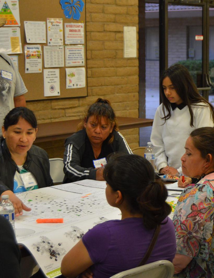
A clear set of goals that reflect the values of the community are at the core of this parks master plan. The following recommendations guide how to achieve PMP goals over time.
The following goals and recommendations have been identified to improve the City of Fresno’s park and open space system within the 10 year horizon of this plan, and beyond. System-wide recommendations are organized by nine overarching goal categories; fund, maintain, improve, expand, secure, connect, partner, advocate, and celebrate. Select recommendations are highlighted in bold
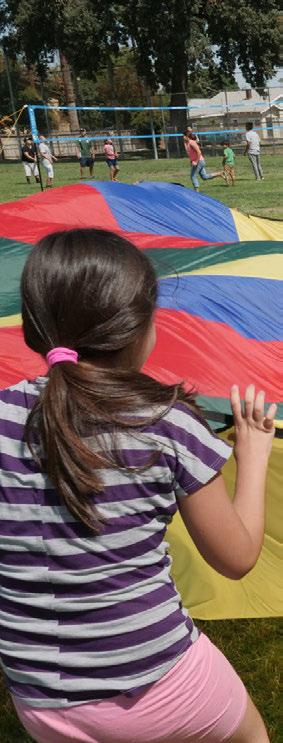
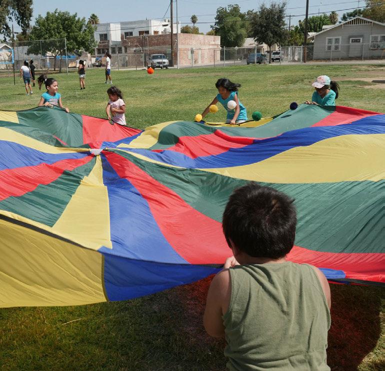
Parks are assets, and the continued operation and maintenance of these assets requires a steady and adequate funding source. Best practices include funding for maintaining parks at industry standards, including planned lifecycle replacement costs of facilities and park elements, which Fresno’s current funding levels do not adequately cover. Providing the appropriate level of funding for Fresno’s park system and understanding the total cost of ownership, including maintenance, operations, lifecycle, and programming, is critical for success of the whole system. The following recommendations provide guidance for the sound funding of Fresno’s parks and open space system.
1.1. Employ a business planning approach to the financial management of Fresno’s park and open space system that accounts for total cost of ownership and adequately funds new parks, maintenance, and ongoing operations, including the following strategies:
• Increase investment in assets, including costs for lifecycle replacement and maintenance.
• Increase Fresno’s annual maintenance and operations budget to align with standard state funding levels.
1.2. First prioritize funding for maintenance and existing park improvements, then prioritize budget for land acquisition.
Apply a 10-year horizon for revisiting these priorities and at that point consider funding for new park development.
1.3. Continue to require that developers create special districts such as Community Facilities Districts (CFDs) to fund pocket park maintenance.
1.4. Consider implementation of additional funding mechanisms such as sales tax, and utility user tax.
Measure P, approved by voters in 2018, has resulted in the establishment of a 1/8-cent sales tax to fund parks, recreation, arts, trails and greenways.
Section 8.1
See Section 3.4
See Section 4.3
1.5. Explore the formation of CFDs or other special districts in established neighborhoods to maintain and develop parks and open space amenities.
Special districts may be most feasible in areas with active neighborhood or homeowner associations.
1.6. Consider adjusting park land dedication requirements to ensure creation of adequately sized parks that meet amenity requirements established in the park type definitions.
Park land dedication requirements should be explored as part of the next Park Impact Fee Nexus Study.
1.7. Consider creating a Park Impact Fee (PIF) for commercial development. Commercial development PIF is common practice in other Valley cities.
1.8. Pursue grants for park land acquisition and development including funding opportunities that support community development, public health, urban greening, and environmental stewardship.
1.9. Perform a cost of service analysis and identify opportunities for positive revenue generation through new pricing policies and programs to help offset total cost of non-revenue generating programs.
Parks, like any investment such as a house or car, require regular maintenance, planned repairs, and maximized operational efficiencies in order to best perform. Maintenance reduction can erode the condition of parks to a point where normal maintenance practices cannot overcome deficiencies, and the entire system needs to “catch up” before it can achieve desired maintenance levels. In addition, maximizing efficiency in Fresno’s maintenance and operations will benefit the entire park and open space system. Extensive community engagement placed park maintenance as a top community priority, and the following recommendations support this prioritization.
2.1. Consider consolidating park maintenance into a single agency to maximize agency communication, coordination, and efficiencies.
2.2. Establish strategically placed “Park Maintenance Zones” with maintenance yards and dedicated work crews.
2.3. Create maintenance guidelines identifying target maintenance levels at each site, maintenance standards, and work plans.
2.4. Implement systematic technology assessment that identifies, prioritizes, and scopes cost of necessary and desired technology functionality to increase efficiency in maintenance service delivery.
2.5. Expand maintenance funding and support, including implementing a work order management system, employing a systematic approach to contracting services, and expanding full time equivalent (FTE) staffing.
2.6. Maintain and expand Fresno’s “Adopt-A-Park” Program to offer individuals and organizations tools, training, and opportunities to maintain and nurture Fresno city parks and open space areas.
■ Other operational partnership programs may include an “Adopt-ATrail” program.
Improving existing parks is a critical goal of this PMP. In addition to improvements inherent in routine maintenance and lifecycle replacements, strategic improvements, including upgrades to amenities, planting, irrigation systems, sports courts, sports fields, shade structures, pools, playgrounds, signage, and recreation programs are all necessary to improve system-wide performance, sustainability, and user experience. The following recommendations relate to improving Fresno’s overall park and open space system.
See Section 3.4
See Section 5.1
See Section 7.2
See Section 4.2
3.1. Implement the Parks Master Plan’s park type requirements for site amenities, program, and access.
3.2. Implement the Parks Master Plan’s Design Guidelines for improving park and open space in terms of sustainability (including more efficient irrigation and energy systems), safety, durability, user experience, accessibility (including ADA compliance), identity, and branding.
3.3. Increase shade elements, including trees and built structures, in all park and open space areas, particularly areas with high recreation value such as seating, picnic, and play areas.
3.4. Increase tree planting, especially large trees with wide canopies.
3.5. Plan and design landscapes that support habitat creation and wildlife protection.
3.6. Strategically channel resources into fewer facilities that are soundly funded, properly maintained, and better serve the community.
Create an exceptional “Aquatic Center” for the entire Fresno community that provides multiple aquatic amenities and meets a variety of user needs. (Figure 7.7)
3.7. Identify facilities that do not meet current community needs because they are underused, unpopular, or outdated and inaccessible, and strategically convert them into facilities that the community has identified as a priority.
Retool underutilized wader pools as splash-pads.
3.8. Consider employing a program lifecycle analysis, and creating a program classification system to ensure recreations programs reach maximum participation, efficiency, and effectiveness.
The City of Fresno is growing, and its park and open space system has to grow with it. In order to meet current and future recreation needs of Fresno residents, the City must add inventory to its park, open space, and trail network. In addition to future growth areas, existing neighborhoods that have been identified as “park poor” should be prioritized for park and trail expansion. The following recommendations provide further direction for the expansion of Fresno’s park and open space system.
4.1. Target expansion of Fresno’s park, open space and trails in existing urbanized, highest-need neighborhoods, and “park poor” areas.
As per the Measure P Ordinance, the Highest-Need Neighborhood definition shall be updated every three years. Using the definition, continue to analyze potential sites for park suitability, vet with stakeholders and residents, and present resulting list of possible new proposed parks to City Council for designation on the General Plan land use map as new parks. The designation of possible new parks shall be conditioned upon sufficient and sustainable funding needed to adequately support the increased costs of operations and maintenance.
4.2. Continue to acquire and develop new parks in tandem with new development, to meet the City’s level of service goals.
4.3. Continue to require land dedication for parks as part of the development approval process, using General Plan and Specific Plan parks maps as guides.
4.4. Consider leveraging City-owned property to create new parks.
This may include reserving City-owned land for parks where it is well-suited to park use due to its location in a parks-deficient area, its size, and other characteristics, or giving PARCS the right of first refusal before the disposition of excess land.
4.5. Evaluate streets as potential open space assets, including evaluating the street system to identify streets with excess right-of-way that could be converted into linear parks, or excess street segments that and could be vacated to provide park space.
Note: Parklets, plazas, paseos and flexible “pop-up” parks are examples of public spaces that can be created from underutilized parts of the urban fabric and can bring benefit to commercial and residential areas.
See Figure 6.6, Figure 6.10, and Figure 7.11
See Table 6.3
4.6. Explore defining “park equivalencies” to embrace a variety of public open spaces that may not currently qualify as park space but do contribute to place-making and quality of life.
Equivalencies may include small urban plazas associated with new development or created from former street right-of-way.
4.7. Explore opportunities for enhancing alleys to provide public space amenity by giving pedestrians primacy and creating “living alleys” or “shared alleys” that host landscape enhancements and support positive social activity.
These spaces may include special paving, traffic calming features, lighting, seating, and enhanced planting.
4.8. Explore zoning code provisions to incentivize the creation of park land beyond what is required, in the form of density, height, or floor area bonuses, or flexibility in meeting other code requirements.
4.9. Explore the creation of a land banking agency to facilitate assembly and transfer of property to park use.
4.10. Promote development of urban greening strategies to provide recreational value and enhance the public realm in areas underserved by parks.
To ensure that all users can enjoy parks, they must be safe and secure public spaces. Policy, design, and management measures can be taken to improve public safety in parks, invite more “eyes on the parks,” and establish parks as safe places for community members of all ages to play and recreate together. The following recommendations support safe and secure parks and open spaces for the entire Fresno community.
5.1. Encourage Crime Prevention Through Environmental Design (CPTED) as it relates to natural surveillance, activation, visibility, sightlines, circulation, lighting, and perimeter treatments.
This includes designing sidewalks, paths, trails and frontages with clear sightlines into parks to allow for “eyes on the parks.”
5.2. Coordinate with Fresno Police and Fire departments to co-locate parks with future stations and locate law enforcement substations in parks.
Well-designed parks adjacent to these facilities have the potential to be naturally secure, and to facilitate positive recreational interactions between officers and the communities they serve.
5.3. Institute an on-site program for park rangers, community policing, or dedicated park police.
Programs can range from instituting a volunteer ranger program to employing full time City agency or outside private security staff, depending on determined levels of need.
See Section 5.1
5.4. Expand facility staffing to ensure on-site staff presence.
5.5. Provide a diverse range of staffed programming to encourage positive, active use of parks throughout the course of the day, with particular emphasis on programming at parks with security concerns.
5.6. Encourage agencies, private organizations, and non-profit organizations to use parks for active, community-oriented, and enrichment programming.
This may include yoga classes, boot-camps, T’ai-Chi, senior walking groups, FUSD After School Greenshack Program, etc.
A successful park system is connected to its community by well-defined, safe routes that offer mobility choices. Strengthening park network connections with linear parks, greenways, multi-modal trails, paths, sidewalks, and bicycle routes, makes getting to and from parks and open spaces in Fresno easier, safer, and more pleasant. In turn, this connectivity encourages increased system use. Approaches for strengthening and expanding park and open space connections should build upon the General Plan, Fresno Active Transportation Plan, San Joaquin River Parkway plans, and City of Fresno Specific Plans. The following recommendations support an increase in park and open space network connections.
6.1. Provide neighborhood park amenities within ½ mile distance from all Fresno residents.
6.2. Design new parks and upgrade existing parks to be accessible to the neighborhoods they serve and meet diverse needs of people of all ages, abilities, and cultural backgrounds.
6.3. Look for opportunities to locate new parks in areas with public transit, including within and proximate to high density BRT corridors.
Community-oriented recreation amenities may be especially appropriate for transit accessible locations.
6.4. Develop trails, greenways, parkways, and other green connections linking neighborhoods to the citywide and regional parks system, infrastructure, and other important cultural and social spaces.
6.5. Build agency, community, political and financial support for large scale trail/greenbelt systems such as the San Joaquin River Parkway.
Work with local clubs and community groups to advocate for funding and support of the San Joaquin River Parkway.
See Section 7.5
6.6. Establish “safe routes to parks” for pedestrians, cyclists, and children by creating sidewalk, trail, greenbelt, and bicycle route connections to all existing and future park and open space areas.
6.7. Employ urban greening strategies such as tree lined corridors, multimodal paths, bioswales, and vegetated stormwater drainage channels in streetscape design, as a way to connect people and neighborhoods to parks and open spaces.
6.8. Use online tools to help the public locate and navigate their way to park and open space sites and facilities.
On the PARCS website include Google map links to park and open space sites and facilities.
Fresno’s PARCS and Public Works departments are not alone in their mission to provide excellent public spaces for recreational, physical, social, and cultural activities. Forming partnerships with allied agencies is an efficient, symbiotic, community-strengthening approach to improving and expanding Fresno’s public spaces. The following recommendations support such partnerships and alliances.
7.1. Maintain joint-use agreements and establish new, long-term jointuse agreements with Fresno, Washington, Sanger and Central Unified School Districts that maximize availability of site use during non-school hours.
7.2. Partner with school districts in planning, funding, acquiring, and designing future park and school sites and amenities.
When partnerships are established at school/park project inception, mutually beneficial program goals and amenities can be planned and designed to maximize community benefit.
7.3. Partner with school districts to create enhanced joint-use school park sites that are usable for all segments of the community.
The addition of shade trees, picnic tables, benches and amenities in neighborhoodoriented portions of school sites could augment school-focused recreational facilities.
7.4. Continue to partner with Fresno Metropolitan Flood Control District (FMFCD) to maximize recreational opportunities at ponding basins through expanded seasonal access, redesign, grading, and amenity development.
7.5. Partner with FMFCD in planning, funding, acquiring, and designing future joint-use basin sites.
7.6. Coordinate with Fresno public libraries to co-locate parks and increase programming partnership.
7.7. Continue to collaborate with agencies and organizations working to maintain, develop and enhance the San Joaquin River Parkway and nearby riverfront land and habitat.
Continue multi-agency collaboration with San Joaquin River Conservancy.
7.8. Collaborate with local agencies and organizations that have management and programing overlap with parks.
Fresno United Neighborhoods (FUN), Fresno Arts Council, Fresno Irrigation District, Central, Clovis and Sanger Unified School Districts, Fresno State University, Fresno Community College, State Center Community College District, Fresno County Public Library, environmental advocates, Fresno neighborhood associations, sports leagues, faith based organizations, community based organizations, and local businesses.
7.9. Seek and strengthen collaboration with national and state organizations with shared park, open space, and community oriented recreation missions.
These include National Park Service (NPS) Groundwork USA, Trust For Public Land (TPL), National Recreation and Park Association (NRPA), City Park Alliance.
7.10. Explore opportunities for partnerships with community organizations that support community garden development at sites that are neglected, blighted, or undeveloped.
Fresno’s parks and open space areas need dedicated stewards who will advocate for their support, funding, and improvement. These public space assets are an important part of a larger quality of life package for Fresno residents, and should therefore be included in advocacy efforts related to health, wellness, environmental quality, community development, recreation, education, and safety. The following recommendations relate to advocacy efforts to strengthen Fresno’s park and open space system.
8.1. Inspire investment in Fresno parks - in terms of social, cultural and philanthropic capital - through meaningful and sustainable community engagement, advocacy, and partnerships that support park access and equity.
8.2. Use the Parks, Recreation and Arts Commission to guide the ongoing development and operations of Fresno’s park and open space system.
8.3. Establish a “Friends of Fresno Parks” made up of foundations, organizations, and individuals who support park funding and actively advocate for their successful operation.
8.4. Encourage local community advocates and organizations working in the areas of public health, wellness, education, recreation, arts, community development, and environmental issues to support and advocate for Fresno parks.
8.5. Build ethnically and economically diverse park stewards.
8.6. Continue to encourage and include community participation in park and open space planning and design processes.
Fresnans, take pride in your parks! Ultimately, parks are for people. They should be well-used and well-loved, and play a major role in how and where residents spend their time beyond the boundaries of their own houses. Fresno parks are an extension of people’s homes and a catalyst for social activity, and should be celebrated as such. The following recommendations support efforts to celebrate Fresno parks.
9.1. Support current and future place-making efforts to strengthen individual park identity.
See Section 7.2
9.2. Designate “flagship” or priority parks in each of Fresno’s council districts to direct funding toward so that quality parks can be found throughout the city and can become a source of local park pride.
9.3. Conduct system-wide re-branding of Fresno’s park and open space system, including strong online and on-site efforts, that are developed in conjunction with funding initiatives.
9.4. Promote park use and the benefits of parks through public relations campaigns and marketing efforts online, with social media, and through signage.
July is Park and Recreation Month. Visit NRPA’s website for a “toolkit” with materials and resources for celebrating local parks.
9.5. Consider integrating site elements that support public or private events into park design - from event-rentable pavilions to large scale amphitheaters, to promote Fresno parks as epicenters of celebration and community activity - from birthday parties to city-wide cultural events.
This may encourage parks and open space to be used for local events such as Fresno “ArtHop” and other cultural happenings.
9.6. Streamline the process for individuals, neighborhoods, community groups, and local businesses to hold events at park facilities.
9.7. Identify opportunities to integrate art into parks and open spaces, especially in strategic locations to promote pride and ownership, and discourage vandalism.
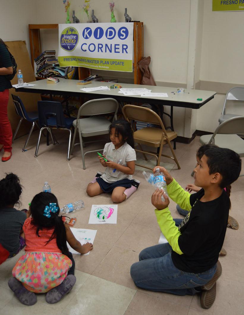
In this section:
A.1 Funding Source Catalogue
A.2 Park, Trail & Greenway Recommended Plant Palette
Advertising can occur with trash cans, playgrounds, dog parks, trails, flower pots, and as part of special events to pay for operational costs.
Many park-and-recreation systems add a capital-improvement fee onto an existing user fee when they develop or enhance major recreation facilities. This is usually applied to golf courses, aquatic facilities, recreation centers, ice rinks, amphitheaters, and special-use facilities like sports complexes. The dollars gained either offset the cost of the capital improvement or the revenue bond that was used to develop or enhance the special-use facility. Once the capital improvement is paid off, the fee typically expires and is discontinued.
This allows caterers to work in the park-and-recreation system on a permit basis with a set fee or a percentage of food sales returning to the department. Many departments have their own catering-service contracts and receive a percentage (10-15%) from the sale of food and drinks. This may be most suitable for large or special events occurring on publiclyowned properties. Another form of fee income is the temporary business license.
A Parks and Recreation Foundation is a joint-development funding source or operational funding source between a foundation and a government agency. The foundation operates as a non-profit organization, working on behalf of the public agency to raise needed dollars to support its vision and operational needs.
The dollars raised by the foundation are tax-exempt. Foundations promote
specific causes, activities, or issues that a park-and-recreation system needs to address. They offer a variety of means to fund capital projects, including capital campaigns, gifts catalogs, fundraisers, endowments, sales of parkrelated memorabilia, etc.
Private donations may be received in the form of cash, securities, land, facilities, recreation equipment, art, or in-kind services. Donations from local and regional businesses as sponsors of events or facilities should be pursued.
Corporate and personal giving involves the department seeking corporate lead funds or personal lead gifts via a foundation partner or through personal contacts that are used to catalyze wider giving in support of a specific project or operation. The lead donations set the precedent for additional giving over a period of one year up to five years. Often those who have given or pledged contributions are invited to a recognition event, which may include additional opportunities for contribution through auctions, for example.
This source provides the opportunity for the park-and-recreation system to demonstrate how well it is meeting the community’s needs through a voterapproved millage. In the last five years in the United States, 93% of all parkrelated bond and millage issues have passed. Communities demonstrate the value of parks when given the opportunity to vote on an increase.
Many municipalities seek developer contributions for parklands and also for the development of trails that run through the property being developed. The developer perceives the enhanced value such improvements mean for her or his development. Park or trail dedication as a requirement of subdivision development is a reliable means for maintaining equity of access to parks and trails.
Private donations are a popular form of fundraising by public agencies, particularly for facilities and services that are highly visible and valued by the public. Donations can be channeled through a foundation or conservancy aligned with the parks and recreation system’s priorities. Donations can be made through one or more of the following methods:
• Donations of cash to a specific park or trail segment by community members and businesses
• Donations of services by large corporations to reduce the cost of park or trail implementation, including equipment and labor to construct and install elements of a specific park or trail
• Reductions in the cost of materials purchased from local businesses that support parks and trails implementation, and can supply essential products for facilities
Many agencies have sold the development rights below the ground to utility companies for fiber optic lines, water, sewer, electricity lines, and cable conduits on a linear ft. basis. King County in Washington (Seattle) sold the development rights below its greenway network and generates $300,000 a year from the utilities involved.
Friends associations are a foundation that typically are formed to raise money for a single purpose, such as a park facility or program that will better the community as a whole and, at the same time, meet special interests.
These trusts are established for individuals who typically have more than $1 million in wealth. They agree to leave a portion of their wealth to a parkand-recreation system in a trust fund that grows over time. The system is able to use a portion of the interest to support specific facilities or programs that are designated by the trustee.
This is another source of capital funding wherein banks or private placement-fund companies develop a park or recreation attraction, complex by buying the land, developing a recreational attraction, and then leasing it back to the agency to pay off the land or capital costs over a 30- to 40-year period. Agencies may find this source attractive because typically they can increase operational budgets more easily than finding capital dollars to pay off the lease over a set period of time.
This is a fund dedicated exclusively for a park’s maintenance and is funded by a percentage of user fees from programs, events, and rentals. The fee is paid by users and is added to a dedicated fund for facility and equipment replacement, such as fitness equipment, water slides, lights, artificial turf, and park-maintenance equipment.
Park Impact Fees (PIF) are fees imposed by a local government on a new or proposed development project to pay for all or a portion of the costs providing public services to the new development to help fund and pay for the development and construction of parks.
Agencies typically seek park bonds to meet park-related needs. The key is to use debt financing through bonds to address needs that are both unmet and clearly a community priority. It is best to propose a capital-bond project that serves a variety of users and needs. Even in the worst economic downturn, bond issues have been passing because communities are the direct recipients of the money, and it benefits families on a personal basis.
This is a dedicated fund replenished on an ongoing basis from various funding sources such as grants, sponsorships, advertising, program-user fees, and rental fees within one or more parks. The agency could establish a revolving fund to supported maintenance at multiple parks.
Partnerships are joint-development funding sources or operational funding sources formed from two separate agencies, such as two government entities, a non-profit and a public agency, or a private business and a public agency. Two partners jointly develop revenue-producing park and recreation facilities and share risk, operational costs, responsibilities, and asset management based on the strengths of each partner.
Contracts with private businesses to provide and operate desirable recreational activities provide compensation to the agency through a land lease. Contractors may include coffee shops, grill and food concessions, small restaurants, ice cream shops, bicycle shops, farmers markets, and small l businesses. Land leases are usually based on 15% of the value of the land plus a percentage of gross revenues from the contractor on an annual basis.
This is a dedicated user fee, which can be established by local ordinance for the purpose of constructing and maintaining recreation facilities. The fee can apply to all activities that require a reservation. Examples of such activities include adult basketball, volleyball, tennis, and softball leagues, youth baseball, soccer, football and softball leagues, and special-interest classes. The fee allows participants an opportunity to contribute toward the upkeep of the facilities being used.
One potential funding source for the parks and recreation system is an additional percentage sales tax that is committed to maintaining park sites, infrastructure, recreational fields, and trails. The advantage of a sales tax is that it collects revenues from both residents and non-residents who do business in Fresno.
DISTRICTS: COMMUNITY FACILITIES DISTRICTS (CFD) / MELLO-ROOS DISTRICTS / LIGHTING AND LANDSCAPE MAINTENANCE DISTRICTS (LLMD) / PUBLIC IMPROVEMENT DISTRICTS (PID)
Community Facilities Districts (CFDs), also known as Mello-Roos districts, allow for the formation of a special district within which a special assessment is levied to pay for public facilities or services. Revenues may be used on a pay-as-you-go basis or to pay the debt service on bonds. Landscaping and Lighting Maintenance Districts (LLMDs) are similar but more commonly used to fund maintenance. The districts require approval by a majority of property owners within their boundaries. Fresno currently relies on LLMDs to maintain pocket parks and landscaping within new subdivisions.
TAX-ALLOCATION OR TAX-INCREMENT FINANCING DISTRICT –2,3
Commonly used for financing redevelopment projects, a Tax Allocation District (TAD) or a Tax Increment Financing (TIF) District involves the issuance of tax-exempt bonds to pay front-end infrastructure and eligible development costs in partnership with private developers and local businesses that benefit from the improvement. As development occurs in Fresno, the “tax increment” resulting from redevelopment projects is used to retire the debt that was issued to fund the eligible redevelopment costs. The public portion of the redevelopment project funds itself using the additional taxes generated by the project. TADs or TIFs can be used to fund park improvements and development as an essential infrastructure cost. This approach works well in downtown redevelopment, regional park improvements, and in trail development. The City of Valparaiso, Indiana, has used this funding source extensively for redevelopment of its downtown area and pathways system.
User fees are fees paid by a user of recreational facilities or programs to offset the costs of services in operating a park or a recreation facility, or in delivering programs. In Fresno, facility usage is underpriced. A perception of “value” needs to be instilled in the community for the benefits the agency is providing to the user for exclusive use. Future fees could be charged by the agency based on cost-recovery goals for the parks and core recreation services, based on the level of exclusivity the user receives compared to the general taxpayer. The consultant highly recommends that user fees for programs and facilities continue to be charged in order to create value and provide operational revenues.
This page intentionally left blank.