2
the bregenzerwald
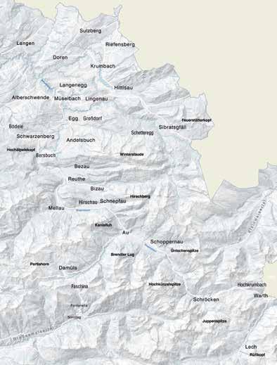
Travelling the Bregenzerwald always means having to overcome dizzy heights to start with: from Bregenz you take the Pfänder, from the Rhine Valley the valley side which ascends 500 m, from the north you take the Sulzbergstock, from the east the Riedberg or Hochtannberg pass, from the south the Furkajoch or Faschinajoch.
spectrum which, right at the start of tourism, had travellers extolling the “charming landscape” as an “enclosed park” whilst at the same time shuddering at the “Siberian exile” on the wild, upper course of the Ache. A valley area of contrasts, borders, crossings.
Crossings Cross-border experiences also leave Up and over is the way to go – the most their mark on the locals – they know how to set themselves apart from outimpressive views are from the north side. Yet the scarce rural areas have and the west – and a space is revealed which, in all its diversity, is completely never been sufficient to feed the population. The locals had to get movdifferent to all that surrounds it, with ing, cross borders, leave behind their the Bregenzerache uniting it all. Your homes and families. This took on route takes you through gorges and many different forms: the nomadic flat hollows – wide between the hills existence of alpine animal husbandry of the foothills of the Alps around Alberschwende and Lingenau, narrow (home, mountain pasture, alp → between the mountains of the foothills page 96), or in the form of seasonal migrant work outbound commuting of the Alps around Andelsbuch and Bezau, squeezed in between the alpine or even emigration (to America in the 19th century in particular). Flexibility, peaks of the Kanisfluh, Diedams kopf, Zitterklapfen and Widderstein ideas and self-help were essential to around Schnepfau, Au, Schoppernau, stave off poverty. Warth and Schröcken. This correlates The area was only sparsely populated with the division into the Vorderfor a long time: only plot names give wald, Mittelwald and Hinterwald rise to assumptions about the border (front, central and rear regions of the between Celtic and Rhaeto-Romanic Bregenzerwald) – a topographical cultures. It was not until the High


