


SPACE42 to unleash AI strategy to advance UAE’s space objectives


GROUP
MANAGING DIRECTOR RAZ ISLAM raz.islam@cpitrademedia.com
+971 4 375 5483
EDITORIAL DIRECTOR VIJAYA CHERIAN vijaya.cherian@cpitrademedia.com
+971 4 375 5472
DIRECTOR OF FINANCE & BUSINESS OPERATIONS
SHIYAS KAREEM shiyas.kareem@cpitrademedia.com
+971 4 375 5474
EDITORIAL
EDITOR VIJAYA CHERIAN vijaya.cherian@cpitrademedia.com
+971 (0) 55 105 3787
SUB EDITOR AELRED DOYLE aelred.doyle@ cpitrademedia.com
ADVERTISING
GROUP SALES DIRECTOR SANDIP VIRK sandip.virk@cpitrademedia.com
+971 50 929 1845
+44 (0) 7516 993 862
DESIGN
ART DIRECTOR SIMON COBON simon.cobon@ cpitrademedia.com
DESIGNER PERCIVAL MANALAYSAY percival.manalaysay@ cpitrademedia.com
CIRCULATION & PRODUCTION
DATA & PRODUCTION MANAGER
PHINSON MATHEW GEORGE phinson.george@cpitrademedia.com
+971 4 375 5476
WEB DEVELOPMENT
ABDUL BAEIS UMAIR KHAN
FINANCE
CREDIT CONTROL EXECUTIVE CAMERON CARDOZO cameron.cardozo@cpitrademedia.com
+971 4 375 5499
FOUNDER
DOMINIC DE SOUSA (1959-2015)
The publisher of this magazine has made every effort to ensure the content is accurate on the date of publication. The opinions and views expressed in the articles do not necessarily reflect the publisher and editor. The published material, adverts, editorials and all other content are published in good faith. No part of this publication or any part of the contents thereof may be reproduced, stored or transmitted in any form without the permission of the publisher in writing. Publication licensed by Dubai Development Authority to CPI Trade Publishing FZ LLC. Printed by Masar Printing.
CPI Trade Media. PO Box 13700, Dubai, UAE. +971 4 375 5470 cpitrademedia.com
© Copyright 2024. All rights reserved.

Welcome to the CABSAT edition of SatellitePro Middle East
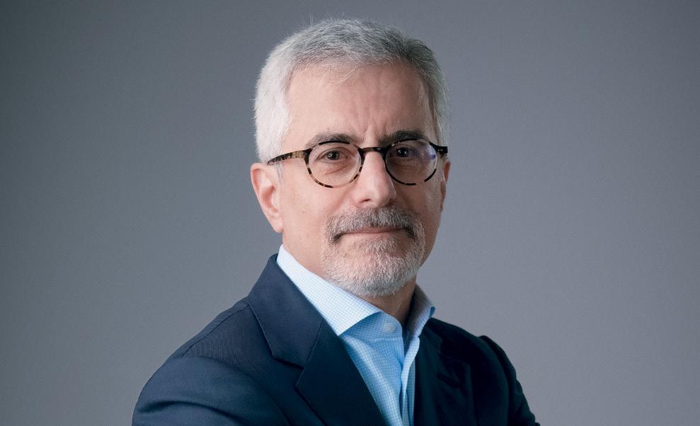
Just as we were heading to press, we learnt that Bayanat and Yahsat had finalised their plans to merge, and thought it apt to run an interview with Karim Sabbagh, head of the new entity SPACE42, for this issue.
Speaking of 42, some of you may be familiar with Douglas Adams’ famous science-fiction novel, The Hitchhiker’s Guide to the Galaxy. In his story, when the supercomputer Deep Thought is asked by the two programmers Fook and Lunkwill what the answer to the “Great Question [of] Life, the Universe and Everything” is, it responds that it will need seven-and-a-half million years to provide an apt response.
At the end of that period, Deep Thought’s response is the number forty-two — delivered ‘with infinite majesty and calm’. Since then, 42 has humorously been associated worldwide with ‘the answer to life, the universe, and everything’.
But what’s the connection with SPACE42? While there’s no direct correlation, we like to think that just as the number 42 has become synonymous
with profound understanding, SPACE42 will herald a new era in the UAE with its use of AI to unlock solutions to many of the challenges we face today on Earth. The UAE entity aims to democratise space applications, making them accessible and affordable for widespread societal impact.
Within the satellite industry, the possible synergy with AI offers a future with boundless potential. A related feature we have done in this edition shows how global satellite majors are embarking on their own AI journeys, seeking to navigate the complexities of busy orbits and streamlining operations for a more efficient future.
This union holds great promise to revolutionise the way we experience connectivity today and address global challenges. So, as we journey forward, let us embrace the endless opportunities that await us at the intersection of satellite and AI.
 VIJAYA CHERIAN Editor SatellitePro ME


UPDATE
KSA programme to nurture space sector talent; ABS appoints new CEO; Thuraya and CYSEC partner to offer satellite encryption and cybersecurity; Arabsat and Aldoria partner; Nilesat selects Hughes Jupiter to deliver satellite broadband connectivity in Egypt; and more
COVER STORY - SPACE42
A new stellar journey with AI
The upcoming merger of Bayanat and Yahsat will give rise to SPACE42, an AI-centric satellite solutions provider in the UAE. Karim Sabbagh, MD
Designate, outlines the company’s roadmap with SatellitePro ME
TECH FEATURE
Satellite’s AI revolution
An indepth look at AI’s impact on the satellite market across connectivity, business intelligence and automation.
MARKET REVIEW
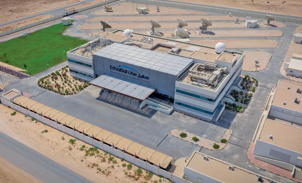
Qatar’s satellite aspirations
Qatar’s satellite industry has surged in the past decade, driven by strategic efforts and Qatar’s Vision 2030, says Es’hailsat’s CEO Ali Al Kuwari
IN FOCUS
Lorenzo Arona of Avanti
Communications discusses the challenges of increasing satellites and space debris, emphasising the need for collaboration
SHOW ISSUE
CABSAT 2024
A brief look at the satellite side of the show
GUEST COLUMN
Navigating troubled waters
Undersea data cable compromises can cause severe economic damage through complete outages. Intelsat’s Rhys Morgan proposes a hybrid solution to mitigate this risk 06 12 22 26 16 12 16 22 26 30 32



ACQUISITIONS
SES to acquire Intelsat in $3.1bn deal

NEWS
Hughes opens new manufacturing facility and private 5G incubation centre

APPOINTMENTS
Kevin Steen to lead Eutelsat America Corp. and OneWeb

ACQUISITIONS
Bayanat and Yahsat shareholders approve merger to create SPACE42
NEWS Orange Egypt and Huawei to introduce Huawei Cloud services in Egypt

OPINION: What to expect in 2024

FEATURE: Engineering a solution
INTERVIEW: Small GEO satellites to create big impact




@SatelliteProME
SPACE
Let’s create a vibrant online satellite community!
www.facebook.com/SatelliteProME SatelliteProME
NASA technology grants to advance Moon to Mars space exploration
The awardees also will receive assistance from propulsion, space transportation, and science experts at NASA’s Marshall Space Flight Centre in Huntsville, Alabama
TELCOS
Nokia partners with e& UAE to enhance cloud connectivity services
Nokia solution ensures e& UAE customers will benefit from decreased latency, uninterrupted connectivity and seamless access to cutting-edge applications

NEWS
Saudi Arabia to launch Centre for Space Futures with WEF

TELCOS
STC Group and PIF to create region’s largest telecom tower firm
MARITIME
Satcom Global enhances AuraNow VSAT coverage through Intelsat deal
The new partnership significantly expands the AuraNow global footprint and increases access to HTS assets

MILITARY
USSF extends deal with L3Harris to enhance space domain awareness
CONNECTIVITY
NCA approves Starlink to provide satellite internet services in Ghana
The approval of the application follows the policy approval of the Satellite Licensing Framework in Ghana by the Ministry of Communications and Digitalisation
MILITARY
BAE Systems to build atmospheric composition instrument for NASA ACX is the second instrument BAE Systems has been contracted to develop for the GeoXO mission to support environmental monitoring

NEWS
Arab Advisors Group announces regional 5G Summit 2024

CONNECTIVITY
Comtech partners with Eutelsat OneWeb to deliver LEO connectivity services
TRAINING INITIATIVE
Saudi Arabia’s Communications, Space and Technology Commission (CST) has unveiled the “Madarik” Programme, an initiative aimed at nurturing national talent, fostering a sustainable future, and harnessing global expertise to shape diverse career paths within the space sector. The programme also seeks to lay a solid foundation in space science, embarking participants on an enriching learning journey to enhance their skills in the space industry.
In collaboration with the International Space
University of France, Georgia Institute of Technology, Thunderbird School of Global Management, BAE Systems, and AlYamamah University, CST will offer a dynamic curriculum delivered across Saudi Arabia.
Participants can choose from three specialised tracks: the Space Business track, which provides a comprehensive knowledge of the space economy and develops the necessary skills to work on space projects; the Space Software and Data track, which introduces the necessary sources of software and data to
implement space related missions and satellites applications; and the Space Engineering track, which explores space engineering majors, and highlights design, maintenance and control of spacecraft.
Entry is restricted to Saudi nationals who have a Bachelor’s degree in related fields, and demonstrate proficiency in English speaking and writing, and satisfy all other registration prerequisites. The programme is scheduled to run from May 5 to August 15, 2024, and applicants must commit to attending sessions on the specified dates.
NEW APPOINTMENT
Mark Rigolle took on the role of Chief Executive Officer (CEO) at ABS, effective April 29, 2024. Bringing a wealth of experience garnered from various roles across the satellite communications sector, Rigolle has navigated through executive, nonexecutive, advisory, and co-founding positions with GEO, MEO, and LEO satellite operators. His expertise spans satellite and space development projects across Asia, the Middle East, and Europe. Rigolle will be based at ABS’ headquarters in Dubai, UAE.
Speaking about the new role, Mark Rigolle said: “I am very excited to join ABS at this pivotal time for the company and indeed the whole FSS industry. ABS is uniquely positioned to demonstrate

how the sector can return to growth after many years of contraction. We have the assets, the people, the capabilities, and supportive shareholders to make that happen. I look forward to working with our current and future customers and partners as we support them in expanding their businesses.”
Rigolle’s career includes stints as CFO of SES and CEO of O3b Networks, along with co-founding endeavours such as Kacific. He subsequently assumed the role of CEO at LeoSat and later KLEO Connect, before serving as COO of Rivada Space Networks.
SPACE PARTNERSHIP
Egyptian Space Agency (EgSA) and Italian Space Agency (ASI) have inked a Memorandum of Understanding (MoU) in Cairo. The ceremony was attended by ASI President Teodoro Valente, EgSA CEO Sherif Mohamed Sedky, and Adolfo Ursi, Minister of Business and Made in Italy, who oversees aerospace policies. This collaboration between ASI and EgSA is poised to facilitate investments in the space sector, involving industries alongside the space agencies. Together, they aim to develop projects and initiatives of mutual interest on a Mediterranean, African, and international scale. The agreement will foster innovation that will permeate other industrial sectors as well.
Urso highlighted Africa’s significance in the space sector’s development, citing Italy’s base in Malindi as a potential asset for African countries seeking to participate in this vital sector.
PARTNERSHIP
Thuraya, the mobile satellite services arm of UAE satellite solutions providerYahsat has partnered with CYSEC to provide enhanced cybersecurity and encryption protection to its existing data service customers.
Under the deal, Thuraya will now bundle CYSEC’s ARCA SATCOM solution as part of its existing data services plan, thereby enhancing its offerings for customers that require the highest level of cyber protection.
Thuraya has already certified the solution over its network, noting that it is also certified by the Federal Information Processing Standard (FIPS) authority in the USA.
CYSEC has designed ARCA SATCOM specifically for satellite data communications.

It provides performance enhanced capabilities for data users by integrating cutting-edge encryption technologies. This feature reinforces Thuraya’s network, empowering seamless transmission and reception of encrypted data without compromising connectivity or performance.
The offering of constant and uninterrupted
connectivity is of critical importance to various entities including governments, remote enterprise establishments, core heavy industries, utilities communications, the military, and the overall deployment of secure IoT devices and services.
Sulaiman Al Ali, CCO of Yahsat, said: “By adding CYSEC’s ARCA SATCOM
technology to our existing suite of data services, customers will have the peace of mind to know that their data is safe, secure, and based on the highest industry standards. We have chosen to work with CYSEC because its solution is specifically designed for satellitebased communications.”
Patrick Trinkler, CEO of CYSEC, added: “Our partnership with Thuraya demonstrates the enhanced performance and cybersecurity capabilities of ARCA SATCOM. Once deployed, customers can use the system safely knowing that their data is protected to the strictest standards. ARCA SATCOM is the first solution designed for satcom security, which means it can be seamlessly added to a network and begin operating without any service disruption.”
DISTRIBUTORSHIP
Thuraya has also expanded its cooperation with Algérie Télécom Satellite, the authorised partner for its services in Algeria. Algérie Télécom Satellite will now be responsible for distributing the new SKYPHONE by Thuraya smartphone through Mobile Network Operators (MNOs) and other authorised distributors
in Algeria. SKYPHONE by Thuraya allows users to stay connected wherever they are by combining cellular and satellite communication capabilities.
The device relies on the latest Android 14 operating system and features the Qualcomm Kryo octa-core processor for performance and speed. It is IP67 rated, making it resistant to dust and water. The phone

has a 6.67-inch AMOLED display made of Gorilla Glass. Its sleek design includes a retractable satellite antenna that can be extended when needed to activate satellite communication services. It comes with three rear cameras and a built-in front camera.
The handset also has two nano-SIM card slots for both terrestrial and satellite communication.
Satellite operator Arabsat and Aldoria, a space situational awareness company signed an MoU to collaborate on enhancing space safety and security. Under this agreement, Aldoria would provide its advanced space solution to Arabsat and its member countries, enhancing their capabilities in safeguarding space assets. Furthermore, the partnership includes plans for the establishment of one of Aldoria’s sensor systems in an Arabsat member country, further strengthening space security measures in the region.
“We are particularly enthusiastic about harnessing Aldoria’s advanced solution, given their proven track record of providing offerings
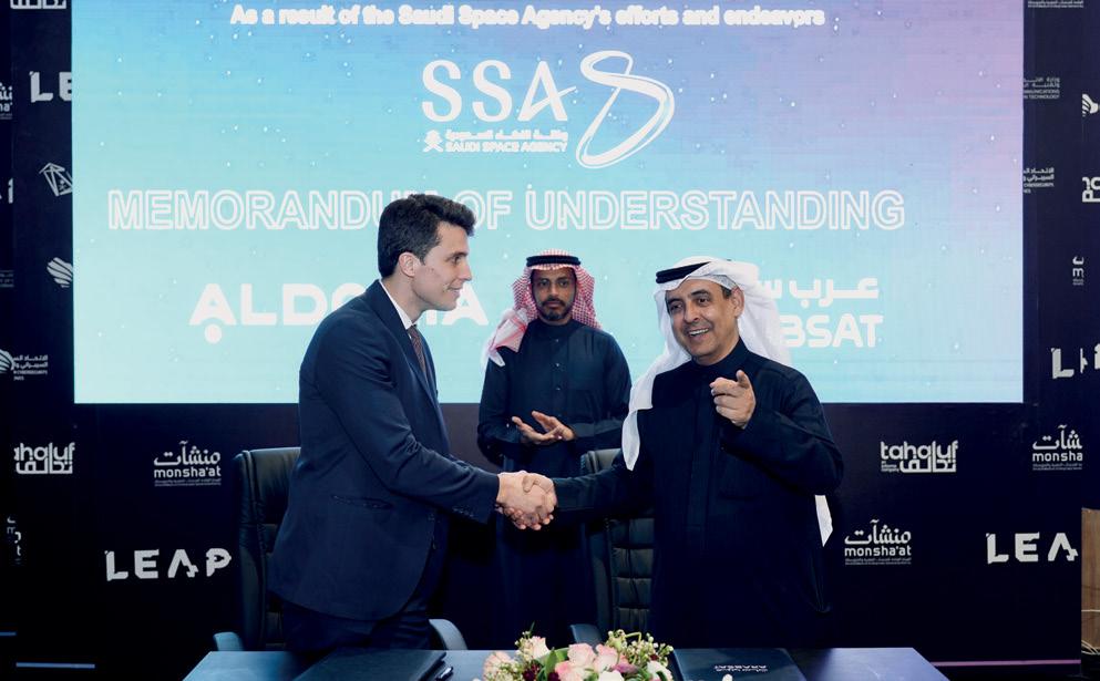
to renowned satellite operators. This partnership reinforces our capability to uphold service delivery to our customers worldwide.” asserted Alhamedi Alanezi, CEO & President of Arabsat.
Romain Lucken, CEO of Aldoria added “The leadership shown by Saudi Arabia and the broader MENA region in prioritizing
ACQUISITION
Thales has completed the acquisition of Cobham Aerospace Communications, a supplier of advanced, ultrareliable safety cockpit communication and connectivity systems. This is a major milestone for Thales, complementing and strengthening its avionics portfolio and creating a worldwide player in
this market. With ~734 employees, of which ~190 engineers, AeroComms operates across a wellinvested footprint in France, South Africa, the USA/Canada, and Denmark. This transaction will create significant value for Thales shareholders in line with the targets communicated in July 2023, when announcing the acquisition.
space safety and sustainability is remarkable. We take pride in consistently delivering our services to leading providers globally, affirming the strong market demand and our dedication to supporting industry leaders.”
In other news, Arabsat has also signed an MoU with Anexia to enhance the cooperation in the fields of
satellite communications, private cloud services, and GPU technology services, and provide integrated solutions to customers by taking advantage of the capabilities of both parties, and sharing common interests.
The MoU comes as part of Arabsat and Anexia’s efforts to develop satellite private cloud infrastructure, improve data delivery, technical integration, research, and development, and provide advanced cloud services, GPU processing and storage solutions. The MoU also stipulates the importance of supporting innovation projects in the fields of satellite communications and cloud computing, in addition to providing shared services with enhanced value to customers.
In his new role, Yan Levy will oversee the development of Thales’ activities in the country, with a particular focus on cybersecurity. With 33 years of experience within Thales, Levy brings a wealth of expertise to his new position. Previously, he served as the head of business development for Africa and led
initiatives in public security and digital identity markets.
Thales, present in Morocco for over 40 years, boasts a workforce of 135 plus professionals, with its HQ based in Rabat. In 2022, the company inaugurated a cybersecurity operational centre in Morocco, the sixth within its international network.
CONNECTIVITY
Africa Mobile Networks (AMN) has activated its first AMN base station, utilising LEO backhaul from SpaceX’s Starlink. By integrating Starlink terminals for low-latency satellite backhaul, AMN can fully leverage the capabilities of its multicarrier radio access node (the ARN), delivering 3G, 4G, and 2G services while accommodating increasing bandwidth demands from subscribers.
CONNECTIVITY
Satellite operator Nilesat has purchased a Hughes Jupiter System Gateway and will use Hughes Jupiter terminals for its Nilesat 301 satellite. The implementation will begin in Q2 and is expected to be complete by the end of Q3 2024.
Major General Sameh Katta, Chairman and CEO of Nilesat, said: “After careful technical and commercial evaluation, we verified that the Hughes Jupiter System provided the efficiency, reliability, flexibility and high performance needed to help us offer
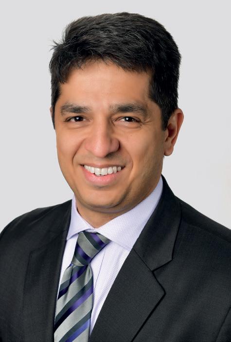
the best service delivery to Nilesat subscribers.”
Vaibhav Magow, VP, Hughes, added: “The need
for internet access is growing in the MENA region, and Hughes is pleased to be working with Nilesat to deliver access to rural areas. Our Jupiter System is the de facto standard for satellite connectivity, and it will serve Nilesat very well.”
The Hughes Jupiter System meets operator requirements with bandwidth and cost efficiencies. The latest Jupiter technology incorporates softwaredefined satellite networking and dynamic in-route reconfiguration for the highest possible efficiency.
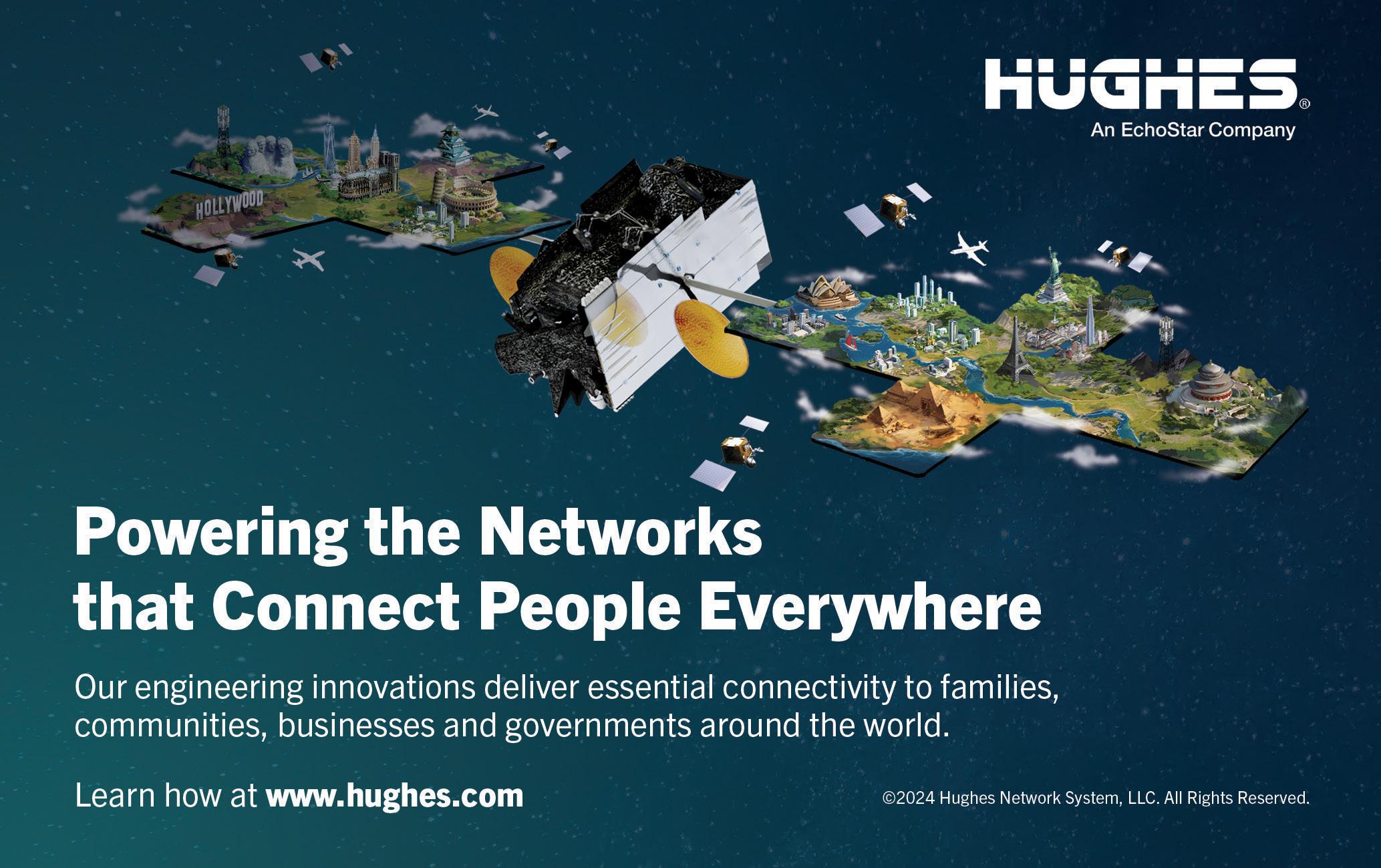

In a significant move for the UAE’s space sector, Bayanat and Yahsat have approved a merger to form SPACE42.
Karim Sabbagh, Managing Director Designate, discusses SPACE42’s AI-focused strategy and its implications for advancing space objectives in an exclusive interview with SatellitePro ME
Can you elaborate on how specific AI technologies will be incorporated into SPACE42’s satellite systems and how it positions you compared to your industry peers?
Like other technology sectors, the space sector is evolving fast. The creation of SPACE42 is a strategic step to meet the sector’s demands. As such, we look at everything from developing innovative solutions to transforming business models across various industry sectors and leveraging advanced technological capabilities to seize emerging opportunities and overcome business challenges. Through our strategic application of AI, we will be able to become more efficient, reach further in space, and deliver services more rapidly. This will be transformative and positively impact the sectors and communities we serve. What’s more, we firmly believe that AI will be essential to democratising space applications. Space exploration is extremely costly, and SPACE42 will help make its applications accessible to more people worldwide.
How do you aim to achieve this?
By introducing a new industry standard and establishing a platform for transformative AI technologies that enable our shared geospatial intelligence and satellite communications services. With AI already powering our geospatial intelligence business, we plan to bring these cognitive capabilities to our satellite communications business. We expect to do that across six domains, particularly in the context of our newest spacecraft (Thuraya 4 and Al Yah 4 & 5), which will launch in 2024, 2027, and 2028, respectively.
AI plays a multifaceted role in optimising satellite network operations. It supports traffic management by predicting patterns and allocating bandwidth to enhance performance, reduce congestion, and prioritise critical data. Additionally, it facilitates dynamic resource allocation, adjusting power and bandwidth based on demand and conditions to improve overall network efficiency and user experience. Furthermore, it enhances signal processing
techniques, ensuring high-quality data transmission even in adverse conditions like interference or atmospheric disturbances. Through the analysis of satellite data, AI enables predictive maintenance, pre-emptively identifying potential failures to minimise downtime and extend infrastructure lifespan. It also plays a pivotal role in interference mitigation, identifying and addressing sources of interference to ensure transparent and reliable communications. Moreover, AI-driven anomaly detection enhances security, identifying threats and unusual patterns to safeguard against cyber-attacks and unauthorised access. Finally, it enables adaptive communication systems, adjusting protocols in real-time to adapt to network conditions, user demands, and environmental factors, enhancing resilience and flexibility in satellite communications.
I believe AI will provide the satellite industry with a competitive advantage by optimising design, operations, service, learning and innovation.
How will AI help to enhance the performance, reliability, and efficiency of satellite networks in the region? How will you measure its success?
AI will have a critical role in our ambition to develop and innovate new space products and services and support the UAE’s ambition to become a world leader in AI by 2031.
Creating SPACE42 and combining the strengths of AI and space technologies could translate into several benefits. This includes the expansion of technology applications in space and on Earth, potentially doubling the current scope and breaking the cycle of incumbency that has historically handicapped the industry. Moreover, the integration of AI could yield up to 10 times improvements in productivity, transforming space from a niche sector to one with mass applications. Additionally, the incorporation of AI could significantly reduce development and deployment cycles for space technologies and applications by more than 50%, challenging the traditional 15-year development cycle model. Furthermore, this initiative aims to democratise space applications, making them accessible and affordable for widespread societal impact, thereby contributing substantially to improving productivity in the societies and economies served.
We see enormous potential in working closely with sector leaders in government, environment, agriculture, urban planning, asset management, defense, transport, and crisis management. Bayanat’s joint project with the UAE Space Agency to facilitate the development of a geospatial analytics ecosystem through a shared marketplace enabled by our own gIQ AI-powered platform is a valuable demonstration of how space and AI technologies can benefit our societies and economies.
In short, gIQ is an AI-powered

AI will have a critical role in our ambition to develop and innovate new space products and services, and support the UAE’s ambition to become a world leader in AI by 2031”
Karim Sabbagh, Managing Director Designate, SPACE42
platform for multi-applications that fuses geo-intelligence data. It seamlessly integrates remote sensing data with other georeferenced information, unlocking valuable insights from spatial data for modeling and predictive applications in the environment, urban planning, agriculture, disaster management, security, and more.
We aim to contribute to the productivity growth of the economies we serve. Innovation and technology are two of the six central determinants of productivity. At the GCC level, elevating productivity to a level commensurate with


our economies’ potential could represent an upside potential of $3.5 trillion of GDP gain over ten years.
How will AI address the unique challenges of satellite connectivity in the Middle East, and how will it operate under varying environmental conditions?
We see massive potential in making space applications available to underserved communities beyond the Middle East. AI will transform regional satellite connectivity and drive the sector’s development by combining Bayanat and Yahsat’s
differentiated capabilities. Through Yahsat’s existing fleet of satellites, we already reach more than 80% of the world’s population, with coverage across Europe, Asia, Africa, and Australia. This enables critical communications, including broadband, video broadcasting, backhauling, and mobile voice and data solutions.
Yahsat’s core business of operating communication satellites and providing associated services will continue unaffected. This includes Thuraya, a project that has received a $500 million investment to develop its next-generation capabilities.
Bayanat is actively involved in various projects that support the government’s decision-making process regarding addressing regional environmental challenges, such as sandstorms and flooding. For example, the UAE Space Agency and Bayanat initiated a flood analysis collaboration in 2022 after the heavy flooding affecting Fujairah. Over the last few years, work has been done on a comprehensive flooding forecast and mapping system that will be integrated with the gIQ product in the future.
Additionally, Bayanat and Yahsat are undertaking an ambitious Earth Observation (EO) space programme to launch seven synthetic aperture radar (SAR) satellites, which means that orbiting satellites will revisit the Middle East more frequently, enabling Bayanat and Yahsat to deliver near real-time, high-definition images of on-the-ground conditions across the Middle East as they execute their plan to serve domestic and international customers with advanced geospatial intelligence. In-country manufacturing is also a key focus area of this program, enabling the entities to provide products and services across the entire space value chain.
Through Bayanat’s JV, Mira Aerospace, we are marrying this
with high-altitude platform station (HAPS) technology. HAPS is a unique class of unmanned aerial vehicles that will provide stable telecommunications networks in the stratosphere without being affected by situations on the ground.
Bayanat’s AI-powered solutions will allow us to scale our operations, and together with our UAE space partners, such as the UAE Space Agency and others, we will see tremendous potential.
What is SPACE42’s strategy in terms of AI-powered satellite technology? What impact will this strategy have on satellite connectivity and individual markets? We will harness the power of AI from the outset to create a highly efficient operation and provide wide-ranging and comprehensive solutions across the GeoInt and SatCom domains. We aim to empower and enable growth in the economies and societies we serve.
The merger allows us to expand into new markets and industries, leveraging Bayant’s expertise in AI-powered geospatial solutions and Yahsat’s status as the UAE’s flagship satellite solutions provider with a global satellite footprint. However, our approach goes beyond the typical considerations of commercial or financial factors. SPACE42 is our strategic response to the rapidly evolving dynamics in SpaceTech, including the growing universe of new use cases, transformative technologies, and new business models. By combining Bayanat and Yahsat, we will have a unique positioning regarding space assets—owning from the ground, stratosphere, LEO, and GEO orbital layers. This will enable SPACE42 to tackle issues with unmatched precision and efficiency, streamlining the end-to-end process and allowing for unparalleled insights.

As the space race hots up, AI technologies are providing both competitive advantages and pathways to innovation, says Keith J Fernandez. We explore the role of AI in the satellite market through three use cases: connectivity, business intelligence and automation
Thousands of satellites are being launched each year on the back of advances in technology and a diversifying space industry. Among the more conservative estimates, Euroconsult expects 2,800 launches annually through to 2032, to meet the growing demand for global connectivity, Earth observation, and space exploration.
And as in numerous other industries, operators are using artificial intelligence (AI) to address the dynamics of busier orbits. Machine learning algorithms, neural networks and computer vision are among a host of AI technologies that are being used to optimise and automate operations, analyse data, and expand industry use cases – not least to the growing demands for satellite connectivity.
The International Telecommunication Union (ITU) offers some examples of how AI can tackle challenges across many aspects of the satellite ecosystem in a recent publication: In the maritime and aviation sectors, for example, satellite information and capabilities can be combined with IOT sensor data to enable streamlined operations for shipping and airline activities. AI will facilitate nextgeneration satellite systems to be autonomous, with a dynamic resource management that will be capable of adjusting coverage, capacity and spectrum as needed. But perhaps the most famous of AI applications is NASA’s Mars rover. Including spacecraft operations and on-board data processing, the space agency is estimated to have spent $233m on AI applications between 2020 and 2022, according to analysis by project software platform Deltek.
Other players, including Boeing, Lockheed Martin, Space X, Thales
Alenia, Airbus and Amazon’s Kuiper Systems, likewise deploy a clutch of different AI technologies.
The UAE’s newly formed SPACE42 is going one step further, building its entire operations around AI. Created in December by the merger of Abu Dhabi companies Al Yah Satellite Communications Company (Yahsat) and Bayanat AI, the new entity aims to capture regional and international opportunities in satellite communications, geospatial and mobility solutions, earth observation, internet of things (IOT) applications, and business intelligence.
Yahsat contributes advanced satellite communication capabilities while Bayanat brings geospatial analytics expertise to SPACE42, Managing Director designate Karim Sabbagh tells SatellitePro.
“By combining Bayanat and Yahsat, we will have a unique positioning regarding space assets—owning from the ground, stratosphere, LEO, and GEO orbital layers. This will enable SPACE42 to tackle issues with unmatched precision and efficiency, streamlining the endto-end process and allowing for unparalleled insights,” he says.
Its creation reflects the UAE’s aim to transform the economy into an innovative, AI-driven ecosystem in line with its National Space Strategy 2030, he added.
Bayanat and Yahsat have a combined revenue of Dh2.8bn ($7.6m) , with a net income of Dh637m ($173m) for 2023, according to a circular released in March. SPACE42 is expected to begin operations this year.
Speaking of SPACE42’s addressable market, he says: “First, there is a growing need for use cases that combine geospatial intelligence and satellite communications. Second, there is a growing opportunity
to intertwine the operations of space and ground systems across geospatial intelligence and satellite communications. Finally, AI will be crucial in powering the differentiated use cases we want to serve, and optimising the operation of space and ground systems.”
AI could widen the playing field in the space and satellite sector, shorten development cycles and reach more people with a greater depth of applications, explains Sabbagh. Potential outcomes include using AI analytics to multiply technology productivity, such as by improving data transmission and service quality for revenue growth, to extend the life of space infrastructure through proactive maintenance. AI in system design and automation could reduce mission costs and make spacebased services more accessible and sustainable, potentially improving throughput by 10x. Third, shorter technology cycles become possible, such as by way of AI-powered digital twins in manufacturing small satellites or midstream multi-asset system management.
Bridging connectivity gaps Internet connectivity is particularly important for job creation and business growth, two areas where the MENA region can benefit, the World Bank pointed out in a regional analysis. Satellite internet could bridge the infrastructure and funding gaps facing the region when it comes to better internet access.
Satellite-based internet connectivity could extend broadband coverage universally, narrowing the digital gap and uplinking connecting remote industrial facilities, while enabling a wide range of new capabilities and business models. It’s this market that the companies such as SpaceX’s Starlink, Eutelsat Oneweb and Amazon’s Project Kuiper
are looking to address.
In December, Amazon Web Services CEO Adam Selipsky announced plans to offer private networking capabilities alongside Amazon Web Services (AWS). Using its Low-Earth Orbit (LEO) network, the connectivity service targets business, enterprise, operator and public sector customers to bypass the public internet and move data privately into any cloud region. Amazon has announced a collaboration with Vodafone and Vodacom to deliver 4G and 5G services to customers in Europe and Africa. A similar partnership with Japanese companies announced in December highlighted how Project Kuiper would enable customers to connect to Amazon’s cloud-based infrastructure to use AI and ML applications more widely, while expanding off-thegrid tracking and monitoring Internet of Things (IoT) devices. But although demand is growing for anytime-anywhere connectivity, delivering internet from space carries similar cost and complexity constraints as terrestrial internet networks. AI can reshape satellite connectivity by
enhancing network performance, efficiency, and accessibility, leading to more efficient operations and speedier returns on investment across the board. Likewise, AI algorithms can help optimise networks, enabling satellite operators to bridge connectivity gaps in areas that are underserved by traditional infrastructure (including remote industrial installations). Similarly, dynamic bandwidth allocation enables operators to open up lowtraffic periods to new customers or applications. With lower latency and better coverage, satellite clients get the connectivity they need on
AI will be crucial in powering the differentiated use cases we want to serve, and optimising the operation of space and ground systems”
Karim Sabbagh, Managing Director designate, SPACE42
demand – especially in remote or underserved areas. Enterprise customers, in turn, can harness the real-time data-crunching abilities of machine learning (ML) applications such as large language models (LLMs) together with cloud services to maximise bandwidth consumption, expand their customer base and speed time to market for new services.
Likewise, AI can help operators predict and reduce signal interference, leading to more reliable communication links.
“Optimising space connectivity through AI is expected to be critical in furthering our efforts to help unserved and underserved communities,” SPACE42’s Sabbagh says.
Besides furthering regional satellite connectivity, the new company wants to reach communities beyond the Middle East, he notes. Yahsat’s satellite fleet already delivers communication services such as broadband and video broadcasting to over 80% of the world’s population in Europe, Asia, Africa, and Australia. These services will continue, including with the $500m Thuraya 4-NGS, mobile telecommunications system to expand Thuraya’s L-band business for customers including defense, government and enterprise.
Improving business intelligence
Satellites generate vast amounts of data on a regular basis, principally from Earth observation, and for weather forecasting, but also for espionage and increasingly, environmental monitoring.
The US National Oceanic and Atmospheric Administration’s network of satellites and Earthbased observation system together collect some 20 terabytes of environmental data every day.
Machine learning can quickly mine these large datasets for intelligent and actionable
insights. As we have seen with ChatGPT, for example, LLMs can exponentially improve data processing and analysis speeds. With machine learning, satellites can automatically detect, classify, and interpret objects and events, providing valuable insights for disaster response, agriculture, urban planning and resource management. Additionally, AI enables predictive analytics, spotting trends and anomalies in satellite data to help decisionmakers make proactive choices and manage risks effectively.
Worldwide, the market for AI in remote sensing and earth observation could be worth $35.90bn by 2030, up from $1.75bn in 2022, industry estimates show. That’s a compound annual growth rate of 27.5% through to the end of the decade.
In the future, our onboard AI could be used for smart routing and cross-linking between satellites to enable satellite connectivity and efficiency ”
Carol Craig, founder and CEO, Sidus Space
In February, the US-Saudi joint venture SpaceGuardian became the first company dedicated to satellite imagery and AI analysis to launch in Saudi Arabia, bringing critical intelligence-gathering capabilities to the region. In partnership with New York-based SpaceKnow, SpaceGuardian will use ML algorithms to provide business insights in the energy, defence, infrastructure and environmental sectors, among others.
“We aim to revolutionise the AI-powered geospatial
analytics market and to bring our technology to multiple sectors, starting with infrastructure monitoring, carbon sequestration, and security applications,” says Jerry Javornicky, CEO and co-Founder of SpaceKnow.
The collaboration will support Saudi Arabia’s economic diversification efforts and support a growing space sector, adds Majid Alghaslan, Chairman and CEO of Front End Limited Company and Founder & Partner of SpaceGuardian.

In the meantime, Floridabased Sidus Space goes one step further, using both hardware and software AI across its products.
The vertically integrated Space and Data-as-a-Service company has business activities spanning hardware manufacturing, multidisciplinary engineering services, satellite design, production, launch planning, mission operations, and in-orbit support.
Sidus’ FeatherBox AI computing module onboard its LizzieSat satellites processes data directly from onboard sensors and only transmits the relevant information to customers. This cuts down downlink transfer costs and speeds up responses to observed events.
“With our FeatherEdge hardware/software AI/ML data processing device that sits onboard each of our LizzieSat spacecraft platforms, we can process the data that we collect in near-real-time to
reduce data footprint and transmit intelligence with lower latency,” Carol Craig, founder and CEO at Sidus Space tells Satellite Pro.
Currently, all data is downlinked to the ground before processing to determine if there is useful data, which can take hours or even days. “We aim to deliver insights to end users within 60 seconds, which will enable a broad array of time-sensitive applications,” she elaborates.
“Performance-wise, we enable our customers to receive information on their area or event of interest in time-critical use cases. These use cases include illegal fishing and other marine domain awareness activities, which are of particular interest in the MENASA region,” she remarks.
The analytics solution improves Sidus’ business prospects, enabling it to offer tailored intelligence solutions for industries
such as defense, agriculture, maritime, and oil and gas.
“We’re focused on the platform that enables the implementation of complex AI/ML data processing applications in the resource constrained satellite environment. We can then host data processing applications and update them on orbit to provide a flexible Platformas-a-Service solution that enables our customers to rapidly adapt to changing mission needs,” Sidus says.
“In the future, our onboard AI could be used for smart routing and cross-linking between satellites to enable satellite connectivity and efficiency,” she adds.
Automating satellite operations
But perhaps AI’s most transformative impact in the satellite sector is in making satellites smarter by advancing autonomous operations, reducing reliance on ground control and enabling greater
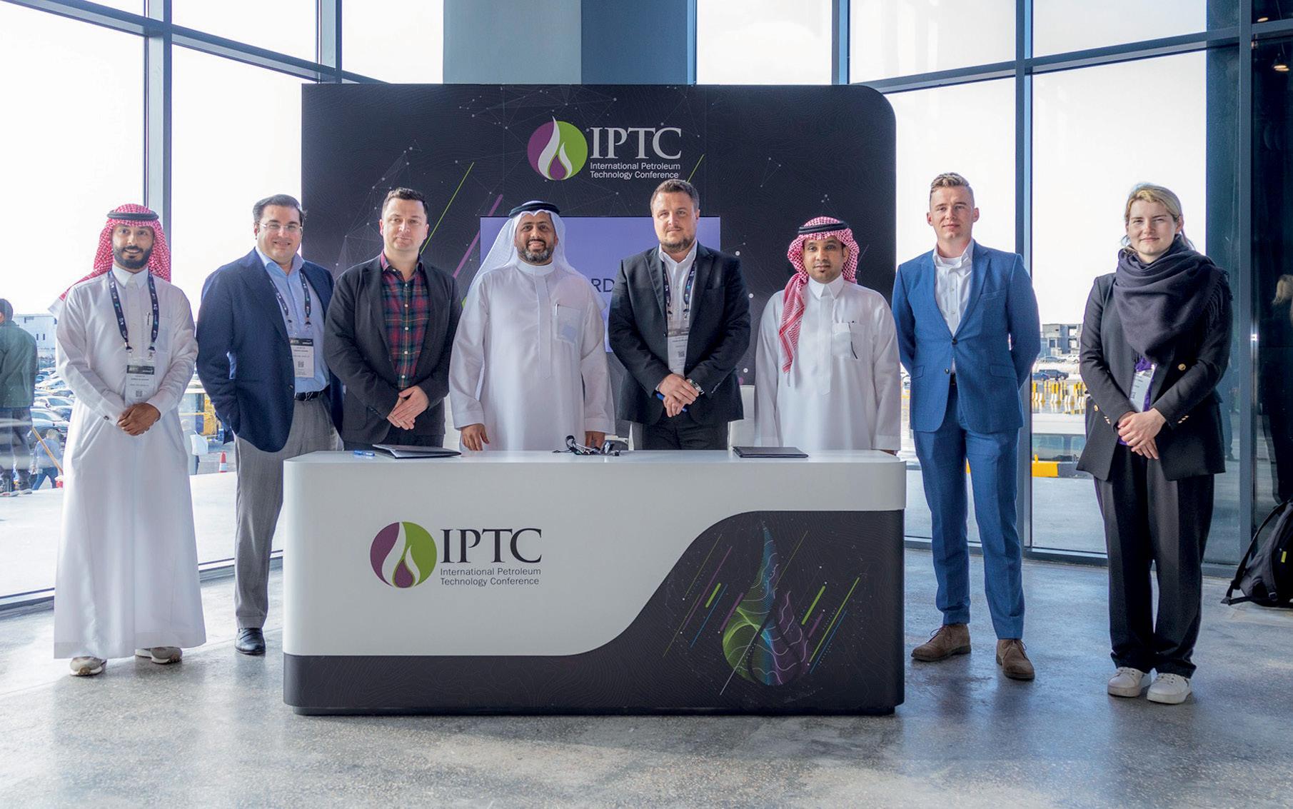
autonomy in mission planning, execution, and maintenance. Just like Sidus’ data analysis systems, onboard AI diagnostics and predictive maintenance algorithms can track satellite health, forecast and mitigate technology failures to minimize downtime and extend satellite lifespan.
AI-powered automation can streamline satellite operations, reducing the need for human intervention, cutting operational costs and response times, and increasing mission efficiency and reliability. With more dependable satellite services, operators can optimise their investments in space technology.
Efficient automation and ML/ AI processes have long been helping achieve a level of precision crucial for ensuring the safety and integrity of satellites, Helen Weedon, Managing Director, Satcoms Innovation Group, tells SatellitePro. “ML and AI processes, both on the ground and in the satellites themselves, are already ensuring simultaneous control of over thousands of LEO satellites in space, without a single major incident for several years. Thanks to these technologies, we are now able to spot conjunctions with a distance as small as 500 meters, at more than 10 km/s velocity difference at 550 km altitude.”
Beyond safety considerations, applying AI and ML has the potential to sharply increase efficiency in a number of satcom applications. “This is especially possible wherever we have high quality and accurate data available, e.g. coming from sensors via telemetry from the satellites themselves. By adding this to high quality external data, it is possible to complete important tasks such as satellite orbit calculus or payload incident detection,” Weedon adds.
Last year, Lockheed Martin unveiled a new advanced

ML and AI processes, both on the ground and in the satellites themselves, are already ensuring simultaneous control of over thousands of LEO satellites in space”
Helen Weedon, Managing Director, Satcoms Innovation Group
satellite operations centre near Denver, Colorado, to test how AI, automation and cloud capabilities to manage the increasing number of satellites constellations in LEO orbits – with fewer staff in near ‘lights out’ conditions. The facility could enable simultaneous control of multiple missions and remote access for operators worldwide thanks to using consistent software across missions through a webenabled secure cloud framework. With existing functionalities incorporated into the facility, a single operator could potentially oversee individual satellites and entire heterogeneous constellations of different kinds of satellites from nearly anywhere over the internet, says Maria Demaree, Vice President and General Manager
of Lockheed Martin Space’s National Security Space business.
Navigating AI’s challenges
Again, as in every other industry, satellite operators face significant challenges in adapting to AI and embracing its gifts requires careful consideration.
Weedon warns against viewing AI as a cure-all solution. Although satellite operators have huge volumes of machine-generated data in their database ready to be used to increase efficiency, doing so requires strategic leadership and organisational adaptability – particularly when using the technology to improve existing business functions. “Accepting and implementing change, including a well-defined risk management, is extremely important through all levels of employees,” she says.
Weedon flags the need for planning in the automation process. Early-stage development requires careful consideration of scope, efficiency, and process gains, she adds, pointing out that automation attempts without a clear understanding of data usability can lead to project failure and wasted investment.
“Any later change will be immensely complicated to re-implement, requires often a start over from square one.”
She says implementing AI systems can be both complex and iterative in nature. In the rush to secure a quick win, companies can struggle with the technologies’ mathematical intricacies, with the project often ending in failure.
“ML/AI requires disruptive thinking and is not easy to implement, neither in workload, nor in understanding, nor in cost,” she says. “All that we see today at ChatGPT, and other AI applications need years of development without having a single cent of return of investment.”
Qatar’s satellite industry has seen exponential growth over the last decade, fueled by strategic initiatives and Qatar’s National Vision 2030. As the region’s connectivity needs evolve, satellite technology plays a vital role in supporting the country’s economic growth and societal development, says Ali Al
Kuwari, Presidentand
CEOof Es’hailSat
The “State of the Satellite Industry Report” about a decade ago predicted global industry revenues for 2013 as $189bn. The same report, in its 2023 edition estimates the global industry to be worth about $386bn annually. For an industry that has been carefully regulated and closely tracked by governments around the world, the last decade of nearly doubling annual revenues is a stellar achievement. While a large part of this growth is attributable to the private sector, Low Earth Orbit (LEO) constellations and the emergence of the NewSpace industry, there has been an acceptance of traditional satellite communication services as the medium of choice when it comes to connecting the unconnected. This could be direct to the consumer via satellite broadband, extending the reach of 3G, 4G and 5G networks via cellular backhaul or the connectivity onboard aircraft and maritime vessels. As with any satellite service,
the primary objective is to provide critical communications infrastructure, wherever and whenever it is required. Best practices include end-to-end service delivery with high levels

of availability. This is further augmented by secure and reliable connectivity across both fixed ground networks and land mobile, maritime and aviation sectors. Mid to long term, mobility services be it on land, maritime or aviation, and Internet-of-things will utilize satellites as the critical infrastructure for connectivity.
The Middle East and North Africa have tremendous potential for expanding connectivity services given the unique challenges faced by the region. While fiber continues to reach the shores of various countries in Africa, getting the same connectivity inland and overcoming the challenges on-the-ground is a different story altogether. Given the remote and sparsely populated areas across MENA, and difficult terrain within this region, at present fiber connectivity is largely within and between the major cities. It will remain this way for some time as service providers struggle to find the right balance between expending high CAPEX and providing connectivity to the remote areas.
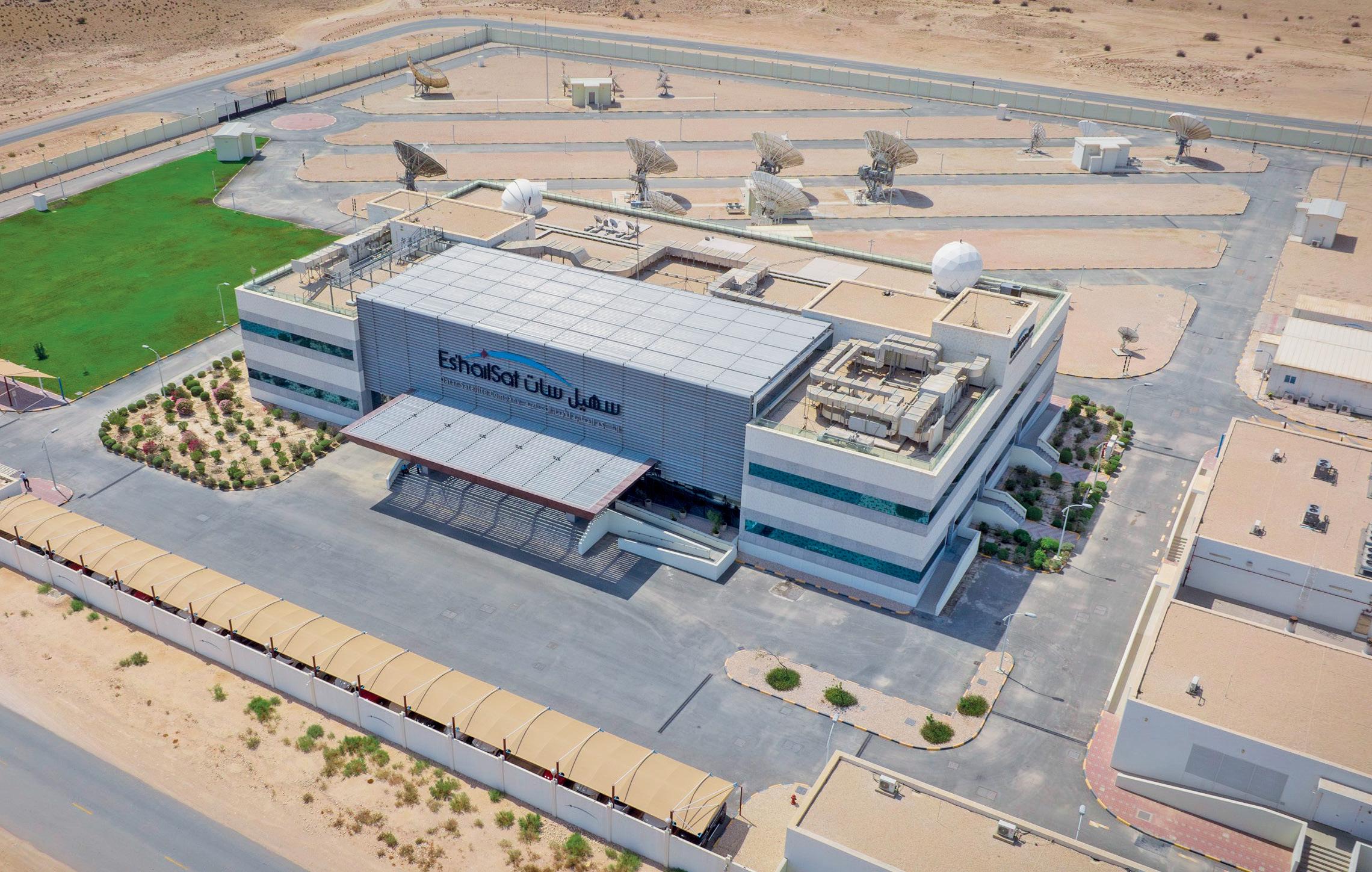
While the industry can do a lot more, the pace of broadband growth in MENA has been quite encouraging. The deployment of 4G and 5G infrastructure has been critical to developing low-cost wireless broadband in MENA. Furthermore, the arrival of both high throughput satellites and fiber-to-the-home has reduced the cost per Gigabyte of data consumed, as every household and workplace continue to consume more data with every passing day. At this point, the global satellite industry is in a state of flux with multiple non-GEO constellations at various stages of their development and launch, many of them looking to provide global broadband connectivity. LEO systems are relatively young and unproven which makes the recent gold rush of announcing constellations a trend that we believe needs to
be approached with cautious optimism. A lot needs to be done before these systems become integrated into the 5G eco-system and the sheer volume of capital & technology advancements required make it an uphill climb for the companies involved.
The growth potential of the MENA region also brings with it a unique set of challenges that one must face when providing services to the region. First would be piracy as content protection is still a concern for the region. Although majority of the large piracy incidents have been addressed and discontinued, there is still online piracy of content. A consolidated effort is required on the part of the satellite & media industry and local governments to address this issue. Then there are always price pressures when it comes to satellite capacity, services, and
equipment. This has come to the forefront in the last few months, with supply chain issues causing delivery delays and further delaying implementation, service roll out etc. The world is heading towards economies driven by artificial intelligence, neural networks, and the Internet of Things, all of which can only be enabled by robust telecommunications and IT infrastructure. Therefore, it is critical for these sectors, including satellite services, to build a culture of innovation and continuous development to be able to cater to these demands. With Qatar becoming a powerhouse of talent and technological prowess in the Middle East, advanced satellite services will help ensure that the economy of the country has the tools that it needs to grow from strength to strength. Within the MENA region, Qatar’s
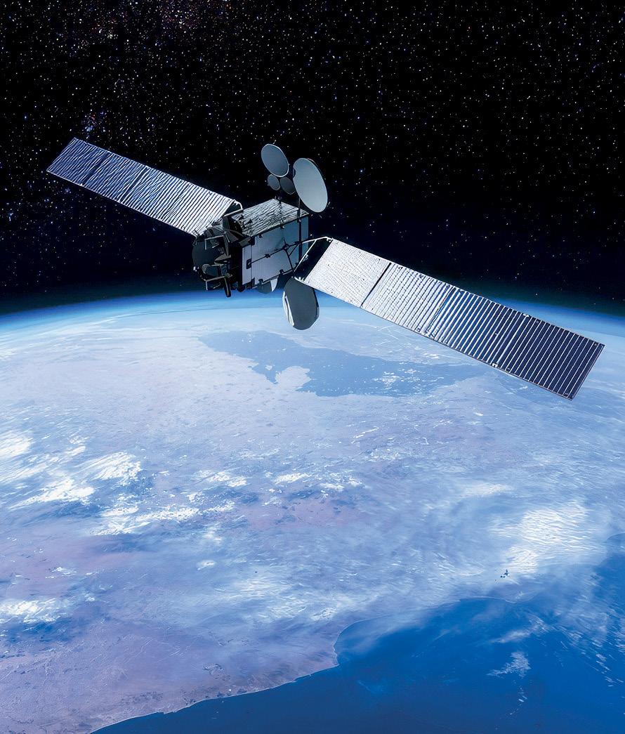
space ambitions have developed based on a combination of media & telecommunication industry growth and the need for selfreliance in all areas. The domestic workforce in Qatar is one of the most connected in the MENA region and perhaps in the world as well owing to the high teledensity built over the past many years. Today’s technology-driven economy demands that people should have the tools necessary to remain connected anywhere, at any time and using any device of their choice. This involves infrastructure on the ground, as well as in space.
Qatar’s National Vision 2030 is
designed to move the country from a carbon-based to a knowledgebased economy and Es’hailSat is a key part of that vision. The last few years have witnessed exponential growth in data traffic across telecommunication networks. We are also starting to see a true convergence of networks, be it fiber, cellular or satellite – as companies across technologies realise that their combined capabilities are more complementary than competitive. With the advent of Direct-toDevice satellite technology, high throughput non-GEO constellations and the widespread adoption
of Internet of Things, the next decade should witness the growth of ubiquitous connectivity that is not limited by the backhaul medium. The challenges now lie in the areas of cybersecurity, data privacy and sustainable growth of such networks.
Es’hailSat’s satellites are a symbol of Qatar’s commitment to free, secure, and independent communication and events such as the AFC, FIFA World Cup and others are the perfect opportunity for us to showcase our capabilities. Beyond upgrading networks from 4G to 5G and beyond, it is important to ensure that the human capital in the ICT sector is trained regularly and their technology & soft skills are also upgraded to meet the demands of the next decade of growth in line with the country’s vision. We are working on multiple long-term projects to fulfil the company’s vision of being a world class satellite operator and service provider that effectively contributes to the success of this vision. Our plans are to continually upgrade our capabilities in terms of our teleport, ground segment and managed services to be able to leverage our young fleet in orbit today.
Qatar’s National Vision 2030 relies on the four pillars of development across Human, Social, Economic and Environmental aspects. Es’hailSat continues to engage with educational institutions across Qatar, at various levels ranging from schools to universities, in order to share the knowledge that we have garnered and develop the next generation of engineering, science & technology professionals. For Es’hailSat’s business, the priority over the next 12 months is expanding services to support the rapid growth of Qatari customers across the board.
Ali Al Kuwari is President & CEO of Es’hailSat.

With the rising number of satellites and corresponding space debris, Space Situational Awareness (SSA) is becoming increasingly challenging and requires more collaboration, says Lorenzo Arona of Avanti Communications
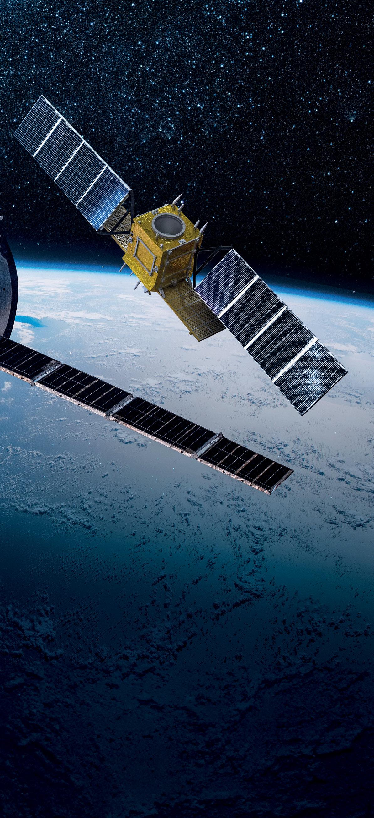


As a society, we rely heavily on satellite-enabled services for critical infrastructure, and an increasing level of resources is dedicated to protecting satellites to ensure that services are not interrupted. With the number of satellites in orbit increasing at an unprecedented rate, and the number of debris objects also growing, Space Situational Awareness (SSA), the ability to know where objects are in space and predict where they will be soon, is becoming increasing challenging. To address an issue of this scale and complexity, there clearly needs to be a collaborative effort by all space actors - from spacecraft manufacturers, satellite operators and service providers, to regulators and governments. Yet although the satellite industry has long been talking about the growing challenge of managing space traffic and mitigating the threat of space debris, actions have often been uncoordinated.
However, a number of collaborative space safety and sustainability initiatives have recently been launched which do perhaps indicate greater levels of cooperation. So, does this mean the world is finally taking the necessary steps to ensure long term space safety and sustainability, or are these initiatives mere token gestures? Before we come to reflect on the recent developments, it’s helpful to first consider the various challenges that hinder operators’ ability to access effective SSA and mitigate the space debris threat.
According to ESA’s current estimations, there are approximately 1,036,500 space debris objects greater than 1cm.
These objects are travelling at several kilometres per second and all of them are capable of disabling or destroying a satellite if they hit. However, with the current available technology, we can’t see or track small or opaque objects so can only reliably monitor just over 35,000 objects. There are also operational, political, cultural and legal factors at play that hamper the industry’s ability to mitigate the threats arising from ever increasing volumes of space debris and space traffic. With active satellites regularly performing orbital correction manoeuvres to fulfil their mission, it’s difficult for a satellite operator to know exactly where an active third-party satellite will be in the near future. This is problematic because if an operator performs a collision avoidance manoeuvre based on its own available data without the other party’s satellite manoeuvre plans, it might inadvertently increase the risk of collision. Operators clearly need to communicate with each other for coordination purposes, but communication between different operators’ operational teams is not a given. It can be very challenging to find the right contact details of the people with whom you want to coordinate operations, and unsurprisingly, language barriers are also an issue, particularly when dealing with technical terminology. The difficulties are compounded with reluctance of some operators to share information due to the sensitive nature of their missions or concerns that shared data would be misused. In many situations, because of these concerns, some operators do not participate in SSA. It is important to establish a secure environment for exchanging data and the confidence that shared data is used for SSA purposes only. We also need to be creative and open to different ways of communication in order to
encourage participation in SSA.
Even where lines of communication between operators are good, operators may not agree on the assessment of the level of risk of the encounter. This may happen for two reasons: firstly, operators may have different levels of acceptable risk and, secondly, they may rely on different data to make an assessment. This happens because operators often use different local and national conjunction assessment services, and each service typically uses its own sensors’ data and its own orbit determination algorithm.
Consolidating all the regional and national conjunction assessment services that operators rely on into one system would of course help mitigate the risk of misunderstandings and disagreements. This system of systems would be able to fuse all the available data and provide
the best estimate of the geometry of the encounter and its threat level. However, given the current geopolitical landscape that we find ourselves in, this is not likely to happen any time soon.
Unlike on Earth, there is no highway code in space that specifies who should have priority and who should give way. In the event of a conjunction assessment where two operators agree on the risk and both want to de-risk it, which one of the two should perform the manoeuvre? This could be difficult to agree on, particularly because there may be financial and operational reasons why an operator may prefer not to carry a collision avoidance manoeuvre.
Space is an environment shared by all nations. For this reason, management of environmental challenges linked to space safety
and sustainability requires collaboration by many different players. The good news is that many shared initiatives promoting responsible and sustainable behaviour have recently been launched.
More than forty commercial, institutional, and not-for-profit entities, covering all phases of a space mission from design, manufacturing, launch, operations, to disposal, have collaborated as part of the Space Safety Coalition (SSC), to develop and produce an updated Best Practices for the Sustainability of Space Operation. This collaborative effort is quite remarkable. The document provides actionable advice to relevant stakeholders such as mission and constellation designers, spacecraft manufacturers, launch service providers, and satellite operators, on how to contribute to space sustainability.

ESA recently launched its Space Debris Charter which forms part of its pioneering Zero Debris Approach and features guiding principles and jointly defined targets to prevent new debris from being added to orbit by 2030. Signatories of the Charter commit to collectively contributing to reducing the probability of debrisgenerating events, increasing the probability of successful end-of-life disposal, and reducing probability of casualty from objects re-entering the Earth atmosphere. ESA is also producing a Zero Debris Technical Booklet, to provide guidance on how best to achieve the targets.
The release of the Global Satellite Operators Associations’ (GSOA) Code of Conduct on Space Sustainability marks another important breakthrough. It aims to identify best practices that will enable the world to maximise the use of space’s resources. Its purpose is to minimise the threat of collision between spacecraft, track operational spacecraft, monitor orbital debris, and promote space situational awareness.
Another noteworthy initiative is the release of the World Economic Forum’s Space Industry Debris Mitigation Recommendations. Endorsed by about thirty industry players, these recommendations are not just directed at satellite operators, but also at insurance companies and national governments, which may help to incentivise adoption of best practices.
Perhaps the widest in scope is the UK Space Agency funded Earth and Space Sustainability Initiative (ESSI). In collaboration with industry, academia, and the insurance and finance communities, ESSI aims to review current space sustainability standards, perform a gap analysis, and publish new standards aimed at filling the identified gaps. ESSI seeks to

ensure the sustainable use of outer space by covering the lifecycle of a satellite and all aspects of Space Traffic Management.
Although not new, it’s worth also mentioning another industryled initiative, the Space Data Association (SDA), a not-for-profit association of over thirty satellite operators working together to promote industry best practices for space debris mitigation. Unlike other initiatives, the SDA also runs a one-of-a-kind Space Traffic Coordination platform. The concept of the SDA spawns from the fact that an operator has the best knowledge of the position of its own satellites, because it knows the planned orbital correction manoeuvres and can generate operational ephemerides that take the effect of the planned manoeuvres into account. One of SDA’s goals is to share resources so that the cost would not be a hinderance for any operators to participate in SSA. Through the
years, SDA has been promoting the idea of improving flight safety via data sharing. Due to its nonprofit nature and the fact that it is not affiliated to any one country, SDA could serve as a trusted third party to promote data sharing via a secure data centre to process share data for SSA use only.
Will these Initiatives be Enough to Ensure Space Sustainability?
That is the million-dollar question! The increasing level of engagement of commercial and institutional entities, together with widespread efforts to cooperate and coordinate actions are extremely positive steps forward. On the other hand, these initiatives aim to strike the right balance between ambition and consensus. They identify relevant best practices and set realistic targets that if achieved, will improve the current situation. In time, there is also a hope that these best practices will become accepted rules of behaviour and pave the way towards the creation and adoption of national and international guidelines and standards.
Managing space debris and space traffic is a complex and multifaceted challenge that can only be tackled through the collaboration and resolute effort of all stakeholders. There is no doubt that we are faced with a monumental challenge, but it is not one that is insurmountable. The recent initiatives and developments show a willingness and desire to work together, as well as a commitment to maintaining space safety and sustainability. With willingness and determination, I believe that we can preserve the space environment for the benefit of humanity and future generations.
Lorenzo Arona is a Senior Manager in the Spacecraft Operations department of Avanti Communications
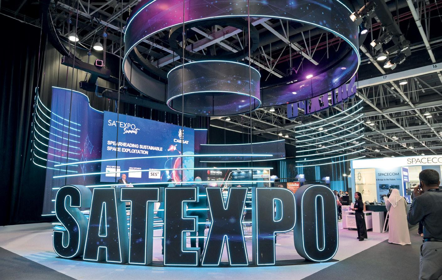
The SATExpo summit at CABSAT serves as a hub for satellite technology enthusiasts, telco experts, and satellite service providers to showcase cuttingedge solutions and discuss the most recent advances in satcoms. SATExpo is designed to showcase innovations aimed at improving connectivity, extending coverage, and closing the digital divide, ranging from high-throughput satellites to next-gen launch technologies.
For the past decade, SATExpo has been a driving force in the satellite and space communities, facilitating strategic partnerships and meaningful conversations. The conference will offer attendees indepth knowledge of topics such as commercial/enterprise connectivity services, government and military services, ground systems and hardware and space data. This year, industry experts and executives will be present at SATExpo to facilitate discussions on the global launch and manufacturing markets, future trends and trajectories, and business strategies of the leading companies.
The executive discussion will shed light on end-user markets, emerging technologies, financial insights, technical content, and regional focus. The conference is of great significance to stakeholders, especially as the Middle East
Satellite Communications Market is expected to grow from an estimated $3.35bn in 2024 to $4.79bn by 2029, with a compound annual growth rate of 7.40% from 2024 to 2029 . In addition, various trends and developments will be covered through several sessions, such as ‘Satellite and HAPS: Transformational Technology
Disruption, Service Resilience,’ ‘Into the Blue: Flying and Sailing with Satcoms,’ and ‘Turning Constellations into Networks – A New Connectivity Architecture for the Middle East Region’ among others.
The SATExpo summit this year will also cover how we can and should responsibly use space
exploration to support futureproof life on Earth. This is in light of the satellite industry’s significant and long-term impact on our future, offering services that can help us monitor the planet effectively and purposefully.
CABSAT 2024 will be an influential platform for stakeholders, cementing its position as the region’s largest gathering for the media, broadcast, and satellite industries. This will be reinforced by conversations and debates about the media industry’s social and environmental responsibility, innovative developments in the satellite industry, and other global innovations that will influence the industry’s future.
STAND S3-B25
TRIAX UK, a satellite services provider, is set to make its debut appearance at CABSAT 2024, showcasing its latest launch, the TRIAX TDmH Headend.
The TDmH mini headend, a product of TRIAX’s visionary engineers at the UK R&D centre in Denmark, marks a new era in TV distribution solutions, the company said. Launched in early 2024, this compact powerhouse joins its predecessor, the TDcH compact headend, in offering reliability and performance on a stable platform.
Tailored for entry-level installations, the TDmH boasts reduced input and output service capability

compared to the TDcH, making it a better choice for those stepping into professional TV distribution. What sets the TDmH apart are its variants: TDmH IP, 8S, 8S-I, and 14STC-I, each catering to diverse customer needs with basic functionality or advanced features for
specialised applications. Designed to grow alongside users’ needs, the TDmH can seamlessly integrate with its big brother TDcH, offering an expansion path for the headend system. With its intuitive graphical user interface, scaling setups is easier.
STAND 305
At CABSAT, Satcube will introduce Satcube Motion, its first on-the-move satellite terminal, along with Satcube Instant, an all-in-one rental service that promises delivery of a pre-configured Satcube Ku terminal within two business
days for immediate use upon arrival.
Currently in development, the Satcube Motion terminal boasts a lightweight and compact design, making it easily mountable on any vehicle and compatible with all battery types. Leveraging Intelsat’s GEO network

Flexmove, the terminal ensures global coverage.
Mustafa Hasan, Key Account Manager, Satcube, said: “Satcube is delighted to attend CABSAT for the second time, as the Middle East is a prioritised region for us. We are excited to introduce our new product and services together with our partners and existing customers and users.”
Over the past six months, Satcube has initiated collaborations with companies in KSA and governments in the UAE and Kuwait.
Having sold more than 1000 terminals, Satcube is now looking for new opportunities in the region.
STAND 303
German manufacturer
Polytron will bring its modular IP-based headend solution and a diverse array of high-quality products tailored for broadband communications to CABSAT this year. Besides the new modular IP-based headend solution, Polytron will also showcase a wide range of encoders/ modulators, easy-toinstall RF amplifiers, small dimension multi-switches, a CWDM optical SAT IF solution and other products that are part of its portfolio.
The modular IPbased headend series is designed to run up to six different modules in a single base unit. With a wide range of input options including DVB-S/S2, DVB-T/T2, and DVB-C receivers, output options like DVB-C and DVB-T modulators, and processing modules such as encoders, protocol converters, and transcoders, this headend is designed to accommodate different applications.

Undersea cables have always been at risk of accidental, unintentional damage through fishing or anchoring or natural phenomena such as undersea earthquakes or landslides. But their resilience has been put to the test several times recently. Undersea data cables in the Red Sea have been damaged amid fighting in the region, highlighting the risks of a potential seabed warfare. While the Red Sea is known for its maritime routes which represent approximately 15% of global traffic, at least 15 submarine cables pass through the Bab alMandab Strait at the southern end of the Red Sea, carrying many of the data and financial communications between Europe and Asia.
More recently, cables serving East and West Africa have been impacted by a major undersea landslide causing widespread connectivity challenges across Africa and beyond. Whilst traffic that would usually be carried on the impacted cables was rerouted, the reliance on internet for daily operations indicates the potential for a total outage to have a devastating impact on the continent’s economy.
Repairing subsea cables is a complex and long operation, requiring highly specialised cable repair ships. It becomes even more challenging in a context of geopolitical sensitivity and ongoing tensions. A stable and resilient internet
infrastructure is critical, therefore, for the economic growth and functioning of modern societies. More than ever, a hybrid solution that includes terrestrial/ maritime cables, wireless technology and satellites is needed to build that resilience into networks. A single technology will not replace another one, but a multi-layered approach with these highly complementary technologies will deliver the resiliency and security that MNOs expect for their networks.
That reliance needs to be built into a network in the early stage of its design to help cover all eventualities. MNOs, companies and governments need to anticipate the ‘what ifs’. The most resilient or robust network deployments always take that into account, and satellites play an effective role by delivering connectivity quickly, easily and cost effectively – anywhere and at any time.
Towards a multi orbit solution for enhanced resilience
Satellite is sometimes the only way to bring connectivity to hard-to-reach regions that are otherwise difficult and uneconomical to connect. With experts expecting continued growth of bandwidth hungry technologies such as AI, IoT or Virtual Reality, satellites will play an exponential role in global connectivity.
A multi-orbit network capability, which combines capacity from both geosynchronous orbit (GEO) satellites and low-Earth orbit (LEO) satellites,
enables us to deliver added levels of network resiliency and performance based on user demand and application requirements. Software defined satellites as they enter service over the next few years will bring additional agility, flexibility and resilience.
Access to satellite capabilities is also made easier. Technological advances in space assets such as high throughput satellites, dynamic bandwidth allocation and ground equipment continue to make satellites more accessible and more economical. The open architecture of some networks and the integration of nonterrestrial networks (NTN) in 3GPP standards will help integrate services across orbits and across providers with the same seamlessness that users expect from their telecom devices and applications. The satellite network is no longer a separate system, operating on bespoke hardware and standards, but now fully integrated with MNOs.
Resilience also requires enhanced network security and it is important for satellite operators to adopt a systematic approach to detect, prevent and mitigate attacks. Independent thirdparty Service Organisational Control 3 (SOC 3) accreditation will help maintain effective controls over global satellite and terrestrial networks, ensuring that they are protected against unauthorised access, use or modification.
Rhys Morgan is GM and VP, Media and Networks, EMEA, Intelsat


