8 minute read
Streetscapes
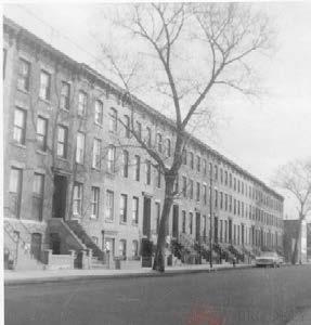
Photo Comparisons: The study of streetscapes is a crucial part of conservation work. Streetscapes can provided a wealth of information about the characteristic features of a neighborhood beyond what can be gleaned at the level of individual buildings. As part of this Studio, a streetscape analysis was performed by comparing historic streetscape photographs with current streetscape photos to observe change in conditions over time.
Historic and current photographs of each streetscape were placed side-by-side for comparison. The square border of the historic image was then overlayed onto the present image, visually aligning the two photographs and making any differences they display all the more apparent. Changes observed in the photo comparison included primary material changes, commercial space allocation changes, and an increased number of trees in the neighborhood.
Streetscape Photo Collections: The historic streetscape photos used in the study were taken mainly from the Brooklyn Historical Society Morrell collection (online) and the Landmarks Preservation Commission Greenbooks designation photos for Boerum Hill and Cobble Hill.1 The BHS Collection comprises more than 2,600 photographs of buildings and street scenes in Brooklyn dating from the 1950s through the 1970s. The collection was donated by John D. Morrell, former Assistant Librarian for the Long Island Historical Society (Brooklyn Historical Society).2 Seventy five images from the collection were selected for use in the study. Photographs were specifically chosen which depicted only the most relevant character-defining features of a particular area. For instance, photographs of historic storefronts were chosen to represent commercial Atlantic Avenue, while photos that captured trees, sidewalks, and architectural styles were selected for areas with a more residential character like that of Boerum Hill.
1 Brooklyn Historic Society, http://brooklynhistory.pastperfect-online.com/35872cgi/mweb.exe?request=continue, accessed by March 31, 2016. 2 Brooklyn Historical Society, Brooklyn Online Resource: John D. Morrell Photograph Collection at BHS, http://whereyoucamefrom.blogspot.com/2011/06/brooklyn-online-resource-john-d-morrell.html, http://www.brooklynhistory.org/ blog/tag/john-d-morrell/, accessed by March 31, 2016. Streetscape Source: John D. Morrell Collection

Streetscape Source: John D. Morrell Collection
Streetscape Photo Locations
The pictured map illustrates the locations of streetscape photos. The majority of the photographs depict areas within the Boerum Hill and Cobble Hill historic districts, especially along the main commercial avenues of Atlantic Avenue and Court Street. However, some of the photos also show the area between the two established historic districts. Photos of areas along the Atlantic Avenue Special Purpose District are also represented, as are photographs of the undesignated southeast corner of the study area along Wyckoff and Bergen Street where a district extension has been proposed. Fifty percent of the selected historic streetscape photos were taken from intersections and provide the most expansive neighborhood view. These photographs are complemented by some midblock shots.

Trees
The most conspicuous change seen through the photo comparisons is the increased number of trees in the neighborhood today as compared with the historic photographs. According to a New York Times’ report on a public hearing of the Atlantic Avenue zoning plan, “ a campaign called TAG, for Turn Atlantic Green, resulted in the planting of 100 shade trees under the Parks Department’s street tree matching program.”1 During the 1960s, much of Cobble Hill was known as a “transitional neighborhood”, and had been converted into cramped housing for Irish, Italian and Syrian immigrants.2 Driven by a “well of civic pride”, the residents of Cobble Hill fought for public green spaces and began planting trees as a way to improve their neighborhood.3 Based on the interviews with current community members, these trees have become a beloved part of the streetscape for residents. However, they also cause some problems and sometimes require maintenance work. Dead or rotten trees need to be replaced. Branches may fall off and injure pedestrians, and growing tree roots may damage the pavement on the sidewalk.

Henry Street & Kane Street: no trees at 1970s VS trees on sidewalk 2016 source: John D. Morrell Collection and student photo
1 “Atlantic Ave. Zoning Plan, Backed at Public Hearing,” New York Times, June 16, 1974, 94. 2 Kareem, Fahim, “A Sapling Grows Into a Giant; The Streets Around It Change, Too”, New York Times, http://www.nytimes.com/2008/06/20/nyregion/20journal. html, accessed April 28, 2016. 3 Ibid.

183 Pacific Street source: John D. Morrell Collection and student photo
Contextualizing new construction in the streetscape:
Most of the new construction has occurred largely outside the borders of the historic districts. The newly erected buildings may be roughly categorized into the following three categories:
Legend
Study Area Boundary Historic District Boundary
Period of Construction Decade Built
1940s-1970s
1980s
1990s
2000s
2010s

345-353 Pacific Stree Source:student photo

325 Pacific Street Source: student photo
Buildings which are complementary to their surrounding in both their material and design choices. In general, these buildings are consistent with the historic building layout. Their elevations follows a similar sequence of setbacks and contain stoops and recessed entrances. When compared to existing historic buildings, these new designs tend to simplify the facade elements, using rectilinear shapes for windows and doors and are also less ornamented. Additionally, the rhythm of fenestration for these buildings tends to be drawn from their surroundings. Popular material choices are wood clapboard, vinyl, brick tile, and stone veneer. All are intended to imitate the material texture of old buildings.
Buildings which utilize complementary materials, but whose designs stand out from their surroundings. This category of buildings might employ large asymmetrical glass openings to emphasize geometry and deconstruction of contemporary architectural design, rather than historic forms. The rusted red metal panels used in the pictured buildings resemble the color of red brick and therefore blend in well with the neighborhood.

Barney's - 194 Atlantic Avenue Source: student photo

301-309 State Street Source: John D. Morrell Collection and student photo 62 Bond Street Source: student photo
Buildings with both distinctive materials and distinctive designs. Some new construction place less emphasis on urban context, opting instead for bold, attention-grabbing designs which employ unusual materials for a dramatic effect.

335 Warren Street Source: student photo Fig. 16. Source: student photo

Parking
Increased car ownership has lead to parking difficulties within our study area. Historic photos of the 1950s through 1970s show significantly less parked cars on the streets compared with today’s streetscapes depicting many rows of tightly packed cars.


In a study conducted by the Streetsblog in late 2010, it was stated that the “share of New Yorkers who own cars rose while the share of those who commuted by car fell,” meaning that roadway congestion or the cost of gas was preventing people from using their cars on the road.1 However, the research district that comprised our study area actually increased in car ownership by 0.7% from 2000 to 2009 as compared to the city as a whole.2
Another research initiative conducted by New York City’s Economic Development Corporation in 2012 stated that in the area of Downtown Brooklyn, which includes our study area, concluded that 25.01%-40% of households in that region owned a car. Research conducted by the Streetsblog group in 2010 mentioned that around 39% of residents in the area owned vehicles.
The households in our study area were similar to the neighborhoods of the Upper West Side and the Upper East Side in Manhattan in terms of car ownership, as well as to the southern areas of the Bronx, such as High Bridge and Fordham. In reference to Brooklyn itself, most of the neighborhoods just north or northeast of Downtown Brooklyn (Boerum Hill and Cobble Hill included) and to the south of the area mirrored our study area in terms of car ownership, including Williamsburg, Bushwick, Crown Heights and Coney Island.
1 Kazis, N. (2011, April 6). New York’s Car Ownership Rate Is on The Rise. Retrieved April 05, 2016, from http://www.streetsblog.org/2011/04/06/newyorks-car-ownership-rate-is-on-the-rise/ 2 Ibid. 39% CAR OWNERSHIP in Downtown Brooklyn*

*Includes Boerum Hill & Cobble
44% CAR OWNERSHIP in Brooklyn
New York City Car Ownership Rates Source: http://www.nycedc.com/blog-entry/new-yorkers-andcars
Transportation
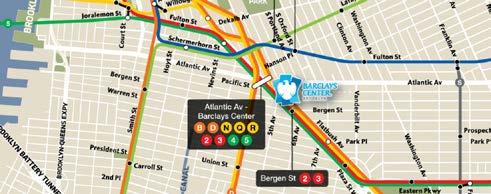
Transportation in the study area has changed drastically through the years, but has also made the area one of the most well-connected regions in the city. The study area contains eleven dedicated bike routes, as well as a handful of bicyclefriendly roads. On the northern edge of the study area, nine Citi-Bike stations allow residents and visitors access to the roads without having to travel by subway, bus, or car. Thirteen subway lines and fifteen bus routes make stops within the study area.1


1 Kaplan, T. (2012, November 25). City Takes Up Zoning Changes to Erase Downtown Brooklyn’s Glut of Parking Spots. Retrieved April 06, 2016, from http://www.nytimes.com/2012/11/26/nyregion/seeking-to-rein-in-excessparking-in-downtown-brooklyn.html


