8 minute read
Appendix
SPRING 2016 Materials Case Study Details
We began our analysis by selecting a few case study blocks in the study area. We decided to study a small sample within the greater study area because the time and effort necessary to gather the data and conduct the historic photo analysis for the entire study area would have been prohibitive within the time constraints of this studio. We developed a methodology for data collection with respect to conservation, and we limited our choices according to the availability of early tax photos. For the selection of case study blocks, we used the overall conditions map that was produced using the initial raw data from the initial survey as our starting point. Based on the map, we looked for blocks that exhibited some distinctive characteristics both within and outside the historic districts of Cobble Hill and Boerum Hill. We chose the following eighteen case study blocks:
Blocks 195 & 386, 325 & 326, 408 & 414: (see the map on page 219 for a map detailing locations).
Each of these three pairs consists of blocks that were either adjacent or directly opposite to one another and exhibited drastic differences in their building conditions: Block-195 has a large number of buildings in “fair” condition while Block-386 opposite to it on Bergen Street has an overall “good” building condition. On Block-326 the buildings displayed an overall “good” condition while in Block-325, adjacent to it along Tompkins Place, the majority of the buildings were rated to be in “fair” condition. We noticed that Block-414 had a mixture of building conditions while Block-408 next to it was primarily showing buildings in “good” conditions.
Blocks- 274, 275, 276, 285 & 286
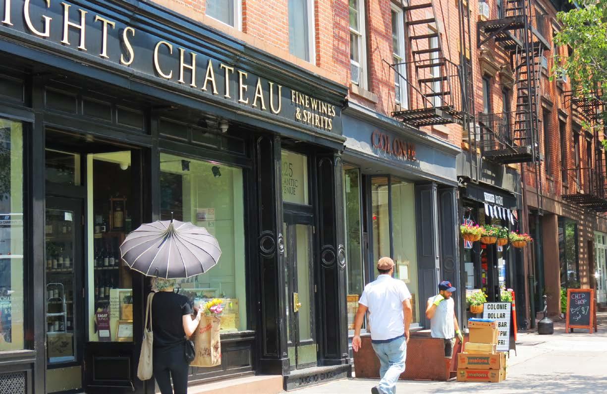
The blocks that we chose on Atlantic Avenue were blocks 274-276, and 285-286. Because all of these blocks fell outside the Atlantic Avenue Special Purpose District, we also chose Block-177, which was in the Special Purpose District. It is one of the sites for design project. We wanted to know how and why building conditions along a commercial street differed from one block to the other and also how they differed for residential blocks that were either in or outside historic districts. Blocks 326, 408 & 414, too, fell in this category due to their location along Court Street.
Block- 171
Block 171 contains an interesting mix of historic buildings and new development. Block 171 was included as an example of a block that has undergone a lot of change. Was there a reason this block was particularly vulnerable to demolition? And what did that block have in common - or not - with the other study blocks?
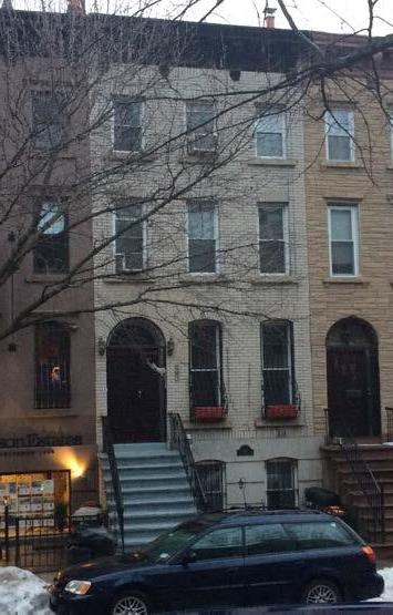
Source: student photograph
Previous page: 47 Strong Place Source: student photography Integrity 1: Block 408 lot 44
Blocks- 196, 385 & 387
These three blocks are just outside the Boerum Hill Historic District, and we thought that it would be interesting to know why blocks with similar looking rowhouses just outside this historic district were not included in the designation. Block-196 is particularly intriguing in this regard since half of this block (on Dean Street) is a part of the historic district but the other half (on Bergen Street) is not. We wanted to find out if there were any reasons related to condition, integrity, or material change through time that differentiated Bergen Street from the opposite row and may have justified its exclusion from the Historic District.
Blocks- 177, 193 & 292
These three blocks were included as case studies because of their selection and use as design project sites. We thought that an overall picture of the building conditions and characteristics of these blocks through time could possibly enrich the six different design projects being undertaken in the studio.
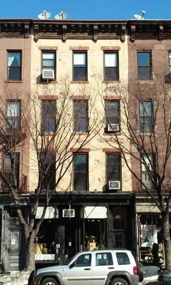
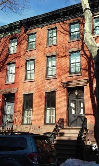
Integrity 2: Block 177 lot 45 Source: student photograph Block 195 lot 63 Source: student photograph
HISTORIC PHOTOGRAPH SURVEY
We created a second survey that focused on defining facade material use, the level of material condition, and the level of integrity in the neighborhood. The data from the second survey allowed the studio to identify how the study area has changed through time in regard to its built fabric. The second survey was implemented on collected tax photographs of the case study blocks from the 1930s-40s, 60s-70s, 80s and current photographs from the initial KoBo survey.
The questions asked included intentional overlap with the initial survey and also questions meant to create a more accurate understanding of facade materials and their condition and integrity through time. The second survey was crafted with mappable results in mind. The questions were created to highlight points of interest in the study, for example the trends related to the existence or nonexistence of the character defining features defined by the studio.
The historic photograph survey utilized a numerical value in lieu of the Good, Fair, Poor system, in order to apply quantitative analyses to the data. We assigned a numerical value to our survey responses. For this survey, a question of "What is the condition of the cornice?" would relate to the original Kobo survey data by 1 correlating to “Poor” condition, 2 to “Fair” condition and 3 to “Good” condition. Thus we assigned a condition value for the primary facade material, the secondary facade material and the following list of significant features: historic ironwork, stoop, historic storefront, notable sculptural ornament, terra cotta, cornice, stained glass, mansard roof, and dormer windows.
For quantifying integrity, the survey included two separate categories: stylistic integrity and material integrity. Integrity was defined as a way of assessing change through time with the origin point at the 1930s tax photograph being the earliest source for making these decisions (Figures 2, 3, 4). If the building's facade material was entirely replaced, such as brick being covered with stucco, the building would score low for material integrity. However, if the same building had all of the original formal features compared to its earlier photographs, it would score high for stylistic integrity. Buildings that were of a recent construction date, even in the case where they replaced a building we had previously surveyed, were given the highest integrity rating unless the integrity needed to be docked due to evidence from the new building’s photographic timeline.

Map of Case Study Blocks Source: student-generated GIS map
Whereas the initial KoBo survey addressed each building’s condition relative to its neighbors, the historic tax photograph survey tackled the idea of condition and integrity through time on the same building lot. The historic photograph survey benefited from access to several images from the past to reference change through time on the each building’s facade. To standardize the data collection within this survey, we created a set of parameters and definitions for materials, condition, and integrity. If a photograph did not show an element or facade clearly enough for our standards, the answer to that question was omitted from the final data analysis by being left unanswered.
Materials: For both the rapid building survey and the historic photograph survey, a photo-based reference sheet was created so that all surveyors could easily identify the common materials utilized in the study area. For example, it was important to distinguish between still intact brownstone, stucco that was used to imitate brownstone, and stucco not intended to imitate another material.
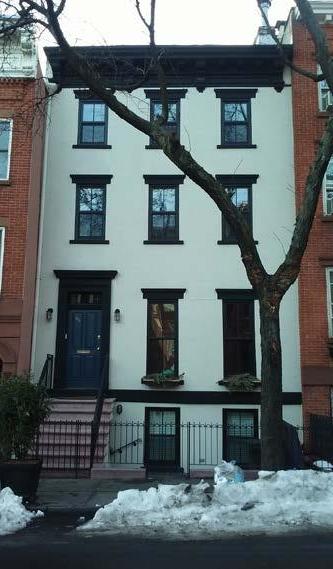
Building condition: The reference sheet created for condition assessment assigned a numerical value to severity of common deterioration modes. The sum of these values would allow the survey to place the building - or element - into the Good, Fair, Poor range. When assessing the condition of the building’s facade we looked for varying levels of biological growth, peeling paint, crumbling stucco, cracking masonry, rusting, lime runs, crazing, broken glass, stains, water damage, rotten or splitting wood, spalling, efflorescence, settlement, displaced ornament, and other losses in material or structural integrity. Not all of these indicators were visually apparent in the historical photographs. The lowest score of 1 (Poor condition) would be applied in the case of “prolific deterioration of the materials, possible structural concerns, abandonment or prolonged neglect of maintenance.” A score of 2 (Fair condition) would be applied in the case of “no deterioration of structural elements, however maintenance needed in ornamental or non structural facade materials. Neglect of any plantings or street furniture and bare-bones maintenance evident as building scars.” A score of 3 (Good condition) meant that there was “evidence of regular maintenance and repairs, including ongoing construction, with a high standard of quality. There is evidence of intact ornament, upkeep of plantings, or emphasis on curb appeal.” (building image for each of the 3 levels of conditions (Figures 1, 2, 3).
Building integrity: We quantified integrity in terms of change to the built fabric. Changing a facade material from painted brick back to bare red brick would affect the building’s integrity, as would planing the lintels down. The former would be considered a change of material integrity and the latter would be considered a change in stylistic integrity. A change from brownstone to brownstone-imitating stucco would not significantly reduce the building’s integrity, due to the necessity of the change. A removal of the stoop, which is a character defining feature of the study area, would have a significant effect on the building’s integrity score.
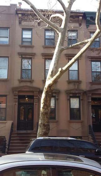

Fig. 1.Condition 1: Block 386 lot 49 source: Student Photo Fig. 3. Condition 3: Block 194 lot 17 source:Student Photo
