Yuwen Cheng 520540387
Xiaobing Lyu 510264006
Chenchen Wang 520565807
Jingbo Zhang 520074907
Minhao He 530027793
Zhicong Peng 510573920


Yuwen Cheng 520540387
Xiaobing Lyu 510264006
Chenchen Wang 520565807
Jingbo Zhang 520074907
Minhao He 530027793
Zhicong Peng 510573920
W e a c k n o w l e d g e t h a t t h e D h a r u g p e o p l e h a v e c a r e d f o r t h e
C o u n t r y t h a t w e a r e w o r k i n g o n f o r o v e r 6 0 0 0 0 y e a r s a n d t h a t
s o v e r e i g n t y w a s n e v e r c e d e d . W e p a y o u r d e e p e s t r e s p e c t t o t h e i r
E l d e r s p a s t , p r e s e n t , a n d e m e r g i n g a n d e x t e n d t h a t r e s p e c t t o t h e
b r o a d e r F i r s t N a t i o n s c o m m u n i t i e s a c r o s s t h e P a r r a m a t t a r e g i o n .
W e r e c o g n i s e t h e d i v e r s i t y o f C o u n t r y i n c l u d i n g w e t - l a n d s ,
s c r u b l a n d s , m o u n t a i n r a n g e s , n o n - h u m a n k i n a n d r i v e r s y s t e m s
w i t h i n t h e b r o a d e r P a r r a m a t t a r e g i o n a n d f e e l p r i v i l e g e d t o b e
c o n n e c t i n g a n d d e s i g n i n g w i t h C o u n t r y i n a n a r e a s o r i c h i n
c u l t u r e , s o n g l i n e s a n d h i s t o r y .
W e a c k n o w l e d g e t h a t F i r s t N a t i o n s p e o p l e ' s w a y o f l i f e w a s
g r e a t l y d i s r u p t e d w i t h t h e a r r i v a l o f c o l o n i s e r s a n d r e c o g n i s e t h a t
t h e l a n d u n d e r t h i s c o n c r e t e c i t y a l w a y s w a s , a n d a l w a y s w i l l b e
D h a r u g l a n d .

1.1
Through an analysis of the types and needs of potential visitors to wagga, this section will focus on the siting of the Wagga HSR station and how the station can work with public transportation to efficiently transport target audiences to their destinations.

High-speed rail (HSR) in Australia, defined as train services operating at speeds over 250 km/h, has been a goal since the 1980s, primarily along the east coast. Initial attempts, such as the Very Fast Train (VFT) proposal linking Sydney, Canberra, and Melbourne, failed due to insufficient government tax concessions. Similarly, the mid-1990s High-Speed Train (VHST) for the Sydney-Canberra route was terminated after not meeting cost estimates. In 2010, the Department of Infrastructure and Transport launched a $20 million HSR feasibility study. Phase One (2011) identified potential corridors and station locations, while Phase Two (2013) refined cost and demand estimates, confirming the system's viability along the east coast.
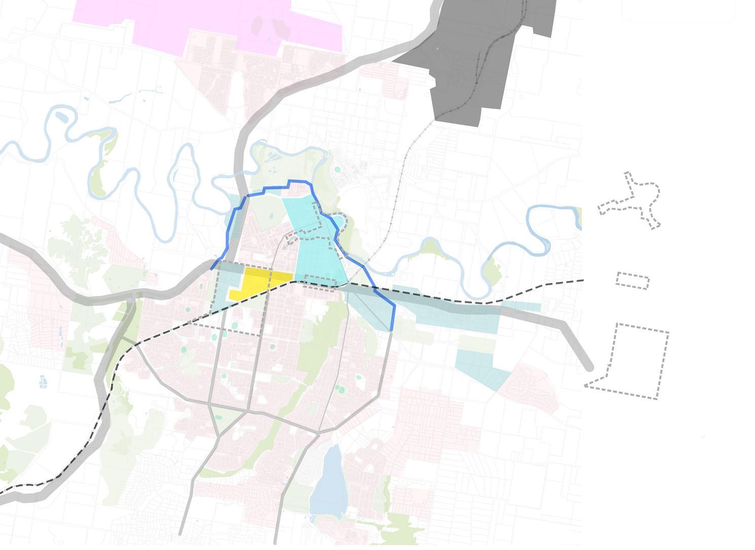
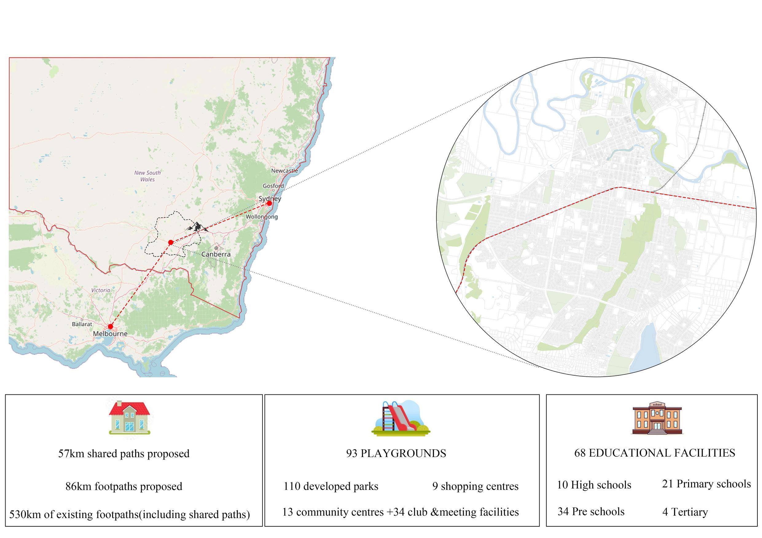
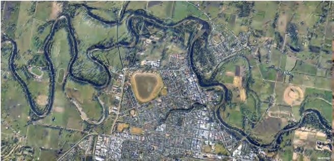
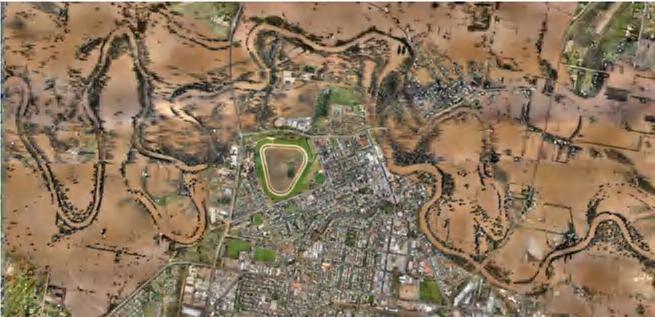
Wagga Wagga, strategically located between Sydney and Melbourne, shows significant potential for HSR but faces connectivity challenges. Despite its attractions and biodiversity, the city relies heavily on vehicular transport and suffers from regular flooding. The urban development strategy aims to consolidate the Central Business District (CBD) as the city's core, featuring a commercial high street, a community cultural district, and the largest sports center. Increasing residential density along the river and connecting the northern growth area will enhance population concentration and create a "15-minute urban living area" where essential services are within a 15-minute walk or bike ride. Improving the river landscape and restoring dams will enhance livability.
The main commercial street has spacious walkways, driveways, and parking lanes, but the river path is congested and lacks adequate entrances, necessitating redesigns for better accessibility. Public transport near the station is underdeveloped, with bus routes and cycling paths concentrated in the CBD to the north. Passengers must cross a busy highway to reach the station from the north or use a pedestrian overpass from the south, highlighting the need for improved public transport connectivity.
Spatial analysis identifies high-connectivity areas, emphasizing the importance of enhancing these zones to improve overall transportation efficiency. The structural plan for Wagga Wagga includes three key sites: constructing levees for flood protection, reconnecting blue-green networks, and respecting Indigenous land significance. Health objectives include upgrading sports facilities, promoting active transport, and aiming for net zero emissions through increased public transport use. Consolidation efforts focus on creating a 15-minute CBD living area, enhancing public spaces, and increasing diverse housing. Connectivity improvements involve elevating tracks for north-south connectivity and adding footpaths, cycle lanes, and bus routes.
The comprehensive plan details the development of three precincts. The Waterfront Precinct aims to enhance the waterfront area near the CBD and Murrumbidgee River. The Station Precinct focuses on the new HSR station and related industries, creating a transportation and economic hub. The Health and Knowledge Precinct supports growth in healthcare and education sectors.
The Wagga strategic plan prioritizes constructing the HSR corridor, enhancing the CBD and Health and Knowledge Precinct, implementing effective flood management, and improving connectivity through green corridors. Long-term goals include expanding the population northward, introducing a light rail system, and creating a 15-minute living area to support sustainable growth and improve quality of life. This plan aims to transform Wagga Wagga into a thriving medium-sized city, promoting economic diversity and enhancing livability, ensuring cohesive and sustainable development across all precincts.
High-speed rail (HSR) is typically defined as train services operating at speeds exceeding 250 kilometers per hour, a definition upheld in this context. Since the 1980s, HSR has been an ambitious goal for private sectors, political parties, and governments along Australia's east coast.
The concept of HSR was first introduced through the Very Fast Train (VFT) proposal, which aimed to establish a high-speed rail link between Sydney, Canberra, and Melbourne. This project garnered significant support from major corporate entities. However, the project was abandoned in August 1991 due to the failure to secure substantial tax concessions from the Australian government for its corporate backers.
Following the VFT project's failure, a proposal emerged in the mid-1990s to construct a HighSpeed Train (VHST) line to serve the SydneyCanberra route. This project, however, was terminated in December 2000 after the bids failed to meet the government's cost estimates.
In August 2010, the Department of Infrastructure and Transport initiated a $20 million HSR feasibility study (HSR Study). Conducted in two phases, the study aimed to evaluate the viability of an HSR system on the Australian east coast:
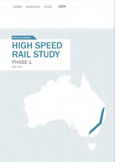
Phase One, released in July 2011, identified potential HSR corridors and station locations and provided initial cost and demand estimates for an east coast HSR system.
Phase Two, released in April 2013, expanded on the initial findings with a broader and deeper scope, refining many of the cost and demand estimates established in Phase One.
This paper references the Australian HSR feasibility study to explore the potential for an efficient high-speed rail link connecting Sydney and Melbourne.

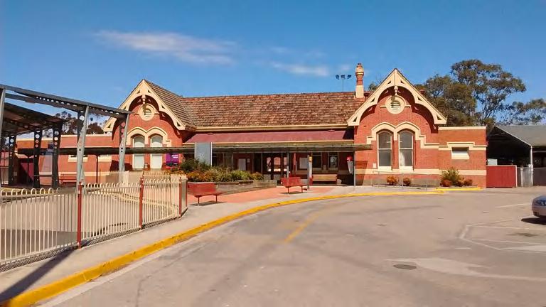
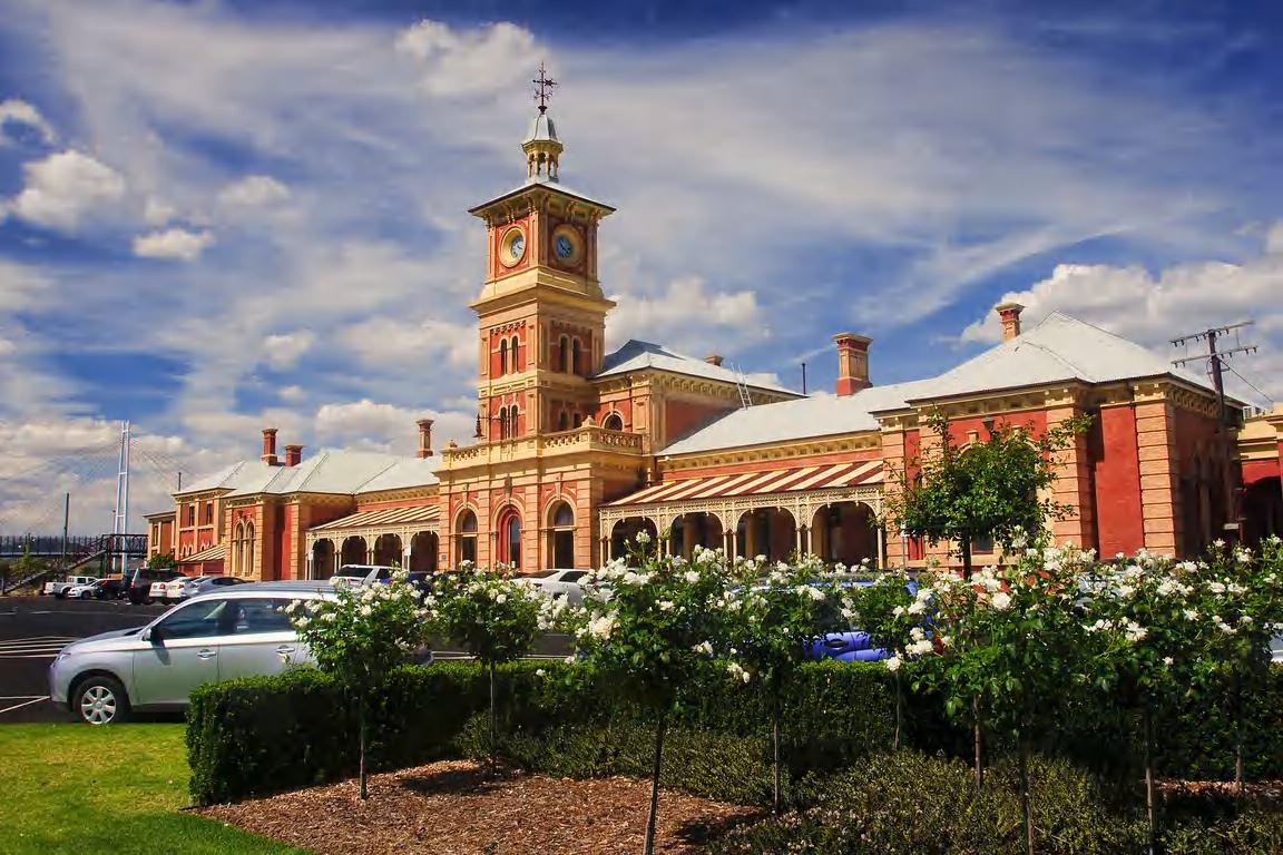
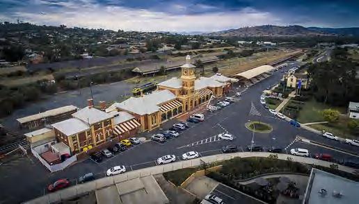
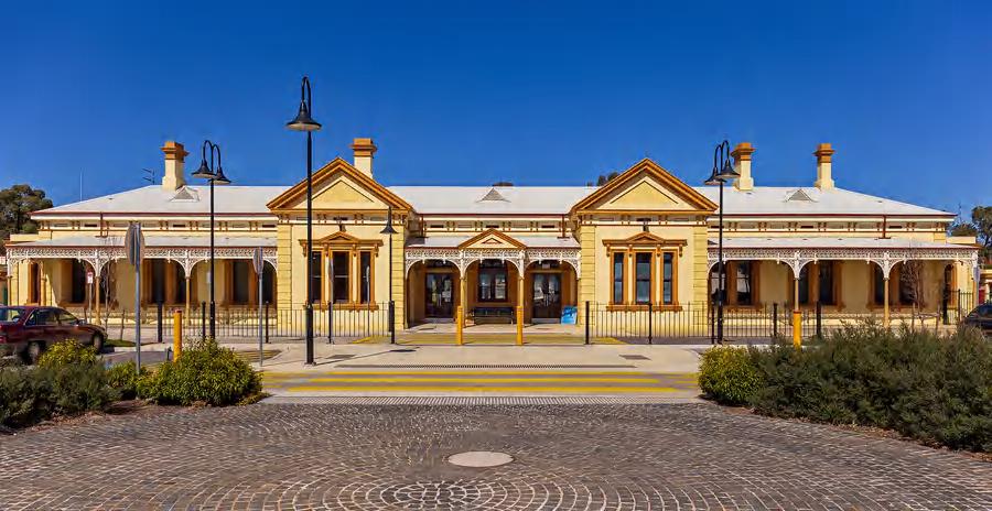
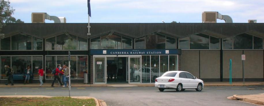
Railway stations in hub cities
2.3
The analysis primary tra Corridor, th Corridor, an these, the In on several ad
Inland Corridor Advantages of
1.Continuity complete rail ensuring unin
Complete rail link between Melbourne and Sydney
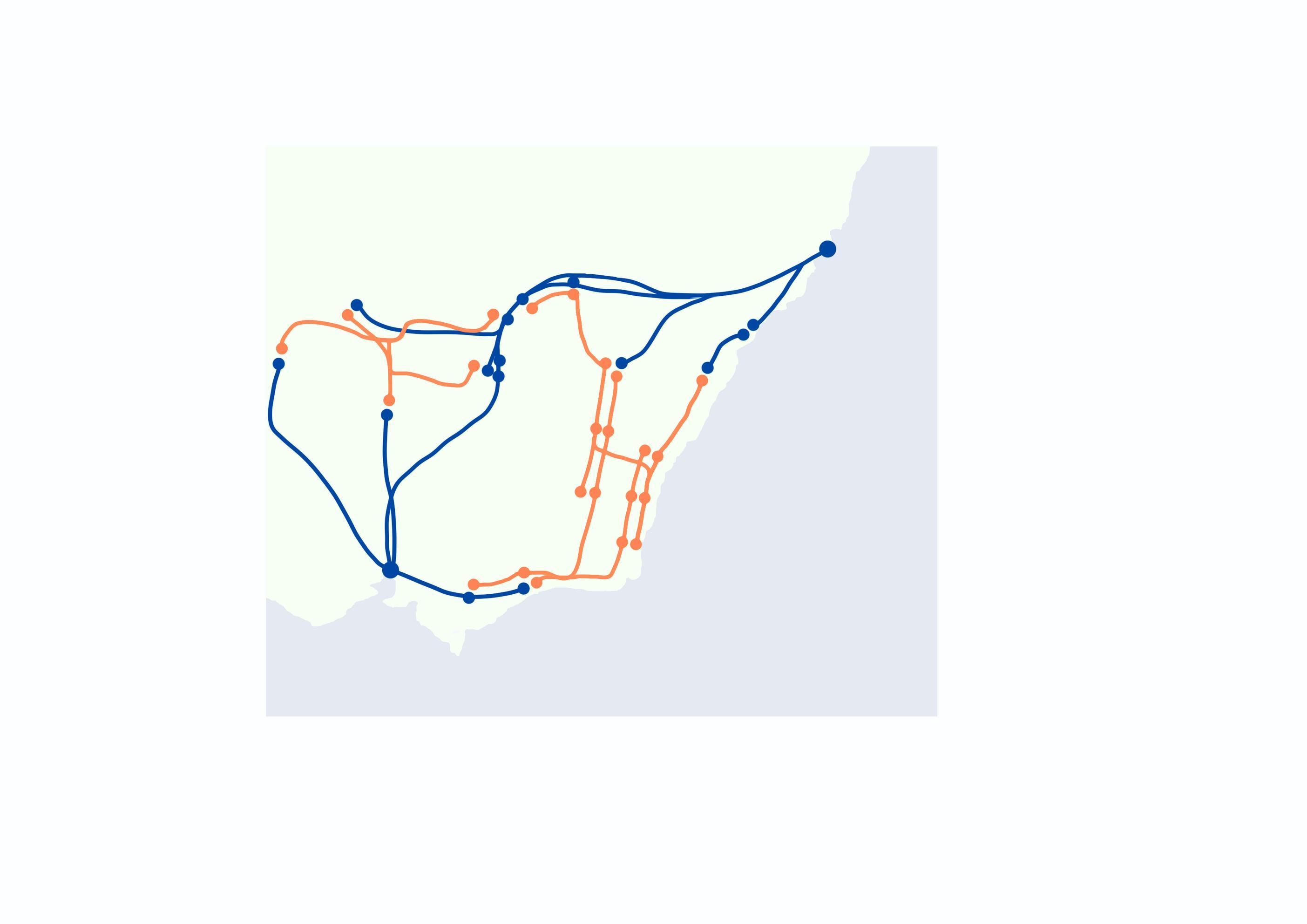
The analysis categorizes the routes into four primary transportation corridors: the Coastal Corridor, the Mountain Corridor, the Inland Corridor, and the East-South Corridor. Among these, the Inland Corridor has been selected based on several advantageous factors:
Less difficult to construct than the Mountain and Coastal Corridor
2.Feasibility challenging Mountain an favorable ter
1.Continuity of Rail Connection: It provides a complete rail link between Melbourne and Sydney, ensuring uninterrupted rail service.
Relatively short travel distances and relatively low construction budgets
Higher development potential compared to other corridors
3.Cost-Effici relatively sh with lower co 4.Developme potential for economic im
2.Feasibility of Construction: This corridor is less challenging to construct compared to the Mountain and Coastal Corridors due to more favorable terrain and geographical conditions.
Better improve the lack of transportation resources on internal roads
3.Cost-Efficiency: The Inland Corridor offers relatively short travel distances, which correlate with lower construction budgets.
4.Development Potential: It exhibits a higher potential for development, enhancing the overall economic impact of the rail network.
5.Enhanceme significantly transportatio
5.Enhancement of Transportation Resources: It significantly improves the existing deficiencies in transportation resources on internal roads.


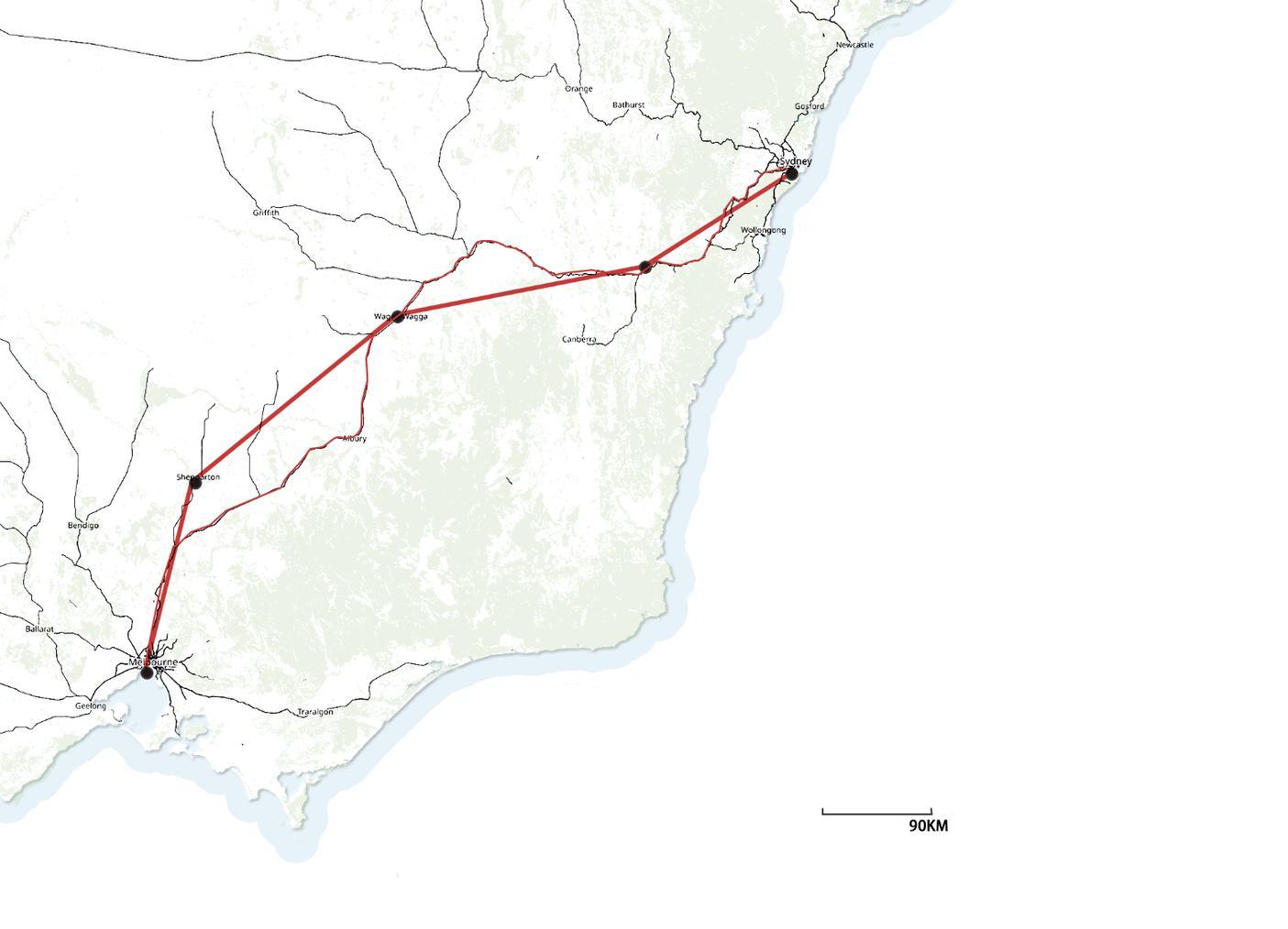


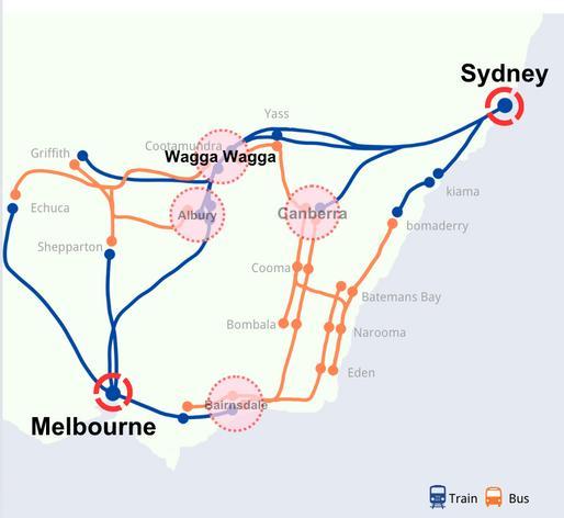
In a detailed population analysis (Australian Bureau of Statistics, 2023), it is evident that Sydney and Melbourne are distinguished as megacities within the Australian urban hierarchy. These cities not only serve as the primary economic and cultural hubs but also significantly outscale other urban centers in terms of population and infrastructure. Notably, there is an absence of medium-sized cities between these two metropolitan giants. Among the smaller cities, Wagga Wagga stands out with the largest population. Its strategic location, approximately midway between Sydney and Melbourne, positions it uniquely for potential development.
By creating an efficient high-speed rail link between Sydney and Melbourne, we aim to foster the growth of inland regions. Wagga Wagga is poised to benefit the most from this connection due to its central location. Our aim is to transform Wagga Wagga into a thriving medium-sized city, promoting economic diversity and enhancing livability.
It sets out a long-term plan and a framework for how the NSW. Government will provide the foundations for businesses to invest in our regions with confdence.

The design methodology for this project will be guided by principles outlined in the Local Strategic Planning Statement (LSPS) and "A 20-Year Economic Vision for Regional NSW."
The LSPS framework emphasizes the importance of localized strategic planning to ensure sustainable urban development. Our project will reference LSPS recommendations to integrate precinct and master planning, articulate local character statements, and develop comprehensive local housing strategies. This alignment ensures that our project is context-specific, addressing the unique needs and aspirations of Wagga Wagga while contributing to broader metropolitan goals.

The Regional Plan provides the strategy necessary to deliver the vision for the region.
LOCAL STRATEGIC PLANNING STATEMENTS – GUIDELINE FOR COUNCILS
It delineates the need for further local strategic planning efforts, encompassing precinct and master planning, local character statements, and local housing strategies.

INTEGRATED TRANSPORT STRATEGY AND IMPLEMENTATION PLAN,2040
The Strategy establishes a strategic direction to cater for a growing economy and population.
This vision document provides a strategic roadmap for economic growth and development across regional New South Wales. It focuses on enhancing infrastructure, fostering economic diversity, and improving livability in regional areas.
The Community Strategic Plan (CSP) is a plan for the community, by the community and directs Council'sstrategic documents.
SPATIAL PLAN,2013-2043
Provides clear strategic indicators for the developmentof Wagga Wagga over the next 30 years. lt is the keystrategic planning document for directing and managingurban growth and change.

The Biodiversity Strategy: Maldhangilanhaaims to increase awareness and address a wide range of key threatening processes impacting biodiversity.
RECREATION, OPEN SPACE AND COMMUNITY STRATEGY &IMPLEMENTATION PLAN 2040
The Recreation, Open Space and Community Strategy and Implementation Plan 2040(ROSC) aims to develop a connected, liveable city.
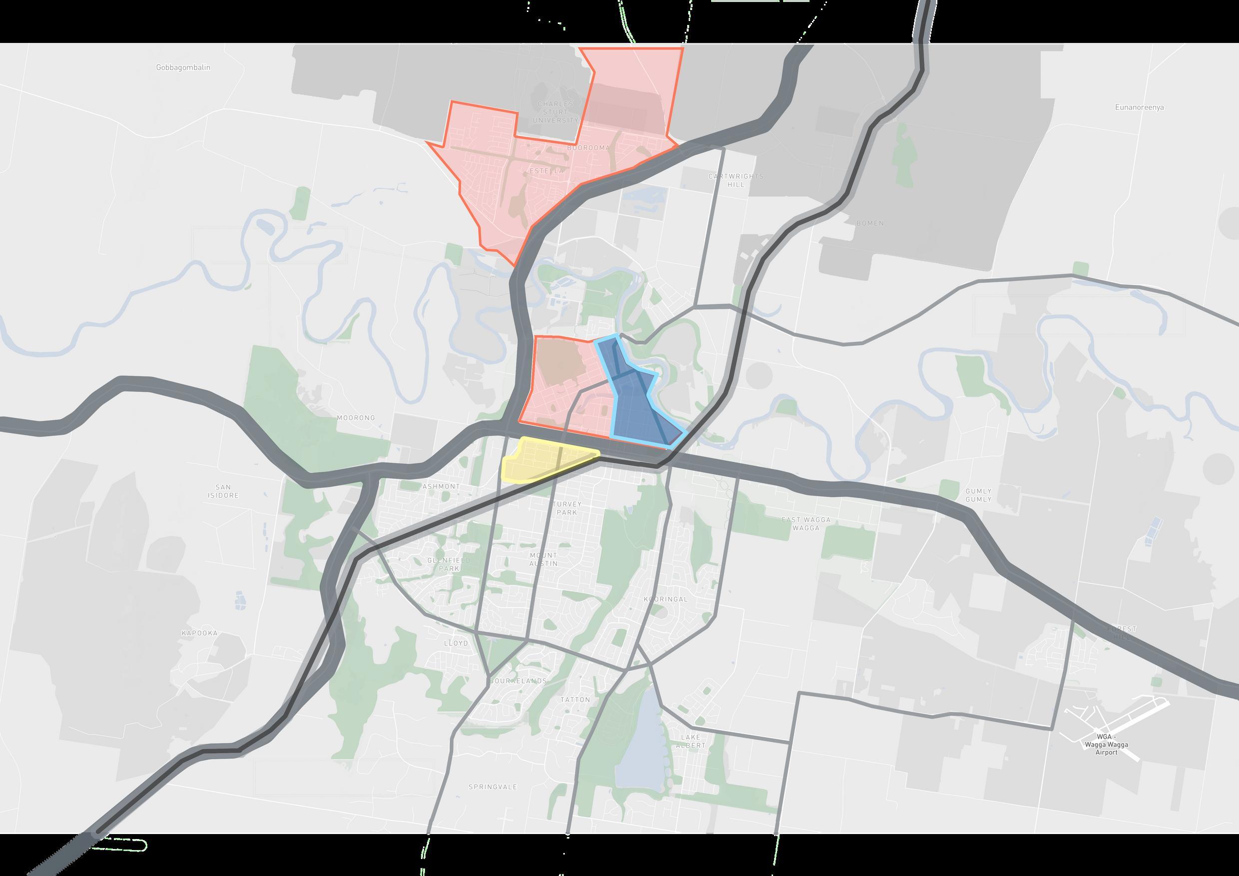
Tthe station's proximity to essential urban amenities is noteworthy. It is within walking distance to the city's primary commercial streets, sports facilities, and educational institutions. This strategic placement not only supports the daily commute of residents but also promotes the use of public transport for accessing key activity areas, thereby enhancing urban livability and reducing vehicular congestion.
New manufacturing industry
Future employment Research and Technology 4000 jobs Protect high amenity & envrionment areas Protect against natural hazards (flooding & bushfire)

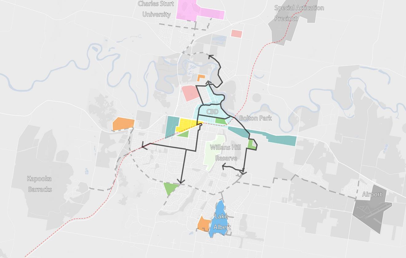
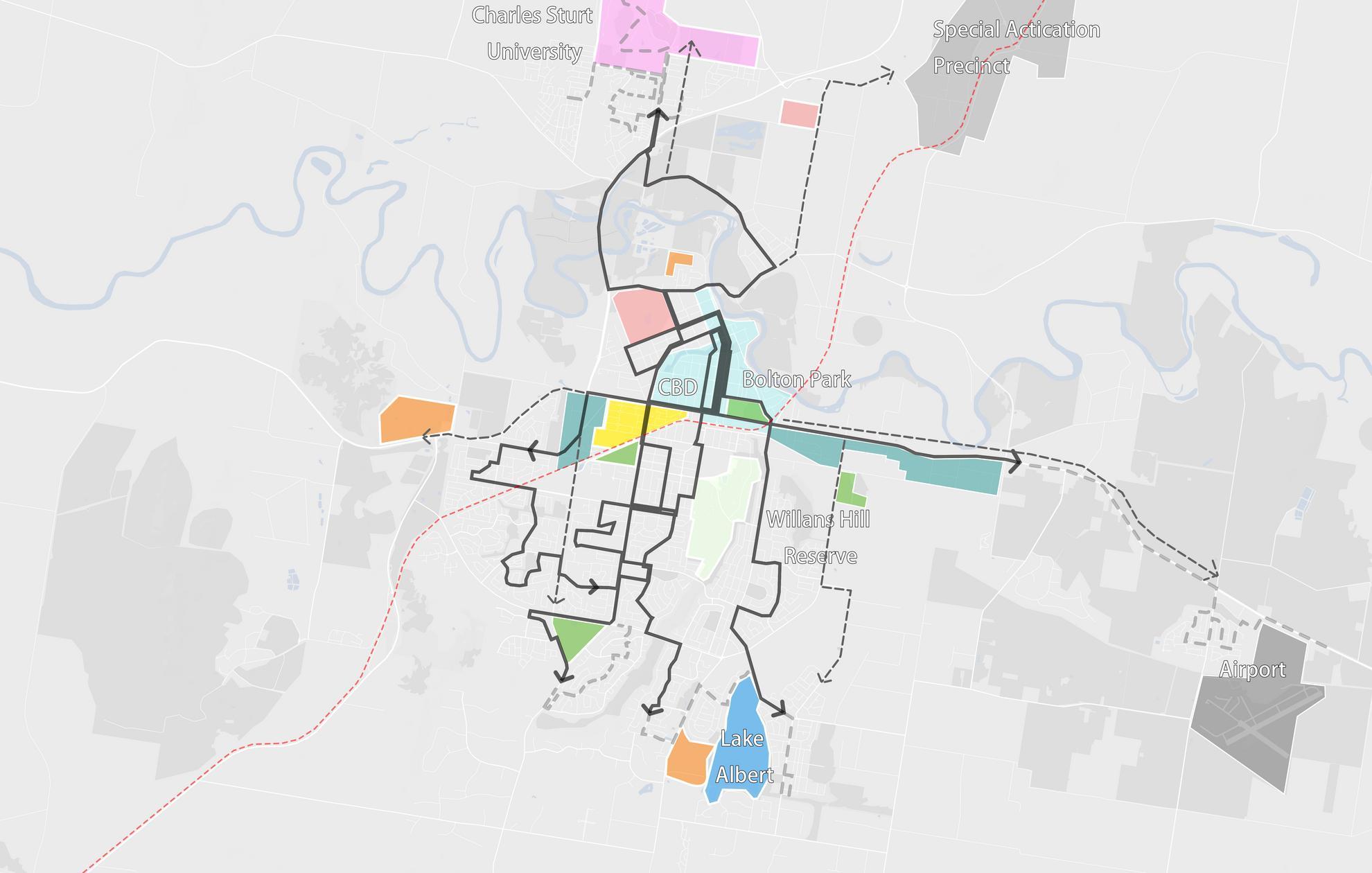
Upon arriving in Wagga Wagga via the high-speed rail (HSR), tourists seeking to visit the golf club, horse race club, or other sports venues will primarily rely on buses for public transportation. While it is possible to reach almost any destination within 15 minutes by car from the HSR station, the influx of tourists brought by the HSR will significantly boost the demand for local public transport.
Currently, Wagga's bus system averages one trip per hour or longer and does not cover several key destinations. To accommodate the travel needs of tourists, a new bus route plan is necessary. The solid line on the map represents the existing 15-minute bus catchment area from the station, while the dotted line indicates the proposed future bus route. This new route will ensure comprehensive coverage and more frequent service, enhancing the overall public transportation network and better serving both residents and visitors.

4.0
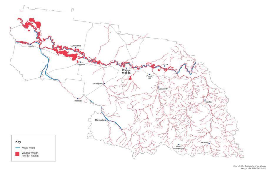
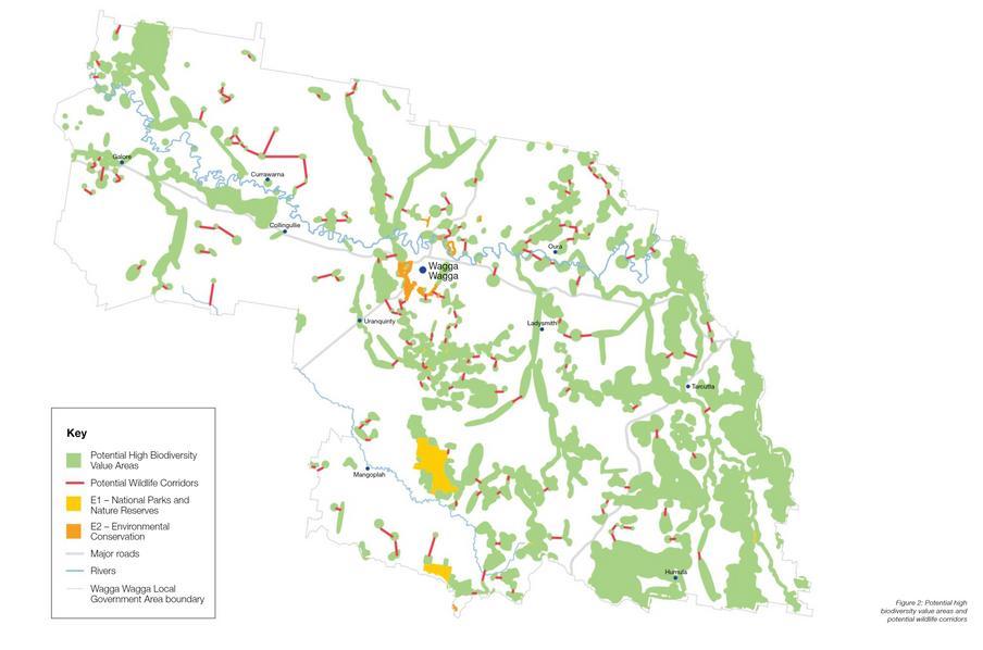
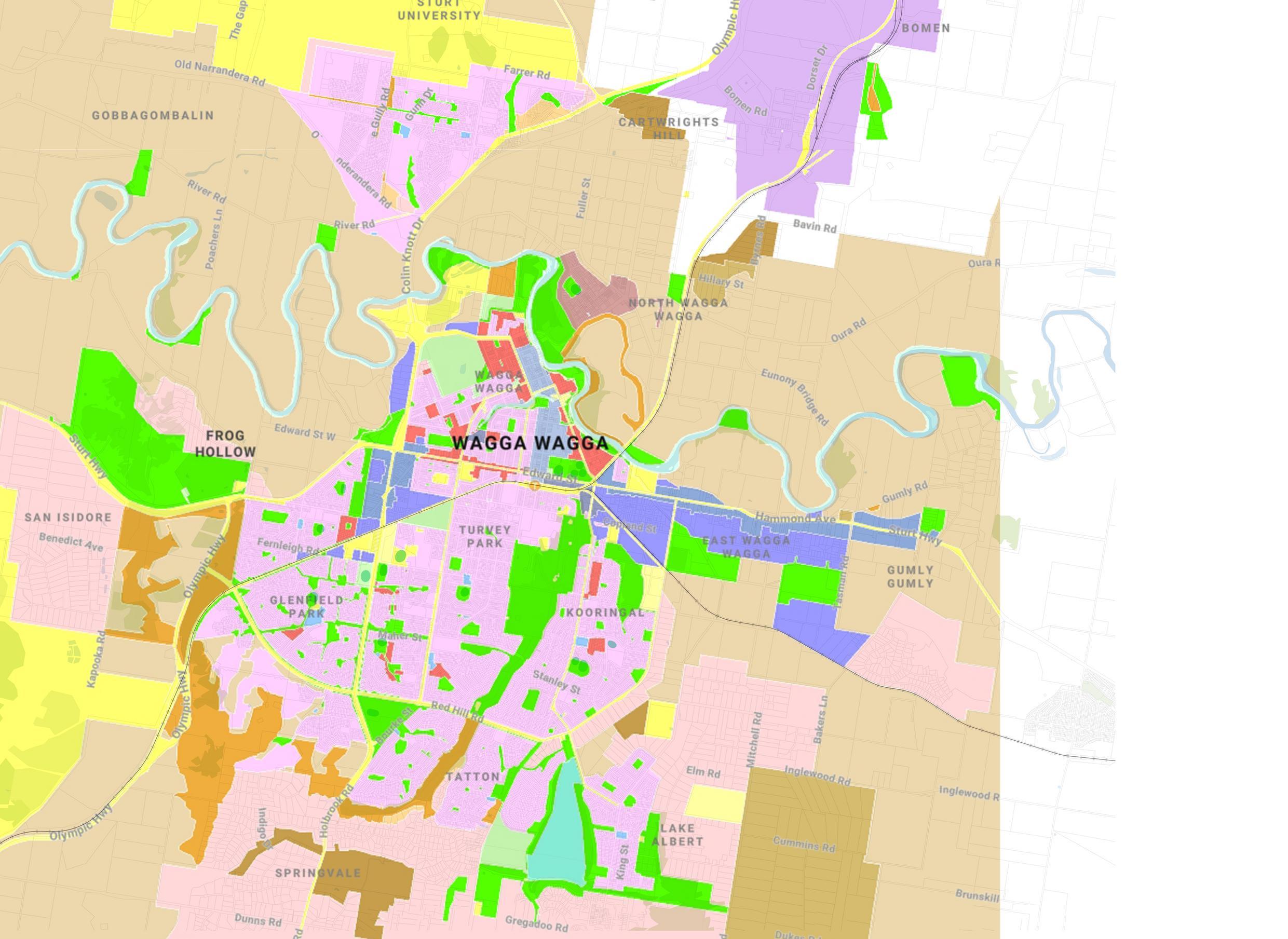
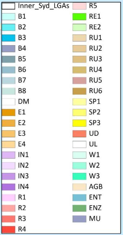
This section provides a spatial analysis of wagga wagga. The section assesses the strengths, weaknesses, opportunities and threats of wagga wagga through Location, Biodiversity, Movement, and Land Zoning. in order to provide guidance for the city's vision and future decision making
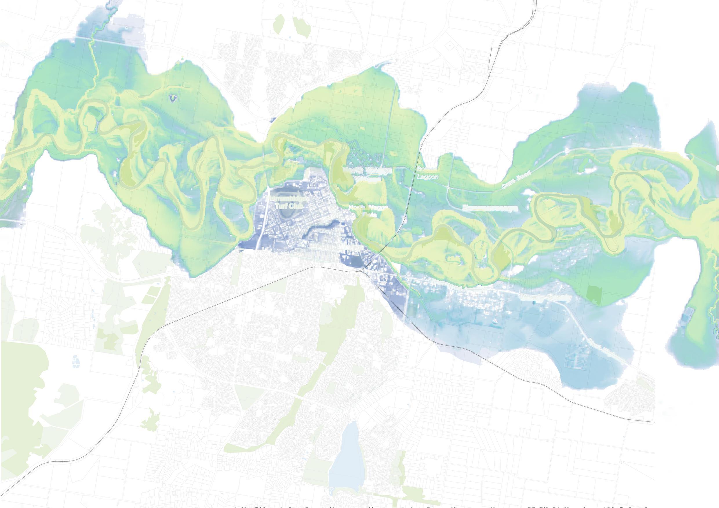
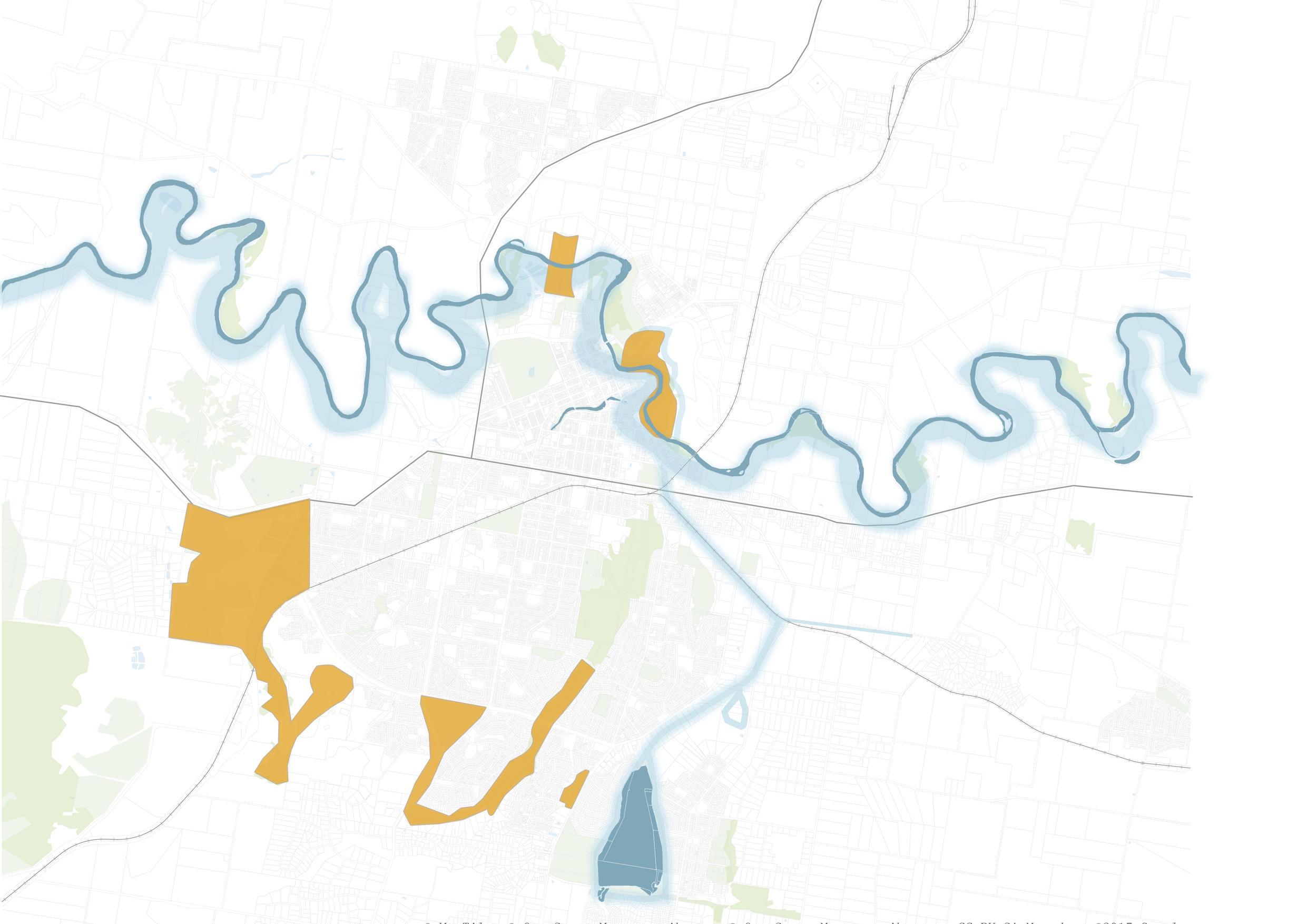
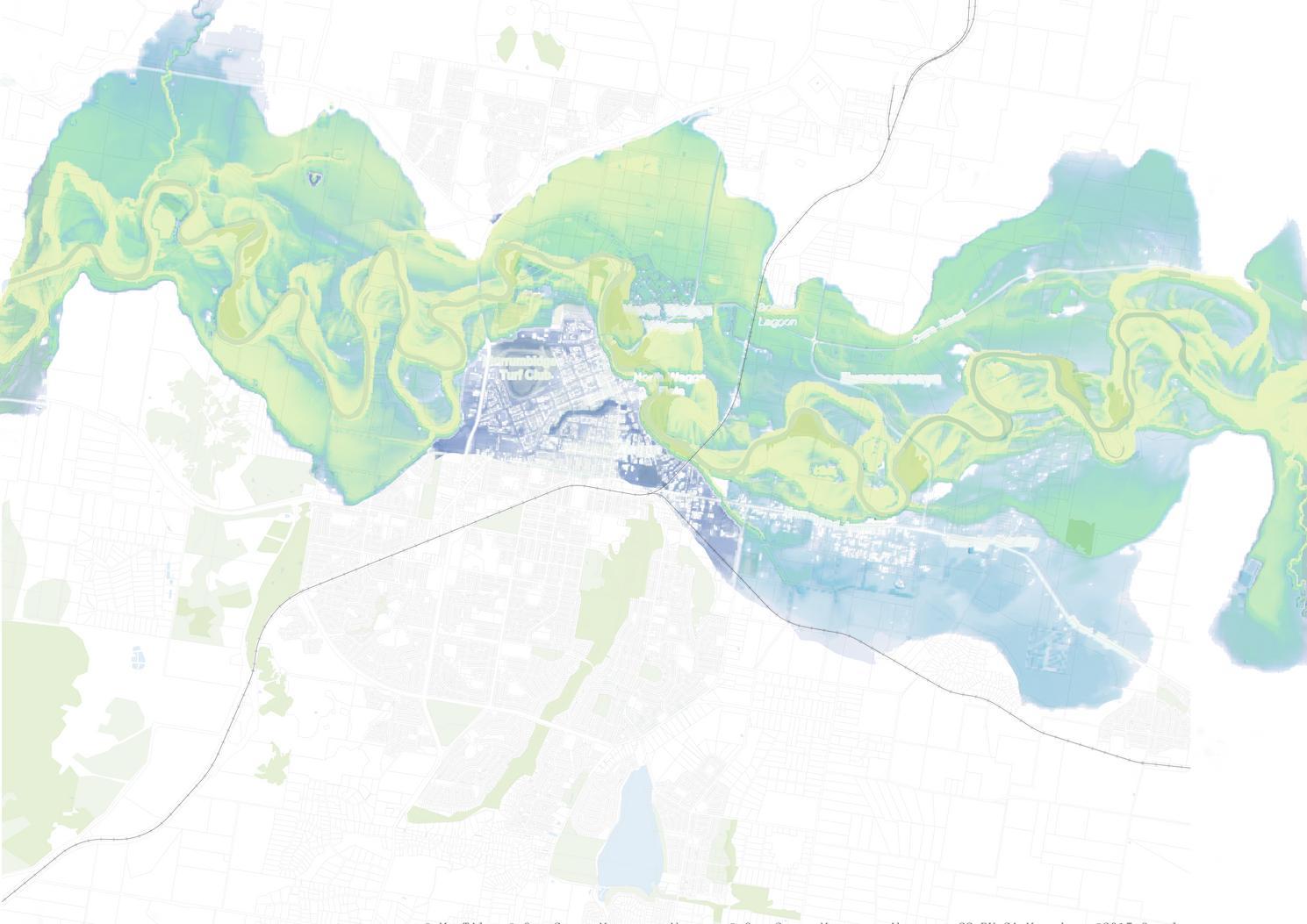
High Likelihood Flood
Medium Likelihood Flood
Low Likelihood Flood
Rare Likelihood Flood

 MARRAMBIDYA WETLAND
LAKE ALBERT


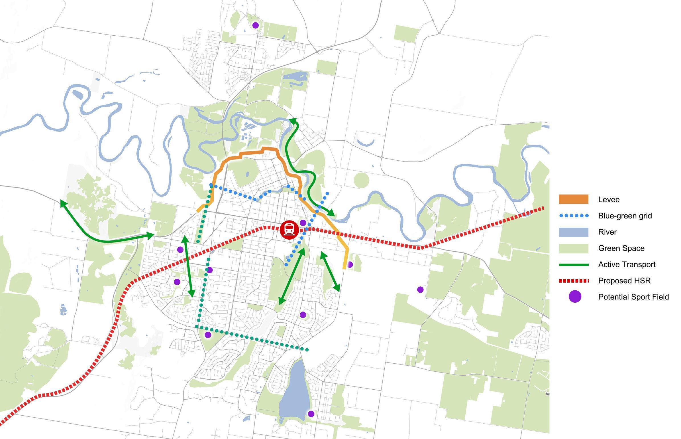




Make Wagga Wagga become a healthy, resilient, well-connected destination, anchored by potential green space and well-established sports facilities.
Four Objectives




Constructing levees to protect the downtown area from flood damage
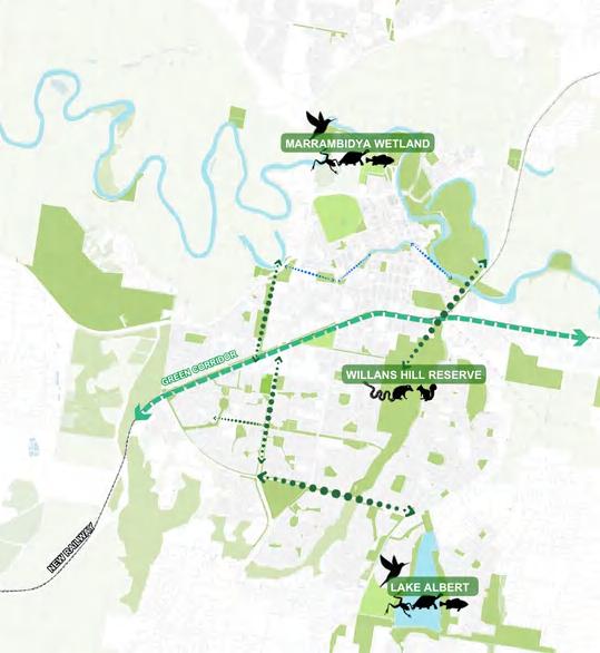
Reconnecting fragmented blue-green networks through green fingers and sewage systems
Establishing a connection with the country involves understanding and respecting the land and its cultural significance, especially to Indigenous communities.


Continuing to promote the sports character of the city by upgrading sports-related industries and delivering sporting events
Promoting active transport by creating a pleasant environment for walking and cycling
Becoming a net zero city by increaing the use of public transport

Creating a 15-minute CBD living area to drive the city's economic and cultural development
Activing community activities through the improvement of public spaces
Increasing diverse housing to accommodate increased population growth
Elevated tracks to increase connectivity between the north and south areas of the city. Adding new footpaths, cycle lanes, bus routes and ensuring diversity of outbound routes.
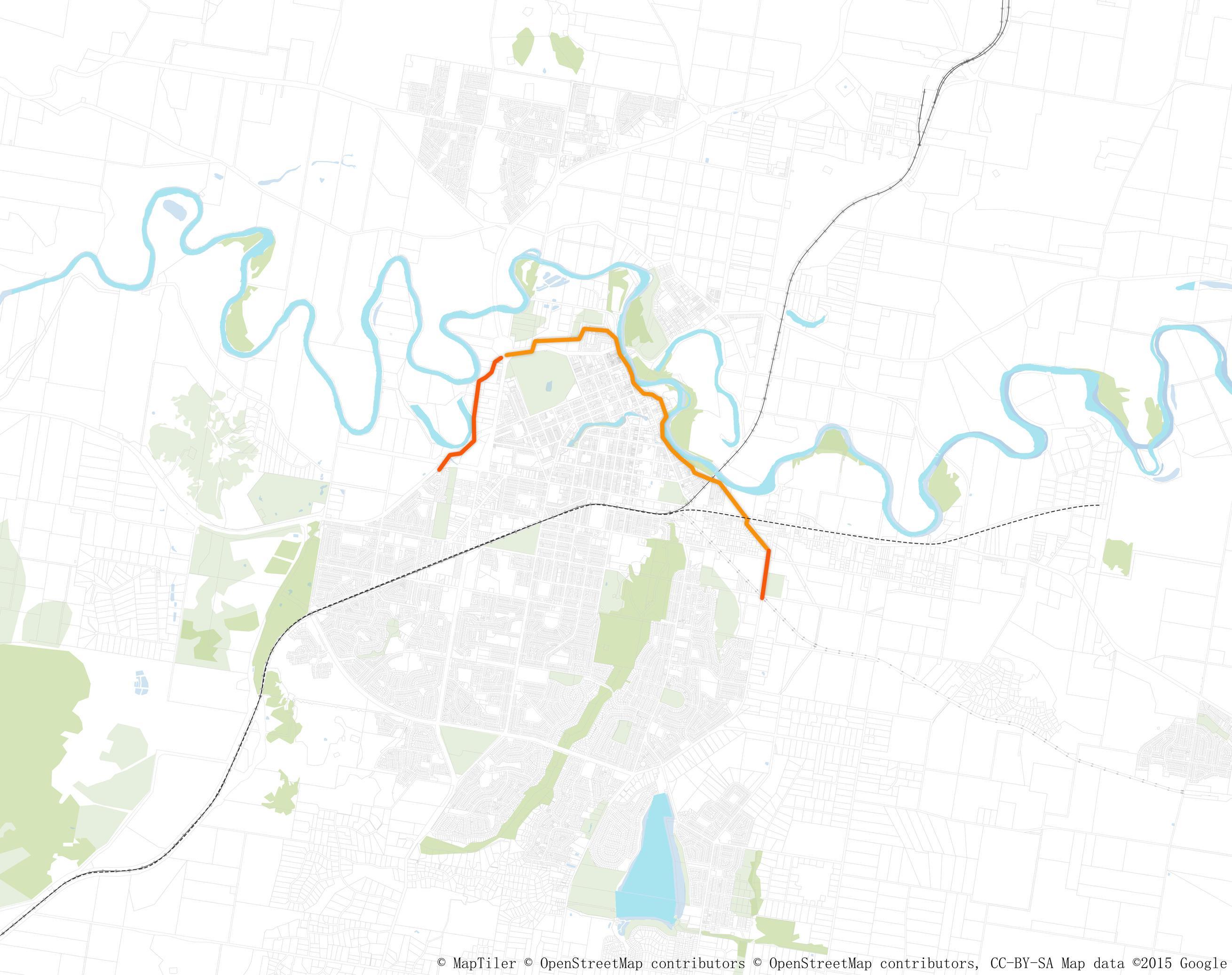

Past flow pattern
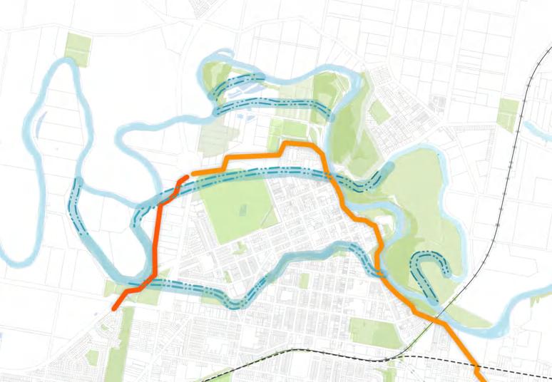
Constructing Levees to Protect the Downtown Area from Flood Damage
Building levees is a crucial measure to shield the downtown area from the devastating impacts of flooding. These structures act as barriers, preventing floodwaters from inundating urban centers and causing extensive damage to infrastructure, properties, and the local economy.
Short stage Long stage


2. Reconnecting Fragmented Blue-Green Networks
It's essential to reconnect disrupted blue-green networks to ensure that natural habitats remain intact and biodiversity thrives. By integrating green fingers (linear parks or greenways) and modernizing sewage systems, we can create continuous ecological corridors that allow wildlife to move freely and ecosystems to function healthily.
3. Connecting with Country
Establishing a connection with the country involves understanding and respecting the land and its cultural significance, especially to Indigenous communities. This approach not only fosters environmental stewardship but also incorporates traditional ecological knowledge into modern practices, enhancing the overall resilience of both natural and human systems.
Green finger
Sewage systems
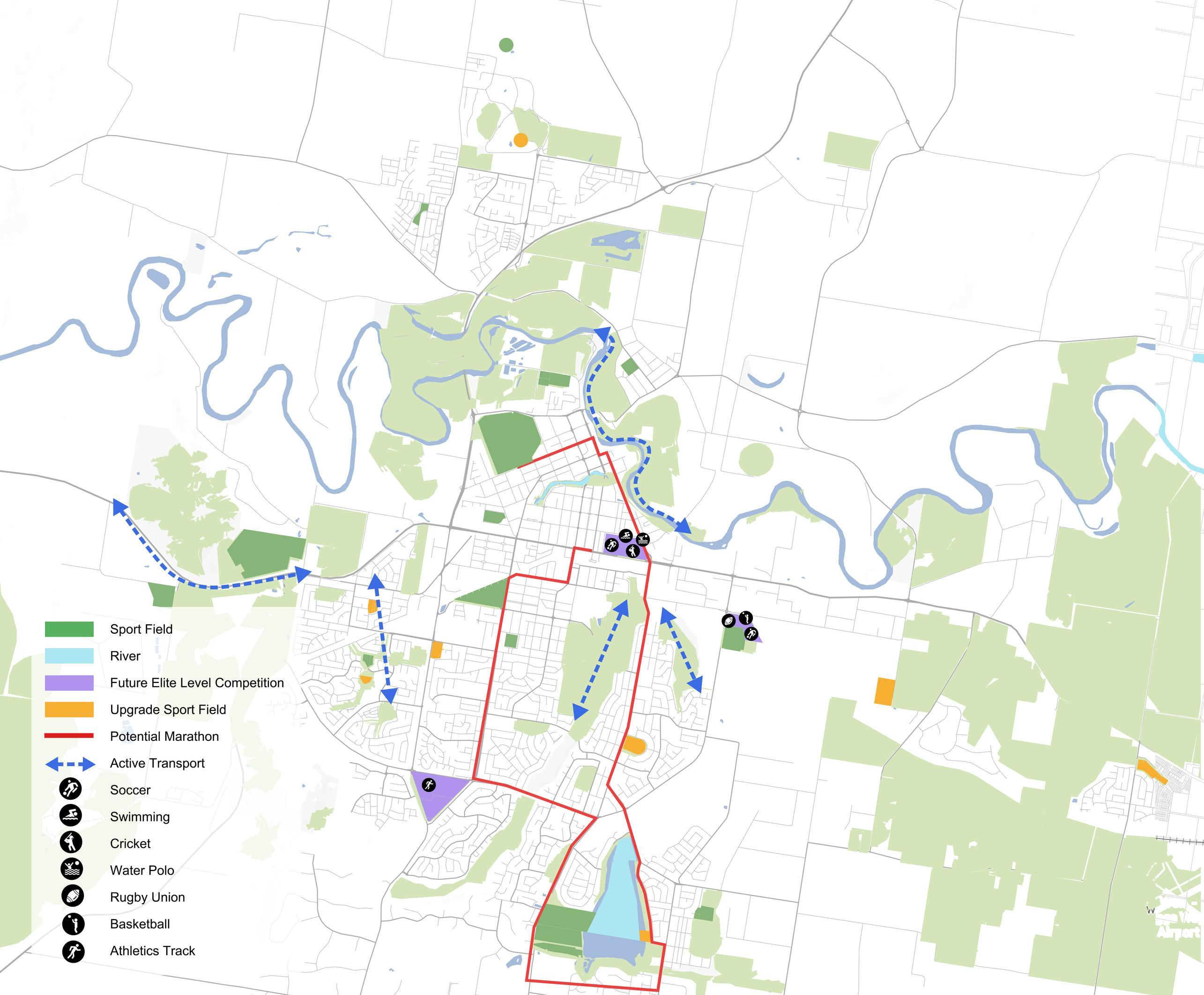
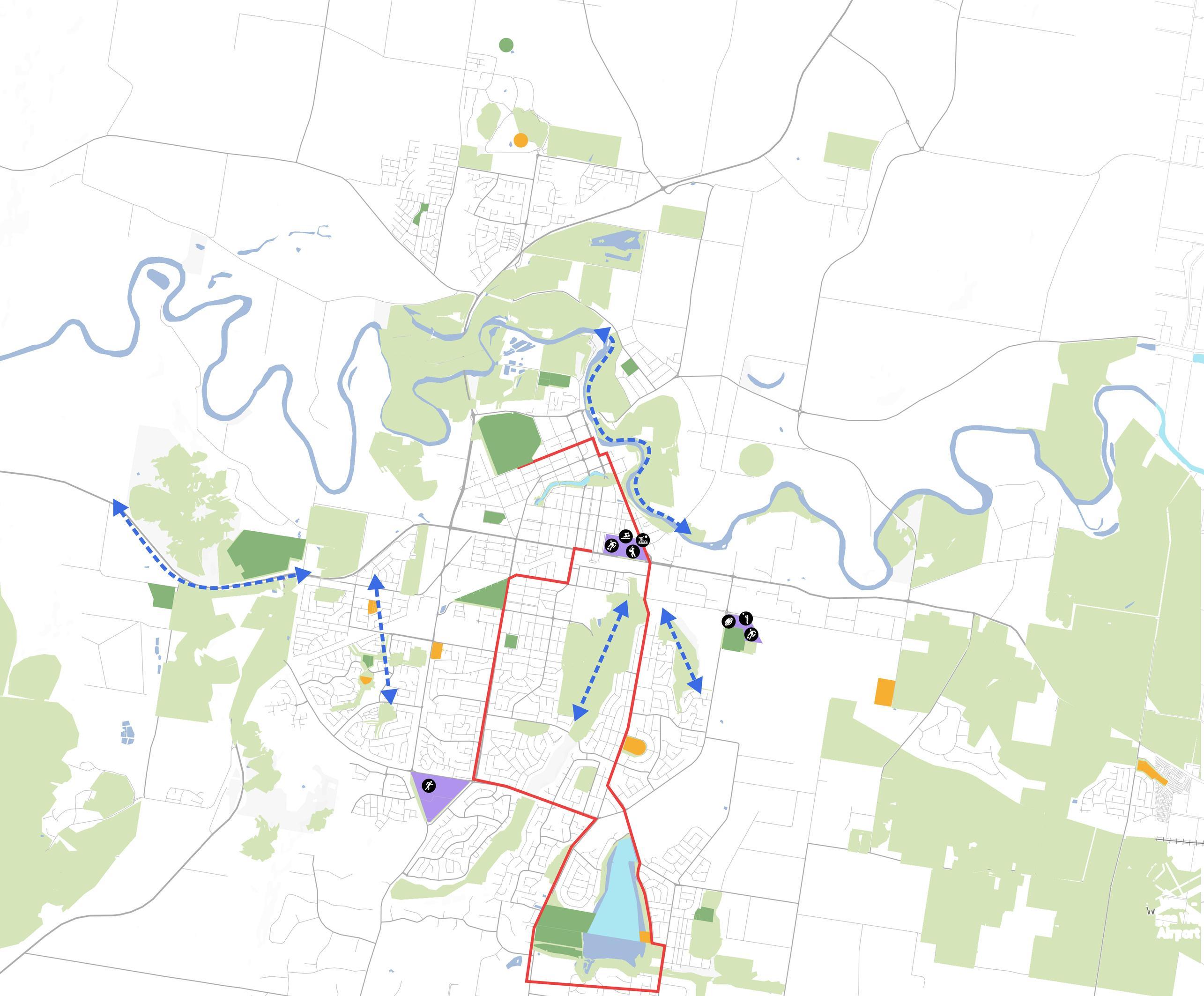
In Wagga Wagga, the identified facility that will have the best capacity to host elite-level competition in the future is purple region. These facilities can be adapted for multiple sporting activities rather than having various underutilised single-purpose assets.
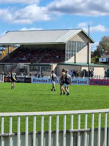
It is planned to maintain and renovate the facilities of the Orange Area sports to provide a high-quality sports venue to meet the needs of different people
Active transportation will connect areas and create shared paths for walkers and cyclists to use, providing a green way to travel
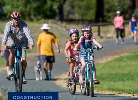
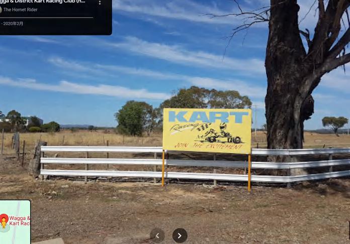
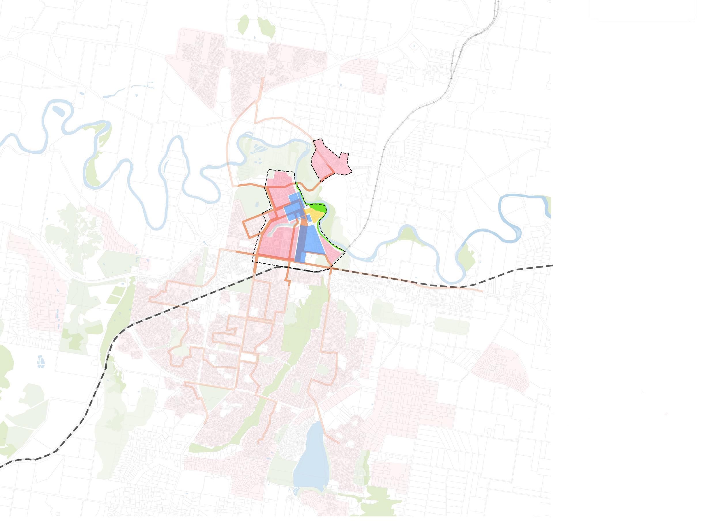


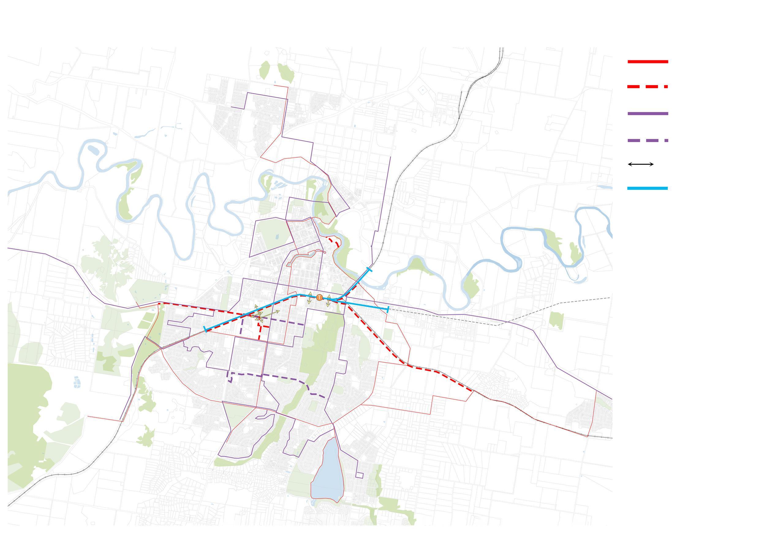
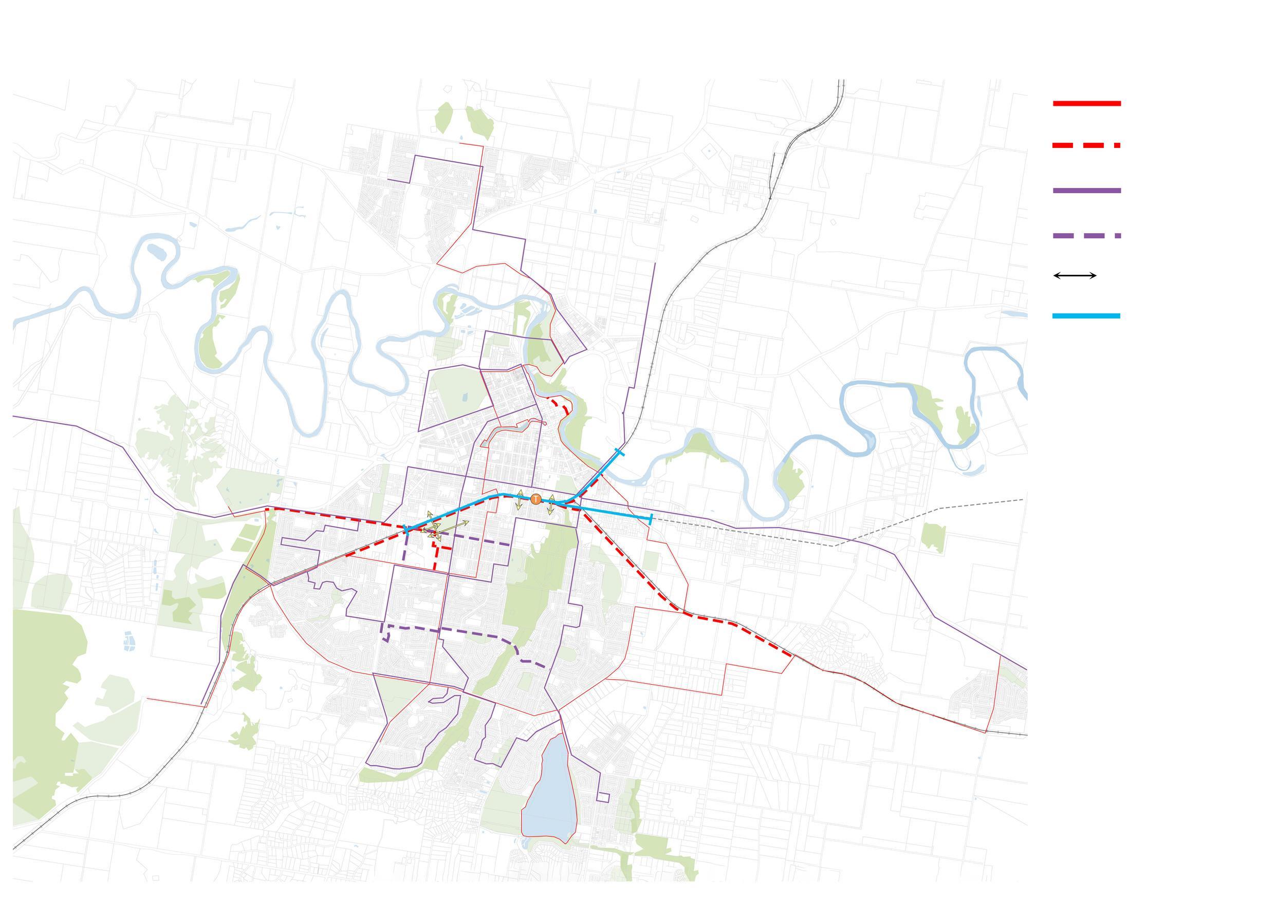


Figure 1 presents the comprehensive structure plan of Wagga City, detailing the design of levees, the integration of the new high-speed rail (HSR) station with the surrounding environment, and the utilization of the space beneath the elevated tracks. The plan proposes three distinct precincts.
The Waterfront Precinct, situated near the Wagga CBD area and the Murrumbidgee River, aims to enhance the waterfront area and its connectivity. The Station Precinct focuses on the new HSR station, incorporating related industries and facilities to create a transportation and economic hub. Lastly, the Health and Knowledge Precinct is designed to foster growth in healthcare and education sectors, supporting a diverse range of services and institutions. The subsequent section will detail the key interventions and strategies to achieve these objectives, ensuring cohesive and sustainable development across all precincts.
6.1
KEY SITE SUMMARY STATION PRECINCT
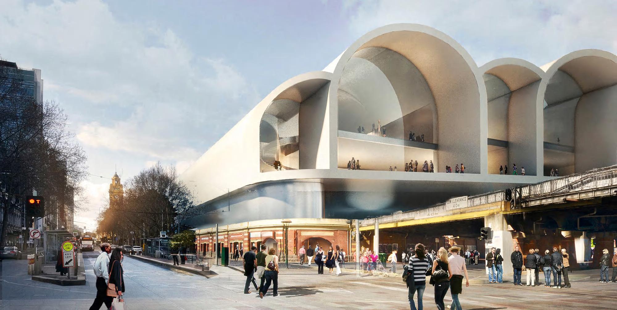
Key Site One builds on the site's existing heritage building and focuses on the relation between the north and south side for pedestrians, enhance connectivity. This is achieved by connecting main streets, increasing the types of buildings, upgrading and elevating the exising station. To better realise the goal of building a 15-minute city. https://www.archdaily.com/413042/the-flinders-street-station-shortlisted-proposal-hassell-herzog-and-de-meuron/5202a3abe8e44ebcd300013c-the-flinders-street-station-shortlisted-proposal-hassell-herzog-and-de-meuron-image?next_project=no
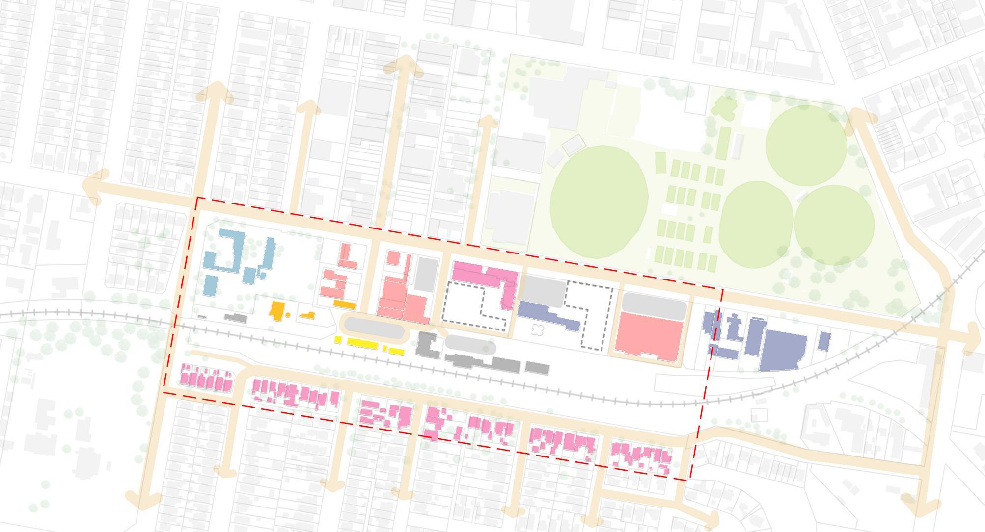
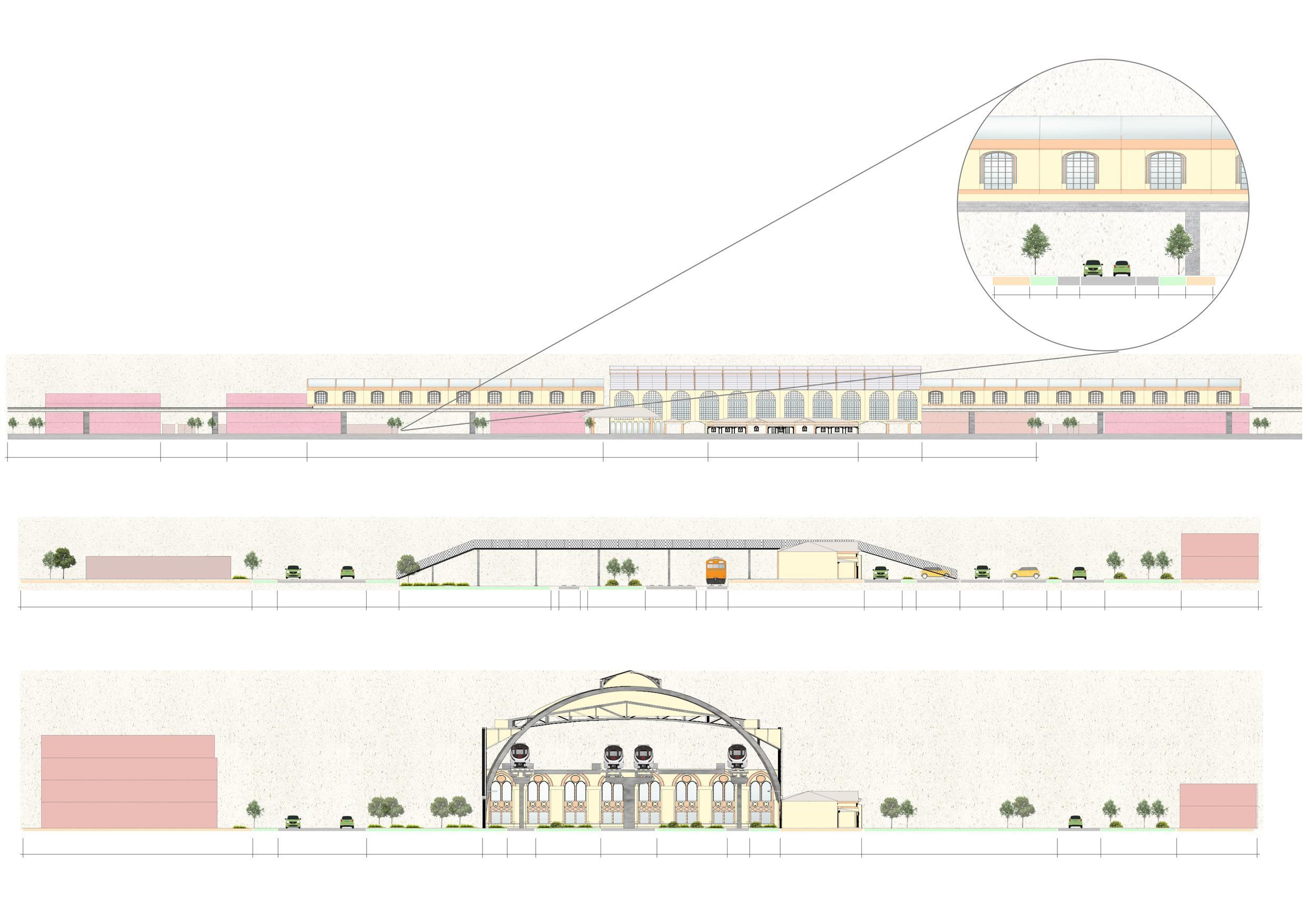
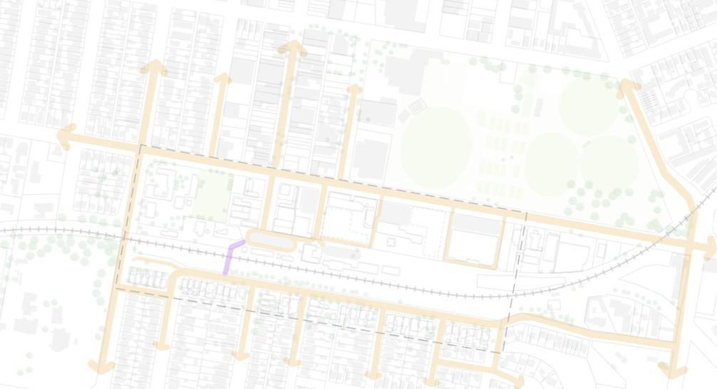

A new road linking Flinders Street and Baylis Street has been added to the west side of the station. This road is located under the railway tracks and greatly facilitates access to the north and south. The new design optimises traffic while enhancing the overall environment around the station, making it more accessible and friendly. The construction of new roads and bridges breaks the existing traffic bottlenecks and improves the accessibility of the area, facilitating the daily lives of residents and the travelling needs of tourists. This initiative not only improves traffic flow around the station, but also further strengthens the station's function as a regional transport hub.


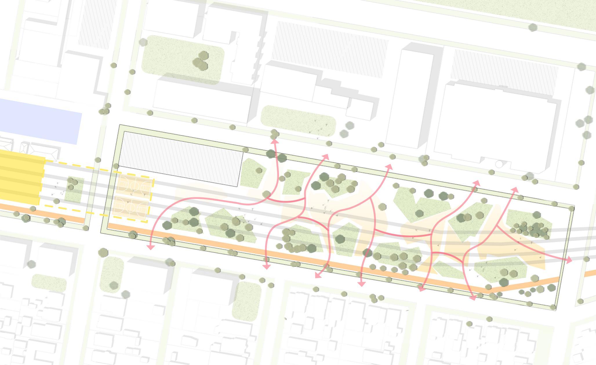


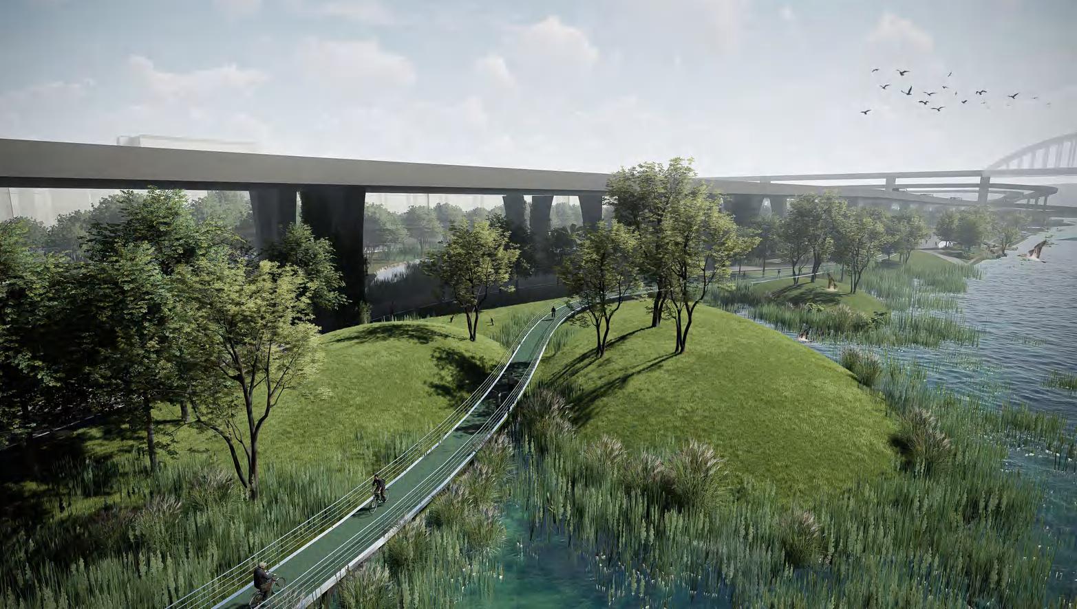
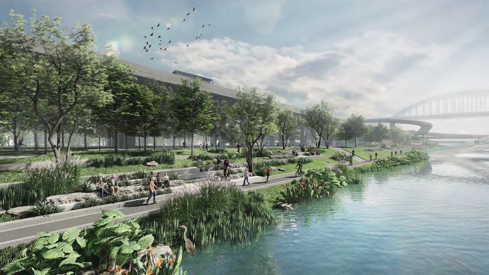
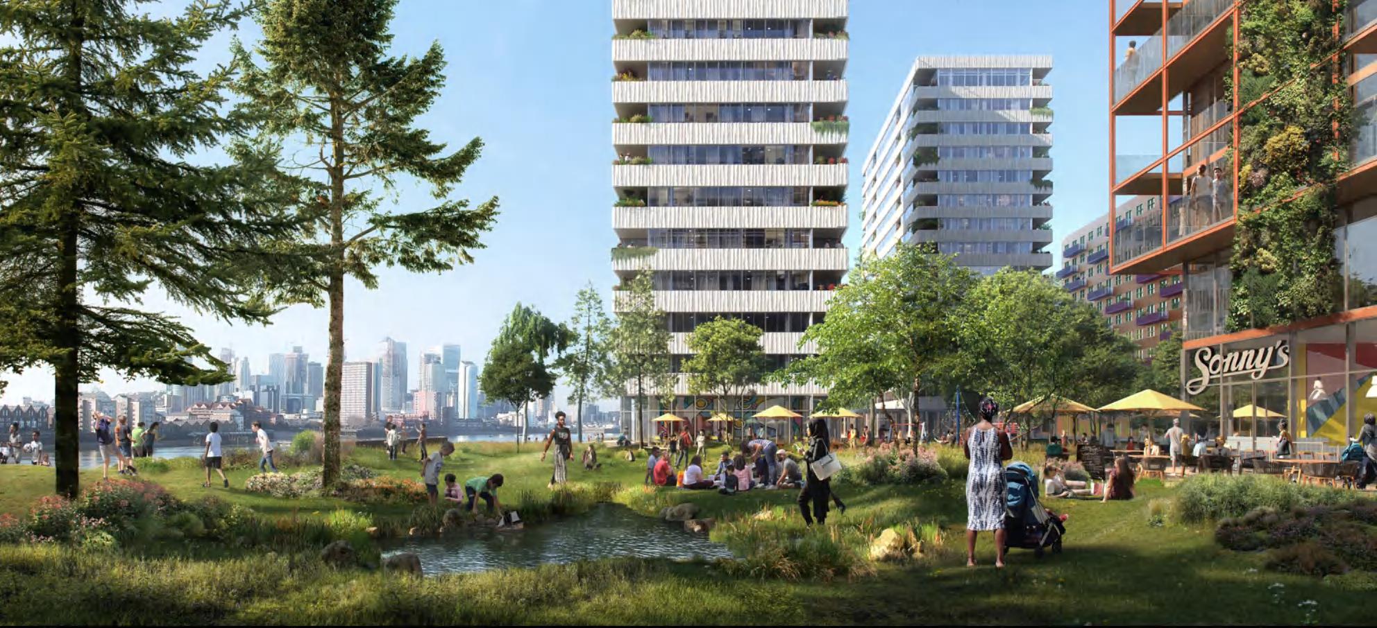
The second key initiative involves utilizing the space beneath the elevated tracks. With the tracks raised, this area becomes activated and available for development. The proposal includes transforming this space into a public park equipped with relevant facilities. This transformation will enhance connectivity, particularly for pedestrians, and offer a communal space for residents. Additionally, a cycle path will be integrated along the track, expanding the cycling network and encouraging the use of active transportation.
Section A illustrates the spatial relationship between the road, pedestrian path, cycle path, and the elevated tracks. View 1 provides a visual representation of the intended environment, showcasing the envisioned public space and its amenities. This approach not only improves accessibility and connectivity but also fosters a vibrant community atmosphere by repurposing the previously underutilized area.
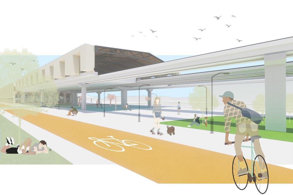
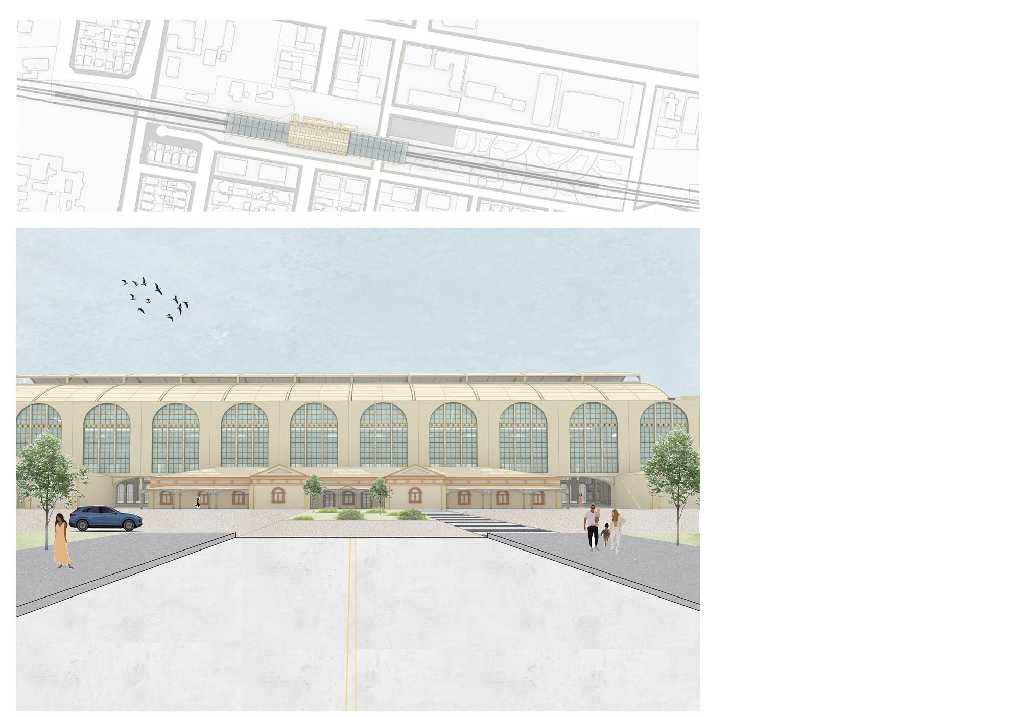
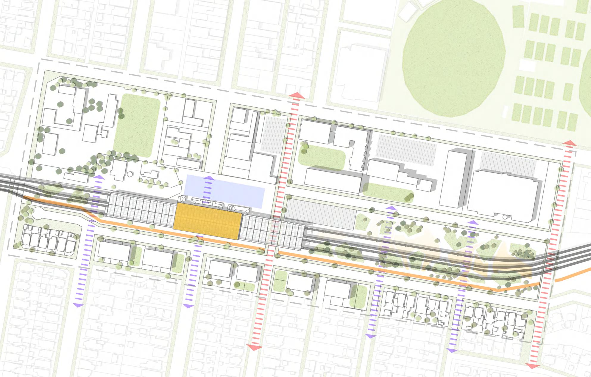


The strategic development plan focuses on three key initiatives to enhance the station precinct. First, pedestrian connectivity will be significantly improved by elevating the tracks and transforming the space beneath into a public park. This newly activated area will serve as a communal space, fostering social interactions and providing essential amenities.


Third, the preservation and adaptive reuse of heritage buildings will be prioritized, maintaining their historical significance while integrating them as active landmarks within the community. This approach not only honors the area's cultural heritage but also enhances its appeal and functionality.


Second, the underutilized spaces will be repurposed to diversify the building types, incorporating retail outlets, hotels, offices, and apartments. This mixed-use development will create a dynamic and economically vibrant environment.
KEY SITE SUMMARY HEALTH AND KNOWLEDGE PRECINCT
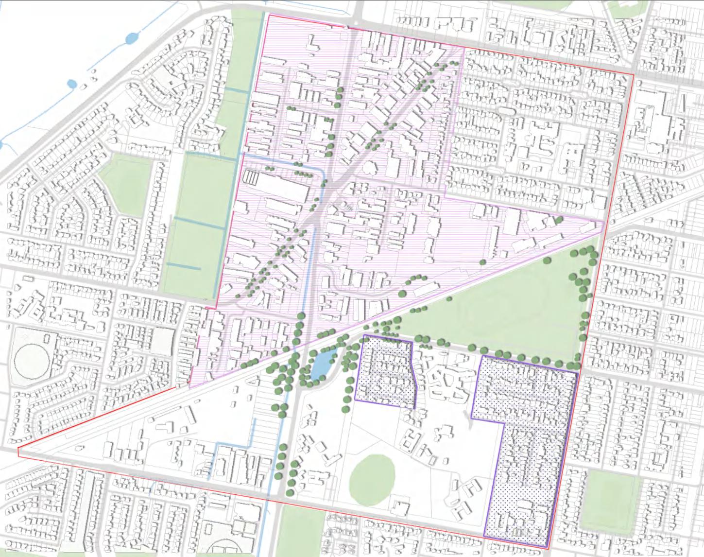
Key Site Two builds on the site's existing health and knowledge precinct and focuses on the relation between two sides of the existing railway corridor, enhancing connectivity. This is achieved by building new stadiums, rezoning the functional areas, increasing the types of buildings, providing more high-quality green open space, and elevating the existing railway corridor. To better realise the goal of building a 15minute city.
Key Observations


Public streets / roads
Building Scale Disparity: The production area features larger industrial buildings, while the residential area consists of smallerscale housing structures. This difference in scale creates a visual and functional separation between the two areas.
uilding Scale Disparity: The roduction area features larger ndustrial buildings, while the esidential area consists of smallercale housing structures. This ifference in scale creates a visual nd functional separation between he two areas.
edestrian Connectivity Issues: The ailway line creates a north-south ivide, limiting pedestrian movement. urrently, pedestrians can only cross he railway at Pearson Street and ourke Street, both of which offer oor crossing experiences.
Pedestrian Connectivity Issues: The railway line creates a north-south divide, limiting pedestrian movemen Currently, pedestrians can only cros the railway at Pearson Street and Bourke Street, both of which offer poor crossing experiences.
solation of the Production Area: The roduction area is surrounded by esidential zones, yet it lacks essential menities such as supermarkets to meet the daily needs of its workers nd nearby residents.
Isolation of the Production Area: Th production area is surrounded by residential zones, yet it lacks essenti amenities such as supermarkets to meet the daily needs of its workers and nearby residents. Key Observations

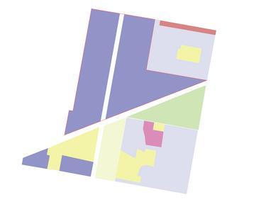
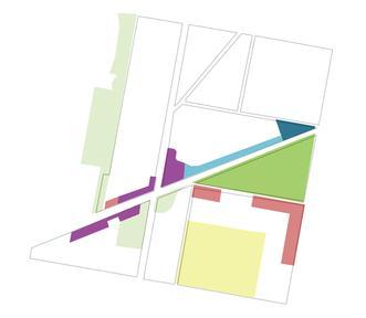
Land use design process
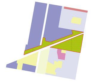

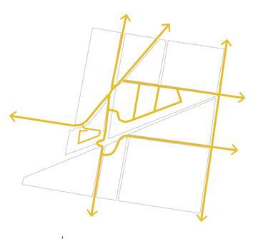
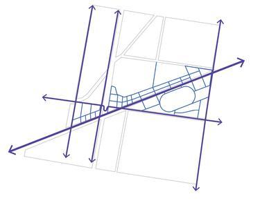
Street and block design process
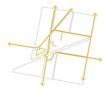
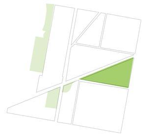
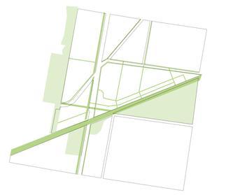
Green and blue network design process
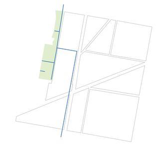

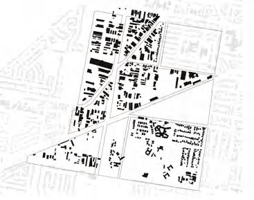
Building form design process
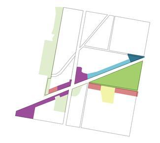
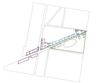
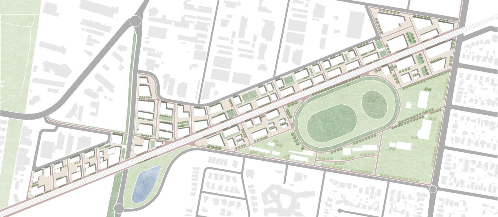
The current design retains the production zone due to its significant contribution to local employment. To bridge the gap between the production zone and the residential area, a buffer zone will be introduced. This buffer zone will provide essential facilities to meet daily needs, enhancing the overall functionality of the area.
Additionally, mid-size mixed-use office areas will be introduced between the large factory buildings and smaller houses. This will create a smoother transition between different building scales, fostering a more cohesive and integrated urban environment. By addressing these critical aspects, the design aims to enhance connectivity, provide necessary amenities, and create a more integrated and functional urban landscape.

Driveway
Footpath
Parking lots
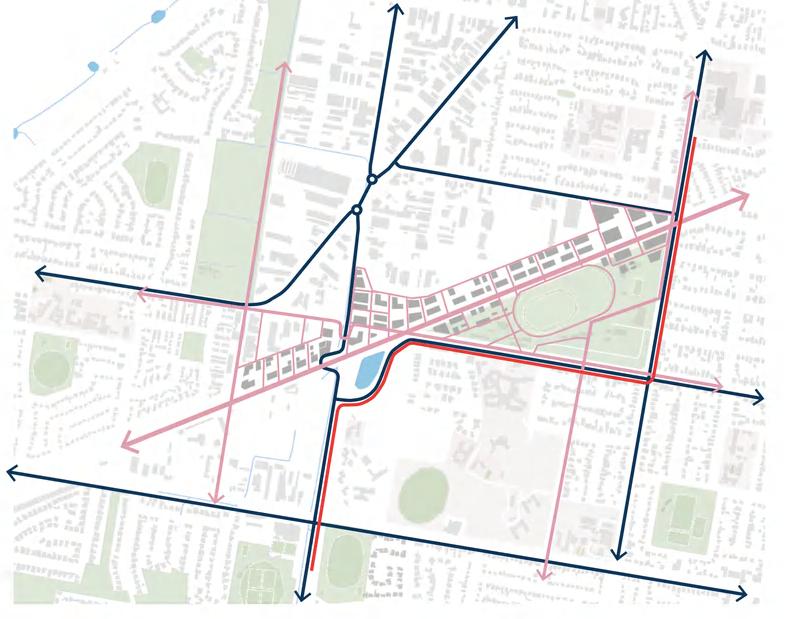
Bus Rapid Transit (BRT)
Proposed bus stop
The proposed design elevates the railway, allowing pedestrians and cyclists to traverse the site through a green corridor beneath the tracks, thereby enhancing connectivity.
To improve vehicular flow and safety, the internal roads north of the railway have been extended, with parking areas situated on the northern side, adjacent to the railway. This configuration restricts vehicle access near the railway on the southern side, better protecting pedestrian and bicycle pathways.
Public streets / roads
Green space
A buffer zone will be established between the production and residential areas, featuring a dense pedestrian network. The primary green corridor will extend from the railway into the site, creating an ecological belt. This green network will serve as a crucial ecological link and recreational space, promoting environmental sustainability and enhancing the overall quality of urban life.
By integrating these elements, the design aims to foster a seamless transition between different urban zones, improve safety, and promote ecological and social sustainability.


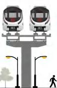




The railway corridor will have a total width of 30 meters. The central 10 meters will be dedicated to the elevated railway, with the ground level below utilized for various community amenities such as children's play areas, skate parks, and other recreational activities for residents.


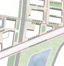
Flanking the central section, each side will feature a 7.5-meter-wide green space. These green areas will primarily consist of landscaped greenery, interspersed with pedestrian paths and bicycle lanes. This layout will provide safe and enjoyable routes for walkers and cyclists, further enhancing the connectivity and usability of the site.


With the core concept of people and nature, the west side of the site strengthens the planning layout of residential apartments (5-8 floors) and retail (1-2 floors). The central area of the site contains new office buildings and retail (1-2 floors), as well as green facilities, with building heights ranging from 3 to 8 floors. As for the east side of the site, the gymnasium area and the supporting sports rehabilitation area are planned. The building height in this area is relatively low, mainly distributed between 3 and 5 floors. Through these plans, it is aimed to achieve the multifunctionality and sustainable development of urban space, provide residents with a convenient living environment, and promote a benign interaction between the community and nature.
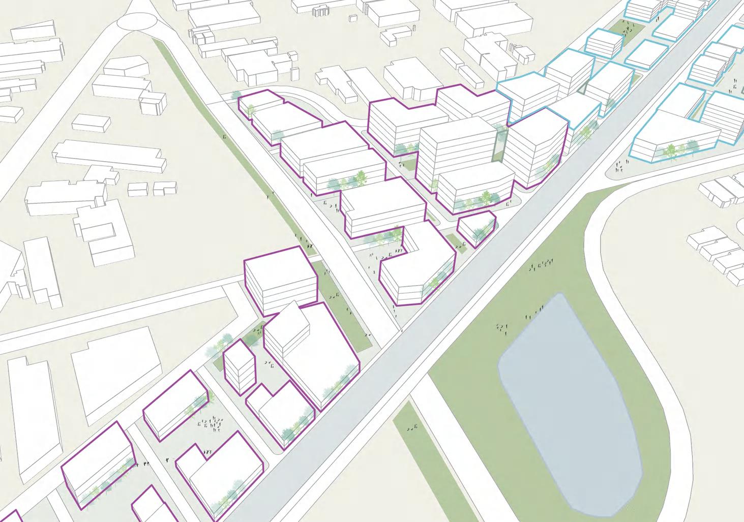

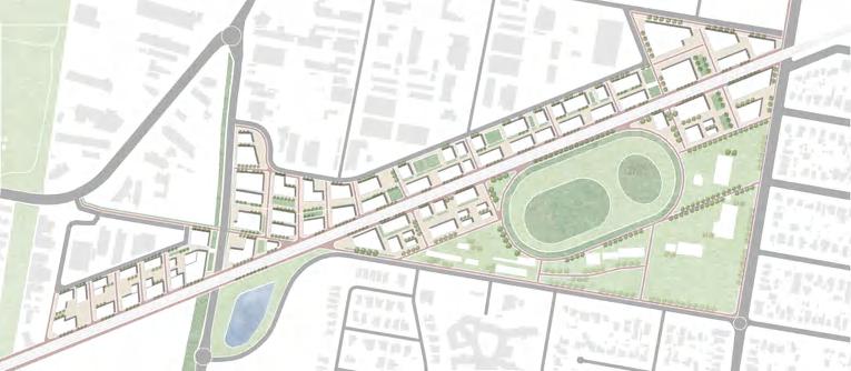
The green finger will be built along the creek. The green corridor underwent a meticulous revitalization effort, transforming into a verdant sanctuary adorned with diverse plant life and thoughtful amenities, enhancing both its beauty and functionality for the community to enjoy. This effort resulted in not only the corridor's beautification but also the revitalization of its ecological balance, creating a sustainable urban oasis that enriches both the environment and the lives of those who frequent it. A deeper connection between people and nature has been fostered, ensuring that the green corridor stands as a testament to the transformative power of community-driven environmental stewardship.

KEY SITE SUMMARY WATERFRONT PRECINCT 6.3
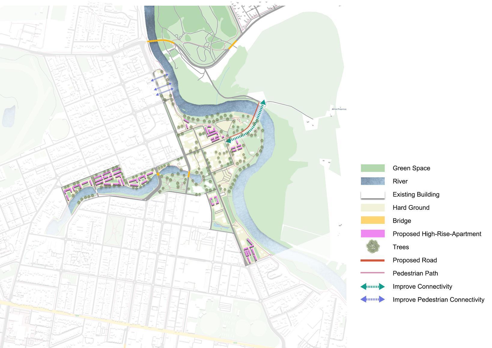
Key Site Three builds on the site's existing conditions and focuses on the Murrumbidgee River to create potential spaces and enhance connectivity. This is achieved by improving people's interaction and engagement with the Murrumbidgee River, particularly along the river corridor and the 15-minute core area in the CBD.
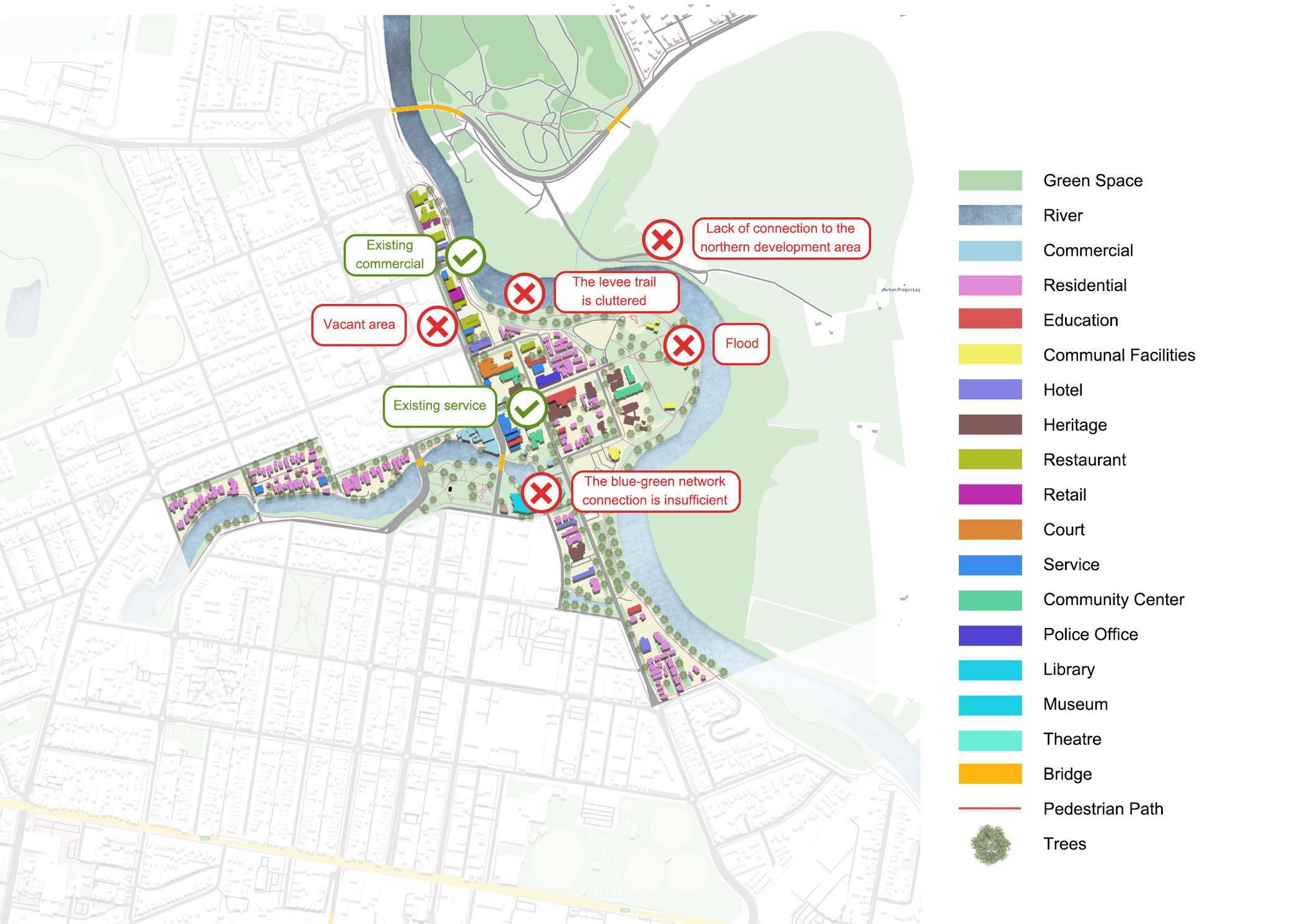
The site is located in the CBD, which has many public service facilities, education, and different types of building uses. However, the existing footpath adjacent to the river is not good, preventing pedestrians from directly accessing the river due to the obstructive embankment wall. There is a notable lack of connectivity between the CBD and the Murrumbidgee River North development area. Additionally, the integration of the blue-green network is insufficient.
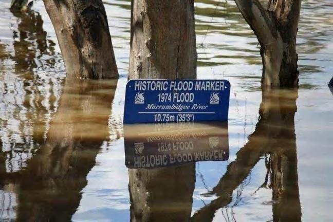
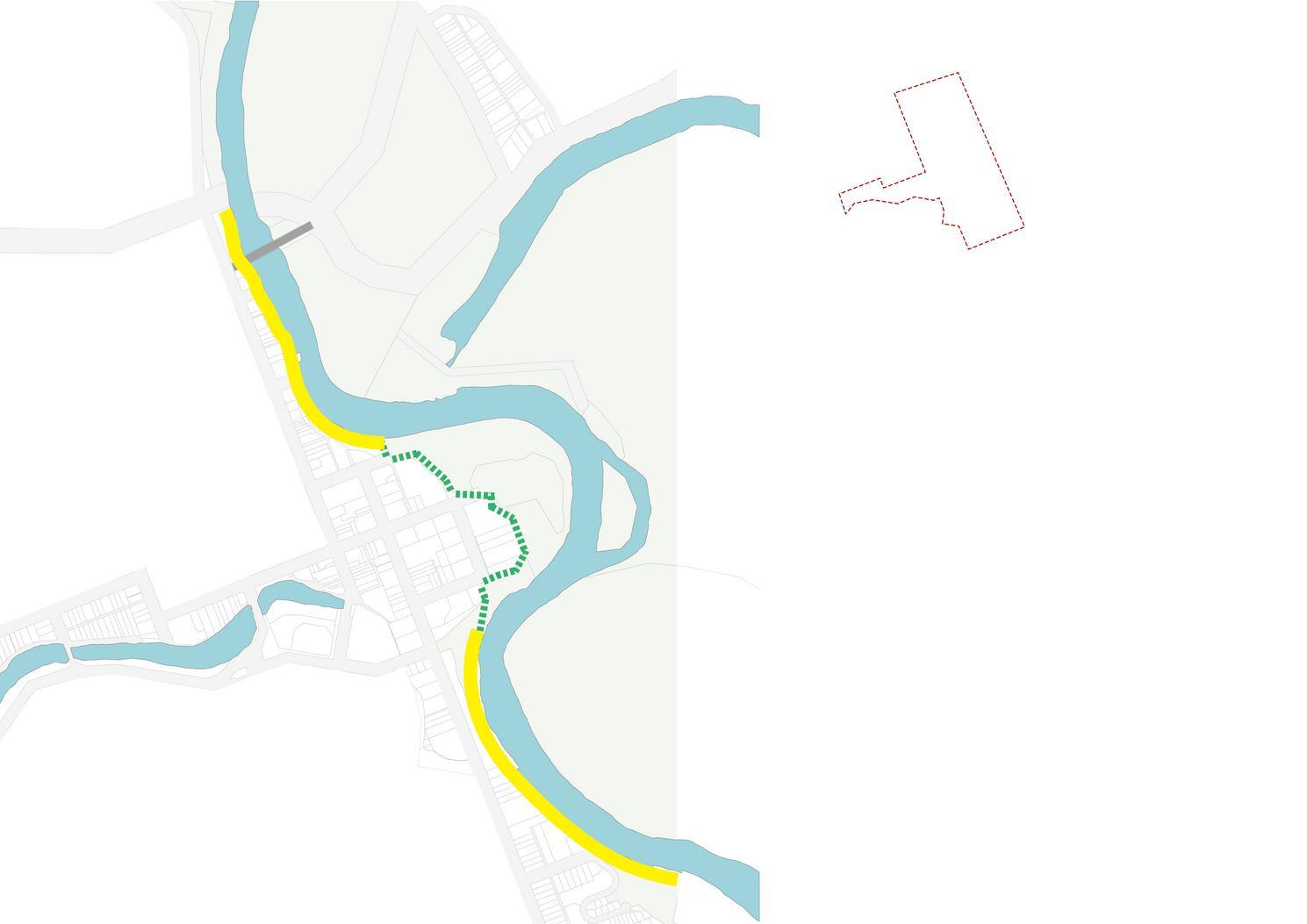
Soft boundary levee
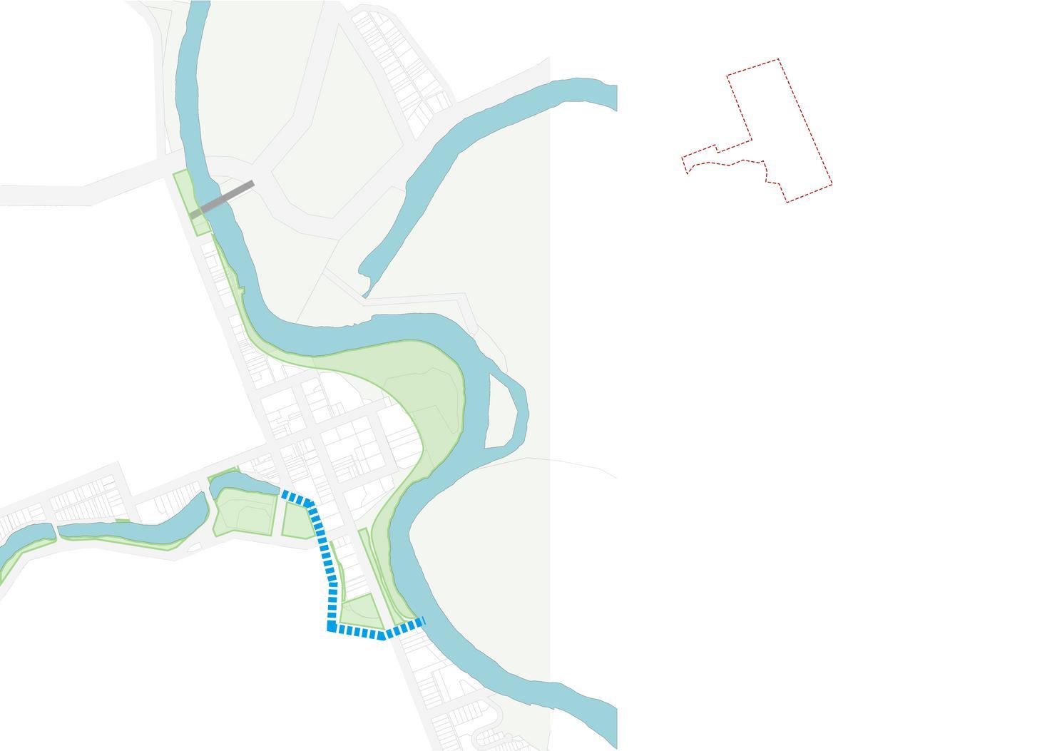
Connecting the blue-green network & Transforming the beautiful walk along the river
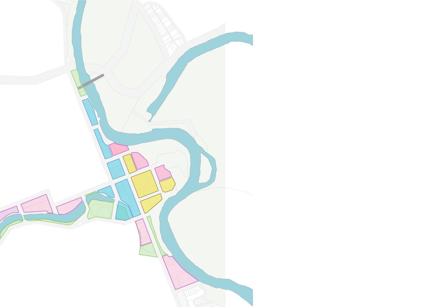
15 minutes core area in CBD
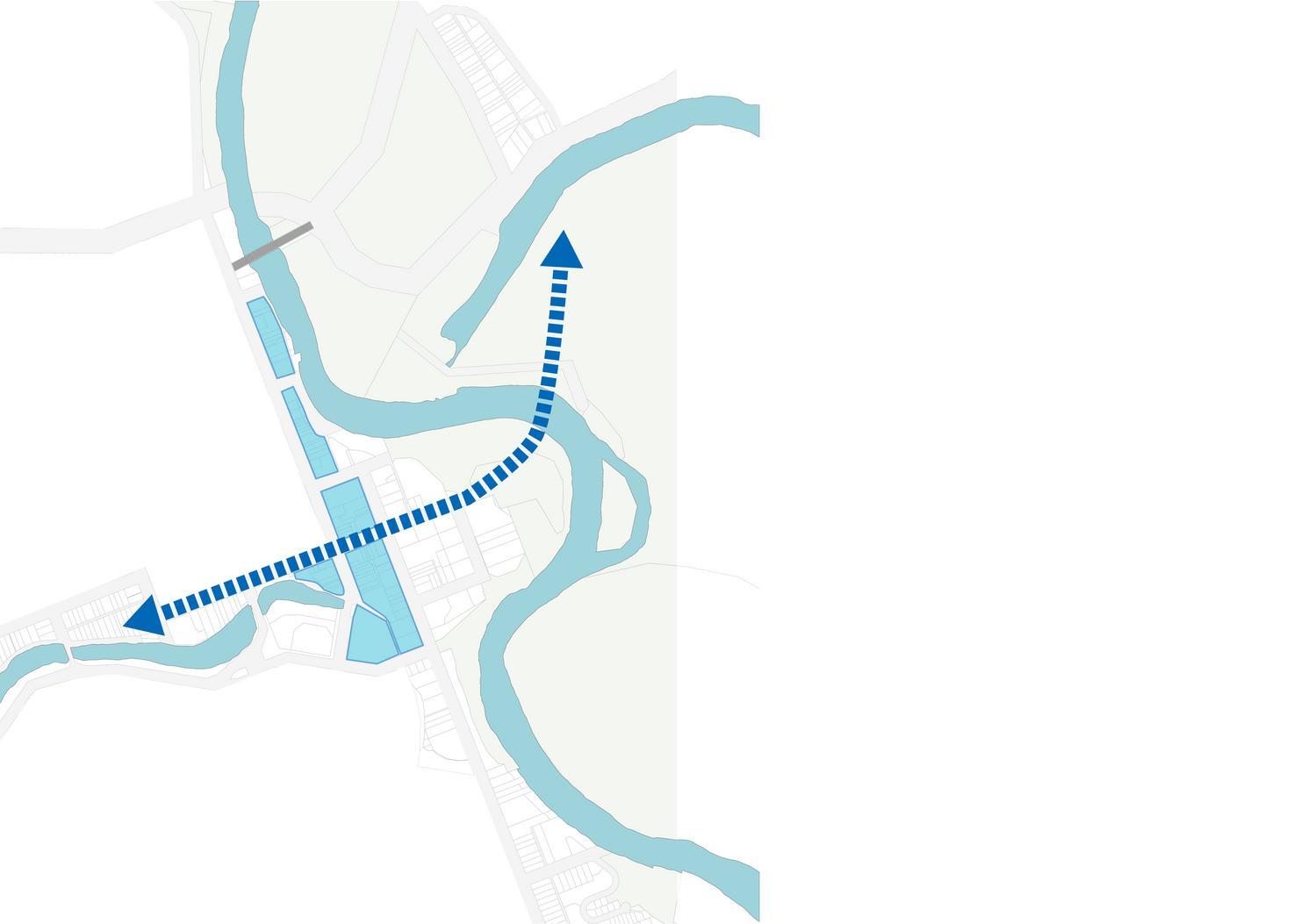
Adding a cross-river road link to the North Wagga
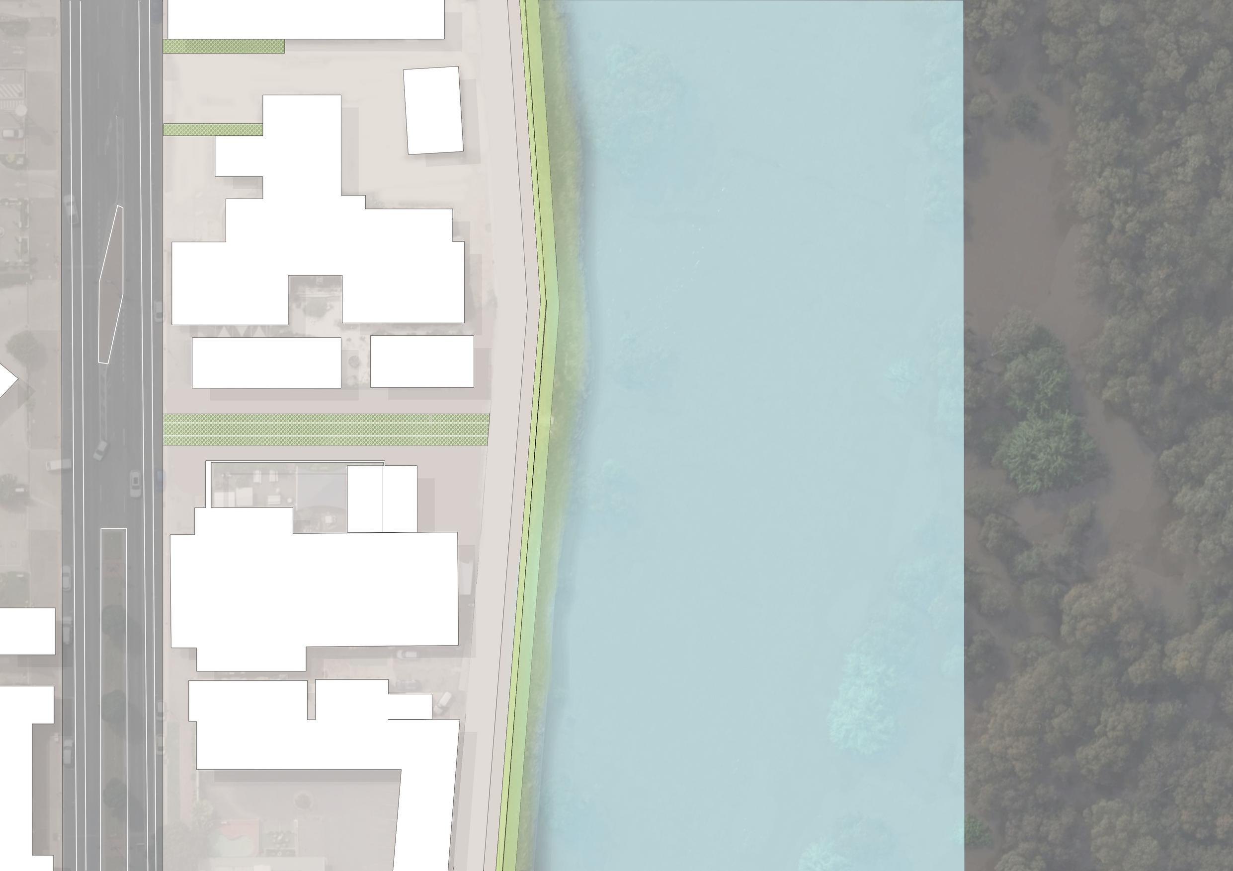
The original wall was transformed into a sloped grassy area, facilitating movement for individuals around the grassy expanse and the riverfront.
Connect the blue-green network to create a continuous ecological corridor and connect with the country. Create an excellent river walk to enhance the interaction between man and nature
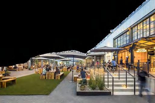
With the CBD as the focal point, the proposal includes adding high-rise apartments, some of which are situated near the river, to create convenient and comfortable living areas.
The proposed river crossing road will increase connectivity between the southern development area and the northern commercial centre
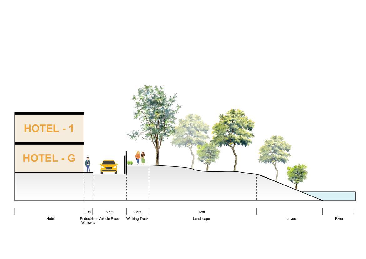
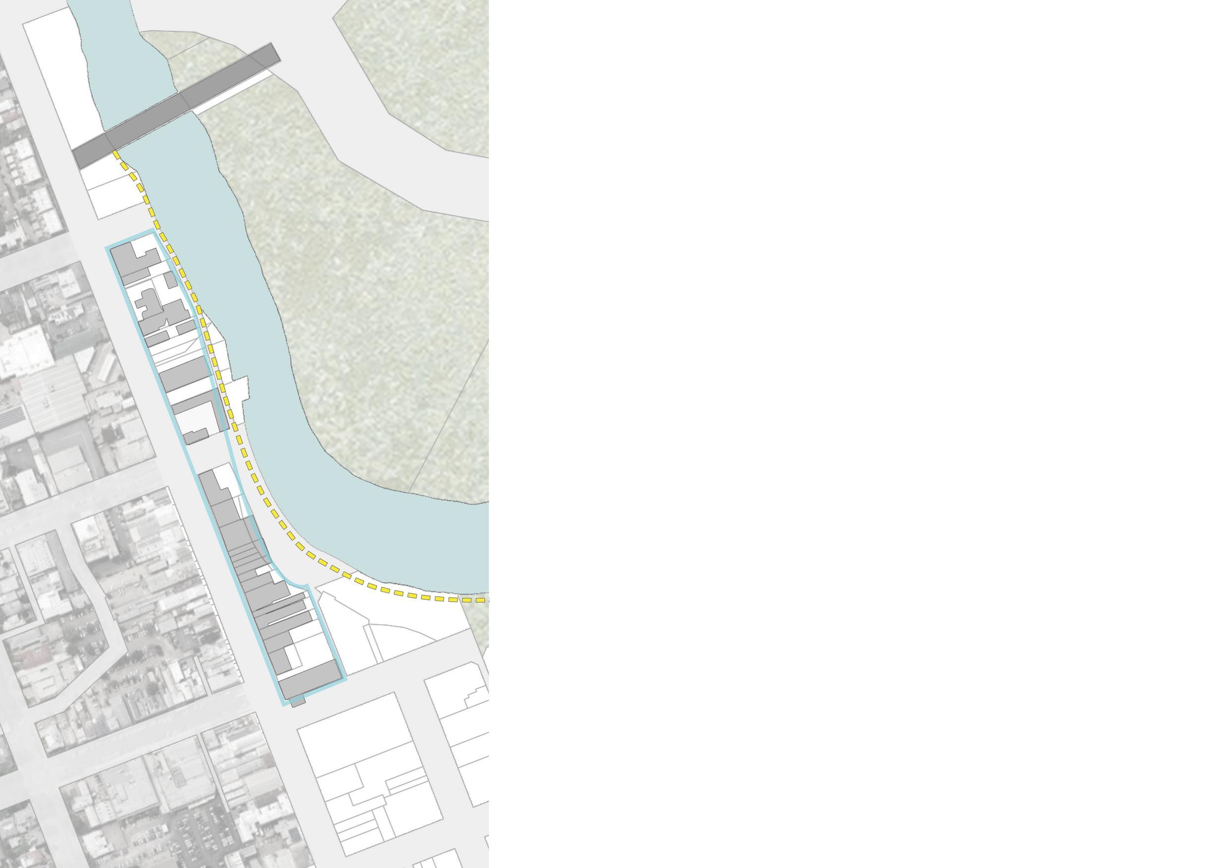


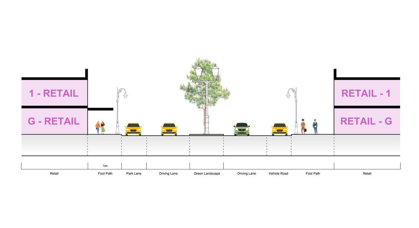
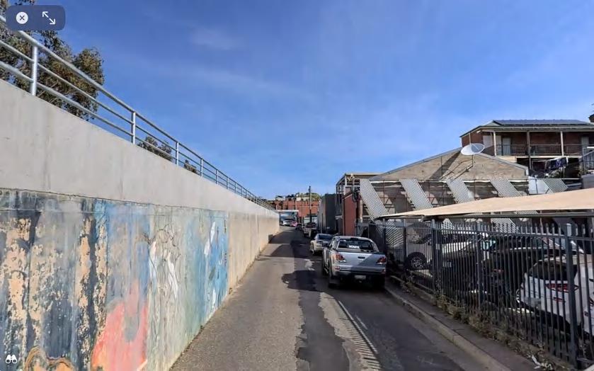
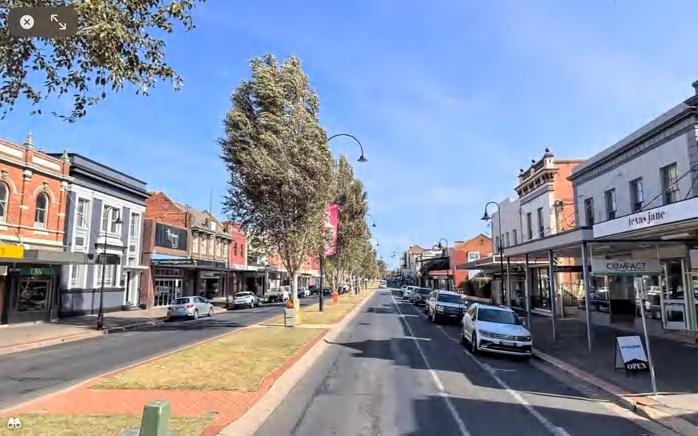

















Section C- proposed
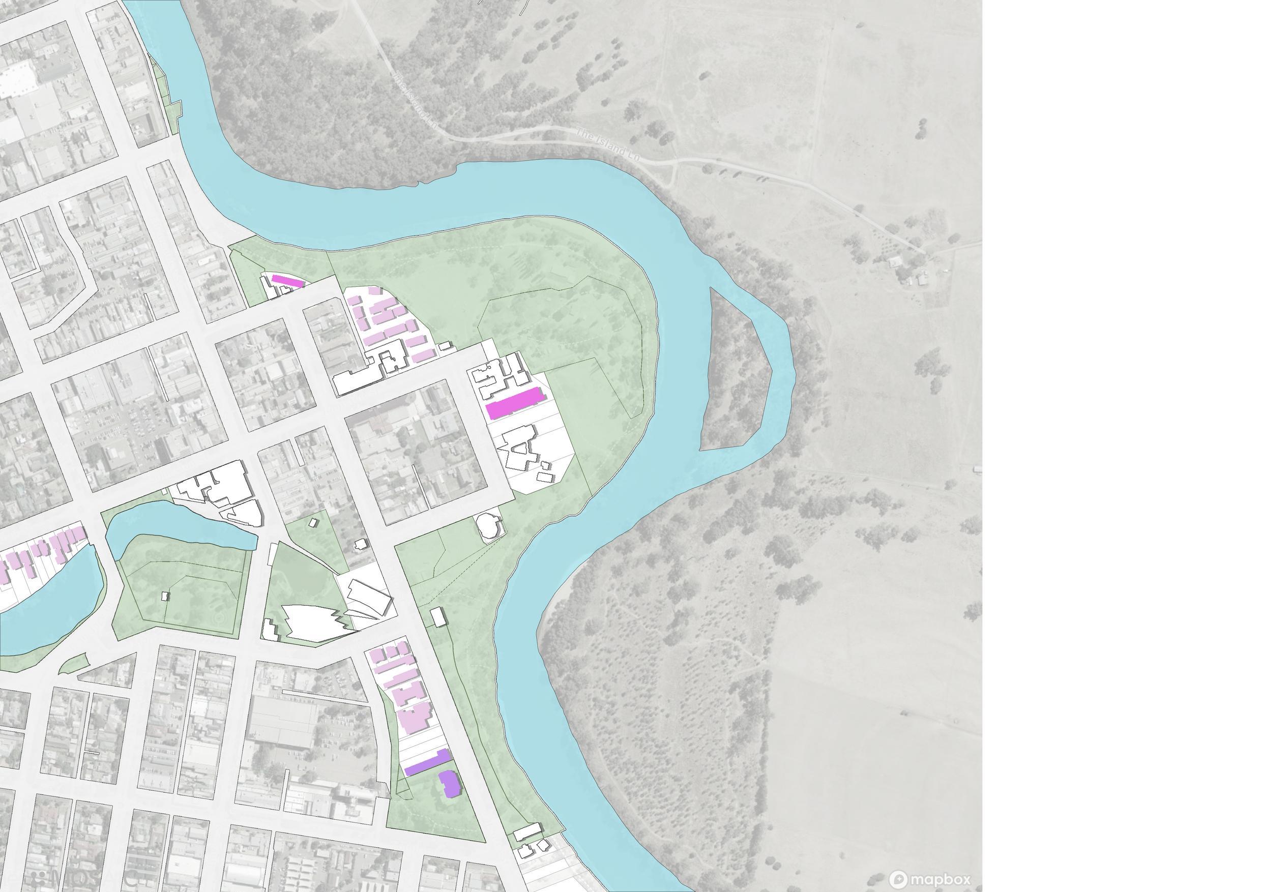

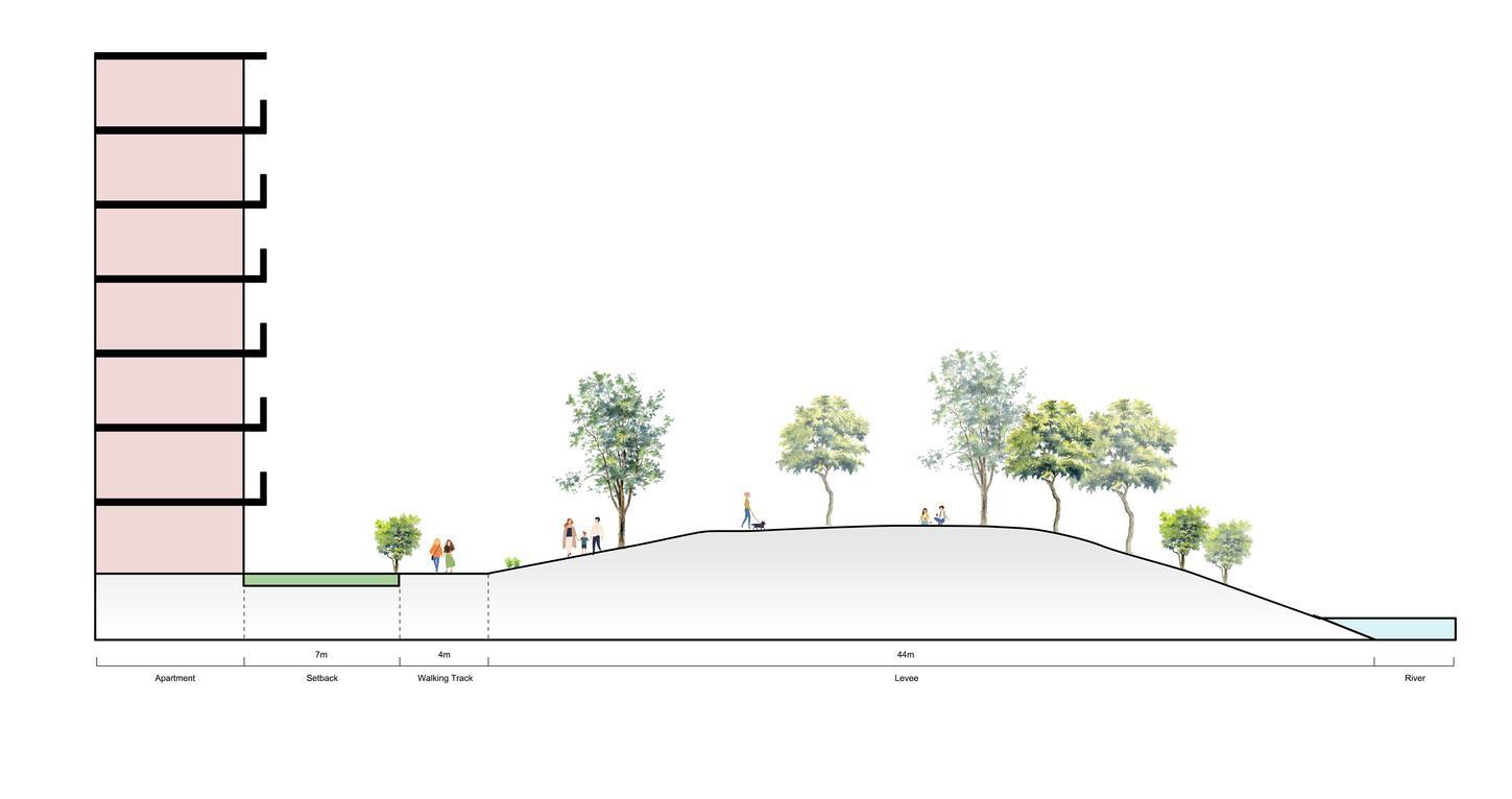
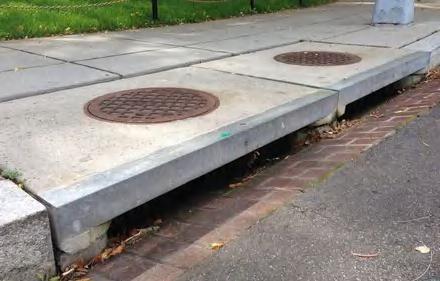
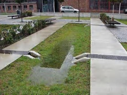
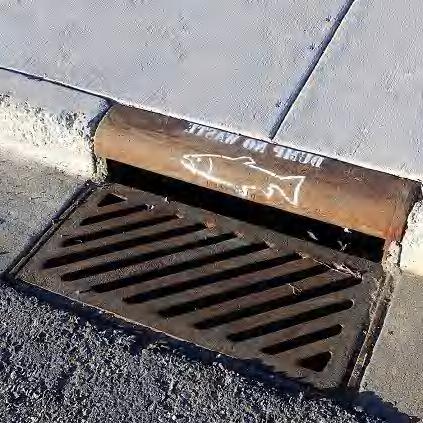
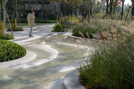
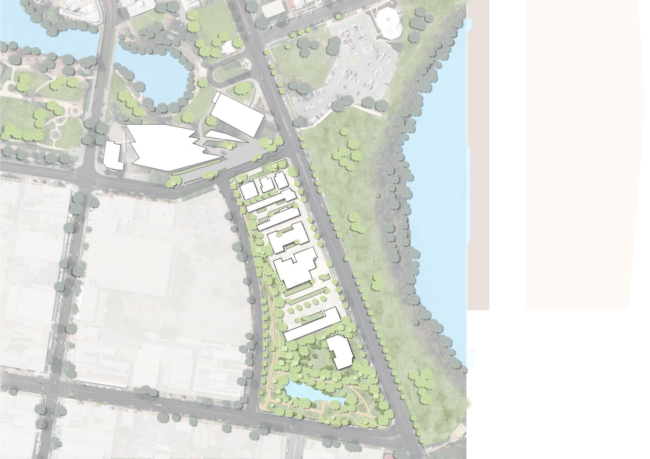
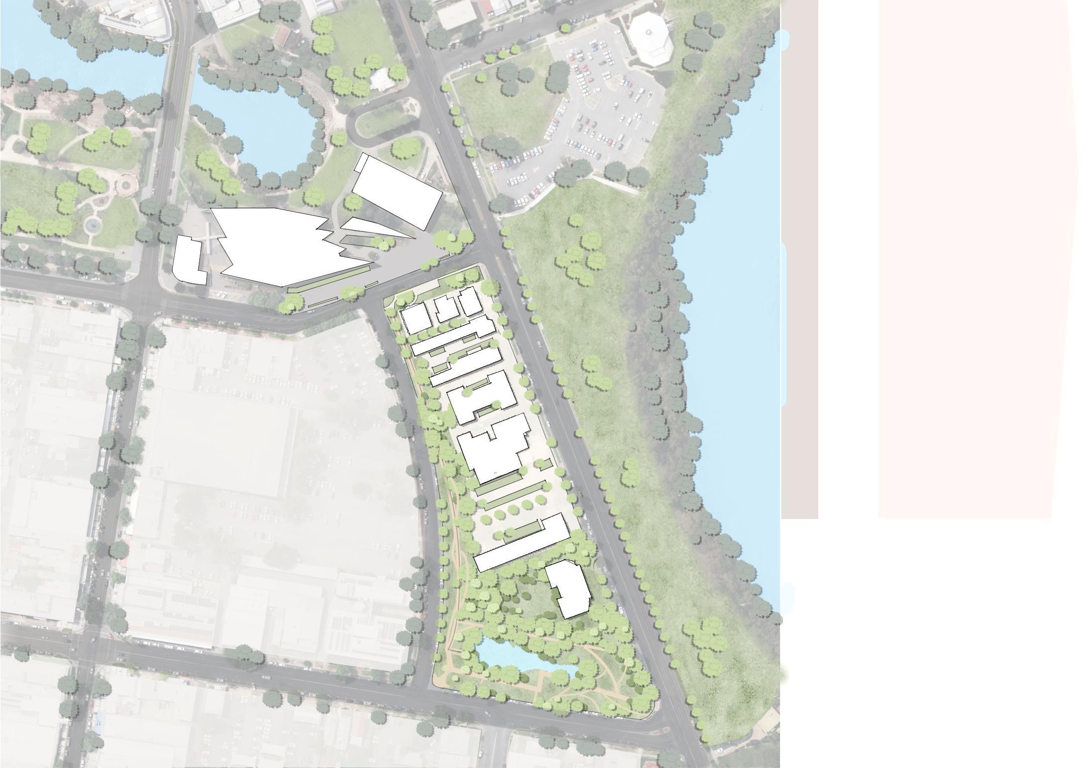
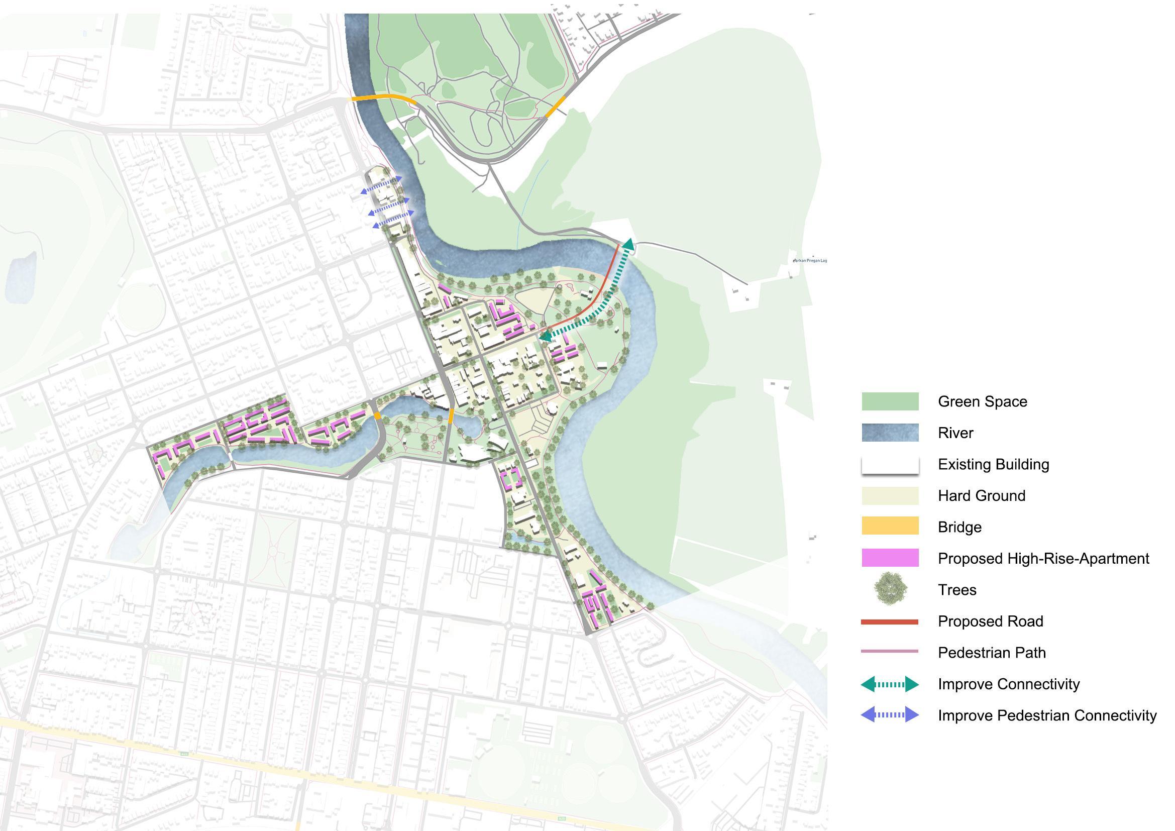
Create a pedestrian-friendly, more connected, and residential renewal area for existing site conditions. Improve the space by adding high-density apartments and creating a bridge between the commercial center and the northern development area to improve connectivity. Updating the riverside walk landscape to enable people to interact with the Murrumbidgee River by increasing activity on both sides of the trail. In addition, it increases pedestrian connectivity from the west of the CBD to the riverfront.
The Wagga strategic plan prioritizes several key areas for short-term and long-term development. In the short term, the focus will be on constructing the high-speed rail (HSR) and its corridor, enhancing the CBD and the Health and Knowledge Precinct, implementing effective flood management strategies, and improving connectivity through green corridors. These initiatives aim to bolster the city's infrastructure, economic vitality, and environmental resilience. In the long term, the plan envisions expanding the city's population northward, introducing a new light rail system to strengthen north-south connectivity and enhance public transportation, and realizing a 15-minute living area, ensuring that residents can access essential services and amenities within a short walk or bike ride, apart from the CBD. These long-term goals are designed to support sustainable growth, improve quality of life, and foster a more connected and accessible urban environment.
