CITY ADDITIONS


SAN FRANCISCO, CA, USA MISSION BAY MASTER PLAN
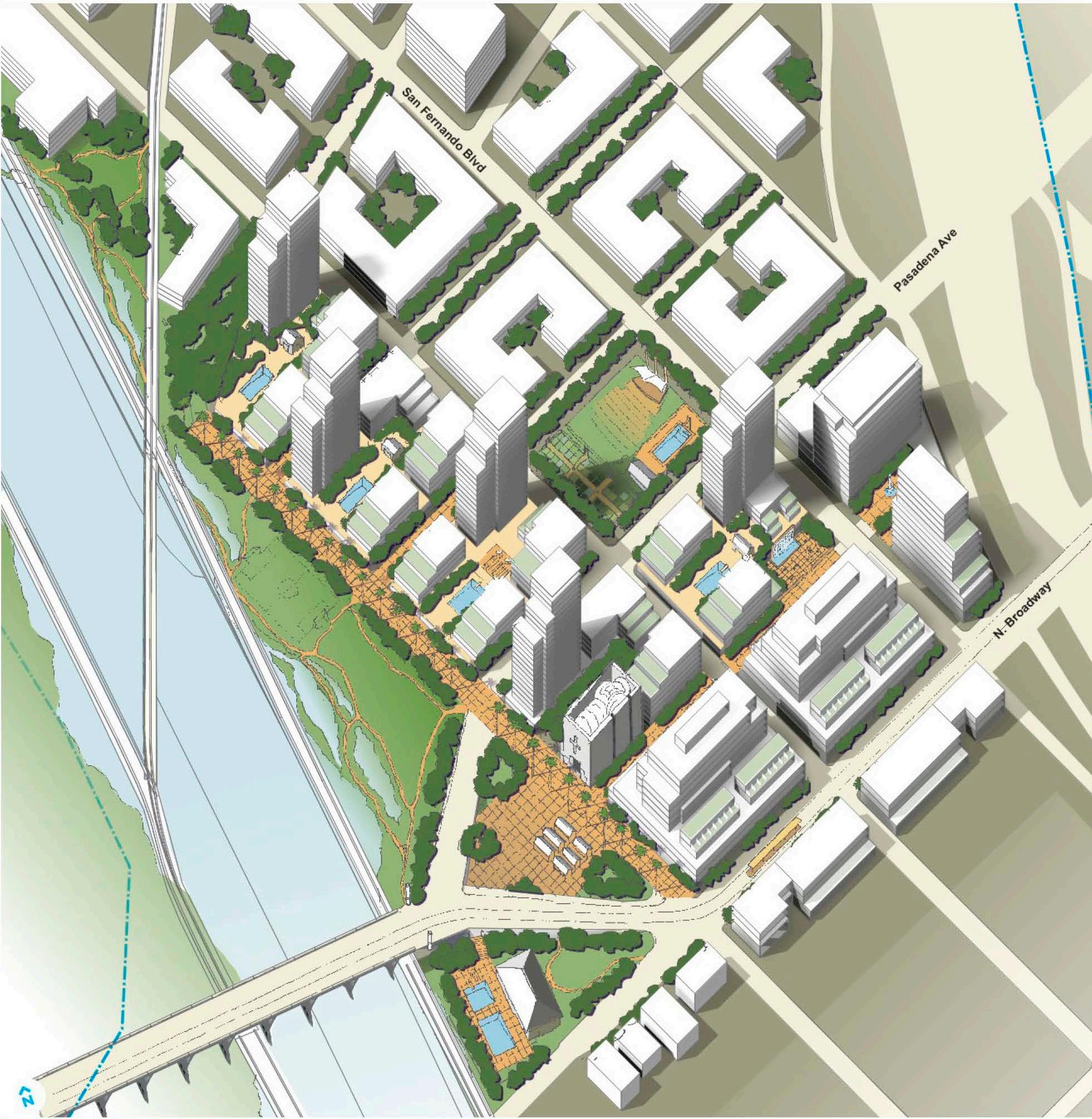
LOS ANGELES, CA, USA LOS ANGELES RIVERTOWN
LOS ANGELES, CA, USA PLAYA VISTA PHASE II
WARNER CENTER, CA, USA WESTFIELD PROMENADE
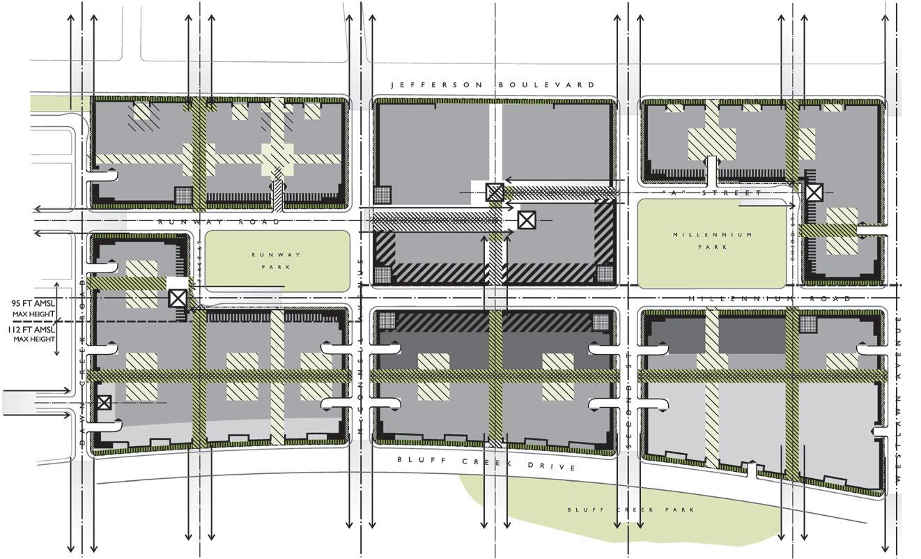
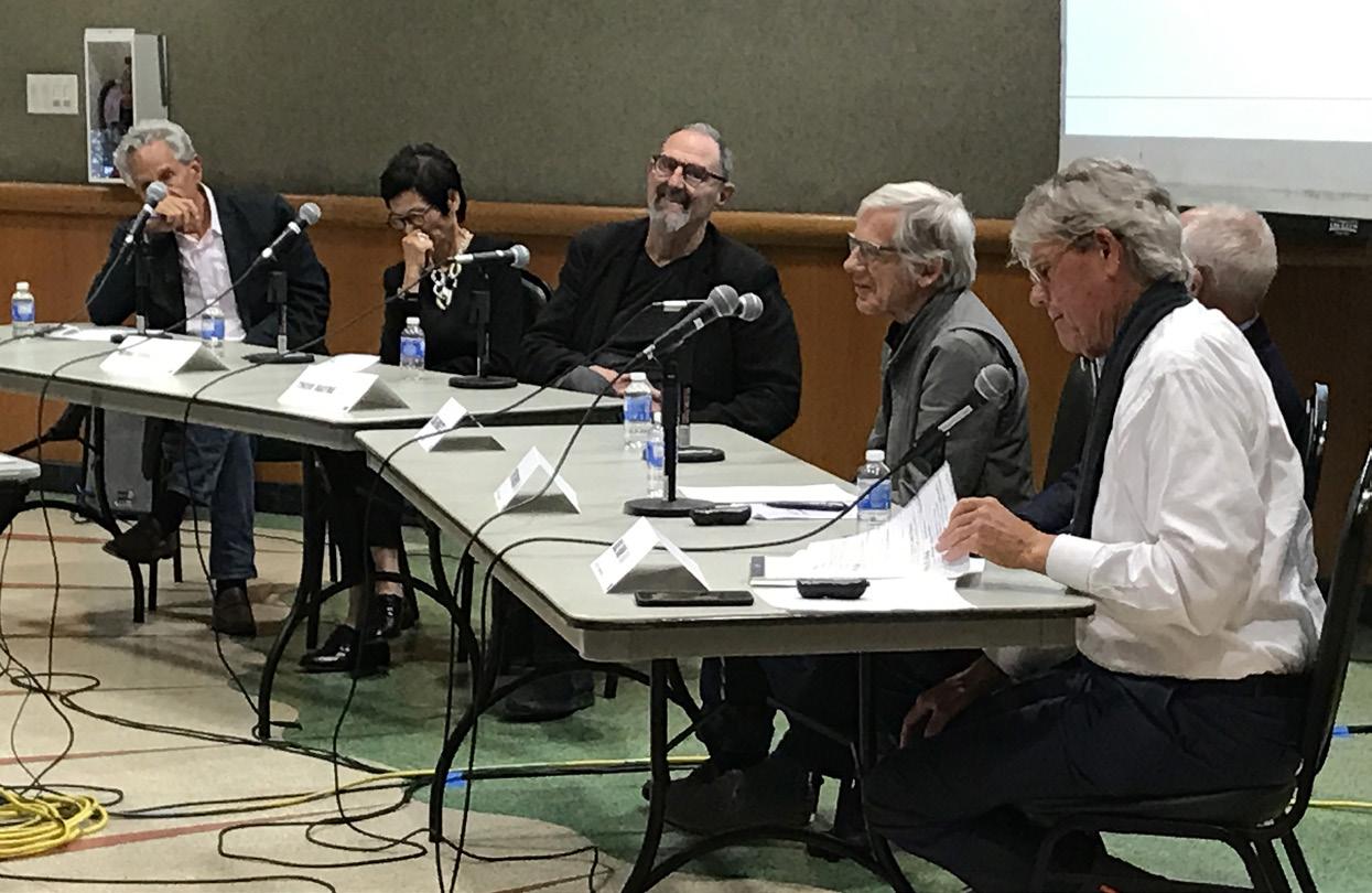
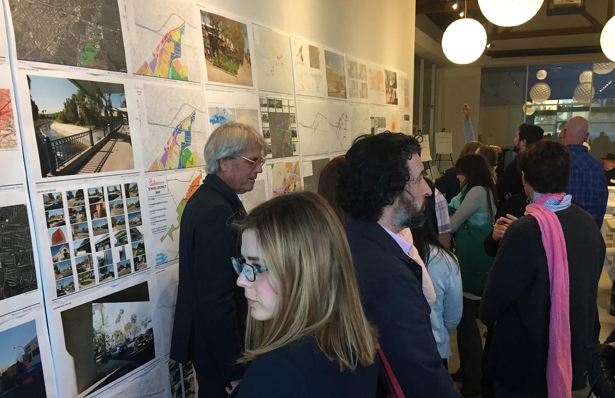
CULVER CITY, CA, USA CULVER CITY TRANSIT ORIENTED DEVELOPMENT
INDIAN WELLS, CA, USA HIGHWAY 111 CORRIDOR
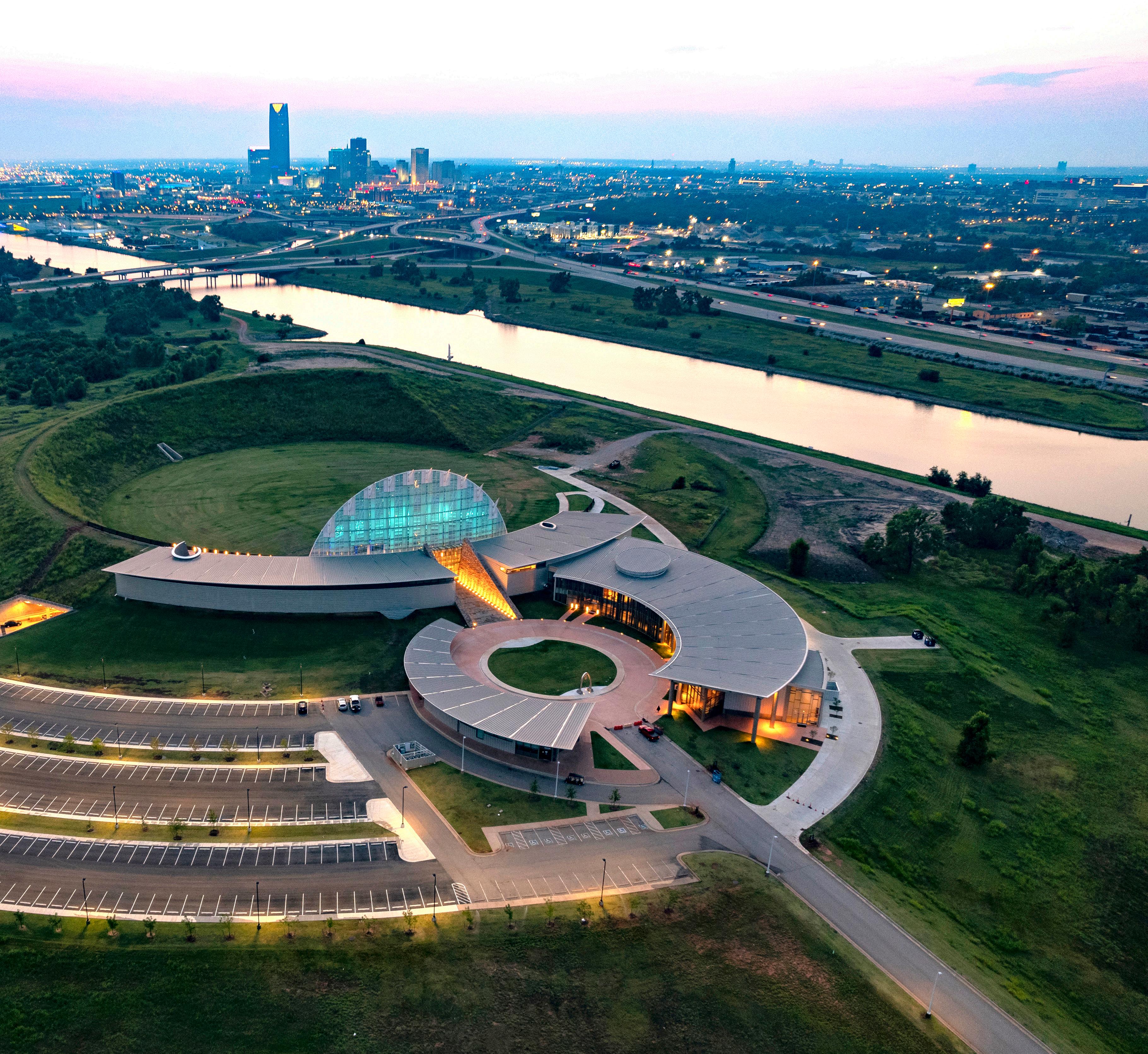
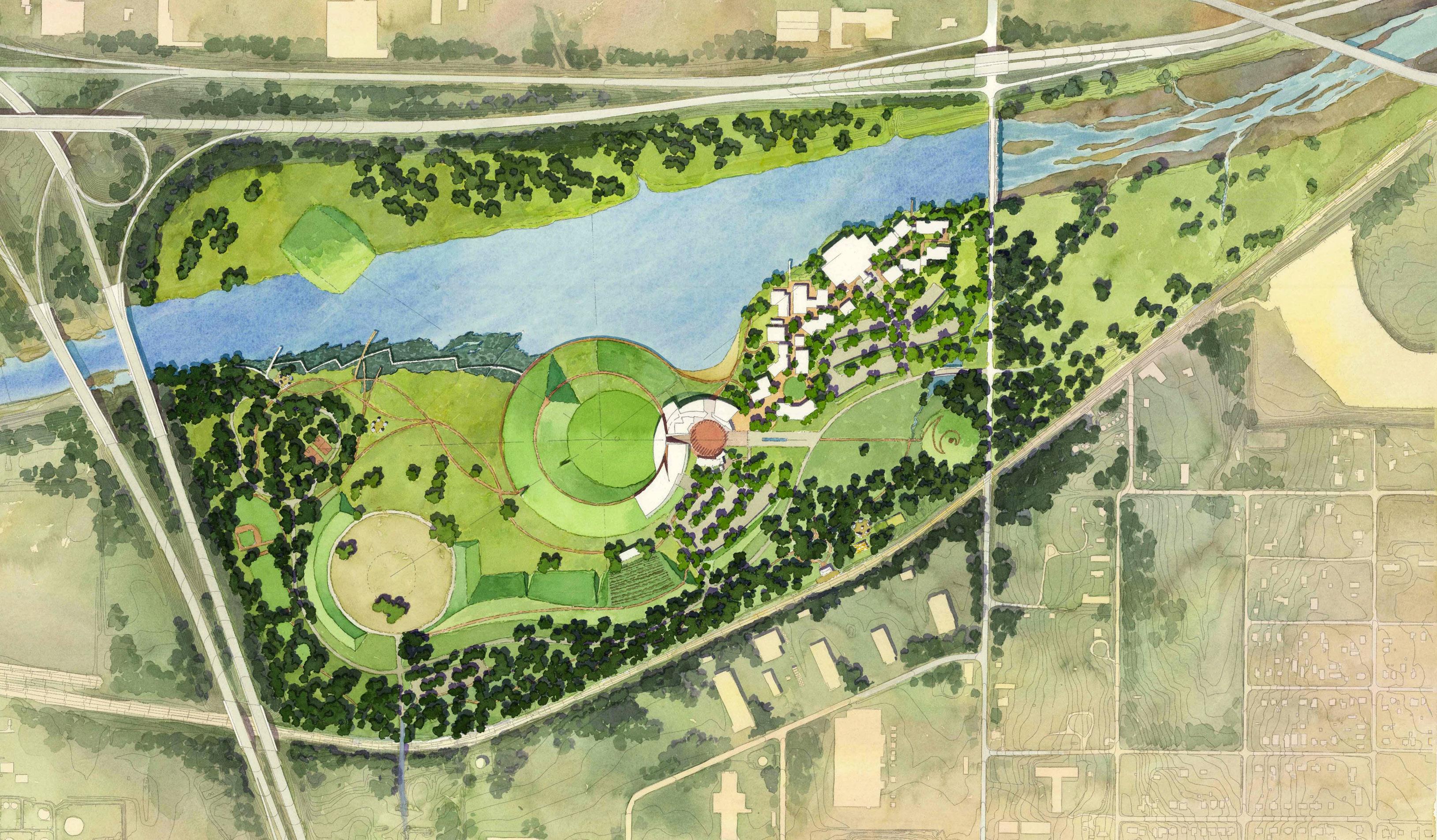
OKLAHOMA, OK, USA FIRST AMERICANS MUSEUM
HENDERSON, NV, USA HENDERSON WEST
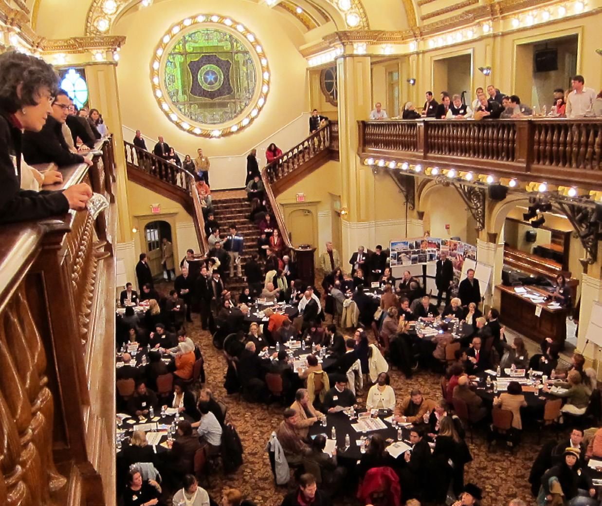
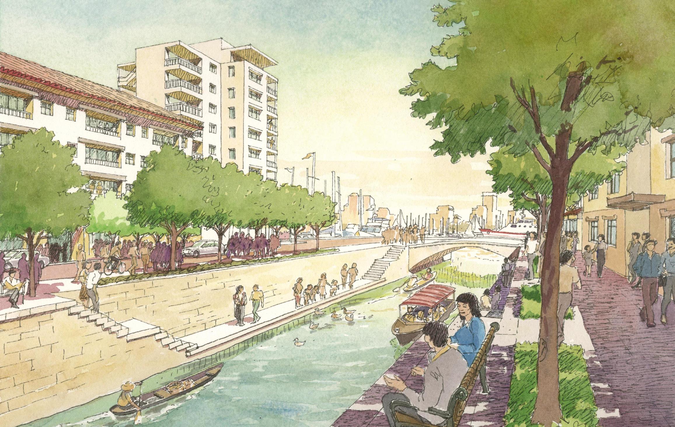
SAN ANTONIO, TX, USA HEMISFAIR PARK REDEVELOPMENT
EWA, OAHU, HAWAII KAPOLEI CITY MASTER PLAN
BEIJING, CHINA BEIJING CBD MASTER PLAN
LUZHOU, SICHUAN, CHINA GULIN NEW TOWN MASTER PLAN
LUZHOU, SICHUAN, CHINA GULIN NEW TOWN CBD
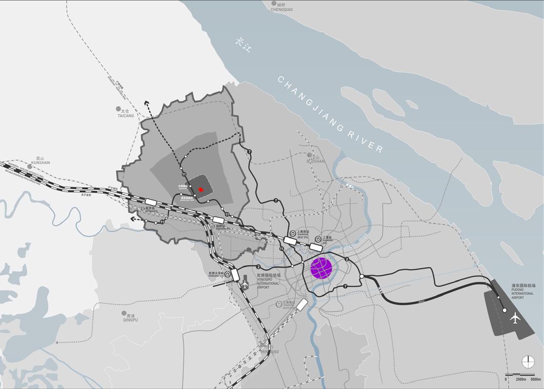
JIADING, SHANGHAI, CHINA JIADING NEW TOWN URBAN DESIGN
SHANGHAI, CHINA SHANGHAI JIANGWAN NEW TOWN
MUMBAI, INDIA WADALA BUSINESS CENTER MASTER PLAN
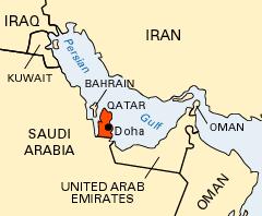
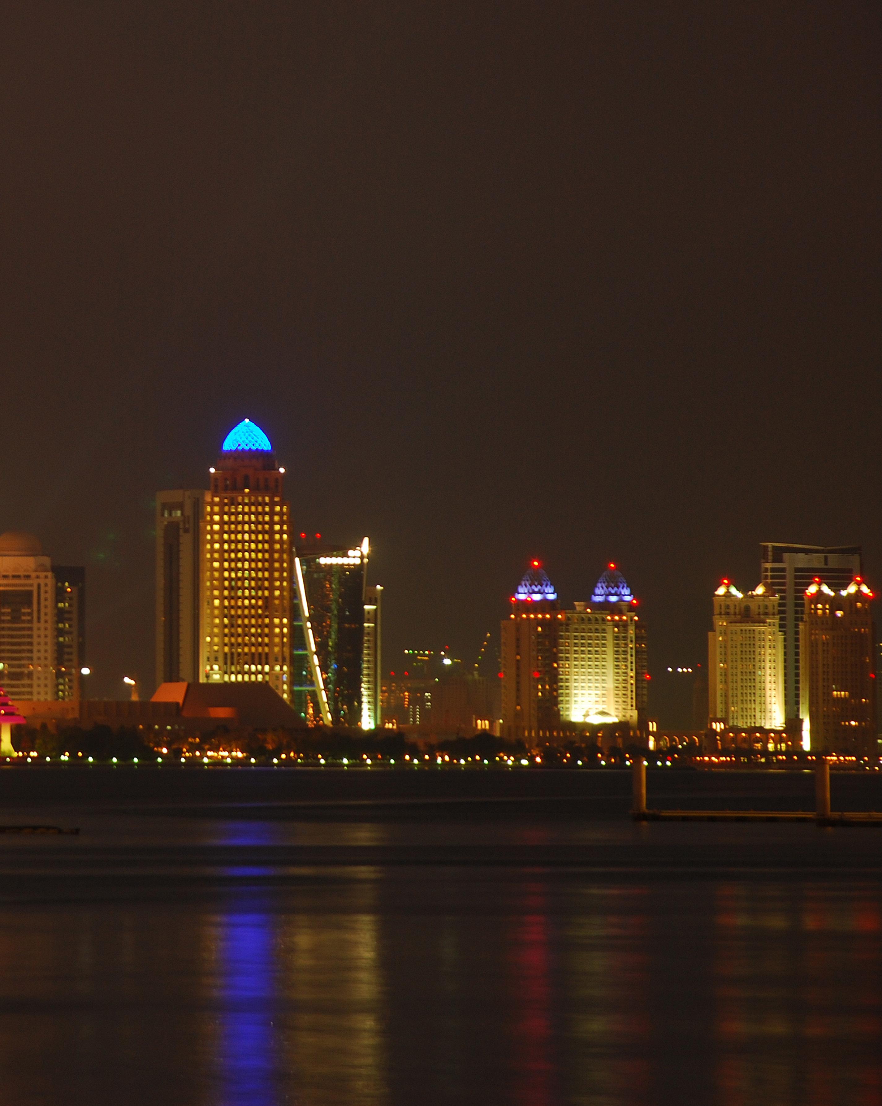
DOHA, QATAR DOHA NEW DISTRICT
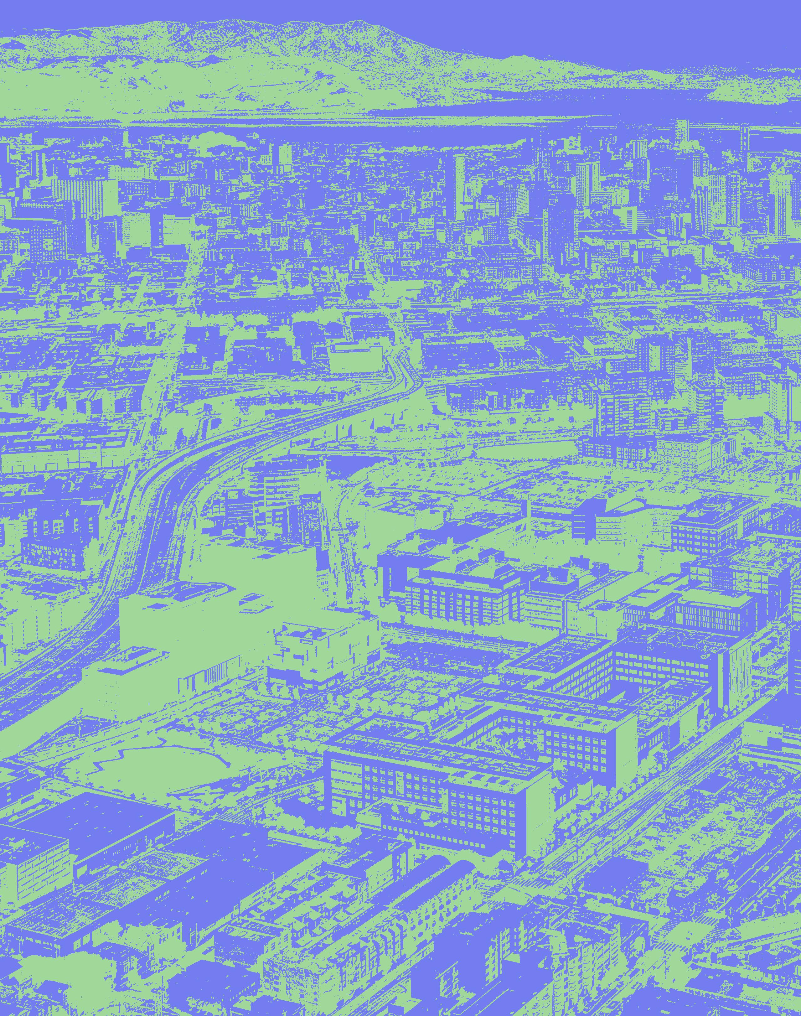
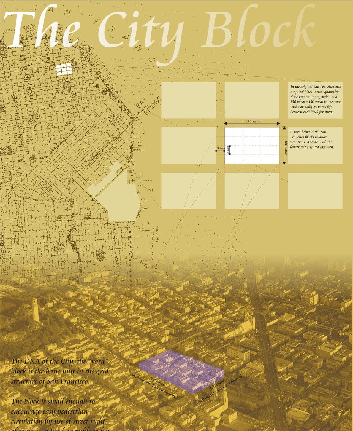
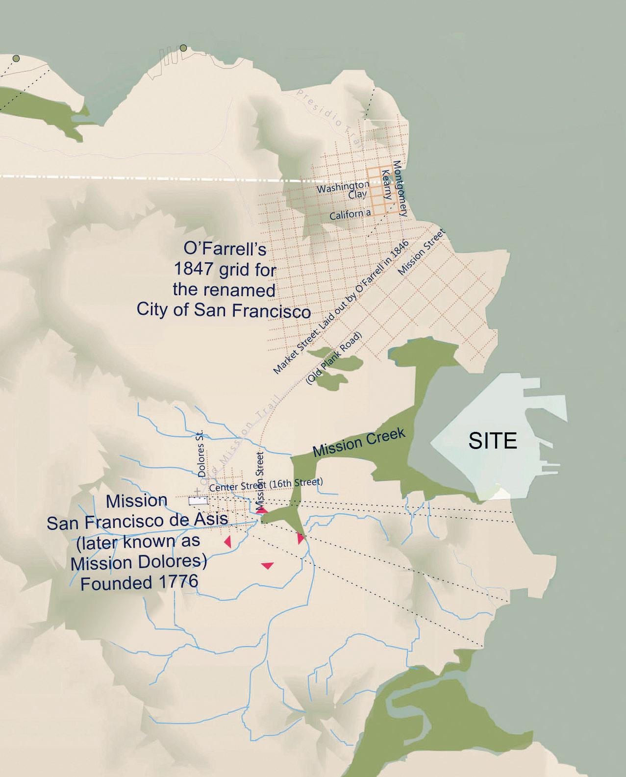
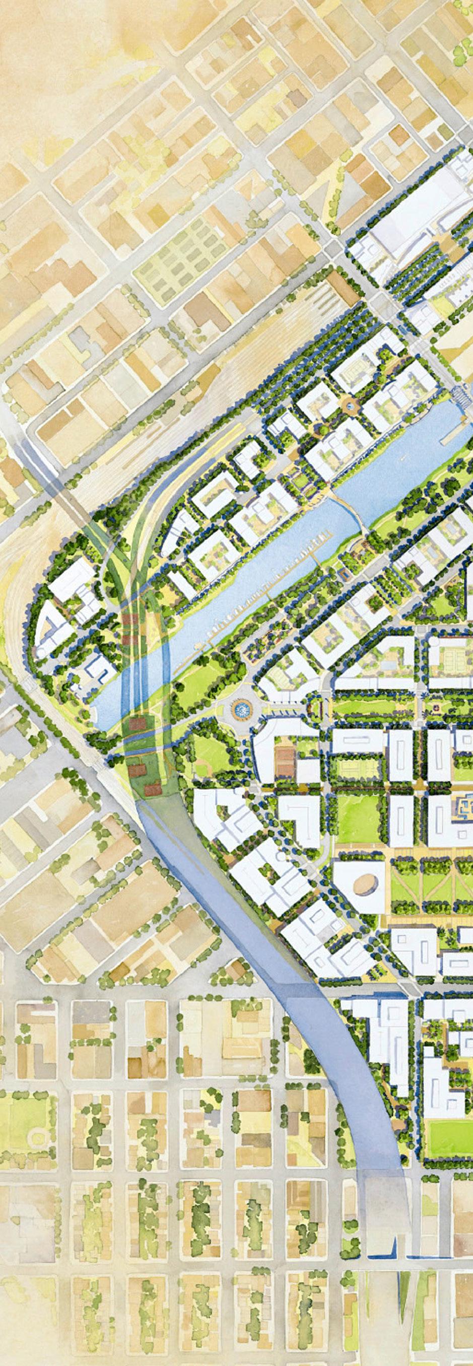
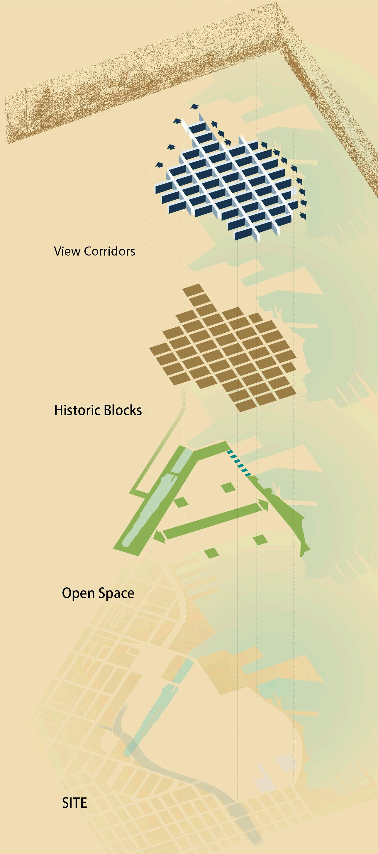
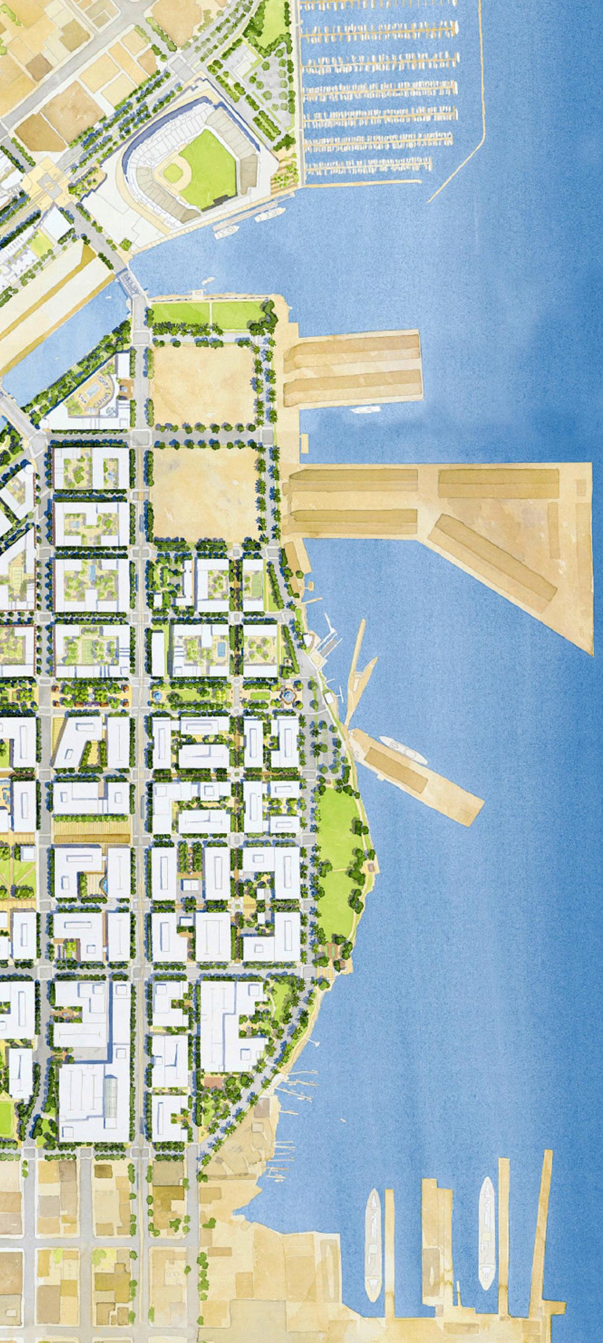
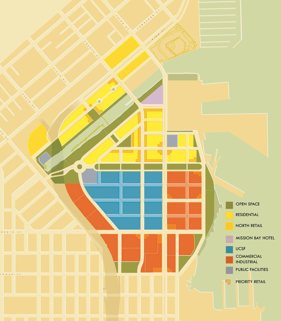
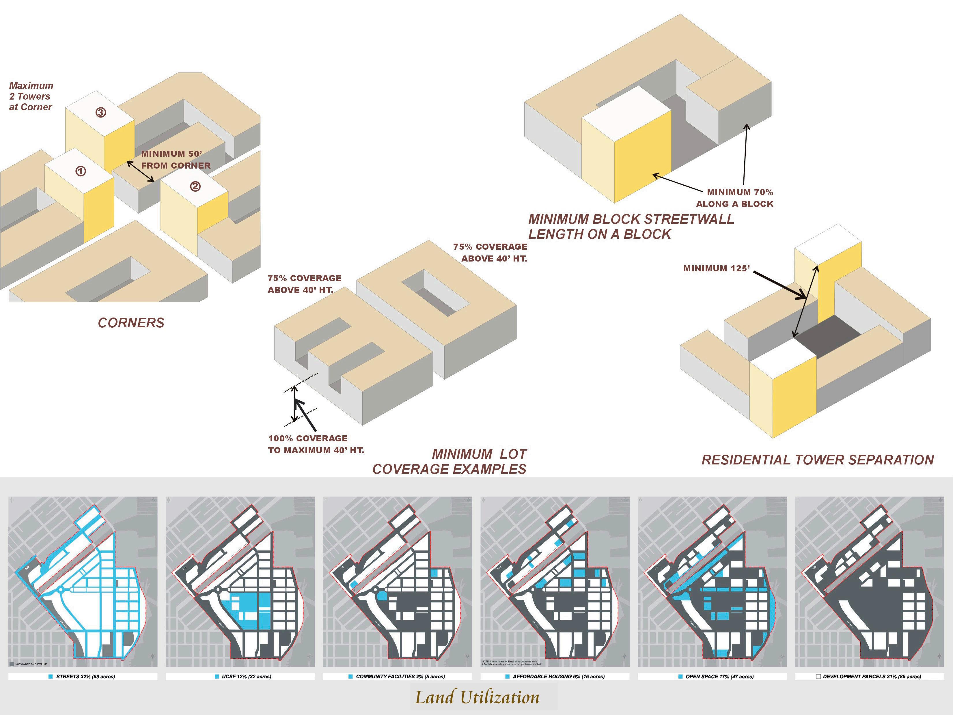
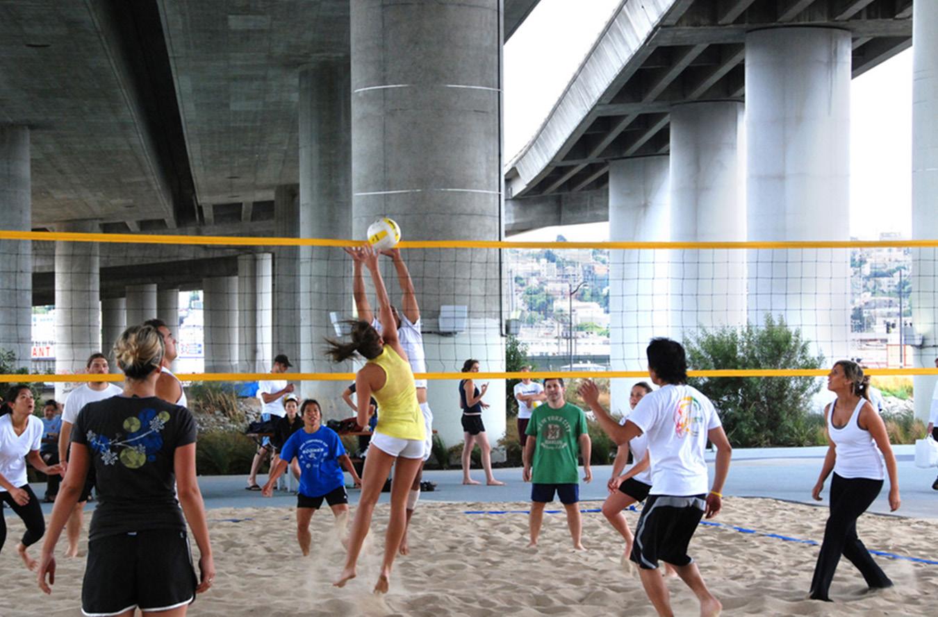
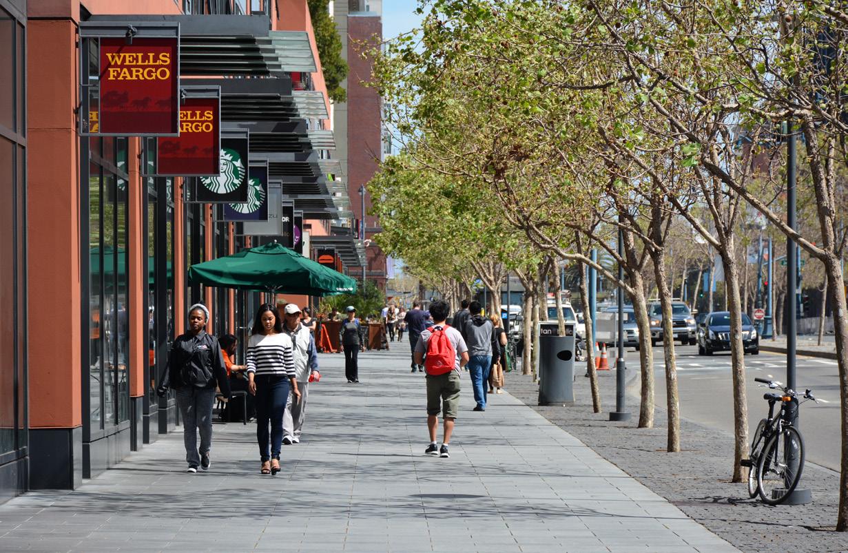
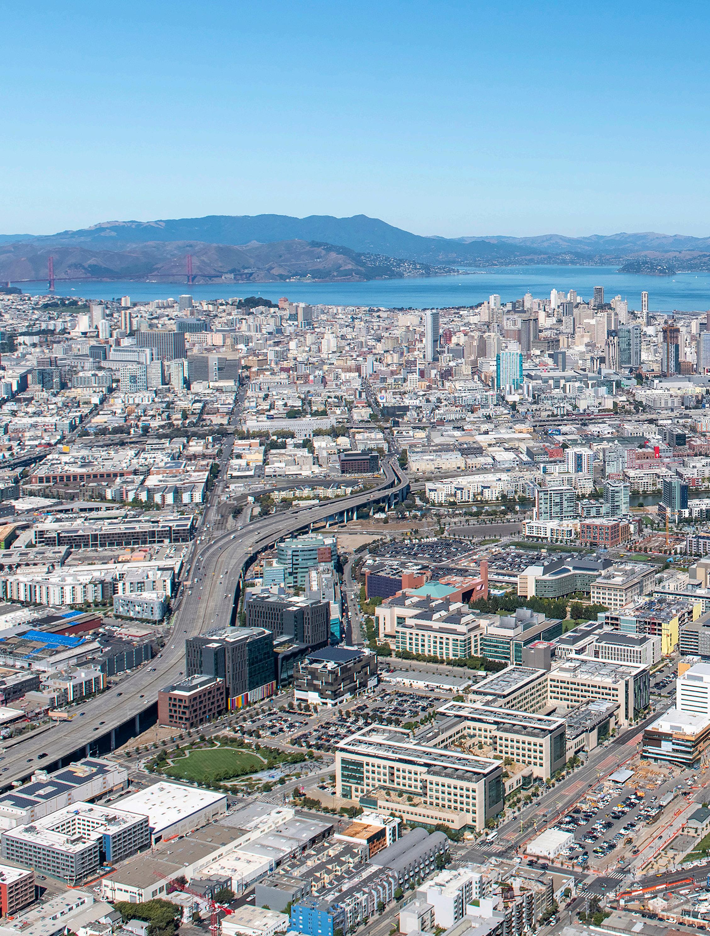
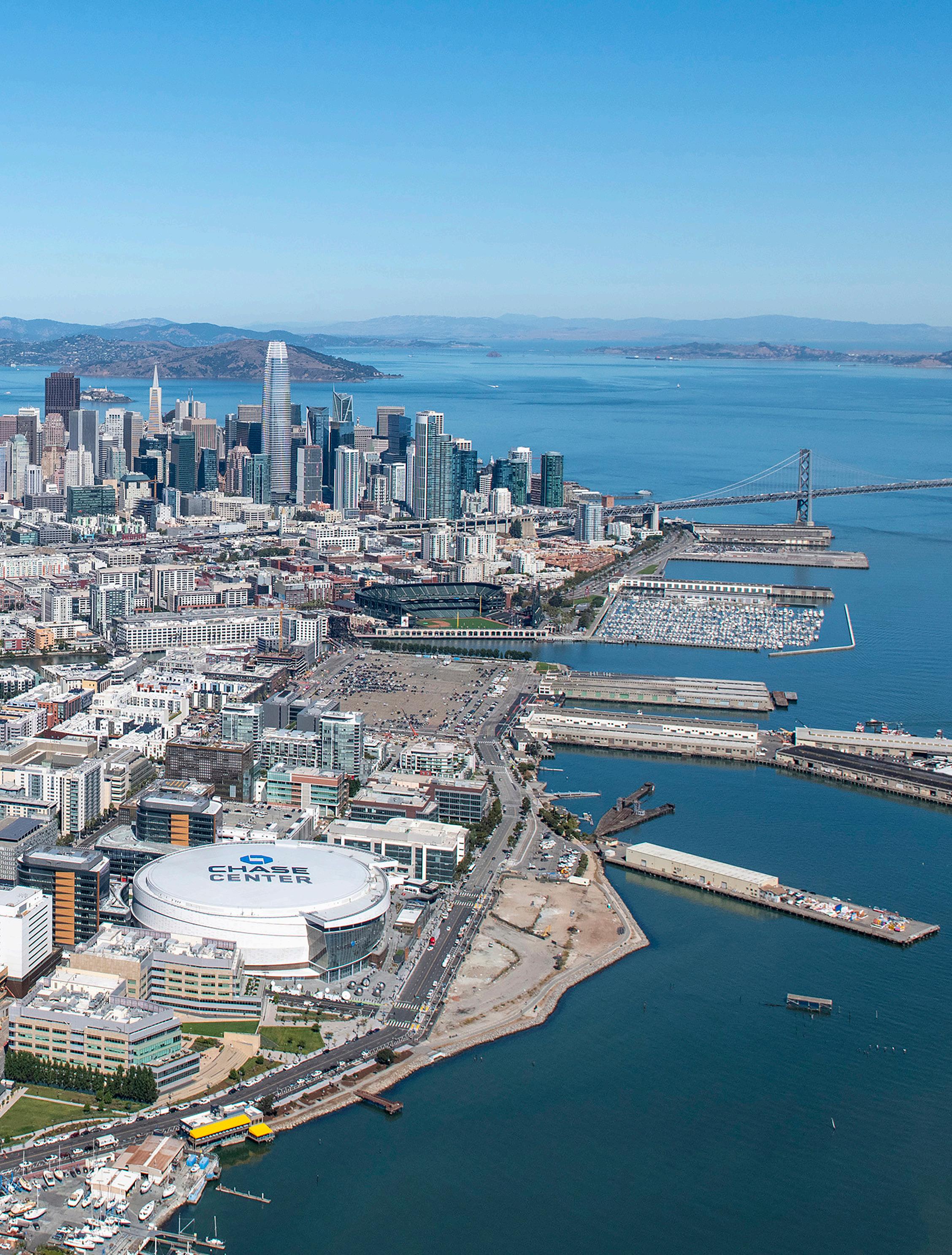
This “transit-first” urban neighborhood anchored by the University of California, San Francisco (UCSF) biotech research campus is a mixed use development comprising the largest city addition in San Francisco’s history. It builds upon education as the foundation for a “Knowledge City”. The plan draws upon the city’s existing “Vara” block dimensions of the Spanish era which is small enough for easy pedestrian flow, yet large enough for efficient real estate development. Along the Bay, the plan provides a continuous linear park that connects to the City’s regional open space system. The project also includes a central Commons and local neighborhood parks. This framework of open space and landscape systems is intended to become an important element of the “Waterfront Land Use Plan” for San Francisco.
As the site is prominently located along the waterfront, the Johnson Fain analyzed San Francisco and other notable city waterfronts in order to determine an appropriate block orientation that promotes view corridors to the Bay, as well as the business district skyline. UCSF is located at the heart of the plan playing a determinant role in the plan structure and distribution of land uses. The plan strives to integrate commercial, research & development, and university uses with a balanced mixture of residential development including affordable housing. The plan builds upon the third street light rail line and stations as well as the adjacent Cal Train Terminal.
transforming the largest city addition in San Francisco’s history into an integrated mix of education, research, and housing uses along its notable waterfront
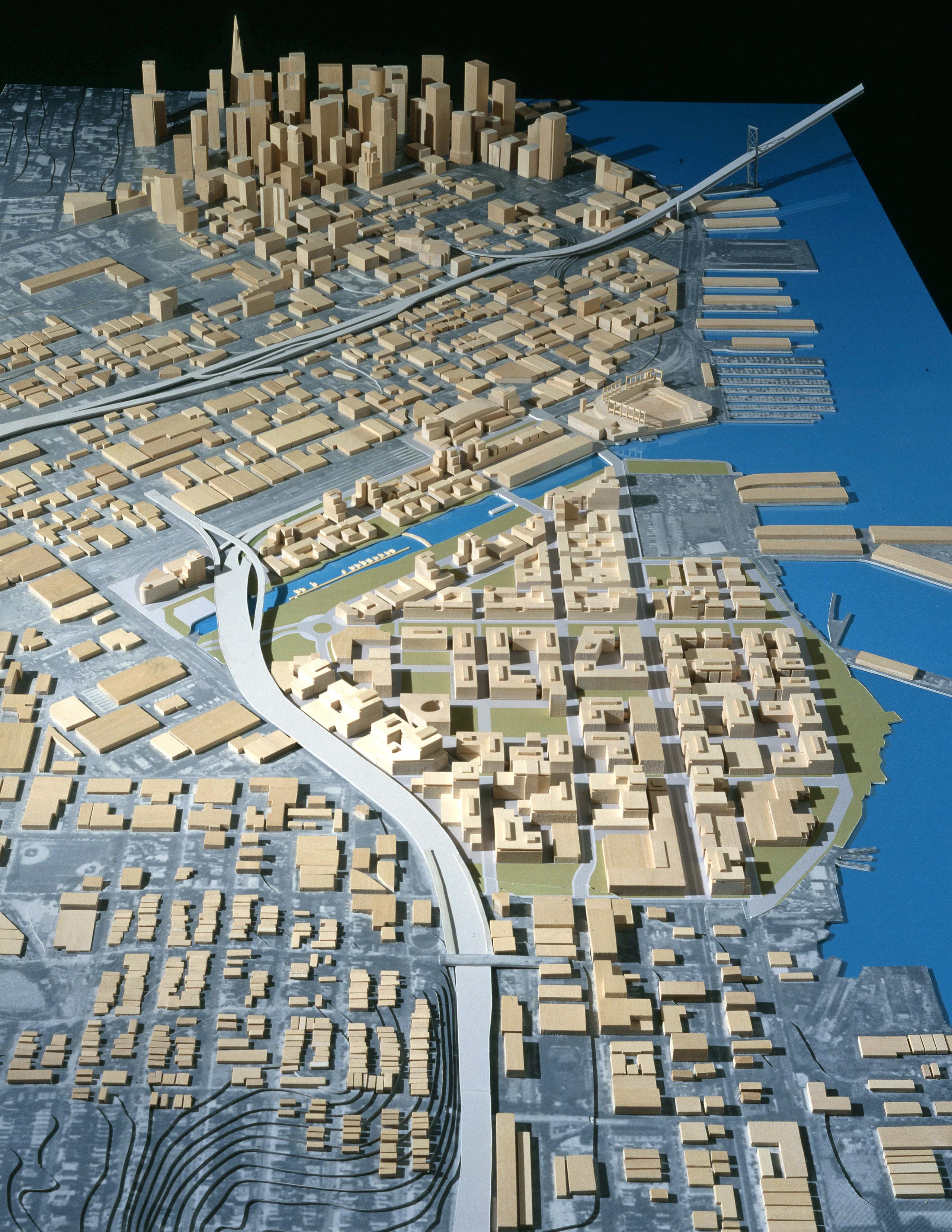
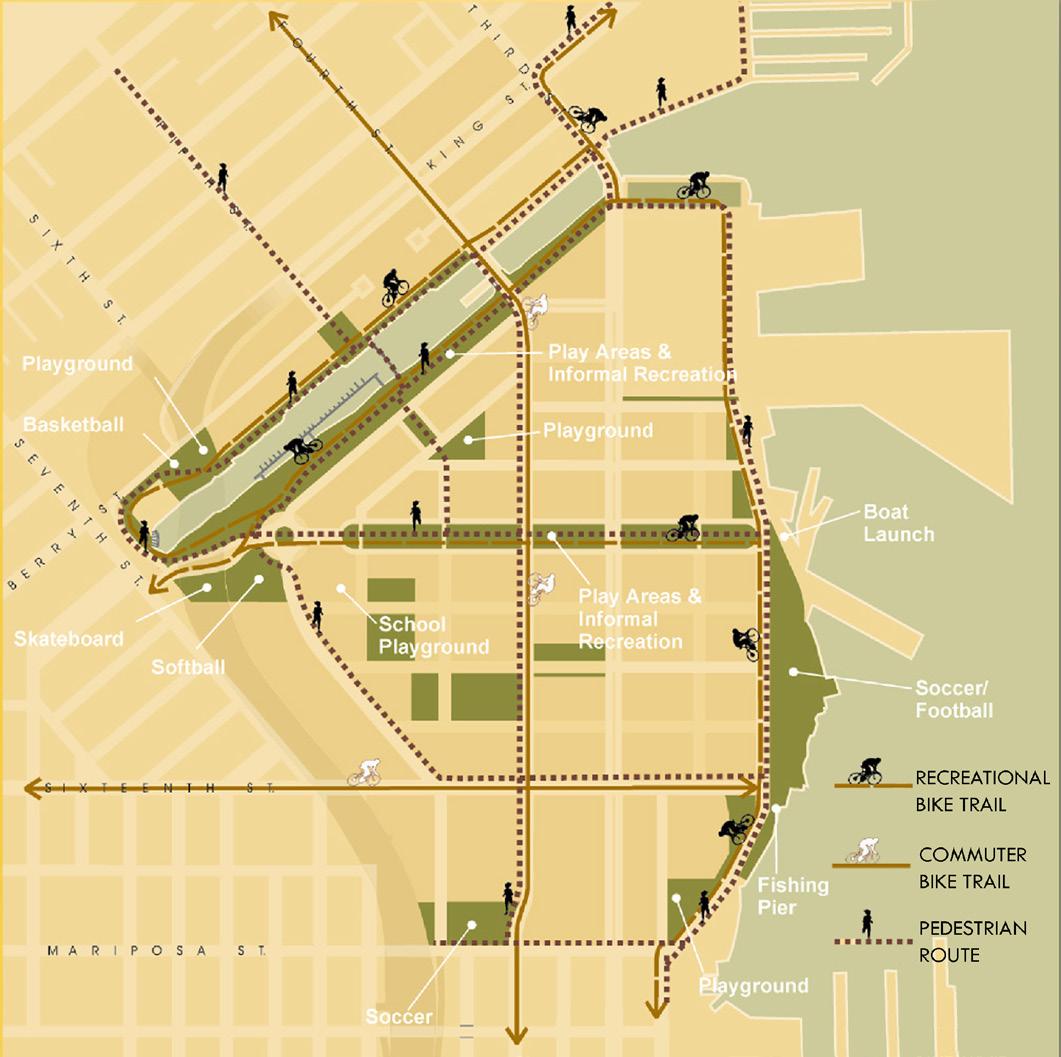
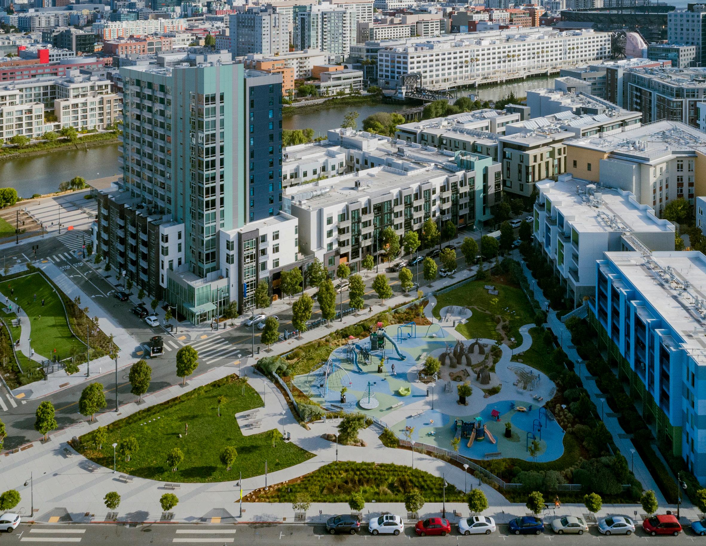
MIXED-USE DEVELOPMENT IN MISSION BAY
LOS ANGELES, CA, USA
AIA / Los Angeles NEXT LA Awards, Citation, CItyscapes
AIA / California Council, Merit Awards for Urban Design
ASLA California Council, Urban Design Award
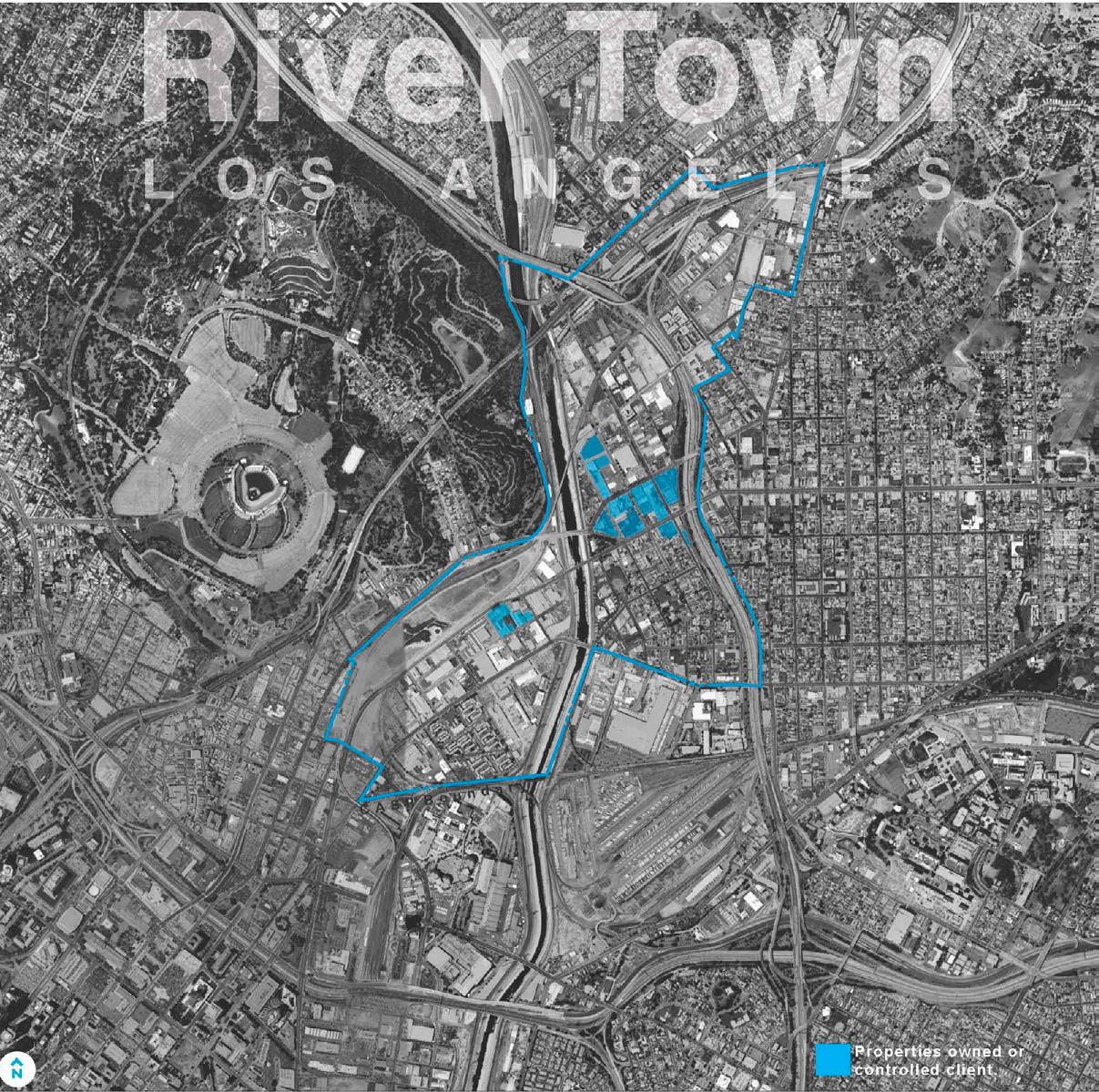
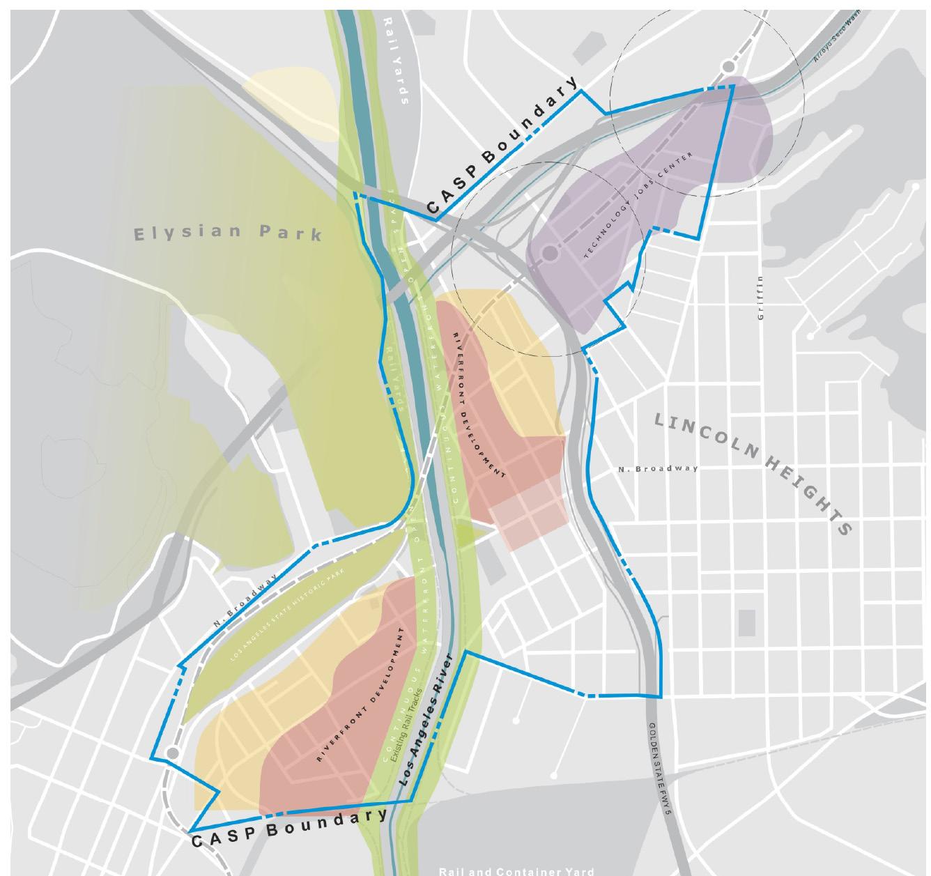
This plan in northeast Los Angeles envisions transformation of an outdated industrial wasteland into a new mixed use community built around a strong framework of public amenities and urban institutions, focused on 27 acres owned by a consortium of private owners. North of Chinatown between the LA River and the Golden State Freeway, the plan proposes a new mixed use neighborhood with a balance of jobs and housing, accessible open space, neighborhood parks, festive plazas, retail and community services, and a sensitive relationship with the existing environment and communities. Integrally tied to current public planning processes plus the existing Cornfield Arroyo Seco Specific Plan, the Northeast Community Plan Update, the Los Angeles River Improvement Overlay, and the Industrial Land Use Policy, the plan supports City initiatives geared toward absorbing that future growth while maintaining local businesses and existing uses for the community. Prepared for private owners, the plan plays a reflexive role with the City’s emerging policy framework. The plan is based on the following principles:
• Transit First: a mature transit network that reduces automobile use
• Connectivity: land use and urban design reunification of east and west Los Angeles
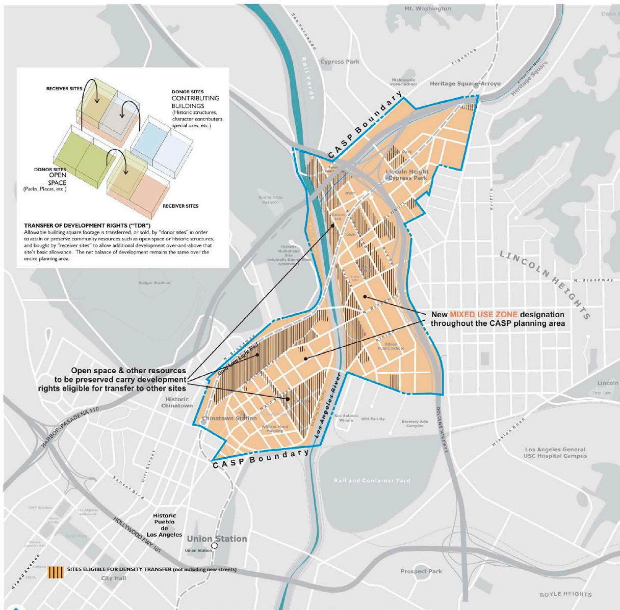
• Transitional Development: a Town Center with substantial density while respecting its surroundings
• Sustainable, Livable Streets: walk-able, positive contributors to the public realm
• Flexible Development Strategies: allowances for trading off sites where benefits can best serve the community for development on other sites where intensity is best tolerated.
reconstructing the outdated industrial wasteland along the LA River into a transit and pedestrian friendly environment for the community and City at large
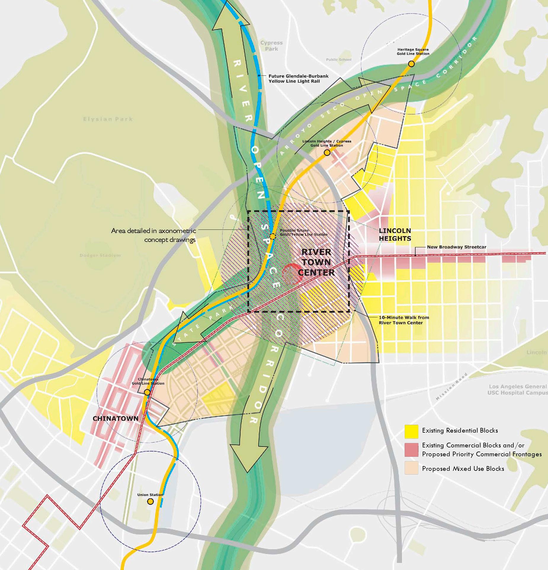
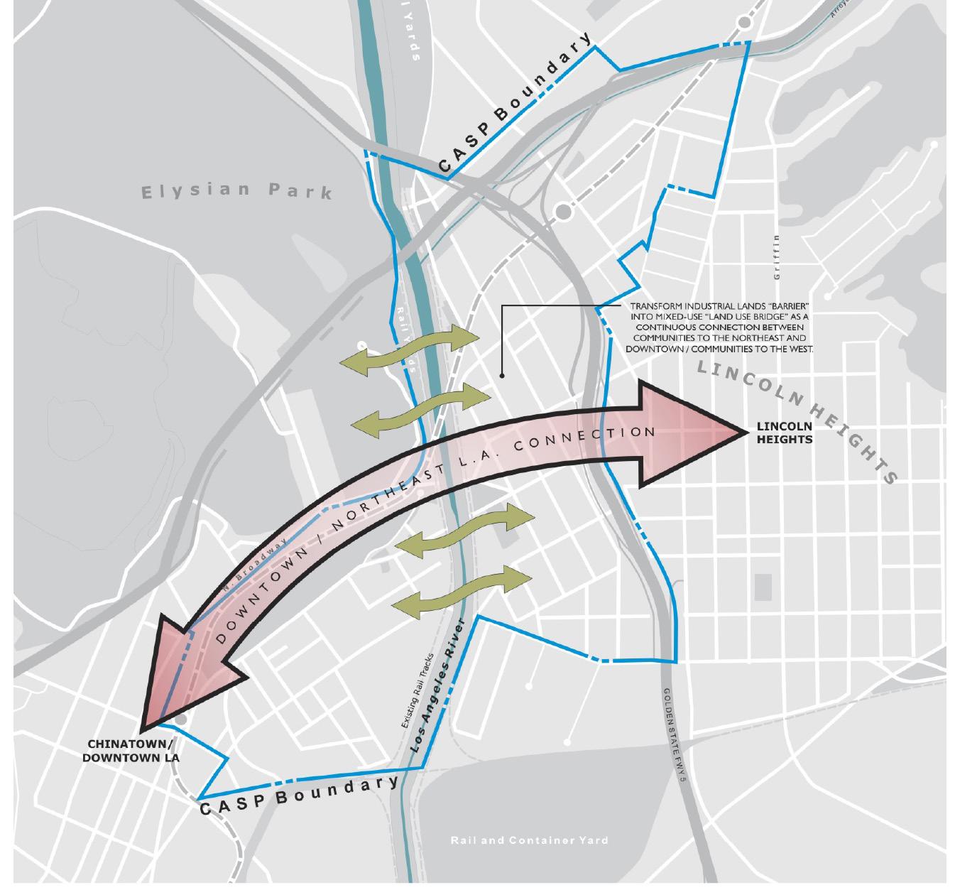
A “Land Use Bridge”. One of the first principles for River Town is the principles of connectivity, expressed first through the issue of connective land use. To restore the severed community the plan should re-connect eastside with west side through a “bridge” of mixed uses more consistent with the urban fabric on either side.
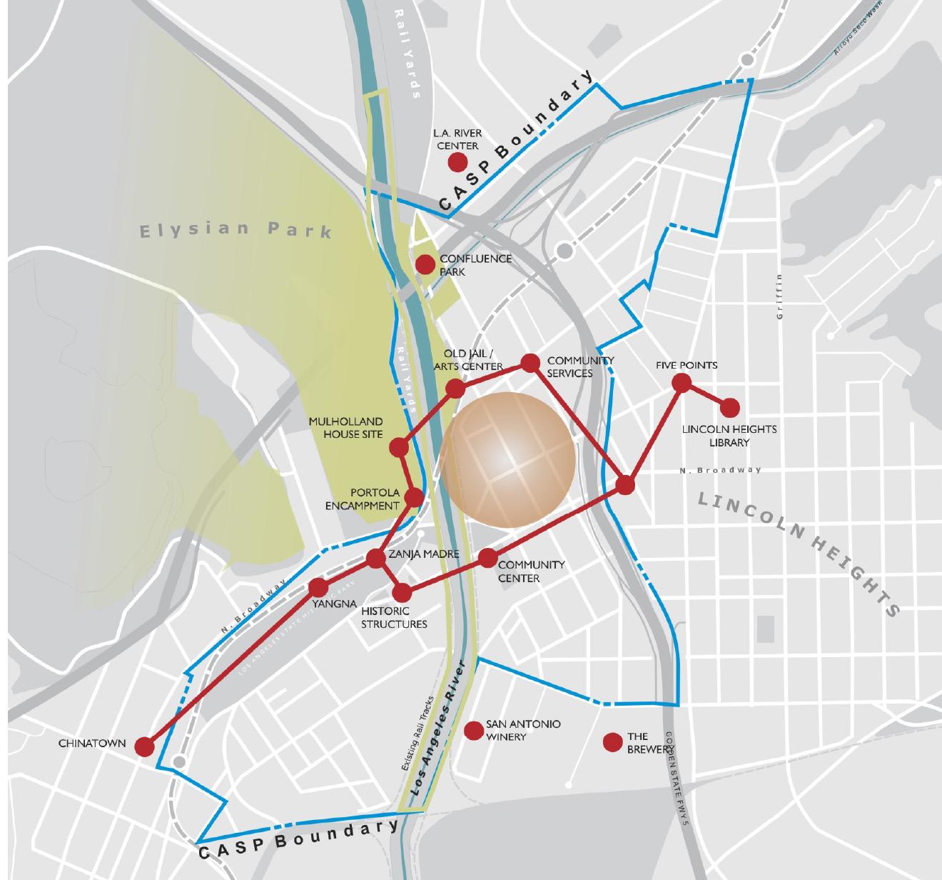
A Cultural Necklace. As historical legacy and as a product of the active communities within it, the area is rich with cultural landmarks and resources. As the point of origin of Los Angeles. This legacy should be highlighted and celebrated, and the resources connected to improve their accessibility and legibility.
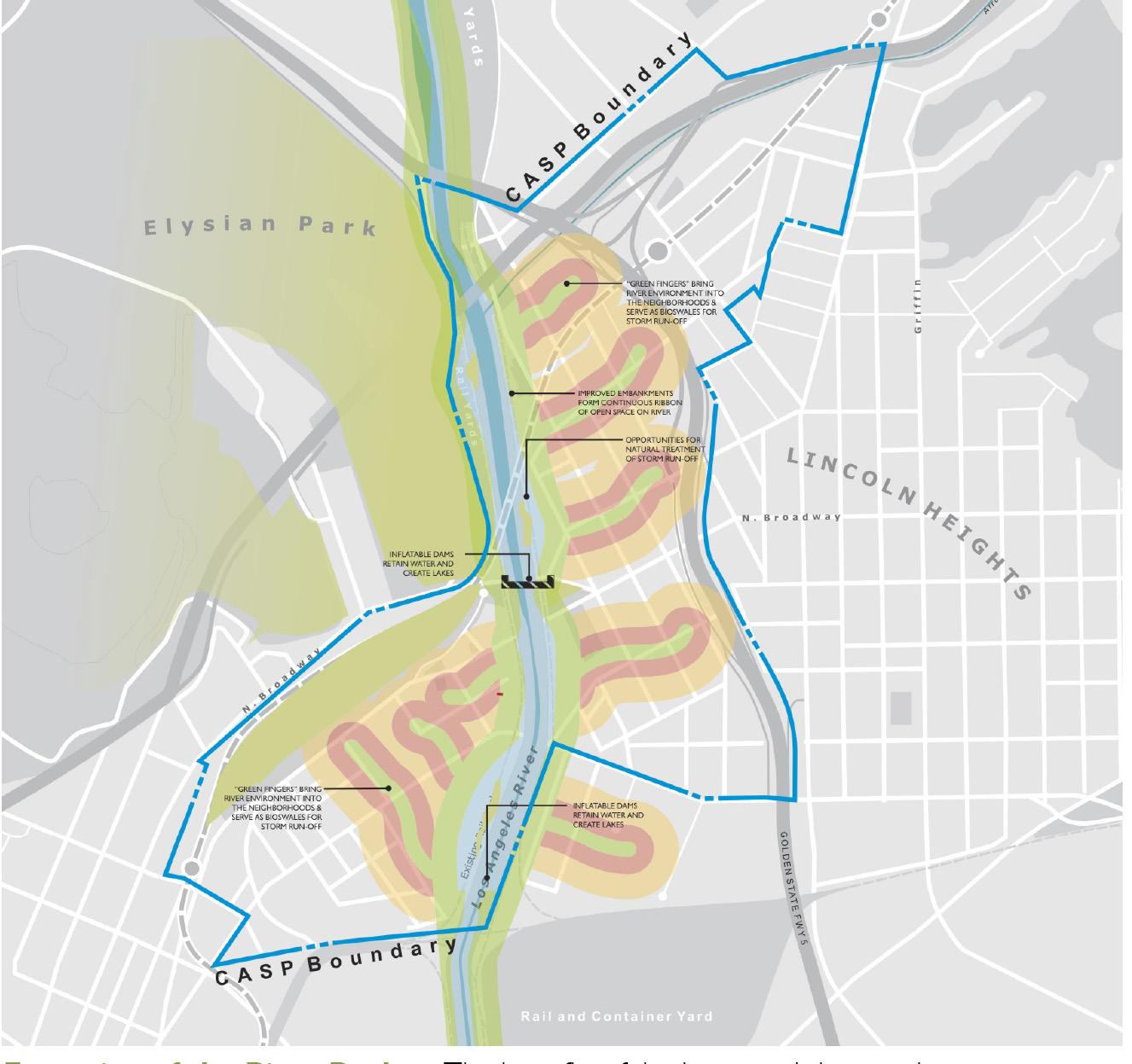
Extension of the River Realm. The benefits of the improved river environment should extend beyond its banks and reach into the neighborhoods that adjoin it. These connections can be expressed as green fingers and view corridors, but may also serve a useful role in the management of storm water retention and treatment.
Celebration of the River Frontage. Consistent with goals of Los Angeles River Master PLan and the Los Angeles River Improvement Overlay (LA-RIO) to enhance the quality of life along the river’s length, future development should be oriented toward the river frontage, respecting it, using it and, through urban design, helping to define it.
 RENDERING OF RIVERFRONT DEVELOPMENT
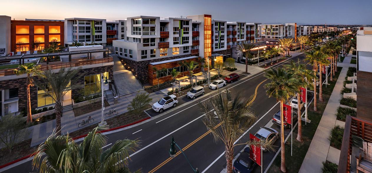
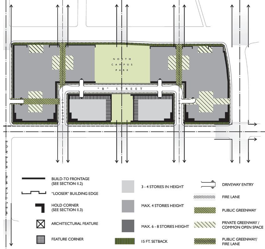
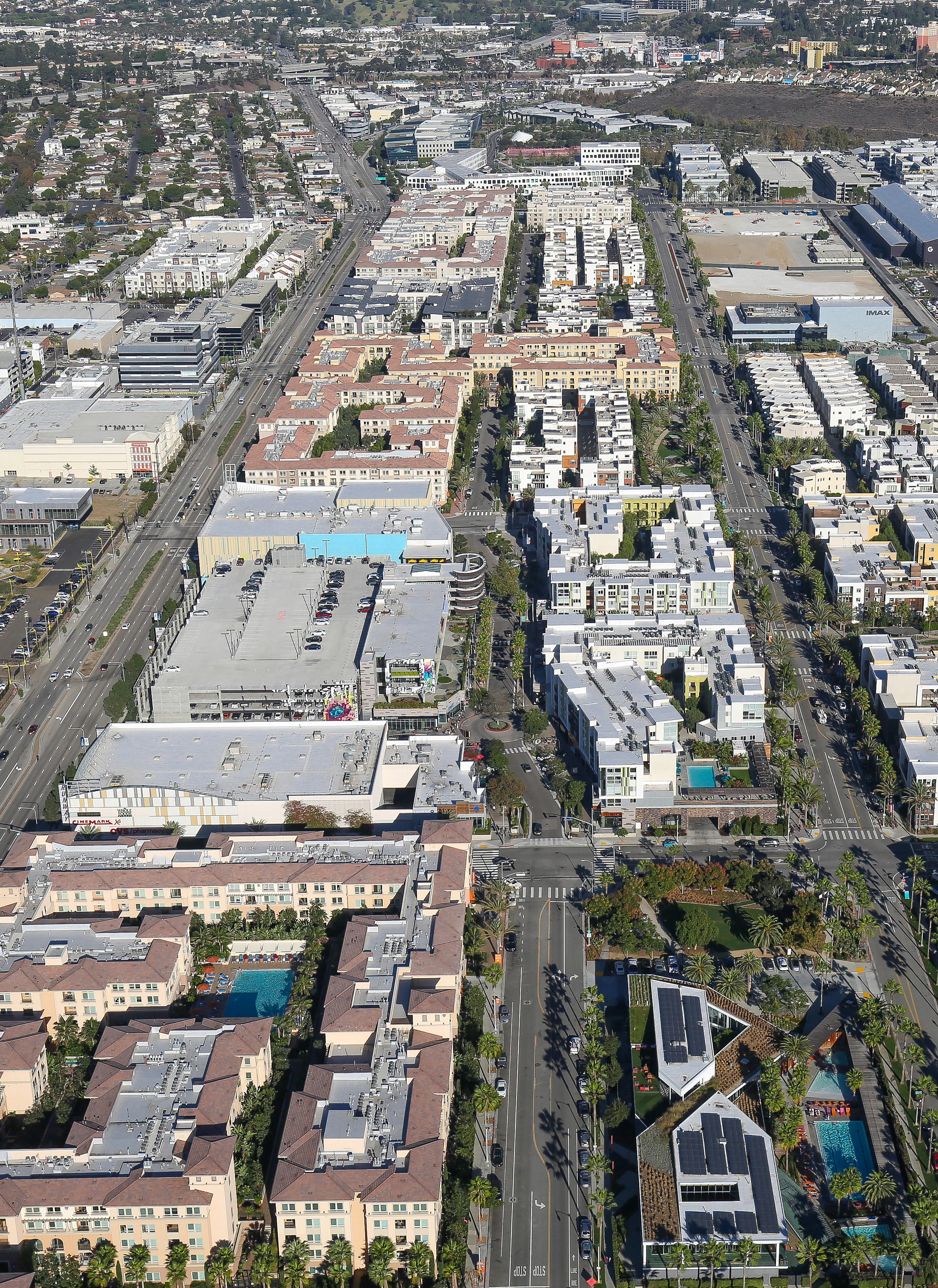
As one of the largest additions to the urban fabric of Los Angeles, the 1000-acre Playa Vista development that replaced the Howard Hughes Corporation’s aeronautics engineering campus and airstrip was widely heralded as a new urbanist model of infill redevelopment. Upon completion and occupancy of its first phase, however, the project’s developer, Playa Capital Company, undertook an evaluation of its earlier developments and determined that design standards needed revision so that Phase II projects would yield better streetscape and architecture of a higher quality. Prepared as a supplemental document to the Playa Vista Specific Plan, the resulting framework and standards are a form-based approach to establishing urban design character for the largest new development on the west side of Los Angeles.

A series of framework principles were defined to provide direction for future design and development, including: (1) establishing the street and park spaces as the most important element of public space with buildings that support their spatial definition; (2) establishing a distribution of compatible land uses and housing mix that supports a vibrant public realm; (3) defining an architecture that is straightforward and clear and that honors timeless architectural conventions; (4) controlling private parking access through planning and design that emphasizes a pedestrian-oriented streetscape; and (5) establishing a network of landscaped pedestrian paths as part of a walkable block structure that is more like the pedestrian scaled blocks of historical cities. Considerations also included detailed design guidelines for the project’s mixed-use Town Center (which the firm eventually designed), to include 360,000 square feet of commercial development with more than 200 mixeduse housing units, some above the commercial development.
 APA California Planning Award APA Los Angeles Planning Award
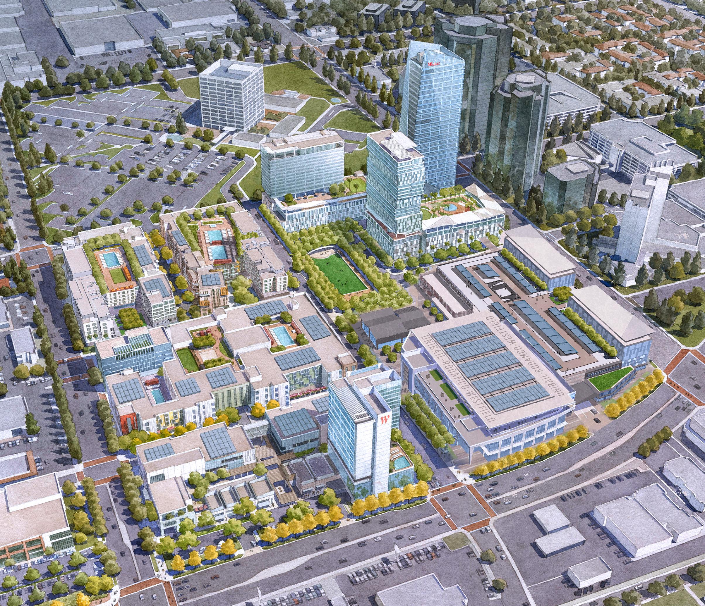
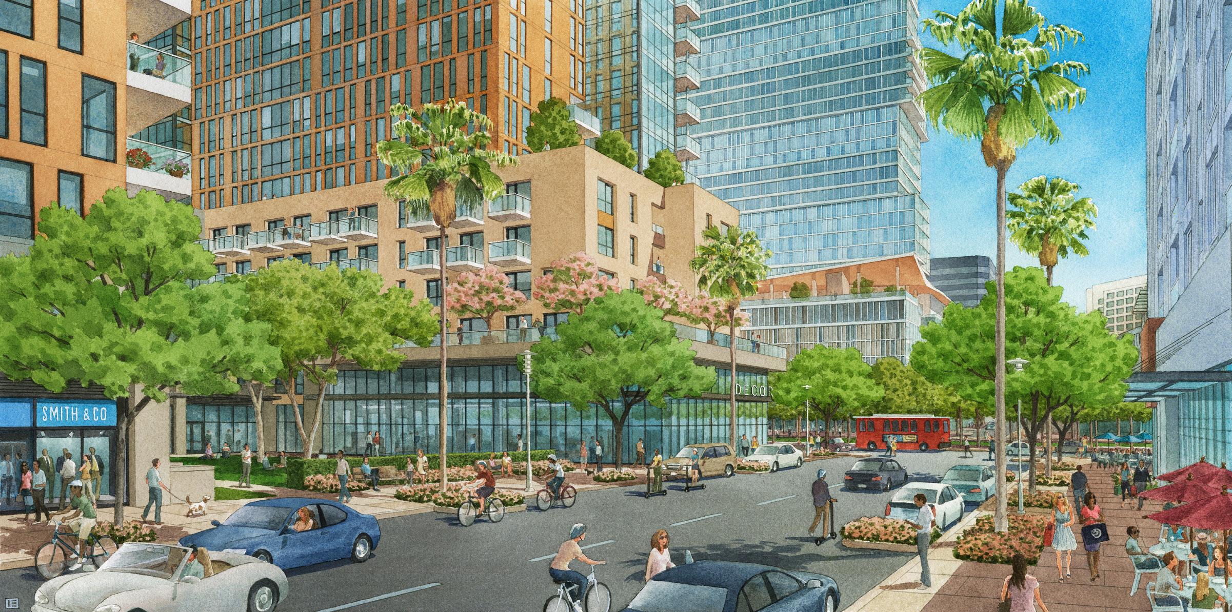
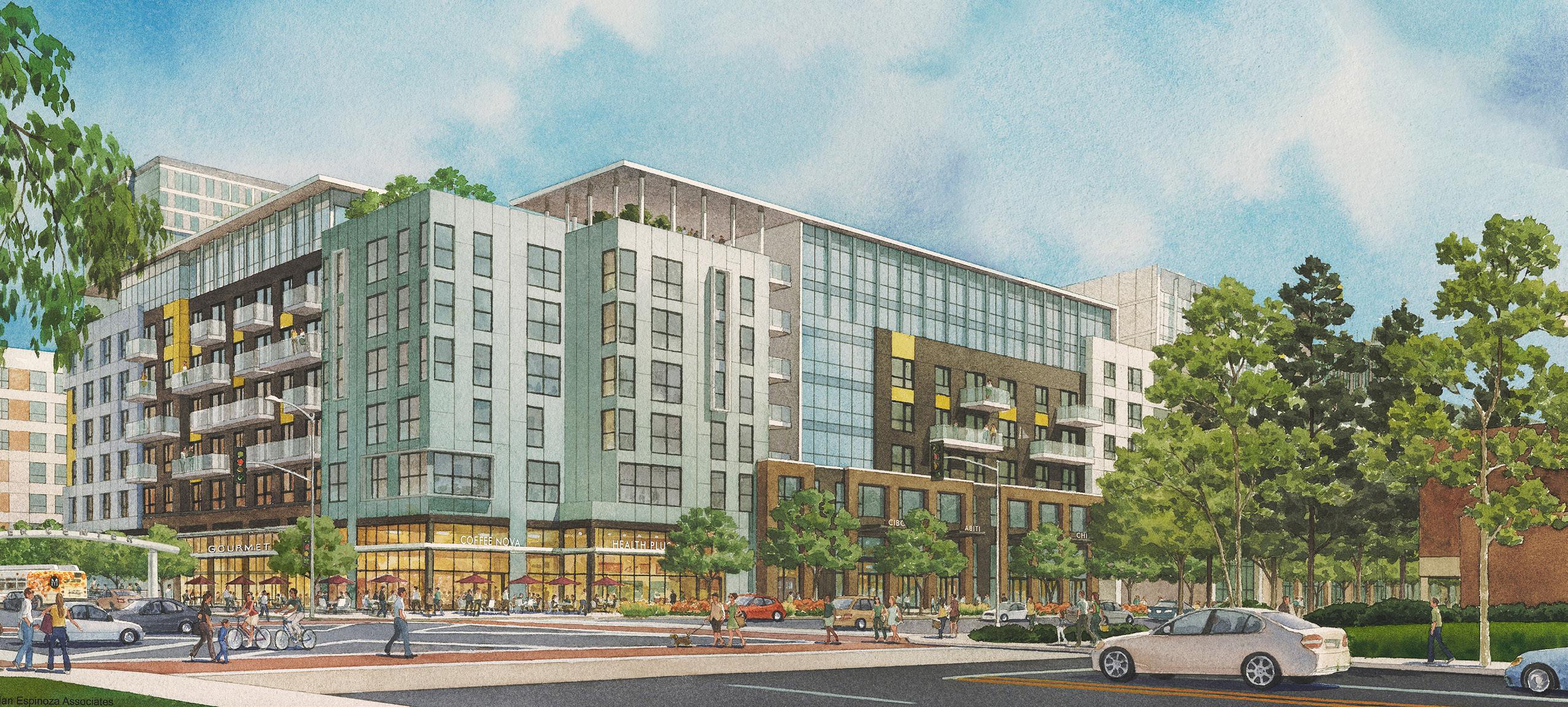
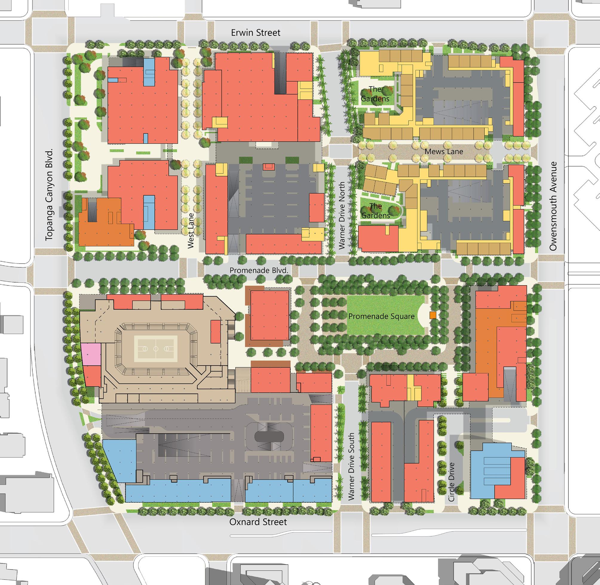
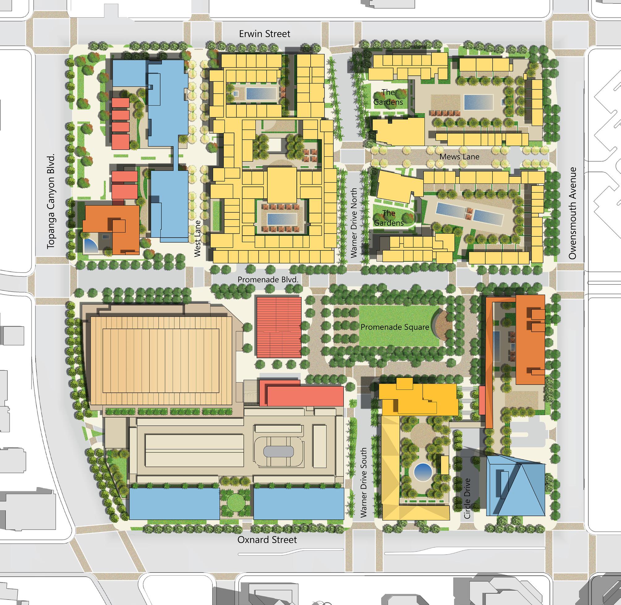
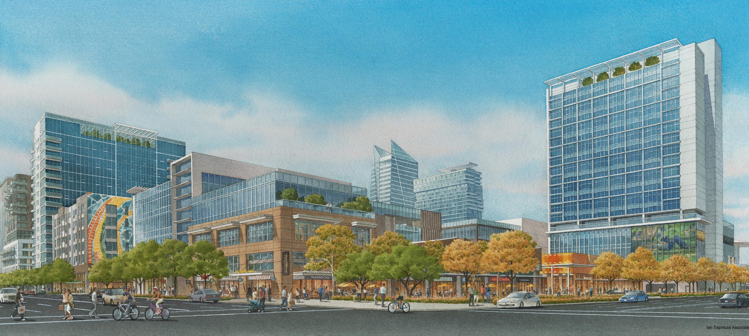
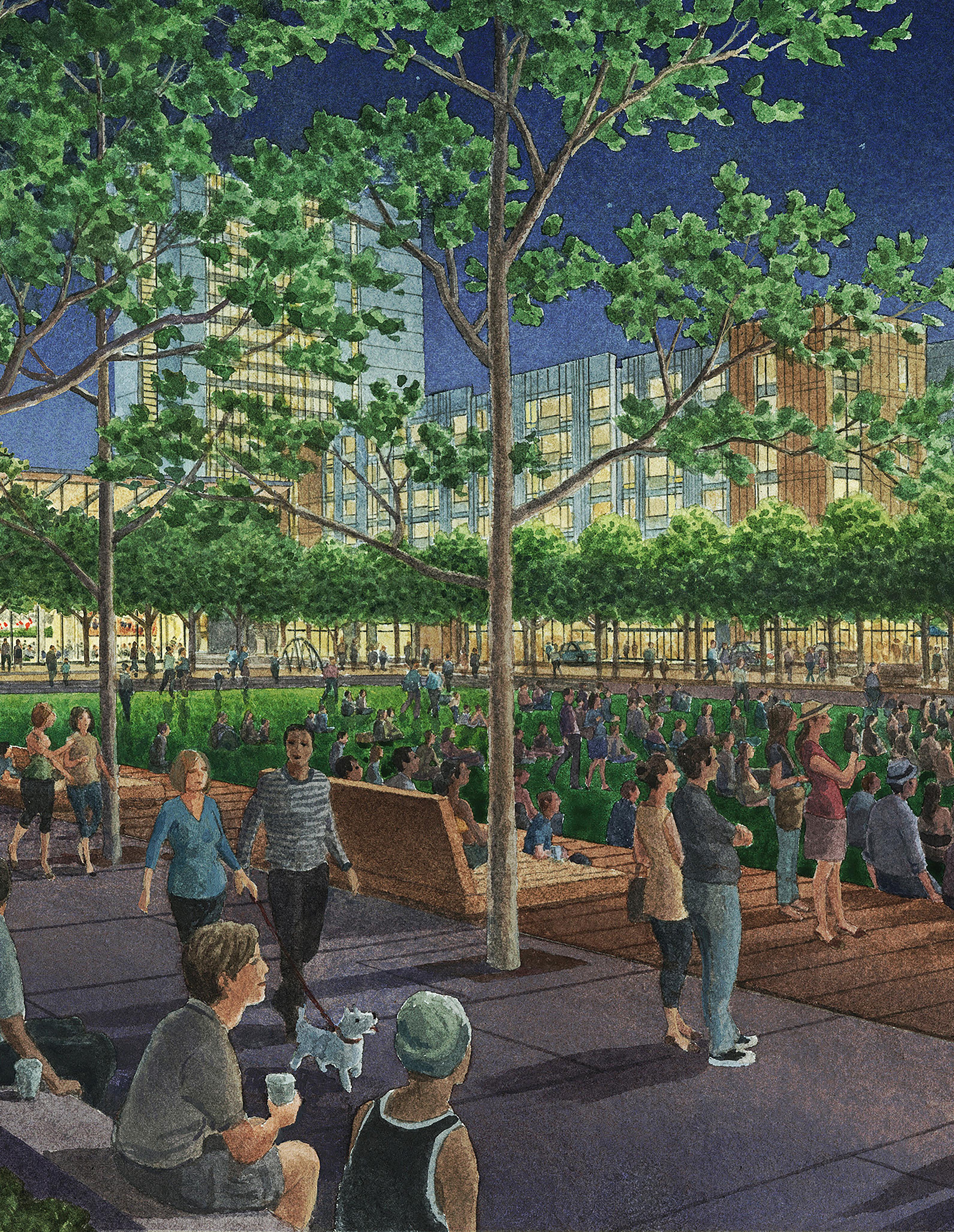
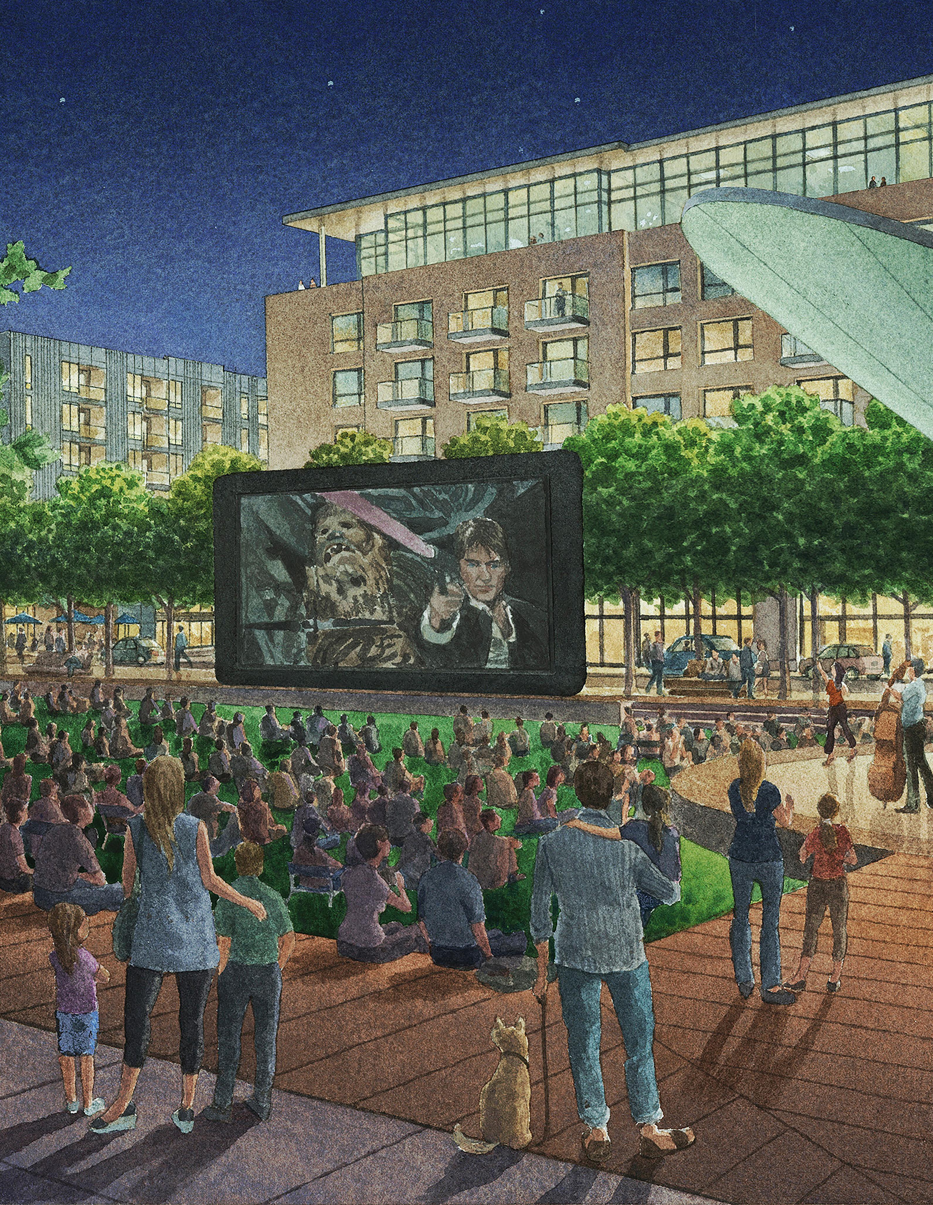
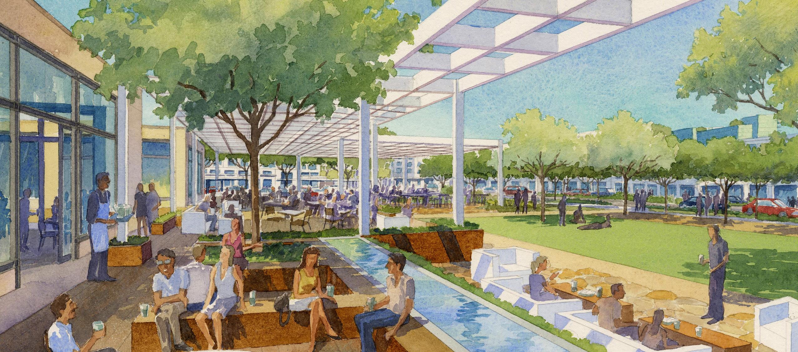
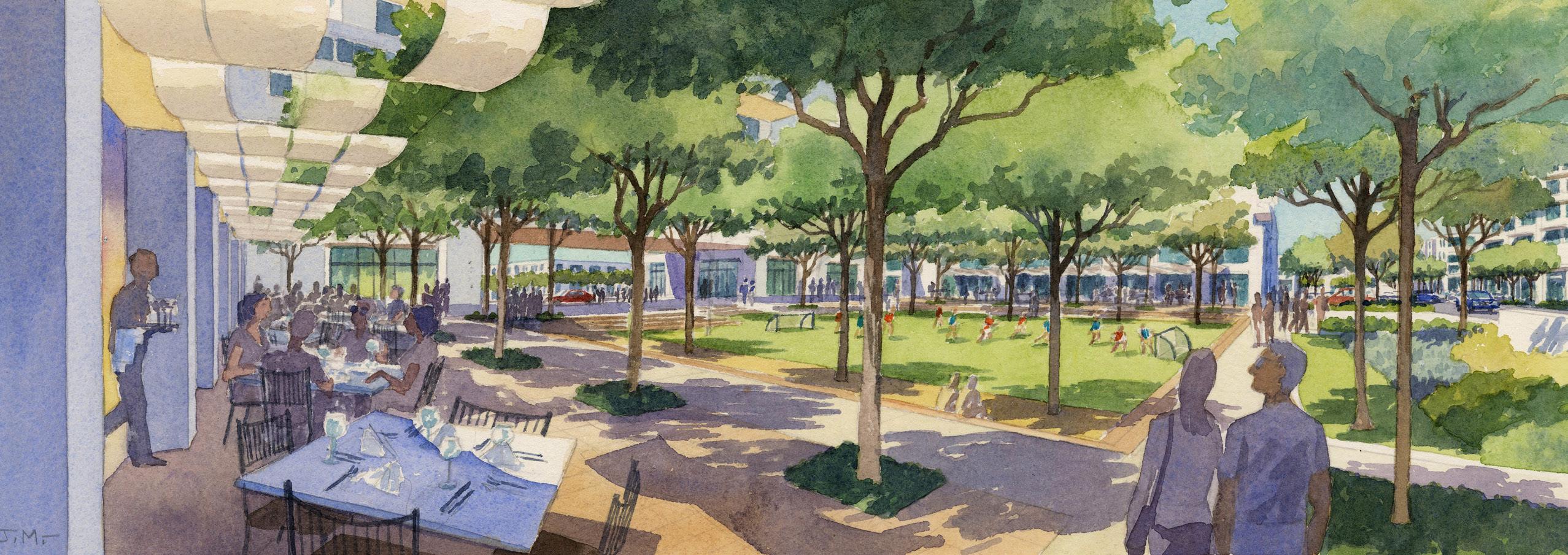
The evolution of consumer preferences from brick and mortar to online shopping has led to the decline of shopping malls across the country, and the repurposing of these large, often centrally located sites offers opportunities to remove their essentially anti-urban features and restore them as additions to the fabric of their urban context. Westfield’s 35-acre Promenade Mall site, in the San Fernando Valley of Los Angeles, has been largely vacated and is poised for redevelopment. Years of planning by the City of Los Angeles and community have identified the neighborhood, including the mall site, as the “Downtown of the Valley.” The City Council adopted in 2015 a Specific Plan (a focused land use plan under California law) called the Warner Center 2035 Plan, identifying the mall site for development as a dense mixed-use center with a floor area ration (FAR) up to 5.0. A complex formula is specified in the plan for calculating density that favors affordable housing, small subdivision of large land holdings into small walkable city blocks, public open space and pedestrian ways, and active retail frontages on all street within the district.
In accordance with the Specific Plan, the master plan for the mall site is organized around the concept of a traditional street grid – the age-old system that is simple and direct, flexible and open-ended – breaking the superblock of the now defunct mall into smaller development sites. This makes the site more urban and hospitable for walking in well-landscaped street spaces with active storefront retail. Street parking is allowed in places, supplemented with additional subterranean parking. Spatially, the sense of place is urban, quite different from the suburban mall. The plan has more than seven acres of publicly accessible open space including a central park programmed for active use, a wide range of residential unit types including affordable housing, significant Class A and creative office space, life-style retail, two hotels, and an entertainment venue for athletic events and performances. The project is programmed as an environmentally resilient neighborhood drawing upon energy and water conservation principles. At 3.4 million square feet, the project will provide a vertically mixed-use environment for live/work/play in an urban setting that is the antithesis of the suburban mall it is replacing.
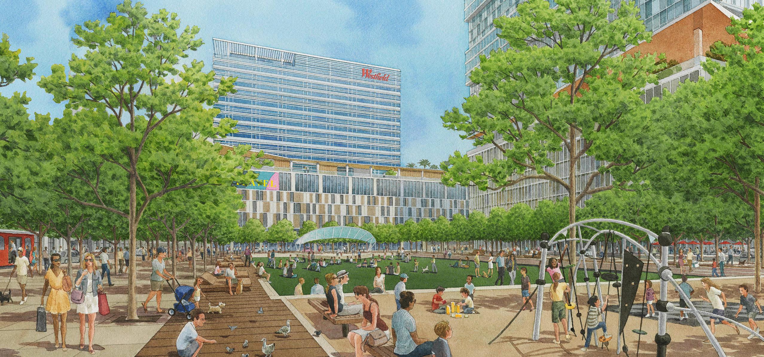
a superblock has been broken down in scale to four plan quadrants, hospitable to pedestrian activity and with enhanced sidewalks, ground-level retail and subterranean parking
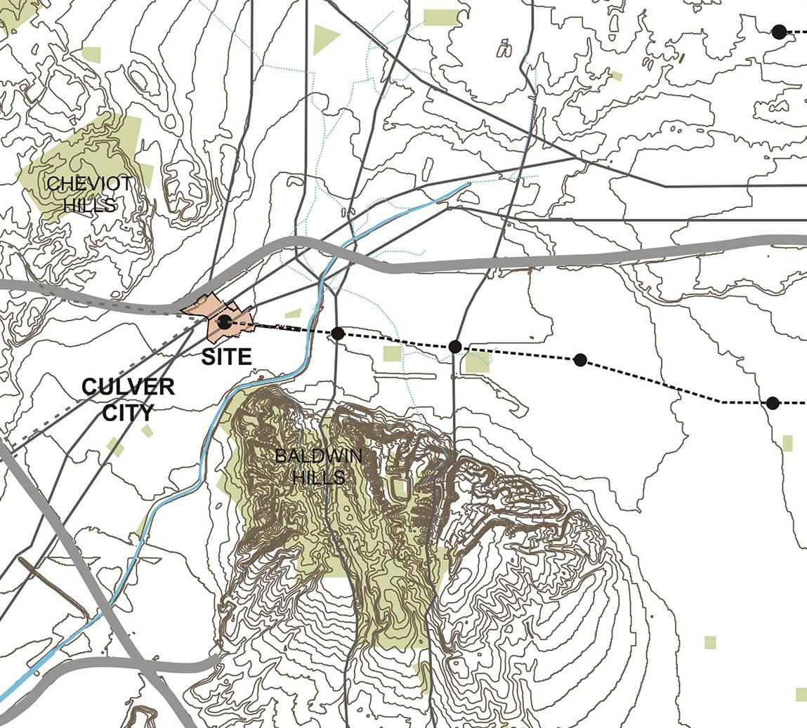
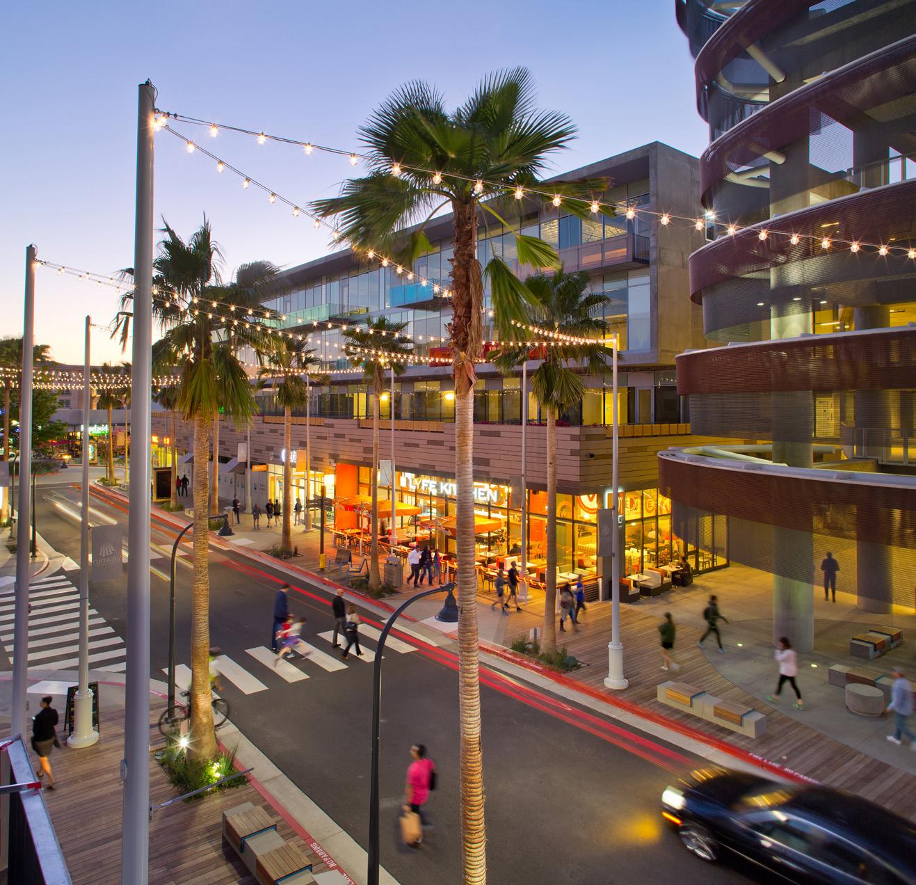
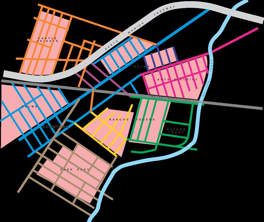
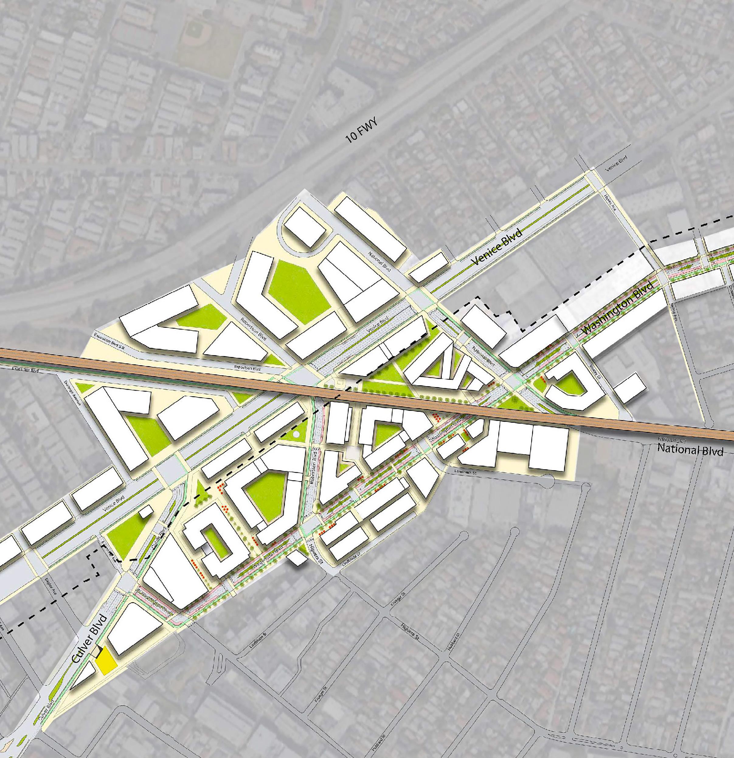
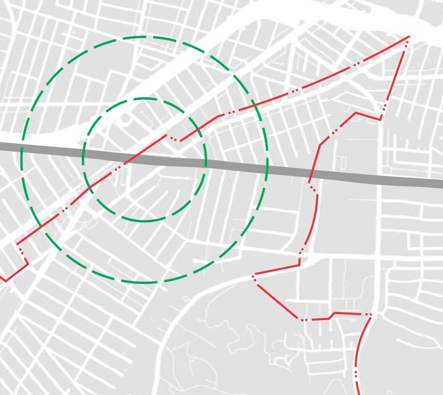
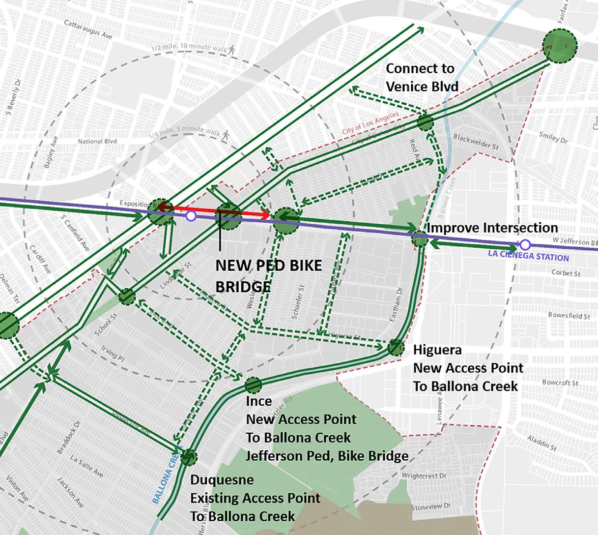
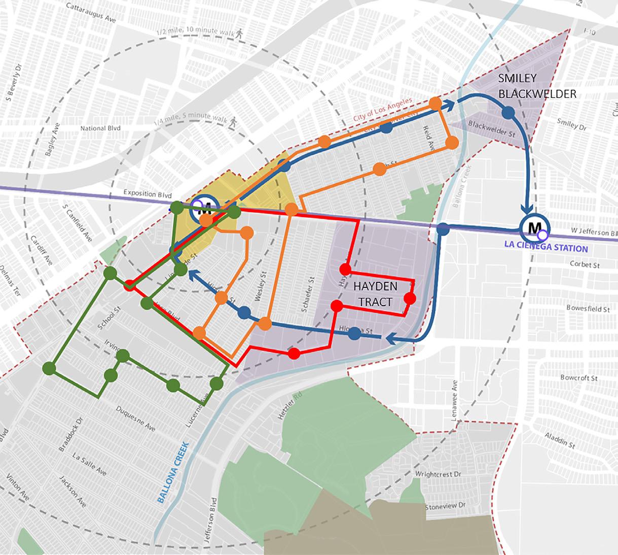
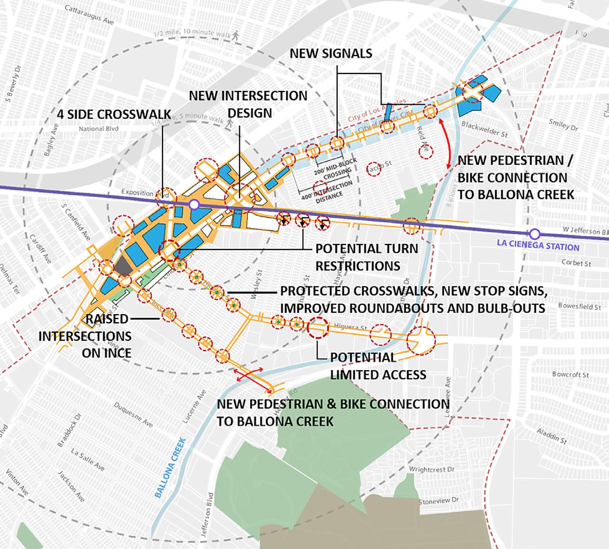
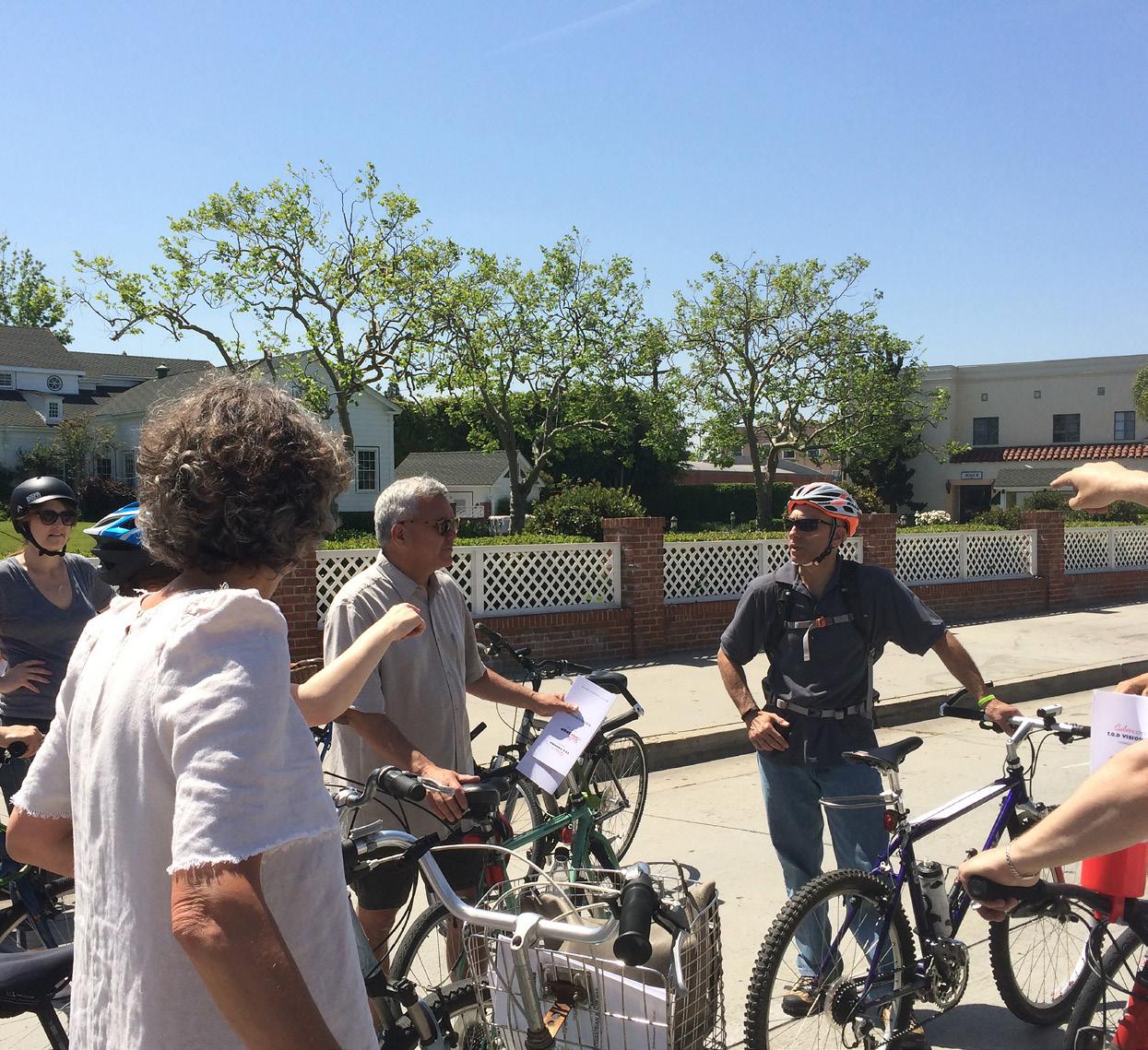
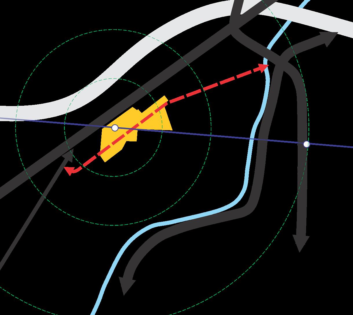
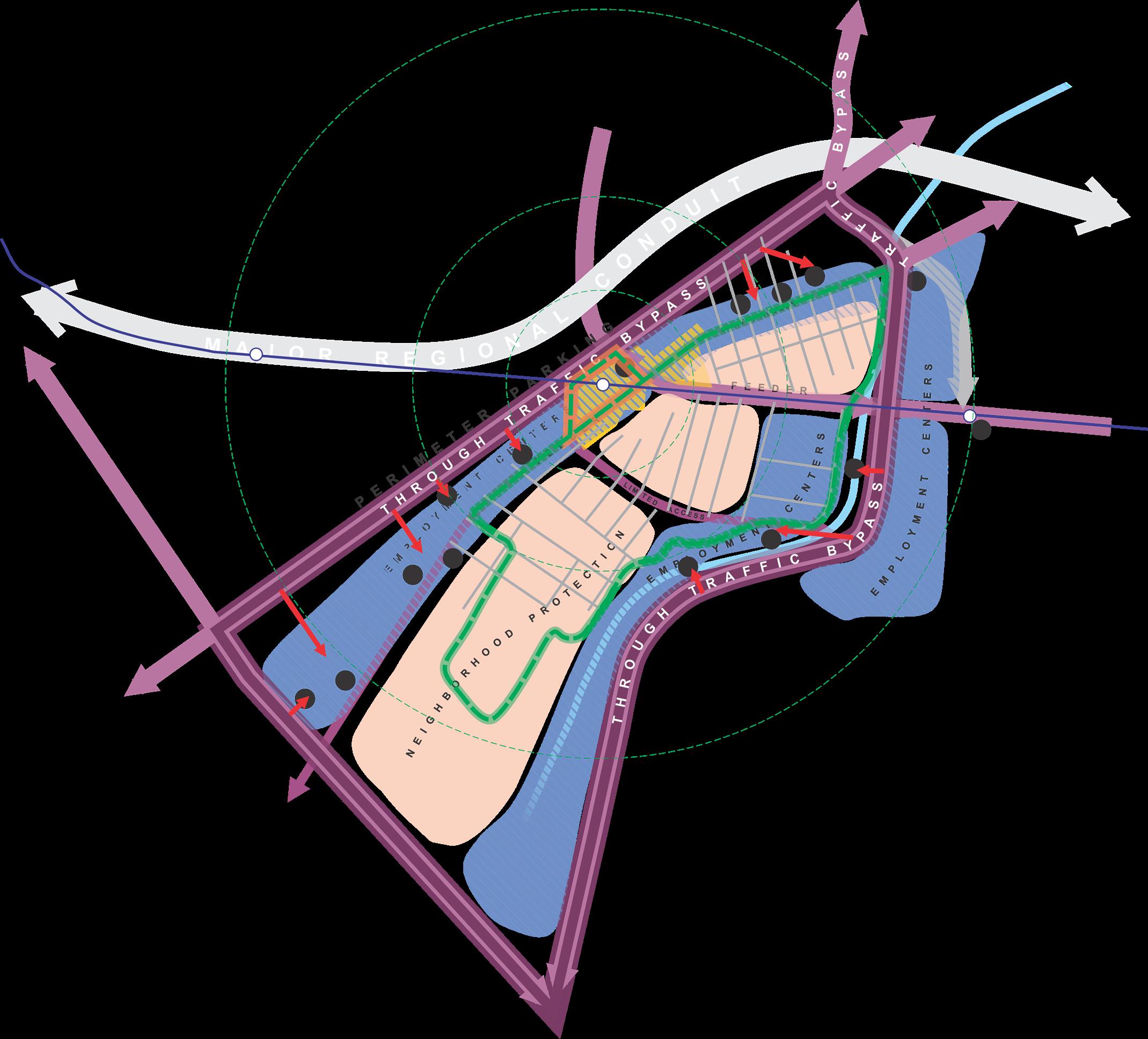
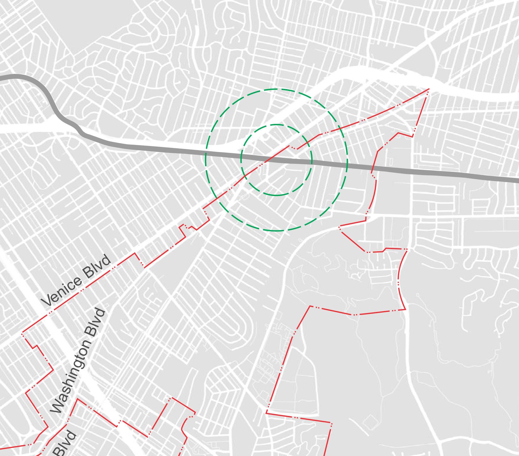
The streets and sidewalks and other modes of movement through a city are the critical glue that holds the city’s various land uses together. When that glue fails, the city ceases to work and risks decline. Culver City, a separately incorporated city midway between downtown Los Angeles and the beach, sought to find solutions to existing citywide issues like crippling daily through-traffic, particularly at rush hour, and the disconnected local street network that limits mobility between neighborhoods and across the city for those who live there. The Expo light rail Line, connecting Culver City to downtown, introduced a new catalyst for local mobility when it opened in 2012. This new connectivity to the region presented an opportunity to re-envision land use surrounding the station and exploring local mobility options within the city, including the transit hub and its surrounding neighborhoods.
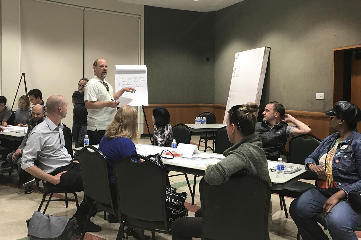
The resulting plan, or visioning strategy, emerged from eight public workshops with community groups, City staff, and general public input to the project’s interactive website, with the goal to increase the viability of alternative mobility modes for residents and other users by developing more and better choices. Recommendations for both near-term improvements and longer-term strategies include a perimeter parking and circulation plan to discourage cut-through traffic; improved access points to major employment centers; a system of flexible, on-demand micro-transit with dedicated street lanes and strategic connections; a Complete Streets re-design for Washington Boulevard as the area’s main spine; a comprehensive network of bike routes and bike facilities; more frequent and improved crosswalks for pedestrian priority and other neighborhood protection measures; an expanded transit oriented development district with a new specific plan; and a robust transit demand management program ultimately for city-wide application. The strategies embody the community’s priorities: pedestrians first, transit next, then bikes, and cars last.
 REGIONAL SETTING
The goal is to increase the viability of alternative mobility modes for residents and other users by developing more and better choices. Priorities are defined as pedestrians first, transit next, then bikes, and finally cars.
LOS ANGELES
WEST SIDE BIKE TRACK TO TRANSIT HUB
EXPO STATION
WASHINGTON BOULEVARD AS A “COMPLETE STREET”
“ROAD DIET” FOR HIGUERA TO DISCOURAGE THROUGH-TRAFFIC
RE-DESIGN INTERSECTION FOR IMPROVED CROSSWALKS AND BIKE CONNECTIONS
DOWNTOWN
TRANSIT/PARKING FLEX LANE ON BOTH SIDES
IMPROVE CROSSWALKS FOR TRANSIT RIDERS
MORE FREQUENT AND WELL-DESIGNED CROSSWALKS
RANCHO HIGUERA
2-WAY PROTECTED BIKE TRACK ON SOUTH SIDE
PEDESTRIAN NETWORK RECOMMENDATIONS
VARIABLE NETWORK OF TRAFFIC TO MINIMIZE CONFLICTS WITH OTHER MODES
BICYCLE NETWORK
VEHICULAR TRAFFIC MANAGEMENT
RECOMMENDATIONS FOR TRAFFIC DIVERSIONCONSERVE AND PROTECT THE CHARACTER OF EXISTING RESIDENTIAL
APA Los Angeles Planning Award
Progressive Architecture Urban Design Award
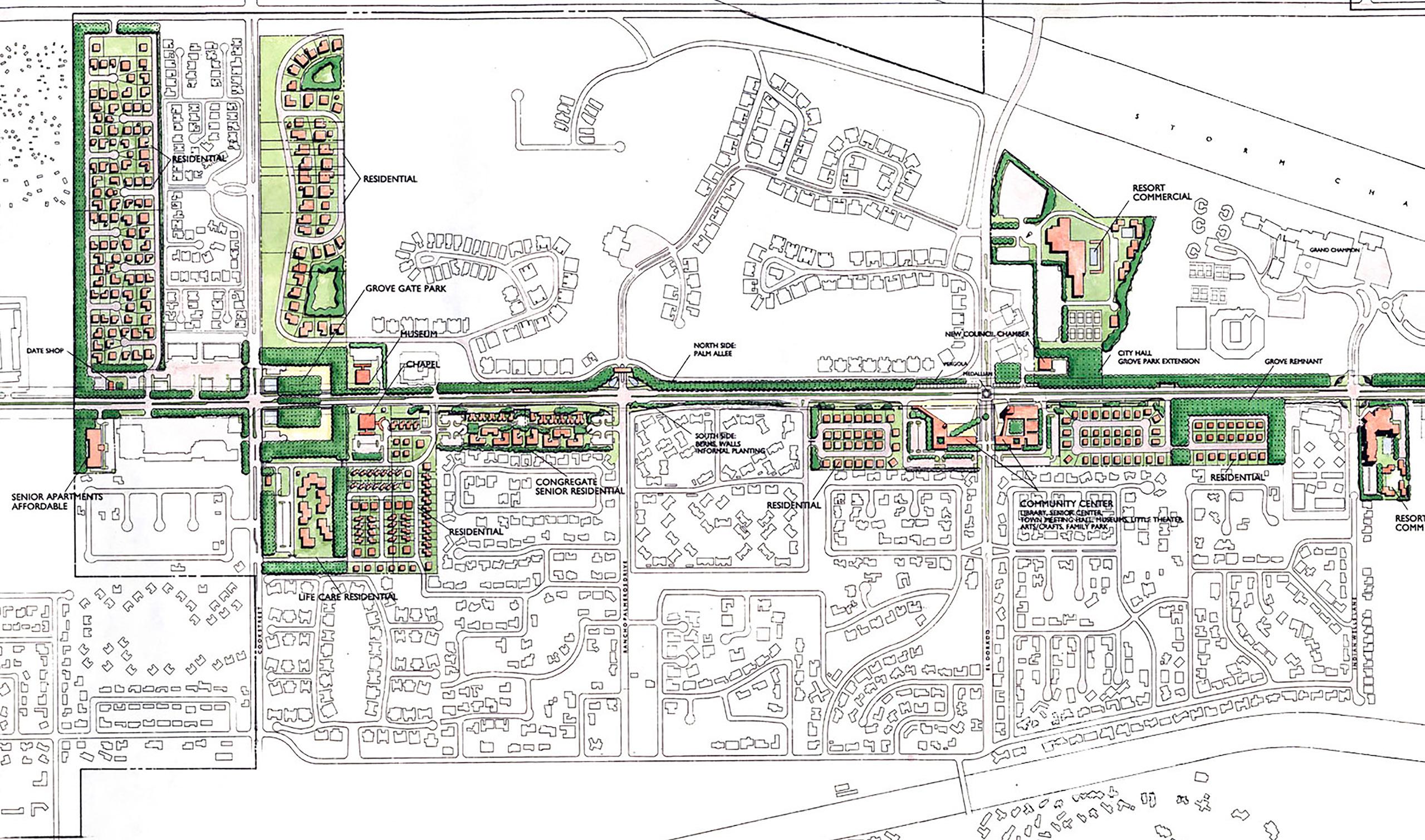
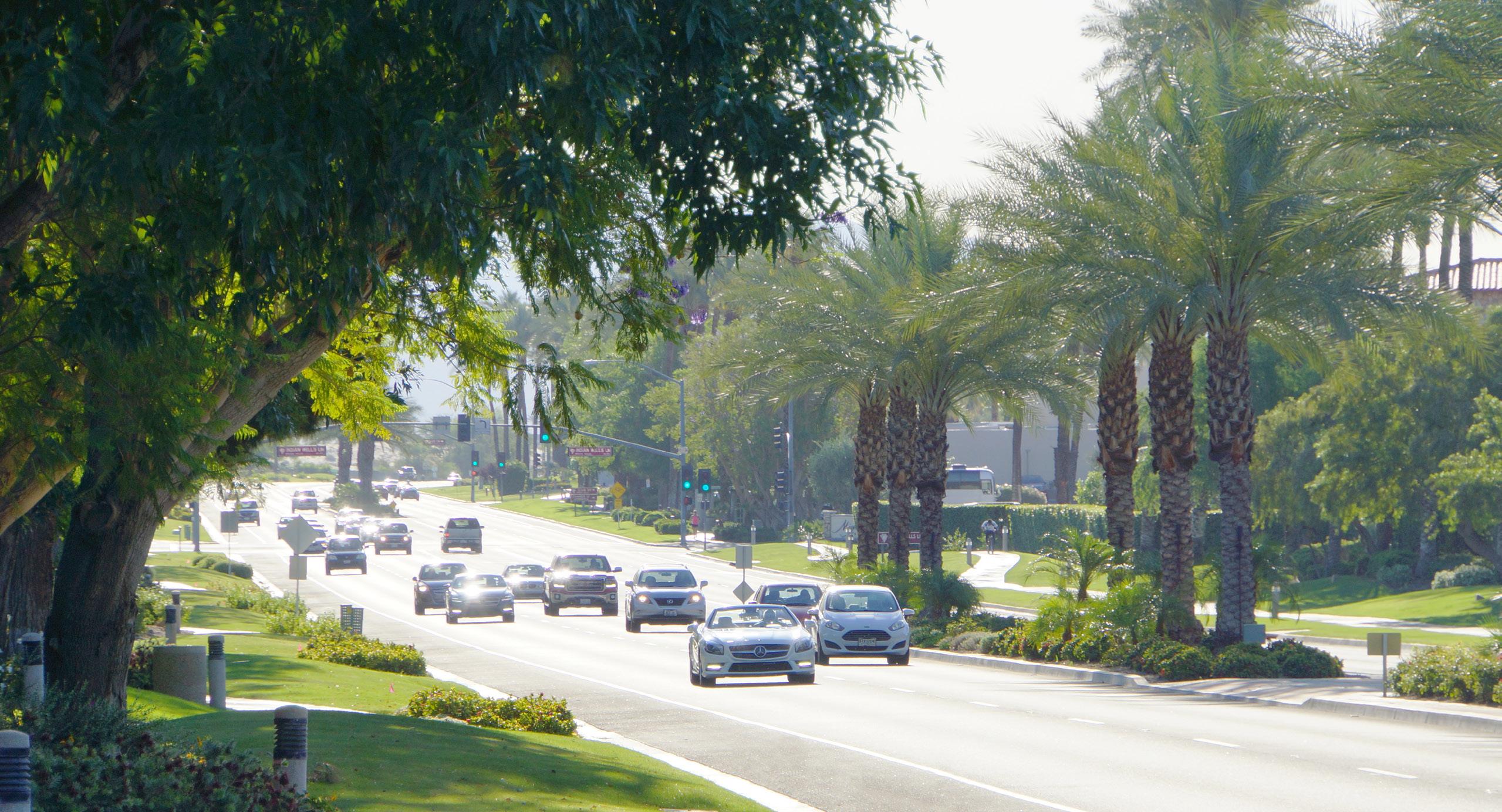
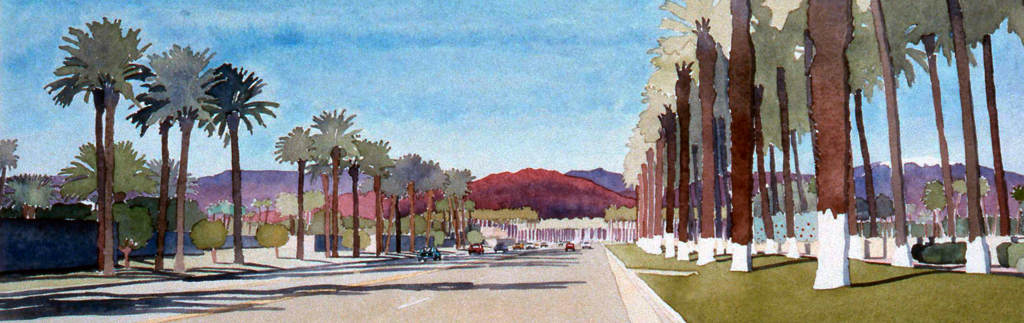
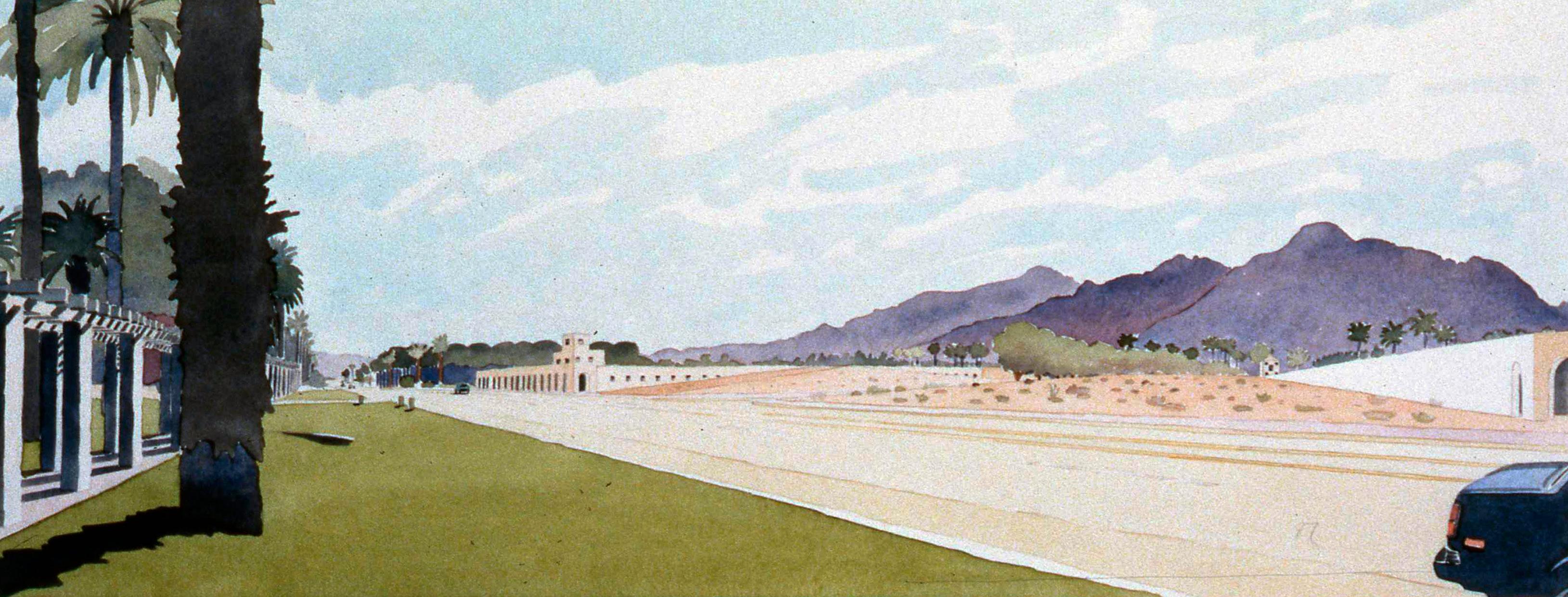
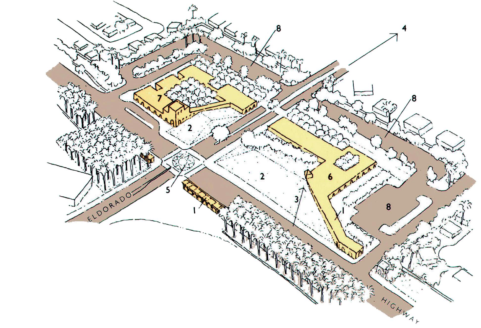
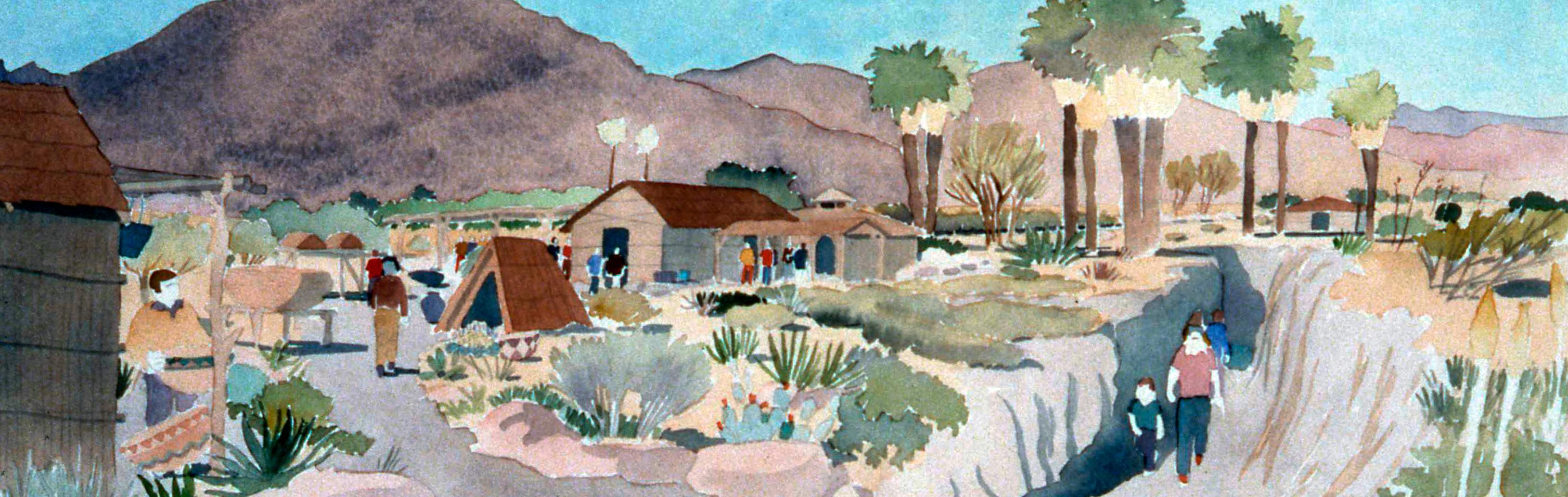
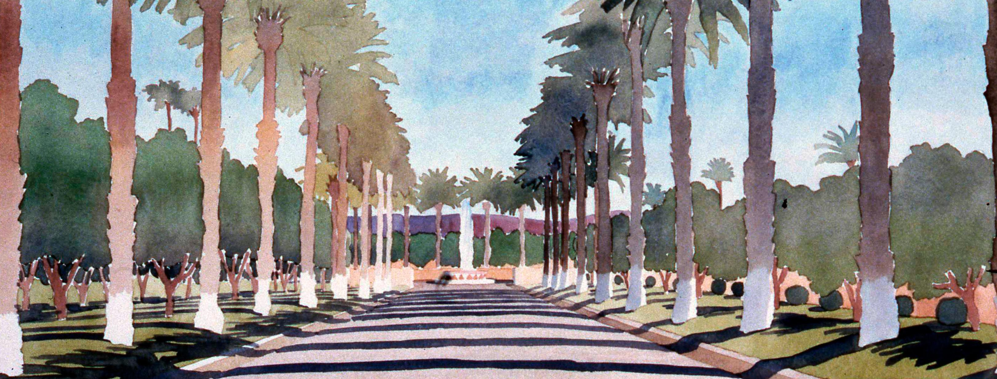
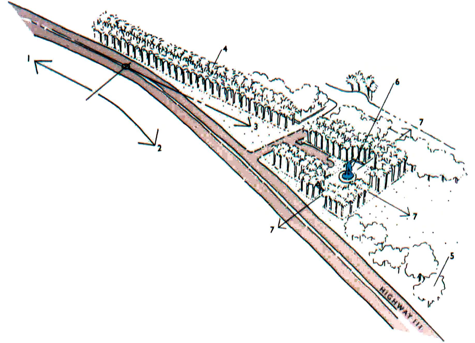
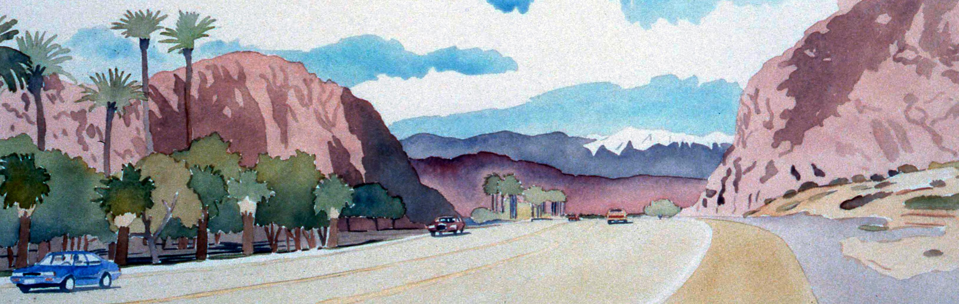
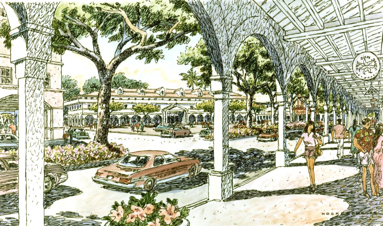
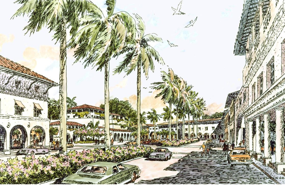
What remains in memory more: the overall impression of a city’s grand boulevard, or the individual pieces that make it up? The streets and paths that stitch together the fabric of the city are the conduits of time and motion that allow the whole to come together and make sense, for better or worse. With “highway commercial” zoning that would encourage strip retail malls along the city’s main vehicular route, Highway 111, the City of Indian Wells was poised to continue the autooriented strip retail development like other cities along the corridor. Seeing an opportunity to distinguish and differentiate itself, the City rezoned the three and one half mile highway corridor limiting uses to landscape buffer and residential development. Despite strong support from the community, eleven highway property owners who were subject to the zone change filed lawsuits against the city for “downzoning” their properties. The council decided to adopt a Specific Plan for the highway frontage supporting its vision for the city.
The Specific Plan includes a combination of residential, resort, community and open space uses. Research of the city’s history discovered, for instance, that the highway right-of-way was once an airplane landing strip. The city also had been the location of many date groves, a few remnants of which still existed. During the 19th century, indigenous tribes in the area dug holes with circular ramps deep into the earth in search of water. The discovered location of one of these wells within the highway corridor was included in the plan and proposed for restoration. The Highway 111 Corridor plan proposed a landscape zone on both sides of the highway, prescribing a “formal” edge of date palms in multiple rows on the north side compatible with a major resort hotel and golf course there, and a more informal landscaped edge on the south side deferring to the smaller scale of its single-family homes. The project captured elements of the “real” desert, visually framing them, like California plein air desert paintings, as the desert plain, the mountains, and the sky—all now emblematic views from the road in Indian Wells.
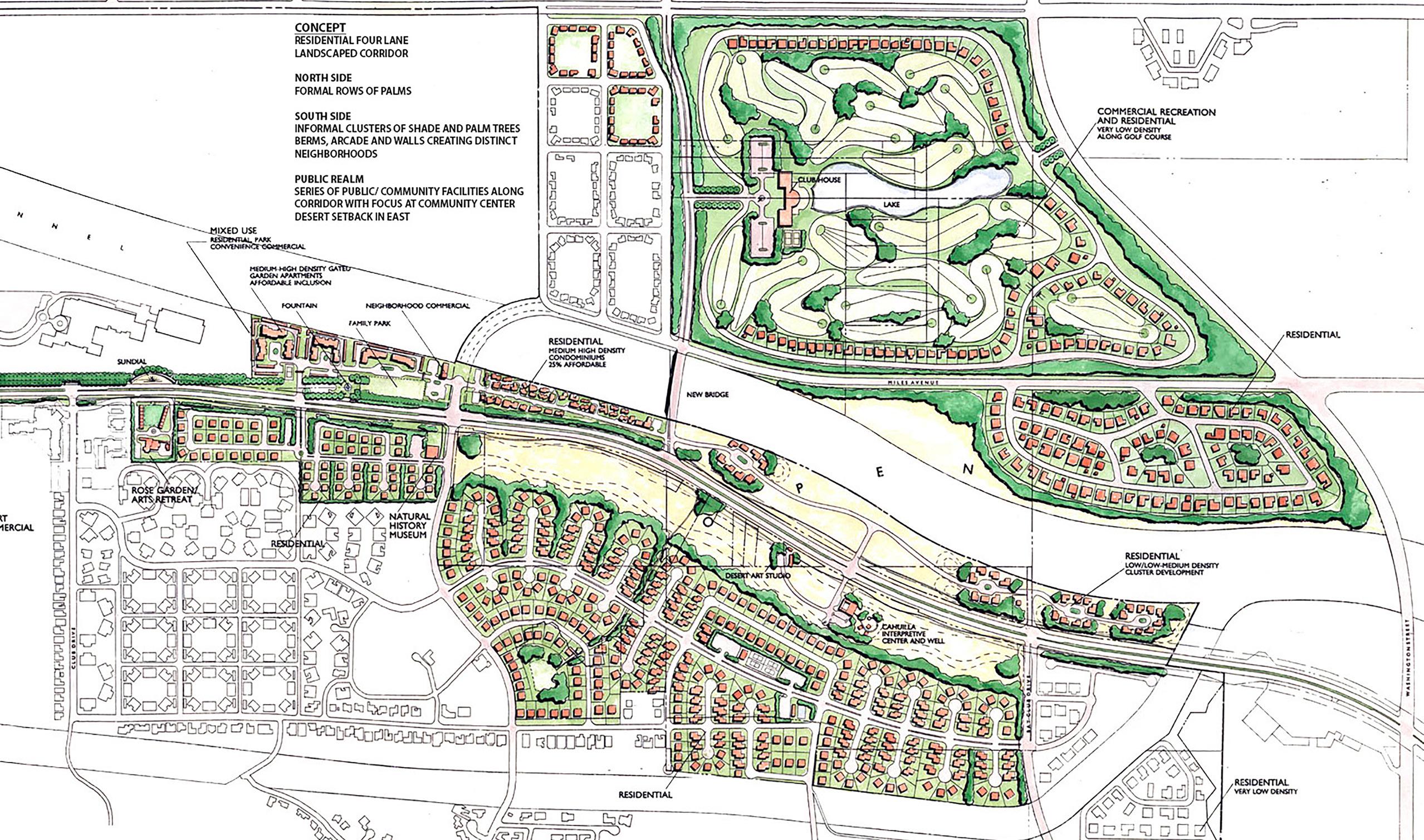
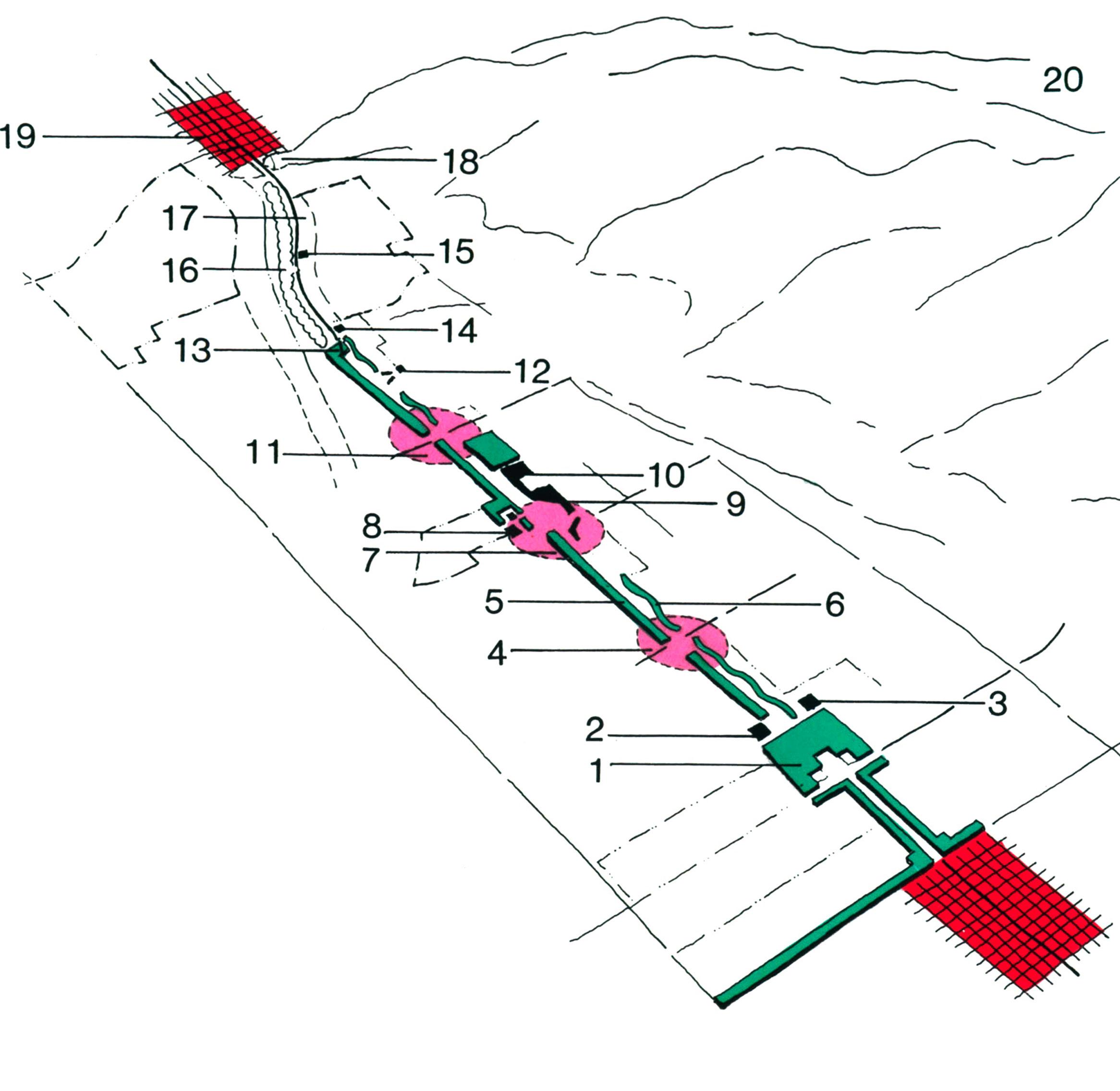
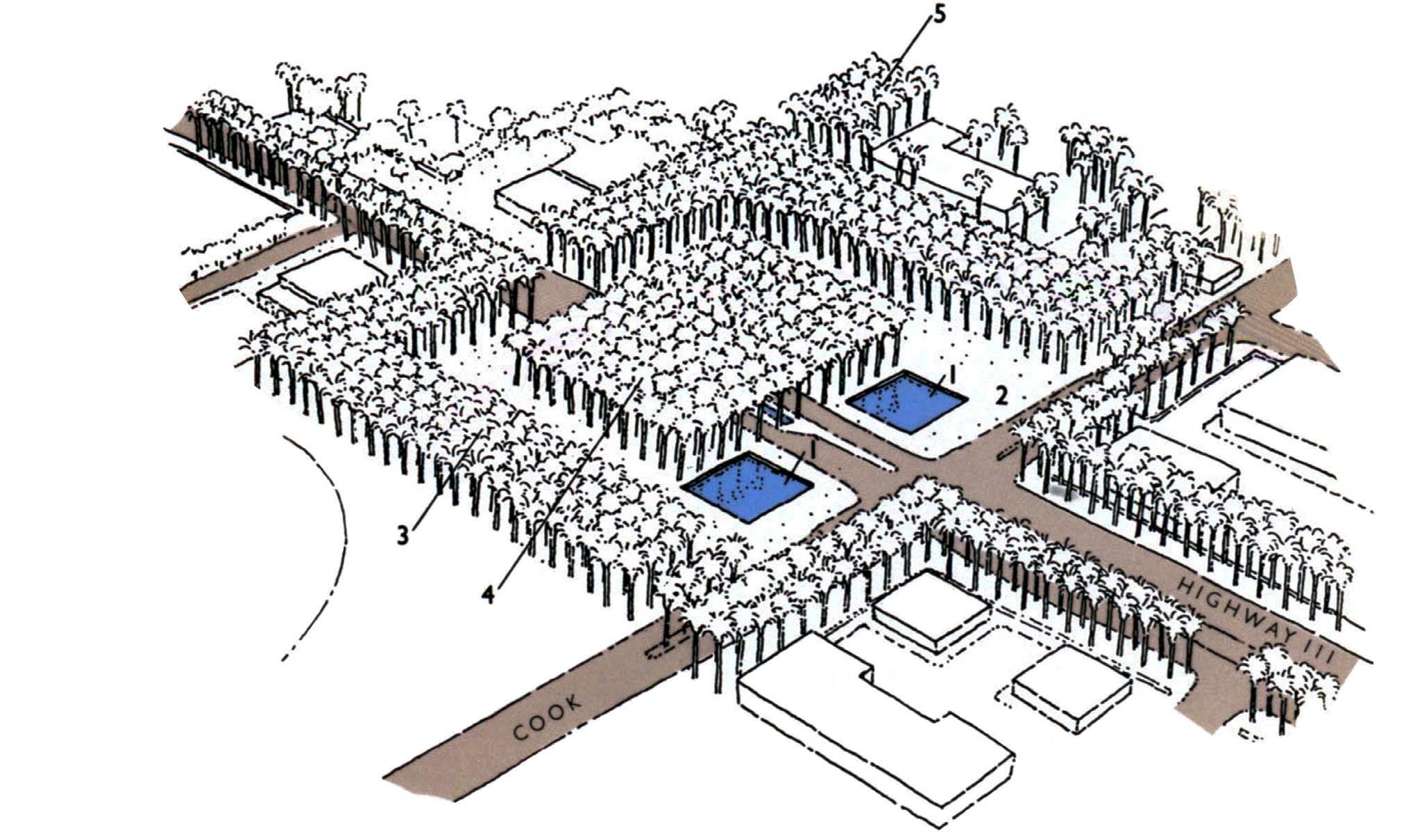
 KEY
1. Arcade or Pergola
2. Bermed Natural Desert Park
3. Foreshortened Wall Focused on Reduced Scale Building
4. View to Mt. Eisenhower
5. Cahuilla Indian Basket Weave Pattern
6. Community Buildings
7. Library
8. Parking
CIVIC NODE
DESERT VIEW AT CIVIC NODE
CAHUILLA INTERPRETIVE CENTER AND WELL
KEY
1. Arcade or Pergola
2. Bermed Natural Desert Park
3. Foreshortened Wall Focused on Reduced Scale Building
4. View to Mt. Eisenhower
5. Cahuilla Indian Basket Weave Pattern
6. Community Buildings
7. Library
8. Parking
CIVIC NODE
DESERT VIEW AT CIVIC NODE
CAHUILLA INTERPRETIVE CENTER AND WELL
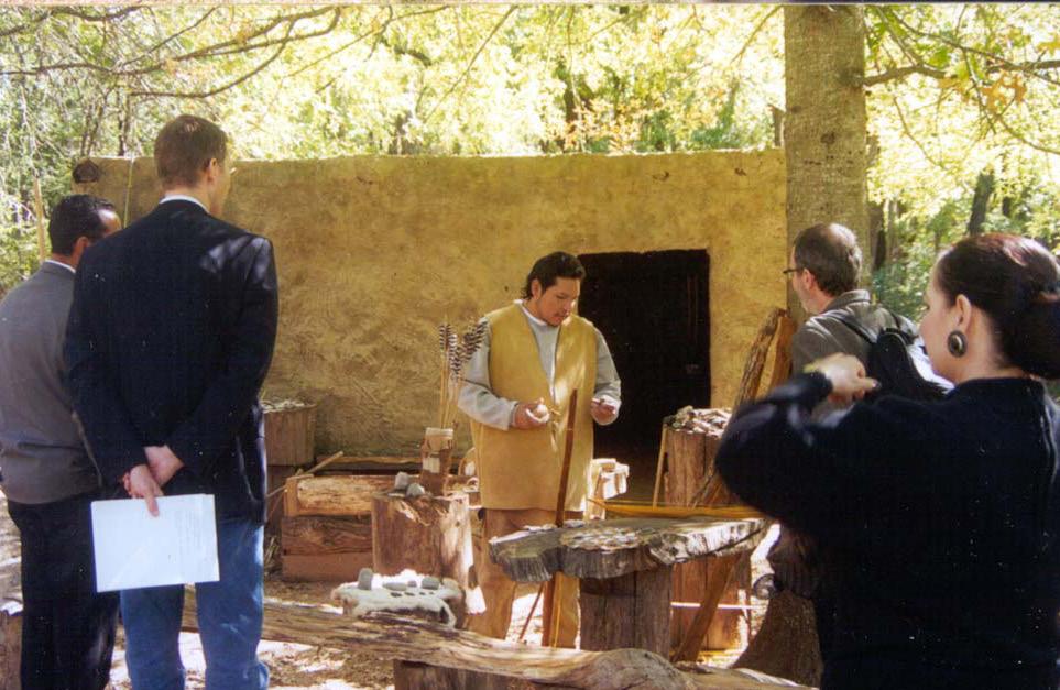
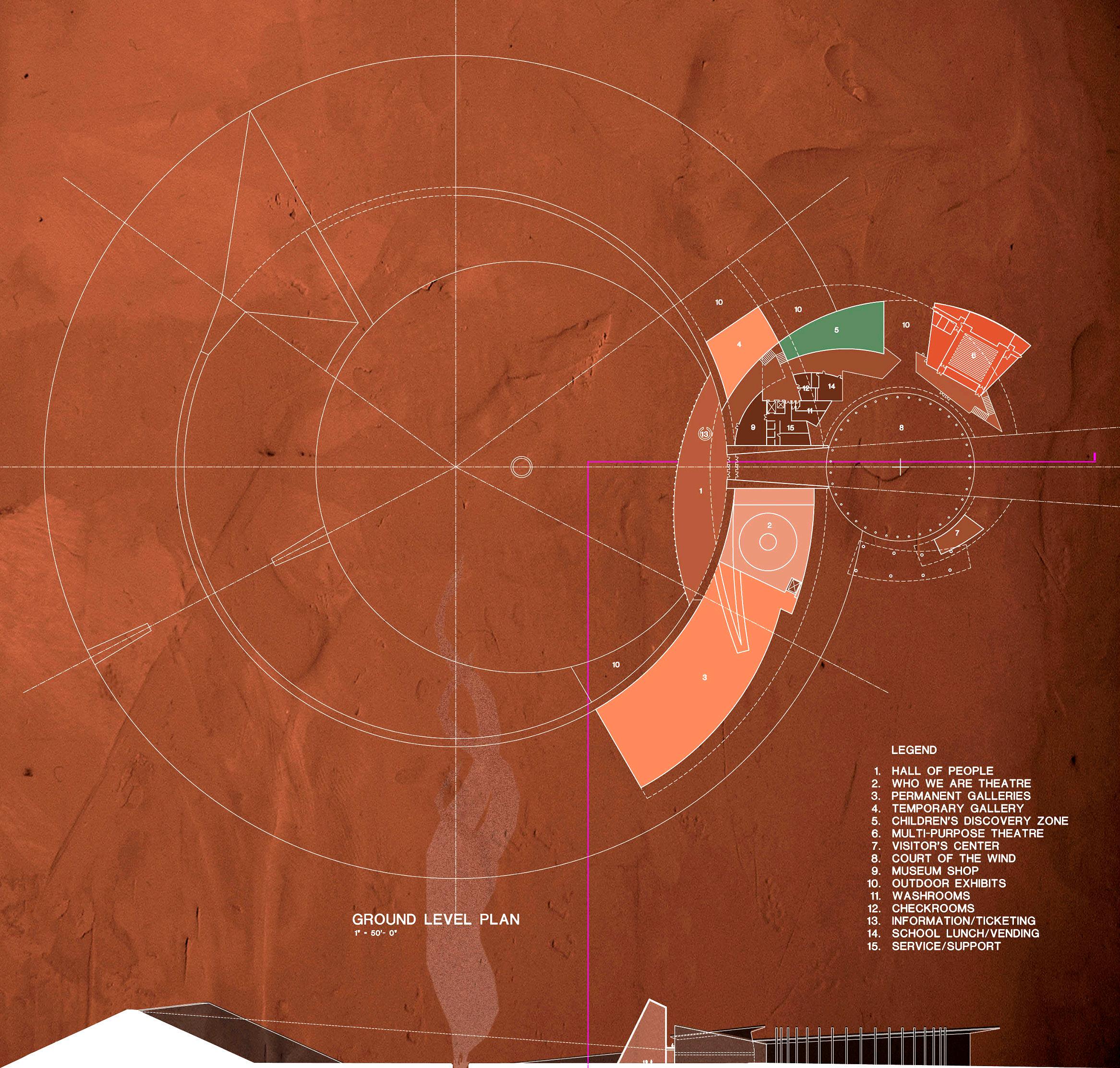
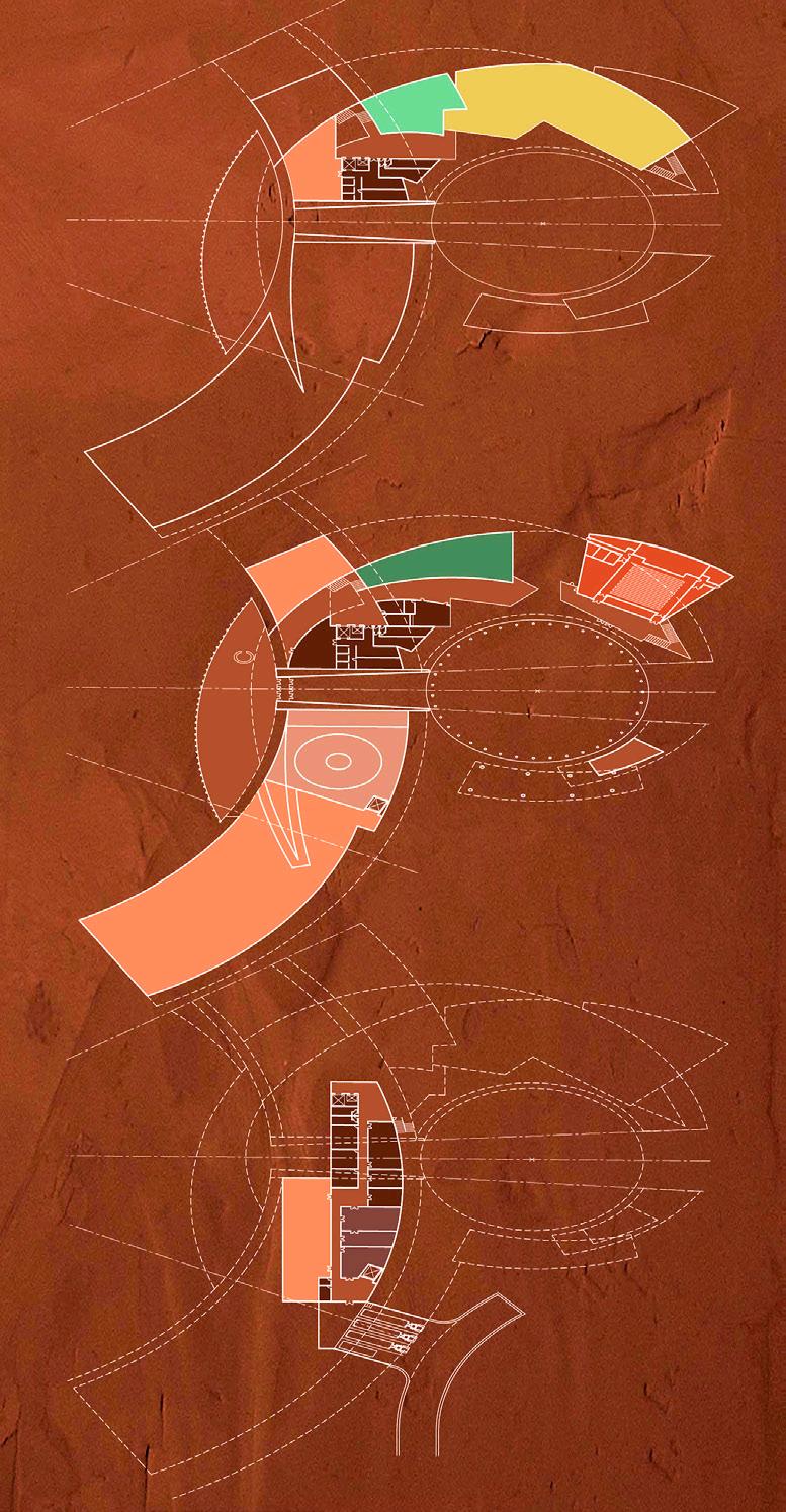
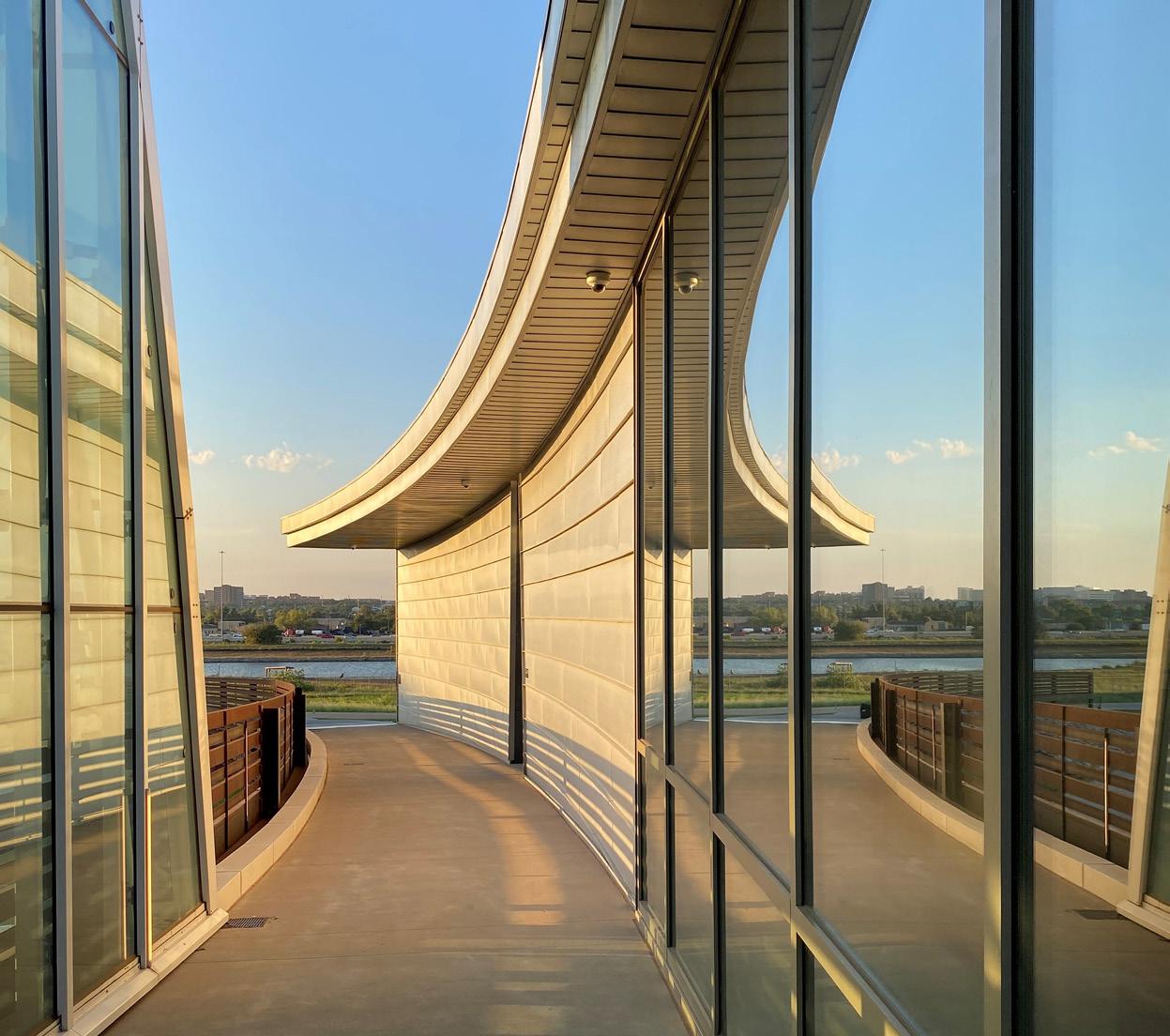
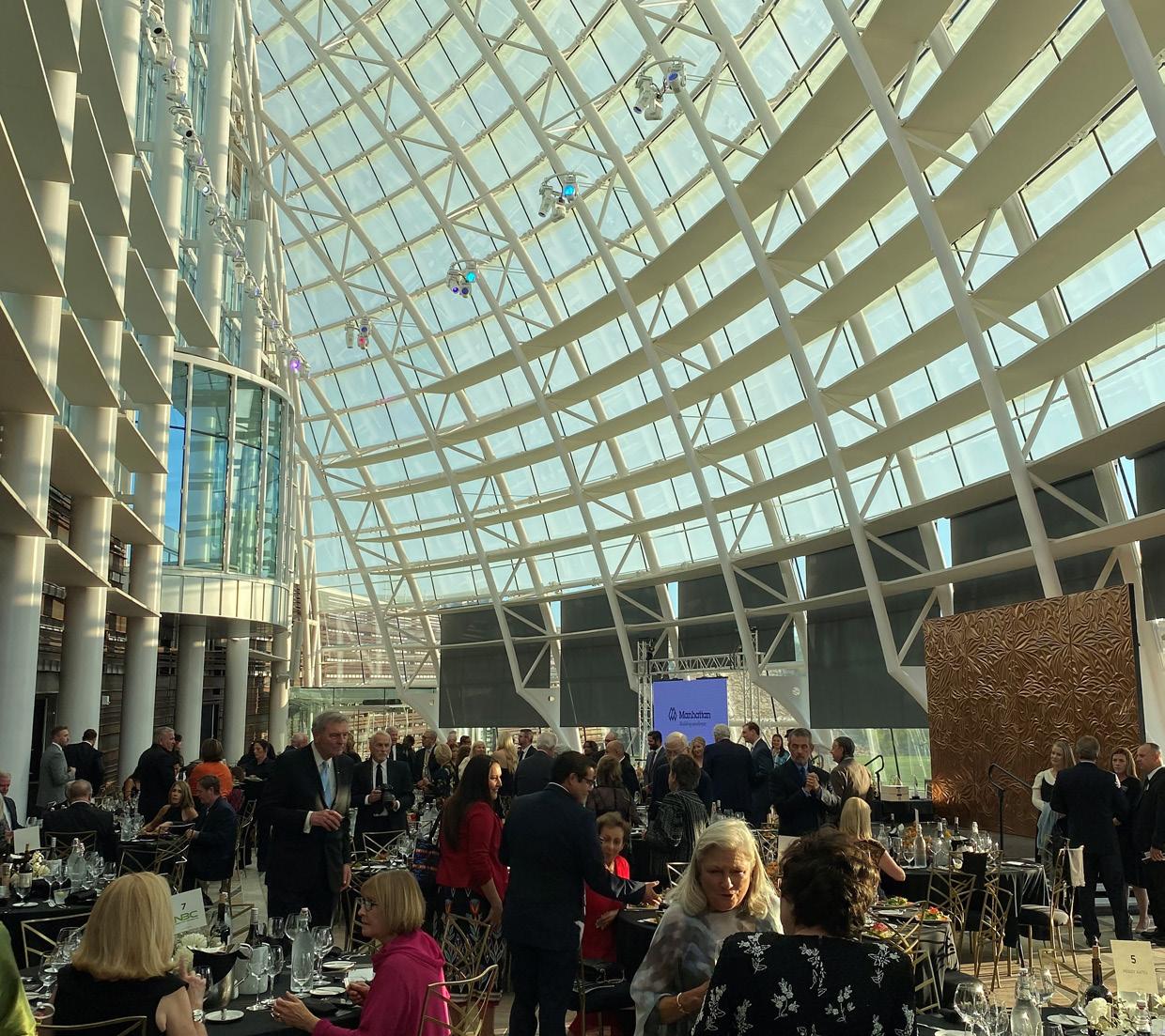
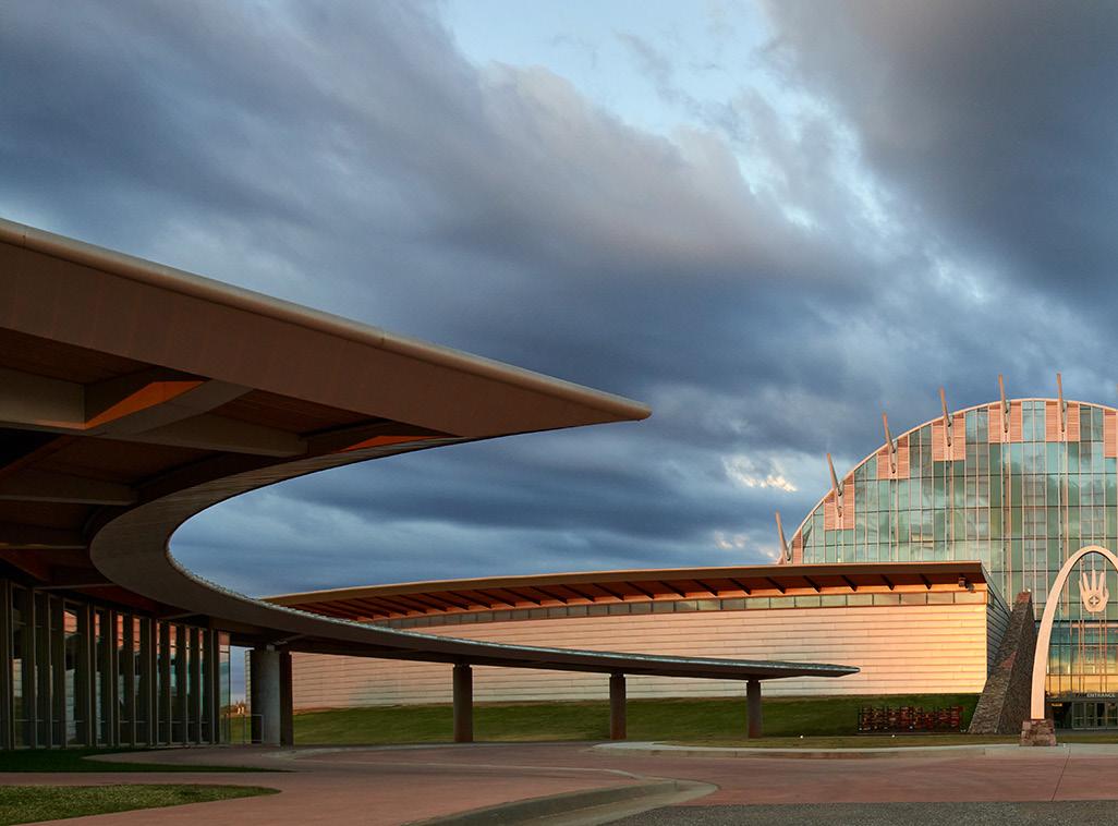
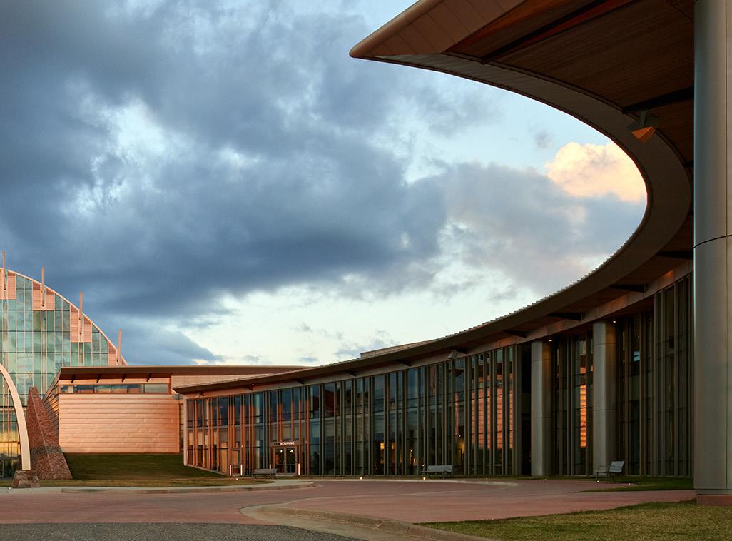
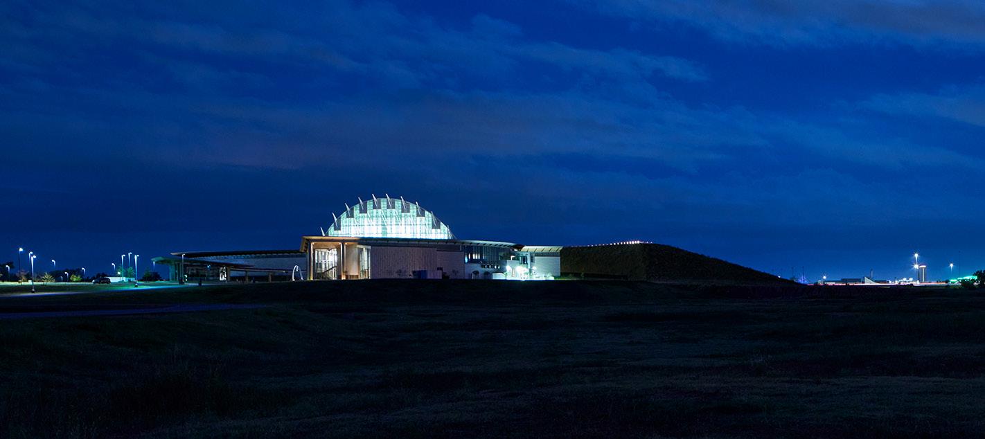
Johnson Fain is working with the American Indian Cultural Center and Educational Authority of the state of Oklahoma on a Museum and Cultural Center, celebrating the rich Native American culture of 39 indigenous tribes. The project includes a Cultural Center, Museum, Native American Artist Colony with Galleries, Communications Center with Language and Broadcast Center, 200room Lodge and Tribal Council facilities, 200 acres of Interpretive landscaping, Dance Grounds, and outdoor Amphitheater.
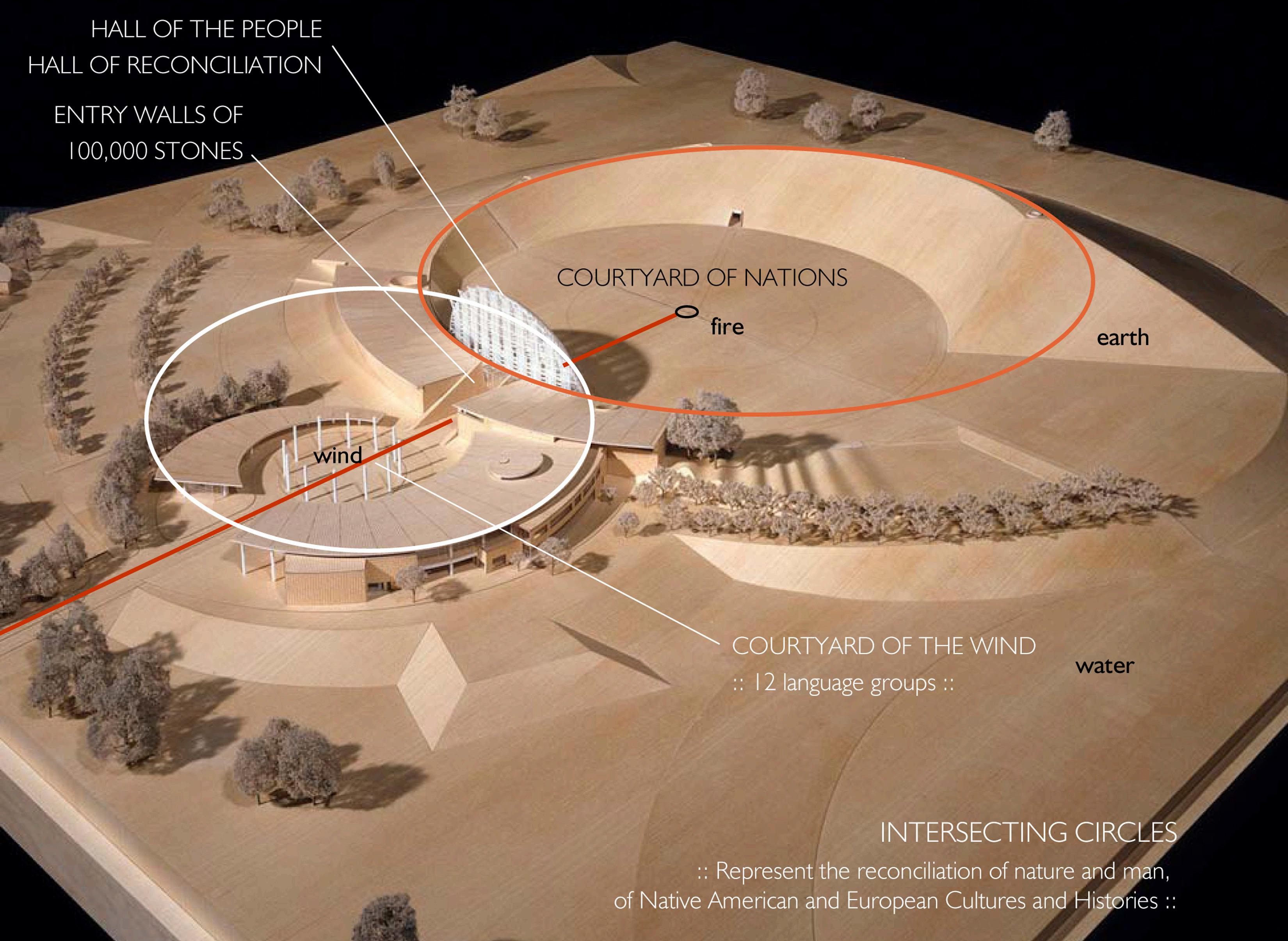
Site development and landscape design are planned to express landscape patterns of Native American habitation and culture as well as to express program through form. Themes include Encampment and the Three Ecologies: the Woodlands, the River and the Plains. These landscapes are woven into the site plan concept. The main building arises from the earth— integrated into a large spiral mound representing the journey of life, encircling an eternal campfire flame. The history of the Indians (circular earth mound) and white settlers (circular building form) intersect, resolving in the soaring, glass Hall of the People. The project is an extraordinary 17-year collaboration between the planners, architects, engineers, exhibit designers and landscape architects all contributed to the project’s vision.
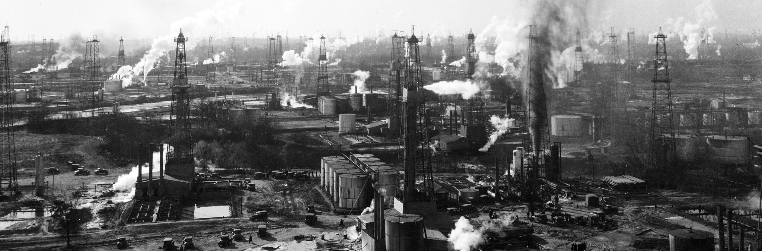
 1930 CRUDE OIL PRODUCTION ON SITE
an extraordinary 17-year collaboration celebrating the rich Native American culture of 39 indigenous tribes
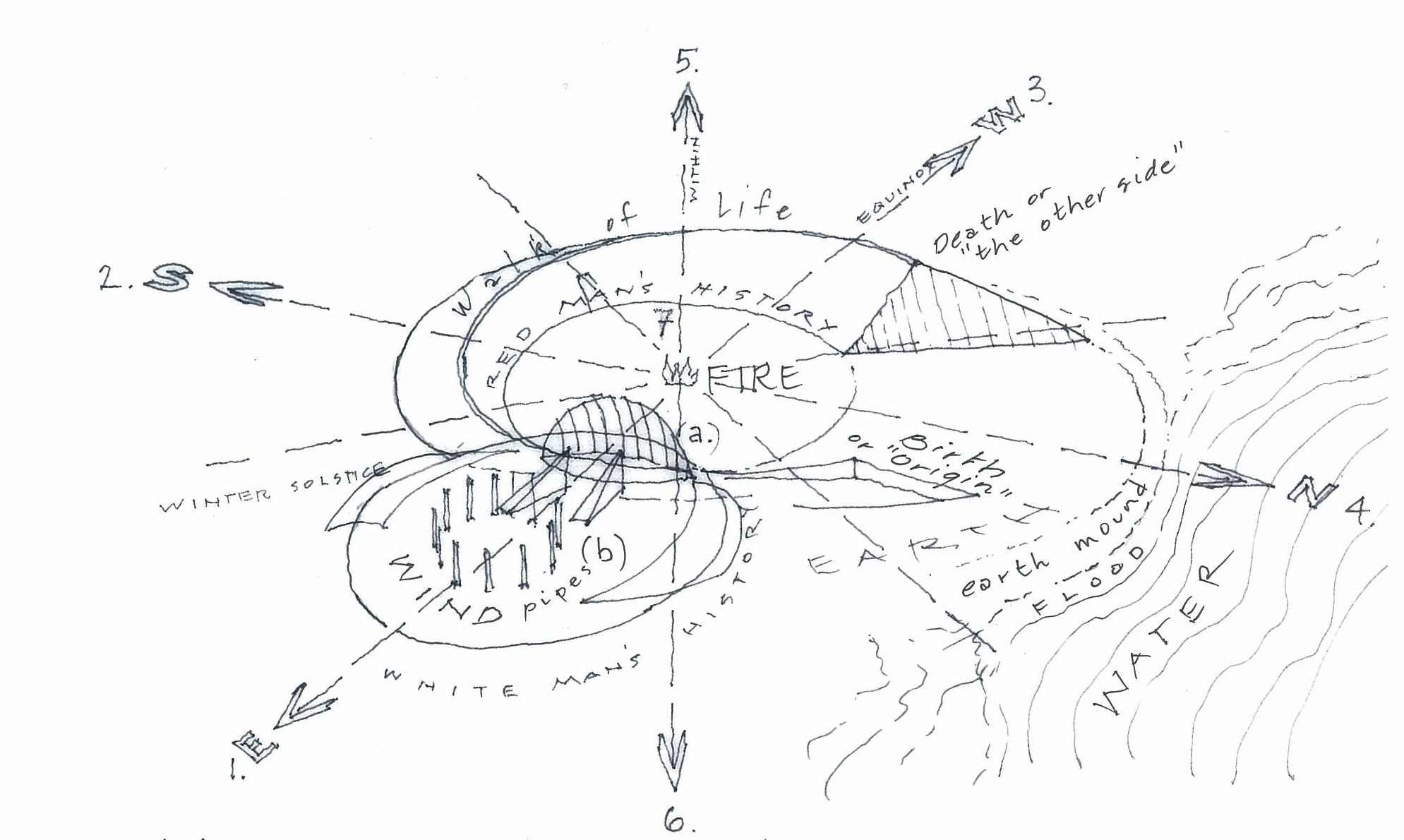 7 INFLUENCES: 1 EAST 2 WEST 3 SOUTH 4 NORTH 5 VERTICAL 6 DOWN 7 WITHIN
ILLUSTRATIVE SITE PLAN
CONCEPT SKETCH
(A) HALL OF RECONCILATION OR HALL OF THE PEOPLE IS WHERE THE TWO HISTORIES OVERLAP.
7 INFLUENCES: 1 EAST 2 WEST 3 SOUTH 4 NORTH 5 VERTICAL 6 DOWN 7 WITHIN
ILLUSTRATIVE SITE PLAN
CONCEPT SKETCH
(A) HALL OF RECONCILATION OR HALL OF THE PEOPLE IS WHERE THE TWO HISTORIES OVERLAP.
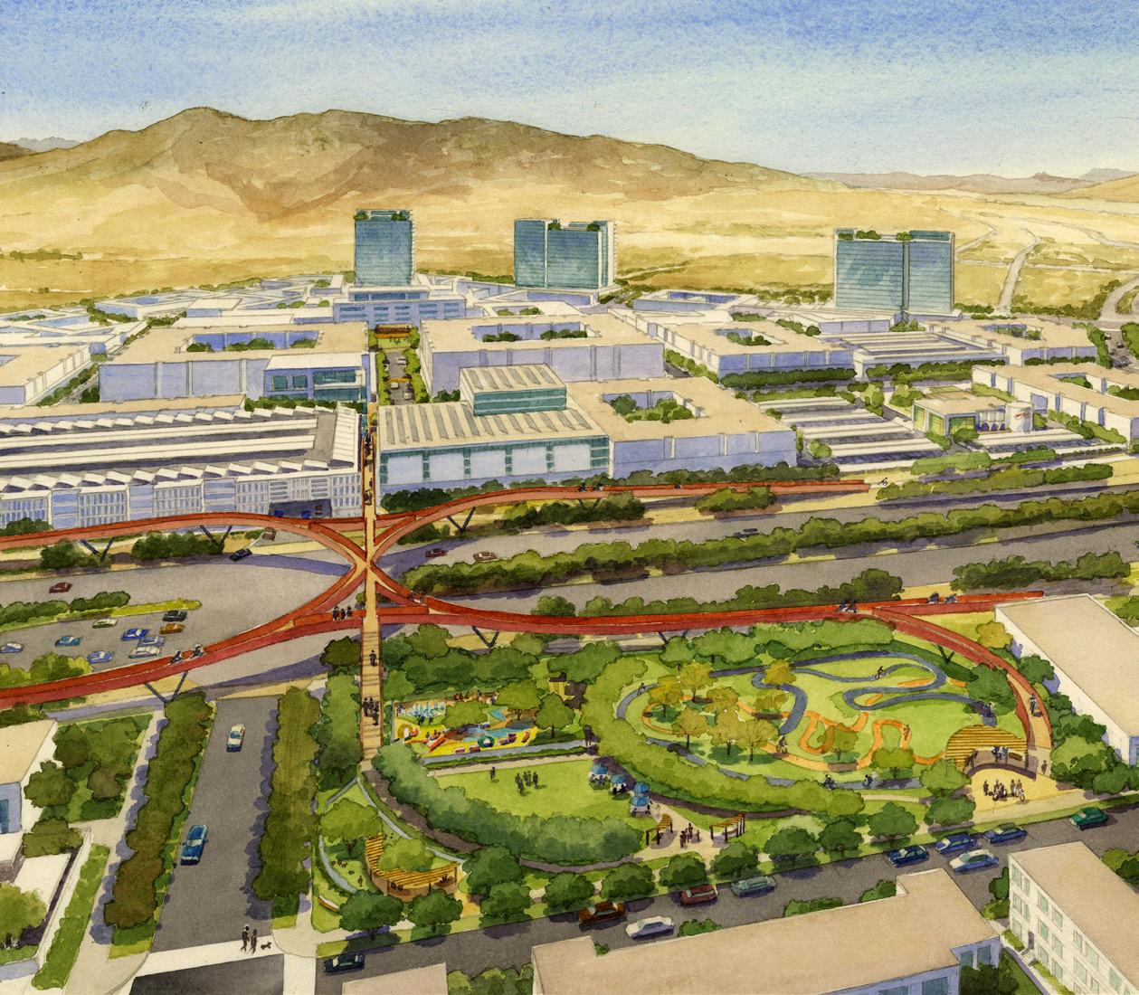
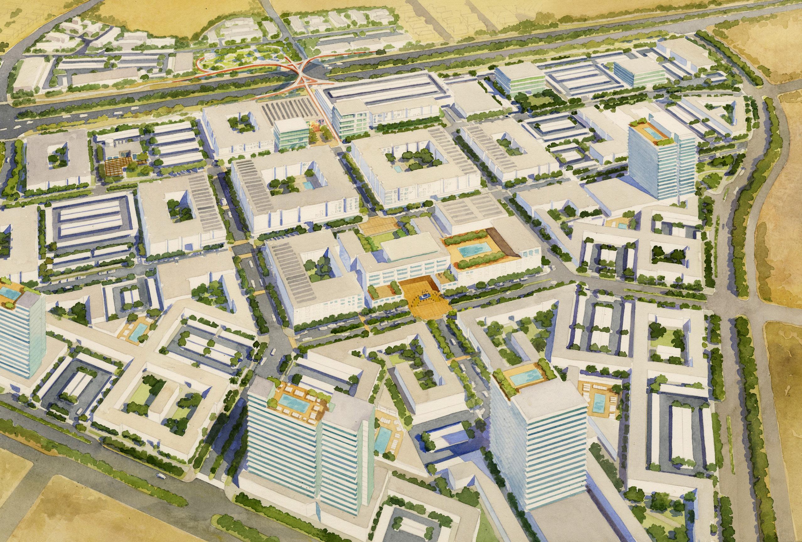
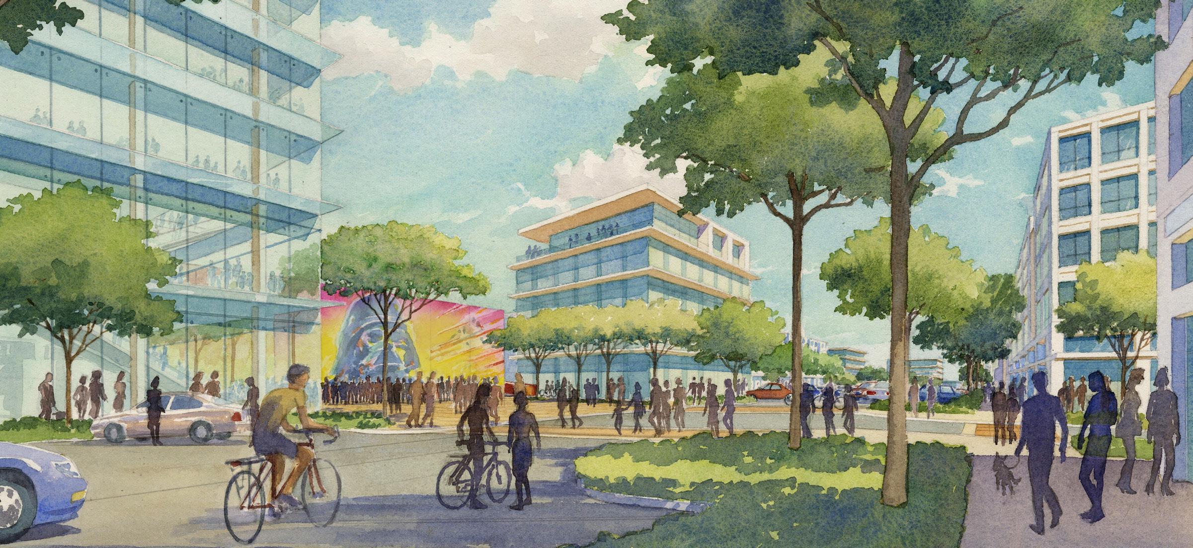
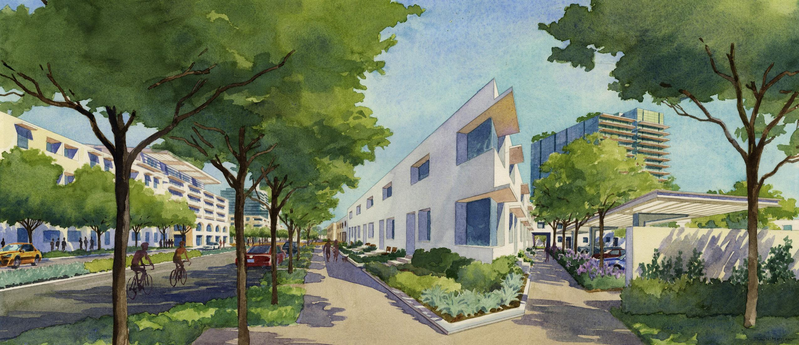
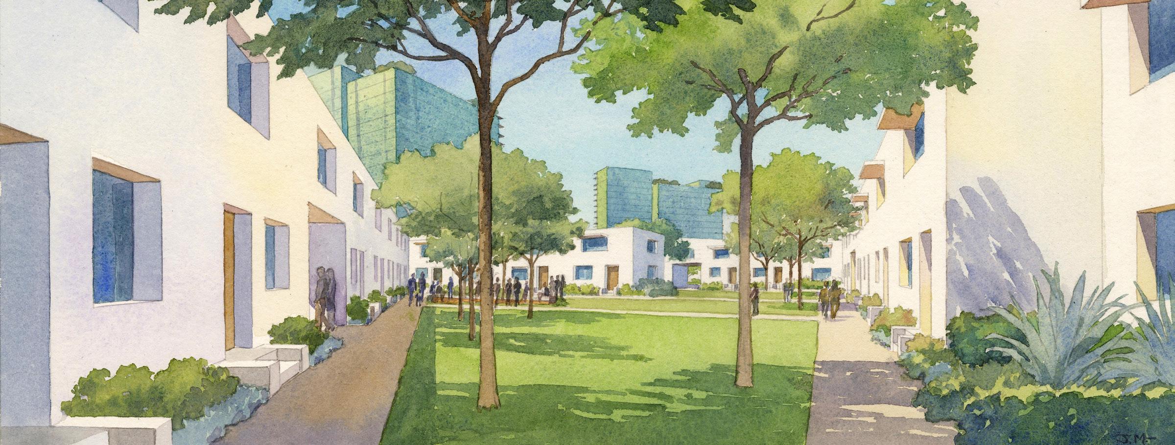
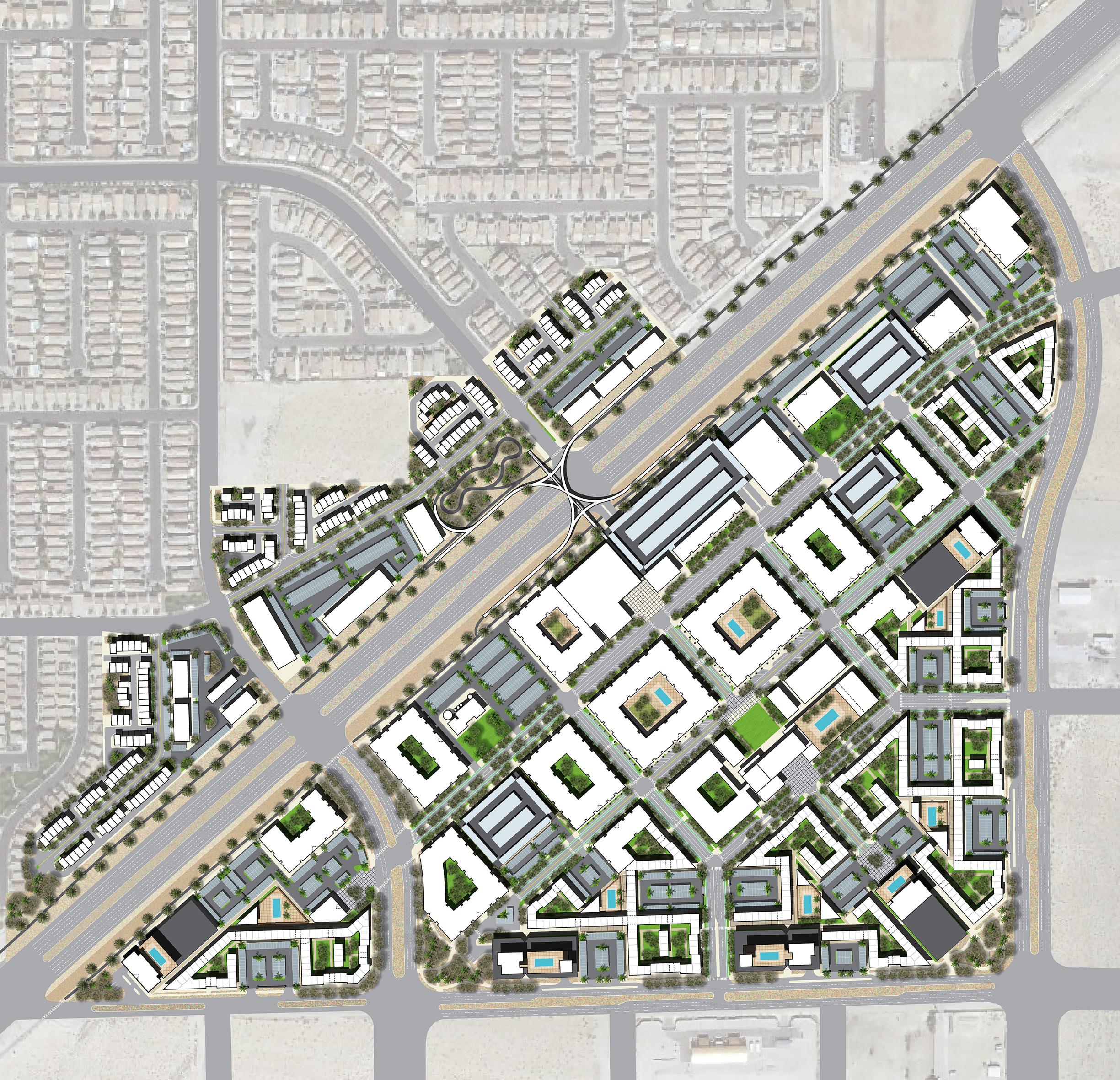
Rampant expansion in rapidly growing urban regions typically has failed to achieve urban densities and character, instead spreading residential uses across the landscape at increasingly greater distances from urban services and employment. Already the second largest city in Nevada, Henderson is absorbing much of the growth in the Las Vegas Valley, with undistinguished suburban enclaves of single-family homes and strip retail development spread across the desert landscape. Recent growth along the I-15 freeway corridor, which links Southern California with Las Vegas, and the city’s desire to evolve beyond its suburban past, have positioned Henderson’s westside to become a major new mixed-use urban district for the greater Las Vegas region. The Henderson West project seeks to be the center for this new urban district that provides a mixeduse, high-density hub for the western area, serving as well as a prototype for future development elsewhere in the Valley.
The Henderson West master plan is built upon environmental principles including to minimize the effect of extreme heat and winds during summer months. Buildings and courtyards are oriented to provide protection from winds and shade for outdoor walking areas. Pedestrian pathways are integrated throughout the project passing through and around a variety of active and passive open spaces. The emphasis is on pedestrian movement with less dependence on the automobile. A mixture of housing, offices, retail, and entertainment uses provide amenities and a jobs-housing balance for those living in Henderson West, as well as attracting users from other nearby areas. Housing densities range from 25 dwelling units per acre on the low end to a maximum of 200 dwelling units per acre on the upper end. These densities are higher than other more traditional areas of Henderson where densities customarily are in the range of four to eight dwelling units per acre. The goal of the plan is to build upon a growing desire within the community for urban living including a variety of housing densities and amenities that accommodates a range of lifestyles, as well as to set a high standard for future development in the region.
an opportunity to create a visual marker that expresses a vision and civic pride for the future of the City of HendersonGATEWAY BRIDGE AND BIKE PARK ILLUSTRATIVE PLAN
 COURTYARD STREET CORNER
NEIGHBORHOOD PARK AND BREWERY (ABOVE) CENTRAL GREEN AND CAFE (BELOW)
COURTYARD STREET CORNER
NEIGHBORHOOD PARK AND BREWERY (ABOVE) CENTRAL GREEN AND CAFE (BELOW)
MASTER PLAN (ABOVE) RESIDENTAIL COURTYARD (BELOW)
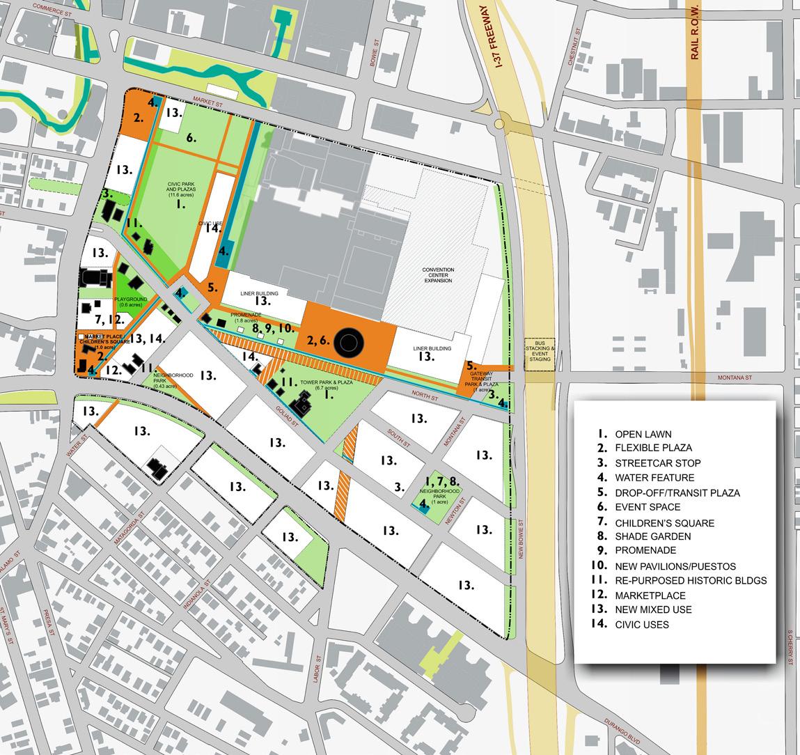
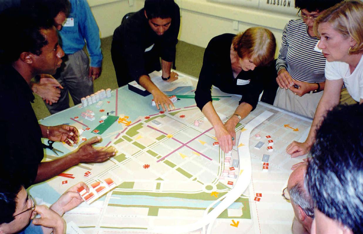
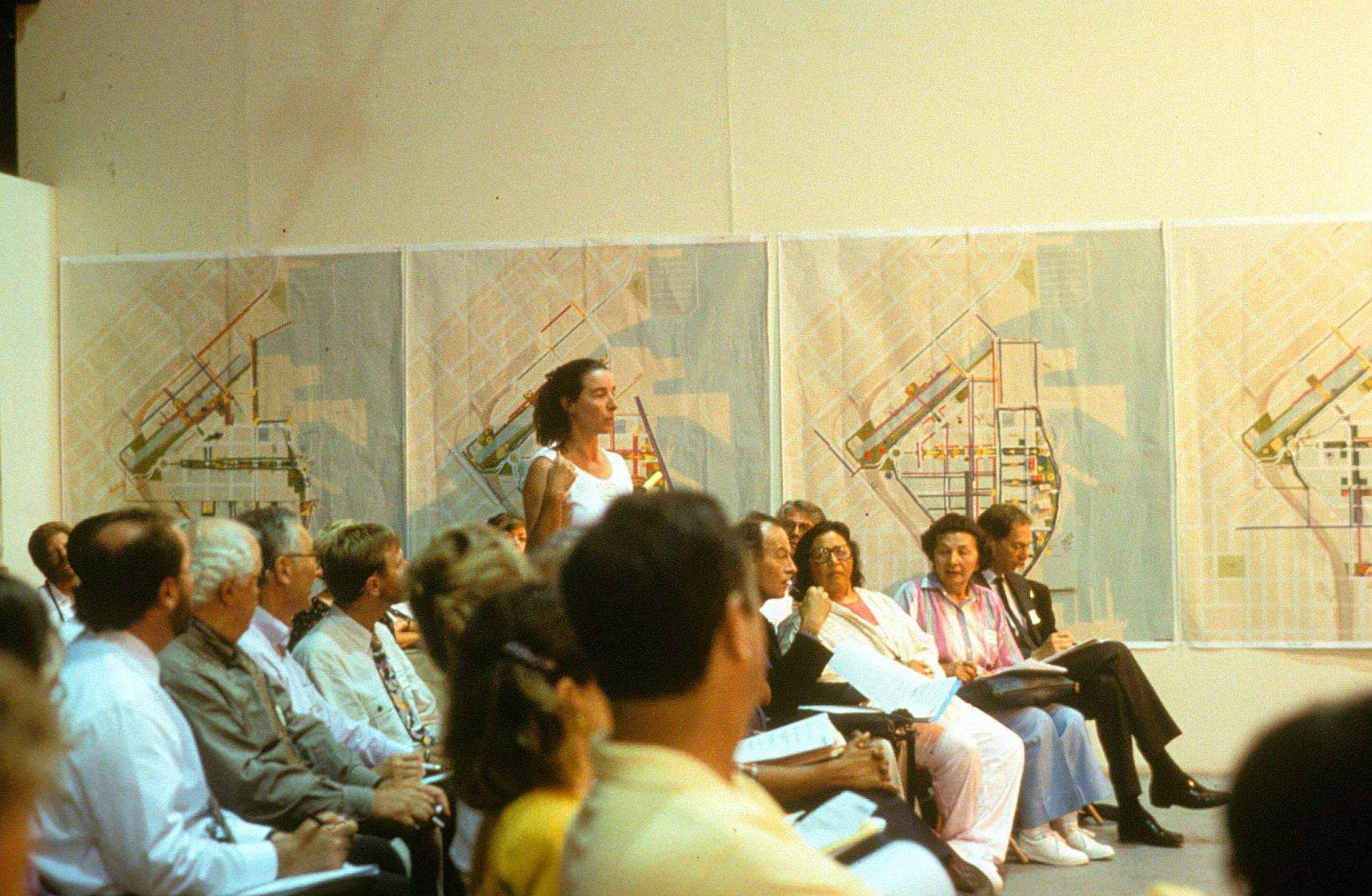
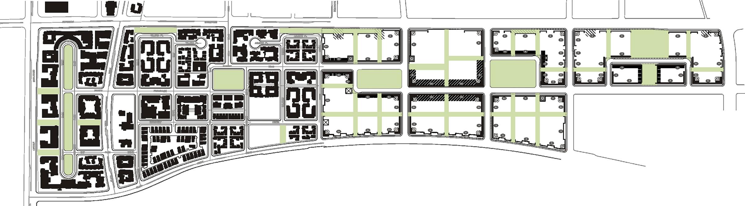
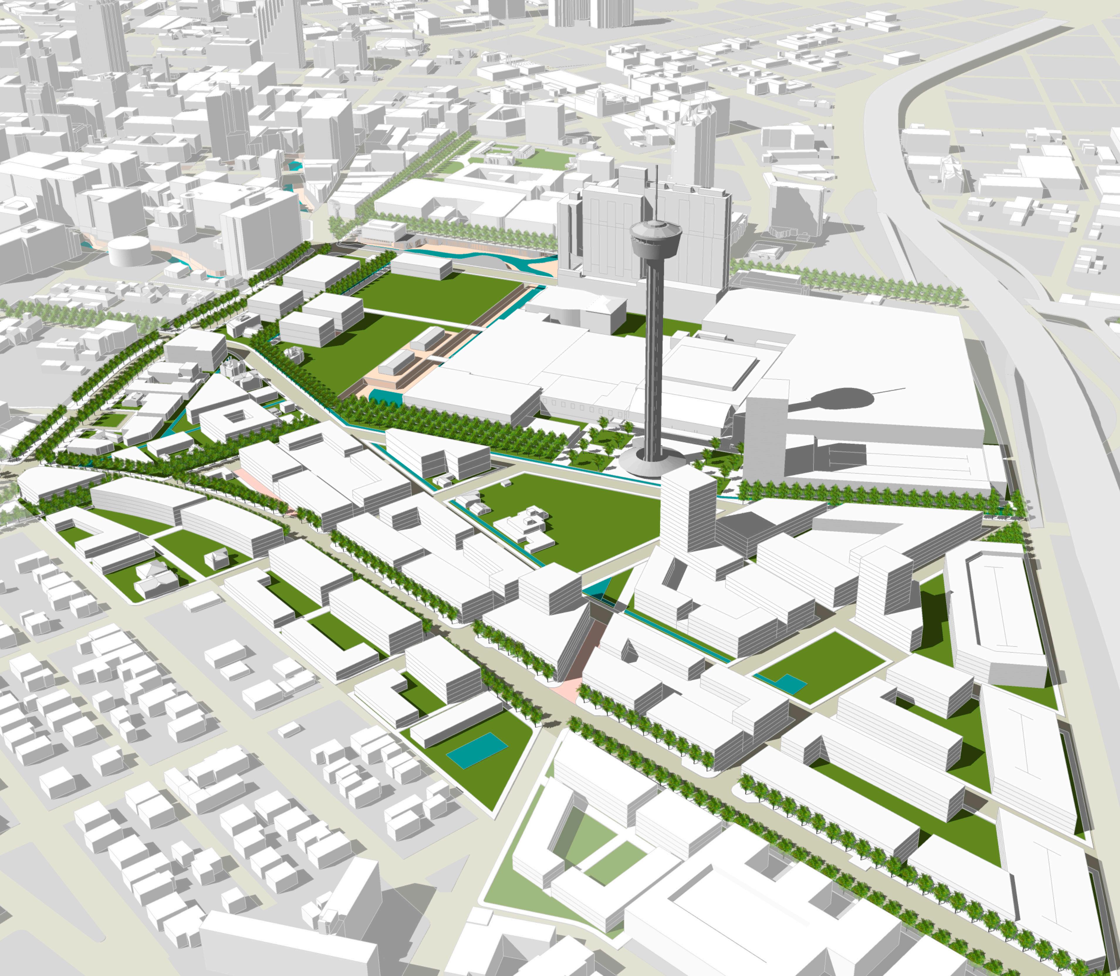
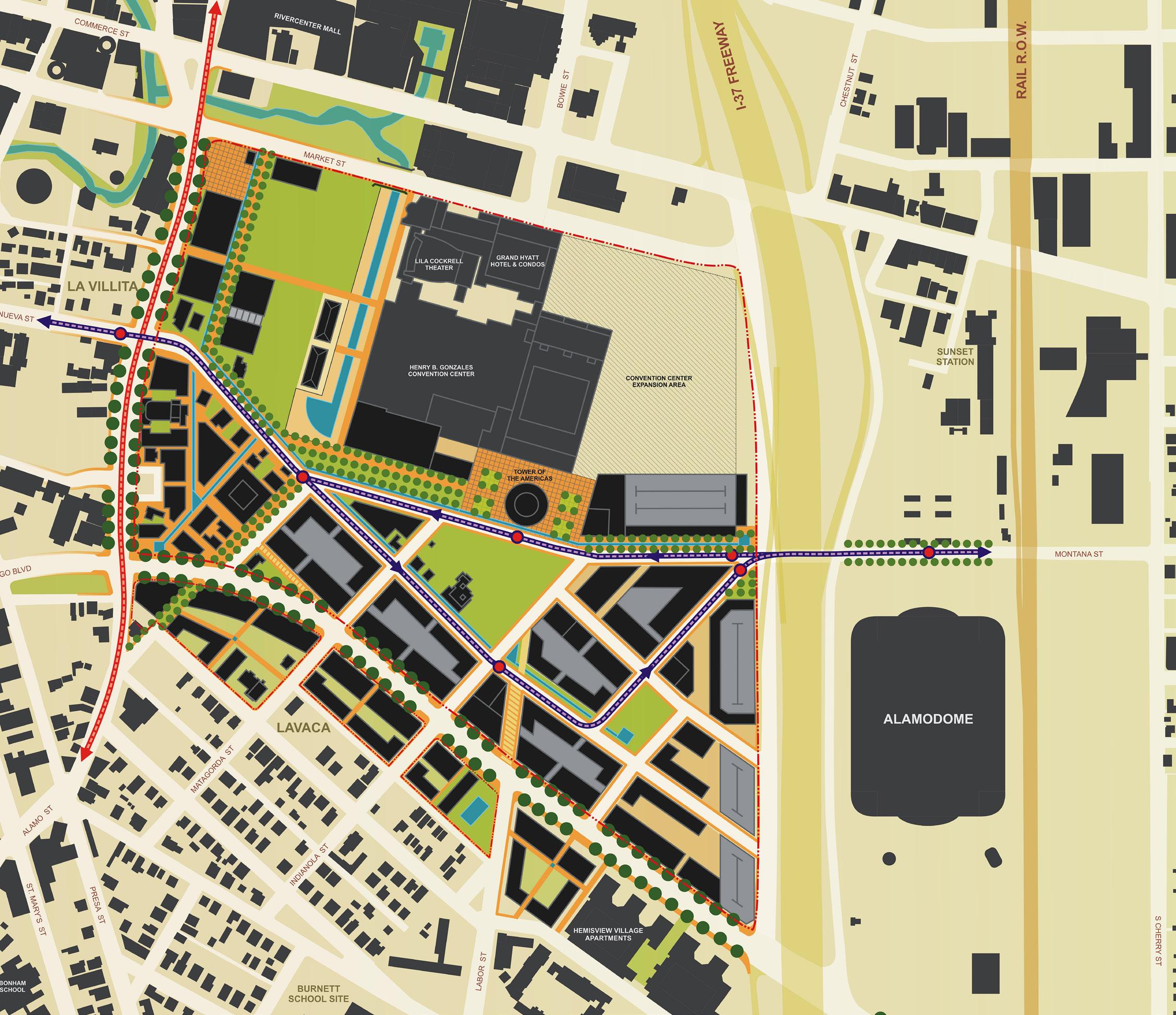
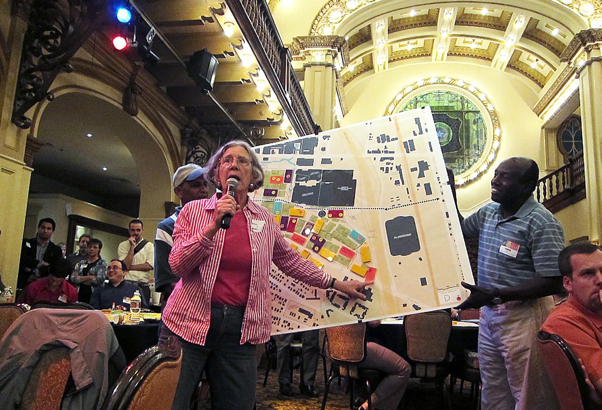
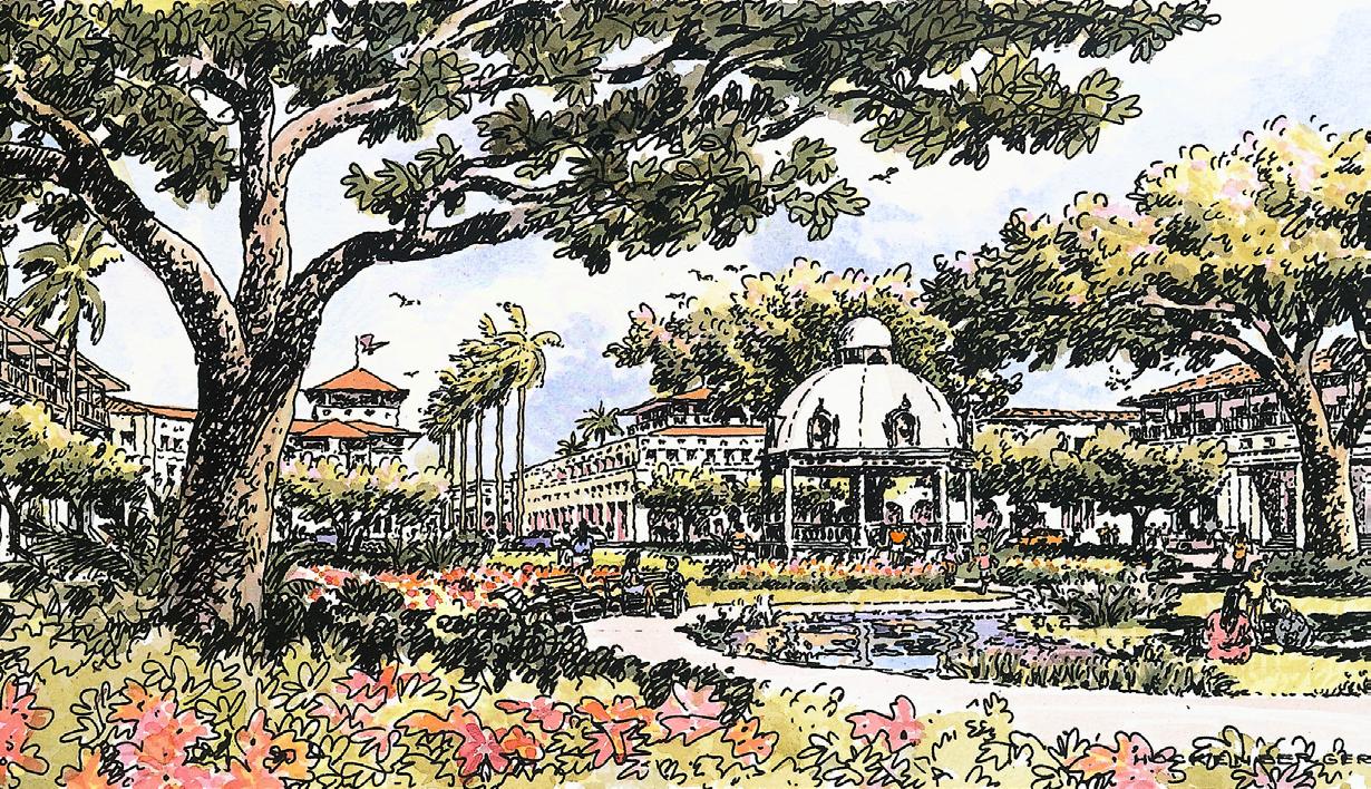
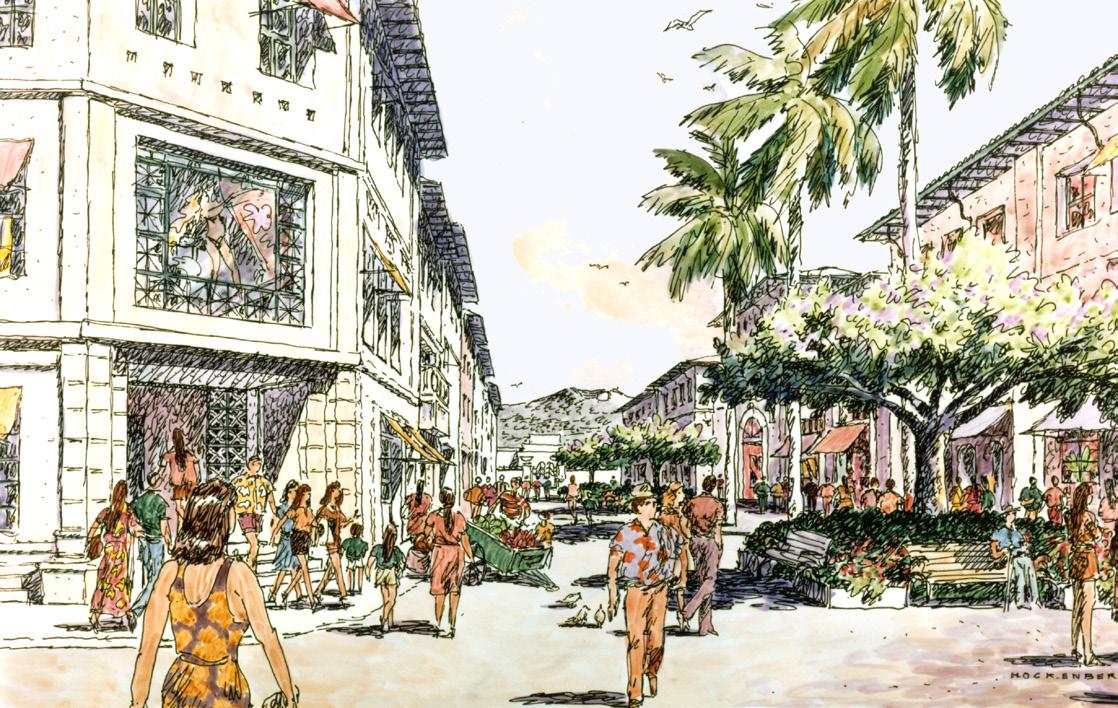
The site for the 1968 World’s Fair in San Antonio, Texas, called HemisFair, was planned for a 100-acre historically Hispanic neighborhood that was substantially erased by the Fair’s development. Once the Fair completed its 6-month run, the site was left as an essentially empty quarter, bordered by the downtown and the city’s renowned Riverwalk, left for the ensuing decades to be carved opportunistically into a disparate array of lowintensity uses. The master planning effort, sponsored by the City of San Antonio and the HemisFair Park Area Redevelopment Corporation, a non-profit agency created by the City, came to be about history, memory, reparation and deference to the visions still alive in the many Latino families whose ancestors had been displaced.
Planning for the site’s future fifty years later was very much an open workshop process involving many of the descendants of those who had lived there in a rigorous public workshop process that included sessions with over 700 participants. Questions were deliberately open-ended: What makes San Antonio unique? Who should receive the benefit from the property, residents or tourists? What should be the program for the 100acre site? What type of housing? What about public open space? Instead of the conventional planning process where the professional planner develops alternatives, the community break-out groups designed twentyeight concepts for the site which then were reduced to seven generic types of plans and ultimately to one plan, selected and refined by additional workshops.
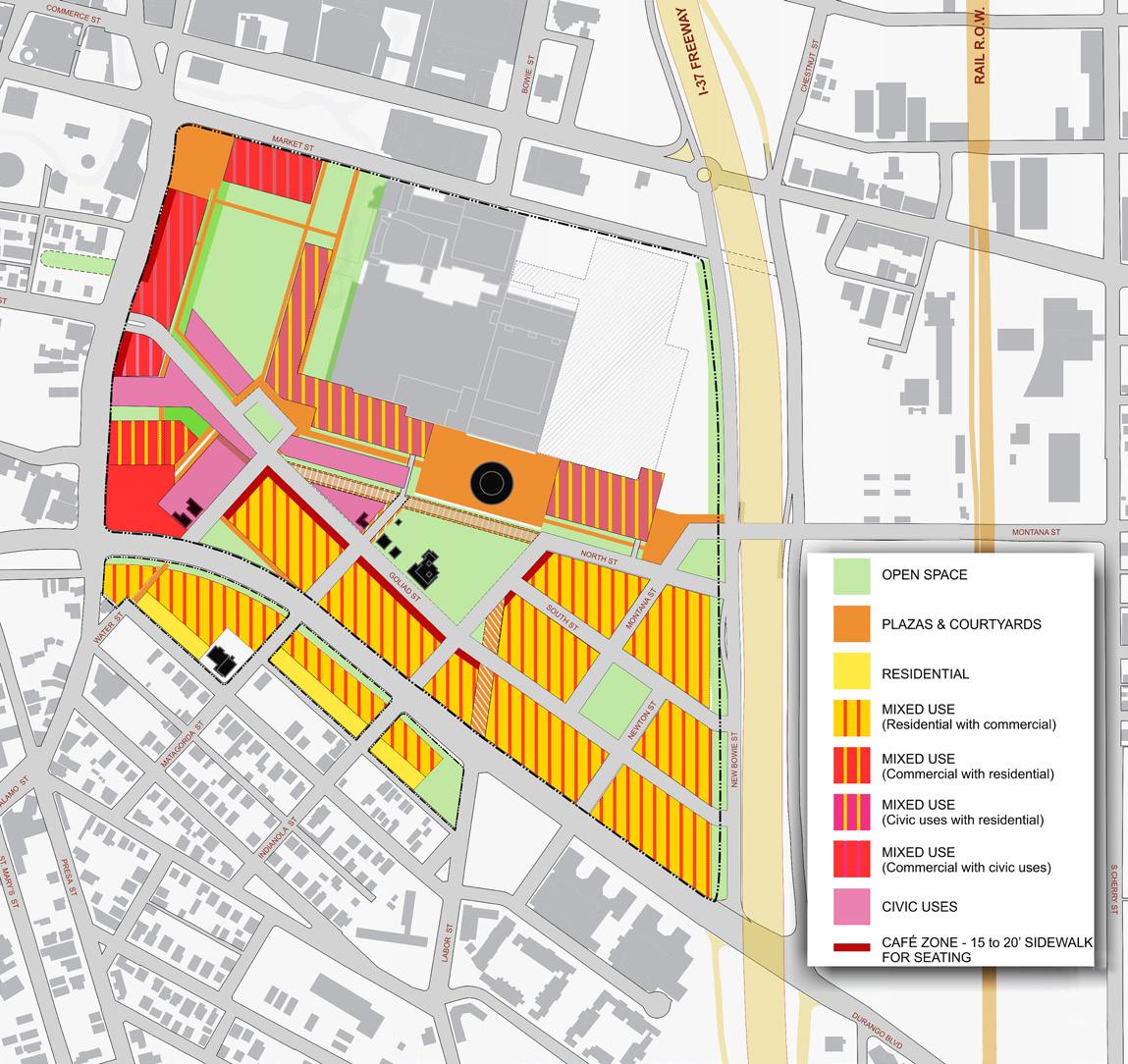
The resulting plan included more than 2000 housing units, both market rate and affordable units recalling the mix that had existed before the Fair. Citizens sought to restore the historic road system to reconnect to surrounding streets while dividing the large aggregated Fair site into smaller scale neighborhood blocks. The plan recommended that the Convention Center, developed shortly after the Fair in 1968, be removed to allow for the development of a large city-owned Central Park; a site for new Convention facilities for Riverwalk visitors is provided a short distance away. Since elected officials participated in the public workshops from the beginning, when the plan was presented to the City Council, there was less than fifteen minutes of discussion before a unanimous Council vote approved the plan.
LAND USE PROGRAMThe plan improves the quality and size of the public parks, introduces a mixed use concept to the area, and reconnects the site to the historic neighborhoods it adjoins
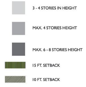
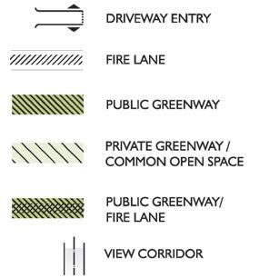
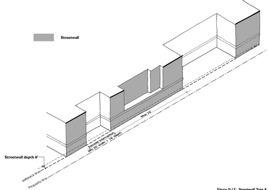
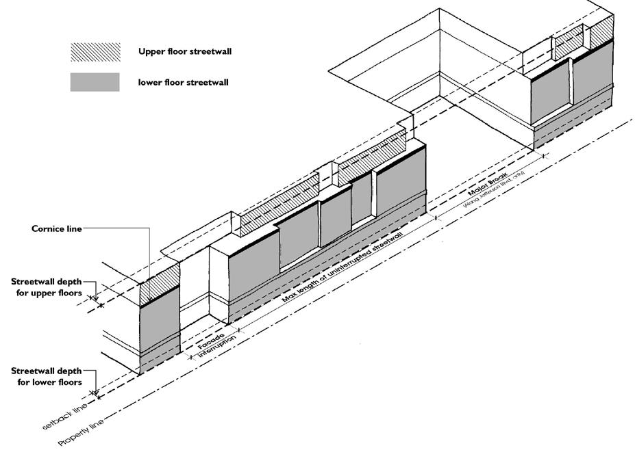
Height, setback, and use standards for new mixeduse development to re-establish street life and street character
Strategies for access & connectivity: parking, pedestrian and
circulation, and connections with transit
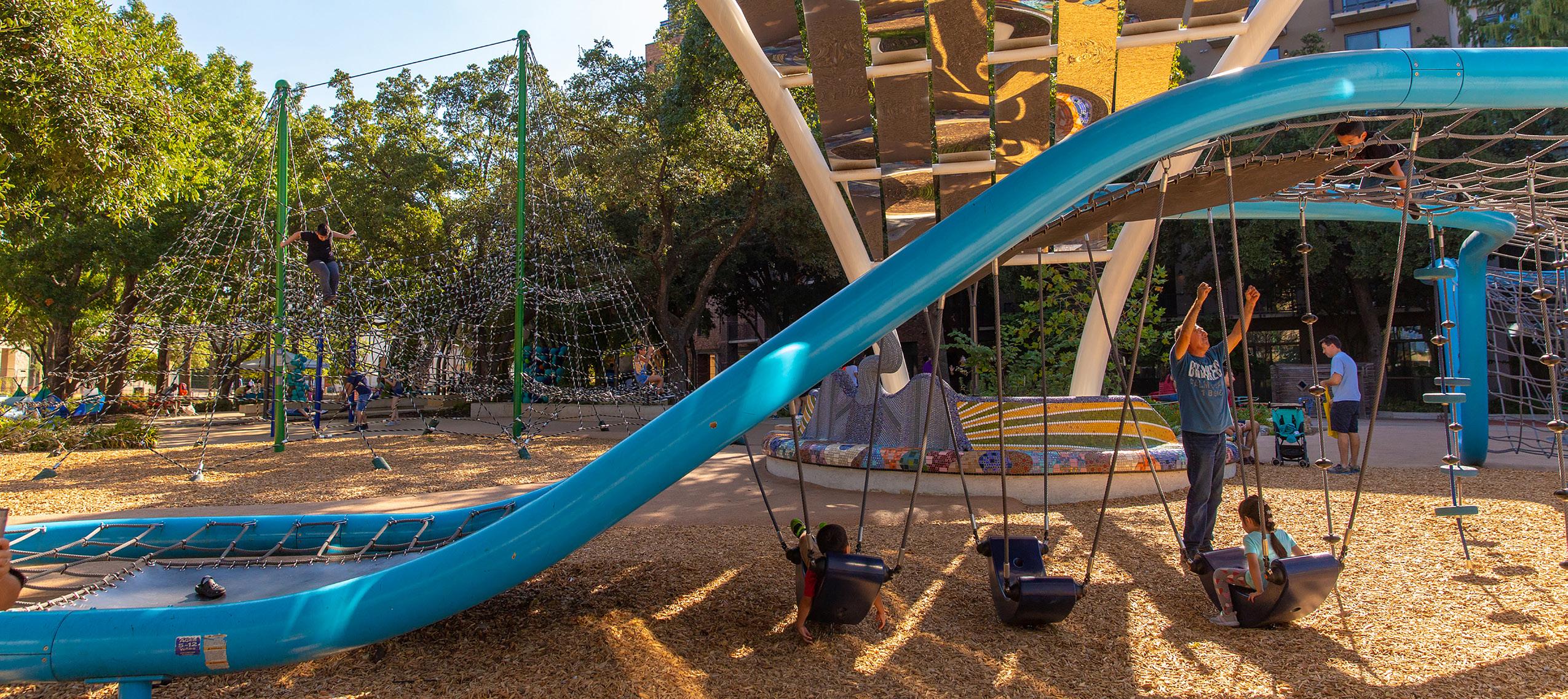
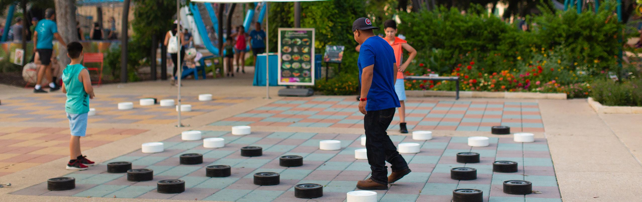
 FESTIVAL AT THE PARK
YANAGUANA GARDEN
CENTRAL GAMES PLAZA
CELEBRATION AT THE PARK
FESTIVAL AT THE PARK
YANAGUANA GARDEN
CENTRAL GAMES PLAZA
CELEBRATION AT THE PARK
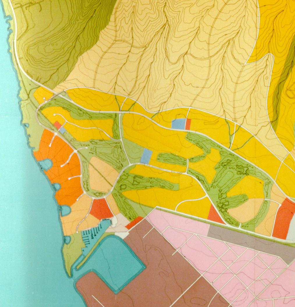
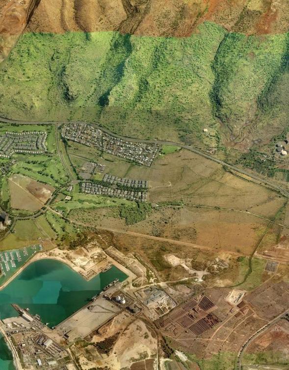
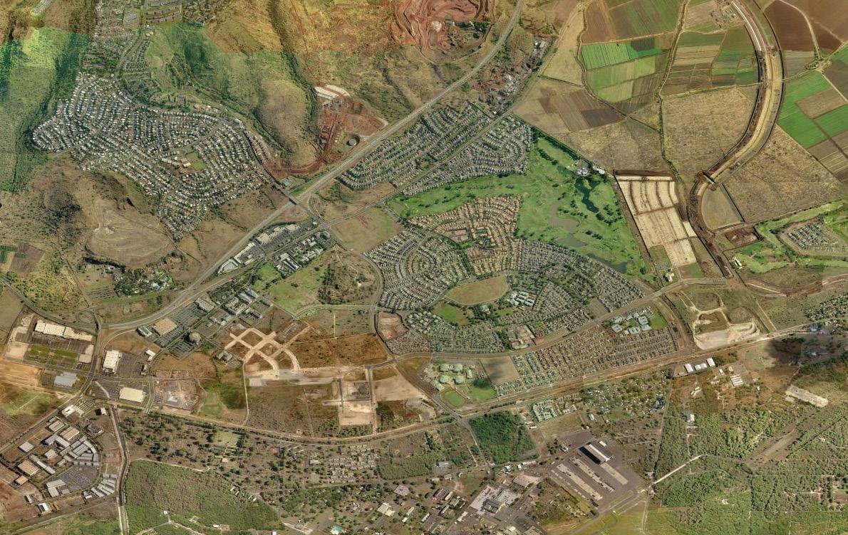
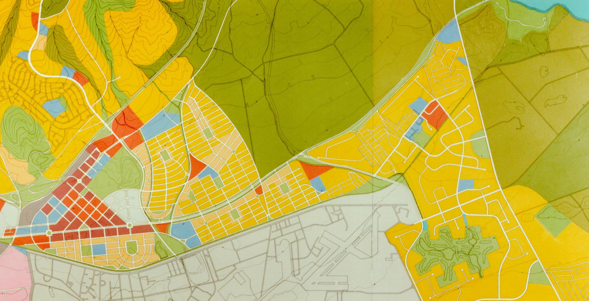
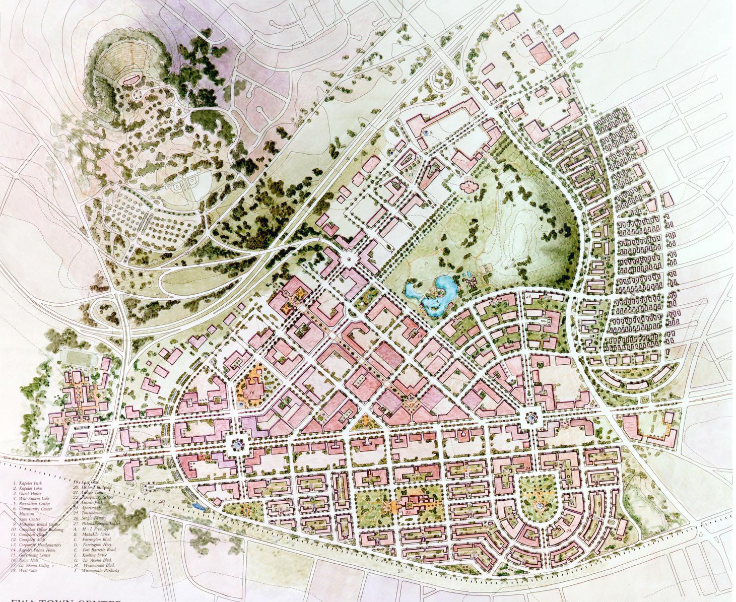
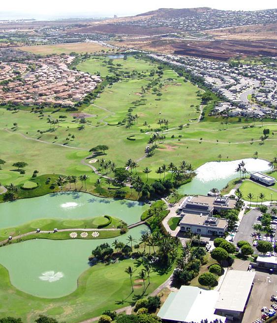
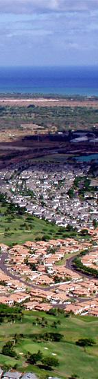
Official designation of Ewa by the City and County of Honolulu as its Secondary Urban Center establishes the Kapolei Town Center urban design as the largest and most significant planning project since Hawaii statehood. This public/private project involved extensive interface with community groups, City, County and State agencies. Located 20 miles from downtown Honolulu, the site is approximately 6,000 acres and includes six million square feet of commercial space and 12,000 housing units.
Johnson Fain’s task was to create a physical development plan which could be implemented over many years. The concept is that of a true, satellite city, self-sufficient but not necessarily selfcontained, as a complement to urban Honolulu. Its boundaries are formed by surrounding projects and existing developments. The Town Center provides public facilities, major roads and land uses not currently provided or anticipated in the surrounding area, and it is also planned to accommodate a future transit link to Honolulu.
Organized with a city grid, the Town Center plan introduces urban design guidelines that encourage elements of traditional Hawaiian culture such as garden setting, use of indigenous lava, coral and bluestone building materials, and provision of traditional building elements such as atria, roofed balconies, arcades and courtyards. Based on historical research, the open space system reestablishes the Hawaiian loku, i.e., small parks designed for casual recreation and informal gatherings. The plan is scaled for the pedestrian, oriented to views toward the ocean (makai) and the inland mountains (mauka).
the largest and most significant planning project in Hawaii since its statehoodSITE AERIAL
LOCATIONS OF IMPORTANT SPIRITUAL AND CULTURAL SITES
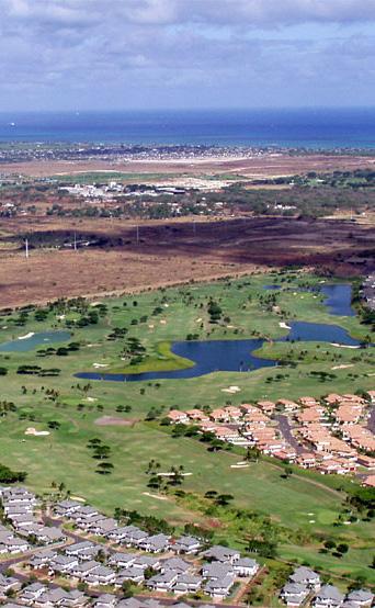

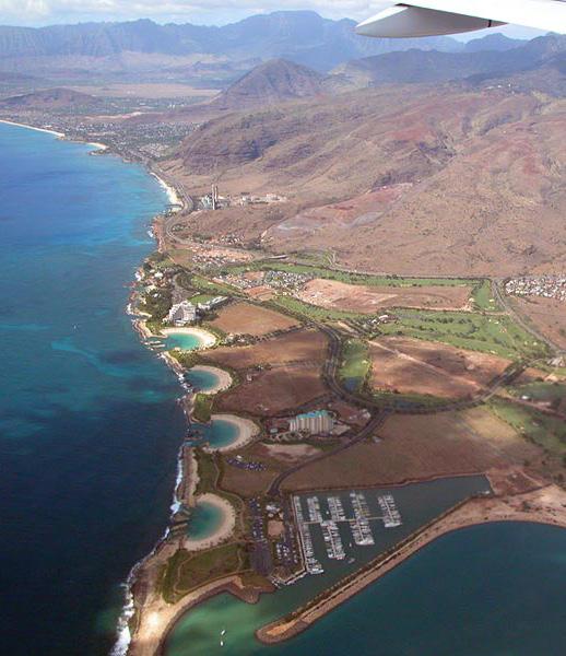
 AERIAL OF KO OLINA RESORT
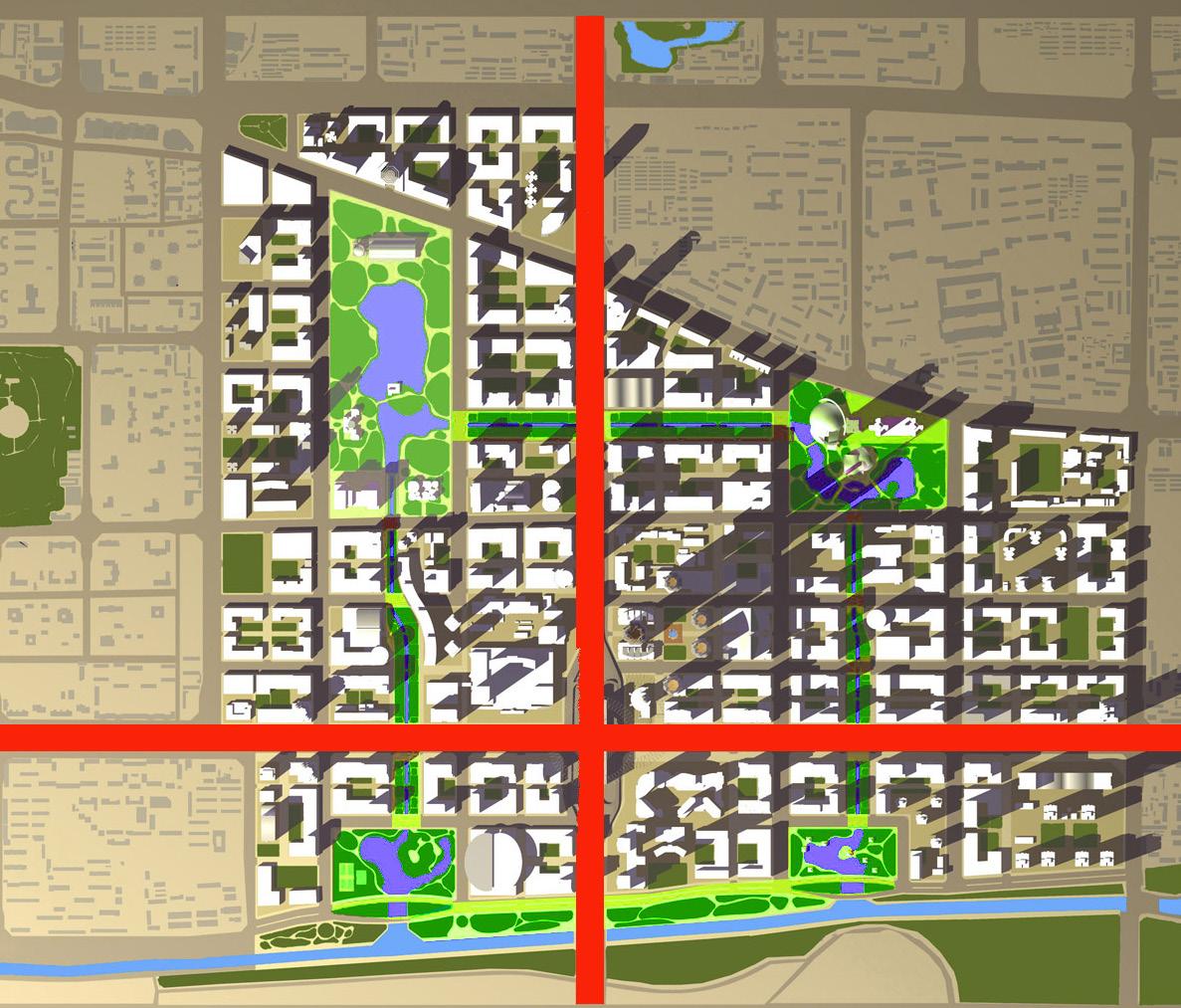
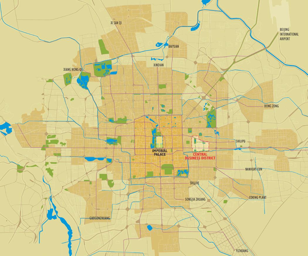


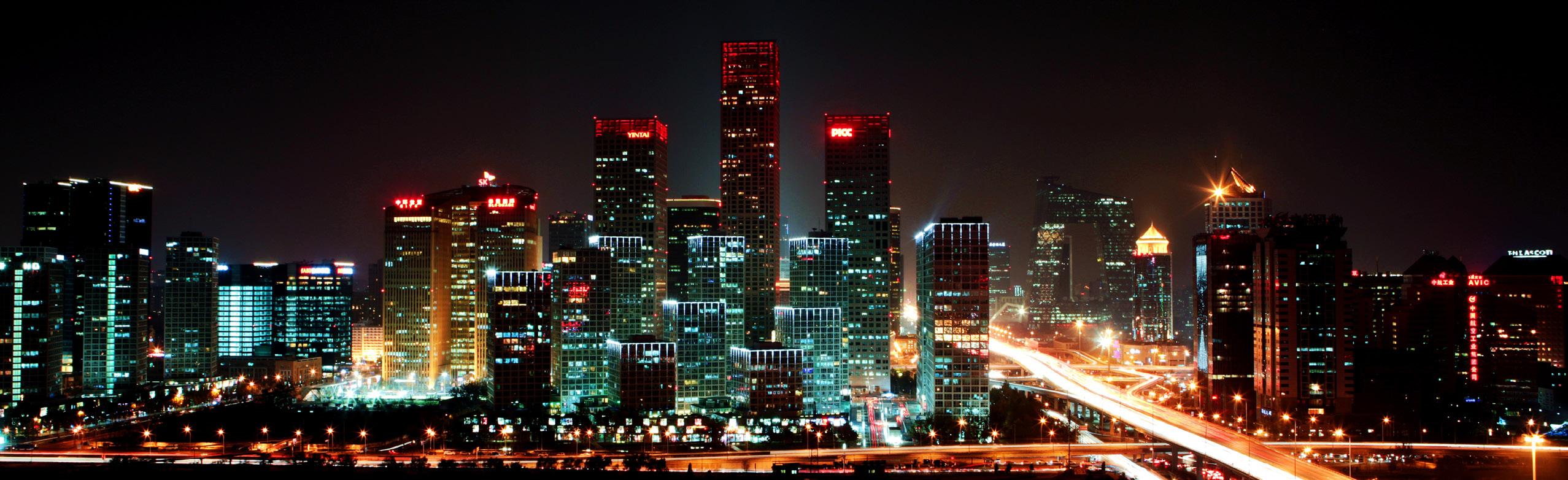
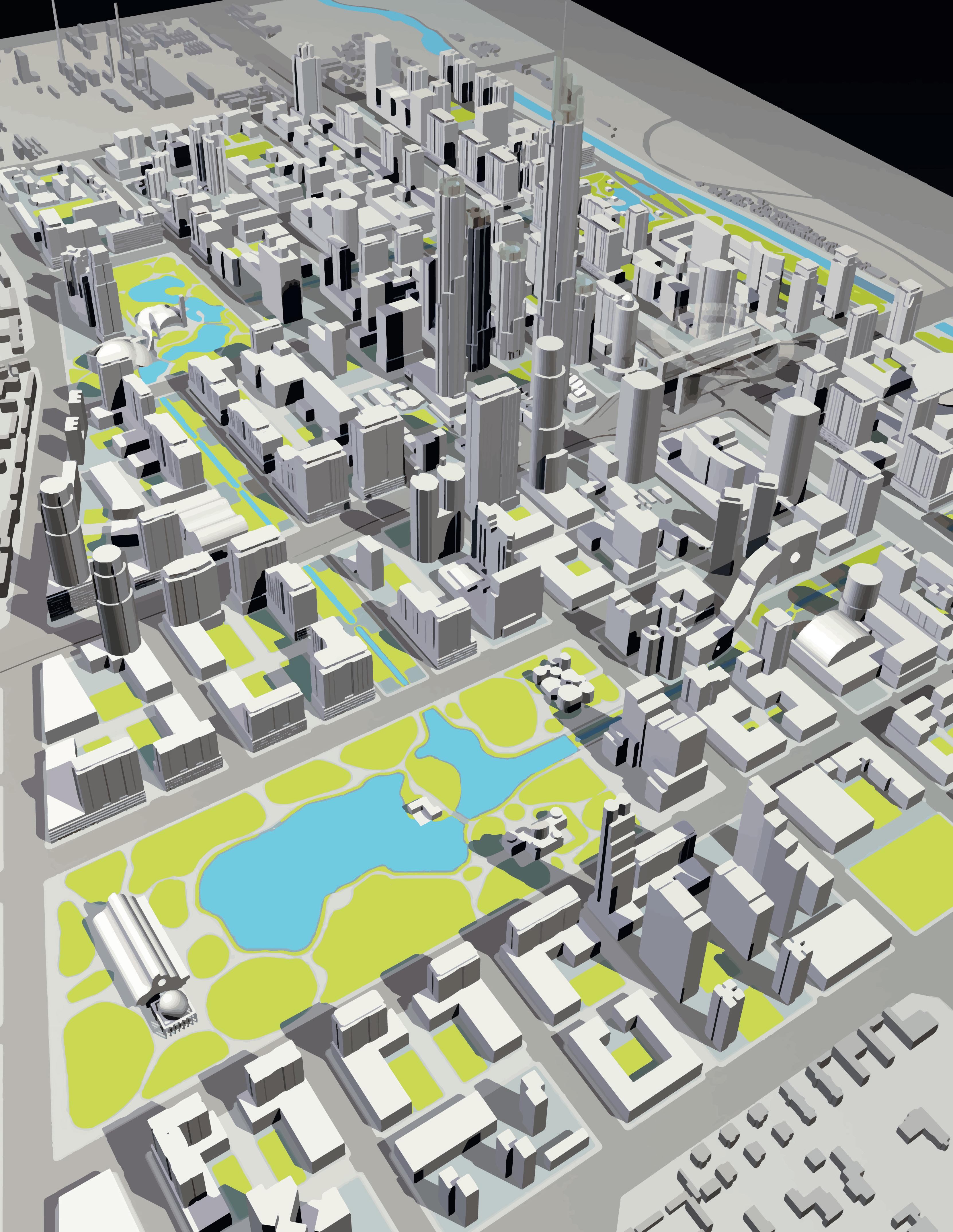
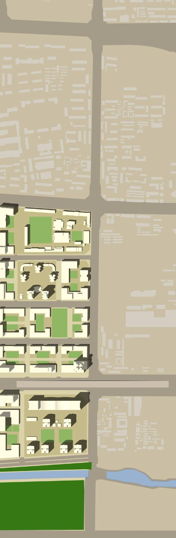
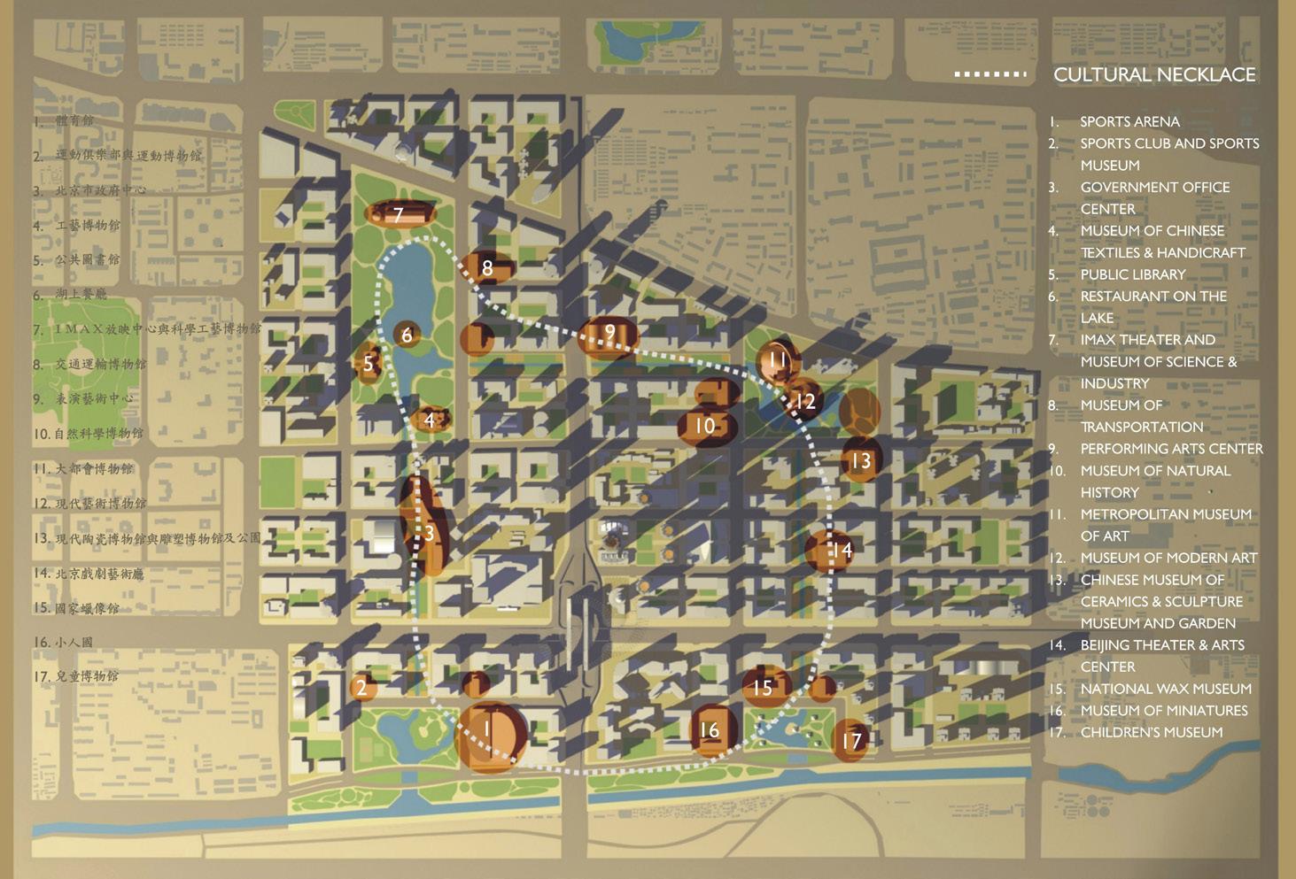
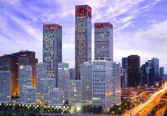
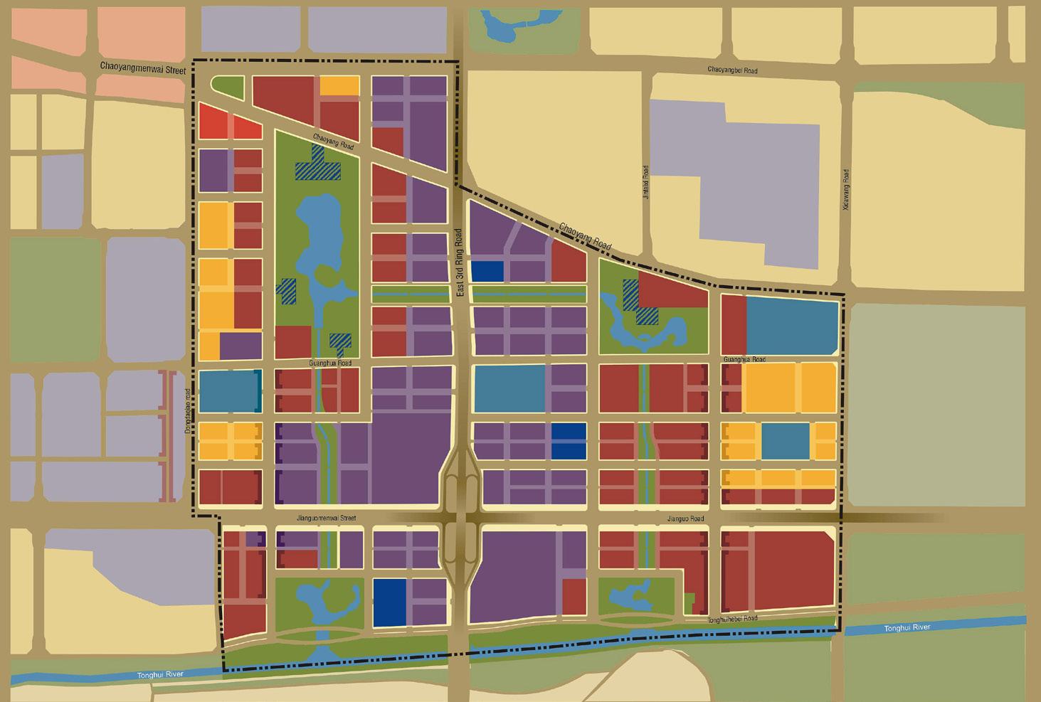
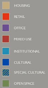
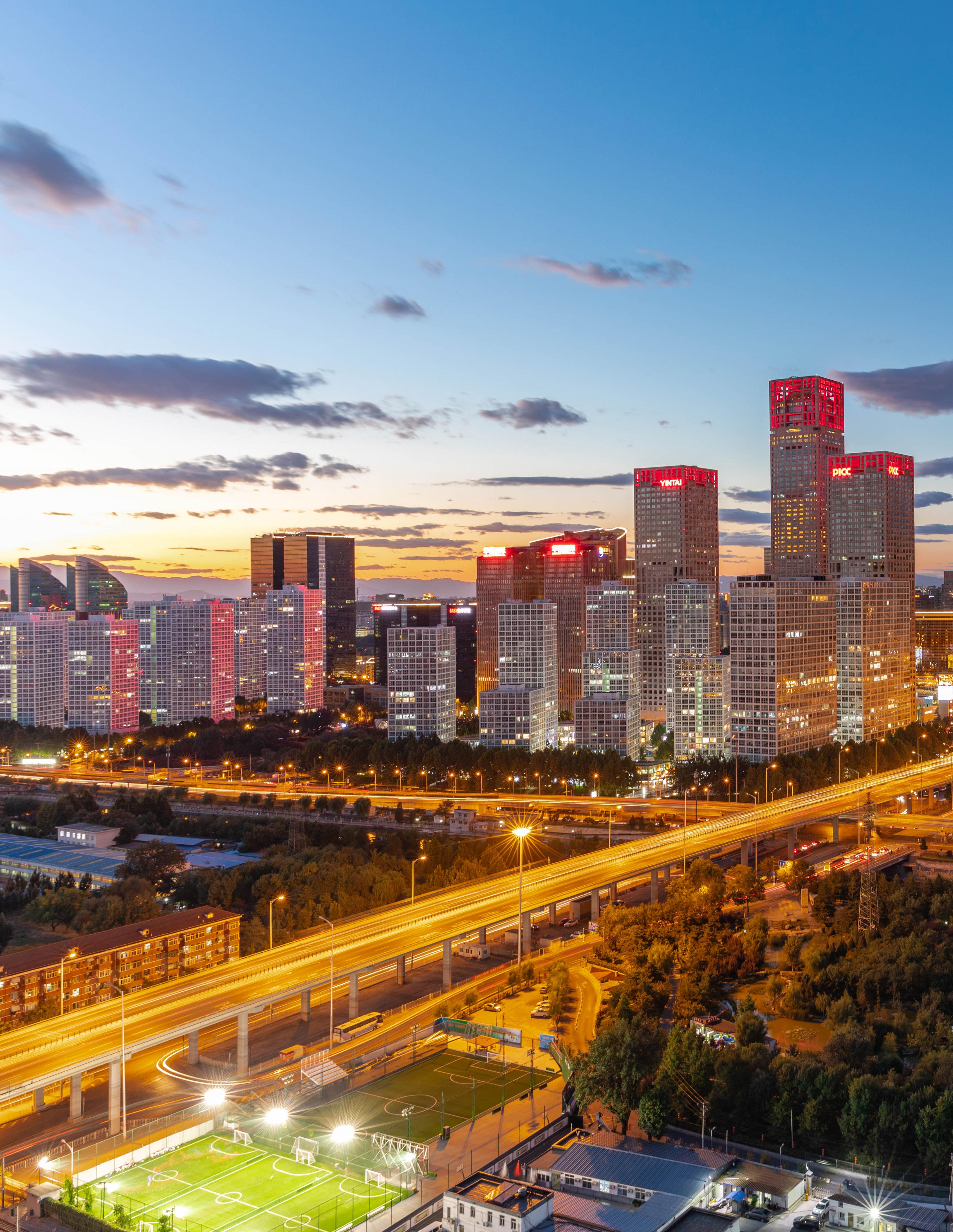
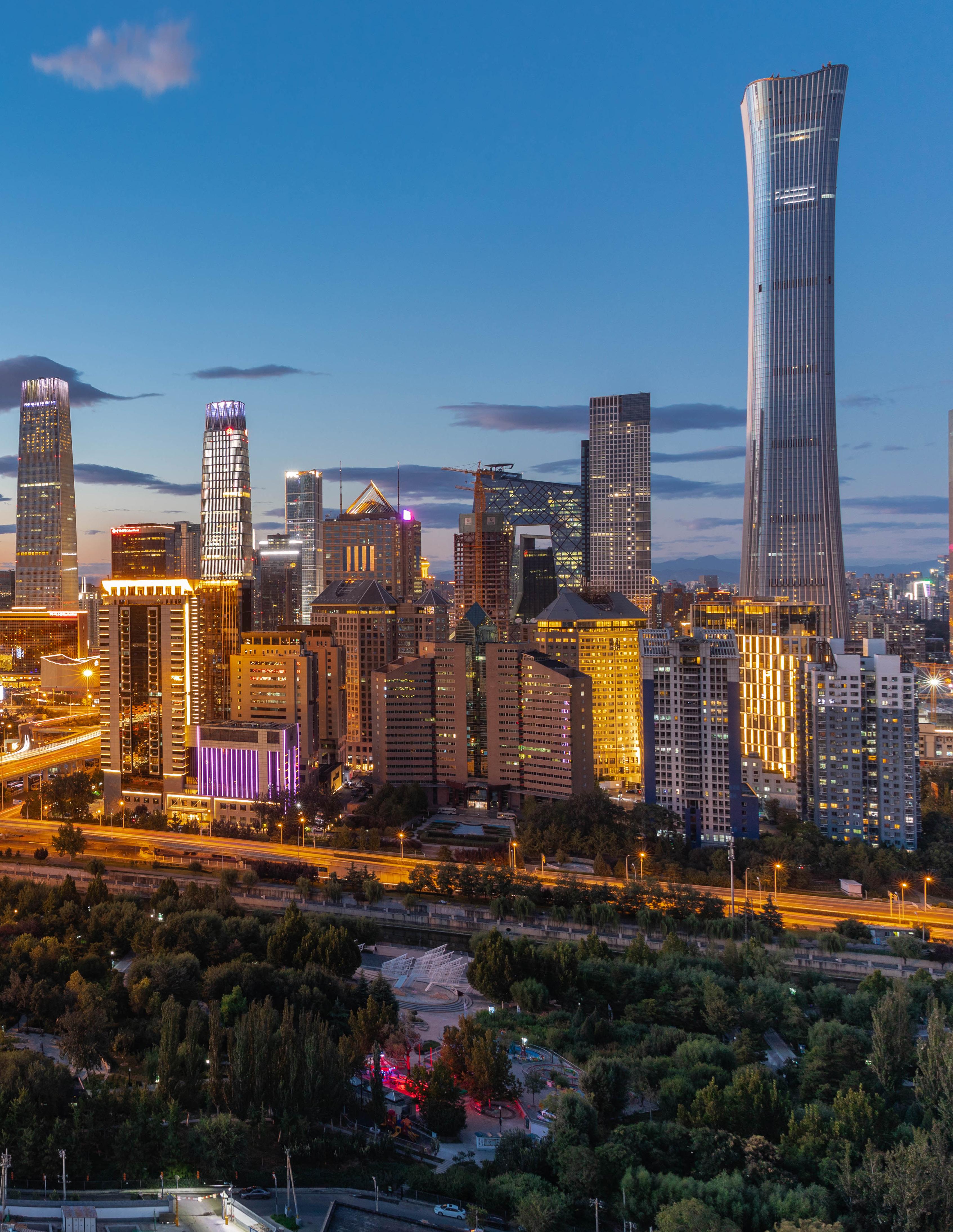
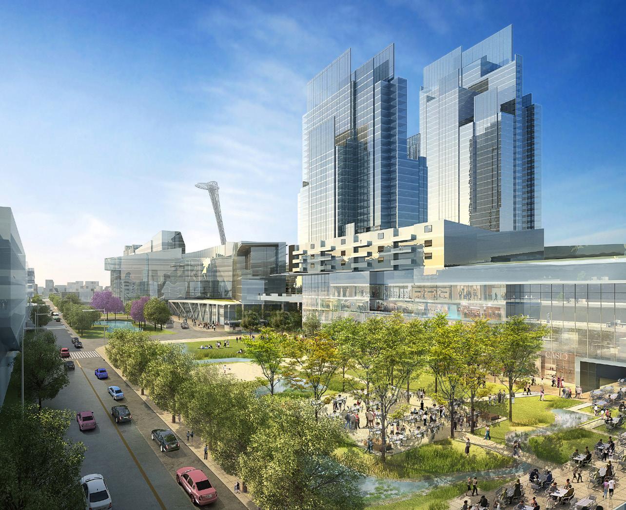
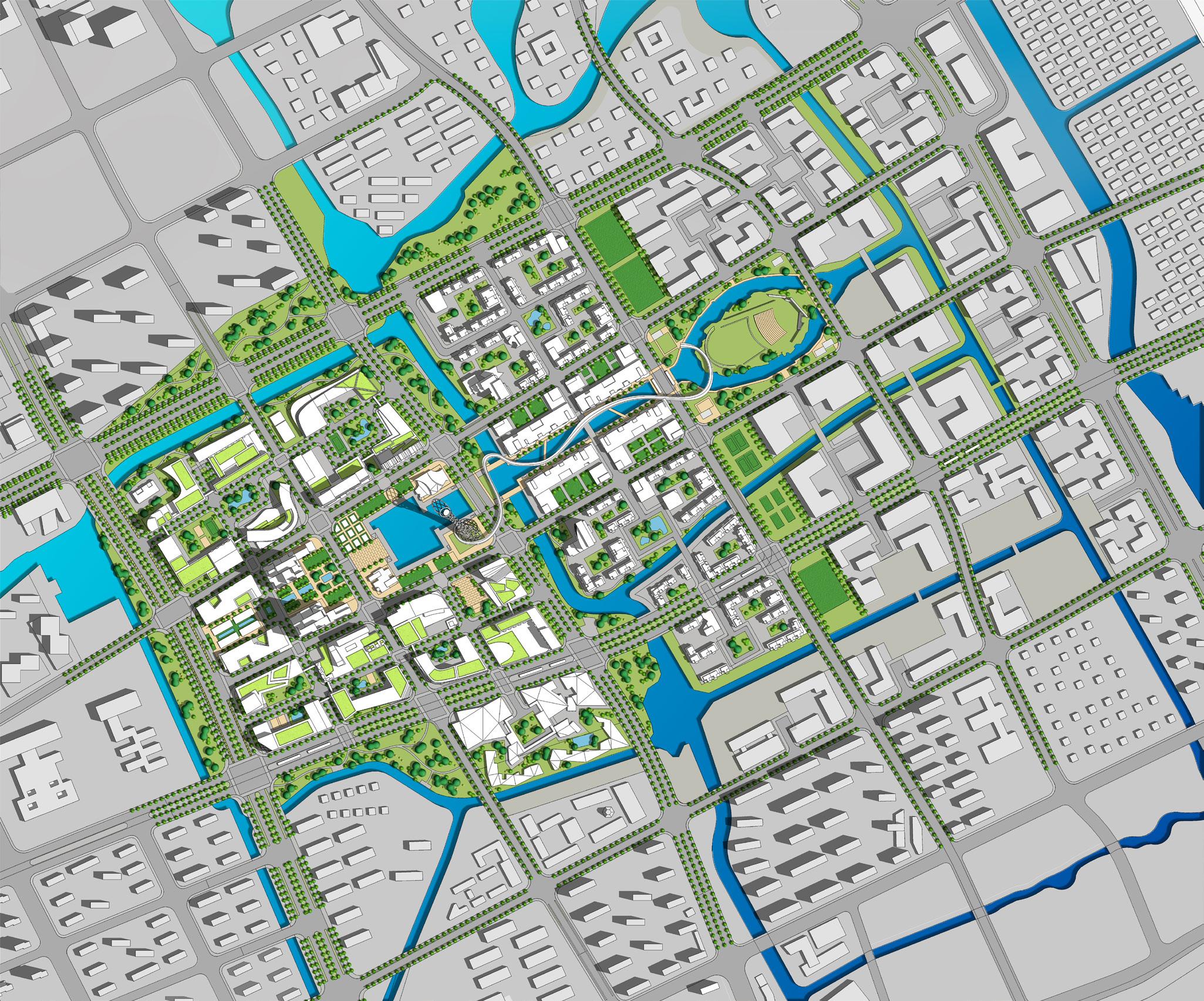
Johnson Fain’s plan for a four-square kilometer section of Beijing east of Tiananmen Square creates the city’s first Central Business District. The project provides more than 100 million square feet of mixed-use development, including office, residential, retail, a wide range of cultural uses and more than 500 different buildings anchored by a central “City within a City”, featuring the world’s largest tower. Johnson Fain was awarded the Master Plan as the result of an international competition including eight teams.
Based on China’s “Ideal City” concept, the proposed Master Plan supports the Golden Cross intersection of the Third Ring Road and ChangAn Street as well as the open space network. The overall concept is to create a CBD with multiple unique districts, each with equally balanced land use, linked by physical adjacency, multiple transit options, distinct street grids for pedestrians and vehicles, and a major parks network containing a “necklace” of premier cultural institutions. Midblock walkways based on the traditional Beijing’s hutong development are encouraged for small-scale pedestrian movement. Among proposed building regulations are standards to provide solar access for structures and public spaces.
BEIJING CBD NIGHT VIEW
 CHINA’S “IDEAL CITY” CONCEPT
based on China’s “Ideal City” concept, create a CBD with multiple unique districts, with equally balanced land use, linked by physical adjacency and multiple transit options

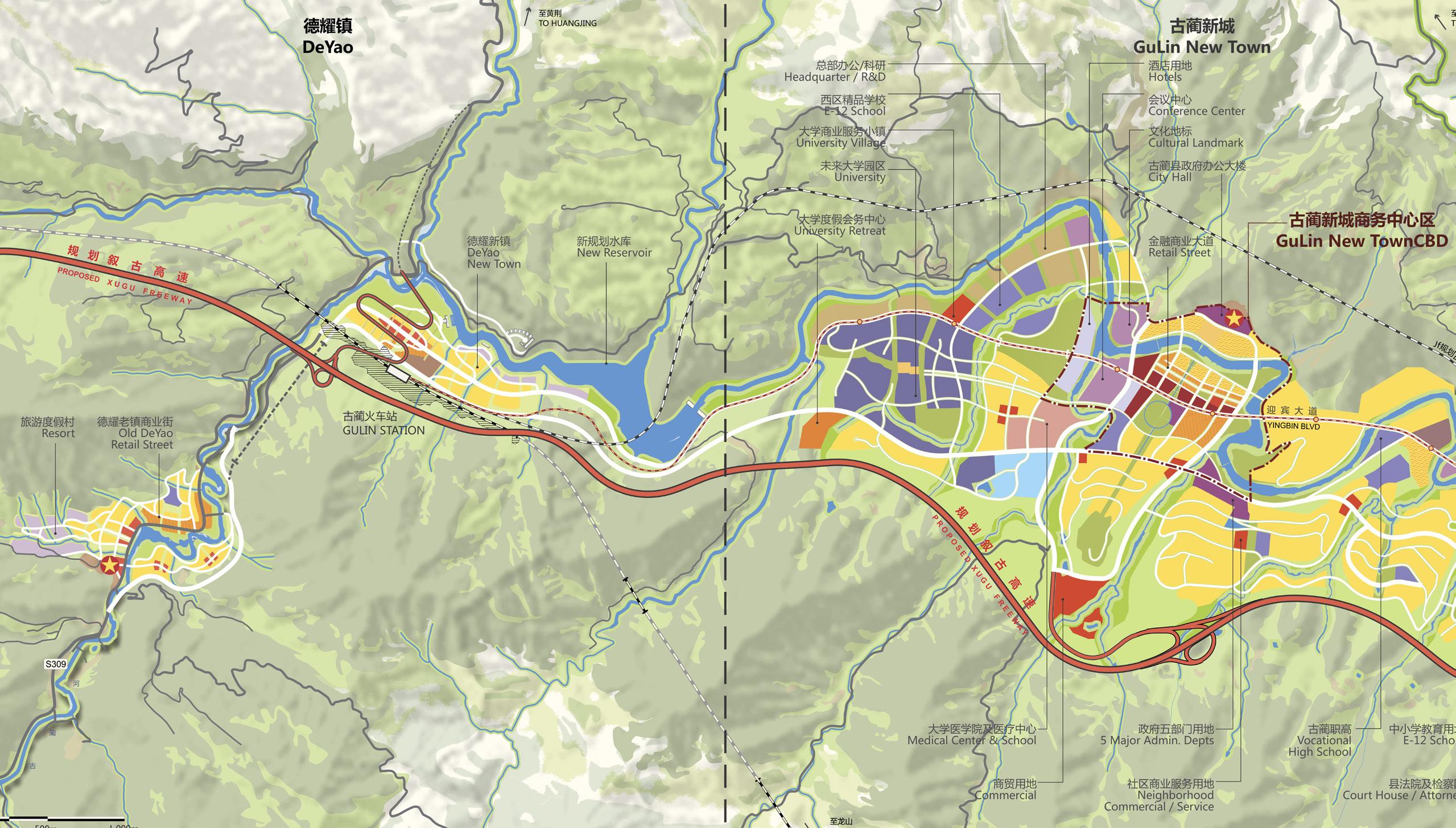
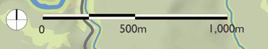
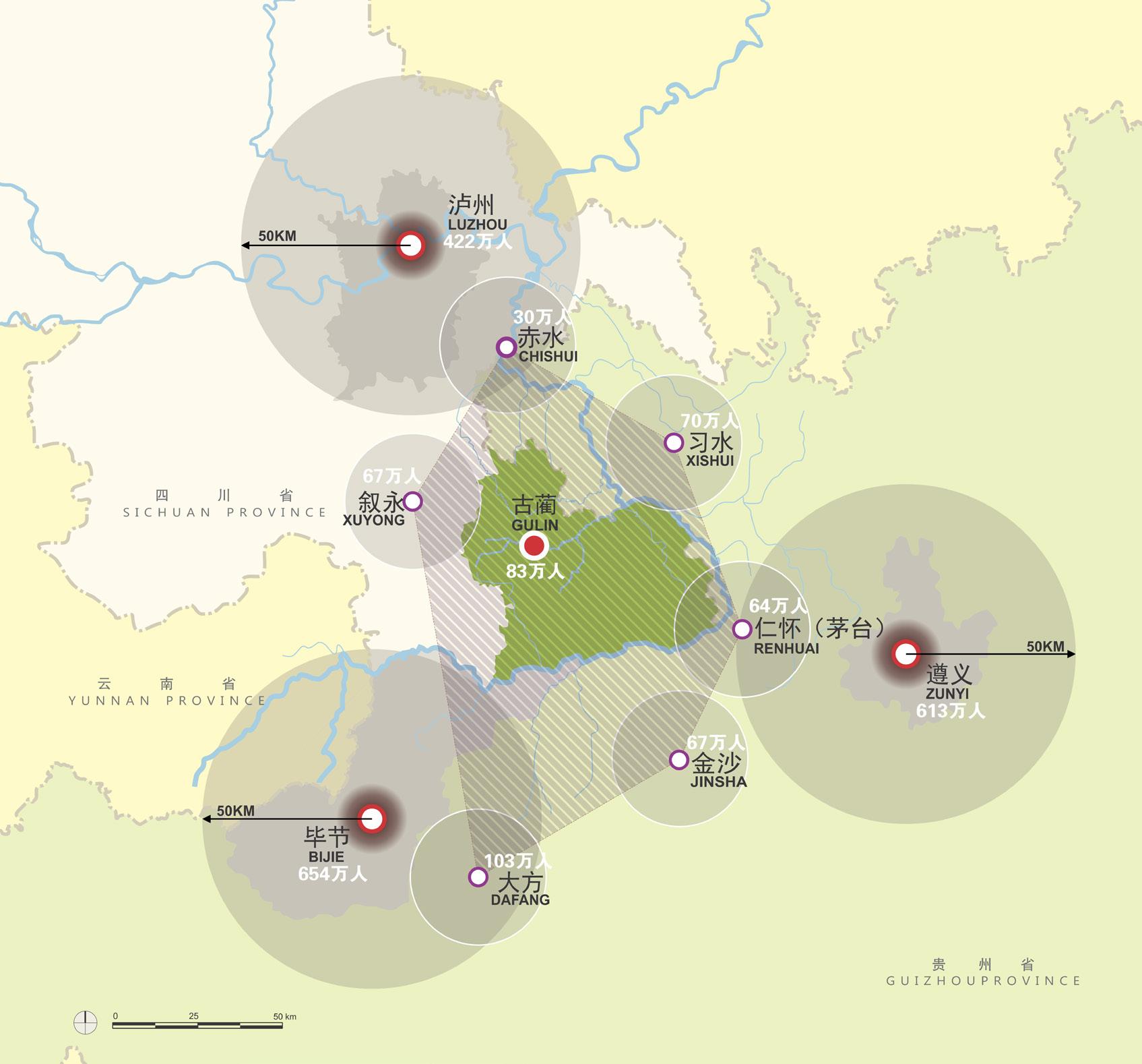
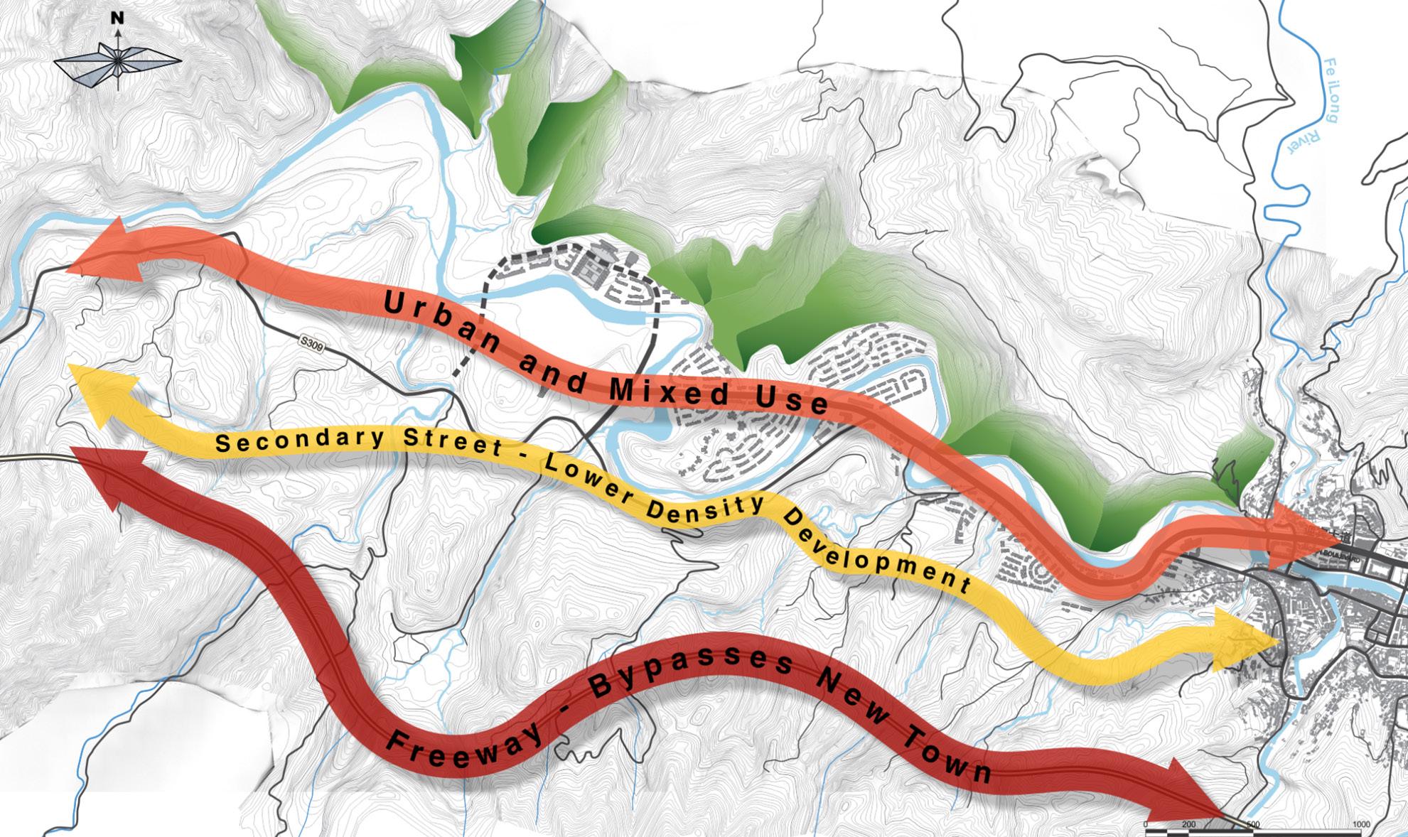
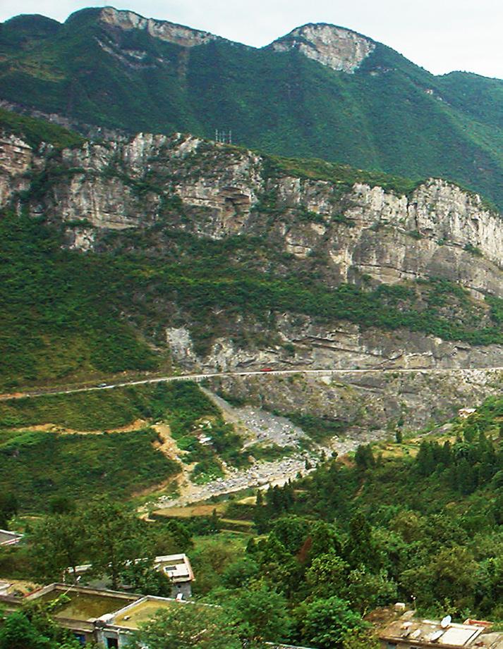
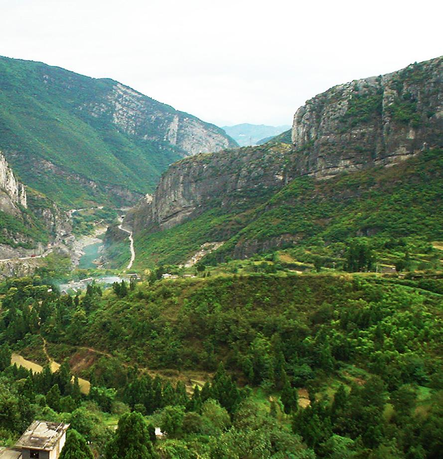
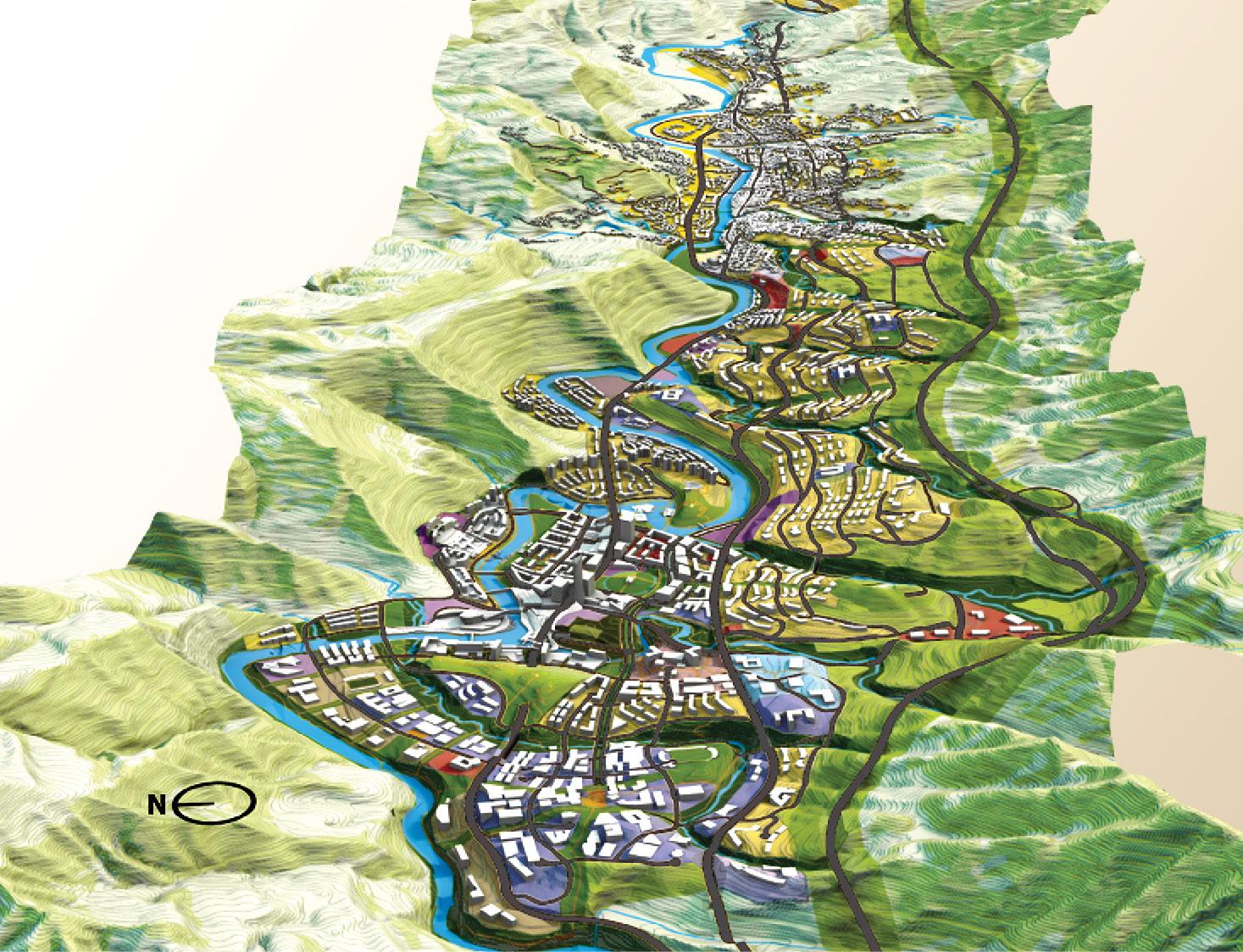
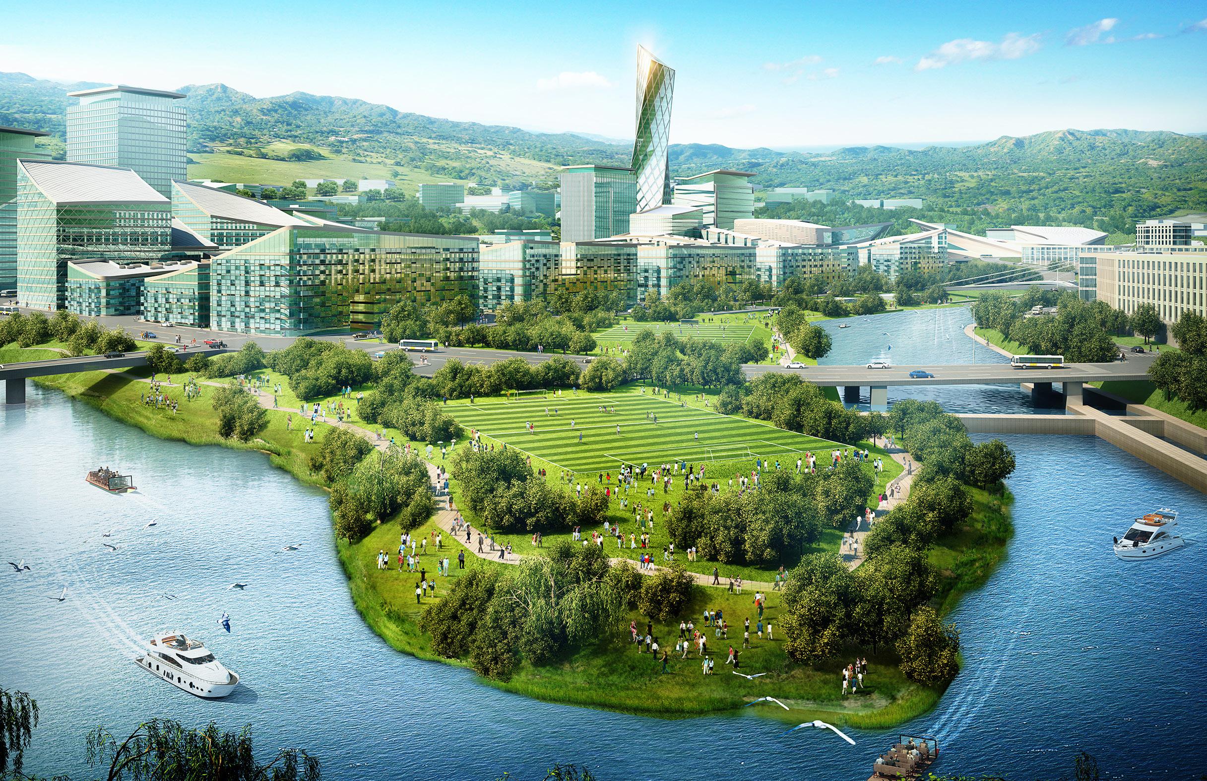
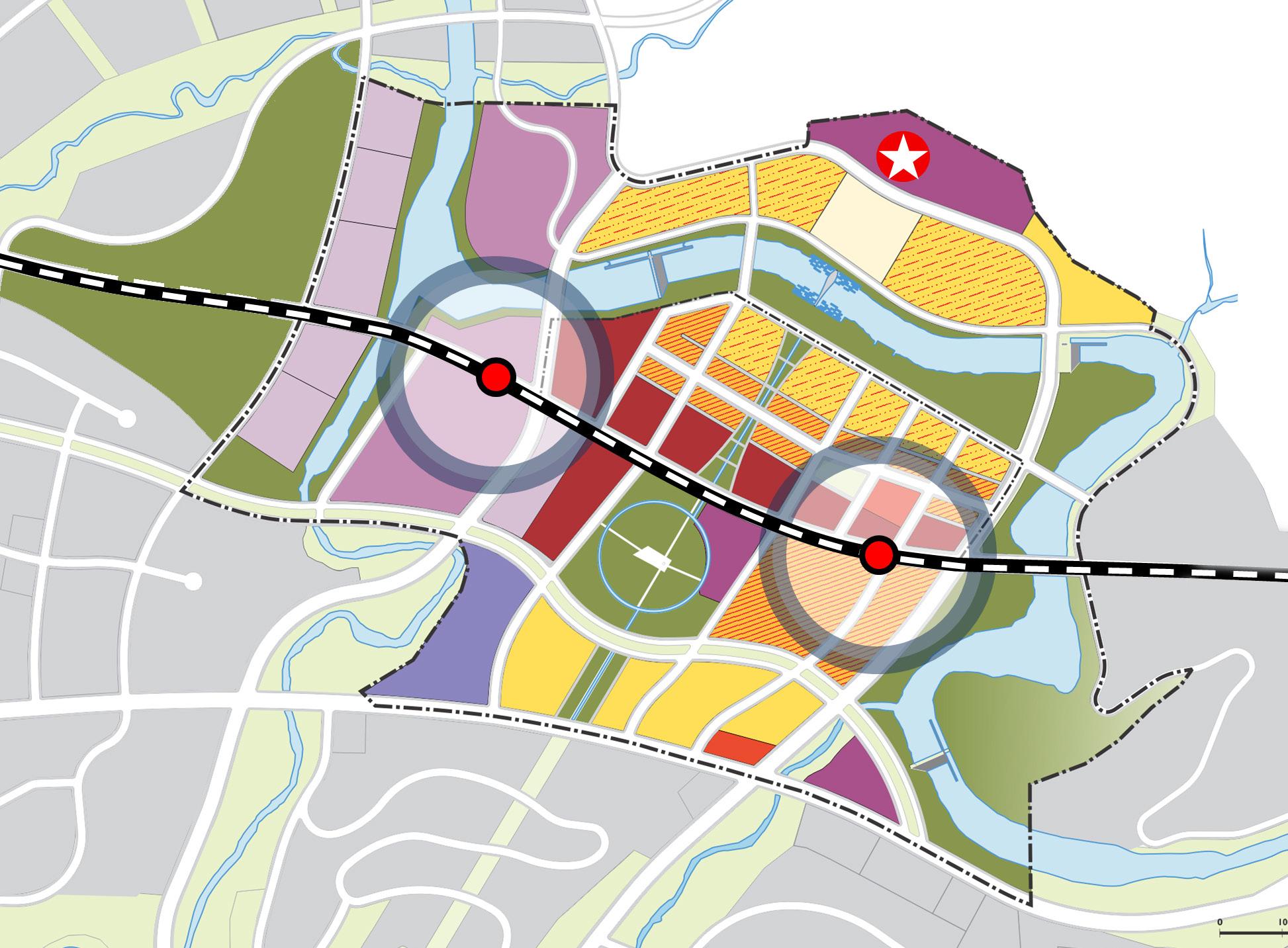
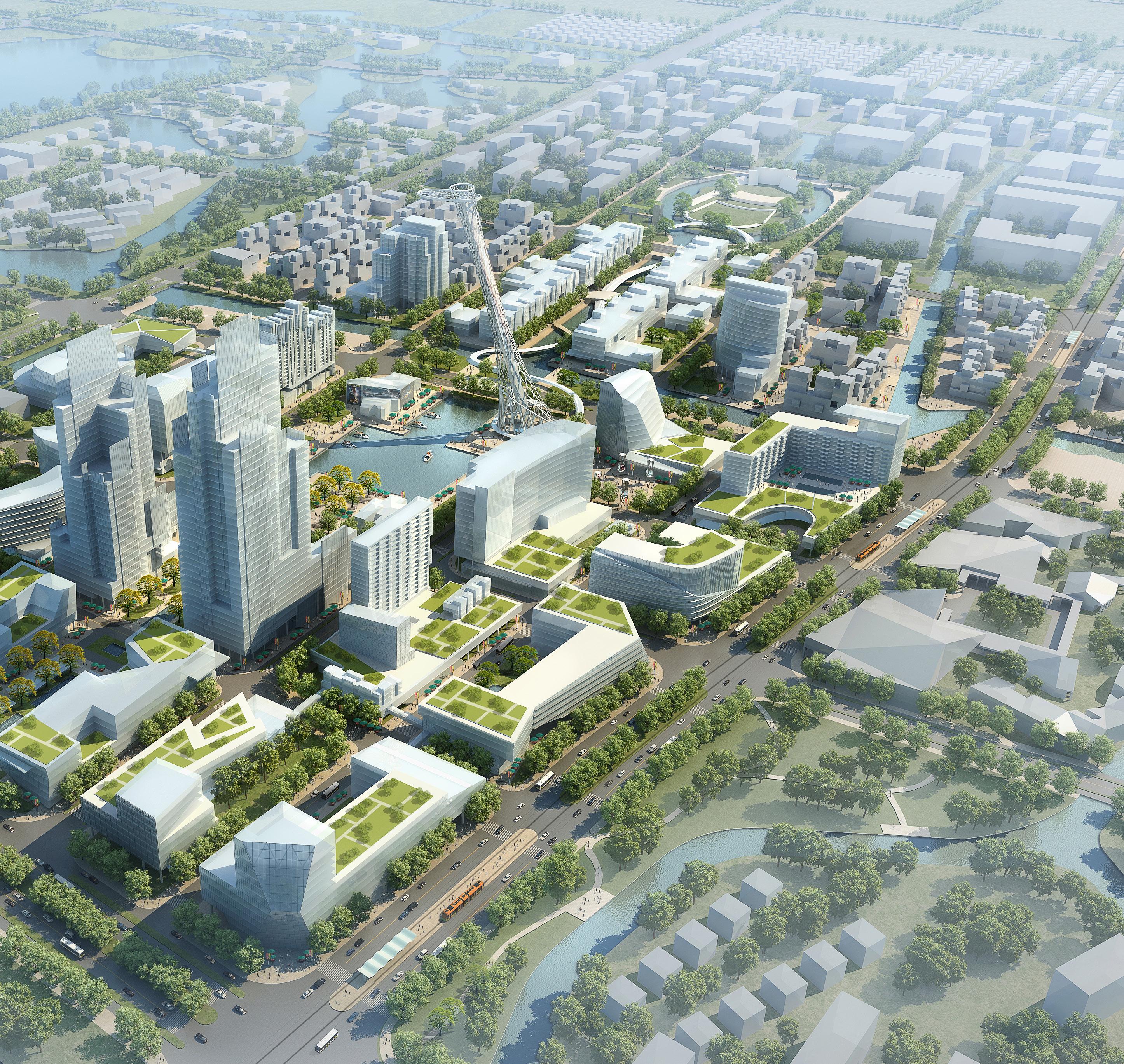
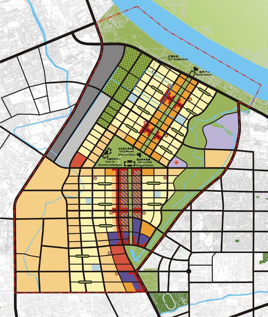
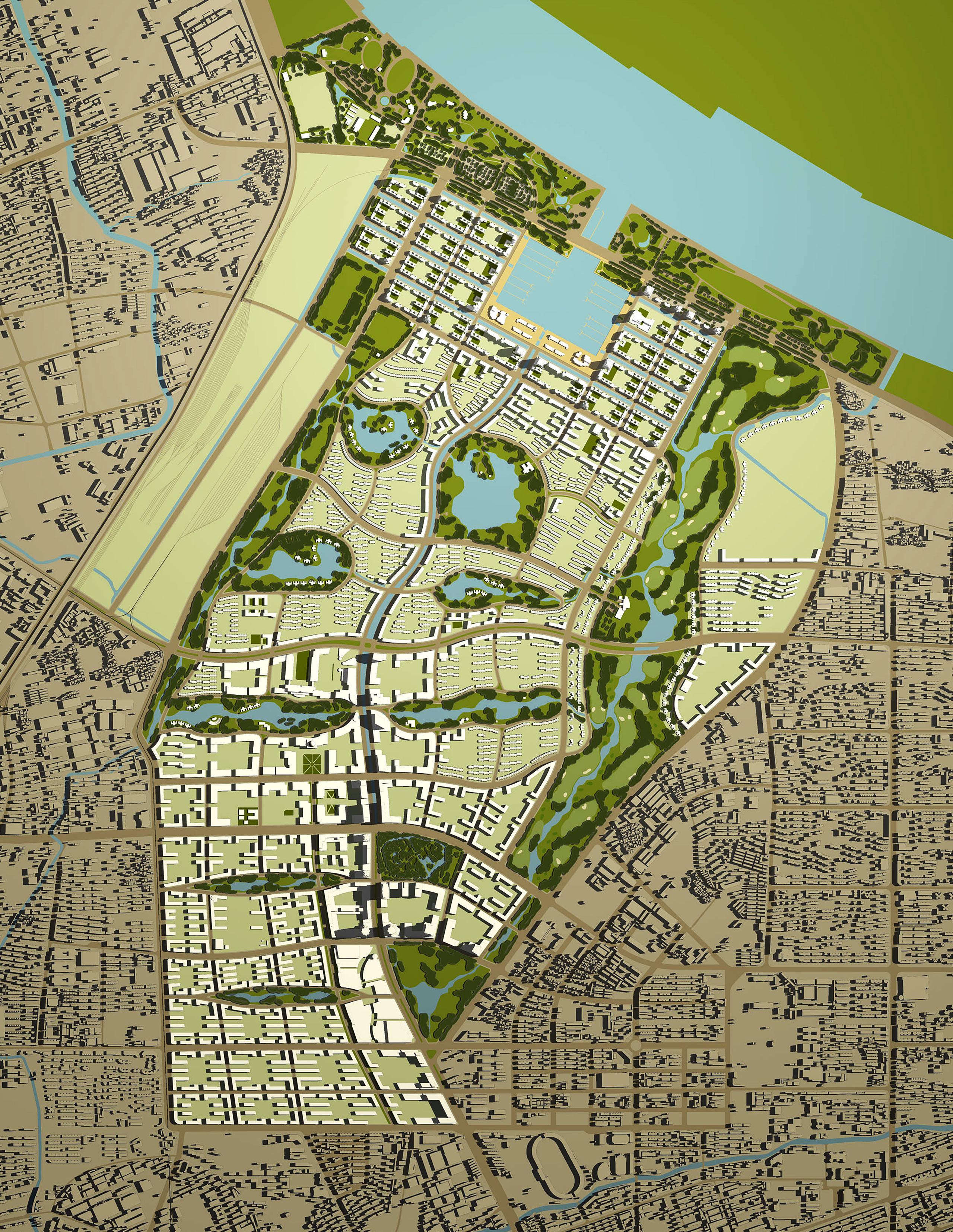
Nestled between lush mountains and bisected by the GuLin River running through the valley, the GuLin New Town is uniquely located in the mid-northern area of GuLin District just west of existing GuLin Town. The site for the New Town is constrained within the flat lands of the GuLin River Valley with steep slopes to the north and more gradual slopes to the south. The southern area of the site is further broken up into sloping “trays” of development by a number of streams that flow down to the GuLin River. There are several smaller hills within the valley at strategic locations that provide the potential to become focal points for the New Town.
The GuLin New Town Strategic Plan is based on eight planning principles:
1. Use the river as an organizing element for the plan.
2. Respect the terrain including preserving streams and riparian corridors sensitively
3. Connect the mountains to the river with linear open spaces
4. Preserve Long Views to and from Mountains & Hills
5. Connect visually the City Hall and three CBD Parks through view corridors
6. Balance development and open space with appropriate densities given slope considerations; optimize land resources and do not overbuild
7. Organize a clear hierarchical road system which offers choice in mobility and has redundancy built into the network
8. Plan a sustainable new town with optimal use of all resources – land, water, materials, energy

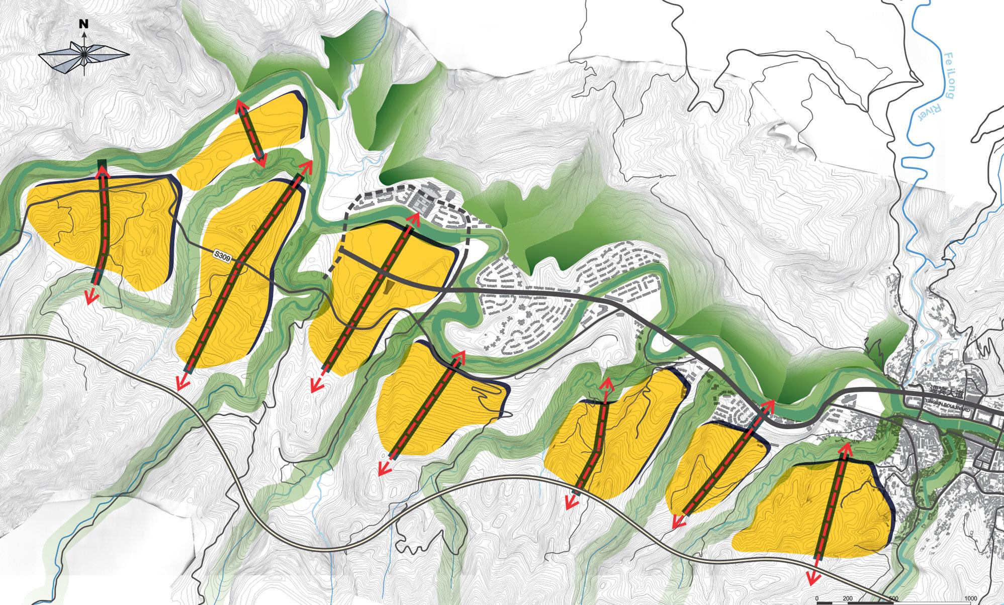
 PROPOSED SPATIAL STRUCTURE SCENIC VALLEY IN GULIN
OPEN SPACE & VIEW CORRIDOR FRAMEWORK ROAD SYSTEM
PROPOSED SPATIAL STRUCTURE SCENIC VALLEY IN GULIN
OPEN SPACE & VIEW CORRIDOR FRAMEWORK ROAD SYSTEM
balancing urban growth with ecoloical development, strategic open space framework, water and resource management
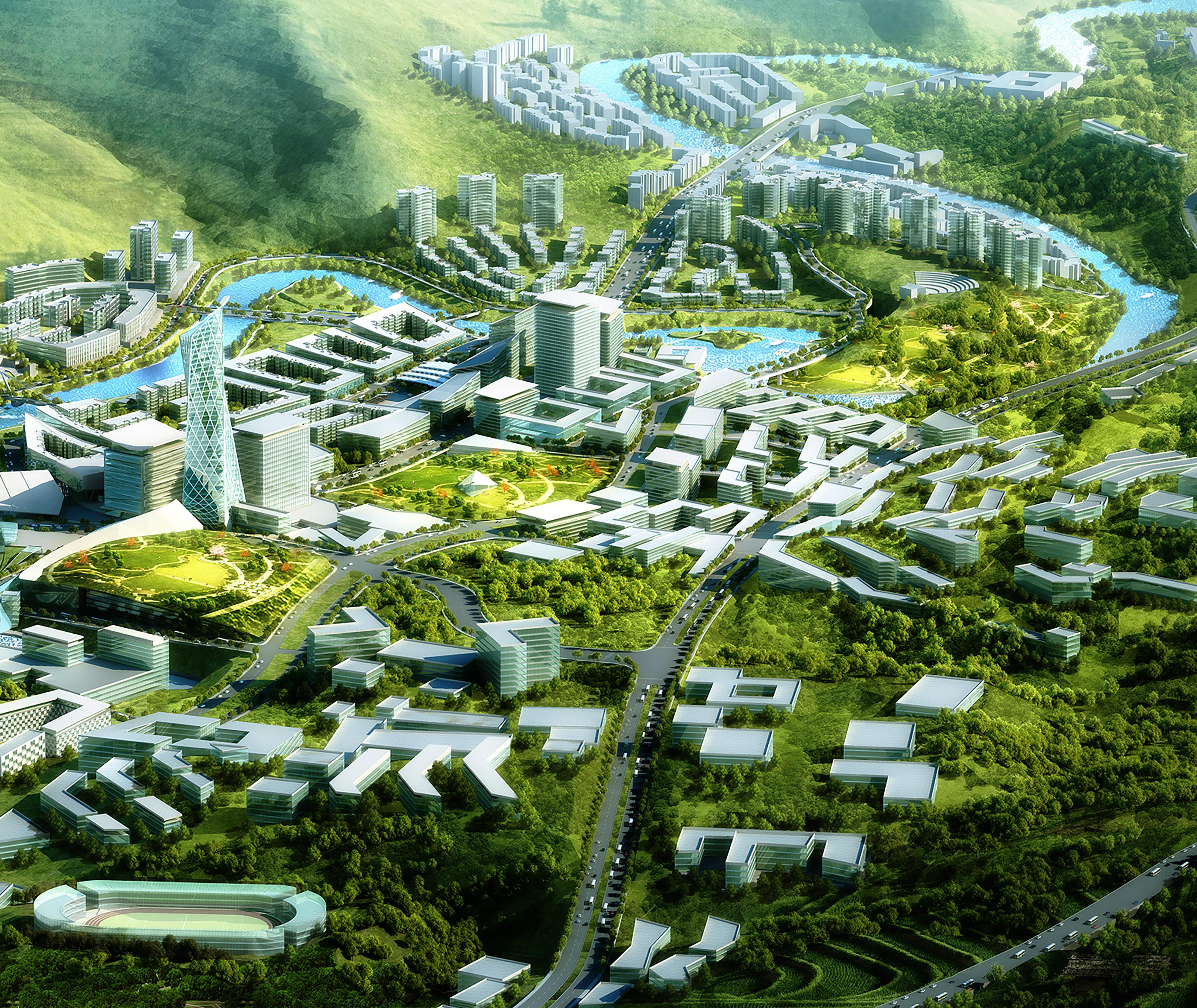
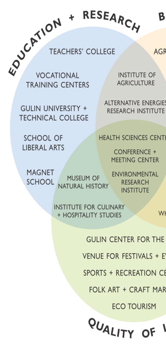
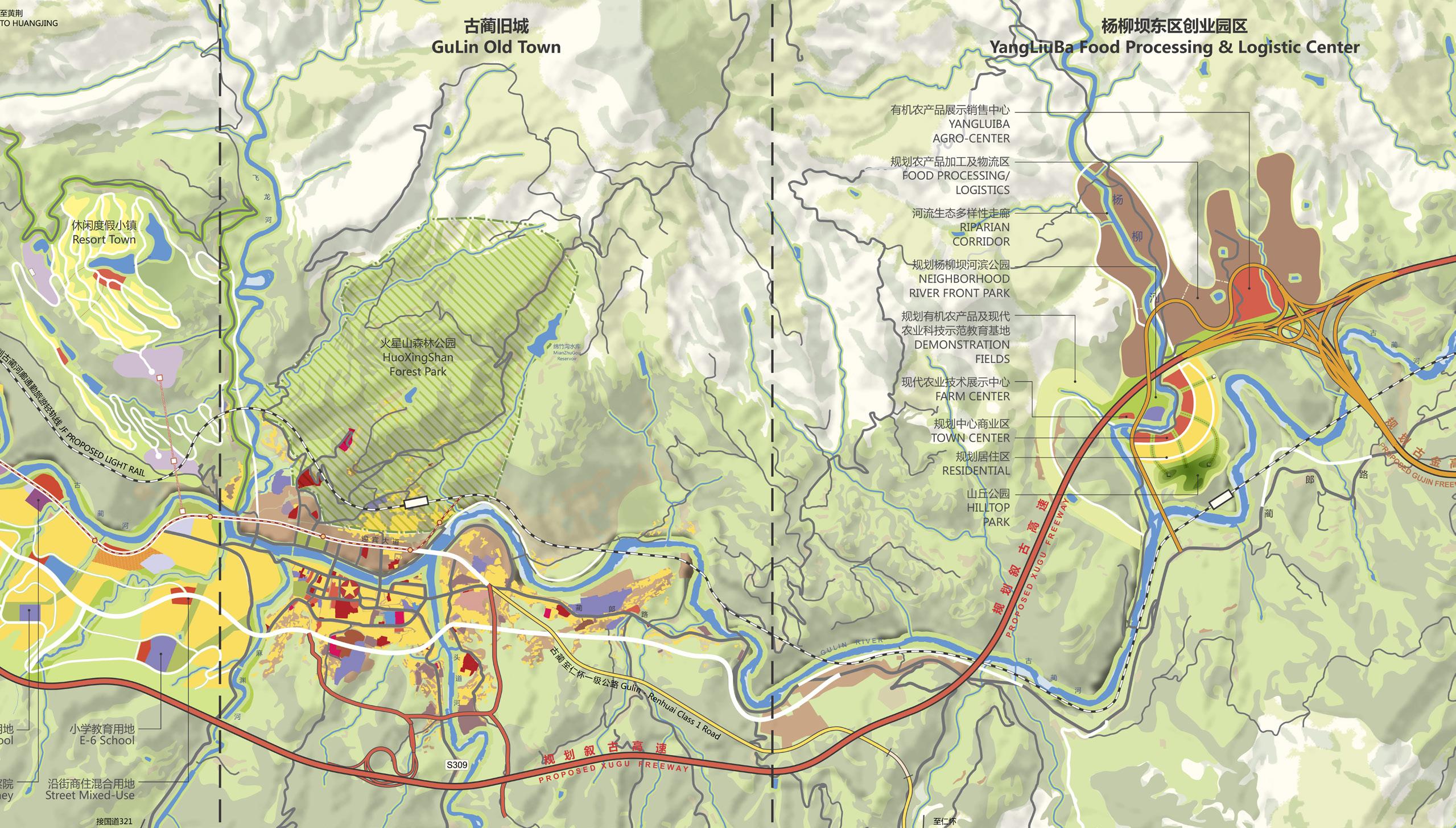
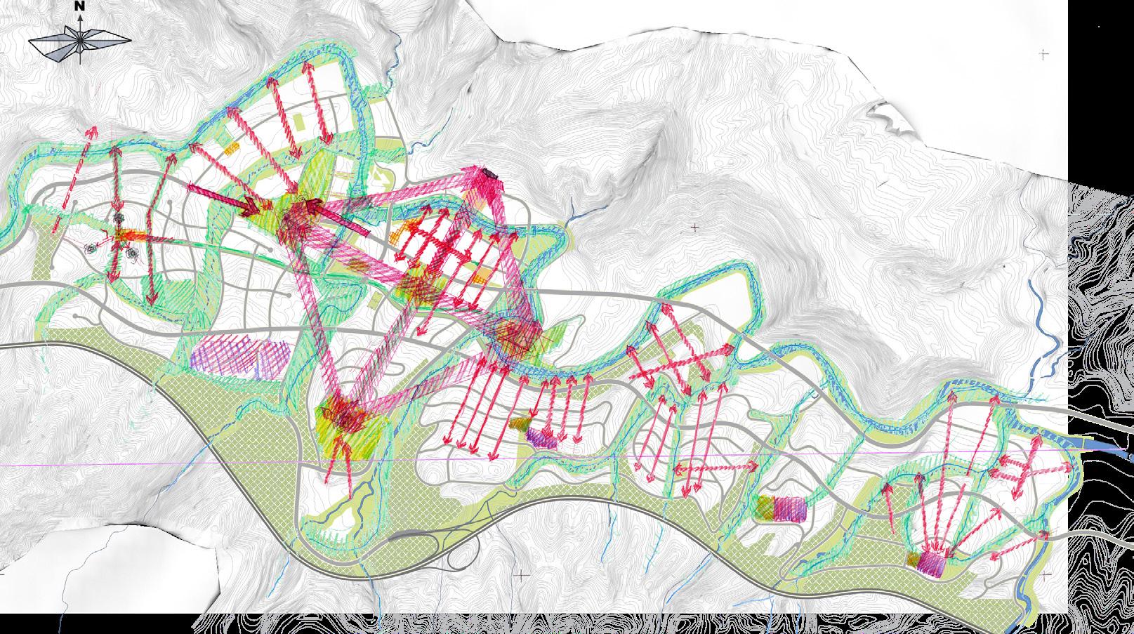
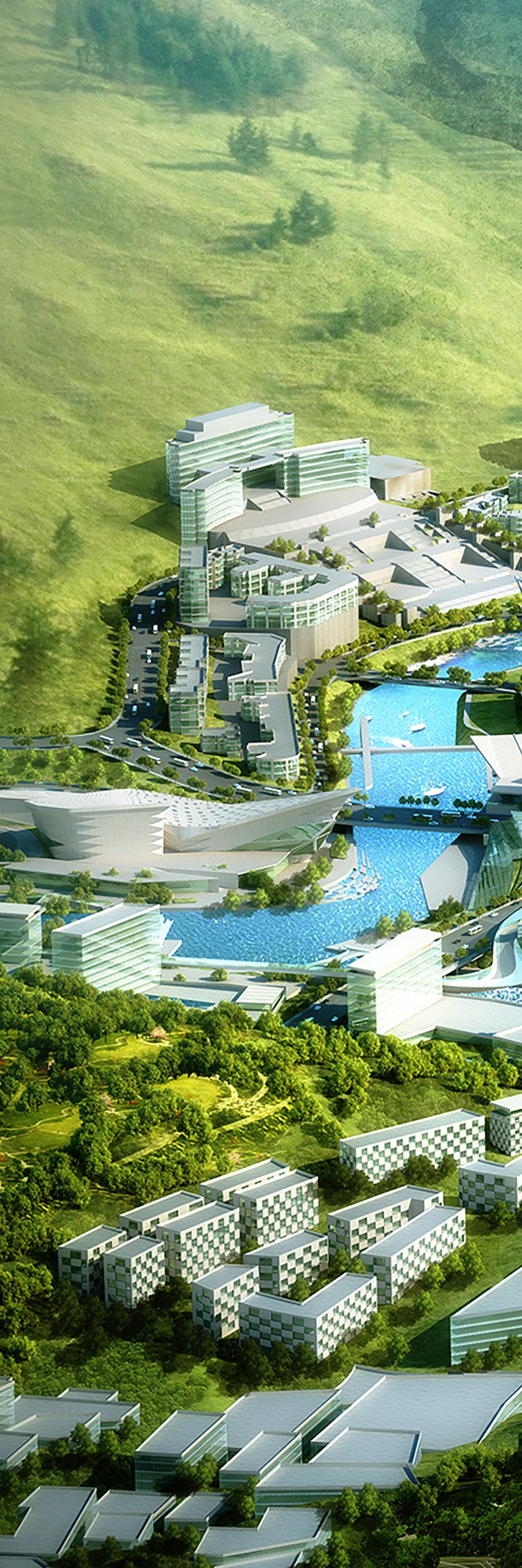
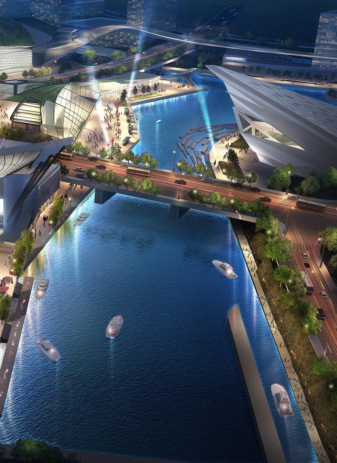
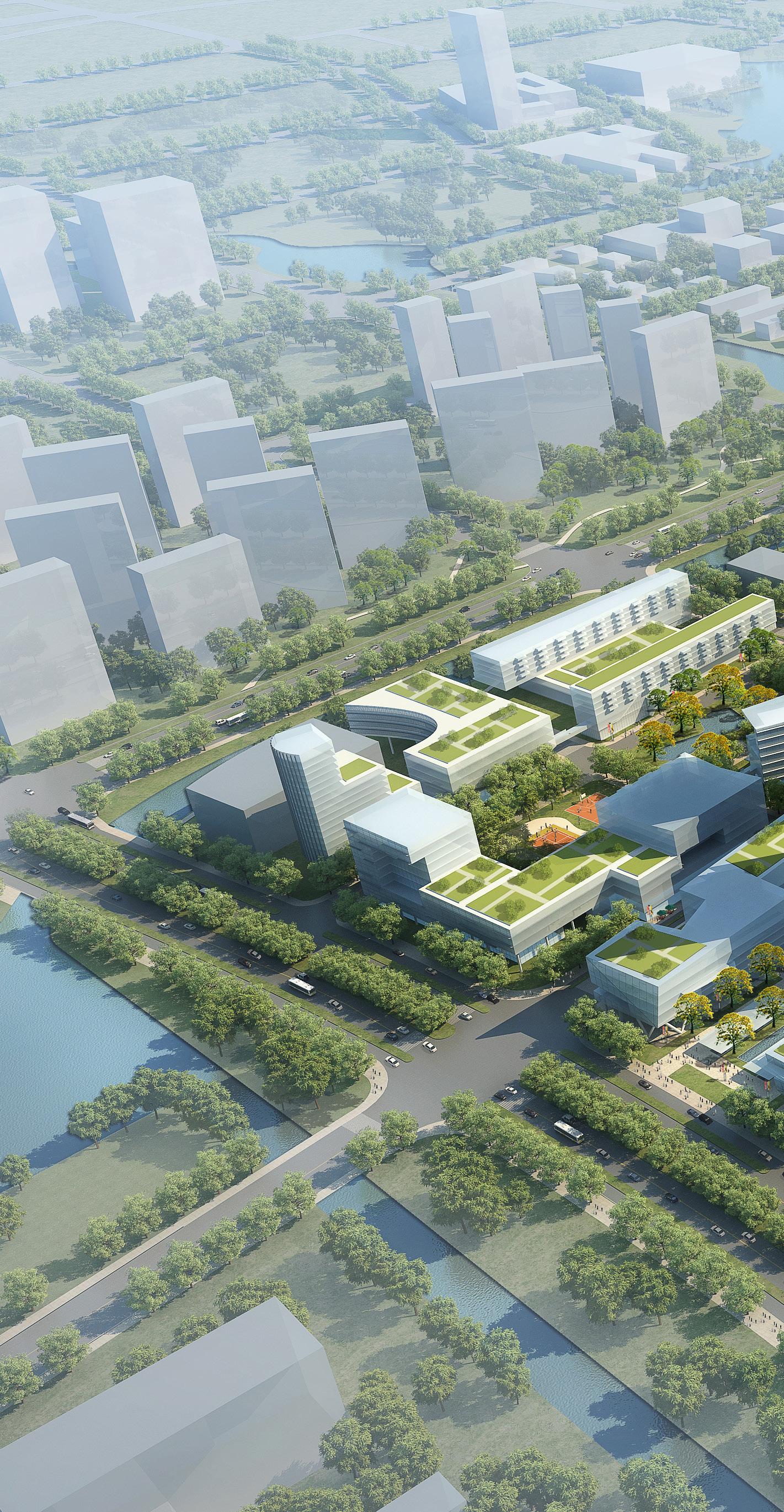
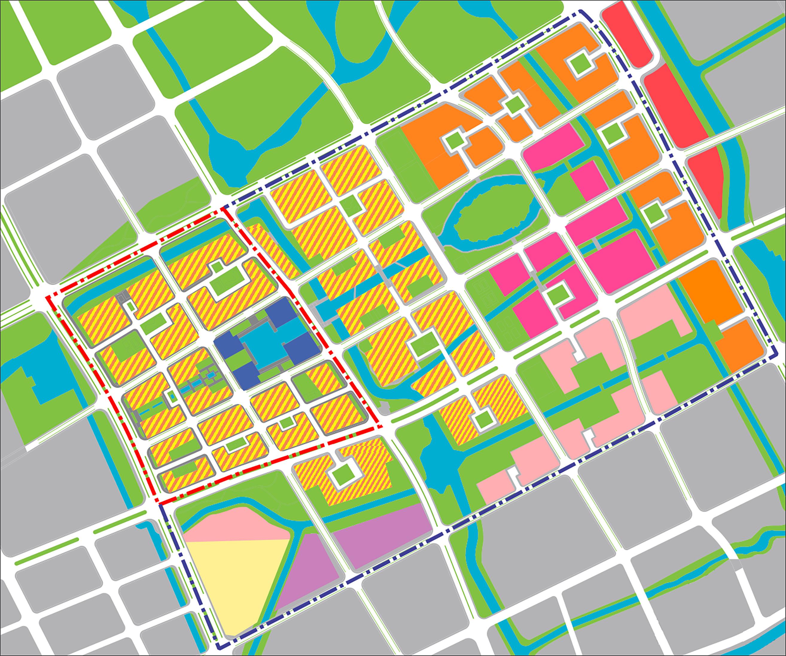
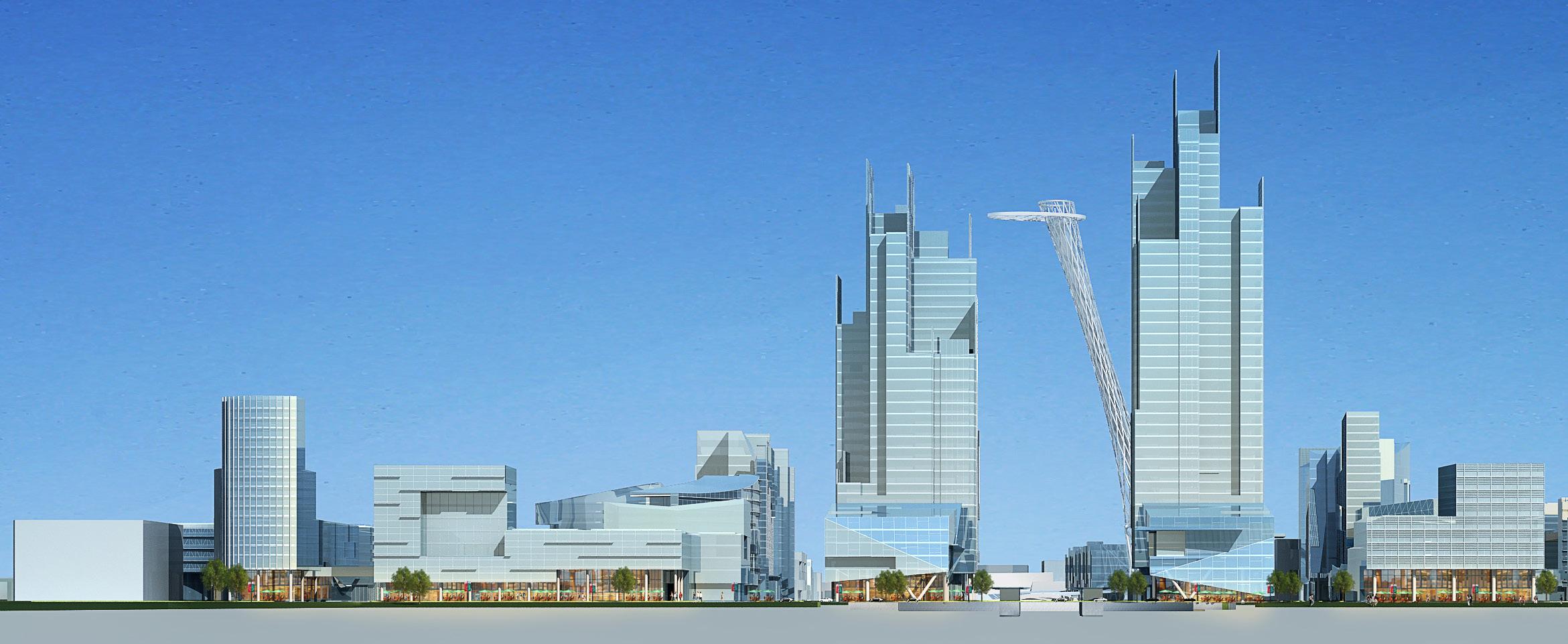
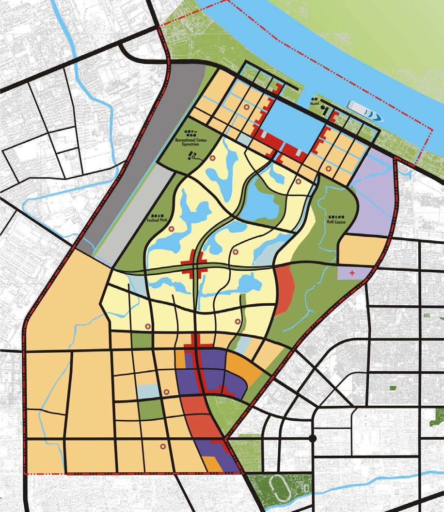
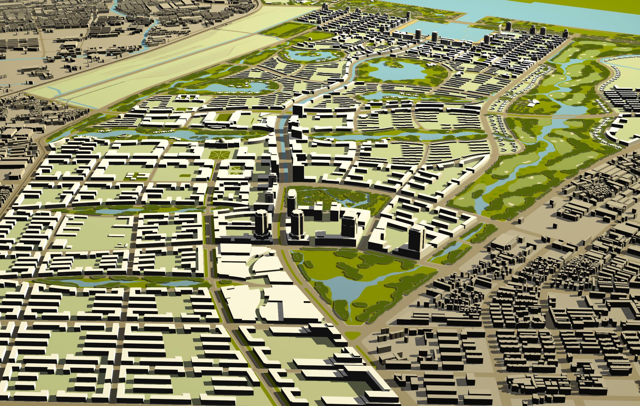
At the heart of the New Town is the Central Business District (CBD), which is planned as a mixed-use center including government and public uses, cultural uses, headquarter office sites, urban housing, convenience and life-style retail, meeting facilities, theaters, museums, and hotels. The river within the CBD will include two dams that regulate water level and provide opportunities for recreation and retail entertainment uses along its edges; it is planned to serve both residents and visitors alike.
The location of educational facilities is a central objective in the plan, and the introduction of a University within the New Town is critical to provide a venue for research and technology development that not only support the existing industries of coal and whiskey, but also promote new business enterprises. This university campus is planned as an anchor of the town at its western edge and will be closely associated with the CBD by the introduction of a research center as a bridge between town and education.
The future must include educational facilities at all levels, and a state-of-the-art system of schools conveniently located within walking distance of residential neighborhoods is proposed.
Research and Development sites are located along the northwestern bluffs adjacent to the river to provide location opportunities for facilities that will help GuLin diversify its economic base while providing support to the existing industries in the region.
The eastern side of the New Town is planned to be predominantly residential neighborhoods serving as a link to the old town. These neighborhoods will offer a variety of living choices, and will include residential serving retail and service uses within them. A CBD adjacent neighborhood as well as one near the proposed university will serve to further expand living choices for the future residents.
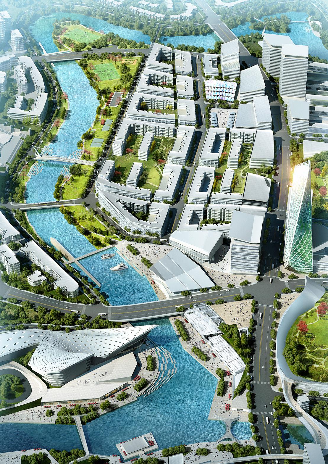
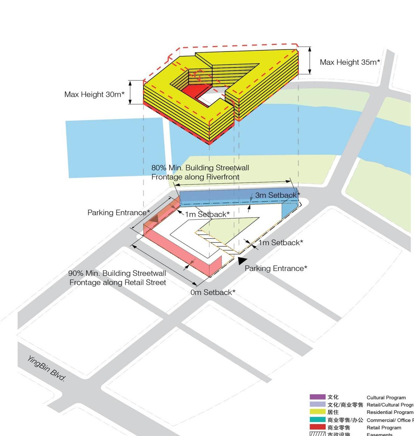
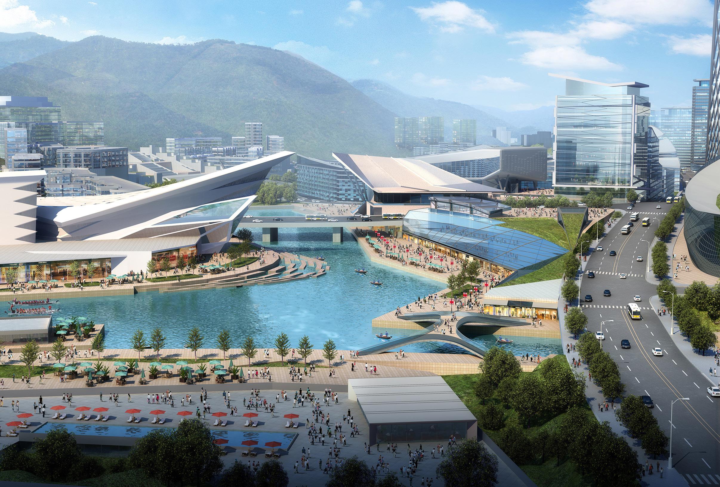
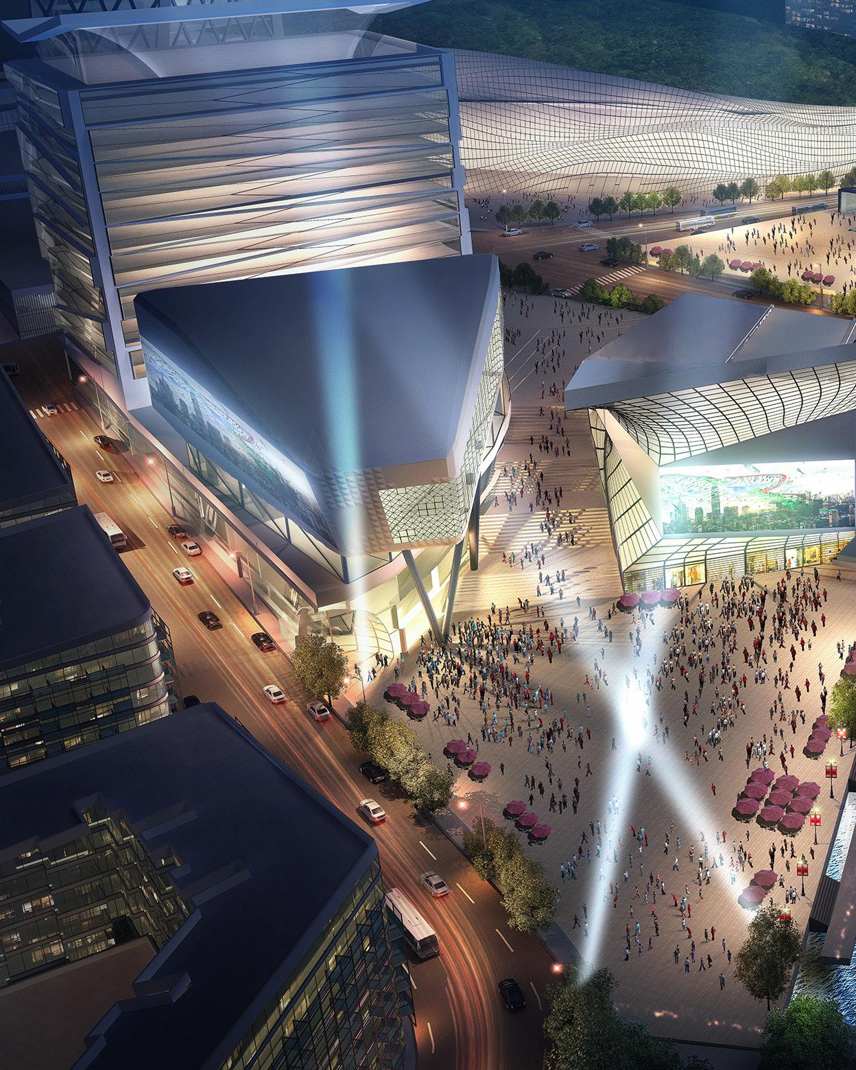 ENTERTAINMENT, RETAIL AND CULTURAL HUB
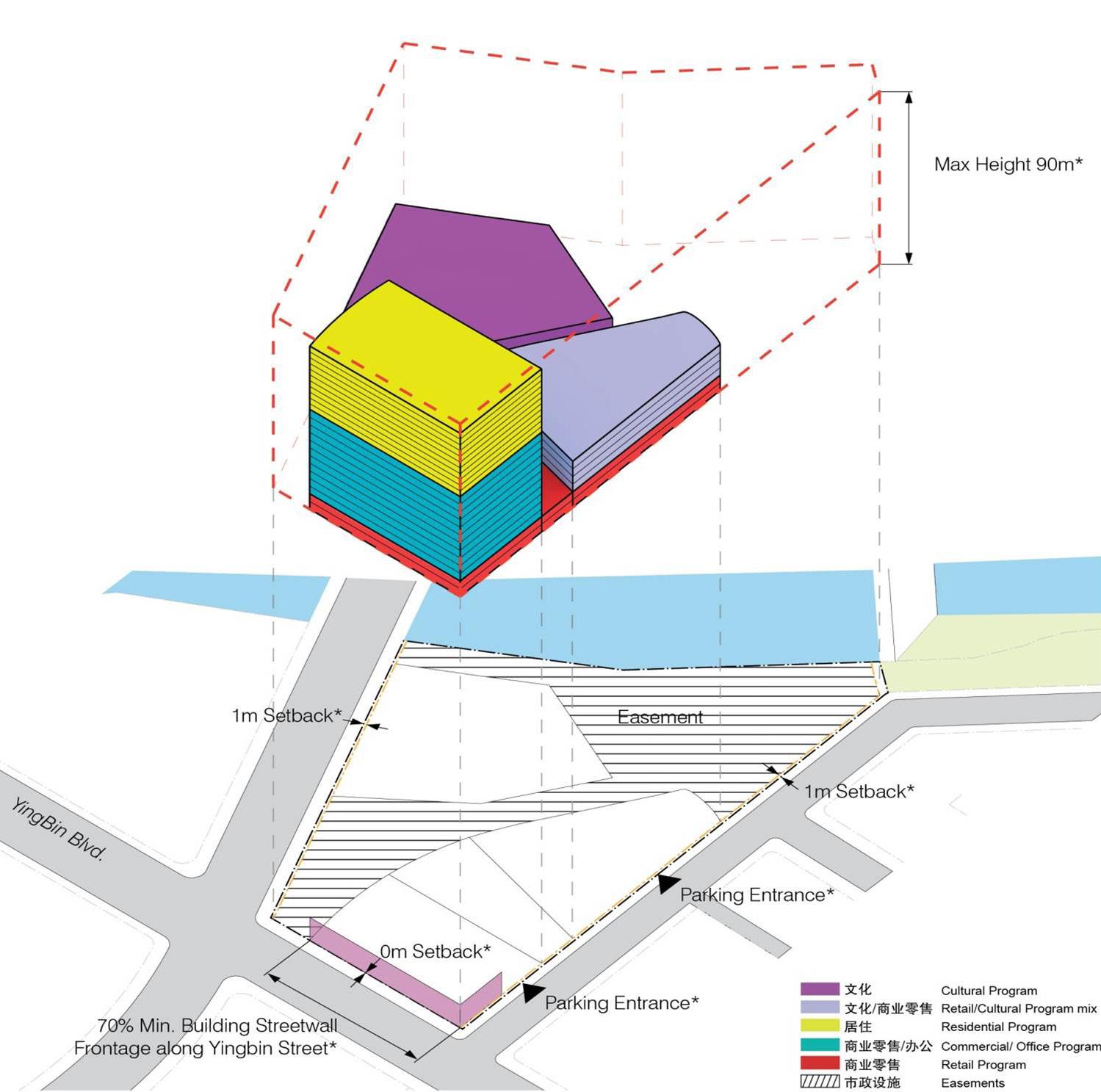
TYPICAL PARCEL GUIDELINES
CULTURAL ICONS AND PUBLIC USES ALONG RIVERFRONT
ENTERTAINMENT, RETAIL AND CULTURAL HUB
TYPICAL PARCEL GUIDELINES
CULTURAL ICONS AND PUBLIC USES ALONG RIVERFRONT
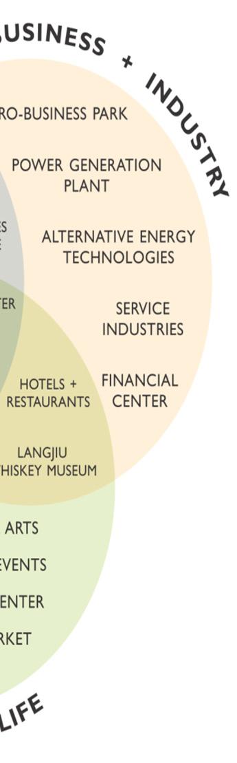
diversified pillars of development in Business, Education, Medical and Tourism to enhance sustainable development
New markets and economies have been created and repositioned by the increased speed and affordability of worldwide electronic communication. “Knowledge industries” are a prime force in the global economy and what is behind what we term “The Informational City.” In this new digital age, cities become more important as crossroads for information flow. They are the nodes in a world network where transactions, innovations and markets occur. The cities that will have the most influence, power and success will depend upon how competitively they adapt to this economy.
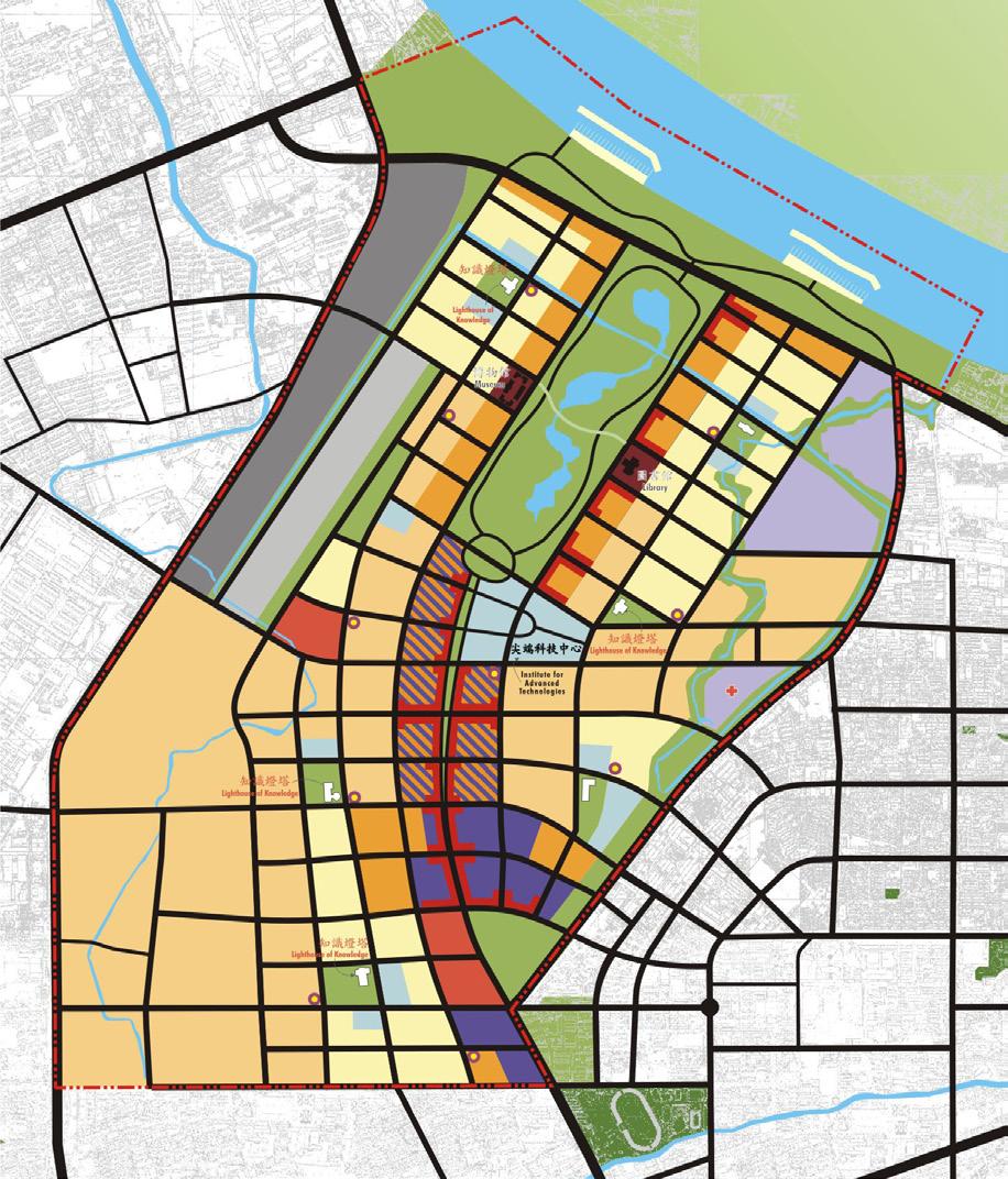
The plan for the JiaDing New Town Corporate Headquarters Campus addresses these new urban realities by creating a new Informational City. Since it is the intention of China’s Twelfth Five Year Plan to position Shanghai as a leading world financial center, and as JiaDing is one of Shanghai’s three new town CBD centers, the purpose of the JiaDing plan is to address the needs of a world network of industries that require a place within Shanghai’s rapidly urbanizing environment. It is important to realize that the JiaDing CBD must be linked to the overall Shanghai economy and to recognize that this economy is strategically linked to the international flow of information and commerce worldwide. The JiaDing CBD must be planned to accept the economic forces that “decentralize” service jobs from Shanghai’s financial center in Pudong, while “centralizing” space for jobs created by businesses in JiaDing and the Yangtze River Delta.
Features of JiaDing New Town - Informational City:
• A 24/7 environment
• A “hyper-active” street level
• Places for people - collaborative space
• World-class education
• The connected city - frictionless
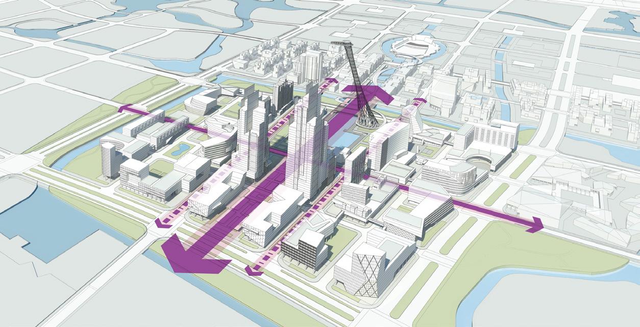
• Environmental sustainability
• Distinctive places and architectural excellence
• Open space and water amenities
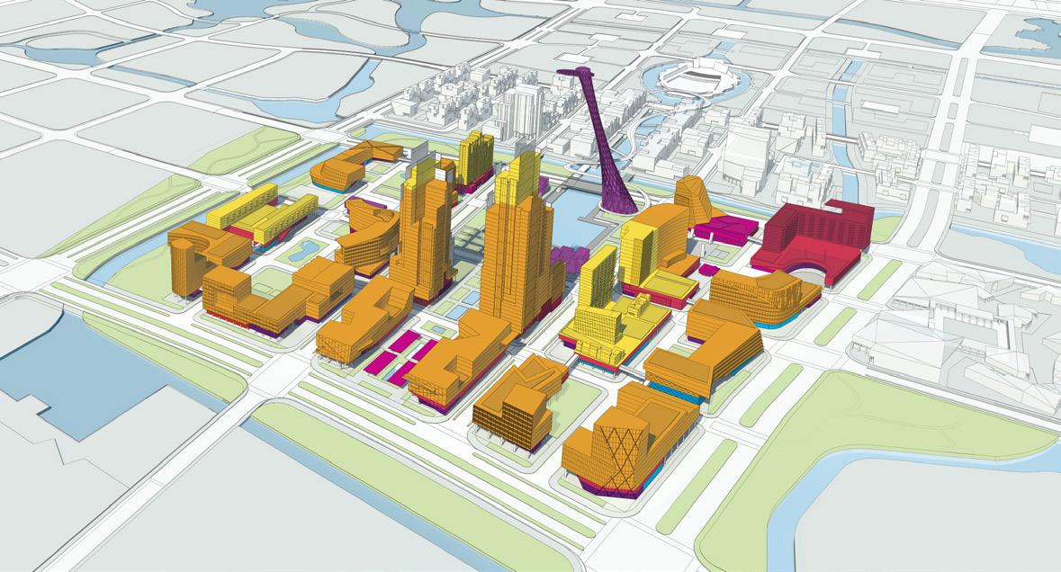
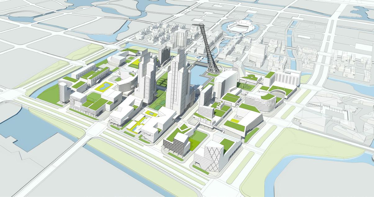

ILLUSTRATIVE PLAN
a high-tech informational city addition networked with a world-class financial center
LONGITUDINAL ELEVATION
TYPICAL 24/7 ENVIRONMENT
First Prize - International Urban Design Competition
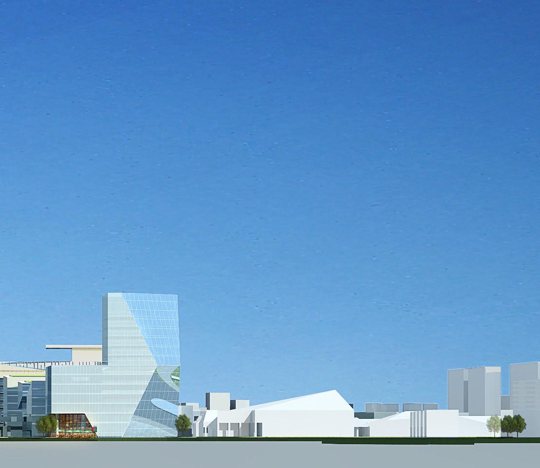
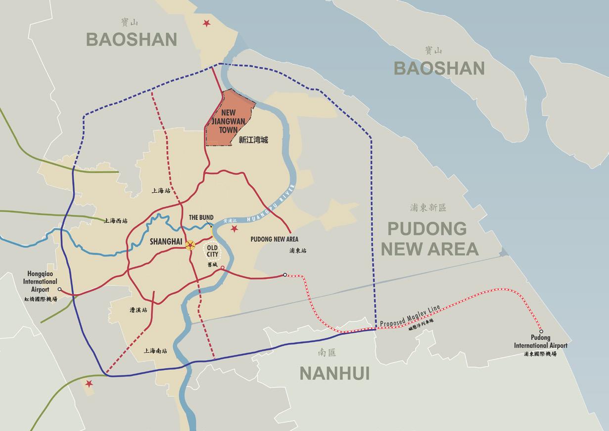
Located on a former air base in central Shanghai, the tensquare-kilometer area of the JiangWan New Sub-Town District is designed for a community of 125,000 as a means to relieve growth and redevelopment pressures. The plan is made up of three neighborhoods: a high-density, mixed-use center to the south; a low-density residential neighborhood planned around a series of open spaces and lakes at the center of the plan; and a waterfront development to the north consisting of a mix of mid-and high-rise housing around a network of canals and boat basin connected to the HuangPu River. The plan is based on a social program of improvements in education and sustainability, as well as increasing amounts of leisure time. Termed the “Good Life City,” the plan was selected by Shanghai authorities.
The three areas are integrated by an ecologically-balanced open space system which offers a variety of opportunities for living, working and recreation. The proposed open space system in conjunction with the road network seamlessly extends the existing fabric of the city into the new town. The plan emphasizes the principles of sustainable design and “transitfirst” development setting new standards for the region.
 THE GOOD LIFE CITY
AERIAL VIEW SITE RENDERING
RIVER FRONT ACTIVITY
“good life city” - integrating an ecologically balanced open space system with a variety of opportunities for living, working and recreation
 DEVELOPMENT ALONG THE HUANGPU RIVER
AERIAL VIEW SITE PHOTO 2022
DEVELOPMENT ALONG THE HUANGPU RIVER
AERIAL VIEW SITE PHOTO 2022
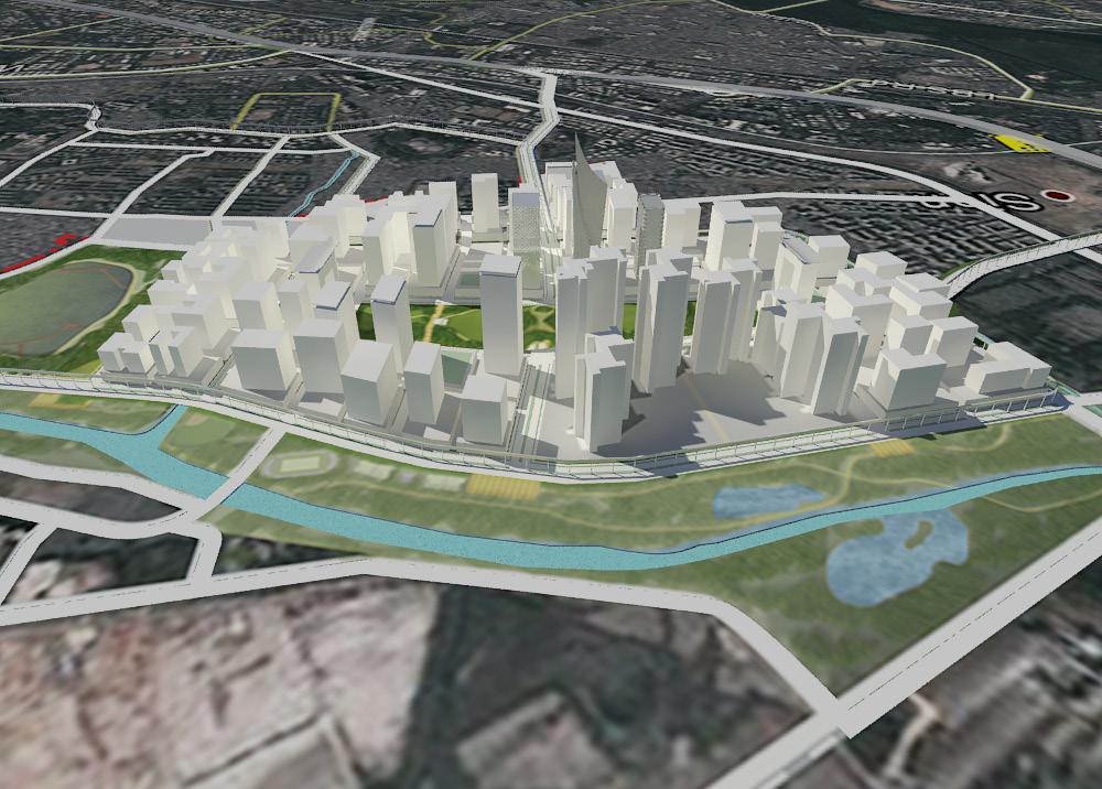
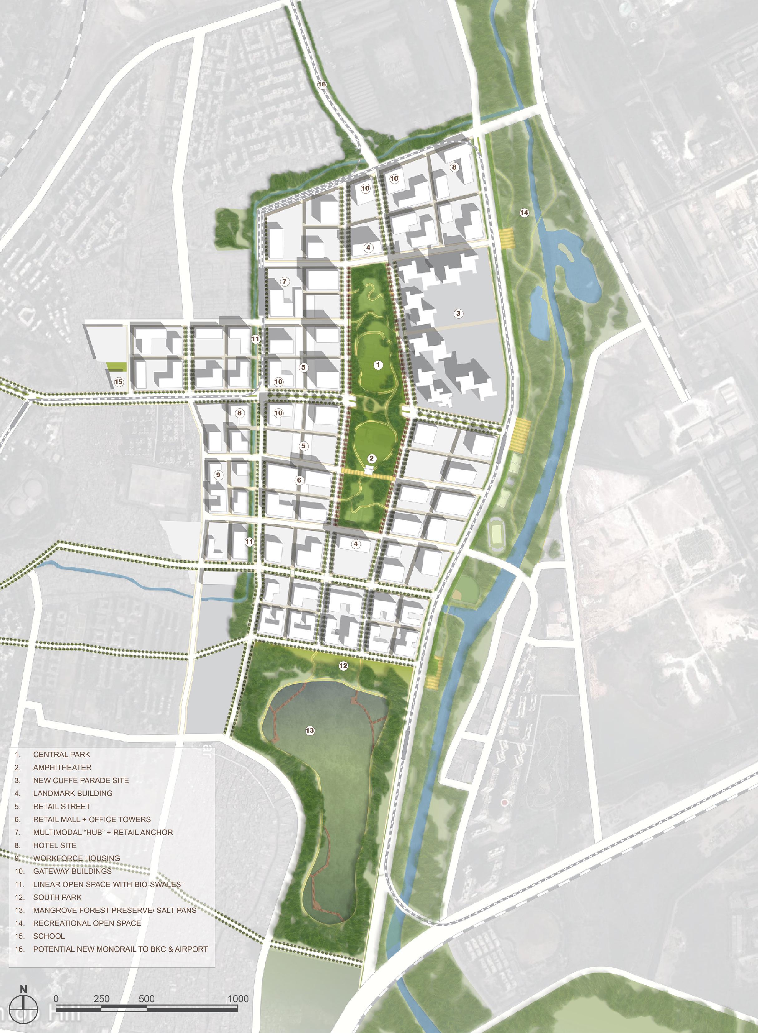
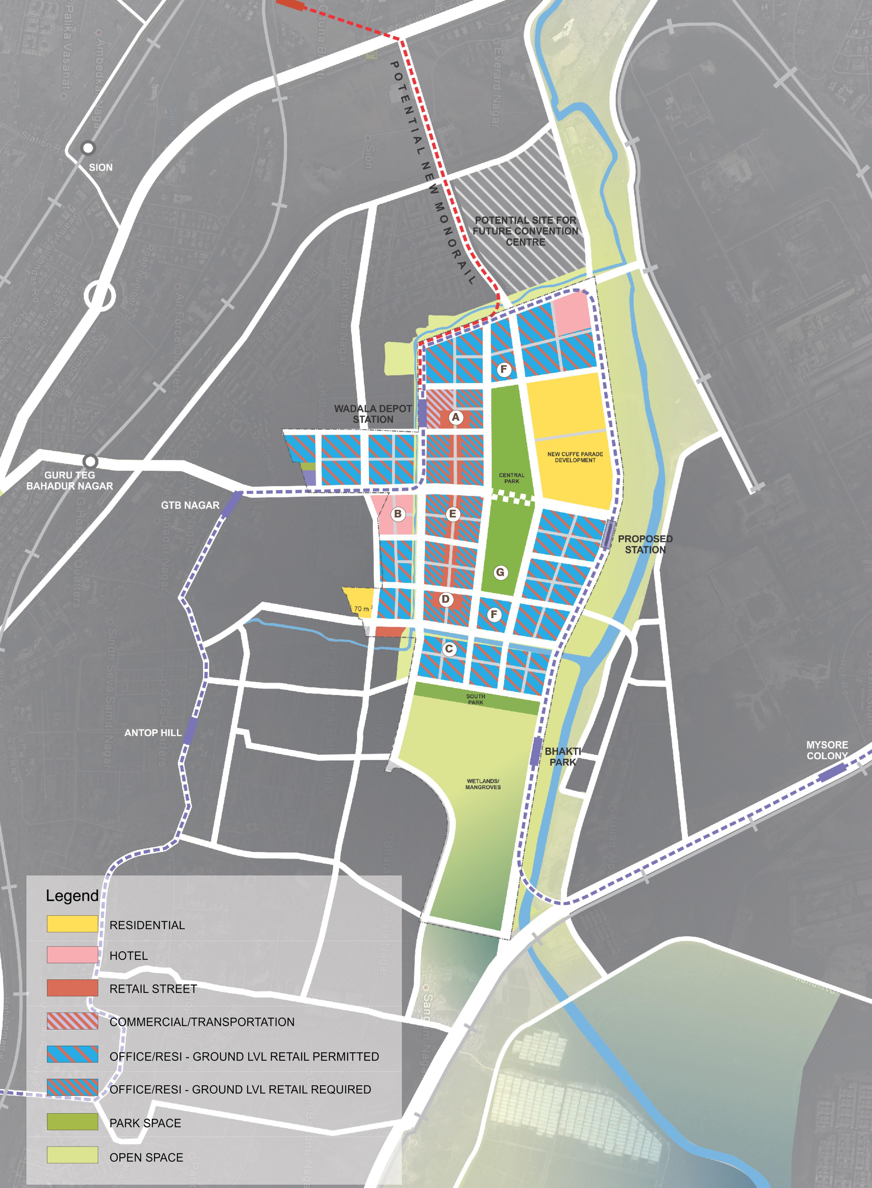
Selected as the preferred urban design in an international competition, Wadala is patterned on historic districts of Mumbai, India. Surrounded by slums and industry, the plan focuses inwardly, with the financial-residential center focused on a Central Park. Active, pedestrian-serving uses are located at ground level plus a special retail street. The transit-served plan preserves an existing mangrove forest and develops restorative bio-swales.
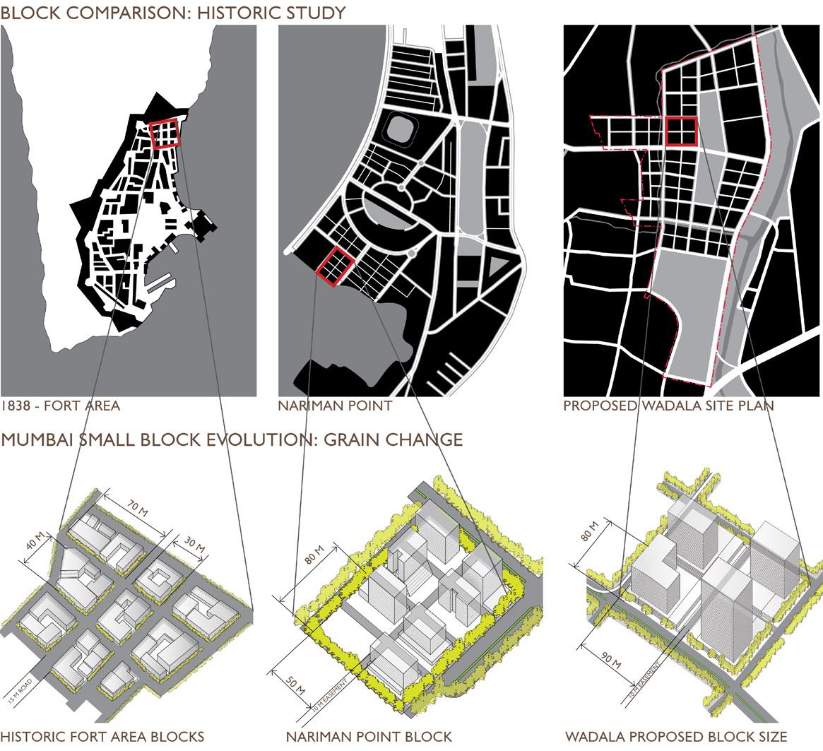
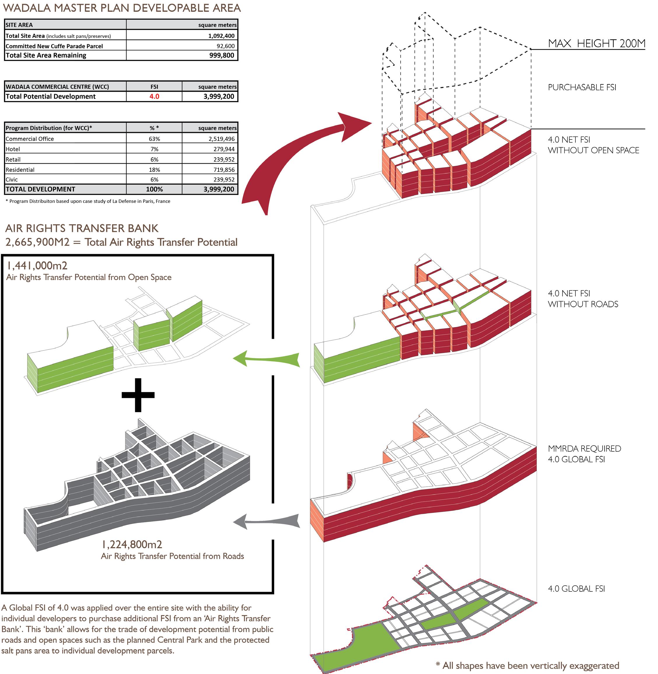
The plan is a developer-friendly framework that creates maximum value and flexibility to the planning authorities and significant flexibility to the individual project developer. At a floor area ratio of 4.0 the allowable building area is 4.4 million square meters. The plan proposes transferable development rights from site to site so that authorities realize value from every square meter permitted; utilizing all development potential protects valuable open space. The plan proposes predominately commercial office uses while also permitting residential development within the same zone. Active, pedestrian-serving uses are encouraged at ground and lower levels. At two key locations, the plan encourages business-serving hotels, and a focused retail street is proposed in the westerly area of the plan.
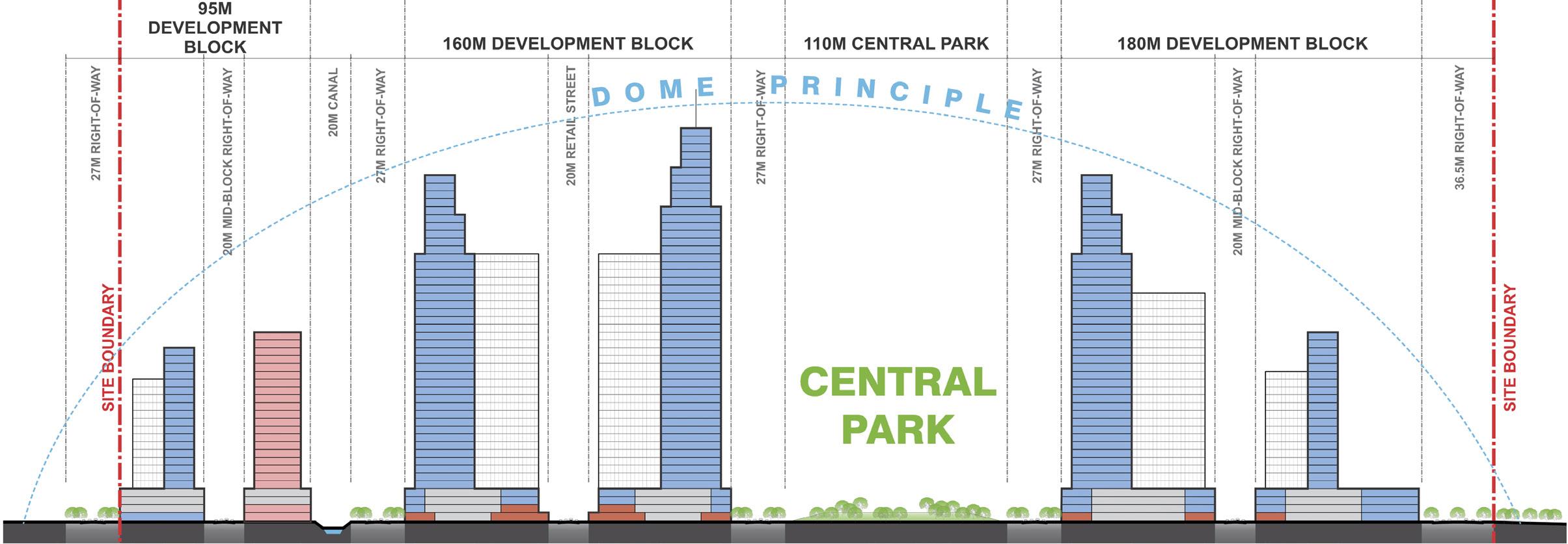
The plan establishes a rich mix of parkland and open space, which preserves the mangrove forest and develops restorative “bio-swales”. A central park, similar to the famed Oval Maidan in southerly Mumbai, is supported by tree-lined boulevards and can be used for major events.
ANALYSIS OF DEVELOPABLE AREA AND TRANSFERABLE DEVELOPMENT RIGHTS OF THE COMMERCIAL DISTRICT
a developer-friendly framework plan that creates maximum value and flexibility, and utilizes all development potential to protect valuable open space
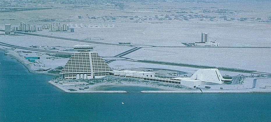
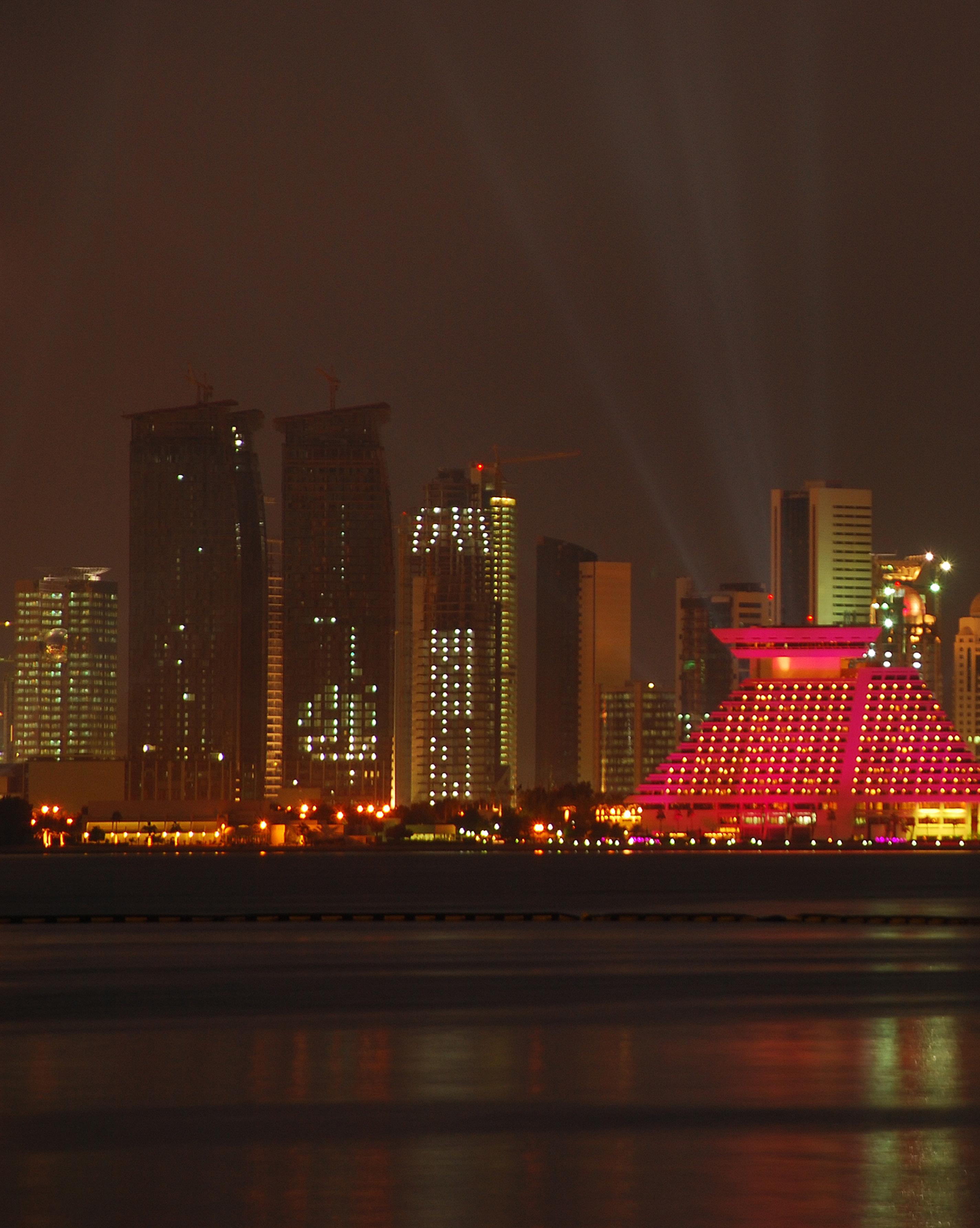
The New District of Doha is a planned community built in part on 1900 acres of reclaimed land immediately north of Doha, the capital city of the State of Qatar, and was selected by the government to serve as a model for that country’s urban development. While creating land for the New District, the hydraulic landfill simultaneously transformed former tidal flats into a sparkling blue bay as focus for the city. The New Community Plan is designed for 60,000 residents by the year 2000 and covers more than 5000 acres. Because the New District of Doha is a community, definitive plans for highways, utilities services, housing, neighborhood, business, civic, cultural and community facilities are part of the program. Specific plans for the community include annual Action Plans which like municipal capital improvement plans coordinate and implement government building and infrastructure projects.
The firm has completed several specific projects and plans within the District, including the architectural design of the Doha Sheraton Hotel and Conference Center, opened in February 1982; planning of the Diplomatic Area, a place for the Country’s Embassies, and housing for the diplomatic community; the District Center, the Central Administrative headquarters for the Government’s 17 ministries; the State Plaza and the Corniche Promenade; the residential subdivisions for senior staff and intermediate staff housing including over 2000 housing units, and the C-Road Community Commercial Center, the core of the first of the four residential community of the New District.
During the past 25 years of professional experience in the United States and overseas, Johnson Fain has established itself as an architecture, planning and interior design office known for its creative approach to the built environment. Scott Johnson, FAIA, Design Partner, and William H. Fain, Jr., FAIA, Partner for Urban Design and Planning, lead a diversified office of 60 professionals.
The firm has received many awards for design excellence. During the last decade, the American Institute of Architects has recognized Johnson Fain with numerous awards at the national, state and local levels.
Each project is carefully designed to specific client needs, program, technical requirements and budget. Every assignment presents the opportunity to develop a uniquely appropriate design solution. This philosophy is fundamental to the firm. Our primary design objective is to identify and resolve the specific issues required by each assignment. Particular emphasis is placed upon defining not only project scope and intent, but also budget and schedule at the inception of the design process. Attention to all levels of detail and close client communication continue throughout the duration of the project to ensure the best possible match of client needs, design intent and cost effectiveness.
Project types include corporate office, large-scale high-rise, mixeduse retail, residential, educational university, technical and research laboratories, governmental and public buildings, hotel resort, museums and wineries including new construction, renovation, seismic upgrades, building modernization and restoration. Programming, interior design and tenant improvement projects have also garnered many awards for the firm. All projects receive the same high level of attention and creative expertise.
Projects have included master plans, new town plans, facilities master planning, general and specific plans, site feasibility, and land use analysis for a variety of clients and diverse industries including: aviation, universities, media, public agencies, cities, the United States and international governments, resorts, private and public development and redevelopment. Each assignment and solution is approached in a thoughtful, responsive and analytic manner appropriate to the project.
Johnson Fain has designed and executed interior environments for many important institutions. Interior Design within the office is practiced as Interior Architecture within qualified professional design and technical staff producing the work within management approach that includes programming, space planning, design, furnishings, engineering and technical delivery. Some significant interior project types include corporate office environments, condominiums and live/work lofts, media environments, art galleries, museums, resorts, wineries and restaurants.