REGIONAL RESILIENCE


CHENGDU, SICHUAN, CHINA JINJIANG RIVER CORRIDOR
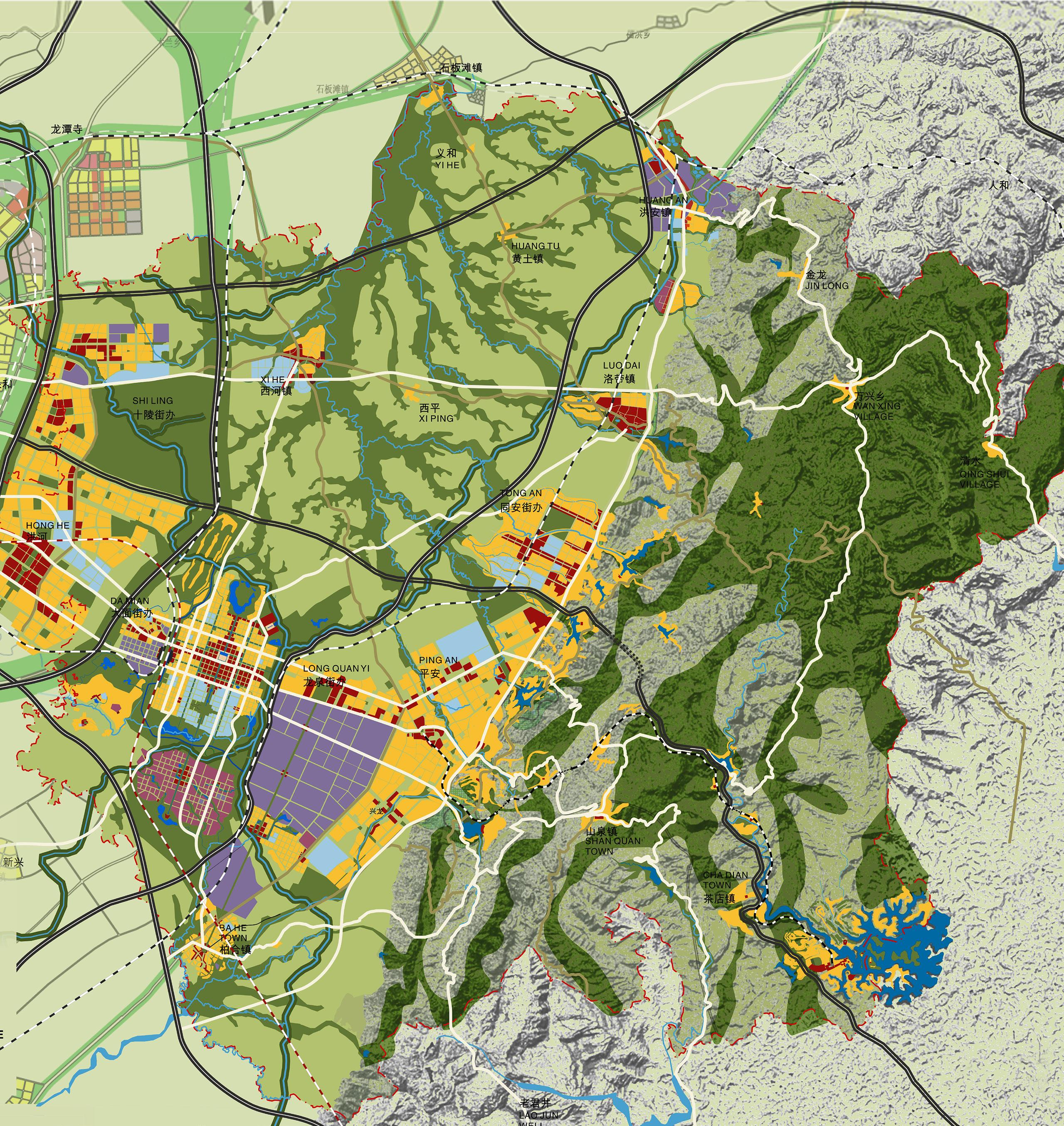
CHENGDU, SICHUAN, CHINA LONG QUAN YI DISTRICT
LUZHOU, SICHUAN, CHINA CHINESE WHISKEY VALLEY
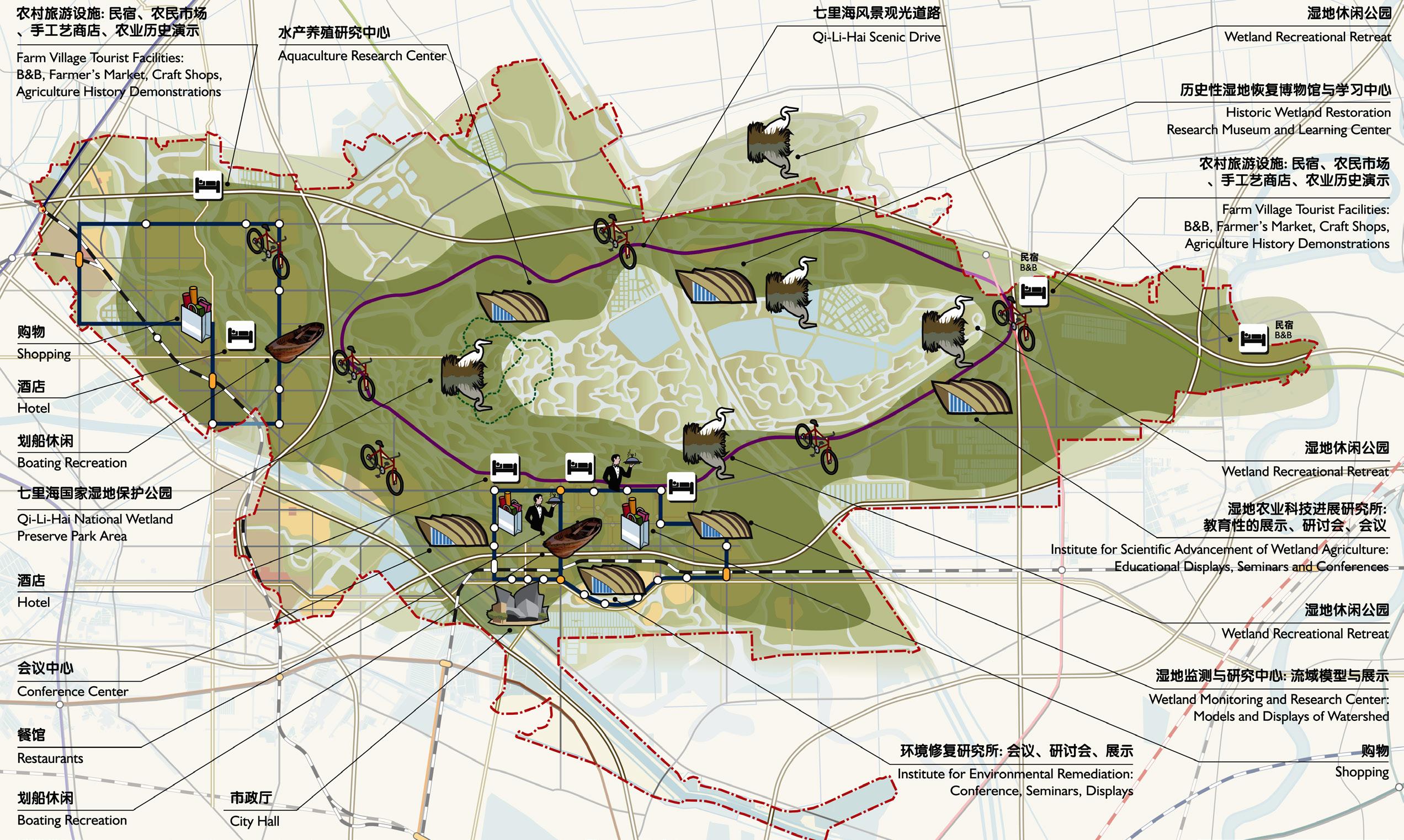
TIANJIN, CHINA TIANJIN ANCIENT WETLAND RESTORATION GUANGZHOU, GUANGDONG, CHINA GUANGZHOU ECONOMIC DEVELOPMENT DISTRICT
LOS ANGELES, CALIFORNIA, USA LOS ANGELES GREENWAYS
LINGSHUI, HAINAN, CHINA LINGSHUI INTERNATIONAL RESORT
XICHANG CITY, SICHUAN, CHINA QIONGHAI LAKE MASTER PLAN
MASTER PLAN (281 Sq. Km) CHENGDU CITY, SICHUAN, CHINA
AIA / California Council, Merit Awards for Urban Design
AIA / Los Angeles NEXT LA Awards, Citation, CItyscapes Architectural Record, China Awards
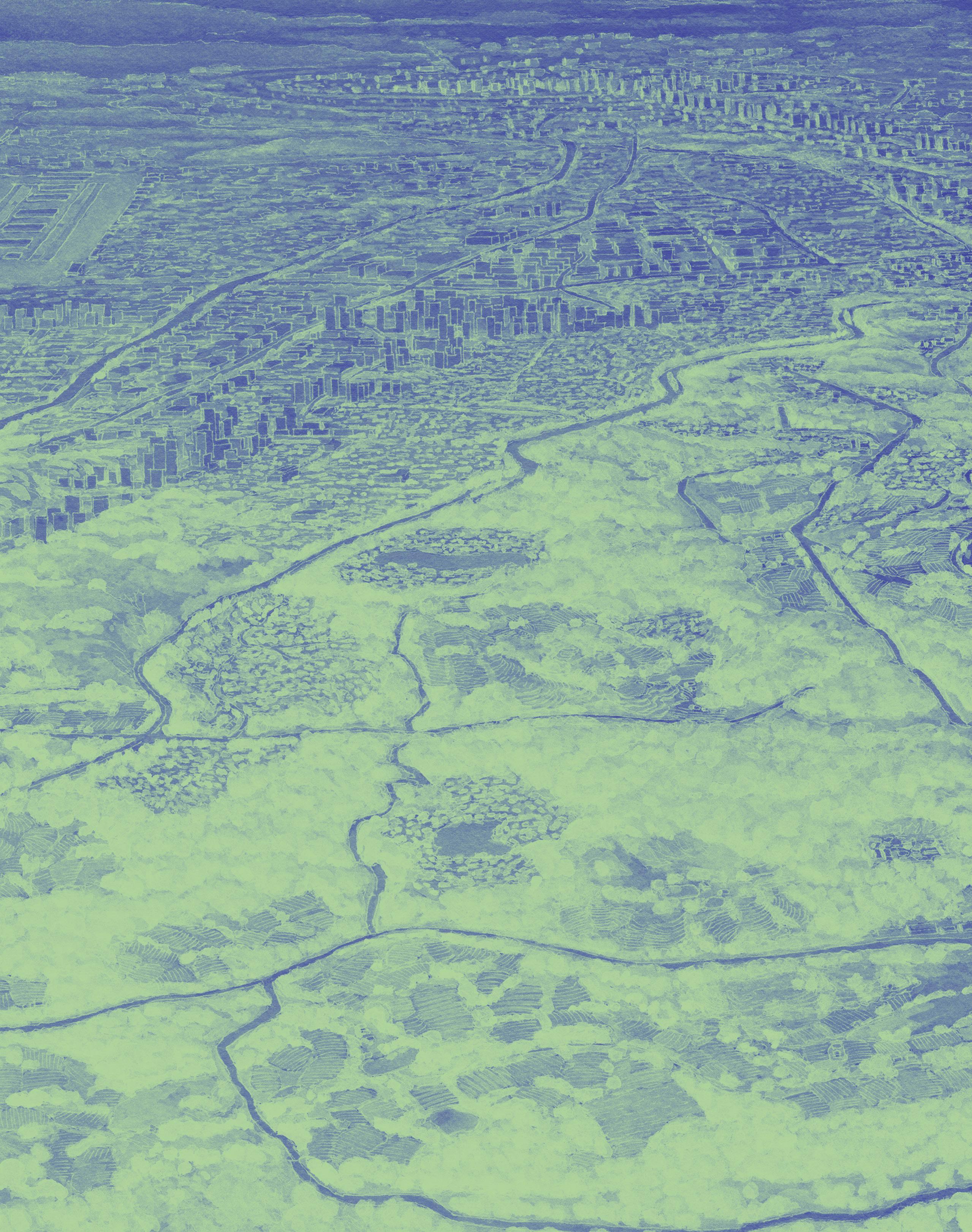
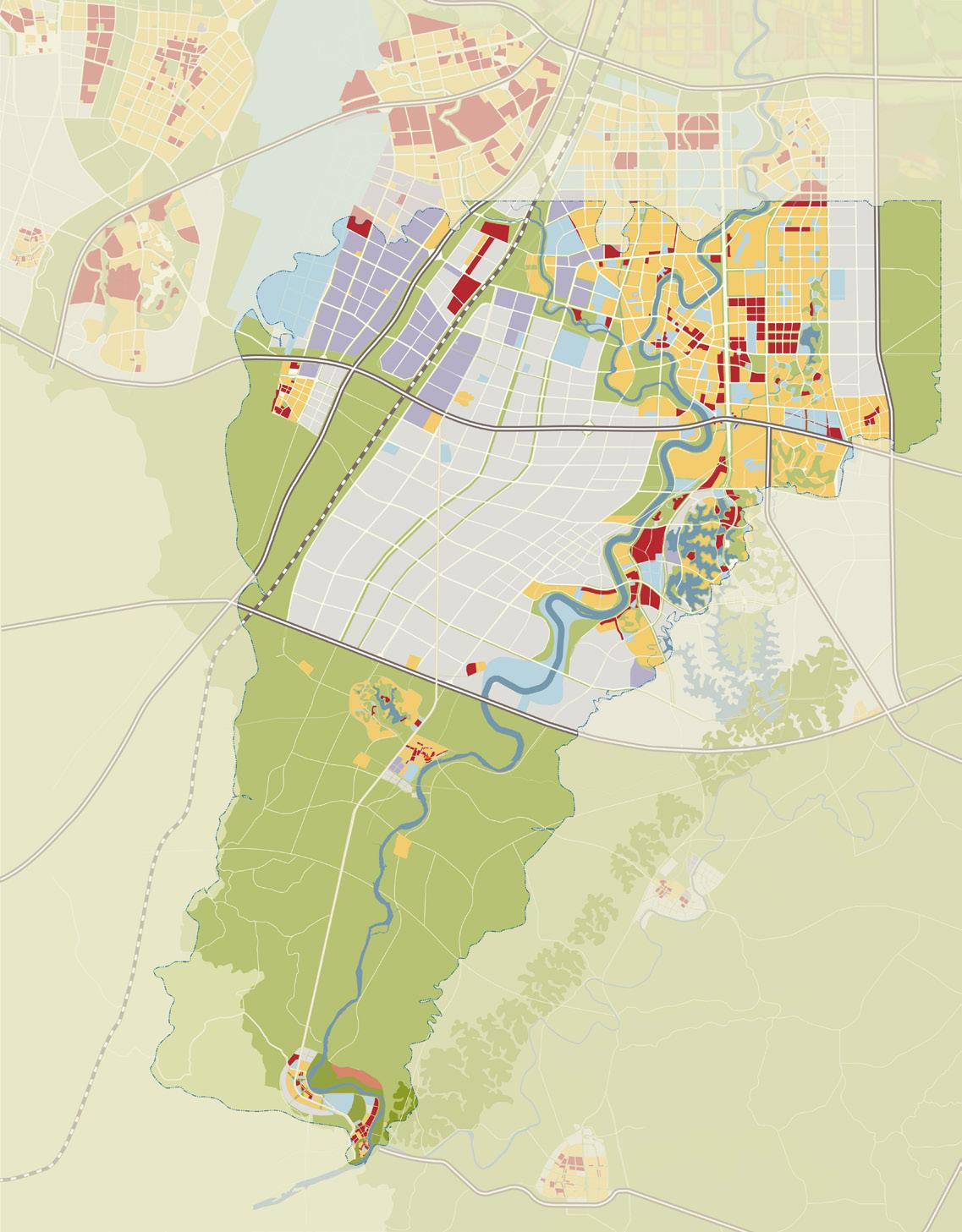
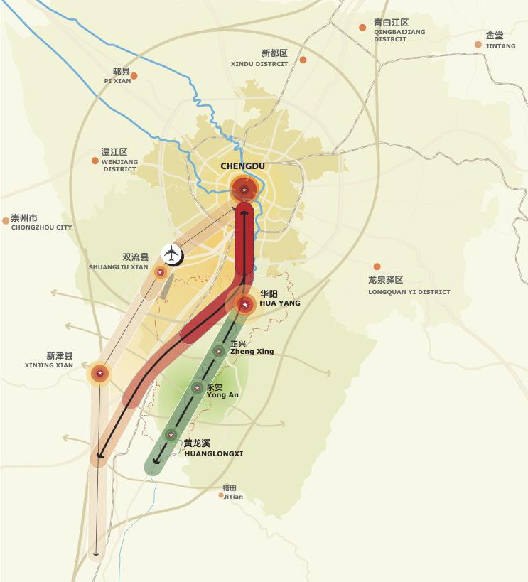
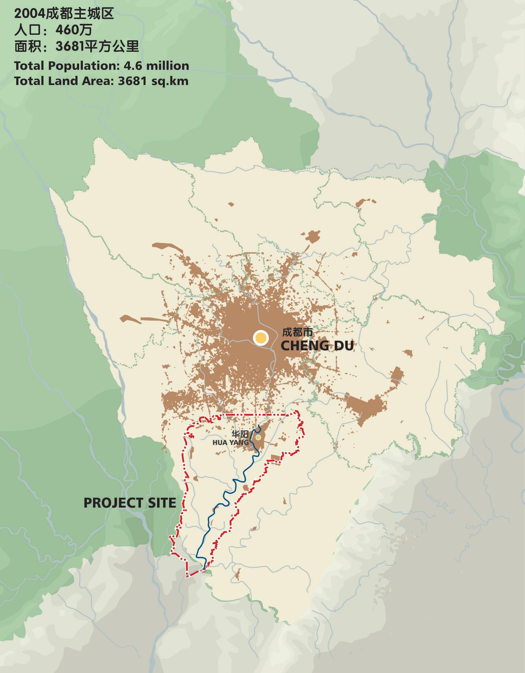
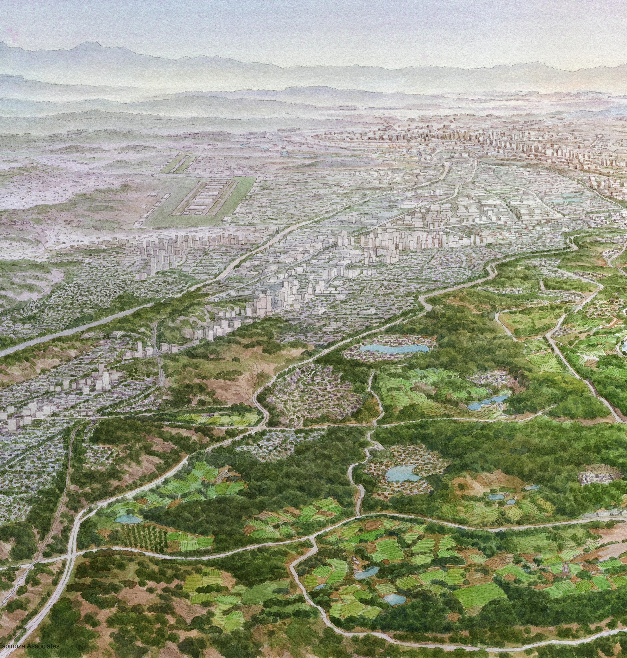
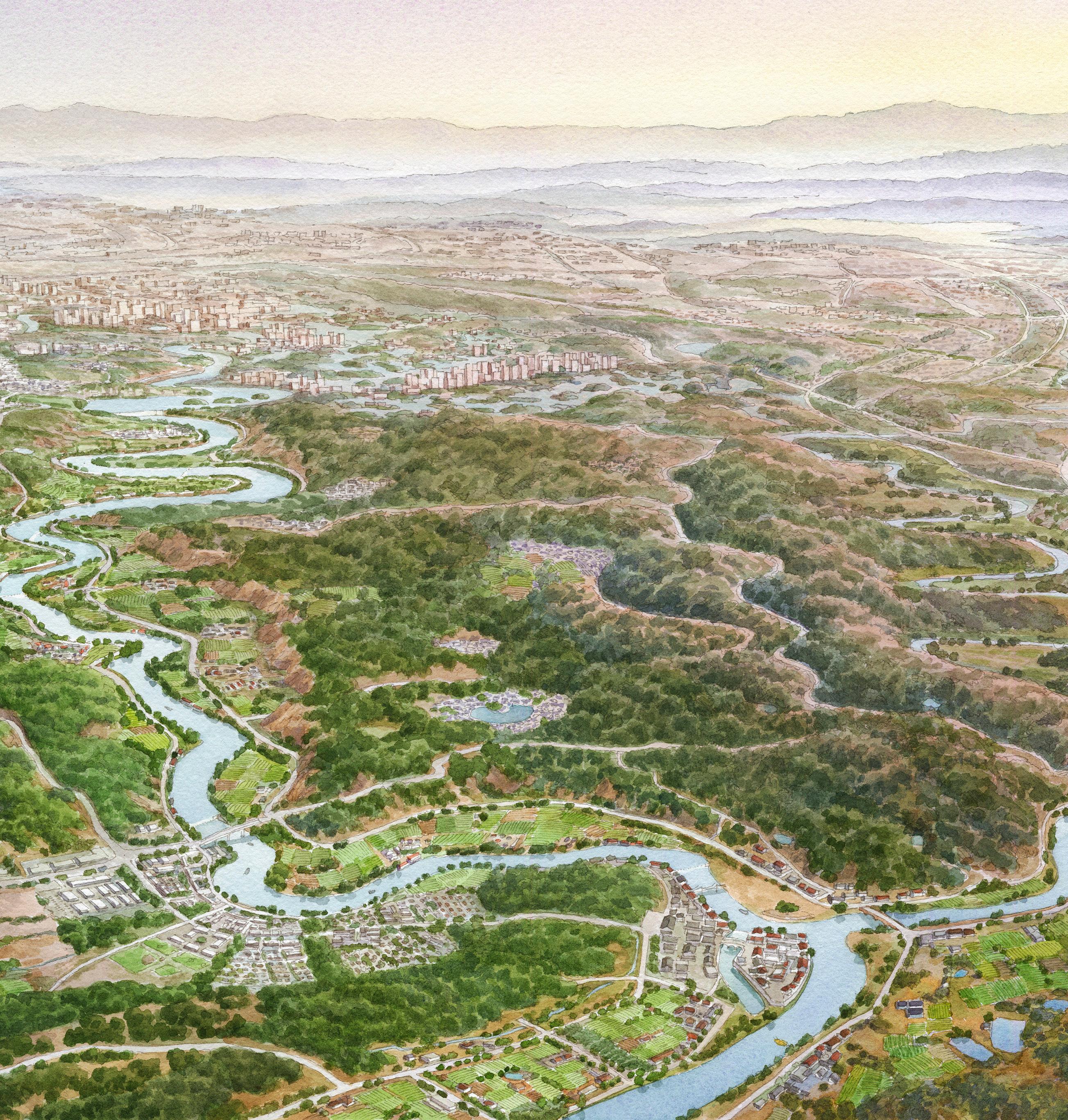
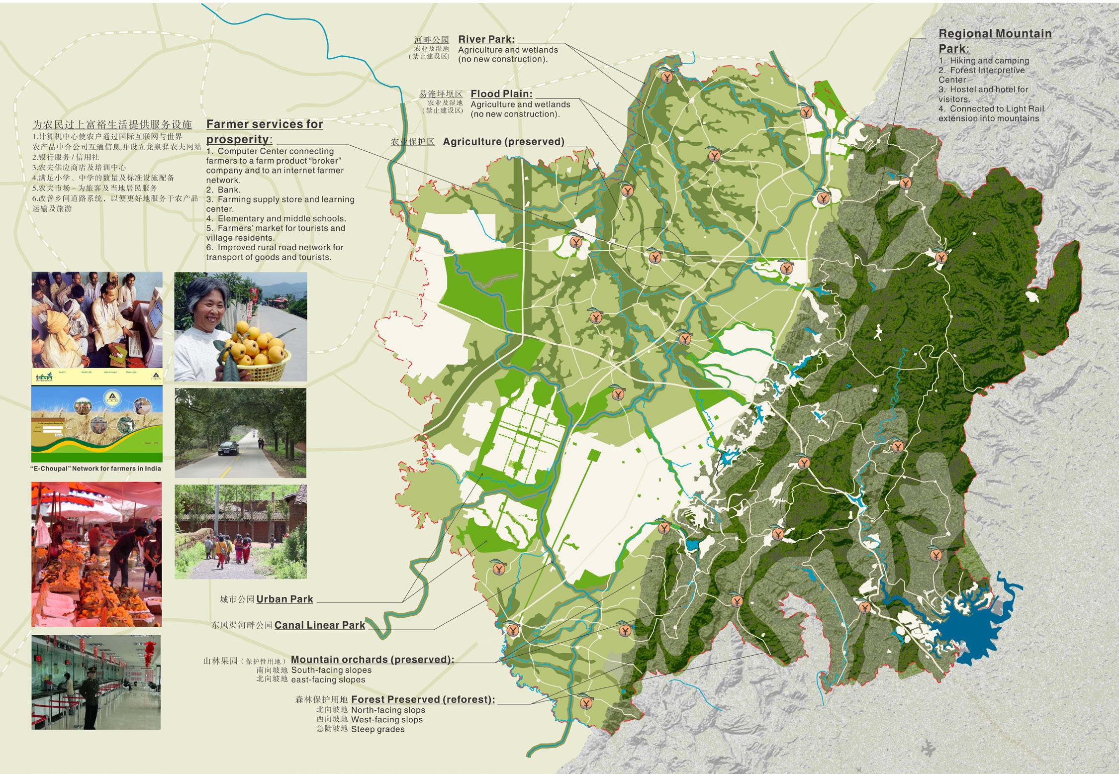
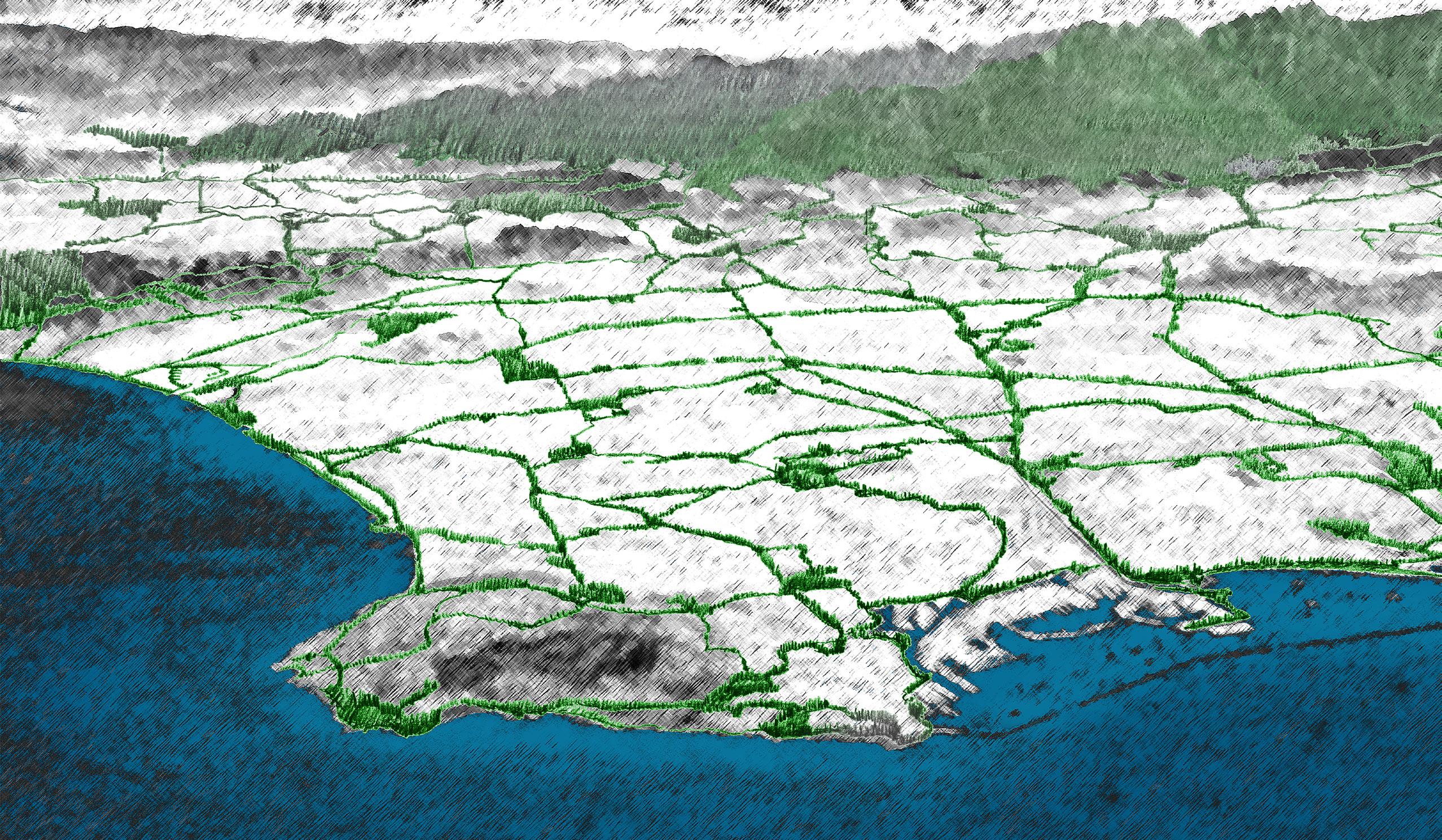
The project is located within the Shuangliu County, the periphery of Chengdu, Sichuan’s capital. While much of the new development provides economic value to Shuangliu County, the government also fears the loss of its most beautiful and historic rural land, that of the Jin Jiang Valley. The Jin Jiang, literally meaning “Brocade River” has considerable historic importance for Shuangliu and the entire Chengdu region.
The scenic rural Jin Jiang corridor is located in one of the main growth corridors of rapidly-expanding Chengdu. The Shuangliu County Government hired Johnson Fain to explore an alternative to the Chengdu 2020 Master Plan which proposes to urbanize the valley, compromising an important historical and natural asset of the region. Alternatively, the Jin Jiang Corridor Master Plan by Johnson Fain redirects growth to accommodate both urbanization and protection of the river valley. Agricultural, tourism and open space land uses are developed within the river corridor, forming a special economic relationship between urban and rural development.
The Master Plan developed by Johnson Fain provides the necessary planning framework and policy document to effectively fulfill the aims of the National urban-rural reform policy, and to maximize the quality and value of Jin Jiang river valley.
EXISTING CITY MASTER PLAN


forming a special relationship between urban and rural development for economic and ecological prosperity
First Place - International Design Competition
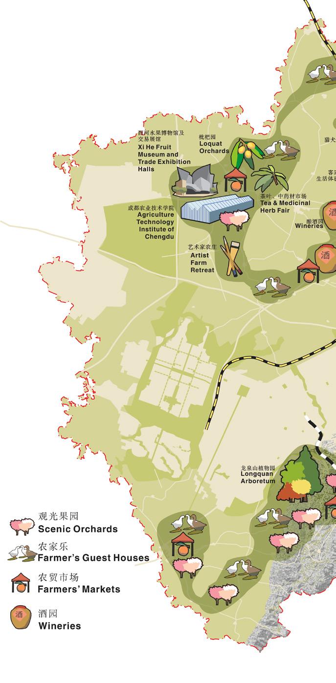
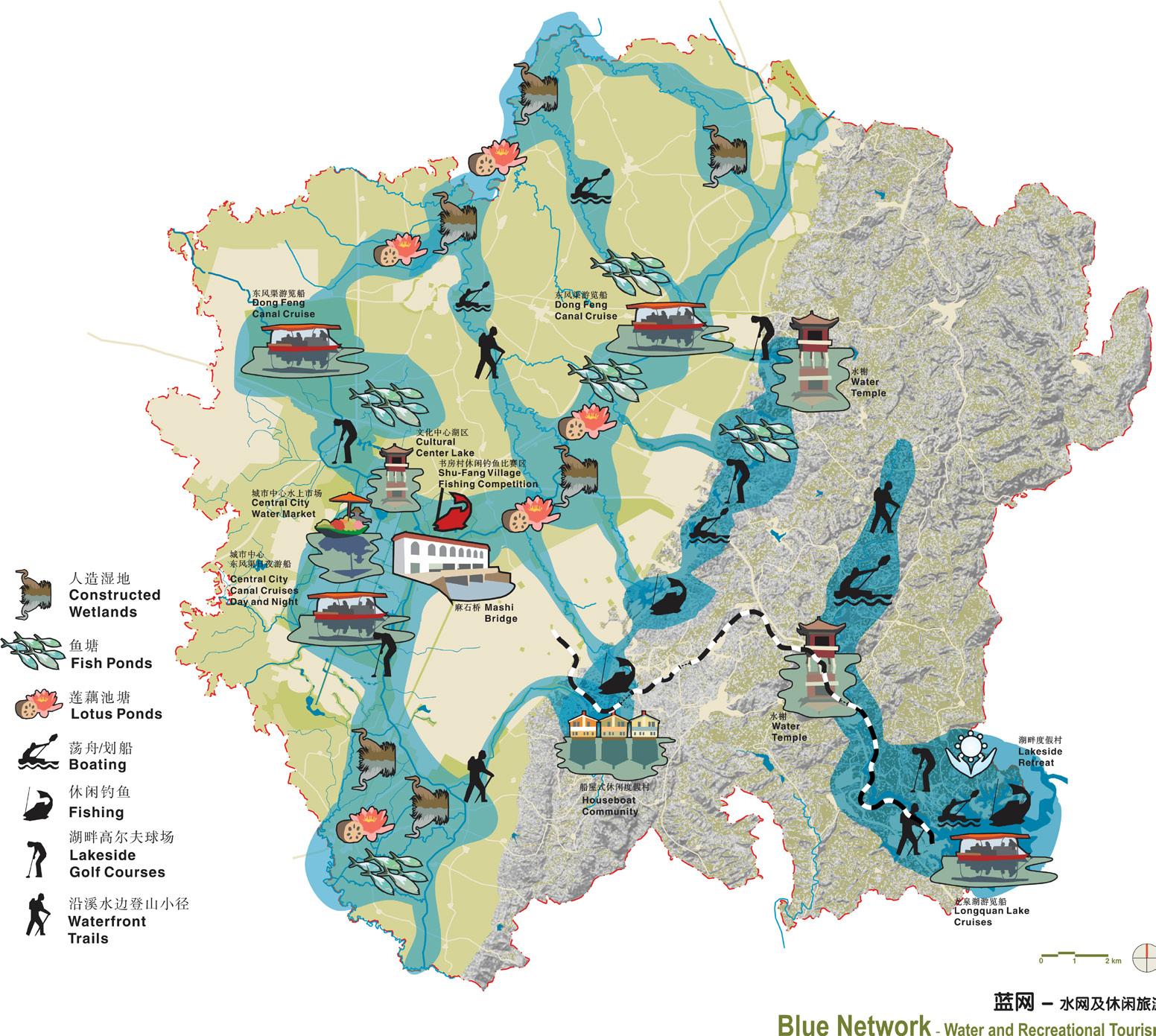
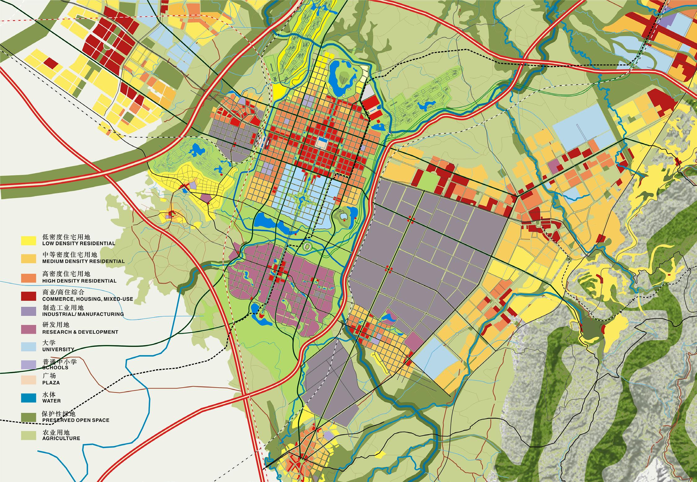
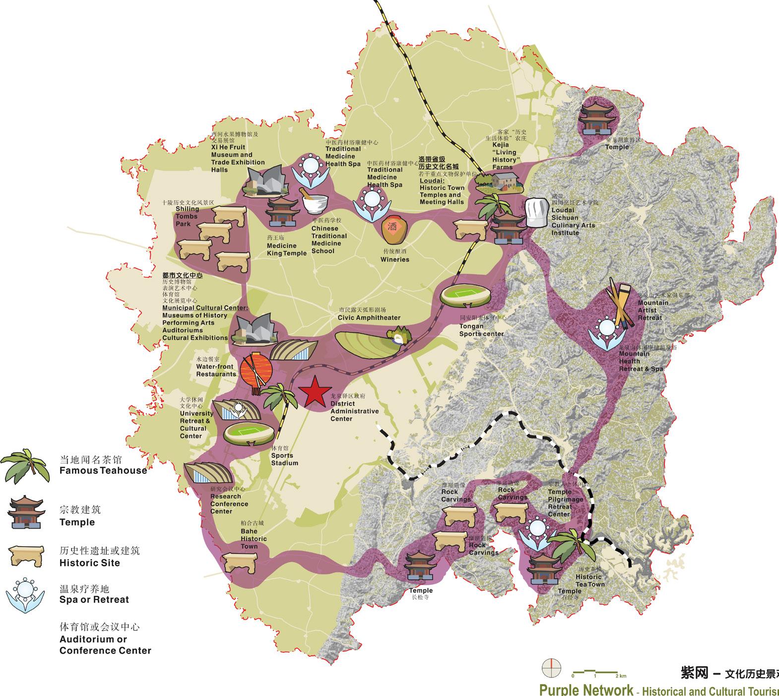
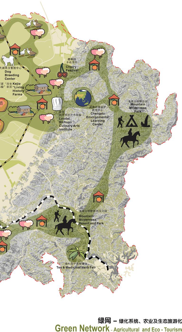
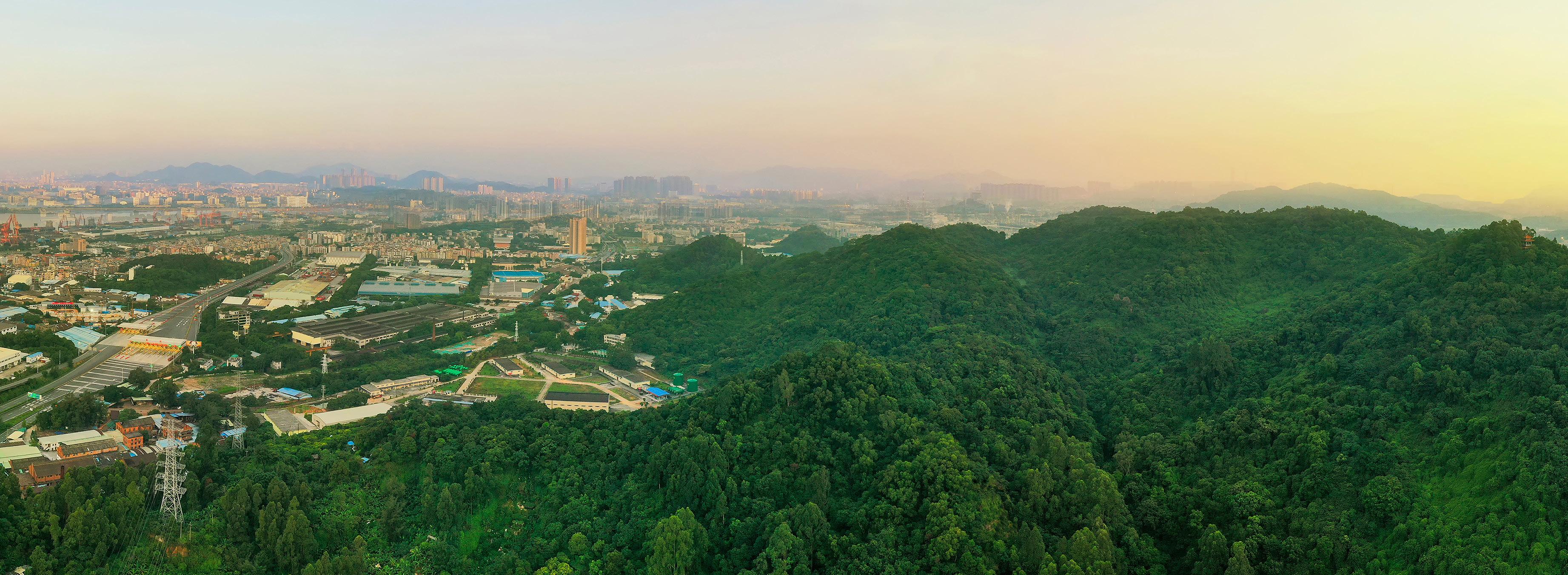
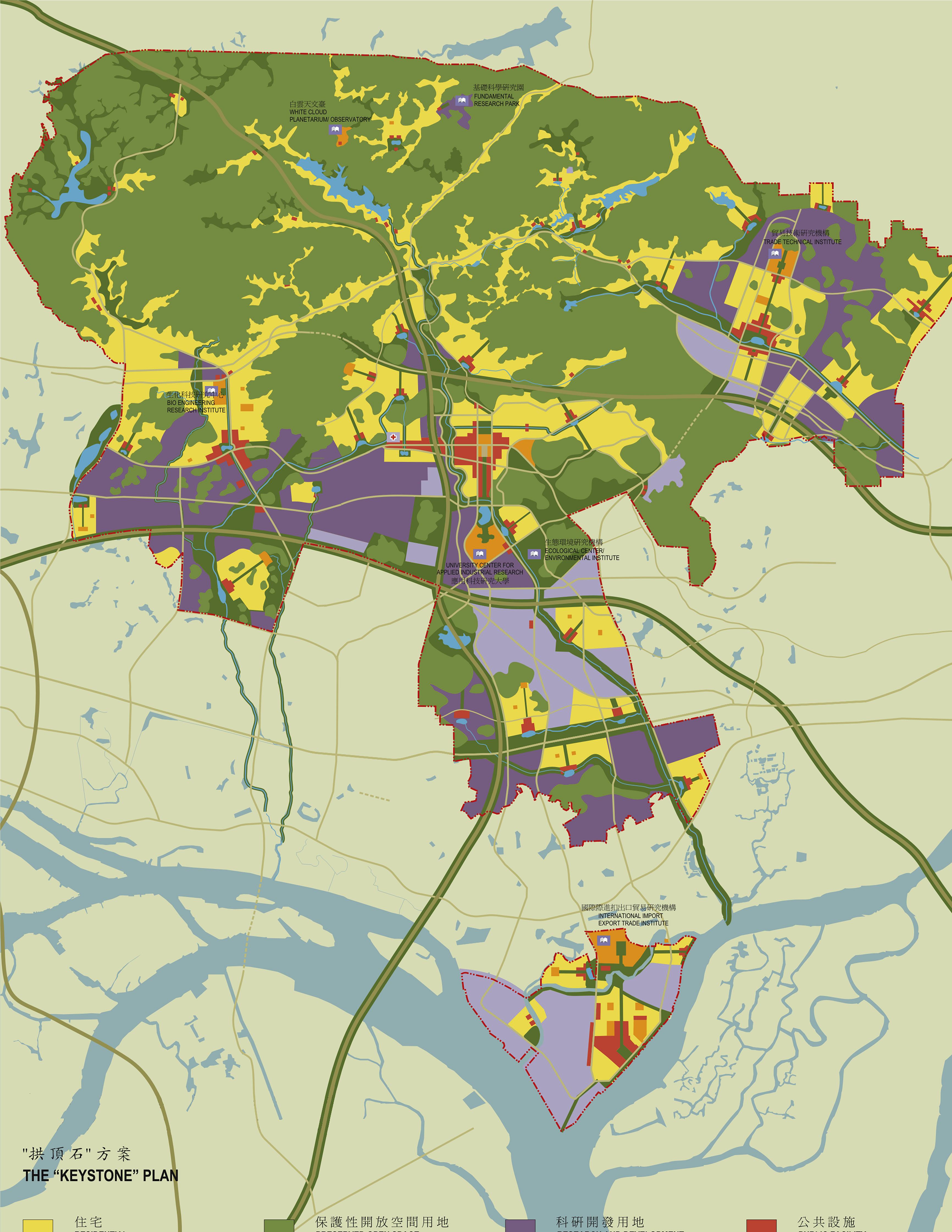
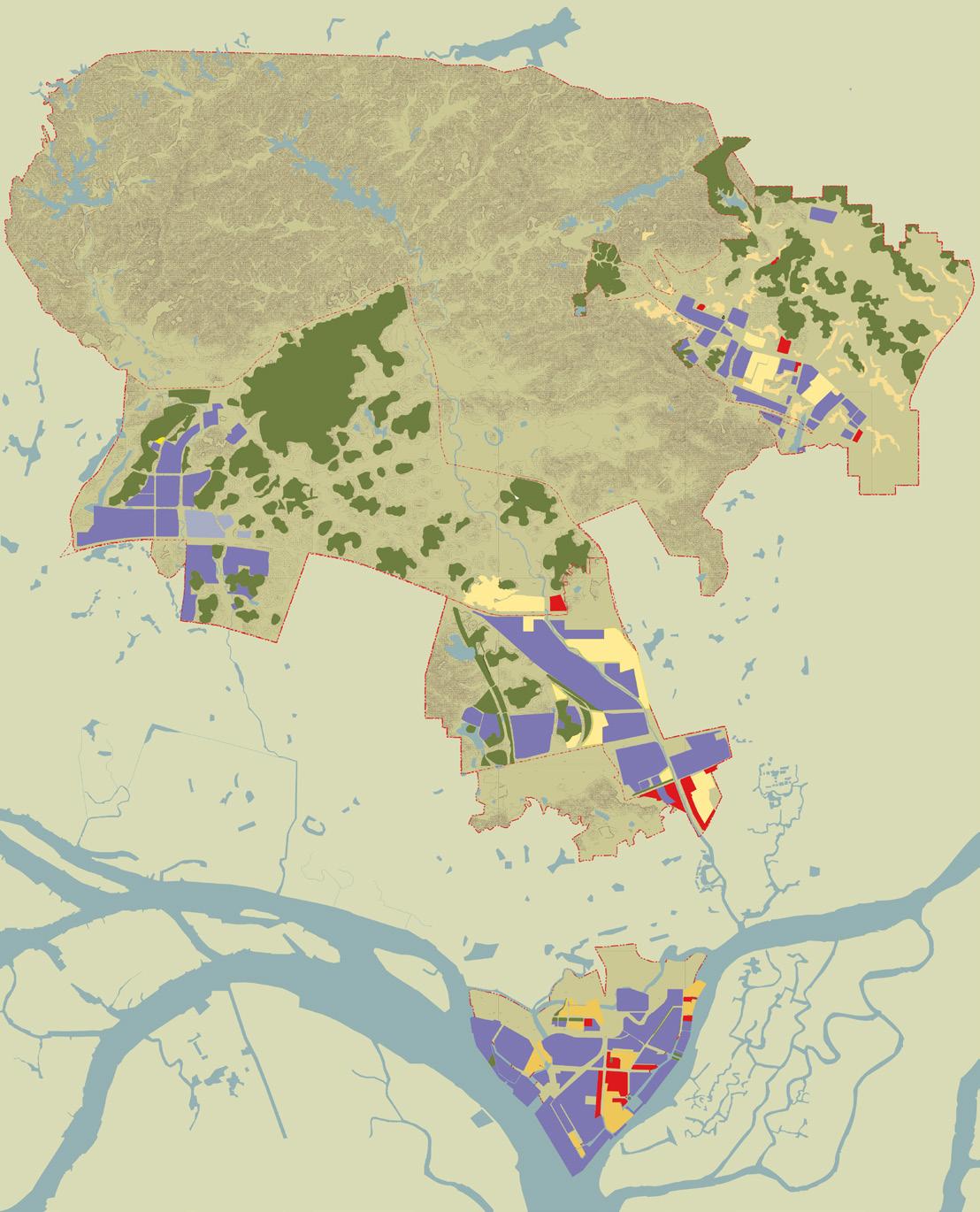
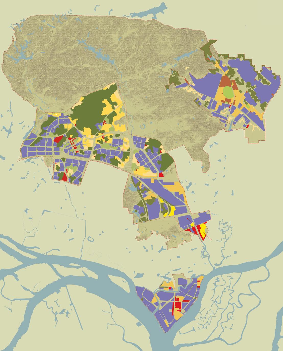
Urban design and planning at its largest scale is a matter of balancing often competing interests, finding solutions that provide for common benefit for all parties and that mitigate against unintended consequences. When China broadened the focus of its international trade and development policy to emphasize development of its western region, the historic city of Chengdu, already the capital of Sichuan Province, was identified as its cultural, administrative, and economic capital. With this new prominence, Chengdu’s urban growth became a national priority, particularly regarding the growth corridors radiating from the city center, often in conflict with existing agricultural and environmental resources. Located on the eastern edge of Chengdu’s urban core and along the critical growth corridor between Chengdu and Chongqing, Long Quan Yi is an industrial area in need of revitalization with extensive agricultural land and scenic mountains. The primary hurdle for Chengdu’s successful eastward expansion is this district, which is seen as a barrier in economically linking Chengdu and Chongqing.
The plan transforms Long Quan Yi from an industrial area into a prominent international trade center, elevating the position of Chengdu in world affairs by promoting and facilitating domestic and international business. The proposed center features a compact urban business district; a university; a research park, and the industrial base, located near each other and well connected by transportation and communication links. At the same time, the plan preserves agriculture and natural areas to create prosperous farming communities and highquality tourism and recreational destinations. The plan calls for strategic reforestation in the Long Quan mountains and establishes a comprehensive strategy to take advantage of adjacent Chengdu urban markets that would increase business opportunities for local farmers and preserve Chinese agricultural traditions and scenic beauty.
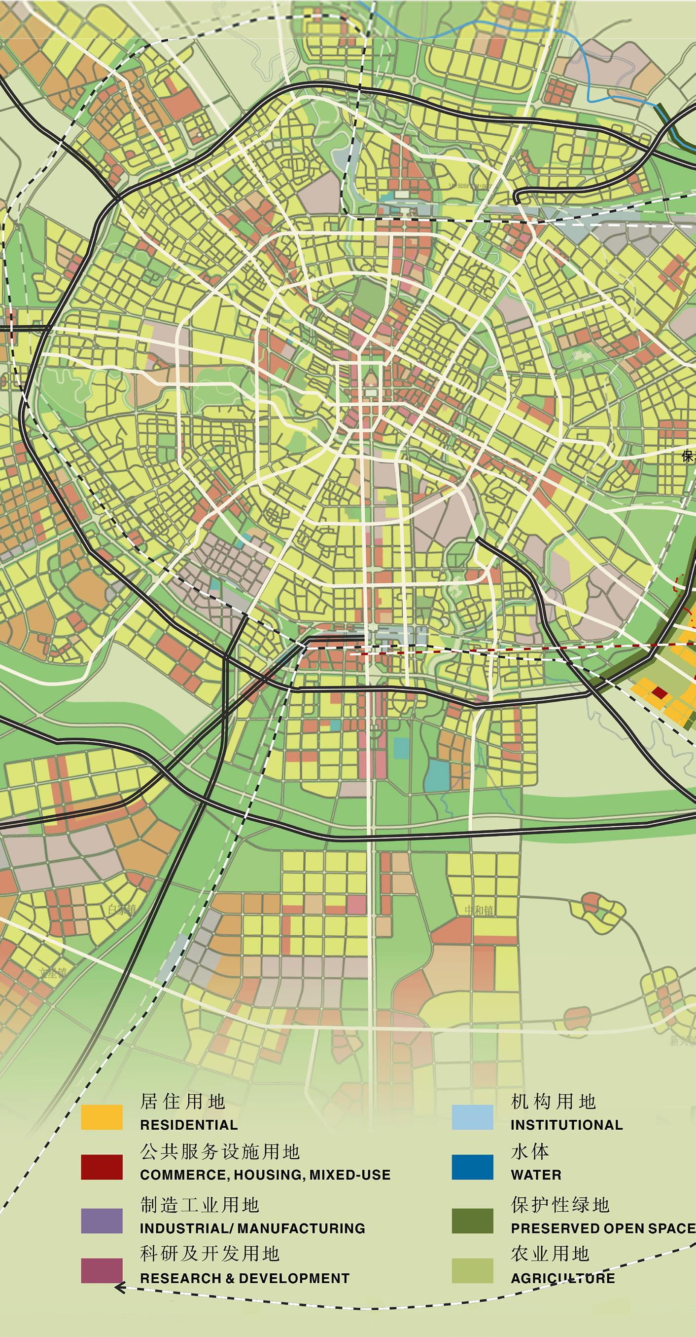
a vision for urban growth, international trade, and resource protection in the eastern district of Chengdu
LUZHOU, SICHUAN, CHINA
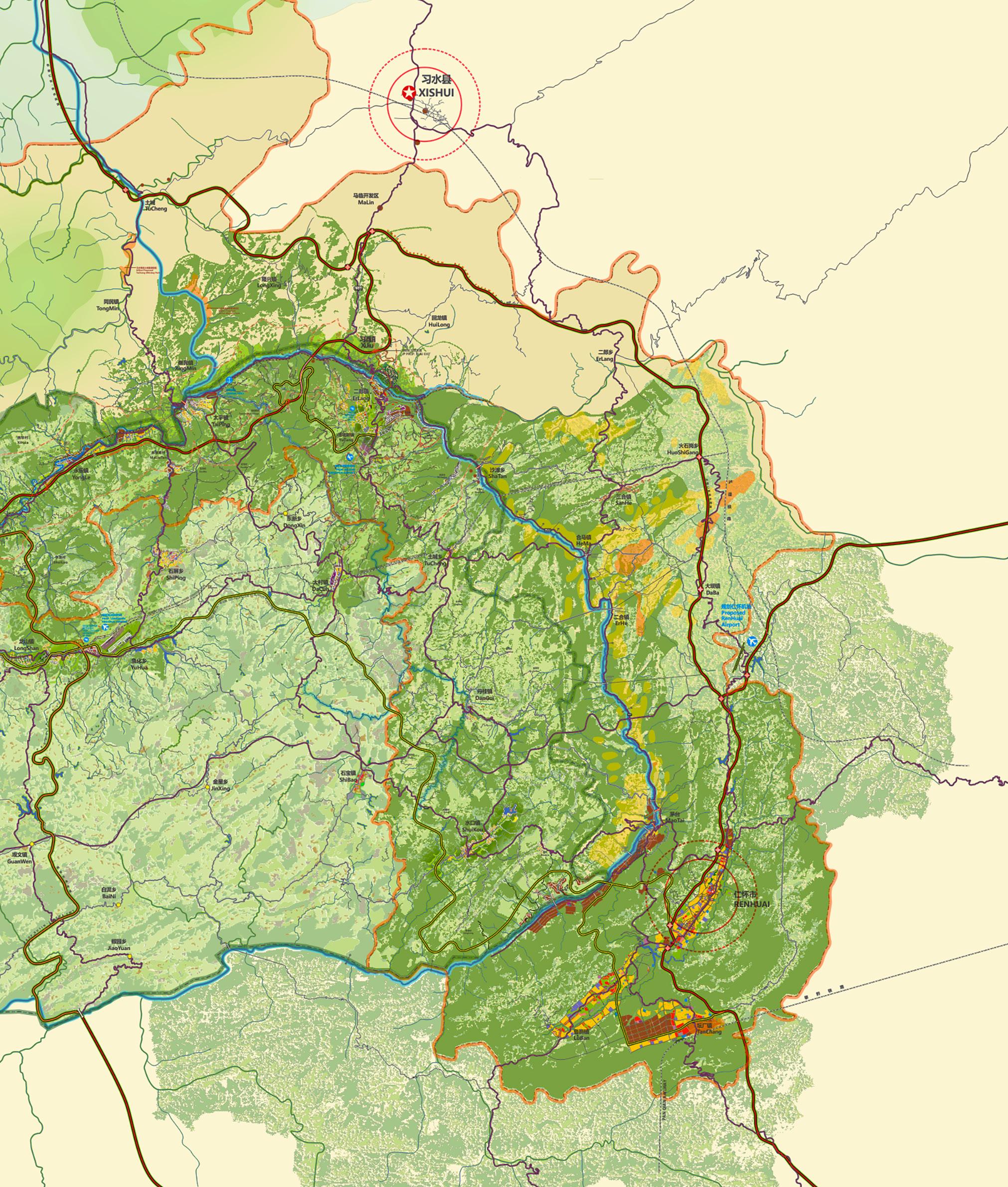
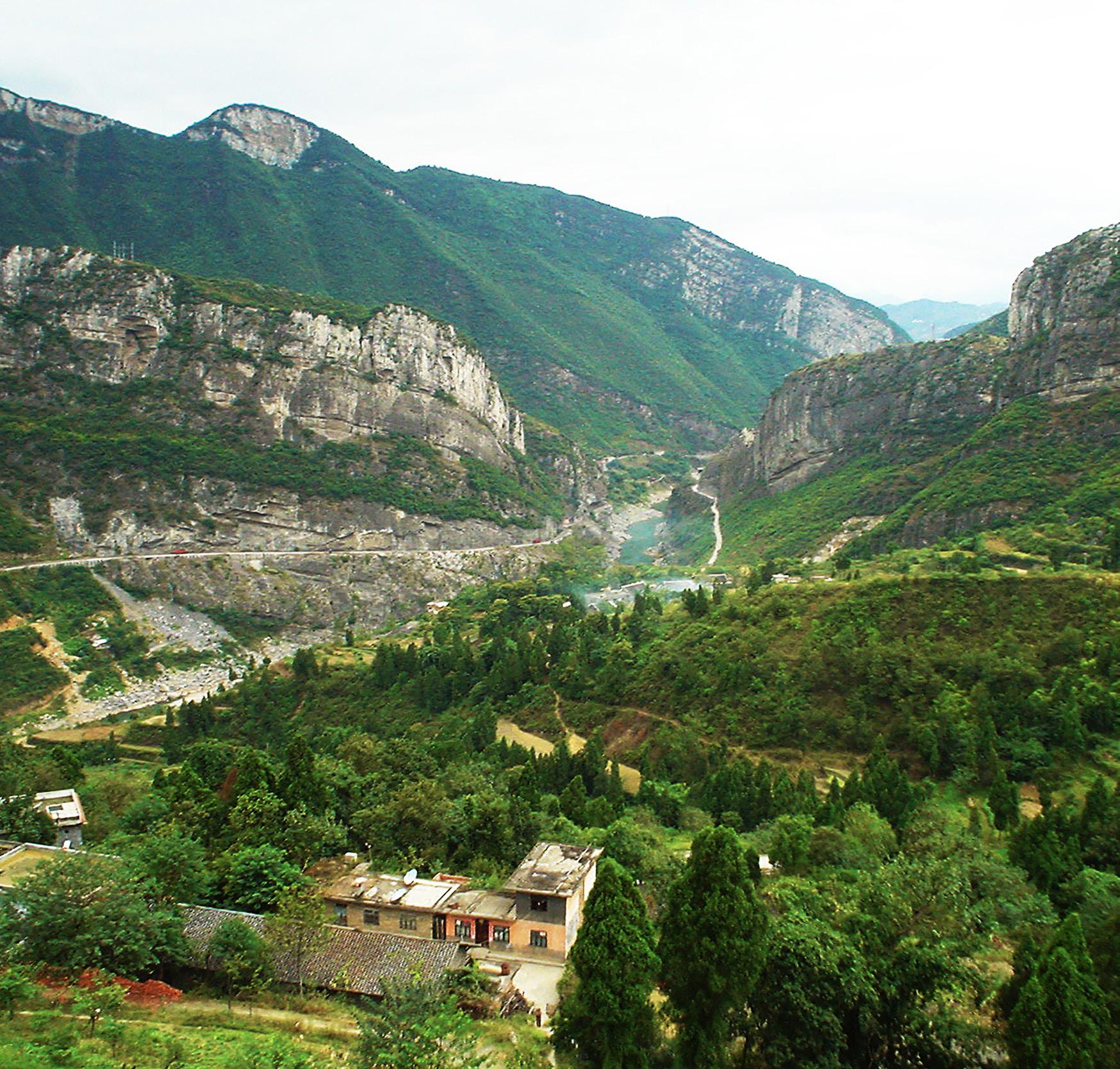
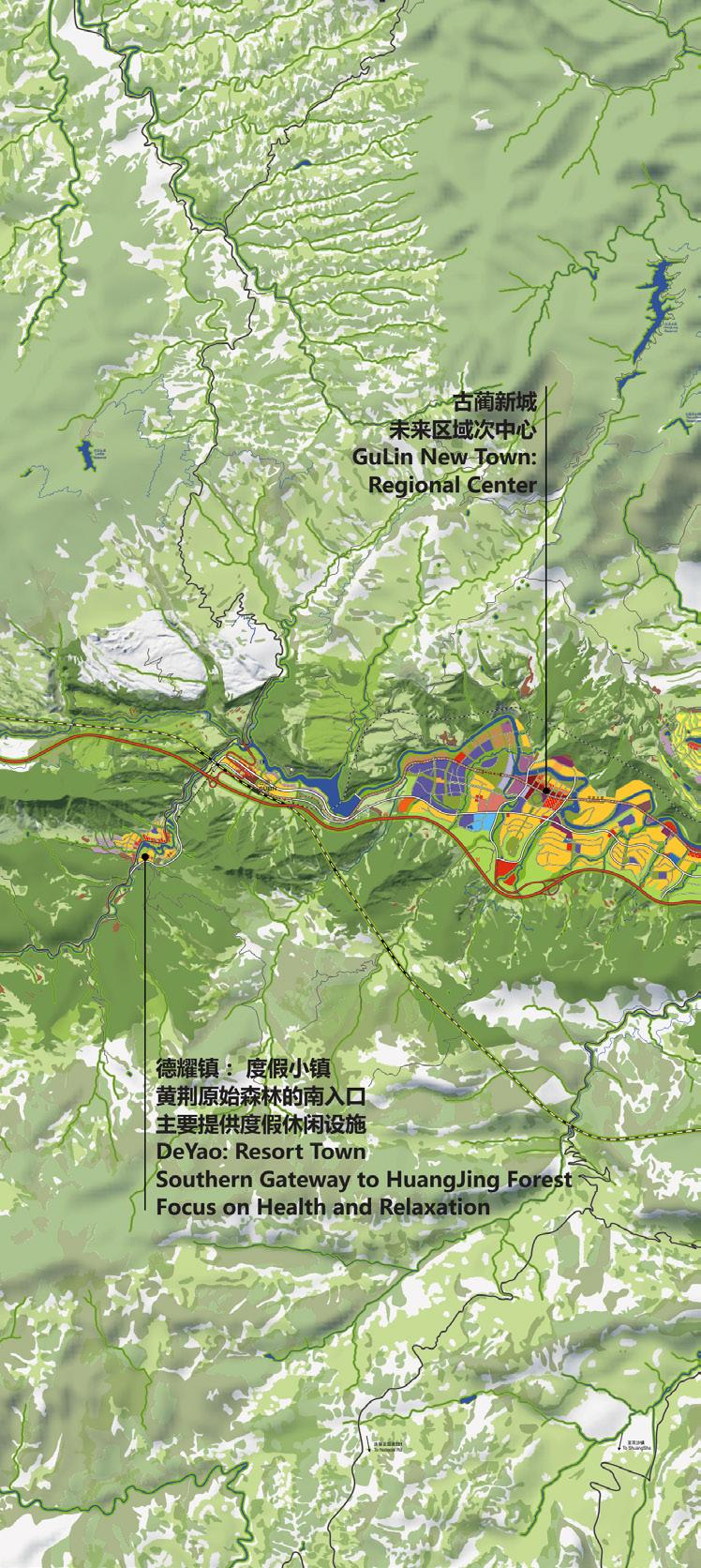
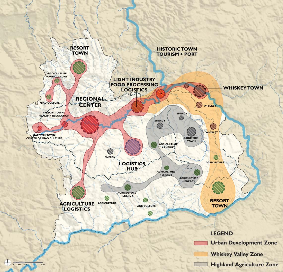
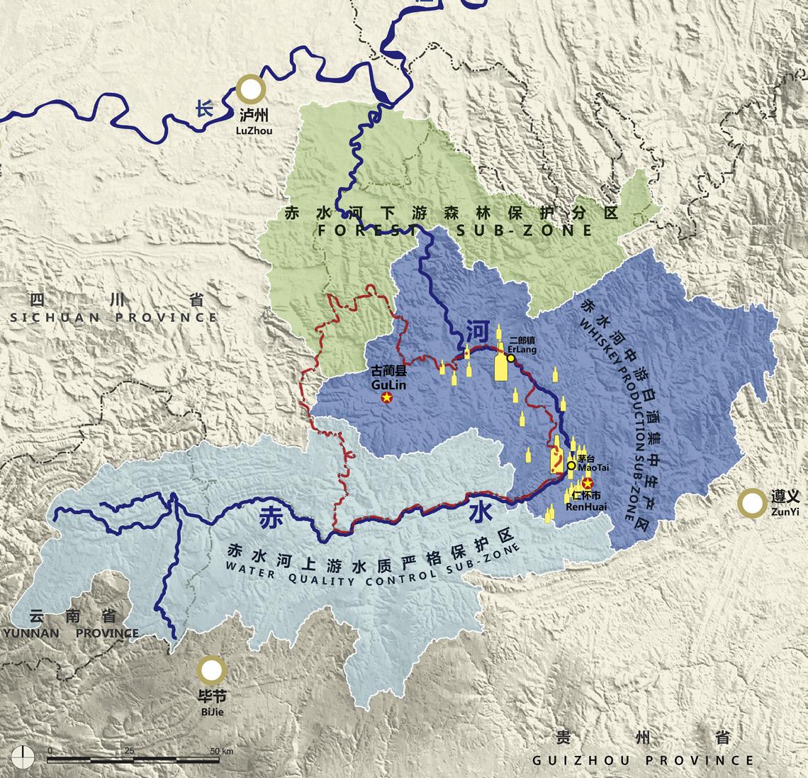
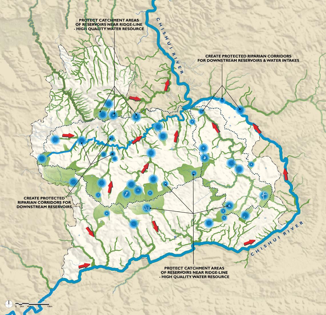
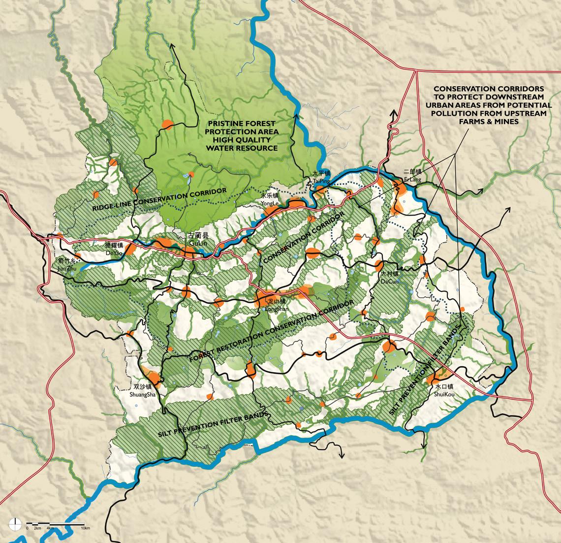
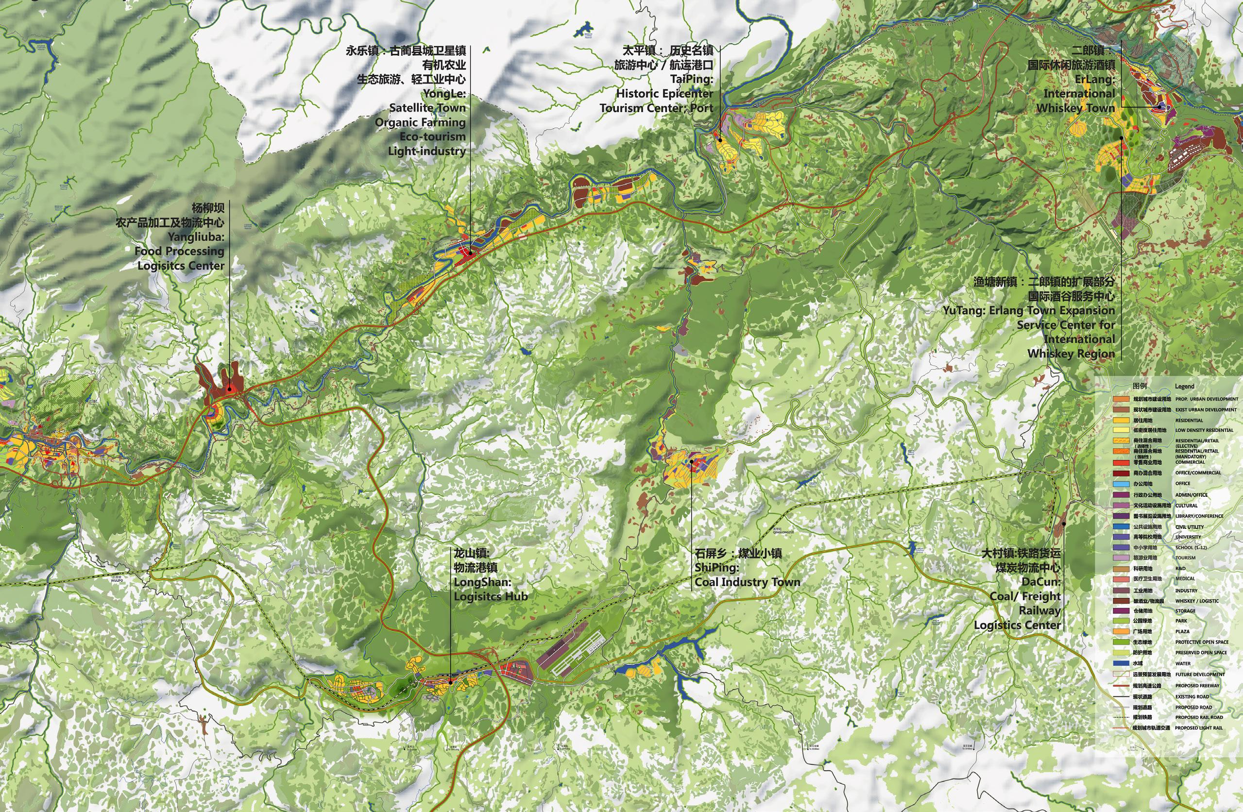
Planning to ensure the compatibility of natural resources with economic development is a persistent balancing act in China’s growing economy. In a remote location in south-central China, in a setting of deep, steep-sided valleys of unique natural beauty and exceptional water quality, the 1500-year-old Chinese whiskey industry exemplifies the conflict –and symbiotic relationship – between economic growth and resource preservation. Four hours south of Luzhou, a city on the Yangtze River, the 3000 km2 valley is formed by two watersheds of the Gulin and Chishui Rivers. It is said to be the only place in China where a unique bacterium grows that is critical for the whiskey distilleries located there, whose spirits are nationally and becoming internationally recognized. The exceptional water purity is attributed to the vast natural filtering karst limestone formations in the area; however, the recent discovery of highquality coal within these formations puts that water quality at risk. The government’s push to expand high quality coal production in the region, as well as a rapidly increasing urban populations, are recognized as potential hazards to the whiskey industry and natural qualities of the region.
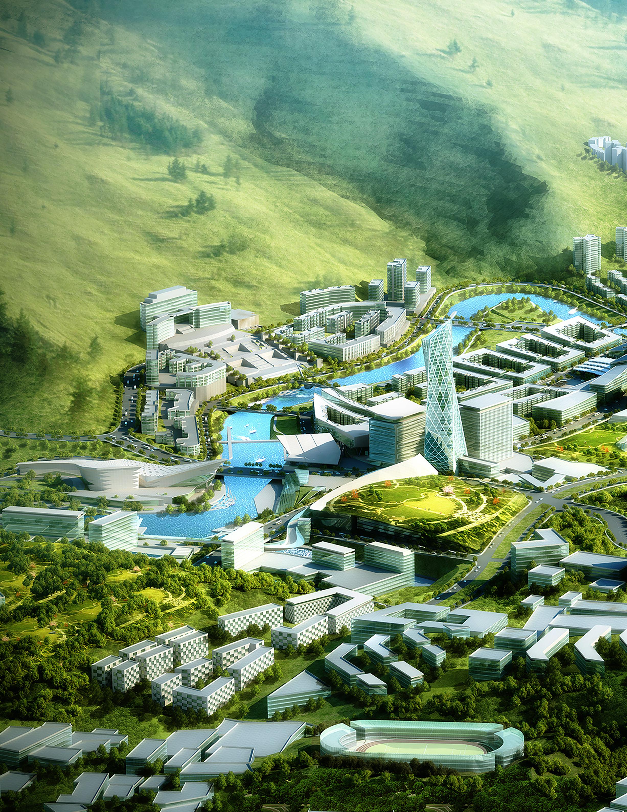
The new regional plan undertaken to address these conflicting issues is specifically protects the major watersheds essential to whiskey production, including the growing of sorghum fields, sorghum fermentation and distillation. Many of these same provisions also protect the scenic places and corridors in the region important for the future ecotourism anticipated as the region becomes more accessible. The plan recognizes that smart water management is critical to future population growth particularly as Gulin City, in the heart of the valley, and smaller towns are expanded. The plan limits coal mining to low-impact locations and water runoff and debris and containment methods are proposed. Strategic goals and recommendations for long-term, mid-term and immediate development include land resources management guidelines, limited and concentrated urban growth areas that include a high-performance business center, a center for higher education, a primary medical center, a service center for the tourism industry, multi-modal transportation systems, and regional environmental guidelines for preservation and sustainability.
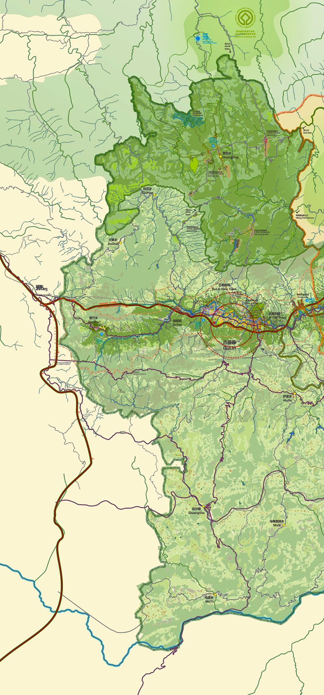
in looking to the future, the local economy needs diversity and urbanization needs to accelerate to match the industrialization stage
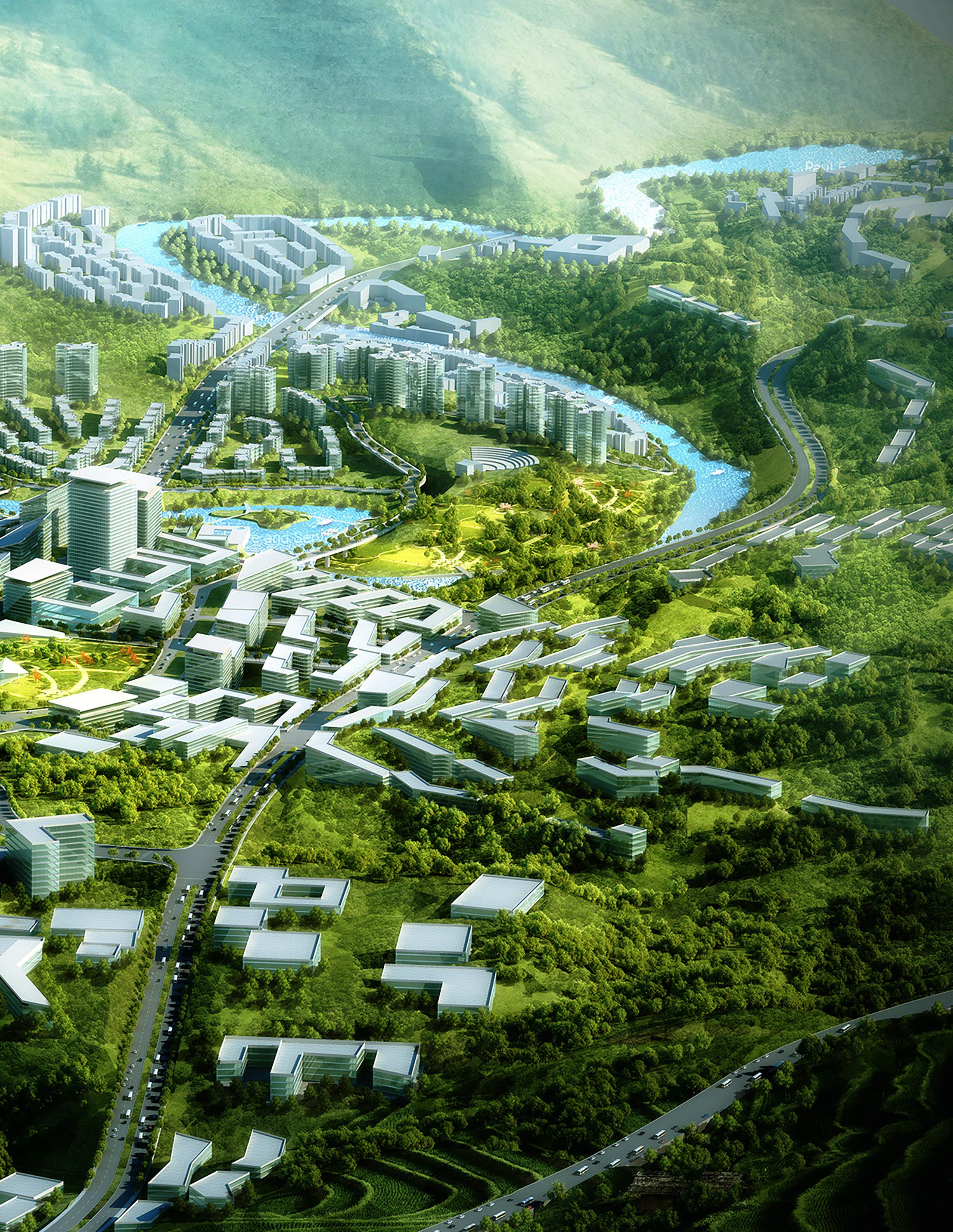
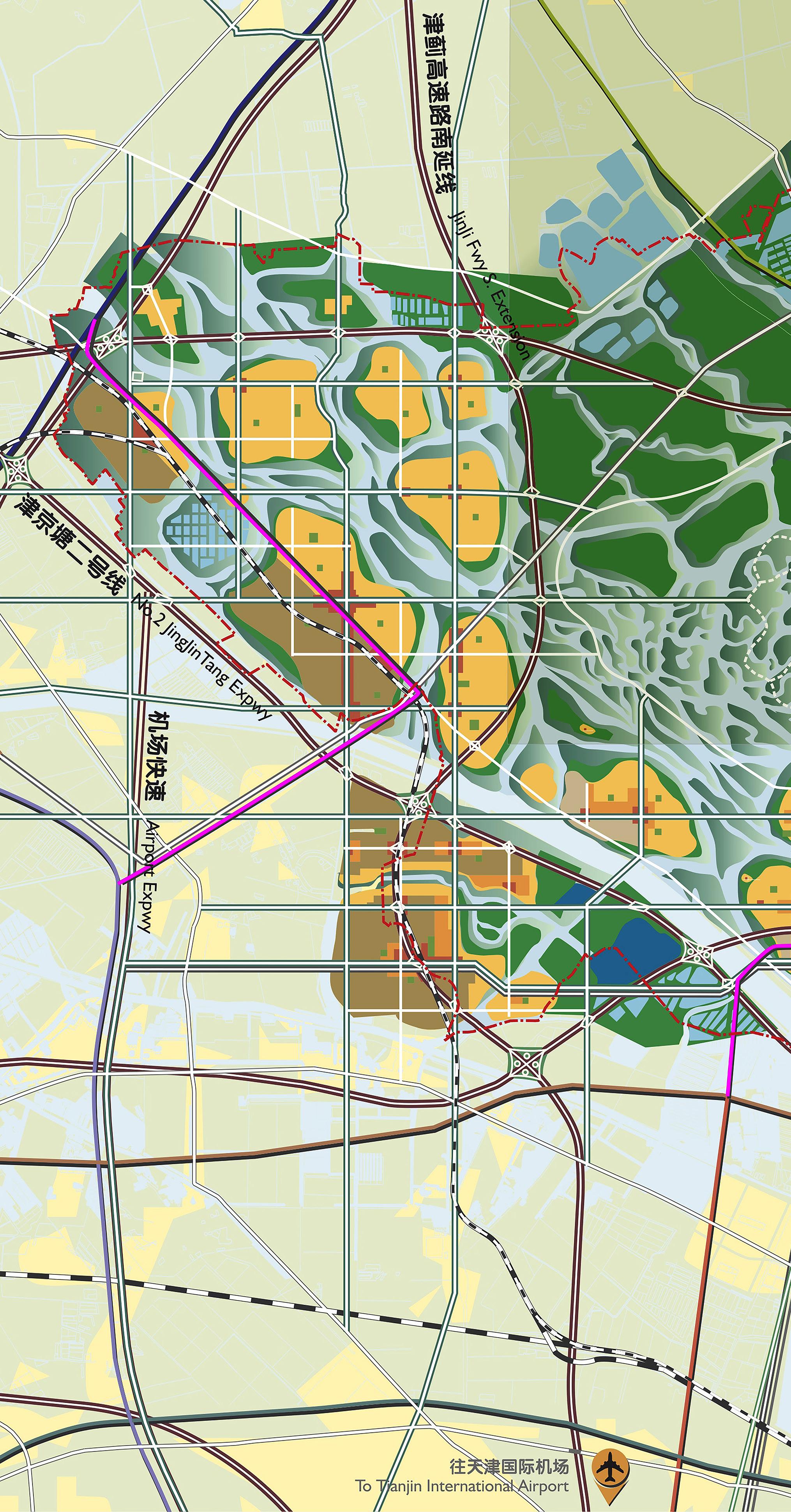
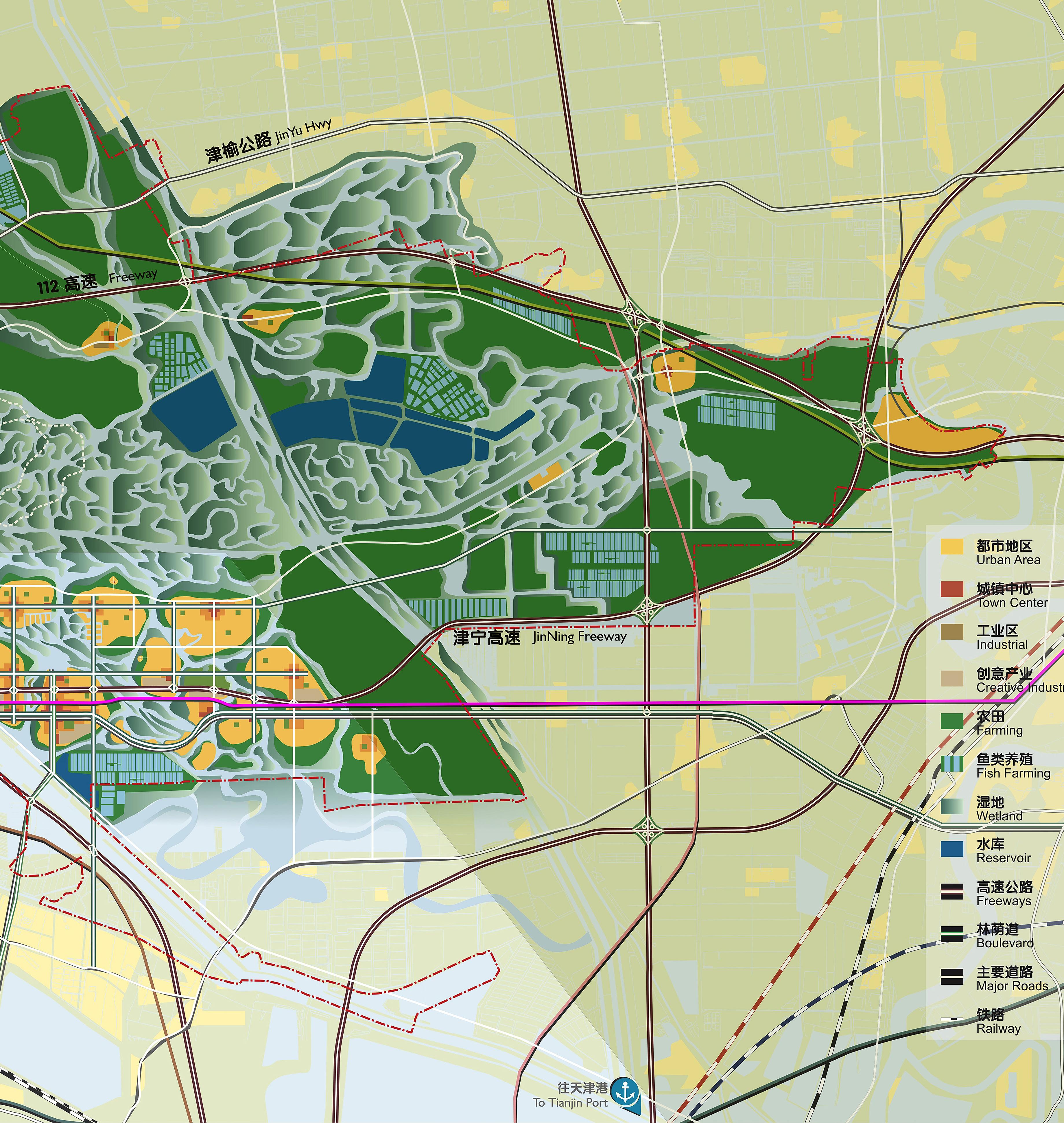
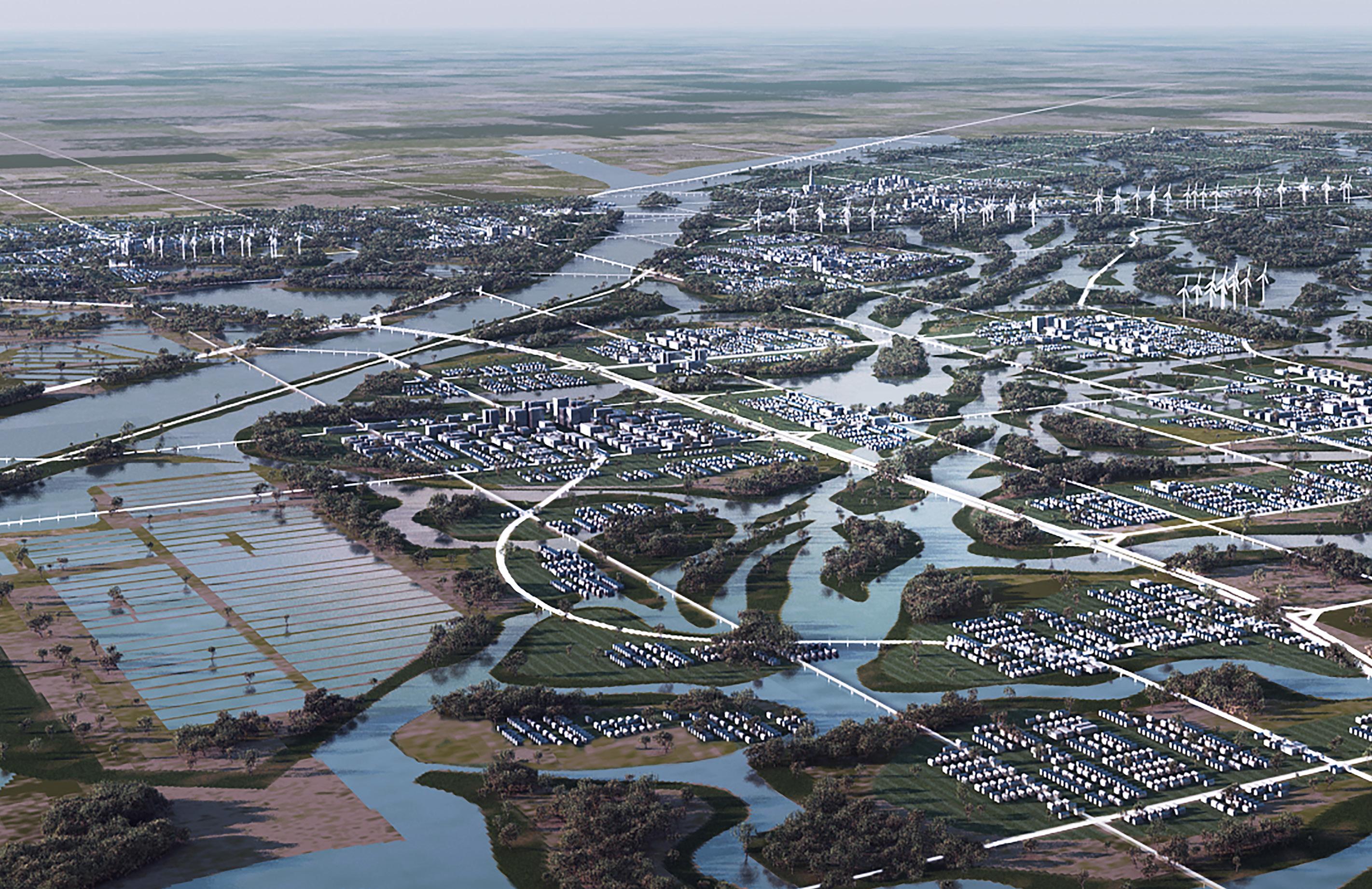
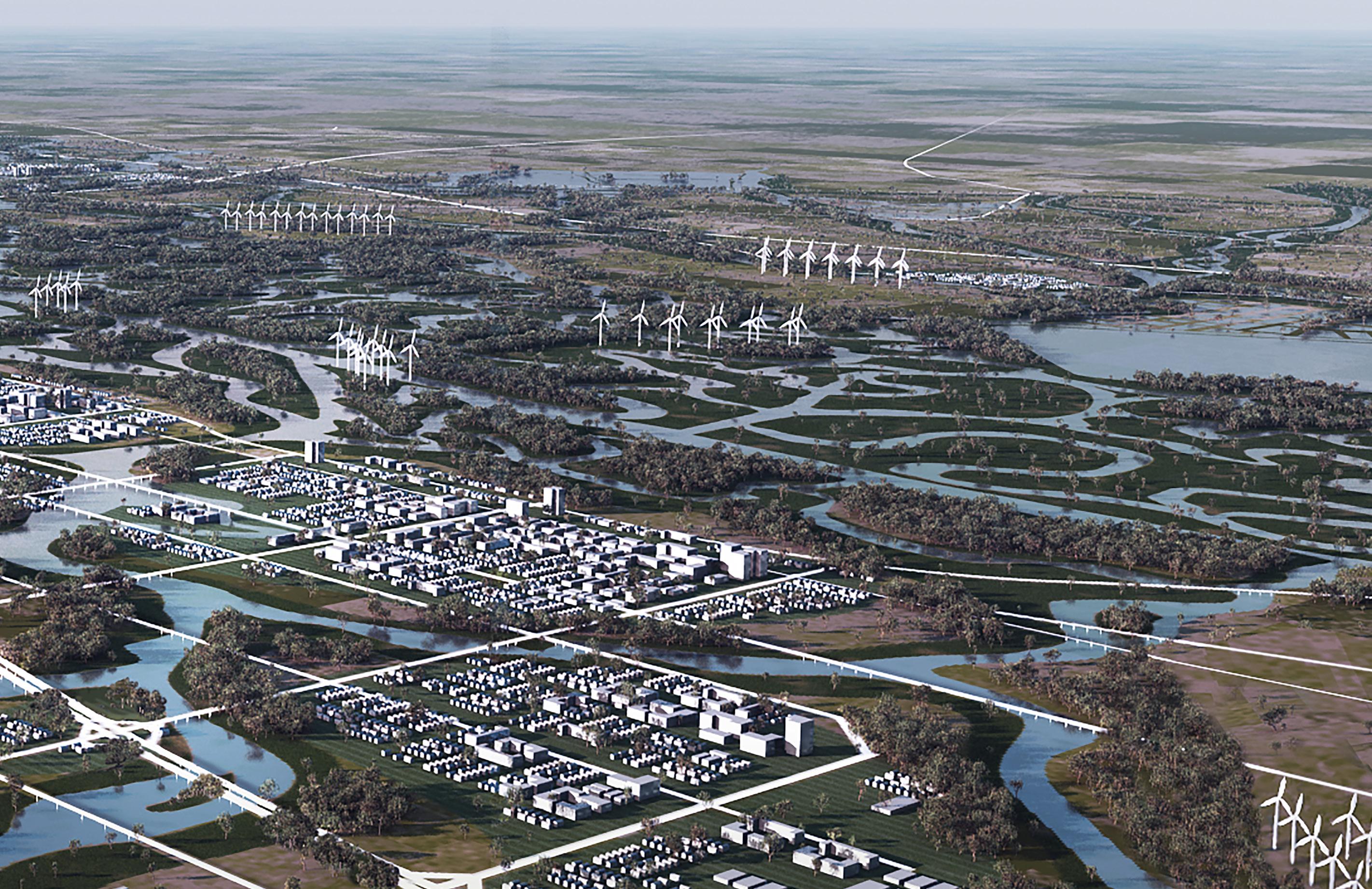
China’s remarkable growth in economic output, population and development is a global success story of the late twentieth century. The City of Tianjin has participated substantially in this progress and is poised for even greater growth as one of China’s primary urban regions—home to thriving industry, picturesque agriculture, and booming tourism. Not all this growth and development has been beneficial. Some policies have led to negative consequences including unguided sprawl that has consumed precious countryside while many areas of the region have been over-farmed, causing historic river water courses to be eliminated. In addition, public works have also altered waterways and degraded the natural environment. The Seven Mile Sea in Tianjin is an ancient seabed where over-farming and altered water courses have radically changed the natural ecology.
The master plan for Tianjin Ancient Wetland Restoration (“Seven Mile Sea”) proposes to counteract recent negative impacts of development on the delicate eco-system, offering recommendations to officials in Tianjin regarding the future development of the region. The plan recommends to fully integrate restored wetlands with modest modernized farms, existing villages, and the development of ecologically sensitive new eco-towns. The plan proposes an archipelago of urbanized “islands” within a network of restored wetlands, defined by topography and hydrology. The watercourses and wetlands are prioritized and form the basis for organizing the plan. Farmlands are at a level above water flows and flood occasionally during rainy periods. Villages are located at a higher elevation, historically high enough to be protected from flooding. The low-lying farming zone surrounds and buffers the “islands” where the proposed ecotowns are located. The islands are linked together by a network of narrow bridges designed to allow water to flow freely below. The plan restores natural water flows from the mountains to the sea, while integrating farming and urban housing.
an archipelago of urbanized “islands” within a network of restored wetlands, defined by topography and hydrology
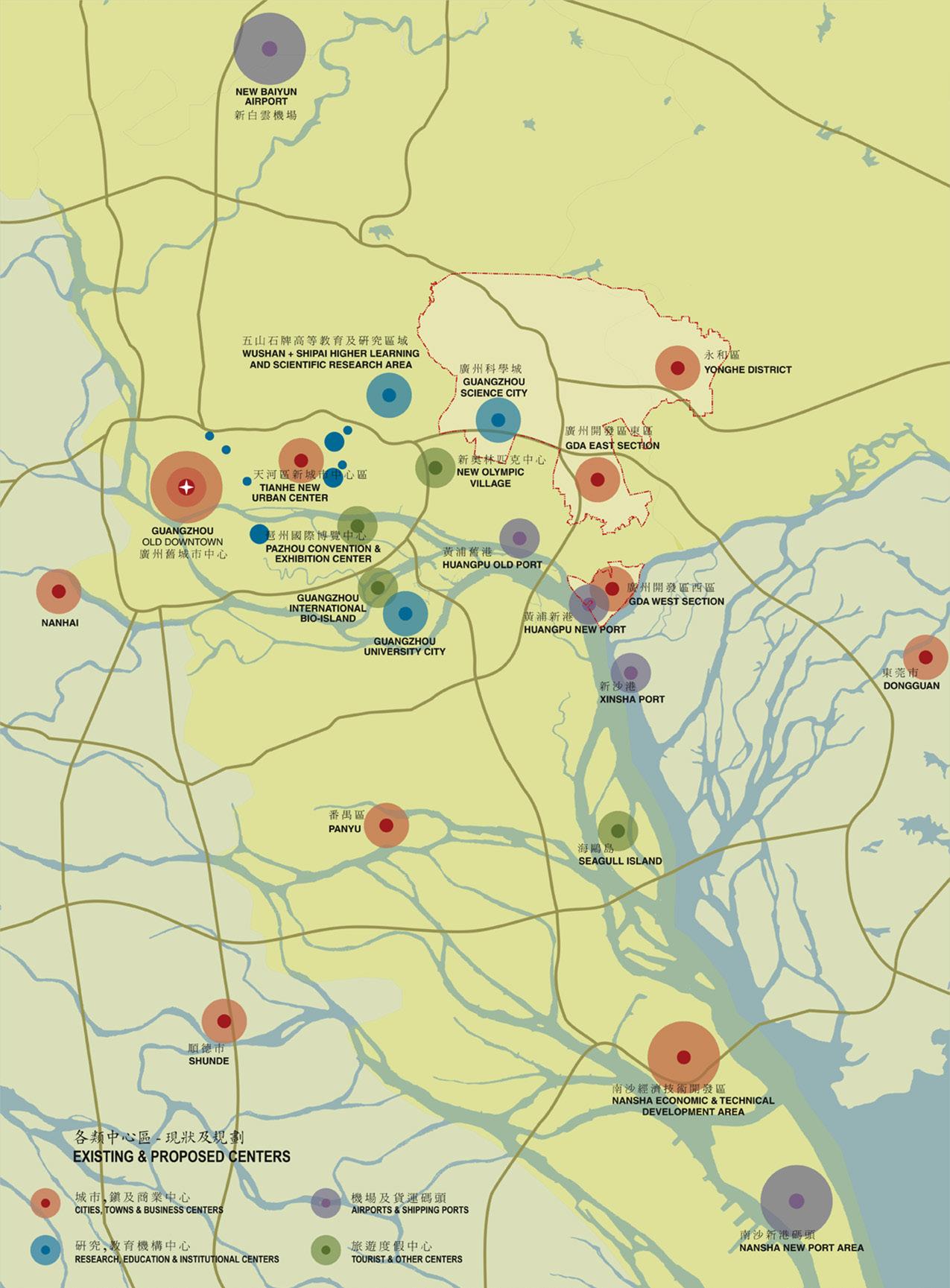
For over two millennia Guangzhou has been a successful trading port located at the confluence of two regional growth corridors that extend south, one towards Macau on the west and the other on the east towards Hong Kong along the Pearl River delta. Guangzhou has sustained its leading position for commerce using a series of strategies that include the transformation from single centered city to multi-centered regional city; the formation of a new Central Business District; and the expansion of the westerly and easterly growth corridors. However, the government’s original plan’s easterly expansion policy of single use manufacturing and industrial uses conflicted with the area’s current market demand for mixed-use commercial and residential projects. Thus, a new plan was needed to transform this area of large single use industrial blocks with wide service streets for truck access into new mixed developments organized as neighborhoods for housing and commercial retail along with smaller industrial districts providing a proper jobs-housing balance.
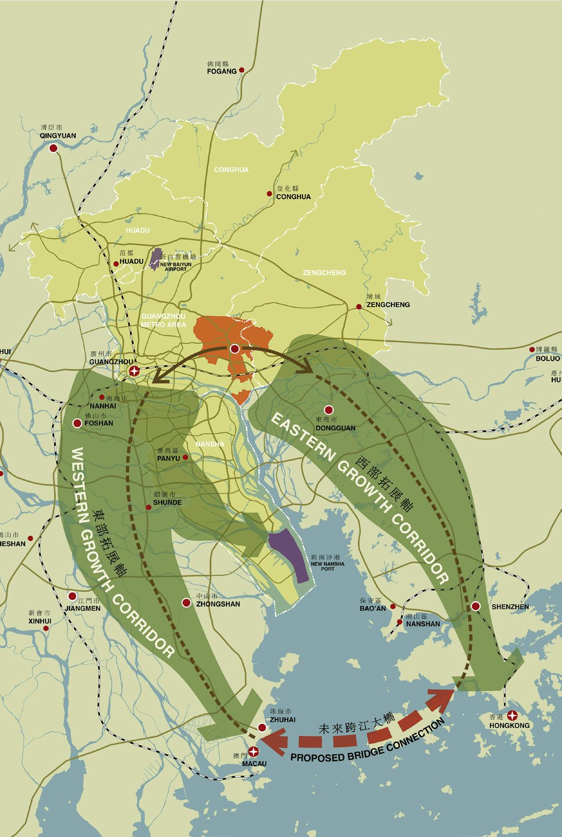
The new plan recognizes the importance of the Guangzhou Development Area encompassing 21,500 hectares through an eightfold strategy that extends the growth corridor of Guangzhou towards Hong Kong; encourages dense and mixed-use areas; realizes sustainable and resilient development; offers cultural land uses to enrich civic life; promotes innovation through university and industry collaboration; and achieves connectivity to natural settings by embracing the mountains and connecting to the river. The plan provides a new overall transportation framework that offers a high degree of mobility including various modes of public transit and a road system with redundant routes to minimize traffic congestion. It also identifies land development opportunities including a site for a new urban center, one of a number identified for the region. The overall site is stitched together with a comprehensive open space network offering new bike and pedestrian routes throughout, including trails which find their way into the surrounding mountains.
 First
REGIONAL CONCEPT DIAGRAM
First
REGIONAL CONCEPT DIAGRAM
LOS ANGELES, CALIFORNIA, USA
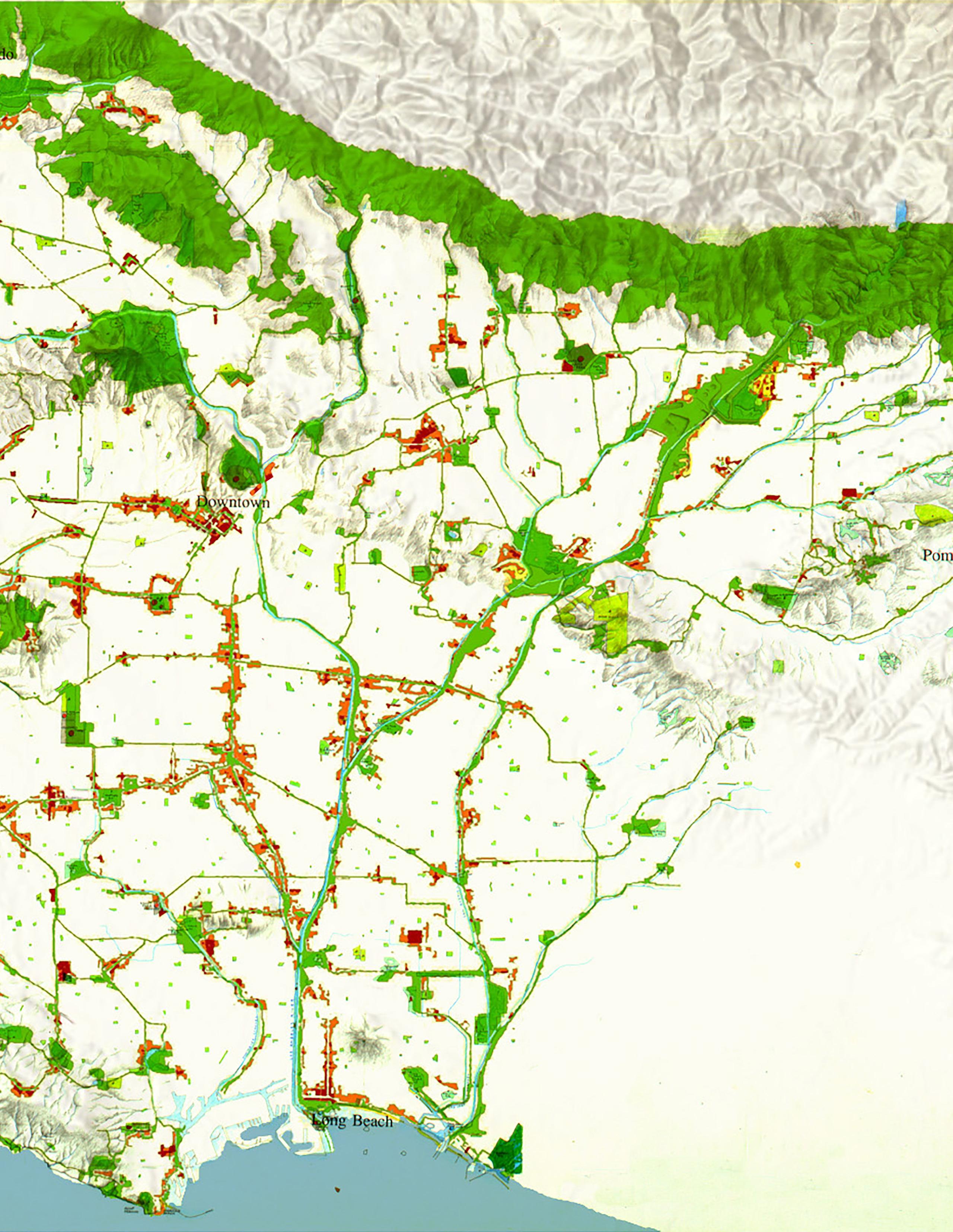
The Greenways Plan is “opportunistic,” proposing a new set of urban scale organizing principles based on “found” features already present in the environment. The planned and unplanned development of Los Angeles illustrates the consequences of imbalance, what happens when current development elides the lessons and structures of the past, and how the use of “hidden” infrastructure can build quality of life for the future city’s residents. Because of the rapid post-war growth of the Los Angeles region, particularly in single family detached homes and commercial districts, public parks and regionally connected public spaces were all too often neglected in favor of the privatization of land. Unlike some older American cities, Los Angeles never had a city beautiful or garden city movement foregrounding grand open spaces and parks as part of the city’s infrastructure. Consequently, Los Angeles devotes approximately 4% of its surface area to public parks, unlike New York City where it is 17%, and Boston and San Francisco where it is 9%. These are remarkable statistics, given the perception of Los Angeles as a low density “garden city.” Indeed, the city has an abundance of gardens, but they are private gardens behind single family homes. Seeking common benefit, Los Angeles should strive to increase its usable public open space, especially when the region is densifying along newly created public transit lines and there is a deficit of open space.
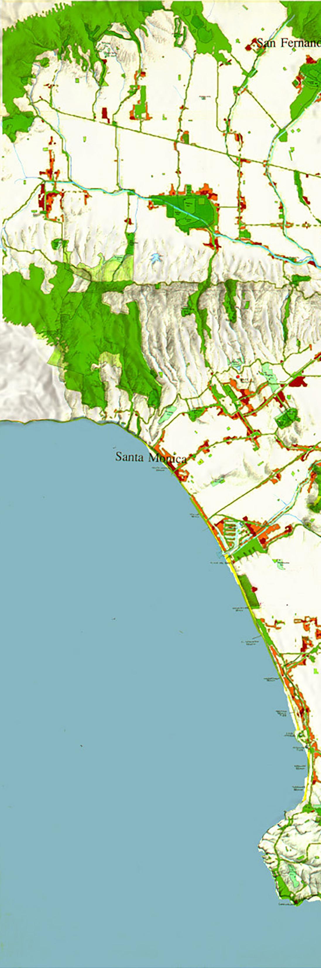
The Greenways Plan uses residual and underutilized regional land resources—abandoned alignments of the old Red Car rail system, power line rights-of-way, and river and flood control channels, the region’s “grid” road system—historical land resources largely forgotten in planning for the city’s growth. The Greenways Plan links these land resources in a network more than 400 miles long, through new bikeways, jogging trails and parks. It connects existing town centers, schools, libraries, post offices, and senior centers and where greenways intersect new transit lines provides sites for urban infill and intensification. Aspects of the Greenways Plan were adopted and incorporated into the official City of Los Angeles General Plan Framework; collateral and joint development on the new Metro transit lines and station areas has begun to yield public open space benefits anticipated by the plan.
 AIA Los Angeles, Urban Design Award Progressive Architecture, Award for Urban Design MOCA Exhibition, “Urban Revisions”
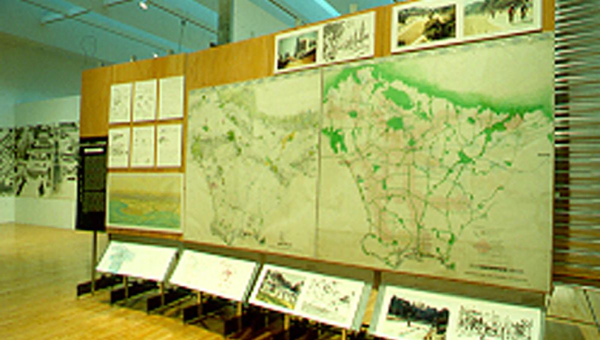
MOCA URBAN REVISIONS EXHIBIT
AIA Los Angeles, Urban Design Award Progressive Architecture, Award for Urban Design MOCA Exhibition, “Urban Revisions”
MOCA URBAN REVISIONS EXHIBIT
a public, linear open-space system to create recreational opportunities and link public facilities and transportation
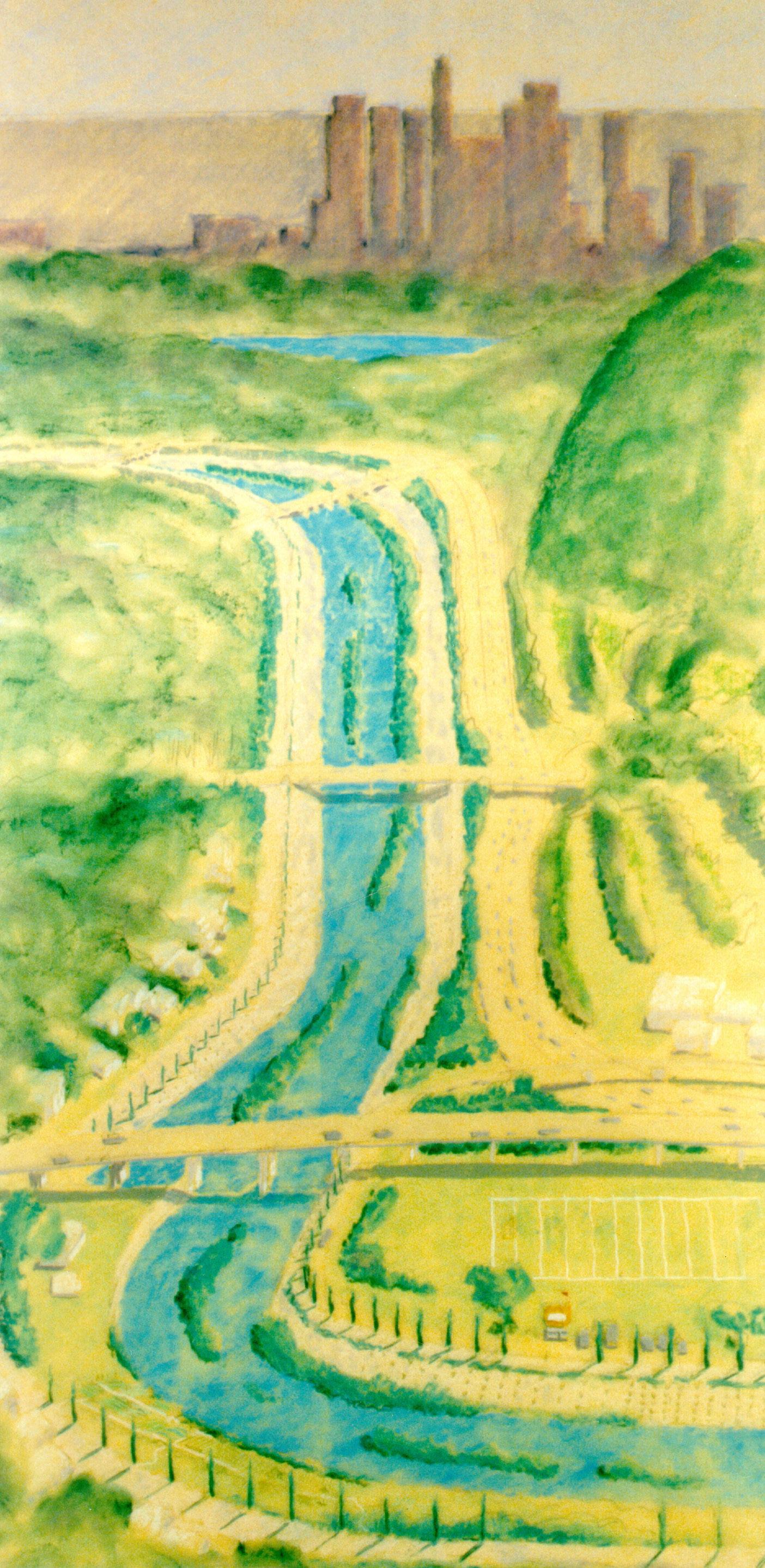
 LA RIVER AT GRIFFITH PARK LOOKING EAST
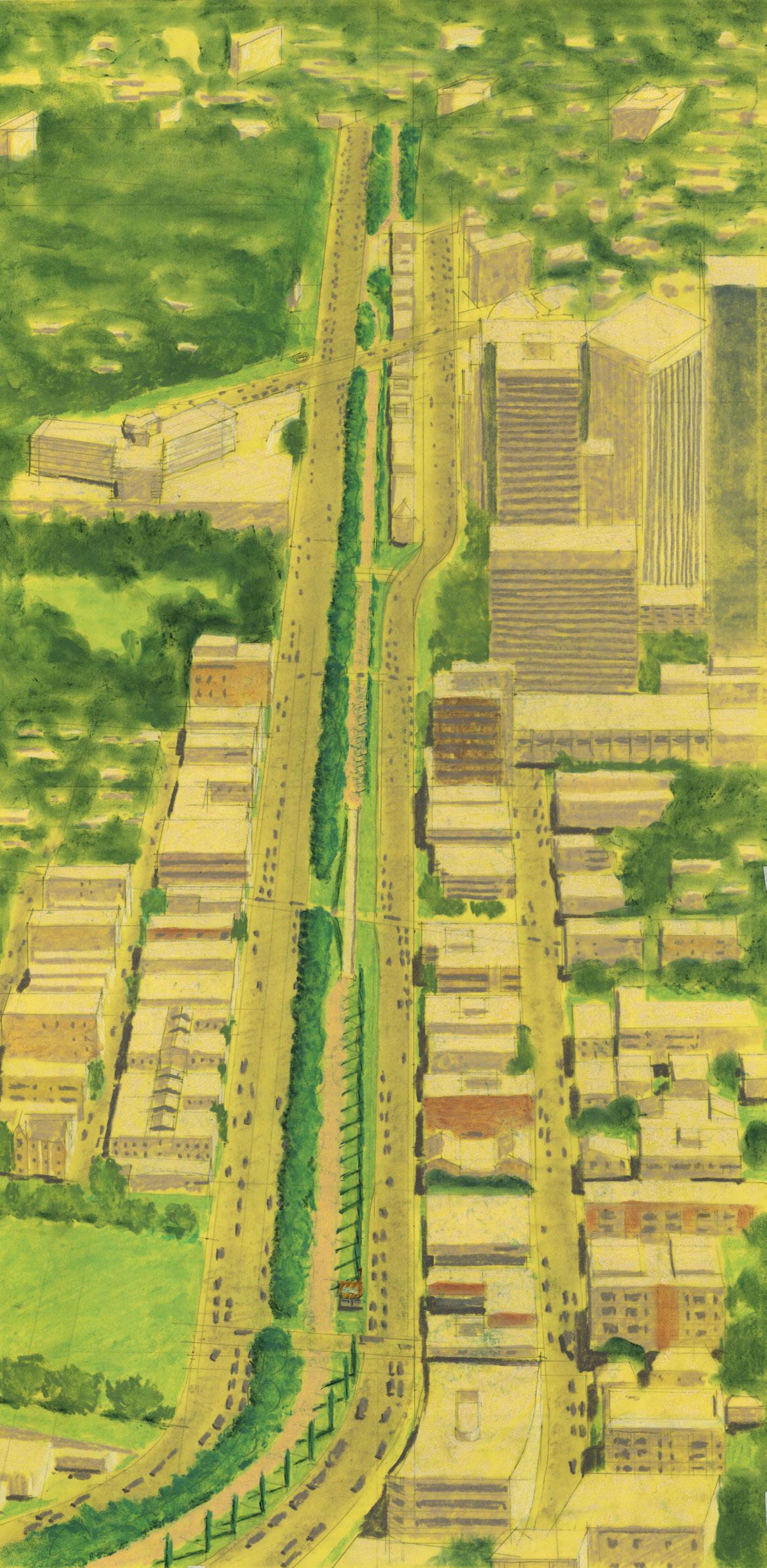
SANTA MONICA BLVD. LOOKING EAST
LA RIVER AT GRIFFITH PARK LOOKING EAST
SANTA MONICA BLVD. LOOKING EAST
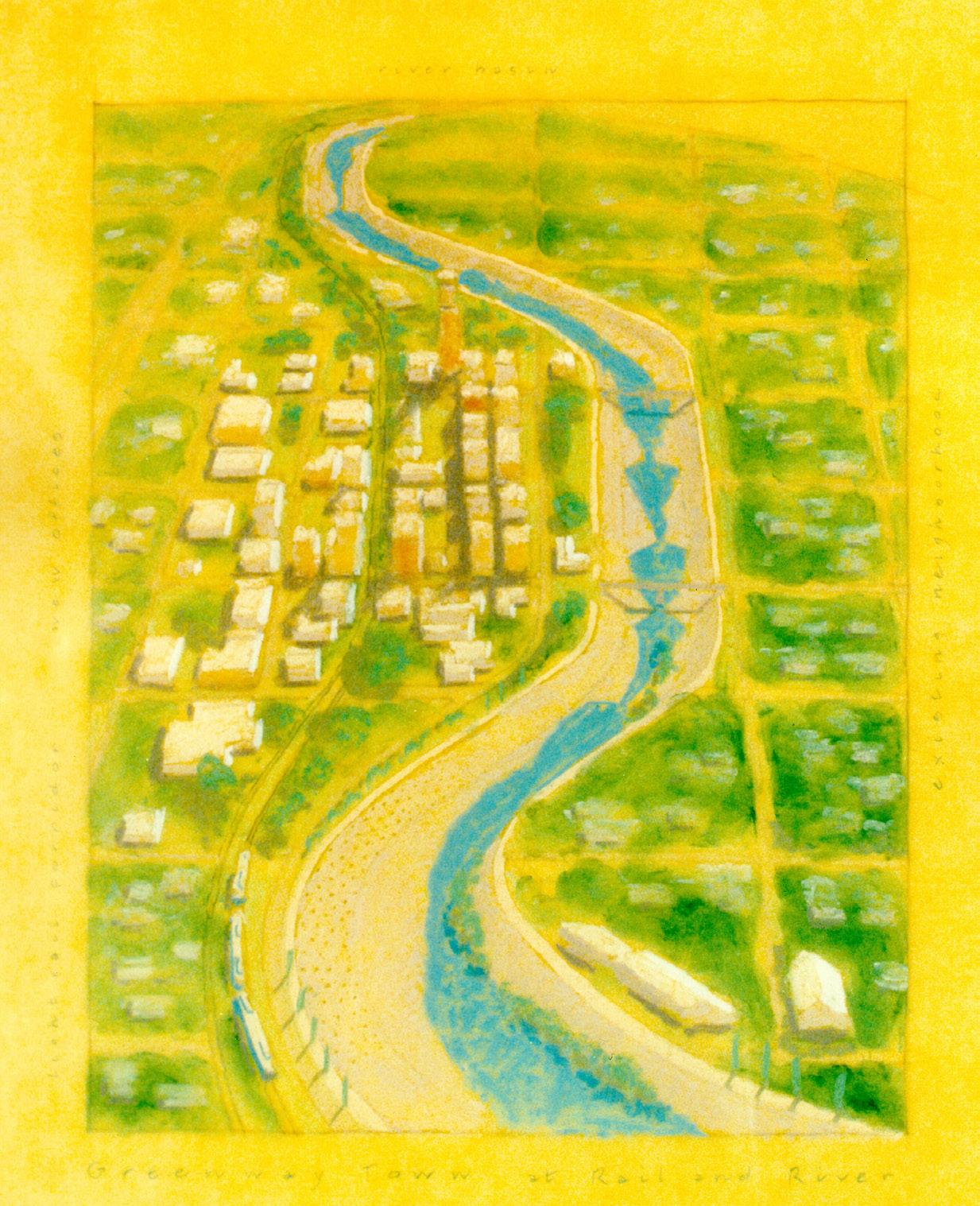 LA GREENWAYS CONCEPT
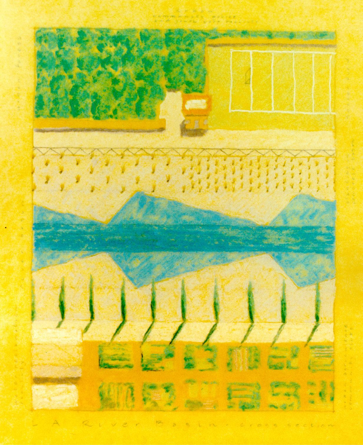
LA RIVER BASIN CROSS SECTION
LA RIVER AT TAYLOR YARDS
LA GREENWAYS CONCEPT
LA RIVER BASIN CROSS SECTION
LA RIVER AT TAYLOR YARDS
(65 Sq. Km)
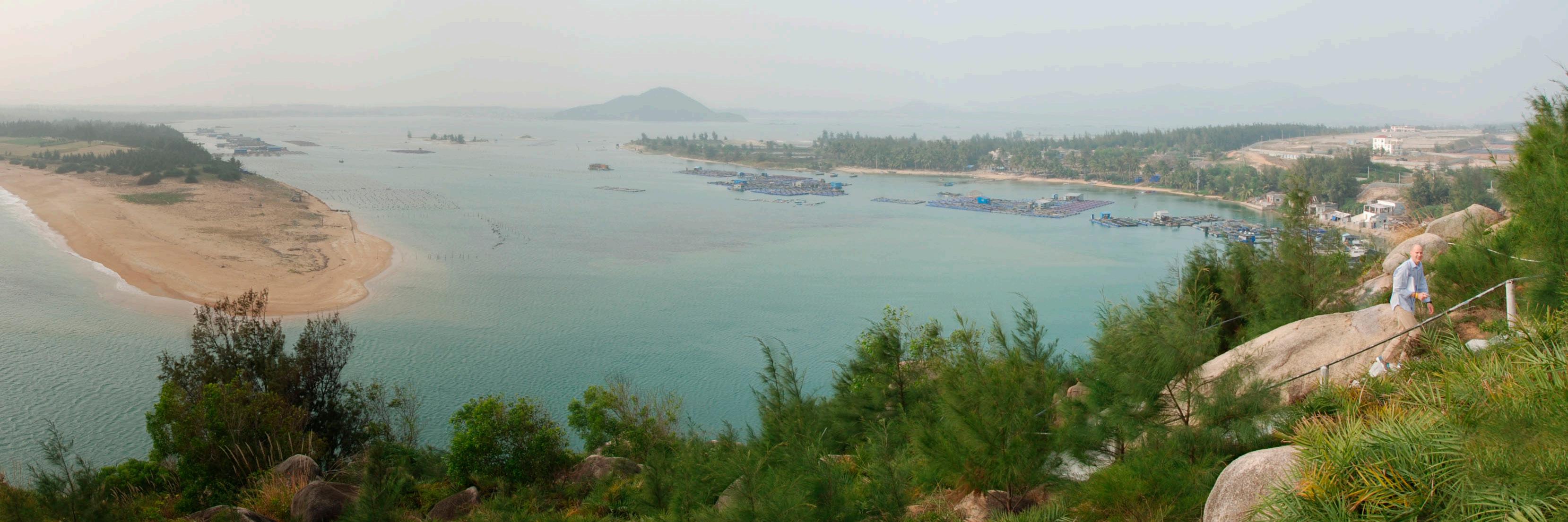
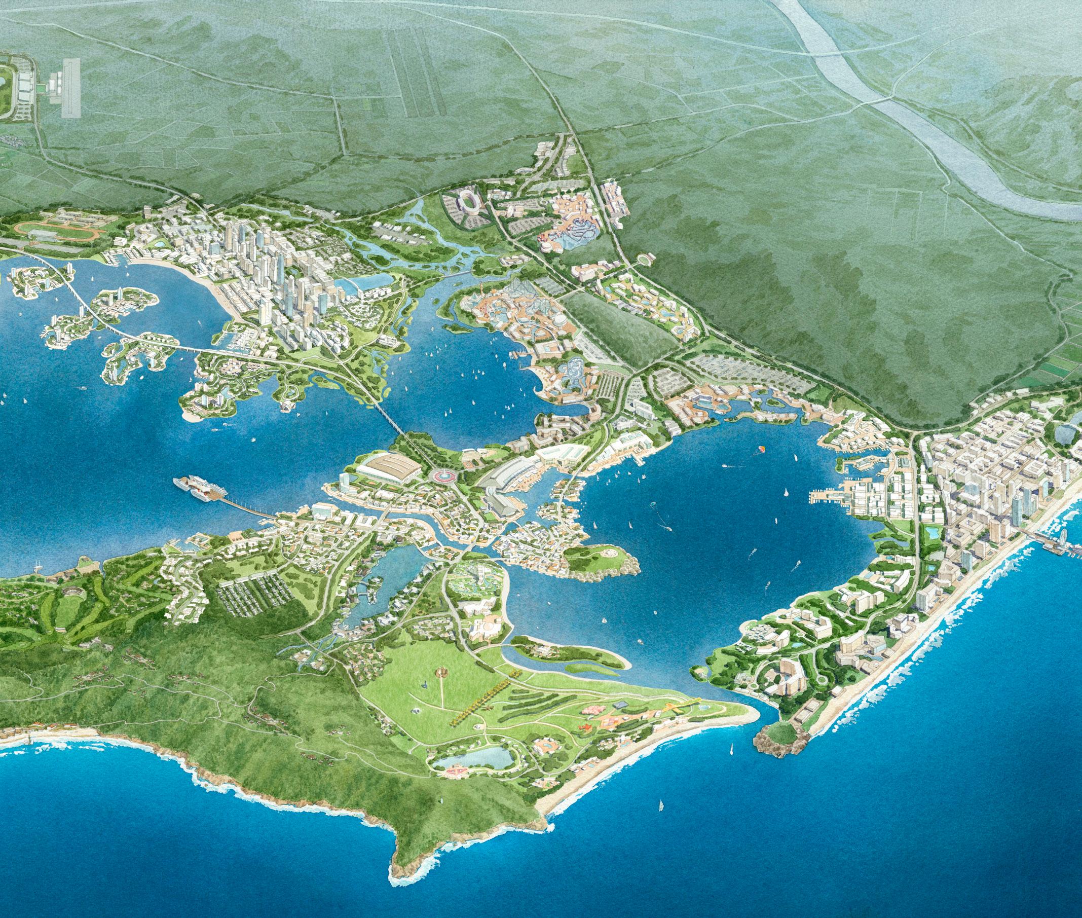
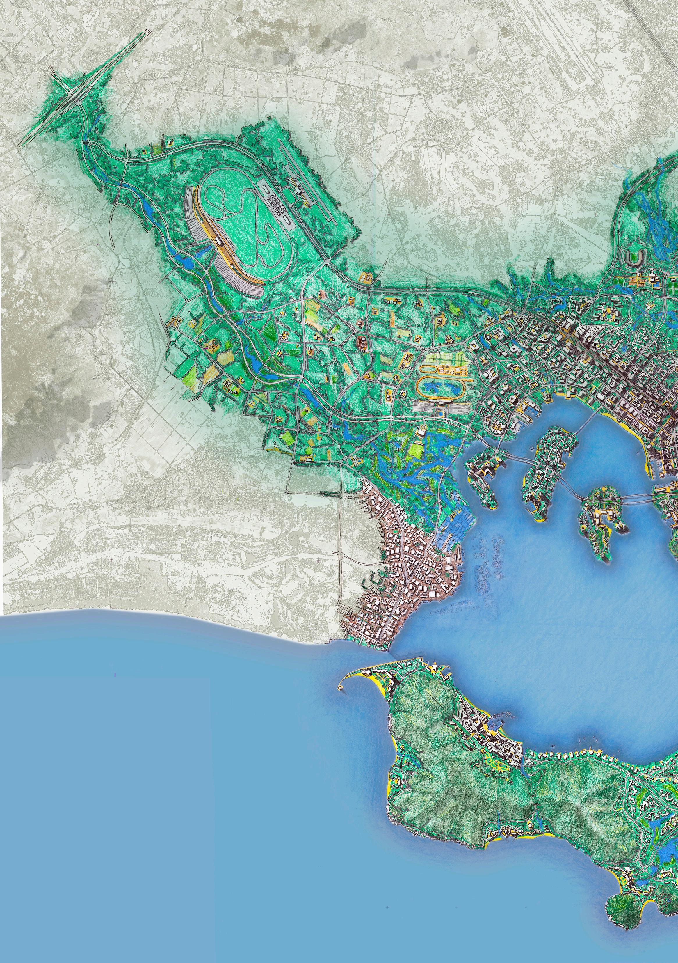
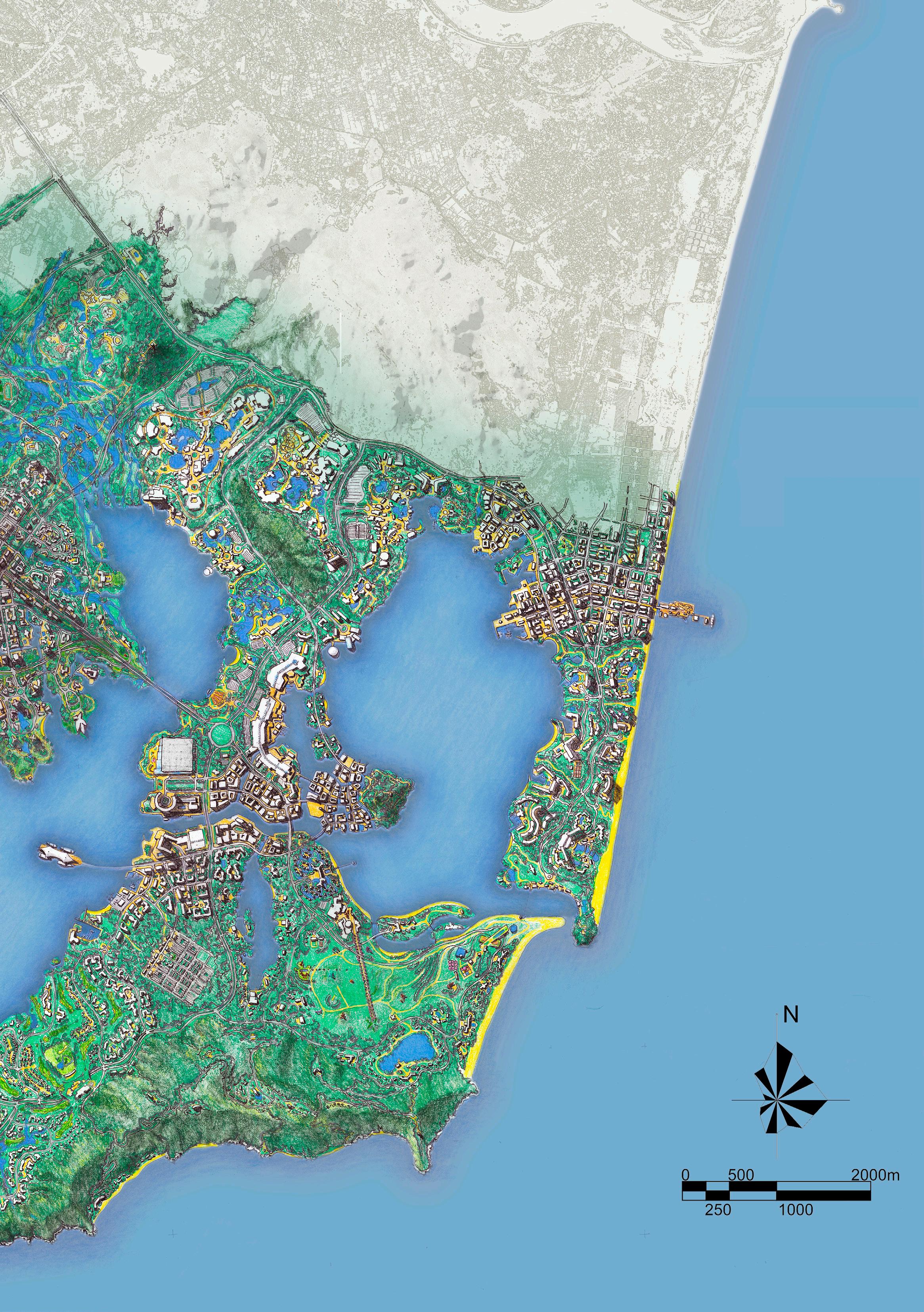
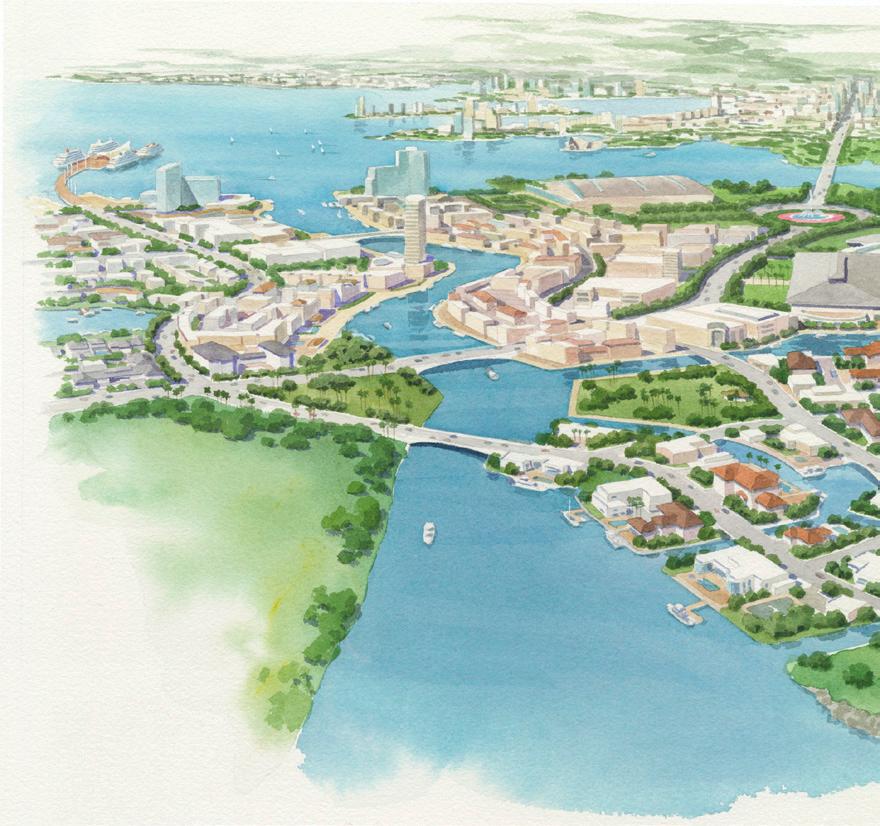
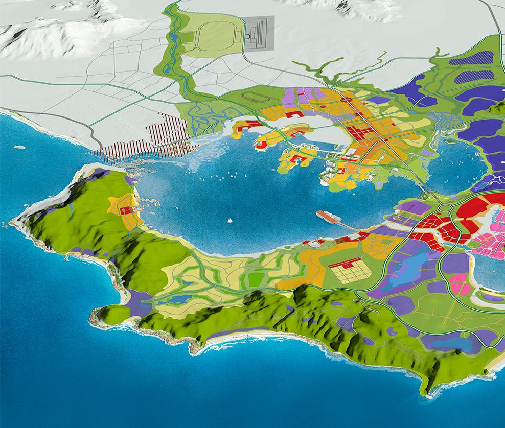
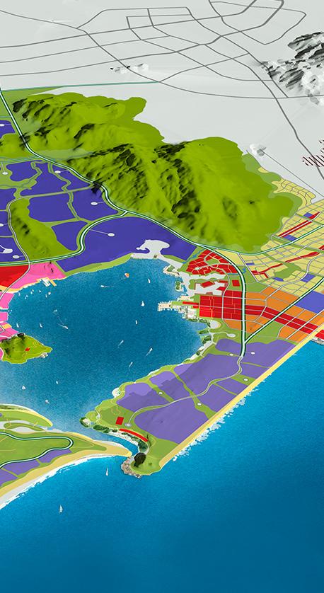
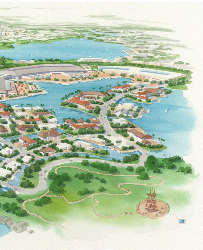
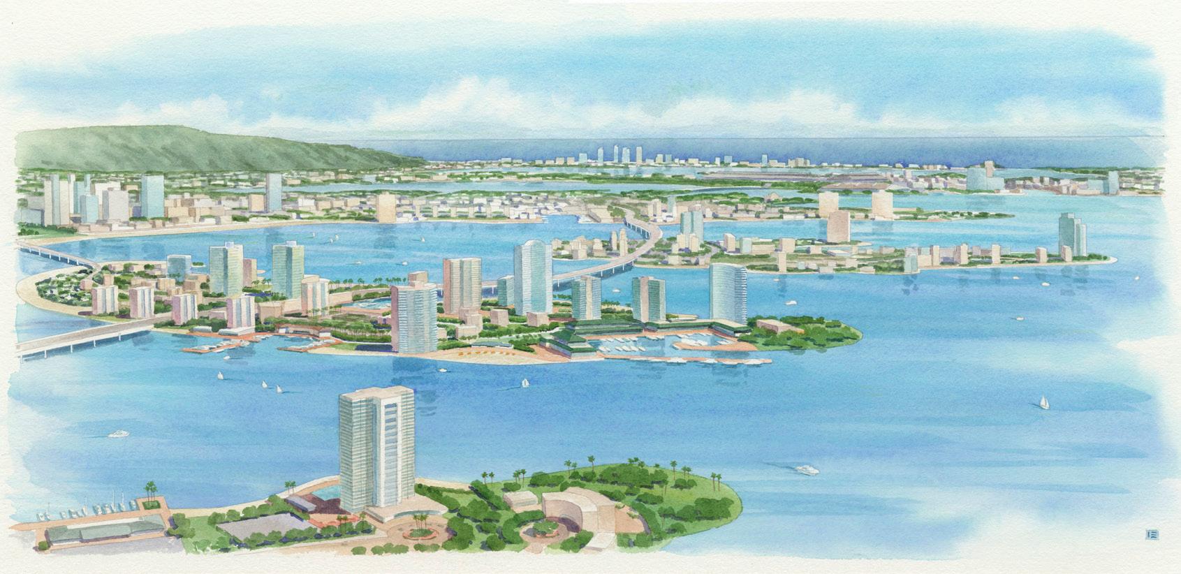
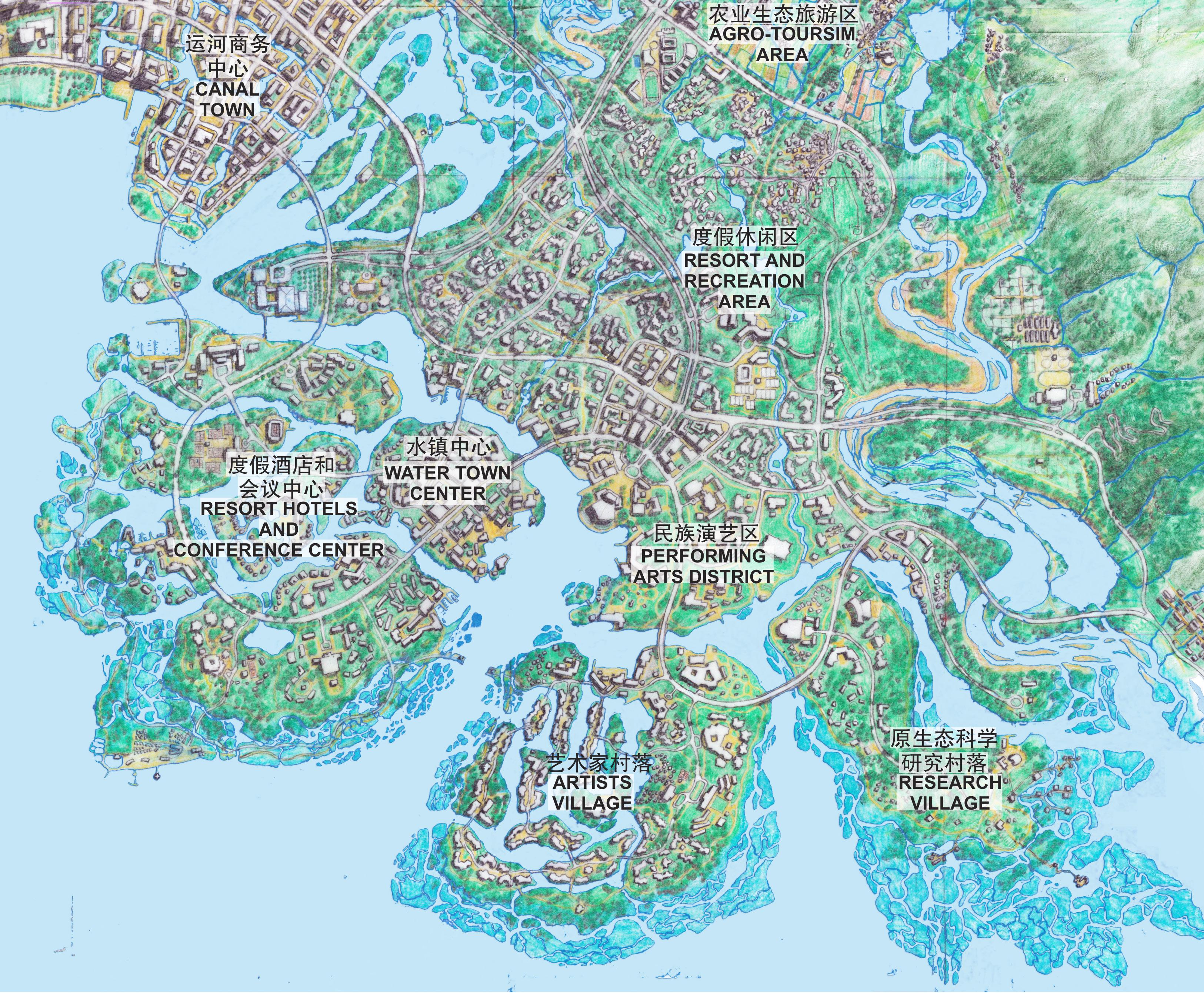
 LINGSHUI, HAINAN, CHINA
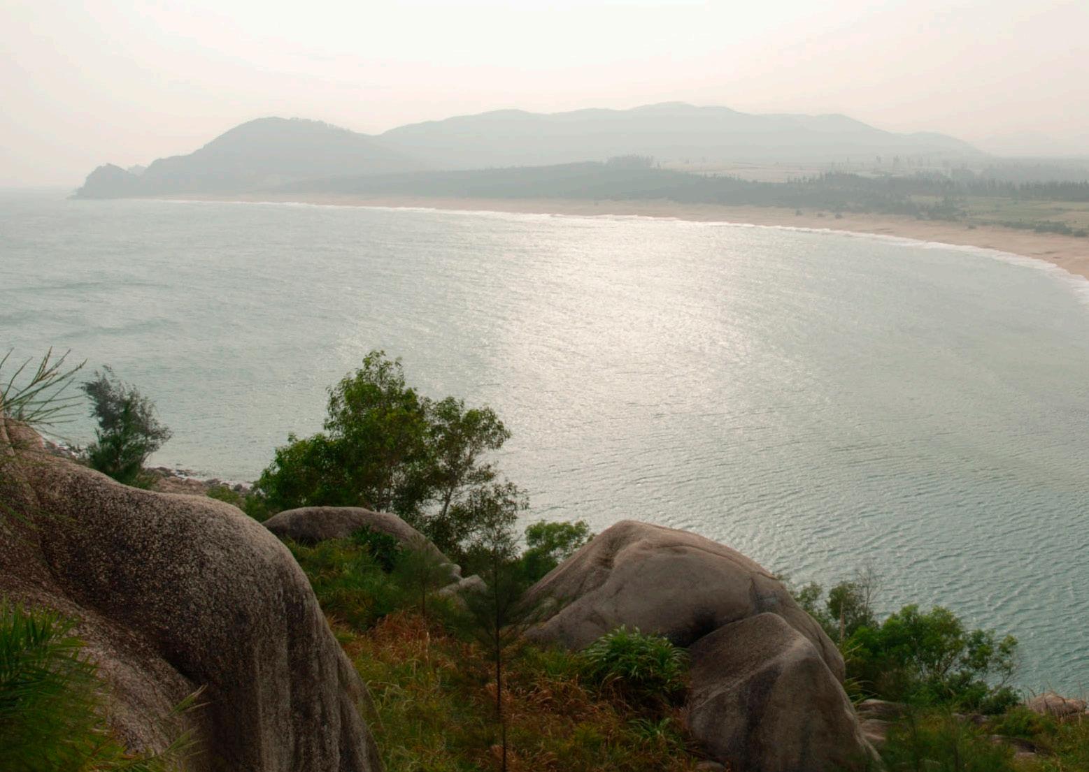
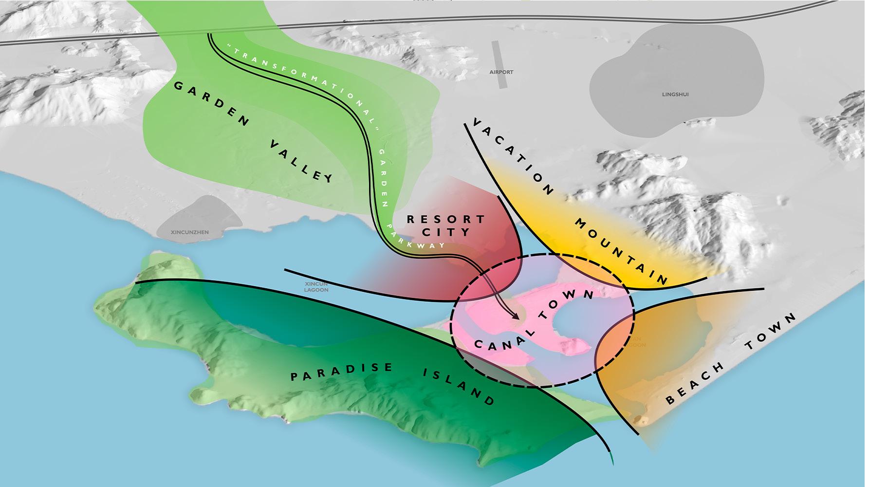
Hainan is the southernmost province in China’s tropical climatic region on the South China Sea, and LingShui is located at the southeasterly end of Hainan Island, northeast of SanYa, Hainan’s primary tourism destination. China’s national policy in the 12th Five Year Plan designated Hainan as an International Tourism Island, seeking to bring benefits to the region by capitalizing on Hainan’s climate, geography, and location as a potential destination for visitors from around the world. The LingShui Pioneering Experimental Resort District Master Plan allows Hainan to provide incentives for new resort development, and gives the government and developers the opportunity to try new approaches.
Johnson Fain developed a plan that envisions a new destination resort region, with a comprehensive land use, development, and business plan strategy to ensure a successful realization of the vision for LingShui. The site area of the planned new resort area is approximately 65 square kilometers including two large and beautiful lagoons, along with distinguishing natural features that include mountains, beaches, coves, ocean, forest, rural villages, and farmland. The planning concepts respect and enhance every aspect of the geographic characteristics, creating new places by tailoring development programs appropriate for each natural setting. The development model adopted here is to create a new main city center surrounded by the resort themed programs, such as a cruise terminal, shopping malls with freetrade policy, recreational and retreat facilities, an Art Park, a beach hotel zone, a local arts and crafts oriented Canal Town, a beach town, and theme parks, among others. The development program is planned to attract not only “snow birds” in winter but also permanent residents, regular businesses and jobs to this place. Through this strategy, LingShui will become a resort city and an international tourists’ destination with year-round activities, stimulating both local and regional economic development.
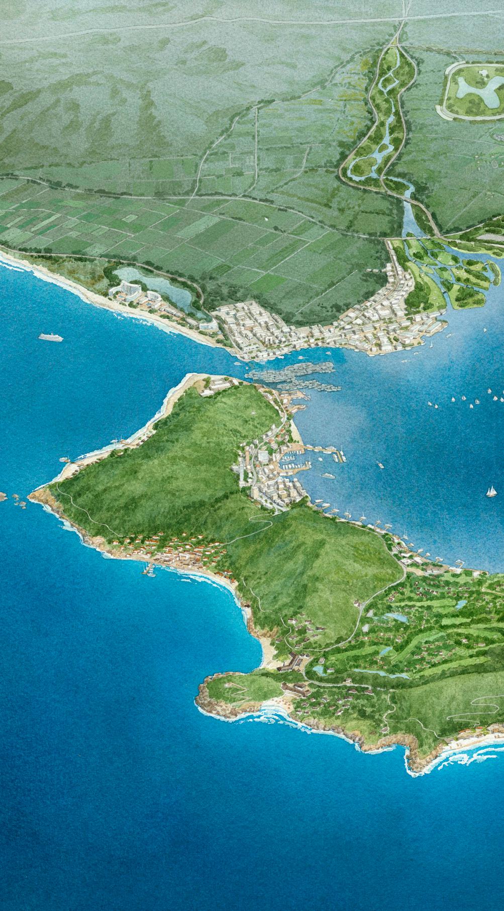
 COVE RESORT
SOUTH CHINA SEA
PARADISE
CRUISE TERMIAL
RESIDENTIAL ISLAND
XINCUN LAGOON
XINCUN TOWN
MAIN CITY
TRANSFORMATIONAL GARDEN PARKWAY
COVE RESORT
SOUTH CHINA SEA
PARADISE
CRUISE TERMIAL
RESIDENTIAL ISLAND
XINCUN LAGOON
XINCUN TOWN
MAIN CITY
TRANSFORMATIONAL GARDEN PARKWAY
 COVE RESORT
PARADISE ISLAND
TERMIAL
OPERA
ARTIST VILLAGE
DUTY-FREE MALL
MUSEUM / GALLERY
ART PARK
BEACH HOTEL
LIAN TOWN
CANAL TOWN
THEME PARK ZONE
LIAN LAGOON
PIER
COVE RESORT
PARADISE ISLAND
TERMIAL
OPERA
ARTIST VILLAGE
DUTY-FREE MALL
MUSEUM / GALLERY
ART PARK
BEACH HOTEL
LIAN TOWN
CANAL TOWN
THEME PARK ZONE
LIAN LAGOON
PIER
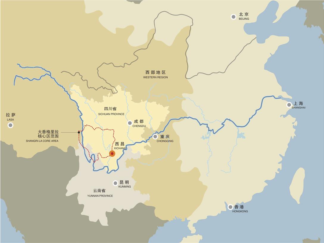

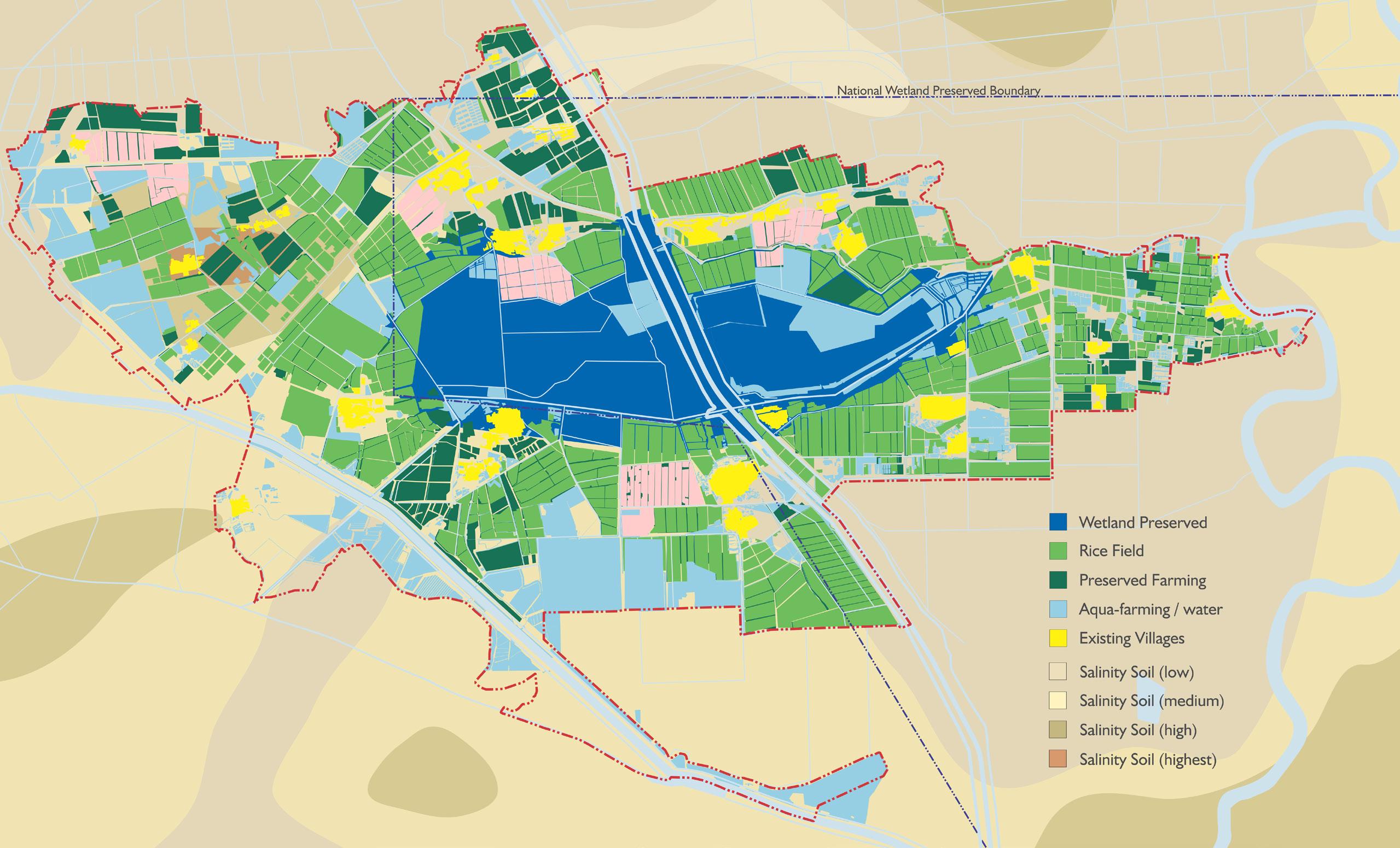
XiChang is one of the oldest continuously occupied Chinese cities. From its beginning in 200 B.C as a Han Dynasty outpost along the Silk Road, it has played an important economic and administrative role in the region. It was strategically located in an easily defended bowl, and the QiongHai valley provided protection, water, farming and fishing to support its role as a wealthy trading city.
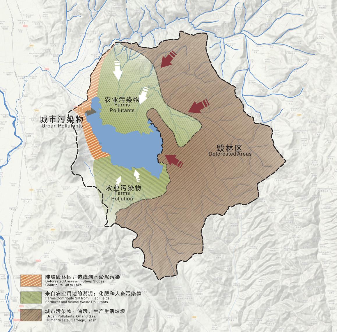
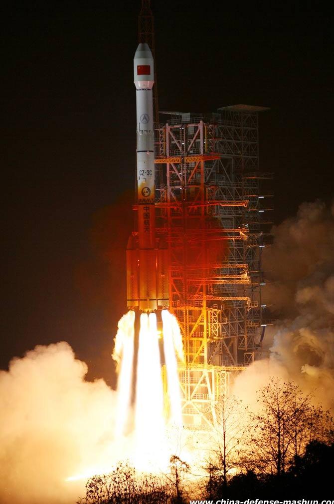
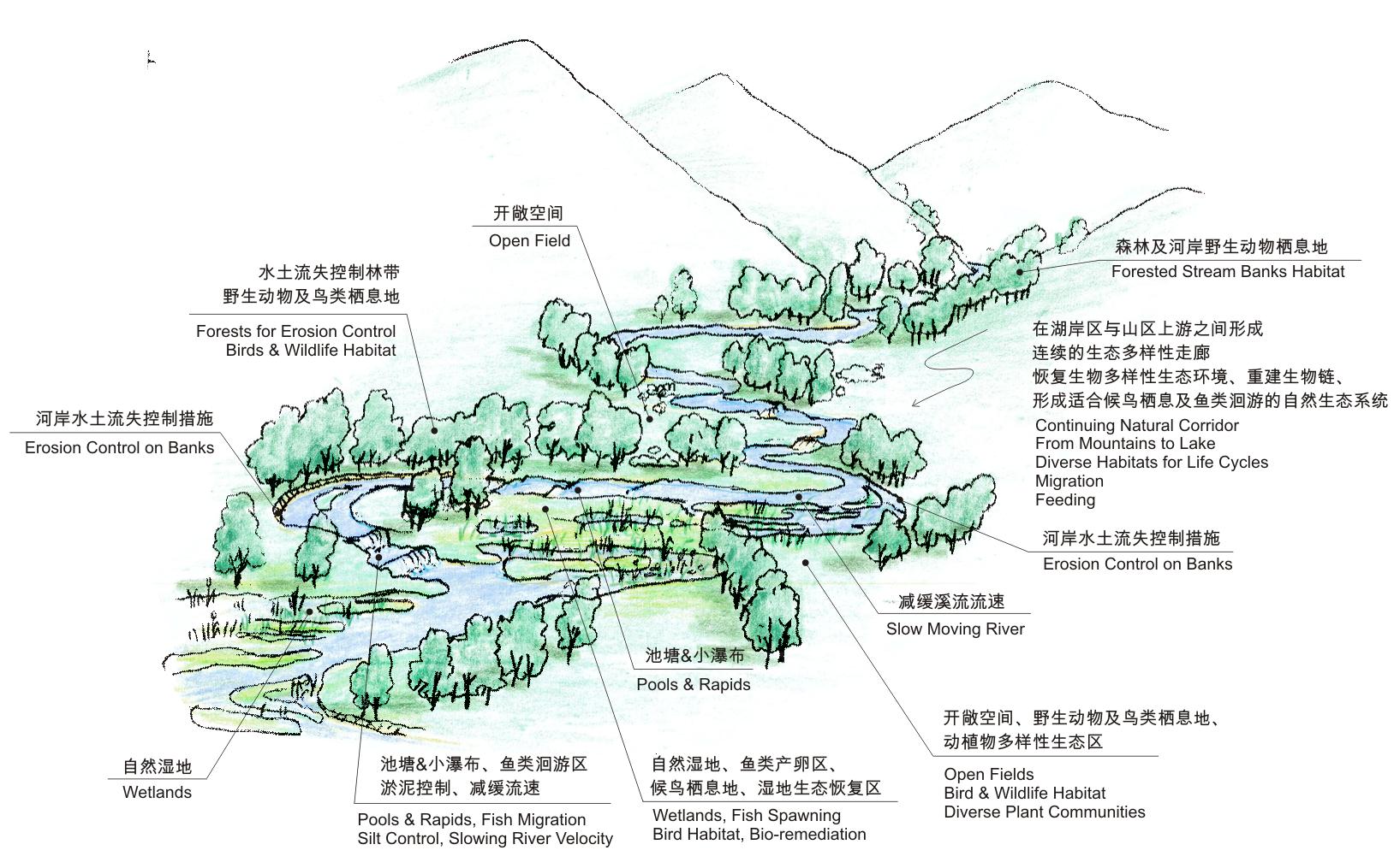
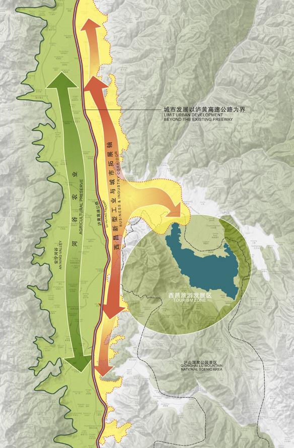
XiChang is located in a rural district of southern Sichuan Province, with its economy focused on tourism, agriculture and mineral extraction. Its QiongHai Lake was one of China’s most beautiful and unspoiled lakes, and the surrounding LuShan Mountains are still preserved as a National Park. Over the last several decades, uncontrolled runoff from logging on the adjacent hills and poor farming practices on the upstream slopes had polluted and shrunk the once-pristine lake. The area had undergone little modern development as it was off limits to visitors, but the nearby military rocket launch facility was converted to civilian satellite-related uses, and the area opened to new development. A high speed railway and national freeway are now under construction in the adjacent AnNing valley, bringing a surge in growth to the City. QiongHai Lake, the centerpiece of the City’s image and fame, was about to be overwhelmed by new development along its already highly compromised shores.
The Plan developed by Johnson Fain takes into account the rapidly growing tourism and recreation market and the potential harm to the lake environment if left unchecked. The Plan addresses a strategy for the restoration of the lake, while maintaining the agricultural character and critical food production of the AnNing Valley.
POLLUTION SURROUNDING THE LAKE LOCATION MAP SATELLITE LAUNCHING CENTER ETHNIC MINORITY CULTUREthe uniqueness of place exemplified by charming ethnic cultures, beautiful scenary and the Qionghai Lake
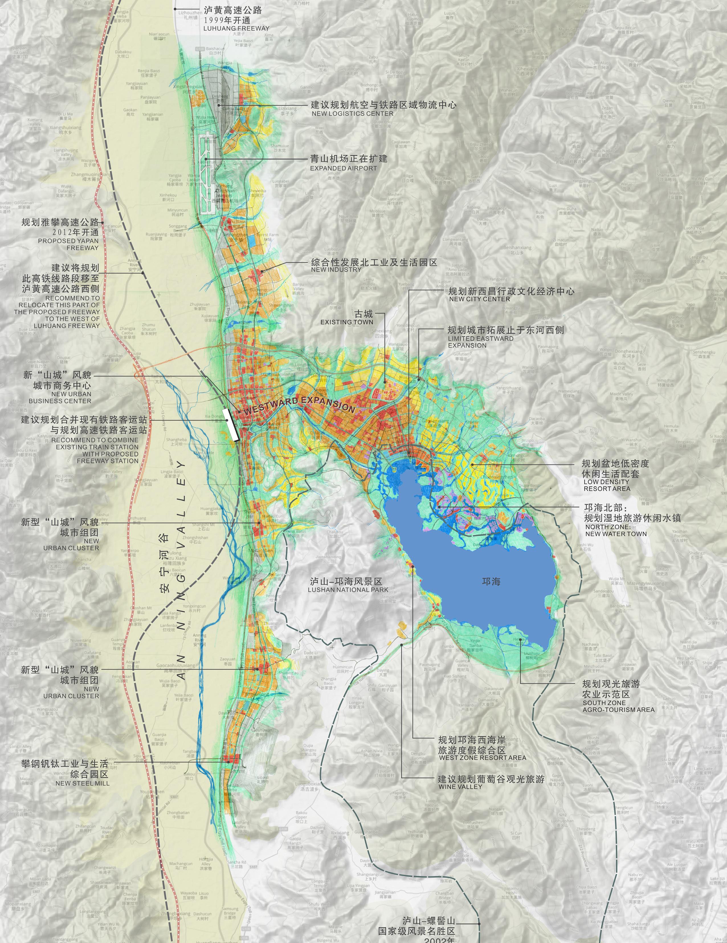
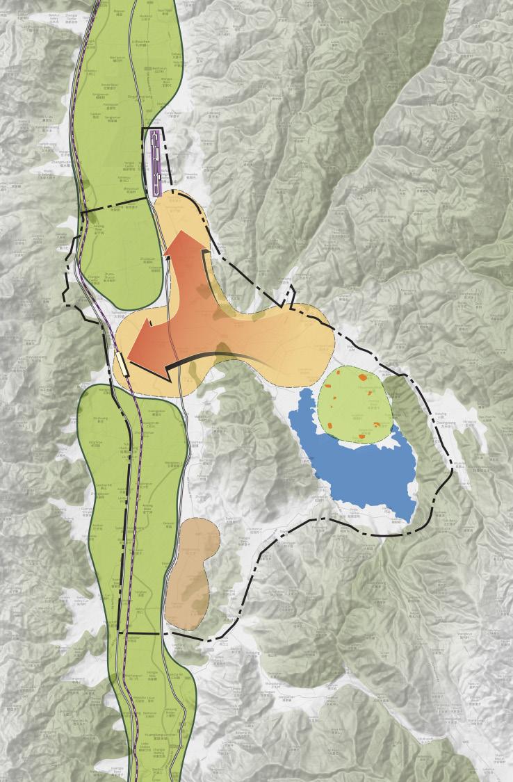
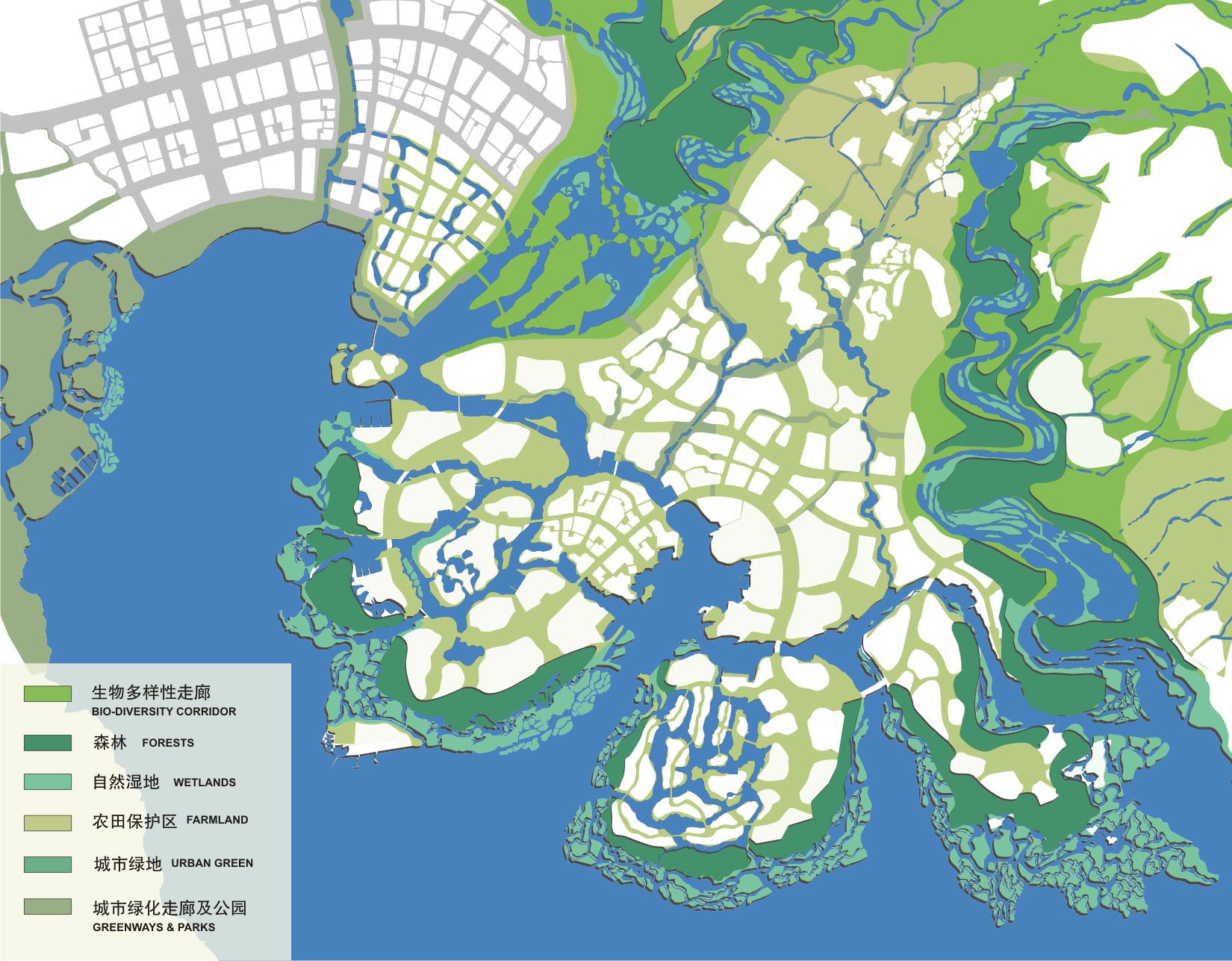
As the City expands like never before, the plan proposes the following strategies:
• Restore QiongHai Lake as a center-piece of the region.
• Establish a clear definition for an Agriculture Valley and The Mountain Lake City
• Use the existing freeway as a development boundary to keep the valley open for agricultural purposes.
• Define the limits of Urban Expansion to preserve productive farmland and irrigation canal systems.
• Restore and enhance irrigation systems that are sustainable, and complementary in the restoration of the lake.
• Promote large scale high efficiency organic farming as a new economic engine.
During the past 25 years of professional experience in the United States and overseas, Johnson Fain has established itself as an architecture, planning and interior design office known for its creative approach to the built environment. Scott Johnson, FAIA, Design Partner, and William H. Fain, Jr., FAIA, Partner for Urban Design and Planning, lead a diversified office of 60 professionals.
The firm has received many awards for design excellence. During the last decade, the American Institute of Architects has recognized Johnson Fain with numerous awards at the national, state and local levels.
Each project is carefully designed to specific client needs, program, technical requirements and budget. Every assignment presents the opportunity to develop a uniquely appropriate design solution. This philosophy is fundamental to the firm. Our primary design objective is to identify and resolve the specific issues required by each assignment. Particular emphasis is placed upon defining not only project scope and intent, but also budget and schedule at the inception of the design process. Attention to all levels of detail and close client communication continue throughout the duration of the project to ensure the best possible match of client needs, design intent and cost effectiveness.
Project types include corporate office, large-scale high-rise, mixeduse retail, residential, educational university, technical and research laboratories, governmental and public buildings, hotel resort, museums and wineries including new construction, renovation, seismic upgrades, building modernization and restoration. Programming, interior design and tenant improvement projects have also garnered many awards for the firm. All projects receive the same high level of attention and creative expertise.
Urban Design and Planning Projects have included master plans, new town plans, facilities master planning, general and specific plans, site feasibility, and land use analysis for a variety of clients and diverse industries including: aviation, universities, media, public agencies, cities, the United States and international governments, resorts, private and public development and redevelopment. Each assignment and solution is approached in a thoughtful, responsive and analytic manner appropriate to the project.
Johnson Fain has designed and executed interior environments for many important institutions. Interior Design within the office is practiced as Interior Architecture within qualified professional design and technical staff producing the work within management approach that includes programming, space planning, design, furnishings, engineering and technical delivery. Some significant interior project types include corporate office environments, condominiums and live/work lofts, media environments, art galleries, museums, resorts, wineries and restaurants.