KNOWLEDGE HUB


HOUSTON, TX, USA KNOWLEDGE CITY
THOUSAND OAKS, CA, USA AMGEN BIOTECH CAMPUS
SOUTH SAN FRANCISCO, CA, USA GENENTECH BIOTECH CAMPUS
PASADENA, CA, USA JET PROPULSION LABORATORY
BERKELEY, CA, USA UC BERKELEY, COLLEGE OF ENGINEERING FACILITY MASTER PLAN
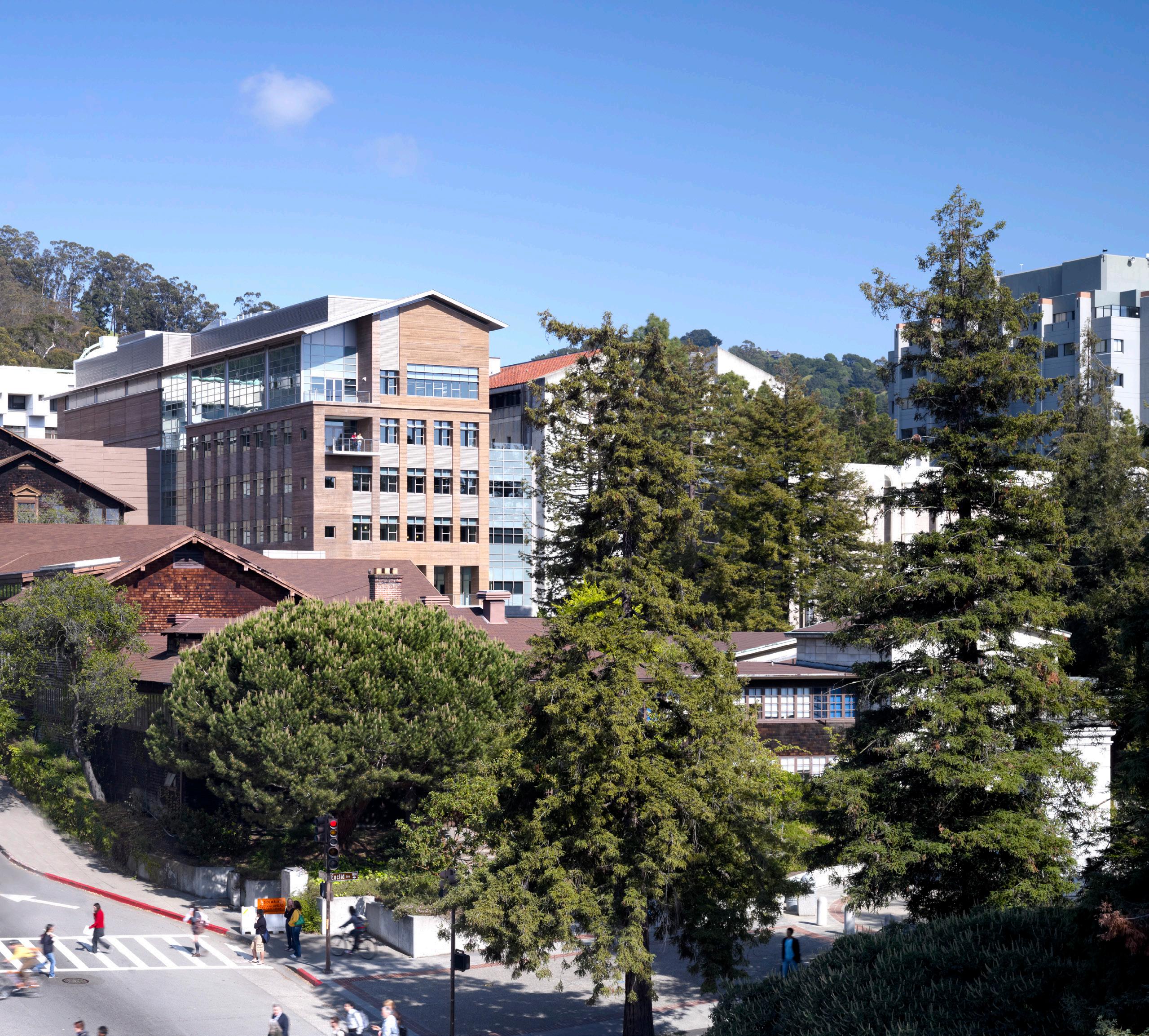
BERKELEY, CA, USA UC BERKELEY, COLLEGE OF ENGINEERING CITRIS BUILDING
IRVINE, CA, USA UNIVERSITY OF CALIFORNIA IRVINE LONG RANGE DEVELOPMENT PLAN UPDATE
IRVINE, CA, USA UC IRVINE, MAIN STREET
IRVINE, CA, USA UC IRVINE, CAL (IT2)
LOS ANGELES, CA, USA MARLBOROUGH SCHOOL
PALOS VERDES PENINSULA, CA, USA CHADWICK SCHOOL
LOS ANGELES, CA, USA LAUSD MASTER PLANS
LOS ANGELES, CA, USA LAUSD MIGUEL CONTRERAS LEARNING CENTER
LOS ANGELES, CA, USA LAUSD RAY ROMER MIDDLE SCHOOL
HUSTON, TEXAS, USA
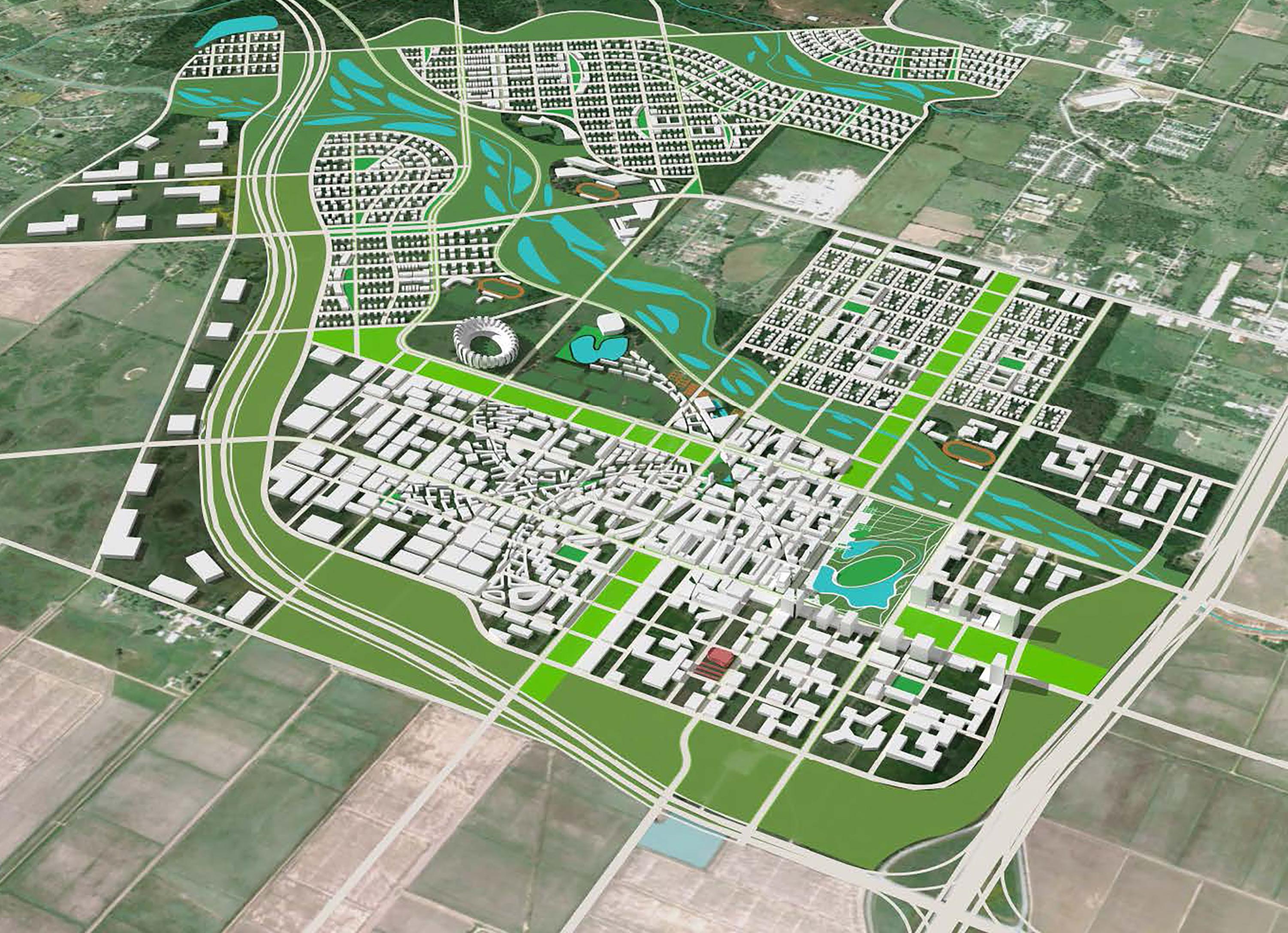
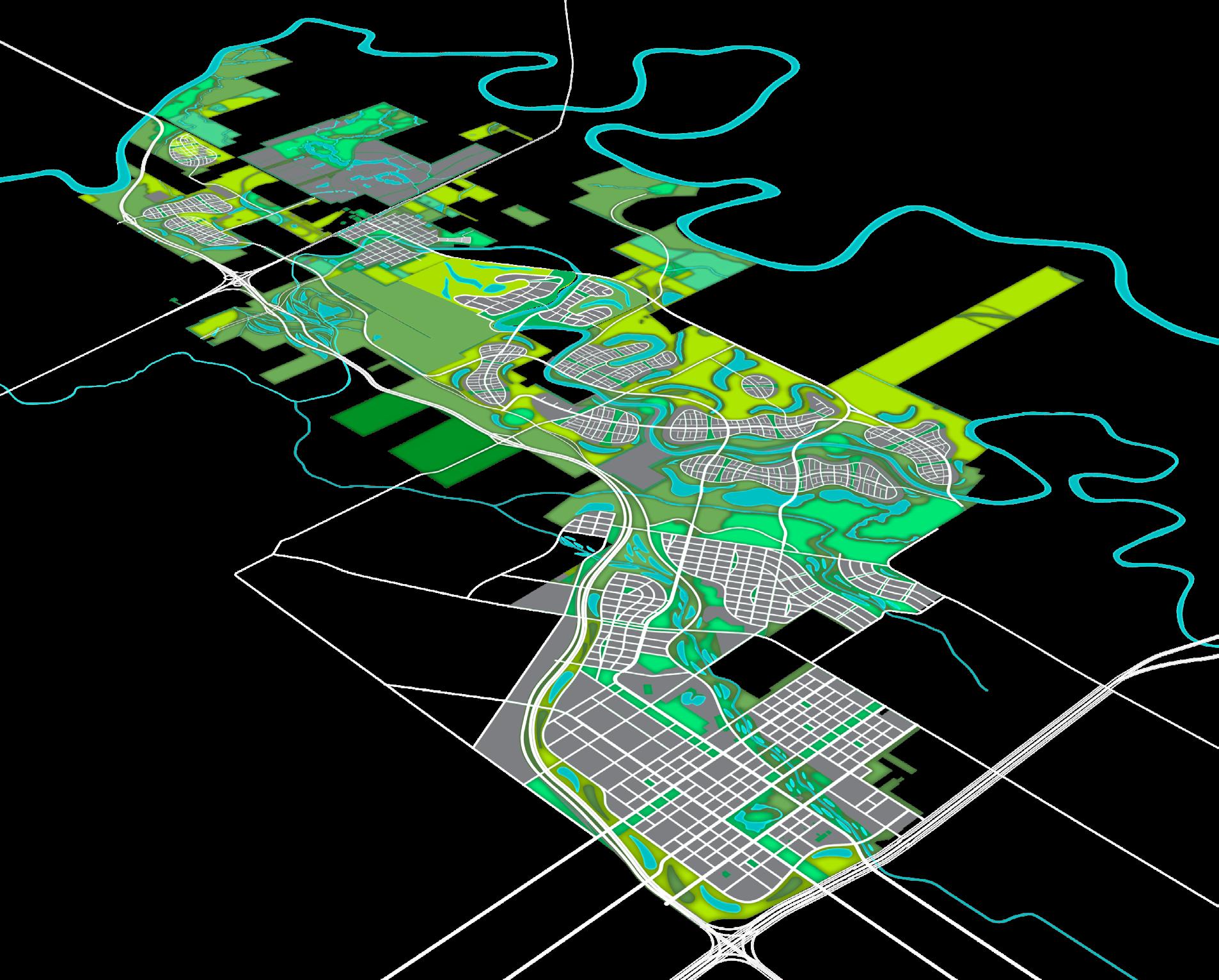
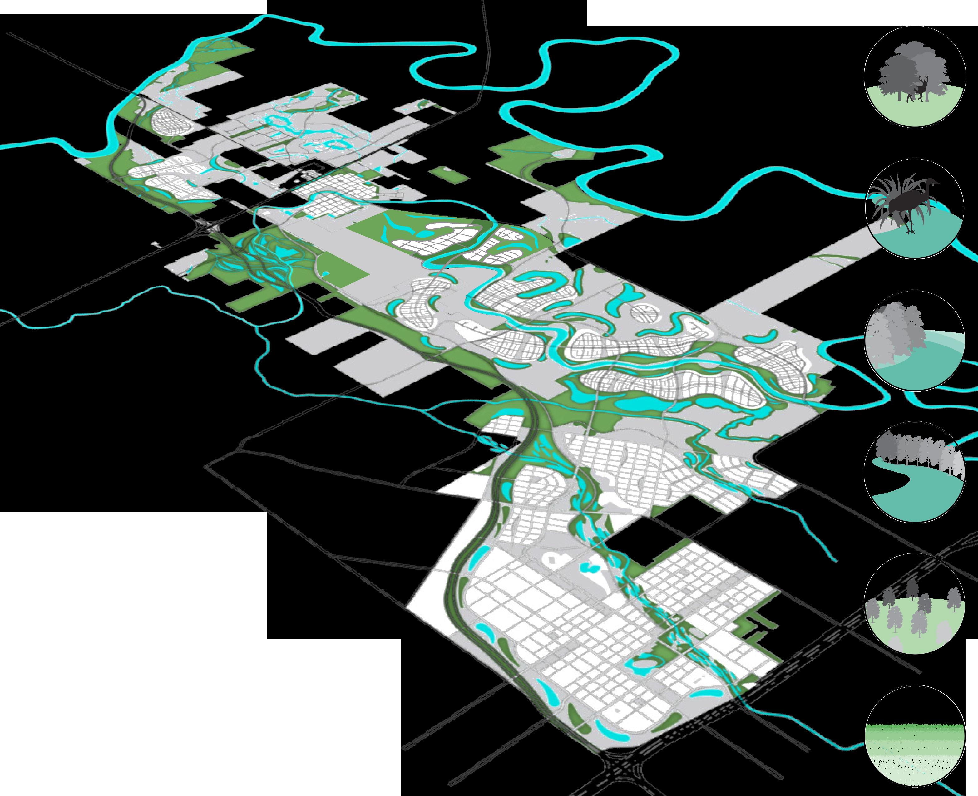
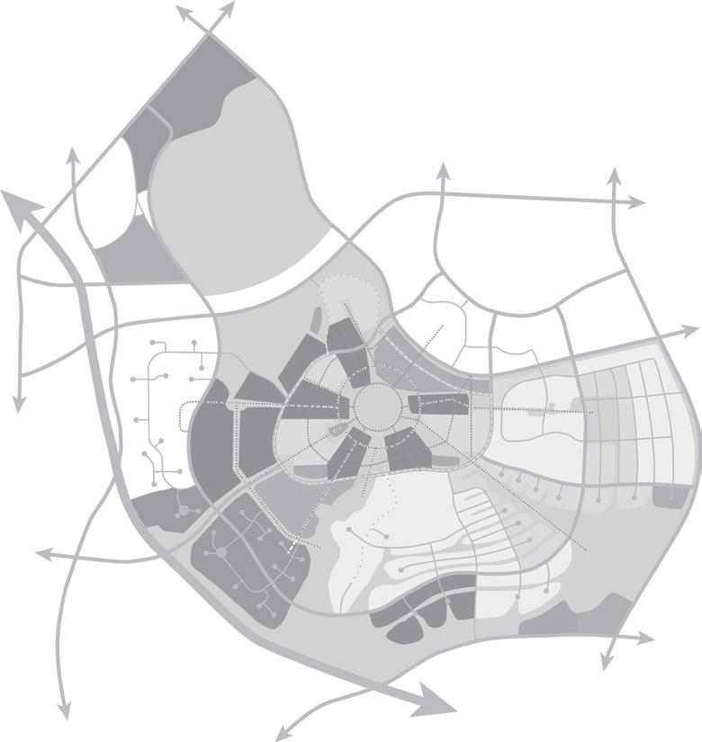
The Knowledge City’s physical fabric is designed to be an environmental lesson in the virtues of well-planned urban living made legible. Houston’s weak regional planning policies have allowed growth to sweep across the prairies and into floodplains, accommodated by levees that ironically have only added to the widespread problem of flooding. At the same time, local universities and colleges do not produce enough knowledge workers to feed Houston’s expanding knowledge economy, resulting in an undersized science-engineering workforce. The Knowledge City plan addresses these problems through interconnected strategies of economic, educational, environmental and urban development, creating an intense and resilient urban place in harmony with its natural features, in contrast to Houston’s conventional low-density, car-dependent “rooftop” suburban enclaves.
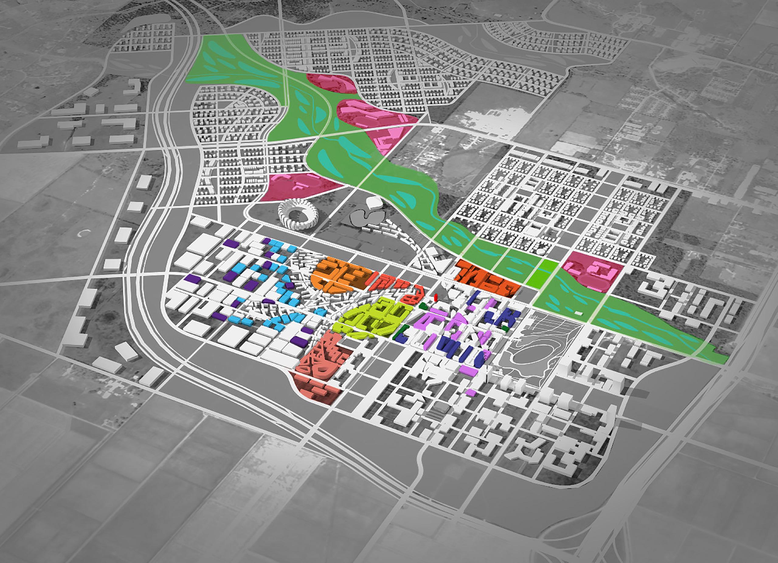
The Knowledge City aims to become a leader in educating the region’s workforce by providing STEM related education from kindergarten through jobs (“K thru J”). Joint degree programs are negotiated with several institutions of higher learning working together collaboratively. Collaboration spaces are in mixeduse buildings including housing, retail, recreational amenities, and other uses within the urban center of the project. The idea is that urban living itself involves an information exchange that facilitates learning for not just college level but for life-long enrichment.
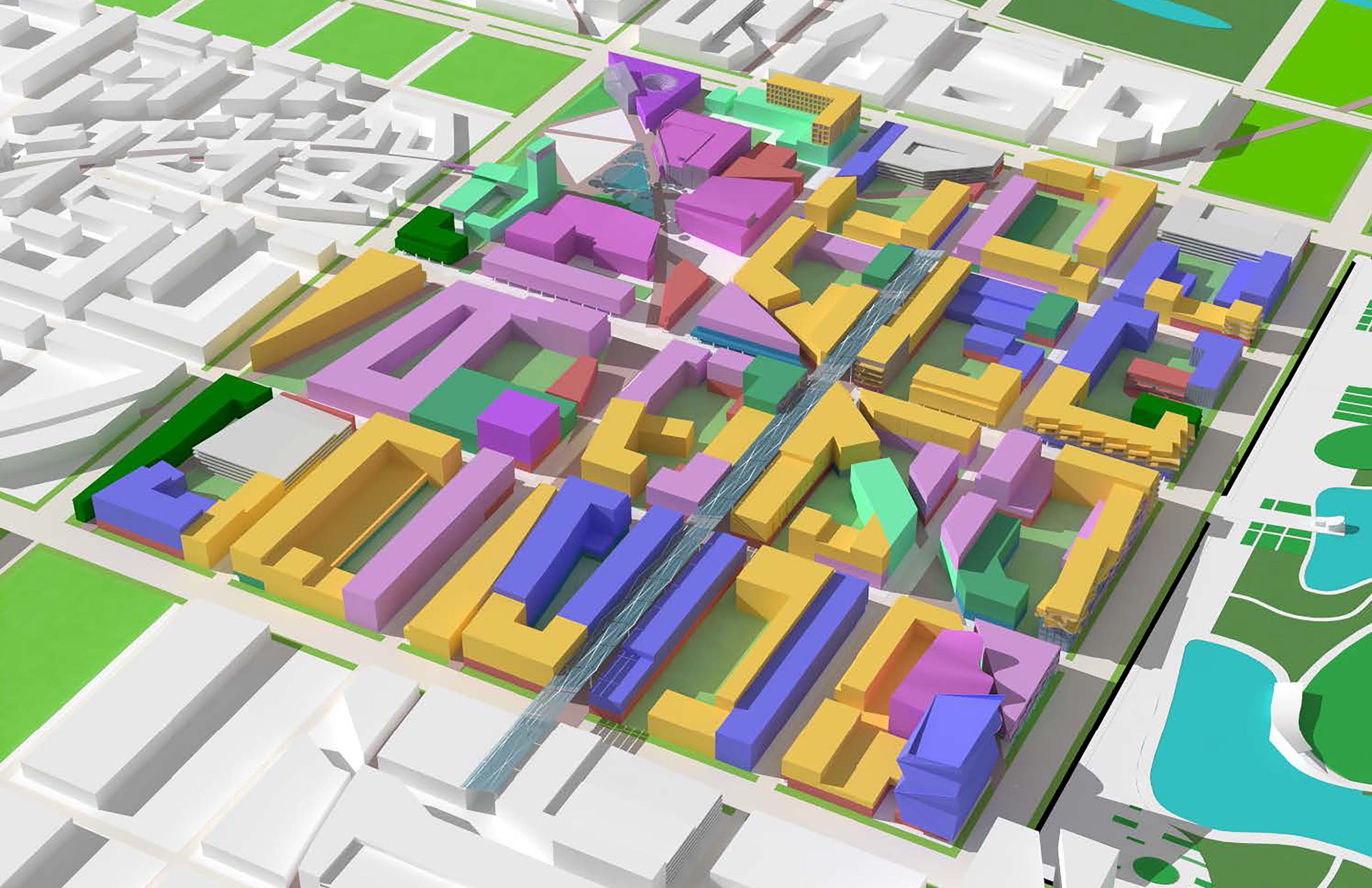
Seventy percent of the site lies within the floodplain of the Brazos River. The plan locates its highest densities on higher ground, in the “Uplands” above the floodplain at a site adjoining Interstate Highway I-10. An open-ended grid and mixed-use blocks contain university education and vertically stacked multi-family housing in an ever changing engagement of urban living and learning in the same vibrant place. The Uplands is also the site of the first phase of development, pursuing the owner’s intent to start with educational and employment, not suburban homes.
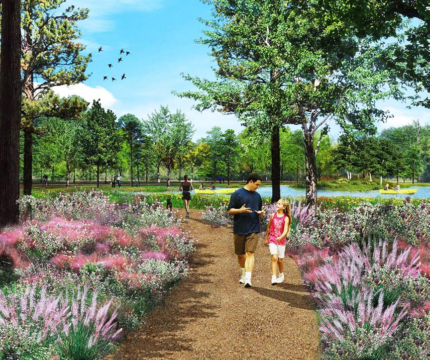
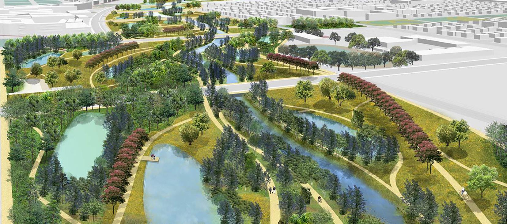
In the lower floodplain area, Island neighborhoods of densely compact housing with a retail village center elevate development above floodwater that then flows freely between the islands, not reliant upon a levee containment system. The islands are connected by bridges for vehicles, but also pedestrian walkways and bike lanes, and agricultural use continues in the residual open spaces. The whole of the city is a large-scale live-in demonstration of environmental principles and urban resilience – a didactic city.


focus on the idea of the “K through J” Continuum (kindergarten through jobs) and the importance of knowledge in today’s socioeconomic ecology
SUSTAINABILITY
(A) On-site wetland mitigation bank
(B) Local farming
(C) Wetland restoration
(D) Compact ‘islands’ developed on raised ground instead of levees
(E) Transit connection throughout site
(F) Rooftop PV on all major buildings & street furniture
(G) Community-scale solar energy field
(H) Limited water supply from shallow aquifer - no water taken from deeper aquifer
(I) Agriculture & stormwater management buffer
(J) Regional BRT connection along I-10 Corridor
(K) Bike system throughout site
(L) 60% water supply from capture and reuse
(M) Mixed-use hubs served by transit in all neighborhoods
(N) Wetlands & creek habitat restored throughout the site
(O) Blue Greenway - stormwater management system & aquifer recharge
(P) Shuttle routes within the Knowledge Core

(Q) Mixed-use compact development
(R) Wastewater Treatment for reuse & recycling
Research Institute
Innovation Centers
Shared Classrooms
Technical College
College of Engineering
Biotechnology & Medical Center
Business, Law & Public Policy
Start-Up Offices
Incubator Industries
R&D Industries
Schools
R
Project approach is job creation as priority instead of housing development
• A multi-institutional education concept
• ± 9 million sq.ft. of prime office
• ± 6 million sq.ft. of creative industry R&D and logistics
• More than 12,000 new households
CORE LAND USE

SYNERGICSTIC RELATIONSHIP: EDUCATION + EMPLOYMENT
K-12 5,200 students
Community College 3,000 students
Work Force Training
Universities 15,000 students
Research & Industry 10,000 jobs
Corporate Services + Offices
40,000 jobs
Conservation, Recreation & Agriculture
Over 10,000 acres
Knowledge Neighborhoods
12,000 to 15,000 households
Levees are not sustainable
Creating “Islands” on highest land as knowledge neighborhoods that are raised above the floodplain connected by bridges

Culture Retail
Lab/Multiuse Space
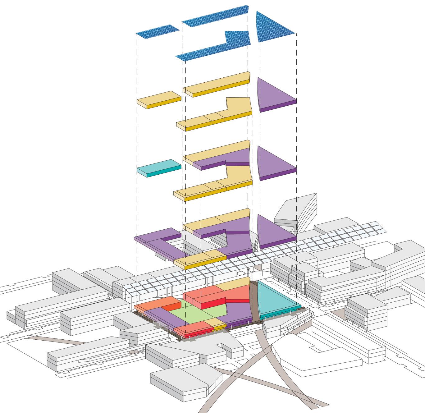
Recreational Space Office
Student Services Housing
Classrooms
HIERARCHY OF OPEN SPACE
Administration
Innovation Centers
Parking Garages
Solar Roof
Student Services Housing Classrooms Retail
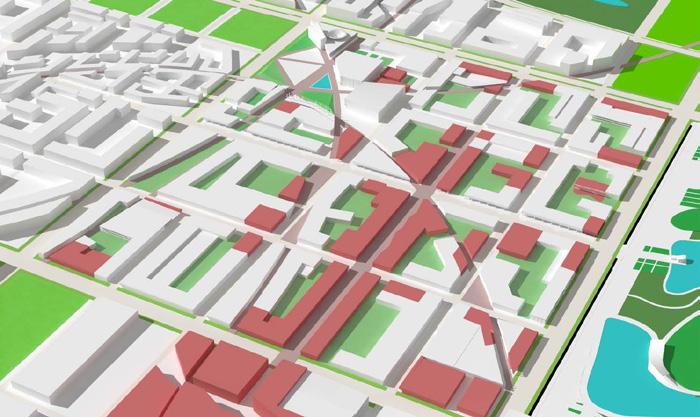
LIVELY MIX OF RETAIL
ACTIVE GROUND PLANE

VERTICALLY INTEGRATED BLOCKS



THOUSAND OAKS CA, USA
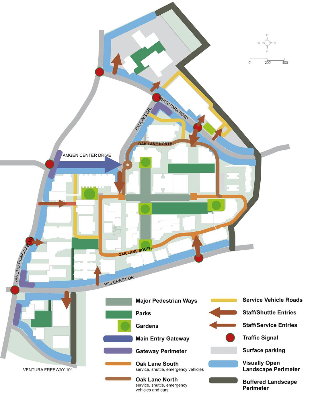
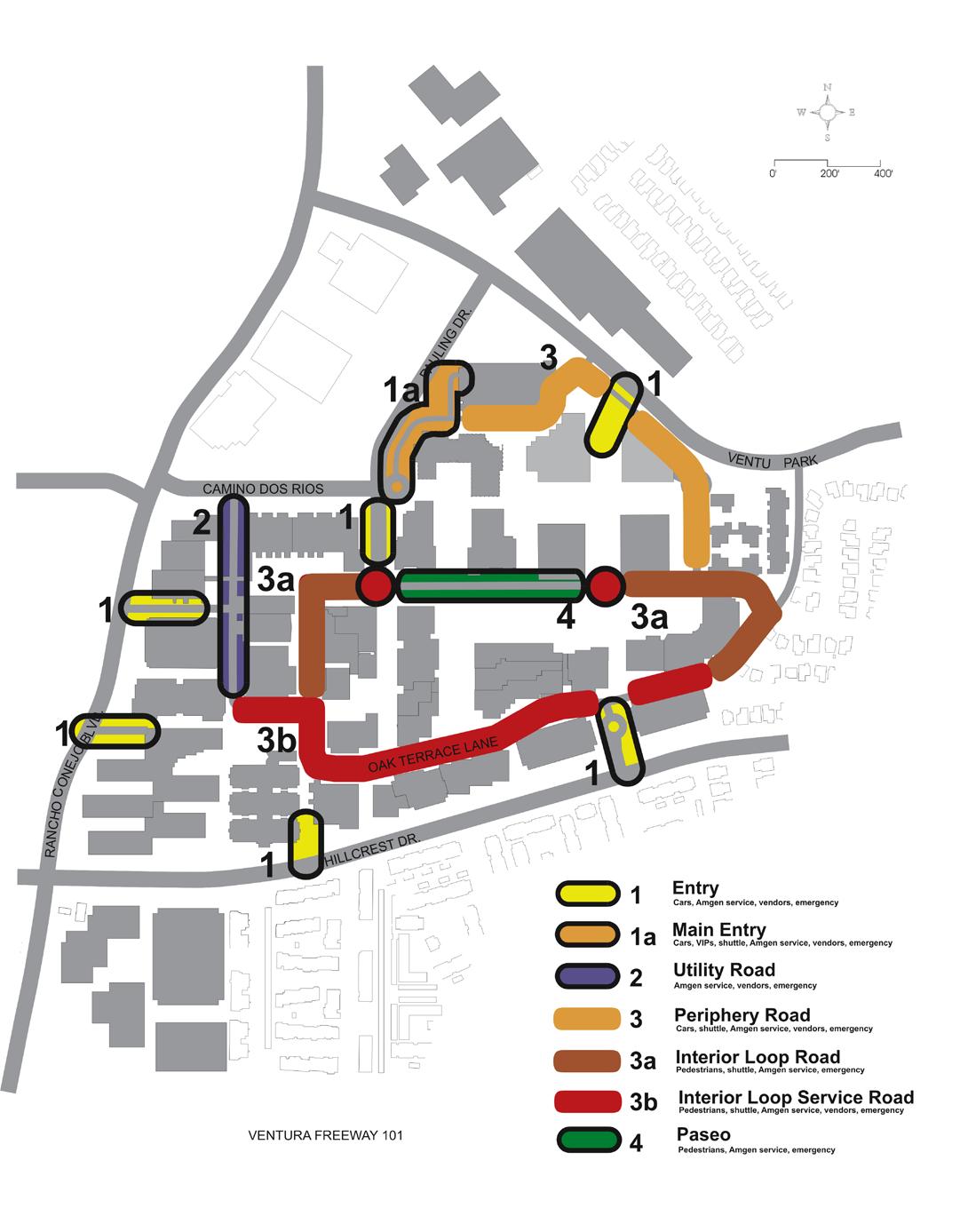
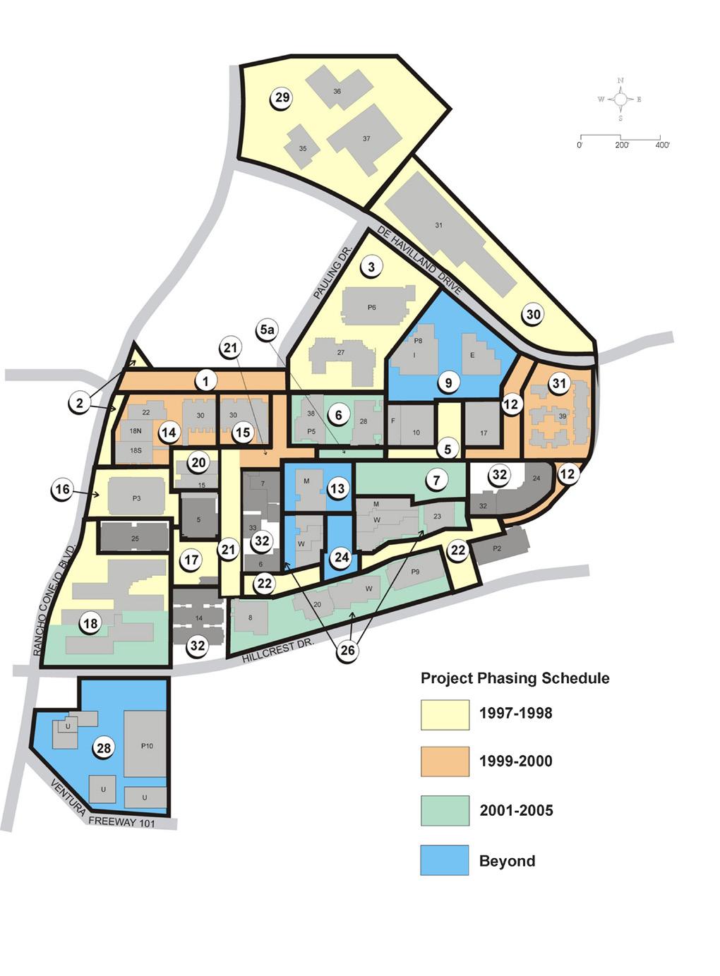
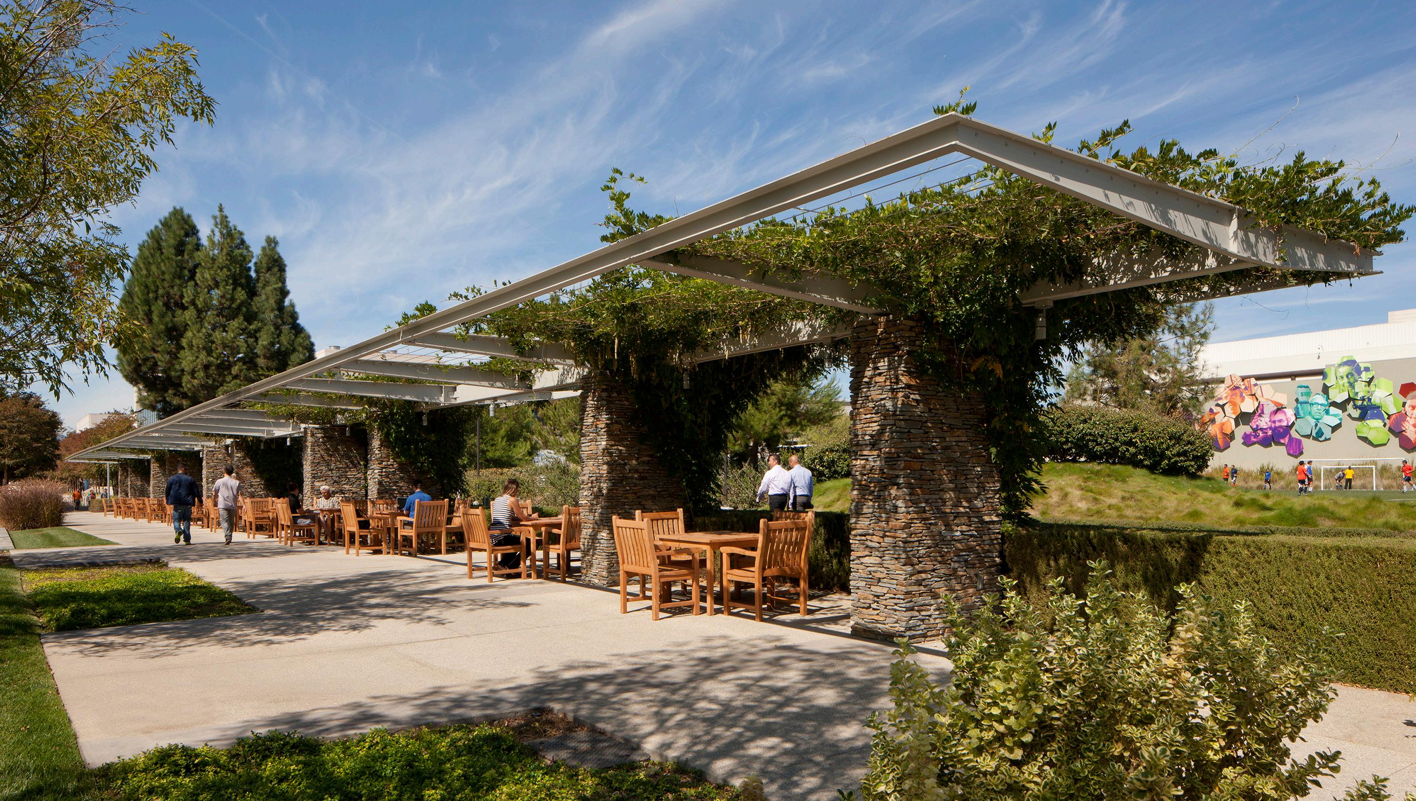
Amgen, Inc. is one of the world’s leading biotech firms. Amgen Center in Thousand Oaks, California is devoted to the advanced research and development of medicine to remedy the world’s most complex medical problems. Johnson Fain has developed a comprehensive Master Plan for the 120-acre site, and designed numerous site improvements that create a highly organized and identifiable center from what began as poorlyrelated buildings in a typical industrial park. These include: an enhanced main entry gateway; new open space and view corridors; revised internal vehicular and service drives; creation of new courts, terraces, plazas and landscape opportunities as well as a coherent site-wide network of pedestrian paseos.
Johnson Fain has also designed many major buildings at Amgen Center including Buildings 27, 28 and 38 which form the Administrative Headquarters Complex, Building 30 Research Laboratory which was designed in two phases, and three parking structures including PS-3, PS-6 and PS-10.
In addition, other services included programming, site studies and cost assessments; strategic development planning; design guidelines, parking and preliminary building siting studies; operations master plan; detailed overall site improvement, and implementation support.
transform poorly-related buildings in a typical industrial park to a highly organized and identifiable center
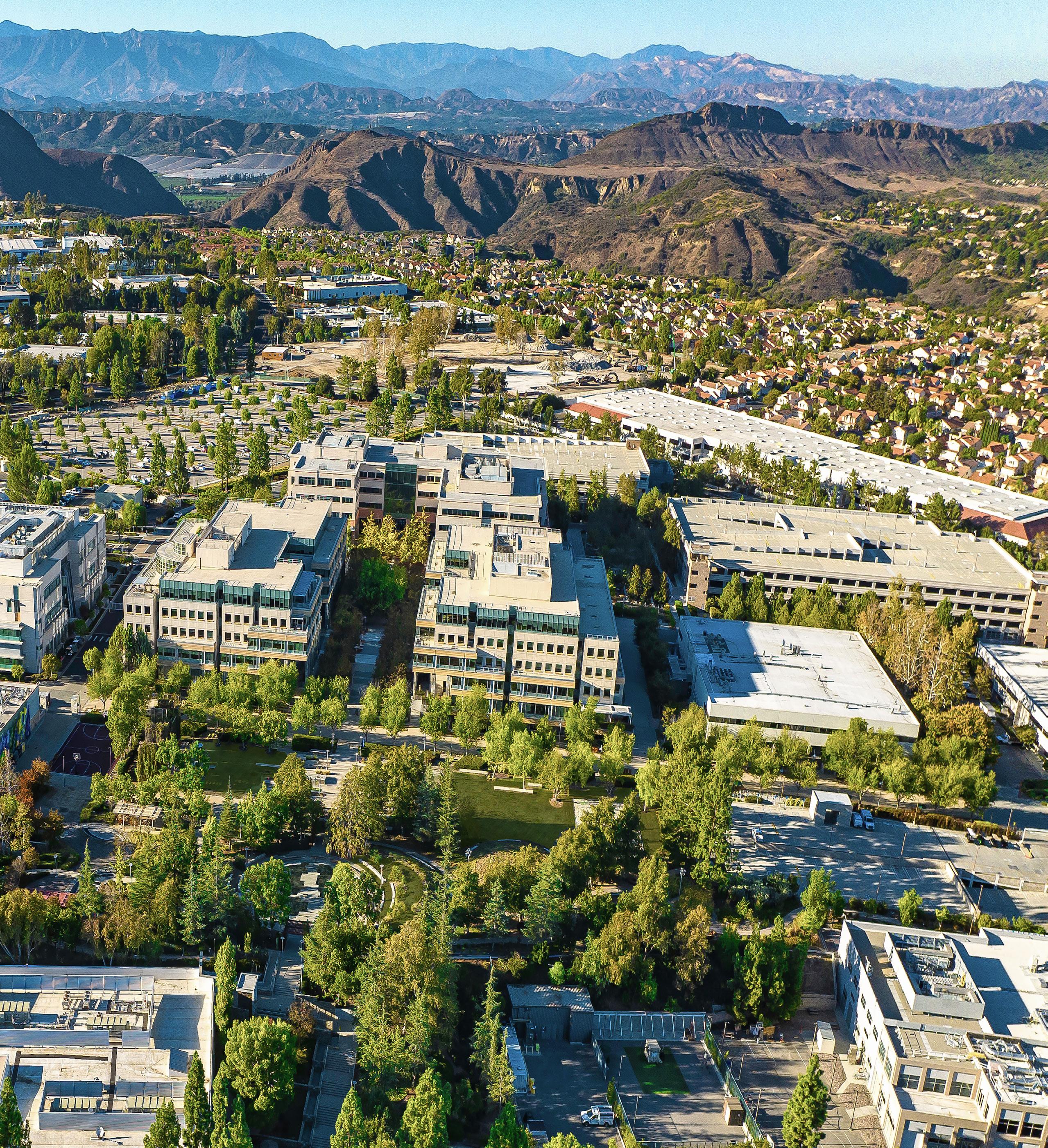
Amgen Center has evolved from a disaggregated collection of buildings into a coherently planned campus
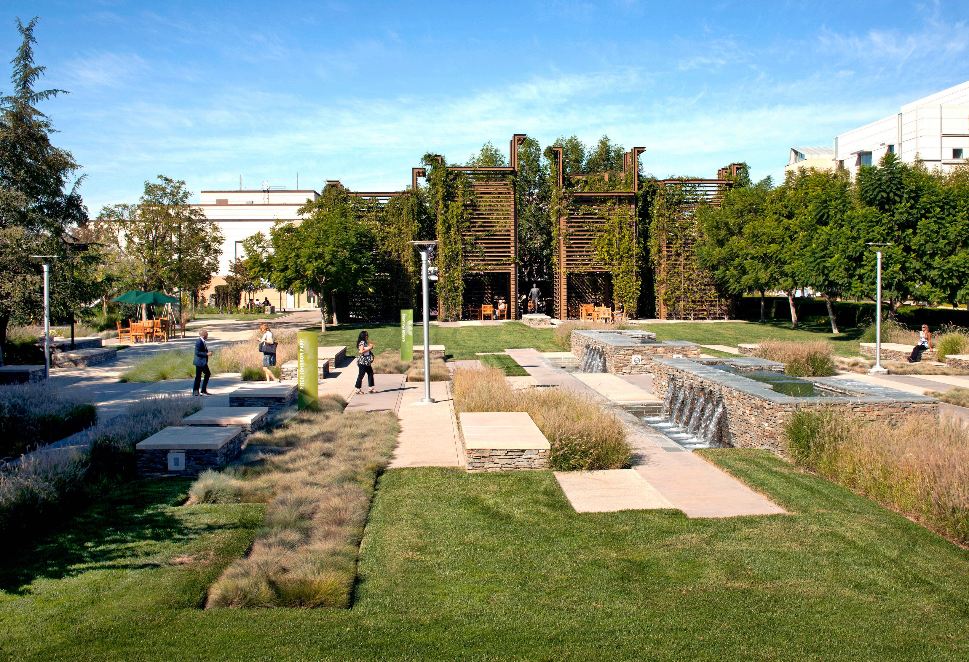



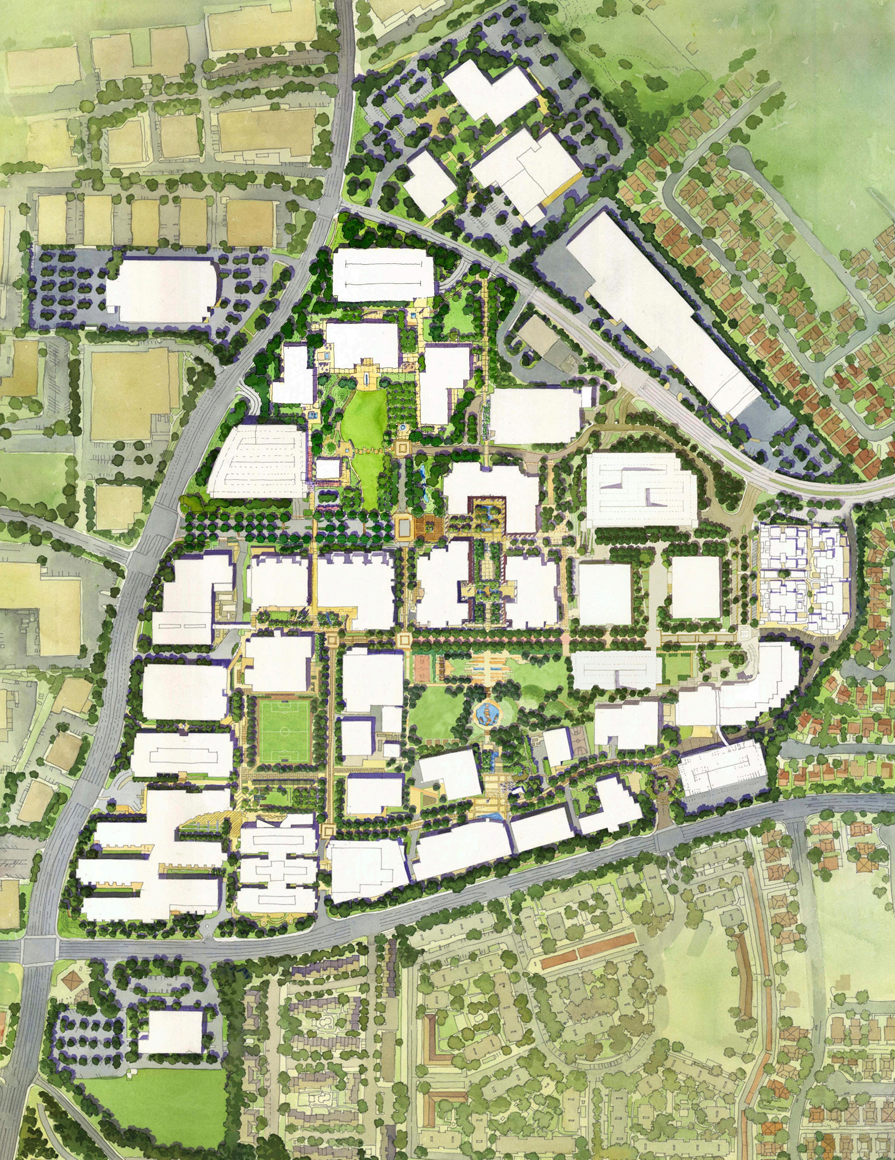
enabling vibrancy through urban design to create an attractive biotech campus environment


SOUTH SAN FRANCISCO, CA, USA
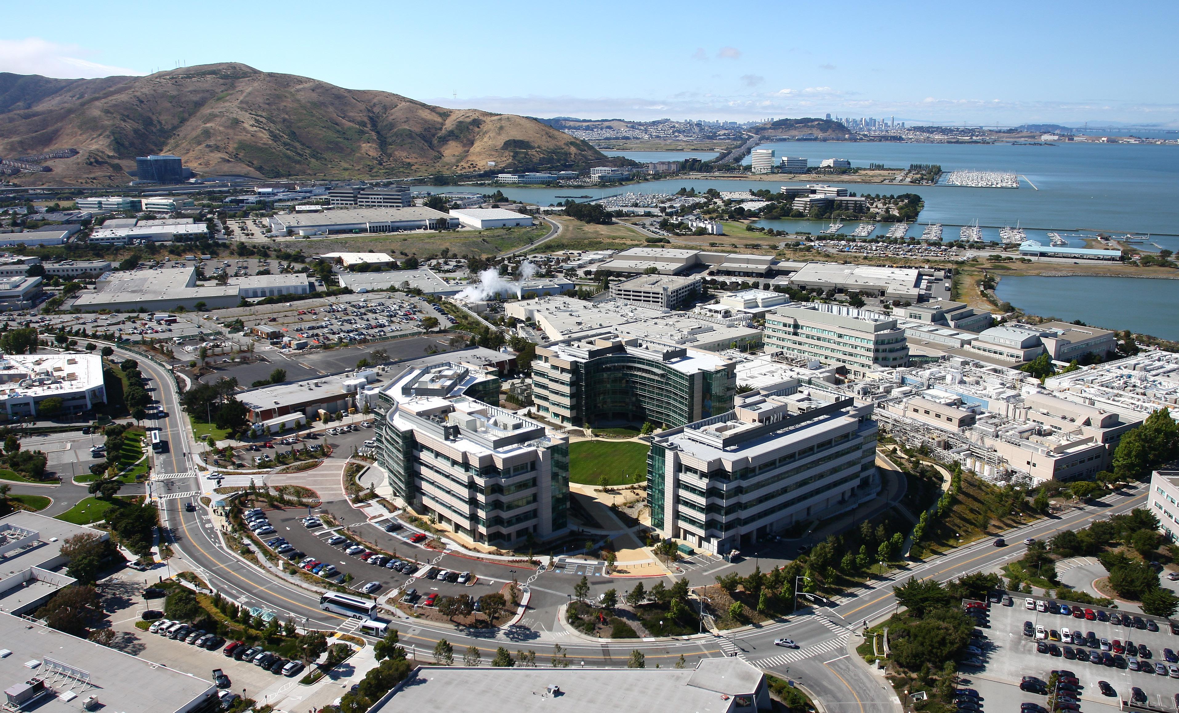
The Genentech South San Francisco complex is a 98-acre urban site that currently includes headquarters, administrative, research, development, manufacturing and other support activities for the Biotechnology Company. Johnson Fain has developed a Master Plan for the site through a series of focused studies, which included analysis of alternate site and facility growth scenarios within the opportunities and constraints imposed by the existing site and the existing City of South San Francisco land use policies.
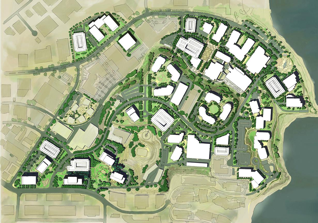
The planning effort also included evaluation of site-wide services and amenities, including cafeterias, training & conference centers, child care facilities, health and fitness center and parking. After completing the Master Plan for Genentech, Johnson Fain was commissioned to provide programming and concept feasibility for the first of their new administrative/technical complexes which includes Buildings 31, 32, and 33. Following successful completion of the programming and feasibility phase, Johnson Fain was commissioned to provide full architectural services for the complex, and all three buildings are now built.

analysis of alternate site and facility growth scenarios within the opportunities and constraints imposed by the existing site


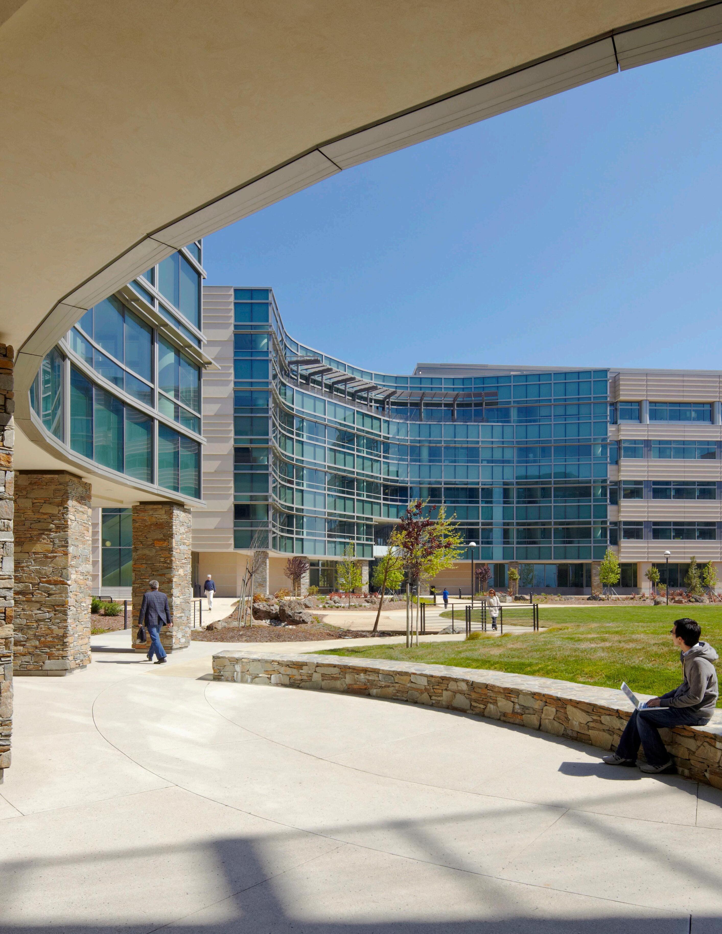
take advantage of the extraordinary views to the Bay lead a significant growth for the world leading bio-tech campus over the next 10 years

PASADENA, CA, USA
The Jet Propulsion Laboratory (JPL) is managed by the California Institute of Technology and is NASA’s lead center for robotic exploration of the solar system as well as a center for astrophysics, earth and space science. The Laboratory occupies a 130-acre site in the foothills of the San Gabriel Mountains just north of Pasadena. Johnson Fain developed a ten-year horizon Master Plan, through which the Laboratory seeks to align its physical development program with its operations strategic plan while also addressing improvements to the quality of life in the Lab for purposes of recruitment and retention.

The Master Plan reflects recent changes in JPL’s business model, designates clusters of process and technology “centers”, defines strategies for a workplace design that facilitates interaction within a flexible framework of development and outlines a capital program of buildings, open space networks, parking and access. The Master Plan is based on a vision of the future of the Laboratory that sees it maintaining its preeminent position in the science and technology of space exploration, and firmly establishing itself at the top of the list of desirable places in the world to work. Principle features of the plan include: enhanced landscape, a pedestrian-oriented core, collaborative places and a sense of professional community, strong security and a clear identity, rational circulation and adequate parking, flexible facilities, and convenient services and amenities.

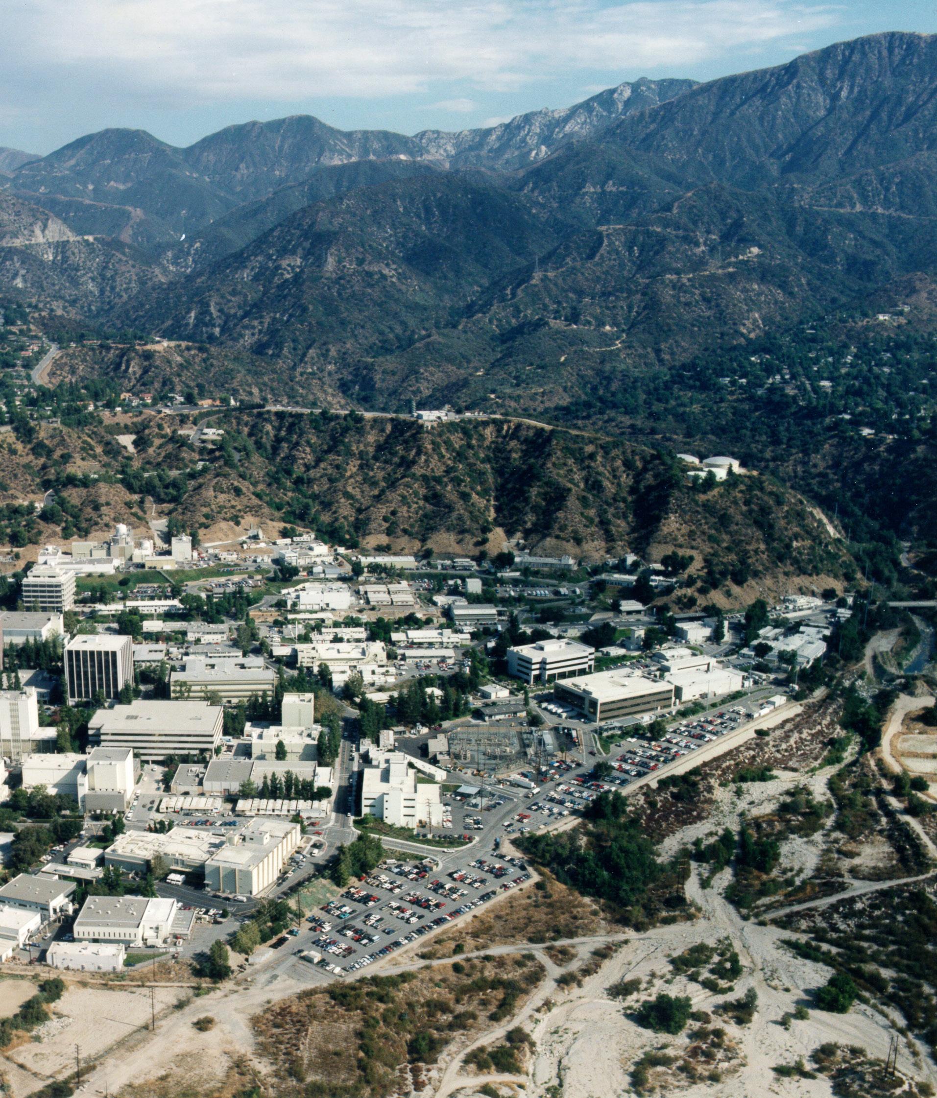
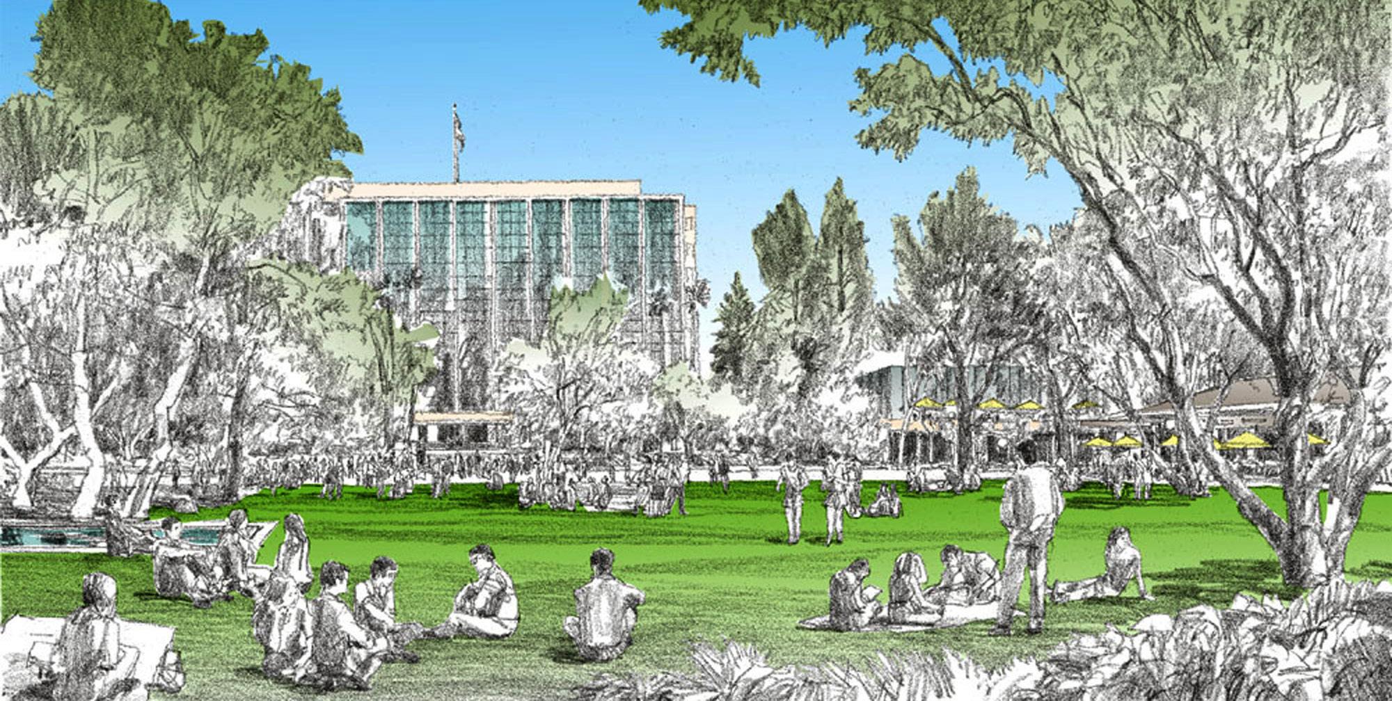
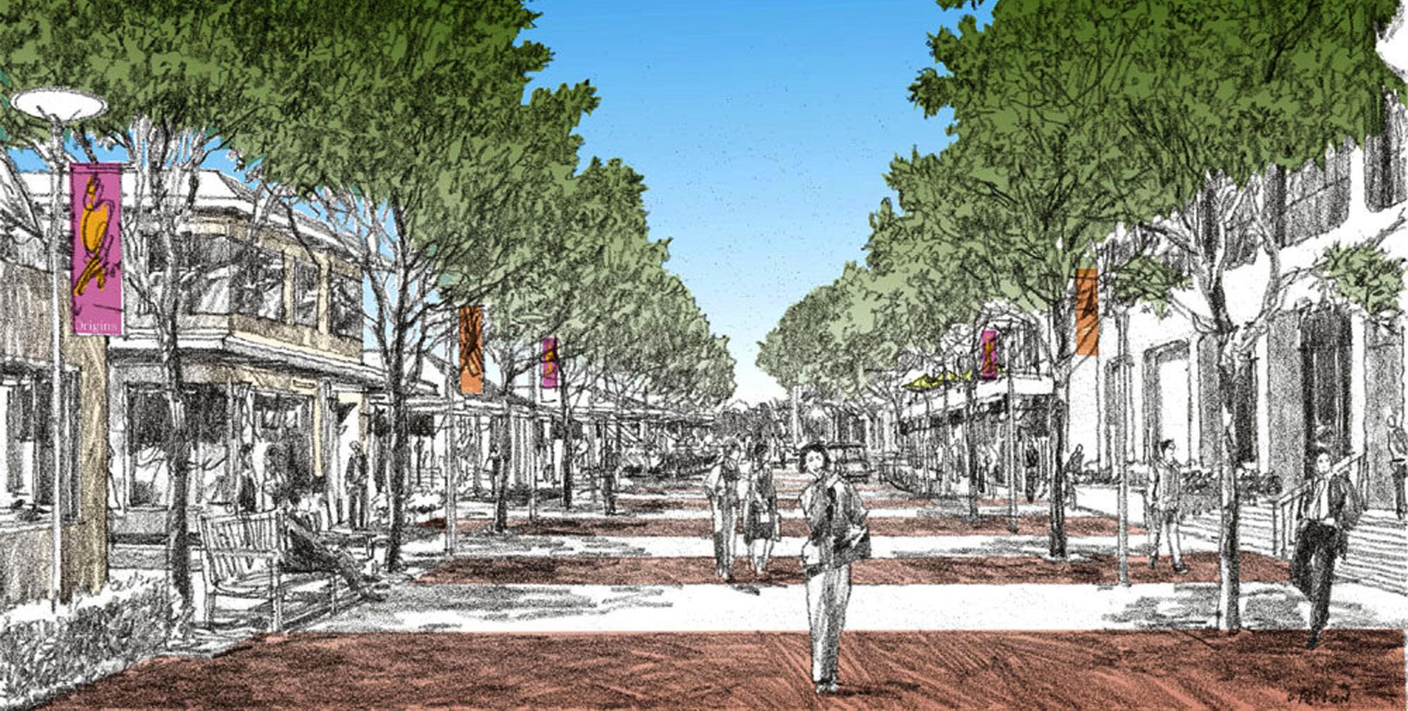
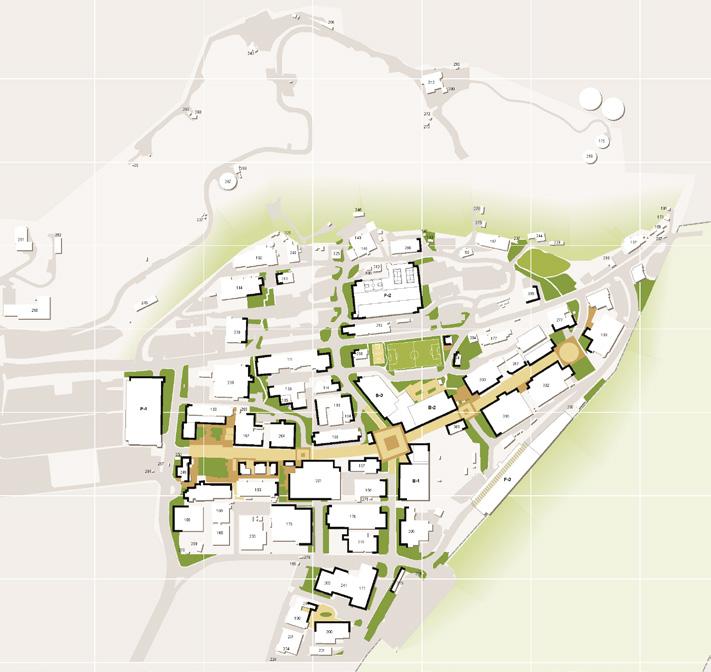
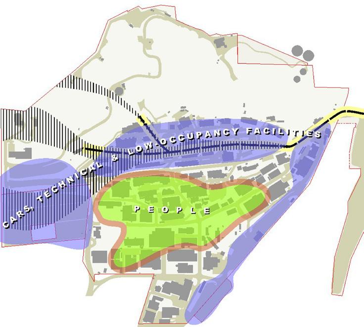
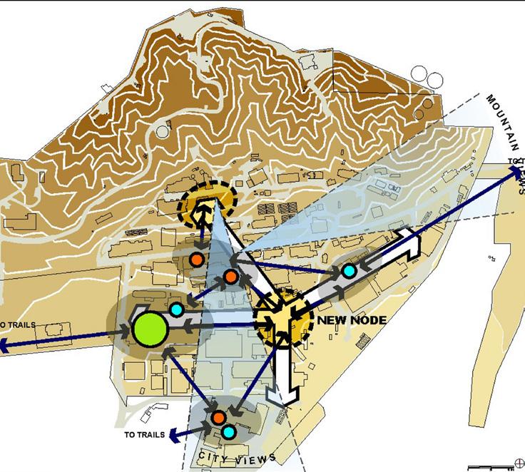

a Laboratory setting that is part of its natural surroundings, connecting visually and physically with the foothill environment and the adjoining watershed area


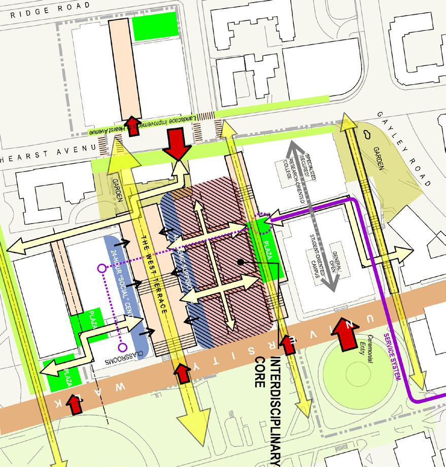
The Master Plan for the College of Engineering at Berkeley focuses on re-configuring the nearly 100-year old campus to meet the needs of evolving technology and the redefinition of traditional engineering disciplines for a new multi-disciplinary future in the sciences. The master plan looks globally at the College of Engineering, focused on the following issues: supporting social interaction; strengthening and creating community; supporting interdisciplinary research and teaching; responding to change; reconfiguring with flexibility; adapting to changes in information infrastructure and the mobility of students and faculty; and strengthening the College’s sense of place.
Within its 20-year horizon, the master plan anticipates the scope and character of future facilities needs and guides the urban design goals for those facilities including: (1) an urban design framework to improve opportunities for social interaction within the College; (2) appropriate use of the off-site Richmond Field Station for public-private ventures; and (3) concept design for the Center for Information Technology Research in the Interest of Society (CITRIS), an interdisciplinary research facility with connections to all Colleges in the University as well as to private research and engineering entities.
re-configuring the nearly 100-year old campus to meet the needs of evolving technology, redefine traditional engineering disciplines for a new multi-disciplinary future



As one of the California Institutes of Scientific Innovation sponsored by the State of California Governor’s Office, the Center for Information Technology Research in the Interest of Society (CITRIS), provides a public-private research base for cutting-edge micro fabrication and other technologies critical to California’s economic future, and promises major social scale innovation for the state and the nation.
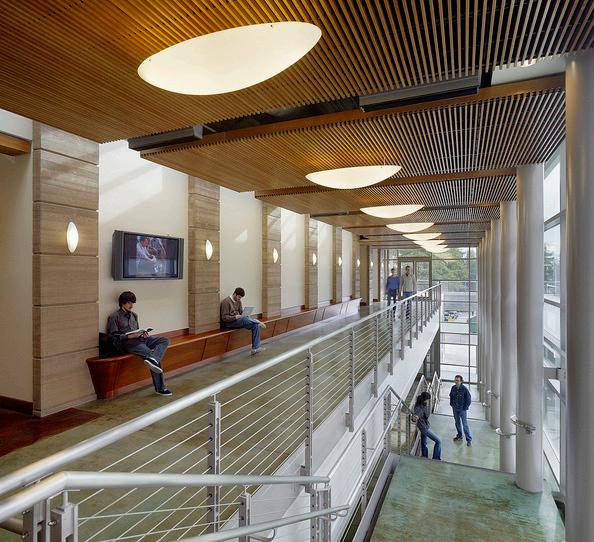
The new CITRIS building is the first new building in the interdisciplinary core of the College of Engineering. The 130,000 sq. ft. building contains laboratories, seminar rooms, state-of-the-art classrooms, computing facilities, and offices for public and private grants and contracts. The design, massing and scale of the building respond to nearby historic Arts & Crafts buildings as well as the adjacent Naval Architecture Building.
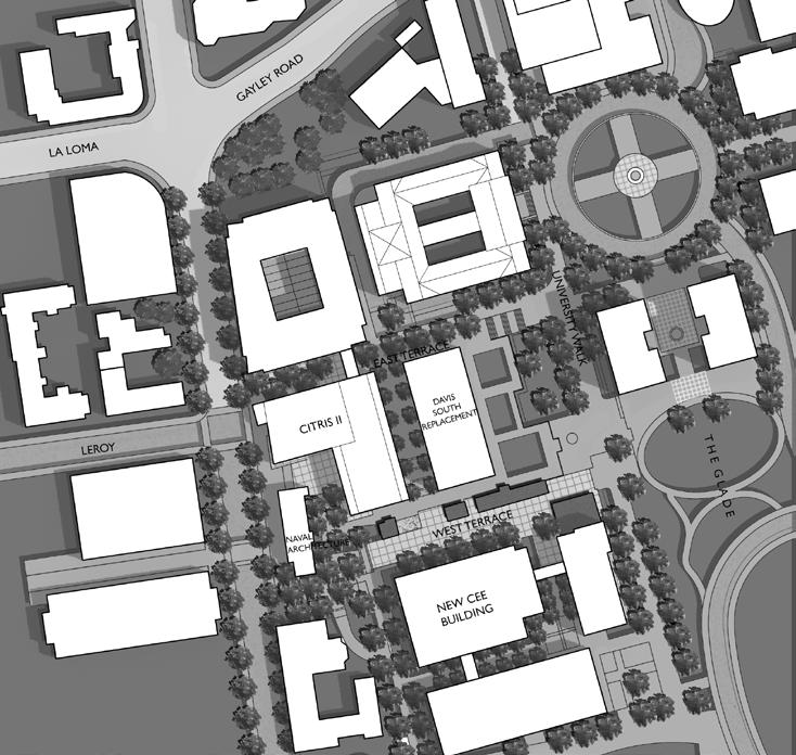
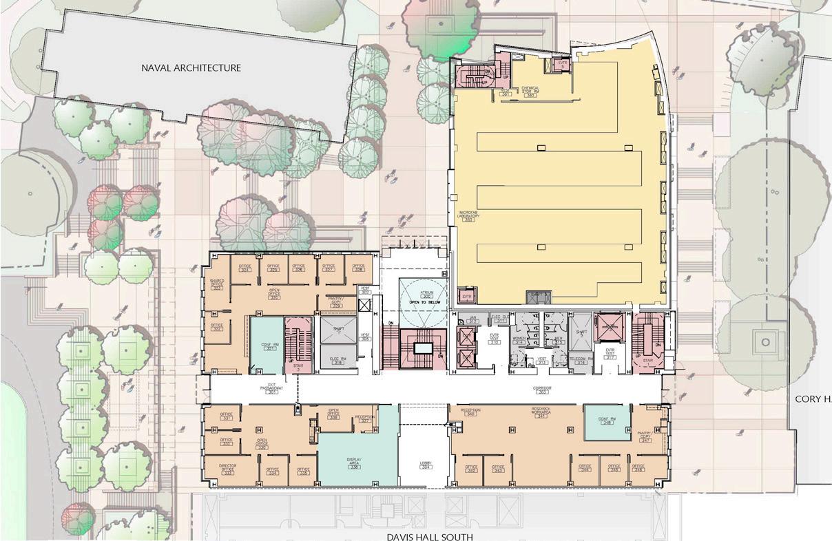
the first new building in the interdisciplinary core of the College of Engineering, responds to historic building and scale


LOS ANGELES, CA, USA
LONG RANGE DEVELOPMENT PLAN UPDATE


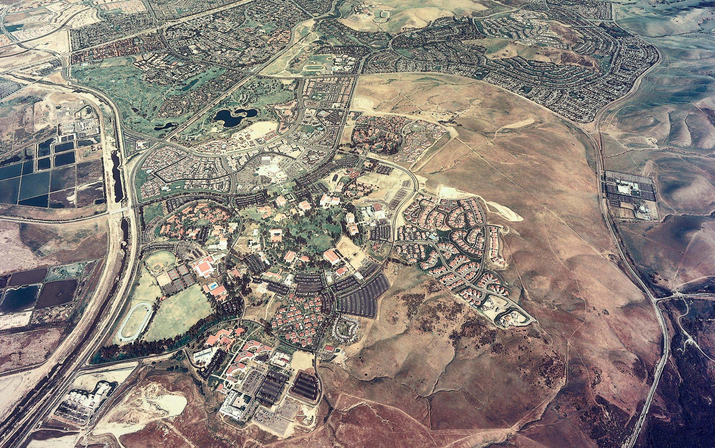
Johnson Fain’s involvement with the University of California Irvine campus pre-dates the campus itself, as the founding principal of our predecessor firm, William L. Pereira, was instrumental in convincing the Regents to locate its eighth campus in the new town of Irvine.
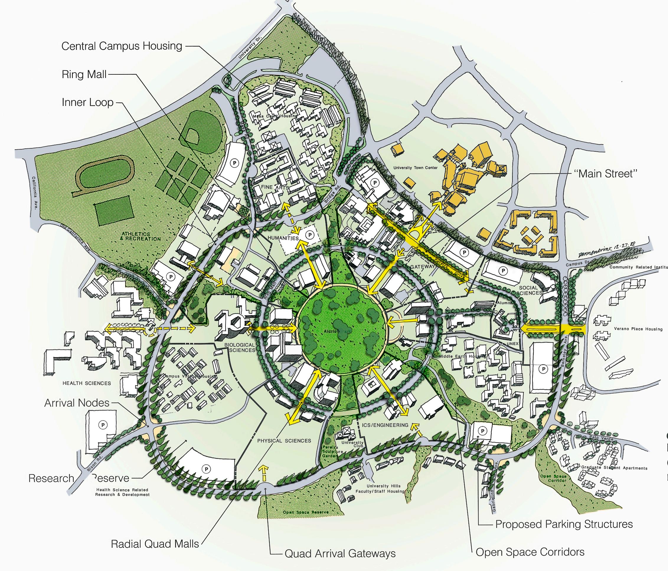
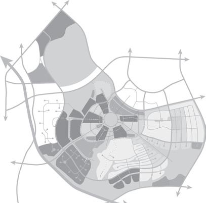
Over the ensuing 45 years, the firm prepared (1) the original master plan for the 1500-acre site, (2) Long Range Development Plan updates incorporating “inclusion areas” for public-private research; (3) an urban design plan for a “Main Street” campus center; and (4) Cal (IT)2, an interdisciplinary research center, the newest building on the campus. The most recent Long Range Development Plan Update was a 20-year plan that provided for a 60% increase in enrollment to 30,000 students. Approximately 230 acres of the Regents-owned site were identified as income-producing “inclusion areas,” planned for non-academic uses in support of the university’s extended mission. Two areas totaling 120 acres were designated for research and development use; another 110 acres distributed across several locations was set aside for support commercial uses, office, medium density residential, and institutional uses.
 LANDUSE ORGANIZED AROUND CORE, WITH EMPHASIS ON REZONING TO RETAIL ON MAIN STREET
GREEN SPACE LINKAGES TO CAMPUS CORE
CIRCULATION AS RINGS AROUND CAMPUS
IRVINE, CA, USA
MAIN STREET
AIA National, Urban Design Award Progressive Architecture Design Award
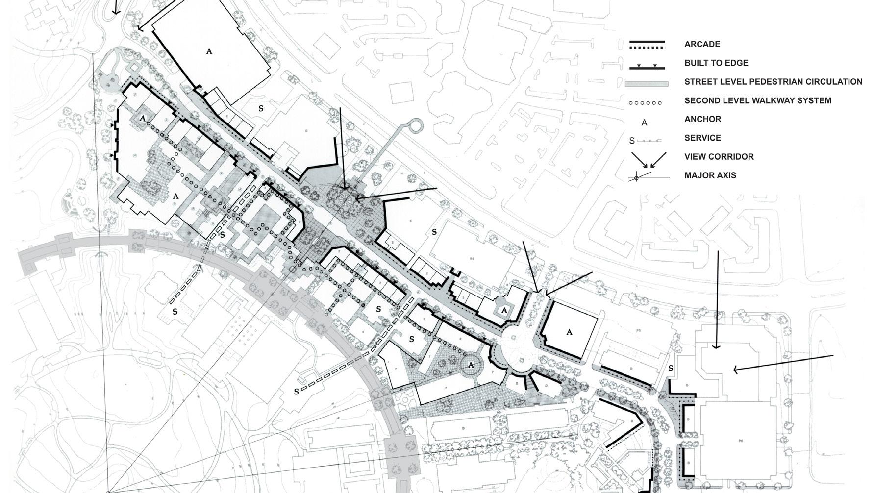
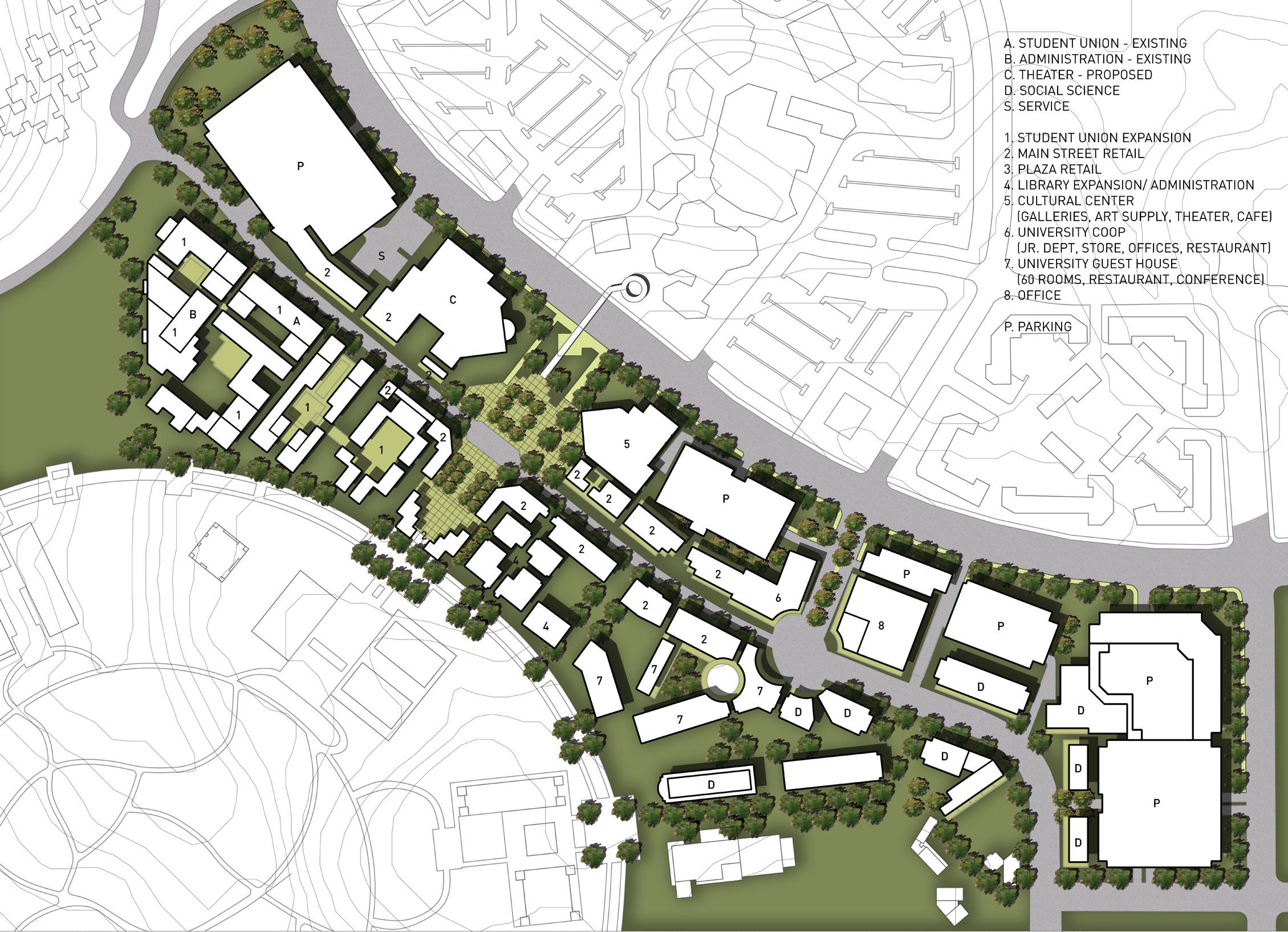
A primary targeted neighborhood in the Long Range Development Plan was the administrative area and an anticipated “town center”, which in the subsequent urban design plan developed by Johnson Fain became “Main Street”. “Main Street” establishes a pedestrian-oriented urban focus in the suburban campus. The concept of a retail street brings typically “outside” services onto the campus and is considered a breakthrough in campus planning in its linkage to the surrounding community, as a place where “town and gown” come together. It also creates a place that fulfills the daily needs of a burgeoning campus population and is easily accessible on foot or bicycle.
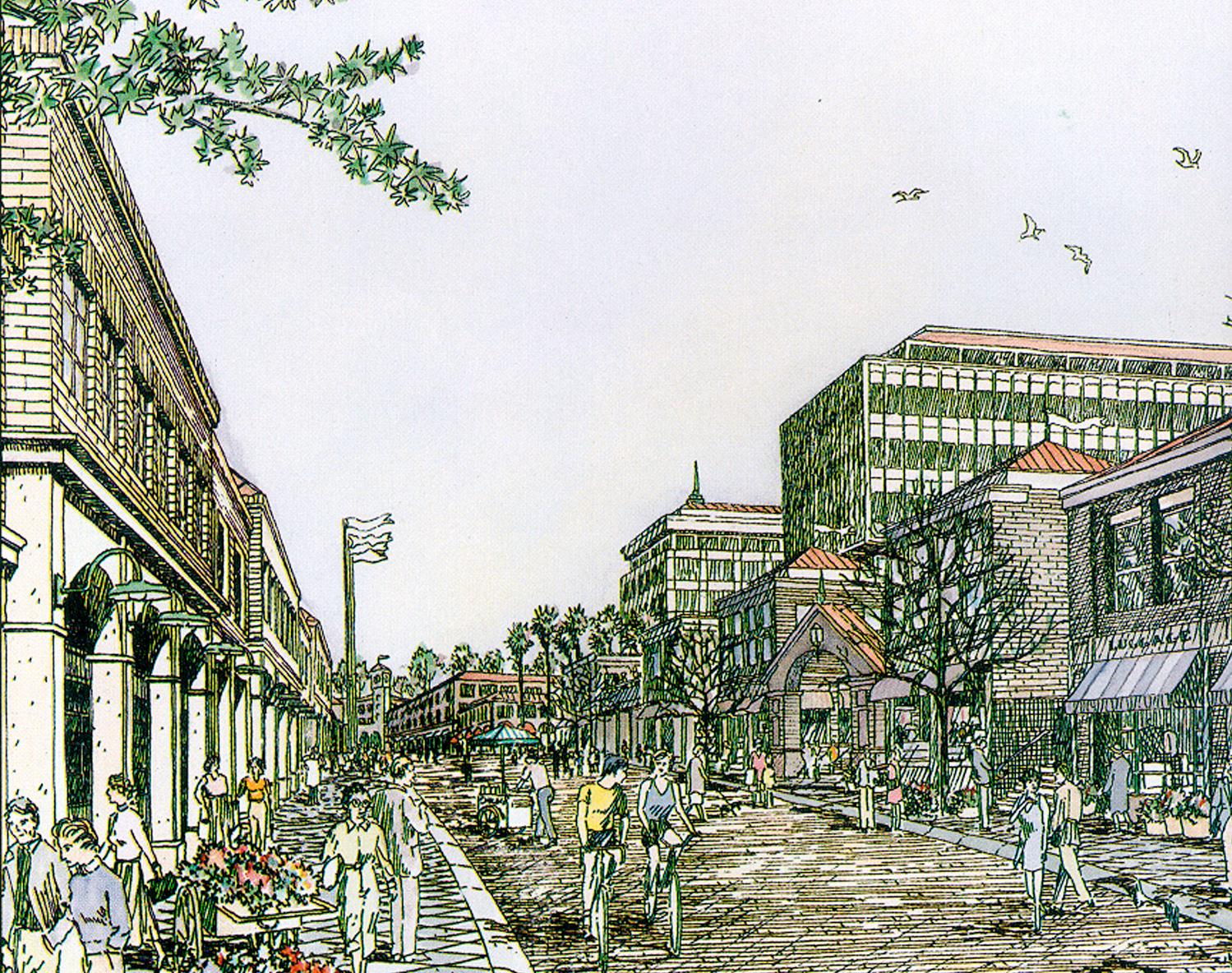
The program calls for 450,000 square feet of mixed academic, retail, service, administrative and cultural uses. The plan, organized into four conceptual zones, integrates the Main Street development with the campus’ park-like background. Four zones provide transitional spaces and activities for the pedestrian: from the urban, mixed-use Main Street to a series of landscaped semipublic courtyard to a set of academic buildingsin-the-park and finally to the “romantic” Aldrich Park. UCI Main Street received the Progressive Architecture design award for “outstanding work in Architecture and related environmental design.”
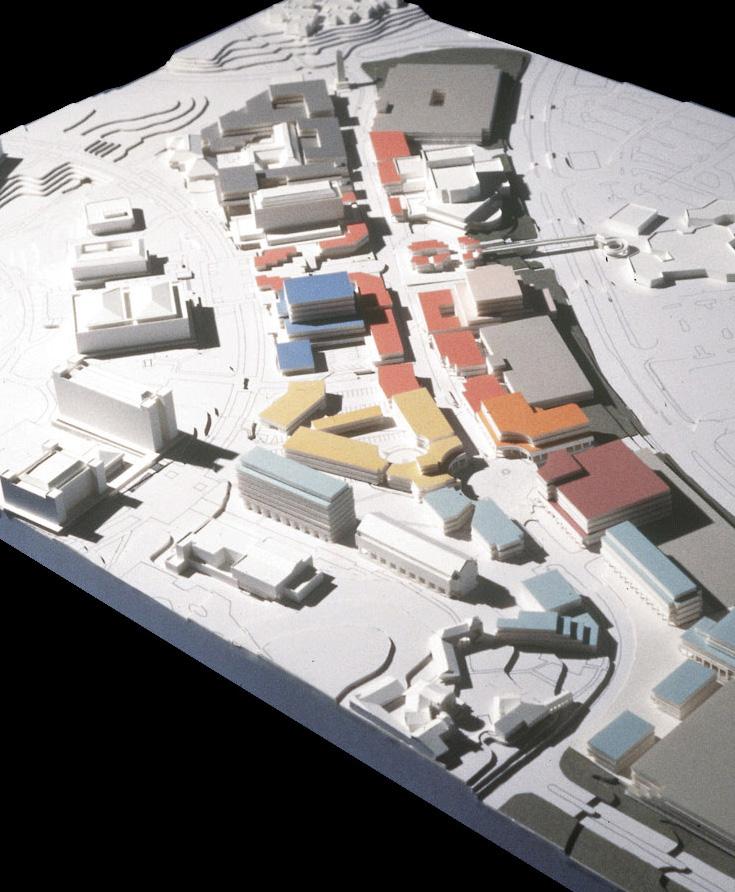
 MAIN STREET RENDERING
MAIN STREET MODEL
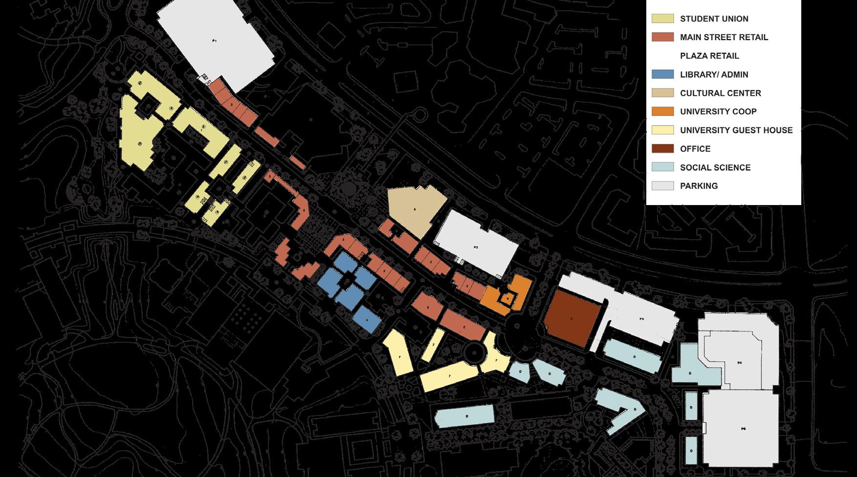


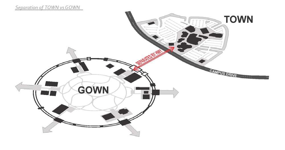 PROBLEM: SEGREGATION OF TOWN VS GOWN
a pedestrian-oriented urban focus in the suburban campus
The concept of a retail street brings typically “outside” services onto the campus and links to the surrounding community

Gold Nugget Award of Merit, Best Office/Professional Building - 60,000 sq ft. + California Construction Link, Best of California Award, Higher Education DBIA National Design-Build Awards, Merit Award

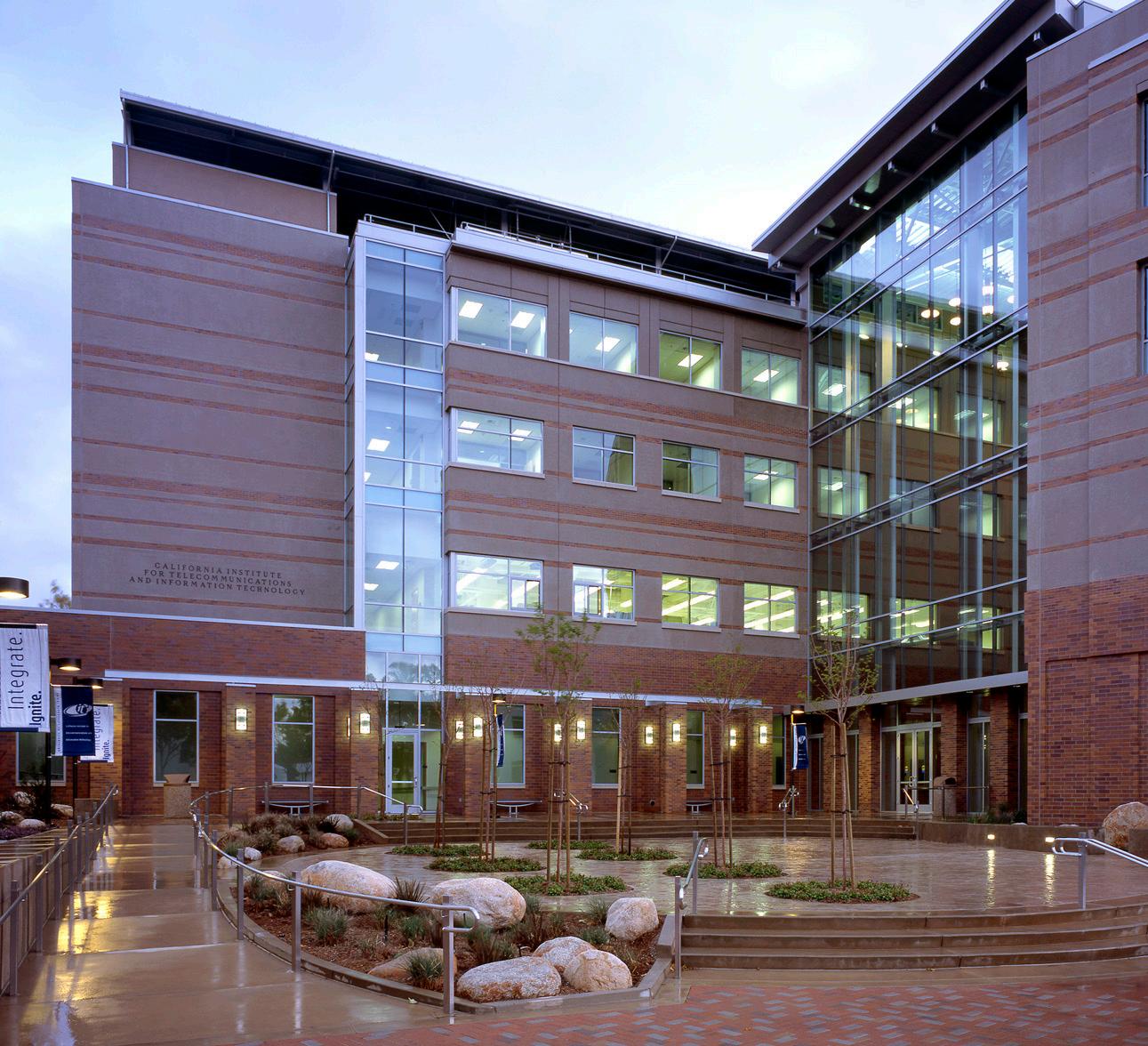
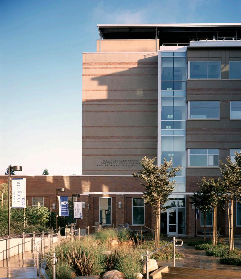
The California Institute of Telecommunications and Information Technology, or Cal (IT)2, is a new high tech research and development facility. The project is one of the California Institutes of Scientific Innovation sponsored by the State of California Governor’s Office. The new facility provides resources for a wide range of multidisciplinary projects and support programs such as the School of Engineering, Office of Academic
Computing, Environmental Science, Media Arts, and School of Education. Cal (IT)2 supports these programs’ research into information technology and innovative uses of digital media.
Comprising 120,000 square feet and four stories, the building includes a combination of clean rooms for silicon chip based manufacturing processes, wet and dry laboratories, classrooms, offices and meeting facilities. Also included are rooms for experimental media and a gallery for the display and demonstration of experiments in new media and technology. The building is a composition of two major wings, one comprising research space, the other including a 100-seat multi-media lecture theater, media center, and Institute offices. Johnson Fain also developed the Detailed Program Plan (DPP) for the facility, which called for a combination of modular laboratory and office spaces that may be subdivided, or smaller rooms that might be combined into larger spaces. Similarly, as existing technologies become obsolete, new ones will replace them, and the building needs to be able to accommodate those changes.
Johnson Fain was the design architect and the project delivery was design-build. The project received a number of awards including honors from the Design-Build Institute of America.



LOS ANGELES, CA, USA
As part of a comprehensive Master Plan for the campus, Johnson Fain provided a variety of services which included programming of new facilities; architecture and interior design for strategic upgrades and expansion of classrooms, administrative offices, staff offices and performing and fine arts spaces; and planning of new outdoor facilities that included a new play field and aquatic center. The project was accomplished in two phases, consisting of building renovation, interior renovation and new construction. The renovation aspect of the project included the modernization of the existing Science Facility to accommodate modern biology, physics and chemistry laboratories, plus lecture rooms. Another component of the renovation entailed interior improvements to office areas and other specializeduse spaces such as an intimate theater, a music room and dance studio. New construction included a second floor addition to house new classrooms and laboratories, and second component consisting of an infill addition to two ground floor bays of the existing central building to house the Admissions and the College Counseling Functions.


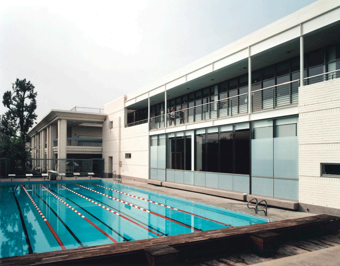
strategic upgrades and expansion of classrooms, administrative offices, performing arts space, music and fine artsCAMPUS GREEN
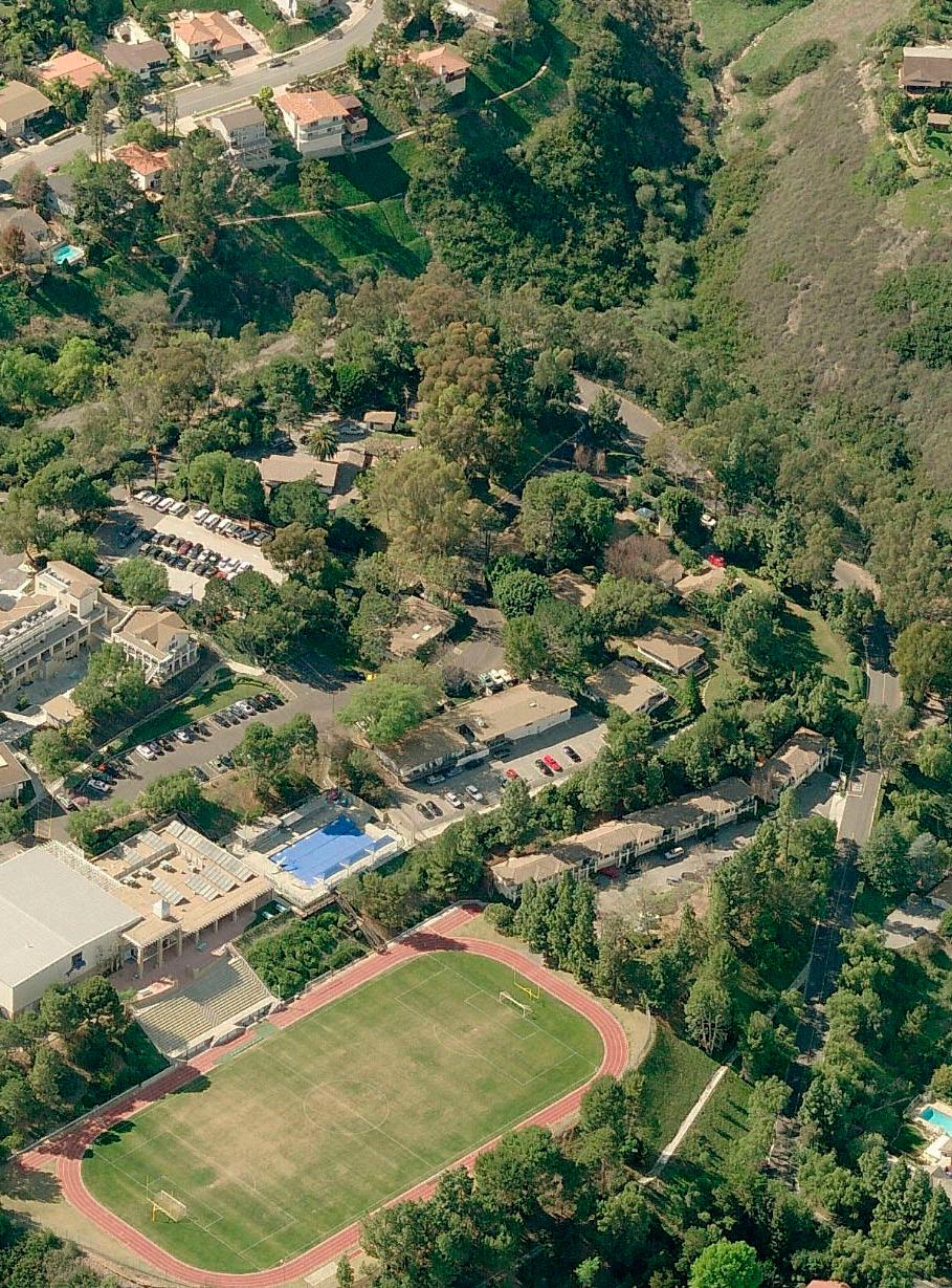
AERIAL OF EXISTING CAMPUS
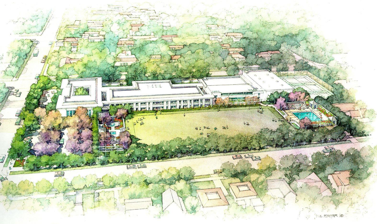
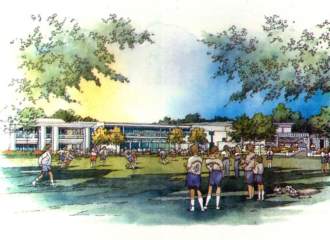



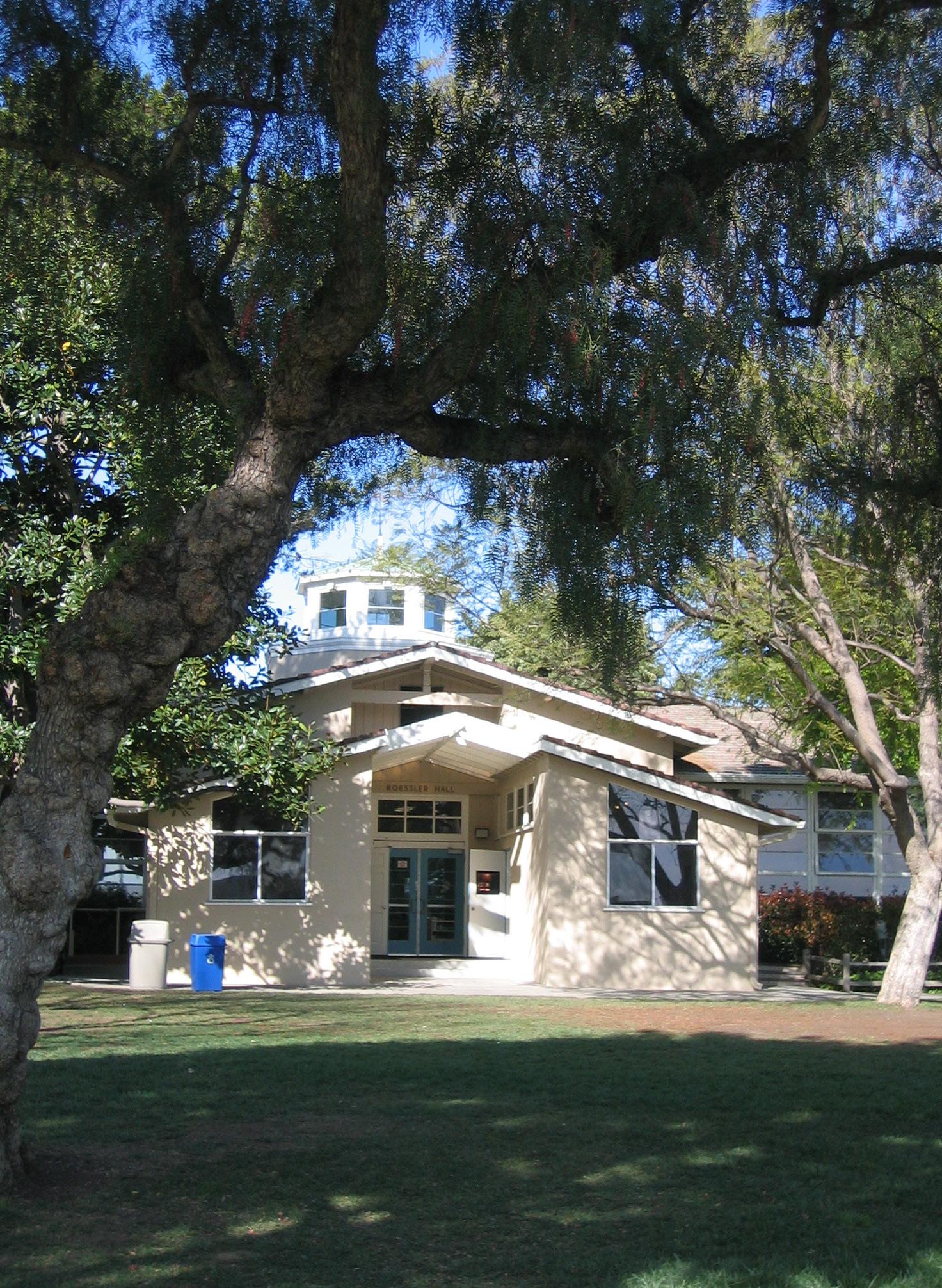
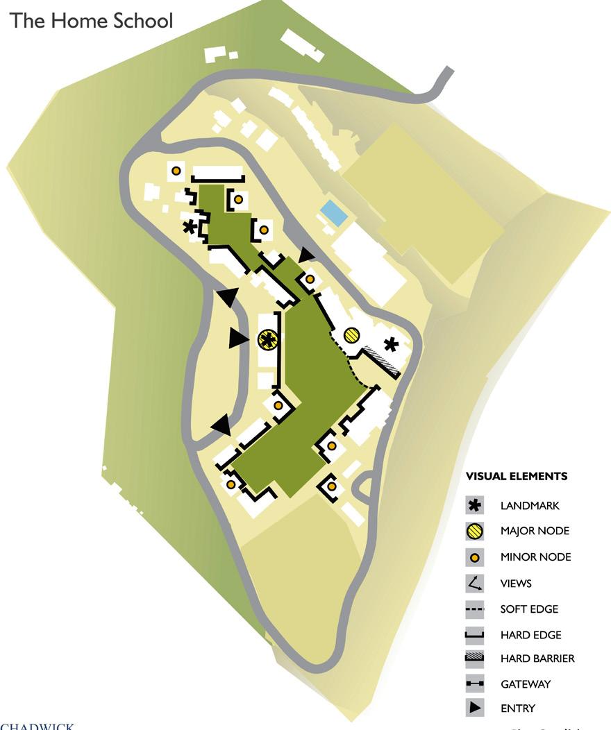
Johnson Fain was commissioned to provide master planning services at the prestigious Chadwick School. The only K-12 independent, college preparatory day school in the greater South Bay area, the Chadwick School currently enrolls approximately 815 students. The 55-acre campus provides a beautiful and safe setting conducive to serious study, vigorous play and companionship. As a first step towards selecting a master plan approach, four broad concepts were developed each showcasing an important element for eventual inclusion in a completed preferred plan.
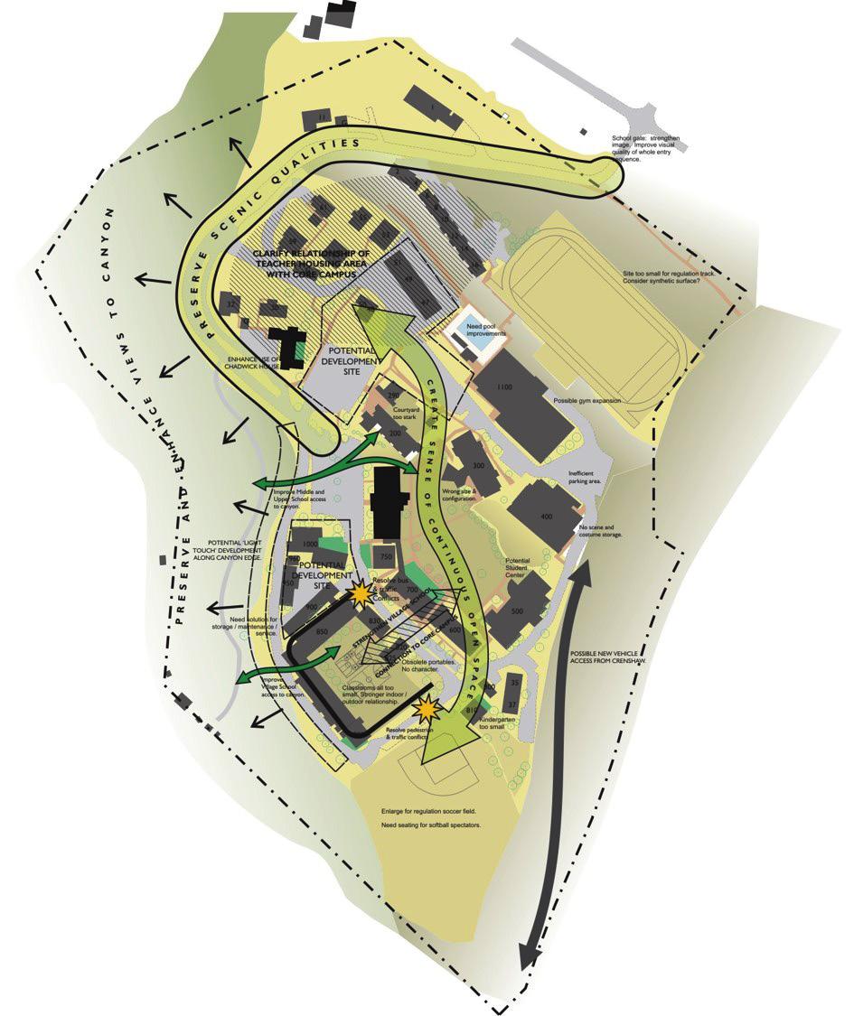
The final master plan is the result of a carefully orchestrated interaction between several important forces which include the institutional mission as interpreted in a program for future facility development, continued coordination with the existing qualities and limitations of the buildings and site and the context of economic and community concerns. The master plan considers critical design issues such as development strategy, flexibility, access and parking, orientation and scale. It fosters construction of new buildings of modular design of relatively modest size, incrementally over time. This decision not only conveys great flexibility for future planning, but also makes best use of donor funds as they become available. The plan proposes a new campus center focused on student life, as well as a center for new media and information technology.

the plan proposes a flexible menu of development options to accommodate a number of alternative futuresAERIAL PHOTO OF THE CAMPUS WATER
OPPORTUNITIES & CONSTRAINTS PRESERVE & ENHANCE VIEWS





LOS ANGELES, CA, USA
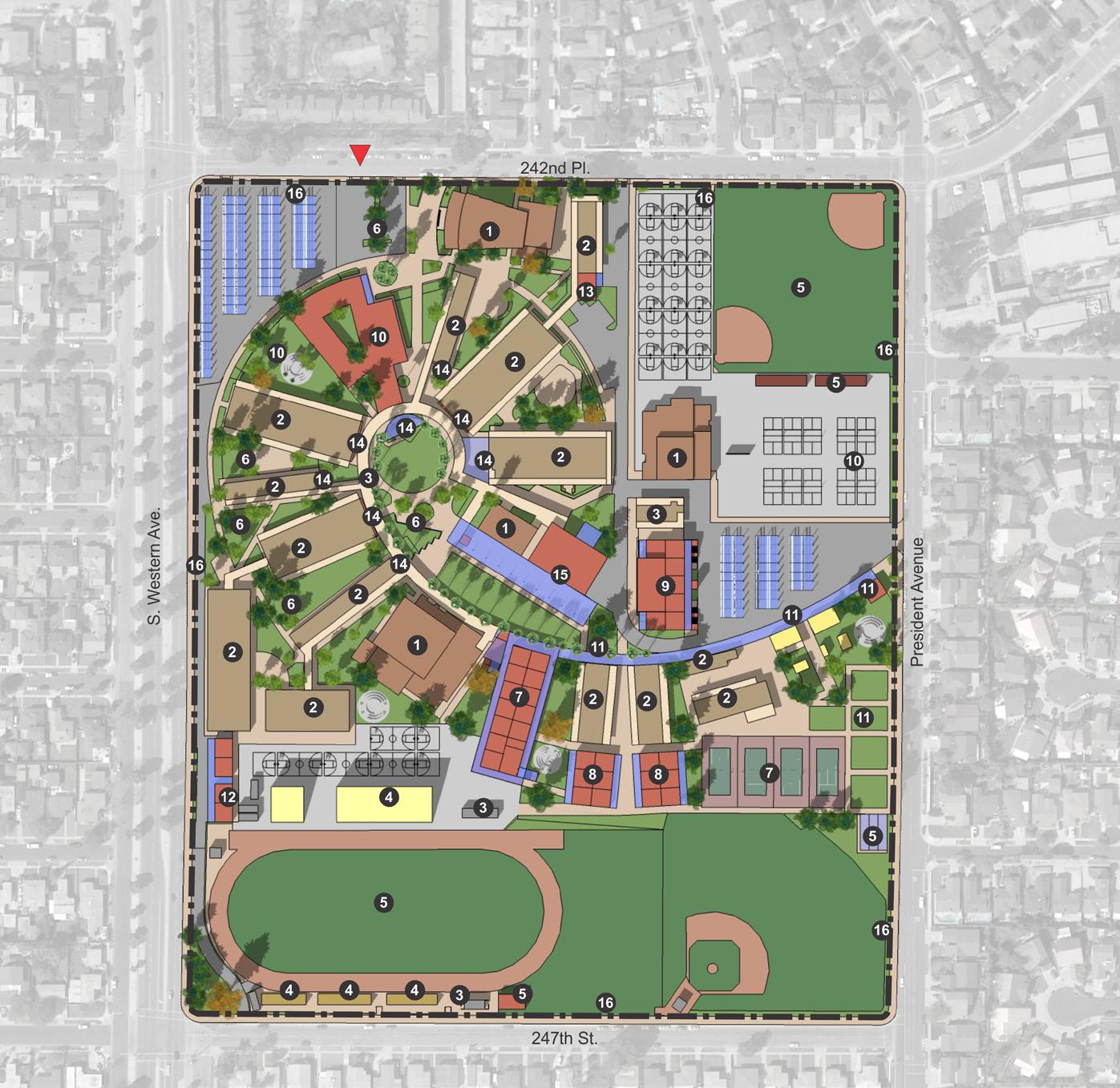
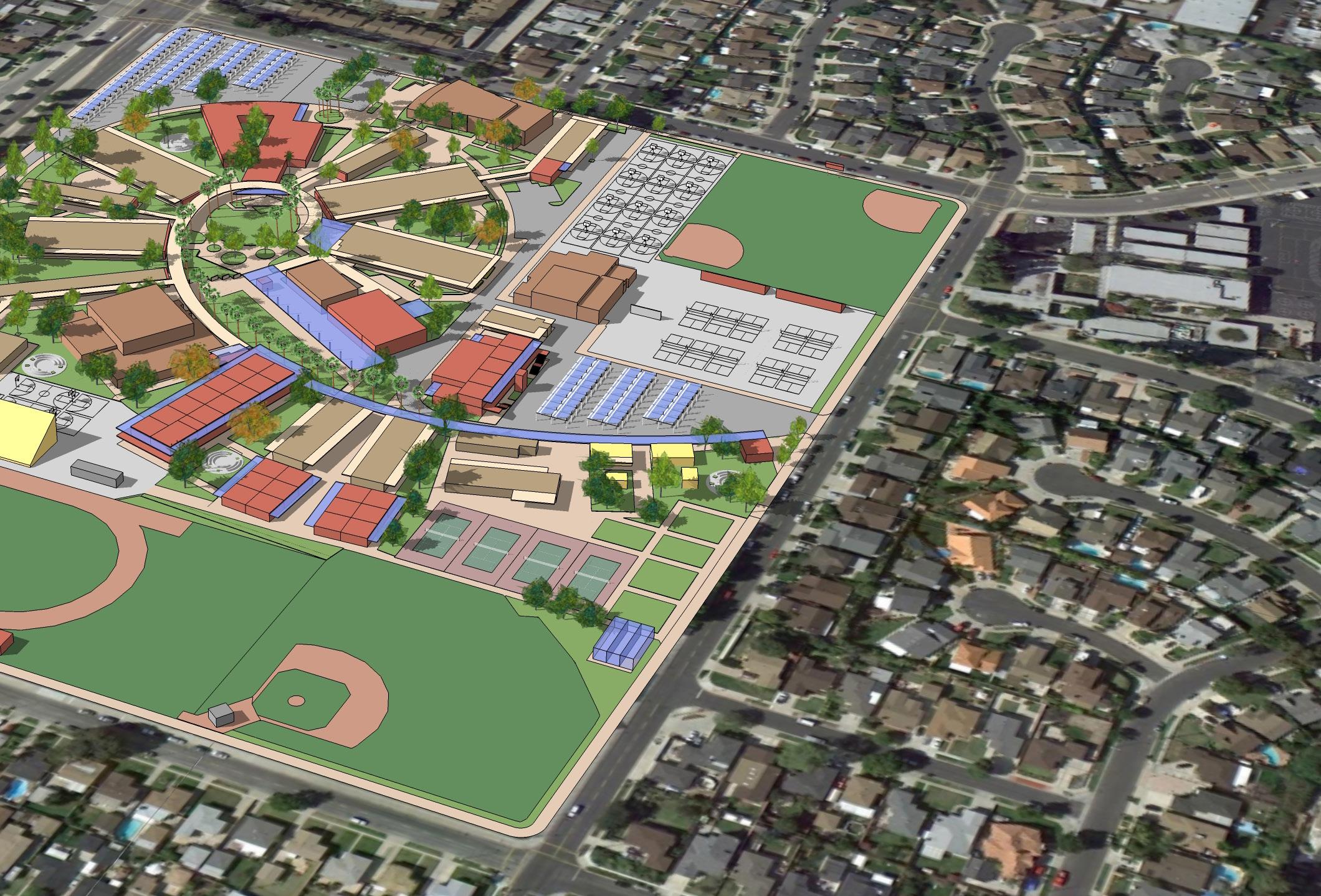
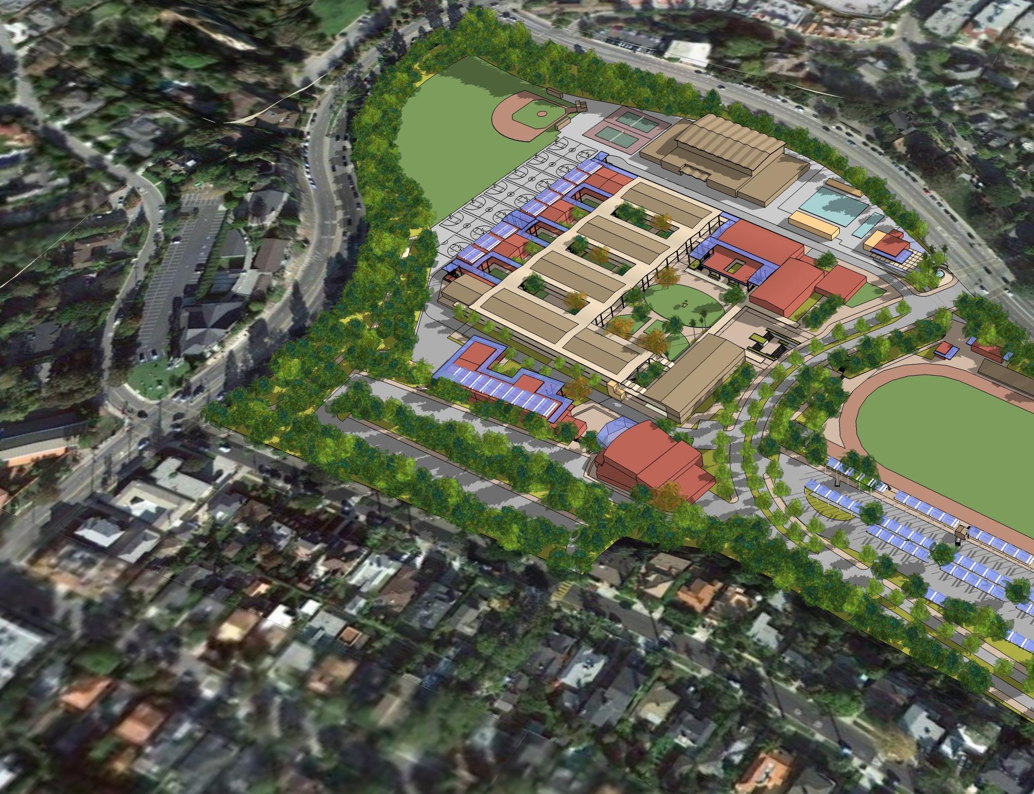
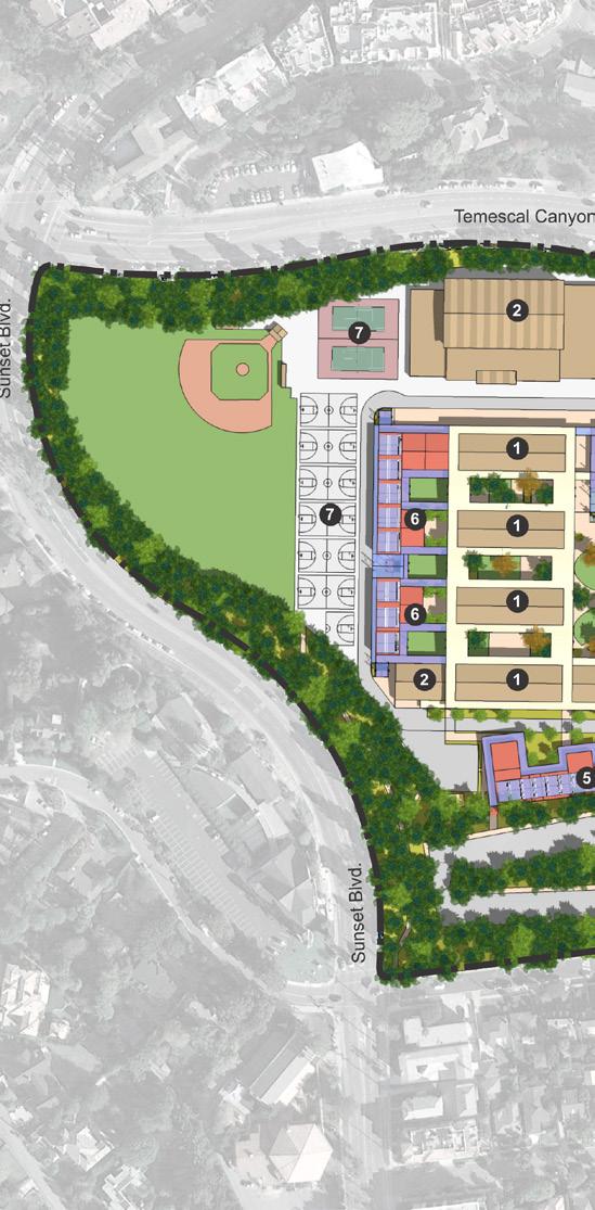
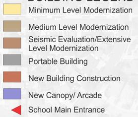
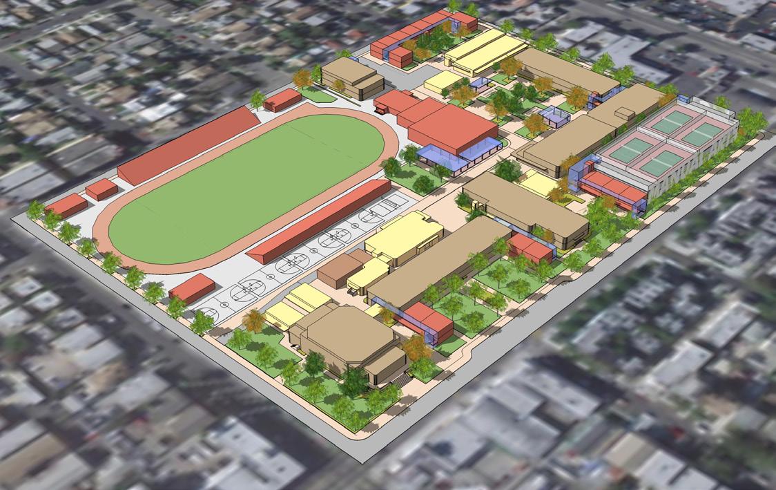
Since 2010, Johnson Fain has completed Conceptual Campus Master Planning services for 16 Secondary and 21 Elementary schools within the Los Angeles Unified School District, in support of the District’s continuing efforts to improve the quality of school facilities throughout the region. The process included Pre-Planning Survey and Site Evaluation of existing facilities; development of Conceptual Alternatives that were presented to stakeholders including parent and teacher representatives, as well as school and district administrators; and concluded with documentation of a Conceptual Master Plan including preliminary budgets for selective upgrades of systems and building components, reconfiguration of interior spaces and open space, improvement of athletic facilities, and identification of key new projects to transform them into 21st Century Schools for the District.
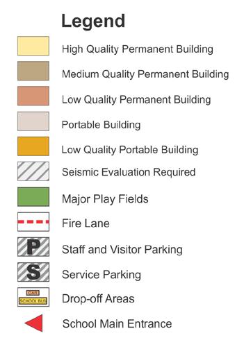

These Master Plans improve existing conditions, and contribute to a sense of place, replacing portable classrooms with flexible permanent facilities to the extent possible, and expanding the Core Facilities if necessary to bring each campus to the current District Standards. The Plans also included provisions for improving pedestrian circulation and neighborhood accessibility, improving parking onsite and removing parking overload from neighborhood streets if possible, while also looking for Joint-Use opportunities to promote use of facilities by the Community.
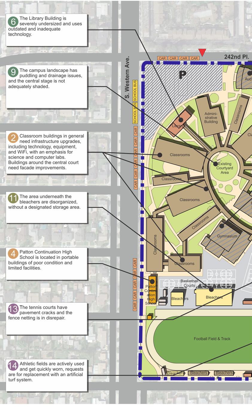
identify key new projects to transform campuses into 21st century schools for the district




 EXISTING CONDITION - PALISADES CHARTER HIGH SCHOOL PROPOSED PROGRAMS - PALISADES
PALISADES CHARTER HIGH SCHOOL AERIAL RENDERING
PALISADES CHARTER HIGH SCHOOL
PROPOSED CLASSROOM EXPANSION

PROPOSED STUDENT UNION CENTER

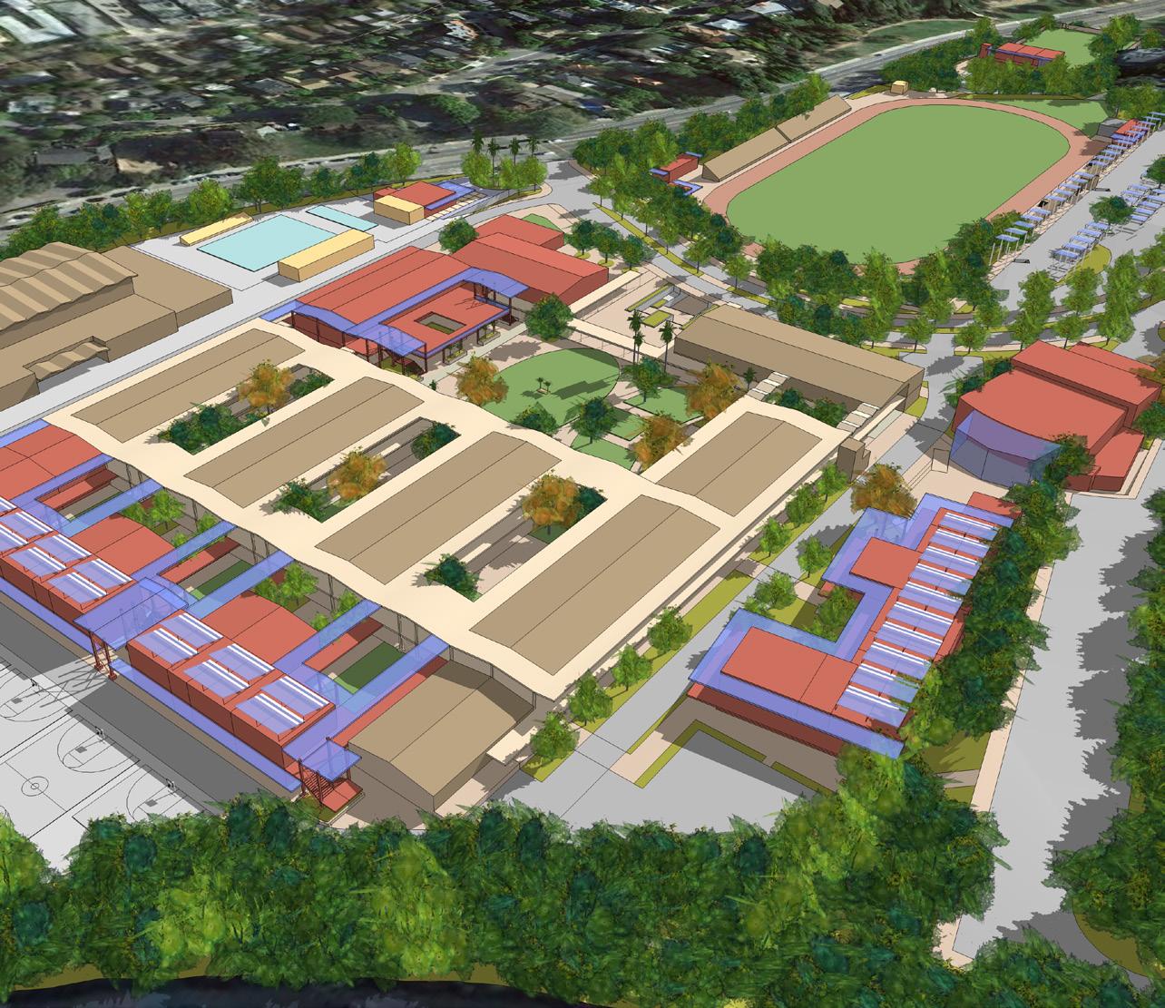
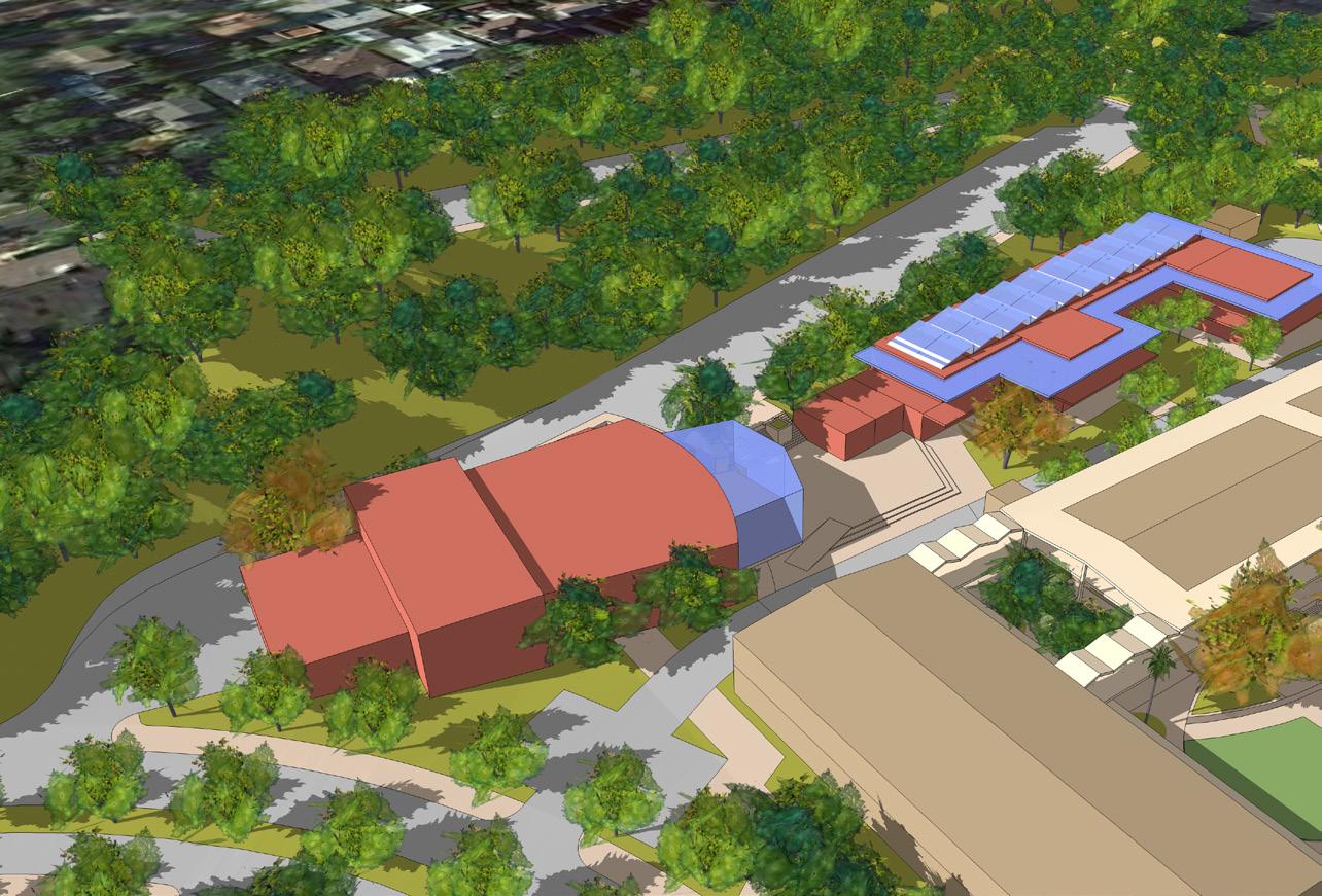
PROPOSED VISUAL AND PERFORMING ARTS CENTER
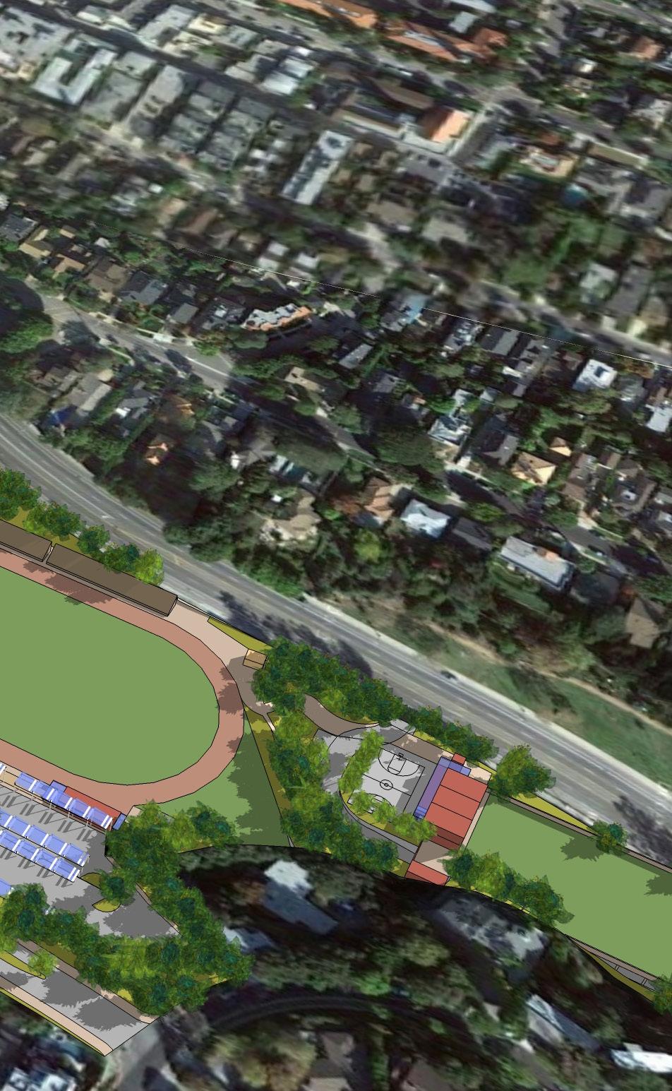

SOCES COMPLEX


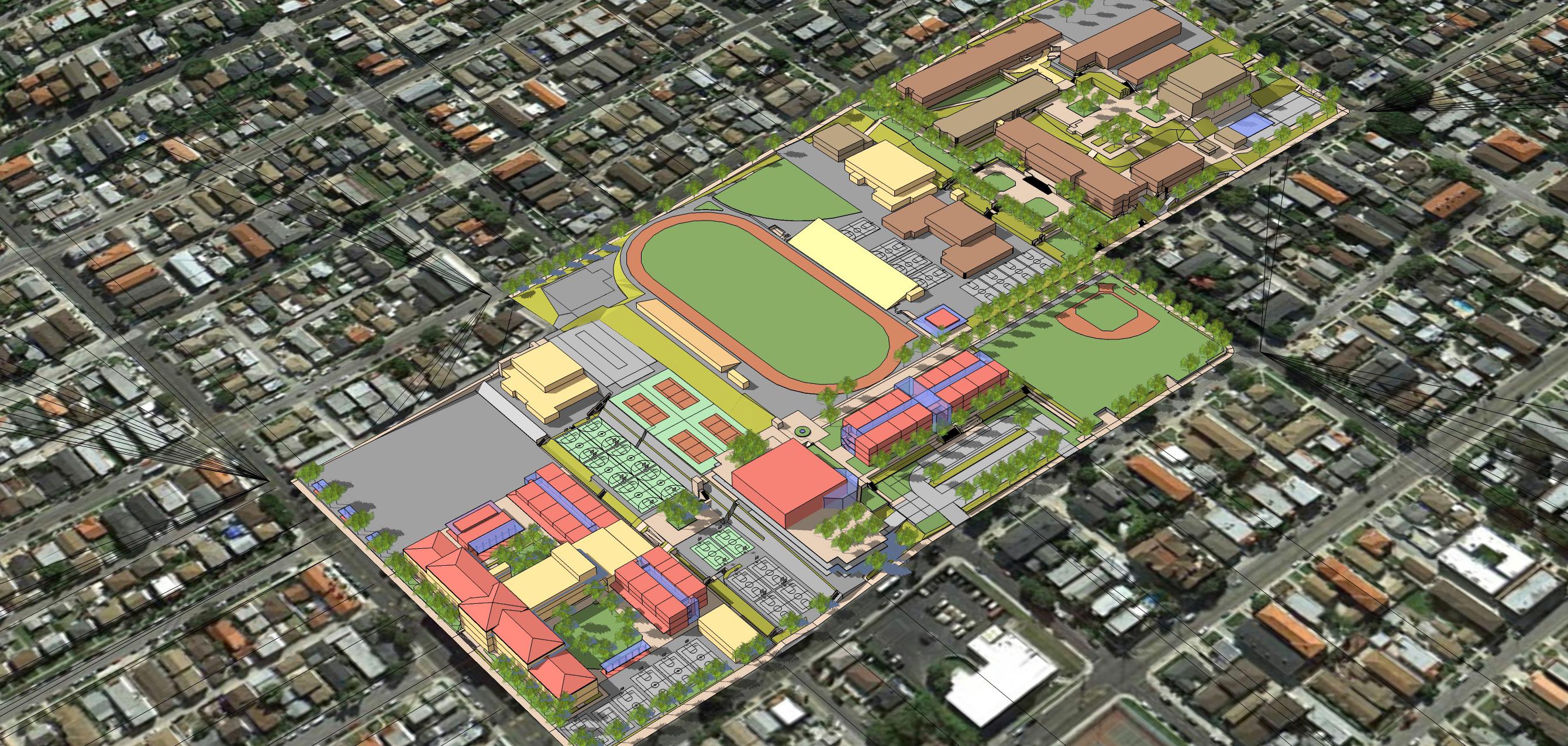 SAN PEDRO COMPLEX
provide a long term vision for the LAUSD school campuses, modernize and upgrade existing facilities to higher standards




 MANUAL ARTS HIGH SCHOOL
FOSHAY LEARNING CENTER
RESEDA HIGH SCHOOL
HALE CHARTER ACADEMY
REVERE MIDDLE SCHOOL
32ND USC PERFORMING ARTS MAG
FLEMING MIDDLE SCHOOL
LOS ANGELES, CA, USA
Concrete Masonry, Design Honor Award, Education Downtowners of Distinction Award, City West Southern California Development Forum Design Award The Chain Link Fence Manufacturers Institute, Les Grube Memorial Design Award Westside Urban Forum, Westside Prize Honorable Mention, Educational / In-Process
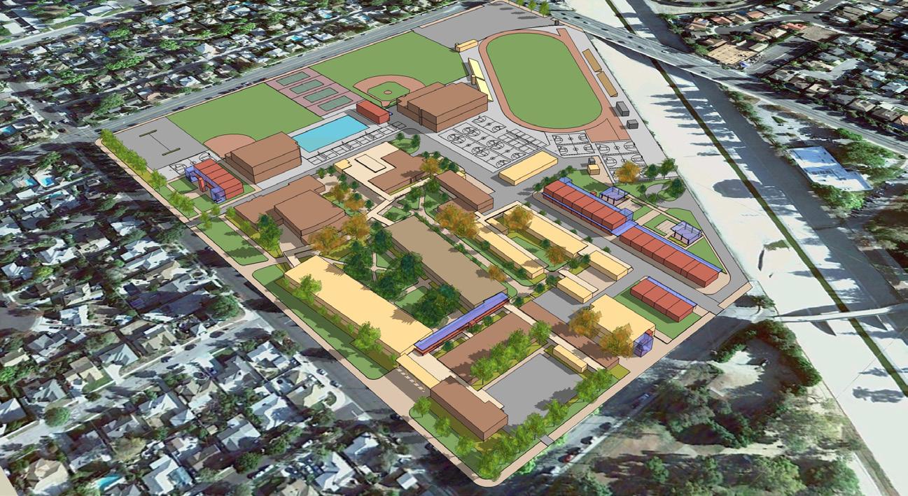
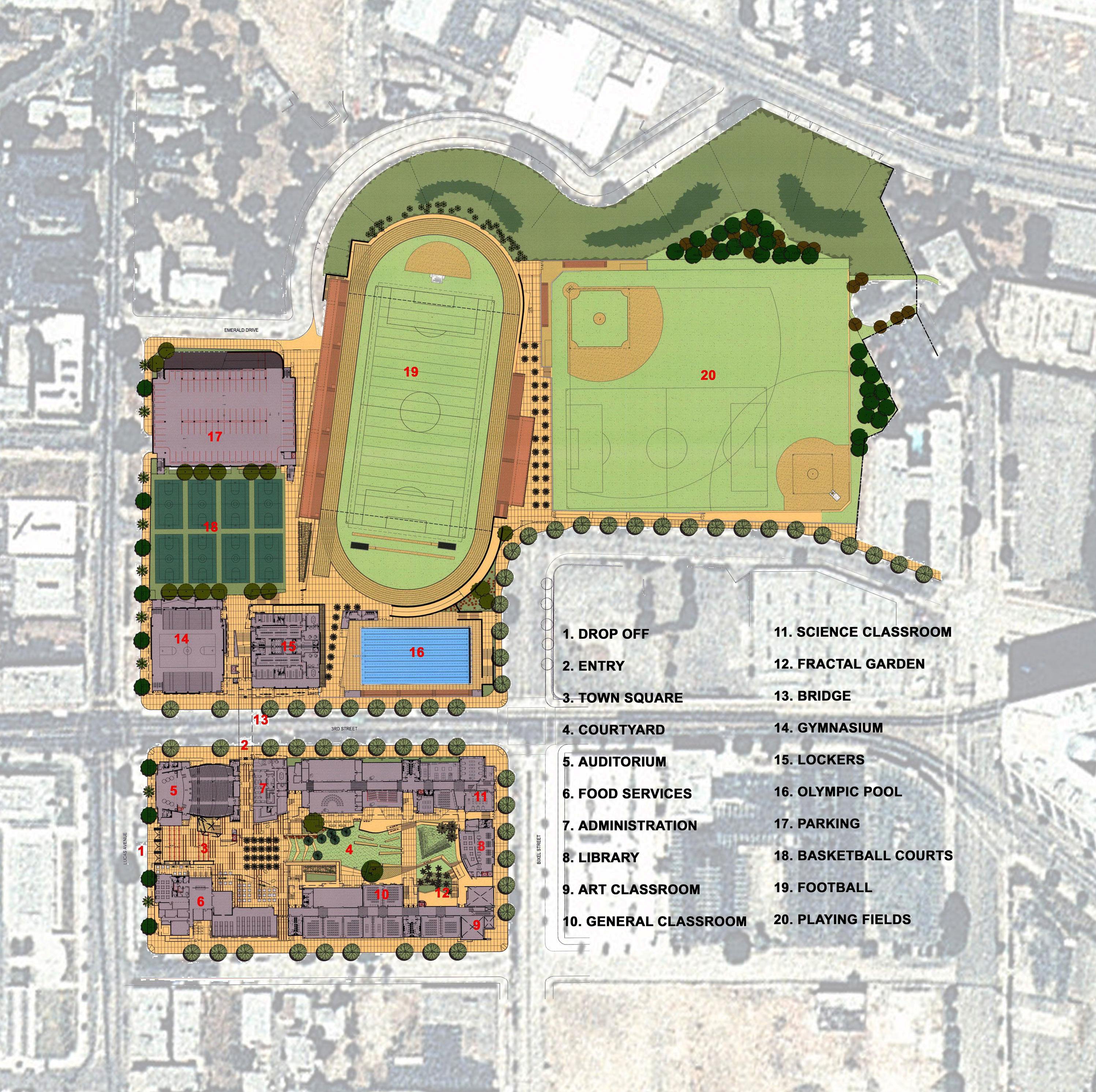
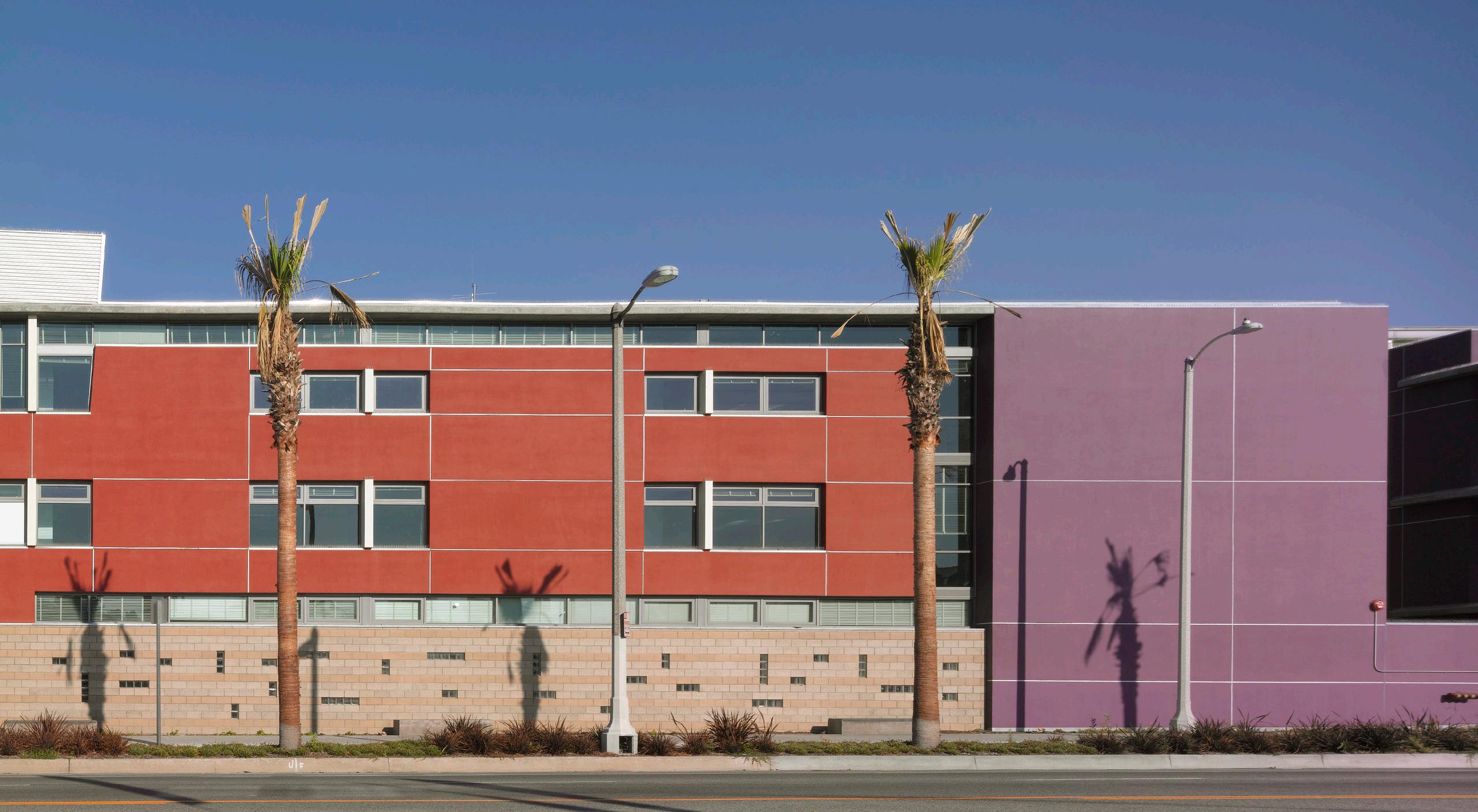
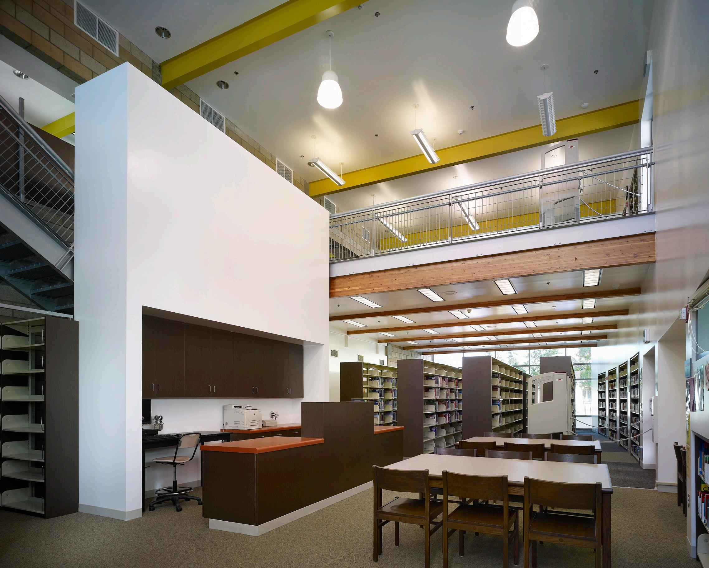
The largest new high school for the Los Angeles Unified School District, Miguel Contreras Learning Complex is located on approximately 18 acres just outside of downtown Los Angeles in the Crown Hill District. The project addresses critical overcrowding at Belmont and Marshall by providing 71 classrooms and shared athletic facilities for the benefit of the academic community. Facilities that can be shared with the community, such as the auditorium, are sited intentionally to avoid disrupting classes. Reflecting the density and scale of its urban location, the high school accommodates approximately 1,700 students in 221,100 gross square feet and is comprised of an auditorium/ administration building, two classroom wings, library/multimedia labs, food services/cafeteria, two gymnasiums and a parking facility.
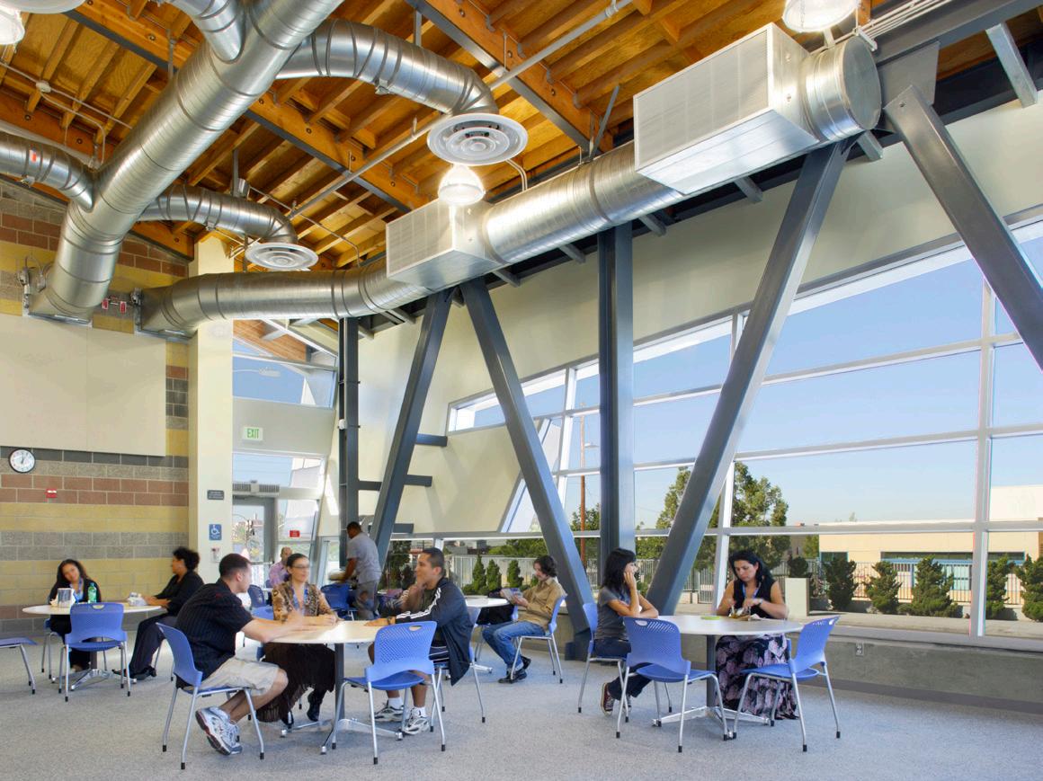


A central Courtyard is at the heart of the academic campus, and it is enlivened with distinctive smaller garden elements and performance spaces. These include an outdoor music garden adjacent to the Instrumental room, an outdoor stage platform adjacent to the Dance room, an Herb Garden and informal “cook out” pergola adjacent to the Culinary Arts room and a stepped garden for nature sketching adjacent to the Art Studio Room. Garden steps on the western edge of the courtyard function as an informal amphitheater for school announcements. The two Gymnasia, Sports Fields, Olympicsize Pool and Parking are located in the Northern portion of the site with the view to create a self-contained Sports Complex.
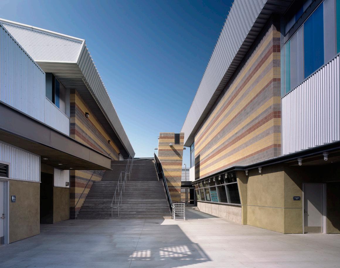
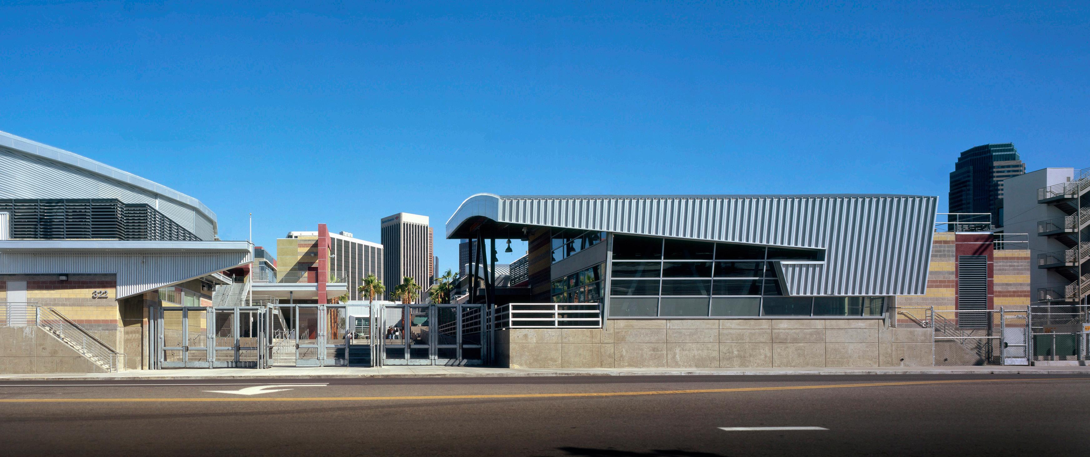


takes advantage of site constraints and proposes a series of stepped public spaces leading to a main landscaped inner courtyard
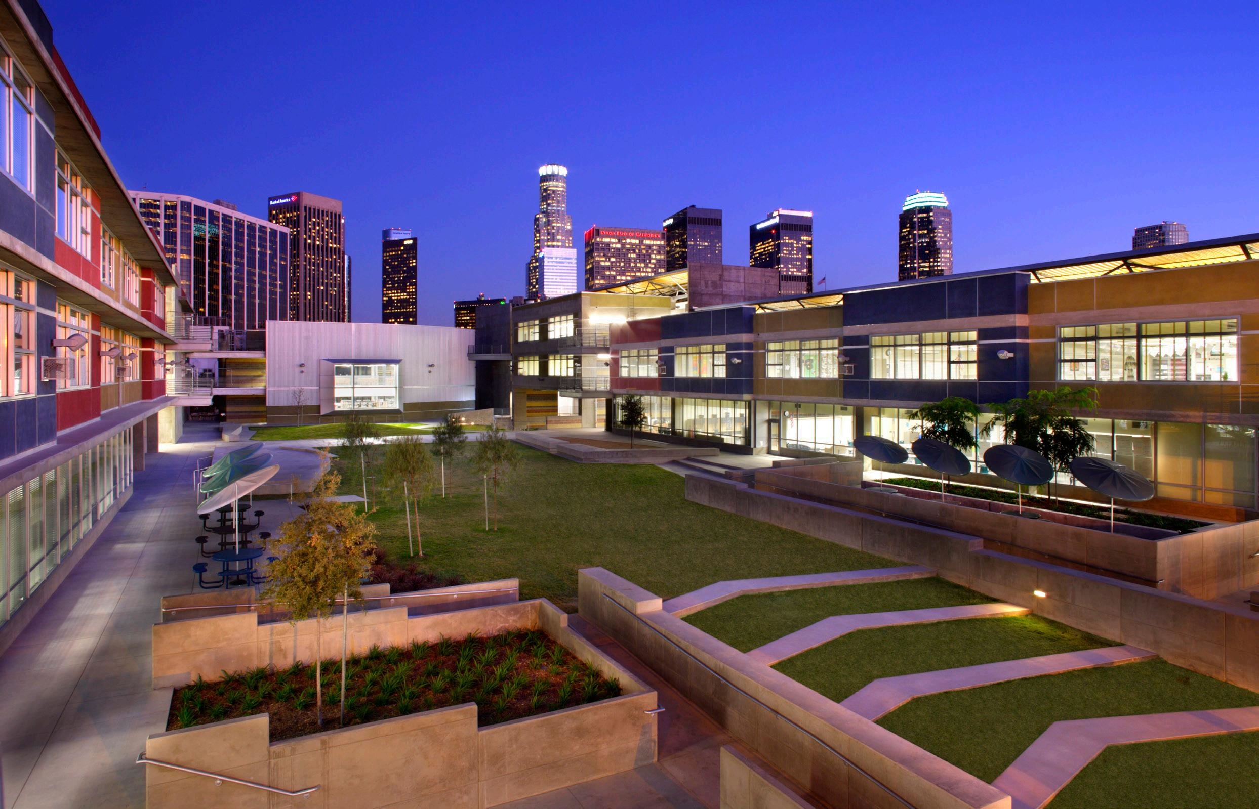

buildings with public character are unified with a series of elegantly curved planes or gently sloping roof forms

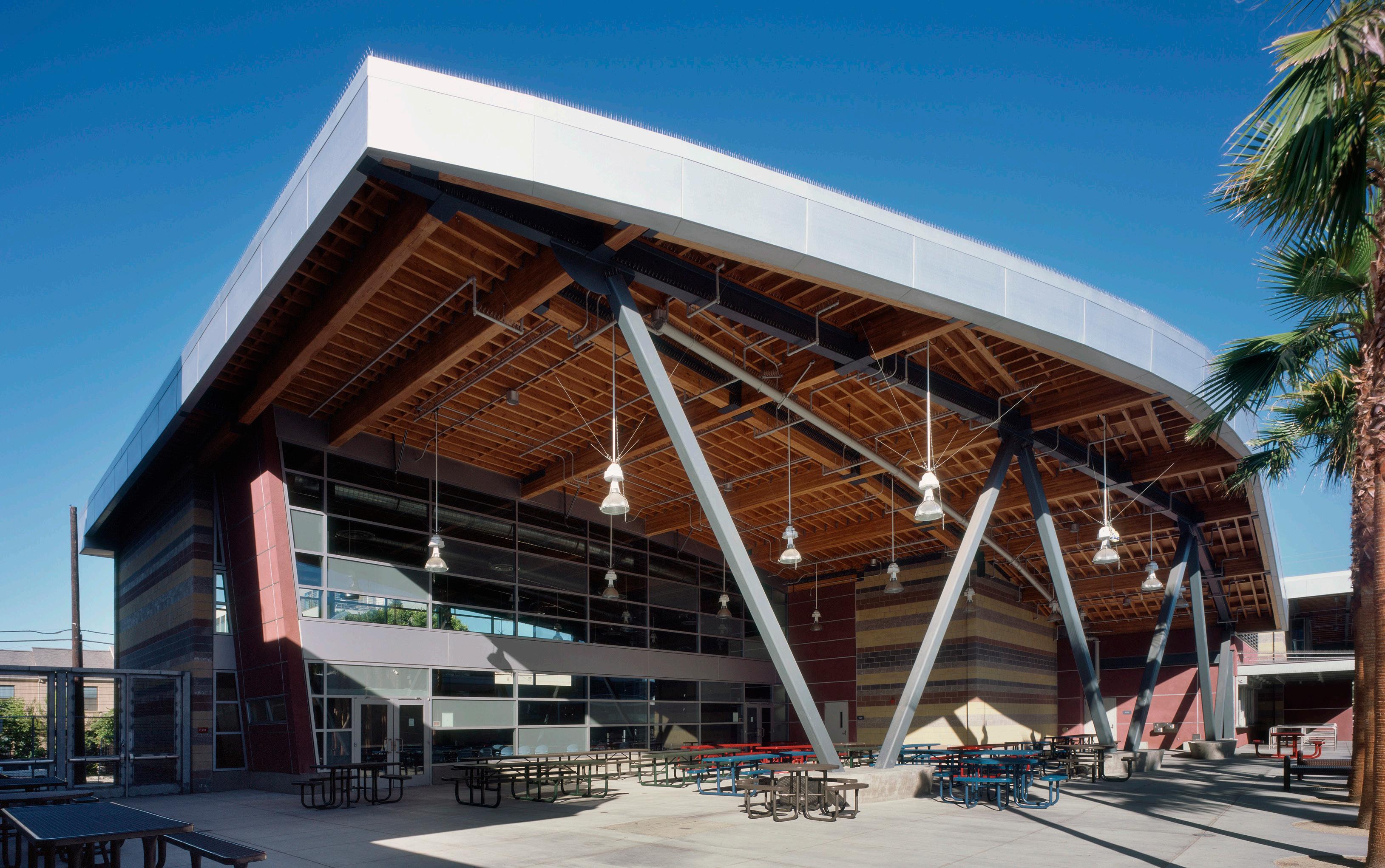
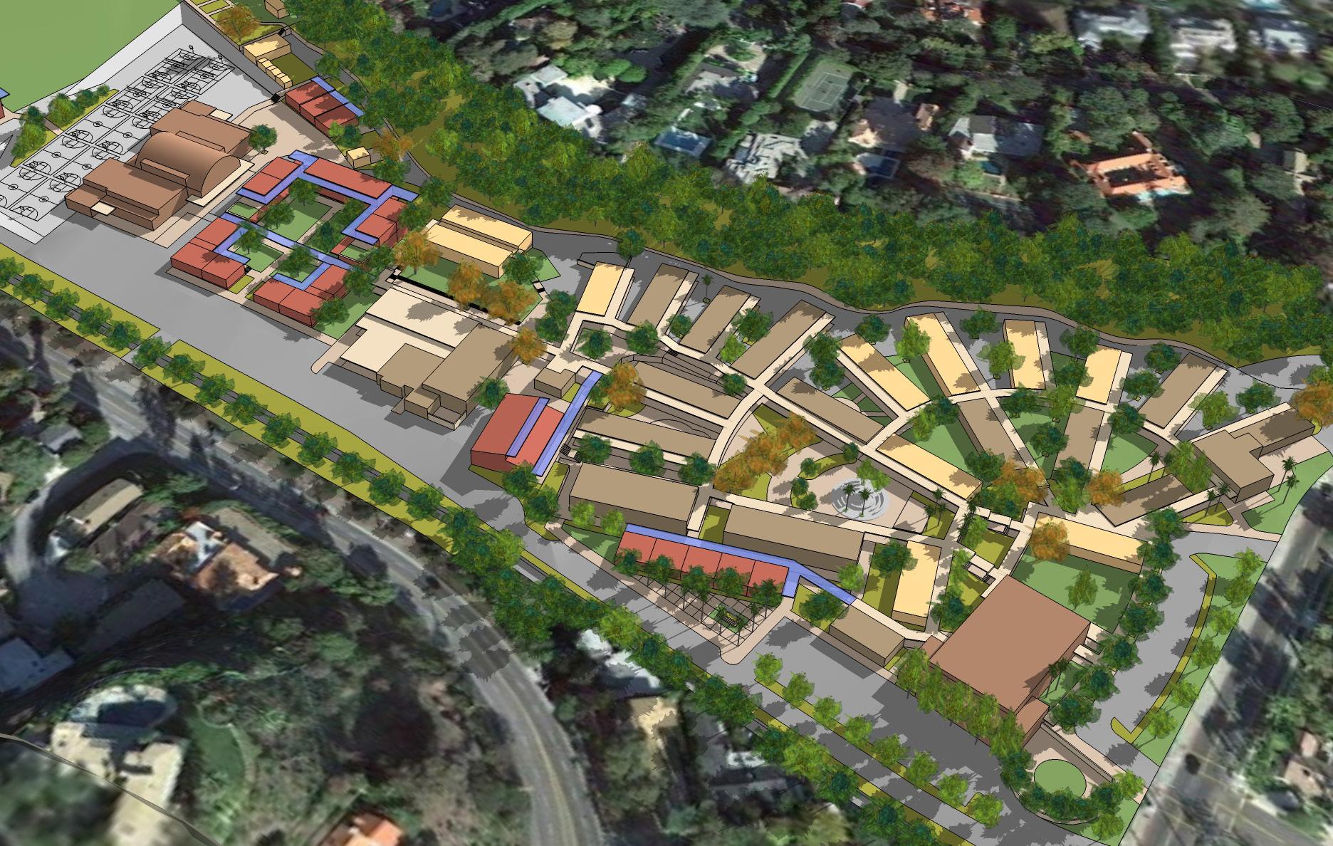
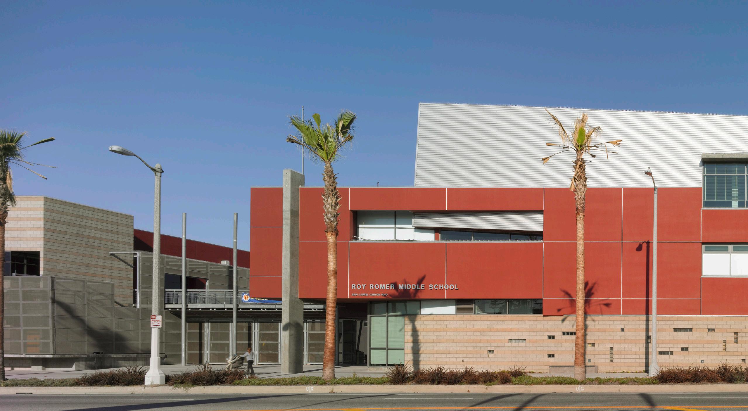
The LAUSD Roy Romer Middle School is located at the North West Corner of Laurel Canyon Boulevard and Hamlin Street. The 9.5acre L-shaped site accommodates 1,647 students in 150,000 square feet and is bounded by single family residential to the west, Laurel Canyon to the east and Kittridge and Hamlin Streets on the north and south respectively. All streets are local residential streets except Laurel Canyon Boulevard, which is largely a strip-commercial and multi-family residential housing corridor.

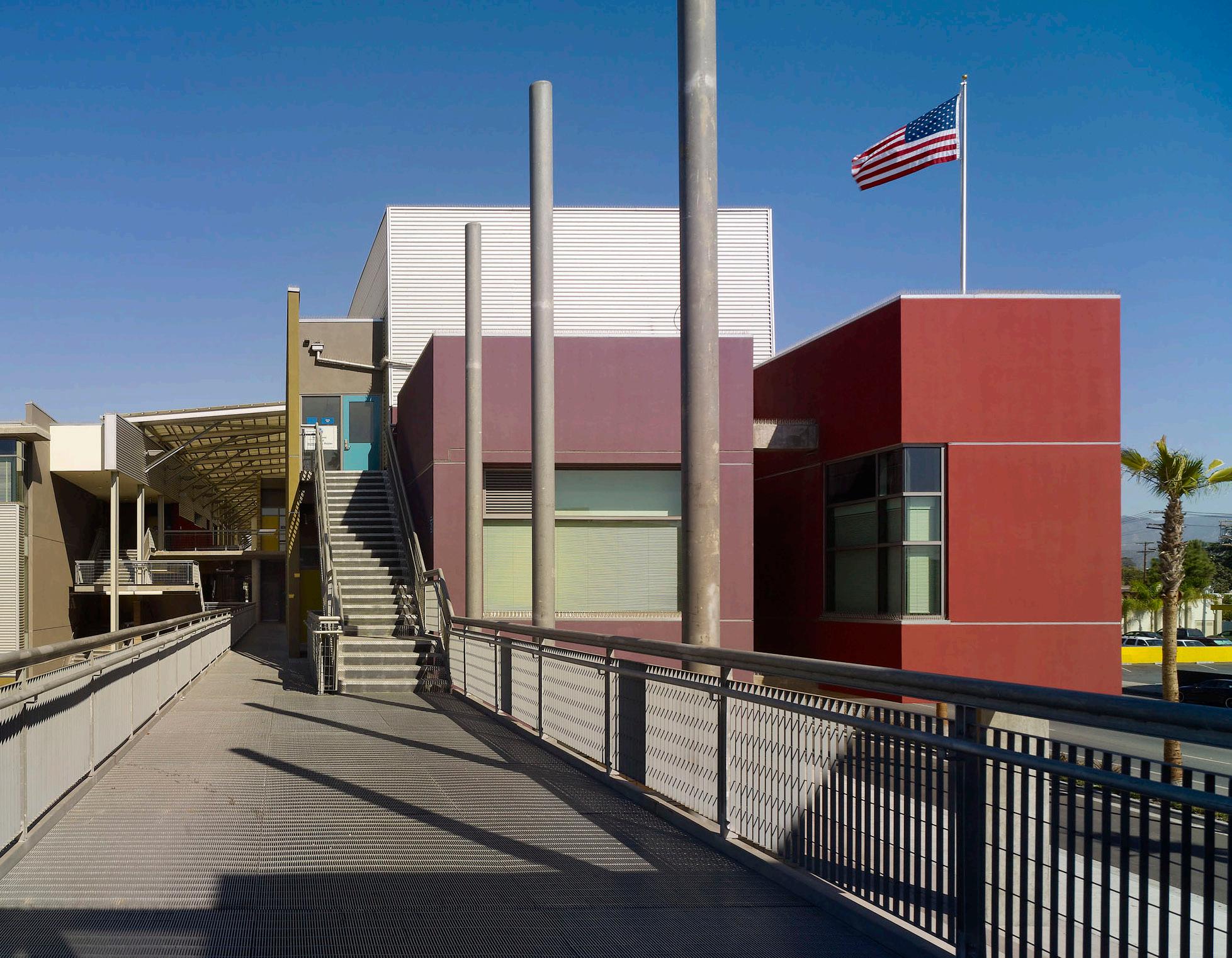
The Campus buildings are organized around a large public square that serves as the school’s entry and major social center and additional north-south landscaped spaces for small group socialization and instruction. Accessed from Laurel Canyon, the square is defined by four major areas including a Classroom and Administration Wing, Multi Purpose Building, Multi Media Center and Gymnasium / Fitness Center. The Classroom and Administration Wing includes 98,000 square feet over three floors; the Multi-Purpose Building includes 26,000 square feet over two floors; the Multi Media Center includes 6,000 square feet over two floors and the Gymnasium / Fitness Center includes 19,000 square feet with a 150-stall parking lot and playfield.
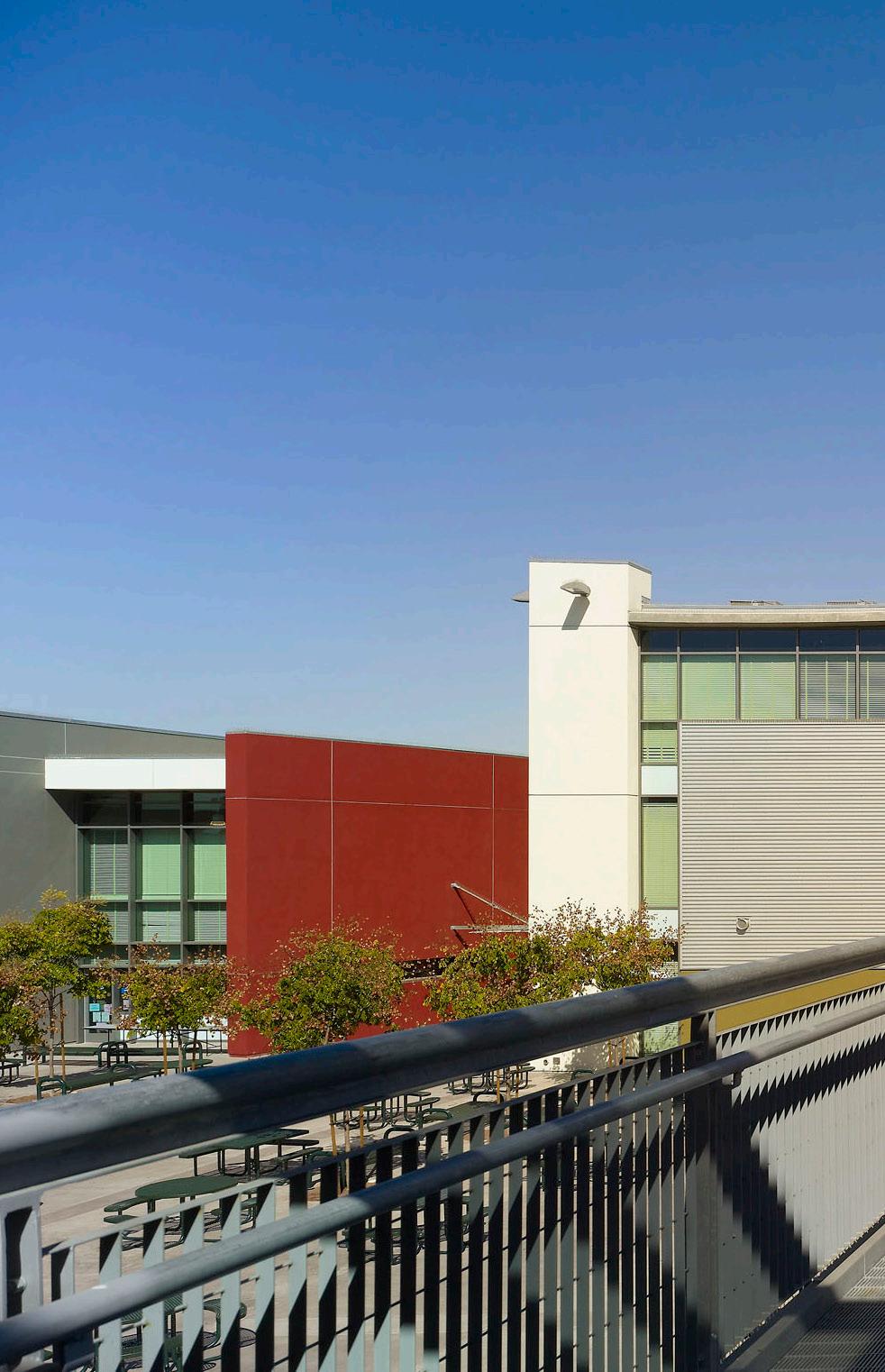
consistent with LAUSD’s current goals, the Romer School echoes local scale and density while positioning such facilities as gym and athletic fields for double duty as community amenities


During the past 25 years of professional experience in the United States and overseas, Johnson Fain has established itself as an architecture, planning and interior design office known for its creative approach to the built environment. Scott Johnson, FAIA, Design Partner, and William H. Fain, Jr., FAIA, Partner for Urban Design and Planning, lead a diversified office of 60 professionals.
The firm has received many awards for design excellence. During the last decade, the American Institute of Architects has recognized Johnson Fain with numerous awards at the national, state and local levels.
Each project is carefully designed to specific client needs, program, technical requirements and budget. Every assignment presents the opportunity to develop a uniquely appropriate design solution. This philosophy is fundamental to the firm. Our primary design objective is to identify and resolve the specific issues required by each assignment. Particular emphasis is placed upon defining not only project scope and intent, but also budget and schedule at the inception of the design process. Attention to all levels of detail and close client communication continue throughout the duration of the project to ensure the best possible match of client needs, design intent and cost effectiveness.
Project types include corporate office, large-scale high-rise, mixeduse retail, residential, educational university, technical and research laboratories, governmental and public buildings, hotel resort, museums and wineries including new construction, renovation, seismic upgrades, building modernization and restoration. Programming, interior design and tenant improvement projects have also garnered many awards for the firm. All projects receive the same high level of attention and creative expertise.
Projects have included master plans, new town plans, facilities master planning, general and specific plans, site feasibility, and land use analysis for a variety of clients and diverse industries including: aviation, universities, media, public agencies, cities, the United States and international governments, resorts, private and public development and redevelopment. Each assignment and solution is approached in a thoughtful, responsive and analytic manner appropriate to the project.
Johnson Fain has designed and executed interior environments for many important institutions. Interior Design within the office is practiced as Interior Architecture within qualified professional design and technical staff producing the work within management approach that includes programming, space planning, design, furnishings, engineering and technical delivery. Some significant interior project types include corporate office environments, condominiums and live/work lofts, media environments, art galleries, museums, resorts, wineries and restaurants.
