ACTIVE TRANSPORTATION PLAN City of Los Alamitos



Ron Noda, Deputy City Manager
Tom Oliver, Associate Planner, Project Manager
SCAG
Dorothy Le Suchkova, Senior Regional Planner
KTUA

Joe Punsalan, Principal
Jacob Leon, Associate, Project Manager
Juan Alberto Bonilla, Senior Planner
Jorge Nozot, Planner
Sureena Basra, Planner


Rosario Galeas, Outreach and Education Coordinator
Nallely Enriquez, Lead Community Health Worker
1.1 Purpose
1.2 Study Area
1.3 Scope and Vision
1.4 Active Transportation Trends
1.5 Bicycling and Walking Benefits
1.6 Planning Context
1.7 State of Practice
1.8 Primar y Guidance
1.9 Applicable Legislation
This comprehensive Active Transportation Plan (ATP) provides the City of Los Alamitos the vision and goals to make their streets safer, more comfortable, and more enjoyable for their residents and visitors. The ATP addresses the needs of people that are dependent on walking, bicycling, and/or accessing transit every day throughout the city. The recommendations in this ATP are designed to support multi-modal travel infrastructure and programs for existing and future populations.
The ATP includes an inventory of existing bicycle and pedestrian infrastructure, identifies program deficiencies, establishes a list of prioritized improvements, and includes “grant-ready” materials for future grant opportunities.
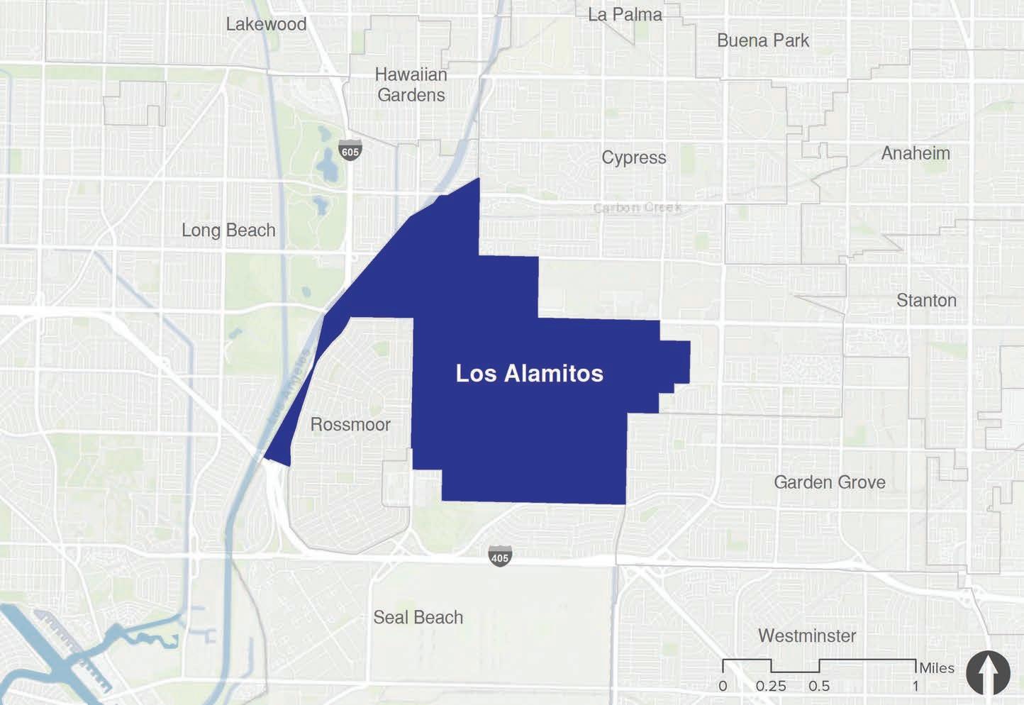
The City of Los Alamitos is located in Orange County in Southern California, bordered by the cities of Cypress, Garden Grove, and Seal Beach in Orange County and the City of Long Beach in Los Angeles County, as shown in Figure 1-1. The Joint Forces Training Base (JFTB) represents roughly half of the land area within the city’s boundaries. Interstate 605 is the only major freeway running through Los Alamitos, connecting it to other regions in Southern California.
According to the 2018 United States Census, Los Alamitos has a population of 11,628 within its four-square mile city boundary. The city has a population density of 2,857 people per square mile in 4,326 households. Los Alamitos has a large Hispanic community with about 26 percent of the population identifying as Latino. In addition, over 83 percent of workers in Los Alamitos drive to work alone, while nine percent carpool. These statistics communicate the importance of improving the walking and biking infrastructure in the city. The ATP recognizes the importance of addressing barriers that prevent non-motorized trips from being safe, especially for the younger and lower-income populations who cannot afford, operate, or choose to forgo vehicle ownership.

This ATP will guide the development of active transportation infrastructure programs and policies for Los Alamitos. The following objectives will guide the planning process to ensure a successful plan that everyone can support and work towards implementation:
1. Identify gaps and barriers, both perceived and actual, in the existing pedestrian and bicycling network where high priority corridors are disconnected.
2. Provide opportunities through community outreach and improvement projects to remove barriers and improve the network.
3. Engage with the community to gather local knowledge on existing challenges and opportunities.
4. Analyze the existing infrastructure around activity centers such as parks, schools, and commercial centers to determine appropriate solutions.
5. Develop a methodology for prioritizing projects that encourage walking and bicycling as viable transportation modes. Implementation of the ATP will improve community health as access to more active means of transportation (bicycling and walking) are developed. The public health will benefit from increased exercise, collision reduction, and reduction in GHG emissions through less vehicle miles traveled (VMT) as alternative methods are used and level of physical activity increases.
6. There will be an increased sense of pride in the community as a result of community engagement, social interaction, and participating in achieving a common goal.
Many American cities were built on a foundation of auto-centric infrastructure, programs, and policies, but many of those same cities are embracing active transportation as a viable option to driving. Some of them are making minor improvements to support cycling and walking, while others are working hard to undo decades of planning that privileged motor vehicle throughput and speed above all else. Environmental, health, and economic benefits reinforce the task of retrofit-
ting American cities to make them bicycle and pedestrian friendly. The movement to make cycling and walking viable transportation options are also supported by several recent pieces of California legislation.
Recent active transportation statistics and trends depict steps both forward and backward. For example, the Alliance for Biking and Walking released a Benchmarking Report in 2018 which communicated the importance of the distance between home and school. In the report, it is stated that while 35 percent of students who live less than a mile from school, walk or bike to school on most days, only two percent of students living two miles from school usually bike or walk to school.
Empty nesters, particularly as the number of baby boomers reaching retirement age accelerates, are also showing a strong preference for communities that support walking. American Association of Retired Persons (AARP) surveys found that 70 percent of respondents age 65 and older agreed that living near where they want to go, such as grocery stores, health care providers, libraries, and social or religious organizations, was extremely or very important. Additionally, 51 percent agreed that it was extremely or very important to be able to walk easily in their community.
There has also been a growing preference for new facility types that enhance pedestrian and bicyclist safety, particularly protected bicycle lanes physically separated from motor vehicle traffic. In addition, acknowledging that most trips Americans make are within one mile, it is important to assess the infrastructure and make a genuine effort to entice people to walk or bike to their destinations through enhanced facilities.
Since the outbreak of COVID-19 and the stay-at-home order, commuting patterns have changed. More workers have shifted to work remotely instead of commuting to their offices and other workspaces. This change has resulted in many people using alternative transportation for shorter trips and an increase in opportunity for outdoor recreation. According to a report from the San Diego Association of Governments (SANDAG), daily volumes of bike commuting has increased 42 percent across San Diego County during five months in 2020 compared to 2019. This trend is seen in many cities and some have closed roads for pedestrian and bicycle access only. With many people utilizing biking as an option for their commute, we may see electronic bikes and other bike-sharing programs arrive to cities to help people with farther commutes post-COVID-19.
Numerous environmental, health, and economic benefits are attributable to bicycling and walking, especially as substitutes for travel by motor vehicles. This section summarizes these benefits, some from research by the Pedestrian and Bicycle Information Center (PBIC).
Active transportation via walking and biking results in decreased usage and dependency on motor vehicles and nonrenewable resources which can result in reduced greenhouse (GHG) gas emissions and air pollution. According to the United States Environmental Protection Agency (EPA), the transportation sector accounted for the largest portion of GHG emissions (28 percent) in the United States in 2018. Additionally, building infrastructure for vehicles, such as streets and parking lots, increases the impervious surface of an area which leads to storm-
water runoff, urban flooding, and the urban heat island effect. Encouraging pedestrian and bike infrastructure provides an opportunity to integrate green infrastructure into street design and mitigate the urban heat island effect, stormwater runoff, and flooding, as well as promote pedestrian health and safety.
Despite dramatic strides in recent decades through regulations and technological improvements, vehicle emissions still pose a significant threat to human health. Vehicle-generated air pollution contains harmful GHG emissions including carbon dioxide, carbon monoxide, methane, nitrous oxide, and volatile organic compounds. These pollutants and irritants can cause asthma, bronchitis, pneumonia, and decreased resistance to respiratory infections. Taking steps to reduce these emissions is particularly important in the United States, which leads the world in petroleum consumption. The conversion of driving to bicycling or walking offers a great opportunity to reduce emissions and improve public health.
28% of GHG emissions in the US came from the transportation sector in 2018
- Asthma
- Bronchitis
- Pneumonia
- Decreased resistance to respirtaroty infections
Vehicle-generated air pollution are harmful and can cause:
- High blood pressure
- Heart attacks
- Strokes
- Non-insulin dependent diabetes
- Osteoarthritis
- Osteoporosis
In addition to the universal public health benefit, such as improved air quality, bicycling and walking have the potential to positively impact personal health. A significant percentage of Americans are overweight or obese and projections indicate 42 percent of the population will be obese by 2030. To combat this trend and prevent a variety of diseases and their associated societal costs, the Center for Disease Control (CDC) suggests a minimum of 30 minutes of moderate-intensity physical activity five days per week. Not only does cycling and brisk walking qualify as “moderate-intensity activities,” but they can also be seamlessly integrated into daily routine, especially if chosen for utilitarian purposes like commuting or running errands.
According to Harvard Medical School, walking reduces the risk of cardiovascular events by 31 percent. Other health benefits associated with moderate activity like bicycling or walking include improved strength and stamina through better heart and lung function. Regular exercise also reduces the risk of high blood pressure, heart attacks, and strokes. In addition to heart disease, regular exercise can help to prevent other health problems, such as non-insulin dependent diabetes, osteoarthritis, and osteoporosis. Exercise has also been shown to improve mental health by relieving depression, anxiety, and stress. More importantly, in rural or low-income areas, many individuals may lack the opportunity to access gyms or fitness centers. Due to this, well-designed and located sidewalks, bike facilities, and shared use paths become even more critical in supporting community health.
Bicycling infrastructure and programs have increasingly been shown to deliver economic benefits to both individuals and society at large. The benefits of bicycling may outweigh its costs. Bicycling offers obvious cost savings to individuals. Beyond the upfront cost of operating a vehicle are additional maintenance, insurance, and often parking expenses. In 2019, according to the American Automobile Association (AAA), the average annual cost of vehicle ownership comes out to $9,282, or $773.50 per month. That is the highest cost associated with new vehicle ownership since AAA began tracking expenses. The remaining costs of owning a vehicle extend far beyond maintenance and fuel.
The average annual cost of vehicle ownership comes out to $9,282
Regular exercise also reduces the risk of:
Converting even a fraction of automobile trips to bicycling or walking trips can generate transportation-related savings, including reduced vehicle traffic congestion. Increased bicycling and walking also translates to health-related savings, for both individuals and taxpayers, in the form of less need for preventative care. More bicycling and walking have also been tied to increases in commercial and residential property values and retail sales. Shoppers who reach their destination by bicycle have been shown to make smaller purchases but shop more often and to spend more money overall. Shoppers who arrive by bicycle or on foot, because of their more limited range, are also more likely to support local businesses and do not require the space for parking a motor vehicle compared to those who drive.
Perhaps more compelling than reducing GHG emissions or combating the obesity epidemic, is the benefits bicycling has to offer in terms of quality of life. Bicycling is increasingly seen as a fun, low-cost, healthy, and sustainable way of getting around.
Historically, many low-income communities and underserved populations have been excluded from the transportation planning process and due to this, pedestrians and bicyclists are over-represented in crashes. An equitable transportation system promotes justice and helps facilitate access to opportunities for all residents. In order to achieve transportation equity, communities must participate in outreach so that they are able to address the inequalities of access and prioritize equity during all stages of the planning and implementation processes. This encompasses building an accessible, affordable, and reliable transportation network that effectively serves all users.
Transportation equity requires understanding the unique needs and safety concerns of different community backgrounds and providing enough resources to these communities. Numerous studies have shown that enhancing the ability of traditionally underserved populations to travel via nonmotorized modes, can possibly lead to improved outcomes in public health, safety, and economic development. In addition, this can also promote economic development and resource efficiency, strengthen neighborhood relationships, and encourage public transit services.
The ATP incorporates regional and local planning efforts that are directly related to walking, biking, and trails. These efforts range from longrange regional planning to neighborhood-specific plans. The following information summarizes the planning documents that were evaluated as part of ATP development.
The Los Alamitos General Plan is the primary citywide comprehensive plan that guides future growth. The General Plan contains goals and objectives to guide decisions and preserve the quality of life within the City of Los Alamitos. The Mobility and Circulation element contains goals that include creating a network of streets, bikeways, and pedestrian areas that promote the safe and efficient movement of people as well as creating safe and convenient access to schools and parks that promote healthy and active living. These specific goals contribute to the success of this ATP.
The Los Alamitos Commercial Corridors Plan studied the opportunity to revitalize two corridors- Katella Avenue and Los Alamitos Boulevard. Both corridors were widened to accommodate increasing traffic. This demonstration project analyzed and outlined actions the City took to benefit from the forthcoming Bus Rapid Transit routes and stations.
A review of several regional planning documents was completed to make sure previous efforts were built upon and conditions better known. The following is a list of the documents that were reviewed:
» SCAG RTP
» SCAG Sustainable Communities Strategy
» OCTA Commuter Bikeways Strategic Plan
» OCTA District 1 and 2 Bikeway Strategies
» OC Active
» OCTA Master Plan of Arterial Highways
» OCCOG Complete Streets Initiative
While pedestrians have long benefited from “routine accommodation,” with amenities like sidewalks, curb ramps, crosswalks, dedicated signals, etc., it is only more recently that the state of practice for bicycle facilities in the United States has undergone a similar transformation. Much of this may be attributed to bicycling’s changing role in the overall transportation system. Long viewed as an “alternative” mode, it is increasingly considered a legitimate transportation mode and one that should be actively promoted as a means of achieving environmental, social, and economic goals.
Recent research indicates that, beyond connectivity and convenience, “low-stress” bicycle facilities are essential to the increased acceptance and practice of daily bicycling. Facility types and specific design interventions intended to encourage ridership among the large “interested, but concerned” demographic, tend to be those that provide separation from high volume and high-speed vehicular traffic.
Just as the state of practice of bicycle facilities has evolved, so has the technical guidance. While bikeway design guidance in California has traditionally come from the State, especially Caltrans and the California Manual on Uniform Traffic Control Devices (CA MUTCD), cities are increasingly turning to national organizations for guidance on best practices. Primary organizations include the National Association of City Transportation Officials (NACTO), American Association of State Highway and Transportation Officials (AASHTO), and the Federal Highway Administration (FHWA).
Fortunately for California cities, there is increased flexibility in design guidance offered by both Caltrans and the FHWA. In 2014, Caltrans officially endorsed the NACTO Urban Street Design Guide and Urban Bikeway Design Guide as valuable toolkits for designing and constructing safe, attractive local streets. California cities may also apply for experimental designation from the FHWA for projects not in conformance with the CA MUTCD.
The guidance provided by these manuals supports the creation of more Complete Streets. The guidance is also supported by several pieces of important legislation. The following section provides a review of the state of practice for bicycle facilities, drawing on the AASHTO and NACTO guides. It also includes a discussion on Complete Streets/Routine Accommodation, as well as summaries of the relevant legislation at the local, regional, state, and national levels.
In 2014, the California Department of Transportation (Caltrans) updated the CA MUTCD to provide uniform standards and specifications for all official traffic control devices in California. This update is meant to implement Caltrans’s 2014 mission to provide a safe, sustainable, integrated, and efficient transportation system to enhance California’s economy and livability. The purpose of the CA MUTCD is to improve safety and mobility for all travelers by setting minimum standards and providing guidance intended to balance safety and convenience for everyone in traffic, including drivers, pedestrians, and bicyclists.
The CA MUTCD contains the basic principles that govern the design and use of traffic control devices that aim to promote highway safety and efficiency by providing for the orderly movement of all road users on streets, highways, bikeways, and private roads open to public travel. Multimodal policies for safer crossings, work zones, and intersections are integrated as part of the CA MUTCD, with improvements including:
» Crosswalks Enhancements Policy
» Temporary Traffic Control Plans
» Work Zone and Higher Fines Signs and Plaques
» Traffic Control for School Areas
Additionally, NACTO guidance was analyzed to ensure flexibility and innovation in the design and operations of streets and highways in California. Much of the guidance provided in the CA MUTCD is consistent with the NACTO Urban Bikeway Design Guide.
Chapter 1000 of the Caltrans Highway Design Manual serves as the official design standard for bikeways in California. This chapter defines a “bikeway” as a facility that is provided primarily for bicycle travel and recognizes its importance in improving bicycling safety and convenience. Chapter 1000 intends to help accommodate motor vehicle and bicycle traffic on the roadway system, or as a complement to the road system to meet the needs of bicyclists. This chapter classifies bikeway facilities into five different types that include:
» Shared Roadway (No Bikeway Designation)
» Class I Bikeway (Bike Path)
» Class II Bikeway (Bike Lane)
» Class III Bikeway (Bike Route)
» Class IV Bikeways (Separated Bikeways)
However, Chapter 1000 states that these designations should not be construed as a hierarchy of bikeways since each bikeway type has its appropriate application. Additionally, this chapter only provides design guidance for Class I bike paths, Class III bike routes, as well as trails.
This 2015 guide is the most recent national bike lane design guide and for many, the primary national resources for planning and designing bicycle facilities. It captures the state of practice of bicycle facility design within the street right of way. It provides a menu of design options covering typical one and two-way cycle tracks and provides detailed intersection design information covering topics such as turning movement operations, signalization, signage, and on-road markings.
This 2019 guide is an important complement to the 2015 FHWA Bike Lane Planning and Design Guide. It has a focus on designing for all ages and abilities. It gives the designer additional tools such as matrices, flow charts, and graphs that facilitate the design of the appropriate bikeway based both on roadway characteristics and the intended type of cyclist.
This guide draws on research and best practices from the United States and around the world to deliver a unique manual not covered in other manuals, such as protected intersections and cycle tracks within roundabouts. Although it is a state guide and not a national guide, the up-todate information and the easy-to-read graphics make it an important reference guide for bicycle planners and designers.
The AASHTO bicycle and pedestrian design guides are important national resources for planning, designing, and operating bicycle and pedestrian facilities, especially for bike path design outside a typical road right of way that is not covered in other guides. The NACTO Urban Bikeway Design Guide and the Institute of Transportation Engineers (ITE) Designing Urban Walkable Thoroughfares Guide, builds upon the flexibilities provided in the AASHTO guides, which can help communities plan and design safe and convenient facilities for pedestrians and cyclists. FHWA supports the use of these resources to further develop non-motorized transportation networks, particularly in urban areas. Moreover, in August of 2013, the FHWA issued a memo on Bicycle and Pedestrian Facility Design Flexibility issuing their support for taking a flexible approach to bicycle and pedestrian facility design. Moving away from standards and towards flexibility in design using the designer’s judgment is an important step towards contextual design, implementing the appropriate facility based on location and context.

The NACTO guides represent the industry standard for innovative bicycle and streetscape facilities and treatments in the United States. In 2014, Caltrans officially endorsed the NACTO Urban Street Design Guide and Urban Bikeway Design Guide as valuable toolkits for designing and constructing safe, attractive local streets. NACTO is now endorsed by nine states in the U.S.
It is important to note that virtually all of the Urban Bikeway Design Guide design treatments (with two exceptions) are permitted under the Federal MUTCD. The NACTO Urban Street Design Guide is the more generalized of the two guides and organized into six sections. Each section is further subdivided, depending on the topic. The NACTO Urban Bikeway Design Guide is also organized into six sections, but its information is bicycle specific. For each section, it offers three levels of guidance: Required Features, Recommended Features, and Optional Features. The following section introduces the broad facility types included in the NACTO Urban Bikeway Design Guide.
As transit gains a more prominent role in cities, more people are using buses, streetcars, and light rail than ever before. As a result, street design is shifting to give transit the space it deserves. The NACTO Transit Street Design Guides provide design guidance for the development of transit facilities on streets, as well as for prioritizing transit, improving its service quality, and to support other related goals.
The majority of design elements included in this guide are consistent with MUTCD standards, including signage, markings, and signal elements that have received interim approval. These guidelines were developed using other design guidance as a basis, along with city case studies, best practices, research and evaluation of existing designs, and professional consensus.

The NACTO Urban Street Stormwater Guide provides guidelines on how to create resilient cities that are better prepared for climate change while creating public spaces that deliver social and economic value to these places. This guide focuses on green infrastructure within urban streets, including the design and engineering of stormwater management practices that support and improve mobility. It also intends to reduce the impacts of runoff and human activity on natural ecological processes.
One of the main goals of this guide is to encourage interdepartmental partnerships around sustainable infrastructure, which includes communicating the benefits of such projects. However, this guide does not address stormwater management strategies on private property, nor does it address drainage and infiltration around controlled-access highways.
An adopted Active Transportation Plan provides a roadmap to support planning and implementing a bicycle and pedestrian network, can help to integrate bicycle and pedestrian planning into broader planning efforts, and is required for State funding of bikeway and pedestrian projects.
For many cities, however, a bicycle and pedestrian plan alone is not enough to ensure the implementation of the plan’s goals and projects. A hurdle many cities face is that their various plans are not well integrated. Despite many cities’ attempts to support a “Complete Streets approach,” entrenched and often contradictory policies can make implementation difficult. For instance, an ATP, an ADA transition plan, and a specific plan may address the same area, but ignore each other’s recommendations. One plan may identify a certain project, but it may not be implementable due to prevailing policies and practices that prioritize vehicular flow and parking over other modes.
An adopted Complete Streets policy has the potential to address these shortcomings through the designation of some important corridors as Complete Streets, accommodating all roadway users, and other corridors as priority corridors for certain modes. A system that assigns priority for different modes to specific corridors, offset from one another, is referred to as a layered network.
Efforts to implement Complete Streets policy often highlight other significant obstacles, chief among them documents defining “significant impacts” to traffic, acceptable vehicular “Level of Service” thresholds, and parking requirements. Drafting a Complete Streets policy often means identifying roadblocks like these and ultimately mandating increased flexibility to allow for the creation of a more balanced transportation system. In the case of an ATP, the network identified could become the bicycle and pedestrian layers. Identification in such a plan, reiteration within a Complete Streets policy framework, and exemption from traditional traffic analyses can make implementation more likely and much more affordable.
Legislative support for Complete Streets can be found at the State level (AB-1358) and is being developed at the national level (HR-2468). As explained in further detail in the following section on applicable legislation, AB-1358 requires cities and counties to incorporate Complete Streets in their general plan updates and directs the State Office of Planning Research (OPR) to include Complete Streets principles in its update of guidelines for general plan circulation elements. Examples of best practices in Complete Streets Policies from around the United States can be found at: http://www.smartgrowthamerica.org/complete-streets-2013-analysis.
Several pieces of legislation support increased bicycling and walking in the State of California. Much of the legislation addresses GHG reduction and employs bicycling and walking as a means to achieve reduction targets. Other legislation highlights the intrinsic worth of bicycling and walking and treats the safe and convenient accommodation of bicyclists and walkers as a matter of equity. The most relevant legislation concerning bicycle and pedestrian policy, planning, infrastructure, and programs are listed below. Descriptions for each legislation can be found in Appendix A.
» AB-32 California Global Warming Solutions Act
» SB-127 Complete Streets Bill
» SB 1000 Planning for Healthy Communities Act
» SB-375 Redesigning Communities to Reduce Greenhouse Gases
» AB-1358 Complete Streets Act
» AB-1581 Bicycle and Motorcycle Traffic Signal Actuation
» AB-1371 Passing Distance/Three Feet for Safety Act
» SB-743 CEQA Reform
» CEQA for Bicycle and Pedestrian Plans
» AB-1193 Bikeways
» Design Information Bulletin 89-01
» SB-1 Transportation Funding
» SB-672 Traffic-Actuated Signals: Motorcycles and Bicycles
» SB-760 Transportation Funding: Active Transportation: Complete Streets
» AB-1218 California Environmental Quality Act Exemption: Bicycle Transportation Plans
» Caltrans’ Deputy Directive 64-R2
» AB 902 Traffic Violations and Diversion Programs
» AB 1096 Electric Bicycles as Vehicles
» AB-390 Pedestrian Crossing Signals
» AB-285 Forecast Impacts of Emerging Technologies
» AB-1266 Bicycle Guidance Signs Through an Intersection
» SB-400 Clean Cars 4 All Program
» Executive Order N-19-19
» Safe Streets Act (S-2004/HR-2468)
» Interim Approval for Optional Use of an Intersection Bicycle Box (IA-18)
Understanding the existing roadway conditions, demographics, land use, and other context-sensitive information in Los Alamitos and the adjacent region is imperative for planning for its future. This chapter summarizes various datasets used to provide meaningful discussions on how each of the topics support or impede pedestrian and bicycle facility development within the city.
This chapter also includes sections on Los Alamitos’s land use, various relevant datasets such as bicycle and pedestrian collisions, and existing infrastructure. In addition to physical characteristics, data from the 2018 U.S. Census projection were used to analyze the demographic and commuting characteristics of the city’s residents. Each dataset provides valuable information that contributes to the comprehensive understanding of the street network and how to improve it.
According to the 2018 U.S. Census projection, Los Alamitos has a population of 11,628 within its four-square mile city boundary. The city has a population density of 2,857 people per square mile in 4,184 households.
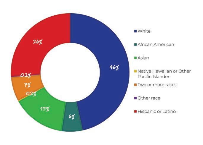
The population of Los Alamitos is relatively middle age with 59 percent of the population being between the ages of 20 to 64 years old, while only 16 percent being classified as seniors (over the age of 65). The racial and ethnic makeup in Los Alamitos is 46 percent White, six percent African American, 15 percent Asian, 0.2 percent Native Hawaiian or other Pacific Islander, seven percent two or more races, and 0.2 percent another race. Twenty six percent is Hispanic or Latino.
The median household income is $84,068. Of the households surveyed in 2018, a majority of households have access to one or more vehicles, with six percent reporting lacking access to a vehicle.

According to the 2018 U.S. Census, there are an estimated 5,490 workers in Los Alamitos. Mode splits for workers’ commute trips are:
» Car: 77.8 percent
» Carpool: 8.8 percent
» Transit: 1.9 percent
» Walk: 3.1 percent
» Bicycle: 0.5 percent
» Work from Home: 7.3 percent
» Other Means: 0.6 percent
Approximately 86.6 percent of workers in Los Alamitos drive to work. This suggests that investments in transit and other mobility choices should be done to reduce employee commuter trips and reduce traffic congestion in Los Alamitos.
The walking mode share measures the percentage of workers aged 16 years and over who commute to work by foot. Mode share reflects how well infrastructure and land-use patterns support travel to work by foot. In the city, walking mode share patterns are connected to the relative proximity of housing to employment centers.
Similar to the walking mode share, bicycling mode share measures the percentage of resident workers aged 16 years and over who commute to work by bicycle.
Transit mode share measures the percentage of workers aged 16 years and over who commute to work by transit. This mode share reflects how well first mile-last mile infrastructure, transit routes, and land-use patterns support travel to work by transit.
Los Alamitos is a small community surrounded by the cities of Cypress, Garden Grove, and Seal Beach in Orange County and the City of Long Beach in Los Angeles County. The Joint Forces Training Base (JFTB) represents nearly half of the land area within the City boundaries.


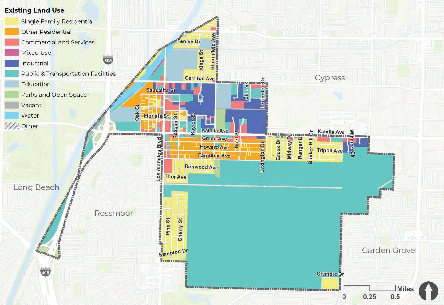
Existing land use patterns in Los Alamitos are defined by medium-density residential development interspersed with pockets of other land uses, that include commercial and services, mixed use, industrial, and public/transportation facilities (refer to Figure 2-1). The concentrations of commercial retail and office occur primarily along major thoroughfares, including Cerritos Avenue, Los Alamitos Boulevard, and Katella Avenue. Concentrations of industrial facilities can be found on Cerritos Avenue, Bloomfield Avenue, and Katella Avenue. Areas of activity can be found along Katella Avenue, Los Alamitos Boulevard, and Bloomfield Street.
In order to be eligible for State funding, a city’s bicycle and pedestrian plan must address connections between specific activity center types. These activity centers are essential destinations, including the community’s major employers, office buildings, industrial sites, government sites, retail centers, hospitals, tourist attractions, schools and parks. Identifying these centers, and their draw for the community, is essential to creating useful bicycle and pedestrian networks. It is important to site facilities that connect the places people actually want to frequent.
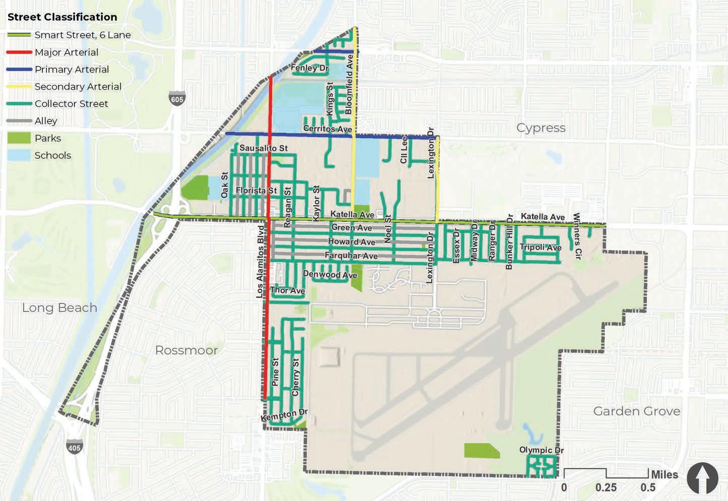
The streets in Los Alamitos are classified into a number of different categories, including smart streets, major arterials, primary arterial, secondary arterial, and collector streets. Regional access to Los Alamitos is provided by a number of highways including Interstates 405 and 605 and State Route 22. Access throughout the city is provided by the major arterial roadways including Katella Avenue, Cerritos Avenue, Ball Road, Los Alamitos Boulevard, and Bloomfield Avenue. The prevalence of major arterials within Los Alamitos, as shown in Figure 2-2, underscores the need for defined facilities along the roadways with higher lane counts as they typically experience higher traffic volumes. It also identifies connector streets that may be good alternatives for bicycle facilities given their low lane count. The roadways were analysed further to determine suitability.

Average daily trips (ADT) is a tool used to measure vehicle traffic load on a section of a road. Essentially, it measures how busy a road is based on the number of vehicular trips in both directions. ADT counts can be provided by day of week and by time of day and can help determine the inclusion or exclusion of bicycle facility types and enhanced amenities for pedestrians. Studies show that most bicyclists and pedestrians tend to prefer roadways with relatively low motor vehicle traffic volumes and speeds. Within the context of bicycle and pedestrian facility planning, the FHWA defines high traffic volumes as more than 12,000 vehicles per day. Figure 2-3 on page 20 displays average daily trips in Los Alamitos. According to this map, Lexington Drive, a secondary arterial, has segments with less than 8,000 daily trips. On the contrary, Cerritos Avenue, Los Alamitos Boulevard, and Katella Avenue have segments exceeding 25,000 daily trips. Bicycle and pedestrian safety should be prioritized along these busy corridors, especially if there are proposed bicycle routes.
The majority of Los Alamitos busier corridors including Katella Avenue, Cerritos Avenue, Ball Road, Los Alamitos Boulevard, and Avenue have posted speed limits of 25, 35, and 45 miles per hour (mph). None of the streets within Los Alamitos have posted speeds of 50 mph or above. Besides the high-volume streets, the city’s low speed streets have a posted speed limit of 25 mph, which makes them conducive to bicycle facilities, such as bicycle boulevards and neighborhood greenways, or shared bicycle routes, as shown in Figure 2-4 on page 21.


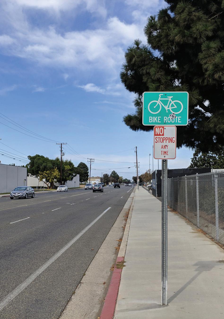
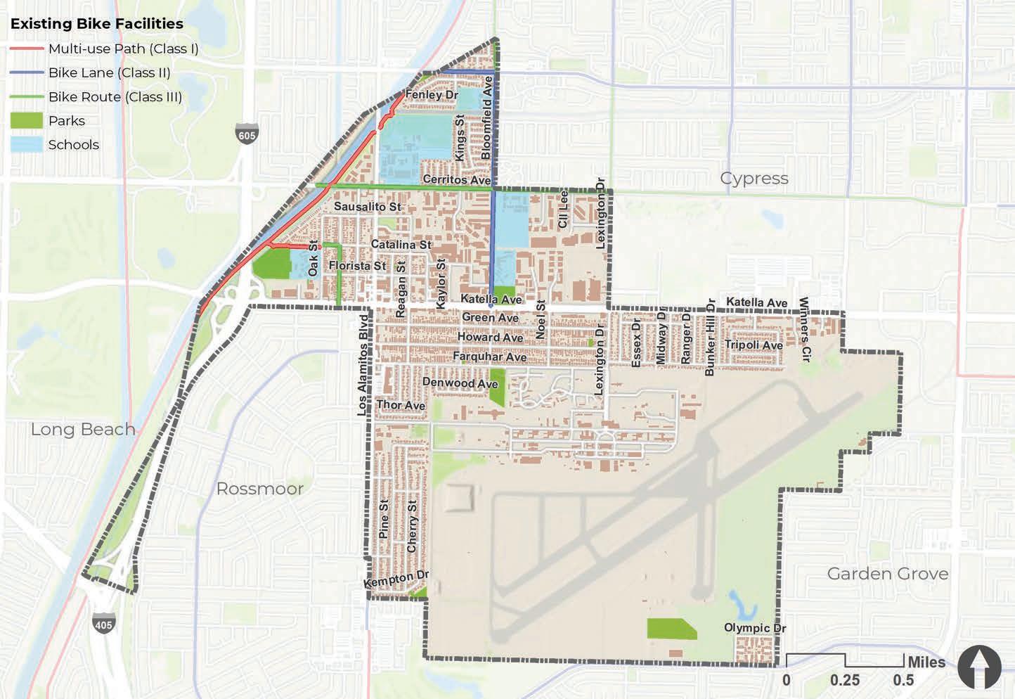
The existing bicycle facility network in Los Alamitos is comprised of multi-use paths, bicycle lanes, and bicycle routes making up 4.5 miles of existing bikeways, as shown in Figure 2-5. Thirty-eight percent of the existing infrastructure are bike routes and most of them are along Cerritos Avenue, Bloomfield Avenue, and Catalina Street. This network was analyzed for connectivity within the city and with other surrounding jurisdictions and was presented to the City as well as stakeholders to gather additional input on routes they felt were important and which should move forward as recommendations.
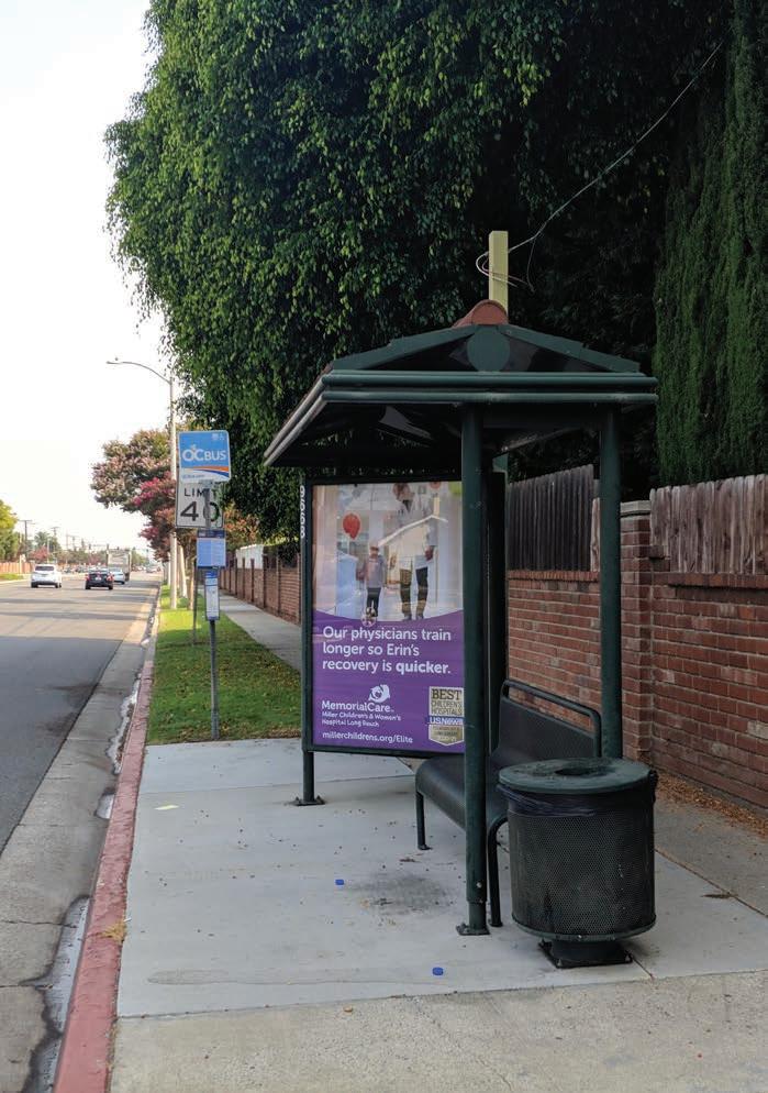
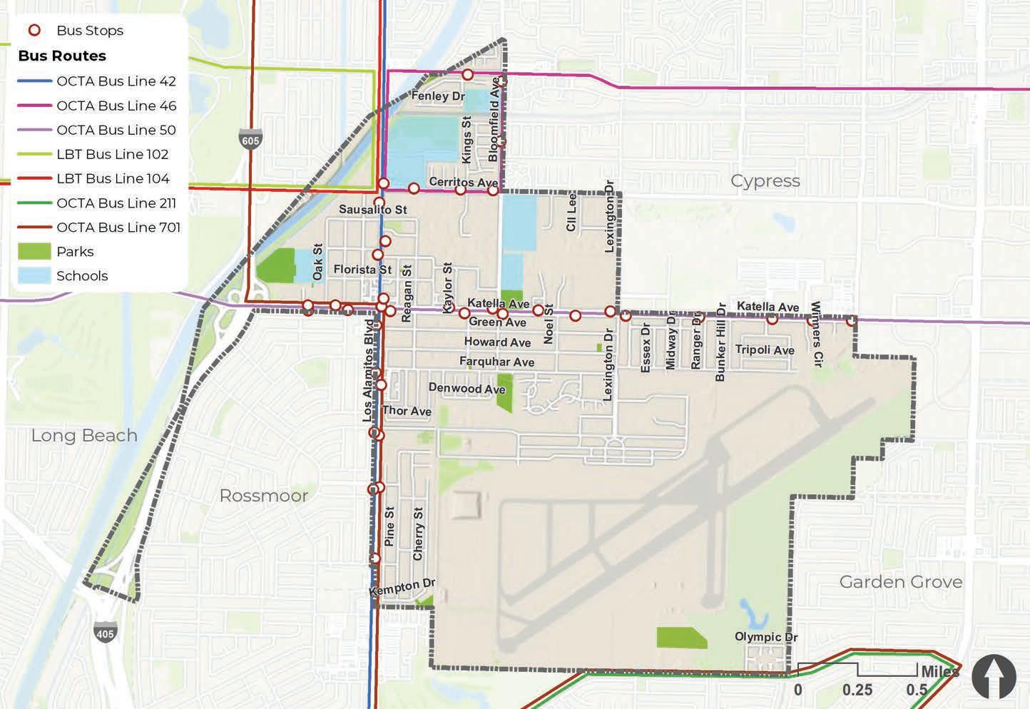
The Orange County Transportation Authority (OCTA) provides transit service throughout the city, as shown in Figure 2-6. Local bus routes provide service along Los Alamitos Boulevard, Bloomfield Street, Katella Avenue, and Cerritos Avenue. There are seven routes within the city which include OCTA Bus Line 42, OCTA Bus Line 46, OCTA Bus Line 50, LBT Bus Line 102, LBT Bus Line 104, OCTA Bus Line 211, and OCTA Bus Line 701.
There are no passenger rail lines through the City of Los Alamitos. The nearest passenger rail lines are west of the City near Long Beach (Metro Blue Line) and north of the city near Norwalk and Santa Fe Springs (Metro Green Line). Buena Park offers the closest Metrolink station (Orange County Line) and Amtrak service (Pacific Surfliner).
There are 37 bus stops in Los Alamitos. As part of the analysis, these routes and stops were collected to ensure improving access to them was integrated into the plan as major destinations. Approximately 1.9 percent of workers in Los Alamitos use public transit as their primary mode of transportation.
To develop this ATP, a thorough analysis of existing conditions in Los Alamitos was conducted that involved GIS analyses, field work, online community outreach, and virtual meetings with City staff to gather data and input. GIS-specific analyses involved processing datasets from the city and open source databases, such as the Transportation Injury Mapping System (TIMS) and combining them to reveal patterns and relationships within Los Alamitos.

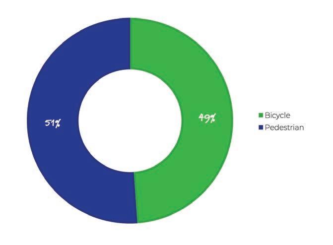
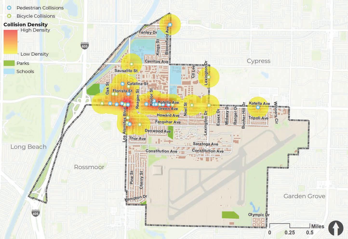
Bicycle and pedestrian collision data were obtained from the Transportation Injury Mapping System (TIMS) collision dataset, which captures reported bicycle-vehicle, pedestrian-vehicle, and bicycle-pedestrian collisions that resulted in injury or property damage in Los Alamitos in the five-year period of 2014 through 2018. Collision density and locations data are displayed on Figure 2-7. Collisions on off-street paths are not reported in the dataset. It is important to note that collisions involving bicyclists and pedestrians are known to be under-reported, and therefore such collisions are likely under-represented in this analysis. In these past five years there were 22 bicycle-related collisions and 23 pedestrian-related collisions, one of which resulted in fatality. The bulk of both collision types resulted in complaint of pain (42 percent) and visible injury (56 percent), with two percent resulting in death. According to the map, areas of high collision density occur along Los Alamitos Boulevard and Katella Avenue.
Collisions 2014-2018
Collision Severity 2014-2018
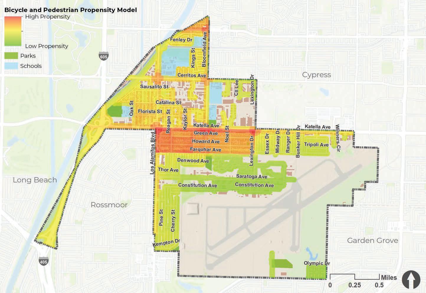
To help define study focus areas, a Geographic Information Systems (GIS) model was created to reveal relationships between the many factors analyzed. A Bicycle-Pedestrian Propensity Model (BPPM) was developed, considering all of the previously discussed analysis inputs, to establish where bicyclists and pedestrians are most likely to be, either currently or if improvements were to be made. The BPPM is comprised of three sub-models: Attractor, Generator, and Barrier Models. These three sub-models are then combined to create the composite BPPM.
Attractors are essentially activity centers known to attract bicyclists and pedestrians. Examples are schools, transit stops, and shopping centers. Generators are developed from demographic data and address potential pedestrian and bicyclist volume based on how many people live and work within the study area. Examples of generators are population density, employment density, primary mode of transportation to work
and vehicle ownership. Barriers are features likely to discourage or detract people from bicycling or walking. These are generally physical limitations, such as areas with high numbers of bicycle- related collisions, high vehicle volumes and speeds, and missing sidewalks.

The resulting map displayed in Figure 2-8 was employed to aid in developing general recommendations and to help select priority projects described in the following chapter. When comparing the input from public workshops, stakeholders, and project surveys, there was correlation between the high propensity areas for bicycling and walking with input provided.
The BPPM map shows highest likely use along major corridors, especially along Katella Avenue, Green Avenue, Howard Avenue, and Los Alamitos Boulevard. However, bicycle and pedestrian propensity is not only concentrated on the major roadways, it also permeates into local streets that people tend to use frequently.
The Bicycle Level of Traffic Stress (LTS) analysis is a GIS-based tool used to quantify a bicyclist’s perception of comfort given specific roadway conditions. Because different bicyclists have different tolerances for stress created by volume, speed, and proximity of automobile traffic, the LTS method identifies four levels of stress, from the most comfortable scenario to the least tolerable conditions. Bicycle Level of Traffic Stress (LTS) criteria span from one to four, with one being the least stressful or most comfortable, and four being the most stressful. The analysis was applied to Los Alamitos’s entire street network, as shown in Figure 2-9. Most of Los Alamitos’s existing bikeways are located along Cerritos Avenue, Bloomfield Avenue, and Catalina Street. All show a relatively low level of traffic stress (LTS one and two). The
map shows Katella Avenue and Los Alamitos Boulevard, both main corridors, with a high level of traffic stress (LTS four). This means that only the most confident, experienced, and strong bicyclists are willing to ride on these facilities, while the other users may not feel safe and comfortable riding on the larger thoroughfares, as shown in the Bicycle User Classification System developed by the City of Portland.These classifications can be helpful in understanding the characteristics and infrastructure preferences of different cyclists.
Bicycle planning should use a wide variety of options, from shared roadways to separated facilities to accommodate as many user types as possible and to provide a comfortable and safe experience for the greatest number of cyclists.
» Low stress
» Most users can tolerate riding their bike
» Low stress, with attention required
» Riding a bike is tolerated by most adults
» Medium stress
» Riding a bike is tolerated by “enthusiastic” riders
» Most stressful
» Riding a bike is tolerated by the most experienced riders

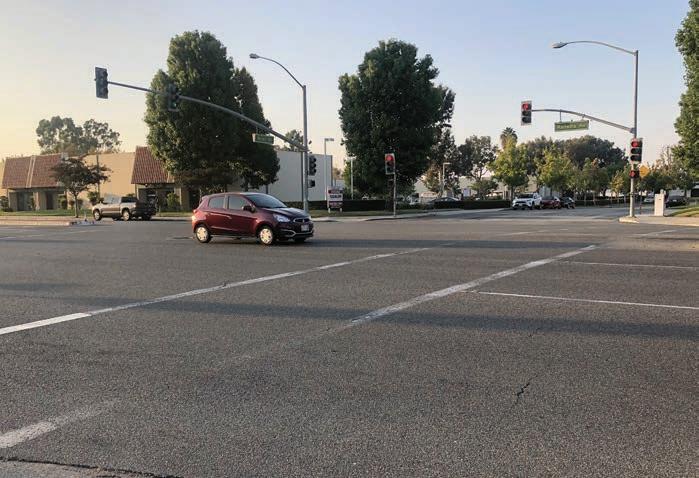
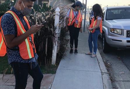
The walk audit process for the ATP provided vital insight into the city’s existing conditions. The team used an online ESRI-based mobile application to collect data and take photos along the prescribed walking route. This exercise improved the team’s understanding of the city’s existing infrastructure by identifying opportunities and constraints along key corridors and intersections, as seen in Figure 2-10. The input was categorized into the following topics:
» Bicycle
» Pedestrian
» Transit
» Traffic Calming

» Other
The data collected will be used in the recommendations and prioritization phase of the planning process.

The ATP planning process was conducted in an open and transparent manner to ensure that community members were included throughout the entire course of the project. The community’s participation was crucial to identify both barriers and opportunities pertaining to walking, bicycling, skateboarding, or accessing transit. To achieve that, the community engagement process was designed to engage a broad spectrum of stakeholders including residents, city staff, local advocacy groups, the school district, and health organizations.
The team’s priority throughout the community engagement process was the safety and welfare of the people they represent and work with. The ongoing COVID-19 pandemic triggered necessary safety measures regarding public gatherings of any size. State and local regulations prohibited large social gatherings which resulted in shifting all community workshops and stakeholder meetings to the online video sharing platform Zoom.
The primary community engagement strategies utilized for the ATP were:
» Virtual Community Workshops
» Community Advisory Committee Meetings
» Flyers and Postcards
» 24-hour project phone line
» Text messaging
» Social media
» Online surveys
» Map-based Surveys
The ATP utilized friendly and appropriate tools to inform the community about the ATP and maximize participation. The following tools allowed the team to engage the community and other stakeholders throughout the planning process, allowing them to provide meaningful input, despite the pandemic.
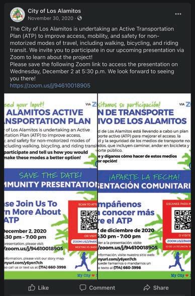
In order to be consistent with the City’s branding and graphic requirements, a similar type of branding style was used for this ATP. The project’s branding was used in all outreach materials, including flyers, surveys, online maps, and workshop exhibits.
A 24-hour phone line was set up for residents to call and address any concerns, thoughts, or desired solutions. A community health worker was responsible for monitoring the phone line and calling back as necessary. The phone line was a great tool for people who did not have access or the skill level to use online technology.
A mass texting platform called TrueText was utilized to send 8,188 texts to over 4,000 residents of Los Alamitos. Text messages informed people about opportunities to participate such as CAC meetings, workshops, and other online tools. The online survey link was also sent to residents via text.
The City’s Facebook page was primarily used to share updates and events such as the project survey, online interactive map, and virtual community workshops. This also allowed residents to post questions and comments regarding the ATP. Additionally, the City of Los Alamitos used their offical City website to post project information, upcoming workshops and the online survey link.

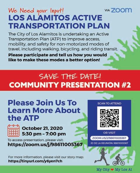
Because of Los Alamitos’s diverse population, the project needed to have a variety of outreach methods and an online presence. According to the 2018 U.S. Census projection, approximately 26 percent of Los Alamitos’s population is Hispanic or Latino. Because of these demographics, online outreach materials were created both in English and Spanish. Additionally, postcards were created and mailed to Los Alamitos residents, with information including a brief project description, online survey link, the 24-hour phone number, and the project Facebook page. Meeting notices and other communications were also sent via email blast to notify the stakeholders about upcoming meetings and project updates. Bilingual flyers were created to promote the three community workshops


A survey was prepared to determine satisfaction levels of current pedestrian and bicycle infrastructure, along with desired improvements. The survey asked people a variety of walking, bicycling, and public transit questions, and prompted them to provide both general and site-specific comments.
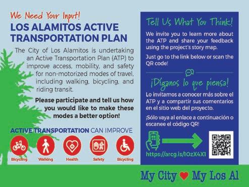
An online comment map was created as a supplemental input method that Los Alamitos residents and stakeholders could use to highlight location-specific constraints and opportunities. It also provided the opportunity to categorize the type of issues or improvements identified on the map (e.g. bike, pedestrian, transit, etc.) and allowed respondents to attach photos and include comments. All points were automatically geo-referenced and allowed anyone to see where others had similar issues. This platform allowed the team and the City to efficiently document and analyze comments identified by the community.
The Community Advisory Committee (CAC) was a key component of the community engagement process. The CAC met quarterly to share information, collaborate, and guide the ATP process and guidelines. For consistency purposes, the CAC consisted of members who represented various community areas/neighborhoods, businesses, school districts, and city departments. Participating organizations included:
» Los Alamitos Unified School District (L.A.U.S.D.)
» Los Alamitos Planning Commission
» Los Alamitos Parks, Recreation, and Cultural Arts Commission
» Los Alamitos Traffic Commission
» Orange County Transportation Authority (OCTA)
» Orange County Health Care Agency
» National SRTS Partnership
» Santa Ana Active Streets Coalition (SAAS)
» Caltrans District 12
» Southern California Associations of Governments (SCAG)
» A summary of the four CAC meetings is detailed below:
The first CAC meeting was held virtually via Zoom on August 28, 2020. The meeting reviewed the goals of the Active Transportation Plan, discussed the project’s background, schedule, and next steps. The presentation dove deeper into specific objectives that the ATP will cover such as improving non-motorized safety and public health as well as assessing community needs, evaluating current street, pedestrian, and bike network, identifying and prioritizing active transportation projects, and providing improved transportation choices, especially near local schools, parks, and major destinations.
The second CAC meeting was held virtually via Zoom on September 30, 2020. The meeting reviewed community feedback received from the first workshop. The first workshop included public participation via input and walk audits. There were concerns regarding safety such as crosswalks, school drop-off and pickup, lack of bike facilities, and bike path accessibility. The meeting also went over comments received from the online map. These comments included traffic calming and safety concerns such as narrow sidewalks, missing sidewalks, and speeding cars. Results from the online survey were also discussed as well as the project’s schedule and next steps.
The third CAC meeting was held virtually via Zoom on November 18, 2020. The meeting reviewed feedback from the second workshop including priority corridors, safe routes to school recommendations, dangerous street intersections, and pedestrian improvements, bicycle improvements, and transit access. The meeting also discussed the pop-up event conducted at Cottonwood Park as well as the next steps in the project.
The fourth CAC meeting was held virtually via Zoom on December 18, 2020. The meeting provided an update from the last pop-up event at Cottonwood Park. The meeting also included several discussions regarding the City’s vision for bicycling, adding curb extensions throughout the City, as well as incorporating a pedestrian scramble on Cerritos Avenue and Los Alamitos Boulevard.
A total of three community workshops were conducted throughout the ATP planning process to gather input and solicit feedback on recommendations.
The first community workshop was held virtually via Zoom on September 3, 2020. The workshop went over the project’s background, goals, outreach, and next steps. In addition, the presentation covered what the ATP will accomplish including assessing community needs, evaluating current street, pedestrian and bicycle network, identifying and prioritizing active transportation projects, and focusing on providing improved transportation choices near schools, parks, and major destinations.

The second community workshop was held virtually via Zoom on October 21, 2020. The workshop covered input from the first workshop which included a summary from the walk audits, safety concerns such as lack of bike facilities and bike path accessibility, traffic counts, and upcoming events like “Walk to School Day.” The workshop also reviewed a summary of the surveys completed so far. From those results, residents answered that they would like to see better pedestrian and bicycling routes to parks and schools.

The third and final community workshop was held virtually via Zoom on December 2, 2020. The third workshop reviewed input received from the second workshop. This input included identifying priority corridors including Cerritos Avenue, Los Alamitos Avenue, and Katella Avenue. The feedback from workshop two also included identifying safe routes to schools such as Los Alamitos Elementary, McAuliffe Middle School, and Los Alamitos High School. The presentation also reviewed a summary of the survey results completed at the time as well as a summary of the pop-up outreach events conducted at Little Cottonwood Park, Laurel Park, and a bus stop near Shoe City.
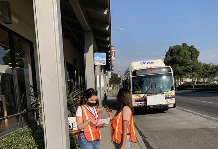
Due to the ongoing COVID-19 pandemic, state and local regulations prohibited large social gatherings. As a result, many events after the first were conducted as outdoor pop-up events. The following sections summarize the two pop-up events that took place during the final phase of the outreach process.

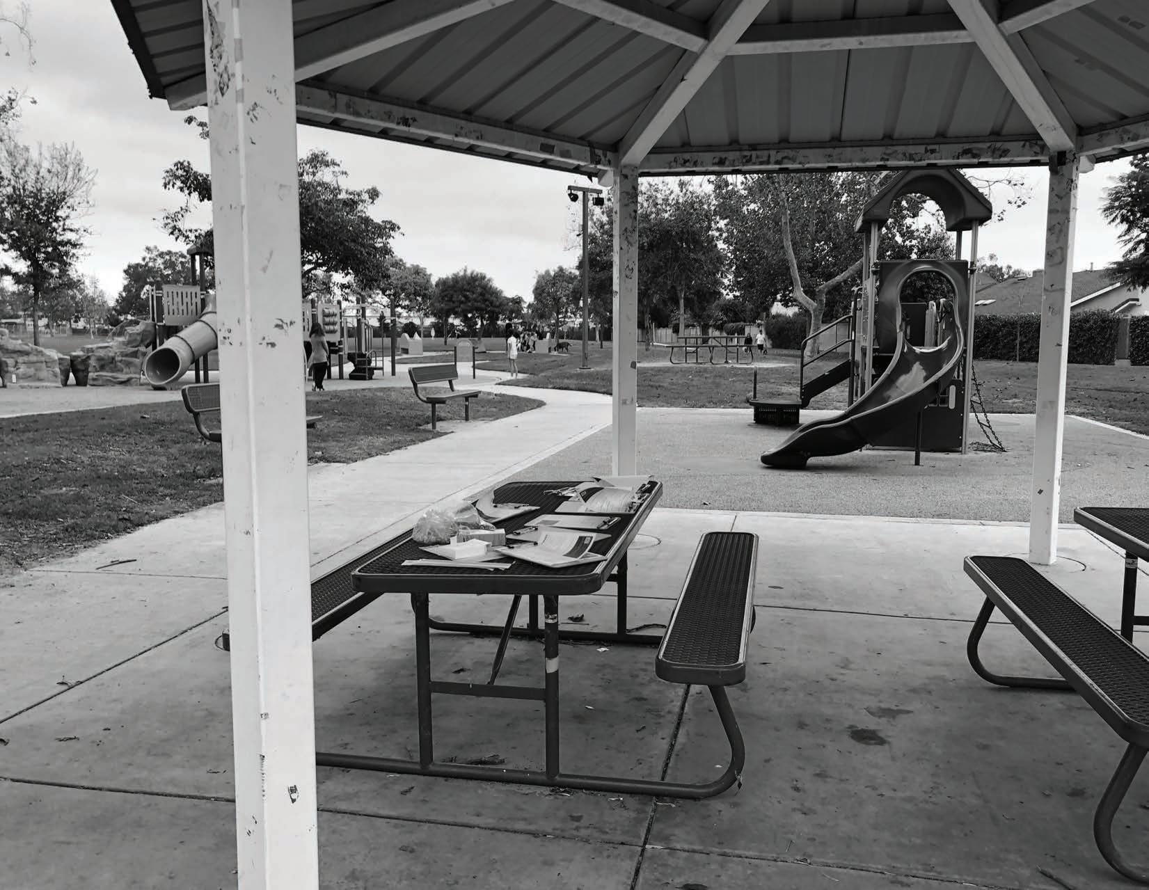
The first pop-up was set up at Little Cottonwood Park in Los Alamitos. The team had clipboards ready with printed surveys which were disseminated to residents at the park. The survey was also available digitally via tablets and laptops as a preference for those who did not want to fill out the print version of the survey. Feedback was collected and used in the recommendations chapter for the proposed projects.
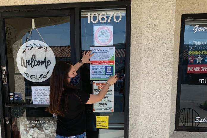
The second series of pop-up events took place at different locations, mainly business centers in Los Alamitos. The team also had clipboards with printed surveys for people to fill out. A QR code was created for the survey so that visitors had the opportunity to complete the survey on their own devices or at another time. Those who completed the survey were given workshop flyers and some giveaways. The businesses were left with QR codes to the surveys, posters, and flyers with information about the project. The feedback received varied by age. When talking to youth, many of them brought up the need to have more skate parks and safe areas for them to ride. Some adults expressed their concerns about the lack of bike lanes and their fear when riding on the street. They expressed how they felt more safe riding on the sidewalks.
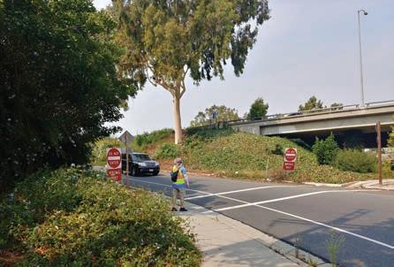
On February 16, 2021, the project team conducted interviews with school crossing guards at several locations, which allowed them to provide recommendations to improve bikeability and walkability around school zones. The crossing guard at McAuliffe Middle School expressed concerns over the safety of students who cross the street while cars make turns, as well as jaywalking that takes place on Bloomfield Street. The crossing guard at Weaver Elementary mentioned the need for pedestrian crosswalk lights to maximize visibility. In the Los Alamitos Elementary area, the crossing guard expressed the need for wider bicycle lanes for students and community members that ride in the area. Also, they consider that adding shade along the sidewalks would benefit students as they wait to get picked up.
In addition to school specific comments, general recommendations provided by crossing guards include the allocation of additional crossing guards per school, especially in the drop-off areas, as well as having pedestrian safety town halls to build awareness to benefit the community. Other recommendations include the installation of speedbumps near the school zones, especially in areas where vehicles go over the 25-mph speed limit. According to the interviews, the area around the Oak Middle School has higher levels of pedestrian activity, including elderly residents. As a result, benches should be considered as well.
During the interview process, the project team noticed high vehicular speeds on Cerritos Avenue, especially during school hours. Also, light poles and electric boxes were observed along the sidewalks on Los Alamitos Boulevard, which can make pedestrian circulation difficult. Additionally, younger pedestrians were seen walking on the road during rush hour after school.


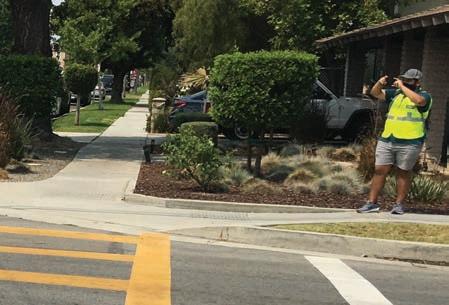
The walk audits were completed over a span on four days. The team took note of their observations and surrounding land use characteristics. The team noticed there is a need for more bike lanes in many of the corridors. The team observed more people riding on the sidewalks, especially on streets like Katella Avenue. When walking near schools, there was a lack of signage for speed limits and faded markings such as bike lanes and crosswalks. There was also a lot of traffic and signal timings were not long enough when large groups of students were crossing.


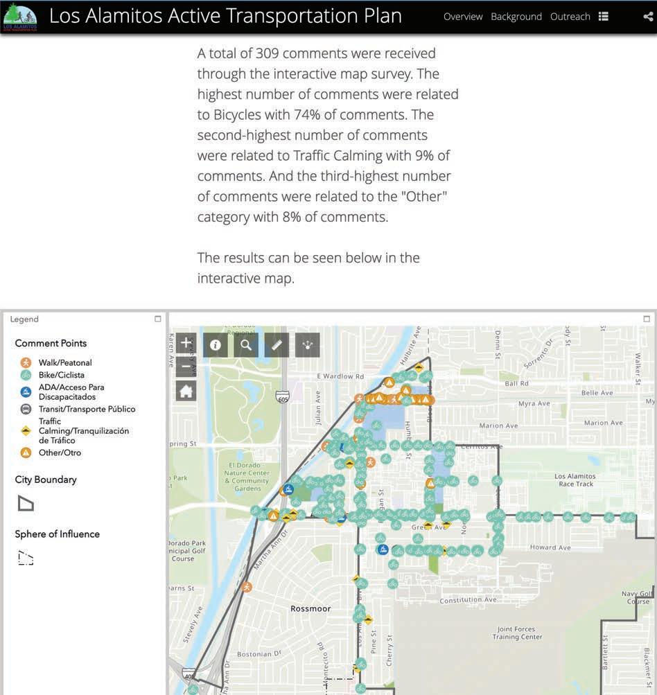
An online Story Map was created as a supplemental method to inform Los Alamitos residents about the project, provide updates, and fill in online surveys. A comment map was also available where residents were able to highlight location-specific constraints and opportunities.
There was a total of 196 unique comments (306 raw comments) made on the online comment map. The results were analyzed and used for the development of potential pedestrian and bikeway projects. The online map provided the City with a current view of people’s opinions, concerns, and desires for pedestrian and bicycle facilities. Of the comments, 134 were bicycle-concern related, 22 were walking-concern related, 19 comments were related to traffic calming, five comments were related to ADA concerns, and 16 comments were categorized as other.
The bike comments included eliminating street parking to add bike lanes, establishing bike boulevards, and adding sharrows and wayfinding signage. The walking comments mentioned the lack of high-visibility crosswalks, missing/damaged sidewalks, and installing a pedestrian bridge over Katella Avenue to improve pedestrian access. The traffic calming comments mentioned speeding cars along busy corridors, especially near schools making it unsafe for pedestrians and children to walk. The ADA comments addressed that the existing crosswalks in Los Alamitos are not accessible via wheelchair. These comments highlight the importance of needing to address various active transportations demands in the City.
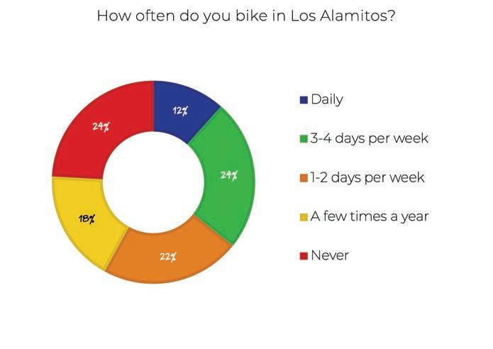
A total of 116 people completed the survey and provided comments. The results were analyzed and used for the development of potential pedestrian and bikeway projects. The survey also provided the City with a current view of people’s opinions, concerns, and desires for pedestrian and bicycle facilities.
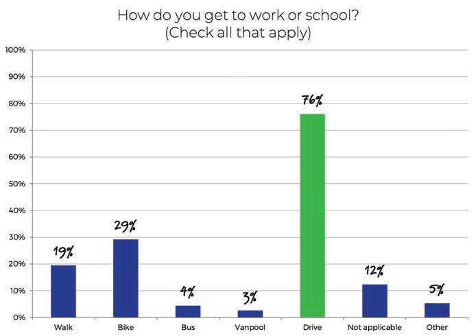
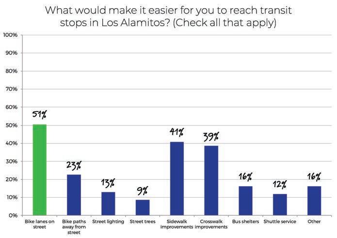
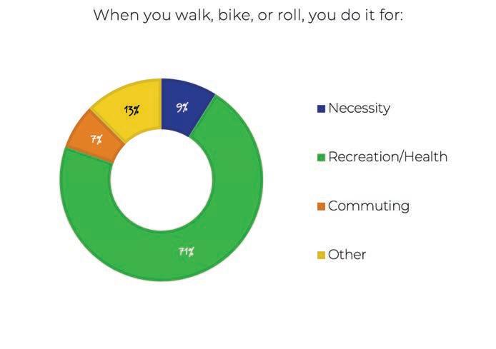
According to the survey results, 36 percent of respondents indicated that they walk daily, and 22 percent indicated that they do it 3 to 4 days per week, which may be due to the size and walkability of the city. On the other hand, about 12 percent bike daily, while 24 percent do it 3 to 4 days per week. About 76 percent of respondents indicated that they drive to get to work or to school while only 29 percent bike and 19 percent walk. However, 54 percent of respondents indicated that they walk or bike to get to that park. As a result, respondents would like to see more pedestrian and bicycle routes to parks (64 percent), schools (64 percent), and shopping centers (49 percent). A majority of respondents consider that multi-use paths (44 percent) and wider sidewalks (43 percent) would make it easier for them to walk in Los Alamitos. In comparison, the majority consider bike lanes on streets (65 percent) and bike paths away from the street (63 percent) would make it easier for people to bike around the city. When asked about their main reasons for walking, biking and rolling, 71 percent of respondents do it for recreation or health reasons, nine percent do it for necessity, seven percent to commute, while 13 percent do it for other reasons.
Note: For questions that allow multiple answers, the total number of answer choices selected for a question can be greater than the number of respondents that answered the question. This can cause the total response percentages to exceed 100 percent.




This chapter addresses the physical improvements recommended to enhance bicycling and walking in Los Alamitos. The recommended bicycle and pedestrian improvements include both short-term and longterm improvements and is meant to serve as a guide to help the City in allocating funds as they become available through various sources. The chapter contains maps and tables that detail improvement location, extent, and type.
It is important to note that the success of recommended projects is closely tied to programs and adopted standards, codes, and policies. Engineering, Education, Encouragement, Enforcement, Equity and Evaluation can be used to leverage investments in these projects. Similarly, the effectiveness of bicycle and pedestrian programs is maximized by actual project implementation. Likewise, changes to city standards, codes, and policies may be needed to implement bicycle and pedestrian improvements. Project implementation may, in turn, facilitate changes to city standards, codes, and policies.
While not universally applied, in general, pedestrian travel in urban areas has long tended to be accommodated with features like sidewalks, crosswalks, dedicated signals, and curb extensions. Suggested pedestrian treatments address a wide variety of issues identified in the analysis and community engagement process to enhance connectivity to transit, school zones, senior zones, activity centers, parks, and other community destinations. Pedestrian improvements help to ensure equitable multi-modal transportation because they serve populations that may not be able to afford a bicycle or likely to ride a bicycle, and instead rely on transit and walking. Newer innovations like pedestrian scrambles, modified signal timing, flashing beacons, and other pedestrian improvements are described in this chapter in addition to standard pedestrian treatments.
A focus on providing safer, less stressful bicycle travel has occurred more recently across the United States, with significant transformation in the state of practice for bicycle travel over the last five years. Much of this may be attributed to bicycling’s changing role in the overall transportation system. No longer viewed as an “alternative” mode, it is increasingly considered as legitimate transportation that should be actively promoted as a means of achieving community environmental, social, and economic goals. While connectivity and convenience remain essential bicycle travel quality indicators, recent research indicates the increased acceptance and practice of daily bicycling will require “low-stress” bicycle routes, which are typically understood to be those that provide bicyclists with separation from high volume and high-speed vehicular traffic. The route types recommended in this plan, and described in the following section, are consistent with this evolving state of practice.
There are four conventional bicycle route types recognized by the California Department of Transportation. Details of their design, associated wayfinding, and pavement markings can be found in the CA MUTCD and CA Highway Design Manual.
Class I multi-use paths (frequently referred to as “bicycle paths”) are physically separated from motor vehicle travel routes, with exclusive rights-of-way for non-motorized users like bicyclists and pedestrians.
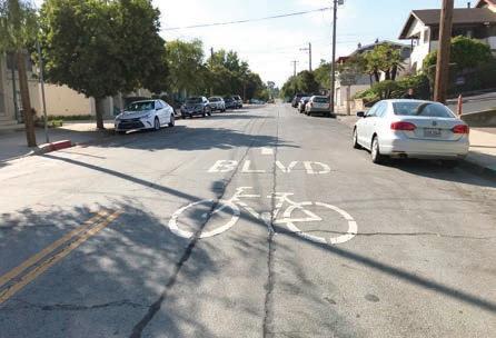
Bicycle lanes are one-way route types that carry bicycle traffic in the same direction as the adjacent motor vehicle traffic. They are typically located along the right side of the street (although can be on the left side) and are between the adjacent travel lane and curb, road edge, or parking lane. They are not physically separated from motor vehicle traffic.
A bicycle route is a suggested bicycle path of travel marked by signs designating a preferred path between destinations. They are recommended where traffic volumes and roadway speeds are fairly low (35 mph or less).
Separated bikeways are bicycle-specific routes that combine the user experience of a multi-use path with the on-street infrastructure of a conventional bicycle lane. Separated bikeways are physically separated from motor vehicle traffic and designed to be distinct from any adjoining sidewalk. The variety of physical protection measures can include raised curbs, parkway strips, reflective bollards, or parked vehicles. Separated bikeways can be either one-way or two-way, depending on the street network, available right-of-way, and adjacent land use, but the safety of two-way separated bikeways must be carefully evaluated, especially if they cross motor vehicle routes. This is because few motor vehicle drivers are accustomed to two-way separated bikeways and they may tend to look to the left only when deciding whether it is safe to proceed across the separated bikeways.
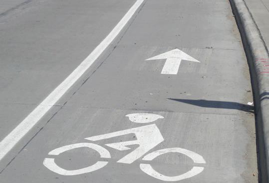
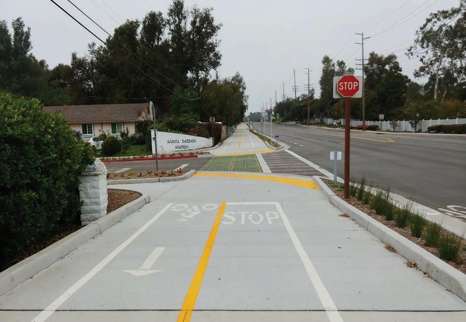
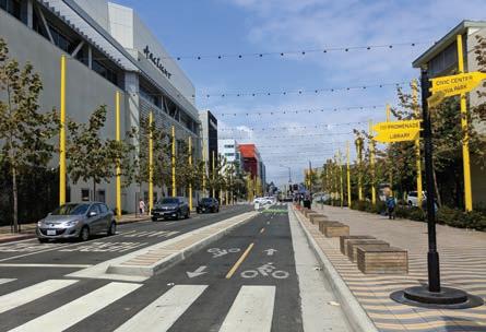
While the conventional bicycle route types can be found throughout the United States, there has been a distinct shift towards further enhancement. For example, the CA MUTCD has approved the installation of buffered bicycle lanes, while Shared Lane Markings or “Sharrows” have been in use since 2004 throughout the State.
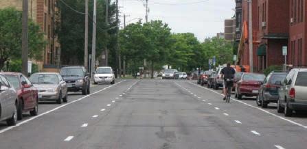
These enhancements are low cost, easy to install, and provide additional awareness about the likely presence of bicyclists. In many instances, installation of these bicycle route enhancements can be coordinated as part of street resurfacing projects. The use of green markings has also become a simple and effective way to communicate the likely presence of bicyclists. It is also used to denote potential conflict zones between bicyclists and vehicles.
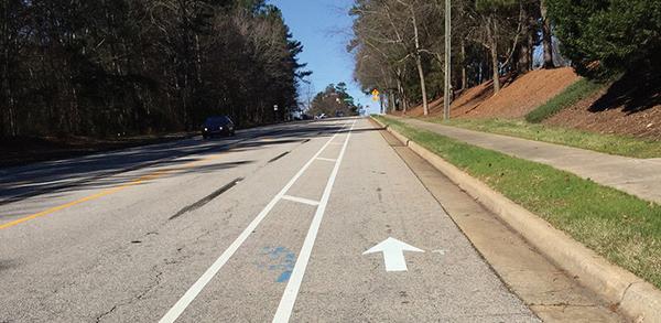
Buffered bicycle lanes provide additional space between the bicycle lane and traffic lane, parking lane, or both, to provide a more protected and comfortable space for bicyclists than a conventional bicycle lane. The buffering also encourages bicyclists to avoid riding too close to parked vehicles, keeping them out of the “door zone” where there is the potential danger of drivers or passengers suddenly opening doors into the bicyclists’ path.

The shared lane marking is commonly used where parking is allowed adjacent to the travel lane. It is now common practice to center them within the typical vehicular travel route in the rightmost travel lane to ensure adequate separation between bicyclists and parked vehicles. Many cities install sharrows over a green background to enhance visibility.
A bike box is a designated area at the head of a traffic lane at a signalized intersection that provides bicyclists a safe and visible way to wait ahead of queuing traffic during the red signal phase. This positioning helps encourage bicyclists traveling straight through not to wait against the curb for the signal change.
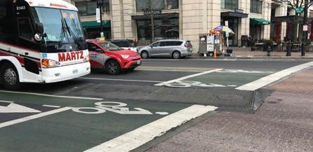
An advisory bike lane is a preferred space for bicyclists and motorists to operate on narrow streets that would otherwise be a shared roadway. Roads with advisory bike lanes accommodate low to moderate volumes of twoway motor vehicle traffic and provide a safer space for bicyclists with little or no widening of the paved roadway surface. Due to their reduced cross section requirements, advisory bike lanes have the potential to open up more roadways to accommodate comfortable bicycle travel.
There are a number of other non-conventional route types that the City may find useful in specific situations. In many cases, the conventional bicycle route types previously mentioned may not meet the community’s perceptions of safe and comfortable bikeways. Protected, low-stress streets, and bicycle-prioritized route types are constantly being revised and improved to meet the community’s needs.
The improvements described in this section have been implemented in other states in the United States as well as other countries with great success and are quickly becoming standard recommendations.
Details of these route types and other treatments can be found in the NACTO Urban Bikeway Design Guide, FHWA Separated Bike Lane Planning and Design Guide, or the AASHTO Guide for the Development of Bicycle Facilities.
Bicycle boulevards provide a convenient, low stress cycling environment for people of all ages and abilities. They are installed on streets with low vehicular volumes and speeds and often parallel higher volume, higher speed arterials. Bicycle boulevard treatments use a combination of signs, pavement markings, traffic diverters, and traffic calming measures that help to discourage
through trips by motor vehicle drivers and create safe, convenient bicycle crossings of busy arterial streets. They are similar to class III bicycle routes but tend to include more traffic calming and diversion infrastructure.
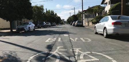

Signage and wayfinding on all streets and bicycle routes are intended to identify routes to both bicyclists and drivers, provide destination information and branding, and to inform all users of changes in roadway conditions.
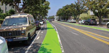

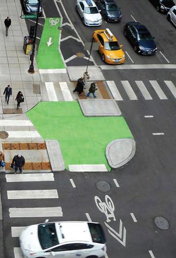
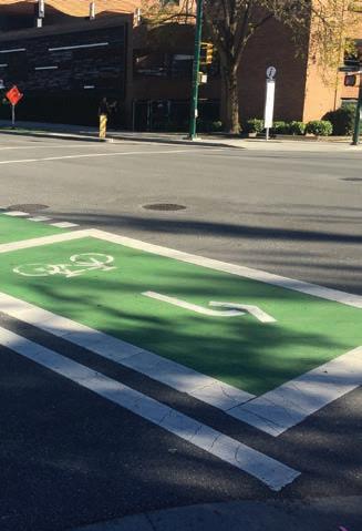
Colored pavement increases the visibility of bicycle routes, identifying potential areas of conflict or transition, and reinforces bicyclists’ priority in these areas. Colored pavement can be used as a corridor treatment, along the length of a bicycle lane or within a protected bikeway. Additionally, it can be used as a spot treatment, such as crossing markings at particularly complex intersections where the bicycle path may be unclear. Consistent application of color across a bikeway corridor is important to promote clear understanding for all roadway users.
Intersection or mid-block crossing markings indicate the intended path of bicyclists. Colored striping can be used to highlight conflict areas between bicyclists and vehicles, such as where bicycle lanes merge across motor vehicle turn lanes.
Protected intersections maintain the integrity (low stress experience) of their adjoining separated bicycle lanes by fully separating bicyclists from motor vehicles at intersections. Hallmark features of these protected intersections include two-stage crossings supported by an advance queuing space, protective concrete islands, special bicycle-cross markings (parallel with crosswalks), and special signal phasing.
Two-stage turn queue boxes can provide a more comfortable left-turn crossing for many bicyclists because they entail two low stress crossings, rather than one potentially high stress one. They also provide a degree of separation from vehicular traffic, because they do not require merging with vehicle traffic to make left turns. Bicyclists wanting to make a left turn can continue into the intersection when they have a green light and pull into the green queue box. Bicyclists then turn 90 degrees to face their intended direction and wait for the green light of a new signal phase to continue through.
This category includes all types of traffic signals directed at bicyclists. These can include typical green/yellow/red signals with signage explaining the signal controls, or special bikeway icons displayed within the signage lights themselves. Near-side bicycle signals may incorporate a “countdown to green” display, as well as a “countdown to red.”


Bicycle detection is used at intersections with traffic signals to alert the signal controller that a bicycle crossing event has been requested. Bicycle detection can occur either through the use of push buttons or by automated means and are marked by standard pavement symbols.
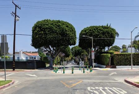
Traffic calming involves changes in street alignment, installation of barriers, and other physical measures to reduce traffic speeds and/ or cut-through motor vehicle traffic volumes. The intent of traffic calming is to alter driver behavior and to improve street safety, livability, and other public purposes. Other techniques consist of operational measures such as police enforcement and speed displays. The following examples provided are traffic calming measures that may apply to Los Alamitos.
A roundabout is a circular intersection with yield control at its entry that allows a driver to proceed at controlled speeds in a counterclockwise direction around a central island. Roundabouts are designed to maximize motorized and non-motorized traffic through their innovative design that includes reconfigured sidewalks, bikeway bypasses, high-visibility crosswalks, pedestrian flashing beacons, and other traffic measures. Roundabouts can be implemented on most streets but may require additional right-of-way.
A traffic circle is a small-scale traffic calming measure commonly applied at uncontrolled intersections on low volume, local residential streets. They lower traffic speeds on each approach and typically avoid or reduce right-of-way conflicts because the overall footprint is smaller compared to roundabouts. Traffic circles may be installed using simple markings or raised islands but are best accompanied with drought-tolerant landscaping or other attractive vertical elements.
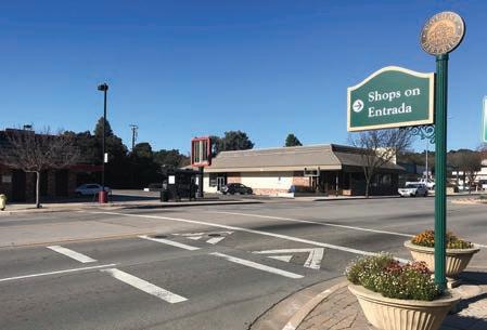
Traditional pedestrian signals remain the gold standard for high quality pedestrian crossings, although some cases warrant new signal technologies. Pedestrian Hybrid Beacons (PHBs) and Rectangular Rapid Flashing Beacons (RRFBs) are special signals used to warn and control traffic at unsignalized locations to assist pedestrians in crossing a street via a marked crosswalk. Either of these devices should be installed at locations that have pedestrian desire lines and that connect people to popular destinations such as schools, parks, and retail. Research has shown that PHBs tend to have a 90 percent motorist compliance rate versus RRFBs, which tend to have an 80 percent motorist compliance rate. Traditional pedestrian signals tend to have around a 100 percent compliance rate, which improves safety over other types of signals, and therefore are preferable for pedestrian facilities.
Signals and warning devices should be paired with additional pedestrian improvements, where appropriate, such as curb extensions, enhanced crosswalk marking, lighting, median refuge islands, corresponding signage, and advanced yield markings to mitigate multiple threat crashes on multi-lane roadways.

Speed tables are flat-topped road humps, often constructed with textured surfacing on the flat section. Speed tables and raised crosswalks help to reduce vehicle speeds and enhance pedestrian safety.
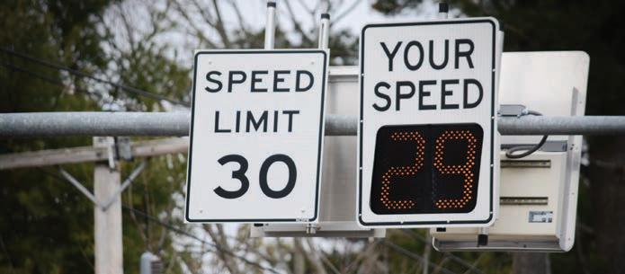
Speed displays measure the speed of approaching vehicles by radar and inform drivers of their speeds using an LED display. Speed displays contribute to increased traffic safety because they are particularly effective in getting drivers traveling ten or more miles per hour over the speed limit to reduce their speed.
Chicanes are a series of narrowings or curb extensions that alternate from one side of the street to the other forming an S-shaped path. Chicanes reduce drivers’ speeds by causing them to shift their horizontal path of travel.
A traffic diverter is a roadway design feature placed in a roadway to prohibit vehicular traffic from entering into or exiting from the street, or both.
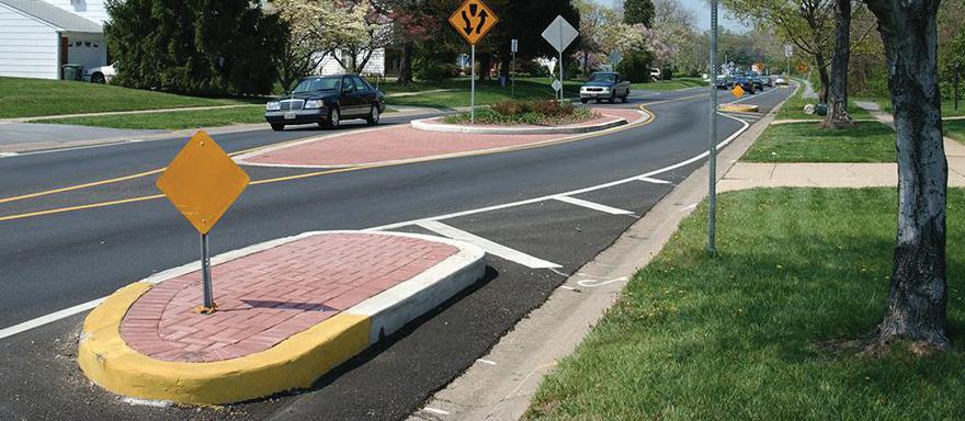
Edge friction is a combination of vertical elements such as on-street parking, bicycle routes, chicanes, site furnishings, street trees, and shrubs that reduce the perceived street width, which has been shown to reduce motor vehicle speeds.
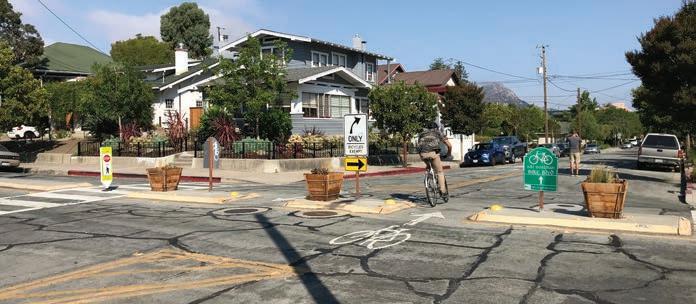
Most streets in Los Alamitos have sidewalks, and the network has been evaluated to determine if appropriate sidewalk widths and ADA compliant curb ramps are present (ADA Transition Plan). While many intersections are signalized and have crosswalks, there are some segments with long blocks without convenient crossing places. Providing crossing treatments will help to reduce “jaywalking” and unsafe crossings between intersections.
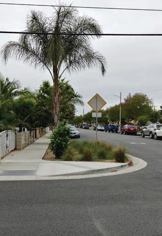
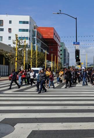
Enhanced crosswalk markings can be installed at existing or proposed crosswalk locations. They are designed to both guide pedestrians and to alert drivers of a crossing location. The bold pattern is intended to enhance visual awareness.
Also called bulb-outs or neck-downs, curb extensions extend the curb line outward into the travel way, reducing the pedestrian crossing distance. Typically occurring at intersections, they increase pedestrian visibility, reduce the distance a pedestrian must cross, and reduce vehicular delay. Curb extensions must be installed in locations where they will not interfere with bicycle lanes or separated bikeways. If both treatments are needed, additional design features such as ramps, or half-sized curb extensions should be considered.
Refuge islands provide pedestrians and bicyclists a relatively safe place within an intersection and midblock crossing to wait if they are unable to complete their crossing in one movement.

Mid-block crossings provide convenient locations for pedestrians and bicyclists to cross thoroughfares in areas with infrequent intersection crossings or where the nearest intersection creates substantial out-of-direction travel. Mid-block crossings should be paired with additional traffic-control devices such as traditional Pedestrian Signals, PHBs, RRFBs, LED enhanced flashing signs, and/or refuge islands.
Pedestrian-scale lighting provides many practical and safety benefits, such as illuminating the path and making crossing walkers and bicyclists more visible to drivers. Lighting can also be designed to be fun, artistic, and interactive.
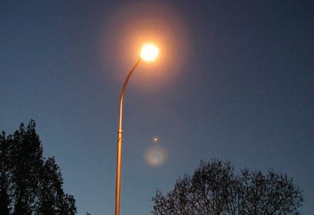
A Leading Pedestrian Interval (LPI) is a signal timing technique that typically gives pedestrians a three to seven second head start when entering a crosswalk with a corresponding green signal in the same direction of travel. LPIs enhance the visibility of pedestrians in the intersection and reinforce their right-of-way overturning vehicles, especially in locations with a history of conflict. Generally, this leads to a greater likelihood of vehicles yielding. Depending on intersection volume and safety history, a normal right-turn-on-red (RTOR) might be explicitly prohibited during the LPI phase.
Pedestrian scrambles, also known as all-way pedestrian phases, stop vehicular traffic flow simultaneously in all directions to allow pedestrians to cross the intersection in any direction. They are used at intersections with particularly heavy pedestrian crossing levels. Unless cycle lengths can be kept under 90 seconds, Leading Pedestrian Intervals (LPIs) are generally preferred over pedestrian scrambles.

Adjusting the time, phasing, and actuation needed to cross high-volume and wide streets, provides additional safety and comfort for pedestrians and bicyclists.
Potential future city designated senior zones can be enhanced with street signage, increased crossing times at traffic signals, benches, bus stops with shelters, and pedestrian lighting.
Transit stop amenities such as shelters with overhead protection, seating, trash receptacles, and lighting are essential for encouraging people to make use of public transit.

The inclusion of urban elements such as parklets and community gardens encourages walking and provides usable space for all ages. In many cities, these urban elements have helped to transform urban villages and downtowns into walkable destinations. Coordinating with local Los Alamitos businesses and organizations may provide collaborative design and funding opportunities between the City, its businesses, residents, and visitors.
Parklets are small, outdoor seating areas that take over one or two parking spots, reclaiming the space for the community, and improving the urban environment’s aesthetics and streetscape.

Community gardens provide fresh produce and plants and assist in neighborhood improvement through a sense of community and connection to the environment. They are typically managed by local governments or non-profit associations.
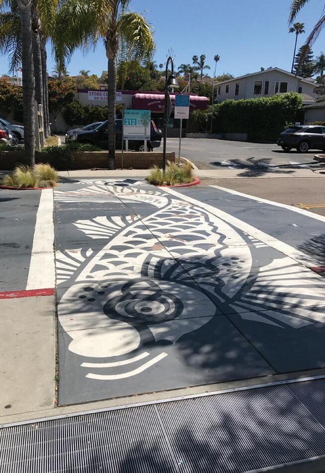
Special intersection paving and crosswalk art provide unique opportunities at intersections to highlight crossings, key civic or commercial locations, while breaking the visual monotony of asphalt. Intersection paving treatments and crosswalk art can integrate context-sensitive colors, textures, and scoring patterns.
Paving treatments and crosswalk art do not define a crosswalk and should not be seen as a safety measure. Standard transverse or longitudinal high visibility crosswalk markings are still required.
Transit shelters, bicycle racks, seating, and public art provide important amenities for functionality, design and vitality of the urban environment. They announce that the street is a safe and comfortable place to be and provide visual detail and interest.

This section addresses the physical recommendations to help improve the non-motorized environment in Los Alamitos. These recommendations include many of the facility types and amenities referenced at the beginning of this chapter. Subsequent sections discuss the associated programs that help support this ATP’s long-term goals.
Route implementation has no specific timeline, since the availability of funds for implementation is variable and tied to the priorities of the City’s capital projects. If there is desire, recommended projects can be implemented at whatever interval best fits funding cycles or to take into consideration the availability of new information, new funding sources, updated collision statistics, updated CIP lists, etc.
The proposed projects form a comprehensive, low stress network that includes bicycle facilities on every major (arterial) street and several smaller (local) streets, as well. The plan recommends a total of 18 bikeway projects (see Table 4-1) that equate to 17.4 miles of new bikeways. Of these, three percent are multi-use paths, 41 percent are bicycle lanes, and 50 percent are bicycle routes. The remaining six percent represents potential projects that should be explored and studied to fully understand the future opportunities of these segments
Along the 18 proposed routes, recommendations were developed based on analysis of existing conditions, community input, field observations, and previous planning and CIP projects. The recommended projects are mapped by facility types and identification number accompanied with tables listing detailed information such as location, route type, and extent. The following project sheets provide a brief description, maps, and metrics associated with each of the top ten bikeway projects. These project sheets can be used to help guide future development, CIP projects, and grant pursuits.
Each of these proposed projects represent a variety of street types that currently lack safe access and mobility for pedestrians, bicyclists, and other non-motorized modes. These treatments are important to mending existing safety and connectivity gaps within the city’s current bicycle network. They can be implemented at the interval that best fits funding cycles, city discretion, or to take into consideration the availability of new information, new funding sources, updated collision statistics, updated CIP lists, etc.
The project prioritization procedure is a data-driven and interactive process consisting of cumulative scores derived from various criteria. The goal of project prioritization is to provide the city guidance on which projects to pursue future design and funding endeavors such as yearly CIP discussions or grant opportunities like Caltrans’ ATP program.
The criteria used are consistent with regional best practices and they include:
» Proximity to schools, parks, commercial centers, and transit stops
» Pedestrian and bicycle collisions
» Census data such as youth population density, employment density, walk to work, bike to work, and vehicle ownership
» CalEnviroScreen 3.0
The complete and detailed list of the criteria and scores can be found in Appendix C.
Class II bike lanes where feasible. City to coordinate with Caltrans & OCTA on I-605/ Katella project. Priority corridor that requires detailed attention to implement various recommendations.
Class II between north city boundary and Katella Ave, add painted buffers where possible; Class III between Katella Ave and Farquhar Ave.
Class II bike lanes with painted buffers where possible; priority corridor due to high volumes of multi-modal traffic because of nearby schools, businesses, and access to Coyote Creek multi-use path
Class II bike lanes where feasible. Priority corridor that requires detailed attention to implement various recommendations.
Class III route. Potential to be branded as a neighborhood greenway with addition of traffic calming and placemaking elements i.e. crosswalk art, curb extensions, and wayfinding signage
Class III route; Priority corridor because it runs parallel to Katella Ave, providing connections to multiple destinations. Can be branded as a neighborhood greenway with additional elements i.e. crosswalk art, curb extensions, and wayfinding signage
Add painted buffers and signage to existing bike lanes. Wayfinding signage directs people to
path
Class III route. Potential to be branded as a neighborhood greenway with addition of traffic calming and placemaking elements i.e. crosswalk art, curb extensions, and wayfinding signage
Class III route; enhancements will improve access to school and Coyote Creek multiuse path; Potential to be branded as a neighborhood greenway with addition of elements i.e. crosswalk art, curb extensions, and wayfinding signage
Class III route; Important corridor because it provides direct access to and from City and Rossmoor; Potential to be branded as a neighborhood greenway with addition of traffic calming and placemaking elements i.e. crosswalk art, curb
and wayfinding signage
Class III between Cerritos Ave and Katella Ave; Class II between Katella Ave and Farquhar Ave
Class III route. Potential to be branded as a neighborhood greenway with addition of traffic calming and placemaking elements i.e. crosswalk art, curb extensions, and wayfinding
Class II between Briggerman Dr and Katella Ave, add painted buffers where possible; Class III route between Katella Ave and Farquhar Ave; requires additional study to verify installation of new traffic signal at intersection of Reagan St and Katella Ave
Class III route. Potential to be branded as a neighborhood greenway and exercise loop with addition of traffic calming and placemaking elements i.e. crosswalk art, curb extensions, and wayfinding signage
Class III bike lanes between Oak Street and Los Alamitos Blvd, add painted buffers where possible; Class III bike route between Los Alamitos Blvd and Reagan St; add wayfinding signage to direct people to nearby routes
Class II bike lanes with painted buffers where possible; add wayfinding signage to direct people to nearby routes
Class I multi-use path on Coyote Creek flood control channel service roads. Multi-use path shifts sides to avoid conflicts with residential homes, would requrie prefab bridge
Class III route. Potential to be branded as a neighborhood greenway and exercise loop with addition of traffic calming and placemaking elements i.e. crosswalk art, curb extensions, and wayfinding signage
Opportunity to construct a class I multi-use path that would provide a safe connection to and from the Coyote Creek path while bypassing the I-605 interchange.
Opportunity to work closely with the Rossmoor community to install a class III route with appropriate wayfinding signage to direct people to nearby bike routes that bypass the Los Alamitos Blvd and Katella Ave intersection
Opportunity to construct a class I multi-use path along the flood control channel service road; Will need coordination with OC Flood Control District and other stakeholders to determine best design solutions
Segment warrants a detailed study to fully understand the constraints and opportunities; See detailed note below
Segment warrants a detailed study to fully understand the constraints and opportunities; See detailed note below
*Los“Future Opportunity” projects that can be implemented with additional outreach and design consideration.
**“Additional Feasibility Study Needed” projects warrant detailed studies to fully understand the constraints and opportunities of these segments. The existing conditions, if unchanged, pose challenges for the implementation of safe and comfortable bike and pedestrian facilities due to traffic volumes, travel lanes, and limited right-of-way. Understanding that these segments are currently being redesigned, further feasibility studies would include in-depth field work, conversations with city staff between all related departments, and community engagement to determine best solutions.
Once the prioritization process was completed, a total of 18 priority projects were selected. These projects will create a network of complete streets that will improve non-motorized and transit use throughout Los Alamitos. Each priority project represents a variety of street types that currently lack safe access and mobility for pedestrians, bicyclists, and other non-motorized modes.
Each project cut sheet includes information that help describe how the corridor can be transformed to improve the walking and bicycling environment. Infographics, aerial imagery, and recommendations are highlighted in each project cut sheet.
Proposed bikeway projects are depicted as dashed lines on Figures 4-2 through 4-19 and do not represent actual locations on the roadways. Several corridors contain additional notes that point out special circumstances that will require additional attention to implement certain elements.
1
2
3
4
5
6
7
8
9
10
11
12
13
14
15
16
17
18

The Katella Avenue corridor is located in central Los Alamitos and runs west to east. Katella Avenue is a primary corridor that provides access to major commercial, civic, school, and park destinations both within the city and to neighboring cities such as City Hall, shopping centers at the Los Alamitos Boulevard intersection, Los Alamitos Medical Center, and Laurel Park. This highly trafficked corridor serves multiple transportation needs for motorists, pedestrians, bicyclists, and transit users. The corridor has experienced multiple types of collisions involving pedestrians, bicyclists, and motorists. Katella Avenue also provides access to neighboring cities such as Long Beach Cypress as well as Interstate 605.
Recommendations for Katella Avenue include Class II bike lanes, enhanced green transition striping at key intersections and driveways, high-visibility crosswalks, and adjusting traffic signal timing at key intersections. Long term recommendations should take into account other planned projects underway such as the Caltrans I-605/Katella Avenue Interchange project.
The section highlighted as “Additional Feasbibility Study Needed” includes the segment between Walnut Street and Bloomfield Street. It is recommended the city pursue an additional feasibility study to fully understand the future opportunities of this segment. The existing conditions, if unchanged, pose challenges for the implementation of safe and comfortable bike and pedestrian facilities due to traffic volumes, travel lanes, and limited right-of-way. Special feasibility studies would include in-depth field work, conversations with City staff, and stakeholder engagement to determine possible solutions to the issues identified in this ATP.
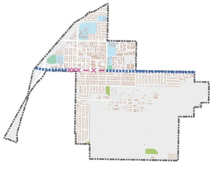
Project Length: 2.71 miles AT
0 Schools
Park 1
47
Crosswalk Improvements
13
Pedestrian Collisions
10
Bicycle Collisions
354 ft of Missing Sidewalks
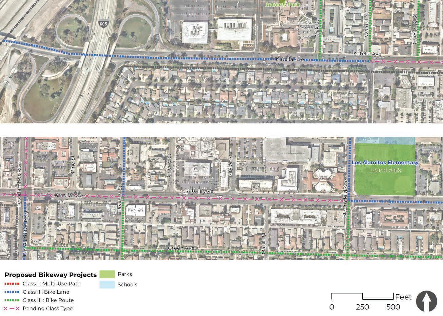

COST ESTIMATE: $728,013
Bloomfield Avenue is a north-south corridor that travels through a variety of land uses such as industrial, single and multi-family residential, educational, and parks. This corridor experiences high volumes of traffic and is one of the city’s primary thoroughfares. The corridor connects to activity centers such as Los Alamitos Elementary School, McAuliffe Middle School, L.A.U.S.D. District Office, Laurel Park, Little Cottonwood Park, and several businesses. There is minimal signage along the corridor that indicate a bike route, as well as a short two-block Bike Lane segment heading north on the corridor. Sidewalks exist throughout with minimal tree cover, and a posted speed limit of 25-40 mph. Truck routes and one bus line service this corridor.
Dedicated bicycle facilities are feasible due to the availability of existing ROW and its existing section of a bicycle facilities. The proposed improvements for Bloomfield Avenue include the installation of class II bike lanes from Katella Avenue to northern city limits, as well as a class III bike route from Katella Avenue to Farquhar Avenue. North of Katella Avenue, restriping of the vehicular travel lanes will be necessary to accommodate the installation of Class II Bike lanes. South of Katella Avenue the installation of green-backed sharrows and signage is recommended to indicate a class III bike route. The project proposes pavement markings, signage, and transition striping along the entire corridor. Pedestrian improvements include installation of missing truncated domes, high visibility crosswalks, and streets trees where feasible.

3 Schools
Pedestrian Collisions
Project Length: 1.39 miles
Park 1
26
Crosswalk Improvements
4
2 Bicycle Collisions
0 Missing Sidewalks
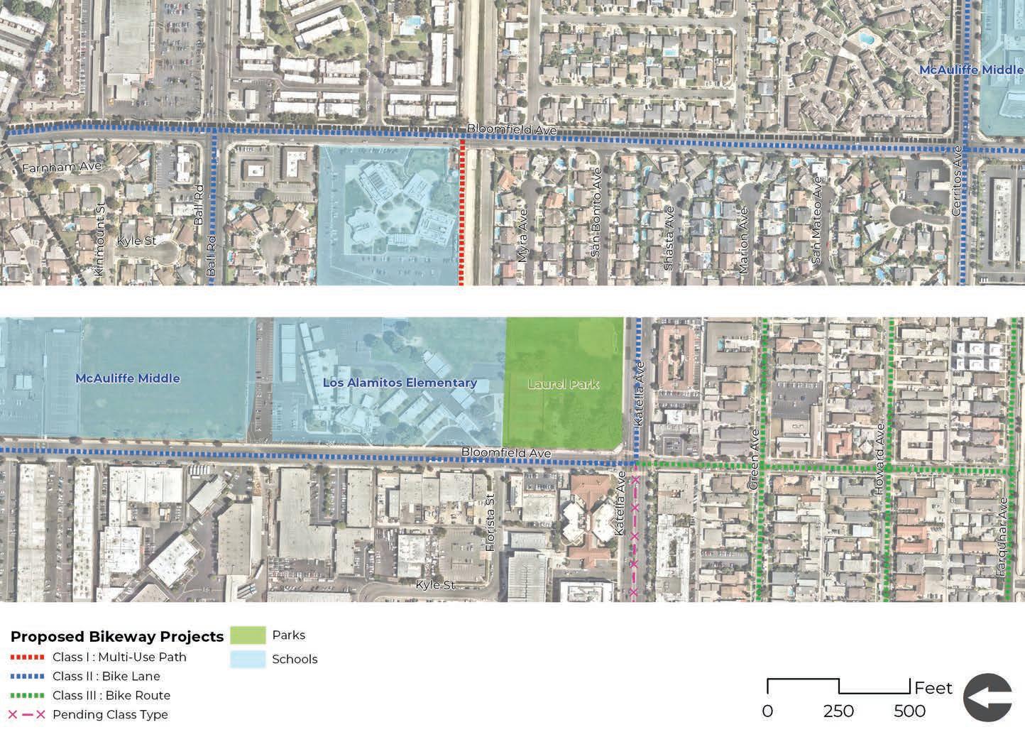
COST ESTIMATE: $626,402
Cerritos Avenue is an east-west corridor that travels through a variety of land uses such as industrial, single and multi-family residential, educational, and some commercial. This corridor experiences high volumes of traffic due to Los Alamitos High School and is one of the city’s primary thoroughfares. The corridor provides a connection between neighboring cities Long Beach and Cypress, as well as provides connections to activity centers such as Los Alamitos High School, McAuliffe Middle School, and several businesses. No bicycle infrastructure currently exists along the corridor; however, there is access to the Coyote Creek multi-use path. Sidewalks exist throughout the corridor, except for a short segment on the over-pass above Coyote Creek, where there is a sidewalk segment missing on northern portion of the street. The posted speed limit of 35 mph. Truck routes and three bus lines serve this corridor.
The proposed improvements for Cerritos Avenue include the installation of a class II bike lanes along the entirety of the corridor. Restriping of the vehicular travel lanes will be necessary to accommodate the installation of class II bike lanes. The project proposes pavement markings, signage, and transition striping at key intersections along the corridor. Pedestrian improvements include installation of missing truncated domes, high visibility crosswalks, and streets trees where feasible.

2 Schools
Pedestrian Collisions 0
Project Length: 1.31 miles
0
Parks
20
Crosswalk Improvements
Bicycle Collision 1
1,148 ft of Missing Sidewalks
Install signage for Coyote Creek multi-use path
Install high visibility crosswalks
Install sidewalks & curb ramps where missing
*Additional study to verify feasibility of pedestrian scramble
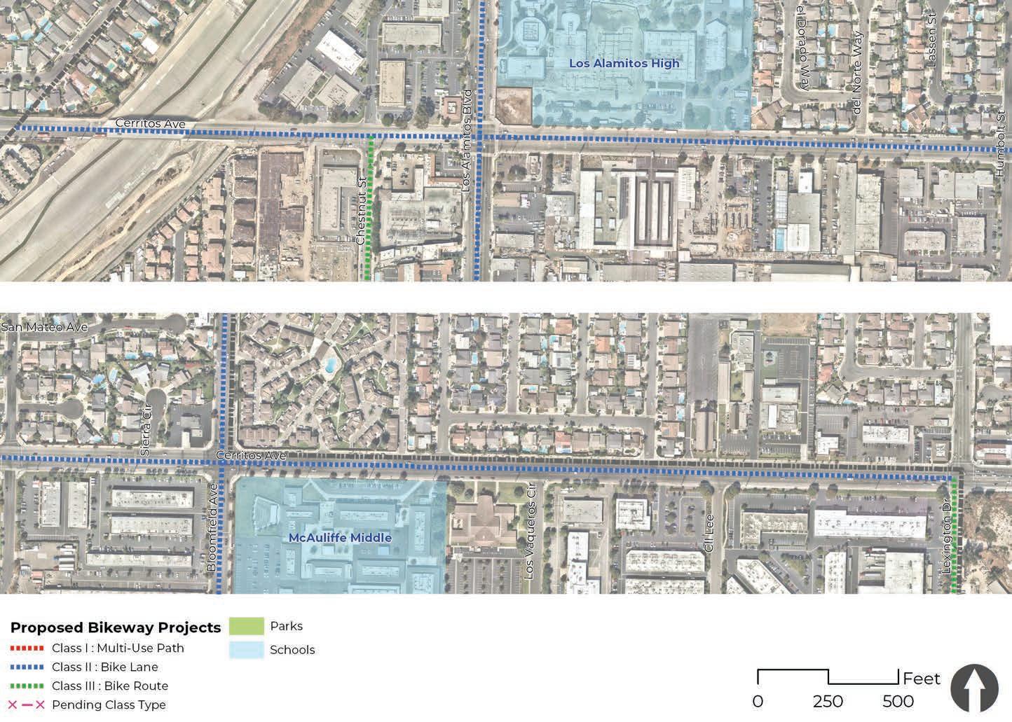
Install green conflict/transition striping
Install high visibility crosswalks
Install green conflict/transition striping
Install Class II / III bikeway signage
Install high visibility crosswalks Install high visibility crosswalks
Recommendations
Bicycle Pedestrian
Other
The Los Alamitos Boulevard corridor is located in western Los Alamitos and runs north to south. This primary corridor provides access to major commercial, civic, school, and park destinations both within the city and to neighboring cities. Important destinations along Los Alamitos Boulevard include Los Alamitos High School, Coyote Creek multi-use path, and several major shopping centers. This highly trafficked corridor serves multiple transportation needs for motorists, pedestrians, bicyclists, and transit users. The corridor has experienced multiple types of collisions involving pedestrians, bicyclists, and motorists.
Recommendations for Los Alamitos Boulevard include class II bike lanes, enhanced green transition striping at key intersections and driveways, high-visibility crosswalks, and adjusting traffic signal timing at key intersections. There is an opportunity for the city to explore pilot projects such as “all-red” pedestrian signal phasing. Additional studies could determine the viability of an “all-red” pedestrian signal at the Los Alamitos Boulevard/Cerritos Avenue intersection.
The section highlighted as “Additional Feasbibility Study Needed” includes the segment between Sausalito Street and Katella Avenue. It is recommended the city pursue an additional feasibility study to fully understand the future opportunities of this segment. The existing conditions, if unchanged, pose challenges for the implementation of safe and comfortable bike and pedestrian facilities due to traffic volumes, travel lanes, and limited right-of-way. Special feasibility studies would include in-depth field work, conversations with city staff, and stakeholder engagement to determine possible solutions to the issues identified in this ATP.

Project Length: 1.91 miles AT
1 School
Pedestrian Collisions
Parks 0
32
Crosswalk Improvements
6
4 Bicycle Collisions
1,060 ft of Missing Sidewalks
*Explore feasibility of converting sidewalk to a Class 1 to connect students from Coyote Creek path to school entrance
Recommendations


COST ESTIMATE: $478,116
The Howard Avenue corridor is located in central Los Alamitos and runs east to west. The corridor is located in a residential neighborhood and provides access to several commercial destinations located along Los Alamitos Boulevard. The only major destination located along Howard Avenue is Labourdette Park. There was one bicycle-related collision and no reported pedestrian collisions on Howard Avenue.
The Howard Avenue proposed improvements proposed improvements include installing a class III bike route with greenback sharrows, wayfinding signage, and high-visibility crosswalks. This project has the potential to be branded as a neighborhood greenway with the addition of crosswalk art, fun wayfinding signage, and local art installations at key intersections. An optional mid-block crossing can be installed at Labourdette Park.

0 Schools
Pedestrian Collisions 0
Project Length: 1.00 mile
1
Park
19
Crosswalk Improvements
Bicycle Collision 1
0
Missing Sidewalks
Install wayfinding signage
Install high visibility crosswalks
Install wayfinding signage
Install Class III bike route signage
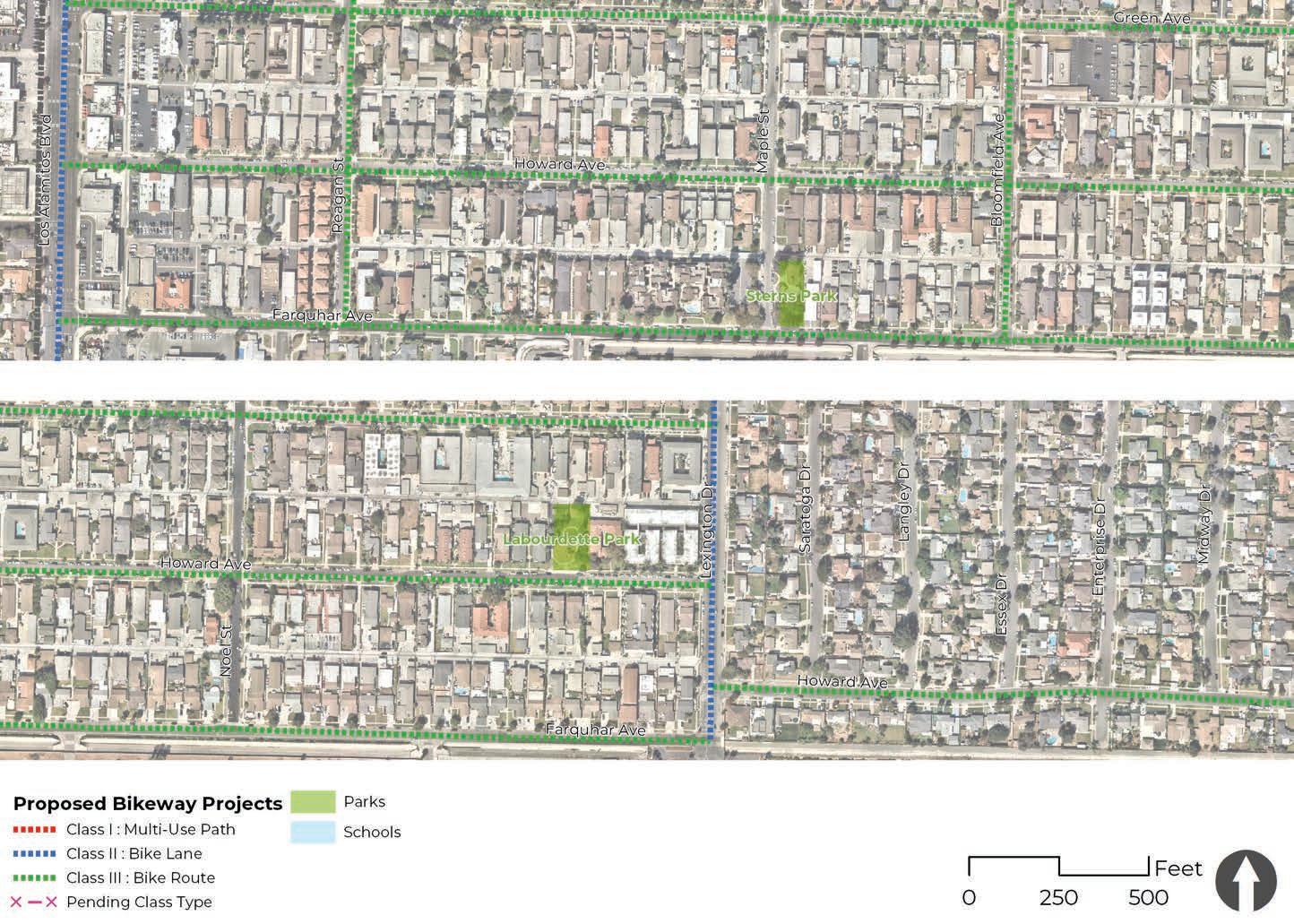
Install high visibility crosswalks
Install high visibility crosswalks
Install high visibility crosswalks
Install wayfinding signage
Install mid-block crosswalk
Install wayfinding signage
Recommendations
Bicycle Pedestrian
Other
The Green Avenue corridor is located in north central Los Alamitos and runs east to west. The corridor is located in a residential neighborhood and provides access to several commercial destinations located along Katella Avenue and Los Alamitos Boulevard. There are no immediate schools or parks located along this corridor, but access to Laurel Park and Los Alamitos Elementary School is possible via the Bloomfield Street intersection. There were no reported bicycle and pedestrian related collisions.
The Green Avenue proposed improvements include installing a class III bike route with greenback sharrows, wayfinding signage, and high-visibility crosswalks. This project has the potential to be branded as a neighborhood greenway with the addition of crosswalk art, fun wayfinding signage, and local art installations at key intersections.

0
Schools
Parks 0
Project Length: 1.00 mile
Pedestrian Collisions 0
14
Crosswalk Improvements
0
Bicycle Collisions
0
Missing Sidewalks
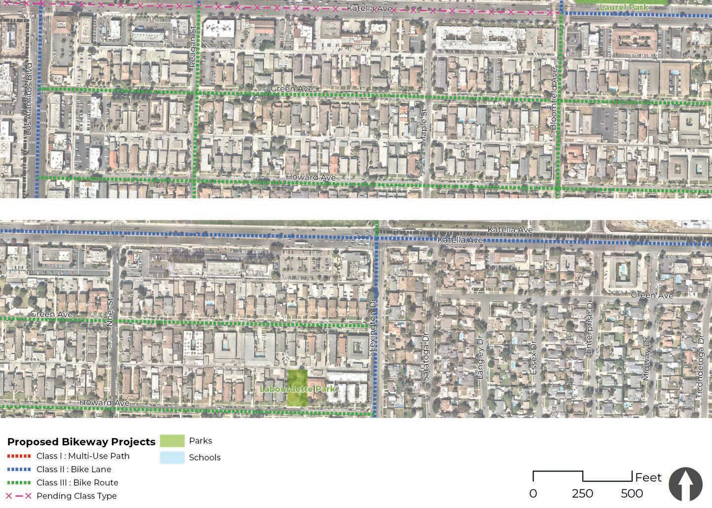
COST
$119,147
Ball Road is an east-west corridor on the northern part of the city that travels almost entirely through single family residential and minimal commercial land use. This corridor experiences average volumes of traffic and provides connections to Long Beach and Cypress. There is minimal signage along the corridor that indicates a class II bike lane, however striping is installed on the roadway that indicates a class II bike lane. Sidewalks exist throughout with minimal tree cover, and a posted speed limit of 45 mph. Truck routes and one bus line service this corridor. Further improvements to the existing bicycle facilities are recommended. A buffer is feasible due to the availability of existing ROW.
The proposed improvements for Ball Road include the installation of a class II buffered bike lane along the entirety of the corridor within the city limits. Restriping of the vehicular travel lanes will be necessary to accommodate the installation of painted buffers to the bike lanes. The project proposes pavement markings, signage, and transition striping along the entire corridor. Pedestrian improvements include installation of missing truncated domes, high visibility crosswalks, and streets trees where feasible.
Project Length: 0.24 miles 0 Schools 0
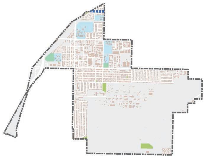
Recommendations
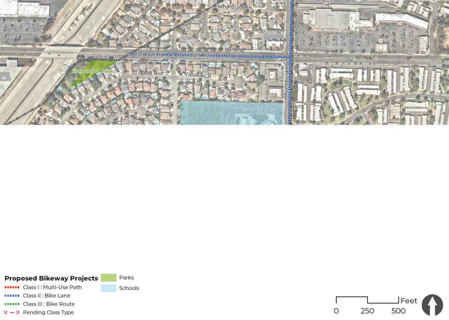
COST ESTIMATE: $521,745
The Farquhar Avenue corridor is located in central Los Alamitos and runs east to west. The corridor experiences heavy traffic volumes due to the adjacent and neighboring destinations such as the single and multi-family residential neighborhood, businesses along Los Alamitos Boulevard, Sterns Park, Little Cottonwood Park, and the main entrance to Joint Forces Training Base Los Alamitos. There were two bicycle-related collisions and one pedestrian-related collision reported on Farquhar Avenue.
The Farquhar Avenue proposed improvements include installing a class III bike route with greenback sharrows, wayfinding signage, and high-visibility crosswalks. Rectangular rapid flashing beacons (RRFB) are optional at key intersections with high pedestrian crossing volumes. This project has the potential to be branded as a neighborhood greenway with the addition of crosswalk art, fun wayfinding signage, and local art installations at key intersections.
Project Length: 1.00 mile
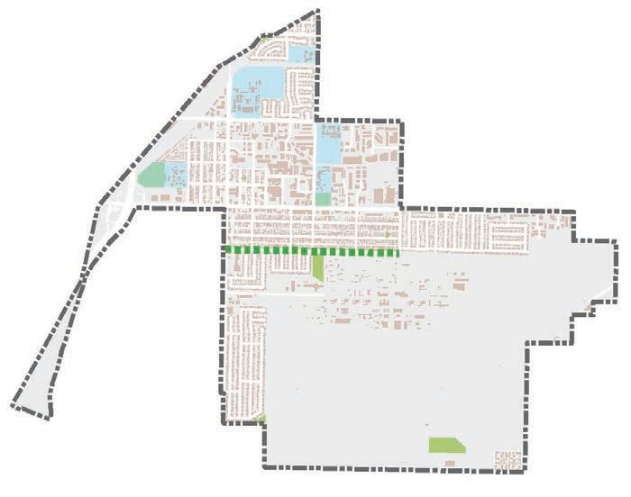
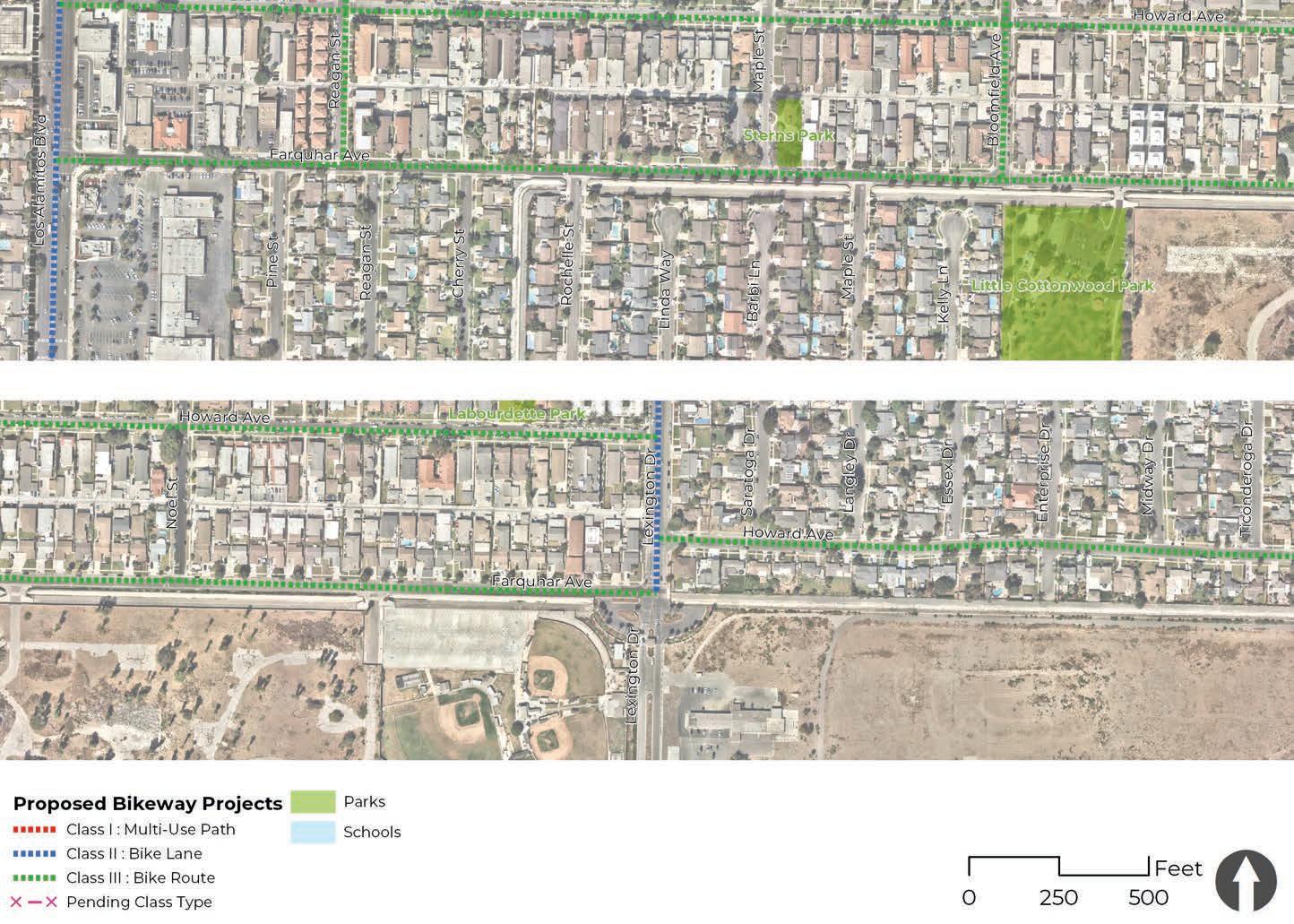
COST ESTIMATE: $168,911
Oak Street is a residential corridor located in western Los Alamitos and runs north to south. This street provides direct access to several destinations such as Oak Middle School, City Hall including the Community Center, Los Alamitos Youth Center, and other nearby destinations along Katella Avenue. A trailhead connection to Coyote Creek multi-use path is also found near the Oak Street/Catalina Street intersection.
Recommendations for Oak Street include class III bike route designation, wayfinding signage, greenback sharrows, and school high-visibility crosswalks. Optional improvements to brand this corridor as a neighborhood greenway include curb extensions, urban greening elements, and crosswalk art that embraces the lion mascot of Oak Middle School.

Pedestrian Collision 1
Project Length: 0.38 miles
Bicycle Collisions 0
5
Crosswalk Improvements
0
Missing Sidewalks

COST ESTIMATE: $178,679
Walnut Street is a residential corridor located in western Los Alamitos and runs north to south. This street provides access to several destinations such as Oak Middle School, City Hall including the Community Center, Los Alamitos Youth Center, and other nearby commercial destinations along Katella Avenue and Los Alamitos Boulevard. Walnut Street also provides a vital connection to the Rossmoor neighborhood at the intersection of Walnut Street and Katella Avenue. This highly trafficked intersection requires special attention during peak hours to ensure safety and comfort of pedestrians, cyclists, and motorists.
Recommendations for Oak Street include Class 3 bike route designation, wayfinding signage, greenback sharrows, and school high-visibility crosswalks. Optional improvements to brand this corridor as a neighborhood greenway include curb extensions, urban greening elements, and crosswalk art that embraces the lion mascot of Oak Middle School or one of the city’s civic spaces.
Project Length: 0.38 miles

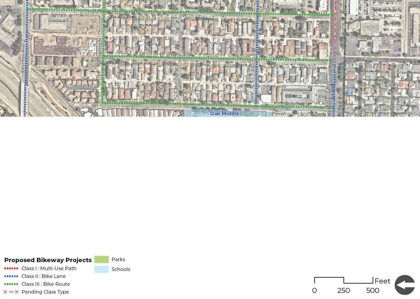
The Lexington Drive corridor is located in north central Los Alamitos and runs north to south. There are no schools or parks located along this corridor; however, it provides connections to employment centers adjacent to the corridor. There were two bicycle-related collisions and no reported pedestrian collisions on Lexington Drive. The existing rightof-way shifts a few times, narrowing and expanding at different sections of the street. Sidewalks are present except for a 0.2-mile section.
The Lexington Drive proposed improvements include installing a class III bike route between Cerritos Avenue and Katella Avenue, and class II bike lanes between Katella Avenue and Farquhar Avenue. Additional improvements include wayfinding signage, high-visibility crosswalks, and installing sidewalks where missing to improve safety and accessibility.

Project Length: 0.75 miles AT
0 Schools
Pedestrian Collisions
Parks 0
7
Crosswalk Improvements
2
0 Bicycle Collisions
1,293 ft of Missing Sidewalks
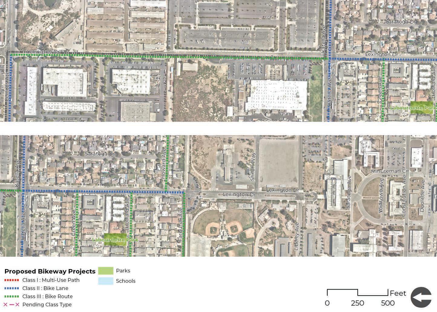
COST ESTIMATE: $227,011
Chestnut Street is a residential corridor located in western Los Alamitos and runs north to south. This corridor runs parallel and immediately west of Los Alamitos Boulevard, providing access to several commercial destinations such as Center Plaza. Access to Chestnut Street is also uninterrupted between Cerritos Avenue and Katella Avenue, allowing people to travel to and from Los Alamitos High School on this street as an alternative to Los Alamitos Boulevard.
Recommendations for Chestnut Street include class III bike route designation, wayfinding signage, greenback sharrows, and school high-visibility crosswalks. Optional improvements to brand this corridor as a neighborhood greenway include curb extensions, urban greening elements, and crosswalk art.

0
Schools
0
Parks
Project Length: 0.50 miles
Pedestrian Collisions 2
0
Crosswalk Improvements
0
Bicycle Collisions
0
Missing Sidewalks
Recommendations
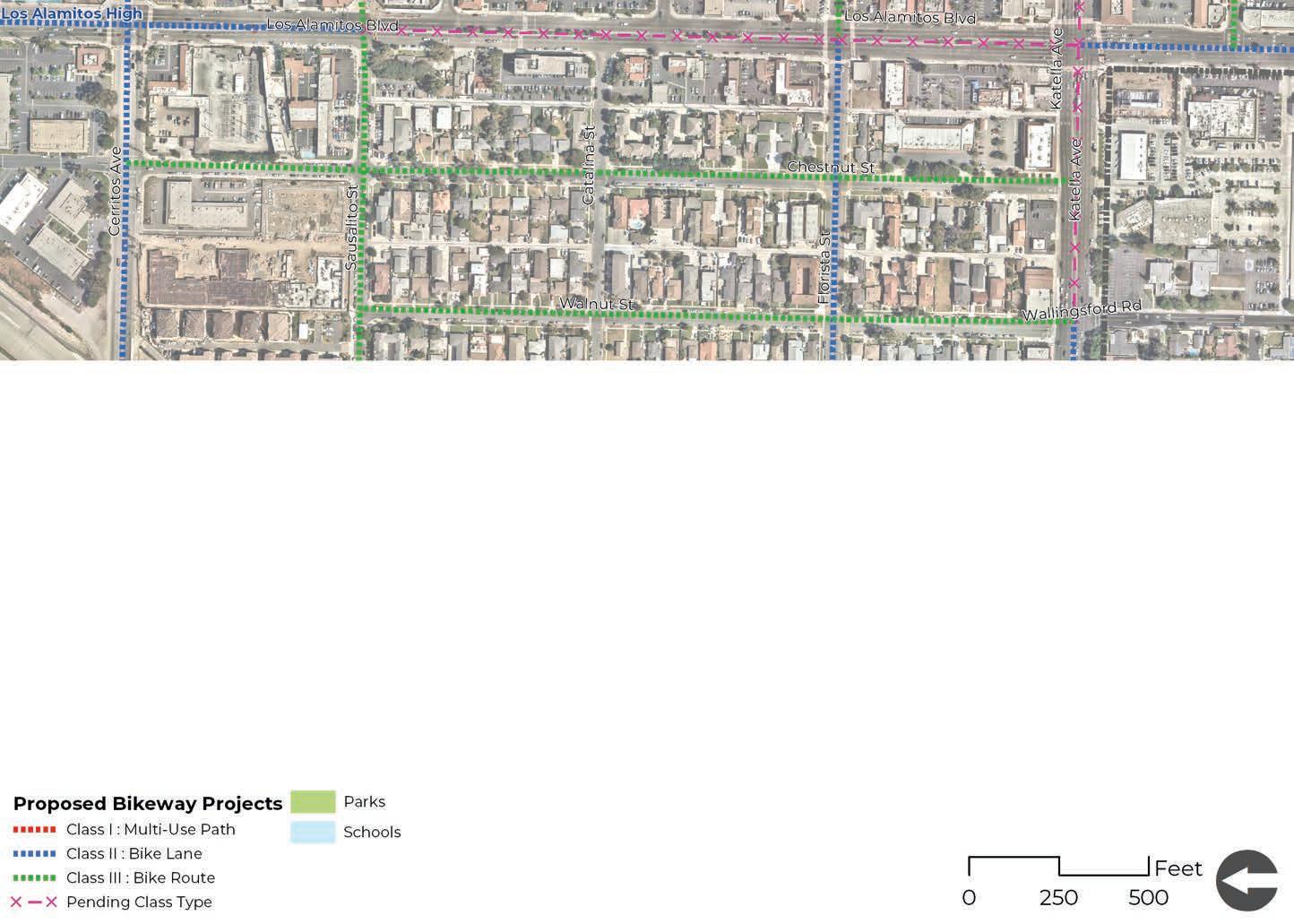
COST ESTIMATE: $798,678
The Reagan Street corridor is located in west central Los Alamitos and runs north to south. This corridor is highlighted because it runs parallel and immediately east of Los Alamitos Boulevard, providing access to a variety of destinations such as industrial employment centers, shopping and retail centers, medical plazas, and several residential neighborhoods.
Recommendations for Reagan Street are divided into two segments. Class II bike lanes, enhanced green transition striping at key intersections and driveways, and high-visibility crosswalks are recommended between Briggerman Drive and Katella Avenue.
Class III bike routes, wayfinding signage, greenback sharrows, and high-visibility crosswalks are recommended between Katella Avenue and Farquhar Avenue. An additional study will be needed to evaluate the feasibility of installing a traffic signal at the intersection of Reagan Street and Katella Avenue. A traffic signal would be vital for travelers wishing to use Reagan Street as a true alternative to Los Alamitos Boulevard. It would connect the residential neighborhood south of Katella Avenue to all of the workplace and commercial destinations to the north.
Project Length: 0.63 miles
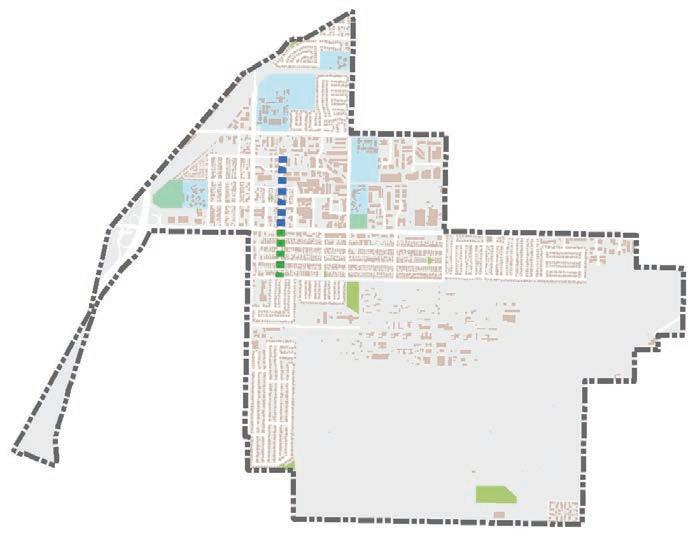

COST ESTIMATE: $636,570
The Pine Street neighborhood greenway project is a combination of several streets in a residential neighborhood located the southwest region of the city. The streets in this project include Pine Street, Reagan Street, Rossmoor Way, and Bradbury Road, all of which are only accessible through Los Alamitos Boulevard. This area is a residential neighborhood is not heavily trafficked and has residential speed limit of 25 mph. There are no bicycle facilities, but there are continuous sidewalks and ADA curb ramps.
A neighborhood greenway (bicycle route loop) is feasible due to the corridor’s posted speed and low traffic volumes. Recommendations include green sharrows and signage to indicate a class III bike route. This project has the potential to be branded as a local exercise loop. Additional recommendations to brand this neighborhood greenway loop include crosswalk art, fun wayfinding signage, and local art installations at key intersections.
Project Length: 1.57 miles
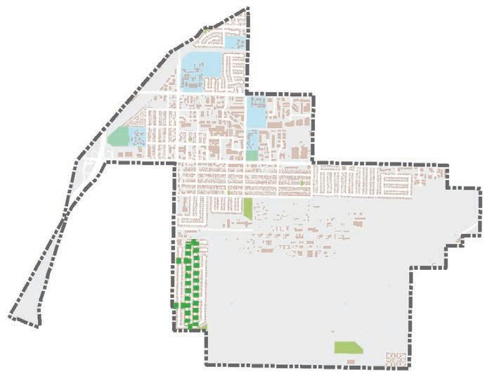
Recommendations
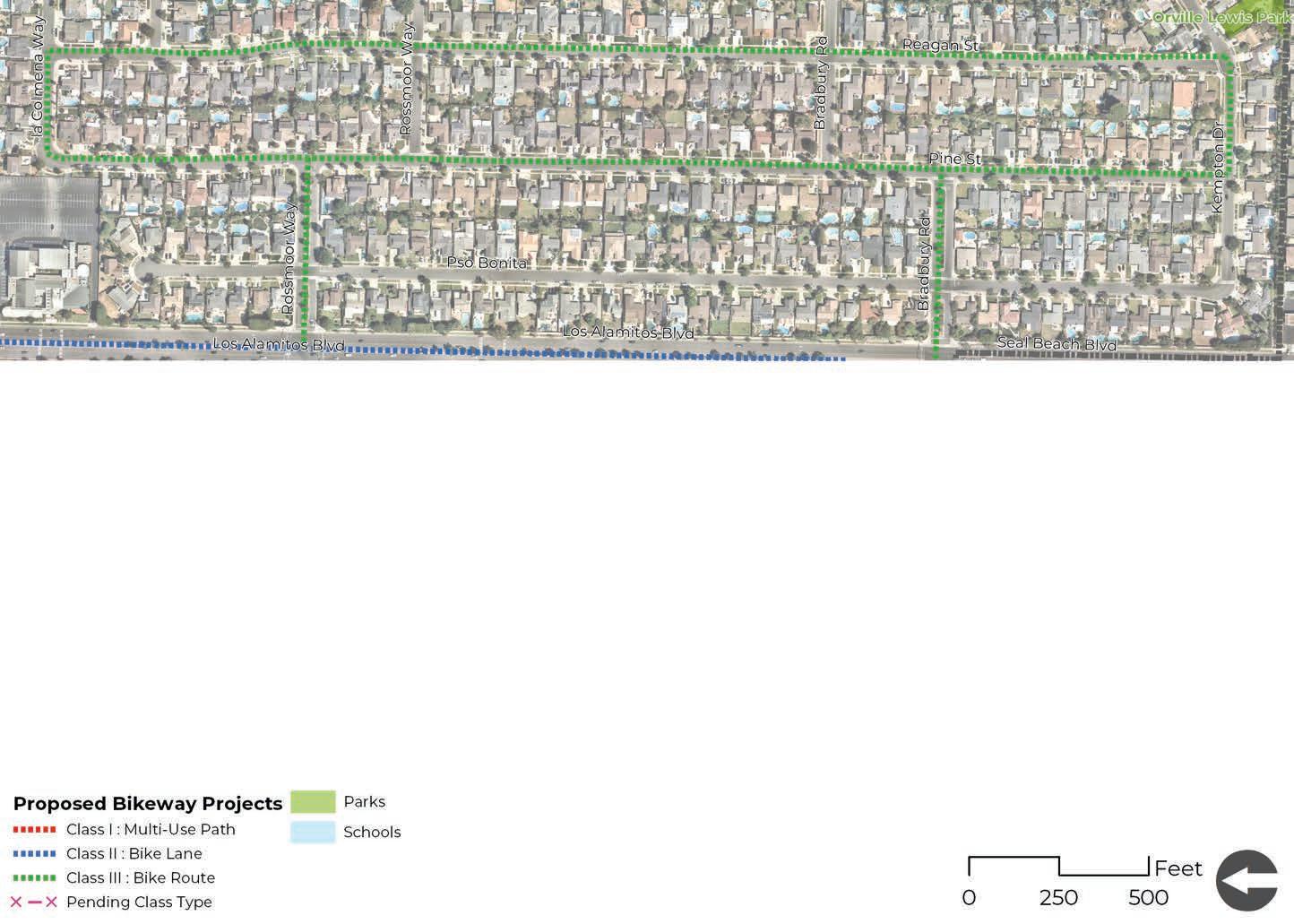
The Florista Street corridor is located in west central Los Alamitos and runs east to west. Adjacent land uses include residential and commercial destinations. The western terminus of Florista Street provides direct access to Oak Middle School and to the Coyote Creek multi-use path. A traffic signal at the Los Alamitos Boulevard intersection provides improved access to businesses located along Los Alamitos Boulevard. There are no reported bicycle and pedestrian related collisions on Florista Street.

The Florista Street proposed improvements include installing class II bike lanes between Oak Street and Los Alamitos Boulevard, and a class III bike route between Los Alamitos Boulevard and Reagan Street. In addition, high-visibility crosswalks and wayfinding signage should be installed. Signal timing at the Los Alamitos boulevard intersection should be reviewed for adequate crossing time for pedestrians of all abilities.
Project Length: 0.38 miles
Crosswalk Improvements 6
Sidewalks

COST ESTIMATE: $173,795
The Sausalito Street corridor is located in northwest Los Alamitos and runs east to west. Adjacent land uses include residential, commercial, and industrial destinations. There are no schools or parks located along this corridor, but a traffic signal at the Los Alamitos Boulevard intersection provides improved access to businesses located along Los Alamitos Boulevard. There are no reported bicycle and pedestrian related collisions on Sausalito Street.
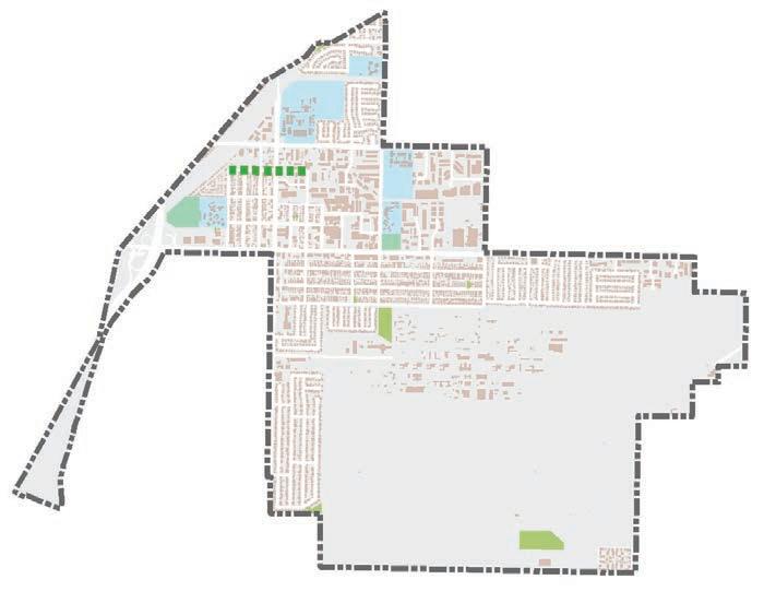
The Sausalito Street proposed improvements include installing a class III bike route along this corridor with wayfinding signage and high-visibility crosswalks. Signal timing at the Los Alamitos boulevard intersection should be reviewed for adequate crossing time for pedestrians of all abilities.
0 Schools
Parks 0
Project Length: 0.38 miles
11
Crosswalk Improvements
Pedestrian Collisions 0
Bicycle Collisions 0
0 Missing Sidewalks

COST ESTIMATE: $1,983,294
Carbon Creek Channel is an east-west flood control channel corridor located in the northern section of the city. The short segment travels through land uses such as single family residential and educational land uses. This flood control channel is currently closed to the public and experiences no public traffic. The corridor could provide connectivity between the Coyote Creek multi-use path, neighboring Orange County cities, and to activity centers such as Los Alamitos High School and Laurel High School. The flood control channel has a gravel service road on both sides of the channel and is only accessible to County service vehicles.
A multi-use path is feasible due to the availability of existing ROW on both sides of the channel thanks to the service road. This project presents an opportunity to further expand local and regional access to Coyote Creek multi-use path that leads travelers to and from the San Gabriel River Path, ultimately connecting the coast and inland destinations. Additional collaboration and outreach will be needed between appropriate agencies and residents in the neighboring area to further develop the actual design and alignment of the class I multi-use path.
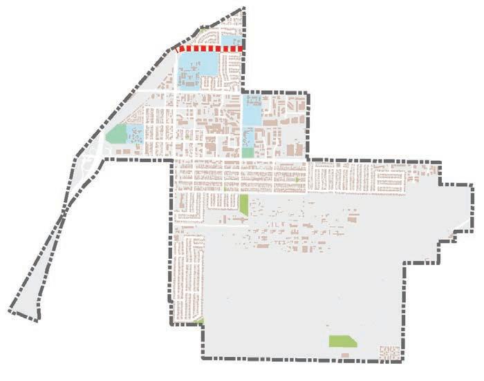
It is recommended to pave and stripe a class I multi-use path and to include appropriate markings, signage, and transition striping at all intersections to prevent vehicular conflicts. It is also recommended to include lighting or solar lighting along bikeway projects, to increase visibility and safety at night. Lastly, it is recommended to include a bicycle and pedestrian bridge to safely allow users to cross one side of the channel to the other. This bridge would allow the alignment of the class I facility to alternate away from the residential homes that face the flood control channel. Other potential improvements include urban greening elements such as bioswales or rain gardens that can help purify runoff water.
Project Length: 0.50 miles
Recommendations
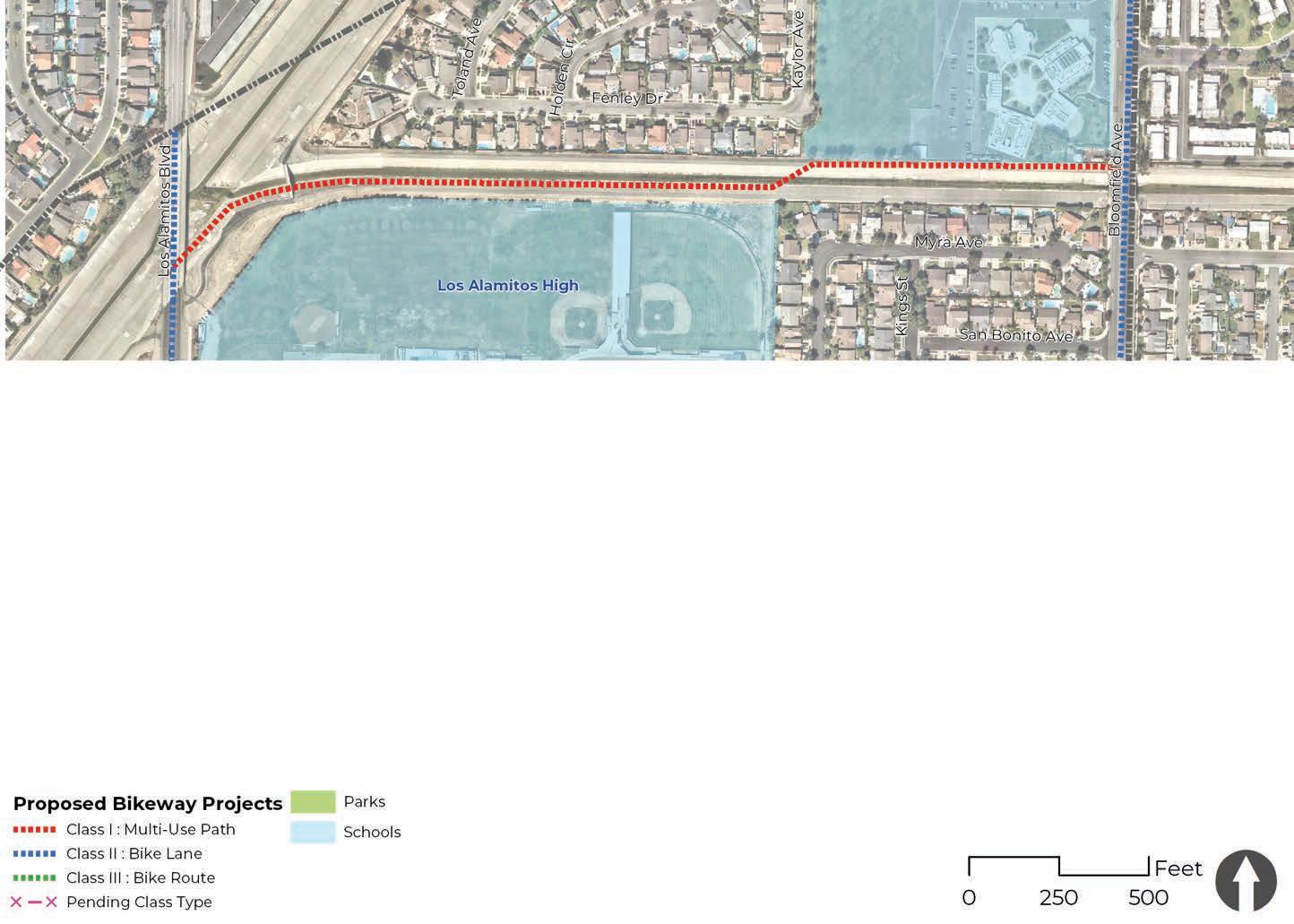
COST ESTIMATE: $508,666
The Antietam Avenue neighborhood greenway project is a combination of several streets in a residential neighborhood located in the north-central region of the city. The streets in this project include Siboney Street, Antietam Avenue, Mindora Street, Bennington Street, and Howard Avenue. This residential neighborhood is not heavily trafficked and has posted a speed limit of 25 mph. There are no bicycle facilities, but there are continuous sidewalks and minimal curb ramps.
A neighborhood greenway (bicycle route loop) is feasible due to the corridor’s posted speed and low traffic volumes. Recommendations include green sharrows and signage to indicate a class III bike route. This project has the potential to be branded as a local exercise loop. Additional recommendations to brand this neighborhood greenway loop include crosswalk art, fun wayfinding signage, and local art installations at key intersections.
Project Length: 1.31 miles

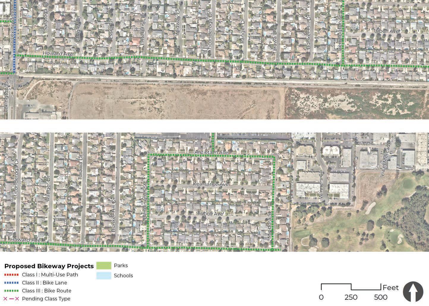
Intersections are crucial to a street’s performance; they control a road’s speed, safety, cost, and efficiency. Improvements can be made to increase safety and capacity and to reduce congestion or other conflicts on corresponding streets. Additionally, specific pedestrian and bicycle treatments can significantly reduce the frequency and severity of collisions at intersections; however, specific treatments must be considered based on the roadway’s characteristics such as traffic volumes and patterns, visibility, and adjacent land uses such as schools, parks, or commercial centers. The following section provides a series of potential improvements for the six most common types of street intersections found in Los Alamitos, as shown in Figure 4-20.
D Arterial
E Arterial/Collector
F Minor
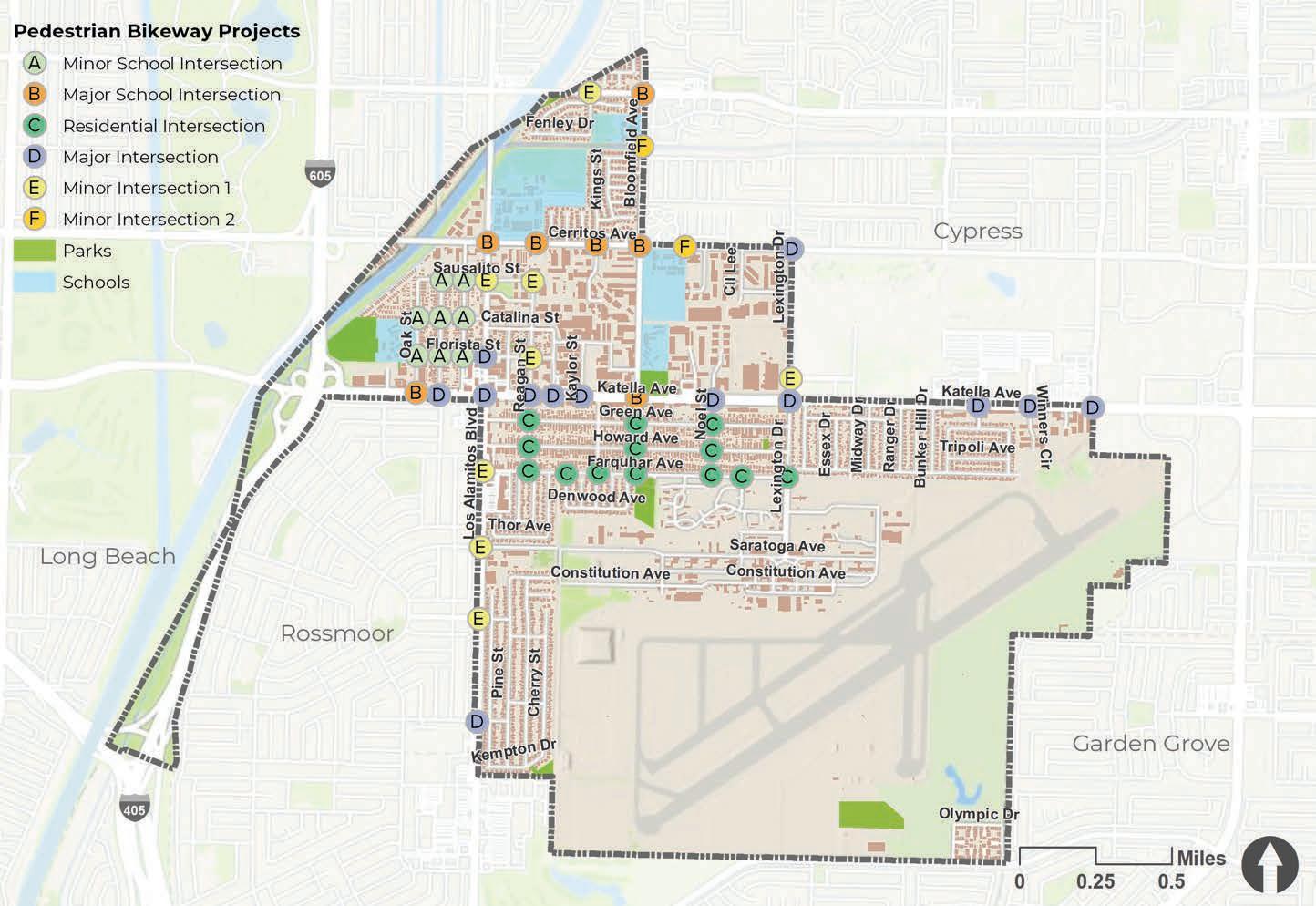
Neighborhood school intersections are located along corridors near schools with low volumes of vehicular traffic. Pedestrian improvements include curb extensions, ADA curb ramps, and yellow high visibility crosswalks. Pedestrian-actuated Rectangular Rapid Flashing Beacons (RFFB), improved lighting, and public art can be installed at key intersections. Bicycle lanes, separated bicycle lanes, green-back sharrow markings, signage, and bicycle transition striping should be considered based on the corridor’s needs.
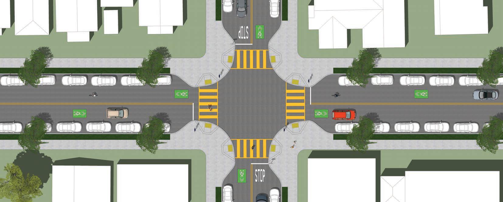
Existing trees are to be protected in place and new street trees added where appropriate. Other green infrastructure improvements are also recommended at key intersections where flooding occurs. Curb extensions can be designed with rain gardens and existing parkways can be converted to bioswales to capture and filter water.
1 Curb extensions
2 High visibility crosswalks
3 RRFB
4 ADA curb ramps


Arterial school zone intersections can be found near schools that are located along arterial streets that provide city-wide transportation to commuters. Pedestrian improvements include adjusted signal timing at key traffic signals, lighting, ADA curb ramps, and yellow high visibility crosswalks. A programmed “all red” phase can be installed at intersections with high pedestrian volumes. Bicycle lanes, separated bicycle lanes, green-back sharrow markings, bike boxes, and bicycle transition striping should be considered based on the corridor’s needs.
Existing trees are to be protected in place and new street trees added where appropriate. Other green infrastructure improvements are also recommended at key intersections where flooding occurs.
1 Adjusted signal timing
2 High visibility crosswalks (school)
3 Bike Box
4 ADA curb ramps
5 Transition striping

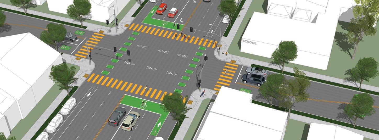
Neighborhood intersections are located along minor streets in neighborhoods that are primarily residential. Pedestrian improvements include curb extensions, ADA curb ramps, and high visibility crosswalks. Crosswalk art can be used to enhance the safety of some pedestrian crossings. Bicycle lanes, separated bicycle lanes, green-back sharrow markings, signage, and bicycle transition striping should be considered based on the corridor’s needs.

Existing trees are to be protected in place and new street trees added where appropriate. Other green infrastructure improvements are also recommended at key intersections where flooding occurs. Curb extensions can be designed with rain gardens and existing parkways can be converted to bioswales to capture and filter water.
1 Curb extesions
2 High visibility crosswalks (crosswalk art)
3 ADA curb ramps


Arterial intersections are located along arterial roads that have a higher capacity and carry longer-distance flows between activity centers within the city. Pedestrian improvements include adjusted signal timing at key traffic signals, high visibility crosswalks, improved lighting, and wayfinding signage where possible. Bicycle lanes or separated bicycle lanes, as well as bike boxes and bicycle transition striping should be considered based on the corridor’s needs.
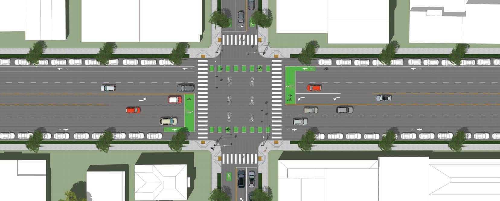
Existing trees are to be protected in place and new street trees added where appropriate. Other green infrastructure improvements are also recommended at key intersections where flooding occurs.
1 Adjusted signal timing
2 High visibility crosswalks
3 Bike Box
4 ADA curb ramps
5 Transition striping

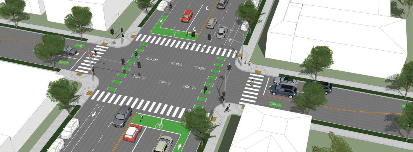
This type of intersection can be found where arterial roads intersect with collector roads. While arterial roads can handle higher traffic volumes, collector roads have a low-to-moderate capacity that moves traffic from local streets to arterial roads. Pedestrian improvements include ADA curb ramps, high visibility crosswalks, and wayfinding signage. Curb extensions can be installed at key intersections. Bicycle lanes or separated bicycle lanes, bike boxes, and bicycle transition striping should be considered based on the corridor’s needs.
Existing trees are to be protected in place and new street trees added where appropriate. Other green infrastructure improvements are also recommended at key intersections where flooding occurs. Curb extensions can be designed with rain gardens and existing parkways can be converted to bioswales to capture and filter water.


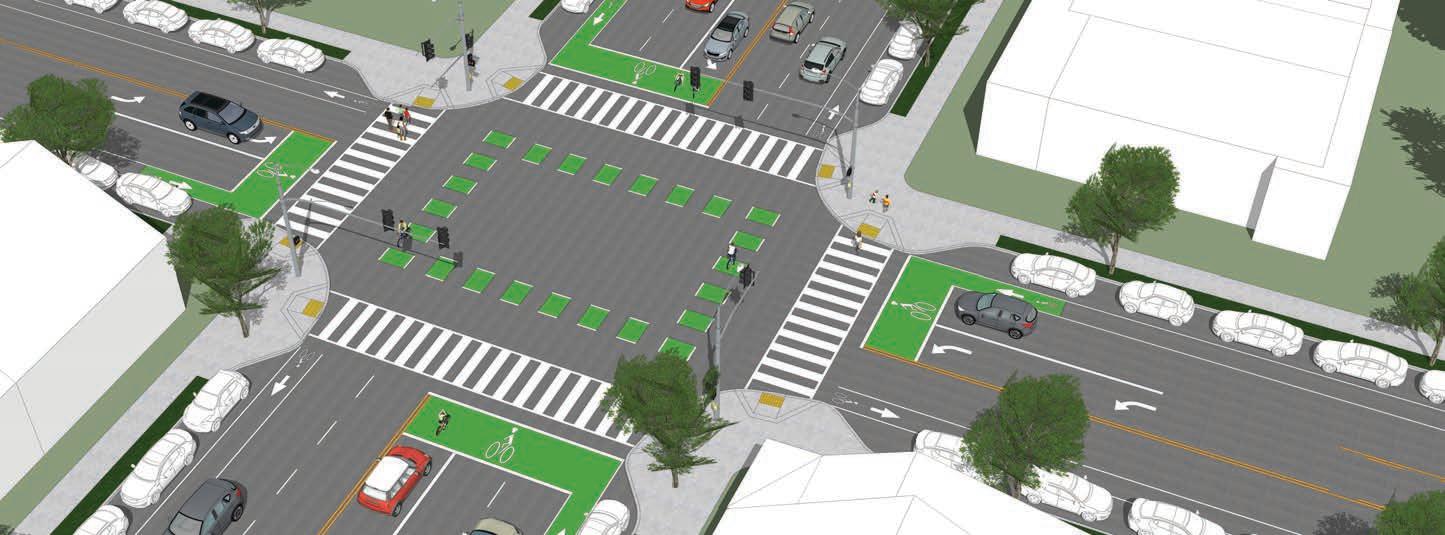
Minor intersections are located along minor streets in neighborhoods that are primarily residential, many of which end in cul-de-sacs near highways and other utility right-of-way corridors. Pedestrian-actuated Rectangular Rapid Flashing Beacons (RRFB) and high visibility crosswalks can be installed at key intersections. Bicycle lanes, separated bicycle lanes, green-back sharrow markings, signage, and bicycle transition striping should be considered based on the corridor’s needs.
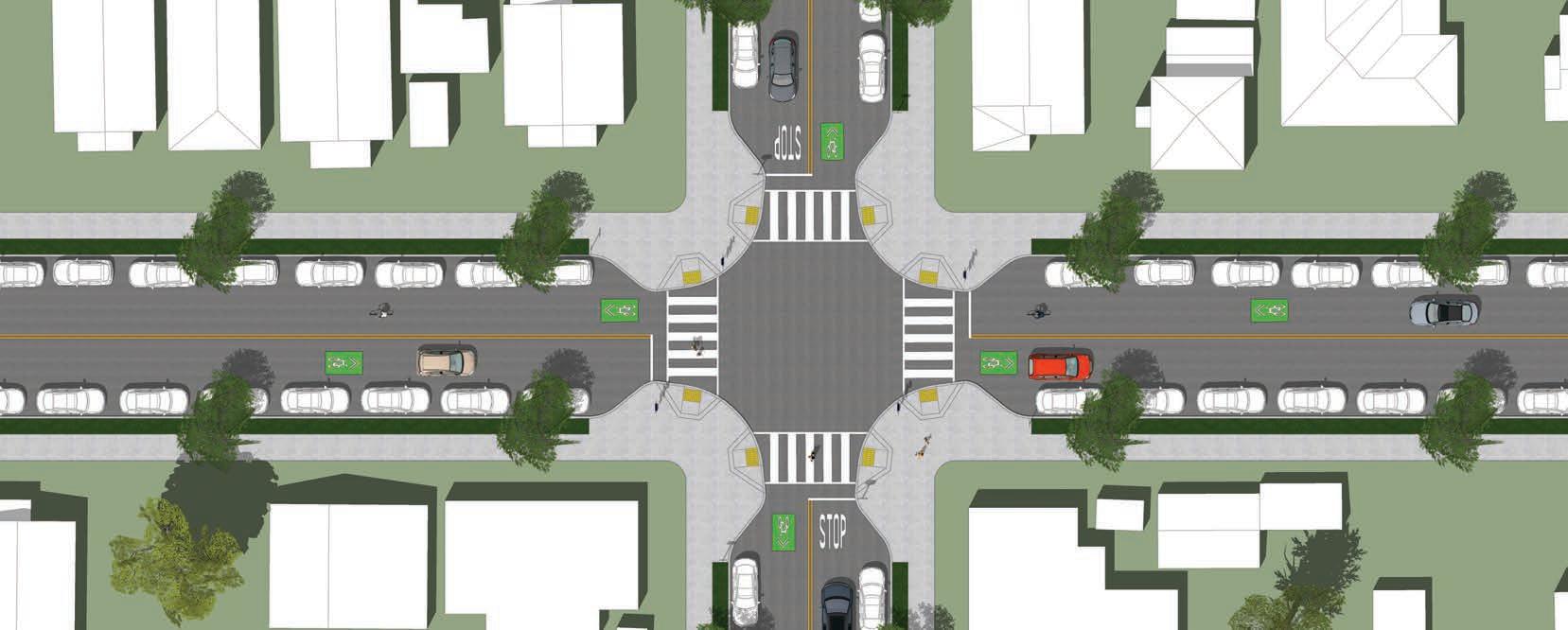
Existing trees are to be protected in place and new street trees added where appropriate. Other green infrastructure improvements are also recommended at key intersections where flooding occurs. Curb extensions can be designed with rain gardens and existing parkways can be converted to bioswales to capture and filter water.
1 Curb extensions
2 High visibility crosswalks
3 RRFB
4 ADA curb ramps
5 Signage


This section comprises a diverse menu of programs intended to support the projects recommended in this plan. Due to a long history of routine accommodation for pedestrians (i.e. sidewalks, crosswalks, dedicated signals, etc.), programs targeting walking are relatively uncommon. Conversely, the historic lack of routine accommodation for bicyclists has fostered confusion about the role of bicycles in the overall transportation system and has necessitated an impressive diversity and breadth of bicycle-related programs. Despite a common emphasis on projects, bicycle programs remain an important element of a successful bicycle plan. The following sections offer some background on the changing “state of practice” in bicycle programming, namely the increased integration of programs and projects, culminating in a comprehensive menu of bicycle and pedestrian programs.
In order to realize local goals and objectives, communities should take a multifaceted approach to advance biking and walking and support development of safe, comfortable, and connected active transportation networks.
The principles articulated through the “Six Es” developed by the Safe Routes Partnership (Engagement, Equity, Engineering, Encouragement, Education, and Evaluation) can help create successful programs. In particular, many policy, programmatic, and design elements can be used to improve equity if they are targeted to address mobility needs of low-income residents, minorities, children, people with disabilities, and older adults.
In addition, there has been a shift in implementation strategies. Physical projects represent the most visible and perhaps most tangible evidence of a great place for bicycling or walking. Programs are increasingly targeted to occur in conjunction with the construction of specific bicycle and pedestrian projects to take advantage of the opportunity that capital project implementation represents for a city to promote bicycling and walking as attractive options.
A new multi-use path, for instance, represents a great opportunity to reach out to the area’s walkers and parents of school-age children, as well as the neighborhood’s “interested, but concerned” bicyclists. These target groups will benefit most by directly linking route improvements and supportive programs. In this way, bundling bicycling and walking programs with projects represents a much higher return on investment for both.
The programs recommended for the City of Los Alamitos are organized as a menu of initiatives, each listed under a broad category:
These categories are not definitive. They are merely intended to offer some level of organization to the many program initiatives, the majority of which fall into at least one category.
Community outreach initiatives should start by listening to residents, families, businessowners, local leaders, and working with existing community organizations. These critical relationships should allow for purposeful, ongoing engagement opportunities. The engagement strategies used in this plan are detailed in Chapter Three, Community Engagement. Listed below are a few examples of engagement methods that can be used to increase public participation.
Signage is an effective tool to share information about a program or project. Displays can inform the public and stimulate citizens and stakeholders to participate in engagement activities. These displays can be used to remind people to engage in a positive behavior that you are seeking through this effort.
Distribution of an online newsletter is a great way to engage the public. Distribution should be researched and considered prior to utilizing this outreach method. This form of media can be used to display project and contact information as well as ways for readers to get involved.
A hotline is a great way for community members to call in, leave comments, or talk to someone directly about the project or program. A hotline should be considered as a support tool of an overall community engagement strategy. In order to guarantee a hotline’s success, it should be staffed and have the right person at the receiving end. Depending on the target audience, it may be necessary to have a multi-lingual person staffing the hotline. A hotline number is relatively low cost and requires little effort to maintain.
Surveys and questionnaires can also be created to identify the needs and views of a large number of people. Surveys are effective when a limited number of short and concise questions are used to gather information and feedback.
The ATP prioritizes the safety of Los Alamitos residents whose primary mode of transportation is walking, biking, skateboarding, and public transportation. Special emphasis is given to low-income neighborhoods and streets where the risk for collisions is greater. This plan intends to reduce barriers for low income and senior neighborhoods while mitigating potentially harmful long-term impacts. The following strategies and practices to address bicycle and pedestrian inequities.
Recognize the importance to address the barriers that prevent trips from being safe, especially for the younger and lower income populations who cannot afford, operate, or choose to forgo vehicle ownership.
Existing practices and policies may have unintended consequences when it comes to transportation equity. A systematic review of its practices should be performed to identify potential equity issues and opportunities.
A recent survey has shown disparity between the sociodemographics of transportation decision-makers and the community they are meant to serve. Agencies should continually seek to increase the diversity of its staff at all levels of leadership and decision-making so that its workforce represents the community it serves.
Agencies can aim to implement improvements in areas that are disproportionally affected by health and safety burdens, acknowledging that policies and designs that improve conditions for vulnerable groups can benefit everyone in the community.
Collaboration with the community is an integral part of the planning process. Individuals, especially those belonging to traditionally underserved communities, need to be empowered to participate in the transportation planning processes and have their needs heard.
A variety of engineering tools can be used to make sure that the roadways in Los Alamitos are designed to keep bicyclists and pedestrians safe at all times while maintaining efficient travel throughout the city. Some of these tools include street design techniques that are meant to reduce traffic congestion, decrease vehicular speeds, and enhance pedestrian and bicycle safety and comfort.
Some examples of engineering and traffic enhancements that provide a safer environment for pedestrians and bicyclists include:
» Traffic control signs
» Curb and high visibility pavement markings
» Signal timing
» Parking controls
» Traffic safety monitoring
Vehicle usage can be decreased in part by actively encouraging residents and visitors to bike, walk, and ride transit for a variety of trips and purposes. Encouragement is all about
making bicycling and walking more fun, healthy and easy to do. In order to achieve this, the City, along with OCTA, the OC Health Care Agency, and other local organizations, organizes a series of activities and events that promote alternate modes of transportation and healthier lifestyles.

During the month of May, cities across the country organize events and campaigns to educate people about biking and to encourage them to bike more to their destinations. Activities such as Bike Week, Bike to Work, and Bike Fridays can be organized and promoted.

Open streets events are increasingly popular in Southern California. They provide families and friends an opportunity to walk, bike, skate, or scooter down streets in their city free of cars.
Fun family-friendly summer bike rides meant to encourage bike usage. This event intends to teach about bicycle and road safety.

This is a fun, educational event involving children, parents, and community leaders. This event gives students and families the opportunity to socialize and start the day off with enthusiasm and allows them to build connections with other members of the community.
Annual winter evening family-friendly walk and bike ride where participants use battery lights and/or bike lights to be more visible while they walk or bike.
Free five kilometers running and walking event that takes place in the city are an excellent way to encourage people to explore their city on foot. Post-race refreshments and healthy snacks can be provided to participants.
Bike ride events where participants get together to enjoy food while cruising through this city’s streets and neighborhoods is an innovative way of bridging bike riding with community building.
The city and other local groups can organize family-friendly themed walks where participants have the opportunity to explore key locations including historical buildings, parks, murals, and businesses.
The Orange County Transportation Authority is planning fun bike workshops to explore local communities. All workshops are free and include bike skills guidance, tips and tricks and a fun ride to explore the treasures of Orange County! The goal of the workshops is to help you ride more safely and with more confidence during everyday travel and recreation.


Participants can pledge to bike to work at least once during a set week. The participants can then be entered to win a raffle or prize. For this to work, participants can receive one entry for every day they participate to increase their odds.
The Los Alamitos Recreation and Community Services Department strives to create quality of life for its community. During this unprecedented time, they continue to create quality of life by bringing the community free, safe recreational activities for the entire family to enjoy. Visit their website weekly for updated activities and follow them on Facebook, Instagram, YouTube, and Nextdoor for up-to-date information.
Over the past decade Tactical Urbanism or “Demonstration Projects” has become an international movement, bringing about a shift in how communities think about project development and delivery. These demonstration projects include low-cost, temporary changes to the built environment intended to improve local neighborhoods and gathering places. In Southern California, these projects have loosely emulated a planned and designed project to allow residents to experience what the project may look like and how it affects traffic, active transportation modes and transit. These events are aimed to educate and and gain
support from the community to move towards implementation. The City of Los Alamitos can utilize SCAG’s GoHuman campaign to facilitate these demonstration projects as needed.
Los Alamitos has had a number of collisions involving pedestrians and bicyclists. According to the Statewide Integrated Traffic Records System (SWITRS) bicycle and pedestrian collision dataset, there were 22 bicycle-related collisions and 23 pedestrian-related collisions from 2014 through 2018 in Los Alamitos. The City should consider carrying out public education campaigns to improve pedestrian and bicyclist safety. The following examples of education campaigns can help teach motorists, pedestrians, and bicyclists how to share the road safely.
Safety assemblies can be organized as interactive gatherings or festivals that consist of various stations throughout a school gymnasium or park. Each station can have a bicycle, pedestrian, and teen driver safety component that allows students to participate in various activities while learning the basics of “on the road” safety.

A two-hour long class intended to build habits and skills, and in-depth exploration of rights and responsibilities of bicyclists, including an “on bike” maneuvers, class intended to increase confidence. Participants get a free helmet and bike lights.
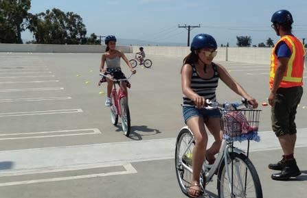

An obstacle course to teach pedestrians and bicyclist how to identify different street signs and how to use street infrastructure to increase safety. Youth and children navigate the obstacle course to win free helmets and lights.
Family-friendly interactive training and infrastructure tour intended to increase the confidence of pedestrians and bicyclists. Participants get a free helmet and bike lights.
Safety resource distribution events where people learn about the importance of wearing a helmet. Participants receive free helmets and bike lights and are taught about the bicycle rules of the road, as well as how to be visible and predictable when riding.
Bike maintenance and ride workshops can include a series of classes for youth between 12-18 years. These classes are meant to teach riders how to fix and ride a bicycle. Participants learn the rules of the road, as well as their rights and responsibilities as bicyclists. These classes can offer the opportunity for participants to receive a free bike.
In order to improve programs and ensure that the bicycle and pedestrian conditions in Los Alamitos are adequate, audits, traffic-safety data collection, analysis, and reporting are necessary. Additionally, surveys allow to gain input from users on existing issues and potential solutions. The following examples include ways the City can evaluate and monitor programs and infrastructure.
An active transportation evaluator position would assist the city’s current active transportation coordinator in reviewing project plans and built projects as well as ensuring consistency and cooperation between city departments. The evaluator would also assist with completing grant applications, maintaining a prioritized list of improvements, researching appropriate funding sources, and updating cost estimates. This investment in staff is often returned since this position is usually responsible for securing State and federal funding.
While the city has an active Bicycle Advisory Team that provided valuable oversight for this Active Transportation Plan, many municipalities have developed bicycle and pedestrian, or active transportation advisory committees to address walking along with bicycling, and some address overall mobility, including transit. This group can act as a community liaison
and support city staff, volunteers, and advocate efforts to address issues concerning local bicycling and walking, as well as regularly evaluate the progress of improvements in this Active Transportation Plan. City support is imperative for creating the committee, budgeting time and resources for city staff, and for elected officials to attend and to support the committee.
Conduct regular bicyclist and pedestrian counts throughout the city to determine baseline mode share and subsequent changes. Conducting counts would allow the city to collect information on where the most bicycling and walking occur. This assists in prioritizing and justifying projects when funding is solicited and received. Counts can also be used to study bicycling and walking trends throughout the city. Analysis that could be conducted includes:
» Changes in volumes before and after projects have been implemented
» Prioritization of local and regional projects
» Research on clean air change with increased bicycle use
Counts should be conducted at the same locations and at the same times every year. Conducting counts during different seasons within the year may be beneficial to understanding the differences in bicycle and pedestrian traffic volumes based on seasonal weather. In addition, bicycle and pedestrian
counts should be collected as part of any existing traffic counts. Results should be regularly recorded for inclusion in the bicycle and pedestrian report card (see next section).
The Los Alamitos Police Department should collect and track collision data. Regular reports of traffic collisions should be presented to the advisory committee. Traffic collisions involving bicyclists and pedestrians should be regularly reviewed and analyzed to develop plans to reduce their frequency and severity. Any such plans should include Police Department involvement and should be monitored to determine their effectiveness. Results of the number of collisions should be recorded in a bicycle and pedestrian report card described in the next section.
The City could develop a bicycle and pedestrian report card, a checklist used to measure the success of plan implementation, as well as effort made, within the city. The report card could be used to identify the magnitude of accomplishments in the previous year and general trends. The report card could include, but not be limited to, keeping track of system completion, travel by bicycle or on foot (counts) and safety.
The City can use the report card to track trends, placing more value on relative than absolute gains (in system completion, mode share, and safety). For example, an upward trend in travel by bicycle or on foot would be viewed as a success, regardless of the specific increase in the number of bicyclists
or walkers. Safety should be considered relative to the increase in bicyclists and walkers. Sometimes crash numbers go up simply because bicycling and walking increases, at least initially. Instead, measure crashes as a percentage of an estimated overall mode share count.
A major portion of the report card would be an evaluation of system completion. An upward trend would indicate that the city is progressing in its efforts to complete the bicycle and pedestrian network identified in this document. The report card could be developed to utilize information collected as part of annual and on-going evaluations, as discussed in the previous sections. The report card is not intended to be an additional task for city staff, but rather a means of documenting and publicizing the city’s efforts related to bicycle and pedestrian planning. It can be a task of the advisory committee to review annual report cards and to suggest future plan and goal adjustments.
In addition to quantifying accomplishments related to the bicycle plan, the city should strive to quantify its efforts. These may be quantified as money spent, staff hours devoted or other in-kind contributions. The quantified effort should be submitted as a component of the bicycle and pedestrian report card. Some cities publish their report cards online.
Orange County Average Silver
High Speed Roads with Bike Facilities
Total Bicycle Network Mileage to Total Road Network Mileage
Bicycle Education in Schools
Share of Transportation Budget Spent on Bicycling
Bike Month and Bike to Work Events
Active Bicycle Advocacy Group
Active Bicycle Advisory Committee
ENGINEERING
Bicycle network and connectivity
EDUCATION
Motorist awareness and bicycling skills
ENCOURAGEMENT
Mainstreaming bicycling culture
ENFORCEMENT
Promoting safety and protecting bicyclists' rights
EVALUATION & PLANNING
Setting targets and having a plan
RIDERSHIP
Percentage of Commuters who bike
Bicycle–Friendly Laws & Ordinances
Bike Plan is Current and is Being Implemented Bike Program Staff to Population
Orange County 2016 report card
» Orange County is a large community with many high-speed streets that can serve as barriers to bicycling. Identify neighborhood or district-scale areas to target bicycle investments in order to create connected networks within those areas. In urban areas with high-speed and/or high-volume roads this may take the form of a "minimum grid" of separated bicycle lanes or similar high quality facilities. These neighborhood and district-scale networks can serve as nodes for a larger community-scale network.
» Orange County has some excellent examples of working with communities within the county. Continue to grow programs, such as the Bicycle Corridor Improvement program, and pursue multi-jurisdictional planning studies, such as the upcoming county Active Transportation Plan and Active Transportation Count program. As a large county with many diverse cities the county has an important role in enabling successful local initiatives and providing support for lower-income communities to benefit from resources developed in higherincome communities in the county.
would aid in creating engineering, education, and enforcement strategies to reduce traffic crashes and deaths for all road users, including bicyclists and pedestrians. Road diets, lane diets, and traffic calming treatments are important engineering components for addressing safety. Cooperation between local, county, and state law enforcement agencies will be important for successfully addressing traffic safety in Orange County.
Bicycle Friendly Community designation is part of a program offered by the League of American Bicyclists (LAB) intended to provide communities with guidance on becoming more bicycle friendly and to award recognition for their achievements. Like the report card described previously, Bicycle Friendly Community designation provides a standard by which the City of Los Alamitos can measure its progress toward bicycle friendliness. It could be a function of the Bicycle Advisory Team to support city staff to compile an updated application to improve upon its current Bronze level Bicycle Friendly Community status.
» Bicycle-safety education should be a routine part of education, for students of all ages, schools and the surrounding neighborhoods should be particularly safe and convenient for biking and walking. Work with local bicycle groups and interested parents to develop and implement a Safe Routes to School program for all schools.
» Develop outreach methods that specifically target families, women, and non-English speaking communities in addition to general non-targeted outreach and media campaigns that discuss current and new bicycle facilities, safe driver and bicyclist behavior, and events related to walking and biking.
There are a number of actions and programs that can be made available in communities to further promote healthy lifestyles choices through active transportation modes. Active transportation has many proven physical, social, and mental health benefits through increased levels of physical activity.

The Los Alamitos Health Fair and Expo is typically held each summer to celebrate wellness and teach the community how to create a healthier lifestyle. The Health Expo is free and features a variety of health-related vendors including yoga, self-defense, holistic healing, CPR/First Aid, home health care and more.

The Orange County Hiking Club is a charitable 501© (3) nonprofit and the largest hiking club in the county. The club exists to promote physical, mental, and emotional wellness through connection with nature. In addition to these benefits, it also provides education, encouragement, and nature-empowerment for people of all ages, families, and at-risk youth through mentorship and leadership development in the outdoors.
The Orange County Cycling Club is a social cycling club with rides in Orange County. No membership is required, and riders can benefit from being physically active outdoors in their own community.
The Orange County (OC) Loop is a vision for 66 miles of seamless connections and an opportunity for people to bike, walk, and connect to key destinations. About 80 percent of the OC Loop is already in place and is used by thousands of people. Currently, nearly 54 miles use existing off-street trails along the San Gabriel River, Coyote Creek, Santa Ana River, and the Coastal/Beach Trail.
Federal, state, and local government agencies invest billions of dollars every year in the nation’s transportation system. Only a fraction of that funding is used to develop policies, plans, and projects to improve conditions for bicyclists and pedestrians. Even though appropriate funds are available, they are limited and often hard to find. Desirable projects sometimes go unfunded because communities may be unaware of a fund’s existence or may apply for the wrong type of grant. In addition, there is increasing competition between municipalities for the limited available funds.
Whenever federal funds are used for bicycle and pedestrian projects, a certain level of state and/or local matching funding is generally required. State funds are often available to local governments on similar terms. Almost every implemented active transportation or complete street program and infrastructure in the United States has had more than one funding source and it often takes a good deal of coordination to pull the various sources together.
According to the publication by the Federal Highway Administration (FHWA), an Analysis of Current Funding Mechanisms for Bicycle and Pedestrian Programs at the Federal, State and Local Levels, where successful local bicycle infrastructure programs exist, there is usually an active transportation coordinator with an extensive understanding of funding sources, such as Caltrans. City staff are often in a position to develop a competitive project and detailed proposal that can be used to improve conditions for bicyclists and pedestrians within their jurisdictions. Some of the following information on federal and state funding sources were derived from the previously mentioned FHWA publication.
The City of Los Alamitos should continue to pursue state level grants through programs such as Caltrans’ Active Transportation Planning (ATP) and Sustainable Transportation Planning grants, the Strategic Growth Council’s Sustainable Community Planning Grants, Urban Greening Grants and through the Highway Safety Improvement Program (HSIP). Projects that are not awarded funding through the Caltrans ATP cycles are sent
to the Southern California Association of Governments (SCAG), the local MPO, for consideration for funding through their programs. It will be important to coordinate efforts with adjacent jurisdictions on projects that affect and benefit both cities. Coordination and joint efforts also strengthen an application due to combined benefits for multiple jurisdictions.
Tables 5-1 through 5-3 identify potential federal, state, and local funding opportunities that may be used from design to maintenance phases of projects. Due to trends in Low Impact Development (LID) and stormwater retention street designs, funding sources for these improvements not only increase the chances for first and last mile improvements but can also be incorporated into streetscape and development projects.
Refer to funding sources for specific details on funding cycles.
Federal Highway Administration (FHWA)
https://www.fhwa.dot.gov/ environment/air_quality/ cmaq/ Highway Safety Improvement Program (HSIP) Unavailable • •
https://dot.ca.gov/ programs/localassistance/fed-andstateprograms/highwaysafetyimprovementprogram
Federal Transit Administration (FTA)
Unavailable •
• https://www. saferoutespartnership. org/healthy-communities/ aferoutestoparks/2019
• • • •
• • • • •
programs/local-assistance/ fed-and-state-programs/ active-transportationprogram
grants/environmentalenhancement-andmitigation-eem/
https://calsta.ca.gov/ subject-areas/transitintercity-rail-capital-prog https://dot.ca.gov/ programs/rail-and-masstransportation/transitand-intercity-rail-capitalprogram
programs/transportationprogramming/ state-highwayoperation-protectionprogram-shopp-minorprogram-shopp