


APRIL 2015 Lexington-Fayette Urban County Government Lexington, Kentucky Prepared by ardinal
Valley Small Area Plan
1.0 PLAN OVERVIEW
1.1 Introduction & Overview, pg. 6
1.2 The Team, pg. 7
1.3 Study Area & Context, pg. 8
1.4 Planning Process, pg. 8
1.5 Public Participation, pg. 12
2.0 ISSUES &
OPPORTUNITIES
2.1 Existing Conditions, pg. 16
2.2 Major Issues & Opportunities, pg. 38
3.0 PLAN RECOMMENDATIONS
3.1 Neighborhood Conservation, pg. 42
3.2 Versailles Road Corridor Improvements, pg. 52
3.3 Alexandria Drive International District, pg. 58
3.4 Oxford Circle Neighborhood Center, pg. 66
3.5 Open Space Network, pg. 72
4.0 ACTION PLAN
4.1 Implementation Principles, pg. 84
4.2 Conceptual Implementation Program, pg. 85
APPENDIX A: PUBLIC PARTICIPATION MATERIALS
CARDINAL VALLEY SMALL AREA PLAN 2
Table of Contents
2.0
3.0 PLAN RECOMMENDATIONS
3.1.1
3.1.2
3.1.3
3.2.2
3.5.1
3.5.2
CARDINAL VALLEY SMALL AREA PLAN 3
List of Figures
ISSUES & OPPORTUNITIES
Land Use Map 2.2 Zoning Map 2.3 Neighborhood Retail & Community Services 2.4 Recreational Assets 2.5 Health Assets 2.6 Street Network 2.7 Transit Network 2.8 Median Household Income, 2010
Population Change, 2000-2010
Population Under 18 & Over 65, 2010 2.11 Housing Units, 2010 2.12 Housing Mix 2.13 Housing Tenure 2.14 Housing Value 2.15 Patterns of Investment & Disinvestment, 2010-2014 2.16 Natural Features 2.17 Land Cover 2.18 Tree Cover 2.19 Diversity Index, 2010 2.20 Low Impact Development
Population by Race - White 2010
Population by Race - African American, 2010
Population by Race - Hispanic, 2010
2.1
2.9
2.10
2.21
2.22
2.23
Sidewalk
Improvements
Crosswalk Improvements
Wayfinding Strategies
& Repositioning
Development
Opportunities
Large Open Space
Network
Open Space
Highlights
THIS PAGE LEFT INTENTIONALLY BLANK
CARDINAL VALLEY SMALL AREA PLAN 4
Plan Overview 1.0

5
1.1 Introduction & Overview
In the Spring of 2014, the Lexington-Fayette Urban County Government (LFUCG) Division of Planning sought qualifications/proposals from consulting firms interested in preparing a small area plan amendment to the 2013 Comprehensive Plan. The LFUCG regularly updates its Comprehensive Plan, with the most recent update adopted November 14, 2013. As a part of the update, the Urban County Planning Commission identified a number of areas, one of which was the Cardinal Valley/Oxford Circle Neighborhood, for a small area plan process. Small area plans are amendments to the Comprehensive Plan that delve into a detailed analysis of areas of particular interest.
The challenge of this particular small area plan for the Design Team was making recommendations for a very diverse study area which included:
• Several single-family neighborhoods with smaller middle class homes from the 50’s and 60’s that are in various states of upkeep and ownership
• A close-knit, well-maintained, single-family neighborhood seeking National Register status
• Multi-family apartments in need of major repairs, which serve lower income families, many of whom are immigrants
• A major corridor and gateway into the City that is currently dotted with fast food chains and is inhospitable for pedestrians and cyclists
• Neighborhood serving retail in a hodge podge of older strip malls in need of maintenance
• A commercial center that is in decline but has great potential for redevelopment
• Community services such as the library and local park, which are some of the most highly used in the City, but which are in need of upgrades
• A series of natural features
Hemmed in by the railroads and industrial on Old Frankfort Pike to the North, the ring of New Circle Road, and the bisection of Versailles Road, the challenge was to think of redevelopment and stabilization over unadulterated growth.
The Design and Planning Team was challenged with utilizing the neighborhoods’ existing amenities such as the Cardinal Valley Elementary School, the strong local business community, and several successful parks (i.e. Valley Park, and Preston‘s Spring Park) and envision a new series of amenities and programs to help enrich the community.
A traffic and engineering study was being conducted concurrently to the Small Area Plan and the results of the plan EA Partners and Carman created have been incorporated here in the recommendations where appropriate. The Versailles Road Corridor Improvements Alternatives Analysis Study, and more specifically this Cardinal Valley/Oxford Circle Neighborhood Small Area Plan can go a long way to creating an inviting entry to the City, while interweaving the needs of an underserved community. This will enable continued growth (not to be confused with expansion) and regain competitiveness as a place to move to and raise a family.
As described in Section 1.4 Process, the Design Team has taken the approach of focusing on five areas of focus:
NEIGHBORHOOD CONSERVATION
VERSAILLES ROAD CORRIDOR IMPROVEMENTS
CARDINAL VALLEY SMALL AREA PLAN 6
OPEN SPACE NETWORK--
ALEXANDRIA DRIVE INTERNATIONAL DISTRICT OXFORD CIRCLE NEIGHBORHOOD CENTER
1.2 The Team
The lead firm on the Design Team, Lord Aeck Sargent, specializes in working with residents, business owners, institutions and public officials to create implementation-oriented, detailed urban design plans. Collaborators include EHI Consultants, who build on recent work in the area to assist with community outreach, affordable housing, and environmental planning. In addition, Parsons Brinckerhoff brings a comprehensive approach to multi-modal transportation planning and public infrastructure and utilities.
Lord Aeck Sargent is an award-winning architecture and urban design firm. The firm’s mission of responsive design is dedicated to the creation of enduring places. Their portfolio includes urban mixed-use development, downtown master plans, streetscape design and implementation, and urban public space, with services ranging from master planning and programming to design, construction, and program management.
EHI Consultants provides the highest quality of planning and engineering design services. EHI’s diversity provides the capability to program, plan, design and implement a range of housing, planning, and engineering projects. They are committed to the improvement of the natural, social, physical and cultural environments.
Parsons Brinckerhoff is a global consulting firm assisting public and private clients to plan, develop, design, construct, operate, and maintain thousands of critical infrastructure projects around the world. With a strong commitment to technical excellence, a diverse workforce, and service to our clients, they are currently at work on thousands of infrastructure projects, ranging from mega-projects that define an entire region to smaller, more local projects that keep a community moving forward.

The Lexington-Fayette Urban County Government’s Division of Planning is acting as the client for the Small Area Plan. Their mission is to provide a vision and strategy that will allow Lexington to grow and prosper while preserving, protecting, and enhancing existing neighborhoods, downtown, and the rural Bluegrass cultural landscape.
In addition to the members of the Planning staff, the Design Team has been working hand in hand with Councilmember Peggy Henson and her aide Hilary Angelucci of the City’s 11th District. She has been invaluable not only for her dedication to her District, but for her knowledge of the area having been a lifelong Cardinal Valley resident.
Without the diligent efforts of City staff and elected officials the headways that have already been made on this project would not be possible. Their continued support will ensure that the recommendations of the Cardinal Valley Small Area Plan are seen through to fruition.
The Small Area Plan relied heavily upon the Steering Committee members. They were an invaluable sounding board throughout the planning process. The Steering Committee included everyone from residents, business-owners, government officials, property owners, institutions, as well as the community at-large:
Reggie Thomas State Senate, District 13
Peggy Henson LFUCG-11th District
Hilary Angelucci LFUCG-11th District Aide
Mike Owen LFCUG Planning Commission
Betty Abdmishani Village Branch Library
John Campbell Oxford Circle Merchants Association
Janice Chenault Christian Towers
Eddie Collins Pepsi
Carmen Cotto Valley Park Ballet Instructor
Mike & Letha Drury Southhill Gallery
Rogerio Fabian Panchitos
Jan Hellebusch Hamilton Park Resident
John Johns Cardinal Valley Neighborhood Association
Steve Kaplan Pepsi
Billie Offutt Cardinal Valley Neighborhood Association
Bill Pabian Cardinal Hill Rehab Hospital
Jennifer Reynolds Valley Park Ballet Instructor
Samantha Rodarte Cardinal Valley Elementary PTA / Valley Park Board
Paula Singer Friends of Versailles Road / Hamilton Park Resident
Todd Strecker Calumet Area Neighborhood Association
Carrie Thayer Hope Center for Women
Brian & Tammy Wiese Lexington Hitch and Trailer
CARDINAL VALLEY SMALL
PLAN 7
AREA
1.3 Study Area & Context
The neighborhoods surrounding the Cardinal Valley/ Oxford Circle area are examples of Lexington’s growth from the Downtown Core out along the spoke roads into a once rural landscape in the 1950’s and 1960’s. These neighborhoods formed, like many suburban communities of that era, into a series of winding cul-de-sacs flanked by row after row of single-family ranch or split-level homes. With these new residential communities blossoming, places like the Oxford Circle Commercial Center and Bondurant’s Pharmacy developed to support those middle class working families. Over time as the City continued to expand, development pressures mounted leading to the construction of numerous apartment complexes along the Versailles Road edge and pushing back into Village and Alexandria Drives, and along Hill View Drive, creating a unique condition of diverse housing options within the neighborhood. However, this pattern of residential development along with its strip mall commercial counter parts has over time, created a very fragmented suburban framework.
Cardinal Valley / Oxford Circle Neighborhood
• Built in the 1950’s/1960’s
• Planned neighborhood around circular parkways
• Study Area = 787 Acres (1.2+ sq. mi.)
Key Community Assets
• Cardinal Valley Elementary School
• Valley Park
• Lexington Public Library Village Branch
Retail in the area is a mix of national chains located in individual out parcels along Versailles Road, combined with older small-scale strip malls holding local businesses. Much of this retail is centered on serving the local residents, which means that many of the businesses cater to Spanish-speakers and the needs of a heavily immigrant population.
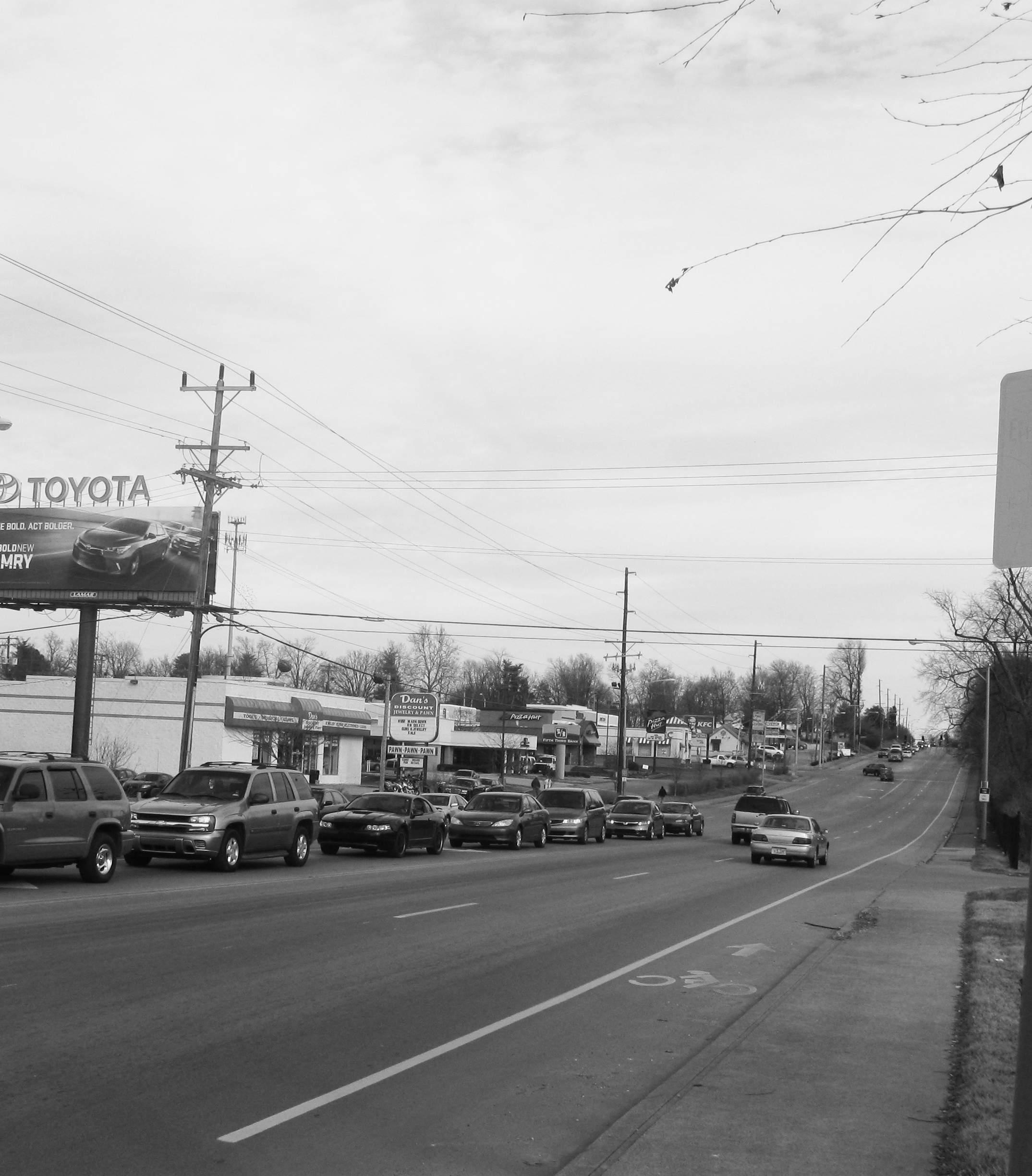
The area is unique in its setting being less than two miles from the rural horse farms that make the Bluegrass so famous. Versailles Road is the first impression for many arriving from the Lexington Airport and travelling to the City, and for anyone travelling from Downtown to the Keeneland Race Track. As such, the Corridor makes a poor gateway for a City that has such strong inroads into thinking about its approach to urban design.
1.4 Process
The process included two phases over ten months. This process included multiple layers of community involvement throughout, including working with the LFUCG Division of Planning Staff, Councilmember Peggy Henson’s Office, and a Steering Committee comprised of a broad cross-section of the community – residents, business-owners, government officials, property owners, institutions, as well as the community at-large during three interactive public meetings. The public involvement opportunities were structured to engage the broadest range of possible stakeholders and gather maximum input from each opportunity.
The general approach and process is described on the following pages. The process itself was refined through consultation with the LFUCG Planning Staff and Steering Committee within the first few months to better suit the needs of the study. This led to a focus on 5 key focus areas. The process included:
Phase I focused on an initial pass at the overall scope and schedule of the project, initial data and information gathering to get a feel of the study area, as well as laying the foundation for communication with key members of the client team and community. Phase I began with initial meetings with LFUCG Planning staff and Councilmember Peggy Henson’s Office, and a Steering Committee to validate the overall process as well as begin a discussion on neighborhood issues and opportunities.
1.4.2 Phase II Analysis, Alternatives and Outcomes - 8 Months
Phase II focused on the full development of the project, moving from an analysis of the existing conditions on a qualitative and quantitative level, to creation of series of recommendations for five focus areas, and culminating in a Final Report and presentations to the Planning Commission on the project outcomes.
Base studies
The Design Team collected and assessed all information provided by the LFUCG, Planning staff, and the Steering Committee, and any additional outside resources, as well as conducted a “windshield survey” to assess the current building conditions and occupancy on site. Using this information the base studies included but were not limited to:
1.4.1 Phase I Assessment and Goal Setting - 2 Months
• Neighborhood Identity: What is Cardinal Valley/ Oxford Circle? What separates it from the other communities in the area? The Design Team looked for unique aspects of Cardinal Valley/ Oxford Circle including history, infrastructure, buildings, parks, landscapes, but also businesses, schools, and neighborhood culture. The various components were documented through mapping, diagramming, and photography to describe Cardinal Valley/ Oxford Circle‘s current identity, and are shown in Section 2 of this report.
CARDINAL VALLEY SMALL AREA PLAN 8

9 0 500 FEET N 250 1000
CARDINAL VALLEY SMALL AREA PLAN 10 C 2015 2014 Phase I Assessment + Goal Setting Phase II Analysis, Alternatives + Outcomes Early Catalytic Project Versailles Corridor Improvement AUGSEPOCTNOVDECJANFEBMARAPRMAY Program + Preliminary Site Survey Final Project Scope Open Space Plan Versailles Road Corridor Improvements Base Studies Oxford Circle Redevelopment Alexandria Drive International District Neighborhood Conservation Final Report Planning Commission Process Final Deliverables Corridor Design Tentative Schedule Cardinal Valley Funding and Implementation Steering Comm. Meeting 9/8 Steering Comm. Meeting 11/3 Steering Comm. Meeting 1/28 Public Kick-Off Meeting #1 Plan Elements / Issues 9/29 Public Meeting #2 Visioning Workshop 11/18 Public Meeting #3 Projects Workshop Steering Comm. Meeting Steering Comm. Meeting 10
• Land Use: from field surveys and GIS data, existing land use data was validated and expanded using GIS mapping techniques to identify emerging use patterns, and potential points of conflict.
• Community Form and Zoning: community form was documented through a series of mapping and diagrammatic techniques to explain the current framework of Cardinal Valley/ Oxford Circle and illustrate its strengths and weaknesses.
• Mobility Issues and Opportunities: mobility was documented through maps and diagrams including existing vehicular and public transportation corridors, pedestrian and bicycle facilities, as well as noting where the circulation systems have breakdowns or conflict points and what portions of the study area are underserved.
• Baseline Demographics: using available census and PVA data the design team was able to paint a picture of Cardinal Valley/Oxford Circle using detailed demographic information which helped inform the focus area plans and implementation projects.
• Environmental Issues and Opportunities: this analysis covered issues such as topography, tree canopy, areas of storm and sewer concern, and waterways in an attempt to find environmentally sensitive areas that may need to be incorporated into future development/ planning guidelines.
• Buildings Analysis: the buildings analysis looked at the age and condition of the major buildings structures, property values, and property ownership within the study area.
Base studies Review
Upon completion of the base studies the Design Team met with the LFUCG Planning staff and members of the Steering Committee to review and
revise the base studies.
A Public Kick-Off Meeting (Public Meeting #1) was conducted with neighborhood residents, property owners, business owners, and anyone with a vested interest in the community. The KickOff Meeting included an introduction of the Design Team, and an explanation of the planning process and schedule, as well as overview of the existing conditions analysis. Attendees were invited to participate in several planning stations that helped define the character of the community as the public sees it, and helped to outline the vision for the neighborhood.
in Appendix A.
Following this workshop, the Design Team compiled the collective results from interactive work stations for review with LFUCG Planning staff and the Steering Committee. Results of the workshop were fed into any further revisions needed to the base studies.

Focus aReas
Based on the base studies and public meeting input, the team then felt it would be best to turn their efforts to looking at five focus areas that seemed to be recurring areas of concern or areas that looked like they would make for the greatest opportunities for change. The Design Team worked on all of the focus areas simultaneously knowing that some would take longer to resolve than others. The five focus areas included:
• Neighborhood Conservation
• Versailles Road Corridor Improvements
• Alexandria Drive International District
• Oxford Circle Neighborhood Center
• Open Space Network
This Public Kick-Off Meeting was intended to be unconstrained and big-picture, allowing participants to get all the issues and opportunities documented through dialogue and interactive work stations including: a “change versus no change” map, and a “My Vision for Cardinal Valley is...” exercise, and a an Issues and Opportunities Matrix which allowed participants to post thoughts and suggestions under specific categories like neighborhood, housing, education, health and safety, employment and economic development. Additional information regarding the Public Outreach efforts can be found
Over the course of the next several months the Design Team would review their recommendations for the five focus areas with the LFUCG staff, the Councilmember’s Office, and the Steering Committee, discussing no more than two at any given meeting to allow for the most discussion of each topic.
Final Recommendations
A final series of recommendations has been compiled and laid out in this report (Chapter 3 and 4) based on comments from LFUCG Planning staff, Councilmember Henson and her staff, and the Steering Committee, and feedback from the community.
CARDINAL VALLEY SMALL AREA PLAN 11
1.5 Public Process
The Cardinal Valley Small Area Plan called for extensive public outreach given the varied constituencies within the study area. The Design Team approached public involvement in a threepronged approach: small, medium, and large scale. On the smallest scale, members of the Design Team met with individual stakeholders, such as the Public Library and Community Action Council, and small groups, such as a focus group of merchants from Alexandria Drive. The Steering Committee made up the mid-range of involvement and was comprised of over a dozen members or persons of importance within the community. They met with the Design Team on a regular basis and were crucial in bouncing ideas off of. Finally, at the largest level the team held its three major public meetings and encouraged everyone in the community to attend.
1.5.1 Initial Public Meeting
Date: Monday, September 29th, 2014
7:00 pm - 8:30 pm.
Location: Cardinal Valley Elementary School (218 Mandalay Road, Lexington, KY 40504)
The goal was to provide the community with an existing conditions assessment and to gather their input regarding issues, opportunities and vision for Cardinal Valley through three interactive stations.

1.5.2 Fall Festival
Date: Saturday, October 25th, 2014
2:00 pm - 6:00 pm.
Location: Valley Park, Lexington, KY
Lexington-Fayette Urban County Government, Lord Aeck Sargent and EHI Consultants participated in the Fall Festival to collect the communities’ opinions in reference to neighborhood improvements.
1.5.3 Second Public Meeting
Date: Tuesday, November 18th, 2014
6:30 pm - 8:30 pm.
Location: Cardinal Valley Elementary School (218 Mandalay Road, Lexington, KY 40504)
Lexington-Fayette Urban County Government, Lord Aeck Sargent, EHI and Parsons Brinckerhoff hosted the second public meeting and it primarily focused on the Versailles Road Corridor and the recommendations the Small Area Plan team were making for the Open Space Network. The public was encouraged to interact with the consultants following the presentations and provide feedback on the changes to the Versailles Corridor, and the overall Open Space network recommendations. They were also asked to do an exercise in which they selected alternative programming for Valley Park.
1.5.4 Commercial District Meeting
Date: Wednesday, February 11th, 2015
6:00 pm - 8:00 pm.
Location: Valley Park, Lexington, KY
Lexington-Fayette Urban County Government, Lord Aeck Sargent and EHI met with business owners of Alexandria Drive to discuss issues and opportunities along Alexandria.
1.5.5 Final Public Meeting
Date: Tuesday, April 7th, 2015
7:00 pm - 8:30 pm.
Location: Cardinal Valley Elementary School (218 Mandalay Road, Lexington, KY 40504)
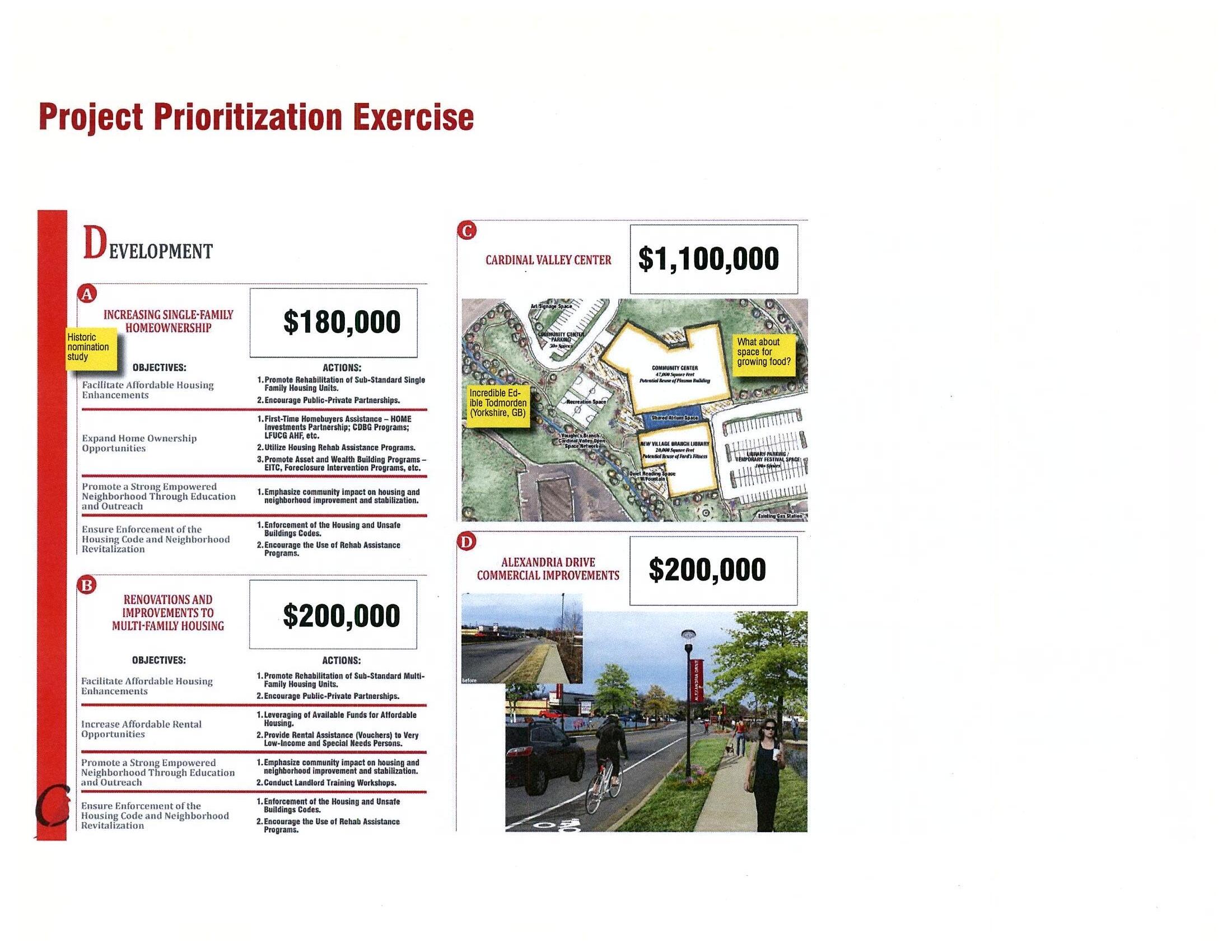
The final Public Meeting briefly recapped the results of the previous public meeting and discussed the recommendations for the remaining three focus areas. In addition to having breakout time at the end for general comments and questions each participant was given $100,000 in Cardinal Bucks and asked to distribute their money to projects within the five focus areas. They could spread their money around or put it all in one place if they chose. By far the project garnering the most support was the Oxford Circle Neighborhood Center.
CARDINAL VALLEY SMALL AREA PLAN 12
1.5.6 Targeted Outreach
Given that the area has such a high Hispanic population, the Design Team worked with LFUCG Planning staff to determine ways of reaching residents to hear from a truer cross-section of the population. Outreach to Spanish speakers was done through the following outlets:

• bilingual meeting flyers sent home with Cardinal Valley Elementary School students and distributed among local business owners
• canvassing of local businesses
• meeting with local merchants
• community organizations

• interpreter and bilingual meeting materials for all public meetings
1.5.7 Partnership Meetings
Along with the meetings open to the public and the targeted outreach to the Hispanic population, the Design Team made an effort to reach out to several potential partners. Meetings were held with the local YMCA, the Lexington Public Library, and the Community Action Council to discuss potential partnering efforts in the study area.

Public Outreach & Involvement

• 3 Public Meetings
• 5 Steering Committee Meetings
• Fall Festival
• Alexandria Drive Merchant Meeting
• Cardinal Valley Neighborhood Association Meeting

CARDINAL VALLEY SMALL AREA PLAN 13
THIS PAGE LEFT INTENTIONALLY BLANK
CARDINAL VALLEY SMALL AREA PLAN 14
Issues & Opportunities 2.0

15
2.1 Existing Conditions
Existing conditions for Cardinal Valley were collected, analyzed and mapped through GIS data, a windshield survey conducted in the fall of 2014, observations during site visits, and a walking assessment completed by the Planning Team.
2.1.1 Land Use
The map on page 17 shows how land in the study area is currently being used.
• The study area is composed mostly of singlefamily residential, also known as low density residential.
• Most of the multi-family development (medium and high density residential) is concentrated along Village Drive, Cambridge Drive and south of Versailles Road.
• Major institutions include Cardinal Valley Elementary School, Lexington Public Library Village Branch, Cardinal Hill Rehabilitation Hospital and several churches.
• The majority of the commercial area is along Versailles Road and Alexandria Drive, with a few businesses in Oxford Circle.

9% PARKS/OPEN SPACE
2% OFFICE/PROFESSIONAL SERVICES
1% MIXED-USE
21% HIGH DENSITY RESIDENTIAL
9% COMMERCIAL
3% LIGHT INDUSTRIAL
8% SEMI-PUBLIC/ INSTITUTIONAL
10% MEDIUM DENSITY RESIDENTIAL
37% LOW DENSITY RESIDENTIAL
CARDINAL VALLEY SMALL AREA PLAN 16 1 2 3 4 5 6 7 8 9
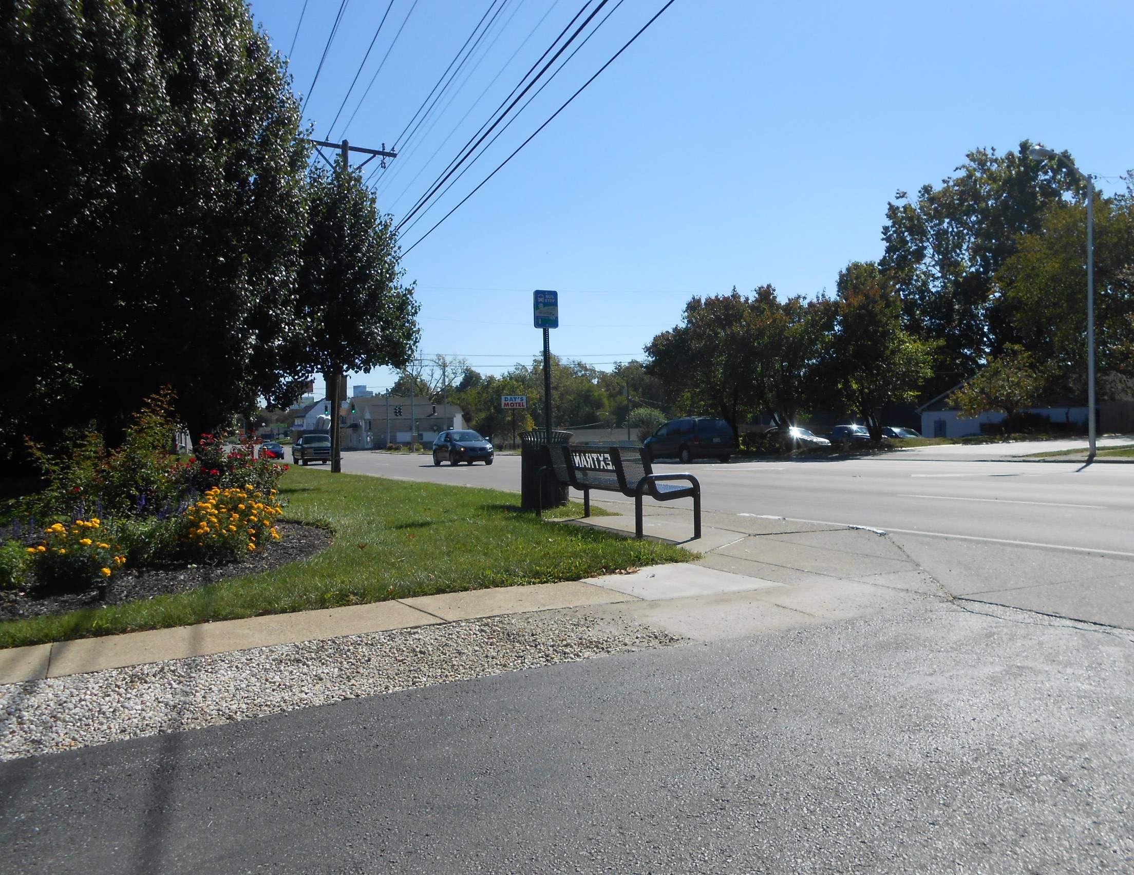
View along the intersection of Versailles Road and Trafton Street
Over 84% of the area is residential (73%) or some form of public space (11%).

17
LAND
MAP 0 500 FEET N 250 1000 GARRETT AVE WOODFORD DR HILL VIEW PL DELMONT DR HALLS LN TRAFTON ST WESTGATE DR VILLAGE DR MAYWICK VIEW LN ROANOKE RD PORT ROYAL DR MASON HEADLEY RD TERRACE VIEW DR FAIR OAKS DR 7 PINES DR THE LN DEVONPORT DR DEAUVILLE DR DORSET DR CAMBRIDGE DR BRITTANY LN LONDONBERRY DR RUGBY RD SUTTON PL MANDALAY RD NEWCASTLE ST SAVOY RD DUNKIRK DR OXFORD C I R C L E Valley Park Preston’s Springs Park Wolf Run Park Pine Meadows
Lexington Public Library Village Branch Addison Park Cardinal Valley Elementary
Cardinal Hill Rehabilitation
McConnell
HAMILTON PARK Hillcrest
FIG. 2.1:
USE
Park
School
Hospital
Springs Park
Memorial
2.1.2 Current Zoning
The Map at right represents how land in the study area is currently zoned and regulated.
• Most of the study area is zoned as SingleFamily Residential.
• Parcels zoned as Business are concentrated along Versailles Road.

• Parcels zoned Light Industrial are located on the eastern portion of the study area.
• The Agricultural-Urban zoning designation was originally intended to control the development of rural land within the Urban Service Area over a period of time so as to manage the growth of the community. In this particular case, the Hillcrest Memorial Cemetery and a private residence make up the majority of this zone on the map.
OFFICE
CARDINAL VALLEY SMALL AREA PLAN 18
0 100 200 46% 10% 29% 9% 3% 2% 1% 300 400 500 600 ACRES SINGLE-FAMILY RESIDENTIAL
Single-family homes in Cardinal Valley
COMMERCIAL MULTI-FAMILY RESIDENTIAL
INDUSTRIAL AGRICULTURAL-URBAN MIXED USE

0 500 FEET N 250 1000
2.2: ZONING MAP GARRETT AVE WOODFORD DR HILL VIEW PL DELMONT DR HALLS LN TRAFTON ST WESTGATE DR VILLAGE DR MAYWICK VIEW LN ROANOKE RD PORT ROYAL DR MASON HEADLEY RD TERRACE VIEW DR FAIR OAKS DR 7 PINES DR THE LN DEVONPORT DR DEAUVILLE DR DORSET DR CAMBRIDGE DR BRITTANY LN LONDONBERRY DR RUGBY RD SUTTON PL MANDALAY RD NEWCASTLE ST SAVOY RD DUNKIRK DR OXFORD C I R C L E Valley Park Preston’s Springs Park Wolf Run Park Pine Meadows
Lexington Public Library Village Branch Addison Park Cardinal Valley Elementary School Cardinal Hill Rehabilitation
McConnell Springs Park HAMILTON PARK
FIG.
Park
Hospital
2.1.3 Neighborhood Retail + Community Services
The study area contains a variety of neighborhood retail and community services. The map on the right shows the concentration of these services along Versailles Road, particularly Oxford Circle, Alexandria Drive and along the Light Industrial Zone.
• Alexandria Drive hosts a variety of local Latin restaurants and miscellaneous retail.

• The majority of locally run businesses are located in shopping plazas.
• Nationally franchised brands and chains, such as Starbucks, Taco Bell, and Little Caesars are distributed along the Versailles Road Corridor.


CARDINAL VALLEY SMALL AREA PLAN 20

WOODFORD DR HILL VIEW PL DELMONT DR HALLS LN TRAFTON ST MAYWICK VIEW LN ROANOKE RD MASON HEADLEY RD TERRACE VIEW DR 7 PINES DR THE LN DEAUVILLE DR DORSET DR CAMBRIDGE DR BRITTANY LN LONDONBERRY DR RUGBY RD SUTTON PL MANDALAY RD NEWCASTLE ST SAVOY RD DUNKIRK DR Valley Park Preston’s Springs Park Pine Meadows Park Addison Park Cardinal Valley Elementary School McConnell Springs Park 0 500 FEET N 250 1000
FIG. 2.3: NEIGHBORHOOD RETAIL & COMMUNITY SERVICES
2.1.4 Pedestrian, Bicycle, & Recreational Assets
Cardinal Valley is surrounded by various recreational areas, including parks, creeks and natural springs, as well as a crisscrossing network of pedestrian facilities.
• Valley Park is heavily used by the community for a number of events and sports such as soccer, festivals, ballet, softball, knitting, plant sales, book festivals, among others.

• Preston’s Springs Park is a natural spring located on the northern edge of the study area. It remains largely untouched. Better pedestrian access is needed to make it more accessible for the community.
• Wolf Run runs north to south within the study area, serving as backyard scenery for single and multi-family homes. Largely underused, Wolf Run can serve as a trail connector to link some of the open spaces in the neighborhood.
• Bicycle facilities in the form of bike lanes, are present along one section of Versailles Road, from Alexandria Drive to Oxford Circle, within the study area. Outside of that section no other bicycle facilities currently exist within the study area.
• Sidewalks exist throughout the neighborhood, but there is a connection issue when it comes down to the sidewalk network extending to Versailles Road.
• There are also numerous crosswalks or ADA ramps at intersections that are in need of improvements or do not exist at all.
CARDINAL VALLEY SMALL AREA PLAN 22
Valley Park

0 500 FEET N 250 1000 23 FIG. 2.4: RECREATIONAL ASSETS GARRETT AVE WOODFORD DR HILL VIEW PL DELMONT DR HALLS LN TRAFTON ST WESTGATE DR VILLAGE DR MAYWICK VIEW LN ROANOKE RD PORT ROYAL DR MASON HEADLEY RD TERRACE VIEW DR FAIR OAKS DR 7 PINES DR THE LN DEVONPORT DR DEAUVILLE DR DORSET DR CAMBRIDGE DR BRITTANY LN LONDONBERRY DR RUGBY RD SUTTON PL MANDALAY RD NEWCASTLE ST SAVOY RD DUNKIRK DR OXFORD C I R C L E Valley Park Preston’s Springs Park Wolf Run Park Pine Meadows Park Lexington Public Library Village Branch Addison Park Cardinal Valley Elementary School Cardinal Hill Rehabilitation Hospital McConnell Springs Park HAMILTON PARK
2.1.5 Health Assets
The study area has an abundance of health assets ranging from rehabilitation centers and nursing homes to substance abuse programs and homeless shelters.
• Cardinal Hill Rehabilitation Hospital treats patients recovering from strokes, spinal cord injuries, brain injuries, and acute trauma injuries.
• Hope Center for Women cares for homeless and at-risk women.
• Chrysalis Family Program is a substance abuse treatment program for women.
• Homestead Nursing and Rehabilitation Center is a nursing care center serving the rehabilitation of injured, disabled, or sick persons.
• HealthFirst Bluegrass Clinic (proposed) will be a quality medical, dental, pharmacy and support services for all members of the family, from newborns to elderly patients, and all ages.
FIG. 2.5: HEALTH ASSETS
2.1.6 Street Network
Due to the time period the neighborhood was planned(1950’s/1960’s), the study area is heavily influenced by vehicular traffic, resulting in curvilinear streets ending in cul-de-sacs. In addition to that, the grid is disconnected by both manmade barriers, such as the Versailles Line railroad corridor, Versailles Road, and New Circle Road, and natural barriers, such as Preston’s Spring and Wolf Run. This becomes difficult to navigate through for those not familiar with Cardinal Valley. Having a connected pedestrian and vehicular neighborhood augments the quality of life and allows easier access to local amenities.

8 Signalized intersections on Versailles Road

53 T-Intersections
28 Dead End Streets and Cul-de-sac
CARDINAL VALLEY SMALL AREA PLAN
D 24 FIG. 2.6: STREET NETWORK 0 500 FEET N 250 1000
0 500 FEET N 250 1000 GARRETT AVE WOODFORD DR HILL VIEW PL DELMONT DR HALLS LN TRAFTON ST WESTGATE DR VILLAGE DR MARYWICK VIEW LN ROANOKE RD PORT ROYAL DR MASON HEADLEY RD TERRACE VIEW DR FAIR OAKS DR 7 PINES DR THE LN DEVONPORT DR DEAUVILLE DR DORSET DR CAMBRIDGE DR BRITTANY LN LONDONBERRY DR RUGBY RD SUTTON PL MANDALAY RD NEWCASTLE ST SAVOY RD DUNKIRK DR OXFORD CIRC L E Valley Park Preston’s Springs Park Wolf Run Park Pine Meadows Park Lexington Public Library Village Branch Addison Park Cardinal Valley Elementary School Cardinal Hill Rehabilitation Hospital McConnell Springs Park HAMILTON PARK
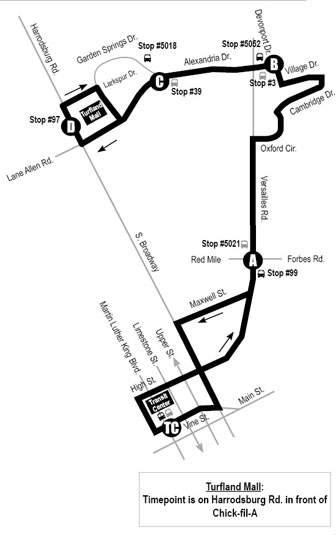
2.1.7 Transit Network
Lextran has five routes that provide bus service within the study area. Three of the five (Route 8, Route 21, and Route 31) enter the heart of the study area while the other two (Route 12 and Route 15) only exist on the eastern boundary. Route 8, Versailles, and Route 31, Alexandria Crosstown, provide service in the central and western portion of the study area along Versailles Road, Oxford Circle, Cambridge Drive, Village Drive, Devonport Drive, and Alexandria Drive. Route 21, Airport / Keeneland, provides service along Versailles Road through the study area.

• Based on the productivity of Lextran’s 23 bus lines in March of 2014, Route 8 was Lextran’s most utilized route.
• Route 15 was #8 on the overall list with significant ridership from the University of Kentucky
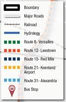
• Route 12 was #13.
• Routes 21 and 31 showed low ridership at #20 and #23 respectively.
2.1.8 Median Household Income, 2010
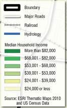
A median income is the midpoint in a range of numbers. Household income is measured by the person(s) residing in the same household. When compared with the average household in Lexington, it is telling of the income disparity between Cardinal Valley and the rest of the city.
• The majority of the single-family residents make between 24k-39k
• Most of the residents that make 24k or less reside in the areas designated for multi-family.
• More than 90% of the study area has an unemployment rate between 7.1%14%. $ $ $
How does the median household income in Cardinal Valley stack up to elsewhere?
United States $53,649 Kentucky $42,802 Lexington-Fayette County $49,421

CARDINAL VALLEY SMALL AREA PLAN
2.8: MEDIAN HOUSEHOLD INCOME, 2010 25
FIG.
0 500 FEET N 250 1000 0 500 FEET N 250 1000 GARRETT AVE WOODFORD DR HILL VIEW PL DELMONT DR HALLS LN TRAFTON ST WESTGATE DR VILLAGE DR MAYWICK VIEW LN ROANOKE RD PORT ROYAL DR MASON HEADLEY RD TERRACE VIEW DR FAIR OAKS DR 7 PINES DR THE LN DEVONPORT DR DEAUVILLE DR DORSET DR CAMBRIDGE DR BRITTANY LN LONDONBERRY DR RUGBY RD SUTTON PL MANDALAY RD NEWCASTLE ST SAVOY RD DUNKIRK DR OXFORD C RC L E Valley Park Preston’s Springs Park Wolf Run Park Pine Meadows Park Lexington Public Library Village Branch Addison Park Cardinal Valley Elementary School Cardinal Hill Rehabilitation Hospital McConnell Springs Park HAMILTON PARK GARRETT AVE WOODFORD DR HILL VIEW PL DELMONT DR HALLS LN TRAFTON ST WESTGATE DR VILLAGE DR MAYWICK VIEW LN ROANOKE RD PORT ROYAL DR MASON HEADLEY RD TERRACE VIEW DR FAIR OAKS DR 7 PINES DR THE LN DEVONPORT DR DEAUVILLE DR DORSET DR CAMBRIDGE DR BRITTANY LN LONDONBERRY DR RUGBY RD SUTTON PL MANDALAY RD NEWCASTLE ST SAVOY RD DUNKIRK DR OXFORD C RC L E Valley Park Preston’s Springs Park Wolf Run Park Pine Meadows Park Lexington Public Library Village Branch Addison Park Cardinal Valley Elementary School Cardinal Hill Rehabilitation Hospital McConnell Springs Park HAMILTON PARK
FIG. 2.7: TRANSIT NETWORK
2.1.9 Population Change, 2000-2010
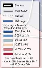
A Population Change map can show where residents are moving to or investing in. As the map on the left demonstrates, most of the growth is centered on the southern part of the study area, around new and growing multi-family apartments, as well as growth in the southeast with the increase of single-family homes.

There is some moderate growth around the single-family neighborhoods surrounding Cardinal Valley Elementary School.

Lots of Growth
Moderate Growth
No Significant Change
2.1.10 Population Under 18 and Over 65, 2010
Understanding where the majority of the younger and elderly population reside, as well as the age distribution can help plan for more adequate amenities throughout the community.
UNDER 18 YEARS OLD
65 YEARS OLD & OVER
18-64 YEARS OLD
Median Age = 23.3 Years Old
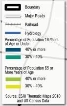
Young Families
In the single-family neighborhoods around the elementary school
Senior Citizens
In the area around Christian Towers
CARDINAL VALLEY SMALL AREA PLAN
FIG. 2.9: POPULATION CHANGE, 2000-2010
0 500 FEET N 250 1000 0 500 FEET N 250 1000
FIG.
2.10: POPULATION UNDER 18 & OVER 65, 2010
GARRETT AVE WOODFORD DR HILL VIEW PL DELMONT DR HALLS LN TRAFTON ST WESTGATE DR VILLAGE DR MAYWICK VIEW LN ROANOKE RD PORT ROYAL DR MASON HEADLEY RD TERRACE VIEW DR FAIR OAKS DR 7 PINES DR THE LN DEVONPORT DR DEAUVILLE DR DORSET DR CAMBRIDGE DR BRITTANY LN LONDONBERRY DR RUGBY RD SUTTON PL MANDALAY RD NEWCASTLE ST SAVOY RD DUNKIRK DR OXFORD CIRC E Valley Park Preston’s Springs Park Wolf Run Park Pine Meadows Park Lexington Public Library Village Branch Addison Park Cardinal Valley Elementary School Cardinal Hill Rehabilitation Hospital McConnell Springs Park HAMILTON PARK GARRETT AVE WOODFORD DR HILL VIEW PL DELMONT DR HALLS LN TRAFTON ST WESTGATE DR VILLAGE DR MAYWICK VIEW LN ROANOKE RD PORT ROYAL DR MASON HEADLEY RD TERRACE VIEW DR FAIR OAKS DR 7 PINES DR THE LN DEVONPORT DR DEAUVILLE DR DORSET DR CAMBRIDGE DR BRITTANY LN LONDONBERRY DR RUGBY RD SUTTON PL MANDALAY RD NEWCASTLE ST SAVOY RD DUNKIRK DR OXFORD C RC L E Valley Park Preston’s Springs Park Wolf Run Park Pine Meadows Park Lexington Public Library Village Branch Addison Park Cardinal Valley Elementary School Cardinal Hill Rehabilitation Hospital McConnell Springs Park HAMILTON PARK 26
2.1.11 Housing Occupancy, 2010
For the Cardinal Valley Study Area...
For all of Lexington-Fayette County...
12% VACANT
9% VACANT
88% OCCUPIED
... out of 5,656 residential units.
91% OCCUPIED
... out of 135,160 residential units.
CARDINAL VALLEY SMALL AREA PLAN 27
2.1.12 Housing Units, 2010


The map on the right shows the number of housing units per Census Block group. It helps identify where the highest concentration of housing units occurs within the study area. The multi-family apartments, shown as the darker brown colors exist mainly along the western and southeastern sides of the study area. A housing units map can help identify areas where public amenities would be most beneficial to serve the greatest portion of the community.

CARDINAL VALLEY SMALL AREA PLAN 28
100-250 HOUSING UNITS
500+ HOUSING UNITS
25-100 HOUSING UNITS
Winding Brook Apartments
Village Drive Apartments
Single-Family Neighborhoods

2.11: HOUSING UNITS, 2010 0 500 FEET N 250 1000 GARRETT AVE WOODFORD DR HILL VIEW PL DELMONT DR HALLS LN TRAFTON ST WESTGATE DR VILLAGE DR MAYWICK VIEW LN ROANOKE RD PORT ROYAL DR MASON HEADLEY RD TERRACE VIEW DR 7 PINES DR THE LN DEVONPORT DR DEAUVILLE DR DORSET DR CAMBRIDGE DR BRITTANY LN LONDONBERRY DR RUGBY RD SUTTON PL MANDALAY RD NEWCASTLE ST SAVOY RD DUNKIRK DR OXFORD C I R C L E HAMILTON PARK 29
FIG.
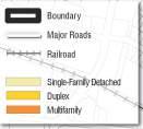
2.1.13 Housing Mix
The map on the left shows the concentration of single-family homes on the northeast side of the study area. Multi-family and duplex housing are located on the northwest, southwest and southeast sides of Cardinal Valley.
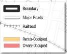
FIG. 2.12: HOUSING MIX
2.1.14 Housing Tenure
A housing tenure map shows where the renter and owner occupied homes are located within a neighborhood. The map can also provide an idea of the investment the community is making. For example, having a large amount of owner-occupied single-family residences is a good indicator of the long-term vision for that area. As the map on the left demonstrates, there is an even mix of renter-occupied and owner-occupied homes.. As is typical, the multi-family and duplex homes are primarily renter-occupied.


CARDINAL VALLEY SMALL AREA PLAN
0 500 FEET N 250 1000
FIG. 2.13: HOUSING TENURE
GARRETT AVE WOODFORD DR HILL VIEW PL DELMONT DR HALLS LN TRAFTON ST WESTGATE DR VILLAGE DR MAYWICK VIEW LN ROANOKE RD PORT ROYAL DR MASON HEADLEY RD TERRACE VIEW DR FAIR OAKS DR 7 PINES DR THE LN DEVONPORT DR DEAUVILLE DR DORSET DR CAMBRIDGE DR BRITTANY LN LONDONBERRY DR RUGBY RD SUTTON PL MANDALAY RD NEWCASTLE ST SAVOY RD DUNKIRK DR OXFORD C R C LE GARRETT AVE WOODFORD DR HILL VIEW PL DELMONT DR HALLS LN TRAFTON ST WESTGATE DR VILLAGE DR MAYWICK VIEW LN ROANOKE RD PORT ROYAL DR MASON HEADLEY RD TERRACE VIEW DR FAIR OAKS DR 7 PINES DR THE LN DEVONPORT DR DEAUVILLE DR DORSET DR CAMBRIDGE DR BRITTANY LN LONDONBERRY DR RUGBY RD SUTTON PL MANDALAY RD NEWCASTLE ST SAVOY RD DUNKIRK DR OXFORD CIR C LE 0 500 FEET N 250 1000 HAMILTON PARK HAMILTON PARK 30
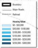
2.1.15 Housing Value
A housing value map demonstrates what areas in a neighborhood have the lowest, moderate, and highest housing values. Within Cardinal Valley, the single-family residences on the north of Oxford Circle have the lowest housing value, while the single-family homes southeast of Versailles Road have a mix of moderate to high housing values. The majority of multi-family and duplex homes located northwest and southwest within the study area range in price value from moderate to high.
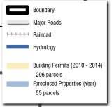
2.1.16 Patterns of Investment & Disinvestment, 2010-2014
Investment maps show if and where the community is interested in investing. Within the past five years, Cardinal Valley has seen an investment along its main commercial areas, Alexandria Drive and Versailles Road, and scattered throughout the neighborhood. The yellow parcels in the map on the right show property where a building permit has been requested. The question is not how to get business owners to take interest in the neighborhood, but how to keep encouraging further investment opportunities.


CARDINAL VALLEY SMALL AREA PLAN
2.15: PATTERNS OF INVESTMENT & DISINVESTMENT GARRETT AVE WOODFORD DR WESTGATE DR MASON HEADLEY RD TERRACE VIEW DR DEVONPORT DR DEAUVILLE DR DORSET DR CAMBRIDGE DR MANDALAY RD NEWCASTLE ST DUNKIRK DR O X FORD C I R CLE Valley Park Preston’s Springs Park Lexington Public Library Village Branch Cardinal Valley Elementary School Cardinal Hill Rehabilitation Hospital McConnell Springs Park HAMILTON PARK 31 FIG. 2.14: HOUSING VALUE GARRETT AVE WOODFORD DR HILL VIEW PL DELMONT DR HALLS LN TRAFTON ST WESTGATE DR VILLAGE DR MAYWICK VIEW LN ROANOKE RD PORT ROYAL DR MASON HEADLEY RD TERRACE VIEW DR FAIR OAKS DR 7 PINES DR THE LN DEVONPORT DR DEAUVILLE DR DORSET DR CAMBRIDGE DR BRITTANY LN LONDONBERRY DR RUGBY RD SUTTON PL MANDALAY RD NEWCASTLE ST SAVOY RD DUNKIRK DR OXFORD C RC L E Valley Park Preston’s Springs Park Wolf Run Park Pine Meadows Park Lexington Public Library Village Branch Addison Park Cardinal Valley Elementary School Cardinal Hill Rehabilitation Hospital McConnell Springs Park 0 500 FEET N 250 1000 0 500 FEET N 250 1000 HAMILTON PARK
FIG.
2.1.17 Natural Features
The study area has a varied topographic profile, with its highest elevations located primarily on the southeastern region. The highest points of elevation can be found on the site of the Cardinal Hill Rehabilitation Hospital, part of the eastern portion of the single-family neighborhood, as well as the area southeast of Versailles Road. Cardinal Valley is comprised of one main waterway, Wolf Run and its tributaries, that runs along the center and western portions of the study area and makes up the lower lying areas. Steep slopes exist along the northern edge of Preston’s Spring and along Oxford Circle and are a natural restriction to development of those areas. These areas will also need to be kept vegetated to avoid stormwater runoff from becoming a greater issue.
FIG. 2.16: NATURAL FEATURES
2.1.18 Land Cover
More than half of the study area is composed of some form of pervious surface (63%), while a majority of the impervious surfaces are concentrated on the lower portion of Cardinal Valley, along the Versailles Road Corridor, specifically around the commercial and multi-family development.


CARDINAL VALLEY SMALL AREA PLAN
GARRETT AVE WOODFORD DR TRAFTON ST WESTGATE DR MASON HEADLEY RD TERRACE VIEW DR DEAUVILLE DR DORSET DR CAMBRIDGE DR MANDALAY RD NEWCASTLE ST DUNKIRK DR O X FORD C I R CLE Valley Park Preston’s Springs Park Lexington Public Library Village Branch Cardinal Valley Elementary School Cardinal Hill Rehabilitation Hospital McConnell Springs Park 0 500 FEET N 250 1000
2.17: LAND COVER GARRETT AVE WOODFORD DR TRAFTON ST WESTGATE DR MASON HEADLEY RD TERRACE VIEW DR DEAUVILLE DR DORSET DR CAMBRIDGE DR MANDALAY RD NEWCASTLE ST DUNKIRK DR O X FORD C I R CLE 0 800 FEET N 400 1600 HAMILTON PARK HAMILTON PARK
FIG.
32
2.1.19 Tree Cover
Having a substantial amount of tree cover offers numerous economic and environmental benefits. For example, it helps improve air quality, provides an aesthetic quality, reduces stormwater runoff and heat island effects, and enhances property values for both residential and business areas. As the map on the right shows, most of the tree canopy is found in the northern and southern end of the study area, and throughout single-family residential. The map also identifies locations where more tree canopy is needed, such as the eastern side along and around Alexandria Drive. Because this is also the commercial district for the neighborhood, having more tree canopy will enhance the area aesthetically, attracting outside visitors.


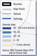
2.1.20 Diversity Index, 2010
A diversity index is a quantitative measure that reflects how many different types (such as species) there are in a data set, and simultaneously takes into account how evenly the basic entities (such as individuals) are distributed among those types. The map on the right demonstrates how diverse the study area is, in this case referring to ethnicity, which helps in understanding the community structure.
CARDINAL VALLEY SMALL AREA PLAN
2.19: DIVERSITY INDEX, 2010 GARRETT AVE WOODFORD DR TRAFTON ST WESTGATE DR VILLAGE DR MASON HEADLEY RD TERRACE VIEW DR DEAUVILLE DR DORSET DR CAMBRIDGE DR MANDALAY RD NEWCASTLE ST DUNKIRK DR O X FORD C I R CLE Valley Park Preston’s Springs Park Lexington Public Library Village Branch Cardinal Valley Elementary School Cardinal Hill Rehabilitation Hospital McConnell Springs Park 0 500 FEET N 250 1000
FIG.
GARRETT AVE WOODFORD DR TRAFTON ST HAMILTON PARK VILLAGE DR MASON HEADLEY RD TERRACE VIEW DR DEAUVILLE DR DORSET DR CAMBRIDGE DR MANDALAY RD NEWCASTLE ST DUNKIRK DR O X FORD C I R CLE Valley Park Preston’s Springs Park Lexington Public Library Village Branch Cardinal Valley Elementary School Cardinal Hill Rehabilitation Hospital 0 500 FEET N 250 1000 HAMILTON PARK WESTGATE DR 33
FIG. 2.18: TREE COVER
LOW-IMPACT DEVELOPMENT
2.1.21 Low Impact Development (LID)
LID is a leading stormwater management strategy that seeks to mitigate the impacts of runoff and stormwater pollution as close to its source as possible. Urban runoff discharged from municipal storm drain systems is one of the principal causes of water quality impacts in most urban areas.

Several areas in the Cardinal Valley community have been identified as target locations to improve upon its green infrastructure. The following areas should be considered on an individual basis for a more in-depth analysis:

Cardinal Hill Hospital
Perform a study of the property to evaluate the feasibility of installing stormwater BMPs to improve water quality and reduce stormwater runoff. Several BMPs are already present on the Cardinal Hill property, but treatment to the parking lot should be evaluated.
Oxford Circle Businesses
Perform a study of the property to evaluate the feasibility of installing stormwater BMPs to improve water quality and reduce stormwater runoff. Currently no stormwater BMPs are present in this area of large impervious surface.
Cardinal Valley Elementary School
Perform a study of the property to evaluate the feasibility of installing stormwater BMPs to improve water quality and reduce stormwater runoff.
CARDINAL VALLEY SMALL AREA PLAN 34 GARRETT AVE WOODFORD DR TRAFTON ST WESTGATE DR MASON HEADLEY RD TERRACE VIEW DR DEAUVILLE DR DORSET DR CAMBRIDGE DR MANDALAY RD NEWCASTLE ST DUNKIRK DR O X FORD C I R CLE
2.20:
Cardinal Hill Hospital Oxford Circle Businesses Cardinal Valley Elementary School 0 500 FEET N 250 1000 HAMILTON PARK
FIG.
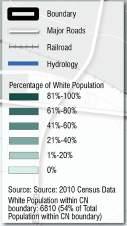
2.1.22 Population by Race - White, 2010
As the map on the left shows, the area in Cardinal Valley with the highest percentage of White population is within the Christian Towers apartment complex, and the older single-family homes adjacent to it. In addition, Deauville Drive and Mandalay Road also have a high percentage of White population.


2.1.23 Population by Race - African American, 2010
Within the study area, the African American population is concentrated mainly on the northern and eastern part of the map. The northern edge by Valley Park, the southern portion around Cardinal Valley Elementary School, and the southeast area of Versailles Road have the highest percentage of African American population.

35
GARRETT AVE WOODFORD DR TRAFTON ST WESTGATE DR VILLAGE DR MASON HEADLEY RD TERRACE VIEW DR DEAUVILLE DR DORSET DR CAMBRIDGE DR MANDALAY RD NEWCASTLE ST DUNKIRK DR O X FORD C I R CLE Valley Park Preston’s Springs Park Lexington Public Library Village Branch Cardinal Valley Elementary School Cardinal Hill Rehabilitation Hospital McConnell Springs Park 0 500 FEET N 250 1000
2.22: POPULATION BY RACE-AFRICAN AMERICAN, 2010 GARRETT AVE WOODFORD DR TRAFTON ST WESTGATE DR VILLAGE DR MASON HEADLEY RD TERRACE VIEW DR DEAUVILLE DR DORSET DR CAMBRIDGE DR MANDALAY RD NEWCASTLE ST DUNKIRK DR O X FORD C I R CLE Valley Park Preston’s Springs Park Lexington Public Library Village Branch Cardinal Valley Elementary School Cardinal Hill Rehabilitation Hospital McConnell Springs Park 0 500 FEET N 250 1000 HAMILTON PARK HAMILTON PARK
FIG.
2.21: POPULATION BY
RACE-WHITE 2010
FIG.
2.1.24 Population by Ethnicity - Hispanic, 2010
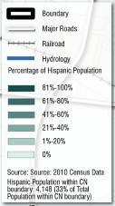
As the map on the right demonstrates, the majority of the population that identify themselves as Hispanic resides on the western part of the study area and around Oxford Circle, where multi-family homes are available.

CARDINAL VALLEY SMALL AREA PLAN 36
GARRETT AVE WOODFORD DR TRAFTON ST WESTGATE DR VILLAGE DR MASON HEADLEY RD TERRACE VIEW DR DEAUVILLE DR DORSET DR CAMBRIDGE DR MANDALAY RD NEWCASTLE ST DUNKIRK DR O X FORD C I R CLE Valley Park Preston’s Springs Park Lexington Public Library Village Branch Cardinal Valley Elementary School Cardinal Hill Rehabilitation Hospital McConnell Springs Park 0 500 FEET N 250 1000 HAMILTON PARK
FIG. 2.23: POPULATION BY ETHNICITY-HISPANIC, 2010
2.1.25 Demographic Highlights
For the Cardinal Valley Study Area...
For all of Lexington-Fayette County...
HISPANIC (APPROX. 30%)
AFRICANAMERICAN (APPROX. 20%)
... out of approximately 12,605 residents
HISPANIC (APPROX. 7%)
AFRICAN-AMERICAN (APPROX. 14%)
... out of approximately 295,803 residents.
CARDINAL VALLEY SMALL AREA PLAN 37
WHITE (APPROX. 50%)
WHITE (APPROX. 76%)
2.2 Major Issues & Opportunities
1) The neighborhood contains diverse housing options, but there is a need to ensure affordability;
2) Another key issue for housing is to encourage a healthy mix of ownership and rental housing;
3) The area contains aging structures and infrastructure in need of reinvestment;
4) The community is a melting pot of diverse ages and cultures, which is both a strength and a challenge for communication and advocacy;
5) Existing community facilities and parks are anchors for the area, but there is an opportunity to expand and improve centralized social and community services;
6) The area overall has a challenging economic environment with low incomes, but with growing entrepreneurial activity that can be celebrated and supported;
7) Versailles Road serves as the key corridor for both the neighborhood and the larger City of Lexington, but it needs comprehensive improvements for mobility and image;
8) The area contains significant natural features that can provide an unparalleled open space network;
9) The neighborhood’s major corridors need significant investment in alternative transportation to serve a transit-dependent population, including pedestrian, bicycle and transit improvements.
CARDINAL VALLEY SMALL AREA PLAN 38
3.0
Plan Recommendations

39


NEWCIRCLERD VERSAILLES RD ALEXANDRIA DR OLD FRANKFORT PIKE 4 60 VAUGHN’ S BRANCH W O L F R U N C R E E K FORBES RD RED MILE RD PARKERSMILLRD GARRETT AVE WOODFORD DR HILL VIEW PL DELMONT DR HALLS LN TRAFTON ST WESTGATE DR VILLAGE DR MARYWICK VIEW LN ROANOKE RD PORT ROYAL DR MASON HEADLEY RD TERRACE VIEW DR FAIR OAKS DR 7 PINES DR THE LN DEVONPORT DR DEAUVILLE DR DORSET DR CAMBRIDGE DR BRITTANY LN LONDONBERRY DR RUGBY RD SUTTON PL MANDALAY RD NEWCASTLE ST SAVOY RD DUNKIRK DR OXFOR D C I R C LE HILLCREST MEMORIAL CARDINAL VALLEY NEIGHBORHOOD HOLIDAY HILLS NEIGHBORHOOD CALUMET NEIGHBORHOOD HAMILTON PARK NEIGHBORHOOD THE LANE NEIGHBORHOOD PINE MEADOW NEIGHBORHOOD GARDENSIDE NEIGHBORHOOD GOLD VIEW ESTATES NEIGHBORHOOD Pepsi Valley Park Preston’s Springs Park Wolf Run Park Oxford Circle Pine Meadows Park Lexington Public Library Village Branch Addison Park Red Mile Racetrack Cardinal Valley Elementary School Cardinal Hill Rehabilitation Hospital Picadome Golf Course McConnell Springs Park ALEXANDRIA DRIVE INTERNATIONAL DISTRICT OXFORD CIRCLE NEIGHBORHOOD CENTER VERSAILLES ROAD CORRIDOR IMPROVEMENTS OPEN SPACE NETWORK NEIGHBORHOOD CONSERVATION Date: 04.29.2015
Based on the analysis from the existing conditions and input from the community, five catalytic focus areas were identified:
• Neighborhood Conservation
• Versailles Road Corridor Improvements
• Alexandria Drive International District
• Oxford Circle Neighborhood Center
• Open Space Network
These recommendations aim at revitalizing and ensuring housing diversity and providing economic development opportunities and services, while tying it all together with open space and transportation improvements.
The following goals and objectives help to create a vision for Cardinal Valley.
In response to comments by the community, and in agreement with City staff, the following goals and some of the recommendations were expanded to include impacts to the entirety of Valley Park, the Kilrush greenway, and the multi-family residential on the eastern side of Alexandria Drive from Versailles Road north to Valley Park.
GOALS
NEIGHBORHOOD CONSERVATION
Increase affordable housing stock and promote a proactive/ sustainable community through program outreach.
VERSAILLES ROAD CORRIDOR IMPROVEMENTS
Increase the safety and function of Versailles Road by improving vehicular, cyclist and pedestrian accessibility.
ALEXANDRIA DRIVE INTERNATIONAL DISTRICT
Revitalize the commercial district of Alexandria Drive by distinguishing its international identity in Lexington.
OXFORD CIRCLE NEIGHBORHOOD CENTER
Revitalize Oxford Circle by creating a public space that serves as an anchor for the community.
OPEN SPACE NETWORK
Improve the connectivity and function of the open spaces within Cardinal Valley.
CARDINAL VALLEY SMALL AREA PLAN 41
--
3.1 NEIGHBORHOOD CONSERVATION:
Goal: Improve the stock of affordable housing within the neighborhood and improve existing housing and infrastructure through neighborhood education and outreach.
Objectives/Strategies:
• Ensure an adequate supply of affordable housing to meet the needs of all Cardinal Valley residents
• Expand home ownership opportunities for low and moderate-income households. Provide direct homebuyer assistance to qualifying households
• Expand affordable rental opportunities through and preservation of existing rental units
• Provide rental assistance (vouchers) to very lowincome and special needs persons and support the Lexington Housing Authority’s efforts to create communities that promote self-sufficiency and mixed-income rental


• Promote engaged communities and citizen neighborhood involvement, to directly and positively impact the quality and appearance of the housing stock
• Ensure safe, attractive and well-maintained residential environments, reduce the number of vacant dwellings, and eliminate substandard housing through enforcement of the Housing Code and neighborhood revitalization
• Enhance the pedestrian connectivity throughout the neighborhood.
• Safe routes to school, especially focusing on increasing accessibility.
• Improve wayfinding to key amenities throughout the community, including recreation opportunities, retail, and institutions
Single-Family home
CARDINAL VALLEY SMALL AREA PLAN 42
- Multi-family homes along Oxford Circle
3.1.1 Three Tiers to Neighborhood Conservation

1. PRogRammatic
Programs can be put in place to help both homeowners and renters that will have overarching impacts within the community. In general, homeowners care for and maintain their homes better and have a greater sense of buy-in to a neighborhood. There are many tools out there to help first time home buyers, and still others to aid existing homeowners improve their property. Having an entire neighborhood of homeowners is often unrealistic, so there have also been a series of programs created to help qualify and establish conscientious renters, and tools for both tenants and property owners to make renting go more smoothly. The more the neighborhood itself reaches out and helps each other understand how to navigate these programs the more the neighborhood as a whole can work on becoming a more stable place to live and a more desirable place to relocate to.
2. RegulatoRy/code enFoRcement
Regulations and the enforcement of code on the other hand are a good way to help a neighborhood ensure that the few bad apples in the bunch do not pull down the value of everyone else around them. This is also a good way to keep tabs on absentee property owners or landlords that are keeping substandard units on the market.
3. inFRastRuctuRe
Finally, improvements and upkeep can be made ranging from small-scale and low-budget to larger investments, including: new/improved sidewalks and crosswalks, increased accessibility, additional lighting, wayfinding and neighborhood branding (neighborhood signage, banners), landscaping (street trees, planters, flower beds), and street furniture (benches, trash cans, doggy stations).


CARDINAL VALLEY SMALL AREA PLAN 43
Planters
Sidewalk and Street Trees
Crosswalk
Doggy Station
Streetlight
Street Furniture
3.1.2 Housing Strategies
aFFoRdaBility:
Housing costs have risen faster than income over the past decade, resulting in shrinkage of housing options for very low, and moderate-income households. The decline in housing options for these groups has also contributed to additional issues: a high percentage of rental housing for the neighborhood as a whole; and a concentration of substandard and inadequate housing, with continued disinvestment in the community.
suBsidized Housing:
Cost pressures, increased growth, and local regulations geared toward provision of suburban housing development have limited provision of affordable housing for low, and very lowincome households. Simultaneously, overconcentration of subsidized housing has had the effect of concentrating poverty and has promoted disinvestment in neighborhoods.
PRoactive/sustainaBle communities:
Proactive, sustainable communities can be supported through education, effective communication of community needs, and encouragement and facilitation of stakeholder alliances. By promoting proactive communities and citizen neighborhood involvement, the quality and appearance of housing stock will be directly and positively impacted.
suBstandaRd Housing:
The Cardinal Valley neighborhood exhibits concentrations of poorly maintained, abandoned and blighted residential structures. Lexington should look to use policies and procedures that will more efficiently administer its Minimum Housing Code and address problems of blight in its older neighborhoods.
goal #1 aFFoRdaBility
OBJECTIVE: Ensure an adequate supply of affordable housing to meet the needs of all Cardinal Valley residents.
ACTIONS:
• Public-Private Partnerships for Affordable Housing
LFUCG’s Division of Grants and Special Programs shall continue to encourage participation of the private sector (lenders, developers, and builders) in government funded or operated housing programs that increase affordable housing production.
goal #2
Home owneRsHiP
OBJECTIVE: Expand home ownership opportunities for low and moderate-income households. Provide direct homebuyer assistance to qualifying households.
ACTIONS:
• First-Time Homebuyers
LFUCG’s Division of Grants and Special Programs shall continue to provide assistance for the acquisition, rehabilitation and new construction of housing for very low and low-income first-time homebuyers through the HOME Investment Partnerships, CDBG Programs, and the Emergency Solutions Grants (ESG) program.
• Assistance to Homebuyers
LFUCG’s Division of Grants and Special Programs shall continue to provide down payment and closing cost assistance through the First-Time Homebuyers Assistance Program.
• Housing Rehabilitation Assistance
LFUCG’s Division of Grants and Special Programs shall continue to provide rehabilitation and redevelopment assistance for vacant, substandard housing in order to encourage home-ownership in Cardinal Valley, which is suffering abandonment problems and to provide financial assistance to nonprofit organizations and other developers who purchase, rehabilitate, and resell existing homes and/or redevelop vacant property.
• Housing Education and Counseling
The Community Action Council for LexingtonFayette County shall assist in the support of housing education and counseling programs that provide both pre and post-purchase education and counseling services.
• Asset and Wealth Building Programs
The Community Reinvestment Alliance of Lexington shall continue to promote asset and wealth building programs through pre and post counseling services, foreclosure prevention, financial debt management, and other housing related programs.
goal #3 Rental Housing
OBJECTIVE: Expand affordable rental opportunities through preservation of existing rental units.
ACTIONS:
• Loans for Rental Housing Rehabilitation
The Lexington Housing Authority in conjunction with the Division of Grants and Special Programs shall continue to provide funding mechanisms to nonprofit and for-profit developers to rehabilitate smaller rental developments that are affordable to low-income renters.
CARDINAL VALLEY SMALL AREA PLAN 44
• Leveraging of Available Funds for Affordable Housing
The Lexington Housing Authority shall continue to encourage the use of resources such as Federal or State low-income housing tax credits, historic credits, and other State and Federal resources to increase the leveraging of funds for the provision of affordable housing.
• Affordable Rental Housing Location Policy
The Lexington Housing Authority and LFUCG’s Division of Planning shall work with other key community stakeholders to identify shortages of affordable rental housing, set goals, and identify appropriate locations for affordable rental housing in proximity to employment opportunities, service centers and transit corridors.
goal #4 Rental assistance
OBJECTIVE: Provide rental housing assistance (vouchers) to very low-income and special needs persons and support the Lexington Housing Authority’s efforts to create communities that promote self-sufficiency and mixed-income rental.
ACTIONS:
• Rental Housing Assistance
The Lexington Housing Authority shall provide rental assistance to very low-income and special needs persons through the voucher system.
• Mixed-Income Rental Communities
The Lexington Housing Authority shall discourage further concentrations of very low income families by promoting and facilitating mixed-income communities developed under the Low Income Housing Tax Credit (LIHTC) program.
goal #5 engaged & sustainaBle neigHBoRHood
OBJECTIVE: Promote engaged communities and citizen neighborhood involvement to directly and positively impact the quality and appearance of the housing stock. Advance education, communicate community needs and develop resources through promoting, encouraging and facilitating stakeholder alliances.
ACTIONS:
• Neighborhood Communication
The Cardinal Valley Neighborhood Association shall provide a forum for stakeholders to explore strategies and resources to support neighborhood development, preservation, and neighborhood projects to enhance the neighborhood’s housing stock. The neighborhood association shall also support and endorse LFUCG’s urban infill strategies, which promote redevelopment in second tier neighborhoods, such as Cardinal Valley.
• Education and Outreach
Work directly with citizens, community leaders, and government agencies in the community, providing education on City services, City policies and community resources to promote strong and empowered communities.
• Landlord Training Workshops
LFUCG’s Division of Grants and Special Programs, along with its partner agencies, shall conduct Landlord Training Workshops designed to assist property owners and managers of rental housing. The purpose of the Landlord Training Program is to: (1) Encourage effective property management that will significantly contribute to safe and decent housing, improving the health of the community and (2) Provide education on lawful techniques to halt illegal activity on rental property.
goal #6 Housing standaRds
OBJECTIVE: Ensure safe, attractive and well-maintained residential environments, reduce the number of vacant dwellings, and eliminate substandard housing through enforcement of the Housing Code and neighborhood revitalization.
ACTIONS:
• Enforcement of the Housing and Minimum Standards
Enforce LFUCG’s Housing Code and the minimum standards set forth in the International Property Maintenance Code to serve the revitalization of neighborhoods. LFUCG’s Housing Code shall be a dynamic and fluid document in order to remain responsive to the needs of residents for safe, decent housing and vital community environments. LFUCG’s Division of Code Enforcement shall periodically review the minimum standards and take necessary steps to revise it as needed.
• Neighborhood Environments
LFUCG’s Division of Code Enforcement shall continue to enforce City ordinances concerning accumulation of trash, junk, weeds and overgrowth, and junked and abandoned vehicles on properties in order to ensure the safety and well-being of residents.
• Elimination of Substandard Housing
LFUCG’s Division of Code Enforcement shall work to eliminate all substandard housing in the City through the enforcement of the minimum standards and the Kentucky Building Code Unsafe Structures Statute. The departments shall utilize education and training of property owners and managers, and outreach and engagement of community stakeholders and citizens in a proactive effort to improve the quality of housing stock.
CARDINAL VALLEY SMALL AREA PLAN 45
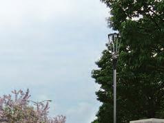
3.1.3 Sidewalk Improvements
While sidewalks exist throughout the majority of the internal neighborhood streets, a major deficiency is the lack of any internal sidewalk connectivity to/and from Versailles Rd. into the neighborhood.
The map at right shows existing and potential sidewalk locations.
sidewalk consideRations
Sidewalks were proposed in several locations throughout the study area (shown in red on the adjacent map). The Design Team considers these to be a high priority to:
• Improve connectivity
• Create a safer environment for pedestrians and drivers
• Improve accessibility
There are other examples within the study area that exist of places where sidewalks do not exist, but the Design Team has not included them in the recommendations for one or more of the following:
• Connectivity is not greatly improved
• Too costly to either construct or acquire the land to do so
• Construction issues, such as large trees, not enough right-of-way, stormwater issues, etc.
• Inconsistent with adjacent land use, such as within an industrial area
CARDINAL VALLEY SMALL AREA PLAN 46


3.1.1: SIDEWALK IMPROVEMENTS GARRETT AVE WOODFORD DR HILL VIEW PL DELMONT DR HALLS LN WESTGATE DR VILLAGE DR ROANOKE RD PORT ROYAL DR TERRACE VIEW DR FAIR OAKS DR 7 PINES DR THE LN DEVONPORT DR DEAUVILLE DR DORSET DR CAMBRIDGE DR BRITTANY LN LONDONBERRY DR RUGBY RD NEWCASTLE ST SAVOY RD DUNKIRK DR OXFORD C I R C L E Valley Park Pine Meadows Park Lexington Public Library Village Branch Cardinal
0 400 FEET N 200 800 VERSAILLES ROAD Paved Areas Buildings Existing Sidewalks Proposed Sidewalks HAMILTON PARK 47
FIG.
Valley Elementary School
3.1.4 Crosswalk Improvements
At the heart of the neighborhood is the Cardinal Valley Elementary School. This facility has an enrollment of 700 students. Circulation around the school during the morning start and afternoon release times (7:45 am and 2:35 pm respectively) was observed as being very busy. There were many students who were observed walking to/from school during both time periods. The pedestrian infrastructure around the school is dated and has received what appears to be emergency spot repair where the age of the infrastructure has reached its useful life.
There are 17 intersections surrounding the school that need curb ramp and / or crosswalk improvements. Specifically, this includes five curb ramps that would need to be upgraded to address issues with ADA compliance. There are two locations where new crosswalks are recommended. Finally, there are ten locations where curb ramps and crosswalks need to be upgraded.
When considering the crosswalk recommendations the Design Team laid out the following ground rules:
• Locations for crosswalks should be convenient for pedestrian access.
• Crosswalks should ideally be used with curb extensions to enhance pedestrian safety.
• Crosswalk markings should be located to include a ramp so that a wheelchair can access it within the crosswalk.
CARDINAL VALLEY SMALL AREA PLAN 48
Proposed Crosswalks / Ramp Improvements


Buildings
Paved Areas
IMPROVEMENTS GARRETT AVE WOODFORD DR DELMONT DR HALLS LN WESTGATE DR VILLAGE DR ROANOKE RD PORT ROYAL DR MASON HEADLEY RD FAIR OAKS DR 7 PINES DR THE LN DEVONPORT DR DEAUVILLE DR DORSET DR CAMBRIDGE DR BRITTANY LN LONDONBERRY DR RUGBY RD SAVOY RD DUNKIRK DR OXFORD C I R C L E Valley Park Lexington Public Library Village Branch Cardinal
McConnell Springs Park 0 400 FEET N 200 800 HAMILTON PARK
FIG. 3.1.2: CROSSWALK
Valley Elementary School
3.1.5 Wayfinding Strategies
Wayfinding helps residents and visitors reach certain destinations when the precise path to get there is unclear. It is most successful when placed at strategic key decision points. Due to the curvilinear layout of Cardinal Valley, wayfinding would be beneficial for the community for various reasons:
• Facilitates navigation for visitors unfamiliar to the area.
• Encourages residents and visitors to explore certain areas and points of interest within the neighborhood.
• Wayfinding signage can help in establishing an identity for Cardinal Valley.

In this case, the recommendation is to install wayfinding signage for the major gateways on either end of the approach to Cardinal Valley from Versailles Road. In addition, the following key locations would warrant special signage in and through the neighborhood:
• Preston’s Spring Park
• Valley Park
• Oxford Circle
• Alexandria Drive Retail
• Cardinal Valley Elementary School
Wayfinding Examples:


CARDINAL VALLEY SMALL AREA PLAN 50

Paved Areas Buildings Gateway Wayfinding Opportunity Secondary Wayfinding Opportunity Cardinal Valley Gateway Park & Recreation Wayfinding Route Retail / Services Wayfinding Route School Wayfinding Route C
STRATEGIES GARRETT AVE WOODFORD DR HILL VIEW PL DELMONT DR HALLS LN WESTGATE DR ROANOKE RD PORT ROYAL DR MASON HEADLEY RD TERRACE VIEW DR FAIR OAKS DR 7 PINES DR THE LN DEVONPORT DR DEAUVILLE DR DORSET DR CAMBRIDGE DR BRITTANY LN LONDONBERRY DR RUGBY RD NEWCASTLE ST SAVOY RD DUNKIRK DR Pine Meadows Park 0 400 FEET N 200 800 HAMILTON PARK
FIG. 3.1.3: WAYFINDING
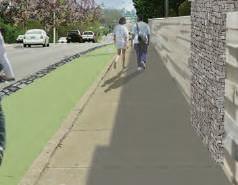
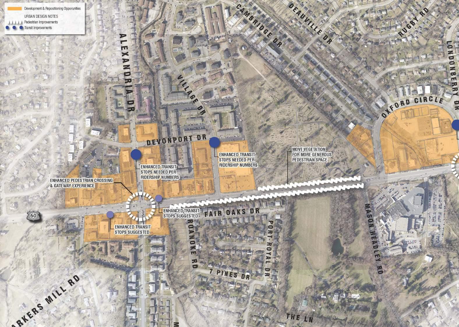
3.2 VERSAILLES ROAD CORRIDOR IMPROVEMENTS
Goal: Improve the aesthetics and function of the corridor for vehicles and make it more accessible to pedestrians and cyclists.
Objectives/Strategies:
• Improve the flow of traffic and enhance bike/ped infrastructure
• Increase the aesthetics of Versailles Road to function as a major gateway to the city.
• Identify opportunities for improved pedestrian crossings and transit stops.
-
• Increase transit frequency and service to major bus routes along Versailles Road
CARDINAL VALLEY SMALL AREA PLAN 52
Versailles Road
3.2.1 Versailles Road Multi-Modal Corridor
Features:
• Planted landscape median featuring ornamental trees and decora�ve fence


• Opportuni�es for public art incorpora�on


• Pedestrian scale ligh�ng


• Decora�ve and ar�s�c retaining wall


• Enhanced bicycle facili�es on both sides of road
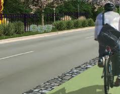

The Versailles Road Corridor Study was completed in February 2015. The study examined Versailles Road (US 60) from Parkers Mill Road to Oliver Lewis Way. The section from Parkers Mill Road to Forbes Road overlaps with this SAP. The objectives of the Versailles Road Corridor Study were to provide a safer, friendlier environment for pedestrians and bicyclists; encourage multi-modal usage; maintain current corridor capacity and level of service; improve roadway drainage; provide visual enhancements to the corridor; and develop fundable projects. The study made recommendations for ADA compliance, sidewalk repair, crosswalks and bike lanes throughout the entire corridor. Other recommended improvements include changes to the roadway cross section by adding in medians, two-way left-turn lanes, bike lanes, sidewalks, and landscaping and aesthetic treatments throughout the corridor. Access management throughout the corridor was also recommended.
Versailles Road Corridor Study


Village Drive to Mason Headley Road (Sec on 2) Features:
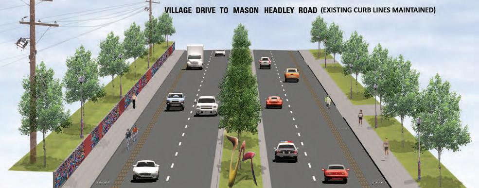
Median Enhancements - Between Village Drive and Mason Headley Road
CARDINAL VALLEY SMALL AREA PLAN 53
• 2
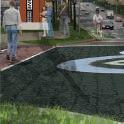
2 outbound lanes • Planted median with art focal pieces • Bike lanes with 2’ wide traffic separator • 6’ wide sidewalks on both sides of road • Planted area along edges of right-of-way • Pedestrian scaled ligh�ng • Art wall on north side of road • Approximately 0.3 mile Versailles Road Corridor Study 58 February, 2015 ons - Alexandria Drive Gateway Intersections - Alexandria Drive 57 Versailles Road Corridor Study February, 2015 Gateway Intersec ons Alexandria Drive Plan CORRIDOR PLAN Features: • Internally illuminated gateway columns • Enhanced crosswalks • Stamped and colored asphalt design in intersec on • Sea ng and gathering space • Enhanced pedestrian ligh ng • La no inspired design mo f • New mast arm signals Versailles Road Versailles Road Alexandria Drive Alexandria Drive 54 February, 2015
inbound lanes,
3.2.2 Lextran Transit Service
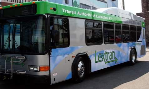
Due to the thorough study of Versailles Road that has already been completed, the only additional recommendations from this study are transit related. Of the five routes which touch the study area, only three have a major interaction as mentioned in the existing conditions section. The comments provided by the Steering Committee regarding transit mostly involved extending service hours, mainly in the late evenings. This extension would be intended to serve mostly transit-dependent riders whose jobs often require them work later at night. In addition, more consistent and extended service hours were recommended for the weekend.
During the development of the SAP, a Comprehensive Operational Analysis (COA) was being performed for Lextran. As part of the COA, it was recommended that Route #15 have extended hours until 10:00 PM Monday through Friday. Service for Route #21 is recommended to be scaled back due to low ridership, and Route #31 is recommended to be cut. For this SAP, it is recommended that consideration be given to Route #8 due to the fact that it is one of the highest utilized routes in the Lextran. This would included the extension of operating hours.
CARDINAL VALLEY SMALL AREA PLAN 54
55
CARDINAL VALLEY SMALL AREA PLAN 56
In addition to the improvements recommended for the right-of-way itself, the Design Team looked at additional opportunities along the Versailles Road Corridor. The areas shown in orange are those properties that could have the greatest potential for redevelopment or improvement based on their occupancy or land use (commercial, light industrial, or office). This does not necessarily mean that these areas are in need of redevelopment, but this graphic highlights the tremendous amount of opportunity this corridor has to fulfill its position as a major gateway.
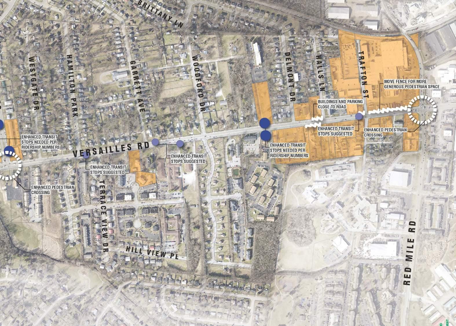
The Design Team also looked at additional measures to improve pedestrian use and transit ridership.
Several key intersections at Alexandria Drive, Oxford Circle, and Red Mile Road should be studied to make major pedestrian improvements. There are also several places where the existing sidewalks are encumbered by vegetation (shown as the squiggly line between Alexandria Drive and Mason Headley Road), where clearing back the vegetation would make the sidewalk more welcoming, at least in the short term. These pedestrian improvements are also covered in the Versailles Road Multi-Modal Corridor Study.
Finally, the light and dark blue dots represent areas where enhanced transit stops are either suggested or needed respectively, based on the ridership
CARDINAL VALLEY SMALL AREA PLAN 57
N 0 1000 FEET 500 2000
FIG. 3.2.1: VERSAILLES ROAD CORRIDOR IMPROVEMENTS
FIG. 3.2.2:DEVELOPMENT & REPOSITIONING OPPORTUNITIES
3.3 ALEXANDRIA DRIVE INTERNATIONAL DISTRICT:
Goal: Build upon the diverse character and businesses in the Alexandria Drive area to promote an International District.
Objectives/Strategies:
• Build a foundation for the potential connection and collaboration between the commercial district of Alexandria Drive and the shopping centers in Gardenside.
• Emphasize the value of a business/merchant association and develop strategies for outreach to merchants and property owners.
• Encourage a stronger relationship between the city and the merchants.
• Opportunities for branding, publicity, and events.
• Build a foundation for the potential connection between the commercial district of Alexandria Drive and the shopping centers in Gardenside
• Public improvements to streetscape, landscape, signage
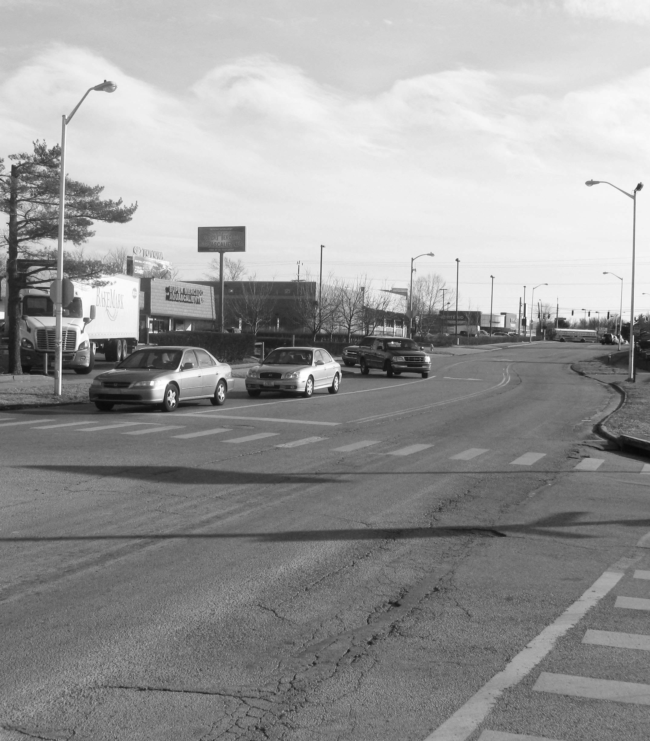
CARDINAL VALLEY SMALL AREA PLAN 58
Alexandria Drive
-
As the Vacancy Map on the right shows, Cardinal Valley is an area where investment is high, with only a few vacant business locations available. The existing vacant Walgreens building (#3), is at a prominent location, this provides the commercial district a great opportunity to develop a strong anchor to the community.
Some suggestions provided by the public for possible businesses to take over the Walgreens location include:
• Co-op
• Indoor soccer fields
• Police station
• Hardware store
• Ice cream parlor
• Donut shop
• Outdoor market
Total Vacant: 23,300sf
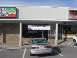
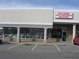
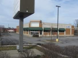
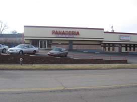
Walgreens Site: 14,250sf
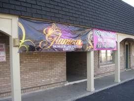
CARDINAL VALLEY SMALL AREA PLAN 59 1 2 3 4 5 4
Vacancy Map
1 2 3 4 5
3.3.1 Commercial Area Improvements
A walking assessment of Alexandria Drive was conducted on February 4, 2015 by the Planning Team. The goal was to create an inventory of the businesses in Cardinal Valley, as well as visible issues and opportunities for the commercial district.
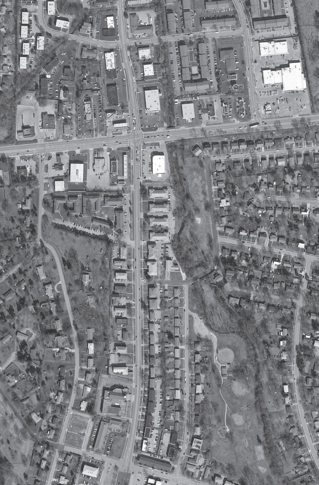
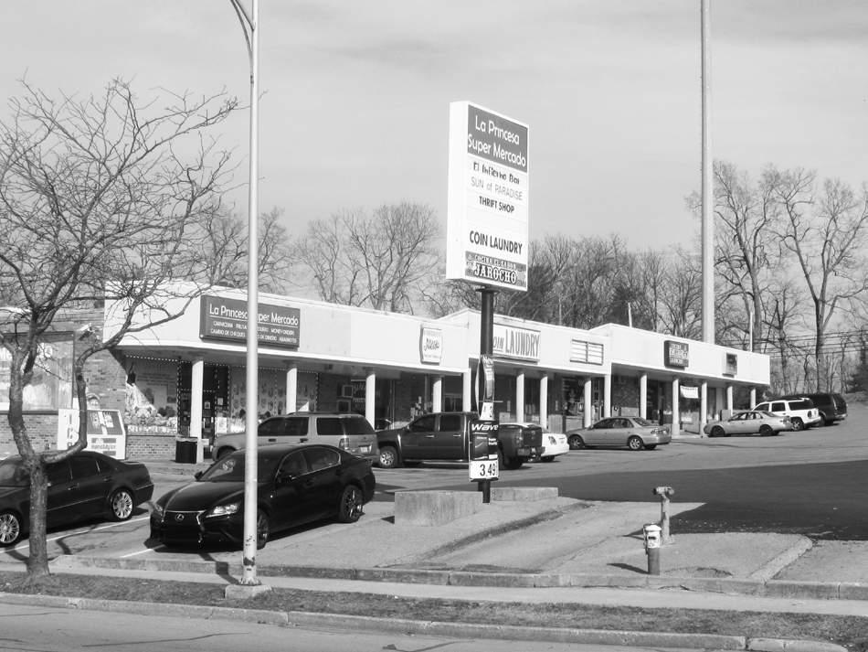
Parking Lot Buffers

Pedestrian experience can be greatly enhanced by adding landscape buffers between the parking lots and the sidewalks.
Event/Outdoor Space
The majority of the shopping plazas in Cardinal Valley have an underused covered entrance. Adding seating and planters will attract clients to the business and give them a place to linger.
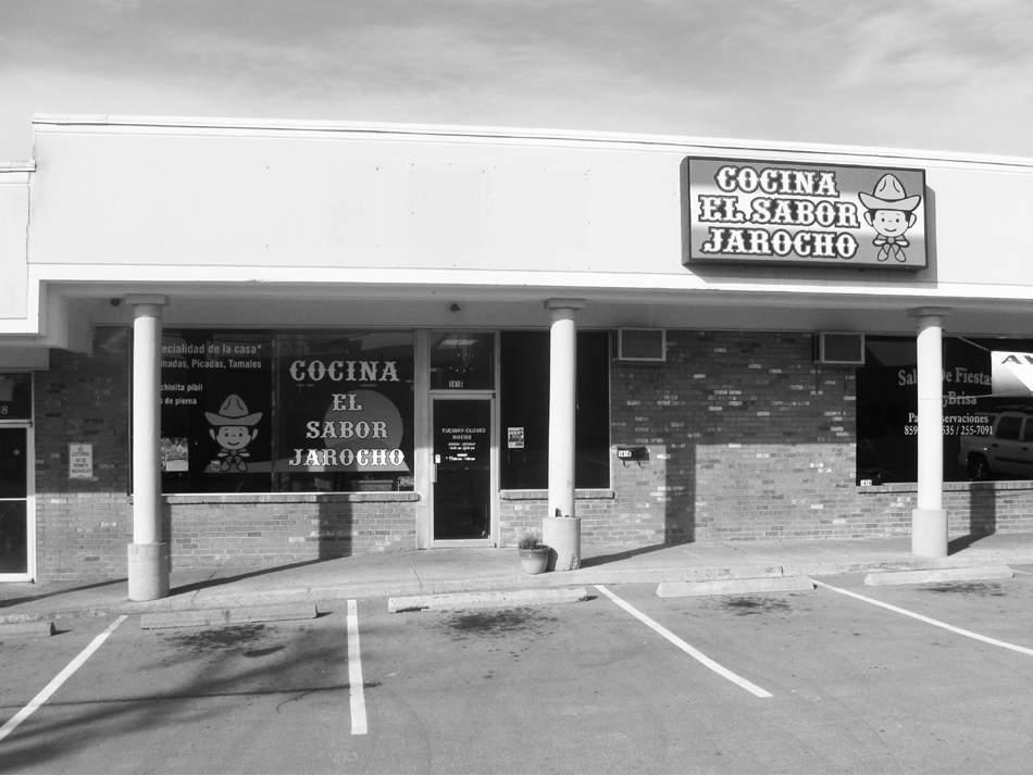
CARDINAL VALLEY SMALL AREA PLAN 60
M&S Restaurants Company 23. Nelson McMakin Real Estate 24. Taty’s Nail Design 25. Glamour Beauty Salon 26. Flor’s Arts & Crafts 27. Hair Salon 28. Vacant Space 29. Layda’s Centro de Bienestar 30. Envios de Dinero 31. T-Mobile Retailers 32. Crystal Liquor and Spirits 33. Money Transfer 34. Dish Latino & Mobile 35. Panchitos Ice cream 36. Joyeria Martinez 37. Beauty Salon 38. Pronto Tax 60. Vacant Space 61. Vacant Space 62. Vacant Space 63. Public Library 64. Save A Lot 65. Family Dollar 66. Long John Silver’s 67. Rite Aid 68. Alexandria’s Jewelry 69. Hispanic Connections 70. El Milagro 71. Shell 72. Clamatos Mexican Restaurant 73. Duplicator Sales and Service 74. Exxon 75. NCS 76. Starbucks 1. Central Bank & Trust Company 2. Superior Cleaners 3. Cash & Tyme 4. La Bonita Novedades 5. Cricket Wireless 6. Barber shop 7. Taco Bell 8. McDonald’s 9. Speedway 10. China King 11. Boost Mobile 12. El Rey de los Pollos Asados 13. El Rey de los Mariscos 14. Vacant Space 15. Novedades Sary 16. Discount Electronics 17. Tortilleria y Taqueria Ramirez 18. Kids Unlimited Day Care 19. Mike Steele CPA 20. Diversified Marketing 21. McDonald’s Office 22. M&S Restaurants Company 23. Nelson McMakin Real Estate 24. Taty’s Nail Design 25. Glamour Beauty Salon 26. Flor’s Arts & Crafts 27. Hair Salon 28. Vacant Space 29. Layda’s Centro de Bienestar 30. Envios de DInero 31. T-Mobile Retailers 32. Crystal Liquor and Spirits 33. Money Transfer 34. Dish Latino & Mobile 35. Panchitos Ice cream 36. Joyeria Martinez 37. Beauty Salon 38. Pronto Tax 39. Restaurant Aguascalientes 40. Panaderia Aguascalientes 41. Super Mercado Aguascalientes 42. Vacant Lot 43. Dan’s Discount Jewelry & Pawn 44. Fifth Third Bank 45. Pizza Hut 46. Kentucky Fried Chicken 47. Imperial Liquor 48. El Sabroso Taqueria 49. Rent-A-Center 50. Bubbles Coin Laundry 51. La Unica Grocery and Restaurant 52. La Princesa Super Mercado 53. Panaderia Ñieto 54. Coin Laundry 55. Cocina el Sabor Jarocho 56. Huerta Computer Repair 57. Primera Iglesia 58. El Infierno Bar 59. Vacant Space 60. Vacant Space 61. Vacant Space 62. Vacant Space 63. Public Library 64. Save A Lot 65. Family Dollar 66. Long John Silver’s 67. Rite Aid 68. Alexandria’s Jewelry 69. Hispanic Connections 70. El Milagro 71. Shell 72. Clamatos Mexican Restaurant 73. Duplicator Sales and Service 74. Exxon 75. NCS 76. Starbucks ardinal Valley 1 2 6 10 13 14 - 17 39 40 49 - 51 52 59 60 - 65 19 29 30 38 7 8 9 18 41 42 43 44 45 46 66 67 Businesses on Alexandria Drive 68 - 69 70 71 72 73 74 75 76 47 48 ALEXANDRIA DRIVE VERSAILLES
22.
ROAD
Signage
Business signs need to read at both a pedestrian and vehicular level. Having consistent sign standards help in creating a unified district. Instead of the tall post signs typical in Cardinal Valley, midsize business signs will heighten the quality of the space.
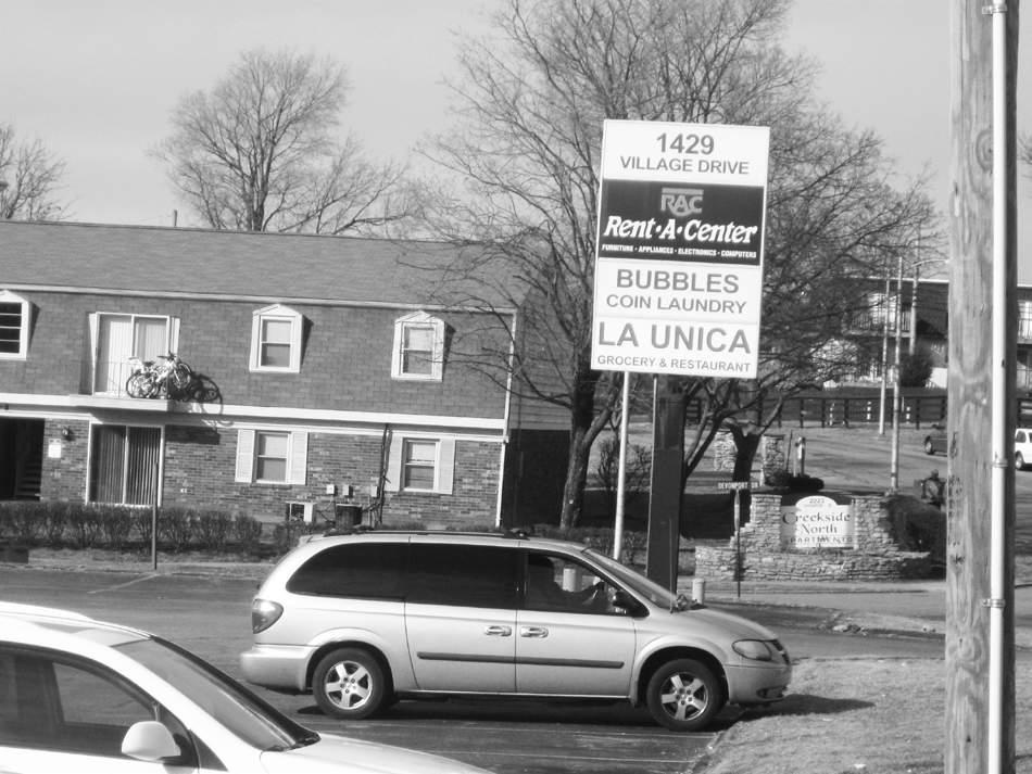
Bus Stops
Bus stops need to have a covered waiting area and lighting to give residents a safer place to wait for public transportation.
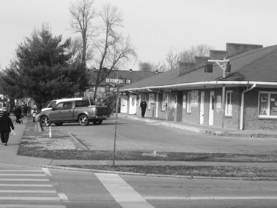
Street Furniture
Street furniture enhances the aesthetic quality of the public space and provides the community with areas to interact and rest. Adding street furniture, bike racks and trash bins will help establish a more complete commercial corridor.
Lighting
There is a need for more street lighting along Alexandria Drive. It is not just important for the pedestrian walking at night, but also provides an extra layer of security for the businesses.
Limit/Consolidate Curb Cuts
Currently, there is an abundance of multiple entrances to the shopping plazas along Alexandria Drive. This causes traffic congestion and creates a safety hazard for pedestrians. Limiting the number of entries and exits will result in a smoother flow of traffic and will enhance safety.
CARDINAL VALLEY SMALL AREA PLAN 61
3.3.2 Alexandria to Gardenside Linkage
The map below shows the proximity between the commercial area of Cardinal Valley and Gardenside. Alexandria Drive has the potential to link the two and become an extended commercial corridor.
An evaluation of Alexandria Drive, from Devonport Drive to Cross Keys Road, was undertaken to identify improvements which would enhance the multi-modal operations along this corridor. During this review, a number of improvements were identified. The transformation from a vehiclefocused roadway to a more modal friendly version included the following:
• Proposed Bike Facilities
• Improved curb ramps and cross walks
• Additional Bus Shelters for high traffic stops
• A mid-block crossing for more direct access to the parks
• Restricting extra driveways to Right-in Right-out access points
• Consolidating multiple entrances to facilities
Corridor Improvement Examples:
Bike Lanes
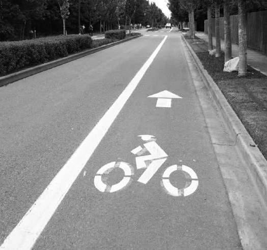
ALEXANDRIA DRIVE
Banners and Lighting
GARDENSIDE
Street Trees
Wider Sidewalks
CARDINAL VALLEY SMALL AREA PLAN 62
Versailles Road
Banners and Lighting
Street Trees
Turn Lane Improvements
Bike Lanes
Wider Sidewalks
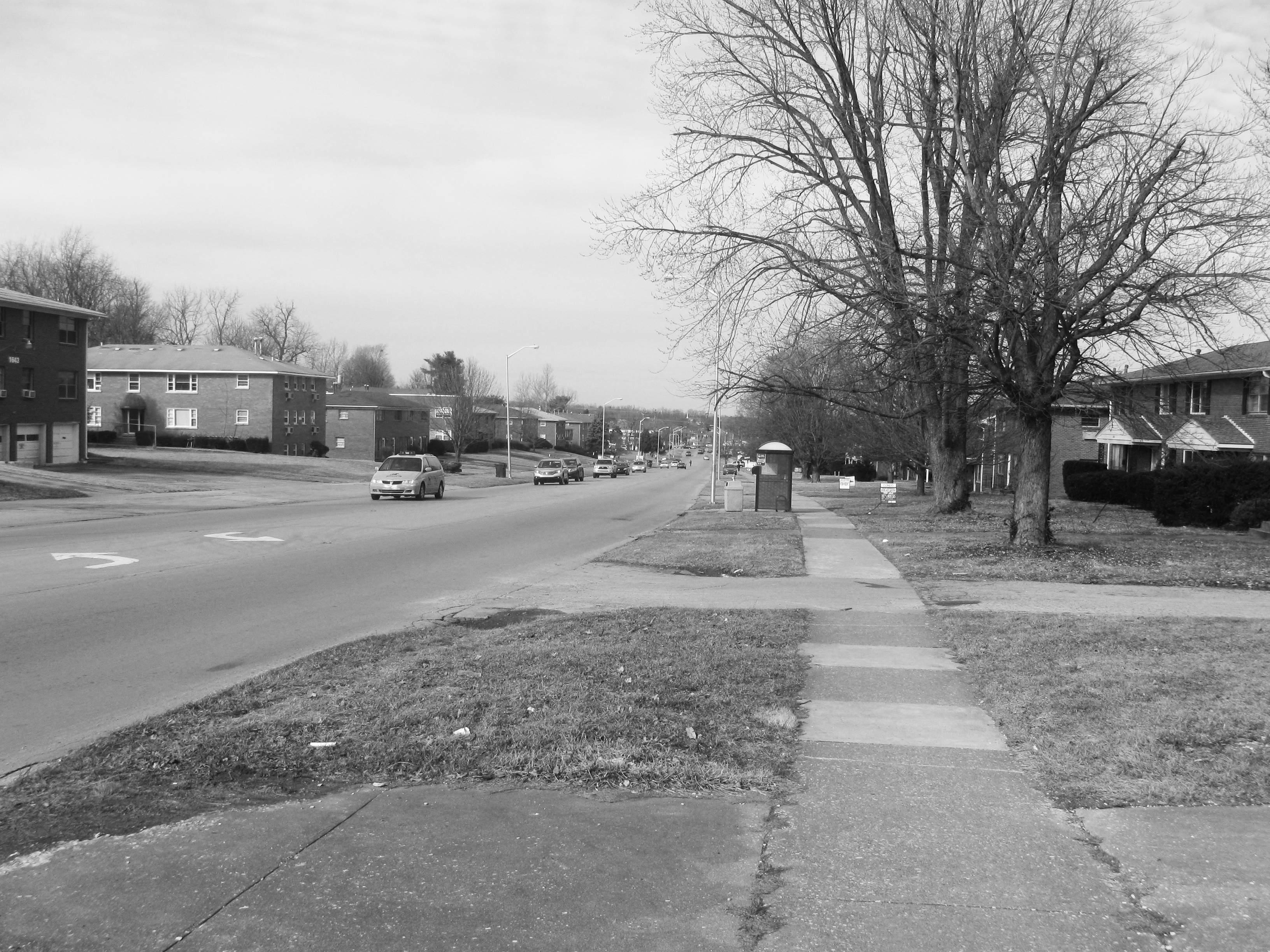
CARDINAL VALLEY SMALL AREA PLAN 63
ALEXANDRIA DRIVE COMMERCIAL DISTRICT
ALEXANDRIA DRIVE COMMERCIAL DISTRICT
DEVONPORT DRIVE
ALEXANDRIA DRIVE VERSAILLES ROAD
VILLAGE DRIVE
CARDINAL VALLEY SMALL AREA PLAN 64
1. Central Bank & Trust Company 2. Superior Cleaners 3. Cash & Tyme 4. La Bonita Novedades 5. Cricket Wireless 6. Barber shop 7. Taco Bell 8. McDonald’s 9. Speedway 10. China King 11. Boost Mobile 12. El Rey de los Pollos Asados 13. El Rey de los Mariscos 14. Novedades Sary 15. Discount Electronics 16. Tortilleria y Taqueria Ramirez 17. Kids Unlimited Day Care 18. Mike Steele CPA 39. Super Mercado Aguascalientes 40. Dan’s Discount Jewelry & Pawn 41. Fifth Third Bank 42. Pizza Hut 43. Kentucky Fried Chicken 44. Imperial Liquor 45. El Sabroso Taqueria 46. Rent-A-Center 47. Bubbles Coin Laundry 48. La Unica Grocery and Restaurant 49. La Princesa Super Mercado 50. Panaderia Ñieto 51. Coin Laundry 52. Cocina el Sabor Jarocho 53. Huerta Computer Repair 54. Primera Iglesia 55. El Infierno Bar 56. Public Library 57. Save A Lot 58. Family Dollar 59. Long John Silver’s 60. Rite Aid 61. Alexandria’s Jewelry 62. Hispanic Connections 63. El Milagro 64. Shell 65. Clamatos Mexican Restaurant 66. Duplicator Sales and Service 67. Exxon 68. NCS 69. Starbucks 19. Diversified Marketing 20. McDonald’s Office 21. M&S Restaurants Company 22. Nelson McMakin Real Estate 23. Taty’s Nail Design 24. Glamour Beauty Salon 25. Flor’s Arts & Crafts 26. Hair Salon 27. Layda’s Centro de Bienestar 28. Envios de DInero 29. T-Mobile Retailers 30. Crystal Liquor and Spirits 31. Money Transfer 32. Dish Latino & Mobile 33. Panchitos Ice cream 34. Joyeria Martinez 35. Beauty Salon 36. Pronto Tax 1 3 67 68 66 65 64 61 62 63 2 6 7 8 9 60 40 41 42 43 44 45 46 47 48 49 50 51 52 53 54 55 56 59 57 58 10 11 12 13 39 14 15 16 17 18 19 20 21 22 23 25 36 35 34 33 32 31 30 29 28 27 26 24 37 38 5 4 69 SERVICES LOCAL RESTAURANTS
CHAIN RESTAURANTS RETAIL
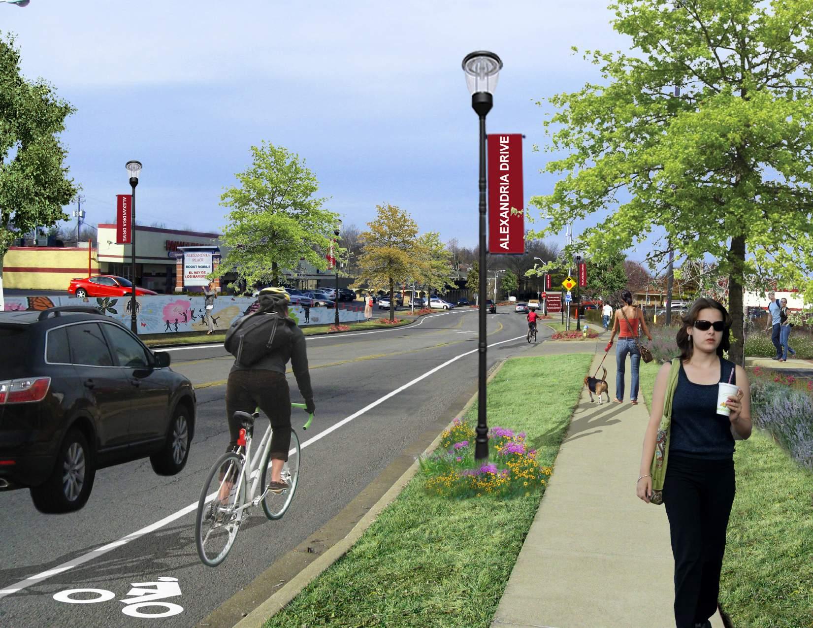
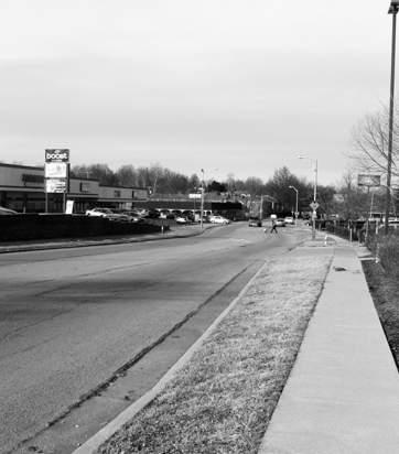
BEFORE 65
OXFORD CIRCLE NEIGHBORHOOD CENTER:
Goal: Redevelop Oxford Circle as a community space by providing public services such as a new library and community center, as well as neighborhood-serving retail.
Objectives/Strategies:
• Encourage partnership between the city and private investors as potential funding sources and advocates.
• Encourage the implementation of a feasibility study for the area with the full involvement of the existing business community and potential partners.
• Work with existing land owners to identify opportunities for relocation or compensation
• Enhance pedestrian and transit facilities around Oxford Circle.
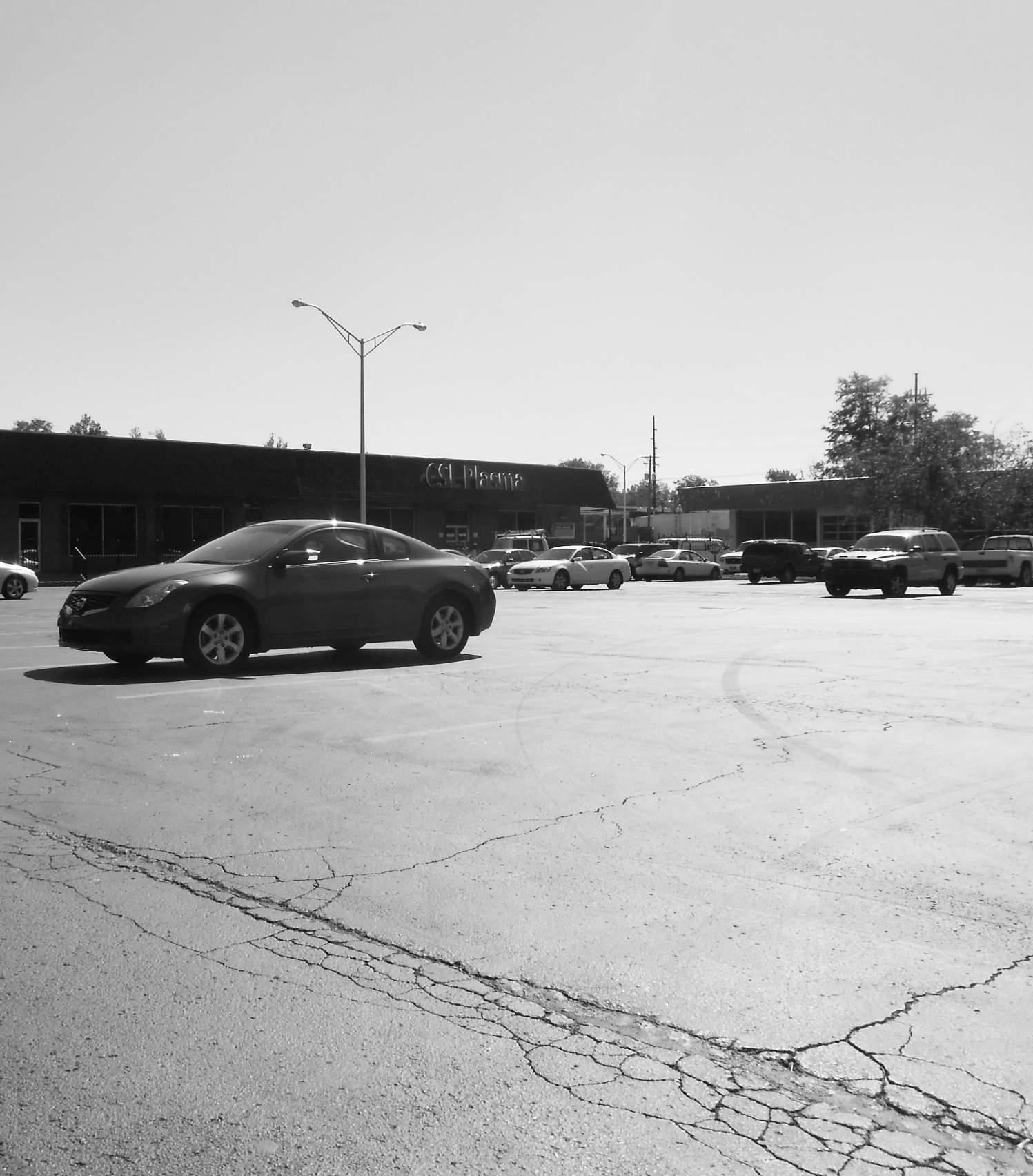
CARDINAL VALLEY SMALL AREA PLAN 66
Oxford Circle
3.4
-
• Panaderia Y Electrodomesticos Torreon
• Lavanderia San Francisco
• Allen’s Food Mart
• San Francisco’s Super Y Carniceria
OXFORD CIRCLE
• Palapas
• Tienda Electronica
• CSL Plasma
• Harvest Worship Center
• Salon Oasis
• Ford’s Fitness
• Rabbit Store
VERSAILLES ROAD
The Oxford Circle Neighborhood Center envisions a possible New Village Branch of the Public Library potentially colocated with a new Community Center for the neighborhood. The Village Library Branch is one of the most active libraries in the city of Lexington. The number of activities hosted by the library has outgrown its current space.
The public has expressed interest in a community center to house outdoor and indoor recreational activities. Having both buildings in one central location such as Oxford Circle, would help to establish a much needed public anchor within the community. There is also the possibility that the additional indoor recreational opportunities at least could be housed in an expanded Valley Park Recreation Center.
Village Library Branch
• 12,000sf
• Shared Lot
Beaumont Library Branch
• 21,000sf
• 100 spaces
3.4.1 Public Library & YMCA: Scale Comparisons
Various scale comparisons are provided to help visualize the scale of the library and community center, including number of parking spaces.
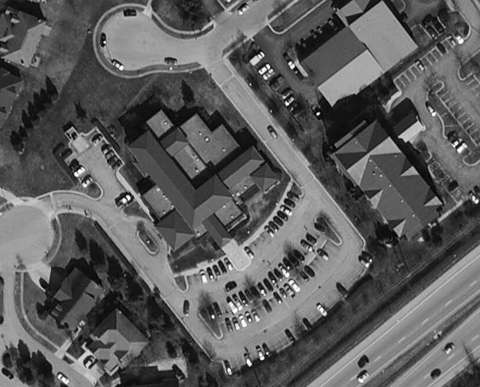
• Approximately 20,000 square feet would be dedicated to the new library.
• Approximately 20,000 to 50,000 square feet could be dedicated to a community center. This could include space for the Community Action Council, which has expressed interest in potentially moving their offices.
CARDINAL VALLEY SMALL AREA PLAN 68
• 28,000sf
• 120 spaces
• 38,000sf
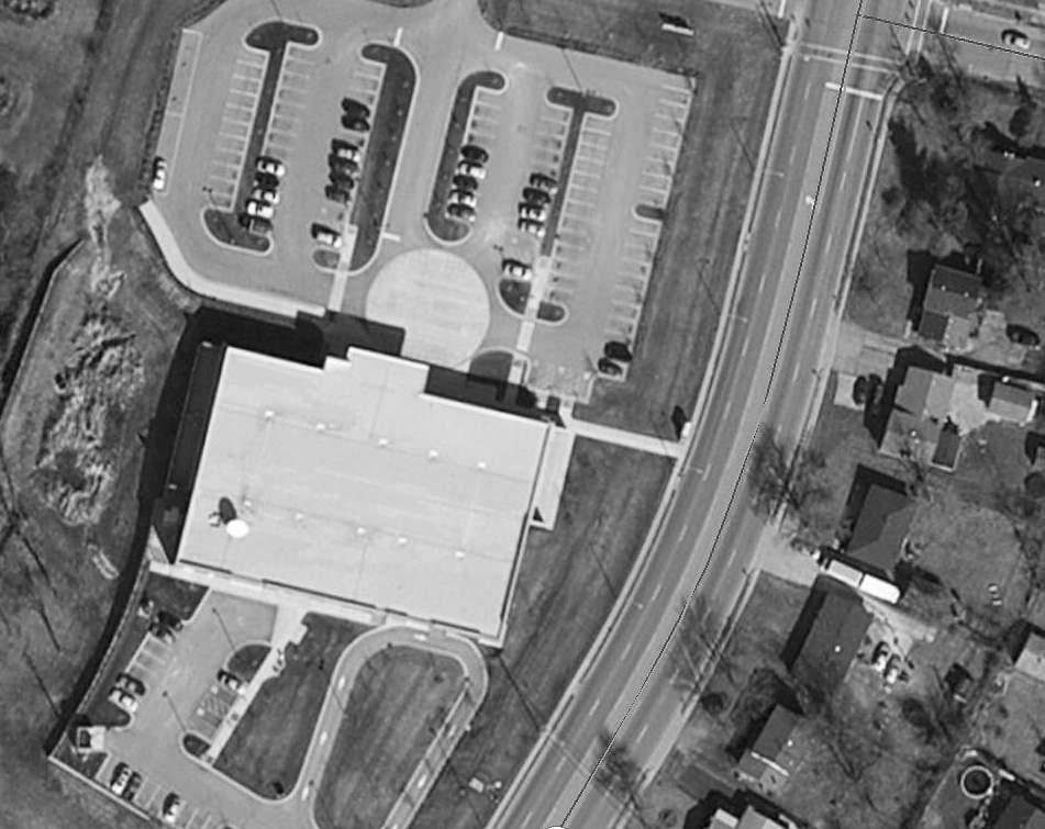
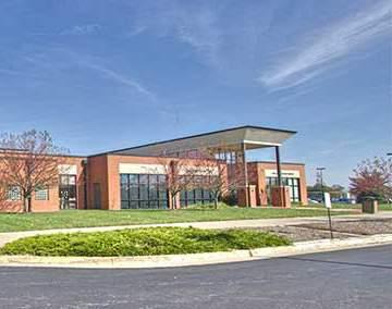
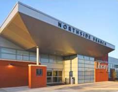
• 150 spaces
• Community Action Council
• 2,200sf
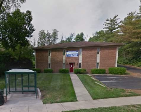
• 14 spaces
CARDINAL VALLEY SMALL AREA PLAN 69
North Lexington YMCA
Northside Library Branch
3.4.2 Oxford Circle Neighborhood Center
The Oxford Circle Neighborhood Center focuses on incorporating community needs and offering a central gathering place for the neighborhood. The site plan on the adjacent page is meant to be an inspiration of the potential for Oxford Circle. A community center has been expressed by the residents as a missing amenity within the neighborhood. The location of Oxford Circle makes it a great candidate for a new community center and a new public library, and with the help of the existing business owners in the Oxford Circle Merchant’s Association it may be possible to come to a shared vision.
The next step to move the vision plan forward is a feasibility study of Oxford Circle. A feasibility study will help accomplish the following.
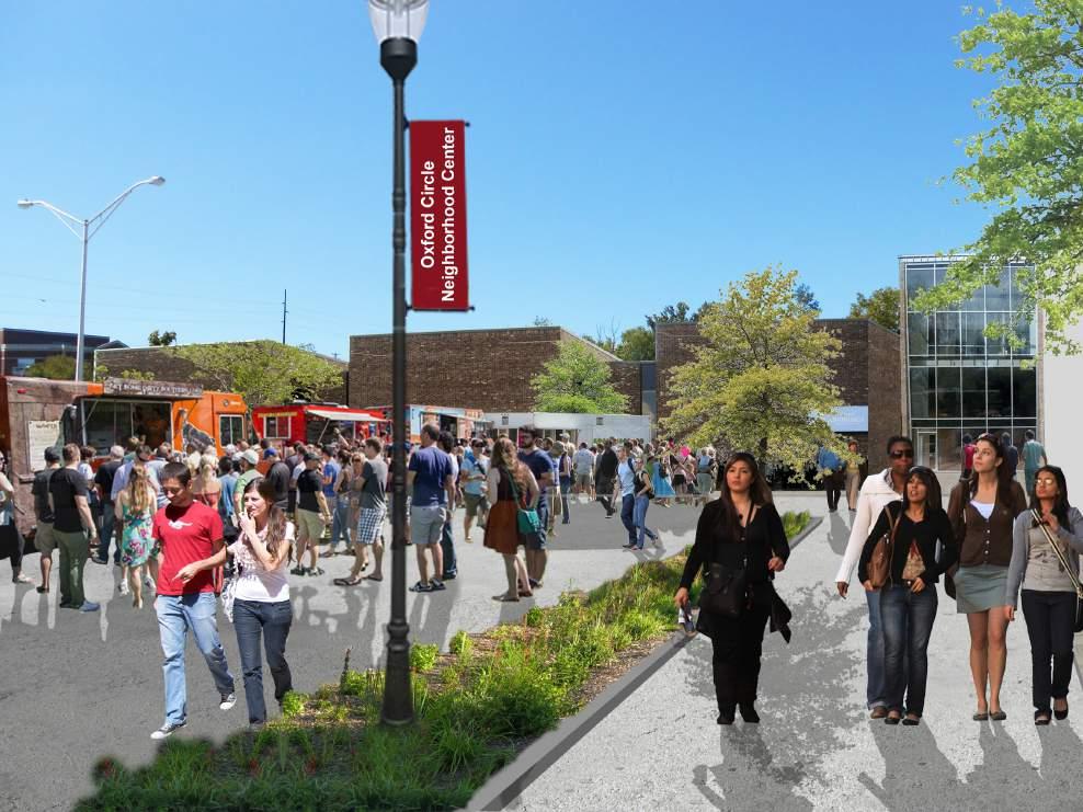
• Identification of Potential Partners
• Programming Report (space needs for all potential partners)
• Schematic Design
• Traffic and Parking Study
• Environmental Study
• Cost Analysis and Funding
• Assistance for Existing Property Owners and Businesses
Schematic Design will include:
• Conceptual Site Plan
• Conceptual Floor Plan
• Conceptual Elevation
• Conceptual Renderings (especially useful for fundraising purposes)
CARDINAL VALLEY SMALL AREA PLAN 70 BEFORE
Art/Signage Space
Community Center Parking 30+ Spaces
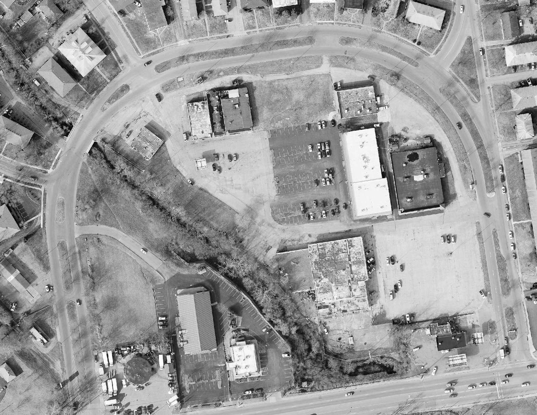
Community Center 20,000-50,000 Square Feet
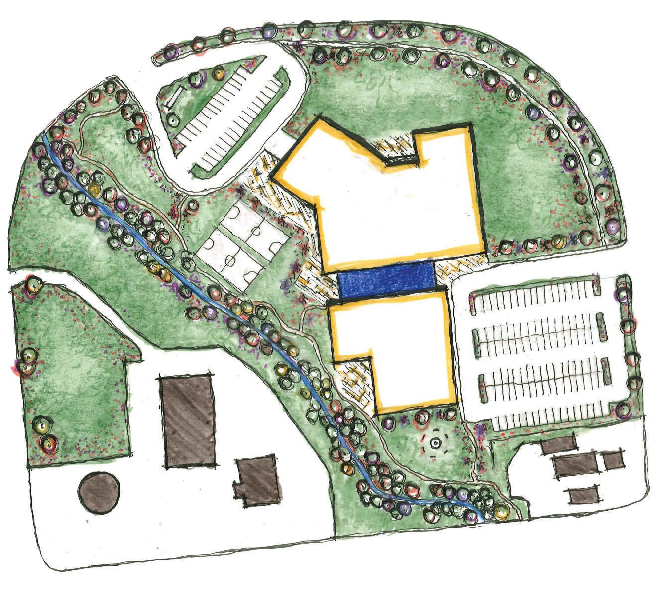
Potential Reuse of Plasma Building
Recreation Space
Vaughn’s Branch Cardinal Valley Open Space Network
New Village Branch Library
20,000 Square Feet
Potential Reuse of Ford’s Fitness
Shared Atrium Space
Library Parking/ Temporary Festival Space 100 + Spaces
Quiet Reading Space W/Fountain
Existing Gas Station
3.5 OPEN SPACE NETWORK
Goal: Improve the connectivity between the existing open space networks including new/improved public amenities.
Objectives/Strategies:
• Provide a trail connection along the existing Versailles Line to link McConnell Springs to Preston’s Spring
• Formalize a natural preserve trail loop through Preston’s Spring
• Create a multi-use trail along Wolf Run and Vaughn’s Branch to connect Preston’s Spring, through Valley Park and the neighborhood, to the Oxford Circle Urban Nature Center and Versailles Road
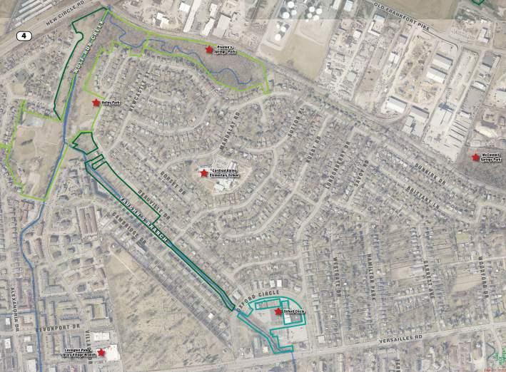
• Improve the Valley Park Recreation Center, Sports Fields, and Playground
• Preserve portions of the area around Oxford Circle for an Urban Nature Center
• Promote the development of the potential 3+ miles of dedicated mixed-use trail loop throughout Cardinal Valley
• Make connections to the greater open space network
• Stream restoration of Wolf Run and Vaughn’s Branch, and Cemetery
FIG. 3.5.1: OPEN SPACE PROPERTIES
3.5.1 Proposed Open Space Network
The highlights of the proposed open space network include:
• McConnell Springs Trail Connection
• Preston’s Spring Preserve Loop
• Wolf Run & Vaughn’s Branch Multi-Use Trail
• Valley Park Recreation Center, Sports Fields, and Playground
• Oxford Circle Urban Nature Center
• Future Trail Network Expansion along Vaughn’s Branch to Harrodsburg Road
• Over 3 linear miles of continuous trails
• Almost 20 acres of active recreation space
All of this would be in addition to key connections to a much larger Citywide system of over 31 additional acres of parkland and 33 additional acres of passive recreation space:
• 8.4 acres at Addison Park
• 10 acres at Wolf Run Park
• 2.2 acres at Pine Meadows Park
• 10.9 acres at Cross Keys Park
The study area is uniquely positioned within the City to either contain or be close to a whole series of open spaces and natural amenities. The Design Team worked to find a way to connect those amenities into one continuous network, of parks, trails, and open space.
All in all this makes for the potential of:
• Over 55 total acres of open space network within the study area alone (see the map below for property that is already either owned by the City or under the control of a single property owner)
• 3 acres at Cardinal Valley Elementary School grounds
• 30 acres at Hillcrest Memorial
CARDINAL VALLEY SMALL AREA PLAN 72
LFUCG Parks LFUCG Greenways Oxford Circle Merchants Association Landmark
0 500 FEET N 250 1000 73
FIG. 3.5.1: LARGER OPEN SPACE NETWORK
3.5.2 McConnell Springs Trail Connection
McConnell Springs, and to a less known extent Preston’s Springs, are great examples of the Limestone geology that makes the Bluegrass region so unique. The former is one of the natural gems of the City, acting as both a great learning tool and a natural recreational amenity within the inner loop of the City. Preston’s Spring could serve a similar purpose, and a connection between them would only enhance their charm.
The R.J. Corman - Versailles Line Rail with Trail Corridor Study looks at that connection, and had previously identified a multi-use trail that could run alongside the active rail line. Although regulations related to current rail operations will be difficult to deal with the Design Team thinks that there is merit in continuing to push this idea forward.
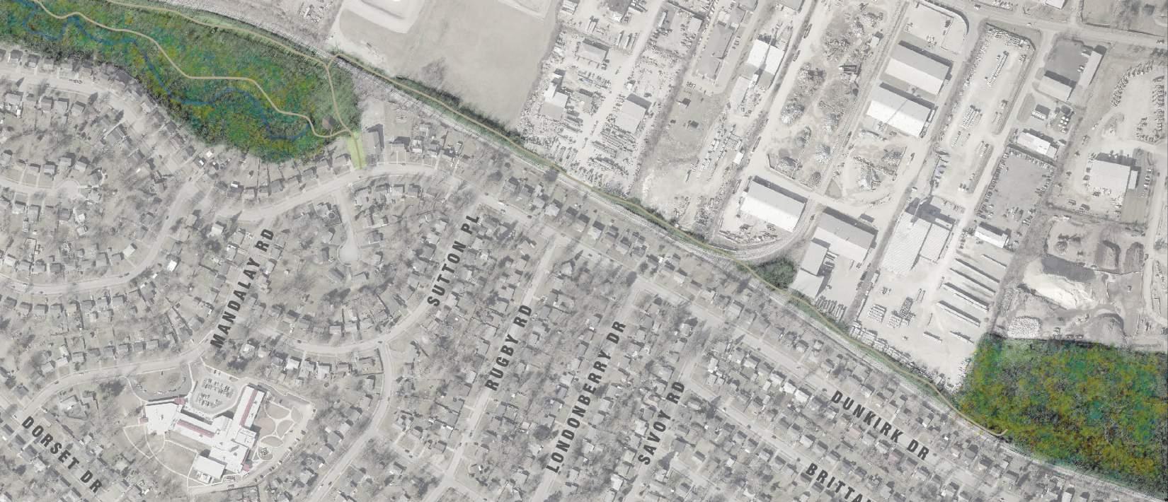 Bike Trail
74
Walking Path Natural Point of Interest
3.5.3 Preston’s Springs Preserve Loop
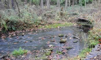

Preston’s Springs today is a somewhat overgrown and rugged bit of semi-wilderness tucked behind residential property and almost indiscernible from the road. While it is important to maintain the sort of natural state that it is known for the park needs to be made safer and more inviting. Barely-there paths can be turned into trails with some stone or mulched footing. Informational signage can be placed about directing people to interesting facts about the ecosystem that lies within their own backyards. The entry to the park can be made more distinct and visible from the road so that everyone can share in this unique resource.
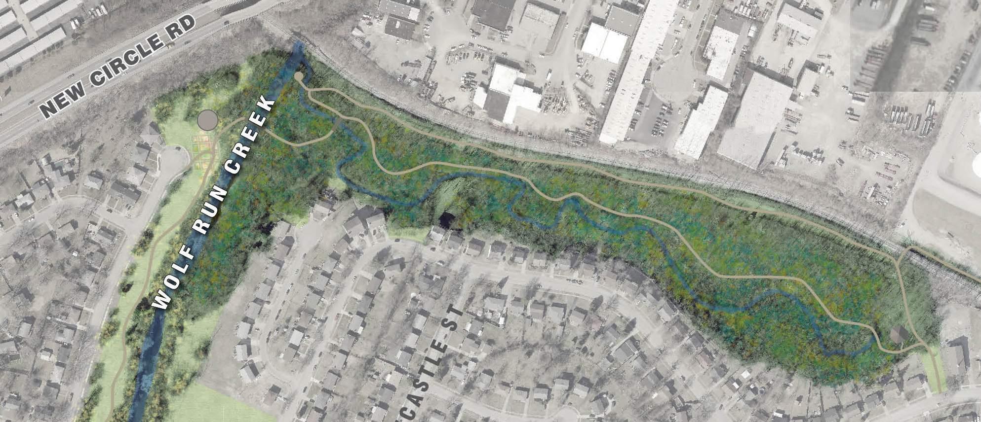 Hiking
Wildlife Watching Natural Point of Interest
Hiking
Wildlife Watching Natural Point of Interest
3.5.4 Wolf Run & Vaughn’s Branch Multi-Use Trail
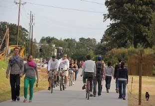
With all of the restoration work that has been done along Wolf Run and Vaughn’s Branch, it only seemed logical for the Design Team to recommend a mutli-use trail to run along and cross over at least portions of the waterway. Urbanites are drawn to running water and are rarely given the opportunity to be in such close proximity. This is especially true in a place like Lexington where even the original waterway the City was founded on, that being Town Branch, was long ago capped and hidden from view for much of its length.
In addition to the asset of Wolf Run and Vaughn’s Branch, the City was able to purchase and set aside large amounts of greenway property to protect the floodplain. This fairly unused open space could be used for low impact activities such as a community garden or disc golf, while still maintaining its function in rainwater management.
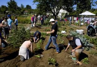
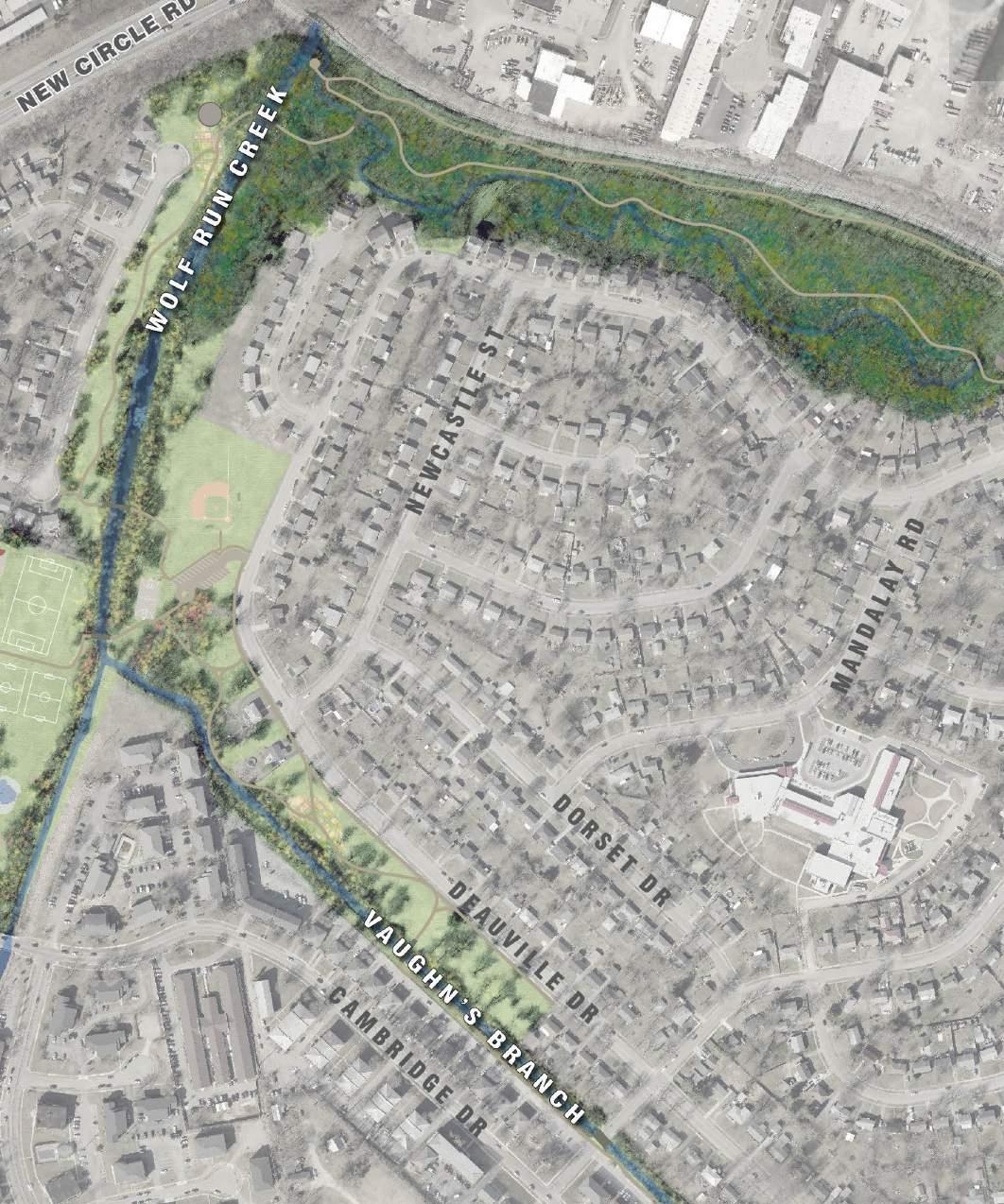
76
Multi-Use Trail
Community Garden
Valley Park is currently one of the City’s most highly used parks and recreation centers, catering to one of the most densely populated and underserved communities. The park is heavily used for youth and adult soccer and speed soccer, after school programs, such as dance, knitting, homework help etc., but it transforms several times a year into festival space.
Acquisition of additional land is not possible, but upgrades to the existing recreation center (including a kitchen), a larger and more accessible playground for children of all abilities, additional resources to keep playing fields in good working order, infrastructure to better accommodate festivals, and possibly something like a splash pad could all be considered.
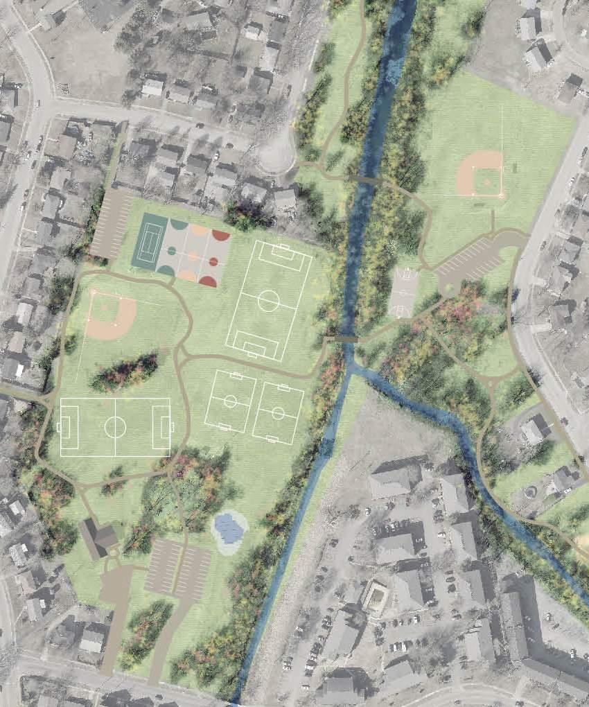
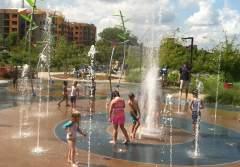

Playground Upgrades
Festival Space
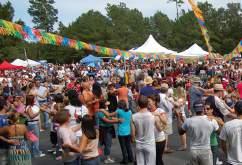
CARDINAL VALLEY SMALL AREA PLAN
Additional Soccer Fields Splashpad P P P
3.5.5 Valley Park Recreation Center, Sports Fields, and Playground
3.56 Oxford Circle Urban Nature Center
The unused portion of Oxford Circle that abuts Vaughn’s Branch is a prime location for the community to interact with the water, but that is also convenient to Versailles Road. The Friends of Wolf Run have taken great care to begin the restoration process of that portion of the stream and they have been discussing the addition of a Monarch Butterfly garden and waystation.
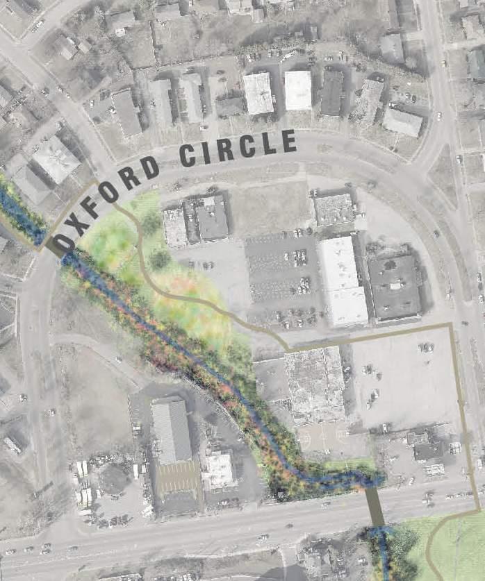
Playground
Ecological Education

Gathering Space
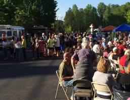
Butterfly Garden

78
3.5.7 Future Trail Network Expansion
The possibility exists for the multi-use trail to continue across Versailles Road and further along Vaughn’s Branch, eventually leading to Harrodsburg Road. This would require the trail to leave the waterway and come to a crossing at the corner of Versailles Road and Oxford Circle, jogging back to the banks of the stream on the south side. This portion is an active floodplain and works to keep Cardinal Valley from flooding so any improvements would need to be low impact.
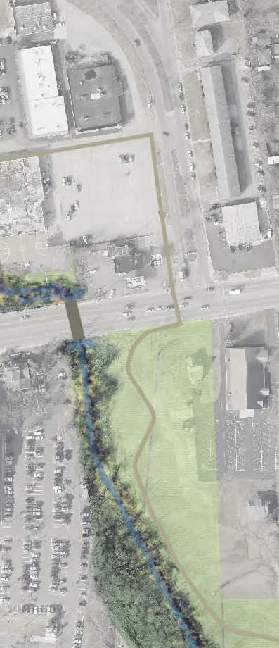
CARDINAL VALLEY SMALL AREA PLAN
Floodplain
79
Wildflower Meadow
3.5.8 Green Infrastructure
Urbanized neighborhoods such as Cardinal Valley can benefit from implementing techniques to conserve, restore, or enhance natural areas while incorporating trees, rain gardens, vegetated roofs, and other practices that simulate natural systems into developed areas to manage rainwater where it falls. Using these types of “green infrastructure” approaches help reduce stormwater and pollution runoff, and is also a way of protecting water quality while achieving co-benefits that can include improved public health, better quality of life, and economic development.
Most green infrastructure uses the natural processes of soils and vegetation to capture, slow down, and filter runoff, often allowing it to recharge into ground water, while some practices collect and store rain water for future use. Some techniques, including using permeable pavements, bioswales, rain gardens, vegetated or “green” roofs, rain barrels, and cisterns, work at the site scale and can fit into individual development, redevelopment, or retrofit projects. Larger-scale management strategies, including preserving or restoring floodplains, open space, wetlands, and forests, can be used at the watershed level.
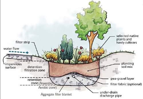
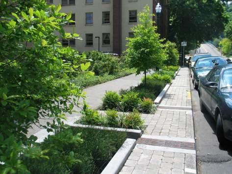
Wolf Run and Vaughn’s Branch, which both stretch almost the entire length of the west side of Lexington, eventually emptying into Town Branch, have seen major improvements over the recent years thanks to the City and organizations like the Friends of Wolf Run. Continued efforts like the ones outlined here can aid in the restoration of one of the City’s greatest natural resources.
wolF Run & vaugHn’s BRancH
Monitoring data shows that Vaughn’s Branch has some of the highest levels of non-point pollutants, in the watershed. Habitat is considered to be “poor” due to low velocity-depth regime, channel flow, bank stability, and riparian vegetation.
Goals for the Vaughn’s Branch stream restoration should include:
• Reduce stream bank erosion
• Improve aquatic habitat
• Improve water quality by capturing trash and debris, providing for a native riparian buffer zone along more of the stream channel
• Provide water quality treatment to enhance pollutant reductions
stReam RestoRation in valley PaRk
This reach of about 2,400 ft. would benefit from stream restoration including constructed wetlands as the reach is straight, disconnected from the floodplain and has some bank erosion. Any future design plans should be evaluated and developed
in conjunction with the heavy use of Valley Park. Currently some riparian restoration is occurring in this area and should continue if stream restoration is infeasible. This project should be coordinated with any proposed remedial measures planned for the Wolf Run Main Trunk B from New Circle to Cambridge.
vaugHn’s BRancH Below oxFoRd ciRcle RiPaRian stReam BuFFeR stewaRdsHiP
• Riparian planting and invasive species removal along about 1,300 ft. of stream
vaugHn’s BRancH Below oxFoRd ciRcle Bank staBilization
• Needed intermittently on eroding areas on about 100 ft. of stream.
stReam RestoRation on vaugHn’s BRancH Below veRsailles Road
• About 800 ft. of stream in need of restoration due to erosion. The banks are steep in this reach upstream of Oxford Circle, so restoration may be difficult or unfeasible.
CARDINAL VALLEY SMALL AREA PLAN 80
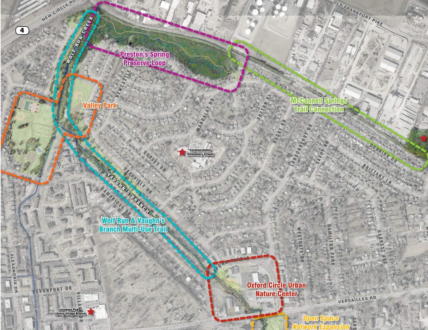
0 300 FEET N 150 500 81
FIG.
3.5.2: OPEN SPACE HIGHLIGHTS
THIS PAGE LEFT INTENTIONALLY BLANK
CARDINAL VALLEY SMALL AREA PLAN 82
Action Plan 4.0

83
4.1 Implementation Principles
4.1.1 Leveraging & Cost Sharing
The vision for the Cardinal Valley Small Area Plan is multi-faceted and comprehensive. Many of these moves come with a large price tag in terms of both time and funding. As public sector funding will likely be limited, the use of public funds should be phased over time and seek to leverage other funding sources including private sector investment, nonprofit commitments (time and money), and outside grant monies.
Early efforts should focus on low-hanging fruit that require limited funding. This starts the proverbial “snowball” rolling downhill. The community and local government can see changes quickly, feel that money is being spent well, and get everyone motivated to work towards some of the more moderate and long-term projects.
4.1.2 Incremental Changes
It is important to remember that this Small Area Plan represents a long-term vision (15+ years) for revitalization and will not happen over night. In order to take advantage of limited and/or unknown funding and to adjust for changing market realities implementation should be incremental by design. It is common with a Small Area Plan that over time a number of the objectives and strategies will no longer be applicable. It will be important in that case to constantly return to the main vision and goals of the Small Area Plan, which have created the fundamental underpinnings of what the community vision is.
4.1.3 Community Orientation
Given that implementation of this plan will take many years and will unfold incrementally, it will be important to periodically review the overall vision, evolving design elements/projects and implementation priorities in open public forums and with community leaders in order to ensure ongoing
and long term compatibility with community desires. In the end, continued community support will be what keep these projects going and make the Small Area Plan successful.
CARDINAL VALLEY SMALL AREA PLAN 84
4.2 Conceptual Implementation Program
The following are a series of actions or projects that will work to obtain the objectives of the Small Area Plan. When an action is listed the agency responsible for the follow-through of that action will be listed. So for instance, if we are referring to something to do with affordable rental housing the Lexington
NEIGHBORHOOD CONSERVATION ACTIONS
Housing Authority will be listed as the party responsible for its implementation. If a project is listed the potential partners or resources will be listed along with a potential estimated cost
Goal: Improve the stock of affordable housing within the neighborhood and improve existing housing and infrastructure through neighborhood education and outreach
-
ID# Goals Actions Types of Assistance
Potential Implementation Partners Funding Sources
Objective: Ensure an adequate supply of affordable housing to meet the needs of all Cardinal Valley residents
NC-1 Affordability
Public-Private Partnerships for Affordable Housing Increase affordable housing production
LFUCG - Division of Grants & Special Programs
Public-Private sector (lenders, developers, builders)
Objective: Expand home ownership opportunities for low and moderate-income households. Provide direct homebuyer assistance to qualifying households
NC-2
First-Time Homebuyers Home acquisition, rehabilitation, and new construction
NC-3 Assistance to Homebuyers Down payment and closing costs
Home Ownership
NC-4
Housing Rehabilitation Assistance
Rehabilitation and redevelopment for vacant and substandard housing
LFUCG - Division of Grants & Special Programs
LFUCG - Division of Grants & Special Programs
LFUCG - Division of Grants & Special Programs
Community Development Block Grant (CDBG) Programs, HOME Investment Partnerships, Emergency Solutions Grants (ESG) Program, Affordable Housing Fund (AHF), etc.
First-Time Homebuyers Assistance Program
Community Development Block Grant (CDBG) Programs, HOME Investment Partnerships, Emergency Solutions Grants (ESG) Program, Affordable Housing Fund (AHF), etc.
NC-5
Housing Education and Counseling
NC-6 Asset and Wealth Building Programs
Housing education and counseling services
Counseling services, foreclosure prevention, financial debt management, etc.
Community Action Council for Lexington-Fayette County LFUCG
Community Reinvestment Alliance of Lexington LFUCG
Objective: Expand affordable rental opportunities through and preservation of existing rental units
NC-7
Loans for Rental Housing Rehabilitation
Rehabilitate smaller rental developments for low-income renters
Lexington Housing Authority / LFUCG
- Division of Grants and Special Programs
LFUCG - Division of Grants and Special Programs, Affordable Housing Trust Fund
NC-8
Rental Housing
Leveraging of Available Funds for Affordable Housing
Increase leveraging of funds for the provision of affordable housing
Lexington Housing Authority
Federal or State low-income housing tax credits, historic credits, and other State and Federal resources
NC-9
Affordable Rental Housing Location Policy
Identify shortages of affordable rental housing and identify appropriate locations
Lexington Housing Authority / LFUCG
- Division of Planning N/A
CARDINAL VALLEY SMALL AREA PLAN 85
NEIGHBORHOOD CONSERVATION ACTIONS
Goal: Improve the stock of affordable housing within the neighborhood and improve existing housing and infrastructure through neighborhood education and outreach
-
ID# Goals Actions Types of Assistance
Potential Implementation Partners Funding Sources
Objective: Provide rental assistance (vouchers) to very low-income and special needs persons and support the Lexington Housing Authority’s efforts to create communities that promote self-sufficiency and mixed-income rental
NC-10
Rental Housing Assistance
Rental assistance to very low income and special needs persons through the voucher system
Lexington Housing Authority
Lexington Housing Authority
Rental Assistance
NC-11
Mixed-Income Rental Communities
Discourage further concentrations of very low income families by promoting and facilitating mixedincome communities
Lexington Housing Authority
Low Income Housing Tax Credit (LIHTC) Program
Objective: Promote engaged communities and citizen neighborhood involvement, to directly and positively impact the quality and appearance of the housing stock
NC-12
Neighborhood Communication
Provide a forum for stakeholders to explore strategies and resources to support neighborhood development, preservation, and neighborhood projects
Cardinal Valley Neighborhood Association N/A
NC-13
Education and Outreach
Engaged & Sustainable Neighborhood
Education on City services, City policies and community resources to promote strong and empowered communities
Residents, community leaders, government agencies, etc. N/A
NC-14
Landlord Training Workshops
Landlord Training Workshops designed to assist property owners and managers of rental housing
LFUCG - Division of Grants and Special Programs / Partner agencies
LFUCG - Division of Grants and Special Programs / Partner agencies
NC-15
Historic Preservation
Help guide the Hamilton Park Neighborhood Association on obtaining National Register status
LFUCG - Division of Historic Preservation, Kentucky State Historic Preservation Office N/A
CARDINAL VALLEY SMALL AREA PLAN 86
NEIGHBORHOOD CONSERVATION ACTIONS
Goal: Improve the stock of affordable housing within the neighborhood and improve existing housing and infrastructure through neighborhood education and outreach
-
ID# Goals Actions
Types of Assistance Potential Implementation Partners Funding Sources
Objective: Ensure safe, attractive and well-maintained residential environments, reduce the number of vacant dwellings, and eliminate substandard housing through enforcement of the Housing Code and neighborhood revitalization
NC-15
Enforcement of the Housing and Minimum Standards
Enforce LFUCG’s Housing Code and the minimum standards set forth in the International Property Maintenance Code
LFUCG - Division of Code Enforcement N/A
NC-16
Neighborhood Environments
Housing Standards
NC-17
Elimination of Substandard Housing
Enforce City ordinances concerning accumulation of trash, junk, weeds and overgrowth, and junked and abandoned vehicles on properties
Education and training of property owners and managers, and outreach and engagement of community stakeholders and citizens in a proactive effort to improve the quality of housing stock
NEIGHBORHOOD CONSERVATION PROJECTS
LFUCG - Division of Code Enforcement N/A
Goal: Improve the stock of affordable housing within the neighborhood and improve existing housing and infrastructure through neighborhood education and outreach
-
Objective: Enhance the pedestrian connectivity throughout the neighborhood
Objective: Safe routes to school, especially focusing on increasing accessibility
Objective: Improve wayfinding to key amenities throughout the community, including recreation opportunities, retail, and institutions
large gateway signs at either end of Versailles Road identifying the neighborhood
These are approximate costs of signage. Coordination with Department of Transportation would need to be done.
are approximate costs of signage. Coordination with the City would need to be done for exact numbers.
CARDINAL VALLEY SMALL AREA PLAN 87
ID# Project Description Potential Implementation Partners/Resources Estimated Timeline Conceptual Estimated Cost Comments Size/# Units Cost/Unit Total Cost
NC-18 Sidewalk Improvements New sidewalks to create
City to
and
Mid-Term 4,550 LS $50 $227,500 Costs exclude design, right-of-way,
utilities and are
2015
better connection throughout neighborhood
install
homeowner / neighborhood association to maintain
and
in
constant dollars.
intersection
City Mid-Term 21 LS -- $120,000
exclude design,
and utilities
are
2015
NC-19 Crosswalk Improvements Addition/improvements to
crosswalks and ADA ramps.
Costs
right-of-way,
and
in
constant dollars.
Place
City,
Valley Neighborhood Association Mid-Term 1 Per $3,000 $3,000+
NC-20 Gateway signage
Cardinal
NC-21 Wayfinding Signage Informational signage showing routes to key amenities City, Cardinal Valley Neighborhood Association Mid-Term 15 Per $200 $3,000+
These
TBD N/A
The majority of the actions/projects for the Versailles Road Corridor are covered in the Versailles Road Multi-Modal Corridor Study (February 2015).
Those action items should therefore be referenced directly in that study and considered to also be recommendations of this Small Area Plan.
VERSAILLES ROAD CORRIDOR IMPROVEMENTS ACTIONS
Goal: Improve the aesthetics and function of the corridor for vehicles and make it more accessible to pedestrians and cyclists
-
ID# Goals Actions
Types of Assistance
Objective: Improve the flow of traffic and enhance bike/ped infrastructure
VR-1 Improve the flow of traffic along Versailles Road See Versailles Road Multi-Modal Corridor Study
VR-2 Enhance bicycle/pedestrian infrastructure along Versailles Road See Versailles Road Multi-Modal Corridor Study
Potential Implementation Partners Funding Sources
Objective: Increase the aesthetics of Versailles Road to function as a major gateway to the city
VR-3 Increase the aesthetics of Versailles Road See Versailles Road Multi-Modal Corridor Study
Objective: Identify opportunities for improved pedestrian crossings and transit stops
VR-4 Improve major pedestrian crossings See Versailles Road Multi-Modal Corridor Study
VR-5 Improve transit stops See Versailles Road Multi-Modal Corridor Study
Objective: Increase transit frequency and service to major bus routes along Versailles Road
VR-6 Increase transit frequency and service
Extend service hours
VR-7 Expand service on the weekends
Provide for additional buses later in the evenings for riders that work later hours, as well as making sure that the buses run more reliably.
Provide for more consistent and extended service hours during the weekend, as well as more direct routes.
CARDINAL VALLEY SMALL AREA PLAN 88
Lextran Lextran
Lextran Lextran
LF = linear foot LS = lump sum SF = square
foot
ALEXANDRIA DRIVE INTERNATIONAL DISTRICT ACTIONS
Goal: Build upon the diverse character and businesses in the Alexandria Drive area to promote an International District.
-
ID# Goals Actions Types of Assistance
Potential Implementation Partners Funding Sources
Objective: Build a foundation for the potential connection and collaboration between the commercial district of Alexandria Drive and the shopping centers in Gardenside
AD-1 Establish a commercial district
Connect the commercial district of Alexandria Drive and the shopping centers in Gardenside
Objective: Emphasize the value of a business/merchant association and develop strategies for outreach to merchants and property owners
AD-2 Establish a merchant’s association within Alexandria Drive
Reach out and educate merchants and property owners on how a merchants association could benefit them, how to develop one, how to maintain it, etc.
Objective: Encourage a stronger relationship between the city and the merchants
AD-3
Create an open line of dialogue between the merchants and the City so that they can feel free to ask questions or ask for help without the fear of recrimination.
Objective: Opportunities for branding, publicity, and events.
AD-4 Create a branded district
Establish a brand for the commercial district that can then work for publicity, marketing, and events.
Help with setting up a business, acquiring loans, understanding the laws and codes, how to get financial assistance for a small business, how to correctly file taxes and get permits, etc.
LFUCG - Division of Social Services (Multicultural Affairs)
Work to develop a vision for how the area wants itself to be viewed and then determine to whom and how they want to publicize events.
LFUCG - Division of Social Services (Multicultural Affairs)
CARDINAL VALLEY SMALL AREA PLAN 89
ALEXANDRIA DRIVE INTERNATIONAL DISTRICT PROJECTS
Goal: Build upon the diverse character and businesses in the Alexandria Drive area to promote an International District.
-
ID# Project Description
Objective: Build a foundation for the potential connection between the commercial district of Alexandria Drive and the shopping centers in Gardenside
AD_5 Streetscape Improvements
Improve the streetscape character between the Gardenside commercial area to north of Alexandria Drive City
Costs exclude design, right-of-way, and utilities and are in 2015 constant dollars.
signage. AD-7 Add /enhance transit stops Improve bus shelters along
AD-8
General upgrades including parking lot buffers, street furniture, outdoor seating space, etc.
are approximate
Enhancements can be as little or as much as the merchants have an appetite for.
LF = linear foot LS = lump sum SF = square foot
CARDINAL VALLEY SMALL AREA PLAN 90
Potential Implementation Partners/Resources Estimated Timeline Conceptual Estimated Cost Comments Size/# Units Cost/Unit Total Cost
Mid-Term 3,500 LF $200 $700,000
City, Alexandria Drive Merchants Mid-Term TBD LS $3,000 TBD These
Alexandria Drive Lextran Mid-Term 6 LS $50,000 $300,000
Objective: Public improvements to streetscape, landscape, signage AD-6 Commercial signage Provide consistent signage for all businesses within the commercial district Alexandria Drive Merchants Mid-Term TBD LS TBD TBD
costs of
Costs exclude design, right-of-way, and utilities and are in 2015 constant dollars.
Improvements to Business Frontages
OXFORD CIRCLE NEIGHBORHOOD CENTER ACTIONS
Goal: Redevelop Oxford Circle as a community space by providing public services such as a new library and community center, as well as neighborhood-serving retail
ID# Goals Actions Types of Assistance Potential Implementation Partners Funding Sources
Objective: Encourage partnership between the city and private investors as potential funding sources and advocates
OC-1 Public/private funding
Find opportunities for the City to partner with one or more private investors to leverage funding for a new center.
LFUCG, Lexington Public Library, YMCA, Community Action Council
LFUCG, Private Source(s), Grants, Brownfield Programs
Objective: Encourage the implementation of a feasibility study for the area with the full involvement of the existing business community and potential partners
OC-2 Implement a feasibility study for the Oxford Circle Neighborhood Center
Following the identification of potential partners a feasibility study would include a programming report, schematic design of the center, traffic, parking, and environmental studies, cost analysis and funding, and outline assistance for existing property owners.
LFUCG
Objective: Work with existing land owners to identify opportunities for relocation or compensation
OC-3 Relocate or compensate existing land owners
Meet with individual land owners and determine their interest in relocation or compensation for their property.
Property/business owners can choose to stay where they are, be relocated elsewhere in the community, or be given fair market compensation.
OXFORD CIRCLE NEIGHBORHOOD CENTER PROJECTS
LFUCG
LFUCG, Private Source(s)
LFUCG - CDBG Funds, Private Sources
Goal: Build upon the diverse character and businesses in the Alexandria Drive area to promote an International District. ID# Project Description
-
Objective: Enhance pedestrian and transit facilities around Oxford Circle
Streetscape Improvements Improve the streetscape character around Oxford Circle
OC-5 Add /enhance transit stops Include new transit shelters along Oxford Circle. An Art in Motion stop would be ideal.
Costs exclude design, right-of-way, and utilities and are in 2015 constant dollars.
Costs exclude design, right-of-way, and utilities and are in 2015 constant dollars. Additional costs may be associated with an Art In Motion stop.
CARDINAL VALLEY SMALL AREA PLAN 91 -
Potential Implementation Partners/Resources Estimated Timeline Conceptual Estimated Cost Comments Size/# Units Cost/Unit Total Cost
City Mid-Term 1,500 LF $200 $300,000
OC-4
Lextran Mid-Term 2 LS $50,000 $100,000
OPEN SPACE NETWORK PROJECTS
Goal: Improve the connectivity between the existing open space networks including new/improved public amenities.
ID# Project Description
Objective: Provide a multi-use trail connection along the existing Versailles Line to link McConnell Springs to Preston’s Spring
Trail
City, Friends of McConnell Springs, RJ Corman, Friends of Wolf Run
Objective: Formalize a natural preserve trail loop through Preston’s Spring
OS-2 Entry signage and improvements
the nature trail running through the southern portion of the park
OS-4
+/-8 foot wide asphalt path. Access/use of active rail line will require extensive permitting and coordination with the railroad.
key natural features of the
dumping
City,
Friends of Wolf Run, Cardinal Valley Neighborhood Association
Friends
LF = linear foot LS = lump sum SF = square foot
CARDINAL VALLEY SMALL AREA PLAN 92
Potential Implementation Partners/Resources Estimated Timeline Conceptual Estimated Cost Comments Size/# Units Cost/Unit Total Cost
OS-1 Off-Street Multi-Use Recreation Trail Long-Term 3,000 LF $30 $90,000
connection from McConnell Springs to Preston’s Spring
Short-Term 1 LS $1,000 $1,000
Create a more noticeable entrance into the park for the public, including a trailhead and signage from the road
Nature Trail Formalize
City,
of Wolf Run Short-Term 2,500 LF $10 $25,000
These are approximate costs of signage. Coordination with the City Parks and Recreation Department would need to be done for exact numbers. OS-3
Off-Street Multi-Use Recreation Trail Trail
City,
Corman,
of Wolf Run Mid-Term 2,500 LF $30 $75,000
OS-5 Nature Trail Signage Informational signage describing the
park City, Friends of Wolf Run Short-Term 10 LS $200 $2,000
OS-6 Neighborhood Recycling Station Recycling collection station to discourage
at the springs City, Friends of Wolf Run Short-Term 3 LS $1,000 $3,000 Minimum 3 recycling depositories
+/- 4 foot wide mulched path following existing trail. Will require some additional clearing on top of existing efforts.
connection from eastern end of Preston’s Spring, along utility easement to Wolf Run crossing
RJ
Friends
+/-8 foot wide asphalt path. Access/use of utility easement next to an active rail line will require extensive permitting and coordination with the railroad.
These are approximate costs of signage. Coordination with the City would need to be done for exact numbers.
OPEN SPACE NETWORK PROJECTS
Goal: Improve the connectivity between the existing open space networks including new/improved public amenities. ID# Project Description
Objective: Create a multi-use trail along Wolf Run and Vaughn’s Branch to connect Preston’s Spring, through Valley Park and the neighborhood, to the Oxford Circle Urban Nature Center and Versailles Road
OS-7 Off-Street Multi-Use Recreation Trail
Trail connection from northern end of Wolf Run to Versailles Road
Friends of Wolf
OS-8 Accessible bridges over Wolf Run and Vaughn’s Branch
ADA compliant bridge crossings: over Wolf Run just south of the New Circle underpass; from Kilrush Drive to Deauville Drive; and, from Deauville Drive to alley behind Cambridge Drive apartments
Bridge construction over sensitive waterways will be an involved process. Until these bridges can be installed alternate routes can be used along sidewalks and by way of the existing Valley Park Bridge. Costs would need to be determined through engineering studies. Environmental studies will also most likely be a factor.
garden within
Install
Objective: Improve the Valley Park Recreation Center, Sports Fields, and Playground
OS-10 Enlarge or build a new Valley Park Recreation Center
City,
Valley Park Board
OS-11 Upgrade playground Upgrade existing playground equipment as well as add new, accessible playground pieces
CARDINAL VALLEY SMALL AREA PLAN 93
Potential Implementation Partners/Resources Estimated Timeline Conceptual Estimated Cost Comments Size/# Units Cost/Unit Total Cost
Run Mid-Term 8,500 LF $30 $255,000 +/-8 foot wide
path
City,
asphalt
City,
of
Run Long-Term 3 LS TBD TBD
Friends
Wolf
a community
the
OS-9 Create and maintain a community garden Drives TBD Short-Term 1 LS $2,500 $2,500+
floodplain portion of either Kilrush or Deauville
An entity, such as a neighborhood group, will need to be created to help establish, run, and maintain the community garden. An opportunity exists to get children at the Cardinal Valley Elementary School or the Valley Park Recreation Center actively involved in the maintenance of the garden once it is established.
Long-Term TBD SF TBD TBD
Either completely rebuild a larger Valley Park Recreation Center or add an addition onto the existing for more programming opportunities, including a small kitchen for cooking classes or rental use
City, Valley Park Board Mid-Term 1 LS $25,000 $25,000+
A feasibility study would need to be done to determine the programming needs of the center related to a new or remodeled building.
These are approximate numbers for new accessible equipment. Further study would need to be done to determine the condition of the existing equipment.
OPEN SPACE NETWORK PROJECTS
Goal: Improve the connectivity between the existing open space networks including new/improved public amenities. ID# Project Description
OS-12 Improve/maintain existing sports fields
Set aside additional funding to maintain existing sports fields that are under heavy use or reimagine the park layout and improve/add to the fields
OS-13 Install a splashpad
Incorporate an accessible splash pad for use during summer months
Objective: Preserve portions of the area around Oxford Circle for an Urban Nature Center
OS-14 Create and maintain a butterfly garden and waystation
Install a butterfly garden and waystation within the floodplain portion of Vaughn’s Branch along the edge of the Oxford Circle Commercial Center. This will be an ongoing project that will take 3 - 5 years of ongoing maintenance involving bush honeysuckle eradication, weeding, pruning etc.
Informational Signage
signage describing the key natural elements found in and around the creek
A feasibility study would need to be completed with Division of Parks and Recreation to determine how funding could be allocated.
An entity, such as a neighborhood group, may need to be created to help establish, run, and maintain the community garden. These are approximate costs for plants, minor contracting, and a small waystation. Further estimates would need to be made.
These are approximate costs of signage. Coordination with the City is suggested for consistency.
Objective: Promote the development of the potential 3+ miles of dedicated mixed-use trail loop throughout Cardinal Valley
+/-8 foot wide asphalt path. Access/use of active rail line will require extensive permitting and coordination with the railroad.
Costs exclude design, right-of-way, and utilities and are in 2015 constant dollars
Costs exclude design, right-of-way, and utilities and are in 2015 constant dollars *This portion of the trail overlaps with the recommendations of the Versailles Road Corridor Improvements Study.
Objective: Make connections to the greater open space network
CARDINAL VALLEY SMALL AREA PLAN 94
Potential Implementation Partners/Resources Estimated Timeline Conceptual Estimated Cost Comments Size/# Units Cost/Unit Total Cost
City, Valley Park Board Mid-Term 1 LS TBD TBD
City, Valley Park Board Mid-Term 1 LS $30,000 $30,000+ Small
public splash pad.
Friends of Wolf Run, TBD Mid-Term 1 LS $10,000 - $15,000 $10,000 - $15,000
OS-15
City, Friends of Wolf Run Short-Term 3 LS $200 $600
Informational
Off-Street Multi-Use Recreation Trail Trail connection
Road City,
of McConnell Springs,
Corman Long-Term 2,400 LF $30 $72,000
OS-16
from McConnell Springs to Forbes
Friends
RJ
OS-17 On-Street Multi-Use Recreation Trail Trail connection
Road from
rail line to Versailles Road City Long-Term 750 LF $40 $30,000
OS-18 On-Street Multi-Use Recreation
Streetscape
City Mid-Term 4,500 LF $50 $225,000
along Forbes
the
Trail
improvements along Versailles Road from Forbes Road to Oxford Circle
OPEN SPACE NETWORK PROJECTS
Goal: Improve the connectivity between the existing open space networks including new/improved public amenities.
OS-19 On-Street Multi-Use Recreation Trail
Streetscape improvements along Versailles Road from Oxford Circle to Hillcrest Memorial Cemetery City
OS-20 Off-Street Multi-Use Recreation Trail Trail connection from Oxford Circle to Pine Meadows Park City, Friends
Objective: Stream restoration of Wolf Run and Vaughn’s Branch
OS-21 Continue efforts to restore Wolf Run and Vaugn’s Branch
Reduce stream bank erosion, improve aquatic habitat, improve water quality by capturing trash and debris, providing for a native riparian buffer zone along more of the stream channel, and provide water quality treatment to enhance pollutant reductions
Costs exclude design, right-of-way, and utilities and are in 2015 constant dollars *This portion of the trail overlaps with the recommendations of the Versailles Road Corridor Improvements Study.
+/-8 foot wide asphalt path. Access/use of active rail line will require extensive permitting and coordination with the railroad.
An engineering study would need to be completed to understand the full extent of a restoration needed.
CARDINAL VALLEY SMALL AREA PLAN 95
ID#
Potential Implementation Partners/Resources Estimated Timeline Conceptual Estimated Cost Comments Size/# Units Cost/Unit Total Cost
Project Description
Mid-Term 1,000 LF $50 $50,000
Run Mid-Term 1,750 LF $30 $52,500
of Wolf
City, Friends of Wolf Run Long-Term TBD0 TBD TBD TBD