INFRASTRUCTURE
WHO IS BELLE ISLE BUILT FOR?
IS IT WELL CONNECTED TO THE CITY?

WHO IS BELLE ISLE BUILT FOR?
IS IT WELL CONNECTED TO THE CITY?
First opened as a park in 1845, Belle Isle has a rich and layered history that extends back to the indigenous peoples that first inhabited the region. Over the course of its 150+ years of operation, Belle Isle Park has seen many changes to the urban infrastructures that allow people to use and enjoy this space. Environmental changes, mobility technologies, and Detroit’s shifting economies and population have molded the public park into what it is today. Currently, Belle Isle’s infrastructure is in varying states of disrepair, impacting the health of its ecosystems and the experience of the visitors. More frequent and intense storm events, and decadal cycles of high water levels in the Great Lakes are overwhelming the old stormwater system and negatively impacting the recent habitat restoration interventions in the island. The ever expanding need of parking and car access continues to add impervious surfaces to a park that has lost a lot of its tree canopy over the years.
Active transportation infrastructure in particular— including sidewalks and crosswalks— is not evenly distributed and maintained throughout the island. This results in uneven or no access to some of the island amenities due to sidewalk gaps, poor drainage, absence of ADA accessible crossings, and reduced visibility. These types of lapses in the provision of public infrastructure have critical accessibility, safety and experiential implications. Further challenges exist in ensuring that these infrastructures connect and respond with one another to create dynamic and adaptable infrastructure systems that can continue to function under a multitude of changing conditions. From the pleasure grounds that Olmsted once imagined to the contemporary needs of a large urban park, the provision and adequate maintenance of different urban infrastructures will remain a critical issue in protecting the unique ecosystems housed in Belle Isle and the experiences of many generations of Detroiters to come.
[in]visibility table of contents:
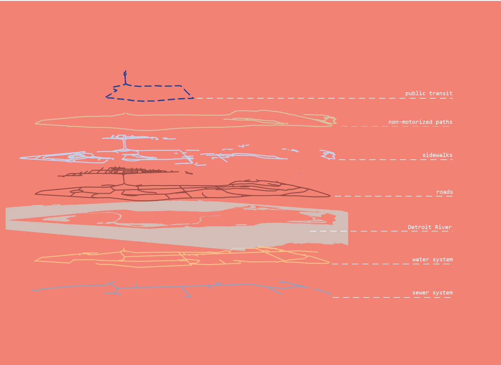
In many ways, the complexity of infrastructure systems hides right under our noses. Many of these systems aren’t clearly visible, unless sought out. Which makes them left unseen and potentially unknown to the users. This series of postcards are meant to bring attention to complex infrastructure by focusing on more granular details to make them seen. We use a mix of informative narratives, as well as questions to get the reader to reflect upon the space of Belle Isle, the infrastructure it holds within, and their own connections to it.
I 00 :: Abstract
I 01 :: [in]visibility
ANISHINAABE
I 02 :: History of Infrastructure
I 03 :: 70 years apart
I 04 :: Paved Paths
I 05 :: Unpaved Trails
I 06 :: Sidewalks + Crosswalks
I 09 :: Public Transit means Bus
POTOWATOMI
I 11 :: Parkways: Built for Cars
I 12 :: Closed Roads
I 13 :: Potable Water
I 14 :: Storm Water
I 15 :: Standing Water
I 16 :: Green Infrastructure
an original vision, flawed
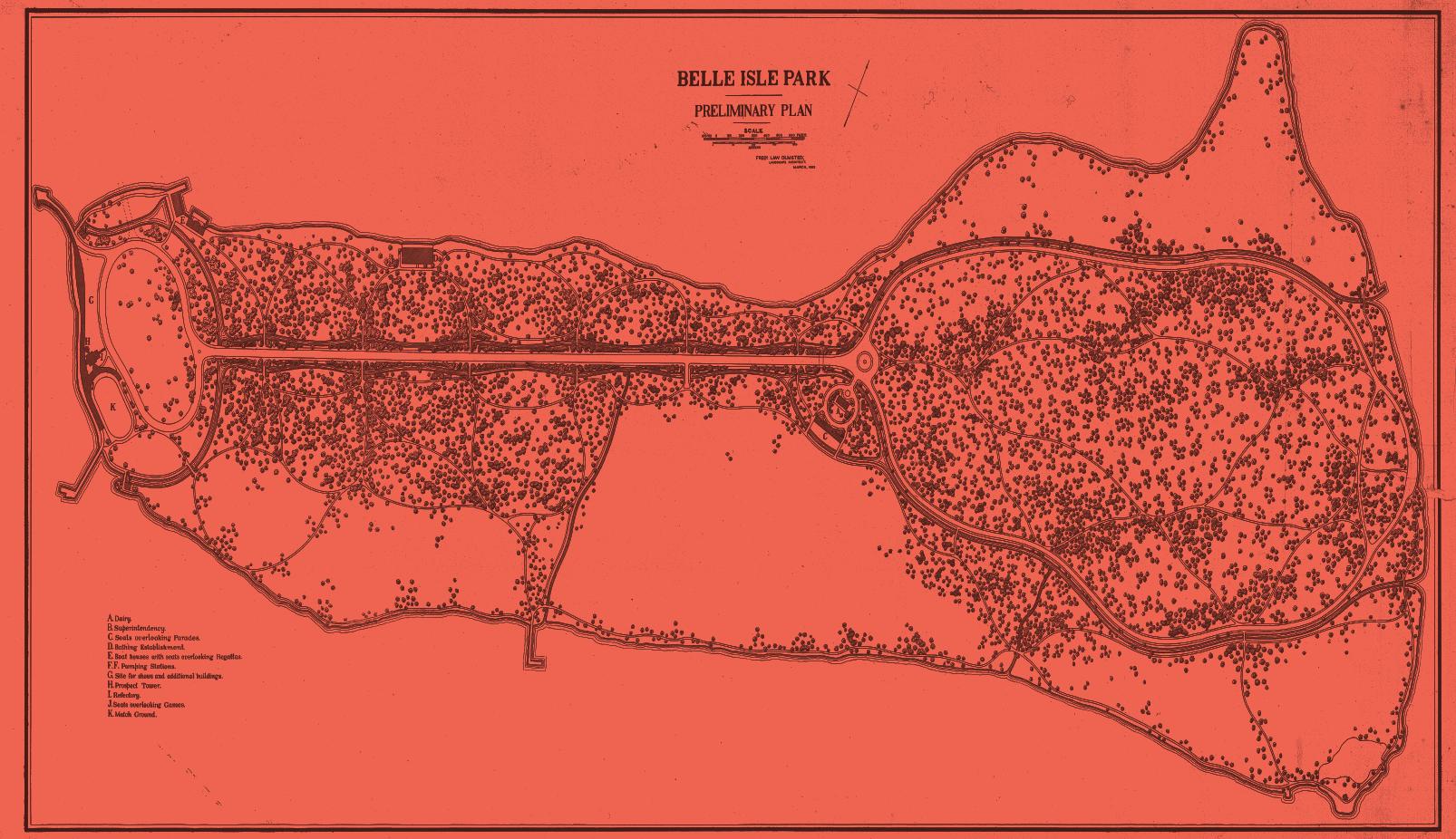
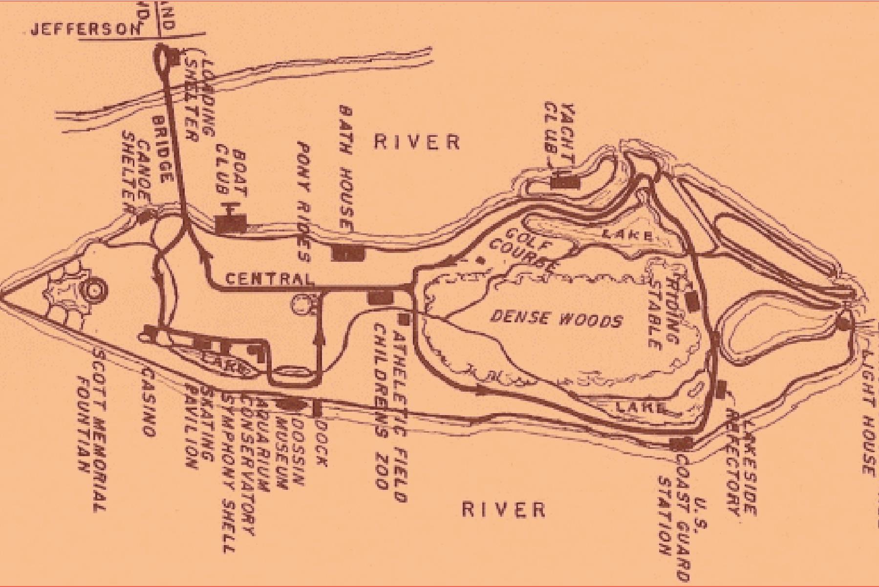
Belle Isle was originally envisioned as a place of relief from the mechanisms of urban life. Frederick Olmsted’s original vision for Belle Isle can be seen on the front of this postcard. However, this dream was cut short, as the city did not provide enough funding for his continued work on the project. While Olmsted’s conception can only be seen on the plans of what never was, the result of the implementation and ongoing transformation of the park both diverges and aspires to the ideals that inspired his original intention .
Does infrastructure contribute to the identity of the island today?
Belle Isle was created to make possible the enjoyment of nature in the city, turning the enabling infrastructures almost invisible, or monumentalizing its presence.
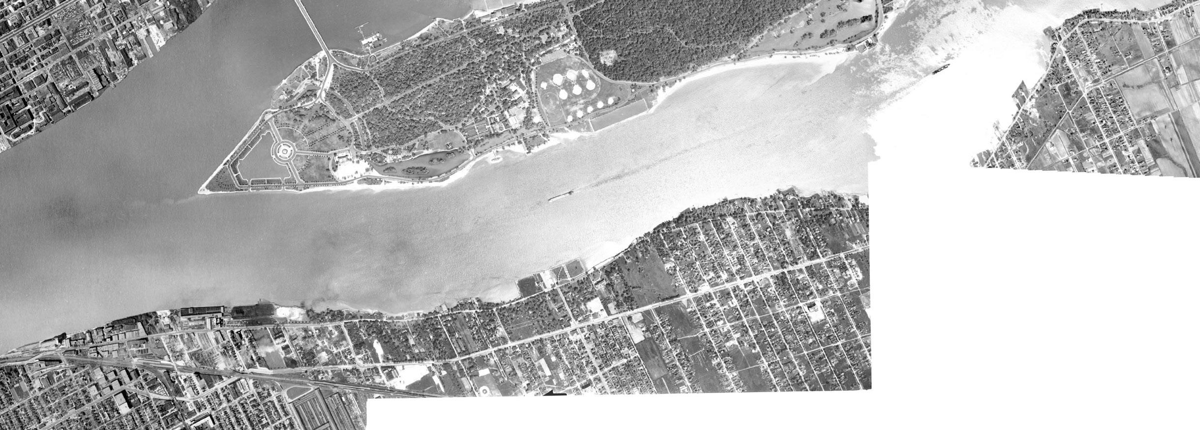
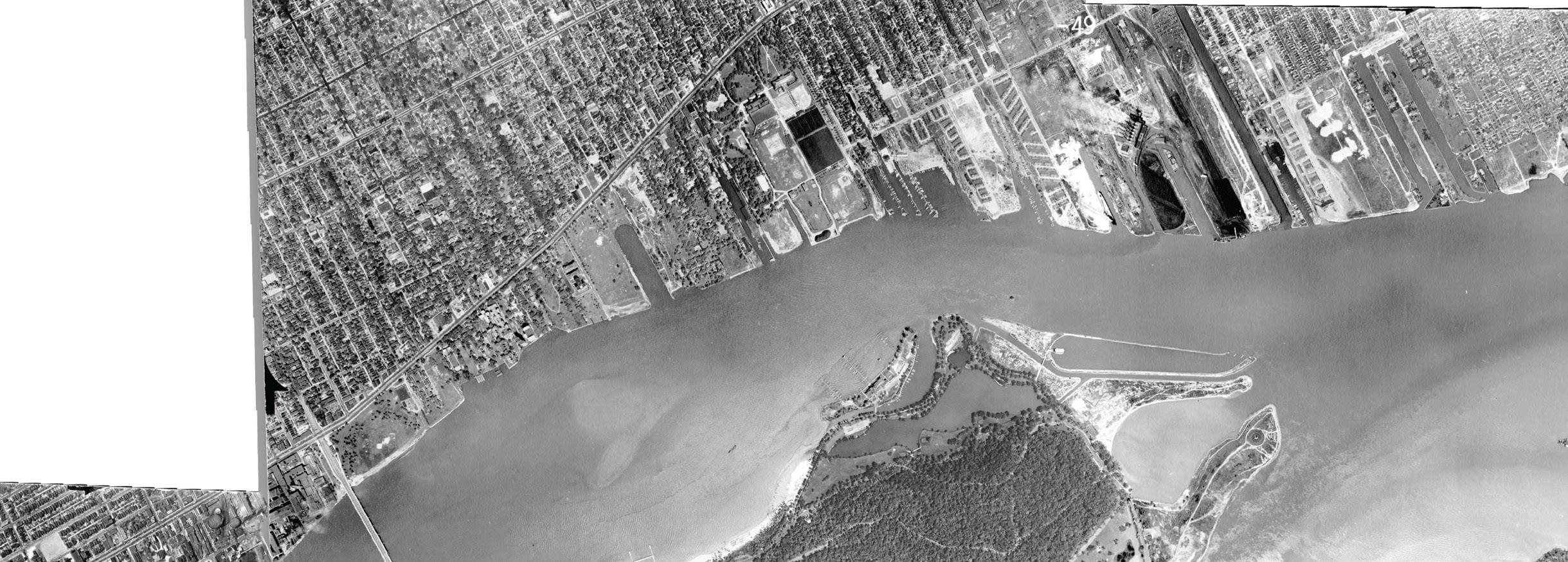
The island has changed significantly since the early 20th century. Since then, there has been a significant investment and expansion of roadways on the island. In some places there are 4 lanes. New parking lots and additional roads have also been added on the island. Is the space allocated for roads and cars needed, or can it be considered excessive?


What differences can you spot between these images?

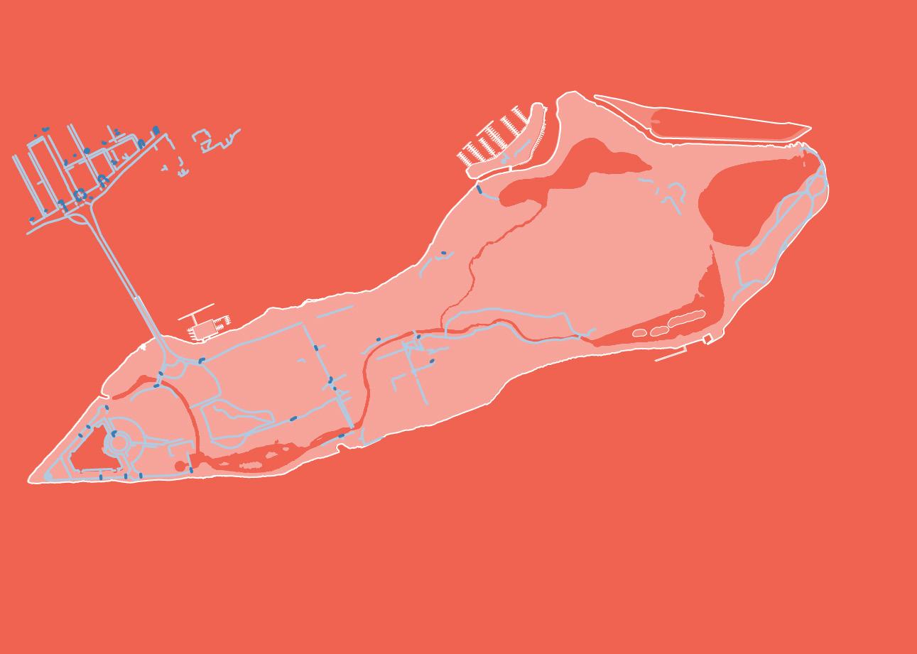
Key: Paved Trails
Unpaved Trails
THE IRON BELLE
1km
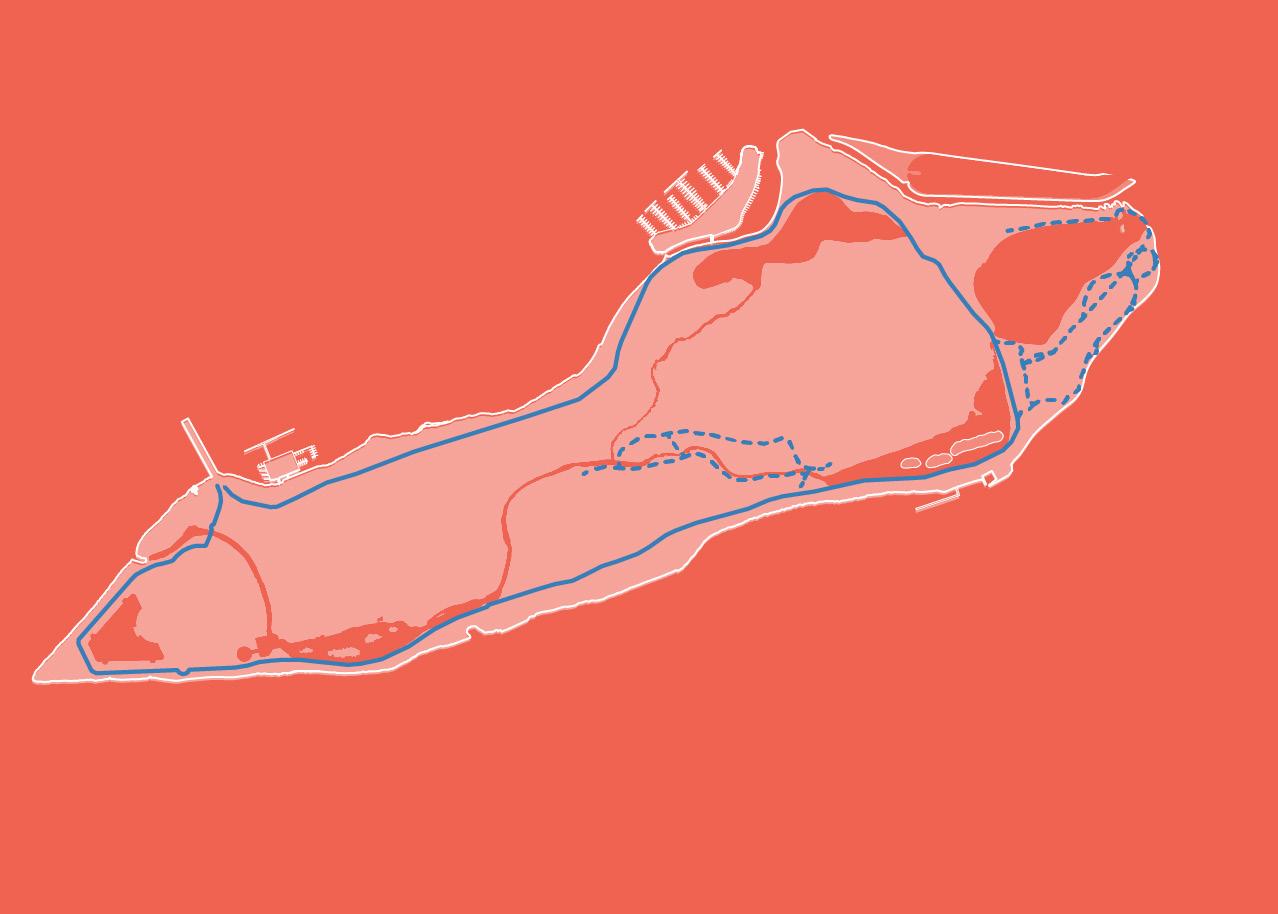
paved paths
There is one paved path that circumnavigates the island. This path features a trail head that will serve as one of the termini of the Belle Iron Trail.
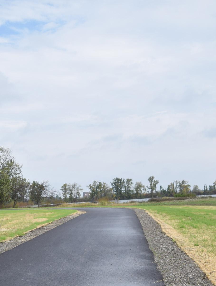
Paved paths are 8 feet in width and have an asphalt surface. These paths are physically separated from the road by a grass buffer. These paths are the most comfortable on the island, but do not allow for interior access.
Do these trails allow for easy access to desired destinations?
GETTING AWAY FROM IT ALL

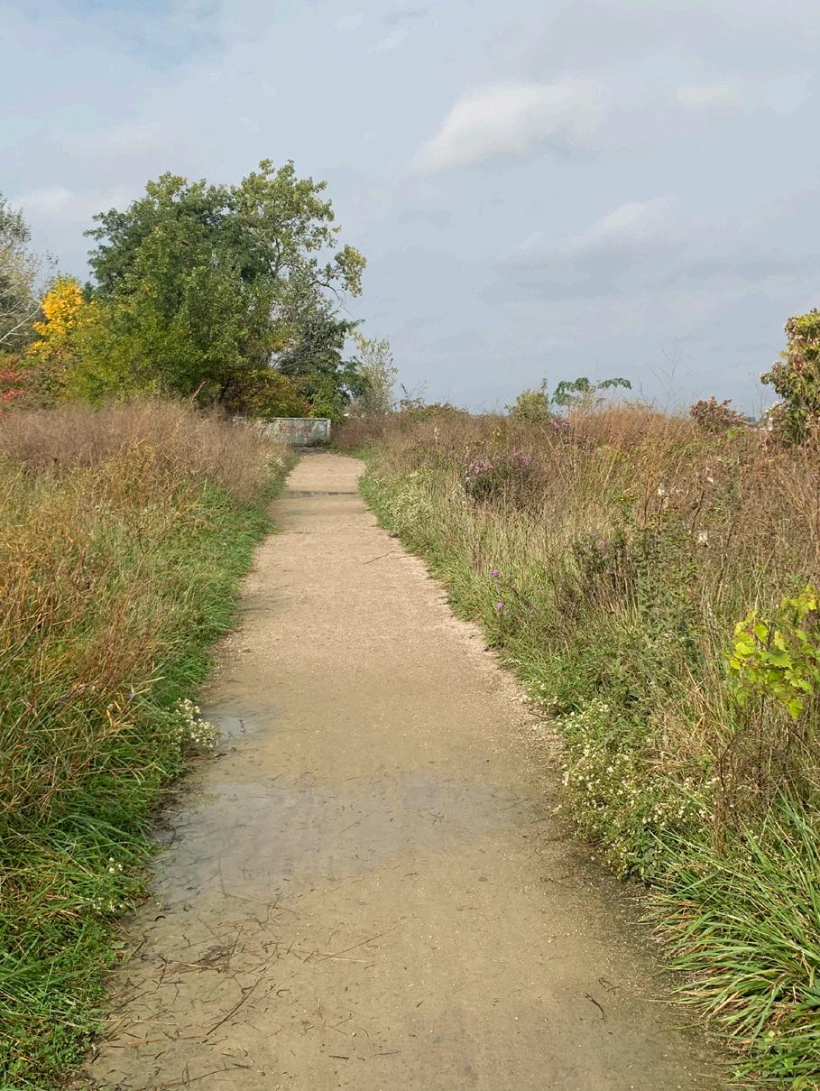
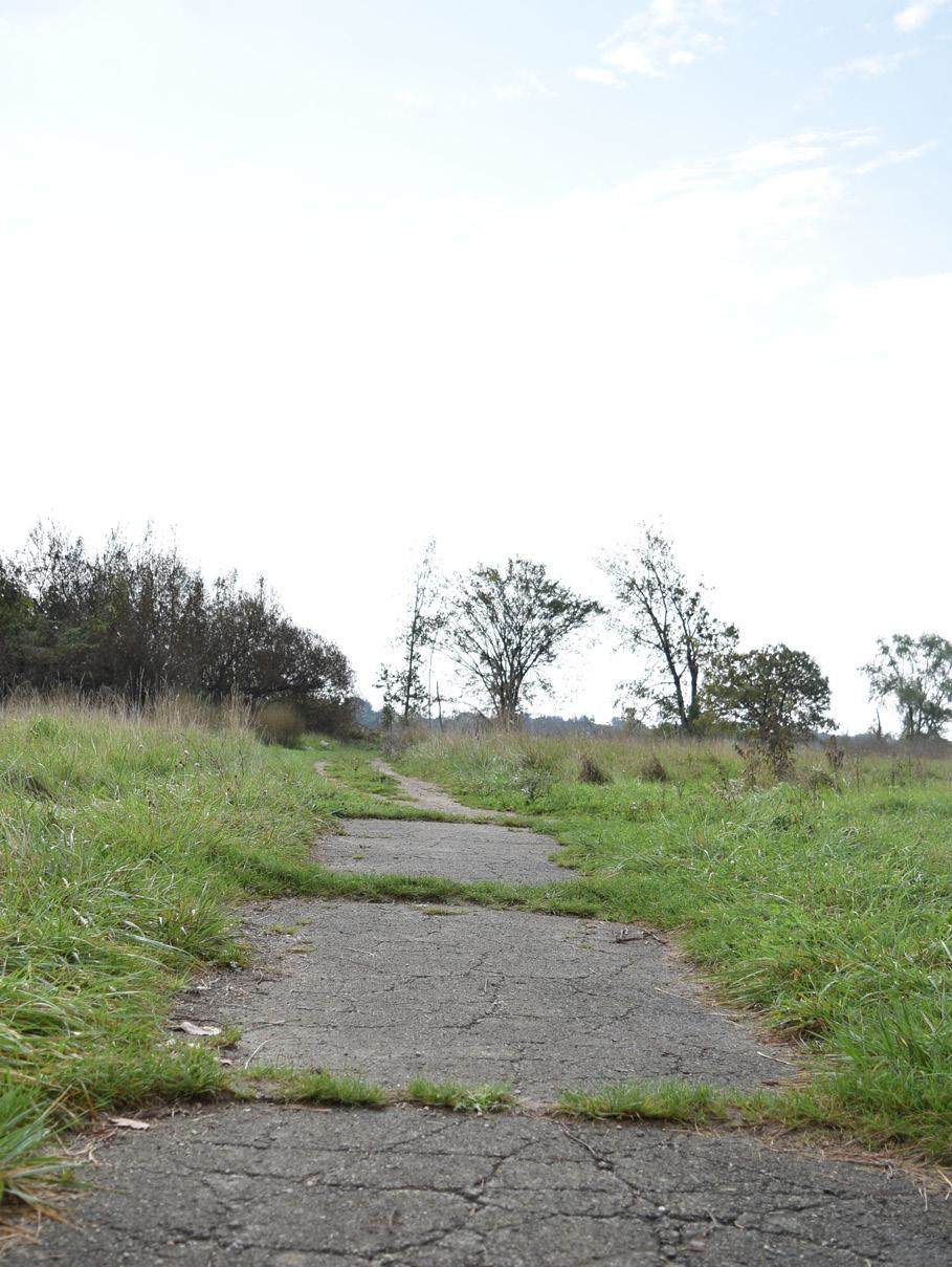
Smaller sections of unpaved trails at the eastern part of the island enabled access to forested areas. Their design vary in material, width, and visibility..
These trails are less accessible than the paved trails as they vary in roughness and become slippery and muddy after rain events. Additionally, these trails are quite isolated from the rest of the island making them difficult to access. However, they offer the best glimpse into some of the unique ecosystems on Belle Isle, its forests and marshes.
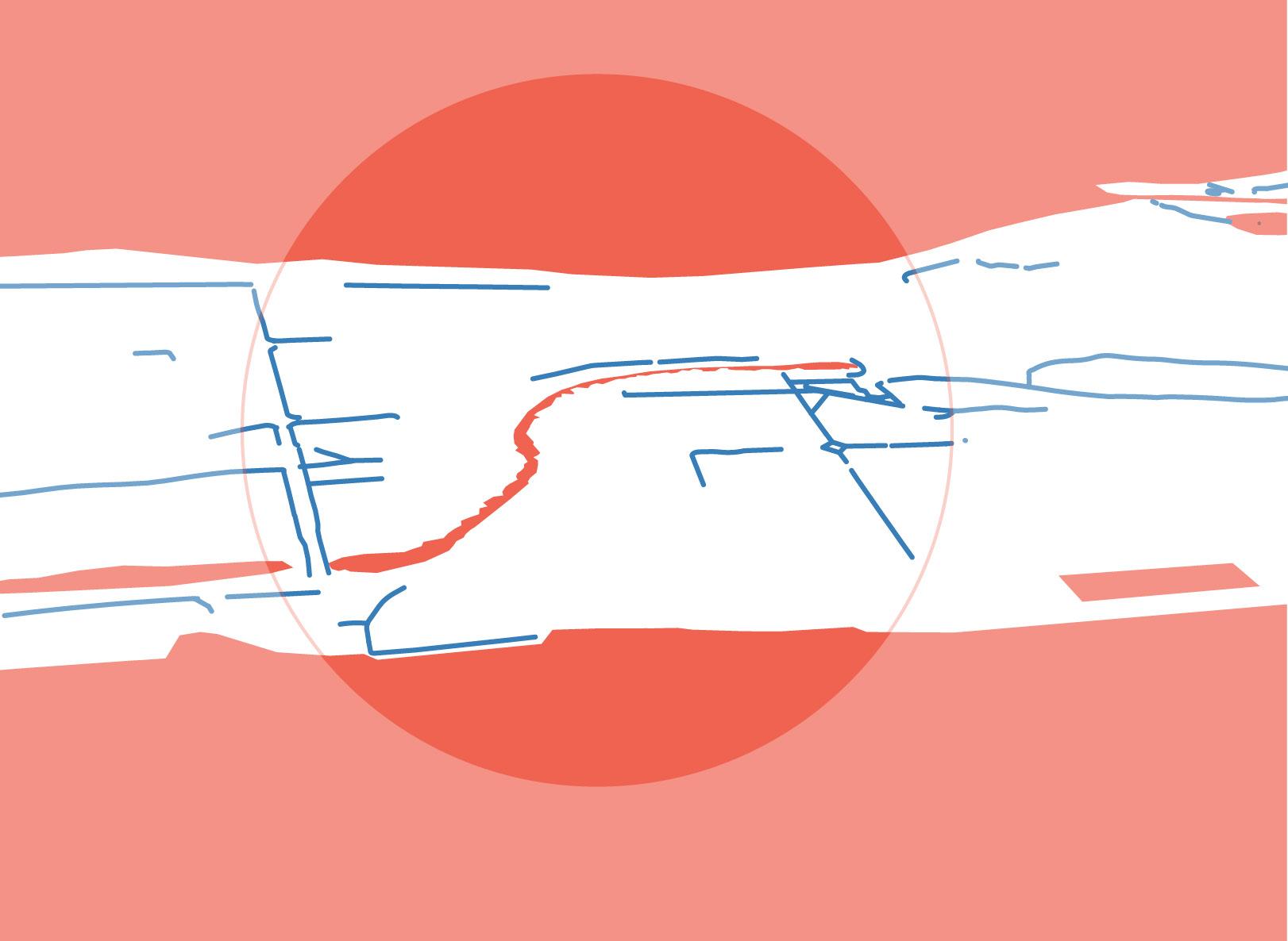
Key: Sidewalks
Crosswalks
1km
put on your walking shoes
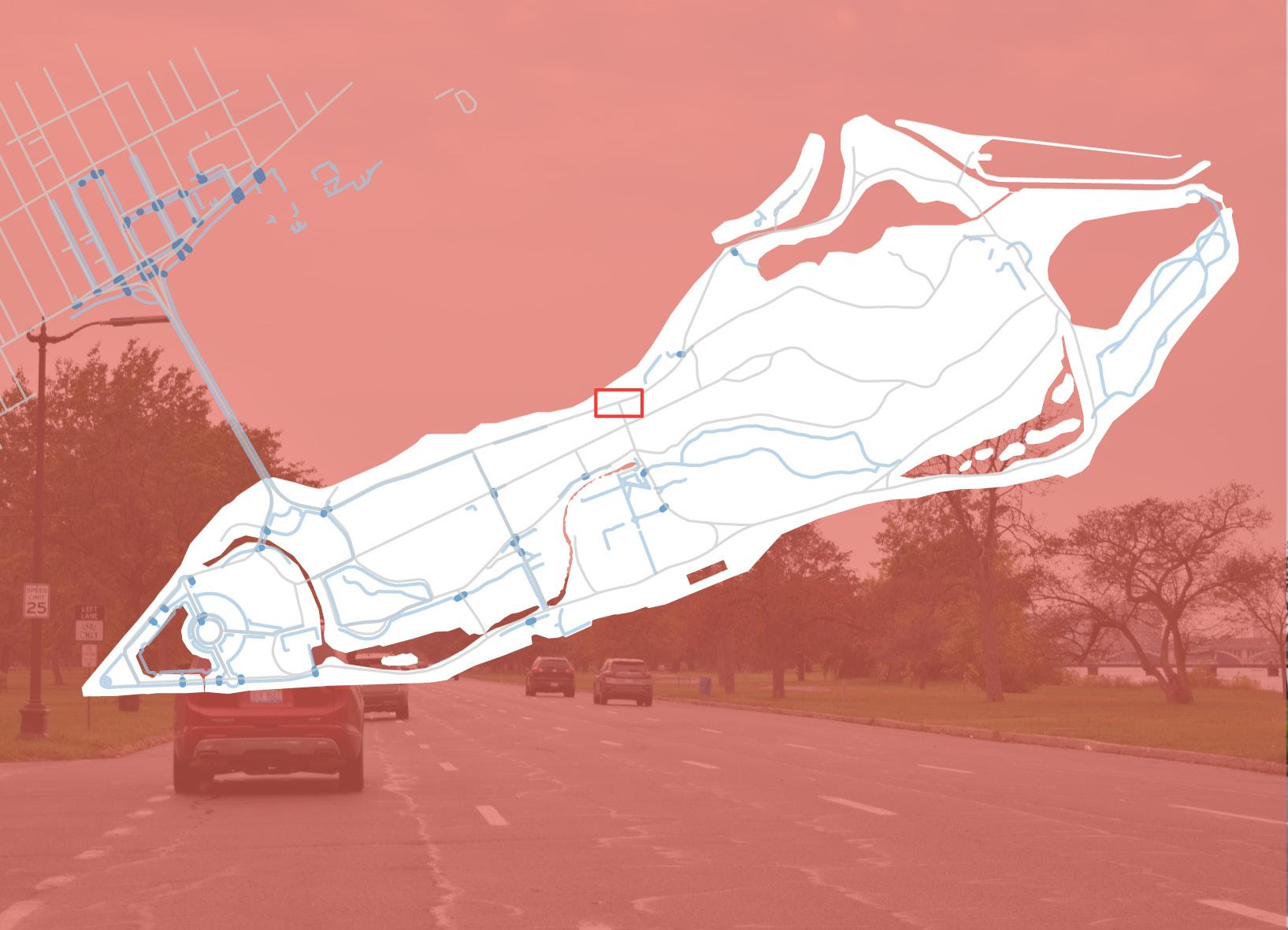
There are many sidewalks found at the western, and middle sections of Belle Isle. On the eastern side of the island, there are fewer sidewalks. Some sidewalks are quite level, while others are damaged and uneven. Sidewalks are often discontinuous and abruptly end.
Damaged and discontinuous sidewalks contribute to uncomfortable and unsafe walking conditions on the island, especially for visitors with especial mobility needs.
Key: Sidewalks
where’s the rest of the sidewalk?
Many of the sidewalks on Belle Isle are incomplete and have frequent gaps. Often, pedestrians are forced to enter the roadway in order to have a paved surface to walk on.
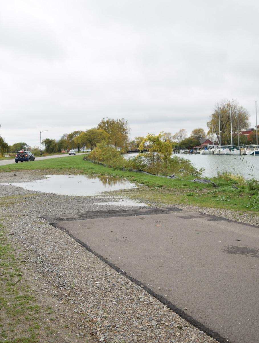
This lack of infrastructure brings up questions of equitable accessibility. People who are differently abled, use mobility devices, or who are pushing children in strollers are disadvantaged when it comes to active modes of getting around the island.
How can you access the whole island without a car?
why did the park-goer cross the road?
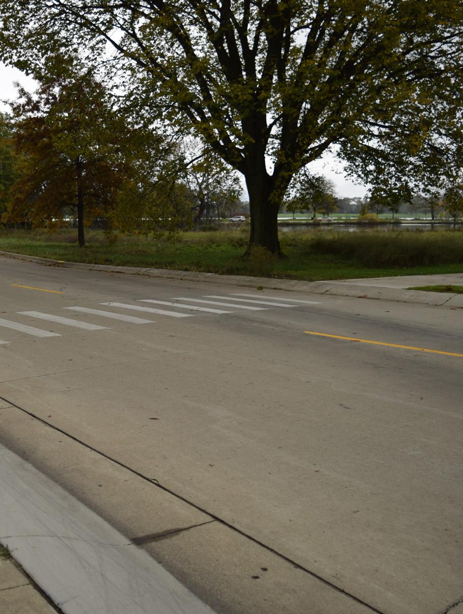
Because there was no cross walk. Currently, there are at least 21 crosswalks on Belle Isle. The majority of these crosswalks are on the western side of the island. There are few crossing areas on Lakeside Drive and Riverbank Drive where traffic moves quickly. Some of the crosswalks that do exist are inadequate or poorly designed. For example, the crosswalk pictured on the upper left near the entrance of the Oudolf Garden does not have ADA accessible ramps. Who does this disadvantage?
where’s the bus?
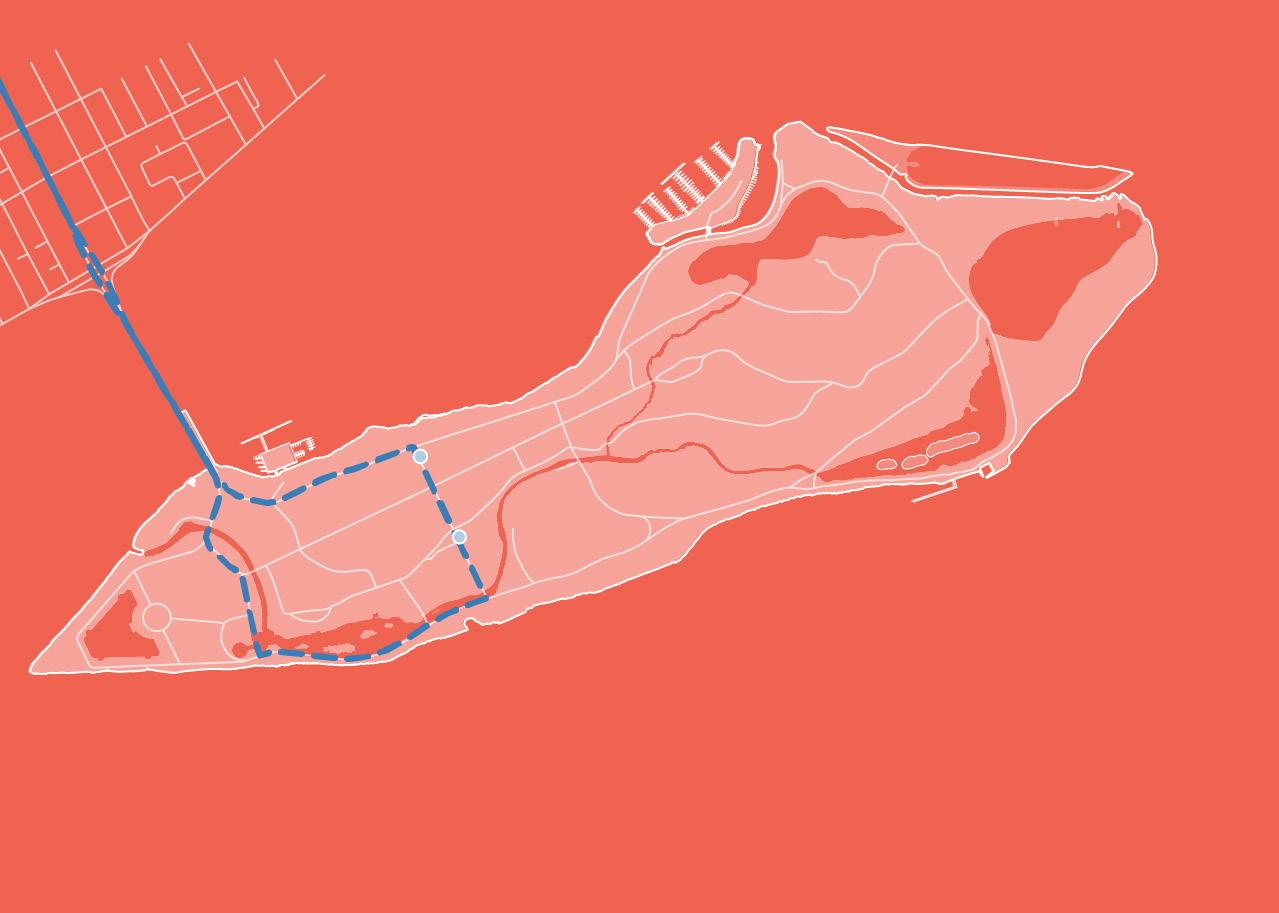
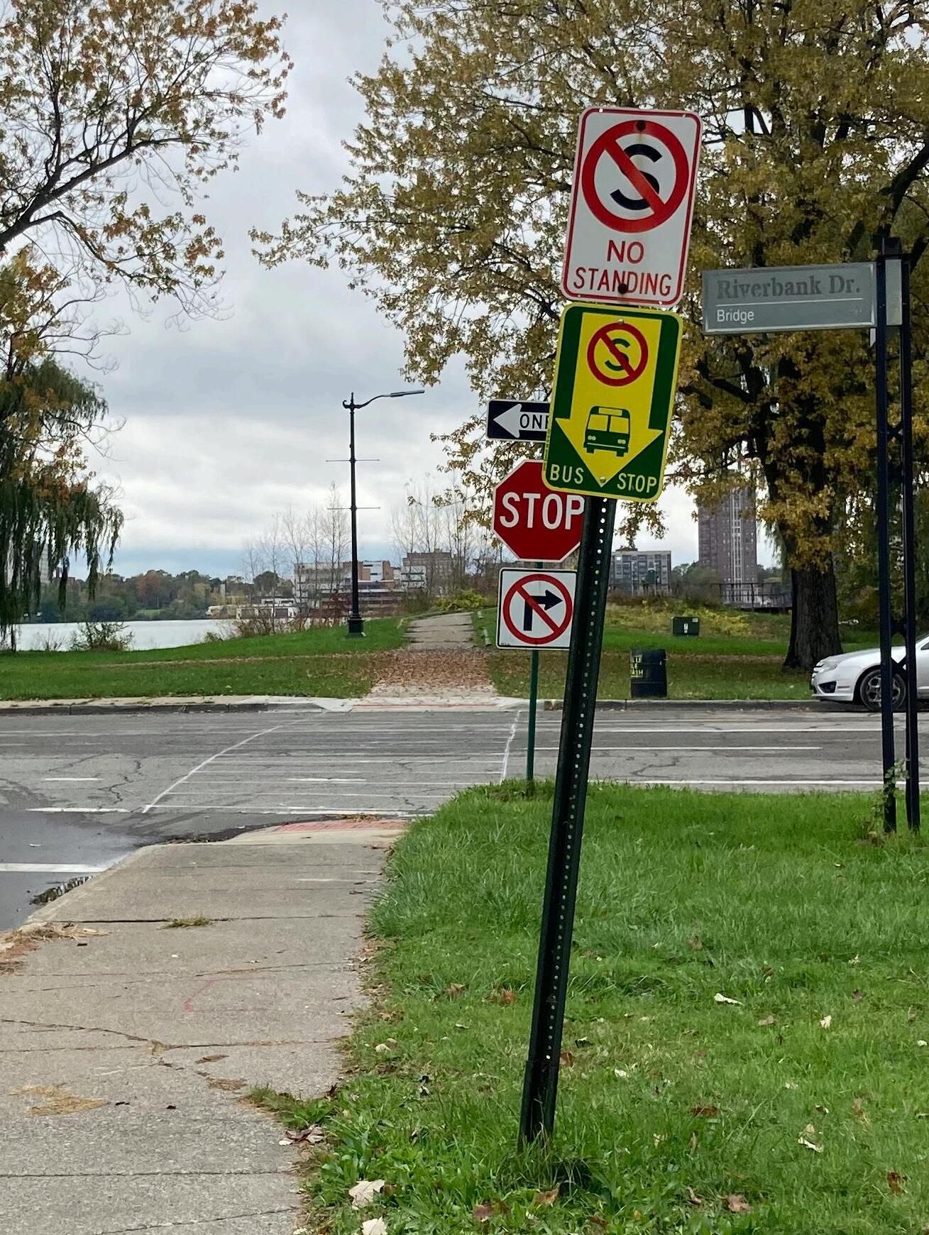
#12 Conant is the only bus line that takes people to and from the island. The current level of public transit service on the island doesn’t provide full access to the park. The two bus stops on Belle Isle are both on the western half of the island and don’t provide service to the nature center or beach area.
This lapse in public service may confine those with limited mobility, or without access to a car to a small portion of the island. This has the potential to exclude lower income folks or individuals who are unable or choose not to drive.
no bus, no car, no way to get there
Years ago, there was a public transit line called the Conant Line that would take riders all over the expanse of the island. Today, this line is defunct and those coming on the bus can only be dropped off near the front section of the island. How can the island be made more accessible to those who do not own a car? Why do those with cars seem to get priority use of the island?
Created by Stone from the Noun Project StonePARKWAYS: BUILT FOR CARS
Key: Poor Pavement Conditions Roads
1km
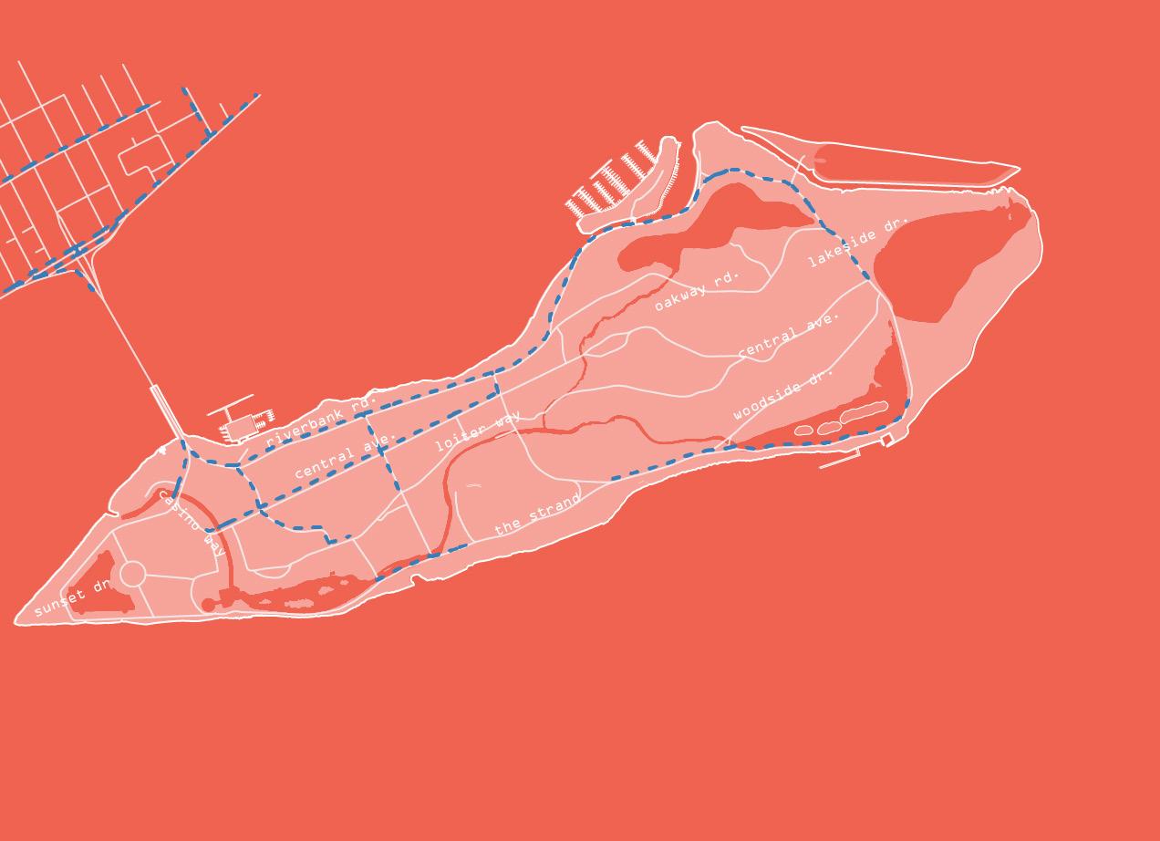
Parkways connect almost most of the areas on the island, and a significant amount of space is built to serve the car, including roadways and parking lots. Their conditions and dimensions vary. Most roads have bike lanes but few have continuous sidewalks which forces both pedestrians and cyclists to share the shoulder of the road. Central Avenue is Belle Isle’s main central southeast-northwest axis. It transverses the civic areas and the wet-mesic forest and features a buffered bike lane.
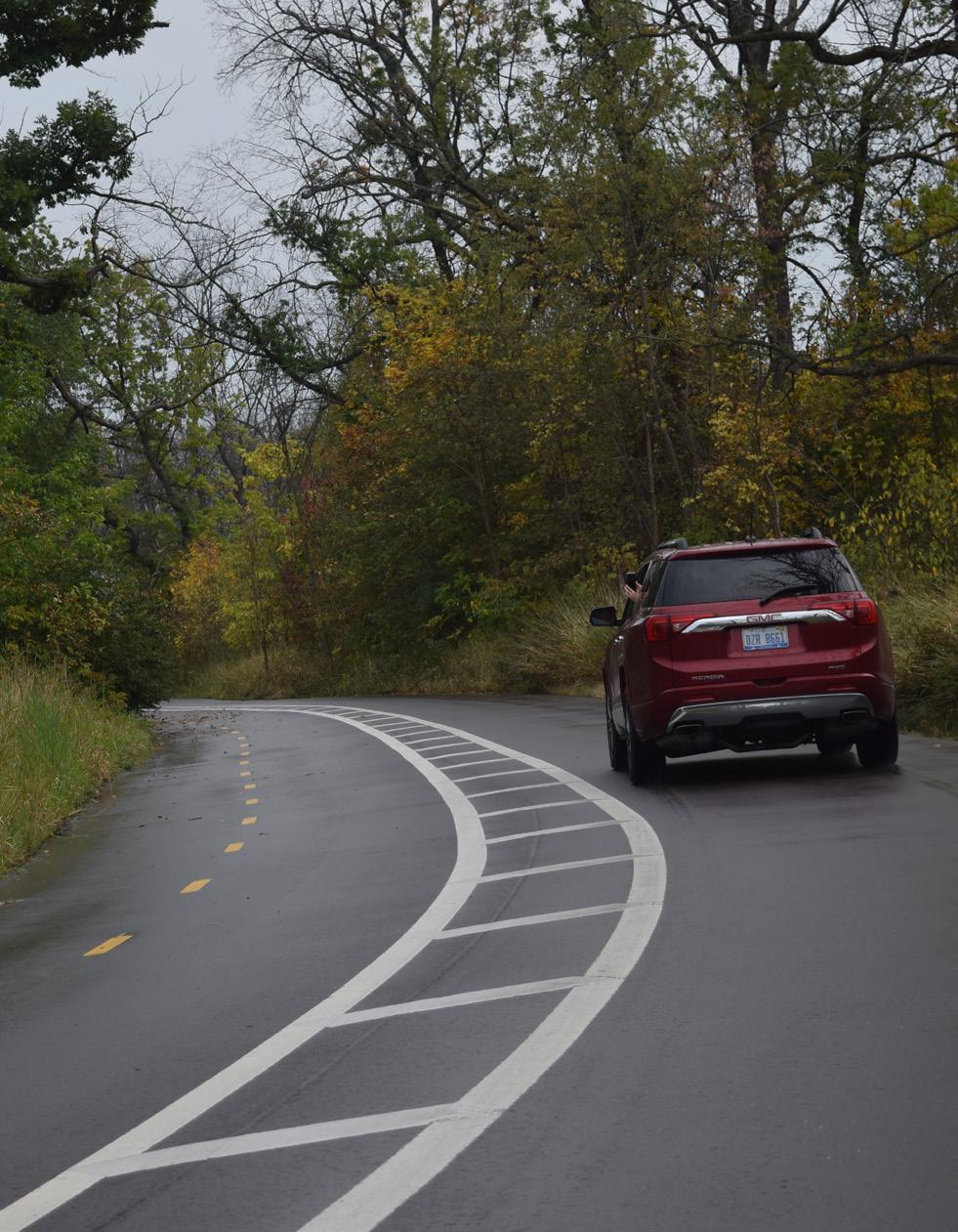
CLOSED ROAD AHEAD
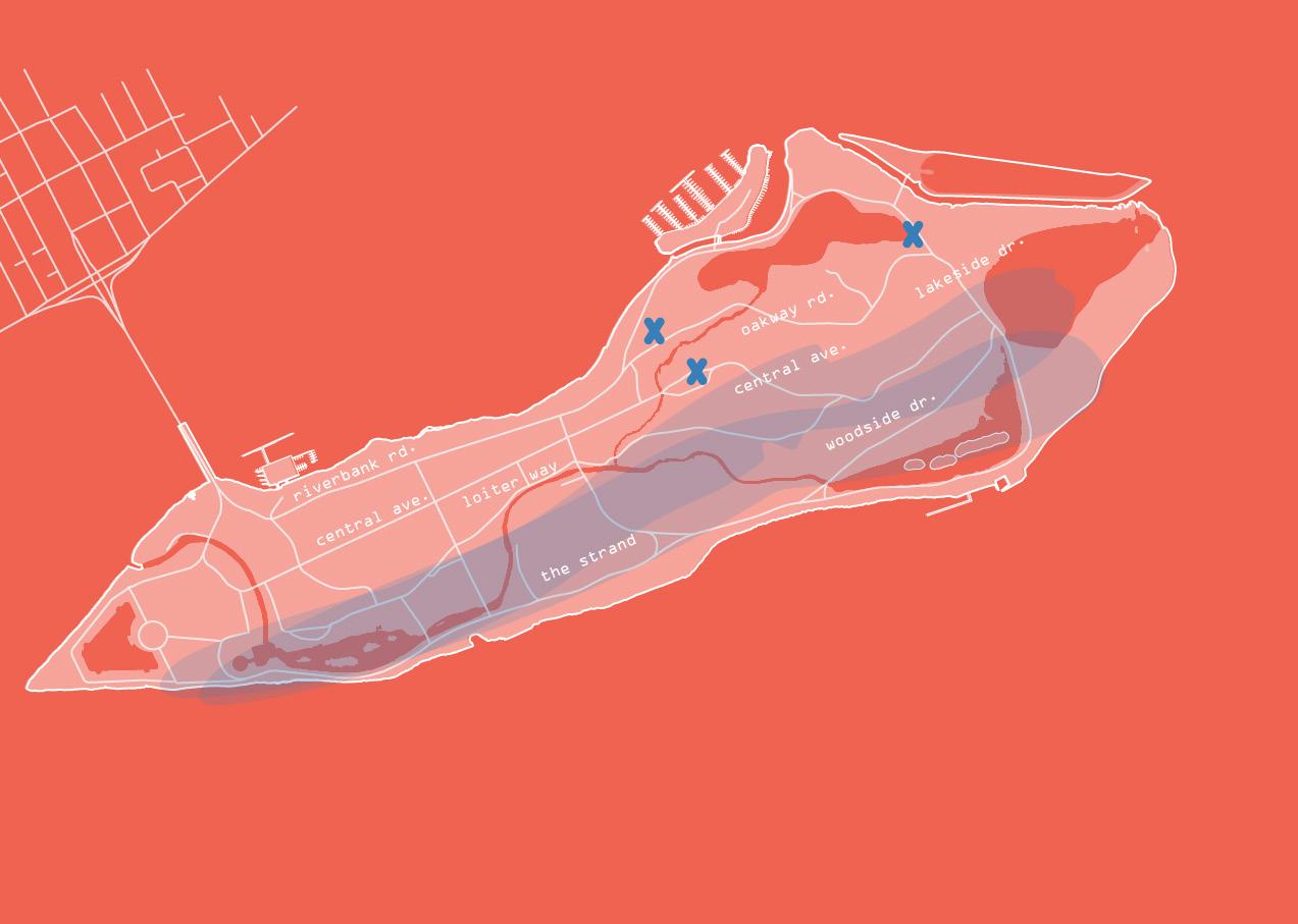
Key: Flooding Areas
Road Closures
1km
shoulda brought a boat
Due to the flat island topography, poor stormwater management, and recent Great Lakes high water levels, roads on Belle Isle are frequently inundated even after only small amounts of rainfall.
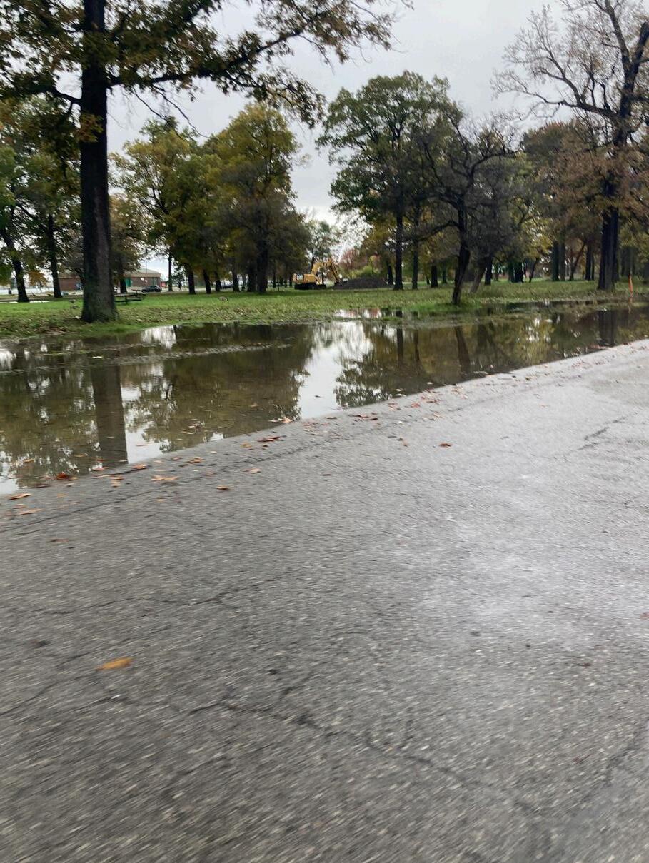
Flooding is especially bad on the eastern side of the island on Woodside Drive, Oakway Road, and Lakeside Drive.
Flooded and closed roads make use of the island unpredictable. Damaged roads and stalled construction can close roads for long periods while rainy weather make roads impassable.
POTABLE WATER
Key: Potable Water Pipes Water Intake
1km

drinking from the river
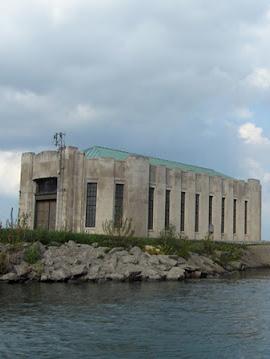
A network of invisible water pipes deliver water to the amenities and buildings and in the island. But the island also holds the entry to a much larger regional infrastructure.
The primary source of potable water for the City of Detroit is located in a long inlet on the northeastern shore of Belle Isle. The intake building takes in raw water from the river and sends it to treatment plants on the mainland before it is redistributed regionally.
Key:
Overflow Events
SEWER + STORMWATER
1km
when it rains it pours
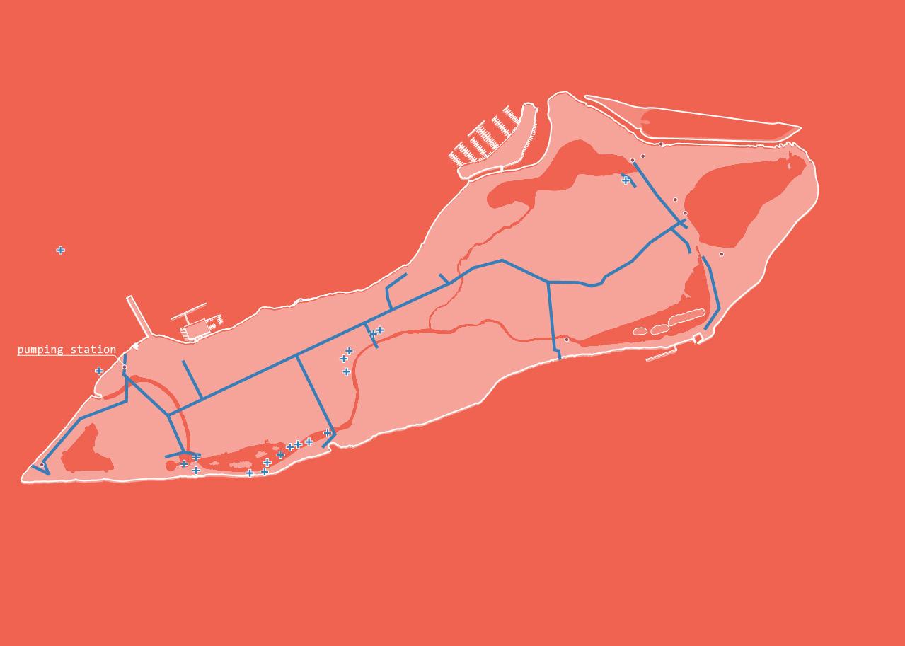
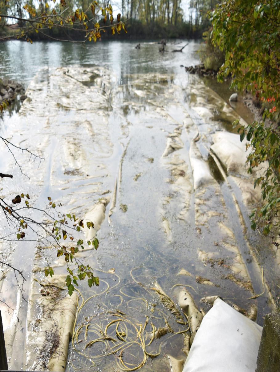
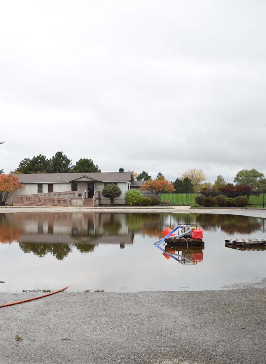
Existing stormwater systems are aging and require costly maintenance and replacement. In 2017 the state began a project to reconnect the island’s interior lakes and canals with the Detroit River with a dual purpose of creating supportive habitats for native species and managing stormwater. However, high water levels in recent years have thwarted the effectiveness of this approach. As an interim solution, the state has invested in a series of temporary pumps and dams (shown right) that can be moved around the island to deal with floods as they arise.
Key:

Sewer + Stormwater Pipes
Flooding Areas
bring your waders
After rain events, picnic areas are often mucky and parking lots (right) can become completely submerged with water. Aside from some mobile pumps, the park is not well equipped to deal with storm water. Resulting in temporary, ad hoc measures being used to control surface flooding.

Too much standing water on the island threatens the wet-mesic forest which houses a unique native ecosystem and provides natural flood control.
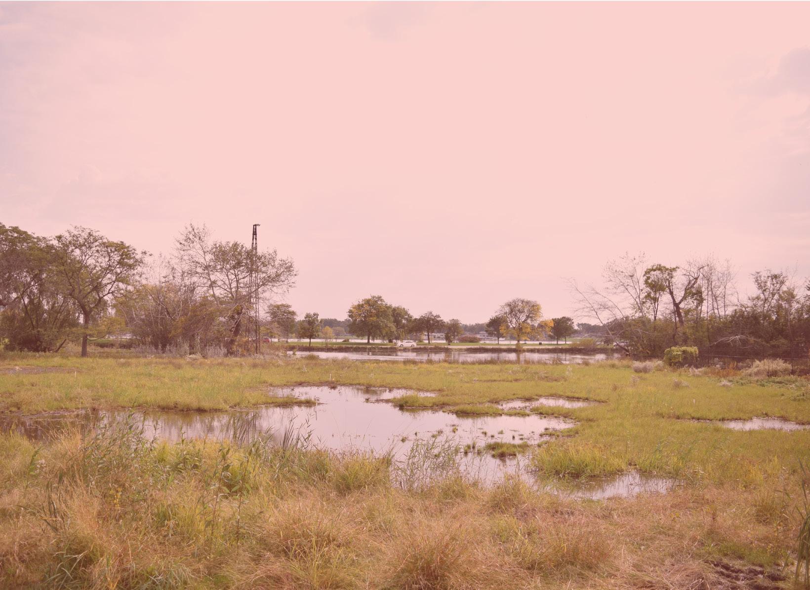
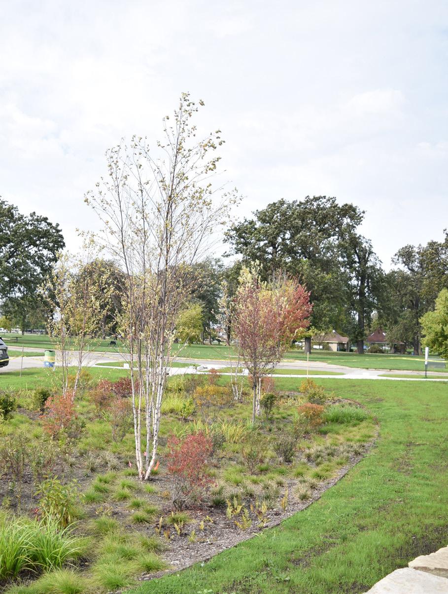
Recent initiatives by the Detroit Water and Sewer Department have encouraged the use of green infrastructure to manage stormwater. At least two instances of this exist on Belle Isle: the newly constructed Oudolf Garden, and a small retention pond in the middle of the island. These features naturally hold rainwater and allow the water to slowly absorb through the soil as opposed to running quickly across impervious surfaces and into storm drains.
