School of Architecture, Urban Planning and Construction Engineering
Laurea Magistrale (MSc.) in Sustainable Architecture and Landscape Design


Laurea Magistrale (MSc.) in Sustainable Architecture and Landscape Design
The case of "Al-Max fishing village, Alexandria, Egypt"
Author: Nancy Morsy Ismail Aly Saleh
Personal code: 10715073
Supervisor: Prof. Nerantzia Julia Tzortzi
Co-supervisor: Ozge Ogut
Academic Year 2021-2022
"I can think of no other edifice constructed by man as altruistic as a lighthouse. They were built only to serve."
- George Bernard Shaw -
To my father up in heaven, who has been a great motive to go through this phase in my life. He passed away two months ago during this process leav ing me with the eagerness to achieve more and land up at what makes him proud.
To my mother who has been my main support through every step of this achievement. Thank you for being the reason to where I am now.
I would like to thank my sister, broth er and all my friends who have been there for me to pass this hard period and go on with this thesis. I would like to send my gratitude to Yasmin for passing this life experience together and being a great company and sup port in each path we go on together since bachelor, we shared new expe riences, achievements and matching goals, thank you for always inspiring me through this life journey.
The greatest thanks goes to my super visor, Professor Nerantzia Julia Tzortzi for being a great mentor to me with her encouragment to get out with the best outcome I can reach. Also to my co-supervisor, Ozge Ogut, for her ap preciable support and assistance.
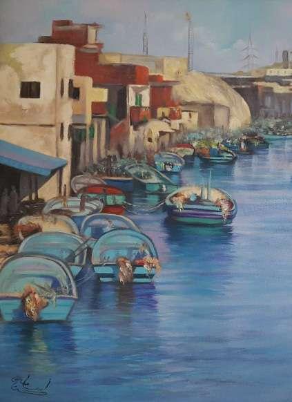 Figure 1: Painting oil on canvas of Al-Max fishing village in Alexandria, Egypt. / Artist: Osama Hassan
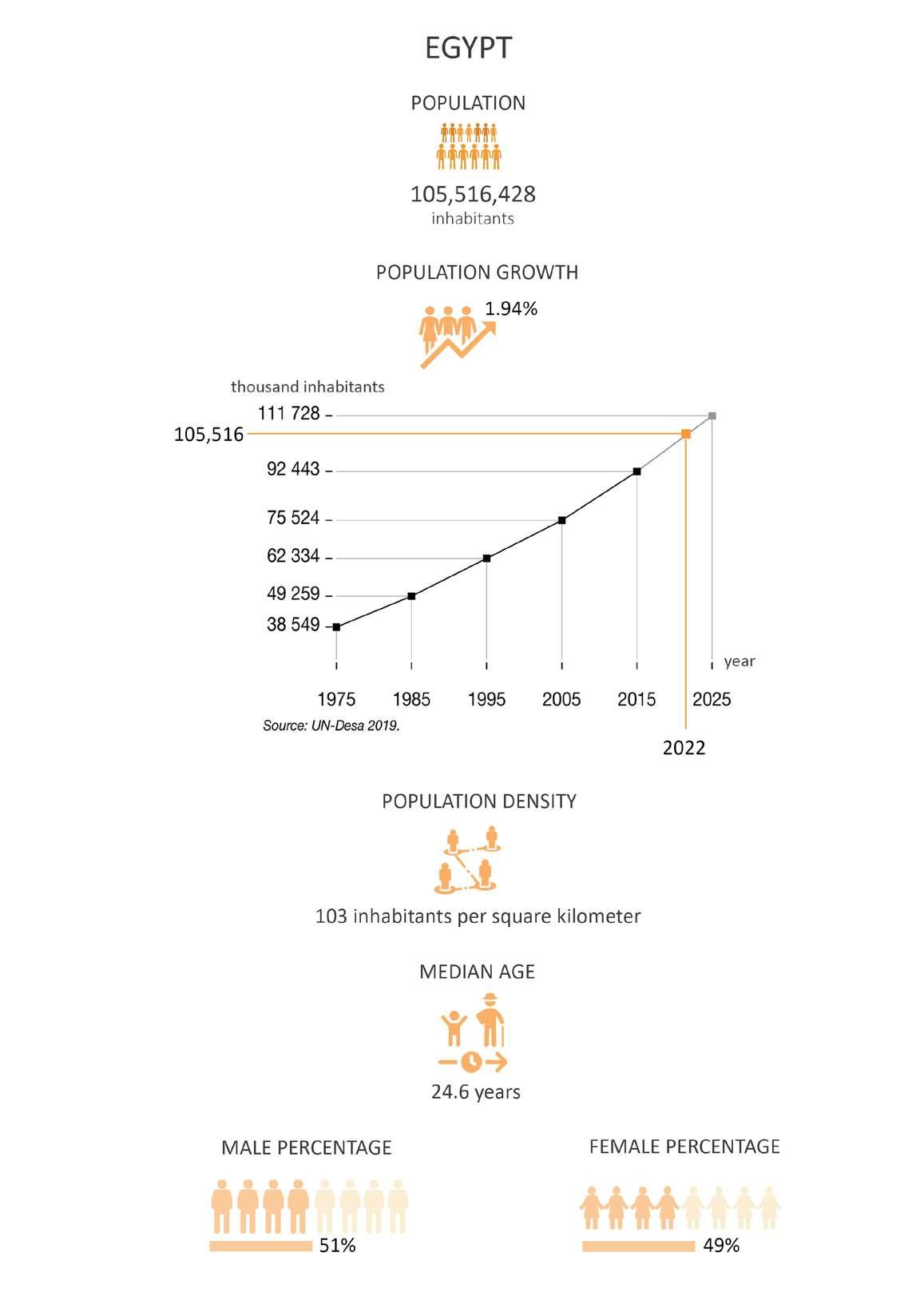
Climate changes and urban growth are two trends that force the world to consider the urban resilience to di sasters in the coming years. Increas ing urbanization, which entails the spatial concentration of people and infrastructure in relatively small ar eas, means increased and concentrat ed exposure of human and econom ic assets to various geophysical and hydro-meteorological environmental hazards. The geography of many ma jor cities around the world—low-ly ing coastal or riverside locations—is another critical factor that increases the likelihood of severe natural disas ter impacts in urban areas. Exposure is driven by the rising concentration of people and assets in high-risk lo cations, as well as the marginalization of the urban poor in particularly dan gerous places. This implies that ca tastrophes are hitting a rising number of city people, with increasingly nega tive effects for jobs, housing, and key infrastructure like roads, power, and water supplies. Risk issues are some times overshadowed by economic or political motives for city growth.
Egypt is in the midst of a historic ca tastrophe, exacerbated by a financial crisis and a fast rising population. Alexandria in Egypt, is mostly built on low-lying locations, it gets about eight inches of rain each year on av erage. Al-Max canal in Alexandria is especially vulnerable because heavy rain overwhelms the city's pumping station, which discharges the over flow into Lake Mariout, which divides the lake from the Mediterranean. The lake lies nine feet below sea level and is connected to the Mediterranean sea by two canals that go through Al exandria. When water is thrown into the lake, water levels in the canals vary, posing a threat to the Al-Max fishing village (the banks of the other canal were largely unoccupied). This research studies the problems and vulnerability of the Al-Max village to the floods and sea level rise and how to follow Nature Based Solutions and Green infrastructure to manage the upcoming flood events in the area.
Nature Based Solutions, Urban Re generation, Identity Revitalization, Ecological Restoration, Resettlement Action Plan, Informal Settlements, Re
location, Disaster risk in urban areas, Sustainable Development, Sustainable Urbanism, Culture and Heritage Pres ervation.
I cambiamenti climatici e la cresci ta urbana sono due tendenze che costringono il mondo a considerare la resilienza urbana ai disastri nei pros simi anni. La crescente urbanizzazi one, che comporta la concentrazione spaziale di persone e infrastrutture in aree relativamente piccole, significa un'esposizione maggiore e concentra ta delle risorse umane ed economiche a vari rischi ambientali geofisici e idro meteorologici. La geografia di molte grandi città del mondo, località cos tiere o lungo il fiume, è un altro fat tore critico che aumenta la probabil ità di gravi disastri naturali nelle aree urbane. L'esposizione è determinata dalla crescente concentrazione di per sone e beni in luoghi ad alto rischio, nonché dall'emarginazione dei pov eri urbani in luoghi particolarmente pericolosi. Ciò implica che le catastro fi stanno colpendo un numero cres cente di cittadini, con effetti sempre più negativi su posti di lavoro, alloggi e infrastrutture chiave come strade, elettricità e forniture idriche. I prob lemi di rischio sono talvolta oscurati da motivi economici o politici per la crescita della città.
L'Egitto è nel mezzo di una catastrofe storica, esacerbata da una crisi finan ziaria e da una popolazione in rapido aumento. Alessandria d'Egitto, è per lo più costruita in luoghi bassi, riceve in media circa otto pollici di pioggia ogni anno. Il canale Al-Max ad Alessandria è particolarmente vulnerabile perché forti piogge travolgono la stazione di pompaggio della città, che scarica lo straripamento nel lago Mariout, che divide il lago dal Mediterraneo. Il lago si trova a nove piedi sotto il livello del mare ed è collegato al Mar Mediter raneo da due canali che attraversano Alessandria. Quando l'acqua viene gettata nel lago, il livello dell'acqua nei canali varia, rappresentando una minaccia per il villaggio di pescatori di Al-Max (le rive dell'altro canale erano in gran parte vuote). Questa ricerca studia i problemi e la vulnerabilità del villaggio di Al-Max alle inondazioni e all'innalzamento del livello del mare e come seguire le soluzioni basate sul la natura e le infrastrutture verdi per gestire i prossimi eventi alluvionali nell'area.
Soluzioni basate sulla natura, rigen erazione urbana, rivitalizzazione dell'identità, ripristino ecologico, pi ano d'azione per il reinsediamento, insediamenti informali, trasferimen
to, rischio di catastrofi nelle aree ur bane, sviluppo sostenibile, urbanistica sostenibile, conservazione della cultu ra e del patrimonio.
1.1. Research Background . . . . . . . . . . . . . . . . . . xvi
1.1.1. Regenerative Heritage . . . . . . . . . . . . . . . . . . . 10
1.1.2. Nature-Based Solutions (NBS) for Urban Resilience . . . 12
1.1.3. Resettlement Action Plan (RAP) . . . . . . . . . . . . . . 14
1.2. Reseach Methodology . . . . . . . . . . . . . . . . . . 16
1.2.1. Research Question: How can "Nature Based Solutions" be integrated to Blue-Green-Grey infrastructure for Urban resil ience strategies? . . . . . . . . . . . . . . . . . . . . . . . . . 16
1.2.2. Aims and Objectives . . . . . . . . . . . . . . . . . . . . 17
1.2.2. Materials and methods . . . . . . . . . . . . . . . . . . 18
1.2.3. Research workflow . . . . . . . . . . . . . . . . . . . . . 20
� � � � � � � � � � � � � � � � 23
2.1. Identity of a Place . . . . . . . . . . . . . . . . . . . . 24
2.1.1. Analogous concept of a city . . . . . . . . . . . . . . . . 25
2.1.2. Alexandria, the city of Lighthouses . . . . . . . . . . . . 26
2.2. Natural Disasters and vulnerability . . . . . . . . . . . 36
2.2.1. Natural disasters in Egypt . . . . . . . . . . . . . . . . . 37
2.2.2. Sea Level Rise (SLR) and Flash Floods in Alexandria . . . 38
2.3. Informal Settlements and Vulnerability . . . . . . . . . 42
2.3.1. Disaster risk in informal settlements . . . . . . . . . . . 43
2.3.2. Urban development and disaster risk . . . . . . . . . . . 43
2.3.3. The case of Al-max village in Alexandria, Egypt 44
3.1. Site Location
55
. . . . . . . . . . . . . . . . . . . . . . . 56
3.1.1. Site Projection . . . . . . . . . . . . . . . . . . . . . . . 58
3.2. Site Analysis . . . . . . . . . . . . . . . . . . . . . . . . 60
3.2.1. Metropolitan Scale Analysis 62
3.2.2. Municipality Scale Analysis 68
3.2.2. Urban Scale Analysis . . . . . . . . . . . . . . . . . . . . 74
3.2.4. Neighborhood Scale Analysis . . . . . . . . . . . . . . 104
3.3. SWOT Analysis . . . . . . . . . . . . . . . . . . . . . 156
3.4. Problem Statement . . . . . . . . . . . . . . . . . . . 158
173
4.1. Design Approach . . . . . . . . . . . . . . . . . . . . 174
4.1.1. Ecosystem-Based Approaches . . . . . . . . . . . . . . 176
4.1.2. Resilience Challenges, Scope and Potential . . . . . . 178
4.2. Nature Based Solutions Approaches . . . . . . . . . 181
. . . . . . . . . 208
4.3.1. River basin-Delta Scale Solutions . . . . . . . . . . . . 210
4.3.2. Neighborhood Scale Solutions . . . . . . . . . . . . . . 214
4.3.3. Building Scale Solutions . . . . . . . . . . . . . . . . . 218
4.4. Sensory Experience . . . . . . . . . . . . . . . . . . . 220
4.5. Landscape Aesthetics . . . . . . . . . . . . . . . . . 222
4.5.1. Societal benefits 224
4.5.1. Ethnobotanical recommendations . . . . . . . . . . . 226
4.5.2. Materials and Shades Palette . . . . . . . . . . . . . . 228
�
� 231
5.1. Master Plan . . . . . . . . . . . . . . . . . . . . . . . 232
5.2. Landscape Parcels . . . . . . . . . . . . . . . . . . . 234
5.2.1. Fishing Village and Wetland Park . . . . . . . . . . . . 236 5.2.2. Flea Market and Coastal Waterfront . . . . . . . . . . 242
5.2.3. Canal Waterfront . . . . . . . . . . . . . . . . . . . . . 250
5.2.4. Historical Center and Wadi Al-Qamar Dwellings . . . . 258
5.2.5. Lake Mariout Waterfront and Rain Garden . . . . . . . 266
275
1.1.1. Regenerative Heritage
1.1.2. Nature-Based Solutions (NBS) for Urban Resilience
1.1.3. Resettlement Action Plan (RAP)
1.2.1. Research Question: How can "Nature Based Solutions" be integrated to Blue-Green-Grey infra structure for Urban resilience strategies?
1.2.2. Aims and Objectives
1.2.3. Materials and Methods
1.2.4. Research Workflow
Informal settlements have become a constant issue, with severe environ mental consequences. People and the land they occupy are exposed and vul nerable to environmental risks when they live in informal settlements. Lack of essential facilities, pollution, over population, and inadequate waste management define informal com munities. These traits have a detri mental influence on the environment, increasing the likelihood of health is sues linked with informal settlements. [Skidmore, M.; Lim, J; 2020]
Much of urbanization in poor and middle-income nations has tradition ally been accomplished through in formal land acquisition, construction, and infrastructure supply. Low wages and significant exposure to environ mental risks are commonly connected with urban informality.
Aside from the living circumstances in informal settlements, the concept of informal settlements being self-built by people and utilizing temporary materials has its own environmental impact. Service delivery is difficult for those living in informal settlements. This is mostly due to unlawful land occupation, which has had a harm ful influence on the ecology. Informal settlements have an environmental effect due to a lack of fundamental necessities and services. This includes poor sanitation, which exposes resi dents to pollutants, as well as the use of coal and biomass fuels for lighting, which pollute the air and contribute to greenhouse gas emissions. Waste disposal is a problem that informal settlers face, and it leads to soil con tamination and the emergence and reemergence of infectious disease threats. [Skidmore, M.; Lim, J; 2020]
By losing the natural and cultural identity of the place there should be a Regenerative Heritage program that drives us to following the Nature Based Solutions (NBS) and Resettlement Action Plan (RAP) as two fun damental approaches to working with Disaster Management measures.
In poor nations, nature-based solu tions, also known as gray infrastruc ture, that purposefully preserve or restore nature to support systems of traditionally built infrastructure can lessen the risk of disaster and result in more robust and affordable services.
Consequently, Nature based solutions can be integrated into broader pro grams, such as resettlement actions and risk management plans through plans for designs of structural mea sures, proactive urban and land use
planning, evacuation management, and sustainable maintenance.
This research studies the case of AlMax fishing village in Alexandria, Egypt. Alexandria is mostly built on low-lying locations. Sea levels are ex pected to rise by as much as two feet by 2050. Al-Max village was one of the mostly covered areas in Alexan dria during the flash flood in 2015; this research will study the area con ditions and future scenarios to be ap plied by nature based solutions while integrating regenerative heritage to regenerate the ebandoned historical lighthouses as well as a resettlement action plan for the local residents post the government action in destructing their homes after the flash flood that threatened their lives as well as the pollution coming from the industrial wastes that threatened their health.
Emotional and psychological interac tions between people and places are essential to maintain heritage tour ism until the sites are no longer only a geographical formation's identity. People's favorable perceptions reflect contentment, which is heavily impact ed by the image of a city. The picture conveys the location's personality and soul. Place identity plays an important part in defining the image of a place, and uniqueness is one component of it. Using variable elements such as landmark, uniqueness, special char acter, and diverse perceptions, this re search intends to examine the distinc tiveness feature and its implications in determining place identity of urban historic area. It concentrates on the Al-Max Area in Alexandria's old coast al city, which was chosen because of its historical significance in establish ing coastal city monuments and the presence of historic structures fir it's mainly valuable lighthouses which is underrated now for it's been off aban dondoned for quite a long time.
This research contributes to the defi nition of place identity, which may be utilized as a metric for future planning and assessment. It will help to secure place identity and boost urban heri tage tourism, which will enhance peo ple's lives. The finding suggests that the presence of heritage buildings as a landmark enables people to have a special connection to the study area. However, there is room for develop ment in terms of the variety of attrac
tive cultural activities, local products, and public amenities.
A profound awareness of our current legacy as living buildings is required to grasp a regenerative, sustainable future for our built environment. Our living historical buildings bring us back to the past while also teaching us lessons for the future. PRESERVATION, RESTORATION , RECONSTRUCTION, REUSE, and RE-VITALIZATION , as discussed in this article, are critical measures to ensure that our living legacy retains its cultural richness while assuring an environ mentally sound and socially equitable future.
Heritage represents the history, tra ditions, environment and historic buildings of a country or area, seen as something to be passed on in good condition to future generations [Bateman et al., 2005].
The term heritage is usually associated with unique natural features and ar eas, as well as buildings of significant historical and/or architectural value. However, in the recent period even industrial buildings, often associated with workers’ settlements, have been largely observed as heritage. Hence, the process of selection of historical elements that will be represented as heritage is always related to CONSTRUCTION, RECONSTRUCTION AND DECONSTRUCTION of memory and identity [McDowell, 2008].
The concept of RE-USE is at the start of the theoretical approach to sus tainability and cultural assets. To be gin with, not every corner can be an urbanized territory since this contra dicts present urbanization theories, which state that by 2050, 80 percent of the world's population would be concentrated in cities. The result will be congestion and a scarcity of pro ductive land. In this approach, re-use of buildings is important.
RE-VITALIZATION is another valuable theoretical concept. Mainly, the ad dition of certain new purposes and activities within the old heritage site would provide the region a new di mension in terms of public realm, space, and social life. With SUSTAINABILITY, it means revitalization and readapting, the use of flexible and en vironmentally friendly materials in the process of providing these historically
significant regions of the city the ap propriate image and role. The urban architecture, mobility, and scenery of abandoned sites are all significant as pects of sustainability. In terms of sus tainability and conservation, there are several good and efficient examples.
REGENERATIVE HERITAGE is a subor dinate strategy based on restorative or regenerative sustainability. The goal is to move away from standard ized solutions and toward regionally, culturally, and ecologically integrat ed constructed environments, which will go beyond existing standards for avoiding negative consequences. RE STORATIVE SUSTAINABILITY aims to restore social and ecological systems' capability, whereas REGENERATIVE SUSTAINABILITY is envisioned as a future stage in which social and eco logical systems are able to renew and evolve continually. [Ginting, N.; Wahid, J.,2017]
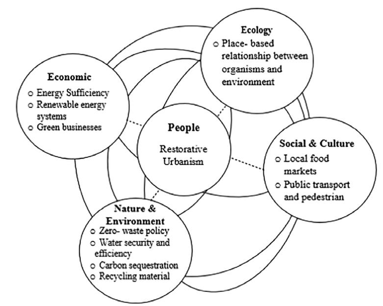
Restorative Urbanism
+ Place-based rela tionship between organisms and envi ronment
+ Local Food Markets
Public transport and pedestrian
Zero-waste
Water secturity and efficiency
Carbon sequestration
Recycling material
Figure 2: Proposal of regenerative circular model for managing urban heritage sites- Source: The authors.. / Source: Regenerative urban heritage model: Scoping review of paradigms’ progression.
Nature-based solutions are approach es that use nature and natural pro cesses for delivering infrastructure, services, and integrative solutions to meet the rising challenge of urban re silience.
In poor nations,nature-based solu tions,also known as gray infrastruc ture, that purposefully preserve or restorenaturetosupportsystemsof traditionally built infrastructure can lessen the risk of disaster and result in more robust and affordable services. NBS may be used as green infrastructure methods that complement gray infrastructure in the disaster risk management (DRM) and water security sectors. In ways that gray infrastructure systems alone cannot, NBS may boost community well-being, produce advantages for the environ ment, and advance the Sustainable
Development Goals (SDGs). While NBS methodologies haven't yet been completely incorporated into deci sion-making or forced to drive signif icant investment in poor nations, this is about to change.
Nature based solutions use a set of structural and non-structural inter ventions that protect, manage, re store, or create natural or naturebased features. Alongside other benefits, NBS can reduce the impact of natu ral hazards in cities, such as flooding, erosion, landslides, drought, and ex treme heat [Ozment et al. 2019; Sud meier-Rieux et al. 2021]. They can also complement gray infrastructure such as storm drains, embankments, and retaining walls. In many cases, integration of NBS has proven to be cost-effective [Raymond et al. 2017].
Social resilience
Economic. Political, Social Factors
Increase Decrease
Ecological resilience Social vulnerability Ecological vulnerability
Healthy ecosystems Ecosystem loss and degradation Economic. Political, Social Factors
Sustainable use Conservation Restoration
Human activities Natural Hazards Climate change
Figure 3: Resilience to disasters and climate change effect. / Credit: Author.
Figure 4: Resilience sustainable strategy. / Credit: Author.
A Resettlement Action Plan (RAP) is a document written by the sponsor or other parties in charge of resettle ment, such as government agencies, that outlines the processes and mea sures that will be taken to properly relocate and compensate impacted persons and communities.
Urban resettlement: Physical and economic displacement are common outcomes of relocation in urban or periurban contexts, impacting hous ing, employment, and businesses. Restoration of wage-based or enter prise-based livelihoods that are typi cally related to place is a key difficul ty associated with urban relocation (such as proximity to jobs, customers, and markets). Resettlement locations should be chosen to keep impacted individuals close to existing sources of employment and income, as well as to preserve community networks. Because of the movement of urban populations and the resulting erosion of social safety nets in rural areas, re settlement planners must pay special attention to the requirements of vul nerable groups in some circumstanc es.
Physical displacement: People being physically relocated, resulting in a loss of shelter, productive assets, or access to productive assets such as land, wa ter, and forests.
Any project that involves the physical removal of people requires a reset tlement action plan (RAP). Depend
ing on the complexity of the project and the degree of its consequences, the breadth and level of detail of relo cation planning will vary. A RAP must ensure that the livelihoods of persons affected by the project are returned to levels that existed prior to the proj ect's beginning. However, basic liveli hood restoration may not be enough to protect impacted communities from negative project consequences, particularly induced effects like rival ry for resources and jobs, inflation, and the dissolution of social support networks. As a result, the living con ditions of those touched by the initia tive will improve. As a consequence, resettlement initiatives should lead to verifiable gains in the economic and social well-being of those impacted. A recommended approach to effec tive RAP preparation.The essential components of a RAP are the identi fication of project impacts and affect ed populations; a legal framework for land acquisition and compensation; a compensation framework; a descrip tion of resettlement assistance and restoration of livelihood activities; a detailed budget; an implementation schedule; a description of organiza tional responsibilities; a framework for public consultation, participation, and development planning; a description of provisions for redress of grievanc es; and a framework for monitoring, evaluation, and reporting. [Handbook for Preparing a Resettlement Action Plan; 2002]
1. Stakeholder Engagement
2. Identifying project im pacts and project affect ed people
3. Baseline studies (in cluding host community)
4. Census of all affected households and confir mation of eligibility
5. Inventory of assets and compensation
6. Site selection
7. Developing livelihood restoration strategies
8. Implementation of the resettlement
9. Grievance procedure
10. Monitoring
Figure 5: Key tasks for RAP. / Credit: Author.
Nature-based solutions aimed to in crease urban resilience are often most effective when approached and planned in an integrated or holistic manner, especially in complex urban environments. This means first taking a system-based approach to address resilience and biodiversity challenges, and then, seeking practical ways to integrate NBS into policies plans, pro grams, and projects.
Taking an integrated systems ap proach also means that NBS should not be designed independently, but rather to complement and strength en existing risk management inter ventions. NBS can, for example, aug ment and complement existing gray infrastructure, gradually increasing the overall capacity of the system, and its efficacy and efficiency on risk reduction and co-benefits to the ur ban landscape. Such integration is not only necessary at a system level, but should also be considered at a local scale where hybrid solutions—a com bination of nature-based features and gray infrastructure elements—may provide the most efficient solution.
Consequently, NBS can be integrated into broader programs, such as reset tlement actions and risk management plans through plans for designs of structural measures, proactive urban and land use planning, evacuation management, and sustainable main tenance.
As most NBS are multifunctional, they can perform a variety of functions at different scales, and respond to sever al resilience demands, such as manag ing flooding and extreme heat effects, at different times. For example, the same NBS implemented as part of a larger systems approach can retain, filter, and convey water protecting cities from floods as well as droughts. A hilly area with loose soils, debilitat ed from water damage and erosion, can benefit from an appropriately de signed slope stabilizing NBS, while at the same time retaining runoff and conveying water down to the areas where it is needed [Jha et al. 2012].
Nature based solutions can function as an optimum approach to a regen erative heritage and a resettlement action plan. The urban landscape is an interconnected system. The built environment functions as a system that modifies the local hydrology and climate, and hence, influences the frequency and intensity of hydrome teorological natural hazards. At the same time, the built environment can often hinder large-scale NBS because of space constraints. Critical consider ations can be defined that enable the integration of NBS in the urban land scape. One enlightened approach, for example, would be that project de velopers and planners follow an ap proach of "green where possible, gray when needed".
1.2.1. Research Question: How can "Nature Based Solutions" be integrated to Blue-Green-Grey infrastructure for Ur ban resilience strategies?
The research studies the impact of natural disasters, mainly flash floods and climate change, on informal set tlements and coastal urban heritag sites. Taking into consideration the problems and the factors affecting the area of Al-Max village in Alexandria, Egypt, the aim is applying a productive landscape of an interconnected urban landscape system of nature based solutions for the urban resilience of the study area; in attempt to control the flash floods through climate ad aptation strategies. Accordingly, an integrated system of green-blue-grey infrastructures would be an optimum approach to modify the local hydrol ogy and climate as well as preserving the cultural heritage and increasing the societal benefits and the local bio diversity.
Five important principles for the inte gration of NBS in cities and that can guide the identification and realiza tion of potential investments in NBS:
1. Collect a database for the analysis of Al-max Village in Alexandria, Egypt.
2. Construct a developed background of the problems in the area, for in stance study of the pollution, flash floods, heritage buildings state,...etc.
3. Assess the functions, benefits, and suitability considerations of nature based solutions for the area.
4. Apply an integrated systems ap proach to nature based solutions for resilience in the urban landscape
5. Synthesise the principles of ecosys tem conservation by adopting a hier archy of ecosystem-based approach es.

Figure 6: Ecosystem-based approaches to planning NBS. / Source: A Catalogue of Na ture-Based Solutions for Urban Resilience.
6. Consider the integration of nature based solutions across a range of ex isting spatial scales.
- In the first phase, a literature review of keywords definitions and docu ments that were gathred through online engines. The documents were referenced, revised and adjusted ac cording to the research objectives. An overview of the regenerative heritage plan, the resettlement action plan and how they can be achieved through na ture based solutions. Transitioning to how these plans should be construct ed by studying the identity of the city, flash floods and informal settlements in Alexandria, Egypt.
- In the second phase, the analysis study of the project area, Al-Max vil
lage in Alexandria, was collected by gathering vector data from online engines and articles for the metro politan and municipality scales analy sis. On the other hand, for urban and neighborhood scales analysis, manual drawing from online data gathering from Google Earth and online map ping engines due to lack of GIS data.
- For the problem statement and SWOT analysis, online interviews and articles were collected and revised for the classification of the srengths, weeknesses, threats and opportuni ties of the area that affect the sustain ability of the area.
1Literature Review
Theoretical background of the research topics and their definitions with referring to the research case of study
Metropolitan Scale Analysis Study maps
Keyword definitions and document search through online engines
Vector data gathering
Municipality Scale Analysis Study maps Vector data gathering
Urban Scale Analysis Study maps, statistical graphs and pictures Vector data gathering
2Neighborhood Scale Analysis Study maps, statistical graphs, pictures, tables and drawings
Manual drawing due to lack of data and data gathering through online engines
Identification of factors affecting the project sustainability
Table 1: Materials and Methods
Listing tables
SWOT Analysis according to data gathered from the site analysis
1
2
Workflow.
3�1� Identity of a place
3.1.1. Analogous concept of a city 3.1.2. Heritage in Alexandria, Egypt
3�2� Disaster risk in urban areas
3.2.1. Flood assessment and disaster management 3.2.2. Natural disasters in Egypt 3.2.3. Floods assesment in Alexandria, Egypt
3.3.1. Disaster risk in informal settlements
3.3.1. Urban development and disaster risk 3.3.2. The case of Al-Max fishing village in Alexandria
The natural, geographical, cultural and social life norms of a city are the aspects of it’s identity from architec tural and urban points. It’s urban im ages in an urban space are formed by aspects through long periods. Nowa days uban spaces are facing the prob lem of losing their poriginal identities through changing it’s urban image by inventing new architectural and urban formation process. Regularly regener ating cities lose their citizens live per ception and memory making them lose their sense of belonging by losing the original image they formed from it’s historical and cultural heritage. By then, social and cultural norms will change leaving a new perception for the city losing it’s original identity. In urban planning and landscape, the
place identity is linked to the inter action between it’s physical features and users. The unique characteristics of a place is what make it distinctive, a place can ary in size from a room to a nation. There are three aspects for characterising a place, these are forms considering topography, buildings, spaces and things which are the base foundation of the place regardless the existence of it’s society; activities in cluding the ecological processes, land uses, traffic movement and people; meanings and they can be aesthetic, political, ethicalm cultural or spiritual values associated with places forming memories, traditioins, histories, sym bols, perceptions and future plans. [Ginting, N.; Wahid, J.; 2017]

History subsists so long as an object is in use, in other words, as long as a guise relates to its unique function. Nonetheless history transforms into a realm of memory when the func tion is discerped and only the guise remains. By then, history ends and memory begins. For instance, the soul of a city turns into its history while its distinguishing and classical character turns into its memory. Thus, one can assume that a city could be defined based on the collective memories of its people, joined with objects and places. Consequently, the locus of the collective memory is the city, where locus is defined as the relationship between a specific location and build ings that are found in that location.
Therefore, the current time of archi tecture is characteristic to memory, in attempts to substitute history. In troducing memory into the object it becomes the embodiment of both a creative idea of itself and a memory of its former self. Hence, the actual transformation of the space is based on the participation of the collective memory and the guiding theme of the entire complex urban structure is the memory. So, memory serves as a tool of imagination and reconstruction of the future time of fantasy that comes to realization of the analogous-con cept of a city. Inspired from Aldo Ros si’s “The Architecture of the City” [Rossi,1966]
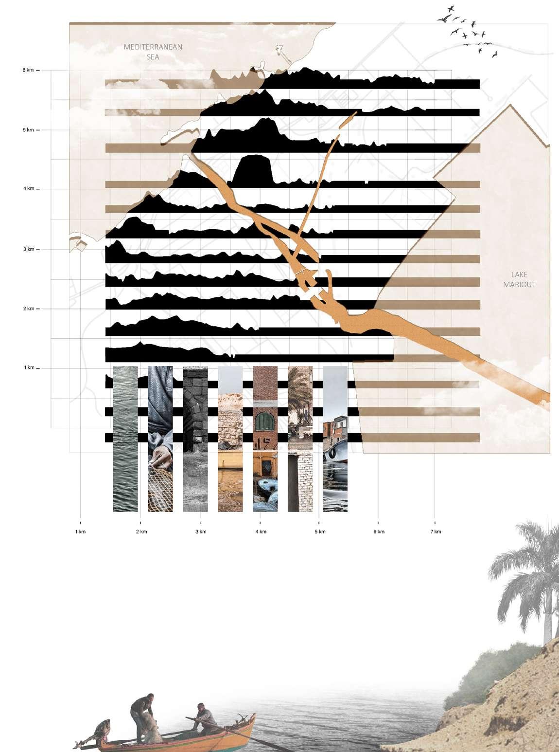
Figure 8: The Canopic Way, the main street of ancient Alexandria, running through the Greek district. / Image credit: Jean GolvinFigure 9: Historical map of Alexandria, Egypt with the orange circle highlighting Al-Max village. / Credit: Author


Alexandria is an ancient city on the Mediterranean. The city has a tre mendous impact on the history of the Mediterranean. The Pharos, a legendary lighthouse that was once regarded one of the ancient world's seven wonders, is also located in Alex andria. On the little Pharos Island, the lighthouse remained for approximate ly 13 centuries. Even if the Pharos was
slain, its legend and legends continue on. Pharology, the discipline of build ing lighthouses, was inspired by the Pharos. The enormous lighthouse at Alexandria drew tourists, historians, and others. Even now, its reputation and popularity outnumber those of Alexandria's other luminaries. [Light houses of Alexandria; Wikipedia]
Figure 10: Lighthouse of Alexandria by Philip Galle; 1572, Rijksmuseum. / Source: Wiki pediaThe renown and legacy of Alexandria's famous Pharos have cast a pall over the city's other lighthouses. Light houses are an endangered architec tural type that may soon become ob solete due to advances in navigation technology. Because lighthouses are always built in places with the hardest weather, they are more prone to de terioration and degradation. In Alexandria, there are still six lighthouses. Except for the Montazah
lighthouse, which is located in the Montazah Palace grounds to the east of the city, they are mostly located in the western portion of the city. Some of the lighthouses are inoperable, while others are inaccessible. Figure 1 depicts modern Alexandria and the locations of extant lighthouses in the city's western section. [Manzoni, S.; El, R.; Lighthouse, T.; Aaha, C.; 63, N.; Aref, Y. G., 2010]
 Figure 11: Map of Alexandria 1912 illustrating the relationship of Al Max lighthouses with other lights. The lines mark the safe passage in and out of the harbor avoiding rocks and other obstacles. / Source: base map after Jondet.
Figure 13: Map of Pharos Island and the Eastern Harbor. (Forster, 1961). / Souce: Wiki pedia

Figure 12: Different stages of destruction of Alexandria Lighthouse (Thiersch, 1909)/ Im age credit: Wikipedia

Fig I
BC
The Lighthouse of Alexandria stood for over 1,500 years, even withstanding a severe tsunami in 365 AD.
Figure 14: Hand sketch illustrating the Pharos lighthouse built by the Greek. / Image credit: Arthur Balitskiy.


The earthquake tremors likely caused the cracks that appeared in the struc ture by the end of the 10th century. This required a restoration that lowered the building by around 70 feet.
Fig II
Fig III
Figure 15: The citadel of Qaitbay in the 1780s, by Louis-François Cassas. / Image credit: Wikipedia

14th century
10th century
Figure 16: A size comparison be tween a 1909 (inner shape) and a 2006 study (outer shape) of the build ing. / Source: Wikipedia
Then came Sultan Qayetbay and fortified the place as a part of his coastal defens es and built on its site his castle from the existing ruins.
Figure 19: Southern view of Ras El Tin Lighthouse. / Source: The Alexandria & Mediterra nean Research Center


1848
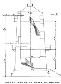
Figure 17: Deteriorated condi tion of Mex Old Lighthouse and its section respectively. / source: Alexandria & Mediterranean Re search Center

1873 1890
Figure 18: The Agami unmanned lighthouse/or beacon / Source: Egyptian Authority for Maritime Safety

Figure 20: Views of the Low Mex Lighthouses showing their setting and alignment / Source: The Alexandria & Med iterranean Research Center

19401894
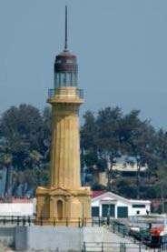

Figure 21: Northern view and sec tion of the Mex High Lighthouse re spectively. / Image credit: Yasser Aref
1908
Figure 22: Northern view and section of the Mex High Lighthouse respectively. / Image credit: Yasser Aref

Figure 23: Historical Map of Alex andria, Egypt, from 1882. / Image Credit: The survey of Egypt.
Figure 24: Blow up to Al-Max village from the historical Map of Alex andria, Egypt, from 1882. / Image Credit: Author


Climate changes and urban growth are two trends that force the world to consider the urban resilience to disasters in the coming years. It’s ex pected that there will be an extreme ly increase in the number of climate events in the coming years and that the population growth is causing vast clusters of people vulnerable to nat ural disasters. The global population is continuously getting more urban ized and many cities are located in coastal areas that are vulnerable to climatic events. As disasters strike in urban areas, where the concentra tion of perople and complexity of sys tems are, they lead to severe impacts, driving significant threats to techno logical systems and people in urban areas which is a major concern to ur ban planners and policymakers, thus disaster management considering implementing adaptation strategies and mitigation measures, building resilience, recovery and construction should be considered. Increasing ur banization, which entails the spatial concentration of people and infra
structure in relatively small areas, means increased and concentrated exposure of human and economic assets to various geophysical and hy dro-meteorological environmental hazards. The geography of many ma jor cities around the world—low-lying coastal or riverside locations—is an other critical factor that increases the likelihood of severe natural disaster impacts in urban areas. As the trend of urbanization continues across the globe, disaster scholars increasingly pay attention to the specificity and uniqueness of urban hazard risk when evaluating regional disasters and haz ard management approaches. There is broad consensus among urban disas ter scholars that disaster risk is large and growing in urban areas and that it should be an integral part of urban planning and management in order to effectively and proactively mitigate di saster risk, thus reducing the ex-post recovery cost [Mitchell 1999; Bull-Ka manga, et al. 2003; Dilley, et al. 2005; and Lall and Deichmann 2012.]
Flash floods, earthquakes, droughts, landslides, and sandstorms are all common in Egypt. Temperature ex tremes, windstorms, and diseases have all occurred in recent decades. The southern end of the Gulf of Suez, the northern Red Sea, and the Gulf of Aqaba have the most seismic ac tivity in Egypt. The deadliest natural
catastrophe in the last two decades was the November 1994 flash floods in Upper Egypt, which killed 600 peo ple and injured over 300 others while displacing over 140,000 people after destroying more than 20,000 homes and buildings. [Solyman and Abdel Monem, 2020]
 Figure 25: Population statistics in the Middle East / Map credit: Aymen Solyman and Tarek Abdel Monem
Alexandria is Egypt's second largest city, with the country's primary har bor and a significant industrial base that accounts for 40% of the coun try's industrial production. Further more, its shore hosts a plethora of summer tourist and cultural heritage attractions. Alexandria will be vulner able to sea level rise, which will result in severe coastal erosion and floods, according to the Intergovernmental Panel on Climate Change (IPCC) and numerous research. Infrastructure, beaches, and cultural heritage sites will all be severely impacted.
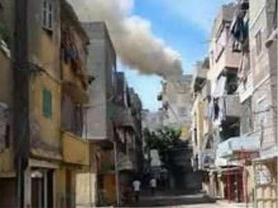
Alexandria, like numerous other Arab towns, is completely unprepared for natural disasters. There are no pre paredness measures in place that will increase adaptation and resil ience. Rapid urbanisation and climate change have aggravated the problem even further. Local officials believe that some 30000 additional struc tures have been unlawfully erected near the main pumping station in the Al-Max neighborhood during the pre vious five years. This issue might have a significant negative impact on hy drology, and further research is need ed to quantify the increased runoff from newly urbanized regions.
Alexandria may face severe coastal flooding as a result of climate change. The creation of a flood forecasting
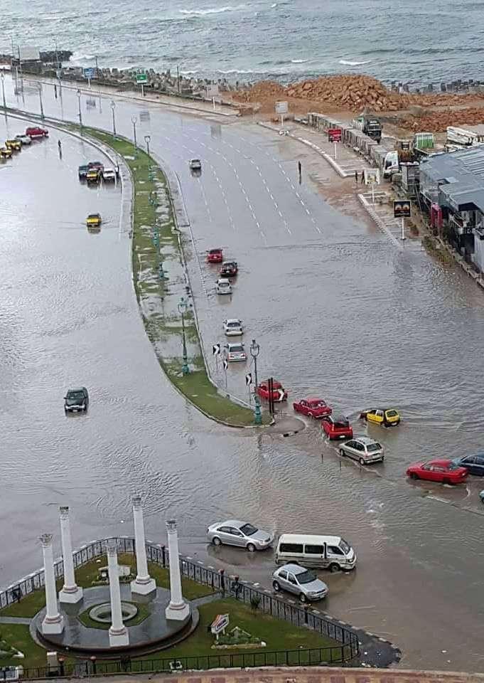
model, as well as evidence-based study on the capacity of the drainage system, are viewed as urgent initia tives that can considerably increase the city's readiness for floods. In ad dition, the region features a number of huge lakes that might be used to retain excess water as a flood-pre vention technique. Two water bodies have been discovered, notably Mary out Lake and Airport Lake, from which water may be pumped out in advance to retain storage accessible in case of floods and to allow water to be used during dry seasons. Alexandria was hit hard by floods in October 2015. The flooding was produced by a tremen dous quantity of rain in a short period of time in a city that does not ordi narily receive much rain. The severe rains resulted in a massive amount of runoff that the city's drainage sys tem was unable to discharge to the Mediterranean Sea. The flood killed seven persons and caused massive direct and indirect damage. There is no flood forecasting system in place in the city. The excessive rainfall may have been predicted around a week ago, according to an examination of rainfall forecasts from the European Centre for Medium Range Weather Forecasts (ECMWF). Flooding may have been foreseen long in advance if a flood forecasting model had been in place. [Characterisation of flooding in Alexandria; 2015]
Figure 26: Photo of Mi ami District in Alexan dria during the flooding season / Image credit: anonymous

Figure 27: Photo Cor niche of Alexandria during the flooding season / Image credit: Scoop Empire
Figure 28: Drivers ma neuver through flood water after a torrential rain in Alexandria, Egypt. / Image credit: Ibra him Ramadan, Anadolu Agency, Getty Images


Ineffective political action related to flood disaster risk reduction, manage ment deficiencies, public awareness, and a lack of money and stakeholder help are the most problematic issues that raise the risk of catastrophes in Arabian nations.
August should be peak tourist season on Egypt's Mediterranean coast. How ever, Alexandria's seaside restaurants are nearly empty. Many international visitors are staying away because of security concerns. But there's a deep er concern: that Egypt's prospects will worsen as the weather warms and the shoreline disappears.
Scientists believe that human-caused climate change – the result of green house gas emissions from items like vehicles and industries – is raising sea levels and warming the oceans.
The Nile River delta, the triangle where the Nile extends out and flows into the sea, is being impacted by rising sea levels. It is here that Egypt grows the majority of its crops. Ac cording to the World Bank, Egypt is one of the nations most vulnerable to climate change because of its ex isting high poverty rates and quickly expanding population.
Alexandria is one of the UNESCO World Heritage sites in the Mediter ranean that is vulnerable to coastal
flooding and degradation owing to rising sea levels. Because of its loca tion on the Mediterranean, the city is particularly vulnerable to increasing sea levels. Alexandria is one of Egypt's UNESCO World Heritage Sites that is at risk of flooding. Coastal erosion is thought to constitute a threat to all ancient monuments along Egypt's northern shore. By 2050, the flood danger in Alexandria is predicted to reach critical levels.
“The water used to flood and cover the people and their cars, that’s why the government put up the barriers – to stop the high water so it won’t flood the street.”
[Adel, a fisherman in Alexandria]
The government has built barriers all along the shoreline to protect against the increasingly severe winter storms. This area of the seashore lacks a beach. Years ago, the sand washed away.
Many scientists estimate a two-foot rise in sea level here by the end of the century. As salt water seeps through the masonry, some old structures are already disintegrating. Entire com munities might be flooded. Alexan dria's fortunes have risen and fallen with the tides for thousands of years.
[In Egypt, A Rising Sea — And Grow ing Worries About Climate Change’s Effects : Parallels : NPR, 2019]
Figure 34: A cement barrier placed as reinforcement against rising water levels near the citadel. b. The barriers and other protective measures along the shore of Alexandria. In this Au gust 8, 2019, photo, workers prepare to place cement blocks to reinforce the sea wall against rising water levels on the cor niche in Alexandria, Egypt. / Image credit: Sayed Hemeda


 Figure 32: The Alexandria boardwalk is lined with concrete barriers to keep back rising waves. / Image credit: Jane Arraf/ NPR
Figure 33: A fisherman stands on what are believed to be re mains of the ancient lighthouse of Alexandria — considered one of the Seven Wonders of the ancient world. / Image credit: Jane Arraf/NPR
Figure 32: The Alexandria boardwalk is lined with concrete barriers to keep back rising waves. / Image credit: Jane Arraf/ NPR
Figure 33: A fisherman stands on what are believed to be re mains of the ancient lighthouse of Alexandria — considered one of the Seven Wonders of the ancient world. / Image credit: Jane Arraf/NPR
The basic idea is that informal settle ments have become a constant issue, with severe environmental conse quences. People and the land they occupy are exposed and vulnerable to environmental risks when they live in informal settlements. Lack of essen tial facilities, pollution, overpopula tion, and inadequate waste manage ment define informal communities. These traits have a detrimental influ ence on the environment, increasing the likelihood of health issues linked with informal settlements. Aside from the living circumstances in informal settlements, the concept of informal settlements being self-built by people and utilizing temporary materials has its own environmental impact. Ser
vice delivery is difficult for those living in informal settlements. This is most ly due to unlawful land occupation, which has had a harmful influence on the ecology. Informal settlements have an environmental effect due to a lack of fundamental necessities and services. This includes poor sanitation, which exposes residents to pollutants, as well as the use of coal and biomass fuels for lighting, which pollute the air and contribute to greenhouse gas emissions. Waste disposal is a prob lem that informal settlers face, and it leads to soil contamination and the emergence and reemergence of in fectious disease threats. [Skidmore, M.; Lim, J; 2020]
Informal settlements are prone to natural disasters due to their location (flood plains, marshy regions, low-ly ing areas, and river courses), rapid population development, poor plan ning and housing quality, and the un predictable strike of natural hazard. In formal settlement residents, who are largely in-migrants, have little financial resources, making it difficult for them to fully prepare for a natural disaster. Because a large majority of in-mi grants are low-income or jobless, they are unable to rent a house or room in a well-planned residential neighbor hood. Their financial situation forces them to rent flats in less formal areas, where housing is less expensive. Fur thermore, such people's low-income status limits their capacity to invest in structural mitigation measures to
mitigate hazard consequences. In creased demand for natural resources such as land for both residential and industrial development is triggered by the expansion of informal settlements in terms of people and industry. As a result of the increased building op erations, natural vegetation is being destroyed in these places, increasing settlers' sensitivity to various natural risks. Changes in land-use patterns are another occurrence that occurs when cities grow in population. The most common transitions are from agricul ture to residential or industrial land use. Infiltration and permeability of run-off water through the soil are re duced by features of urban architec ture such as paving of surfaces. [Skid more, M.; Lim, J; 2020]
Disaster risk may be increasing faster in rapidly growing small- and medi um-sized urban centres than in either rural areas or larger cities. [UNDRR, 2011]
As cities grow wealthier, investments in infrastructure and services tend to reduce extensive risks. By contrast, in most low and middle-income coun tries, urban development is driving new patterns of both extensive and intensive risk, particularly in informal settlements, along with high levels of environmental degradation. Ur
ban development in these countries is socially segregated, characterized by unequal access to urban areas, infrastructure, services and security. Low-income households in particular are often forced to occupy exposed areas with low land values, with de ficient or non-existent infrastructure and social protection, and high levels of environmental degradation. The result is a pattern of spatially and so cially segregated disaster risk. 90% of people in urban areas in low-income countries live in unsafe, exposed housing. [UNDRR, 2015]
Alexandria, founded by Alexander the Great, was once the capital of ancient Egypt. The water that surrounds it has always dictated its history and desti ny. Earthquakes throughout the mid dle ages buried most of the city's to pography: Cleopatra's royal palace is 16 feet below the surface of the cur rent Alexandria's shoreline, and the remains of the celebrated Lighthouse of Alexandria, a marvel of the ancient world, are submerged beneath the waters of the city's east port. Despite its proximity to the sea, the floods that wreaked havoc on Alexandria in 2015 caught the administration off guard.
Alexandria is mostly built on low-lying locations. Sea levels are expected to rise by as much as two feet by 2050, putting parts of the city at risk of flood ing. The vast Nile delta, the country's breadbasket, is likewise in grave dan ger. According to AR5, groundwater
inundation by saltwater could reduce Egypt's agricultural sector by as much as 47 percent by 2060, and "hun dreds of billions of Egyptian pounds, about two to six percent of future gross domestic product (GDP), could be lost from effects on water resourc es, agriculture, coastal resources, and tourism," according to the UN report. Egypt is in the midst of a historic ca tastrophe, exacerbated by a financial crisis and a fast rising population.
The Alexandria government believes it’s doing all it can to stave off disaster given the limited resources that are at its disposal. “We have a lot of protec tion when it comes to sea-level rise,” Dr. Walid Hakiki, advisor of water re source planning and management to the governor of Alexandria told CityL ab. “But, right now our main focus in our city is trying to prevent more flooding like we had in 2015.”
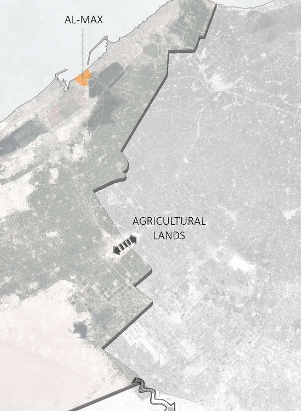
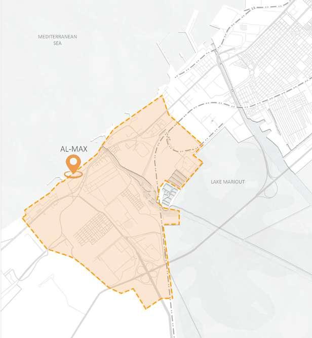
2.3.3. The case of Al-max village in Alexandria, Egypt
 Figure 35: Image from Google Maps website. / Image credit: anonymous
Alexandria gets about eight inches of rain each year on average. The city received more than eight inches of rain in only two days during the 2015 floods. The Al-Max canal is especially vulnerable because heavy rain over whelms the city's pumping station, which discharges the overflow into Lake Mariout, which divides the lake from the Mediterranean. The lake lies nine feet below sea level and is con nected to the Mediterranean by two canals that go through Alexandria. When water is thrown into the lake, water levels in the canals vary, posing a threat to the Al-Max fishing village (the banks of the other canal were largely unoccupied). The govern ment's approach to rising flood fears as a result of climate change is to out run rather than prepare.
“We have already transferred people who are most in danger from sea-lev el rise and also ensuring them to have a better quality of life,” said Dr. Walid Hakiki, advisor of water resource planning and management to the governor of Alexandria. “In Egypt, we have a lot of slum areas with unsafe construction, and we want to make it more safe for residents.”
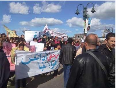
But some activists say this is not the answer. “Resettlement, especially when forced, heavily disrupts com munities,” said Yahia Shawkat, an Egyptian housing rights organizer. “Many of the clearances could have been avoided with much cheaper up grading, while many others still live in inadequate housing and are not part of the government’s plans.”
[Will Egypt’s Ancient City Succumb to Rising Seas? - Bloomberg; 2019]
To understand the current state of AlMax, its regions, and how each area is used, we must first examine its histo ry and evolution. The term "al-max" in Arabic means "tax," according to the "Lisan Al-Ari" dictionary. The name refers to a previous role of this place. According to historical maps, Al-Max was located on the western outskirts of Alexandria. Some accounts de scribe a sea-to-lake wall, while oth ers place Al-Max in the context of a harbor (Al-Max, or Bab al-Arab, Gulf). The maps also include Al-Shafkhana Fort as a historic site, despite the fact that forts and castles are often found around the city's ports.
Figure 36: Image from online news article (Azab News) - “Develop ing the Max area in Alexandria within the state’s plan to develop the slums and turn it into an attractive area for tourism” / Image credit: Walid H.

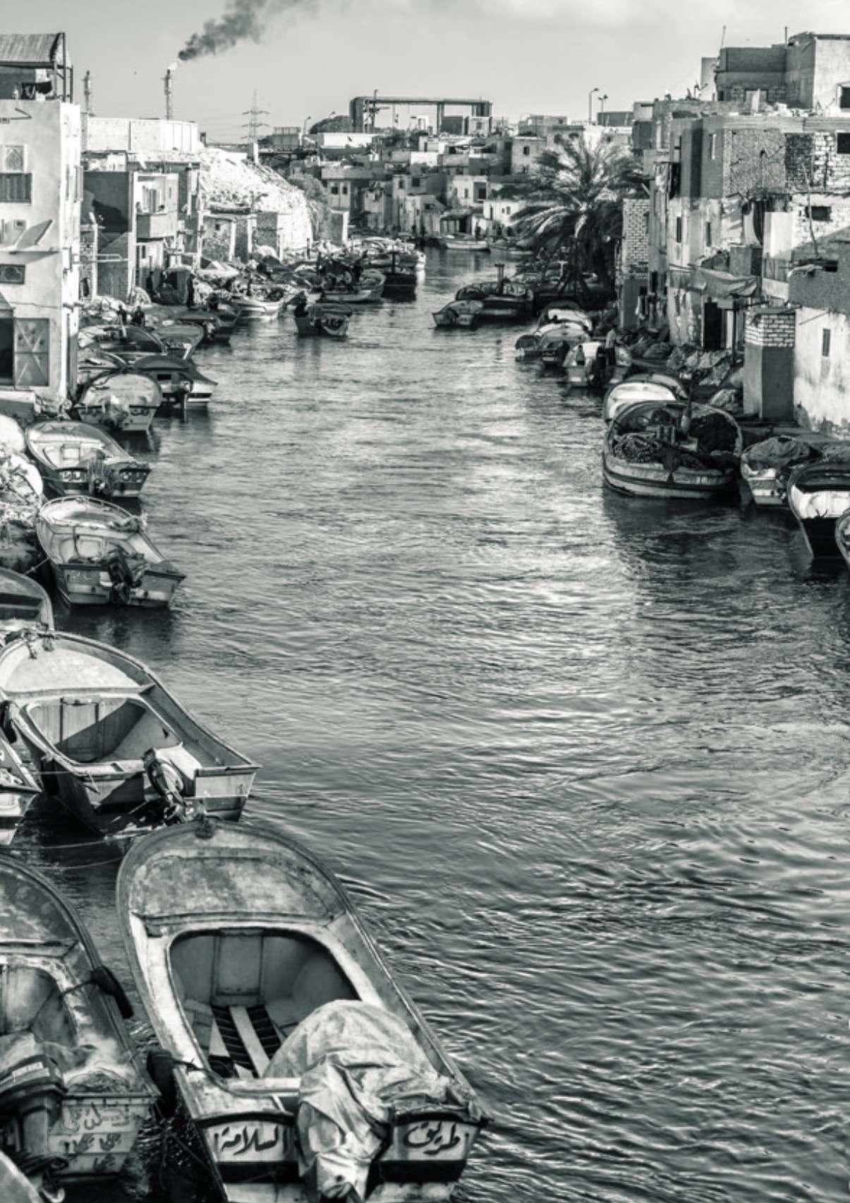
 Figure 37: Image of Al-Max village in Alexandria, Egypt. / Image credit: anonymous


 Figure 38: After floods overwhelmed the fishing community living on the banks of Al-Max canal in Alexandria, the government relocated families to high-rises, transforming their way of life. / Image credit: Amir Khafagy
Figure 39: Al-Max area in Alexandria, Egypt. / Image credit: Mohamed Osama
Figure 38: After floods overwhelmed the fishing community living on the banks of Al-Max canal in Alexandria, the government relocated families to high-rises, transforming their way of life. / Image credit: Amir Khafagy
Figure 39: Al-Max area in Alexandria, Egypt. / Image credit: Mohamed Osama

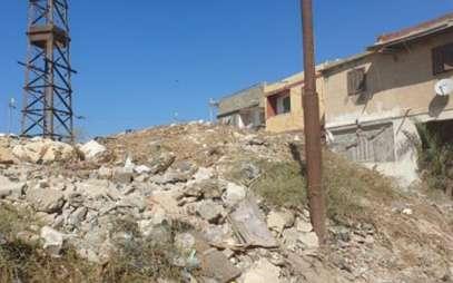
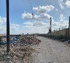
 Figure 40: The rubble left after demolition of houses on the waterfront at El Max, near Alexandria, where homes are regularly flooded. / Image credit: Sima Diab
Figure 41: Egypt’s poorest, living on the water’s edge or dependent on its resources, are vulnerable to the first and worst effects of climate change. / Image credit: Sima Diab
Figure 40: The rubble left after demolition of houses on the waterfront at El Max, near Alexandria, where homes are regularly flooded. / Image credit: Sima Diab
Figure 41: Egypt’s poorest, living on the water’s edge or dependent on its resources, are vulnerable to the first and worst effects of climate change. / Image credit: Sima Diab
 Figure 42: Al-Max area in Alexandria, Egypt. / Image credit: Mohamed Osama
 Figure 43: Al-Max area in Alexandria, Egypt. / Image credit: Mohamed Osama

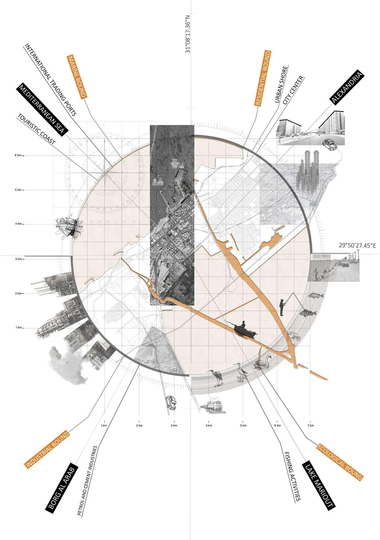
3�1� Site Location
3.1.1. Site Projection 3�2� Site Analysis 3.2.1. Metropolitan Scale Analysis 3.2.2. Municipality Scale Analysis 3.2.3. Urban Scale Analysis 3.2.4. Neighborhood Scale Analysis 3�3� SWOT Analysis 3�4� Problem Statement
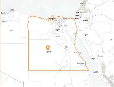
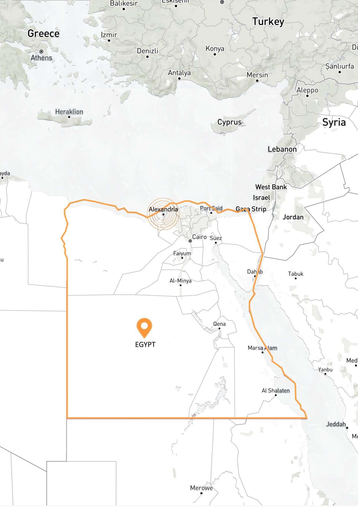
Drawing 1: World Map illustrating the location of Egypt. / Credit: Author


Drawing 2: Map illustrating the boundaries of Egypt.
/ Credit: Author
Drawing 3: Map illustrating the boundaries of Egypt.
/ Credit: Author
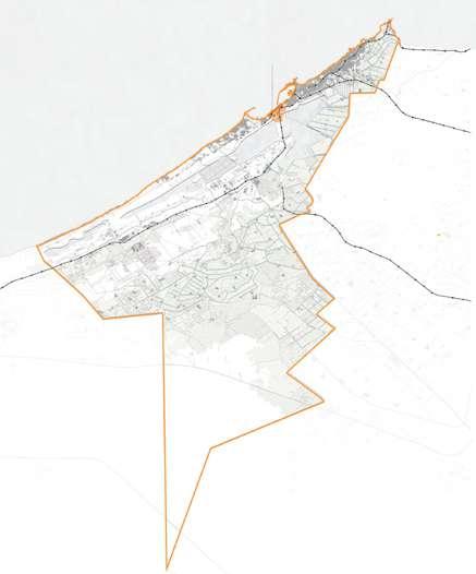
Drawing 4: Map Illustrating the bound aries of Alexandria. / Credit: Author
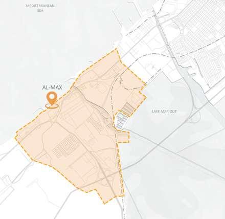
AL-MAX
Drawing 5: Map Illus trating the boundar ies of Al-Max village. /
Credit: Author
Drawing 6: Metropoli tan scale map. / Credit: Author
Drawing 7: Municipal ity scale map. / Credit: Author
Drawing 8: Urban scale map. / Credit: Author
Drawing 9: Neighbor hood scale map. / Credit: Author
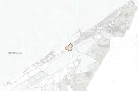
Metropolitan Scale (Egypt)
L MMunicipality Scale (Alexandria)
Urban Scale (Alexandria Port)
Neighborhood Scale (Al-Max Village)
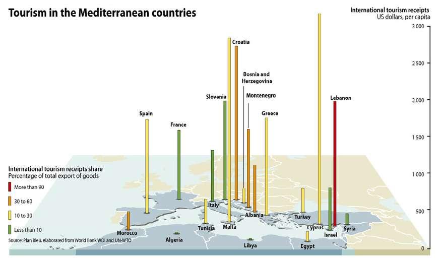
Egypt is low in the GDP from industry Egypt is low in tourism compared to the Mediterra nean countries
Figure 44: Industrial hazardous waste in the Mediterranean countries. / Source: State of the Mediterranean marine and coastal environment
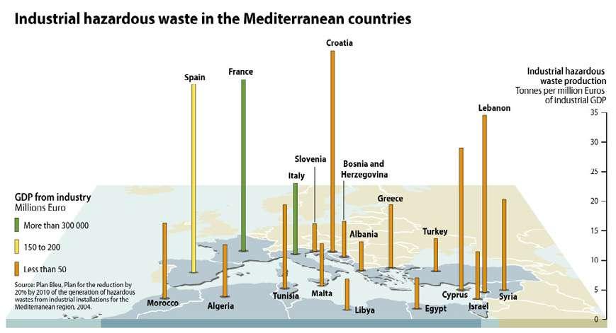
Figure 45: Tourism in the Mediterranean countries. / Source: State of the Mediterra nean marine and coastal environment
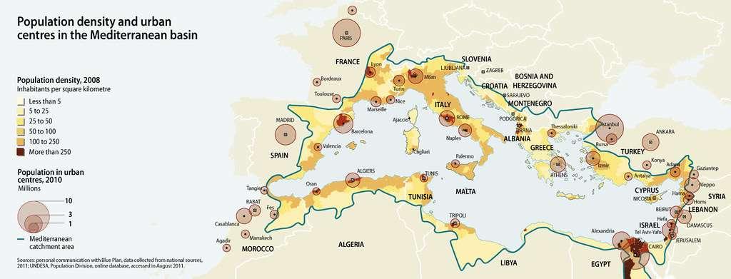
Figure 46: Population density and urban centres in the Mediterranean basin. / Source: State of the Mediterra nean marine and coastal environment
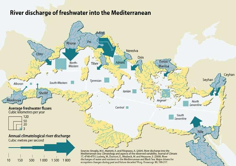
Nile river discharg es 1000-1500 cu bic meters per second to the Mediterranean sea through Al exadnria's canal of Al-Max village
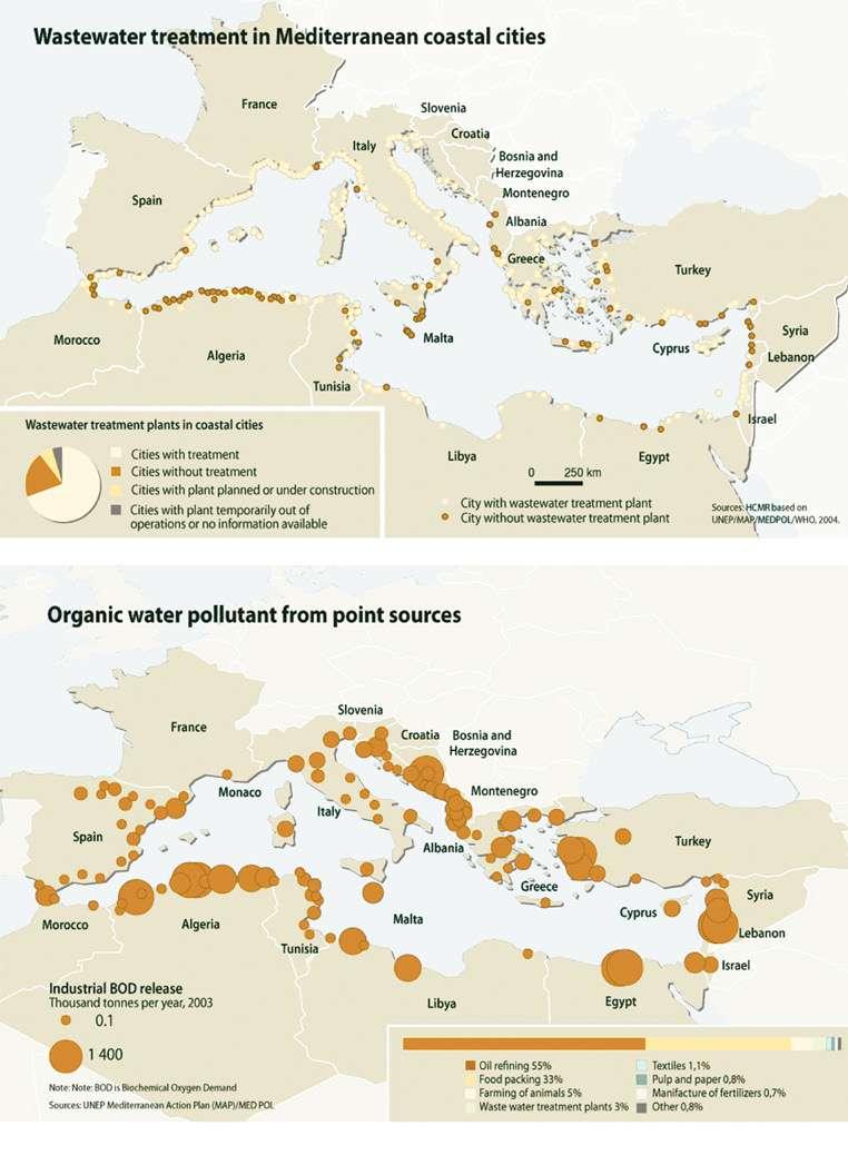
Coastal cities of Egypt are without waste water treat ment
Figure 49: River discharge of freshwater into the Mediterranean. / Source: State of the Mediterranean marine and coastal environment
Egypt releases 1400 thousand tonnes of industri al waste per year
Figure 48: Waste water treatment in Mediterranean coastal cities. / Source: State of the Mediterranean marine and coastal environment
Figure 47: Organic water pollutant from point sources. / Source: State of the Mediterranean marine and coastal environment
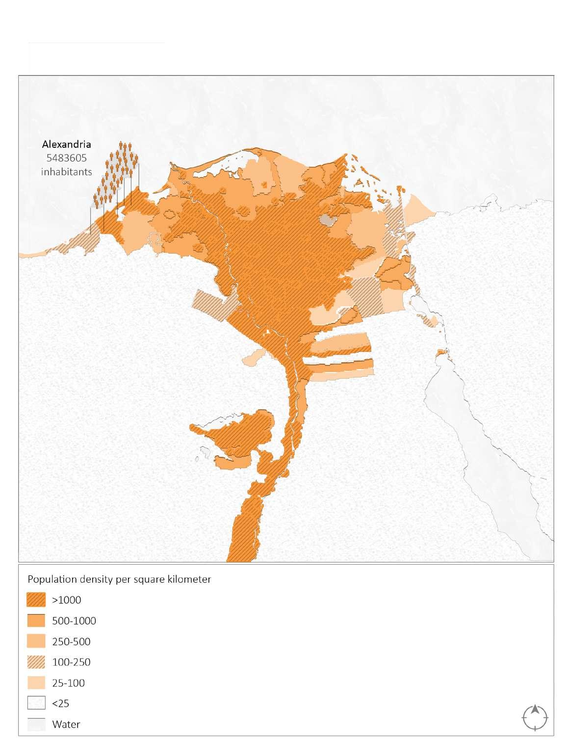
Population Density/ Squared Kilometer in 2022
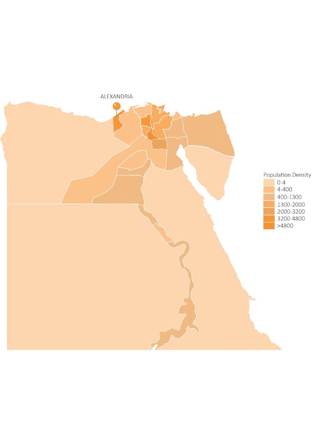 Drawing 11: Map illustrating the population density in Alexandria, Egypt. / Credit: Author
Alexandria and Cairo are the most dense cities
Drawing 11: Map illustrating the population density in Alexandria, Egypt. / Credit: Author
Alexandria and Cairo are the most dense cities
Alexandria is one of the cities of highest unemployment rate
Unemployment Rate in 2022
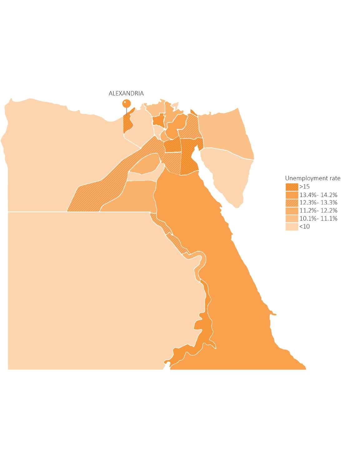 Drawing 12: Map illustrating the unemployment rate in Alexandria, Egypt. / Credit: Author
unemployment rate
Drawing 12: Map illustrating the unemployment rate in Alexandria, Egypt. / Credit: Author
unemployment rate
3.2. SITE ANALYSIS
3.2.2. Municipality Scale Analysis
Drawing 14: Map illustrating the relation of Alexandria to it's surroundings. / Credit: Author
Drawing 15: Map illustrating the landuse in Alexandria, Egypt. / Credit: Author
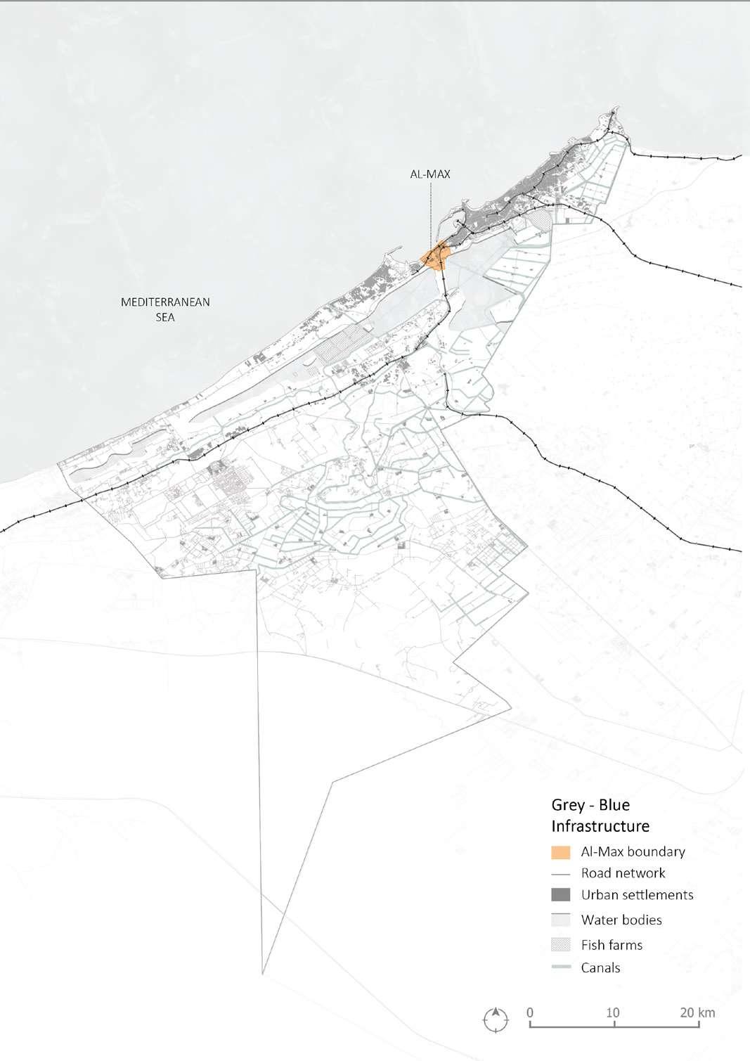
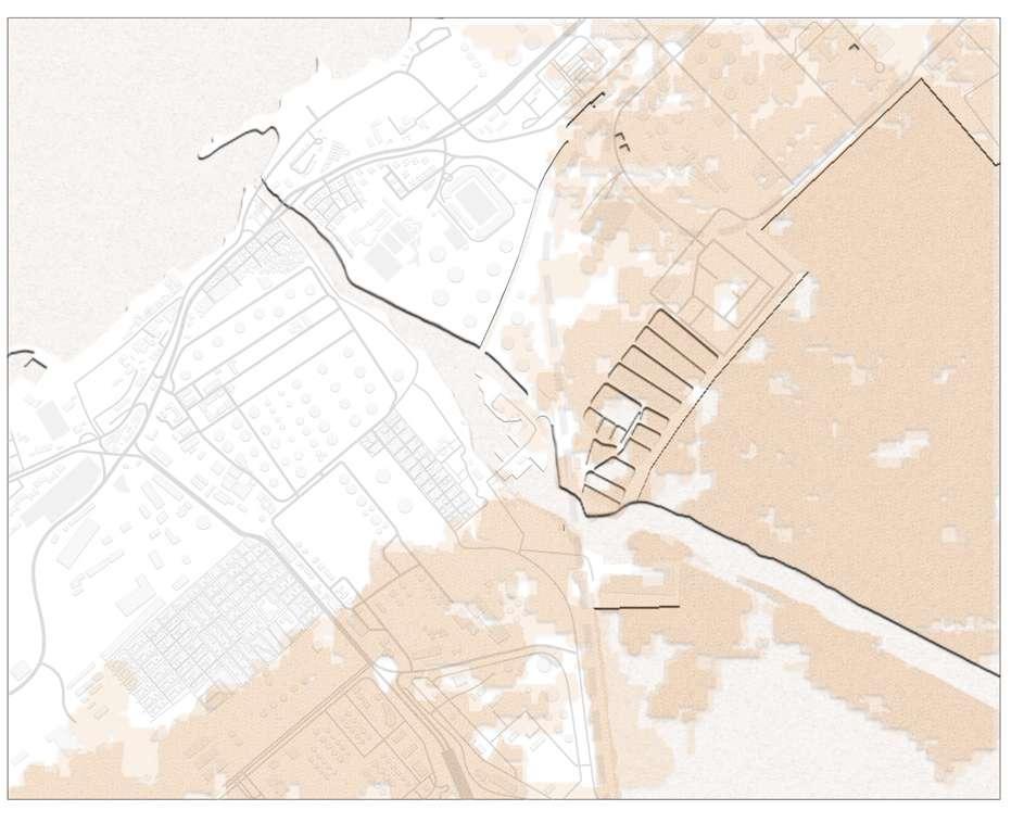
Drawing 16: Map illustrating the Grey-Blue infrastructure relation in Alexandria, Egypt. / Credit: Author
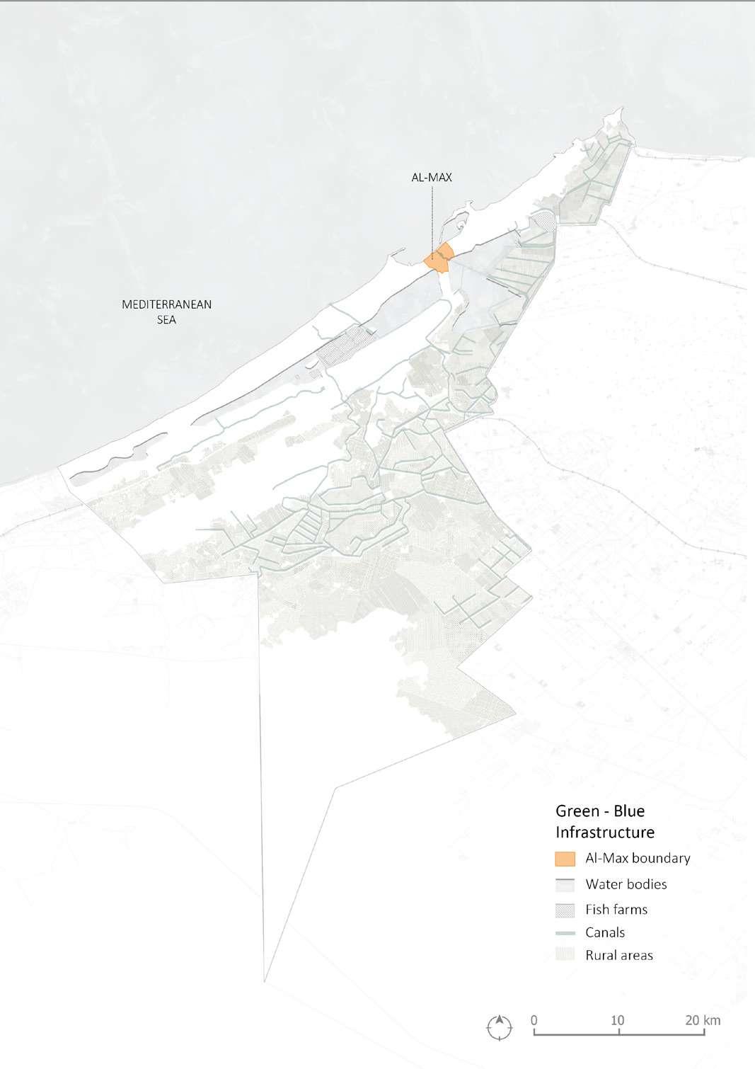
Drawing 17: Map illustrating the Green-Blue infrastructure relation in Alexandria, Egypt. / Credit: Author
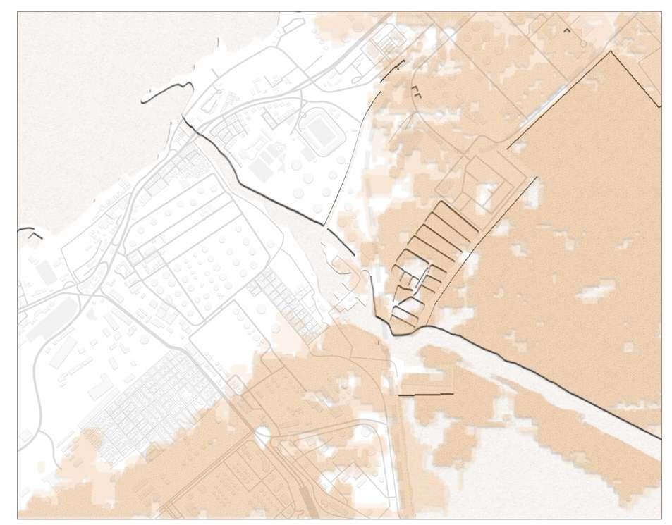
Drawing 18: Urban scale map. / Credit: Author
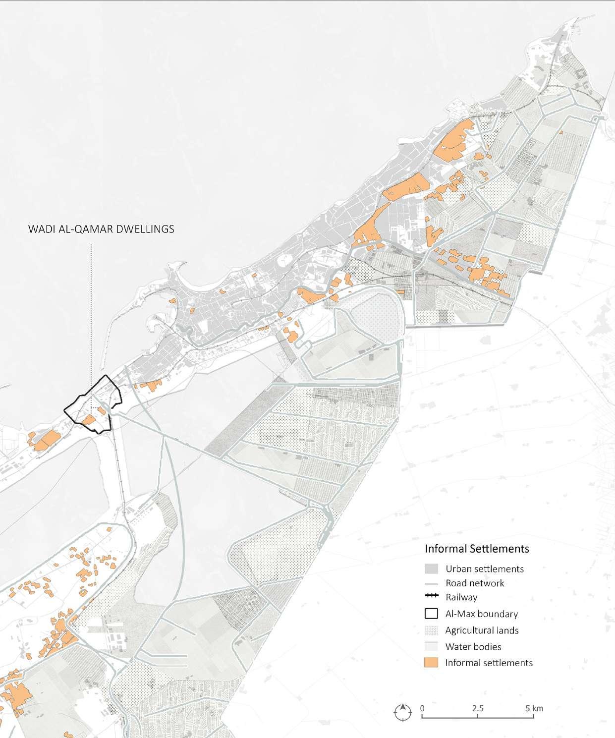
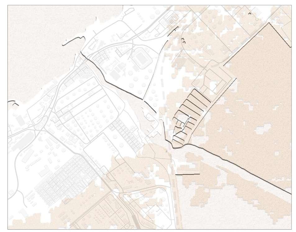
Drawing 19: Map illustrating the the informal settlements in Alex andria, Egypt. / Credit: Author
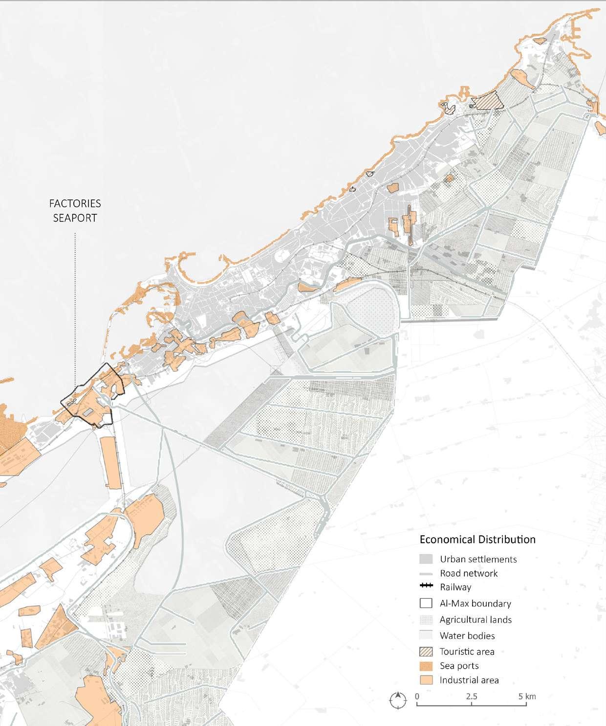
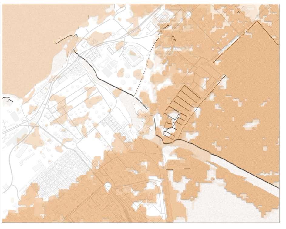
Drawing 20: Map illustrating the the economical distribution in Al exandria, Egypt. / Credit: Author

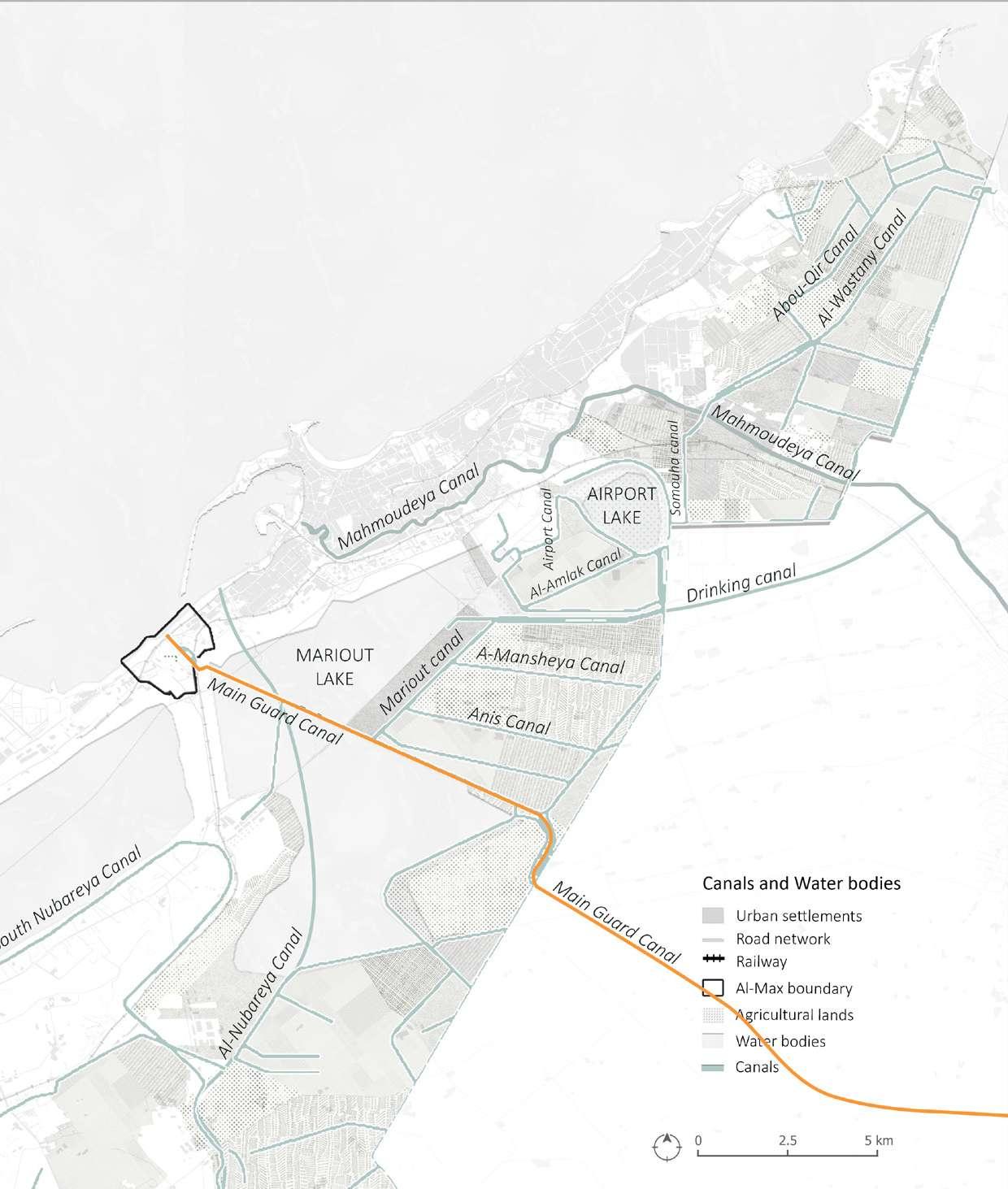
Drawing 21: Map illustrating the ca nals and water bodies in Alexandria, Egypt. / Credit: Author
Drawing 22: Map illustrating the urbanization in Alexandria, Egypt. / Credit: Author
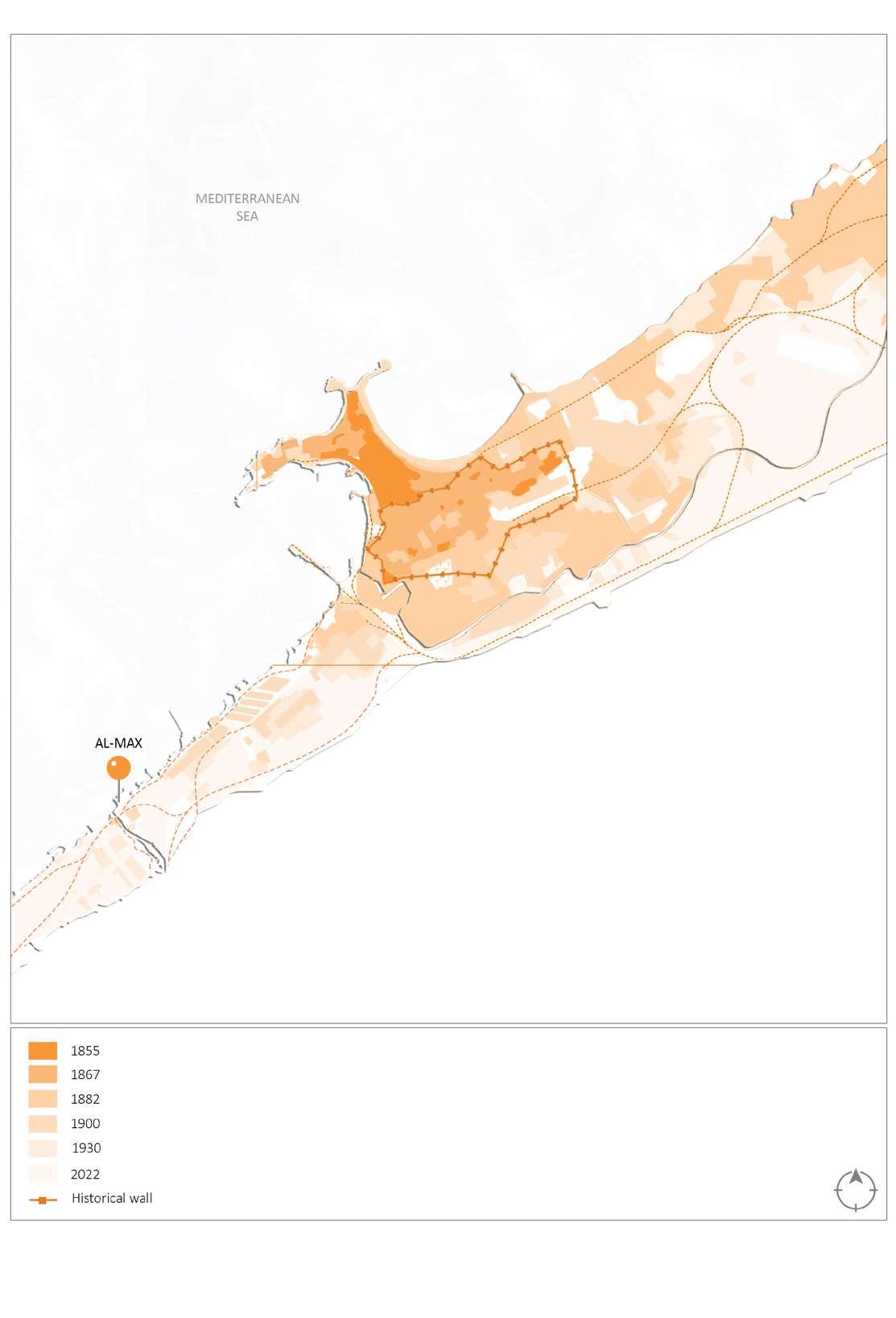
Figure 50: Population in Egypt / Source: UN-Desa 2019
 Drawing 23: Map illustrating the population density in Alexandria, Egypt. / Credit: Author
demoGraphics - alexandria
PROJECT SITE
Drawing 23: Map illustrating the population density in Alexandria, Egypt. / Credit: Author
demoGraphics - alexandria
PROJECT SITE
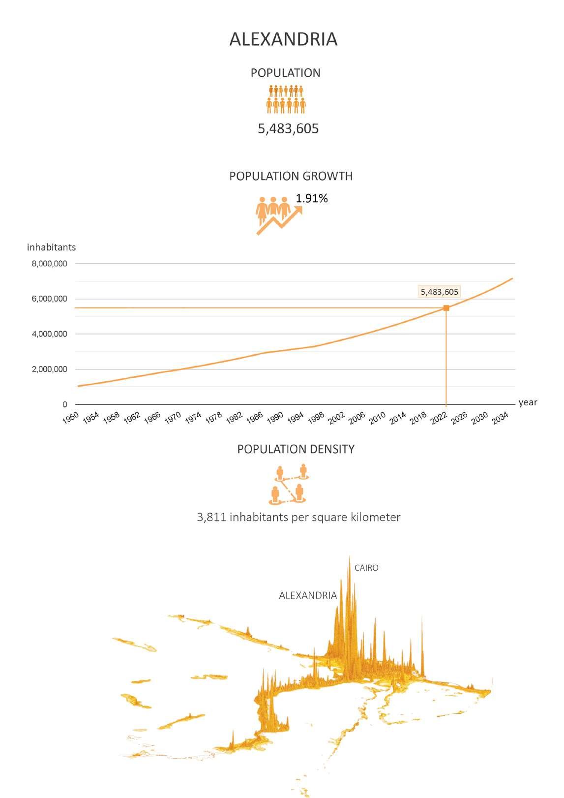
Figure 51: Population in Alexandria / Source: UN-Desa 2019
Al-Max is defined by the variety of its population. Residents are divided into two groups: the "commons," which comprises fisherman and industri al workers, and the "secondaries," which includes university students, business workers, and government personnel. In terms of lifestyle, these two groups are very distinct from one another. The first group spends the most of their time in Al-Max, seldom
leaving the neighborhood, whilst the second group spends practically all of their time at work or at a universi ty outside of the area. The people of Al-Max live a modest life away from the hustle and bustle of the metrop olis, which helps locals form stronger bonds. Al-Max people picnic down town or in other places on weekends and holidays because the city has no green spaces or public parks.
Al-Max has a diversified population, including fisherman, university stu dents, and employees. The fisher men spend the most of their days in Al-Max and seldom venture outside the neighborhood to sell fish, where as university students and employees commute to work on a regular basis.
The residents of Al-Max live a basic ex istence, which has brought them clos er together and increased the num ber of relationships amongst them. Because there are no green spaces or public parks in the region, inhab itants travel to Alexandria's city cen ter or adjacent districts for vacations.
The residents, particularly the fisher man, have a stronger link with one an other, and they all know each other, which stems from the close proxim ity of their homes, which have small roads between them. And because of this relationship, it was natural for the guys to lend each other money when they needed it. They dress in ordinary clothes and occasionally use fishing gear.
The majority of individuals who work in fishing prefer to fish excessively, and many fishermen utilize practices that damage the inner lakes and fishing places. As a result, fishermen begin to stroll about the large boats and feluc cas moored adjacent to the fish mar ket. Nets and other fishing gear are strewn across the shore, and smaller vessels are beginning to arrive.
The population of Al Max are di verse, with a basic class such as fish erman and corporate workers, as well as university students and em ployees working in the country. The first group spends the most of their time in Max and seldom ventures
outside the neighborhood. The sec ond group goes to work every day. People of the maximum lead a simple existence away from the city's com motion, which has resulted in tight re lationships amongst them.
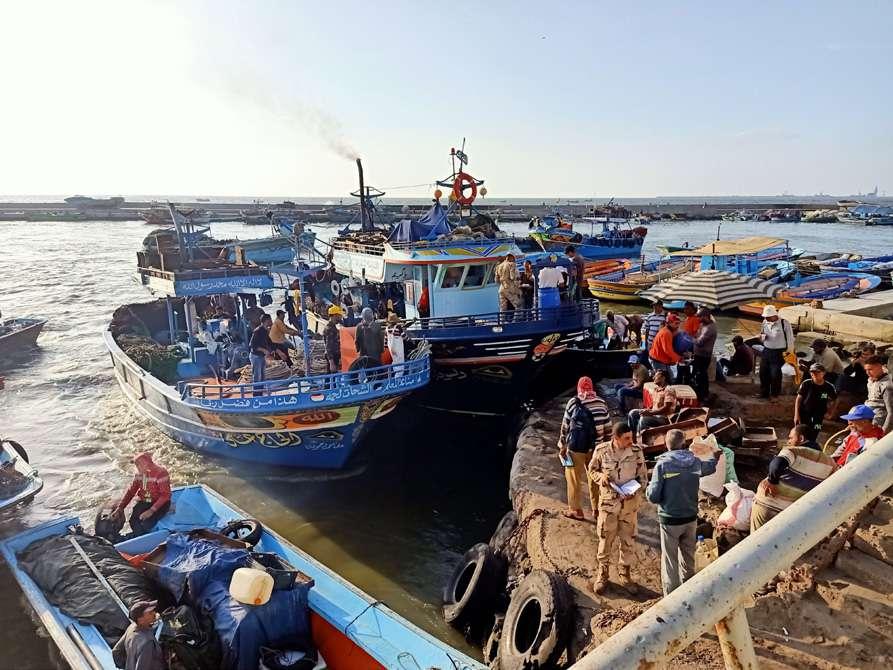

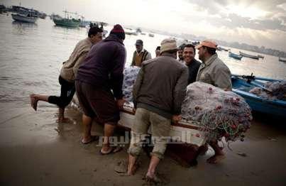 Figure 52: A traditional working day for fishermen in Al-Max area going to sea. / Image credit: Anonymous
Figure 53: Fisherman at work in Alex andria, Egypt / Image credit: Mohamed Osama
[Fig. 31] Al-Max, Alexandria, Egypt / Im age credit: Mohamed Osama
Figure 54: Fishermen preparing for work in Alexandria, Egypt. / Image credit: Al Masry Al Youm
Figure 52: A traditional working day for fishermen in Al-Max area going to sea. / Image credit: Anonymous
Figure 53: Fisherman at work in Alex andria, Egypt / Image credit: Mohamed Osama
[Fig. 31] Al-Max, Alexandria, Egypt / Im age credit: Mohamed Osama
Figure 54: Fishermen preparing for work in Alexandria, Egypt. / Image credit: Al Masry Al Youm
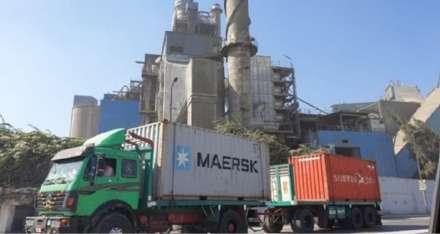
Fishing and fishing-related industries such as building fish nets and selling fish are the major sources of income in the Al-Max region. A large fish mar ket is set up everyday in the region named "The Fish Ring," and many cit izens from the neighboring zones and Alexandria's city center flock there to buy fresh fish of uncommon species including Besaria, Snakes, Bolty, and Aramet. In addition, most of the city's well-known fish restaurants, such as Al Zafir and Sea Jol, rely on daily fish ing for their livelihood.
Another group of individuals works as company employees in the ar ea's Petrol and Cement plants, such as Portland Cement Company, Al exandria Petroleum Company, and Alexandria Mineral Oils Company. The third group works outside of Al-
Max and commutes home everyday.
The fishermen travel to the Fish Ring to sell their catch. They also sell their fish to eateries, make fish nets and fishing boats.
A typical day for a fisherman begins at 6 a.m., and depending on the con ditions, they may spend 4 to 5 hours at sea fishing.It is not guaranteed that they will have enough income for that day; there may be plenty of fish one day and none the next, so they live day to day.
Economy in El-max is low and unsta ble, fishermen are frustrated due to lack of fish in the canal, some fish ermen fish in illegal ways that cause decrease in amount of fish.
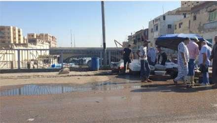
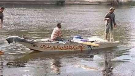
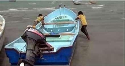 Figure 55: Fishermen preparing for work in Alexandria, Egypt. / Image credit: Mohamed El Benhawy
Figure 56: Fishermen at work in Alexandria, Egypt. / Image credit: Mohamed El Benhawy
Figure 57: Fishermen working in Alexandria, Egypt. / Image credit: anonymous
Figure 58: A cement factory in Alexandria, Egypt. / Image credit: anonymous
al-max
Figure 55: Fishermen preparing for work in Alexandria, Egypt. / Image credit: Mohamed El Benhawy
Figure 56: Fishermen at work in Alexandria, Egypt. / Image credit: Mohamed El Benhawy
Figure 57: Fishermen working in Alexandria, Egypt. / Image credit: anonymous
Figure 58: A cement factory in Alexandria, Egypt. / Image credit: anonymous
al-max
Residents inherited the hunting trade from their parents and relied on it as a source of income. They have recent ly attended schools and universities. Other of them also assist their fam ilies with hunting labor or do it as a pastime, while some parents forbid their boys from doing so due to safety measures.
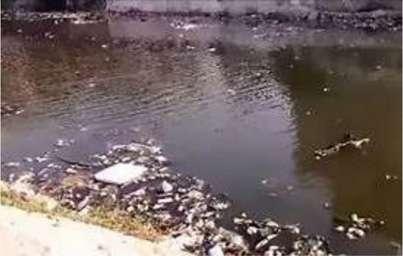
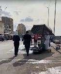
The majority of El-Max people are in bad health and are sick with a variety of ailments, particularly lung disor ders. The canal got more contaminat ed when manufacturers began to dis pose of their garbage in it, in addition to farm pollutants. As a result, the canal fishermen who were fishing straight from the canal began fishing in the sea because the canal no longer has fish. These types of pollution include:
Air Pollution: as a result of the oil and cement plant's emissions and fires.
Water Pollution: As a result of the drainage created by the industries and distributed through the Mahmoudiya canal, there was a scarcity of fish rich ness.
Noise Pollution: Because of the noise produced by the manufacturers.
Visual pollution: Caused by garbage buildup and dumping, the state of de caying dwellings, unpaved roadways, and bank leaking.
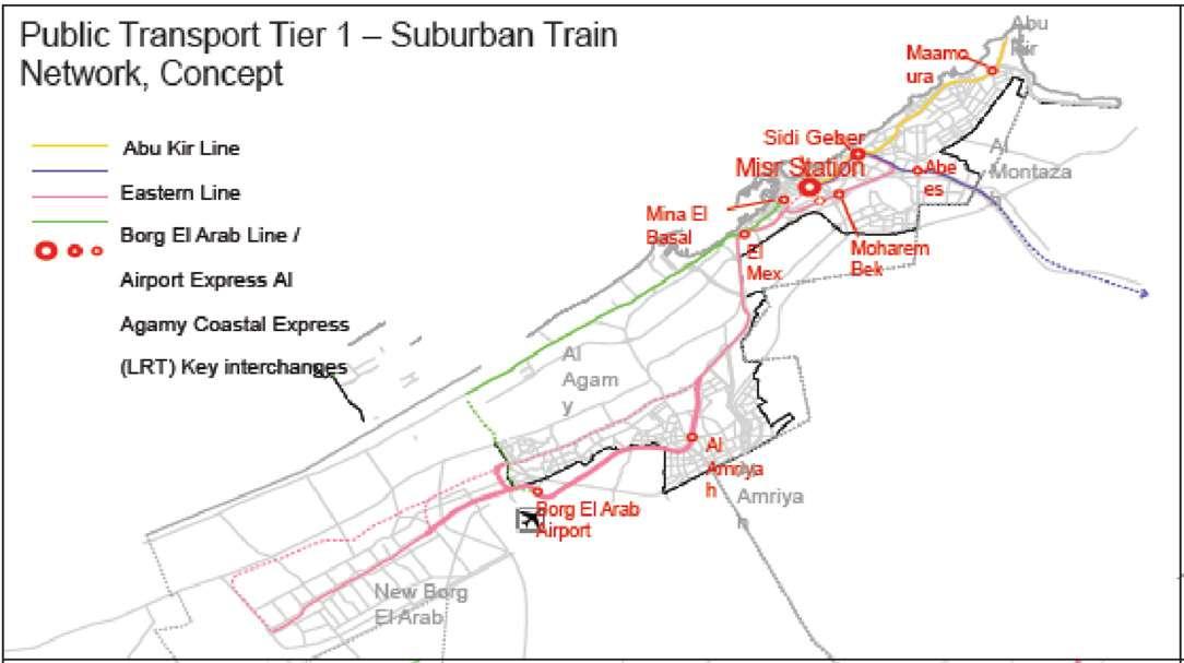
A tram line will pass through Al-Max directly where there will be a station.
Figure 60: Strategic map for a subruban train netwrok. / Image credit: NOAA Climate
Drawing 25: Map illustrating the transportation in Alexandria, Egypt. / Credit: Author
3: PROJECT SITE 3.2. SITE ANALYSIS|
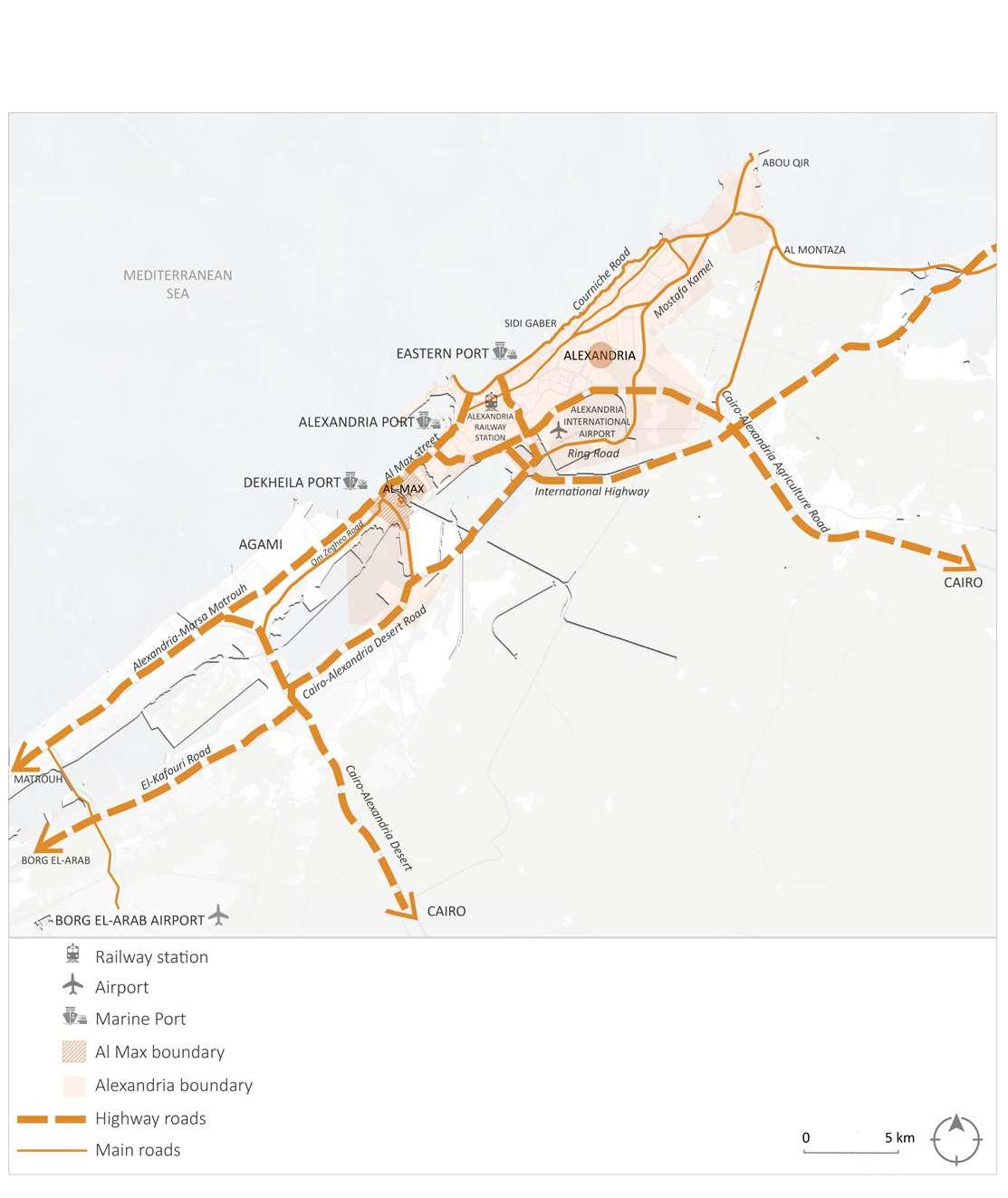
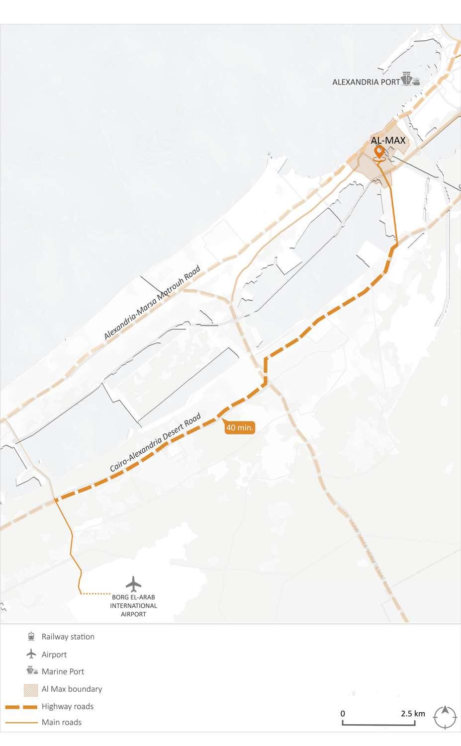
It takes about 40 minutes by car from Borg El-Arab airport to Al-Max village (40 km). The car enters Al-Max from Wadi Al-Qamar street.
Drawing 26: Map illustrating the distance between Al-Max village and "Borg Al-Arab Air port". / Credit: Author
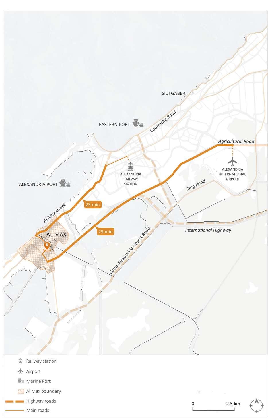
It takes about 25 minutes by car from El-Raml train station airport to Al-Max vil lage (40 km). The car enters Al-Max from Al-Max road.
Drawing 27: Map illustrating the distance between Al-Max village and "Alexandria Interna tional Airport" and "Alexandria Railway Station". / Credit: Author
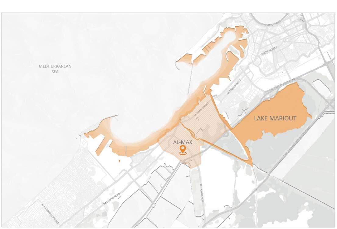
Lake King Mariout is located south of Alexandria and its area was 200 km² at the beginning of the twentieth cen tury. Then it shrank to about 50 km² at the beginning of the current century, due to many factors, the most import ant of which is the urban expansion crawling on the lake and the filling of areas of it.
The change that happened on lake Maryout between 1972 and 2016 which has a direct connection to AlMax as the wastes coming from the agriculture lands in the area is being thrown to the sea through Al-Max ca nal.
Figure 61: Map illustrating the depression of Lake Maryout in Alexandria, Egypt. /
Credit: Author
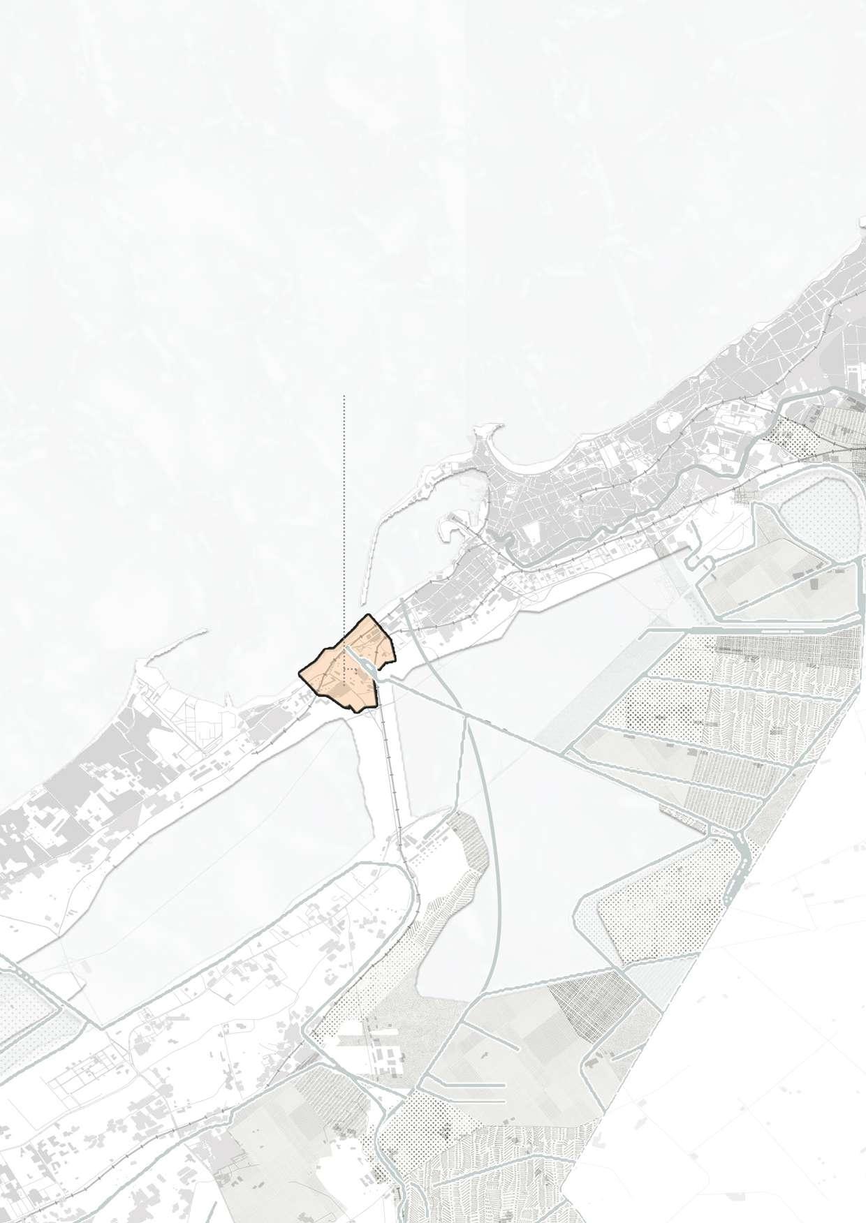
Mediterranean Sea Mediterranean Sea Lake MarioutMapping of Al-Max village illustrating it's relation to the surroundings.
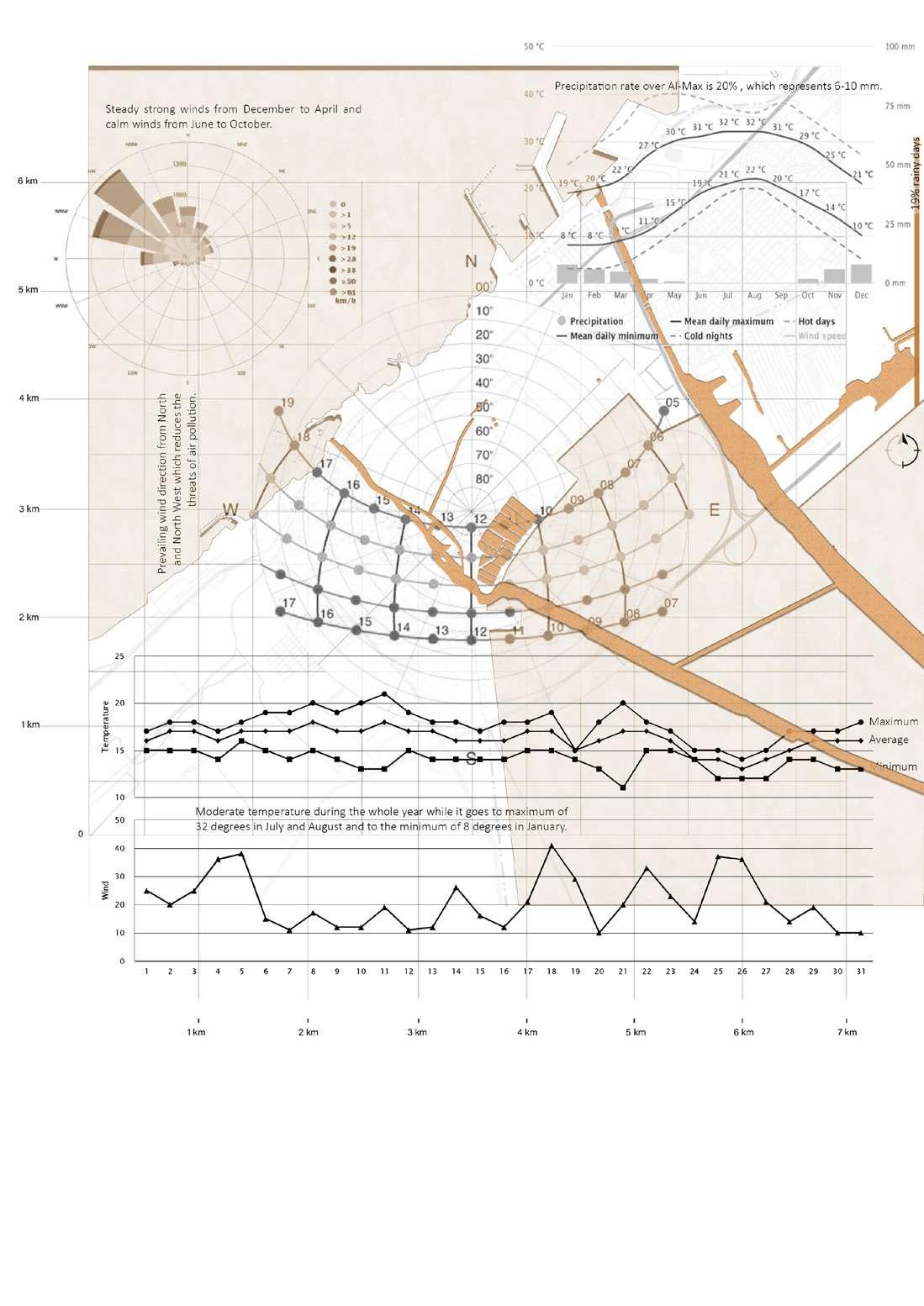
On average, July is the most sunny, while January has the lowest amount of sunshine.
The average annual amount of sun hours is 3310 hours
Summer is in June, July, August and September. The warmest month is August, while the coolest month is January.
The average annual maximum temperature is 24.0° Celsius


Water temperature plays an important role in the behavior of fish; when the water is cold or too hot, fish are lethargic and inactive.
On average, August is the driest month, while December is the wettest month.
Alexandria has dry periods in April, May, June, July, August and Septem ber.

On average, January is the most rainy, while in July it's the least rainy.
The average annual amount of rainy days is 47 days.

Precipitation is 197 mm

On average, August is the most humid, while April is the least humid month.
The average annual percentage of humidity is 68.0%
As for winds, the predominant directions are northwest with a percent age of 24.5%, northeast with a percentage of 21.5% and east with a per centage of 18.4% , when combined will be 64.4% of the total winds over Alexandria. Meaning that the prevailing winds in Alexandria Its direction is more northern than southern, and the annual average wind speed is 14.4 Km / hour, while the high season lasts from November to May, with winds of more than 50 Kilometer / hour.

Drawing 29: Mapping of Al-Max village illustrating it's weather conditions. / Credit: Author
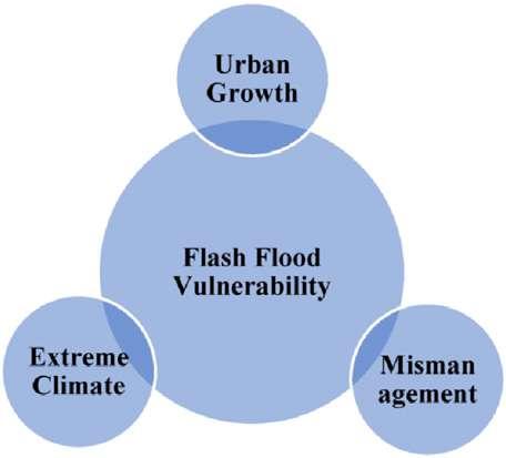
The triple impacts of three main fac tors on the flood disaster risk impacts in the urban wadi basins. The first fac tor is mismanagement (including lack of knowledge, missing warning sys
tems, and mitigation of floods), the second factor is extreme climate, and the third factor is the urbanization growth.
The Nawwat cause a serious problem in Alexandria, many of them are dan gerous like “Al Karam” and “Al feda” which are arrive with many rains and cause many streets to drown, and the
fishermen are forbidden to go to the sea because it become very danger ous and the risk of their boats to sink is high.
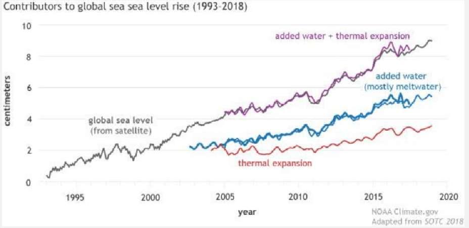
Figure 62: The three main factors on flood disaster risk / Credit: NOAA Climate Figure 63: Chart of the Nawwat percentage per year. / Credit: NOAA Climate NawwatEgypt’s Ministry of Water Resources and Irrigation said the sea level rose by an average of 1.8 millimeters each year until 1993. Over the next 20
years, it rose by 2.1 millimeters a year. Since 2012, however, the rate became 3.2 millimeters each year.
Figure 64: Fishing in Egypt / Image credit: NOAA Climate in the high emission scenario, which will cause displacement of 187 million people.
In 2019, a study projected that in low emission scenario, sea level will rise 30 centimeters by 2050 and 69 centi metres by 2100, relatively to the level in 2000. In high emission scenario, it will be 34 cm by 2050 and 111 cm by 2100. There is the probability that the rise will be beyond 2 metres by 2100
The sea level rise cause a serious prob lem to the area which may not appear in the mean while but will definently be a problem in the future.
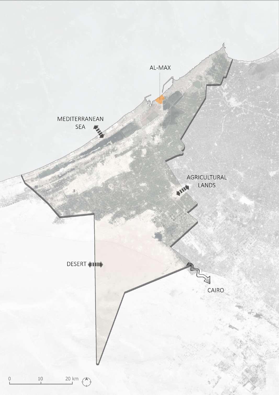
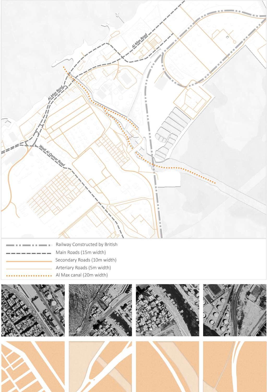
Al Max is a neighborhood in Alexan dria, Egypt, located in the Department of Amriya area in the city's western outskirts. Al Max is a fishing village situated on the Mahmoudiyah fresh water canal. Al Max is one of Egypt's most beautiful spots, yet it is rarely
visited. As Egypt was once an Otto man empire, the canal was named after Sultan Mahmud II, the Sultan of Istanbul. The Mahmudiya Canal runs to the south of the city and joins the Alexandria harbor, Egypt's main port, via a series of locks.
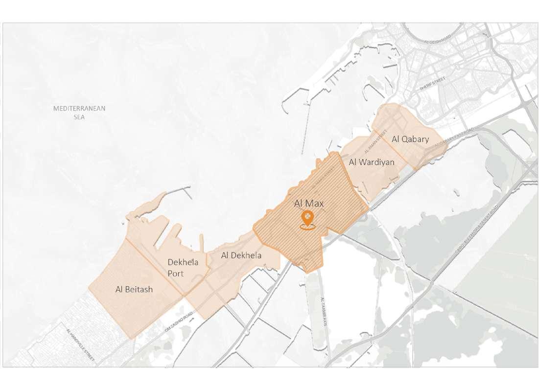
Drawing 30: Map illustrating the relation of Al-Max to it's surrounding neighborhoods. / Credit: Author
Viceroy Mohamed Ali ordered Al-Max to be excavated in 1820 to transport water from the Nile to Alexandria as well as provide a route for cargo ships. During the 19th century, the canal played an essential role in navigation, allowing supplies from Upper, Middle, and Lower Egypt to be transported
to Alexandria without going through Rosetta and the river's mouth, where many ships died in the stormy waters. Trading ships transporting imported goods from Alexandria also passed via the Mahmoudiyah Canal on their way to Cairo.
Drawing 31: Map illustrating the formation of Al-Max canal. / Credit: Author
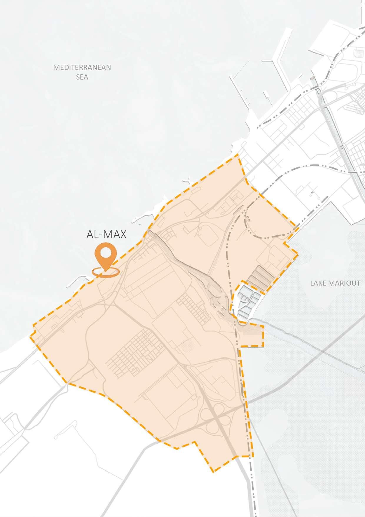
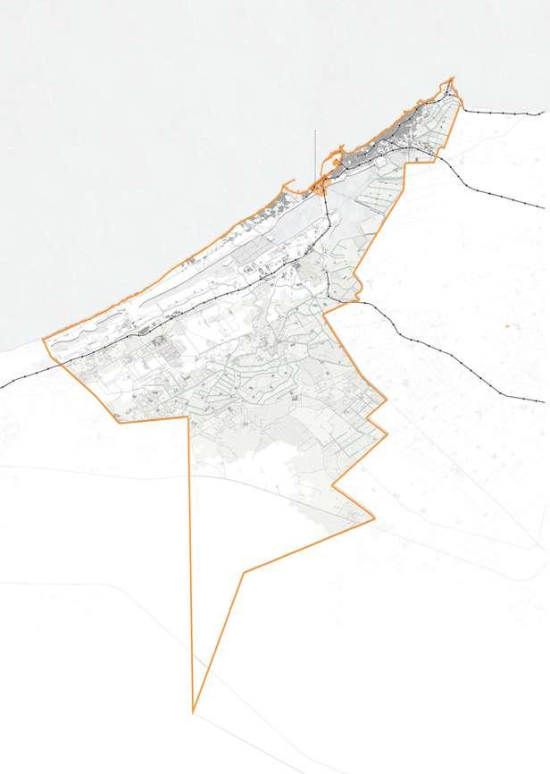
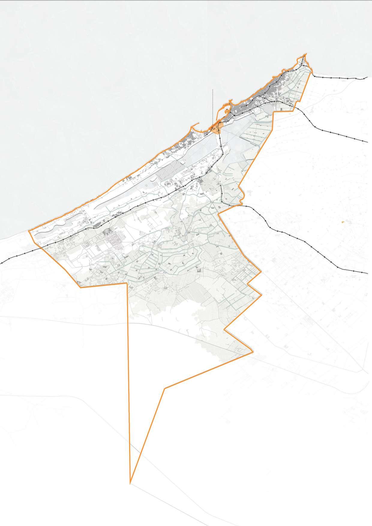
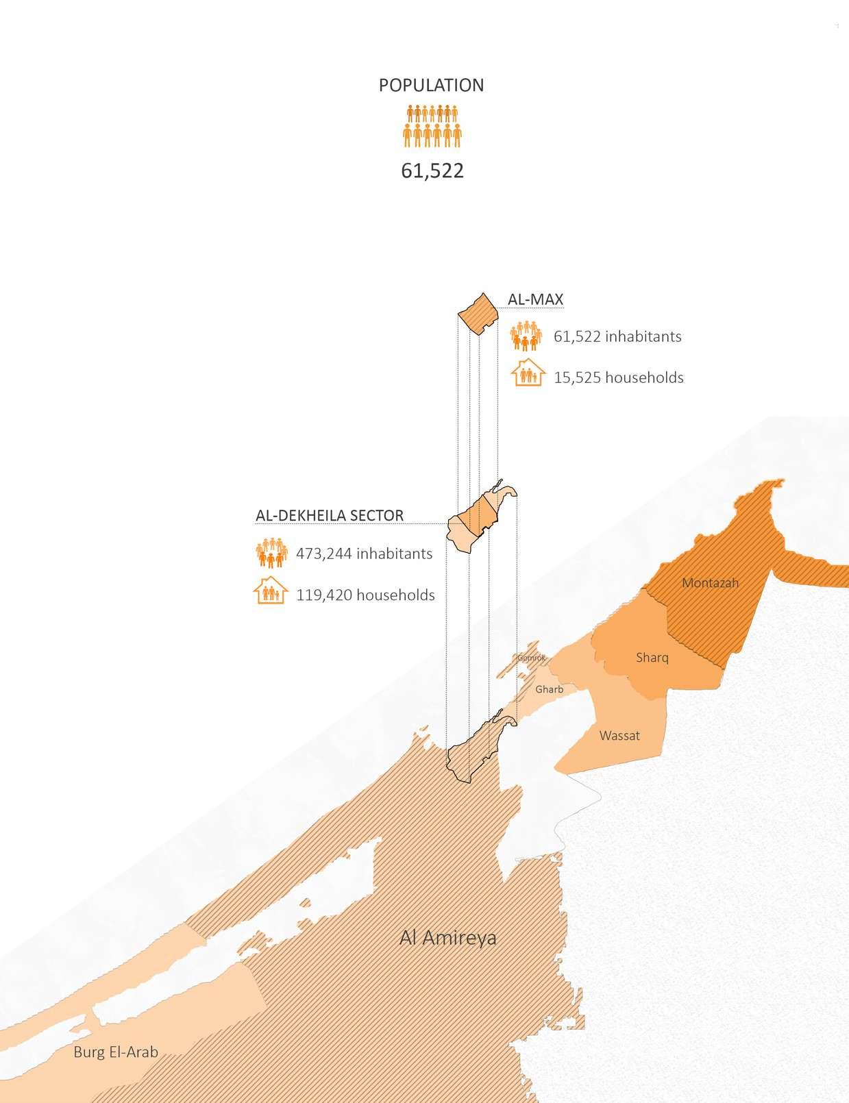
61,522 inhabitants 4.4 squared kilometer 9.7 kilometers perimeter
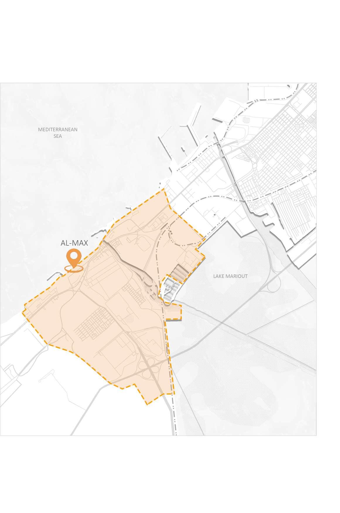
 Drawing 33: Map illustrating the boundaries of Al-Max village / Credit: Author
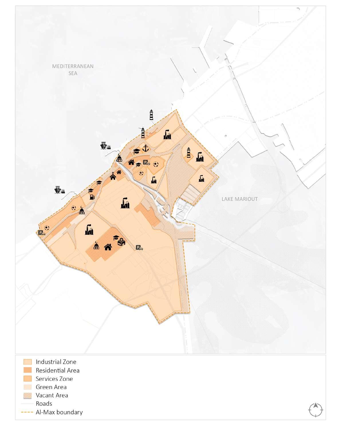
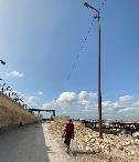
As previously stated, Al-Max features an unbalanced mix of residential and industrial zones. The neighborhood has a direct view of the sea, and the AlMax Corniche, one of the area's most well-known roadways, runs along its northern boundary. Al-Max is a lonely place with just a few tourists. Howev er, transportation is provided. Al-Max
is accessible through public transpor tation (bus and microbus) or private automobile. The services available in the region are minimal. There are a few primary and preparatory schools, as well as religious institutions and private sports groups. There is a single health clinic with minimal services.
Drawing 34: Map illustrating the Landuse in Al-Max. / Credit: Author
Scenario 1 : SLR 25 cm, Percentage area affected= 0.15%
Drawing 35: Map illustrating the flooding scenario for the year 2020. / Credit: Author
2030 Scenario 2 : SLR 50 cm, Percentage area affected= 0.2%
Drawing 36: Map illustrating the flooding scenario for the year 2030. / Credit: Author
Scenario 3 : SLR 75 cm, Percentage area affected= 0.25%
2100
Drawing 37: Map illustrating the flooding scenario for the year 2050. / Credit: Author
Scenario 4 : SLR 100 cm, Percentage area affected= 1.5%
Drawing 38: Map illustrating the flooding scenario for the year 2100. / Credit: Author
Drawing 40: The section draw ings of the canal morphology. /
Credit: Author
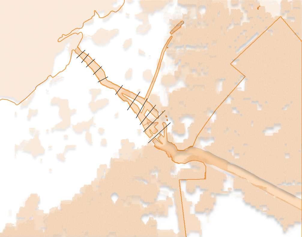
Drawing 41: Map illustrating the section lines for the ground morphology. / Credit: Author

 Drawing 42: Mapping of the ground morphology. / Credit: Author
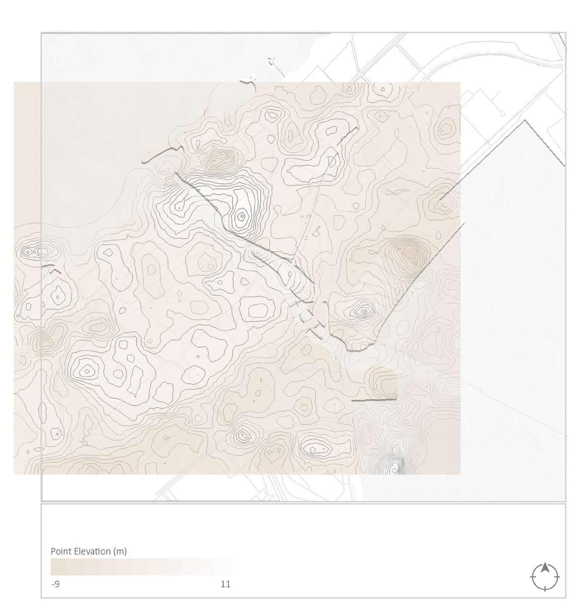 Drawing 43: Map illustrating the contour lines of Al-Max. / Credit: Author
contours
Drawing 43: Map illustrating the contour lines of Al-Max. / Credit: Author
contours
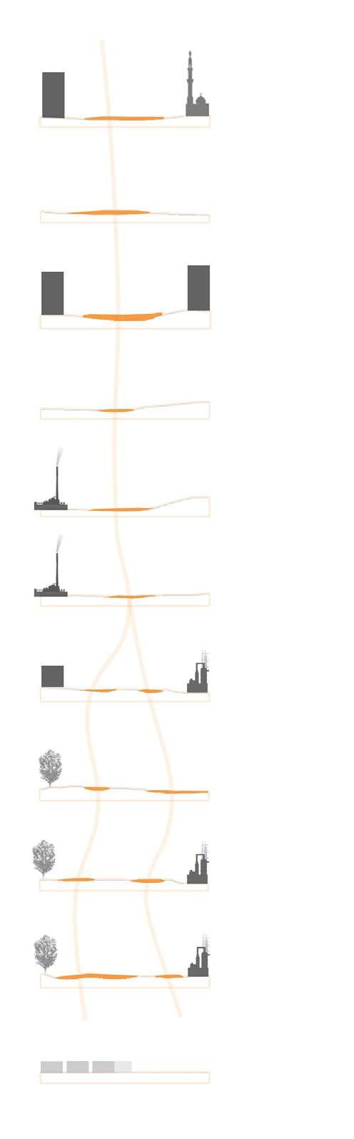
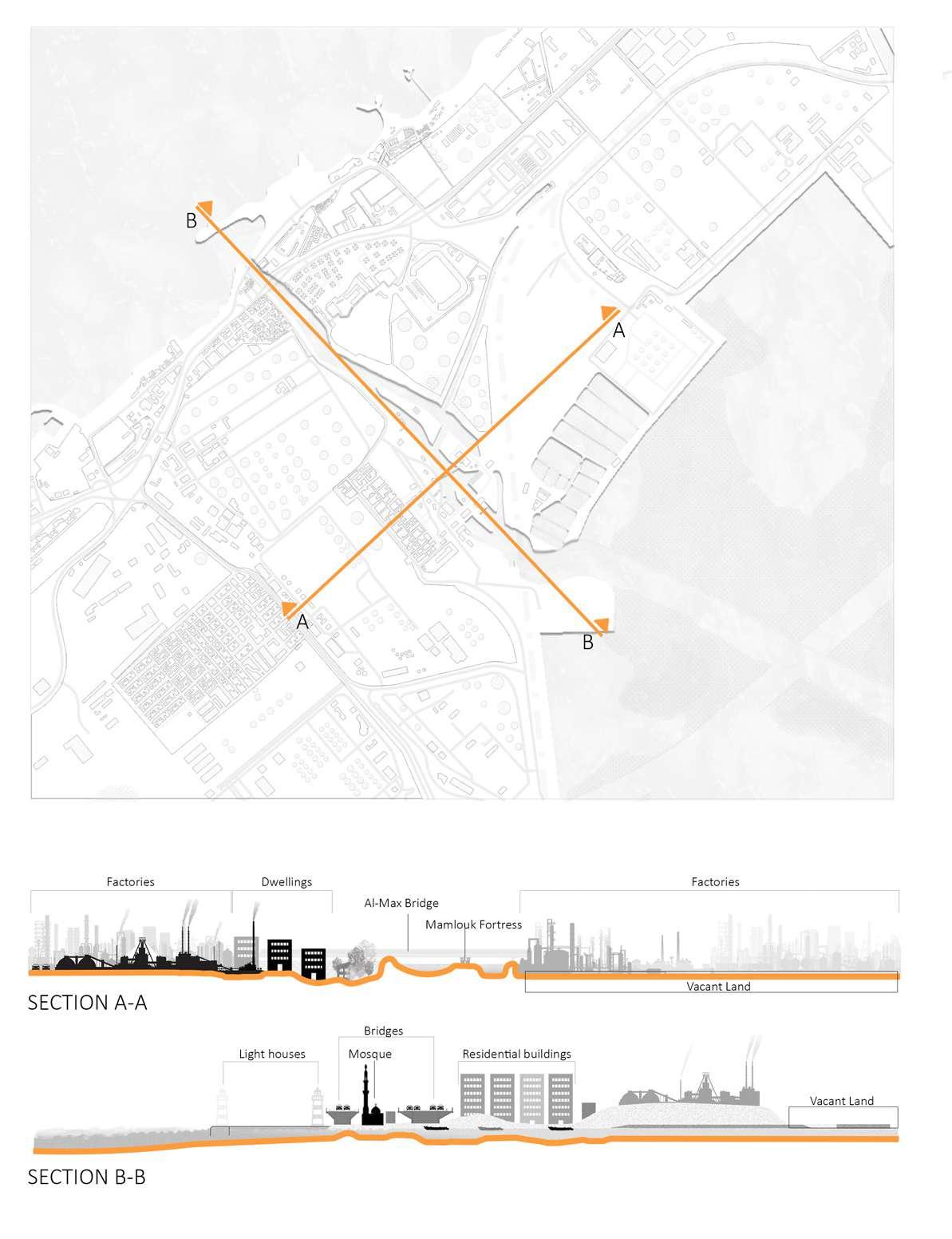
Drawing 44: Map illustrating the urban section lines in Al-Max. / Credit: Author
Drawing 45: Urban section drawings in Al-Max. / Credit: Author
Drawing 46: Map illustrating the transportation and the streets typology in Al-Max. / Credit: Author
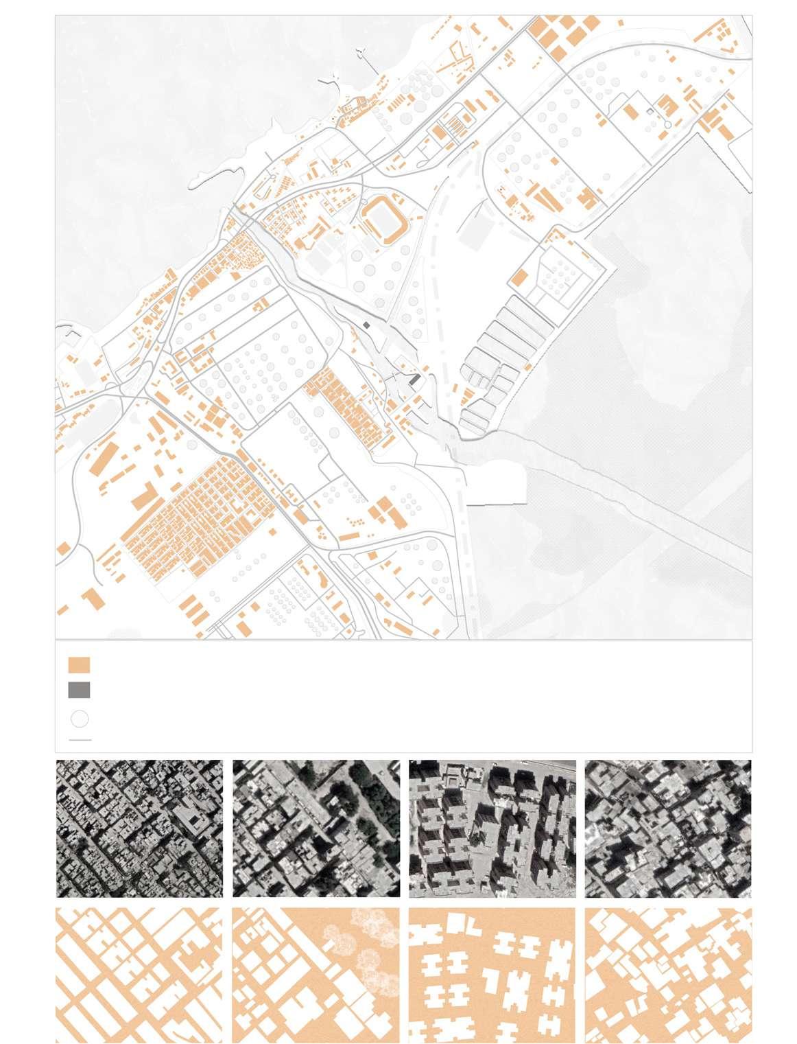
Buildings
Heritage buildings Roads Regularity
Factory pumps
Drawing 47: Map illustrating the built vs. void areas and the buildings typology in Al-Max. / Credit: Author
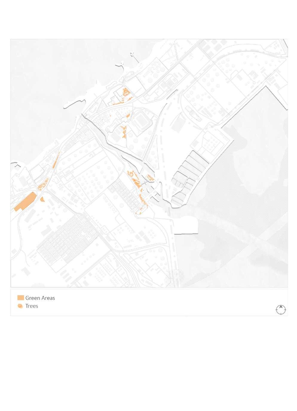
Drawing 48: Map illustrating the green ares in Al-Max. / Credit: Author
The residents of El Max go outside the area to the city center of Alexandria or other areas for daily needs, as Al-Max has no green areas or any public park.
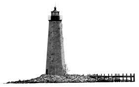
Alexandria is known for it's lighthouses, now it has five lighthouses where three of them are located in Al-Max.
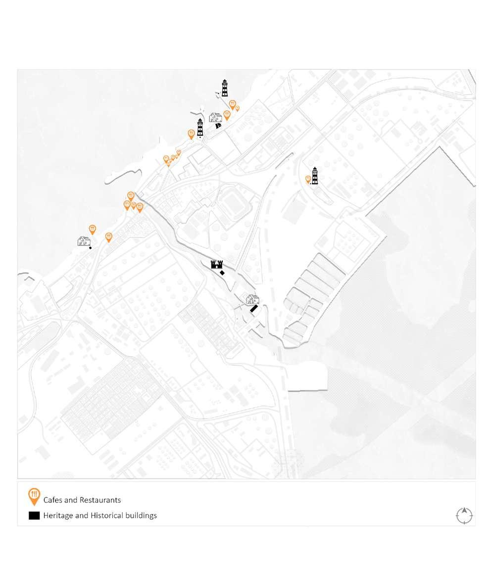 Drawing 49: Map illustrating the historical buildings and landmarks in Al-Max. / Credit: Author
LIGHT UP THE
Drawing 49: Map illustrating the historical buildings and landmarks in Al-Max. / Credit: Author
LIGHT UP THE
BC 19th Century
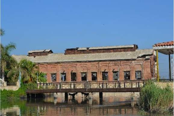
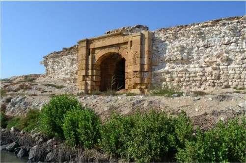
Archaeological Fortress of El-Max Industrial Heritage Building Figure 66: Image credit: Dina M. Nassar Figure 68: Image credit: Dina M. Nassar Figure 67: Image credit: Dina M. Nassar
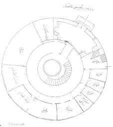
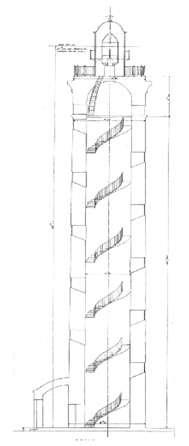
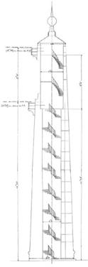
Figure 70: Deteriorated condition of Mex Old Lighthouse and its section re spectively. / Image credit: Yasser Aref
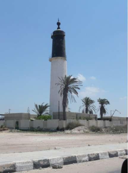
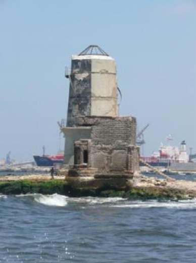
19081890
Figure 71: Northern view and section of the Mex High Lighthouse respectively. / Image credit: Yasser Aref
Figure 69: Views of the Low Mex Lighthouse showing their setting and alignment. / Image credit: Yasser Aref
Drawing 50: Map illustrating the lighthouses in Al-Max. / Credit: Author
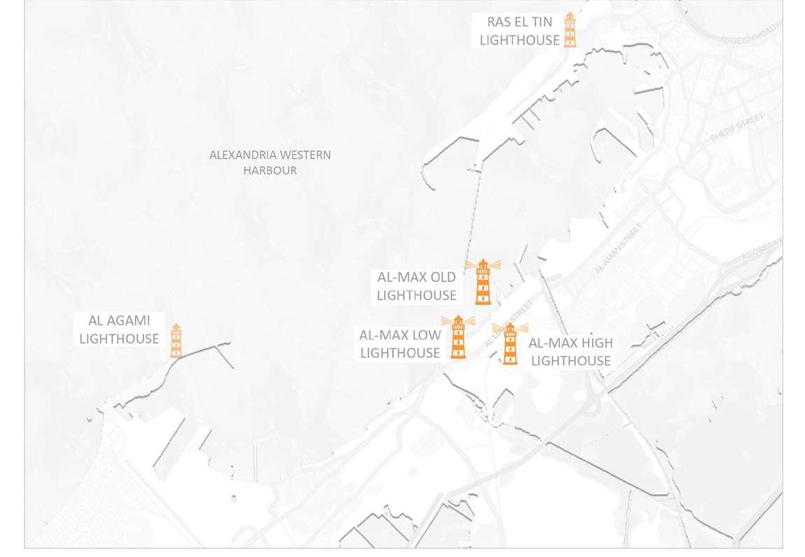
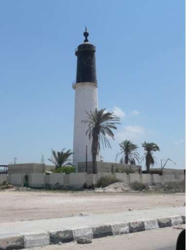
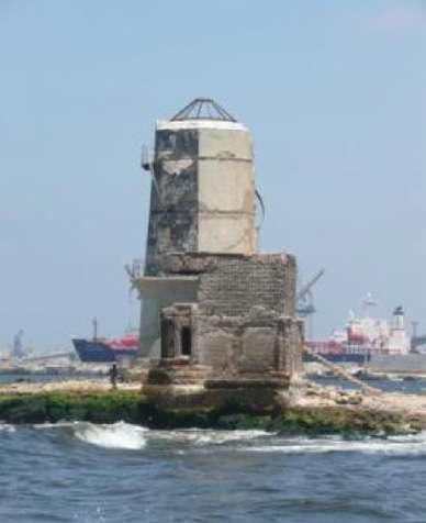
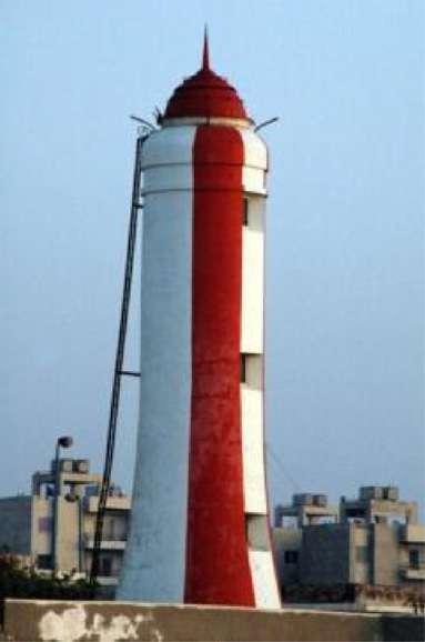 Figure 72: Northern view of the Mex High Lighthouse respectively. / Image credit: Yasser Aref
Figure 73: Deteriorated condition of Mex Old Lighthouse and its section re spectively. / Image credit: Yasser Aref
Figure 74: Views of the Low Mex Lighthouse showing their setting and alignment. / Image credit: Yasser Aref
Al Mex High (Grand) Lighthouse
Al Mex Low Lighthouse
Al Mex Old Lighthouse
Figure 72: Northern view of the Mex High Lighthouse respectively. / Image credit: Yasser Aref
Figure 73: Deteriorated condition of Mex Old Lighthouse and its section re spectively. / Image credit: Yasser Aref
Figure 74: Views of the Low Mex Lighthouse showing their setting and alignment. / Image credit: Yasser Aref
Al Mex High (Grand) Lighthouse
Al Mex Low Lighthouse
Al Mex Old Lighthouse
The settlement of "Qaryat Al-Sayadin" was regarded an important compo nent of the city, although Al-Max is much more than that. It is a diverse region with businesses, residential spaces, and services. Each neighbor hood is distinct from the others, hav ing its own set of features. As a result,
this research examines each neigh borhood independently. The Wadi Al-Qamar Dwellings, Al-Max Resi dents' Dwellings, Fishermen's Dwell ings, Officers' Dwellings, and Al-Max Coast (Al-Tabiya) Dwellings are the neighborhoods in question.
Drawing 51: Map illustrating theresidential dwellings and informal settlements in Al-Max. / Credit: Author
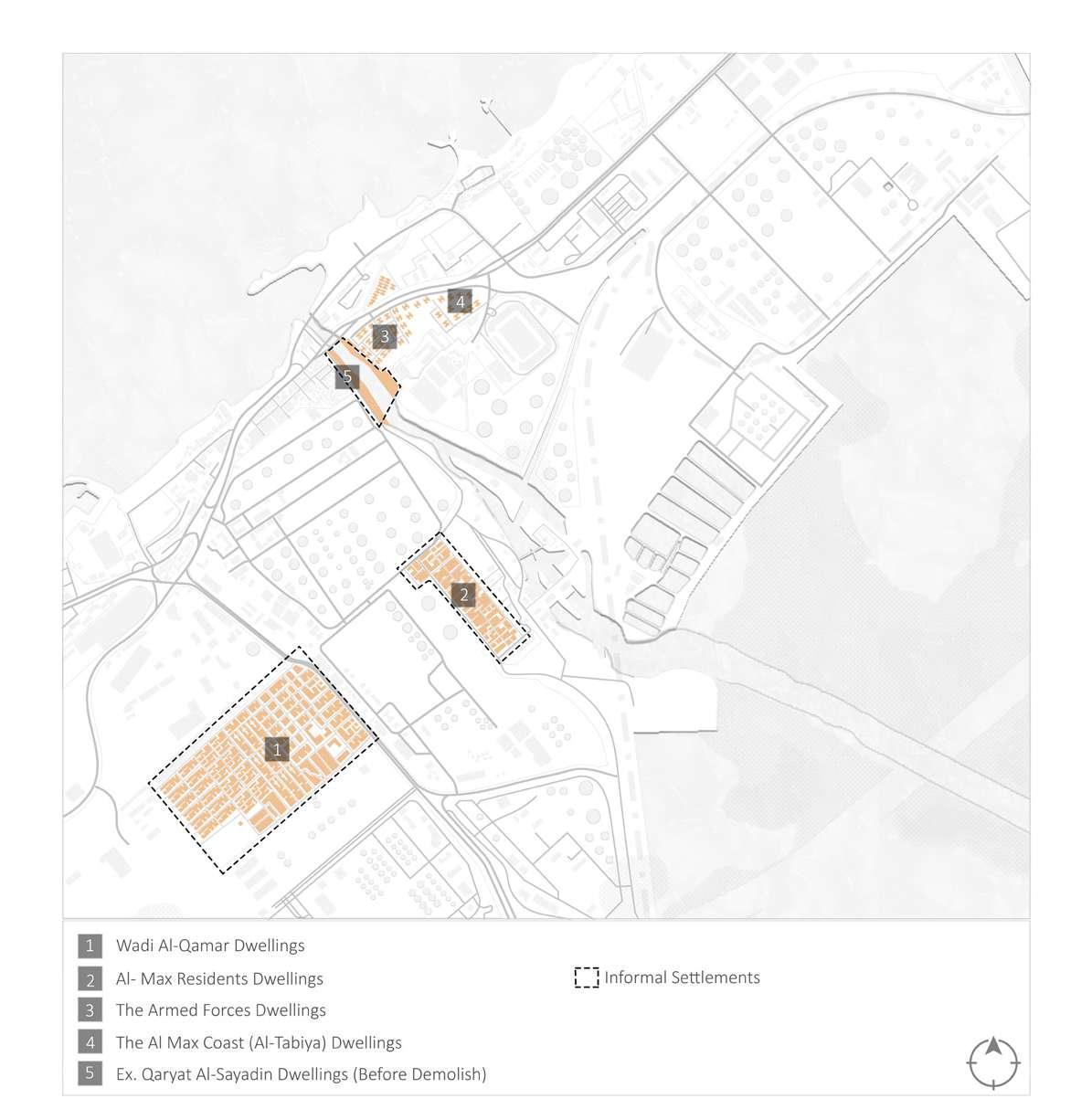
The Al-Max Coast (Al-Tabiya) Dwell ings are near to the canal and have a view of the sea. The Corniche sep arates it. The Al-Max Coast (Al-Tabi ya) Dwellings were built by the government as part of a ten-year project and marketed to locals. The residences in this area are in de cent shape and have all of the neces sities (electricity, gas, and sewage). Although the area has certain local businesses, such as a grocery and an army consumer goods outlet, resi dents prefer to shop at the Al-Ward ian markets or downtown. Despite the fact that the area is new, it is ne glected, and waste clogs the streets and alleyways. There are no hospitals, pharmacies, or health clinics. Al-Da khila and Al-Wardian have hospitals
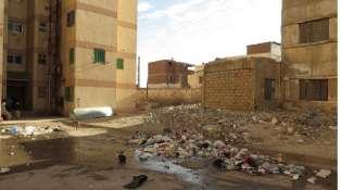
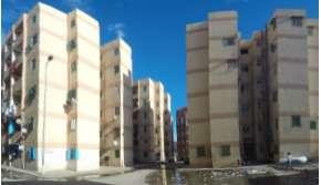
nearby. Furthermore, there are no educational services in the Al-Max region as a whole. The Al-Shaheed Saber School and the Al-Max Elemen tary School are the only two prima ry schools in the area (the latter has only one classroom per each grade). A middle school for females is also avail able. Those with a higher socioeco nomic standing send their children to Al-Ajami and Al-Wardian schools. Oth er service deficiencies, such as a lack of sufficient lighting in the region and pollutants from the APF, have lowered inhabitants' quality of life.Given the history of such locations, there are concerns about the viability of devel opment. However, the area can be de veloped given the present population density and great infrastructure.
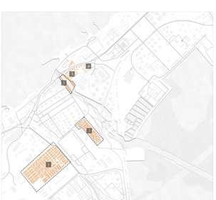 Figure 75: Uses of housing in El-Max Coast al Dwellings. / Image credit: Heba Hatem / Gehad Ahmed Abo Yusuf / Lobna Ali
Figure 76: Uses of housing in El-Max Coast al Dwellings. / Image credit: Heba Hatem / Gehad Ahmed Abo Yusuf / Lobna Ali
Figure 75: Uses of housing in El-Max Coast al Dwellings. / Image credit: Heba Hatem / Gehad Ahmed Abo Yusuf / Lobna Ali
Figure 76: Uses of housing in El-Max Coast al Dwellings. / Image credit: Heba Hatem / Gehad Ahmed Abo Yusuf / Lobna Ali
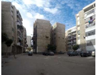
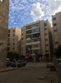
The Armed Forces Dwellings are a modest residential enclave with me dium-sized dwellings, made up of 15 gated residential complexes with se curity at the entrances. The Al-Max major road is to the north, while the Haras Al-Hodud Football Stadium is to the south (a main stadium for the sec ond division football league). Football practice fields and Haras Al-Hodud Club headquarters are located near the stadium. The Al-Tabiya Dwellings are located to the west. During the late 1990s, this community was cre ated for military officers. The Mustafa Kamel Dwellings in Rushdie and other locations, for example, hosted both officers and citizens who owned and
rented the units throughout time. When you first go into the neighbor hood, you'll note how calm it is, with just inhabitants filling the streets. The buildings appear to be uniform and abandoned, and you have to look hard to tell if people live there because they appear to be empty. The kinds of vehicles parked adja cent to each building might reveal social class and economical level. According to the residents of the neighborhood, the region lacks vital services that are provided to the sur rounding towns. There is just a grocery and a small bookshop nearby, and the nearest markets are at Al-Wardian, Bab Omar Basha, and Al-Dakhila.
Figure 77: Photos that clarifies the lack of services. / Image credit: Heba Hatem / Gehad Ahmed Abo Yusuf / Lobna Ali
B
A
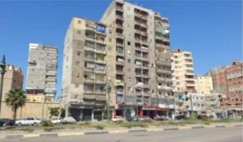
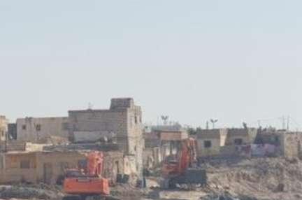
Three parallel streets make up the AlMax Residents' Dwellings, a modest residential enclave. The community is more cohesive since the location is secluded from its surroundings. The houses are situated by a canal. The region here, like the Wadi Al-Qamar Dwellings, is surrounded by industries, with the APF on the western side. The Wadi Al-Qamar and Al-Max Residents Dwellings were previously one, but the APF divided them into two.
To get to the main street, residents of Al-Max utilize "Karteh"1 or "Taman nayah"2. The streets are not paved or illuminated. Lamp posts do exist, although they are rarely maintained. Because the neighborhood has few
resources, locals turn to Al-Wardian for assistance. There are no health services in the region, although there are some basic amenities (electric ity and sewage) that were installed more than a decade ago. The AFP has caused damage to the homes, and lo cals are always afraid of the factory's explosions. Some locals have indicat ed a wish to leave since the situation has gotten untenable.
“There are no services at all. Even light poles are not working. You walk at night in very dark streets. At least we can say that this area is safe.” -Interview with a local resident, Janu ary 20, 2017
Figure 78: Photos that clarifies the building conditions. / Image credit: Heba Hatem / Gehad Ahmed Abo Yusuf / Lobna Ali BA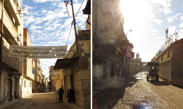
• Building condition: Moderate
Even though it was a "Residential Area" before the factories were built, Wadi Al-Qamar is recognized as a "In dustrial Zone." Alexandria Petroleum Factory (APF), the Salt Factory, Alexan dria Portland Cement Factory (APCF), and the Alexandria Petroleum Com pany surround Wadi Al-Qamar (APC). Although this position separates Wadi Al-Qamar from the rest of the residen tial regions, it also strengthens their bonds. Wadi Al-Qamar Street, a road way that runs east-west, is the princi pal thoroughfare for trucks and autos. Despite being the neighborhood's major thoroughfare, it is poorly paved and has narrow sidewalks, making it dangerous for pedestrians. The topography of the region is evi
dent, but the roadways are unpaved and in terrible condition. The region contains all of the essential facilities (electricity, sewage, gas, etc. ), but the road drainage system is insuffi cient, resulting in significant flooding every winter. 60,000 people live in Wadi Al-Qamar, however services are limited. There is only one elementary school established by APCF, a health clinic open from 9 a.m. to 1 p.m. that offers only exams (no treatments), and a few local facilities (cafes, a youth center, grocery store, butcher, pharmacy, and market). In most cases, these services only supply the mini mal necessities; inhabitants must go to Alexandria or Al-Wardian to meet their other requirements.
Figure 79: Photo that clarifies the streets of Al-Qamar district. / Image credit: Heba Hatem / Gehad Ahmed Abo Yusuf / Lobna Ali
A B
People call this neighborhood "The Death Triangle’”
“Most people here have asthma” (Interview with a local resident, Janu ary 20, 2017)
Wadi Al-Qamar has a long history of suffering and pollution. The area is considered a “polluted area,” and the situation is worsening over time. The Wadi Al-Qamar dwellings comprised the first neighborhood in the Al-Max area, yet, residents’ needs and de mands are rarely taken into account.
“Many people came and filmed, but no one helped us.”
(Interview with a local resident, Janu ary 20, 2017)
The villagers of Wadi Al-Qamar are suffocated by the APCF's smoke and dust emissions. Residents' health
is harmed as black clouds of smoke gather around the area.
“In the past, we were able to handle this situation; however, APCF now burns coal and trash, causing severe black smoke.”
(Interview with a local resident, Janu ary 20, 2017)
The APF, on the other hand, is a ma jor source of noise pollution; however, what frightens the residents the most are the fires and explosions that ema nate from the factory.
“Last time the APF had an explosion, people left their houses panicking and started roaming in the streets, running away from the fire. They had nowhere to stay.” (Interview with a local resident, Janu ary 20, 2017)
B C
Dwellings before demolish
- =
Factories built over Dwellings area demolished
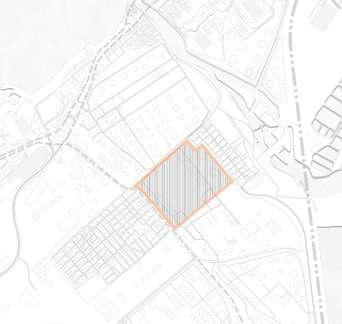
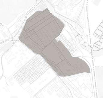
Figure 80: Map illustrating the stages of demolishing of Wadi Al-Qama dwellings in Al-Max. / Credit: Author
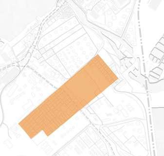 - Wadi alqamar
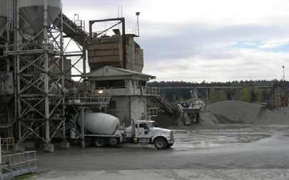
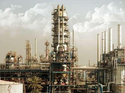
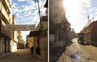
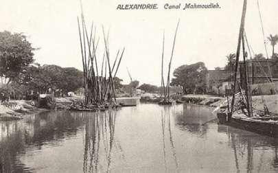 Wadi Al-Qamar Dwellings
Alexandria Petroleum Factory (APF)
Alexandria Portland Cement Factory (APCF)
Alexandria Mineral Oils Company (AMOC)
1917 1937 1948 1954 1997
Figure 81: The Egyptian Shipping Com pany Building in Alexandria, Egypt. / Im age credit: Mohamed Abo Al Einein
Figure 82: A scene on the canal cap tured in an 1890s French postcard. / Im age credit: unknown
Figure 83: Photo that clarifies the streets of Al-Qamar district. / Image credit: Heba Hatem / Gehad Ahmed Abo Yusuf / Lobna Ali
Figure 84: A cement factory / Image credit: unknown
Figure 85: An oil factory / Image credit: Henor Arab Industrial Security Co.
Figure 86: Alexandria Mineral Oils Com pany. / Image credit: unknown
Wadi Al-Qamar Dwellings
Alexandria Petroleum Factory (APF)
Alexandria Portland Cement Factory (APCF)
Alexandria Mineral Oils Company (AMOC)
1917 1937 1948 1954 1997
Figure 81: The Egyptian Shipping Com pany Building in Alexandria, Egypt. / Im age credit: Mohamed Abo Al Einein
Figure 82: A scene on the canal cap tured in an 1890s French postcard. / Im age credit: unknown
Figure 83: Photo that clarifies the streets of Al-Qamar district. / Image credit: Heba Hatem / Gehad Ahmed Abo Yusuf / Lobna Ali
Figure 84: A cement factory / Image credit: unknown
Figure 85: An oil factory / Image credit: Henor Arab Industrial Security Co.
Figure 86: Alexandria Mineral Oils Com pany. / Image credit: unknown
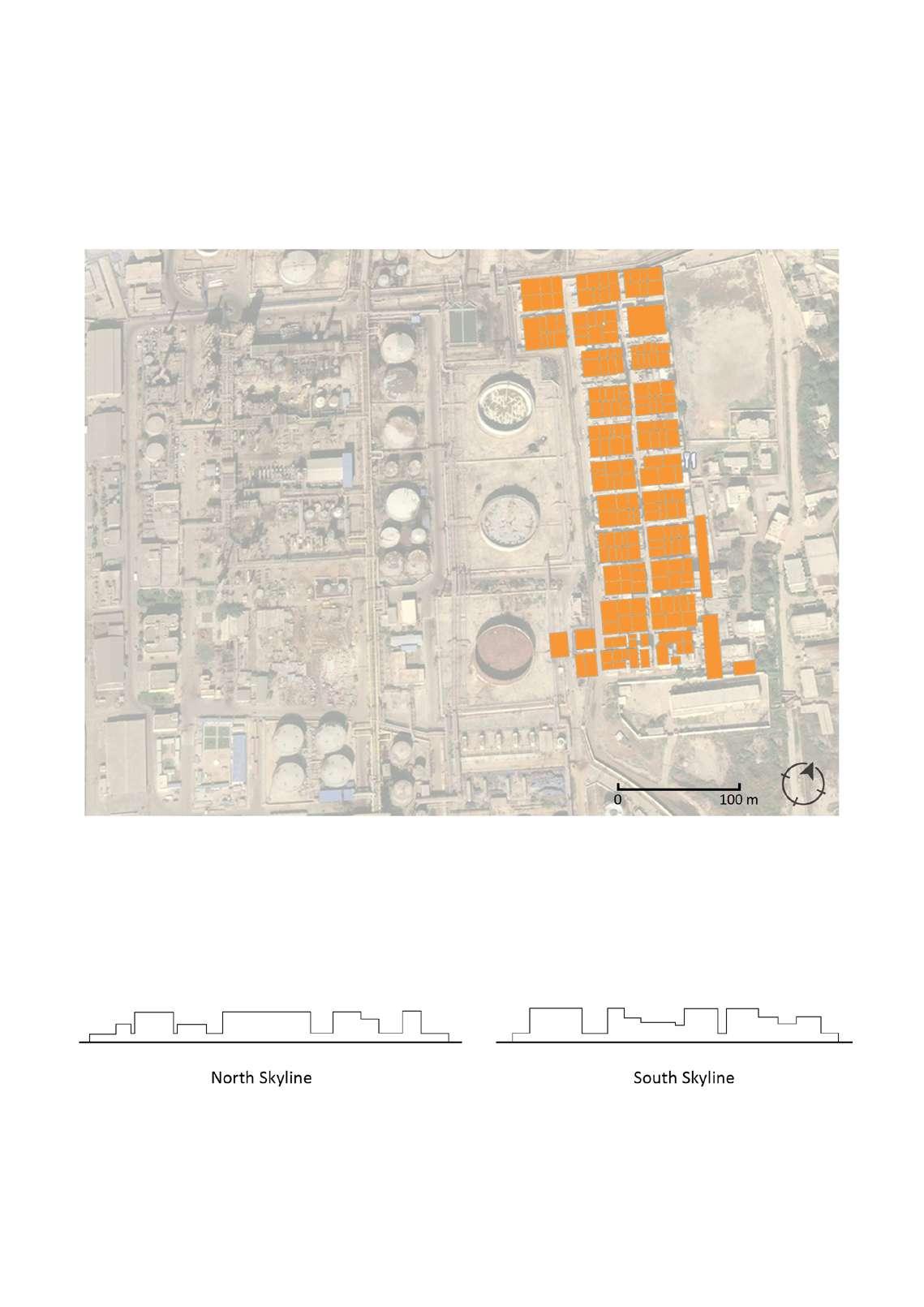
Drawing 52: Map illustrating the residential dwellings and informal settlements in Al-Max. / Credit: Author
Drawing 53: Section drawings for the skyline of "Wadi Al-Qamar" dwellings in Al-Max. / Cred it: Author
Drawing 54: 3D illustrations of the building condition, structure and height for the "Wadi Al-Qamar" dwellings in Al-Max. / Credit: Author
Qaryat Al-Sayadin includes Al-Max ca nal, with its various fishing boats, as well as the colorful houses overlook ing it. The name of the multi-genera tion fishermen’s village indicates how closely the inhabitants are linked to the surrounding environment. We can see also how they benefit from the ca nal and the sea to earn their daily live lihood (Egyptian Center for Economic and Social Rights 2016).
The State has made many attempts to relocate the villagers out of the area. Fishermen were always watching their boats, and in the event of a sudden storm, they must rush to move their boats into the canal to protect them from being destroyed by intense wa ter and winds.
Al-Max is an area prone to sinking. The Pump Station in Qaryat Al-Saya din, however, can control the wa ter level, reducing the impact of the floods.
The area lacks a hospital, as well as other simple health services, like dental clinics. The British dug the ca nal during the occupation for drain age purposes. The dumping of fac tory waste and water pollution into
the canal, therefore, occurred from the beginning. However, the volume of garbage and trash has increased dramatically over the years, and has caused an enormous buildup of trash in the canal, leading to a lack of fish and reduced income for fishermen. Moreover, the declining supply of fish, a larger labor force and costly boat engine fuel more than doubled the price of fish.
Is the trash buildup a result of the neighborhood initially being used for drainage before the arrival of the vil lagers? If so, is it self-evident to re locate the residents away from the canal? Or is it better to try to reach a compromise and find a satisfactory solution? Is there a solution that would allow for both the use of the canal as drainage and for the residents to con tinue living there, while implementing environmental methods to reduce the damage of the drainage on them?
“This area used to give two or three tons of tilapia; however, since the fac tories started dumping, the fish start ed to die faster, and what remains is far less than before.”
(A fisherman, January 2017)
residential dWellinGs - qaryat alsayyadinFigure 87: Developing the Max area in Al exandria within the state’s plan to develop the slums and turn it into an attractive area for tourism. / Image credit: Walid H.
Figure 89: Al Max is one of the several ar eas that have been affected by environmen tal pollution due to the chemical and petro leum industries, Alexandria, Egypt. / Image credit: Mohamed Osam
Figure 88: Buildings in Al-Max area / Im age credit: unknown
Figure 90: Residential buildings in Al-Max, Alexandria, Egypt. / Image credit: Sue Wil liamson
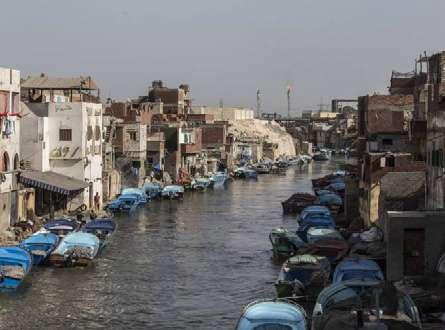
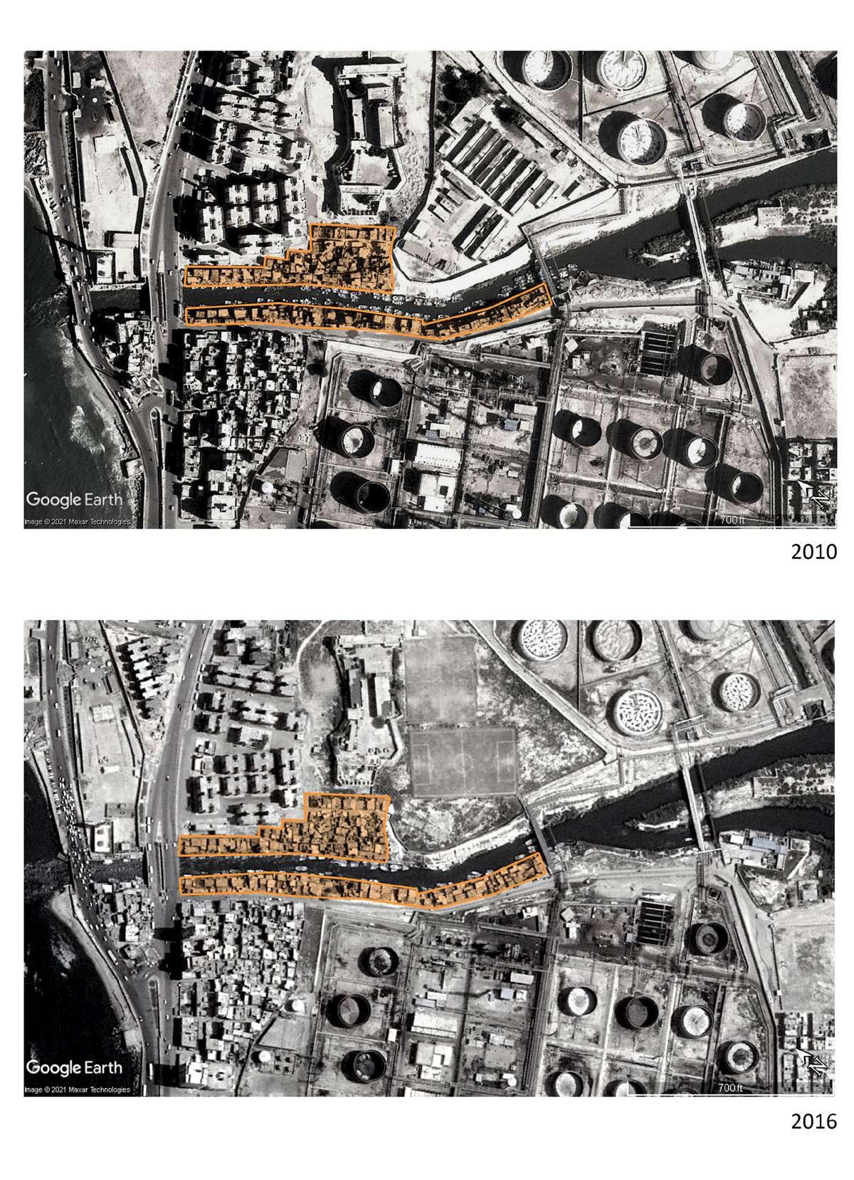 Figure 91: Satellite image from google illustrating the informal settlements of "Qaryat Al-Sayyadin" dwellings before the demolish / Image credit: Author
Figure 92: Satellite image from google illustrating the informal settlements of "Qaryat Al-Sayyadin" dwellings sewing up the canal / Image credit: Author
Figure 91: Satellite image from google illustrating the informal settlements of "Qaryat Al-Sayyadin" dwellings before the demolish / Image credit: Author
Figure 92: Satellite image from google illustrating the informal settlements of "Qaryat Al-Sayyadin" dwellings sewing up the canal / Image credit: Author
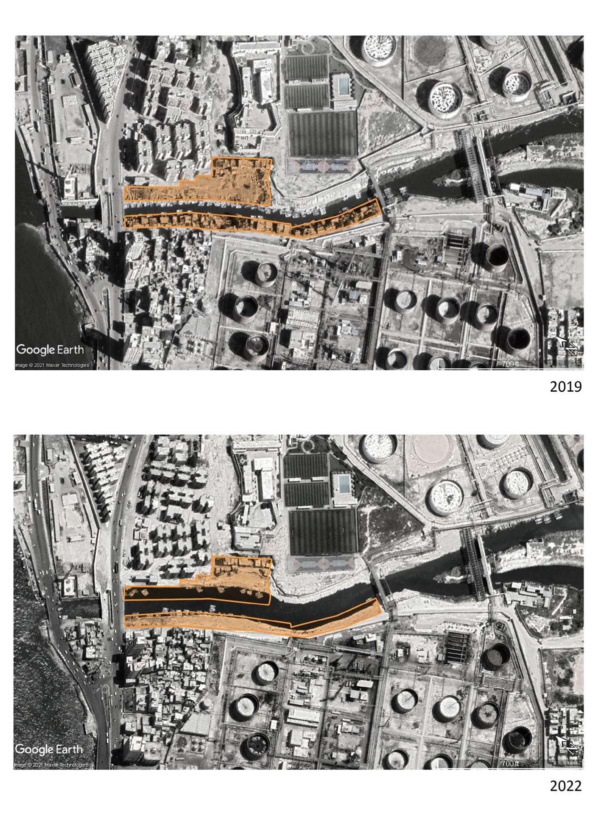 Figure 93: Satellite image from google illustrating the informal settlements of "Qaryat Al-Sayyadin" dwellings during the demolish / Image credit: Author
Figure 94: Satellite image from google illustrating the informal settlements of "Qaryat Al-Sayyadin" dwellings after the demolish / Image credit: Author
Figure 93: Satellite image from google illustrating the informal settlements of "Qaryat Al-Sayyadin" dwellings during the demolish / Image credit: Author
Figure 94: Satellite image from google illustrating the informal settlements of "Qaryat Al-Sayyadin" dwellings after the demolish / Image credit: Author
Table 2: Types of native plants in Alexandria Coastal Zones.
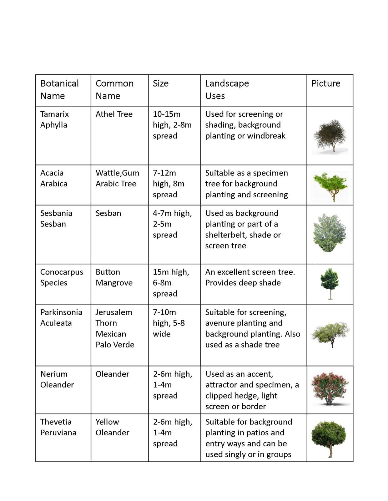
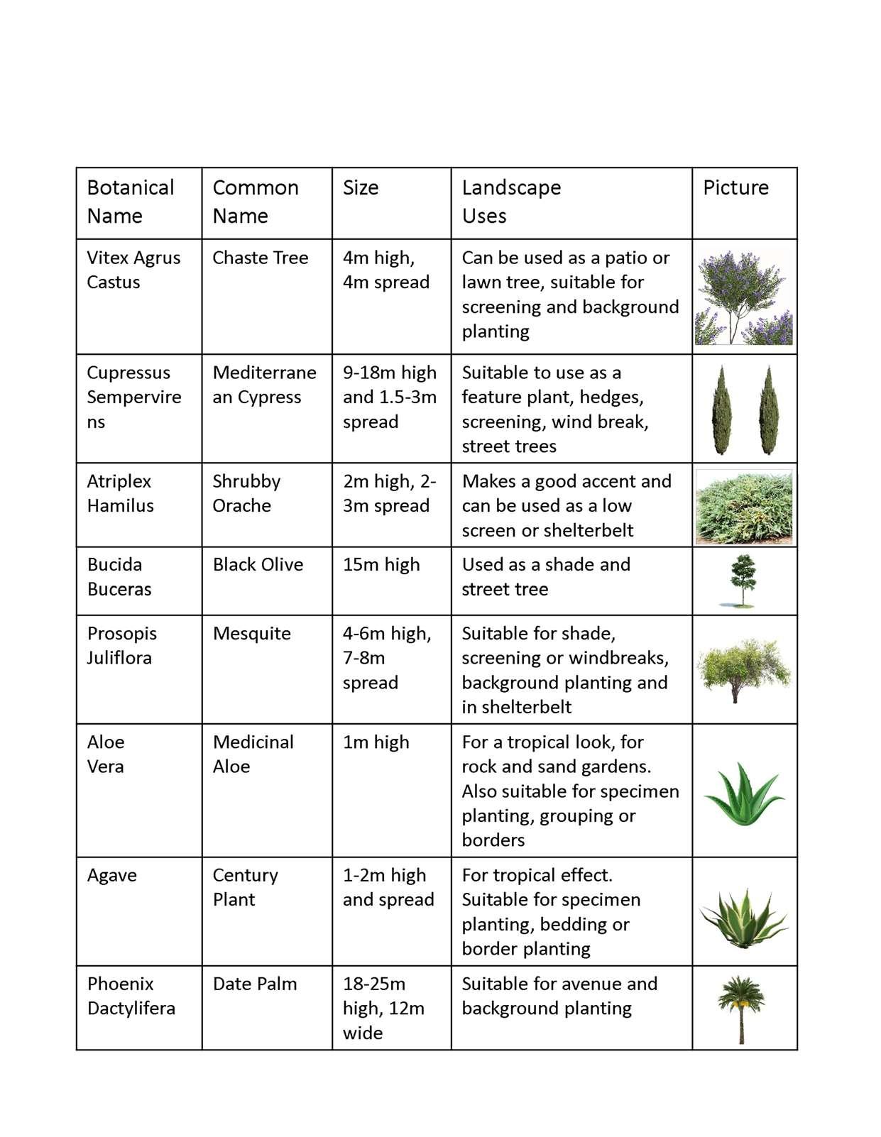 Table 3: Types of native plants in Alexandria Coastal Zones.
Table 4: Types of native fish in Alexandria, Egypt.
Table 5: Types of native fish in Alexandria, Egypt.
collage
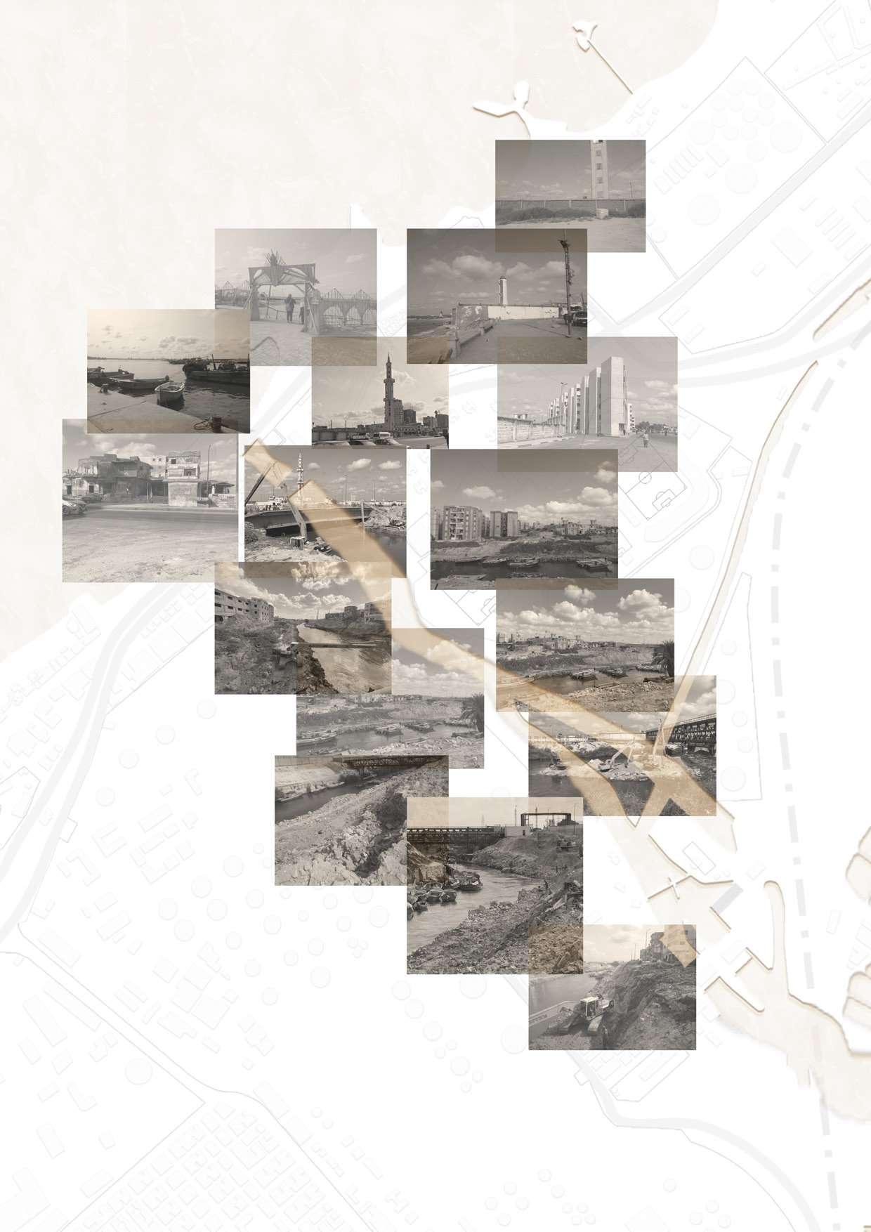
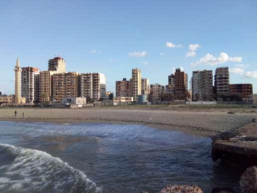
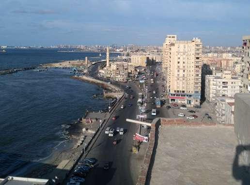
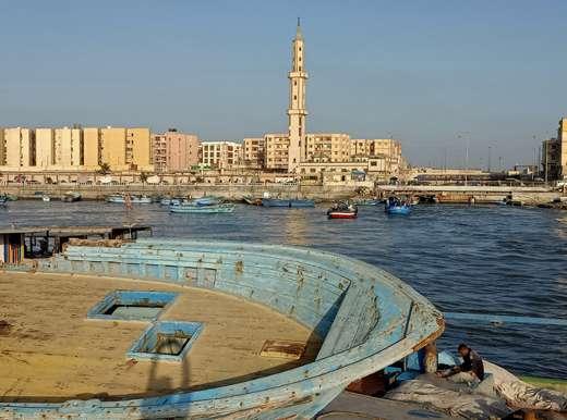
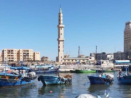
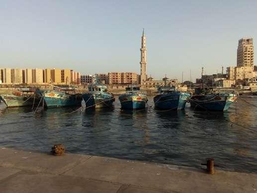 Figure 95: Image credit: Author
Figure 99: Image credit: Google Earth
Figure 96: Image credit: Google Earth
Figure 98: Image credit: Google Earth
Figure 100: Image credit: Google Earth
Figure 97: Image credit: Google Earth
Figure 95: Image credit: Author
Figure 99: Image credit: Google Earth
Figure 96: Image credit: Google Earth
Figure 98: Image credit: Google Earth
Figure 100: Image credit: Google Earth
Figure 97: Image credit: Google Earth
Figure 101: Satellite image from google illustrating the location of the images captured. / Image credit: Author
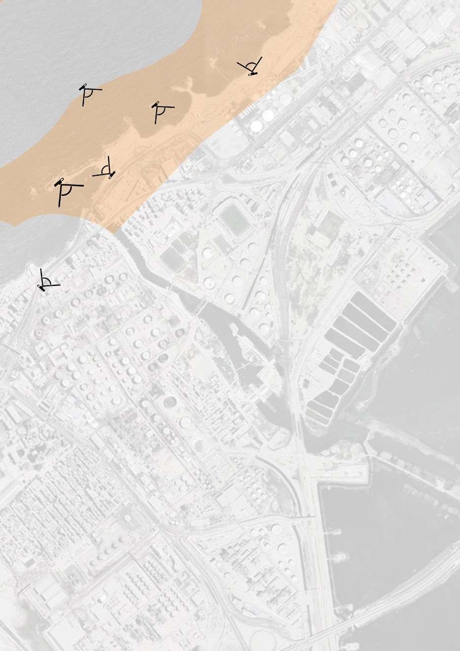

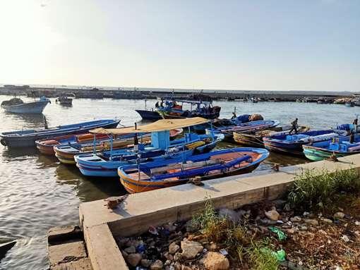
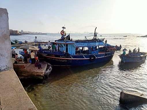
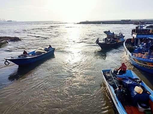
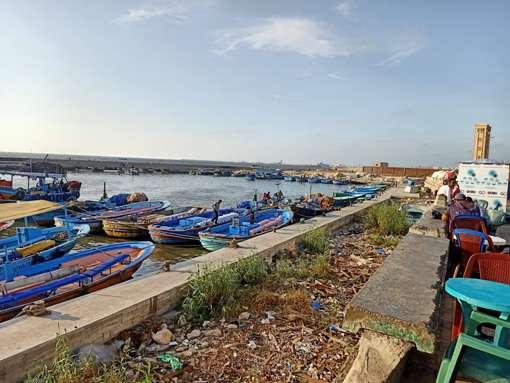
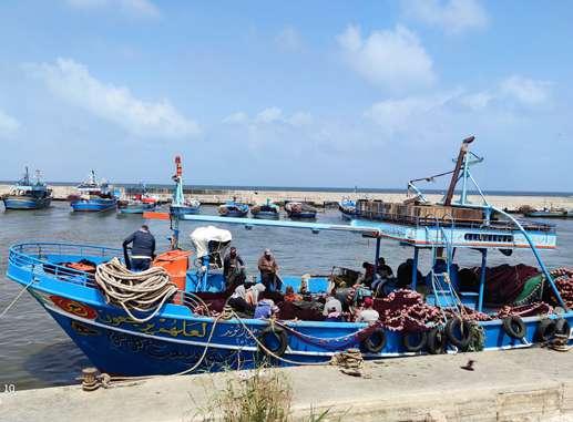 Figure 102: Image credit: Google Earth
Figure 104: Image credit: Google Earth
Figure 106: Image credit: Google Earth
Figure 103: Image credit: Google Earth
Figure 105: Image credit: Google Earth
Figure 107: Image credit: Google Earth
site imaGes - sea port
Figure 102: Image credit: Google Earth
Figure 104: Image credit: Google Earth
Figure 106: Image credit: Google Earth
Figure 103: Image credit: Google Earth
Figure 105: Image credit: Google Earth
Figure 107: Image credit: Google Earth
site imaGes - sea port
Figure 108: Satellite image from google illustrating the location of the images captured. / Image credit: Author
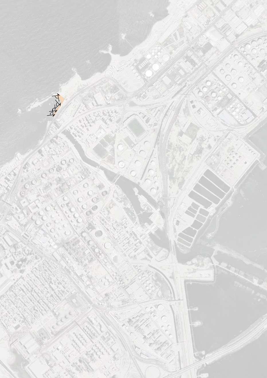
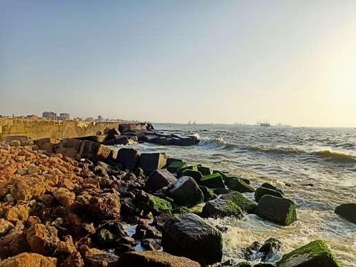
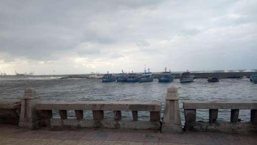
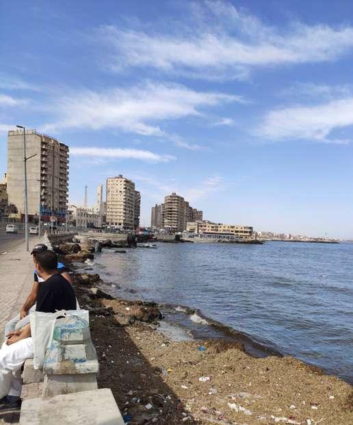
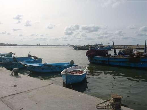
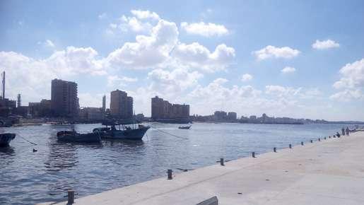
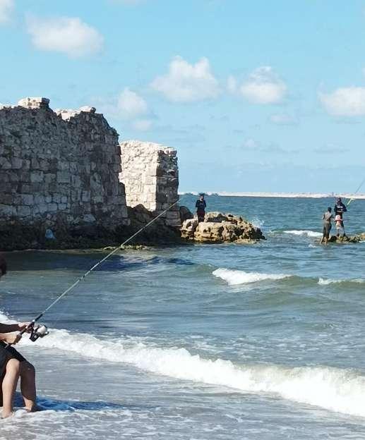 Figure 109: Image credit: Google Earth
Figure 110: Image credit: Author
Figure 111: Image credit: Google Earth
Figure 113: Image credit: Google Earth
Figure 112: Image credit: Google Earth
Figure 114: Image credit: Google Earth
Figure 109: Image credit: Google Earth
Figure 110: Image credit: Author
Figure 111: Image credit: Google Earth
Figure 113: Image credit: Google Earth
Figure 112: Image credit: Google Earth
Figure 114: Image credit: Google Earth
Figure 115: Satellite image from google illustrating the location of the images captured. / Image credit: Author
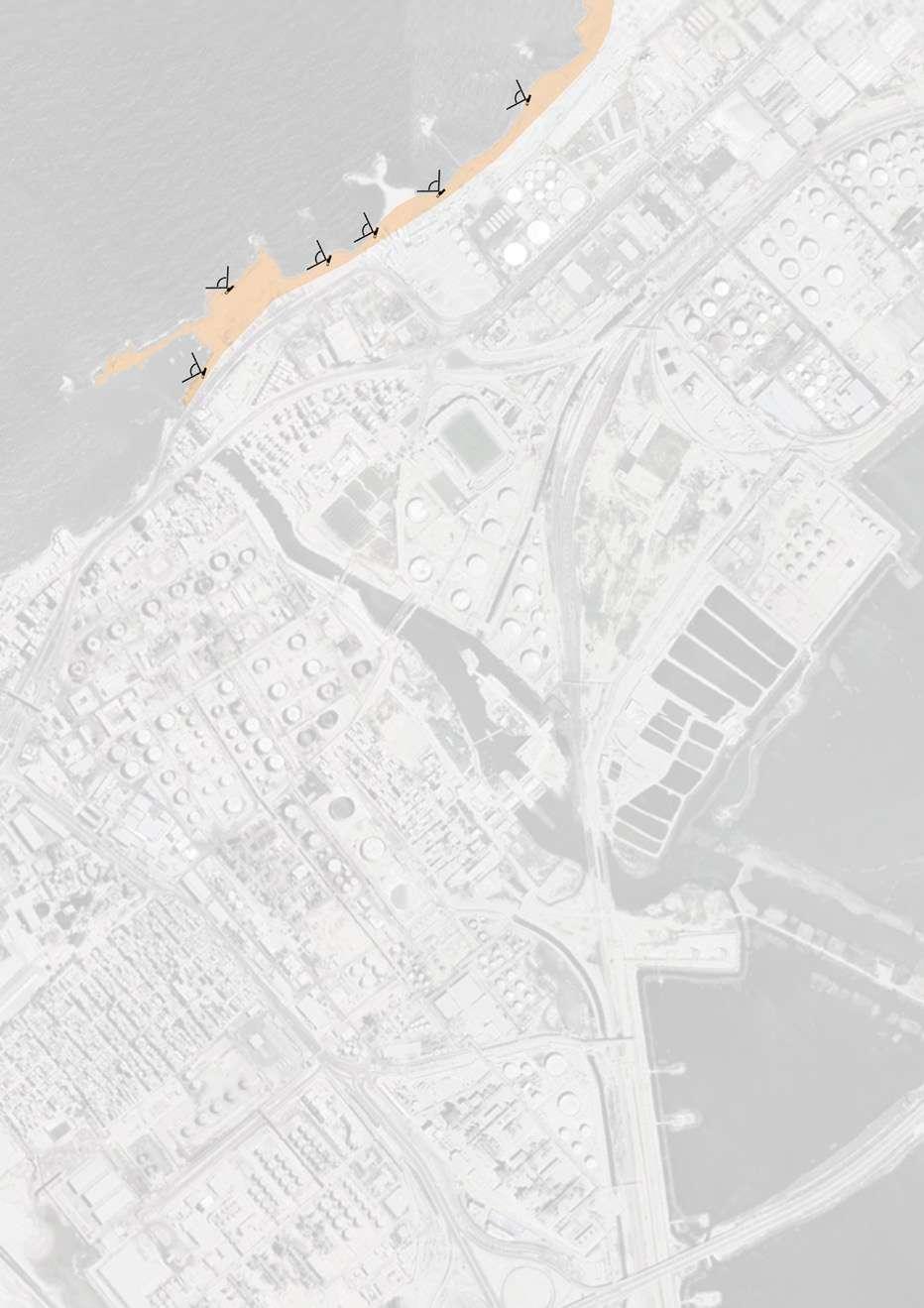
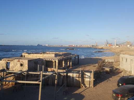
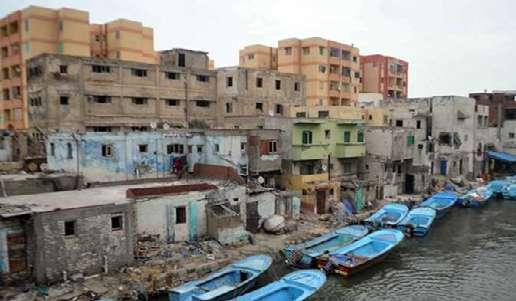
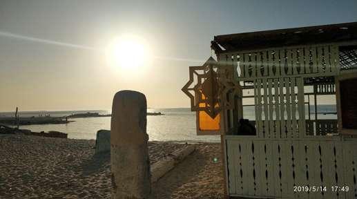

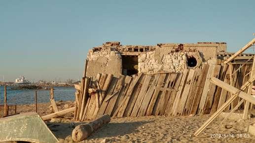 Figure 116: Image credit: Google Earth
Figure 120: Image credit: Google Earth
Figure 118: Image credit: Google Earth
Figure 117: Image credit: Google Earth
Figure 121: Image credit: Google Earth
Figure 119: Image credit: Author
Figure 116: Image credit: Google Earth
Figure 120: Image credit: Google Earth
Figure 118: Image credit: Google Earth
Figure 117: Image credit: Google Earth
Figure 121: Image credit: Google Earth
Figure 119: Image credit: Author
Figure 122: Satellite image from google illustrating the location of the images captured. / Image credit: Author
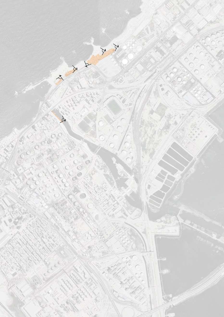
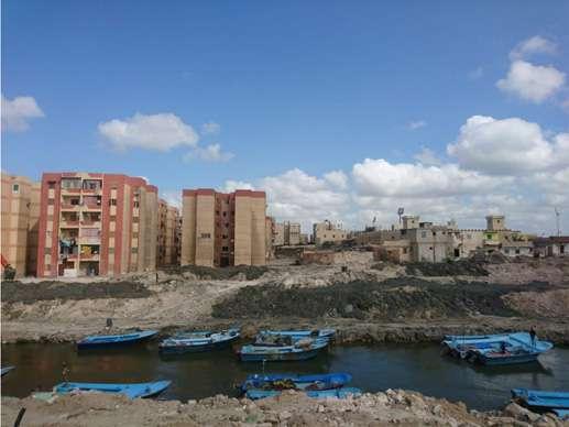
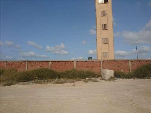
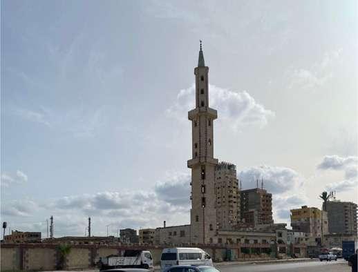
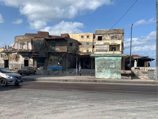
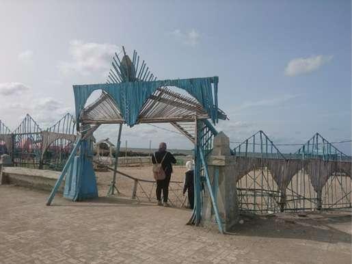
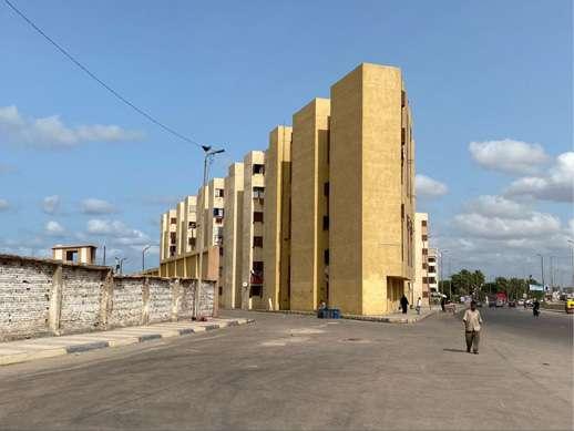 Figure 124: Image credit: Author
Figure 126: Image credit: Author
Figure 123: Image credit: Author
Figure 128: Image credit: Author
Figure 125: Image credit: Author
Figure 127: Image credit: Author
Figure 124: Image credit: Author
Figure 126: Image credit: Author
Figure 123: Image credit: Author
Figure 128: Image credit: Author
Figure 125: Image credit: Author
Figure 127: Image credit: Author
Figure 129: Satellite image from google illustrating the location of the images captured. / Image credit: Author
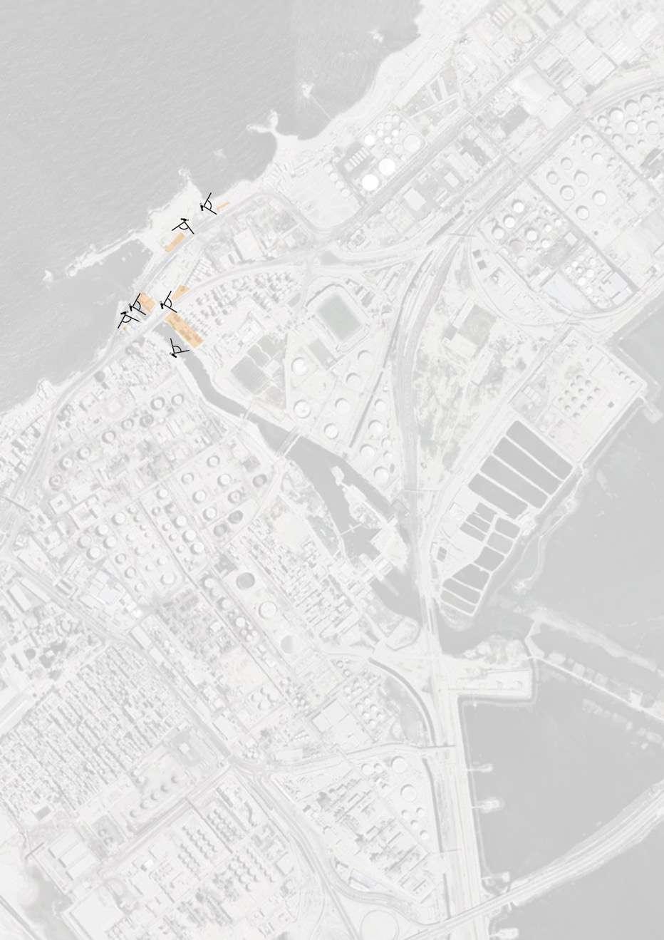
+ Friendly connection of fishermen with each other.
+ Sense of place and be longing to their homes that are passed down from one generation to another.
+ Integrity in doing their profession.
+ Presence of El Max canal, Mediterranean Sea, lake Mariout.
+ Historical lighthouses of el max.
+ Identical colors of the fishermen houses.
+ Fishing profession
+ Net making
+Presence of El Max on two main roads, while using the canal as a transportation route.
+The site is close to the airport and trainstation, not more than 30 min utes away.
Table 6: Strengths in Al-Max area in Alexandria, Egypt

+ Flexibility for develop ment of the site.

+ Handicrafts and local products for outdoor furniture.
+ Rich ecosystem full with bird and fish biodi versity.
+ Historic value of El Max as a trading center, famous handmade nets for fishing.
+ Availability of aban doned building and lands for renovating and installing relted activi ties on site like cultural fishing center, fishing village, flea market,... etc.
Table 7: Opportunities in Al-Max area in Alexandria, Egypt
+ In government stra tegic plan for 2032 El Max, el Dekhela district, considered as a future economic success (The General Authority for Urban Planning, 2020).
+ Plans to make El Max accessible by two train rails.
+ Plans to encourage green corridors.
+ According to popula tion density of El Max that is 13% of Kism el Dekhela population school at 4+ (CAPMAS, 2017).
+ Presence of industries and domestic drainage caused water and air pollution which affected the fish biodiversity.
+ Lack of green areas.
+ Neglected heritage sites
+ Poor industrial, agri culture drainage system.
+ Lack lighting infra structure.
+ Primitive houses of poor condition.
+ Lack of development of area
Table 8: Weaknesses in Al-Max area in Alexandria, Egypt

+ After elimination of el Max Dwellings and relocating residents, dissatisfaction of most residents due to small area compared to their number of members.
+ Pollution of lake Mari out which increases fish mortality.
+ Climate change and sea level rise threat ening the identity and safety of the area.

+ Losing identity after demolishing the fisher men houses for safety by the government.
+ Availability of factories sarrounding the project area that cause the pol lution of the water and unsafe explosions.
+ Lack rain drainage infrastructure.
+ Lack of mitigation measures after storm.
+ Lack of awareness about climate change and SLR.
+ Government refusing to add el max heritage building in listed sites.
+ Lack of awareness of historic value of place.
Table 9: Threats in Al-Max area in Alexandria, Egypt
The fishermen of the region who built their homes illegally and with weak construction materials that can't with stand the disaster hazards of floods as well as unplanned sewage and sani tary systems that blocked the flow of water; suffered from an old problem of floods and severe rainfalls, as well as the lack of drainage and the pres ence of houses on the banks of AlMax canal. Despite the charming na ture that dominates the place where the unique connection beteen the fresh water and salt water, and from here the state monitored a project to protect the lives of the people of the region and also develop it and elim inate the illegal immigration mafia gatherings who were exploiting the canal area to transport their victims to the sea. So the goernment developed a Resettlement Action Plan (RAP) to provide the fishermen with new bet ter planned formal settlements, in or der to help mitigate the disaster risk and protect the lives of the affected population.
Floods wreaked havoc on Alexandria's Al-Max village in 2015. Despite the city's increased vulnerability to cli mate change, opponents claim that it has received little attention. The pre viously thriving fishing town of Al-Max in the Egyptian coastal city of Alexan dria appears unfriendly to life at first impression. More than a dozen petro leum, cement, iron, and steel plants dot the terrain, spewing gallons of in dustrial waste into clogged canals and degrading the Nile Delta's important waterway. The pungent odor of chem
ical waste hangs heavy in the humid air.
The famed canals of Alexandria once attracted parallels to Venice, but to day mounds of debris litter the banks where vibrantly painted residenc es once stood—the few remaining dwellings were demolished in August 2018. Following a severe flash flood in 2015 that killed seven people, the Egyptian government decided to en large the Al-Max canals, requiring the evacuation of canal-side communities to newly constructed public projects, according to the government.
“My grandfather built these canals. Our whole life was here but now if you look, there is nothing left.”
[Karem,2018]
Despite the dangers, many inhabi tants would prefer to be left alone and fend for themselves. Karem, who has spent his whole life living and working beside the canal, believes that living without it would be like renouncing one's own past. "These canals were created by my grandpa," he explained. "Our entire lives were here, but now there is nothing left." The problems that Al-Max people are encountering are simply a taste of what Egypt may face as a result of unabated sea-level rise. According to the Fifth Assessment Report (AR5) of the Intergovernmen tal Panel on Climatic Change (IPCC), if current trends continue, Egypt would face a climate disaster in Alexandria. [Will Egypt’s Ancient City Succumb to Rising Seas? - Bloomberg; 2019]
 Figure 130: Karem by his boat alongside the Al-Max canal. He was forced to leave his home after the 2015 floods. / Image credit: Amir Khafagy

Drawing 56: Map illustrating the situation of "Qaryat Al-Sayyadin" informal settlements before their demolish. / Credit: Author
2018
Drawing 57: Map illustrating the situation af ter the demolish of "Qaryat Al-Sayyadin" and the wider canal. / Credit: Author


Drawing 58: Map illustrating the situation of "Qaryat Al-Sayyadin" informal settlements before their demolish. / Credit: Author
Drawing 59: Map illustrating the situation after the demolish of "Qaryat Al-Sayya din" and the wider canal. / Credit: Author

The fishermen of the region who built their homes illegal ly and with weak construction materials that can't withstand the disaster hazards of floods as well as unplanned sew age and sanitary systems that blocked the flow of water; suf fered from an old problem of
floods and severe rainfalls, as well as the lack of drainage and the presence of houses on the banks of Al-Max canal. People of Al-Max suffered from pollu tion coming from the industrial wastes coming from the sur rounding factories which threat ened the health of the residents.

“We have already transferred people who are most in dan ger from sea-level rise and also ensuring them to have a better quality of life,” said Dr. Walid Hakiki, advisor of water re source planning and manage ment to the governor of Alex andria. “In Egypt, we have a lot of slum areas with unsafe con struction, and we want to make it more safe for residents.”
But some activists say this is not the answer. “Resettlement,
especially when forced, heavily disrupts communities,” said Ya hia Shawkat, an Egyptian hous ing rights organizer. “Many of the clearances could have been avoided with much cheaper up grading, while many others still live in inadequate housing and are not part of the government’s plans.”
[Will Egypt’s Ancient City Succumb to Rising Seas?Bloomberg; 2019]

Figure 131: The timeline of the demolishing of the informal settlements of "Qaryat Al-Sayyadin".
 Credit: Author
 Figure 132: Demolition of informal settlements (slums). / Image credit: Walid H.
PROJECT SITE
Figure 132: Demolition of informal settlements (slums). / Image credit: Walid H.
PROJECT SITE

 Figure 133: The rubble left after demolition of houses on the waterfront at El Max, near Alexandria, where homes are regularly flooded. / Image credit: Sima Diab
Figure 134: Sewage pouring into the Al-Max canal. / Image credit: Amir Khafagy
Figure 133: The rubble left after demolition of houses on the waterfront at El Max, near Alexandria, where homes are regularly flooded. / Image credit: Sima Diab
Figure 134: Sewage pouring into the Al-Max canal. / Image credit: Amir Khafagy
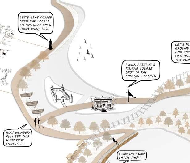
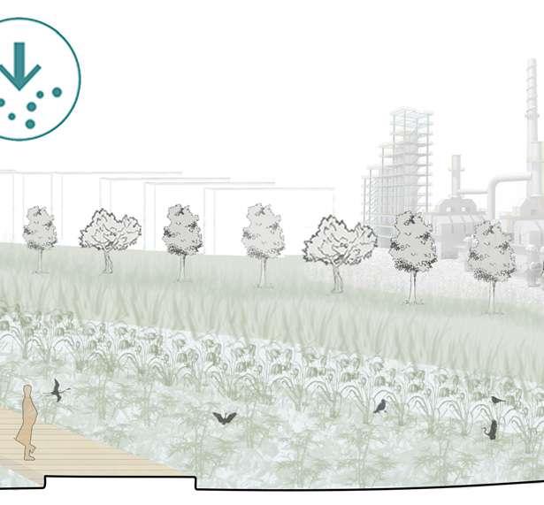
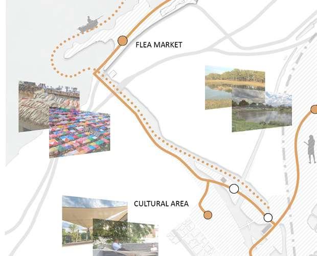
4�1� Design Approach
4.1.1. Ecosystem-based approaches 4.1.2. Resilience challenges, scope and potential
4�2� Nature Based Solutions Approaches
4�3� Integrated Urban Landscape Systems
4.3.1. River basin-Delta scale solutions 4.3.2. Neighborhood scale solutions 4.3.3. Building scale solutions
4�4� Sensory Experience
4�5� Landscape Aesthetics
4.5.1. Societal benefits 4.5.2. Ethnobotanical recommendations 4.5.3. Materials and shades palette
“I believe that some of the magic of medicine can and should be applied to cities, for many of them are ailing, and some are almost terminal. Just as good medicine depends on the inter action between doctor and patient, successful urban planning involves triggering healthy responses within the city, probing here and there to stimulate improvements and positive chain reactions. Intervention is all about revitalization, an indispensable way of making an organism function and change.” [Jaime Lerner]
Figure 135: Acupuncture network on site. /
Credit: Author
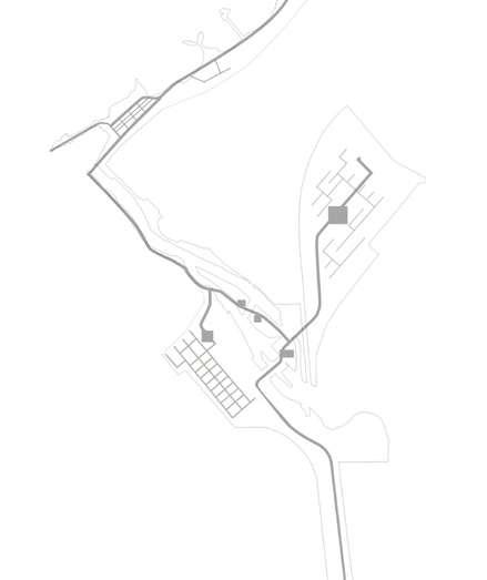
Urban identity is defined as the natu ral and artificial elements of a city, its social, cultural and historical charac teristics. Based on urban revitalization process, the targets to be achieved is to rebuild the city in which people work and live, good environmental quality; adequate social, cultural and recreational facilities, and to improve the quality of life of local residents. place identity mainly concerns the physical image and people perception with little emphasis on the degree of people-place association and the depth of meanings.
Figure 136: Identity revitalization diagram. / Credit: Author
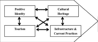
Figure 137: Sustainable urbanism diagram. / Credit: Author
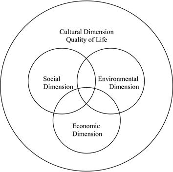
Sustainable urbanism is both the study of cities and the practices to build them, that focuses on promot ing their long term viability by reduc ing consumption, waste and harmful impacts on people and place while en hancing the overall well-being of both people and place. Well-being includes the physical, ecological, economic, so cial, health and equity factors, among others, that comprise cities and their populations.
Figure 138: Diagram illustrating the Nature Based Solutions approaches and challenges based on the IUCN classificaiton
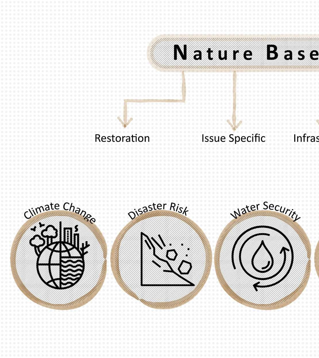
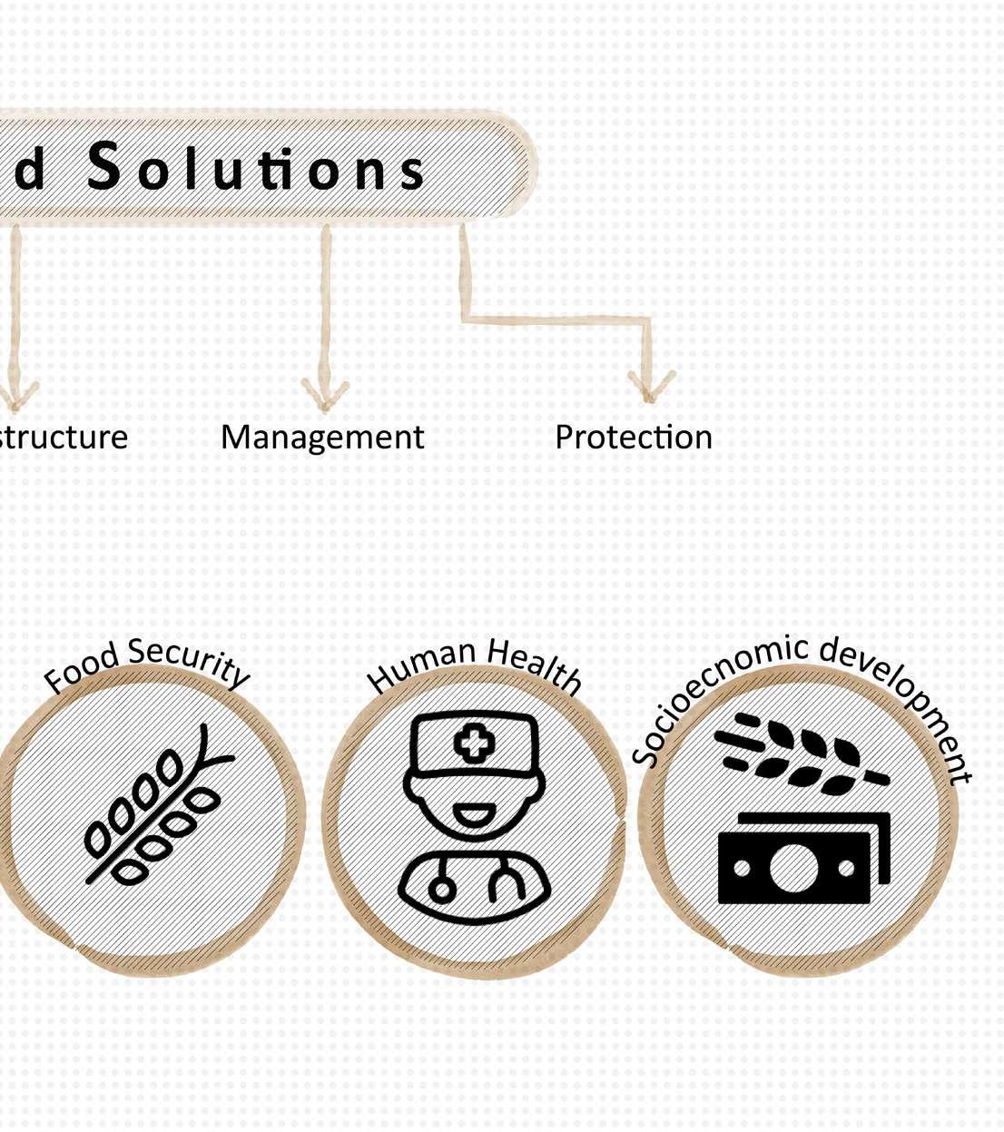
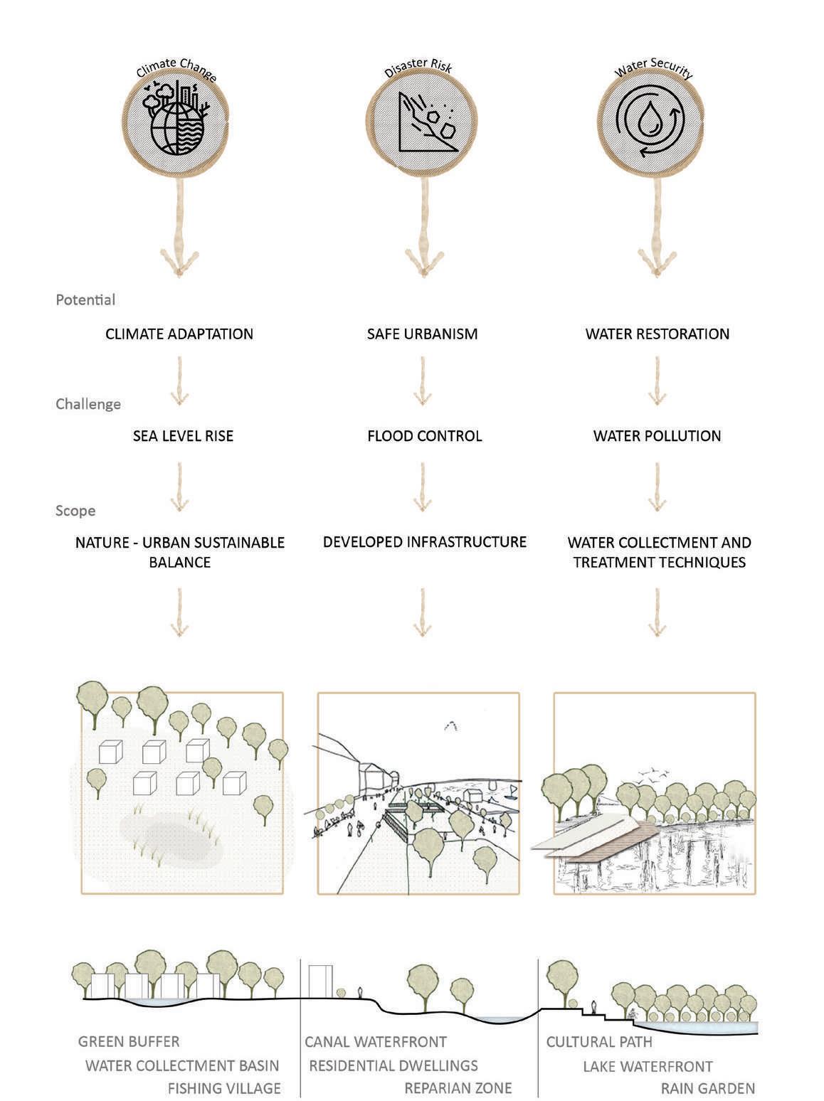
Drawing 60: Diagram illustrating the resilience challenges, scope and potential.
Credit: Author
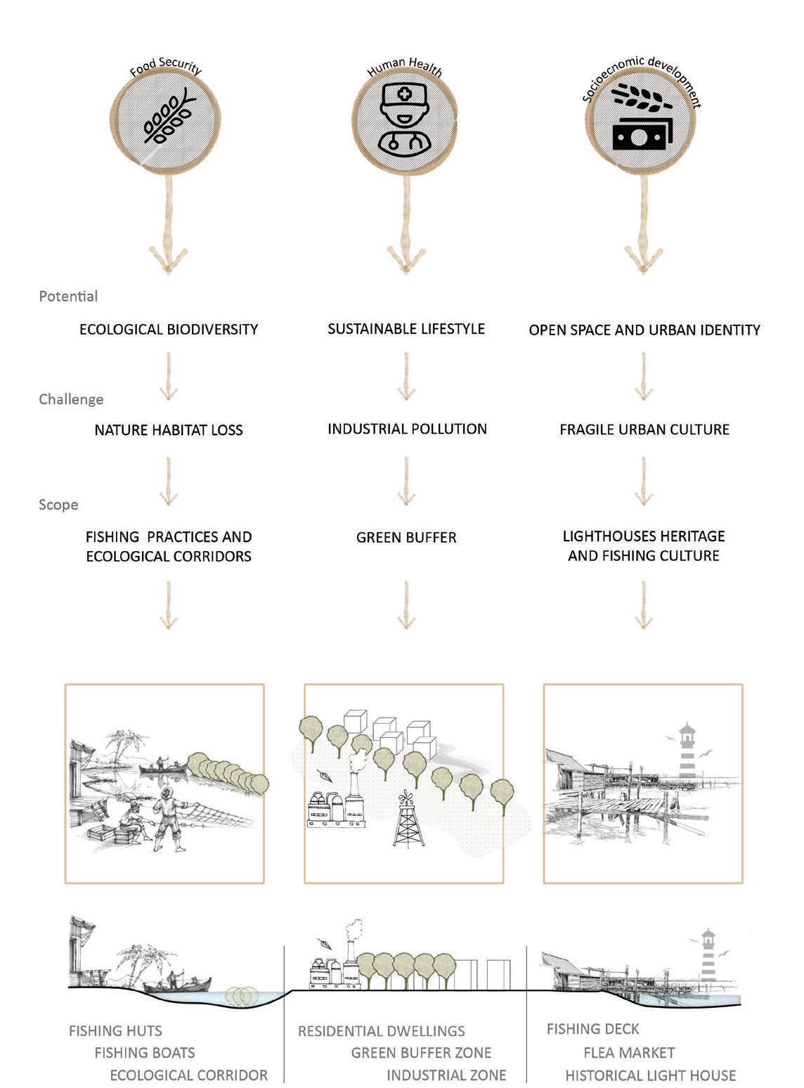
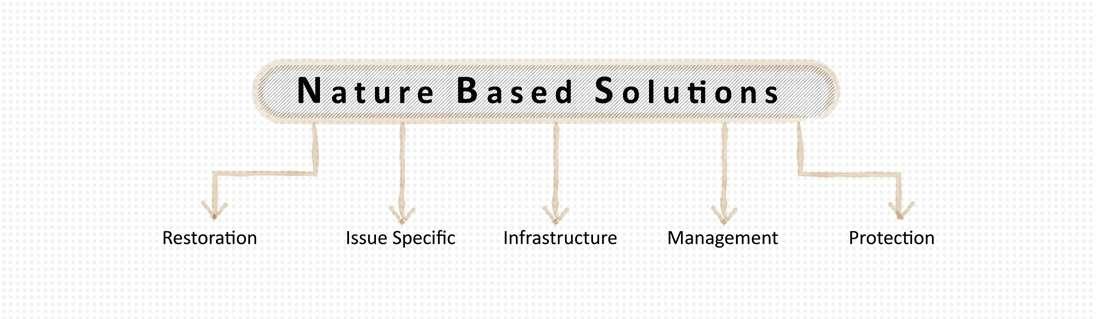
61: Diagram illustrating
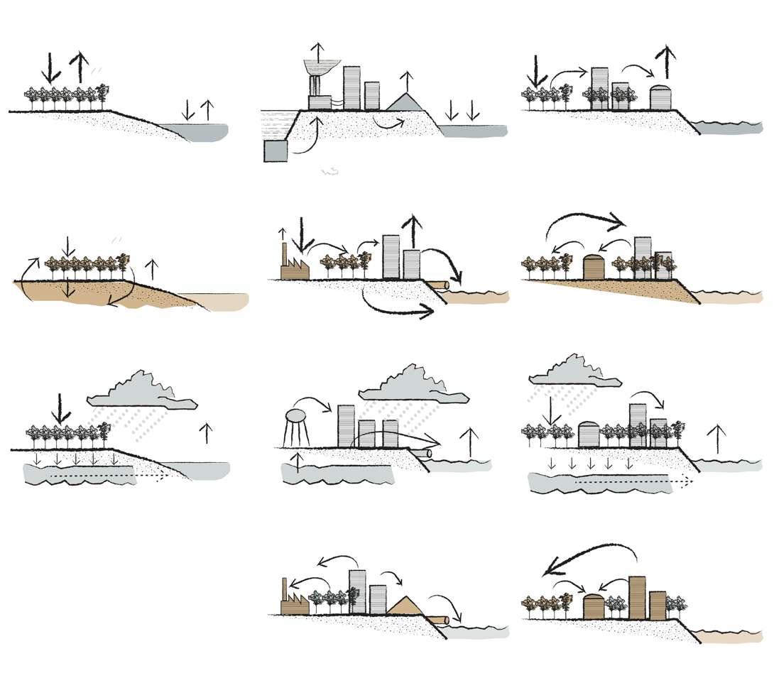
strategies.
After the analysis done and the sto ry telling, it was quite clear that it's essential to bring back the identical connection between the pure water from the Nile river and the saline wa ter of the Mediterranean sea and re assess how it was viewed as a cultural heritage for the area. The scheme in cludes a whole new system that inte grates the water to purify, clean and bring back to the canal and the blue infrastructure for the area and the residents. Purifying waste water for reuse where a sustainable infrastruc ture of constructed wetlands, rain gardens and waterfront structure so
that all water from flood seasons that run through the site to be treated by constructed wetlands, producing re cycled water, the aquatic playground and finally directed to replenish the natural riparian (canal) wetlands.
Although the water system is over shadowed, it is important to underline that it consists in a valued presence for the history of Al-Max village. In fact, the whole Alexandria north area during centuries has been character ised mainly by it's it's historical light houses identity as well as the fishing activity.
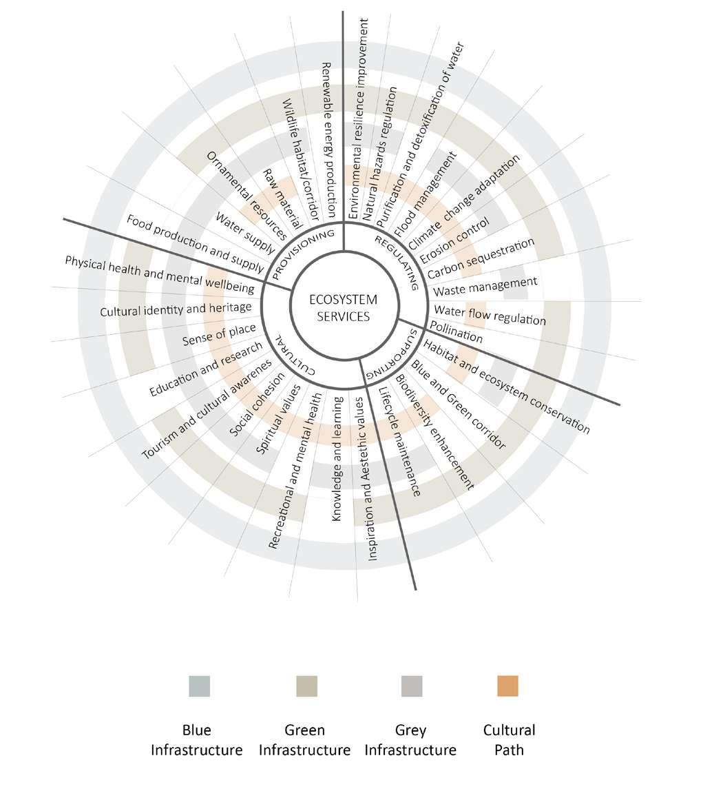
Drawing 62: Diagram illustrating the ecosystem services for the project. / Credit: Author
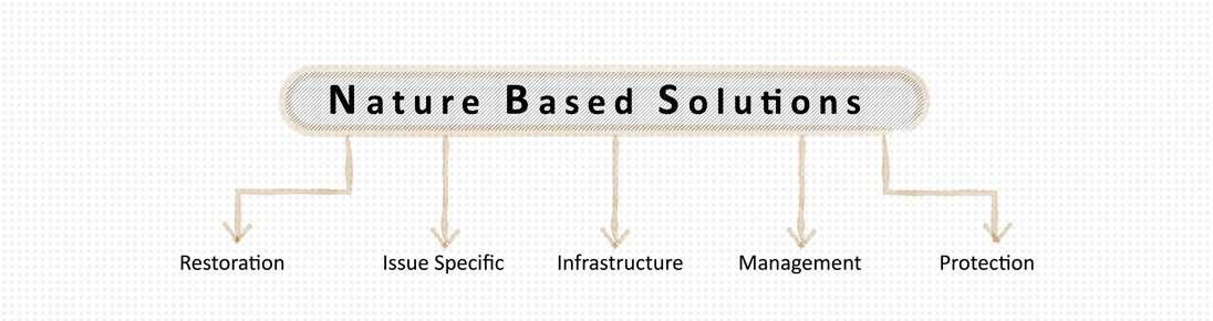
The Strategy is based on the mixture of uses, where they all support each other to create a harmonious space. By moving away from the separation of the landscape and envision a com bination of all uses. That reduces dis tances and makes a stronger charac ter of the space. The cut of transport costs between research, production, processing and retail helps to build a better local economy.
Productive Landscape is breaking the barriers and futhermore emphasizing the existing potentials in the space. From problems of the urban sprawl, to creating a landscape that will inte grate the local people and the tourists, therefore increase interest in fishing activities and bring social welfare to the society.
The goal is to recreate a diverse local habitat. Using existing topography and new added ponds as a foundation, the idea is to apply minor earth shaping and careful replanting of local trees, shrubs and aquatic plants to restore shelters and habitats for aquatic life, amphibians and birds. In order to re store the resilience of flood retention and utilize riparian spaces, an adap tive landscape is suggested based on the existing topography and recreated ones: the lowest areas to be floodable natural wetlands, areas of lower flood risk were used for constructed wet lands and the highest areas on site for recreational, educational, production and leisure spaces.
Drawing 63: Map illustrating the four infrastructures of the project. / Credit: Author
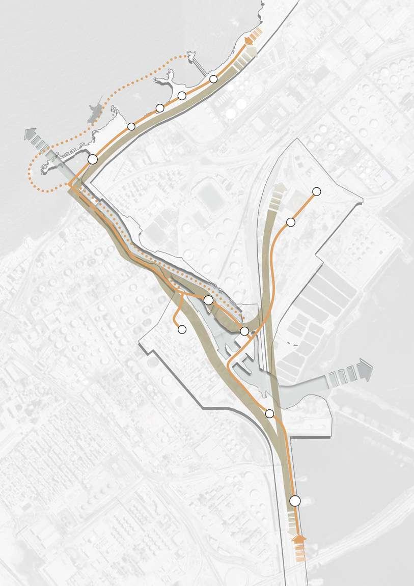
Cities require a smart mix of "blue", "grey" and "green" infrastructure improvements to reduce disaster risks. Green infrastructure and na ture-based solutions can help a city become more resilient while also giv ing co-benefits like environmental sustainability and eco-tourism
In addition to mitigating disaster risk, urban flood resilience interventions of fer broader co-benefits for surround ing communities’ physical and mental health. Access to public green spac es for physical exercise, for instance, can help strengthen the immune sys tem. Multifunctional green infrastruc ture designed to mitigate floods and provide urban public spaces—built in various spatial configurations can provide diverse opportunities for rec reation. For instance, exercise tracks along rivers and creek corridors, and open green spaces can serve as sites for group sport and activities. Offi cials may use planning tools to keep current green infrastructure in good shape and build new initiatives. When planning multi-functional green areas, keep the following points in mind: Land is a precious resource in many places, thus developing existing land scapes that already provide flood miti
gation or control should be prioritized. Existing open spaces can be adapted or renovated to serve several purpos es, including flood mitigation, disaster preparedness, and enjoyment. Green space should ideally be available to the public and proportionate to the population. Some international regu lations, for example, suggest that in dividuals have access to green space within a 15-minute walk. To provide for physical separation between walk ers, automobiles, and bicycles, widen walkways and remove barriers like planters. Provide distinct entry and exit points whenever practical. De pending on the local context, carefully pick plant species that can resist peri ods of floods, pollution, and drought. Multifunctional parks can also be used to store floodwater temporari ly. However, maintaining a park's ca pacity to absorb floodwater requires releasing the water at a regulated rate. Storage water may be utilized to irrigate public facilities and residentia dwellings, in addition to enhancing water quality. Carry out regular main tenance. Maintenance allows towns to maintain the beauty and function ality of their public areas while avoid ing the significant expenses of repair. [Ginting, N.; Wahid, J.,2017]
Drawing 64: Map illustrating the blue infra structure of the project. / Credit: Author
Drawing 65: Map illustrating the green in frastructure of the project. / Credit: Author
Grey Infrastructure Cultural Path
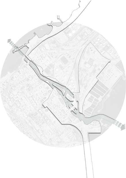
Drawing 66: Map illustrating the grey infra structure of the project. / Credit: Author
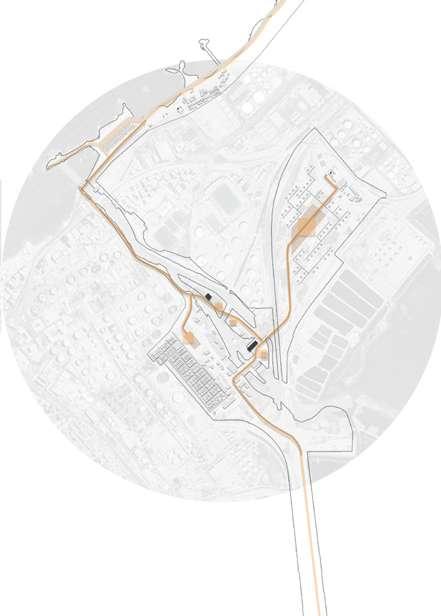
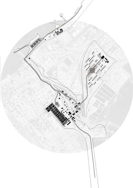
Drawing 67: Map illustrating the cultural path of the project. / Credit: Author
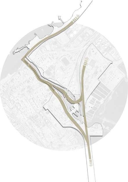
Green Corridors and water manage ment strategies that are productive and ecological. A multifunctional Net work of open spaces along the canal and lakefront where a system of re tention reservoirs for excess water during flood season for water purifica tion and a productive public park land scape merged with a fishing village for a better local experience. The aim is to create a productive landscape for work, leisure and technical landscape for purifying water using the fishing identity of Al-Max village.
Main cultural path connecting the walkways through the cultural areas and areas of interventions; like the fishing village buildings and the fish flea market, cafes, restaurants and the waterfront stuctures, the histori cal fortress and the heritage building that will be regenerated to a cultural fishing center, as well as an experiece of walking through the existing local urban settlements and public open spaces.
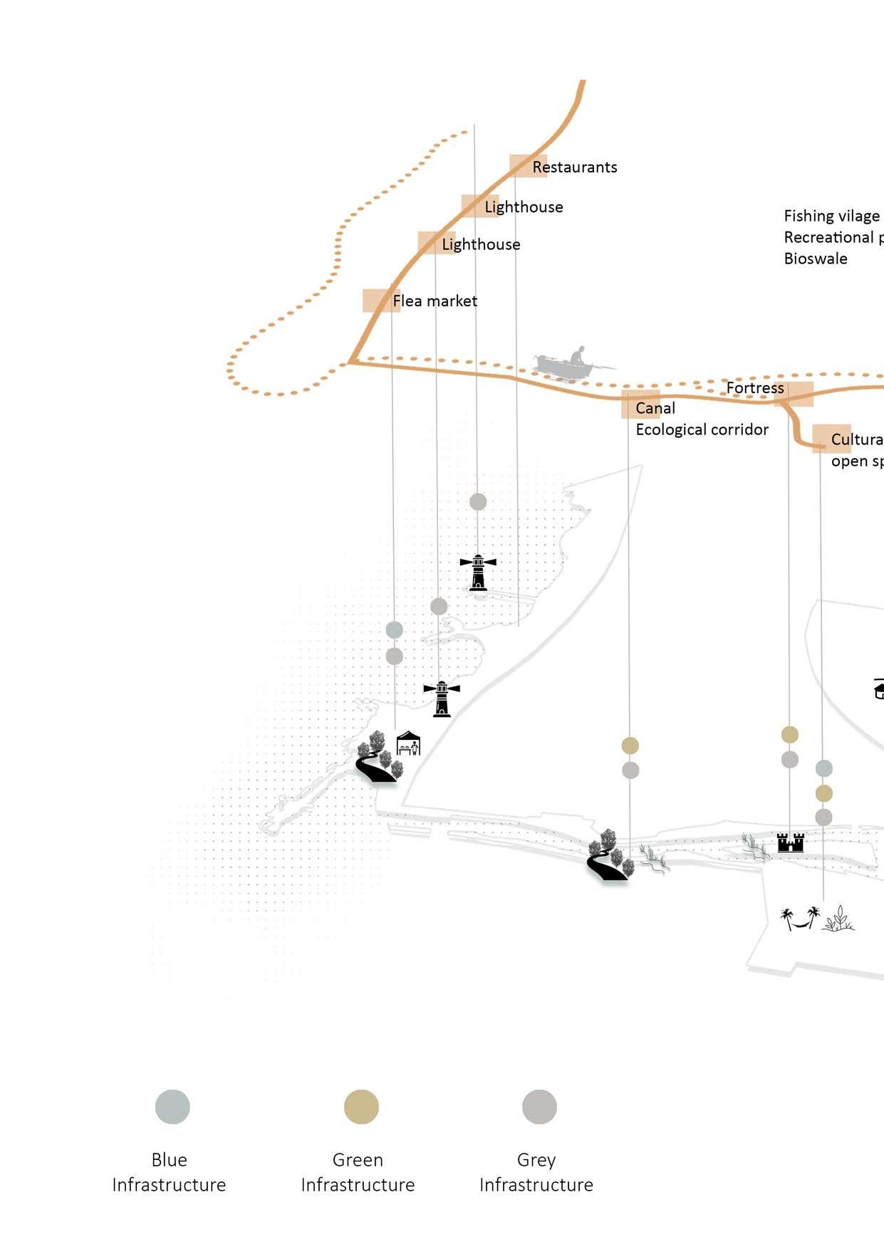

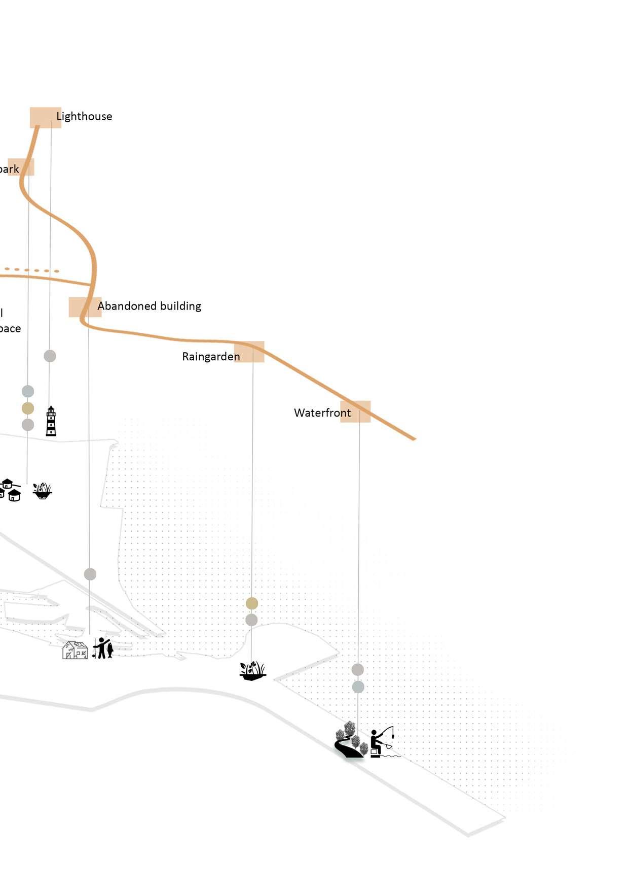
Drawing 69: Illustration of the infrastructures on site. / Credit: Author
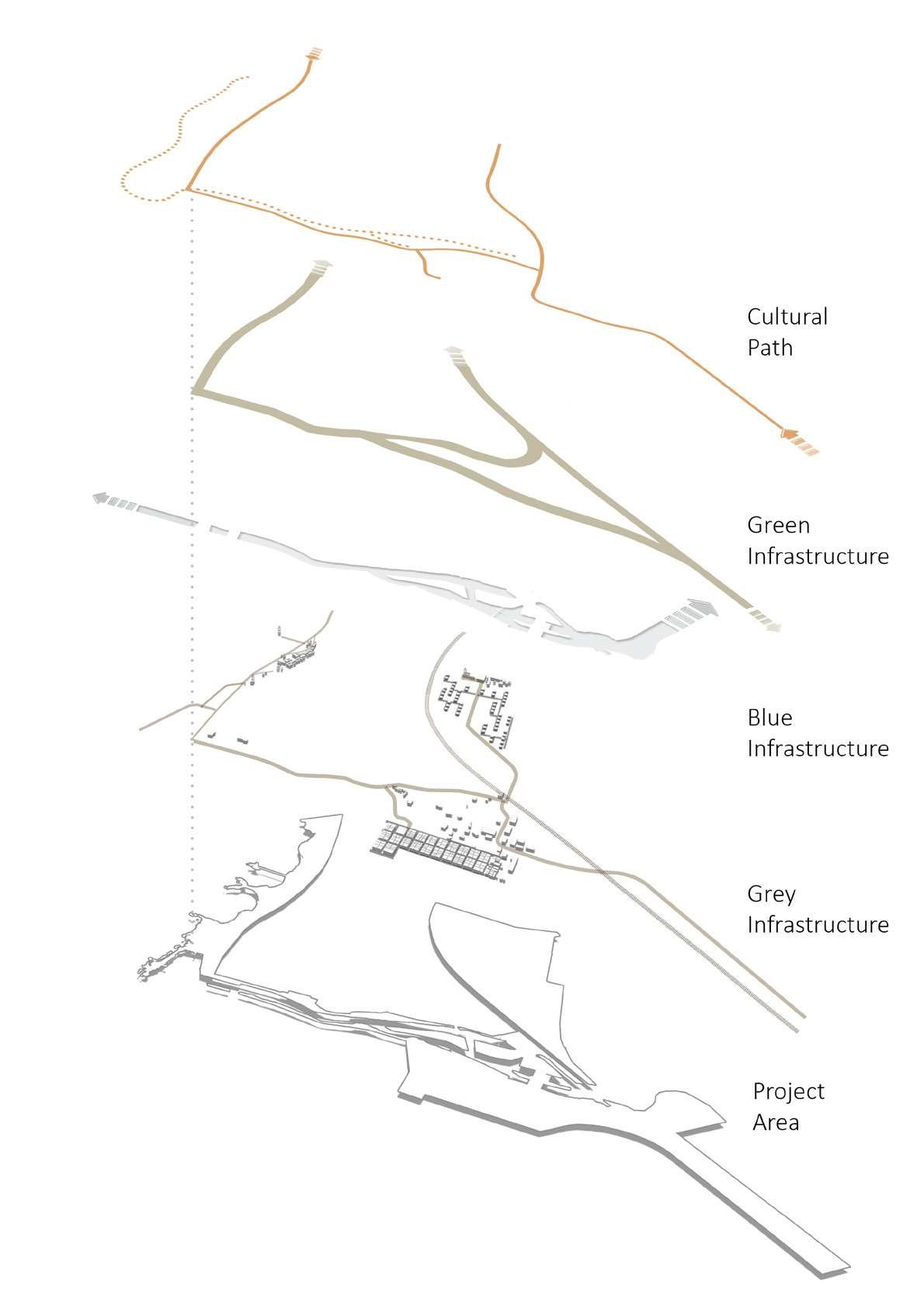
Drawing 70: Illustration of the transportation methods on site. / Credit: Author

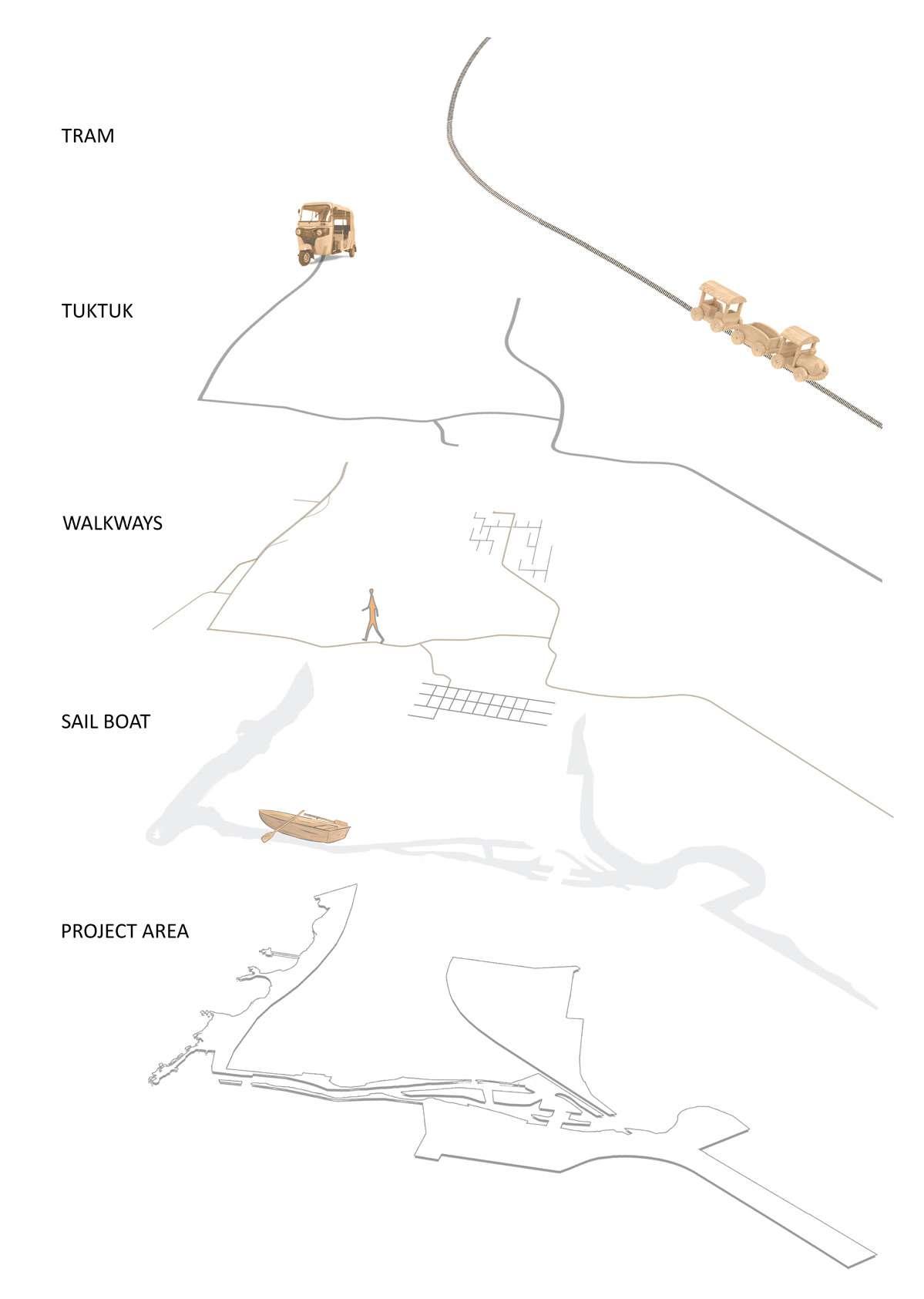
Drawing 71: Map illustrating the different flooding scenarios over the year. / Credit: Author
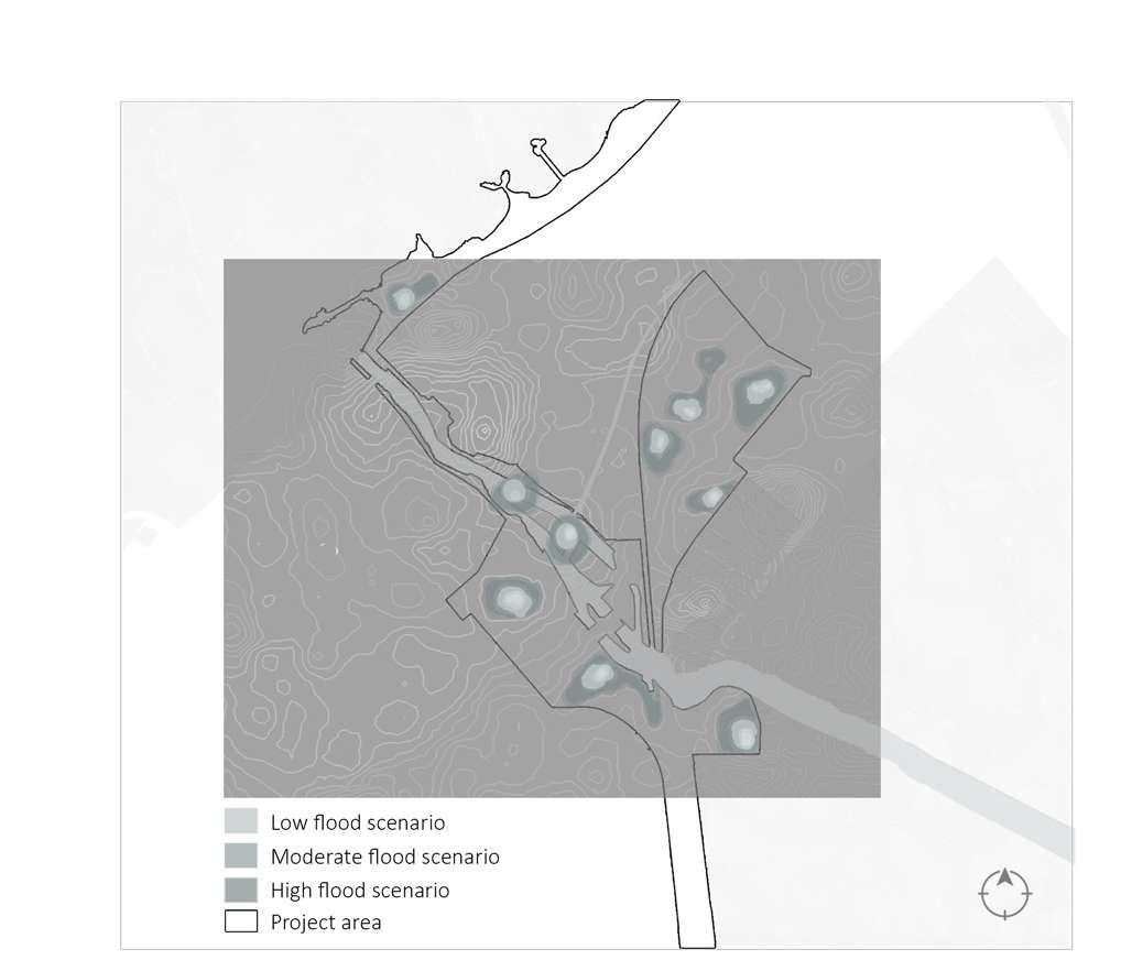
Drawing 72: Sections illustrating the different flooding scenarios over the year. / Credit: Author
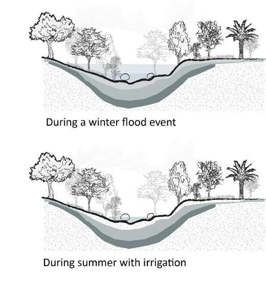
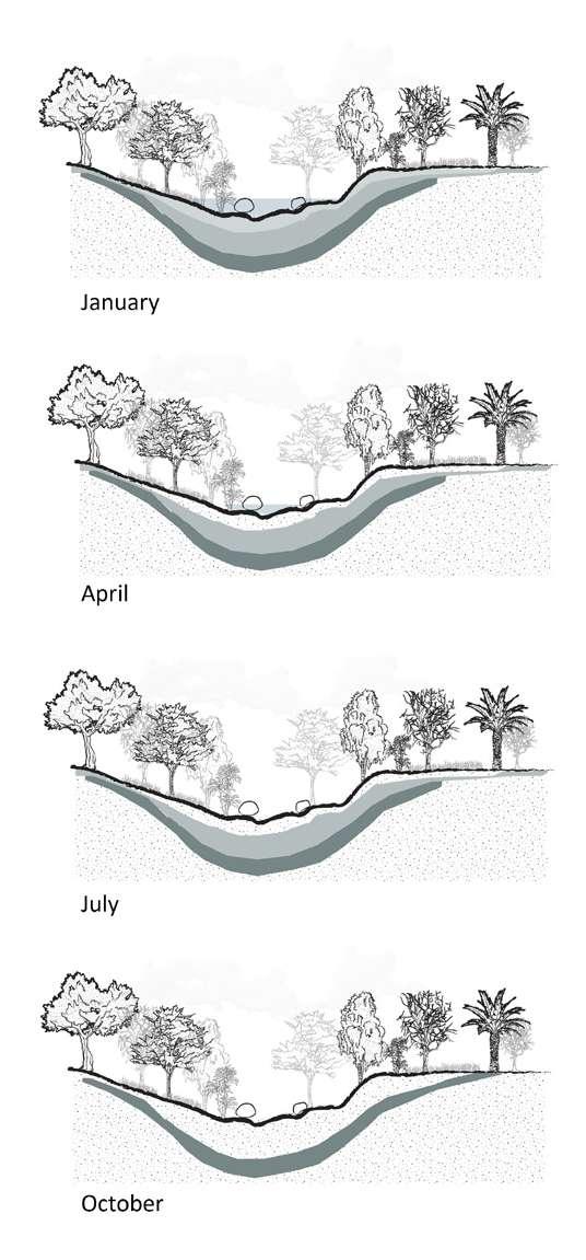
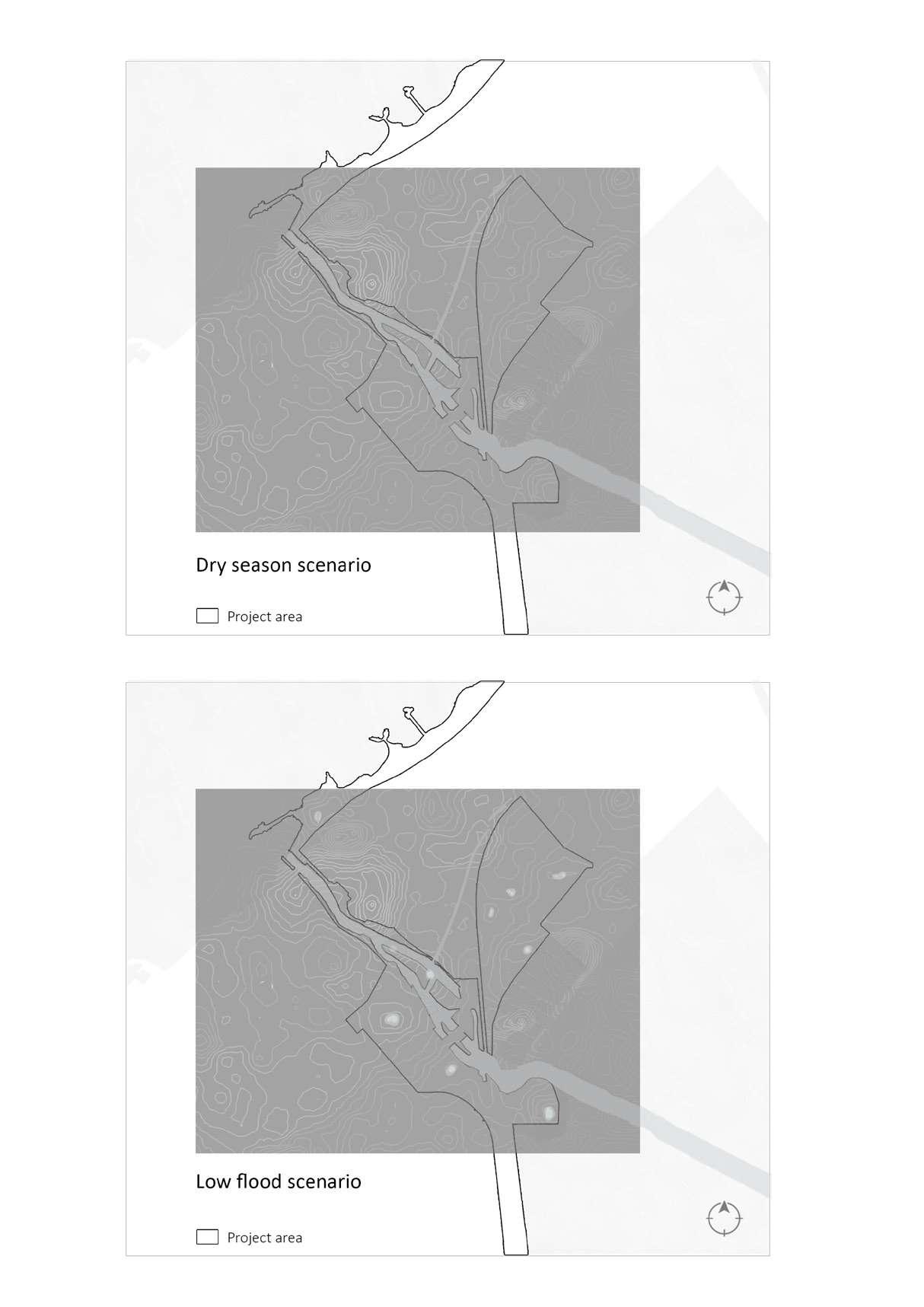
Drawing 73: Map illustrating the dry season flood scenario. / Credit: Author
Drawing 74: Map illustrating the low flood scenario. / Credit: Author
Drawing 75: Map illustrating the moderate flood scenario. / Credit: Author
Drawing 76: Map illustrating the high flood scenario. / Credit: Author
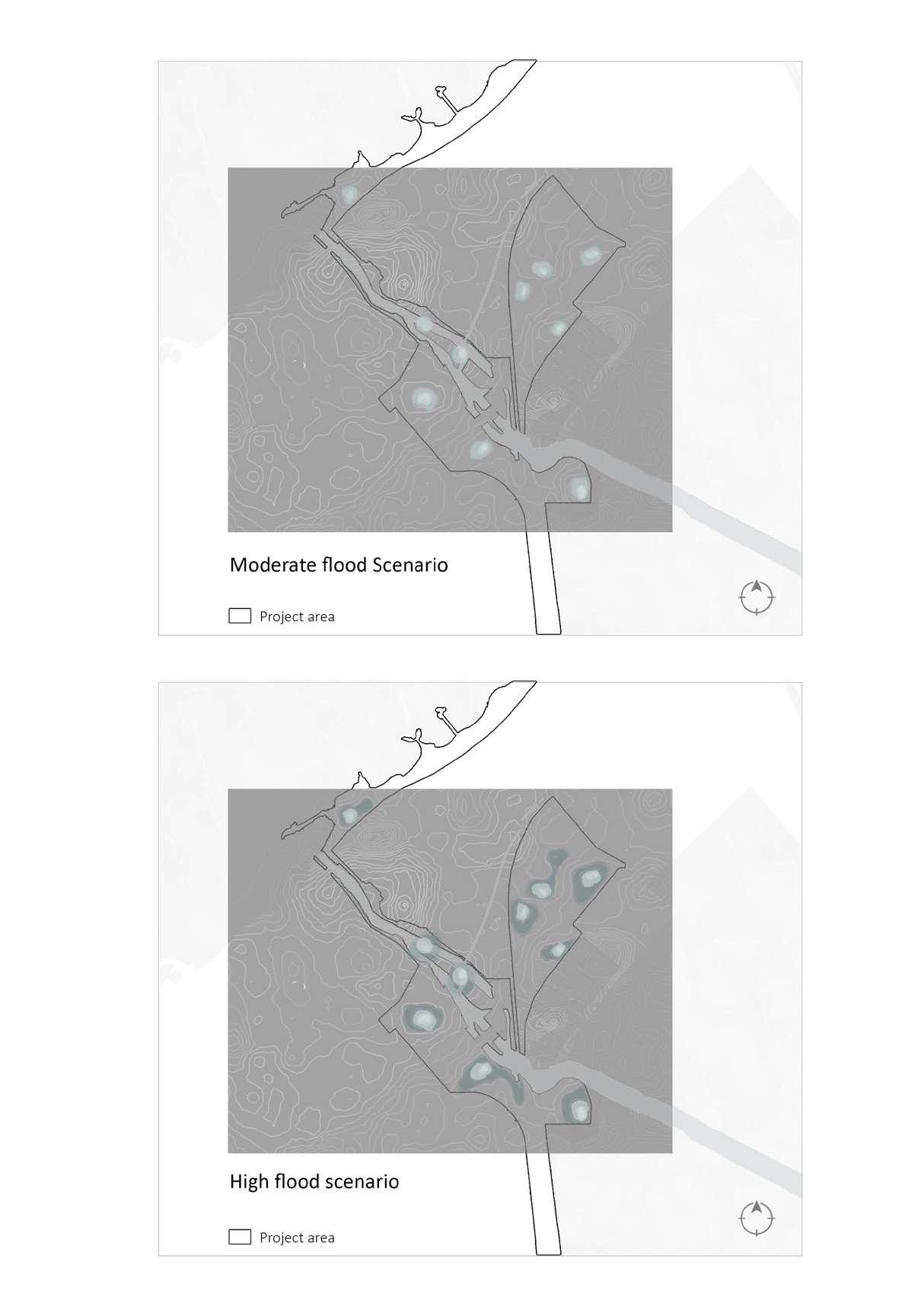
Blue-Green-Grey (BGI) infrastructure not only improves water quality but also successfully reduces stormwater runoff. The following are some quali ty-related advantages of BGI: In urban catchment areas, plant roots and soil combine to absorb nutrients, purify infiltrating water, and improve overall water quality. This reduces the energy needed to treat the water and asso ciated costs. Similarly, BGI helps pre vent overheating and oxygen deple tion brought on by high temperatures
of concrete materials in riverbeds. Benefits of Blue-Green-Grey infra structures that are quantified include: The natural, unsealed surface enables water to soak into the ground, replen ishing underlying water supplies; BlueGreen-Grey infrastructure improves on-site retention of runoff, protecting precious wetland areas; Water can seep into the ground via the natural, unsealed surface, replenishing under lying aquifers and maintaining a stable groundwater level.
Aside from obvious advantages for plants and water, BGI has enor mous potential to modify the urban climate by lowering the effects of urban heat islands, balancing daynight temperature variations, and promoting natural air circulation. Additionally, it lessens the biocli matic effects of land cover chang es, such as the drying out of urban soils and the dangers connected with dust and wind-borne air pollu tion. Blue-Green-Grey infrastructure improves the flexibility and resil ience of urban infrastructure by reg
ulating and modifying hydroclimatic variability and weather extremes. BGI promotes rich biotopes and land scape connectivity, safeguards aquat ic habitats, and establishes biodiver sity-rich zones to support flora and fauna, all of which contribute to an increase in urban biodiversity.
Last but not least, Blue-Green_Grey encourages biophilia, or a person's af fection for nature, since it reacquaints them with the natural shapes, compo nents, and processes that greatly en hance their pleasure and willingness to preserve the environment.
Area-based conservation approaches, including protected area management
Drawing 77: Street tree canopies and per meable pavements. / Credit: Author
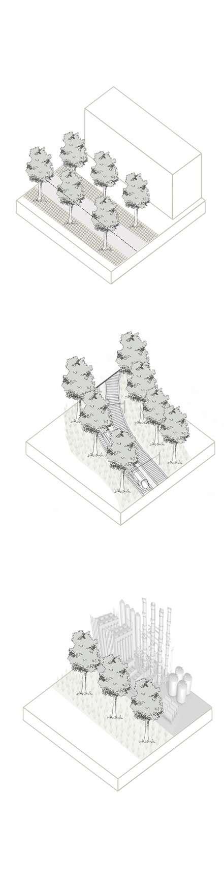
Permeable pavements such as pervi ous asphalt, pervious concrete, inter locking pavers, and plastic grid pavers, and are especially effective during less intense storms (LIDC 2007) for re ducing surface runoff. They infiltrate, treat, and store rainwater and reduce runoff by allowing rain and to seep to underlying layers.
Drawing 78: Urban green corridors. / Cred it: Author
Trees can be placed along the streets, open train tracks, and other transpor tation and infrastructure corridors, in open spaces. Green corridors should be designed for multiple functions such as walking, and jogging routes, in addition to water management areas. Green corridors can help establish better landscape connectivity across the city and improve ecosystem func tions (NWC 2016).
Drawing 79: Green buffer. / Credit: Author
The green buffer is formed using screening species placed along the borders of the industrial area and the transportation routes and would be anoptimum solution for isolating the pollution coming from the factories and traffic to penetrate the residential and recreational areas.
Drawing 80: Retention ponds. / Credit: Author
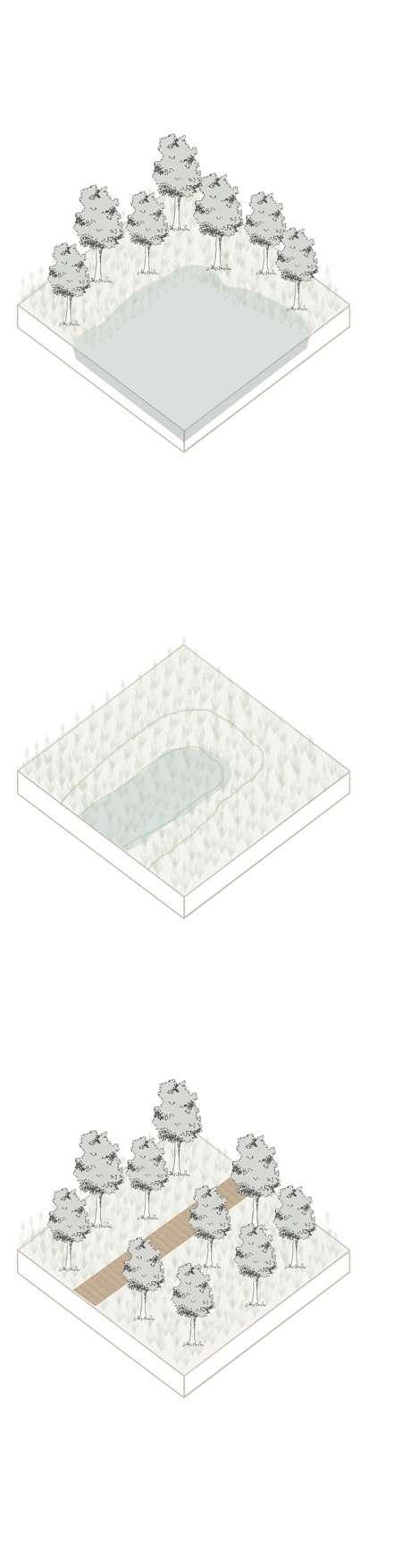
Retention ponds are bioretention ar eas characterized by a permanent body of water and vegetated edges. Unlike detention ponds, they are per manently filled with water. Retention ponds collect stormwater from the surrounding areas; add storage capac ity and ease the pressure on the sur face water treatment and sewerage systems. Retention ponds offer the added benefit of storing water for fur ther reuse during drought conditions, while simultaneously providing habi tat and enriching the diversity of pub lic green spaces (Iwaszuk et al. 2019).
Drawing 81: Detention ponds. / Credit: Author
Detention ponds are deeper and less biologically diverse bioretention ar eas than bioswales and rain gardens. Bioretention systems capture and temporally store stormwater during periods of heavy rain (Eisenberg and Polcher 2020). Detention ponds can be completely filled up with water during storms; they infiltrate much of it into the ground; and discharge the overflow into the sewer system. The remainder of the time they remain dry. Detention ponds can provide at tractive scenic elements in public ar eas, around open parks.
Drawing 82: Rain garden. / Credit: Author
Rain gardens are shallow, densely veg etated ground depressions, with a va riety of trees, shrubs, and grasses to collect stormwater from adjacent im pervious surfaces. During storms, they become flooded and facilitate ground infiltration and cleaning of stormwa ter simultaneously (EPA 2006). During dry seasons, rain gardens contribute to the quality of public areas.
Drawing 83: Bank and bed renaturation. /
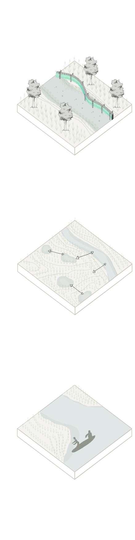
Credit: Author
Drawing 84: Improving lateral connectivity.
/ Credit: Author
Drawing 85: Maintenance and cleaning. /
Credit: Author
Riverbank and bed renaturation aim to restore the natural dynamic of the water flow from the main water body, which may mean restoring its shape, creating physical structures to direct the flow of water, and provide habitat for aquatic species.
In many urban contexts, canals were built to disconnect the main water body from the floodplain and its wet land. This resulted in the disruption of wetland hydrology. Rehabilitation would require a reversal of this ac tion and an improvement of lateral connections between the main body of water and the wetlands. Reestab lishment of lateral connections will reactivate wetland areas and improve its environmental performance. It will also bring back the waterflow.
The health of a natural inland wetland and its environmental performance depends on proper lateral connec tions, hydrological cycles, the right soils, and plants. By restoring natural hydrological conditions; undesired invasive plants may need to be con trolled through appropriate mechan ical, chemical, or biological control measures.
Drawing 86: Map illustrating the coastal zone management strategies. / Credit: Author
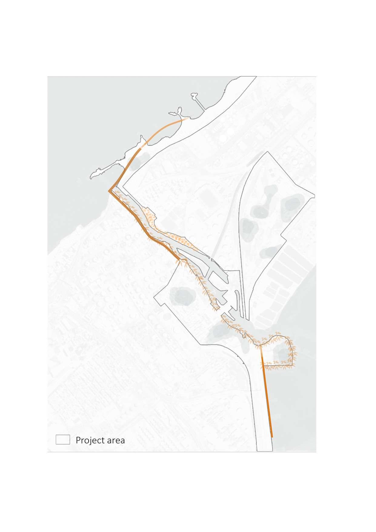
Drawing 87: Section drawings illustrating the coastal zone management strategies. / Credit: Author
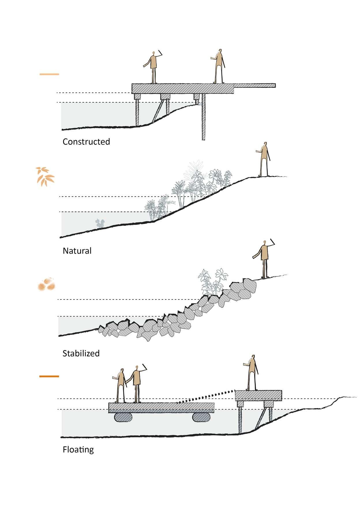
Drawing 88: Map illustrating the infrastructures connection strategies. / Credit: Author
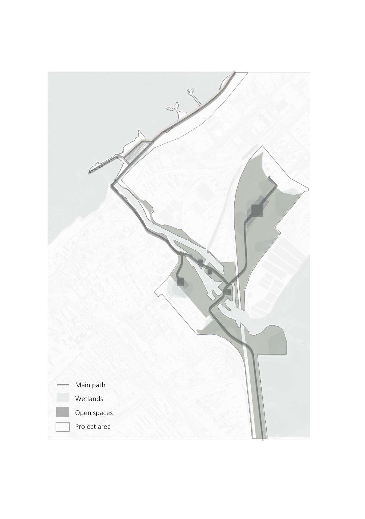
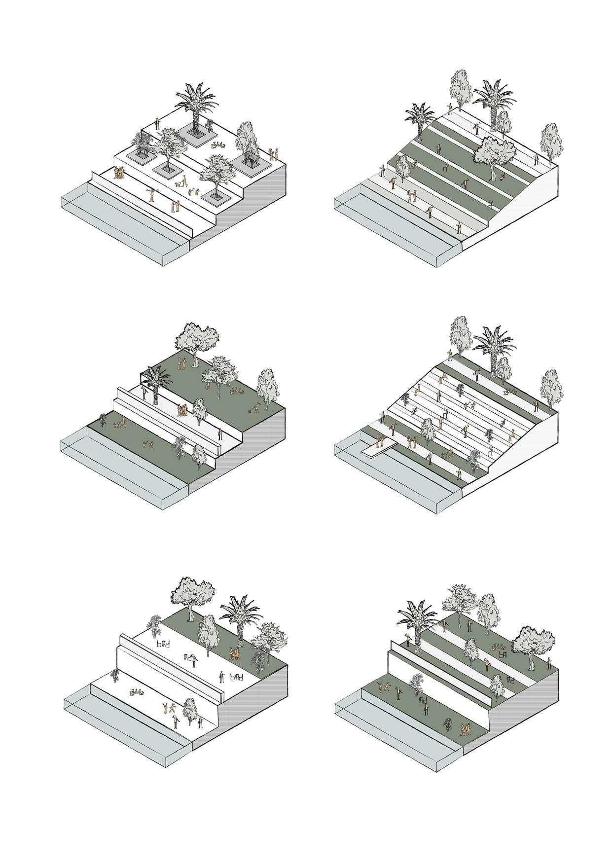
Drawing 90: Map illustrating the cultural path connection to public spaces. / Credit: Author
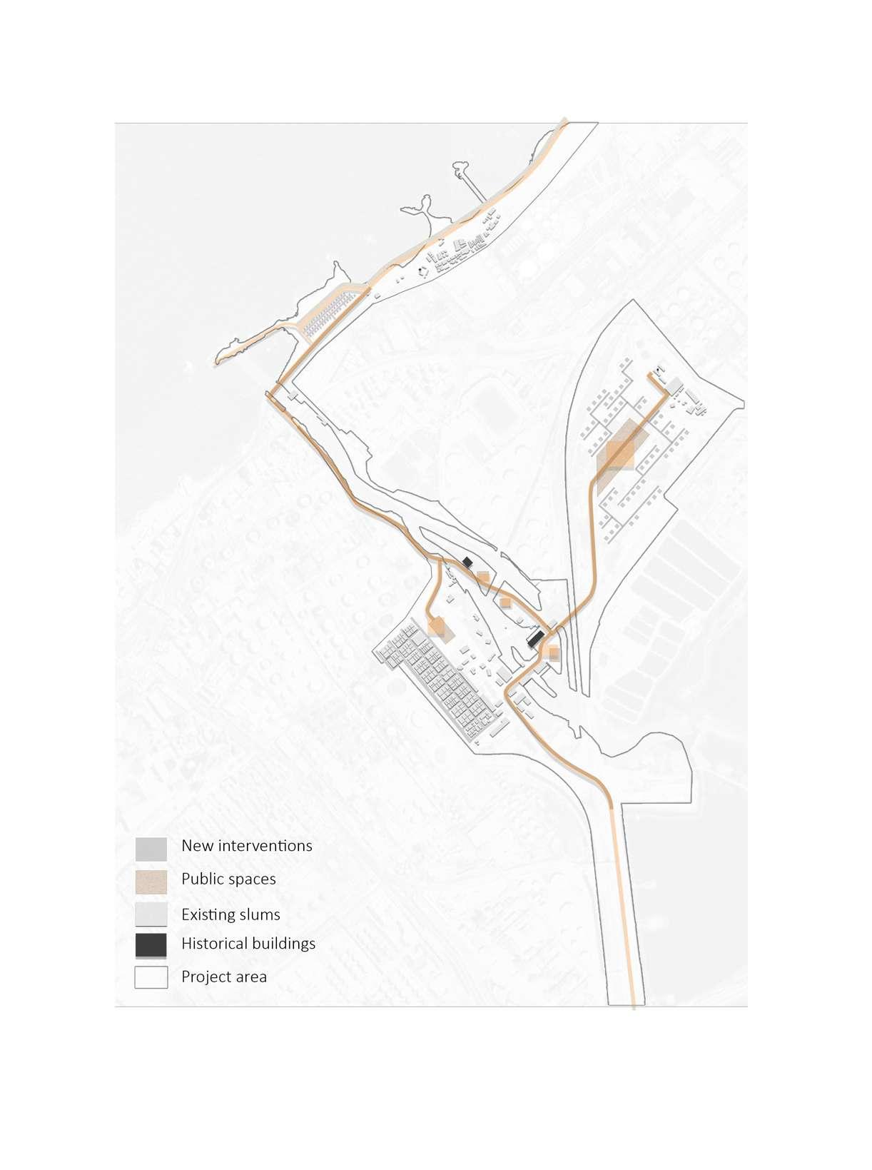
Drawing 91: 3D diagrams illustrating the grey infrastructure connection with public spaces. / Credit:
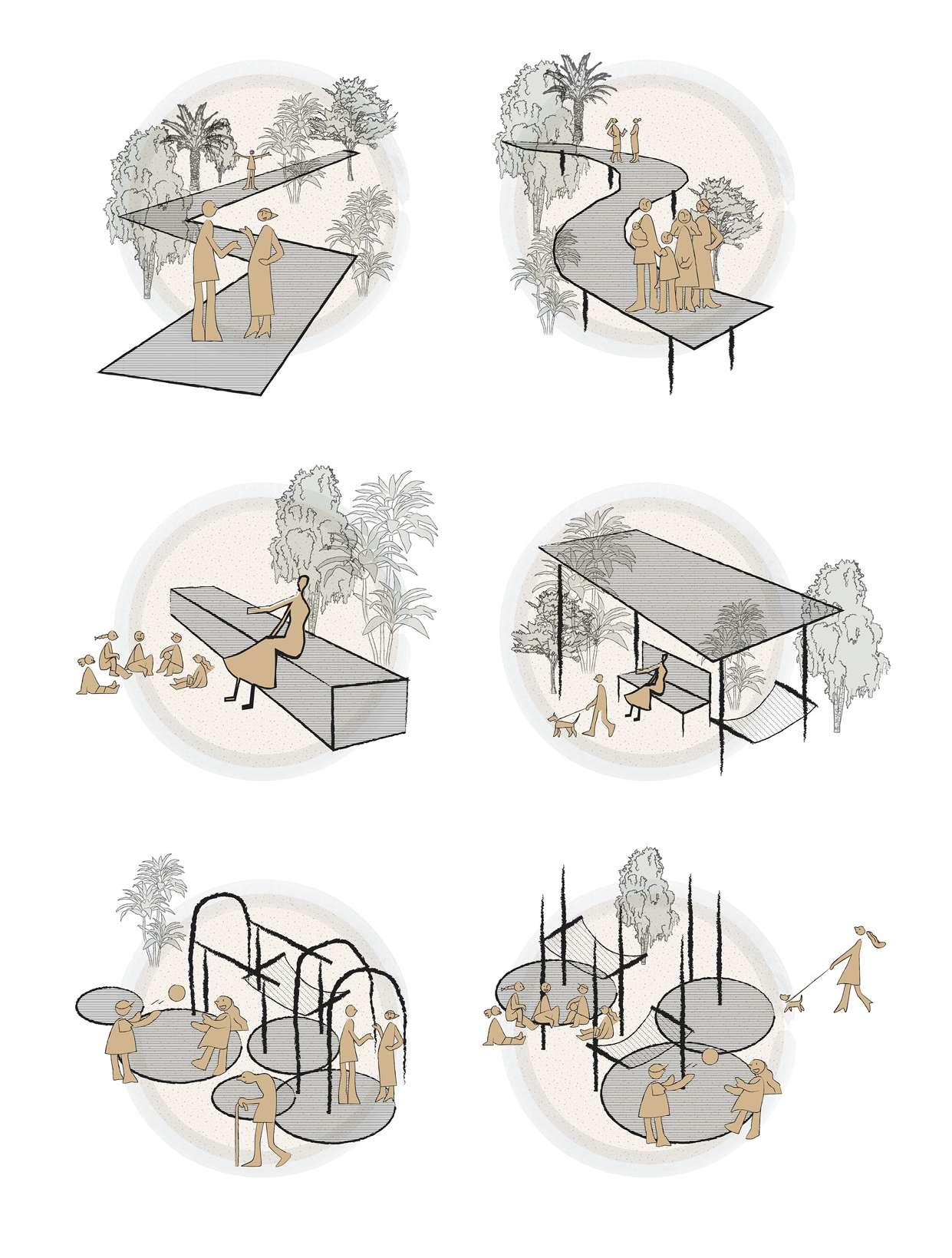
Drawing 92: Map of the existing landmarks on the cultural path. / Credit: Author
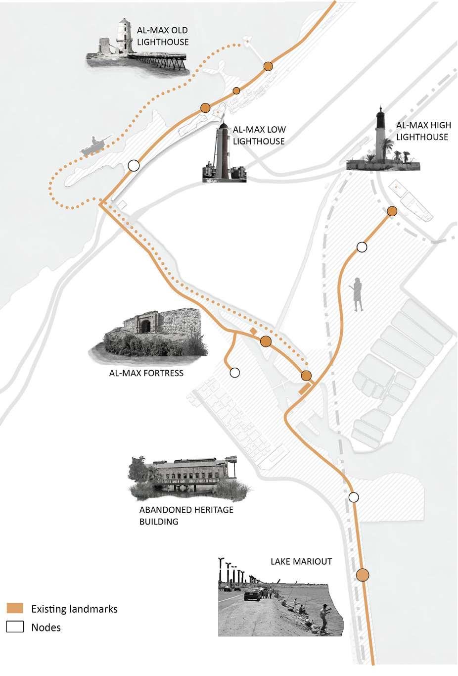
Drawing 93: Map of the added interventions on the cultural path. / Credit: Author
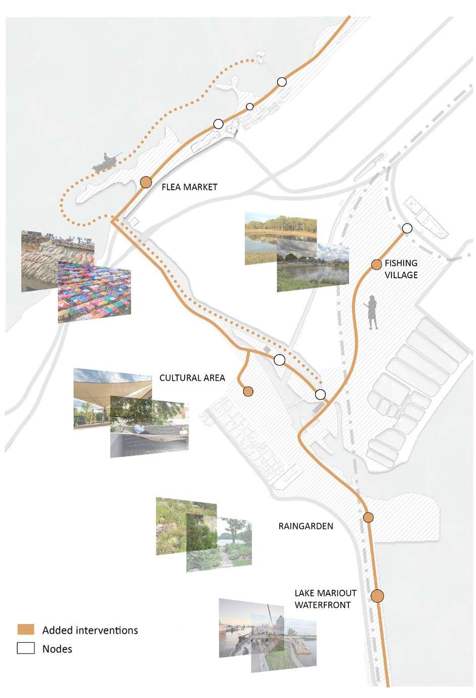
Nature-based solutions aimed to in crease urban resilience are often most effective when approached and planned in an integrated or holistic manner, especially in complex urban environments. This means first taking a system-based approach to address resilience and biodiversity challenges, and then, seeking practical ways to integrate NBS into policies plans, pro grams, and projects.
Taking an integrated systems ap proach also means that NBS should not be designed independently, but rather to complement and strengthen existing risk management interven tions. Nature based solutions can, for example, augment and complement existing gray infrastructure, gradually increasing the overall capacity of the system, and its efficacy and efficiency on risk reduction and co-benefits to the urban landscape. Such integration is not only necessary at a system lev el, but should also be considered at a local scale where hybrid solutions—a combination of nature-based features and gray infrastructure elements— may provide the most efficient solu tion.
Consequently, NBS can be integrated into broader programs, such as risk management plans, plans for designs of structural measures, proactive ur ban and land use planning, evacua tion management, and sustainable maintenance.
As most NBS are multifunctional, they can perform a variety of functions at different scales, and respond to sever al resilience demands, such as manag ing flooding and extreme heat effects, at different times. For example, the
same NBS implemented as part of a larger systems approach can retain, filter, and convey water protecting cities from floods as well as droughts. (Jha et al. 2012).
With the alarming levels of biodiversi ty loss, cities also have a responsibility to contribute to global efforts to re store, strengthen, and enhance biodi versity. In practice, this involves ensur ing that critical biodiversity areas are protected and effectively managed, and that ecological networks are en hanced to promote the movement of wildlife that is necessary for dispersing, foraging, and maintaining genetic diversity. Plan ning of ecological networks is there fore critical in cities where NBS can be used to provide supplementary hab itat. Optimizing these benefits does, however, require an understanding of the local ecology including tempera ture, rainfall, soils, and the selection of naturally occurring plant species for their use in NBS projects. While resilience and biodiversity ben efits are key in NBS design, it is often the variety of co-benefits contribut ing to human wellbeing that supports the value proposition over gray infra structure alternatives. These include aesthetic benefits that make neigh borhoods more attractive to urban residents and cultural benefits includ ing opportunities for relaxation and recreation. The longevity of NBS also requires the support of local commu nities and as such, warrants a need to integrate local community needs and aspirations into planning to ensure that interventions are supported and maintained in the long term.
Drawing 94: Map of the project zoning and strategy. / Credit: Author
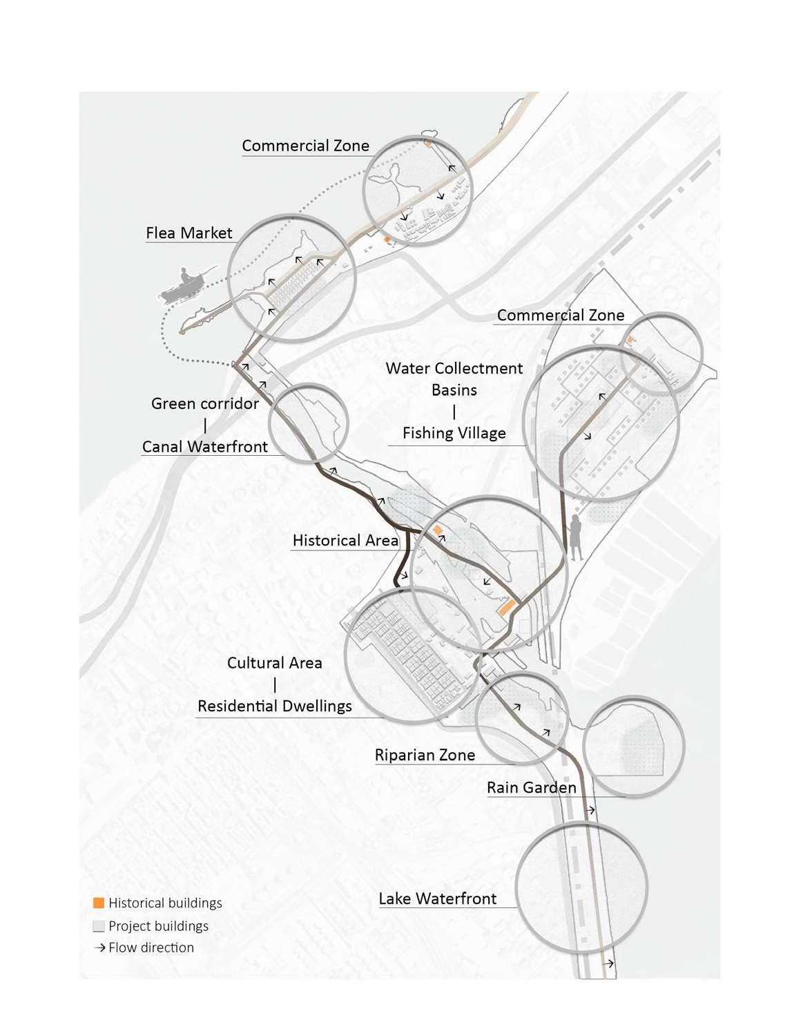
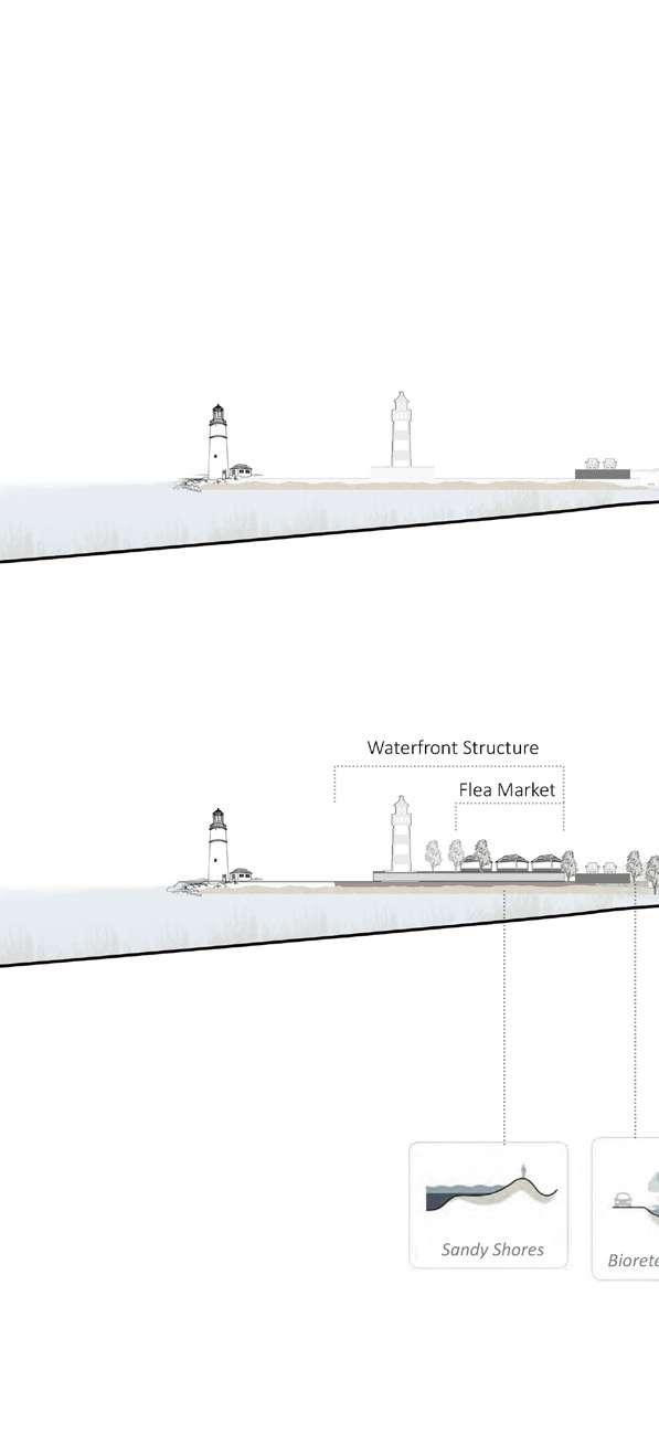
Delta cities are often flood-prone re gions and highly influenced by hydro logical dynamics, including dynamics between fresh and brackish water and sedimentation. They are also home to highly productive and nutrientrich wetland ecosystems and soils.
Nature based solutions at the river basin scale recognize the intercon nectedness of communities and the importance of integrated catchment management approaches to address flooding and water resource challeng es.
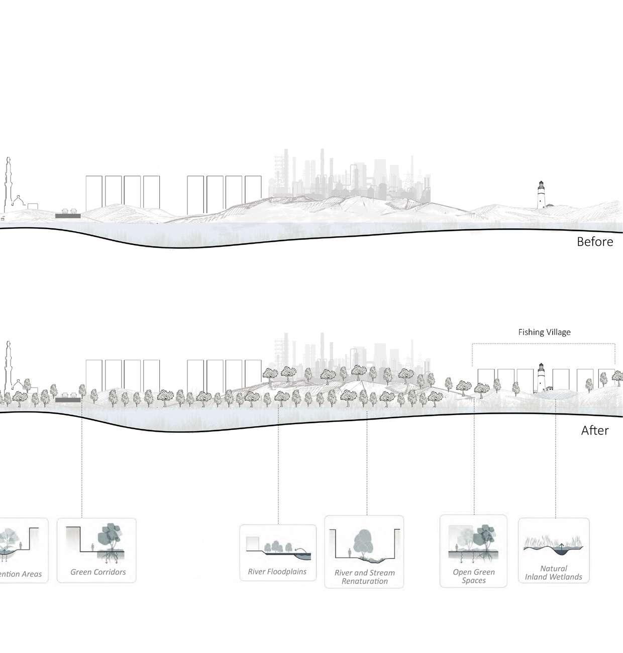 Drawing 95: Sections of the river basin-delta scale solutions. / Credit: Author
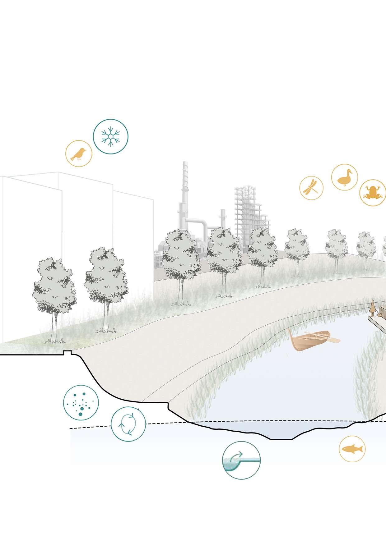
Sediment stabilization
Infiltration
Drawing 96: 3D section of the canal stream renaturation techniques. / Credit: Author
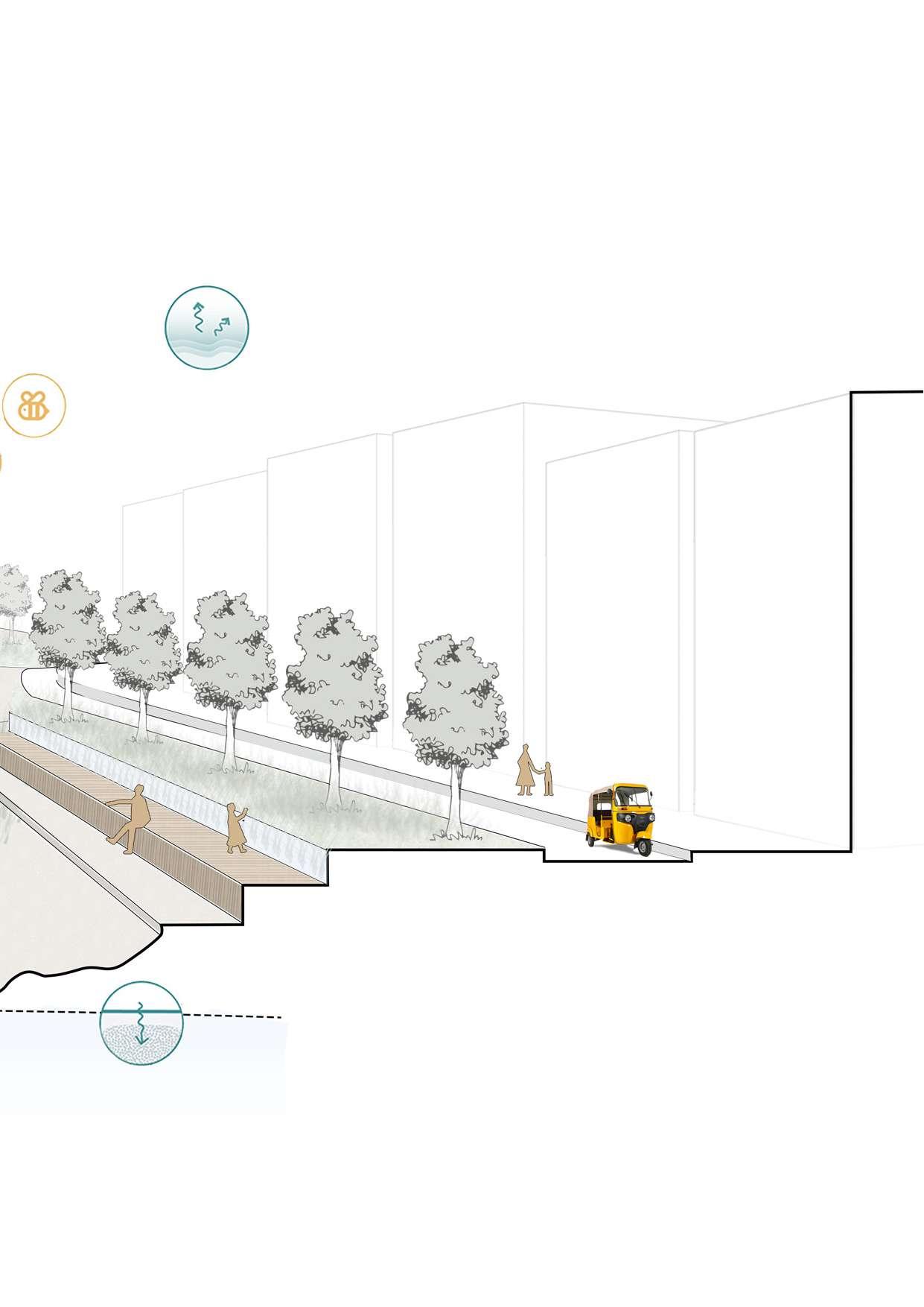
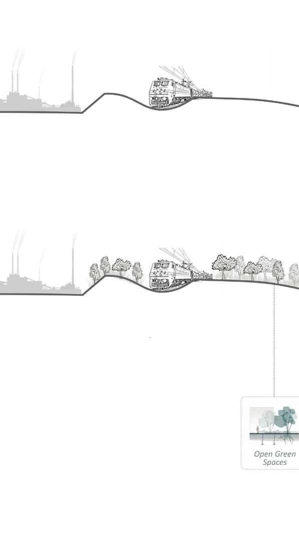
At the neighborhood scale, resilience challenges are addressed at a local level including measures in buildings, streets, and open public spaces. These often smaller-scale interventions can build resilience by increasing storm water retention capacities and reduc ing the heat island effect, for exam ple. These NBS can be very effective for local rainwater collection, to mit igate impacts of air, water, and soil contamination, and to reduce heat levels in cities by providing shade. Neighborhoods can be established as functional clusters of resilience. Im plementing NBS at the neighborhood level can relieve pressure on existing local infrastructure such as stormwa ter drains. At the neighborhood level, collaboration between the public and the private domain is key, and NBS im plementation can help build alliances between the different stakeholders— governments, private sector, property owners, and communities.
Drawing 97: Sections of the neighborhood scale solutions. / Credit: Author
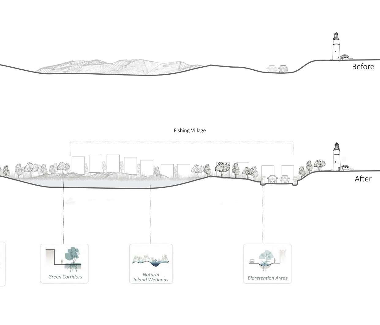
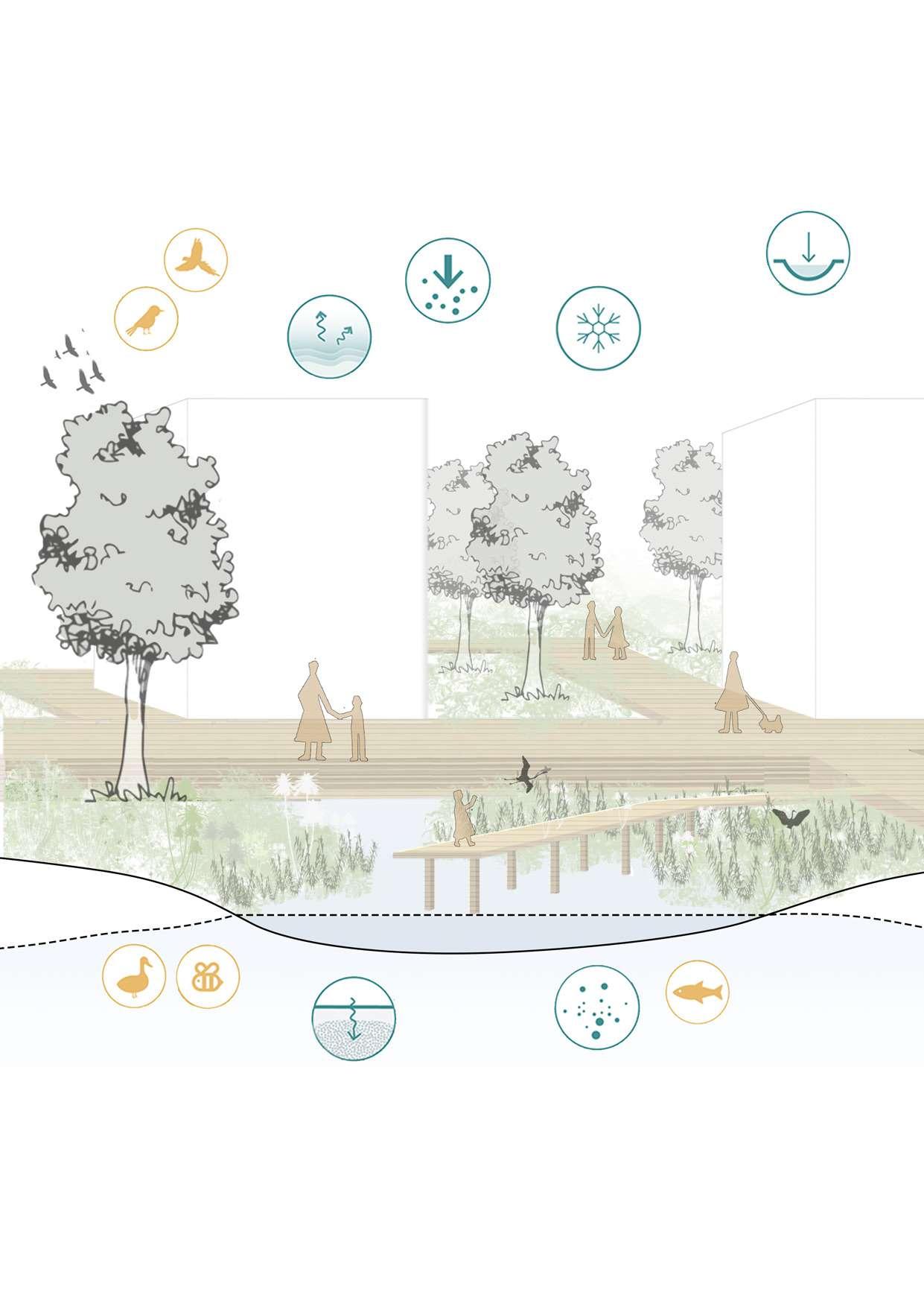
Drawing 98: 3D section of the detention pond and urban park techniques. / Credit: Author
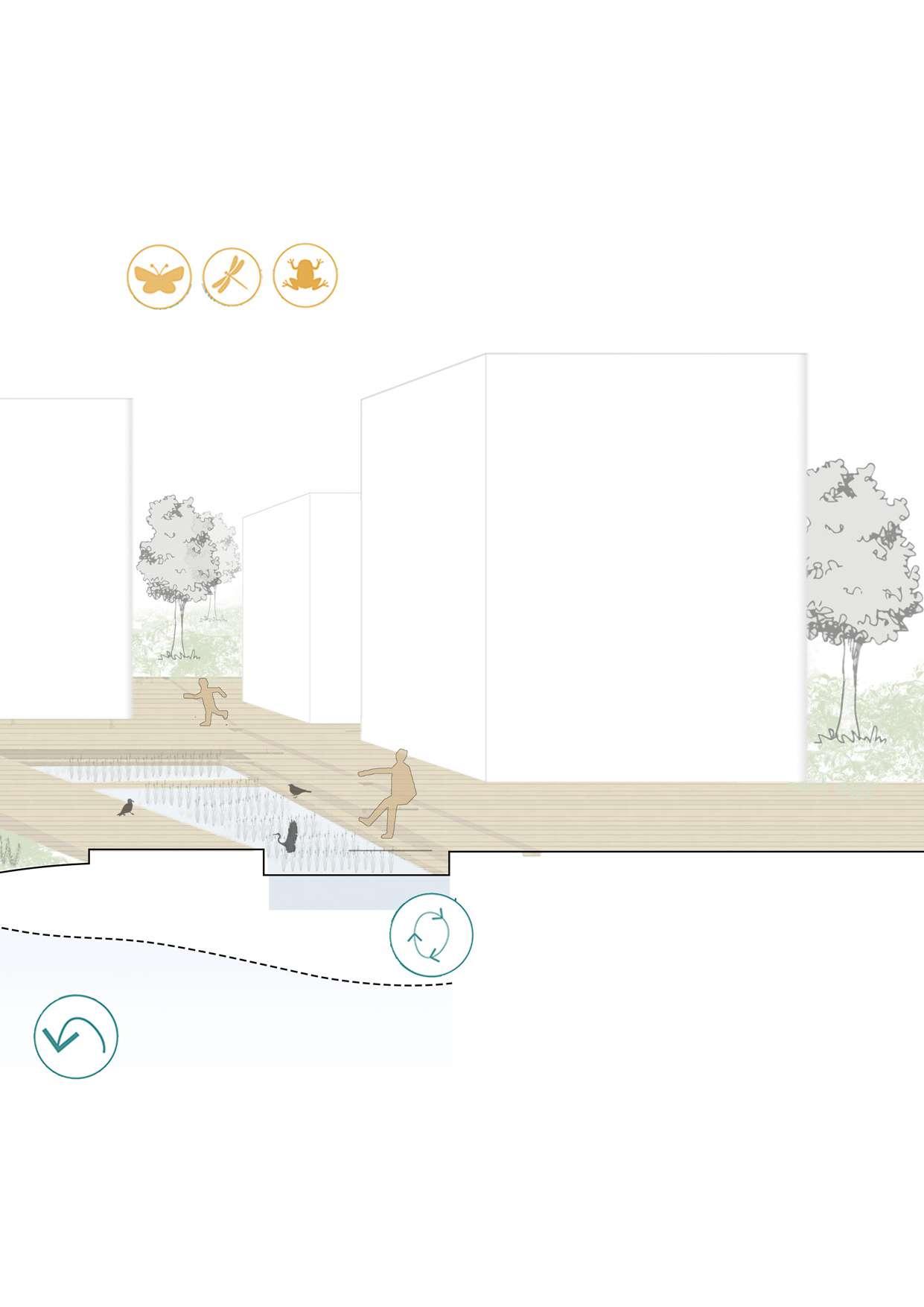
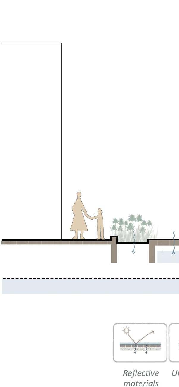
At the building scale, resilience chal lenges are addressed at a local level including measures in buildings, wal ways, and green avenues. These often smaller-scale interventions can build resilience by increasing stormwater retention capacities and reducing the heat island effect, for example. These NBS can be very effective for local rainwater collection, to mitigate im pacts of air, water, and soil contam ination, and to reduce heat levels in cities by providing shade. Building ar eas can be established as functional clusters of resilience. Implementing NBS at the neighborhood level can re lieve pressure on existing local infra structure such as stormwater drains, building construction of reflective ma terials, permeable pavements and un derground water storage.
Drawing 99: Section of the building scale solutions. / Credit: Author
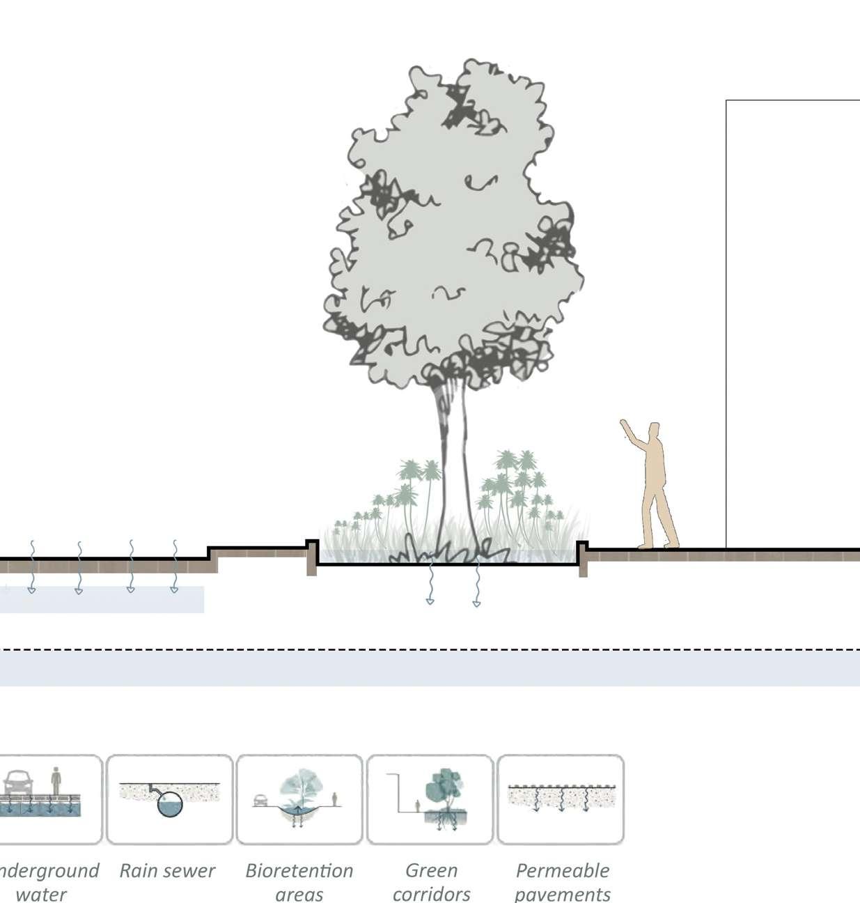
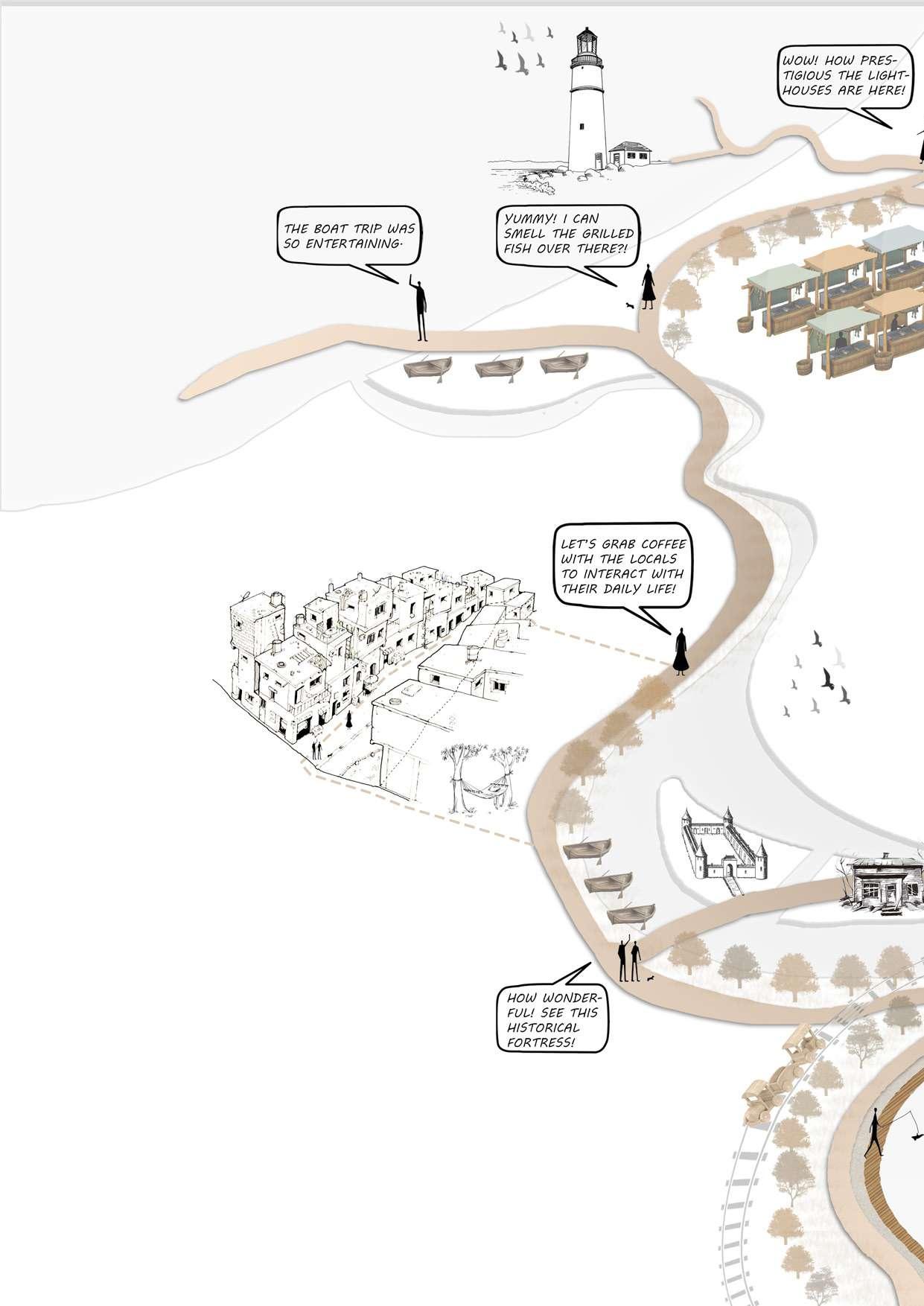
Drawing 100: Sensory experience. / Credit: Author
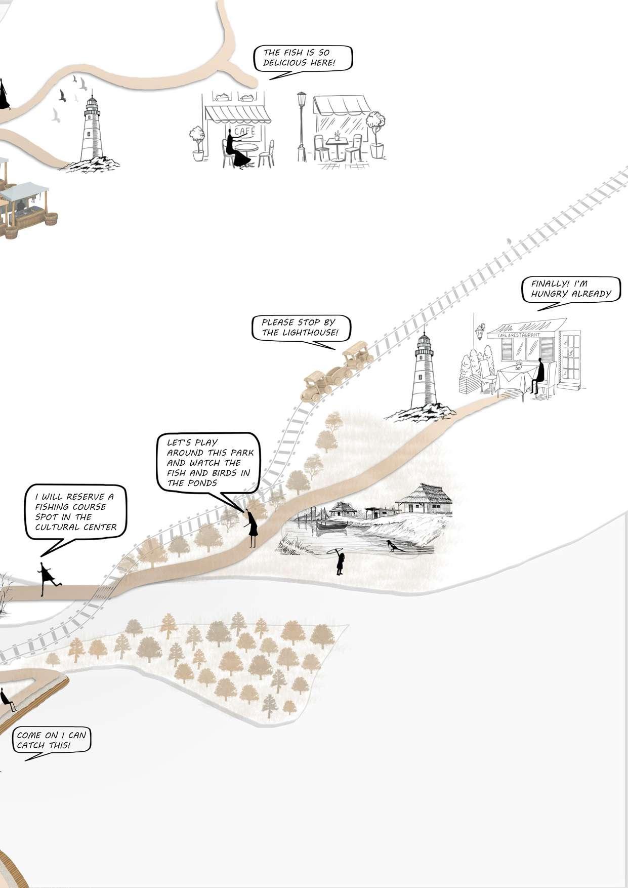
Blue -Green Infrastructure enhances a city's beauty and aesthetics hrough the active integration of water and vegetation, in which the lines between the two are blurred and made acces sible, Grey infrastructure works to re acquaint people with nature. When coupled with green components, the
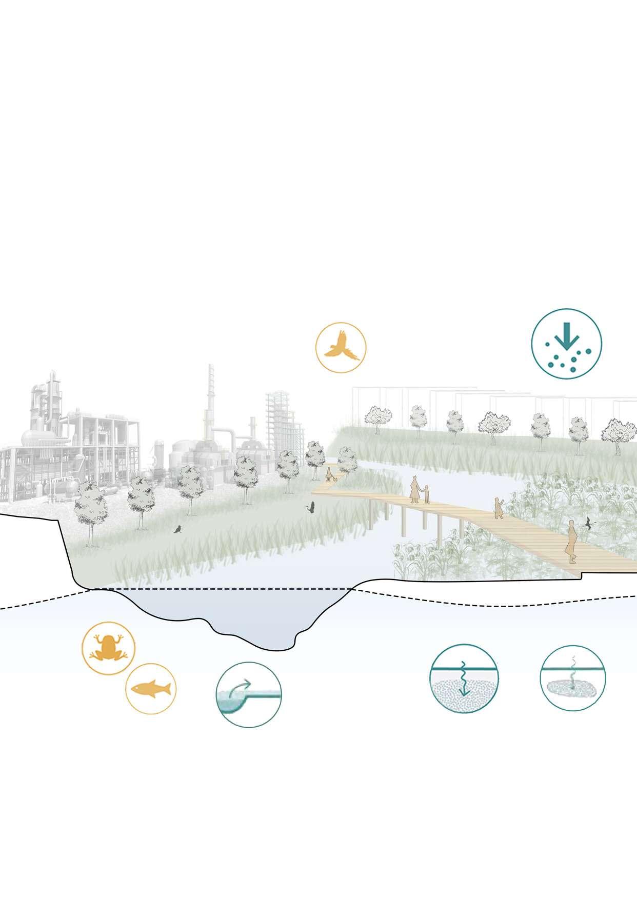
positive connections that blue as pects of urban design often have are amplified. The magnitude and size of the blue parts, as well as how the edge criteria for public access are put into practice, appear to be connected to how comparatively beautiful they are seen to be.
Cleaning capacity Sediment stabilization
Drawing 101: 3D section of the canal stream blue green infrastructure techniques. / Credit: Author
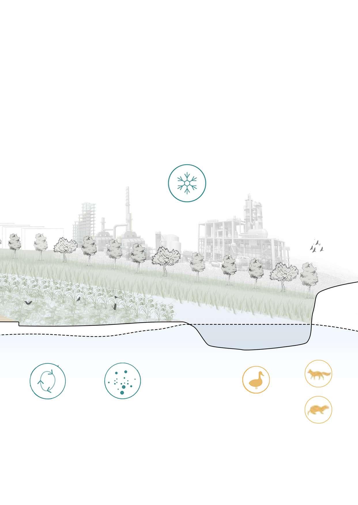
Blue-Green-Grey infrastructure up grades existing spaces for leisure, exercise, and social activities, which benefits both the physical and emo tional health of people. These facil ities lower the price of personal and societal health. It encourages so cial engagement and social integra tion by boosting the propensity for group activities in public settings and the commitment to spending time with friends, family, and neighbors. Blue-Green infrastructure raises prop erty prices and real estate values by enhancing the social and aesthetic appeal of nearby land and structures. A city's general liveability and attrac tiveness are shown by the develop ment of Blue-Green infrastructure, which also enhances the reputation of a city's governmental institutions for providing for the needs of its cit izens.
By interconnecting the water man agement strategies of the detention ponds and the people, it raises the bonding between the tourists and locals to the natural features of the place which creates a sense of place and local identity. The detention ponds collect the water during the flooding seasons and purify and store it for later on when needed in dry sea sons; the public are in direct connec tion with the natural topography and the weather conditions of the area by integrating these detention ponds with the public spaces. People enjoy the water in the flood seasons and use the space as an open recreation al area with outdoor fursniture of raw materials like hammocks and trampo lines made from fishing nets, swings and seatings made from wood.
Drawing 102: 3D diagrams of the public spaces in different seasons scenarios. / Credit: Author
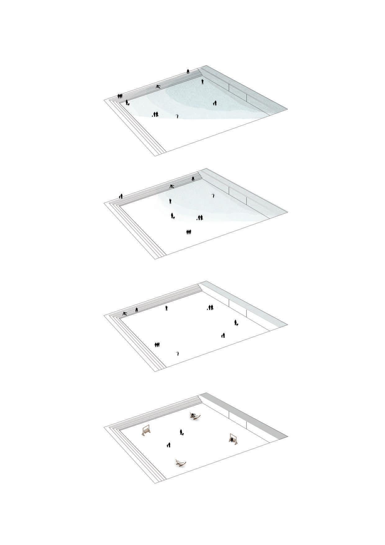
With the alarming levels of biodiversi ty loss, cities also have a responsibility to contribute to global efforts to re store, strengthen, and enhance biodi versity. In practice, this involves ensur ing that critical biodiversity areas are protected and effectively managed, and that ecological networks are en hanced to promote the movement of wildlife that is necessary for dispers ing, foraging, and maintaining genet ic diversity. Planning of ecological networks is therefore critical in cities where nature based solutions can be used to provide supplementary hab itat. Optimizing these benefits does, however, require an understanding of the local ecology including tempera ture, rainfall, soils, and the selection of naturally occurring plant species for their use in nature based solutions projects. Here are the recommended plant species for each use.
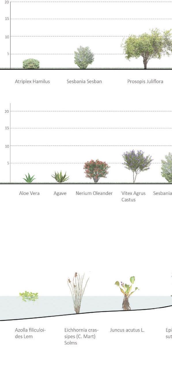
Drawing 104: Section illustrating the buffer area plant species. / Credit: Author
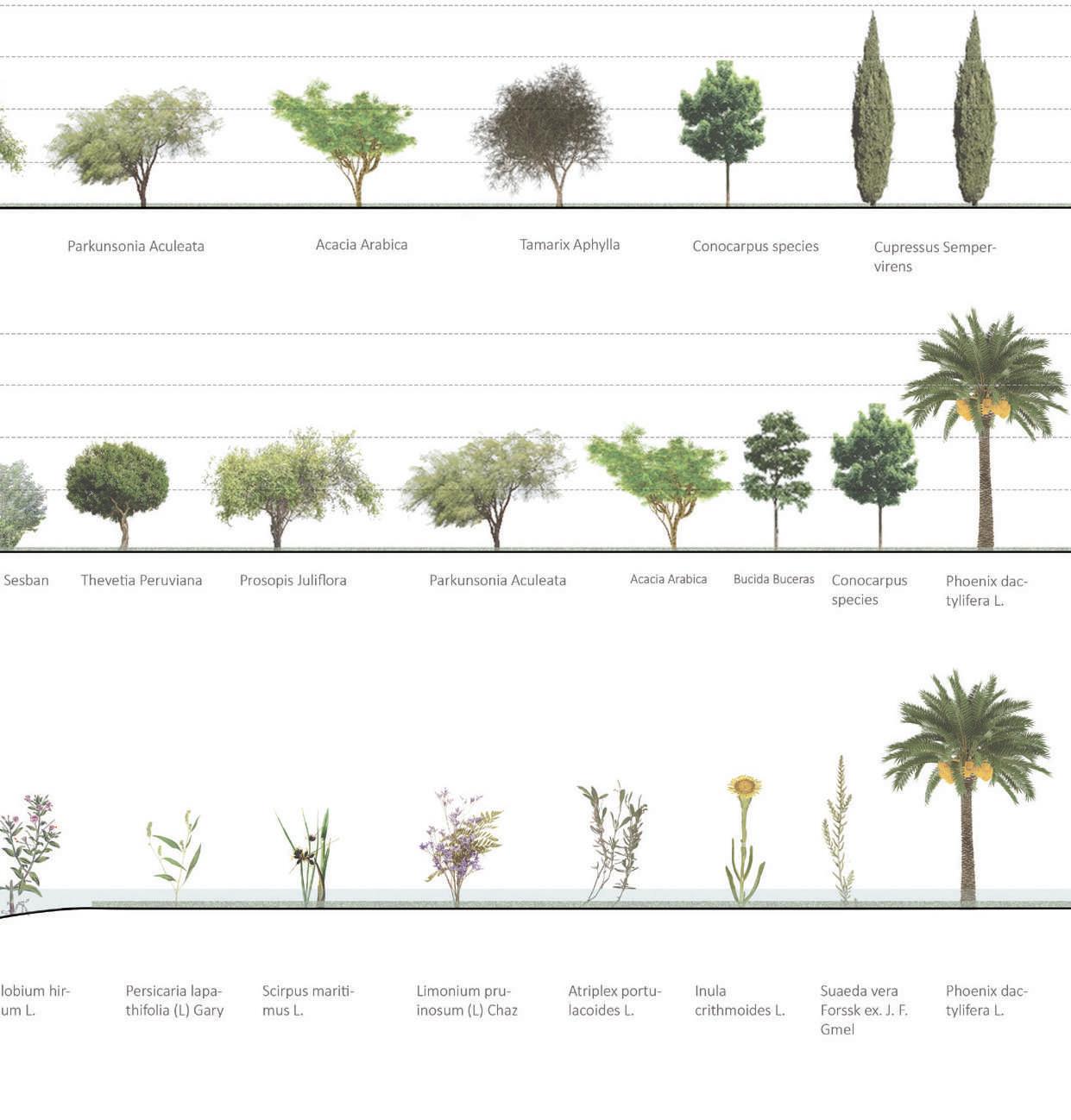
Drawing 103: Section illustrating the village orchard area plant species. / Credit: Author
Drawing 105: Section illustrating the aquatic species. / Credit: Author
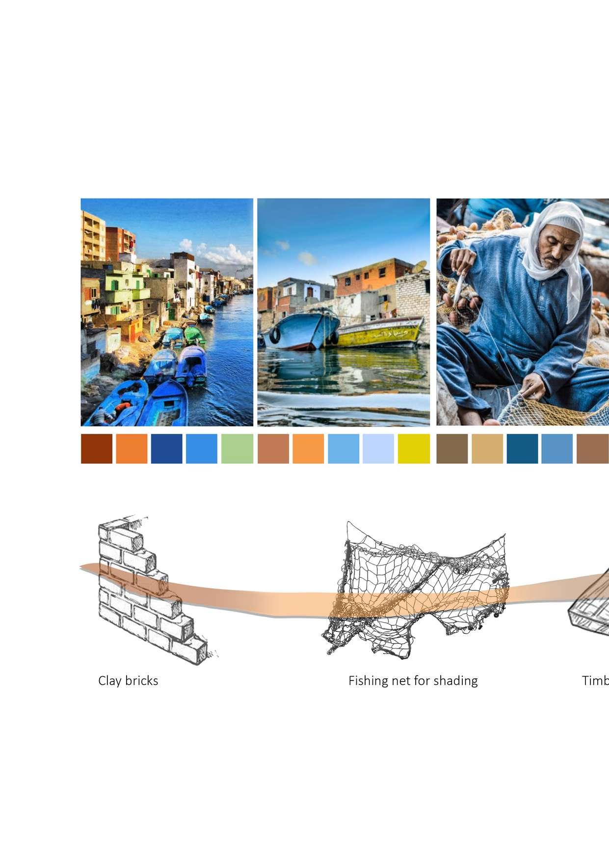
Drawing 106: Illustrations of the materials and colors used. / Credit: Author
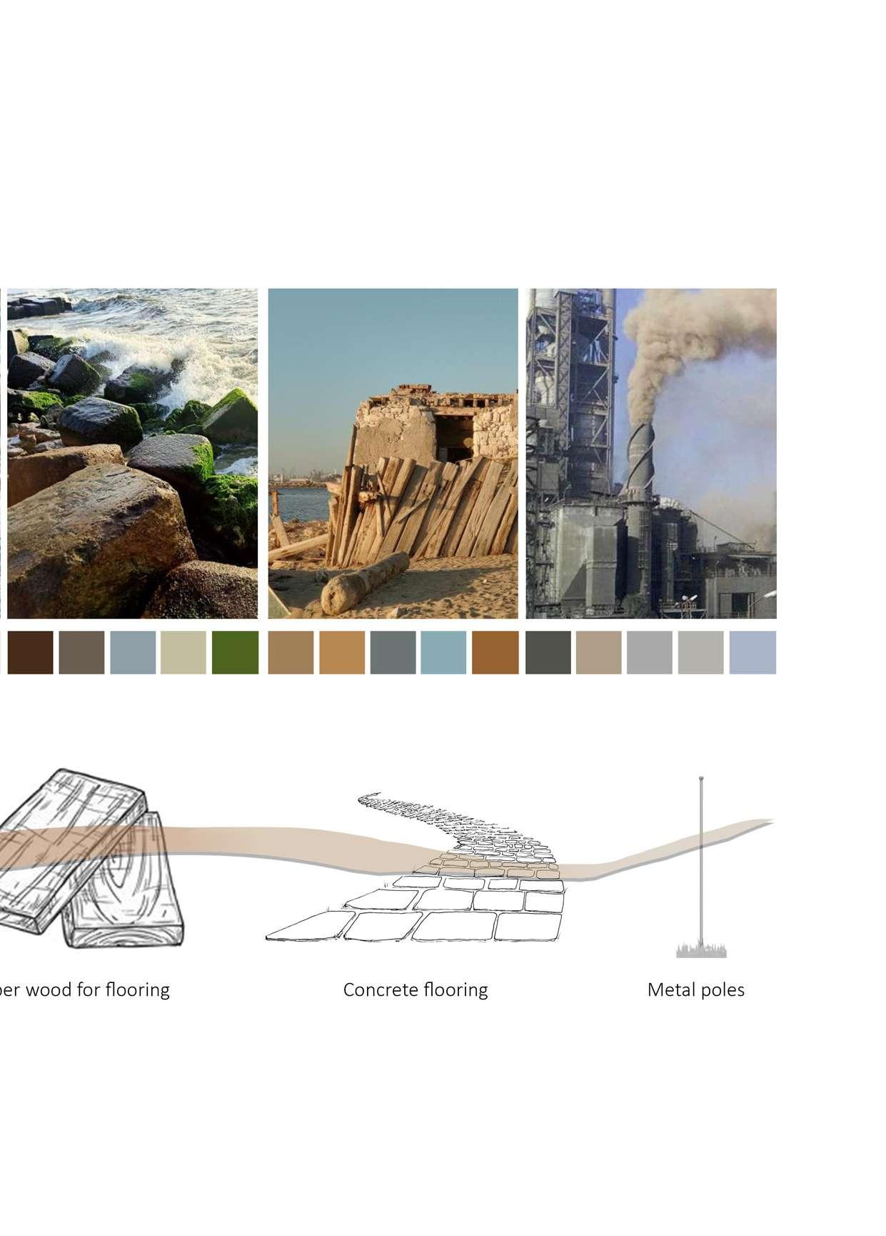
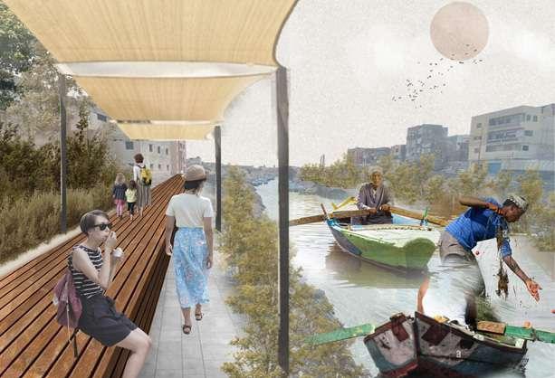
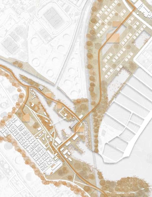
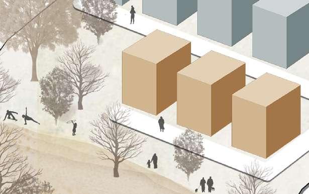
5�1� Master Plan
5.2.1. Fishing Village and Wetland Park 5.2.2. Flea Market and Coastal Waterfront
5.2.3. Canal Waterfront
5.2.4. Historical Center and Wadi Al-Qamar Dwellings 5.2.5. Lake Mariout Waterfront and Rain Garden
1
0.75 squared kilometers 11kilometers perimeter
2
Al-Max old lighthouse
Commercial area
Al-Max low lighthouse
Mediterranean sea waterfront
Flea market
AlMax canal waterfront
Buffer area
5.1. Recreational park
Cultural area
Wadi Al-Qamar residential dwellings
Cultural center (Regenerated building)
Rain garden
Al-Mamlouk fortress Lake Mariout waterfront
Fishing village and wetland park
Al-Max high lighthouse
6 Drawing 107: Master Plan. / Credit: Author
Commercial area
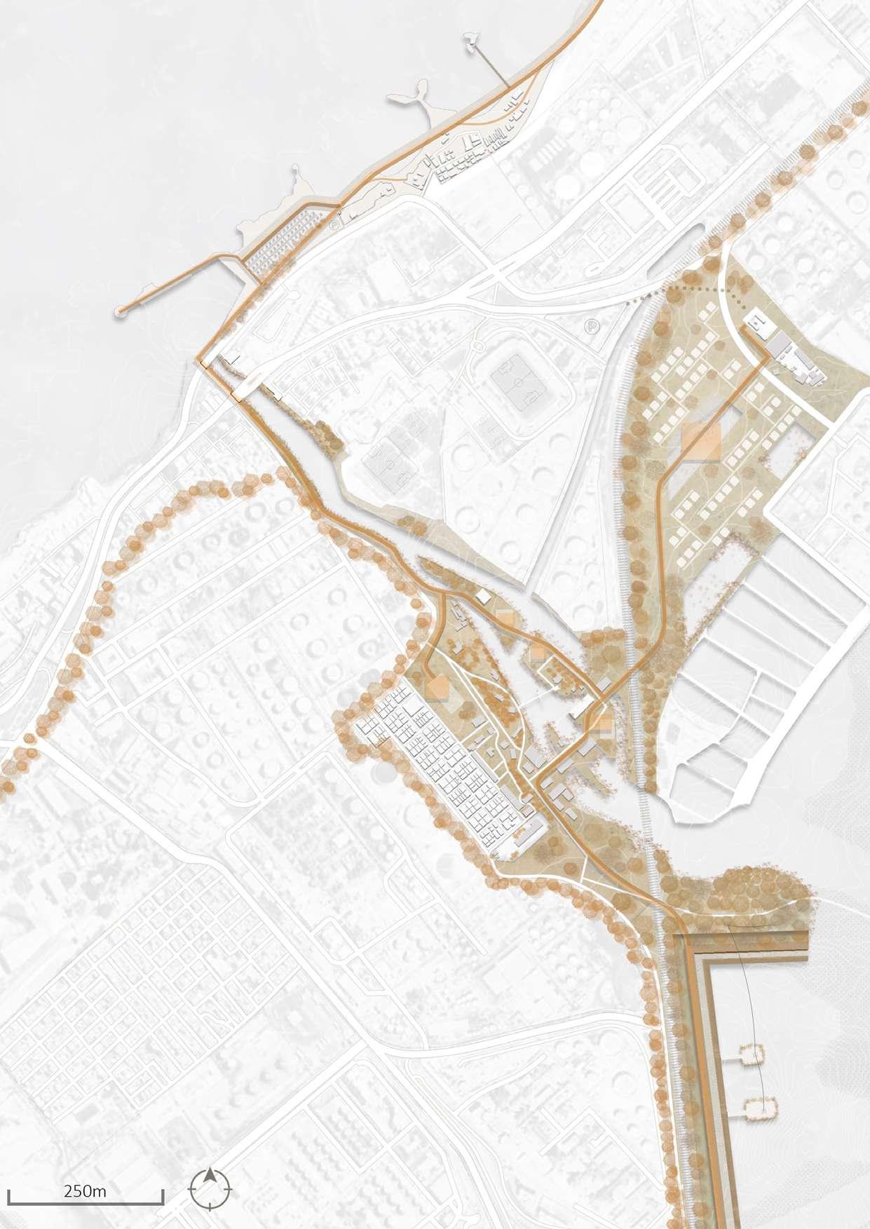
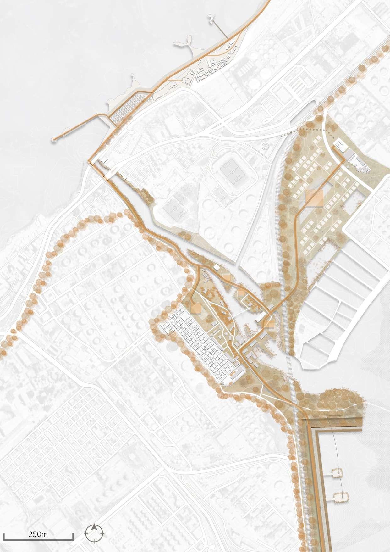
Drawing 109: Key Map. / Credit: Author
Touristic tram railway Residential village
Green buffer Retention pond
1 5 2 6 3 7 4 8 Al-Max high lighthouse Commercial area
Open space/ Detention pond Retention pond
Drawing 110: Fishing Village and Wet land Park blow up. / Credit: Author
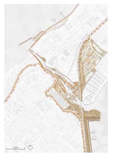

Drawing 111: Fishing Village and Wetland Park 3D diagram. / Credit: Author
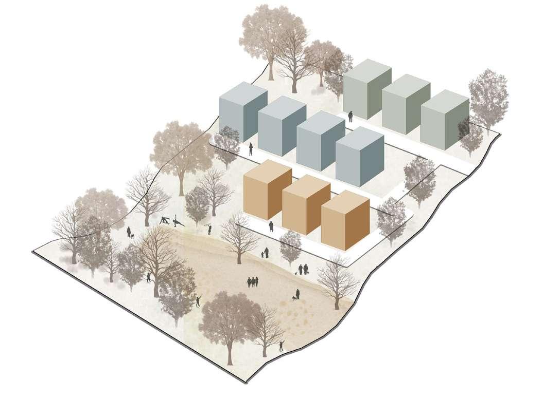
Drawing 112: Wetland Park blow up. / Credit: Author
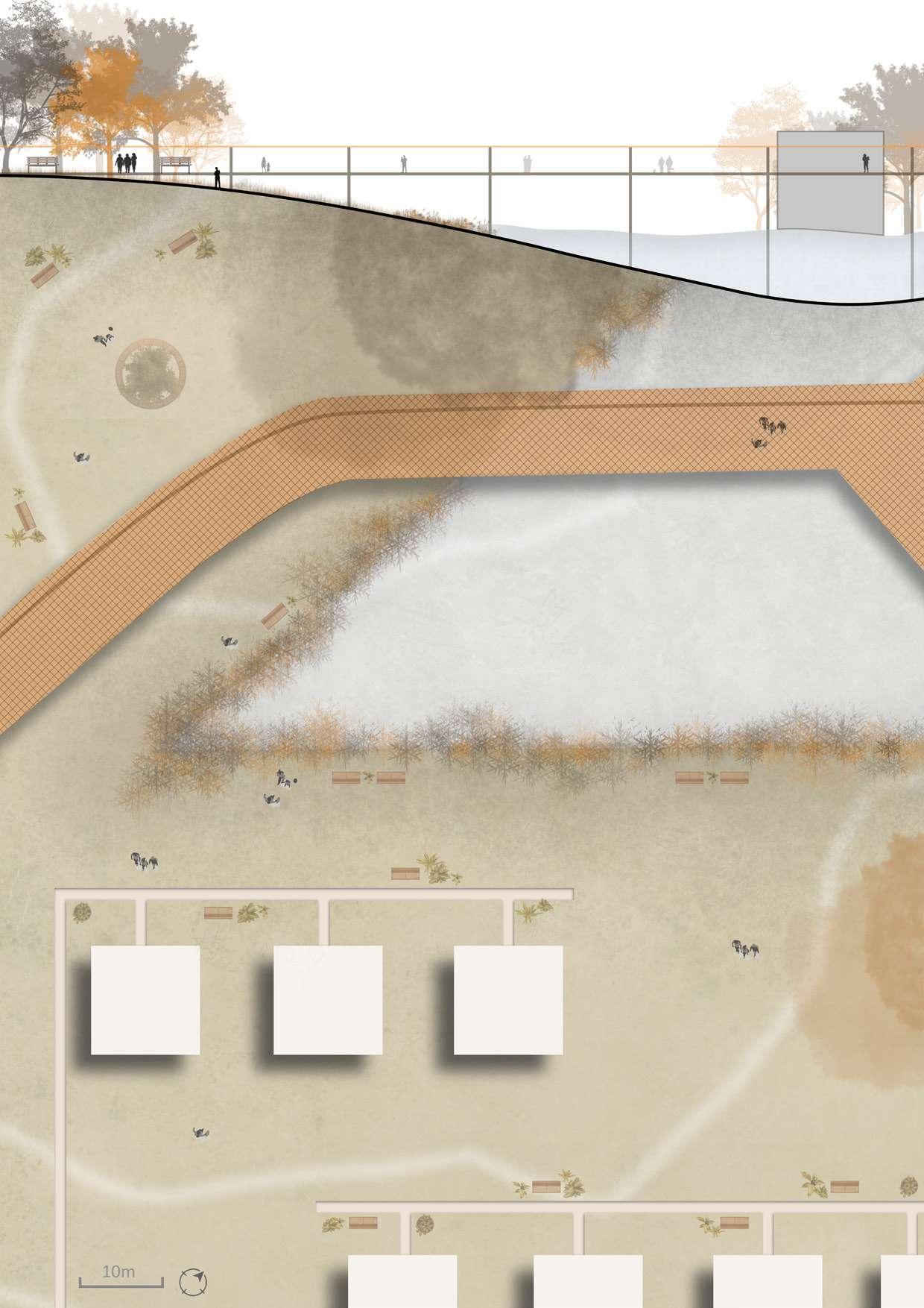
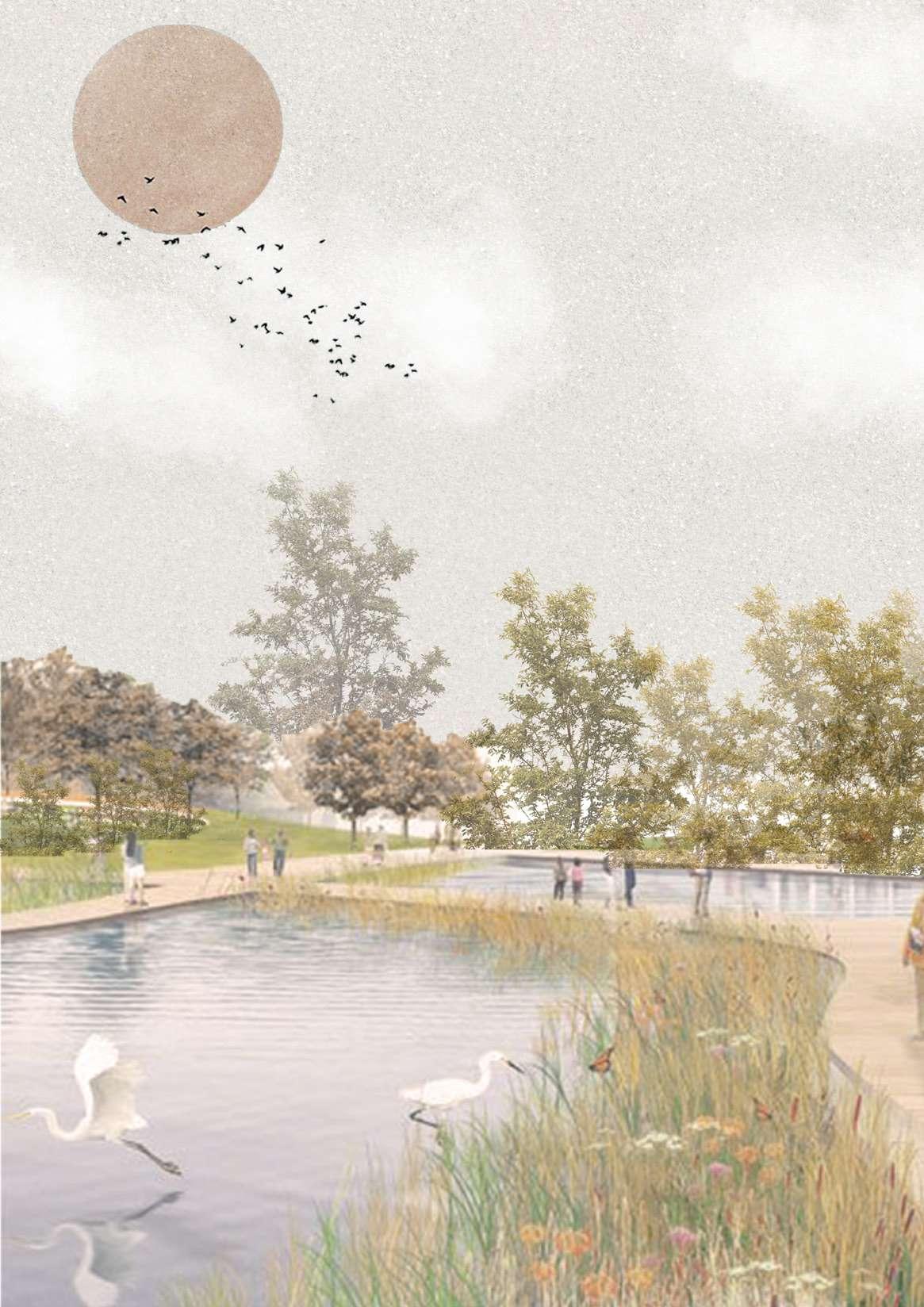 illustration of the fishing village and wetland park.
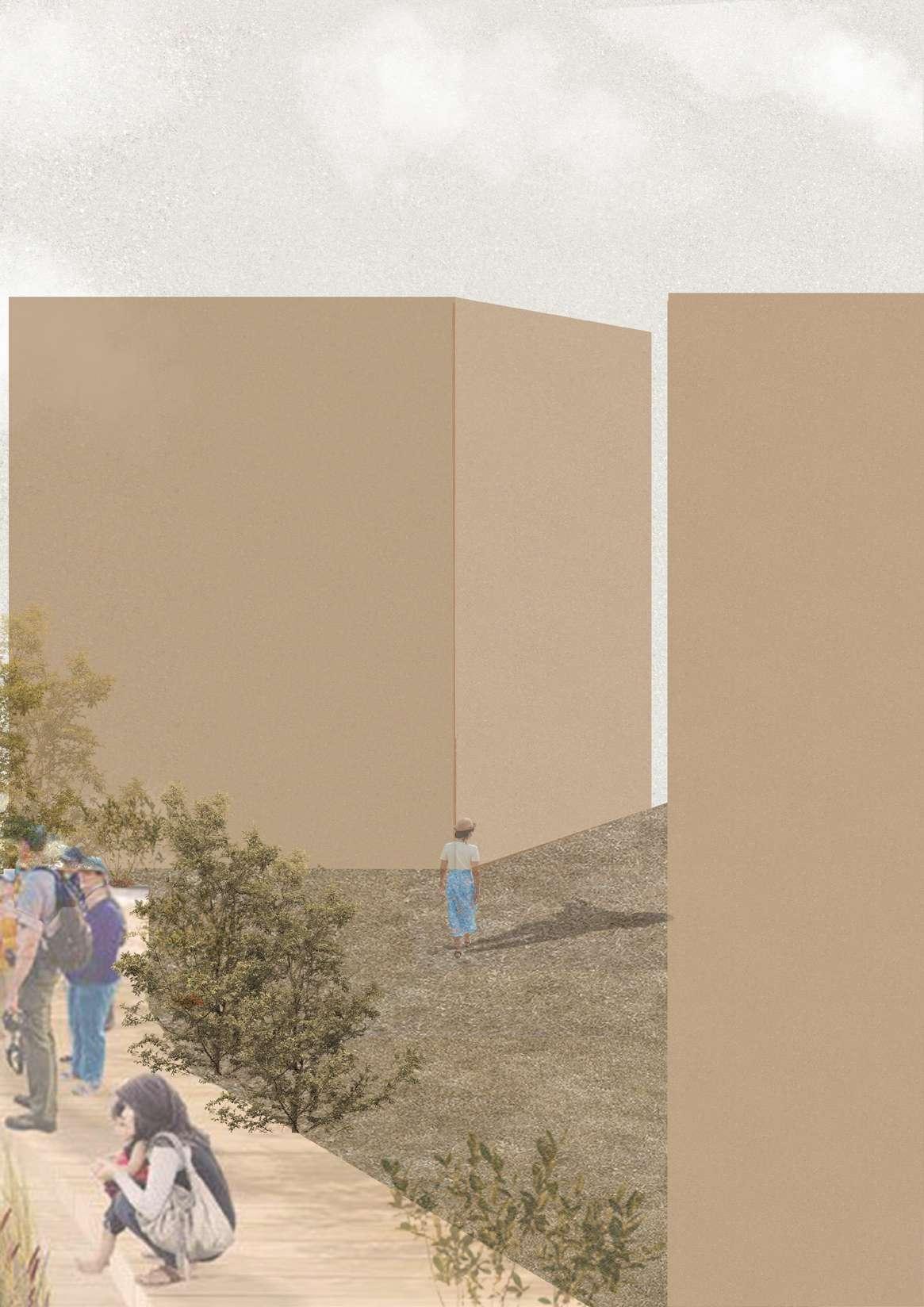
Al-Max old lighthouse
Commercial area Al-Max low lighthouse Mediterranean sea waterfront
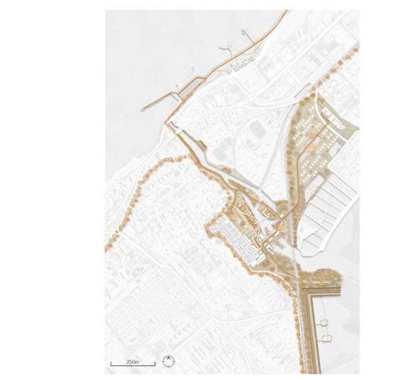
5 5 2 1 3 4 Drawing 115: Key Map. / Credit: Author
Flea market Boats parking
Drawing 114: Flea Market and Coastal Waterfront blow up. / Credit: Author
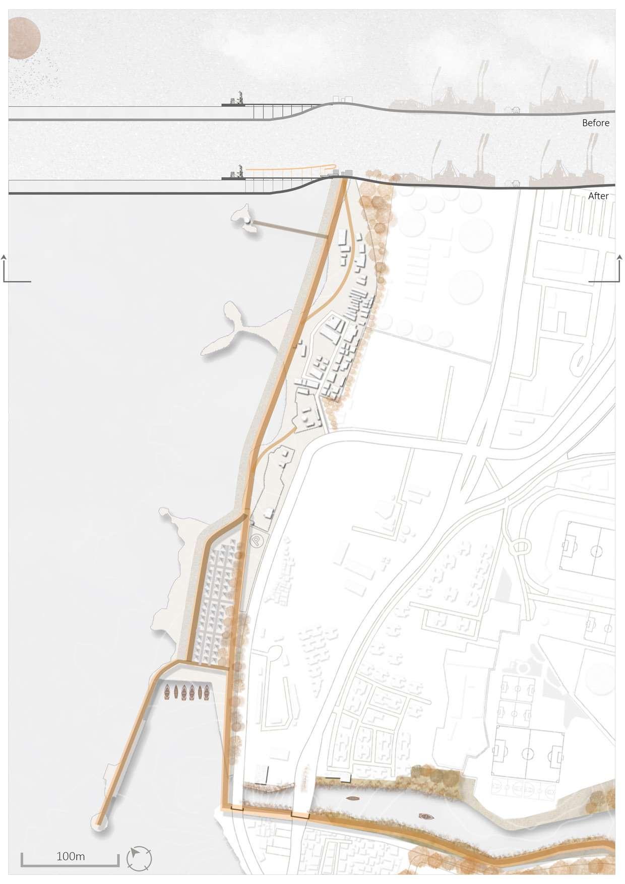
Drawing 116: Flea Markt 3D diagram.
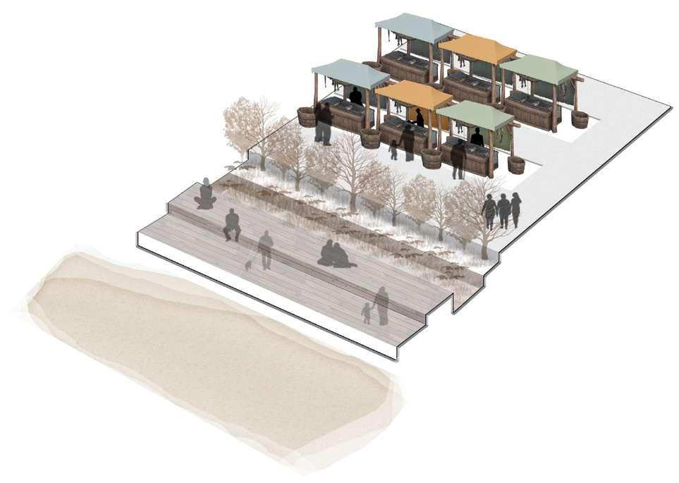
Drawing 117: Flea Market blow up. / Credit: Author
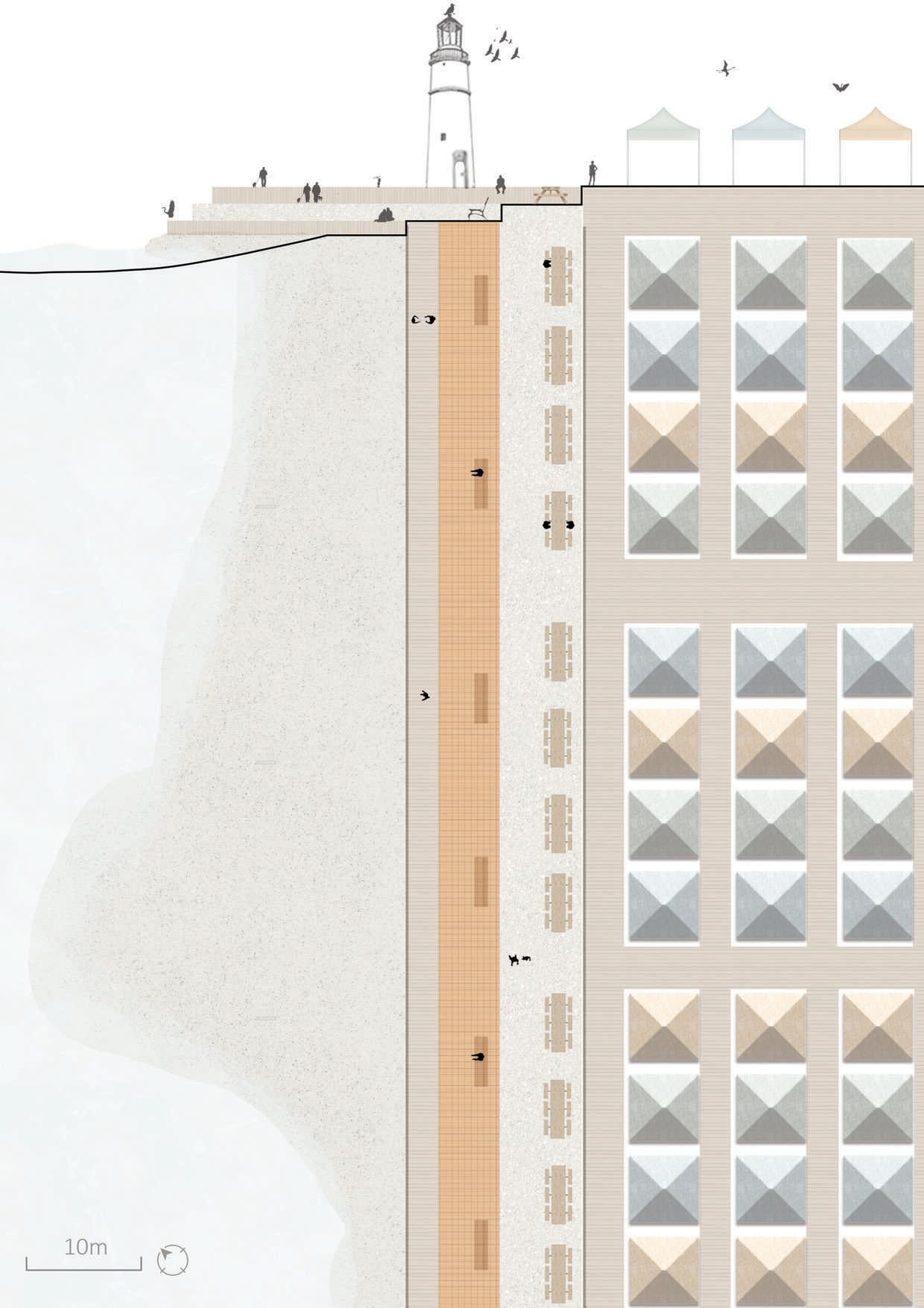
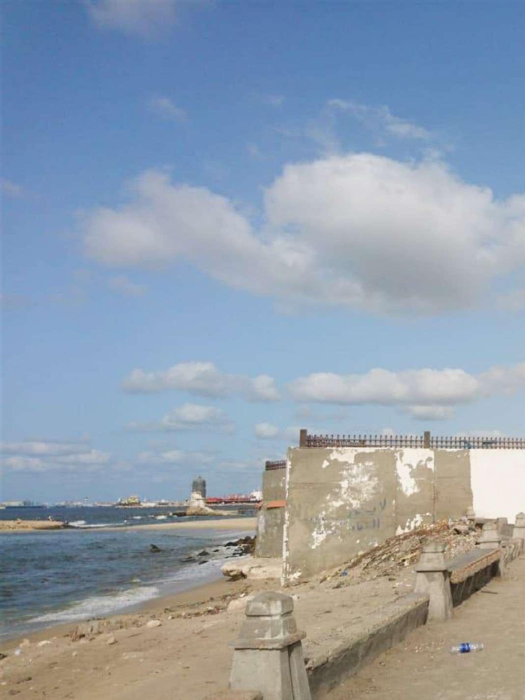 Figure 139: The situation of the coastal waterfront before development / Image credit: Google Earth
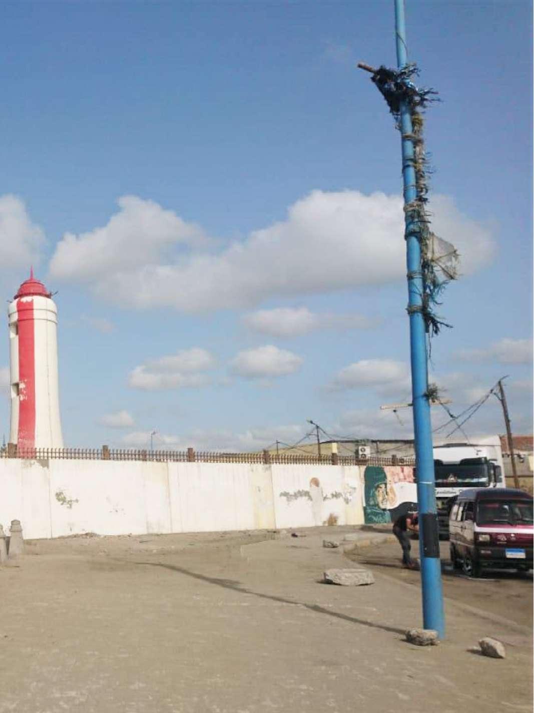
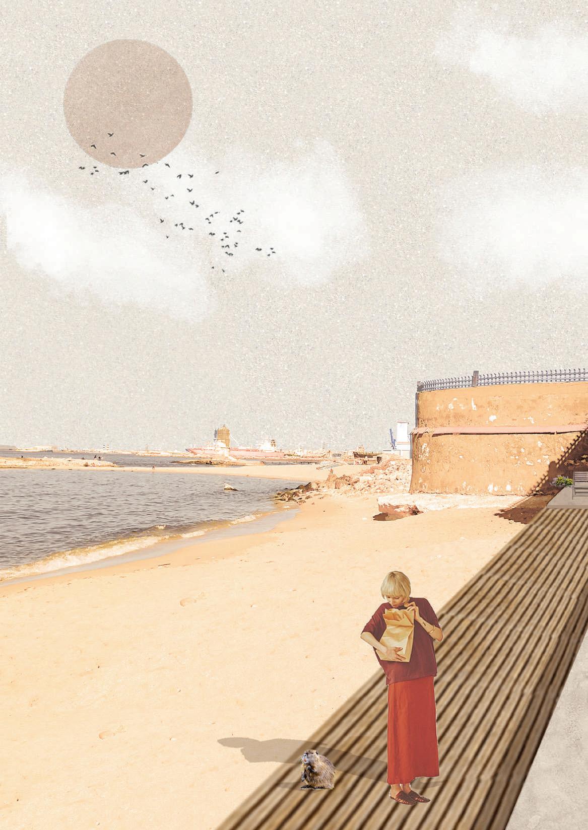
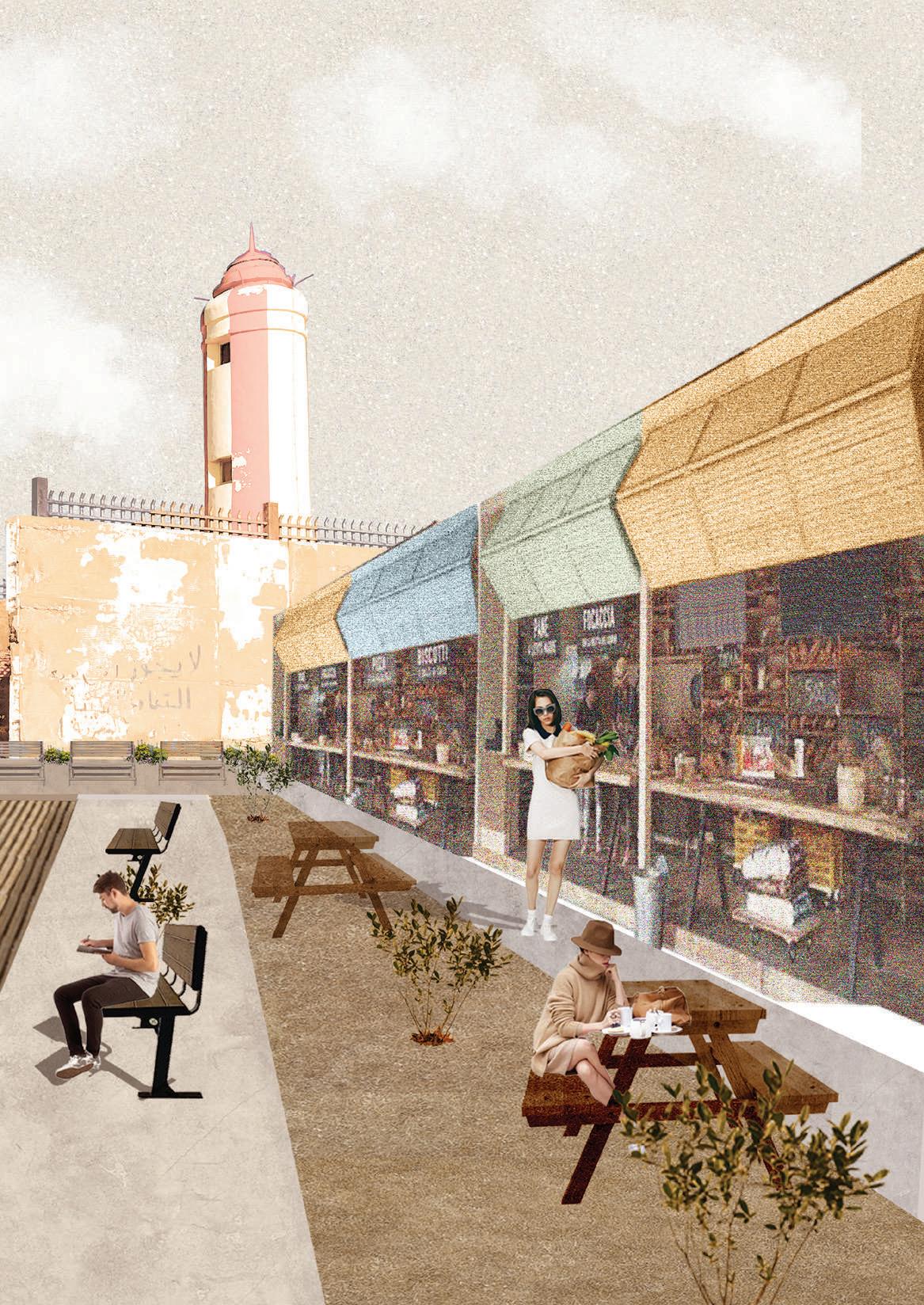
2
Drawing 120: Key Map. / Credit: Author
Boats parking Canal waterfront Bioretention area Green buffer
Drawing 119: Canal waterfront blow up. / Credit: Author
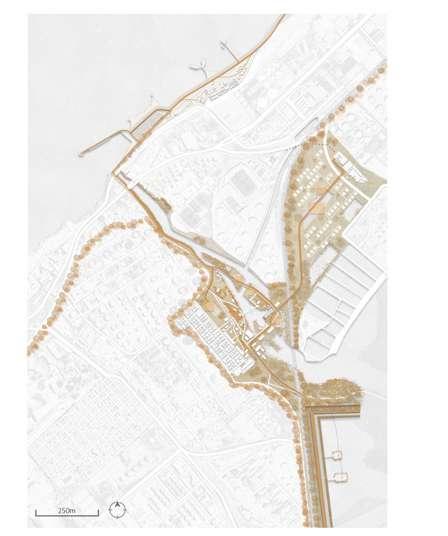
1
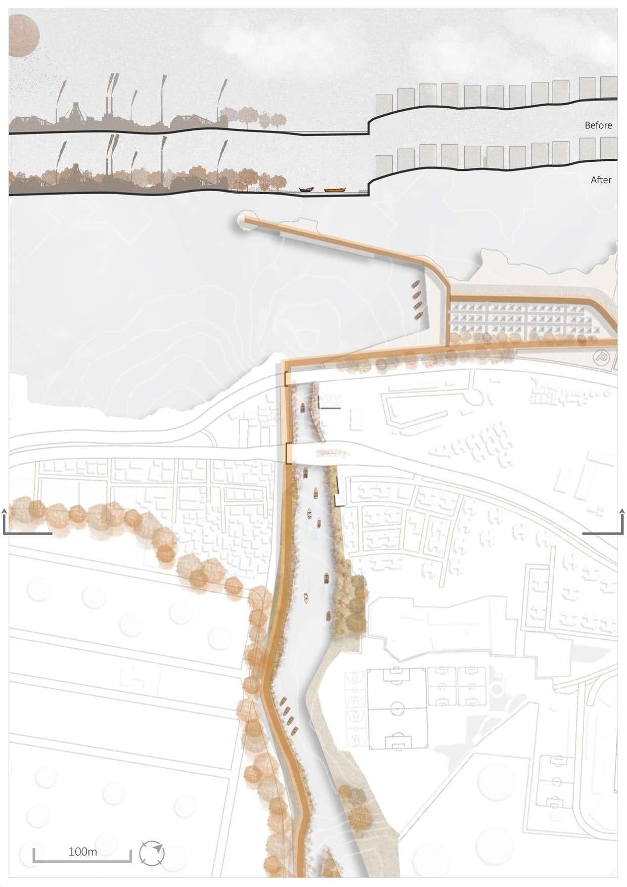
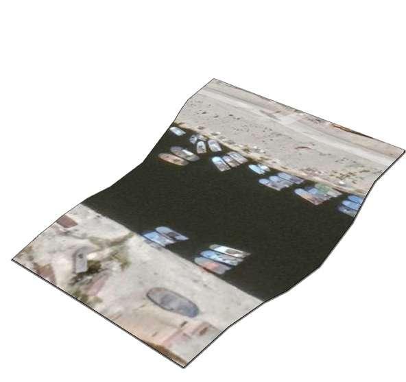
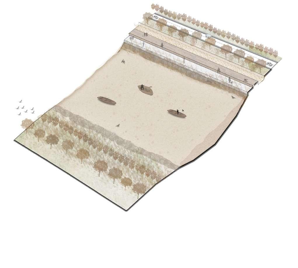
Drawing 122: Canal waterfront blow up. / Credit: Author
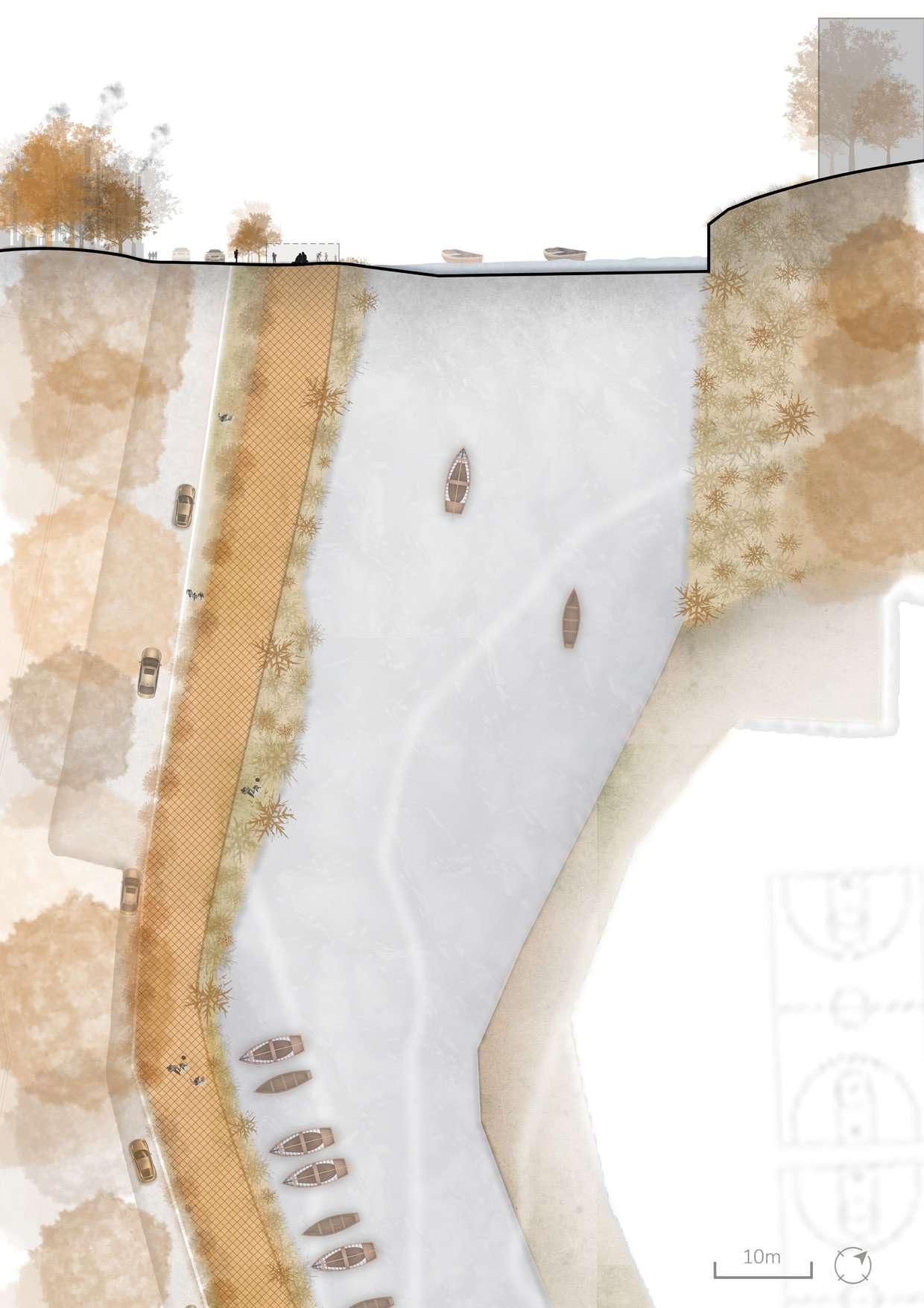
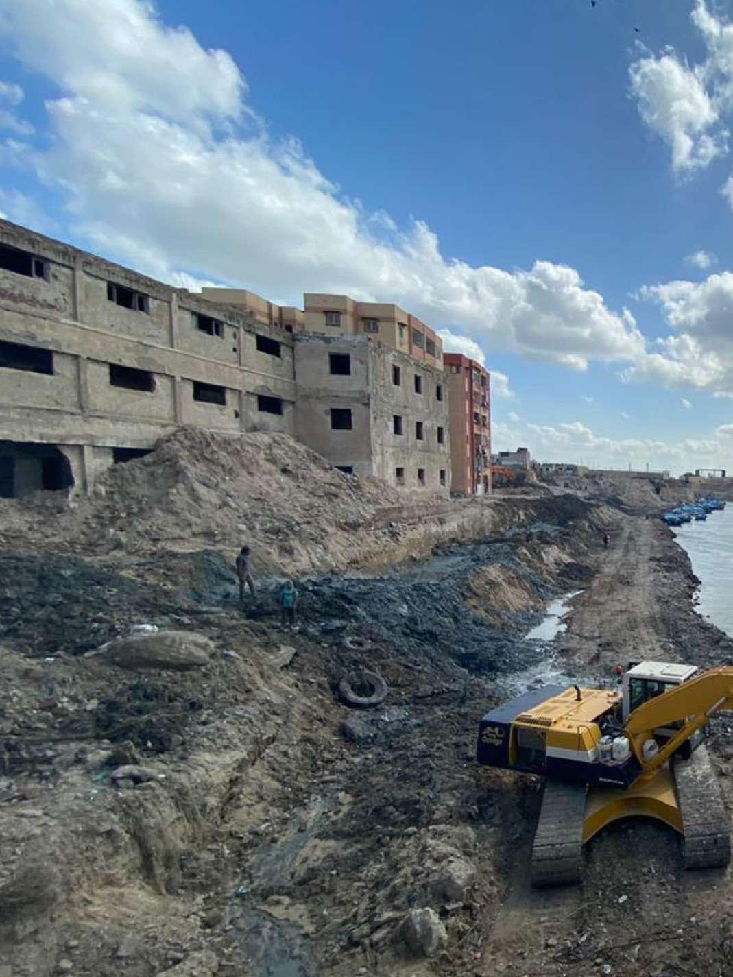 Figure 140: The situation of the canal waterfront before development / Image credit: Google Earth
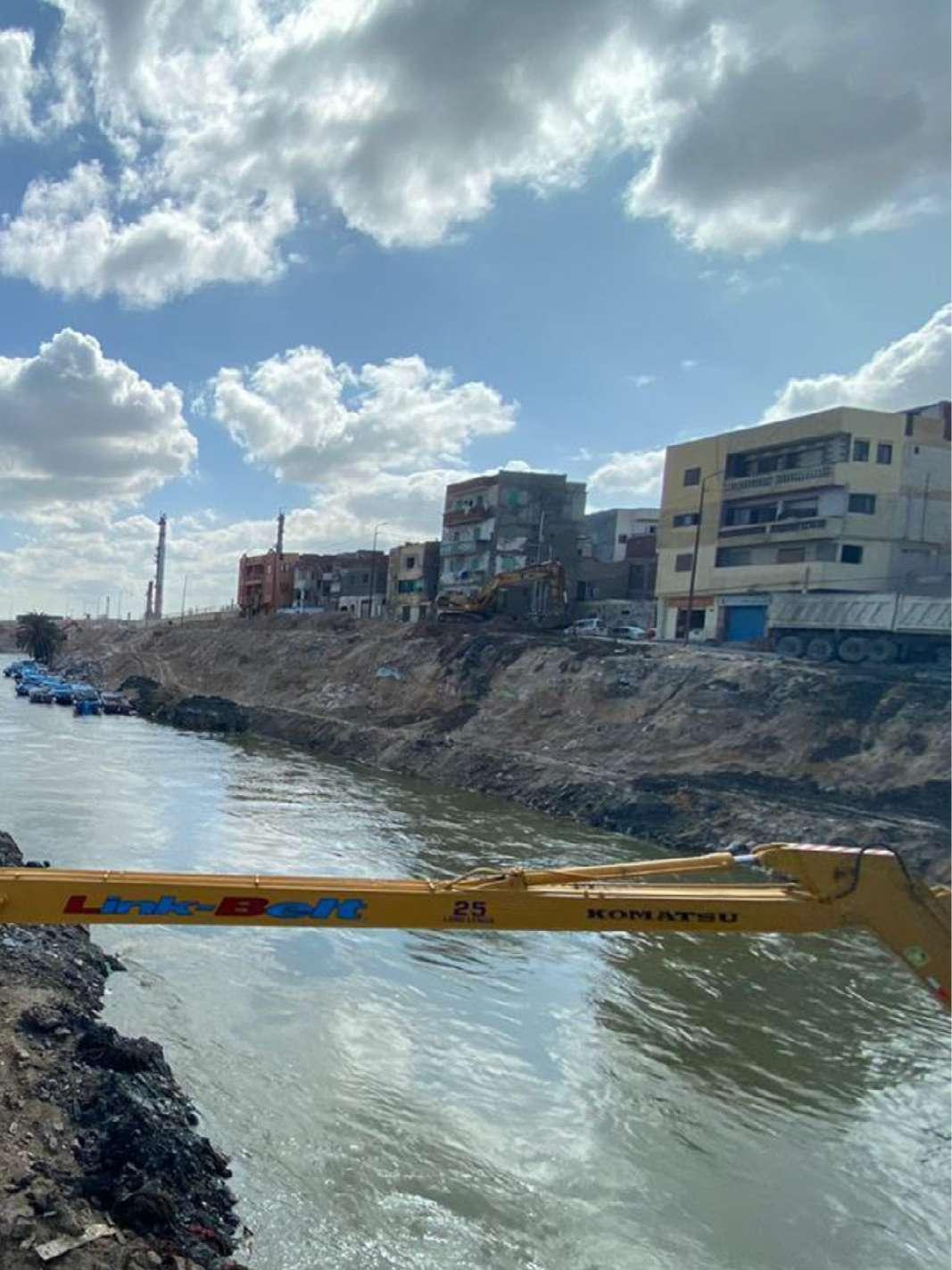
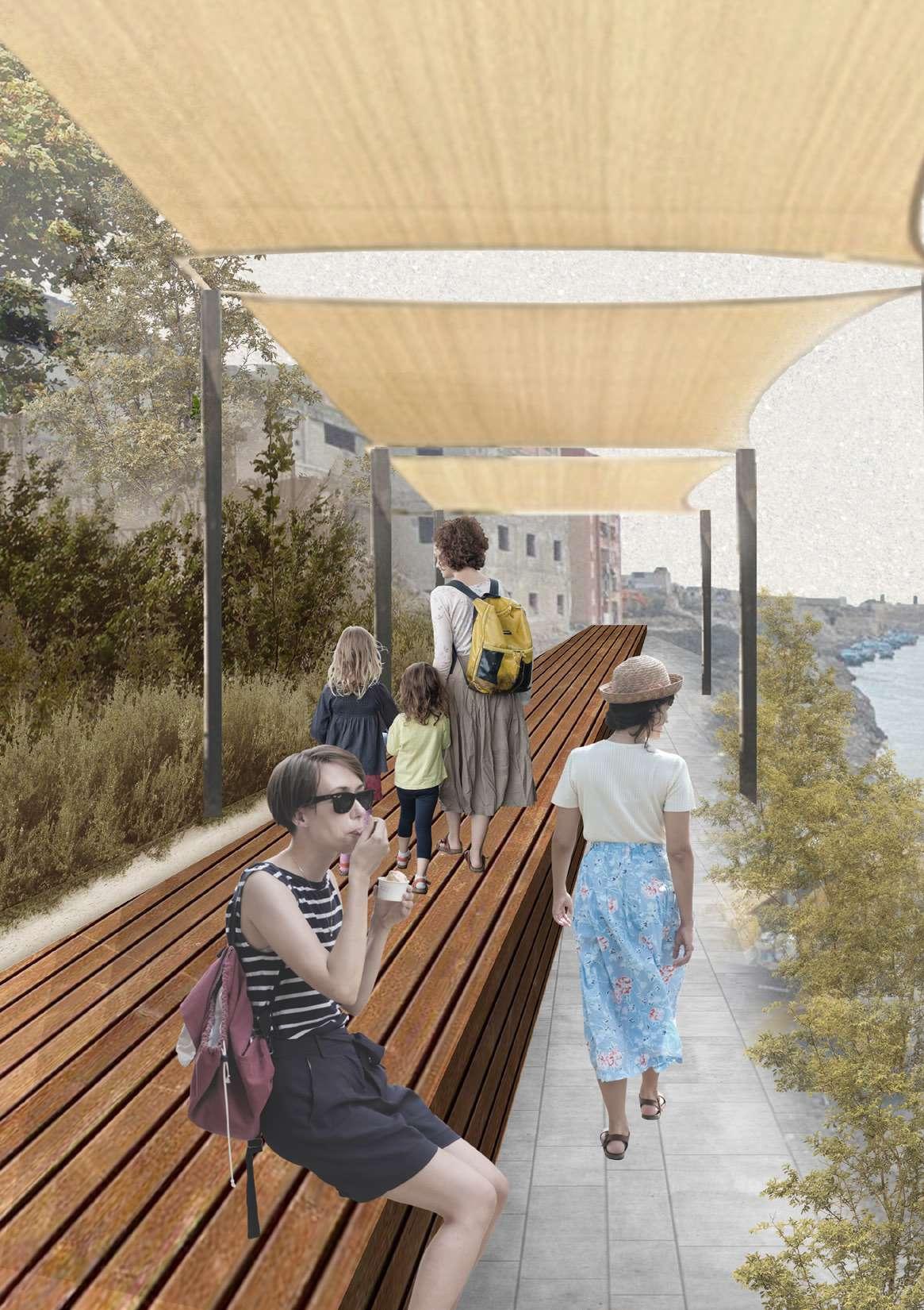
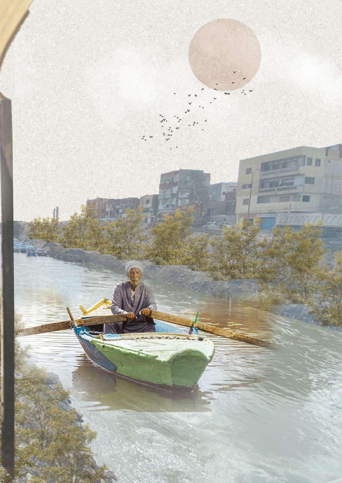
1
2
Drawing 125: Key Map. / Credit: Author
Al-Mamlouk fortress
Open space / Detention pond
Open space / Detention pond
Cultural center (Regenerated building)
Cultural open space
Wadi Al-Qama dwellings
Recreational park Green buffer
Drawing 124: Canal waterfront blow up. / Credit: Author
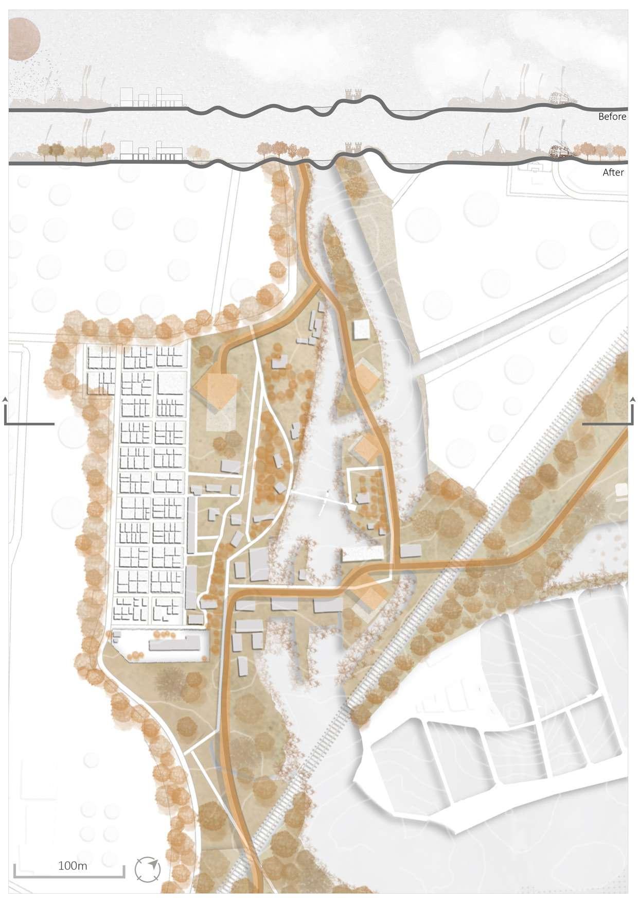
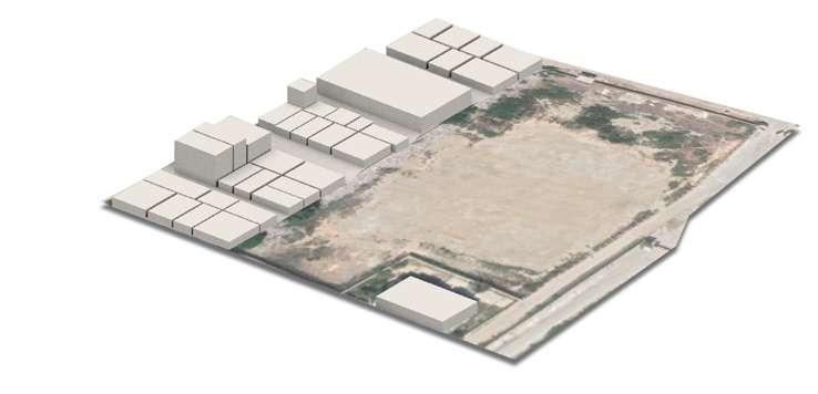
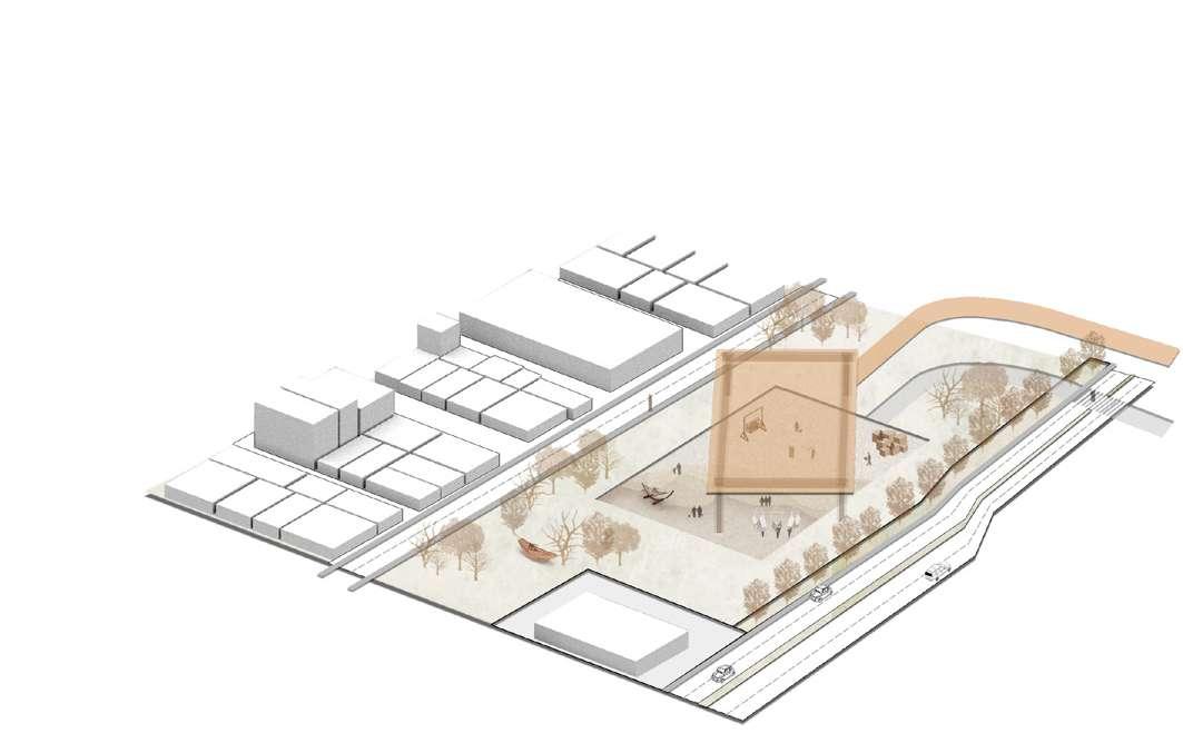
Drawing 126: Open space 3D diagram. / Credit: Author
Drawing 127: Open space and residential dwellings blow up. / Credit: Author
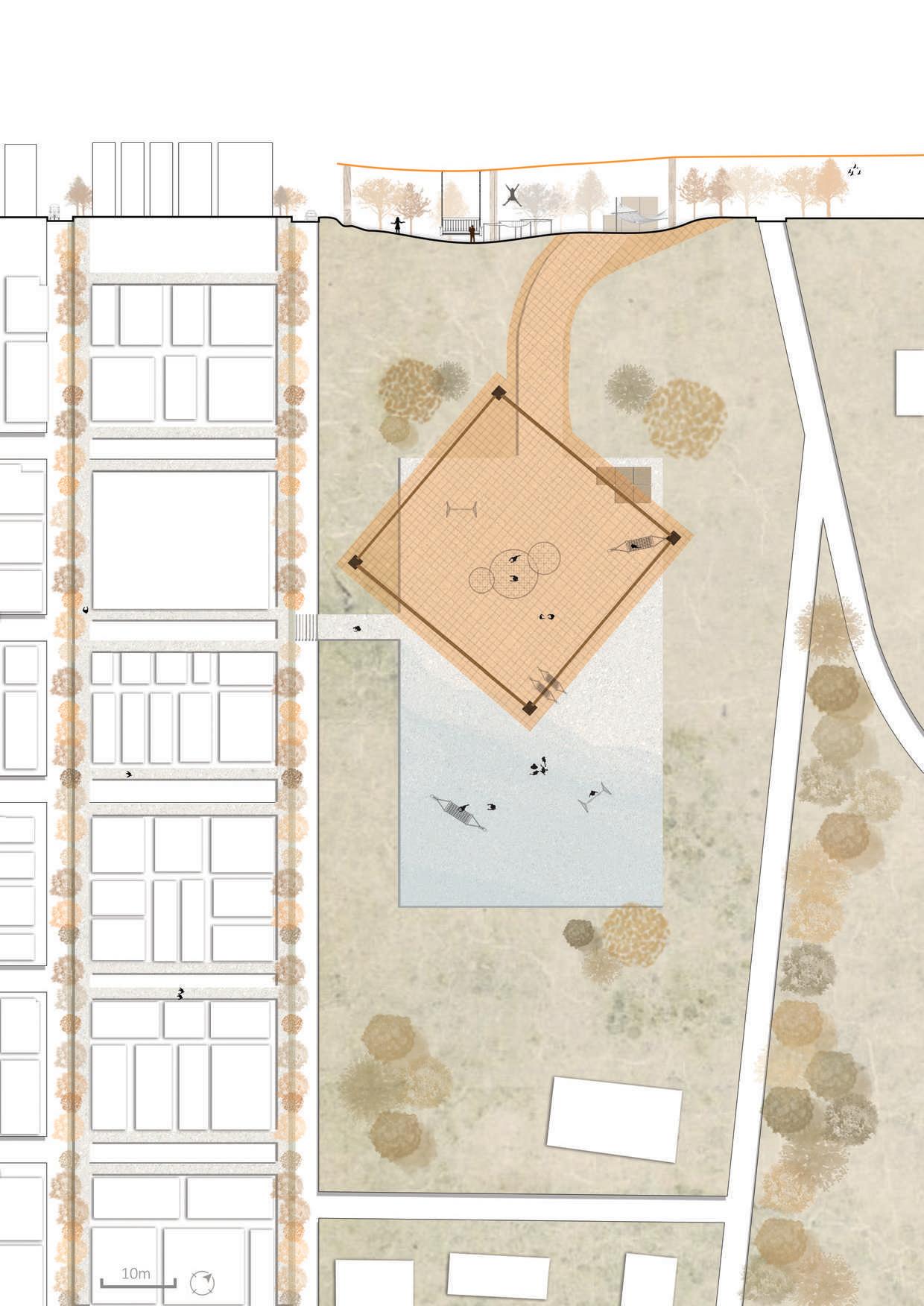
Figure 141: The situation of the urban streets before development / Image credit: Google Earth
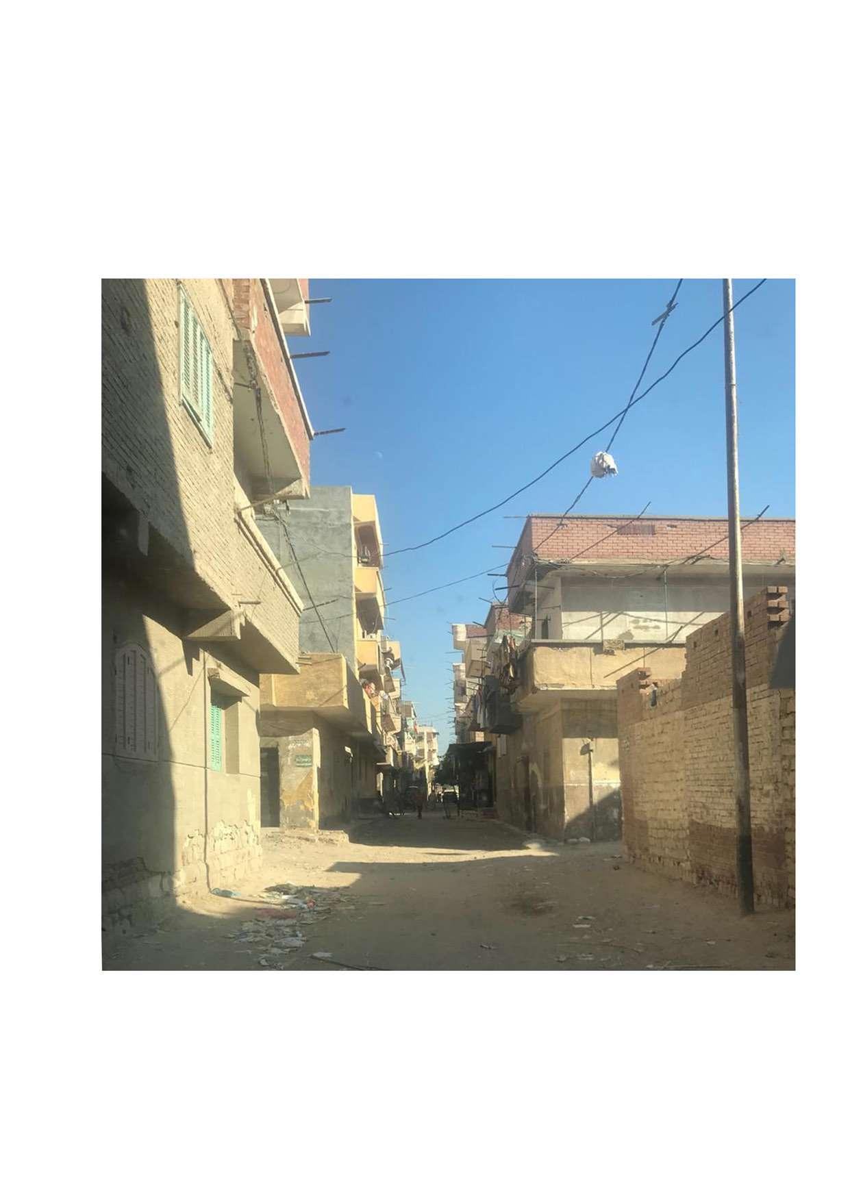

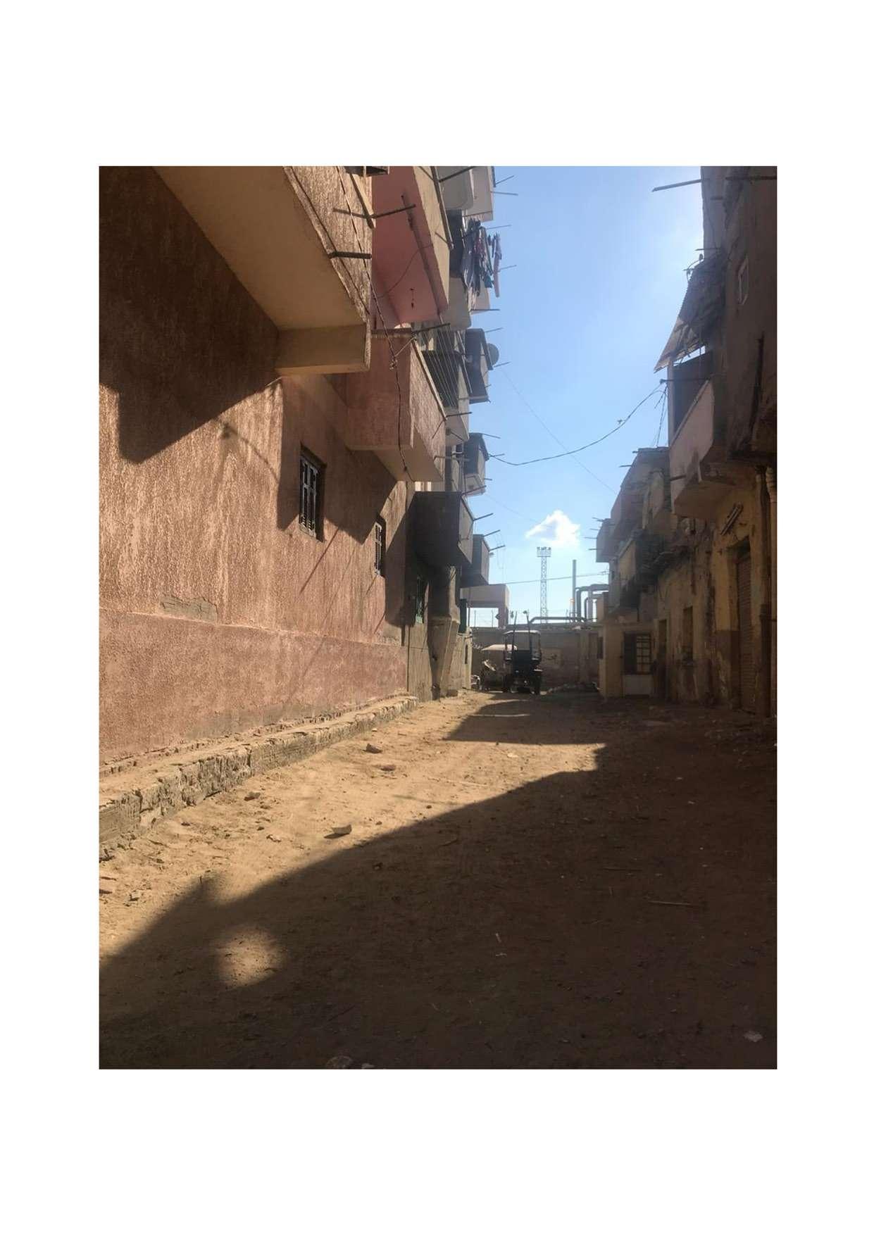 Figure 142: The situation of the urban streets before development / Image credit: Google Earth
DESIGN
Figure 142: The situation of the urban streets before development / Image credit: Google Earth
DESIGN
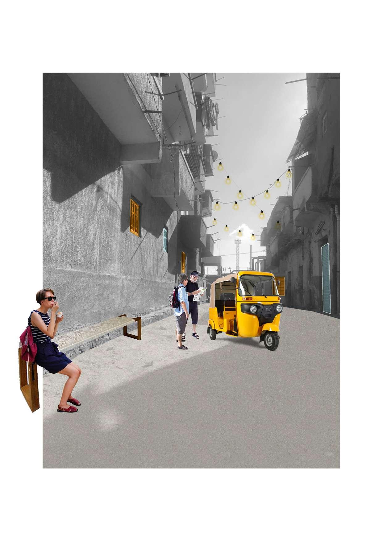 Drawing 129: Photomontage of the urban streets in Wadi el Qamar dwellings . / Credit: Author
UP
Drawing 129: Photomontage of the urban streets in Wadi el Qamar dwellings . / Credit: Author
UP
5.2.5. Drawing 130: Key Map. / Credit: Author
Recreational park
Green buffer
Lake Mariout waterfront and fishing deck
Green buffer
Rain garden Touristic tram railway
2 5 1 3 6 4 Drawing 131: Lake Mariout waterfront blow up. / Credit: Author
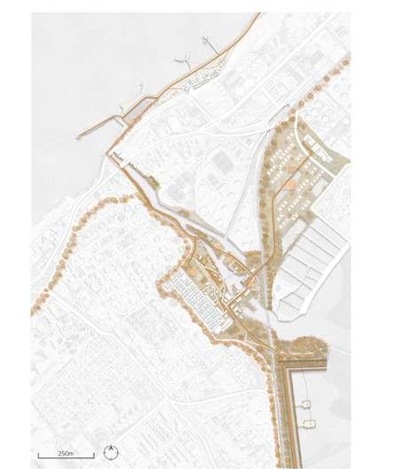
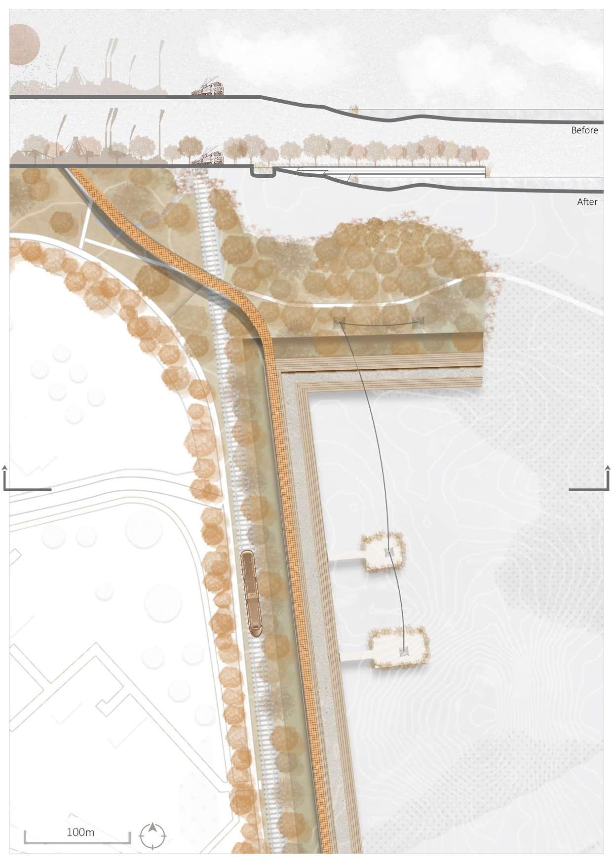
132: Lake mariout waterfront 3D
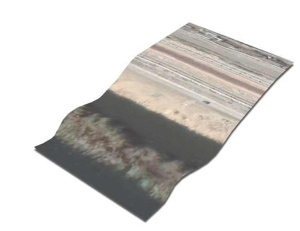
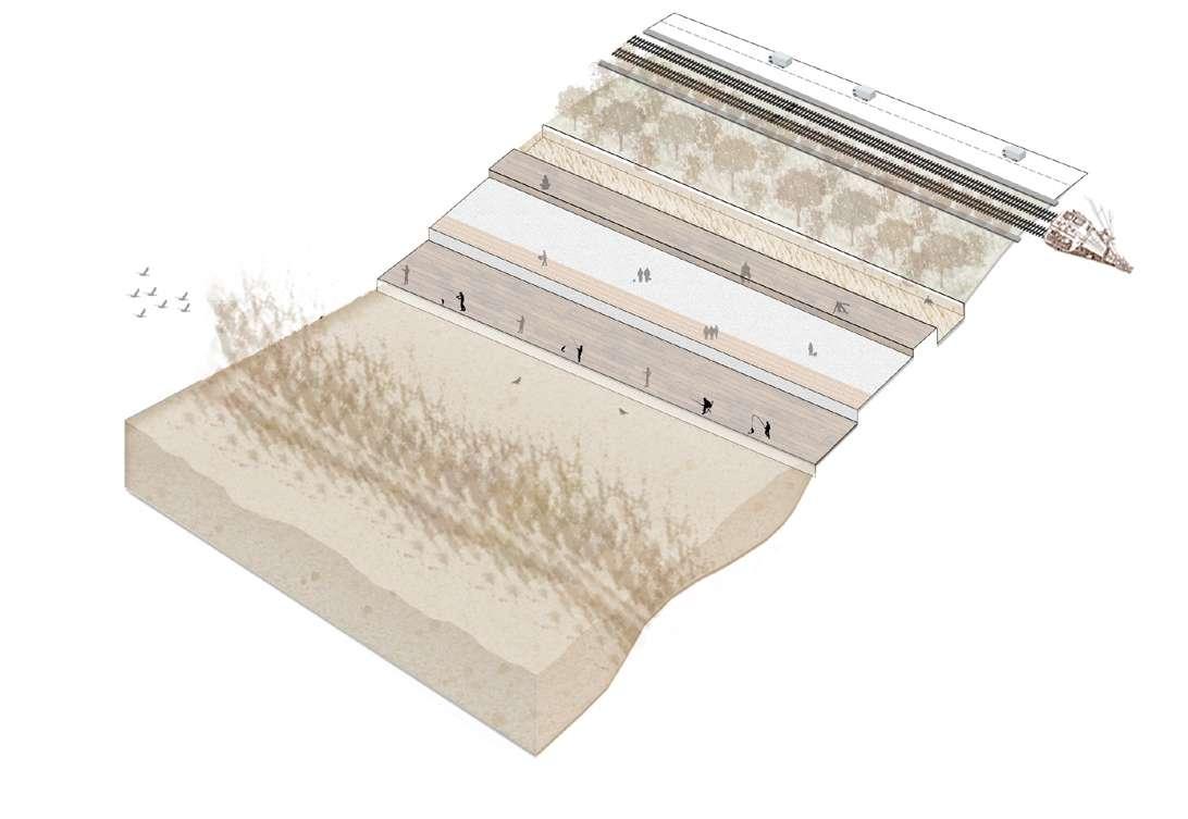
133:
garden 3D
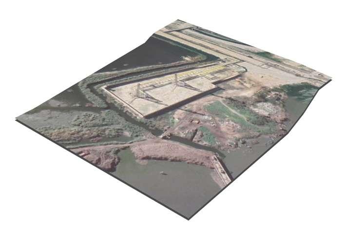
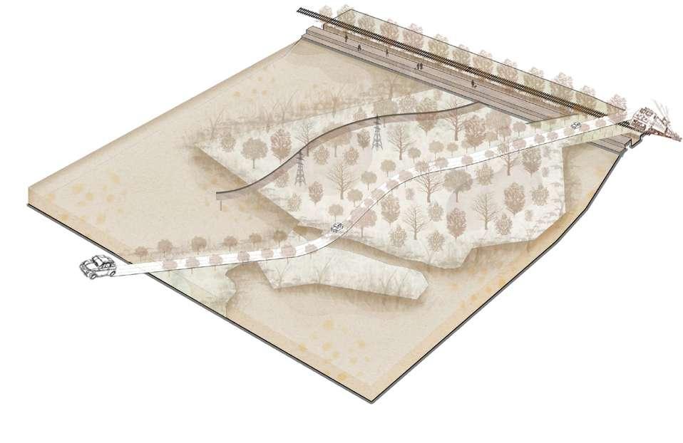
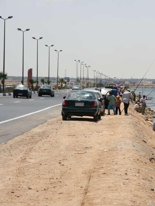 Figure 143: The situation of lake Mariout waterfront before development / Image credit: Google Earth
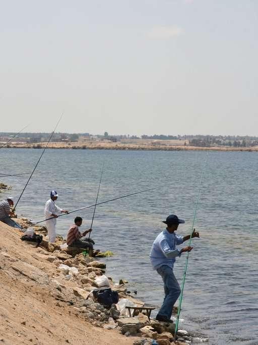
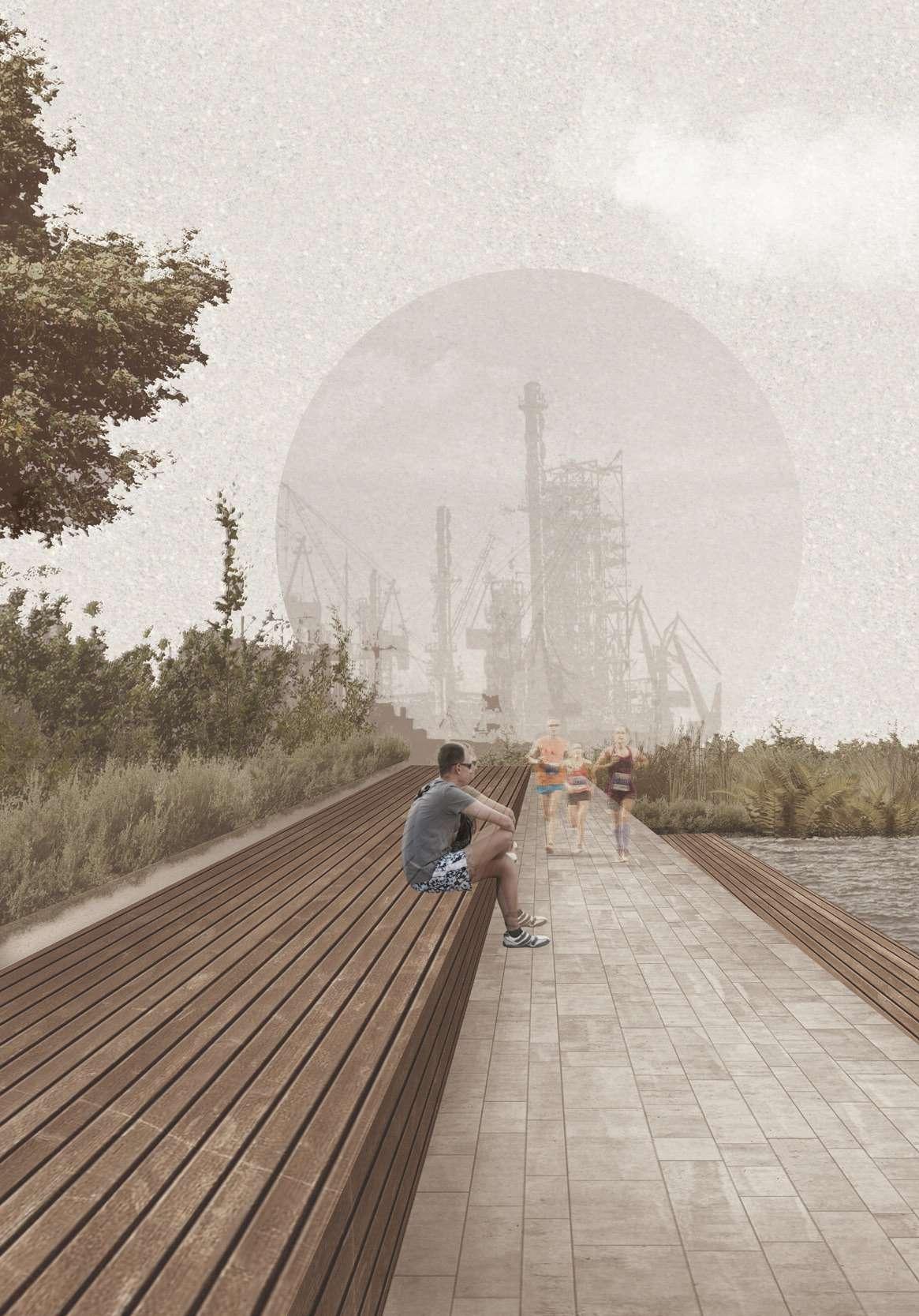
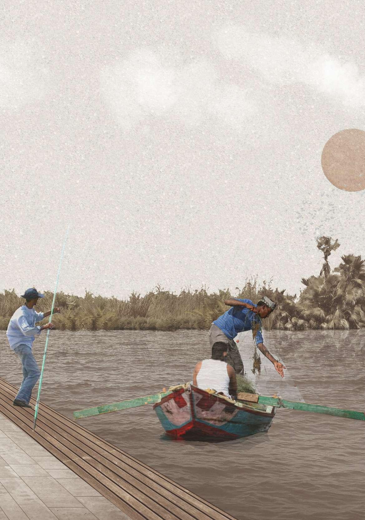
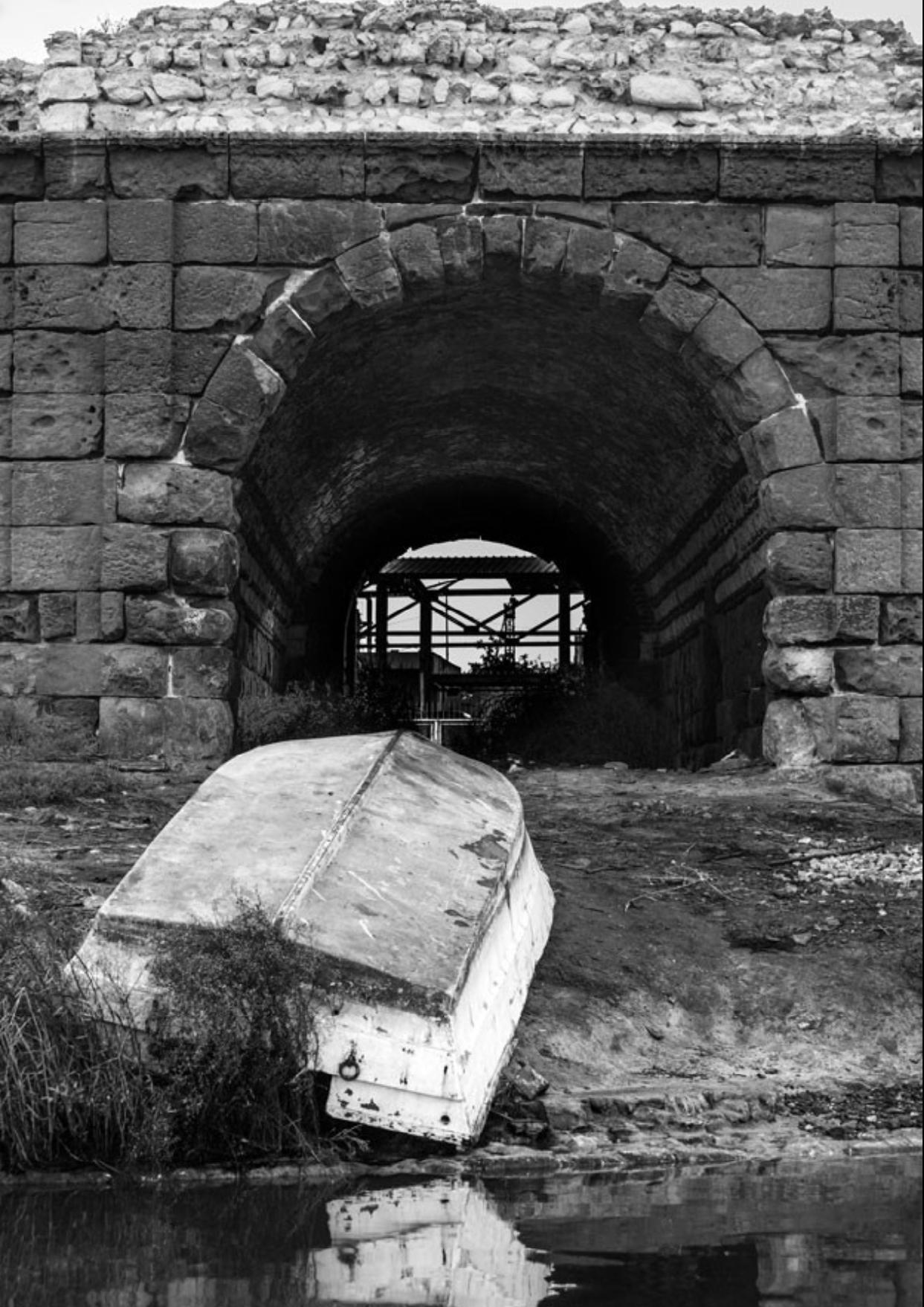
The basic idea is that informal set tlements have become a constant issue, with sever environmental con sequences. People and the land they occupy are exposed and vulnerable to environmental risks when they live in informal settlements. Lack of essen tial facilities, pollution, overpopula tion, and inadequate waste manage ment define informal communities. These traits have a detrimental influ ence on the environment, increasing the likelihood of health issues linked with informal settlements. Aside from the living circumstances in informal settlements, the concept of informal settlements being self-built by people and utilizing temporary materials has its own environmental impact. Ser vice delivery is difficult for those living in informal settlements. This is most ly due to unlawful land occupation, which has had a harmful influence on the ecology. Informal settlements have an environmental effect due to a lack of fundamental necessities and services. This includes poor sanitation, which exposes residents to pollutants, as well as the use of coal and biomass fuels for lighting, which pollute the air and contribute to greenhouse gas emissions. Waste disposal is a prob lem that informal settlers face.
Alexandria is one of the UNESCO World Heritage sites in the Mediterranean that is vulnerable to coastal flooding and degradation owing to rising sea levels. Because of its location on the Mediterranean, the city is particular ly vulnerable to increasing sea levels. Alexandria is one of Egypt's UNESCO World Heritage Sites that is at risk of flooding. Coastal erosion is thought to constitute a threat to all ancient mon uments along Egypt's northern shore. By 2050, the flood danger in Alexan dria is predicted to reach critical lev els. Floods wreaked havoc on Alexan dria's Al-Max village in 2015. Despite the city's increased vulnerability to cli mate change, opponents claim that it has received little attention. The pre viously thriving fishing town of Al-Max in the Egyptian coastal city of Alexan dria appears unfriendly to life at first impression. More than a dozen petro leum, cement, iron, and steel plants dot the terrain, spewing gallons of in dustrial waste into clogged canals and degrading the Nile Delta's important waterway.
The fishermen of the region who built their homes illegally and with weak construction material that can't with stand the disaster hazards of floods as
well as unplanned sewage and sani tary systems that blocked the flow of water; suffered from an old problem of floods and severe rainfalls, as well as the lack of drainage and the pres ence of houses on the banks of AlMax canal. Despite the charming na ture that dominates the place where the unique connection beteen the fresh water and salt water, and from here the state monitored a project to protect the lives of the people of the region and also develop it and elim inate the illegal immigration mafia gatherings who were exploiting the canal area to transport their victims to the sea. So the goernment developed a Resettlement Action Plan (RAP) to provide the fishermen with new bet ter planned formal settlements, in or der to help mitigate the disaster risk and protect the lives of the affected population.
This research concludes the Nature Based Solutions for disaster risk miti gation in a sustainable landscape and urban design by merging blue, green and grey infrastructures together following a Regenerative Heritage cultural path that creates an urban acupuncture by linking the project
interventions, as well as the histor ical landmarks along with the green, blue and grey infrastructures to sus tain the Regenerative Heritage plan. Adding resettling the fishermen in sustainable designed identical hous es, to follow the place unique iden tity and give the sense of place. Not only do locals accommodate a new healthy and safe lifestyle; but also the tourists and outsiders are welcomed to a unique program that crosses all the new interventions of renovation of abandoned buildings and lands to provide a green infrastructure, that is beneficial for water management techniques; as well as supporting the cultural awareness through activities that engage the locals with the tour ists like cultural fishing center, flea market, canal boat riding, tuktuk and touristic train ridings, to take the tour ists in a tour by the project hotspots and existing landmarks which raises the awareness of the abandoned his torical buildings and the area identi ty, that lost it’s figure due to climate change and floodings as well as pollu tion and lack of management.
ALEXANDRIA | AL-MAX - Tadamun. http://www.tadamun.co/?post_type=ci ty&p=10645&lang=en&lang=en&fb clid=IwAR1b1-gagPLcCrqSPoJCdWOpI84P IaTbltWG0-bDhbK4X17kAR9TjrLsLY0#. YnrhMdpBzIX .
Skidmore, M.; Lim, J. Natural Disas ters and Their Impact on Cities. Urban Studies 2020. https://doi.org/10.1093/ OBO/9780190922481-0014.
In Egypt, A Rising Sea — And Growing Worries About Climate Change’s Effects : Parallels : NPR. https://www.npr.org/sec tions/parallels/2017/08/13/542645647/ in-egypt-a-rising-sea-and-grow ing-worries-about-climate-chang es-effects?t=1648458130667&f bclid=IwAR3zVlkF6U 45BOQknM7LIkUL0CzeW7Efu5g9K8Yrb CPsS0krJ_ThPLZgH_s&t=1652220284491
Solyman, A.; Abdel Monem, T. Mapping Egypt Vulnerability to Sea Level Rise Scenar ios. Springer Water 2020, 183–201. https:// doi.org/10.1007/978-3-030-41629-4_9.
Characterisation of flooding in Alexandria in October 2015 and suggested mitigating measures - NASA/ADS. https://ui.adsabs. harvard.edu/abs/2017EGUGA..1914230B/ abstract.
Preamble and Purpose Synergies with Other International Conventions and Organizations Research Needs Legal Questions and Alter native Mechanisms Mitigation of Emissions by the World Heritage Community Conclu sions • Annex 1 • Annex 2 Background 2. 2008.
Saber, M.; Abdrabo, K. I.; Habiba, O. M.; Kan tosh, S. A.; Sumi, T. Impacts of Triple Factors on Flash Flood Vulnerability in Egypt: Urban Growth, Extreme Climate, and Mismanage ment. Geosciences 2020, Vol. 10, Page 24 2020, 10 (1), 24. https://doi.org/10.3390/
GEOSCIENCES10010024.
Ginting, N.; Wahid, J. Defining Distinctive ness Aspect of Place Identity in Urban Her itage Tourism. IPTEK Journal of Proceedings Series 2017, 0 (3). https://doi.org/10.12962/ J23546026.Y2017I3.2435.
Houses claimed by the canal: life on Egypt’s climate change frontline | Glob al development | The Guardian. https:// www.theguardian.com/global-develop ment/2018/aug/29/alexandria-little-ven ice-egypt-climate-change-frontline?fbclid=I wAR3diTLpV3MbJdFF1AkGnuM_vmLhck U212iAMGvs-SV1E3fQH92TWWuaZfE .
Will Egypt’s Ancient City Succumb to Ris ing Seas? - Bloomberg. https://www. bloomberg.com/news/articles/2019-08-22/ will-egypt-s-ancient-city-succumb-to-ris ing-seas?fbclid=IwAR3O-fycbAlzjr4pGBAD jpTZG7uDnfTv1gqkNVJRnLyuRG0i_KuQu feAhC8 .
Simulated historical climate & weather data for Al Maks - meteoblue. https://www.me teoblue.com/en/weather/historyclimate/ climatemodelled/almaks_egypt_360805?f bclid=IwAR1ZW7o0fGsA_qpE9NpOj6vd3hL rlWij5qDyNBCiXlTgNjX4S4rcTeQPPD4
Alexandria, EG Climate Zone, Month ly Weather Averages and Historical Data. https://tcktcktck.org/egypt/alexandria?fb clid=IwAR1UZkSWWCj_ZH4FEuPVoes_rWl nniESwNbfp9uH258cdID_zyUEk4ZCWiQ
Manzoni, S.; El, R.; Lighthouse, T.; Aaha, C.; 63, N.; Aref, Y. G. AAHA = Amicale Alexandrie Hier et Aujourd’hui The Lighthouses of Alex andria “Let There Be Light” The Lighthouses of Alexandria The Lighthouses of Alexandria “Let There Be Light” 1. 2010.
Urban regeneration - a key concept in Eco nomics and Management. http://www. economicswebinstitute.org/glossary/urban
regeneration.htm?fbclid=IwAR0YwtdgPM
7RUZjNafQgu4WD-TAhxsEAM0lhNJJeRR V4ate-EeZsEeOc2R8
Lerner, J. Urban Acupuncture. 143. Elnashai, A. S., di Sarno, L., Carter, M. D. (2006). New light on an ancient illumina tion: The pharos of alexandria. International Journal of Nonlinear Sciences and Numeri cal Simulation, Pages 137–148. https://doi. org/10.1515/IJNSNS.2006.7.2.137/HTML
Titan Cement in Wadi al-Qamar convicted of causing environmental and health harm | Egyptian Initiative for Personal Rights, from https://eipr.org/en/press/2018/03/titan-ce ment-wadi-al-qamar-convicted-causing-en vironmental-and-health-harm
Intimidation and judicial harassment of workers and local community; https://vim eo.com/189300539.
CEM work on nature-based solutions | IUCN, https://www.iucn.org/commissions/ commission-ecosystem-management/ourwork/nature-based-solutions
Egypt Population Density and Low Ele vation Coastal Zones (5457306559).jpg - Wikimedia Commons, https://commons. wikimedia.org/wiki/File:Egypt_Popula tion_Density_and_Low_Elevation_Coastal_ Zones_(5457306559).jpg
A Monument Lost to Time: The Pharos of Alexandria | Egyptian Streets, https://egyp tianstreets.com/2021/11/14/a-monumentlost-to-time-the-pharos-of-alexandria/
Climate Central | Land projected to be below annual flood level in 2050, https://coastal.climatecentral.org/ map/9/30.0546/31.0843/?theme=sea_lev el_rise&map_type=year&base map=roadmap&contigu ous=true&elevation_model=best_avail
able&forecast_year=2050&path way=ssp3rcp70&percen tile=p50&refresh=true&return_ level=return_level_1&rl_model=gts r&slr_model=ipcc_2021_med
Citadel of Qaitbay - Wikipedia, https:// en.wikipedia.org/wiki/Citadel_of_Qaitbay#/ media/File:Louis-Fran%C3%A7ois_Cassas,_ Le_Grand_Pharillon_du_Port_D’Alexandrie. jpg
Egypt map — Google, https://satellites.pro/ Google_plan/Egypt_map#
Al Meks- Google Maps, https://www.google. com/maps/place/Al+Meks,+Dekhela,+Alex andria+Governorate,+Egypt/@31.1390425 ,29.8430798,14.31z/data=!4m5!3m4!1s0x 14f5ea7c253b0f03:0xb1a1db60b1542c b6!8m2!3d31.138006!4d29.8410174
Armed forces absorbs Alexandria flood, drainage system still run down - Dai ly News Egypt, https://dailynewsegypt. com/2015/10/26/armed-forces-absorbs-al exandria-flood-drainage-system-still-run down/
The Fall of Alexandria: Trashed And Neglect ed | Egyptian Streets</i>. https://egyptians treets.com/2015/01/13/the-fall-of-alexan dria-trashed-and-neglected/
Rising Sea Levels Threaten Egypt’s Alex andria, https://learningenglish.voanews. com/a/rising-sea-levels-threaten-egypt-s-al exandria/5067579.html
Hemeda, S. (2021). Geotechnical modelling of the climate change impact on world her itage properties in Alexandria, Egypt.Heri tage Science 2021. https://doi.org/10.1186/ S40494-021-00547-8
Climate Change in the Middle East, https:// netzero-me.com/2021/04/april-2021/
Track of a diver following a line of reefs closing the Anfushi Bay, https://www.re searchgate.net/figure/Track-of-a-diver-fol lowing-a-line-of-reefs-closing-the-AnfushiBay-red-line-Chart-from_fig4_341453530
A new report predicts more frequent, de structive flooding. What drives sea level rise? | PBS NewsHour, https://www.pbs. org/newshour/science/a-new-report-pre dicts-more-frequent-destructive-floodingwhat-drives-sea-level-rise
Farouk Hassan, G., Rashed, R.; Mohsen EL Nagar, S. (2021). Regenerative urban heritage model: Scoping review of para digms’ progression. Ain Shams Engineer ing Journal. https://doi.org/10.1016/J. ASEJ.2021.101652
Raymond, C.M., Frantzeskaki, N., Kabisch, N., Berry, P., Breil, M., Nita, M.R., David Geneletti, D., and Calfapietra, C. 2017. A framework for assessing and im plementing the co-benefits of nature-based solutions in urban areas.
Environmental Science & Policy, 77:15–24. https://www.sciencedirect.com/science/ar ticle/pii/S1462901117306317#!
Ozment, S., Ellison, G., and Jongman, B. 2019. Nature-Based Solutions for Disaster Risk Management. Washington, D.C. World Bank Group. https:// documents1.worldbank.org/curat ed/en/253401551126252092/pd f/134847-NBS-forDRM-booklet.pdf
Farouk Hassan, G., Rashed, R.; Mohsen EL Nagar, S. (2021). Regenerative urban heritage model: Scoping review of para digms’ progression. Ain Shams Engineer ing Journal. https://doi.org/10.1016/J. ASEJ.2021.101652
A Catalogue of Nature-Based Solutions for Urban Resilience, https://openknowledge. worldbank.org/handle/10986/36507
Wouters, P., Environ, R., Dreiseitl, H., Wan schura, B., Liveable, R., Lab, C., Wörlen, M.,
5.2. LANDSCAPE
Moldaschl, M., University, Z., Wescoat, J., ; Noiva, K., BLUE-GREEN INFRASTRUCTURES AS TOOLS FOR THE MANAGEMENT OF UR BAN DEVELOPMENT AND THE EFFECTS OF CLIMATE CHANGE
Khedr, Zahran. (1999). COMPARATIVE STUDY ON THE PLANT LIFE OF TWO MEDI TERRANEAN DELTAIC LAKES IN EGYPT. Univ. Bull. Environ.
State of the Mediterranean Marine and Coastal Environment | GRID-Arendal, https://www.grida.no/resources/5937
Figure 1: Painting oil on canvas of Al-Max fishing village in Alexandria, Egypt. / Artist: Osama Hassan . . . . . . . . . . . . . . . vi
Figure 2: Proposal of regenerative circular model for managing urban heritage sitesSource: The authors.. / Source: Regenera tive urban heritage model: Scoping review of paradigms’ progression. 11
Figure 3: Resilience to disasters and climate change effect. / Credit: Author. 13
Figure 4: Resilience sustainable strategy. / Credit: Author. 13
Figure 5: Key tasks for RAP. / Credit: Author. 15
Figure 6: Ecosystem-based approaches to planning NBS. / Source: A Catalogue of Na ture-Based Solutions for Urban Resilience. . . . . . . . . . . . . . . . . . . . . . . . . 17
Figure 7: Flowchart of the Research Work flow. / Credit: Author 20
Figure 8: The Canopic Way, the main street of ancient Alexandria, running through the Greek district. / Image credit: Jean Golvin 25
Figure 9: Historical map of Alexandria, Egypt with the orange circle highlighting AlMax village. / Credit: Author 26
Figure 10: Lighthouse of Alexandria by Philip Galle; 1572, Rijksmuseum. / Source: Wikipedia . . . . . . . . . . . . . . . . . 28
Figure 11: Map of Alexandria 1912 illustrat ing the relationship of Al Max lighthouses with other lights. The lines mark the safe passage in and out of the harbor avoiding rocks and other obstacles. / Source: base map after Jondet. 29
Figure 13: Map of Pharos Island and the Eastern Harbor. (Forster, 1961). / Souce: Wikipedia 30
Figure 12: Different stages of destruction
of Alexandria Lighthouse (Thiersch, 1909)/ Image credit: Wikipedia 30
Figure 14: Hand sketch illustrating the Phar os lighthouse built by the Greek. / Image credit: Arthur Balitskiy. 31
Figure 15: The citadel of Qaitbay in the 1780s, by Louis-François Cassas. / Image credit: Wikipedia 31
Figure 16: A size comparison between a 1909 (inner shape) and a 2006 study (outer shape) of the building. / Source: Wikipedia
. . . . . . . . . . . . . . . . . . . . . . . . 31
Figure 19: Southern view of Ras El Tin Light house. / Source: The Alexandria & Mediter ranean Research Center . . . . . . . . . . 32
Figure 18: The Agami unmanned light house/or beacon / Source: Egyptian Author ity for Maritime Safety 32
Figure 17: Deteriorated condition of Mex Old Lighthouse and its section respective ly. / source: Alexandria & Mediterranean Research Center 32
Figure 21: Northern view and section of the Mex High Lighthouse respectively. / Image credit: Yasser Aref 33
Figure 20: Views of the Low Mex Lighthous es showing their setting and alignment / Source: The Alexandria & Mediterranean Research Center . . . . . . . . . . . . . . 33
Figure 22: Northern view and section of the Mex High Lighthouse respectively. / Image credit: Yasser Aref 33
Figure 23: Historical Map of Alexandria, Egypt, from 1882. / Image Credit: The sur vey of Egypt. 34
Figure 24: Blow up to Al-Max village from the historical Map of Alexandria, Egypt, from 1882. / Image Credit: Author 34
Figure 25: Population statistics in the Mid dle East / Map credit: Aymen Solyman and
Tarek Abdel Monem . . . . . . . . . . . . 37
Figure 26: Photo of Miami District in Alex andria during the flooding season / Image credit: anonymous 39
Figure 27: Photo Corniche of Alexandria during the flooding season / Image credit: Scoop Empire 39
Figure 28: Drivers maneuver through flood water after a torrential rain in Alexandria, Egypt. / Image credit: Ibrahim Ramadan, Anadolu Agency, Getty Images 39
Figure 32: The Alexandria boardwalk is lined with concrete barriers to keep back rising waves. / Image credit: Jane Arraf/NPR . 41
Figure 33: A fisherman stands on what are believed to be remains of the ancient lighthouse of Alexandria — considered one of the Seven Wonders of the ancient world. / Image credit: Jane Arraf/NPR 41
Figure 34: A cement barrier placed as reinforcement against rising water levels near the citadel. b. The barriers and other protective measures along the shore of Alexandria. In this August 8, 2019, photo, workers prepare to place cement blocks to reinforce the sea wall against rising water levels on the corniche in Alexandria, Egypt. / Image credit: Sayed Hemeda 41
Figure 35: Image from Google Maps web site. / Image credit: anonymous 45
Figure 36: Image from online news article (Azab News) - “Developing the Max area in Alexandria within the state’s plan to devel op the slums and turn it into an attractive area for tourism” / Image credit: Walid H. 47
Figure 37: Image of Al-Max village in Alex andria, Egypt. / Image credit: anonymous . . . . . . . . . . . . . . . . . . . . . . . . 48
Figure 38: After floods overwhelmed the fishing community living on the banks of Al-Max canal in Alexandria, the government
relocated families to high-rises, transform ing their way of life. / Image credit: Amir Khafagy 50
Figure 39: Al-Max area in Alexandria, Egypt. / Image credit: Mohamed Osama 50
Figure 40: The rubble left after demolition of houses on the waterfront at El Max, near Alexandria, where homes are regularly flooded. / Image credit: Sima Diab 51
Figure 41: Egypt’s poorest, living on the wa ter’s edge or dependent on its resources, are vulnerable to the first and worst effects of climate change. / Image credit: Sima Diab . . . . . . . . . . . . . . . . . . . . . 51
Figure 42: Al-Max area in Alexandria, Egypt. / Image credit: Mohamed Osama 52
Figure 43: Al-Max area in Alexandria, Egypt. / Image credit: Mohamed Osama 53
Figure 46: Population density and urban centres in the Mediterranean basin. / Source: State of the Mediterranean marine and coastal environment 64
Figure 44: Industrial hazardous waste in the Mediterranean countries. / Source: State of the Mediterranean marine and coastal environment . . . . . . . . . . . . . . . . 64
Figure 45: Tourism in the Mediterranean countries. / Source: State of the Mediterra nean marine and coastal environment . 64
Figure 49: River discharge of freshwater into the Mediterranean. / Source: State of the Mediterranean marine and coastal envi ronment 65
Figure 48: Waste water treatment in Med iterranean coastal cities. / Source: State of the Mediterranean marine and coastal environment 65
Figure 47: Organic water pollutant from point sources. / Source: State of the Medi terranean marine and coastal environment . . . . . . . . . . . . . . . . . . . . . . . . 65
Figure 50: Population in Egypt / Source: UN-Desa 2019 . . . . . . . . . . . . . . . 83
Figure 51: Population in Alexandria / Source: UN-Desa 2019 . . . . . . . . . . 85
Figure 53: Fisherman at work in Alexandria, Egypt / Image credit: Mohamed Osama . 89
Figure 52: A traditional working day for fish ermen in Al-Max area going to sea. / Image credit: Anonymous 89
Figure 54: Fishermen preparing for work in Alexandria, Egypt. / Image credit: Al Masry Al Youm 89
Figure 56: Fishermen at work in Alexandria, Egypt. / Image credit: Mohamed El Ben hawy 90
Figure 55: Fishermen preparing for work in Alexandria, Egypt. / Image credit: Mohamed El Benhawy 90
Figure 57: Fishermen working in Alexandria, Egypt. / Image credit: anonymous . . . . 90
Figure 58: A cement factory in Alexandria, Egypt. / Image credit: anonymous . . . . 90
Figure 59: Images that demonstrate the pollution and damage crisis in Alexandria, Egypt. / Image credit: unknown 91
Figure 60: Strategic map for a subruban train netwrok. / Image credit: NOAA Cli mate 92
Figure 61: Map illustrating the depression of Lake Maryout in Alexandria, Egypt. / Credit: Author 96
Figure 62: The three main factors on flood disaster risk / Credit: NOAA Climate 100
Figure 63: Chart of the Nawwat percentage per year. / Credit: NOAA Climate 100
Figure 64: Fishing in Egypt / Image credit: NOAA Climate 101
Figure 65: Chart illustrating the percentages
of the Landuse in Al-Max. / Credit: Author . . . . . . . . . . . . . . . . . . . . . . . 108
Figure 68: Image credit: Dina M. Nassar 122
Figure 67: Image credit: Dina M. Nassar 122
Figure 66: Image credit: Dina M. Nassar 122
Figure 71: Northern view and section of the Mex High Lighthouse respectively. / Image credit: Yasser Aref . . . . . . . . . . . . 123
Figure 70: Deteriorated condition of Mex Old Lighthouse and its section respectively. / Image credit: Yasser Aref 123
Figure 69: Views of the Low Mex Light house showing their setting and alignment. / Image credit: Yasser Aref 123
Figure 74: Views of the Low Mex Light house showing their setting and alignment. / Image credit: Yasser Aref 125
Figure 72: Northern view of the Mex High Lighthouse respectively. / Image credit: Yasser Aref 125
Figure 73: Deteriorated condition of Mex Old Lighthouse and its section respectively. / Image credit: Yasser Aref . . . . . . . 125
Figure 75: Uses of housing in El-Max Coast al Dwellings. / Image credit: Heba Hatem / Gehad Ahmed Abo Yusuf / Lobna Ali 128
Figure 76: Uses of housing in El-Max Coast al Dwellings. / Image credit: Heba Hatem / Gehad Ahmed Abo Yusuf / Lobna Ali 128
Figure 77: Photos that clarifies the lack of services. / Image credit: Heba Hatem / Ge had Ahmed Abo Yusuf / Lobna Ali 129
Figure 78: Photos that clarifies the building conditions. / Image credit: Heba Hatem / Gehad Ahmed Abo Yusuf / Lobna Ali 130
Figure 79: Photo that clarifies the streets of Al-Qamar district. / Image credit: Heba Hatem / Gehad Ahmed Abo Yusuf / Lobna Ali . . . . . . . . . . . . . . . . . . . . . 131
Figure 80: Map illustrating the stages of demolishing of Wadi Al-Qama dwellings in Al-Max. / Credit: Author . . . . . . . . . 132
Figure 81: The Egyptian Shipping Company Building in Alexandria, Egypt. / Image cred it: Mohamed Abo Al Einein 133
Figure 83: Photo that clarifies the streets of Al-Qamar district. / Image credit: Heba Hatem / Gehad Ahmed Abo Yusuf / Lobna Ali 133
Figure 85: An oil factory / Image credit: Henor Arab Industrial Security Co. 133
Figure 82: A scene on the canal captured in an 1890s French postcard. / Image credit: unknown 133
Figure 84: A cement factory / Image credit: unknown . . . . . . . . . . . . . . . . . 133
Figure 86: Alexandria Mineral Oils Compa ny. / Image credit: unknown . . . . . . 133
Figure 87: Developing the Max area in Al exandria within the state’s plan to develop the slums and turn it into an attractive area for tourism. / Image credit: Walid H. 137
Figure 88: Buildings in Al-Max area / Image credit: unknown 137
Figure 89: Al Max is one of the several areas that have been affected by environmental pollution due to the chemical and petro leum industries, Alexandria, Egypt. / Image credit: Mohamed Osam 137
Figure 90: Residential buildings in Al-Max, Alexandria, Egypt. / Image credit: Sue Wil liamson . . . . . . . . . . . . . . . . . . 137
Figure 91: Satellite image from google illus trating the informal settlements of "Qaryat Al-Sayyadin" dwellings before the demolish / Image credit: Author 138
Figure 92: Satellite image from google illus trating the informal settlements of "Qaryat Al-Sayyadin" dwellings sewing up the canal / Image credit: Author 138
Figure 93: Satellite image from google illus trating the informal settlements of "Qaryat Al-Sayyadin" dwellings during the demolish / Image credit: Author . . . . . . . . . 139
Figure 94: Satellite image from google illus trating the informal settlements of "Qaryat Al-Sayyadin" dwellings after the demolish / Image credit: Author 139
Figure 95: Image credit: Author 146
Figure 97: Image credit: Google Earth 146
Figure 99: Image credit: Google Earth 146
Figure 96: Image credit: Google Earth 146
Figure 98: Image credit: Google Earth 146
Figure 100: Image credit: Google Earth 146
Figure 101: Satellite image from google illustrating the location of the images cap tured. / Image credit: Author 147
Figure 103: Image credit: Google Earth 148
Figure 105: Image credit: Google Earth 148
Figure 107: Image credit: Google Earth 148
Figure 102: Image credit: Google Earth 148
Figure 104: Image credit: Google Earth 148
Figure 106: Image credit: Google Earth 148
Figure 108: Satellite image from google illustrating the location of the images cap tured. / Image credit: Author 149
Figure 109: Image credit: Google Earth 150
Figure 112: Image credit: Google Earth 150
Figure 114: Image credit: Google Earth 150
Figure 110: Image credit: Author 150
Figure 111: Image credit: Google Earth 150
Figure 113: Image credit: Google Earth 150
Figure 115: Satellite image from google illustrating the location of the images cap
tured. / Image credit: Author 151
Figure 117: Image credit: Google Earth 152
Figure 119: Image credit: Author . . . . 152
Figure 121: Image credit: Google Earth 152
Figure 116: Image credit: Google Earth 152
Figure 118: Image credit: Google Earth 152
Figure 120: Image credit: Google Earth 152
Figure 122: Satellite image from google illustrating the location of the images cap tured. / Image credit: Author 153
Figure 128: Image credit: Author 154
Figure 124: Image credit: Author 154
Figure 126: Image credit: Author 154
Figure 123: Image credit: Author 154
Figure 125: Image credit: Author 154
Figure 127: Image credit: Author 154
Figure 129: Satellite image from google illustrating the location of the images cap tured. / Image credit: Author 155
Figure 130: Karem by his boat alongside the Al-Max canal. He was forced to leave his home after the 2015 floods. / Image credit: Amir Khafagy 159
Figure 131: The timeline of the demolish ing of the informal settlements of "Qaryat Al-Sayyadin". / Credit: Author . . . . . 169
Figure 132: Demolition of informal settle ments (slums). / Image credit: Walid H. 170
Figure 133: The rubble left after demoli tion of houses on the waterfront at El Max, near Alexandria, where homes are regularly flooded. / Image credit: Sima Diab 171
Figure 134: Sewage pouring into the Al-Max canal. / Image credit: Amir Khafagy 171
Figure 135: Acupuncture network on site. /
Credit: Author 174
Figure 137: Sustainable urbanism diagram. / Credit: Author 175
Figure 136: Identity revitalization diagram. / Credit: Author 175
Figure 138: Diagram illustrating the Nature Based Solutions approaches and challenges based on the IUCN classificaiton . / Credit: Author 176
Figure 139: The situation of the coastal waterfront before development / Image credit: Google Earth . . . . . . . . . . . 246
Figure 140: The situation of the canal waterfront before development / Image credit: Google Earth 254
Figure 141: The situation of the urban streets before development / Image credit: Google Earth 262
Figure 142: The situation of the urban streets before development / Image credit: Google Earth 264
Figure 143: The situation of lake Mariout waterfront before development / Image credit: Google Earth 270
Drawing 135: Drawing 1: World Map illustrating the location of Egypt. / Credit: Author 56
Drawing 136: Drawing 2: Map illustrating the boundaries of Egypt. / Credit: Author 58
Drawing 137: Drawing 3: Map illustrating the boundaries of Egypt. / Credit: Author 58
Drawing 138: Drawing 4: Map Illustrating the boundaries of Alexandria. / Credit: Au thor 59
Drawing 139: Drawing 5: Map Illustrating the boundaries of Al-Max village. / Credit: Author 59
Drawing 140: Drawing 6: Metropolitan scale map. / Credit: Author . . . . . . . . 60
Drawing 141: Drawing 7: Municipality scale map. / Credit: Author 60
Drawing 142: Drawing 8: Urban scale map. / Credit: Author 60
Drawing 143: Drawing 9: Neighborhood scale map. / Credit: Author 60
Drawing 144: Drawing 10: Metropolitan scale map. / Credit: Author . . . . . . . . 63
Drawing 145: Drawing 11: Map illustrating the population density in Alexandria, Egypt. / Credit: Author 66
Drawing 146: Drawing 12: Map illustrat ing the unemployment rate in Alexandria, Egypt. / Credit: Author 67
Drawing 147: Drawing 13: Municipality scale map. / Credit: Author 69
Drawing 148: Drawing 14: Map illustrating the relation of Alexandria to it's surround ings. / Credit: Author . . . . . . . . . . . . 70
Drawing 149: Drawing 15: Map illustrating the landuse in Alexandria, Egypt. / Credit: Author . . . . . . . . . . . . . . . . . . . . 71
Drawing 150: Drawing 16: Map illustrating the Grey-Blue infrastructure relation in Alexandria, Egypt. / Credit: Author 72
Drawing 151: Drawing 17: Map illustrating the Green-Blue infrastructure relation in Alexandria, Egypt. / Credit: Author 73
Drawing 152: Drawing 18: Urban scale map. / Credit: Author 75
Drawing 153: Drawing 19: Map illustrating the the informal settlements in Alexandria, Egypt. / Credit: Author 77
Drawing 154: Drawing 20: Map illustrating the the economical distribution in Alexan dria, Egypt. / Credit: Author 79
Drawing 155: Drawing 21: Map illustrating the canals and water bodies in Alexandria, Egypt. / Credit: Author . . . . . . . . . . . 81
Drawing 156: Drawing 22: Map illustrating the urbanization in Alexandria, Egypt. / Credit: Author 82
Drawing 157: Drawing 23: Map illustrating the population density in Alexandria, Egypt. / Credit: Author 84
Drawing 158: Drawing 24: Population of AlMax and surounding sectors / Image credit: Author 87
Drawing 159: Drawing 25: Map illustrating the transportation in Alexandria, Egypt. / Credit: Author 93
Drawing 160: Drawing 26: Map illustrating the distance between Al-Max village and "Borg Al-Arab Airport". / Credit: Author . 94
Drawing 161: Drawing 27: Map illustrating the distance between Al-Max village and "Alexandria International Airport" and "Al exandria Railway Station". / Credit: Author . . . . . . . . . . . . . . . . . . . . . . . . 95
Drawing 162: Drawing 28: Mapping of AlMax village illustrating it's relation to the surroundings. / Credit: Author . . . . . . 97
Drawing 163: Drawing 29: Mapping of AlMax village illustrating it's weather condi tions. / Credit: Author 99
Drawing 164: Drawing 30: Map illustrating
the relation of Al-Max to it's surrounding neighborhoods. / Credit: Author . . . . 102
Drawing 165: Drawing 31: Map illustrating the formation of Al-Max canal. / Credit: Author . . . . . . . . . . . . . . . . . . . 103
Drawing 166: Drawing 32: Neighborhood scale map. / Credit: Author 105
Drawing 167: Drawing 33: Map illustrating the boundaries of Al-Max village / Credit: Author 107
Drawing 168: Drawing 34: Map illustrating the Landuse in Al-Max. / Credit: Author 109
Drawing 169: Drawing 35: Map illustrating the flooding scenario for the year 2020. / Credit: Author . . . . . . . . . . . . . . 110
Drawing 170: Drawing 36: Map illustrating the flooding scenario for the year 2030. / Credit: Author 110
Drawing 171: Drawing 37: Map illustrating the flooding scenario for the year 2050. / Credit: Author 111
Drawing 172: Drawing 38: Map illustrating the flooding scenario for the year 2100. / Credit: Author 111
Drawing 173: Drawing 39: Map illustrating the section lines for the canal morphology. / Credit: Author 112
Drawing 174: Drawing 40: The section drawings of the canal morphology. / Credit: Author . . . . . . . . . . . . . . . . . . . 113
Drawing 175: Drawing 41: Map illustrating the section lines for the ground morpholo gy. / Credit: Author . . . . . . . . . . . . 114
Drawing 176: Drawing 42: Mapping of the ground morphology. / Credit: Author 115
Drawing 177: Drawing 43: Map illustrating the contour lines of Al-Max. / Credit: Author 116
Drawing 178: Drawing 44: Map illustrating the urban section lines in Al-Max. / Credit: Author 117
Drawing 179: Drawing 45: Urban section drawings in Al-Max. / Credit: Author . . 117
Drawing 180: Drawing 46: Map illustrating the transportation and the streets typology in Al-Max. / Credit: Author . . . . . . . 118
Drawing 181: Drawing 47: Map illustrating the built vs. void areas and the buildings typology in Al-Max. / Credit: Author 119
Drawing 182: Drawing 48: Map illustrating the green ares in Al-Max. / Credit: Author 120
Drawing 183: Drawing 49: Map illustrating the historical buildings and landmarks in AlMax. / Credit: Author 121
Drawing 184: Drawing 50: Map illustrating the lighthouses in Al-Max. / Credit: Author 124
Drawing 185: Drawing 51: Map illustrating theresidential dwellings and informal settle ments in Al-Max. / Credit: Author . . . . 127
Drawing 186: Drawing 52: Map illustrating the residential dwellings and informal set tlements in Al-Max. / Credit: Author 134
Drawing 187: Drawing 53: Section drawings for the skyline of "Wadi Al-Qamar" dwell ings in Al-Max. / Credit: Author 134
Drawing 188: Drawing 54: 3D illustrations of the building condition, structure and height for the "Wadi Al-Qamar" dwellings in Al-Max. / Credit: Author 135
Drawing 189: Drawing 55: Photo collage of the images in Al-Max. / Credit: Author 145
Drawing 190: Drawing 56: Map illustrat ing the situation of "Qaryat Al-Sayyadin" informal settlements before their demolish. / Credit: Author 160
Drawing 191: Drawing 57: Map illustrating the situation after the demolish of "Qaryat Al-Sayyadin" and the wider canal. / Credit: Author . . . . . . . . . . . . . . . . . . . 161
Drawing 192: Drawing 58: Map illustrat ing the situation of "Qaryat Al-Sayyadin"
informal settlements before their demolish. / Credit: Author . . . . . . . . . . . . . . 162
Drawing 193: Drawing 59: Map illustrating the situation after the demolish of "Qaryat Al-Sayyadin" and the wider canal. / Credit: Author . . . . . . . . . . . . . . . . . . . 163
Drawing 194: Drawing 60: Diagram illus trating the resilience challenges, scope and potential. / Credit: Author . . . . . . . . 178
Drawing 195: Drawing 61: Diagram illus trating the restoration strategies. / Credit: Author 180
Drawing 196: Drawing 62: Diagram illustrat ing the ecosystem services for the project. / Credit: Author 182
Drawing 197: Drawing 63: Map illustrating the four infrastructures of the project. / Credit: Author 184
Drawing 198: Drawing 64: Map illustrating the blue infrastructure of the project. / Credit: Author . . . . . . . . . . . . . . 186
Drawing 199: Drawing 66: Map illustrating the grey infrastructure of the project. / Credit: Author . . . . . . . . . . . . . . 186
Drawing 200: Drawing 65: Map illustrating the green infrastructure of the project. / Credit: Author 186
Drawing 201: Drawing 67: Map illustrating the cultural path of the project. / Credit: Author 186
Drawing 202: Drawing 68: Cultural path connection to green-blue-grey infrastruc ture. / Credit: Author 189
Drawing 203: Drawing 69: Illustration of the infrastructures on site. / Credit: Author 190
Drawing 204: Drawing 70: Illustration of the transportation methods on site. / Cred it: Author . . . . . . . . . . . . . . . . . 191
Drawing 205: Drawing 71: Map illustrating the different flooding scenarios over the
year. / Credit: Author . . . . . . . . . . . . 192
Drawing 206: Drawing 72: Sections illustrat ing the different flooding scenarios over the year. / Credit: Author 193
Drawing 207: Drawing 73: Map illustrating the dry season flood scenario. / Credit: Au thor 194
Drawing 208: Drawing 74: Map illustrating the low flood scenario. / Credit: Author 194
Drawing 209: Drawing 75: Map illustrating the moderate flood scenario. / Credit: Au thor 195
Drawing 210: Drawing 76: Map illustrating the high flood scenario. / Credit: Author . 195
Drawing 211: Drawing 77: Street tree can opies and permeable pavements. / Credit: Author 197
Drawing 212: Drawing 78: Urban green corridors. / Credit: Author 197
Drawing 213: Drawing 79: Green buffer. / Credit: Author . . . . . . . . . . . . . . . 197
Drawing 214: Drawing 80: Retention ponds. / Credit: Author . . . . . . . . . . . . . . . 198
Drawing 215: Drawing 81: Detention ponds. / Credit: Author 198
Drawing 216: Drawing 82: Rain garden. / Credit: Author 198
Drawing 217: Drawing 83: Bank and bed renaturation. / Credit: Author . . . . . . . 199
Drawing 218: Drawing 84: Improving lateral connectivity. / Credit: Author 199
Drawing 219: Drawing 85: Maintenance and cleaning. / Credit: Author 199
Drawing 220: Drawing 86: Map illustrating the coastal zone management strategies. / Credit: Author 200
Drawing 221: Drawing 87: Section drawings illustrating the coastal zone management strategies. / Credit: Author . . . . . . . . 201
Drawing 222: Drawing 88: Map illustrating the infrastructures connection strategies. / Credit: Author . . . . . . . . . . . . . . 202
Drawing 223: Drawing 89: 3D diagrams illustrating the infrastructures connection. / Credit: Author . . . . . . . . . . . . . . 203
Drawing 224: Drawing 90: Map illustrating the cultural path connection to public spac es. / Credit: Author 204
Drawing 225: Drawing 91: 3D diagrams illustrating the grey infrastructure connec tion with public spaces. / Credit: Author 205
Drawing 226: Drawing 92: Map of the exist ing landmarks on the cultural path. / Credit: Author 206
Drawing 227: Drawing 93: Map of the added interventions on the cultural path. / Credit: Author 207
Drawing 228: Drawing 94: Map of the proj ect zoning and strategy. / Credit: Author 209
Drawing 229: Drawing 95: Sections of the river basin-delta scale solutions. / Credit: Author 211
Drawing 230: Drawing 96: 3D section of the canal stream renaturation techniques. / Credit: Author 213
Drawing 231: Drawing 97: Sections of the neighborhood scale solutions. / Credit: Au thor 215
Drawing 232: Drawing 98: 3D section of the detention pond and urban park techniques. / Credit: Author 217
Drawing 233: Drawing 99: Section of the building scale solutions. / Credit: Author 219
Drawing 234: Drawing 100: Sensory experi ence. / Credit: Author 221
Drawing 235: Drawing 101: 3D section of the canal stream blue green infrastructure techniques. / Credit: Author 223
Drawing 236: Drawing 102: 3D diagrams of the public spaces in different seasons scenarios. / Credit: Author 225
Drawing 237: Drawing 104: Section il
lustrating the buffer area plant species. / Credit: Author . . . . . . . . . . . . . . 227
Drawing 238: Drawing 103: Section illus trating the village orchard area plant spe cies. / Credit: Author . . . . . . . . . . . 227
Drawing 239: Drawing 105: Section illus trating the aquatic species. / Credit: Author 227
Drawing 240: Drawing 106: Illustrations of the materials and colors used. / Credit: Author 229
Drawing 241: Drawing 107: Master Plan. / Credit: Author 232
Drawing 242: Drawing 108: Master Plan. / Credit: Author . . . . . . . . . . . . . . 235
Drawing 243: Drawing 110: Fishing Village and Wetland Park blow up. / Credit: Author 236
Drawing 244: Drawing 109: Key Map. / Credit: Author 236
Drawing 245: Drawing 111: Fishing Village and Wetland Park 3D diagram. / Credit: Author 238
Drawing 246: Drawing 112: Wetland Park blow up. / Credit: Author . . . . . . . . 238
Drawing 247: Drawing 113: 3D illustration of the fishing village and wetland park. / Credit: Author 240
Drawing 248: Drawing 114: Flea Market and Coastal Waterfront blow up. / Credit: Author 242
Drawing 249: Drawing 115: Key Map. / Credit: Author 242
Drawing 250: Drawing 116: Flea Markt 3D diagram. / Credit: Author . . . . . . . . 244
Drawing 251: Drawing 117: Flea Market blow up. / Credit: Author 245
Drawing 252: Drawing 118: 3D illustration of the flea market and coastal waterfront . / Credit: Author 248
Drawing 253: Drawing 119: Canal water front blow up. / Credit: Author 250
Drawing 254: Drawing 120: Key Map. /
Credit: Author . . . . . . . . . . . . . . 250
Drawing 255: Drawing 121: Canal water front 3D diagram. / Credit: Author 252
Drawing 256: Drawing 122: Canal water front blow up. / Credit: Author 253
Drawing 257: Drawing 123: 3D illustration of the canal waterfront . / Credit: Author . . . . . . . . . . . . . . . . . . . . . . . 256
Drawing 258: Drawing 124: Canal water front blow up. / Credit: Author . . . . . 258
Drawing 259: Drawing 125: Key Map. / Credit: Author 258
Drawing 260: Drawing 126: Open space 3D diagram. / Credit: Author 260
Drawing 261: Drawing 127: Open space and residential dwellings blow up. / Credit: Author . . . . . . . . . . . . . . . . . . . 260
Drawing 262: Drawing 128: Photomon tage of the urban streets in Wadi el Qamar dwellings . / Credit: Author . . . . . . . 263
Drawing 263: Drawing 129: Photomon tage of the urban streets in Wadi el Qamar dwellings . / Credit: Author 265
Drawing 264: Drawing 131: Lake Mariout waterfront blow up. / Credit: Author 266
Drawing 265: Drawing 130: Key Map. / Credit: Author 266
Drawing 266: Drawing 132: Lake mariout waterfront 3D diagram. / Credit: Author 268
Drawing 267: Drawing 133: Rain garden 3D diagram. / Credit: Author 269
Drawing 268: Drawing 134: 3D illustration of lake Mariout waterfront . / Credit: Author 272
Table 1: Types of native plants in Alexandria Coastal Zones. . . . . . . . . . . . . . . 142
Table 2: Types of native plants in Alexandria Coastal Zones. . . . . . . . . . . . . . . 143
Table 3: Types of native fish in Alexandria, Egypt. . . . . . . . . . . . . . . . . . . . 144
Table 4: Types of native fish in Alexandria, Egypt. 145
Table 5: Strengths in Al-Max area in Alexan dria, Egypt 158
Table 6: Opportunities in Al-Max area in Alexandria, Egypt 158
Table 7: Weaknesses in Al-Max area in Alex andria, Egypt 159
Table 8: Threats in Al-Max area in Alexan dria, Egypt 159