Grow Hebbal
A Community-Based Design Studio in Hebbal, Bangalore, India
Envisioning Productive Urban Landscapes
Master of Landscape Architecture Programme
Department of Architecture
School of Design and Environment
National University of Singapore
4 Architecture Drive
Singapore 117566
Tel: +65 65163452 www.arch.nus.sg
Editor
Jessica Ann Diehl akijac@nus.edu.sg
ISBN: 978-981-11-9079-7
© Individual Contributors, 2018
As a studio product, which is not censored, this publication may contain mistakes or deficiencies. Editor and contributors do not warrant or assume any legal responsibility for the publication’s contents. All opinions expressed in the book are of the contributors and do not necessarily reflect those of the National University of Singapore.
Studio Tutor
Jessica Ann Diehl
Studio Team
Nur Azilla Bte Nazli
Gao Chenchen
Wang Hanfeng
Fan Lei Helen
Kong Lingchang, Charlie
Xu Linxin
Yong Keng-Whye, Raymond
Yao Haomu, Ryan
Lam Si Yun Swan
Kuan Wai Tuck Victor
Liu Xiaolei, Carrie
Xu Yuexin
Wang Zhe, Zoe
Disrupted and disconnected urban ecosystems (water, agriculture, flora and fauna) resulting from rapid urbanization have detrimental impacts on the health and wellbeing of urban citizens; particularly disadvantaged social groups. This studio developed an appreciation for design skills in landscape architecture within the city-scale context of Bangalore, one of the most rapidly urbanizing cities in India. Greater Bangalore is the administrative, cultural, commercial, industrial, and knowledge capital of the state of Karnataka. It is currently the fifth largest metropolis in India with a population of about 7 million, with a population density that increased from 10,732 to 13,392 persons per sq. km between 2001 and 2011. Rapid urbanization pushes urban infrastructure to its limits and often causes increased social inequity, but there is also increasing pressure on rural landscapes to supply the city with resources and food. This studio focused on designing productive urban landscapes—multifunctional landscapes that grow food in the city.

The site selected for the design intervention was a typical, unplanned formal settlement in Hebbal district. A residential and mixeduse neighborhood, Hebbal supports a diverse population in terms of income, education, and religion. The physical environment lacks adequate waste treatment, which has severely polluted the channelized canal that runs through the center of the neighborhood. Students travelled to the site early February to conduct fieldwork. Through a community-engaged process, new design strategies were developed that integrate productive landscapes into the built, ecological and social urban systems with the aim of envisioning better work, live, and play environments.
The students considered interdisciplinary requirements from planning guidelines, architecture design, engineering limitations; and developed an understanding of existing natural land and urban systems. Through the project site, they faced complex urban design issues in order to derive innovative design solutions using principles of ecology and sustainability.
timeline
introduction
Site Investigation Jan-Feb Project Introduction 15 Jan Seminar 01 Urbanization Seminar 02 Urban agriculture Seminar 03 Community-based participatory design (CBPD) Site Visit 3-12 Feb Precedent Pin-up 22 Jan Site Analysis Pin-up 29 Jan Community Findings Pin-up 19 Feb Visioning & Goalsetting Workshop 19 Feb CBPD Workshop 29 Jan Concept Pin-Up 12 Mar Final Design Presentation 23 Apr
1 Site Context 9 Physical Conditions 21 Ecology & Natural Environment 35 Culture & Demography 41 Landscape quality 51 community engagement 61 Synthesis 65 proposals Table of Contents

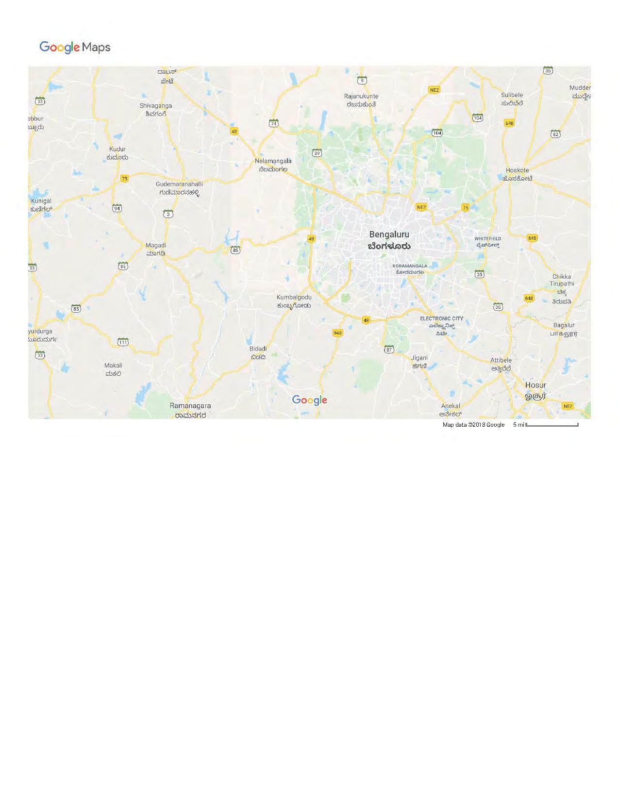


 Bangalore
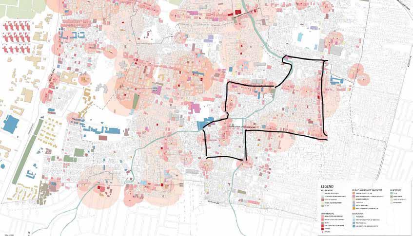
Hebbal
Hebbal
context
Bangalore
Site
Hebbal


7
Physical Conditions
Bangalore land use
Bangalore, officially known as Bengaluru, is the capital of the Indian state of Karnataka. The city contains two urban settlements--City and Cantonment--which had developed as independent entities that merged into a single urban centre in 1949.
Bangalore is also known as the “Silicon Valley of India” because of its role as the nation’s leading information technology (IT) exporter. Though highly developed, Bangalore is mostly filled with residential and agricultural land use. However, these agricultural plots are concentrated at the outskirt of the city while the residential zones are situated evenly around the city.
The “Old Petta,” the historic heart of the city, constitutes an essential centre for wholesale and retail activities. The northeastern part of the city forms the second commercial hub in the Cantonment area. The southeastern zone is planned as the IT hub, with residential housing and large public and private software and IT enterprises. Developments situated at the northsouth axis are households for families who engage in trade and business.
The series of maps provided serves as an analysis of how different zoning areas--from Bangalore to Hebbal-alter according to scale. The seggregation of zoning analysis gives an understanding of how Hebbal as a district functions and contributes to the larger city context. This allows for evaluation of planning rational and issues that influence existing site assets and constraints.

10
road and transportation condition
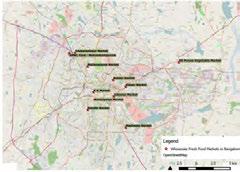
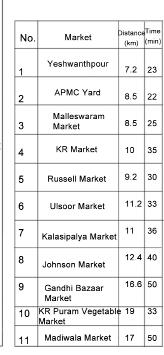
The road network in Bangalore has a star-like structure where all the major roads converge on the centre of the city. The absence of transverse roads and lack of public transportation leads to severe congestion in the city’s core. Conflict: The relatively small addition of road space compared with the intensive spatial expansion of the city. There are 11 main markets in Bangalore and most of them are within 30 minutes driving distance under normal traffic flow.

11
urbanisation history

12

13
District 7 land use


Hebbal is located in District 7. The planning of District 7 has a relatively silimar percentage of residential, industrial, commercial, and transportation zones as compared to the zoning of Bangalore. However, there is a drastic increase in the percentage of public and semi-public development, with a steep drop in agricultural land use. This phenomenon signifies that District 7 is highly urbanised, serving as an essential political and institutional hub with little trace of rural activities.
Hebbal is located in the southwestern zone of District 7, dedicated as a residential town and houses pharmaceutical and medical institutes. Furthermore, Hebbal flyover, the first highway that leads into Bangalore, influenced the development planning to cater to international corporations and automobile companies. Hebbal is also situated closely to Karnataka’s agricultural and poultry institutions that specialise in high-tech modified seeds, fisheries, and veterinary practices. Thus, with the high influx of educators, researchers, and business professionals, Hebbal is currently known as a residential stop for these professions.
14

15 hebbal land use
TRAnsportation
Hebbal is located near the Hebbal Flyover, which serves as the main route linking the city to the airport. It is positioned as a gateway between the city and the rural surrounding areas. Traffic jams are a common condition.
The number of vehicles in Bangalore has increased steadily and is more than 3.128 million (1 lakh = 100,000). The most common mode of transportation is bus and two-wheelers.


There has been a considerable rise in the number of two-wheelers, which constitute about 71% of registered motor vehicles.
trend in vehicular growth


Bus stops are concentrated along the highway on the west edge of Hebbal. There are only 7 bus stops within Hebbal district, making it isolated.
Hebbal has fewer, but more frequent routes from east to west, whereas it has more routes with less frequency from north to south. This indicates that the bus services do not meet demand.


Hebbal site

16
Transportation map
bus stops bus routes
of vehicles Mode of transportation
number
environmental pollution
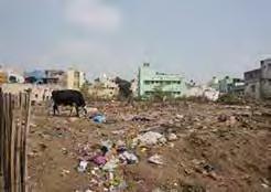
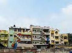
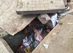
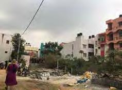
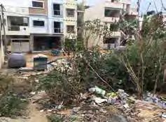
The pollution in Hebbal is mainly from domestic waste, not chemical pollution. There are five levels of pollution based on the size of the area. The pollution concentrates in certain locations with a high degree in and around the river. Pollution is also found along the secondary roads, with the least pollution found along the main roads; 30% of green spaces are polluted.

vehicles registered in bangalore

vehicular circulation

Vehicular circulation is inefficient and has some problems: The main circulation route is incomplete and the secondary circulation is disconnected. There are many dead-end roads. These problems lead to high traffic congession, particularly at intersections between primary and secondary roads.

17
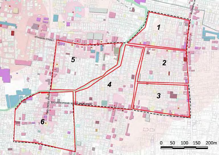
physical condition of zone 1


Zone 1 has an overall better physical condition than the other zones. However, it still has high contrasts in physical areas. One area might have a very good environmental condition: have tidy, clean, well-shaded streets with new buildings. Whereas, another area might have dense aging buildings, narrow roads, more trash and a polluted canal. Both areas have high and low income residents.


zone 1 map

18
1 - main street
2 - area in good condition
3 - area in poor condition (slum)
4 - area in poor condition (canal)
Food Types
Food sources are abundant, provided by cartwheel sellers, markets and eateries. These provide a wide range of foods catering to different dietary needs. However, they are situated mostly along the main roads, which affect traffic conditions by occupying the streetscape, pathways and conjunction points. There is a gap in food sources in the centre of this zone mainly due to poor road circulation, though a few cartwheel sellers transport their products through the alleys to increase their sales.
Food density
This map shows the concentration of food types catering to different preferences (veg and non-veg); indicating variation in dietary needs. Areas with fewer fresh food markets have more restaruants. Although fresh fruits and vegetables are evenly distributed throughout the area, fresh meat is available only in one area (in the southwest portion of the map).
The road condition is related to the housing condition; the lower income areas tend to have narrower road width. Roads also tend to narrow closer to the canal. Road use and road dimensions are mismatched, resulting in conjestion.

Road width Road
Road width
The road condition generally matches the community condition and road width. For narrow roads, the concrete pavement is usually not properly maintained. Some new roads are narrow but are paved in asphalt and so of better condition.
19
material
Ecology & Natural Environment
Water and Climate
Macro Climate
Many of today’s most pressing environmental problems—water and air pollution, biodiversity loss, invasive species spread, climate change— impact ecological systems at local to global scales. Understanding and addressing these problems thus requires perspectives that consider interactions between physical and biological processes at multiple spatial and temporal scales.
Our team research in this area focuses on effects of human activities on ecosystem processes, native and exotic species distributions; maintaining habitat requirements and landscape connectivity for native species in human-dominated landscapes; influence of terrestrial
ecosystems on water quality; and effects of multiple environmental stressors (e.g., air pollution, climate change, fragmentation) on ecosystem function.

Our research in the areas of ecosystem and landscape ecology integrates approaches and tools would include field sampling, the use of GIS, relevant online sources, articles, agency reports and precedent projects. A primary objective of our research and investigation is to enhance the management of and provisioning of ecosystem services within a landscape & community based context.
Water System
India scale - Bangalore scale River basin of India


Ponnaiyer River Basin
Bangalore
Cauvery River Basin
22
Penner River Basin
Watershed of Greater Bangalore
SUBCATCHMENT HEBBAL
Watershed Catchment of Bangalore Urban


Hebbal Valley
Water issues in valley scale
Vrishabhavathy Valley
Kormangala-Challaghatta Valley
Flood affected areas with impervious surfaces
Flood affected areas with streams
Flood zone - red indicates more flooding
Flood affected areas with slopes
23
Water and Climate
Water System

Water system and water condition in site scale


1- Water points for water samples
2- Drainage system and flow direction
3- Topography with 2 meters interval upstream ---> downstream

24
HP HP HP LP LP LP
Water system


Water movement: water sources / water usage / sewage water Control Group


25
Drinkable Water Canal
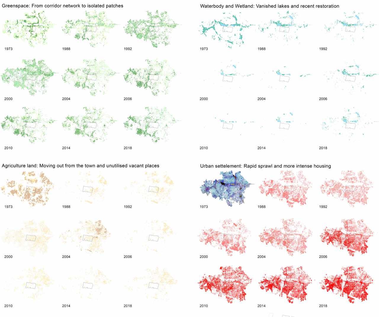
Urbanization and Landscape Change
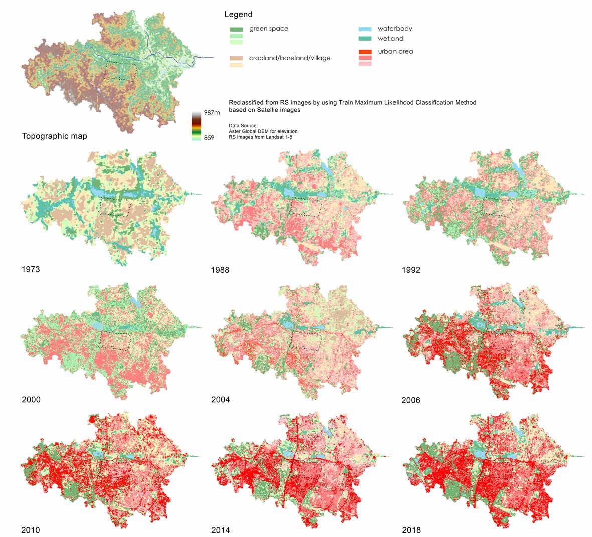
26
27
AGRICULTURE CROPS
SUGAR CROPS
Extraction of sugar
SugarcaneTapioca
A. Fruit Trees
JACKFRUIT _ Artocarpus heterophyllus


BULB VEGES


Main edible part of these vegetables is their bulb
SPICES
substance used to flavour food

CASH CROPS
Produced for its commercial value
TUBERS & RHIZOMES
Growing horizontal underground stem
CEREAL edible starchy seeds


Garlic Onion

Coriander Cumin Fennel

MANGO _ Mangifera


COCONUT _ Coco nucifera

B. Potted plants
MONEY PLANT _ Epipremnum aureum


Cardamom Cashew


INDIAN BORAGE _ Mexican Mint
TULSI (Holy Basil) _ Ocimum tenuiflorum

Colocasia Potato Tumeric


ORNAMENTAL PLANTS _ Hibiscus / Rose / Jasmine /


Barley (Jau)Paddy (Dhan)Wheat (Gehon)



COLE CROPS
Various plants belonging to the Cruciferae
ROOT VEGES grows under the ground
CabbageCauliflowerChinese CabbageKnol Khol


FRUIT VEGES

Carrots Radish Sweet Potato
Ladyfinger (Bhendi)Eggplant (BrinjalCapsicumChilliesTomato

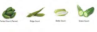
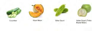
CUCURBITS

Plant of the gourd family (Cucurbitaceae)
Gourd (Petha)


Pumpkin
Cucumber


Snake Gourd
Pointed Gourd (Parwal)

Watermelon
 Bitter Gourd
Musk Melon
28
Flora & Fauna
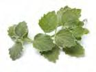
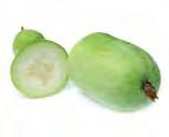
Bottle Gourd Ridge Gourd
Ash

29
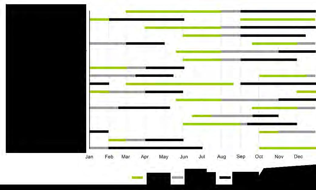
Calendar
Crop



30
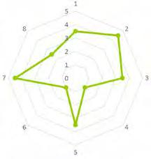
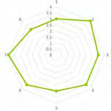
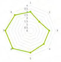
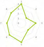
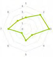
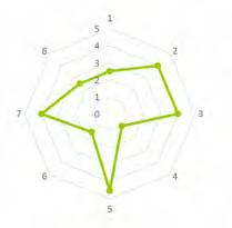
Ecology Quality Matric of Green Space
Flora & Fauna
Legend
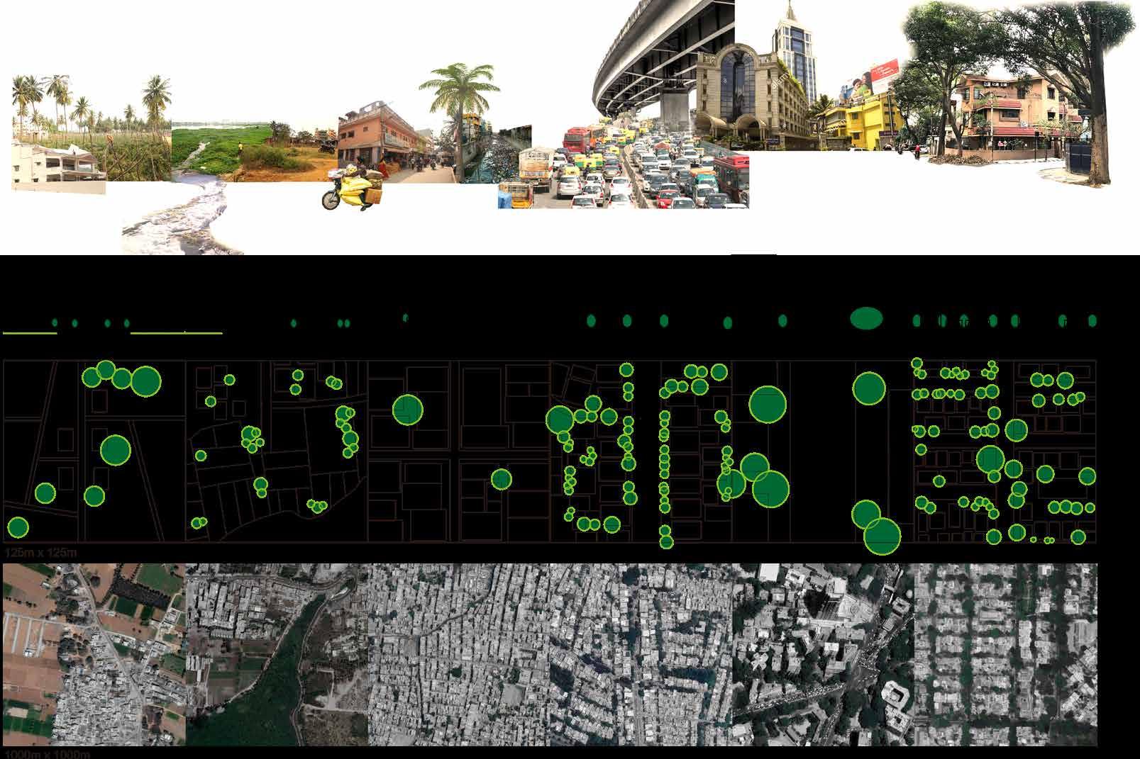
Rural to Urban Transect
31
typologies of Green space density


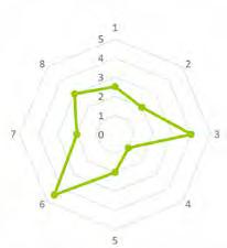

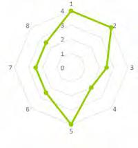

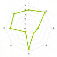
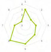
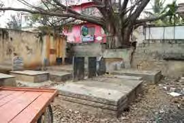
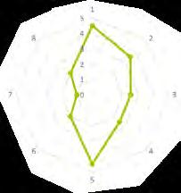


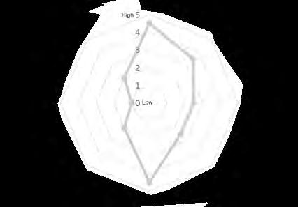
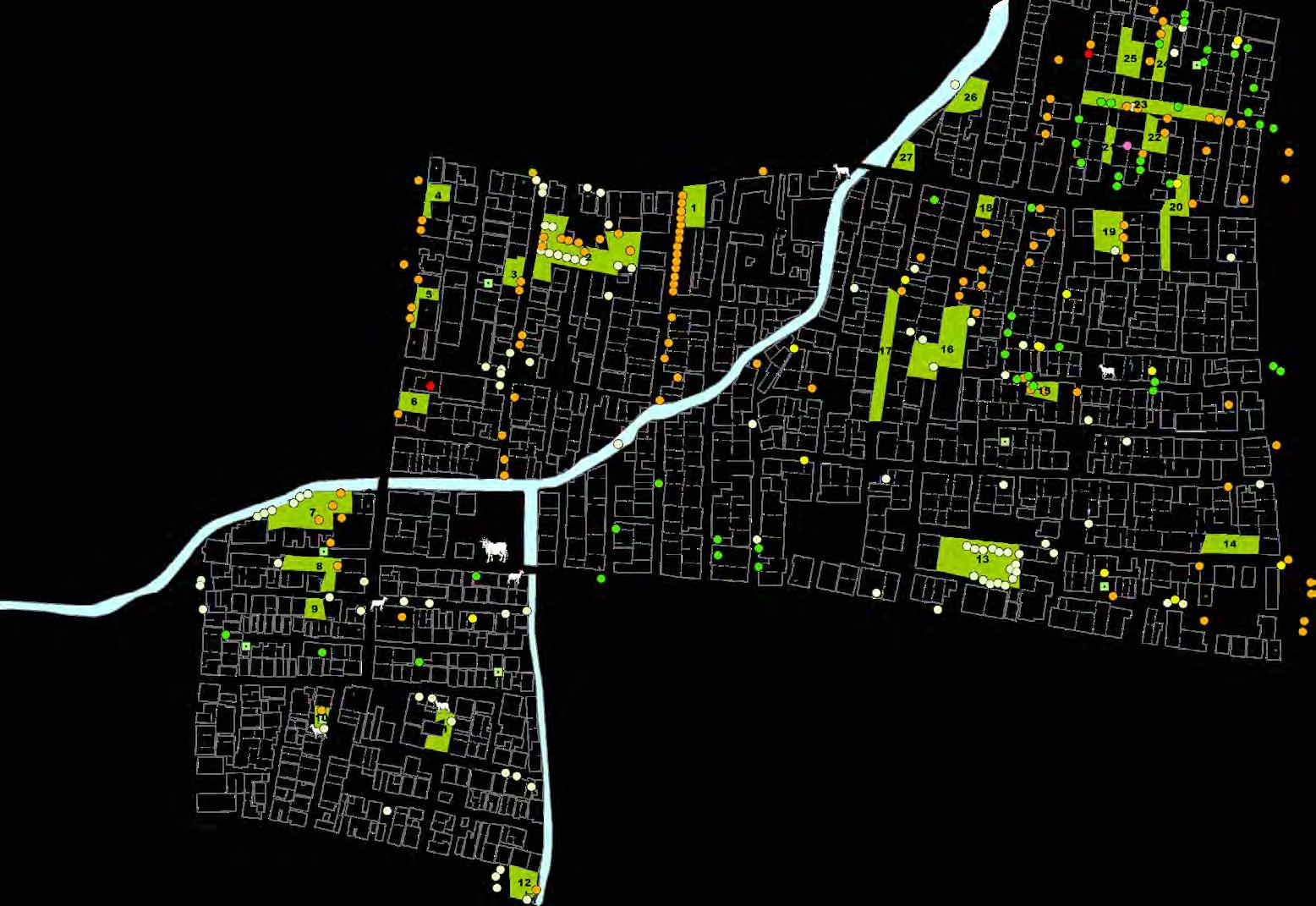
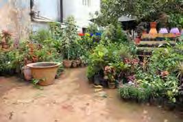
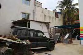
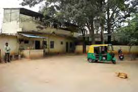
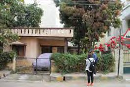
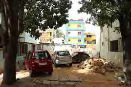
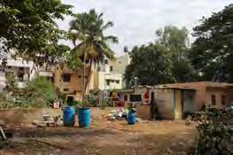
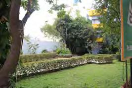
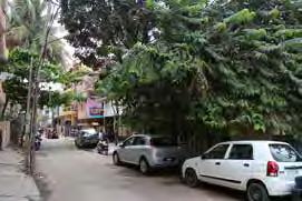
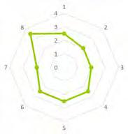
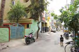
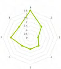
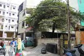
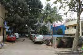
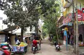
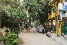
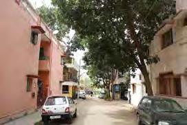
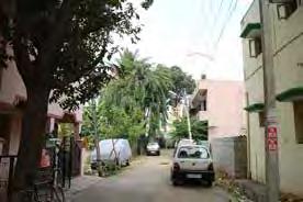
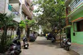
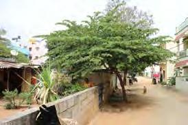
27 green spaces are selected strategically based on the amount of density of the green spaces in Hebbal. The green spaces represent a range of landscape typologies.
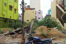
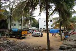
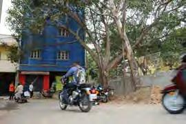

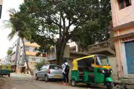
32
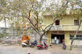
1 2 3 5 6 7 8 10 11 12 13 Institution: Archarya Institute of Health Science Residential / Open Space Residential Graveyard Residential + Commercial + Open Space School Street Trees Street Trees Street Trees Residential + Open Space
9 Vacant Land 4 Nursery Vacant Land
Types Results
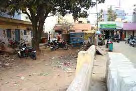

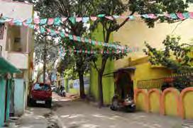







33 14 15 16 17 18 19 20 21 22 23 24 25 26 27
Street Trees
Street Trees
Residential + Street Trees
Commercial _ Car Garage
Residential + Street Trees
Street Trees Street Trees
Street Trees Street Trees
Street Trees
Street Trees
Street Trees
Street Trees
Culture & Demography
demographics
Population, density and Growth

Population density, 2011

Population, 2011
Population Growth in Bangalore, 1981-2001


The population grew from 1.6 million in 1971 to 4.1 million in 1991, and 9.6 milliom in 2011. Over the past decase, the city’s population has grown more than 40%. In-migration accounts for the majority of the population growth. The primary driver is work opportunities. (Source: Census of India).
Age and Sex Distribution


Population Distribution by Age and Sex in Bangalore, 2011
Ratio of females per 1,000 males (2011): Bangalore: 916; Hebbal: 954
The skewed sex ratio is a small indicator of the inequality in nutritional access for women and young girls. It is also impacted by in-migration of men for work and societal preference for male children.
36
Literacy and Education
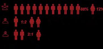
Bangalore is known for its high quality education and high literacy rate of 88%, as compared to the state average of 67%.

age distribution (Bangalore), 2011

More than half the population in Bangalore is under the age of 30--and a quarter are in their 20s. This means Bangalore is a young city.
Poverty and Deprivation (2011)


The per capita urban poverty line in Karnatake is INR 1,373. The 2011-2012 urban poverty rate was 21.9%. Affordable and safe food is crucial for people to survive on limited incomes.

37
Distribution of Workers by Age and Sex in Bangalore, 2011
Religious map of India, 1987

States denote significant minorities only.


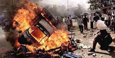
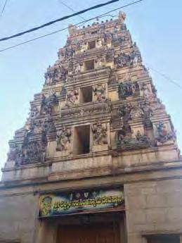
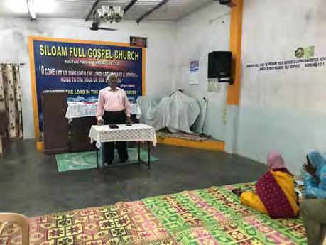
The Indian Constitution confers religious freedom for individuals and prohibits religious discrimination. But, despite this, there have been enduring tensions--and occasional conflict--among religious communities.


Potential interaction among religious groups in Hebbal

38 religion




39 conflict
Food intake & Hunger

Global hunger Index religious eating habbits
According to the Global Hunger Index released by the International Food Policy Research Institute, India’s hunger index ranks 15th in the world. The Global Hunger Index calculates hunger levels based on three factors: the number of malnurished people in the country, the proportion of underweight children, and child mortality.
Hindus do not eat beef. Muslims and high caste Hindus do not eat pork. Indian beef is cheaper than lamb, which tends to be the most expensive meat. Devout Hindus and Buddhists are vegetarians. Jains are very strict vegetarians; they do not eat eggs, but do drink milk and eat butter. About half of the Indian population is vegetarian.

40
Landscape Quality
Typical street life in Hebbal


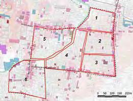
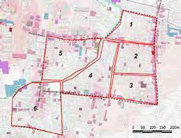
Zone 1: Intersections at Block 1-4 as observed by Carrie, Victor, and Helen
Community Engagement
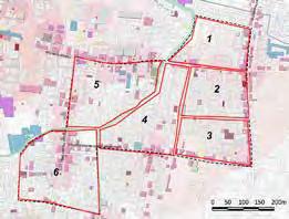
Zone 2: Blocks 2-13 as observed by Yuexin and Swan
Neighborhood daily chores
Zone 3: blocks 3-5 as observed by chenchen and Hanfeng
Residents’ life at the edge
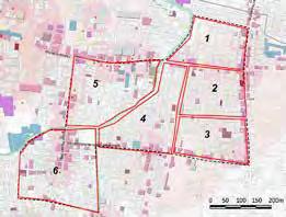
Zone 4: blocks 3-4 as observed by linxin and lingchang
Religious activities and daily routine
Zone 1: Blocks 5-10 as observed by azilla and raymond
Livelihoods of urban slum residents


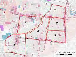
Zone 6: Blocks 5-9 as observed by Zoe and Raymond
The environment and people
city scale aesthetic analysis


bangalore landmarks

Most of bangalore’s landmarks are the heritages of the British’s colonization history, and now serve as museum or holding music concerts. Some of them are still used as goverment agency.This places provide space for gathering people and attract a lot of visitors.
The city’s gentle climate, broad streets, greenery and the presence of many public parks like Lal Bagh and Cubbon Park has earned the city the name of ‘India’s garden city’.
bangalore cbd
There are three main religion brives in Bangalore, the Hinduism, which has the most population, the Islam and Christianity.

bangalore temples
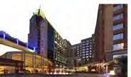
UB City is the biggest luxury commercial property project in Bangalore, India.Centrally located in the CBD (Central Business District), on the corner of Kasturba road and Vittal Mallya Road, it is just 1.8 km away from M.G. Road / Brigade road junction.
44
bangalore parks & lakes
Bangalore Palace
Vidana Soudha
Karnataka High Court
Tipu Sultan’s Palace
ISKCON Temple
Dodda Ganesha Temple
Bull Temple
Kempfort Shiva Temple
Shree Surya Narayan Swamy Temple
Kote Venkataramana Temple
Jamia Masjid
Masjid-e-Khadria
St. Mark’s Cathedral
St. Mary's Basilica
Cubbon Park
Lalbagh Botanical Garden
MN Krishna Rao Park
Lumbini Gardens
Ulsoor Lake
Hebbal Lake Sankey tank
Bellandur Lake
UB City
green space
Overlapped of locations of material and natural resources indicates a phenomenon that these places mostly locate in the green space. This means that green spaces need to support not only ecological function but also social activities; green space should be multi-functional.


hindu temples


78.87%
Halasuru Someshwara Temple, It is the oldest temple in the city and dates back to the Chola period. Irrespective of when the initial consecration took place, art historian George Michell believes there were major additions or modifications during the late Vijayanagara Empire period, during the rule of Hiriya Kempe Gowda II.
islamic mosques

13.90%
Masjid-e-Khadriya is made using Islamic architecture with geometric patterns and surrounded by gardens with fountains. One can see pointed arches and onion shaped domes with a grand arch in the opening gate of this masjid. This grand arch is rectangular in shape and adorned with calligraphy. On All 4 sides at the end of the masjid are high minars. Beautiful landscaping has been done on broad pathways that start from the grand arch leading up to the complex.
Looking back to the bangalore's history, the British influence is apparent in Bangalore's city scape. The geometric radial street patten reflects the typical characteristic of England garden. Religion plays a prominant role in India’s culture context, and also contributes to the current unique urban pattern: The temple or the garden will locate in the center of the district, and the road will be spread out in radial pattern, and usully park and temple are combined with each other. As a result, the temples which are the symbol of religion become part of street scape that people can see it from all the district.


christian churches


5.61%
The church of St. Mary’s at Blackpally became a parish and was elevated to the status of minor basilica in 1973 through an order by Pope Paul VI (The church was the sixth church in India to be elevated to this status). Stained glass windows and multiple columns with a rich Corinthian capital support the stately arches of the Church.

45 Hebbal M.N.
Eidgah & Masjid 148 years Hyder Ali and Tipu Sultan Died in 1799 Wodeyars and British East India Indian independence in August, 1947 Water body Green space Site
Krishna Rao Park Vivekananda park Sri
Ramachandrapura Math
Streetscape spatial analysis
zone 4: 1st Main Road (Market Street)

46
zone 5: 6th main road (residential street)

47
Streetscape spatial analysis
zone 4: 14th Cross Road (Mixed Street)

48

49
Building Height Analysis
Community Engagement

52 open space evaluation open space
Urban agriculture preference by age and religion


This figure shows that people from different age groups that practice different religions have different preferences for urban agriculture. We found that Hindus had more of a preference for agricultural work, while Muslims had more of a preference for farm-grow for family or farmgrow to sell. Older respondents also prefered farmgrow for family or farm-grow to sell.

53 open space
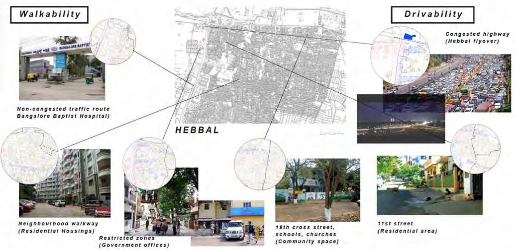
driveability & walkability
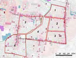
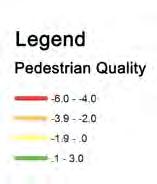
Driveability is a measure of trasit accessibility, calculated as the distrance to the closest stop on each route, analyzing route frequency and type. Walkability is a measure of walking routes to destinations such as grocery stores, schools, parks, restaurants and retail. Research done by the Clean Air Initiative in Asia shows that Bangalore is among the top 4 cities where roads and pavements are not fit for pedestrians. Bangalore ranks second among 15 Asian cities on the Walkability Index, scoring poorly at 46/100.

driveability factors
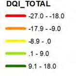
design quality indicators (DQI) survey


walkability factors


54



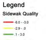
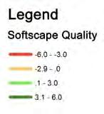
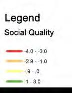
55 DQI Survey findings
OBSERVATION OF ACTIVITIES
Observation questions sequence of activities by zone


56
distribution of measurment indictors

57
activities in hebbal
daily
Community Survey
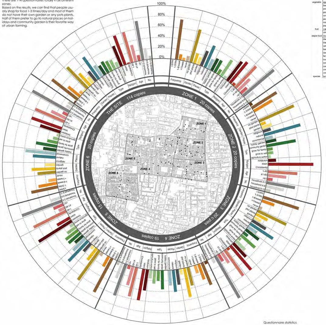
In total, 114 questionnaires were completed across the six zones. Results were that people usually shop for food 1-3 times per day. Most people do not have their own garden or any potted plants. Half of participants prefer to go to natural places on hot days. And the preferred way to grow food in the city was in a community garden.


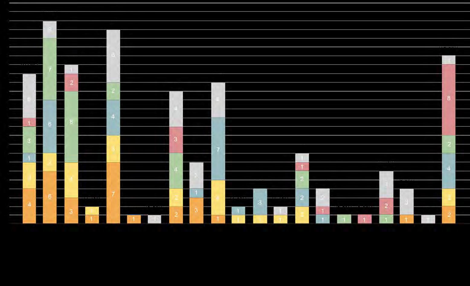
Although there were some common issues, there were differences among the six zones. In Zone 1, the most common issue voiced was about the drinking water shortage and air pollution. In Zone 3, the most common concern was lack of open space and issues with drinking water. In Zone 4, the biggest concern was the accummulation of trash (this zone was adjacent to the canal, where trash concentrated).

58
Community Survey FINDINGS

59

60 Neighborhood issue by zone
Synthesis
visioning workshop


Landscape quality
1. Streetscape is of poor quality due to lack of maintenance, poor infrastructure, and inadequate vegetation; but there are many pedestrians and a lot of social activity.
2. Lack of green space to break up hard surfaces of low-density residential buildings
3. Building height to street width create a sense of enclosure that could have a negative effect on the pedestrian experience.
Physical conditions
1. Informal and illegal construction combined with insufficient amenities, services and infrastructure
2. Public transportation gap: no bus or metro service
3. Informal and irregular food stores/sellers
Culture & Demography
1. Hebbal developed from small villages and there are still strong social bonds and a strong community atmosphere.
2. Many vacant and underutilized spaces; potential to fill gap in lack of public gathering spaces.
3. Schools lack facilities including places for children to play safely; children play in the street.
ecology & natural environment
1. Rapid urbanization has led to severe flooding and water, soil and air pollution
2. Informal development patterns create unhygienic environment and may spread disease.
3. Inadequate water supply for consumption, severely polluted waterways, and inadequate or non-existence sewage treatment.
62
environmental condition



dwelling diversity


cultural diversity
63
Vancant Lots
Typical Street
Polluted Canal
Informal Dwellings
Proposals
food for hebbal
A Framework for a Resilient Hebbal

Rapid Growth
Self-Sufficiency Analysis

The rapid population growth is expected to increase significantly in the coming years as the city provides more job opportunities. This effectively impacts the rural area with the increase demand of food and land for production. The far distance between the food production and consumers further enhance the vulnerability of food security for the fellow residents. In order to aim towards a self-reliant city in Hebbal, we need be innovative in stitching productive landscapes in this built environment. The project propose to provide a framework that connects the rural and urban land while integrating existing programs with productive landscape in order to achieve a sustainable food production and consumption for the future.
The growing population in Banglore as a city that provides a better prospect of life is putting pressure on the rural area. The increasing amount of food to feed the increasing population demands for a greater area of land for food productions.

Food Wastage
Banglore is one of the biggest food producer for the world but according to a study by Food and Agriculture Organisation (FAO), they are currently not producing enough for their own citizens, making them vulnerable in terms of self-sufficiency.

Consumption Analysis

Producing food for 9,641 residents living in 59.3 acres, equivalent of Hebbal requiring a land of 70 times more which spreads out to a 21.5 mile radius.
Household Income Analysis

Site Survey Results


66
Food Shed
Typical Indian Diet
The food shed map shows area where there are food concentration. Hebbal currently has a good food network along the perimeters of the site. It was noted that the food cart sellers have routes that they took while roving around the site.

Food System
improper use exposed on cart
air polution air polution traffic jam food wastage contamination
FOOD CART GROCERRY STORE WHOLESALE MARKET
Methodology
The goal is to maximise the yields and quality of the crops produced. The selection of plants is based on several factors including popular consumption, high market value as well as the capability to grow in the different urban agricultural method such as hydroponics.
Based on the selected vegetables, their yield in pounds per 10ft of a row and the distance between row for vegetables to grow in Banglore, the average yield per 100 square feet of the vegetables is calculated. With the conversion of 1 pound equivalent to 16 ounces, which is approximately 2 cups, the average of 968 cups per100 square feet is calculated.

There are 43,560 square feet in one acre, therefore it is possible that in each acre for vegetable farming would potentially produce 421660.8 cups each year.
If each person in Hebbal consumes the daily recommended 3 cups of vegetables by Indian Council of Medical Research, it is calculated each person needs 1095 cups in a year.
If each person needs 0.44 acres to sustain a 2300 calories diet, it is calculated that in order to reach 100% self-sufficieny in Hebbal, a total of 4242.04 acres is needed.

The current food system sees an extensive food mile in Hebbal. Most of their grocerries are bought from food cart sellers or stores that purchased their goods from a distant bigger wholesale market. The foods are exposed to air polution, especially during massive traffic jam Banglore is known for. This affects the quality of food the residents of Hebbal consume.
Based on the calculation the areas that are provided for production are recorded based on the number of cups produced in an acre.


nur azilla bte nazli
67
food for hebbal Vision
1. Increase land dedicated to food production through a continuous productive landscape


2. Promote community health and engagement
3. Increase food access to high-quality food to residents in all communities
4. Strengthen community identity Strategies

The strategies focuses in 4 phases. The first phase cleans up the existing physical condition of the vacant lands. The second phase introduces the studio’s efforts in productive landscape of their chosen sites. The third phase transforms all the exsiting vacant land into the different productive landscape, according to the spatial matrix. The last phase bridges out towards the rural landscape and tapping onto vacant lands out of Hebbal.
PHASE 2
PHASE 3
STREET GREENING

68
Upon laying over Banglore Masterplan 2015, the areas are selected based on several consideration such as their current function, if it is vacant, and its location by the lake that connects from Hebbal to Kalkere Lake. In Phase 4, Hebbal will be able to achieve 80% self sufficiency before the next available land that has agricultural activities happening existingly.


69
Spatial Matrix
growing with food System analysis


Population density 2011
Open space analysis


Issue: Water shortage
Vegetative layer is sparse, water drains quickly.
Decreasing green
The nearest farm market is 6 miles away from the site. Outside of school, spaces children can explore on their own have been shrinking over the last few generations.
Issue: children have no place to play
70


Gao Chen chen Legend Site boundary Students circulation Pedestrian circulation Vehicular circulation Students gathering space Gate/Building Entrance 0-1h 1-2h 2-3h 3-4h 4-5h 5-6h 6-7h 7-8h Sun hour analysis Sun shade analysis 71
growing with food
Strategy1 Multiple functional patterns: Masterplan


Productive green roof Compost Outdoor classroom Entrance Wash space Solar power Soil with farm waste Farm tool house Raised pond Herb garden Tree house Climbing slope Children observation space Table for herb making Chicken coop Reserve for fire use
72
Design Strategy 2: rain water collection and management


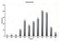
Monthly rainfall: Highest is in September: 493.7mm (23days)

Lowest is in January: 0.7mm (2days)

Perspective
Design strategy 3: companion planting (permaculture principle)
Tree layer
Bamboo & shrub layer
Herbaceous layer
73
Social bonding community garden in diverse community

In Bangalore 73% land used for residents survive, work and commute, comparing to 14% land used for parking and open space.


Site selection


Bangalore,India
The Hebbal female is busy with family in daily life: morning, noon, and evening. The location of a community garden should be close to shops, be accessible to schools, and home. It should be safe and easy to reach.
Female demand


Hebbal,Bangalore
Female demand in Hebbal


LegendVacant area Vacant area besides river School Daily routine Shops
THEIRS
1km
50m
Site,Hebbal 10m
74
Strategies
1. Create femaile-centered social bonding community garden

- Defensible spaces


- Multi-functional spaces to provide communal opportunities
Strategy 1
- Visibility mapping


2. Self-sustainable, environmentally-friendly, multi-functional farming spaces.
- Food forest
- Harvesting rain water to irrigate
- Composting to be used as fertilizer
- Public/Private space
- Multi-functional space
3. Establish a co-construction and sharing operational sustainable system.
Hebbal residents farm, a Committee Panel formed by residents manages, and Hebbal residents benefit. (Non-government institution, Local Club, Female NGO
- Terrace
- Circulation
- Water catchment
Strategy 2
- Rain water harvesting system


- Multi-functional softscape
- Irrigation and composting system
1.Sitting area 2.Entrance square 3.Entrance ramp 4.Bioswale 5.Transportation ramp 6.Sunken square 7.Working pergola 8.Children playground 9.Sunken sandpit 10.Fitness field
garden 12.Resting space 13.Pray space 14.Steps
forest
square
slots
platform
of boardwalk
Community Residents Students Visitors Government Government NGO Committee Panel Community Residents Students Visitors
11.Terraced
15.Food
16.Centeral
17.Individual
18.Waterfront
19.Node
20.Boardwalk
0M5M 20M Ramp- for trasportation need Ramp- for trasportation need Boardwalk-release transportation pressure GOING UP GOING UP GOING DOWN GOING DOWN GOING DOWN GOING DOWN 0M5M 20M TRANSITION PUBLIC SEMI-PUBLIC SEMI-PUBLIC SEMI-PRIVATE SEMI-PRIVATE PRIVATE PRIVATE 0M5M 20M COMMUNAL SPACE COMMUNAL SPACE RECREATIONAL SPACE FARMING SPACE HIGH VISIBILITY 0M5M 20M 0M5M 20M 0.00 0.00 0.00 -0.60 +0.50 +1.00 +1.00 +1.50 +2.00 +2.00 +2.50 +2.50 +1.50 +1.70 +1.50 +1.50 +0.50 -0.70 -0.70 0M5M 20M 0M5M 20M 0M5M 20M DRIP IRRIGATION COMPOSTING PILE 0M5M 20M Sharing slots Hedge Individual slots Rainwater harvesting system
Wang Zhe zoe 0 1m 5m Hebbal,Bangalore 1 2 3 4 5 6 7 8 9 10 11 12 13 14 15 16 17 18 20 19 75
Strategies 2 & 3
Multi-functional farming patterns


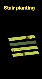
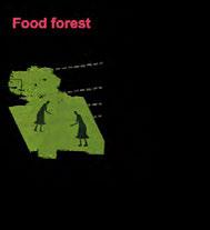
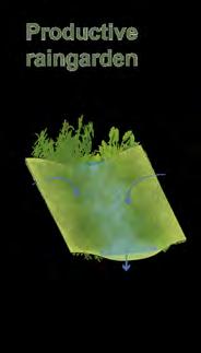

Planting calendar & events
Values

THEIRS 76
sections Senarios

TRANSITION PUBLIC SEMI-PUBLIC SEMI-PUBLIC SEMI-PRIVATE SEMI-PRIVATE PRIVATE PRIVATE
Volunteer come
- Public street - Public space for all kinds of people groups
- Buffer rain water garden and ramp
- Semi-public space welcome to female and kids - Semi-public space communal & productive - Semi-private space with private space inside communal & productive
Sequent spaces from the entrance to the inside
Terraced garden-$

- Semi-public space Creating and social space


Bufferrain water garden
-Sunken Square retention rain water
-Drip irrigation -Filter
-Sunken Tank detention rain water
water harvesting system in terraces


- Public street
- Semi-private space with private space inside communal & productive function
77
0M5M 20M DRIP IRRIGATION COMPOSTING PILE Workshop Create space
Handcraft party
Kids' sandpit for
- Buffer - Boardwalk
Rain




Existing Entrance Commercial Road (Carry garbage) 50% Surface runoff Increased over 134% 1992 2009 4.1 million 1992 8.5 million 2009 Residential: 33.25% Rural farmland First distribution Rural farmland Second distribution Urban consumer Urban area Rurral area Farmland Green space Site Legend Central market Urban area Rurral area Farmland Green space Central market over 134% 4.1 million 1992 8.5 million 2009 Residential: 33.25% Rural farmland First distribution Rural farmland Second distribution Urban consumer Yeshwanthpour Market 7.2KM Urban area Rurral area Farmland Green space Site Legend Central market over 134% 2009 4.1 million 1992 8.5 million 2009 Residential: 33.25% Rural farmland First distribution Rural farmland Second distribution Urban consumer Common Street Pattern Bangalore Street Pattern now Hebbal Street Pattern Common Street Pattern Bangalore Street Pattern now Hebbal Street Pattern Street Pattern Bangalore Street Pattern now Hebbal Street Pattern Common Street Pattern Bangalore Street Pattern now Bangalore Street Pattern -future Hebbal Street Pattern Hebbal Street Pattern -Stage1 Hebbal Street Pattern -Stage2 Common Street Pattern Bangalore Street Pattern now Bangalore Street Pattern -future Hebbal Street Pattern Hebbal Street Pattern -Stage1 Hebbal Street Pattern -Stage2 Common Street Pattern Bangalore Street Pattern now Bangalore Street Pattern -future Hebbal Street Pattern Hebbal Street Pattern -Stage1 Hebbal Street Pattern -Stage2 Raising: a productive community showcase in typical indian residential area Site community condition Site Environmental condition Food chain Food security Shadow analysis Food system research Concept Flow Common street pattern Bangalore street pattern -Now Hebbal street pattern -Now Hebbal street pattern -Stage one Hebbal street pattern -Stage two Bangalore street pattern -Future
We don’t have
We need to live here and get a job for food
don’t have open space, We need some public space 78
We need to eat and buy food, Eatery and Market are important to us.
skill,
We
Strategy1:
Create gateway to meet different groups’ demands
Commercial Market Complex

Community Free Market
Complex
Community Plaza
Trailing Farmland
Traditional Farmland
Green House
Raised Bed Plaza
Private Flat


Public Entrance
Community Entrance
Private Entrance
Subsurface flow surface flow Underground tank Retention basin Green Pot
a-a
Master
kong
Section
Plan
lingchang
79
Strategy 2: Water management-Grey water reuse/Rain water collection
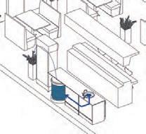

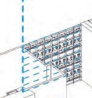
Strategy 3: Provide growing structure
Rain water collection through gutterway from green house roof


Green house
Green wall irrigation by rain water collected from surface runoff of roof
Surface rain water runoff
Grey water collection from shower and laundry for irrigation
Raised bed combined with compost
Grey water collection from hand tap to flush the toilet.

Grey water collection from kitchen for irrigation
Roof raised bed container
Green wall made by plastic bottel
Balcony green house
A B a a 80
Open farmland with mulching
Indoor trailing and container Open farmland with structure support
Roof green house


Green house Apartment Restaurant Market
A
B
Prototype Vegetation shop Vegetation shop Eatery Eatery Apartment Apartment 81
Perspective
Perspective
Housing
Current Situation
The delivery of basic needs such as healthcare services are still developing in small scale despite there being an emphasis on healthcare provision in Hebbal. Similar to developed regions in Bangalore, healthcare services are important and the lack of affordable healthcare resources and medical services among the residents in Hebbal is still an ongoing issue. The current air and water pollution in Hebbal cause health hazards and lead to many residents developing early onset of respiratory problems, dermatological-related problems and other common allergies issues.

Objectives


To develop - Adopting medicinal herbs as a starting point to promote the importance of health, it is also an opportunity for productive landscape in Hebbal.

To advance - Collaborating with modern medicine can also serve the Hebbal community and raises awareness on the importance of health
To self-sustain - Setting up communal garden at potential open spaces in the community


Site Issues & Problems
To empower - Engaging senior citizens who had the experience in farming and introducing women to the workforce and contribute to the operation of this sustainable herbs project.
Empowering Rural People for Primary Healthcare
82
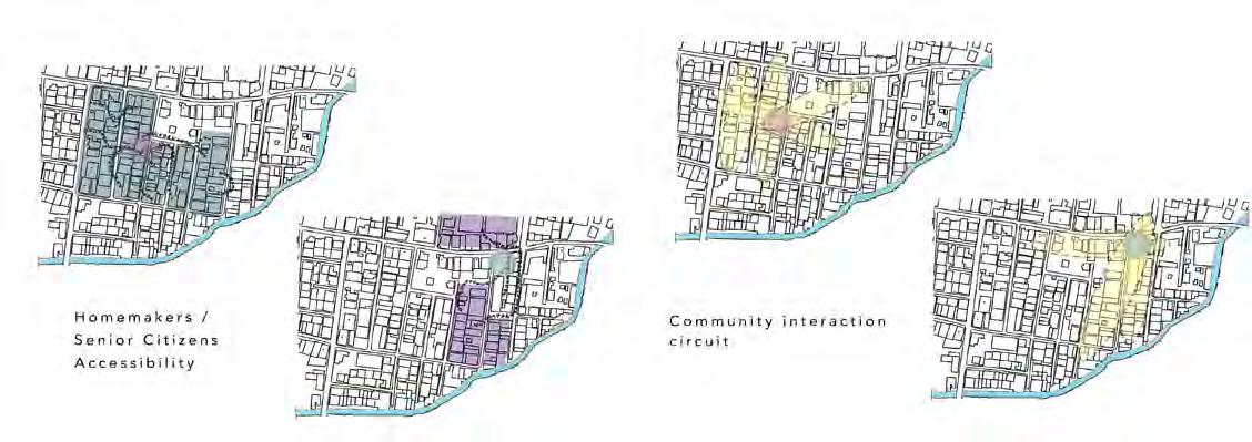
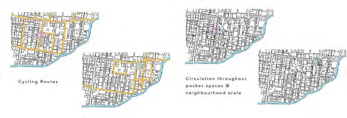
he(r)bbal pockets
Opportunities in social outcome: (1) Improved health status (2) Women livelihood opportunity (3) Revival of Ayurvedic medicine (4) Exposure for medical school students (5) Encourage community engagement (6) Promote social cohesion master plan


The priority in providing a holistic healthcare service for all ages is crucial because it is the most fundamental of human survival and also vital for successful nation building.
 Lam Si Yun Swan
30 pocket spaces for development
83
The goal of Ayurvedic medicine is to help people live long, healthy and balanced lives without the need for prescription drugs, complicated surgeries or suffering of painful conditions. This traditional approach has been practised by Hebbal locals for many years, relying on home-grown medicinal herbs to prevent minor ailments.

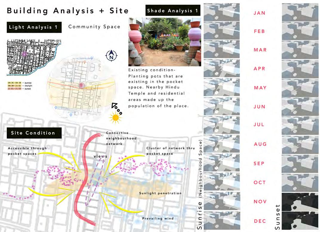
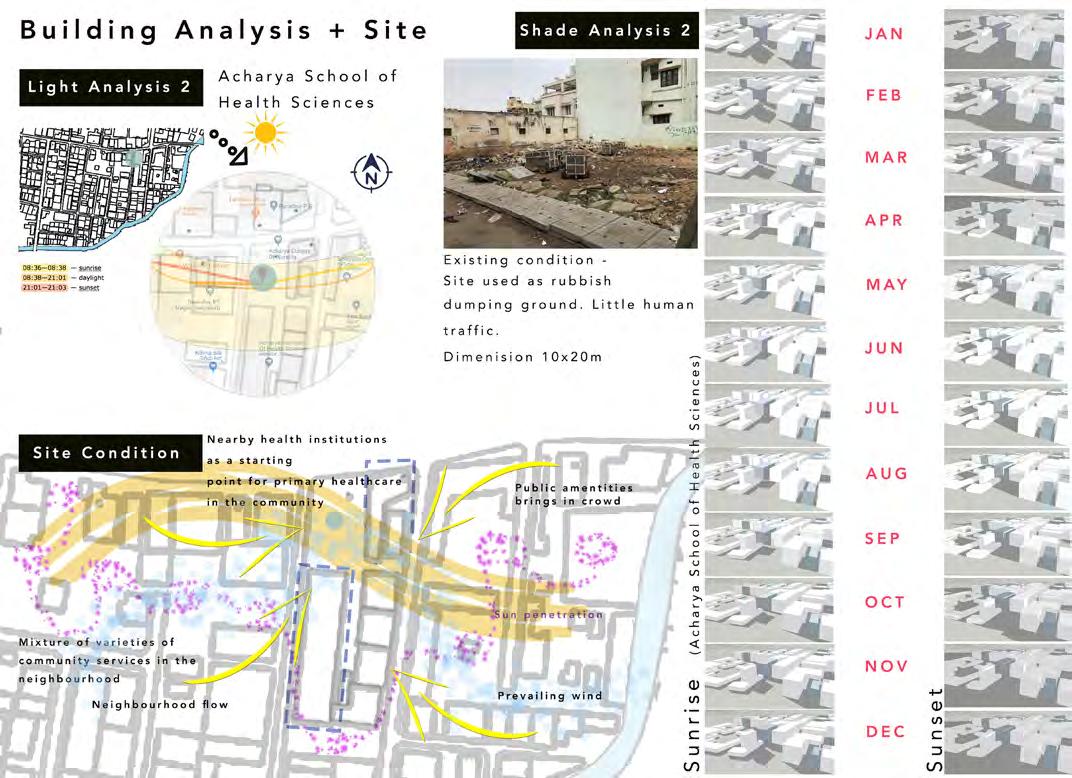

Proximity Analysis building & site Analysis 84
Acknowledging the importance of medicinal herbs is crucial in providing access to affordable medication for Hebbal residents. Residents believe strongly in Ayurveda, a medicine system with historical roots, and it is currently an alternative medicine being used in some illnesses with modern medicine. As the knowledge of traditional medicine has its worth in recuperation and healing, there is a possibility to expand this to tackle some of the harder to deal with diseases, such as their top illnesses - lung cancer and respiratory related diseases.
Perspective examples
site plan examples



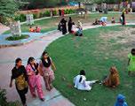
 Impression of raised bed agriculture at pocket space
future vision 85
Active rainwater
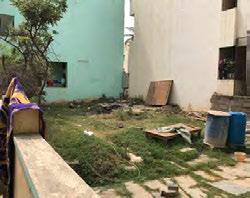
daily street activities: no open space & poor spatial experience


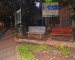
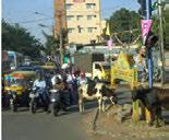

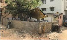
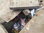
city condition
Drainage system
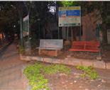
Public garden with fence; closed at night
site Analysis Shop Hindu temple Public open space Private open space Residential
Water flow
Women collect water, laundry, socialising in the street.

Artful rainwater Street amenity Pocket parks
Coconut tree

Cartwheeler selling food and children playing
Public open space as a dump site, primate open space
Heavy rain & Sidewalk drainage system
Site selection


Road width


Softscape Quality Hardscape Quality
Horizontal diversity
Vertical diversity
Religious diversity
Pedestrian Quality Sidewalk Quality
- A residential street with high using frequency


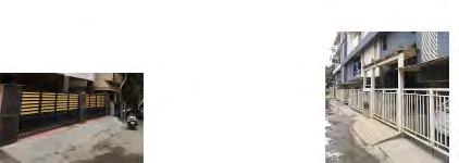
- Based on design quality surveys, a site with high softscape quality and low sidewalk quality

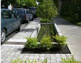

Shade tree Wall Existing sidewalk Broken side walk Existing drainage Broken drainage
86
Rain water calculation


Peak daily rainfall

Strategy 1 artful rainwater: capture rainwater for reuse


Artful rain water
Potential site
Entrance connection
There is impermeable and inefficient and drainage under the sidewalk.
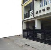
Liu xiaolei carrie
Function zone
Attraction &inStreet amen-
Existing infrastructure
Rainwater Detention
Aesthetics and interaction
87
Permeable pavement with grass Irrigation
Active rainwater


 Vertical green
Pergola
Recycled material street furniture
Drainage system
Recreation Exhibition Children play
Strategy 3: Pocket park as a system
88
Strategy 2: Street amenity
Roadside water treatment
Vertical green

Contemporary pool
Pergola
Child play amenity

Gateway Sculpture

Master Plan 1:250 Plant guideline
Perspective
89
Pop-up Green
Urban agriculture as a social glue
Bangalore
2030 Urban footprint


City master plan
Improving social cohesion by encouraging interactions in alleys
Road type in Hebbal
Hebbal
Hebbal: unplanned community
Pop-up: a duplicable & adaptable approach in Hebbal
Collaboration network and sustainable food production cycle
Urban agriculture acts as a catalyst to improve social cohesion and foster community organization in facing with the need of physical environmental implementations. The pop-up canteen function as a social enterprise to bring external resources to the local community. At the same time, the sustainable values of traditional lifestyles are retained by minimizing the input and output of the urban system.
Top issues from Hebbal community survey
Fragile infrastructure and insufficient public facilities:
Lack of playground
Built-up Greenspace Farmland
2004
Waste treatment
Typical section of alleys in Hebbal
Water supply Water pollution
90

Yao Haomu Master plan 91
Compost and herb growing pot


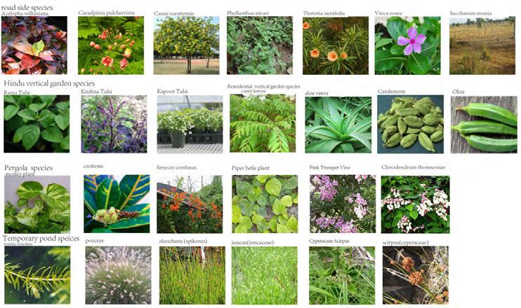
Climber plants for the entrance

Planting palette


Frame structure for container gardening



Raised bed combined with street furniture
Rain garden after canteen has been removed Container as moveable pop-up canteen


New buildings Compost Entrance Street Furniture Container gardening
Bamboo shelter Soil body Bamboo or recycled material
with buildings Gabian
Attached
foundation
Mavinakayi Chitranna
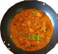
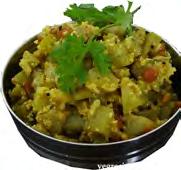
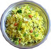
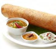
Masala Dosa Veg lollipop Sorekai palya Kundapura Koli Saaru
Murraya koenigii Brassica juncea Ferula communis Coriandrum sativum Cuminum cyminum Allium sativum
Allium cepa Solanum tuberosum Capsicum annuum Curcuma longa Zingiber officinale Piper nigrum
Detail 92
Solanum lycopersicum Daucus carota Vigna mungo Cicer arietinum Pisum sativum Trigonella foenum-graecum

93
EXISTING CONDITIONS
India’s grain production areas are relatively concentrated, but in the remote rural areas, there is still no connection between railways and highways.

CONCEPT
Edible street food system
SITE SELECTION
The dry season and the monson are completely separate, and the extension of extreme climate, which is not conductive to crop growth.
Growth
of Bangalore
SITE ANALYSIS: FOOD SECURITY

DQI is a road evaluation system to assess hardscape, softscape, sidewalk, pedestrian and social quality. Of 60 roads analysed, only 14 had a positive score.

Hebbal supports 9.4% of the state’s total population and 27% of the total urban pop.

Most of the two roads are residential areas. The total length is 280m, with 11.5% open space and 16.8% green space.


food security design in street scale
EDIBLE STREET -
Building height Water erosion Wind erosion Salt encrustation Monsoon Drought Transportation Population Obesity Malnutrition
Population in millions
Proportion of gross cropped area(%) By the late 2000s cereal production was clearly Legend Pollution Degree Open spaec Pollution point Legend Flow direction Topography Legend Building Hoght/m 3m 6m 9m 12m
Hardscape Quality Pedestrian Quality Sidewalk Quality Softwalk Quality social Quality Main entrance Main entrance Residential area
OPEN SPACE 11.5% open spcae GREEN SPACE 16.8% Green Space LAND USE Mosque School Commercail area Open space Green space HIGH Land Degredation Inefficient Transportation
Change
Population
Climate
Growing
Concentration
production
Water
Two commercial streets are adjacent to the north and east sides of the site. Market distance 94
of cereal
Pollution
system
STRATEGY 1: CREATE MULTIFUNCTIONAL EDIBLE LANDSCAPE MASTER PLAN
Street detail
i Planting Area:Integrate planting space with building
ii Resting Area: Integrate planting space with facilities
iii Activity Area: Integrate planting space with infrastructure
iv Ecological Area: Integrate ecological structure with street infrastructure


North entrance Assembly area Street experience area

xu yuexin
95
STRATEGY 2: CREATE STABLE LANDSCAPE PRODUCTIVE YEAR AROUND


Sun Track and Building Shade
Planting Collocations in Different Seasons

Plant Monthly Lighting Reqirements


Mar-8m Sep-8m Dec-8m Mar-12noon Sep-12noon Dec-12noon Mar-6pm Sep-6pm Dec-6pm VEGETABLE Type / Month Bottle grourd Okra Radish Potato Carrot
Green chilli Chickpeas Garlic Tomato Onion Green Bean Eggplant MAINTENANCE Dry season Spring season Monson Winter season HIGH LOW 1 2 3 4 5 6 7 8 9 10 11 12 Strong Weak
Radish
96
Water Irrigatin System
The roof collects rainwater and transports it through the grass swale, multifuctional green space will temporarily store rainwater, and sand filters underground will purity the water for re-irrigation. In monsoon, when there is a lot of rainwater, the grass swale and multi-functional green space will transport water to the detention pond in the center and discharge it into the canal after treatment.

STRATEGY 3: BUILDING A STREET COMMUNITY WITH SUSTAINABLE EDUCATION

12 Educational Activities
 Entrance with tasting box
Intensive planting area
Intensive planting area
Communication area
Green house
Planting education area Recreation area Sharing market Planting display area Multifunctional open space
Roof garden Night theatre
PERSPECTIVE
97
ANTIDOTE - Remediating Neglected Lands
A possible therapy, a curative and also a preventive solution for food and human health systems
To develop a sustainable agricultural method of growing food for consumption and medicinal purposes with a combination of ecological understanding and indigenous knowledge. To bring people together for an exchange of ideas & practices that ensure sustainability and well-being for their community and people.
Masterplan
Concept
Inject Antidotes into potential spaces along the longitudinal spine of the streetscape


Strategies
Develop government and school policies and practices that help food production and agriculture that could benefit the community, city and nation.
Strategically select vegetables for harvest with high nutritional value to battle against diseases, sickness, and to prevent illness.
Reduce food miles when food has to travel from its point of origin to its point of destination; implementation of a Farmers’

AGRICULTURE RESEARCH: Educational Orientation | Research

Demostration - Educating the next generation of students (batch after batch) in food and agricultural systems. Creating, sharing and implementing new knowledge, new technologies, new products and new ways to organise, learn or cooperate
FARM TO SCHOOL NETWORK: Learning | Enriching | Production
- Enrich the connection of communities to fresh, healthy food and local food producers by changing food purchasing and education practices at schools and early care and education sites. Empower children and families to make informed food choices while strengthening the local economy.
FARMERS’ MARKET: Consumption Play Interaction | Marketing
- A greater control over economics, consumers can enjoy the atmosphere and experience of farmers’ markets and they get fresh, healthy and nutritional crops. Food travels fewer “food miles” and has less packaging. Serving as vibrant focal point for community building, information exchange, health/nutrition education, a venue for community economic development.
MEDITATION & YOGA HOUSE: Reflection | Introspection Healing
- Strengthen the mind body connection, and improve overall fitness and well-being. Provide an emotional boost through deep relaxation that can be done anywhere. Improved health means users can participate in more physical activities and just feel better in the things they do daily.
COMMUNITY HERB GARDEN: Remedies | Boost Health | Tradition
- Public and pedestrian spaces where people can easily learn more about the traditional uses of plants. The gardens can be used for teaching events and plant walks, and are a physical extension of the Farm to School network to offer engaging learning opportunities for the urban community

1 2 3
98
City-Scale Study
A study on educational institutions vision and mission for the school and students. Large emphasis on education where educational billboards and poster are scattered along the streetscape. Looking in the future of nuturing, grooming and educating the young and for the future generations
Open | Green Spaces | Food Study

Community Engagement
Existing Conditions
The empty polluted lands in Hebbal are considered “dying,” or even “dead,” due to improper waste disposal which has been affecting health problems and a spread of diseases in the district. It is crucial to tackle healthcare in the community because private health care is expensive, often unregulated and variable in quality. Besides being unreliable for the illiterate, it is also unaffordable by low income communities. To control the spread of diseases and reduce the growing rates of mortality due to lack of adequate health facilities, special attention needs to be given to health care in Hebbal.
The selected site lies near Acharya Institute of Health Sciences. With two vacant and five potential land areas that appear suitable for an agriculture system intervention to serves for consumption and medicinal value to the community.
Acharya Institute Of Health Sciences Nursing School, 1997. Vision: To provide relevant education consistent with the changing world by integrating the best faculties and infrastructure to enable students to stand the test of time and be of utmost benefit to society.
Acharya College of Nursing: “We are committed for improvement of standards of nursing education, to meet the needs of today’s students and tomorrow’s employees.”
Yong Keng-Whye, Raymond
The existing site holds 3 residential houses with potential spaces to transform it into a productive landscape. Located right beside educational insitutions, it provides a perfect platform for agriculture research and development for students and the communities in exchange and transfer of knowledge and ideas. VACANT LAND 2
VACANT LAND 4
VACANT LAND 5
VACANT LAND 6
VACANT LAND 7
Lies beside the selected site which provides a potential gateway entrance for visitors in the site. It also serves as parking space for motor vechicles
99
Crop Selection | Water System | Programs
Crop Selection: Selective and companion planting are being implemented to improve the nutritional value of specific vegetables and herbs. Very delicate placement of plants (especially vegetables and herbs) will gain mutual benefit enhancing the quality and efficency of crops growth
Water System: With the site located at low point, we could channel rainwater from existing commercial and residential rooftops onto the site and into the water tank for storage and supply.
Programs: The agricultural spaces welcomes the community and students to come together for exchange of farming knowledge and to apply what they have learned in these spaces. Getting the community more invovled would increase the sense of ownership where residents are aware that these spaces are valuable to them

100
Food Market & Miles


There are 4 major markets where food cart vendors purchase products--one more than 5 km; a high number in food miles. By introducing a Farmers’ Market food miles could be reduced by 80%.

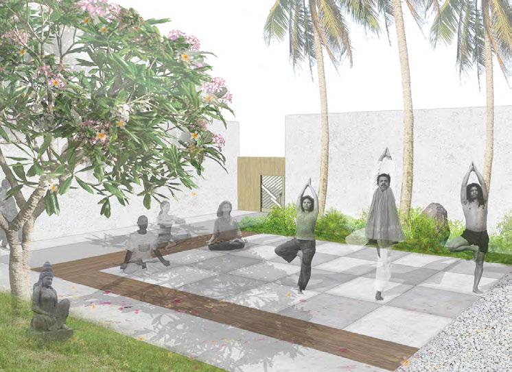 Yoga House
Vision
Farmers’ Market
101
Modular landscape - Adaptable Infrastructure for Community Engagement in Delivering Open Space Issues Analysis


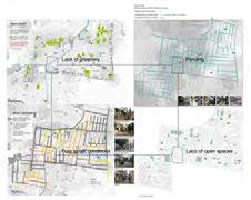
Site Selection
Interfaces Analysis
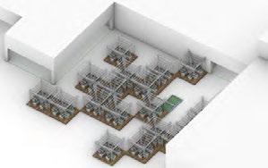
Strategy
1. Adaptive: Fully utilize and adapt to different residential street interfaces with modular landscapes.
2. Autonomy: Engage residents into community micro-updating to meet diiferent requirements with low-cost (recycled) materials and low-tech construction.
3. Multifuncitonal: Create spaces for greenery and social activities using differnent combinations of modular landscape components.
4. Minimum interference: Use portable systems to meet the goal of micro intervention and micro update based on current conditions.
102
Site Reorganizing before Design




XU Linxin
Masterplan
Module 1: For street spaces Module 2: For building frontage Module 3: Building gap open space Module 4: For street end spaces Module 5: For irregular plots along canals
103
Integration of Adaptable Infrastructure System and Street Interfaces

Multifunctional Modular Component Greenhouse modular component


104
multifunction & flexibility of modular components


Basic planting units can be formed into recreational terraces

Perspective
Rainwater collection structure can be transformed into recreational climbing structures


Shelter structures can be transformed into a celebrating space for festivals

105
HABITAT 22
Design for 22% of the residents living in infromal settlments in Bangalore
Project Statement
During the rapid urbanization of Bangalore in the passed decades, the lack of plannning and investment in the development of public infrastructure, housing and transportation system, health and education services also resulted in social issues.
One key issue is the consistently increasing urban informal habtitants, socioeconomic disparities and resulted in marginalization of the disadvantaged groups (inclusively native villages engulfed by urbanization, poor immigrants coming in search for employment [11])
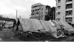
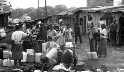
These informal settlments are always established under compromised conditions of hazards of environmental pollutions, no or few sanitation facilities, and insecured food supply.
The objective of this design is to address the key factors of informal settlement - “Informality, Scarcity, Temporality”, and to create a system to enable the informal dwellers to better utilize the limited resource, tackle the challenges and resolve some social and livelihood issue. Leveraging on the ecosystem service of productive landscape to extend the opportunities for the urban poor.

CONDITIONS OF INFORMAL SETTLEMENT
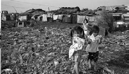
URBANIZATION OF BANGALORE
Rapid development of IT industry, biotechnology and educational institutions [6] created enormous opportunities for employments and massive influx of migrants seeking better livelihoods. The urban space has sprawled rapidly from 69 km2 in 1949 to 741 km2 in 2007 [10]. Overwhelming urbanization also resulted in insufficiency of public housing, transportation system, basic infrastructure, and compromised environmental qualities. The is city struggling to keep up with the drastically increasing needs from the demographic and economic booms.
Besides low structural quality and insecure tenure, informal settlements’ lack of basic infrastructure (water and sanitation), location near pollution sources, malnutrition and health risk are all severe issues for the informal dwellers.
Figure: Job oportunities created with the development of IT industry (yellow dots). Areas deficient of health and education services are highlighted in red. Edited from Source [10], [12].
Figure: Slum population distribution in Bangalore city, consistently growing with an average rate of 27.4%. Source [10].
Figure: Sprawling urban area in Bangalore. 1970-2003. Source [15].


References: [6] http://www.ced.org.in/docs/inecc/member_reports/ VA-rep-urban-marginalised.pdf; [10] H.S. Sudhira. Bangalore City Profile; [12] Metropolitan City, PPT; [14] D. Gopal & H. Nagendra. (2014). Vegetation in Bangalore’s Slums: Boosting Livelihoods, Well-Being and Social Capital. Sustainability, ISSN 2071-1050.;[15] B. Lefevre. (2009). Long-term energy consumptions of urban transportation: A prospective simulation of “transport-land uses” policies in Bangalore; [16] O. B. Adegun. Green Infrastructure and Ecosystem
These informal settlements are usually interspersed among the middle class neighborhood for whom the dwellers work to gain income. The biggest slum site in Figure at left is chosen for design.
 Figure: Land Use of Bangalore
Figure: Map of locations of informal settlements in chosen site of Hebbal, and map of pollution locations.
Lack of Infrastructure Lack of Infrastructure Malnutrition & Health Risks Close of Pollutions Pollutions
106
VEGETATION IN BANGALORE’S SLUMS
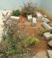

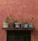
Ecosystem Services also have unique and important value for the urban poor. In a research conducted in 44 slums in Bangalore cities, the findings indicate enthusiam among informal settlers for growing various types of vegetation, particulary in the cultural and religious context of India.




HOW ABOUT THE PEOPLE?

The unprecedented urban expansion and population growth had resulted in fundamental changes in the dynamics structuring urban space. The social disparity and marginalization of the foreign and disadvantaged further brings difficulties for the poor to survive.

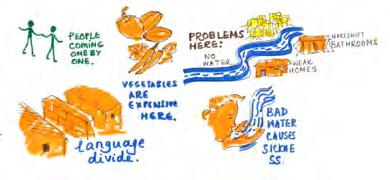

INFORMAL SETTLEMENT IN HEBBAL
The chosen site of informal settlement in Hebbal represents many typical characters of this type of urban habitat. On one side, it is bordered by the main waterway flowing through Hebbal (which
is severely polluted), on the other side, it is also near the main commercial road. There is a big waste collection and recyling area at the chosen site.

Shops and Eateries
OBESRVATION IN HEBBAL INFORMAL SETTLEMENTS
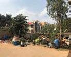
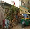

Residential Buildings
 Figure: 44 slums site chosen for the survey of vegetation usage. Source [14]
Diagram: the most common tree species used in Bangalore’s slums and their ecosystem services. Information source [14], image sources: Internet.
Diagram: Shrub & herbaceous plant species used are mainly medicinal, culinary and ornamental plants. Source [14]
Figure:: Plants grown in recycled plastic and clay containers in urban slum. In spite of financial limitations, innovative ways of gardeing are used. Source [14]
Figure: Plants used for grey water treatment in slum. Source [16].
Tribulations of informal dwellers
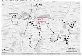
Figure: the Routes of Waste Pickers in Hebbal.
Source: ASSAR.
Illustration source from: ASSAR, India
lei helen
107
fan
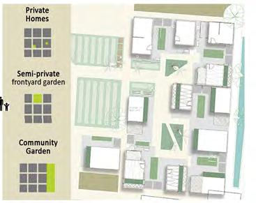
STRATEGY 1: PLANNING FOR INFORMALITY
Respect and leverage on the set-up of neighborhoods that develop organically and spontaneously in Bangalore and Hebbal, while tackling the basic needs of the marginalized.
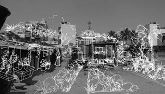
The spatial arrangement of housing units is strategized to create hierachies of Green spaces and Ownerships, for an empowering context for community engagement

PHASED PLAN FOR INFORMALITY

PHASE 1 - TAKING ROOTS
CONDITION: Settlers newly established on site, no jobs, no savings, language barriers
CHALLENGES: Food source, water supply, nearby pollution sources
OBJECTIVES: Treatment of pollution sources, empowering context for community
OUTCOMES: 12 Housing Units (integrated with Productive Landscape) + Wastewater Gardens + Toilets and Septic Treatment + Greywater Recycling system + Bioswale + Community Kitchen

PHASE 2 - GROWTH PHASE 3 - REACHING OUT
CONDITION: Established water and sanitation facilities; The first batch of settlers are able to established with certain social cohesiveness

CHALLENGES: The population and demography in the informal settlement is unstable
OBJECTIVES: Social inclusion among the informal settlers themselves; Enable the newcomers to adapt easier and become contributors in short period
OUTCOMES: Workshop + Nursery + Transformation of bordering streetscape


CONDITION: Comparatively more stable community condition + Capacity to grow food for domestic supply
CHALLENGES: Tenure security
OBJECTIVES: Better collective social and economic resilience + improve social capital, capacity to benefit the nearby community of urbanites
OUTCOMES: More productive landscape + Commercial Zone (Market, Nursery, Eateries, Commercial Plaza) + Buffer for regional food security
Housing design typologies catering for different household sizes, allowing various integration of productive greenery
Home Garden Home Garden
Rooftop planters Rooftop planters
Rooftop Trellis for Climbers
COMMUNITY GARDEN
SEMI-PRIVATE FRONT YARD GARDEN PRIVATE HOME GARDEN
Elevated planting bed to protect the crop from polluted soil
Bio-swale System for the collection of surface runoffs
Wastewater Garden for retention and treatment of polluted water from the waterway bodering the site
Polluted Waterway Composting Cabinets
108
Underground Grey Water Recycling Pipeline
The three features as the central focal point are: Community Kitchen, Farming Workshop, and Wastewater Garden (for grey water recycling). The adjacent Central Plaza is built on top of a water tank, for treated water and rain water storage.


Water, most limiting and valuable resource, is the key factor to strategize growth from scarcity. The water treatment system is integrated into the landscape and community space, serving as green and blue infrastructure as a Low Cost Solution.
STRATEGY 2: GROWING FROM SCARCITY STRATEGY 3: SUSTAINING TEMPORALITY SYSTEM
Commercial Zone is designated to be the frontage of the informal settlement, including eateries, an open market and commercial nurseries for selling young plants, compost, and other farming productions for income. Besides edible crops, ornamental and religious plants would also be produced for sales.

Estimated domestic water consumption:
500L per day / 4ppl family
Total residents designed for: 145ppl
Total water consumption: 545m3/month
50% of grey recycling: 272m3/month
Future Collaboration of Stakeholders: Government (BBMP), NGO and Ground-Up Organisations, School, Hebbal Community
The proposal is not intended to come up with a solid design solution for informal settlement, but to strategize a system to enable the informal habitatants to better utilize limited resources, tackle challenges and resolve
social and economic issues to a degree. Subsequently, it can improve resilience and engage them as contributors for social developments.
COMMUNITY KITCHEN RECREATION PAVILION CENTRAL PLAZA WORKSHOP
Bio-swale System for the collection of surface runoffs
Wastewater Garden 1 Primary Retention for Grey Water
Water Storage Tank Treated grey water & harvested rainwater
Wastewater
Secondary
Planting Beds Compost Bins Water Truck Parking Space
Garden 2
Treatment for Grey Water
109
Transcendence Project
Overview
Bangalore, is currently the third most populous megacity and the second fastest-growing major metropolis in India, housing numerous education and research institutes. With the high influx of immigrants mixed with existing locals, this amplifies tension regarding social stratification, contrasting community interest and religious beliefs. These phenomena have shaped individual ideologies to be rigid, exclusive, and inattentive to surrounding communal groups and their respective concerns. Thus, the lack of understanding and indulgence has led to complications within the complex relationship of physical, social and psychological realms in India. Transcendence is a community-centric design movement that builds social capital using landscape as a medium to go beyond physical, social and psychological boundaries from individuals to society level.
Psychological Boundaries
Caste System

Social Boundaries
Social Group in Relation to Water System

Religious Unrest
India is ranked 3rd in the world for Social Hostility Index. In spite of the conference for religious freedom for individuals, there have been enduring tensions and occasional conflicts among religous communities, especially Hindus and Muslims.
Source : Pew Reserch Data, 2015 Library of Congress 2005
Bangalore and District 7 Zoning Ratio


District 7 is a residential zone without agriculatural activities.
Source : NUS MLA Wang Zhe, 2018
Traffic and Road Conditions
Sources: Uttar Pradesh
Pre-Election Tracker Survey, the Centre for the Study of Developing Societies (CSDS); Development and Governance
Trump Caste Identities in Uttar Pradesh; Reuters By Jin Wu, Simon Scarr, Weiyi Cai. Research and text by Douglas Busvine | REUTERS GRAPHICS
Distance of Food Transportation
Immigration and Local Tension
Though poor water quality is present throughout india, the impact varies among different social classes due to individual capabilities and resources.
Source : Composition of Population
Growth in Bangalore, 1981-2001
Source: Census of india
 Source : Revised Master Plan 2015, Bangalore Development Authority
110
Evaluation of Hebbal’s Boundaries
Physical Boundaries
Food Types, Availability and Concentration

Social and Psychological Boundaries
Survey Reponse on Selected Zone
Problems raised by Residents
Evaluation of Zone 1’s Boundaries
Physical, Social and Psychological Complication
Productive Landscape Preference
Zone 1 is selected because of its high complexity of issues and citizen’s preference that serves as the microcosm of Hebbal


Inclusiveness/Exclusiveness of Public Space
There is a concentration of food types catering to different preferences and food eateries, there are also gaps in food choices and availability.
Pollution Degree and Road Condition
The main source of pollution in Hebbal is from domestic garbage. Pollution points concentrate near the river and major, congested roads. With poor waste management, 30% green space is polluted.
Community
Kuan Wai Tuck Victor
111
Master Plan
Program and Zoning
Strategies:
1. Transcending Physical Boundaries
2. Transcending Social Boundaries
3. Transcending Psychological Boundaries
Landscape Strategies

Landscape Typologies and Plant Palette
Transcending Social Boundaries
Proposed Zoning


Design Tactics
1. Communal / Inclusive Activities

2. Exclusive / Productive Activities
3. Transcending Landscape and Gateway
Use of design elements to create spaces for growth of both indiviuality and community without causing disturbance to the current quality of spatial environment.

Proposed Planting Calander


Perishability and Profitable Crops
With the proposed planting palette, farming activities can be carried out throughout the year, utilising space to its fullest capacity.

Bioswale and Rain Garden Productive Urban Farming
112
Transcending Physical Boundaries
Landscape Functionality
Productive Lanscape Solution
Transcending Psychological Boundaries
Main Perspective
Design Tactics
Stormvwater Management Circulation & Space Management

10 Year Vision
Reconfigure and improve existing food production and waste management chain to minimise wastage and maximise productivity. These design strategies serve to breakdown physical, social and psychological barriers that hinder the growth of the urban settlement.


Waste, Composting and Agriculture Flow
Design Process Model
Design strategies and tactics adopted are created to be applicable for other zones of Hebbal, or other residential towns in Banglore
Source: Jospeh, 2002
The project serve to develope a better understanding in agriculture, waste management and composition and build ownership of their living environment while transcending differences between social groups to increase community cohesion.
Sectional Perspective

113
Canal Revitalizition
Creating new confluence of nature and society
The water problem is a serious issue in Hebbal district. People lack clean water for daily use and drink while the only one canal in Hebbal is polluted and covered by garbage. In addition, people in Hebbal do not have enough public space for them to do activities and children can only play on the street. The aim of this project is to transform the original canal into a vitality and vigorous public space for people to do activities with cleaner water.


Background Analysis

Watershed of Greater Bangalore Stream


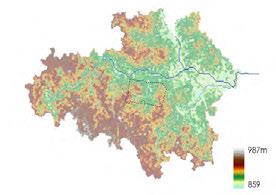

Site Analysis


Religion distribution in India
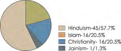
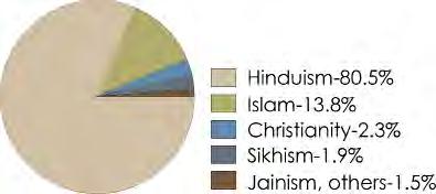
Religion distribution in Hebbal

Channel width: 6-10m
Channel height: 3m

Topography
114
Community survey Analysis
At the macro scale, the polluted water will influence the larger water system in India. Therefore, controlling the pollution source and treating it close to the source is best.
Water pollution sources on site:
(1) 50% of sewage will be discharged into canal through drainage due to pipeline leakage (dry season)
(2) People throw garbage into the canal (all seasons)

(3) Garbage flows into the canal by rain (rainy season)
The water problem is a serious issue in Hebbal district. People lack clean water for daily use and drink while the one canal in Hebbal is seriously polluted and covered by garbage, emitting a terrible odor.
In addition, many residents mentioned lack of public space. Children can only play in the streets. Adults can only hang out on the street or chat with others in front of the houses.
Strategy 1
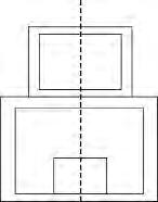
Open the canal and clear up the garbage. Create transition zones to collect the polluted water and use constructed wetlands to purify it. Adding a water tank and widening the canal can reduce the water level 0.3 m during the rainy season.
Water storage capacity: 1000m3

Can treat polluted water in dry season
Treated water can be used for irragation.
Strategy 2
Modify the canal edge and create a variety of spaces for people to use both in the monsoon and dry season.
Strategy 3

Establish a new pedestrian walking system and create open space by using religious elements to improve connection across communities.

Mosque: house of worship + front porch + cloister
This chart shows that drinking water shortage is the most important community issue. Water pollution and lack of public space ranked 5th and 6th, they are important issues as traffic jam and air pollution, which ranked 4th and 2nd, are mainly caused by poor infrastructures. The water pollution and garbage problem are issues that are mainly put forward by people in the zones which are nearest to the canal.

Hindu temple: niche + cloister + front porch

115
Wang Hanfeng
Canal Revitalizition Master Plan
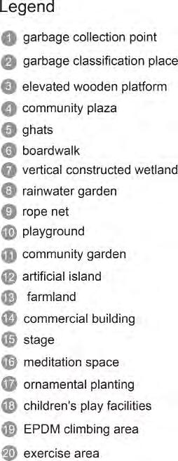
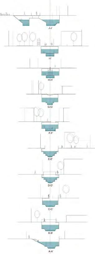
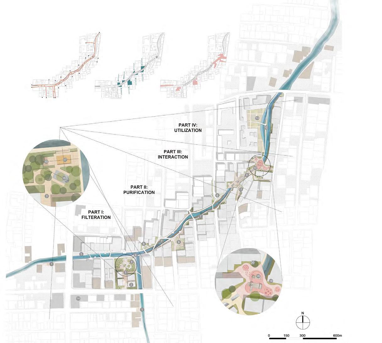
Section
Entrances and new walking system
Water flow direction and underground water tank
Main gathering point and public activity space
116

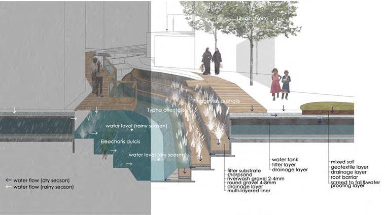
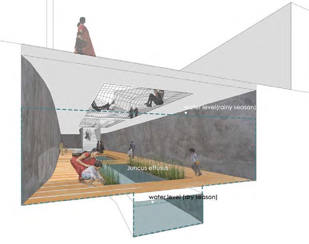
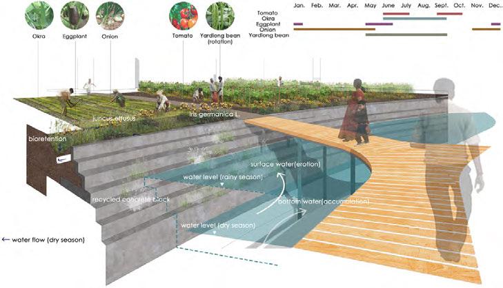
Node Perspective & Section
Part I: Filtration
Part III: Interaction
Part IV: Utilisation
117
Part II: Purification
Credits
Guest critics, Lecturers, & Consultants:
Cho Im Sik, National University of Singapore
Kenya Endo, Ramboll Studio Dreiseitl
Hwang Yun Hye, National University of Singapore
Sharan Sudhindra, 100 Resilient Cities

Tan Puay Yok, National University of Singapore
Mel Yip, Ramboll Studio Dreiseitl
A special thanks to the Indian Institute for Human Settlements (IIHS): Aditi Surie, Charrlotte Adelina, Amogh Arakali, and Neha Sami
And to our knowledgable English-Kanada translators David & Sumitra Bodapati who made it possible for us to engage the residents of Hebbal.
Finally, a very special acknowledgement to the residents of Hebbal, we were truly inspired by your community.


 Bangalore
Hebbal
Hebbal


 Bitter Gourd
Musk Melon


 Lam Si Yun Swan
30 pocket spaces for development


 Impression of raised bed agriculture at pocket space


 Vertical green
Pergola
Recycled material street furniture
Drainage system
Recreation Exhibition Children play
Strategy 3: Pocket park as a system


 Entrance with tasting box
Intensive planting area
Intensive planting area
Communication area
Green house


 Yoga House
Vision
Farmers’ Market


 Figure: Land Use of Bangalore
Figure: Map of locations of informal settlements in chosen site of Hebbal, and map of pollution locations.


 Figure: 44 slums site chosen for the survey of vegetation usage. Source [14]
Diagram: the most common tree species used in Bangalore’s slums and their ecosystem services. Information source [14], image sources: Internet.
Diagram: Shrub & herbaceous plant species used are mainly medicinal, culinary and ornamental plants. Source [14]
Figure:: Plants grown in recycled plastic and clay containers in urban slum. In spite of financial limitations, innovative ways of gardeing are used. Source [14]
Figure: Plants used for grey water treatment in slum. Source [16].
Tribulations of informal dwellers
Figure: the Routes of Waste Pickers in Hebbal.
Source: ASSAR.
Illustration source from: ASSAR, India


 Source : Revised Master Plan 2015, Bangalore Development Authority


