
GEODESY
ABOUT THE GEODESY


INTRODUCTION
Ever since real estate has existed, people have wanted to know where it is located and what size they own. It is no coincidence, then, that the depiction of surveyors at work appears in Egyptian drawings and tomb wall paintings dating back thousands of years.
One of the traditional goals of geodesy is to determine the location and size of natural and artificial terrain features on, above, or below the Earth's surface by measuring their characteristic points and assigning topology to them for representation to society. The primary tool for this is still the map, a top-down, scale-reduced, generalized result product projected onto a plane.
Another goal of geodesy is setting out, which is the reverse of surveying, where, for example, the characteristic points of planned structures or boundary points of land plots are marked on the Earth's surface, below, or above it, based on technical information and dimensions from office plans or cadastral maps.

FROM TRADITIONAL TO MODERN AND BACK!
Our Geodetic Office, which established in September 2023 also performs classic cadastral tasks in the field of survey and stake out as well as land registry administration. Our skilled colleagues are IRM (Land registry expert certified landsurveyor engineer) certified, so we can take on any project that involves a change in the content of the land registry state map.
Thanks to our many years of experience, we are also at home in the classical geodesy branches of design support, construction and specialised high accuracy surveys. We also have the necessary qualification for this kind of professional practice, this is the Geodetic Designer Qualified landsurveyor engineer (GD-T) licence.
However, with the explosive development of geoinformatics, visualization capabilities, and field data collection, maps first moved from paper to the digital space, and from 2D to 3D. Today, the recording and presentation of field conditions or the plans to be set out from the drawing board are all interpreted as spatial data, representing the virtual reality of the real world.

OUR 3D SCANNING AND RESULT PRODUCTS

EQUIPMENT


THE MAIN ELEMENTS OF THE GEODETIC OFFICE'S EQUIPMENT
PARK INCLUDE
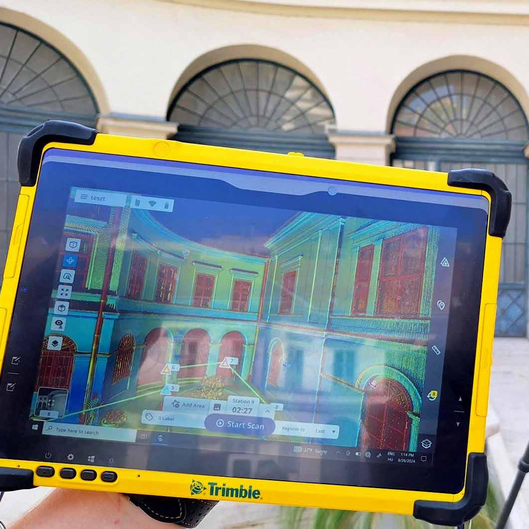
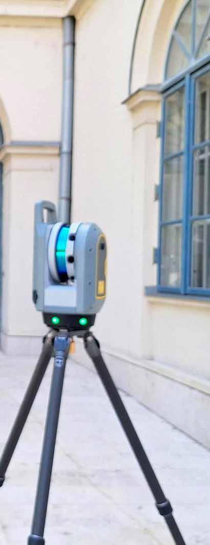
› Trimble X9 high-performance 3D terrestrial scanner
› Leica C10 3D terrestrial scanner
› Leica BLK360 3D terrestrial scanner
› Leica TS16P 2” Robotic Total Station with remote control
› Leica GS18 multi-constellation and multi-frequency RTK GNSS receiver
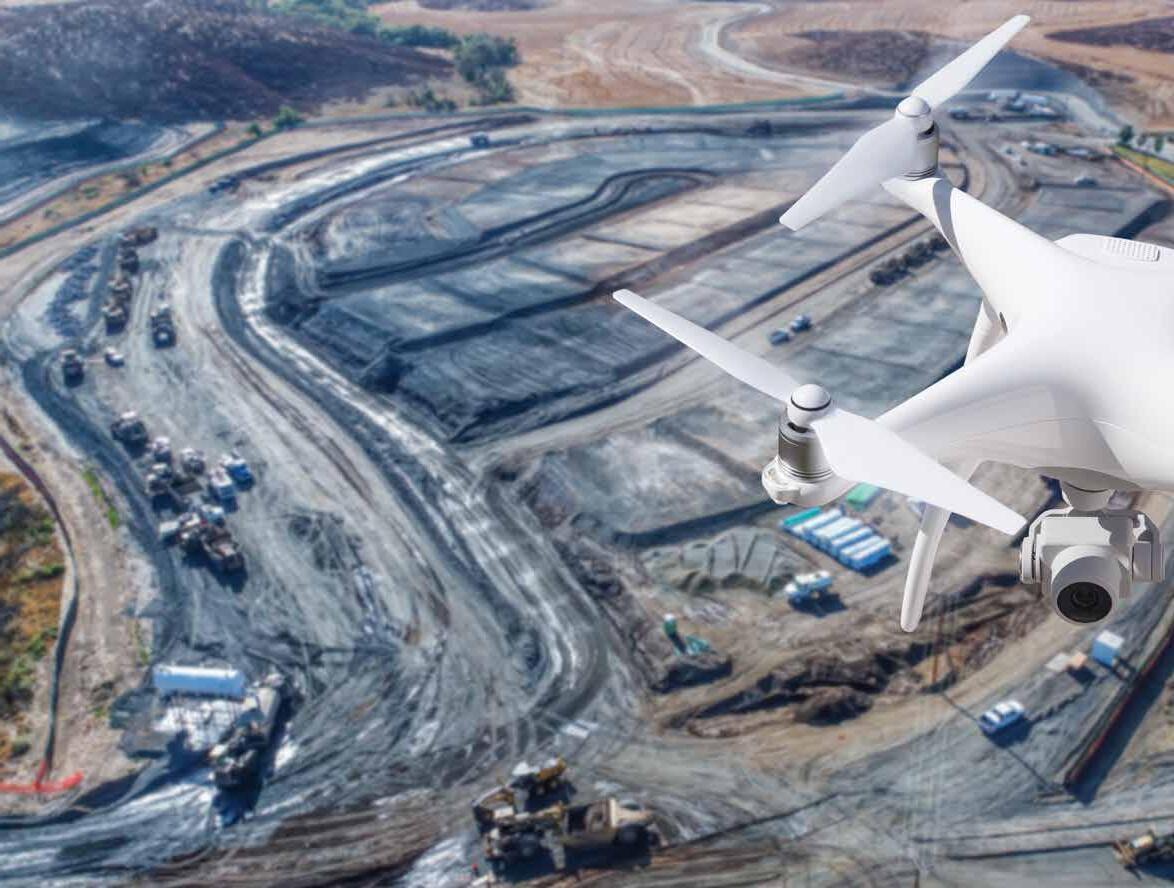
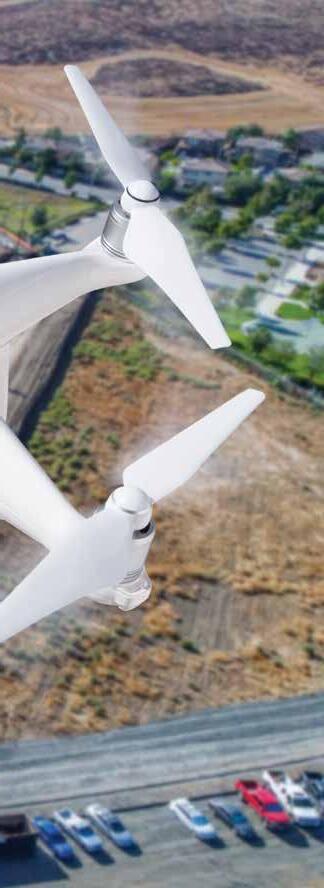
› DJI Phantom4 Pro rotary UAV (quadcopter)
THE OFFICE APPLICATIONS WE USE
Cutting-edge software solutions empower our expert surveyor engineers to push the boundaries of what's possible in the field. From state-of-the-art 3D point cloud processing platforms to innovative CAD tools, our team leverages the latest technologies to deliver unparalleled results for our clients.
WHAT IS 3D SCANNING AND POINT CLOUD?
3D scanning is a high-speed, repeated, reflectorless polar measurement technology based on distance and angle measurement, typically using Time of Flight (ToF).
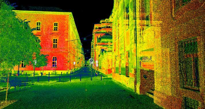
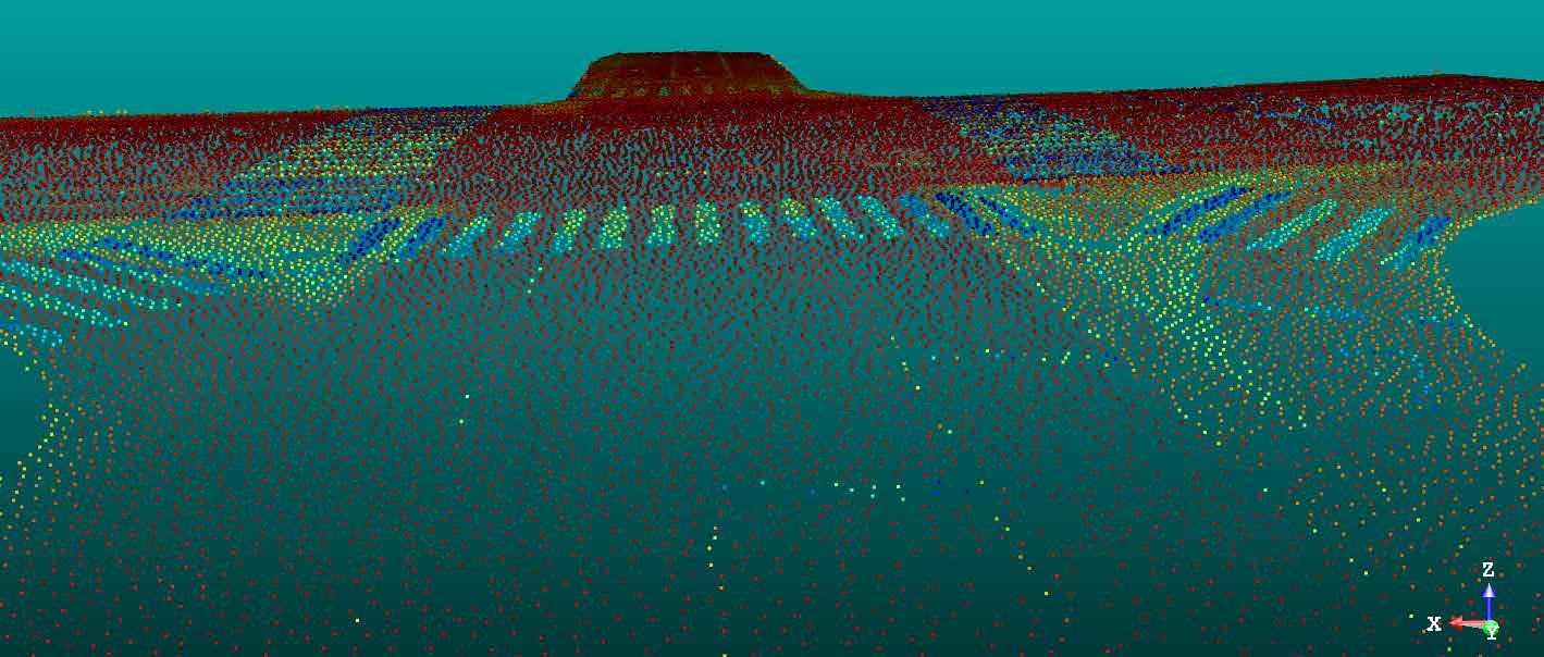
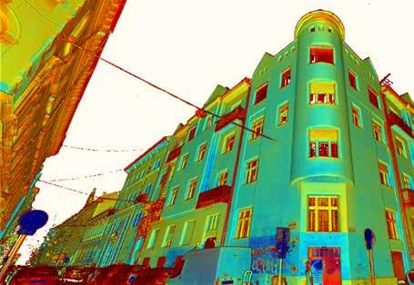
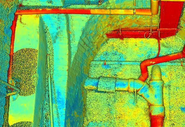
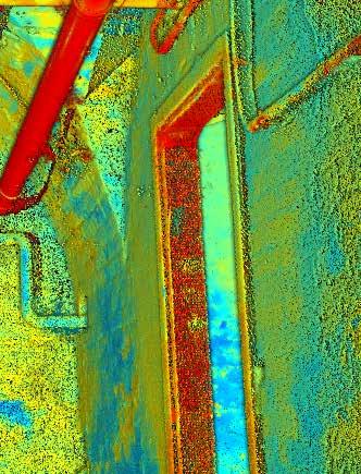
The results of the observations are no longer just discrete points, but their dense collection, which we call a 3D point cloud. The point cloud is practically a navigable, measurable virtual reality of the real world. In addition to the spatial coordinates of the observed detail points, intensity data is also recorded during scanning. If digital photos are taken during the measurement, real RGB-colored point clouds can be generated using color information.
The great advantage of scanning over any other conventional spatial data collection method is that it brings and displays the entire work area and field conditions in the office without prior generalization. Thus, during processing, virtually all measurable details are available without data loss.
Video link: Point cloud video - Szeged
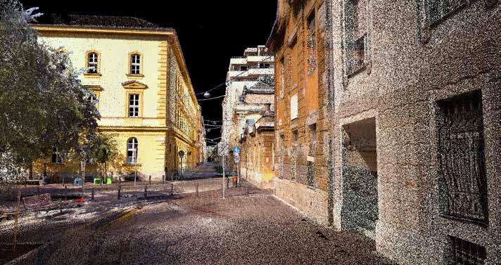
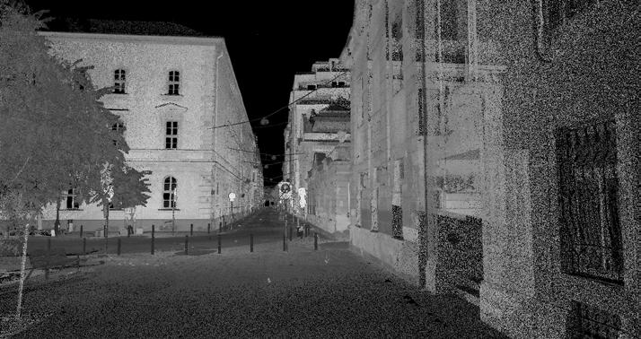
3D POINT CLOUD WITH INTENSITY COLOURING IN SHADES OF GREY
TRUE COLOUR 3D POINT CLOUD 2. 3. 1.
FALSE INTENSITYCOLOURED 3D POINT CLOUD
Results from 3D Scanning
The 3D point cloud created to support design and construction work is an input data set for a precise processing workflow that can be used in many ways and evaluated according to various themes. Here are a few examples:
> 3D Vector Drawings
> Mesh and Surface Model
> Solid Model
> Earthwork Calculation
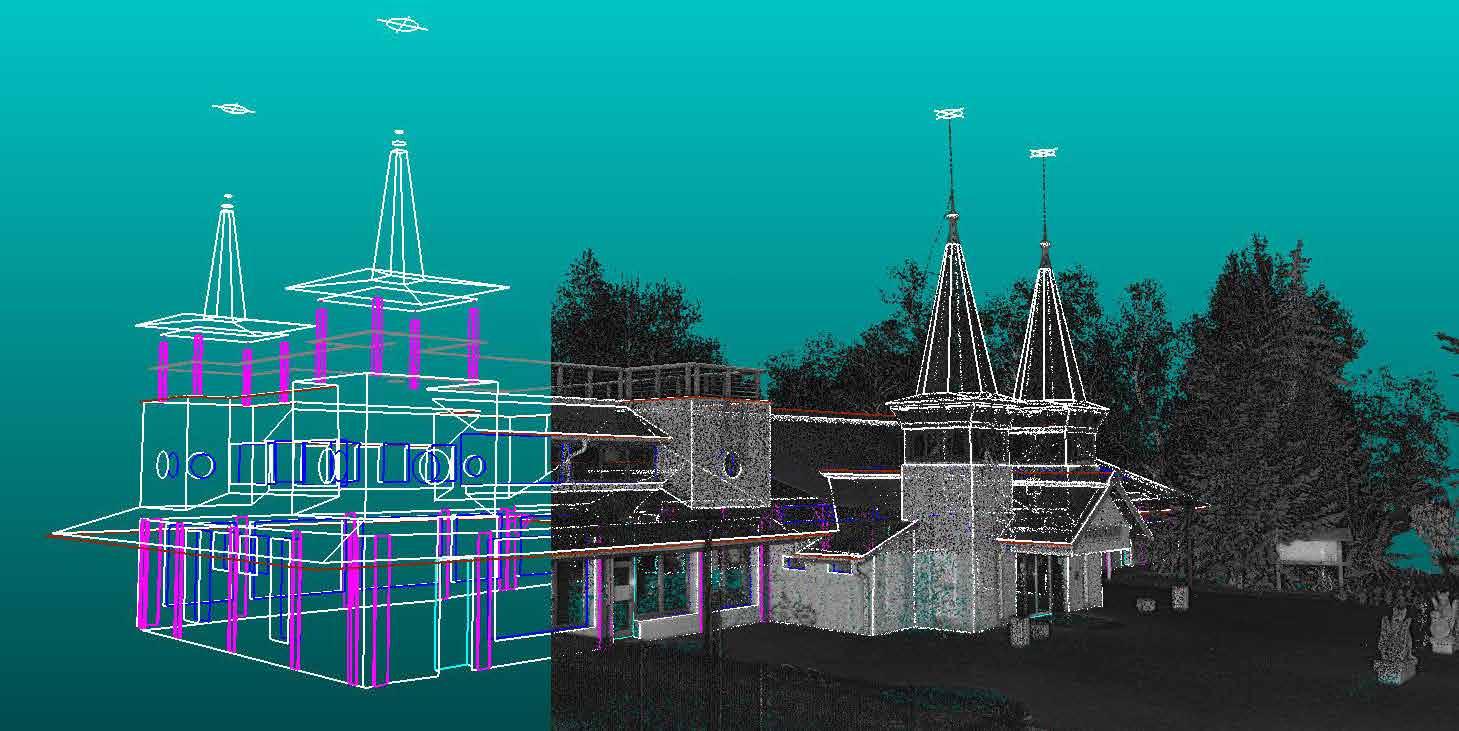
3D VECTOR DRAWINGS
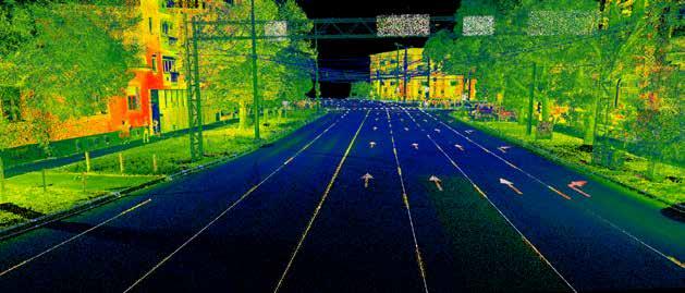
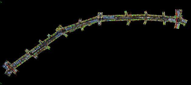
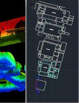
The result of office redigitalization, or 3D vectorization of point clouds, is a layer-specific 3D line drawing file with thematic content. These include topo plan for design, as-built maps, bridge structure drawings, architectural drawings, elevation drawings, and the drawing and database-based work components of thematic object registers.
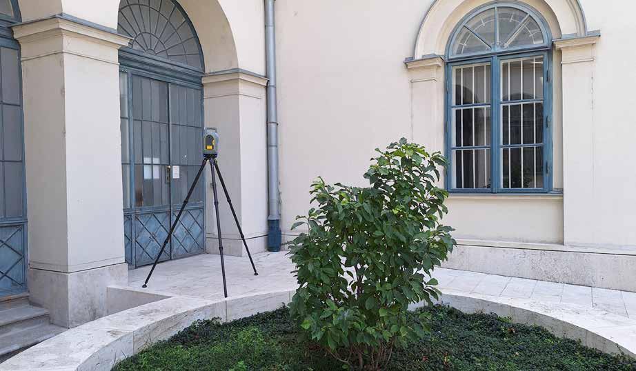
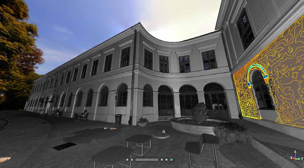
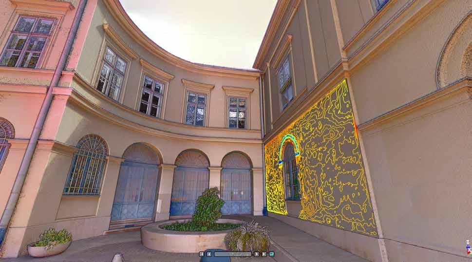
Among the 3D vectorized output products, we can also include contour inspection diagrams generated for surface flatness inspection. These can be used to clearly show, for example, the conformity or bulging of building planes surrounding infill plots, or the deviation from flatness of a freshly completed industrial floor surface.
UNVEILING SURFACE DETAILS WITH ISOLINE INSPECTION PLOTS
3D vectorization goes beyond just lines. It allows us to generate isoline inspection plots, which are essentially contour maps created for specific surfaces. These plots are incredibly useful for identifying subtle variations in planes.
Mesh and Surface Model
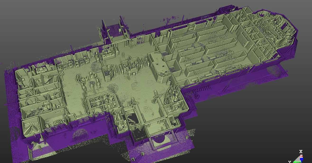
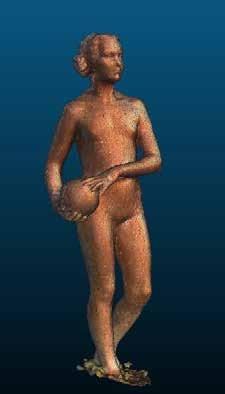
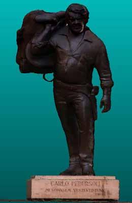
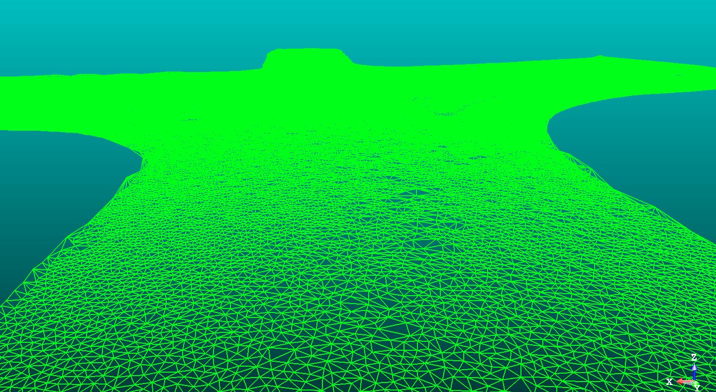
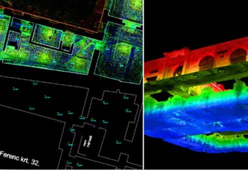
To geometrically characterize a field surface as accurately as possible, we use a mesh. This is generated automatically from the points in the 3D point cloud derived from scanning, consisting of triangles. The point density applied and the size of the triangles depend on the purpose of the task at hand. The output product in this case can be a wireframe, false-color, or even a real-color surface model, depending on the nature of the point cloud.
We use mesh, for example, to plastically display rutting and potholes in road surfaces, as well as surface defects in retaining walls. Complex building elements, statues and sophisticated decorations can also be characterized using a mesh created from a dense point cloud.



Solid-state model as the foundament for BIM
FROM POINT CLOUD TO DETAILED MODEL
The point cloud also serves as the basis for 3D modeling. In this case, we assign substitute spatial elements to the point cloud based on its content. For example, walls composed of points can be replaced by planes, pillars by prisms, and pipes by cylinders.
These solid models, when supplemented with a database linked to individual elements, are essentially BIM models describing the entire lifecycle of the structure.
The geometric foundation of BIM (Building Information Modeling) is the LoG300 solid model. If needed, this can also be generated from point clouds.
POINTCLOUD FOR PLANNED/ DESIGNED MODEL INSPECTION
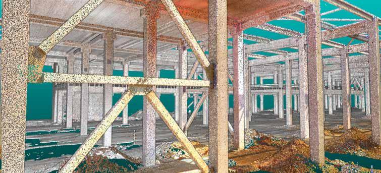
Beyond design, 3D point cloud management plays an essential role in construction and monitoring applications. By continuously recording as-built milestones in layers, progress can be monitored, and the current on-site condition can be accurately compared with the BIM model.



EARTHWORK CALCULATION
Earthwork calculation, or volume calculation, is regularly used in many industrial sectors, including construction work.
Its purpose is to determine as accurately as possible the amount of material used, backfilled, or quarried. Even a few percent difference between the planned and executed states on larger projects can result in significant additional costs or savings in terms of material and equipment needs, as well as labor costs.
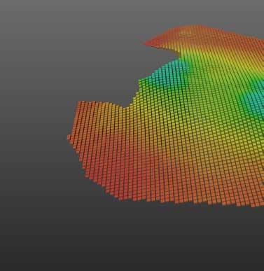
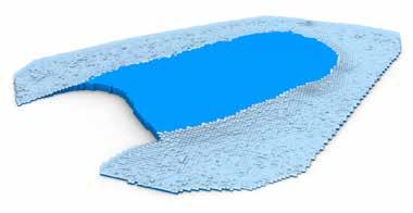
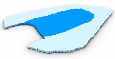
Earthwork calculation is an approximate method in which the surveyed terrain is modeled with upright prisms defined from a given plane or, in the case of monitoring and change tracking, from another terrain formation.

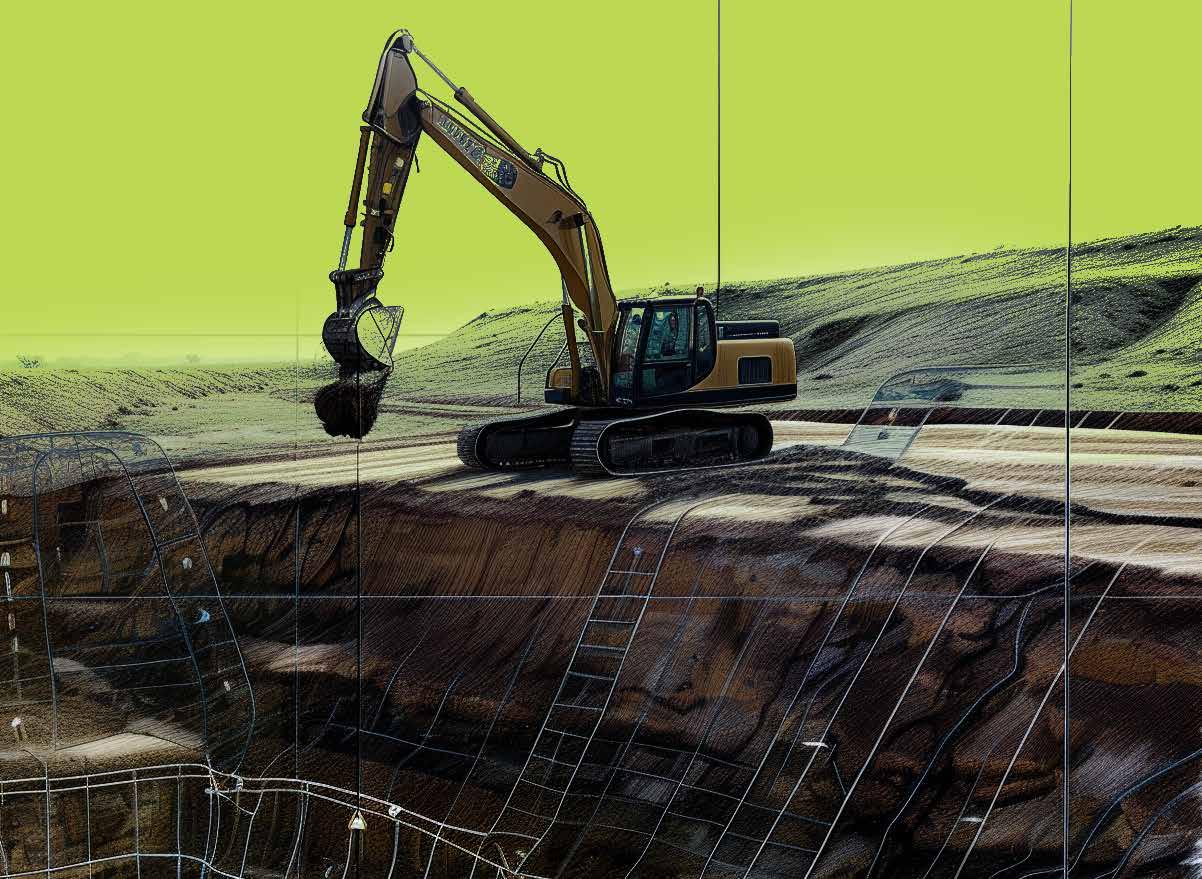
The total volume of the prisms gives the volume of the object to be examined. The smaller the base area of the prisms, i.e., the more densely they are arranged, the higher the resolution of the volume calculation, meaning the model more accurately fits and describes the terrain formation

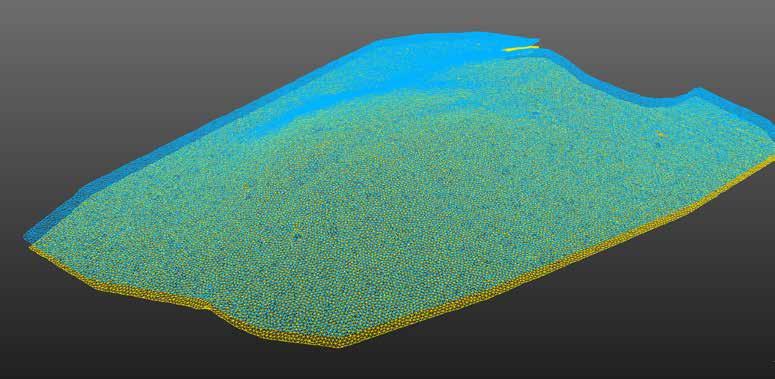
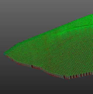
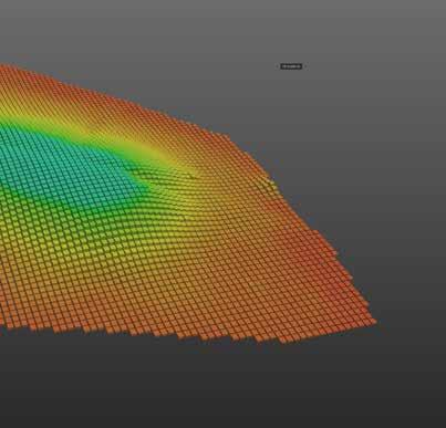
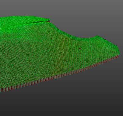
What better way to ensure denser point capture, i.e., better approximation, than a 3D point cloud? The point clouds and models produced by the TSPC Group's Geodetic Office provide an excellent basis for preparing earthwork balances in addition to cubic volume calculations.

MAIN SURVEY PREVIEW
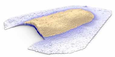
When preparing the land survey calculation, we strive to find the rough terrain adjustment plane at the construction site over which the excavated soil quantity is as close as possible to the amount of landfilling. In the case of significant land works, finding the balance can be critical from a budget perspective, as it matters how much land mass needs to be transported and deposited during the project. The solution from the TSPC Computational Design team can estimate the economical terrain adjustment height more quickly and accurately than conventional manual methods in the field.
Based on the coordinates received from the surveyors, engineer colleagues with programming knowledge construct the terrain model and then create its grid-based representation, similar to the geodetic approach. Subsequently, through continuous monitoring, the evolutionary algorithm begins searching for the optimal height of the land balance plane, where the quantity of land to be excavated is closest to the amount of land to be filled.
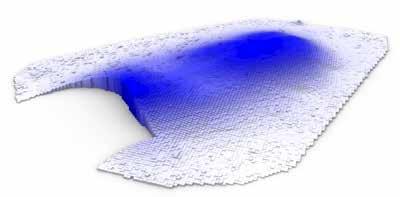
The automation progresses from extreme values towards the optimum while engineer colleagues do not intervene until they consider the final result satisfactory. At the end of the analysis, it can be determined at what approximate elevation above sea level the site survey should be conducted and how much land mass needs to be moved.
In consultation with architects, it may be possible to have several different building levels in a given area. Our established system addresses this possibility with complex landscaping and calculation procedures that can further reduce the amount of excavated soil.


Our high-precision geodesy is used in the design, construction and facility management phases of industrial facilities.
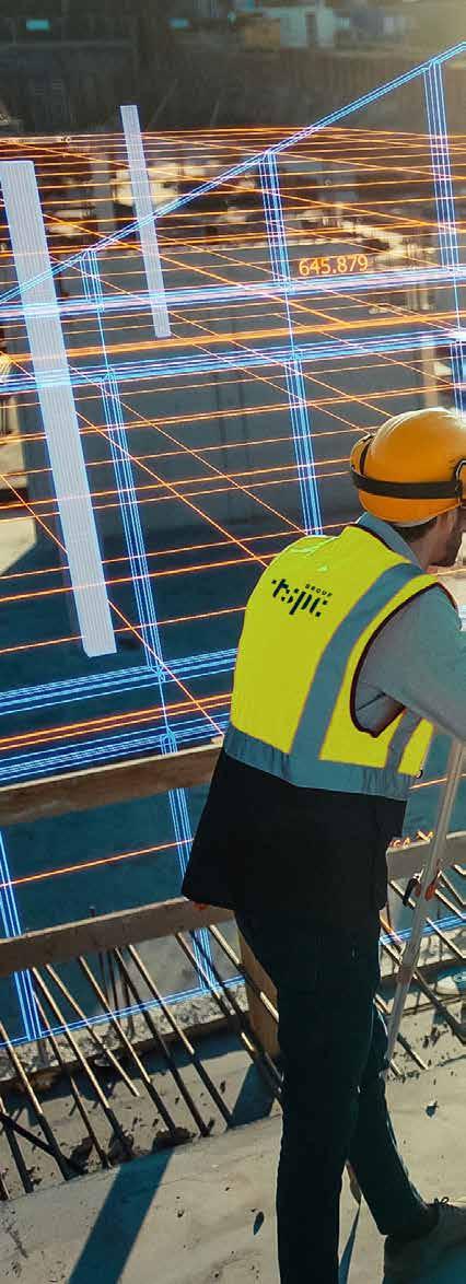
As a break from the use of point lists or vector files, in our case, the stake out can be directly implemented from 3D plans, BIM models. During construction, progress milestones are recorded in quasilayered 3D scans.
The superimposed point clouds form a kind of virtual reality, providing an excellent basis for quality assurance and high-precision field verification of the designed models.
KEEPING INDUSTRIAL FACILITIES
RUNNING SMOOTHLY
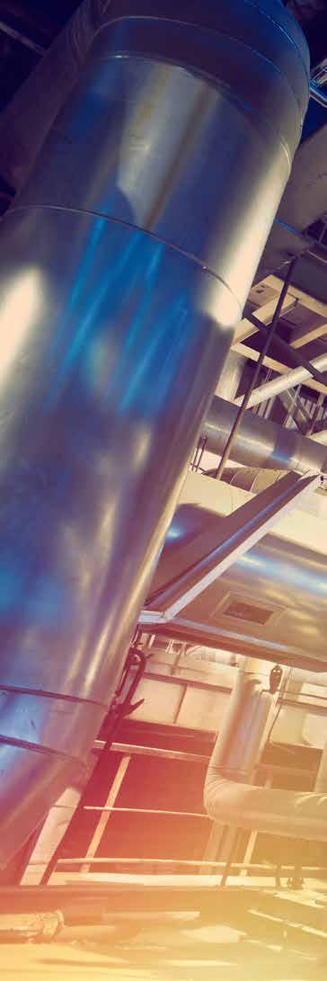
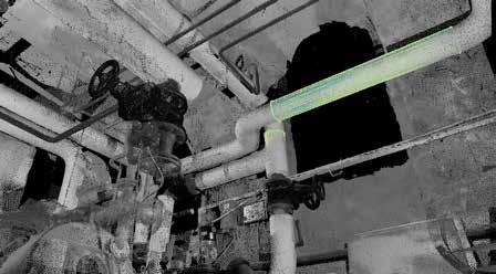
The safe and efficient operation of industrial plants relies on having comprehensive and up-to-date building services engineering documentation. This includes knowing the precise location of complex equipment like tanks, pipes, ducts, and walkways. This information is crucial for tasks like rebuilding, expanding, modernizing, or performing major maintenance.


Unfortunately, many factories and power plants built decades ago have outdated or incomplete design documentation. Traditional optical surveying methods can be slow and cumbersome for updating these records, especially in confined and cluttered industrial environments. This approach can also be prone to errors and safety hazards.
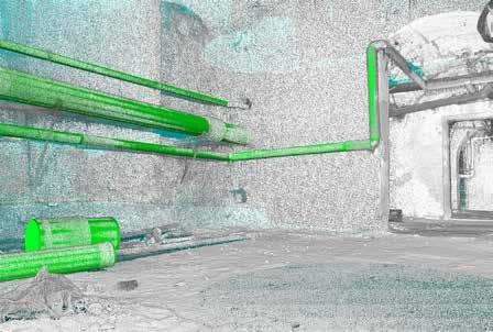
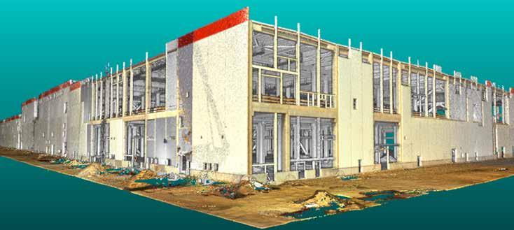
That is the reason why we use space scanning for such tasks. The resulting high-resolution and accurate evaluation of a measurable point cloud can produce 3D vector drawings or solid models, which provide an excellent basis for further design, impact analysis and any other specialised workflow where high geometric accuracy is required.


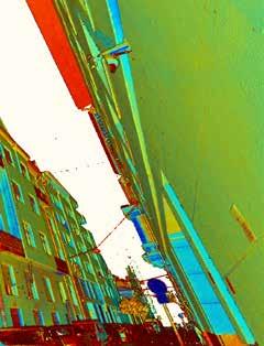
SZEGED, SZEGED GRAND BOULEVARD
(topo plan for design)
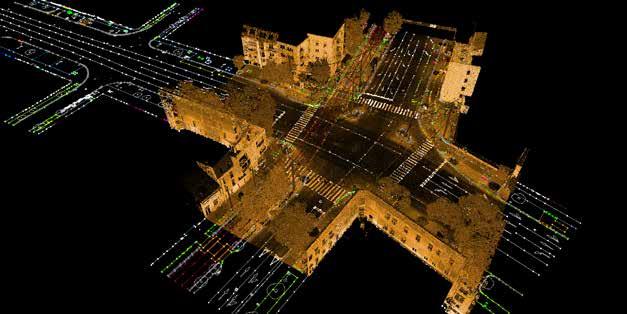
BUDAPEST, THE HŐGYES-SCHÖPF-MEREI
PHARMACEUTICAL RESEARCH CENTER (topo plan for design, detailed basement scanning and mapping)
DEBRECEN, CATL BATTERY FACTORY (Industrial scanning for BIM modell-as-built state inspection)

TSPC GROUP
ABOUT TSPC GROUP
DELIVERING SOLUTIONS
TSPC Group provides full-service packages to its clients, accompanying them along their projects, from the first idea to implementation. TSPC is committed to sustainability, green philosophy, and innovation: We provide our solutions using the currently available highest level of expertise and technology, shaping the architecture of the future.
EXPERTISE & EXPERIENCE
TSPC has organised the experts of architectural and engineering projects in a single group of companies, to provide the complex expertise and efficient work organisation required for the management of the complete project process to its clients. We provide advanced training possibilities and state-of-the-art technological background to our employees.
EMLOYEES OFFICES MILLION SQUARE METERS DESIGNED YEARS 110+ 225+ 1,5 7 12
COMPLETED PROJECTS
TSPC GROUP ’S SERVICES
ARCHITECTURAL DESIGN
General design
Architectural design
Interior design
Landscape design
Urban design, city planning
BOQ (Bill of Quantities)
Feasibilty studies
Detailed construction
drawings
Construction supervision
ENGINEERING DESIGN
Structural design
MEP design (Electric engineering, HVAC design, Building services engineering)
Fire safety design
Road and public utilitiy design
Technical consultancy Geodesy
REAL ESTATE & CONSULTANCY
Feasibilty studies
Turnkey developments
Operation planning
Development site identification
Facility Management
Due diligence
CLIMATE ENVIRONMENT
ENGINEERING DESIGN
Energy efficiency & optimization
Building comfort & well being
Building Climate Modelling Simulations
Environmental consultancy
WELL, LEED, BREEAM, DGNB consultancy
BIM
ArchiCAD, Revit, Solibri, Nemetschek and Tekla support in BIM
BIM consultancy
BIM management
BIM modelling and 2D file preparation
Sharepoint, Plan-doc
Point cloud processing
On-site BIM Solutions
PROJECT MANAGEMENT SURVEILLANCE & DIAGNOSTICS
Public procurement
consultancy
Scheduling
Budgeting design & control
Expert Services
& Consultancy
Designer supervision
Technical supervision
Organizational plans
Building survey
Geodesy
Point cloud survey
3D laser scanning
Energy analysis of existing buildings
Building energetics
Structural diagnostics
OFFICES
HUNGARY > Budapest, Győr, Debrecen
GERMANY > Munich
SLOVAKIA > Komárno
CROATIA > Zagreb
HONG KONG
TSPC GmbH
Leopoldstraße 256., 80807, Munich info@tspcgroup.de
TSPC d.o.o.
Črnomerec 63, HR-10120 Zagreb
TSPC Group HONG KONG
TSPC Group
H-9022 Győr, Dunakapu tér 7. info@tspc.hu
+36 96 200 651
+36 1 800 9192
Dunajské nábrežie 4726, 945 01 Komárno info@tspc.hu
TSPC Group
4025 Debrecen, Barna utca 23. info@tspc.hu
TSPC Group
H-1053 Budapest, Magyar u. 36. info@tspc.hu
+36 1 800 9191
+36 1 800 9192
TSPC Slovakia s.r.o.
