Tropical Architecture as a Form of Resiliency for Puerto Rico
Master Research Project Rafael G.
 Lloveras-Fuentes
2

Lloveras-Fuentes
Supervisory Committee: Prof. Martha Kohen, Chair Dr.Vandana Baweja, Co-Chair
Supervisory Committee: Prof. Martha Kohen, Chair Dr. Vandana Baweja, Co-Chair
A Project in Lieu of Thesis presented to the Graduate School of the University of Florida in Partial fulfillment of the requirements for the Degree of Master of Architecture University of Florida 2022
To my island and its people. Thank you for being my home. Thank you for your beauty. Thank you for the inspiration. Times are tough, but I hope this small gesture can help inspire you to take action.
Pa’ lante, siempre pa’lante.
Yo seré Boricua aunque naciera en la luna.
First off, I would like to thank my parents. Gracias Mami, Papi y Antonio for all the love and support you have given me throughout my academic career. Gracias to Patricia for helping me to finish everything on time and pushing me to do my best. Gracias to Martha for believing in me and showing me that I’m capable of doing and finishing what I set myself to do. A very special thanks go to Sheryl for being an amazing friend, and for being there in the difficult times when I didn’t have the energy to keep on going. Gracias for just being a good listener and being one of my biggest supporters. I would also like to give Gracias to Dr. Pedro A. Muñiz Rivera for sparking my curiosity in tropical architecture and Puerto Rico. Un abrazo bio-tropical para usted.
Thank you all for everything you have done for me personally and professionally. You have been an integral part of my life and I deeply appreciate it.
For this Project in Lieu of Thesis, I will present a redefined version of tropical architecture that responds to the current circumstances of Puerto Rico. I will design an apartment complex that will respond harmoniously to the climate of Puerto Rico. Following design techniques associated with tropical architecture, the project will provide the necessary comfort of living by mainly utilizing passive design tools. Due to the island’s recent “encounters/confrontations” with natural disasters, resiliency must also play a key roll in the design.
In order to achieve this goal, I will be conducting research on various aspects of tropical architecture and Puerto Rico. Understanding what constitutes tropical architecture as a branch of the discipline is a must in order to have a base from where my design shall start. By conducting case study analysis from projects from various tropical countries, I will comprehend the characteristics of tropical architecture and see what aspects can work for my design.
I will also undergo a brief dive into Puerto Rico’s history to recognize the trends of architectural typologies that have been utilized and how they have inspired or affected the contemporary designs. I will take a specific interest in the architecture of the island’s modernization during the 1950s as this is the time where many of the design standards being utilized today first started to appear. From this investigation, case study analysis will be conducted of modern and contemporary neighborhoods and projects from Puerto Rico to formally understand architectural techniques being utilized on the island.
Another aspect to research is the recent natural disaster events that have devastated the island. From historic hurricanes like Irma and Maria in 2017, to the ruthless earthquakes that hit the South of the island to start 2020, Puerto Rico has been battling to survive. By understanding the various statistics from the recent events to see the damages caused by them, I can design a structure that can withstand future events while also being resilient to recover once the damages have impacted.
As climate change continues to worsen, and as services on the island continue to increase in price (food, gas, electricity, water, etc.), the idea of this project is to broaden the minds of those affected by these issues and demonstrate that a different course of action must be taken to combat them. Puerto Ricans should accept the climate as part of our culture, as part of who we are as people. By providing a refreshing alternative to housing on the island, Puerto Ricans will be willing and eager to demand tropical architecture in the future.
When people think of Puerto Rico, a few things always come to mind. Beautiful sandy beaches, mesmerizing blue oceans, and delicious mouth-watering foods. Others might think of the wonderful landmarks like “El Castillo San Felipe del Morro”, the Old San Juan Historic District, or the El Yunque National Rainforest, the only tropical rainforest in the United States. Some might think of the tourist attractions of Condado and Isla Verde or some of the municipalities like Ponce and Rincón. Many things just scream tropicality when talking about Puerto Rico. While all these different attributes exemplify “tropicality”, one of the most important, personal, and human aspects doesn’t. The typical Puerto Rican lower-class and middle-class housing, whether it is a single-family, duplex, multi-family, or mixed-used building, doesn’t live up to the island’s tropical or cultural identity.
If we take a closer look at the housing developments throughout the island, we can find an overwhelming amount of [properties/structures/houses] that don’t respond well to the necessities of the average Puerto Rican. Flat roofs, small window openings, little overhang, and poor shading techniques are some of the characteristics that are lacking in most of the housing options for lower- to middle-class residents. It’s outrageous to contemplate living on a tropical island with those architectural typologies being used.
To further understand the contradictory positions that many Puerto Ricans have been accustomed to, we must first define the most important phrase of this investigation. Tropical architecture can be defined in many ways. A concise definition can be the following [look for definition]: a branch of architecture that takes into consideration the tropical climate as a design parameter. Costa Rican architect Bruno Stagno’s work can be defined in four main themes: a) architecture for a latitude, b) Environmental syncretism, c) More design than technology, and d) Architecture of materials. ^footnote. These themes better exemplify what tropical architecture is and how it can and should be practiced in any tropical country.
To better comprehend the contemporary architecture practiced in Puerto Rico, we must first see how the different architectural typologies have changed, starting with the native Taínos and their community arrangement, the Spanish Era, which brought the urban organization, and ending with the Americanization and modernization of what we have today. A particular focus on the modernization of Puerto Rico during the 1950s will be important to understand because most of the typologies that are practiced today originated during this time.
In the end, comprehending and recognizing these events and what constitutes tropical architecture will help present a refreshing take on architecture on the island and demonstrate to Puerto Ricans that there can be a better way to live and that everyone is deserving of good architecture, not just wealthy individuals.
It is fair enough to say that Puerto Ricans are obsessed with urbanization, or closedgated communities, composed of single-family homes with front and back yards, garages, and cookie-cutter designs. Most, if not all, of the new private housing developments around the island, are for gated communities of all shapes and sizes. To understand Puerto Rico’s current urban sprawl, we must take a closer look at why and how it first occurred.
Born and raised in Puerto Rico, I’ve had the privilege of witnessing the beauties and charm that make it “La Isla del Encanto”, The Island of Enchantment. I lived in a typical 1960s suburban house built during the modernization of the island. While I love my previous home and all of the memories that I made in it, there were many times when the structure just felt unbearable to live in. As I will discuss further in the research, the typical suburban house in Puerto Rico is a single-family, flat roof, concrete box that where mass produced at a time were there was a housing shortage. The issue with this typology is that they don’t necessarily respond well to the current problems the island is facing, such as climate change and high energy bills.
I’ve lived through hot summers where my house felt like an oven that always stayed on. While the house was well positioned, taking advantage of the easterly winds and having a big canopy tree that provided shade to the west façade every afternoon, the days and nights still felt excruciatingly hot. All of the windows were “Miami style” windows which helped those prevailing winds enter the home and provide cross ventilation to almost every space inside. The problem is that at some points, the cross-ventilation effect diminished as it moved through. All these difficulties were worsened when hurricanes Irma and Maria passed through the island in September of 2017.
I was still studying for my undergraduate degree at the University of Puerto Rico. It was the first day of class for the 2017-2018 year. I was attending my only class that day when by the afternoon, the governor declared a state of emergency for the incoming Hurricane Irma. My mom was at work, while my dad was living in Tampa. I came home, called my dad, and he told me a list of things I needed to do to prepare the house for the incoming weather. I completed all of the tasks on the list while my mom finished the day at work. At the end of the day, we went to pick up my grandparents from their apartment so they can pass the storm with us. We were felt without power as Irma passed through the island. Thankfully, Irma didn’t cause much damage to my home or my community. We were left without power for only a couple of days, which was a relief for the standards of the electric grid in Puerto Rico. Some people didn’t have the same luck as my family had with the passing of Irma. What made things worse was that Maria was just 2 weeks away from hitting the island.
On September 20, 2017, at 6:15 am, Hurricane Maria made landfall in Yabucoa, Puerto Rico as a Category 4 hurricane with sustained winds of 155 mph.1 I was in my house in the suburbs of San Juan, in a community known as Cupey. I lost power the night before Maria made landfall. I tried to sleep, but the howling of the wind was so deafening that I couldn’t. By sunrise, my mom and I were awake in our living room just looking through the windows at all the chaos that was happening outside. Around noon, I was helping my mom handle the water leakage that was entering through the window seals and the TV cable outlets. All of the TV cables meet up on the flat roof, where they then spilt into the main network. There was so much water entering through the outlets which meant that the roof was flooded. The drains along the parapet of the roof couldn’t handle the amount of water. I had to find a hammer and go outside in the middle of the storm to break the PVC pipes so the water could flow out. The sensation of those raindrops hitting my skin at 100+ mph is something that I will never forget.
After I broke the pipes, the flooding inside the house dissipated dramatically, so my mom and I could finally “relax” a little and just weather the storm. The rest of that day was just my mom, my grandparents, and me sitting looking at the windows and seeing all the debris flying through the stormy sky. The street in front of my house started to flood fairly quickly. We saw how the front lawn was slowly submerged in rainwater. Thankfully, the water never entered my house, but some of my neighbors down the street weren’t as lucky. As I reflect on that day, I don’t recall what I ate for breakfast, lunch, or dinner, if I even ate something. I don’t remember how I went to bed that night after the eye of the storm had already passed. I believe that the event was such a stressful one that I just “passed out” and woke up the next day.
The next morning, my mom and I walked outside for the first time after the storm had passed. As we assessed the damages, the amount of wreckage and debris around the house, the streets, and the community was immense. We found a lot of rubbish and junk that we don’t even know where it came from. Some of the zinc roofs from the gazebo my dad had built went flying off, and we
1 US Department of Commerce, NOAA, “Major Hurricane Maria – September 20, 2017,” NOAA’s National Weather Service, 13 July 2021, https://www.weather.gov/sju/maria2017
don’t know where they ended up. That big tree that provided shade to our backyard and West façade was naked. The flood in front of the house had dissipated. My aunt lived in the same gated community, so she asked my mom if I could pick her up in my dad’s 4x4 truck and take her close by to a friend’s house and to the area where she fed some stray cats.
As I picked her up and went to the feeding area, the number of tree branches and debris that were on the road was intense. When we got there, my aunt just started to cry at the sight of the damage that Maria had created. She was so worried about the animals and their safety. We then went to pick up her friend. The roads were almost undrivable. Thankfully, some people around the area had already started to clear it up so they can go and see their loved ones or find some supplies. The roof of the nearby gas station was blown off and got tangled up by the nearby tree. Some power and telephone lines had been broken off from the poles and lying on the floor. An entire electric pole had fallen. The road to the friend’s house wasn’t that bad, so we just helped her get her things and headed back to my aunt’s place.
I would say that my mental state at that moment was one of survival mode. I wasn’t fully reflecting on the damages that I was seeing. I was just focused on the task at hand to try and live a “normal” life after a natural disaster. As my mom and I continued to assess the damages to our property, we just decided to slowly start collecting all of the green waste and debris from our backyard. My mom frequently repeated to me to not worry about finishing the cleaning so quickly since we were surely going to be without power for a while and, since there was nothing else to do, we might as well leave things to do for the next days to come.
And that was what we did. For the next couple of weeks, my mom and I created our post-hurricane routine. We would wake up at sunrise, fire up the gasoline generator, turn on the fans in my grandparents’ room so they can continue to sleep a little longer, watched some close, turn on the radio to hear the news, eat a light breakfast, and continue with the cleanup. Some days I got up at four or five in the morning to go with my uncle to the nearest gas station because there was a rumor going around that they would have fuel available to sell. We arrived and made a three- to four-hour-long line to end up not being able to buy fuel. Everybody
on the island was desperately trying to find a gas station that was selling fuel to refill their generators to keep passing the days.
The days right after Hurricane Maria left Puerto Rico were excruciatingly hot. The days weren’t necessarily sunny. The problem was that there was no wind blowing. Maria had taken all the winds in her direction, so we were left with cloudy, muggy, humid, and suffocating weather. Being inside the house made the suffocation feel much worse. Whenever we powered up the generator, we would go straight to the ceiling fans in the living room, kitchen, and bedroom and turn them on so they could cool and freshen up those main spaces. As the days went by, I was thankful that my family had the economic stability to purchase a generator and the fuel to maintain it during these difficult times. But this also made me think of my fellow neighbors who didn’t have the same luxury.
The family right across from me had no generator. We would connect an extension cord to our house every day so they could power a few fans and their refrigerator for a couple of hours. All these situations happening around me made me start to think about the design of the houses in my community. Why do all the houses have flat roofs? Why do they only have two to three windows in the front façade? Why have people remodeled their homes and changed their “Miami” style windows for full glass windows with no opening?
These were some of the questions that started to pop into my head as the days went by without power or running water. As the weeks went by and cellular connectivity got better, devastating images started appearing on social media about the devastation that had happened all over the island. Wooden houses were blown away. Houses on the mountain side all flooded by the rise of the nearby river. Apartment buildings in the city with windows and sliding doors gone, some of them even had walls torn off. While it’s understandable that even though a structure is made out of concrete it might not necessarily be able to withstand 150+mph winds, one can start to see that the overall design of these buildings and houses isn’t suitable for the climate of Puerto Rico on a day-today basis.
After Hurricane Maria, as I continued my education in architecture, I’ve become more and more intrigued as to why houses and condos in Puer-
to Rico are designed and built the way they are. Why do wealthier families and individuals aspire to acquire or commission houses that can be seen in architectural magazines and don’t respond to the climate of the island? Why do we design houses that are so dependent on A/C for them to be “livable” when electric bills are one of the highest in the USA and the grid is so delicate and unreliable? Why are the options for lower- to middle-class families similar to the options from the 1960s with more modern finishes? Why do we continue to design structures that depend on active cooling systems and don’t offer other options for comfort?
Since Puerto Ricans continue to aspire to the same type of typology years, there has been little to no innovation. My research paper intends to understand these questions that have been presented and provide a new perspective on the idea of living on the island. As climate change continues to worsen, and as services in Puerto Rico continue to increase in price, the idea of this project is to broaden the minds of those most affected by these issues and demonstrate that a different course of action is possible and necessary. We must accept the climate as part of our culture, as part of our lives, so we can learn to deal with it in a way that benefits us the most. By learning about the possibilities of tropical architecture and passive design, Puerto Ricans can be willing and eager to demand it in the future.
Fig. 01


Fig. 02 Fig. 03


Although there were multiple indigenous groups throughout the Caribbean islands before Columbus’ “accidental passage” through the region, it was not until they arrive in 1492 that we have a better understanding of how life was. From the 1000s through the 1500s the Taínos occupied much of the Greater Antilles, with the greatest concentration found in Puerto Rico and Hispaniola (current Haiti and the Dominican Republic). Scholars speculate that the origin of the Taínos can be traced back to South America. They migrated through the Lesser Antilles until settling throughout the Greater Antilles.2
The Taíno lineage discovered in Puerto Rico is considered to be the most organized in terms of sociopolitical development in the Caribbean based on their sophisticated settlements when compared to others of the same time. Spanish documentation demonstrates that Taínos had established different social roles within their community. Based on the organization of the settlements, it is understood that a chief or Cacique ruled over the cacicazgo or yucayeque and decided where to locate the bateys and bohíos. Each yucayeque, or village, had a central batey where ceremonial activities, ball games, and disputes would take place. This central plaza was then surrounded by bohíos, which were the typical Taíno dwelling, with the caney, the dwelling for the cacique, strategically placed in the front.3
With the settlement and creation of the cacicazgos, Taínos became sedentary people that created agricultural fields and went fishing for their food. One of the agricultural techniques that they practiced was the use of conucos which involved building “… mounds of earth in more permanent fields to cultivate root crops in the soft alluvial soils.”4 Their diet mostly consisted of yuca, sweet potato, zamia, and a variety of fruits, in addition to fish and shellfish.5 Many of the root vegetable Taínos consumed are still grown on the island and are a staple of Puerto Rican cuisine.
It is believed that the Taino society was characterized by “… the highest level of 2 Cancel, Mario R. and Mayra Rosario, “Un Compendio de Historia de Puerto Rico,” in El libro de Puerto Rico, edited by Andrés Palomares, 30-35. Puerto Rico: Publicaciones Puertorriqueñas, Inc, 2001. Translated by Rafael G. Lloveras-Fuentes 3 Reid, Basil A., and Gilmore, R. Grant, eds. 2014. Encyclopedia of Caribbean Archaeology, 7-8. Florida: University Press of Florida. Accessed May 20, 2022. ProQuest Ebook Central.
4 Ibid. 7-8.
5 Ibid. 8.
sociopolitical development …” of the time.6 Each yucayeque was divided into classes: the cacique has the leader of the group; a noble class existed known as the Nitainos; the witch doctors and medicine men were known as the Behiques or Bohike; the common people were referred to as the Nabuirias 7 Researchers have suggested that at some point during Columbus’ travel, there may have been around 19 caciques and yucayeques on the island. Among the caciques were Agueybana, Aymanon, Loiza, Urayoan, Guarionex, and Mabodamaca 8
The Taino culture is still strong in Puerto Rico. Many of the names of the municipalities originate from Taino words or caciques, such as Loiza, Luquillo, and Caguas to name a few. It is also believed that around 500 Spanish and colloquial words used in Puerto Rico originated from the Taino vocabulary, such as hamaca, eñagotado, and others. Even the way we Puerto Ricans refer to ourselves as Boricuas is thanks to the Taino word of Borike, the name they gave to the island. That is why we proudly state: “Yo soy Boricua, pa’ que tú lo sepas.” “I am Boricua, so that you know.”
6 Ibid. 8.
7 Cancel, Mario R. and Mayra Rosario, “Un Compendio de Historia de Puerto Rico,” in El libro de Puerto Rico, edited by Andrés Palomares, 30-35. Puerto Rico: Publicaciones Puertorriqueñas, Inc, 2001. Translated by Rafael G. Lloveras-Fuentes 8 Reid, Basil A., and Gilmore, R. Grant, eds. 2014. Encyclopedia of Caribbean Archaeology, 258-260. Florida: University Press of Florida. Accessed May 20, 2022. ProQuest Ebook Central.


As many already know, Christopher Columbus’ venture to India led him to encounter lands that no other European had ever come across. On November 19, 1493, during his second voyage, Columbus landed on the southern coast of Boriquén and named it San Juan Bautista in the name of the Spanish Crown.9 With the first voyage and subsequent ones, Columbus and other conquistadors would start claiming the Americas as new territories for what would become the Spanish Empire.
Even though Columbus arrived in Puerto Rico in 1493, the official colonization of the island and the new territories would not begin until 1508. Juan Ponce de León was named as the first governor of San Juan Bautista (now Puerto Rico) with the task of creating a settlement and exploiting the land and the native Taínos of its natural resources. Taínos were forced into labor to mine for gold and grow crops that would then be sent to Spain. Ponce de León establishes the city of Caparra as the first capital of Puerto Rico.10
In 1521, the capital of Puerto Rico was moved from Caparra to its current location, the islet of Old San Juan. The decision to move the capital to the islet was due to the proximity to the bay and port for ships to dock and offered a better defensive stance. This was necessary because, by the 1530s, other European countries such as France, England, and Holland were beginning to have interested in these “new lands” that Spain was capturing. The new location for the capital provided better visibility toward incoming enemy ships while protecting the city. As attacks from neighboring European countries became a common thing, Spain decided to build “El Castillo San Felipe del Morro” and “La Fortaleza” as the primary structures for the defense system of the island from the 1540s through the 1590s.11
By 1540, the native population of the island was decreasing due to strenuous working conditions and exposure to European diseases, the Spaniards [sought] after African slaves to do the work. At the same time, the gold mines of the island were beginning to dry up. To overcome this situation, the conquistadors ramped up the agricultural
9
production of the island, creating a monocultural industry of sugar cane. They decided to buy African slaves from the Portuguese (as they were the ones controlling the slave trade), especially the ones that originated from the Gulf of Guinea because they were already accustomed to torrid zone environmental conditions. [With their forceful arrival, the African culture was embedded on the island and the three main races of the Puerto Rican miscegenation were formed.12
As the city of San Juan continued to prosper, the rest of the island was mostly considered an uninhabitable and impenetrable jungle. By the 1600s some small villages started to form around the island. The current municipality of San German on the south of the island was founded at around the same time as San Juan, with smaller villages forming slowly after, such as Arecibo, Aguada, Ponce, Coamo, and Loíza. While most of the formal villages of the time were being built by white and criollo Europeans, smaller ones were also formed in more remote areas by escaped slaves and neglected Taíno populations.13
San Juan, while being protected by the recent forts, was still under constant attack by the other European powers of the time and pirates that frequented the Caribbean. After massive attacks in 1595, 1598, and 1625, Spain decides to invest in the fortification of San Juan with the construction of the wall system that surrounded the entire islet. The construction of the rampart began in 1634 and was finished by 1638. This defensive system, along with other buildings, is still a key characteristic of Old San Juan and Puerto Rico.14
By the 1700s, Spain’s power in the Americas was decreasing. Its dominance in the territory was diminishing by France, England, and Holland as these were capturing and controlling most of the islands in the Caribbean. Sugar cane production was substituted by cattle farming. Puerto Rico’s population was decreasing and its strategic location in the Caribbean was being used more as a “door” to America rather than a productive land. Spain still saw potential and reassured its commitment to the island. To increase the population and incentivize people to settle in Puerto Rico, they decided to tackle the uncontrollable land that was the central mountain range.15
12 Ibid. P 40-42. 13 Ibid. P 51-52. 14 Ibid. P 48. 15 Ibid. P 58.
10 Ibid. P 37-39.
11 Ibid. P 43, 48


Puerto Rico’s main economic source frequently changed, depending on the necessities of Spain or the international commerce demands. By the end of the 1700s, sugar cane production was again the main economic source. Several plantations were also established such as “Compañia Aguirre Aristegui”, creating an agricultural monopoly on the island. Because of the monopolization, the slave trade in America was still a large factor.16 Many of the pueblos that were already established began to subdivide into agricultural sectors, which ultimately led to the foundation of municipalities such as Utuado, Manatí, Calvache (Rincón), Mayaüez, Yauco, Añaco, and La Tuna (Isabela) between 1730-1750.17
During the end of the 18th century, several incidents began to shape the international scope of the time and the future of many countries. In 1777, the United States of America obtained its independence from England.18 Between 1789 and 1815, France fought in its civil war and became a democratic country following the footsteps of the USA.19 From 1791-1804, Haiti achieved its independence from France and became the first country to abolish slavery.20 All these events fueled many revolutions throughout the world, including Puerto Rico, which made Spain reaffirm its strength over its colonies. To ensure this on the island, they decide to build “Castillo San Cristóbal”, “Fortin San Geronimo”, the continuation of the ramparts, and addition to San Felipe del Morro Fort.21
While many neighboring colonies began to revolt and abolish slavery, the sugar plantation’s monopoly over the island still reigned supreme. Sugar claimed back its position as the most demanded product internationally. Puerto Rico’s biggest sugar consumer was the United States. Sugar production on the island increased from an average of 10 thousand to 55 thousand tons.22 In 1812, various ports were established in Ponce, Mayagüez, and Arecibo to export all the sugar production. Many of these ports were built in cities where big plantations were located.
By the end of the 18th century, the islet of San Juan has been built with the same characteristics that distinguish it today. Its narrow cobbled streets, its distinctive architecture, and massive wall system were all being defined. Other municipali-
16 Ibid. P 63.
17 Ibid. P 58.
18 Ibid. P 60.
19 Ibid. P 59.
20 Ibid. P 60.
21 Ibid. P 61.
22 Ibid. P 67.
ties around the island also started to materialize/ form themselves into the towns we still see today. The distinctive main plaza with the church at one end and the city hall on the other, merchant stores surrounding the plaza, and the residential dwellings expanded throughout.23
In 1873, slavery was abolished in Puerto Rico and sugar was losing its value on the market. These events affected the Centrales that dominated the island, but only briefly. Sugar was again substituted as the main agricultural product in favor of coffee beans. The sugar plantations established coffee company towns to combat the loss of laborers with the abolition of slavery.24 Residential buildings as well as supporting facilities for the employees such as plazas, markets, schools, churches, post offices, and movie houses were built. Even though these facilities provided benefits to the employees, they were mostly built to force laborers to live in the company town. For example, some company towns used their form of currency to pay their employees which forced them to use the markets owned by the company.25 They exploited Puerto Ricans with a new form of slavery.
The end of the 19 century was again marked by international events that affected Puerto Rico both directly and indirectly. In Cuba, the independence movement was gaining strength. The United States has an interest in helping Cuba achieve its independence from Spain. Spain fears that Puerto Rico and the rest of its colonies will follow the same path. In February 1898, the USS Maine is hit and sinks to the cost of Cuba, igniting the Spanish-American War. Puerto Rico entered into that mix: Spain wanted to maintain its colony; the USA has other interests. In December 1898, the Treaty of Paris is signed, putting an end to the war.
With the end of the War, Cuba gained its independence and the United States gained possession of Puerto Rico, as well as the Philippines and Guam. With the signing of the treaty, Spain ultimately lost its imperial dominance while the USA began to position itself as a world power. In the end, Puerto Rico was simply swapped over to a new colonizer. After more than 400 years of Spanish control, the island had a new “owner”.26
23 Mundigo, Axel I., and Dora P. Crouch. “The City Planning Ordinances of the Laws of the Indies Revisited. Part I: Their Philosophy and Implications.” Town planning review 48, no. 3 (1977): 247–268.
24 Cancel, Mario R. and Mayra Rosario, “Un Compendio de Historia de Puerto Rico,” in El libro de Puerto Rico, edited by Andrés Palomares, 67-68, 78. Puerto Rico: Publicaciones Puertorriqueñas, Inc, 2001. Translated by Rafael G. Lloveras-Fuentes
25 Insert Footnote Here.
26 History.com Editors. 2020. “Puerto Rico.” HISTORY. A&E Television Networks. September 15, 2020. https://www.history.com/topics/us-states/puerto-rico-history.
Treaty of Paris is signed, ending the Spanish-American War. A military goverment is established.

The Foraker Act is signed by Pres. McKinley, establishes civil goverment in Puerto Rico

Fig. 14
The Jones Act is signed, granted US citizenship to Puerto Ricans, but they are still treated as inferiors.
Fig. 13
“Puerta de Tierra” is settled by informal housing by new industry employees. Some formal apartments where available, but lacked proper infrastrucutre
1920s-1930s
1921
Housing project “Barrio Obrero” is built. Provided working families with better living conditions
The Great Depression creates one of the worst economic downturns in modern history.
Hurricane San Felipe hits the Island
Hurricane San Ciprián hits Puerto Rico. Pres. Roosvelt signs New Deal, extends benefits from federal funding
The Puerto Rico Emergency Relief Administration is created
1933 1935
The Puerto Rico Reconstruction Administration is created
1935 - 1937
The multi-family public housing project “El Falasterio” is built
1937
The “Partido Popular Democratico” (Popular Democratic Party) is created, giving Puerto Ricans limited voting rights and power to elect their officials
The Spanish-American War ended in December 1898 with the signing of the Treaty of Paris. The United States gained control of Puerto Rico and quickly established a military government. Puerto Ricans thought that with the arrival of the USA the island would be closer to gaining its independence, but they quickly established a military government and aggressive policies to “Americanize” the uncultured natives. A new education system was implemented, making English the primary language and depriving Puerto Ricans of their identity.27
The USA brought with them modernization in the form of religious freedom, better infrastructure, and transportation; they also fomented the abysmal living conditions that Puerto Ricans were already living in.28 The Spanish company towns were substituted by American ones, which meant that Puerto Ricans were still being treated as modern slaves. The monopoly that these corporations had over the island symbolized the lack of control that the natives had and how they were still being controlled by an outside power.
In April 1900, President McKinley signed the Foraker Act into Law, which established a civil government in Puerto Rico. The law stated that the new government would be composed of a governor appointed by the President, a House of Representatives comprised of 35 members, a judicial system, and a non-voting representative in Congress.29
A few years later, in 1917, the Jones Act was signed. This law gave US citizenship to Puerto Ricans and “… separated the Executive, Judicial, and Legislative branches of Puerto Rican government, provided civil rights to the individual, and created a locally elected bicameral legislature.”30 This law stated that the governor would still be appointed by the President, but it gave a little more democratic power to Puerto Ricans by having the right to vote for at least some
27 Cancel, Mario R. and Mayra Rosario, “Un Compendio de Historia de Puerto Rico,” in El libro de Puerto Rico, edited by Andrés Palomares, 80-81. Puerto Rico: Publicaciones Puertorriqueñas, Inc, 2001. Translated by Rafael G. Lloveras-Fuentes 28 Ibid. 81.
29 “Foraker Act (Organic Act of 1900) - the World of 1898: The Spanish-American War (Hispanic Division, Library of Congress).” 2011. Loc.gov. 2011. https://www.loc.gov/rr/ hispanic/1898/foraker.html.
30 “Jones Act - the World of 1898: The Spanish-American War (Hispanic Division, Library of Congress).” n.d. Www.loc.gov.https://www.loc.gov/rr/hispanic/1898/jonesact.html#:~:text=On%20March%202%2C%201917%2C%20President.
of the members of the two local houses. This law also requires Puerto Rico to use American ports and ships to import and export products between the island and the US mainland.31 Numerous political parties started to form after this law. The two main political ideologies of the time were sympathizers of the United States and those who favored independence.
By 1899, a census tabulated the population of Puerto Rico to be 953,243, with 90% of them being illiterate. Almost all Puerto Ricans worked in the agricultural sector. That same year, Hurricane San Ciriaco hit the island, destroying the coffee and tobacco field. The big US agricultural corporation on the island decided to convert all fertile land back to harvesting sugar cane. The four biggest corporations at the time were: Fajardo Sugar Company, South Porto Rico Sugar, Central Aguirre, and the United Porto Rico Sugar Company. Many of the population worked and lived in these company towns under improper structures and oppressive wages.32
The 1920s and 1930s were marked by hardship for Puerto Rico and the United States. In 1928, Hurricane San Felipe destroyed the entire island. In 1929, the Great Depression created the worst economic downturn in modern history. In 1932, Hurricane San Ciprián caused around $33 million in damages.33 To combat all these issues, President Franklin D. Roosevelt created the New Deal and extended the benefits to include Puerto Rico after Elanor Roosevelt visited the island and saw firsthand all the problems the island was facing.34 In 1933, the Puerto Rico Emergency Relief Administration was created to manage all the federal funds that were being distributed. In 1935, the Puerto Rico Reconstruction Administration was formed, creating health and infrastructure programs to better the living conditions of the island.35
It was not until 1937 and beyond that Puerto Rico’s economy changed for the better. During that year, the “Partido Popular Democratico” (Popular Democratic Party/PPD) was established. This party quickly established itself as a force on the local government with a campaign centered around
31
“Domestic Shipping | MARAD.” n.d. Www.maritime.dot.gov. https://www.maritime. dot.gov/ports/domestic-shipping/domestic-shipping.
32 Cancel, Mario R. and Mayra Rosario, “Un Compendio de Historia de Puerto Rico,” in El libro de Puerto Rico, edited by Andrés Palomares, 84-85. Puerto Rico: Publicaciones Puertorriqueñas, Inc, 2001. Translated by Rafael G. Lloveras-Fuentes 33 Ibid. 89-90.
34 Luz Marie Rodríguez, “Suppressing the Slum! Architecture and Social Change in San Juan’s Public Housing,” in Ever New San Juan: Architecture and Modernization in the Twentieth Century, ed. Enrique Vivoni Farage (San Juan, Archivo de Arquitectura y Construcción de la Universidad de Puerto Rico (AACUPR), 2000), 76.
35 Ibid. 91.
“Elanor Roosevelt” community is built. Became DNA for single-family middle-class housing
“Ocean Park” is built as a private development for wealthier families.
“Mirapalmeras” project is built on the outskirts of “Barrio Obrero”. Duplex-style homes were built with reinforced conrete.

Private development project such as University Gardens, Hyde Park, Baldrich, and Santa Rita are built.
Fig. 15

Puerto Rico’s granted power to elect officials. Gov. Luis Muñoz Marín is first Puerto Rican elected.
Fig. 16
“Operación Manos a la Obra”/Operation Bootstraps is enacted. New corporations enter the island, offering employment to Puerto Ricans

“Estado Libre Asociado de Puerto Rico”. Puerto Rico’s constitution is approved, granting minimal sovereignty
The Island is prospering from Operation Bootstraps. This led to migration from the mountains to the city.
Fig. 17
International Oil Crisis hits. Unemployment jumped 20% on the Island
Section 936 of the Tax Revenue Code is enacted, bringing American Industries to the Island, more significantly the Pharmaceutical Sector
economic programs designed to help the people from misery. In 1947, Puerto Ricans are granted the power to vote for their own governor without the direct involvement of the US government. Luis Muñoz Marín (PPD) was the first elected governor of Puerto Rico. Muñoz Marín and the PPD were committed to helping the “jíbaros”, or local farmers, by promoting a minimum wage, adequate food and water, and the creation of more industrial alternatives to provide workers with more options rather than just agriculture.36
One of the most important strategies that Muñoz Marín developed during his term in office was “Operación Manos a la Obra”, or “Operation Bootstraps”. The main attractor for this reform was to provide tax exemptions to corporations that were willing to move their factories to the island and provide modern industrial employment to Puerto Ricans. By providing easy and reliable employment, Puerto Ricans could be able to overcome poverty at a faster rate.37 With this initiative, many moved from the mountainous region to the metropolitan area where the new factories were located. Unfortunately, the living conditions in the city were the same or even worse than in the countryside.
Many Puerto Ricans relocated to slums around the city because either there wasn’t sufficient housing for the number of people or they were so poor that they could only afford to build their homes in the slums.38 The local government decided to create a housing authority to address the issue and provide affordable public housing to the workers and their families. As more Puerto Ricans overcame poverty, others fell deeper into it, creating a drastic distinction between the new middle class and the lower class. A big migration wave took place during the 1950s as many Puerto Ricans moved to New York mainly in search of better living conditions.39
On July 1952, the new constitution of Puerto Rico is approved and the “Estado Libre Asociado de Puerto Rico” is created. Also known as the Commonwealth of Puerto Rico, this officially eliminated the Jones Act of 1917 and formerly recognized the minimal sovereignty that the island now has. It established the current relationship we
36 Ibid. 91-92.
37 Ibid. 92.
38 Luz Marie Rodríguez, “Suppressing the Slum! Architecture and Social Change in San Juan’s Public Housing,” in Ever New San Juan: Architecture and Modernization in the Twentieth Century, ed. Enrique Vivoni Farage (San Juan, Archivo de Arquitectura y Construcción de la Universidad de Puerto Rico (AACUPR), 2000), 80.
39 Cancel, Mario R. and Mayra Rosario, “Un Compendio de Historia de Puerto Rico,” in El libro de Puerto Rico, edited by Andrés Palomares, 93. Puerto Rico: Publicaciones Puertorriqueñas, Inc, 2001. Translated by Rafael G. Lloveras-Fuentes.
have with the United States of not being a colony but not being fully incorporated into the nation.40
The period from the 1950s to the 1970s was one with few meaningful events. The island continued to prosper under the Operation Bootstraps initiative. Most of the slums around the city were eliminated and the people relocated to new public housing. Many of the suburbs that are seen today on the island were built. By 1973 things changed. The economic and oil crisis of the time affected the island. Many of the industrial companies decided to leave Puerto Rico because they couldn’t afford to stay. Unemployment jumped to 20%, the gross national product was declining, and many labor strikes were occurring. A big migratory wave of Puerto Ricans back to the island happened during the 70s because of the economic crisis, and the island wasn’t prepared for more people.41
To combat the crisis, the government decided to enact Section 936 of the Internal Revenue Code. The purpose of it was to “… stimulate the economy by guaranteeing that the contribution exemptions from the profits derived from the investments in Puerto Rico stayed intact”. This new incentive attracted many pharmaceutical companies to the island and created a prosperous era for Puerto Rico. Unfortunately, by the 1990s, the incentive was eradicated and the island suffered a big blow to its economy. Many Puerto Ricans were laid off and a newer and slower wave of migration to the United States began.42
While the USA’s recession started with the housing crash in 2007-2008, Puerto Rico’s recession started when Section 936 was phased out. Unemployment slowly raised and the economy hasn’t fully recovered ever since. The amount of people leaving the island has only increased as the years go by. Currently, there are more Puerto Ricans living in the United States than there are people on the island.
Fig. 18


Several recollections made by Spanish explorers gathered have helped historians better understand how Taíno’s cacicazgos were built. Records indicate that both Puerto Rico and Hispaniola had numerous yucayeque throughout each island. In general, each village was comprised of 20 to 30 structures arranged around the plaza.43 Some settlements could have more than one batey depending on the size and the number of people living in it, which ranged from the hundreds to the thousands. While there might have been more than one, the central batey was always the biggest and where most of the activities occurred.44
Even though most of them were rectangular, some were more oval, suggesting that the overall proportion for the batey was longer than wider. The surface was mostly compressed soil and sand. Around the perimeter, large stone slabs were placed showcasing a variety of petroglyphs. As stated earlier, batey’s were used as ceremonial spaces where the dance ritual known as areitos and the ball game known as batú took place.45 After the batey is built, the bohíos and the caney were arranged around it. The bohíos were considered to have the same overall shape and dimensions throughout each island. Explorer Peter Martyr D’Anghera recounts what he saw when examining a bohío at the time of Columbus’ second voyage: 46
“It seems that they are built entirely of wood in a circular form. The construction of the building is begun by planting in the earth very tall trunks of trees; by means of them, shorter beams are placed in the interior and support the outer posts. The extremities of the higher ones are brought together in a point, after the fashion of a military tent. These frames they then cover with palm or other leaves, ingeniously interlaced as a protection against rain. From the shorter beams in the interior, they suspend knotted cords made of cotton or of certain roots similar to rushes, and on these they lay coverings.”
The average size of the bohío was between 8 to 10 meters in diameter offering enough space for a nuclear family to live in. While bohíos were usually round, caneys were rectilinear. These structures were the main sleeping quarters of the

43 Reid, Basil A., and Gilmore, R. Grant, eds. 2014. Encyclopedia of Caribbean Archaeology, 277-280. Florida: University Press of Florida. Accessed May 20, 2022. ProQuest Ebook Central.
44 Ibid. 277-280.
45 Ibid. 7-8.
46 Ibid. 333-335.
cacique and were placed strategically in front of the batey. The structural components of both dwellings are identical.47
There are some recollections of the first European explorers explaining how the Taino communities compared to those in their countries. Friar Bartolomé de las Casas describes the caciques as followed:
“The towns of these islands are not organized by streets, but rather the house of the king or Cacique of the town was located on the best site. In front of the royal house was a large plaza, level and well swept, longer than it was wide, that they call in the language of these islands ‘Batey’… There are also other houses near this plaza, and if it were a bigger town, they would have other plazas or ballgame courts that were smaller than the main one.”
48
This architectural analysis of the typical Taino yucayeque brings to life some key concepts and principles that represent the Puerto Rican culture. While we obviously don’t live in bohios anymore, Puerto Ricans in general still have a strong sense of family and community that is derived from the Tainos. Ceremonies were performed in the bateys to the hundreds of the tribe members. Nowadays, the average family size can range from 15 to 35 members and having a place to accommodate them when is Christmas, Three Kings Day, or Mother’s Day is necessary.
47 Ibid. 7-8.
48 Ibid. 277.280.
King Ferdinand II gives Com. Pedrarias Dávila first set of guidelines on how to establish colonies in the “New World”

King Charles V makes modifications to “Las Leyes de la India”
King

After Columbus’ encounter with the Americas in 1492, the Spanish crown saw an opportunity to conquer new lands and establish an empire. During those first decades, while the king sent numerous colonizers to claim the land, there wasn’t a specific set of guidelines for them to follow. When it came to building new towns, the conquerors just used the ruins of the conquered towns and the foundation of the pre-Columbian cities as a starting point. This meant that the cities of these “New World” had no uniformity or followed any pattern. It wasn’t until 1513 that King Ferdinand II of Aragon gave Commander Pedrarias Dávila a set of basic instructions on how to create the new settlements in America. It is presumed that these urban regulations were first used to build Panama City.49 These became the base of what is known as “Las Leyes de las India”, The Laws of the Indies.
While the first set of regulation was conceived in 1513, it wasn’t until 1573 were King Phillip II issues the most comprehensive compilation of decrees on how to rule and build new settlements in America. These new regulations incorporated the previous decrees from King Ferdinand and King Charles V, who made some modifications in 1523. The final set of laws encompassed 148 ordinance that dealt with numerous aspects of the new colonies, from site selection of new towns, the way those towns should be planned, and even the political organization that needed to be followed. The Laws of the Indies solidified the power of the Spanish crown of the time, ultimately affecting the way many cities in the Americas were created and imposing new cultural and religious ideologies that are still fundamental pillars today.50
Puerto Rico wasn’t an exception to these regulations. Almost all the city centers of the 78 municipalities still follow the original planning pattens presented in The Laws of the Indies. Each municipality takes much pride in their plazas, churches, and city halls. Since the laws still play an important part in the culture of the island, we must dive into what the ordinances stipulate to therefore learn what architectural typologies still works after more than 500 years and what can be incorporated into a contemporary design.
49
As stipulated, the ordinance ranged from city planning to political and social organization. The first 30 or so decrees stated how the “discoverers” of the new lands should conquer them in the name of Spain, how they should approach and interact with the native people, and even how to convince them to surrender their lands without the need of violence. They also fomented the communication with the locals to learn how they lived and survived in the land so the Spaniards could emulate those practices, gain their trust, and in due course, take control of everything. Once the conquistadors secured control of the land, they should follow the next steps on how to build the new towns.51
Land surveyors would scour the territory in search of areas that exemplified healthy aspects such as good land for agriculture, good air and water quality and a healthy animal population as welcoming signs for a potential town.52 They would also evaluate the different access point of the new town, that being by land or sea, choosing one that would allow for the arrival of supplies but would also provide protection from potential enemies such as pirates and other powerful countries.53 In some occasions, they would take advantage of an existing town by demolishing it and using the ruins as the building materials for the new one.54
In the next page you will find a list of the most important and relevant ordinances that engaged in the planning and development of the new settlements in America:
51 Ibid. 249-251. 52 Ibid. 252. 53 Ibid. 252. 54 Ibid. 253.
50 Ibid. 247-248.
Ordinance 36: The new settlements should be populated by Indians and natives to whom we preach the gospel since this is the principal objective for which we mandate that these discoveries and settlements be made.
Ordinance 90: Separate first the land which is needed for the house plots [solares] of the town, then allocate sufficient public land and grounds for pasteurization where the cattle the neighbors are expected to bring with them can obtain abundant food, plus another portion for the natives of the area.
Ordinance 39: The site and position of the towns should be selected in places where water is nearby and where it would be possible to demolish neighboring towns and properties in order to take advantage of the materials which are essential for building; and [there should be] land also for farming, cultivation, and pasteurization, so as to avoid excessive work and cost.
Ordinance 100: Those who should want to make a commitment to building a new settlement in the form and manner already prescribed, be it of more or less than 30 neighbors, it should be of no less than twelve persons and be awarded the authorization and territory in accordance with the prescribed conditions.
Ordinance 40: Do not select sites that are too high up because these are affected by winds, and access and service to these are difficult, nor in lowlands which tend to be unhealthy; choose places of medium elevation that enjoy good air, especially form the north and at midday, and if there were mountains or hills, these should be in the west or the east, and if there should be a need to build in high places, do it in areas not subjected to fog; take note of the terrain and its accidental features and in case that there should be a need to build on the banks of rivers, it should be on the eastern bank so when the sun rises it strikes the town first, then the water.
Ordinance 111: Having made the selection of the site where the town is to be built, it must, as already stated, be: in an elevated and healthy location; with the means of fortification; fertile soil and with plenty of land for farming and pasturage; have fuel, timber and resources; fresh water, a native population, ease of transport, access and exit; open to the north wind; and, if on the coast, due consideration should be paid to the quality of the harbor and that the sea does not lie to the south or west; and if possible not near lagoons or marshes in which poisonous animals and polluted air and water breed.
Ordinance 110: On arriving at the place where the new settlement is to be founded –which according to our will and disposition shall be one which is vacant and which can be occupied without doing harm to the Indians and natives or with their free consent – a plan for the site is to be made, dividing it into squares, streets and building lots, using cord and ruler, beginning with the main square from which streets are to run to the gates and principal roads and leaving sufficient open space so that even if the town grows it can always spread in the same manner.
Ordinance 112: The main plaza is to be the starting point for the town; if the town is situated on the seacoast it should be placed at the landing place of the port, but inland it should be at the center of the town. The plaza should be square or rectangular, in which case it should have at least one and a half its width for length in as much as this shape is best for fiestas in which horses are used and for any other fiestas that should be held.
Ordinance 115: Around the plaza as well as along the four principal streets which begin there, there shall be arcades, for these are of considerable convenience to the merchants who generally gather there; the eight streets running from the plaza at the four corners shall open on the plaza without encountering these arcades, which shall be kept back in order that there may be sidewalks even with the street and plaza.
ARCADES = a covered passageway with arches along one or both sides
Ordinance 113: The size of the plaza shall be proportioned to the number of inhabitants taking into consideration the fact that in Indian towns, in as much as they are new, the intention is that they will increase, and thus the plaza should de decided upon taking into consideration the growth the town may experience. [The plaza] shall be not less than two hundred feet wide and three hundred feet long, nor larger than eight hundred feet long and five hundred and thirty-two feet wide. A good proportion is six hundred feet long and four hundred wide.
Ordinance 116: In cold places the streets shall be wide and in hot places narrow; but for purposes of defense in areas where there are horses it would be better if the are wide.
Ordinance 114: From the plaza shall begin four principal streets: One from the middle of each side and two streets from each corner of the plaza; the four corners of the plaza shall face the four principal winds, because in this manner, the streets running from the plaza will not be exposed to the four principal winds which would cause much inconvenience.
Ordinance 117: The street shall run from the main plaza in such manner that even if the town increases considerably in size, it will not result in some inconvenience that will make ugly what needed to be rebuilt or endanger its defense or comfort.
Ordinance 118: Here and there in the town, smaller plazas of good proportions shall be laid out, where the temples associated with the principal church, the parish churches and the monasteries can be built, such that everything may be distributed in a good proportion for the instruction of religion.”
Ordinance 124: The temple in inland places shall not be placed on the square but at a distance and shall be separated form any other nearby building, or from adjoining buildings, and ought to be seen from all sides so it can de decorated better thus acquiring more authority; efforts should be made that it be somewhat raised form ground level in order that it be approached by steps, and near it, next to the main plaza, the royal council and cabildo and customs houses shall be built. [These shall be built] in a manner that would not embarrass the temple but add to its prestige. The hospital for the poor who are not affected by contagious diseases shall be built near the temple and near its cloister, and the [hospital] for contagious diseases shall be built in an area where the cold north wind blows but arranged in such a way that it may enjoy the south wind.
Ordinance 119: For the temple of the principal church, parish or monastery, there shall be assigned specific lots; the first after the streets and plazas have been laid out, and these shall be a complete block so as to avoid having other buildings nearby, unless it were for practical or ornamental reasons.
Ordinance 122: The site and building lots for the slaughterhouses, fisheries, tanneries, and other businesses which produce filth shall be placed that the filth can easily be disposed of.
Ordinance 127: The other building lots shall be distributed by lottery to the settlers, continuing with the lots closer to the main plaza and the lots which are left shall be held by us for assignment to those who shall later become settlers, or for the use which we may wish to make of them, and so that this may be ascertained better, the town shall maintain a plan of what is being built.
Ordinance 133: They shall arrange the building lots and edifices placed theron in such a manner that when living in them they may enjoy the air o the south and north as these are the best; throughout the town arrange the structures of the houses generally in such a way that they may serve as defense or barrier against those who may try to disturb or invade the town and each house in particular shall be so built that they may keep therein their horses and work animals, and shall have yards and corrals as large as possible for health and cleanliness.
Ordinance 136: If the natives should resolve to take a defensive position toward the [new] settlement they should be made aware of how we intend to settle, not to do damage to them nor take away their lands, but instead to gain their friendship and teach them how to lie civilly, and also to teach them to know our God so they learn His law through which they will be saved.
Ordinance 138: Having completed the erection of the town and the buildings within it, and not before this is done, the governor and settlers, with great care and holy zeal, should try to bring peace into the fraternity of the Holy Church and bring on to our obedience all the natives of the province and its counties, by the best means they know or can understand, and in the following manner.
Ordinance 126: In the plaza no lots shall be assigned to private individuals; instead, they shall be used for the buildings of the church and royal houses and for city use, but, shops and houses for the merchants should be built first, to which all the settlers of the town shall contribute, and a moderate tax shall be imposed on goods so that these buildings may be built.
Ordinance 131: In the farmlands that may be distributed, the settlers should immediately plant the seeds they brought with them and those they might have obtained at the site; to these effects it is convenient that they go well provided; and in the pasture lands all the cattle they brought with them or gathered should be branded so that they may soon begin to breed and multiply.
Ordinance 148: The Sapniards, to whom Indians are entrusted, should seek with great care that these Indians be settled into towns, and that, within these, churches be built so that the Indians can be instructed into the Christian doctrine and live in good order.
of Segovia, the thirteenth of July, in the year fifteen hundred and seventy-three. I the King; the Licendiado Otalaza; the Licendiado Diego Gasca de Alazar; the Licendiado Gamboa, the Doctor Gomez de Santillan.”
“Because we order you to see to it that these Ordinances, as presented above be incorporated, complies with, and executed, and that you make what in them is contained be complied with and executed, and never take action or move against them, nor consent that others take action or move against either their content or form, under penalty of our Lord. Dated in the woods


As previously stated, the decrees by King Phillip in 1573 didn’t dramatically change the development that was already happening in America. His ordinances merely compiled, refined, and reinforced many of the previous decrees. Because of this, not all Spanish urban development is the same. In Puerto Rico, while all of the city centers in each municipality have similar characteristics and conditions, they are all arranged and planned differently, not only because of geographic conditions, but also due to the previous ordinances.
One of the peculiar aspects that “Las Leyes de las India” provided to the conquerors was that, as they chose the site for the new settlement, they should also choose the size of the town they would like to build, whether that being a town, village, or city. The distinction between each would imply the following of some ordinances over others, the main difference being the complexity of the socio-political organization the new settlement would have. No matter what size it would end up being, the minimum requirement of dwellings for the settlement was 30, meaning that the person head spiring the settlement should already have the compliance of at least 30 families that are willing to live on the new towns in the Americas.55
With the end of the Spanish-American War, the signing of the Treaty of Paris ultimately ceded the control of Puerto Rico to the United States. After 400 years of Spanish rule, the small Caribbean Island was now under the control of “Uncle Sam”, and with that came changes to the Puerto Rican way of living. One of the biggest changes was the Islands main economic production which shifted from agricultural to industrial. This slow [shift] also brought changes to the housing typologies. With a high demand of jobs in the new industrial sector, many Puerto Rican’s moved to San Juan for a better life.

Treaty of Paris is signed, ending the Spanish-American War. A military goverment is established.
The Behn Brothers offer 1,600 lots in Condado. Wealthy families aquire them to build big summer homes.
The Foraker Act is signed by Pres. McKinley, establishes civil goverment in Puerto Rico

The Jones Act is signed, granted US citizenship to Puerto Ricans, but they are still treated as inferiors.
As people moved to the city, they settled in swamp lands and un-developed land.


“Puerta de Tierra” is settled by informal housing by new industry employees. Some formal apartments where available, but lacked proper infrastrucutre
Fig. 29 Fig. 30
Fig. 31
Housing project “Barrio Obrero” is built. Provided working families with better living conditions
At the beginning of the 20th century, and with the arrival of the Americans, the fortified city of San Juan was starting to feel small. Calls for the demolition of the famous walls were gaining traction to expand the city limits toward the rest of the islet and beyond. One of the first areas to experience formal urban development was the sector of “El Condado”. Before the expansion, “Cangrejos”, as it was known at the time, was a swamp and mangrove-rich area across the water from the islet. There were a few wealthy families that had summer homes, but the area wasn’t formally developed. By 1905, a proper development plan was taking shape. The U.S. government had little interest in undertaking large urban projects, leaving private investors like the Behn Brothers, Sóstenes, and Hernando, to develop Condado.
The Behn brothers, with the help of engineer Juan Bautista Rodriguez, developed a “lotification” plan, distributing 1,600 lots of various sizes, providing primary and secondary “boulevards”, and establishing public plazas. Their idea was to sell empty lots to wealthy families so they can build their houses as they pleased while providing amenities like “… the ‘Two-Brothers’ Bridge, a storm-sewer system, a landfill of the mangrove swamp, a channel for pleasure boats, the ‘Plaza’, the ‘Esplanade’, the ‘kiosk’, and three ‘boulevards’”.56
With a blank canvas for their new homes, the residents of “El Condado” hired local and/or U.S. architects and contractors to design and build their properties. While there were varying designs, there were two main schools of thought. Homes designed by local architects tended to follow European influences, while those designed by Americans mainly adopted the Cottage and Bungalow styles as they were “synonymous there with progress”.57 Although each style has its specific traits, some key factors distinguish the houses of Condado from those of the Walled City. Since they didn’t share any walls with the neighboring structure, Condado’s houses were free-standing single-family homes, open on all sides and some with wrap-around porches. Due to the big lots, there was no need for two- or three-story buildings, meaning that the 56 Mary Frances Gallart, “’Ahora Seremos Felices’: Models of Private Housing Developments in San Juan,” in Ever New San Juan: Architecture and Modernization in the Twentieth Century, ed. Enrique Vivoni Farage (San Juan: Archivo de Arquitectura y Construcción de la Universidad de Puerto Rico, 2000), 38. 57 Ibid. 39.
houses could accommodate living and sleeping quarters all on the same level. The use of inner galleries and the location of the kitchen and bathroom at the rear of the home were also typical architectural tendencies of the time.58
From the 1900s through the 1920s, as wealthy families left the Islet of Old San Juan for Condado, many sugar cane workers and their families moved from the countryside to the city in search of better employment from the new industrial factories and escaping the monopoly of the “Big Sugar Cane” industry. Other historical events like Hurricane San Felipe (1928), the Great Depression (1929), and Hurricane San Ciprian (1932) also contributed to the emigration from the rural mountains to the city. The problem with these new settlers was that the city wasn’t designed nor built to accommodate them. The higher class had all the opportunities to find proper housing with good infrastructure and everything that is needed for urban development. Unfortunately, the working class had to resort to swap land and unwanted territories to build some of the infamous slums of Puerto Rico.59
There is a sector on the islet of San Juan just outside the fortified walls known as “Puerta de Tierra”, or Gate to Land. With the expansion of Old San Juan, and with the discrimination of the working class, they decided to take advantage of this mostly un-development land and build their own homes. “Contrary to the United States, where the slums were constituted in urban areas with deteriorated structures, in Puerto Rico they were built, predominantly, in unoccupied areas, using salvaged materials like wood and corrugated zinc.”60 With an increase of around 105,000 residents during the first three decades of the 20th Century, slums were slowly appearing almost out of thin air in San Juan, with Puerta de Tierra being one of the first, and “El Fanguito” one of the most notorious.61
Even though there weren’t many options for housing at the time for the lower class, there were some “apartment complexes” that provided rent. Puerta de Tierra had a few of these structures built to accommodate the new working class, but they weren’t enough for the growing amount of people arriving in San Juan. Each “apartment” would be
58 Ibid. 39-45.
59 Luz Marie Rodríguez, “Suppressing the Slum! Architecture and Social Change in San Juan’s Public Housing,” in Ever New San Juan: Architecture and Modernization in the Twentieth Century, ed. Enrique Vivoni Farage (San Juan: Archivo de Arquitectura y Construcción de la Universidad de Puerto Rico (AACUPR), 2000), 80.
60 Ibid. 80.
61 Ibid. 80.
1929 1928
The Great Depression creates one of the worst economic downturns in modern history.
1933
The Puerto Rico Emergency Relief Administration is created
Hurricane San Felipe hits the Island
Hurricane San Ciprián hits Puerto Rico. Pres. Roosvelt signs New Deal, extends benefits from federal funding
1932


The Puerto Rico Reconstruction Administration is created

composed of a single room roughly measuring 12 x 20 feet, with a single opening. Families comprised of 4 to 8 individuals of various ages would sleep in that great room, some of them were divided into two by a small partition. Almost every activity and/ or chore would take place outside of the house: cooking, watching clothes, bathrooms, kids playing, etc. Puerta de Tierra presented one of the worst living conditions on the entire island for the workers, with little to no infrastructure (electricity, running water, plumbing, and sewer), making it unhygienic which fomented the spread of diseases.62 Things were getting completely out of hand that by 1914, the Department of Labor believed that government intervention was necessary.63
As the situation and the living condition for the working class got worse and worse, government initiatives started to be implemented to improve their lives. The Department of Health started campaigns to educate on proper hygiene to minimize the ramping diseases. With the inefficiency of these programs, the federal government decided to intervene in the first program to develop public housing. From this initiative, the “Barrio Obrero” Project was born. Constructed in 1921, the project provided an opportunity for families that lived in the slums to relocate to better housing conditions by offering subsidized contracts for the plots of land from which they were evicted. The concept was that by providing a better, more stable, and hygienic housing option, working families would be more inclined to invest in their new property, ultimately leading the way to ownership and financial stability.64 This would be the begging of the public housing boom in Puerto Rico.
In 1933, President Franklin D. Roosevelt enacted a set of federal programs that provided the United States, and Puerto Rico, the opportunities to solve many of the issues of the time. “Under the New Deal, the President supported projects to eradicate the slums and provide low-cost housing to alleviate, if not solve, the physical and social problems they perpetuated, as well as create new jobs to reduce unemployment.”65 With the recent arrival of federal money, the Puerto Rico Emergency Relief Administration (PRERA, 1933) and subsequently the Puerto Rico Reconstruction Administration (PRRA, 1936) were created to provide public infrastructure throughout the island, including the eradication of slums and the implementation of 62 Ibid. 80-82. 63 Ibid. 87. 64 Ibid. 82. 65 Ibid. 89.
a public-housing program.66 With the New Deal, three urban public housing projects were constructed, each one providing solutions to the housing problem for the lower to middle-class families, which were “Mirapalmeras”, “El Falasterio”, and Elanor Roosevelt urbanization.
Inaugurated in 1937, Mirapalmeras was built on the outskirts of Barrio Obrero. The development was composed of duplex-style homes built with reinforced concrete to provide a solid and secure home against hurricanes. These simple homes were of a narrow proportion composed of a central living room, one to three bedrooms, a kitchen, a bathroom, and a porch area. The kitchen and bathroom were each considered half rooms and were located on the outside of the house. The porch or balcony served multiple functions, providing an outdoor living room and the gateway to the house. The complex was composed of forty-six buildings, a small garage, common laundry, some parks, and recreational spaces, and a few stores. The idea behind Mirapalmeras was to provide even simpler homes than Barrio Obrero to combat the exuberant growth in population caused by the Great Depression, as more people moved to San Juan in search of a better life.67
At the same time Mirapalmeras is being built, plans were being put in place for the construction of El Falasterio (1935-1937), the first multi-family public housing project in Puerto Rico. Located in Puerta de Tierra, the new apartment complex would provide the residents from the neighboring slums the opportunity for better living conditions closer to the ports, where many of the residents worked. Due to its location, the project was already much more successful than Barrio Obrero or any other public development. Designed by Arch. Jorge Ramírez de Arellano, 216 families are placed in modulated units in 18 three-story buildings arranged in such a way that provided communal outdoor spaces, as well as community building. Each unit was composed of a semi-public kitchen and living-dining area, as well as a private area containing two bedrooms and a bathroom. The arrangement of four of these units would then create a central courtyard in every building, providing the necessary ventilation and illumination that was lacking for many in the slums.
The interior of the complex would mostly be pedestrian, providing recreational spaces and easy access to the central building, which was a community center equipped with administrative offices, 66 Ibid. 90.
Fig. 37
Fig. 38


“Ocean Park” is built as a private development for wealthier families.
Fig. 39
Fig. 41

Fig. 40

“Elanor Roosevelt” community is built. Became DNA for single-family middle-class housing
common areas, reading and studying rooms, and a small clinic.68 Art Deco was chosen as the main architectural style for the project, introducing Modernism and a new lifestyle to the general population. Although it was utilized in simple details, the emphasis on horizontal lines through the cornices and balconies, the rounding of corners, and the ability to utilize reinforced concrete to express plasticity are some of the ways Art Deco offered modernity at an affordable price.69
In 1936, plots of land located near what is now the sector of Hato Rey would be bought by PRRA to develop the Elanor Roosevelt urbanization. Arch. Jorge Ramírez de Arellano designed what can be considered the first complete “urbanization” on the island. The idea behind the orthogonal grid urbanization was that workers could finally acquire their homes while being part of a mostly self-sufficient community. Residential and commercial structures would be organized throughout, providing the necessary services. Four diagonal lines would break that grid configuration to provide quick access to the central plaza and the other sectors of the urbanization, especially for pedestrians since almost no one could afford a car. Art Deco and Hispanophile were the main architectural styles incorporated in Roosevelt because they provided modernity at an economical price.70
Once completed, the project provided five single-family models, three duplex houses, and one row house model with 32 units. The single-family units were the most in-demand since they provided two- to three-bedroom options, a kitchen, a bathroom, and a balcony, all under one same plot of land. Even though the Elanor Roosevelt community offered all of these amenities, potential and actual residents found it difficult to live there because, just as in Barrio Obrero, the accessibility to their employment was difficult. Some residents complained that they needed to spend more money on public transportation than they would be spending on rent.71 Although these projects might not have been as accessible to the lower class as originally intended, they provided a blueprint for future projects. El Falansterio became the DNA for the designs of the new public housing projects, while Elanor Roosevelt became the same for the private development of middle-class housing.
One project that received some criticism at the time was Ocean Park. Built in 1936, this private 68 Ibid. 94. 69 Ibid. 95-96. 70 Ibid. 98-99. 71 Ibid. 100-101.
development intended to build miniature replicas of the Condado estates located close by. Their designs were inspired by the Spanish Hispanophile and Mediterranean styles due to their proximity to the beach. These were one of the first houses to incorporate many of the technological advancements of the time, such as electricity and indoor plumbing. These advancements led to a major redesign by bringing the kitchen and the bathroom to the inside of the house.72 Unfortunately, like most projects of the time, these homes didn’t take the climate of the island into much consideration.
Critics such as Elena Morales and George Holliday voice strong opinions about the urban planning and design decisions that were being made in Ocean Park. In 1943, Morales wrote an article for the Revista de la Asociación de Maestros in which she stated that since there was such a need for housing and the government was extensively involved with the different housing projects around the island, they haven’t incorporated regulations on how to plan the new housing projects. The private sector has had the liberty of implementing its parameters, making way for unorganized urban centers. Morales also points out that “many of the houses built recently have very low roofs; their rooms have windows that are too small for this climate.” In her analysis, she is inferring that Puerto Rican clients and architects are getting so caught up with architectural styles and tendencies that they have formed an “insistence to ignore our values, [since] we suffer from a profound inferiority complex”.73
Critic George Holliday took specific aim at the Ocean Park urbanization calling the houses unfunctional and anti-tropical after its completion in 1938:
“The new buildings have been completed with no consideration whatsoever of the fact that this is a tropical country. All the builders seem to be aware of the fact that Puerto Rico is located within the hurricane zone, and so the walls that they build are of poured concrete reinforced with iron bars […] and the roofs are low or flat. […] In reality, most of them are copies or servile imitations of other houses […] originating in the more temperate regions of the United States.”
74
Even though comments and criticisms such as these were being expressed almost at the
72
73 Ibid. 48.
74 Ibid. 47.
Private development project such as University Gardens, Hyde Park, Baldrich, and Santa Rita are built.


1937
The “Partido Popular Democratico” (Popular Democratic Party) is created, giving Puerto Ricans limited voting rights and power to elect their officials
1938
Puerto Rico Housing Authority is established 1942
Puerto Rico Planning Board is established. 1938
Puerto Rico Housing Authority is established 1944

Puerto Rico Planning Board is established. 1945
Puerto Rico Housing Authority is established
The
Fig. 42
Puerto Rico’s granted power to elect officials. Gov. Luis Muñoz Marín is first Puerto Rican elected.
1947
Fig. 44

beginning of the housing boom in Puerto Rico, we still didn’t learn from them and kept repeating them with the “excuse” of building affordable homes. As the years had gone by, the shift towards single-family residences as the main solution to the housing crisis kept getting stronger. This became the start of many of the current issues that Puerto Ricans are facing today. The obsession for the super-development was seeded.
While the previous projects stated reflect the housing projects under the umbrella of the federal and state governments, they weren’t the only projects taking place at the time. The different sectors between Condado, Santurce, and Río Piedras began to experience the transformation towards residential areas due to their proximity to the University of Puerto Rico and the commercial/economic district. Whilst the Elanor Roosevelt project was being developed by government intervention, private investments continue the alteration of the area with urbanizations such as University Gardens, Hyde Park, Baldrich, and Santa Rita.75 Many of the private urbanizations of the 1940s were fueled by the scarcity of housing in San Juan as its population fluctuated around 235,000 residents.76
The 19400s on the island can be described as a time of immense organization and regulation for the housing boom. In 1938, the Puerto Rico Housing Authority was created and tasked with designing more public housing projects with funds from federal programs.77 In 1942, the Puerto Rico Planning Board was established.78 By 1944, a sub-division inside the planning board was formed specifically dedicated to regulating the new urbanization developments, determining average lot sizes, implementing the requirements for basic necessities like electricity, water, sewers, and streets, and establishing the need for recreational spaces in new projects.79
In 1945, guidelines for housing programs for the entire island were discussed. The following year, the Planning Board created the zoning laws for the entire island.80 With these zoning laws, they would classify slums as “Need Improvement” areas
75 Ibid. 48.
76 Luz Marie Rodríguez, “Suppressing the Slum! Architecture and Social Change in San Juan’s Public Housing,” in Ever New San Juan: Architecture and Modernization in the Twentieth Century, ed. Enrique Vivoni Farage (San Juan: Archivo de Arquitectura y Construcción de la Universidad de Puerto Rico (AACUPR), 2000), 82. 77 Ibid. 10
78 Mary Frances Gallart, “’Ahora Seremos Felices’: Models of Private Housing Developments in San Juan,” in Ever New San Juan: Architecture and Modernization in the Twentieth Century, ed. Enrique Vivoni Farage (San Juan: Archivo de Arquitectura y Construcción de la Universidad de Puerto Rico, 2000), 50. 79 Ibid. 50-51.
80 Luz Marie Rodríguez, “Suppressing the Slum! Architecture and Social Change in San Juan’s Public Housing,” in Ever New San Juan: Architecture and Modernization in the Twentieth Century, ed. Enrique Vivoni Farage (San Juan: Archivo de Arquitectura y Construcción de la Universidad de Puerto Rico (AACUPR), 2000), 82.
to stop new constructions and direct the impoverished working class to look at more suitable and hygienic alternatives.81
The government needed to take affirmative action to combat the “epidemic” that was the housing crisis in the metropolitan area, especially in San Juan. All these new public agencies and regulations were created to establish a concrete list of minimum requirements every house should have. The outcome of these policies can be seen in two very distinct developments for Puerto Rico, the Puerto Nuevo neighborhood, and the Luis Lloren Torres Public Housing community. The former is considered to be one of the largest private housing construction projects of the time, while the latter is the biggest public housing project on the island that’s still in use today.
The Puerto Nuevo neighborhood was developed during the 1950s in collaboration between the government and the private sector. The project would provide 7,000 homes to roughly 50,000 people that would relocate from the slums into modern single-family houses. Contractor Leonard D. Long was tasked with planning and designing 7,000 homes in 252 sqm. lots, around 2,700 sqft., with the proper infrastructure, including indoor plumbing, electricity, sewage, and roads.82 One report described the development as “Modern, comfortable, and hygienic homes, built under the most modern methods and health conditions, on a commercial scale, produced in such volume that they can be offered at truly reasonable prices, within reach of every pocketbook.”83 The houses are all almost programmatically identical in their organization. They were comprised of two bedrooms, a living room, a dining room, a kitchen, and one bathroom.84
Built out of reinforced concrete, these houses were designed with more Modern architectural details rather than Hispanophile when compared to the previous developments discussed. Since the houses needed to be produced as quickly as possible, Long developed a construction method that enabled a fast turnaround. This quote summarizes the process: “To carry out his plan, Long invented and patented a building process based on two technological advances: 1) a form for a concrete made of aluminium rather than wood, which made it possible to use the form over and over, ..., and 2) a very dry concrete mix, which hardened faster than wetter mixes.”85
81 Ibid. 103.
82 Mary
Developments
83 Ibid. 52. 84 Ibid. 52.
85 Ibid. 52.
“’Ahora
51-52.

Fig. 48
The Puerto Rico Planning Board states that around 11,735 houses were built since the department started. Around 3,000 units were being built that fiscal year, and 98 suburb communities existed throughout the island
Law 21 passes in May 20, 1987, giving communities the ability to privatize their streets with access-control. By 1997, around 85 communities closed off their streets. Almost all new single-family development in Puerto Rico is built as a gated community.

As more residents of all socio-economical classes began to relocate to newer, modern dwellings, they noticed the difficulties that came attached. By the late 40s and early 50s, residents began to complain of high property taxes, lack of public services (schools, medical facilities, garbage collection), lack of transportation, frequent floods, landslides, and unbearable road conditions that the new developments were experiencing. Many specifically criticized Puerto Nuevo stating that the community was: “a jigsaw puzzle composed of thousands of houses virtually impossible to tell apart.” Homeowners took it to themselves to remodel and fix the flaws in their properties. Some of them did so with little to no experience, just the same intuition they had when they lived in the slums.86
Besides Puerto Nuevo, the other major project of the time was the Luis Lloren Torres public housing development. Built in 1953, it was considered the most modern and ample public housing to date in the capital. It consisted of 142 four-story structures, each one containing six to 30 units, depending on the configuration. With a total of 2,610 apartments spread through the complex, 10,000 to 15,000 people could be relocated from the slums in Santurce to more adequate living conditions. Luis Lloren Torres was built close to the middle-class community of Santa Teresita, with the intention of fomenting social interactions between social classes. The government hope that this interaction would lead the poorer residents to become more economically stable and leave the public housing and acquire their own property.87
Unfortunately, many problems arose from the development. The overall design of the buildings didn’t relate among themselves nor to the surrounding communities. The magnitude of the project made the buildings too homogeneous, lacking individuality thereby affecting the residents. They felt a lack of identification with the place, something that they strongly felt when they lived in the slums. Their relocation to Luis Lloren Torres also came with discrimination and prejudice. This led many residents from Santa Teresita to move in an effort to avoid the poor working class.88
During the 1955-1956 fiscal year, the Puerto Rico Planning Board stated that 11,735 houses were built since the housing department initiative. Roughly 5,000 homes were built the previous fiscal
86 Ibid. 54.
87 Luz Marie Rodríguez, “Suppressing the Slum! Architecture and Social Change in San Juan’s Public Housing,” in Ever New San Juan: Architecture and Modernization in the Twentieth Century, ed. Enrique Vivoni Farage (San Juan: Archivo de Arquitectura y Construcción de la Universidad de Puerto Rico (AACUPR), 2000), 107. 88 Ibid. 107.
year, and 3,160 units were currently being built. They estimated that around 98 urbanization/suburb communities already existed island-wide, with 60 of them located in the San Juan/ Rio Piedras area.89 More Puerto Ricans began to associate a single-family house made from reinforced concrete as progress and opportunity, leading to more relocation to the capital. Even though the government was establishing guidelines to regulate the construction of more communities, they weren’t enforced nor respected which led to an uncontrollable urban sprawl in the 70s and 80s.90
As the years passed by, more and more Puerto Ricans continued to move to San Juan and the nearby municipalities of Trujillo Alto, Carolina, Bayamon, and Guaynabo. These municipalities slowly became the suburbs of the “city center” San Juan. Single-family communities began flourishing for all types of socio-economical classes. As natural as these areas began to grow in population, so did the crime rate. Private developers saw this as an opportunity to offer a new alternative to housing: gated suburbs. These new developments provided almost identical housing options as those open communities but at higher prices. People were willing to live in fenced-in communities with security checkpoints while compromising the closeness of basic services like schools, work, transportation, hospitals, and stores.91
The popularity of the gated communities was so high, and the hysteria of crime was so outof-control that “open” communities began lobbying the government for the right to regulate traffic and enclose the local streets, turning them into gated communities. On May 20, 1987, Law 21 was passed, granting these communities permission to do just that. Between 1988 and 1992, around 28 access-control permits were granted in the metro area.92 By 1997, around 85 of these open urbanizations closed off their streets.93 This would be the beginning of the trend that’s still going strong in Puerto Rico.
90 Ibid. 59. 91 Ibid. 61. 92 Ibid. 62. 93 Ibid. 67.


In order for us to begin our design journey, we must first take the time to define a few key elements. First off, the Tropics is a region on Earth that falls between the Tropic of Cancer and the Tropic of Capricorn. It’s a band that loops around the planet and encompasses over 100 countries and 45% of the world’s population. It makes up around 40% of the world’s surface and it’s where around 70% of the forests are found. Many of the developing countries are located in this region. The climate in the tropics can be characterized by hot and humid temperatures, little seasonal variations throughout the year, exuberant vegetation, and seasons of copious rain, heat, and humidity.94 These characteristics make it one of the regions of Earth that are most affected by climate change.
While there might not be a concrete definition for “tropical architecture”, the term can be defined as a branch of architecture that emphasizes the climate and the region of the tropics as design parameters to create sustainable buildings. On many occasions, tropical architecture has been associated with vernacular architecture because it promotes the use of passive design techniques to acclimate interior spaces and provide comfort to the user. Tropical architecture can be considered as an architecture of adaptation, whether that would be to the climate, to economical parameters, or to sociocultural tendencies.
The rise of modernist architecture coincided with the fall of regional architecture. By the 1940s, modernism’s tabula rasa effect was considered progress, with internationalism as its main argument. There were numerous projects being designed and built during this time, marking the unquestionable impact that modernism had. The problem was that this movement didn’t consider the cultural and climactic conditions of the regions it was being implemented. Various architects spoke out about the negative effects that modern architecture had and promoted regional architecture as an alternative.
Architects such as Oscar Niemeyer and Otto Koenigsberger are perfect examples of how to harmoniously combine the characteristics that modern architecture promoted (clean lines, new construction methods, no ornamentation, minimalism,
94 André Mignucci, Bruno Stagno: An Architecture for the Tropics (San Juan: A+editores, 2019), 3-7.
etc.) with the acceptance of the climate and culture of the place. These are the beginnings of tropical architecture.
One of the leaders of contemporary tropical architecture is Bruno Stagno. Stagno is a Chilean architect working in Costa Rica. He is one of the founders of the Institute of Tropical Architecture in Costa Rica and one of the writers behind the R.E.S.E.T. regulations. The “Requisitos para Edificios Sostenibles en el Trópico” (Requirements for Sustainable Buildings in the Tropic) are a set of guidelines that provide developing countries with the ability to build sustainably without using expensive technologies. They prioritize the “development of bioclimatic design solutions that result in savings in construction, less dependency on infrastructure and public utilities, and appropriate adaptation of tropical context.”95
Stagno believes that tropical architecture must consist of ten characteristics:96
1. Open but contained spaces
2. An inclined roof of a high-pitched slope to evacuate water quickly
3. Deeper eaves that protect from light and rain (provide shade)
4. Perforated façade, which allows filtered sunlight and cross-ventilation
5. Wainscots, which protect interior walls against moisture
6. Large drainage, management of water runoffs
7. Vegetation as architectural elements
8. Penumbra of interior spaces, mitigate light and combat glare
9. Intermediated spaces; create microther mal zones between the inside and outside
10. Zaguan, as a connector, area of use, and ventilation channel in homes.
These are considered the base parameters necessary to design in the tropics. Many of these characteristics are perceived in the project. 95 Ibid.
Fig. 55 Fig. 56
Sea Currents
- North Equatorial Current
. Warm and humid, contributes to intesify climate because of speed of warm water through the coast.
Trade Winds
Winds
- Trade Winds
. Northeasterly winds that hit the island year round
. Constant speed of 10-15 mph
. East 50%, Northeast 10%, South 19%
In Puerto Rico, there is also an architect who has dedicated his research to the development of new attitudes toward architecture, one that is closely related to “the climate, the location of the project, local materials, and the Sun.”97 Dr. Pedro A. Muñiz Rivera’s research consists of understanding the tropics, experimenting with vernacular and adapted architectural typologies throughout history to have a clear interpretation of what works for the climate of Puerto Rico. He has comprised all the data in a book titled “Enfoque Biotropical para la Arquitectura en Puerto Rico” (Biotropical Approach to Architecture in Puerto Rico). In the book, Dr. Muñiz Rivera presents precise data on the climate of the Island, the design criteria that affect the final product, and how passive design can be beneficial.
Below is a series of graphs, diagrams, and data presented by Dr. Muñiz Rivera in his book about the climate of Puerto Rico, the design criteria that must be considered, and how this influences the architectural design process:

- Mid December, the noon Sun is at 40° incline (Winter Solstice)
- By March 23, the Sun is at the Equator, close to Zenith
- By late May, the Sun is right on the Zenith (90°)
- On June 21, the Sun is at a 5° inclince from the Zenith (Summer Solstice)
- From March to September, Puerto Rico receives maximum amount of Sun
- From October to February, the Island receives the least amount of Sun, but it still feels strong
Fig. 61
Fig. 63
- Solar Radiation - longest sides should be oriented North and South, with an angle of 10° or less.
- Natural Ventilation - the main openings should face East to Northeast, with the outlets facing West and Southwest; the building can have a maximum rotation of 37.5°
- Trees and vegetation help reduce temperatures by providing shade, redirecting winds, controlling rain and humidity, and controlling solar radiation

- Can reduce overall temperatures between 10° and 14° F
- Can evaporate water from leaves, creating a cooling effect
- Should be in South and West facade to provide protection from hot afternoon sun
Fig. 66
- Designed as open floor plans to miximize obstacles that affect cross ventilation, especially frequently used spaces
- Spaces with less use (storage, garages, bathrooms, etc) should be arranged on the perimeter, especially to the West.
- These spaces will receive the solar radiation and prevent transmission to the frequently used spaces
N
S
Proportion
Fig. 63 Fig. 64 Fig. 68
Orientation based on Sun
- The optimum shape for a building in the tropics is a Rectangle, with a proportion of 1:3
. This is based on the orientation of the sun and the prevailing winds.
. This proportion maximizes the potential of the prevailing winds while reducing the exposure of the sun.
Fig. 69

After analyzing the historical background and architectural typologies of Puerto Rico, we can appreciate some characteristics that can be applied to the design project. From the Taínos, we can appreciate the need for Puerto Ricans to get together, whether as a family or a community, and celebrate and partake in different activities. Having a space to gather is very important. From the Spaniards we’ve adopted the use of public plazas as multifunctional spaces and how adaptive architecture is important to survive and thrive. The plazas at the center of each town were places of rest, recreation, business, of meeting, and so much more. Today, many of the municipalities still celebrate festivals in the main plazas. If we go inside the structure, we can learn how the Spaniards had to adapt their European architecture to respond to the climate of the Americas. That adaptive nature has been lost through time and is something that must be revisited.
As we arrive to the Americanization of the island, we can see how there are aspects brought to the island by the Americans that have helped and some that have made things worse. To recap, thanks to federal funding, many Puerto Ricans were able to relocate to safer homes. The construction boom of the 50s through the 70s was necessary to address the dire need for housing on the entire island. The problem was that since this needed had to be completed at a rapid pace, the structures were designed to meet the most essential requirements without taking any consideration on the inhabitant needs and the adaptability of the structure. With the blinded focus to modernize the island, that sense of adaptability and recognition of the climate have been lost for many years.
These are some of the issues that the design proposals will evaluate and attempt to solve. Using Dr. Muñiz Rivera’s research as the base for the design parameters, the proposal will present an apartment complex that will provide a better lifestyle to the average Puerto Rican family. The project is set on the Northwestern municipality of Isabela, Puerto Rico. Isabela is known for its tourism, its lovely beaches and surfing community, as well as the many festivals it holds. With a population of around 42, 943, Isabela is a small municipality with the potential of being a new safe haven for future families looking to relocate to this part of the island.
The plot of land chosen for the project was one that has a close proximity to the city center, has a great view of the Atlantic Ocean and takes advantage of the prevailing winds without having the eminent dangers of sea level rise due to its high elevation. The stunning views to the sea was a driving factor to demonstrate that lower and middle-class families should have the same rights as wealthier families. The current gentrification happening on the Western side of the island was also a key factor in choosing the site. By implementing and providing an accessible housing alternative, lower income families can begin to establish in the area and start fomenting a sense of community that can’t be simple ignored when wealthier individuals start to move to the town.


Typical Floorplan Two Apart. Layout


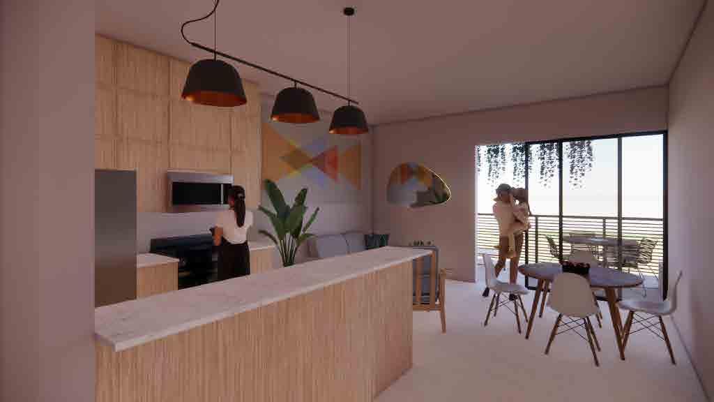


Even though tropical architecture can be seen as a simple form of architecture, the numerous design parameters behind it can become overwhelming. This complexity is probably one of the many reasons why it’s not widely implemented throughout the industry. We live in a time where technology can provide us with many advantages and opportunities to better our lives. Active design has been at the forefront of architecture because of its convenience and comfort. The invention of the air conditioner has made it possible for people to live comfortably no matter the type of climate they find themselves in. Unfortunately, we also live in a time where climate change is affecting our everyday life, where each summer breaks the record for being the hottest ever, and where the winters are either colder or hotter than before, depending on the week.
This design proposal intends to establish that Puerto Rico should take the opportunity to reflect on its design typologies and its lifestyle to find a more suitable way of living. Tropical architecture and passive design do take time to understand, evaluate, and implement in any project, but the benefits of their use outweigh the overall cost in the long run. Puerto Ricans already must be bare the weight of living on an island with the highest sales tax and the highest electrical bills in the United States. The project aims to demonstrate a fresh new take on housing for the average Puerto Rican, one that is designed to take advantage of the island’s climate to provide comfort without having to compromise the wallet.
The site selection for the design proposal was done to have a blank canvas to implement the design parameters in a place that geographically provided the most benefits, that being winds, views, leveled ground, and proximity to a city center. As a future exploration, those same parameters can be applied to a more urban location, such as Santurce, San Juan, or Caguas, PR. Choosing a new site where the intensity of the winds is not as strong as on the coast will be an interesting challenge. While the prevailing winds are always in the same direction, the way they react with neighboring structures can influence the overall orientation of the proposal. In an urban area, the shadows from the surrounding buildings and the heat island effect are also other parameters that need to be taken into consideration.
A more in-depth exploration of materiality should be done as well. While reinforced concrete without insulation is the main building material used in Puerto Rico due to its reliability against hurricanes, technology has developed and reinterpreted numerous materials that can be used in the tropics. Any construction material that can withstand both hurricanes and earthquakes should be studied to see its viability in Puerto Rico. This assessment can be beneficial as it can create a new industry on the island and teach a new generation of builders specialized in what works efficiently.
- Cancel, Mario R. and Mayra Rosario, “Un Compendio de Historia de Puerto Rico,” in El libro de Puerto Rico, edited by Andrés Palomares. Puerto Rico: Publicaciones Puertorriqueñas, Inc, 2001. Translated by Rafael G. Lloveras-Fuentes
- “Domestic Shipping | MARAD.” n.d. Www.maritime.dot.gov. https://www.maritime.dot.gov/ports/do mestic-shipping/domestic-shipping.
- “Foraker Act (Organic Act of 1900) - the World of 1898: The Spanish-American War (Hispanic Divi sion, Library of Congress).” 2011. Loc.gov. 2011. https://www.loc.gov/rr/hispanic/1898/foraker. htmlHistory.com Editors. 2020. “Puerto Rico.” HISTORY. A&E Television Networks. September 15, 2020. https://www.history.com/topics/us-states/puerto-rico-history.
- Gallart, Mary Frances, “’Ahora Seremos Felices’: Models of Private Housing Developments in San Juan,” in Ever New San Juan: Architecture and Modernization in the Twentieth Century, ed. Enrique Vivoni Farage, San Juan: Archivo de Arquitectura y Construcción de la Universidad de Puerto Rico, 2000.
- “Jones Act - the World of 1898: The Spanish-American War (Hispanic Division, Library of Con gress).” n.d.
- Mignucci, André, Bruno Stagno: An Architecture for the Tropics, San Juan: A+editors, 2019
- Mundigo, Axel I., and Dora P. Crouch. “The City Planning Ordinances of the Laws of the Indies Re visited. Part I: Their Philosophy and Implications.” Town planning review 48, no. 3 (1977).
- Muñiz Rivera, Pedro A., Enfoque biotropical para la arquitectura en Puerto Rico. (self-pub.,1998, San Juan, Puerto Rico, edited 2016)
- Reid, Basil A., and Gilmore, R. Grant, eds. 2014. Encyclopedia of Caribbean Archaeology. Florida: University Press of Florida. Accessed May 20, 2022. ProQuest Ebook Central.
- Rodríguez, Luz Marie,“Suppressing the Slum! Architecture and Social Change in San Juan’s Public Housing,” in Ever New San Juan: Architecture and Modernization in the Twentieth Century, ed. Enrique Vivoni Farage, San Juan, Archivo de Arquitectura y Construcción de la Universidad de Puerto Rico (AACUPR), 2000.
- US Department of Commerce, NOAA, “Major Hurricane Maria – September 20, 2017,” NOAA’s Na tional Weather Service, 13 July 2021, https://www.weather.gov/sju/maria2017
- Www.loc.gov.https://www.loc.gov/rr/hispanic/1898/jonesact.html#:~:text=On%20March%20 2%2C%201917%2C%20President.
Fig. 01, Depiction of Tainos during a ritual, El libro de Puerto Rico, Publicaciones Puertorriqueñas, 2001
Fig. 02, Taino. Stone “Dujo” in Form of an Animal, n.d.
Fig. 03, Taino. Large Cult Object of the Taino Indians, n.d.
Fig. 04, Depiction of Tainos playing a ball game, El libro de Puerto Rico, Publicaciones Puertorriqueñas, 2001.
Fig. 05, Library of Congress. Christopher Columbus Lands in the Americas. ABC-CLIO, 2010.
Fig. 06, Bry, Theodor de. Historia Americae: Part V: Spanish Treatment of Fugitive Black Slaves,1592.
Fig. 07, U.S. Army Corps of Engineers. Castillo San Felipe Del Morro. ABC-CLIO, 2010.
Fig. 08, unknown. South View of the Town and Fortifications of Puerto Rico, 1824.
Fig. 09, Plaza Colon in Old San Juan in 1909, Puerto Rico Historic Building Drawings Society.
Fig. 10, “Plaza Corchado y casa alcadia de Isabela, Puerto Rico.” Card. Boston, Mass.: Made only by Tichnor Bros., Inc., [ca. 1930–1945]. Digital Commonwealth
Fig. 11, unknown. East View of the Town and Fortifications of Puerto Rico, 1824.
Fig. 12, Library of Congress. Guánica Harbor. ABC-CLIO, 2010.
Fig. 13, Library of Congress. U.S. Troops in Puerto Rico. ABC-CLIO, 2010.
Fig. 14, Library of Congress. School Begins. ABC-CLIO, 2010.
Fig. 15, Gov. Luis Muñoz Marín visitng a slum in San Juan, Archivo de Arquitectura y Construcción de la Universidad de Puerto Rico (AACUPR)
Fig. 16, “Former Slaves in Puerto Rico.” In The American Mosaic: The Latino American Experience, ABC-CLIO, 2022. Image.
Fig. 17, “Dressmaking Factory in Puerto Rico.” In The American Mosaic: The Latino American Experience, ABC-CLIO, 2022. Image.
Fig. 18, Map of Caguana. Pueto Rico Day Trips. Made by Rafael G. Lloveras-Fuentes
Fig. 19, Foto of Caguana Ceremonial Ground. Discover Puerto Rico. 2022
Fig. 20, Foto of Caguana Ceremonial Ground. Discover Puerto Rico. 2022
Fig. 21, Foto of Caney. Open Wide The World. 2015.
Fig. 22 “Recopilacion de leyes de los reynos de las Indias”. Open Library. 1681, ed. 2021
Fig. 23, Map of Old San Juan
Fig. 24, Old San Juan Street, Mi Viaje
Fig. 25, Map of Ponce Town Center
Fig. 26, Johnston, J. S. (John S.). Calle Del Candelaria, Mayaguez, Puerto Rico, undated.|J.S. Johnston Photograph Collection, 1890-1899; Series I: Glass Negatives; Puerto Rico. New-York Historical Society: Museum & Library, 1890.
Fig. 27, Johnston, J. S. (John S.). Calle de Juan, Mayaguez, Puerto Rico, undated,|J.S. Johnston Photograph Collection, 1890-1899; Series I: Glass Negatives; Puerto Rico. New-York Historical Society: Museum & Library, 1890.
Fig. 28, Foto of Castillo San Felipe del Morro and La Perla. Puerto Rico Flute Symposium, 2022
Fig. 29, Lotification plan of El Condado. Archivo de Arquitectura y Construcción de la Universodad de Puerto Rico (AACUPR), 1908.
Fig. 30, Aníbal Sepúlveda, San Juan. Historia ilustrada de su desarrollo urbano, 1508-1898, Slums in Puerta de Tierra & Santurce, PR. 1989.
Fig. 31, El Fanguito slum, Archivo de Arquitectura y Construcción de la Universidad de Puerto Rico (AACUPR).
Fig. 32, Mirapalmeras: Typical house floorplan, Archivo de Arquitectura y Construcción de la Universidad de Puerto Rico (AACUPR)
Fig. 33, Mirapalmeras: Typical elevation for houses, Archivo de Arquitectura y Construcción de la Universidad de Puerto Rico (AACUPR).
Fig. 34, El Falansterio: typical floorplan, Archivo de Arquitectura y Construcción de la Universidad de Puerto Rico (AACUPR).
Fig. 35, El Falasterio: interior of a typical apartment, Archivo de Arquitectura y Construcción de la Universidad de Puerto Rico (AACUPR).
Fig. 36, El Falasterio: interior view of community center and recreational areas, Archivo de Arquitectura y Construcción de la Universidad de Puerto Rico (AACUPR).
Fig. 37, Photos by Luz Marie Rodríguez
Fig. 38, Urbanización Roosevelt: bird’s-eye-view perspective drawing, Colección Puertoriqueña, Biblioteca Lázaro, UPR.
Fig. 39, Ocean Park: elevation; Miniature of El Condado estates, Archivo de Arquitectura y Construcción de la Universidad de Puerto Rico (AACUPR).
Fig. 40, Ocean Park: floorplan; Miniature of El Condado estates, Archivo de Arquitectura y Construcción de la Universidad de Puerto Rico (AACUPR).
Fig. 41, Urbanzación Ocean Park: street scene, Revista Económica de la Cámara de Comercio (1938).
Fig. 42, University Gardens: proposed house by Amaral y Morales architects, Archivo de Arquitectura y Construcción de la Universidad de Puerto Rico (AACUPR).
Fig. 43, Puerto Nuevo typical house: floorplan and exterior view, El Mundo (1949).
Fig. 44, Puerto Nuevo aerial view: under construction, Archivo de Arquitectura y Construcción de la Universidad de Puerto Rico (AACUPR).
Fig. 45, Puerto Nuevo: lotification plan, Río Piedras, PR, Archivo de Arquitectura y Construccion de la Universidad de Puerto Rico (AACUPR).
Fig. 46, Luis Lloren Torres: typical elevation, Archivo de Arquitectura y Construcción de la Universidad de Puerto Rico (AACUPR). Digitalized by Rafael G. Lloveras-Fuentes.
Fig. 47, Luis Lloren Torres: site plan, Archivo de Arquitectura y Construccián de la Universidad de Puerto Rico (AACUPR).
Fig. 48, Luis Lloren Torres: typical floorplan, Archivo de Arquitectura y Construcción de la Universidad de Puerto Rico (AACUPR). Digitalized by Rafael G. Lloveras-Fuentes.
Fig. 49, Los Paseos: development and gates, Archivo de Arquitectura y Construcción de la Universidad de Puerto Rico (AACUPR).
Fig. 50, Casa Loumay, Bruno Stagno.
Fig. 51, Oficinas JYR, Bruno Stagno.
Fig. 52, Logo R.E.S.E.T., Institute for Tropical Architecture
Fig. 53, Apartamentos Urbano, Bruno Stagno
Fig. 54. Arch. Bruno Stagno.
Fig. 55, Sea Currents in the Atlantic Ocean, Enfoque Biotropical para la Arquitectura en Puerto Rico, Dr. Pedro A. Muñiz Rivera. 2012. Digitalized by Patricia del Moral Suazo
Fig. 56, Trade Winds in the Atlantic Ocean, Enfoque Biotropical para la Arquitectura en Puerto Rico, Dr. Pedro A. Muñiz Rivera. 2012. Digitalized by Patricia del Moral Suazo
Fig. 57, Wind Speed Chart for Puerto Rico, Enfoque Biotropical para la Arquitectura en Puerto Rico, Dr. Pedro A. Muñiz Rivera. 2012. Digitalized by Patricia del Moral Suazo
Fig. 58, Dr. Pedro A. Muñiz Riveras.
Fig. 59, Topography Diagram and its relationship with the climate, Enfoque Biotropical para la Arquitectura en Puerto Rico, Dr. Pedro A. Muñiz Rivera. 2012. Digitalized by Patricia del Moral Suazo
Fig. 60, Solar Chart for Puerto Rico, Enfoque Biotropical para la Arquitectura en Puerto Rico, Dr. Pedro A. Muñiz Rivera. 2012. Digitalized by Patricia del Moral Suazo
Fig. 61, Human Comfort Chart for Isabela, PR, Enfoque Biotropical para la Arquitectura en Puerto Rico, Dr. Pedro A. Muñiz Rivera. 2012. Digitalized by Patricia del Moral Suazo
Fig. 62, Explanation of the Human Comfort Chart, Enfoque Biotropical para la Arquitectura en Puerto Rico, Dr. Pedro A. Muñiz Rivera. 2012. Digitalized by Patricia del Moral Suazo
Fig. 63. Diagram of Building Orientation based on winds, Enfoque Biotropical para la Arquitectura en Puerto Rico, Dr. Pedro A. Muñiz Rivera. 2012. Digitalized by Patricia del Moral Suazo
Fig. 64, Diagram of Building Orientation based on the Sun, Enfoque Biotropical para la Arquitectura en Puerto Rico, Dr. Pedro A. Muñiz Rivera. 2012. Digitalized by Patricia del Moral Suazo
Fig. 65, Vegetation, Enfoque Biotropical para la Arquitectura en Puerto Rico, Dr. Pedro A. Muñiz Rivera. 2012. Digitalized by Patricia del Moral Suazo
Fig. 66, Wind Conditions Inside the Building, Enfoque Biotropical para la Arquitectura en Puerto Rico, Dr. Pedro A. Muñiz Rivera. 2012. Digitalized by Patricia del Moral Suazo
Fig. 67, Arrangement of Interior Spaces, Enfoque Biotropical para la Arquitectura en Puerto Rico, Dr. Pedro A. Muñiz Rivera. 2012. Digitalized by Patricia del Moral Suazo. Fig. 68 Adequate Proportion for Puerto Rico, Enfoque Biotropical para la Arquitectura en Puerto Rico, Dr. Pedro A. Muñiz Rivera. 2012. Digitalized by Patricia del Moral Suazo. Fig. 69, Map of Puerto Rico and Isabela. Rafael G. Lloveras-Fuentes. Fig. 70, Aerial Image of Isabela, Puerto Rico, Google Earth. Rafael G. Lloveras-Fuentes.