

Hillary Collins, Mike Conover, Warren Lee, Rachel Lindsay, and Kate O’Brien
The Conway School ● 2015 - 2016
The authors would like to thank the following people for their support, guidance, and contributions to this report. Hugh Campbell, Bernardston’s Town Coordinator, served as the community representative for this project. He prepared reference materials and organized the Master Plan Steering Committee and community meeting logistics. John Lepore, the Chair of the Master Plan Steering Committee, led the initiative to work with the Conway School, conducted personal tours of the town, and compiled the comments of the committee members for this draft. Eric Almeida, Cris Coffin, Rena Grover, Bill Hill, Ana Kaiser, Peter Shedd, and Barre Tozloski, the members of the Master Plan Steering Committee, met on a regular basis and shared the perspectives of the committees and sectors they represent.
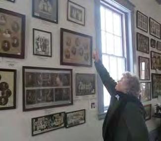
Lou Atherton, President of the Historical Society, generously led an off-season tour of the unheated Historical Museum. Karen Stinchfield from the Cushman Library offered space to work and access to historical documents. Many departments, organizations, and individuals contributed information. Thank you to the more than thirty participants in the four community meetings, and to John Lepore, Annette Wadleigh-Mackin, Chris Wysk, Wendy Abramson, Bill Shores, Bill Montiglio, Peter Shedd, Catheryn Thomas, and Mary Leyden, who graciously shared photos.
Mary Praus, Ryan Clary, Jessica Atwood, Megan Rhodes, and Glen Ayers from the Franklin Regional Council of Governments provided previous studies and GIS map layers, and shared their experiences working with the small towns of Franklin County. Doug MacLeay, an environmental engineer in Colrain, shared his expertise working with septic solutions. Molly Babize provided valuable guidance for the master plan process. Dana Roscoe shared his expertise regarding transportation planning. Gary Wetherby of the Highway Department provided insight and guidance regarding Bernardston’s transportation infrastructure. Glenn Motzkin and Bill Lattrell offered their expertise in local ecology. Brad Stafford provided information about the Bernardston-Gill-Leyden Snowmobile Club and the snowmobile trail network. Mary Praus, Molly Hale, CJ Lammers, John O’Keefe, and Dick O’Brien gave supportive and constructive criticisms and supplemental information.
Thank you all.
Cover photo credit: Rachel Lindsay Bernardston Town Hall
Credit: Rachel Lindsay
Drafting a town master plan brings the members of a community together to create a collective vision for their town. It is an opportunity for citizens with different interests to come together, for departments to share information, and for residents and municipal officials to discuss topics that are not often addressed in the daily function of a small town. Planning twenty years into the future should also involve examining how the socioeconomic and environmental characteristics of the whole region might change, and how those changes might influence the types of decisions a small town can anticipate facing in the future.
This master plan is the product of a sixty-four-week process. In the first phase, a Master Plan Steering Committee of nine knowledgeable individuals was formed to share their views of the current issues the town is facing with a Conway School team of three graduate students. These committee members represent different sectors in town—farmers, landowners, town departments, private businesses, and town planners.
Additionally, many town departments and organizations have met to express their vision for the future of Bernardston. The views expressed in these meetings were used together with past town reports and published data to compile the first five sections in this report and draft initial recommendations. The Master Plan Steering Committee continued to gather information and feedback from the general public from April 2015 to January 2016, when a second group of Conway students joined the process and finished the master plan with four more sections and additional recommendations.
This introduction describes the Commonwealth of Massachusetts’ requirements for a town master plan, the planning process and public participation. A brief history of Bernardston and a review of the 1975 Master Plan provide the foundation for understanding the changes that have taken place over the last forty years. This section also includes a summary of the projections for how the climate may change in the future and the implications these possible changes have for the future of Bernardston.
Phase I: January 2015 - April 2015
The first Conway School graduate team helped residents articulate a vision for Bernardston and determine their primary goals. The team then completed the introduction, goals and vision, watershed protection, natural and cultural resources, and land use elements of the master plan with accompanying recommendations.
Phase II: May 2015 - December 2015
Interim period in which the Master Plan Steering Committee held a survey and gathered feedback from the community.
Phase III: January 2016 - April 2016
The second group of Conway School graduate students completed the housing, transportation, services and facilities, and economic development elements. They provided additional recommendations, and integrated these with the initial team’s recommendations.
Bernardston is located in the northwestern section of western Massachusetts and is one of twenty-six towns in Franklin County. Its twenty-three square miles include two mountain ridges along the eastern and western sides of the Falls River, a tributary to the Connecticut River. The Bernardston exit off Interstate 91, which follows the Falls River valley north, is the last exit in Massachusetts before Vermont. Leyden to the west, Gill to the south, and Northfield to the east are rural towns of similar size and character, while Greenfield to the south is the county seat and largest municipality in Franklin County. The largest commercial centers near Bernardston are Greenfield, nine miles to the south; Northampton, twenty-three miles to the south; Amherst, twenty-seven miles to the southeast; and Brattleboro, Vermont, fourteen miles to the north.
Bernardston’s history, identity, and demographics have been shaped by ecological, social, economic and political processes. Some of the issues that Bernardston faces currently can be understood in the context of its political town, county, and state boundaries; however, Bernardston’s natural boundaries, such as the Connecticut and Deerfield River watersheds, also influence the choices facing the town.
The watershed protection, natural and cultural resources, and land use elements of this document will provide a deeper understanding of some of the underlying geographic and environmental characteristics of Bernardston. The housing, transportation, services, and economic development elements build on these and further investigate Bernardston’s man-made infrastructure, human systems, and socioeconomic characteristics.
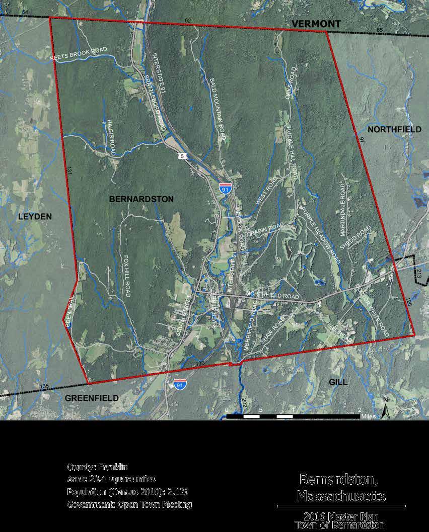
The Commonwealth of Massachusetts outlines the required contents of a town master plan in the Massachusetts General Laws Chapter 41, Section 81D. Master plans should present information, through text, maps, or other illustrations, that provides a basis for decision making regarding the long-term physical development of the municipality. The required elements are town goals, land use, natural and cultural resources, housing, transportation, services and facilities, economic development, and implementation strategies. An Open Space and Recreation Plan, which is a stand-alone document, may be considered an element of a town’s master plan. Bernardston’s current Open Space and Recreation Plan was written and approved in 2009.
The plan elements laid out by the state are not mutually exclusive. The subject matters overlap and all of the elements interact and together influence the quality of life for residents of Bernardston. Natural resource
issues are connected to economic development. Forests provide ecosystem services, such as soil retention, stormwater infiltration, and carbon sequestration and also offer spaces for hunting, supplementing the diets and income of residents. Understanding the changing environmental climate and its potential impact on the natural and cultural resources of a municipality is fundamental to planning for its long-term physical development.
The Town of Bernardston’s decision to work with the Conway School, which teaches sustainable landscape planning and design, reflects Bernardston’s commitment to environmental sustainability. For example, this master plan includes a watershed protection element, which is not currently required but may be a requirement in the future pending the outcome of a Massachusetts Sustainable Development Act bill. The plan also considers the implications of a changing climate and a future where fossil fuels are increasingly limited.
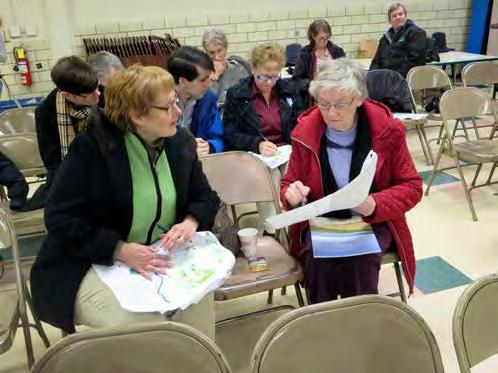
Beginning in January 2015, the Master Plan Steering Committee met biweekly with a team of Conway School graduate students to plan the process of updating the town’s master plan. The students met with town departments and stakeholder organizations, and facilitated two public meetings, on February 3 and February 24, 2015. Information about the meetings was posted in the Bernardston Town Hall, published on flyers around town, and announced in the Greenfield Recorder.
Twenty-seven residents attended the first public meeting, which was filmed by Bernardston-Northfield Community Television. Upon arrival, residents were asked to contribute to a “Places of the Heart” map by placing a sticker on their favorite place in town. To understand who came to the meeting, the Conway students gathered representative information about the participants. The team facilitated a discussion about Bernardston’s unique qualities and greatest assets, and about participants’ perceptions of what has changed and what is needed in town. The participants were asked to contribute to a collective vision of the future of the town by indicating on maps where they would like to see future housing, agriculture, business, and industry; where they see the most significant threats to water sources or land; what buildings or areas they feel are historically significant; and what areas of town they would like to remain the same in twenty years. A map showing the consolidated responses from this exercise is included in the Goals and Vision section of this report. The meeting concluded with a group discussion about their responses.
Twenty-one residents and two representatives from Mount Grace and Franklin Land Trusts attended the second public meeting. The Conway student team presented an overview of the information gathered, analyses of existing conditions, and preliminary recommendations for the natural and cultural resources, watershed protection, and land use sections of the master plan. The team presented a map that summarized the results of the visioning exercise from the first meeting. After the presentation, the public participated in a discussion about priority areas for preservation, future development, and the potential for
constructing a sewer system. Participants brainstormed ideas for how to continue public engagement in the master plan process during the eight-month interim period between the completion of the first half in April 2015 and the resumption of the drafting process in January 2016.
During the interim period, a public survey was conducted based upon questions determined by the Master Plan Steering Committee. In January 2016, a new team of two Conway School graduate students began the second half of the master plan. They were informed by the Master Plan Steering Committee (MPSC) about what had been learned in the interim stage and continued to meet with the MPSC biweekly. The team facilitated two public meetings, on January 19 and February 16, 2016.
Twelve residents attended the third public meeting, which involved a discussion of Bernardston’s primary strengths and constraints that can help or hinder the town in achieving the three goals that were articulated in 2015. Breakout groups of four to five people were formed where individuals first recorded their own thoughts and then discussed them as a group. All the groups then came together and presented the primary strengths and constraints that each group had agreed upon. Strengths that were identified included the level of engagement and commitment of many residents, Bernardston’s accessibility from Interstate 91, its natural beauty and rural character, and the various events that the town hosts. Some of the constraints included a lack of a municipal sewer, lack of public transport, lack of money and jobs, lack of a cohesive vision for the future, and an aging population.
Twenty-four residents attended the fourth community meeting, on February 16, 2016. This meeting was held to clarify Bernardston’s goal of creating a vibrant center village, which will be discussed in the following chapter. Residents were asked to give feedback regarding the aspects of a central village they desired to see in Bernardston, based upon examples of village centers from surrounding towns. Some elements that were deemed important by many people were walkability, a medium density of development, a central gathering space, community events, and street trees, among others.
Like many towns in Western Massachusetts, Bernardston was colonized by settlers moving north along the Connecticut River as populations grew during the seventeenth century. When settlers arrived to the Bernardston area, there were already several Native American tribes that had been inhabiting the area prior to their arrival. These tribes, part of the larger Algonquin nation, included the Mohawk, the Pocomtuc, and the Pennacook (Clément, 1996).
Over time the Native Americans became increasingly dependent on the imported commodities available from the settlers, and began to lose their bargaining opportunities as the fur trade diminished (History.com, 2009). Tensions continued to rise and by 1676, settlers in the Bernardston area and several tribes fought in a battle known as the “Falls Fight,” which took place at what is now Turners Falls in Montague (Kellogg, 1902). An assembly of residents and volunteers from towns along the Connecticut River rode north from Hatfield towards Turners Falls and Greenfield to attack the Native Americans camped along the Falls River.
The settlers won the battle, but a majority of the survivors died on the journey home due to attacks from
retaliating tribes (Kellogg, 1902). In November 1734, Samuel Hunt of Billerica filed a petition to the House of Representatives for a tract of land to start a township for the descendants of those lost in the Falls Fight (Kellogg, 1902). The Falls Fight Township was granted in 1736, and included land that is now Bernardston, as well as Leyden and part of Colrain (Kellogg, 1902). Bernardston’s original settlement was located approximately two miles northeast of the current Center Village, along Huckle Hill Road. Some of the first structures constructed in Bernardston were four forts: Samuel Connable’s fort in North Bernardston, Ebenezer Sheldon’s fort in the east part of town, Deacon Sheldon’s fort located near the original settlement on Huckle Hill, and the Burke Fort just north of today’s Center Village (Kellogg, 1902). Today these forts are no longer standing but signs have been posted that mark their original locations. Bernardston’s Congregational Unitarian Church, built in 1739, is one of the few existing buildings in Bernardston that was originally built on the first settlement. It was first moved half a mile south on Huckle Hill Road in 1772, and then a second time to its current location in 1825 (Trustees, 1962). Bernardston was known as “Fall Town” or “Falls Fight Town” until 1762, when the town was incorporated as the Town of Bernardston, named after Governor Francis Bernard (Kellogg, 1902).
Many industries in Bernardston met the daily needs of the residents and produced goods for regional markets. In the mid-nineteenth century, these industries included tanneries and shoe-shops, blacksmiths, cutlery factories, mills, distilleries, rope-making, cigars, and saddle- and harness-making (Kellogg, 1902). As in other New England towns, Bernardston’s water powered sawmills and gristmills were built along the larger water bodies in town.
The growing population and its need for goods and services drove the town’s economy, which then created the need for sufficient infrastructure. In the early days of Bernardston, roads were mere horse paths through the woods and as the town and industries grew, more roads were constructed. What is now state Route 5 was once an old stagecoach route. In 1852, a factory manufacturing hoes was established along the Falls
River and by 1900 it was the only factory in Bernardston while other industries had come and gone. After the death of the owner, the factory was quickly purchased by a company in Greenfield, transferring most operations out of Bernardston (Trustees, 1962).
Between 1958 and 1960, Bernardston saw a shift in industry when Interstate 91 was built, paving over many acres of prime farmland. The land of some property owners was split by I-91, leaving them unable to directly access their land on the opposite side of the highway. Some farmers sold the remainder of their land to developers or let the land return to forest (Trustees, 1962).
By the time of the 1975 master plan, Bernardston’s business sector was still operating at a small commercial scale. Businesses in town were mainly retail, personal businesses, gasoline service stations, and automobile sales, repair, or storage. Compared to Greenfield, Bernardston’s commercial development was small and took the form of “village development,” concentrating business around transportation crossroads, which were vital to Bernardston’s rural character and prosperity (Brown, Donald and Donald, 1975).

When the Brown, Donald, and Donald planning firm began to assemble the Town of Bernardston Master Plan in 1974, much of the technology for collecting data available today did not exist. The firm conducted a field survey by driving down every road in town, noting each lot and its use, and estimating by sight the amount of farmland. It used a topographic map published by the US Geological Survey to determine development suitability based on slopes, and included housing and population growth projections up through the year 2000.
Interstate 91 had been completed a decade before that first master plan was written, and the new highway created a clear divide between east and west. From its frequent appearances in the 1975 plan, and the number of recommendations that reference the location of the entrance ramps close to the center of the village, it is clear that the creation of this major highway through
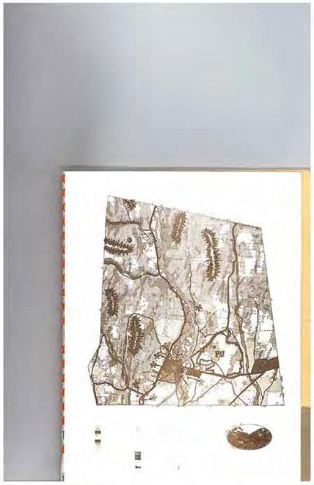
Bernardston was a landmark in the town’s developmental history and was seen as an economic asset for the town.
The 1974 field survey identified 515 acres in residential use, 94 acres in commercial use, 12 acres in mixed commercial and residential, 5 acres in industrial use, 52 acres of town- or state-owned public or semi-public uses (it counted churches as semi-public), and 97 acres of land classified as town-owned public recreation. Town streets covered 343 acres and Interstate 91 covered 312 acres of former farmland. It calculated 2,520 acres of land in agricultural use, including both animal pasture and cropland. The remaining 11,100
“The dilemma of long range planning for communities like Bernardston, which are essentially rural, is simple to describe and not so simple to accomplish. The problem at its most basic is ‘How do you plan logically for the future without creating a straightjacket that stifles growth instead of encouraging it?’” - Brown, Donald, and Donald, Bernardston Master Plan 1975 (32)
acres were categorized as undeveloped and “mostly wooded,” aside from the 32 acres covered by water bodies.
Brown, Donald, and Donald considered the dominance of agricultural and open land a strength of Bernardston, stating that the town is “far luckier than many other towns because its growth has been slow and evolutionary…. ‘Strip commercial’ development has not yet occurred” (7). It praised Bernardston for many of its characteristics, such as the well-maintained and easily identifiable historic village center and the scenic rural roads that give the town a “gentle and peaceful appearance” (10).
Taking into account the topography, suitability of soils for septic systems, and the zoning regulations in place at the time, a build-out analysis concluded that Bernardston had a holding capacity of 3,114 dwelling units or 9,964 people. The exercise was based entirely on residential capacity and did not explore additional areas associated with growth such as the expansion of public facilities and the commercial sector. The upper
limits of Bernardston’s growth calculated in the buildout exercise were much higher than the projected population growth, which was expected to be 2,857 residents by the year 2000. As of the 2010 Census Bernardston has 2,129 residents.
Although the projections laid out in 1975 have proven to be higher than actual growth, many of the goals and recommendations remain consistent with the community’s vision today: to continue to be a place where residents live and work within or outside the town, rather than a commercial or industrial center that outside residents commute to; to preserve the natural beauty and open land of Bernardston; to expand the tax base through development that preserves the quality of rural life; and to expand municipal services to meet growth.
Following Brown, Donald, and Donald’s advice, a Residential/Agricultural zoning classification was established and a Parks and Recreation Department was formed. Other recommendations from the plan approved by the planning board at the time and since adopted include restricting commercial development west of the I-91 highway corridor to individual shops and stores characteristic of a village center, encouraging intensive commercial development east of I-91, and constructing a public sports field. In 2016, a management plan was completed for the town-owned Charity Lot.
Recommendations from the 1975 Master Plan that were approved but did not come to fruition include the town acquiring Couch Brook Gorge and the First Meeting House property on Huckle Hill.
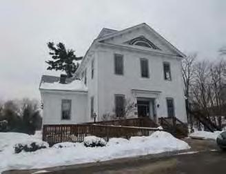
The Powers Institute functioned as a secondary school until 1958. Brown, Donald and Donald recommended in the 1975 Master Plan that the building be renovated for use by the senior citizens and library. Currently the building houses a senior citizen center on the ground floor and the Historical Museum on the second floor. The building is fully accessible but the second floor is unheated.
The steep terrain and fertile floodplain soils of Bernardston are remnants of an age when glaciers covered the northeastern United States. Over many millennia, changes in temperature, weather, and water level have impacted the landscape and continue to affect the environment. The by-products of industrial development have changed the composition and amounts of various greenhouse gases in the earth’s atmosphere and oceans and impacted the natural world in ways that scientists are documenting and attempting to understand.
As our climate continues to change, planners and climate scientists are working together to understand the effects of human development on climate, and to anticipate and adapt to future changes. For Bernardston, this may mean preparing for a higher probability of intense storms and flooding, and taking measures to mitigate the detrimental effects that these events could have on the town.
Researchers at the University of New Hampshire’s Climate Change Research Center have analyzed a wide range of data, including year-round precipitation accumulation, bloom dates, river dynamics, and average annual temperature, to determine current
Snowfall has decreased significantly in Northern New England and New York 1970 - 2000
climate trends. They have found significant evidence that the climate in New England is warming, with average winter temperatures between 1970 and 2000 increasing by as much as 4 degrees Fahrenheit (Clean Air-Cool Planet, 2005). Total annual precipitation during that time period increased 3.3 inches, as did the frequency of precipitation events.
The Massachusetts Executive Office of Energy and Environmental Affairs predicts that extreme precipitation events will increase 8 percent by mid century and 13 percent by 2100. Higher air temperatures would increase the temperature of the water, which would negatively affect certain species and water-dependent industries (EEA, 2011).
A steady increase in rainfall, earlier melting dates for ice on rivers, and more frequent flooding may have drastic consequences for small New England towns like Bernardston, traditionally built near rivers and water bodies. Improving and expanding public infrastructure requires considerable financing and coordination, and not taking climate trends into consideration could result in devastating loss of both investments and lives.
Certain ecosystems, such as the spruce-fir forests and swamps found in the northern elevations of Bernardston and other areas of Western Massachusetts

Total precipitation has increased 3.3 inches 1899 - 2000
Frequency of extreme precipitation events has also increased
Average Northeast Temperature Change 1899 - 2000:
1.8 ºF
2.8 ºF
1.9 ºF
Sea surface temperature increased 1.1 ºF in the Gulf of Maine and 1.6 ºF on the South Shore 1880 - 2001
Relative sea level increased 16 inches in New York City 1856 - 2001
Data Source: The Climate Research Center, University of New Hampshire
are particularly susceptible to temperature increases (Biomap2, 2010). Prioritizing the protection and sustainable management of intact tracts of forest may increase the possibility of survival of Bernardston’s unique ecological communities because such management can help to strengthen the adaptive capacity of trees by maintaining biodiversity and reducing vulnerability (Food and Agriculture Organization, 2010).
Forests, wetlands, rivers, and streams in Bernardston are critical habitats with an array of ecological functions that may be affected by climate change. Upland forests support a variety of habitats and biological diversity, purify air and water, moderate subsurface and overland water flow, and sequester carbon (EEA, 2011). Preserving these resources will be critical for adapting to and mitigating the potential impacts on natural systems and human communities from unpredictable shifts in climate (EEA, 2011).
Some strategies for adapting to climate change can also be mitigation strategies if they reduce the greenhouse gas emissions that exacerbate climate change. The Massachusetts Office of Energy and Environmental Affairs recommends several strategies for adaptation and mitigation that are appropriate for Bernardston, such as developing local and renewable sources of
Upland forests support a variety of habitats and biological diversity, purify air and water, moderate subsurface and overland water flow, and sequester carbon (Massachusetts Executive Office of Energy and Environmental Affairs, 2011).
energy, reducing dependency on fossil fuels, and preserving, protecting, and restoring the hydrology of watersheds (EEA, 2011). Regular assessments of the risks to areas of higher population, such as Center Village, and of Bernardston’s critical infrastructure can help the town identify areas of concern in order to plan and prioritize actions to take as the climate changes. Strengthening regional connections through shared services, like transportation, can help Bernardston reduce dependency on fossil fuels and mitigate against further exacerbation of climate change.
Throughout this document, the changes in the environment due to climate change have been taken into consideration, and the recommendations include actions that could potentially improve Bernardston’s ability to adapt to and, where possible, to mitigate against climate change.
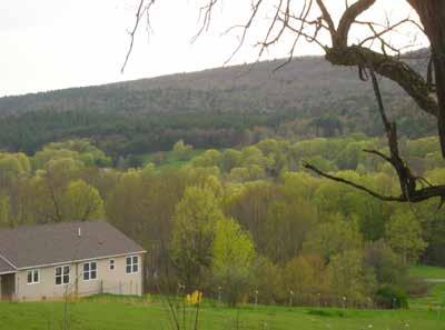
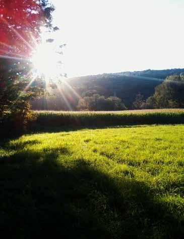
Farmland is part of the community vision for the future of Bernardston
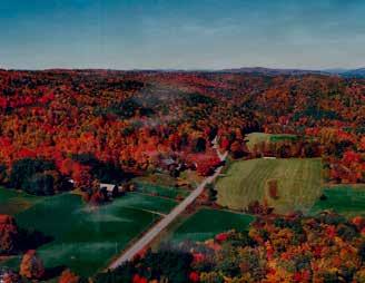
Credit: Bill MontiglioCan you imagine... In 2035, Bernardston is a beautiful place to live. It is predominantly a rural landscape, with steep forested ridges and working farms. The rich history of the town is celebrated through wellmaintained historic buildings. Charity Farm Lot is a popular destination for families and provides outdoor recreation as well as educational information about the town’s ecology and history. A two-mile looped trail leads up to Huckle Hill, site of the original Bernardston settlement. The streams that flow through town support a diverse ecosystem of fish, wildlife, and native plants.
Farmers and foresters maintain the open lands, providing local restaurants, residents, and regional customers with food and lumber. Contiguous tracts of forest protect the soils from erosion and reduce runoff, preventing potential contaminants from flowing into water bodies during the frequent storm events. Homes and businesses are clustered in and around Center Village, enabling forests and open space to be preserved. The town’s safety services are centrally located with ample space and are close to residents. Residents enjoy the natural resources, which support recreational activities, local businesses, and wildlife.
The vibrant Center Village is a universally accessible downtown area that draws residents and visitors to walk along the streets lined with seasonal gardens. The year-round Farmers’ Market offers local products and the second floor of Town Hall is a popular space for gatherings and town events. The Museum in the Powers Institute is open year-round and offers regular tours, showcasing old photographs, architecture, and a variety of artifacts that represent Bernardston’s evolving history. The elementary school makes regular trips to the educational boardwalk in the Darwin Scott Memorial Wetland and Cushman Park, to learn about the functions of a wetland and the ecosystems it supports.
Stormwater management along Church Street infiltrates runoff, reducing the pollution of nearby water bodies as well as mitigating floods from increased storms. The wastewater management systems in Center Village allow residences and businesses in town to continue to function in close proximity to the wetlands.
This vision of the town in 2035 contains aspects of present-day Bernardston, carried into the future.
It shows some current challenges overcome and perceived threats averted. It is based on conversations with the general public during community meetings, and on contributions from the Master Plan Steering Committee, the Board of Health, Water District, Highway Department, Town Clerk, Police Department, Council on Aging, Library, Fire Department, Historical Commission and Cushman Park, Pioneer Valley Regional School Committee, Sandri, Conservation Commission, Agriculture Commission, and the Farmer’s Market Manager.
Reduced salt areas are enforced, decreasing the risk of road salt contaminating the public drinking water supply.
Environmentally conscious industries support the local economy, provide jobs for residents, and support other businesses that depend on Bernardston’s natural resources. Green technologies provide renewable energy and decrease dependency on fossil fuels. Northfield’s Bikeway extends into Bernardston, with routes connecting to the various recreational destinations in town, including Charity Lot and Pratt Field. A stretch along Route 10, now zoned for mixeduse development, provides a place for bicyclists and those traveling to Northfield to stop and peruse shops and restaurants.
Greenfield’s bus route extends into Bernardston, stopping in Center Village and inexpensively connecting residents and region. Bernardston’s Center Village is an attractive destination for all ages. Residents in Bernardston value the pastoral charm of their town as well as the convenience of living near Greenfield. The reliable municipal services, high-speed internet, and reputable schools offer a quality of life for families looking for a beautiful place to live.
Participants at the first master plan community meeting held on February 4, 2015 were asked to identify places in Bernardston that they consider beautiful or historically significant, places that should remain unchanged for at least the next twenty years, land or water that is potentially threatened, and areas where future agriculture, business, housing, and industry should be located. The consolidated responses from the seventeen participants reveal a consensus of opinion about Bernardston’s future.
Residents believe that the primarily undeveloped and forested lands are the most beautiful areas in Bernardston, including the farmland along Route 5 and Eden Trail, the views from Charity Lot, rock outcroppings and remote woods on private property, the Kringle Candle farm and restaurant on Route 5, the Crumpin Fox Golf Course, and the views of the mountains from Center Village.
The places considered historically significant are mainly public buildings in the Center Village. The Powers Institute, which currently functions as the Senior Center and Historical Museum, and the Unitarian Church, which was originally constructed on Huckle Hill and moved to the Center Village. Other places include the site of the original settlement, the Farmer’s Supply in the old grain mill, the Corner Store, Cushman Library, Town Hall, the Conable Home and former inn on Brattleboro Road, the former Bernardston Inn, and Charity Farm Lot.
There is a strong consensus that places that define the rural landscape and history of Bernardston should be maintained over the next twenty years. Nearly half of the places in this category are also considered historically significant, and the other half are open lands including farms, forested areas, scenic roads, and Cushman Park.
Threatened land included farmland and scenic vistas that might be developed. These lands are along Route 10 and in forested areas along Eden Trail and in the eastern mountains. Residents expressed concern that the open industrial lot where the annual Gas Engine Show is held might be lost to development. In contrast, wetlands and flooding issues were identified as posing a threat to desired development in the Center Village.
The threatened waterbodies and water sources consisted of potential contamination of drinking water supply and surface water bodies. The two wells that supply the town’s drinking water were identified as being
potentially threatened with contamination. Other potential threats to water bodies were identified along town brooks and streams and the wetland in Cushman Park.
Areas in town where residents expressed interest in seeing future agriculture were along Route 5, Eden Trail Road, South Street, and Huckle Hill Road. These are all areas where there are currently working farms with visible hay fields and pasture.
Residents identified Center Village, South Street, and Route 10 as areas for future business. Residents described “small-town community business” development in these areas, listing a year-round farmers market and services like accounting and salons as desired additions to town. Several participants expressed desire to see the former site of the Bernardston Inn redeveloped. Center Village was identified as a valued and attractive area that should be a commercial center and maintain its historical significance in twenty years.
Desired locations for future housing were identified in the southwestern corner of town, and areas just east of Center Village along Route 10. Residents would prefer to see clustered housing, with low-impact designs that employ a “village concept” and are accessible for senior living. Residents envision future housing in the southern part of town, close to the border with Greenfield. None of the residents identified areas north of Center Village for future housing.
Desired locations for future industry were identified along Route 10 towards Northfield and along the Falls River east of Center Village. These areas coincide with the current zoning designations that limit industrial development to areas along the state roads. The descriptions of desired industry reflect a strong preference for low-impact and environmentally responsible development.
The responses from the selection of residents who attended the meeting show strong preferences for preserving the open spaces and rural character of town, maintaining and improving services available in the Center Village, and attracting sustainable economic development.


Bernardston captures the essence of New England: an attractive Center Village with churches and a town country store, situated along the Falls River with farmland and the rolling hills in the backdrop. In 2035, Bernardston continues to value its agricultural and forested lands. The expanse of open vegetated land creates both a healthy watershed and protects the high quality of drinking water in Bernardston.
Land Use Strategy
Preserve current agricultural and forested land that forms the backdrop for the views along main roads.
Watershed Protection Strategy
Create opportunities throughout the town to educate the community about drinking water and surface water quality. Assess the necessity for further protection of public water supplies.
Natural and Cultural Resources Strategy
Provide residents access to information about best management practices for forestry and agriculture, and financial and technical resources for transitioning, donating, and protecting their land.
Housing Strategy
Implement mechanisms to allow for increased development in already built-up areas.
Transportation Strategy
Develop road infrastructure to be more bike and pedestrian friendly and map the town’s trail systems to encourage people to use them more.
Services Strategy
Explore alternative wastewater treatment solutions that allow for denser development to preserve the town’s open space.
Economic Development Strategy
Leverage Bernardston’s natural beauty, scenic resources, and character to promote outdoor recreation and tourism.
In 2035, Bernardston boasts a vibrant Center Village with a classic New England aesthetic. Convenient from the highway, the small walkable town offers residents and visitors a variety of small shops and restaurants. Sidewalks are lined with rain gardens of seasonal color that also serve to infiltrate stormwater runoff from the streets. Town Hall and Cushman Park offer spaces for annual celebrations and gatherings.
Land Use Strategy
Involve citizens in a process to define a preferred aesthetic for the town to decrease potential controversy over new development and ensure that new businesses contribute positively to the town appearance.
Watershed Strategy
Install stormwater management infrastructure to mitigate flooding in Cushman Park and protect the Darwin Scott wetland.
Natural and Cultural Resources Strategy
Protect historic structures and develop mechanisms to renovate and preserve buildings of significance. Engage residents and visitors in education about the town’s history.
Housing Strategy
Cluster new housing where existing housing is to create a more lively center village.
Transportation Strategy
Develop the streetscape of Church Street to be more welcoming and pedestrian friendly, for example by creating a Complete Street.
Services Strategy
Investigate septic solutions that allow the current businesses and municipal building to continue to operate.
Economic Development Strategy
Investigate placemaking strategies and encourage infill development to create a more welcoming downtown that brings people to town.
In 2035, Bernardston is home to outdoor recreation, businesses and industries that support the local rural economy and reflect the citizens’ environmental values. The town flourishes on the revenue of thriving small businesses and a number of jobs in town. The industries in Bernardston incorporate renewable energy, stormwater management, and the latest green technologies into their sites and practices, and offer valuable products and services to town and area residents.
Land Use Strategy
Maximize the development potential along the state roads. Attract businesses that support a rural economy by providing additional markets for local goods and services. Develop outdoor recreational opportunities.
Watershed Protection Strategy
Improve stormwater management through Low Impact Development requirements for all new development, and add vegetation along major roads to mitigate pollution of groundwater resources.
Natural and Cultural Resources Strategy
Promote Bernardston’s historic places, scenic areas, and local businesses as tourist destinations.
Housing Strategy
Develop new housing, especially affordable and senior housing, to create jobs in construction, maintenance, and services for an aging population, and to contribute to a lively village center.
Transportation Strategy
Design an attractive Complete Street that draws people to town and use Bernardston’s trail systems to promote tourism.
Services Strategy
Investigate septic solutions that allow the current businesses and municipal building to continue to operate.
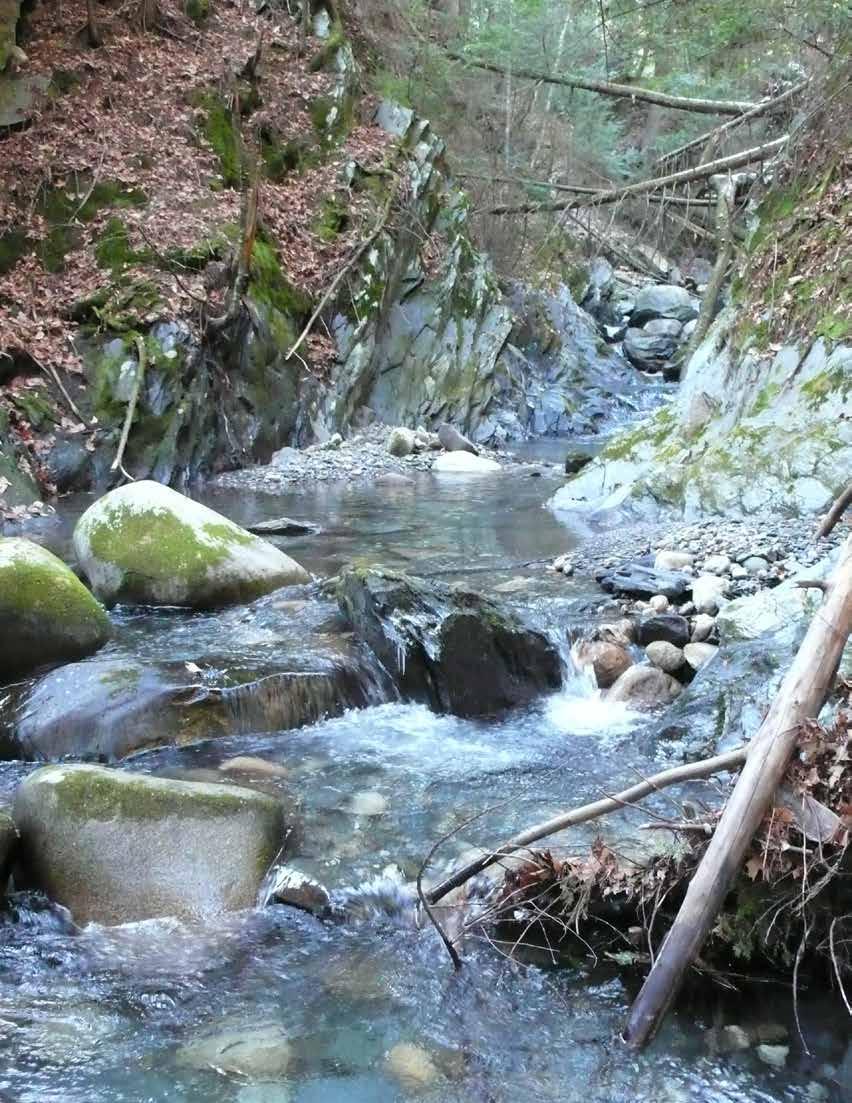
The Laurentide ice sheet that stretched from northern Canada south to Long Island Sound was formed 21,000 years ago. When the ice sheet began to melt and retreat north 18,000 years ago, a glacial lake, called Lake Hitchcock, formed in what is now the Connecticut River Valley. About 12,000 years ago, the dam broke and Lake Hitchcock drained (Rittenour, 1997). The Connecticut River subsequently created a winding river valley with a broad floodplain through this same area.
Evidence of the long presence of glaciers remains visible in Bernardston. The soils of the Falls River Valley are abundant in glacial till, a mixture of silt, sand, gravel and other materials deposited from glacial meltwaters; many of these soils overlay aquifer recharge areas. Within Bernardston’s twenty-three square miles are 143 miles of streams, brooks, and rivers, and numerous ponds and wetlands shaped in part by the glacial history of the region.
All of Bernardston is within the Connecticut River watershed. Most of Bernardston drains to the Falls River or directly to the Connecticut River, and a portion in the southwestern corner of town drains to the Deerfield River, which is a tributary of the Connecticut. How land is managed in Bernardston has a direct effect on the quality of the water in the Connecticut and Deerfield Rivers which has implications for wildlife. Because Bernardston’s drinking water supplies are drawn from aquifers within its watershed, protection of the watershed is also crucial for human well-being.

The Connecticut River flows 410 miles south from Canada to Long Island Sound. Its watershed drains 11,260 miles with 148 tributaries, including the Falls River in Bernardston.
Bernardston is a classic New England town,with development clustered along a river where greater opportunity for water power and travel were traditionally afforded. Bernardston’s Falls River flows from north to south, traveling through the Center Village in the southern part of town, where development is densest. The Center Village is home to residences, the town’s small country store, the Town Hall, and historic buildings, including the fire station, Powers Institute, Cushman Library, Cushman Park, and the Unitarian Church. Within Cushman Park is one of the many wetlands in the town. Generally, water flows from north to south into the many wetlands in the southern portion of town.
There are also many smaller wetlands scattered throughout the town. The areas outside of Center Village are over 75 percent covered by forest. The
BernardstonState Watersheds
Massachusetts is made up of seven major rivers and their watersheds. The Connecticut River watershed covers the most amount of land. Bernardston is close to the middle of the watershed along the Massachusetts-Vermont border.
large tracts of contiguous forest protect the watershed through the effects of evapotranspiration and crown interception of precipitation, slowing water down and reducing its potential to cause erosion.
One of the large wetlands, located in Center Village, is a place of particular concern due to the potential for flooding of the wetland. The rising water levels could increase the risk for failure of the surrounding septic systems. Because there is no municipal sewer, all business, residential, and industrial sites maintain private septic systems. Malfunctioning septic systems, especially in areas of dense development, can have serious consequences for the health of the watershed, public and private water supplies and other natural resources. Bernardston should address these issues in order to maintain a healthy population and healthy watershed.
Franklin County, Massachusetts is within the Connecticut River watershed, which itself is split into small sub-basins. Majority of Bernardston is in the Connecticut River watershed, with a small portion of town in the Deerfield River watershed. The Connecticut River is the largest river east of the Mississippi River and it supports diverse wildlife habitat and ecoservices. Bernardston’s various brooks and streams can contribute to the overall health of the regional watershed.


MA State Boundary
Main Water Bodies
Millers River Watershed
Deerfield RIver Watershed
Westfield River Watershed
Chicopee River Watershed
Connecticut River Watershed
Franklin County
Surface water flows generally from mountain ridges east and west to river valleys, and then generally from north to south. Residential and commercial development are concentrated in the south, where the terrain begins to flatten out. Because Bernardston has steep slopes with erodible soils, streams and rivers also convey sediment to the flatter valley in the south of town. These steep slopes contribute to the high volume of water flow through the center of town during storm events and when the snow melts. The high volume of water flowing into Center Village could create the conditions for flooding if high intensity storms occur in the future.
The majority of streams in Bernardston are tributaries of the Falls River. The brooks in the southwestern corner drain to the Deerfield River, southwest of the town border. There are a handful of wetlands in the southern part of town that support valued ecosystems, and large amounts of sediment being conveyed into the center of town could be potentially harmful to the wildlife habitat within those


Flow
Surface waters are abundant across Bernardston. They include perennial and intermittent streams, rivers, lakes, ponds, wetlands, and potential and certified vernal pools.
There are over fifty potential vernal pools in Bernardston and only one certified pool. A vernal pool is a temporary body of water that is generally filled by spring rain or snow melt, then dries up in the summer. Vernal pools support abundant communities of wildlife (MacCallum, 2009), see Element 4 for further information.
Perennial streams and rivers are regulated by the Rivers Protection Act, which includes a 200-foot Riverfront Resource Area on either side of the river or stream. This area has development restrictions and helps to protect the vegetation, wildlife, and water supply within the 200 feet. The regulations assigned to the Riverfront Resource Area help to prevent pollution by filtering and trapping sediments, oils, metals and other pollutants and cleansing the water of pollutants through toxic chemical breakdown in plants and soils. The Riverfront Resource Area also helps to protect the
public water supplies and groundwater by filtering pollutants carried in runoff, allowing water to infiltrate and replenish the aquifers, and to maintain flow in streams and wetlands. These 200-foot resource areas can also help protect wildlife habitats and fisheries. The Massachusetts Wetland Protection Act requires wetlands classified by the Department of Environmental Protection have a 100-foot regulatory buffer, which is meant to prevent adverse impacts on the wetland (DEP, 2014). Intermittent streams are also subject to a 100-foot buffer, with similar restrictions as the wetland buffer.
The Rivers and Wetland Protection Acts offer some level of regulation to protect these resources and the values associated with them. However, sedimentation and increasing storm flows associated with extreme storm events can impair the ecological integrity of these resources and create hazards for public health. Large tracts of contiguous forest in Bernardston help to protect its watersheds. The crowns of trees intercept precipitation, slowing water, reducing its potential to cause erosion, and promoting infiltration rather than runoff.


The one certified vernal pool in Bernardston is located on the west side of town on one of the steep ridges. The potential vernal pools are scattered throughout the town. The largest wetlands in town are located in the southern portion of town, catching a large amount of the water that flows south towards the Connecticut River.
The water bodies in town each have their regulated zones surrounding them, controlling the various activities that can take place in and around them.


Bernardston’s Falls River is a tributary of the Connecticut River, the largest river east of the Mississippi River. The river totals 410 miles from its source at the Fourth Connecticut Lake on the Canadian border (Connecticut River Joint Commission, 2015).
The Connecticut River drains into Long Island Sound, on the Atlantic Ocean in Old Saybrook, Connecticut. Its watershed drains 11,250 square miles. Because all of Bernardston is in the Connecticut River watershed, maintaining the health of the Falls River and its watershed will have a positive impact on the water quality of the Connecticut River and ecosystems downstream.
The Deerfield River, also a tributary of the Connecticut River, begins near Glastenbury and Stratton, Vermont, and flows around seventy miles south and east through western Massachusetts until it enters the Connecticut River in Greenfield. The Deerfield River does not flow through Bernardston but three sub-basins in the town are within its 665-square-mile watershed. The Deerfield River is a popular place for recreation year round, drawing visitors from around the region. Because of the heavy recreational use of this river, there are regional organizations, such as the Deerfield River Watershed Association, that seek to coordinate efforts within this watershed to maintain the quality of its water and wildlife.
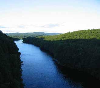

The Falls River flows from Vermont through the center of Bernardston and on into Greenfield. Its thirtysquare-mile watershed extends into Vermont and northern Greenfield. Forest cover within the watershed is around seventy-seven percent. Though this extensive forest cover helps reduce the erosion of upslope soils and sedimentation of the river, the potential for flooding caused by large storms remains a concern in Center Village due to the proximity of buildings and roads to the river.


The 2003 Water Quality Assessment Report from the Massachusetts Department of Environmental Protection (DEP), concluded that the portion of the Falls River that flows through Bernardston is a Class B fishable and swimmable river supporting aquatic life and aesthetic uses (Carr, Kennedy, 2008). In 2008, the DEP classified the Falls River as a Category 2 river, which means that the river is either unimpaired or that not enough data exist (or was assessed) to determine any level of importance (Watershed Planning Program, 2014).

Falls River Watershed
The Falls River watershed extends into Leyden and Vermont, and covers about thirty square miles north of Greenfield.
Many Bernardston residents have said that they would like to have better public access to use the river for recreation; currently, access is largely through private property.
Falls River
Keets Brook
Keets Brook runs west to east and ultimately joins the Falls River near the Vermont border. It has a watershed of about seventeen square miles, with about 86 percent forest cover.
Couch Brook
Couch Brook originates at the easternmost edge of Leyden and flows east through the mountains and into the Falls River. Its watershed is about three square miles with roughly 85 percent forest cover (StreamStats, 2015). Residents in Bernardston have identified Keets and Couch Brooks as favorite places to fish and take advantage of the “beautiful scenic resources” and “serene hemlock forests” (Livingston, Sprague, Sullivan, 2008).


Keets Brook Watershed
The
Brook


Couch Brook Watershed
The Couch Brook watershed covers most of the northwestern corner of town and includes parts of Leyden and southern Vermont.
The stream adjacent to Fox Hill Road on the western side of town does not converge with the Falls River but flows directly into one of the state-owned wetlands in the center of town. The watershed calculated from the exit point of the wetland is roughly one square mile with 65 percent forest cover and an average 13 percent slope (StreamStats, 2015). Erosion from this watershed’s steep slopes and smaller percentage of forest cover (compared to Keets and Couch Brooks), contributes to sediment being conveyed downstream into Cushman Park in Center Village (discussed further below).


The watershed for the stream along Fox Hill Road
The stream along Fox Hill Road flows into Center Village, Cushman Park, and the Darwin Scott Memorial Wetland. It plays a large role in the water dynamics in Center Village.
Mill Brook
The southwesternmost brook, Mill Brook, flows through the recharge area of the Barton Road Well public water supply in Bernardston. These recharge areas are discussed in further detail in the Groundwater section below. The brook has a watershed of roughly three square miles with an 11 percent average slope. Its 87 percent forest cover helps to regulate the temperature of the water, which helps to protect the Aquatic Core habitat found here.

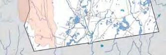
Mill Brook Watershed
Many of the streams in the southwestern corner of Bernardston are a part of the Mill Brook
On the far eastern side of town, Dry Brook flows from close to the northern border south into Gill. The watershed for this brook is around four square miles with an average slope of 8 percent in Bernardston. Forest cover is 85 percent, consistent with the other sub-basins in town (StreamStats, 2015). This brook does not pass through the center of town, but the northern sections of the brook are located in Satan’s Kingdom, a wildlife management area owned by the Department of Fish and Game. The brook is the main source of water for the well owned by Northfield Mount Hermon, further discussed in the Groundwater section. Dry Brook has also been identified as a Core Habitat. (See Element Natural and Cultural Resources for further detail.)
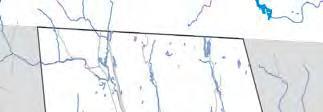
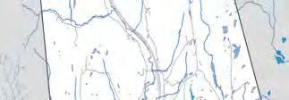
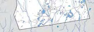
Wetlands
Bernardston is home to a diversity of wetlands, mainly located in the southern part of town. Wetlands are characterized by their soils and dominant vegetation type, and can only be delineated on the ground. The Wetland Protection Act was created to protect the values attributed to wetlands, including supplying drinking water, mitigating floods, preventing storm damage, and supporting fish and wildlife habitat. If one wants to develop or alter land within the buffer zone within 100 feet of a wetland, a Notice of Intent must be filed with the local Conservation Commission.
According to the 2008 Open Space and Recreation Plan, wetlands cover roughly 3 to 4 percent of Bernardston. But a professional wetland scientist, Bill Lattrell, suggests it is likely closer to 12 percent. This suggests that potentially more area is in need of regulation under the WPA than may be mapped currently by the Department of Environmental Protection.
One of the largest wetlands in town is along Bernardston’s southeastern edge. It is not currently identified as Priority Habitat or Core Habitat by the
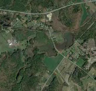
Bernardston’s largest wetland in the southeastern part of town is surrounded by residential development and in between two Critical Natural Landscape blocks.
Natural Heritage and Endangered Species Program (NHESP). It lies between, but is not connected to, two areas identified as Critical Natural Landscape extending into Greenfield. Critical Natural Landscapes are large, intact, predominantly vegetated Landscape Blocks with minimal impact from development (discussed further in Element 4). Because the wetland and the Critical Natural Landscapes are not connected, wildlife reliant on these environments encounter a fragmented landscape when they attempt to move between them.
Another large wetland in Center Village by Cushman Park, the Darwin Scott Memorial Wetland, owned by the Department of Fish and Game, spans twenty-nine acres. This wetland receives the water flow from the stream adjacent to Fox Hill Road. Sediment collects in the culvert in the park, displacing stormwater and causing flooding. After Hurricane Irene, the town removed sediment from the culvert and stream under an Order of Conditions from the Conservation Commission. According to a professional wetland scientist, a higher volume of water may be entering the wetland than exiting it, causing water to back up, which could appear as a rising water table. Combined with a shallow depth to groundwater and potentially rising water table levels on the western side of Route 5, these high levels of water could cause flooding of septic systems in this area. Because there is no municipal sewer system, all business, residential, and industrial sites maintain private septic systems. Malfunctioning septic systems, especially in areas of dense development, can have serious consequences for the health of the watershed, public and private water supplies, and other natural resources.
The flooding of Cushman Park is also a concern to residents who don’t live nearby because the park is used as a gathering space and for town events. (This issue is described in more detail in Water Dynamics in Center Village below.)
Both of these wetlands provide many opportunities for recreation and education for visitors and residents, including photography, bird watching, and learning about various wetland ecosystems. However, with probable climate change and related changes in precipitation levels, wetlands may be subject to increased droughts, which would decrease stream flow
and result in a decline in ecosystem diversity (FRCOG, 2013). The obverse side would be increased rain, creating longer durations of flood and causing permanent transformations of the wetlands and the wildlife and vegetation inhabiting them (FRCOG, 2013).
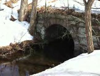
It is important that Bernardston continue to maintain the high quality of its water systems to help the overall health of the regional Connecticut River watershed. Bernardston could implement Best Management Practices (BMPs) to reduce or control non-point source pollutants from entering the water bodies. Non-point source pollutants are nutrients, sediments, and organic materials that can enter water bodies but are not traced back to a specific location. BMPs can reduce or effectively control non-point source pollution. BMPs that have been employed are rain gardens, permeable pavement, and riparian restoration to stabilize banks against erosion (EPA, 2014). BMPs used on agricultural fields involve modifications to farm and resource management practices, using structures to control or retain the movement of water, and change in vegetative and tillage practices (Kennedy, 2002).
In the Center Village of Bernardston, Cushman Park is at the bottom of a catchment basin with steep slopes. The brook that runs along Fox Hill Road enters the park in the northwest corner, through a culvert under Route 5. The brook runs southeast through Cushman Park, and then enters a 150-foot long, 4-foot-diameter culvert. The culvert is daylighted at a ninety-degree angle into an open stream that runs between Cushman Park and the former Cushman Hall property, which has been used as an informal parking area since the building was torn down in 2005. The stream is also fed by wetlands on the north side of Route 10 through a culvert that crosses the road in front of the Fire Station. These two tributaries meet and drain into the twentynine-acre Darwin Scott Memorial Wetland adjacent to the park. The area that drains into Cushman Park is roughly one square mile and covers land that is 65 percent forested; the farmland, residential lawns, and roads in the watershed also contribute to the flow of sediment that progressively fills the culverts. As the sediment builds up in the culverts, the seasonal flooding of the park becomes more severe. Best Management Practices for stormwater management, like a rain garden or vegetated swale along Fox Hill Road for sediment capture upstream of the wetland, need to be implemented, and a maintenance program instituted.
A third tributary enters the Darwin Scott Memorial Wetland from the southeast, through a culvert under Depot Street. The wetland has one exit point, where water drains through a culvert under the railroad tracks and continues southeast to join the Falls River. The wetland is classified as a shrub-scrub wetland, and is filled with woody, herbaceous species including yellow willow (Salix lutea), black willow (Salix nigra), silky dogwood (Cornus amomum), speckled alder (Alnus incana ssp. rugosa), elderberry (Sambucus nigra), and broadleaf meadowsweet (Spiraea latifolia). The southern half of the swamp is characterized by tussock sedge (Carex stricta), a classic wetland plant that provides cover for small mammals and nesting material for birds. The wetland serves as habitat for many species, including mink, otter, and beavers.
According to professional wetland scientist Bill Latrell,
there are three factors that have most likely contributed to the exacerbated flooding of Cushman Park: changes in land use and physical constraints along the stream beds, an increasing quantity of water entering the park, and an increase in nutrients brought into the wetland with the sediments.
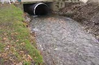
Over time, the management of the wetland and the park have changed. There is both historical and physical evidence that the wetland was previously drained. Older residents of the town remember the wetland as a hay field and recreation area, before the land was donated to the state and allowed to resume its natural condition as a wetland. What was probably a former drainage swale is still visible in a straight break in the sedge along the southern edge of the swamp. There is a high probability that the previous land owner also installed drainage tiles, a practice that was widespread in the nineteenth century. This indicates that the land was originally a swamp, and after the agricultural use of the field was abandoned, the lack of active maintenance of the drainage ditches and tiles has allowed the land to revert to its former state. The management in Cushman Park has also changed over time. The current drainage system through the park does not accommodate for the natural flow of water. The dimensions of the culverts passing under Route 5 and the park are not adequate for the mean high water flow, and create back-ups in the early spring thaw and in large storm events that increase the flooding in the park and make it unusable for the public. The ninetydegree angle formed at the end of the culvert through
the park increases the deposition of sediments inside the pipe, requiring a higher frequency of maintenance to keep clear (Latrell, 2015).

The amount of water entering the wetland increases as development expands within the catchment basin that drains to the park. Paved roads, impervious surfaces, and areas of low vegetation such as lawns and hayfields shed water at a faster rate than mature forest, increasing the amount and velocity of the water flowing downhill. If this development trend continues without implementing swales and other systems along town roads to capture, treat, and infiltrate stormwater before reaching the park, these flooding issues will increase. As precipitation rates change and likely increase in the future, flooding will further decrease the accessibility of the park for public use.
Water entering the park carries sediments with nutrients from soils, agricultural fertilizers, and other organic compounds picked up by the flow of water over the land. These nutrients are deposited into the wetland, causing eutrophication, which can increase the rate of plant growth. Depending on the types of nutrients and plant growth in the wetland this could have different impacts on the water dynamics and flood storage capacity of the wetland.
Currently, the wetland has three tributaries and only one drainage point. If the exit were blocked by the build-up of sediments or increased plant growth, the amount of water held in the wetland would increase, expanding the overall size of the wetland. This would
have serious consequences for the residents and roads that border the wetlands, and potentially damage the roads and septic systems along Depot Road, Route 5, and Route 10.
There are actions the town can take to manage the water dynamics that are affecting the usability of the park. Preventative measures can be taken to slow the build-up of sediments in the wetland. Best Management Practices for sediment capture upstream of the wetlands should be designed and constructed. Modifying the drainage system in Cushman Park to daylight the covered stream and increase the size of the culverts under Routes 5 and 10 are options. The town should perform routine maintenance of existing culverts and swales. Damage caused by storms are an opportunity to improve the drainage system and upgrade the culvert to accommodate larger storm events, rather than replace what’s there. Encouraging the implementation of reforestation and soil conservation techniques in the catchment basin that drains into the park can also reduce the flow of water and sediment into Center Village. Stormwater management along the state roads and Fox Hill Road can also help to mitigate the flooding in the park.
A 100-year floodplain is an area that has a one percent chance of being inundated by a flood in any year (FEMA, 2014). Most of the land subject to flooding in Bernardston is along the Falls River, with additional areas along Dry Brook and around the wetlands in the south. Bernardston has adopted a Floodplain Overlay District, corresponding to the 100-year floodplain. The zoning Overlay District restricts some development and protects vegetation and public safety (further discussed in Land Use). Within 500 feet of the floodplain, there are 629 buildings and public gathering spaces, which include the Congregational Unitarian Church, the Powers Institute, the fire station, Cushman Library, and Cushman Park. If another storm like Irene hit Bernardston, these structures and their associated septic systems could be at risk of flood damage, potentially resulting in pollution entering nearby waters.
The present understanding of climate change science has led scientists to predict that there could be an increase in rain, enlarging the floodplain and prolonging the duration of flooding (FRCOG, 2013). This could impact both the farmland within the floodplain and the businesses and residences in the Center Village (FRCOG, 2013). To best prepare for these potential climate challenges, Bernardston could take measures to promote soil conservation practices on local farms that reduce erosion. Improving stormwater management along existing roads through systems that capture and infiltrate rain and snow melt at its source could also reduce the severity of flooding downstream. To prevent public health emergencies in the future, the town could actively pursue solutions for wastewater treatment that would reduce the potential for septic system failure during flood events.
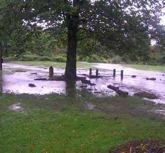
After Hurricane Irene in 2012, Cushman Park was almost completely inundated. The culvert could not manage all of the water along with the sediment that was conveyed down the streams. Eventually, the stream had to be dredged. If there are more storms like Hurricane Irene in the future, Cushman Park will need a culvert or stream that can handle the large volume of water that will flow through the park during these large storms.


The numerous floodplains correspond with the larger water bodies in town. The two large wetlands in the southern part of town each have a floodplain as well as the brooks in this area.


Aquifers are made up of water-bearing soils and minerals. They are either confined between layers of rock and clay or unconfined, where they receive recharge water directly from the surface waters or precipitation (EEA, 2015). The areas that recharge an aquifer can either be directly above the aquifer or miles away. It is important to have protective measures on recharge land to protect the quality and quantity of water so as to not contaminate the aquifer and the public drinking water supply.
Bernardston has two public wells, the Barton Road Well and the Sugar House Well, owned and operated by the Fire and Water District, a private entity. They supply water to sixty percent of Bernardston residents and various commercial businesses, industries, and agricultural enterprises. Because the water mains do not reach the total extent of the town, many residents are required to rely on private wells. Two town wells are inactive and the fifth well is privately owned by Northfield Mount Hermon, a private school in the neighboring town to the east. There is also a well located on the former Purple Meadow Campground that was taken out of use in 2009 due to mechanical issues. The District currently maintains twenty-two miles of water pipes in town, some of which are antiquated and need replacing. The Fire and Water District estimates it replaces 3 percent of the pipes each year.
In 2014, Franklin County Regional Governments identified Bernardston as one of eight critical public water supply sources for Franklin County. Protecting the public water supply in Bernardston should be a priority. One factor that could impact the water supply is the anticipated changes in precipitation due to climate change. These changes could include a decreased water supply in the summer, leading to higher demand on water, or extreme flooding from increased precipitation in intense storms that may be experienced year round (FRCOG, 2013). This change in climate could put higher pressure on the antiquated
water mains, leading Bernardston to upgrade the water mains and perhaps also reinstating one of the wells not currently in use to meet an increased demand.
The wellheads in Bernardston have three zones of protection. Zone I generally takes a circular shape with a radius of 100 to 400 feet from the wellhead, depending on the amount of withdrawal of the particular well (TOB Wellhead, 2012). This area requires the most protection because it is the most vulnerable to contamination. In Bernardston, the Fire and Water District does not own all of the Zone I areas, leaving them vulnerable to adverse land uses by the residents, businesses, farmers, or schools that do own them. As a Best Management Practice, the Department of Environmental Protection recommends that a supplier owns the Zone I area.
Zone II is the area that contributes water to replenish the well; it includes the Zone I. It recharges the groundwater with rain, stormwater, or melting snow that percolates down into the soil and reaches the aquifer (TOB Wellhead, 2012). Zone II boundaries are determined by hydrogeological investigations. Bernardston has a local Water Resource Protection Overlay District, which correlates with the Zone II. The Overlay District has certain development restrictions to further protect and reduce risk of contamination of the groundwater in the Zone II areas.


The water mains in town do not extend to the whole town, causing many residents to require a private well. Pratt Field Well and Purple Meadow Well are both inactive. With the uncertainties of climate change, there is potential for an increased demand on water supply. This may lead to the inactive wells needing to be reinstated.


The Zone III encompasses both the Zone I and the Zone II, and contributes surface and groundwater to the Zone II. It represents the watershed of the well. There are local bylaws that control and restricts impervious surfaces, floor drains, and facilities that generate hazardous waste within the Zone III areas (TOB Wellhead, 2012).
Current regulated zones may be insufficient as the climate continues to change. The Zone II and Overlay Districts may need to be reassessed and expanded to accommodate future supply needs if precipitation increases in the area.
The northernmost well, Sugarhouse Well, is located between Interstate 91 and Route 5. This well is at risk of being contaminated by the salt use on both of the state roads around the recharge area
Agriculture is part of Bernardston’s identity as a small New England town, and residents would like to see it continue; however, the use of various pesticides and fertilizers on agricultural fields within Zone II areas poses a potential contamination threat to drinking water. Runoff from croplands collects fertilizers and pesticides and conveys them to nearby water bodies, and fertilizers and pesticides can also leach downward from the surface, contaminating the groundwater below. Barton Road Well and Sugar House Well are both near numerous agriculture fields, and could be at risk. Landowners and farmers can implement various best management practices (BMPs) to reduce the risk of fertilizer and pesticide contamination of the Zone II recharge area. BMPs are site specific; they are meant to maintain agricultural production in an economically
 Aquifer Diagram
Well
Ground Water
Gravel/Sand
Aquifer
Surface Water
Water Table
Filtration
wastewater treatment. Septic systems that are not properly maintained can leach nutrients and bacteria into the soil, degrading groundwater quality, and creating public health hazards. The soil characteristics on a site determine how a septic system should be designed to meet Title 5 requirements.
Conventional septic systems carry raw sewage and wastewater from the house into a settling tank. The solids sink to the bottom of the tank, and the liquid, called effluent, leaves the tank through an outlet. The effluent is discharged into a leach field, often a constructed series of trenches with gravel, sand, or porous material. The effluent percolates through the material, where harmful bacteria, viruses and nutrients are trapped or broken down through natural processes. The higher the absorption and infiltration capacity of the leach field, the less likely that an area will become saturated with a high concentration of effluent.
According to the NRCS Soil Web Survey, all of Bernardston’s soils are categorized as somewhat or very limited for septic tank absorption fields. These classifications are based on several soil characteristics including the frequency of flooding, filtering capacity, and depth to the water table. These limitations mean that the majority of septic systems in the Center Village may require major soil remediation with large amounts of purchased gravel or sand, or special designs that have more expensive installation and maintenance costs.
Proper maintenance of septic systems includes the periodic removal of the solids that build up inside the tank. Allowing the tank to fill with solid waste may push some solids out into the leach field, saturating the soils with harmful bacteria and lowering the absorption capacity. The Massachusetts Department of Environmental Protection only requires that a conventional septic system be inspected when a property is sold, which means that the onus of maintaining a system is on the individual owner. It is
the opinion of the Bernardston Board of Health that many systems in Bernardston fail to meet the state inspection at the time of sale because of a lack of maintenance. Due to stricter regulations, a poorly maintained conventional system may not be able to be repaired. If a leach field is badly damaged and the site is too small to construct a new one, a specially designed system is required.
In interviews with the Board of Health, a former Regional Health Agent, and town officials, the following situations have come to light:
• Sixteen septic systems failed to pass inspection in 2014 and one house was condemned partially because of a damaged system.
• Multiple businesses that serve the general public have failed to maintain their septic systems, allowing them to clog and back up.
• Residents are not educated about proper maintenance, and are unprepared to deal with the costs of replacing failed systems, which can devalue property and negatively affects the housing market in town.
• The Board of Health is operating with a small staff and doesn’t have the resources or expertise to adequately address the septic issues or come up with alternative designs to improve the quality and lower the costs of wastewater management.
Recently, the Town Board of Health has taken measures to improve these situations. They have instituted fees for the re-inspection of repairs to create incentives for proper maintenance, and are working on implementing a mandatory requirement for filters that would result in systems backing up into the house before solids were released into the leach fields. This would alert residents and businesses to the problem before the leach fields are contaminated or severely damaged.
In 2008, Bernardston contracted with Tighe & Bond, an engineering and environmental consulting firm, to conduct a wastewater infrastructure analysis and conceptual development plan for two undeveloped sites near the entrance of I-91. The goals for the plan included evaluating the wastewater infrastructure needed to serve the Center Village and additional development on the two business and industrial sites developed, and generate a conceptual plan for mixed business and industrial development that could be used as a marketing tool to attract investors and developers. The town zoning requirements, wetland resources, community needs, marketability, and the desire to maintain the rural character of town were taken into consideration during the analyses. The plan recommended a centralized sewage system with a capacity of 40,000 gallons per day to serve a portion of the Central Village. The anticipated costs for this centralized system total over $6 million. The plan also evaluated the USDA Rural Development loans and the Massachusetts State Revolving Fund as sources of potential funding, and determined that if these sources of funding were used, the options ranged from twentyto forty-year loans ranging from $4.8 million to $8 million in total payments.
The state Title 5 regulations permit individual systems that process up to 10,000 gallons of wastewater a day. Larger systems require a special permit from the state. The costs of a larger system rise sharply, which lowers the financial viability of businesses and industries that require larger systems. A centralized wastewater treatment plant would make the town more appealing to a greater variety and scale of businesses and industries, although these systems are very costly and would require a large amount of coordination and outside funding. Due to the steep topography, large area, and low density of development in Bernardston, the cost of a system to serve the majority of residents would be prohibitive. However, investing in a centralized system could benefit the town by reducing the costs of maintaining individual systems for each of the municipal buildings, attracting larger businesses and industries that would diversify the tax base, and create local jobs. The scale and design of a sewer system would determine the type of development potential for Center Village. Some considerations for
different scales and types of systems are discussed below, but a solution for this issue is beyond the scope of this report and should be taken up by a professional environmental engineer. Section 10 contains a more detailed discussion of the recommendations referenced below.
According to MassDEP’s approved list of individual wastewater treatment systems, many of the newer innovative and alternative designs that require maintenance contracts are better than some of the centralized or decentralized systems at removing solids and other pollutants from wastewater before it reaches soil absorption areas. In addition, the soil absorption areas from these systems tend to have longer lives due to the efficiency of the system. These systems incorporate advanced technology that decreases the content of nitrogen in the wastewater, protecting private or public water supplies and other nitrogensensitive zones from contamination. With stricter regulations on conventional septic systems, they are increasingly becoming outdated. These outdated systems are increasingly failing and posing a threat to groundwater quality and public health. Educating the public about proper maintenance regimes and updates to systems will be necessary to further protect the quality of the groundwater and prevent public health emergencies. The Board of Health is currently working on increasing the monitoring of septic systems and implementing stricter town requirements to prevent system failures, but there are further actions that could be taken to address these issues. The Planning Board could create a Wastewater District with mandated periodic inspections of septic systems. The Board of Health could investigate retrofits such as aerators that would increase the quality and life of the systems, and coordinate the purchase and installation of these retrofits to reduce the overall costs for residents and businesses.
The Environmental Protection Agency and MassDEP promote decentralized systems as a cost-efficient alternative that has lower public health and environmental risks than larger centralized systems. Some decentralized systems, such as a small-diameter pressurized system that connects to existing septic tanks, can use existing infrastructure to establish a communal secondary treatment site. These systems may help to reduce costs for stakeholders and allow for higher density of development on a small scale, but require a higher degree of cooperation among individuals to coordinate shared management and site a common leach field.
The Environmental Protection Agency has identified six management strategies that communities may adopt to improve the performance of decentralized systems and decrease their maintenance costs. These range in complexity from educational outreach to encourage better maintenance, to creating legal entities to oversee maintenance and inspections. Options include increasing homeowner awareness of proper septic maintenance and alternative systems, establishing requirements for maintenance contracts with a locally contracted inspector, establishing third-party responsible management entities to manage privately owned systems, and establishing a third-party entity such as an independent wastewater district that owns, installs, and maintains clustered systems (EPA, 2012).
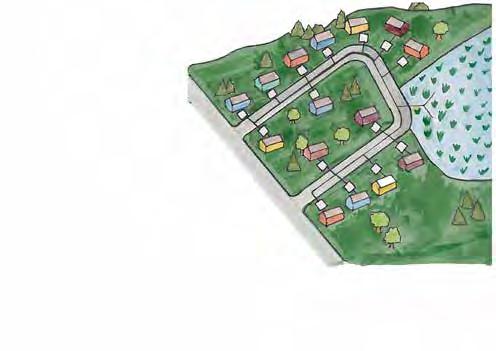
Establishing third-party management over individual and decentralized systems may be a successful longterm strategy in increasing the affordability of higher quality systems, and preventing environmental and public health emergencies in Bernardston.
A centralized system, such as the one proposed in 2009 by Tighe and Bond, would support residents and businesses with a capacity of greater than 15,000 gallons per day. A system of this scale could allow for denser residential and commercial development. However, it would require extensive planning and engineering, skilled labor to construct and operate, large amounts of capital, and long-term financial support, which poses a significant challenge for a small town with limited financial and staffing resources (Hophmayer-Tokich). Assessing the most appropriate size of a centralized sewer system can be difficult. The soil and physical characteristics of a site determine the capacity of a system; therefore any anticipated or desired expansion in the future must be taken into consideration when looking for sites for development. The major challenges facing Bernardston in creating a centralized sewer system include garnering the support of the townspeople to pay for a plan by qualified environmental engineers, and pursuing funding to create the system. Available funding for rural wastewater systems has been steadily decreasing since the 1980s, and small towns have fewer resources available for support (Ayers, 2015). Locating a suitable area for the disposal or reuse of the treated effluent poses an additional challenge. Since the sale of one of the sites used in the Tighe and Bond study, there are fewer undeveloped areas available.
Charlemont’s wastewater treatment plant was built in 1998 by an independent wastewater district and was designed to accommodate the downtown business district and future residential and business growth. The plant has a capacity of 500,000 gallons a day and serves 450 buildings in the central business district. Unfortunately, the design of the plant anticipated faster economic growth than has occurred, resulting in the plant only processing 15,000 gallons a day and operating at a loss. (Ayers, 2015). Although Charlemont’s wastewater system is not being used to its capacity, the system successfully serves the town center and can support further business growth. The design for the system also includes solar panels that cover 64% of the energy needs of the plant (Town of Charlemont, MA).
The town of Wendell, MA has been recognized for its non-standard waste treatment methods including the approval of standard composting toilet systems for residents. (EPA, 2012). The town needed to update its approach to septic solutions as public buildings lacked facilities and some systems were discharging illegally into a nearby swamp. Wendell was encouraged to put in a community system that served town buildings and included additional capacity to accommodate residents in the center of town. The town received funding from the Metropolitan District Commission (now the Department of Conservation and Recreation) to construct a decentralized system with alternating leach fields (Ayers, 2015).
In the Albemarle Region of North Carolina, low-permeability clay soils and high water tables make much of the area unsuitable for conventional septic systems. In 1991, a study found that 30% of the systems were malfunctioning and posing risks to groundwater, rivers, and wetlands. 11 counties formed an Albemarle Septic Management Entity (ASME) in 1993 that has implemented routine inspections, maintenance contract requirements and reminders, and alternating leach fields for decentralized systems. ASME inspects all systems in its jurisdiction annually, and bills owners for necessary repairs. The program is sustained through annual home permit feeds, annual system inspection fees, and county funds. By 2008, the rate of malfunctioning systems had fallen from 30% to 0.2%. (EPA, 2012)
In order to achieve these goals, the town should create opportunities for the residents to become more educated about the water quality in Bernardston, both ground and surface waters. Assess possibilities and conduct studies for further protection of public water supply. Maintain Center Village with an alternative sewer system that supports current development on a neighborhood and commercial scale to create infill development and sustain businesses.
Issues:
• The public water supply is at potential risk of contamination from salt use and de-icing chemicals used on state highways.
• Zone II recharge areas of public wellheads may be under pressure due to climate change.
• There is no education opportunities available for residents to learn about water quality.
• Cushman Park frequently floods due to an undersized culvert in the park. Upstream erosion brings sediment into the park, further obstructing the culvert in the park.
• Lack of stormwater management contributes to potential pollution of groundwater and rivers in town.
• Flooding in Center Village contributes to failing septic systems on residents’ property.
• Septic systems in town cannot support infill development.
• There is no public access to the Falls River
Scientists predict that, in part due to chemical changes in the atmosphere, there will be an increase in annual precipitation, shifts in temperature, and increased frequency and intensity of storms and flooding in New England. These changes may have unpredictable impacts on surface and groundwater resources. As the population and development pressures change in the region, the demand on Bernardston’s groundwater may also increase. An increase in precipitation would result in a higher volume of water flowing through Bernardston. Agricultural and residential areas will need to prepare for increased flooding and periods of drought by implementing soil conservation practices to reduce erosion and avoiding the use of environmentally damaging chemicals. Good watershed management practices such as the preservation of open, vegetated land and a limited amount of paved surfaces will serve to reduce the negative impacts of increased precipitation and to protect all water resources.

Recommendation for Bernardston’s future (Watershed, Natural and Cultural Resource, Land Use) management cover a range of actions, including education and outreach, zoning and policy changes, strengthening community connections, and investing in infrastructure changes that require significant planning and funding. The following recommendations are explained in more detail with suggested time frames and potential responsible parties in Section 10.
Ongoing
Create public education programs to raise awareness about the importance of protecting surface water and wetlands for water quality and ecological integrity. With more knowledge of water systems and the services they provide to residents, people may be more motivated to take care of their natural environment. These programs should stress the role that intact watersheds and wetlands play in mitigating the detrimental impacts of increased storms from climate change.
Designate an area along the Falls River for recreation and scenic views. The town could work with landowners and the Conservation Commission to find an appropriate site that can accommodate residents and visitors and is designed to minimize impact on the riparian habitats and wildlife.
Create a trail system with signs along Pratt Field as a focal point for water education about the town’s water supply system, water treatment, and management practices to protect water quality, and ecosystem services. Incorporate additional vegetation along the parking area to infiltrate stormwater and filter contaminants from vehicles. The site is adjacent to one of the town’s public wells and borders a
stream. Signs should have information about actions that citizens can take to protect the local water supply. These could include encouraging bike and foot travel to the sports fields to reduce potential contamination due to vehicular traffic at Pratt Field, which is in the Zone I protection area of the well. Information about the Pratt Field well, the process of replenishing the well, and facts about the nearby stream and the habitat that the stream supports could also be part of the educational materials.
Create a regulatory system to oversee the maintenance of individual septic systems. This could be accomplished with the creation of a Wastewater District that mandates periodic inspections of septic systems within the Center Village, business, and industrial zones, or by mandating alternative systems approved by the DEP that require maintenance contracts.
Investigate shared-ownership strategies for septic systems and actively facilitate information for homeowners about available alternative systems and retrofits that could increase the life of current systems. There are a wide variety of alternative septic systems that have been approved by the DEP. Creating decentralized systems on a neighborhood scale can reduce installation and maintenance costs, although they may require additional organization and economic structures such as escrow accounts for long-term maintenance.
Designate Fox Hill Road and state roads as priorities for stormwater Best Management Practices, which would include vegetated swales along the road to slow the flow and infiltrate runoff. Along Fox Hill Road, this would help to decrease the volume of water and sediment being conveyed into Cushman Park and the wetland. Implementing BMPs for state roads could prevent runoff from potentially polluting the town’s water bodies and recharge zones by capturing and infiltrating the runoff.
Establish remediation sites using cattails (Typha angustifolia) and spear saltbush (Atriplex patula) in swales in the Zone II Recharge Area of the Sugar House well, where the state maintenance regimes of Routes 5 and I-9I result to high amounts of salt in road runoff. These species are salt tolerant and have the ability to treat salt-contaminated runoff before infiltration.
Evaluate the unpaved roads in town and their susceptibility to erosion. Conduct a study to find out how much sediment and runoff flows off the streets into the water bodies in town. Unpaved roads can contribute to rural character, and may slow the spread of residential growth in more remote areas. Work with the Highway Department and the Massachusetts Department of Transportation to establish an Integrative Vegetation Management program to minimize the use of herbicides and control vegetation in the Right-of-Ways. This will help to minimize damage to native wildlife and groundwater from herbicides and chemical uses, and implement management strategies such as carefully timed mowing to allow for songbird reproduction.
Consider conducting a study of salt use on state roads and the impact on groundwater or recharge zones to determine whether certain areas of the state roads can be designated as “reduced salt areas.” Road salt is a potential contaminant to the public water supply, especially within the Sugar House Well recharge zone. Hire an engineer to consult on wastewater treatment alternatives. There is no one currently on the Board of Health or in the Town government that has the necessary environmental engineering expertise to direct the town towards appropriate solutions for wastewater treatment in Bernardston. The 2009 Tighe and Bond Sewer Analysis and Conceptual Design Report should be reviewed to assess the feasibility of centralized or decentralized sewage treatment systems for the Center Village and business and industrial zones.
Reassess the Water Protection Overlay District assuming that the current inactive wells will need to be reinstated in the future. Bernardston has been identified as one of eight critical sources of public water supply in Franklin County. Unpredictable changes in future precipitation along with population growth may require inactive wells in Bernardston to be reinstated, or new wells to be constructed. The Water Protection Overlay District would need to be assessed to meet any significant changes in demand or the creation of additional wells.
Pursue funding for design and construction of a wastewater treatment solution resulting from professional environmental engineering plans that allows for denser development and a wider variety of businesses. Additional funding may be available if, during construction of sewer system, utility lines could be buried and old water mains could be replaced. There are limited funding sources available for rural towns, and a separate committee or hired staff member may be necessary to devote the time required to acquire the funds for a project of this scale.
Construct a boardwalk through the wetlands by Cushman Park with wildlife and water education signs to increase accessibility and awareness of the ecosystem and natural environment. This will make use of the wetlands in the park, and can be a recreational destination for both residents and visitors.
 Darwin Scott Memorial Wetland
Credit: Rachel Lindsay
At community meetings, residents listed many natural resources, historic places, and cultural traditions among the most valued assets of Bernardston, including landmark buildings, agricultural traditions celebrated in community activities like the Scarecrow Contest, and outdoor recreation lands where residents hike, bird watch and snowshoe. Two bands of mountains with dense forests envelop the Falls River Valley, providing wildlife habitat, ecosystem services, and picturesque views with ample opportunity for outdoor recreation. Beyond the natural landscape, the hilly topography has shaped the town’s history. Originally settled in the eastern hills for protection from Native American raids, the town center has moved to different locations over the years. One of the first buildings, the Congregational Unitarian Church, was moved two times and now is located in the Center Village, highly valued for its New England aesthetic and many historic buildings.
Residents value the town’s rural character defined by its forested and agricultural landscape and believe efforts must be taken to preserve this landscape and the historical architecture common throughout town.
The natural landscape in Bernardston serves both the human and wildlife populations that inhabit the largely forested town. Some businesses depend on natural resources for farming and timber. Rich soils support the agricultural lands that are central to the town’s history, economy and rural character. Aquifers and surface waters provide the town’s excellent water quality. The various wetlands provide habitat, control flooding, and filter water. Numerous vernal pools provide habitat, slow runoff during storms and recharge groundwater. Approximately three quarters of the land is forest, and forested wetlands are common (DFG, Nature Conservancy, 2010). The largely intact forested lands are critical habitat for wildlife, including several species of conservation concern, and serve to clean the air and water, absorb water and therefore reduce erosion, and provide shade to regulate the temperature of water bodies. These forests are integral to the health of regional ecoregions.
The natural resources in Bernardston contribute ecosystem services, which are defined as the benefits ecosystems provide to people. These benefits can be direct or indirect, small or large. The United-Nationssponsored Millennium Ecosystem Assessment identified four major categories of ecosystem services: provisioning, regulating, cultural, and supporting services.
A provisioning service is “any type of benefit to people that can be extracted from nature” (National Wildlife Federation, 2015). Provisioning benefits include food, drinking water, timber, wood fuel, natural gas and oils, medical benefits, and plants that can be made into clothes and other materials. Bernardston’s diverse landscape and rich soils provide resources for logging and agriculture, which some residents are dependent on for income. For example, maple trees support a syrup farm by Eden Trail. The town’s aquifers supply its high quality drinking water. (See Element 3.) Forests and water bodies in Bernardston supply residents who forage, hunt, or fish with food.
A regulating service is “the benefit provided by ecosystem processes that moderate natural phenomena” through pollution reduction, decomposition, water purification, erosion and flood control, carbon storage, and climate regulation (National Wildlife Federation, 2015). Regulating services provide many of the basic services that support human existence. For example, pollination by birds and insects is critical for many of the fruits we eat. In Bernardston, the dense forests such as Charity Farm Lot help to stabilize soils, purify the water, store carbon dioxide, and regulate climate. The wetlands in Bernardston serve to control flood waters, absorb nutrients and chemicals from the water and act as a natural filtration system. These processes work together to make ecosystems clean, sustainable, functional and resilient to change.
A cultural service is a “non-material benefit that contributes to the development and cultural advancement of people” (National Wildlife Federation, 2015). This includes the building of knowledge, the spreading of ideas, and creativity born from interactions with nature and recreation. The forests in Bernardston provide scenic and recreational benefits
including, hiking, bird watching, snowmobiling, snowshoeing, cross country skiing, star gazing, horseback riding, hunting, and fishing.
Supporting services are underlying natural processes, such as photosynthesis, nutrient cycling, the creation of soils, and the water cycle (National Wildlife Federation, 2015). Without supporting services, provisioning, regulating, and cultural services would not exist. The forests in Bernardston support erosion control which is both a supporting and regulating service.
Ecological systems are complex and dynamic and can be assessed in a variety of ways. Ecological integrity can refer to:
• Health of individuals
• Population dynamics such as reproduction
• Species diversity
• Species interactions
• Keystone or foundation species
• Ecosystem processes and dynamics- such as nutrient cycling, hydrology, disturbance regimes
The rugged topography east and west of the Fall River is characterized by glacial till with abundant rock outcrops. Glacial till is unsorted material deposited as the glaciers retreated. Soils that developed in glacial till are largely sandy loams. Small areas of impure marble along the eastern mountain range may support richer soils and uncommon vegetation. The Connecticut Valley Lowland possesses richer soils of coarse sand and gravel deposited from outwash as the glacier retreated. The Fall River Valley includes a mix of alluvium soils and outwash deposits that support rich woods with abundant early spring wildflowers.
Massachusetts’
Ecoregions
Bernardston is located at the border of two distinct ecoregions: the Connecticut River Valley and the Worcester Plateau. The Connecticut River Valley has rich soils, a relatively mild climate and low rolling topography. In contrast, the Worcester Plateau Ecoregion, in the central upland of Massachusetts, consists of most hilly areas with a few high monadnocks and mountains. Bernardston’s landscape has features of both ecoregions, with rich soils along the valley floor and hardwood forests on the eastern and western ridges.
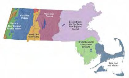 Credit: BioMap2


Abundant Outcrop
Artificial Fill
Swamp and Marsh Deposits
Floodplain Alluvium
Alluvial Fan
Coarse
Glaciolacustrine Fine Stagnant-Ice Deposits
Thin Glacial Till
Surficial
2016 Master Plan
Town of Bernardston
Bernardston’s diverse landscape of meadows, wetlands, rivers, streams, bogs, ridges, and forests supports various plant species, some of which are of conservation concern. The town’s vegetation plays a crucial role in ecosystems by converting solar energy into biomass, which is used for wildlife shelter and food. Through photosynthesis, plants sequester carbon and release oxygen. Trees can hold between 35 and 800 pounds of carbon dioxide each year, depending on the size of the tree (Trimarchi, 2008). Plants also serve to clean the air and water as their leaves filter particles, including dust, and ozone. Vegetation helps to lower temperatures through evapotranspiration, a process by which water is absorbed through roots and evaporated through their leaves. On average, a large oak tree is capable of transpiring 40,000 gallons of water into the atmosphere in a year (Perlman, 2014). Vegetation provides shade and regulates the temperature of water bodies, which is essential for aquatic life. Shade produced by plants can also reduce energy use by reducing the need for air conditioning during warmer months. Plants’ roots help to secure soils and stabilize banks, reducing erosion.
The two dominant forest types in Bernardston are Transition Hardwoods and Northern Hardwoods, which cover the two mountain ranges (DFG, Nature Conservancy, 2010). Transition Hardwoods cover much of Franklin County and include oak, white pine, hemlock, and black birch. Northern Hardwoods are the most dominant forest type in western Franklin County and include beech, sugar and red maples, hemlock and white pine (Livingston, Sprague, Sullivan, 2008).
There are several plant species of conservation concern within Bernardston: two endangered species, two species on the NHSEP watch list, and several plants identified in a recent Franklin County flora project that have not been added to the watch list.
American waterwort (Elatine americana), black cohosh (Actaea racemosa) and tiny-flowered buttercup (Ranunculus micranthus) are three plant species currently considered endangered in the state of Massachusetts. All species listed as endangered are protected from killing, collecting, possessing, sale and other activities that destroy habitat (NHESP, 2011). Easily overlooked, the American waterwort is a small,
delicate broad-leaved plant that occurs on muddy shores of ponds or tidal river and tributaries. The plant flowers in mid-July to August and produces fruits from mid- August through September (NHESP, 2011).
Described as a “striking herbaceous perennial” in the buttercup family, black cohosh is a common garden and herbal medicine plant that inhabits rich deciduous forests typically with moist alkaline soils. The plant produces white flowers in July and has a flowering stem reaching eight feet in height (NHESP, 2011). The tiny-flowered buttercup typically occurs on southfacing slopes in patches of soil between rock outcrops and flowers in the spring (NHESP, 2011).
Water stargrass (Heteranthera dubia) is the only identified plant included in the NHESP watch list—an unofficial list of plants that are known or suspected to be of conservation concern. Species are included on this list for a number of reasons including seeming decline or vulnerability and recent discovery (NHESP, 2011). A “fully emerged perennial,” water stargrass can grow to just under five feet long and favors water bodies with sand and gravel soils and medium to high nutrient levels (Les Traitements BioBac, 2012).
Plants play a key role in human and wildlife existence and it is important that residents consider long-term strategies to better support vegetation as the climate changes. The Massachusetts Climate Change Adaptation Report suggests several strategies to reduce the vulnerability of vegetation to climate change. One strategy is to protect land by securing large unfragmented forest blocks that are essential for species persistence. Establishing landowner incentives to maintain and manage forest ecosystems is another strategy as nearly 80 percent of forests in Massachusetts are privately owned (Berke, Lyles, 2012).
The adjacent table lists plants identified by the NHESP as of conservation concern. The plants that are not listed by NHESP are from a recent Franklin County project to list species of concern.
American waterwort Elatine americana EndangeredMuddy shores of ponds or tidal river and tributaries
Black cohosh Actaea racemosa EndangeredVery rich deciduous forests, typically with moist alkaline soils
Tiny-flowered buttercup Ranunculus micranthus
EndangeredSouth-facing slopes in patches of soil between rock outcrops
Water stargrass Heteranthera dubia NHESP watch list Water bodies with sand and gravel soils
Narrow triangle moonwort Botrychium angustisegmentum
Not listed Mostly in northern hardwood forests but also in other kinds of forests and sometimes in openings
Long-bracted orchis Coeloglossum viride Not listed Forests, meadows and fields, swamps
Lace-grass Eragrostis capillaris Not listed Cliffs, balds, or ledges, floodplain (river or stream floodplains), ridges or ledges
Whorled milkwort Polygala verticillata
Not listed Cliffs, balds, or ledges, meadows and fields, ridges or ledges, woodlands
Balsam poplar Populus balsamifera Not listed Forest edges, forests, meadows and fields, shores of rivers or lakes
Pendulus bulrush Scirpus pendulus Not listed Meadows and fields
Leafy bulrush Scirpus polyphyllus
Motzkin, 2015
Not listed Forests, shores of rivers or lakes, swamps
Satan’s Kingdom
Satan’s Kingdom
Fields along Rte. 10
Off Rte. 5 and 10
By the Falls River south of Meadow Rd.
In Massachusetts, two significant mapping efforts have been critical to understanding various types of wildlife habitat and their extent: BioMap2 and CAPS. BioMap2 is the result of a collaborative effort to document evidence of rare species and natural communities in Massachusetts gathered over the past thirty years, in order to protect the state’s biodiversity. The Massachusetts Department of Fish & Game, Division of Fisheries and Wildlife’s Natural Heritage & Endangered Species Program (NHESP) and The Nature Conservancy are the main contributors to this effort. BioMap2 identifies two complementary spatial layers, Core Habitat and Critical Natural Landscape. Core Habitats are key areas that are critical for the long-term persistence of species of conservation concern. Critical Natural Landscape supports Core Habitat and is characterized as large, intact, predominantly vegetated Landscape Blocks with minimal impact from development. Protection and stewardship of Core Habitat and Critical Natural Landscape is imperative for securing the diversity of species and their habitats, preserving intact ecosystems, and ensuring the overall resilience of natural landscapes across Massachusetts (DFG, Nature Conservancy, 2010).
Another resource for identifying important habitat is the Conservation Assessment and Prioritization System (CAPS). CAPS is a computer software program that models prioritized land for conservation across the
state. In 2011, the Landscape Ecology Program at the University of Massachusetts Amherst completed a comprehensive, statewide assessment of ecological integrity using CAPS. Maps were created for every city and town in Massachusetts depicting spatially their Index of Ecological Integrity (IEI) and delineating wildlife habitat and biodiversity based on landscape ecology principles and expert opinion. IEI maps rank all of the land and then show the 50 percent of the landscape with the highest rating and therefore the greatest ecological integrity. The areas of greatest ecological integrity in Bernardston correlate with the forested mountain ranges and should be prioritized for preservation as they offer habitat and support a diversity of wildlife. The maps produced from CAPS models go beyond identifying habitat to rating it. Together, the CAPS data and BioMap2 are resources that identify critical habitat both at the town and state scale and illustrate areas for priority protection.
CAPS has identified the eastern and western mountain ranges in Bernardston as having the highest ecological integrity. Lowlands throughout town, including freshwater wetlands and aquatic landscape, are identified as having high ecological integrity. Shrublands of high ecological integrity are dispersed in town. The area surrounding Center Village has limited land of high ecological integrity.
Bernardston is located in western Massachusetts a region with high ecological integrity.
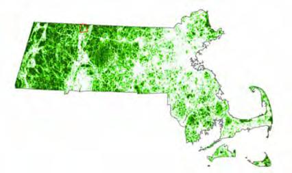
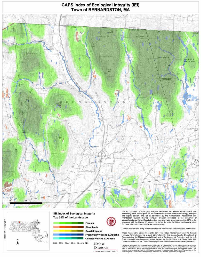
The dense forest along the eastern and western ridges in Bernardston is identified as a Critical Natural Landscape which supports Core Habitat within the forests and along the Mill Brook and a tributary. BioMap2 further classifies wildlife habitat into Core Habitats defined by landscape characteristic and function, including Aquatic Core, Forest Core, Vernal Pool Core, Wetland Core Buffer, Species of Conservation Core, and Priority Natural Community Core. There are three species of Conservation Concern Cores, one reptile, one insect, and one plant in Bernardston. Bernardston’s deciduous forests provide habitat for black cohosh, an herbaceous perennial plant in the buttercup family which is currently endangered. Over fifty potential vernal pools have been identified in Bernardston and only one has been certified. Vernal pools are small, seasonal wetlands that provide habitat specifically for amphibians and invertebrate animals. These vernal pools are important for wildlife and human populations as they slow runoff during storms and recharge groundwater. (See Element 3.)
The large, intact Critical Natural Landscape blocks on the eastern and western mountain ranges supports Core Habitat: Forest Cores, an Aquatic Core, and a Vernal Pool Core. All of the identified habitats are significant as they are part of larger regional Landscape Blocks that connect to surrounding towns. The Critical Natural Landscape on the southern edge may appear to be small and less significant but, it is part of a Landscape Block extending into Gill that has been identified as the second largest contiguous block in the ecoregion. Along the northeast border with Vermont, a black gum swamp and a black ash swamp are identified as Priority Natural Communities by NHESP. Black gum swamps are forested hummocky peatlands that occur in a variety of settings, including isolated shallow depressions or basin wetlands, and along the edges of ponds or shorelines (NHESP, 2011). The swamp in Bernardston is relatively small but in good condition as it is protected within a large, intact forest (DFG, Nature Conservancy, 2010). Black ash swamps are a variant of red maple swamps that prefer less acidic, nutrient-rich groundwater. The black ash swamp in Bernardston is also protected by the large, contiguous forest and has good structural and floristic diversity (DFG, Nature Conservancy, 2010). The northeast corner of town has
two Forest Cores, large intact forests with few roads and minimal development. Forest Core in Bernardston provides habitat for the early hairstreak butterfly, which is currently threatened, and supports a Vernal Pool Core (DFG, Nature Conservancy, 2010). These species, some of which are state-listed as rare and endangered, live in vernal pools and in adjacent upland forests where they overwinter.
The certification of vernal pools depends entirely on volunteer effort and is administered through NHESP. Students and teachers for example, could get involved in identifying, certifying, and monitoring the town’s potential vernal pools. Once a vernal pool is certified, there are regulatory restrictions placed on development and other activities proposed within and by the pool. Certified Vernal Pools are protected from certain forestry impacts including harvesting requirements that limit cutting to no more than 50 percent of the trees within fifty feet of a CVP (MacCallum, 2009).
In the southern half of town, an Aquatic Core has been identified along the Mill Brook and a tributary. An Aquatic Core is a functional ecosystem for fish species and other aquatic species of conservation concern. A spotted turtle population, currently of conservation concern, has been identified in the southeast corner. This species favors habitat with large, unfragmented, open space. On the border of Bernardston in Gill and Northfield, there are two Wetland Core Buffers, defined by BioMap2 as the least disturbed wetlands in the state within undeveloped landscapes with intact buffers and little fragmentation. Within Bernardston, there are two rare endangered plant species that inhabit water bodies and are currently endangered, the American waterwort and water stargrass. The forests and wetlands of Bernardston are home to unique habitats and species. Proper land management and measures to protect these habitats are essential for their long-term persistence.


In Bernardston, approximately 20 percent of the open space—undeveloped land with particular conservation or recreation interest, owned by the state, town, land trusts, other non-profits, or individuals—is protected in perpetuity. A conservation restriction (CR) is one of several methods for protecting land. It is a legal agreement between a landowner and a land trust or other agency that permanently protects the conservation value of a property by prohibiting development. Through a CR, the landowner agrees to limit the use of their property for the purpose of protecting its conservation, wildlife habitat, and /or recreational values (The Trustees of Reservations). The state of Massachusetts and local land conservation trusts provide further tools for preserving land, both temporarily and permanently, and offer economic incentives. These programs provide financial and educational assistance for landowners of farms and forests. (See Element 5.)
Most of Bernardston is identified as open space, which includes forest, farmland, recreation fields, and wetlands. The town owns open space for recreation including the Bernardston Elementary School, Cushman Park, Charity Farm Lot, Pratt Field, and Silver Lake with the Powers Institute. Privately owned, Crumpin Fox Golf Course covers 370 acres and is open to the public for recreation. The state owns the Satan’s Kingdom Wildlife Management Area in the northeast quadrant of town. This area is significant as it supports species of conservation concern and priority habitats, and is part of a large wildlife corridor continuing into the town of Northfield. The Department of Fisheries and Wildlife owns the Shattuck Brook Wildlife Management Area in the northwest quadrant of town.
Most of the wildlife habitat in Bernardston is located along the mountain ranges, north of Center Village. The southern portion of town is predominantly developed although there are several wetlands and two areas identified as intact forests (DFG, Nature Conservancy, 2010). The permanently protected land in Bernardston is owned by the state, town, residents, land
trusts and other non-profit organizations. The land is protected through conservation or agricultural preservation restrictions. The tax abatement programs Chapter 61, 61A and 61B provide temporary protection through a commitment made by the landowner to keep the land as forest, farmland, or in recreation for ten years. The town has first right of refusal to purchase the property when it comes out of the chapter status if the property owner seeks to sell the land for another purpose. (See Element 5.)
The Core Habitat and Critical Natural Landscape in Bernardston constitutes of 62 percent of Bernardston’s open space. Currently, approximately 20 percent open space in Bernardston is protected in perpetuity. Of that, 29 percent of Critical Natural Landscape and 65 percent of Core Habitat is protected.
Most of the protected land is located in the northeast corner, including Satan’s Kingdom Wildlife Management Area, which extends into Northfield. Along the northern border of Bernardston, Roaring Brook Wildlife Management Area extends into Vernon and Guilford, Vermont, consisting of 1,460 contiguous acres of significant natural communities including vernal pools, wetlands, a red maple-black gum swamp, and sugar maple-ostrich fern riverine floodplain forest. It is important to maintain and protect the contiguous forests in Massachusetts and Vermont for connectivity and wildlife migration and to allow further protection of habitat in the large forestland. The Landscape Block along the western ridge has limited protection; one agricultural preservation restriction and the Shattuck Brook Wildlife Management Area there is protected. The Landscape Blocks on the southern edge are not protected. When prioritizing protection, it is important to consider habitat connectivity, species of conservation concern and development pressure.


Protected Land
Wetland
BioMap2 Core Habitat
BioMap2 Critical Natural Landscape
Many Bernardston residents enjoy outdoor recreation and appreciate the town’s rural character, with two forested mountain ranges supporting numerous brooks and wildlife. According to the 2008 Open Space and Recreation Plan and the two community meetings held in February 2015, residents enjoy the dense forests that provide remote, shady places to bird watch, track, and hike. Residents also described how they enjoy walking along the streams, maple sugaring, the Crumpin-Fox golf course, and stargazing. Walking along the Falls River is a favorite activity although there is no public access to the river. A survey for the OSRP noted that residents enjoy and want to continue having recreation opportunities including fishing and hunting. In winter, residents snowshoe, snowmobile and cross-country ski on various mountains and hills.
The fields at Pratt Field and the Bernardston Elementary School host baseball and soccer events. Local events such as the Scarecrow Contest are celebrated at Cushman Park. Charity Farm Lot, an 85-acre forest, was gifted to the town in the 1830s to provide revenue used to support the poor. The land has been leased to farmers as a grazing hillside and was more recently logged for lumber. Residents have enjoyed the site’s scenic beauty and recreational opportunities including horseback riding, hiking and hunting, but the site has not been properly managed. John Lepore, a local landscape designer, has been leading the initiative to manage the land. His concerns include a fire road that is inaccessible due to erosion, the overcrowded forests, trails that are not longer clearly marked, and several invasive species that are becoming problematic.
He is working with the Town to develop a management plan for Charity Farm Lot with recommendations and a timeline for implementation. Goals for the property include updating the trail markers, re-routing trails along less steep pathways, restoring the site’s natural features, promoting the site for leveraging grants, and ultimately creating a place for families to bring their children to enjoy nature and the outdoors.
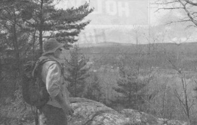
Residents of Bernardston should be commended for the steps they have taken to preserve and protect the town’s land, preventing further fragmentation and a decline in ecological integrity. During the community meeting held for the master planning process in February 2015, residents described development as one of the greatest changes in town since the 1975 Master Plan. They reported that although the northeastern part of Bald Mountain Road is now protected, the town has seen more development overall and many participants suggested that more land needs to be protected. While the town has made great progress toward permanent protection of the land, there are areas to consider for future protection from development. (See Element 5.)
Analyses of the information presented thus far suggests that the southern edge of Bernardston is of highest priority for protection. This area has high ecological integrity and is at risk of development because it is an unprotected, relatively flat area, close to Center Village and Greenfield. Although the area is favored for development, it is also home to the spotted turtle, identified by NHESP as a species of conservation concern. The two Critical Natural Landscape Blocks are not protected and between them is a fragile bog within the largest wetland in town. This area also has access to
Charity Lot Local restoration ecologist and designer John Lepore overlooks Charity Farm Lot.the Falls River, which is greatly valued by residents. On the outskirts of town, the area by Eden Trail Road is a desired location for residents with its scenic beauty, trails and various farms. Within this area, the Mill Brook and a tributary have been identified as an Aquatic Core.
The second area for priority protection is the northeast region of Bernardston. The land supports natural communities and species of conservation concern. This area is mostly protected and has modest development pressure. Despite that, the gentle hills have enabled development along roads extending into Vermont.
The third area for priority protection is the large Landscape Block west of I-91, which has low development pressure and high ecological integrity. The steep ledgy soils constrain development. Identified as a large Landscape Block, the forest has minimal disturbance and supports diverse species but is currently unprotected. There are several areas of scenic and recreational interest that are also not protected, including West Mountain, the scenic backdrop for Center Village and a recreation destination with trails. Wildcat Mountain, deemed the “last truly wild area in Bernardston,” provides scenic and habitat value. It is covered in dense mountain laurel, and has a wetland and a pond (Livinginston, Sprague, Sullivan, 2008). Beautiful Keets and Couch Brooks are wildlife corridors that extend from the Falls River west to Wildcat Mountain and West Mountain and into Leyden (Livinginston, Sprague, Sullivan, 2008). These areas are not protected but provide scenic and recreation resources, including fishing, and have been identified as archaeological sites (Livinginston, Sprague, Sullivan, 2008 & MHC, 1982).
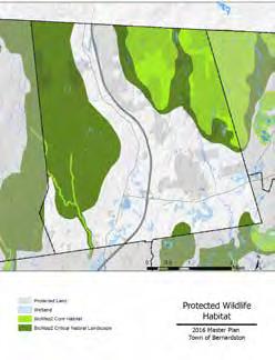


Rugged hills carved by the Falls River have shaped Bernardston’s history. The original settlement, perched on the eastern mountain range by Huckle Hill, provided refuge for European settlers during Native American raids. The steep terrain limited agriculture and further development, and as the area became more peaceful, the town relocated to the Falls River Valley. The Congregational Unitarian Church was constructed by early settlers and was moved two times before it arrived at its current location in Center Village (DCR, 2009). This church and three other buildings in Bernardston have been listed in the National Register of Historic Places: the Powers Institute, Cushman Library, and the fire station. The latter three buildings are grouped with Cushman Park into a National Register Historic District, created in 1993. Listing in the National Register provides formal recognition of the property’s significance, potential tax incentives for owners of income-producing property, and protection by state or federally funded, licensed, or assisted projects. National Register listing does not limit owner’s use of their property, and does not place restrictions or conditions on changes made by a private property owner unless there is state or federal involvement in a project, or some other regional and/or local regulation is in effect (Simon, Skelly, 2007).
The Powers Institute was built in 1857 and was originally a private academy that later served as a public high school until 1957. With funds from the Massachusetts Historic Commission, and a Community Development Block Grant, the Institute underwent a $1 million renovation in 2001, transforming the lower floor into the Senior Center and adding an elevator for accessibility to the Town’s Historical Society Museum on the upper floor (DCR, 2009). The Institute also added a universally accessible ramp. Upon renovation, a preservation restriction was placed on the building to protect its architectural and historical integrity. Towns can purchase preservation restrictions to assure that a property is protected in perpetuity (Simon, Skelly, Steinitz, 2010). The Senior Center, described by residents as a unique place where people go to play, is managed by the Council on Aging and offers classes
for seniors, exercise programs, and social activities. The Senior Center also provides transportation services and Meals On Wheels. The museum showcases memorabilia from the school, farm and household tools, textiles, and a collection of taxidermy donated by the family of Bernardston resident Luman Nelson. The museum is open to the public from May to October but closed in the winter as the second floor does not have heat. The Powers Institute is a treasured resource in town, and the Senior Center is well-used, drawing participants from the nearby towns of Leyden, Northfield, and Greenfield.
Built in 1862, the Cushman Library is a two-story Italianate brick structure with bracketed eaves, pilasters and roundhead windows set in brownstone. The library is an active social center in town; 53 percent of residents in Bernardston have library cards, and there are reading clubs and other activities. Cushman Library has recently updated its technologies to offer an online catalog and wi-fi. The active board of trustees plan to continue improving the quality of services offered to the community in the future, including increasing library hours. Adjacent to the library, the fire station is conveniently located in the center of town; however, the chief of the fire department noted that the department has outgrown the current fire station. (Further information about municipal services and facilities will be discussed in Element 8, to be completed in 2016.) In the southeast corner of Center Village, Cushman Park is used to host community events, including Old Home Day and the Scarecrow Contest. Described by residents as a good community gathering location, Cushman Park is highly valued in town but residents also express a desire to resolve the seasonal flooding that prevents the park from being accessible year-round. At One of the community meetings, residents also commented on the town’s strong sense of community with parades and festivals including the Gas Engine Show and Flea Market. There are additional historic structures in Bernardston that are not listed in the National Register Historic Places. The Town Hall, built between 1870 and 1915, has offices on the first floor and the second floor is currently used for storage, as it is not universally accessible. The Assembly Hall on the second floor was
previously used for town meetings, dances, plays, sporting events, and concerts with a stage and seating capacity for 100 people (DCR, 2009). At the community meeting in 2015, residents expressed a strong desire to renovate this area for public events. According to the Town Clerk, the high costs of renovation and the lack of additional storage areas to house the town records that are currently stored in the Town Hall are significant challenges the Town faces. Neighboring the Town Hall are the United Church and the Baptist Church, which are also not listed as Historic Places. The United Church is active whereas the Baptist Church is no longer in use and is currently for sale. Just south of the Falls River, the Four Arch Stone Railroad Bridge was built in 1846 and is one of the only industrial structures in Bernardston (MHC, 1982). The adjacent grain mill symbolizes the many mills historically established along the Falls River. The 2009 Bernardston Reconnaissance Report recommended that the town expand the National Historic District for the entire Central Village Area, including all civic buildings, historic homes, and the Arch Bridge and surrounding mills. The buildings would then be eligible for recognition, tax incentives for income-producing properties, protection, and grants.
Residents and town officials of Bernardston have identified six Priority Heritage Landscapes—dynamic areas that reflect the relationship between human culture, history, and the natural ecology (Cultural Resource Management Consultants). A complete list of Bernardston’s Heritage Landscapes is included in the 2009 Reconnaissance Report. The six areas include Center Village, the Town Hall, the Route 5 Corridor,
The Community Preservation Act (CPA) enables towns to access significant funds for historic preservation, open space recreation, accessible housing, and public recreation projects. Towns raise money locally with a small surcharge on property taxes up to 3 percent and the money collected is matched by funds from the state. Each of these areas must receive a minimum of 10 percent of the total fund each year, and the remaining 70 percent can be spent or reserved for future projects in any of the three areas or for public recreation.
The town of Leverett, Massachusetts, is similar to Bernardston in population, size and a strong commitment to the town’s rural character. In 2002 Leverett adopted the CPA as the town could not afford desired projects by fundraising alone. The first objective was to form the required Community Preservation Committee. The committee was composed of one representative from the Historical Commission, Recreation Commission, Conservation Commission, Planning Board, and Affordable Housing Committee, and two at-large members appointed by the Select Board.
Projects include renovating Town Hall windows, restoring the North Leverett Sawmill and placing a Historic Preservation Easement on it, purchasing contiguous parcels by the Leverett Pond for shoreline protection, extension of the Friendship Trail Land, and adding electrical work and heating to the second floor of the town library to make it usable year round.
 Credit: Peter Shedd
Cushman Park
Panorama of Cushman Park during town gathering.
Eden Trail Corridor, the West Mountain Ledges and the Route 10/ Interstate 91 Corridor. The six-mile stretch of Route 5 running from the center of town to the border of Vermont traverses open fields with barns and historic homes reminiscent of its history as a stagecoach route. Eden Trail Road, in the southwest corner of Bernardston, is framed by several farms and open fields offering scenic views from its high elevation. The West Mountain Range is visible from Center Village and is beautiful, especially in the fall. The Route 10/I-91 Corridor is a mixed-use area with commercial and industrial districts, and residential, historical, and agricultural areas. Scenic and historic areas include open fields at the intersection with Purple Meadow Road, the site of Lieutenant Ebenezer Sheldon’s Fort, and one of the early garrison houses that was used for refuge during conflicts (DCR, 2009). The Town of Bernardston Community Development Plan includes an inventory of additional significant buildings and structures not described here, including homes that are listed in the Massachusetts Cultural Resource Information System.
During the master plan community meetings, residents of Bernardston expressed appreciation for the town’s historic buildings, and the scenic natural landscape.
According to Google Earth Pro, more than 28,000 cars travel through Bernardston daily via the three state roads and when approaching Bernardston from Greenfield, two mountain ranges compose the most visible landscape, with West Mountain forming the backdrop to Center Village. With significant views of the mountainous landscape, there is potential for the town to promote recreation, including hiking and biking for locals and visitors.
In order to maintain the landscape along these visible ranges, the town should consider an Upper Elevation Protection bylaw, to prohibit development in locations or at elevations that would impact Bernardston’s overall rural character. The town should also consider a Scenic Vista Overlay District to provide design standards along Route 5, which is a gateway to Bernardston, and Eden Trail Road, which residents have described as a scenic area with many farms. These two areas are moderately visible throughout town and were identified by residents and town officials as Priority Heritage Landscapes.
A digital elevation model was used to identify the most visible places in town. The visibility of the surrounding landscape was calculated from fourteen locations along Routes 5 and 10 and I-91. The darker purple tones indicate areas of the landscape that are visible from the most modeled locations.
Interstate 91 and Route 5 bisect Bernardston and offer views of the valley and mountain ranges. The majority of scenic resources and unique environments are visible from these two roads. The southeastern corner by Route 10 is the least visible.


Fragmentation
Forest fragmentation is the process of breaking up large patches of forest into smaller pieces. It can occur when roads are built, for example, or forests cleared for roads or development (EPA, 2003). Forest fragmentation can reduce biodiversity by making it difficult for some species to breed or find food. There are species, especially birds such as the black-throated green warbler, that need large, intact forest to persist. NHESP has identified several negative effects of fragmentation, including nest predation by species associated with development such as skunks, raccoons, and house cats. As forests become more exposed and readily accessed, another impact is nest parasitism by species such as the brown-headed cowbird, which lay their eggs in the nest of other bird species, reducing their productivity. Forest interior habitats support various native plants, animals, and ecological processes that are sensitive to other edge effects, which include noise and light pollution from roads and development, invasive species establishment, and alterations to wind, heat and other climate variables (NHESP, 2011).
Massachusetts
Core Habitat & Critical Natural Landscape
Twenty-four percent of the state has been identified as Core Habitat, 34 percent as Critical Natural Landscape and 40 percent as overlapping of the two areas.


Concentrated Development Interstate 91
Building Footprints
BioMap2 Core Habitat
BioMap2 Critical Natural Landscape
Wildlife Fragmentation
2016 Master Plan
Town of Bernardston
Developed land and associated impervious cover, land use, and natural disasters all have impacts on the natural environment. Development is a threat particularly near wetlands, which provide habitat and control flooding. A railroad crosses over significant lands critical for key ecosystem services, including the Falls River and along the edge of the Darwin Scott Memorial Wetland. A train derailment could have environmental consequences in these areas. The proximity of Bernardston to Interstate 91 impacts air quality and noise. Exhaust fumes pollute the air and traffic in town, especially along the state roads, produces significant noise, which impacts residents and wildlife. A growing number of studies indicate that wildlife, like humans, are stressed by a noisy environment. For example, female frogs exposed to traffic noise have difficulty locating the male’s signal (National Park Service, 2009). The use of salt on state roads is a potential contaminant of the town’s groundwater, and is also potentially contaminating other water bodies, including wetlands and the Falls River. (See Element 3.) The Highway Department noted several animals are killed yearly when attempting to cross these two roads, especially I-91.
Just six miles northeast of Bernardston, Entergy’s Vermont Yankee Nuclear Power Plant closed in December 2014. According to the plant’s government affairs manager, Joe Lynch, the fuel has been removed from the reactor, mixed with older, used fuel in canisters and placed in the spent-fuel pool which will continue to cool until 2020. The plant will then enter “dry-cask storage” and there will no longer be an emergency plan as the casks are designed to withstand any external threat. Lynch said that the only risks to the fuel pool would be loss of cooling or deliberate tampering. He is confident that the amount of water stored above the spent fuel negates the first risk and the tampering would be difficult as the plant is overseen by armed guards. Lynch said that, “if the pool did become compromised, possible radioactive contamination would be limited to an area inside the 125-acre Vermont Yankee property.”
In contrast, Citizens Awareness Network raises concerns about the decommissioning plan that Entergy has submitted for Vermont Yankee, stating that there
are “significant errors and deficiencies.” The network remarks that the decommissioning fund is too small; based on a “generic” nuclear plant, the plan does not address known issues at Vermont Yankee such as the large amount of tritium contamination on the site from underground piping. Vermont Yankee “incorrectly assumes that a suitable dump will be available” and the network notes that by the time Vermont Yankee shuts down, there will be no level radioactive waste dumps available and costs are likely to increase if a dump opens. Therefore, Vermont could have to store the waste for several years. “An accident at the Vermont Yankee Nuclear Reactor would expose vast areas of beautiful New England and millions of people to dangerous levels of radiation for decades” (Citizens Awareness Network). If an accident were to occur, the radiation could contaminate the wildlife and habitats in Bernardston, which is within twenty-five miles of the plant.
The town takes pride in its local farms but fertilizers, herbicides, and pesticides that residents apply to lawns, gardens, and agricultural fields can contaminate groundwater. In Whately, Massachusetts, the groundwater supply was discovered to be contaminated with common pesticides applied on agricultural lands. More than 30 percent of the wells tested were positive for ethylene dibromide and aldicarb (Temik), exceeding the state safety limits and were subsequently shut down (Sarnat, Willis, Harper, 1987). Uncovered manure piles are also of concern as run-off can contaminate streams, wetlands or ponds and eventually aquifers. The Department of Conservation & Recreation Division of Water Supply Protection states that horse manure contains nutrients that “impair water quality and can contain pathogens that are potentially harmful to humans.” Horses can also potentially alter the runoff characteristics of the landscape, increasing the ability of pollutants to enter the drinking water supply (DCR, “Horse Ownership and the Massachusetts Watershed Protection Act).
As observed at Charity Farm Lot, there are invasive plant species in Bernardston that threaten the native species, some of which are of conservation concern. Local restoration ecologist and designer John Lepore noted several invasive species including multiflora rose, burning bush, barberry, and Russian olive at
Charity Farm Lot. In a 2014 Charity Farm Lot update report Lepore remarked that many of the invasive plants are in “the very early stage of overtaking the site” and expressed the importance of taking action before the growth “overpowers eradication.”
On a broader level, it is important to recognize the impact of climate change on plants and animals. Forests, wetlands, rivers, and streams offer various functions, including supporting wildlife habitat and cleaning air and water. As temperature and precipitation change, some vegetation may be unable to adapt to the altered conditions.
The recommendations at the end of this chapter and in Element 10 address these threats with suggestions including Best Management Practices for protecting water quality through stormwater management, land use planning strategies that would reduce habitat fragmentation, and managing landscapes to protect the many important ecosystem services provided by them.
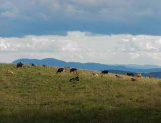
Residents of Bernardston have always revered their historic buildings as indicated by their efforts to move the Congregational Unitarian Church, and their continued passion for the significant buildings in Center Village. At the first master plan community meeting, many residents expressed their view that more historic preservation is needed. Buildings are aging and many structures are not universally accessible. Center Village does not have a public sewer system, some of the septic systems are failing, and a new system would be expensive.
There are many significant historic properties within and surrounding Center Village that are not listed as Historic Places. Only four of the historic buildings in town are listed as Historic Places and therefore eligible for recognition, tax incentives, protection, and grants. The village’s Historic District designation provides only limited protection from adverse effects of federally assisted projects, and, through automatic inclusion in the State Register of Historic Places, limited protection from state actions (Simon, Skelly, 2007). The National Register Historic District is not as strict as a Local District, which enforces a regulatory review process for all changes to exterior architectural features visible from a public way; however, the Local District provides protection from demolition and renovations that are not aesthetically appropriate given the town’s design standards. Currently, the Expedited Permitting District is the only zone in Bernardston that has design standards. The town could consider including design standards for other zones to ensure that the buildings reflect Bernardston’s historic character. Design guidelines could also include preferred materials that have additional benefits beyond aesthetics, such as pervious pavers which allow for on-site infiltration and provide attractive walkways.
Outside of Center Village, there are several areas that residents value, especially the Priority Heritage Landscapes. None of the agricultural lands or historic sites along Route 5 or within the Route 10/I-91 corridor are permanently protected from development. The only Agricultural Preservation Restriction in Bernardston is located in the northeast corner along the border with Leyden. Of the distinctive barns and historic homes, none are listed in the National Register of Historic
Farmland in Bernardston Farmland forms a loved part of the scenic landscape and with best management practices it can positively contribute to the local ecology and economy.Places or otherwise protected. Properties along Eden Trail Road are valued for the various farms, scenic views and recreational trails but, they are also not permanently protected from development. None of the properties on the West Mountain ridgeline or ledges are permanently protected from development. They are particularly vulnerable due to their scenic vistas and availability of Town water, which extends part of the way up West Mountain Road. Residents reported that from areas west of Fox Hill Road, there is a great view of the center of town. It is important that these areas be protected as they are the backdrop to Center Village. The town should consider protecting significant lands and buildings and seek funding for renovations in an effort to maintain the town’s rural, historic character. The recommendations at the end of this chapter and in Element 10 address these threats with suggestions, including adopting the Community Preservation Act, listing more buildings as Historic Places, and enacting bylaws with design standards for scenic roads and areas.
 Four Arch Stone Bridge
This is one of Bernardston’s valued historic structures built in 1846 by Theodore Judah and is one of the only surviving structures from the Industrial Era (DCR, 2009).
To meet Bernardston’s three goals, the Town should designate areas of significant views and historic and ecological integrity, and create by-laws that preserve Bernardston’s New England character. The town should involve citizens in workshops on preserving historic structures, the range of restrictions that can protect land, and best management practices for sustainable forestry. It should also create maps to promote outdoor recreation and historic tours.
Issues
• Residents express lack of town-wide communication. There is limited knowledge of where to get local produce and town attractions including outdoor recreation.
• Critical Natural Landscape along the western mountain range offers scenic views and recreational opportunities however, is largely unprotected.
• Residents express concern for preserving historic structures. Without attention, neglect and deterioration can threaten significant structures. If buildings deteriorate, restoration can become exceedingly difficult to afford.
• Residents are concerned that new development will alter the town’s New England character.
• Cushman park is conveniently located in the center of town however, the park floods often preventing it from being used for farmers markets, and other town activities.
• Residents treasure the Falls River however, there is no public access to the river.
• Residents take pride in Bernardston’s historic buildings however the town cannot afford renovations and many of the structures, including the second floor of Town Hall, are not universally accessible or heated.
Forests, wetlands, rivers, and streams are natural resources that not only have aesthetic and recreational benefits but also play crucial roles in mitigating the impact of climate change. Scientists predict that, in part due to chemical changes in the atmosphere, there will be an increase in annual precipitation, shifts in temperature, and increased frequency and intensity of storms and flooding in New England. The natural landscape can help to mitigate these changes through the purification of air and water, absorption of subsurface and overland water flow, and the sequestration of carbon in both the above-ground growing vegetation and within the organic components of forest soils. These ecosystems, and their functions, will be crucial in helping natural systems and human communities cope with climate change. Encouraging best management practices and further preservation of open space in Bernardston will not only help to meet the Town’s goals of preserving rural character, but will help to improve the overall health and resiliency of the town in the face of these climate changes.
Recommendation for Bernardston’s future Watershed, Natural and Cultural Resource, and Land Use management cover a range of actions, including educating and conducting out- reach, changing zoning and policy, strengthening community connections, and investing in infrastructure. These changes that require significant planning and funding. The following recommendations are explained in more detail with responsible parties, in Section 10.
Continue to educate and involve residents in Charity Farm Lot with community work days. Encourage public participation in developing hiking trails, picnicking facilities, and removing invasive species. Construct signs with information about the lot’s history and potentially connect trails to the approximate site of the first settlement.
Promote Bernardston as a recreation destination and update the town website with visitor information, including maps of historical buildings, recreational trails and a page for Charity Lot.
Work with conservation organizations and residents to develop a strategy for identifying lands that may be coming out of Chapter 61, 61A, or 61B and anticipate the funding necessary to protect these lands. Prioritize protection in the southern portion of town, which has several wetlands and identified critical habitat that stretches across the town border and is under the highest development pressure. Second priority is the northeast region of Bernardston, which is densely forested and mostly protected, but which has modest development pressure. The town should also consider protecting the large landscape block along the western mountain range, which is predominantly unprotected and has low development pressure.
Investigate resources to involve the younger generation in town activities that improve the recreational opportunities and health of the natural environment in Bernardston.
Work with Community Preservation Coalition to host a workshop to educate residents about the benefits of the Community Preservation Act.
Create bike lanes that extend from the Franklin County Bikeway in Northfield and continue along Route 10 and Route 5 to Pratt Field, and up Bald Mountain Road to Charity Lot. This would involve coordination with Franklin County and the state.
Work with the Massachusetts Historic Commission to update the town’s list of State Register of Historic Places for recognition and potential funding through the Massachusetts Preservation Projects Fund.
Adopt the Community Preservation Act to raise local money which is matched by the state for projects, including historic preservation, open space and land preservation and affordable housing.
Create a Demolition Delay Bylaw to protect historic structures by granting additional time to fund the renovation of a historical building, or relocate it. Establish criteria for qualified structures.
Create a Scenic Roads Bylaw to protect significant roads’ rural and historic character. This bylaw would establish a local review procedure for the cutting or removal of trees and alteration of stone walls that are within the public right-of-way. Further design guidelines and form-based codes can restrict development by height, materials and landscaping in order to maintain scenic vistas.
Implement development controls to protect the currently forested slopes that provide the backdrop to views of town from erosion. This could be accomplished through restricting development on slopes greater than 15 percent or through a Scenic Vista Overlay District that mandates the preservation of existing vegetation and requires additional natural screening for new developments on hillsides visible from the main roads. An Upper Elevation Protection Bylaw would establish an elevation above which site plan review is required for new developments. The Planning Board can limit building heights above tree lines and require appropriate replanting of native trees and plants and the screening of utilities.
Consider permitting accessory uses on farmland to include conference centers, restaurants, and other small businesses to draw visitors to local farms. This would enable farmers to diversify their operations, provide supplemental income, and increase awareness of local farms.
Create a Conservation Opportunity Subdivision to fasttrack subdivisions that conserve at least 80 percent of a site. This would promote denser development, reduce sprawl, and help to preserve land.
Expand the National Register Historic District to include historic structures on Church and River Streets, and educate property owners about the benefits of placing their properties on the National Register of Historic Places. Listing buildings in the National Register provides formal recognition, potential tax incentives for owners of income-producing properties, and protection by state or federally funded, licensed or assisted projects.
Create Architectural Preservation Districts/ Neighborhood Districts to protect the overall character of an area by regulating demolition and major alteration of buildings. Set design standards for scale, massing, street pattern, setback, and materials.
Use funding from the Community Preservation Act to renovate the Town Hall to enable accessibility of the second floor. This would allow gatherings within the center of town for events such as meetings, cultural events, the farmer’s market, or private uses.

Ten percent of the land in Bernardston is in agricultural use.
Credit: Cathryn ThomasThe Bernardston community would like to preserve the rural character of the town, create a more vibrant Center Village, and foster sustainable economic development. To meet these goals, land use in Bernardston needs planning needs to consider regional population growth, the associated changes in development pressure, and the impacts of climate change.
In the 1800s, Bernardston’s village center moved from the hills down to the valley alongside the Falls River, where the town hall and historic churches continue to be the heart of the community today. Classic New England buildings and churches line the main streets, and the old grain mill along the river is maintained as a farmer’s supply store. Business and industry are tucked into the southern area of town, in the village center and along state roads, leaving scattered residential areas, farms, and large tracts of forested land to the north. Interstate 91 parallels an old stagecoach route from New York to Vermont that is now State Route 5. The vast majority of land in Bernardston remains open agricultural and forested land, contributing to the rural character enjoyed by residents.

The steep hills that flank the eastern and western sides of the Falls River Valley form the walls of a channel that connects Greenfield, the hub of Franklin County, with the northern Green Mountains of Vermont. Tens of thousands of passers-by travel daily through the central valley of Bernardston, passing the forested hills that rise on either side of Interstate 91. The rocky slopes of the West Mountain Ledges and Satan’s Kingdom Wildlife Management Area restrict transportation routes, agriculture, and development to the narrow floodplain that runs along the center of the town. Here, many interests compete for the fertile and accessible flat lands. Agriculture, residential, business and industrial development are in close proximity to the rivers and wetlands that eventually feed into the Connecticut River south of the town.
The village center maintains a classic New England charm, with colonial homes, a handsome brick library, an historical Town Hall, a church that was moved from an original fort on Huckle Hill, an active country store and farmer’s supply, and an impressive arched railroad bridge crossing the Fall River. Residential, business, and industrial development have spread out along state Routes 5 and 10 to the north, south, and east of the center of town. The types of established businesses in Bernardston also reflect a culture with rural values: wholesale farm supplies, campgrounds, logging companies, family-owned restaurants, and an eighteenhole golf course.
The land uses in Bernardston follow a traditional New England pattern of heavily forested hillsides surrounding mixed residential, industrial, and agricultural lands in the fertile floodplains along the rivers. Historically, the rivers provided energy and transportation opportunities, and the flat, well-drained soil alongside them was the obvious place to locate a town center.
In the mid-1940s, engineers identified these same flat areas along major rivers as a prime route for the new interstate highway. Interstate 91 follows the Falls River Valley, dividing the town in half. The construction of the interstate changed the course of development in town, replacing farm fields with a four-lane highway and exit ramps for a new point of entry near the center of town. In the 1975 master plan, the new highway that increased the accessibility of Greenfield, Springfield, and points south was recognized as an opportunity for industrial and commercial expansion.
The facing map shows land uses from 2005 Massachusetts Geologic Information System (GIS) data. Residential land covers just over 5 percent of the town, roughly 800 acres. Industrial and commercial land form only 0.2 percent of Bernardston, with most of the 300 acres adjacent to the state roads, highways, and railroad.

Agriculture is very visible in Bernardston. Much of the 1,500 acres of farmland that makes up 10 percent of the town form part of the scenic landscape along Route 5 from the Greenfield town line all the way north to Vermont, and along smaller roads such as Eden Trail Road into Leyden.
The large contiguous areas of forest that cover over 75 percent of Bernardston’s total 23.4 square miles include the steep hillsides east and west of the town center. This dense forest not only forms the backdrop of almost all views of Bernardston from the main roads, but most of the forested area in Bernardston is also identified by the Natural Resources Conservation Service as growing on the most highly productive “prime” forest soils. At least 1,500 acres of forest are actively logged, and 1,150 acres are permanently protected by the Department of Fish and Game for wildlife management. The access that I-91 provides to Greenfield and the greater region continues to drive development in the southern portion of town, close to the border of the city of Greenfield. To the east, west and north, the towns of Leyden, Northfield and Guilford, Vermont share a similar rural character with Bernardston.

CaroVail, a manufacturer of agricultural inputs, is located along State Route 10 and has access to the rail for regional distribution.


The map on the facing page shows changes in land use, represented by the use to which they were converted between 1971 and 1999. Most of these lands were converted from agricultural, forested, or barren open land and developed for housing.
The Crumpin-Fox Golf course was built in 1977 and is currently owned by the Sandri Corporation, the largest landowner in town. Sandri Corporation owns over 600 acres, including an inn and the gas station in Center Village. The most significant recent business is the Kringle Candle Company, established in 2009.
Business and industrial development in Bernardston has been established along Route 10 near the border with Northfield. There are several available lots zoned for industrial and business use that border the rail line south of Route 10 and have development potential with opportunities to increase jobs in the region and Bernardston’s tax base.
One major challenge for business and industrial expansion in Bernardston is finding appropriate and affordable septic solutions. One example of a business that struggled with this issue is Lefty’s Brewery, a successful small business that was established in Bernardston’s Center Village, but relocated to Greenfield due to wastewater constraints that prevented the business from increasing its production. As the brewery expanded, soil limitations on site required the business to update to a specially designed alternative septic system in order to accommodate the increased volume of wastewater, and the brewery could not afford the upgrade.
Although the centrally located access to I-91 is a desirable asset for businesses and industries, the local soil conditions, proximity to wetlands, and lack of centralized sewers have limited the type and scale of industrial and businesses development in Bernardston.
Agricultural and forested land changes between 1971 and 1999 show shifts in land use management. Most of the land converted to agriculture in this time period was previously forest, and most of the land converted to forest was abandoned agricultural and pasture lands. There was a growth in the recreational facilities in Bernardston, with the establishment of the CrumpinFox golf club and the town-owned Pratt Field.
The 1980s was a period of high residential development in the region, and housing was the largest sector of development in Bernardston from 1971 to 2005. The areas in red reveal a pattern of new residential development outside of the center of town. In contrast to the density of mixed-used development in valley, residential development during this time period was dispersed throughout the town, predominantly in rural areas. This trend is of concern because the greater the distance from municipal services such as town water, schools, snow removal, road maintenance and emergency services to residents, the higher the costs to the town. Continued residential development outside of the center of town will continue to increase the costs of services to residents, and could damage sensitive wildlife habitat areas as discussed in the Natural and Cultural Resources element of this plan.

Developed for agricultural use.
Became forest.
Became barren land - vacant open land that is not managed for agriculture or recreation.
Converted to recreational use.
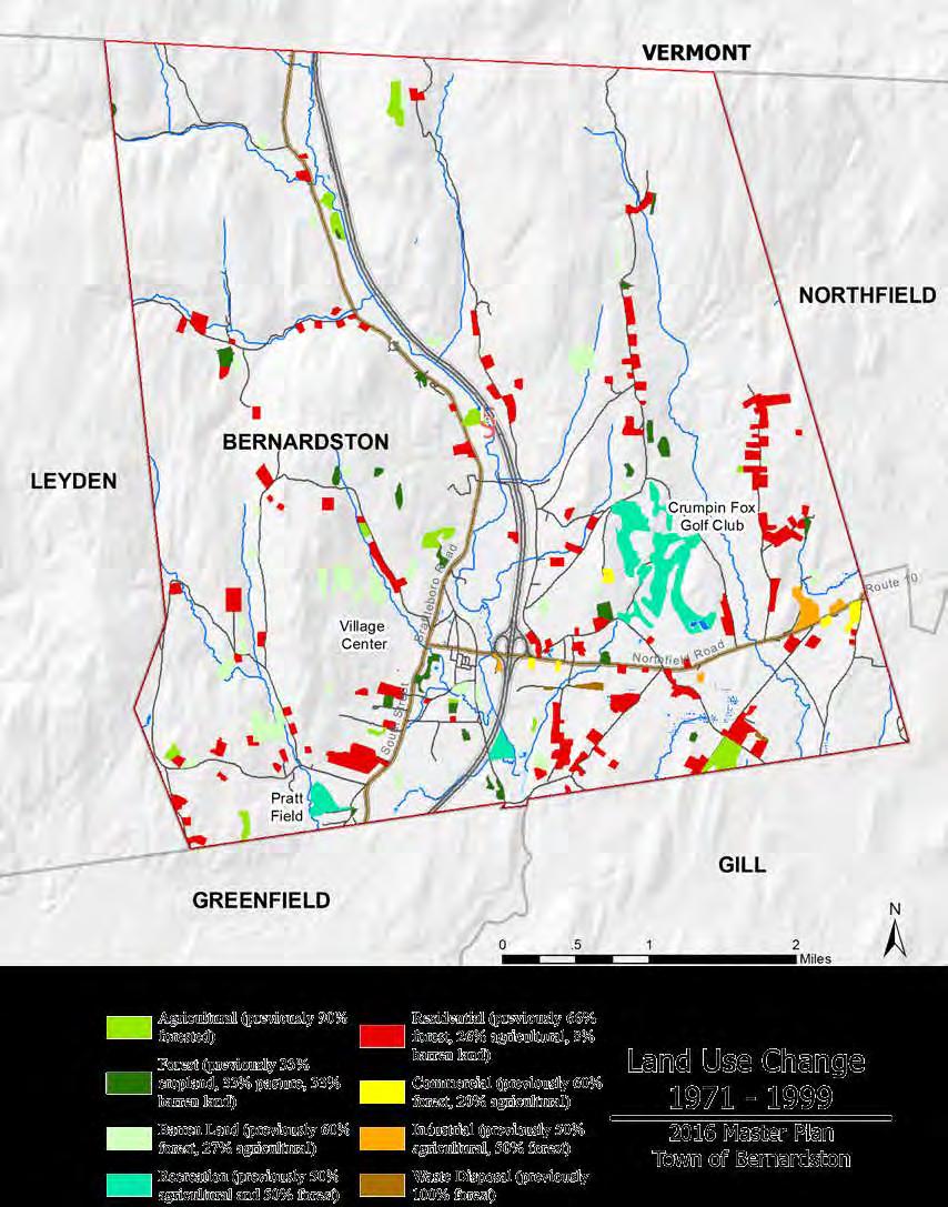
Developed for residential use.
Developed for commercial use.
Developed for industrial use.
Converted to waste disposal.
Bernardston’s zoning by-laws were adopted in 1987 and have been revised numerous times since. They were created with the intention of preserving the historic, rural-agricultural landscape of the town. There are currently six zoning districts and two overlay districts. The Center Village (CV) zone allows for mixed use in the center of town, with residential plots and business lots of a minimum of a half acre. The oneacre Residential (R1) zones allow for mid-density development close to the center of town. The Residential-Agricultural (R/A) zone requires plot sizes
to be at least one-and-a-half-acres and covers over 90 percent of Bernardston. The Industrial (I) and Business (B) zones are restricted to land bordering the state roads leading east and south of the center village. Agriculture and agricultural enterprises such as seasonal farm stands are allowed in every zone.

R1Residence / One AcreA residential district with single and two-family dwellings. Bed and breakfasts and home occupations are allowed but no other business or industry.
CV Center Village
A mixed-use district with single-and multi-family dwellings, small businesses and retail. The minimum plot size is ½ acre. There are no drive-thru or industry allowed in this zone.
BBusiness A non-residential district to accommodate larger businesses, with a minimum lots size of a half an acre.
EPDExpedited Permitting District A district with an expedited process for approval of commercial and industrial development. This area has outlined guidelines for site design, landscaping, and stormwater management. The minimum lot sizes are one half acre.
WRWater Resource Protection District
FPFloodplain Overlay District
An overlay district with stringent restrictions on use, storage of potential contaminants, and amount of pavement allowed. The purpose of this designation is to protect the public health by preventing contamination of the ground and surface water resources providing public drinking water.
An overlay district with additional restrictions on development and measures to protect existing vegetation and soil stability. The purpose of this designation is to reduce the risk of public emergencies, reduction in water quality, contamination and erosion due to flooding.


R/A

01.5 Miles
Zoning Districts
Residential / Agricultural (91% of landcover in town)
Residential / Agricultural (91%)
Residence 1-acre (6%)
Center Village (2%)
Industrial (1%)
Business (<1%)
Expedited Permitting District (<1%)
Floodplain Overlay District (4%)
Water Resource Protection District (5%)
Edgartown, Massachusetts, was the first village settled on Martha’s Vineyard and it thrived during the nineteenth century as a whaling community. The town became a popular tourist destination that, during a peak in commercial development at the end of the twentieth century, adopted a permitting process with design guidelines to protect the quality and character of its downtown.
In 1988, Edgartown received a grant from the Massachusetts Council on the Arts and Humanities to develop a master plan to preserve the historic rural feel of the town’s rapidly developing Upper Main Street. The landscape architectural firm Dodson Associates worked with the Planning Board, local business owners, town departments and residents to identify desirable design elements for future development.
Through weekly meetings over the course of several months, they established a goal of transforming the town’s automobile-oriented strip into a pedestrianoriented commercial area. They used innovative site planning and design techniques to help manage growth and generate development better suited to match the existing character of Edgartown. The final recommendations included locating all parking in the rear of buildings and requiring sidewalks, trees along the main road, buried utility wires, and clustered buildings, and encouraging shared parking. The group also generated a set of design guidelines for building heights, rooflines, materials, signs, and lighting.
Although some zoning by-laws were amended as a result, the town opted to create a special permit for new development on Upper Main Street that includes
illustrated design guidelines for interested developers to follow.
This strategy has been very successful for the town. Since the permitting process was implemented in 1989, the majority of the proposals conform with the town aesthetic. The clear expectations outlined and illustrated in the permitting process have led to faster and less contentious review processes for new businesses. Traffic congestion increased only marginally over the following decade, and pedestrian activity increased at a higher rate than other commercial corridors on Martha’s Vineyard. A citizen committee regularly meets to discuss ways to continue to preserve the quality of Main Street, including potentially building a bypass road around the village center. Today the town’s 4,000 fulltime residents continue to rely on its rural seaside character and historic center to draw the 20,000 tourists each summer that drive the local economy.
As commercial development pressures in Franklin County and Bernardston grow, a similar set of guidelines for Center Village development could help to protect the small-town New England feel that so many of its residents value.
(Arendt, 1994; USDOT)
Within the last five years, the Planning Board proposed significant changes to the town’s zoning by-laws that have been approved and adopted at Town Meeting. In 2010, undeveloped sites near the entrance to I-91 were designated Expedited Permitting Districts. The purpose of this designation, according to Massachusetts General Law Chapter 43D, is to promote commercial and industrial development that generates tax revenue and jobs for the town, while ensuring high quality site planning, architecture, and landscape design that fit the character of Bernardston. These districts have been assigned comprehensive performance standards that include low impact development and renewable energy production criteria, and allow for planned unit developments that comply with detailed design guidelines. The extensive criteria developed for these districts allow the town to guarantee an expedited permitting process for developers wishing to move forward with plans quickly.
The adoption of these districts also fulfills a requirement for becoming a registered Green Community, as outlined by the Massachusetts Executive Office of Energy and Environmental Affairs. Designation as a Green Community will allow the Town to apply for additional grants to finance energy efficiency and renewable energy projects on the local level (Town of Bernardston and FRCOG, 2010).
In 2013, two overlay districts were created: the Water Resource Protection District and the Floodplain Overlay District. The purposes of these overlay districts are to protect the quality of the public water supply and mitigate potential damage due to flooding. The Floodplain Overlay District contains additional restrictions on development and the storage of potentially hazardous materials, and strict land-use codes including the preservation of existing vegetation to prevent erosion during large storm events. The Water
Resource Protection District prohibits specified industries and businesses, such as auto body shops, that require the use of potential contaminants and the storage of chemicals such as rock salt. These districts follow the delineated Zone II recharge areas for the wellheads in current use, as outlined in the Watershed Protection element of this plan.
In 2014, the process for permitting was amended to include increased requirements for site plan reviews. These changes will allow the Planning Board to have greater influence over the design elements of new developments in town, and to provide an opportunity for public input on the decisions of the planning board. The adopted zoning by-laws and the changes implemented over the last five years reflect a dedication on the part of the town to socially and environmentally conscious development. These recent changes are in line with the identified goals of preserving the town’s rural character and fostering sustainable economic development.
Continuing to adopt by-laws that preserve the ecological integrity of the existing open space and include design guidelines and low impact development criteria for the other districts in town will help to ensure attractive, appropriate development in Bernardston, as well as potentially protect against the impacts of climate change. These same values should be incorporated into revisions of the Subdivision Regulations, which have not been amended since their adoption in 1987. Updating the subdivision regulations is currently on the agenda for the Planning Board.
More detailed recommendations for possible changes to Bernardston’s land use controls are outlined at the end of this section and in Section 10: Conclusions.
Residential land is the fastest growing category of land use in Bernardston. Between 1980 and 2000, the number of housing units grew by 30 percent, a higher percentage increase than in the county and the state during that period. Since 2000 the rate of development has declined sharply, although there were eighty-nine permits for new housing units granted between 2000 and 2010 (Town of Bernardston and FRCOG, 2014). Since 2010, only twelve new residences have been built in town. This decline reflects an overall decrease in the housing market in the county and the state during this time (FRCOG, 2013). According to the 2013 American Community Survey, there are 1,024 housing units in Bernardston. Eighty-four percent of Bernardston’s housing units are single-family residences, a category which include both detached homes and attached units such as condos. The rest of the town’s housing mix comprises duplexes (4 percent of the town’s total units), multiple-unit buildings (6 percent) and mobile homes (7 percent). Eighty-three percent of residences in town are owner occupied, and the median value for houses is $277,000 (American Community Survey, 2013). As shown on the Land Use Change Map, recent residential development has occurred primarily on the outskirts of town.
Franklin County as a whole experienced a similar increase in residential growth between 1970 and 2000, with a sharp decline in the rate of new construction after 2005 (FRCOG, 2013). Nearly all of the new residential units constructed in recent years have been single-family homes built along existing roadways, which is the type of residential development with the least stringent requirements for permitting, as outlined by the Commonwealth’s Approval-Not-Required rules (FRCOG, 2013). Based on population growth projections, the county has identified the need for an additional 2,000 units in the county by the year 2035, including an increase in the amount of affordable and universally accessible housing (FRCOG, 2013). The county’s goals for residential development include locating housing near existing employment
opportunities and infrastructure, adapting existing structures, and increasing the energy efficiency of residential units (FRCOG, 2013).
Changes to the land use regulations that encourage in-fill development in the Center Village and residential zones near the I-91 entrances could support the goals for residential development. Because of the relative ease of building on the flatter slopes in the southern portion of town and the proximity to Greenfield, it can be anticipated that these areas will have higher development pressure in the future. In order to achieve a higher density in these areas, additional considerations for dealing with wastewater may be necessary, as discussed in the Watershed Protection element of this plan.
Residential development and housing in Bernardston are addressed in more detail in the Housing element of this plan.

The 1975 Master Plan identified ninety-four acres of commercial land and five acres of industrial land in Bernardston. Currently there are seventy-four acres of commercial land and forty-three acres of industrial land in town, showing a 21 percent decrease in commercial area and a 760 percent increase in industrial area over the last forty years. According to the 2012 census data, there are forty-eight registered businesses and industries in town, the largest sector being construction (15), followed by retail (9), and food service (6) (United States Census, 2012).
The available Expedited Permitting Districts offer opportunities for continued business and industrial development in Bernardston, and the current zoning by-laws require the adoption of low impact development infrastructure and design guidelines, so that future business and industrial development in these areas meet the town’s goals of maintaining rural character and fostering sustainable economic development. One identified challenge to further business and industrial development is the low suitability of soils in Bernardston for septic tank absorption and the lack of sewer infrastructure in town, as discussed in Section 3. This constraint limits the feasibility of types of industries and businesses such as food processing plants that produce large amounts of organic waste to become established in Bernardston. Business and industrial development are addressed in further detail in the Economic Development element of this plan.
Residents of Bernardston identify strongly with its agricultural heritage. Residents express appreciation for the scenic farmlands along the main roads in town, and at community meetings farms and farming were listed among Bernardston’s most valued resources and favorite activities to do in town. Loss of working farms and farmland was one of the biggest changes noted since 1975. One resident remarked that in 1975 there were thirteen operating dairy farms in town, whereas now there are two.
The 1975 Master Plan estimated there were 2,520 acres of farmland, mostly in corn and hay fields, with some apple orchards and tree farms. This estimate was created through a visual analysis, driving through town and recording on a USGS map the fields observed.
The 2005 Land Use data available today through the Massachusetts Geological Information Systems (MassGIS) shows 1,478 acres in cropland, pasture, nurseries and orchards. Assuming some margin of error due to the difference in data collection methods, there has been a loss of roughly 1,000 acres of farmland in Bernardston over the last forty years. Prior to 1975, the creation of Interstate 91 forced some families in town to give up their farms, a loss which is still remembered today. One community member, who lost part of the dairy farm he grew up on, said that every foot of the highway took away one acre of farmland.
According to the American Farmland Trust, between 1971 and 1999 Massachusetts lost an average of 2,900 acres of farmland a year to development. There are a variety of reasons for the loss of farmland.
The competitive value of farmland for residential, business, and industrial development raise the value of farmland, making land increasingly unaffordable for farmers to purchase or rent. In 2008, the average peracre farm real estate value in Massachusetts was $12,200, the highest in the country (American Farmland Trust, 2008).
Rising land values and energy prices have contributed to an overall rise in costs for farmers, leading to abandoned farms. From 1997 to 2002, average production expenses on Massachusetts farms increased by 27.5 percent, and during the same five-year period
there was a steep drop in net farm income, from an average per farm of $24,000 to an average of $11,000 (American Farmland Trust, 2008).
Agriculture is an integral part of the Massachusetts economy, culture, and landscape. In 2007 farms in the commonwealth generated $560 million a year in revenues, and employed 15,600 workers (USDA Census of Agriculture, 2012). In addition to direct contributions to the scenic qualities of the landscape and local economies, farms also offer lesser-known benefits to communities such as flood storage, carbon sequestration, recreational opportunities, and lower costs of services for rural towns.
Studies of the cost of community services in towns across the country consistently show that farmland generates more in local tax revenue than it requires in local municipal services. Even when farmland is enrolled in one of the state protection programs and is assessed at its agricultural value it helps to finance town services (American Farmland Trust, 2008).
A study of seven Massachusetts towns between 1998 and 2008 showed that for every $1.00 of revenue generated by the residential sector, $1.09 is spent in services to the sector. In contrast, for every $1.00 of
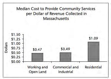
The
The 1,478 acres of agricultural land and 11,683 acres of forested land in Bernardston provide $13 million worth of ecosystem services to the town annually.
revenue generated by farmland and open space, only $0.47 is spent in services.
Farmland and open space also provide ecosystem services for communities. Well managed farmland with implemented soil conservation measures benefit aquifer recharge areas, filter surface and subsurface water, and help minimize flooding. Farmland can also offer valuable habitat for birds and other wildlife. Managed forests, pastures, hayfields, and cropland that is not tilled annually act as carbon sinks, sequestering carbon dioxide and helping to mitigate climate change.
One Massachusetts Audubon study concluded that the annual value of these services provided by cropland and pasture is $1,381 per acre; for forestland, the value is $984 per acre (American Farmland Trust, 2008). At this rate, the 1,478 acres of agricultural land and 11,683 acres of forested land in Bernardston provide $13 million worth of ecosystem services to the town annually.
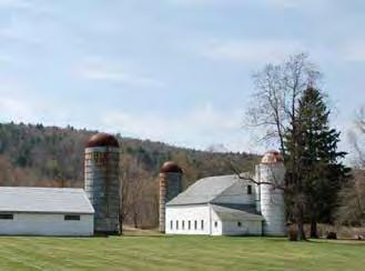
In recognition of the economic challenges that farmers face, and the high value of farmland for local economies, food systems, and healthy ecosystems, there has been a surge of economic and land use policies designed to support farmers and the future of agriculture in Massachusetts.
The Agricultural Preservation Restriction program allows farmers to sell the development rights on their land, permanently protecting the land as valued agricultural land. Massachusetts was the first state in the country to pioneer this type of program in 1979, and it has since protected over 800 farms and 68,000 acres of farmland.
The state also offers tax abatement programs for farmers in exchange for temporary development restrictions. There are local governmental organizations such as the Franklin Regional Council of Governments as well as land trusts and organizations such as Communities Involved in Sustaining Agriculture that offer a variety of funding, technical resources, and marketing support for farmers. Due to these efforts, the rate of farmland loss in Massachusetts has slowed, and between 2007 and 2012 the amount of farmland and number of farms in the Commonwealth grew by 1 percent, and the income generated by farms grew by 4 percent (USDA Census of Agriculture, 2012).
These trends suggest that through ongoing efforts to ensure that local farmers have access to regional and state resources and adopting local economic and land use policies that support the agricultural sector and farmland preservation, Bernardston can support a viable future for its farmers.
Different types of agriculture requires different land management. The rolling fields, grazing cattle, and stacked hay bales of a dairy farm lend a specific quality to the landscape that is very different from orderly patterns of a Christmas tree farm or long colorful rows of annual vegetables. Bernardston is home to at least eight family farms whose main incomes are earned off the land. There are many more families who enjoy keeping farm animals or working their lands as hobbies or for supplemental income. Residents list the proliferation of small farms in town as a valued asset and among the reasons they chose to live in Bernardston.
The Agricultural Commission in Bernardston was formed in 2006 and currently has seven members. Since forming, it has successfully initiated the adoption of a Right-To-Farm Bylaw that states the town’s commitment to agriculture and explicitly permits agricultural activities in town, and instituted an excise tax waiver for farm vehicles and machinery. Their principal ongoing responsibility is mediating complaints about animals and cleanliness between residents and neighboring farms. The commission has also organized a farm tour as part of Old Home Day,

promotes the farmers market, and keeps local farmers informed of state legislative changes. The local farmers market is seasonal, and only two farms in town sell their products at the Bernardston market. The main purpose of the farmers market is to bring regionally local food into Bernardston for residents. Most farms in Bernardston access regional markets outside of town for the sale of their products. State legislation prohibits the sale of raw milk off farm, and the two dairy farms in Bernardston are members of “Our Family Farms,” a regional dairy cooperative where all of their milk is processed and sold.
The farmers in Bernardston express concern about who will take over the farms in the future, since most of the next generation leaves town for other careers. They also expressed concern that the town does not have a mechanism to generate funds for protecting farmland. The state requires towns to contribute up to 20 percent of the value of the development rights of a property entering into the Agricultural Preservation Restriction (APR) program. One Board member observed that this discourages farmers from seeing APR as a viable option. Assuming that the town does not have the funding to contribute, they perceive a high risk of having their request for the protection of their farm turned down at Town Meeting. The Board also expressed concern that the unprotected farmland in the southern portion of town has higher development pressure due to the close proximity to Greenfield.
The Agricultural Commission is currently talking with regional groups such as Franklin Regional Council of Governments (FRCOG) and Community Involved in Sustaining Agriculture (CISA) about the possibility of bringing industries to the local area that would support local farms, such as a slaughterhouse, milk-processing plant, or central composting facility. Encouraging the establishment of industries in town that would offer services and additional markets for local farmers and encouraging the protection of farmland could help to ensure that farms remain an active part of the landscape, ecology, and economy of Bernardston. These efforts cannot be accomplished on a municipal level; they will require continued networking with regional and state organizations.
Of the thirty farms identified by the Agricultural Commission, eight rely on farming as the main source of income for the family. At community meetings, residents listed the ability to have farm animals and maintain small scale farms as one of the reasons they choose to live in Bernardston. Source:
Prime farmland, as defined by the U.S. Department of Agriculture’s Natural Resources Conservation Service (NRCS), is land that has the best combination of physical and chemical characteristics for producing food, feed, forage, fiber, or oilseed crops and is available for these uses. The characteristics of these soils, including texture, nutrient levels, and moisture capacity are ideal for sustained high yields of these crops when proper management, including water management, and acceptable farming methods are applied. The USDA classifies the highest quality soils as Prime Farmland, and soils which share some, but not all, of the highest quality characteristics as Soils of Statewide Importance. For the purpose of this report, these two classifications together are referred to as identified valuable farmland.
According to the NRCS, prime farmland is of major importance in meeting the nation’s short- and longrange needs for food and fiber. Because the supply of high-quality farmland is limited, the U.S. Department of Agriculture recognizes that local and state governments should encourage and facilitate the wise use of our nation’s prime farmland. Implementing landuse planning mechanisms to support the agricultural use of prime soils will improve local and regional food security and rural economies in the future.
There are a total of 4,891 acres of valuable farmland identified in Bernardston, which is 32.6 percent of the total land in Bernardston. Just over half of these soils
Bernardston has between 1,500 and 2,300 acres of unprotected farmland.
According to a 2009 NRCS study, Bernardston falls into the second highest category of Massachusetts towns with unprotected farmland on all types of soils.
are within the Falls River floodplain and gently sloped land south of Route 10; the other half are found primarily in the eastern half of the town in the higher elevations.
The permanently protected open land encompasses 688 acres of identified valuable farmland. These areas include private land with conservation restrictions or agricultural preservation restrictions, and state, town and non-profit owned land.
Many of the same characteristics of prime farmland— flat, well drained soils—provide ideal conditions for urban development and transportation. There are 1,041 acres, 21 percent of the total identified valuable farmland, that have been developed for nonagricultural uses, including residential, commercial, industrial, municipal service infrastructure, and private or public recreation. Depending on the level of infrastructure developed on them, these lands may or may not be available for agricultural production in the future.
The lack of protected farmed land in Bernardston, both on identified Prime Farmland and other soils, has led the NRCS to identify Bernardston as a hot-spot for farmland preservation in Massachusetts (see map below). The recommendations in this plan address this issue by suggesting ways the town might generate revenue and anticipate opportunities to protect farmland in Bernardston (see Section 10: Conclusions).
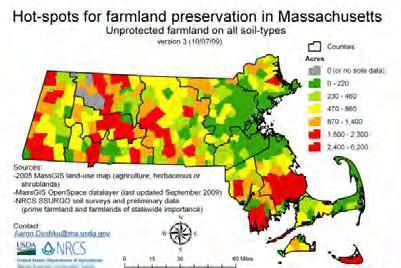
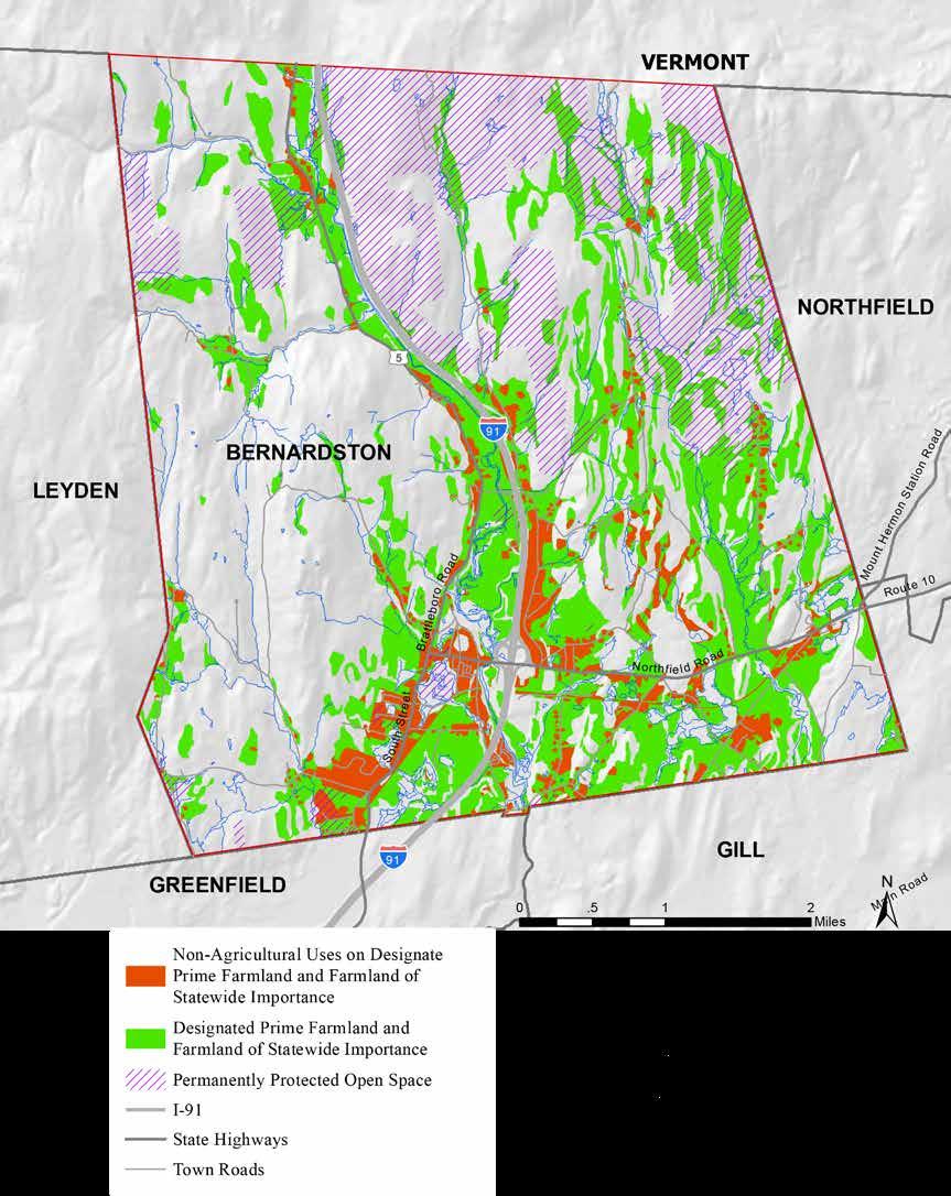

Non-Agricultural Uses on Designated Prime Farmland and Farmland of Statewide Importance
Designated Prime Farmland and Farmland of Statewide Importance in Agricultural Use, Forest, or Recreation.
Permanently Protected Open Space
I-91
State Highway
Town Road
In New England, most of the land that is not actively plowed, cleared, or developed will regenerate as forest. Although many people see forests as beautiful but unproductive, they serve an important role in the local ecology and economy. Forests provide a range of benefits, including fish and wildlife habitat, carbon sequestration, and soil stabilization on steep slopes. Responsible forest management can benefit landowners economically through establishing and logging valuable hardwoods while maintaining the forest cover and habitat that protect soils and riparian zones.
In Bernardston, there are 11,683 acres of forested land, over 70 percent of the total area (MassGIS). The Massachusetts Department of Fish and Game owns the land or conservation restrictions on 1,493 acres of forested land. Most of this land is in the Satan’s Kingdom area on the eastern side of Bernardston. A 137-acre lot called Shattock Brook lies on the far western side of town along the border with Leyden. These areas are designated as wildlife management areas and are available to the public for hunting. 1,150 acres in Northern Bernardston are owned by Hull’s Forestry, a company based in Connecticut. This area is actively logged and has both a conservation restriction on it and is registered in the Chapter 61 Forestry tax abatement program (explained in more detail to the right).
There are many state and regional resources for forestry management. Massachusetts’ Bureau of Forestry, Department of Conservation and Recreation, and Division of Fisheries and Wildlife offer a wide variety of support for land conservation and forest management. Some of these programs offer financing, marketing, and technical assistance aimed at increasing the economic viability of forests for landowners, while others offer incentives for maintaining and enhancing wildlife habitat. Regional resources for forests include the University of Massachusetts MassWoods extension program, which offers an extensive network of public and private certified foresters, appraisers, and land trusts.
Harvard Forest is an extension of Harvard University in Petersham, Massachusetts, which in addition to researching forestry ecology and management, offers educational opportunities on site and in the form of free online webinars.
Preserving the ecological integrity of the landscape and capitalizing on the resources available for landowners to benefit economically from their land are both strategies that are vital to the maintenance of the forests in Bernardston.
According to the Agricultural Commission, most landowners in Bernardston who meet the requirements are enrolled in state tax abatement programs for working lands. The three laws are the Chapter 61 Forestland Act, Chapter 61A Farmland Assessment Act, and Chapter 61 Recreational Land Act. By committing a property to forest, agriculture or recreation for five to ten years, landowners’ properties are taxed as non-developable land. Land protected under Chapter 61 grants towns the right of first refusal if and when property is removed from one of the chapters and offered for sale. The right of first refusal gives the town 120 days to purchase the property or find another organization such as a local land trust to purchase the land. Even though protection through Chapter 61 is temporary, the preserved land may support wildlife habitat or provide other ecosystem services, and helps to maintain the town’s rural character (Conservation and Land Use Planning, 2007).

 Hull’s Forestry
Satan’s Kingdom
Shattock Brook
The topography and hydrologic features of Bernardston provide some constraints to future development. The mountain ranges have steep slopes, rocky outcroppings, and poorly drained soils. The wetlands and floodplains have regulatory restrictions on development. The most easily developable land in Bernardston has road frontage and no structures, or is larger than three acres, the minimum lot size allowed for subdivision in the Residential/Agricultural zoning district, which covers 91 percent of town (see Zoning map earlier in this section).
On the facing map, grey represents areas that are constrained for development, including developed parcels of less than three acres that cannot be subdivided; undeveloped parcels less than one and a half acres that zoning does not permit to be developed in the majority of town; parcels with no road frontage; parcels that are owned by the town, state, or nonprofits; and privately owned land with permanent development restrictions. The Floodplain Overlay District is also included in the constrained grey area. This map is intended to show overall patterns for planning purposes and not to highlight individual plots. The areas in color show land that does not fall under the above constraints. However, these do not take into account the 200-foot road frontage requirement outlined in the zoning bylaws. There are parcel discrepancies between the MassGIS layers used for this map, and the boundaries of state-owned land may not be accurate. This analysis does not take septic suitability into account, which is a constraint to development that needs to be considered on an individual site basis.
The colors on the map represent the slopes on land available for development. Outside of the Floodplain Overlay District, there are no restrictions to developing on sloped land in the zoning by-laws. However, there are high environmental and economic costs associated with development on slopes. Disturbance of the land on slopes, especially within the watershed that drains into the Fall River and Center Village areas, could
increase the sediments washed into Cushman Park. The areas with the highest environmental costs due to steep slopes are represented in dark orange and red tones. There are no development restrictions on these areas, however removing the native vegetation and building infrastructure on these areas may have significantly higher environmental and financial costs than on areas equal to or less than a 15 percent slope.
The lighter yellow tones represent land that is most easily developable based on slope. This land is concentrated in the southern part of Bernardston. Due to the amount of permanently protected land in Satan’s Kingdom and by Hull’s Forestry, there is less available land for development in the northeastern quadrant. The large amount of steep slopes on the western side of town indicate that development here would have a high environmental cost to the town and could increase the sediment and flooding issues in the Center Village. This analysis suggests that valuable farmland and open land in the southern portion of Bernardston should be a priority for protection. Because the constraints displayed on this map are based on one-and-a-half acre lot sizes, and the zoning in the center of town is for a minimum lot size of one-half acre, there may be more available developable land in the center of town than is displayed here. Creating a fee-based transfer of development rights system would allow the Town to select areas in close proximity to the Village Center that could accept a smaller minimum lot size for a fee, opening up more development possibilities near already existing town services, and lowering the environmental and economic costs of development in town.


Constraints
-
-
-
-
-
To meet the goals of preserving rural character, creating a vibrant historic center village, and fostering sustainable economic development, residents may decide to create mechanisms to increase development in already built-up areas and to preserve the current open agricultural and forested land that form the backdrop for the views along main roads. Citizens should be involved in a process to define design guidelines for the town that will decrease potential controversy over new development and ensure that new businesses contribute positively to the town’s Center Village appearance.
The following concerns are compiled from meetings and interviews with town departments and discussions at two community meetings.
• Development history in Bernardston shows a trend of residential land developed outside of the town center, fragmenting wildlife habitat and resulting in higher cost of services to the town.
• Many of the visible agricultural and forested lands that create Bernardston’s rural character are not permanently protected and might be developed.
• Farmers are concerned about a lack of transition plans for their farms and may resort to selling for development when they retire.
• The unprotected farmland that is cleared, welldrained, and along major roads has been identified as higher risk to development. The loss of these lands would negatively impact Bernardston’s rural character and the local agricultural economy.
• The town lacks funds or a mechanism for generating funds to purchase the development rights on land that becomes available.
• In-fill in the Center Village is limited by the necessity for individual septic systems and the close proximity of wetlands.
• A lack of sidewalks, crosswalks, and centrally located parking in town makes the town less amenable for walking and biking. Because the
New England small towns can expect climate changes in the future, including more drastic storm events and changes in precipitation levels and temperature. These changes are in part exacerbated by chemicals released into the atmosphere from the combustion of fossil fuels. Encouraging denser development in already established residential and commercial centers will help reduce dependency on fossil fuels, which can have both economic and environmental benefits. Increasing density within an already developed area also relieves pressure on small towns to bring increased utilities, roads, and emergency services to more costly and remote areas. Land use planning strategies to create resilient small towns that can best adapt to future climate and economic changes include preserving surrounding agricultural land to support local food sources, encouraging public and non-fossil-fuel-based transportation, and preventing sprawl in the outskirts of town.
main roads in town are state routes, adding sidewalks, crosswalks, and parking may require permission from the state Department of Transportation.
• A lack of parking in the Center Village increases the need to drive short distances for errands and reduces the accessibility of Cushman Park.
• New businesses might detract from the New England style of Center Village.
• Some green technologies, such as solar fields, are contested within the community because they are seen as desirable technology but are not aligned with the preferred rural.
• Due to a lack of business and tourist attractions along Route 10, some residents believe there is a lost opportunity to capture potential business for travelers going east on Route 10 to Northfield.
Recommendation for Bernardston’s future land use management cover a range of actions, including education and outreach, zoning and policy changes, strengthening community connections, and investing in infrastructure changes that require significant planning and funding. In Section 10 the following recommendations are explained in more detail with the responsible parties.
Ongoing
Organize a series of educational and networkbuilding events to promote regional and state resources for farmers and foresters. These should include farm and forestry best management practices that promote healthy ecosystems and edge habitats, protect wetlands, and prevent erosion; tax abatement and preservation opportunities; marketing strategies; and farm transition resources. Local land trusts should be invited to present to landowners about land conservation and stewardship opportunities through estate planning outreach grants.
Update information about the Ag Commission and Conservation Commission on the town website, including links to state and regional resources that provide technical and financial assistance for farmers and foresters. Efforts should be made to include announcements about relevant state and national policy changes and local farming or forestry events.
Develop a strategy for identifying and protecting lands that may be coming out of Chapter 61, 61A, or 61B. Work with residents, the Department of Fish and Game, the Franklin Land Trust, Mount Grace Land Trust, and other conservation organizations to anticipate the funding necessary to protect these lands. When landowners enrolled in these tax abatement programs for undeveloped land decide to develop or sell their land for development, the town has only 120 days to exercise their right-of-first-refusal to purchase the property, or transfer the right to purchase the property to a qualified organization. Prioritize protection in the southern portion of town which has several wetlands and identified critical habitat that stretches across the town border and is under the highest development pressure. Second priority is the
northeast region of Bernardston that is densely forested, mostly protected but has modest development pressure. The town should also consider protecting the large Landscape Block along the western mountain range which is predominantly unprotected and has low development pressure.
Hold a community charrette to help establish Form Based Codes for new development, design walking paths through the Center Village, and site off-street parking. These guidelines should describe in detail acceptable materials, architecture styles, sign restrictions, walking access, screened parking, and landscaping. Involving citizens in establishing the desired aesthetics is shown to result in faster permitting processes and less conflict over new development. The conclusions of the charette could be incorporated into the existing site plan review.
Post “Right-to-Farm” signs at the major roadways leading into Bernardston and on Route 10 on either side of the I-91 exit. The signs will communicate Bernardston’s commitment to their farmers, and increase the awareness of local farms and visibility of farm stands. Some residents are unaware that Bernardston adopted the by-law in 2002.
Create a Development Transfer Fee Program to allow for tighter in-fill in areas such as the R1 zones, and establish working farmland and forest in high development pressure areas as sending zones. This program allows developers to pay a fee for increasing the density of development in receiving zones. The fee is deposited into an account for the town to purchase the development rights on conservation or farmland as it becomes available. The receiving zones should be evaluated for their ability to accept higher density development based on septic suitability and low impact to critical natural habitat. Creating a transfer fee program would allow individuals to take advantage of the ability to subdivide into smaller plots and not require a major residential development for the system to generate funds for land preservation.
Create an Agricultural Interest Overlay District requiring development on working farmland to place a minimum amount of the property into the Agricultural Preservation Restriction program. This would help the town ensure a minimum loss of farmland in the future.
Develop a solar field on the town’s landfill to provide renewable energy on land that cannot be used for agriculture and is not highly visible. In 2009 Franklin County Solid Waste Management District conducted a feasibility study and potential plan for a solar field on this site. The plan proposed a system that would generate 860,000 kwh of electricity a year.
Advocate for regional public transportation connecting the Center Village in Bernardston to Greenfield. This could increase the ability of the elderly or people who do not drive to continue living in Bernardston and will decrease future dependency on fossil fuels.
Consider the area south of the railroad along River Road for Center Village development. Work with Farmer’s Supply to develop parking and a riverside walkway connecting to the small area south of Hillside Pizza, making this section of town more accessible from Church Street and maintaining the view of Arch Bridge from River Street.
Rezone Route 10 for mixed use to have shops and businesses that would support the local rural economy and diversify the tax base. This new zoning district would have design standards to maintain the historic character of Bernardston, and would become a priority if plans to implement a centralized sewer system for the business and industrial zones are developed.

A twenty acre hay field along an existing road in Bernardston, in the Residential / Agricultural zoning district.
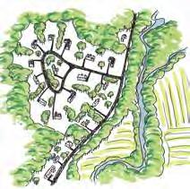
A conceptual subdivision development that uses the one-and-a-half acre minimum lot size as defined by the current zoning bylaws. Thirteen houses are developed on the twenty acres.

A conceptual solution for development that preserves 80% of the agricultural land by mandating clustered development with half-acre lots. Eight houses are built and the remaining sixteen acres are permanently protected.
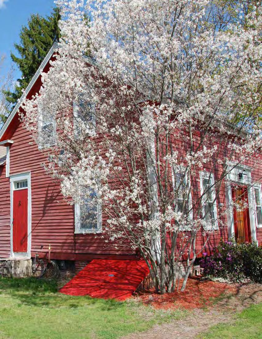 Credit: Cathryn Thomas
This chapter evaluates the current housing stock in Bernardston and makes recommendations according to present and future needs. The community’s goal of a vibrant center village will be addressed through focusing the development of housing in and around a more densely developed village center. By combining this with a clustered housing development model, the goal of preserving the town’s rural character will also be addressed. In addition, there are many different ways to use housing to support the local economy, some of which are discussed in the Economic Development chapter. Housing is always intimately connected with wastewater, as every household needs a
way to dispose of their waste and greywater. Concerns about septic systems will be discussed in the Wastewater section of the Services chapter, where recommendations will be made to provide better septic maintenance education and to explore alternative systems for areas experiencing a rising water table. The Metropolitan Area Planning Council (MAPC) compiles a Basic Needs Assessment for municipalities throughout Massachusetts. The MAPC assessment for Bernardston, collected in 2013 using the American Community Survey and 2010 Census data, is referenced throughout this section (“Basic Housing Needs Assessment for Bernardston, MA”).

The housing stock of Bernardston consists of 1,024 housing units, at a density of 44 units per square mile. This density is about the same as the adjacent areas of Vernon (47) and Gill (46), but far less than the more densely populated areas of Greenfield (388) and Turners Falls (1,124) just 9 miles south (Bernardston, MA Housing Data, Towncharts, n.p., n.d., 17 February 2016). Of the current housing stock, 83 percent is single-unit detached housing. There are 33 multifamily units: 29 two-family housing units and 4 three-family units. There is a mobile home park off Route 5 near the school, with to 37 mobile homes. There are also 24 more mobile home units within town highlighted in red on the Housing Units Map to the right.
The Housing Units by Parcel map on the next page illustrates the distribution of housing stock across town. Low density residential housing is found throughout the northern half of the town, which is zoned as Residential/Agricultural (RA) and requires 1.5 acre minimum lot sizes. RA zoning also requires 200 feet of road frontage. These two zoning requirements for RA, which covers 91 percent of Bernardston, contribute to the spread of development along road frontage, resulting in patterns similar to suburban sprawl. According to the National Center for Policy Analysis, suburban sprawl is “generally defined as low-density residential and commercial development on previously undeveloped land.” That spread often takes on the form of single-family housing units that are on one-acre lots or larger. Sprawl also sees more automobile traffic, chain restaurants, and box-stores (Arendt, 2015).
Denser residential development is found in the zoned Center Village, where the concentration of commerce and activity is located. The current zoning for Center Village calls for minimum lot sizes of a half-acre with road frontage minimums of 125 feet. While this has allowed for denser development than in the more rural areas of Bernardston, the residents have indicated in community meetings that the Center Village they desire is even denser than they currently have. In order to reach this density, zoning will have to change.
The Land Use chapter highlighted the fact that less than 6 percent of land is devoted to housing and commercial use in Bernardston, meaning large areas of open space, including most of the land to the west of Route 5 and much of the northeast, could potentially be developed in the future. To preserve the open space that is important to Bernardston’s rural character, development should be focused on infill in the areas that already have development. These areas are mostly located in the southern third of town, with some development also along Route 5, running through town north and south.
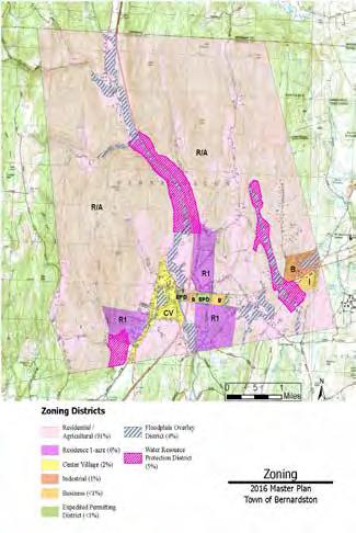
Massachusetts and the Comprehensive Permit Act aim to establish 10 percent of housing in every Massachusetts community as affordable. This is accomplished through Chapter 40B, which allows developers of affordable housing to override certain aspects of municipal zoning bylaws and other requirements in places where less than 10 percent of the local housing stock is “affordable.” According to 40B, the definition of affordable is any unit that can be afforded by a person or household making 80 percent of the Area Median Income, in which they are not paying more than 30 percent of their income toward that unit (“General Laws - 40B”).
The median household income in Bernardston is $53,750 (2013 ACS); 80 percent of this is $43,000. Therefore affordable housing in Bernardston is considered to be any housing unit that costs up to $12,900 per year (30 percent of $43,000), or $1,075 per month, for the household (2013 ACS).
The 30 percent income threshold has been deemed by the U.S. Department of Housing and Urban Development (HUD) as the level at which a household

paying more than that would find it difficult to afford the necessities “such as food, clothing, transportation and medical care.” Households paying more than 30 percent of their income on housing are categorized as “cost burden” households. Those spending more than 50 percent of income on housing are “severely cost burden” (MAPC). Per the MAPC report, 45 percent of Bernardston households are “cost burden,” with 12 percent of those that are cost burden being “severely cost burden.”
HUD defines low income households as those making 80 percent of the AMI, very low income households as 50 percent or less of the AMI, and extremely low income as 30 percent or less. In Bernardston, 14 percent of households are low income, 23 percent very low, and 13 percent extremely low income (ACS, 2013). This means that 50 percent of households in Bernardston are low income or lower, making them eligible for state and federal affordable housing programs. Despite the fact that 50 percent of households in Bernardston would be eligible for subsidized housing, as of the 2010 Census only 2.58 percent of the housing units in Bernardston receive subsidies (MAPC). Of those subsidized is Stratton Manor, which is a 20 unit, two-building elderly and disabled housing facility located on Hartwell Street, and two three-bedroom family housing units in the Center Village area.
If 10 percent of housing in a municipality is not affordable for those living at 80 percent of the area’s median income, in accordance with Chapter 40B, developers can apply for a Comprehensive Permit that will allow them to develop in a way that does not adhere to existing zoning (MAPC). Many communities maintain control over how development happens through their zoning bylaws. By proactively planning for more affordable housing, Bernardston can provide the opportunity for better control over how development happens and the possibility of preserving its rural character. Thus Bernardston not only has a need for more affordable housing, but by not providing it the town would be susceptible to development that does not need to comply with zoning regulations designed to support community character.
The population of Bernardston according to 2014 ACS data is 2,173. More than half of the population is over the age of 40: 31 percent are 60 or older and 32 percent are between 40 and 60. These two population categories make up the current senior population and those who would be aging into seniors by 2035, respectively.
Though almost one third of the population of Bernardston is currently in the senior category, there is only one senior housing community, Stratton Manor, with twenty age-restricted units for people 60 and older, who are making 80 percent or less of the AMI. Stratton Manor is run by the Franklin County Regional Housing and Redevelopment Authority (HRA). HUD defines senior housing as that which is reserved specifically for people over the age of 55. In general there are many different types of living configurations among units designated for seniors. These range from
assisted living where assistance is provided for certain kinds of needs, such as mobility problems or help with daily activities, to nursing homes that provide full medical care to occupants, to those that are simply restricted to people of a certain age (portal.hud.gov). Stratton Manor is only a place of residence, and Bernardston seniors must go to the Senior Center to find the types of services that are sometimes provided can by these other living situations.
According to the Director of the Senior Center, Dianne Cornwell, there are many participants in the various classes the Senior Center provide that come from outside of Bernardston to participate. These are people who have connections to Bernardston, people who either lived in town previously, or have family in town, but were unable to find the appropriate living situations and had to move or live out of town. Cornwell also reports that many senior residents no longer have the ability to use their entire house, because it has become inaccessible to them as they have aged.

When looking at the current population of Bernardston and its housing needs, two things become evident: the need to provide more affordable housing, and the need to plan for the living situation of its current and future senior population. Future development should keep in mind the state goal of 10% of housing being affordable within a municipality, and the 90 units needed to meet this goal (based on current housing stock of 1,024 units). Clustering housing in already developed areas can help prevent the spread of suburban residential development into undeveloped open space and therefore help preserve the town’s rural character. By steering future housing construction in and around the designated center village, the vibrancy of the center village can be improved through a higher density of people living there. Establishing form-based codes and design principles for development and changing the current zoning bylaws can help ensure this development is in line with community aesthetics. Having a center village zoned for mixed use should also help cut down on traffic as people would not need to drive to access public amenities and services. Housing plays an important role in creating a sense of place, a “character,” and its connection to community quality of life will be explored further in the Economic Development chapter.


A comparison of conventional development with clustered development which maintains yard space, and conserves open space.
• There is a lack of affordable housing in Bernardston, which presents a problem for the 50 percent of households that are low income.
• Only 2.58 percent of housing in Bernardston is recognized as affordable. This opens up the potential for developers to apply for a “Comprehensive Permit” under the laws of Chapter 40B. This permit will allow developers to ignore certain local bylaws, including some that may help in the preservation of open space.
• There is an aging population within Bernardston, but a lack of senior housing.
Housing has a huge impact on the environment. These impact range from the amount energy it takes to extract the materials used for building, to the transportation of materials, and the use of large pieces of machinery that require fossil fuels. All of these things release greenhouse gasses and contribute to the continued change of our global climate. Future housing construction should source materials from local producers and manufacturers when possible. Consideration should also be given to the energy needed to run and heat a house. Renewable energy if available and economical should be used. If this is not a possibility siting of future houses should be oriented to maximize solar gain for heat, and use the features of the land to minimize the input needed. This will not only help with resource use, but save the residents of Bernardston money.
With 50 percent of Bernardston residents meeting lowincome standards, the need for affordable housing is great. The current number of houses that are subsidized, and therefore recognized by Chapter 40B as affordable, is 2.53 percent (25 units). This is much less that the 10 percent threshold established under 40B. Bernardston would have to construct 90 new affordable housing units to reach 10 percent.The percent of households classified as cost burden or severely cost burden, is at 45 percent. If those cost burden households could move into newly created affordable units, the finances of those households could contribute to the local economy in other ways. This would also free up existing housing stock for new families or for retrofitting to create multi-unit housing, or for subdivision that could then be developed for denser living situations. Affordable housing can play a large role in sustainable economic development.
According to a Center for Housing Policy report, for every 100 Low Income Tax Credit housing units constructed, 120 jobs are created. These jobs are created through the construction of the units, and when filled locally can contribute to the local economy. The article also states that once built these units help support 30 local jobs in hospitality, education, health, maintenance, and more (Cohen; Rebecca, 2011).
Zone the designated Center Village area for by-right mixed-use buildings. Mixed-use buildings, where commercial stores are on the first floor and housing is on the floors above, are common in village centers across New England and the country. More housing units in Center Village will help create the vibrancy desired by the residents of Bernardston. Allowing mixed-use buildings will also help create a space where people live, work and play. Some of the housing units should be affordable to help Bernardston reach the 90 new units mark.
Create a Housing Production Plan. A state-approved Housing Production Plan that the town follows is accepted by the state as “adequate progress” towards the 10 percent threshold required through 40B. Proof of “adequate progress” blocks developers from being able to acquire the Comprehensive Permit they need to develop outside of the bylaws and design principles the town has in place, even if the town has not reached the 10 percent threshold yet.
Establish as-of-right zoning for multifamily housing and higher density development. According to the MAPC report this can sometimes serve as the “adequate progress” mark needed to block developers from getting the Comprehensive Permit. As-of-right zoning will also make it easier for developers to build the housing units associated with a more vibrant center by eliminating the paperwork and time associated with applying for a permit under existing zoning laws. It will also make it easier for home owners to add auxiliary and in-law units onto their household.
Create by-laws for Center Village and Residential Zones that encourage clustered development. A visual of how clustered development works to preserve open space is outlined in the Clustered Development diagram on page 104. Clustered development allows open space to be preserved, and with smaller lots permitted more houses can be built, which can serve as incentive for developers.
According to 40B, affordable housing only has to be rented as affordable for a certain amount of years, but there are ways to guarantee units are affordable forever and these options should be explored. Community land trusts and deed-based restrictions are two ways to provide affordable housing that will be sustained into the future. Community land trusts are non-profit organizations that seek to create permanently affordable housing opportunities. The National Community Land Trust Network has established resources for communities wishing to set up a trust, including resources for funding, planning, and impact analyses.
The senior population of Bernardston constitutes a large portion of the population, about one third. This number is projected to increase over the next twenty years as the Baby Boomer generation ages. There needs to be a focus on providing affordable and accessible housing to these seniors, giving residents an opportunity to age in place. Those seniors who move to new senior living situations would also open housing stock to younger residents.
Bylaws should be created mandating a certain percentage of the affordable housing in town be accessible and reserved as senior housing. The senior housing units should also be clustered and within walking distance (a quarter-mile) of the Center Village for ease of access to local amenities.
A committee for senior housing should be formed in partnership with or as a subset of the Council on Aging. The committee would be in charge of researching ways of bringing senior housing and assisted living to Bernardston. The committee would also explore the creation of an “aging in place” fund. The money from this fund would be allocated to those who apply for help in renovating their residences to be accessible for the aging member(s) of the household (ramps, widening of doors, shower seats and support bars, etc). Money for such a fund could come from fundraisers or grants, with more information to be found through an AARP produced toolkit for local governments (Ball) and through the Administration for Community Living which runs a Community Inovations for Aging in Place Initiative.
Setbacks should be replaced with build-to lines. Current setbacks mandate a structure be a minimum amount of feet back from the road (this is 20 feet in Center Village ), which provides open space at the front of the lot. A build-to line mandates that a structure be built at a particular distance from the road. These build-to lines help create an enclosed space and a sense of place (Arendt, 2015). Town residents have stated that buildings close to the road along a streetscape is a
desirable characteristic for a center village. Structures built close to the road can also provide parking behind them that is hidden from the public.
Minimum lot size should be changed so subdivision is possible. Currently minimum lot sizes are just under half-acre for Center Village and Business districts, and just under one acre and a half for Resident 1-Acre and Resident Agriculture respectively. By changing the minimum size for zoned Center Village and Business districts to quarter-acre or smaller, lots could be subdivided and sold or leased by current owners. Change side setbacks to allow for closer development. Allowing buildings to be built closer to parcel boundaries would help create more room for infil and would allow the town to dictate how close buildings can be. By keeping side setbacks, the town would avoid having buildings touching each other, something residents identified as undesirable in community meetings.
Mixed-use and multi-family buildings should be allowed by right in designated areas. Provided buildings are developed within walking distance of each other, having mixed-use areas and a village center that offers business and housing creates a more walkable and pedestrian-friendly town where people can live and access amenities, shops and restaurants, all in one place.

Highrises and concrete buildings are not the only types of affordable housing. With design principles and bylaws in place, affordable housing can fit into the aesthetic of the town where they are built. These affordable housing units in the UK fit in with the surrounding town of Suckley.
Allow for accessory apartment and “in-law” units in all residential zones. This allows denser infill near existing structures, creates the potential for rental income for homeowners, and provides the opportunity for senior housing. In-law units also alleviate some of the need for other senior housing options.
Designate priority residential development sites within one mile of Center Village. This will encourage walking, cut down on traffic, preserve open space, and direct development to areas that residents have deemed in accordance with their future vision of Bernardston. These sites will differ depending on where the future development of Center Village is, but regardless of location, a wastewater engineer should be hired to establish the suitability of each site for development. An engineer will be needed to conduct a thorough hydrologic and environmental study to assess wastewater treatment options and establish the viability of any clustered development. Making such a study available to perspective developers can be part of a more comprehensive marketing program and alleviate assessment costs a developer would have to incur otherwise to do such a site suitability study. It would also point to specific areas the town can begin to market for future development, or sites the town itself may want to buy for reasons recommended previously.
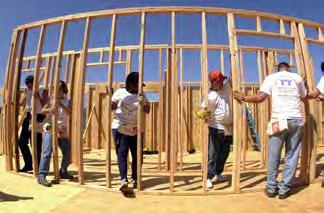
Adopt the Community Preservation Act. Funds collected through the CPA in each municipality can be used for the creation of affordable housing. In 2015 alone there were 107 affordable-housing-related projects across the state that the CPA helped fund. This money was used for acquisition, construction, upkeep, preservation and more (Community Preservation Coalition). The CPA has previously been proposed and rejected in Bernardston because of the increase in taxes involved, but the CPA “helps strengthen the state and local economies by expanding housing opportunities and construction jobs for the Commonwealth’s workforce, and by supporting the tourism industry through preservation of the Commonwealth’s historic and natural resources” (Community Preservation Coalition). Efforts should be made to educate the public around the benefits of the CPA and how the use of the money could support economic development through housing projects.
Designate the future center village as a Smart Growth District. Creating such overlay districts for a center village and the area immediately surrounding it would allow the town to apply for funding under Chapter 40R, which encourages smart growth and denser development. Once the state has reviewed and approved the overlay district, the town can apply for funding from the Smart Growth Housing Trust Fund and other financial incentives. Such incentives include $75,000 for the construction of 21 to 100 units, bonus payments once units are constructed, and funding preference for the town when applying to specified other funding programs.
Explore partnering with Habitat for Humanity to create sweat-equity housing ownership for lowincome households. Pioneer Valley Habitat is the local branch of Habitat for Humanity that works to provide affordable homes for families in the region. It has built units in Turners Falls, Montague, Florence, Amherst and elsewhere. Sweat-equity projects are a large part of the philosophy of the organization as a way to encourage families to take ownership in their housing (Pioneer Valley Habitat for Humanity).
Establish design principles and form-based codes for a New England village center aesthetic. This will ensure that any future development will fit in with the rural character of Bernardston. Form-based codes regulate construction based on the physical form of a structure, while design principles make similar restrictions about how the building and space around it should be constructed and look.
Create a funding subcommittee. The subcommittee should make recommendations as to who and how to apply for the applicable funding identified. Some options include funding from the Community Block Grant and Economic Development Fund.
Funding that would help the town purchase land and houses so as to dictate the type of development that comes in next should be explored. As of March 2016 there were twenty houses for sale on Zillow in Bernardston, more than half of which have three or more bedrooms. Purchasing these residences with assistance from a Community Land Trust, for example, would allow Bernardston to control the type of development that would happen there next.

Finding space for the future housing needs of Bernardston should be focused around the development of a center village to support vibrancy and preserve the surrounding open spaces and rural character. There is a lack of vacant lots in the currently zoned center village (Vacant Lots in Center Village map), and of those close to Center Village only two are designated “developable” (green) according to criteria put forward by the Massachusetts Research and Technology Department. Without the possibility of purchasing land for future development in Center Village, it will be hard to create a more dense and vibrant central village. Before future development happens, consideration should be given to whether or not the currently zoned Center Village is the best place for future development of a central village that meets the goal of a vibrant space as put forth by the residents. An alternative to developing on existing vacant lots would be to create vacant lots by subdividing. However, the current zoning regulations that require a minimum of half-acre lots and 125 feet of road frontage will not allow for subdivision to the size associated with a densely populated, vibrant center village. With smaller minimum lot sizes and road frontages, current lots could be subdivided, and resulting vacant lots could be sold for infill development. The particular spatial configuration of Center Village can still be decided upon and regulated through different zoning bylaws, while allowing for the desired density. Such infill development would help create the densely developed Center Village that residents mentioned as desirable in community meetings and survey.
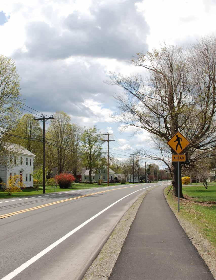
Transportation takes many forms in Bernardston. Major roads such as Interstate 91, Route 5, and Route 10 connect Bernardston to surrounding towns and to the broader region. A rail line owned by the state of Massachusetts runs through the southern portion of town and offers the potential for freight transport for businesses. Trail systems for hiking, snowmobiling, and horse riding weave through the town’s forests and allow residents and visitors to explore the town’s natural beauty. The Franklin County Bikeway connects the town to a large network of bike-friendly roads and
off-road bike paths that run through the county. Scenic byways surround the town and allow travelers to see the beauty of western Massachusetts. A sidewalk on one side of the road runs along South Street and Church Street.
While there are many opportunities that Bernardston’s transportation networks provide (for example, how easily accessible the town center is from I-91), feedback from multiple community meetings and two surveys revealed there is room for improvement. For example, access to public transportation, better trail maps and way-finding signage, and improved parking in Center Village are a few of the transportation-related issues identified by residents.
Interstate 91 is a major interstate highway that bisects Bernardston and runs from southern Connecticut to northern Vermont at the Canadian border. The section that runs through Bernardston was designed in the early 1960s. Bernardston is the last northbound Massachusetts exit on I-91 (exit 28) before entering Vermont.
I-91 is the most heavily traveled road in Franklin County with approximately 19,875 vehicles passing through Bernardston daily (Mass DOT Transportation Data Management System, 2010-2015 average). But while many pass through Bernardston on the highway, few stop in town. However, because Bernardston is easily accessible and located between the population centers of Greenfield and Northampton to the south, and Brattleboro to the north, there is potential to draw
visitors to the town for outdoor recreation, community events, and local businesses.
Route 5 and 10 are major roads in Bernardston, entering from Greenfield to the south. Routes 5 and 10 then split in the middle of Center Village, with Route 5 continuing north into Vermont and Route 10 traveling east into Northfield and then into New Hampshire. Compared to I-91, these roads receive considerably less traffic; Route 5 has 4,060 vehicles daily (2015), with Route 10 more than twice that at 8,150 vehicles daily (Mass DOT Transportation Data Management System, 2010-2015 average). Routes 5 and 10 are state roads so while the town does not need to maintain these roads, the town’s ability to influence their layout is limited. Parking is not permitted on these roads; however, because of a general lack of parking alternatives in town, many motorists often ignore this restriction and park along Route 10. This is especially the case for those visiting or working at Town Hall, which has minimal parking.
As part of the FRCOG’s Route 5/10 Corridor Plan (2009), a LOS (Level of Service) analysis was performed on South Street and Route 10 to determine how well certain sections of those roads performed during the highest traffic volumes. It assessed how efficient the traffic flow was for a motorist, using the difference between the traffic flow under ideal conditions and the travel time actually experienced.
The section of South Street from the southern border of Bernardston to where it intersects with Church Street and the section of Route 10 west of Interstate 91 both received a B on a scale of A through F, where A is the highest quality of road service. A B rating signifies:
The demand for passing to maintain desired speeds becomes significant, with drivers being delayed in platoons (multiple vehicles following closely) up to 50 percent of the time. (22)
The section of Route 10 east of I-91 towards Northfield received a C rating, which according to the report indicates:
Traffic volumes are increasing, resulting in a noticeable increase in platoon formation and size. Passing opportunities begin to become infrequent although traffic flow remains stable, in that reasonable travel speed is maintained. Slow moving and turning traffic may cause congestion. Time spent following other vehicles will be likely up to 65 percent of the time. (22-23)
The Route 5/10 Corridor Plan advises that in general, roads should be maintained at an LOS grade of C or better to ensure an enjoyable route. This means that currently the Route 5/10 corridor is adequate to transport the number of vehicles using it.
In the FRCOG’s Route 5/10 Corridor Plan, the LOS for a variety of uses was projected for the two sites in the Expedited Permitting District (Priority Development Sites). The scenarios were for the year 2019 and for 100% manufacturing, 100% industrial, 100% retail big box store, 100% retail smaller stores. The projected LOS for each of these land uses was assessed for Church Street and Northfield Road.
The four projected land uses were estimated at three different size facilities: 30,000-square-foot (30 KSF), 50,000-square-foot (50 KSF) and 75,000-square-foot (75 KSF).
The findings showed that the only scenarios that would have a significant negative impact on the traffic conditions were a 75 KSF retail big box store or a 75 KSF retail set of smaller stores. These scenarios were
projected to result in an LOS rating of D for the section of Route 10 from the I-91 Interchange to Northfield, given the current roadway and geometry. A D signifies: Traffic flow is unstable and the opposing flows begin to operate separately as passing opportunities become very limited. Passing demand is high, but passing capacity approaches zero. Turning vehicles and roadside distractions cause major interruptions in the traffic stream. Platoon size increases to between 5 and 10 vehicles up to 85% of the time. (23)
The LOS for the four previously mentioned land uses were assessed at PDS 2, at three different sizes: 100 KSF, 200 KSF, and 300 KSF. Scenarios for mixed-use development of 250 KSF and 300 KSF were also assessed.

As with PDS 1, a land use of 100% industrial or 100% manufacturing up to 300 KSF was not found to have significant negative impacts on the roads or traffic conditions. Only a few uses were found that would significantly negatively affect service for the Route 5/10 Corridor, and all of them were only shown to affect Northfield Road.
All of these uses received a D:
100% retail in the form of a big box store at 200 to 300 KSF (100 KSF would not have a significant impact)
100% retail - smaller stores - all sizes (100 to 300 KSF)
Mixed use at 250 KSF
Essentially, those land uses that received a D should not be permitted without an assessment of how Northfield Road could be reconfigured to accommodate larger traffic volumes. (32-33)
Proper maintenance of roads is essential for safe transportation; however, the relationship between pavement conditions and cost of repair is not linear. As road conditions deteriorate, the cost to bring the pavement back to excellent condition increases significantly (FRCOG, 2013). Preventative maintenance on all roadways therefore is a much more cost effective approach and considerable savings could be realized if money is invested ahead of time to prevent roads from reaching a poor condition. According to the Town of Bernardston Community Development Plan (2009), it is estimated that for every dollar spent on preventative maintenance, two dollars is saved in future repair costs (FRCOG, 2009). Allocating money earlier on will keep the roads in better shape and reduce costs of repair and reconstruction later on.
How do these sizes compare to actual stores?
Supermarkets: range from 10,000 to 90,000 sq. ft. and average 44,000 sq. ft.
Football field: 57,000 sq. ft.
Average Home Depot (including garden area): 128,000 sq. ft.
Wal-Mart supercenters: range from 99,000 to 250,000 sq. ft. and average 187,000 sq. ft.
Source: http://business.time.com/2013/03/19/the-bigger-boxstore-home-improvement-stores-that-are-double-the-size-of-homedepot/
The Community Development Plan recommended developing a Pavement Management System in Bernardston, which would provide guidelines and a standardized approach that improve upon the highway department’s road maintenance practices. With limited transportation funding, a Pavement Management System may help the highway department make best use of the available resources, and also provide information that can be used to levy funding from state or federal sources.
The pavement management studies include a “visual assessment of the pavement conditions; a quantitative analysis of the condition; and a projection of future conditions based on varying levels of investment in repairs and maintenance” (2-8).
The towns of Ashfield, Buckland, Colrain, Conway, Heath, Gill, Orange, Shelburne, Shutesbury, Whately, and Montague have all worked with the FRCOG to complete pavement management studies.
All the bridges in the Commonwealth that meet National Bridge Inventory (NBI) criteria are logged by the Massachusetts Department of Transportation. These are publicly owned highway bridges longer than twenty feet, excluding pedestrian bridges, rail bridges, and bridges that have been closed for more than ten years. Bridges that do not meet these criteria are not eligible for federal bridge replacement funding.
Fifteen bridges in Bernardston meet this criteria, twelve of which are functional and three of which were identified as being structurally deficient in FRCOG’s 2016 Regional Transportation Plan. Bridges are currently monitored every two years using the American Association of State Highway and Transportation Officials (AASHTO) rating system.
According to the 2009 Town of Bernardston Community Development Plan, for a bridge to be eligible for reconstruction it must have an AASHTO rating of less than 75 and for a bridge to be eligible for replacement, it must have an AASHTO rating of less than 50.
There are four bridges withAASHTO ratings under 75, one of which is under 50:
Route 5 over Shattuck Brook was rated a 15.8 and was rated structurally deficient.
Hoe Shop Road over Water Falls River was rated 63.4.
Route 10 over I-91 was rated 66.49 and was rated structurally deficient.
Routes 5 and 10 are state roads so maintaining them is the responsibility of the state. The bridge over the Falls River is owned by the town and so this bridge should be monitored and repaired as needed. 3 4
Route 10 over the railroad track was rated 74.

Public transportation in Bernardston is currently very limited but over 60% of residents who responded to two public surveys are interested in a bus route to serve Bernardston and the surrounding towns. A bus service was previously offered in town by the Franklin Regional Transit Authority (FRTA), partly as a way to help students at the Northfield Mt. Hermon School in Northfield access Greenfield for shopping and other activities. The bus travelled north from Greenfield, through the center of Bernardston, and east to Northfield. Schedules were fairly inconsistent, however, as they were determined by the school’s schedule and so were not very convenient for residents to use. When the school’s Northfield campus closed in 2005, a loss of funding and a loss of more than half of the passengers made it difficult for the FRTA to sustain this route and so the service was discontinued in 2009.
Funding and the relatively low density of people in Bernardston are some of the main challenges associated with the town’s ability to sustain a bus service. According to the FRCOG’s Sustainable Franklin County (2013), a minimum residential density of four units per acre is needed to support the route with enough riders. Most of Bernardston is either lowdensity residential (houses on half- to one-acre lots) or very-low-density residential (houses on greater than one-acre lots). The trailer park next to the Bernardston Elementary School is the only exception, where houses are on smaller than quarter-acre lots.
Through a contract with Bernardston which is managed by the Bernardston Council on Aging, the FRTA offers a demand-response paratransit van route for seniors over 60 and disabled residents in town. This frequently takes seniors to the Council on Aging office at the Powers Institute, and often takes people to Greenfield for doctor’s visits, shopping, etc. Other van service providers include the Bernardston/Northfield Council on Aging on a donation basis and F.M. Kuzmeskus Inc., which is a private bus service based out of Gill.
Though Bernardston does not currently meet the minimum density outlined by the FRCOG to warrant a public transport service, the FRCOG’s North County Transit Study (2011) found a demand for public transportation in Bernardston, Gill, and Northfield so
the potential for collaboration exists. The three towns have a combined population of 6,843, 60% of which is of working age between 25 and 64 years old (FRCOG, 2011). While the population of these towns has remained fairly stable over the past few decades, as the baby boomer population of these towns ages, there will likely be an increased demand for public transit services. Studies have indicated that nationally, over 40% of those over 75 years old are non-drivers so a future bus route among these towns should take this population and their needs into consideration.


Are you interested in a bus route that serves Bernardston and surrounding towns? (Community survey, 2016)
Congestion Mitigation Air Quality Program (CMAQ)
This Federal Highway Administration program provides funding for projects that improve air quality and reduce traffic congestion (FRCOG, 2011). Public transportation projects can receive three years of funding to initiate a project, as well as to fund roadway improvement and bicycle projects. All of Massachusetts does not meet air quality standards for ozone and this may be a potential source of funds towards establishing a bus route.
This program is designed to improve transportation mobility for low-income individuals so that they are able to access employment. In 2009 the FRTA received $100,000 for three years to expand its services into the western regions of Franklin County; however, these funds are highly competitive.
Source: https://www.massdot.state.ma.us/planning/Main/ PlanningProcess/FundingConsiderations.aspx
Based on feedback from public surveys and community meetings, residents would like to have a more walkable town. Currently, a sidewalk runs along Route 10 and 5 for all of Center Village, from Hartwell Street to Route 5 on Church Street and then along Route 5 to Hales Crossing.
Residents have also mentioned that the many cars travelling along Route 10 and Route 5 make for a less pedestrian-friendly streetscape. There are several crosswalks in Center Village but the sidewalk only runs along one side of the road. Some residents have said that they would like to see sidewalks on both sides of the street.
There are few gathering spaces for recreation and play in Center Village. While Cushman Park is centrally located, many residents have said that it is used infrequently. Pratt Field is often used for baseball games and for recreation but this is less centrally located in town and is about one-and-a-half miles from Center Village, which may be farther than some people are able to walk.
There are no streetlights in Center Village and few street trees. An overhead electric cable along Route 10 poses a challenge to planting more street trees.
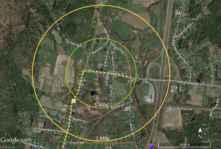
Several community meetings and public surveys found that many residents of Bernardston would like to see more trails in town. Currently there are hiking, biking, horse, and snowmobile trails through the town and its forests; however, residents have reported that many of them are not very well mapped.
Hiking trails run through many of Bernardston’s forests, but many of them are not well mapped. A recent project by resident John Lepore involved creating a land use plan for the Charity Lot property and mapping the network of trails through the forest. Beyond this, however, many of the trails through town are either unmapped or on private property. The town may want to explore ways to work with landowners to establish formal trail agreements.


Franklin County Bikeway

The varied topography of Bernardston presents both a challenge to bikers and an opportunity for more strenuous exercise. During public outreach meetings for the 2012 FRCOG Regional Transportation Plan, residents stated that Route 5/10 in Bernardston is heavily used by bikers but due to a high volume of traffic, is not wide enough to safely accommodate them (10-9).
Bernardston has access to the Franklin County Bikeway, a network of about 240 miles of bike-friendly roads and off-road bike paths, that has been developing for the past 25 years. The original 44-mile network centered on the Connecticut River Valley but has now grown to include much of Franklin County. The Franklin County-Vermont part of the network is a 18.2mile loop that runs along Purple Meadow Road, Hucklehill Road, into Vermont, and returns back to the south through Northfield. Because of the hilly terrain, it is rated as advanced. The Greenfield Montague Loop is a 16.4-mile loop that can be accessed from Hoe Shop Road or River Street at the southern border of town. Some residents have expressed a desire for better signage on these roads to denote the bikeway network.

The Bernardston Gill Leyden Snowmobile Club uses and maintains about 60 miles of snowmobile trails that connect Bernardston, Gill and Leyden (Stafford, 2016). The trails are part of a much larger network that runs to the east into Colrain, the Berkshires and Vermont; to the south into Gill and then Greenfield; and to the east into Northfield and then New Hampshire. The BGL Snowmobile Club is affiliated with the Snowmobile Association of Massachusetts and snowmobilers must be a member of the BGL Snowmobile Club to use the trails.
In the western section of town off of Fox Hill Road and Eden Trail, a network of horse trails connect Bernardston to Leyden.
As part of a strategy to encourage outdoor recreation and tourism, Bernardston could further develop some of these trail networks, map out existing trails, and promote these to residents and visitors, for example through its website and by collaborating with regional organizations such as the Northfield Area Tourism and Business Association (NATABA).
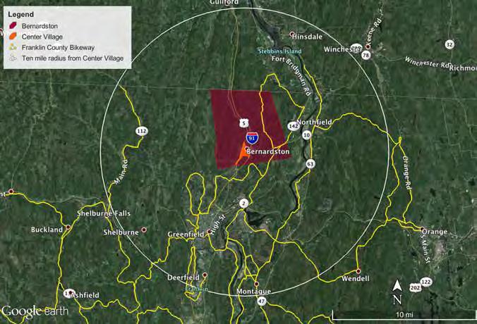
A railroad currently owned by the Commonwealth of Massachusetts runs through the southern portion of Bernardston and roughly parallels Route 10, entering from Greenfield to the south and traveling into Northfield to the east. This rail line is part of the “Knowledge Corridor” line, which runs from New Haven, Connecticut, to St. Albans, Vermont, along Interstate 91 and the Connecticut River. Amtrak stops in the region include Springfield, Holyoke, Northampton, Greenfield, and Brattleboro, once per day for each direction. At this point, there are no stops in Bernardston nor plans for a passenger stop to be built in Bernardston.
Beyond passenger travel, railways play a significant role in regional freight shipping. Shipping freight by rail rather than by trucks reduces traffic congestion,
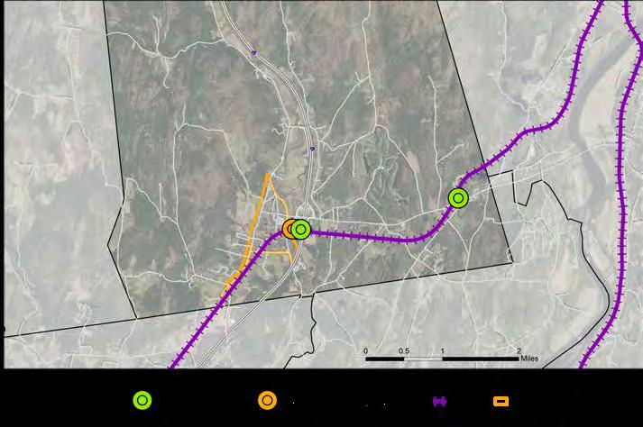
greenhouse gases, and impacts to pavement, and can be more cost effective for some industries (FRCOG, 2013).
Rail sidings are essentially access points to the rail line where train cars can be removed from the main track in order to load or unload freight. There are two rail sidings in Bernardston. FRCOG’s 2013 Rail Sidings Inventory Report for Franklin County provided an inventory for Bernardston’s sidings.
The first is located at 31 Kringle Way, where Kringle Candle’s facility is currently located. It is not being used by Kringle and is adjacent to the Priority Development Site to the east of I-91. PDS 1, which lies
just to the west of the rail siding, is currently undeveloped but if developed, an agreement to use the rail siding in the adjacent parcel could be explored (FRCOG, 2013).
The second siding is located in the southeast of town at 472 Northfield Road where the CaroVail and Feed Commodities International Inc. facilities are located. It is in working order and both companies use it for freight transport (CaroVail, 2016).
MassDOT estimates that the number of freight shipments will double over the next thirty years. Because of this, the ability to access the rail for freight shipping may be considered an important asset in the coming decades (FRCOG, 2016)

To achieve Bernardston’s three goals, the town should further develop its streetscape in Center Village, making it more pedestrian friendly and attractive for residents and visitors. Creating a more welcoming streetscape, for example by planting street trees, installing street lights, creating a Complete Street that allows for bicycle traffic, and installing benches and tables, will encourage people to spend more time in Center Village. Mapping out the existing trail systems and creating more trails in town can encourage both residents and visitors to explore Bernardston’s natural beauty and scenic qualities. Working with Gill, Northfield, and the FRCOG to explore the potential of creating a bus route among them will help residents have access to the surrounding towns without relying on cars.
• There is no public transportation system and most residents rely on cars to get around.
• There is little parking in Center Village and for Town Hall, and many people park on the street. Because Routes 5 and 10 are state roads this is technically not permitted.
• Routes 10 and 5 have a sidewalk on one side, but the streetscape in general does not encourage people to stop and spend time.
• State roads run through Center Village and residents have reported that there is heavy traffic at times. Although this presents an opportunity for the town, it also creates a car-dominated landscape.
• There are many trail systems through town, but they are not well mapped or connected, making it difficult for residents and visitors to know about them.
Much of our society is driven by and reliant on fossil fuels for transportation. Because these are non-renewable resources, we will eventually exhaust all reserves that are practical and economically viable to extract. Over the coming decades communities that have infrastructure and services in place that reduce the demand for fossil fuels will be more resilient—for example, infrastructure that encourages biking as well as a public transit system that minimizes fossil fuel use and reduces people’s dependence on cars.
Ongoing
Continue monitoring bridges every two years using the AASHTO rating system where applicable and continue to fund the Bridge Stabilization Account.
Design a Complete Street for Route 10 from Hartwell Street to the Route 5 intersection and apply for funding from Mass DOT. Include traffic calming elements that support a safe and comfortable pedestrian environment, such as:
• Neckdowns and bulbout to narrow the roadway
• Places for people to sit, e.g., benches and tables.
• Street trees
Map out existing trails that run through town, consolidate all maps of existing trails, and promote use of these to residents. This includes trails for hiking, horses, and biking.
Work with FRCOG to install wayfinding signs near River Street or Hoe Shop for the Franklin County Bikeway.
Investigate the potential for new trail opportunities in Bernardston’s forests and explore ways to work with landowners to establish formal trail agreements.
Market Bernardston’s capacity for freight rail shipping as part of a strategy to promote the Priority Development Sites. Freight rail is ideal for commodities that are heavy and not time sensitive. A business or industry may be able to make use of the rail siding at PDS 1.
Consider developing a Pavement Management System to save costs on road repair through systematic preventative maintenance.
Conduct a parking and use inventory to determine how much parking is actually needed in town for residents, employees at the Town Hall, and visitors. Assess potential locations for town parking and determine viability of establishing a town parking lot.
Work with FRCOG, Gill, and Northfield to explore options for a future public bus route that circulates through the three towns and Greenfield.
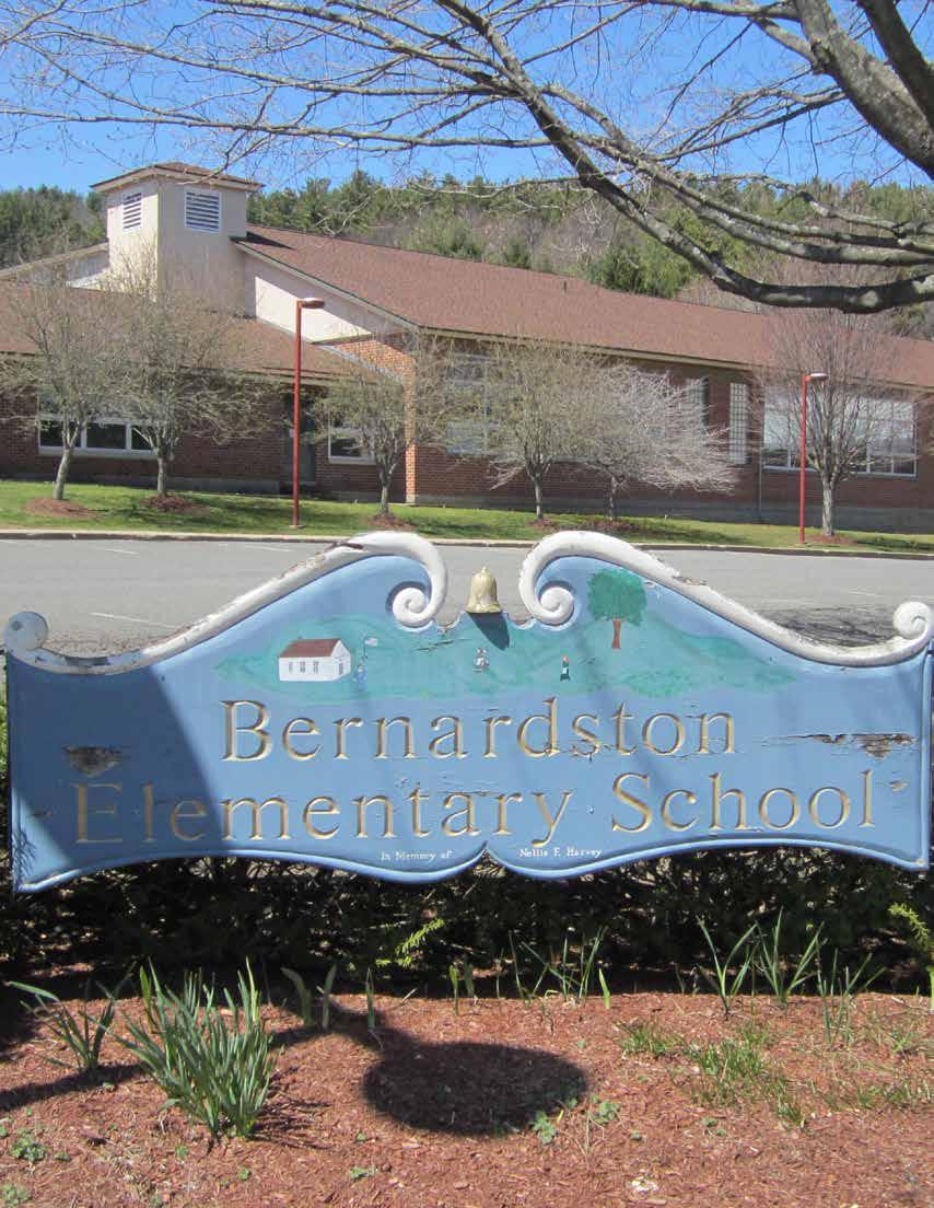 Credit: Cathryn Thomas
This chapter will outline some of the services currently provided to Bernardston residents and make some recommendations for the future. Through community meetings, interviews, and town-wide surveys, the residents of Bernardston have noted that they are proud of many of the services (fire, police, library, education) available in the community. The service residents were most concerned about was wastewater treatment. How to deal with wastewater is an issue that faces many towns throughout Massachusetts, leading the state to produce a report in 2012 entitled “Massachusetts Water Infrastructure: Toward Financial Sustainability.” Some of the recommendations from this report, as they are applicable to Bernardston, will be discussed later in this chapter.
Sustainability refers to the ability of a service and facility to persist into the future. For such services as the library to be sustained, there needs to be community engagement and interest. For services such as wastewater management, there needs to be maintenance and knowledge around the interworkings of the system. Money invested in these resources is lost if the community does not sustain them into the future. Sustainability also addresses the way in which services and facilities interact with that natural environment. The ecosystem services that the natural environment provides for Bernardston are outlined in the Economic Development section. The natural beauty and access to open space has also been highlighted by residents as an important characteristic of Bernardston that they would like to preserve. When choosing a wastewater management system consideration should be given to the potential for the system to harm the natural environment and all that it provides for the residents of Bernardston. The same thought should be given to any future decisions about how to light, heat, or operate facilities such as the Senior Center and Library.
Bernardston, like most rural communities in New England, almost exclusively uses septic systems as the main wastewater treatment method. According to the chairman of the Bernardston Board of Health, Dave Powers, there is one residential system that uses sand pit filtration for treatment because there was not room for a traditional leach field.
Powers states that more than twenty-five septic systems have been replaced over the past ten years, although this number needs to be verified with the Board of Health clerk. Powers reports that half of the systems replaced were because of a failed system due to a rising water table (highlighted on the next page in the Failed Septic Systems in Center Village Due to a Rising Water Table map), while the rest were voluntary replacements based on age of system or from failure due to improper maintenance. Of the failures due to rising water table, eight of them were located along South and Depot Streets. The rising water table has also been reported by other residents in community meetings and interviews. The Master Plan Steering Committee reports a growing concern from residents in the Center Village district that their system will fail because of the rising water table and will need to be replaced, a costly endeavor.
Over 65 percent of the houses in Bernardston were built before 1970 and did not have to go through any sort of approval to be built (Best Places). These systems were not built, nor sited, to deal with a rising water table. Even current systems that use a leach field are not equipped to deal with a rising water table as a rise in water level impedes proper wastewater percolation through the leach fields, resulting in wastewater backing up into the septic tank and house (Tom Scherer).
One of the ways that the state of Massachusetts tries to protect public and environmental health from failed septic systems is through Title V. Title V 310 CMR regulations were passed in 1975. These regulations were meant to “provide sufficient information to make a determination as to whether or not the on-site disposal system is adequate to protect public health and the environment” and subsequent revisions also maintain regulations for the “siting, construction, upgrade, and maintenance of on-site sewage disposal systems” (Department of Environmental Protection, 310 CMR). Any new building site that will be using septic in Massachusetts must pass a Title V inspection, as well as any site where a system fails. One of the siting requirements for septic systems within the state of Massachusetts is a soil percolation test. The Web Soil Survey provided by the USDA Natural Resource Conservation Service evaluates soil suitability for septic. The soil suitability map for Bernardston is shown in the Custom Soil Resource Map to the right.

websoilsurvey.nrcs.usda.gov

The brown on the map above represents very limited soil for septic and yellow represents somewhat limited. As can be seen in the map, most of the soil for the town of Bernardston would not pass Title V inspection without “major soil reclamation, special design, or expensive installation procedures. Poor performance and high maintenance can be expected” (Soil Survey Staff). Currently, as new housing is built on these soils, expensive interventions are needed to bring the systems into compliance with Title V. Similar actions are needed for older systems that fail. Unless these measures are taken, the existing soil conditions of Bernardston put the ground and surface water at risk of contamination.

Failed Septic Systems in Center Village Due to a Rising Water Table
Most of the failed systems are directly adjacent to the Darwin Scott Memorial Wetland.
Reported failed systems
According to many health and environmental agencies, and as noted on the Massachusetts Energy and Environmental Affairs website, septic systems have the potential to pollute ground and surface water when not regulated properly, which in turn can lead to polluted drinking water that is drawn from ground water sources. The relationship of a rising water table and the threat of contamination can be seen in the Conventional Septic System Diagram. Similar contamination is found when a system is sited on soil that cannot properly filtrate the wastewater (Web Soil Survey). The percolation test required for Title V compliance states that water must percolate faster than one inch per hour in order to properly filtrate pollutants, and there must be at least four feet of such soil below the location of the Soil Absorption System in order to adequately filtrate the waste. If neither of these things are found on site, then the site will not be able to pass Title V without modification.
Because many of the failed septic systems in Bernardston have been reported as occurring due to a rising water table, and very little of the soil in town is suitable for septic systems, Bernardston is running the risk of polluting its surface and ground water. This potential pollution runs the risk of also contaminating the community’s drinking water because there are two well recharge areas in Bernardston. This risk, along with the expense that is incurred by owners when a system does fail (anywhere from $10,000 to $20,000 to fix or replace according to current residents), highlights the need for an alternative system for wastewater disposal in Bernardston.


When the top of the groundwater table begins to rise, it cuts down the amount of soil that the wastewater
greater the risk of contamination.
Risk of contamination is also high when appropriate soil does not exist. There are certain soils that allow water
not allowing enough time for the contaminates to filter out. In Massachusetts, according to Title V
Municipal wastewater treatment often takes on the form of a sewer system that connects buildings to a centralized treatment facility . Bernardston hired the engineering firm of Tighe and Bond to explore this option in 2009. Its report projected a cost for such a system that the community decided was prohibitively high. In addition, the proposed system did not cover all of the Center Village zoned district, nor did it extend east of I-91. The following recommendations explore alternatives to a conventional system options that may be more cost effective, and might provide treatment options for structures throughout town. Some of the systems proposed here may be better suited for certain sites than others; specific site conditions will determine the suitability of each site for the specific systems discussed and a professional wastewater engineer should be consulted on the design and construction of each system.
• There is no municipal wastewater system.
• Current septic systems are failing for reasons that include a rising water table around the Darwin Scott Memorial Wetland and a lack of maitenance.
• There is little money for investing in a large-scale centralized municipal sewer system.
• Most soils within Bernardston are not up to standards required by Title V for conventional septic systems.
As noted earlier, the chairman of Bernardston’s Board of Health has reported some septic systems have been failing because of improper maintenance. Education for homeowners about proper maintenance of existing septic systems should be offered to assist owners in protecting the longevity and effectiveness of their system. Once alternative systems are built, education should expand to include these new systems, and to educating residents about the benefits of transitioning to alternative systems.
Bernardston Board of Health should explore the creation of a management program that would oversee the implementation and regulation of a Community Septic Management Program which would also include oversight and regulation of alternative wastewater treatment systems.
Massachusetts DEP outlines the criteria and benefits of a CSMP on their website. Granby and Barnstable are Massachusetts towns that have successfully implemented CSMPs for their wastewater systems.

There are many different alternative systems. The following are some examples of alternative systems used elsewhere in New England and throughout the country in situations that may be similar to Bernardston’s.
Composting toilets in Massachusetts are an approved alternative system as of 2005, but for buildings still producing greywater a Title V approved system is still needed. When a traditional septic system is combined with composting toilets, the Soil Absorption System is only releasing greywater. Because of this, the Commonwealth of Massachusetts only requires the septic system to be 50% of the size normally required. The system is required to be buried a minimum of nine inches down instead of one to two feet. The septic tank for such a system can also be reduced by three-quarters to one-half the normal size (for commercial and residential respectively). This option would help cut down the cost of installation and materials for homeowners. It also means that sites unable to pass Title V inspection could construct “mounded” systems for a fraction of the cost because mounds would not have to be as big nor as deep.
Composting toilets are currently permitted for commercial and business use without having to pass a Title V inspection and should be considered for all existing commercial structures and new development.
Composting toilets could include a liquid diverter unit, and a partnership could be developed with the Rich Earth Institute in Brattleboro to use the urine. The Rich Earth Institute is doing world-renowned research with urine as a fertilizer and is searching to expand their systems.
A committee would need to be established to investigate ways to help local septic businesses transition their collection system to one that can support the collection of waste from composting toilets. The Rich Earth Institute has done work with local septic businesses to help them adapt their trucks to this purpose.
Compost from toilets can be used to grow vegetation in accordance with USDA and DEP approved guidelines. The Board of Health or Agricultural Commission should evaluate the potential for local farms to use this resource. Bernardston could potentially establish itself as an example for towns looking to make similar transitions into a closed-loop nutrient cycling system.
There is an upfront cost of $1,500 to $8,000 for composting toilets depending on the system, but there is relatively low excavation and no additional materials to needed. The only additional cost associated would be the disposal of waste in the system, which would be similar in cost to getting a septic tank pumped if local septic businesses can make that transition. This does not address greywater treatment, which would have to be combined with another alternative system, particularly if there is no leach field on site. The decreased stress on the system allows for smaller leach fields and storage tanks, which would allow for denser development.

No case studies of using composting toilets at a municipal scale have been found. Partners may be willing to work with Bernardston to make it the first town of its kind. The Rich Earth Institute has been looking to invest research into such a project in the coming years, and may know of funding sources. The Cape Cod Eco-Toilet Center has also been experimenting with communitywide nutrient cycling.
Decentralized shared systems are recommended for clustered development, larger commercial buildings, and restaurants. These systems use septic tanks to pretreat waste and then smaller than conventional pipes to move the waste to a decentralized offsite treatment area (Arendt 2015). Each individual house in a cluster does not have its own leach field because all waste is moved to one space for treatment in a mounded system, a buried synthetic system, or a small-scale treatment plant. The shared use of such spaces cuts down on costs, allows for denser development, and provides a safe way to dispose of waste in areas that may not be conducive to septic. There are multiple ways that decentralized systems treat wastewater. A designer/engineer should be consulted on a site-by-site basis to study the best possible solutions for each site.
Decentralized Shared System
A living machine, also known as an Eco-Machine, is similar to a constructed wetland in that it uses natural systems to clean water. These can be built in large storage containers with water flowing from one to the other, filtering pollutants at a finer and finer level from one container to the next (toddecological.com). These systems are usually constructed at a large scale and would be recommended for larger commercial or industrial buildings. They can be constructed on a smaller scale such as at the rest stop in Vermont on I-91, but are more often used at larger scales like the one used at Ethel M. Chocolates factory in Nevada (both examples described on page 134). They could also be used as the main sanitizing component for a decentralized shared system, which is discussed later in this section.
Lombardo Associates is a Massachusetts-based company that has designed many alternative wastewater systems across the country. Their projects can all be viewed on their website lombardoassociates.com.
La Paz Development, Malibu Village Plaza, California – Decentralized treatment and reuse system. Lombardo Associates have created a new Development in Malibu with a system that services eleven commercial buildings with two restaurants, each with 175 seats, and a proposed new City Hall. The system has the capacity to treat 28,000 gallons of wastewater per day. This system is also a reuse system that uses the treated water for in-building services (other than potable water needs) and for irrigation within the development (Lombardo Associates).
Mashpee, Massachusetts
A small community septic system was designed in 2006 for 24 dwellings plus a commercial space. The maximum flow capacity is 5,226 gallons per day. “The system employs a septic tank, recirculating media biofilter, and a denitrifying filter to reduce nitrogen levels before discharge to a drainfield” (Arendt, 2015).

Decentralized septic systems can use the conventional buried leaching technology of a traditional septic system, but they can also use other treatment systems highlighted in this section as the treatment method. The picture to the left illustrates a decentralized shared system which uses a small-scale living machine as for the treatment of the collected wastewater. Other systems may use constructed wetlands, larger living machines, or other developing technology (Arendt, 2015).
The Living Machine System at Ethel M Chocolate factory in Henderson, Nevada treats up to 32,000 gallons per day of high-strength confectionery production wastewater. The factory outlines the process as follows: “ Living organisms, from the simplest single cell bacteria to complex lifeforms like fish, make up the Living Machine System. The influent consists of water that has been used to wash the process area and equipment, along with water from the boilers and cooling towers. Following the Living Machine treatment process, the final product is near drinking water quality and can be reused for a variety of applications. Wastewater is pumped from a grease trap into sealed aerobic reactors where microbial communities begin digesting the waste. A biofilter scrubs odors from exhaust gases at this stage of treatment. In the planted aerobic tanks, vegetation hosts organisms that further digest the waste while minimizing sludge generation. Final Polishing Filters further polish the water and remove suspended solids. Final effluent is stored in an attractive pond/wetland and, after ultraviolet treatment is used to irrigate one of the world’s leading cactus gardens. Sludge is composted on-site by a reed bed and removed every five to ten years as a beneficial soil amendment.” (Ethel M. Chocolates, 2003).
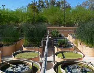
License: https://creativecommons.org/licenses/by-sa/3.0/deed.en

Nevada. Plants being grown to help filter the water at the factory.
License: https://creativecommons.org/licenses/by-sa/3.0/deed.en
The Sharon, Vermont rest stop Eco-Machine is designed to treat 6,000 gallons per day of domestic sewage. Wastewater from the public restrooms at the rest stop “flows first through a series of underground septic storage tanks which provide primary treatment and removal of settle-able solids. From the septic storage tanks effluent is dosed into closed aerobic reactors where waste-eating bacteria degrade organic compounds and odors are removed. From there, wastewater is pumped to three open aerobic cells. In these cells nutrient rich water forms the basis of a food web that includes an abundance of organisms from all five kingdoms of life. Microscopic algae, fungi, bacteria, protozoa, snails, fishes and zooplankton all thrive in the diverse aerobic environment of suspended plant roots and contribute to the consumption of remaining nutrients and the conversion of contaminants, cleaning products and pharmaceuticals into benign biomass and clean water. Final polishing is accomplished in a clarifier and any remaining solids are returned to the septic tank. The EcoMachine at the Sharon rest area not only successfully accomplishes onsite wastewater treatment, it serves as a model of ecological approach to municipal infrastructure, creating a beautiful public space and educational destination for travelers” (Selected Projects, toddeological.com).
Constructed Wetlands
Constructed wetlands can be a solution for large-scale municipal wastewater treatment where infrastructure for a sewer system is already in place, which would take it out of consideration for Bernardston. Wetlands as an alternative are often used in place of a centralized sewer facility, which is why the infrastructure for transportation of sewage is needed. There is ongoing research into the applicability of constructed wetlands at smaller, residential scales, but more needs to be known before this is a viable option.
When selecting which alternative systems to pursue for different developments, Bernardston should consult “A Creative Combination: Merging Alternative Wastewater Treatment with Smart Growth,” by the local design firm Dodson and Flinker. This guide for development in rural areas addresses many of the issues Bernardston faces and presents many detailed case studies.
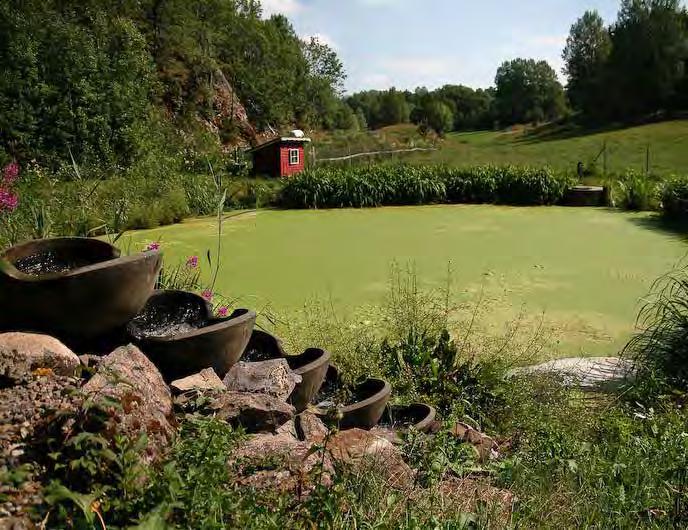
The funding sources that follow are not an exhaustive list and it is recommended that a committee is formed or a professional hired to investigate further funding options for wastewater treatment.
This program provides funding of up to $200,000 in the form of low cost loans to allow communities to devise a Community Inspection Plan or a Local Septic Management Plan in a designated management zone. Both plans must include provisions for financial assistance to homeowners using betterment agreements. Local inspection plans are created to protect environmentally sensitive areas from contamination, while septic management plans help identify areas that need monitoring and maintenance.
Management districts are a legal, geographic area that is established in order to carry out environmental work such as funding and building infrastructure improvements, managing infrastructure or programs, or providing other environmental protection services.
After a community has adopted an inspection or management plan of its own, and has been awarded the loan amount, it is able to provide financial assistance to homeowners within the community. A Betterment Agreement between the community and a homeowner may be used for all costs necessary to repair or replace a failed septic system including:
a. renovating the existing system;
b. hooking-up to existing sewer lines;
c. or replacing traditional septic systems with an approved Title 5 alternative system.
For more info visit www.mass.gov/eea/agencies/massdep/water/wastewater/community-septic-mgt-programproject-manual-and-guidance.html
The Massachusetts Community Development Block Grant Program is a federally funded, competitive grant program designed to help small cities and towns meet a broad range of community development needs. Assistance is provided to qualifying cities and towns for housing, community, and economic development projects that assist low and moderate-income residents. Bernardston has been awarded CDBG funds for housing rehabilitation projects in past years ($415,000 in 2008; $991,906 in 2013 with Conway, Shutesbury and Sunderland). CDBG funds can be explored for septic system repairs and upgrades to income qualified homeowners.
For more info visit the Massachusetts Executive Office of Housing and Economic Development at http://www mass.gov/hed/community/funding/community-development-block-grant-cdbg.html
USDA’s Office of Rural Development has several programs that assist very small, financially distressed rural communities to extend and improve water and waste treatment facilities that serve local households and businesses. One of these programs is the Massachusetts Water and Waste Disposal Loan and Grant Program.
For more information visit: www.rd.usda.gov/programs-services/water-waste-disposal-loan-grant-program
These funds are used for public sewer projects. If the alternative systems are determined to be cost prohibitive, the town should look into such funding as this to help support the construction of a public, centralized, sewer system. Although Bernardston found a public sewer system cost prohibitive before funds such as these may help reduce the price and make this option more appealing.
The Massachusetts Clean Water Trust (the Trust), in partnership with the Massachusetts Department of Environmental Protection (MassDEP) provides cities and towns of the Commonwealth with low interest rate loans for water infrastructure projects. The Federal Water Quality Act of 1987 established a program of capitalization grants to the states to create Clean Water State Revolving Fund (CWSRF) loan programs. These programs provide state-administered below market rate financing for the construction of publicly owned water pollution abatement facilities (e.g., a public sewer) and implementation of non-point source management projects. Projects to be financed are selected using a priority ranking system based upon the public health and environmental protection benefits of the proposed projects.
Projects receiving financial assistance from the CWSRF will be eligible for loans at 2% interest. Certain projects, whose primary purpose is nutrient reduction, may be eligible for 0% interest rate loans.
The Clean Water Trust is providing $4.7 million in project financing the Town of Dracut to construct new sewers that will mitigate the migration of leachate from failing septic systems into tributaries of the Merrimack River. In addition, the project will eliminate several direct sewage connections to the local stormwater system and mitigate impacts to natural resources, town conservation land and private drinking water supplies. The project will install approximately 11,000 linear feet of 8-inch diameter gravity sewer, approximately 1,000 linear feet of small diameter pressure sewers, approximately 2,100 linear feet of force mains, and two submersible pumping stations within town roads and cross country areas.
Designed to complement the Clean Water State Revolving Fund, the EPA Hardship Grants Program for Rural Communities helps towns of fewer than 3,000 people plan, design, and construct publicly owned treatment works or alternative wastewater services such as on-site treatment systems. These funds can also be used to provide training, technical assistance, and educational programs on the operation and maintenance of wastewater treatment systems.
Betterment Assessments
If Bernardston constructs a public sewer system, it could be partially funded by creating a Sewer District, which would collect a special assessment tax based on the “betterment” of the site since it will have access to public sewer. Betterment assessments are a form of taxation, and, until paid, constitute a lien upon the land assessed. Service by a public sewer is an improvement over on-site wastewater disposal (e.g. septic systems).
The Town of Shirley first assessed Sewer Betterments in FY2003. The cost appears on the tax bills under the section marked “Special Assessments.” The Town of Shirley approved the “uniform unit” method, which defines each property as a number of sewer units and divided the assessment costs by the total number of sewer units included in the project. A sewer unit is defined as a single-family residence. The sewer betterment assessment is a one-time special tax that can be paid in one lump sum or apportioned up to a maximum of twenty years. Those property owners who did not pay in full at the time the betterment is assessed have the remainder of their assessments amortized over twenty years at a rate of 2% interest added annually to the unpaid balance.
The residents of Bernardston have often expressed their appreciation and admiration for their local fire department. Many residents responded to the survey question that asked if there was something they would like to see changed in Bernardston by stating that they would like to see a new Fire Department building. The current 2,800-square-foot building is located on Route 10, next to the library and Senior Center. The current stock of three engines, one chief car, and a squad pick-up truck cannot all fit in the station. The Fire Chief, Peter Shedd, has recounted that other stations in the area have struggled to add on space to their stations to accommodate new engines, especially as they grow in size. The small town boasts 24 paid firefighters, who are paid by the minute for each call. Shedd reports that in 2015, 88 percent of calls to respond to were within Bernardston, with 12 percent of calls being out of town
issues. He also states that it is sometimes easier for Bernardston Fire to get to crashes on Interstate-91 that are closer to Greenfield than it is for Greenfield’s fire department, because of how highway ramps in Greenfield are constructed. There is also a mutual aid agreement with surrounding towns declaring help will be provided for large fires. The station is also part of the Tristate Fire Mutual Aid system. Participation in this group has allowed the fire department and its firefighters to participate in state-of-the-art trainings and conferences that has kept them up to date on current safety techniques and medical training as it applies to their craft. While all firefighters are trained first responders, the town relies on Greenfield for ambulance and medical services. Because of the large number of firefighters, and the increasing amount of paper work required to document all activities, the Fire Chief believes a full or part-time office staff member will be needed in the near future.

The Fire Department should apply for grant funding that would help pay for an additional staff member for the department. There does not seem to be imminent need for an increase in the number of firefighters at the station, but help with the organizational aspects of the station and paper work components is of increasing importance. While there are no specific funding sources for additional office staff members, by applying to U.S. Fire Administration and FEMA Assistance to Firefighters Grant, which provides aid in the acquisition of necessary equipment, gear, vehicles and training, funds may be freed up that could be devoted to paying for an office manager position.
The Fire Chief should continue to monitor any increase in calls as an indicator that more staff may be needed in the future. The current staffing of the Bernardston Fire Department is able to adequately respond to the amount of calls received each year, but if Bernardston’s population begins to increase in future years, it may place a larger burden on the Fire Department and more staff may be necessary. The U.S. Fire Administration and FEMA Staffing for Adequate Fire and Emergency Response Grants (SAFER) are grants for stations that need help in maintaining the appropriate amount of firefighters to guarantee maximum safety for the public of the served area, and could be explored if needed in the future.
The Department should investigate grants to help in the construction of a new station, or expansion of the current station. Any construction or expansion should fit with the town’s rural character. One funding source can be found through the USDA’s Rural Development Community Facilities Direct Loan and Grant Program. Fire stations are listed as one of the essential community facilities that grants and loans of this program cover. The grants in this program are given proportionately depending on size of town and level of the Area Median Income compared to the state’s non-metropolitan median area income.
The police station is located on South Street, near the border of Bernardston and Greenfield. The station currently has ten officers who all live either in Bernardston, or within fifteen miles. According to the Police Chief, on average they have been receiving 300 calls a year over the past four to five years, with 60% of those being medical calls. The station is able to provide officers for safety and crowd control for events throughout the year, and usually has one to two officers on duty throughout the week. The current capacity of the station serves the town well, and the Chief does not feel any pressure or see need to add to the staff.
Many residents of Bernardston have expressed appreciation for the police department and feel safe and well served. The Police Chief should continue to monitor the number of calls to the station and report any need that arises for increased staff or budget. There is no mandate as to the number of police offers per population size, and currently the department feels well within its operational capacity, but Bernardston’s population may increase over the years.
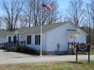
Bernardston has Bernardston Elementary School (BES) and Full Circle Kindergarten and Elementary school. Full Circle is a private elementary school that employs five staff members and offers afternoon kindergarten classes four days a week in addition to their first through sixth grade program. They currently have 23 students enrolled, one of which lives in Bernardston. BES is part of the Pioneer Valley Regional School District (PVRSD), which includes the towns of Bernardston, Northfield, Leyden, and Warwick, 111 square miles. There is one high school in Northfield that all four towns feed into, while BES is one of four elementary schools in the district. The population of Bernardston Elementary hovers around 170 students for preschool through sixth grade, according to the principle Bob Clancy. BES is also a school of choice, which means that students from other communities can attend BES even though there may be other options in their own community. Currently there are 17 students attending BES through this program. There are 9 classroom teachers and 35 support staff, 13 of which live in Bernardston. Bernardston Elementary is funded by the town itself, the state, school choice, and federal, state, and other grants. Each town in the district pays for the capital costs of running the school (salaries, supplies, etc.) while the PVRSD pays for maintenance. Capital costs for the regional school such as the high school are split between the towns proportionate to the amount of students they are sending.
There are many before and after school programs offered to students at BES, including CODE club, Mad Science, Nature Club, and more, while sports are offered through the Town of Bernardston Recreation Department. A cafeteria offers lunch every day, with food that is sourced locally on occasion, but not often (Clancy, 2016). As reported through surveys and town meetings, and confirmed by the principal of BES, there is a large commitment by the parents and residents in town to the continued success of the school. Engaged parents organize movie nights, a Luau dance party, game nights, Spirit Week activities, Teacher Appreciation Week, and much more. The “Friends of
BES,” a Parent Teacher Organization for the school, built a gazebo in 2015 that is currently used as an outdoor classroom. In prior years it has fund-raised for additional playground equipment. Parents also volunteer to assist in the classroom and to go on field trips.
The education system in Bernardston appears to serve the population well, and also serves some from bordering communities.
Exploring a “farm to school” program for lunches at BES would help the school further connect with the community and provide a reliable market for local farms.
There is currently not a full time foreign language program at BES. The American Council on the Teaching of Foreign Language has compiled a host of studies outlining the benefits of learning a foreign language, from increased cognitive abilities to better test scores (American Council on the Teaching of Foreign Languages). Bernardston Elementary School should pursue funding through the U.S Department of Education Foreign Language Assistance Program which “provides grants to establish, improve, or expand innovative foreign language programs for elementary and secondary school students.”
If the PVRSD has not explored a Regional Transportation Reimbursement Fund, which allows the district to carry forward any funds that are left at the end of the fiscal year in which they are received into the next fiscal year, then it should explore this option as a way of alleviating some of the monetary stress that transportation over the 111 square-miles puts on the district.
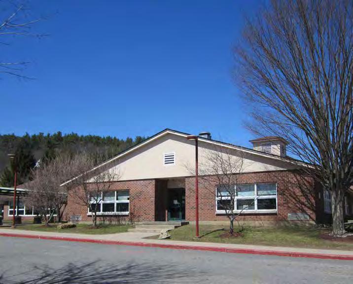
The Bernardston Library is located at the intersection of Library Street and Route 10 and is open three days a week. It is located in a historic building in the middle of Center Village, across from Cushman Park. The library is a two-story building where residents can check out books, magazines, movies, and audio books. Three working computers are available for public use, along with 24/7 access to wifi. The library hosts many events throughout the week including knitting club, lego club, reading hours, coloring hours, and more. It is also part of the Central and Western Massachusetts Automated Resource Sharing network and the Massachusetts Library System. It is through these organizations that patrons are granted access to resources in libraries across the state and nationally. The library receives all of its books from the state, and must maintain a certain amount of open hours to continue to be recognized as a state library. Funds for the library come from the state, a donations jar, and fundraisers put on with the help of the Kiwanis Club. The money raised in conjunction with state funding allows for the three days of operation and one full-time staff member, but not much else.
The library serves as a community hub. Beyond the space for clubs to meet, it also provides spaces for children to use computers, listen to stories, read, and on occasion spend the night during library-sanctioned events. The library is also located in the heart of Center Village as it is currently zoned. Finding funds so that the library can be open more than three days a week will help the library play a larger role as a meeting space throughout the week, helping residents connect to the downtown and increasing the sense of vibrancy in the downtown.
The Senior Center is located on Library Street in a historic building that has been retrofitted for its use. The Senior Center is also the home for the Council on Aging, and in conjunction the two entities provide support for the senior population of Bernardston. According to a 2015 report by the COA and Senior Center Director Dianne Cornwell, the Center provides services that include “application assistance, advocacy for problem resolution for housing, health, financial and other issues; information and referral for services, meaningful caregiver support; transportation services, health benefits counseling, therapeutic support groups; nutrition education, exercise programs, and socialization activities.” According to the report, in 2014 alone almost 1,000 “unduplicated individuals” were served. The Senior Center also provides meals five days a week, and served over 4,500 congregate meals in 2014. There is also the option of home delivery. The Senior Center does not provide in-house care on the levels of hospice, nursing homes or assisted living communities and seniors who might need such in-house care must move out of Bernardston to find it, or sign up for care through private entities.
Cornwell projects that the population most in need of support are those between the ages of 50 and 60 who are still trying to provide for their children, while also taking care of their parents. She states that the Senior Center is increasingly looked to for support for these aging parents, or as caregivers for grandchildren and sometimes for both. According to the report submitted by Cornwell and the Council on Aging, the 35 percent of Bernardston’s population that is above the age of 60 as of 2015 will increase to 52 percent in the next ten years, putting an even larger strain on the Senior Center.
According to the Director of the Senior Center, many seniors who participate in Senior Center activities do not live in Bernardston. These are often people who have a connection to Bernardston, who used to live here or have family in town, but were unable to find affordable and accessible housing in town. Changing zoning to allow auxiliary homes/in-law units to be built on already developed lots would allow seniors to live closer to their families and alleviate some of the pressure on the Senior Center to provide support around meals and transportation.
As the population of Bernardston increases in the coming years, the Senior Center will increasingly become a hub for social interaction and activity within the town. To help promote vibrancy in the Center Village area and connection between residents of the town, Bernardston’s Board of Selectmen and Finance Committee should consider increasing funds for the Senior Center. The ability of the Senior Center to host events that attract a large number of people from one of the largest population groups in Bernardston helps contribute to the goal of creating a vibrant center village. Future planning for housing development should include the exploration of an assisted living community. Not only would this community help alleviate some of the demands on the Senior Center in the coming years, it could provide jobs for local residents.
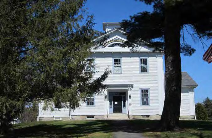
According to the results of a community survey at the end of 2015 and beginning of 2016, conducted by the Master Plan Steering Committee and also through statements at community meetings, many residents of Bernardston do not currently have access to the internet. The current options for internet access include dial-up, satellite, and DSL which is also run through telephone lines. Many homes are unable to access or afford internet. The town librarian reports that many people will park outside of the library even when it is closed in order to access the building’s 24/7 wifi connection. Internet access has become an essential part of running a business, reading the news, communication, education, and engaging with the wider world. If Bernardston is to keep up with a world that is becoming more and more reliant on technology, and wishes to attract business, it will have to investigate ways of providing internet access for its residents and businesses.
• There are many residents in Bernardston who are not able to access wireless internet.
• The Broadband system that is in place, only extends along Route 5 and 10.
• There is very little money to invest in expanding the existing system, or building a new one.
The Massachusetts Broadband Institute (MBI) is an organization that aims to bring broadband internet to communities across western Massachusetts. The organization defines broadband as an “always on, high speed internet access” network that “connects homes, businesses and government offices to each other and around the world.” The aim of the organization is to “increase both the availability and the adoption of broadband across the Commonwealth of Massachusetts.” It reports on its website that it is working with the Franklin Regional Council of Governments and a coalition of other regional and local organizations to bring broadband to the 32
western Massachusetts communities that do not have high-speed internet service. It reports that $40 million in state money has been set aside to be channeled through MBI toward this effort (Broadband.masstech. org). Details about how to provide a regional fiber optic network are still being worked out. Bernardston should join this regional effort in order to participate in the cost-sharing of the construction of internet service in the future. MBI currently has broadband infrastructure set up throughout western Massachusetts along major roads. That infrastructure runs along I-91 and follows Route 10 through Bernardston. The grant program that MBI has set up to connect communities to this infrastructure is called the “Last Mile” Grant Program. Leverett, Massachusetts (under 1,900 people) utilized the “Last Mile” grant program to connect to MBI’s broadband infrastructure and bring internet access to the town. According to a March 2, 2016 news report from the Greenfield Recorder, since completion of the “build out” of internet access earlier in 2016, 81% of Leverett residences have signed on for internet access. At the start of 2017 the cost of combined phone and internet access will be dropping to below $40 a month. Leverett used $800,000 in grant money from MBI to implement the program, and cost for the service is already falling in its first year of use (Merzbach, 2016).
Currently all waste and recycling in Bernardston is collected at the transfer station on Nelson Road, which is open to residents of Bernardston and Leyden with a permit card (for purchase for Leyden residents). The station is open two days a week and accepts all traditional waste as long as it is in town-approved bags, which can be purchased for $2 at the transfer station or at select corner stores. The transfer station website (www.townofbernardston.org/index.php/towngovernment-main/70-transfer-station) provides a list of materials that can be disposed of for a fee, including air conditioners, sofas, and box springs. The station also accepts recyclable material except for tires, pallets, and wood brush. Currently there is no municipal composting system.
According to a 2016 community survey, people would like to see street-side waste and recycle pickup. The Board of Selectmen should investigate the feasibility of joining Greenfield’s curbside waste and recycling pickup service. The pickup service runs Tuesday through Saturday in the middle of the day and is run through Greenfield’s Department of Public Works. The curbside service would require
residents to buy a permit to offset the cost of participating in Greenfield’s service, but access to the transfer station could still be a part of the permit. No case studies of this possibility have been found, and it may be that Greenfield’s DPW cannot cross town lines, but the possibility would be a cheap way to provide this service without investing in fleet of trucks themselves.
The Board of Selectmen should investigate the rental of a dumpster for composting ($80 a month) through the Franklin Solid Waste Management District. Having a dumpster for composting at the transfer station would give residents the opportunity to compost their food and reduce the amount of trash they produce each week, cutting back on the amount of bags they need to purchase as well. According to the FCWD (fcwd.com, 22 March 2016) the compost is picked up from the station and transported to Martin’s Farm Composting and Mulch in Greenfield where they create compost to sell to local garden and farmers.
The Agriculture Commission should investigate setting up a closed system of municipal composting at a local farm that would then use the compost to grow and sell local food. The farm could also sell extra compost. This closed loop system can be seen in Hardwick, Vermont, highlighted in the Economic Development chapter. A dumpster at the transfer station could serve this purpose, or a curbside pick-up program could be investigated.
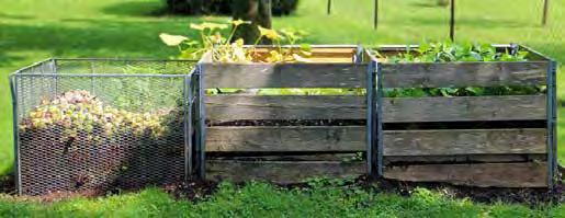
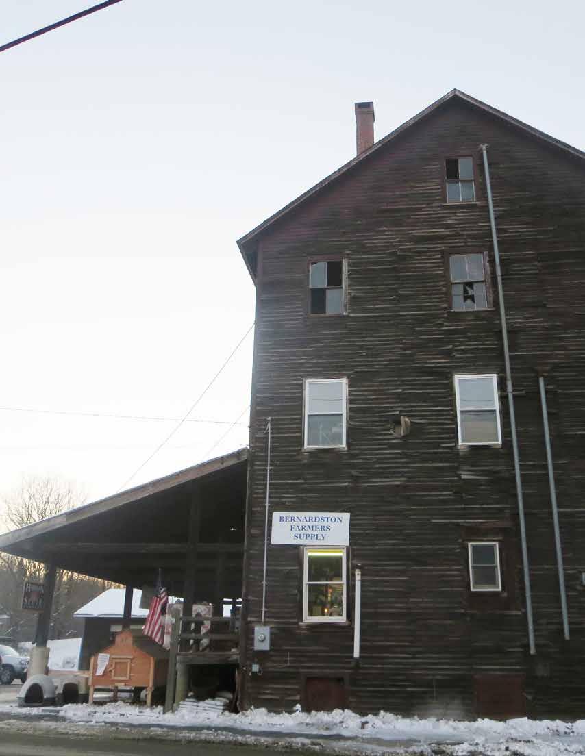 Credit: Rachel Lindsay
Bernardston Farmer’s Supply is one of many small businesses in town.
Unlike some of the other topics in this master plan— such as watersheds, land use, housing, transportation, and services—the topic of economic development requires some discussion of how the term is defined. A conversation about a community’s economic health can variously be about, for example, the town’s fiscal health or the ratio of incoming municipal revenues to outgoing expenditures. It can focus on average household incomes, real estate taxes, wage employment, or financial flows. It can be presented in terms of an inherent conflict between improving quality of life and protecting the environment, or it can be presented as the simultaneous and complementary improvement of both of those.
For the purposes of this master plan, “economy” is defined as the production, distribution, and consumption of goods and services and its purpose is understood to be the improvement of the wellbeing or quality of life of the community. There are various ways to assess Bernardston’s current economic conditions and this section will present analyses and recommendations based upon both conventional and non-conventional approaches.
Conventional economic development studies typically assess, for example, demographics, workforce characteristics, major employers, and the potential for industrial or commercial development.
An example of a more non-conventional approach is called community economic development, which involves determining strategies to improve a community’s social, cultural, and ecological well-being in addition to its fiscal health.
A second and related approach is known as asset based community development. This approach first determines what a particular town, city, or region’s key assets are and then develops strategies that capitalize on them. Rather than concentrating on the perceived problems or what a town’s needs may be, asset based community development focuses on a town’s unique characteristics and determines how they can be leveraged to achieve desired goals.
This section will draw upon these various approaches to provide a holistic examination of Bernardston. All analyses and recommendations look to strengthen the community, improve quality of life for residents, and promote well-being in a ecologically, economically, and socially sustainable way.
As was discussed in the Land Use section, most of Bernardston is forested, and this can be seen as a key asset for the town. Bernardston’s forested land not only provides forest products but offers a space for recreational activities and performs valuable ecosystem services.
The forest-based economy is one of the oldest industries in the Commonwealth and includes both forest products and forest-based recreation. Statewide, about 17,000 workers are employed in the forest products, maple, and Christmas tree sectors while another 9,000 jobs are found in the various sectors that support the forest-based recreation economy (North East Foresters Association, 2015).
While forestry and forest products are an important part of the regional and state economy, trends point to more wood being processed out of state, with sawmills and other primary processing facilities declining in number and jobs. At the same time, forestry and logging jobs have remained steady. A steep decline in paper manufacturing has resulted in a loss of local markets for low grade wood. An estimated 14 percent of homes in Franklin County heat with wood, making firewood production one sector of the forestry industry that has remained in the region. Losses in employment have been more severe in Berkshire and Franklin Counties than the state (FRCOG, 2015).
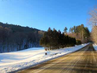
The 2010 Massachusetts Forest Action Plan notes that when wood is shipped out of state, it only employs two local jobs–a forester and a logger–whereas local processing and sale of wood products increases the economic benefit to the local and regional economy. Since the 1970s, Massachusetts’ sawmill production has declined steadily, from 130 sawmills in 1973 to 49 in 2006 (MADCR in FRCOG, 2015). A 2007 survey of licensed harvesters in Massachusetts revealed that roughly two-thirds of logs harvested in Massachusetts are sold out-of-state for processing. (Damery in FRCOG, 2015). At the same time, approximately 2 percent of the wood used in the state is actually grown, harvested, and manufactured within Massachusetts, while the remaining 98 percent of wood products consumed in Massachusetts are imported from out of state (UMASS in FRCOG, 2015).
In the Massachusetts Climate Adaptation Report (2011), the American Forest and Paper Association states that forest harvesting directly supports 3,700 jobs for foresters, loggers, sawmill workers, and wood processing plant workers in Massachusetts, and produces over $385 million of goods annually.
Converting buildings to high-efficiency wood heating systems can reduce fossil fuel use, heating costs, and greenhouse gas (GHG) emissions. If the wood is sourced locally, the impacts are even greater–local jobs are supported and more money stays within the local economy. It is estimated that with development support, the wood heating market could reduce GHG emissions by 500,000 tons and create over 2,000 jobs in Massachusetts by 2020 (Meister in FRCOG, 2015). Forest covers 70 percent (11,683 acres) of Bernardston. Of that land, 22 percent (2,606 acres) is enrolled in Chapter 61 for long-term, active forest management. Assessment of forest land under Chapter 61 is based on the land’s ability to grow timber. The program requires 10 or more contiguous acres, a state-approved forest management plan developed by a licensed forester or landowner, and periodic forest management as recommended by the forest management plan. Thus, almost 78 percent of forest in Bernardston may not have a forest management plan and may not be taking full advantage of the potential to generate some revenue from forestry-related activities. Hull Forest LLC is the largest working woodland owner with 1,150
Credit: Rachel Lindsayacres under active timber management. This land is protected by both a conservation restriction and Chapter 61.
Recreational use of forest land could also contribute to a forest-based economy. In Bernardston, 6 percent of forests (710 acres) are enrolled in Chapter 61B for active recreational use. In addition, the Massachusetts Department of Fish and Game owns the 1,493-acre Satan Kingdom’s Wildlife Management Area, which makes it the largest owner of forest land in Bernardston. This land is managed to provide upland forest wildlife habitat and passive recreation such as hunting; timber is not harvested. Therefore, over 2,000 acres in Bernardston are available for outdoor recreation and have the potential to contribute to the tourism industry in the region.
Forests provide many services that are not conventionally accounted for in our economic system, such as filtering and infiltrating water, purifying the air, sequestering carbon, providing wildlife habitat, and preventing erosion among many others. Studies to estimate the economic value of ecosystem services are currently being conducted throughout the country. As was discussed in the Land Use section, the Massachusetts Audubon Society valued the non-market ecosystem services provided by forests in the Commonwealth at $984 per acre (American Farmland Trust, 2008). For all of Bernardston’s 11,683 acres, this would amount to almost $11.5 million. These services include “climate and nutrient regulation, habitat, soil retention and formation, pollination, recreation and aesthetics” and could easily go unnoticed (2). While not traditionally viewed as economically valuable, Bernardston’s forests contribute valuable non-market ecosystem services and can be seen as having a direct influence on the town’s economy, beyond the raw materials they provide.

In addition to forestry, agriculture has played a role in Bernardston’s economy through much of the town’s history and is valued by many residents for contributing to the town’s rural character.
As was discussed in the Land Use section, there are thirty farms in Bernardston. Eight of them rely on farming as their primary source of income. Below is a breakdown of the primary products of Bernardston’s farms. Most farms raise livestock, whether it be horses, beef, dairy cows, sheep, poultry, or goats. Several farmers practice forestry and maple sugaring, and two farmers grow vegetable and plants.
Number of farms producing certain products in Bernardston (farms that produce more than one are included in multiple categories)

A weekly farmers’ market runs from the end of May to the beginning of October but only two of ten vendors are from Bernardston. Some residents have said that more awareness about what foods are being offered at the weekly farmers’ market would encourage more people to shop there. A weekly community-wide email listserv or an ad in The Recorder, for example, could advertise what products will be sold at each farmers’ market.
As was discussed in the previous section, some of the major issues surrounding agriculture in Bernardston and the region are due to the rising costs of farming, which has been leading to the abandonment of farms. One way to promote local agriculture could be to
establish connections between local farmers and local institutions, such as the Pioneer Valley Regional School District. This could not only provide customers for farmers but would also educate children about where their food comes from and encourage buying locally. Some obstacles that have been cited for establishing a program such as this are the quantity required by the school relative to the production of local farms and the difficulty of local farmers to compete with the low prices of the USDA foods program (Bernardston Ag. Commission, 2016). For example, the schools want milk in either bags or half pints, which is a challenge for local dairy farmers as there are few local dairy processing capabilities. The Massachusetts Farm to School Project is a Massachusetts-based initiative that provides technical assistance to farmers and institutional food services in Massachusetts, and could be a resource for the town in establishing a farm to school program.
A community survey found that over 85 percent of people that responded would support local producers if they were made more accessible. CISA’s Local Hero campaign helps raise awareness about the social and economic benefits of supporting local farmers. Of the thirty farms in Bernardston, only three of them are currently Local Hero members and are listed on CISA’s Farm Guide (Couch Brook Farm, Eden Pond Farm, and River Maple Farm). This means there are many farms that could potentially benefit from joining this program.
“If local products were easy to access in local stores, would you shop locally more frequently?”
(2016 community survey)
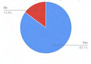
Hardwick, a small rural town of about 3,000 people, has received national attention in recent years for its diversified and thriving local economy based on food. Following the decline of the granite industry, which had been a central driver of Hardwick’s economy, Hardwick has experienced a revitalization driven by the production of high quality, local food and value-added products. Over the past few decades, several ambitious and business savvy “agripreneurs” established business ventures and collaborated to create economic relationships where by-products (“waste”) of one industry were recognized as resources and used as inputs to another industry (Hewitt, 2009).
A whole interconnected system of businesses was gradually established, where waste products or outputs from one business was used as an input but another, providing the foundation for a thriving local economy. For example food scraps and compost produced by restaurants and stores, and farms and composted at an in-town composting facility. Compost then returns fertility to the soil for farms and gardens that produce food, which is sold at local stores and restaurants. Those farms also provide inputs to a variety of businesses such as soy for Vermont Soy, which makes tofu and whey to Vermont Natural Coatings, which makes a wheybased non-toxic wood finish. Money and materials

Establishing connections between Bernardston residents and Bernardston’s farmers could help strengthen the local economy in town, prevent farmland from being abandoned, and contribute to the town’s food security. Studies have been conducted at the county level as well, in order to help determine how agriculture in Franklin County can be supported. According to the FRCOG’s 2015 Farm and Food System Project, farmers in Franklin County could benefit from better access to a dairy processing facility, additional livestock slaughter and processing capacity, and a poultry processing facility.
Livestock slaughter must be USDA inspected if a farmer wishes to sell their meat and currently there are only two such facilities in Massachusetts: Adams Farm in Athol and Blood Farm in Groton. While poultry processing may be done on-farm, processing options are limited and expensive. The study found that there are only three slaughter facilities and one postslaughter facility within fifty miles of Greenfield. A 2013 CISA report, Confronting Challenges in the Local Meat Industry: Focus on the Pioneer Valley of Western Massachusetts, found that:
The mean round-trip distance traveled by a producer in the Pioneer Valley to the processing facility is roughly 73.8 miles, with travel time totaling over an hour and fifty minutes. This represents an additional expense of roughly $87 per trip to producers in terms of vehicle and gasoline usage, which results in an even higher cost of meat products, as well as the large opportunity cost of spending this time away from on-farm activities. (13)
An additional slaughter facility in the area could support Bernardston’s farmers, especially because most of the town’s farmers raise livestock.
Slaughterhouses
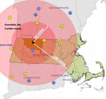
Slaughter facility
Post-slaughter facility
The study also assessed the level of interest farmers in Franklin County have for a dairy processing facility. Farmers were questioned about how they would use a processing facility, for example, to expand production or bottle and sell their own milk.
The responses were:
Bottling and selling my own brand of fluid milk
Processing and selling my own brand of other dairy products
Working with other local farmers to process and sell other dairy products
Selling my brand to another business using the processing plant
The study found that the farmers interested in a dairy processing facility were clustered in the northern part of Franklin County around Bernardston.
Based on these regional needs, Bernardston could work with the FRCOG and investigate the potential
Produced by the FRCOG Planning Department for the Farm and Food System Project, 2015
of attracting one of these types of processing facilities to one of the Priority Development Sites. As has been discussed previously in the master plan, the current lack of wastewater infrastructure is an obstacle in hosting one of these types of processing facilities, especially because they all likely would use substantial amounts of water. Regardless, these are land uses that would support farmers living in Bernardston and Franklin County.
A survey of Franklin County farmers gauged the level of interest in a new poultry processing facility. Fourteen farmers throughout Franklin County said they were “very interested” and that the facility would likely increase their production significantly. Twenty-two said they were “interested” and believed the facility “might likely increase my production significantly.” One farmer in Bernardston echoed these findings and said they travel 100 miles to Rhode Island for poultry processing and do not like the added stress the long travel causes the chickens.
With a dairy processing facility farmers would be able to expand into a number of different products
A dairy processing facility would allow many to expand their operation. Interested farmers were clustered in northern part of Franklin County.
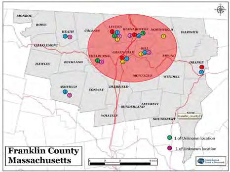
Produced by the FRCOG Planning Department for the Farm and Food System Project, 2015
Many farmers throughout Franklin County are interested in a smallbatch poultry processing facility


Produced by the FRCOG Planning Department for the Farm and Food System Project , 2015
While some residents find paid work in agriculture and forestry, there are many other businesses and industries operating in Bernardston. These include commercial and industrial businesses, restaurants, and schools, among others. The map opposite shows that most of the major employers are located in the southern portion of town, along Route 5/10 and along Route 10, especially at the east end of Route 10 near the Northfield border. At these places of employment, not all of those employed are residents of Bernardston. Clearing forested land or farmland for new businesses or industries could be avoided if future development is focused in areas that have already been developed, such as along South Street and Route 10. This not only
would preserve Bernardston’s open space but could help create a more lively place; for example a compact cluster of shops and homes could make for a walkable, more vibrant space. Some residents have said that they would like to see more jobs offered in Bernardston, and in fact, over 80 percent of Bernardston residents commute out of town for work, largely travelling by car (as was described in the Transportation section). More employment opportunities and services in town could potentially lessen the need for people to commute out of town.
But where do most people work...


Employs 50-99 people
Employs 20-49 people
Employs 10-19 people
Employs 5-9 people
A community survey found that many residents see business and industrial development as a means to bring more services and jobs to Bernardston and increase tax revenue to both help stabilize residential taxes and maintain current services. Different types of development, however, can contribute varying amounts of tax revenue, and some types of development may actually cost the town more than they provide in tax revenue.
The town’s current total assessed property value is $210,174,131 (Massachusetts Department of Revenue Division of Local Services Municipal Databank, 2016). Most (85 percent) of this comes not from business or industry, however, but in the residential sector.
A goal of the town’s Finance Committee is to increase the town’s tax base to $230 million by 2035. This would add $389,000 to the Tax Levy, which the Finance Committee predicts would allow the town’s tax rate to be more affordable. It would also provide more money for maintaining and improving the town’s bridges, roads, and buildings (Bernardston Finance Committee, 2016).
What do you see as the benefit(s) of encouraging business/industrial development in Bernardston?

A community with many different kinds of businesses is often more resilient than one with one or two large employers, even if in each scenario the tax revenue to the town are the same. Many towns have experienced a boom when a large industry comes in but as soon as the market changes, the industry is no longer profitable, or resources are depleted, jobs are no longer viable and the town’s economy declines. Having a diversified group of businesses can prevent this and better ensure that even if one business fails or leaves, the town does not lose a large percentage of its tax revenue.


Planner Peter Flinker’s Village Guidance: Tools and Techniques for Rhode Island Communities (2015) summarizes the findings of an analysis (by Pam Sherrill Planning) of the fiscal impacts of conventional residential development on the small Rhode Island town of Exeter, and compares these with the impacts of denser village development. In the conventional scenario, 89 new homes—single-family houses on large lots—could be built, given current zoning. In the Exeter village center scenario, in which density is increased through Transfer of Development Rights, 356 new homes could be built. Two-thirds of these were designated to be single-family homes (each of which would send 0.58 students to the school system) and one-third apartments or townhouse units (each of which would send just 0.05 students to the system). The fiscal impact analysis examined revenues (from real estate taxes, with a rate of $14.16 per $1,000 assessed value) and cost of town services (for education, road construction, and road maintenance). In sum, “The analysis showed that a single family home on a large lot will cost Exeter approximately $1,025 every year. However, the average village residential unit generates an annual surplus of about $1,649” (Flinker 40, emphasis added).
Flinker also summarizes the findings of a number of organizations that calculate the relative fiscal costs and benefits of various forms of non-residential land use. The American Farmland Trust has found that residential development costs communities $1.15 in services for every $1.00 the community collects in taxes; farmland and open space cost only $0.35 in services for every $1.00 collected, and commercial and industrial cost only $0.27 (42). A study of Barnstable, Massachusetts, however, determined that the type of commercial use was significant, finding that:
shopping centers, big boxes, restaurants and fast food establishments are all net moneylosers for the town, while business parks, offices, hotels and specialty retail all generate an annual surplus. Specialty retail, which combines relatively high assessed value with lower costs, ended up generating the best fiscal benefits for the town. (43)
There are considerable differences between Bernardston and the wealthy Cape Cod community of Barnstable, and conclusions about the particular costs and revenues of the Barnstable study can not automatically transfer to Bernardston. However, the study suggests that different commercial land uses bring significantly different fiscal costs and benefits to a community.
In an effort to create jobs and increase tax revenue to the town, Bernardston has designated two areas in town as Priority Development Sites. These could potentially host new commercial or industrial businesses as part of the Massachusetts General Laws Chapter 43D program. The sites were designated in an effort to promote commercial and industrial development in Bernardston by offering an expedited permitting process to developers, businesses, or industries seeking to locate in Bernardston. This is a streamlined process where a decision will be made by the Planning Board within 180 days.
The criteria for a Priority Development Site (PDS), as determined by MGL, are that the area:
• May be zoned for commercial, industrial development, residential or mixed use purposes.
• Must be eligible for the development or redevelopment of a building of at least 50,000 square feet of gross floor area (may include existing structures and contiguous buildings).
• Must be approved by the local governing authority
• Must be approved by the state Interagency Permitting Board local expedited permitting process - 180 day turn around time.
(MGL Local Expedited Permitting, Chapter 43D)

As outlined in the Zoning Bylaws of the Town of Bernardston, Massachusetts, the functions of the Priority Development Sites are:
• To promote commercial and industrial development and redevelopment in Bernardston that is located in an appropriate location adjacent to existing highways and transportation infrastructure.
• To ensure high quality site planning, architecture and landscape design that enhances the character of the development and provides safety, convenience and other amenities.
• To generate positive tax revenue for the Town, and to benefit from the financial incentives provided by Commonwealth, while providing the opportunity for new business growth and additional local jobs.
(Bernardston’s Bylaws, 38)
The Priority Development Sites have several assets that could be useful to a business or industry, including easy access to I-91, access to a rail siding for freight transport as described in the Transportation section (for PDS 1), access to Mass123 Broadband Institute high speed fiber optic network (both lit fiber and broadband), and water infrastructure.
A wastewater infrastructure proposal developed in 2009 by Tighe & Bond proposed using PDS 1 for a wastewater treatment plant that would service part of Church Street. It proposed a separate wastewater treatment system for PDS 2 but the high cost of creating this wastewater treatment infrastructure was deemed prohibitive. Many residents in town see this as a critical obstacle for the commercial and industrial development of these sites. Land uses or industries that do not require extensive wastewater infrastructure should be investigated.
Both sites were approved for this designation in 2008 and are located along Route 10. PDS 1 is approximately 15 acres located on the west side of the I-91 interchange and wraps around Kringle Candle’s facility. PDS 2 is approximately 29 acres and is located on the east side of the I-91 interchange.

MBI installed (high speed fiber optic network)
MBI installed and Lit Fiber
PDS 2 PDS 1Even if Bernardston had municipal wastewater treatment and was better able to attract businesses, responses to the community survey indicate that many in town are concerned that increased economic development could potentially change Bernardston’s rural character, lead to a loss of open space, and increase automobile and truck traffic. The Level of Service assessments for different potential uses of the PDS described in the Transportation section confirm some of these concerns. Big box stores and retail stores over a certain size (depending on which PDS), as well as a mixed use over 250 KSF for PDS 2 would require alterations to the roadway to maintain adequate traffic conditions.
Economic development is often thought of in terms of commercial or industrial development; however, there are many other potential economic drivers that may not appear as obvious, and that could potentially contribute to Bernardston’s development, rather than detracting from its character.
The median age of 50.1 is noticeably older than the region and Commonwealth: 44.9 in Franklin County and 39.3 in Massachusetts. About 36 percent of people
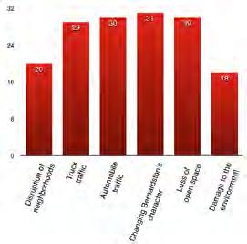
living in town are between 45 and 65 years old, which means that many people in town will be leaving the workforce and will be receiving Social Security over the next few decades. As a result, and as described in the Housing section, there will be a need for senior housing in the coming decades.
Unlike single-family residential development for families with children, senior housing would likely provide revenue to the town without the additional expenses associated with more children entering the education system. If such housing were in infill development near or within the most densely populated part of Bernardston, it would also entail lower infrastructure costs.
Constructing new homes and retrofitting old houses will require labor. Agreements could be made with a community land trust, the Franklin Regional Housing Authority, or a developer that workers from Bernardston are involved in the construction or retrofitting of buildings.
Services needed by seniors could also create jobs in town, for example health care services, personal care, transportation, and household maintenance. In addition, if more people live in or near Center Village, there will be more support for local businesses.

Many people are between 45 and 65 (36%), with about half that (18%) between 20 and 40.
One of Bernardston’s goals is to develop a more dense, walkable village center with more homes, shops and other businesses. However, the current zoning bylaws for Center Village and Route 10 may not support this vision. Much of Route 10 east of the I-91 interchange is zoned for Rural Agricultural, which does not permit businesses along the road. However, there are currently small areas zoned for business and for expedited permitting on either side of the interchange. Near the border of Northfield, at the east end of Route 10, there is an area zoned for business and an area zoned for industrial uses.
In Bernardston, minimum setback requirements push houses and other buildings away from the road, and the minimum lot frontages push buildings apart and spread them out, resulting in development that is less compact. This is the case in Center Village, as well as in the residentially zoned areas, as was discussed in the Housing section. To preserve Bernardston’s open space, future development should be more concentrated and focused in areas that are already developed to some extent, which may require changes in zoning.
The New Urbanism Best Practices Guide (2009) provides examples of how zoning bylaws can be reformed to encourage denser development through reducing minimum lot frontages and bringing buildings closer to the road.
Current zoning bylaws in Bernardston compared with best practices for clustered development
Min lot area
(This is increased by 25% for two family units, 50% for three-family or four-family)
Min
No minimum lot sizes in commercial districts. Lots in smart growth residential zones typically range from 3,000 to 5,000 sq. ft. APA workshop: In general use the low end of prevailing lot sizes in the district as the minimum, allow homes on lots as small as 3,000 sq. ft. but fit the standards to neighborhood needs.
150 No requirement in commercial districts. Residential 30-70’ for a 1-family home lot. Use the low end of prevailing frontages as minimum.
Consider reducing minimum lot sizes in Center Village (CV) and along Route 10 from the east of the Interchange to Northfield (which could be rezoned for Mixed Use).
Consider reducing the minimum lot frontage in CV, along Route 10 and in the Business Zone to encourage more compact development.
20Identify a build-to-line at 5-25’, not a setback requirement, and no different setbacks for commercial versus residential buildings.
Consider adjusting the numbers in red to allow for more compact development.
For CV: consider creating a maximum setback of 30’ with a minimum setback of 15’ to bring new buildings closer to the street.
*New Urbanism Best Practices Guide (2009) and Downtown Zoning Repair Workshop at National Conference of American Planning Association (2011)
The physical characteristics of buildings, specifically the design, layout, and density, can help promote or hinder activity in an area. When businesses are clustered together with residences and people are able to walk among them, there is a better chance people will spend more time in a place, making for a more lively space.
Center Village zoning currently allows mixed use, but most of Route 10 is zoned for Residential/Agricultural (R/A), which prohibits most business, except a bed & breakfast. As described in the Land Use section, rezoning Route 10 to be a mixed use corridor can encourage both residential and commercial development, allowing for shops and other businesses. To prevent unwanted development, the town can require a Special Permit for land uses that could threaten Bernardston’s character.
Community economic development (CED) is an approach that looks to improve many aspects of a community, including social and ecological well-being in addition to fiscal matters. Placemaking, a process of
creating a sense of place by capitalizing on local assets, engaging people, and strengthening a sense of community, can also contribute to community economic development. By focusing on making Bernardston more of a destination in the eyes of residents and visitors, people will want to spend more time in town. Socializing, gathering for events, shopping, and visiting can also contribute to and strengthen Bernardston’s community and economy. Using Bernardston’s goal of creating a vibrant central village as a leverage point, Bernardston can create a stronger sense of community and add to the town’s character, which can serve as a catalyst for other changes in town.
Bringing people into the town’s center—whether it be residents of Bernardston, people looking to move to town, or visitors—will support existing businesses, for example when people come to shop or eat at the restaurants. A more welcoming and attractive streetscape in Center Village also has the potential to encourage new businesses and could result in increased property values (Smart Growth America). Clustering new development, particularly the senior housing and affordable housing that the town needs, will result in more people living in or near Center Village, which will lend itself to more people spending time downtown and a more lively community.

Vibrancy isn’t the commercial aspects of a town specifically; it is the feeling of activity and liveliness that occurs when people are more present and engaged with a particular place.
A community meeting in February 2016 helped identify key aspects of village centers that appealed to residents of Bernardston. Images of nearby town centers were presented and residents provided feedback on what they found to be desirable and undesirable characteristics of a town center. Among others, some of the most common responses include:
• Compact development but not “crammed together”
• Well maintained houses, shops, restaurants, and other businesses
• Central space for gathering and events
• Walkable with sidewalks on both sides of the road
• Street trees
• Easily accessible
Beyond altering the town’s zoning bylaws to help encourage more compact development, several physical alterations to the streetscape in Center Village and Route 10 (as described in the Transportation section) could also help create a more vibrant and welcoming Center Village:
• Design and develop a Complete Street with sidewalks on both sides of the road and designated bike lanes to create a more pedestrian- and bikefriendly streetscape.
• Install benches and create public sitting areas along Route 5 and Route 10.
• Assess need for parking in Center Village, identify potential locations, and create a parking lot.
• Plant street trees to create shaded sidewalks and sitting areas.
• Consider installing street lights in Center Village to support evening activities.

Sustainable economic development is a priority for residents of Bernardston, but the community faces a number of challenges. Seen through a traditional economic development approach, Bernardston can investigate methods for encouraging more businesses to move into town. However, a lack of wastewater infrastructure has hindered the town’s ability to attract business. It may be possible to find particular industries that do not need much water treatment.
Looking at the town’s economy through a broader framework that includes quality of life, there are a number of additional strategies the town can pursue as part of a community economic development strategy.
• The town wants to maintain its rural character, but increased development could potentially pose a threat to this, depending on the form it takes.
• Lack of sewer infrastructure in town potentially hinders Bernardston’s ability to attract businesses and industries to Center Village and the Priority Development Sites. Additional housing or infill development in Center Village would also require alternative wastewater infrastructure.
• Residents feel taxes are high, there are not many jobs, and there is little affordable housing.
• A large portion (82%) of the workers in Bernardston commute out of town for work, relying primarily on cars for transportation.
• There are few vacant lots in Center Village for new building development.
• Current zoning in Center Village and along Route 10 prevents compact infill development.
• Agriculture in Bernardston has been on the decline in recent years, due in part to the inability of local farmers to compete with the lower prices that larger farms are able to offer.
Creating or strengthening connections among business owners in Bernardston and Franklin County will create a more resilient local economy. Additionally, by promoting locally sourced products such as food, money is recirculated within the town and county, supporting the livelihoods of those who live in Bernardston and the area.
• Center Village is fairly spread out and offers little in terms of seating for people wanting to spend time there. Cushman Park often floods and is rarely used as a gathering space by residents. The Cushman Hall Property was considered as a site for an attractive public event space, but a restriction that prevents new permanent structures prevented this from being carried out. A central gathering space could encourage more residents and visitors to spend more time in Center Village.
• With few options for shopping in town and for daily essentials, people spend most of their money elsewhere rather than in Bernardston. Where

Recommendations for sustainable economic development involve leveraging Bernardston’s assets and making Bernardston more of a destination in the eyes of residents and those visiting town. This entails implementing various strategies for creating a more welcoming central village that draws people to town, which may encourage new businesses. In the absence of wastewater infrastructure, Bernardston should investigate industries or businesses that do not require extensive infrastructure for the Priority Development Sites. The town can encourage existing business owners and farmers to collaborate and determine how they can support each other, for example by engaging in the Massachusetts Farm to School Project. Fulfilling Bernardston’s need for affordable housing and senior housing can serve as an economic driver as well.
Support and encourage local agriculture and sustainable forestry in Bernardston
Work with CISA to encourage local farms, restaurants, and businesses to get involved with its “Local Hero Program” to raise awareness of the social, environmental, and economic benefits of eating locally. Of the thirty farms in Bernardston, only three are currently Local Hero members and listed on CISA’s Farm Guide (Couch Brook Farm, Eden Pond Farm, River Maple Farm). Make it easier for food produced in town to be sold nearby in stores, served at restaurants in the region, and promoted as being locally sourced.
Promote agritourism in Bernardston, as suggested by many residents and by the Community Development Plan of 2009. This would be a way to help support local farms and bring people to town to enjoy its rural qualities. This might entail, for example maple sugar houses, hosting events on farm, pick-yourown fruit, workshops in gardening or processing food, or a bed and breakfast.
Create a community wide email list-serve or newsletter that informs people of what particular produce or product a farmer might have in a given week.
Work with the Massachusetts Farm to Schools Project and engage the Pioneer Valley School District to determine how the area’s schools could help support local agriculture and source some of its food from local farmers, at whatever scale is most appropriate. For example, depending on the supply, this may just be a one day per week meal that serves locally sourced products. This could potentially require a middleman between Bernardston’s farms and the Bernardston Elementary School. Explore options for grants that would allow the town to establish a position to develop and coordinate with surrounding towns. Many farmers may not have the time to manage relationships with multiple buyers. This committee or individual also could serve as a middleman between Bernardston’s farms and the various restaurants and businesses in the region, working to coordinate the supply from the farms and the demand from the different buyers.
Work with private landowners and encourage active forest management plans, for example using Chapter 61 for temporary land protection and tax abatement, maintaining Bernardston’s beautiful landscape character.
Encourage homeowners to switch to wood heat for buildings and convert to high-efficiency wood heating systems. If that wood is sourced locally from Bernardston or the surrounding towns, this will stimulate the area’s local economy.
Encourage farmers to investigate the potential of cultivating non-timber forest products in their forests or woodlots. Growing shiitake, oyster, or lion’s mane mushrooms on hardwood logs could supplement a farm’s income with a niche crop. Mushroom production requires relatively little maintenance through the growing season and much of the work can be done during the winter when things are generally slower on the farm.
Support existing businesses in town and encourage new ones while maintaining rural character and environmental values
Establish a Development and Marketing Committee and work with NATABA to determine how the town and region could attract more businesses to Route 10 and the Priority Development Sites. The committee could run a fiscal analysis to determine how much revenue could be generated for the town by different industries, what expenditures would be needed to attract businesses, for example in the form of wastewater treatment infrastructure, construction, or landscaping.
Coordinate with the county to attract businesses and industries that support the regional rural economy and the processing of natural resources to develop in the Expedited Permitting District (examples include a slaughterhouse, milk processing facility, or sawmill). A study of county industries could reveal possibilities to link industries and businesses by supplying materials needed by already established industries or utilizing the waste product of other industries. The study should include areas of southern Vermont.
Encourage business owners in town to establish an informal organization or association, that would entail periodic meetings and where business owners could collaborate and support each other. Alternatively, encourage business owners to affiliate with the Franklin County Chamber of Commerce and NATABA. The Franklin County Chamber of Commerce offers free business counseling, creates networking opportunities, and helps businesses market and advertise themselves.
Encourage and promote tourism in Bernardston. Bernardston’s natural features, for example its forested land and trail systems, can be promoted as part of a strategy to encourage tourism. Promote hiking, hunting, and other recreational activities in the town’s forests for both residents and tourists. Encourage lowimpact recreational activities at Satan’s Kingdom WMA and use of the trail systems on Charity Lot. Improve tourism infrastructure such as wayfinding signage.
Natural beauty alone cannot support tourism however, as many people are looking for a broader experience that involves accommodations, shopping, and cultural opportunities (FRCOG, 2011). Bernardston is already home to several restaurants, an inn (The Inn at Crumpin Fox) and a renowned golf course, so marketing and promoting these services along with Bernardston’s natural features could increase the number of visitors to town.
Conduct a market study to determine what the most appropriate businesses are that Bernardston can support, given its assets, location, and physical constraints, and target marketing efforts towards these industries. For example, many skiiers and outdoor enthusiasts travel through Bernardston on their way north to Vermont and New Hampshire and so an outdoor recreation outfitter located in Bernardston could potentially do well. A local brewery and pub, restaurants, or a bed and breakfast would also potentially fit Bernardston’s character, encourage tourism, bring more people to town, and add to Bernardston’s tax base.
Reassess the viability of using the Bernardston landfill site for a solar array. As described in the Land Use Section, an assessment by Nexamp done in 2009 found that the 8.72-acre site could produce roughly 860,000 kwh of electricity. Because the financing system is currently in the process of being updated, a new financial assessment would need to be done. This could potentially reduce electricity bills for institutions in town, for example the Bernardston Elementary School.
Reform Zoning Codes for Center Village and Route 10
Rezone Route 10 for mixed use (as described in the Land Use section), allowing for shops, businesses, and residential uses. The town can require a Special Permit for various uses to prevent unwanted development that could potentially detract from Bernardston’s character. Alter zoning bylaws to encourage more clustered development by reducing the minimum lot size, and the minimum lot frontages and creating a maximum front setback rather than a minimum setback.
Increased density will require alternative wastewater treatment systems, such as composting toilets or a decentralized system (as described in the Services section).
Develop Form-Based Codes for Center Village and Route 10 through a community design charette (as recommended in the Land Use section)
Community building and community based economic development.
Invest in making Center Village a more attractive, welcoming, and pedestrian-friendly space. Design a Complete Street for Church Street, plant street trees and create more sitting areas in Center Village to encourage people to spend more time there.
Form an Event Committee to plan more events in town. Many residents have expressed how much they enjoy Bernardston’s different events, for example the Gas Engine Show, Scarecrow in the Park, and the Kiwanis’ Club dinners, among others. Music concerts, shows, and events for families would bring people together, add to the town’s vibrancy and build a stronger community.
Promote the arts and culture in town. This could take the form of art shows or galleries hosted by the various institutions in town or outdoor exhibits in Cushman Park.
Revitalize Cushman Hall Property to serve as a more welcoming public park and a central gathering space for events. Currently there is a deed restriction that no permanent structures can be built on
site. The town can reassess the feasibility of Elaine Williamson’s 2010 design project for the Cushman Hall Property and explore options for implementation. Promote outdoor recreation in Bernardston through its trail systems (walking, horse, and snowmobile trails) and assess the potential for mountain biking trails in Bernardston. Utilize Center Village as a gateway for Bernardston’s outdoor recreation facilities with wayfinding signage to direct people to those destinations.
Consider creating a “Farm Structure Reuse Bylaw.” This could encourage the adaptive reuse of the historic barns and other farm buildings within the town for structures that are no longer in agricultural use. Examples of adaptive reuse include “event space for weddings and other functions, studio space for artists or musicians, or other commercial use that is compatible with the surrounding landscape” (Community Development Plan, ES-9).

Through multiple community meetings, interviews, and public surveys, the residents of Bernardston have conveyed a vision for the future that can be summarized in three goals:
• Create a vibrant historic Center Village.
• Foster sustainable economic development.
• Preserve the rural character of Bernardston.
The recommendations of this master plan help Bernardston achieve these goals through pursuing education and outreach, zoning and policy changes, strengthening regional connections, and investing in infrastructure improvements.
This section provides a summary analysis of existing conditions and issues as they relate to the community’s goals. Additional assessments of the Center Village’s ability to support denser development is needed. The relationship between groundwater elevation, localized flooding, river and wetland hydrology, and the performance of wastewater treatment systems needs to be better understood in Center Village before further planning for development in this area can be pursued. Last, a table of recommended strategies organized by type of action is provided, referencing specific plan elements for more information. The strategies have been ordered based on a general prioritization schedule but without a specific timeframe. Thus, some actions must be accomplished before subsequent strategies can be pursued. In other cases, multiple actions can be pursued simultaneously. Resources in the form of funding and labor will likely be the limiting factors in the ability to accomplish the recommendations set forth in this plan.
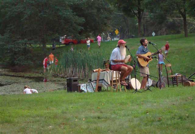
Residential
Center Village
Prime farmland
Core habitat
Wetlands
Mostly forested
Sparse residential
Scattered farmland
Some land in Chapter 61
Observations

Residential development is mostly in the southern half of the town, and coincides with low-lying river valleys and wetlands.
Most of the northeastern and northwestern sections of town are forested.
The northwestern section of town has scattered residences and some farmland breaking up large blocks of forest.
The primary block of core habitat is in the northeast section of town and is divided by Hucklehill Road. Residential development is intruding into large blocks of core habitat.
Some woodland landowners use Chapter 61 to reduce their tax burden.
Implications
Low-lying level areas use for residential development in Center Village create a conflict for proper septic system function in areas with a high water table and flooding from storm events.
Continued expansion of residential development in forested areas in the northwest and northeast of town will further fragment forests, reducing their habitat value for interior forest dwelling species.
Continued expansion of residential development in the center and southern portions of town could eat up prime farmland and reduce land for agriculture.
Dense residential
Priority Development Sites
Major employers
Commercial cluster
Industrial cluster
Mixed use
Mostly forested
Sparse residential
Scattered farmland
Some land in Chapter 61
Charity Lot
Observations
Prime farmland
Landfill
Rail
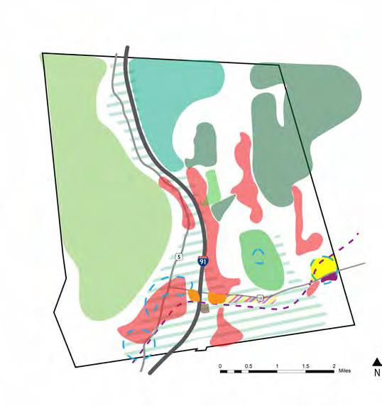
There is no municipal wastewater treatment in town. There are two priority development sites along Route 10, near the capped landfill and Center Village.
The most dense residential development is located in the southern central portion of town, along Route 5, Route 10, and I-91, and largely on what was prime farmland.
Route 10 east of I-91 has a mix of commercial, industrial, and residential development.
Between Satan’s Kingdom and Charity Lot, there are large tracts of forest in the northeast section of town that are either state or town owned.
Hull’s Forestry actively manages a large swath of forest in the northern section of town.
There is a lack of trail networks through the open space and forested land.
Implications
The lack of a public sewer system limits the growth and development of business, industry and new housing in Center Village.
The capped landfill is available space for a solar array, a potential revenue generating venture for the town and source of electricity for municipal buildings.
Active sustainable management of forested lands could help preserve this scenic landscape, provide revenue for landowners, and support the local economy.
Public and private forested land is available for developing trail networks that could be part of an economy based in part on outdoor recreation and tourism.
Satan’s Kingdom WMA (SK) Hull’s Forestry Crumpin Fox Golf Club Center VillageResidential
Commercial
Vacant/developable
100 year floodplain
Wetlands
Failed Septics
Sidewalk
Cushman Park
Observations
A large portion of residential development is adjacent to wetlands and the floodplain.
There is no municipal wastewater treatment system. There are several undeveloped lots in and around Center Village.
At least eight septic systems have failed near the Darwin Scott Wetland.
Cushman Park frequently floods.
There is mix of commercial and residential uses in Center Village.
Current zoning requires a minimum lot frontage of 125 feet and a minimum lot size of 0.46 acre.
Darwin Scott Wetland
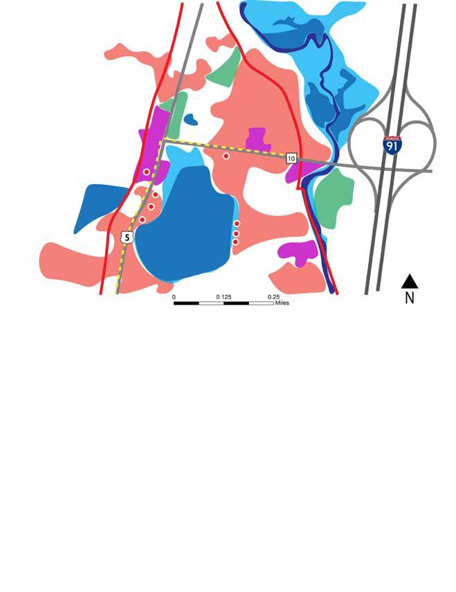
Implications
Vacant lots are available for development in Center Village.
Infill development would require zoning reform to create a denser village center.
Failing septic systems limit the growth of businesses and the ability of homeowners to sell their homes.
The mix of commercial and residential development in Center Village is a precedent for expanding this type of mixed-use zone in Center Village and other areas of town.
The current outdoor gathering spaces for events is susceptible to damage from flooding, and has limited use because of the frequency of flooding from storm events.
The community’s three goals are complementary. For example, a vibrant center village can also serve as a catalyst to achieve the preservation of the town’s rural character and foster sustainable economic development. This could be accomplished through clustering new development, especially senior and affordable housing around a center core, which would help prevent sprawling development from occupying open space. Clustered development would help to create a stronger sense of place and community, which in turn could attract people to town and stimulate the local economy. While it may appear obvious that this type of clustered, denser development would logically be placed where Center Village is already zoned in Bernardston, the current Center Village faces some challenges for future development. Current zoning, failing septic systems, and flooding are the biggest hindrances to future development in Center Village. Changing zoning to allow for denser development may be easier to solve than failing septic systems due to a rising water table or increased flooding, especially as extreme storm events increase in the coming years due to climate change.

To make an informed decision about future infill development, the town of Bernardston needs a better understanding of the hydrologic functions of the watershed that Center Village lies in and of the Darwin Scott Memorial wetland at its center. A hydrological study should be conducted in order to further the town’s understanding of these functions. Such a hydrologic study should attempt to answer (among others) the following questions.
• Is the water table in Center Village actually rising? If so, at what rate?
• Is it projected to level off or reach an equilibrium?
• What are the projected flood zones under storm events of various sizes?
• How much sediment is being transported by the stream along Fox Hill Road and how prone to blockages are the culverts?
• What affect would increasing impervious surfaces in the area have on the water table and flooding?
• What level of density can Center Village support in different wastewater treatment scenarios?

Many residents identified characteristics they desired in a town center:
• Walkability
• Well maintained houses, shops, restaurants, and businesses
• Dense development but “not crammed together”
• A central space for gathering and events
• Street trees
• Sidewalks on both sides of the road
• Easily accessible
If the current Center Village is unable to accommodate these features, for example if a more thorough hydrological study determines that it is not an
appropriate place for infill development, the town may need to investigate alternative locations for a denser village core.
The Future Development Possibilities map begins the process of examining where future development could happen if this is the case. The map only takes into account preliminary physical constraints to future development. These include permanently protected land, wetlands and their 100’ buffers, perennial streams and their 200’ riverfront areas, the 100-year floodplain, and any slopes over 25%. These are all represented in black. Developing on prime farmland, represented in grey, should be avoided when possible, while land with a slope between 10-25%, represented in yellow, is not ideal. Given these restrictions, the map highlights two potential areas of town where future development could be focused. A much more thorough analysis would need to be conducted to assess the feasibility of these areas, as well as other potential areas.
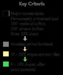
Possible

There are pros and cons to directing future development somewhere other than the currently zoned Center Village. The pros of shifting direction to the highlighted sites include the fact that the space would no longer be in a floodplain, or near a wetland. This means there is less risk of flood damage to buildings during rain storms, wastewater treatment is less likely to contaminate water, and wastewater treatment systems are less likely to be affected by a rising water table. Other pros could be the increased visibility of a Center Village from the more frequently traveled Route 10 to New Hampshire, and the proximity to the Crumpin Fox Golf Club and Resort, which could also bring in more visitors.
The cons of shifting direction could include that it is not connected to the existing downtown and would have to therefore re-establish itself as the “center” of town. A new wastewater treatment system would still be needed. There would also be less connection to the “old New England town” feel due to the lack of historic buildings.
Regardless of where a more vibrant village core is developed in the future, changing zoning regulations would be a necessary early step. Creating a minimum lot size for a Center Village zoned district that is smaller than the current minimum will allow parcels to be subdivided, providing the opportunity for greater infill. Creating build-to lines within this district would help bring buildings closer to the street, creating the inviting feeling that many residents have expressed appreciation for. Creating design principles and establishing form-based codes would ensure that new development would comply with community expectations and be built according to a predetermined plan. Complete streets and sidewalks would help with accessibility, and street trees and green dividers would help the Center Village fit in with the rural character of Bernardston.
An engineer will need to be consulted for placement and viability of alternative wastewater treatment options outside of composting toilets. These alternative wastewater systems would allow for a denser core than would be possible with septic, helping to further the feeling of vibrancy. Housing can also be an important part of creating vibrancy. Clustered housing near the Center Village would make it easier for residents of
those houses to access shops, restaurants and other amenities. Clustered development and mixed-use buildings help provide the sense that there are always people near the Center Village, adding to the vibrant feeling and sense of place. To help promote the development of housing and mixed-use building close to a center village, Transfer of Development Rights should be used to preserve the open space of Bernardston and encourage infill development in already developed places.
Creating a vibrant central area would contribute to the community’s quality of life; it would also help to preserve the surrounding open space beyond the village center. Multifamily units should be allowed by right in Priority Residential areas and Center Village, and mixed-used buildings should also be zoned and encouraged as a means to further preserve open space. Design principles and form-based codes can also help establish an aesthetic that fits into the rural landscape and should be applied to future Center Village Zoning and Mixed Use development areas. Protecting Bernardston’s natural resources is also an important part of preserving that character. Protection of these resources should be prioritized, for example by putting land into Chapter 61 with approved Forest Stewardship Plans and by creating Agriculture Overlay Districts, constructed swales and other stormwater management techniques.

The purpose of economic development or community economic development is ultimately to strengthen the community and improve quality of life for residents. Conventional approaches such as investigating methods to attract businesses or industries, for example to Center Village or to the Priority Development Sites, should be explored. Non-conventional approaches, such as fulfilling the need for senior and affordable housing or placemaking, can also serve to strengthen the community and economy.
Encouraging denser development in and around Center Village, for example by altering zoning bylaws, can help create a more walkable village that draws people to town. Placemaking efforts to make Bernardston more of a destination in the eyes of residents and visitors can create a stronger sense of community for residents and may encourage tourism. The town can also leverage its scenic resources, such as its forests, for outdoor recreation and tourism by mapping existing trail networks, promoting use of them, and developing new trail networks. The town’s economy can further be supported by promoting local agriculture, for example through a farm-to-school program.
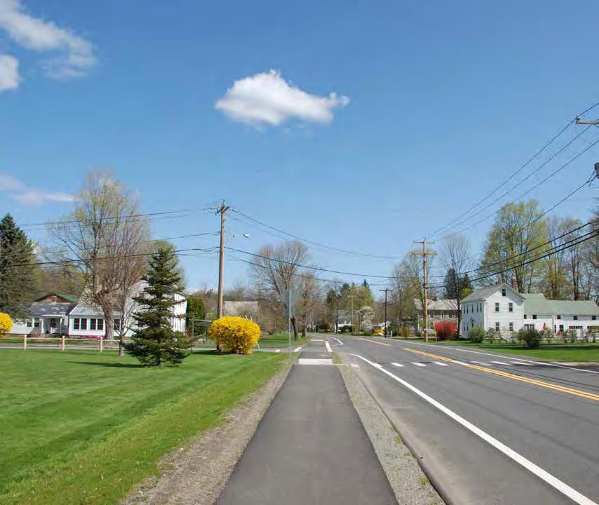
Vision: The historic center of town features classic New England architecture and is an attractive, visitorfriendly area that is easily walkable. The public spaces are universally accessible for meetings and cultural events. The businesses in town offer a variety of products and services that support local jobs and the rural economy. The roads in Center Village are lined by attractive vegetated swales that capture and infiltrate runoff to reduce the pollutants entering Cushman Park and the surrounding water bodies.
Strategy: Pursue wastewater treatment solutions to allow for continued use of the buildings close to the wetlands and higher density in-fill. Site additional parking in a central location to allow visitors to park and walk to businesses. Implement design guidelines to ensure that new businesses contribute to the historic New England feel and create a more walkable community. Incorporate stormwater management regulations in the Zoning Bylaws to reduce runoff into the wetlands and surrounding water bodies.
Vision: The state roads provide safe transportation for bicycles and commuters, and public transportation from the center of Bernardston to Greenfield and neighboring towns. The roads are maintained in ways that limit the amount of salt used. Planted swales and drainage basins absorb salt and runoff, protecting the public water supply from contamination. A complete street in Center Village features well-designed sidewalks, bike lanes and crosswalks that provide safe, walkable routes.
Strategy: Work with the county and state to design stormwater management and salt remediation along the edges of state roads. Design a Complete Street that incorporates bike lanes and work with the county to bring public transportation into the Center Village.
Vision: Route 10 is an attractive, scenic road with a variety of businesses and industries that serve the regional population. Travellers between I-91 and Northfield stop to enjoy the convenient restaurants and shops along the route.
Strategy: Convert this strip to a mixed-use area, incorporating small businesses that support local agriculture and passers-by. Develop form-based codes to regulate building footprint, height, rear-only parking, materials and landscaping to maintain the rural aesthetic along this road and manage stormwater.
Vision: Residential zones near Center Village and I-91 ramps are clustered communities with families that benefit from the convenience of Center Village and the accessibility to cities beyond Greenfield.
Strategy: Zone these areas to allow for more dense development and to receive development rights from outlying agricultural zones and priority wildlife conservation zones. Increasing density will help reduce sprawl.
Vision: The wetlands and connections to larger landscape blocks in Gill and Greenfield create vital habitat for wildlife and plant communities. Residents value the open space and understand the importance of protecting these areas for the future of their aquifer and the ecosystem services they provide.
Strategy: Prioritize this area for permanent open space protection to increase the ecological integrity of the wildlife habitat in the larger abutting landscape blocks that connect into surrounding towns.
Vision: The 1,500 acres of dairy, pasture, mixed vegetables, and hay farms remain a valued asset, providing local products for consumption and contributing to the rural, scenic, and economic value of Bernardston.
Strategy: Establish an Agricultural Overlay District to ensure the protection of current working farmland. Provide information for farmers on available resources using web-based and organizational strategies including farm transition options and marketing and financial support.
Vision: The forested residential, recreational, and wildlife management land is home to many species of conservation concern. The thick vegetation on these steep slopes protects the watershed and groundwater quality by protecting soils from erosion and infiltrating rainwater, and they provide wildlife habitat and economic resources for landowners. The lush hills provide the backdrop to views around the town and remain a defining character of Bernardston’s landscape. Sustainable forestry provides an additional economic return to residents and minimizes disturbance to forests.
Strategy: Prioritize permanent land conservation to create contiguous corridors of open land. Assess conditions of unpaved roads and develop a maintenance plan that reserves the integrity and rural value of unpaved roads. Develop recreational trails and education about watersheds and historical resources.


The town of Bernardston should consider whether the currently zoned Center Village is the best place for future development of a central village that meets the goal of a vibrant space as put forth by the residents.
Create public education programs to raise awareness about the importance of protecting surface water and wetlands for water quality and ecological integrity. With more knowledge of water systems and the services they provide, residents may be more motivated to take care of their natural environment. These programs should stress the role that intact watersheds and wetlands play in mitigating the detrimental impacts of increased storms from climate change.
Organize a series of educational and network-building events to promote regional and state resources for farmers and foresters. These should include farm and forestry best management practices that promote healthy ecosystems and edge habitats, protect wetlands, and prevent erosion; tax abatement and preservation opportunities; marketing strategies; and farm transition resources. Local land trusts should be invited to present to landowners about land conservation and stewardship opportunities through Estate Planning Outreach Grants.
Continue to educate and involve residents in Charity Farm Lot with community work days. Encourage public participation in developing hiking trails, picnicking facilities, and removing invasive species. Construct signs with information about the lot’s history and potentially connect trails to the proximate site of the first settlement.
Update information about the Ag Commission and Conservation Commission on the town website, including links to state and regional resources that provide technical and financial assistance for farmers and foresters. Efforts should be made to include announcements about relevant state and national policy changes and local farming or forestry events.
Investigate resources to involve the younger generation in town activities that improve the recreational opportunities and health of the natural environment in Bernardston.
Hold a community charrette to help establish Form Based Codes for new development, design walking paths through the Center Village, and site off-street parking. These guidelines should lay out materials, acceptable styles, sign restrictions, walking access, screened parking, and landscaping. Involving citizens in establishing the desired aesthetics for towns increases resident participation in the town and results in faster permitting processes and less conflict over new development. The conclusions of the charrette could be incorporated into the existing site plan review.
Planning Board, Board of Selectmen
Conservation Commission, Pioneer Valley Regional School
Ag Commission, Conservation Commission
Recreation Department, the Highway Department, Planning Board, Bernardston Selectmen
Ag Commission, Conservation Commission, Town Webmaster
Pioneer Valley Regional School District
Planning Board, Historical Commission, Historical Society
Preserve Rural Character = RC
Vibrant Center Village = CV
Foster Sustainable Economic Development = ED
RC, CVAccording to the goal of a vibrant Center Village, and the restrictions of future development in the currently zoned Center Village, serious consideration should be given to whether or not the current iteration of Center Village makes sense for the future that the people of Bernardston desire.
RC, CV, ED
The Massachusetts Watershed Coalition works with partners in communities to protect and restore watershed ecosystems, sustain healthy rivers and aquatic habitats. In order to reach these objectives, they sponsor workshops on watershed protection, LID, stream restoration for groups interested in watershed protection, town boards, and state agencies.
RC, EDCommunities Involved in Sustaining Agriculture (CISA) offer resources for farmers including workshops, marketing support, technical assistance and emergency funding. MassWoods is an extension of the University of Massachusetts that offers a wealth of networking connections for land owners including surveyors, public and private licensed foresters, and conservation bodies. Franklin Land Trust and Mount Grace Land Trust offer a variety of ways for landowners to permanently protect their land.
RC, EDSince 2013, Bernardston resident and restoration ecologist and designer John Lepore has been working to improve the accessibility of this town property for the general public. He is leading the initiative to complete a Charity Farm Lot Conservation and Recreation Plan that will recommend a number of actions with an implementation time line.
RC, ED More information about specific resources are detailed in Sections 4 and 5. The towns of Otis, MA and Ayer, MA have examples of well organized websites, with dedicated space for general announcements on the home page, and links for relevant information on individual pages for departments and committees.
RC, EDThe Student Conservation Association offers stipends to students to partake in community service projects including trail building.
CVDesign charrettes are series of workshops and activities with community members that serve to generate ideas and document a collective vision for future development. The National Charrette Institute offers tools, resources, and networks of trained charrette facilitators.
All Chapters
Watershed Protection
Land Use
Natural and Cultural Resources
Land Use
Natural and Cultural Resources
Land Use
Create trail system with signs along Pratt Field as a focal point for water education about the town’s water supply system, water treatment, management practices to protect water quality, and ecosystem services Incorporate additional vegetation along the parking area to infiltrate stormwater and filter contaminants from vehicles. The site is adjacent to one of the towns’ public wells and borders a stream. Signs should have information about actions that citizens can take to protect the local water supply. These should include encouraging bike and foot travel to the sports fields to reduce potential contamination due to vehicular traffic at Pratt Field, which is in the Zone I protection area of the well. There should also be information about the Pratt Field well, the process of replenishing the well, and facts about the nearby stream and the habitat that the stream supports. Create a community-wide email list-serve or newsletter that informs people of what particular produce or product a farmer might have in a given week at the farmers market to encourage more people to attend. Consider putting a weekly ad in The Recorder.
Work with private landowners and encourage active forest management plans, for example using Chapter 61 for temporary land protection and tax abatement.
Establish a Development and Marketing Committee and work with NATABA to determine how the town and region could attract more businesses to Route 10 and the Priority Development Sites.
Work with Community Preservation Coalition to host a workshop to educate residents about the benefits of the Community Preservation Act.
Encourage and promote tourism in Bernardston Bernardston’s natural features, for example its forested land and trail systems, can be promoted as part of a strategy to encourage tourism. Promote hiking, hunting, and other recreational activities in the town’s forests for both residents and tourists. Encourage low impact recreational activities at Satan’s Kingdom WMA and use of the trail systems on Charity Lot. Improve tourism infrastructure such as wayfinding signage.
Preserve Rural Character = RC
Vibrant Center Village = CV
Foster Sustainable Economic Development = ED
Conservation Commission, Recreation Commission, Water District
EDThe Bernardston Wellhead Protection Plan, compiled in 2012 by the Franklin Regional Council of Governments, contains detailed information about groundwater protection actions and examples of educational materials that can be modified for public signs.
Ag. CommissionRC, CV, ED
Planning BoardRC, EDThe MassWoods program run by UMass Amherst provides a great deal of information for landowners to aid them in making decisions regarding their forested land. It outlines the programs available to landowners, provides an overview of the many options landowners have, and maintains a list of local professionals.
Town CoordinatorED
Historical Commission RC, CV, ED
The committee could run a fiscal analysis to determine how much revenue could be generated for the town by different industries, what expenditures would be needed to attract businesses, for example in the form of wastewater treatment infrastructure, construction, or landscaping.
The Community Preservation Coalition, formed in the 1990s, is an alliance of open space, affordable housing, and historic preservation organizations working with municipalities to help them understand, adopt, and implement the Massachusetts Community Preservation Act.
Watershed Protection
Town Coordinator, Recreation Department
RC, EDNatural beauty alone cannot support tourism, as many people are looking for a broader experience that involves accommodations, shopping, and cultural opportunities (FRCOG, 2011). Bernardston is already home to several restaurants, an inn (The Inn at Crumpin Fox) and a renowned golf course, so marketing and promoting these services along with Bernardston’s natural features could potentially increase the number of visitors to town.
Economic Development
Economic Development
Economic Development
Natural and Cultural Resources
Economic Development, Natural and Cultural Resources
Recommendation
Education and Outreach
Encourage homeowners to switch to wood heat for buildings and convert to high-efficiency wood heating systems.
Encourage farmers to investigate the potential of cultivating non-timber forest products in their forests or woodlots. Growing shiitake, oyster, or lion’s mane mushrooms on hardwood logs could supplement a farm’s income with a niche crop.
Market Bernardston’s capacity for freight rail shipping as part of a strategy to promote the Priority Development Sites.
Coordinate with the county and FRCOG to attract businesses and industries that support the regional rural economy and the processing of natural resources to develop in the Expedited Permitting District (examples include a slaughterhouse, milk processing facility, or sawmill).
Conduct a market study to determine what the most appropriate businesses are that Bernardston can support, given its assets, location, and physical constraints, and target marketing efforts towards these industries.
3
Recommendation
Education and Outreach
Construct a boardwalk through Cushman Park and the Darwin Scott Memorial Wetland with wildlife and water education signs to increase accessibility and awareness of the ecosystem and natural environment. This will make use of the wetlands in the park as a recreational destination for both residents and visitors.
Preserve Rural Character = RC
Vibrant Center Village = CV
Foster Sustainable Economic Development = ED
RC, EDIf that wood is sourced locally from Bernardston or the surrounding towns, this will stimulate the area’s local economy.
Ag. CommissionRC, EDMushroom production requires relatively little maintenance through the growing season and much of the work can be done during the winter when things are generally slower on the farm.
Development and Marketing Committee
Development and Marketing Committee
Town Coordinator, Development and Marketing Committee
EDFreight rail is ideal for commodities that are heavy and not time sensitive and a business or industry that utilizes PDS 1 may be able to make use of the rail siding there.
EDA study of county industries could reveal possibilities to link industries and businesses by supplying materials needed by already established industries or utilizing the waste product of other industries. The study should include areas of southern Vermont.
EDMany skiers and outdoor enthusiasts travel through Bernardston on their way north to Vermont and New Hampshire and so an outdoor recreation outfitter located in Bernardston could potentially do well. A local brewery and pub, restaurants, or a bed and breakfast would also potentially fit Bernardston’s character, encourage tourism, bring more people to town, and add to Bernardston’s tax base.
Economic Development
Economic Development
Economic Development, Transportation
Land Use, Economic Development
Economic Development
Conservation Commission, Recreation Commission, Cushman Park Committee
CV, EDMassachusetts Audubon built the Arcadia Wildlife Sanctuary in Northampton with an 850-foot accessible looped trail and boardwalk through wetlands and other grassland habitats. It provides education to visitors who wish to learn about the various habitats with clear signs for direction.
Watershed Protection
Work with the Massachusetts Historic Commission to update the town’s State Register of Historic Places for recognition and potential funding through the Massachusetts Preservation Projects Fund.
Adopt the Community Preservation Act to raise local money which is matched by the state for projects including historic preservation, open space and land preservation and affordable housing.
Create a Development Transfer Fee Program to allow for tighter infill in areas such as the R1 zones, and establish working farmland and forest in high development pressure areas as sending zones. This program creates a system for buying and selling development credits by allowing developers to pay a fee for increasing the density of development in receiving zones. The fee is deposited into an account for the town to purchase the development rights on conservation or farmland as it becomes available. The receiving zones should be evaluated for their ability to accept higher density development based on septic suitability and low impact to critical natural habitat. Creating a transfer fee program would allow individuals to take advantage of the ability to subdivide into smaller plots and not require a major residential development for the system to generate funds for land preservation.
Create an Agricultural Interest Overlay District requiring development on working farmland to place a minimum amount of the property into the Agricultural Preservation Restriction program. This would help the town ensure a minimum loss of farmland in the future.
Create a Demolition Delay Bylaw to protect historic structures by granting additional time to fund the renovation of a historical building, or relocate it. Establish criteria for qualified structures including age, and properties identified as eligible Historic Places.
Preserve Rural Character = RC
Vibrant Center Village = CV
Foster Sustainable Economic Development = ED
Historical Commission
RC, CVThe Massachusetts Preservation Projects Fund is a statefunded 50% reimbursable matching grant program that supports the preservation of properties, landscapes, and sites listed in the State Register of Historic Places. The buildings and properties that are currently listed as Historic Places include those within the National Register Historic District; the fire station, Cushman Library, the Powers Institute, Cushman Park and the Unitarian Church.
Natural and Cultural Resources
Planning Board, Board of Selectmen
RC, CV, ED
Planning Board, Ag Commission, Conservation Commission
Since adopting the CPA in 2002, the town of Leverett has been able to complete several projects that would have been unfeasible without this additional funding. Projects include renovating Town Hall windows, restoring the North Leverett Sawmill and placing Historic Preservation Easement on it, purchasing contiguous parcels by the Leverett Pond for shoreline protection, extension of the Friendship Trail Land, and adding electrical work and heating to the second floor of the town library to make it usable year round.
RCAccording to the American Farmland Trust, 60% of the land protected through development transfer programs has been in Montgomery County, MD. This unique program established a system of development credits that can be bought and sold. The New Jersey Pinelands program has developed a similar credit system based on developable units that has successfully protected 52,000 acres of ecologically sensitive and agricultural land.
Planning Board, Ag Commission RC, EDIn 1999, the town of Southampton, NY established an Agricultural Interest Overlay that requires a minimum of 80% of current farmland to be protected. The remaining 20% is allowed to be developed at a higher density than on nonfarmland. This zoning district has successfully permanently protected 80% of the working farmland in Southampton as of 1999.
Planning Board, Historic Commission and Historical Society
RC, CVThe Demolition Delay Bylaw in Andover, MA allowed an extension of its delay from six months to twelve months which has been substantial in preserving historic buildings. In one instance, the Demolition Delay Bylaw deterred a developer who had planned to demolish a house and enabled a preservation-minded developer to purchase and restore the deteriorated house. This information is discussed in Preservation Through Bylaws and Ordinances (Massachusetts Historical Commission, 2010).
Natural and Cultural Resources, Housing, Economic Development
Land Use
Land Use
Natural and Cultural Resources
Create a Scenic Roads Bylaw by listing significant roads to protect their rural and historic character. This bylaw establishes a local review procedure for the cutting or removal of trees and alteration of stone walls that are within the public right-of-way. Further design guidelines and form-based codes can restrict development by height, materials and landscaping in order to maintain scenic vistas.
Implement development controls to protect the currently forested slopes that provide the backdrop to views of town from erosion. This could be accomplished through restricting development on slopes greater than 15% or through a Scenic Vista Overlay District that mandates the preservation of existing vegetation and requires additional natural screening for new developments on hillsides visible from the main roads. An Upper Elevation Protection Bylaw would establish an elevation above which site plan review is required for new developments. The planning board can limit building heights above tree lines, and require appropriate replanting of native trees and plants, and screening of utilities.
Consider permitting accessory uses on farmland to include conference centers, restaurants, and other small businesses to draw visitors to local farms. This would enable farmers to diversify their operations, provide supplemental income, and increase awareness of local farms.
Create a Conservation Opportunity Subdivision to fast-track subdivisions that conserve at least 80% of a site. This would promote denser development, reduce sprawl, and help to preserve land.
Create a regulatory system to oversee the maintenance of individual septic systems. This could be accomplished with the creation of a Wastewater District that mandates periodic inspections of septic systems within the Center Village, business, and industrial zones, by mandating alternative systems approved by the DEP that require maintenance contracts, or by implementing a Community Septic Management Program (CSMP).
Investigate shared-ownership strategies for septic systems and actively facilitate education for homeowners about available alternative systems and retrofits that could increase the life of current systems. There are a wide variety of alternative septic systems that have been approved by the DEP. Creating decentralized systems on a neighborhood scale can reduce installation and maintenance costs, although they may require additional organization and economic structures such as escrow accounts for long-term maintenance.
Key to Goals
Preserve Rural Character = RC
Vibrant Center Village = CV
Foster Sustainable Economic Development = ED
Historical Commission, Conservation Commission
RCThe town of Hopkinton strengthened its Scenic Roads bylaw by instituting a non-criminal disposition provision. Each tree or section of stone wall removed from the public right-of-way is a separate violation resulting in substantial fees. Hopkinton also created a tree planting gift account which raises money when developers remove trees from the public right-of-way and cannot replace them in the same location. The funds are then used to plant trees elsewhere. See Preservation Through Bylaws and Ordinances (Massachusetts Historical Commission, 2010).
Planning BoardRC, CV The city of Greenfield’s site plan review process specifies approval guidelines for projects integrated into the existing terrain and surrounding landscape by minimizing development on steep slopes and hilltops, protecting visual and scenic views, and preserving natural and historic features. Wilbraham’s Ridgeline and Hillside District Bylaw takes effect above 550 feet and applies to any new construction that might be visible from a public area. Development must be sensitive to the terrain, existing vegetation and viewsheds. See Preservation Through Bylaws and Ordinances (Massachusetts Historical Commission, 2010).
Planning BoardRCThe Town of Bolton permits accessory uses on local farms including retail sales of farm products and other related products that may be sold at a farm stand, veterinary services, and events including weddings and tours. See Preservation Through Bylaws and Ordinances (Massachusetts Historical Commission, 2010).
Planning BoardRCIn 1999, the town of Southampton, NY instituted a fast-track conservation subdivision that has successfully protected open space while allowing for continued residential development in town.
Board of Health, Planning Board CV, EDThe Environmental Protection Agency published a series of Case Studies of Individual and Clustered (Decentralized) Wastewater Management Programs in 2010 that highlights towns across the country that resolved a variety of water quality issues due to poor wastewater treatment monitoring by working with trained professionals. The studies highlight different regulatory systems unique to the characteristics of each town and region. MassDEP also outlines the benefits and criteria of CSMPs on their website.
Board of HealthCV, EDThe National Small Flows Clearinghouse was established by the EPA to offer resources to small communities to plan alternative and community-scale wastewater treatment options.
Natural and Cultural Resources
Natural and Cultural Resources
Natural and Cultural Resources
Natural and Cultural Resources
Watershed Protection, Services
Watershed Protection, Services
Work with conservation organizations and residents to develop a strategy for identifying lands that may be coming out of Chapter 61, 61A, or 61B and anticipate the funding necessary to protect these lands. Prioritize protection in the southern portion of town which has several wetlands and identified critical habitat that stretches across the town border and is under the highest development pressure. Second priority is the northeast region of Bernardston that is densely forested and mostly protected but has modest development pressure. The town should also consider protecting the large landscape block along the western mountain range which is predominantly unprotected and has low development pressure.
Alter zoning bylaws to encourage more clustered development by reducing the minimum lot size and the minimum lot frontages and by creating a maximum front setback rather than a minimum setback. This would allow for current lots to be subdivided and subsequent lots to be sold and built on according to new regulations.
Create by-laws for Center Village and Residential Zones that encourage clustered development. Clustered development would help preserve open space, and could attract developers because they can put more housing in a designated space than with conventional zoning.
Zone the designated Center Village area for by-right mixed-use buildings as a means to encourage a “live, work, play” lifestyle that would increase the vibrancy of Center Village.
Create a Housing Production Plan as a means of blocking developers from applying for the Comprehensive Permit they need to bypass local building regulations and bylaws.
Establish as-of-right zoning for multifamily housing and higher density development in Center Village and residential zones. This can serve as “adequate progress” under 40B and stop developers from acquiring the Comprehensive Permit they need in order to develop affordable housing that bypasses local regulations.
Establish design principles and form-based codes for a New England village center aesthetic. This will help preserve the rural character of Bernardston, even with construction of new housing businesses in Center Village and other areas of town.
Change zoning to allow accessory apartment and “in-law” units in all residential zones. This allows denser infill near existing structures, creates the potential for rental income for homeowners, and provides the opportunity for senior housing. In-law units also alleviate some of the need for other senior housing options.
Preserve Rural Character = RC
Vibrant Center Village = CV
Foster Sustainable Economic Development = ED
Ag Commission, Conservation Commission, Board of Assessors
RCWhen landowners enrolled in these tax abatement programs for undeveloped land decide to develop or sell their land for development, the town has only 120 days to exercise their right-of-first refusal to purchase the property, or transfer the right to purchase the property to a qualified organization. Franklin Land Trust and Mount Grace Land Trust offer a variety of ways for landowners to permanently protect their land.
Planning BoardRC, CV, ED
Increased density will require alternative wastewater treatment systems, such as composting toilets or a decentralized system.
Planning BoardRC, CV, ED Randal Arendt wrote a book called “Rural By Design,” where he talks about the many benefits of clustered development. This type of development is also highlighted through the Smart Growth website.
Planning BoardRC, CV, ED Mixed use buildings maximize the space available in Bernardston, and mean less construction is needed to accomplish the future goals for housing and business.
Planning Board, Council on Aging
RCA Housing Production Plan is considered “adequate progress” toward the 10 percent affordable housing goal that Chapter 40B requests. The criteria is outlined on under the regulations of 40B on Mass.gov.
Planning BoardRC, CVCurrent Zoning bylaws allow for multifamily housing buildings, but only through permit. Changing it to by-right zoning makes it easier for developers to construct the housing, and can help preserve open space by concentrating population growth.
Planning BoardRC, CV Formbasedcodes.com has resources, definitions, and step-bystep guides for establishing form based codes.
Planning BoardRC, CV, ED
Land Use, Natural and Cultural Resources
Land Use, Housing, Economic Development
Housing
Housing
Housing
Housing
Housing
Housing, Services
Recommendation
Zoning and Policy
Reassess the Water Protection Overlay District assuming that the current inactive wells will need to be reinstated in the future. Bernardston has been identified as one of eight critical sources of public water supply in Franklin County. Unpredictable changes in future precipitation along with population growth may require inactive wells in Bernardston to be reinstated, or new wells to be constructed. The Water Protection Overlay District would need to be assessed to meet any significant changes in demand or the creation of additional wells.
Expand the National Register Historic District to include historic structures on Church and River Street, and property owners about the benefits of placing their properties on the National Register of Historic Places. Listing buildings in the National Register provides formal recognition, potential tax incentives for owners of incomeproducing properties, and protection through state or federally funded, licensed or assisted projects.
Create Architectural Preservation Districts/Neighborhood Districts to protect the overall character of an area by regulating demolition and major alteration of buildings. Set design standards for scale, massing, street pattern, setback, and materials.
2
Consider creating a “Farm Structure Reuse Bylaw” that could encourage the adaptive reuse of the historic barns and other farm buildings within the town for structures.
Designate the future center village as a Smart Growth District. Creating such overlay districts for a center village and the area immediately surrounding it would allow the town to apply for funding under Chapter 40R, which encourages smart growth and denser development.
Consider the area south of the railroad along River Road for Center Village development. Work with Farmer’s Supply to develop parking and a riverside walkway connecting to the small area south of Hillside Pizza, making this section of town more accessible from Church Street and maintaining the view of Arch Bridge from River Street.
3
Recommendation
Zoning and Policy
Rezone Route 10 for mixed use to have attractive shops and businesses that would support the local rural economy and diversify the tax base. This new zoning district would have design standards to maintain the historic character of Bernardston, and would become a priority if plans to implement a centralized sewer system for the business and industrial zones are developed.
Water District, Franklin Regional Council of Governments
Planning Board, Historical Commission
RC, CV, ED
Historical Commission, Planning Board
Preserve Rural Character = RC
Vibrant Center Village = CV
Foster Sustainable Economic Development = ED
FRCOG has conducted a study on Franklin County with a chapter on the water supply in the county. The climate change in the northeast will have an impact on the future water supply.
CVThe town of Ipswich, Massachusetts, has seven Historic Districts. The town’s village has retained its historic buildings, roads, bridges and settlement patterns through the use of federal and local funds, and Preservation Agreements and other tools for historic preservation.
RC, CV North Andover adopted its first Neighborhood Architectural Conservation District (NACD) in the area known as Machine Shop Village which is listed in the National Register of Historic Places. The town adopted the NACD to preserve the overall size and scale of its well-preserved collection of mill-related resources. See Preservation Through Bylaws and Ordinances (Massachusetts Historical Commission, 2010).
Planning BoardRC, CV, ED
Planning Board, Town Coordinator
RC, CV, ED
Board of Selectmen, Planning Board
Examples of adaptive reuse include “event space for weddings and other functions, studio space for artists or musicians, or other commercial use that is compatible with the surrounding landscape.” (Community Development Plan, ES-9)
The Smart Growth Housing Trust Fund is one such funding option available to communities with Smart Growth Districts. Mass.gov has outlined the benefits and requirements for Smart Growth Districts, and created a toolkit for towns seeking to pursue this resource.
CV, EDStudies show that walking paths encourage daily exercise and increase safety and pedestrian accessibility of downtowns. The Massachusetts Department of Public Health has published a toolkit for rural towns to improve the walkability of their downtowns.
Element
Watershed Protection
Planning BoardEDThe town of Edgartown, Massachusetts, adopted design guidelines in 1988 for their commercial strip leading into the center of town that has allowed businesses to develop along with the tourist industry but has maintained the rural coastal aesthetic that residents find attractive. (See case study in Land Use Element).
Natural and Cultural Resources
Natural and Cultural Resources
Land Use, Economic Development
Housing
Land Use
Land Use
Designate Fox Hill Road and state roads as a priorities for stormwater Best Management Practices, which would include vegetated swales along the road to slow the flow and infiltrate runoff. Along Fox Hill Road this would help to decrease the volume of water and sediment being conveyed into Cushman Park and the wetland. Implementing BMPs for state roads could prevent runoff from potentially polluting the town’s water bodies and recharge zones by capturing and infiltrating the runoff through a ecological systems, such as a vegetated swales.
Establish remediation sites using cattails (Typha angustifolia) and spear saltbush (Atriplex patula) in swales in the Zone II Recharge Area of the Sugar House well, where the state maintenance regimes of Routes 5 and I-9I result to high amounts of salt in road runoff that pose a risk to the public water supply.
Evaluate the susceptibility of the unpaved roads in town to erosion. Conduct a study to find out how much sediment and runoff flows off the streets into the water bodies in town. Unpaved roads can contribute to rural character, and slow development and speed of travel in remote areas.
Work with the Highway Department and the Massachusetts Department of Transportation to establish an Integrative Vegetation Management program to minimize the use of herbicides and control vegetation in the right-of-ways. This will help to minimize damage to native wildlife and groundwater from herbicides and chemical uses. Implement management strategies such as carefully timed mowing to allow for songbird reproduction.
Consider conducting a study of salt use on state roads and the impact on groundwater or recharge zones to determine whether certain areas of the state roads can be designated as reduced salt areas. Road salt is a potential contaminant of the public water supply, especially within the Sugar House well recharge zone.
Hire an wastewater engineer to consult on wastewater treatment alternatives, and the suitability of any future sites for development. There is no one currently on the Board of Health or in the Town government who has the necessary environmental engineering expertise to direct the town towards appropriate solutions for wastewater treatment and future development in Bernardston. The 2009 Tighe and Bond Sewer Analysis and Conceptual Design Report should be reviewed to assess the feasibility of centralized or decentralized sewage treatment systems for the Center Village and business and industrial zones.
Pursue bids for a solar field on the landfill in town to provide the town with renewable energy on land that cannot be used for agriculture and is not highly visible. In 2009 Franklin County Solid Waste Management District conducted a feasibility study and potential plan for the solar field. The plan proposed a system that would generate 860,000 kwh of electricity a year.
Continue monitoring bridges every two years using the AASHTO rating system where applicable and continue to fund the Bridge Stabilization Account.
Pursue sustained affordable housing into the future through partnerships with community land trusts and by setting up deed-based restrictions on designated parcels.
Create a Five-year update of the Master Plan with a summary of actions taken and a reassessment for further actions.
Conservation Commission, Highway Department
Highway Department, State Department of Transportation
Preserve Rural Character = RC
Vibrant Center Village = CV
Foster Sustainable Economic Development = ED
RC, CVThe Massachusetts Department of Environmental Protection publishes the Massachusetts Stormwater Handbook with best management practices for controlling stormwater.
RCA group of scientists in Quebec, Canada, are researching the possibilities of constructing wetlands with plants that absorb salt to help with the phytoremediation of salt before it reaches the public water supply. Evidence shows that cattails and spear saltbush have the capability of absorbing salt and can be incorporated into roadside infrastructure.
Watershed Protection
Watershed Protection
Highway Department, Conservation Commission
RC, EDGuilford, Vermont, has taken action to preserve their rural character by maintaining the unpaved roads, which contribute to the rural character of their town.
Watershed Protection Conservation Commission, Highway Department, State Department of Transportation
RCThe town of Millbury has implemented an Integrated Vegetation Management program which minimizes reliance on herbicides and controls vegetation in an ecological way, especially in sensitive areas like Zone II recharge areas, and near surface water, habitat zones, and cultural areas.
Highway DepartmentRC, CV, ED The Massachusetts Department of Transportation has designated other stretches of roads as reduced salt areas to protect the areas surrounding the roads, whether the road might be running through a wetland, water supply area or other areas of conservation concern.
Board of Health, Board of Selectman, Town Coordinator
Green Committee, Planning Board, Board of Selectmen, Transfer Station
Highway Department, Finance Committee
CV, EDThe Environmental Protection Agency published a series of Case Studies of Individual and Clustered (Decentralized) Wastewater Management Programs in 2010 that highlights towns across the country that resolved a variety of water quality issues due to poor wastewater treatment monitoring by working with trained professionals.
CV, EDA report available from the Franklin County Solid Waste Management included a proposal by the Nexamp company for a 1600 Kw system. Greenfield has successfully developed a solar field at its landfill site and could be used as a case study
Watershed Protection, Natural and Cultural Resources
Watershed Protection
Watershed Protection, Housing, Services
Land Use
RC, ED Transportation
EDThe National Community Land Trust Network has resources for communities seeking to establish affordable housing and partner with local land trusts.
Housing Master Plan Steering Committee, Town Coordinator
An “aging in place” fund should be created.
Composting toilets, decentralized wastewater treatment systems, and living machines should are the alternative wastewater treatment systems that should be pursued most heavily. Each site of future development should be assessed on an individual basis for suitability for these systems. A wastewater engineer should be hired to assist in the suitability study of those sites.
The Fire Department should investigate grants to help in the construction of a new station, or expansion of the current station.
Bernardston should join the regional effort being spearheaded through the Massachusetts Broadband Institute (MBI) to bring Broadband internet to the households of western Massachusetts. This will be an effective way to cost-share the construction of such infrastructure.
Council on Aging, (Future) Senior Housing Committee
Board of Health, Planning Board, Board of Selectmen, Town Coordinator
Preserve Rural Character = RC
Vibrant Center Village = CV
Foster Sustainable Economic Development = ED
RC,EDThe AARP has produced a toolkit for local governments seeking to help seniors age in place. There is also a Community Innovations for Aging in Place Initiative through the Administration for Community Living, and a Grant Makers in Aging website that provide ideas and funding options for such initiatives. Housing
RC, CV, ED Services
The Fire DepartmentEDThere is funding through the USDA’s Rural Development Community Facilities Direct Loan and Grant Program. Services
Board of Selectmen, Town Coordinator
EDThe town of Leverett used funding through MBI to establish this service throughout their town. Services
Reassess the viability of using the Bernardston landfill site for a solar array.
As described in the Land Use Section, an assessment by Nexamp done in 2009 found that the 8.72 acre site could produce roughly 860,000 kwh of electricity.
Invest in affordable housing as a part of the development of a sustainable economic future.
A committee for senior housing should be formed in partnership with or as a subset of the Council on Aging. This committee should investigate the creation of bylaws that would mandate a certain percentage of affordable housing in town remain accessible and reserved for senior housing.
The Fire Department should seek funding to help pay for an additional staff member for the department. The increasing amount of paperwork required for a fire department to run, is quickly becoming too much for the current staff of the Bernardston’s department. If the town does not have the funds, the department should look for funding elsewhere.
Bernardston should inquire whether the Pioneer Valley Regional School District has established a Regional Transportation Reimbursement Fund, which allows towns to roll over excess funds from one fiscal year to the next for the purpose of paying for transportation expenses.
Bernardston should seek funds that will allow the library stay open more than three days a week. The library is a space where residents meet throughout the week and connects them to the downtown and each other. Helping the library stay open will help create a sense of vibrancy in the downtown and increase the connection between residents.
Design a Complete Street for Route 10 from Hartwell Street to the Route 5 intersection and apply for funding from Mass DOT. Include traffic calming elements that support a safe and comfortable pedestrian environment.
Work with FRCOG to install wayfinding signage near River Street or Hoe Shop for the Franklin County Bikeway.
Consider developing a Pavement Management System to save costs on road repair through systematic preventative maintenance.
Pursue funding for design and construction of a wastewater treatment solution resulting from professional environmental engineering plans that allows for denser development and a wider variety of businesses. Additional funding may be available if, during construction of the sewer system, utility lines could be buried and old water mains could be replaced. There are limited funding sources available for rural towns, and a separate committee or hired staff member may be necessary to devote the time required to acquire the funds for a project of this scale.
Conduct a parking and use inventory to determine how much parking is actually needed in town for residents, employees at the Town Hall, and visitors.
Key to Goals
Preserve Rural Character = RC
Vibrant Center Village = CV
Foster Sustainable Economic Development = ED
Finance Committee, Franklin County Solid Waste Management District
Planning Board, Board of Selectmen
ED Because the financing system is currently in the process of being updated, a new financial assessment would need to be done. This could potentially reduce electricity bills for institutions in town, for example the Bernardston Elementary School.
EDThe Planning Commission Journal discusses the contributions of affordable housing to local economy in the article “The Economic and Fiscal Benefits of Affordable Housing.”
Land Use, Economic Development
Housing Council on Aging, Planning Board
Fire Department, Treasurer
School Committee, Bernardston Elementary School
EDThe Community Preservation Coalition lists communities that have implemented affordable senior housing including Cohasset, Dracut, and Nantucket.
EDOutside funding can be found through the U.S. Fire Administration and FEMA Assistance to Firefighters Grant.
Housing, Services
Services
EDThis fund is provided through the Massachusetts Department of Elementary and Secondary Education. Services
Bernardston Library, Treasurer CV, ED Services
Highway Department, Planning Board
RC, CV, ED
Highway Department, RC, CV, ED
Highway Department, Finance Committee
Board of Health, Board of Selectmen, Finance Committee
Some examples include: Neckdowns and bulbout to narrow the roadway Places for people to sit, e.g. benches and tables. Street trees
RC, EDWork with FRCOG to develop a Pavement Management System. The towns of Ashfield, Buckland, Colrain, Conway, Heath, Gill, Orange, Shelburne, Shutesbury, Whately, and Montague have all worked with the FRCOG to complete pavement management studies.
CV, EDThere are two pages devoted to funding sources for the construction of wastewater systems in the wastewater section of the Services chapter.
Highway Department, Planning Board RC, CV, ED
Assess potential locations for town parking and determine viability of establishing a town parking.
Transportation
Transportation
Transportation
Watershed Protection, Services
Transportation
Recommendation
2 Improve Municipal Infrastructure and Services
Composting should be an included service in the waste management of Bernardston.
The Senior Center has the ability to host events that attract the Senior residents of Bernardston, one of the largest groups of residents in the town, and one that will increase in the future. Funding for the Senior Center should increase in proportion to the percentage of the population it serves. The Senior Center is in the middle of the town, and the events that it hosts increase the sense of Vibrancy in downtown.
M 2
3
Recommendation
Improve Municipal Infrastructure and Services
Use funding from the Community Preservation Act to renovate the Town Hall to enable accessibility of the second floor. This would allow gatherings within the center of town for town events such as meetings, cultural events, the farmer’s market, or private uses.
M 2
Bernardston Elementary School should pursue the creation of a full-time foreign language program. There are many studies that highlight the benefits for children, of learning a foreign language. Some of these benefits include higher test scores and increased cognitive abilities.
Research into the feasibility of joining Greenfield’s curbside waste pick-up service should be conducted.
Key to Goals
Preserve Rural Character = RC
Vibrant Center Village = CV
Foster Sustainable Economic Development = ED
Transfer Station, Board of Selectmen
RC, EDA closed loop nutrient cycling system, such that is set up in the town of Hardwick, Vermont, could be one possible option for town-wide composting. FRCOG’s Waste Department also has a system where they rent or sell dumpsters to keep at transfer stations for composting.
Services
Treasurer, Board of Selectmen, Council on Aging
CV, ED Services
Historical Commission
CVThe Ashland Town Hall is an example of a municipal building that was rescued in part by CPA funds. Built in 1855, the building needed substantial restoration and rehabilitation as it had suffered from neglect, renovations for multiple uses, and damage from 20th century synthetic siding. The $4.3 million rehabilitation cost was funded by $1.3 million of CPA funds, with the balance as a bond voted by the town. See Preservation Through Bylaws and Ordinances (Massachusetts Historical Commission, 2010).
School Committee, Bernardston Elementary School
Transfer Station, Board of Selectmen
EDFunding can be found through the U.S Department of Education Foreign Language Assistance Program.
EDMore information about the pick-up service can be found on Greenfield’s DPW website, but the legal component of this endeavor needs to be explored.
Services
Services
Promote Bernardston as a recreation destination and update the town website with visitor information, to include maps of historical buildings, recreational trails and a page for Charity Lot.
Coordinate with the county to attract businesses and industries that support the regional rural economy and the production of natural resources to develop in the Expedited Permitting District in Bernardston (examples include a slaughterhouse, sawmill, or milk processing facility). A study of county industries could reveal lucrative possibilities to strengthen industrial cycles by producing prime materials needed by already established industries or to utilize the waste product of other industries. The study should include areas of Vermont along the railway.
Create bike lanes that extend from the Franklin County Bikeway in Northfield and continue along Route 10 and Route 5 to Pratt Field, and up Bald Mountain Road to Charity Lot. This would involve coordination with Franklin County and the state.
Revitalize Cushman Hall Property to serve as a more welcoming public park and a central gathering space for events.
Work with the Massachusetts Farm to Schools Project and engage the Pioneer Valley School District to determine how the area’s schools could help support local agriculture and source some of its food from local farmers, at whatever scale is most appropriate.
This committee or individual also could serve as a middleman between Bernardston’s farms and the various restaurants and businesses in the region, working to coordinate the supply from the farms and the demand from the different buyers.
Post “Right-to-Farm” signs at the major roadways leading into Bernardston and on Route 10 on either side of the I-91 exit. The signs will communicate Bernardston’s commitment to their farmers, and increase the awareness of local farms and visibility of farm stands. Due to the lack of visibility, some residents are unaware that Bernardston adopted the by-law in 2002.
Preserve Rural Character = RC
Vibrant Center Village = CV
Foster Sustainable Economic Development = ED
Recreation Department
RC, CV, ED
Board of Selectmen, Ag Commission, FRCOG
Recreation Department
Town Coordinator, Cushman Park Committee
The town of Charlemont, MA has a “Visit” section of their website that provides descriptions of trails, outdoor recreational opportunities, lodging and dining options in town.
RC, EDThe town of Hardwick, Vermont, has built a thriving local economy by closing cycles of food production and consumption. Local businesses grow, process, and market fresh foods directly to consumers and wholesale. Food scraps and waste products such as whey are recycled in innovative industries including a composting facility and a natural wood finish manufacturer. The Center for an Agricultural Economy is one of Hardwick’s organizations that works to connect local elements that strengthen the food industry.
EDThe Franklin County Bikeway is 240 miles of bike lane and trails that span the entire county. The Bikeway currently runs through Colrain, Greenfield and Northfield but does not pass through Bernardston.
RC, CV, ED
Currently there is a deed restriction that no permanent structures can be built on site. The town can reassess viability of Elaine Williamson’s 2010 design project for the Cushman Hall Property and explore options for implementation.
Ag. CommissionRC, EDThis would be dependent on the available supply, but an example could be a one day per week meal that serves locally sourced products. This could potentially require a middleman between Bernardston’s farms and the BES. Explore options for grants that would allow the town to establish a position to develop and coordinate with surrounding towns.
Ag Commission, Highway Department
RC, EDThe Right-to-Farm By-Law encourages the pursuit of agriculture, promotes agriculture-based economic opportunities, and minimizes conflict with abutters and town agencies.
Natural and Cultural Resources
Land Use, Economic Development
Natural and Cultural Resources
Economic Development
Economic Development, Services
Land Use
Work with CISA and when possible, encourage local farms, restaurants, and businesses to get involved with its “Local Hero Program.” This will help raise awareness of the social, environmental, and economic benefits of eating locally.
Promote agritourism in Bernardston, as suggested by many residents and by the Community Development Plan of 2009. This would be a way to help support local farms and bring people to town to enjoy its rural qualities. Agritourism can take the form of educational opportunities, on-farm sales of products, entertainment, accommodations, or outdoor recreation. Work with farmers to explore the potential of new agritourism businesses and develop a marketing strategy to promote Bernardston as a whole.
Advocate for regional public transportation connecting the Center Village in Bernardston to Greenfield. This will increase the ability of the elderly or people who do not drive to continue living in Bernardston and will decrease future dependency on fossil fuels.
Encourage business owners in town to establish an informal organization or association that would entail periodic meetings and where business owners could collaborate and support each other. Alternatively encourage business owners to affiliate with the Franklin County Chamber of Commerce and NATABA.
Form an Event Committee to plan more events in town.
Promote the arts and culture in town.
Explore partnering with Habitat for Humanity to create sweat-equity housing ownership for low-income households
Map out existing trails that run through town, consolidate all maps of existing trails, and promote use of these to residents and visitors. Investigate the potential for new trail opportunities in Bernardston’s forests and explore ways to work with landowners to establish formal trail agreements. This includes trails for hiking, horses, and biking.
Preserve Rural Character = RC
Vibrant Center Village = CV
Foster Sustainable Economic Development = ED
Ag. CommissionRC, EDOf the thirty farms in Bernardston, only three are currently Local Hero members and listed on CISA’s Farm Guide (Couch Brook Farm, Eden Pond Farm, River Maple Farm). Make it easier for food produced in town to be sold nearby in stores, served at restaurants in the region, and promoted as being locally sourced.
Ag. CommissionRC, EDSome examples include maple sugar houses, hosting events on farm, pick-your-own fruit, workshops in gardening or processing food, a bed and breakfast, horseback riding, bird watching, hunting and fishing, school tours, U-cut Christmas trees, haunted barns, and picnicking, among many others.
Franklin County Regional Transit Authority
CV, EDThe Franklin Regional Transit Authority (FRTA) bus routes extend as far east as Orange, MA, south to Northampton, and west to Charlemont. It serves the largest and most rural geographical areas in Massachusetts. There is no direct route to Bernardston but FRTA offers limited transportation for people of 60 years and older for medical appointments and emergencies.
Town CoordinatorEDThe Franklin County Chamber of Commerce offers free business counseling, creates networking opportunities, and helps businesses market and advertise themselves.
Recreation Department, Town Coordinator
Recreation Department, Town Coordinator
RC, CV, ED
RC, CV, ED
Many residents have expressed how much they enjoy Bernardston’s different events, for example the Gas Engine Show, Scarecrow in the Park, and the Kiwanis’ Club dinners, among others. Music concerts, shows, and events for families would bring people together, add to the town’s vibrancy and build a stronger community.
This could take the form of art shows or galleries hosted by the various institutions in town or outdoor exhibits in Cushman Park.
Town CoordinatorEDPioneer Valley Habitat is the local branch of Habitat for Humanity that works to provide affordable homes for families in the region. It has built units in Turners Falls, Montague, Florence, Amherst and elsewhere.
Recreation Department
RC, CV, ED
Utilize Center Village as a gateway for Bernardston’s outdoor recreation facilities through wayfinding signage to direct people how to find those destinations.
Economic Development
Economic Development
Land Use, Transportation
Economic Development
Economic Development
Economic Development
Housing
Transportation, Economic Development
American Community Survey. American FactFinder. American FactFinder. United States Census Bureau, n.d. Web. 13 Apr. 2015.
American Council on the Teaching of Foreign Languages. n.p., n.d., Web, 18 March 2016.
American Farmland Trust, Farmland Information Center, and USDA Natural Resources Conservation Service. FACT SHEET Cost of Community Services. (n.d.): n. pag. 2010. Web. 1 Mar. 2015.
Arendt, Randall, Brabec, Elizabeth A., Dodson, Harry L., Reid, Christine, and Yaro, Robert D. Rural by Design: Maintaining Small Town Character. Chicago, IL: Planners, American Planning Association, 1994. Print.
Ayers, Glen. Personal interview. 15 March, 2015.
“Basic Housing Needs Assessment for Bernardston, MA,” Metropolitan Area Planning Council, n.p., n.d., Web, 2 February 2016
Beane, Julie. Selling Forest Carbon: A practical guide to developing forest carbon offsets for Northeast forest owners. Manomet Center for Conservation Sciences: September, 2012.
Best Places. Sterling’s, n.p., n.d., Web, 12, Feb 2016
Tom Scherer. “Water Quality-Septic Systems and High Water Tables,” n.d., NDSU, Web, 3, March 2016
Berke, Philip, and Lyles, Ward. Public Risks and the Challenges to Climate Adaptation: A Proposed Framework for Planning in the Age of Uncertainty. University of North Carolina, 30 Jan. 2012. Web.
Bernardston Community Development Planning Committee and Franklin Regional Council of Governments. Bernardston Community Development Plan. 2009. Print.
Broadband.masstech.org, n.p., n.d., web, 22 March 2016
Merzbach, Scott “Leverett will drop price of municipal Internet while upgrading bandwidth” The Recorder, 2 March 2016, Web, 22 March 2016
Brown, Donald & Donald. Bernardston, Massachusetts Master Plan. Planning Services, Inc. Farmington, CT, 1975. Print.
Carr, Jamie W., and Kennedy, Laurie E. Connecticut River Basin 2003 Water Quality Assessment Report. Rep. Worcester: Department of Environmental Protection, Division of Watershed Management, 2008. Print.
Case Studies of Individual and Clustered (Decentralized) Wastewater Management Programs. Office of Watershed Management. By Watershed Management. N.p.: 2012. Print.
Chadde, Steve, and Kruday, Greg. Conservation Assessment For Narrow Triangle Moonwort (Botrychium Lanceolatum Var. Angustisegmentum). USDA Forest Service, Eastern Region. 2001. Web.
Citizens Awareness Network. Problems with Entergy’s Decommissioning Plan. N.p., n.d. Web. 07 Apr. 2015.
Clancy, Bob. “Re: Bernardston Elementary School: Master Plan.” Message to Warren Lee. 12 April 2016. E-mail. Les Traitements BioBac RSS2. Water-stargrass (Heteranthera Dubia) Aquascreen. N.p., 14 Mar. 2012. Web. 26 Mar. 2015.
Clean Air - Cool Planet, and Cameron P. Wake. Indicators of Climate Change in the Northeast. The Climate Change Research Center, University of New Hampshire, 2005. Web.
Clément, Daniel. The Algonquins. Hull, Quebec: Canadian Museum of Civilization, 1996. Print.
Cohen, Rebecca; Wardrip, Keith. “The Economic and Fiscal Benefits of Affordable Housing,” Planning Commission Journal, 83, 2011, Web, 12 March 2016
Community Preservation Coalition. n.p., n.d., web, 18 March 2016
Connecticut River Joint Commission. Information and Education: Fast Facts. 2015. Web. 25 Feb. 2015.
Cultural Resource Management Consultants. Massachusetts Heritage Landscapes: A Guide to Identification and Protection. (n.d.): n. pag. Mass.gov. Department of Conservation and Recreation. Web.
Department of Conservation and Recreation. Bernardston Reconnaissance Report. Franklin Regional Council of Governments. 2009. Print.
Department of Conservation and Recreation. Greenfield Reconnaissance Report. Franklin Regional Council of Governments. 2009. Web.
Department of Conservation and Recreation. Horse Ownership and The Massachusetts Watershed Protection Act. (n.d.): n. pag. Mar. 2015. Web.
Department of Environmental Protection. “Wetlands Protection Act.” n. pag. Oct. 2014. Web.
Department of Fish and Game, and the Nature Conservancy. BioMap2: Conserving the Biodiversity of Massachusetts in a Changing World. N.p.: Commonwealth of Massachusetts Department of Fish and Game and The Nature Conservancy, 2010. Print.
Ellen Dickenson, Spirit Joseph, and Jonathan Ward. Confronting Challenges in the Local Meat Industry: Focus on the Pioneer Valley of Western Massachusetts. Amherst: University of Massachusetts. 2013
Energy and Environmental Affairs. Agricultural Best Management Practices (BMPs). Mass.Gov. Department of Agricultural Resources, n.d. Web.
Environmental Protection Agency. Best Management Practices - Stormwater Research. 2014. Web.
Ethel M. Chocolates. n.p., 2003, esfilter.com, Living Machine Inc, Web, 2/16/2016
Executive Office of Environmental Affairs. Deerfield River Watershed Assessment Report. Rep. Boston: Executive Office of Environmental Affairs, 2004. Web.
Federal Emergency Management Agency. Flood Zones. US Department of Homeland Security. US Department of Homeland Security, 24 July 2014. Web.
Forest Fragmentation: Differentiating Between Human and Natural Causes. Forest Service Department of Agriculture. N.p.: n.p., 2003. Web.
Food and Agriculture Organization. Managing Forests for Climate Change. (n.d.): n. pag. 2010. Web.
Franklin Regional Council of Governments. Sustainable Franklin County. N.p.: n.p., 2013. Print.
Franklin Regional Council of Governments. Franklin County Regional Transportation Plan. 2012. Print.
Franklin Regional Council of Governments. Franklin County Regional Transportation Plan. 2016. Print.
Franklin Regional Council of Governments and Franklin County Transportation Planning Organization. Rail Sidings Inventory Report for Franklin County. 2013. Print.
Franklin Regional Council of Governments, Berkshire Regional Planning Commission, Franklin Land Trust, Massachusetts Executive Office of Energy and Environmental Affairs. Mohawk Trails Woodland Partnership 2014-2015, Final Draft. June, 2015.
Franklin Regional Council of Governments and Franklin County Transportation Planning Organization. Route 5/10 Corridor Plan. 2009. Print.
GazetteNet.com. Now-closed Vermont Yankee Nuclear Power Plant Maintains Emergency Plan, Security Measures. N.p., 31 Jan. 2015. Web. 07 Apr. 2015.
“General Laws - 40B.” The Common Wealth of Massachusetts, n.p., n.d., 12 February 2016
Heeley, Richard W., Judith A. Maloney, and Erik Storms. Replacement of Ground Water Supplies Contaminated With Pesticides In Whately and Granby, Massachusetts. BSC Engineering, n.d. Web. Mar. 2015.
Hewitt, Ben. The Town That Food Saved: How One Community Found Vitality in Local Food. Emmaus, PA: Rodale, 2009. Print.
History.com. King Philip’s War. A&E Television Networks, 2009. Web. 2015.
Hophmayer-Tokich, Sharon. Wastewater Management Strategy: Centralized v. Decentralized Technologies for Small Communities. Center for Clean Technology and Environmental Policy, n.d. Web.
Kellogg, Lucy Jane Cutler. History of the Town of Bernardston, Franklin County, Massachusetts. 1736-1900. With Genealogies. Greenfield, MA: Press of E.A. Hall, 1902. Print.
Kennedy, Robert. Watershed Best Management Practices for Water Quality Protection, Management, and Restoration. Rep. N.p.: Wetlands Regulatory Assistance Program, 2002. Web.
Lattrell, Bill. Personal interview. March, 2015.
Livingston, Amy, Sprague, Theresa, and Sullivan, Tom. Bernardston’s Living Landscape. Rep. Conway: Conway School of Landscape Design, 2008. Print.
Lambardo Associates, Inc. “Representative Projects Description,” n.p., n.d., 2/16/16
MacCallum, Wayne F. Guidelines for the Certification of Vernal Pool Habitats. Natural Heritage & Endangered Species Program. Division of Fisheries and Wildlife. Westborough: NHESP, 2009. Web.
Mass DOT. Transportation Data Management System. N.p., n.d. Web. 15 Feb 2016.
<http://mhd.ms2soft.com/tcds/tsearch. asp?loc=Mhd&mod=%20Traffic>.
Massachusetts Climate Change Adaptation Report. Boston, MA: Commonwealth of Massachusetts, 2011. Print.
Massachusetts Department of Revenue. Division of Local Services: Municipal Databank/Local Aid Section: Assessed Values by Class. 20 January, 2016. <https://dlsgateway.dor.state.ma.us/DLSReports/ DLSReportViewer.aspx?ReportName=AssessedValuebyClas s&ReportTitle=Assessed%20Values%20by%20Class>
Massachusetts Executive Office of Energy and Environmental Affairs and the Adaptation Advisory Committee. Climate Change Adaptation Report. 2011
Massachusetts Rivers Protection Act. Mass.Gov. Massachusetts Department of Environmental Protection, n.d. Web. 26 Feb. 2015.
Massachusetts Wetlands: Types, Ecology, Functions, Loss, Degradation. Mass.Gov. Executive Office of Energy and Environmental Affairs, n.d. Web. 2015.
Massachusetts Historical Commission. MHC Reconnaissance Survey Town Report Bernardston. Associated Regional Report: Connecticut Valley, 1982.
Motzkin, Glenn. Personal interview. March, 2015.
National Park Service. Effects of Noise. US Department of the Interior. N.p., n.d. Web.
National Wildlife Federation. Ecosystem Services. N.p. 2015. Web.
Natural Heritage & Endangered Species Program. Bristly Buttercup. 2011. Web.
North East State Foresters Association. Economic Importance of Massachusetts Forest Based Economy 2015. http://www.nefainfo.org/publications.html
Perlman, Howard. Transpiration - The Water Cycle. USGS Water-Science School. N.p., 14 Apr. 2014. Web. 26 Mar. 2015.
Pioneer Valley Habitat for Humanity. n.p., n.d., web, 22 March 2016
Portal.hud.gov
Rittenour, Tammie Marie. Glacial Lake Hitchcock. Connecticut River Geology. University of Massachusetts Amherst, 1997. Web.
Sarnat, Carol L., Willis, Cleve E., and Harper, Carolyn R. Choosing Alternatives to Contaminated Ground Water Supplies: A Sequential Decision Framework Under Uncertainty. 1987. n. pag. Web.
Simon, Brona, and Skelly, Christopher C. Establishing Local Historic Districts. (n.d.): n. pag. Mar. 2007. Web.
Simon, Brona, Skelly, Christopher C, and Steinitz, Michael. Preservation Through Bylaws and Ordinances. MHC: Massachusetts Historical Commission, October, 2010. Web. 07 Apr. 2015.
Smart Growth America. Economic Development. N.p., n.d. Web. 15 Feb. 2016.
<http://www.smartgrowthamerica.org/complete-streets/ complete-streets-fundamentals/factsheets/economicrevitalization>
Soil Survey Staff. Natural Resources Conservation Service, United States Department of Agriculture. Web Soil Survey. websoilsurvey.nrcs.usda.gov. Accessed 02/26/2016
Stream Stats. StreamStats Ungaged Site Report. Rep. N.p.: n.p., 2015. Print.
The Trustees of Reservation. Conservation Restrictions. Find Your Place. N.p., n.d. Web.
Tighe & Bond. Conceptual Zone II Delineation. Massachusetts Department of Environmental Protection. N.p.: Tighe & Bond, 1999. Print.
Tighe & Bond. Sewer Infrastructure Analysis and Conceptual Design Report. N.p.: Town of Bernardston, 2009. Print.
Town of Bernardston and Franklin Regional Council of Governments. Bernardston Green Communities Action Plan Report. N.p.: Prepared for the Massachusetts Department of Energy Resources Green Communities Program, 2010. Print.
Town of Bernardston and Franklin Regional Council of Governments. Local Multi-Hazard Mitigation Plan. Rep. N.p.: n.p., 2014. Print.
Town of Bernardston Planning Board. Zoning By-Laws. By Planning Board. Bernardston: Town of Bernardston, 2014. Print.
Town of Bernardston Wellhead Protection Committee. Bernardston Wellhead Protection Plan. The Franklin Regional Council of Governments. Bernardston, MA: n.p., 2012. Print.
Town of Charlemont, MA. Town of Charlemont, MA. N.p., n.d. Web.
Tuttle, Brad. The Bigger Box Store Home Improvement Stores That Are Double the Size of Home Depot. Time.com. Web. 20 Mar. 2016. < http://business. time.com/2013/03/19/the-bigger-box-store-homeimprovement-stores-that-are-double-the-size-of-homedepot/>
Trimarchi, Maria. How Do Trees Affect the Weather? HowStuffWorks. HowStuffWorks.com, 09 July 2008. Web. 26 Mar. 2015.
Trustees of the Cushman Library. History of the Town of Bernardston, Franklin County, Massachusetts: Volume II, 1900-1960, with Genealogies. Bernardston, MA. 1962. Print.
United States Census Bureau North American Industry Classification System. Zip Code Business Pattern 01337. Censtats Database. N.p., 2012. Web. 12 Mar. 2015.
University of Massachusetts Department of Environmental Conservation. Conservation Assessment and Prioritization Systems (CAPS). UMass Extension. n.d. Web.
USDA National Agricultural Statistics Service. Recent Census Years. 2012 Census of Agriculture Massachusetts Highlights. N.p., n.d. Web. 11 Feb. 2015.
Watershed Planning Program. Massachusetts Year 2014 Integrated List of Waters. Department of Environmental Protection. Energy and Environmental Affairs, 2014. Web.
Web Soil Survey. websoilsurvey.nrcs.usda.gov. Accessed 02/26/2016
Wetlands: The Preservation of Wetlands Functions. Mass. Gov. Department of Environmental Protection, n.d. Web. 2015.
www.mass.gov/eea/docs/eea/energy/cca/eea-climateadaptation-report.pdf

This map uses an aerial photograph to illustrate the landscape of Bernardston.
Massachusetts Office of Geographic Information (MassGIS):
USGS Color Ortho Imagery (2013/2014)
Massachusetts Department of Transportation (MassDOT) Roads
Community Boundaries (Towns) from Survey Points
Shaded Relief (1:5,000)
This map compiles the responses from Bernardston residents at a community meeting on February 3, 2015.
Massachusetts Office of Geographic Information MassGIS):
USGS Topographic Quadrangle Images
Custom Shape File: Contributions from the Bernardston Community


This map is used to show the regional watersheds and their relationship to Bernardston.
Massachusetts Office of Geographic Information (MassGIS):
MassDEP Hydrography (1:25,000)
Major Watersheds
State Outlines
Community Boundaries (Cities and Towns)
County Boundaries


This map displays the surface flow patterns and where in Bernardston water bodies drain.
Massachusetts Office of Geographic Information (MassGIS):
MassDOT Roads
Community Boundaries (Cities and Towns)
MassDEP Hydrography (1:25,000)
MassDEP Wetlands (1:12,000)
Building Footprints (2-D, from Lidar data)
Shaded Relief (1:5,000)
Digital Elevation Model (1:5,000)
This map shows the water bodies and the regulated areas around them.
Massachusetts Office of Geographic Information (MassGIS):
NHESP Certified Vernal Pools
NHESP Potential Vernal Pools
MassDEP Wetlands (1:12,000)
MassDEP Hydrography (1:25,000)
Community Boundaries (Cities and Towns)
Shaded Relief (1:5,000)
Building Footprints (2-D, from Lidar data)
Custom Shapefile: Buffers calculated with MassGIS Geoprocessing.
This map illustrates the extent of the Falls River watershed in Vermont and Massachusetts.
Massachusetts Office of Geographic Information (MassGIS):
MassDEP Wetlands (1:12,000)
MassDEP Hydrography (1:25,000)
Community Boundaries (Cities and Towns)
Custom Shapefile:
Falls River watershed data shapefile derived from Massachusetts Stream Stats.
This map shows the Keets Brook watershed.
Massachusetts Office of Geographic Information (MassGIS):
MassDEP Wetlands (1:12,000)
MassDEP Hydrography (1:25,000)
Community Boundaries (Cities and Towns)
Massachusetts Department of Transportation (MassDOT) Roads
Custom Shapefile:
Keets Brook watershed data was gathered from Stream Stats Massachusetts.


This map illustrates the extent of the Couch Brook watershed.
Massachusetts Office of Geographic Information (MassGIS):
MassDEP Wetlands (1:12,000)
MassDEP Hydrography (1:25,000)
Community Boundaries (Cities and Towns)
Massachusetts Department of Transportation (MassDOT) Roads
Custom Shapefile:
Couch Brook watershed data was gathered from Stream Stats Massachusetts.


This map shows the water bodies that flow into the wetland adjacent to Cushman Park.
Massachusetts Office of Geographic Information (MassGIS):
MassDEP Wetlands (1:12,000)
MassDEP Hydrography (1:25,000)
Community Boundaries (Cities and Towns)
Massachusetts Department of Transportation (MassDOT) Roads
Custom Shapefile:
This watershed data was gathered from Stream Stats Massachusetts.


This map shows the extent of the Mill Brook watershed.
Massachusetts Office of Geographic Information (MassGIS):
MassDEP Wetlands (1:12,000)
MassDEP Hydrography (1:25,000)
Community Boundaries (Cities and Towns)
Massachusetts Department of Transportation (MassDOT) Roads
Custom Shapefile:
Mill Brook watershed data was gathered from Stream Stats Massachusetts.
This map illustrates the Dry Brook watershed.
Massachusetts Office of Geographic Information (MassGIS):
MassDEP Wetlands (1:12,000)
MassDEP Hydrography (1:25,000)
Community Boundaries (Cities and Towns)
Massachusetts Department of Transportation (MassDOT) Roads
Custom Shapefile:
Dry Brook watershed data was gathered from Stream Stats Massachusetts.
This map shows the location of the floodplain in Bernardston.
Massachusetts Office of Geographic Information (MassGIS):
MassDEP Wetlands (1:12,000)
MassDEP Hydrography (1:25,000)
Community Boundaries (Cities and Towns)
Massachusetts Department of Transportation (MassDOT) Roads
Shaded Relief (1:5,000)
Franklin Regional Council of Governments: 100-year floodplains
The Wellheads and Aquifers Map identifies where the town public water supply is and the water lines that connect water to residences.
Massachusetts Office of Geographic Information (MassGIS):
MassDEP Wetlands (1:12,000)
MassDEP Hydrography (1:25,000)
Community Boundaries (Cities and Towns)
Massachusetts Department of Transportation (MassDOT)
Roads
Shaded Relief (1:5,000)
Aquifers
Franklin Regional Council of Government:
Zone II Recharge zone supplied by FRCOG
Waterlines supplied by FRCOG
Wellheads based on information from FRCOG
The Surficial Geology Map shows patterns of soil parent material.
Massachusetts Office of Geographic Information (MassGIS):
USGS Topographic Quadrangle Images
Community Boundaries (Cities and Towns)
Surficial Geology
The Core Habitats and Species of Conservation Concern Map illustrates important habitats for wildlife and species of conservation concern.
Massachusetts Office of Geographic Information (MassGIS):
BioMap2
Community Boundaries (Cities and Towns)
NHESP Certified Vernal Pools
NHESP Potential Vernal Pools
MassDEP Hydrography (1:25,000)
Community Boundaries (Cities and Towns)
Massachusetts Department of Transportation (MassDOT)
Roads
Shaded Relief (1:5,000)


The Protected Wildlife Habitat Map identifies existing wildlife habitats that are protected.
Massachusetts Office of Geographic Information (MassGIS):
BioMap2
Community Boundaries (Cities and Towns)
Massachusetts Department of Transportation (MassDOT) Roads
MassDEP Hydrography (1:25,000)
Shaded Relief (1:5,000)
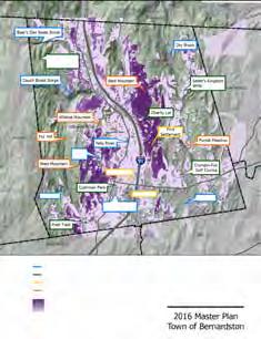

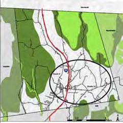
The Visibility of Scenic Resources and Unique Environments Map illustrates the most visible areas in town from the roads.
Massachusetts Office of Geographic Information (MassGIS):
Community Boundaries (Cities and Towns)
Massachusetts Department of Transportation (MassDOT) Roads
Digital Elevation Model (1:5,000)
The Fragmentation Map illustrates habitat fragmentation patterns resulting from development and road ways.
Massachusetts Office of Geographic Information (MassGIS):
BioMap2
Community Boundaries (Cities and Towns)
Massachusetts Department of Transportation (MassDOT) Roads
Shaded Relief (1:5,000)
This map shows the pattern of land uses and soils in the Falls River Valley.
Massachusetts Office of Geographic Information (MassGIS):
Land Use (2005)
Community Boundaries (Towns) from Survey Points
Shaded Relief (1:5,000)
This map shows the pattern of prime farmland in Bernardston.
Massachusetts Office of Geographic Information (MassGIS):
NRCS SSURGO-Certified Soils
Community Boundaries (Towns) from Survey Points
Shaded Relief (1:5,000)
This map shows the patterns of land use in Bernardston.
Massachusetts Office of Geographic Information (MassGIS):
Land Use (2005)
Massachusetts Department of Transportation (MassDOT) Roads
Community Boundaries (Towns) from Survey Points
Shaded Relief (1:5,000)


This map shows the changes in land use from 1971 - 1999.
Massachusetts Office of Geographic Information (MassGIS): Land Use (1971 - 1999)
Massachusetts Department of Transportation (MassDOT) Roads
Community Boundaries (Towns) from Survey Points Shaded Relief (1:5,000)
This map shows the zoning districts for Bernardston according to their zoning bylaws.
Massachusetts Office of Geographic Information (MassGIS): USGS Topographic Quadrangle Images
Franklin Council of Regional Governments: Bernardston Zoning Districts (2015)
This map shows areas identified by the US Department of Agriculture as Prime Farmland and Farmland of Statewide Importance, areas that have been developed for non-agricultural uses, and what areas fall under permanent protection.
Massachusetts Office of Geographic Information (MassGIS): Land Use (2005)
NRCS SSURGO-Certified Soils
Protected and Recreational Open Space
Massachusetts Department of Transportation (MassDOT) Roads
Community Boundaries (Towns) from Survey Points
Shaded Relief (1:5,000)
This map shows vacant lots deemed developable, potentially developable and not developable in the zoned Center Village and surrounding area.
Massachusetts Office of Geographic Information (MassGIS):
USGS/MassDEP Hydrography (1:25,000)
Community Boundaries (Cities and Towns)
Massachusetts Department of Transportation (MassDOT) Roads
Structures
Tax Parcels
This map shows the type of housing found on each residential parcel in Bernardston.
Massachusetts Office of Geographic Information (MassGIS):
USGS/MassDEP Hydrography (1:25,000)
Community Boundaries (Cities and Towns)
Massachusetts Department of Transportation (MassDOT) Roads
Tax Parcels
Structures
This map shows the major transportation routes that connect Bernardston to the surrounding towns.
Massachusetts Office of Geographic Information (MassGIS):
Protected and Recreational Open Space
Massachusetts Department of Transportation (MassDOT)
Roads Trains (and MBTA Commuter Rail)
This map shows the network of major roads that includes Interstate 91.
Massachusetts Office of Geographic Information (MassGIS):
Massachusetts Department of Transportation (MassDOT)
Roads
This map shows an estimate of the number of vehicles that travel through Bernardston daily.
Massachusetts Office of Geographic Information (MassGIS):
Massachusetts Department of Transportation (MassDOT) Roads
Massachusetts Department of Transportation Traffic Volume Counts
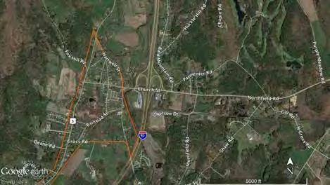
This map shows the Priority Development Sites in Relation to Center Village
Google Earth Imagery Aerial photo
Franklin Council of Regional Governments: Bernardston Zoning Districts (2015)
This map shows the major bridges in town and groups them according to their AASHTO rating.
Massachusetts Office of Geographic Information (MassGIS):
Massachusetts Department of Transportation (MassDOT)
Roads
Franklin Council of Regional Governments: Bridges in Franklin County
This map shows the crosswalks and sidewalks in Center Village in relation to a half-mile and one-mile radius distance.
Google Earth Imagery
Aerial photo
Custom Shapefile:
Location of crosswalks and sidewalk in Center Village

This map shows many features of Charity Farm Lot.
Courtesy of John Lepore
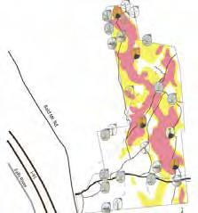

This map shows the northern part of the Franklin County Bikeway.
Google Earth Imagery
Aerial photo
Franklin Council of Regional Governments: Franklin County Bikeway


This map shows the location of the rail sidings in town. Massachusetts Office of Geographic Information (MassGIS):
Massachusetts Department of Transportation (MassDOT) Roads
USGS Color Ortho Imagery (2013/2014)
Franklin Council of Regional Governments: Rail Sidings
Bernardston Zoning Districts (2015)
Trains (and MBTA Commuter Rail)
This map shows the septic systems in Bernardston’s Center Village that have failed because of a rising water table.
Massachusetts Office of Geographic Information (MassGIS):
USGS/MassDEP Hydrography (1:25,000)
Community Boundaries (Cities and Towns)
Massachusetts Department of Transportation (MassDOT) Roads
Structures
DEP Wetlands (1:12,000)
Failed systems information provided by the Chairman of Bernardston’s Board of Health
This map shows where there is suitable soil in Bernardston for septic systems according to Title V requirements.
United States Department of Agriculture Natural Resource Conservation Service
Web Soil Survey Data for Bernardston Massachusetts
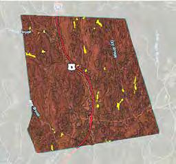
This map shows the major employers in town and how many employees they have.
Massachusetts Office of Geographic Information (MassGIS):
Massachusetts Department of Transportation (MassDOT) Roads
Custom Shapefile:
Employer information provided by Infogroup, Omaha, NE on the Official Website of the Executive Office of Labor and Workforce Development (EOLWD) on Mass.gov
This map shows the location of the Expedited Permitting District in Bernardston and the assets available to industries or businesses that develop there.
Massachusetts Office of Geographic Information (MassGIS):
USGS Color Ortho Imagery (2013/2014)
Massachusetts Department of Transportation (MassDOT) Roads Trains (and MBTA Commuter Rail)
Franklin Council of Regional Governments: Bernardston Zoning Districts (2015)
Rail Sidings Inventory
Massachusetts Broadband Institute: Fiber Route: Bernardston
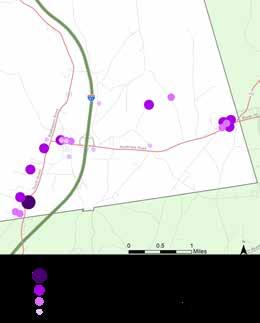


This map shows the regional slaughterhouses and processing facilities within about a 100 mile radius from Greenfield, MA.
Produced by the FRCOG Planning Department for the Farm and Food System Project, 2015
This map shows where in Franklin County farmers are who would be interested in a poultry processing facility and their level of interest.
Produced by the FRCOG Planning Department for the Farm and Food System Project, 2015
This map shows where in Franklin County farmers are who would be interested in a dairy processing facility and what they would use one for.
Produced by the FRCOG Planning Department for the Farm and Food System Project, 2015
This map shows preliminary physical parameters that would prevent development.
Massachusetts Office of Geographic Information (MassGIS):
MassDEP Hydrography 1:25,000
Digital Elevation Model (1:5,000)
MassDEP Wetlands (1:12,000)
Massachusetts Department of Transportation (MassDOT) Roads
NRCS SSURGO-Certified Soils
Protected and Recreational Open Space
Franklin Council of Regional Governments: Bernardston Zoning Districts (2015)
This map illustrates recommended strategies.
Massachusetts Office of Geographic Information (MassGIS):
MassDEP Hydrography 1:25,000
Community Boundaries (Towns) from Survey Points
Massachusetts Department of Transportation (MassDOT) Roads


During the first twelve week period of the Master Plan process, the Conway students, Hillary Collins, Rachel Lindsay, and Kate O’Brien, held two Community Meetings, one on February 3 rd , 2015 and the other on February 24 th , 2015.
Below are the Sign-In sheets for both meetings.
February 3 rd , 2015

February 24 th , 2015

During the second phase of the Master Plan process, the Conway students, Mike Conover and Warren Lee held two Community Meetings, one on Januray 19 th , 2016 and the other on February 16 th , 2016.
Below are the Sign-In sheets for both meetings.
January 19 th , 2016

February 16 th , 2016


